Earth Resources A Continuing Bibliography with Indexes ...
184
Earth Resources A Continuing Bibliography with Indexes NASASP-7041 (17) April 1978 National Aeronautics and Space Administration FILE
-
Upload
khangminh22 -
Category
Documents
-
view
0 -
download
0
Transcript of Earth Resources A Continuing Bibliography with Indexes ...

Earth ResourcesA ContinuingBibliographywith Indexes
NASASP-7041 (17)Apr i l 1978
National Aeronautics andSpace Administration
FILE

PREVIOUS EARTH RESOURCE BIBLIOGRAPHIES
Remote Sensing of Earth Resources (NASA SP-7036)Earth Resources (NASA SP-7041(01))Earth Re sources (NASA SP-7041(02))Earth Resources (NASA SP-7041(03))Earth Re sources (NASA SP-7041(04))Earth Resources (NASA SP-7041(05))Earth Resources (NA SA SP-7041(06))Earth Re sources (NASA SP-7041(07))Earth Resources (NASA SP-7041(08))Earth Re sources (NASA SP-7041(09))Earth Resources (NASA SP-7041( 10))Earth Re sources (NASA SP-7041(11))Earth Resources (NASA SP-7041( 12))Earth Re sour ce s (NA SA SP- 7 041( 13))Earth Re sources (NASA SP-7041(14))Earth Resources (NASA SP-7041( 15))Earth Re sources (NASA SP-7041(16))
This bibliography was prepared by the NASA Scientific and Technical Information Facilityoperated for the National Aeronautics and Space Administration by Informatics Informa-tion Systems Company

NASA SP-7041(17)
EARTH RESOURCESA Continuing Bibliography
With IndexesIssue 17
A selection of annotated references to unclas-sified reports and journal articles that wereintroduced into the NASA scientific and tech-nical information system and announced be-tween January 1, 1978 and March 31,1978
• Scientific and Technical AerospaceReports (STAR)
• International Aerospace Abstracts (IA A)
Scientific and Technical Information Office 1978National Aeronautics and Space Administration
Washington, DC

This Supplement is available from the National Technical Information Service(NTIS), Springfield, Virginia 22161, at the price code E05 ($9 00 domestic, $18 00foreign)

INTRODUCTION
The technical literature described in this continuing bibliography may be helpful toresearchers in numerous disciplines such as agriculture and forestry, geography andcartography, geology and mining, oceanography and fishing, environmental control, andmany others. Until recently it was impossible for anyone to examine more than a minutefraction of the earth's surface continuously. Now vast areas can be observed synoptically,and changes noted in both the earth's lands and waters, by sensing mstrumention on orbitingspacecraft or on aircraft
This literature survey lists 775 reports, articles, and other documents announced betweenJanuary 1 and March 31, 1978 in Scientific and Technical Aerospace Reports (STAR), andInternational Aerospace Abstracts (IA A)
The coverage includes documents related to the identification and evaluation by meansof sensors in spacecraft and aircraft of vegetation, minerals, and other natural resources, andthe techniques and potentialities of surveying and keeping up-to-date inventories of suchriches. It encompasses studies of such natural phenomena as earthquakes, volcanoes, oceancurrents, and magnetic fields; and such cultural phenomena as cities, transportation networks,and irrigation systems. Descriptions of the components and use of remote sensing andgeophysical instrumentation, their subsystems, observational procedures, signature andanalyses and interpretive techniques for gathering data are also included. All reports generatedunder NASA's Earth Resources Survey Program for the time period covered in thisbibliography will also be included The bibliography does not contain citations to documentsdealing mainly with satellites or satellite equipment used in navigation or communicationsystems, nor with instrumentation not used aboard aerospace vehicles.
The selected items are grouped in nine categones. These are listed in the Table ofContents with notes regarding the scope of each category. These categories were especiallychosen for this publication, and differ from those found in STAR and IAA.
Each entry consists of a standard bibliographic citation accompanied by an abstract.The citations and abstracts are reproduced exactly as they appeared originally in STAR, orIAA, including the original accession numbers from the respective announcement journals.This procedure, which saves time and money, accounts for the variation in citationappearance.
Under each of the nine categories, the entries are presented in one of two groups thatappear in the following order:
IAA entries identified by accession number series A78-10,000 in ascending accessionnumber order;STAR entries identified by accession number series N78-10,000 in ascending accessionnumber order.
After the abstract section, there are five indexessubject, personal author, corporate source, contract number and report/accessionnumber.

AVAILABILITY OF CITED PUBLICATIONS
IAA ENTRIES (A78-10000 Series)
All publications abstracted in this Section are available from the Technical Information Service.American Institute of Aeronautics and Astronautics, Inc (AIAA). as follows Paper copies ofaccessions are available at $6 00 per document up to a maximum of 20 pages, the charge foreach additional page is $0 25 Microfiche " of documents announced in IAA are available at therate of $2 50 per microfiche on demand, and at the rate of $1 10 per microfiche for standingorders for all IAA microfiche The price for the IAA microfiche by category is available at the rateof $1 25 per microfiche plus a $1 00 service charge per category per issue Microfiche of all thecurrent AIAA Meeting Papers are available on a standing order basis at the rate of $1 35 permicrofiche
Minimum air-mail postage to foreign countries is $1 00 and all foreign orders are shipped onpayment of pro-forma invoices
All inquiries and requests should be addressed to AIAA Technical Information Service Please referto the accession number when requesting publications
STAR ENTRIES (N78-10000 Series)
One or more sources from which a document announced in STAR is available to the public isordinarily given on the last line of the citation The most commonly indicated sources and theiracronyms or abbreviations are listed below If the publication is available from a source other thanthose listed, the publisher and his address will be displayed on the availability line or in combinationwith the corporate source line
Avail NTIS Sold by the National Technical Information Service Prices for hard copy (HC)and microfiche (MF) are indicated by a price code followed by the letters HC or MF inthe STAR citation Price codes are given in the tables on page VH of the current issueof STAR
Microfiche is available regardless of age for those accessions followed by a § symbol
Initially distributed microfiche under the NTIS SRIM (Selected Research in Microfiche) isavailable at greatly reduced unit prices For this service and for information concerningsubscription to NASA printed reports, consult the NTIS Subscription Unit
NOTE ON ORDERING DOCUMENTS When ordering NASA publications (those followedby the * symbol), use the N accession number NASA patent applications (only thespecifications are offered) should be ordered by the US-Patent-Appl-SN numberNon-NASA publications (no asterisk) should be ordered by the AD, PB. or other reportnumber shown on the last line of the citation, not by the N accession number It isalso advisable to cite the title and other bibliographic identification
Avail SOD (or GPO) Sold by the Superintendent of Documents. U S Government PrintingOffice, in hard copy The current price and order number are given following theavailability line (NTIS will fill microfiche requests, at the standard $300 price, forthose documents identified by a § symbol)
(DA microfiche is a transparent sheet of film 105 by 148 mm in size containing as many as 60 to 98 pages of
information reduced to micro images (not to exceed 26 1 reduction)
IV

Avail NASA Public Document Rooms Documents so indicated may be examined at orpurchased from the National Aeronautics and Space Administration. Public DocumentsRoom (Room 126). 600 Independence Ave. SW. Washington. DC 20546. or publicdocument rooms located at each of the NASA research centers, the NASA SpaceTechnology Laboratories, and the NASA Pasadena Office at the Jet PropulsionLaboratory
Avail ERDA Depository Libraries Organizations in U S cities and abroad that maintaincollections of Energy Research and Development Administration reports, usually inmicrofiche form, are listed in Nuclear Science Abstracts Services available from theERDA and its depositories are described in a booklet. Science Information Availablefrom the Energy Research and Development Administration (TID-4550), which may beobtained without charge from the ERDA Technical Information Center
Avail Univ Microfilms Documents so indicated are dissertations selected from DissertationAbstracts and are sold by University Microfilms as xerographic copy (HC) and microfilmAll requests should cite the author and the Order Number as they appear in thecitation
Avail USGS Originals of many reports from the U S Geological Survey, which may containcolor illustrations, or otherwise may not have the quality of illustrations preserved in themicrofiche or facsimile reproduction, may be examined by the public at the libraries ofthe USGS field offices whose addresses are listed in this introduction The librariesmay be queried concerning the availability of specific documents and the possibleutilization of local copying services, such as color reproduction
Avail HMSO Publications of Her Majesty's Stationery Office are sold in the U S by PendragonHouse, Inc (PHI), Redwood City, California The U S price (including a service andmailing charge) is given, or a conversion table may be obtained from PHI
Avail1 BLL (formerly NLL) British Library Lending Division. Boston Spa. Wetherby. Yorkshire,England Photocopies available from this organization at the price shown (If none isgiven, inquiry should be addressed to the BLL)
Avail ZLDI Sold by the Zentralstelle fur Luftfahrtdokumentation und -Information. Munich,Federal Republic of Germany, at the price shown in deutschmarks (DM)
Avail Issuing Activity, or Corporate Author, or no indication of availability Inquiries as to theavailability of these documents should be addressed to the organization shown in thecitation as the corporate author of the document
Avail U S Patent Office Sold by Commissioner of Patents, U S Patent Office, at the standardprice of 50 cents each, postage free
Other availabilities If the publication is available from a source other than the above, thepublisher and his address will be displayed entirely on the availability line or in combinationwith the corporate author line

ADDRESSES OF ORGANIZATIONS
American Institute of Aeronauticsand Astronautics
Technical Information Service750 Third AveNew York. NY 10017
British Library Lending Division,Boston Spa, Wetherby, Yorkshire,England
Commissioner of PatentsU S Patent OfficeWashington, D C 20231
Pendragon House, Inc899 Broadway AvenueRedwood City, California 94063
Superintendent of DocumentsU S Government Printing OfficeWashington, D C 20402
University MicrofilmsA Xerox Company300 North Zeeb RoadAnn Arbor, Michigan 48106
Energy Research and DevelopmentAdministration
Technical Information CenterPO Box 62Oak Ridge. Tennessee 37830
ESA-Space Documentation ServiceESRINVia Galileo Galilei00044 Frascati (Rome) Italy
Her Majesty's Stationery OfficeP 0 Box 569, S E 1London. England
University Microfilms, LtdTylers GreenLondon, England
U S Geological Survey1033 General Services Administration
BuildingWashington, D C 20242
U S Geological Survey601 E Cedar AvenueFlagstaff. Arizona 86002
NASA Scientific and Technical InformationFacility
P 0 Box 8757B W I Airport, Maryland 21240
National Aeronautics and SpaceAdministration
Scientific and Technical InformationOffice (NST-41)
Washington. D C 20546
National Technical Information Service5285 Port Royal RoadSpringfield. Virginia 22161
U S Geological Survey345 Middlefield RoadMenlo Park. California 94025
U S Geological SurveyBldg 25, Denver Federal CenterDenver. Colorado 80225
Zentralstelle fur Luftfahrtdoku-mentation und -Information
8 Munchen 86Postfach 880Federal Republic of Germany

TABLE OFCONTENTS
Subject Categories
Abstracts in this Bibliography are grouped under the following categories page
01 AGRICULTURE AND FORESTRYIncludes crop forecasts, crop signature analysis, soil identification, diseasedetection, harvest estimates, range resources, timber inventory, forest firedetection, and wildlife migration patterns 1
02 ENVIRONMENTAL CHANGES AND CULTURAL RESOURCESIncludes land use analysis, urban and metropolitan studies, environmentalimpact, air and water pollution, geographic information systems and geo-graphic analysis 15
03 GEODESY AND CARTOGRAPHYIncludes mapping and topography 29
04 GEOLOGY AND MINERAL RESOURCESIncludes mineral deposits, petroleum deposits spectral properties of rocks.geological exploration, and hthology 35
05 OCEANOGRAPHY AND MARINE RESOURCESIncludes sea-surface temperature, ocean bottom surveying imagery, driftrates, sea ice and icebergs, sea state, fish location 41
06 HYDROLOGY AND WATER MANAGEMENTIncludes snow cover and water runoff in rivers and glaciers, saline intru-sion, drainage analysis, geomorphology of river basins, land uses, andestuarme studies 55
07 DATA PROCESSING AND DISTRIBUTION SYSTEMSIncludes film processing, computer technology, satellite and aircraft hard-ware, and imagery 71
08 INSTRUMENTATION AND SENSORSIncludes data acquisition and camera systems and remote sensors - 95
09 GENERALIncludes economic analysis 105
SUBJECT INDEX A-1PERSONAL AUTHOR B-1CORPORATE SOURCE INDEX C-1CONTRACT NUMBER INDEX D-1REPORT/ACCESSION NUMBER INDEX E-1
VII

TYPICAL CITATION AND ABSTRACT FROM STAR
NASA SPONSOREDDOCUMENT
NASA
ACCESSION NUMBER-
TITLE
CONTRACTOR GRANT-
REPORTNUMBER
NTIS-o-
-N78-10626*# Old Dommon Umv Research Foundation Norfolk,.Va
• A MODULAR RADIATIVE TRANSFER PROGRAM FOR GASFILTER CORRELATION RADIOMETRYJoseph C Casas and Shirley A Campbell Washington NASAOct 1977V 71 p refs
•(Grant NsG-1127)• (NASA-CR-2895 PGStR-AP77-49) Avail
HC A04/MF A01 CSCL 04AThe fundamentals of a computer'program simulated
monochromatic atmospheric radiative transfer (SMART), whichcalculates atmospheric path transmission solar radiation, andthermal radiation in the 4 6 micrometer spectral region aredescribed A brief outline of atmospheric absorption propertiesand line by line transmission calculations is explained inconjunction with an outline of the SMART computationalprocedures Program flexibility is demonstrated by simulating theresponse of a gas filter correlation radiometer as one exampleof an atmospheric infrared sensor Program limitations, input datarequirements, program listing and comparison of SMARTtransmission calculations are presented Author
-AVAILABLE ONMICROFICHE
-CORPORATESOURCE
• PUBLICATIONDATE
AVAILABILITYSOURCE
TYPICAL CITATION AND ABSTRACT FROM IAA
NASA SPONSOREDDOCUMENT
AIAA ACCESSIONNUMBER
AUTHORSAFFILIATION.
CONTRACTOR GRANT
• A78-14876*# Wheat yield forecasts using Landsat data J E..Colwell, D P Rice, and R F Nalepka (Michigan, Environmental
- Research Institute, Arm Arbor, Mich ) In International Symposium -on Remote Sensing of Environment, 11th, Ann Arbor, Mich , April-25-29, 1977, Proceedings Volume 2 (A78-14776 03-43) Ann Arbor,Mich, Environmental Research Institute of Michigan, 1977, p
_[245_12M Contract No NAS5-22389Leaf area index and percentage of vegetative cover, two indices
of crop yield developed from Landsat multispectral scanning data,are discussed Studies demonstrate that the Landsat indicators maybe as highly correlated with winter wheat yield as estimates based ontraditional field sampling methods, in addition, the Landsat indica-tors may account for variations in individual field yield which are notexplainable by meteorological data A simple technique employingearly season Landsat data to make wheat yield predictions is alsoconsidered J M B
-AVAILABLE ONMICROFICHE
TITLE
-AUTHORS
-MEETING
~ MEETINGDATE

EARTHRESOURCES A Continuing Bibliography (Issue 17)
APRIL 1978
01AGRICULTURE AND FORESTRY
Include crop forecasts, crop signature analysis soil identifi-cation disease detection harvest estimates range resources,timber inventory, forest fire detection and wildlife migrationpatterns
A78-10521 Yield/reflectance relations in cabbage J RThomas and A H Gerbermann (U S Department of Agriculture,Agricultural Research Service, Weslaco, Tex) PhotogrammetricEngineering and Remote Sensing, vol 43, Oct 1977, p 1257-1261,1263-1266 16refs
The reported investigation was conducted to measure the effectsof nitrogen stress on the absorption and scattering coefficients andasymptotic reflectance of light from green cabbage wrapper leavesThe effects of nitrogen and water stress on the reflectivity of acabbage crop were evaluated and the observed film optical densitieswere related to cabbage yields It was found that in the visiblespectral region nitrogen stress decreased the absorptive coefficientand increased the asymptotic reflectance of cabbage leaves Thescattering coefficient was not affected by nitrogen deficiency Theinformation provided by aerial photographs was useful for predictingcabbage yields G R
A78-10522 Detection of oak wilt with color IR aerialphotography J J Ullman and 0 W French (Minnesota, University,St Paul, Minn ) Photogrammetric Engineering and Remote Sensing,vol 43, Oct 1977, p 1267-1272 5 refs
A78-10523 Measuring soil moisture with an airborneimaging passive microwave radiometer J E Estes (California,University, Santa Barbara, Calif), M R Mel (Escatech, Playa delKey, Calif), and J O Hooper (U S Navy, Naval Weapons Center,China Lake, Calif I Photogrammetric Engineering and RemoteSensing, vol 43, Oct 1977, p 1273-1281 9 refs Contract NoN00123-73-C-2352
A78-12878 § Results of a remote sensing study of theeffects of hail on vegetation (Risultati di un'espenenza di telenleva-mento degli effetti delle grandmate sulla vegetazione) E Rosmi, MR Sciarretta, and D Vento (Mmistero dell'Agncoltura e delleForeste, Ufficio Centrale di Ecologia Agrana, Rome, Italy) In
International Scientific-Technological Conference on Space, 17th,Rome, Italy, March 25, 26, 1977, ProceedingsRome, Rassegna Internazionale Elettronica Nucleate ed Aerospaziale,1977, p 49-56 In Italian
Landsat imagery is used in examining the distribution andseverity of crop damage inflicted by hailstorms in Switzerland,ground-truth assessments and radar imagery of the hail-generatingclouds are also analyzed Spectral variations in satellite imageryDbtamed before and after hailstorms are employed to determine theextent of injury inflicted to the vegetation Ground measurements ofthe force and size of the impacting hailstones are also cited J M B
A78-12904 ft Anisotropic reflection properties of vegetatedsurfaces K T Knebel (Munchen, Umversitat, Munich, WestGermany) In International Scientific-Technological Conference onSpace, 17th, Rome, Italy, March 25, 26, 1977, Proceedings
Rome, Rassegna Internazionale Elettronica Nu-cleare ed Aerospaziale, 1977, p 391-400
Results are reported for measurements of the bidirectionalreflectance properties of four vegetation-covered surfaces at awavelength of 0 52 micron The surfaces include a savannah, a bog,pasture land, and a coniferous forest It is found that there is a strongazimuthal anisotropy m the bidirectional reflectance factor of thesurfaces at medium and high zenith angles of incidence and that theanisotropy increases with increasing wavelength This phenomenon isattributed to shadowing effects caused by the vertical structure ofthe vegetation F G M
A78-12931 # Agricultural applications of satellite remotesensing - The measurement and prediction of principal harvests (Leapplicaziom in agncoltura del telenlevamento da satellite - Misura eprevision) del prmcipali raccolti) M Checchi and F Smania (ItalecoS p A , Rome, Italy) In International Electronics Congress, 24th,Rome, Italy, March 28-30, 1977, ProceedingsRome, Rassegna Internazionale Elettronica Nucleare ed Aerospaziale,1977, p 57-61 In Italian
The use of satellite data to monitor agricultural production andthe state of development of crops is discussed Computer programswhich permit a nearly real-time analysis of satellite imagery arereviewed, an interpretive technique which relies on both automaticprocessing and visual assessment of imagery is mentioned J M B
A78-13060 Color aerial photography in the plant sciencesand related fields. Proceedings of the Fifth Biennial Workshop, SiouxFalls, S Dak, August 19-21, 1975 Workshop sponsored by theAmerican Society of Photogrammetry Falls Church, Va , AmericanSociety of Photogrammetry, 1977 166 p $800
Papers are presented on quality color photographic productionat the EROS Data Center, photographic image enhancement andprocessing, the role of remote sensing in preventing plant disease, amethod for detecting the imported fire ant, and tree stress detectionthrough spectral ratioing of color film records Consideration is alsogiven to the use of color IR photography for the detection of forestdamage, surface resource inventory of Eastern Montana rangelands,and forest type mapping of the Atchafalaya River Basin fromsatellite and aircraft imagery B J
01 AGRICULTURE AND FORESTRY
A78-13062 Quality control techniques for high altitudecolor photography R L LaPado (ESL, Inc , Sunnyvale, Calif ) InColor aerial photography in the plant sciences and related fields.Proceedings of the Fifth Biennial Workshop, Sioux Falls, S Dak,August 19-21, 1975 Falls Church, Va, Ameri-can Society of Photogrammetry, 1977, p 11-27 6 refs
The Airborne Instrumentation Research Project, based at NASAAmes Research Center, conducts approximately 200 photographicmissions every year, employing two high-altitude U-2 aircraft Thereare two techniques under development aimed at improving both theconsistency and quality of the U-2 photographic imagery The first isa film response calibration procedure which determines the filtrationand exposure shift needed to achieve a standard sensitivity responsefor each film type used The second is an exposure calculation modelthat calculates the exposure required to produce a specified meandensity on a photographic image The model is a wavelengthdependent function that produces an f number as a function ofshutter speed and 10 other input parameters (Author)
A78-13065 Tree stress detection through spectral ratiomgof color film records T M Lillesand, R H Brock, W L Johnson(New York, State University, Syracuse, N Y ) , and J L Roberts(USAF, Rome Air Development Center, Griffiss AFB, NY) InColor aerial photography in the plant sciences and related fields.Proceedings of the Fifth Biennial Workshop, Sioux Falls, S Dak .August 19-21, 1975 Falls Church, Va , Ameri-can Society of Photogrammetry, 1977, p 79-107 24 refs Researchsupported by the U S Forest Service
The paper reviews research being carried out at the SUNYCollege of Environmental Science and Forestry at Syracuse, NewYork in the photographic detection of tree stress Two studies arehighlighted (1) the use of close-range (one meter) photography tomonitor the spectral and spatial response of young poplars to ozonefumigation under controlled lab conditions, and (2) the applicationof an Experimental Photometric Interpretation Console in bi-bandspectral ratiomg of color film records acquired under field condi-tions, in this part of the program enhanced detection of Fomesannosus in red pines and potassium deficiency in white spruce hasbeen real ized B J
A78-13066 Spectral reflectance deduced from color-infrared photos for forest damage detection P A Murtha (BritishColumbia, University, Vancouver, Canada) In Color aerial photog-raphy in the plant sciences and related fields, Proceedings of theFifth Biennial Workshop, Sioux Falls, S Dak , August 19-21, 1975
Falls Church, Va , American Society of Photo-grammetry, 1977, p 109-116 9 refs
A television scanning densitometer was adapted to producecolor images from which relative spectral reflectance data could bededuced The technique involved placing colored filters (blue, green,red) between the return-beam-vidicon (RBV) camera lens and theoriginal, color-infrared positive transparency located on a light tableThe technique permitted analysis of density patterns of theindividual dye layers in the positive transparency The techniquewhich was tested with large-scale photos was also applied to1 160,000 color-infrared photos of an S02 damage site The resultsof the large-scale photo test are presented (Author)
A78-13067 Surface resource inventory of eastern Montanarangelands utilizing high altitude color infrared aerial photographyF T Batson (U S Bureau of Land Management, Billings, Mont) andJ C Elliott In Color aerial photography in the plant sciences andrelated fields, Proceedings of the Fifth Biennial Workshop, SiouxFalls, S Dak , August 19-21, 1975 Falls Church,Va , American Society of Photogrammetry, 1977, p 117-128 6 refs
A78-13068 Forest type mapping of the Atchafalaya RiverBasin from satellite and aircraft imagery J E DeSteiguer (Texas A &Wl University, College Station, Tex ) In Color aerial photography inthe plant sciences and related fields. Proceedings of the FifthBiennial Workshop, Sioux Falls, S Dak, August 19-21, 1975
Falls Church, Va , American Society of Photo-grammetry, 1977, p 129-141 14 refs
RB-57 aircraft photography, Skylab photography, and Landsat-1 imagery were tested and compared for forest type mapping of theAtchafalaya River Basin, Louisiana Variance ratio tests indicated asignificant difference in overall accuracy did not exist between mapsprepared from the three types of imagery Significant differences maccuracy were found between four regions of the basin, and wererelated to the extent, rather than type, of forests Several possibilitiesexist for improving map accuracy Satellite and high altitude aircraftimagery should receive increasing acceptance for extensive foresttype mapping (Author)
A78-14791 # Progress and needs in agricultural research,development, and applications programs D G Moore and V IMyers (South Dakota State University, Brookmgs, S Dak) InInternational Symposium on Remote Sensing of Environment, 11th,Ann Arbor, Mich, April 25-29, 1977, Proceedings Volume 1
Ann Arbor, Mich, Environmental ResearchInstitute of Michigan, 1977, p 257-266 18 refs
The application of remote sensing to agriculture is discussedwith particular reference to user structure (global, international,national, state level, regional, cooperatives, and individuals) and tothe use of Landsat imagery It is noted that possibly the greatestdeterrent to the application of remote sensing to agriculture is acombination of effects of data scale from satellites and timeliness ofdata availability, a deterrent which can be overcome B J
A78-14792 # Remote sensing and today's forestry issues LSayn-Wittgenstem (Department of Fisheries and the Environment,Forest Management Institute, Ottawa, Canada) In InternationalSymposium on Remote Sensing of Environment, 11th, Ann Arbor,Mich , April 25-29, 1977, Proceedings Volume 1
Ann Arbor, Mich , Environmental Research Institute of Michi-gan, 1977, p 267-276 39 refs
The paper examines the actual and desirable roles of remotesensing m dealing with current issues m forestry, i e , national forestpolicy, supply and demand for forest products, and competingdemand for forest land Remote sensing is discussed with referenceto wood shortage and the need for forest management and regionalinventories The utilization of Landsat for inventories in temperatezones and of Skylab for forest sensing is described and attention isgiven to evaluation of accuracy, large-scale photography, support ofintensive forest management, forest protection, and biomass energyproduction B J
A78-14804*# LACIE - A look to the future R B Mac-Donald and F G Hall (NASA, Johnson Space Center, Houston,Tex) In International Symposium on Remote Sensing of Environ-ment, 11th, Ann' Arbor, Mich, April 25-29, 1977, ProceedingsVolume 1 Ann Arbor, Mich , EnvironmentalResearch Institute of Michigan, 1977, p 429-465 14 refs
The Large Area Crop Inventory Experiment (LACIE) is a 'proofof concept' project designed to demonstrate the applicability ofremote sensing technology to the global monitoring of wheat Thispaper discusses the need for more timely and reliable monitoring offood and fiber supplies, reviews the monitoring systems currentlyutilized by the USDA and United Nations Food and AgricultureOrganization in the United States and in foreign countries, andelucidates the fundamentals involved in assessing the impact ofvariable weather and economic conditions on wheat acreage, yield,and production The experiment's approach to production monitor-ing is described briefly, and its status is reviewed as of the conclusionof 2 years of successful operation Examples of acreage and yieldmonitoring in the Soviet Union are used to illustrate the experi-ment's approach (Author)
A78-14808 * ff Use of multispectral data in design of forestsample surveys S J Titus and L C Wensel (California, University,Berkeley, Calif) In International Symposium on Remote Sensing ofEnvironment, 11th, Ann Arbor, Mich , April 25-29, 1977, Proceed-ings Volume 1 Ann Arbor, Mich , Environmen-

01 AGRICULTURE AND FORESTRY
tal Research Institute of Michigan, 1977, p 505-513 9 refs ContractNo NAS9-14552
The use of multispectral data in design of forest sample surveysusing a computer software package, WILLIAM, is described Thesystem allows evaluation of a number of alternative sampling systemsand, with appropriate cost data, estimates the implementation costfor each (Author)
A78-14809 # Monitoring irrigated land acreage using Land-sat imagery - An application example W C Draeger(US GeologicalSurvey, EROS Data Center, Sioux Falls, S Dak ) In InternationalSymposium on Remote Sensing of Environment, 11th, Ann Arbor,Mich , April 25-29, 1977, Proceedings Volume 1
Ann Arbor, Mich , Environmental Research Institute of Michi-gan, 1977, p 515-524
The utility of Landsat imagery for quickly and cheaplyestimating irrigated land area was demonstrated in the Klamath Riverbasin of Oregon Landsat color composite images, at 1 250,000 scale,acquired on two dates during the 1975 growing season, wereinterpreted Irrigated lands were delineated manually, and theirrigated area was estimated, based on dot-grid sampling of themanually delineated lands The image interpretation estimate ofirrigated area was then adjusted by a comparison of interpretationresults with ground data on 45 samplp plots pach 2 6 squarekilometers in size Two interpreters independently estimated theirrigated area Their adjusted estimates were 115,000 hectares and108,000 hectares respectively, with corresponding 95 percent confi-dence intervals of + or - 7,880 hectares and + or - 14,000 hectaresThe estimated cost of the survey, exclusive of management costs andtraining, was $1,500 (Author)
A78-14812 # Multi-seasonal data analysis and some exten-sions for environmental monitoring S Tanaka, Y Muranaka(Remote Sensing Technology Center of Japan, Tokyo, Japan), HMiyazawa (Toyo Aero Survey Co , Ltd , Tokyo, Japan), and Y Suga(Hosei University, Koganei, Tokyo, Japan) In International Sym-posium on Remote Sensing of Environment, 11th, Ann Arbor, Mich ,April 25-29, 1977, Proceedings Volume 1 AnnArbor, Mich , Environmental Research Institute of Michigan, 1977,p 545-561 5 refs
Landsat imagery is employed to study seasonal changes in a ricepaddy, to survey the different spectral signatures of winter andsummer vegetation, and to assess the amount of land reclaimed inTokyo Bay over an extended period In addition, the progress of arice harvest is monitored by using the Landsat imagery J M B
A78-14824 ff Reindeer range inventory in western Alaskafrom computer-aided digital classification of Landsat data T HGeorge, W J Stringer, and J N Baldndge (Alaska, University,Fairbanks, Alaska) In International Symposium on Remote Sensingof Environment, 11th, Ann Arbor, Mich, April 25-29, 1977,Proceedings Volume 1 Ann Arbor, Mich ,Environmental Research Institute of Michigan, 1977, p 671-682 6refs
A78-14828 * # Estimation of old field ecosystem biomassusing low altitude imagery S M Nor, G Safir, T M Burton, J EHook, and G Schultmk (Michigan State University, East Lansing,Mich) In International Symposium on Remote Sensing of Environ-ment, 11th, Ann Arbor, Mich , April 25-29, 1977, ProceedingsVolume 1 Ann Arbor, Mich , EnvironmentalResearch Institute of Michigan, 1977, p 711-718 10 refs Grant NoNGL-23-004-083
Color-infrared photography was used to evaluate the biomass ofexperimental plots in an old-field ecosystem that was treated withdifferent levels of waste water from a sewage treatment facilityCibachrome prints at a scale of approximately 1 1,600 producedfrom 35 mm color infrared slides were used to analyze densitypatterns using prepared tonal density scales and multicell gridsregistered to ground panels shown on the photograph Correlationsbetween mean tonal density and harvest biomass data gave consis-tently high coefficients ranging from 0 530 to 0 896 at the 0 001significance level Corresponding multiple regression analysis resultedin higher correlation coefficients The results indicate that aerialinfrared photography can be used to estimate standing crop biomasson waste water irrigated old field ecosystems Combined withminimal ground truth data, this technique could enable managers ofwaste water irrigation projects to precisely time harvest of suchsystems for maximal removal of nutrients in harvested biomass
(Author)
A78-14829 # The effect of soil water deficit on the reflec-tance of conifer seedling canopies L Fox, III (Humboldt StateUniversity, Arcata, Calif) In International Symposium on RemoteSensing of Environment, 11th, Ann Arbor, Mich , April 25-29, 1977,Proceedings Volume 1 Ann Arbor, Mich,Environmental Research Institute of Michigan, 1977, p 719-728 9refs Research supported by the University of Michigan
A78-14844 * # Two phase sampling for wheat acreage estima-tion. R W Thomas and C M Hay (California, University, Berkeley,Calif ) In International Symposium on Remote Sensing of Environ-ment, 11th, Ann Arbor, Mich, April 25-29, 1977, ProceedingsVolume 2 Ann Arbor, Mich, EnvironmentalResearch Institute of Michigan, 1977, p 909-918 6 refs ContractNo NAS9-14565
A two-phase Landsat-based sample allocation and wheat propor-tion estimation method was developed The technique employsmanual, Landsat full frame-based wheat or cultivated land propor-tion estimates from a large number of segments comprising a firstsample phase to optimally allocate a small phase-two sample ofcomputer or manually processed segments Proportion estimatesfrom each phase are then linked by regression or probabilityproportional to estimated size estimators to provide wheat propor-tion estimates and standard errors by reporting unit Application tothe Kansas Southwest CRD (Crop Reporting District) for 1974produced a wheat acreage estimate for that CRD within 2 42% of theUSDA SRS-based estimate using a lower CRD inventory budget thanfor a simulated reference LACIE (Large Area Crop InventoryExperiment) system B J
A78-14827 * ff Further tests of the Suits reflectance model EW LeMaster and J E Chance (Pan American University, Edmburg,Tex ) In International Symposium on Remote Sensing of Environ-ment, 11th, Ann Arbor, Mich, April 25-29, 1977, ProceedingsVolume 1 Ann Arbor, Mich , EnvironmentalResearch Institute of Michigan, 1977, p 703-710 6 refs Grant NoNsG-9033
Experimental measurements of the visible light and infraredreflectance of spring wheat are used in examining the validity of theSuits (19/2) model for vegetative canopy reflectance The degree ofagreement between the experimental results and the theoreticalmodel suggests a technique for the remote sensing of the leaf areaindex at 650 nm However, the Suits model needs to be modifiedwhen the sun and observer zenith angles are not small J M B
A78-14845 # Classification of Landsat agricultural databased upon color trends. J D Tubbs (Arkansas, University,Fayetteville, Ark ) In International Symposium on Remote Sensingof Environment, 11th, Ann Arbor, Mich, April 25-29, 1977,Proceedings Volume 2 Ann Arbor, Mich,Environmental Research Institute of Michigan, 1977, p 919-923
A simple procedure has been developed which attempts toautomate that portion of the photomterpretation logic process whichinvolves labeling fields or pixels according to their observed colortrends Decision rules have been developed for classifying anunknown observation by matching its color trend with that ofexpected trends for known crops The proposed color classifier hasbeen applied to the problem of separating wheat from all non-wheatby using Landsat imagery obtained from at least three distinctgrowth stages for wheat B J

01 AGRICULTURE AND FORESTRY
A78-14846 * ft The use of Landsat digital data to detect andmonitor vegetation water deficiencies D R Thompson (NASA,Johnson Space Center, Houston, Tex ) and 0 A Wehmanen(Lockheed Electronics Co, Inc, Houston, Tex) In InternationalSymposium on Remote Sensing of Environment, 11th, Ann Arbor,Mich, April 25-29, 1977, Proceedings Volume 2
Ann Arbor, Mich , Environmental Research Instituteof Michigan, 1977, p 925-931 9 refs Contract No NAS9-15200
In the Large Area Crop Inventory Experiment a technique wasdevised using a vector transformation of Landsat digital data toindicate when vegetation is undergoing moisture stress A relationwas established between the remote-sensmg-based criterion (theGreen Index Number) and a ground-based criterion (Crop MoistureIndex). (Author)
A78-14847 ft Pre-visual detection of stress in pine forests. CE Olson, Jr (Michigan, University, Ann Arbor, Mich ) In Interna-tional Symposium on Remote Sensing of Environment, 11th, AnnArbor, Mich, April 25-29, 1977, Proceedings Volume 2
Ann Arbor, Mich , Environmental Research Instituteof Michigan, 1977, p 933-944 60 refs
Extensive tree mortality due to recent attacks by the southernpine beetle has resulted in renewed interest in pre-visual detection offorest stress (an analysis applied when trees show no visible sign ofdamage but appear different from non-stressed trees in non-visibleparts of the spectrum) This paper summarizes available informationrelating to pre-visual detection of forest stress with particularreference to detection of attacks by pine bark beetles Preliminaryefforts to obtain early detection of attacks by pine bark beetles,using MSS data from the ERIM M-7 scanner, have not beensufficiently successful to demonstrate an operational capability, butindicate that joint processing of the 071-073, 200-260 and93-117 micron bands holds some promise B J
A78-14860 * tt Evaluation of spectral channels and wave-length regions for separability of agricultural cover types R Kumar(Institute de Pesquisas Espaciais, Sao Jose dos Campos, Sao Paulo,Brazil) In International Symposium on Remote Sensing of Environ-ment, 11th, Ann Arbor, Mich, April 25-29, 1977, ProceedingsVolume 2 Ann Arbor, Mich , EnvironmentalResearch Institute of Michigan, 1977, p 1081-1090 13 refs GrantNo NGL-15-005-112
The purpose of this study was to evaluate the spectral channel aswell as wavelength regions - visible, near infrared, middle infrared andthermal infrared - with respect to their estimated probability ofcorrect classification (P-c) in discriminating agricultural cover typesMultispectral scanner data in twelve spectral channels in thewavelength range of 0 4 to 117 micron acquired in the middle ofJuly for three fhghtlmes were analysed by applying automaticpattern recognition techniques The same analysis was performed forthe data acquired in the middle of August, over the same threeflightlmes, to investigate the effect of time on the results The effectof deletion of each spectral channel as well as each wavelength regionon P-c is given Values of P-c for all possible combinations ofwavelength regions in the subsets of one to twelve spectral channelsare also given The overall values of P-c were found to be greater forthe data of the middle of August than the data of the middle of July
(Author)
A78-14863 # An application of Landsat digital technologyto forest fire fuel type mapping P H Kourtz (Canadian ForestryService, Forest Fire Research Institute, Ottawa, Canada) InInternational Symposium on Remote Sensing of Environment, 11th,Ann Arbor, Mich , April 25-29, 1977, Proceedings Volume 2
Ann Arbor, Mich , Environmental ResearchInstitute of Michigan, 1977, p 1111-1115
A78-14864*# Landsat image interpretation aids R AAbotteen and H Malek (Lockheed Electronics Co, Inc, Houston,Tex) In International Symposium on Remote Sensing of Environ-ment, 11th, Ann Arbor, Mich, April 25-29, 1977, ProceedingsVolume 2 Ann Arbor, Mich , Environmental
Research Institute of Michigan, 1977, p 1117-1121 6 refs ContractNo NAS9-15200
In the Large Area Crop Inventory Experiment, image interpreta-tion aids were produced to assist in selecting and/or identifyingrepresentative samples of signatures in a given Landsat scene Thethree methods employed are based on clustering techniques, informa-tion extraction, and aggregation of like spectral information on atwo-dimensional spectral plot (Author)
A78-14876 * # Wheat yield forecasts using Landsat data J. E.Colwell, D P Rice, and R F Naleoka (Michigan, EnvironmentalResearch Institute, Ann Arbor, Mich ) In International Symposiumon Remote Sensing of Environment, 11th, Ann Arbor, Mich , April25-29, 1977, Proceedings Volume 2 Ann Arbor,Mich, Environmental Research Institute of Michigan, 1977, p1245-1254 Contract No NAS5-22389
Leaf area index and percentage of vegetative cover, two indicesof crop yield developed from Landsat multispectral scanning data,are discussed Studies demonstrate that the Landsat indicators maybe as highly correlated with winter wheat yield as estimates based ontraditional field sampling methods, in addition, the Landsat indica-tors may account for variations in individual field yield which are notexplainable by meteorological data A simple technique employingearly-season Landsat data to make wheat yield predictions is alsoconsidered J M B
A78-14879 ff Computer-aided classification for remotesensing in agriculture and forestry in Northern Italy J Dejace, JMegier, and W Mehl (EURATOM and Comitato Nazionale perI'Energia Nucleare, Centre Comune de Ricerche, Ispra, Italy) InInternational Symposium on Remote Sensing of Environment, 11th,Ann Arbor, Mich, April 25-29, 1977, Proceedings Volume 2
Ann Arbor, Mich, Environmental ResearchInstitute of Michigan, 1977, p 1269-1278 7 refs
A set of results concerning the processing and analysis of datafrom Landsat and airborne scanner is presented The possibility ofperforming inventories of irrigated crops - rice, planted groves,poplars, and natural forests in the mountains - beeches and chestnuts,is investigated in the Po valley and in an alpine site of Northern ItalyAccuracies around 95 percent or better, 70 percent and 60 percentrespectively, are achieved by using Landsat data and supervisedclassification Discrimination of rice varieties is proved with eightchannels data from airborne scanner, processed after correction ofthe atmospheric effect due to the scanning angle, with and withoutlinear feature selection of the data The accuracies achieved rangefrom 65 percent to more than 80 percent (Author)
A78-14880 * # The influence of multispectral scanner spatialresolution on forest feature classification F G Sadowski, W AMalila, J E Sarno, and R F Nalepka (Michigan, EnvironmentalResearch Institute, Ann Arbor, Mich ) In International Symposiumon Remote Sensing of Environment, 11th, Ann Arbor, Mich , April25-29, 1977, Proceedings Volume 2 Ann Arbor,Mich, Environmental Research Institute of Michigan, 1977, p1279-1288 8 refs Contracts No NAS9-14123, No NAS9-14988.
A78-14897 * § Airborne monitoring of crop canopy tempera-tures for irrigation scheduling and yield prediction J P Millard(NASA, Ames Research Center, Moffett Field, Calif ), R D Jackson,R J Reginato, S B Idso (U S Department of Agriculture,Agricultural Research Service, Phoenix, Ariz), R C Goettelman(LFE Corp, Richmond, Calif), and R L LaPado (ESL, Inc,Sunnyvale, Calif) In International Symposium on Remote Sensingof Environment, 11th, Ann Arbor, Mich, April 25-29, 1977,Proceedings Volume 2 Ann Arbor, Mich.,Environmental Research Institute of Michigan, 1977, p 1453-146111 refs.
The aim of the program discussed was to develop techniques forremotely measuring crop irrigation needs and predicting crop yields,with emphasis on wheat Airborne measurements, using an IR line

01 AGRICULTURE AND FORESTRY
scanner and color IR photography, were made to evaluate thefeasibility of measuring minimum and maximum (dawn and after-noon) crop temperatures to compute a parameter, termed 'stressdegree day' (SOO) - a valuable indicator of crop water needs, whichcan be related to irrigation scheduling and yield Crop canopytemperature measurements by airborne IR techniques revealed thesuperiority of thermal IR data over color IR photography Waterstress undetected in the latter technique was clearly detected inthermal imagery Color IR photography, however, is valuable indiscerning vegetation The pseudo-colored temperature-differenceimages (and pseudo-colored images, reading directly in daily SDDincrements) are shown to be well suited for assessing plant waterstatus and, thus, for determining the irrigation needs and crop yieldpotentials V P
A78-14899 * It Landsat data from agricultural sites - Cropsignature analysis P N Misra and S G Wheeler (IBM, FederalSystems Div , Houston, Tex ) In • International Symposium onRemote Sensing of Environment, 11th, Ann Arbor, Mich, April25-29, 1977, Proceedings Volume 2 Ann Arbor,Mich , Environmental Research Institute of Michigan, 1977, p1473-1482 9refs Contract No NAS9-14350
The Landsat multispectral scanner (MSS) data have beenanalyzed with a view toward classification to identify wheat Thenotion of spectral signature of a crop, a commonly used basis forclassification, has been found to be inadequate Data analysis hasrevealed that the MSS data from agricultural sites are essentially twodimensional, and that the data from different sites and differentacquisitions lie on parallel planes in the four-dimensional featurespace These results have been exploited to gam new insight into thedata and to develop alternate models for classification In particular,it has been found that the temporal pattern of change in the spectralresponse of a crop constitutes its signature and provides a basis forcrop classification (Author)
A78-14900 If Inventory of ricefields in France using Landsatand aircraft data T Le Toan, P Cassirame, J Quach (Centre d'EtudeSpatiale des Rayonnements, Toulouse, France), and R Marie(Institut National de la Recherche Agronomique, Montpelher,France) In International Symposium on Remote Sensing ofEnvironment, 11th, Ann Arbor, Mich , April 25-29, 1977, Proceed-ings Volume 2 Ann Arbor, Mich, Environ-mental Research Institute of Michigan, 1977, p 1483-1495 7 refs
A78-14901 H Forestland type identification and analysis inWestern Massachusetts - A linkage of a Landsat forest inventory to anoptimization study G T Rafsmder (U S Department of Agricul-ture, Forest Service, Upper Darby, Pa ), R. H Rogers, and A Morse(Bendix Corp, Aerospace Systems Div, Ann Arbor, Mich ) InInternational Symposium on Remote Sensing of Environment, 11th,Ann Arbor, Mich , April 25-29, 1977, Proceedings Volume 2
Ann Arbor, Mich , Environmental ResearchInstitute of Michigan, 1977, p 1497-1505 7 refs
A78-14902 H Large scale 70mm photography for rangeresources analysis in the western United States P T Tueller(Nevada, University, Reno, Nev) In International Symposium onRemote Sensing of Environment, 11th, Ann Arbor, Mich, April25-29, 1977, Proceedings Volume 2 Ann Arbor,Mich, Environmental Research Institute of Michigan, 1977, p1507-1514 31 refs
Large scale 70mm aerial photography is a valuable sup-plementary tool for rangeland studies A wide assortment ofapplications have been developed varying from vegetation mappingto assessing environmental impact on rangelands Color and colorinfrared stereo pairs are useful for effectively sampling sites limitedby ground accessibility They allow an increased sample size atsimilar or lower cost than ground sampling techniques and provide apermanent record. (Author)
A78-14903 ff Assessment of forest plantations from lowaltitude aerial photography H A Nelson (Weyerhaeuser Co,Plymouth, NC) In International Symposium on Remote Sensingof Environment, 11th, Ann Arbor, Mich, April 25-29, 1977,Proceedings Volume 2 Ann Arbor, Mich,Environmental Research Institute of Michigan, 1977, p 1515-1522
A78-14904 * H Performance tests of signature extensionalgorithms R Abotteen, S Levy, M Mendlowitz, T Moritz, JPotter, S Thadani, and 0 Wehmanen (Lockheed Electronics Co,Inc. Houston, Tex) In International Symposium on RemoteSensing of Environment, 11th, Ann Arbor, Mich , April 25-29, 1977,Proceedings Volume 2 Ann Arbor, Mich,Environmental Research Institute of Michigan, 1977, p 1523-15326 refs Contract No NAS9-15200
Comparative tests were performed on seven signature extensionalgorithms to evaluate their effectiveness in correcting for changes inatmospheric haze and sun angle in a Landsat scene Four of thealgorithms were cluster matching, and two were maximum likelihoodalgorithms The seventh algorithm determined the haze level in bothtraining and recognition segments and used a set of tables calculatedfrom an atmospheric model to determine the affme transformationthat corrects the training signatures for changes in sun angle and hazelevel Three of the algorithms were tested on a simulated data set,and all of the algorithms were tested on consecutive-day data Theclassification performance on the data sets using the algorithms ispresented, along with results of statistical tests on the accuracy andproportion estimates The three algorithms tested on the simulateddata produced significant improvements over the results obtainedusing untransformed signatures For the consecutive-day data, thetested algorithms produced improvements in most but not all casesThe tests indicated also that no statistically significant differenceswere noted among the algorithms (Author)
A78-14907 # Estimation of soil moisture with radar remotesensing P P Bathvala and F T Ulaby (University of Kansas Centerfor Research, Inc, Lawrence, Kan ) In International Symposium onRemote Sensing of Environment, 11th, Ann Arbor, Mich, April25-29, 1977, Proceedings Volume 2 Ann Arbor,Mich, Environmental Research Institute of Michigan, 1977, p1557-1566
The radar response to soil moisture content was investigatedusing a truck-mounted 1-18 GHz (30-1 67 cm wavelength, respective-ly) Active Microwave Spectrometer system The sensitivity to soilmoisture content and the accuracy with which it could be estimatedwere evaluated for both bare and vegetation-covered fields Bare fieldexperiments were conducted to determine the optimum radarparameters (frequency, angle of incidence range and polarizationconfiguration) for minimizing the response to surface roughnesswhile retaining strong sensitivity to moisture content In thevegetation-covered case, the effects of crop type, crop height androw direction relative to the radar look direct were evaluated
(Author)
A78-14915 ,7 Passive microwave remote sensing of soil moisture K la Kondrat'ev, V V Melent'ev, lu I Rabmovich, and E MShul'gina (Leningradsku Gosudarstvennyi Universitet, Leningrad,USSR) In International Symposium on Remote Sensing of Environment, 11th, Ann Arbor, Mich , April 25-29, 1977, ProceedingsVolume 2 Ann Arbor, Mich, EnvironmentalResearch Institute of Michigan, 1977, p 1641-1661 18 refs
Research and development work carried out on passive micro-wave remote sensing of soil moisture is discussed The theory andcalculation of microwave emission from a medium with depth-dependent physical properties are outlined Means of determiningvertical temperature and humidity profiles are examined, andlaboratory and aircraft measurements of soil moisture are evaluatedA technique developed for determining the productive-moisturecontent of soils is described V P
A78-15308 § Convective cloud plumes mark Canadian firesites F C Parmenter (NOAA, National Environmental Satellite

01 AGRICULTURE AND FORESTRY
Service, Washington, D C ) Weather, vol. 32, Nov 1977, p 424-427Visible satellite data taken by GOES on June 5th, 1976, over
the central U S and the Plains of Canada showed a number ofsmoke-cloud plumes generated Oy aome of the larger forest firesburning in northwestern Ontario Each plume commences as a bright,sharp point source that increases in length and breadth downwindmuch in the fashion of satellite-viewed thunderstorms P T H
A78-15392 * Using Landsat data to estimate evapotrans pi ra-tion of winter wheat E T Kanemasu, J L Heilman, J 0 Bagley,and W L Powers (Kansas State University of Agriculture andApplied Science, Manhattan, Kan ) Environmental Management, vol1, no 6, 1977, p 515-520 8 refs NASA-supported research
Results obtained from an evapotranspiration model as applied toKansas winter wheatfields were compared with results determined bya weighing lysimeter, and the standard deviation was found to be lessthan 0 5 mm/day (however, the 95% confidence interval wasbetween plus and minus 0 2 mm/day) Model inputs are solarradiation, temperature, precipitation, and leaf area index, an equa-tion was developed to estimate the leaf area index from Landsatdata The model provides estimates of transpiration, evaporation, andsoil moisture M L
A78-16508 ff A Finnish system for forest managementplanning using aerial photographs H Leppanen and M Myllymemi(FINNMAP, Helsinki, Finland) International Society for Photogram-metry. International Congress for Photogrammetry, 13th, Helsinki,Fin/and, July 11-23, 1976, Paper. 8 p
Production of 1 10,000 scale forestry management maps forFinland is discussed The production process involves use of1 20,000 scale black and white infrared aerial photographs which areenlarged and processed to create stereophotographs The stereo-photographs can be analyzed in the field with a simple pocketstereoscope The forestry maps are intended to provide a means forseparating and classifying timber stands, and for assessing thedevelopment of the stands J M B
A78-16513 ft The use of remote sensing in the detection ofcrop damage (Utilisation de la teledetection dans la connaissance desdommages causes aux cultures) C -M Girard (Pans-Gngnon, InstitutNational Agronomique, Thiverval Gngnon, Yvelmes, France) Inter-national Society for Photogrammetry, International Congress forPhotogrammetry, 13th, Helsinki, Finland, July 11-23, 1976, Paper 7p In French
The study of plant pathology and insect infestations in cropsthrough such remote sensing techniques as panchromatic or infraredcolor photographs, multispectral scanning imagery and thermogramsis reviewed Remote detection programs cited include those presentlyin operation in Canada, the Netherlands, France, Great Britain, Italy^the German Democratic Republic, the Soviet Union and the U Ssurveillance programs for corn blight, potato mildew, tomato andtobacco mosaic, and diseases of fruit trees are mentioned Inaddition, proposed projects involving the detection of nitrogen,potassium and magnesium deficiencies in coconuts (Ivory Coast) andthe assessment of insect infestations (Mali) are considered J M B.
A78-16515 ff Approaches for solving forestry problems byutilizing aerospace methods (Wege zur Losung forstwirtschafthcherAufgaben unter Ausnutzung von aerokosmischen Mitteln) S GSimtsin and V I Sukhikh (National Committee of Photogram-metrists, Moscow, USSR) International Society for Photogram-metry, International Congress for Photogrammetry, 13th, Helsinki,Finland, July 11-23, 1976, Paper 10 p. In German.
Remote sensing methods are widely used in the USSR to solvevarious types of forestry problems Multispectral aerial photos withscales in the range from 1 10,000 to 1 15,000 provide importantinformation concerning the available forest resources Varioustechnologies for forestry inventory studies have been developed,taking into account the particular characteristics of different foresttypes A method based on multispectral aerial color photos isemployed to obtain information regarding the conditions of forestswhich have been adversely affected by parasites or in connection
with industrial activities The utilization of earth satellites makes itpossible to acquire information which cannot be convenientlyprovided by aircraft A description is provided of the requirementswhich have to be satisfied by photographs obtained with the aid ofsatellites for forestry applications Attention is also given to theoptimal time periods for obtaining aerial photos, the development ofan operational method for the detection of forest fires, and suitableapproaches for the interpretation of the photographs. G R.
A78-16522 # Mean annual volume growth from sequentialvolume determination on permanent aerial photographic plots D AStellmgwerf and D Benessalah (International Institute for AerialSurvey and Earth Sciences, Enschede, Netherlands) InternationalSociety for Photogrammetry, International Congress for Photogram-metry, 13th, Helsinki, Finland, July 11-23, 1976, Paper 15 p
A combination of field surveys and aerial photography todetermine the volume of forest growth and cuttings The photo-graphic data for the study consisted of 0 05 hectare plots of conifersmade on black and white infrared film Mean annual volume growthwas analyzed for two age classes of timber (40 to 120 years and 80to 120 years), and regression equations were employed to investigatethe volume of cuttings during a five-year period Emphasis wasplaced on using the least costly combination of field surveys andaerial reconnaissance to develop the forestry study J M B
A78-16523 ft Optimum ratio of photo-field plots for aerialvolume and aerial volume growth regression construction 0 AStellmgwerf (International Institute for Aerial Survey and EarthSciences, Enschede, Netherlands) International Society for Photo-grammetry, International Congress for Photogrammetry, 13th, Hel-sinki, Finland, July 11-23, 1976, Paper 14 p
The optimum ratio of the number of photo plots to field plotsfor minimum cost with given standard error or minimum standarderror with given cost is calculated for constructing an aerial volumetable or aerial volume growth table for a 3000-ha forest of spruceLinear regression equations are used in both cases For both volumeand volume growth, the combination of photo and field plots isalways cheaper than field plots alone P T H
A78-16551 ff The dry deciduous forests of Bastar, CentralIndia, on Landsat-1 E van Es (International Institute for AerialSurvey and Earth Sciences, Enschede, Netherlands) InternationalSociety for Photogrammetry, International Congress for Photogram-metry, 13th, Helsinki, Finland, July 11-23, 1976, Paper 10 p
A78-16555 ff Visual interpretation of Landsat MSS imageryfor a reconnaissance soil survey of a part of the Indo-Gangetic plain,India F W Hilwig (International Institute for Aerial Survey andEarth Sciences, Enschede, Netherlands) International Society forPhotogrammetry, International Congress for Photogrammetry, 13th,Helsinki, Finland, July 11-23, 1976, Paper 32 p 29 refs
A78-17199* Distinguishing vegetation from soil back-ground information A J Richardson and C L Wiegand (U SDepartment of Agriculture, Weslaco, Tex ) Photogrammetnc Engineering and Remote Sensing, vol 43, Dec 1977, p 1541 1552 13refs NASA Order T-4105-B
In aircraft and satellite multispectral scanner data, soil background signals are superimposed on or intermingled with informationabout vegetation A procedure which accounts for soil backgroundwould, therefore, make a considerable contribution to an operationaluse of Landsat and other spectral data for monitoring the productivi-ty of range, forest, and crop lands A description is presented of aninvestigation which was conducted to obtain information for thedevelopment of such a procedure The investigation included a studyof the soil reflectance that supplies the background signal ofvegetated surfaces Landsat data as recorded on computer compatibletapes were used in the study The results of the investigation arediscussed, taking into account a study reported by Kauth andThomas (1976) Attention is given to the determination of Kauth's

01 AGRICULTURE AND FORESTRY
plane of soils, sun angle effects, vegetation index modeling, and theevaluation of vegetation indexes Graphs are presented which showthe results obtained with a gray mapping technique The techniquemakes it possible to display plant, soil, water, and cloud conditionsfor any Landsat overpass G R
A78-18248 * Pattern recognition of Landsat data basedupon temporal trend analysis J L Engvall, J D Tubbs, and Q AHolmes (NASA, Johnson Space Center, Mission Planning andAnalysis Div , Houston, Tex ) Remote Sensing of Environment, vol6, no 4, 1977, p 303-314 10 refs
The Delta Classifier defined as an agricultural crop classificationscheme employing a temporal trend procedure is applied to morethan 100 different Landsat data sets collected during the 1974-1975growing season throughout the major wheat-producing regions of theUnited States The classification approach stresses examination oftemporal trends of the Landsat mean vectors of crops in the absenceof corresponding ground truth information It is shown that theresulting classifications compare favorably to ground truth estimatesfor wheat proportion in those cases where ground truth is available,and that the temporal trend procedure yields estimates of the wheatproportion that are comparable to the best results from maximumlikelihood classification with photo interpreter defined training fields
SD
A78-18249 * Evaluating soil moisture and yield of winterwheat in the Great Plarns using Landsat data J L Heilman, E TKanemasu, J 0 Bagley, and V P Rasmussen (Kansas StateUniversity of Agriculture and Applied Science, Manhattan, Kan )Remote Sensing of Environment, vol 6, no 4, 1977, p 315-326NASA supported research
Locating areas where soil moisture is limiting to crop growth isimportant for estimating winter-wheat yields on a regional basis Inthe 1975-76 growing season, we evaluated soil-moisture conditionsand winter wheat yields for a five-state region of the Great Plainsusing Landsat estimates of leaf area index (LAI) and an evapo-transpiration (ET) model described by Kanemasu et al (1977)Because LAI was used as an input, the ET model responded tochanges in crop growth Estimated soil water depletions were highfor the Nebraska Panhandle, southwestern Kansas, southeasternColorado, and the Texas Panhandle Estimated yields in five-stateregion ranged from 1 0 to 2 9 metric ton/ha (Author)
A78-20172 ff Differentiation of selected annual field cropsthroughout the growing season by their spectral reflectance proper-ties E J Brach and A R Mack (Department of Agriculture,Research Branch, Ottawa, Canada) Canadian Journal of RemoteSensing, vol 3, Dec 1977, p 55 65 14 refs
N78-10529* National Aeronautics and Space AdministrationGoddard Inst for Space Studies New YorkREMOTE SENSING OF VEGETATION AND SOIL USINGMICROWAVE ELUPSOMETBY PatentSiegfried 0 Auer (NAS-NRC) and John B Schutt inventors (toNASA) Issued 4 Oct 1977 7 p Filed 15 Apr 1976 SupersedesN76-23671 (14 - 14, p 1814)(NASA-Case-GSC-11976-1. US-Patent-4,052 666US-Patent-Appl-SN-677352 US-Patent-Class-324-58 5B) AvailUS Patent Office CSCL 08F
A method is described of determining vegetation height andwater content of vegetation from the intensity and state of ellipticalpolarization of a reflected tram of microwaves The methodcomprises the steps of reflecting a circularly polarized tram ofmicrowaves from vegetation at a predetermined angle of incidenceand detecting the reflected train of microwaves The ratio ofthe intensities of the electric field vector components isdetermined the phase difference of the components is measured,and the refractive index and thickness of the layer of vegetationare computed from a formula The refractive index is givenessentially by the water content of the vegetation
Official Gazette of the U S Patent Office
N78-10634*# Environmental Research Inst of Michigan AnnArborWHEAT PRODUCTIVITY ESTIMATES USING LANDSATDATA Progress Report 16 May • 16 Oct. 1977Richard F Nalepka John Colwell. Principal Investigators, DanielP Rice, and Patricia A Bresnahan 15 Oct 1977 13 p refsERTS(Contract NAS5-22389)(E78-10009 NASA-CR-155213. ERIM-114800-37-U AvailNTIS HC A02/MF A01 CSCL 02C
The author has identified the following significant resultsLarge area LANDSAT yield estimates were generated Theseresults were compared with estimates computed using ameteorological yield model (CCEA) Both of these estimates werecompared with Kansas Crop and Livestock Reporting Service(KCLRS) estimates of yield, in an attempt to assess the relativeand absolute accuracy of the LANDSAT and CCEA estimatesResults were inconclusive A large area direct wheat predictionprocedure was implemented Initial results have produced a wheatproduction estimate comparable with the KCLRS estimate
N78-10638*1 Kansas State Univ. Manhattan Dept ofStatisticsPLANTING DATA AND WHEAT YIELD MODELSFinal Report. 16 Feb. 1976 - 31 Mar 1977Arlin M Feyerherm, Principal Investigator Sep 1977 89 pEREP(Contract NAS9-14533)(E78-10013, NASA-CR-151525) Avail NTISHC A05/MF A01 CSCL 02C
The author has identified the following significant results Avariable date starter model for spring wheat depending ontemperature was more precise than a fixed date model Thesame conclusions for fall-planted wheat were not reached Ifthe largest and smallest of eight temperatures were used toestimate daily maximum and minimum temperatures respectively,a 1-4 F bias would be introduced into these extremes ForKansas, a reduction of 0 5 bushels/acre in the root-mean-square-error between model and SRS yields was achieved by a sixfold increase (7 to 42) in the density of weather stations Anadditional reduction of 03 b/A was achieved by incorporatinglosses due to rusts in the model
N78-12496*jjl Environmental Research Inst of Michigan, AnnArbor Infrared and Optics DivAN EVALUATION OF THE SIGNATURE EXTENSIONAPPROACH TO LARGE AREA CROP INVENTORIESUTILIZING SPACE IMAGE DATA Final Technical Report.16 May 1976 - 14 Nov. 1977Richard F Nalepka. Pnncipal Investigator, Richard C Cicone.John L Stinson. and Ronald J Balon Nov 1977 117 p refsEREP(Contract NAS9-14988)(E78-10016. NASA-CR-151552. ERIM-122700-33-F) AvailNTIS HC A06/MF A01 CSCL 02C
The author has identified the following significant resultsTwo examples of haze correction algorithms were tested CROP-Aand XSTAR The CROP-A was tested in a umtemporal mode ondata collected in 1973-74 over ten sample segments in KansasBecause of the uniformly low level of haze present in thesesegments, no conclusion could be reached about CROP-A s abilityto compensate for haze It was noted, however, that in somecases CROP-A made serious errors which actually degradedclassification performance The haze correction algorithm XSTARwas tested in a multitemporal mode on 1975-76 LACIE samplesegment data over 23 blind sites in Kansas and 18 samplesegments in North Dakota, providing wide range of haze levelsand other conditions for algorithm evaluation It was found thatthis algorithm substantially improved signature extensionclassification accuracy when a sum-of-likehhoods classifier wasused with an alien rejection threshold
N78-12621# Pacific Southwest Forest and Range ExpenmentStation. Berkeley. Calif
01 AGRICULTURE AND FORESTRY
EVALUATION OF SKYLAB (EREP) DATA FOR FOREST ANDRANGELAND SURVEYS Final Forest Service ResearchPaperRobert C Aldnch 1976 83 p refs Prepared in cooperationwith Rocky Mountain Forest and Range Experiment Station. FtCollins. Colo(PB-270543/2. FSRP-PSW-113) Avail NTISHC A05/MF A01 CSCL 02F
Data products were examined monocularly or stereoscopicallyusing a variety of magnifying interpretation devices Land use.forest types, physiographic sites, plant communities, and foreststress were interpreted and mapped at sites in Georgia. SouthDakota, and Colorado Microdensitometnc techniques andcomputer assisted data analysis and sampling procedures weredeveloped and tested against ground truth Results indicate thatonly Skylab S190B colpr photographs are good for classificationof forest and nonforest land GRA
N78-13499*# Environmental Research Inst of Michigan, AnnArborINVESTIGATIONS OF SPECTRAL SEPARABILITY OF SMALLGRAINS. EARLY SEASON WHEAT DETECTION. ANDMULTICROP INVENTORY PLANNING Final Report. 16 May1976 - 14 Nov 1977Richard F Nalepka. Principal Investigator. William A Malila. andJames M Gleason Nov 1977 85 p refs(Contract NAS9-14988)(E78-10015 NASA-CR-151553. ElRM-122700-34-F) AvailNTIS HC A05/MF A01 CSCL 02C
The author has identified the following significant resultsLAND SAT data from seven 5 by 6 segments having crop typeinformation were analyzed to determine the potential for spectralseparation of spring wheat from other small grains as an alternativeto the primary LACIE procedure for estimating spring wheatacreage Within segment field-center classification accuracies forspring wheat vs barley tended to be best in mid-July whencrop color changes were in progress When correlations weremade for differences in atmospheric haze data from severalsegments could be aggregated, and results that approached withinsegment accuracies were obtained for selected dates LACIE fieldmeasurement spectral reflectance data provided information onboth wheat development patterns and the importance of variousagronomic factors on wheat reflectance, the most important beingavailability of soil moisture To investigate early season detectionfor winter wheat, reflectance of developing wheat patterns wassimulated through reflectance modeling and was analyzed alongwith field measured reflectance from a Kansas site The greencomponent development of the wheat field was analyzed as afunction of data throughout the season A selected thresholdwas not crossed by all fields until mid-April These reflectancedata were shown to be consistent actual LANDSAT data
N78-13602*jjl Michigan State Univ, East LansingUSE OF REMOTE SENSING FOR LAND USE POLICYFORMULATION Semiannual Progress Report. Dec. 1976 -May 1977Myles Boylan, Principal Investigator 28 Aug 1977 31 p refsERTS(Grant NGL-23-004-083)(E78-10020. NASA-CR-155247) Avail NTISHC A03/MF A01 CSCL 08B
N78-14455*# Weyerhauser Co Plymouth. N CFOREST LAND MANAGEMENT BY SATELLITE LANDSAT-DERIVED INFORMATION AS INPUT TO A FORESTINVENTORY SYSTEMDarrel L Williams (NASA Goddard Space Flight Center) andGerald F Haver Principal Investigators Dec 1976 40 pSponsored by NASA Original contains color imagery Originalphotography may be purchased from the EROS Data CenterSioux Falls. S D ERTS(E78-10038. NASA-CR-155259) Avail NTISHC A03/MF A01 CSCL 02F
The author has identified the following significant resultsAnalysis of LANDSAT temporal data specifically the digitallymerged winter and summer scenes, provided the best overallclassification results Comparison of temporal classification resultswith available ground truth reveal a 94% agreement in thedelineation of hardwood categories a 96% agreement for thecombined pine category, and a greater than 50% agreement foreach individual pine subcategory For nearly 1000 acres, comparedclearcut acreage estimated with LANDSAT digital data differedfrom company inventory records by only 3% Through analysisof summer data, pine stands were successfully classified intosubcategones based upon the extent of crown closure Maximumspectral separability of hardwood and pine stands was obtainedfrom the analysis of winter data
N78-14456*# Environmental Research Inst of Michigan, AnnArbor Infrared and Optics DivPROCEDURE B A MULTISEGMENT TRAINING SELECTIONAND PROPORTION ESTIMATION PROCEDURE FORPROCESSING LANDSAT AGRICULTURAL DATA FinalReport. 16 May 1976-14 Nov 1977Richard F Nalepka. Principal Investigator R J Kauth. and WRichardson Nov 1977 143 p refs Original contains imageryOriginal photography may be purchased from the EROS DataCenter Sioux Falls, S D EREP(Contract NAS9-14988)(E78-10039. NASA-CR-151576, ERIM-122700-31-F) AvailNTIS HCA07/MFA01 CSCL 02F
N78-136OO*# Purdue Univ , Lafayette Ind Lab for Applicationsof Remote SensingCOMPARING SOIL BOUNDARIES DELINEATED BYDIGITAL ANALYSIS OF MULTISPECTRAL SCANNER DATAFROM HIGH AND LOW SPATIAL RESOLUTION SYSTEMSS J Knstof, Principal Investigator. M F Baumgardner. A LZachary. and E R Stoner 1977 11 p refs EREP(Contract NAS9-14016)(E78-10017, NASA-CR-151530. LARS-Publ-082477) AvailNTIS HC A02/MF A01 CSCL 08M
The author has identified the following significant resultsComputer-aided analysis techniques used with aircraft MSS datashowed that the spatial resolution was sufficient to recognizeeach soil mapping unit of the test site Some difficulties occurredwhere different soil series were intricately mixed, and this mixtureshowed as a separate spectral mapping unit, or where thedifference between two soils depended on the depth of siltysurface material Analysis of LANDSAT data with computer-aidedtechniques showed that it was not possible to find spectrallyhomogeneous soil features of the seven soil series on the 40ha test site on the digital display or on a picture print mapCluster techniques could be usea on an extended test area togroup spectrally similar data points into cluster classes
N78-14459*# Purdue Univ Lafayette, Ind Lab for Applicationsof Remote SensingAGRICULTURAL SCENE UNDERSTANDING Final ReportD A Landgrebe Pnncipal Investigator Marvin E Bauer. LeRoySilva, Roger M Hoffer, and Marion F Baumgardner Nov 1977184 p refs Original contains imagery Original photographymay be purchased from the EROS Data Center. Sioux FallsS D EREP(Contract NAS9-14970)(E78-10043 NASA-CR-155343. LARS-112677, T-1314/4.MA-129TA) Avail NTIS HC A09/MF A01 CSCL 02C
The author has identified the following significant resultsThe LACIE field measurement data were radiometncally calibratedCalibration enabled valid comparisons of measurements fromdifferent dates, sensors and/or locations Thermal band canopyresults included (1) Wind velocity had a significant influenceon the overhead radiance temperature and the effect wasquantized Biomass and soil temperatures, temperature gradient,and canopy geometry were altered (2) Temperature gradientwas a function of wind velocity (3) Temperature gradient ofthe wheat canopy was relatively constant during the day (4)The laser technique provided good quality geometric characteriza-tion

01 AGRICULTURE AND FORESTRY
N78-14462*|jf Environmental Research Inst of Michigan AnnArborINVESTIGATION OF TECHNIQUES FOR INVENTORYINGFORESTED REGIONS VOLUME 1 REFLECTANCEMODELING AND EMPIRICAL MULTISPECTRAL ANALYSISOF FOREST CANOPY COMPONENTS Final Report. 15 May1976 - 14 Nov 1977Richard F Nalepka Principal Investigator. F G Sadowski. andW A Malila Nov 1977 80 p refs Original contains imageryOriginal photography may be purchased from the EROS DataCenter. Sioux Falls S D EREP(Contract NAS9-14988)(£78-10046. NASA-CR-151561 ERIM-122700-35-F1-Vol-1)Avail NTIS HC A05/MF A01 CSCL 02F
The author has identified the following significant resultsEffects of vegetation density on overall canopy reflectance differeddramatically, depending on spectral band, base material, andvegetation type For example, reflectance changes caused byvariations in vegetation density were hardly apparent for asimulated burned surface in LANDSAT band 5, while large changesoccurred in band 7 When increasing densities of tree overstorywere placed over understones. intermediate to dense overstorieseffectively masked the understones and dominated the spectralsignatures Dramatic changes in reflectance occurred for canopiesplaced on a number of varying topographic positions Such changeswere seen to result in the spectral overlap of some nonforestedwith densely forested situations
N78-14463*jjf Envfronmental Research Inst of Michigan. AnnArbor Infrared and Optics DivINVESTIGATION OF TECHNIQUES FOR INVENTORYINGFORESTED REGIONS VOLUME 2 FORESTRY INFORMA-TION SYSTEM REQUIREMENTS AND JOINT USE OFREMOTELY SENSED AND ANCILLARY DATA Final Report.14 May 1976 - 14 Nov 1977Richard F Nalepka Principal Investigator Richard C CiconeWilliam A Malila, and Eric P Crist Nov 1977 145 p refsOriginal contains imagery Original photography may be purchasedfrom the EROS Data Center Sioux Falls. S D EREP(Contract NAS9-14988)(E78-10047. NASA-CR-151575. ERIM-122700-35-F2-Vol-2)Avail NTIS HC A07/MF A01 CSCL 02F
The author has identified the following significant resultsEffects of terrain topography in mountainous forested regionson LANDSAT signals and classifier training were found to besignificant The aspect of sloping terrain relative to the sun sazimuth was the major cause of variability A relative insolationfactor could be defined which in a single variable, representsthe joint effects of slope and aspect and solar geometry onirradiance Forest canopy reflectances were bound, both throughsimulation and empirically, to have nondiffuse reflectancecharacteristics Training procedures could be improved bystratifying in the space of ancillary variables and training in eachstratum Application of the Tasselled-Cap transformation forLANDSAT data acquired over forested terrain could provide aviable technique for data compression and convenient physicalinterpretations
N78-14482*# South Dakota State Umv Brookings RemoteSensing InstPROGRESS AND NEEDS IN AGRICULTURAL RESEARCH.DEVELOPMENT. AND APPLICATIONS PROGRAMSD G Moore and V I Myers In ERIM Proc of the 11thIniern Symp on Remote Sensing of Environment Vol 1 1977p 257-266 refsAvail NTIS HC A99/MF A01 CSCL 02C
The dynamic nature of agriculture requires repetitive re-source assessments such as those from remote sensing Untilrecently the use of remote sensing in agriculture has been limitedprimarily to site specific investigations without large-scaleevaluations Examples of successful applications at various userlevels are provided The stage of development for applying remotesensing to many agricultural problems is assessed, and goalsfor planning future data characteristics for increased use inagriculture are suggested Author
N78-14483*# Canadian Forestry Service Ottawa (Ontario)REMOTE SENSING AND TODAY'S FORESTRY ISSUESL. Sayn-Wittgenstem In ERIM Proc of the 11th Intern Sympon Remote Sensing of Environment, Vol 1 1977 p 267-276refsAvail NTIS HC A99/MF A01 CSCL 02F
The actual and the desirable roles of remote sensing indealing with current forestry issues such as national forest policysupply and demand for forest products and competing demandsfor forest land are discussed Topics covered include woodshortage, regional timber inventories, forests in tropical andtemperate zones, Skylab photography forest management andprotection available btomass studies, and monitoring Author
N78-14496*# National Aeronautics and Space AdministrationLangley Research Center, Langley Station VaLACIE A LOOK TO THE FUTURER B MacDonald and F G Hall In ERIM Proc of the 11thIntern Symp on Remote Sensing of Environment, Vol 1 1977p 429-465 refsAvail NTIS HC A99/MF A01 CSCL 02C
The Large Area Crop Inventory Experiment (LACIE) is a projectdesigned to demonstrate the applicability of remote sensingtechnology to monitor globally an important world food crop -wheat The need for more timely and reliable monitoring of foodand fiber supplies is discussed, and the monitoring systemscurrently utilized are reviewed The fundamentals involved inassessing the impact of variable weather and economic conditionson wheat acreage, yield and production are elucidated Theexperiment s approach to production monitoring is described andits status is reviewed Examples of acreage and yield monitoringin the Soviet Union are used to illustrate the experiment'sapproach Author
N78-145OO*# California Umv Berkeley Dept of Forestryand Resource ManagementUSE OF MULTISPECTRAL DATA IN DESIGN OF FORESTSAMPLE SURVEYSStephen J Titus and Lee C Wensel In ERIM Proc of the11th Intern Symp on Remote Sensing of Environment Vol 11977 p 505-513 refs(Contract NAS9-14552)Avail NTIS HC A99/MF A01 CSCL 02F
The use of multispectral data in design of forest samplesurveys using a computer software package is described Thesystem allows evaluation of a number of alternative samplingsystems and, with appropriate cost data estimates the implemen-tation cost for each Author
N78-14516*# Alaska Umv Fairbanks Geophysical InstREINDEER RANGE INVENTORY IN WESTERN ALASKAFROM COMPUTER-AIDED DIGITAL CLASSIFICATION OFLANDSAT DATAT H George, W J Stringer and J N Baldridge In ERIMProc of the 11th Intern Symp on Remote Sensing of Environment,Vol 1 1977 p 671-682 refs
Avsil NTIS HC A99/MF A01 CSCL 06CAn inventory of reindeer-range resources was conducted for
the USDA Soil Conservation Service of 1 6 million hectares ofwildlands in western Alaska using clustering techniques withdigital Landsat data Computer-aided digital analysis produced aprovisional map of rangeland types which was used to designthe field collection of vegetation and soil types data This fielddata facilitated refinement of the inventory map and was usedto describe the map units The informational class3S importantto range resources were wet, moist and alpine tundra, tidalmarsh, brush and open sprum forest A significant feature ofthe study was the extraction of acreage figures by administrativeboundaries within the study area In addition to soil and vegetationassociation map products (at scales of 1 250,000 and 1 63.360)acreage values were tallied from the digital data for each of thefour grazing permit areas established by the Bureau of LandManagement Author
01 AGRICULTURE AND FORESTRY
N78-14519*# Pan American Univ Edmburg. TexFURTHER TESTS OF THE SUITS REFLECTANCE MODELE W Lemaster and J E Chance In ERIM Proc of the 11thIntern Symp on Remote Sensing of Environment, Vol 1 1977p 703-710 refs v
Avail NTIS HC A99/MF A01 CSCL 20FExperiments performed by stacking cotton leaves in the port
of a spectroradiometer indicate that single leaf reflectance ceasesto vary with more than two leaves in the visible region andeight leaves in the infrared region Chance and LeMaster haveshown that the Suits spectral reflectance model predicts anasymptotic dependence of crop reflectance on leaf area index(LAI) with crop reflectance static for leaf area indices in excessof two in the visible regions and six in the infrared regions ofthe spectrum These results are experimentally verified in thefield for Milam and Penjamo spring wheat, and a theoreticalrelationship is discussed that relates crop reflectance at 650 nmto crop canopy LAI Experimental data are given that relateobserver zenith angle to crop reflectance for wheat The Suitsreflectance model calculations for wheat fail to agree with thisdata Author
N78-14521 *# Humboldt State Coll Arcata CalifTHE EFFECT OF SOIL WATER DEFICIT ON THE REFLEC-TANCE OF CONIFER SEEDLING CANOPIESL Fox In ERIM Proc of the 11th Intern Symp on RemoteSensing of Environment. Vol 1 1977 p 719-728 refs
Avail NTIS HC A99/MF A01 CSCL 02FThe effects of soil water deficit on spruce and pine seedling
canopy reflectance needle reflectance and transmittance, andcanopy density were measured in a greenhouse with a diffusesource of radiant flux A potential for early or pre-visual detectionof plant water stress was not supported by these measurementsmade at visible and reflected infrared wavelengths to 1950 nmNeedles were found to transmit approximately thirty percent ofthe radiant flux incident qn them at 780 nm, ten percent at700 nm and were found to be opaque at 450 550, 600 and650 nm Author
N78-14538*# California Univ, Berkeley Space SciencesLabTWO PHASE SAMPLING FOR WHEAT ACREAGE ESTIMA-TIONRandall W Thomas and Claire M Hay In ERIM Proc of the11th Intern Symp on Remote Sensing of Environment. Vol 21977 p 909-918 refs(Contract NAS9-14565)Avail NTIS HC A99/MF A01 CSCL 02C
A two phase LANDSAT-based sample allocation and wheatproportion estimation method was developed This techniqueemploys manual LAND SAT full frame-based wheat or cultivatedland proportion estimates from a large number of segmentscomprising a first sample phase to optimally allocate a smallerphase two sample of computer or manually processed segmentsApplication to the Kansas Southwest CRD for 1974 produced awheat acreage estimate for that CRD within 2 42 percent ofthe USDA SRS-based estimate using a lower CRD inventorybudget than for a simulated reference LACIE system Factor of2 or greater cost or precision improvements relative to thereference system were obtained Author
N78-14539*# Arkansas Univ Fayetteville Dept of Mathema-ticsCLASSIFICATION OF LAND SAT AGRICULTURAL DATABASED UPON COLOR TRENDSJ D Tubbs In ERIM Proc of the 11th Intern Symp onRemote Sensing of Environment. Vol 2 1977 p 919-923refsAvail NTIS HC A99/MF A01 CSCL 02C
An automated classification procedure is described Thedecision rules were developed for classifying an unknownobservation by matching its color trend with that of expectedtrends for known crops The results of this procedure were foundto be encouraging when compared with the usual supervisedclassification procedures Author
N78-14540*| National Aeronautics and Space AdministrationLyndon B Johnson Space Center Houston, TexTHE USE OF LANDSAT DIGITAL DATA TO DETECT ANDMONITOR VEGETATION WATER DEFICIENCIESD R Thompson and 0 A Wehmanen (Lockheed Electron CoInc Houston Tex) In ERIM Proc of the 11th Intern Sympon Remote Sensing of Environment, Vol 2 1977 p 925-931refs(Contract NAS9-15200)Avail NTIS HC A99/MF A01 CSCL 02C
A technique devised using a vector transformation ofLANDSAT digital data to indicate when vegetation is undergoingmoisture stress is described A relation established between theremote sensmg-based criterion (the Green Index Number) and aground-based criterion (Crop Moisture Index) is discussed
Author
N78-14541*# Michigan Univ , Ann Arbor School of NaturalResourcesPRE-VISUAL DETECTION OF STRESS IN PINE FORESTSCharles E Olson Jr In ERIM Proc of the 11th Intern Sympon Remote Sensing of Environment Vol 2 1977 p 933-944refsAvail NTIS HC A99/MFA01 CSCL 02F
Pre-visual or early detection of forest stress with particularreference to detection of attacks by pine bark beetles isdiscussed Preliminary efforts to obtain early detection of attacksby pine bark beetles using MSS data from the ERIM M-7 scannerwere not sufficiently successful to demonstrate an operationalcapability but indicate that joint processing of the 071 to 073,2 00 to 2 60, and 9 3 to 117 micrometer bands holds somepromise Ratio processing of transformed data from the 0 45 to0 52 1 55 to 2 60 and 4 5 to 5 5 or 9 3 to 11 7 micrometerregions appears even more promising Author
N78-14554*# Institute de Pesquisas Espaciais. Sao Jose dosCampos (Brazil)EVALUATION OF SPECTRAL CHANNELS AND WAVE-LENGTH REGIONS FOR SEPARABILITY OF AGRICUL-TURAL COVER TYPESR Kumar In ERIM Proc of the 11th Intern Symp on RemoteSensing of Environment. Vol 2 1977 p 1081-1090 refs
Avail NTIS HC A99/MF A01 CSCL 02CThe spectral channels were evaluated as well as wavelength
regions, visible, near infrared middle infrared and thermal infraredwere evaluated with respect to their estimated probability ofcorrect classification (P sub c) in discriminating agricultural covertypes Multispectral scanner data in twelve spectral channels inthe wavelength range of 0 4 to 117 micrometers acquired inthe middle of July for three flightlmes were analyzed by applyingautomatic pattern recognition techniques The same analysis wasperformed for the data acquired in the middle of August overthe same three flightlmes to investigate the effect of time onthe results The effect of deletion of each spectral channel aswell as each wavelength region on P sub c was given Valuesof P sub c for all possible combinations of wavelength regionsin the subsets of one to twelve spectral channels were alsogiven The overall values of P sub c were found to be greaterfor the data of the middle of August than the data of tnemiddle of July Author
N78-14555*# INTERA Environmental Consultants Ltd HoustonTexTHERMAL IMAGERY FOR CENSUS OF UNGULATESM C Wnde and K Baker (Parks Canada. Western Region) InERIM Proc of the 11th Intern Symp on Remote Sensing ofEnvironment. Vol 2 1977 p 1091-1099 refs
Avail NTIS HC A99/MF A01 CSCL 06CA Daedalus thermal Imescanner mounted in a light single
engine aircraft was used to image the entire 270 square kilometerswithin the fenced perimeter of EIK Island Park, Alberta, CanadaThe data were collected during winter 1976 in morning andmidday (overcast rnnditions) processed and analyzed to obtaina numoer for total ungulates Five different ungulate specieswere present during the survey Ungulates were easily observed
10

01 AGRICULTURE AND FORESTRY
during the analysis of linescanner imagery and the total numberof ungulates was established at 2175 compared to figures of1010 and 1231 for visual method aerial survey results of thesame area that year It was concluded that the scanner wasmuch more accurate and precise for census of ungulates thanvisual techniques Author
N78-14567*# Canadian Forestry Service Ottawa (Ontano)Forest Fire Research InstituteAN APPUCATION OF LANDSAT DIGITAL TECHNOLOGYTO FOREST FIRE FUEL TYPE MAPPINGP H Kourtz In ERIM Proc of the 11th Intern Symp onRemote Sensing of Environment Vol 2 1977 p 1111-1115
Avail NTIS HC A99/MF A01 CSCL 02FThe role of digital classifications suitable as fuel maps was
examined A Taylor enhancement was produced for an 8 millionhectare fire control region showing water muskeg, coniferousdeciduous and mixed stands, clearcut logging, burned areas,regeneration areas, nonforested areas and large forest roadsUse of the map by fire control personnel demonstrated itsusefulness for initial attack decision making Author
N78-14570*# Environmental Research Inst of Michigan, AnnArborWHEAT YEILD FORECASTS USING LANDSAT DATAJohn E Colwell, Daniel P Rice and Richard F Nalepka /" itsProc of the 11th Intern Symp on Remote Sensing of Environment,Vol 2 1977 p 1245-1254
(Contract NAS5-22389)Avail NTIS HC A99/MF A01 CSCL 02C
Several considerations of winter wheat yield prediction usingLANDSAT data were discussed In addition, a simple techniquewhich permits direct early season forecasts of wheat productionwas described Author
N78-14573*jjl Joint Research Centre of the European Communi-ties, Ispra (Italy)COMPUTER-AIDED CLASSIFICATION FOR REMOTESENSING IN AGRICULTURE AND FORESTRY INNORTHERN ITALYJ Dejace, J Megier, and W Mehl In ERIM Proc of the 11thIntern Symp on Remote Sensing of Environment. Vol 2 1977p 1269-1278 refsAvail NTIS HC A99/MF A01 CSCL 02C
A set of results concerning the processing and analysis ofdata from LANDSAT satellite and airborne scanner is presentedThe possibility of performing inventories of irrigated crops-riceplanted groves-poplars and natural forests in the mountians-beeches and chestnuts, is investigated in the Po valley and inan alphine site of Northern Italy Accuracies around 95% orbetter 70% and 60% respectively are achieved by usingLANDSAT data and supervised classification Discrimination ofrice varieties is proved with 8 channels data from airbornescanner processed after correction of the atmospheric effectdue to the scanning angle, with and without linear feature selectionof the data The accuracies achieved range from 65% to morethan 80% The best results are obtained with the maximumlikelihood classifier for normal parameters but rather close resultsare derived by using a modified version of the weighted euclidiandistance between points with consequent decrease in compu-ting time around a factor 3 Author
N78-14574*# Environmental Research Inst of Michigan. AnnArborTHE INFLUENCE OF MULTISPECTRAL SCANNER SPATIALRESOLUTION ON FOREST FEATURE CLASSIFICATIONF G Sadowski W A Malila. J E Samo. and R F NalepkaIn its Proc of the 11th Intern Symp on Remote Sensing ofEnvironment. Vol 2 1977 p 1279-1288 refs Sponsored inpart by Dept of Agriculture
(Contracts NAS9-14123 NAS9-14988)Avail NTIS HC A99/MF A01 CSCL 02F
Inappropriate spatial resolution and corresponding dataprocessing techniques may be major causes for non-optimal forestclassification results frequently achieved from multispectralscanner (MSS) data Procedures and results of empiricalinvestigations are studied to determine the influence of MSSspatial resolution on the classification of forest features into levelsof detail or hierarchies of information that might be appropriatefor nationwide forest surveys and detailed m-place inventoriesTwo somewhat different but related studies are presented Thefirst consisted of establishing classification accuracies for severalhierarchies of features as spatial resolution was progressivelycoarsened from (2 meters) squared to (64 meters) squared Thesecond investigated the capabilities for specialized processingtechniques to improve upon the results of conventional processingprocedures for both coarse and fine resolution data Author
N78-14576*# Food and Agriculture Organization of the UnitedNations, Rome (Italy)AERIAL ALBEDOS OF NATURAL VEGETATION IN SOUTH-EASTERN AUSTRALIAJ A Howard In ERIM Proc of the 11th Intern Symp onRemote Sensing of Environment. Vol 2 1977 p 1301-1307refsAvail NTIS HC A99/MF A01 CSCL 02C
Black-and-white low-level 70mm photography was used torecord the track of the aircraft, which was then plotted onconventional 1 80,000 23 cm photogrammetnc photographs andreferenced against simultaneous measurements of the beamalbedos of vegetation Using stereoscopic pairs of the 70mmphotographs, the vegetation was classified into sub-formationsMarked differences in the 'sub-formation' albedos were observedA two-way table using stand height and crown cover of thesub-formations clearly showed a very distinctive trend ofalbedos This finding may be important in other vegetal studies
Author
N78-14683*# Environmental Research Inst of Michigan AnnArborAPPLICATIONS OF LANDSAT DATA TO THE INTEGRATEDECONOMIC DEVELOPMENT OF MINDORO. PHILUPINEST W Wagner and J C Fernandez (Bur of Mines Manila) Inits Proc of the 11th Intern Symp on Remote Sensing ofEnvironment Vol 2 1977 p 1375-1380
Avail NTIS HC A99/MF A01 CSCL 05CLANDSAT data is seen as providing essential up-to-date
resource information for the planning process LANDSAT dataof Mindoro Island in the Philippines was processed to providethematic maps showing patterns of agriculture, forest coverterrain wetlands and water turbidity A hybrid approach usingboth supervised and unsupervised classification techniquesresulted in 30 different scene classes which were subsequentlycolor-coded and mapped at a scale of 1 250000 In addition,intensive image analysis is being carried out in evaluating theimages The images, maps and aerial statistics are being usedto provide data to seven technical departments in planning theeconomic development of Mindoro Multispectral aircraft imagerywas collected to compliment the application of LANDSAT dataand validate the classification results Author
N78-14591*# National Aeronautics and Space AdministrationAmes Research Center Moffett Field CalifAIRBORNE MONITORING OF CROP CANOPY TEMPERA-TURES FOR IRRIGATION SCHEDULING AND YIELDPREDICTIONJohn P Millard Ray D Jackson (Agricultural Res Serv PhoenixAriz) Robert C Goettelman (LFE Corp Richmond Calif)Robert J Regmato (Agricultural Res Serv Phoenix, Ariz)Sherwood B Idso (Agricultural Res Serv Phoenix Ariz), andRichard L LaPado (ESL Inc) In ERIM Proc of the 11thIntern Symp on Remote Sensing of Environment. Vol 2 1977p 1453-1461 refsAvail NTIS HC A99/MF A01 CSCL 02C
Airborne and ground measurements were made on Apnl 1and 29. 1976. over a USDA test site consisting mostly of wheatin various stages of water stress but also including alfalfa andbare soil These measurements were made to evaluate the
11

01 AGRICULTURE AND FORESTRY
feasibility of measuring crop temperatures from aircraft so thata parameter termed stress degree day SDD could be computedGround studies have shown that SUU is a valuable indicator ofa crop's water needs and that it can be related to irrigationscheduling and yield The aircraft measurement program requiredpredawn and afternoon flights coincident with minimum andmaximum crop temperatures Airborne measurements were madewith an infrared line scanner and with color IR photographyThe scanner data were registered, subtracted, and color-codedto yield pseudo-colored temperature-difference images Pseudo-colored images reading directly in daily SDD increments werealso produced These maps enable a user to assess plant waterstatus and thus determine irrigation needs and crop yieldpotentials Author
N78-14593*# International Business Machines Corp Houston,Tex Federal Systems DivLANOSAT DATA FROM AGRICULTURAL SITES CROPSIGNATURE ANALYSISP N Misra and S G Wheeler In ERIM Proc of the 11thIntern Symp on Remote Sensing of Environment Vol 2 1977p 1473-1482 refs(Contract NAS9-14350)Avail NTIS HC A99/MF A01 CSCL 02C
The LAND SAT multispectral scanner (MSS) data wereanalyzed with a view toward classification to identify wheatThe notion of spectral signature of a crop a commonly usedbasis for classification was found to be inadequate Data analysishas revealed that the MSS data from agricultural sites wereessentially two dimensional, and that the data from differentsites and different acquisition lay on parallel planes in the fourdimensional feature space These results were exploited to gamnew insight into the data and to develop alternate models forclassification In particular it was found that the temporal patternof change in the spectral response of a crop constitutes itssignature and provides a basis for crop classification Author
N78-14694*| Centre d Etude Spatiale des RayonnementsToulouse (France)INVENTORY OF RICEFIELDS IN FRANCE USING LANDSATAND AIRCRAFTT LeToan. P Cassirame, J Quach and R Mane (Inst Natl deRech Agron , Montpellier, France) In ERIM Proc of the 11thIntern Symp on Remote Sensing of Environment. Vol 2 1977p 1483-1495 refsAvail NTIS HC A99/MF A01 CSCL 02C
The methodology for mapping ncefields in Southern Franceis developed using 1975 LANDSAT 2 and aircraft data andtaking into account the features of the fields Author
N78-14595*# Forest Service Upper Darby. PaFORESTLAND TYPE IDENTIFICATION AND ANALYSIS INWESTERN MASSACHUSSETTS. A LINKAGE OF ALANDSAT FOREST INVENTORY TO AN OPTIMIZATIONSTUDYGiles T Rafsnider. Robert H Rogers (Bendix Corp. Ann ArborMich) and Anthony Morse (Bendix Corp Ann Arbor Mich)In ERIM Proc of the 11th Intern Symp on Remote Sensingof Environment Vol 2 1977 p 1497-1505 refs
Avail NTIS HC A99/MF A01 CSCL 02FDigital land cover files derived from computer processing of
LANDSAT and soil productivity data were linked and used bylinear programming model to determine production of forestedareas under different management strategies Results of modelinclude maps and data graphics for four-county region inWestern Massachusetts Author
N78 14596*# Nevada Univ . RenoLARGE SCALE 20mm PHOTOGRAPHY FOR RANGERESOURCES ANALYSIS IN THE WESTERN UNITEDSTATESPaul T Tueller In ERIM Proc of the 11th Intern Symp onRemote Sensing of Environment Vol 2 1977 p 1507-1514refsAvail NTIS HC A99/MF A01 CSCL 14E
Large scale 70mm aerial photography is a valuable sup-plementary tool for rangeland studies A wide assortment ofapplications were developed varying from vegetation mappingto assessing environmental impact on rangelands Color and colorinfrared stereo pairs are useful for effectively sampling sites limitedby ground accessibility They allow an increased sample size atsimilar or lower cost than ground sampling techniques and providea permanent record Author
N78-14597*# Weyerhauser Co , Plymouth N CASSESSMENT OF FOREST PLANTATIONS FROM LOWALTITUDE AERIAL PHOTOGRAPHYHarold A Nelson In ERIM Proc of the 11th Intern Symp onRemote Sensing of Environment Vol 2 1977 p 1515-1522
Avail NTIS HC A99/MF A01 CSCL 02FVertical color, and color-infrared aerial photography obtained
from altitudes between 183 m and 915m provide a cost effectivemethod of determining tree survival and height growth in pineplantations on the North Carolina Coastal Plain All interpretationswere performed by professional forestry personnel from the original70 mm color transparencies Prompt assessment of tree survivalis necessary if failed spots are to be successfully replantedCounts of living trees made after the third growing season andsometimes only two growing seasons after planting are accurateenough to permit planning of replanting operations withoutextensive ground surveys Author
N78-15S36*# Department of Agriculture, Washington. DCStatistical Reporting ServicePILOT STUDY OF THE POTENTIAL CONTRIBUTIONS OFLANDSAT DATA IN THE CONSTRUCTION OF AREASAMPLING FRAMESGeorge Hanuschak. Principal Investigator and Kathleen MornsseyOct 1977 72 p refs Sponsored by NASA Original containscolor imagery Original photography may be purchased fromthe EROS Data Center Sioux Falls. S D ERTS(E78-10037 NASA-CR-155262) Avail NTISHC A04/MF A01 CSCL 05B
N78-15539*jjl Department of Agriculture, Washington. DCStatistical Reporting ServiceTHE AUXILIARY USE OF LANDSAT DATA IN ESTIMATINGCROP ACREAGES RESULTS OF THE 1975 ILLINOISCROP-ACREAGE EXPERIMENTChapman Gleason, Principal Investigator Robert R Starbuck.Richard S Sigman, George A Hanuschak Michael E Craig PaulW Cook, and Richard D Allen Oct 1977 86 p refs Sponsoredby NASA ERTS(E78-10049. NASA-CR-155508) Avail NTISHC A05/MF A01 CSCL 02C
The author has identified the following significant results Itwas found that classifier performance was influenced by a numberof temporal, methodological, and geographical factors Best resultswere obtained when corn was tasselled and near the doughstage of development. Dates earlier or later in the growing seasonproduced poor results Atmospheric effects on results cannot beindependently measured or completely separated from the effectsdue to the maturity stage of the crops Poor classifier performancewas observed in areas where considerable spectral confusionwas present
N78-16540*# Mississippi State Office of Science and Technol-ogy. JacksonTHE USE OF LANDSAT DIGITAL DATA AND COMPUTERIMPLEMENTED TECHNIQUES FOR AN EROSION HAZARD-REFORESTATION NEEDS ASSESSMENTJames E Anderson Principal Investigator and Armond T JoyceAug 1977 59 p refs Sponsored by NASA Original containscolor imagery Original photography may be purchased fromthe EROS Data Center. Sioux Falls. S D ERTS(E78-10050 NASA-CR-155509. Rept-165) Avail NTISHC A04/MF A01 CSCL 05B
12

01 AGRICULTURE AND FORESTRY
N78-15542*# South Dakota State Univ. Brookmgs RemoteSensing InstAPPUCATION OF REMOTE SENSING TECHNOLOGY INSOUTH DAKOTA TO ASSESS WILDLIFE HABITATCHANGE. DESCRIBE MEANDERING LAKES. IMPROVEAGRICULTURAL CENSUSING. MAP ASPEN. AND QUAN-TIFY CELL SELECTION CRITERIA FOR SPATIAL DATASemiannual Progress Report. 1 Jul - 31 Dec 1977Victor I Myers. Principal Investigator. R G Rest, K J Dalsted,J C Eidenshmk. F A Schmer. and M E Wehde 31 Dec1977 80 p refs Original contains color imagery Originalphotography may be purchased from the EROS Data Center.Sioux Falls. S D ERTS(Grant NG L-42-003-007)(E78-10053. NASA-CR-155514 SDSU-RSI-77-17) AvailNTIS HC A05/MF A01 CSCL 08F
13

Page intentionally left blank
Page intentionally left blank
02ENVIRONMENTAL CHANGES AND
CULTURAL RESOURCESIncludes land use analysis, urban and metropolitan studies,environmental impact air and water pollution geographicinformation systems, and geographic analysis
A78-10041 The determination of volatile organic com-pounds in city air by gas chromatography combined with standardaddition, selective subtraction, infrared spectrometry and massspectrometry CW Louw, J F. Richards (South African Council forScientific and Industrial Research, Air Pollution Research Group,Pretoria, Republic of South Africa), and P K Faure (Rand AfrikaansUniversity, Johannesburg, Republic of South Africa) AtmosphericEnvironment, vol 11, no 8, 1977, p 703-717 25 refs
A78-10056 * Instrumental sensing of stationary sourceemissions. W F Herget and W D. Conner (U S EnvironmentalProtection Agency, Research Triangle Park, N C) EnvironmentalScience and Technology, vol 11, Oct 1977, p 962-967 5 refsNASA-supported research
A variety of programs have been conducted within EPA toevaluate the capability of various ground-based remote-sensingtechniques for measuring the S02 concentration, velocity, andopacity of effluents from coal-burning power plants The results ofthe remote measurements were compared with the results of instackmeasurements made using EPA reference methods. Attention is givento infrared gas-filter correlation radiometry for S02 concentration,Fourier-transform infrared spectroscopy for SO2 concentration,ultraviolet matched-filter correlation spectroscopy for S02 concen-tration, infrared and ultraviolet television for velocity and S02concentration, infrared laser-Doppler velocimetry for plume velocity,and visible laser radar for plume opacity G R
A78-10658 * Quantitative mapping of suspended solids inwaste water sludge plumes in the New York Bight apex R WJohnson (NASA, Langley Research Center, Hampton, Va ), I WDuedall (New York, State University, Stony Brook, N Y ), R IVIGlasgow (Vought Corp, Hampton, Va ), J R Prom, and T ANelsen (NOAA, Miami, Fla ) Water Pollution Control Federation,Journal, vol 49, Oct 1977, p 2063-2073 13 refs
The purpose of this investigation was to apply the previouslyreported methodology to remotely sensed data that were collectedover wastewater sludge plumes m the New York Bight apex onSeptember 22, 1975 Spectral signatures were also determined duringthis study These signatures may be useful in the specific identifica-tion of sludge plumes, as opposed to other plumes such as thosecreated by the disposal of industrial acid wastes (Author)
A78-11283* Characterization of terrestrial service environ-ments - The simultaneous occurrence of combined conditions ofsolar insolation and climatic variables. R E Thomas, 0 CCarmichael (Battelle Columbus Laboratories, Columbus, Ohio), andW F Carroll (California Institute of Technology, Jet PropulsionLaboratory, Pasadena, Calif ) In International Solar Energy Society,Annual Meeting, Orlando, Fla., June 6-10, 1977, ProceedingsSections 14-25 Cape Canaveral, Fla, Interna-tional Solar Energy Society, 1977, p. 14-1 to 14-6 9 refsERDA-supported research. Contract No NAS7 100
Computational methods for occurrences of combined environ-mental and pollution variables are compared General statistical dataand diurnal statistics on 24 environmental variables are treatedCombinations of variables dealt with include air temperature,relative humidity, wind speed, total insolation, air temperature andweather event (rain, fog), air pollutant and weather event, wind
speed, wind direction, and weather event, air temperature, totalinsolation, and weather event, air temperature, relative humidity,wind speed, computed direct insolation levels, air temperature,relative humidity, air pollution R D V
A78-11809 Tropospheric photochemical and photo-physical processes J N Pitts, Jr (California, University, Riverside,Calif) and B J Finlayson-Pitts (California State University,Fullerton, Calif ) In Tunable lasers and applications. Proceedings ofthe Conference, Loen, Norway, June 6-11, 1976Berlin and New York, Spnnger-Verlag, 1976, p 236-258 51 refsResearch supported by the California Air Resources Board andPetroleum Research Fund, U S Environmental Protection AgencyGrant No R-800649, NSF Grants No GP-35424, NoMPS-73-08638-A02, No AEN-73-02904-A02
Attention is given to those species known or suspected to bepresent in ambient air which may have significant chemical, physical,or biological effects and for which no satisfactory conventionalmonitoring techniques exist at present In addition, the importanceof secondary aerosols (particulates) produced by gas-to-particleconversion processes in the polluted troposphere is discussed, withspecial emphasis on the problems to which tunable lasers might beapplied G R
A78-11810 Photochemistry in the stratosphere H SJohnston (California, University, Berkeley, Calif ) In Tunable lasersand applications. Proceedings of the Conference, Loen, Norway,June 6-11, 1976 Berlin and New York, Spnnger-Verlag, 1976, p 259-278 44 refs
In studies involving aspects of stratospheric photochemistry,measurements of the trace species in the stratosphere couldfrequently simplify the problem significantly Attention is given tothe screening of solar radiation, diurnal variations, investigationswhich could be carried out with tunable lasers, the pollution of thestratosphere, and the sources, sinks, and reservoirs of ozone-destroying catalysts Dominant factors in stratospheric photo-chemistry are considered, taking into account the formation ofozone in the upper and middle stratosphere in connection with thephotolysis of molecular oxygen G R
A78-11811 Remote sensing using tunable lasers. K. WRothe and H Walther (Munchen, Umversitat, Garchmg, Max-Planck-Gesellschaft zur Forderung der Wissenschaften, Munich, WestGermany). In Tunable lasers and applications. Proceedings of theConference, Loen, Norway, June 6-11, 1976Berlin and New York, Spnnger-Verlag, 1976, p 279-293 66 refsResearch supported by the Bundesmmisterium fur Forschung undTechnologic
Lasers constitute a useful tool for remote measurements ofatmospheric parameters via backscattermg processes At altitudeshigher than 30 km, Rayleigh scattering of laser light related to thepresence of the molecular constituents of the air becomes dominantover Mie scattering, associated with aerosols, dust, or other smallparticles in the lower atmosphere Rayleigh data provide informationregarding the molecular density variation, and thereby, indirectlyalso the atmospheric pressure and temperature Trace constituents inthe lower atmosphere can be observed with the aid of approachesbased on fluorescence, Raman scattering, or absorption effectsAbsorption methods appear to be especially suitable for pollutionmonitoring applications Particular attention is given to the differ-ential absorption method and measurements conducted with it It isconcluded that the differential absorption method constitutes themost sensitive technique known at the present time G.R
A78-12405 Comparability of C02 measurements. WBischof (Stockholms, Universitet, International MeteorologicalInstitute, Stockholm, Sweden) Tel/us, vol 29, Oct 1977, p.435-444 14 refs Statens Naturvetenskapliga Forskningsrad ContractNo. G0223-060
15

02 ENVIRONMENTAL CHANGES AND CULTURAL RESOURCES
In measuring the atmospheric C02 concentration, correctionsfor the carrier-gas effect are required at present for each individualgas analyzer. It is shown that standard gases of CO2/air compositionoffer less complication in the data comparison than the C02/N2standards most commonly used for calibration. C02/air standardsused in Stockholm and related to the Scripps manometnc calibrationscale have remained stable over more than 10 years Aircraft datafrom the upper troposphere and the lower stratosphere obtained inthe Stockholm project are in fair agreement with data from theMauna Loa and South Pole stations An accelerating increase over theperiod from 1963 to 1975 (i e , about 0 5 ppm/yr at the beginningand about 1 3 ppm/yr at the end of the period) has been observed
(Author)
""" \ \A78-12938 # A mask correlation remote sensor for measure-ments of SO2 optical depths on long light source - Instrumentdistances F Evangelisti, G Giovanelli, G Orsi, T Tirabassi, and 0Vitton (CNR, Bologna, Italy) In International Electronics Congress,24th, Rome, Italy, March 28-30, 1977, Proceedings
Rome, Rassegna Internazionale Elettronica Nucleareed Aerospaziale, 1977, p 123-130 5 refs
A78-12955 ff The application of remote sensing to themonitoring of coastal water pollution (L'applicazione del telerileva-mento al momtoraggio deU'inquinamento di acque costiere). MBenedmi (CNR, Istituto di Ricerca sulle Acque, Rome, Italy) InInternational Electronics Congress, 24th, Rome, Italy, March 28-30,1977, Proceedings Rome, Rassegna Internazio-nale Elettronica Nucleare ed Aerospaziale, 1977, p 387-419 6 refsIn Italian
The use of remote sensing data from such sources as Landsat formonitoring coastal pollution due to the discharge of solid wastesfrom rivers is discussed In addition, it is suggested that satelliteimagery may provide assessments of thermal stratifications orpetrochemical pollution in coastal waters Aerial reconnaissance andsurface ship monitoring of pollution are also considered J M B
A78-12971 The growth of aerosol in an urban plume A JAlkezweeny (Battelle Pacific Northwest Laboratories, Richland,Wash ) In Atmospheric pollution, Proceedings of the TwelfthInternational Colloquium, Paris, France, May 5-7, 1976
Amsterdam, Elsevier Scientific Publishing Co , 1976,p 233-242
Time changes of aerosol particle size distributions in the rangeof 0 01 to 5 0 micron diameter and concentrations of 03, NO, N02,SO2, several hydrocarbons, and sulfate were measured in an urbanplume The investigation was conducted rn a Lagrangian frame ofreference using instrumented aircraft The air parcel trajectory wasidentified by the movement of a tetroon launched from the groundto an altitude within the plume This study was carried out inmetropolitan St Louis, during the Metromex program A pro-nounced change in the aerosol particle size distribution and anincrease in the total volume of the aerosol were observed Gas toparticle transformation involving existing nuclei is responsible for theaerosol growth (Author)
A78-12975 The arrangement of atmospheric pollutiondetectors by means of a minicomputer and a multicomponentchemical unit (L'etalonnage de detecteurs de pollution atmo-sphenque au moyen d'un mimprocesseur et d'une unite chimiquemulticomposante) H Bultynck, J Kretzschmar, M Loos, and HPeperstraete (Centre d'Etude de I'Energie NuclSaire, Mol, Belgium)In Atmospheric pollution. Proceedings of the Twelfth InternationalColloquium, Pans, France, May 5-7, 1976Amsterdam, Elsevier Scientific Publishing Co , 1976, p 279-296 InFrench
A telemonitonng network for measuring atmospheric S02, totalS, NOx, total hydrocarbons other than methane, and dust isdescribed The testing of the pollution detectors and the role of theminicomputer are explained Data processing and the detector-
minicomputer interface are considered A detailed detector analysisof data obtained by a flame photometric S02 detector is provided
1 M L
A78-12981 Remote optical sensing of the concentrationand mass flow of paniculate and gaseous pollutants in smoke plumesdischarged through chimneys. P Morel C Vavasseur (Commissariat aI'Energie Atomique, Centre d'Etudes NuclSalres de Saclay, Gif-sur-Yvette, Essonne, France), and P Zettwoog (Commissariat aI'Energie Atomique, Centre d'Etudes Nuclgaire de Fontenay-aux-Roses, Fontenay-aux-Roses, Hauts-de-Seme, France) In Atmo-spheric pollution. Proceedings of the Twelfth International Collo-quium, Pans, France, May 5-7, 1976 Amster-dam, Elsevier Scientific Publishing Co , 1976, p 395-402
A78-12982 The remote sensing of atmospheric pollutantsby a CO2 laser apparatus M M H Moreau (Institut National deRecherche Chimique Applique^, Vert-le-Petit, Essonne, France) InAtmospheric pollution. Proceedings of the Twelfth InternationalColloquium, Paris, France, May 5-7, 1976Amsterdam, Elsevier Scientific Publishing Co, 1976, p 405-418Research supported by the Mmistere de la Quahte de la Vie
The principle of the device described is the absorption of an IRbeam in the 9 to 11 micron window by sulfur dioxide and someother pollutants The device consists of a transmitter-receiver and areflector The transmitter incorporates two tunable C02 lasers,whose beams are chopped at different frequencies This makes itpossible to separate the reflected beams at the receiver The rangebetween the transmitter receiver and the reflector is 1000 to 2000meters V P
A78-13616 Atmospheric paniculate properties inferredfrom lidar and solar radiometer observations compared with simul-taneous in situ aircraft measurements - A case study J A Reagan, JD Spinhirne, D M Byrne (Arizona, University, Tucson, Ariz ), DW Thomson, R G de Pena, and Y Mamane (Pennsylvania StateUniversity, University Park, Pa ) Journal of Applied Meteorology,vol 16, Sept 1977, p 911-928 48 refs NSF Grants NoGA-31916X2, No DES-72-01309-A03, No DES-75-15551
Paniculate size and height distributions, complex refractiveindex and mass loading have been measured and inferred from directaircraft and indirect lidar-solar radiometer observations made duringa unique joint experiment conducted the week of 18 November 1974in Tucson, Ariz The aircraft and lidar-solar radiometer measure-ments were first analyzed independently and the results were thenintercompared Vertical profiles of participate extinction obtainedfrom the lidar (monostatic) and aircraft measurements were found tobe in excellent agreement on both a relative and absolute basis Lidar(bistatic and monostatic) inferences of paniculate mass loadingagreed favorably with the aircraft mass monitor measurements Theaircraft and lidar (bistatic) size distribution determinations werefound to be similar in shape and agreed in absolute value within anorder of magnitude The mean particle refractive index inferred fromthe lidar (bistatic) measurements (n = 1 40-iO 000) agreed with theindex of a significant fraction of the particles identified by electronmicroscope analysis of impactor samples collected with the aircraft
(Author)
A78-13617 Estimation of the daytime and nighttimedistribution of atmospheric ozone from ground-based millimeterwavelength measurements F I Shimabukuro, P L Smith, and W JWilson (Aerospace Corp, Los Angeles, Calif) Journal of AppliedMeteorology, vol 16, Sept 1977, p 929-934 13 refs Researchsupported by the Aerospace Corp
The daytime and nighttime distribution of the ozone density inthe atmosphere has been determined from ground-based measure-ments of the emission spectra of the strong 4(0,4) = 4(1,3) rotationalline of ozone at 101 737 GHz (wavelength = 29 mm) using aleast-squares parameter estimation technique The inversion pro-cedure is described, and a linearized model is used to obtainapproximate error bounds on the ozone parameter estimates
(Author)
16

02 ENVIRONMENTAL CHANGES AND CULTURAL RESOURCES
A78-13837 * Comment on 'Relative atmospheric aerosolcontent from ERTS observations' by Yu Mekler, H Quenzel, GOhring, and I Marcus. M Griggs (Science Applications, Inc. LaJolla, Calif) Journal of Geophysical Research, vol 82, Oct 20,1977, p 4972 Contract No NAS5-20899
A78-13843 * Evaluation of a hydrogen chloride detector forenvironmental monitoring G L Gregory (NASA, Langley ResearchCenter, Hampton, Va ) and R H Moyer (GEOMET, Inc , Pomona,Calif) Review of Scientific Instruments, vol 48, Nov 1977, p1464-1468 Srefs
The paper describes a hydrogen chloride detector designed tomonitor concentrations of hydrogen chloride gas in the ambientenvironment The detector was developed for NASA for use inlaunch vehicle effluent monitoring The detector operates onchemilummescence principles with a lower detection limit of lessthan 5 x 10 to the -3rd ppm (by volume) The hydrogen chloride inthe air sample reacts with a bromide-bromate coating in the inlettube of the instrument producing bromine Bromine is thenquantitated by chemilummescent oxidation of luminol The visiblelight generated in the chemilummescent reaction is proportional tothe hydrogen chloride concentration of the sampled airstream Thedetector is most suited to laboratory or field studies where hydrogenchloride is the dominant pollutant, as compared to the interferingspecies Interferences include strong acids, acid-forming gases, andhalogen gases Of the interferences investigated the most serious inthese groups are hydrochloric and sulfunc acid, sulfur dioxide, andchlorine, respectively The detector has been in use «mce 1974 andhas been found to be highly portable, rugged, and stable underextreme environmental conditions (Author)
A78-14082 Tunable dual-line CO2 laser for atmosphericspectroscopy and pollution monitoring. S 0 Kanstad, ABjerkestrand, and T Lund (Forsvarets Forskningsmstitutt, Kjeller,Norway) Journal of Physics E • Scientific Instruments, vol 10, Oct1977, p 998-1000 17refs
Using two rear reflectors coupled via a common grating into theamplifying medium, two independently tunable lines are selectedfrom the same laser Piezoelectric transducers length-tune the rearmirrors to produce intermittent pulses at lambda-1 and lambda-2 atany suitable frequency. Details of the resonator design are given,including a folded path in a rigid Invar structure. Signal changesdown to 0.1% can be identified by means of real-time ratiomg andsynchronous detection. Across a 1200 m path, 0 5 and 2 ppbdensities or ethylene can be measured in a calm and a turbulentatmosphere, respectively (Author)
A78-14174 Photochemical reactions among formaldehyde,chlorine, and nitrogen dioxide in air P L Hanst and B W Gay, Jr.(U S Environmental Protection Agency, Environmental SciencesResearch Laboratory, Research Triangle Park, N.C) (AmericanChemical Society, Centennial Meeting, San Francisco, Calif, Sept1976.1 Environmental Science and Technology, vol 11, Nov 1977,p 1105-1109 16refs.
Photochemical reactions among chlorine, nitrogen dioxide, andformaldehyde were studied, using parts-per-million concentrations in1 atm of air The reactant mixtures were irradiated by ultravioletfluorescent lamps and simultaneously analyzed by the Fouriertransform infrared technique by use of folded light paths of up to504 m With an excess of N02 over CI2, the reaction productsincluded O3, CO, HN03, N2O5, HCI, and nitryl chloride (CIN02)When chlorine exceeded N02, the principal product was peroxynitric acid (HOONO2) Peroxy formyl nitrate, nitrous acid, andchlorine nitrate were not seen The nitryl chloride was stable evenwith the ultraviolet lights on The peroxy nitric acid disappearedfrom the cell with a half-life of about 10 mm Formyl radicals(HCO), unlike acetyl radicals, did not combine with 02 and N02 byaddition HCO reacted with O2 to yield CO and HO2 The H02 willthen add to NO2 to yield HOON02 If NO is present, the H02 willprefer to react with it, oxidizing it to N02 (Author)
A78-14199 Plants as indicators of photochemical oxidantsin the USA. J S Jacobson (Boyce Thompson Institute for PlantResearch, Inc, Yonkers, N Y ) (Verein Deutscher Ingenieure,Tagunguber Ozon und Begleitsubstanzen im photochemischen Smog,Dusseldorf, West Germany, Sept. 22-24, 1976) VDI-Benchte. no270, 1977, p 191-J96 6 refs
The article discusses the use of plants as indicators of photo-chemical oxidants in terms of land-use planning and the evaluation ofair pollution effects on agriculture, forestry, and regional vegetationA historical review of plants used as indicators is presented alongwith current applications in air pollution problems Advantages ofplant indicators are identified, such as simplicity in use, low cost,'and lack of need for electrical power Limitations in the use of plantindicators are also described, including limited regional zones fortheir cultivation, the effects of environmental conditions on thesusceptibility to oxidants of plant indicators, and the presence ofchemical pesticides S C S
A78-14448 tf Ozone sounding correction procedures andtheir implications A B Pittock (Commonwealth Scientific andIndustrial Research Organization, Div of Atmospheric Physics,Aspendale, Victoria, Australia) Royal Meteorological Society, Quar-terly Journal, vol 103, Oct 1977, p 809,810 5 ref s
Two methods of correction to obtain agreement betweenintegrated plus extrapolated direct sounding ozone data and the totalamount of ozone, as found by the Dobson spectrophotometer, areevaluated The methods are those of Dutsch et al (1970) and Pittock(1968) It is suggested that the Dutsch correction is better fordimatological applications, although large anomalies may be ob-served between individual flights In using this method the additionof a small correction to the apparent mean annual cycle of ozoneconcentrations may yield the true annual cycle This may beimportant in validating the photochemical theory by reference toobservational data S C S
A78-14783 ff The impact of remote sensing on UnitedStates' geography - The past in perspective, present realities, futurepotentials J E Estes, J R Jensen, and D S Simonett (California,University, Santa Barbara, Calif) In International Symposium onRemote Sensing of Environment, 11th, Ann Arbor, Mich, April25-29, 1977, Proceedings Volume 1 Ann Arbor,Mich , Environmental Research Institute of Michigan, 1977, p101-121 61 refs
The history of applying remote sensing to geographical studiesin the period 1920-1977 is reviewed with attention given tocontributions from the academic, industrial and government sectorsand to the roles of publications and research funding A review is
' presented of the theoretical and practical roles of remote sensing ingeography with attention given to cognitive morphometnc analysis,cause-and-effect analysis, temporal modes of explanation, andfunctional and ecological systems analysis B J
A78-14797 # Remote sensing of air pollutants J A Eckertand R B Evans (US Environmental Protection Agency, Environ-mental Monitoring and Support Laboratory, Las Vegas, Nev) InInternational Symposium on Remote Sensing of Environment, 11th,Ann Arbor, Mich, April 25-29, 1977, Proceedings Volume 1
Ann Arbor, Mich, Environmental ResearchInstitute of Michigan, 1977, p 353-359 7 refs
The U S program for reducing air pollution is discussed withattention to the air monitoring requirements at different stages in theabatement process Some remote sensing techniques for detecting airpollutants are surveyed One technique involves the use of an earthreflected differential absorption system, ozone would be measuredon an airborne platform equipped with lasers directed to the earth'ssurface The uses of airborne, down-looking lidar, compliancemonitoring and opacity measurements, and photographic measure-ments are also described M L
17

02 ENVIRONMENTAL CHANGES AND CULTURAL RESOURCES
A78-14798 # Remote sensing of environmental impact ofland use activities. C K Paul (Agency for International -Develop-ment, Washington, DC) In International Symposium on RemoteSensing of Environment, 11th, Ann Arbor, Mich , April 25-29, 1977,Proceedings Volume 1 Ann Arbor, Mich,Environmental Research Institute of Michigan, 1977, p 363-377 16refs
Aircraft and spacecraft multispectral scanning sensors are usedto monitor land cover for environmental studies By means of digitalimage processing the system provides classification, rectification,rapid color rendition of scene data, and computer storage of imagedata for rapid retrieval and composite overlays with other sources ofdata Case studies of the system include the Central AtlanticRegional Ecological Test Site, begun by the U S Geological SurveyGeography Program and NASA's Office of Applications in 1970, theAssociation of Bay Area Governments, and the North DakotaRegional Environmental Assessment Program S C S
A78-14800 # Remote monitoring and Tennessee ValleyAuthority programs A R Stevens and A W Voss (Tennessee ValleyAuthority, Mapping Services Branch, Chattanooga, Tenn ) InInternational Symposium on Remote Sensing of Environment, 11th,Ann Arbor, Mich, April 25-29, 1977, Proceedings Volume 1
Ann Arbor, Mich, Environmental ResearchInstitute of Michigan, 1977, p 385-392
Attention is given to the historical background of the TennesseeValley Authority noting its three primary tasks power production,flood control, and navigation The Mapping Services Branch isdescribed in terms of its basic subsections, such as the photogram-metry and remote sensing section, the cartographic and landapprovals section, and the map information, records and repro-graphics section Research and testing in the field of remote sensingis discussed along with the application of remote sensing techniquesto areas such as forestry, geology, water resources, and environ-mental biology S C S
A78-14810 ff Influence of ground level S02 on the diffuseto direct irradiance ratio in the middle ultraviolet K F Klenk andA E S Green (Florida, University, Gainesville, Fla ) In Interna-tional Symposium on Remote Sensing of Environment, 11th, AnnArbor, Mich, April 25-29, 1977, Proceedings Volume 1
Ann Arbor, Mich , Environmental Research Instituteof Michigan, 1977, p 525-533 7 refs NSF Grant No ATM-75-21962
We examine the dependence of the ratio of the diffuse to directirradiances at the ground for a wavelength of 315 1 nm and proposea passive remote sensing method based on ratio measurements forobtaining the optical thickness of SO2 m the vertical column If, inaddition to the ratio measurements, the S02 density at the ground isdetermined using an appropriate point-sampling technique then someinference on the vertical extent of SO2 can be drawn We present ananalytic representation of the ratio for a wide range of SO2 andaerosol optical thicknesses and solar zenith angles which can beinverted algebraically to give the SO2 optical thickness in terms ofthe measured ratio, aerosol optical thickness and solar zenith angle
(Author)
A78-14837 ff Production of a map of land-use in Iowathrough manual interpretation of Landsat imagery. R R Anderson(Iowa Geological Survey Remote Sensing Laboratory, Iowa City,Iowa) In International Symposium on Remote Sensing of Environ-ment, 11th, Ann Arbor, Mich, April 25-29, 1977, ProceedingsVolume 2 Ann Arbor, Mich, EnvironmentalResearch Institute of Michigan, 1977, p 827-836. 6 refs
A land-use map of Iowa has been prepared based on manualphotomterpretation of Landsat 1 images The map, prepared at ascale of 1 250,000 and printed at a scale of 1 500,000, displays ninecategories of land use urban residential, urban commercial/industrial, urban open, transportation network, extractive land,agricultural land, forest land, water, and reservoir flood poolInterpretations were verified through the use of Skylab and highaltitude aerial photography B J
A78-14801 ff Corps of Engineers applications for remotesensing of the environment M K Kurtz, Jr (U S Army, EngineerTopographic Laboratories, Fort Belvoir, Va ) and J W Jarman (U SArmy, Office of the Chief of Engineers, Washington, DC) InInternational Symposium on Remote Sensing of Environment, 11th,Ann Arbor, Mich, April 25-29, 1977, Proceedings Volume 1
Ann Arbor, Mich., Environmental ResearchInstitute of Michigan, 1977, p 393-399
Remote sensing applications developed by the U S Army Corpsof Engineers are discussed, attention is given to planning forgovernment installations, soil investigations, flood plain analyses,dam safety assessments, and monitoring of navigable waterwaysEmphasis is placed on the use of a combination of aerial photog-raphy and satellite data to provide the environmental impactstatements required by the National Environmental Policy Act Adigital interactive analysis laboratory capable of producing nearreal-time interpretations of satellite data is also mentioned J M B
A78-14802 * # Atmospheric sounding with passive micro-waves - Review and prognosis D H Staelm (MIT, Cambridge, Mass )In International Symposium on Remote Sensing of Environment,11th, Ann Arbor, Mich , April 25-29, 1977, Proceedings Volume 1
Ann Arbor, Mich , Environmental ResearchInstitute of Michigan, 1977, p 401-406 14 refs Contracts NoNAS5-21980, No NAS5-23677
Global maps of temperature profiles 0-20 km and of total watervapor and liquid water over ocean have been obtained fromsatellite-borne microwave spectrometers Future satellites shouldextend the altitude range above 100 km and permit monitoring ofH20, 03, CO, N20, and other trace constituents Operationalmicrowave temperature-sounding spectrometers are scheduled forlaunch on both military and civilian US satellites, and futureimprovements can be expected (Author)
A78-14841 # Landsat digital data for water pollution andwater quality studies in southern Scandinavia U Hellden (Lund,Universitet, Lund, Sweden) and I Akersten (Forsvarets Forskmngs-anstalt, Stockholm, Sweden) In International Symposium onRemote Sensing of Environment, 11th, Ann Arbor, Mich, April25-29, 1977, Proceedings Volume 2 Ann Arbor,Mich, Environmental Research Institute of Michigan, 1977, p875-884 11 refs Research supported by the Swedish EnvironmentProtection Board and Statens Naturvetenskapliga Forskmngsrad
Spectral diagrams, illustrating the spectral characteristics ofdifferent water types, were constructed by means of simple statisticalanalysis of the various reflectance properties of water areas insouthern Scandinavia as registered by Landsat-1 There were indica-tions that water whose spectral reproduction is dominated bychlorophyllous matter (phytoplankton) can be distinguished fromwater dominated by non-chlorophyllous matter Differences betweenlakes, as well as the patchmess of individual lakes, concerning seechidisc transparency could be visualized after classification and repro-duction m black and white and in color by means of Line Printer,Calcomp Plotter (CRT) and Ink Jet Plotter respectively (Author)
A78-14852 ft Necessity to adapt land use and land coverclassification systems to readily accept radar data. B Drake (OldDominion University, Norfolk, Va ) In International Symposium onRemote Sensing of Environment, 11th, Ann Arbor, Mich, April25-29, 1977, Proceedings Volume 2 Ann Arbor,Mich, Environmental Research Institute of Michigan, 1977, p993-1000 10 refs
A hierarchial, four level, standardized system for classifying landuse/land cover primarily from remote-sensor data (USGS system) hasbeen proposed for national acceptance by Anderson et al (1976)The USGS system clearly has been developed for non-microwaveimaging sensors such as camera systems and line scanners Studies
18
02 ENVIRONMENTAL CHANGES AND CULTURAL RESOURCES
have shown that the classification system is compatible with aircraftand spacecraft photography and line-scanner imagery obtained atvarious altitudes The USGS system commonly is not compatiblewith the land use/land cover classifications at different levels that canbe made from radar imagery, and particularly from synthetic-aperture radar (SAR) imagery The lack of compatibility existsbecause of the special capabilities of radar, particularly SAR, for datagathering that are not duplicated by the imaging optical sensors. Theuse of radar imagery for classifying land use/land cover at differentlevels is discussed, and a possible revision of the USGS system tomore readily accept land use/land cover classifications from radarimagery is proposed. (Author)
A78-14862 ft Remote sensing in operational range manage-ment programs in Western Canada M D Thompson (INTERAEnvironmental Consultants, Ltd , Calgary, Alberta, Canada) InInternational Symposium on Remote Sensing of Environment, 11th,Ann Arbor, Mich, April 25-29, 1977, Proceedings Volume 2
Ann Arbor, Mich , Environmental ResearchInstitute of'Michigan, 1977, p 1101-1110 5 refs Department ofEnergy, Mines and Resources Contract No OSS-OSZ76-00183
A78-14871 # Land utilization and ecological aspects in theSylhet-Mymensingh Haor region of Bangladesh - An analysis ofLandsat data M I Chowdhury and K M. Elahi (JahangirnagarUniversity, Dacca, Bangladesh) In International Symposium onRemote Sensing of Environment, 11th, Ann Arbor, Mich, April25-29,1977, Proceedings Volume 2 Ann Arbor,Mich, Environmental Research Institute of Michigan, 1977, p1183-1195 8 refs
A78-14896 # Prototype active scanner for nighttime oil spillmapping and classification. G A Sandness and S B Ailes (battenePacific Northwest Laboratories, Richland, Wash ). In InternationalSymposium on Remote Sensing of Environment, 11th, Ann Arbor,Mich, April 25-29, 1977, Proceedings Volume 243) .Ann Arbor, Mich , Environmental Research Institute of Michi-gan, 1977, p 1445-1452. Research supported by the US Environ-mental Protection Agency and U S Coast Guard
The prototype active aerial scanner system described wasdeveloped for nighttime water pollution detection and nighttimemultispectral imaging of the ground Xenon and mercury-xenon arclamps were used to produce the transmitted light. Four detectorchannels provided a multispectral measurement capability In night-time flight tests, a two-gallon slick of motor oil (40 micron thick)was successfully imaged from a height of 300 m A sequence of threeintensity-sliced active images of the oil slick provided information onthe spreading of the slick over a period of 20 minutes. Rhodamme B(a fluorescent tracer dye) was imaged from 300 m at a concentrationof less than 1 ppm V P
A78-14913 * tt Multispectral analysis of ocean dumped ma-terials. R. W. Johnson (NASA, Langley Research Center, Hampton,Va.) In International Symposium on Remote Sensing of Environ-ment, 11th, Ann Arbor, Mich, April 25-29, 1977, ProceedingsVolume 2 Ann Arbor, Mich , EnvironmentalResearch Institute of Michigan, 1977, p 1619-1627 11 refs
Remotely sensed data were collected in conjunction withsea-truth measurements in three experiments in the New York BightPollution features of primary interest were ocean dumped materials,such as sewage sludge and acid waste Sewage-sludge and acid-wasteplumes, including plumes from sewage sludge dumped by the'line-dump' and 'spot-dump' methods, were located, identified, andmapped Previously developed quantitative analysis techniques fordetermining quantitative distributions of materials in sewage sludgedumps were evaluated, along with multispectral analysis techniquesdeveloped to identify ocean dumped materials Results of theseexperiments and the associated data analysis investigations arepresented and discussed V P
A78-14914 # Detection, identification, and quantificationtechniques for spilli of hazardous chemicals. J. F. Wash burn and GA. Sandness (Battelle Pacific Northwest Laboratories, Richland,Wash ) In International Symposium on Remote Sensing of Environ-ment, 11th, Ann Arbor, Mich, April 25-29, 1977, Proceedings.Volume 2. Ann Arbor, Mich, EnvironmentalResearch Institute of Michigan, 1977, p 1629-1635 Researchsupported by the U S Coast Guard and U S EnvironmentalProtection Agency, U S Department of Transportation Contract NoCG-54323A
In the study described, the first 400 chemicals listed in theCoast Guard's Chemical Hazards Response Information System(CHRIS) handbook were evaluated with respect to their detectabil-ity, identifiability, and quantifiabihty, using currently availablepollution sensing instruments An attempt was made also to identifysome of the key areas in the technology of water pollution in whichfurther research and development work is required The analysisapproach employed, made use of generalized sensing system charac-teristics and of the gross physical, chemical, and optical properties ofthe CHRIS chemicals to sort out those amenable to investigation byeach of 12 sensing methods VP
A78-14992 * ff Remote estimation of surface temperature inpollution measurement experiments. S K Gupta and S N. Tiwari(Old Dominion University, Norfolk, Va ) In Conference on Aero-space and Aeronautical Meteorology, 7th, and Symposium onRemote Sensing from Satellites, Melbourne, Fla, November 16-19,1976, Preprints Boston, Mass, American Meteo-rological Society, 1977, p 214-218 13 refs Grant No NsG-1282
The procedure described was developed for inferring theeffective brightness temperature (EBT) of the underlying surface (ata given altitude) from the computed value of the radiance corre-sponding to a known surface temperature A standard temperaturecorrection to EBT (termed 'base correction') is first determined byusing a 'base model atmosphere' for computing the upweflmgradiance Additional temperature corrections are then determined byconsidering several variations of the different surface and atmo-spheric parameters from their 'base model' values Empirical relationsare derived between the deviations of various surface and atmo-spheric parameters (from their base model values) and the additionalcorrections required for the EBT as a result of these variations Useof such relations for large-scale data reduction, instead of radiativetransfer calculations, is expected to result in drastic cost decrease
V P
A78-15370 Detection of a plume 400 km from the source.M M Millan and Y S. Chung (Department of the Environment,Atmospheric Environment Service, Downsview, Ontario, Canada)Atmospheric Environment, voJ 11, no. 10, 1977, p 939-944 15refs
An unexpected S02 reading over the northern edge of Toronto,Canada, by means of a COSPEC remote sensor, and the posteriortrajectory analysis of the air parcel over Toronto at the time of themeasurement, indicate that the INCO Sudbury plume was observedat 400 km from its source Some estimates of the mass flux in theplume and of its horizontal dimensions are presented (Author)
A78-15890 * The vertical distribution of HCI in the strato-sphere 0 F Raper, C B Farmer, R A Toth, and B D Robbms(California Institute of Technology, Jet Propulsion Laboratory,Pasadena, Calif ) Geopnysical Research Letters, vol 4, Nov 1977, p531-534 7 refs Contract No NAS7-100
The vertical distribution of HCI in the stratosphere has beenmeasured from infrared solar absorption spectra recorded with aballoon-borne interferometer The flights were made in September,1975, and May, 1976 at float altitudes of 40 km and 37 km,respectively, near Palestine, Texas Concentration profiles derivedfrom the data show an increase from 0 6 ppbv at 20 km to 1 7 plusor minus 5 ppbv in the region of 37 km Above 37 km, the datapermit only the total abundance to be determined, this value isfound to be equivalent to 1 6 plus or minus 6 ppbv if the gas were
19
02 ENVIRONMENTAL CHANGES AND CULTURAL RESOURCES
uniformly mixed The results from the two flights are closely similar,and no significant seasonal variation in the HCI concentrations can bediscerned The balloon data are consistent with the profile in the14-21 km altitude region of the stratosphere reported earlier fromU-2 observations (Author)
generally necessary to combine the various measurement types to get'a complete picture The size and shape of discharge plumes dependedstrongly on the flow rate. High sensitivity in the IR region enabledclear distinction between healthy chlorophyll-containing matter andunhealthy growth. P T.H
A78-16214 Simultaneous measurements of nitrogendioxide and nitric acid in the lower stratosphere (Mesures simulta-nees du dioxyde d'azote et de I'acide mtnque dans la bassestratosphere) A Girard, J -C Fontanella, R Giraudet, and NLouisnard (ONERA, Chatillon-sous-Bagneux, Hauts-de-Seme,France) (Journal de Chimie Physique, vol 74, no 7-8, 1977, p809-813) ONERA. TP no 1977-154, 1977 (p 809-813) 6 p 17refs In French
Simultaneous measurements of nitrogen dioxide and nitric acidwere made at various seasons and northern latitudes by means of anairborne infrared spectrometer At sunset in the lower stratospherethe concentration ratio of N02 to HN03 is around 0 1 An estimateof the OH concentration was deduced from this ratio on the basis ofreactions in which nitric acid plays a part P T H
A78-16506 # An investigation of natural resources fromorbital station 'Salyut-4' L A Kashm, lu P Kienko, and P IKlimuk (National Committee of Photogrammetnsts, Moscow,USSR) International Society for Photogrammetry, InternationalCongress for Photogrammetry, 13th, Helsinki, Finland, July 11-23,1976, Paper 11 p
Investigations of tectonic structure, studies of the hydrologyand hthology of large areas, and land use surveys based on theanalysis of imagery from the Soviet Salyut 4 orbital station arereported The photographic systems on board the Salyut 4 are brieflydescribed, and problems in data analysis are mentioned Detection ofa drained area of the Aral Sea, evaluation of oil and gas resources, asurvey of phytoplankton populations, and the prediction of earth-quakes on the basis of Salyut 4 data are considered J M B
A78-16529 # Description of landform patterns on airphotos J G Speight (Commonwealth Scientific and IndustrialResearch Organization, Div of Land Use Research, Canberra,Australia) International Society for Photogrammetry, InternationalCongress for Photogrammetry, 13th, Helsinki, Finland, July 11-23,1976, Paper 18 p 15 refs
A technique of landform description from aerial-photographicdata was developed that is capable of specifying a considerable rangeof types of terrain in Papua New Guinea and of discriminatingbetween them with some precision Some sixty terrain attributes areused to characterize the landform features of a region Theseattributes, for example, relate to grain variability, relief variability,connectedness of crest networks, and variability of dimensions ofsummit surfaces, crests, slopes, plains, streams, rises In this way,landform classifications can be constructed on the basis of explicitattributes, and the possibility is provided of drawing mappingboundaries that enclose regions that are internally homogeneous withrespect to the chosen attributes, but differ from each other in termsof the same attributes P T H
A78-16530 # Monitoring of polluted rivers by remote sens-ing methods (Gewasseruberwachung durch Fernerkundung). S. JSchneider (Bundesforschungsanstalt fur Landeskunde und Raumord-nung. Bad Godesberg, West Germany). International Society forPhotogrammetry, International Congress for Photogrammetry, 13th,Helsinki, Finland, July 11-23, 1976, Paper 19 p In German.
The possibility of using multispectral photography, infraredscanning, and infrared thermography from aircraft for monitoringdischarges of polluted and heated water in rivers was investigated in atest program on the narrow Saar river and on the wide Upper RhineValley Over the Saar, the helicopter flew along the center of theriver bed, while for the much wider Rhine, 38 flights over transverseaxes were performed, and the trends of the recorded quantities wereplotted along the center of the river and along two lines 15 m fromeither shore. All important pollutants were detected, although it was
A78-16539 # Analysis of some models of atmospheric opti-cal properties according to space photo surveys G B Gonm, N VKravchuk, and P V Stepanov (National Committee of Photo-grammetnsts, Moscow, USSR) International Society for Photogram-metry, International Congress for Photogrammetry, 13th, Helsinki,Finland, July 11-23, 1976, Paper 9p 18 refs
A number of transfer functions are given in compact form,characterizing various types of atmospheric influence on opticallandscape characteristics The specific features of different modelscharacterizing the optical properties of the atmosphere are men-tioned Some features of computer programs used to computedifferent transfer functions are briefly described P T H
A78-16550 ff Land-use change detection from Landsat andSkylab satellites R Ellefsen and D Peruzzi (San Jose StateUniversity, San Jose, Calif ) International Society for Photogram-metry, International Congress for Photogrammetry, 13th, Helsinki,Finland, July 11-23, 1976, Paper. 6 p 5 refs
Data from Skylab and Landsat are used to update existingtraditionally drawn land-use maps Visual photographic imageryreturned to earth by Skylab 4 is manually interpreted to detectland-use change Also, land-use maps are made with the aid ofcomputers employing pattern recognition programs to processLandsat 1 and 2 digital reflectance data. These maps are compared tomanual products to determine land-use change It is shown that datafrom manned and unmanned satellites are suitable for monitoringland-use changes and that Skylab can detect type and quantity ofland-use change by means of traditional interpretation techniques
SD
A78-16771 Unique ambient carbon monoxide monitorbased on gas filter correlation - Performance and application L WChaney (Michigan, University, Ann Arbor, Mich ) and W AMcClenny (U S Environmental Protection Agency, EnvironmentalSciences Research Laboratory, Research Triangle Park, N C.) Envi-ronmental Science and Technology, vol 11, Dec 1977, p1186-1190 20 refs
A78-17000 * Quantitative remote measurements of pollu-tants from stationary sources using Raman lidar S K Poultney(Perkm-Elmer Corp , Norwalk, Conn ), M L Brumfield, and J HSiviter, Jr (NASA, Langley Research Center, Hampton, Va)Applied Optics, vol 16, Dec 1977, p 3180-3182 8 refs Grant NoNsG-1060
The several advantages of Raman lidar for remote measurementsof stationary source emissions were quantitatively evaluated using acalibration tank at a distance of 300 m at night Measurements ofapproximately 10 to the 3rd ppm S02 with a 12% accuracy weredemonstrated in an observation time of 15 mm using a 1 5-J rubylaser at 30 pulses/mm, 6-m range resolution, interference filters,photon counting detection, and a 20-cm receiver Measurementaccuracy was checked by measuring known concentrations of S02 mthe tank, by tuning the interference filters through the S02 Ramanline, and by varying the C02 concentration to very high levels duringthe S02 measurements Evaluation of the seriousness of inducedfluorescence from plume aerosols failed due to the inability tosimulate the plume aerosols (Author)
A78-17061 * ft Observation of the development of individualdear air convective cells A Arnold (Johns Hopkins University,Laurel, Md ) In Conference on Radar Meteorology, 17th, Seattle,Wash , October 26-29, 1976, Preprints Boston,Mass , American Meteorological Society, 1977, p 338-341 USAF-NASA-supported research, NSF Grant No ATM-75-15791
20
02 ENVIRONMENTAL CHANGES AND CULTURAL RESOURCES
A series of radar observations has been used to monitor thedevelopment of dear air convective cells It is suggested that anairfield may be a source of such cells The cells first appear at adistance of about 11 km, and are observed to be produced every fourminutes The emergence of separate cells supports the bubble theoryof convection After reaching maximum height, a typical decrease of100-200 m occurs Various methods used to estimate convective cellenergy yield values of 10 to the 12th, 4 x 10 to the 11th, and 10 tothe 11th J SCS
A78-17197 Radar detection of surface oil slicks S PKraus, J E Estes, S G Atwater (California, University, SantaBarbara, Calif ), J R Jensen (Georgia, University, Athens, Ga ), andR R Vollmers (US Coast Guard, Washington, DC) Photogram-metric Engineering and Remote Sensing, vol 43, Dec 1977, p1523-1531 10 refs Research supported by the University ofCalifornia, U S Department of Transportation Contract NoCG-63898-A
The United States Coast Guard currently is developing AIREYE,an all-weather, day/night airborne surveillance system, for installa-tion aboard future medium range surveillance (MRS) aircraft As partof this program, a series of controlled tests was conducted offsouthern California during May, 1976 in order to evaluate the oilslick and surface target detection capabilities of two Motorola-developed side-looking radars The systems, a real-aperture AN/APS-94D and a synthetic-aperture coherent-on-receive (COR), were flownover the Santa Barbara Channel on May 19, 1976 Targets imagedduring the coincident overflights included natural oil seepage,simulated oil spills, oil production platforms, piers, mooring buoys,commercial boats and barges, small pleasure craft, and coastal kelpbeds This paper describes the test program and compares oil andsurface target detection results for the two systems Based on ananalysis of imagery from the coincident radar runs, COR providedbetter detection of natural and man-made oil slicks, whereas theAN/APS-94D consistently exhibited higher surface target detectionresults (Author)
A78-17574 Benefit assessment of ozone monitoring satel-lites. F E Gramling, P G Sassone, and R D Wilkms (GeorgiaInstitute of Technology, Atlanta, Ga ) In Imaginative engineeringthru education and experience. Proceedings of the Southeast Region3 Conference, "WTTliamsburg, Va, April 4-6, 1977
New York, Institute of Electrical and ElectronicsEngineers, Inc , 1977, p 427-429
The reported study emphasizes the methodology of assessingbenefits of pollution monitoring satellites and extends some of thefindings of the climatic impact assessment program which wasorganized 1971 to investigate the effects of aircraft engine emissionon the chemical composition of the stratosphere A graph ispresented to illustrate the overall procedure for assessing the benefitsof an alternative approach to stratospheric ozone monitoring Thefirst step involves a characterization of the performance of thebaseline and alternative monitoring systems The approach isconcerned with a generic performance characterization of thealternate system which may include satellites and ground stations
G R
A78-17575 Design and operation of an airborne air qualitymeasurement system J B Tommerdahl, R B Strong, J H White(Research Triangle Institute, Research Triangle Park, N C ), and J CMulligan (North Carolina State University, Raleigh, NC) InImaginative engineering thru education and experience, Proceedingsof the Southeast Region 3 Conference, Wilhamsburg, Va , April 4 6,1977 New York, Institute of Electrical andElectronics Engineers, Inc, 1977, p 430-433 US EnvironmentalProtection Agency Contract No 68-02-2048
An instrumentation system for use in a light, twin-engineaircraft for ambient air quality measurements in the lower tropo-sphere is described The system includes equipment for the measure-ment of ozone, oxides of nitrogen, temperature and the collection ofgrab samples for hydrocarbon analysis The air sampling system
design, the evaluation of pressure effects on the analyzers, supportingmeasurements such as altitude and air speed, field operationalprocedures, and data validation techniques are discussed A briefdescription of a four-month flight program, conducted during thesummer of 1975, which involved around 300 hours of flight time ispresented (Author)
A78-17576 * Aircraft versus spacecraft for remote monitor-ing of water quality in U S coastal zones W L Darnell (NASA,Langley Research Center, Hampton, Va ) In Imaginative engineer-ing thru education and experience. Proceedings of the SoutheastRegion 3 Conference, Williamsburg, Va, April 4-6, 1977
New York, Institute of Electrical and ElectronicsEngineers, Inc, 1977, p 435-441 11 refs
To provide guidance for conducting future water monitoringmissions over U S coasts, aircraft and spacecraft approaches weredefined and quantitatively compared Sensors, aircraft and spacecraftwere selected from current or developmental types for the hardwareconcepts and monitoring was assumed to begin in 1981-1983Comparative data are presented on capabilities and costs to monitorboth recognized pollution sites and broad shelf areas For thesemission requirements, a large fleet of light aircraft provided bettercoverage and at lower costs generally than one spacecraft, assuming asingle, multi-spectral sensor on each platform This result couldchange, however, should additional useful sensors with low costpenalties be found for the spacecraft (Author)
A78-18240 Remote sensing of pollutant plumes fromLandsat P Bnmblecombe, A Armstrong, and T Davies (EastAnglia, University, Norwich, England) British Interplanetary So-ciety, Journal (Remote Sensing), vol 31, Jan 1978, p 11-15
The use of computer-compatible tapes from Landsat imagery forthe analysis of industrial pollutant smoke plumes is discussedDifficulties may arise in defining contours for the smoke plumes,which often depart from the expected Gaussian distributions becausethey are products of instantaneous imagery However, .gray scalehistograms are found to be effective for mapping probabilitycontours Techniques for discriminating between clouds and smokeplumes, based on spectral signatures or shadows cast, are alsomentioned Probability contours and intensity gradients of a plumeemanating from a power station cooling tower are analyzed in a testof the methodology J M B
A78-18270 Measurement of atmospheric composition atthe Australian baseline atmospheric monitoring station G IPearman (Commonwealth Scientific and Industrial Research Organi-zation, Melbourne, Australia) In Analytical techniques in thedetermination of air pollutants. Proceedings of the Symposium,University of Melbourne, Melbourne, Australia, May 1977 Sympo-sium sponsored by the Clean Air Society Melbourne, Common-wealth Scientific and Industrial Research Organization, 1977, p16-22 55 refs
Baseline or background monitoring of the composition of theatmosphere is an attempt to establish the composition of largesections of the global atmosphere and to observe whether theconcentration of selected components is changing with time Duringthe early part of 1976 measurements of baseline atmosphericcomposition were commenced at Cape Grim, Tasmania The CapeGrim station is to obtain data regarding the composition of southernhemisphere westerly maritime air The data represent air coveringspace scales of 1000-10,000 km horizontally and 10 km verticallyThe study of atmospheric particulates is considered, taking intoaccount electrical conductivity, particle numbers, particle composi-tion and mass, turbidity, and particle distribution Attention is alsogiven to investigations related to carbon dioxide, ozone, precipitationchemistry, meteorology, and data selection G R
A78-18300 Monitoring air quality from satellites F CParmenter (NOAA, Applications Group, Washington, D C ) MonthlyWeather Review, vol 105, June 1977, p 789-792
21
02 ENVIRONMENTAL CHANGES AND CULTURAL RESOURCES
Imagery from the operational geostationary satellite (GOES-1)provided a means of monitoring a large area of smoke originating inforest fires in Ontario and Quebec and drifting across New York andNew England in June, 1976 Due to differential surface heatingcaused by the haze band, convective clouds were formed at the edgeof the smoky region, resulting in conditions hazardous to low-levelaircraft operations The usefulness of the satellite data for forecastingsuch local summertime convection phenomena is suggested J M B
A78-18456 Measurement and the law - Monitoring forcompliance with the Clean Air Amendments of 1970 S M Blacker,W R Ott, and T W Stanley (U S Environmental ProtectionAgency, Office of Research and Development, Washington, D C)International Journal of Environmental Studies, vol 11, no 3, 1977,p 169-185 28refs
Regulatory approaches established by the Clean Air Amend-ments of 1970 are explained The approaches include attainment ofNational Ambient Air Quality Standards (NAAQS) through StateImplementation Plans, control of stationary sources, and control ofmobile sources Attention is focused on one regulatory approach -control of air pollution through State Implementation Plans - whichis depicted as a feedback control system The NAAQS are inputs tothe system, the Plans are the control mechanism, and air monitoringis the 'feedback loop' by which to gauge compliance with theNAAQS Six component systems within the feedback loop aredescribed monitoring site selection, sampling frequency, measure-ment methods, reference materials, data acquisition, and dataanalysis and presentation M L
A78-18476 Preliminary results from the Lidar system atthe University of L'Aquila A D'Altono and G Visconti (L'Aquila,Universita, L'Aquila, Italy) Rivista Italians di Geofisica e ScienzeAffim, vol 4, Sept-Dec 1977, p 270,271 Research supported bythe Consiglio Nazionale delle Ricerche
The Lidar system of the University of Aquila, Italy, intendedprimarily for studies of stratospheric aerosols and N02 fluorescence,is described Sample analyses of backscattering signals from the 8 to15 and the 12 to 18 km altitude ranges are presented In addition,comparison of the sample analyses with data from the U S StandardAtmosphere indicates adequate accuracy for the Lidar system up toan' altitude of about 25 km J M B
A78-18508 Mass appearance of marine blue algae in theBaltic Sea detected in satellite images (Massenauftreten mannerBlaualgen in der Ostsee auf Satellitenaufnahmen erkannt) K AUlbricht (Deutsche Forschungs- und Versuchsanstalt fur Luft- undRaumfahrt, Institut fur Nachnchtentechmk, Oberpfaffenhofen, WestGermany) and D Schmidt (Deutsches Hydrographisches Institut,Hamburg, West Germany) DFVLR-Nachnchten, Dec 1977, p913-915 In German
Landsat multispectral images of the Baltic Sea were processedby a digital image interpretation system, revealing in the ArkonaBasin north and south of the island of Mon certain bright, irregularlybroken lines, occasionally several kilometers in length These lineshave been identified with the mass appearance of marine blue algaeElevated concentrations of phosphate promote the formation of thealgae, which accordingly are an indicator of the eutrophication of thewater The spectral regions used (0 4-0 6 microns and 0 6-0 7microns) have a depth of penetration into the sea water of 2-3 m,and appear to be well-suited to observation of the upper water layerwhich is irradiated by the sun P T H
A78-18795 * # Remote sensing and laboratory techniques formonitoring ocean dumping C W Ohlhorst, R W Johnson (NASA,Langley Research Center, Hampton, Va ), and E R Meyer (NOAA,National Ocean Survey, Rockville, Md ) American GeophysicalUnion, Fall Meeting, San Francisco, Calif, Dec 5-9, 1977, Paper 11p 9 refs
Results of field experiments conducted in the Atlantic CoastalZone indicate that plumes resulting from ocean dumping of acidwaste and sewage sludge have distinguishable spectral characteristics
when the radiance of the pollutant is normalized (ratioed to)background ocean water Acid waste spectra peak between 550-650nm while sewage sludge spectra have peak values at wavelengths ofabout 700 nm or greater Results indicate that identification of acidwaste and sewage sludge plumes may be independent of geographicallocation in the Atlantic Coastal Zone Radiance ratio curves obtainedin the laboratory qualitatively agree with those obtained from fieldexperiments Results from the July 25, 1977, Galveston Deep OceanDump Site experiment show the radiance ratio curve of thebiodigested industrial waste to be fairly flat and similar to theradiance ratio curves of sewage sludge line dumps and sewage sludgespot dumps th't have been in the water for several hours (Author)
A78-19616 Energy resource development - The monitor-ing components G B Morgan (US Environmental ProtectionAgency, Environmental Monitoring and Support Laboratory, LasVegas, Nev ) Environmental Science and Technology, vol 12, Jan1978, p 34-43
In connection with the continuing development of energyresources, it is very important to keep environmental pollutantconcentrations at acceptable levels In order to achieve this objectiveit is necessary to have information with respect to exposure pollutanteffect relations, pollutant sources and the effectiveness of theconsidered controls Monitoring systems and techniques for obtain-ing the needed information are considered, taking into accountpapers from eight different Federal agencies Attention is given toaspects of water monitoring, the use of remote sensing data for adetection of SO2-produced vegetation damage, models for theprediction of the radiological impact of releases to the atmospherefrom nuclear power, and the tracking of paniculate pollutants byDoppler lidar G R
A78-20067 Use of lidar to detect oil pollution of the seasurface 0 I Abramov, V I Eremm, L I Lobov, and V VPolovmko (Vsesoiuznyi Elektrotekhmcheskii Institut, GlavnoeUpravlenie Gidrometeorologicheskoi Sluzhby SSSR, Gosudarstvennyi Okeanograficheskn Institut, Moscow, USSR) (AkademnaNauk SSSR, Izvestna, Fizika Atmosfery i Okeana, vol 13, Mar1977, p 331-334 ) Academy of Sciences, USSR, Izvestiya, Atmo-spheric and Oceanic Physics, vol 13, Oct 1977, p 232-234 5 refsTranslation
A backscattering lidar technique using a laser emitting at awavelength of 0 3472 micron was used to study the pollution of thesea surface by oil products Backscattering spectra were obtainedunder laboratory conditions and for the Bosphorus region, and usedto determine the thickness of oil-product films on the water surfaces
B J
N78-10628*# Old Dominion Univ Research Foundation, Norfolk.VaA MODULAR RADIATIVE TRANSFER PROGRAM FOR QASFILTER CORRELATION RADIOMETRYJoseph C Casas and Shirley A Campbell Washington NASAOct 1977 71 p refs(Grant NsG-1127)(NASA-CR-289S. PGSTR-AP77-49) Avail NTISHC A04/MF A01 CSCL 04A
The fundamentals of a computer program, simulatedmonochromatic atmospheric radiative transfer (SMART), whichcalculates atmospheric path transmission, solar radiation, andthermal radiation in the 4 6 micrometer spectral region, aredescribed A brief outline of atmospheric absorption propertiesand line by line transmission calculations is explained inconjunction with an outline of the SMART computationalprocedures Program flexibility is demonstrated by simulating theresponse of a gas filter correlation radiometer as on* exampleof an atmospheric infrared sensor Program limitations, input datarequirements, program listing, and comparison of SMARTtransmission calculations are presented Author
N78-10S31*f Science Applications. Inc La Jolla, CalifDETERMINATION OF AEROSOL CONTENT IN THEATMOSPHERE FROM LANDSAT DATA Progress Report.25 Jul - 28 Oct. 1977
22

02 ENVIRONMENTAL CHANGES AND CULTURAL RESOURCES
M Gnggs. Principal Investigator 28 Oct 1977 8 p ERTS(Contract NAS5-20899)(E78-100O4. NASA-CR-155208. SAI-77-911-lj. PR-11) AvailNTIS HC A02/MF A01 CSCL 04A
N78-10540*# National Aeronautics and Space AdministrationGoddard Space Flight Center. Greenbelt. MdURBAN AREA DELINEATION AND DETECTION OFCHANGE ALONG THE URBAN-RURAL BOUNDARY ASDERIVED FROM LANDSAT DIGITAL DATAJerrold W Chnstenson and Henry M Lachowski (GE. Beltsville.Md) Oct 1977 10 p refs(NASA-TM-X-71413 X-923-77-245) Avail NTISHC A02/MF A01 CSCL 08B
LANDSAT digital multispectral scanner data in conjunctionwith supporting ground truth, were investigated to determinetheir utility in delineation of urban-rural boundaries The digitaldata for the metropolitan areas of Washington. 0 C, Austin,Texas, and Seattle. Washington were processed using aninteractive image processing system Processing focused onidentification of major land cover types typical of the zone oftransition from urban to rural landscape, and definition of theirspectral signatures Census tract boundaries were input into theinteractive image processing system along with the LANDSA1single and overlayed multiple date MSS data Results of thisinvestigation indicate that satellite collected information has apractical application to the problem of urban area delineationand to change detection Author
N78-10606jj( Coast Guard Research and Development Center.Groton. ConnFIELD INFRARED METHOD TO DISCRIMINATE NATURALSEEPS FROM NON-SEEPS. SANTA BARBARA. CALIFOR-NIA AREA Final ReportDeLyle Eastwood and Douglas F Grant Dec 1976 25 p(AD-A042861. CGR/DC-15/76. USCG-D-32-77) Avail NTISHC A02/MF A01 CSCL 20/6
A field infrared method has been developed to distinguishoil due to natural seepage in the Santa Barbara (California) Channelregion from closely similar oils derived from spills at offshoredrilling platforms or from shipping accidents Differences betweenseep and non-seep oils have been found to persist in weatheringstudies carried out in outdoor tanks for one week This methodinvolving simple infrared instrumentation and a minimum ofsample preparation It permits rapid on-site analysis without specialtraining The major differences between seep and non-seep oilsappear in the comparison between the 138 micrometers and135 micrometers peaks (for both weathered and unweatheredoils) and in the carbonyl region at 585 micrometers (forunweathered oils only) GRA
N78-10619jjl Battelle Columbus Labs , OhioTHE FATE OF NITROGEN OXIDES IN THE ATMOSPHEREChester W Spicer, James L Gemma. Philip M Schumacher,and Gerald F Ward Aug 1976 122 p refs Sponsored byEPA. Research Triangle Park. N C(PB-267784/7. CRC-APRAC-CAPA-9-71, Rept-2) Avail NTISHC A06/MF A01 CSCL 070
The second year of a continuing study to determine thedistribution and fate of nitrogen oxides in the atmosphere isdescribed Analytical methods developed in the first year wererefined and validated and results from the first year study werereexammed with the aid of additional data collected simultaneouslyby other research groups An instrumental technique for nitricacid was refined, tested for interference, and verified against along-path infra-red technique under simulated smog conditionsThe interference by PAN and nitric acid with the chemilummescentdetermination of N02 was studied with a view toward reducingor minimizing the interference Nitric acid interference waseliminated by the use of a nylon prefilter on the chemilummescentinstrument The interaction of gaseous nitric acid with alkalineglass-fiber filters was shown to yield artifact paniculate nitrate
GRA
N78-10621jjf California Umv . Riverside Statewide Air PollutionResearch Center
FORMATION OF PHOTOCHEMICAL AEROSOLSFinal ReportEdgar R Stephens and Monty A Pnce May 1977 78 p refs(Grant EPA-R-80068)(PB-268895/0. EPA-600/3-77-044) Avail NTISHC A05/MF A01 CSCL 07E
Counting of particles by light scattering was the principlephysical technique while infrared analyses were the major sourceof chemical information A new reflectance spectroscopy techniquewas also developed Infrared spectra of ambient aerosols havebands assigned to sulfate. nitrate, ammonium, and water whichare completely removed by water washing of the sample butnot by benzene Synthetic aerosols generated by mixing ammoniawith sulfunc and nitnc acids produce similar spectra Many ambientaerosol particles are hygroscopic or deliquescent so that theyswell as the relative humidity increases and shrink as itdecreases It is concluded that direct control of aerosol emissionswill not markedly improve visibility in Southern California GRA
N78-10623# Environmental Research and Technology. Inc.Concord. MassANALYSIS OF PHOTOCHEMICAL OXIDANT AND PARTIC-ULATE POLLUTION PATTERNS IN NEW ENGLAND USINGREMOTE SENSING DATA Final ReportClinton J Bowley. Joseph L Horowitz, and James C BarnesJun 1977 52 p refs(Contract EPA-68-02-2533)(PB-268996/6 ERT-P-2273, EPA-901/9-77-002) Avail NTISHC A04/MF A01 CSCL 13B
Imagery from earth surveillance satellites was examined toassess the potential usefulness of satellite data for monitoringair pollutant patterns and defining the associated meteorologicalconditions in sourthern New England Imagery from varioussatellite systems were visually interpreted Results indicate agood correlation between certain types of high pollutant loadand haze and smoke, with accompanying reductions in visibilitySatellite imagery can display differences in reflectance ortemperature due to some combination of haze, smoke andatmospheric pollutant load, on a regional basis GRA
N78-11634 Deutsche Forschungs- und Versuchsanstalt fuerLuft- und Raumfahn, Oberpfaffenhofen (West Germany) Instfuer Physik der AtmosphaereCONCEPT FOR AN AIRBORNE MULTIDISCIPLINARYLIDAR SYSTEM [KONZEPT FUER DEN FLUGZEUGEINSATZEINES MULTIDISZIPLINAEREN LIDAR-SYSTEMS]W Renger and G H Ruppersberg In Deut Wetterdienst Annalsof Meteorol No 12 1977 p 234-235 refs In GERMANENGLISH summaryAvail Issuing Activity
It is planned to operate a combination of an aerosol and adifferential absorption lidar onboard a meteorological researchaircraft for different model-missions within the Federal Republicof Germany These missions which have nearly the samedifficulties and solutions as future Spacelab experiments shalldemonstrate to which degree the intended objectives may bemet In cooperation with different groups actual problems shallbe treated at the regional scale Three-dimensional extent ofhaze and smog and penetrating plumes, detection of fresh airchannels mass concentration and mass fluxes of aerosols,detection of increased emission of bad or toxic substancescomparison to ground data immission control of different spuriousgases, and verification of models for simulation Author (ESA)
N78-12564*jC National Aeronautics and Space AdministrationLangley Research Center, Langley Station. VaLABORATORY MEASUREMENTS OF RADIANCE ANDREFLECTANCE SPECTRA OF DILUTE PRIMARY-TREATEDSEWAGE SLUDGEJ W Usry, William G Witte Charles H Whitlock. and E AGurganus Nov 1977 27 p refs(NASA-TP-1038. L-11767) Avail NTIS HC A03/MF A01CSCL 13B
The feasibility of remotely monitoring ocean dumping ofwaste products such as acid and sewage sludge is evaluated
23

02 ENVIRONMENTAL CHANGES AND CULTURAL RESOURCES
The laboratory arrangement, solar simulator, and test results fromthree experiments conducted in the laboratory are describedRadiance and reflectance spectra are presented for primary-treatedsewage sludge mixed with two types of base water Resultsindicate that upwelled reflectance varies in a near-linear mannerwith concentration and that the sludge has a practically flatsignal response between 420 and 970 nm Well-defined upwelledreflectance spectra were obtained for the sewage-sludge mixturesat all wavelengths and concentrations The spectral-reflectancevalues appeared to be influenced by the type of base water,but this influence was small, especially for the mixtures withlow concentrations of sewage sludge Author
N78-12656*jjl National Aeronautics and Space AdministrationLangley Research Center Langley Station. VaLABORATORY MEASUREMENTS OF RADIANCE ANDREFLECTANCE SPECTRA OF DILUTE SECONDARY-TREATED SEWAGE SLUDGEWilliam G Wine J W Usry Charles H Whitlock. and E AGurganus Dec 1977 23 p refs(NASA-TP-1089 L-11870) Avail NTIS HC A02/MF A01CSCL 13B
The National Aeronautics and Space Administration (NASA),in cooperation with the Environmental Protection Agency (EPA)and the National Oceanic and Atmospheric Administration (NOAA),conducted a research program to evaluate the feasibility ofremotely monitoring ocean dumping of waste products such asacid and sewage sludge One aspect of the research programinvolved the measurements of upwelled spectral signatures forsewage-sludge mixtures of different concentrations in an11600-liter tank This paper describes the laboratory arrangementand presents radiance and reflectance spectra in the visible andnear-infrared ranges for concentrations ranging from 9 7 to180 ppm of secondary-treated sewage sludge mixed with twotypes of base water Results indicate that upwelled radiancevaries in a near-linear manner with concentration and that thesludge has a practically flat signal response between 420 and970 nm Reflectance spectra were obtained for the sewage-sludgemixtures at all wavelengths and concentrations Author
N78-12645*# National Aeronautics and Space AdministrationLangley Research Center, Langley Station, VaLABORATORY MEASUREMENTS OF UPWELLED RADI-ANCE AND REFLECTANCE SPECTRA OF CALVERT. BALLJORDAN. AND FELDSPAR SOIL SEDIMENTSCharles H Whitlock J W Usry. William G Witte. and E AGurganus Dec 1977 36 p refs(NASA-TP-1039. L-11854) Avail NTIS HC A03/MF A01CSCL 08J
An effort to investigate the potential of remote sensing formonitoring nonpomt source pollution was conducted Spectralreflectance characteristics for four types of soil sediments weremeasured for mixture concentrations between 4 and 173 ppmFor measurements at a spectral resolution of 32 mm. the spectralreflectances of Calvert. Ball. Jordan, and Feldspar soil sedimentswere distinctly different over the wavelength range from 400 to980 nm at each concentration tested At high concentrations,spectral differences between the various sediments could bedetected by measurements with a spectral resolution of 160 nmAt a low concentration, only small differences were observedbetween the vanous sediments when measurements were madewith 160 nm spectral resolution Radiance levels generally variedin a nonlinear manner with sediment concentration, linearityoccurred in special cases, depending on sediment type, concentra-tion range, and wavelength Author
N78-13501*# West Virginia Dept of Natural ResourcesCharlestonCONTRIBUTIONS OF LANDSAT TO NATURAL RESOURCEPROTECTION AND FUTURE RECREATIONAL DEVELOP-MENT IN THE STATE OF WEST VIRGINIA Final Report.Jun 1975 - Oct. 1977Ira S Latimer, Jr and David C Callaghan, Principal Investigators31 Oct 1977 116 p refs Original contains imagery Originalphotography may be purchased from the EROS Data Center.Sioux Falls. SO ERTS
(Contract NAS5-22327)(E78-10019, NASA-CR-155246)HC A06/MF A01 CSCL 088
Avail NTIS
N78-13506*jjl Mississippi State Univ, Mississippi StateAPPLICATION OF REMOTE SENSING TO STATE ANDREO!ONAL PROBLEMS Semiannual Progress Report.1 May - 31 Oct. 1977W Frank Miller. Principal Investigator. Bradley D Carter, DavidE Peltry, Gary K Higgs, James L. Solomon, and Dale A Quattrochi7 Nov 1977 92 p refs Original contains imagery Originalphotography maybe purchased from the EROS Data Center. SiouxFalls. S D ERTS(Grant NGL-25-001-054)(E78-10034. NASA-CR-155261. SAPR-8) Avail NTISHC A05/MF A01 CSCL 08F
N78-13607*# Mississippi State Univ . Mississippi State Deptof Geology and GeographyTENNESSEE-TOMBIGBEE INDUSTRIAL SITING PROJECT.A STUDY OF PHYSICAL AND ENVIRONMENTAL FACTORSOF POTENTIAL INDUSTRIAL SITESGary K Higgs. Principal Investigator 31 Oct 1977 176 prefs ERTS(Grant NGL-25-001-054)(E78-10035. NASA-CR-155260) Avail NTISHC A09/MF A01 CSCL 08H
N78-13636# Radian Corp . Austin. TexA QUALITY ASSURANCE PROGRAM FOR MONITORINGOZONE AND CARBON MONOXIDE Final ReportDavid C Jones and Louis H Fowler Jun 1977 108 p refs(Contract EPA-68-02-1383)(PB-271204/0. RAD-TN-100-044-16. EPA-906/9-77-003)Avail NTIS HC A06/MF A01 CSCL 14B
A quality assurance program for monitoring ozone and carbonmonoxide is described, which uses a chemilummescent ozonemonitor and a nondispersive infrared CO monitor Instrumentselection criteria and site selection criteria are presented Stepby step procedures are given discussing routine station operation,instrument multipoint calibrations, and quality assurance auditsRecord keeping procedures data reduction and data handlingare discussed GRA
N78-13670*jjl National Aeronautics and Space AdministrationLewis Research Center. Cleveland, OhioGLOBAL SENSING OF GASEOUS AND AEROSOL TRACESPECIES USING AUTOMATED INSTRUMENTATION ON747 AIRLINERSPorter J Perkins and Leonidas C Papathakos 1977 11 prefs Presented at 4th Joint Conf on Sensing of EnvironmentalPollutants. New Orleans. La. 6-11 Nov 1977(NASA-TM-73810. E-9396) Avail NTIS HC A02/MF A01CSCL 04A
The Global Atmospheric Sampling Program (GASP) by NASAis collecting and analyzing data on gaseous and aerosol tracespecies in the upper troposphere and lower stratosphereMeasurements are obtained from automated systems installedon four 747 airliners flying global air routes Advances weremade in airborne sampling instrumentation Improved instru-ments and analysis techniques are providing an expanding database for trace species including ozone, carbon monoxide, watervapor, condensation nuclei and mass concentrations of sulfatesand nitrates Simultaneous measurements of several trace speciesobtained frequently can be used to uniquely identify the sourceof the air mass as being typically tropospheric or stratosphericA quantitative understanding of the troposphenc-stratosphencexchange processes leads to better knowledge of the atmosphericimpact of pollution through the development of improvedsimulation models of the atmosphere Author
N78-14489*# Environmental Protection Agency. Las Vegas.Nev Environmental Monitoring and Support LabREMOTE SENSING OF AIR POLLUTANTSJ A Eckert and R B Evans In ERIM Proc of the 11thIntern Symp on Remote Sensing of Environment. Vol 1 1977
24
02 ENVIRONMENTAL CHANGES AND CULTURAL RESOURCES
p 353-359 refsAvail NTIS HC A99/MF A01 CSCL 13B
Monitoring of pollutants within the troposphere is discussedSelected specific techniques were investigated and it was shownhow the use of these techniques fits into the overall nationalstrategy for air pollution abatement Author
N78-1449O*# Agency for International Development, Washing-ton, D CREMOTE SENSING OF ENVIRONMENTAL IMPACT OFLAND USE ACTIVITIESC K Paul In ERIM Proc of the 11th Intern Symp on RemoteSensing of Environment, Vol 1 1977 p 363-377 refs
Avail NTIS HC A99/MF A01 CSCL 08BThe capability to monitor land cover, associated in the past
with aerial film cameras and radar systems, was discussed inregard to aircraft and spacecraft multispectral scanning sensorsA proposed thematic mapper with greater spectral and spatialresolutions for the fourth LA NO SAT is expected to usher innew environmental monitoring capability In addition continuingimprovements in image clasification by supervised and unsuper-vised computer techniques are being operationally verified fordiscriminating environmental impacts of human activities on theland The benefits of employing remote sensing for this discrimina-tion was shown to far outwweigh the incremental costs ofconverting to an aircraft-satellite multistage system Author
N78-14493*f(( Army Engineer Topographic Labs. Fort BelvoirVaCORPS OF ENGINEERS APPLICATIONS FOR REMOTESENSING OF THE ENVIRONMENTMaurice K Kurtz Jr and John W Jarman In ERIM Proc ofthe 11th Intern Symp on Remote Sensing of Environment.Vol 1 1977 p 393-399Avail NTIS HC A99/MF A01 CSCL 13B
An objective overview is presented of the application ofremote sensing technology in the Corps of Engineers Examplesare given of attempts to use the current state of the art toachieve particular disciplinary or mission oriented goals The Corps,presently engaged in both research and development andtechnology transfer has encountered some interesting situationsPractical operational utilization depends not only on technology,but also economic benefit/cost factors and some unprecedentedlegal, political and social issues Yet, at a time when increasedagency commitment to operational usage is being sought, anassessment of the state of the art reveals that sensor technology,data processing and analysis and models still require furtherdevelopment There is a challenge in synchronizing technologypush with the demand pull of dimly perceived user needs Theyshould complement each other rather than oppose The goal isto use the combined push-pull effect to lead to increasedproductivity and responsiveness by the Corps Author
N78-14602*# Florida Univ. Gainesville Dept of Physicsand AstronomyINFLUENCE OF GROUND LEVEL SO2 ON THE DIFFUSETO DIRECT IRRADIANCE RATIO IN THE MIDDLE ULTRA-VIOLETK F Klenk and A E S Green In ERIM Proc of the 11thIntern Symp on Remote Sensing of Environment Vol 1 1977p 525-533 refs(Grant NSF ATM-75-21962)Avail NTIS HC A99/MF A01 CSCL 04A
The dependence of the ratio of the diffuse to direct irradiancesat the ground were examined for a wavelength of 315 1 nm Apassive remote sensing method based on ratio measurementsfor obtaining the optical thickness of SO2 in the vertical columnwas proposed If in addition to the ratio measurements, theS02 density at the ground is determining using an appropriatepoint-sampling technique then some inference on the verticalextent of SO2 can be drawn An analytic representation ispresented of the ratio for a wide range of SO2 and aerosoloptical thicknesses and solar zenith angles which can be inverted
algebraically to give the SO2 optical thickness in terms of themeasured ratio aerosol optical thickness and solar zenith angle
Author
N78-146O4*# Hosei Univ, Tokyo (Japan) Dept of CivilEngmeenngMULTI-SEASONAL DATA ANALYSIS AND SOME EXTEN-SIONS FOR ENVIRONMENTAL MONITORINGSotaro Tanaka (Remote Sensing Technol Center of Japan, Tokyo).Yasushi Muranaka (Remote Sensing Technol Center of Japan.Tokyo) Hiroshi Miyazawa (Tokyo Aero Surv Co, Ltd Tokyo),and Yuzo Suga In ERIM Proc of the 11th Intern Symp onRemote Sensing of Environment Vol 1 1977 p 545-561refsAvail NTIS HC A99/MF A01 CSCL 04A
Multispectral data analysis was incorporated with multisea-sonal data analysis based on a spectral radiance data-set Conceptsinclude comparing data types, exploring relationships betweenperiodicity of LANDSAT and the seasonal sense of the Orientals,and derivation of a method to register the acquired dataExamples include a quality investigation of a paddy field byseasonal LANDSAT data, a progress check of the field in harvestseason, and a detailed survey of the vegetational environmentby summer and winter LANDSAT data Author
N78-14511*# Fairey Surveys Ltd, Maidenhead (England)TESTING THE ACCURACY OF REMOTE SENSING LANDUSE MAPSJ L VanGenderen. B F Lock (Salisbury College. Australia), andP A Vass In ERIM Proc of the 11th Intern Symp on RemoteSensing of Environment, Vol 1 1977 p 615-623 refs
Avail NTIS HC A99/MF A01 CSCL 08BSome of the mam aspects that need to be considered in a
remote sensing sampling design are (1) the frequency that anyone land use type (on the ground) is erroneously attributed toanother class by the interpreter, (2) the frequency that the wrongland use (as observed on the ground) is erroneously included inany one class by the remote sensing interpreter, (3) the proportionof all land (as determined in the field) that is mistakenly attributedby the interpreter, and (4) the determination of whether themistakes are random (so that the overall proportions areapproximately correct) or subject to a persistent bias A samplingand statistical testing procedure is presented which allows anapproximate answer to each of these aspects The conceptdeveloped and described incorporates the probability of makingincorrect interpretations at particular prescribed accuracy levels,for a certain number of errors for a particular sample size It isconsidered that this approach offers a meaningful explanation ofthe interpretation accuracy level of an entire remote sensingland use survey Author
N78-14634*# Lund Univ (Sweden) Dept of PhysicalGeographyLANDSAT DIGITAL DATA FOR WATER POLLUTION ANDWATER QUALITY STUDIES IN SOUTHERN SCANDINA-VIAUlf Hellden and Ingvar Akersten (Natl Defence Res Inst,Stockholm Sweden) In ERIM Proc of the 11th Intern Sympon Remote Sensing of Environment Vol 2 1977 p 875-884refsAvail NTIS HC A99/MF A01 CSCL Q8H
Spectral diagrams, illustrating the spectral characteristics ofdifferent water types, were constructed by means of simplestatistical analysis of the various reflectance properties of waterareas in Southern Scandinavia as registered by LANDSAT-1There were indications that water whose spectral reproductionis dominated by chlorophyllous matter (phytoplankton) can bedistinguished from water dominated by nonchlorophyllous matterDifferences between lakes as well as the patchmess of individuallakes, concerning secchi disc transparency could be visualizedafter classification and reproduction in black and white and incolor by means of line printer calcomp plotter (CRT) and inklet plotter respectively Author
N78-14646*# Old Dominion Univ . Norfolk. Va Remote SensingLab
25

02 ENVIRONMENTAL CHANGES AND CULTURAL RESOURCES
NECESSITY TO ADAPT LAND USE AND LAND COVERCLASSIFICATION SYSTEMS TO READILY ACCEPT RADARDATABen Drake In ERIM Proc of the 11th Intern Symp on RemoteSensing of Environment. Vol 2 1977 p 993-1000 refs
Avail NTIS HC A99/MF A01 CSCL 08BA hierarchtal four level, standardized system for classifying
land use/land cover primarily from remote-sensor data (USGSsystem) is described The USGS system was developed fornonmicrowave imaging sensors such as camera systems andline scanners The USGS system is not compatible with theland use/land cover classifications at different levels that canbe made from radar imagery, and particularly from synthetic-aperture radar (SAR) imagery The use of radar imagery forclassifying land use/land cover at different levels is discussed,and a possible revision of the USGS system to more readilyaccept land use/land cover classifications from radar imagery isproposed Author
N78-14556*# INTERA Environmental Consultants Ltd. Calgary(Alberta)REMOTE SENSING IN OPERATIONAL RANGE MANAGE-MENT PROGRAMS IN WESTERN CANADAM D Thompson In ERIM Proc of the 11th Intern Symp onRemote Sensing of Environment. Vol 2 1977 p 1101-1110refsAvail NTIS HC A99/MF AOl CSCL 05A
A pilot program carried out in Western Canada to test remotesensing under semi-operational conditions and display itsapplicability to operational range management programs wasdescribed Four agencies were involved in the program two inAlberta and two in Manitoba Each had different objectives andneeds for remote sensing within its range management programs,and each was generally unfamiliar with remote sensing techniquesand their applications Personnel with experience and expertisein the remote sensing and range management fields workedwith the agency personnel through every phase of the pilotprogram Results indicate that these agencies have found remotesensing to be a cost effective tool and will begin to utilizeremote sensing in their operational work during ensuingseasons Author
N78-14666*# Janangirnagar Univ , Dacca (Bangladesh) Deptof GeographyLAND UTILIZATION AND ECOLOGICAL ASPECTS IN THESYLHET-MYMENSINGH HAOR REGION OF BANGLADESHAN ANALYSIS OF LANDSAT DATAM I Chowdhury and K Maudood Elahi In ERIM Proc of the11th Intern Symp on Remote Sensing of Environment, Vol 21977 p 1183-1195 refsAvail NTIS HC A99/MF A01 CSCL 08B
The use of remote sensing data from LANDSAT (ERTS)imageries in identifying, evaluating and mapping land use patternsof the Haor area in Bangladesh was investigated Selected cloudfree imageries of the area for the period 1972-75 were studiedImageries in bands 4. 5 and 7 were mostly used The methodof analysis involved utilization of both human and computerservices of information from ground aerial photographs takenduring this period and space imageries Author
N78-14684*# Toledo Metropolitan Area Council of GovernmentsOhioDEVELOPMENT OF AN INTEGRATED DATA BASE FORLAND USE AND WATER QUALITY PLANNINGJohn Adams Chris VanSchayk. and Laurence B Istvan (ERIM)In ERIM Proc of the 11th Intern Symp on Remote Sensingof Environment. Vol 2 1977 p 1381-1386
Avail NTIS HC A99/MF A01 CSCL 08BTo help understand the role played by different land resources
in water quality management a computer based data systemwas created The Land Resource Information System (LRIS) allowsdata to be readily retrieved or statistically analyzed for a varietyof purposes It is specifically formatted to perform coordinationof water quality data with logy etc New understanding of the
region gamed through the use of LRIS has gone well beyondthe initial purpose of assessing water quality conditions Theland use and natural features information has provided a welldefined starting point for a systematic evaluation of proposedland uses, transportation, housing, and other public investmentsIt has laid the foundation for a comprehensive and integratedapproach to many different planning and investment programspresently underway Author
N78-14587*# Wisconsin Univ . MadisonLAKE WATER QUALITY MAPPING FROM LANDSATJames P Scherz In ERIM Proc of the 11th Intern Symp onRemote Sensing of Environment, Vol 2 1977 p 1417-1425refs(Contract NASS-20942. Grant NGL-50-002-127)Avail NTIS HC A99/MF AOl CSCL 08H
The lakes in three LANDSAT scenes were mapped by theBendix MDAS multispectral analysis system Field checking themaps by three separate individuals revealed approximately 90-95%correct classification for the lake categories selected Variationsbetween observers was about 5% From the MDAS color codedmaps the lake with the worst algae problem was easily locatedThis lake was closely checked and a pollution source of 100cows was found in the springs which fed this lake The theory,lab work and field work which made it possible for thisdemonstration project to be a practical lake classification procedureare presented Author
N78 14590*# Battelle Pacific Northwest Labs Richland. WashPROTOTYPE ACTIVE SCANNER FOR NIGHTTIME OIL SPILLMAPPING AND CLASSIFICATIONG A Sandness and S B Ailes In ERIM Proc of the 11thIntern Symp on Remote Sensing of Environment. Vol 2 1977p 1445-1452 Sponsored in part by EPA and Coast Guard
Avail NTIS HC A99/MF AOl CSCL 13BA prototype active aerial scanner system was constructed
for nighttime water pollution detection and nighttime multispectralimaging of the ground An arc lamp was used to produce thetransmitted light and four detector channels provided a multispec-tral measurement capability The feasibility of the design conceptwas demonstrated by laboratory and flight tests of the prototypesystem Author
N78-14607*jp National Aeronautics and Space AdministrationLangley Research Center, Langley Station VaMULTISPECTRAL ANALYSIS OF OCEAN DUMPED MATERI-ALSRobert W Johnson In ERIM Proc of the 11th Intern Sympon Remote Sensing of Environment Vol 2 1977 p 1619-1627refsAvail NTIS HC A99/MF A01 CSCL 14E
Experiments conducted in the Atlantic coastal zone indicatedthat plumes resulting from ocean dumping of acid wastes andsewage sludge have unique spectral characteristics Pemotelysensed wide area synoptic coverage provided information onthese pollution features that was not readily available from othersources Aircraft remotely sensed photographic and multispectralscanner data were interpreted by two methods First, qualitativeanalyses in which pollution features were located mapped, andidentified without concurrent sea truth and second, quantitativeanalyses in which concurrently collected sea truth was used tocalibrate the remotely sensed data and to determine quantitativedistributions of one or more parameters in a plume Author
N78-14608*# Battelle Pacific Northwest Labs. Richland. WashDETECTION. IDENTIFICATION. AND QUANTIFICATIONTECHNIQUES FOR SPILLS OF HAZARDOUS CHEMICALSJ F Washburn and G A Sandness In ERIM Proc of the11th Intern Symp on Remote Sensing of Environment Vol 21977 p 1629-1635(Contract DOT-CG-54323-A)Avail NTIS HC A99/MF AOl CSCL 138
The first 400 chemicals listed in the Coast Guard's ChemicalHazards Response Information System were evaluated withrespect to their detectability, identifiabihty. and quantifiabihty by
26

02 ENVIRONMENTAL CHANGES AND CULTURAL RESOURCES
12 generalized remote and in situ sensing techniques Identifica-tion was also attempted for some key areas in water pollutionsensing technology Author
N78-1470O# Environmental Protection Agency Washington. D COffice of Monitoring and Technical SupportQUALITY ASSURANCE RESEARCH PLAN. FISCAL YEAR1978 • 1982Thomas W Stanley Jul 1977 70 p(PB-272421/9 EPA-600/8-77-008) Avail NTISHC A04/MF A01 CSCL 13B
The Office of Research and Development (ORD) is responsiblefor developing a quality assurance program to enable the U SEnvironmental Protection Agency to implement its regulatorymission and associated monitoring functions The resourcesrequired by ORD to develop the quality assurance toolstechniques, and services needed by other program offices, theRegions, and the States to generate valid data are identifiedand justified The quality assurance program is described in termsof goals objectives, and functional elements, the current statusof ORDs ongoing quality assurance efforts is summarized, andAgency and program needs are discussed GRA
N78-14732# Deutsche Forschungs- und Versuchsanstalt fuerLuft- und Raumfahrt Oberpfaffenhofen (West Germany) Instfuer Physik der AtmosphaereATMOSPHERIC PHYSICS AS A MEANS OF ENVIRONMEN-TAL RESEARCH [DIE PHYSIK DER ATMOSPHAERE ALSMITTEL DER UMWELTFORSCHUNG]D Paffrath Apr 1975 31 p ref In GERMAN(DLR-IB-553-75/7) Avail NTIS HC A03/MF A01
The activities at the Institute for Atmospheric Physics arereported The topics covered are atmospheric measurementtechniques, atmospheric effects on traffic systems anthropogeniceffects on the atmospheric environment, and atmospheric radiationand cloud physics ESA
N78-16549*! National Aeronautics and Space AdministrationLyndon B Johnson Space Center. Houston TexPROCEDURES FOR GATHERING GROUND TRUTHINFORMATION FOR A SUPERVISED APPROACH TO ACOMPUTER-IMPLEMENTED LAND COVER CLASSIFICA-TION OF LANDSAT-ACQUIRED MULTISPECTRAL SCAN-NER DATAArmond T Joyce 1978 48 p refs(NASA-RP-1015. JSC-12910. S-478) Avail NTISHC A03/MF A01 CSCL 08F
Procedures for gathering ground truth information for asupervised approach to a computer-implemented land coverclassification of LANDSAT acquired multispectral scanner dataare provided in a step by step manner Criteria f6r determiningsize, number, uniformity and predominant land cover of trainingsample sites are established Suggestions are made for theorganization and orientation of field team personnel, theprocedures used in the field, and the format of the forms to beused Estimates are made of the probable expenditures in timeand costs Examples of ground truth forms and definitions andcriteria of major land cover categories are provided in appen-dixes Author
N78-16B63I Fish and Wildlife Service Ft Collins. Colo WesternEnergy and Land Use TeamINTERIM HIERARCHICAL REGIONAL CLASSIFICATIONSCHEME FOR COASTAL ECOSYSTEMS OF THE UNITEDSTATES AND ITS TERRITORIESTerry T Terrell Sep 1977 44 p refs(PB-272691/7, FWS/OBS-77/48) Avail NTISHC A03/MF A01 CSCL 13B
The literature on coastal classifications is reviewed Thoseexisting classifications classify coastal areas on functionalstructural, or regional (geographical) attributes The problem ofpredicting impacts on coastal ecosystems by various types ofperturbations, such as offshore mineral development or reducedfreshwater inflow into estuaries, at vanous levels of resolutionis posed A hierarchical regional classification scheme for coastalecosystems of the United States and its territories, based on
the physical hydrological. chemical, biological, geological, andstructural characteristics of those areas is presented GRA
N78-16692 Drexel Univ. Philadelphia. PaTHE USE OF CANONICAL CORRELATION ANALYSIS FORMEASURING URBAN ENVIRONMENTAL HEALTH QUALITYPh.D. ThesisEdward Joseph Duckett 1977 300 pAvail Univ Microfilms Order No 77-22527
An improved method is demonstrated for analyzing re-lationships among environmental and health variables and forindexing the severity of urban environmental conditions relatedto health The principal analytic tool employed was canonicalcorrelation analysis which identifies associations between twogroups of variables Linear combinations of each of two groupswere formed so as to maximize the correlation between eachpair of linear combinations With environmental variables in onegroup and health variables in the other, the results suggestedenvironmental health relationships Also, each linear combinationof environmental variables provided an index of environmentalconditions weighted according to their relationships with selectedmorbidity and mortality rates Dissert Abstr
N78-15593 Virginia Polytechnic Inst and State Univ , BlacksburgAIR POLLUTANT MONITOR NETWORK DESIGN USINGMATHEMATICAL PROGRAMMING Ph D ThesisErik Somers Hougland 1977 365 pAvail Univ Microfilms Order No 77-22070
A mathematical programming model for the design ofmultipollutant air quality monitoring networks was developedThe model assigns monitors to a subset of a large set ofpotential monitor sites so as to maximize a measure of monitoringcapability An heuristic solution technique was developed to designmultiple pollutant monitoring networks An analysis of the model'ssensitivity to input parameters was performed and the applicationof the model to an actual design problem was demonstratedResulting network designs are presented The network designmodel was shown to be a valuable addition to the tools availableto those concerned with the design of air quality monitoringnetworks Needs for further research are discussed
Dissert Abstr
N78-15601jjl New Orleans Univ. La Dept of ChemistryA STUDY OF GAS SOLID REACTIONS AND AIR POLLUTIONDETECTORS Final Report. 1 Mar 1974 - 30 Aug 1977George G Guilbault 31 Oct 1977 12 p refs(Contract DAHC04-74-G-0119)(AD-A046646 ARO-11753 9-C) Avail NTISHC A02/MF A01 CSCL 13/2
A basic research study was made for specific adsorbentswhich could be used for the detection of various air pollutantsThe most promising adsorbents for various compounds wereplaced as coatings on a piezoelectric crystal detector, and thedevice was evaluated as a possible detector for the identifica-tion and analysis of these compounds The nature of the basicreaction of the chemical compounds (solids) with these pollutantswas studied using infrared spectroscopy and oscillating crystals,and the interaction parameters were studied Quadrol andtnethanolamme were good adsorbents for S02 Co-isonitrolobenzoyl acetone provided an excellent coating for organophosphor-us compounds, ascorbic acid AgNO3 was used for assay ofNH3, as were Ucon-75-H-90.000 and -Ucon-LB-300X, whichwere excellent for NH3 and NOx. latex and nujol with trans-Ira(CO)(PPh3)2 were good coatings for aromatic hydrocarbons, anacetone extract of a CCI4 soot was excellent for the detectionof H2S, and HCI was detected using trimethylamme
Author (GRA)
27

Page intentionally left blank
Page intentionally left blank
03
GEODESY AND CARTOGRAPHYIncludes mapping and topography
A78-11099 Remote sensing as a tool in assessing theimpact of topographical alterations on the microclimate. R. ASutherland and J F Bartholic (Florida, University, Gainesville, Fla )In Energy crisis An evaluation of our resource potential, Proceed-ings of the Third Annual UMR-MEC Conference on Energy, Rolla,Mo, October 12-14, 1976. North Hollywood,Calif , Western Periodicals Co , 1977, p 165-169
Results and analyses of remotely sensed data taken from aNASA aircraft are reported The study uses continuous data taken inthe 8 - 14 micron region of the infrared spectrum which is directlyrelated to surface temperature. The analysis is concentrated on themicrometeorological effects of lakes and hills during near-freezingconditions The impetus tor the study is an economic one sinceproper selection of a site for certain freeze-susceptible crops, such ascitrus, can result in huge savings of energy and resources (Author)
A78-13760 Correlated errors in satellite altimetry geoidsR J Anoerle and R L. Hoskin (U S Navy, Naval Surface WeaponsCenter, Dahlgren, Va) Geophysical Research Letters, vol 4. Oct1977, p 421-423
The vertical component of position of the Geos-3 satellite hasbeen computed to an accuracy of 2 m by analysis of Dopplerobservations Comparison of altimetry data from the satellite at theintersections of ground traces of the orbital path yielded correctionsto the satellite position such that the contribution of the orbit errorto the error in the geoid computed from the altimetry data would beas low as 20 to 30 cm if the original orbit errors were uncorrelatedHowever, simulations of the effects of uncertainties in the gravityfield have shown that the orbit errors are correlated over a distanceof about 500 km normal to the direction of the satellite track Asaconsequence, the geoid based on the Geos-3 altimetry will havecorrelated errors which are estimated to be 50 cm with a wave lengthof 2500 km The results imply that the geoid based on Seasat-Aaltimetry data will have correlated errors over similar distance
(Author)
A78-13766* Monitoring surface albedo change with Land-sat. J Otterman (NASA, Goddard Space Flight Center, Greenbelt,Md , Tel Aviv University, Tel Aviv, Israel) Geophysical ResearchLetters, vol 4, Oct 1977, p 441-444 11 refs Research supportedby the United States-Israel Bmational Science Foundation
A pronounced decrease of the surface albedo (reflectivity) hasbeen observed in an area m the Northern Sinai, fenced-m in thesummer of 1974 Analysis of the Landsat Multispectral ScannerSystem digital data from an April 1977 pass indicates a reduction inthe albedo in the exclosure by 13%, as compared to the outside,which continues to be subjected to overgrazing and anthropogenicpressures The reduction of reflectivity is approximately the same inall the spectral bands, and is therefore attributable to accumulationof dead plants and plant debris, and not directly to live vegetation
(Author)
A78-14815 ft Landsat detection of hydrothermal alterationin the Nogal Canyon Cauldron, New Mexico R K Vincent(GeoSpectra Corp, Ann Arbor, Mich ) and G Rouse (Earth Sciences,Inc, Golden, Colo) In International Symposium on RemoteSensing of Environment, 11th, Ann Arbor, Mich , April 25-29, 1977,Proceedings Volume 1 Ann Arbor, Mich.,Environmental Research Institute of Michigan, 1977, p 579-590
The use of Landsat imagery to detect zones of hydrothermalalteration in cauldrons, calderas and other volcanic features is
discussed In particular, an iron-oxide anomaly detected in aCenozoic cauldron in New Mexico was found to correlate with ahydrothermal alteration However, further analysis of Landsatimagery indicated that on a purely spectral basis the secondary ironoxides of the hydrothermal alteration could usually not be distin-guished from unimportant primary ferric oxides It is suggested thatspectral data and geologic information employed in coordinationmay provide a means of identifying some hydrothermal activity
J M B
A78-14833 * # Alteration mapping at Goldfield, Nevada, bycluster and discriminant analysis of Landsat digital data G Ballew(Stanford University, Stanford, Calif ) In International Symposiumon Remote Sensing of Environment, 11th, Ann Arbor, Mich , April25-29, 1977, Proceedings Volume 1 Ann Arbor,Mich, Environmental Research Institute of Michigan, 1977, p783-790 6 refs Grant No NsG-5050
The ability of Landsat multispectral digital data to differentiateamong 62 combinations of rock and alteration types at the Goldfieldmining district of Western Nevada was investigated by usingstatistical techniques of cluster and discriminant analysis Multi-van ate discriminant analysis was not effective in classifying each ofthe 62 groups, with classification results essentially the same whetherdata of four channels alone or combined with six ratios of channelswere used Bivanate plots of group means revealed a cluster of threegroups including mill tailings, basalt and all other rock and alterationtypes Automatic hierarchical clustering based on the fourth dimen-sional Mahalanobis distance between group means of 30 groupshaving five or more samples was performed using Johnson's HICLUSprogram The results of the cluster analysis revealed hierarchies ofmill tailings vs natural materials, basalt vs non-basalt, highlyreflectant rocks vs other rocks and exclusively unaltered rocks vspredominantly altered rocks The hierarchies were used to determinethe order m which sets of multiple discriminant analyses were to beperformed and the resulting discriminant functions were used toproduce a map of geology and alteration which has an overallaccuracy of 70 percent for discriminating exclusively altered rocksfrom predominantly altered rocks (Author)
A78-14849 § Remote infrared spectroscopy of the earth. CR Stemmann (Deutsche Forschungs- und Versuchsanstalt fur Luft-und Raumfahrt, Cologne, West Germany) in International Symposi-um on Remote Sensing of Environment, 11th, Ann Arbor, Mich ,April 25-29, 1977, Proceedings Volume 2 AnnArbor, Mich , Environmental Research Institute of Michigan, 1977,p 957-967 Research supported by the Bundesmmistenum furForschung und Technologic.
An experimental remote-sensing system using an infrared laserspectrometer for geological and petrological investigations of theearth surface has been developed, and lab simulations and the firstflight tests have demonstrated its feasibility. It was found feasible touse laser differential measurements for the detection of mostrock-forming minerals and clay-minerals The laser system, whoseresolution is about 10 at an altitude of about 10,000 ft, was found tobe well suited to light aircraft B J
A78-14850 § Image analysis techniques with special refer-ence to analysis and interpretation of geological features fromLandsat imagery D S Kamat, K L. Majumder, S D Naik, and V LSwarhmathan (Indian Space Research Organization, Space Applica-tions Centre, Ahmedabad, India) In International Symposium onRemote Sensing of Environment, 11th, Ann Arbor, Mich, April25-29, 1977, Proceedings Volume 2 Ann Arbor,Mich, Environmental Research Institute of Michigan, 1977, p969-978 6 refs.
A78-14868 # Evaluation of algorithms for geological ther-mal-inertia mapping S H Miller and K Watson (U S GeologicalSurvey, Denver, Colo) In International Symposium on RemoteSensing of Environment, 11th, Ann Arbor, Mich , April 25-29, 1977,Proceedings Volume 2 Ann Arbor, Mich,
29
03 GEODESY AND CARTOGRAPHY
Environmental Research Institute of Michigan, 1977, p 1147-116013 refs
Three surface temperature algorithms used in the production ofthermal inertia maps (linear Fourier series, finite difference andLaplace transform techniques) are compared Errors in measurementintroduced by multispectral scanning systems, as well as errorsrelated to transient effects, topography and surface coating effects,are examined For satellites, the uncertainty in thermal inertia isfound to be 150 thermal inertia units (TIU) Uncertainties due to thealgorithms range from 260 TIU (for the Laplace transform method)to 460 TIU (for the linear Fourier series technique) A sampleproblem involving the thermal inertia mapping of a river topographyis given J M B
A78-15424 ff Radar measurement of stratified earth surfacecovers (Radiolokatsna sloistykh zemnykh pokrovov) M IFmkel'shtem, V L Mendel'son, and V A Kutev Moscow,Izdatel'stvo Sovetskoe Radio, 1977 176 p 167 refs In Russian
Data are presented on the general electrical parameters o1various stratified earth surface layers Basic electrodynamic modelsof these media are given It is shown that airborne radar equipmentmay be used for measurements of the thickness of ocean andfreshwater ice It is also suggested that airborne radar equipment maybe used for the subsurface measurement of ground water and frozensoil Measurements of the electrical characteristics of various strati-fied media over a large area are presented S C S
A78-15589 GDM/GPS receiver hardware implementation.G L Bjornsen and W M Hutchmson (Rockwell International Corp ,Collins Avionics Div, Cedar Rapids, Iowa) In NAECON '77,Proceedings of the National Aerospace anri Electronics Conference,Dayton, Ohio, May 17-19, 1977 New York,Institute of Electrical and Electronics Engineers, Inc, 1977, p303-309
This paper describes the receiver hardware implementation forthe AFAL GDM/GPS equipment Included are descriptions of theRF receiver, frequency synthesizer, and signal channel processorSpecific items discussed include receiver bandwidth, wide-band AGCperformance, pseudonoise (PN) mixers, code correlation, PN codegenerator, and digital vco's Various system issues, as they relate tothe GDM/GPS equipment are also addressed The GDM/GPS hard-ware has been partitioned such that it can be configured (underprocessor control) to represent various GPS equipment configura-tions for performance evaluation Also included in this paper is abrief description of an internally generated test signal and its use forsystem calibration (Author)
A78-15730 The Gestalt Photomappmg System. R EKelly, P R H McConnell, and S J Mildenberger (GestaltInternational, Stittsville, Ontario, Canada) Photogrammetric Engi-neering and Remote Sensing, vol 43, Nov 1977, p. 1407-1417
The Gestalt Photomappmg System is made up of the GPM IIand the GPM Plotting System The GPM II is a computer-controlled,auto-correlating, analytical photomapper It is composed of twoscanners, an automatic image correlator, a control computer, anoperator's console, and one or two printers A typical stereomodel iscompleted automatically in less than an hour and a half after a 10minute operator-assisted analytical orientation Principal topographicoutput consists of a 700,000-pomt digital terrain model (DTM) onmagnetic tape plammetric output consists of an orthophoto on 20 x25 cm stable-base film The GPM Plotting System is an off-lineautomatic DTM processing system. It consists of a disk-basedminicomputer and plotter Smoothed contours and slope maps maybe plotted at map scale with annotation in less than an hour and ahalf A GPM III orthophoto and GPM Plotting System contours maybe combined without editing by using conventional photographictechniques to produce a reproduction-quality contoured orthophotomap in less than a day (Author)
A78-16510 Applications of the ERTS 1 Satellite totraditional cartography (Applications du Satellite ERTS 1 a lacartographic traditionnelle) C Cazabat (Institut Geographique
National, Paris, France) (Institut Geographique National, Bulletind'Information, no 31, 1976 ) International Society for Photogram-metry. International Congress for Photogrammetry, 13th, Helsinki,Finland, July 11-23, 1976, Paper 7 p In French
The types of data obtained by Landsat 1 (ERTS 1) aredescribed, and the use of Landsat data is considered with referenceto France Photographs at a scale of 1 1,000,000 can be used toupdate traditional maps, photographs at a scale of 1 500,000 providemore detail than generalized traditional maps Traditional andsatellite photograph maps are compared Satellite cartography can belimited by a lack of clear weather In France, clear weather is morecommon in winter than in other seasons but the absence of leavesmakes difficult the detection of some wooded areas M L
A78-16534 # Recent crystal movements registered by theaid of airphoto interpretation O Radai (Hungarian Geodetic andCartographic Society, Budapest, Hungary) International Society forPhotogrammetry, International Congress for Photogrammetry, 13th,Helsinki, Finland. July 11-23, 1976, Paper 11 p
Some concepts of global tectonics are reviewed, and proceduresfor monitoring crustal movements are examined The use of aerialphotography to measure horizontal displacements is discussed withreference to the geology of Hungary, and the organization of anetwork of observation reference points is considered An inexpen-sive technique for detecting the tilt of rock masses is proposedAerial photographs would be used to analyze drainage and overthrustpatterns for the purpose of locating appropriate places for theinstallation of 'upturned' pendulums These devices would bemoored on a liquid surface in boreholes, the data they supply couldbe applied to earthquake prediction M L
A78-16543 # Objective terrain description and classificationfor digital terrain models 0 Ayeni (Ohio State University,Columbus, Ohio) International Society for Photogrammetry, In-ternational Congress for Photogrammetry, 13th, Helsinki, Finland,July 11-23, 1976, Paper 9 p 9 refs
Various quantitative methods for describing a terrain wereinvestigated, these include gradient,j:urvature, vector strength, vectordispersion, bump frequency, direction cosine, surface area, harmonicvector magnitude, two-dimensional power spectrum, breaklmes, andautocorrelation Based on these terrain characteristics four majorclasses of terrain which span the whole spectrum of terrain typeswere identified, using techniques of objective classification theoryderived from multivanate statistical cluster analysis Suggestions aremade as to how the reactions of various interpolation techniques canbe properly evaluated in relation to the four major classes of terrainwith a view to achieving automation (Author)
A78-16546 # A system of remote sensing and mapping fordeveloping countries S Baker (North Carolina State University,Raleigh, N C) International Society for Photogrammetry, Inter-national Congress for Photogrammetry, 13th, Helsinki, Finland, July11-23, 1976, Paper 12 p 20 refs
It is suggested that developing countries require medium andlarge-scale topographic maps for economic development studiesBlack and white orthophotographs with overprinted names andsymbols may be used for the production of orthophotomaps,suitable for such applications The aerial photographs used in theproduction of orthophotomaps may be used for resource projects bycombining field work with photomterpretation Completed ortho-photomaps have applications in remote sensing systems S C S
A78-16552 ft The use of satellite photography in the Nation-al Topographic Mapping Program of Canada E A Fleming (Depart-ment of Energy, Mines and Resources, Ottawa, Canada) Interna-tional Society for Photogrammetry, International Congress forPhotogrammetry, 13th, Helsinki, Finland, July 11-23, 1976, Paper14 p
Consideration is given to Landsat imagery in Canadian topo-graphic mapping programs Particular applications are described, suchas (1) map revisions noting new roads, reservoirs, and transmission
30
03 GEODESY AND CARTOGRAPHY
lines, (2) the analysis of landscape physiography over large areas, (3)the compilation of photomaps, and (4) photogrammetnc monitoringof offshore shoals S C S
A78-17195 Temporal and dynamic observations fromsatellites G A Rabchevsky (Rainbow Systems, Inc. Alexandria,Va ) Photogrammetnc Engineering and Remote Sensing, vol 43,Dec 1977, p 1515-1518 10 refs
The sampling of terrestrial features or environmental phe-nomena by an airborne or satellite sensor is especially significantwhen repetitive surveys are required Dynamic and short-lived naturalevents need to be detected rapidly and repeatedly for meaningfulresults A series of satellites now provide a hitherto unavailablecapability for detecting and mapping dynamic terrestrial features andenvironmental events on a global, repetitive, and temporal basis Thepaper summarizes briefly some of the satellite missions and in atabular form classifies the time-scale requirements for observing someof the dynamic events (Author)
A78-18102 Environmental mapping of the French coastalzone by remote sensing J M Monget, D Sarrat (Paris, EcoleNationale Supeneure des Mines, Pans, France), and F Verger (EcoleNormate Supeneure, Paris, France) In Space research XVII,Proceedings of the Open Meetings of Working Groups on PhysicalSciences, June 8 19, 1976 and Symposium on Minor Constituentsand Excited Species, Philadelphia, Pa, June 9, 10, 1976
Oxford and New York, Pergamon Press, 1977, p13-18 6 refs Research supported by the Centre National d'EtudesSpatiales, Centre National de la Recherche Scientifique Contract NoRCP 353
Coastal turbidity dynamics, the nature and mineralogy of tidalflats, and coastal land use and vegetation were studied using Landsatdata for the French Atlantic littoral The coastal turbidity dynamicsdeduced from the Landsat imagery were correlated with thermalimagery from NOAA satellites, the resultant composite assessmentmay be useful tn designing nuclear power plants The investigation oftidal flats provided automatic cartography of the flats as a functionof flooding frequency Damage to beaches and coastal recreationalareas due to human influence may also be monitored with the aid ofthe satellite data J M B
networks may also be used by developing countries for mapping andconstruction projects S C S
A78-18992 H Method of obtaining and analyzing the spec-tral characteristics of natural formations (Metod poluchenna i anahzaspektral'nykh kharaktenstik prirodnykh obrazovanu) I APetrakovskn and R G Khlebopros (Akademna Nauk SSSR, InstitutLesa i Drevesmy, Krasnoyarsk, USSR) Akademna Nauk SSSR.Sibirskoe Otde/eme, Izvestna, Serna Tekhnicheskikh Nauk, June1977, p 126-131 10 refs In Russian
The variability of the spectral characteristics of an underlyingsurface due to the height of the sun is investigated A method isproposed for recording reflected radiation, thereby reducing noisecaused by the change in the reflection coefficient of a naturalformation as the sun's position changes, and also reducing the noisecaused by a redistribution of areas which are illuminated by thedirect beam and those which are shadowed Ideas are put forward onhow to resolve the components when the spectral characteristics ofmulticomponent formations are being analyzed P T H
A78-19236 j A mathematical theory of equivalent trans-formations during the equalizing of geodesic networks(Matematicheskaia teorna ekvivalentnykh preobrazovann pri urav-nivann geodezicheskikh setei) N D Drozdov (Moskovsku InstitutInzhenerov Geodezn, Aerofotos'emki i Kartografn, Moscow, USSR)and I A Liseev Geodeziia i Aerofotos'emka, no 4, 1977, p 26345 refs In Russian
A78-19243 ff Models for the identification of topographicobjects during the deciphering of aerial photographs (Model) raspoz-navanna topograficheskikh ob'ektov pri vizual'nom deshifnrovamiaerosnimkov) A N Zhivichm Geodeziia i Aerofotos'emka, no 4,1977, p 95-101 In Russian
The article discusses various processes involved in the visualdeciphering of simple natural and artificial topographic objects asrecorded by aerial photographs Mathematical expressions, describingthe statistical probabilities of decipherment, are derived on the basisof model and actual photographs The data necessary for suchcalculations are discussed SCS
A78-18108 Intercosmos laser ranging stations A GMasevich (Akademna Nauk SSSR, Astronomicheskn Sovet, Moscow,USSR) and K Hamal (Ceske VysoKe Ucem Technicke, Prague,Czechoslovakia) In Space research XVII, Proceedings of the OpenMeetings of Working Groups on Physical Sciences, June 8-19, 1976and Symposium on Minor Constituents and Excited Species, Phila-delphia, Pa , June 9, 10, 1976 Oxford and NewYork, Pergamon Press, 1977, p 73 76 7 refs
Laser ranging stations of the Intercosmos network, designed toprovide satellite tracking data for geodesy and geophysics, aredescribed The Intercosmos network presently includes stations inBolivia, Poland, Egypt, the German Democratic Republic and theSoviet Union The transportable Q-switched ruby laser transmittersemployed by the ranging system have an accuracy of + or 15mLaser observations within an Arctic-to Antarctic satellite trackingprogram are also reported J M B
A78-18183 The use of balloons for geodetic research JKakkuri (Finnish Geodetic Institute, Helsinki, Finland) In Spaceresearch XVII. Proceedings of the Open Meetings of Working Groupson Physical Sciences, June 8-19, 1976 and Symposium on MinorConstituents and Excited Species, Philadelphia, Pa , June 9, 10,1976 Oxford and New York, Pergamon Press,1977, p 795-800 6 refs
The article discusses using balloons for various areas of geodeticresearch It is suggested that balloons may be employed inconjunction with classical and satellite triangulations in order toestablish a geodetic network which may be used to assess terrestrialfirst-order triangulation, and to test satellite techniques Geodetic
N78-10643# Stanford Research Inst, Menlo Park. CalifINTERACTIVE AIDS FOR CARTOGRAPHY AND PHOTOINTERPRETATION Semiannual Technical Report 12 Now1976 • 12 May 1977Harry G Barrow May 1977 37 p refs(Contract DAAG29-76-C-0057 ARPA Order 2894 SRI Proj5300)(AO-A043418) Avail NTIS HC A03/MF A01 CSCL 08/2
This report describes the status of the SRI Image Understand-ing project at the end of twelve months The central scientificgoal of the research program is to investigate and develop waysin which diverse sources of knowledge may be brought to bearon the problem of interpreting images The research is focusedon the specific problems entailed in interpreting aerial photographsfor cartographic or intelligence purposes A key concept is theuse of a generalized digital map to guide the process of imageinterpretation Author (GRA)
N78-10544f Army Engineer Topographic Labs, Fort Belvoir,VaAN ANALYSIS OF LANDSAT SYSTEMS FOR CARTO-GRAPHIC AND TERRAIN INFORMATION Report No 9 inETL Senas on Remote Sensing Technical Report. Aug - Dec1976Theodore C Vogel Jun 1977 62 p(DA Proj 4A7-62707-A-855)(AD-A044431. ETL-0103) Avail NTIS HC A04/MF A01 CSCL15/4
The scientific and technical literature is reviewed to analyzethe capabilities of LANDSAT Systems 1, 2. 3 and 4 forhydrographic. topographic, plammetric. and thematic mapcompilation The systems capabilities were analyzed according
31

03 GEODESY AMD CARTOGRAPHY
to the following qualitative code for a selected list of map andchart requirements 0 Not detectable, the map element cannotbe discerned or located from either type of LAND SAT data 1 -Detectable, map element can be detected but not identified fromthe type of LANDSAT data indicated, 2 - Identifiable, map elementcan be detected and recognized as a particular type of featurefrom the LANDSAT data indicated, E G road, canal, etc . collateralinformation may be required to reach this analysis level. 3 -Classifiable LANDSAT data, with the use of all available collateralinformation can provide the information required for the mapelement including all required measurements, e g width, lengthand areas It was concluded that LANDSAT 1, 2. 3 MSS datais compatible with National Map Accuracy Standards and canbe used to update the map elements on map scales 1/ 1.000,000through 1/ 250.000, although many of the cultural, hydrographicand botanical elements may be unclassifiable GRA
N78-11<US2*# National Aeronautics and Space AdministrationGoddard Space Flight Center Greenbelt. MdA METHOD OF INVERSION OF SATS LUTE MAGNETICANOMALY DATAM A Mayhew Oct 1977 19 p refs Presented at IAGAMeeting. Seattle Aug 1976 Submitted for publication(NASA-TM-78039 X-922-77-260) Avail NTISHC A02/MF A01 CSCL 05B
A method of finding a first approximation to a crustalmagnetization distribution from inversion of satellite magneticanomaly data is described Magnetization is expressed as a FourierSeries in a segment of spherical shell Input to this procedureis an equivalent source representation of the observed anomalyfield Instability of the inversion occurs when high frequencynoise is present in the input data, or when the series is carriedto an excessively high wave number Preliminary results are givenfor the United States and adjacent areas Author
N78-11498# Central Intelligence Agency Washington DCOffice of Geographic and Cartographic ResearchCAM-CARTOGRAPHIC AUTOMATIC MAPPING PROGRAMDOCUMENTATION. 5TH EDITIONJun 1977 138 p Supersedes BGI-D-75-1(PB-270304/9. GC-77-10126 CIA/DF-77/006A BGI-D-75-1)Avail NTIS HC A07/MF A01 CSCL 08B
CAM is an IBM System/360 Fortran level H or G andAssembly Language Code (ALC) program that performs a widevariety of cartographic functions Included are 16 map projections,the Universal Transverse Mercator (UTM) grid system, and anXY (One for One) data display routine CAM connects pointswith straight lines or circles and draws line grids range rings,ellipses, cones symbols azimuths and elevation rings Includedis a World Coastline file of 8200 points, but CAM is also usedin conjunction with World Data Bank I, a 100000 point fileseparately contained on Accession No PB-223 178 A significantnew feature of CAM-5th Edition also allows its use in conjunctionwith World Data Bank II which contains approximately 6 millionpoints GRA
N78-11550°# National Aeronautics and Space AdministrationGoddard Space Flight Center Greenbelt MdNATIONAL GEODETIC SATELLITE PROGRAM. PART 1J H Berbert J Brownd T Felsentreger D Harris T S Johnson.M A Khan F Lerch J Marsh J Murphy. B Putney et al Inits Natl Geodetic Satellite Program Pt 1 refs
Avail NTIS MF AOl SOD HC CSCL 04AThe contribution of the Goddard Space Flight Center to the
National Geodetic Satellite Program is reported All of the majortypes of tracking systems including those employing opticalelectronic, range-and-range-rate and laser technologies whichwere developed and operated by Goddard are described theMINITRACK data were used to derive geodetic results Themethods used for the analysis of these data are presented
G D H
N78-11556*# California Univ Los AngelesNATIONAL GEODETIC SATELLITE PROGRAM. PART 2W M Kaula In NASA Washington Natl Geodetic Satellite
Program, Pt 2 1977 p 943-948
(Contract NSR-05-007-060)Avail NTIS MF A01 SOD HC CSCL 08F
Satellite orbit analyses are presented which were undertakenfor (1) reasons of insight and economy (2) obtaining geophysicallyinteresting tesseral harmonics, (3) comparing effects of trackingstation location error drag radiation pressure and luni-solarattraction to tesseral harmonic effects, and (4) combination ofsatellite and terrestrial data The analyses were divided into thefollowing phases (1) MINITRACK mterferometry early Baker-Nunn camera directions (2) late Baker-Nunn camera directionsand (3) combined Baker-Nunn camera and TRANET Dopplerdata G D H
RJ70-12e®3°# Geological Survey, MalaysiaGEOLGxBPCAfl. AKISJ HVDC3OCEOILOGOCAIL INVESTIGATIONSON WEST MALAYSIA Technical Report, Apr 1978 - Fob1S77Jaafar Bin Ahmad. Principal Investigator and Shu Yeoh KhoonJun 1977 30 p refs Sponsored by NASA Original containscolor imagery Original photography may be purchased fromthe EROS Data Center. Sioux Falls. S D ERTS(E78-10027. NASA-CR-155252. MP KB/E/038/RS) AvailNTIS HC A03/MF A01 CSCL 08G
The author has identified the following significant resultsLarge structures along the east coast of the peninsula werediscovered Of particular significance were the circular structureswhich were believed to be associated with mineralization andwhose existence was unknown The distribution of the youngersediments along the east coast appeared to be more widespreadthan previously indicated Along the Pahang coast on the southernend. small traces of raised beach lines were noted up to sixmiles inland The existence of these beach lines was unknowndue to their isolation in large coastal swamps
N78-12B?0*# Battelle Columbus Labs . OhioIMPROVED GROUND TRUTH GEO1D FOR THE GEOS-3CAUBKAT1OR! AREAA George Mourad, S Gopalapillai, M Kuhner, and D M FubaraNov 1977 76 p refs(Contract NAS6-2451)(NASA-CR-141431) Avail NTIS HC A05/MF AOl CSCL08B
The purpose of this investigation is to develop methods andprocedures are reported for computing a detailed geoid to beused as geodetic ground truth for the calibration and verificationof GEOS-3 altimeter data The technique developed is based onrectifying the best available detailed geoid so that the rectifiedgeoid will have correct scale, orientation, shape and positionwith respect to the geocenter The approach involved thedevelopment of a mathematical model based on a second degreepolynomial, in rectangular Cartesian coordinates, describing thegeoid undulations at the control stations A generalized leastsquares solution was obtained for the polynomial which describesthe variation of the undulation differences between the controlstations geoid and the gravimetric geoid Three rectified geoidswere determined These geoids correspond to three sets of trackingstation data (1) WFC/C-band data. (2) GSFC/C-band data, and(3) OSU-275 data The absolute accuracy of these rectified geoidsis linearly correlated with the uncertainties of the tracking stationcoordinates and. to a certain extent with those of the detailedgeoid being rectified Author
N7S-12663°|jf National Aeronautics and Space Administration,Washington. D CLOCAU2ATIOK) OF AN EHPERDMENTAIL ECOLOGICAL UNDTIN THE C3ARADI REGION OF NIGERIAM Mamguet. L Canon, and A M Chapelle Nov 1977 325 prefs Transl into ENGLISH of "Localization d'une Unite EcologiqueExperiments dans la Region de Maradi (Niger)". Reims Univ.France. Jun 1977 p 1-300 Transl by Kanner (Leo) Associates,Redwood City, Calif(Contract NASw-2790)(NASA-TM-75085) Avail NTIS HCA'4/MFA01 CSCL 13B
32
03 GEODESY AND CARTOGRAPHY
A detailed topographical and geomorpnological descriptionof a specific ecological unit in the Maradi region of the Sahelin the Niger Republic is presented Sandy structures are classifiedinto active dunes and covered dunes and an extensive vocabularyis developed to describe sub-categories The descriptions arebased on meteorological data (anemometric and rainfall) fromlocal weather stations, ground observations, aerial photographsand LANDSAT picturers The problem of dune reactivation anddesertification is discussed both from the standpoint of causesand possible counter measures Author
N78-13514jjl Air Force Systems Command Wright-PattersonAFB. Ohio Foreign Technology DivUPDATED SYSTEM FOR CALCULATIONS OF COORDI-NATES FOR LOCATING POINTS ON COMPUTER GEO 2W Gedymm 12 May 1977 10 p Transl into ENGLISH fromPrzeglad Geodezyjny (Poland), v 47. no 12. 1975 p 499-500(AD-A045434. FTD-ID(RS)l-0667-77) Avail NTIS MF A01CSCL 09/2
In the majority of Geodesy Information Centers in Poland,the machine GEO 2 is a basic computer This computer, relativelywell programmed for Geodesy is used for various typicalcalculations and in particular to Geodetic workout of detailedplans for utilizing tha terrain land survey and ensuing workPrograms enabling one to carry out this type of calculations areincorporated in two systems system PG 4 and systemMAPA 1. as well as different versions of them modified by theusers GRA
N78-14463 British Library Lending Div Boston Spa (England)THE TRANSFER OF THE CONTENTS OF SATELLITEPICTURES ONTO GEOGRAPHIC MAPSK A Zvonarev [1977] 11 p Transl into ENGLISH fromVestmk Ser Geol Geog (Leningrad), v 1. no 6 1976p 104-114(BLLD-M-24900-(58284F) BLLD-Trans-1287) Avail BritishLibrary Lending Div Boston Spa Engl
Techniques in using cartographic grids to transfer satellitephotographs onto meteorology Mercator projections were studiedFormulae were derived for use in stereographic. azimuthalequiangular conical and central projections Relative accuracieswere discussed for each map type Author
Developed in the study reported herein was a semiautomatedprocedure for classifying LANDSAT radiance data in terms ofpreselected land-use categories The procedure is an mtenmsolution to the problem of mapping very large areas in terms ofrelatively crude categories in very short periods of time Operationof the procedure requires an analyst to direct a computer bymeans of interactive instructions to search for all the 3 by 3pixel arrays exhibiting spectral signatures that conform to aselected criterion of homogeneity The computer then retrievesthese signatures from within the array of LANDSAT radiancevalues and groups them into spectrally similar clusters The clustersare then displayed on a color coded map overlay from whichthe analyst must provide the final interpretation and classificationThe area selected for study is centered approximately 40 kmnortheast of Vicksburg. Mississippi The area includes arepresentative section of loess hills, forming the eastern wall ofthe Mississippi floodplam and a section of the floodplam. includingan oxbow lake and a number of other floodplam features
Author (GRA)
N78-15622 Cornell Univ Ithaca. N YRECENT VERTICAL CRUSTAL MOVEMENTS FROMGEODETIC MEASUREMENTS ALASKA AND THEEASTERN UNITED STATES PhD ThesisLarry Douglas Brown 1976 194 pAvail Univ Microfilms Order No 77-19988
Precise leveling and tide gauge measurements were usedto estimate rates of recent vertical crustal movement along anumber of profiles across the eastern United States and alongone profile in south-central Alaska These rates were analyzedin order to determine if they reflect neotectomc activity in thesevery different tectonic regions and if so to discover the causeof such activity Examination of the data along the east coastof the United States shows that leveling and tide gauge resultsyield significantly different estimates of vertical crustal move-ment and suggest that one or both of the methods containsystematic error It was found that the movements indicated byleveling can be correlated with geologic structure in the easternUnited States strongly suggesting that the vertical motions derivedfrom leveling reflect neotectomc activity Dissert Abstr
N78-14603*# South Australian Inst of Technology. Ingle FarmTHE VECTOR CLASSIFIERK R McCloy In ERIM Proc of the 11th Intern Symp onRemote Sensing of Environment. Vol 1 1977 p 535-543refsAvail NTIS HC A99/MF A01 CSCL 12A
A linear classifier is developed The classifier algorithm derivesfrom the picture element (pixel) response values, the responsevalues for a point (called footpomt) consisting of determinedproportions of distinct and operator defined land surfaces Thealgorithm decides whether the pixel contains the content of thedefined surfaces by testing the footpomt to pixelpomt distanceagainst an operator specified threshold value The test can beeither of statistical or geometric form Those pixels which givea positive result to the test are subclassified according to theproportions of the distinct land surfaces The practical characteris-tics of the classifier are discussed and the classification resultsachieved, in a number of test areas, are described The artificialnature of the classifier assumptions relate to certain land surfaceconditions Testing the suitability of the classifier for otherconditions is discussed Author
N78-13616jjl Army Engineer Waterways Experiment Station.Vicksburg. MissACQUISITION OF TERRAIN INFORMATION USINGLANDSAT MULTISPECTRAL DATA REPORT 2. ANINTERACTIVE PROCEDURE FOR CLASSIFYING TERRAINTYPES BY SPECTRAL CHARACTERISTICSNorton Struve. Warren E Grabau, and Harold W West Sep1977 142 p refs(AD-A045871 WES-TR-M-77-2-2) Avail NTISHC A07/MF A01 CSCL 15/4
33

Page intentionally left blank
Page intentionally left blank

04GEOLOGY AND MINERAL
RESOURCES
Includes mineral deposits, petroleum deposits spectral prop-erties of rocks, geological exploration and lithology
A78-12934 ff Application of the 'DIBIAS' image processingsystem on Landsat pictures of central Morocco and SouthernGermany K A Ulbricht (Deutsche Forschungs-und Versuchsanstaltfur Luft- und Raumfahrt, Institut fur Luft- und Raumfahrt, Institutfur Nachnchtentechnik, Oberpfaffenhofen, West Germany) InInternational Electronics Congress, 24th, Rome, Italy, March 28-30,1977, Proceedings Rome, Rassegna Interna-zionale Elettronica Nucleare ed Aerospaziale, 1977, p 81-89
The configuration of 'DIBIAS', an interactive digital imageprocessing system, is explained Application of processing programson a mountainous testing site in central Morocco as well as the Lakeof Constance in Southern Germany shows formerly hidden contentsto geologists and limnologists A few examples of the work arepresented (Author)
A78-13069 Seasonal color-infrared photographs for map-ping inland wetlands on U S Geological survey 7 5-mmute quad-rangles V Carter (U S Geological Survey, National Center, Reston,Va ) In Color aerial photography in the plant sciences and relatedfields, Proceedings of the Fifth Biennial Workshop, Sioux Falls, SDak., August 19-21, 1975 Falls Church, Va ,American Society of Photograrhmetry, 1977, p 143-161 18refs
A78-13082 Pulsating aurora - Local and global morphol-ogy 0 Royrvik and T N Davis (Alaska, University, Fairbanks,Alaska) Journal of Geophysical Research, vol 82, Oct 1, 1977, p4720-4740 30 refs NSF Grant No GP-5246
Extensive observations with all-sky TV cameras supplementedby observations with narrow-field TV cameras, conventional all-skycameras and images from DMSP satellites have shown that pulsatingauroras are broadly distributed along the auroral oval throughoutmuch of the auroral substorm Intensity variations in pulsatingauroras may be repetitive, quasi-periodic or occasionally periodicwrth a time scale ranging from less than 1 sec to several tens ofseconds Pulsations occur in auroral arcs, arc segments and patches offixed and variable area The temporal and spatial characteristics arehighly variable over a broad and continuous spectrum, rapid changesfrom one set of characteristics to another frequently occur, as doreversible changes from pulsating to nonpulsating auroras B J
A78-13492 A comparative study of the amount and typesof geologic information received from visually interpreted U-2 andLandsat imagery J V Gardner (Indiana University, Fort Wayne,Ind.) and V C Miller (Indiana State University, Terre Haute, Ind )ITC Journal, no 3, 1977, p 384-405 Research supported by IndianaState University and Purdue University
Standard refraction and nonmagmfying mirror stereoscopeswere used in a comparative study of stereoscopic black and whiteU-2 photographs, and multispectral scanner (MSS) and color-composite Landsat imagery of the Grand Canyon area The studywas aimed at assessing the amount of geologic information that couldbe obtained from the various types of imagery through use ofinexpensive visual interpretation It was concluded that when generalrock unit differentiation and distribution are sought, Landsat MSSimagery suffices, when more detailed geologic mapping is desired,stereoscopic photography, supplemented by the color-compositeLandsat imagery, may be preferable J M B
A78-13932 Analysis of infrared reflectivity in the presenceof asymmetrical phonon lines. J L Servom and F Gervais (Orleans,Universite, CNRS, Centre de Recherches sur la Physique des HautesTemperatures, Orleans, France) Applied Optics, vol 16, Nov 1977,p 2952-2956 15 refs
The temperature dependence of the ir reflection spectrum(A1-type modes) of LiTa03 is reported from room temperature upto about 1300 K, that is 400 K above the ferroelectric-paraelectricphase transition Results for the isomorphic compound LiNb03 arealso presented Certain phonon resonance lines are found asym-metric Several dielectric function models are discussed Certainadvantages of ir reflectivity spectroscopy are emphasized (Author)
A78-14787 ff Industrial use of geological remote sensingfrom space F B Henderson, III (Geosat Committee, Inc. SanFrancisco, Calif) In International Symposium on Remote Sensingof Environment, 11th, Ann Arbor, Mich, April 25-29, 1977,Proceedings Volume 1 Ann Arbor, Mich,Environmental Research Institute of Michigan, 1977, p 183-187
The utilization of satellite remote sensing of geological resourcesby the oil, gas and mineral industries is discussed It is noted thatpresent and planned NASA systems, as well as geologically dedicatedsupplemental systems, can materially improve the process of makingrequisite maps for geological industries efficiently and economically
BJ
A78-14825 # Remote sensing exploration for metallicmineral resources in central Baja California R N Baker (GeneralElectric Co, Beltsville, Md) In International Symposium onRemote Sensing of Environment, 11th, Ann Arbor, Mich, April25 29, 1977, Proceedings Volume 1 Ann Arbor,Mich, Environmental Research Institute of Michigan, 1977, p683-691 17 refs
A78-14867 ff Integration of remote sensing and surfacegeophysics in the detection of faults P L Jackson, R A Shuchman,H Wagner (Michigan, Environmental Research Institute, Ann Arbor,Mich), and F Ruskey (US Bureau of Mines, Denver MiningResearch Center, Denver, Colo ) In International Symposium onRemote Sensing of Environment, 11th, Ann Arbor, Mich, April25-29, 1977, Proceedings Volume 2 Ann Arbor,Mich , Environmental Research Institute of Michigan, 1977, p1137-1146
Possible faults indicated by remote sensing can be quicklyconfirmed by resistivity surveys Anomalous resistivity values occurwithin the fault crush zone In a sedimentary region in Rio BlancaCounty, northwest Colorado, a fault zone was inferred from Landsatimagery Subsequent resistivity surveysjndicated substantial resistivi-ty highs associated with the faults Seismic data and the drilling of anobservation well confirmed the main fault (Author)
A78-14887 # Application of Landsat satellite imagery foriron ore prospecting in the western desert of Egypt E M El Shazly,M A Abdel Hady, M A El Ghawaby, and S M Khawasik(Academy of Scientific Research and Technology, Remote SensingCentre, Atomic Energy Establishment, Cairo, Egypt) In Interna-tional Symposium on Remote Sensing of Environment, 11th, AnnArbor, Mich, April 25-29, 1977, Proceedings Volume 2
Ann Arbor, Mich , Environmental Research Instituteof Michigan, 1977, p 1355-1364 8 refs
A78-16502 tt Image data application, obtained from space,to geological investigations in the USSR V K Eremin, S IStrelmkov, B N Moshaev, and V G Trifonov (National Committeeof Photogrammetrists, Moscow, USSR) International Society forPhotogrammetry, International Congress for Photogrammetry, 13th,Helsinki, Finland, July 11-23, 1976, Paper 8 p
The paper discusses various types of geological information thatcan be gathered from satellite imagery For example, in the TienShan region, two types of neotectonic structures have been distin-guished (1) the folded uplift in blocks and zones of sinking, whichform ranges and intermountam depressions, and (2) lineaments of
35

04 GEOLOGY AND MINERAL RESOURCES
different length and direction From preliminary data obtained overKazakhstan and Central Asia, four series of faults can be distin-guished, which can be combined into two systems (1) series ofmeridional and latitudinal faults, and (2) series of northwest andnortheast faults P T H
A78-16503 H Engineering geological interpretation of blackand white, color and false color air photos L K Kauranne(Geological Survey of Finland, Otaniemi, Finland) InternationalSociety for Photogrammetrv, International Congress for Photogram-metry, 13th, Helsinki, Finland, July 11-23, 1976, Paper 17 p
The results of engineering geological interpretation of black andwhite (1 6000), color and false color (1 8500) stereo air photos froma 3 sq km area glaciated terrain in South Finland were comparedwith the results of field observations and with each other Theconstant error in repeated measurements of areas of formations wasplus or minus 5%, and difference (error) in repeated interpretationabout 8%, except for silt, for which it was greater The reliability ofthe geological interpretation for black and white air photos con-trolled by field observations was from 67 to 86%, that for color airphotos from 69 to 89% and that for false color air photos from 70 to88%, depending on drift formation Errors in drift mapping meanthat mistakes are made in planning and these may lead to aconsiderable increase in the cost of foundations An index for theorientation of formations was developed This may be used both forcharacterizing the terrain as well as for planning follow upinvestigations (Author)
A78-16511 ERTS topology of France /First results/(Topologie ertsienne de la France /Premiers resultats/) C Cazabat(Institut Geographique National, Paris, France) InternationalSociety for Photogrammetry, International Congress for Photogram-metry, 13th, Helsinki, Finland, July 11-23, 1976, Paper 17 p 12refs In French
Linear and circular geological features on the land surface ofFrance are detected in Landsat photographs whose scale is1 1,000,000 Straight lines several kilometers in length result fromhydrologic or orogemc influences The number, dimension, fre-quency, and orientation of these lines are considered Circularfeatures, whose diameters might be several kilometers in length, aredivided into three categories on the basis of size, and theirdistribution is examined The scale 1 1,000,000 was selected becausethe overlap in satellite photographs of this scale permits the use ofstereoscopic and pseudo-stereoscopic techniques for analyzing thedata The satellite photographs can also be correlated with othermaps of the same scale, and the work of analysis is far less than itwould be if the scale were 1 500,000 M L
A78-16553 Analysis of Landsat-1 data for mapping ofsurficial deposits - Test area in Alta commune, Finnmark county,Norway B A Follestad (Norges Geologiske Undersokelse, Trond-heim, Norway) and D W Levandowski (Purdue University, WestLafayette, Ind ) IKart og Plan, no 2, 1976, p 66-74 ) InternationalSociety for Photogrammetry, International Congress for Photogram-metry, 13th, Helsinki, Finland, July 11-23, 1976, Paper. 10 p 9 refsResearch sponsored by the Norges Geologiske Undersokelse andNorges Tekmsk-Naturvitenskapelige Forsknmgsrad
There is an urgent need in North Norway for obtaining geologicdata for resource policy and planning Landsat data analyzed usingthe LARSYS computer software system can provide such datacorrected to a scale of 1 50,000 The results of this study show thatthe spectral-reflectivity of me vegetative canopies for differentsurficial deposits can be used to distinguish between coarse grained(marginal) stratified deposits and finer grained (proglacial and fluvial)stratified deposits (Author)
A78 20097 * Rare earth and trace element geochemistry ofmetabasalts from the Point Sal ophiohte, California M Menzies(California, University, Davis, Calif ), D Blanchard (NASA, JohnsonSpace Center, Houston, Tex ), and J Jacobs (Lockheed ElectronicsCo , Inc , Houston, Tex ) Earth and Planetary Science Letters, vol37, no 2, Dec 1977, p 203-215 43 refs
N78-1O637*# Helsinki Univ (Finland) Dept of GeologyINVESTIGATION OF LANDSAT IMAGERY ON CORRELA-TIONS BETWEEN ORE DEPOSITS AND MAJOR SHIELDSTRUCTURES IN FINLAND Final Report. Jun. 1975 - S«p1977Heikki V Tuommen, Principal Investigator and Viljo KuosmanenSep 1977 59 p refs Sponsored by NASA Original containscolor imagery Original photography may be purchased fromthe EROS Data Center, Sioux Falls S D ERTS(E78-10012, NASA-CR-155216) Avail NTISHC A04/MF A01 CSCL 08G
The author has identified the following significant resultsSeveral regional lineaments appear to correlate with thedistnbution of ore deposits and showings Combined study ofLANDSAT summer and winter mosaics and color composites ofgeological, geomorphological, and geophysical maps makes thecorrelation more perceptible The revealed pattern of significantlineaments in northern Finland is fairly regular The most significantlineaments seen in LANDSAT mosaics are not detectable insingle images
N78-10645# Netherland. Sewell and Associates Inc Dallas.TexPRELIMINARY STUDY OF THE PRESENT AND POSSIBLEFUTURE OIL AND GAS DEVELOPMENT OF AREASIMMEDIATELY SURROUNDING THE INTERIOR SALTDOMES UPPER GULF COAST SALT DOME BASINS OFEAST TEXAS. NORTH LOUISIANA. AND MISSISSIPPI17 Dec 1975 48 p refs(Contract W-7405-eng-26)(ORNL/Sub-75/87988) Avail NTIS HC A03/MF A01
Present and possible future oil and gas development wasinvestigated for the purpose of locating those salt domes wheresuch oil and gas development would not interfere with the possiblestorage of radioactive waste material in the core of the saltdome Preliminary findings indicate that several of the saltdomes in each of the three basins under study are hydrocaroonbarren and that the present and/or possible future oil and gasdevelopment on or in the areas immediately surrounding thesalt domes should not interfere with the possible storage ofradioactive waste material in the core of these salt domes ERA
N78-10992*# Hawaii Univ. Honolulu Inst for AstronomyASTEROID SURFACE MATERIALS MINER A LOGICALCHARACTERIZATIONS FROM REFLECTANCE SPECTRAMichael J Gaffey and Thomas B McCord 1977 147 p refsSubmitted for publication(Grant NsG-7310)(NASA-CR-154510, Publ-151) Avail NTIS HC A07/MF A01CSCL 03 B
Mineral assemblages analogous to most meteorite types, withthe exception of ordinary chondntic assemblages, have been foundas surface materials of Main Belt asteroids C1- and C2-likeassemblages (unleached. oxidized meteontic clay minerals plusopaques such as carbon) dominate the population throughoutthe Belt, especially in the outer Belt A smaller population ofasteroids exhibit surface materials similar to C3 (CO CV)meteontic assemblages (olivme plus opaque probably carbon)and are also distributed throughout the Belt The majority ofremaining studied asteroids (20) of 65 asteroids exhibit spectralreflectance curves dominated by the presence of metallicnickel-iron in their surface materials The C2-hke materials whichdominate the main asteroid belt population appear to be relativelyrare on earth-approaching asteroids Author
N78-11454*# Mississippi State Univ Mississippi StateMechanical Engineering DeptNUCLEONIC COAL DETECTOR WITH INDEPENDENT.HYDROPNEUMATIC SUSPENSION Final ReportE William Jones and Kim Handy 10 Jun 1977 49 p refs(Contract NAS8-32214)(NASA-CR-150465) Avail NTIS HC A03/MF A01 CSCL 081
The design of a nucleomc coal interface detector whichmeasures the depth of coal on the roof and floor of a coalmine is presented The nucleomc source and the nucleomc detectorare on independent hydropneumatic suspensions to reduce themeasurement errors due to air gap Author
36

04 GEOLOGY AND MINERAL RESOURCES
N78-12494*jff Geological Survey. Reston. VaPREPARATION OF A GEOLOGIC PHOTO MAP ANDHYDKOLOGIC STUDY OF THE YEMEN ARAB REPUBLICFinal ReportM J Grolier Principal Investigator W C Overstreet. G C Tibbitts.Jr. D F Davidson and M M Ibrahim (Mineral and PetroleumAuthority. Yemen) 30 Sep 1977 20 p refs ERTS(NASA Order G-21990)(E78-10008. NASA-CR-155212) Avail NTISHC A02/MF A01 CSCL 08H
N78-126O6*| Tennessee Univ Space Inst. Tullahoma RemoteSensing DivTHE APPLICATION OF LANDSAT-1 IMAGERY FORMONITORING STRIP MINES IN THE NEW RIVER WATER-SHED IN NORTHEAST TENNESSEE. PART 2 Final ReportF Shahrokhi. Principal Investigator and Leslie A Sharber [1977]80 p refs Onginal contains imagery Onginal photographymay be purchased from the EROS Data Center, Sioux Falls.S 0 ERTS(Contract NAS8-31980)(E78-10032. NASA-CR-150423) Avail NTISHC A05/MF A01 CSCL 08!
The author has identified the following significant resultsLANDSAT imagery and supplementary aircraft photography ofthe New River drainage basin were subjected to a multilevelanalysis using conventional photomterpretation methods, densi-tometnc techniques, multispectral analysis, and statistical teststo determine the accuracy of LANDSAT-1 imagery for measuringstrip mines of common size The LANDSAT areas were comparedwith low altitude measurements The average accuracy over allthe mined land sample areas mapped from LANDSAT-1 was90% The discnmmation of strip mine subcategones is somewhatlimited on LANDSAT imagery A mine site, whether active orinactive, can be inferred by lack of vegetation, by shape, orimage texture Mine ponds are difficult or impossible to detectbecause of their small size and turbidity Unless bordered andcontrasted with vegetation, haulage roads are impossible todelineate Preparation plants and refuge areas are not detectableDensity slicing of LANDSAT band 7 proved most useful in thedetection of reclamation progress within the mined areas Formost state requirements for year-round monrtonng of surfacemined land. LANDSAT is of limited value However, for penodicupdating of regional surface maps, LANDSAT may providesufficient accuracies for some users
N78-13608*# Stanford Univ. Calif Dept of AppliedEarthsciencesAPPLICATION OF HCMM SATE LUTE DATA TO MINERALEXPLORATION Progress Report. 1 Jul. - 31 Oct. 1977R J P Lyon. Principal Investigator 1 Nov 1977 5 p ERTS(Contract NAS5-24106)(E78-10036 NASA-CR-155258) Avail NTISHC A02/MF A01 CSCL 08G
N78-13617# Texas Instruments. Inc. DallasAERIAL GAMMA-RAY AND MAGNETIC SURVEY OF THERED RIVER AREA. BLOCK C, TEXAS AND OKLAHOMA.VOLUME 2Mar 1977 198 p(Contract EY-76-C-13-1664)(GJBX-17(77)-Vol-2) Avail NTIS HC A09/MF A01
Aerial gamma and magnetic survey maps are presented forBlock C of the Red River area of Texas and Oklahoma Histogramsof U. Th, and K deposits are included ERA
N78-13622# Utah Univ, Salt Lake CityGEOPHYSICS APPUED TO DETECTION AND DEUNEATIONOF NON-ENERGY NON-RENEWABLE RESOURCES:WORKSHOP ON MINING GEOPHYSICSS H Ward, R Campbell (US Steel Corp Pittsburgh). J DCorbett (Cities Serv Minerals Corp) G W Hohmann (KennecottExploration. Inc). C K Moss (ASARCO. Inc ). and P M Wright(Bear Creek Mining Co) Mar 1977 314 p refs Workshopheld at Salt Lake City. 6-8 Dec 1976(Grant NSF AER-76-80802)
(PB-271952/4 NSF/RA-770173) Avail NTISHC A14/MF A01 CSCL 08!
The needs for research in mining geophysics related tononenergy. nonrenewable resources were explored Participantsincluded mining geophysicists who were concerned withexploration of base metals State of the art reports were presentedin the areas of induced polarization, resistivity and self-potentialmethods, electromagnetic methods, remote sensing methods.
N78-13688jjl Sandia Labs . Albuquerque. N Mex GeomechantcsResearch DrvCOMPRESSION WAVE STUDIES IN SOLENHOFENLIMESTONEK W Schuler and D E Grady May 1977 56 p refs(Contract EY-76-C-04-0789)(SAND-76-0279) Avail NTIS HC A04/MF A01
Dynamic compression wave studies were conducted onSolenhofen limestone in the stress range of 0 to 3 0 GPa Plateimpact techniques were used to provide a transient stress inputand diffuse reflector laser mterferometry was used to study theevolution of these pulses through various thicknesses of limestoneBoth the loading and unloading stress-strain response wasdetermined from the measured particle velocity profiles A dynamicyield stress of 067 plus or minus 05 GPa was observed whichis consistent with static failure envelope data However there isa marked difference between the dynamic and hydrostaticstress-strain curves at stress levels where the calcite I yields IIyields III phase transitions occur It appears that the phasetransitions which occur during shock wave loading do not takethe material fully into the high pressure phase but instead reacha metastable mixed phase condition ERA
N78-14452* National Aeronautics and Space AdministrationLewis Research Center. Cleveland, OhioIN SITU LASER RETORTING OF OIL SHALE PatentHarvey S Bloomfield, inventor (to NASA) Issued 6 Dec 19775 p Filed 28 Jan 1977
(NASA-Case-LEW-12217-1. US-Patent-4.061.190.US-Patent-Appl-SN-763753 US-Patent-Class-166-259US-Patent-Class-166-248) Avail US Patent Office CSCL 081
Oil shale formations are retorted in situ and gaseoushydrocarbon products are recovered by drilling two or more wellsinto an oil shale formation underneath the surface of the groundA high energy laser beam is directed into the well and fracturesthe region of the shale formation A compressed gas is forcedinto the well that supports combustion in the flame front ignitedby the laser beam thereby .retorting the oil shale Gaseoushydrocarbon products which permeate through the fractured regionare recovered from one of the wells that were not exposed tothe laser system Official Gazette of the U S Patent Office
N78-14474*# Geosat Committee. Inc San Francisco, CalifINDUSTRIAL USE OF GEOLOGICAL REMOTE SENSINGFROM SPACEFredenck B Henderson III In ERIM Proc of the 11th InternSymp on Remote Sensing of Environment Vol 1 1977p 183-187Avail NTIS HC A99/MF A01 CSCL 08G
NASA s remote sensing technology as exemplified by ERTS 1and LANDSAT 2 developed far more rapidly than they couldhave been reasonably absorbed with proved results by geologicalindustries This under-utilization of available technology is dueto the ingrown infrastructure of exploration and engineeringprograms and techniques, and the inherent indirectness and longterm effectiveness of the application of remote sensing togeological needs The value of four dimensional geologic mapsand the capabilities of various sensors are discussed Author
N78-145O7*# GeoSpectra Corp Ann Arbor. MichLANDSAT DETECTION OF HYDROTHERMAL ALTERATIONIN THE NOGAL CANYON CAULDRON. NEW MEXICORobert K Vincent and George Rouse (Earth Set, Inc GoldenColo) In ERIM Proc of the 11th Intern Symp on Remote
37

04 GEOLOGY AND MINERAL RESOURCES
Sensing of Environment Vol 1 1977 p 579-590 refs
Avail NTIS HC A99/MF A01 CSCL 08HIn 1974 a circular-shaped iron oxide anomaly was observed
in an image of a LANDSAT frame centered near Truth orConsequences, New Mexico Field examination of the anomalyhas shown that it coincides with a zone of hydrothermal alterationon the northern edge of the Nogal Canyon Cauldron The alteredarea contains clay minerals ranging in colors from white to vividred. the latter presumably resulting from hematite staining Insitu gas measurements showed no evidence of active hydrogensulfide seepage Preliminary geochemical analyses of grab sampleshave detected no significant amounts of mineralization Whereasthis area does not at present appear to be economically important,it provides an example of how LANDSAT can be utilized inreconnaissance mapping for cauldrons calderas, and other volcanicfeatures which display hydrothermal alteration Author
N78-14517*# General Electric Co . Beltsville MdREMOTE SENSING EXPLORATION FOR METALUC MIN-ERAL RESOURCES IN CENTRAL BAJA CALIFORNIARalph N Baker In ERIM Proc of the 11th Intern Symp onRemote Sensing of Environment Vol 1 1977 p 683-691refsAvail NTIS HC A99/MF A01 CSCL 08G
Remote sensor data (primarily LANDSAT) was analyzed byphotogeologic and computer-assisted enhancement techniquesto evaluate the metallic mineral potential of Baja CaliforniaOverlays were prepared at 1 1.000000 and 1 500,000 andincluded known geologic relationships and mineral occurrenceslineament, drainage and structural patterns tonal anomalies, andenhancement results Computer-assisted enhancement andclassification of the test sites was performed using theIMAGE 100 system to identify subtle tonal anomalies thoughtrelated to mineralization using known sites as analysis guidesMineral potential map; of Baja California were generated fromthese analyses and the ten highest priority targets visitedPreliminary assay results (atomic absorption analysis) for thesamples recovered showed moderate to high geochemicalanomalies for Copper (10 of 12 samples) Zinc (3 of 12 samples)and Lead (4 of 12 samples) Author
N78-14525*# Stanford Univ Calif Remote Sensing LabALTERATION MAPPING AT GOLDFIELD. NEVADA. BYCLUSTER AND DISCRIMINANT ANALYSIS OF LANDSATDIGITAL DATAGary Ballew In ERIM Proc of the 11th Intern Symp onRemote Sensing of Environment Vol 1 1977 p 783-790
Avail NTIS HC A99/MF A01 CSCL 08BThe ability of Landsat multispectral digital data to differentiate
among 62 combinations of rock and alteration types at theGoldfield mining district of Western Nevada was investigated byusing statistical techniques of cluster and discriminant analysisMultivariate discriminant analysis was not effective in classifyingeach of the 62 groups, with classification results essentially thesame whether data of four channels alone or combined with sixratios of channels were used Bivariate plots of group meansrevealed a cluster of three groups including mill tailings, basaltand all other rock and alteration types Automatic hierarchicalclustering based on the fourth dimensional Mahalanobis distancebetween group means of 30 groups having five or more sampleswas performed The results of the cluster analysis revealedhierarchies of mill tailings vs natural materials basalt vsnon-basalt, highly reflectant rocks vs other rocks and exclusive-ly unaltered rocks vs predominantly altered rocks The hierarchieswere used to determine the order in which sets of multiplediscriminant analyses were to be performed and the resultingdiscriminant functions were used to produce a map of geologyana alteration which has an overall accuracy of 70 percent fordiscriminating exclusively altered rocks from predominantlyaltered rocks Author
N78-14526*# Minnesota Univ St PaulQUATERNARY GEOLOGIC MAP OF MINNESOTA
J E Goebel In ERIM Proc of the 11th Intern Symp onRemote Sensing of Environment Vol 1 1977 p 791-794
Avail NTIS HC A99/MF A01 CSCL 08GThe Quaternary Geologic Map of Minnesota is a compilation
based both on the unique characteristics of satellite imageryand on the results of previous field investigations, both publishedand unpublished The use of satellite imagery has made possiblethe timely and economical construction of this map LANDSATimagery interpretation proved more useful than expected Mostof the geologic units could be identified by extrapolating fromspecific sites where the geology had been investigated into areaswhere little was known The excellent geographic registry coupledwith the multi-spectral record of these images served to identifyplaces where the geologic materials responded to their ecologicalenvironment and where the ecology responded to the geologicmaterials Units were well located on the map at the scaleselected for the study Contacts between till units could beplaced with reasonable accuracy The reference points that wereused to project delineations between units (rivers, lakes, hills,roads and other features), which had not been accurately locatedon early maps could be accurately located with the help of theimagery The tonal and color contrasts the patterns reflectinggeologic change and the resolution of the images permittedfocusing attention on features which could be represented atthe final scale of the map without distraction by other interestingbut site-specific details Author
N78-14543*# Deutsche Forschungs- und Versuchsanstalt fuerLuft- und Raumfahrt Cologne (West Germany)REMOTE INFRARED SPECTROSCOPY OF THE EARTHC R Stemmann In ERIM Proc of the 11th Intern Symp onRemote Sensing of Environment Vol 2 1977 p 957-967refsAvail NTIS HC A99/MF A01 CSCL 08G
The infrared reflexion-spectra of minerals and rocks are usedfor remote sensing of targets The reflexion-spectra of silicaterocks vary quite significantly from mineral to mineral in the wavelength region from 8 to 12 micrometers The rock forming m neralslike quartz feldspar mica and the clay minerals show very differentspectral shapes and positions of their maximum of the spectralreflexion The presence of a good atmospherical window in thatspectral region makes the method of differential-reflexionmeasurement feasible for remote sensing application A tunableCO2-laser was used as transmitter for infrared radiationLaboratory tests showed the feasibility of the method underdifferent simulated environmental conditions Because of the verynarrow bandwidth of the laser-emission lines, reflexion-spectrawith extremely high spectral resolution were obtained Author
N78-14544*jjl Indian Space Research Organization AdmedabadRemote Sensing AreaIMAGE ANALYSIS TECHNIQUES WITH SPECIAL REFER-ENCE TO ANALYSIS AND INTERPRETATION OF GEOLOGI-CAL FEATURES FROM LANDSAT IMAGERYD S Kamat K L Majumder S D Naik and V L SwammathanIn ERIM Proc of the 11th Intern Symp on Remote Sensingof Environment Vol 2 1977 p 969-978 refs
Avail NTIS HC A99/MF A01 CSCL 08GThe principal component analysis enhances the contrast
existing between the different cover types present in an imageryA procedure is presented with regards to the determination ofthe principal components The method is tested for a portion ofthe LANDSAT imagery pertaining to Anantapur region Anothertechnique using the concept of non-linear contrast stretching isdefined and developed and carried out on the same imageryThe results are presented as photographs An interpretation ofthe geology of the region is derived from these photographs
Author
N78-14561*# Environmental Research Inst of Michigan AnnArborINTEGRATION OF REMOTE SENSING AND SURFACEGEOPHYSICS IN THE DETECTION OF FAULTS
38

04 GEOLOGY AND MINERAL RESOURCES
P L Jackson, R A Shuchman. H Wagner and F Ruskey (Bureauof Mines. Denver) In its Proc of the 11th Intern Symp onRemote Sensing of Environment Vol 2 1977 p 1137-1146
Avail NTIS HC A99/MF A01 CSCL 08GRemote sensing was included in a comprehensive investigation
of the use of geophysical techniques to aid in underground mineplacement The primary objective was to detect faults andslumping features which due to structural weakness and excesswater, cause construction difficulties and safety hazards in mineconstruction Preliminary geologic reconnaissance was performedon a potential site for an underground oil shale mine in thePiceance Creek Basin of Colorado LAND SAT data black andwhite aerial photography and 3 cm radar imagery were ob-tained LANDSAT data were primarily used in optical imageryand digital tape forms both of which were analyzed and enhancedby computer techniques The aerial photography and radar dataoffered supplemental information Surface linears in the testarea were located and mapped principally from LANDSAT dataA specific relatively wide, linear pointed directly toward the testsite but did not extend into it Density slicing, ratiomg, andedge enhancement of the LANDSAT data all indicated theexistence of this linear Radar imagery marginally confirmed thelinear while aerial photography did not confirm it Author
N78-14562*# Geological Survey, Denver ColoEVALUATION OF ALGORITHMS FOR GEOLOGICALTHERMAL-INERTIA MAPPINGS H Miller and Kenneth Watson In ERIM Proc of the 11thIntern Symp on Remote Sensing of Environment, Vol 2 1977p 1147-1160 refsAvail NTIS HC A99/MF A01 CSCL 08B
The errors incurred in producing a thermal inertia map areof three general types measurement analysis and modelsimplification To emphasize the geophysical relevance of theseerrors, they were expressed in terms of uncertainty in thermalinertia and compared with the thermal inertia values of geologicmaterials Thus the applications and practical limitations of thetechnique were illustrated All errors were calculated using theparameter values appropriate to a site at the Raft River, IdAlthough these error values serve to illustrate the magnitudesthat can be expected from the three general types of errors,extrapolation to other sites should be done using parameter valuesparticular to the area Three surface temperature algorithms wereevaluated linear Fourier series finite difference and Laplacetransform In terms of resulting errors in thermal inertia theLaplace transform method is the most accurate (260 TIU) theforward finite difference method is intermediate (300 TIU) andthe linear Fourier series method the least accurate (460 TIU)
Author
N78-14681*# Atomic Energy Establishment Cairo (Egypt)Remote Sensing CenterAPPLICATION OF LANDSAT SATELLITE IMAGERY FORIRON ORE PROSPECTING IN THE WESTERN DESERT OFEGYPTE M ElShazly M A AbdelHady M A EIGhawaby and S MKhawasik In ERIM Proc of the 11th Intern Symp on RemoteSensing of Environment Vol 2 1977 p 1355-1364 refs
Avail NTIS HC A99/MF A01 CSCL 08GProspecting tor iron ure occurrences was conducted by the
Remote Sensing Center in Bahanya Oasis-El Faiyum area coveringsome 100000 km squared in the Western Desert of EgyptLANDSAT-1 satellite images were utilized as the mam tool inthe regional prospecting of the iron ores The delineation of thegeological units and geological structure through the interpretationof the images corroborated by field observations and structuralanalysis led to the discovery of new iron ore occurrences in thearea of investigation Author
N78-14610)P Institute de Pesquisas Espaciais Sao Jose dosCampos (Brazil)APPLICATION OF REMOTE SENSING TO GEOTHERMALANOMALY MAPPING IN THE CALDAS NOVAS COUNTY.GO:AS M S Thesis [APUCACAO DE SENSORIAMENTO
REMOTG NO ESTUDO DE ANOMAUA GEOTERMAL NOMUNICIPIO DE CALDAS NOVAS. GOIAS]Celio Eustaquio DosAnjos Oct 1977 173 p refs InPORTUGUESE ENGLISH summary(INPE-1129-TPT/070) Avail NTIS HC A08/MF A01
The geothermal anomaly of Caldas Novas county in tha stateof Goias was mapped Systematic research was carried outcombining geological mapping with surface and subsurfacetemperature measurements LAND SAT-1 images of the regionwere studied allowing the placement of the area in regionalgeological context The origins and evolution of the geothermalanomaly were also considered Geological mapping was done tothe scale of 1 60 using USAF aerial photography Regionaltemperature mapping was done using trend surface analysisThrough the correlation of these data four different areas werelocalized which have a high potential for hot water prospecting
Author
N78-14611| Institute de Pesquisas Espaciais, Sao Jose dosCampos (Brazil)APPLICATION OF REMOTE SENSING TO GEOLOGICALAND MINERAL DEPOSITS SURVEYS OF THE NORTHERNMINAS GERAIS STATE. UTILIZING IMAGES FROMLANDSAT [APUCACAO DE SENSORES REMOTOS PARALEVANTAMENTOS GEOLOGICOS E DE RECURSOSMINERAIS COM BASE NAS IMAGENS LANDSAT NONORTE DE MINAS GERAIS]Roberto Pereira DaCunha and Juercio Tavares DeMattos Aug1977 70 p tefs In PORTUGUESE ENGLISH summaryPresented at the 7th Simp Brasil de Mmeracao Porto AlegreBrazil 31 Jul - 5 Aug 1977(INPE-1096-PE/073) Avail NTIS HC A04/MF A01
Results are presented from a study of application of remotesensing to the survey of regional geology of the northern MmasGerais state and part of the state of Goias Images fromLANDSAT RADAR aerophotugraphs magnetometnc maps andautomatic interpretation of computer compatible tapes (CCTs) ofthe LANDSAT were used Regional geology mineral resourcesof a 143000 sq km area, and results obtained with the helpof different sensors are presented for the area under the- study
Author
N78-14616# California Univ Berkeley Lawrence BerkeleyLabGEOLOGICAL REMOTE SENSING FROM SPACEF B Henderson III and G A Swann 1976 74 p(Contract W-7405-eng-48)(TID-27689) Avail NTIS HC A04/MF A01
Remote sensing from space, offering many advantages toassist in the geological and geophysical mapping of the earthwas investigated Geological parameters, including structuralinterpretation, rock mineral, soil and vegetation discriminationand identification and alteration studies were considered Presentor potential space sensing capabilities were compared to theseparameters for maximum geological utilization Applicationcapabilities were differentiated from experimental capabilitiesGeological parameters for oil, gas and mineral exploration andfor engineering and environmental geology were delineated Majorpotential applications not available from current or past spacetechnology were recognized while geological parameters andcorresponding potential GEOSAT capabihtes were summarized
ERA
N78-14622# Earth Satellite Corp , Washington D CDEVELOPMENT OF AIRBORNE ELECTROMAGNETICSURVEY INSTRUMENTATION AND APPLICATION TO THESEARCH FOR BURIED SAND AND GRAVEL. A SUMMARYREPORT0 R Russell, J R Everett and J A Uncapher Jan 197727 p refs(Contract DOT-FH-11-9144)(PB-271331/1 FHWA-RD-77-35) Avail NTISHC A03/MF A01 CSCL 081
Airborne electromagnetic survey systems, developed 30 yearsago in Canada, have mostly been used in exploration for metallicmineral deposits In the last 10 years there has been some useof the systems for looking at surface material types and exploringfor sand and gravel The results of this work are extremely
39
04 GEOLOGY AND MINERAL RESOURCES
encouraging however the body of experience is as yet limitedThe three systems which appear to have the greatest potentialin exploration for sand and gravel are E-Phase INPUT, andDighem All of these rely on radio frequencies in the very lowfrequency range Each has'been used to locate sand and gravelunder specific sets of conditions GRA
N78 15562# Watkms and Associates. Lexington, KyONSITE CONTROL OF SEDIMENTATION UTILIZING THEMODIFIED BLOCK-CUT METHOD OF SURFACE MININGFeasibility Study. Dec 1974 - Apr 1976Jul 1977 103 p refs Prepared in cooperation with Ky Oeptof Natural Resources and Environ Protection. Frankfort(Grant EPA-S-802681)(PB-272244/5. EPA-600/7-77-068) Avail NTISHC A06/MF A01 CSCL 08!
The feasibility of a demonstration project for onsite controlof sedimentation was determined using the modified block-cutmethod of surface mining A project-site on Lower Lick Fork inPerry and Letcher Counties in Kentucky was selected Based oncertain assumptions, a comparison of costs involved in the modifiedblock-cut method of mining and in a method using the minimumacceptable requirements as set forth in the present regulationswas prepared GRA
40

05OCEANOGRAPHY AND
RESOURCESMARINE
Includes sea-surface temperature ocean bottom surveying
imagery drift rates sea ice and icebergs sea state fish loca-tion
A78-10027 Satellite observations of mesoscale eddydynamics in the eastern tropical Pacific Ocean. H. G Stumpf and RV Legeckis (NOAA, National Environmental Satellite Service,Washington, D C ) Journal of Physical Oceanography, vol. 7, Sept1977, p. 648-65a 25refs
Active mesoscale (300 km diameter) eddy formation off thePacific coast of Central America was observed during February 1976by a thermal infrared sensor aboard the NOAA 4 satellite Theseanticyclomc eddies, closely associated with wind-induced upwellings,propagate westward at an average speed of 13 km/day, which isapproximately the speed of nondispersive baroclmic Rossby waves atlatitude 12deg N (Author)
A78-10161 * One-parameter characterization of the ocean'sinherent optical properties for remote sensing H R Gordon (Miami,University, Coral Gables, Fla ) Applied Optics, vol 16, Oct 1977, p2627 6refs Contract No NAS5-22963
A78-10344 Ocean surface currents mapped by radar 0 EBarnck, M W Evans, and B L Weber (NOAA, Wave PropagationLaboratories, Boulder, Colo) Science, vol 198, Oct 14, 1977, p138-144 13refs
The design of a coastally-located high-frequency radar remote-sensing system for the measurement and mapping of near-surfacecurrents to ranges covering over 2000 sq km out to a distance ofapproximately 70 km from the shore is presented. Wave-scatteredechoes are used to determine current velocity, and a minicomputer isused to control and process the radar signals From the data acurrent-vector map may be plotted after one half hour of operationA transportable prototype version has been constructed and testedThe system utilizes two units powered by a portable power supply,and has average radiated power of 50 watts Estimates of theprecision of current-velocity measurements are better than 30cm/sec Applications of the system include current monitoring foroffshore accidents, and the determination of the actual linearhorizontal drift of particles such as oil S.C S
A78-10388 Monitoring open water and sea ice in theBering Strait by radar W L Flock (Colorado, University, Boulder,Colo ) IEEE Transactions on Geoscience Electronics, vol GE-15,Oct 1977, p 196-202 33 refs Research supported by the U S Fishand Wildlife Service
Observations made at the Bering Strait show the utility ofemploying radar systems providing both moving-target-identification(MTI) and short-time-constant video signals for monitoring sea-surface areas containing open water and sea ice. MTI video signalstend to emphasize returns from areas of open water and loose packice Short-time-constant or differentiated video signals tend toemphasize returns from boundaries between water and ice and recordechoes from stationary as well as moving targets Large polynyas(area of open water) south of projecting points and islands in theBering Strait area in May are vividly displayed by the combination ofMTI and short-time-constant signals The use of the two types ofsignals constitutes a simple form of processing in the Dopplerfrequency domain. The results indicate that the use of MTI systems,or more sophisticated pulse-Doppler systems, could be advantageousfor monitoring restricted areas of water in which ice may occur andpresent a limitation or hazard to navigation by boats and ships
(Author)
A78-10389 Techniques for ocean bottom measurementsof magnetic fields with a superconducting magnetometer R JDmger, J R Davis, J A Goldstein (U S Navy, Naval ResearchLaboratory, Washington, D C ), W D Meyers, S A Wolf, and MCates (U S Naval Ocean Systems Center, San Diego, Calif) IEEETransactions on Geoscience Electronics, vol GE-15, Oct 1977, p228-231 6 refs
A superconducting quantum interference device (SQUID) mag-netometer cooled by liquid helium was placed on the ocean floor at adepth of 100 m in order to receive extremely low frequency radiotransmissions A nonmagnetic concrete and fiberglass platformanchored a fiberglass pressure vessel containing the magnetometerfirmly to the ocean bottom. The helium gas evolved from the boilingliquid helium was vented through a hose to the surface Details of theapparatus and the techniques used to install and recover the SQUIDmagnetometer are given (Author)
A78-12615 * Active microwave measurement from space ofsea-surface winds J D Young (General Dynamics Corp, FortWorth, Tex ) and R K Moore (University of Kansas Center ForResearch, Inc , Lawrence, Kan) IEEE Journal of Oceanic Engineer-ing, vol OE-2, Oct 1977, p 309-317 26 refs Research supportedby the University of Kansas, Contract No NAS9-13642
Radar backscatter measurements from the ocean were made at13.9 GHz from Skylab The radar signal increased rapidly with windspeed over the entire range of winds encountered, and for angles ofincidence of 30 deg larger Signals observed were normalized to anominal incidence angle and to a nominal upwind observationdirection, using a theoretical model that has been verified asapproximately true with aircraft experiments Observations duringthe summer and winter Skylab missions were treated separatelybecause of possible differences caused by an accident to the antennabetween the two sets of observations The results are in generalagreement with the theory in all cases The objective analysis methodused for determining surface-truth winds in the Skylab experimentwas tested by comparing results obtained at weather ships with theobservations made by the weather ships themselves In most cases,the variance about the regression line between objective analysis andweather-ship data actually exceeded that about the regression linebetween objective analysis and backscatter data (Author)
A78-12827 Oceans '76, Proceedings of the Second AnnualCombined Conference, Washington, DC, September 13-15, 1976Conference sponsored by the Marine Technology Society andInstitute of Electrical and Electronics Engineers New York, Instituteof Electrical and Electronics Engineers, Inc, Washington, D C,Marine Technology Society, 1976 762 p $34
Attention is given to sea law, marine mining, undersea cables,sea navigation, the economic potential of the oceans, marineinformation transfer and education, deep water mapping, and waterquality and pollution control Consideration is also given to theapplications of the Seasat A satellite, marine biology and fisheries,buoys, remote sensing of the sea, ocean acoustics, a study of theouter continental shelf, oceanographic instrumentation, offshorefacilities, undersea vehicles, salvage, and coastal zone management
B J
A78-12828 * Computer image processing in marine resourceexploration P R Paluzzi (California Institute of Technology, JetPropulsion Laboratory, Pasadena, Calif ),W R Normark, G R Hess,H D Hess, and M J Cruickshank (U S Geological Survey, MenloPark, Calif) In Oceans '76, Proceedings of the Second AnnualCombined Conference, Washington, DC, September 13-15, 1976
New York, Institute of Electrical and ElectronicsEngineers, Inc , Washington, D C , Marine Technology Society, 1976,p 4D-1to4D-10 15 refs Contract No NAS7-100
Pictographic data or imagery is commonly used in marineexploration Pre-existing image processing techniques (software)similar to those used on imagery obtained from unmanned planetaryexploration were used to improve marine photography and side-scansonar imagery Features and details not visible by conventional photo
41

05 OCEANOGRAPHY AND MARINE RESOURCES
processing methods were enhanced by filtering and noise removal onselected deep-sea photographs Information gained near the periph-ery of photographs allows improved interpretation and facilitatesconstruction of bottom mosaics where overlapping frames areavailable Similar processing techniques were applied to side-scansonar imagery, including corrections for slant range distortion, andalong-track scale changes The use of digital data processing andstorage techniques greatly extends the quantity of information thatcan be handled, stored, and processed (Author)
A78-12829* The Seasat-A project - An overview J ADunne (California Institute of Technology, Jet Propulsion Labora-tory, Pasadena, Calif ) In Oceans '76, Proceedings of the SecondAnnual Combined Conference, Washington, D C, September 13-15,1976 New York, Institute of Electrical andElectronics Engineers, Inc , Washington, D C , Marine TechnologySociety, 1976, p 10A-1 to 10A-5 11 refs Contract No NAS7-100
Scheduled for launch in the second quarter of calendar year1978, the Seasat-A satellite is designed to provide all-weather globalmonitoring of sea surface temperature, significant wave height,surface wind speed and direction and departures from the marinegeoid corresponding to ocean dynamic processes These data will beobtained from an array of microwave instruments, two active ones(short pulse radar altimeter and wind field scatterometer) and onepassive (scanning multichannel microwave radiometer) An experi-mental L-band synthetic aperture radar, operated on a selected basisfor approximately four percent of the time, will provide land andocean images with a resolution of 25 meters and a swath width closeto 100 km for the study of coastal processes, sea ice and ocean wavecharacteristics The mission objectives focus on an evaluation of theperformance of the instruments in terms of their capabilities tocharacterize the desired geophysical quantities and the utility of suchmeasurements to the study and exploitation of the world's oceans
(Author)
A78-12834* The Seasat surface truth experiments 0 HShemdm (California Institute of Technology, Jet Propulsion Labora-tory, Pasadena, Calif ) In Oceans '76, Proceedings of the SecondAnnual Combined Conference, Washington, D C, September 13-15,1976 New York, Institute of Electrical andElectronics Engineers, Inc , Washington, D C , Marine TechnologySociety, 1976, p 10F-1 to 10F-5
A surface truth program for Seasat A is formulated in twophases pre- and post-launch The pre-launch phase (which includesthe Marmeland experiments, the JONSWAP-75 experiment, the WestCoast experiment, and the altimeter experiment) is designed toprovide data from aircraft over instrumented ocean sites duringdesirable geophysical events The objective is to gather sufficient datafor the development of algorithms which transfer space data intogeophysical variables useful for applications In the post-launchphase, the surface truth program is designed to verify and improvethe algorithms developed in the pre-launch phase and also to evaluatethe performance of spaceborne sensors B J
A78-12837 Oceanic morphogenesis C L Kober and T KChamberlain (Colorado State University, Fort Collins, Colo ) InOceans '76, Proceedings of the Second Annual Combined Confer-ence, Washington, D C, September 13-15, 1976New York, Institute of Electrical and Electronics Engineers, Inc ,Washington, DC, Marine Technology Society, 1976, p 15D-1 to15D-4 6 refs
A catastrophe-theory approach, using surface observables asindications of boundary values, is employed to study ocean-currentpatterns (oceanic morphogenesis), Landsat observations of theMediterranean Sea are the data used in the study It is shown that forlow seastate at large scales (of the order of 100 sq miles), meaningfuloceanographic data are derivable from satellite observations, indicat-ing stable (for the time of observation) boundaries of different watermasses The fine structure of the amplitude of reflected light allowsinterpretation as to relative flow directions, submergence andinteractions B J
A78-12838 * Remote sensing of chlorophyll concentrationfrom high altitude K C Leung (Computer Sciences Corp , SilverSpring, Md ) and W A Hovis (NASA, Goddard Space Flight Center,Greenbelt, Md ) In Oceans '76, Proceedings of the Second AnnualCombined Conference, Washington, DC, September 13-15, 1976
New York, Institute of Electrical and ElectronicsEngineers, Inc , Washington, D C , Marine Technology Society, 1976,p 15E-1 to 15E-4 13 refs
A series of remote sensing experiments, using an airborne OceanColor Scanner (DCS), has been carried out to demonstrate thefeasibility of detecting surface chlorophyll concentrations in coastalwater from high altitude Upwellmg radiance from the sea surfacewas recorded by 10 narrow bandwidth wavelength channels of theOCS, at an altitude of 19 8 km Measurements were made over areaswith vastly different biological activities A strong correlationbetween the OCS radiance measurements and the surface chlorophyllmeasurements was found The extracted chlorophyll signature agreedqualitatively with results from low altitude observations, except inthe blue region In addition, it was found that a simple algorithmcould be used to estimate reliable chlorophyll distributions fromOCS measurements (Author)
A78-12839 * Hydrographic charting from Landsat satellite -A comparison with aircraft imagery E M Middleton (ComputerSciences Corp , Silver Spring, Md ) and J L Barker (NASA, GoddardSpace Flight Center, Greenbelt, Md ) In Oceans '76, Proceedings ofthe Second Annual Combined Conference, Washington, D C,September 13-15, 1976 New York, Institute ofElectrical and Electronics Engineers, Inc , Washington, D C , MarineTechnology Society, 1976, p 15F-1 to 15F-6 12 refs
The relative capabilities of two remote-sensing systems inmeasuring depth and, consequently, bottom contours in sandy-bottomed and sediment-laden coastal waters were determined quanti-tatively The Multispectral Scanner (MSS), orbited on the Landsat-2satellite, and the Ocean Color Scanner (OCS), flown on U-2 aircraft,were used for this evaluation Analysis of imagery taken simul-taneously indicates a potential for hydrographic charting of marinecoastal and shallow shelf areas, even when water turbidity is a factorSeveral of the eight optical channels examined on the OCS werefound to be sensitive to depth or depth-related information Thegreatest sensitivity was in OCS-4 (0 544 plus or minus 0 012 micron)from which contours corresponding to depths up to 12 m weredetermined The sharpness of these contours and their spatialstability through time suggests that upwellmg radiance is a measureof bottom reflectance and not of water turbidity The two visiblechannels on Landsat's MSS were less sensitive in the discriminationof contours, with depths up to 8 m in the high-gam mode (3 X)determined in MSS-4 (0 5 to 0 6 micron) (Author)
A78-12840 Accuracy of moored current measurements inshallow-water D Halpern (NOAA, Pacific Marine EnvironmentalLaboratory, Seattle, Wash ) In Oceans '76, Proceedings of theSecond Annual Combined Conference, Washington, D C , September13-15, 1976 New York, Institute of Electricaland Electronics Engineers, Inc , Washington, D C , Marine Tech-nology Society, 1976, p 20B-1 to 20B-5 12 refs NOAA-NSF-supported research
The Aanderaa current meter is widely used with a variety ofplatforms in different oceanographic and limnologic environments Itwas not intended to be used in regions where surface wave motionswould influence the measurements Several examples are described toshow the effect of surface waves upon Aanderaa current measure-ments made near the surface and near the bottom in shallow-waterenvironments (Author)
A78-12842 Temperature measurement array for internalwave observations L M Occhiello and R Pmkel (California,University, San Diego, Calif ) In Oceans '76, Proceedings of theSecond Annual Combined Conference, Washington, D C , September13-15, 1976 New York, Institute of Electricaland Electronics Engineers, Inc , Washington, D C , Marine Tech-
42

05 OCEANOGRAPHY AND MARINE RESOURCES
nology Society, 1976, p 20E-1 to 20E-7 Contract NoN00014-75-C-1023
During the last six years the Marine Physical Laboratory hasbeen engaged in a study of the internal wavefield in the upper oceanInasmuch as internal waves propagate horizontally, vertically, and intime, a four-dimensional (space-time) measurement was desired Tomeet these requirements, a three-element temperature sensor systemin an array 40 meters on a side, was created by mounting 3 booms onthe research platform FLIP (floating laboratory instrument plat-form) Repeated temperature profiles were made from each of thesebooms The system consists of temperature and depth profilesensors, winches to raise and lower the sensors, a computer tomanage the data, and a central control unit (Author)
A78-12845 OCS environmental research technology inice-covered water G Weller (NOAA, Fairbanks, Alaska) In Oceans'76, Proceedings of the Second Annual Combined Conference,Washington, D C , September 13-15, 1976 NewYork, Institute of Electrical and Electronics Engineers, Inc .Washing-ton, D C , Marine Technology Society, 1976, p 23D-1 to 23D-3
The presence of ice for nine to ten months each year over thecontinental shelves in the Arctic requires new methods and tech-nology in environmental assessment programs As part of the Bureauof Land Management/National Oceanic and Atmospheric Administra-tion Outer Continental Shelf Environmental Assessment Program inAlaska, biological and physical research is now carried out routinelythroughout the year, by landing helicopters on the pack ice andlowering equipment through holes cut in the ice Moored currentmeters have been designed for use under perennial ice, from whichdata can be transmitted acoustically on command A number of icebuoys have been developed which are routinely interrogated by theNimbus-6 satellite These and other new developments have made itpossible to conduct research in the coastal arctic marine environmentyear round, in the past, practically all existing environmental datawere taken there during the brief summer only (Author)
A78-12941 # Proposal for an extension of the CAMACstandard suitable to low power data acqusition systems for oceano-graphic stations on marine platforms and buoys G Aprilesi, LBalestri, M Menziam, M R Rivasi, R Salgari, and R Santangelo(Osservatono Geofisico, Modena, Universita, Modena, Italy) InInternational Electronics Congress, 24th, Rome, Italy, March 28-30,1977, Proceedings Rome, Rassegna Interna-zionale Elettromca Nucleare ed Aerospaziale, 1977, p 167-175 5refs
A lower-power data acquisition system intended to operate onmarine platforms or buoys is described, the system relies oncomplementary metal oxide semiconductor components instead oftransistor-transistor logic Characteristics of the microprocessorwhich controls the system, as well as the autonomous cratecontroller and the accompanying software, are considered The dataacqusition system is designed to conform to the computer-aidedmeasurement and control standard J M B
A78-13108 The summertime stratus over the offshorewaters of California R L Simon (San Jose State University, SanJose, Calif) Monthly Weather Review, vol 105, Oct 1977, p1310-1314 13 refs NSF Grant No DES-71-00632-A01
The distribution of stratus clouds over the Pacific Ocean nearCalifornia is studied via satellite photographs during the summer Aline of minimum cloudiness, north-south oriented, is found off thenorthern and central coast This line is particularly well definedduring July, and it may be caused by a strong surface winddivergence Clouds to the west of the line are primarily strato-cumulus, forming in air streaming southward over warmer water,while those to the east are mainly smooth-topped stratus, forming inair cooled by the upwelled water near the coast A strong diurnalvariation in low cloudiness is noted, with maximum cloud cover nearsunrise and minimum in late afternoon These findings suggest thatthe variation is caused by the clouds' net radiative flux Upper-levelsynoptic-scale flow patterns seem to be poorly related to thelow-cloud patterns over the ocean except in extreme cases S C S
A78-13116 Winter intrusions of the Loop Current R LMolinan, 0 W Behrmger, G A Maul (NOAA, Atlantic Oceano-graphic and Meteorological Laboratories, Miami, Fla), S Baig(NOAA, National Environmental Satellite Service, Miami, Fla), andR Legeckis (NOAA, National Environmental Satellite Service,Suitland, Md ) Science, vol 198, Nov 4, 1977, p 505-507 6 refsU S Bureau of Land Management Grant No 085-50-IA5-26
The circulation in the eastern Gulf of Mexico is dominated bythe so-called Loop Current, which enters the Gulf through theYucatan Straits and exits through the Straits of Florida Adescription is presented of recent observations, made betweenNovember 1974 and April 1977, which show the northern mostintrusions of the Loop Current during the winter months Theobserved winter intrusions were all north of 26 deg N Theconsidered data include sea-surface temperature data derived fromsatellite measurements and subsurface temperature data G R
A78-13312 A model for sea backscatter mtermittency atextreme grazing angles L B Wetzel (U S Navy, Naval ResearchLaboratory, Washington, D C) Radio Science, vol 12, Sept -Oct1977, p 749-756 21 refs
It is suggested that during radar backscatter at extreme grazingangles (0-1 deg) from the sea surface, most of the surface is inshadow and only an occasional peak is visible to the radar Theconventional shadowing function is taken to define a scatteringthreshold whose height above the mean surface is a function ofgrazing angle and average surface slope The surface is found to bepockmarked by scattering islands of relatively constant size, butwhose density is a sensitive function of grazing angle and sea stateThe model leads to the definition of a backscatter mtermittencyindex, which describes the number of localized scattering regionswithin a given surface area as a function of wind speed and grazingangle, and to a modified shadowing function for grazing angles lessthan 1 deg B J
A78-13651 Satellite applications to marine technology.Conference, New Orleans, La , November 15-17,1977, Collection ofTechnical Papers Conference sponsored by AIAA, AMS, AGU,IEEE, MTS, and SEG New York, American Institute of Aeronauticsand Astronautics, Inc, 1977 298 p Members, $30 , nonmembers,$40
Papers are presented which describe various satellite applicationsto marine operations such as advanced navigation techniques usingmultiple systems, data collection using satellites, and satellite-basedmaritime search and rescue Attention is given to monitoring variousoceanic features via satellite, including water parameters in coastalzones, ocean temperature fluctuations, and sea ice forecastingApplications of the Seasat satellite for observations of offshore oil,gas, and mining industries are described along with prospects forusing DMSP satellites for imagery of the marine environment andNOAA satellites for observations of ocean features Low costreception, processing, and distribution of line-scan data fromenvironmental satellites is reviewed and note is made of various spaceinstruments used in oceanography applications S C S
A78-13656 ft 1978 - A space focus for oceanology J AErnst and J W Sherman, III (NOAA, National EnvironmentalSatellite Service, Washington, DC) In Satellite applications tomarine technology, Conference, New Orleans, La , November 15-17,1977, Collection of Technical Papers New York,American Institute of Aeronautics and Astronautics, Inc, 1977, p34-38 5 refs (AIAA 77-1564)
Remote sensing from space platforms for operational purposesbegan in 1960 with TIROS-1, the first full-time meteorologicalsatellite Global cloud cover data never before available stronglyintimated at the role of ocean-earth in effecting both large and smallscale changes in man's environment The majority of earth-orientedsensors however, have been multi-discipline sensors With the launchof three new satellites in 1978, Seasat-A, Nimbus-G, and TIROS-N,sensors dedicated solely to obtaining oceanic measurements fromspace will be in earth orbit The six ocean-specific sensors that will be
43

05 OCEANOGRAPHY AND MARINE RESOURCES
on Seasat-A and Nimbus-G are described along with details of theon-going effort to develop techniques and applications designed tofurther understanding of air-sea interactions and processes Thesuccess of these instruments to adequately characterize sea surfacewind speed and direction, shallow and deep ocean waves and spectra,sea surface temperature and geodesy, in the presence of clouds, willcreate a sharp focus on the potential of the space view in meetingspecific oceanic data needs (Author)
A78-13657 * # A multispectral analysis of algal bloom in theGulf of Mexico. W R Johnson (Lockheed Electronics Co, Inc,Houston, Tex ) and D R Norns (Florida Institute of Technology,Melbourne, Fla ) In Satellite applications to marine technology.Conference, New Orleans, La , November 15-17, 1977, Collection ofTechnical Papers New York, American Instituteof Aeronautics and Astronautics, Inc, 1977, p 39-42 NASA-supported research (AIAA 77-1565)
Skylab multispectral scanner, data acquired on January 21,1974, were used to study the spectral characteristics of an algalbloom in the Gulf of Mexico west of Fort Myers, Florida Radianceprofiles of the water and algae were prepared with data from tenbands of the SI 92 scanner covering the spectral range from 42 to2 35 micrometers The high spectral response in the near-infraredspectral bands implies a possible classification and discriminationparameter for detection of blooms of phytoplankton concentrationssuch as the so-called red tides of Florida (Author)
A78-13658 * # Ocean current surface measurement usingdynamic elevations obtained by the GEOS-3 radar altimeter. C DLeitao, N E Huang (NASA, Wallops Flight Center, Wallops Island,Va ), and C G Parra (Washington Analytical Services Center, Inc,Pocomoke City, Md ) In Satellite applications to marine tech-nology. Conference, New Orleans, La, November 15-17, 1977,Collection of Technical Papers New York,American Institute of Aeronautics and Astronautics, Inc, 1977, p43-49 7refs (AIAA 77-1566)
Remote Sensing of the ocean surface from the GEOS-3 satelliteusing radar altimeter data has confirmed that the altimeter can detectthe dynamic ocean topographic elevations relative to an equi-potential surface, thus resulting in a reliable direct measurement ofthe ocean surface Maps of the ocean dynamic topography calculatedover a one month period and with 20 cm contour interval areprepared for the last half of 1975 The Gulf Stream is observed bythe rapid slope change shown by the crowding of contours Coldeddies associated with the current are seen as roughly circulardepressions (Author)
A78-13660 # An overview of oceanic features and air-seainteraction processes as viewed from the NOAA operational satel-lites F C Parmenter (NOAA, National Environmental SatelliteService, Washington, DC) In Satellite applications to marinetechnology. Conference, New Orleans, La, November 15-17, 1977,Collection of Technical Papers New York,American Institute of Aeronautics and Astronautics, Inc, 1977, p62-69 11 refs (AIAA 77-1569)
Geostationary and polar-orbiting satellites operated by theNational Oceanic and Atmospheric Administration (NOAA) providecontinuous monitoring of ocean surface temperatures and marineweather Changes in thermal patterns along the Gulf Stream and inthe Gulf of Mexico Loop Current are operationally analyzedLikewise, the boundaries of cold upwelled waters along the equatorand off the western coasts of Mexico and the United States can bemonitored Local cloud cover, its formation, intensification, anddissipation are affected by the variations in underlying sea surfacetemperatures Thus, knowledge of detailed sea surface temperaturefields can be important to those involved in marine activities
(Author)
A78-13662 •? The computation of ocean wave heights fromGEOS-3 satellite radar altimeter data J F R Gower (Institute ofOcean Sciences, Sidney, British Columbia, Canada) In Satelliteapplications to marine technology. Conference, New Orleans, La ,
November 15-17, 1977, Collection of Technical PapersNew York, American Institute of Aeronautics and
Astronautics, Inc, 1977, p 79-87 ISrefs (AIAA 77-1571)The GEOS-3 satellite carrying a short pulse radar altimeter was
launched into orbit around the earth in April 1975 The paper isconcerned with methods of determining waveheights from the shapeof the GEOS-3 radar return pulse and the corrections that have to betaken into account The effects of timing variations on the shape ofthe average return pulse shape are discussed in detail Accuratecalibration of the sampling gates that measure this shape is found tobe particularly critical The waveheights deduced are compared withground truth derived from ship reports on waveheights in the N EPacific Ocean and routine measurements made at Ocean WeatherStation PAPA It is found that with suitable calibration adiustments,the satellite measurements agree with surface observations to about5 meters in H 1/3 Coverage from a single satellite is limited, butcould still greatly increase the amount of data available for waveforecasting if it were available within a short time (less than 4 hours)of the satellite overpass (Author)
A78-13663 H Determination of design and operational crite-ria for offshore facilities. F W Rose (Continental Oil Co , Houston,Tex ) In Satellite applications to marine technology. Conference,New Orleans, La, November 15-17, 1977, Collection of TechnicalPapers New York, American Institute of Aero-nautics and Astronautics, Inc , 1977, p 122-125 (AIAA 77-1577)
Environmental data acquisition has become an important factorfor the oil and gas industries in terms of offshore exploration,development, and production Oceanographic-meteorological datarequirements and measurement techniques are discussed, noting bothreal time and historical requirements The application of satelliteremote sensing to offshore design and operational criteria determina-tion is suggested It is proposed that an operational remote sensingsatellite system employing a few conventional measurement stationsfor ground truth verification may provide global oceanographic-meteorological climatology monitoring which would facilitate moreprecise forecasting capability SCS
A78-13664 # Satellite application to data buoy require-ments J G McCall, E G Kerut (NOAA, Data Buoy Office, Bay StLouis, Miss ), and G Haas (Sperry Rand Corp , Sperry SupportServices, Bay St Louis, Miss) In Satellite applications to marinetechnology. Conference, New Orleans, La , November 15-17, 1977,Collection of Technical Papers New York,American Institute of Aeronautics and Astronautics, Inc, 1977, p135-144 (AIAA 77-1580)
Satellites have been applied to data buoy projects by the NOAAData Buoy Office (NDBO) using both geostationary and orbitingsatellites for such applications Among the procedures carried out bysuch systems are actual data telemetry for drifting buoys andposition determination for both moored and drifting buoys Varioustypes of payloads are currently being operated by NDBO, includingprototype environmental buoy payloads. Phase l-ll payloads, and theCSBP payload Communications requirements for the NDBO pro-grams are identified for various weather forecasting groups and forthe needs of the scientific community Generally, conventional HFor satellite communications techniques are used for the NDBOsatellites having over-the-honzon link requirements It is found thatthe GOES series adequately serves the needs of the general public,and that the NIMBUS-6/Tiros-N series is adequate for the scientificcommunity SCS
A78-13665 fi Ocean mining requirements B J Livesay, ASteen, and R L DeMott (Kennecott Exploration, Inc, San Diego,Calif) In Satellite applications to marine technology, Conference,New Orleans, La , November 15-17, 1977, Collection of TechnicalPapers New York, American Institute of Aero-nautics and Astronautics, Inc , 1977, p 145-148 (AIAA 77-1581)
Deep ocean mining is discussed in terms of procedures todetermine potential mine site locations, deep ocean mining equip-ment, nodule and plow-type collectors, lift systems, and port and
44
05 OCEANOGRAPHY AND MARINE RESOURCES
processing facilities Satellite support of deep ocean mining projectsis presented, noting that such support may be developed in threeareas navigation, weather observations and predictions, and com-munication The integration of satellite technology and deep oceanmining may have significant applications to global supplies of mineralresources S C S
A78-13666 * # Applications of Seasat to the offshore oil, gasand mining industries. A G Mourad and A C. Robinson (BattelleColumbus Laboratories, Columbus, Ohio) In Satellite applicationsto marine technology, Conference, New Orleans, La, November15-17, 1977, Collection of Technical PapersNew York, American Institute of Aeronautics and Astronautics, Inc ,1977, p 149-156 12 refs Contract No NASw-2800 (AIAA77-1583)
The NASA satellite Seasat-A (to be launched in 1978) hasapplications to the offshore oil, gas, and mining industries including(1) improvements in weather and wave forecasting, (2) studies ofpast wind and wave statistics for planning design requirements, and(3) monitoring ice formation, breakup, and movement in arcticregions The primary geographic areas which will be monitored bySeasat-A include the Beaufort Sea, the Labrador Sea, the Gulf ofMexico, the U S east coast. West Africa, Equatorial East Pacific, theGulf of Alaska, and the North Sea Seasat-A instrumentation used inocean monitoring consists of a radar altimeter, a radar scatterometer,a synthetic aperture radar, a microwave radiometer, and a visible andinfrared radiometer The future outlook of the Seasat program isplanned in three phases measurement feasibility demonstration(1978-1980), data accessibility/utility demonstration (1980-1983),and operational system demonstration (1983-1985) S C S.
A78-13669 * # On the hysteresis of the sea surface and itsapplicability to wave height predictions C L Parsons (NASA,Wallops Flight Center, Wallops Island, Va ) In Satellite applicationsto marine technology; Conference, New Orleans, La , November15-17, 1977, Collection of Technical PapersNew York, American Institute of Aeronautics and Astronautics, Inc ,1977, p 174-181 8 refs (AIAA 77-1588)
Because of the low dissipation rate of wave energy on theocean's surface, the wave height at some location and time must bedependent upon wind fields in existence there at previous times andupon swell propagated there from other regions To study theserelationships, significant wave height (SWH) measurements from theGeos-3 radar altimeter are used in conjunction with anemometerwmdspeed measurements from weather ships, L, C, and R Duringthe passage of large cyclonic disturbances near the fixed locations ofthese vessels in the North Atlantic in February 1976, distincthysteresis profiles that characterize the sea's memory during genera-tion and dissipation conditions are observed Examples are given thatdemonstrate the influences of cyclone intensity, movement, velocity,and shape on the configuration o< these profiles (Author)
A78-13670 # Some aspects of the mixed layer of the upperocean J M Bergm (US Navy, Naval Research Laboratory,Washington, DC) In Satellite applications to marine technology.Conference, New Orleans, La , November 15-17, 1977, Collection ofTechnical Papers New York, American Instituteof Aeronautics and Astronautics, Inc, 1977, p 182-186 8 refs(AIAA 77-1590)
The main problem of satellite oceanography is to deduce frommeasurements of properties at the sea surface characteristics of theocean below The near surface mixed layer is a prime candidate forstudy Data indicate that models of the mixed layer must includethermohalme forcing as well as wind forcing As an example of theconditions wherein these forces appear to control the spatialvariation of the mixed layer depth, we consider a model of the mixedlayer in the trade wind zone of the North Pacific during the summerheating period (Author)
A78-13671 ff Analysis of the marine environment in DMSPimagery focusing on island barrier effects R W Fett (U S Naval
Environmental Prediction Research Facility, Monterey, Calif) InSatellite applications to marine technology, Conference, New Or-leans, La, November 15-17, 1977, Collection of Technical Papers
New York, American Institute of Aeronauticsand Astronautics, Inc, 1977, p 188-192 12 refs (AIAA 77-1596)
Analysis of Defense Meteorological Satellite Program (DMSP)visible data over oceanic areas reveals that many important featuresof the marine planetary boundary layer can often be directlydetermined or inferred from these data Low level moisture in hazymarine areas is well-revealed in DMSP visible data, although generallypoorly revealed in data from other systems such as the NOAA andGOES series Island barrier effects', creating dry lee wakes are directlyobserved, as are dry areas in the other regions of pronouncedsubsidence In enhanced infrared imagery, the dry areas yield awarmer response than adjacent moist areas due to reduced coolingeffects of water vapor absorption The island wake patterns have, inmany recent papers, been ascribed to reduced sea state rather thandecreased moisture This paper presents evidence that the sea stateeffect extends only a short distance to the lee of the island barrierand that the major portion of the wake effect is atmospheric innature (Author)
A78-13672*# The use of Landsat for monitoring waterparameters in the coastal zone D E Bowker and W G Witte(NASA, Langley Research Center, Hampton, Va) In Satelliteapplications to marine technology. Conference, New Orleans, La ,November 15-17, 1977, Collection of Technical Papers
New York, American Institute of Aeronautics andAstronautics, Inc , 1977, p 193-198 5 refs (AIAA 77-1597)
Landsats 1 and 2 have been successful in detecting andquantifying suspended sediment and several other important param-eters in the coastal zone, including chlorophyll, particles, alpha (lighttransmission), tidal conditions, acid and sewage dumps, and in someinstances oil spills When chlorophyll a is present in detectablequantities, however, it is shown to interfere with the measurement ofsediment The Landsat banding problem impairs the instrumentresolution and places a requirement on the sampling program tocollect surface data from a sufficiently large area A sampling methodwhich satisfies this condition is demonstrated (Author)
A78-13673 ff A low-cost system for reception, processingand distribution of line-scan data from environmental satellites. DW Seymour, D S Sloan, and N W Bowker (MacDonald, Dettwilerand Associates, Ltd, Vancouver, Canada) In Satellite applicationsto marine technology. Conference, New Orleans, La, November15-17, 1977, Collection of Technical PapersNew York, American Institute of Aeronautics and Astronautics, Inc ,1977, p 199-208 (AIAA 77-1598)
A small self-contained readout station for earth observationsatellites has been developed for weather forecasting, oceanographicresearch and monitoring of Arctic ice conditions The system wasdesigned to receive, digitize, store, process and distribute image datafrom a variety of sources, including the NOAA/VHRR series, andfuture environmental satellites, e g, Meteosat, CMS and Tiros-N/AVHRR Under the control of a single operator, it produces blackand white images and computer-compatible tapes (CCT's) of allrelevant data at real-time rates Processing facilities include electronicenlargement, geometric linearization and interactive radiometncenhancement, with distribution of data to remote users via standard120 Ipm facsimile output (Author)
A78-13674 ft Remote sensing of ocean temperature. E PMcClam and P G Abel (NOAA, National Environmental SatelliteService, Washington, DC) In Satellite applications to marinetechnology. Conference, New Orleans, La, November 15-17, 1977,Collection of Technical Papers New York,American Institute of Aeronautics and Astronautics, Inc, 1977, p.209-217 26 refs (AIAA 77-1599)
Operational environmental satellites take infrared measurementsof ocean surface temperatures of two types hemisphencally orglobally mapped temperature fields of low spatial and temporal
45

05 OCEANOGRAPHY AND MARINE RESOURCES
resolution, and regionally or locally mapped temperature fields ofhigh resolution in space and time Current NOAA sea-surfacetemperature products include Gulf Stream analysis, GOES imagesectors, and Great Lakes surface temperature charts Future develop-ments in satellite-derived sea-surface temperatures are identified,such as a polar-orbiting operational environmental satellite, theprototype of which is Tiros-N This satellite will carry an advancedvery high resolution radiometer designed for ocean surface tempera-ture mapping S C S
A78-13675 ff Real time satellite imagery for sea ice forecast-ing E G Mornssey (Department of the Environment, AtmosphericEnvironment Service, Downsview, Ontario, Canada) In Satelliteapplications to marine technology, Conference, New Orleans, La ,November 15-17, 1977, Collection of Technical Papers
New York, American Institute of Aeronautics andAstronautics, Inc , 1977, p 218-223 (AIAA 77-1601)
The Atmospheric Environment Service has developed a flexibleHRPT direct read-out/processing system to satisfy some of thesatellite imagery requirements of weather and ice forecasting servicesand research programs The system digitizes the analogue HRPTsignal and uses mini-computers to process the data and to convert itinto a form suitable for land line transmissions The paper concen-trates on the development of that part of the system which providesspecially enhanced imagery to the Canadian Ice Central where thedata are used in the production of sea ice analyses and forecasts
(Author)
A78-13676 ff Sea surface temperature gradient analysis fromdigital meteorological satellite data M P Waters, III (NOAA,National Environmental Satellite Service, Washington, D C) and SR Baig (NOAA, National Environmental Satellite Service, Miami,Fla) In Satellite applications to marine technology. Conference,New Orleans, La, November 15-17, 1977, Collection of TechnicalPapers New York, American Institute of Aero-nautics and Astronautics, Inc, 1977, p 226-229 5 refs (AIAA77-1604)
The two geostationary meteorological satellites operated by theNational Environmental Satellite Service (NESS) view the earth'sdisk through Visible and Infrared Spin Scan Radiometer (VISSR)instruments The digital data from the VISSR on the Eastern andWestern satellites (GOES-2 at 75 deg W longitude and SMS-2 at 135deg W longitude both over the equator) are processed into anexperimental VISSR digital Data Base (VDB) Data from the VDBare time-composited to produce a computer-formatted sea surfacethermal display at 7-km resolution The product is produced on theNational Oceanic and Atmospheric Administration (NOAA) com-puter in Maryland and printed at the Satellite Field Service Stations(SFSS) where the data are being evaluated for realtime applicationThe technique of time compositing, samples of the gradient analysis,and results of its field use are presented (Author)
A78-13679 # Space instruments for oceanography. J JHoran (General Electric Co, Philadelphia, Pa) In Satellite applica-tions to marine technology, Conference, New Orleans, La , Novem-ber 15-17, 1977, Collection of Technical PapersNew York, American Institute of Aeronautics and Astronautics, Inc ,1977, p 239-248 (AIAA 77-1612)
A number of major space programs (including Tiros, Nimbus,Seasat, and to a somewhat lesser extent GOES and Landsat) haveearth observatory sensors on board that have been used to measureoceanographic parameters Some of the more recent sensors arespecifically designed for the measurement of certain oceanographicparameters while other earlier instruments have, by the nature of theradiation that they measure, been able to be used in oceanographicstudies This paper briefly describes each instrument, dwelling moreheavily on the newer instruments as an introduction to the detailedpaper in this and the next session A brief overview is also presentedin this paper on the oceanographic parameters versus the measurablequantity (radiation) and some of the problems of radiometnccalibration at the spacecraft level and the impact on the parameter ofinterest (Author)
A78-13681 ff Future onshore and offshore exploration byremote sensing from space F B Henderson, III (Geosat Committee,Inc, San Francisco, Calif) In Satellite applications to marinetechnology. Conference, New Orleans, La, November 15-17, 1977,Collection of Technical Papers New York,American Institute of Aeronautics and Astronautics, Inc, 1977, p264-275 (AIAA 77-1550)
Geological remote sensing from satellites is discussed in terms ofits advantages .such as synoptic perspective, global coverage, regionalmapping, and improved efficiency The limitations of such programsare identified, including insufficient resolution, limited stereoscopiccapability, and restricted number of available spectral bands Futureadditions to geological remote sensing programs are expected toconsist of a Stereosat system, the inclusion of the 2 2 micron band, alarge format camera, and synthetic aperture and side looking radarsOther satellite systems under development by NASA include Lageos,Seasat-A and B, SIR A and B, Heat Capacity Mapping Missions,Magsat, SMIRR, and a Global Positioning Satellite S C S
A78-13682 * H Seasat-A and the commercial ocean com-munity D R Montgomery (California Institute of Technology, JetPropulsion Laboratory, Pasadena, Calif) and P Wolff (Ocean DataSystems, Inc, Monterey, Calif) In Satellite applications to marinetechnology. Conference, New Orleans, La, November 15-17, 1977,Collection of Technical Papers New York,American Institute of Aeronautics and Astronautics, Inc, 1977, p276-284 (AIAA 77-1591)
The Seasat-A program has been initiated as a 'proof-of-concept'mission to evaluate the effectiveness of remotely sensing oceanologyand related meteorological phenomena from a satellite platform inspace utilizing sensors developed on previous space and aircraft testprograms The sensors include three active microwave sensors, a radaraltimeter, a wmdfield scatterometer, and a synthetic aperture radarA passive scanning multifrequency microwave radiometer, visual andinfrared radiometer are also included All weather, day-night mea-surements of sea surface temperature, surface wind speed/directionand sea state and directional wave spectra will be made Two keyprograms are planned for data utilization with users during themission Foremost is a program with the commercial ocean com-munity to test the utility of Seasat-A data and to begin the transferof ocean remote sensing technology to the civil sector A secondprogram is a solicitation of investigations, led by NOAA, to involvethe ocean science community in a series of scientific investigations
(Author)
A78-13683 * # Marine decision aids from space R G Nagler,R Durstenfeld (California Institute of Technology, Jet PropulsionLaboratory, Pasadena, Calif), and S W McCandless (NASA, Officeof Applications, Washington, DC) In Satellite applications tomarine technology. Conference, New Orleans, La , November 15-17,1977, Collection of Technical Papers New York,American Institute of Aeronautics and Astronautics, Inc, 1977, p285-294 5 refs Contract No NAS7-100 (AIAA 77-1611)
The article discusses satellite observation of marine environ-ments via microwave sensors and visible/infrared measurementsSpecific applications include the monitoring of physical ocean-ography, weather and climate, coastal processes, ice processes, andresource use management Four types of information deliverysystems are identified direct-to-user, regional/local user, globalmodeling user, and research user modes Current developments in themarine information system include onboard correlation of syntheticaperture radar images at 10 to 100 m resolutions, and the extractionof wave, ship, iceberg or areal feature information from the image orsignal before correlation S C S
A78-13687 # Application of satellite-borne synthetic aper-ture radar to marine operations W T Eaton and A C Munster(Lockheed Missiles and Space Co, Inc, Sunnyvale, Calif) InSatellite applications to marine technology. Conference, New Or-leans, La, November 15-17, 1977, Collection of Technical PapersConference sponsored by AIAA, AMS, AGU, IEEE, MTS, and SEG
46
05 OCEANOGRAPHY AND MARINE RESOURCES
New York, American Institute of Aeronautics and Astronautics, Inc ,1977 9p lOrefs (AIAA 77-1610)
Synthetic Aperture Radar (SAR) is Seasat-A's most demanding,yet promising sensor providing all weather, high resolution imagesSAR differs from more conventional imaging sensors (operating inthe visible/infrared spectra) It is an active microwave radar The dataprocessing and image assembly is complex and differs from currentimagers The ocean's dynamics and needs of the oceans' users requirerapid data processing and dissemination Applications of SAR datafor marine users are discussed The principles of SAR and thechallenges of SAR processing are described Planned Seasat A SARoptical data processing plans are described and compared with digitaldata correlation techniques Real-time SAR image processing on theground, at the user's facility or even on-board satellites for directimage transmission will be required in the future to satisfy the realneeds of the marine using community (Author)
A78-13803 * Atmospheric transformation of solar radiationreflected from the ocean M S Malkevich, L G Istomma, and W AHovis, Jr (NASA, Goddard Space Flight Center, Greenbelt, Md ,Akademna Nauk SSSR, Institut Fiziki Atmosfery, Moscow, USSR)(Akademna Nauk SSSR, Izvestna, Fiztka Atmosfery i Okeana, vol13, Jan 1977, p 21-34 ) Academy of Sciences, USSR, Izvestiya,Atmospheric and Oceanic Physics, vol 13, Aug 1977, p 13-21 9refs Translation
Airborne measurements of the brightness spectrum of theAtlantic Ocean in the wavelength region from 0 4 to 0 7 micron areanalyzed These measurements were made over a tropical region ofthe Atlantic from an aircraft at heights of 0 3 and 10 5 km duringthe TROPEX-72 experiment The results are used to estimate thecontribution of the atmosphere to the overall brightness of theocean-atmosphere system It is concluded that (1) the atmospheredecreases the absolute brightness of the ocean by a factor of 5 to 10and also strongly affects the spectral behavior of solar radiationreflected from the ocean surface, (2) the atmospheric contribution tooverall brightness may vary considerably under real conditions, (3)finely dispersed particles and Rayleigh scattering affect the spectraldistribution of solar radiation, and (4) the spectral composition ofocean-atmosphere brightness may be completely governed by theatmosphere F G M
A78-13899 # The floor structure of the southwest PacificOcean (Stroeme dna morei lugo-Zapadnoi chasti Tikhogo Okeana)A E Suziumov Moscow, Izdatel'stvo Nauka, 1977 76 p 135 refsIn Russian
Research on island arc crustal structures and marginal seas in thesouthwestern part of the Pacific Ocean is summarized The distribu-tion of geophysical field anomalies and regional deep structure andtectonics are described Geophysical data on deep-sea trenches arepresented, and these trenches are classified Areas considered includeNew Guinea, New Zealand, the Tasman and Coral Seas, NewHebrides and South FIJI basins, and New Guinea structures andSolomon sea basin Mesccenozoic tectogenesis of the region isdiscussed, it was found that this later tectogenesis overlaps anddestroys, on the outer side, the paleozoic pattern M L
A78-14126 * Ocean wave patterns under Hurricane Gloria -Observation with an airborne synthetic-aperture radar C Elachi, TW Thompson, and D King (California Institute of Technology, JetPropulsion Laboratory, Pasadena, Calif) Science, vo\ 198, Nov 11,1977,p 609,610 11 refs Contract No NAS7-100
Surface imagery of ocean waves under Hurricane Gloria (Sep-tember 1976) has been obtained with an airborne synthetic-apertureimaging radar Observations were obtained over most of the areawithin a radius of 150 kilometers around the center of the eye Thesedirect observations made it possible to derive the wave patterns inthe region around a hurricane eye (Author)
A78-14793 # Current and future satellites for oceanic moni-toring J W Sherman, III (NOAA, National Environmental SatelliteService, Washington, DC) In International Symposium on RemoteSensing of Environment, 11th, Ann Arbor, Mich , April 25-29, 1977,
Proceedings Volume 1 Ann Arbor, Mich,Environmental Research Institute of Michigan, 1977, p 279-297 17refs
The remote sensing characteristics of current satellites used foroceanic monitoring are described, and the missions of futuresatellites, including Seasat-A, Nimbus-G, and Tiros-N are explainedAvailability of their data is considered Some oceanic monitoringinstruments and the applications of their data are discussed, theseinstruments include the radar altimeter, scatterometer, radar imager,microwave radiometer, and colorimeter A survey of the goals ofoceanic monitoring is presented M L
A78-14820 H Present and future operational NOAA satelliteoceanographic products - An introduction J K Kalmowski, T LSignore, W G Pichel, C C Walton, R L Brower, S R Brown, andK G Bennekamper (NOAA, National Environmental SatelliteService, Suitland, Md ) In International Symposium on RemoteSensing of Environment, 11th, Ann Arbor, Mich , April 25-29, 1977,Proceedings Volume 1 Ann Arbor, Mich ,Environmental Research Institute of Michigan, 1977, p 625-633 21refs
A review of operational satellite-derived NOAA/NESS oceano-graphic products is presented and some current applications of theseproducts are noted Recent improvements to procedures used inderiving sea surface temperature observations and fields are de-scribed Changes to data reduction techniques and products whichwill be incorporated with the advent of Tiros-N are outlined andsome potential future developments are mentioned (Author)
A78-14821 tl Polanmeter measures sea state characteristicsusing emitted infrared radiation W G Egan and T Hilgeman(Grumman Aerospace Corp, Bethpage, NY) In InternationalSymposium on Remote Sensing of Environment, 11th, Ann Arbor,Mich , April 25-29, 1977, Proceedings Volume 1
Ann Arbor, Mich , Environmental Research Instituteof Michigan, 1977, p 635-644 12 refs
An infrared pol an meter, capable of operating between 1 and 12micrometers wavelength has been used to measure the polarization ofemitted radiation from the sea The observed polarization at 10 6micrometers from a smooth sea was found to be positive, indicatingthe dominance of reflected infrared sky radiation over the emittedWith the appearance of waves, the percent polarization increased, asexpected, for a zenith angle well above the Brewster angle for waterThis is qualitatively in accordance with a model presented to explainthe behavior Initial analyses indicate that the polarized componentsof the sea's emitted and reflected radiation are affected by type anddirection of waves, angle of viewing, and foam The effects ofvariations in these parameters require further delineation Theinfrared polarimetric technique appears to be a novel new passivemethod for remote monitoring of waves (Author)
A78-14822 i Scatterometer results from shorefast and float-ing sea ice L Gray, J Cihlar, S Parashar (Department of Energy,Mines and Resources, Canada Centre for Remote Sensing, Ottawa,Canada), and R Worsfold (Centre for Cold Ocean ResourcesEngineering, St John's, Canada) In International Symposium onRemote Sensing of Environment, 11th, Ann Arbor, Mich, April25-29, 1977, Proceedings Volume 1 Ann Arbor,Mich, Environmental Research Institute of Michigan, 1977, p645-657 19 refs
A78-14840 # Study of the Brazil and Falkland currentsusing THIR images of Nimbus V and oceanographic data in 1972 to1973. Y C Tseng, H M Inostroza, and R Kumar (Institute dePesquisas Espaciais, Sio Jose dos Campos, Sao Paulo, Brazil) InInternational Symposium on Remote Sensing of Environment, 11th,Ann Arbor, Mich, April 25-29, 1977, Proceedings Volume 2
Ann Arbor, Mich , Environmental ResearchInstitute of Michigan, 1977, p 859-871 25 refs
47

05 OCEANOGRAPHY AND MARINE RESOURCES
A78-14855 ff Remote sensing of ocean color and detectionof chlorophyll content P Y Deschamps, P Lecomte, and MViolher (Lille I, Umversite, Villeneuve-d'Ascq, Nord, France) InInternational Symposium on Remote Sensing of Environment, 11th,Ann Arbor, Mich , April 25-29, 1977, Proceedings Volume 2
Ann Arbor, Mich , Environmental ResearchInstitute of Michigan, 1977, p 1021-1033 18 refs TranslationResearch supported by the Centre National pour ('Exploitation desOceans
The chlorophyll enrichment of the water in an equatorialupwellmg was surveyed and described during two one month periodsin 1975 and 1976 with the aid of a radiometer specially designed forthe airborne measurement of ocean color Based upon the results ofthis experiment and some theoretical considerations, a relation isproposed between airborne measurement of difference of albedos attwo wavelengths in the blue and green, and the concentration ofcholorophyll in the ocean (Author)
A78-14875 * tt Evaluation of change detection techniques formonitoring coastal zone environments R A Weismiller, S jKristof, D K Scholz, P E Anuta, and S M Momm (PurdueUniversity, West Lafayette, Ind ) In International Symposium onRemote Sensing of Environment, 11th, Ann Arbor, Mich, April25-29, 1977, Proceedings Volume 2 Ann Arbor,Mich, Environmental Research Institute of Michigan, 1977, p1229-1238 11 refs Contract No NAS9-14016
Procedures for detecting changes in Landsat multispectralscanning imagery of coastal zone environments are discussed Fourdetection procedures are examined a comparison of independentlyproduced spectral classifications, a classification of a multispectraldifference data set, a single analysis of a multidate data set, and amaximum likelihood classification using multistage decision logicThe relatively complex maximum likelihood classification techniquewas found to yield results closest to those obtained with thecomparison of independently produced spectral classifications, thechosen standard J M B
A78-14878 * # Airborne Oceanographic Lidar System CBressel, I Itzkan, J E Nunes (Avco Everett Research Laboratory,Inc. Everett, Mass), and P Hoge (NASA, Wallops Flight Center,Wallops Island, Va) In International Symposium on RemoteSensing of Environment, 11th, Ann Arbor, Mich , April 25-29, 1977,Proceedings Volume 2 Ann Arbor, Mich,Environmental Research Institute of Michigan, 1977, p 1259-1268
The Airborne Oceanographic Lidar (AOL), a spatially scanningrange-gated device installed on board a NASA C-54 aircraft, isdescribed The AOL system is capable of measuring topographicalrelief or water depth (bathymetry) with a range resolution of plus orminus 0 3 m in the vertical dimension The system may also be usedto measure fluorescent spectral signatures from 3500 to 8000 A witha resolution of 100 A Potential applications of the AOL, includingsea state measurements, water transparency assessments, oil spillidentification, effluent identification and crop cover assessment arealso mentioned J M B.
A78-14912 if Surface temperatures and temperaturegradient features of the U S Gulf coast waters 0 K Huh, L jRouse, Jr, and G W Smith (Louisiana State University, BatonRouge, La ) In International Symposium on Remote Sensing ofEnvironment, 11th, Ann Arbor, Mich , April 25-29, 1977, Proceed-ings Volume 2 Ann Arbor, Mich , Environ-mental Research Institute of Michigan, 1977, p 1609-1618 Navy-supported research
Satellite thermal infrared data-on the Gulf of Mexico show thata seasonal cycle exists in the horizontal surface temperaturestructure In the fall, the surface temperatures of both coastal anddeep waters are nearly uniform With the onset of winter, atmo-spheric cold fronts, which are accompanied by dry, low-temperatureair and strong winds, draw heat from the sea Penetrative convectionand wind-driven mixing lower temperatures, first in the shallowestwaters and then, as the winter season progresses, in deeper and
deeper portions of the Gulf A band of cooler water forming on theinner shelf expands, until a thermal front develops seaward along theshelf break between the cold shelf waters and the warmer deepwaters of the Gulf Digital analysis of the satellite data has beenearned out in an interactive mode using a minicomputer andsoftware developed at the Coastal Studies Institute A time series oftemperature profiles illustrates the temporal and spatial changes inthe sea-surface temperature field (Author)
A78-17198* Change detection in coastal zone environ-ments R A Weismiller, S J Kristof, D K Scholz, P E Anuta, andS A Momm (Purdue University, West Lafayette, Ind ) Photogram-metric Engineering and Remote Sensing, vol 43, Dec 1977, p1533-1539 11 refs Contract No NAS9-14016
A study was conducted with the objective to develop andevaluate various change detection techniques based upon computer-aided analysis of Landsat multispectral scanner (MSS) data tomonitor coastal zone environments The study site selected includesa portion of the Matagorda Bay estuarme system located along theTexas Coast The principal data sources for the study were MSS datacollected on November, 27, 1972 and February 25, 1975 The MSSdata were processed and a multidata eight-channel data set at a scaleof 1 24,000 was obtained A description is presented of four changedetection techniques which were designed and implented forevaluation, taking into account postclassification comparison changedetection, delta data change detection, spectral/temporal changeclassification, and layered spectral/temporal approach The results ofthe investigation are discussed G R
ft78-17326 Synoptic observations of the oceanic frontalsystem east of Japan R E Cheney (U S Naval OceanographicOffice, Washington, D C ) Journal of Geophysical Research, vol 82,Nov 20, 1977, p 5459-5468 14 refs
A78-17648 Norwegian marine geodetic projects J CBlankenburgh, B A Possum, P A Osterholt, and H O Torsen(Continental Shelf Institute, Trondheim, Norway) Marine Geodesy,vol 1,no 2, 1977, p 125-145 11 refs
The hitherto promising finds of oil and gas on the Norwegiancontinental shelf have increased the general activity in this areaconsiderably Consequently, the need for better charts and moreprecise navigational systems have become more pertinent During thepast few years a number of marine geodetic projects have either beenplanned or embarked upon by various organizations within both thepublic and private sectors The article gives a brief review of theNorwegian projects which have special relevance to marine geodesy,this includes the following areas recommendations, requirements,precision navigation, satellite positioning, reference systems, boundary problems, bathymetry, geological mapping, marine geoid deter'mination, and data base developments S C S
A78-17650 Preliminary differences in mean water levelbetween tide gauges along the South American Pacific coast J ABray (US Defense Mapping Agency, Topographic Center,Washington, D C ) Marine Geodesy, vol 1, no 2, 1977, p 177-197
A78-17982 Objective analysis and classification of Oceano-graphic data J B Jalickee (NOAA, Center for Experiment Designand Data Analysis, Washington, D C ) and D R Hamilton (NOAA,National Oceanographic Data Center, Washington, D C ) Tellus, vol29, Dec 1977, p 545-560 7 refs
A new approach to the analysis and classification of Oceano-graphic data is presented The technique is an empirical one, basedon the singular decomposition theorem, for characterizing temper-ature-sal mity-depth profiles as in water mass analysis Complemen-tary to the profiles are station or cast-dependent coefficients, whichshow similarities and differences according to the space-time distribu-tions of the individual stations in the data set These coefficients areused for classifying the individual stations into groups having similarprofiles Results of applying the new method to a set of data fromocean stations off the coast of Oregon are given (Author)
48

05 OCEANOGRAPHY AND MARINE RESOURCES
A78-18246 * A multispectral analysis of the interface be-tween the Brazil and Falkland currents from Skylab W R Johnson(Lockheed Electronics Co, Inc. Houston, Tex ) and D R Morris(NASA, Johnson Space Center, Houston, Tex ) Remote Sensing ofenvironment, vol 6, no 4, 1977, p 271-288 15 refs NASA-supported research
Skylab multispectral scanner data acquired on September 2,1973, were used to study the spectral signature of the water at theconfluence of the Falkland and the Brazil currents off the east coastof Argentina The boundary between the two currents is sharplydefined in the thermal band (102-12 5 microns), a gradient of 1 Cper 67 m exists locally at the boundary Using the visible bandscentered at 0 485 and 0 54 micron, this study establishes that watercolor analysis of boundary waters must first confirm that the seastates on both sides of the boundary do not contaminate the datawith sun glitter (Author)
A78-19850 # Soviet studies of the Arctic and SouthernOceans m the current stage (Sovetskie issledovanna SevernogoLedovitogo i luzhnogo okeanov na sovremennom etape) A FTreshmkov (Glavnoe Upravlenle Gidrometeorologicheskoi SluzhbySSSR, Arkticheskn i Antarkticheskn Nauchno-lssledovatel'sknInstitut, Leningrad, USSR) Meteorologiia i Gidrologna, Nov 1977,p 91-99 12 refs In Russian
Attention is given to Soviet oceanographic research in polarregions The first stage of research, 1920-1950, consisted ofinvestigating the Arctic Basin, drifting masses of ice, and thehydrometeorological cycle of the Arctic Ocean and adjacent seasThe second stage, 1951-1970, concentrated on the structure of watermasses, the basic features or Arctic relief, the regularities in theformation, dynamics, and breakage of the ocean ice cover, ice driftsin the Arctic Basin, and the regularities and variations of thermalflow SCS
A78-20055 * Spectral structure of the solar radiation fieldreflected by the ocean-atmosphere system M S Malkevich, L GIstomma (Akademna Nauk SSSR, Institut Fiziki Atmosfery,Moscow, USSR), and W A Hovis, Jr (NASA, Goddard Space FlightCenter, Greenbelt, Md ) (Akademna Nauk SSSR, Izvestiia, FizikaAtmosfery i Okeana, vol 13, Feb 1977, p 153-162 ) Academy ofSciences, USSR, Izvestiya, Atmospheric and Oceanic Physics, vol 13,Sept 1977, p 107-113 6 refs Translation
The statistical characteristics of the spectral structure of thebrightness field of the ocean/atmosphere system are determined fromthe spectra of incident radiation and the radiation reflected from theocean, obtained from aircraft (Conveyor 990) at heights of 03 and10 km above the Atlantic Ocean Analysis of the spectral structurereveals a weak correlation between atmospheric brightness variationsin the 0 4 to 0 5 micron and 0 55 to 0 70 micron regions of thespectrum This is attributed to the possible influence of variations ofthe scattering coefficient or optical "thickness on the brightnessvariations (whose sign depends on the predominance of damping ormultiple scattering in a given spectral region) V P
A78-20169 H Systems approach to ice reconnaissance - Astudy J W Patchell (Computing Devices Co , Ottawa, Canada) andH G Hengeveld (Department of Fisheries and the Environment,Atmospheric Environment Service, Downsview, Ontario, Canada)(Canadian Remote Sensing Society, Remote Sensing Science andTechnology Symposium, Ottawa, Canada, Feb 2123, 1977)Canadian Journal of Remote Sensing, vol 3, Dec 1977, p 28-39,Discussion, p 39, 40
Sensors used in ice reconnaissance aircraft are considered, andthe assimilation of the data into an effective format for both realtime applications in shtp support as well as long-term ice informationis discussed SLAR is thought to be the principal sensor because ofits wide swath and all weather capability A simulation study of theintegrated approach to ice map compilation is reported withattention to data compression techniques, data enhancement, anddisplay integration Three systems, a digital television ice mapping
system, a hybrid ice mapping system, and an analog ice mappingsystem, are compared The hybrid system, which provides bothdigital display technology and hard copy dry silver processedtechniques, is regarded as the best approach M L
A78-20485 Use of radio-controlled miniature aircraft formarine atmosphere sampling F R Hess (Woods Hole OceanographicInstitution, Woods Hole, Mass ) Marine Chemistry, vol 5, July 1977,p 297-302 NSF Grant No OCE-76-15627, Contract No E(11-11-3563
The use of Radio-Controlled Miniature aircraft by the WoodsHole Oceanographic Institution for obtaining marine air samples isdiscussed The particular requirements for gaseous as well aslarge-volume participate sampling are discussed and at-sea testsperformed from the R/V 'Knorr' are described Handling andlogistics of use as well as aircraft characteristics are discussed
(Author)
N78-10344*# Kansas Umv, Lawrence Remote SensingLabRADAR SYSTEMS FOR A POLAR MISSION. VOLUME 1Final ReportR K Moore. J P Claassen, R L Enckson. R K T Fong. M JKomen, J McCauley, S B McMillan, and S K Parashar Feb1977 88 p refs(Contract NAS5-22325)(NASA-CR-156640. RSL-TR-291-2-Vol-1) Avail NTISHC A05/MF A01 CSCL 171
Use of radar is indicated for observation of phenomena inthe polar regions The present status is reviewed of radarobservation of sea ice (quasi-operational from aircraft), glaciers(little known), and icebergs (feasible but little research, andproblems in discriminating icebergs from ships) Techniquesfor satellite observation are presented, with emphasis on use ofa Scanning Synthetic-Aperture Radar (SCANSAR) of modestresolution to achieve the wide swathwidth required for frequentlyrepeated coverage Methods for processing SCANSAR dataonboard the satellite were investigated and some 5 methodsappear feasible at the present time although more research isneeded Use of CCD and SAW devices appears particularlypromising in the achievement of low-power-consumptionprocessors but the rapid advancement of the digital art meansthat sampled-data analog processors using CCD and MOS devicesmust continually be compared with their digital competitors todetermine which is best at the time a design decision must bemade Author
N78-10527 Texas A&M Umv, College StationMONITORING AQUATIC PLANTS IN TEXAS Ph D ThawsArthur Robert Benton. Jr 1976 331 pAvail Umv Microfilms Order No 77-12526
Tandem 70mm aerial photography, using color and colorinfrared film was tested extensively Emersed aquatic plant specieswere found to be readily differentiate on color infrared film,the submersed species somewhat less so Areal spread of emersedspecies was easily delineated on color infrared imagery Equivalentresults were obtained with submersed species delineation byusing high-speed color film coupled with a 500mm filter forimproved water penetration Color infrared photography was foundto be particularly useful for recording sequential herbicide effectssuch as change in size of the stressed area, rate of stunting orkilling off of the plant mat, period before regrowth and rate ofregrowth into the cleared area The cost of a monitoring systemfor the state of Texas is shown to be quite low Dissert Abstr
N78-10532*# Norsk Polannstitutt. OsloGLACIOLOGICAL AND MARINE BIOLOGICAL STUDIES ATPERIMETER OF DRONNING MAUD LAND. ANTARCTICAFinal ReportOlav Orheim. Principal Investigator Jun 1977 20 p refsSponsored by NASA Original contains imagery Originalphotography may be purchased from the EROS Data Center,Sioux Falls S D ERTS(E78-10006. NASA-CR-155210) Avail NTISHC A02/MF A01 CSCL 08L
49

05 OCEANOGRAPHY AND MARINE RESOURCES
The author has identified the following significant results Anearly complete map of the Dronnmg Land coastline from 10 degW to 29 deg E was produced Based on this, it was determinedthat for the past 20 years, the minimum calving rate from thispart of the coastline was 60 cu km/year The drift speeds weremeasured for ice floes and bergs between 9 and 20 km/day,and it was found that the number of ice floes of a given sizedecrease exponentially with size, so that each size class coversapproximately the same area A large melt phenomena at blueice fields around 70 deg 45' S and 26-29 deg E was discov-ered
N78-10674I Numerical Computational Corp . Stony Brook. N YA NUMERICAL ALGORITHM FOR REMOTE SENSING OFOCEAN DENSITY PROFILES BY ACOUSTIC PULSES FinalReport. 1 Jun 1976 - 31 Jan. 1977Yung Ming Chen and Dar Sun Tsien 1 Feb 1977 36 p refs(Contract N00014-76-C-0804)(AD-A042372. NCC-1) Avail NTIS HC A03/MF A01 CSCL08/10
An iterative algorithm for solving nonlinear inverse problemsin remote sensing of ocean density profiles by acoustic pulsesis developed The basic idea of this new algorithm is that first,the original pulse problem in the time-domain is reduced to acontinuous wave problem in frequency-domain and then thenonlinear inverse problem in frequency-domain is solved by ahybrid of a Newton-like iterative method. Backus and Gilbertlinear inversion technique, and the finite difference method Thisnew computational algorithm is tested by numerical simulationswith given data from ten different frequencies and is found togive excellent results GRA
N78-10676j|l Naval Supply Systems Command. Washington.D CPRELIMINARY EASTERN INDIAN OCEAN GEOID FROMGEOS-3 DATASamuel L Smith III and Alan C Chappell Jun 1977 31 prefs(AD-A043788. NSWC/DL-TR-3668) Avail NTISHC A03/MF A01 CSCL 08/5
Ninety-four passes of GEOS-3 short pulse radar altimetrydata taken in July-August 1975 over the eastern Indian Ocean(by the DoD telemetry station at Perth. Australia) have beenanalyzed to arrive at a preliminary ocean geoid The selfconsistency of the data at track intersections has a mean geoidheight difference of 75 cm with a standard deviation of 2 3 meterswith normal processing Application of bias removal techniquesreduced the mean geoid height difference to 9 cm and improvesthe self consistency of the results to a standard deviation ofless than 1mA comparison of the GEOS-3 Geoid is madewith the NASA Marsh and Chang 1976 Geoid The GEOS-3Geoid correlates well with the larger features of the local bottomtopography Author (GRA)
N78-10678# Environmental Research Inst of Michigan. AnnArbor Radar and Optics DivANALYSIS OF SYNTHETIC APERTURE RADAR OCEANWAVE DATA COLLECTED AT MARINELAND ANDGEORGES BANK Final ReportRobert A Shuchman. Robert F Rawson and Eric S KasischkeApr 1977 171 p refs(Grant NOAA-04-6-158-44078)(PB-268675/6. Rept-123000-11-F, NOAA-77052503) AvailNTIS HC A08/MF A01 CSCL 08C
Processing and analysis of data collected by the ERIM X-Limaging radar was carried out to extract useful information aboutocean waves A focusing algorithm was developed and backscattermeasurements were made using an optical processor A numberof conclusions were made, including (1) the 180 degreeswave-direction ambiguity can be resolved by a study of defocusmgin the processor. (2) the modulation depth is greater for X-bandthan for L-band and greater for range-direction waves than forazimuth-direction waves, and (3) X-band (HH) L-band (HH). andL-band (HV) produce significant backscatter GRA
N78 11292# Helsinki Univ of Technology, Espoo (Finland)Radio LabMICROWAVE EMISSION FROM SEA ICESurendra K Parashar 1976 19 p refs(Rept-S-90 ISBN-951-750-797-6) Avail NTISHC A02/MF A01
The available literature on microwave emission from sea iceis reviewed Sections are included on the formation of sea iceand its relevant characteristics radiometry theory and theory ofemission Some of the past radiometnc measurements of seaice are given In addition different methods which can be usedto analyze the radiometnc data are presented Author (ESA)
N78-11491# Naval Oceanographic Office Washington D CAERIAL ICE RECONNAISSANCE AND SATELLITE ICEINFORMATION MICROFILM FILE 1976. SUPPLEMENT 1Peter A Mitchell May 1977 17 p refs(AD-A043046. NOO-RP-17(76)-Suppl-1) Avail NTISHC A02/MF A01 CSCL 08/12
Between 1953 and 1974 the Naval Oceanographic Office(NAVOCEANO) presented historical synoptic ice data gatheredduring U S Navy U S Coast Guard, and Danish polar operationsconducted from 1952 through 1971 in its annual reports ofboth the Arctic and Antarctic ice observing and forecastingprograms (Naval Oceanographic Office 1953-1974) Thesepublications provided in chart form ice conditions observed byaerial reconnaissance and interpreted from satellite imagery forthe eastern and western sectors of the North American Arcticand in selected portions of the seas surrounding the AntarcticContinent These series of reports terminated with the 1969and 1971 annual reports for the Antarctic and Arctic, respec-tively This supplement lists all available microfilm imagery, ofice data gathered and subsequently added to the Aerial IceReconnaissance and Satellite Ice Information Microfilm File duringcalendar year 1976 GRA
N78-12492*# Delaware Univ. Newark Coll of MarineStudiesSKYLAB/EREP APPLICATION TO ECOLOGICAL.GEOLOGI-CAL. AND OCEANOGRAPHIC INVESTIGATIONS OFDELAWARE BAY Final Report. Jun. 1973 - Mar. 1976Vytautas Klemas Principal Investigator, David S Bartlett. WilliamD Philpot, Robert H Rogers (Bendix Aerospace Systems Div.Ann Arbor, Mich ). and Larry E Reed (Bendix Aerospace SystemsDiv, Ann Arbor Mich) May 1976 68 p refs Original containsimagery Original photography may be purchased from the EROSData Center. Sioux Falls. S D EREP(Contract NAS1-12304)(E78-10003. NASA-CR-155207. CMS-NASA-1-76) AvailNTIS HC A04/MF A01 CSCL 08C
The author has identified the following significant resultsSkylab/EREP S190A and S190B film products were opticallyenhanced and visually interpreted to extract data suitable formapping coastal land use, inventorying wetlands vegetation,monitoring tidal conditions, observing suspended sedimentpatterns charting surface currents, locating coastal fronts andwater mass boundaries, monitoring industrial and municipal wastedumps in the ocean, and determining the size and flow directionof river, bay and man-made discharge plumes Film productswere visually analyzed to identify and map ten land use andvegetation categories at a scale of 1 125,000 Thematic mapswere compared with CARETS land use maps, resulting inclassification accuracies of 50 to 98% Digital tapes from S192were used to prepare thematic land use maps The resolutionsof the S190A. S190B. and S192 systems were 20-40m.10-20m. and 70- 100m respectively
N78-125OO*/jf National Marine Fisheries Service. Bay SaintLouis, MissLANDSAT MENHADEN AND THREAD HERRING RE-SOURCES INVESTIGATION Final ReportAndrew J Kemmerer. Principal Investigator J T Brucks. J AButler. K H Faller (NASA National Space Technol Labs. Miss).H J Holley T D Leming. K J Savastano, and T M VanselousOct 1977 274 p refs Original contains color imagery Original
50

05 OCEANOGRAPHY AND MARINE RESOURCES
photography may be purchased from the EROS Data Center,Sioux Falls, S D ERTS(NASA Order S-54114)(E78-10024, NASA-CR-155248. SEFC-Contrib-77-16MARMAP-Contnb-145) Avail NTIS HC A12/MF A01 CSCL08A
The author has identified the following significant resultsThe relationship between the distribution of menhaden andselected oceanographic parameters (water color turbidity, andpossibly chlorophyll concentrations) was established Similarrelationships for thread herring were not established nor wererelationships relating to the abundance of either species Use ofaircraft and LANDSAT remote sensing instruments to measureor infer a set of basic oceanographic parameters was evaluatedParameters which could be accurately inferred included surfacewater temperature salinity, and color Water turbidity (Secchidisk) was evaluated as marginally inferrable from the LANDSATMSS data and chlorophylls concentrations as less than marginalThese evaluations considered the parameters only as experiencedin the two test areas using available sensors and statisticaltechniques
N78-12632# National Oceanic and Atmospheric AdministrationAnn Arbor Mich Great Lakes Environmental Research LabON THE USE OF MICROWAVE RADIATION FOR GREATLAKES ICE SURVEILLANCEBrenda Blanton Hagman May 1976 18 p refs(PB-271254/5. NOAA-TM-ERL-GLERL-13 NOAA-77072206)Avail NTIS HC A02/MF A01 CSCL 04B
A method using microwave remote sensing for ice surveillancewas investigated Microwave systems were found to beadvantageous because they can penetrate cloud cover operateday or night, and provide greater areal coverage at aircraftaltitudes than can optical systems Microwave radar can detecta world of edges and interfaces that correspond to relative amountsof backscattered radiation Radar was shown effective in classifyingcertain ice types conditions, and features, and for aiding shipsin ice-covered waters or during severe weather GRA
N78-12644# National Aeronautics and Space AdministrationLyndon B Johnson Space Center. Houston. TexREMOTE SENSING OF OCEANIC PARAMETERS DURINGTHE SKYLAB/GAMEFISH EXPERIMENTKenneth H Faller Nov 1977 43 p refs(NASA-RP-1012 JSC-S-468) Avail NTIS HC A03/MF A01CSCL 08J
Efforts to demonstrate the feasibility of using remotely acquiredinformation to assess and monitor the distribution of oceanicgamefish are described Data supplied by Skylab and aircraftsurveying an area in the Gulf of Mexico with thermal and opticalradiometers and cameras were used in conjunction withoceanographic data provided by surface vessels to explore arelationship between oceanographic parameters and remotelyacquired data Thermal scanner imagery and precision radiometncthermometer data obtained by the two aircraft were combinedto provide a composite surface temperature map of the testarea Spectral radiometer data were studied in conjunction withsurface measurements of chlorophyll-a and turbidity, and severalmodels were developed which predicted these two oceanicparameters from the radiance data Contour maps of thechlorophyll-a content and turbidity were developed from thebest chlorophyll and turbidity models and from surface measure-ments Basic problems concerning the remote measurement ofthe Sicchi extinction depth are discussed and suggestions aremade for improving the remote measurement turbidity Author
N78-13289| Physical Dynamics. Inc . McLean. VaTHE MAGNETIC FIELD AND MAGNETIC FIELD GRADIENTSOF THE NUC OCEANOGRAPHIC RESEARCH TOWER FinalTechnical Report, Jan - Dec. 1976George H Gillespie and Walter N Podney Gnffiss AFB.'N YHADC Mar 1977 63 p refs(Contract F30602-72-C-0494 ARPA Order 1649)(AD-A045161 PD-76-109, RADC-TR-77-101 FTR-2) AvailNTIS HC A04/MF A01 CSCL 17/6
Measurements were made of the ambient magnetic fieldand magnetic field gradients near the Naval Undersea Center(NUC) Oceanographic Research Tower This report summanzesthe experiment and its results The NUC Tower is locatedapproximately 0 7 miles off the California Coast, near San Diego,and is the proposed site for the shallow water trials of theARPA Internal Wave Magnetic Sensing (IWMS) experimentThe measurements described here were made in order todetermine accurately the magnetic field and associated gradientsof the NUC tower, so that their significance as a possible sourceof noise and interference during the IWMS experiment may beassessed An analytic model of the magnetic field of the NUCtower which accurately describes the field and associated gradientsis also described GRA
N78-13313jf European Space Agency. Pans (France)MICROWAVE SCATTERING FROM THE SEA SURFACEVolker Stem Oct 1977 88 p refs Transl into ENGLISH of'Zur Streuung von Mikrowellen an Meeresoberflaechen' DFVLR.Oberpfaffenhofen. West Ger Report DRL-FB-77-09. 23 Mar 1977Original report in GERMAN previously announced as N77-32373Original German report available from DFVLR, CologneDM 2740(ESA-TT-422, DLR-FB-77-09) Avail NTIS HC A05/MF A01
In sensing the ocean surface with microwave methods froma remote platform such as an aircraft, satellite or Spacelab,there arises the problem of describing, in an analytic form, theinteraction between electromagnetic wave and water wave Thetotal electrodynamic processes can be represented in compactform by the radar cross section For the derivation of this quantitya classification of surface models with different roughness scalesis carried out This facet model is explained in more detail becauseit is suited to describe composite surfaces and hydrodynamicinteraction processes The most important constituent in thismodel is the average radar cross section per unit area of astatistical surface with small scale roughness This quantity isderived for the case of a perfectly conducting time invariantsurface by solving the boundary value problem under approximaterealization of the boundary condition Only zero-order andfirst-order terms in the random coefficients of the surface-functionare taken into account The extended radar cross section formulasare cited from literature for a lossy and a time varying surface,as well as for depolarization phenomena Author (ESA)
N78-14381 Stanford Univ CalifDESIGN OF A LASER INTERFEROMETER FOR MEASURE-MENT OF EXTREMELY SMALL BIOLOGICAL MOTIONSAPPLICATION TO CRAYFISH GIANT AXON Ph D. ThesisBruce Col man Hill 1977 118 pAvail Univ Microfilms Order No 77-18217
The interferometer was used to measure diameter changesin a giant axon from the crayfish Procambarus clarkn whichoccurred whenever the axon was stimulated to produce an actionpotential The axon was removed from the animal and golddust was placed on it to increase its reflectivity It was foundthat there is a mechanical pulse which has the same all-or-nothingthreshold as that of the action potential and has the same velocityThe average size of this motion is 10 Angstroms Although mostobservations showed a contraction in the diameter followed byan expansion, some preparations produced different results, andthe exact form of the motion is therefore not yet determinedSuggestions for improving the measurement technique weregiven Dissert Abstr
N78-14484*# National Environmental Satellite Service Washing-ton, D CCURRENT AND FUTURE SATELLITES FOR OCEANICMONITORINGJohn W Sherman III In ERIM Proc of the 11th InternSymp on Remote Sensing of Environment, Vol 1 1977p 279-297 refsAvail NTIS HC A99/MF A01 CSCL 08C
Current applications and products from existing operationalsatellites are reviewed The future data and information thatwill become available before the end of this decade are describedwith emphasis on global oceanic data Author
51

OS OCEANOGRAPHY AND MARINE RESOURCES
W78-145O3°jj( Chiba Umv (Japan) Inst of Color Technol-ogyON THE PHOTOGRAPHIC PROCESSING AND DIGITALTEXTURE FOR REMOTE SENSING OF KUJUKUBI COASTOF CHIBA IN JAPANHidesaburo Genda. Hiroshi Okayama. Takashi Ishiyama. andKaname Takeda (Natl Inst of Resources. Tokyo. Japan) InEHIM Proc of the 11th Intern Symp on Remote Sensing ofEnvironment. Vol 1 1977 p 571-578 refs
Avail NTIS HCA99/MFA01 CSCL 14ERemote sensing of various coastal phenomena on the Kujukun
Coast and Kashimanada Coast was done by the use of aircraftfor the purpose of investigating the characteristics of shore reefsand floating sand, and the depth of the sea A multispectralcamera and a video I TV camera were used as sensors The firstflight was over the Kashimanada and Kujukuri Coasts and thenext flight was over the Katsuura Bay The shape of shore reefs.the state of floating sand the depth of the sea, etc . are representedby equidensitographs using texture The interval of density slicesis 005 Correlations between the textures represented byequidensitographs. digital graphs and analog display are esti-mated Author
National Oceanic and Atmospheric Administration.Suitland MdPRESENT AND FUTURE OPERATIONAL NOAA SATELLITEOCEANOGRAPHIC PRODUCTS AN INTRODUCTIONJ Keith Kalmowski, Theodore L Signore. William G Pichel. CharlesC Walton Robert L Brower Stanley R Brown, and KennethG Bennekamper In ERIM Proc of the 11th Intern Symp onRemote Sensing of Environment. Vol 1 1977 p 625-633refsAvail NTIS HC A99/MF A01 CSCL 08C
A review of operational satellite-derived National Oceanicand Atmospheric Administration/National Environment SatelliteService oceanographic products is presented and some currentapplications of these products are noted Recent improvementsto procedures used in deriving sea surface temperature observa-tions and fields are described Changes to data reductiontechniques and products which will be incorporated with theadvent of TIROS-N are outlined and some potential futuredevelopments are mentioned Author
Grumman Aerospace Corp , Bethpage. N YResearch DeptPOLARIMETER MEASURES SEA STATE CHARACTERIS-TICS USING EMITTED INFRARED RADIATIONW G Egan and T Hilgeman In ER1N1 Proc of the 11thIntern Symp on Remote Sensing of Environment. Vol 1 1977p 635-644 refsAvail NTIS HC A99/MF A01 CSCL 08C
An infrared polanmeter, capable of operating between 1 and12 micrometers wavelength has been used to measure thepolarization of emitted radiation from the sea The observedpolarization at 106 micrometers from a smooth sea was foundto be positive, indicating the dominance of reflected infraredsky radiation over the emitted With the appearance of waves,the percent polarization increased as expected, for a zenith anglewell above the Brewster angle for water This is qualitatively inaccordance with a model presented to explain the behavior Initialanalyses indicate that the polarized components of the sea semitted and reflected radiation are affected by type and directionof waves, angle of viewing and foam The effects of variationsin these parameters require further delineation The infraredpolanmetnc technique appears to be a novel new passive methodfor remote monitoring of waves Author
N78-14514*# Canada Centre for Remote Sensing Ottawa(Ontario)SCATTEHOMETEH RESULTS FROM SHOREFAST ANDFLOATING SEA ICEJ Cihlar. L Gray S Parashar and R Worsfold (Centre for ColdOcean Resources Engineering. St John s Canada) In ERIM Procof the 11th Intern Symp on Remote Sensing of Environment
Vol 1 1977 p 645-657 refs
Avail NTIS HC A99/MF A01 CSCL 08LMultipolanzed scatterometer sea ice measurements at
133 GHz obtained during the winter and spring of 1975-76from a number of flight lines off the east coast of Canada wereanalyzed Radar scattering coefficients sigma were calculatedfor several regions of sea ice as interpreted from aerialphotographs The variation in sigma which incidence angle ispresented for HH (Horizontal transmit - Horizontal receive) andHV (Horizontal transmit - Vertical receive) polarizations for thevarious ice regions The depolarization ratio (sigma HH/ sigmaHV) as a function of incidence angle is also given The sea iceregions studied included shorefast ice with varying degrees ofsnow cover and surface roughness and several varieties of floatingsea ice with different thicknesses Author
M78-1453O°# Army Engineer Waterways Experiment Station.Vicksburg. MissREMOTE SENSING OF AQUATIC PLANTSK S Long and L E Link. Jr In ERIM Proc of the 11thIntern Symp on Remote Sensing of Environment. Vol 2 1977p 817-836 refsAvail NTIS HC A99/MF A01 CSCL 02D
Various sensors were tested in terms of their ability todetect and discriminate among noxious aquatic macrophytes Asurvey of researchers currently studying the problem and a briefsummary of their work is included Results indicated that thesensor types best suited to assessment of the aquatic environmentare color color infrared, and black-and-white infrared film, whichfurnish consistently high contrasts between aquatic plants andtheir surroundings Author
W78-14533*# Institute de Pesquisas Espaciais Sao Jose dosCampos (Brazil)STUDY OF THE BRAZIL AND FALKLAND CURRENTSUSING THEIR IMAGES OF NIMBUS 5 AND OCEANO-GRAPHIC DATA IN 1S72 - 1973Y C Tseng. H M V Inostroza, and R Kumar In ERIM Procof the 11th Intern Symp on Remote Sensing of Environment.Vol 2 1977 p 859-871 refs
Avail NTIS HC A99/MF A01 CSCL 05BThe Western Edge of the Sub-tropical Convergence of the
South-western Atlantic Ocean called the Front which is a thermaldiscontinuity between the Brazil and Falkland Currents, wasstudied utilizing the Temperature Humidity Infrared Radiometer(THIR) of Nimbus V in the 105 to 125 micrometers channeland historical oceanographic data Some important resultsobtained are the oceanographic Front could be detected fromNimbus THIR data, oceanographic charts showed that thetransition zone where the Brazil and the Falkland Currents meetwas the Front detected from satellite data ocean current speedscalculated with THIR data were of the same order of magnitudeas those calculated oceanographically fisheries statistics for PargoRoseo showed that the maximum catches were in Septemberof 1973. in the period when the Front was observed most distinctlyand clearly The results showed the great potentiality of satellitedata to study surface thermal structures surface currents andoceanic fisheries Author
Universite des Sciences et Techniques de Lille(France) Laboratoire d Optique AtmospheriqueREMOTE SENSING OF OCEAN COLOR AND DETECTIONOF CHLOROPHYLL CONTENTP Y Oeschamps P Lecompte and M Viollier In ERIM Procof the 11th Intern Symp on Remote Sensing of Environment,Vol 2 1977 p 1021-1033 refs05-43)Avail NTIS HC A99/MF A01 CSCL 08J
The chlorophyll enrichment of the water in an equatorialupwelling was surveyed and described with the aid of a radiometerspecially designed for the airborne measurement of ocean colorA relation is proposed between airborne measurement of differenceof albedos at two wavelengths in the blue and green, and theconcentration of chlorophyll in the ocean Author
52
05 OCEANOGRAPHY AND MARINE RESOURCES
N78-14672"# National Aeronautics and Space AdministrationWallops Station. Wallops Island. VaAIRBORNE OCEANOGRAPHIC UDAR SYSTEMC Bressel (Avco-Everett Res Lab. Inc) I Itzkan (Avco-EverettRes Lab. Inc) J E Nunes (Avco-Everett Res Lab Inc) andF Hoge In ERIM Proc of the 11th Intern Symp on RemoteSensing of Environment Vol 2 1977 p 1259-1268 refs
Avail NTIS HC A99/MF A01 CSCL 171The characteristics of an Airborne Oceanographic Udar (AOL)
are given The AOL system is described and its potential forvarious measurement applications including bathymetry andfluorosensing is discussed Author
N78-14686*# Institute of Ocean Sciences Victoria (BritishColumbia)USE OF AN INERTIAL NAVIGATION SYSTEM FORACCURATE TRACK RECOVERY AND COASTAL OCEANO-GRAPHIC MEASUREMENTSB M Oliver and J F R Cower In ERIM Proc of the 11thIntern Symp on Remote Sensing of Environment Vol 2 1977p 1399-1413 refs yAvail NTIS HC A99/MF A01 CSCL17G
A data acquisition system using a Litton LTN-51 menialnavigation unit (INU) was tested and used for aircraft trackrecovery and for location and tracking from the air of targets atsea The characteristic position drift of the INU is compensatedfor by sighting landmarks of accurately known position at discretetime intervals using a visual sighting system in the transparentnose of the Beechcraft 18 aircraft used For an aircraft altitudeof about 300 m. theoretical and experimental tests indicate thatcalculated aircraft and/or target positions obtained from theinterpolated INU drift curve will be accurate to within 10 m forlandmarks spaced approximately every 15 minutes in time Forapplications in coastal oceanography, such as surface currentmapping by tracking artificial targets, the system allows a broadarea to be covered without use of high altitude photographyand its attendant needs for large targets and clear weather
Author
N78-146O8*jjl Louisiana State Umv. Baton Rouge CoastalStudies InstSURFACE TEMPERATURES AND TEMPERATURE GRA-DIENT FEATURES OF THE US GULF COAST WATERSOscar K Huh Lawrence J Rouse. Jr. and Glenn W Smith InERIM Proc of the 11th Intern Symp on Remote Sensing ofEnvironment. Vol 2 1977 p 1609-1618 ref
Avail NTIS HC A99/MF A01 CSCL 08CSatellite thermal infrared data on the Gulf of Mexico show
that a seasonal cycle exists in the horizontal surface temperaturestructure In the fall the surface temperatures of both coastaland deep waters are nearly uniform With the onset of winteratmospheric cold fronts, which are accompanied by dry. lowtemperature air and strong winds, draw heat from the sea Aband of cooler water forming on the inner shelf expands untila thermal front develops seaward along the shelf break betweenthe cold shelf waters and the warmer deep waters of the GulfDigital analysis of the satellite data was carried out in an interactivemode using a minicomputer and software A time series oftemperature profiles illustrates the temporal and spatial changesin the sea-surface temperature field Author
N78-14772# General Accounting Office Washington. D CProcurement and Systems Acquisition OivTHE SEASAT-A PROJECT WHERE IT STANDS TODAYNATIONAL AERONAUTICS AND SPACE ADMINISTRA-TION NATIONAL OCEANIC AND ATMOSPHERICADMINISTRATION16 Sep 1977 50 p(PB-272004/3. PSAD-77-126) Avail NTIS HC A03/MF A01CSCL 08J
It was recommended by GAO that Congress and NASAtake several actions before the experimental SEASAT-A projectis expanded to an operational program The SEASAT-A spacecraftscheduled for launch in 1978, will measure ice fields, winds,waves, ocean currents sea temperatures, and atmospheric water
vapor NASAs January 1977 project cost estimate of$805 million excludes SI2 3 million of related costs The costestimate is continuing to be reviewed by NASA GRA
N78-15537*# General Land Office, Austin, TexDEVELOPMENT AND APPLICATION OF OPERATIONALTECHNIQUES FOR THE INVENTORY AND MONITORINGOF RESOURCES AND USES FOR THE TEXAS COASTALZONE. VOLUME 1 TEXT Final Report. Apr 1975 - Oct.1977Peggy Harwood, Principal Investigator Robert Finley (Texas UmvAustin). Samuel McCulloch (Texas Natural Resources InformationSystem. Austin) Patricia A Malm (Texas A and M Umv CollegeStation) and John A Schell Oct 1977 299 p refs Originalcontains color imagery Original photography may be purchasedfrom the EROS Oata Center Sioux Falls S 0 ERTS(Contract NAS5-20986)(E78-10042 NASA-CR-155342) Avail NTISHC A13/MF A01 CSCL 08F
The author has identified the following significant resultsImage interpretation and computer-assisted techniques weredeveloped to analyze LANDSAT scenes in support of resourceinventory and monitoring requirements for the Texas coastalregion Land cover and land use maps at a scale of 1 125000for the image interpretation product and 1 24000 for thecomputer-assisted product, were generated covering four Texascoastal test sites Classification schemes which parallel nationalsystems were developed for each procedure, including 23 classesfor image interpretation technique and 13 classes for thecomputer-assisted technique Results indicate that LAND SAT-derived land cover and land use maps can be successfully appliedto a variety of planning and management activities on the Texascoast Computer-derived land/water maps can be used with tidegage data to assess shoreline boundaries for managementpurposes
N78-15538*# General Land Office. Austin. TexDEVELOPMENT AND APPLICATION OF OPERATIONALTECHNIQUES FOR THE INVENTORY AND MONITORINGOF RESOURCES AND USES FOR THE TEXAS COASTALZONE VOLUME 2 APPENDICES Final Report. Apr1975 - Oct 1977Peggy Harwood. Principal Investigator Robert Finley (Texas UmvAustin) Samuel McCulloch (Texas Natural Resources InformationSystem Austin) Patricia A Malm (Texas A and M Univ CollegeStation) and John A Schell Oct 1977 156 p refs Originalcontains imagery Original photography may be purchased fromthe EROS Data Center Sioux Falls S D ERTSIE78-10048 NASA-CR-155358) Avail NTISHC A08/MF A01 CSCL 08F
N78-16550*# National Aeronautics and Space AdministrationGoddard Space Flight Center. Greenbelt, MdTHE ANALYSIS OF GEOS-3 ALTIMETER DATA IN THETASMAN AND CORAL SEAS Technical Report. Apr - Nov1975R S Mather Nov 1977 40 p refs Presented at GEOS-3Principal Investigator's Final Meeting. New Orleans, 18-19 Nov1977 Submitted for publication(NASA-TM-78032) Avail NTIS HC A03/MF A01 CSCL 05B
A technique was developed for preprocessing GEOS-3altimetry data to establish a model of the regional sea surfaceThe algorithms developed models for a 35.000,000 sq km areawith an internal precision of + or - 1 m There were discrepanciesbetween the sea surface model so obtained and GEM6 basedgeoid profiles with wavelengths of approximately 2500 km andamplitudes of up to 5 m in this region The amplitudes weresmaller when compared with GEMIO-based geoid determinationsHowever, the comparison of 14 pairs of overlapping passes inthe region indicated altimeter resolution of the + or - 25 cmlevel if the wavelength corresponding to the Nyquist frequencywere 30 km The spectral analysis of such comparisons indicatedthe existence of significant signal strength in the discrepanciesafter least squares fitting, with wavelengths in excess of200 km Author
53

05 OCEANOGRAPHY AND MARINE RESOURCES
N78-15662*# Environmental Research Inst of Michigan, AnnArborNASA/COUSTEAU OCEAN BATHYMETRY EXPERIMENTREMOTE BATHYMETRY USING HIGH GAIN LAND SATDATA Final Report. Aug 1975 - Apr 1976Fabian C Polcyn Jul 1976 132 p refs(Contract NAS5-22597)(NASA-CR-156658. ERIM-118500-1-F) Avail NTISHC A07/MF A01 CSCL 08C
Satellite remote bathymetry was vanfied to 22 m depthswhere water clarity was defined by alpha = 058 1/m andbottom reflection r(b), was 26% High gain band 4 and band5 CCT data from LANDSAT 1 was used for a test site in theBahama Islands and near Florida Near Florida where alpha =11 1/m and r(b) = 20%. depths to 10 m were verified Depth
accuracies within 10% rms were achieved Position accuracieswithin one LANDSAT pixel were obtained by reference to theTransit navigation satellites The Calypso and the Beayondan.two ships, were at anchor on each of the seven days duringLANDSAT 1 and 2 overpasses LORAN C position informationwas used when the ships were underway making depth transectsResults are expected to be useful for updating charts showingshoals hazardous to navigation or in monitoring changes innearshore topography Author
N78-15663*# Wentz (Frank J) and Associates. Cambridge.MassRADAR BACKSCATTERING FROM A SEA HAVING ANANISOTROPIC LARGE-SCALE SURFACE. PART 2Final ReportFrank J Wentz Nov 1977 37 p refs(NASA Order L-24420-A)(NASA-CR-145278) Avail NTIS HC A03/MF A01 CSCL08B
A two scale scattering model was derived that combinesspecular reflections from sea waves and Bragg scattering in amanner consistent with energy conservation The effect of thetilting of the small scale roughness by the large scale roughnesswas included, which accounted for the reduction of reflectedpower The special case of backscattenng for which the transmittedpolarization equaled the received polarization was consideredAn anisotropic large scale surface was used to specify theprobability density function of the large scale surface normal Inorder to isolate the azimuthal variation of the normalized radarcross section produced by the anisotropic probability densityfunction an isotropical small scale spectrum was assumed
Author
54

06HYDROLOGY AND WATER
MANAGEMENT
Includes snow cover and water runoff in rivers and glacierssaline intrusion drainage analysis geomorphology of riverbasins land uses and estuanne studies
A78-10386 Experiments on the radar backscatter of snow.F T Ulaby.W H Stiles, L F Dellwig, and B C Hanson (Center forResearch, Inc, Lawrence, Kan.) IEEE Transactions on GeoscienceElectronics, vol GE-15, Oct 1977, p 185-189
The 1-8-GHz microwave active spectrometer (MAS) system wasused to measure the backscatter response from ground covered witha relatively thin layer of snow (up to 15 cm) in the 1975 winterExcept for one dry snow data set, the results of this experimentpertain to wet snow conditions The scattering coefficient wasmeasured for all linear polarization combinations at angles ofincidence between nadir and 70 deg The ground truth data consistedof soil moisture, soil and air temperatures, snow depth, snow density,and snow water equivalent Radar sensitivity to the total snow waterequivalent increases in magnitude with increasing frequency and isalmost angle independent for angles of incidence higher than 30 deg,particularly at the higher frequencies In the 50-70 deg angular rangein the 6-8 GHz frequency range, the sensitivity is typically around•0 4 dB per 0 1 g per sq cm of the snow water equivalent and theassociated linear correlation coefficient has a magnitude of about08 (Author)
A78-10524 * Computer processing of SAR L-band imageryM L Bryan, W D Stromberg, and T G Farr (California Institute ofTechnology, Jet Propulsion Laboratory, Pasadena, Calif ) Photo-grammetnc Engineering and Remote Sensing, vol 43, Oct 1977, p1283-1294 25refs Contract No NAS7-100
The described work in the areas of hydrology and polar icedefines possible uses of automatic picture processing of uncalibratedradar images The data used in the study were collected with the aidof an L-band synthetic aperture radar mounted in the NASA CV-990aircraft The radar was operated at approximately 30,000 feetaltitude One study area used was located in the Beaufort Sea andcontained sea ice The other study area contained lakes on theAlaskan North Slope The reported investigations demonstrate thatcertain types of features can be efficiently studied by using simpleautomatic picture processing techniques applied to uncalibratedradar data G R
A78-12730 The difference method - An approach for theobjective prediction of the temperature (Die Differenzenmethode •Em Weg zur objektiven Vorhersage der Temperatur) A Machalek(Zentralanstalt fur Meteorologie und Geodynamik, Vienna, Austria)Archiv fur Meteorologie, Geophysik und Bioklimatologie, Sene AMeteorologie und Geophysik, vol 26, no 2-3, 1977, p 187-195 InGerman
The first step in a procedure for obtaining objective weatherforecasts is related to the prediction of the daily temperaturemaxima and minima A description is presented of a new methodwhich was developed in Vienna, Austria, in an attempt to improvethe quality of temperature forecasts The method involves thedetermination of the temperature differences between the dailytemperature maximum and minimum and the assignment of tempera-ture differences, after a partition in groups of two degrees in eachcase, to one of a number of different types of weather The qualityof the new method was studied by applying it to the meteorologicaldata of the period from July to October 1976 It was found that theresults provided by the new method for the prediction of thetemperature maximum are better than the respective results obtainedin the case of two other approaches G R
A78-12933 ff Snow mapping from Landsat digital data T TAlfoldi and K P B Thomson (Canada Centre for Remote Sensing,Ottawa, Canada) In International Electronics Congress, 24th,Rome, Italy, March 28-30, 1977, ProceedingsRome, Rassegna Internazionale Elettromca Nucleare ed Aerospaziale,1977, p. 73-80 7 refs
This paper reports on the applicability of Landsat digital data inoperational snow cover mapping Landsat data for two test sites inEastern Canada have been analyzed and the results of classificationand enhancements of these data are compared and discussedSuggestions are made on the implementation of Landsat data into aoperational snow mapping program (Author)
A78-14780 * # The utility of short wavelength /less than 1mm/ remote sensing techniques for the monitoring and assessment ofhydrologic parameters A Rango and V Salomonson (NASA,Goddard Space Flight Center, Greenbelt, Md ) In InternationalSymposium on Remote Sensing of Environment, 11th, Ann Arbor,Mich , April 25-29, 1977, Proceedings Volume 1
Ann Arbor, Mich , Environmental Research Institute of Michi-gan, 1977, p 55-66 25 refs
The paper reviews advances made in remote sensing applicationsto the fields of hydrology and water resources management, withemphasis on sensing from spacecraft platforms An overview ispresented of a remote sensing applications program for waterresources management with attention given to water resourcesrequirements and information content research Consideration is alsogiven to snowcovered area mapping in the Western United States, theuse of Landsat imagery in land-use mapping and in the developmentof hydrological watershed models employed in flood control/water-works planning and management B J
A78-14781 # Microwave remote sensing of hydrologicparameters F T Ulaby (University of Kansas Center for Research,Inc, Lawrence, Kan) In International Symposium on RemoteSensing of Environment, 11th, Ann Arbor, Mich , April 25-29, 1977,Proceedings Volume 1 Ann Arbor, Mich ,Environmental Research Institute of Michigan, 1977, p 67-86 46refs
A perspective on the implementation of microwave sensors infuture airborne and spaceborne observations of hydrologic param-eters is presented The rationale is based on a review of the status andfuture trends of active (radar) and passive (radiometer) microwaveresearch as applied to the remote sensing of soil moisture content,snowpack water equivalent, freeze/thaw boundaries, lake ice thick-ness, surface water area, and the specification of watershed runoffcoefficients Included are analyses and observations based on dataacquired from ground based, airborne and spaceborne platforms andan evaluation of advantages and limitations of microwave sensors
(Author)
A78-14782 ft Utilization of remote sensing observations inhydrologic models R M Ragan (Maryland, University, College Park,Md ) In International Symposium on Remote Sensing of Environ-ment, 11th, Ann Arbor, Mich, April 25-29, 1977, ProceedingsVolume 1 Ann Arbor, Mich , EnvironmentalResearch Institute of Michigan, 1977, p 87-99 27 refs
Parameter definitions for hydrologic models are reviewed andmodel modifications for remote sensing capability are examined Anumber of remote-sensmg-based hydrologic models are consideredincluding the SCS model, the STORM model, and the EPAstormwater management model Time and cost comparisons amongthese models are presented and future directions in the developmentof remote sensing models are projected B J
A78-14794 § Coastal wetlands - The present and future roleof remote sensing V Carter (US Geological Survey, Reston, Va)In- International Symposium on Remote Sensing of Environment,11th, Ann Arbor, Mich , April 25-29, 1977, Proceedings Volume 1
Ann Arbor, Mich, Environmental ResearchInstitute of Michigan, 1977, p 301-323 60 refs
55

06 HYDROLOGY AND WATER MANAGEMENT
The organization of coastal wetland inventories as performed bythe 23 coastal states is described, and the remote sensing techniquesused are discussed USGS and Fish and Wildlife Service inventoriesare also explained Film types are recommended for the nine classesof the estuanne ecological system Problems in using satellite data areconsidered, and a discussion of the future use of remotely senseddata is presented M L
A78-14816*# Automated image processing of Landsat IIdigital data for watershed runoff prediction R R Sasso, J RJensen, and J E Estes (California, University, Santa Barbara, Calif )In International Symposium on Remote Sensing of Environment,11th, Ann Arbor, Mich , April 25-29, 1977, Proceedings Volume 1
Ann Arbor, Mich, Environmental ResearchInstitute of Michigan, 1977, p 591-599 Grant No NsG-722
Digital image processing of Landsat data from a 230 sq km areawas examined as a possible means of generating soil cover informa-tion for use in the watershed runotf prediction of Kern County,California The soil cover information included data on brush, grass,pasture lands and forests A classification accuracy of 94% for theLandsat-based soil cover survey suggested that the technique couldbe applied to the watershed runoff estimate However, problemsinvolving the survey of complex mountainous environments mayrequire further attention J M B
A78-14817 ft Microwave multispectral investigations ofsnow. E Schanda and R Hofer (Bern, Umversitat, Berne, Switzer-land) In International Symposium on Remote Sensing of Environ-ment, 11th, Ann Arbor, Mich, April 25-29, 1977, ProceedingsVolume 1 Ann Arbor, Mich, EnvironmentalResearch Institute of Michigan, 1977, p 601-607
A long-term observational program on the microwave emissionand scatter behavior under controlled conditions has been started ata high-altitude alpine test site All stages of development of thesnow-cover during the whole season are under investigation Thepurpose of this study is to achieve the required knowledge on themicrowave radiative properties of snow for the optimization of themicrowave payloads of air- and space-borne snow sensors and for theinterpretation of large-scale snow maps obtained by these sensorsPreliminary results of the first month of the investigation obtainedwith the radiometers at 4 9, 10 5, 21 and 36 GHz are presented
(Author)
A78-14818 * § Application of Landsat data to wetland studyand land use classification in West Tennessee N L Jones and FShahrokhi (Tennessee, University, Tullahoma, Tenn ) In Interna-tional Symposium on Remote Sensing of Environment, 11th, AnnArbor, Mich, April 25-29, 1977, Proceedings Volume 1
Ann Arbor, Mich , Environmental Research Instituteof Michigan, 1977, p 609-613 US Department of AgricultureContract No AG-47-SCS00210, Contract No NAS8-31980
Landsat data were employed in determining land use of a32,300-hectare watershed area within the Obion-Forked Deer RiverBasin in northwest Tennessee Black and white transparency chipsfor all four wavelength bands were interpreted by use of avideo-input analog/digital automatic analysis and classification facil-ity, densitometric methods showed that wetlands, urban areas,agricultural lands and forests could be discriminated by analysis ofband 6 or 7 together with band 4 or 5 Comparison with high- andlow-altitude photography indicated that the Landsat data couldprovide sufficiently accurate resource information and determinedrainage trends J M B
A78-14834 § Remote sensmg-aided systems for snow quan-tification, evapotranspiration estimation, and their application inhydrologic models S Khorram (California, University, Berkeley,Calif) In International Symposium on Remote Sensing of Environ-ment, 11th, Ann Arbor, Mich, April 25-29, 1977, ProceedingsVolume 1 Ann Arbor, Mich , EnvironmentalResearch Institute of Michigan, 1977, p 795-806 24 refs
A78-14835 * # Application of aerial photography to water-related programs in Michigan W R Enslm, R Hill-Rowley, and S ETilmann (Michigan State University, East Lansing, Mich) InInternational Symposium on Remote Sensing of Environment, 11th,Ann Arbor, Mich, April 25-29, 1977, Proceedings Volume 1
Ann -Arbor, Mich , Environmental ResearchInstitute of Michigan, 1977, p 807-816 Grant No NGL-23-004-083
The paper describes the use of aerial photography and informa-tion system technology in the provision of information required forthe effective operation of three water-related programs in MichiganPotential mosquito breeding sites were identified from speciallyacquired low altitude 70 mm color photography for the City ofLansing Vector Control Area A comprehensive inventory of surfacewater sources and potential access sites was prepared to assist firedepartments in Antrim County with fire truck water-rechargeoperations Remotely-sensed land cover/use data for Windsor Town-ship, Eaton County were integrated with other resource data into acomputer-based information system for regional water qualitystudies Eleven thematic maps specifically focussed on landscapefeatures affecting non-point water pollution and waste disposal weregenerated from analyses of a four-hectare grid-based data filecontaining land cover/use, soils, topographic and geologic (well-log)data (Author)
A78-14836 § Remote sensing of aquatic plants K S. Longand L E Link, Jr (U S Army, Engineer Waterways ExperimentStation, Vicksburg, Miss ) In International Symposium on RemoteSensing of Environment, 11th, Ann Arbor, Mich , April 25-29, 1977,Proceedings Volume 2 Ann Arbor, Mich,Environmental Research Institute of Michigan, 1977, p 817-826
To develop a means of rapidly assessing the extent andcomposition of aquatic plant infestations, a study including bothcomputer simulation and field exercises was begun in 1975 to testvarious sensors in terms of their ability to detect and discriminateamong noxious aquatic macrophytes A survey of researcherscurrently studying the problem and a brief summary of their work isincluded Results indicated that the sensor types best suited toassessment of the aquatic environment are color, color infrared, andblack-and-white infrared film, which furnish consistently high con-trasts between aquatic plants and their surroundings. (Author)
A78-14851 # Multidate mapping of mosquito habitat T LWoodzick and E L Maxwell (Colorado State University, FortCollins, Colo ) In International Symposium on Remote Sensing ofEnvironment, 11th, Ann Arbor, Mich, April 25-29, 1977, Proceed-ings Volume 2 Ann Arbor, Mich, Environ-mental Research Institute of Michigan, 1977, p 979-989 10 refsPHS-supported research
Landsat data from three overpasses in 1975 (25 June, 13 July, 9August) formed the data base for a multidate classification of 15ground cover categories in the margins of Lewis and Clark Lake, afresh water impoundment between South Dakota and NebraskaWhen scaled to match topographic maps of the area, the groundcover classification maps were used as a general indicator of potentialmosquito-breeding habitat by distinguishing productive wetlandsareas from non-productive non-wetlands areas More specifically, theinterpretation of the Consolidated Wetlands, Flooded and Transi-tional classes as permanently-flooded, frequently-flooded andintermittently-flooded, respectively, permitted a breeding potentialto be assigned to each class vis-a-vis the preferred breeding habitat ofCulex tarsahs, a permanent pool species and Aedes vexans, afloodwater species The 12 channel multidate classification wasfound to have an accuracy 23% higher than the average of the threesingle date 4 channel classifications By assuming that the 1 1 acreLandsat resolution reflects the dominant tendency within each pixel,the multidate classification map of ground cover categories can beconsidered a broadbrush indicator of potential mosquito-productionand used to plan control programs (Author)
A78-14856 tt Textural analysis by statistical parameters andits application to the mapping of flow-structures in wetlands/Mudflat area at the German coast of the North Sea/ U Wieczorek
56
06 HYDROLOGY AND WATER MANAGEMENT
(Miinchen, Universitat, Munich, West Germany) In InternationalSymposium on Remote Sensing of Environment, 11th, Ann Arbor,Mich , April 25-29, 1977, Proceedings Volume 2
Ann Arbor, Mich, Environmental Research Instituteof Michigan, 1977, p 1035-1043
A78-14857 H Production of a water quality map of SaginawBay by computer processing of Landsat-2 data J B McKeon, R HRogers (Bendix Corp, Aerospace Systems Div , Ann Arbor, Mich ),and V E Smith (Cranbrook Institute of Science, Bloomfield Hills,U S Environmental Protection Agency, Grosse lie, Mich) InInternational Symposium on Remote Sensing of Environment, 11th,Ann Arbor, Mich, April 25-29, 1977, Proceedings Volume 2
Ann Arbor, Mich, Environmental ResearchInstitute of Michigan, 1977, p 1045-1054 9 refs
Surface truth and Landsat measurements collected July 31,1975 for Saginaw Bay are used to demonstrate a technique forproducing a color coded water quality map On this map, color isused as a code to quantify five discrete ranges in the following waterquality parameters temperature, Secchi depth, chloride, con-ductivity, total Kjeldahl nitrogen, total phosphorous, chlorophyll a,total solids and suspended solids The Landsat and water qualityrelationship is established through the use of a set of linear regressionequations where the water quality parameters are the dependentvariables and Landsat measurements are the independent variables
(Author)
A78-14869 ft Use of thermal-infrared imagery in ground-water investigations in Montana A J Boettcher (US GeologicalSurvey, Helena, Mont) and R M Haralick (Kansas, University,Lawrence, Kan ) In International Symposium on Remote Sensingof Environment, llth, Ann Arbor, Mich, April 25-29, 1977,Proceedings Volume 2 Ann Arbor, Mich,Environmental Research Institute of Michigan, 1977, p 1161-1170
A78-14870 ft Satellite land use acquisition and applicationsto hydrologic planning models V R Algazi and M Suk (California,University, Davis, Calif) In International Symposium on RemoteSensing of Environment, 11th, Ann Arbor, Mich , April 25-29, 1977,Proceedings Volume 2. Ann Arbor, Mich,Environmental Research Institute of Michigan, 1977, p 1171-118114 refs
The use of Landsat digital data to assess the flood hazards,general damage potential and environmental status of U S water-sheds is discussed The hydrologic models employed in the watershedanalyses discriminate among such land-use categories as forests,residential areas, highly impervious lands, grassy regions, bare land,streams and ponds Maximum likelihood classification and clusteringtechniques used to process the Landsat data are considered Sampleanalyses involving the Trail Creek watershed in Georgia and thehighly urbanized Castro Valley watershed in California are presented
J MBA78-14888 # Groundwater studies in arid areas in Egyptusing Landsat satellite images E M El Shazly (Academy ofScientific Research and Technology, Remote Sensing Centre, Cairo,Egypt), M A Abdel Hady (Atomic Energy Establishment, Cairo,Egypt), and M M El Shazly (Egyptian Desert Institute, Cairo,Egypt) In International Symposium on Remote Sensing of Environ-ment, 11th, Ann Arbor, Mich, April 25-29, 1977, ProceedingsVolume 2 Ann Arbor, Mich, EnvironmentalResearch Institute of Michigan, 1977, p 1365-1372
A78-14890 ff Development of an integrated data base forland use and water quality planning J Adams, C VanSchayk(Toledo Metropolitan Area Council of Governments, Toledo, Ohio),and L B Istvan (Michigan, Environmental Research Institute, AnnArbor, Mich ) In International Symposium on Remote Sensing ofEnvironment, 11th, Ann Arbor, Mich , April 25-29, 1977, Proceed-ings Volume 2 Ann Arbor, Mich., Environmen-tal Research Institute of Michigan, 1977, p 1381-1386
The Land Resource Information System has been developed bythe Toledo Metropolitan Area Council of Governments for the
evaluation of the role played by various land resources in waterquality management The system uses a computer-based dataprogram, and has been tested in areas of Ohio and Michigan Itsapplications include the abatement of runoff from agricultural land,the mapping of septic tank capability based on soil data, thedetermination of an area's capability for underground sewagetreatment facilities, land development planning, the design ofresource management systems, and the functional characterization ofnatural regions and features S C S
A78-14893 * § Lake water quality mapping from Landsat JP Scherz (Wisconsin, University, Madison, Wis ) In InternationalSymposium on Remote Sensing of Environment, 11th, Ann Arbor,Mich, April 25-29, 1977, Proceedings Volume 2
Ann Arbor, Mich , Environmental Research Institute of Michi-gan, 1977, p 1417-1425 5 refs Grant No NGL-50-002-127,Contract No NAS5-20942
In the project described remote sensing was used to check thequality of lake waters The lakes of three Landsat scenes weremapped with the Bendix MDAS multispectral analysis system Fromthe MDAS color coded maps, the lake with the worst algae problemwas easily located The lake was closely checked, and the presence of100 cows in the springs which fed the lake could be identified as thepollution source The laboratory and field work involved in the lakeclassification project is described V P
A78-14906 H Three approaches to the classification andmapping of inland wetlands P T Gammon (U S Geological Survey,Suffolk, Va ), D Malone (Tennessee Valley Authority, Chattanooga,Tenn ), P D Brooks, and V Carter (US Geological Survey, Reston,Va.) In International Symposium on Remote Sensing of Environ-ment, 11th, Ann Arbor. Mich, April 25-29, 1977, ProceedingsVolume 2 Ann Arbor, Mich , EnvironmentalResearch Institute of Michigan, 1977, p 1545-1555 10 refs
Three projects representing three approaches to the classifica-tion and mapping of inland wetlands are discussed In the DismalSwamp project, seasonal, color-infrared aerial photographs andLandsat digital data were interpreted for a detailed analysis of thevegetative communities in a large, highly altered wetland In westernTennessee, seasonal high-altitude color-infrared aerial photographsprovided the hydrologic and vegetative information needed to mapinland wetlands using a classification system developed for theTennessee Valley Region In Florida, color-infrared aerial photo-graphs were analyzed to produce wetland maps using three existingclassification systems to evaluate the information content andmappability of each system The methods used in each of the threeprojects can be extended or modified for use in the mapping ofinland wetlands in other parts of the United States (Author)
A78-15935 NOAA satellite monitoring of snow cover inthe northern hemisphere during the winter of 1977 D R Wiesnet,M. Matson, and D F McGmnis (NOAA, National EnvironmentalSatellite Service, Washington, D C) International Astronaut/catFederation, International Astronaut/cat Congress, 28th, Prague,Czechoslovakia, Sept 25-Oct 1, 1977, Paper 77-121 19 p 5 refs
Widespread snow has the effect of raising the earth surfacealbedo and decreasing the net amount of long-wave radiationabsorbed by the surface The snow cover also tends to cool theadjacent atmosphere, thereby inducing snow, rather than ram, inperipheral snow-free areas It has been suggested that these simpleregressions might be used to forecast continental and hemisphericsnow cover 30, 60, or 90 days in advance Advance estimates of snowcover, prepared to test and evaluate this antecedent snow -overtechnique, are tabulated Analysis shows that long-range predictionsof severe global climatic change cannot be substantiated on the basisof satellite snow cover data (at least in winter 1977) Nevertheless,over the 10-year period of record, snow cover does show a tendencyto increase slightly Continued satellite monitoring of this importantclimatic variable is clearly warranted V P
57

06 HYDROLOGY AND WATER MANAGEMENT
A78-16505 ft On the possibilities of using aerial photographsin the planning of the recreational use of waterways and waterconservation V Lappalamen (Tampere University of Technology,Tampere, Finland) International Society for Photogrammetry, Inter-national Congress for Photogrammetry, 13th, Helsinki, Finland, July11-23, 1976, Paper 55 p 41 refs
Black and white, color and infrared aerial photographs havebeen taken of two lakes near Helsinki, Finland The photographswere used to prepare soil maps applicable in conservation andrecreational land-use planning, and to study lake catchment areas andbedrock lineaments The infrared photographs facilitate the prepara-tion of vegetation profiles used in water vegetation studies It isnoted that aerial photography may be suitable in operations such asdredging, the removal of coastal vegetation, and the draining ofwaters S C S
A78-16514 # Spectral reflection measurements of waterwith particle suspensions for an analysis of the water quality on thebasis of multispectral recordings (Spektrale Ref lexionsmessungen vonbelastetem Wasser zur Analyse der Wasserqualitat aus multispektralenAufnahmen). D. Kolouch, P Lohmann (Hannover, TechmscheUmversitat, Hanover, West Germany), M Schroeder, and R Statter(Deutsche Forschungs-und Versuchsanstalt fur Luft-und Raumfahrt,Institut fur Optoelektronik, Oberpfaffenhofen, West Germany).International Society for Photogrammetry, International Congressfor Photogrammetry, 13th, Helsinki, Finland, July 11-23, 1976,Paper. 15 p In German.
An inlet at the German North Sea coast is to be used by largeindustrial firms for the disposal of waste water A study is to beconducted in this connection to find out whether the introducedpollutants will remain in the inlet or will be carried off into the opensea. It is planned to study water exchange processes by means ofremote-sensing methods involving the use of aircraft A description ispresented of experiments which were carried out to obtain informa-tion for a suitable selection of the sensing devices, taking intoaccount the characteristics of the water in the inlet which has ayellowish color in connection with the presence of suspended clayparticles It was found that three spectral ranges have to beconsidered for a detection of the suspended turbid materials in thesea water. The ranges he at the wavelengths of 600 nm, 850 nm, and1085 nm Turbid materials of the considered type are characterizedby an increase in spectral reflection in the infrared. It is expectedthat the remote-sensing data will provide quantitative informationregarding the turbid material concentration if measurements of thespectral distribution of the incident radiation are included G.R
A78-16528 # Remote sensing of water quality in 7 lakes innorthern Italy B M Sorensen, B Sturm, and E Gatelli (EURATOMand Comitato Nazionale per L'Energia Nucleare, Centro Comune diRicherche, Ispra, Italy) International Society for Photogrammetry,International Congress for Photogrammetry, 13th, Helsinki, Finland,July 11-23, 1976, Paper 18 p Research supported by the DanishNatural Science Research Council
Some important considerations in connection with remotesensing of water quality are presented A procedure is suggested todetermine the maximum water depth where qualitative informationcan be obtained from aircraft altitude Density slicing and ratioingtechniques applied on computer compatible tapes have been ana-lyzed and the preliminary results are discussed A solution tocompensate for discrepancies between upwelling radiance valuesmeasured by a radiometer from a lake station and from an aircraft ispresented (Author)
A78-16540 ft Establishment of the hydro-morphometnccharacteristics for water bodies, using photogrammetnc and remote-sensing recordings M Albota and D Rosca (Rumanian Committeeof Photogrammetry, Bucharest, Rumania) International Society forPhotogrammetry, International Congress for Photogrammetry, 13th,Helsinki, Finland, July 11-23, 1976, Paper 10 p
Aerial and satellite photogrammetnc studies of a river bed, awater storage basin, and a river delta are reported Photographs of
the Olt and lalomita rivers in Romania were obtained at a scale of1 25,000 Transverse profiles obtained by stereophotogrammetrictechniques were used to study the flood-water discharge Photo-graphs at scales of 1 15,000 to 1 1000 were used to study silting inthe Vidraru storage basin of the Arges River while the basin waspartially drained, the Bicaz lake in the Bistnta River was photo-graphed while the basin was full Landsat data were used toinvestigate the impact zone between the Danube delta and the BlackSea, features studied include coast line evolution within the impactzone between the delta and the sea, the evolution of Sacalin Island,underwater bar developments along the coast line, delta develop-ment, alluvial deposition, sea stream distribution, and silting of lakesin the marine delta M L
A78-17019 # Simulation of attenuation by rainfall at awavelength of 5 cm M L Weible and D Sirmans (NOAA, NationalSevere Storms Laboratory, Norman, Okla ) In Conference on RadarMeteorology, 17th, Seattle, Wash , October 26-29, 1976, Preprints
Boston, Mass, American Meteorological Society,1977, p 75-78 6 refs
Simulated rainfall rate attenuation at a radar wavelength of 5 cmhas been obtained in order to quantitatively determine effects ofattenuation due to rainfall Digital data collected with the 10 cmNSSL WSR-57 radar is used to compute the attenuation estimateexpected with a 5 cm radar Two cases involving heavy rainfall fromOklahoma thunderstorms are examined an organized squall linewhich occurred on June 6, 1975 and produced radar-measuredrainfall amounts in excess of 80 mm with rates exceeding 100mm/hr, a succession of convective ramshowers which repeatedlyformed and matured in the vicinity of Enid, Oklahoma on October10, 1973 B J
A78-17074 ff Radar observed land/lake precipitation dif-ferences J W Wilson (Center for the Environment of Man, Inc ,Hartford, Conn ) In Conference on Radar Meteorology, 17th,Seattle, Wash , October 26-29, 1976, PreprintsBoston, Mass, American Meteorological Society, 1977, p 422-429.14 refs Contract No NOAA-03-5-022-17
The precipitation over Lake Ontario and its drainage basin hasbeen measured during a one-year period by two weather radars and338 rain gages These data were then used to evaluate the influenceof Lake Ontario on precipitation distributions It was found that thelake and surrounding hills significantly affect precipitation distribu-tion over the drainage basin During the warm season, cold lakewaters may suppress shower activity over the lake, whereas duringthe cold season the lake may stimulate precipitation over anddownwind of the lake Although the lake is estimated to influenceprecipitation patterns on about 50% of the yearly precipitation days,the overall effect on precipitation amount is not large. The results ofthis study indicate that radar may be effectively used to monitorregional climatological features in the precipitation fields generatedby local topography S C S
A78-18243 Experience with the per-pomt classificationalgorithms for the mapping of estuarme areas from Landsat A CArmstrong (Ministry of Agriculture, Fisheries and Food, Trumpington, Cambs, England) and P Brimblecombe (East Anglia, University,Norwich, England) British Interplanetary Society, Journal (RemoteSensmgl,vo\ 31, Jan 1978, p 33-36 13 refs
The Bayesian algorithm, an unsupervised clustering algorithm,and a decision tree algorithm were compared in a test of estuarmemapping from Landsat data The Bayesian classification was found toperform poorly, while the decision tree algorithm provided the mostaccurate mapping of land, wet sand, dry sand, and shallows Theunsupervised clustering algorithm yielded classifications less accuratethan the decision tree results, but had the advantage of involvingshort computing times The usefulness of the estuarme mapping fornavigation charts was also assessed J M B
A78-18247 * Optimal spatial sampling techniques forground truth data in microwave remote sensing of soil moisture R
58
06 HYDROLOGY AND WATER MANAGEMENT
G S Rao and F T Ulaby (University of Kansas Center for Research,Inc. Laurence, Kan) Remote Sensing of Environment, vo\ 6, no 4,1977, p 289-301 5 refs Contract No NAS9-14052
The paper examines optimal sampling techniques for obtainingaccurate spatial averages of soil moisture, at various depths and forcell sizes in the range 2 5-40 acres, with a minimum number ofsamples Both simple random sampling and stratified samplingprocedures are used to reach a set of recommended sample sizes foreach depth and for each cell size Maior conclusions from statisticalsampling test results are that (1) the number of samples requireddecreases with increasing depth, (2) when the total number ofsamples cannot be prespecified or the moisture in only one singlelayer is of interest, then a simple random sample procedure should beused which is based on the observed mean and SO for data from asingle field, (3) when the total number of samples can be prespecifiedand the objective is to measure the soil moisture profile with depth,then stratified random sampling based on optimal allocation shouldbe used, and (4) decreasing the sensor resolution cell size leads tofairly large decreases in samples sizes with stratified samplingprocedures, whereas only a moderate decrease is obtained in simplerandom sampling procedures S D
A78-18250 Satellite observations of snowcover in theSierra Nevadas during the great California drought S Schneider andM Matson (NOAA, National Environmental Satellite Service, Wash-ington, D C ) Remote Sensing of Environment, vol 6, no 4, 1977,p 327-334
Images from the NOAA polar orbiting satellites are used toassess the extent of snowcover in the Sierra Nevada mountain rangeduring the 1977 drought year Areal snowcover measurementsderived from late April satellite imagery reveal the entire mountainrange to have less than one third the snowcover that was present at acomparable date in 1975 Ratios of 1977 to 1975 snowcover forindividual basins of the Sierra Nevada ranged from a low of 1 9 inlow-elevation watersheds to a high of 1 2 in high-elevation watersheds Reduction of the satellite data was accomplished through theuse of a density slicer, a color additive viewer, and an opticalrectification device (Author)
A78-18859 Remote sensing of soil moisture and ground-water, Proceedings of the Workshop, Toronto, Canada, November8-10, 1976 Workshop sponsored by the Canadian Aeronautics andSpace Institute Ottawa, Canadian Aeronautics and Space Institute,1977 246 p $25
An introduction to hydrologic problems and the principles ofremote sensing is presented, taking into account agriculture and soilmoisture, groundwater projects in Saskatchewan and Alberta, andthe application of remote sensing to watershed modeling andreal-time flood forecasting Surface and near surface techniques arediscussed along with airborne techniques and spaceborne methodswith attention given to advances in surface geophysical techniquesfor groundwater and soil moisture, the surface electrical investigationof a sandy aquifer contaminated by fertilizer, the electromagneticdetection of soil water content, and the electrical properties of waterin rocks and soil The integration of remote sensing techniques isapplied to groundwater investigations, noting airborne thermalinfrared sensing of soil moisture, methods of assessment of groundtruth soil moisture, an evaluation of radar as a soil moisture sensor,microwave radiometry for soil moisture sensing, the identification ofgroundwater regimes in a Great Lakes basin, and the use of Landsatimagery in studies of spring icings and seasonally flooded Karst inpermafrost areas G R
A78-18860 * Groundwater projects, problems, and param-eters in Saskatchewan and Alberta, Canada J D Mollard (J DMollard and Associates, Ltd , Regma, Saskatchewan, Canada) InRemote sensing of soil moisture and groundwater, Proceedings of theWorkshop, Toronto, Canada, November 8-10, 1976
Ottawa, Canadian Aeronautics and Space Institute,1977, p 15-27
Data selected from over 400 groundwater projects on whichremote sensing methods were used, mostly conventional airphotointerpretation, are summarized The investigations cover a 20-yearperiod and mainly concern prospecting and exploration for muni-cipal and industrial groundwater supplies These subsurface explora-tion studies were followed by water well construction and testing,and by groundwater source evaluation Characteristic types ofgroundwater projects, examples of problems frequently encountered,and cost and hydrogeologic parameters associated with theseinvestigations are listed and briefly discussed (Author)
A78-18861 ft The application of remote sensing to waterresources planning, watershed modelling and real-time flood fore-casting D W Lawson (Environment Canada, Hydrology ResearchDiv , Calgary, Alberta, Canada) In Remote sensing of soil moistureand groundwater. Proceedings of the Workshop, Toronto, Canada,November 8-10, 1976 Ottawa, Canadian Aero-nautics and Space Institute, 1977, p 28-48 13 refs
It is shown that watershed modeling which is associated withreal-time flood forecasting provides the greatest opportunity todemonstrate the hydrological utility of remote sensing An overviewis presented of the type of water resources planning which would berequired to develop an optimal hydroelectric generating scheme foralarge river basin The choice of the most appropriate hydrologicalmodels is considered along with the related implications for remotesensing The classes of models generally distinguished in waterresources planning include economic models, optimization (mathe-matical programming) models, and simulation models Attention isgiven to analysis techniques, the potential for remote sensingapplications, project management decisions, the interrelated aspectsof hydrologic model building which can be aided by remote sensing,the calibration of the gauged watersheds, and the modeling ofungauged areas G R
A78-18862 a Advances in surface geophysical techniques forgroundwater and soil moisture L S Collett (Geological Survey ofCanada, Resource Geophysics and Geochemistry Div, Ottawa,Canada) In Remote sensing of soil moisture and groundwater,Proceedings of the Workshop, Toronto, Canada, November 8-10,1976 Ottawa, Canadian Aeronautics and SpaceInstitute, 1977, p 51-80 86 refs
The geophysical parameters considered for hydrogeologicalstudies are electrical resistivity, compressional wave velocity, and, toa lesser extent, density The use of the induced polarization (IP)method constitutes an important advance with respect to thetechnical resistivity technique The electrical resistivity of rock is aproperty which depends on lithology, porosity, and fluid contentResistivity ranges of various rock types measured in situ by thegalvanic resistivity method are listed in a table The seismic refractionmethod is used to measure the compressional wave velocity The IPmethod is widely used in mineral exploration for the detection ofdisseminated sulfides New methods in the area of electromagneticsounding are related to the use of a new induction system operatingon 14 selected frequencies in the range from 5 Hz to 45,000 Hz andto the employment of a magnetotellunc method which makes use ofthe natural electric currents that flow in the earth in the form oflarge sheets G R
A78-18863 # Electromagnetic detection of soil water con-tent - Progress report II J L Davis, A P Annan (Geological Surveyof Canada, Ottawa, Canada), and G C Topp (Agriculture Canada,Soil Research Institute, Ottawa, Canada) In Remote sensing of soilmoisture and groundwater. Proceedings of the Workshop, Toronto,Canada, November 8 10, 1976 Ottawa,Canadian Aeronautics and Space Institute, 1977, p 96-109 18 refs
Most of the proposed rapid, reliable, nondestructive watercontent measuring systems are based on the determination of theelectrical properties of the soil to be studied The real dielectricconstant K' appears to be highly sensitive to the amount of water inthe soil A description is given of an investigation concerned with thedependence of K' on the soil water content in the frequency range
59

06 HYDROLOGY AND WATER MANAGEMENT
from 1 MHz to 1 GHz Laboratory measurements are being used toderive an empirical relationship between K' and soil water contentField results indicate that the time domain reflectometry techniquesprovide a practical method for determining soil water contentprofiles in the top water of the soil It is found that K' is a sensitiveindicator of soil water content with a precision of better than + or -3% overall Greater precision may result if other soil variables areconsidered G R
A78-18864 ff Electrical properties of water in rocks andsoils T J Katsube (Geological Survey of Canada, ResourceGeophysics and Geochemistry Div , Ottawa, Canada) In Remotesensing of soil moisture and groundwater. Proceedings of theWorkshop, Toronto, Canada, November 8-10, 1976
Ottawa, Canadian Aeronautics and Space Institute,1977, p 110-121 13refs
Moisture in soils and rocks is mainly contained in pores The'firmly bound water' consists of layers of water molecules firmlybound to the surfaces of the soil particles or rock grains, 'looselybound water' consists of water molecule layers outside of the firmlybound water layers, and 'free water' is water which is not subject toany attraction forces towards the particle or gram surfaces Theelectrical properties of pore water in rocks and soils can usually becharacterized by three bulk parameters The dielectric constantappears to indicate total water content in soils Resistivity and otherparameters may produce further information on the bound and freewater contents It is pointed out that measurements by multi-frequency techniques are necessary to extract the most usefulinformation which can be gained by electrical or EM remote sensingmethods G R
A78-18865 " Integration of remote sensing techniques ap-plied to groundwater investigations J D Mollard (J D Mollard andAssociates, Ltd , Regma, Saskatchewan, Canada) In Remote sensingof soil moisture and groundwater. Proceedings of the Workshop,Toronto, Canada, November 8-10, 1976 Ottawa,Canadian Aeronautics and Space Institute, 1977, p 125-144
Properly integrated remote sensing methods can be a valuableaid in investigations of different types of groundwater projects It isshown that the interpretation of aerial remote sensing images,particularly medium scale panchromatic airphotos, can assist materi-ally in about 7 out of 10 groundwater investigations in the PrairieProvinces of Western Canada However, the correct interpretation ofthe data requires that the photo interpreter has a sound knowledgeregarding the proper integration of data developed from differentaerial imaging remote sensors Especially important is the ability torecognize the groundwater indicator clues which are discernible inairphotos of the terrain, taking into account the interpretation oftheir significance in terms of a potentially economically developablegroundwater source G R
A78-18866 # Airborne thermal infra-red sensing of soilmoisture and groundwater J M Whiting (Saskatchewan ResearchCouncil, Saskatoon, Canada) In Remote sensing of soil moistureand groundwater. Proceedings of the Workshop, Toronto, Canada,November 8-10, 1976 Ottawa, Canadian Aero-nautics and Space Institute, 1977, p 145-154 23 refs
The basic element of the airborne thermal mapping system is theline scanner which is operated by means of a rotating plane mirrorThe intensity changes of the received radiation are converted intovoltage changes by the IR detector The signal is finally recorded onmagnetic tape Distortions related to the nature of the scanningtechniques can be corrected with the aid of computer processingThermal infrared methods have been successfully applied to thedetection of groundwater discharge into bodies of open waterPotential economic benefits of thermal IR scanning are related to thefinding of new water supplies, the detection of areas of watercontamination, and the discovery of new energy sources Theeconomic "potential of thermal IR for detection of soil moisture liesin its uses in agricultural research and in runoff hydrology modelingapplications However, more development work is required for arealization of this potential G R
A78-18867 ff Methods of assessment of ground truth soilmoisture H H Neumann and E I Mukammal (Department of theEnvironment, Atmospheric Environment Service, Toronto, Canada)In Remote sensing of soil moisture and groundwater. Proceedings ofthe Workshop, Toronto, Canada, November 8-10, 1976
Ottawa, Canadian Aeronautics and Space Institute,1977, p 155-166 28 refs
Gravimetric sampling is the only technique for the measurementof soil moisture which provides absolute values The absolutemoisture content from a sample is determined on the basis of the lossin weight of the sample in response to oven drying The principallimitations of the technique are the labor required in obtaining thesamples and performing the required operations in the laboratoryDetails of sampling are discussed, taking into account randomsampling, the independent sampling of each stratum, and systematicsampling The method most likely to be used in any relativelylarge scale field study of soil water contents is the neutron scatteringtechnique The method is most suited for determining water contentprofiles and is less effective for the surface layer, although surfaceinstruments are available A neutron meter consists of a radioactivesource of fast or high energy neutrons and a detector of slow orthermal neutrons The major difficulty with neutron probes isobtaining a reliable calibration for the particular soil and location
G R
A78-18868 // An evaluation of radar as a soil moisturesensor F T Ulaby (Kansas, University, Lawrence, Kan ) InRemote sensing of soil moisture and groundwater, Proceedings of theWorkshop, Toronto, Canada, November 8 10, 1976
Ottawa, Canadian Aeronautics and Space Institute,1977, p 169-183 13 refs
The sensitivity of radar to soil moisture variations is evaluatedfor bare and vegetation covered terrain The optimum microwavefrequency, angle of incidence, and polarization are specified suchthat the combined effects of soil surface roughness and vegetationparameters (crop type, morphological state, row direction, temporaland diurnal behavior, etc ) are minimized while retaining goodsensitivity to soil moisture content (Author)
A78-18869 * ff Microwave radiometry for soil moisture sens-ing T Schmugge (NASA, Goddard Space Flight Center, ApplicationsDirectorate, Greenbelt, Md ) In Remote sensing of soil moistureand groundwater. Proceedings of the Workshop, Toronto, Canada,November 8-10, 1976 Ottawa, Canadian Aero-nautics and Space Institute, 1977, p 184-205 15 refs
Investigations have been conducted with truck-mounted radiom-eters to study the variation of microwave emissivity from a soil Itwas found that the longer wavelength radiometers, (21 cm), arepreferable for the remote sensing of soil moisture Aircraft observa-tions indicated a nonlinear dependence of microwave brightnesstemperature on soil moisture The dielectric constants of soils areconsidered along with the radiative transfer in soils, and soil watercharacteristics A description is presented of test flights conductedwith a NASA aircraft, taking into account soil moisture measure-ments and instrumentation The obtained results show that thesurface emissivity of a soil is determined by the dielectric propertiesof the surface soil layer a few tenths of a wavelength thick while thethermal sampling depths are much greater The capability of the21-cm radiometer to sense soil-moisture variations through a moder-ate vegetation canopy, and the promising Skylab results encourageconsideration of a radiometer operating at this wovelengtn torroutine soil moisture observations G R
A78-18870 tf Soil moisture determination by thermal in-frared remote sensing J Cihlar (Canada Centre for Remote Sensing,Applications Development Section, Ottawa, Canada) In Remotesensing of soil moisture and groundwater. Proceedings of theWorkshop, Toronto, Canada, November 8 10, 1976
Ottawa, Canadian Aeronautics and Space Institute,1977, p 206-215 14 refs
The determination of the soil water content by thermal infraredremote sensing includes the measurement of the surface temperature
60

06 HYDROLOGY AND WATER MANAGEMENT
and an evaluation procedure in which this temperature must bequantitatively related to the amount of water present in the soil Theprocedure used in calculating the surface temperature on the basis ofthe received radiation is briefly considered and approaches arediscussed which can be used to establish the temperature soilmoisture relationship required to evaluate the temperature dataAttention is also given to various experimental studies concerning therelationship between surface temperature and soil moisture G R
A78-18871 H Landsat-1 identification of groundwaterregimes in a Great Lake basin A G Bobba, J E Bruton, and R PBukata (Canada Centre for Inland Waters, Remote Sensing Section,Burlington, Ontario, Canada) In Remote sensing of soil moistureand groundwater. Proceedings of the Workshop, Toronto, Canada,November 8-10, 1976 Ottawa, Canadian Aero-nautics and Space Institute, 1977, p 216-231
A preliminary report is presented concerning the application oftelemetered Landsat 1 data to the synoptic classification of a GreatLake basin in terms of its component groundwater regimes which arerelated to discharge, recharge, and transition areas The Big Creekand Big Otter Creek basins in southern Ontario were selected astest-sites for the satellite study Both basins dram into northeasternLake Erie A training center for the classification procedure wasselected in the Scotland area The classification determined for thetraining center was extended to include the entire test basins Agraph is presented which displays the computer classification for allthe discharge areas in the Big Otter and Big Creek basins asdelineated by the Landsat 1 earth-orbiting satellite on March 20,1974 G R
A78-18872 /f Use of Landsat imagery in studies of springicings and seasonally flooded karst in permafrost areas R 0 vanEverdmgen (Environment Canada, Hydrology Research Div , Calgary,Alberta, Canada) In Remote sensing of soil moisture and groundwater. Proceedings of the Workshop, Toronto, Canada, November8-10, 1976 Ottawa, Canadian Aeronautics andSpace Institute, 1977, p 231 A-235
A78-20174 jf Electromagnetic detection of soil moistureProgress Report I J L Davis and A P Annan (Geological Survey ofCanada, Ottawa, Canada) (Canadian Aeronautics and SpaceInstitute, Aerospace Electronics Symposium, Banff, Alberta, Canada,Feb 4, 1976) Canadian Journal of Remote Sensing, vol 3, Dec1977, p 76-86 14 refs
The remote determination of soil moisture content requires aremotely detectable physical property of soils which is primarilydependent on moisture content One physical property which holdspromise of satisfying these conditions is the complex dielectricconstant of the soil in the frequency band 10 to the 7th to 10 to the9th Hz Laboratory and field experiments employing time domainreflectometry (TDR) methods indicate the following that thedielectric constant depends strongly on soil moisture and weakly onsoil type, and density, that variations of several hundred per cent inthe dielectric constant occur as moisture content varies for the rangeof moisture content normally encountered in the field, that anempirical relationship between dielectric constant and soil moistureexists (Author)
N78-10635*# South Dakota State Univ . Brokings RemoteSensing InstHCMM ENERGY BUDGET DATA AS A MODEL INPUT FORASSESSING REGIONS OF HIGH POTENTIAL GROUNDWA-TER POLLUTION Interim Report. Jul. - Sap 1977Donald G Moore. Principal Investigator J Tunheim. and JHeilman Sep 1977 14 p ref ERTS(Contract NAS5-24206)(E78-10010, NASA-CR-155214, QR-1) Avail NTISHC A02/MF A01 CSCL 08H
The author has identified the following significant resultsThe finite difference model was used to calculate the differencesin surface temperature between two hypothetical sites whichresult from a temperature difference at 50 cm due to the presence
of shallow ground water at one of the sites Although qualitativeresults of the model seemed consistant with experimental results,further evaluation showed a need for taking account of differencesin thermal conductivity due to different moisture profiles at thetwo sites considered
N78-10636*# Texas A&M Univ. College Station RemoteSensing CenterLANDSAT/COASTAL PROCESSES Final Report. Jun.1976 • Aug. 1977Wesley P James. Principal Investigator. John M Hill, and JonB Bright Aug 1977 105 p refs Ongmal contains imageryOnginal photography may be purchased from the EROS DataCenter. Sioux Falls. S D ERTS(NASA Order S-55812A)(E78-10011. NASA-CR-155215. RSC-3380) Avail NTISHC A06/MF A01 CSCL 08C
The author has identified the following significant resultsCorrelations between the satellite radiance values water color.Secchi disk visibility, turbidity, and attenuation coefficients weregenerally good The residual was due to several factors includ-ing systematic errors in the remotely sensed data, errors, smalltime and space variations in the water quality measurementsand errors caused by expenmental design Satellite radiance valueswere closely correlated with the optical properties of the water
N78-10641*| National Aeronautics and Space AdministrationLyndon B Johnson Space Center. Houston TexA TECHNIQUE FOR THE DETERMINATION OF LOUISIANAMARSH SALINITY ZONE FROM VEGETATION MAPPED BYMULTISPECTRAL SCANNER DATA- A COMPARISON OFSATELLITE AND AIRCRAFT DATAM Kristme Butera Aug 1977 57 p refs(NASA-TM-58203 JSC-12529) Avail NTISHC A04/MF A01 CSCL 08H
Vegetation in selected study areas on the Louisiana coastwas mapped using low altitude aircraft and satellite (LANDSAT)multispectral scanner data Fresh, brackish, and saline marsheswere then determined from the remotely sensed presence ofdominant indicator plant associations Such vegetational classifica-tions were achieved from data processed through a standardpattern recognition computer program The marsh salinity zonemaps from the aircraft and satellite data compared favorablywithin the broad salinity regimes The salinity zone boundariesdetermined by remote sensing compared favorably with thoseinterpolated from line-transect field observations from an earlieryear Author
N78-10642*# National Aeronautics and Space AdministrationGoddard Space Flight Center Greenbelt MdAOIPS WATER RESOURCES DATA MANAGEMENTSYSTEMPeter VanWie Feb 1977 17 p Presented at Director's SciSeminar on Earth Resources Survey Techno! Transfer and SystemConcept Develop. Greenbelt, Md. 2 Dec 1976 Prepared incooperation with Earth Satellite Corp , Washington, D C Originalcontains color illustrations(Contract NAS5-22894)(NASA-TM-X-71396 X-931-77-38) Avail NTISHC A02/MF A01 CSCL 08H
The text and computer-generated displays used to demon-strate the AOIPS (Automatic and Oceanographic InformationProcessing System) water resources data management systemare investigated The system was developed to assist hydrologistsin analyzing the physical processes occurring in watersheds Itwas designed to [alleviate some of the problems encounteredwhile investigating the complex interrelationships of variablessuch as land-cover type, topography, precipitation, snow melt,surface runoff, evapotranspiration. and streamflow rates Thesystem has an interactive image processing capability and acolor video display to display results as they are obtained
Author
N78-10630# Calspan Corp. Buffalo. N YTHERMAL REMOTE SENSING CALIBRATION TECHNIQUESFinal Report
61

06 HYDROLOGY AND WATER MANAGEMENT
John R Schott 15 Mar 1977 107 p refs Sponsored bythe New York State Energy Research and Development Author-ity(PB-269471/9. CALSPAN-NA-6019-M-1. NYSERDA-75/22)Avail NTIS HC A06/MF A01 CSCL 13B
A technique is described for measuring water surfacetemperatures from airborne platforms A number of techniqueswere tested and evaluated to determine which was the mostsuitable and with what precision surface temperatures could bemeasured from the air The approaches considered were whollyairborne requiring no ground truth The results indicate that thestate-of-the-art has been advanced to a point where whollyairborne thermal infrared remote sensing of true water surfacetemperatures can be accomplished with sufficient precision topermit its use as a fully accomplished with sufficient precisionto permit its use as fully operational approach GRA
N78-11447*| Bureau of Mineral Resources Geology andGeophysics. Canberra (Australia)WATER UTILIZATION. EVAPOTRANSPIRATION AND SOILMOISTURE MONITORING IN THE SOUTH EAST REGIONOF SOUTH AUSTRALIA Final ReportK R McCloy. K J Shepherd and G F Mclntosh. PrincipalInvestigators 10 Jan 1977 7 p refs Sponsored by NASAERTS(E78-10001. NASA-CR-155205) Avail NTISHC A02/MF A01 CSCL 05B
The author has identified the following significant results Itwas established that reliable estimates of sand and coastal scrubareas can be determined from LAND SAT image classificationby the Vec classifier more economically than by conventionalmeans from a map of the coastal zone produced by photomterpre-tation using 1 10000 aerial photography Current LANDSATimagery is also suitable for monitoring for large scale stormdamage to the zone, but the normal change in sand areasextent due to man s activity or other reasons is about 5 to10 m per year, occasionally being as great as 30 m per yearso that it is considered that LANDSAT D will have the resolutionnecessary to monitor these changes but not current imagery
N78-11455jj/ World Meteorological Organization Geneva(Switzerland)MODERN DEVELOPMENTS IN HYDROMETRY. VOLUME 2Padua Intern Centre of Hydro! 1976 520 p refs Proc ofthe WMO Intern Seminar. Padua. 8-13 Sept 1975 co-sponsoredby Intern Centre of Hydrol. UNESCO, and Intern Assoc ofHydro! Sci(WMO-427 ISBN-92-63-10427-1) Avail NTISHC A22/MF A01. WMO Geneva
Topics presented include instrumentation, methods andtechniques of observation, measurements under difficult condi-tions, accuracy of hydrometnc measurements inter comparisonof hydrometnc instruments and remote sensing and telemeteringtechniques
N78-11467# Department of Environment Hull (Quebec) WaterResources BranchAPPLICATION OF ELECTRONIC DISTANCE MEASURINGDEVICES TO MEASUREMENT OF DISCHARGE ANDSEDIMENT DEPOSITIONPercy Ian Campbell In WMO Mod Develop in HydrometryVol 2 1976 P 160-170 refs
Avail NTIS HC A22/MF A01 WMO, GenevaHow the Canadian Dept of Environment has adapted
Electronic Distance Measuring Devices (EDMDs) to the measure-ment of both discharge and sediment changes in Canadian riversis described The application of EDMDs was developed to reducemanpower requirements in the field, to permit automatic datahandling, and to make possible measurement techniques nototherwise feasible Author (ESA)
N78-11468# World Meteorological Organization, Geneva(Switzerland)
SOME SPECIFIC PROBLEMS IN THE OPERATION OF AGAUGING STATIONJames C Lambie In WMO Mod Develop in Hydrometry.Vol 2 1976 p 171-190Avail NTIS HC A22/MF A01. WMO Geneva
The accuracy of the record of discharge from a gaging stationis dependent on the accuracy of the record of stage and of therelation established between stage and discharge Some of theproblems which arise in the operation of such a station aredescribed and it is suggested that the quality of the stage recordinginstruments installed at the station should be related to thesensitivity of the station control and therefore of the stagedischarge relation A method of defining sensitivity to enable acomparison of this quality to be made station to station isproposed The results of tests on different types of water levelrecorders both when new and after years of field use are givenDetails are given of velocity pulsation patterns detected on anumber of rivers and the effect of these on average velocity
Author (ESA)
N78-11469| Atomic Energy Research Establishment Harwell(England)ULTRASONIC RIVER GAUGINGRonald W Loosemore /" WMO Mod Develop in HydrometryVol 2 1976 p 190-208 refs
Avail NTIS HC A22/MF A01 WMO GenevaThe principle of a non-obstructive method for determining
the total volumetric flow-rate in rivers is outlined combining anultrasonic measurement of mean water velocity at one depthwith the output of a resistance water level sensor An instrumentbased on these principles is described which provides automaticallya direct numerical display of net discharge and mean waterdepth together with outputs on punched tape It will operate ata mean water velocity of less than 001 m/sec Some detailsof its performance at three river sites in the U K are given Asecond instrument is also described, incorporating up to 8ultrasonic measuring paths, in which the multiplexing, controland arithmetic functions are provided by a single-chip microproces-sor and separate single-chip calculator It is intended for use inrivers which exhibit a wide range of stage Author (ESA)
N78-11470# Department of the Environmental Water Data UnitReading (England)SITE CALIBRATION OF ELECTROMAGNETIC AND ULTRA-SONIC RIVER GAUGING STATIONSMichael John Green and Reginald Walter Herschy In WMOMod Develop in Hydrometry Vol 2 1976 p 209-231 refs
Avail NTIS HC A22/MF A01. WMO GenevaThe output of the experimental electromagnetic river gaging
system is compared to a Crump weir and it is shown that therating equation may be expressed independent of the crosssectional area of the river A self calibrating procedure is describedfor the ultrasonic method of river gaging and compared to currentmetering and dilution gaging An accuracy of plus or minus11 % was achieved for the standard error of estimate for theelectromagnetic method The ultrasonic and current meteringcompared to within 6% and the dilution gaging between 3 and14% Author (ESA)
N78-11475# Geological Survey. Anchorage AlaskaHYDROMETRY UNDER ARCTIC CONDITIONSJoseph M Childers and James P Meckel In WMO ModDevelop in Hydrometry Vol 2 1976 p 298-303
Avail NTIS HC A22/MF A01 WMO GenevaStreamflow measurement in Arctic Alaska requires special
techniques and equipment in addition to those used in temperateregions Annual snowmelt contributes practically all runoff inmost years in Arctic streams Variable ice and snow conditionsrequire continuous discharge measurement to define the snowmelthydrograph Winter flow from Sept to May produces channelice, which hides the flow Much effort and specialized ice drillingor trenching are necessary to find and measure the flowing water,or to ascertain that no flow exists Special current meters andsuspensions were designed for use through narrow drill holes
62
06 HYDROLOGY AND WATER MANAGEMENT
Remote sites accessible only by specialized aircraft require highlydeveloped boating techniques where no bridges or cablewaysexist If a hydrometnc field party is to measure not only streamflowdischarge but also suspended sediment and other water-qualityparameters on each trip travel is very expensive Also, this meansthat the hydrometrists must be versatile and trained in manyskills Author (ESA)
N78-11476# Institute of Hydrology Wallmgford (England)TELEMETERING RIVER LEVEL FROM A LARGE, REMOTE.TROPICAL AREAIan Strangeways In WMO Mod Develop in HydrometryVol 2 1976 p 304-310 refs
Avail NTIS HC A22/MF A01 WMO GenevaThe problems of designing a radio telemetry system for
river forecasting in a remote area of Brazil are discussed Thearea concerned is of about 490000 sq km lacks more thanrudimentary road or rail transport or a telephone network andis virtually unpopulated and undeveloped The sophisticatedback-up required by complex instruments is in the distant moderncities on the coast The equipment used and the results achievedare described The importance of the part people play in instrumentnetworks is discussed and a plea is made for instrument systemsdesigned to fit the circumstances Author (ESA)
N78-11480# State Hydrological Inst (USSR)AERIAL METHODS OF MEASURING WATER DIS-CHARGESVsevolod V Kuprianov In WMO Mod Develop in Hydrometry.Vol 2 1976 p 343-350 refs
Avail NTIS HC A22/MF A01, WMO GenevaMethods of measuring water discharges with the help of an
airplane have been under development in the U S S R since1965 By now no less than 4000 measurements have beencarried out at the rivers in hard-to-access areas where the usageof routine methods is difficult There were methods of streamsurface velocities determination by means of floats and velocityintegration along the vertical The accuracy of aerial waterdischarge measurements if carefully carried out is not inferior tothe accuracy of ground methods This method is particularlyadvantageous in the case of a submerged flood plain, whenground measurements are practically impossible The use of aerialmethods affords the possibility of reducing or even eliminatingground measurements ' Author (ESA)
N78-11489| Geological Survey, Reston. VaUSE OF EARTH SATELLITE TECHNOLOGY FOR TELEME-TERING HYDROMETEOROLOGICAL STATION DATARichard W Paulson In WMO Mod Develop in Hydrometry,Vol 2 1976 p 476-489 refs
Avail NTIS HC A22/MF A01 WIWO GenevaRecent developments in communications and earth satellite
technologies are presenting new and powerful tools for thecollection of hydrometeorological station data It is now possible,using existing technologies to deploy an earth satellite systemto collect hydrometeorological data from a large network ofstations distributed over continental or global areas Experimentsfor the last 3 years with the LANDSAT series of polar orbitingsatellites have demonstrated that data can be collected viainexpensive battery operated radios several times daily from 1.000to 2 000 stations distributed over North America The Geostation-ary Operational Environmental Satellites, two of which are inorbit are designed to collect data from 10.000 stationsExisting technology can permit the collection of data from 100 000stations deployed globally Earth satellites can become powerfultools for collecting data related to changes in the environmentand for monitoring the status and performance of data gatheringnetworks The hydrometeorological communities are faced withthe challenge to develop water resources management andforecasting techniques to fully realize the benefits earth satellitescan provide Author (ESA)
N78-11490$ Inland Waters Directorate Ottawa (Ontario) WaterResources BranchDATA RETRANSMISSION BY SATELLITE FOR OPER-ATIONAL PURPOSESR A Halliday In WMO Mod Develop in Hydrometry Vol 21976 p 490-501 refsAvail NTIS HC A22/MF A01 WMO Geneva
It is not economically possible to telemeter water resourcesdata from many parts of Canada using conventional telephoneor radio systems Because of this experimental use of theLANDSAT data retransmission system was initiated in 1972Since that time both the LANDSAT and GOES spacecraft havebeen used to retransmit water level and other related data foroperational purposes The retransmitted data have been usedfor flow and flood forecasting and for hydrometnc operationsThe satellite data collection systems have operated so well andthe costs of using the system have been so favorable that aconsiderable expansion of the network seems likely There isalso a good possibility that a data retransmission system usingCanadian UHF satellites will be implemented Author (ESA)
N78-11647# Maryland Umv College Park MeteorologyProgramAN INTERCOMPARISON OF SATELLITE IMAGES ANDRADAR RAINFALL RATES Final ReportNancy Cheng and David Rodenhuis Apr 1977 69 p refs(Gram NOAA-04-4-158-48)(PB-270299/1 NOAA-77062709) Avail NTISHC A04/MF A01 CSCL 04B
Digitized NOAA-2 visible and infrared data were comparedwith the observations of WSR-57 10 cm radar for 1041 AMJune 28. 1973 in the Miami area The linear correlation coefficientsbetween satellite and radar data ranged from 0 23 to 0 34 forvisible 0 17 to 027 for infrared The correlation could not beimproved by considering only a fraction of the satellite imagedata above a threshold value That is the overlapping area ratiosbetween satellite images and radar echoes ranged from 44% to73% for the visible and slightly smaller (41% to 63%) for theinfrared When only the area of the radar echo is consideredthe area ratios could be increased to an average of 75% (visible)and 71% (infrared) GRA
N78-12490 Old Dominion Umv . Norfolk. VaFUNDAMENTAL ANALYSIS OF THE LINEAR MULTIPLEREGRESSION TECHNIQUE FOR QUANTIFICATION OFWATER QUALITY PARAMETERS FROM REMOTE SENSINGDATA PhD ThesisCharles Henry Whitlock III 1977 184 pAvail Umv Microfilms Order No 77-16940
Optical physics and environmental conditions under whichmultiple regression analysis is applicable were defined Aninvestigation of signal response equations was conducted andconcepts were tested by application to both analytical test casesand actual remote sensing data Least squares and statisticalconcepts for performing the analysis were examined and a testfor evaluating the applicability of least squares techniques to aparticular set of data was defined It was concluded thatconstituents with linear radiance gradients may be quantifiedfrom signals which contain nonlinear atmospheric and surfacereflection effects lot both homogeneous and nonrtomogeneouswater bodies provided accurate data can be obtained andnonlmeanties are constant with wavelength Dissert Abstr
N78-126O6*# Tennessee Umv Space Inst. Tullahoma RemoteSensing DivAPPLICATION OF LANDSAT IMAGES TO WETLAND STUDYAND LAND USE CLASSIFICATION IN WEST TENNESSEE.PART 1 Final ReportF Shahrokhi. Principal Investigator and Nancy L Jones [1977]70 p refs Original contains imagery Original photographymay be purchased from the EROS Data Center. Sioux Falls.S D ERTS(Contract NAS8-31980)(E78-10031. NASA-CR-150422) Avail NTISHC A04/MF A01 CSCL 08B
63

0® HYDROLOGY AMD WATER
The author has identified the following significant resultsDensiometnc analysis was performed on LANDSAT data to permitnumencal classification of objects observed in the imagery onthe basis of measurements of optical density Relative lighttransmission measurements were taken on four types of sceneelements in each of three LANDSAT black and white bands inorder to determine which classification could be distinguishedThe analysis of band 6 determined forest and agriculturalclassifications, but not the urban and wetlands Both bands 4and 5 showed a significant difference existed between theconfirmed classification of wetlands-agriculture, and urban areasTherefore, the combination of band 6 with either 4 or 5 wouldpermit the separation of the urban from the wetland classificationTo enhance the urban and wetland boundaries, tha LANDSATblack and white bands were combined in a multtspectral additivecolor viewer Several combinations of filters and light intensitieswere used to obtain maximum discrimination between points ofinterest The bast results for enhancing wetland boundaries andurban areas were achieved by using a color composite (a blue.green, and red filter on bands 4. S and 6 respectively)
N7<3-12Bffl7°# Calspan Corp . Buffalo. N YAPPUCAT1OP8 OF MCMC2 SATELLITE DATAReport. S3 AdJfl. - 23 Rtov. 1S7723 Nov 1977 2 p ERTS(Contract NAS5-24263)(E78-10033, NASA-CR- 155257, QR-1) AvailHC A02/MF A01 CSCL 05B
NTIS
R578-125ia# Army Armament Research and DevelopmentCommand. Aberdeen Proving Ground. Md Chemical SystemsLabINFRARED ABSORPTION SPECTRA ATTRIBUTED TOION-NUCLEATED WATER CLUSTERS Technical Report.Aufl. 1978 - Jun. 1977Hugh R Carton Sep 1977 22 p refs(AD-A044661. ARCSL-TR-77-59) Avail NTISHC A02/MF A01 CSCL 04/1
Until recently it was assumed that atmospheric water wasfound in one of three phases vapor (monomer), liquid dropletsor ice crystals Now it is known that an ion-nucleated, polymolec-ular cluster phase of water exists in the vapor phase, as wellThese water clusters consist of numbers of water moleculesgathered about small ionic nuclei, where the number of moleculesper cluster is dependent upon relative humidity and othermeteorological parameters In real atmospheres, mean clustersizes range from about 1 1 to about 14 molecules per clusterTheir infrared absorption is due to intermolecular hydrogenbonding, and the 'contmuum'-like absorption spectrum which theyproduce is shifted in wavelength by changes in mean clustersize Water clusters are always present in the atmosphere andin the cleanest of laboratory experimental equipment Exceptunder supersaturations of about 420% relative humidity, clustersare not able, because of equilibrium considerations, to attain'critical' size and to grow to droplets Water cluster theory andequations give excellent agreement with observed data for infrared'continuum' absorption Author (GRA)
N7©-13B930|jl Bendix Corp , Ann Arbor Mich AerospaceSystems DivAPPUCATIOK! Of LANDSAT TO THE SURVEILLANCE OFLAKE EUTOOPMOCATION IN TME GREAT LAKES BASONFinal Report. Rtar. 1S7B - Sop. W77Robert H Rogers, vann E Smith (Cranbrook Inst of Science.Bloom field Hills, Mich). James P Scherz (Wisconsin Univ.Madison). William J Woelkerlmg (Wisconsin Univ . Madison).Michael S Adams (Wisconsin Univ . Madison), and John EGannon, Principal Investigators (Michigan Univ , Pellston) Sep1977 193 p refs Original contains color imagery Originalphotography may be purchased from the EROS Data Center,Sioux Falls, S D ERTS(Contract NASS-20942)(E78-10023. NASA-CR-154951, BSR-4291) Avail NTISHC A09/MF A01 CSCL 08 H
The author has identified the following significant results Astep-by-step procedure for establishing and monitoring the trophic
status of inland lakes with the use of LANDSAT data, surfacesampling, laboratory analysis, and aerial observations weredemonstrated The biomass was related to chlorophyll-a concentra-tions, water clarity, and trophic state A procedure was developedfor using surface sampling. LANDSAT data, and linear regressionequations to produce a color-coded image of large lakes showingthe distribution and concentrations of water quality parameters,causing eutrophication as well as parameters which indicate itseffects Cover categories readily derived from LANDSAT werethose for which loading rates were available and were knownto have major effects on the quality and quantity of runoff andlake eutrophication Urban, barren land, cropland, grassland, forest,wetlands, and water were included
N78-135®C°|jl Wisconsin Univ . Madison Inst for EnvironmentalStudiesOtt GaULTHDJgCIPUNARV RESEARCH OR) THE APPOCA-TION OF REC3OTE 8ENSONG TO WATGP3 RESOURCESPROQLEK38 Progioco Report. 1070 - 1077James L dapp 1977 384 p refs Onginal contains colorimagery Original photography may be purchased from the EROSData Center. Sioux Falls. S D ERTS(Grant NGL-50-002-127)(E78-10028. NASA-CR-155253) Avail NTISHC A17/MF A01 CSCL 08H
R178- 13B05°# Norwegian Water Resources and Electricity Board.OsloAPPLICATION OF LANDSAT IMAGERY FOR SNOWMAPPING IN NORWAY Final ReportHelger Odegaard Principal Investigator and Gunnar Ostrem1 Feb 1977 64 p refs Sponsored by NASA Original containscolor imagery Original photography may be purchased fromthe EROS Data Center Sioux Falls. S D EF1TS(E78-10029. NASA-CR-155254) Avail NTISHC A04/MF A01 CSCL 08L
The author has identified the following significant results Itwas shown that if the snow cover extent was determined fromall four LANDSAT bands, there were significant differences inresults The MSS 4 gave the largest snow cover, but only slightlymore than MSS 5. whereas MSS 6 and 7 gave the smallestsnow area A study was made to show that there was a relationshipbetween the last date of snow fall and the area covered withsnow as determined from different bands Imagery obtainedshortly after a snow fall showed no significant difference in thesnow-covered area when the four bans were compared,whereas, pronounced differences in the snow-covered area werefound in images taken after a long period without precipitation
N78-135C3>°# Ecosystems International. Inc. Gambnlls. MdAPPLICATIONS OF REMOTE SENSING TO WATERRESOURCES Technical Report. IB Mar - 30 Apr. 1977Dec 1977 52 p(Contract NAS8-32408)(NASA-CR-150467) Avail NTIS HC A04/MF A01 CSCL08H
Analyses were .nade of selected long-term (1985 andbeyond) objectives, with the intent of determining if significantdata-related problems would be encountered and to developalternative solutions to any potential problems One long-termobjective selectsd for analysis was Water Availability ForecastingA brief overview was scheduled in FY-77 of the objective -primarily a fact-finding study to allow Data Management personnelto gain adequate background information to perform subsequentdata system analyses This report, includes discussions on someof the larger problems currently encountered in water measure-ment, the potential users of water availability forecasts, pro-jected demands of users, current sensing accuracies, requiredparameter monitoring status of forecasting modeling and somemeasurement accuracies likely to be achievable by 1980 and1990 Author
N7Q-13S13jjl Army Cold Regions Research and EngineeringLab. Hanover N HAERIAL PHOTOINTERPRETATION OF A SMALL ICE JAM
64

06 MYDROLOGY AND WATER MANAGEMENT
Stephen L Denhartog Oct 1977 21 p(AD-A045870. CRBEL-SR-77-32) Avail NTISHC A02/MF A01 CSCL 08/12
Aerial photos of a small ice jam on the Pemigewasett Rivernear Plymouth. New Hampshire, were taken three days afterthe jam and compared with photos taken after the ice wentout The winter photos show a marked and sudden decrease infloe size apparently indicative of faster and longer movement ofthe ice The spring photos show a number of shallows andobstructions that apparently had no effect on the ice movementIt is concluded that this jam was caused by a change in slopeand subsequent reduction in velocity Author (GRA)
M70-13522# Idaho Umv. Moscow Water Resources ResearchInstEFFECT OF ANTECEDENT ON FROZEN GROUNDFLOODSRalph Pedersen. Myron Molnau, and En Sheng Yen (Ping TungInst of Agriculture) Jan 1977 32 p refs Sponsored byDept of the Interior(PB-270632/3 W77-10175. OWRT-A-045-lDA(3» AvailNTIS HC A03/MF A01 CSCL 08H
Discriminant analysis is used to study frozen and unfrozenground runoff events for four watersheds in the Pacific NorthwestPart of the discriminant procedure was used to choose a set ofmeteorological factors for each area that can distinguish betweenfrozen and unfrozen ground runoff events These vanables werethen used to define a system to classify other past or futurerunoff events The occurrence of a frozen ground runoff event isdependent on the combination of several meteorological factorsinteracting together rather than on the influence of one singlevanable such as the average minimum air temperature Thismethodology proved successful for two of the watershedsstudied GRA
N78-13@2@°jjl National Aeronautics and Space AdministrationLangley Research Center. Langley Station, VaQUAKITITAYOVG ANAJ.VS08 OF AIRCRAFT MUQ.TISPEC-irnAL-scAKiRjEn DATA ARJO MAPPING OF WATEB-QUAUTV PARAMETERS IN THE JAMES RIVER INVIRGINIARobert W Johnson and Gilbert S Bahn (Vought Corp , HamptonVa) Dec 1977 33 p refs(NASA-TP-1021. L-10968) Avail NTIS HC A03/MF A01CSCL 13B
Statistical analysis techniques were applied to developquantitative relationships between in situ river measurementsand the remotely sensed data that were obtained over the JamesRiver in Virginia on 28 May 1974 The remotely sensed datawere collected with a multispectral scanner and with photographstaken from an aircraft platform Concentration differences amongwater quality parameters such as suspended sediment, chlorophylla. and nutrients indicated significant spectral variations Calibratedequations from the multiple regression analysis were used todevelop maps that indicated the quantitative distributions of waterquality parameters and the dispersion characteristics of a pollutantplume entering the turbid river system Results from furtheranalyses that use only three preselected multispectral scannerbands of data indicatead that regression coefficients and standarderrors of estimate were not appreciably degraded compared withresults from the 10-band analysis Author
N78-1<W58')SI Norwegian Water Resources and Electricity Board.OsloAPPLICATION OF LAWDSAT IMAGERY FOR SNOWMAPPING DN NORWAY Final Report. 13 May 1975 - 27 Aug.1973Helge Odegaard and Johnny E Skorve Principal Investigators25 May 1977 29 p refs Sponsored by NASA Originalcontains imagery Original photography may be purchased fromthe EROS Data Center. Sioux Falls, S D ERTS(E78-10041. NASA-CR-155341) Avail NTISHC A03/MF A01 CSCL 08L
The author has identified the following significant resultsDuring the summer seasons of 1975 and 1976. the snow coverwas successfully monitored and measured in the four basins
By using elevation distributions for these basins combined withthe measured snow cover percentages, the equivalent snow linealtitude was calculated Equivalent snow line altitude was usedin accordance with Mark Meier's definition Cumulative runoffdata were collected for the basins Tables showing percentagesnow cover versus cumulative runoff were worked out for1975
W78-1<S487*# National Aeronautics and Space AdministrationGoddard Space Flight Center. Greenbelt MdTHE UTILITY OF SHORT WAVELENGTH (>1mm) REMOTESENSONG TECHNIQUES FOBnTHE MONITORING ANDASSESSMENT OF HYDROLOGIC PARAMETERSA Rango and V Salomonson In ERIM Proc of the 11thIntern Symp on Remote Sensing of Environment Vol 1 1977p 55-66 refsAvail NTIS HC A99/MF A01 CSCL 08H
Remote sensing programs that respond to the requirementsof the water resources management and hydrologic communitiesare reviewed The major areas where the needs of water resourcesmanagement are being met involve the mapping and monitoringof snowcovered areas, hydrologic landuse and surface waterarea In the case of snowcovered area mapping the transfer oftechnology process is now being accomplished in the WesternUnited States in a cooperative effort involving 6 federal agenciesand 3 state agencies along with NASA A new collaborativeeffort of the U S Army Corps of Engineers and NASA involvesthe mapping of landuse by Landsat and its use in hydrologicengineering watershed models employed in flood control/waterworks planning, design, and management Improved systemsplanned for implementation in the 1978-1981 time frame canbe expected to result in increased utilization of visible and nearinfrared remote sensing observations Author
Kansas Umv Center for Research, Inc . LawrenceRemote Sensing LabMICROWAVE REMOTE SENSING OF HVDROLOGICPARAMETERSFawwaz T Ulaby In ERIM Proc of the 11th Intern Symp onRemote Sensing of Environment. Vol 1 1977 p 67-86 refs
Avail NTIS" HC A99/MF A01 CSCL 08HA perspective on the implementation of microwave sensors
in future airborne and spaceborne observations of hydrologicparameters is presented The rationale is based on a review ofthe status and future trends of active (radar) and passive(radiometer) microwave research as applied to the remote sensingof soil moisture content, snowpack water equivalent, freeze/thawboundaries, lake ice thickness, surface water area and thespecification of watershed runoff coefficients Analyses andobservations based on data acquired from ground based, airborneand spaceborne platforms and an evaluation of advantages andlimitations of microwave sensors are included Author
N78-14489*# Maryland Univ. College Park Dept of CivilEngineeringUTIUZATION OF REMOTE SENSING OBSERVATIONS INHYDROLOGIC MODELSRobert M Ragan In ERIM Proc of the 11th Intern Symp onRemote Sensing of Environment, Vol 1 1977 p 87-99 refs
Avail NTIS HC A99/MF A01 CSCL 08HMost of the remote sensing related work in hydrologic
modeling has centered on modifying existing models to takeadvantage of the capabilities of new sensor techniques Therehas been enough success with this approach to insure that remotesensing is a powerful tool in modeling the watershed processesUnfortunately, many of the models in use were designed withoutrecognizing the growth of remote sensing technology Thus theirparameters were selected to be map or field crew definable Itis believed that the real benefits will come through the evolutionof new models having new parameters that are developedspecifically to take advantage of our capabilities in remotesensing The ability to define hydrologically active areas couldhave a significant impact The ability to define soil moisture andthe evolution of new techniques to estimate evoportransportation
65

06 HYDROLOGY AND WATER MANAGEMENT
could significantly modify our approach to hydrologic modelingStill without a major educational effort to develop an understand-ing of the techniques used to extract parameter estimates fromremote sensing data, the potential offered by this new technologywill not be achieved Author
N78-14486*# Geological Survey Reston. VaCOASTAL WETLANDS THE PRESENT AND FUTURE ROLEOF REMOTE SENSINGVirginia Carter In ERIM Proc of the 11th Intern Symp onRemote Sensing of Environment. Vol 1 1977 p 301-323refsAvail NTIS HC A99/MF A01 CSCL 08C
During the past decade, there has been a rapid expansionof remote sensing research and technology development relatedto coastal wetlands As a result of this research all of the 23coastal states have ongoing or completed wetland inventories,most utilizing aerial photographs as the data source for producinga variety of map products with varying scales formats, classifica-tion systems and intended uses The U S Geological Survey isincreasing emphasis on map production and revision for the coastalzone The new U S Fish and Wildlife Service National WetlandInventory is intended to provide a standardized method forcomparison of wetlands on a national basis - it too will useavailable aerial photographs as a basic data source At present,satellite data is not used for operational mapping of coastalwetlands because of resolution and geometric constraints Inthe future, however satellite data may provide an accurate reliableand economical source to update wetland inventories and tomonitor or evaluate coastal wetlands The technological improve-ments accompanying the development and launch of Landsat Cand D and the space shuttle promise to make satellite digitaldata a more powerful tool to supply information for futuremanagement decisions for coastal wetlands Author
N78-14492*jjl Tennessee Valley Authority, ChattanoogaMapping Services BranchREMOTE MONITORING AND TENNESSEE VALLEY AU-THORITY PROGRAMSAlan R Stevens and Alan W Voss In ERIM Proc of the 11thIntern Symp on Remote Sensing of Environment Vol 1 1977p 385-392Avail NTIS HC A99/MF A01 CSCL 05A
The Tennessee Valley Authority was created in 1933 as aresource development agency and was charged with the basicmission of improving the economy of a depressed region throughpower production flood control and navigation Those programswhich availed themselves of remotely monitored data, eitherdirectly or indirectly supporting this mission were examined
Author
N78-14499*# Universidad Nacional Autonoma de Mexico. VillaObregon Interdisciplinary LabA STUDY OF SUSPENDED SOLIDS IN THE REQUENA DAMBY REMOTE SENSINGP Ruiz Azuara and L Lemus Hidalgo In ERIM Proc of the11th Intern Symp on Remote Sensing of Environment, Vol 11977 p 495-504 refsAvail NTIS HC A99/MF A01 CSCL 08H
Remote sensing was applied to a preliminary study ofsuspended solids in the Requena Dam Aerial and terrestrialphotographs were analyzed by photomterpretation and microden-sitometry Field measurements and sampling were also made Arelationship between ground data for the concentration ofsuspended solids and the transmissibihty of the aerial infraredfilm was suggested Author
N78-14501*# EROS Data Center Sioux Falls S DakMONITORING IRRIGATED LAND ACREAGE USINGLANDSAT IMAGERY AN APPLICATION EXAMPLEWilliam C Draeger In ERIM Proc of the 11th Intern Sympon Remote Sensing of Environment Vol 1 1977 p 515-524ref (Avail NTIS HC A99/MF A01 CSCL 08B
A demonstration of the utility of LANDSAT imagery forquickly and cheaplv estimating irrigated land area was conducted
in the Klamath River basin of Oregon LANDSAT color compositeimages at 1 250000 scale and acquired on two dates duringthe 1975 growing season, were interpreted Irrigated landswere delineated manually and the irrigated area was estimated,based on dot-grid sampling of the manually delineated landsThe image interpretation estimate of irrigated area was thenadjusted by a comparison of interpretation results with grounddata on 45 sample plots each 2 6 square kilometers in sizeTwo interpreters independently estimated the irrigated area Theiradjusted estimates were 115 000 hectares and 108 000 hectaresrespectively with corresponding 95 percent confidence intervalsof -I- or - 7 880 hectares and + or - 14.000 hectares Author
N78-145O8*# California Univ Santa Barbara GeographyRemote Sensing UnitAUTOMATED IMAGE PROCESSING OF LANDSAT 2DIGITAL DATA FOR WATERSHED RUNOFF PREDICTIONRobert R Sasso. John R Jensen and John E Estes In ERIMProc of the 11th Intern Symp on Remote Sensing of EnvironmentVol 1 1977 p 591-599 refs
(Grant NGR-05-025-001)Avail NTIS HC A99/MF A01 CSCL 08H
The U S Soil Conservation Service (SCSI model for watershedrunoff prediction uses soil and land cover information as itsmajor drivers Kern County Water Agency is implementing theSCS model to predict runoff for 10,400 sq cm of mountainouswatershed in Kern County California The Remote Sensing UnitUniversity of California Santa Barbara was commissioned byKCWA to conduct a 230 sq cm feasibility study in the LakeIsabella, California region to evaluate remote sensing methodolo-gies which could be ultimately extrapolated to the entire10.400 sq cm Kern County watershed Digital results indicatethat digital image processing of Landsat 2 data will provideusable land cover required by KCWA for input to the SCS runoffmodel Author
N78-14509*| Bern Univ (Switzerland) Inst of AppliedPhysicsMICROWAVE MULTISPECTRAL INVESTIGATIONS OFSNOWE Schanda and R Hofer In ERIM Proc of the 11th InternSymp on Remote Sensing of Environment, Vol 1 1977p 601-607 refsAvail NTIS HC A99/MF A01 CSCL 08L
A long term observational program on microwave emissionand scatter behavior under controlled conditions, was started ata high altitude alpine test site All stages of development ofsnow cover during the whole season are under investigationThe study was done to achieve required knowledge on microwaveradiative properties of snow for optimization of the microwavepayloads of air and spaceborne snow sensors and for theinterpretation of large scale snow maps obtained by these sensorsPreliminary results of the first month obtained with radiometersat 49, 105 21 and 36 GHz are presented Author
N78-14610*# Tennessee Univ Space Inst. Tullahoma RemoteSensing DivAPPLICATION OF LANDSAT DATA TO WETLAND STUDYAND LAND USE CLASSIFICATION IN WEST TENNESSEEN L Jones and F Shahrokhi /" ERIM Proc of the 11thIntern Symp on Remote Sensing of Environment, Vol 1 1977p 609-613(Contract NAS8-31980)Avail NTIS HC A99/MF A01 CSCL 08C
The Obion-Forked Deer River Basin in northwest Tennesseeis confronted with several acute land use problems which resultin excessive erosion sedimentation, pollution, and hydrologicrunoff LANDSAT data was applied to determine land use ofselected watershed areas within the basin with special empha-sis on determining wetland boundaries Densitometric analysiswas performed to allow numerical classification of objectsobserved in the imagery on the basis of measurements of opticaldensities Multispectral analysis of the LANDSAT imagery providedthe capability of altering the color of the image presentation inorder to enhance desired relationships Manual mapping and
66
06 HYDROLOGY AND WATER MANAGEMENT
classification techniques were performed in order to indicate alevel of accuracy of the LAND SAT data as compared with highand low altitude photography for land use classification Author
N78-14527*# California Umv Berkeley Space SciencesLabREMOTE SENSING-AIDED SYSTEMS FOR SNOW QUALIFI-CATION. EVAPOTHANSPIRAT1ON ESTIMATION. ANDTHEIR APPLICATION IN HVDHOLOGIC MODELSSiamak Korram In ERIM Proc of the 11th Intern Symp onRemote Sensing of Environment Vol 1 1977 p 795-806refsAvail NTIS HC A99/MF A01 CSCL 08L
The design of general remote sensmg-aided methodologieswas studied to provide the estimates of several important inputsto water yield forecast models These input parameters are snowarea extent snow water content, and evapotranspiration Thestudy area is Feather River Watershed (780000 hectares).Northern California The general approach involved a stepwisesequence of identification of the required information, sampledesign measurement/estimation and evaluation of results Allthe relevent and available information types needed in theestimation process are being defined These include Landsatmeteorological satellite and aircraft imagery, topographic andgeologic data ground truth data, and climatic data from groundstations A cost-effective multistage sampling approach wasemployed in quantification of all the required parameters Thephysical and statistical models for both snow quantification andevapotranspiration estimation was developed These models usethe information obtained by aerial and ground data throughappropriate statistical sampling design Author
N78-14528*# Michigan State Umv East LansingAPPLICATION OF AERIAL PHOTOGRAPHY TO WATER-RELATED PROGRAMS IN MICHIGANW R Enshn. R Hill-Rowley, and S E Tilmann In ERIM Procof the 11th Intern Symp on Remote Sensing of Environment,Vol 1 1977 p 807-816(Grant NGL-23-004-083)Avail NTIS HC A99/MF A01 CSCL 08H
Aerial photography and information system technology wereused to generate information required for the effective operationof three water-related programs in Michigan Potential mosquitobreeding sites were identified from specially acquired low altitude70 mm color photography for the city of Lansing the inventoryidentified 35% more surface water areas than indicated on existingfield maps A comprehensive inventory of surface water sourcesand potential access sites was prepared to assist fire departmentsin Antrim County with fire truck water-recharge operationsRemotely-sensed land cover/use data for Windsor Township,Eaton County, were integrated with other resource data into acomputer-based information system for regional water qualitystudies Eleven thematic maps focusing on landscape featuresaffecting non-point water pollution and waste disposal weregenerated from analyses of a four-hectare grid-based data filecontaining land cover/use, soils topographic and geologic(well-log) data Author
N78-14536*# Consiglio Nazionale delle Richerche. Venice (Italy)Laboratono per lo Studio della Dinamica delle Grandi MasseQUANTITATIVE EVALUATION OF WATER BODIES DYNAM-IC BY MEANS OF THERMAL INFRARED AND MULTISPEC-TRAL SURVEYS ON THE VENETIAN LAGOONL Alberotanza and G M Lechi (CNR. Milano, Italy) In ERIMProc of the 11th Intern Symp on Remote Sensing of EnvironmentVol 2 1977 p 893-902Avail NTIS HC A99/MF A01 CSCL 08H
Surveys employing a two channel Daedalus infrared scannerand multispectral photography were performed The spring waningtide, the velocity of the water mass, and the types of suspendedmatter were among the topics studied Temperature salinitysediment transport and ebb stream velocity were recorded Thebottom topography was correlated with the dynamic characteristicsof the sea surface Author
N78-14646*# Colorado State Umv Fort Collins Dept ofEarth ResourcesMULTIDATE MAPPING OF MOSQUITO HABITATThomas L Woodzick and Eugene L Maxwell /" ERIM Procof the 11th Intern Symp on Remote Sensing of EnvironmentVol 2 1977 p 979-989 refs Sponsored by PHS
Avail NTIS HC A99/MF A01 CSCL 06CLANDSAT data from three overpasses formed the data base
for a multidate classification of 15 ground cover categories inthe margins of Lewis and Clark Lake a fresh water impoundmentbetween South Dakota and Nebraska When scaled to matchtopographic maps of the area the ground cover classificationmaps were used as a general indicator of potential mosquito-breeding habitat by distinguishing productive wetlands areas fromnonproductive nonwetlands areas The 12 channel multidateclassification was found to have an accuracy 23% higher thanthe average of the three single date 4 channel classifications
Author
N78-14660*# Ludwig-Maximilians-Umversitat Munich (WestGermany) Institut fur GeographicTEXTURAL ANALYSIS BY STATISTICAL PARAMETERSAND ITS APPLICATION TO THE MAPPING OF FLOW-STRUCTURES IN WETLANDSU Wieczorek In ERIM Proc of the 11th Intern Symp onRemote Sensing of Environment Vol 2 1977 p 1035-1043refsAvail NTIS HC A99/MF A01 CSCL 088
From 1974 to 1977, the application of remote sensingmethods in coastal areas and tidal bays and estuaries wasinvestigated on the German coast of the North Sea Aerialphotographs were taken using different films, (1) color (2) colorinfrared, and (3) black and white films Scanner recordings weretaken by an 11 channel scanner Ground truth measurements ofradiation and measurements of meteorological elements werecarried out For mapping the morphology in mudflat areas adigital texture analysis was developed by which measurementof the change of image structures cased by distributing factors,such as changing illumination is possible Author
N78-14661*# Bendix Corp Ann Arbor Mich AerospaceSystems DivPRODUCTION OF A WATER QUALITY MAP OF SAGINAWBAY BY COMPUTER PROCESSING OF LANDSAT-2 DATAJohn B Mckeon Robert H Rogers and V Elliott Smith (CranbrookInst of Sci. Bloomfield Hills Mich) In ERIM Proc of the11th Intern Symp on Remote Sensing of Environment Vol 21977 p 1045-1054 refs Sponsored by EPA
Avail NTIS HC A99/MF A01 CSCL 08HSurface truth and LANDSAT measurements collected July 31,
1975. for Sagmaw Bay were used to demonstrate a techniquefor producing a color coded water quality map On this mapcolor was used as a code to quantify five discrete ranges in thefollowing water quality parameters (1) temperature (2) Secchidepth (3) chloride (4) conductivity (5) total Kjeldahl nitrogen(6) total phosphorous (7)chlorophyll a. (8) total solids and (9)suspended solids The LANDSAT and water quality relationshipwas established through the use of a set of linear regressionequations where the water quality parameters are the depen-dent variables and LANDSAT measurements are the independentvanables Although the procedure is scene and surface truthdependent, it provides both a basis for extrapolating water qualityparameters from point samples to unsamplerj areas and a synopticview of water mass boundaries over the 3000 sq km bay areamade from one day s ship data that is superior, in many ways,to the traditional machine contoured maps made from threeday's ship data Author
N78-14563*# Geological Survey Helena MontUSE OF THERMAL-INFRARED IMAGERY IN GROUND-WATER INVESTIGATIONS IN MONTANAA J Boettcher and R M Haralick (Kansas Umv Lawrence)In ERIM Proc of the 11th Intern Symp on Remote Sensing
67

06 HYDROLOGY AND WATER MANAGEMENT
; of Environment. Vol 2 1977 p 1161-1170 refs
Avail NTHS HC A99/MF A01 CSCL 08HThermal infrared imagery was used to locate ground-water
inflow along three streams and one lake in Montana The thermalscanner used in May 1972, March 1973 and November 1975was mounted in a twin-engined aircraft On the 1973 and 1975flights, the data were recorded in an analog format on magnetictape in flight, later were converted to digital format and werecomputer processed using an assignment of patterns to indicatedifferences in water temperature Output from the imageprocessing program was converted to a temperature map havingan isotherm spacing of 0 5 C Computerization was found to bethe most efficient method to manipulate data from lakes, largerivers, and narrow sinuous streams Author
N78-14664*# California Univ Davis Dept of ElectricalEngineeringSATELLITE LAND USE ACQUISITION AND APPLICATIONSTO HYDROLOGIC PLANNING MODELSV R Algazi and Mmsoo Suk In ERIM Proc of the 11thIntern Symp on Remote Sensing of Environment Vol 2 1977p 1171-1181 refsAvail NTIS HC A99/MF A01 CSCL 08H
A developing operational procedure for use by the Corps ofEngineers in the acquisition of land use information for hydrologicplanning purposes was described The operational conditionspreclude the use of dedicated interactive image processingfacilities Given the constraints, an approach to land useclassification based on clustering seems promising and wasexplored in detail The procedure is outlined and examples ofapplication to two watersheds given Author
N78-14582*1 Atomic Energy Establishment Cairo (Egypt)Remote Sensing CenterGROUNDWATER STUDIES IN ARID AREAS IN EGYPTUSING LANDSAT SATELLITE IMAGESE M ElShazly. M A AbdelHady and M M ElShazly In ERIMProc of the 11th Intern Symp on Remote Sensing of Environment.Vol 2 1977 p 1365-1372 refs
Avail NTIS HC A99/MF A01 CSCL 08HVarious features are interpreted which have strong bearing
on groundwater in the and environment These include the natureof geological and lithologic units, structural lineaments, presentand old drainage systems, distribution and form of water poolsgeomorphologic units, weathering surfaces and other weatheringphenomena, desert soils sand dunes and dune sand accumula-tions growths of natural vegetation and agriculture, and saltcrusts and other expressions of salmization There are manyimpressive examples which illustrate the significance of satelliteimage interpretation on the regional conditions of groundwaterwhich could be traced and interconnected over several tens oreven several hundreds of kilometers This is especially true inthe northern Western Desert of Egypt where ground water issuingfrom deep strata comes to the surface along ENE-WSW andESE-WNW fault lines and fracture systems Another strikingexample is illustrated by the occurrence of fresh to brackishgroundwater on the Mediterranean Sea Coastal Zone of theWestern Desert where the groundwater is found in the form oflenses floating on the saline sea water Author
N78-14600*# Geological Survey Suffolk VaTHREE APPROACHES TO THE CLASSIFICATION OFINLAND WETLANDSPatricia T Gammon, Donald Malone (Tenn Valley Authority,Chattanooga), Paul D Brooks, and Virginia Carter In ERIMProc of the 11th Intern Symp on Remote Sensing of Environment,Vol 2 1977 p 1545-1555 refs
Avail NTIS HC A99/MF A01 CSCL 08BIn the Dismal Swamp project, seasonal, color-infrared aerial
photographs and LANDSAT digital data were interpreted for adetailed analysis of the vegetative communities in a large highlyaltered wetland In Western Tennessee seasonal high altitudecolor-infrared aerial photographs provided the hydrologic and
vegetative information needed to map inland wetlands, using aclassification system developed for the Tennessee Valley RegionIn Florida, color-infrared aerial photographs were analyzed toproduce wetland maps using three existing classification systemsto evaluate the information content and mappability of eachsystem The methods used in each of the three projects can beextended or modified for use in the mapping of inland wetlandsin other parts of the United States Author
N78-14609*# Leningrad (A A Zhdanov) State Univ (USSR)Dept of Atmospheric PhysicsPASSIVE MICROWAVE REMOTE SENSING OF SOILMOISTUREK Ya Kondratyev. V V Melentyev. Yu I Rabinovich and EM Shulgma In ERIM Proc of the 11th Intern Symp onRemote Sensing of Environment Vol 2 1977 p 1637-1661refs ,Avail NTIS HC A99/MF A01 CSCL 08M
The theory and calculations of microwave emission fromthe medium with the depth-dependent physical properties arediscussed, the possibility of determining the vertical profiles oftemperature and humidity is considered Laboratory and aircraftmeasurements of the soil moisture are described, the techniquefor determining the productive-moisture content in sort, and theresults of aircraft measurements are given Author
N78-14616# California Univ, Berkeley Lawrence BerkeleyLab,RECENT DEVELOPMENTS IN MODELING GROUNDWATERSYSTEMST N Narasimhan and P A Witherspoon 20 May 1977 34 prefs(Contract W-7405-eng-48)(LBL-5209) Avail NTIS HC A03/MF A01
Developments in the mathematical modeling of groundwatersystems over the past decade are reviewed The physics of thedifferent types of problems that are of interest in hydrogeologyand a statement of the related initial-boundary value problemsare described The various numerical techniques that have beenemployed to solve the governing equations are discussed and afew typical case histories are presented to illustrate the trend ofprogress that has occurred in the application of mathematicalmodeling to actual field problems ERA
N78-14624# Wyoming Univ Laramie Water ResourcesResearch InstRELATIONSHIP OF TECTONIC STRUCTURE TO AQUIFERMECHANICS IN THE WESTERN GRAND CANYON DIS-TRICT. ARIZONAPeter W Huntoon Apr 1977 91 p refs(Contract 01-14-34-0001-6134, OWRT Proj B-031-WYOI1))(PB-272308/8. W77-11867, Ser-66) Avail NTISHC A05/MF A01 CSCL 08H
The Rampart Cave Member of the Muay Limestone, themaior aquifer in the western Grand Canyon district was studiedIt was found that prospects for developing large ground watersupplies in the district are dim because total recharge andpermeabilities are small, and there are no extensive permeablezones under the plate in which large quantities of water arestored Selected fault zones that supply water to large springsoffer the most promising areas for drilling GRA
N78-15529 Texas A&M Univ, College StationMICROWAVE REMOTE SENSING AND ITS APPLICATIONTO SOIL MOISTURE DETECTION. VOLUMES 1 AND 2Ph D ThesisRichard Wayne Newton 1977 768 pAvail Univ Microfilms Order No 77-20398
Theoretical and experimental studies of the thermal mi-crowave emission from moist soil were performed The theoreticalstudy was undertaken to provide a physical understanding ofthe emission from soil and its relationship to soil mositure It isshown that the soil permittivity is dependent on the soil watermetric potential independent of soil texture Relationshipsdescribing the effects of the soil permittivity profile, surface
68

06 HYDROLOGY AND WATER MANAGEMENT
roughness and vegetation cover on the microwave emission fromsoil are developed Emission from the soil volume is describedusing a radiative transfer approach . the effect of surface roughnessis modeled using the Kirchhoff approximation and vegetationcover is modeled as a dielectric slab Dissert Abstr
N78-16631 Indiana Univ . BloommgtonTRICHLOROFLUOROMETHANE. A NEW HYDHOLOOICTOOL FOR TRACING AND DATING GROUND WATERPh.D TheritGlenn Michael Thompson 1976 103 pAvail Univ Microfilms Order No 77-22639
Preliminary investigations were conducted in three areaswhere the hydrology was well understood and where tritiummeasurements had been made in the past They were the Whartontract of southern New Jersey Hot Springs National Park, Arkansas,and the Edwards aquifer of south central Texas Good agreementwas observed between the CQ3F data and the known hydrologyThe Texas study revealed a series of anomalous CCI3F concentra-tions that were too high to be of atmospheric origin Theanomalous points occurred in a line extending from the northwestcomer of San Antonio 46 miles along the Balcones fault zoneThe location of the plume indicates direction of ground-watermovement in the area and demonstrates the likely utility ofCCJ3F as a ground-water tracer All CCI3F measurements weremade in the field with a portable gas chromatograph
Dissert Abstr
N78-1bS41*jfl Geological Survey. Reston. Va Water ResourcesDivAPPUCATION OF REMOTELY SENSED LAND-USE INFOR-MATION TO IMPROVE ESTIMATES OF STREAM FLOWCHARACTERISTICS. VOLUME 8 Final ReportEdward J Pluhowski. Principal Investigator Aug 1977 93 prefs ERTS(NASA Order S-70243-AG)(E78-10052. NASA-CR-155365) Avail NTISHC A05/MF A01 CSCL 08H
The author has identified the following significant resultsLand use data derived from high altitude photography and satelliteimagery were studied for 49 basins in Delaware and easternMaryland and Virginia Applying multiple regression techniquesto a network of gaging stations monitoring runoff from 39 ofthe basins, demonstrated that land use data from high altitudephotography provided an effective means of significantly improvingestimates of stream flow Forty stream flow characteristicequations for incorporating remotely sensed land use information,were compared with a control set of equations using map derivedland cover Significant improvement was detected in six equationswhere level 1 data was added and in five equations wherelevel 2 information was utilized Only four equations were improvedsignificantly using land use data derived from LAND SAT imagerySignificant losses in accuracy due to the use of remotely sensedland use information were detected only in estimates of floodpeaks Losses in accuracy for flood peaks were probably due toland cover changes associated with temporal differences amongthe primary land use data sources
N78-15630# Army Cold Regions Research and EngineeringLab. Hanover. N HOBSERVATIONS OF THE ULTRAVIOLET SPECTRALREFLECTANCE OF SNOWHarold W OBnen Jan 1977 25 p(DA Proj 1T1-61102-B-52A)(AD-A046349. CRREL-77-27) Avail NTIS HC A02/MF A01CSCL 08/12
The spectral reflectance of natural snow in the range of020- to about 0 40-micrometers wavelengths was studied inthe laboratory using both continuous spectral scanning and fixedbandpass measurements White barium sulfate pressed powderwas used as a standard for comparison The reflectance of freshsnow was found to be very high (usually nearly 100%) and onlyweakly wavelength dependent from 0 24 micrometers to thevisible range In the 0 20- to 0 24-micrometers portion of thespectrum, the reflectance was found to be quite erratic Possiblereasons for the irregularities in reflectance measurements arediscussed GRA
N78-1566O# Center for the Environment and Man. Inc . Hartford.ConnPRECIPITATION (RADAR) PROJECT OF THE IFYGL LAKEMETEOROLOGY PROGRAMJames W Wilson and David M Pollock (Atmospheric EnvironmentServ. Downsview Ontario) Jul 1977 53 p refs(Grant NOAA-03-5-022-17)(PB-272152/0 NOAA-77082507. IFYGL-Special-Bull-20) AvailNTIS HC A04/MF A01 CSCL 04B
Precipitation measurements for Lake Ontario and its watershedwere derived for the period from April 1972 to March 1973 ofthe International Field Year for the Great Lakes The precipitationobservation systems and measurement techniques are described,and measurements are compared The lake had a discernableeffect on the precipitation approximately one half of theprecipitation days While the lake frequently influences precipita-tion patterns, its effect on total season precipitation is lessapparent GRA
69

Page intentionally left blank
Page intentionally left blank
07DATA PROCESSING AND
DISTRIBUTION SYSTEMSIncludes film processing computer technology satellite andaircraft hardware and imagery
charts for summer and winter and one intermediate season in 1969based on daily satellite records of cloud cover Stationary wave* nfwavenumber 1-4 were found (by harmonic analysis of averagebrightness) along the four latitude circles, with a general NW-SE tiltThe waves are correlated with geographic location and local features,maximum brightness (wavenumber 1) corresponds to the pressurewave trough and stays in the eastern Atlantic through the IndianOcean at 40S-50S, but in the central Pacific at subtropical latitudes(20S-40S) R D V
A78-10075 A modern tool for land design G E ClarkWaste Age. vol 8, Sept 1977, p 1012
Precision aerial photography and aerial photogrammetry of areasused for or projected for landfills are described Weather obstacles toaerial surveys, and ground control measures required, are described,and mapping and stereoplottmg techniques are outlined brieflyInformation obtainable from comparison of panchromatic filmrecords and IR or other special film records is noted, contrastsbetween the vivid IR false-color images of healthy and lushvegetation and the IR false-color of sickly vegetation affected bypollutants is described and also illustrated by the front cover colorphoto of the periodical R D V
A78-10325 Side-looking airborne radar H Jensen (LittonIndustries, Beverly Hills, Calif), L C Graham (Goodyear AerospaceCorp, Litchfield Park, Ariz ), L J Porcello (Science Applications,Inc, Tucson, Ariz), and E N Leith (Willow Run Laboratories,Mich) Scientific American, vol 237, Oct 1977, p 84-95
The article discusses airborne radar systems that form micro-wave images of adjacent terrain in fine detail, regardless of weatheror time of day or night, by looking to the side of an aircraft Thequestion of why the radar antenna should be pointed to the side isconsidered along with the resolution of a side-looking airborne radarsystem, unique properties of the microwave images recorded by sucha system, the reflection characteristic of various surfaces, and imagegeometry Aperture synthesis with side-looking airborne radar isdescribed, and it is shown that synthetic-aperture radar makes itpossible to obtain high-resolution images of terrain many miles awayfrom the aircraft flight path Holographic imaging with synthetic-aperture radar is examined, practical problems in recording aholographic radar image are noted, and simple solutions to theseproblems are outlined Several applications of side-looking airborneradar are reviewed, including terrain-mapping surveys in SouthAmerica, identification of faults and other tectonic features, siteselection for nuclear power plants, and surface imaging of the moonand Venus F G M
A78-10519 Height measurements from satellite images RWelch and C P Lo (Georgia, University, Athens, Ga ) (AmericanSociety of Photogrammetry, Annual Meeting, 42nd, Washington,D C, Feb 1976 ) Photogrammetric Engineering and Remote Sens-ing, vol 43, Oct 1977. p 1233-1241 22 refs
A description is presented of the development of an instrument,the Zoom Height Finder, for the economical derivation of heightsfrom small-scale images with the aid of instrumentation andtechniques comparable to those employed with aerial photographsAn investigation is conducted of the interrelationships betweenvarious factors, including the base-height ratio, image quality,viewing magnification, and the precision and accuracy of heightmeasurements obtained from Skylab and Landsat models Attentionis given to height difference measurements, height measurements,and Skylab and Landsat model characteristics G R
A78-10543 ff Stationary waves in the Southern Hemispheremid-latitude zone revealed from average brightness charts TYasunan (Kyoto University, Kyoto, Japan) Meteorological Societyof Japan, Journal, vol 55, June 1977, p 274-285 16 refs
Zonal stationary waves in the Southern Hemisphere mid-latitudebelt (20S to 60S) were analyzed using 90-day-average brightness
A78-12927 ff The Italian ground receiving and processingfacility for earth resources survey data G Bressamn (TelespazioS p A , Rome, Italy) In International Electronics Congress, 24th,Rome, Italy, March 28-30, 1977, Proceedings.Rome, Rassegna Internazionale Elettronica Nucleare ed Aerospaziale,1977, p 23-32.
An Italian ground facility for processing earth resources datafrom Landsat satellites and from weather satellites is described Thefacility, which employs all-digital hardware components, monitorsthe European and North African areas The acquisition, monitoringand processing systems are considered, radiometric and geometriccorrections, off-loaded to two high-speed processors operating inconjunction with a minicomputer, are also discussed Productsavailable from the facility include 70-mm black and white trans-parencies, 240-mm black and white or color transparencies, paperprints, computer-compatible tapes, digitally enlarged images andcontrast-processed images J M B
A78-12928 ff Earth Resources Management system foranalyzing remotely sensed data E J Albuquerque (IBM PublicSector Industry Center, Brussels, Belgium) In International Elec-tronics Congress, 24th, Rome, Italy, March 28-30, 1977, Proceed-ings Rome, Rassegna Internazionale ElettronicaNucleare ed Aerospaziale, 1977, p 33-40 5 refs
Earth Resources Management, a software system for the analysisof remote sensing data from Landsat satellites, is described Theexecutive routine of the software system, which uses a menu-oriented method, is examined, image loading, image manipulationand display, and image creation applications are discussed Theregistration application of the system, which allows the user toremove image distortions, correlate data from different sensor types,and conduct multi-temporal analyses of the same scene, is con-sidered In addition, the pattern recognition application of thesystem, a MUI of programs which performs multivanate analysis otimagery data, is mentioned J M B
A78-12929 ff The practical application of remote sensing forthe purposes of resource assessment and resource management MO'Hagan (Centre for Industrial Development, Brussels, Belgium) InInternational Electronics Congress, 24th, Rome, Italy, March 28-30,1977, Proceedings Rome, Rassegna Inter-nazionale Elettronica Nucleare ed Aerospaziale, 1977, p 41-49
Assembling a multi-disciplinary team to interpret Landsat data isdiscussed, and the problems of obtaining useful interpretations ofLandsat imagery for such underdeveloped areas as Africa aredescribed It is suggested that the resolution provided by Landsatimagery, while suited to agricultural monitoring where cropland ishomogeneous, may need to be supplemented by airborne radar datawhen mixed croplands are analyzed Narrow-band sensing andground-truth assessments are also considered The possible use ofLandsat data for the detection of disease-prone areas, or for thelocation of subterranean water in arid regions, is mentioned J M B
A78-12935 ff An application of numerical filtering and datacompression to the elaboration of earth resources imagery (Applica-zione del filtraggio numenco e della compressione del dati aliaelaborazione di immagmi per risorse terrestri) V Cappellmi and MFondelli (Firenze, Universita, Florence, Italy) In InternationalElectronics Congress, 24th, Rome, Italy, March 28-30, 1977,Proceedings Rome, Rassegna Internazionale
71
07 DATA PROCESSING AND DISTRIBUTION SYSTEMS
Elettronica Nucleare ed Aerospaziale, 1977, p 91-99 5 refs InItalian
The general characteristics of images from aircraft and fromsatellites for earth resource investigation are considered The impor-tance of two digital image processing techniques - digital filtering anddata compression - for this purpose is outlined It is shown howthrough digital filtering efficient processing of the considered imagescan be obtained, performing correction operations, noise reduction,enhancement, edge extraction, while through data compression theamount of data representing the images can be appreciably reducedwith neglegible information reduction for useful main earth-resourcecharacterization and data bank implementation The particularinterest for agriculture resource investigation is shown Someexamples of processing images from aircraft and satellites by meansof digital filtering and data compression are given (Author)
A78-12942 § Data acquisition in the specif ication of'behav-ior models' (L'acquisizione dati nella individuazione dei 'modelli dicomportamento'l L Benetazzo (Lecce, Universita, Lecce, Padova,Universita, Padua, Italy) In International Electronics Congress,24th, Rome, Italy, March 28-30, 1977, Proceedings
Rome, Rassegna Internazionale Elettronica Nucleareed Aerospaziale, 1977, p 191-196 In Italian
The paper analyses the specifications of a computer-basedacquisition system intended to provide a 'behavioural model' for anecologic environment The purpose of a behavioural model is toachieve a better knowledge, use and conservation of the earth'sresources in order to supply a fairly reliable long-term forecast Theautomatic data acquisition system must be able to modify itsoperating structure as a consequence of changes in the measuredenvironment and according to results obtained from previousmeasurements A few remarks are included about the best policy tobe adopted in designing and implementing such a system As anexample a project is described which is presently in progress andwhose aim is to study shore processes in the Adriatic sea by means ofan off-shore data acquisition system (Author)
A78-12944 # Earth remote sensing using microwave /radar/techniques R W Okkes (ESA, European Space Research andTechnology Centre, Noordwijk, Netherlands) In InternationalElectronics Congress, 24th, Rome, Italy, March 28-30, 1977,Proceedings Rome, Rassegna InternazionaleElettronica Nucleare ed Aerospaziale, 1977, p 259-267
The paper focus on the application of active microwave (radar)techniques for remote sensing of the earth by low-orbiting satellitesAfter a broad overview of the microwave sensing characteristics anduser requirements, an outline is given of the radar system concept aspresently envisaged by ESA (European Space Agency) to form partof the payload of European earth resources satellite The resultingspace-borne radar system is shown to require synthetic-aperturetechniques, i e , the coherent summation of radar returns to yield therequired high range-independent azimuth resolution Due to the veryhigh data rates involved, the associated signal processing requirement,basically consisting of the transformation of the received radar signalon-board (target reflections) into a two-dimensional image, is animportant aspect of the mission definition studies, their problemareas are further outlined A promising system concept using CCD(charge couple devices) is presented as a possible solution (Author)
A78-13113 Landsat, computers, and development prolects. P-M Adnen (Inter-American Development Bank, Washington,D C) and M F Baumgardner (Purdue University, West Lafayette,Ind ) Science, vol 198, Nov 4, 1977, p 466-470 29 refs
The U S satellites Landsat 1 and Landsat 2 scan the same areaon the earth's surface once every 18 days The data acquisitionsystem can provide information at frequent intervals about thelocation, availability, and changing conditions of the natural re-sources of specific project areas Attention is given to the develop-ment of remote sensing techniques, the use of Landsat data, therelevancy of Landsat data to development projects, Landsat improve-ments, and a broad range of technical modifications which are being
planned to bring about significant changes in both the data anddistribution systems G R
A78-13493 Composite sampling for digital terrain modelsB Makarovic (International Institute for Aerial Survey and EarthSciences, Enschede, Netherlands) ITC Journal, no. 3, 1977, p406-433
Composite techniques for Digital Terrain Model (DIM) dataacquisition, involving both selective sampling of rough terrain andprogressive sampling of more regular regions, are discussed Thedecision logic of data analysis for progressive sampling is considered,two means of applying supplementary data (procured selectively) tothe composite sample are examined One alternative relies on theselective sampling of distinctive morphological features prior toprogressive sampling The other option involves the interruption ofprogressive sampling and the addition of selectively-acquired data,procured either before or after the progressive sampling Digitalcomputer applications to the high-speed data acquisition problemsare also mentioned J M B
A78-13496 Primer for the production of Landsat colour-composites M A Romijn (International Institute for Aerial Surveyand Earth Sciences, Enschede, Netherlands) ITC Journal, no. 3,1977, p 545-556
Basic technical information for the production of Landsatcolor-composites is presented, together with comments on theselection of materials and equipment for the production processTechniques for registration of the film positives and for determina-tion of step-wedge density on the negatives are considered, thechoice between use of the sixth or the seventh multispectral scanningband of the Landsat imagery is discussed. Production of positivepaper prints from the false-color negatives is also reviewed J M B
A78-13686 # Predictions on future use of active microwavesystems for all weather sensing of the earth J W Rouse, Jr (TexasA & M University, College Station, Tex ) In Satellite applications tomarine technology, Conference, New Orleans, La , November 15-17,1977, Collection of Technical Papers Conference sponsored byAIAA, AMS, AGU, IEEE, MTS, and SEG New York, AmericanInstitute of Aeronautics and Astronautics, Inc. 1977 6 p 5 refs(AIAA 77-1584)
Recent developments in microwave remote sensing have clearlyestablished the utility of these techniques for global survey applica-tions for a wide range of disciplines Because of these encouragingresearch findings and several recent studies of the potential, NASAhas accelerated its program in this area Microwave systems have beenapproved for Seasat and early Shuttle flights and long range plans arebeing formulated to incorporate microwave sensing with the presentvisible/l R capabilities The basis for these activities and a summary ofthe plans are presented in this paper along with a prediction of thetechnological and system developments expected during the next tenyears (Author)
A78-14314 The microstructure of California coastal fogand stratus J Goodman (San Jose State University, San Jose, Calif )Journal of Applied Meteorology, vol 16, Oct 1977, p 1056-106724 refs NSF Grant No GA-42464
A78-14784 * § Remote sensing data processing - Two yearsago, today, and two years from today Q A Holmes (MichiganEnvironmental Research Institute, Ann Arbor, Mich ), D Goodenough (Department of Energy, Mines and Resources, Canada Centrefor Remote Sensing, Ottawa, Canada), and J D Enckson (NASA,Johnson Space Center, Houston, Tex ) In International Symposiumon Remote Sensing of Environment, 11th, Ann Arbor, Mich , April25-29, 1977, Proceedings Volume 1 Ann Arbor,Mich, Environmental Research Institute of Michigan, 1977, p125-135 15 refs
Certain technical problems arising in the recent past (1975) inthe field of the processing of remote sensing data are reviewedincluding approaches to the analysis of Landsat MSS data and
72

07 DATA PROCESSING AND DISTRIBUTION SYSTEMS
technical difficulties which must be overcome to achieve operationaldata processing The current status of remote sensing data processingis then examined with emphasis on such current technical issues astraining selection and labeling, sampling schemes and classificationand mensuration Hardware projections are made for trie near future(1979) relative to the development of remote sensing data process-ing B J
A78-14786 # A perspective on the state of the art ofphotographic interpretation J E Estes (California, University, SantaBarbara, Calif ) In International Symposium on Remote Sensing ofEnvironment, 11th, Ann Arbor, Mich , April 25-29, 1977, Proceed-ings Volume 1 Ann Arbor, Mich , Environmen-tal Research Institute of Michigan, 1977, p 161-177 19 refs
The field of aerial photomterpretation is reviewed with atten-tion given to such activities as identification, measurement andproblem solving and to such elements of photomterpretation as toneor color, size, shape, shadow, texture, pattern, and resolutionTechniques of photomterpretation are surveyed including the use ofcollateral material, stereoscopic viewing, methods of search, the useof multiple images, and the convergence of evidence B J
of Environment, 11th, Ann Arbor, Mich, April 25-29, 1977,Proceedings Volume 1 Ann Arbor, Mich,Environmental Research Institute of "Michigan, 1977, p 483-491Contract No NAS7-100
A simulation of imagery from the upcoming Landsat-D Themat-ic Mapper was accomplished by using selected channels of aircraft24-channel multispectral scanner data The purpose was to simulateThematic Mapper 30-meter resolution imagery, to compare itsspectral quality with the original aircraft MSS data, and to determinechanges in thematic classification accuracy for the simulatedimagery The original resolution of approximately 7 5 meters IFOVand simulated resolution of 15, 30, and 60 meters were used toindicate the trend of spectral quality and classification accuracy Thestudy was based in a 6 5 square kilometer area of urban Los Angeleshaving a diversity of land use The original imagery was reduced inresolution by two related methods pixel matrix averaging, andmatrix smoothing with a unity box filter, followed by matrixaveraging Thematic land use classification using training sites and aBayesian maximum-likelihood algorithm was performed at threelevels of standard deviation - 1 0, 2 0, and 3 0 sigma Plots of relativestandard deviation showed that for larger training sites with a normaldistribution of data, as the resolution decreased, the distributionrange of density values decreased Also, the classification accuraciesfor three levels of standard deviation increased as resolutiondecreased However, the indication is that a point of diminishingreturns had been reached, and 30 meters IFOV should be the best formultispectral classification of urban scenes (Author)
A78-14789 # Operational data processing - The first tenyears are the hardest J A. Leese (NOAA, National EnvironmentalSatellite Service, Washington, D C) and C L Bnstor In. Interna-tional Symposium on Remote Sensing of Environment, 11th, AnnArbor, Mich, April 25-29, 1977, Proceedings Volume 1
Ann Arbor, Mich , Environmental Research Instituteof Michigan, 1977, p 201-219 18 refs
The processing of meteorological satellite data is reviewedAttention is given to the exploratory years (Tiros 1), experimentaloperations involving ATS, TOS and ITOS, and initial quantitativeoperations with the NOAA satellites and GOES The current andprojected future status of the operational processing of meteorologi-cal satellite data (1975-1980) is then surveyed B.J.
A78-14807 ff A study of suspended solids in the RequenaDam by remote sensing P Ruiz Azuara and L Lemus Hidalgo(Universidad Nacional Autonoma de Mexico, Villa Obregon,Mexico) In International Symposium on Remote Sensing ofEnvironment, 11th, Ann Arbor, Mich , April 25-29, 1977, Proceed;-ings Volume 1 Ann Arbor, Mich , Environmen-tal Research Institute of Michigan, 1977, p 495-504 20 refs
Remote sensing was applied to a preliminary study of suspendedsolids in the Requena Dam Aerial and terrestrial photographs wereanalyzed by photomterpretation and microdensitometry Fieldmeasurements and sampling were also made A relationship betweenground data for the concentration of suspended solids and thetransmissibility of the aerial infrared film was suggested (Author)
A78-14803 # Space radar system specifications F T Ulaby,T F Bush, and W H Stiles (University of Kansas Center forResearch, Inc. Lawrence, Kan) In International Symposium onRemote Sensing of Environment, 11th, Ann Arbor, Mich, April25-29, 1977, Proceedings Volume 1 Ann Arbor,Mich , Environmental Research Institute of Michigan, 1977, p407-425 10 refs
Specifications are developed for a spaceborne imaging radarwhose primary objective is to provide surveys of hydrology,agriculture and geology In particular, experimental measurements ofsoil moisture and snowpack wetness are reported, applications ofradar to crop inventories are also mentioned In addition, theadvantages of using radar surveys for cartographic applications areconsidered It is proposed that both a C-band and an X-band systembe employed to create a versatile spaceborne radar sensor J M B
A78-14806 * ff Landsat-D thematic mapper simulation usingaircraft multispectral scanner data J Clark and N A Bryant(California Institute of Technology, Jet Propulsion Laboratory,Pasadena, Calif) In International Symposium on Remote Sensing
A78-14814 $ On the photographic processing and digitaltexture for remote sensing of Kujukun coast of Chiba in Japan HGenda, H Okayama, T Ishiyama (Chiba University, Chiba, Japan),and K Takeda (Science and Technology Agency, National Instituteof Resources, Tokyo, Japan) In International Symposium onRemote Sensing of Environment, 11th, Ann Arbor, Mich, April25-29, 1977, Proceedings Volume 1 Ann Arbor,Mich, Environmental Research Institute of Michigan, 1977, p571-578 5 refs
Remote sensing of various coastal phenomena on the KujukuriCoast and Kashimanada Coast has been done by use of aircraft forthe purpose of investigating the characteristics of shore reefs andfloating sand, and the depth of the sea A multispectral camera and avideo ITV camera have been used as sensor The first flight was overthe Kashimanada and Kujukuri Coasts and the next flight was overthe Katsuura Bay The shape of shore reefs, the state of floatingsand, the depth of the sea, etc, are represented by equidensito-graphs The digital graphs are analyzed by a hybrid system andcorrelations between the textures represented by equidensitographs,digital graphs and analog display are estimated (Author)
73
07 DATA PROCESSING AND DISTRIBUTION SYSTEMS
A78-14819 # Testing the accuracy of remote sensing landuse maps J L Van Genderen, P A Vass (Fairey Surveys, Ltd ,Maidenhead, Berks , England), and B F Lock (Salisbury College ofAdvanced Education, Adelaide, Australia) In International Sym-posium on Remote Sensing of Environment, 11th, Ann Arbor, Mich ,April 25-29, 1977, Proceedings Volume 1 AnnArbor, Mich, Environmental Research Institute of Michigan, 1977,p 615-623 12refs
A sampling and statistical testing procedure for analyzing theaccuracy of remote sensing data is presented The procedure isdistinguished from other studies of interpretation errors in that itassesses the probability of incorrect categorization for a particularground truth sample size, instead of expressing interpretation errorsas a percentage of a subjectively determined number of sample sitesBecause it relies on a minimum number of sample points, thetechnique may save time and money, especially when high accuracylevels need to be guaranteed J M B
A78-14830 tt Use of clear lakes as standard reflectors foratmospheric measurements F J Ahern, D G Goodenough, S CJam, V R Rao (Department of Energy, Mines and Resources,Canada Centre for Remote Sensing, Ottawa, Canada), and G Rochon(UmversitS Laval, Quebec, Canada) In International Symposium onRemote Sensing of Environment, 11th, Ann Arbor, Mich, April25-29, 1977, Proceedings Volume 1 Ann Arbor,Mich, Environmental Research Institute of Michigan, 1977, p731-755 20refs
A method is proposed using clear lakes as dark backgroundsagainst which the atmospheric path radiance can be determined fromsatellite observations If the path radiance can be determined tosufficient accuracy, the atmospheric extinction can be inferred withsuitable radiative transfer models An extensive program of observa-tion has been made to determine the magnitude and variability of thevarious contributors to the total radiance observed by a satellite It isshown that the volume and surface reflectance contributions (in theabsence of sunglint) are small, constant, and can be modeledaccurately enough to make these an insignificant source of error Thesunglint radiance observed in this investigation may be a significantsource of error The individual sources of error in the path radianceand extinction coefficient estimates are determined, and the totalerror in these estimates is calculated, with and without sunglint
(Author)
A78-14831 § A low-cost system for reception and pro-cessing of line-scan data from Landsat and other sources. D S Sloan,B C Isherwood, and J S MacOonald (MacDonald, Dettwiler andAssociates, Ltd , Richmond, British Columbia, Canada) In Inter-national Symposium on Remote Sensing of Environment, 11th, AnnArbor, Mich , April 25-29, 1977, Proceedings Volume 1
Ann Arbor, Mich , Environmental Research Instituteof Michigan, 1977, p 757-773
A low-cost receiving station for real-time processing of photo-graphic and digital satellite data is described The station is capableof processing line-scan image data from the Landsat and NOAA(Very High Resolution Radiometer) satellite series, as well as aircraftscanner data, and data from planned remote sensing and meteoro-logical satellites such as Meteosat, Nimbus-G and Tiros-N Thesystem, which houses all the needed electronic and photographicequipment in a 3 by 12 m trailer, provides black and white imagesand computer-compatible tapes of the data The possibility ofupgrading the capabilities of the facility through the addition ofequipment is also mentioned J M B
A78-14832 # The use of Landsat imagery to locate unchart-ed coastal features on the Labrador Coast E A Fleming (Department of Energy, Mines and Resources, Topographical SurveyDirectorate, Ottawa, Canada) and D D Lehevre (Department of theEnvironment, Canadian Hydrographic Service, Dartmouth, NovaScotia, Canada) In International Symposium on Remote Sensing ofEnvironment, 11th, Ann Arbor, Mich , April 25-29, 1977, Proceed-ings. Volume 1 Ann Arbor, Mich , Environmen-tal Research Institute of Michigan, 1977, p 775-781
A78-14838 ff The application of IR- and MSS-data in theRuhr district, Germany. P Stock (Siedlungsverband Ruhr-kohlenbezirk, Essen, West Germany) In International Symposiumon Remote Sensing of Environment, 11th, Ann Arbor, Mich , April25-29, 1977, Proceedings Volume 2 Ann Arbor,Mich, Environmental Research Institute of Michigan, 1977, p837-847 23refs
The paper presents a brief review of the land-use applications ofIR and multispectral scanner remote sensing data by the RuhrPlanning Authority Survey techniques are described and specialattention is given to the monitoring of surface temperature behavior(homogeneous surfaces and urban surfaces) and to the existence ofan urban heat island in the Ruhr area B J
A78-14839 ff Potential applications of digital, visible, andinfrared data from geostationary environmental satellites. D. B.Miller, M P Waters, III, J D Tarpley, R N Green, and D C.Dismachek (NOAA, National Environmental Satellite Service, Wash-ington, DC) In International Symposium on Remote Sensing ofEnvironment, 11th, Ann Arbor, Mich , April 25-29, 1977, Proceed-ings Volume 2 Ann Arbor, Mich., Environ-mental Research Institute of Michigan, 1977, p 849-858
The National Environmental Satellite Service (NESS) is experi-menting with an hourly, digital data base from the Visible/InfraredSpin-Scan Radiometer (VISSR) instrument on the GOES-1 andSMS-2 geostationary satellites The general characteristics of thisexperimental VISSR data base (VDB) are described Several exam-ples of developmental applications of these quantitative digital dataare presented These include 3 review of recent attempts to developproducts that are of use to meteorologists who provide services toaviation, agriculture, forestry, hydrology, oceanography, and clima-tology The sample products include high resolution thermal gradi-ents of land and ocean surfaces, thermal change analyses, fruitfrost/freeze application, cloud-top altitude analysis, analysis ofhurricane characteristics, and analyses of solar insolation (Author)
A78-14848 * ft View angle effect in Landsat imagery TKaneko (IBM Corp , Federal Systems Div , Houston, Tex ) and J. LEngvall (NASA, Johnson Space Center, Houston, Tex ) In Inter-national Symposium on Remote Sensing of Environment, 11th, AnnArbor, Mich , April 25-29, 1977, Proceedings Volume 2
Ann Arbor, Mich , Environmental Research Instituteof Michigan, 1977, p 945-951 6refs Contract No NAS9-14350
The paper investigates the view angle effect in Landsat IIimagery, using consecutive-day acquisition data collected over thesame geographical location, acquired 24 h apart, with view anglechanges of 7-8 deg at a latitude of 35-45 deg It is shown that there isapproximately a 5% reduction in the average sensor response on thesecond-day acquisitions as compared with the first-day acquisitions,and that the view angle effect differs field to field and crop to cropOn false infrared pictures, the view angle effect causes changesprimarily in brightness and to a lesser degree m color (hue andsaturation) B J
A78-14854 ff Processing of satellite imagery at the NationalEnvironmental Satellite Service. M Crowe (NOAA, National En-vironmental Satellite Service, Washington, DC) In InternationalSymposium on Remote Sensing of Environment, 11th, Ann Arbor,Mich , April 25-29, 1977, Proceedings Volume 2
Ann Arbor, Mich , Environmental Research Institute of Michi-gan, 1977, p 1015-1020 5refs
Processing of scanning radiometer (SR), very high resolutionradiometer (VHRR) and visible infrared spin scan radiometer(VISSR) data, obtained from polar orbiter and geostationarysatellites, is described The processing, conducted by the NationalEnvironmental Satellite Service, includes creation of polar-stereo-graphic mapped mosaics, mercator-mapped mosaics, time-compositesof mapped data, pass-by-pass gridded images, as well as hydrologiccharts (from VHRR data) and animated sequences of successiveVISSR picture frames Meteorological analyses based on SR, VHRRand VISSR data are also mentioned JMB
74
07 DATA PROCESSING AND DISTRIBUTION SYSTEMS
A78-14865 ~ Digital processing system for developing coun-tries C Nanayakkara (Office of the Surveyor General of Sri Lanka,Colombo, Sri Lanka) and H Wagner (Michigan, EnvironmentalResearch Institute, Ann Arbor, Mich ) In International Symposiumon Remote Sensing of Environment, 11th, Ann Arbor, Mich , April25-29, 1977, Proceedings Volume 2 Ann Arbor,Mich, Environmental Research Institute of Michigan, 1977, p1123-1126
The application of an experimental software package to thedigital processing of Landsat computer-compatible tapes is describedThe software package, capable of performing such basic processingtasks as level slicing, gray mapping and ratio processing, is used insmall-scale general-purpose digital computers The digital processingsystem will be employed for crop and irrigation network surveys inSri Lanka J M B
A78-14866 * # Remote sensing and geographically based in-formation systems R C Cicone (Michigan, Environmental ResearchInstitute, Ann Arbor, Mich ) In International Symposium onRemote Sensing of Environment, 11th, Ann Arbor, Mich, April25-29, 1977, Proceedings Volume 2 Ann Arbor,Mich, Environmental Research Institute of Michigan, 1977 p1127-1136 18refs Contract No NAS9-14988
A structure is proposed for a geographically-oriented computer-based information system applicable to the analysis of remotesensing digital data The structure, intended to answer a wide varietyof user needs, would permit multiple views of the data, provideindependent management of data security, quality and integrity, andrely on automatic data filing Problems in geographically-orienteddata systems, including those related to line encoding and cellencoding, are considered J M B
A78-14881 § Reducing Landsat data to parameters withphysical significance and signature extension - A view of Landsatcapabilities B C Salmon-Drexler (GeoSpectra Corp, Ann Arbor,Mich) In International Symposium on Remote Sensing of Environ-ment, 11th, Ann Arbor, Mich, April 25-29, 1977, ProceedingsVolume 2 Ann Arbor, Mich , EnvironmentalResearch Institute of Michigan, 1977, p. 1289-1299 7 refs Researchsupported by the U S Bureau of Land Management, Contract NoAT(05-11-1635
Determination of color hue and color value (i e , lightness) fromLandsat multispectral scanning (MSS) data is discussed, and thelimitations in using Landsat data for crop identification and mineraldetection are considered. Color value, which is obtained by takingthe ratio of MSS channel 5 to MSS channel 4, is employed inconjunction with MSS channel 7 data in an illustrative exampleinvolving the detection of limonite (hydrous ferric oxide) Ambigui-ties in Landsat analyses of ephemeral rangeland or desertificationtrends are also cited J.M.B
A78-14882 ft Aerial albedos of natural vegetation in south-eastern Australia J A. Howard (United Nations. Food and Agri-culture Organization, Rome, Italy) In International Symposium onRemote Sensing of Environment, 11th, Ann Arbor, Mich, April25-29, 1977, Proceedings. Volume 2 Ann Arbor,Mich, Environmental Research Institute of Michigan, 1977, p1301-1307 6 refs Research supported by the Reserve Bank ofAustralia
70 mm black-and-white low-level photography was used torecord the track of the aircraft, which was then plotted onconventional 1 80.000 23 cm photogrammetric photographs andreferenced against simultaneous measurements of the beam albedosof vegetation Using stereoscopic pairs of the 70 mm photographs,the vegetation was classified into subformatipns. Marked differencesin the subformation albedos were observed A two-way table usingstand height and crown cover of the subformations clearly showed avery distinctive trend of albedos This finding may be important inother vegetal studies (Author)
A78-14883 * H Blob - An unsupervised clustering approach tospatial preprocessing of MSS imagery R J Kauth, A P. Pentland,
and G S Thomas (Michigan, Environmental Research Institute, AnnArbor, Mich ) In International Symposium on Remote Sensing ofEnvironment, 11th, Ann Arbor, Mich , April 25-29, 1977, Proceed-ings Volume 2 Ann Arbor, Mich , Environmen-tal Research Institute of Michigan, 1977, p 1309-1317 5 refsContract No NAS9-14988
A basic concept of MSS data processing has been developed foruse in agricultural inventories, namely, to introduce spatial coordi-nates of each pixel into the vector description of the pixel and to usethis information along with the spectral channel values in aconventional unsupervised clustering of the scene The result is toisolate spectrally homogeneous field-like patches (called 'blobs') Thespectral mean vector of a blob can be regarded as a defined featureand used in a conventional pattern recognition procedure Thebenefits of use are ease in locating training units in imagery, datacompression of from 10 to 30 depending on the application,reduction of scanner noise and consequently potential improvementsin classification/proportion estimation performances (Author)
A78-14884 * # Multispectral system analysis through model-ing and simulation W A Malila, J M Gleason, and R C Cicone(Michigan, Environmental Research Institute, Ann Arbor, Mich ) InInternational Symposium on Remote Sensing of Environment, 11th,Ann Arbor, Mich, April 25-29, 1977, Proceedings Volume 2
Ann Arbor, Mich, Environmental ResearchInstitute of Michigan, 1977, p 1319-1328 18 refs Contract NoNAS9-14988
The design and development of multispectral remote sensorsystems and associated information extraction techniques should beoptimized under the physical and economic constraints encounteredand yet be effective over a wide range of scene and environmentalconditions Direct measurement of the full range of conditions to beencountered can be difficult, time consuming, and costly Simulationof multispectral data by modeling scene, atmosphere, sensor, anddata classifier characteristics is set forth as a viable alternative,particularly when coupled with limited sets of empirical measure-ments A multispectral system modeling capability is described Useof the model is illustrated for several applications - interpretation ofremotely sensed data from agricultural and forest scenes, evaluatingatmospheric effects in Landsat data, examining system design andoperational configuration, and development of information extrac-tion techniques (Author)
A78-14885 tt A 'digital' technique for manual extraction ofdata from aerial photography L B Istvan and M T Bondy(Michigan, Environmental Research Institute, Ann Arbor, Mich ) InInternational Symposium on Remote Sensing of Environment, 11th,Ann Arbor, Mich, April 25-29, 1977, Proceedings Volume 2
Ann Arbor, Mich , Environmental ResearchInstitute of Michigan, 1977, p 1329-1336
The Environmental Research Institute of Michigan has devel-oped a digital system for the manual interpretation of aerialphotography data The procedure uses a cell/point grid establishedon a base map, and identical grids matching the scale of thephotographic frames The technique corrects for photographydistortions The procedure is applicable to land use and land coverdata used for local and regional planning and resource management
S C S
A78-14886 # Application of conventional and advancedtechniques for the interpretation of Landsat 2 images for the studyof Imears in the Friuli earthquake area. P Cardamone, G M Lechi(CNR, Istituto per la Geofisica della Litosfera, Milan, Italy), ACavallm, C M Marino (Milano, Universita, Milan, Italy), and AZanferran (Padova, Universita, Padua, Italy) In InternationalSymposium on Remote Sensing of Environment, 11th, Ann Arbor,Mich., April 25-29, 1977, Proceedings Volume 2
Ann Arbor, Mich , Environmental Research Institute of Michi-gan. 1977, p 1337-1353 7 refs
A78-14898 # Digital color analysis of color-ratio compositeLandsat scenes G L Raines (US Geological Survey, Denver, Colo.)
75

07 DATA PROCESSING AND DISTRIBUTION SYSTEMS
In International Symposium on Remote Sensing of Environment,11th, Ann Arbor, Mich , April 25-29, 1977, Proceedings Volume 2
Ann Arbor, Mich, Environmental ResearchInstitute of Michigan, 1977, p 1463-1472
A method is presented that can be used to calculate approxi-mate Munsell coordinates of the colors produced by making a colorcomposite from three registered images Applied to the Landsat MSSdata of the Goldfield, Nevada, area, this method permits precise andquantitative definition of the limonitic areas originally observed in aLandsat color ratio composite In addition, areas of transportedlimonite can be discriminated from the limonite in the hydrothermal-ly altered areas of the Goldfield mining district From the analysis,the numerical distinction between limonitic and non-limoniticground is generally less than 3% using the Landsat bands and as muchas 8% in ratios of Landsat MSS bands (Author)
A78-14905 ft Interpretation of multispectral and infraredthermal surveys of the Suez Canal Zone, Egypt E M El Shazly, MA Abdel Hady, M A. Abdel Hafez, A B Salman, M A Morsy, MM El Rakaiby, I E E Al Aassy, and A F Kamel (Academy ofScientific Research and Technology, Remote Sensing Centre, AtomicEnergy Establishment, Cairo, Egypt) In International Symposiumon Remote Sensing of Environment, 11th, Ann Arbor, Mich , April25-29, 1977, Proceedings Volume 2 Ann Arbor,Mich, Environmental Research Institute of Michigan, 1977, p1533-1542
Remote sensing airborne IR thermal and multispectral surveysof the Suez Canal Zone were used in combination with groundinvestigations to construct new geological, structural hneation, anddrainage maps on a 1 20,000 scale A number of structural,lithological, drainage, and environmental features detected from thesurvey maps are discussed V P
A78-14908 * # Quantification of soil mapping by digitalanalysis of Landsat data F R Kirschner (U S Department ofAgriculture, Soil Conservation, Service, Washington, D C ), S AKammsky, E J Hmzel, R A Weismiller (Purdue University, WestLafayette, Ind ), and H R Sinclair (U S Department of Agriculture,Soil Conservation Service, Indianapolis, Ind ) In InternationalSymposium on Remote Sensing of Environment, 11th, Ann Arbor.Mich, April 25-29, 1977, Proceedings Volume 2
Ann Arbor, Mich , Environmental Research Instituteof Michigan, 1977, p 1567-1573 6 refs Grant NoNGL-15-005-186
A78-14978 * ff Cold climate mapping using satellite highresolution thermal imagery J F Bartholic and R A Sutherland(Florida, University, Gainesville, Fla ) In Conference on Aerospaceand Aeronautical Meteorology, 7th, and Symposium on RemoteSensing from Satellites, Melbourne, Fla, November 16-19, 1976,Preprints Boston, Mass, American Meteorologi-cal Society, 1977, p 137-140 NASA-supported research
In an attempt to improve cold climate mapping and freezeforecasting techniques, thermal imagery from the NOAA-2 and -3satellites and the Synchronous Meteorological Satellite (SMS) wereobtained and analyzed Enhanced image transparencies showeddetailed temperature patterns over the peninsula of Florida Theanalysis was superior to hand-drawn isotherms drawn from the 300to 500 thermograph stations presently in use Satellite data onseveral cold nights with similar synoptic conditions showed thatsimilar cold patterns existed Thus, cold climate mapping is possible
PTH
A78-15004 * ff Interactive image processing for meteorologi-cal applications at NASA/Goddard Space Flight Center J BBillmgsley (NASA, Goddard Space Flight Center, Greenbelt, Md )In Conference on Aerospace and Aeronautical Meteorology, 7th,and Symposium on Remote Sensing from Satellites, Melbourne, Fla ,November 16-19, 1976, Preprints Boston, Mass ,American Meteorological Society, 1977, p 268-275
The paper reviews the development of the AOIPS (Atmosphericand Oceanographic Information Processing System) system for the
interactive manipulation of meteorological satellite images A blockdiagram of the system is presented, both software and hardwareconsiderations are examined, and attention is given to the Image 100processing system and to the interactive terminal As a example thepaper examines the functions of Metpak (the software package)which involve cloud tracking and wind vector generation B J
A78-15010 * H Thunderstorm monitoring from a geosyn-chronous satellite R F Adler (NASA, Goddard Space Flight Center,Greenbelt, Md ) and D D Fenn (General Electric Co , Beltsville,Md ) In Conference on Aerospace and Aeronautical Meteorology,7th, and Symposium on Remote Sensing from Satellites, Melbourne,Fla, November 16-19, 1976, Preprints Boston,Mass, American Meteorological Society, 1977, p 307-311 6 refs
It has been shown that SMS digital IR data can be used tocalculate parameters which appear to be related to cloud orthunderstorm growth rates and variations in cloud top structure Thedata appear to be useful in examining both clearly defined singleclouds and cold areas within mature cirrus anvils The data used forthis study were blackbody temperatures derived from digital IR datafrom SMS-2 for a series of storms over the midwest United States onMay 6, 1975 BJ
A78-15012 ff Pulsed coherent lidar systems for airborne andsatellite based wind field measurement R M Huffaker, D W Beran,and C G Little (NOAA, Wave Propagation Laboratory, Boulder,Colo ) In Conference on Aerospace and Aeronautical Meteorology,7th, and Symposium on Remote Sensing from Satellites, Melbourne,Fla, November 16-19, 1976, Preprints Boston,Mass, American Meteorological Society, 1977, p 318-324 16 refs
A system description of a basic C02 coherent infrared lidarsystem is given and some feasibility considerations in using this typeof lidar for satellite global wind monitoring are discussed, takingaccount of such parameters as signal to noise, aerosol density, eyesafety, and pointing accuracy Potential problems associated withscanning modes for airborne and satellite applications are examinedand some potential applications (e g , airport wind shear measure-ments) of the lidar are considered B J
A78-15330 Digital image processing G Kang (TRWDefense and Space Systems Group, Redondo Beach, Calif) Quest,vol 1, Autumn 1977, p 2-20 7 refs
The technology of image processing is concerned with amanipulation of the elements of a picture to enhance its informationcontent Digital image processing involves the use of a digitalcomputer for the required operations In the case of imagestransmitted from spacecraft, the images are received at groundstations in the form of a stream of binary-coded data bits which arerecorded on magnetic tape The data can be converted to pictures bymeans of a straightforward process involving a film recorderHowever, the results are often unsatisfactory in connection withgeometric, photometric, and other types of distortion The elimina-tion of distortion by means of data manipulations conducted withthe aid of computers is discussed, taking into account photometricmanipulation, geometric correction, precision registration, and imageenhancement G R
A78-15455 Waves and turbulence in the vicinity of aChinook arch cloud P F Lester (Calgary, University, Calgary,Alberta, Canada) and J I MacPherson (National Research Council,Flight Research Laboratory, Ottawa, Canada) Monthly WeatherReview, vol 105, Nov 1977, p 1447-1457 11 refs Researchsupported by Environment Canada
Instrumental aircraft flights were made near a chmook archcloud in the lee of the Rocky Mountains in Alberta, Canada Theaircraft data combined with satellite imagery have shown that thearch cloud, based near 5500 m MSL, extended about 50 km in thealongwmd direction and more than 900 km in the crosswmddirection and was embedded in the crest of a gravity wave 95 km inlength The wave displacement amplitude in the temperature fieldwas about 800 m with estimated vertical motions of 1 6 m/s The
76
07 DATA PROCESSING AND DISTRIBUTION SYSTEMS
wave persisted more than 10 h, moving eastward at a mean speed ofabout 6 m/s, somewhat slower than the wind speed at the sameheight Light turbulence was found in the wave crests and troughsThe possibility that the wave was partially trapped is discussed withrespect to the simultaneous observation of more than one long leewave cycle in some of the temperature data (Author)
A78-16364 H Role of cumulonimbus in the evolution ofcyclonic disturbances in Mediterranean regions (Role des cumulonim-bus dans 1'evolution des perturbations cyclomques des regionsmediterraneennes) R M Thepemer and D Cruette (Pans VI,Umversite, Pans, France) La Meteorologie, June 1977, p 165-171In French
Photographs transmitted by ESSA 8 and NOAA-2 were used tostudy cloud formations associated with above-average rain in theMediterranean area The photographs show in such circumstances thepresence of essentially convective low pressure cloud systems with atypical form quite different from that of classical extratropicaldisturbances The observed cloud system has in horizontal proiectionan approximately circular contour and is composed of a mass ofstormy clouds arranged in an anarchic manner A cyclonic eddy,characterized by an approximate coincidence of isohypses andhorizontal isotherms, is associated with the cloud system Theobservations suggest thai the birth and maintenance of certaincyclonic eddies is a consequence of the intense convection associatedwith the advection of cold air on relatively warmer water or landmasses This hypothesis is discussed M L
A78-16501 # The complex of optical-photographical trans-formation methods of aerial and space images used for study ofnatural resources Z G Efimova, V B Komarov, V F Nomoka-nova, and U V Uglev (National Committee of Photogrammetnsts,Moscow, USSR) International Society for Photogrammetry, Interna-tional Congress for Photogrammetry, 13th, Helsinki, Finland, July11-23, 1976, Paper 25 p
A variety of optical-photographic methods of processing andanalyzing aerial and space photographic images for extracting desiredinformation is characterized. A functional model of an elementaryphotographic filtering system realizing the transformation of imagesis given The procedures of constructing graphical schemes ofphysical parameters in isolmes is described A method of obtainingand analyzing spatial spectra of photographic images with a coherentoptical system is briefly described. P T H
A78-16507 # The significance of an arc shaped dark patchon the Nimbus III/HRIR/imagery of India V M D Kulkarm (K JSomaiya College of Science, Bombay, India) International Societyfor Photogrammetry, International Congress for Photogrammetry,13th. Helsinki, Finland, July 11-23, 1976, Paper 7 p 13 refsResearch supported by K J Somaiya College of Science, IndianSpace Research Organization, and Ministry of Education and SocialWelfare of India
Night-time infrared imagery obtained from the U S weathersatellite Nimbus-Ill was employed to study a geothermal field inwestern India An arc-shaped dark area in the satellite imageryappeared to be the surface expression of a fault lying at some depth,along the curve of this fault line is found a series of hot springs.Results of the study suggested that a combination of thermal,photographic and gamma radiation surveys of the fault region mayprovide criteria for predicting crustal movements and volcanicdisturbances J M B
A78-16509 # A multisenes digital mapping system for posi-tioning MSS and photographic remotely sensed data M Nasu and JM Anderson (California, University, Berkeley, Calif ) InternationalSociety for Photogrammetry. International Congress for Photogram-metry, 13th, Helsinki, Finland, July 11-23, 1976, Paper. 31 p 8 refs
The multisenes remote sensing - which consists of multispectral,multiband, multistage, multidate remote sensing data - providesvarious kinds of spectral or radiometnc information in differentkinds of recording and image characteristics Results are presented
for a study designed to develop and investigate the feasibility of amethod for positioning multisenes remotely sensed data by means ofgeometric multistage sampling The designed multisenes positioningsystem consists of point identification and measurement of images,geometric adjustment for determination of exterior orientation ofdata, and analytical image restitution The key concept in thisprocedure is the capability of performing sequential or simultaneousadjustments with all photographic and scan data while usingparametric constraints for specified orientation parameters It isshown that positioning of multisenes data is feasible and yieldsimproved results using sequential or simultaneous parametric adjust-ment of multistage imagery S D
A78-16518 # Automated earth resources surveys using satel-lite and aircraft scanner data - A Finnish approach E Kilpela(Helsinki University of Technology, Helsinki, Finland), S Jaakkola,R Kuittmen (Technical Research Centre of Finland, Helsinki,Finland), and J Talvitie (Oulu, University, Oulu, Finland) Inter-national Society for Photogrammetry, International Congress forPhotogrammetry, 13th, Helsinki, Finland, July 11-23, 1976, Paper19 p
In the beginning of 1974, a three-year Earth Resources RemoteSensing Project was initiated at the Laboratory of Land Use,Technical Research Center of Finland The ultimate objective of theproject is to develop automated environment monitoring andresource inventory methods capable to meet Finnish needs andconditions The fields of study involved in the multidisciplmary R &D effort are forestry, geology and hydrology In addition to digitalLANDSAT data, the prject also operates with digital aircraft scannerdata from the altitude of 300-5000 m Preliminary results arepresented in the paper (Author)
A78-16520 ff Practical experience in the rectification ofMSS-images G Otepka (Wild Heerbrugg AG, Vienna, Austria)International Society for Photogrammetry, International Congressfor Photogrammetry, 13th, Helsinki, Finland, July 11-23, 1976,Paper 13 p 8 refs
A procedure is described for determining the distortions ofmultispectral scan (MSS) images at all image points The basicprinciple of this procedure involves defining a square reference gridin the desired image (i e, the rectified MSS image) and determiningthe corresponding grid points in the original MSS image, the latterdata are used together with the original image to produce a rectifiedimage in an orthophoto system Necessary measurements arediscussed along with a computer program for interpolating distor-tions of the reference grid, some examples of rectified MSS imagery,orthophotos as optimum rectification masters, coordinate measure-ment, and differential rectification The procedure is shown to be acompletely operational and very economical method for rectifyingMSS images F G M
A78-16526 # A compensation procedure in a block ofsimply overlapping photograms, for the case of flat terrain (Unproc^de de compensation en bloc des photogrammes a recouvrementsimple, pour le cas des terrains plans). L Turdeanu (RumanianCommittee of Photogrammetry, Bucharest, Rumania) InternationalSociety for Photogrammetry, International Congress for Photogram-metry, 13th, Helsinki, Finland, July 11-23, 1976, Paper 7 p InFrench
When flat terrain is studied, and stereoplotting is not required,the use of a compensation procedure for blocks of aerial photogramswith about 20 percent horizontal and vertical overlap is proposedThe procedure is based on the in situ determination of a limitednumber of preparation points on both sides of the blocks so that theconnection of photograms can be achieved by means of twoconnection points An analysis of the procedure is provided, and theadvantages and limitations are considered M L
A78-16527 § Test on the mapping application of Landsatimagery. J C Trinder and S U Nasca (New South Wales, University,Sydney, Australia) International Society for Photogrammetry, Inter-
77

07 DATA PROCESSING AND DISTRIBUTION SYSTEMS
national Congress for Photogrammetry, 13th, Helsinki, Finland, July11-23, 1976, Paper 14 p 9 refs Research supported by theAustralian Research Grants Committee
Tests have been made on the application of Landsat images to1 250,000 mapping within Australia, using identifiable points onexisting maps as control Polynomial and affme formulae have beenused to test the accuracy of transformation of image coordinatesonto ground coordinates derived from available maps at scales of1 250,000 and 1 100,000 The accuracies' of the coordinates afterboth transformations approach the local map accuracy standardsBased on the parameters derived from affme transformations of eachquadrant of an image, rectified enlargements have been prepared at iscale of 1 250,000 It appears that the accuracy of such enlargementsmay satisfy the map accuracy standards for 1 250,000 maps
(Author)
A78-16531 ff Directional reflectances of terrain objects fromB&W-aenal photos. J Sievers (Karlsruhe, Universitat, Karlsruhe, WestGermany) International Society for Photogrammetry, InternationalCongress for Photogrammetry, 13th, Helsinki, Finland, July 11-23,1976, Paper 16 p. Research supported by the Deutsche Forschungs-gememschaft
A procedure for determining directionally dependent reflectionfeatures of horizontal flat-terrain objects, especially agriculturalareas, from densities in black-and-white aerial photos is describedSome factors, such as atmospheric haze, transfer characteristics ofthe camera lens, light fall off, photographic emulsion, photographicprocessing, and density measurement, are analyzed Directionalreflectances are determined by photographing a uniform horizontalarea from above so that the area covers the whole image plane Animage with a variable density distribution is compared with thereflection properties of two reference areas M.L.
A78-16532 # Digital rectification of multispectral imageryW Schuhr (Hannover, Techmsche Universitat, Hanover, West Ger-many) International Society for Photogrammetry, InternationalCongress for Photogrammetry, 13th, Helsinki, Finland, July 11-23,1976, Paper. 7 p. 6 refs Research sponsored by the DeutscheForschungsgememschaft and Bundesmimsterium fur Forschung undTechnologic
Procedures for the computerized digital rectification of Landsatdata and modular multispectral scanner data are described andcompared. A direct method, which provides comparatively lowaccuracy, involves the calculation of the output position for everyimage coordinate of the unrectified two-dimensional image. In theindirect method, image coordinates and the corresponding greyvalues are computed for every three-dimensional output positionCollmeanty equations are introduced, and the use of first- andsecond-order polynomials as well as spline functions for expressingchanges in exterior orientation is described M L.
A78-16533 # Analytical aerial tnangulation - Its obtentionthrough a simple algorithm. A Perez Salas (Institute GeograficoMilitar, Buenos Aires, Argentina) International Society for Photo-grammetry, International Congress for Photogrammetry, 13th, Hel-sinki, Finland, July 11-23, 1976, Paper 32 p
The paper discusses a method to derive analytical aerialtriangulations It employs the orthogonal projections of the homol-ogous perspective rays on two reference instrumental coordinatedplanes An iterative process changes the orientation of the pair's leftbeam while moving the right beam without changing its orientationThese iterations can thus form any number of independent modelsAn analytical assembly method, which spatially links the models,results in analytical aerial tnangulation S C S
A78-16538 It Modulation transfer analysis of aerial imageryE U Ghatti (USAF, Avionics Laboratory, Wright-Patterson AFB,Ohio) International Society for Photogrammetry, InternationalCongress for Photogrammetry, 13th, Helsinki, Finland, July 11-23,1976, Paper 24 p 5 refs
The edge gradient analysis (EGA) method of modulationtransfer analysis was applied in the evaluation of aerial imagery of a
rural area A brief outline of the procedure is given, consisting inensemble averaging, Fourier transforming, and using the D-log Ecurve for converting density values to exposure Selected edges wereraster-scanned with a Mann data microanalyzer Cascading effects ofmicro-D MTF, film MTF, and the frequency response of thesmoothing filter had to be removed The processed aerial MTFs werethen compared with laboratory-measured lens MTFs The plots for23 different target edges scanned showed good correspondence withthe expected MTFs P T H
A78-16541 # Aerial tnangulation with Skylab photographyM E O Ah (Umversite Laval, Quebec, Canada) InternationalSociety for Photogrammetry, International Congress for Photogram-metry, 13th, Helsinki, Finland, July 11-23, 1976, Paper 18 p. 6 refsResearch supported by the National Research Council and Depart-ment of Energy, Mines and Resources of Canada
A research program has been carried out in the Department ofPhotogrammetry, Laval University, Canada, to utilize the Skylabphotography for aerial tnangulation purposes The appropriateapplications for such photography are areas where there are noground control as such except the coordinates of points obtainedfrom small scale maps An efficient algorithm has been developedand has been tested to adjust simultaneously the photogrammetncmeasurements and the coordinates of the ground control points Asan example, using one Skylab model (covering an area of 165 x 100km) and seven ground control points whose coordinates are knownto the nearest 500 m, it was possible to obtain RMS errors of 67 mand 136 m in planimetry and height respectively (Author)
A78-16542 * # Digital preprocessing and classification ofmultispectral earth observation data P E Anuta (Purdue University,West Lafayette, Ind ) International Society for Photogrammetry,International Congress for Photogrammetry, 13th, Helsinki, Finland,July 11-23, 1976, Paper. 31 p 17 refs Grant No NGL-15-005-112,Contract No NAS9-14016
The development of airborne and satellite multispectral imagescanning sensors has generated wide-spread interest in application ofthese sensors to earth resource mapping These point scanningsensors permit scenes to be imaged m a large number of electro-magnetic energy bands between 3 and 15 micrometers The energysensed in each band can be used as a feature in a computer basedmulti-dimensional pattern recognition process to aid in interpretingthe nature of elements in the scene Images from each band can alsobe interpreted visually Visual interpretation of five or ten multi-spectral images simultaneously becomes impractical especially as areastudied increases, hence, great emphasis has been placed on machine(computer) techniques for aiding in the interpretation process Thispaper describes a computer software system concept called LARSYSfor analysis of multivanate image data and presents some examplesof its application (Author)
A78-16545 ff Geometrical models for satellite scannerimagery H P Bahr (Hannover, Techmsche Universitat, Hanover,West Germany) International Society for Photogrammetry, Interna-tional Congress for Photogrammetry, 13th, Helsinki, Finland, July11-23, 1976, Paper 12 p 10 refs
The best model (Model 213) for describing the geometry ofsatellite scanner imagery collmeanty equations, while the adjustmentparameters (in the form of polynomials) are kept variable along theflight path, is considered This results in residual errors of about plusor minus 085 pixel, which improves by 46% the values of theconstant adjustment parameters The geometric conditions in aLandsat-1 image ('bulk', 234 points) are adequately described bysimple second-order polynomials (plus or minus 0 54/0 83 pixel)Least-squares filtering does not improve the result significantlyBecause of the absolute random pointing accuracy and the relativedetermination accuracy of ground control points, 0 5 pixel appear tobe the limiting accuracy for all geometrical models (Author)
A78-16547 # Analysis of MSS digital imagery with the aidof principal component transform N H W Donker and N J Mulder
78

07 DATA PROCESSING AND DISTRIBUTION SYSTEMS
(International Institute for Aerial Survey and Earth Sciences,Enschede, Netherlands) International Society for Photogrammetry,International Congress for Photogrammetry, 13th, Helsinki, Finland,July 11-23, 1976, Paper 35 p 6 refs
The principal component transform, a data compression tech-nique, is applied to Landsat multispectral scanning (MSS) digital datain order to produce imagery best suited to visual interpretationHistogram equalization and level by level display for variousradiation values of the MSS data are employed to select the mostimportant spectral classes for image production The spectrallysignificant classes are then subjected to treatment by the principalcomponent transform, and a color-coded picture is developedSample color imagery for an area having a wide variety oftopographical features and land use classes is analyzed. J M B
A7816548 # A block adjustment for SLAR-imagery. GDowideit (Hannover, Techmsche Universitat, Hanover, West Ger-many), International Society for Photogrammetry, InternationalCongress for Photogrammetry, 13th, Helsinki, Finland, July 11-23,1976, Paper 11 p. 15 refs
A computer program for the block adjustment of side-lookingairborne radar imagery is described The block adjustment programrelies on a linear least squares technique with a simple inversionprocess By formulating the image coordinates as functions ofparameters valid for real sensors, aircraft and navigation systems, thedynamic problems of flight path and imaging process are taken intoaccount Results of the block adjustment process are found to beadequate for mapping in three coordinates if opposite side flightconfigurations with more than 60% overlap are analyzed. J M B
A78-16549 ff A mathematical model for digital rectificationof remote sensing data H Ebner (Stuttgart, Universitat, Stuttgart,West Germany) International Society for Photogrammetry, Interna-tional Congress for Photogrammetry, 13th, Helsinki, Finland, July11-23, 1976, Paper. 10 p 7 refs
Digital rectification of remote sensing imagery is intended forthe generation of an image that represents an orthogonal projectionof the scanned terrain A mathematical model based on collineantyequations is proposed, which describes the variation of the exteriororientation parameters with time by stochastic processes This allowsfor a rather general description of the time-variable deformations oflinewise generated remote sensing imagery. The proposed model isthen used for digital rectification, where a least-squares adjustment isformulated for estimation of the time-dependent orientation param-eters from the available control points The feasibility of theapproach is demonstrated by simulated examples S D
A78-16554 # Landsat-radar synergism. G. Harris, Jr (U.SGeological Survey, Sioux Falls, S Dak) and L C Graham(Goodyear Aerospace Corp , Akron, Ohio) International Society forPhotogrammetry, International Congress for Photogrammetry, 13th,Helsinki, Finland, July 11-23, 1976, Paper. 27 p
US Geological Survery EROS Data Center and GoodyearAerospace Corporation engineers, working independently at first andthen in cooperation, have synergistically combined Landsat multi-spectral scanner data and airborne synthetic aperture radar imageryThis paper presents the techniques and procedures used in theexperiments Examples of Landsat and radar images of the sameterrain, separate and combined, are presented to show that providingthe two types of data in a single image retains all the informationavailable from each sensor system and additional detailed dataresulting from the simultaneous viewing of the two in superposition
(Author)
A78-16730 * H Vertical lifting of lomzation during geo-magnetic storms from satellite measurements of ion composition MK Goel, B C N Rao (National Physical Laboratory of India, NewDelhi, India), S Chandra, and E J Maier (NASA, Goddard SpaceFlight Center, Greenbelt, Md ) Journal of Geomagnetism andGeoelectncity. vol 29, no 3, 1977, p 143 151 21 refs
Magnetic-storm phenomena at low latitudes are discussed basedon ion-composition /0(+), H(+), He(+)/ and electron- and ion-temperature measurements from the OGO4 and lsis-2 satellites Forthe moderately severe storms considered, the effects of changes inthe neutral composition and in the neutral and plasma temperaturesare discussed, and it is shown that these changes would not producethe observed 0(+) increase during storms at low latitudes It issuggested that the observed increase in 0(+) in the topside region is amanifestation of the vertical lifting of lomzation of the F layer Theargument in favor of vertical lifting is further substantiated by theobserved changes in the F-region critical frequency and the heightparameters - (Author)
A78-17068 tt Analysis of GATE radar data for a tropicalcloud cluster in an easterly wave C A Leary and R A Houze, Jr(Washington, University, Seattle, Wash ) In Conference on RadarMeteorology, 17th, Seattle, Wash , October 26-29, 1976, Preprints
Boston, Mass, American Meteorological Society,1977, p 376-383 9 refs NSF-supported research. Grant NoNOAA-OCD-14830
A78-17543 Clustering of ERTS data using various orthog-onal transforms G W Zobrist (Toledo, University, Toledo, Ohio)In Imaginative engineering thru education and experience. Proceed-ings of the Southeast Region 3 Conference, Williamsburg, Va , April4-6, 1977 New York, Institute of Electrical andElectronics Engineers, Inc, 1977, p 205-207 6 refs
A78-18071 * Some aspects of adaptive transform coding ofmultispectral data N Ahmed (Kansas State University of Agricultureand Applied Science, Manhattan, Kan ) and T Natarajan (TexasInstruments, Inc, Dallas, Tex) In Annual Asilomar Conference onCircuits, Systems, and Computers, 10th, Pacific Grove, Calif,November 22-24, 1976, Conference RecordNorth Hollywood, Calif , Western Periodicals Co, 1977, p 583-5976 refs Grant No NCA2-OR363-601
This paper concerns a data compression study pertaining tomulti-spectral scanner (MSS) data The motivation for this under-taking is the need for securing data compression of images obtainedin connection with the Landsat Follow-On Mission, where acompression of at least 6 1 is required The MSS data used in thisstudy consisted of four scenes Tristate, consisting of 256 pels perrow and a total of 512 rows - IB, (256x512), (2) Sacramento(256x512), (3) Portland (256x512), and (4) Bald Knob (200x256)All these scenes were on digital tape at 6 bits/pel The correspondingreconstructed scenes of 1 bit/pel ( l e , a 61 compression) areincluded (Author)
A78-18103 Applications of remotely sensed data to wet-land studies V Carter (U S Geological Survey, Reston, Va ) InSpace research XVII, Proceedings of the Open Meetings of WorkingGroups on Physical Sciences, June 8-19, 1976 and Symposium onMinor Constituents and Excited Species. Philadelphia, Pa , June 9,10, 1976 Oxford and New York, PergamonPress, 1977, p 19-23 11 refs
Remotely sensed data from both aircraft and satellite platformshave been used for a variety of wetland studies For example,identification of major vegetative associations with Landsat digitaldata made it possible to estimate primary productivity in a Virginiasalt marsh Both seasonal color infrared photographs and Landsatdigital data are being used for inland wetland investigations Inco-operation with the Tennessee Valley Authority, wetlands inwestern Tennessee are being classified and mapped at 1 24,000 scaleusing color infrared photographs which show both boundarydynamics and vegetation The US Geological Survey and the US Fishand Wildlife Service are using color infrared photographs to aid in ahydrologic study and to map vegetation at 1 24,000 and 1 100,000scales m the Great Dismal Swamp of Virginia and North Carolina Ineach case the base maps are being used to evaluate the accuracy ofLandsat analyses with the objective of using Landsat data formonitoring vegetative change and for updating maps (Author)
79
07 DATA PROCESSING AND DISTRIBUTION SYSTEMS
A78-18104 * Application of aircraft multispectral scannersto quantitative analysis and mapping of water quality parameters inthe James River, Virginia R W Johnson (NASA, Langley ResearchCenter, Hampton, Va ) In Space research XVII, Proceedings of theOpen Meetings of Working Groups on Physical Sciences, June 8-19,1976 and Symposium on Minor Constituents and Excited Species,Philadelphia, Pa, June 9, 10, 1976 Oxford andNew York, Pergamon Press, 1977, p 25-31 9 refs
A78-18241 Computer elaboration and visualization ofremote-sensing data D J David (Paris I, Universite, Paris, France),G Joly (CNRS, Laboratoire d'lnformation et de Documentation enGSographie, Paris, France), and F Verger (Ecole NationaleSupe>ieure, Montrouge, Hauts-de-Seme, France) British Inter-planetary Society, Journal (Remote Sensing), vol 31, Jan 1978, p16-20 7 refs
A set of computer programs designed to produce fully auto-matic cartography from Landsat data is described The dataelaboration and image processing capacities of the programs arelinked to a graph plotter, which produces master maps suitable forpublication, these full-color master's unlike line printer maps, takeinto account deviation angle due to the earth's rotation Diachronicmapping de, mapping that distinguishes features on the basis oftheir time-varying spectral signatures), smoothing of distortions inthe raw data, and acceleration of the drawing process are alsoincluded in the automatic cartography programs Furthermore,drawing problems and data elaboration problems are completelydistinct in the automatic cartography system, permitting introduc-tion of other data analysis, pattern recognition and automaticclassification schemes as desired J M B
A78-18244 The use of Landsat imagery for terrain anal-ysis B J Chandler and E S Owen-Jones (Bedford College, London,England) British Interplanetary Society, Journal (Remote Sensing),vol 31, Jan 1978, p 37-40 Research supported by the Departmentof Industry
A terrain mapping system which uses Landsat computercompatible tapes to produce linepnnter images, microfilm gray levelimages (and thence color composites), or microfilm symbolic shadingimages is described The level slicing technique employed by themapping system is a modified equal interval slice, rather than anequal population slice, which causes excessive contrast in colorcomposites Pixel classification programs, which may produce usefulclassifications after about three iterations of the processing, are alsomentioned Sample gray level imagery and symbolic shading imageryfor a region of Queensland, Australia are given J M B
A78-18271 # Photo interpretative procedures in assessingriver recreation potential S M Nor and R Hill Rowley (MichiganState University, East Lansing, Mich ) Scenic Rivers Symposium,Louisiana State University, Baton Rouge, La , June 1977, Paper 8 p
The photo interpretative procedures were employed in connec-tion with two types of imagery, including black and white modifiedinfrared prints (BWIR) at 1 15,840 dated September 1974 from theUS Forest Service, and color infrared transparencies (CIR) at1 36,000 dated March 1973 from the Michigan Department of StateHighways and Transportation The classification system used in theinterpretation can be divided into three basic categories related to adescription of nature of river and landscape, the numerical count offeatures, and subjective evaluations The BWIR imagery had someinherent characteristics which made interpretation more difficultthan with the CIR Water and shadows both appeared dark, and treeshadows obscured details of the river, river banks, and other waterbodies Use of CIR imagery seemed to allow better shadowpenetration Identification of waterways, sandy beaches, and roadswas much easier G R
A78-18440 Remote sensing experiment for magneto-spheric electric fields parallel to the magnetic field K Wilhelm(Max-Planck-lnstitut fur Aeronomie, Katlenburg, West Germany)Journal of Geophysics - Zeitschnft fur Geophysik, vol 43, no 5-6,
1977, p 731-750 37 refs Bundesmimsterium fur Forschung undTechnologic Contracts No WRT-1074, No WRK-274/3
A procedure for studying the magnetospheric electric fieldsparallel to the magnetic field is proposed In this procedure, testparticles would be injected into the magnetosphere and detected asfast echoes Means of observing these echoes are discussed withparticular emphasis on the determination of transit times asfunctions of the magnetic moment and energy It is shown that thetransit time function, obtained by integrating the equation of motionof the guiding center of a test particle, is distinctly different fordifferent electric field configurations The use of Abel's integralequation permits the approximate determination of the electric fieldalong the magnetic field line M L
A78-18649 * Data handling for the geometric correction oflarge images H K Ramapnyan (Computer Sciences Corp , SilverSpring, Md ) IEEE Transactions on Computers, vol C-26, Nov1977, p 1163-1167 6 refs Contract No NAS8-21805
Several geometric distortions are present in remotely sensedimages depending on the type of sensors and the object beingobserved It is often desirable to compensate for these distortionsand store the images in reference to a standard coordinate systemDigital techniques for correction are versatile and introduce aminimum of radiometric errors The mam problems to be consideredin this area are the determination of the corrective transformation,resampling, and the management of the large quantities of data It isshown that, by a judicious rearrangement of the input data,considerable reductions in the required memory capacity can beachieved The rearrangement can be accomplished in several stagesThe method presented here is amenable to pipeline implementationfor processing a continuous stream of images (Author)
A78-18730 * Dependence of substorm occurrence probabili-ty on the interplanetary magnetic field and on the size of the auroraloval Y Kamide (Cooperative Institute for Research in Environ-mental Sciences, Boulder, Colo , Kyoto Industrial University, Kyoto,Japan), P D Perreault (Stanford Research Institute, Menlo Park,Call*), S-l Akasofu (Alaska, University, Fairbanks, Alaska), and JD Wmmngham (Texas, University, Richardson, Tex ) Journal ofGeophysical Research, vol 82, Dec 1, 1977, p 5521-5528 45 refsNSF Grant No ATM-74-23832, Contracts No F19628-76-C-074,No F19628-76-C-005, Grants No NGL-44-004-130, NoNGR-44-004-150
A78-18749 Aerial photography and remote sensing for soilsurvey L P White Oxford and New York, Clarendon Press, 1977118p 43 refs $1395
The present work outlines the use of aerial photography for soilmapping Attention is directed at the working principles of camerasand other devices that obtain images within and beyond the visiblespectrum, the ways in which the images are produced and processed,and how they are used in soil survey A detailed discussion ispresented of linescanners, the side looking radar, imagery from spaceplatforms such as Landsat and Skylab, and image enhancement andautomatic image analysis Several black-and-white and color aerialphotographic plates are provided S D
A78-18910 A numerical algorithm for remote sensing ofdensity profiles of a simple ocean model by acoustic pulses Y MChen and D S Tsien (New York, State University, Stony Brook,NY) Journal of Computational Physics, vol 25, Dec 1977, p366-385 30 refs Contract No N00017-76-C-0804
An iterative algorithm is developed for solving nonlinear inverseproblems in the remote sensing of density profiles of a simple oceanmodel by means of acoustic impulses The adiabatic sound velocity isassumed to be proportional to the inverse square root of the densityThe original pulse problem in the time domain is reduced to acontinuous wave problem in the frequency domain after which thenonlinear inverse problem in the frequency domain is solved by ahybrid of a Newton-like iterative method, Backus and Gilbert linearinversion technique, and the finite difference method Algorithm
80
07 DATA PROCESSING AND DISTRIBUTION SYSTEMS
i/alidity is confirmed by numerical simulations The effects of datafrequency range and background noise are investigated, low-frequency data are found to be preferable to high-frequency dataError estimates are provided M L
A78-19114 n Influence of temperature on the emissivity ofmoist soil in the microwave range (Vlnanie temperatury na izlu-chatel'nuiu sposobnost' vlazhnoi pochvy v SVCh diapazone) L MMitnik and I A Aframeeva (Lenmgradskn GidrometeorologichesknInstitut, Leningrad, USSR) Meteorologna i Gidrologiia, Aug 1977,p 16-22 21 refs In Russian
In the study described, the influence of temperature on theemissivity of moist soils (clay, silt) was assessed on the basis of thetemperature dependence of the real and imaginary parts of thepermittivity of the soils at wavelengths between 1 15 and 150 cm Todetermine their permittivity, the soil samples were frozen to -20 Cand reheated to +24 C The permittivity values were used tocalculate, on the basis of Fresnel formulas, the emissivity of the soilsin horizontal and vertical polanzatiorl, the degree of polarization,and the penetration depth of electromagnetic waves The results arepresented in the form of graphs V P
A78-19241 fi Methods of analytic processing of variousaerocosmic photoimages (Melody analiticheskoi obrabotki razlich-nykh aerokosrnicheskikh fotoizobrazhenn) B A Novakovskn(Moskovskn Institut Inzhenerov Geodezn, Aerofotos'emki i Kartografn, Moscow, USSR) Geodeziia / Aerofotos'emka, no 4, 1977, p87-90 In Russian
A78-20168 ff Four metre antenna system for Landsat andNOAA reception R L Irwm (Canada Centre for Remote Sensing,Prince Albert Satellite Station, Canada) (Canadian Remote SensingSociety, Remote Sensing Science and Technology Symposium,Ottawa, Canada, Feb 21-23, 1977) Canadian Journal of RemoteSensing, vo\ 3, Dec 1977, p 21-27
The paper discusses the design of an antenna that can be usedfor reception from both Landsat (1690-1700 MHz) and NOAA-VeryHigh Resolution Radiometer (2200-2300 MHz) systems A 4-meterparabolic antenna with a feed providing 50% efficiency is describedThe block diagram is portrayed, system performance specificationand margin calculations are presented, and real time MSS and VHRRdownlink margin calculations are considered The small antenna isneeded to supplement the large 26-meter antenna which sometimesmust be used to monitor Landsat at times when desired NOAA dataare also available The antenna can receive high-azimuth data fromLandsat which the large antenna, as a result of its slow slewing, cannot receive M L
A78-20171 # HRPT ground station R J Welsh (Depart-ment of the Environment. Atmospheric Environment Service,Downsview, Ontario, Canada) (Canadian Remote Sensing Society,Remote Sensing Science and Technology Symposium, Ottawa,Canada, Feb 21-23, 1977) Canadian Journal of Remote Sensing,vol 3, Dec 1977, p 46-52
The paper describes the high resolution picture transmission(HRPT) direct readout station which is operated by the AerospaceMeteorology Division of Canada The data for HRPT are obtainedfrom the very high resolution radiometer (VHRR) on the NOAAseries of polar orbiting meteorological satellites The station uses anauto-tracking ten-foot diameter solid parabolic dish antenna systemInformation on station components is provided, and the computersystem, both in its present form and in a possible expanded form, isdiscussed M L
A78 20173 ff Homomorphic processing of Landsat data SCarrol and J E Robinson (Union Oil Company of Canada, Canada)Canadian Journal of Remote Sensing, vol 3, Dec 1977, p 66-75 25refs
Homomorphic transforms that permit realistic linear enhancement of Landsat images are described Usually the product is a falsecolor picture with the information content of all four bandscompressed into three corrected and enhanced images that are
combined for full color display The advantages of this techniqueinclude scene to scene continuity, one disadvantage is that homo-morphic processing requires multi-processing of each band of eachscene Image processing, homomorphic principles, and applicationsto Landsat data are discussed, and, as an example, the generalizedgeology of the Sudbury Basin in northern Ontario is illustrated M L
N78-10341*# National Aeronautics and Space AdministrationGoddard Space Flight Center. Greenbelt. MdMONTE CARLO SIMULATION OF WAVE SENSING WITHA SHORT PULSE RADARD M LeVme, L D Davisson (Maryland Univ. College Pk), andR L Kutz Oct 1977 23 p refs(NASA-TM-X-71412. X-953-77-239) Avail NTISHC A02/MF A01 CSCL 171
A Monte Carlo simulation is used to study the ocean wavesensing potential of a radar which scatters short pulses at smalloff-nadir angles In the simulation, realizations of a random surfaceare created commensurate with an assigned probability densityand power spectrum Then the signal scattered back to theradar is computed for each realization using a physical opticsanalysis which takes wavefront curvature and finite radar-to-surface distance into account In the case of a Pierson-Moskowitzspectrum and a normally distributed surface, reasonable assump-tions for a fully developed sea. it has been found that thecumulative distribution of time intervals between peaks in thescattered power provides a measure of surface roughness Thisobservation is supported by experiments Author
N78-10528 Pennsylvania State Univ, University ParkFLOODPLAIN DELINEATION USING MULTISPECTRALSCANNER DATA Ph.D. ThesisDonald Lee Hennmger 1976 110 pAvail Univ Microfilms Order No 77-9769
Computer analysis techniques were applied to aircraft- andsatellite-collected digital multispectral scanner (MSS) data todetermine if floodplam boundaries could be accurately and quicklydelineated in Pennsylvania The criteria used to distinguishfloodplam areas were natural indicators such as differences invegetation and soils Aircraft MSS data in "the visible, the nearinfrared, and the intermediate infrared regions of the electromag-netic spectrum were analyzed for detection of natural featureswhich could be associated with a floodplam boundary Satellite(LANDSAT 1) MSS data in four spectral regions of theelectromagnetic spectrum were also analyzed Results indicatethat computer analysis of remotely sensed digital MSS data hasthe potential of playing a prominent role in the identificationand mapping of floodplam boundaries Dissert Abstr
N78-1063O*# Department of the Northern Territory, Darwin(Australia)ERTS B IMAGERY TO MONITOR LARGE SCALE CLEARINGAND DEVELOPMENT PROGRAMMES IN THE DALY BASIN.NORTHERN TERRITORYBlair G Wood, Principal Investigator 26 Oct 1977 2 pSponsored by NASA ERTS(E78-10002 NASA-CR-155206) Avail NTISHC A02/MF AQ1 CSCL 02C
N78-11461*# National Aeronautics and Space AdministrationGoddard Space Flight Center, Greenbelt. MdAIRCRAFT SENSOR ANALYSIS PACKAGE SYSTEMDESCRIPTIONM L Forman Sep 1977 28 p refs Submitted for publica-tion(NASA-TM-78038 X-933-77-236) Avail NTISHC A03/MF A01 CSCL 14B
An overview of the capabilities of the Aircraft SensorAnalysis Package (ASAP) is presented The approach is non-technical and several output products are illustrated The majorfeatures of the system are described in more detail than isfound in the User's Guide to a potential user, or to a userlooking for a specific capability to be incorporated in anothersystem Author
81

07 DATA PROCESSING AND DISTRIBUTION SYSTEMS
N78-11561# Lockheed Missiles and Space Co . Palo Alto CalifResearch LabIONOSPHERIC IRREGULARITIES OPTICAL SUPPORT OFHAES SCINTILLATION EXPERIMENTS Final Report, 15 Dec1975 - 31 Jan 1977Robert D Sears 31 Jan 1977 89 p refs(Contract DNA001-76-C-0182)(AD-A043666 DNA-4240F) Avail NTIS HC A05/MF A01CSCL 04/1
Photometric measurements of auroral spectral emissionfeatures and of the horizontal phase velocity of auroral motionswere conducted at Chatamka Alaska during several observingperiods in 1976 These experiments provided ground-based opticalsupport for the DMA HAES (High Altitude Effects Simulation)rocket experiments launched from Poker Flat Multispectral dataon the auroral emission intensities at 4278A and 6300A andthe intensity ratio was analyzed in terms of the mean energyparameter for an assumed Maxwelhan flux of precipitatingelectrons Comparison between photometric determination of themean energy parameter and that derived from incoherent scatterradar data provided a useful cross calibration of the twomeasurement techniques This agreement also tends to confirmthe theoretical predictions for the intensity ratio R sub 641(63001/1(4278) as a function of the mean energy parameterAdditional analytical work was conducted to improve the tnreebeam analysis code which allows inference of auroral E-fieldsand associated quantities from the auroral motion and intensitydata Results of the improved code are presented for theWIDEBAND rocket support experiment GRA
N78-12486 Catholic Univ of America. Washington. 0 CAPPLICATION OF DIGITAL FILTERING TO SATELLITEGEODESY Ph.D. The*isClyde darenton Goad 1977 85 pAvail Univ Microfilms Order No 77-16801
Accurate measurements of satellite orbits were used to deducethe value of the lunar semi-diurnal (M2) ocean tide Since theocean tides cause periodic perturbations with periods greaterthan a week in the evolution of the Keplenan elements of asatellite, the mean Keplenan elements (osculating Keplenanelements less all short period oscillations) are studied Approximateanalytical transformations were applied which account for largefirst-order effects Elimination of very high frequency effects wasaccomplished with the aid of an ideal low-pass filter Two termsin the harmonic expansion of the M2 global tide height can beobserved Those estimates are somewhat smaller than recentpublicized coefficients obtained from numerical solutions olLaplace tidal equations Using this value of M2 to calculate thedeceleration of the lunar mean longitude yields an estimate inclose agreement with recent analyses of ancient eclipses andmodem transit data Dissert Abstr
N78-12487 Ohio State Univ . ColumbusANALYSIS OF PHOTOGRAMMETRIC AERIAL CAMERACALIBRATIONS Ph.D ThewsWicha Jiwalai 1977 213 pAvail Univ Microfilms Order No 77-17103
A pair of reseau type aerial cameras were calibrated byusing goniometer collimator bank and stellar calibration methodsThis information was applied to unconstrained exterior orientationpositional constraints rotational constraints, and fully constrainedexterior orientation The calibration data provided significantlydifferent results in all cases except single photo resection withno constraint on the exterior orientation The results of blockadjustment indicated the presence of some types of systematicerrors Moreover, they yielded such different results that it wasnot possible to group them together Out of six calibrations, inblock triangulations. only one provided satisfactory results onboth planimetry and height while another one provided asatisfactory result only in planimetry Dissert Abstr
N78-12489 California Univ BerkeleyGEOMETRIC PROCESSING FOR DIGITAL MAPPING WITHMULTISERIES REMOTE SENSING DATA Ph D ThesisMitsuru Nasu 1976 198 pAvail Univ Microfilms Order No 77-15799
Digital geometric procedures for positioning multisenes remotesensing data have been studied for digital cartographic mappingpurposes Tests with simulated and real data show that thedigital approach is feasible Improvement of sensor exteriororientation by multistage geometric sampling and improvedpoint identification by digital image matching result in higherpositioning accuracy Dissert Abstr
N78-12491 Purdue Univ. Lafayette. IndIMAGE MODELING WITH APPLICATION TO MEASURE-MENT Ph.D ThesisJames William Burnett 1976 89 pAvail Univ Microfilms Order No 77-15386
A fast and efficient algorithm was developed for pulse widthestimation from blurred and nonlinear observation in the presenceof signal dependent noise The problem is approached by modelingthe signal (reflected light intensity) as a discrete position finitestate Markov process Sample functions of such a process aregraphically represented by a path through a trellis By assigninga cost or length to each branch of the trellis a MAP sequenceestimate of the signal is computed by finding the minimumcost or minimum length path through the trellis The Viterbialgorithm is introduced as an efficient means of finding theminimum cost path through the trellis When the possible statesare known a-pnori. the algorithm is shown to produce asymp-totically unbiased, minimum variance discrete width estimatesComputer simulation results show the variance of discreteestimates is close to the Cramer-Rao bound Dissert Abstr
N78-12493*j)f Geological Survey Iowa City, Iowa ResearchDivLAND CLASSIFICATION OF SOUTH-CENTRAL IOWA FROMCOMPUTER ENHANCED IMAGES Progress Report.3 Feb. - 3 Apr 1976James R Lucas Principal Investigator (Technicolor GraphicServices. Inc Sioux Falls South Dakota). James V TaraniklEROSData Center. Sioux Falls South Dakota), and Frederic C Billmgsley(JPL) 3 May 1976 90 p refs Original contains color imageryOngmal photography may be purchased from the EROS DataCenter, Sioux Falls. S D ERTS(Contract NAS5-20832)(E78-10O05, NASA-CR-155209, PR-5) Avail NTISHC A05/MF A01 CSCL 08B
The author has identified the following significant resultsThe Iowa Geological Survey developed its own capability forproducing color products from digitally enhanced LANDSATdataResearch showed that efficient production of enhanced imagesrequired full utilization of both computer and photographicenhancement procedures The 29 August 1972 photo-opticallyenhanced color composite was more easily interpreted for landclassification purposes than standard color composites
N78-12495*# International Business Machines Corp. Gaithers-burg. MdRESAMPLING STUDY Final ReportD G Femeyhough, Principal Investigator and C W Niblack Mar1977 175 p Original contains imagery Ongmal photographymay be purchased from the EROS Data Center. Sioux FallsS D ERTS(Contract NAS5-21865)(E78-10014 NASA-CR-156643. FSD-7700-01) Avail NTISHC A08/MF A01 CSCL 05B
The author has identified the following significant resultsThe nearest neighbor and cubic convolution resampling algorithmswere applied to a variety of images extracted from LANDSATMSS data A comparison of the results demonstrated that (1)cubic convolution can cause spreading of small features andcan introduce noticeable overshoot (ringing) into the data (2)cubic convolution attenuates the high spatial frequencies comparedto the original and nearest neighbor resampled data, and (3)cubic convolution generally produces photographic products ofsuperior visual quality The effects of the resampling algorithmson multispectral classification were not conclusively determineddue to the small number of images tested
N78-12497*# Purdue Univ . Lafayette. Ind Lab for Applicationsof Remote Sensing
82

07 DATA PROCESSING AND DISTRIBUTION SYSTEMS
COMPUTER-AIDED ANALYSIS OF LANDSAT DATA FORSURVEYING TEXAS COASTAL ZONE ENVIRONMENTSStevan J Kristof. Principal Investigator and Richard A Weismiller6 Sep 1977 33 p refs Original contains imagery Originalphotography may be purchased from the EROS Data Center.Sioux Falls. S D EREP(Contracts NAS9-14016. NAS9-14970)(E78-10018. NASA-CR-151536. LARS-TR-090677) AvailNTIS HC A03/MF A01 CSCL 08J
The author has identified the following significant resultsThe study areas were Pass Cavallo and Port O'Connor Thefollowing terrestrial and aquatic environments were discriminatedalternating beach ndges. swales, sand dunes, beach birms.deflation surfaces, land-water interface, urban, spoil areas, freshand salt water marshes grass and woodland, recently burned orgrazed areas, submerged vegetation, and waterways
N78-12498*# Environmental Research Inst of Michigan. AnnArbor Infrared and Optics DrvEVALUATION OF SIGNATURE EXTENSION ALGORITHMSInterim Technical Report. 15 May 1976 - 31 Aug 1977R F Nalepka, Principal Investigator and Alex P Pentland Sep1977 76 p refs EREP(Contract NAS9-14988)(E78-10021. NASA-CR-151537. ERIM-122700-29-T) AvailNTIS HC A05/MF A01 CSCL 05B
The author has identified the following significant resultsOne of the major findings was that nearly all of the bias in theproportion estimates of the multisegment training and classificationprocedure resulted from the particular configuration of thesignature set used for classification rather than from peculiaritiesof the recognition sample segments This meant that theproportion estimation bias could be accurately corrected simplyby estimating the bias on the original six training segmentsThe bias corrected proportion estimates of the multisegmenttraining and classification procedure were extremely accurate andhad a low variance when compared to local training andclassification This finding may have important ramifications forreducing the cost and increasing the accuracy of bias correctionprocedures
N78-12499*# Control Data Corp. Minneapolis MinnDIGITAL IMAGE CORRELATION TECHNIQUES APPLIED TOLANDSAT MULTISPECTRAL IMAGERYL 0 Bonrud. Principal Investigator and W J Miller Jan 1976118 p refs Original contains imagery Original photographymay be purchased from the EROS Data Center. Sioux Falls,S D ERTS(Contract NAS5-20570)(E78-10022. NASA-CR-156647) Avail NTISHC A06/MF A01 CSCL 05B
The author has identified the following significant resultsAutomatic image registration and resampling techniques appliedto LANDSAT data achieved accuracies, resulting in mean radialdisplacement errors of less than 0 2 pixel The process methodutilized recursive computational techniques and line-by-lineupdating on the basis of feedback error signals Goodness oflocal feature matching was evaluated through the implementationof a correlation algorithm An automatic restart allowed the systemto derive control point coordinates over a portion of the imageand to restart the process, utilizing this new control pointinformation as initial estimates
N78-12602*jjl Atomic Energy Commission, Dacca (Bangladesh)INVESTIGATIONS USING DATA FROM LANDSAT-2Quarterly Report. Jul. -Sep 1977Anwar Hossam. Pnncipal Investigator Nov 1977 4 p refsSponsored by NASA ERTS(E78-10026. NASA-CR-155251) Avail NTISHC A02/MF A01 CSCL 05B
The author has identified the following significant results Aland use map was prepared of Dacca-Narayanganj-Demra areaon a scale of 1 50.000 LANDSAT imageries of Dinajpur andRangpur districts were studied The difference between theexposed Pleistocene red clay this clay under alluvial cover andrecent alluvium was noted Different types of soils, crops, etcwere delineated on the ERTS imagery
N78-126O4*# Purdue Unrv , Lafayette Ind Lab for Applicationsof Remote SensingA CASE STUDY USING ECHO(EXTRACTION AND CLAS-SIFICATION OF HOMOGENEOUS OBJECTS) FOR ANALY-SIS OF MULTISPECTRAL SCANNER DATADonna Scholz. Principal Investigator. James Russell JohnUndenlaub. and Philip Swam 1 Sep 1977 94 p refs Originalcontains imagery Onginal photography may be purchased fromthe EROS Data Center. Sioux Falls. S D EREP(Contract NAS9-14970)(E78-10030. NASA-CR-151532. LARS-Publ-090177) AvailNTIS HC A05/MF A01 CSCL 058
N78-12611*jjl Wolf Research and Development Corp . PocomokeCity. MdSEAHT A COMPUTER PROGRAM FOR THE USE OFINTERSECTING ARCS OF ALTIMETER DATA FOR SEASURFACE HEIGHT REFINEMENTC P Allen and C F Martin Nov 1977 119 p refs(Contract NAS6-2639)(NASA-CR-141432) Avail NTIS HC A06/MF A01 CSCL13B
The SEAHT program is designed to process multiple passesof altimeter data with intersecting ground tracks with theestimation of corrections for orbital errors to each pass suchthat the data has the best overall agreement at the crossoverpoints Orbit error for each pass is modeled as a polynomial intime, with optional orders of 0, 1, or 2 One or more passesmay be constrained in the adjustment process, thus allowingpasses with the best orbits to provide the overall level andorientation of the estimated sea surface heights Intersectionswhich disagree by more than an input edit level are not used inthe error parameter estimation In the program implementation,passes are grouped into South-North passes and North-Southpasses with the North-South passes partitioned out for theestimation of orbit error parameters Computer core utilization isthus dependent on the number of parameters estimated for theset of South-North arcs, but is independent on the number ofNorth-South passes Estimated corrections for each pass areapplied to the data at its input data rate and an output tape iswritten which contains the corrected data Author
N78-12616jjl Environmental Research Inst of Michigan. AnnArborBASIC REMOTE SENSING INVESTIGATION FOR BEACHRECONNAISSANCE Interim Report, 1 Jan. - 31 Dec. 1976David Lyzenga. Robert Shuchman. Fred Thomson Carl F Davis.andGwynnH Suits Sep 1977 77 p refs(Contract N00014-74-C-0273 )(AD-A044836. ERIM-108900-9-P) Avail NTISHC A05/MF A01 CSCL 14/5
Progress is reported on two tasks designed to develop remotesensing beach reconnaissance techniques applicable to benthicand beach tntertida! zones In Task 1—whose goal is to developremote sensing algonthms for important beach composition andphysical parameters—results of radiative transfer model develop-ment and application are reported The model calculates theradiance of a beach, given physical and compositional informationIn Task 2—whose goal is to develop remote sensing algorithmsfor mapping of bottom features in the benthic zone—results ofradiative transfer model calculations and an evaluation of themodified ratio algorithm (MRA) performance in scattering watersare presented Author (GRA)
N78-12516jjl Systems Research Labs. Inc. Dayton. OhioRESEARCH AND SIMULATION IN SUPPORT OF NEARREALTIME/REALTIME RECONNAISSANCE RPV SYSTEMSProgress Report. Dec 1976 - Jun. 1976Gilbert Kuperman. William N Kama. Joseph Fraggiotti. and JohnKettlewell Jun 1977 262 p refs(Contract F33615-75-C-0127. AF Proj 7184)(AD-A044598. AMRL-TR-77-33) Avail NTISHC A12/MF A01 CSCL 15/4
A facility was developed for assessing operator performancein target recognition and interpretation tasks using real timeand near real time electrooptical sensor imagery A programmableimage scanner was upgraded to generate simulated sensor imagery
83

07 DATA PROCESSING AND DISTRIBUTION SYSTEMS
under operational flight profiles A study was performed to compareoperator performance against three candidate sensors The studyutilized two V/H levels, the operationally preferred and theminimum commensurate with RPV survivability Significantfindings were developed for the dependent measures of percentof targets detected, time on display until detection, ground rangeat detection, slant range at detection, and displayed image scaleat detection Accuracy of interpretation and interpreter confidencedid not yield significant results These results were combinedwith analytically based performance measures to produce a sensorcomparison table in which twelve criteria, weighted by theirrespective operational impact, were used A slewable televisioncamera, equipped with zoom optics, and supported by a nearreal time playback capability achieved the highest performancescore Additionally, seventeen areas were identified in which futureinvestigations could provide operationally important findings tothe RPV Special Protect Office Author (6RA)
N78-12686*fjf National Aeronautics and Space Administration,Washington, D CINVERSION METHODS IN ATMOSPHERIC REMOTESOUNDINGAdarsh Deepak, ed 1977 609 p refs Workshop held atHampton. Va 15-17 Dec 1976 Sponsored in part by OldDominion Univ(NASA-CP-004) Avail NTIS HC A99/MF A01 CSCL 04A
The mathematical theory of inversion methods is applied tothe remote sounding of atmospheric temperature, humidity, andaerosol constituents
N78-12587*| Leiden Univ (Netherlands)HYBRID METHODS ARE HELPFULH C VanDeHulst In NASA Langley Res Center InversionMethods in Atmospheric Remote Sounding 1977 p 1-19 ref
Avail NTIS HC A99/MF A01 CSCL 04AMultiple scattering problems in a plane layer often permit
the convenient use of different methods joined together Samplenumencal results to illustrate this point refer to X- and Y-functions.asymptotic fitting, the small-loss approximations, polarization inhigh orders, and photon path distribution Author
N78-12688*# Universrte des Sciences et Techniques de bile(France)REVIEW OF RADIATIVE TRANSFER METHODS IN SCAT-TERING ATMOSPHERESJacqueline Lenoble In NASA Langley Res Center InversionMethods in Atmospheric Remote Sounding 1977 p 21-40refsAvail NTIS HC A99/MF A01 CSCL 04A
The radiative transfer in a scattering plane-parallel atmosphereis discussed, considenng the exact analytical, the computationaland the approximate methods Some results of numericalcomparisons are given Finally, the difficulties of realisticatmosphenc models are emphasized Author
N78-12689*l Anzona Univ . TucsonSOME ASPECTS OF THE INVERSION PROBLEM INREMOTE SENSINGS Twomey In NASA Langley Res Center Inversion Methodsin Atmospheric Remote Sounding 1977 p 41-65 refs
Avail NTIS HC A99/MF A01 CSCL 04ASeveral commonly used methods for inversion—constrained
linear inversion, synthesis (Backus-Gilbert) methods and nonlineariterative techniques for the Chahine type—are discussed It isdemonstrated that a very close connection exists betweenBackus-Gilbert solutions and those given by constrained linearinversion A number of examples of the application of suchmethods are presented, showing that resolution is not greatlydifferent for quite different algorithms, a result quite in accordwith general theoretical considerations more resolution can beachieved at the expense of introducing greater a priori bias inthe procedure Author
N78-12690*# Jet Propulsion Lab . Calif Inst of Tech . PasadenaGENERALIZATION OF THE RELAXATION METHOD FOR
THE INVERSE SOLUTION OF NONLINEAR AND LINEARTRANSFER EQUATIONSMoustafa T Chahine In its Inversion Methods in AtmosphericRemote Sounding 1977 p 67-116 refs
(Contract NAS7-100)Avail NTIS HC A99/MF A01 CSCL 04A
A mapping transformation is derived for the inverse solutionof nonlinear and linear integral equations of the types encounteredin remote sounding studies The method is applied to the solutionof specific problems for the determination of the thermal andcomposition structure of planetary atmospheres from a knowledgeof their upwellmg radiance Author
N78-12691*# Oxford Univ (England) Clarendon LabSTATISTICAL PRINCIPLES OF INVERSION THEORYC D Rodgers In NASA Langley Res Center Inversion Methodsin Atmospheric Remote Sounding 1977 p 117-138 refs
Avail NTIS HC A99/MF A01 CSCL 04AStatistical methods are used to deal with the inverse problem
of radiative transfer All the available information about anunknown profile can be expressed in the form of values of functionsof that profile and error estimates of these values Estimationtheory shows how these values are combined to give an estimateof the unknown profile and its error covanance Many inversionmethods are expressed in this form although the error estimateis not usually carried out Practical applications are described.Doth for inversion of individual profiles, and the global analysisof satellite data Author
N78-12692*# Air Force Geophysics Lab. Hanscom AFB. MassINVERSE SOLUTION OF THE PSEUDOSCALAR TRANSFEREQUATION THROUGH NONLINEAR MATRIX INVERSIONJean I F King In NASA Langley Res Center InventionMethods in Atmospheric Remote Sounding 1977 p 139-153refsAvail NTIS HC A99/MF A01 CSCL O4A
Nonlinear matrix inversion operators have been developedwhich, applied to observed radiances, infer maximaf informationregarding atmospheric scattering parameters and verticaldistribution of radiant sources and sinks The algorithm has theattractive feature of noise discrimination, attributing instrumentalerrors to extra-atmospheric sources Author
N78-12693*jf National Aeronautics and Space AdministrationGoddard Space Flight Center. Greenbelt. MdBACKUS-GILBERT THEORY AND ITS APPLICATION TORETRIEVAL OF OZONE AND TEMPERATURE PROFILESBarney J Conrath In its Inversion Methods in AtmosphencRemote Sounding 1977 p 155-193 refs
Avail NTIS HC A99/MF A01 CSCL 04AThe inversion method provides a quantitative evaluation of
the trade-off between vertical resolution of a retrieved profileand formal root-mean-square (rms) error due to measurementnoise propagation The problem of retrieving the top-side ozoneprofile from backscattered ultraviolet (BUV) measurements isconsidered For measurements of the type currently being obtainedwith the Nimbus 4 and AE-E BUV experiments, it is found thata vertical resolution of approximately 075 scale height can beachieved for a formal volume mixing ratio profile error of 10%.Other examples include treatments of the retneval of temperatureprofiles from measurements in the 15 micron C02 absorptionband for both the terrestrial and Martian atmospheres Finally,the method is applied to the problem of retrieving temperatureprofiles of the Jovian planets from measurements in the farinfrared pressure induced H2 lines to be obtained from the MannerJupiter/Saturn fly-by missions Author
N78-12694*# National Center for Atmospheric Research.Boulder. ColoINVERSION OF INFRARED UMB EMISSION MEASURE-MENTS FOR TEMPERATURE AND TRACE GAS CONCEN-TRATIONSJohn C Gille and Paul L Bailey In NASA Langley Res CenterInversion Methods in Atmosphenc Remote Sounding 1977
84
07 DATA PROCESSING AND DISTRIBUTION SYSTEMS
p 195-216 refs Sponsored by NSF
Avail NTIS HC A99/MF A01 CSCL 04ALimb emission measurements are characterized by sharp
weighting functions at high altitudes, and for temperaturedeterminations, strongly nonlinear dependence of the weightingfunction on the temperature Several methods for inverting thistype of measurement have been described and used, includingiterative, statistical, nonlinear and approximate direct approachesThese approaches are described and advantages and disadvan-tages of each are outlined Author
N78-12686°|jl Draper (Charles Stark) Lab. Inc. Cambridge,MassINVERSION OF SCATTERED RADIANCE HORIZONPROFILES FOR GASEOUS CONCENTRATIONS ANDAEROSOL PARAMETERSHarvey L Malchow and Cynthia K Whitney In NASA LangleyRes Center Inversion Methods in Atmospheric Remote Sounding1977 p 217-263 refs(Contract NAS1-14150)Avail NTIS HC A99/MF A01 CSCL 04A
Techniques have been developed and used to invert limbscan measurements for vertical profiles of atmospheric stateparameters The parameters which can be found are concentrationsof Rayleigh scatters, ozone. N02. and aerosols, and aerosolphysical properties including a Junge-size distribution paramotorand real and imaginary parts of the index of refraction Author
RJ78-12598°jj/ Old Dominion Univ. Norfolk. VaINVERSION OF SOLAR AUREOLE MEASUREMENTS FORDETERMINING AEROSOL CHARACTERISTICSAaarsh Deepak In NASA Langley Res Center Inversion Methodsin Atmospheric Remote Sounding 1977 p 265-295 refsPrepared in cooperation with Inst for Atmospheric Optics andRemote Sensing, Hampton Va
(Grant NsG-1252)Avail NTIS HC A99/MF A01 CSCL 04A
Solar aureole radiance is very sensitively dependent on theaerosol size distributions The photographic solar aureole isophote(PSAI) measurement technique for determining the aerosol sizedistribution and other characteristics takes advantage of thissensitivity Single scattering theory of the solar aureole is givenThe assumptions and conditions imposed on the single scatteringtheory to make it tractable to inversion are discussed Theimportant role of the almucantar measurements is also dis-cussed Author
F378-1259S0/? National Environmental Satellite Service. Washing-ton. D CCOMPARISON OF LINEAR INVERSION METHODS 13VEXAMINATION OF THE DUALITY BETWEEN ITERATIVEAND INVERSE MATHIH METHODSHenry E Fleming In NASA Langley Res Center InversionMethods in Atmospheric Remote Sounding 1977 p 325-360refsAvail NTIS HC A99/MF A01 CSCL 04A
Linear numerical inversion methods applied to atmosphericremote sounding generally can be categorized in two ways (1)iterative, and (2) inverse matrix methods However, these twocategories are not unrelated a duality exists between them Inother words, given an iterative scheme, a corresponding inversematrix method exists, and conversely This duality concept isdeveloped for the more familiar linear methods The iterativeduals are compared with the classical linear iterative approachesand their differences analyzed The importance of the initial profilein all methods is stressed Calculations using simulated data aremade to compare accuracies and to examine the dependence ofthe solution on the initial profile Author
M78-126&S*# Massachusetts Inst of Tech CambridgeINVERSION OF PASSIVE MICROWAVE REMOTE SENSINGDATA FROM SATELLITESDavid H Staelm In NASA Langley Res Center InversionMethods in Atmospheric Remote Sounding 1977 p 361-394refs
(Contracts NAS5-21980 F19628-75-C-0122)Avail NTIS HC A99/MF A01 CSCL 04A
Global passive microwave observations from earth-orbitingsatellites have mapped humidity and liquid water over ocean,temperature profiles, ice and snow, and other geophysicalparameters In most applications, the inversion problem isadequately approximated as linear with jointly Gaussian statisticsand thus, a linear retneval performs well In some cases, theproblem is typically factored into a decision process followed byappropriate linear or quasihnear processes Certain problems,however, require more powerful nonlinear or nonstationaryprocedures, such as Kalman filtering Author
N7S-128C04jjf National Oceanic and Atmospheric Administration.Boulder. Colo Wave Propagation LabAPPLICATION OF STATISTICAL INVERSION TO GC3OUND-(BA8ED MICROWAVE REMOTE SENSING OF TEMPERA-TURE AND WATER VAPOR PROFILESE R Westwater and M T Decker In NASA Langley ResCenter Inversion Methods in Atmospheric Remote Sounding1977 p 395-427 refsAvail NTIS HC A99/MF A01 CSCL 04A
Surface-based observations of downwelling microwavethermal emission are related to temperature and humidity profilesvia a standard integral equation of radiative transfer Both inclear and in cloudy atmospheres, statistical inversion techniquesare used to retrieve profiles from a data vector of brightnessobservations and surface meteorological constraints For the clearcase, accuracy predictions and profile retrievals are illustratedfor (1) single frequency angular scanned data (2) multi-frequency'angular scanned data, and (3) multi-frequency zenith data Forthe last case predicted and achieved accuracies were comparedin a recently conducted radiometnc experiment Retrievals ofcloud contaminated radiometnc data are elaborated Author
W78-123O1*# Jet Propulsion Lab Calif Inst of Tech . PasadenaINVERSION METHODS IN TEMPERATURE AND AEROSOLREMOTE SOUNDING. THEIR COMMONALITY ANDDIFFERENCES. AND SOME UNEXPLORED APPROACHESAlain L Fymat In its Inversion Methods in Atmospheric RemoteSounding 1977 p 429-467 refs
(Contract NAS7-100)Avail NTIS HC A99/MF A01 CSCL 04A
The two remote sensing problems of temperature profilingand aerosol characterization (complex refractive index sizedistribution) are considered These problems differ only in theexplicit form of the source function which for aerosols, includescontributions from both single and multiple scattering processesWhen the observables are the spectral extinction or the singlescattering of the source radiation, the associated problem iscompletely analogous to the linearized temperature inversionproblem Methods for obtaining the solution of the linear problemare classified following three main categories (1) derivation ofproperties that all solutions satisfy, which must then be propertiesof the actual solution. (2) regulanzation of the ill-posed problem,and (3) data changes within their domain of uncertainty in orderto avoid the basic instability A number of unexplored methodsare indicated Author
N78-120Q2*|jf Anzona Univ. TucsonAPPLICATION OF MODIFIED TWOMEY TECHNIQUES TOINVERT UDAR ANGULAR SCATTER AND SOLAR EXTINC-TION DATA FOR DETERMINING AEROSOL SIZE DISTRIBU-TIONSB M Herman In NASA Langley Res Center Inversion Methodsin Atmospheric Remote Sounding 1977 p 469-503 refs
Avail NTIS HC A99/MF A01 CSCL 04APolarization properties of the angularly scattered laser light
from a volume of air are used to determine the size distributionof the aerosol particles within the volume by the use of appropriateinversion techniques Similar techniques are employed todetermine a mean size distribution of the particulates within avertical column through the atmosphere from determinations ofthe aerosol optical depth as a function of wavelength In bothof these examples, a modification of an inversion techniqueoriginally described by Twomey has been employed Details of
85
07 DATA PROCESSING AND DISTRIBUTION SYSTEMS
this method are presented as well as results from actualmeasurements employing bistatic lidar and solar radiometer
Author
N78-126O3*# Old Dominion Univ Norfolk, VaTHE INVERSION OF STRATOSPHERIC AEROSOL ANDOZONE VERTICAL PROFILES FROM SPACECRAFT SOLAREXTINCTION MEASUREMENTSWilliam P Chu In NASA Langley Res Center InversionMethods in Atmospheric Remote Sounding 1977 p 505-527refsAvail NTIS HC A99/MF A01 CSCL 04A
The inversions of multi-channel solar extinction measurementshave been analyzed for the 035-1 0 micron wavelength regionto retrieve stratospheric aerosol and ozone vertical profiles usingboth the constrained linear inversion scheme and the iterativescheme The inversions of the multi-wavelength solar extinctiondata obtained from spacecraft have been analyzed based on theinversion of computer simulated data using vanous atmosphericmodels with differing amounts of aerosol and ozone in thestratosphere The sensitivities of the inversion schemes to differentexperimental errors are discussed in terms of accuracy andresolution of the retrieved profiles Author
N78-126O4*# Wyoming Univ . LaramieINVERSION OF SOLAR EXTINCTION DATA FROM THEAPOLLO-SOYUZ TEST PROJECT STRATOSPHERIC AER-OSOL MEASUREMENT (ASTP/SAM) EXPERIMENTTheodore J Pepm In NASA Langley Res Center InversionMethods in Atmospheric Remote Sounding 1977 p 529-554refs(Contract NAS1-3213)Avail NTIS HC A03/MF A01 CSCL 04A
The inversion methods are reported that have been used todetermine the vertical profile of the extinction coefficient due tothe stratospheric aerosols from data measured during theASTP/SAM solar occultation experiment Inversion methodsinclude the onion skin peel technique and methods of solvingthe Fredholm equation for the problem subject to smoothingconstraints The latter of these approaches involves a doubleinversion scheme Comparisons are made between the invertedresults from the SAM experiment and near simultaneousmeasurements made by lidar and balloon born dustsonde Theresults are used to demonstrate the assumptions required toperform the inversions for aerosols Author
N78-12606*| California Univ BerkeleyEFFECTIVE AEROSOL OPTICAL PARAMETERS FROMPOLARIMETER MEASUREMENTSJacob G Kuriyan In NASA Langley Res Center InversionMethods in Atmospheric Remote Sounding 1977 p 555-575refs(Grants NGR-05-007-328. NsG-1270)Avail NTIS HC A99/MF A01 CSCL 04A
The theory underlying the interpretation of polanmetermeasurements is described The assumptions of the model arecarefully stated so that the results obtained from the ground-basedexperiment can be understood without ambiguity The meteorologi-cal significance of the parameters is also deduced With asatellite-borne polanmeter that monitors the upwellmg radiationfield, the effect of the ground must be taken into account inorder to obtain the aerosol parameters Two methods that holdpromise are described Author
N78-126O6*| Atmospheric Environment Service. Ottawa(Ontario)EXPERIENCE WITH THE INVERSION OF NIMBUS 4 BUVMEASUREMENTS TO RETRIEVE THE OZONE PROFILECarleton L Mateer In NASA Langley Res Center InversionMethods in Atmosphenc Remote Sounding 1977 p 577-597refsAvail NTIS HC A99/MF A01 CSCL 04A
The relative ments of pressure increment and partial derivativeformulations of the ozone inversion problem are discussed brieflyThe height range of validity of the retrieved ozone profile andthe effects of adding wavelengths to or of dropping wave-lengths from the inversion system are indicated Illustrative results
are presented for profiles retrieved from BUV data usingBackus-Gilbert, minimum information (Twomey) and quasi-optimum procedures Author
N78-12«07*# Chicago Univ . IllTEMPERATURE SENSING. THE DIRECT ROAD TOINFORMATIONLewis D Kaplan In NASA Langley Res Center InversionMethods in Atmosphenc Remote Sounding 1977 p 599-615ref(Grant NSF ATM-72-01381)Avail NTIS HC A99/MF A01 CSCL 04A
The retnevabihty of detailed temperature soundings fromremote measurements of emission spectra depends not so muchon how the data are treated as on what the data are It isshown that the shape of the weighting functions depends onthe nature of the pressure and temperature dependence of thetransmittance. which differ from one part of the spectrum toanother as well as with spectral resolution It is shown thatcareful selection of channels results in much narrower weightingfunctions than those corresponding to channels that have actuallybeen used Author
N78-126O8'# College of William and Mary. Wilhamsburg VaATLAS OF INFRARED ABSORPTION LINES Final ReportJae H Park Nov 1977 71 p refs Supersedes NASA-CR-144976. N76-22719(Grant NsG-1203)(NASA-CR-2925 NASA-CR-144976) Avail NTISHC A04/MF A01 CSCL O4A
Infrared absorption line parameters (line strength vswavenumber) are presented from 500 to 7000 cm/1 for 15gases H20. C02. 03 N20 CO CH4. 02. S02 NO. NO2.NH3. HO HF HNO3 and CH3CI Author
N78-13412# State Univ of New York. BmghamtonTEXTURE TONE FEATURE EXTRACTION AND ANALYSISFind Technical Report. Apr 1976 - May 1977Shm-yi Hsu and Eugene Klimko Aug 1977 50 p refs(Contract F30602-76-C-0211)(AD-A045542. RADC-TR-77-279) Avail NTISHC A03/MF A01 CSCL 14/5
A new texture measurement and the Mahalanobis classifierwith a generalized inverse scheme were developed to generatedecision maps of terrain features with digitized B/W photographson a pixel by pixel basis Eight scenes within the Northeast testarea, four low altitude and four high altitude, were analyzedyielding a hit-rate of about 90% with properly digitized imagedata To determine the degree of non-normal behavior of thetexture variables, the stable distribution models were utilizedMethods of estimating the stable parameters of the texturevanables were developed It is found that fifty % of the texturevanables are not normally distributed Since the stable distributionmodels are capable of incorporating the skewness parametersinto the classification process, it is recommended as a newclassifier for image data analysis GRA
N78-13497 Pennsylvania State Univ, University ParkA REMOTE DISPLAY SYSTEM UTILIZING COMPRESSEDDATA TRANSMISSION Ph.D ThesisEdsel Glen Crenshaw 1977 163 pAvail Univ Microfilms Order No 77-17681
The design, implementation and evaluation of a color displaysystem for use in image analysis is described The system designis compatible with the satellite and aircraft image processingrequirements of the Office for Remote Sensing of Earth ResourcesPotential system configurations were defined and evaluated Theselected configuration consisted of a minicomputer, a modem,color television display hardware and an operator terminal Atelephone connection to an IBM 370/168 computer was usedto receive images which conformed to standard remote job entrydata formats Because of the relatively slow transmission speedspossible and the large data content of the images, datacompression was necessary Dissert Abstr
N78-13498 Cornell Univ. Ithaca. N YANALYTICAL AERIAL TRIANGULATION WITH CORREC-TIONS FOR SYSTEMATIC ERRORS Ph D Thesis
86

07 DATA PROCESSING AND DISTRIBUTION SYSTEMS
Bahattm Coskun 1976 172 pAvail Univ Microfilms Order No 77-19993
It was shown that a portion of systematic image deformationscan successfully be compensated for by the introduction ofunknown additional parameters into the colmeanty equations Amodel consisting of 29 additional parameters was incorporatedinto the bundle adjustment The additional parameters were treatedas observations to avoid the ill conditioning of the normal equationsarising from the fact that some of the parameters are correlatedwith one another and/or with onentation unknowns It was notgenerally necessary to justify the physical meaning of eachparameter, though the terms should be effective and significantin compensating for the systematic errors The correction modelincorporated a combination of the sources of systematic errorsas well as some empmcal terms to account for persistent sourcesof systematic errors Dissert Abstr
N7S-13961jfl Battelle Pacific Northwest Labs. Richland, WashCOMPREHENSIVE INFORMATION RETRIEVAL ANDMODEL INPUT SEQUENCE (ClftMIS)D R Friednchs Apr 1977 82 p ref(Contract EY-76-C-06-1830)(BNWL-2235) Avail NTIS HC A05/MF A01
A computer system developed to increase data storage andretrieval capabilities and ground-water model control is describedThe overall configuration, however, can be used in other areasto provide the user with three major functions retrieval ofwell-based data, special application for manipulating surface dataor background maps, and the manipulation and control ofground-water models These programs comprise only a portionof the entire comprehensive information retrieval and model inputsequence system ERA
N78-14467*jC Environmental Research Inst of Michigan. AnnArbor Infrared and Optics OivSIGNATURE EXTENSION PREPROCESSING FOR LANDSATMSS DATA Final Report. 16 May 1976 - 14 Nov. 1977Richard F Nalepka, Principal Investigator and Peter F LambeckNov 1977 69 p refs Original contains imagery Originalphotography may be purchased from the EROS Data Center.Sioux Falls. S D EREP(Contract NAS9-14988)(E78-10O40. NASA-CR-151563. ERIM-122700-32-F) AvailNTIS HC A04/MF A01 CSCL 05B
N78-14460* # Purdue Univ. Lafayette Ind Lab for Applicationsof Remote SensingTEST OF SPECTRAL/SPATIAL CLASSIFIER Final ReportD A Landgrebe Principal Investigator J L Kast. and B JDavis Nov 1977 168 p refs EREP(Contract NAS9-14970)(E78-10044 NASA-CR-155344. LARS-112877 T-1314/4MA-129TA) Avail NTIS HC A08/MF A01 CSCL 05B
The author has identified the following significant resultsThe supervised ECHO processor (which utilizes class statisticsfor object identification) successfully exploits the redundancy ofstates characteristic of sampled imagery of ground scenes toachieve better classification accuracy, reduce the number ofclassifications required, and reduce the variability of classificationresults The nonsupervised ECHO processor (which identifiesobjects without the benefit of class statistics) successfully reducesthe number of classifications required and the variability of theclassification results
N78-14461*# Purdue Univ. Lafayette. Ind Lab for Applicationsof Remote SensingPROCESSING TECHNIQUES DEVELOPMENT Final ReportD A Landgrebe, Principal Investigator B J Davis T L PhillipsC R Sand, and P E Anuta Nov 1977 57 p refs EREP(Contract NAS9-14970)(E78-10045. NASA-CR-155345. LARS-112777. T-1314/4.MA-129TA) Avail NTIS HC A04/MF A01 CSCL 05B
N78-14466*# Jet Propulsion Lab . Calif Inst of Tech . PasadenaTECHNOLOGY ADVANCES IN ACTIVE AND PASSIVEMICROWAVE SENSING THROUGH 1986Frank T Barath In ERIM Proc of the 11th Intern Symp onRemote Sensing of Environment. Vol 1 1977 p 51-54 refs
(Contract NAS7-100)Avail NTIS HC A99/MF A01 CSCL 17E
The capabilities of passive and active microwave sensorsare discussed The Nimbus-G and Seasat-A scanning multichannelmicrowave spectrometer, the Seasat-A radar altimeter, scat-terometer and synthetic aperture radar represent the firstsystematic attempt at exploring a wide variety of applicationsutilizing microwave sensing techniques and are indicators of thedirections in which the pertinent technology is likely to evolveThe trend is toward high resolution multi-frequency imagersspanning wide frequency ranges and wide swaths requiringsophisticated receivers, real-time data processors and mostimportantly, complex antennas Author
N78*14471*jjl Environmental Research Inst of Michigan, AnnArborREMOTE SENSING DATA PROCESSING TWO YEARSAGO. TODAY. AND TWO YEARS FROM TODAYQuentm A Holmes David Goodertough (Canada Centre for RemoteSensing. Ottawa), and Jon D Enckson (NASA Johnson SpaceCanter) In its Proc of the 11th Intern Symp on Remote Sensingof Environment. Vol 1 1977 p 125-135 refs
Avail NTIS HC A99/MF A01 CSCL 08FBeginning with a survey of the state-of-the-art of processing
remotely sensed data in early 1975. significant developmentsbetween that time and the present are chronicled, and technologiesfor early 1979 are projected Current technical issues discussedinclude training selection and labeling, classification andmensuration, use of satellite indicators to supplement predictions,small scale field structures physical factors, ancillary data,geometric quality, and the cost of processing Author
N78-14472*| Environmental Research Inst of Michigan, AnnArborA SURVEY OF SAR IMAGE-FORMATION PROCESSING FOREARTH RESOURCES APPLICATIONSRobert W Bayma. Rolando L Jordan (JPL). and Bob N Manning(Goodyear Aerospace Corp, Litchfield Park. Anz) In its Procof the 11 th Intern Symp on Remote Sensing of Environment,Vol 1 1977 p 137-159 refs
Avail NTIS HCA99/MFA01 CSCL 171Currently there is considerable interest in active microwave
sensors fof earth resources applications, such as the SEASAT-Aradar How'ever. to obtain spatial resolutions comparable to opticalsensors at radar frequencies, sophisticated image formationprocessing techniques must be applied to the raw data Processingrequirements for non-coherent optical and coherent radar imagingsystems are compared The image formation processing require-ments for synthetic aperture radar (SAR) systems are discussedBoth optical and digital techniques are addressed, and examplesof hardware and imagery for each processing technique arepresented Author
N78-14473*# California Univ. Santa Barbara Dept ofGeographyA PERSPECTIVE ON THE STATE OF THE ART OFPHOTOGRAPHIC INTERPRETATIONJohn E Estes In ERIM Proc of the 11th Intern Symp onRemote Sensing of Environment. Vol 1 1977 p 161-177refsAvail NTIS HC A99/MF A01 CSCL 14E
Aerial photography and photographic interpretation are thecornerstone of remote sensing Many interpretative techniquesused on data from these more advanced or unconventional imagingsystems are essentially extensions of techniques originallydeveloped for the analysis of aerial photographic data As researchon the analysis and application of data from other thanphotographic imaging systems progresses, the role of theinterpretation of aerial photography becomes more importantAny individual who wishes to practice the art of remote sensingdata analysis must gain a thorough knowledge of the activitieselements and techniques of manual photographic/image inter-pretation While the activities and elements of photo interpreta-tion have remained essentially the same, technique development
87

07 DATA PROCESSING AND DISTRIBUTION SYSTEMS
has continued to progress Additional studies are proposed dealingwith the basics of interactive processes Author
N78-14476*# National Environmental Satellite Service. Washing-ton, D CMETEOROLOGICAL SENSORS AND RELATED TECHNOL-OGY FOR THE EIGHTIESE L Heacock In ERIM Proc of the 11th Intern Symp onRemote Sensing of Environment. Vol 1 1977 p 189-199
Avail NTIS HC A99/MF A01 CSCL 04BThe sensors currently projected for the new generation of
meteorological satellites which will be in operation during theFirst Global Atmosphenc Research Program [GARP] GlobalExperiment (FGGE) are described The closely related subject ofon-board data processing is treated briefly as well as efforts bythe countries/ agencies responsible for these satellites to makeuseful products available to developing countries at low cost
Author
N78-14476*| National Environmental Satellite Service Washing-ton. 0 COPERATIONAL DATA PROCESSING THE FIRST TENYEARS ARE THE HARDESTJohn A Leese and Charles L Bnstor In ERIM Proc of the11th Intern Symp on Remote Sensing of Environment Vol 11977 p 201-219 refsAvail NTIS HC A99/MF A01 CSCL 058
A historical perspective of operational data processing andits development in the National Environmental Satellite Serviceis presented The types of sensor data to be used in operationaldata processing are specified through the time period of the1980's Features that are essential for the design and implementa-tion of a good data base system are outlined Realistic standardsfor optimal data productions are discussed Author
N78-14494»# Massachusetts Inst of Tech , Cambridge Deptof Electncal Engineering and Computer ScienceATMOSPHERIC SOUNDING WITH PASSIVE MICRO-WAVES- REVIEW AND PROGNOSISDavid H Staelm In ERIM Proc of the 11th Intern Symp onRemote Sensing of Environment. Vol 1 1977 p 401-406refs(Contracts NAS5-21980. NAS5-23677)Avail NTIS HC A99/MF A01 CSCL O4A
Global maps of temperature profiles from 0 to 20 km altitudeand of total water vapor and liquid water over the ocean wereobtained from satellite-borne microwave spectrometers Futuresatellites will extend the altitude range above 100 km andpermit monitoring of H2O, O3. CO. N2O. and other traceconstituents Operational microwave temperature soundingspectrometers are scheduled for launch on both military andcivilian U S satellites, and future improvements can be expec-ted Author
N78-14498*# Jet Propulsion Lab . Calif Inst of Tech , PasadenaLANDSAT-D THEMATIC MAPPER SIMULATION USINGAIRCRAFT MULTISPECTRAL SCANNER DATAJerry Clark and Nevm A Bryant In ERIM Proc of the 11thIntern Symp on Remote Sensing of Environment, Vol 1 1977p 339-351(Contract NAS7-100)Avail NTIS HC A99/MF A01 CSCL 08B
A simulation of imagery from the upcoming LANDSAT-Dthematic mapper was accomplished by using selected channelsof 24-channels aircraft multispectral scanner data The purposewas to simulate thematic mapper 30-meter resolution imageryand compare its spectral quality with the original aircraft MSSdata and determine changes in thematic classification accuracyfor the simulated imagery The original resolution of approximately7 5 meters IFOV and simulated resolution of 15, 30, and 60meters were used to indicate the trend of spectral quality andclassification accuracy The study was based in a 6 5 squarekilometer area of urban Los Angeles having a diversity of landuse Author
N78-14506*# Environmental Research Inst of Michigan. AnnArbor
DIGITAL EXPLOITATION OF SYNTHETIC APERTURERADARH L Wagner and R A Shuchman In its Proc of the 11thIntern Symp on Remote Sensing of Environment, Vol 1 1977p 563-570 refsAvail NTIS HC A99/MF A01 CSCL 171
A digital processing and analysis scheme for use with digitizedsynthetic aperture radar data was developed Using data from afour channel system, the imagery is preprocessed using speciallydesigned software and then analyzed using preexisting facilitiesoriginally intended for use with MSS type data Geometric andradiometnc correction may be performed if desired, as well asclassification analysis. Fast Fourier transform, filtering and levelslice and display functions The system provides low costoutput in real time, permitting interactive imagery analysis Systeminformation flow diagrams as well as sample output productsare shown Author
N78-14618*# National Aeronautics and Space AdministrationLyndon B Johnson Space Center Houston, TexINVESTIGATION OF THEMATIC MAPPER SPATIAL,RADIOMETRIC. AND SPECTRAL RESOLUTIONJames P Morgenstern (ERIM, Ann Arbor), Richard F Nalepka(ERIM Ann Arbor), and Jon D Enckson In ERIM Proc of the11th Intern Symp on Remote Sensing of Environment. Vol 11977 p 693-701 refs(Contract NAS9-14819)Avail NTIS HC A99/MF A01 CSCL 088
Empmcol evidence was provided for the definition ofsystem specifications for the LAND SAT Follow-On ThematicMapper (TM) and other future space Multispectral Sensor (MSS)systems Specific sensor parameters addressed were spatialresolution, radiometnc sensitivity, and to a lesser degree spectralbandwidths and locations The study used selected availableaircraft MSS data, characterized by narrow spectral bands, finespatial resolution, and high signal-to-noise, as the basis forsimulating spacecraft TM data of various spatial resolutions,radiometnc sensitivities, and sets of spectral bands The primarymeasure used in evaluating the effects of varying spatial andradiometnc resolutions was agricultural crop mensuration accuracyusing automatic (computer) information extraction techniques
Author
N78-14620*# Michigan State Univ East LansingESTIMATION OF OLD FIELD ECOSYSTEM BIOMASS USINGLOW ALTITUDE IMAGERYSalleh Mohd Nor Gene Safir T M Burton J E Hook, and GSchultmk In ERIM Proc of the 11th Intern Symp on RemoteSensing of Environment. Vol 1 1977 p 711-718 refs
(Grant NGL-23-004-083)Avail NTIS HC A99/MF A01 CSCL 08H
Color-infrared photography was used to evaluate the biomassof experimental plots in an old-field ecosystem that was treatedwith different levels of waste water from a sewage treatmentfacility Gbachrome prints at a scale of approximately 1 1 600produced from 35 mm color infrared slides were used to analyzedensity patterns using prepared tonal density scales and multicellgrids registered to ground panels shown on the photographCorrelation analyses between tonal density and vegetation biomassobtained from ground samples and harvests were carried outCorrelations between mean tonal density and harvest biomassdata gave consistently high coefficients ranging from 0 530 to0896 at the 0001 significance level Corresponding multipleregression analysis resulted in higher correlation coefficients Theresults of this study indicate that aerial infrared photographycan be used to estimate standing crop biomass on waste waterirrigated old field ecosystems Combined with minimal groundtruth data, this technique could enable managers of wastewaterirrigation projects to precisely time harvest of such systems formaximal removal of nutrients in harvested biomass Author
N78-14622*# Canada Centre for Remote Sensing, Ottawa(Ontario)USE OF CLEAR LAKE AS STANDARD REFLECTORS FORATMOSPHERIC MEASUREMENTF J Ahern D G Goodenough. S C Jam, V R Rao, and GRochon (Universite Laval. Quebec Canada) In ERIM Proc of
88

07 DATA PROCESSING AND DISTRIBUTION SYSTEMS
the 11th Intern Symp on Remote Sensing of EnvironmentVol 1 1977 p 731-755 refs
Avail NTIS HC A99/MF A01 CSCL 04AA method is proposed for using clear lakes as dark back-
grounds against which the atmospheric path radiance can bedetermined from satellite observations If the path radiance canbe determined to sufficient accuracy, the atmospheric extinctioncan be inferred with suitable radiative transfer models Anextensive program of observation was made to determine themagnitude and variability of the various contributors to the totalradiance observed by a satellite It is shown that the volumeand surface reflectance contributions (in the absence of sunglint)are small, constant, and can be modeled accurately enough tomake these an insignificant source of error The sunglint radianceobserved in this investigation may be a significant source oferror It is shown that atmospheric extinction can be inferredfrom the path radiance observation after systematic differencesbetween the model and observations are removed Author
N78-14523*| MacDonald, Dettwiler and Associates LtdRichmond (British Columbia)A LOW-COST SYSTEM FOR RECEPTION AND PROCESSINGOF LINE-SCAN DATA FROM LA NO SAT AND OTHERSOURCESD S Sloan B C Isherwood and J S MacDonald /" ERIMProc of the 11th Intern Symp on Remote Sensing of EnvironmentVol 1 1977 p 757-773Avail NTIS HC A99/MF A01 CSCL 05B
A low-cost transportable earth resources ground station wasbuilt in Canada and installed to operational status at Shoe Cove.Newfoundland The system concepts developed for this stationprovide timely availability of data in both photographic and digitalform The system was designed with several objectives in mind(1) to provide a system which could receive store and processline-scan image data from a wide variety of satellites, mostespecially the LANDSAT and NOAA (VHRR) series as well asaircraft scanner data, and data from future remote sensing andmeteorological satellites (2) the system has been designed tobe operated by a small stsff and to produce black and whiteimages and computer-compatible tapes (CCTs) of all relevantdata (3) the system is compact in its physical design so that itis possible to configure it as a self-contained ground station,housed in a 3 x 12 meter trailer (4) the system is designed toprocess all data at real-time rates or better and is designed ina modular fashion so that it can be easily upgraded to do furtherprocessing of the data and/or to handle new satellites andsensors Author
N78-14524*# Department of Energy, Mines and Resources,Ottawa (Ontario)THE USE OF LANDSAT IMAGERY TO LOCATE UNCHARTEDCOASTAL FEATURES ON THE LABRADOR COASTE A Fleming and D 0 Lehevre (Canadian Hydrographic Service,Dartmouth Nova Scotia) In ERIM Proc of the 11th InternSymp on Remote Sensing of Environment Vol 1 1977p 775-781Avail NTIS HC A99/MF A01 CSCL 08B
A survey of several offshore islands rocks and shoals onthe Labrador Coast was performed using LANDSAT imagery toassist in the location of uncharted hydrographic features Severalsatellite coverages of the coast were studied prior to the survey,and suspected shoal points identified Using map-derived controlpoints and monocomparator measurements of the LANDSATimages the positions of these points were determined bymathematical adjustment to an estimated position accuracy of150 meters As a result, on ths survey an uncharted islandand eight uncharted drying rocks which might easily have escapeddetection from a survey ship were verified and positioned Tocheck the accuracy of the coordinates derived from LANDSATthree islands were positioned by standard ground survey methodsThe positional differences, all less than 150 meters are notplottable at the scale of the existing offshore charts The LANDSATpositions were also used to control aerial photography of a shoalarea for office compilation of a hydrographic chart Author
N78-14631 *# Ruhr Planning Authority. Essen (West Germany)THE APPLICATION OF IR- AND MSS-DATA IN THE RUHRDISTRICT. GERMANYP Stock In ERIM Proc of the 11th Intern Symp on RemoteSensing of Environment Vol 2 1977 p 837-847 refs
Avail NTIS HC A99/MF A01 CSCL 08BThe methods used by Ruhr Planning Authority to interpret
IR pictures are described along with production of maps indicatingthe thermal distribution in the conurbation Topics studied withthe IR data include thermal loading of the Rhine and climatologyof the urban and surrounding country areas Author
N78-14542*# National Aeronautics and Space AdministrationLyndon B Johnson Space Center Houston, TexVIEW ANGLE EFFECT IN LANDSAT IMAGERYToyohisa Kaneko (IBM Corp , Houston Tex> and John L EngvallIn ERIM Proc of the 11th Intern Symp on Remote Sensingof Environment. Vol 2 1977 p 945-951 refs
(Contract NAS9-14350)Avail NTIS HC A99/MF A01 CSCL 20F
The view angle effect in LANDSAT 2 imagery was investi-gated The LANDSAT multispectral scanner scans over a rangeof view angles of -5 78 to 5 78 degrees The view angle effect,which is caused by differing view angles could be studied bycomparing data collected at different view angles over a fixedlocation at a fixed time Since such LANDSAT data is not availableconsecutive day acquisition data were used as a substitute theywere collected over the same geographical location acquired24 hours apart with a view angle change of 7 to 8 degrees ata latitude of 35 to 45 degrees It is shown that there isapproximately a 5% reduction in the average sensor responseon the second-day acquisitions as compared with the first-dayacquisitions, and that the view angle effect differs field to fieldand crop to crop On false infrared color pictures the view angleeffect causes changes primarily in brightness and to a lesserdegree in color (hue and saturation) An implication is that cautionmust be taken when images with different view angles arecombined for classification and a signature extension techniqueneeds to take the view angle effect into account Author
N78-14648*# National Oceanic and Atmospheric Administration,Washington, D CPROCESSING OF SATELLITE IMAGERY AT THE NATIONALENVIRONMENTAL SATELLITE SERVICEM Crowe In ERIM Proc of the 11th Intern Symp on RemoteSensing of Environment Vol 2 1977 p 1015-1020 refs
Avail NTIS HC A99/MF A01 CSCL 05BThe National Environmental Satellite Service (NESS) image
product processing system is described Other topics discussedinclude (1) image processing of polar-orbiter satellite data, (2)image processing of geostationary satellite data, and (3) qualityassurance and product monitoring Author
N78-14558*# Lockheed Electronics Co Houston Tex Systemsand Services DivLANDSAT IMAGE INTERPRETATION AIDSR A Abotteen and H Malek In ERIM Proc of the 11thIntern Symp on Remote Sensing of Environment. Vol 2 1977p 1117-1121 refs(Contract NAS9-15200)Avail NTIS HC A99/MF A01 CSCL 05B
In the Large Area Crop Inventory Experiment imageinterpretation aids were produced to assist in selecting and/oridentifying representative samples of signatures in a givenLANDSAT scene The three methods employed are based onclustering techniques, information extraction and aggregation oflike spectral information on a two dimensional spectral plot
Author
N78-14559*# Environmental Research Inst of Michigan AnnArborDIGITAL PROCESSING SYSTEM FOR DEVELOPINGCOUNTRIES
89
07 DATA PROCESSING AND DISTRIBUTION SYSTEMS
Chris Nanayakkara and Harvey Wagner In its Proc of the 11thIntern Symp on Remote Sensing of Environment, Vol 5 1977p 1123-1126 refsAvail NTIS HC A99/MF A01 CSCL 05B
An effort was undertaken to perform simple digital processingtasks using pre-existing general purpose digital computers Anexperimental software package LIGMALS was obtained andmodified for this purpose The resulting software permits basicprocessing tasks to be performed including level slicing graymapping and ratio processing The experience gained in thisproject indicates a possible direction which may be used byother developing countries to obtain digital processing capabili-ties Author
N78-1456O*# Environmental Research Inst of Michigan. AnnArbor Information Systems and Analysis DeptREMOTE SENSING AND GEOGRAPHICALLY BASEDINFORMATION SYSTEMSRichard C Cicone In its Proc of the 11th Intern Symp onRemote Sensing of Environment, Vol 2 1977 p 1127-1136refs(Contract NAS9-14988)Avail NTIS HC A99/MF A01 CSCL 08F
The incorporation of remotely sensed digital data in a computerbased information system is seen to be equivalent to theincorporation of any other spatially oriented layer of data Thegrowing interest in such systems indicates a need to develop ageneralized geographically oriented data base management systemthat could be made commercially available for a wide range ofapplications Some concepts that distinguish geographic informa-tion systems were reviewed and a simple model which canserve as a conceptual framework for the design of a generalizedgeographic information system was examined Author
N78-14569*# Purdue Univ Lafayette, Ind Laboratory forApplications of Remote SensingEVALUATION OF CHANGE DETECTION TECHNIQUES FORMONITORING COASTAL ZONE ENVIRONMENTSR A Weismiller, S J Knstof, D K Scholz P E Anuta. and SM Momin In ERIM Proc of the 11th Intern Symp on RemoteSensing of Environment, Vol 2 1977 p 1229-1238 refs
(Contract NAS9-14016)Avail NTIS HC A99/MF A01 CSCL 08C
Development of satisfactory techniques for detecting changein coastal zone environments is required before operationalmonitoring procedures can be established In an effort to meetthis need a study was directed toward developing and evaluatingdifferent types of change detection techniques based uponcomputer aided analysis of LAND SAT multispectral scanner (MSS)data, to monitor these environments The Matagorda Bay estuarmesystem along the Texas coast was selected as the study areaFour change detection techniques were designed and implementedfor evaluation (1) post classification comparison change detection,(2) delta data change detection (3) spectral/temporal changeclassification, and (4) layered spectral/temporal change classifica-tion Each of the four techniques was used to analyze a LANDSATMSS temporal data set to detect areas of change of the MatagordaBay region Author
N78-14571 *# Canada Centre for Remote Sensing Ottawa(Ontario)A SOLUTION TO THE PROBLEM OF SAR RANGE CURVA-TURER K Raney In ERIM Proc of the 11th Intern Symp onRemote Sensing of Environment Vol 2 1977 p 1255-1257refAvail NTIS HC A99/MF A01 CSCL 171
When synthetic aperture radar systems are pushed to attainfiner resolution at larger ranges than was previously the casefor remote sensing purposes, the geometric signal aberrationknown as range curvature arises Known techniques for correctingrange curvature are exact at only one selected range, thus forcingneighboring ranges to use the same correction as an approxima-tion A solution to the problem is proposed that is exact at all
ranges, thus simplifying and improving the image processing forsuch systems Author
N78 14575*# GeoSpectra Corp Ann Arbor. MichREDUCING LANDSAT DATA TO PARAMETERS WITHPHYSICAL SIGNIFICANCE AND SIGNATURE EXTENSIONA VIEW OF LANDSAT CAPABILITIESBette C Salmon-Drexler In ERIM Proc of the 11th InternSymp on Remote Sensing of Environment. Vol 2 1977p 1289-1299 refs Sponsored in part by Bur of LandManagement(Contract AT(05-1)-1635)Avail NTIS HC A99/MF A01 CSCL 05B
The premise is the LANDSAT is capable of sensing only afew physical parameters Much of the contrast provided inLANDSAT data is provided by differences in vegetation coverAlthough dominant, vegetation is not the only physical parame-ter that can be detected with LANDSAT a ratio of MSSChannel 5 to MSS Channel 4 (R54) two visible channelsseparates materials by color hue Additional information is attainedby the addition of MSS channels 5 and 4 to approximatebrightness, permitting separation of materials by color value Otherspectral combinations may provide correlations with thesephysical parameters or new ones An iron absorption in theinfrared can also be recognized in LANDSAT data when ironcontent is present in sufficient percentages. Although by color,limomte-rich soils are distinctive as bright yellow, they are notunique in the R5 4 A fairly strong iron absorption is present inthe infrared band MSS Channel 7 for these soils, although thewideband configuration of LANDSAT is not optimal for itsenhancement and the effects of vegetation often obscure it
Author
N78-14577*$ Environmental Research Inst of Michigan, AnnArbor Information Systems and Analysis DeptBLOB AN UNSUPERVISED CLUSTERING APPROACH TOSPATIAL PREPROCESSING OF MSS IMAGERYR J Kauth. A P Pentland. and G S Thomas In its Proc ofthe 11th Intern Symp on Remote Sensing of Environment,Vol 2 1977 p 1309-1317 refs
(Contract NAS9-14988)Avail NTIS HC A99/MF A01 CSCL 05B
A basic concept of Multispectral Scanner data processingwas developed for use m agricultural inventories, namely, tointroduce spatial coordinates of each pixel into the vectordescription of the pixel and to use this information along withthe spectral channel values in a conventional unsupervisedclustering of the scene The result is to isolate spectrallyhomogeneous field-like patches (called blobs) The spectral meanvector of a blob can be regarded as a defined feature and usedin a conventional pattern recognition procedure The benefits ofuse are ease in locating training units in imagery, datacompression of from 10 to 30 depending on the application,reduction of scanner noise and consequently potential improve-ments in classification/proportion estimation performances
Author
N78-14578*$ Environmental Research Inst of Michigan. AnnArbor Information Systems and Analysis DeptMULTISPECTRAL SYSTEM ANALYSIS THROUGH MODEL-ING AND SIMULATIONW A Mahla J M Gleason and R C Cicone In its Proc ofthe 11th Intern Symp on Remote Sensing of EnvironmentVol 2 1977 p 1319-1328 refs
(Contract NAS-14988)Avail NTIS HC A99/MF A01 CSCL 05B
The design and development of multispectral remote sensorsystems and associated information extraction techniquesshould be optimized under the physical and economic constraintsencountered and yet be effective over a wide range of sceneand environmental conditions Direct measurement of the fullrange of conditions to be encountered can be difficult timeconsuming and costly Simulation of multispectral data bymodeling scene atmosphere sensor and data classifier character-
90

07 DATA PROCESSING AND DISTRIBUTION SYSTEMS
istccs is set forth as a viable alternative particularly when coupledwith limited sets of empirical measurements A multispecualsystem modeling capability is described Use of the model isillustrated for several applications - interpretation of remotelysensed data from agricultural and forest scenes evaluatingatmospheric effects in LANDSAT data examining system designand operational configuration and development of informationextraction techniques Author
N78-14579*# Environmental Research Inst of Michigan AnnArborA 'DIGITAL' TECHNIQUE FOR MANUAL EXTRACTION OFDATA FROM AERIAL PHOTOGRAPHYLaurence B Istvan and Mark T Bondy In its Proc of the 11thIntern Symp on Remote Sensing of Environment. Vol 2 1977p 1329-1336 refsAvail NTIS HC A99/MF A01 CSCL 14E
The interpretation procedure described uses a grid cellapproach In addition, a random point is located in each cellThe procedure required that the cell/point grid be establishedon a base map and identical grids be made to precisely matchthe scale of the photographic frames The grid is then positionedon the photography by visual alignment to obvious featuresSeveral alignments on one frame are sometimes required tomake a precise match of all points to be interpreted This systeminherently corrects for distortions in the photography Interpretationis then done cell by cell In order to meet the time constraintsfirst order interpretation should be maintained The data is putonto coding forms along with other appropriate data, if desiredThis digital' manual interpretation technique has proven to beefficient and time and cost( effective while meeting strictrequirements for data format and accuracy Author
N78-14580*# Consigho Nazionale delle Ricerche Milan (Italy)Istituto per la Geophysics delta LitosferaAPPLICATION OF CONVENTIONAL AND ADVANCEDTECHNIQUES FOR THE INTERPRETATION OF LANDSAT 2IMAGES FOR THE STUDY OF UNEARS IN THE FRIUUEARTHQUAKE AREAP Cardamone G M Lechi, A Cavalhn (Univ Degh Studi Milan),C M Marino (Univ Degh Studi Milan) and A Zanferran (UnivDegh Studi Padua) In ERIM Proc of the 11th Intern Sympon Remote Sensing of Environment. Vol 2 1977 p 1227-1353refsAvail NTIS HC A99/MF A01 CSCL 08K
The results obtained in the study of linears derived fromthe analysis of LANDSAT 2 images recorded over Friuli during1975 are described Particular attention is devoted to thecomparison of several passes in different bands scales andphotographic supports Moreover reference is made to aerialphotographic interpretation in selected sites and to the informationobtained by laser techniques Author
N78-14585*# National Weather Service. Camp Springs. MdSpacefhght Meteorology GroupMETEOROLOGICAL SUPPORT FOR REMOTE SENSINGPROGRAMSJames L Cox In ERIM Proc of the 11th Intern Symp onRemote Sensing of Environment Vol 2 1977 p 1387-1396
Avail NTIS HC A99/MF A01 CSCL 04BMany earth-oriented remote sensing spacecraft and aircraft
programs are affected by the presence of clouds Like aerialphotography they require clear or mostly clear skies To copewith the cloud problem, the National Weather Service throughits Spaceflight Meteorology Group (SMG) of the Space OperationsSupport Division makes cloud cover forecasts, as part of itsspecialized weather service for various NASA remote sensingand other programs Forecasting requirements vary in time froma few hours out to several days and in aerial extent from aparticular locality to nearly global in coverage Depending onthe stage of program development, some remote sensing programsmay involve special climatological studies for planning purposesor need ground-truth data for comparison with remotely sensedinformation The importance of computer and weather satelliteproducts to the SMG meteorologist is discussed and the nature
of SMG's weather support of past present and future remotesensing programs is described Author
N78-14592*# Geological Survey. Denver ColoDIGITAL COLOR ANALYSIS OF COLOR-RATIO COMPOSITELANDSAT SCENESGary L Raines In ERIM Proc of the 11th Intern Symp onRemote Sensing of Environment Vol 2 1977 p 1463-1472refsAvail NTIS HC A99/MF A01 CSCL 05B
A method is presented that can be used to calculateapproximate Munsell coordinates of the colors produced by makinga color composite from three registered images Applied to theLANDSAT MSS data of the Goldfield Nevada area this methodpermits precise and quantitative definition of the hmonitic areasoriginally observed in a LANDSAT color ratio composite Inaddition, areas of transported limonite can be discriminatedfrom the limonite in the hydrothermally altered areas of theGoldfield mining district From the analysis the numericaldistinction between limomtic and nonlimonitic ground is generallyless than 3% using the LANDSAT bands and as much as 8% inratios of LANDSAT MSS bands Author
N78-14598*# Lockheed Electronics Co Houston Tex Systemsand Services DivPERFORMANCE TESTS OF SIGNATURE EXTENSIONALGORITHMSR A Abotteen, S Levy M Mendlowitz T Montz J Potter SThadani and 0 A Wehmanen In ERIM Proc of the 11thIntern Symp on Remote Sensing of Environment. Vol 2 1977p 1523-1532 refs(Contract NAS9-15200)Avail NTIS HC A99/MF A01 CSCL 12A
Comparative tests were performed on seven signatureextension algorithms to evaluate their effectiveness in correctingfor changes in atmospheric haze and sun angle in a LANDSATscene Four of the algorithms were cluster matching and twowere maximum likelihood algorithms The seventh algorithmdetermined the haze level in both training and recognitionsegments and used a set of tables calculated from an atmosphericmodel to determine the affine transformation that corrects thetraining signatures for changes in sun angle and haze levelThree of the algorithms were tested on a simulated data setand all of the algorithms were tested on consecutive-day data
Author
N78-14602*| Purdue Univ Lafayette Ind Lab for Applicationsof Remote SensingQUANTIFICATION OF SOIL MAPPING BY DIGITALANALYSIS OF LANDSAT DATAF R Kirschner (Soil Conservation Service. Indianapolis Ind), SA Kammsky, E J Hinzel H R Sinclair (Soil Conservation Service.Indianapolis, Ind) and R A Weismiller In ERIM Proc of theIntern Symp on Remote Sensing of Environment Vol 2 1977p 1567-1573 refs(Grant NGL-15-005-186)(Rept-6690) Avail NTIS HC A99/MF A01 CSCL 08B
Soil survey mapping units are designed such that the dominantsoil represents the major proportion of the unit At times soilmapping delineations do not adequately represent conditions asstated in the mapping unit descriptions Digital analysis ofLANDSAT multispectral scanner (MSS) data provides a meansof accurately describing and quantifying soil mapping unitcomposition Digital analysis of LANDSAT MSS data collectedon 9 June 1973 was used to prepare a spectral soil map for a430-hectare area in Clinton County Indiana Fifteen spectralclasses were defined representing 12 soil and 3 vegetationclasses The 12 soil classes were grouped into 4 moisture regimesbased upon their spectral responses the 3 vegetation classeswere grouped into one all-inclusive class Author
N78-146O4*# National Environmental Satellite Service. Suitland.MdTHE OPERATIONAL PROCESSING OF WIND ESTIMATESFROM CLOUD MOTIONS PAST. PRESENT AND FU-TURE
91

07 DATA PROCESSING AMD DOSTRDBUTIIOW SYSTEMS
C Novak and M Young In ERIM Proc of the 11th InternSymp on Remote Sensing of Environment Vol 2 1977p 1589-1598 refsAvail NTIS HC A99/MF A01 CSCL 04B
Current NESS winds operations provide approximately 1800high quality wind estimates per day to about twenty domesticand foreign users This marked improvement in NESS windsoperations was the result of computer techniques developmentwhich began in 1969 to streamline and improve operationalprocedures In addition the launch of the SMS-1 satellite in1974. the first in the second generation of geostationaryspacecraft, provided an improved source of visible and infraredscanner data for the extraction of wind estimates Currently,operational winds processing at NESS is accomplished by theautomated and manual analyses of infrared data from twogeostationary spacecraft This system uses data from SMS-2and GOES-1 to produce wind estimates valid for OOZ. 12Z and18Z synoptic times Author
N78-14813|il Air Force Systems Command. Wright-PattersonAFB Ohio Foreign Technology DivINCREASE IN THE FIDELITY OF IMAGE DURING THEPRODUCTION OF DIAPOSITIVES0 V Portnova 22 Apr 1977 19 p Transl into ENGLISHfrom Geod i Kartografiya (Moscow), no 5 May 1972p 44-47(AD-A046226. FTD-ID(RS)T-0325-77. FTD-77-C-000430)Avail NTIS HC A02/MF A01 CSCL 14/5
The task of improving the quality of materials of aerialphotography and their treatment was considered in regard tolarge scale stereotopographic photography Distortions of imageson aerial photographs were examined as they appear in theprocess of photographing the locality and in the process ofproducing diapositives in a contact manner Author (GRA)
W78-1C819# Centre National d Etudes Spatiales. Toulouse(France)TEST SYSTEM FOR EARTH OBSERVATION - SPOTVOLUME 4 FIRST MISSION PAYLOAD [SVSTEMEPROBATOIRE D'OBSERVATION DE LA TEH HE SPOTVOLUME 4 CHARGE UTILE PREMIERE MISSION]Mar 1977 572 p In FRENCH Original contains color illustrations5 VolAvail NTIS HC A24/MF A01
The first mission payload is comprised of two instrumentsallowing earth observation along the satellite's vertical The firstinstrument, MRVIR supplies images in the visible and infraredrange, and its resolution is average (80 m in the visible range),the field is 140 km The second instrument. HRV, supplies imagesin the visible range with a resolution of 20 m and a field of60 km Some technical and technological problems of theinstruments are identified scanning and associated electronics,detector strips and their positioning and the low noise pre-amplifier ESA
R)78-14820# Centre National d Etudes Spatiales. Toulouse(France)TEST SYSTEM FOR EARTH OBSERVATION - SPOTVOLUME 4BIS FIRST MISSION PAYLOAD AND MI-CROWAVE PAVLOAD. COMPATIBILITY STUDY [SVSTEMEPROBATOIRE D'OBSERVATBON DE LA TEHRE SPOTVOLUME 4BIS CHARGE UTILE PREMIERE MISSION]Mar 1977 138 p refs In FRENCH 5 VolAvail NTIS HC A07/MF A01
The first payload telemetry and possible microwave payloadswere studied for the SPOT system The feasibility of an 8 GHztelemetry was investigated for ground and space segment Ananalysis is presented of passive and active microwave equipmentwhich may be used as payload during later missions ESA
N78-14817|jl Centre National d Etudes Spatiales Toulouse(France)TEST SYSTEM FOR EARTH OBSERVATION - SPOTVOLUME 1 SYSTEMS ANALYSIS AND DEVELOPMENTPLAN [SVSTEME PROBATOIRE D'OBSERVATION DE LATERRE SPOT VOLUME 1 ANALYSE SVSTEME ET PLANDE DEVELOPPEMENT]Mar 1977 400 p In FRENCH 5 VolAvail NTIS HCA17/MFA01
A study is presented of an earth observation satellite program.SPOT The spacecraft consists of a multimission platform and apayload, which for the first mission will be for land use observationA launch using Anane is foreseen for 1983 Mission profile andconstraints are discussed and a systems analysis for the firstmission is described General principles of project managementare dealt with They cover the roles of CNES and ESA in theproject A development and test plan is proposed and a costanalysis presented ESA
W78-14818# Centre National d'Etudes Spatiales, Toulouse(France)TEST "SYSTEM FOR EARTH OBSERVATION - SPOTVOLUME 3 MULTIMISSION PLATFORM - SUBSYSTEMS[SVSTEME PROBATOIRE D'OBSERVATION BE LA TERRESPOT VOLUME 3 PLATEFORME MULYIMISSIONSSOUSSVSTEMES]Mar 1977 535 p refs In FRENCH 5 VolAvail NTIS HC A23/MF A01
The design of the subsystems for the platform is discussedA semimodular version of the structural subsystem was gaugedand a dynamic analysis carried out in view of decoupling fromlauncher and other subsystems A modular version was alsogauged and although no dynamic analysis was performed, itwas estimated that decoupling performance is as good Inexamining the thermal control subsystem it was found that thenew problems created by this satellite are due to the high powerdissipation The solar generator drive and the power supplysubsystem were investigated Problems posed by electricaldistribution EMC, TTC, onboard processing and attitude/orbitcontrol are dealt with ESA
N78-14821# Centre National d'Etudes Spatiales Toulouse(France)TEST SYSTEM FOR EARTH OBSERVATION - SPOT.VOLUME 5 MULTIPURPOSE GROUND FACILITIES ANDDEDICATED IMAGE STATIONS [SYSTEME PROBATOIBED'OBSERVATION DE LA TERRE SPOT VOLUME 5 MOVENSSOL DE SERVITUDE ET D'ACQUISITION D'IMAGE]Mar 1977 100 p In FRENCH 5 VolAvail NTIS HC A05/MF A01
Ground facilities and image acquisition stations for the SPOTsystem are analyzed The layout of ground facilities is based onthe concept of an interface between the spaceborne platformand the users of imagery produced The role of the commandand control center is outlined together with that of a dedicatedimage system ESA
N78-148S4# Institute de Pesquisas Espaciais Sao Jose dosCampos (Brazil)BOUNDARY DETECTION IN IMAGES OPTICAL FORMULA-TION IN TERMS OF SIGNAL DETECTION THEORYM S. Thesis [DETECCAO DE BORDAS EM IMAGENSFORMULACAO EM TERMOS DE TESTES DE HIPOTESES]Lucila Olivia DaCostaPrado Sep 1977 147 p refs InPORTUGUESE, ENGLISH summary(INPE-1118-TPT-067) Avail NTIS HC A07/MF A01
Statistical techniques for the boundary detection problemare developed for application to pictures taken by land resourcessatellites The image is modeled by signal and noise which areindependent additive Gaussian and autoregressive in twodimensions The parameters of the model are determined bycorrelation measurements The optimal formulation m terms ofsignal detection theory leads to the construction of a test whichinvolves seven overlapping hypothesis A computationallyattractive suboptimal test involving non-overlapping hypothesisis developed Simulation results of the algorithm, when appliedto groups of four pixels of the image are included Author
F378-16327*0 Systematics General Corp McLean, VaFREQUENCY BAND JUSTIFICATIONS FOR PASSIVESENSORS. 1 TO W GHz
92

07 DATA PROCESSING AND DISTRIBUTION SYSTEMS
Dec 1976 218 p refs(Contract NAS5-23434)(NASA-CR-155531) Avail NTIS HC A10/MF A01 CSCL17B
Remote sensor systems operating in the microwave regionof the frequency spectrum provide information unobtainable withbasic imaging techniques such as photography, television ormultispectral imaging The frequency allocation requirements forpassive microwave sensors used in the earth explorationsatellite and space research services are presented for (1)agriculture forestry, and range resources (2) land use surveyand mapping, (3) water resources. (4) weather and climate (5)environmental quality and (6) marine resources, estuanne andoceans Because measurements are required simultaneously inmultiple frequency bands to adequately determine values of somephenomena, the relationships between frequency bands arediscussed The various measurement accuracies, dynamic rangeresolutions and frequency needs are examined A band-by-bandsummary of requirements, unique aspects, and sharing analysesof the required frequency bands is included Author
N78-15328*# Systematics General Corp McLean VaFREQUENCY BAND JUSTIFICATIONS FOR PASSIVESENSORS 10.0 TO 386 GHz. CHAPTER 1Dec 1976 255 p refs(Contract NAS5-23434J(NASA-CR-155530) Avail NTIS HC A12/MF A01 CSCL17B
For abstract see N78-15327
N78-16329*# Systematics General Corp McLean, VaFREQUENCY BAND JUSTIFICATIONS FOR PASSIVESENSORS 10 0 TO 385 GHz. CHAPTER 2Dec 1976 301 p refs(Contract NAS5-23434)(NASA-CR-155532) Avail NTIS HC A14/MF A01 CSCL17B
Sensitivity requirements of the various measurements obtainedby microwave sensors, and radiometry techniques are describedAnalytical techniques applied to detailed sharing analyses arediscussed A bibliography of publications pertinent to the scientificjustification of frequency requirements for passive microwaveremote sensing is included Author
N78-1534O# Post Office Research Dept Ipswich (England)THE 20 AND 30 GHz ATTENUATION MEASUREMENTSUSING THE ATS 6 SATELLITER G Howell J Thirlwell. R R Bell N G Golfm J W Ballanceand R H Macmillan In ESA ATS-6 Propagation Expts inEurope Oct 1977 p 55-68 refs
Avail NTIS HC A09/MF A01Simultaneous 20 and 30 GHz attenuation measurements
were made by the British Post Office Martlesham Heath usingtransmissions from the ATS-6 satellite The ratio of 30 GHz to20 GHz attenuation during rain events was investigated alongthe 23 deg elevated path while the satellite was at 35 deg Eand found to be 2 20 plus or minus 013 Amplitude scintillationof the received signals was little affected by rain in the slant-pathand was highly correlated at the two frequencies but of greateramplitude at 30 GHz by a factor of about 16 At 30 GHz thescintillation was typically 0 7 db p-p but bursts of up to 6 0 dbp-p were observed associated with clouds 30 GHz attenuationmeasurements made as the satellite drifted westward to130 deg W revealed increasing scintillation and also multipatheffects as the slant-path elevation angle decreased to zero Effectsof snow are reported and attenuation and rainfall rate cumulativedistributions are presented Author (ESA)
(NASA-TM-74993 GSFC/LN-77/013. NTISUB/C/138-013A)Avail NTIS HCA12 CSCL 05B
The LANDSAT 1 U S Cumulative Catalog lists U S imageryacquired by LANDSAT 1 which has been processed and inputto the data files during the referenced year Data, such as dataacquired, cloud cover and image quality are given for each sceneThe microfilm roll and frame on which the scene may be foundare also given Author
N78-16544*# National Aeronautics and Space AdministrationMarshall Space Flight Center. Huntsville, AlaVECTOR STATISTICS OF LANDSAT IMAGERYRobert R Jayroe Jr and Debrah Underwood Dec 1977 19 prefs(NASA-TM-78149) Avail NTIS HC A02/MF A01 CSCL 14E
A digitized multispectral image, such as LANDSAT data, iscomposed of numerous four dimensional vectors, which quantita-tively describe the ground scene from which the data are acquiredThe statistics of unique vectors that occur in LANDSAT imageryare studied to determine if that information can provide someguidance on reducing image processing costs A second purposeof this report is to investigate how the vector statistics arechanged by various types of image processing techniques anddetermine if that information can be useful m choosing oneprocessing approach over another Author
N78-16545*# National Aeronautics and Space AdministrationGoddard Space Flight Center, Greenbelt. MdLANDSAT US STANDARD CATALOG. 1 OCTOBER -31 OCTOBER 197731 Oct 1977 100 p(NASA-TM-74992 GSFC/LU-C/010, NTISUB/C/138-010)Avail NTIS HC A05/MF A01 CSCL 05B
The U S Standard Catalog lists U S imagery acquired byLANDSAT 1 and 2 which has been processed and input to thedata files during the referenced month Data, such as date acquired,cloud cover and image quality are given for each scene Themicrofilm roll and frame on which the scene may be found isalso given Author
N78-15546*# National Aeronautics and Space AdministrationGoddard Space Flight Center Greenbelt, MdLANDSAT NON-US STANDARD CATALOG. 1 - 31 OCTOBER197731 Oct 1977 81 p(NASA-TM-74990, GSFC/LN-C/010. NTISUB/C/139-010)Avail NTIS HC A05/MF A01 CSCL 05B
The Non-U S Standard Catalog lists non-U S imageryacquired by LANDSAT 1 and 2 which has been processed andinput to the data files during the referenced month Data, suchas date acquired cloud cover and image quality are given foreach scene The microfilm roll and frame on which the scenemay be found is also given Author
N78-15547*jjl National Aeronautics and Space AdministrationGoddard Space Flight Center Greenbelt. MdLANDSAT 1 NON US CUMULATIVE CATALOG. 1976/197731 Jul 1977 68 p(NASA-TM-74991. GSFC/LN-77/013. NTISUB/C/139-013A)Avail NTIS HC A04/MF A01 CSCL 058
The LANDSAT 1 Non-U S Cumulative Catalog listsnon-U S imagery acquired by LANDSAT 1 which has beenprocessed and input to the data files during the referenced yearData, such as date acquired, cloud cover and image quality aregiven for each scene The microfilm roll and frame on whichthe scene may be found is also given Author
N78-15535*+ National Aeronautics and Space AdministrationGoddard Space Flight Center. Greenbelt MdLANDSAT 1 CUMULATIVE US STANDARD CATALOG.1976/197731 Jul 1977 261 p
N78-1564S*# National Aeronautics and Space AdministrationGoddard Space Flight Center. Greenbelt. MdLANDSAT NON-US STANDARD CATALOG MonthlyReport. 1 - 31 Aug 197731 Aug 1977 140 p
93

07 DATA PROCESSING AND DISTRIBUTION SYSTEMS
(NASA-TM-74988. GSFC/LN-C/008, NTISUB/C/139-008)Avail NTIS HC A07/MF A01 CSCL 058
For abstract, see N78-15546
N78-15651*! Mitre Corp . McLean Va METREK DivDETERMINATION OF SCATTERING FUNCTIONS ANDTHEIR EFFECTS ON REMOTE SENSING OF TURBIDITYIN NATURAL WATERSAh H Ghovanlou, Jai N Gupta, and Robert G Henderson Jul1977 148 p refs Sponsored by NASA(Contract F19628-77-C-0001)(NASA-CR-145239) Avail NTIS HC A07/MF A01 CSCL08H
The development of quantitative analytical procedures forrelating scattered signals measured by a remote sensor, wasconsidered The applications of a Monte Carlo simulation modelfor radiative transfer in turbid water are discussed The model isdesigned to calculate the characteristics of the backscatteredsignal from an illuminated body of water as a function of theturbidity level, and the spectral properties of the suspendedparticulates The optical properties of the environmental waters,necessary for model applications were derived from availableexperimental data and/or calculated from Mie formalism Resultsof applications of the model are presented Author
N78-15554*# National Aeronautics and Space AdministrationGoddard Space Flight Center, Greenbelt, MdLANDSAT US STANDARD CATALOG. 1 - 31 AUGUST197731 Aug 1977 123 p(GSFC/LU-C/008. NTISUB/C/138-008) Avail NTISHC A06/MF A01 CSCL 05B
For abstract, see N78-15545
N78-1 &666*# National Aeronautics and Space AdministrationGoddard Space Flight Center. Greenbelt, MdLANDSAT NON-US STANDARD CATALOG. 1-30 SEPTEM-BER 197730 Sep 1977 96 p(NASA-TM-74956. GSFC/LN-C/009 NTISUB/C/139-009)Avail NTIS HC A05/MF A01 CSCL 05B
For abstract, see N78-15546
N78-16566*| National Aeronautics and Space AdministrationGoddard Space Flight Center Greenbelt, MdLANDSAT US STANDARD CATALOG. 1-30 SEPTEMBER197730 Sep 1977 119 p(NASA-TM-74957 BSFC/LU-C/009. NTISUB/C/138-009)Avail NTIS HC A06/MF A01 CSCL 058
For abstract, see N78-15545
94

08INSTRUMENTATION AND SENSORS
A78-12830 Design of the Seasat-A radar altimeter J LMacArthur (Johns Hopkins University, Laurel, Md ) In Oceans '76,Proceedings of the Second Annual Combined Conference, Washing-ton, DC, September 13-15, 1976 New York,Institute of Electrical and Electronics Engineers, Inc , Washington,D C , Marine Technology Society, 1976, p. 108-1 to 10B-8 8 refs
A third generation satellite radar altimeter to be flown on theSeasat-A mission in 1978 is described Building on Sky lab andGeos-C experience, a design has evolved that will allow a long-termgoal of 10-cm altimetry to be realized While dependent on recentdevelopments in surface acoustic-wave device technology, the designin all other respects presents no major difficulty. A linear FM/full-deramp waveform and processing technique allows fine rangetracking to be done in the frequency domain A digital filter bankwill provide 60 contiguous samples of the ocean return waveformwith 3125-ns resolution An adaptive tracker built around amicroprocessor will operate on the waveform samples to implementthe basic height tracking function, adjusting its parameters inresponse to sensed waveheight (Author)
A78-12831 * The Seasat-A Scanning Multichannel Micro-wave Radiometer P Gloersen (NASA, Goddard Space Flight Center,Greenbelt, Md ) and F T Barath (California Institute of Technology,Jet Propulsion Laboratory, Pasadena, Calif) In Oceans '76,Proceedings of the Second Annual Combined Conference, Washing-ton, DC, September 13-15, 1976 New York,Institute of Electrical and Electronics Engineers, Inc , Washington,D C , Marine Technology Society, 1976, p 10C-1 to 10C-8 26 refs
A Scanning Multichannel Microwave Radiometer has beendesigned for the Nimbus-G Spacecraft and incorporated also into theSeasat-A payload for the primary purpose of determining sea surfacetemperatures and wind stress on a nearly all-weather basis Observa-tions of microwave polarization components will be made atwavelengths of 0 8, 1 4, 1 7, 2 8, and 4 6 cm over a swath 577 kmwide below the Seasat-A spacecraft The smallest spatial resolutioncell is 15 x 23 km at a wavelength of 0.8 cm, and proportionatelylarger at the other wavelengths Using experimentally determinedalgorithms for converting the observed brightness temperatures, theindicated accuracies of the results (excluding conditions of signifi-cant rainfall) are within 1 K for sea surface temperature and 2 m/secfor surface wind speeds, over a range from 0-50 m/sec (Author)
A78-12832* The Seasat-A satellite scatterometer W LGrantham, E M Bracalente, and W L Jones (NASA, LangleyResearch Center, Hampton, Va ) In Oceans '76, Proceedings of theSecond Annual Combined Conference, Washington, D C , September13-15, 1976 New York, Institute of Electricaland Electronics Engineers, Inc , Washington, D C, Marine Tech-nology Society, 1976, p 10D-1 to 10D-9
This report describes the methods used to develop performancerequirements and design characteristics of a microwave scatterometerwind sensor planned for Seasat-A User requirements such as windspeed accuracy, resolution cell size, grid spacing, and swath width ofthe measurements formed the basis for defining instrument charac-teristics Results are presented that show scatterometer accuracy as afunction of orbit position satisfies User requirements for nominalorbit conditions (Author)
A78-12833 * Seasat-A Synthetic Aperture Radar - Radarsystem implementation. T W Thompson and A Laderman (Cali-fornia Institute of Technology, Jet Propulsion Laboratory, SpaceSciences Div , Pasadena, Calif) In Oceans '76, Proceedings of the
Second Annual Combined Conference, Washington, D C , September13-15, 1976 New York, Institute of Electricaland Electronics Engineers, Inc , Washington, D C, Marine Tech-nology Society, 1976, p 10E-1 to 10E-5 Contract No NAS7-100.
The Synthetic Aperture Radar (SAR) onboard the Seasat-Asatellite will conduct a number of experiments involving deep oceanwaves, coastal wave patterns, polar ice and land forms The SAR willhave a 25 m by 25 m resolution over a swath of 100 km widthcentered about 300 km to the right of the spacecraft track TheSAR's high data rate limits operations to times when Seasat-A is inview of a few ground stations with special SAR receiving equipmentHowever, the SAR will collect much useful data about deep oceanand coastal waves in the Atlantic and Pacific Oceans, about ice in theNorthwest Atlantic, in the Great Lakes and off the coast of Alaska,and about land over much of the United States and Canada (Author)
A78-12836 Measurement of sea surface by means ofmicrowave altimeters - A computer simulation for system evaluation.D W H Hampshire and J M Reeves (Portsmouth Polytechnic,Portsmouth, England) In Oceans '76, Proceedings of the SecondAnnual Combined Conference, Washington, D C , September 13-15,1976 New York, Institute of Electrical andElectronics Engineers, Inc, Washington, D C , Marine TechnologySociety, 1976, p 15C-1 to 15C-6 Research sponsored by theAeronautical Research Council
The paper describes a simulation being applied to a range of seastates and radar altimeter characteristics as part of a program ofassessing the performance of an airborne radar altimeter for seasurface height measurements The basic programming technique is tofirst simulate the impulse response of the radar above a specified seaThe transient response for any transmitted pulse shape is then foundusing the convolution integral This transient response can then beapplied to a simulated receiver characteristic in order to predict theperformance of the instrument B J
A78-13083 Characteristics of polar cap sun-aligned arcs SIsmail, D D Wallis, and L L Cogger (Calgary, University, Calgary,Alberta, Canada) Journal of Geophysical Research, vol 82, Oct 1,1977, p 4741-4749 24 refs National Research Council of CanadaGrants No A-7, No A-6762
Observations of polar cap sun-aligned arcs obtained with theauroral scanning photometer on Isis 2 for the period 1971 to 1975are examined A 2 1 asymmetry was found in the occurrencefrequency between the morning and evening sectors of the polar capSun-aligned arcs were observed on only 0 6% of polar cap passes andoccurred most frequently during periods of low magnetic activity(Kp and AE) Moreover, for all cases observed during times for whichinterplanetary magnetic field data were available, the field wasdirected northward Although the intensity along any single arcvaried considerably, it was found that the 5577 A/3914 A intensityratio remained constant Examination of particle data and theobserved intensity ratios indicate that the arcs are excited bylow-energy (not greater than 1 keV) electron fluxes (Author)
A78-13218 Comparison of various methods of deter-mining solar-proton spectra E A Devicheva, lu A Samonenko, IN Senchuro, and P I Shavrm (Moskovskn Gosudarstvennyi Universitet, Moscow, USSR) (Geomagnetizm i Aeronomiia, vol 16,Nov-Dec 1976, p 976-979 ) Geomagnetism and Aeronomy, vol 16,June 1977, p 492,493 15 refs Translation
Existing methods of solar cosmic ray spectra are compared byapplying them to the proton event of January 24, 1971 It is shownthat methods based on the geomagnetic (cutoff) effect yield largelyexaggerated values of the characteristic rigidity of the exponentialpulse spectrum as compared to other methods, particularly, if thevertical rigidity is taken as the cutoff rigidity V P
A78-13239 A vector aeromagnetometer instrument sys-tem N V Alekseev, E A Bugrov, V I Pochtarev, A la Rotshtem,,M A Sergeev, lu G Turbm, S V Farmakovskn, A D
95

08 INSTRUMENTATION AND SENSORS
Cherednichek, and V I lushchenko (Akademna Nauk SSSR, InstitutZemnogo Magnetizma, lonosfery i Rasprostranemia Radiovoln,Leningradskn Institut Tochnoi Mekhaniki i Optiki, Leningrad,USSR) (Geomagnetism i Aeronomi/a, vol 16, Nov-Dec 1976, p1101-1105 ) Geomagnetism and Aeronomy, vol 16, June 1977, p564-566 6refs Translation.
The instrumentation developed for vector aeromagnetometers tostudy secular variations and the spatial structure of the geomagneticfield is discussed The basic principles of designing circuits forhigh-frequency measurements of the geomagnetic field componentsare outlined V P
A78-13435 How to minimize the baseline drift in aCOSPEC remote sensor M M Millan and R M Hoff (Department ofthe Environment, Atmospheric Environment Service, Downsview,Ontario, Canada) Atmospheric Environment, vol 11, no 9, 1977, p857-860 6 ref s
A procedure is presented for the electronic set-up of aCorrelation Spectrometer to minimize the baseline drift caused bydaily changes in the sky spectral radiance In the case of S02 passivedetection, the drift can be kept within 100 ppm-m during theoperational day, less, if over shorter periods Several days ofexperimental measurements are required under well ventilatedconditions, with no physical changes to the commercial instrument
(Author)
A78-13688 ft Detection and measurement of interfaces inremotely acquired data using a digital computer K H Faller (EarthResources Laboratory, Slidell, La) In Satellite applications tomarine technology. Conference, New Orleans, La , November 15-17,1977, Collection of Technical Papers Conference sponsored byAIAA, AMS, AGU, IEEE, MTS, and SEG New York, AmericanInstitute of Aeronautics and Astronautics, Inc , 1977 6 p (AIAA77-1616)
A technique for the accurate detection and measurement ofsurface feature interfaces in remotely acquired data has beendeveloped and evaluated The technique has been implemented on adigital computer to automatically process categorized data derivedfrom various sources such as the Landsat multispectral scanner andother scanner-type sensors Application of the technique to multipleLandsat data sets has established the precision of the technique as3 5 percent, and comparison with measurements made using tradi-tional methodology indicates that the Landsat-based measurementagrees with measurement: made on 1 24,000-scale maps to betterthan 5 percent The technique is currently being utilized in aninvestigation of the relationship between the shoreline complexityand the estuary and marsh productivity and in an effort with theNational Oceanic and Atmospheric Administration and the coastalstates to measure and map the shorelines within the states' coastalzone management areas (Author)
A78-13943 PROBE - A new technique for measuring thedensity profile of a specific constituent using counterpropagatinglaser pulses. R M Measures (Toronto, University, Downsview,Ontario, Canada) Applied Optics, vol 16, Nov 1977, p 3016-30266 refs Research supported by the National Research Council ofCanada and Environment Canada.
A new approach at attaining density measurements of a specificconstituent with spatial resolution using two counterpropagatinglaser pulses is proposed This PROBE (Profile Resolution Obtainedby Excitation) concept involves exciting the species of interest withone pulse then probing the wake of excited atoms or molecules witha second laser pulse The lifetime of the excited state, in terms of thetime for the laser pulse to cross the region of interest, turns out to bean important parameter in specifying the form of the relation neededto ascertain the profile of the species under investigation This newtechnique could find application in several areas, ranging fromremote atmospheric pollution monitoring in the ir to trace speciesprofile evaluation within plasma or chemical reactors (Author)
A78-13971 * A model for microwave intensity propagationin an mhomogeneous medium A D Fisher (MIT, Cambridge, Mass )IEEE Transactions on Antennas and Propagation, vol AP-25, Nov1977, p 876-882 20 ref s Contract No NAS5-21980
A combined analytic and phenomenological approach, utilizingMaxwell's equations in the Born approximation with radiativetransfer theory, is used to describe the propagation of microwaveintensity in a scattering medium characterized by three-dimensionalrandom fluctuations in refractive index, as well as nonrandomvariations in permittivity, temperature, and loss This approach yieldsmicrowave intensities as a function of polarization, direction, andposition Numerical techniques are presented to solve the transportequations, which include cases of spatially varying coefficients, andhighly peaked phase functions Some computed results illustratingthe behavior of microwave intensity in various media are presentedIncluded are the angular and frequency spectra of thermal emissionfrom semi-infinite media, and the diffuse transmission and reflectionresponse of a scattering layer The effects of scatterer geometry andscale sizes, correlation function, and gradients in temperature, loss,and scattering parameters are also demonstrated This model shouldbe particularly useful in interpreting active and passive remotesensing data (Author)
A78-14826 * // Investigation of thematic mapper spatial,radiometric, and spectral resolution J P Morgenstern, R F Nalepka(Michigan, Environmental Research Institute, Ann Arbor, Mich ),and J D Enckson (NASA, Johnson Space Center, Houston, Tex )In International Symposium on Remote Sensing of Environment,11th, Ann Arbor, Mich , April 25-29, 1977, Proceedings Volume 1
Ann Arbor, Mich, Environmental ResearchInstitute of Michigan, 1977, p 693-701 7 refs Contract NoNAS9-14819
Low-altitude aircraft scanner data were employed in simulatingthe spatial resolution, radiometric sensitivity and spectral bandwidthparameters of the proposed Landsat Thematic Mapper (TM) The 30to 40 m resolution of the TM was found to provide significantimprovement over current Landsat resolution (50 to 60 m) in cropmensuration, especially for Western Europe and India where fieldsizes average from one to four hectares In terms of radiometricsensitivity, a noise equivalent reflectance value of 05% was held tobe necessary for discrimination of spectrally similar data, m addition,all of the six proposed TM spectral bands were shown to be necessaryfor monitoring at some point during the growing season J M B
A78-14873 # Capabilities of operational infrared soundingsystems from satellite altitude L McMillm (NOAA, NationalEnvironmental Satellite Service, Washington, D C ) In InternationalSymposium on Remote Sensing of Environment, 11th, Ann Arbor,Mich , April 25-29, 1977, Proceedings Volume 2
Ann Arbor, Mich , Environmental Research Institute of Michi-gan, 1977, p 1207-1215 9 refs
Data processing techniques developed for the Vertical Tempera-ture Profile Radiometers (VTPR) of the NOAA series satellites areconsidered, with attention given to the problems of retrievingtemperature profiles from clear radiances and of deriving clearradiances from measurements contaminated by clouds In addition,sounding capabilities of the stratospheric sounding unit and theinfrared and microwave sounding units of the Tiros-N satellite aredescribed It is suggested that microwave measurements may providemeteorological information for cloudy areas J M B
A78-14892 # Use of an mertial navigation system for ac-curate track recovery and coastal oceanographic measurements B MOliver and J F R Gower (Department of Fisheries and Environ-ment, Institute of Ocean Sciences, Victoria, British Columbia,Canada) In International Symposium on Remote Sensing ofEnvironment, 11th, Ann Arbor, Mich , April 25-29, 1977, Proceed-ings Volume 2 Ann Arbor, Mich , Environmen-tal Research Institute of Michigan, 1977, p 1399-1413 9 refs
96

08 INSTRUMENTATION AND SENSORS
A data acquisition system using a Litton LTN-51 mertialnavigation unit (INU) has been tested and used for aircraft trackrecovery and for location and tracking from the air of targets at seaThe characteristic position drift of the INU is compensated for bysighting landmarks of accurately known position at discrete timeintervals using a visual sighting system in the transparent nose of theBeechcraft 18 aircraft used The angular direction data from the sightin conjunction with the aircraft's attitude and barometric altitude,enables the aircraft's 'true' position to be determined. A modifiedcubic spline interpolation routine was then used to approximate thecontinuous drift of the INU with time For an aircraft altitude ofabout 300 m, theoretical and experimental tests indicate thatcalculated aircraft and/or target positions obtained from the inter-polated INU drift curve will be accurate to within 10 m forlandmarks spaced approximately every 15 minutes in time Forapplications in coastal oceanography, such as surface currentmapping by tracking artificial targets, the system allows a broad areato be covered without use of high altitude photography and itsattendant needs for large targets and clear weather Data is collectedin digital form enabling the data to be easily processed and theresults plotted directly (Author)
A78-14971 tf Estimating clear radiances - A report and anew decision rule D S Crosby (American University, NOAA,National Environmental Satellite Service, Washington, D C) and DJ DePnest (U S Navy, Office of Naval Research, Arlington, Va ) InConference on Aerospace and Aeronautical Meteorology, 7th, andSymposium on Remote Sensing from Satellites, Melbourne, Fla ,November 16-19, 1976, Preprints Boston, Mass,American Meteorological Society, 1977, p 101, 102
A previously developed technique for obtaining estimates ofclear IR radiances when some fields of view are contaminated byclouds is noted The technique is applied to data obtained in the105-125 micron IR channel of the scanning radiometer on theNOAA satellites in order to estimate sea-surface temperature Astatistical procedure is discussed for separating those sets of datawhich are too contaminated by clouds from those that can be used inthe analysis The goodness-of-fit statistics tested were the chi-square,the Kolmogorov-Smirnov, the Cramer-Smirnov-Von Mise, and theAnderson-Darling The last is found to yield the best results in mostsituations S D
A78-14972 ff Special Sensor H data processing at AFGWC -Preliminary results. W D Klein, T H Kyle, and W C Smith (USAF,Global Weather Central, Offutt AFB, Neb) In Conference onAerospace and Aeronautical Meteorology, 7th, and Symposium onRemote Sensing from Satellites, Melbourne, Fla, November 16-19,1976, Preprints Boston, Mass , American Meteo-rological Society, 1977, p 103-108 11 refs
The Special Sensor H (SSH) is a multichannel IR temperature-humidity-ozone sounder used as a step-scanning radiometer thatmakes measurements at 25 positions across an 1100 nautical milescan line every 32 sec The paper focuses on a review of the SSHhardware-software data processing system The SSH instrument isdescribed along with performance specifications, and the tempera-ture profile retrieval capabilities of the operational SSH dataprocessing software are discussed Results are presented for acomparative study performed with two retrieval algorithms, viz , theminimum information technique and a statistical eigenvector schemeAn SSH water vapor retrieval algorithm is described along with initialresults of SSH dewpomt temperature profile and total precipitablewater retrievals A method is outlined for computing total ozonefrom the single SSH ozone channel measurement S D
A78-14973 ff Cloud properties from satellite infrared andvisible measurements J T Bunting (USAF, Geophysics Laboratory,Bedford, Mass) In Conference on Aerospace and AeronauticalMeteorology, 7th, and Symposium on Remote Sensing from Satel-lites, Melbourne, Fla, November 16-19, 1976, Preprints
Boston, Mass, American Meteorological Society,1977, p 109-114 16ceis,
Satellite data on the radiative properties of clouds are comparedwith simultaneous cloud measurements by aircraft underflights Avariety of cloud conditions are sampled over midlatitudes of theUSA during winter and spring months and analyzed with the IRand visible measurements from NOAA satellites Radiances at 12-15microns determined by vertical temperature profile radiometerinstruments are combined with known temperature profiles toestimate cloud altitude and IR transmissivity Broadband visible andIR window measurements taken by the scanning radiometers aboardthe same satellites are empirically related to total cloud thickness andmass The data obtained corroborate the hypothesis that cloudswhich appear coldest in the IR and brightest in the visible have thegreatest total mass and vertical thickness S D
A78-15013 ff Measurement of atmospheric ozone by satel-lite. J E Lovill, T J Sullivan, and J A Korver (California,University, Livermore, Calif) In Conference on Aerospace andAeronautical Meteorology, 7th, and Symposium on Remote Sensingfrom Satellites, Melbourne, Fla, November 16-19, 1976, Preprints.
Boston, Mass., American Meteorological Society,1977, p 325-327 5 refs FAA-supported research. Contract NoW-07405-eng-48
A cross-track scanning, multrfilter radiometer, returning 16spectral radiance values, will be orbited aboard the DMSP Block 5D-1system for the purpose of monitoring global atmospheric ozonetrends The ozone data will be processed by the Satellite OzoneAnalysis Center which will be dedicated to the following areas (1)the collection of data for use in initializing numerical models, (2) theanalysis of ozone variability at the mesoscale with the higherresolution sensor, (3) the analysis of the diurnal variability of totalozone with a two satellite sensor system, and (4) cooperation withthe World Meteorological Organization's Global Monitoring andResearch Project B J
A78-15662 An advanced computer calculation of groundclutter in an airborne pulse Doppler radar M B Ringel (Westing-house Electric Corp , Baltimore, Md ) In NAECON '77, Proceedingsof the National Aerospace and Electronics Conference, Dayton,Ohio, May 17-19, 1977 New York, Institute ofElectrical and Electronics Engineers, Inc , 1977, p 921-928 USAF-supported research
This paper presents the unique features of a computer programthat calculates the clutter level in an arbitrary range-Doppler cell of arange-gated pulse Doppler radar The program is capable of accurate-ly computing the details of the so-called altitude line, sidelobe, andmambeam clutter associated with arbitrary measured antenna/radome data or an analytical representation of them It can handlearbitrary mission geometry with respect to both platform andantenna orientations relative to a round earth In addition, it handlesall range and/or Doppler ambiguities associated with the radar pulserepetition frequency (Author)
A78-15664 Characteristics of sea clutter measured fromE-3A high radar platform P-W Chen, T F Havig, and W CMorchm (Boeing Aerospace Co , Seattle, Wash ) In NAECON '77,Proceedings of the National Aerospace and Electronics Conference,Dayton, Ohio, May 17-19, 1977 New York,Institute of Electrical and Electronics Engineers, Inc, 1977, p934-937
Backscatter data was taken using a developmental AirborneWarning and Control System radar, now known as the AN/APY-1Gutter statistics for its operating frequency, clutter patch size, andgrazing angle were not found in the available literature Thereforettiis experiment was done to determine the clutter statistics for use inthe design of a production system Data acquisition used a digitalrecording system and processing was done automatically using aground based computer (Author)
A78-16699 * # An entree for large space antennas R VPowell and A R Hibbs (California Institute of Technology. Jet
97

08 INSTRUMENTATION AND SENSORS
Propulsion Laboratory, Pasadena, Calif ) Astronautics and Aero-nautics, \io\ 15, Dec 1977, p 58-64 5 refs
Some of the possible areas of application for large antennasplaced in space are discussed, and some initial design concepts forvarious antenna proposals are described Applications include ruralmobile communications, an orbiting deep space relay station,submillimeter radio astronomy, and multispectral radiometry ofearth surface features As a first step in developing the neededtechnology, a deployable 30-m antenna with 1-mm surface accuracyis proposed Flight experience with such an antenna system wouldenable validation of performance prediction models The 30-m-diammesh deployable-defurlable antenna experiment would be carried outwith the shuttle P T H
A78-17101 Some characteristics of the equatorial elec-trojet in Ethiopia /East Africa/ R P Kane and R G Rastogi(Physical Research Laboratory, Ahmedabad, India) Indian Journalof Radio and Space Physics, vol 6, June 1977, p 85-101 27 refsResearch supported by the Department of Space of India
A78-17113 Ion temperature estimation with ion trap datafrom rockets and satellites A Z Bochev and B C N Rao (NationalPhysical Laboratory of India, New Delhi, India) Indian Journal ofRadio and Space Physics, vol 6, June 1977, p 151 154
Ion trap measurements of collector current and the retardinggrid voltage are used in the estimation of ion temperature and spacevehicle potential The relationship between collector current andretarding grid potential is a nonlinear equation of the unknownparameters of space vehicle potential and of ion temperature Anappropriate theoretical curve, which fits the observed data points, isdetermined via minimizing the coefficient of variation The method,which is found to be convergent, is illustrated by an example S C S
A78-17377 * Remote sensing of earth resources using aspaceborne microwave radiometer A Leber and T Flattau (CutlerHammer, Inc , AIL Div , Melville, N Y ) In International Instrumen-tation Symposium, 23rd, Las Vegas, Nev , May 1 5, 1977, Proceedings Pittsburgh, Pa, Instrument Society ofAmerica, 1977, p 317-320 10 refs Contract No NAS9-11275
A microwave radiometer was one of five experiments installedonboard the NASA Skylab spacecraft in order to remotely monitorselective earth resources information The essential features of theradiometer are described, and typical data required in space is alsopresented in order to illustrate the instrument's utility (Author)
A78-18245 Analysis of 1 4 GHz radiometric measure-ments from Skylab R M Lerner and J P Hollmger (U S Navy,Naval Research Laboratory, Washington, D C ) Remote Sensing ofEnvironment, vol 6, no 4, 1977, p 251-269 16 refs
Data collected from the 1 4 GHz S-194 microwave radiometeraboard Skylab are analyzed in order to determine the extent towhich quantitative measurements of sea surface conditions andrelated wind fields can be made using the S-194 radiometer Thediscussion covers a demonstration of the reliable operation ot theradiometer and the feasibility of satellite-based observations underideal ocean and atmospheric conditions, an examination of theeffects of marine wind speed, sea surface roughness, and foamcoverage on radiometer antenna temperature in order to evaluate thepotential for passive microwave determination of ocean surface-windfields from a satellite, an evaluation of the effects of changes in seasalinity of selected target areas, and an estimation of the radiometer'sability to measure sea surface temperature over the widest availablevariety of environmental conditions Analysis results demonstrate thepossibility of making accurate measurements of the earth's oceanareas from a satellite with a passive microwave radiometer S D
A78-20164 On the role of magnetic mirroring in theauroral phenomena. W Lennartsson_ (Kungl Tekmska Hogskolan,Stockholm, Sweden) Astrophysics and Space Science, vol 51, no 2,Oct. 1977, p 461-495 84 refs
On the basis of field and particle observations, it is suggestedthat a bright auroral display is a part of a magnetosphere-ionospherecurrent system which is fed by a charge-separation process in theouter magnetosphere (or the solar wind) The upward magnetic-field-aligned current is flowing out of the display, carried mainly bydownflowing electrons from the hot-particle populations in the outermagnetosphere (the ambient cold electrons being depleted at highaltitudes) As a result of the magnetic mirroring of these down-flowing current carriers, a large potential drop is set up along themagnetic field, increasing both the number flux and the kineticenergy of precipitating electrons It is found that this simple basicmodel, when combined with wave-particle interactions, may be ableto explain a highly diversified selection of auroral particle observa-tions It may thus be possible to explain both 'mverted-V events andauroral rays in terms of a static parallel electric field, and the electricfield may be compatible with a strongly variable pitch-angledistribution of the precipitating electrons, including distributionspeaked at 90 deg as well as zero deg. This model may also provide asimple explanation of the simultaneous precipitation of electrons andcol 11 ma ted positive ions (Author)
N78-10174*# National Aeronautics and Space AdministrationLewis Research Center, Cleveland. OhioDEVELOPMENT OF ENVIRONMENTAL CHARGING EFFECTMONITORS FOR OPERATIONAL SATELLITESN John Stevens. John C Sturman. and Frank D Bevkopec Inits Proc of the Spacecraft Charging Technol Conf 24 Feb1977 p 745-751 refsAvail NTIS HC A99/MF A01 CSCL 22B
Design details and design goals are given of an instrumenta-tion package to monitor the effects of the environmental chargingof spacecraft surfaces on the systems of operational spacecraft
Author
N78-10436*# General Dynamics Corp. Chicago IIIREAL TIME DUST FALL MONITOR (RTDFM) Final Report.1 DM 1976 - 1 Oct. 1976C R daysmith Oct 1976 47 p(Contract NAS8-31682)(NASA-CR-150446) Avail NTIS HC A03/MF A01 CSCL14B
A prototype ultraviolet optical instrument designed anddeveloped to monitor 300 level surface cleanliness is describedSize, weight, sensitivity, and simplicity design parameters weresatisfied Tests were conducted with various configurations ofthe detector array and sample surfaces Circuit schematics areincluded It is shown that output drift is due to effective lampintensity variations The instrument is intended to be a part ofthe integrated environmental contamination monitor of the spaceshuttle Author
N78-10539*# Old Dominion Univ. Norfolk. Va School ofEngineeringLABORATORY REQUIREMENTS FOR IN-SITU ANDREMOTE' SENSING OF SUSPENDED MATERIALFinal ReportChin Y Kuo and Robert Y K Cheng Mar 1976 90 p refs(Contract NAS1-11707)(NASA-CR-145263, TR-76-C2) Avail NTIS HC A05/MF A01CSCL 08H
Recommendations for laboratory and m-situ measurementsrequired for remote sensing of suspended material are presentedThis study investigates the properties of the suspended materials,factors influencing the upwellmg radiance, and the various typesof remote sensing techniques Calibration and correlationprocedures are given to obtain the accuracy necessary to quantifythe suspended materials by remote sensing In addition, the reportpresents a survey of the national need for sediment data, theagencies that deal with and require the data of suspendedsediment, and a summary of some recent findings of sedimentmeasurements Author
N78-10549| Radiometric Technology Inc. Wakefield MassMICROWAVE RADIOMETRIC SENSING OF SURFACETEMPERATURE AND WIND SPEED FROM SEASATFinal Report
98

08 INSTRUMENTATION AND SENSORS
Ronald A Porter and Ping-Tong Ho 22 Feb 1977 167 prefs(Grant NOAA-6-35-217)(PB-270323/9. NOAA-77062710) Avail NTISHC A08/MF A01 CSCL 08J
An evaluation was performed on the effects of scatteredsolar radiation on sea surface brightness temperatures to bemeasured with a 66 GHz radiometer An algorithm for derivingsea surface temperatures and wind speeds from brightnesstemperatures has been developed for use on SEASAT A set ofconclusions and recommendations for further studies arepresented GRA
N78-11446 Drexel Umv Philadelphia. PaTECHNIQUES FOR OPENING REGIONAL RADIATIONBUDGETS FROM SATELUTE RADIOMETER OBSERVA-TIONS Ph D ThesisJose Fermm Pma 1977 216 pAvail Umv Microfilms Order No 77-17221
Methods developed for obtaining regional radiation budgetsfrom wide field of view satellite radiometer measurements werediscussed The instantaneous technique yields values of the radiantemittance (We) and the radiant reflectance (Wr) which regionshave during the time interval of a single satellite pass Thenumber of observations matches the number of regions understudy and a unique solution is obtained using matrix inversionAnother method, termed the best fit technique yields timeaverages of We and Wr for large time intervals The number ofobservations in this technique is much greater than the numberof regions considered, and an approximate solution is obtainedby the method of least squares Dissert Abstr
N78-11449*# Cornell Umv Ithaca. N Y Center forRadiophysics and Space ResearchFAR-INFRARED PHOTOMETRY WITH AN 04-METERLIQUID HEUUM COOLED BALLOON-BORNE TELESCOPEPh D ThesisMichael Ray Jacobson Aug 1977 282 p refs(Grant NGR-33-010-172)(NASA-CR-155234 CRSR-673) Avail NTISHC A13/MF A01 CSCL 14E
A 04-meter aperture, liquid helium cooled multichannelfar-infrared balloon-borne telescope was constructed to surveythe galactic plane Nine new sources above a 3-sigma confidencelevel of 1300 Jy, were identified Although two-thirds of thescanned area was more than 10 degrees from the galactic plane,no sources were detected in that region, all nine fell within10 degrees and eight of those within 4 degrees of the galacticequator Correlations -with visible, compact H lines associatedwith radio continuum and with sources displaying spectra steeplyrising between 11 and 20 microns were noted while stellarobjects were not detected • Author
N78-11463*# Honeywell Radiation Center Lexington MassMULTILAYERED (Hg.Cd)Te INFRARED DETECTOR FinalTechnical ReportW G Rae 16 May 1977 63 p(Contract NAS9-14180)(NASA-CR-151548) Avail NTIS HC A04/MF A01 CSCL20F
M ultilayered mercury-cadmium tellunde photoconductivedetectors were developed which are capable of providing individualcoverage of three separate spectral wavelength bands withoutthe use of beam splitters The multilayered three-color detectoron a single dewar takes the place of three separate detector/filter/dewar units and enables simpler and more reliable mechanicaland optical designs for multispectral scanners and radiometersWavelength channel design goals (in micrometers) were 101to 11 0 11 0 to 12 0 and 13 0 Detectivity for all channelswas 1 x 10 to the 10th power cm-Hz 1/2/Watt A problemoccurred in finding an epoxy layer which had good infraredtransmission properties and which also was chemically andmechanically compatible with HgCdTe processing techniques Dataon 6 candidate bonding materials are surveyed and discussed
Author
N78-11496# Netherlands Interdepartmental Working Group onthe Application of Remote Sensing. DelftEVALUATION OF AN INFRARED LINE SCANNER FOR THESTUDY OF COASTAL WATER CIRCULATION [EVALUATIEINFRARED LINE SCANNER VOOR ONDERZOEK KUSTWA-TER-CIRCULATIElH W BrunsveldvanHulten (Rijkswaterstaat) and C Kraan (RoyNeth Meteorol Inst) Jan 1977 88 p refs In DUTCHENGLISH summary(NIWARS-Publ-41) Avail NTIS HC A05/MF A01
Research on the application of infrared techniques in studieson coastal water circulation is reported Results with an airborneinfrared line scanner (IRLS) and infrared thermometer (IRT) arepresented In addition to some instrumentational characteristics,interpretation of measurements and data processing techniquesare mentioned It is shown that such techniques may contributesubstantially to the knowledge on water circulation processesDetailed information especially from IRLS is obtained Theusefulness of such techniques for different studies is mentionedIt is shown that temperature measurements in general are realisticbut studies on the radiation temperature and phenomena in theair-sea boundary layer e g . emissivity coefficient are necessaryin order to make this technique reliable Author (ESA)
N78-11813*# Washington Univ. St Louis Mo Dept ofEarth and Planetary SciencesIMAGING NATURAL MATERIALS WITH A QUASIMICROSCOPE Final Report. 1 Jul 1974 - 31 Aug 1977Susan Bragg and Raymond Arvidson 31 Aug 1977 47 prefs(Contract NsG-1084)(NASA-CR-155250) Avail NTIS HC A03/MF A01 CSCL20F
A Viking lander camera with auxilhary optics mounted insidethe dust post was evaluated to determine its capability for imagingthe inorganic properties of granular materials During missionoperations prepared samples would be delivered to a platepositioned within the camera's field of view and depth of focusThe auxiliary optics would then allow soil samples to be imagedwith an 11 pm pixel size in the broad band (high resolution,black and white) mode, and a 33 pm pixel size in the multispectralmode The equipment will be used to characterize (1) the sizedistribution of grains produced by igneous (intrusive and extrusive)processes or by shock metamorphism (2) the size distributionresulting from crushing chemical alteration, or by hydraulic oraerodynamic sorting (3) the shape and degree of grain roundnessand surface texture induced by mechanical and chemical alterationand (4) the mineralogy and chemistry of grams Author
N78-12113*jjf National Aeronautics and Space AdministrationLangley Research Center Langley Station. VaAN INTRODUCTION TO ORBIT DYNAMICS AND ITSAPPLICATION TO SATELLITE-BASED EARTH MONITOR-ING SYSTEMSDavid R Brooks Nov 1977 85 p refs(NASA-RP-1009 L-11710) Avail NTIS HC A05/MF A01CSCL 22A
The long term behavior of satellites is studied at a level ofcomplexity suitable for the initial planning phases of earthmonitoring missions First-order perturbation theory is used todescribe in detail the basic orbit dynamics of satellite motionaround the earth and relative to the sun Surface coveragecapabilities of satellite orbits are examined Several examples ofsimulated observation and monitoring missions are given toillustrate representative applications of the theory The examplesstress the need for devising ways of maximizing total missionoutput in order to make the best possible use of the resultantdata base as input to those large-scale, long-term earth monitoringactivities which can best justify the use of satellite systems
Author
N78-122«8f Naval Research Lab, Washington. D CHIGH-RESOLUTION RADAR SCATTERING CHARACTERIS-TICS OF A DISTURBED SEA SURFACE AND FLOATINGDEBRIS Interim ReportBernard L Lewis James P Hansen. Irwm D Olm. and VincentCavalen 29 Jul 1977 47 p refs
99
08 IWSTRUMEWTATOOW AMD SEWSORS
(SF1214141B)(AD-A044216. NRL-8131) Avail NTIS HCA03/MFA01 CSCL17/4
A study was made of high-resolution radar returns from adisturbed sea surface and from ngid debris floating on such asurface The goal was to determine if there are differences betweenthe scatter from the sea and that from debris that would permitsea return to be" suppressed and debris return to be detectedThe study involved both theoretical and experimental effortsMeasurement revealed that sea return was relatively improbablein any given resolution cell and that when it did occur it lastedonly a second or two Also, such return was always heavilyamplitude modulated with modulation frequencies much higherthan those on debris echoes These findings were explainedtheoretically and used in developing a debris-avoidance radarconcept for high-speed ships Author (GRA)
fti78-!2513# Image Graphics, Inc. Fairfield, ConnCARTOGRAPHIC ELECTRON BEAM RECORDER (EBR)SYSTEM Final Contract Report, 13 Jun. 1973 - 18 Jul1977Patrick F Grosso and Andrew A Tarnowski 1 Aug 197785 p refs(Contract DAAG53-75-C-0221)(AD-A044401, ETL-0111) Avail NTIS HC A05/MF A01 CSCL08/2
This report describes the development of an advanced modelof a Cartographic EBR for use in plotting and recording a varietyof map and image data on electron sensitive film Performancelevels achieved with the minicomputer controlled EBR aresatisfactory for the automated production of a number ofcartographic products Recording spot sizes of 3 and 6 micronsdiameter, beam addressability of 32,000 x 32.000, imagerepeatability of 1/30,000. and geometric fidelity of 003% havebeen demonstrated Image format sizes were 5 inch x 8 inch.4 inch x 6 inch, 70 mm and 35 mm 32 line widths can bevaried automatically from 6 to 250 micrometer Graphic artsquality characters can be recorded from 4 pts to 36 pts (at fullscale) Author (GRA)
N7B-12514°jjf Army Cold Regions Research and EngineeringLab. Hanover. N HA JR BORNE SPECTRORADOOMETER DATA COMPAREDWITM GROUND WATEH-TURBODOTV MEASUREMENTS ATLAKE POWELL. UTAM. CORRELATION AND QUANTDFICA-TION OF DATACarolyn J Merry Sep 1977 44 p refs Prepared in cooperationwith Dartmouth Coll. Hanover, N H(Grant NsG-5014)(NASA-CR-155290. AD-A044793. CRREL-SR-77-28) AvailNTIS HC A03/MF A01 CSCL 13/2
During the past three years there has been a renewed interestin the methodology and procedures used to monitor water qualityin fresh and salt water regimes However, there still exists aneed to calculate quantitatively the amount of surface turbidityby remote sensing methods to provide rapid and synoptic waterquality surveys Recently a 500-channel airborne spectroradiome-ter. which may provide a quantitative means of comparing highresolution multispectral data to water quality parameters hasbeen designed at the the NASA Goddard Institute for SpaceStudies (GISS) The objective of this study is to correlate andquantify the airborne spectroradiometer multispectral data toground truth water quality measurements obtained in LakePowell. Utah, during June 1975 A ground truth water sam-pling program was accomplished dunng 9-16 June 1975 forcorrelation to an aircraft spectroradiometer flight Field measure-ments were taken of percentage of transmrttance. surfacetemperature, pH and secchi disk depth Also, percentage oftransmittance was measured in the laboratory for the watersamples In addition, electron micrographs and suspendedsediment concentration data were obtained of selected watersamples located at Hite Bridge (Mile 171). Mile 168. Mile 150and Bullfrog Bay (Mile 122) Airborne spectroradiometer spectrawere selected which correlated to the Hite Bridge (Mile 171).Mile 168. Mile 150 and Bullfrog Bay (Mile 122) test sites GRA
W78-12818)jf Physical Dynamics. Inc La Jolla, CalifMEASUREMENT OF AMQOENT MAGNETOC FUELS) GRA-DIENTS USONG A SUPER CONDUCTING MAGNETICGRAQIOMETER Final Technical Report. Jan - Doc 1973Walter N Podney and George H Gillespie Mar 1977 152 prefs(Contract F30602-72-C-0494, ARPA Order 1649)(AD-A044997. PD-76-107. RADC-TR-77-100) Avail NTISHC A08/MF A01 CSCL 20/3
This report presents the results of investigations involvingthe relationship of the motion of ocean waves to measurementof fluctuating magnetic fields that result from a wave progressinghorizontally in a stratified ocean This report (1) describesdesign features of a superconducting magnetic gradiometer thatwill be employed to measure gradients of magnetic fieldsgenerated at a fixed point above the ocean surface due to wavespassing the oceanographic tower operated by the U S NavalUndersea Center near San Diego. CA In addition, the reportgives a formulation describing instrument response to ambientmagnetic gradients that are sensibly constant over the distanceseparating centers of the pickup loops in the gradiometer Thisreport also presents the first measurements of spectra thatcharacterize noise in the frequency range 5 x 10 (-4) to 20 Hzof a superconducting magnetic gradiometer operating in amagnetically quiet environment Two techniques that providemeans of suppressing noise from nearby magnetic objects areexamined A procedure for operating at the Oceanographic towerthat both uses the techniques to suppress noise from magnetiza-tion currents in the tower's steel structure and gives a maximumresponse to gradients from internal waves is presented
Author (GRA)
N78-13B18fJ( Officme Galileo S p A , Florence (Italy) OivSistemiIHFES - INFRA-RED FAN BEAM EARTH SENSOR. PRO-TOTYPE MODEL Final ReportPans ESA Nov 1976 384 p refs(Contract ESTEC-1799/72-AA)(ESA-CR(P)-974) Avail NTIS HC A17/MF A01
The design is described of the fan beam IR horizon sensorA description is given of sensor optical head, the design andoptimization of the sensor electronics, the sensor housing andtests performed A mathematical model is used for the analysisof sensor errors An evaluation is included of sun and mooninterference on sensor operation An error and reliability analysisis detailed ESA
N78-13S©<$ Air Force Geophysics Lab. Hanscom AFB. MassLWtR (7-2.4-MOCHOMETEH) MEASUREMENTS FROM THELAUNCH! OF A ROCKET QORNE SPECTROMETER ONTO AQUIET ATMOSPMERE (1S74)James W Rogers 24 May 1977 117 p refs(AD-A045466. AFGL-TR-77-0113, AFGL-ERP-597,DNA-HAES-64) Avail NTIS HC A06/MF A01 CSCL 17/5
A liquid-helium-cooled, long-wavelength infrared (LWIR)spectrometer was successfully launched on 14 Feb 1974 fromthe University of Poker Flat Research Range at Chatamka. Alaska,part of the DNA ICECAP 74 Program The Spectrometer, whichemploys a circular-variable filter was almost identical to oneflown on 22 Mar 1973 that provided the first measurements ofthe altitude profile of the infrared spectrum of the upper-atmospheric emissions between 7 and 24 micrometers The 1973measurements were from an energetically pumped atmosphereduring the occurrence of an IBC II aurora The objective of the1974 flight was to obtain emission data from an aurorally quietatmosphere to determine the contribution of the auroral energyinput to the data obtained in 1973. The payload was successfullylaunched during nonauroral conditions, and data were obtainedon the 15 micrometer carbon dioxide (nu 2) emission from 74to 160 km and on the 96 micrometer ozone (nu 3) emissionbetween 74 and 110 km Above 110 km. significant unidentifiedemission was again observed at 9 3 micrometers GRA
N78-1371S°# Wentz (Frank J) and Associates Cambridge.Mass
100
08 INSTRUMENTATION AND SENSORS
COMPUTATION OF THEORETICAL BRIGHTNESS TEMPER-ATURES CORRESPONDING TO THE CAPE COD CANALRADIOMETER MEASUREMENTS Final ReportFrank J Wentz Nov 1977 14 p refs(NASA Order L-24420-A)(NASA-CR-145277) Avail NTIS HC A02/MF A01 CSCL08J
Theoretical brightness temperatures are computed from theground-truth data that was collected during the radiometermeasurements of the Cape Cod Canal An approximate correctionfor antenna pattern effects is made and the results arecompared with the radiometer measurements Author
N78-14496*# Kansas Univ Center for Research. Inc , LawrenceRemote Sensing LabSPACE RADAR SYSTEM SPECIFICATIONSF T Ulaby T F Bush and W H Stiles In ERIM Proc of the11th Intern Symp on Remote Sensing of Environment Vol 11977 p 407-425 refsAvail NTIS HC A99/MF A01 CSCL 171
System specifications are proposed for an imaging radarwhose primary objective is to provide useful information for landapplications including hydrology, agriculture and geology Author
N78-14532*# National Oceanic and Atmospheric AdministrationWashington D CPOTENTIAL APPLICATIONS OF DIGITAL. VISIBLE. ANDINFRARED DATA FROM GEOSTATIONARY ENVIRONMEN-TAL SATELLITES0 B Miller. M P Waters III. J 0 Tarpley. R N Green andD C Dismachek In ERIM Proc of the 11th Intern Symp onRemote Sensing of Environment Vol 2 1977 p 849-858refsAvail NTIS HC A99/MF A01 CSCL 05B
An hourly digital data base from the Visible/InfraredSpin-Scan Radiometer (VISSR) instrument on the GOES-1 andSMS-2 geostationary satellites is described Several examplesof developmental applications of these quantitative digital dataare presented These include a review of recent attempts todevelop products that are of use to meteorologists who provideservices to aviation, agriculture, forestry hydrology, oceanography,and climatology The sample products include high resolutionthermal gradients of land and ocean surfaces thermal changeanalyses, fruit frost/freeze application cloud-top altitude analysisanalysis of hurricane characteristics and analyses of solarinsolation Author
N78-14667*jjf National Environmental Satellite Service Washing-ton D CCAPABILITIES OF OPERATIONAL INFRARED SOUNDINGSYSTEMS FROM SATELLITE ALTITUDELarry McMillm In ERIM Proc of the 11th Intern Symp onRemote Sensing of Environment Vol 2 1977 p 1207-1215refsAvail NTIS HC A99/MF A01 CSCL 04A
Initial attempts at using satellite radiances resulted in theproduction of temperature profiles similar to those produced byradiosondes While increases in accuracy were made and additionalincreases are expected to result from increased instrumentcapabilities it was recognized that the production of leveltemperatures is not consistent with the average temperature thatis represented by the radiances Author
N78-14568*# Aerojet Electrosystems Co. Azusa CalifA MULTICHANNEL PASSIVE MICROWAVE ATMOSPHERICTEMPERATURE SOUNDING SYSTEMM E Louappe and K A Paradis In ERIM Proc of the 11thIntern Symp on Remote Sensing of Environment Vol 2 1977p 1217-1225 refs(Contract F04701-75-C-0090)Avail NTIS HC A99/MF A01 CSCL 04A
The development of a small lightweight low-power sevenchannel passive microwave radiometer system for use on theDefense Meteorological Satellite Program (DMSP) was describedThe 50-60 GHz sensor system operates in the region of an
intense atmospheric oxygen absorption band to provide atmos-pheric temperature profiles to 30 kilometer altitudes on a globalbasis Author
N78-14599*# Atomic Energy Establishment Cairo (Egypt)Remote Sensing CenterINTERPRETATION OF MULTISPECTRAL AND INFRAREDTHERMAL SURVEYS OF THE SUEZ CANAL ZONE. EGYPTE M ElShazly M A Abdel Hady Hady M A Abdel Hafez AB Salman M A Morsy M M elRakaiby I E E alAassy. andA F Kamel In ERIM Proc of the 11th Intern Symp onRemote Sensing of Environment Vol 2 1977 p 1533-1542refsAvail NTIS HC A99/MF A01 CSCL17E
Remote sensing airborne surveys were conducted as partof the plan of rehabilitation ot the Suez Canal Zone using I2Smultispectral camera and Bendix LN-3 infrared passive scannerThe multispectral camera gives four separate photographs forthe same scene in the blue green red, and near infrared bandsThe scanner was operated in the microwave bands of 8 to 14microns and the thermal surveying was carried out both at nightand m the day time The surveys, coupled with intensive groundinvestigations were utilized in the construction of new geologicalstructural lineation and drainage maps for the Suez Canal Zoneon a scale of approximately 1 20000 which are superior tothe maps made by normal aerial photography A considerablenumber of anomalies belonging to various types were revealedthrough the interpretation of the executed multispectral andinfrared thermal surveys Author
N78-14601*# Kansas Univ Lawrence Remote SensingLabESTIMATION OF SOIL MOISTURE WITH RADAR REMOTESENSINGPercy P Bathvala and Fawwaz T Ulaby In ERIM Proc of the11th Intern Symp on Remote Sensing of Environment Vol 21977 p 1557-1566 refsAvail NTIS HC A99/MF A01 CSCL 08M
The radar response to soil moisture content was investigatedusing a truck-mounted 1-18 GHz (30-1 67 cm wavelengthrespectively) active microwave spectrometer (MAS) system Thesensitivity to soil moisture content and the accuracy with whichit could be estimated were evaluated for both bare andvegetation-covered fields Bare field experiments were conductedto determine the optimum radar parameters (frequency, angle ofincidence range, and polarization configuration) for minimizingthe response to surface roughness while retaining strong sensitivityto moisture content In the vegetation-covered case, the effectsof crop type crop height and row direction relative to the radarlook direct were evaluated Author
N78-14S05*# Aerojet Electrosystems Co Azusa CalifDATA PROCESSING FOR THE DMSP MICROWAVERADIOMETER SYSTEMJ L Rigone and A P Stogryn In ERIM Proc of the 11thIntern Symp on Remote Sensing of Environment, Vol 2 1977p 1599-1608Avail NTIS HC A99/MF A01 CSCL 05B
A software program was developed and tested to processmicrowave radiometry data to be acquired by the microwavesensor (SSM/T) on the Defense Meteorological Satellite Programspacecraft The SSM/T 7-channel microwave radiometer andsystems data will be data-linked to Air Force Global WeatherCentral (AFGWC) where they will be merged with ephemensdata prior to product processing for use in the AFGWC upperair data base (UADB) The overall system utilizes an integrateddesign to provide atmospheric temperature soundings for globalapplications The fully automated processing at AFGWC wasaccomplished by four related computer processor programs toproduce compatible UADB soundings, evaluate system perform-ance and update the a priori developed inversion matrices Testswith simulated data produced results significantly better thanclimatology Author
N78-14699f Chalmers Univ of Technology. Goteborg (Sweden)Research Lab of Electro-Optics and Lasers
101

08 INSTRUMENTATION AND SENSORS
A PbSa DIODE LASER SPECTROMETER TO BE USED INAIR POLLUTION MONITORING AND MINERAL PROSPECT-INGE Max and S T Eng [1977] 21 p refs Sponsored bySwed Board for Tech Develop(CTH-IEM-TR-7636) Avail NTIS HC A02/MF A01
The high resolution infrared PbSe diode laser spectrometerdeveloped possesses three cells for measurement and calibrationA correlation technique was applied to increase sensitivity Silicondioxide concentrations of around 5 ppm were monitored at7 5 microns with the diode operating at 77 K Author (ESA)
N78-14747 British Library Lending Div Boston Spa (England)THE DIGITAL PROCESSING OF SCANNING RADIOMETER(SR) DATA FROM NOAA WEATHER SATELLITES ASCARRIED OUT IN THE METEOROLOGICAL INSTITUTE OFTHE FREE UNIVERSITY OF BERLIN PART 2 NOTESON THE DIGITAL FILTERING OF SATELLITE PICTURESEgon Hilt [1977] 8 p refs Transl into ENGLISH from MeteorolAbh , Inst Meteorol Geophys Freie Univ Berlin (West Germany)ser B6H 1 1976 p 1-8(BLLD-M-24895-(58284F» Avail British Library Lending Div.Boston Spa Engl
Detailed descriptions of digital filtering and recursive filteringspecifically are presented along with each method's use inon-line processing of satellite data Author
N78-1475O British Library Lending Div Boston Spa (England)THE DIGITAL PROCESSING OF SCANNING RADIOMETER(SR) DATA FROM NOAA WEATHER SATELLITES ASCARRIED OUT IN THE METEOROLOGICAL INSTITUTE OFTHE FREE UNIVERSITY OF BERLIN PART 1 LINEARISINGTHE SR DATAHemer Billing and Dirk Koslowsky [1977] 5 p refs Translinto ENGLISH from Freie Univ Inst, Met u Inst GeophysWissensch, Met Abt. Neue Folge Ser b. 1. H G, 1975 Beil 74(Berlin) 5 p(BLL-M-24896-(58284F)) Avail British Library Lending Div,Boston Spa Engl
A digital picture processing procedure developed to correctthe distorted scanning radiometer pictures from the NOAAsatellites is decnbed The procedure is run on the POP 11/40in real time Results show that even the boundary regions ofthe distortion-corrected picture are good enough for recognizinglarge-scale cloud structures J M S
N78-15028*| Hacking Labs Santa Clara, CalifDESIGN AND FABRICATION OF NOSECONE FOR WB-57FAIRCRAFT FITTED WITH APQ-102A SIDE LOOKINGRADAR Final ReportDec 1977 104 p refs(Contract NAS9-15189. HL Proj 22)(NASA-CR-151592) Avail NTIS HC A06/MF A01 CSCL01C
The design, fabrication, and testing of a nose cone whichincluded a radome for a NASA WB-57F high altitude naturalresources mapping aircraft was reviewed The plane was fittedwith a APQ-102A side looking radar operating at 96 GHz Theradar is directed normally to the direction of the flight anddownward by a changeable angle, and it is assumed that theaxis of the plane will not deviate from this direction by morethan + or - 6 deg The radome is required to subtend an angleof 160 deg centered 30 deg below the left horizon Author
N78-15142*# National Aeronautics and Space AdministrationGoddard Space Flight Center, Greenbelt MdSIGNIFICANT INITIAL RESULTS FROM THE ENVIRONMEN-TAL MEASUREMENTS EXPERIMENT ON ATS-6T A Fritz (NOAA Boulder. Colo) C W Arthur (California UnivLos Angeles). J B Blake (Aerospace Corp, Los Angeles), P JColeman. Jr (California Univ Los Angeles), J P Corngan (NASAGoddard Space Flight Center) W D Cummmgs (Gramblmg StateUniv La). S E DeForest (Alabama Univ, Huntsville), K NEnckson (Minnesota Univ, Minneapolis), A Konradi (NASAJohnson Space Center) W Lennartsson (NASA Marshall SpaceFlight Center) et al Dec 1977 34 p refs
(NASA-TP-1101. G-7702F-15) Avail NTIS HC A03/MF A01CSCL 22A
The Applications Technology Satellite (ATS-6), launched intosynchronous orbit on 30 May 1974 carried a set of six particledetectors and a tnaxial fluxgate magnetometer The particledetectors were able to determine the ion and electron distributionfunctions from 1 to greater than 10 to the 8th power eV Itwas found that the magnetic field is weaker and more tiltedthan predicted by models which neglect internal plasma andthat there is a seasonal dependence to the magnitude and tiltATS-6 magnetic field measurements showed the effects offield-aligned currents associated with substorms and large fluxesof field-aligned particles were observed with the particle detectorsEncounters with the plasmasphere revealed the existence of warmplasma with temperatures up to 30 eV A variety of correlatedwaves m both the particles and fields were observed pulsationcontinuous oscillations, seen predominantly in the plasmaspherebulge, ultralow frequency (ULF) standing waves ring currentproton ULF waves and low frequency waves that modulate theenergetic electrons In additon large scale waves on theenergetic-ion-trapping boundary were observed, and the intensityof energetic electrons was modulated in association with thepassage of sector boundaries of the interplanetary magneticfield Author
N78-15626*# Old Dominion Coll. Norfolk Va School ofEngineeringESTIMATION OF GROUND TEMPERATURE FROM GFCRRADIOMETRIC SIGNAL Progress Report, Feb - May 1977S K Gupia and S N Tiwari Jun 1977 80 p refs(Grant NsG-1282)(NASA-CR-145291) Avail NTIS HC A05/MF A01 CSCL08G
A procedure was developed which demonstrates the feasibilityof estimating actual surface temperature from the effectivebrightness temperature which can be conveniently measured bya radiometer from remote sensing platforms Atmosphericcorrections to the effective brightness temperature are computedcorresponding to the base model' atmosphere and severalmodifications of this caused by deviations of the variousatmospheric or surface parameters from their base model valuesSimple analytical relations were established between thedeviations of these parameters and the additional temperaturecorrections required to compensate for them Effects ofsimultaneous variation of several parameters also were examinedUse of these analytical relations instead of radiative transfercalculations results' in tremendous savings in data reductioncosts Author
N78-15632# Air Force Geophysics Lab. Hanscom AFB, MassROCKETBORNE* MEASUREMENT OF AN INFRAREDENHANCEMENT ASSOCIATED WITH A BRIGHT AURORALBREAKUP Interim Report. Nov 1975 - Dec 1976K D Baker, Doran J Baker, James C Ulwick, and A T Stair,Jr 5 Jul 1977 100 p refs(AD-A046474. AFGL-TR-77-0157. DNA-HAES-50, ERP-605)Avail NTIS HC A05/MF A01 CSCL 18/3
A Paiute-Tomahawk sounding rocket containing a 1 5-5 3micrometers cryogenically cooled spectrometer was flown into avery bright (IBC III-) auroral breakup from Poker Flat AlaskaThe mam emission features at 2 8, 4 3, and 5 3 micrometerswere all found to be enhanced due to the large energy input tothe atmosphere associated with the aurora The most prominentenhancement occurred in the 4 3 micrometers region
Author (GRA)
N78-15643| Earth Satellite Corp, Washington. D CA PRELIMINARY STUDY OF THE APPLICABILITY OFNIMBUS 6 ESMR TO SURFACE WIND SPEED ESTIMATESFinal Report. May 1975 - Sep 1976Romeo R Sabatini Lawrence J Heitkemper, and Dennis L HlavkaSep 1976 50 p refs(Contract N00228-75-C-2269)(AD-A046629. NEPRF-TR-6-76(ESO) Avail NTISHC A03/MF A01 CSCL 04/2
102

08 INSTRUMENTATION AND SENSORS
The utility of the Nimbus 6 ESMR for sea-surface winddetermination is explored in this study by (1) analysis of windequations derived from theoretical calculations of brightnesstemperatures above model atmospheres and assumptions of linearincreases in sea-surface emissivities with wind, and (2) actualanalysis of Nimbus 6 ESMR brightness temperatures in areas ofknown wind Unfortunately a calibration problem in theNimbus 6 ESMR prevented quantitative comparisons of brightnesstemperatures and wind, and the derivation of a sound empiricalrelationship between wind and sea-surface emissivities neededto estimate winds from satellite-measured brightness tempera-tures Notwithstanding the erroneous calibration analyses ofESMR brightness temperatures maps do show definite increasesin horizontally and vertically polarized brightness temperatureswith wind Such increases are dramatically brought out in aMistral occurrence over the Mediterranean Sea An error analysison derived wind equations establishes the accuracy of wind speeddetermination from Nimbus 6 ESMR under various conditions
GRA
103

Page intentionally left blank
Page intentionally left blank

09GENERAL
A78-10353 Pending issues before the Legal Sub-Committee of the United Nations Committee on the Peaceful Uses ofOuter Space K Chen (United Nations, Office of Legal Affairs, NewYork, N Y) Journal of Space Law, vol 5, Spring-Fall 1977, p29-35 13 refs.
The present article consists mainly of a summary of viewsexpressed at the sixteenth (1977) session of the Legal Sub-Committee of the Committee on the Peaceful Uses of Outer Space,held from March 14 to April 8 this year, concerning the unresolvedissues of the following priority items on its agenda (1) draft treatyrelating to the moon, (2) elaboration of principles governing the useby states of artificial earth satellites for direct television broad-casting, and (3) legal implications of remote sensing of the earthfrom space A brief description is also given to the fourth item, i.e,'matters relating to the definition and/or delimitation of outer spaceand outer space activities,' which did not have priority and was notdiscussed in any detail in the Sub-Committee (Author)
A78-10358 The development of international law relatingto remote sensing of the earth from outer space R F Stowe (U SDepartment of State, Washington, D C.) Journal of Space Lam, vol.5, Spring-Fall 1977, p. 101-109 16 refs
The Legal Sub-Committee of the United Nations Committee onthe Peaceful Uses of Outer Space has surveyed the legal implicationsof remote sensing of the earth by satellite. Among the issuesconsidered by the committee are the right to sense, and theprocedures for the dissemination of available data to interestedparties Future areas for committee work have been identified,including the recommendation of guidelines for remote sensingprograms S C S.
A78-12214 Remote sensing - A burgeoning science. 0 GGoodenough (Department of Energy, Mines and Resources, Centrefor Remote Sensing, Ottawa, Canada) Engineering Journal, vol 60,Sept-Oct 1977, p 2326 22 refs.
Remote sensing objectives and techniques are described Topicsconsidered include data processing, platforms and sensors, andprocessing and analysis devices A nighttime thermogram of ashopping center is presented as an example, a light tone indicatesheat loss areas, which correspond to areas where a waterproofenclosure membrane had broken, as verified by on-site inspectionRemote sensing can facilitate environmental monitoring, winternavigation in ice-infested waters, global crop information systems,and energy exploration M L
A78-12925 International Electronics Congress, 24th,Rome, Italy, March 28-30, 1977. Proceedings (Congresso Inter-nazionale per I'Elettronica, 24th. Rome, Italy, March 28-30, 1977,Atti) Congress sponsored by the Mmistero delle Poste e Tele-comunicaziom Rome, Rassegna Internazionale Elettronica Nucleareed Aerospaziale, 1977 392 p In Italian and English
Remote sensing of earth resources, pollution monitoring sys-tems, and the sensors and instrumentation applicable to monitoring,and sensing are discussed Topics of the papers include Landsat data)employed in resource inventories, ground stations for receiving andinterpreting Landsat imagery, aerological assessments with acousticor optical radar systems, sulfur dioxide pollution monitoring,agricultural applications of satellite data, microprocessors employedby data acquisition systems, measurement of the low tropospherictemperature and the atmospheric transparency, detection of waterpollution with ultrasonic impulses, and the automatization of aDoppler satellite tracking station J M B.
A78-12926 # The use of the Landsat series satellites for themonitoring and management of territory (L'utihzzazione del satellitidella serie Landsat per M controllo e la gestione del terntono) PCastruccio (Ecosystems International, Inc. Baltimore, Md) InInternational Electronics Congress, 24th, Rome, Italy, March.28-30,1977, Proceedings Rome, Rassegna Inter-nazionale Elettronica Nucleare ed Aerospaziale, 1977, p 15-22 InItalian
Remote sensing of earth resources conducted by the Landsatsatellites is discussed, and methods of interpreting remote sensingdata are compared Characteristics of the multispectral scanners andreturn beam vidicon apparatus employed by Landsat A and B arereviewed Applications of remote sensing data, such as the inventoryof agricultural production, the creation of land and water resourcemaps, weather forecasting, monitoring of water pollution, and theidentification of mineral deposits, are considered Automated datainterpretation and visual identification of significant features aredescribed J M B
A78-12932 ff User experience with the applications ofLandsat data G Thorley (U S Geological Survey, Reston, Va ) andD Hood (U S Geological Survey, Sioux Falls, D Dak ) InInternational Electronics Congress, 24th, Rome, Italy, March 28-30,1977, Proceedings Rome, Rassegna Interna-zionale Elettronica Nucleare ed Aerospaziale, 1977, p 63-71
The use of Landsat data in resource assessment and managementis discussed, with attention given to cost analysis of the interpretivetechniques, as well as to technical problems such as inadequateresolution of the imagery or infrequent coverage of an area Projectsinvolving forest inventories, the inspection of water impounded bydams, the detection of geologic structures corresponding to mineral,petroleum or natural gas deposits, and crop monitoring are con-sidered Limitations of Landsat data arising from the presence ofcloud cover or the deficiencies of the multispectral scanningapparatus are also mentioned J M B
A78-12943 ft Remote sensing from space and models of themanagement of renewable resources (Telenlevamento spaziale emodelli di gestione delle nsorse nnnovabili). F Capozza (Ban,Universita, Ban, Italy) In International Electronics Congress, 24th,Rome, Italy, March 28-30, 1977, ProceedingsRome, Rassegna Internazionale Elettronica Nucleare ed Aerospaziale,1977, p 247-253 In Italian
This paper contains a short introduction to space remote sensingtechnology. Earth Resources Satellites programs and their potentialuses in renewable earth resources inventory and management A fewnotes about multispectral image preprocessing and pattern recogni-tion techniques are given Some possible models, relevant in earthresources management information system are indicated (Author)
A78-13495 The European Space Agency and remotesensing by satellite. R Gibson (ESA, Paris, France) ITC Journal, no3, 1977, p 467-481
Satellite, remote sensing programs under development by theESA are reviewed, with attention given to the earth resourcessatellite data network (Earthnet), Spacelab projects, and automaticsatellite projects Earthnet, consisting of three stations providingcoverage of the Western European region (including most ofGreenland and the continental shelf), will receive Landsat and Seasatdata Spacelab, capable of providing synoptic coverage at infrequentintervals, may be used to procure cartographic mapping or surveys ofsemistatic features. Automatic satellite programs employing multi-spectral scanners for land surface and coastal zone applications, orsynthetic aperture radar for all-weather sensing, are also considered
J M B
A78-13667 * /f Surveying the earth's environment from space- Spectral, area), temporal coverage trends. R G Nagler (CaliforniaInstitute of Technology, Jet Propulsion Laboratory, Pasadena,Calif) In Satellite applications to marine technology. Conference,New Orleans, La., November 15-17, 1977, Collection of Technical
105
09 GENERAL
Papers New York, American Institute of Aero-nautics and Astronautics, Inc, 1977, p 157-166 Contract NoNAS7-100 (AIAA 77-1585)
Attention is given to various areas of satellite applications tomonitoring the earth's environment These trends primarily concernspectral, areal, and temporal coverage Various environmental moni-tors are discussed in terms of derived economic benefits. Severaltypes of remote sensors for earth applications are described, notingspectral channels, resolution cell size, swath width, and data rate Asample environmental monitoring system is presented which includesfive geostationary satellites, and three or four low earth orbitspacecraft S C S
A78-14776 * International Symposium on Remote Sensingof Environment, 11th, University of Michigan, Ann Arbor, Mich.,April 25-29, 1977, Proceedings Volumes 1 & 2 Symposiumsponsored by the Environmental Research Institute of Michigan,University of Michigan, NASA, et al _Ann Arbor, Mich , Environ-mental Research Institute of Michigan,'1977 Vol 1, 867 p., vol 2,867 p Price of two volumes, $60
Consideration is given to remote sensor development and sensordata analysis and interpretation, and to the following fields ofapplication of remote sensors geology and mineral resources,meteorology, agriculture, forestry and rangeland, ocean and coastalregions, and environmental quality Attention is also given toeconomic and institutional issues and technology transfer in the fieldof remote sensing, to microwave remote sensing and to the currentand future role of remote sensing in operational programs B J
A78-14777 # The problems and opportunities W A Nieren-berg (California, University, La Jolla, Calif) In InternationalSymposium on Remote Sensing of Environment, 11th, Ann Arbor,Mich , April 25-29, 1977, Proceedings Volume 1
Ann Arbor, Mich , Environmental Research Institute of Michi-gan, 1977, p 3-25
A review is presented of remote sensing of the ocean surface,with some emphasis on the use of microwave scatterometers,Doppler sensors and satellite-borne very high resolution radiometersAttention is given (in the 16 figures) to the effects of oceanvariability on remote sensing, radar measurement of surface winds,the Sky lab S-193 Scatterometer response to wind at sea, andNOAA-3 imagery off the coast of California B J
A78-14778 * # Sensing the earth's environment from space -User needs and technology opportunities R G Nagler (CaliforniaInstitute of Technology, Jet Propulsion Laboratory, Pasadena,Calif) In International Symposium on Remote Sensing of Environ-ment, 11th, Ann Arbor, Mich, April 25-29, 1977, ProceedingsVolume 1 Ann Arbor, Mich , EnvironmentalResearch Institute of Michigan, 1977, p 35-50 9 refs Contract NoNAS7-100
Results of a number of studies involving industry, universitiesand government agencies working in concert to identify specificmeasurement and data needs in the field of satellite remote sensingare discussed Comparisons are made with existing sensor capabilitiesand with the trends in the supporting technology A series of tables ispresented describing, among other things, user subcommittees usingremote sensing data, atmosphere, ocean, land and cryospheremeasurement needs and funded capabilities, and the capability statusof such sensors as passive and active microwave sensors, visible andIR radiometers and laser sensors B J
A78-14785 * # A survey of SAR image-formation processingfor earth resources applications R W Bayma (Michigan, Environ-mental Research Institute, Ann Arbor, Mich), R L Jordan(California Institute of Technology, Jet Propulsion Laboratory,Pasadena, Calif), and B N Manning (Goodyear Aerospace Corp,Litchfield Park, Ariz) In International Symposium on RemoteSensing of Environment, 11th, Ann Arbor, Mich , April 25-29, 1977,Proceedings Volume 1 Ann Arbor, Mich,
Environmental Research Institute of Michigan, 1977, p 137-159 6refs
Currently there is considerable interest in active microwavesensors for earth resources applications A particular example is theSeasat-A radar However, to obtain spatial resolutions comparable tooptical sensors at radar frequencies, sophisticated image formationprocessing techniques must be applied to the raw data This paperbriefly compares processing requirements for non-coherent opticaland coherent radar imaging systems, and then discusses the imageformation processing requirements for synthetic aperture radar(SAR) systems Both optical and digital techniques are addressed,and examples of hardware and imagery for each processing techniqueare presented (Author)
A78-14790 ft Operational utilization of remotely senseddata J B Jones (NOAA, National Weather Service, Silver Spring,Md ) In International Symposium on Remote Sensing of Environ-ment, 11th, Ann Arbor, Mich, April 25-29, 1977, ProceedingsVolume 1 Ann Arbor, Mich , EnvironmentalResearch Institute of Michigan, 1977, p 221-228
Ways that data from environmental satellites and other remotesensing platforms are used in some of NOAA's operational serviceprograms are described Attention is given to the application ofremote sensing data to the monitoring of hurricanes, and severe localstorms and tornados and to forecast guidance, public weather andhydrology Such specialized services as space programs (effects ofweather on X-band communications), marine operations, search andrescue, and wildlife management, are also considered B J
A78-14795 tt An overview of remote sensing technologytransfer in Canada and the United States W M Strome (Departmentof Energy, Mines and Resources, Canada Centre for Remote Sensing,Ottawa, Canada) and D T Lauer (US Geological Survey, EROSData Center, Sioux Falls, S Dak ) In International Symposium onRemote Sensing of Environment, 11th, Ann Arbor, Mich, April25-29, 1977, Proceedings Volume 1 . Ann Arbor,Mich , Environmental Research Institute of Michigan, 1977, p325-331 10 refs
The paper is concerned with motivation and communicationproblems that hinder the greater use of remote sensing technologyMotivation problems result because decision makers worry about therisk of adopting a new technology, or fear that their position will beundermined Some communications problems are due to the dif-ferent training backgrounds of the designers of the technology, thefield managers who would apply the technology, and their superiorswho would make the purchasing decision Programs designed toalleviate motivation and communication problems are considered
M L
A78-14796 ff The transfer of remote sensing technology inthe developing nations - An observation. A. A Abiodun (Ife,University, lle-lfe, Nigeria) In International Symposium on RemoteSensing of Environment, 11th, Ann Arbor, Mich , April 25-29, 1977,Proceedings Volume 1 Ann Arbor, Mich,Environmental Research Institute of Michigan, 1977, p. 339-351 24refs
The paper is concerned with the utilization of remote sensingtechnology by the developing nations It is suggested that thereshould be a shift of emphasis from centralized training to regionaltraining programs, which would result in larger local participationand on-the-spot application of the technology to solve localproblems It is hoped that developing countries will be encouraged todevelop their own technological capability rather than rely oncontracts with firms from industrialized countries Some lack ofcoordination and communication gaps hinder, it is thought, UN andsimilar training programs on the use of remote sensing The need toavoid overselling the benefits of remote sensing programs is noted
ML
A78-14823 * # An operational, multistate, earth observationdata management system L F Eastwood, Jr, T R Hays, C T Hill,
106

09 GENERAL
R J Ballard, R P Morgan, G G Crnkovich, J K Gohagan, and MA Schaeffer (Washington University, St Louis, Mo) In International Symposium on Remote Sensing of Environment, 11th, AnnArbor, Mich, April 25-29, 1977, Proceedings Volume 1
Ann Arbor, Mich , Environmental Research Instituteof Michigan, 1977, p 659-670 5 refs Contract No NAS5-20680
The purpose of this paper is to investigate a group of potentialusers of satellite remotely sensed data - state, local, and regionalagencies involved in natural resources management We assess thisgroup's needs in five states and outline alternative data managementsystems to serve some of those needs We conclude that anoperational Earth Observation Data Management System (EODMS)will be of most use to these user agencies if it provides a full range ofinformation services - from raw data acquisition to interpretation anddissemination of final information products (Author)
A78-14842 ft Indicators of international remote sensingactivities G W Spann (METRICS, Inc, Atlanta, Ga ) In Inter-national Symposium on Remote Sensing of Environment, 11th, AnnArbor, Mich , April 25-29, 1977, Proceedings Volume 2.
Ann Arbor, Mich , Environmental Research Instituteof Michigan, 1977, p 885-891
A survey was conducted to determine the extent of worldwideremote sensing activities, including the use of satellite and high/medium altitude aircraft data The specific objectives of the survey,which used nine indicators, were a country-by-country evaluation ofremote sensing activities for all countries known to be involved inthis area, classification of each country into one of three categoriesaccording to the nature and extent of remote sensing data use, andevaluation of remote sensing activities of international organizations
B.J
A78-14858 # Remote sensing utilization of developing coun-tries - An appropriate technology M W Comtz (Agency forInternational Development, Washington, D C) and D S Lowe(Michigan, Environmental Research Institute, Ann Arbor, Mich ) InInternational Symposium on Remote Sensing of Environment, 11th,Ann Arbor, Mich, April 25-29, 1977, Proceedings Volume 2
Ann Arbor, Mich , Environmental ResearchInstitute of Michigan, 1977, p 1055-1064
Applications of remote sensing to the development programs ofAfrican, Asian and South American nations are discussed Theprojects, based on the use of Landsat data and sponsored by theAgency for International Development, include detection of iron oredeposits in Bolivia, identification of an economically important palmtree in the eastern Peruvian jungle, investigation of drainage patternsin Lesotho, development of crop acreage statistics for Thailand, anddemographic applications in Kenya J M B
A78-14859* tf A survey of users of earth resources remotesensing data G E Wukelic, J G Stephan, H E Smail, and T F.Ebbert (Battelle Columbus Laboratories, Columbus, Ohio) InInternational Symposium on Remote Sensing of Environment, 11th,Ann Arbor, Mich, April 25-29, 1977, Proceedings Volume 2
Ann Arbor, Mich , Environmental ResearchInstitute of Michigan, 1977, p 1067-1076 NASA-supported re-search
The use of Landsat imagery and digital data, Skylab data andhigh-altitude aerial imagery by industry, government, academic andforeign analysts was surveyed The study indicated that while mostusers are satisfied with current Landsat product quality and spectralcoverage, there does exist a significant demand for extension of thespectral coverage to thermal and microwave regions, for resolutionsin the 20 to 40 and 10 to 20 meter range, and for more rapid datadelivery Problems involving the acceptance of digital processingtechniques by some users are also mentioned J M B
A78-14889 # Applications of Landsat data to the integratedeconomic development of Mindoro, Philippines T W Wagner(Michigan, Environmental Research Institute, Ann Arbor, Mich ) andJ C Fernandez (Bureau of Mines, Manila, Philippines) In Interna-
tional Symposium on Remote Sensing of Environment, 11th, AnnArbor, Mich, April 25-29, 1977, Proceedings Volume 2
Ann Arbor, Mich, Environmental Research Instituteof Michigan, 1977, p 1375-1380
Landsat data of Mindoro Island in the Philippines was processedto provide thematic maps showing patterns of agriculture, forestcover, terrain, wetlands and water turbidity A hybrid approach usingboth supervised and unsupervised classification techniques resulted in30 different scene classes which were subsequently color-coded andmapped at a scale of 1 250,000 The images, maps, and aerialstatistics are being used to provide data to seven technical depart-ments in planning the economic development of Mindoro Multispec-tral aircraft imagery has been collected to complement the applica-tion of Landsat data and validate the classification results (Author)
A78-16544 If Earth Resources Technology Satellite /ERTS/- An assessment G C Agarwal (Survey of India, Hyderabad, India)International Society for Photogrammetry, International Congressfor Photogrammetry, 13th, Helsinki, Finland, July 11-23, 1976,Paper 29 p 30 refs
In view of the existing controversy concerning the potential ofremote sensing, an attempt is made to appraise realistically thepotential of the multispectral imaging systems used on board theERTS satellites The salient features of the 3-camera televisionsystem and the multispectral scanner are discussed, and their spectralbands are tabulated The possibilities and limitations of ERTSimagery are examined for such applications as geological studies(mineral resources), soil surveys, agricultural uses, water resources,land use, and cartography V P
A78-17141 The versatile satellite R W Porter Oxfordand New York, Oxford University Press, 1977 181 p $11 00
The introductory book discusses several uses of satellites in thefields of communication, meteorology, navigation, surveying, fieldbiology, and astronomy Satellite design, history, and orbitingphysics are examined, and the development of man-satellite systemsis considered The presentation includes photographs and diagramsAn account of the motion of a small point mass subjeoj to an inversesquare force of attraction is offered M L
A78-18189* Uses of the Space Shuttle in the NASAApplications Program D G McConnell (NASA, Washington, D C )In Space research XVII, Proceedings of the Open Meetings ofWorking Groups on Physical Sciences, June 8-19, 1976 and Sympo-sium on Minor Constituents and Excited Species, Philadelphia, Pa ,June 9, 10, 1976 Oxford and New York,Pergamon Press, 1977, p 839-845 11 refs
Examples are given of Shuttle and Spacelab payloads proposedin the NASA Applications Program These range from processing ofmaterials under near-zero gravity conditions to studies of micro-physical processes occurring in clouds, and from high resolutionFourier interferometers for studying trace constituents in theatmosphere to complementary groups of sensors for viewing theearth (Author)
A78-18522 if Results and prospects of the study of naturalresources by aerospace methods (Rezul'taty i perspektivy izuchennaprirodnykh resursov aerokosmicheskimi metodami) S V Zonn(Akademua Nauk SSSR, Institut Geografii, Moscow, USSR) Aka-demna Nauk SSSR, Izvestiia, Seriia Biologicheskaia, Sept -Oct 1977,p. 673-682 16 refs In Russian
The deciphering of geographic features from small- and medium-scale televised photographs and aerospace spectrograms is discussedAgricultural landscapes are examined, and different plant and soilcharacteristics are distinguished Reliability of categorization isconsidered with respect to the altitude at which the photograph wasobtained Future research goals and programs are described M L
A78 18721 if A study of the earth by aircraft - Resultsobtained by radio techniques (Issledovame zemli s letatel'nykh
107
09 GENERAL
apparatov • Rezul'taty, poluchennye s pomoshch'm radiofizicheskikhmetodov) N A Armand and A E Basharmov Akademna NaukSSSR, Vestnik, no 8, 1977, p 28-38 In Russian
A broad description of utilizing radio techniques for remotesensing applications is presented Primary advantages of using radiowaves rather than other methods are identified, including that radiowaves are neither absorbed nor dispersed by clouds, and that radiowaves have great penetrating Capacity Active and passive modes ofradio methods are described Several areas in which radio methodsmay be used are outlined, such as for meteorology, oceanography,agriculture, geology, hydrology, monitoring ice formations, andmeasuring water temperature as a function of wind and wavevelocity S C S
A78-19595 * Spacelab - A new tool for cooperative re-search E R Schmerlmg (NASA, Washington, D C ) In Dynamicaland chemical coupling between the neutral and ionized atmosphere.Proceedings of the Advanced Study Institute, Spatind, Norway, April12-22, 1977 Dordrecht, D Reidel PublishingCo, 1977, p 373-379
For work in earth orbit, the European Space Agency, ESA, incooperation with NASA, has developed a flexible laboratory systemcalled Spacelab, which will fit into the Space Shuttle Spacelab willoffer new possibilities for conducting research related to the behaviorand properties of the neutral and ionized atmosphere Up to 400 kmaltitude, the total payload weight will be in excess of 25,000 kg Themain advantages of Spacelab consist of high payload weight, power,the return of the instrumentation, and the availability of man forreal-timei operation of the equipment Limitations are related to thelocal contamination, the restriction of mission duration to periodsfrom one to four weeks, and limited altitudes and inclinations (forearly missions) Spacelab is, therefore, not suited for many types ofin-situ sensing, or for long-term monitoring Attention is given to theproposed science program, passive observations, and chemical re-leases and active experiments G R
N78-10968*# General Accounting Office, Washington, D CProcurement and Systems Acquisition DivLANDSATS ROLE IN AN JARTH RESOURCES INFORMA-TION SYSTEM: NATIONAL AERONAUTICS AND SPACEADMINISTRATION. OFFICE OF SCIENCE AND TECHNOL-OGY POLICY10 Jun 1977 47 p Sponsored in part by NASA(NASA-CR-155217, PB-2694S6/0. PSAD-77-58) Avail NTISHC A03/MF A01 CSCL 05B
The need for a clear statement of government policy regardingsupport of an operational LANDSAT system is discussedConclusions and recommendations are given which will allowcongress and the executive branch to have a better understandingto reach a decision GRA
N78-11448*jjl National Aeronautics and Space AdministrationWashington. D CINVESTIGATION OF NATURAL ENVIRONMENT BY SPACEMEANS GEOBOTANY. GEOMORPHOLOGY. SOIL SCI-ENCES. AGRICULTURAL LANDS. LANDSCAPE STUDYS V Zonn. ed. L A Vedeshm ed and L A Gnnberg. edSep 1977 288 p Transl into ENGLISH from 'Issled Prirodnoysredy Kosmicheskimi. Sredstuvami Geobotan Geomorfol,Pochvoyedeniye, Selskokhozyayst-Vennyye Ugodya, Landshaftov-edeniye Moscow Acad of Soc of USSR 1976 p 1-223Presented at Conf of Socialist Country Specialists on RemoteSensing of the Earth with Aerospace Means Moscow 8-14 Oct1975 Translation was announced as N76-11511 Transl bySet Transl Serv Santa Babara Calif(Contract NASw-2791)(NASA-TM-75041) Avail NTIS HC A13/MF A01 CSCL 08F
Reports given by Soviet specialists at a meeting of Socialistcountries on remote sensing of the earth using aerospace methodsare presented Author
N78-1145O# Committee on Science and Technology (U SHouse)
EARTH RESOURCES INFORMATION SYSTEMSWashington GPO 1977 93 p refs Rept for Subcomm onSpace Sci and Applications of the Comm on Sci and Technol,95th Congr. 1st Sess, Nov 1977(GPO-95-881) Avail Subcomm on Space Sci andApplications
A series of hearings were held on the definition and scopeof an earth resources information system and on the institutionalarrangements required to transform LANDSAT from an experimen-tal to an operational system Mr Charles W Mathews, formerlythe NASA Associate Administrator for the Office of Applicationssubmitted two reports which were used by the Subcommitteeas a point of departure dunng the hearings The subcommitteeobtained views from several Federal agencies and departmentsincluding the Office of Science and Technology Policy, theDepartment of Agriculture, the Department of Interior, the ArmyCorps of Engineers, and the National Aeronautics and SpaceAdministration Discussions were held with State agencies andorganizations with experience using LANDSAT data and withrepresentatives from Comsat General Electric Co Earth SatelliteCorp and the Geosat Committee Author
N78-12508*# Caspan Corp. Houston. TexINDEXING. SCREENING. CODING AND CATALOGING OFEARTH RESOURCES AIRCRAFT MISSION DATAFinal Report[1977] 21 p(Contract NAS9-15145)(NASA-CR-151549. SB-6238(A)77C-219) Avail NTISHC A02/MF A01 CSCL 05B
Tasks completed are as follows (1) preparation of largeArea Crop Inventory experiment for data base entry.(2) preparationof Earth Observations Aircraft Flight summary reports forpublication, (3) updating of the aircraft mission index coveragemap and Ames aircraft flight map. (4) preparation of earthobservation helicopter flight reports for publication, (S)indexing of LANDSAT imagery. (6) formulation of phase 3biowmdows 1, 2. 3. and 4 listings by country, footprint, andacqusition dates. (7) preparation of flight summary reports, and(8) preparation of an Alaska state index coverage map Author
N78-12609jfl Committee on Science and Technology (U SHouse)EARTH RESOURCES INFORMATION SYSTEMWashington GPO 1977 677 p refs Hearings before Subcommon Space Sci and Applications of the Comm on Sci and Technol.95th Congr. 1st Sess. No 18. 21-23 Jun 1977(GPO-94-462) Avail Subcomm on Space Sci andApplications
The possibility for establishing an Earth Resources InformationSystem is explored Federal stimulation and subsidy of earlyindustry investment in an operational system is cited for promotingwidespread acceptance of LANDSAT GRA
N78-13610*! National Aeronautics and Space AdministrationGoddard Space Flight Center. Greenbelt. MdA COST-BENEFIT EVALUATION OF THE LANDSATFLOW-ON OPERATIONAL SYSTEMMar 1977 124 p refs(NASA-TM-78052. X-903-77-49) Avail NTISHC A05/MF A01 CSCL 05C
Disciplines to benefit from the LANDSAT Follow-on Systeminclude agriculture, petroleum and mineral exploration, hydrologicland use. water resources management, forestry, land use planningand monitoring and soil management The annual quantifiedbenefits are in the range of 420 to 970 million (FY 1976 dollars)The operational system sized to achieve the quantified benefitsinvolves a single orbiting satellite with a backup satellite in launchreadiness The ground system includes a basic processing systemwhich feeds information to three user systems - one for agriculture,one for hydrologic land use, and a third for all other users Theresulting present worth benefit cost ratio is at least equal tofour with a reasonable likelihood of exceeding nine This benefitcost ratio is evaluated for an infinite time horizon at the discountrate of 10 percent Author
108
09 GENERAL
N78-13611fjl Lockheed Missiles and Space Co. Palo Alto. CalifINVESTIGATION OF EARTH FROM SPACE. JOINTEXPERIMENT OF USSR AND GDR SCIENTISTS ON THESOIUZ-22 SPACECRAFTR Z Sagdeev 1977 20 p Transl into ENGLISH from VestnAkad Nauk SSSR (USSR), no 3. 1977 p 6-20Avail NTIS HC A02/MF A01 National Translation Center.John Crerar Library. Chicago. Illinois 60616
Methods of remote sensing used in studying the earth werereviewed Techniques mentioned included spectrum analysis andaerial photography, with emphasis on multizonal photographyExperiments and investigations performed by Soyuz spacecraftusing multizonal photography were discussed Specific photogra-phic systems were explained including their orientations andoperation in regard to the spacecraft and their expected accuraciesin resolution B L P
N78-1361Sf Swedish Space Corp. SolnaQUICK-LOOK CAPABILITY IN A EUROPEAN EARTHRESOURCES SATE LUTE DATA NETWORK. VOLUME 1Final ReportPans ESA IS Apr 1977 150 p refs Prepared jointly withStansaab Elektronik AB 2 Vol(Contract ESA-SC/128-HQ)(FU15-4-Vol-1. ESA-CR(P)-977-Vol-1) Avail NTISHC A07/MF A01
Plans of the European Space Agency for creation of anearth resources satellite ERS data network (Earthnet) comprisingboth national and European facilities are described The networkwill receive, process, and distribute ERS data to a widespreadgroup of earth scientists Initially, the network will accept datafrom the American satellites in the LANDSAT series. Nimbus-G.HCMM. and SEASAT User requirements for quick-look data inthe area covered by the network were identified, and elementsrequired for an optimum quick-look system to meet userrequirements were assessed ESA
N78-13978# Centre National d'Etudes Spatiales Pans (France)FRENCH SPACE PROGRAM1977 138 p refs In FRENCH Presented at the 20th COSPARPlenary Meeting and Assoc Activities. Tel Aviv, 7-18 Jun1977Avail NTIS HC A07/MF A01
The report to COSPAR on the French space programs ispresented The organization and basic activities of CNES arementioned Separate sections deal with astronomy outside thesolar system solar physics and solar system, physics of theionosphere and magnetosphere. aeronomy. meteorology, oceanol-ogy. remote sensing geodesy and aerodynamics space biologyand medicine, and materials sciences ESA
N78-14484*# Environmental Research Inst of Michigan, AnnArbor Center for Remote Sensing Information and AnalysisPROCEEDINGS OF THE ELEVENTH INTERNATIONALSYMPOSIUM ON REMOTE SENSING OF ENVIRONMENT.VOLUME 11977 832 p refs Proc held at Ann Arbor, Mich 25-29 Apr1977, sponsored by FHA NOAA Geological Survey, Dept ofAgriculture. Army Res Center. TVA. Coast Guard NASA. ERDA.and EPA Original contains color illustrations(NASA-CR-155361) Avail NTIS HC A99/MF A01 CSCL05B
The application of modern sensor technology and associateddata processing capabilities to the assessment of earth resourcesand environmental monitoring is described Problems associatedwith meeting future needs are explored
N78-14465*# Jet Propulsion Lab , Calif Inst of Tech . PasadenaSENSING THE EARTH'S ENVIRONMENT FROM SPACEUSER NEEDS AND TECHNOLOGY OPPORTUNITIESRobert G Nagler In ERIM Proc of the 11th Intern Symp onRemote Sensing of Environment Vol 1 1977 p 35-50 refs
(Contract NAS7-100)Avail NTIS HC A99/MF A01 CSCL 04B
The specific measurements and data needs of users ofremotely sensed environmental data were identified in a numberof studies supported by NASA in cooperation with industry,universities and the operational government agencies involvedThe present capabilities of space and aircraft sensors, datasystems, and satellite support systems were assessed andcompared with the trends in the supporting technology Areasof high benefit in which there is a large gap between theefforts underway and the need are identified The problems innarrowing these gaps are briefly discussed Author
N78-14470*# California Univ. Santa Barbara Dept ofGeographyTHE IMPACT OF REMOTE SENSING ON UNITED STATES-GEOGRAPHY THE PAST IN PERSPECTIVE. PRESENTREALITIES. FUTURE POTENTIALSJohn E Estes John R Jensen, and David S Simonett '"ERIM Proc of the 11th Intern Symp on Remote Sensing ofEnvironment. Vol 1 1977 p 101-121 refs
Avail NTIS HC A99/MF A01 CSCL 08FThe use of remotely sensed data by cartographers and other
physical geographers is reviewed The current status of remotesensing in the academic, governmental and private sector isassessed, as well as its capability for providing information withinthe context of the explanatory forms used by geographers
AR H
N78-14477*# National Weather Service. Silver Spring. MdOPERATIONAL UTILIZATION OF REMOTELY SENSEDDA1AJames B Jones In ERIM Proc of the 11th Intern Symp onRemote Sensing of Environment. Vol 1 1977 p 221-228
Avail NTIS HC A99/MF A01 CSCL 05BThe use of data from environmental satellites and other remote
sensing platforms in some of NOAA's operational services aredescribed Topics discussed include hurricanes severe localstorms and tornadoes forest guidance, weather forecasting,hydrology, space program support, oceanography search andrescue, and wildlife management Applications which havebecome routine, and those which are in advanced field test areincluded Some applications yield a clear cut economic benefitIn other cases, benefits -- if any — are obscure In yet othercases, benefits in one sector may be offset by detriments inanother Illustrative examples are given Author
N78-14478*# Interior Dept Washington, DCREBIRTH OF REMOTE SENSING DO WE KNOW ENOUGHFOR OUR OWN GOOD7Robert L Herbs! In ERIM Proc of the 11th Intern Symp onRemote Sensing of Environment. Vol 1 1977 p 229-235
Avail NTIS HC A99/MF A01 CSCL 05BObstacles or deficiencies in on-going satellites that impede
operational use of data are described Because spectral and spatialcharacteristics of LANDSAT D sensors are different from earliersatellites, they deter operational planning and data use and anoperational program operated in parallel with experimentaltechnology development is needed Particular attention is givento the satellite sensor readout system, its current applications,and needs for the future A R H
N78-14479*# Environmental Research Inst of Michigan. AnnArborGATHERING AND USING INFORMATION ON A GLOBALSCALECharles W Mathews In its Proc of the 11th Intern Symp onRemote Sensing of Environment. Vol 1 1977 p 237-241
Avail NTIS HC A99/MF A01 CSCL 05BThe importance of information gathered, integrated and
analyzed over broad regions of the world is discussed Meansof acquiring information on critical areas are outlined, and theparticular role that remote sensing can play is described in each
109
09 GENERAL
case The possible implementation of a gtobaf information systemand some of the current difficulties in initiation of such a systemon an operational basis are explored In this way. issues will besurfaced for consideration Topics include the importance ofinnovative leadership, and some actions that the governmentmight take both in Congress and in the Executive Branch, therelationship of U S government activities to international interestsand to industry and the need to stimulate more private sectorinitiative and to transfer responsibilities from government tocommercial interests Author
N78-14480*$ Agency for International Development, Washing-ton D CUS INITIATIVES FOR REMOTE SENSING APPUCATIONSIN THE DEVELOPING WORLDJohn K Wilhelm In ERIM Proc of the 11th Intern Symp onRemote Sensing of Environment Vol 1 1977 p 243-246'
Avail NTIS HC A99/MF A01 CSCL 05BEfforts of the Agency for International Development to
stimulate interest in remote sensing and the use of operationaldata are described A R M
N78-14481*# International Astronautical Federation, Paris(France)THE PRESENT STATUS OF REMOTE SENSING IN THEUNITED NATIONS. 8 APRIL 1977Eilene Galloway In ERIM Proc of the 1 Hh Intern Symp onRemote Sensing of Environment Vol 1 1977 p 247-256refsAvail NTIS HC A99/MF A01 CSCL 05B
Problems arising from remote sensing of the earth by satelliteshave been the subject of indepth research and analysis by theUnited Nations Every aspect of this multidisciplmary subject hasbeen explored in more than 100 reports and papers publishedas UN documents dealing with all the implications of remotesensing scientific technological, institutional political econom-ic, cultural, and legal National, regional and international situationshave been analyzed, and the General Assembly has passedresolutions requesting that the Committee on the Peaceful Usesof Outer Space give a high priority to remote sensing Theidentification and analysis of issues has been going on forseveral years, the objective being international agreement ongeneral principles to guide nations in the conduct of their remotesensing activities Author
N78-14486*# Geological Survey Sioux Falls. S DakAN OVERVIEW Of REMOTE SENSING TECHNOLOGYTRANSFER IN CANADA AND THE UNITED STATESW M Strome (Canada Centre for Remote Sensing) and D TLauer In ERIM Proc of the 11th Intern Symp on RemoteSensing of Environment, Vol 1 1977 p 325-331 refs
Avail NTIS HC A99/MF A01 CSCL 05BTo realize the maximum potential benefits of remote sensing,
the technology must be applied by personnel responsible forthe management of natural resources and the environment InCanada and the United States, these managers are often inlocal offices and are not those responsible for the developmentof systems to acquire, preprocess and disseminate remotelysensed data nor those leading the research and development oftechniques for analysis of the data However, the latter organiza-tions have recognized that the technology they develop must betransferred to the management agencies if the technology is tobe useful to society Problems of motivation and communicationassociated with the technology transfer process and some ofthe methods employed by Federal. State Provincial, and localagencies, academic institutions, and private organizations toovercome these problems are explored Author
N78 14487*# United Nations New YorkTECHNICAL ASSISTANCE AND THE TRANSFER OFREMOTE SENSING TECHNOLOGY ,Ralph Chipman In ERIM Proc of the 11th Intern Symp onRemote Sensing of Environment. Vol 1 1977 p 333-338
refsAvail NTIS HC A99/MF A01 CSCL 058
The transfer of technology from industrialized countries tothe third world is a very complicated process and one thatrequires a great deal of research and development The politicaland social obstacles to this transfer are generally greater thanthe technical obstacles,' but technical assistance programs haveneither the competence nor the inclination to deal with thesefactors adequately Funding for technical assistance in remotesensing is now expanding rapidly, and there is a growing needfor institutions to study and promote the effective use of thistechnology for economic development The United Nations, theFood and Agriculture Organization, the World Bank, the UnitedStates Agency for International Development and the Canadiantechnical assistance agencies take different approaches to theproblem and deal with the political pressures in different ways
Author
N78-14488*| Ife Umv , lle-lfe (Nigeria) Dept of AgricultureEngineeringTHE TRANSFER OF REMOTE SENSING TECHNOLOGY INTHE DEVELOPING NATIONS AN OBSERVATIONAdigun Ade Abiodun In ERIM Proc of the 11th Intern Sympon Remote Sensing of Environment Vol 1 1977 p 339-351refs\Avail NTIS HC A99/MF A01 CSCL 05B
The cooperation and assistance of industrialized nations andthe United Nations and its agencies in promoting the transferof remote sensing technology in developing nations was discussedTraining programs, workshops and seminars as well as on-goingglobally scattered demonstration projects were evaluated and itwas suggested that emphasis should shift from centralized trainingto scheduled regional training programs, resulting in larger localparticipation and on-the-spot application of the technology tosolve local problems Author
N78-14515*# Washington Umv, St Louis, Mo Center forDevelopment TechnologyAN OPERATIONAL. MULTISTATE. EARTH OBSERVATIONDATA MANAGEMENT SYSTEMLester F Eastwood. Jr Christopher T Hill Robert P Morgan,John Kenneth Gohagan Timothy R Hays, Richard J Ballard,Gregory G Crnkovich, and Mark A Schaeffer In ERIM Procof the 11th Intern Symp on Remote Sensing of EnvironmentVol 1 1977 p 659-670 refs
Avail NTIS HC A99/MF A01 CSCL 05AState, local and regional agencies involved in natural
resources management were investigated as potential users ofsatellite remotely sensed data This group's needs are assessedand alternative data management systems serving some of thoseneeds are outlined It is concluded that an operational earth'observation data management system will be of most use tothese user agencies if it provides a full range of informationservices -- from raw data acquisition to interpretation anddissemination of final information products Author
N78-14529*# Environmental Research Inst of Michigan AnnArbor Center for Remote Sensing Information and AnalysisPROCEEDINGS OF THE ELEVENTH INTERNATIONALSYMPOSIUM ON REMOTE SENSING OF ENVIRONMENT.VOLUME 21977 826 p refs Symp held at Ann Arbor, Mich . 25-29 Apr1977 Sponsored in part by NASA. FHA NOAA. Geolog SurveyDept of Agr, Army Res Center, TVA Coast Guard, ERDA andEPA Original contains color illustrations(NASA-CR-155362) Avail NTIS HC A99/MF A01 CSCL05B
Application and processing of remotely sensed data arediscussed Areas of application include pollution monitoring waterquality, land use, marine resources ocean surface properties,and agriculture Image processing and scene analysis are describedalong with automated photomterpretation and classificationtechniques Data from infrared and multispectral band scannersonboard LANDSAT satellites are emphasized
110

09 GENERAL
NTS-14636*# Metrics Inc . Atlanta GaINDICATORS OF INTERNATIONAL REMOTE SENSINGACTIVITIESG William Spann In ERIM Proc of the 11th Intern Symp onRemote Sensing of Environment. Vol 2 1977 p 885-891
Avail NTIS HC A99/MF A01 CSCL 05BThe extent of worldwide remote sensing activities including
the use of satellite and high/ medium altitude aircraft data wasstudied Data were obtained from numerous individuals andorganizations with international remote sensing responsibilitiesIndicators were selected to evaluate the nature and scope ofremote sensing activities in each country These indicators rangedfrom attendance at remote sensing workshops and training coursesto the establishment of earth resources satellite ground stationsand plans for the launch of earth resources satellites Resultsindicate that this technology constitutes a rapidly increasingcomponent of environmental, land use and natural resourcesinvestigations in many countries and most of these countriesrely on the LANDSAT satellites for a major portion of theirdata Author
N78-14S52*# Agency for International Development, Washing-ton. D CREMOTE SENSING UTILIZATION OF DEVELOPINGCOUNTRIES. AN APPROPRIATE TECHNOLOGYMerrill W Conitz and Donald S Lowe In ERIM Proc of the11th Intern Symp Remote Sensing of Environment, Vol 2 1977p 1055-1064 refsAvail NTIS HC A99/MF AOl CSCL 05B
The activities of the Agency for international developmentwere discussed Regional and national training centers wereestablished to create an understanding of the role and impactof remote sensing on the developing process Workshops, trainingseminars, and demonstration projects were conducted Researchon application was carried out and financial and technicalassistance to build or strengthen a country s capability weregranted Author
N78-14563*# Battelle Columbus Labs . OhioA SURVEY OF USERS OF EARTH RESOURCES REMOTESENSING DATAG E Wukelic. J G Stephan H E Smail. and T F Ebbert InERIM Proc of the 11th Intern Symp on Remote Sensing ofEnvironment Vol 2 1977 p 1067-1076 refs Sponsored byNASAAvail NTIS HC A99/MF A01 CSCL 05B
The results of a NASA supported Battelle survey to obtainuser views on the nature and value of LANDSAT data use. oncurrent LANDSAT capabilities and on ways to improve datause were summarized Questionnaire and interview responsesfrom over 1000 private and public sector users were analyzedand discussed Author
N78-14612jC Environmental Research Inst of Michigan, AnnArbor Infrared and Optics DivREMOTE SENSING A PARTIAL TECHNOLOGY FinalReport. 1 Jun. 1976 - 31 May 1977George J Zissis May 1977 790 p(Contract NSF ERS-76-14462)(PB-271278/4. ERIM-123600-1-F NSF/RA-770167) AvailNTIS HC A99/MF A01 CSCL 08F
A partial assessment of remote sensing technology is provided,intended to (1) define and structure the technology assessmentproblem (2) compile the necessary data bases, (3) identify somepossible impacts as they relate to remote sensing technology,with emphasis on the visible and infrared portions of theelectromagnetic spectrum, especially in satellite systems likeLANDSAT, (4) develop an assessment procedure, and (5) do afew pilot analyses to test the merits of this procedure GRA
N78-15557/P Joint Publications Research Service. Arlington.VaTRANSLATIONS ON USSR RESOURCES. NO 76823 Jan 1978 114 p refs Transl into ENGLISH from Russianjournals(JPRS-70524) Avail NTIS HC A06/MF AOl
The report contains information on energy fuels, and relatedequipment, manpower, metallurgy and mineral fields, fishingindustry and marine resources and water resources Author
111

SUBJECT INDEXEarth Resources/-4 Continuing Bibliography (Issue 17) APRIL 1978
Typical Subject Index Listing
SUBJECT HEADING |
CHOf GROWTH
~ Investigationsseason wheat d
North Dakota|E7B 100151
—TITLE
of spectral secelection and
and Kansas
REPORT
NUMBER
TITLE EXTENSION |—
arability of small grains earlymulticrop inventory planning
pOOOS N7S 13499
PAGENUMBER
ACCESSION
NUMBER
The subject heading is a key to the subject con-tent of the document The title is used to providea description of the subject matter When thetitle is insufficiently descriptive of the documentcontent the title extension is added separatedfrom the title by three hyphens The (NASA orAIAA) accession number and the page numberare included in each entry to assist the user inlocating the abstract in the abstract section (ofthis supplement) If applicable a report numberis also included as an aid in identifying the docu-ment Under any one subject heading the acces-sion numbers are arranged m sequence with theAIAA accession numbers appearing first
ABSORPTION SPECTRAThe vertical distribution of HQ m the stratosphere
pO019 A78-1589OInfrared absorption spectra attributed to ion-nucleated
water clusters[AD-A044661] pOO64 N78-12516
ACCURACYIncrease in the fidelity of image during the production
of diapositives[AD-A046226] pOO92 N78-14613
ACOUSTIC SOUNDINGA numerical algorithm for remote sensing of density
profiles of a simple ocean model by acoustic pulsespOOSO A78-18910
ACOUSTICSA numerical algorithm for remote sensing of ocean density
profiles by acoustic pulses[AD-A042372) pOOSO N78-10674
ACTIVITY (BIOLOGY)Design of a laser interferometer for measurement of
extremely small biological motions Application to crayfishgiant axon p0051 N78-14381
ADRIATIC SEAData acquisition in the specification of behavior models
- - for ecological environment and earth resources studiespO072 A78-12942
ADSORBENTSA study of gas solid reactions and air pollution
detectors(AD-A046646} p0027 N78 15601
AERIAL PHOTOGRAPHYA modem tool for land design --- eenal photomappmg
p0071 A78 1O075Side-looking airborne radar pO071 A78-10325Yield/reflectance relations in cabbage -- remote sensing
of crops pOOOl A78-10521Detection of oak wilt with color IR eenal photography
pOOOl A78-10522Measuring soil moisture with an airborne imaging passive
microwave radiometer pOOOl A78 10523Color aerial photography in the plant sciences and related
fields Proceedings of the Fifth Biennial Workshop SiouxFalls S Dak August 19-21 1975 pOOOl A78 13060
Quality control techniques for high altitude colorphotography pOO02 A78-13O62
Tree stress detection through spectral rattoing of colorfilm records pOO02 A78-13065
Spectral reflectance deduced from color-infrared photosfor forest damage detection pOO02 A78 13066
Surface resource inventory of eastern Montanarangelands utilizing high altitude color infrared aerialphotography pOO02 A7 8-13067
Forest type mapping of the Atchafalaya River Basin fromsatellite and aircraft imagery pOO02 A78-13068
Seasonal color-infrared photographs for mapping inlandwetlands on US Geological survey 7 5-mmutequadrangles pO035 A78-13069
A perspective on the state of the art of photographicinterpretation pO073 A78-14786
Remote sensing of environmental impact of land useactivities pO018 A78-14798
Remote monitoring and Tennessee Valley Authorityprograms pOOIS A78-14800
Landsat D thematic mapper simulation using aircraftmultispectre) scanner data pO073 A78-14806
A study of suspended solids in the Requena Dam byremote sensing pO073 A78-14807
On the photographic processing and digital texture forremote sensing of Kujukun coast of Chiba in Japan
pOO73 A78-14814Estimation of old field ecosystem bio mass using low
altitude imagery pOO03 A78-14828Application of aerial photography to water related
programs in Michigan pOO56 A78-14835Remote sensing of aquatic plants p0056 A78-14836The application of IR- and MSS-data in the Ruhr district
Germany — aerial photography of heat distributionp0074 A78-14838
Aerial albedos of natural vegetation in south-easternAustralia p0075 A78-14882
A digital technique for manual extraction of data fromaerial photography — for land use/land cover studies
p0075 A78-14885Prototype active scanner for nighttime oil spill mapping
and classification p0019 A78-14896Inventory of ncefields in France using Undsat and aircraft
data pOOOS A78-14900Large scale 70mm photography for range resources
analysts m the western United States pOOOS A78-14902Assessment of forest plantations from low altitude aerial
photography pOOOS A78-14903The complex of optical-photogrsphical transformation
methods of aerial and space images used for study of naturalresources p0077 A78-16501
Engineering geological interpretation of black and whitecolor and false color atr photos pOO36 A78-16503
On the possibilities of using aerial photographs in theplanning of the recreational use of waterways and waterconservation p0058 A78-16505
A Finnish system for forest management planning usingaerial photographs pOO06 A78-16508
Approaches for solving forestry problems by utilizingaerospace methods pO006 A78-16515
Mean annual volume growth from sequential volumedetermination on permanent aeriel photographic plots —of conifer forest pOOO6 A78-16522
Optimum ratio of photo-field plots for aerial volume andaenal volume growth regression construction — for spruceforest cover pOOO6 A78-16523
A compensation procedure in a block of simplyoverlapping photograms for the case of flat terrain
pO077 A78-16526Description of landform patterns on atr photos
D0020 A78-16529Monitoring of polluted rivers by remote sensing
methods pO020 A78-16530Directional reflectances of terrain objects from
BftW-aenal photos pO078 A78-16531Analytical aerial tnangulation - Its obtention through a
simple algorithm pO078 A78-16533Recent crustal movements registered by the aid of
airphoto interpretation pO030 A78-16534Modulation transfer analysis of aerial imagery
pO078 A78-16538Digital preprocessing and classification of multispeclral
earth observation data pO078 A78-16542A system of remote sensing and mapping for developing
countnes pO030 A78-16546A block adjustment for SLAR-imagery
pO079 A78 16548A mathematical model for digital rectification of remote
sensing data pO079 A78 16549Application of aircraft murtispectrat scanners to
quantitative analysis and mapping of water qualityparameters in the James River Virginia
PO080A78 18104A study of the earth by aircraft - Results obtained by
radio techniques pO107 A78 18721Aenal photography and remote sensing for soil survey
- - Book pOOSO A78-18749
Groundwater projects problems and parameters mSaskatchewan and Alberta Canada pO059 A78-18860
Integration of remote sensing techniques applied togroundwater investigations pOO60 A78-18865
Models for the identification of topographic objects duringthe deciphering of aenal photographs p0031 A78-19243
Analysis of photogram metric eenal camera calibrations00082 N78-12487
Image modeling with application to measurementpO082 N78-12491
Investigation of earth from space Joint experiment ofUSSR and GDR scientists on the Soiuz 22 spacecraft
p0109 N78-13511A perspective on the state of the art of photographic
interpretation - - aerial photography pO087 N78-14473Estimation of old field ecosystem biomass using low
attitude imagery p0088 N78-14520Application of aerial photography to water-related
programs in Michigan p0067 N78-14528Thermal imagery for census of ungulates
pOOlO N78-14555Aenal albedos of natural vegetation in South-eastern
Australia pOOl 1 N78-14576A digital technique for manual extraction of data from
aerial photography p0091 N78-14579Groundwater studies in and areas in Egypt using
LANDSAT satellite images p0068 N78-14582Applications of LANDSAT data to the integrated
economic development of Mmdoro Phillipmesp0011 N78-14563
Airborne monitoring of crop canopy temperatures forirrigation scheduling and yield prediction
pOOII N78-14591Large scale 20mm photography for range resources
analysis m the Western United States -- Casa GrandeArizona Mercury Nevada and Mojave Desert
p0012 N78-14596Assessment of forest plantations from low altitude aerial
photography -- North Carolina coastal plainsp0012 N78-14597
Increase in the fidelity of image during the productionof diapositives[AD A046226] p0092 N76-14613
AERIAL RECONNAISSANCEMeasurement of sea surface by means of microwave
altimeters - A computer simulation for system evaluationp0095 A78-12836
Remote sensing of chlorophyll concentration from highattitude pOO42 A78-12838
Hydrographic charting from Landsat satellite - Acomparison with aircraft imagery p0042 A78-12839
Synoptic observations of the oceanic frontal system eastof Japan pOO48 A78-17326
Aircraft versus spacecraft for remote monitoring of waterquality in U S coastal zones p0021 A78-17576
Research and simulation in support of near real time/realtime reconnaissance RPV systems[AD-A044598] p0083 N78-12516
Remote infrared spectroscopy of the earthp0038 N78 14543
AERONOMYSpacelab - A new tool for cooperative research
p0108 A78 19595AEROSOLS
The growth of aerosol in an urban plumeP0016 A78 12971
Comment on Relative atmospheric aerosol content fromERTS observations by Yu Mekler H Quenzel G Ohnngand I Marcus p0017 A78 13837
Preliminary results from the Udar system at the Universityof L Aquila — stratospheric aerosols and nitrogen dioxidefluorescence observations pO022 A78 18476
Determination of aerosol content in the atmosphere fromLANDSAT data[E78-10004] p0022 N78-10531
Formation of photochemical aerosols[PB-268895/0] p0023 N78-10621
Concept for an airborne multidisctplinary lidar system-- aerosol measurements p0023 N78-11634
Inversion of solar aureole measurements for determiningaerosol characteristics pOOSS N78-12596
Inversion methods in temperature end aerosol remotesounding Their commonality and differences and someunexplored approaches pOOSS N78-12601
Application of modified Twomey techniques to invert lidarangular scatter and solar extinction data for determiningaerosol size distributions pOOSS N78-12602
Inversion of solar extinction data from the Apollo-SoyuzTest Project Stratospheric Aerosol Measurement(ASTP/SAM) experiment pO086 N78-12604
A-1

AFRICA SUBJECT INDEX
Effective aerosol optical parameters from polanmetermeasurements p0086 N78-12605
Global sensing of gaseous and aerosol trace species usingautomated instrumentation on 747 airliners[NASA TM-73810] p0024 N78 13670
AFRICAThe practical application of remote sensing for the
purposes of resource assessment and resourcemanagement pO071 A78-12929
Remote sensing utilization of developing countries - Anappropriate technology p0107 A78-14858
Application of Landsat satellite imagery for iron oreprospecting in the western desert of Egypt
p0035 A78-14887Groundwater studies in and areas in Egypt using Landsat
satellite images pOOS7 A78-14888Localization of an experimental ecological unit in the
Maradi region of Nigeria[NASA-TM-7508S] p0032 N78 12553
AGRICULTUREProgress and needs in agricultural research development
and applications programs • • of remote sensingp0002 A78 14791
Evaluation of spectral channels and wavelength regionsfor separability of agricultural cover types
pO004 A78 14860Computer aided classification for remote sensing in
agriculture and forestry in Northern Italyp0004 A78-14879
ERTS B imagery to monitor large scale clearing anddevelopment programmes in the Daly Basin northernterritory(E78-10002] p0081 N78-10530
Investigations using data from LANDSAT 2[E78-10026] p0083 N78-12502
Use of remote sensing for land use policy formulation--- Michigan[E78-10020] pOOOS N78 13502
Procedure B A multisegment training selection andproportion estimation procedure for processing LANDSATagricultural data[E78-10039J pOOOS N78-14456
Signature extension preprocessing for LANDSAT MSSdata[E78-10040J p0087 N78 14457
Agricultural scene understanding[E78-10043] pOOOS N78-14459
Progress and needs in agricultural research developmentand applications programs pOO09 N78-14482
Classification of LANDSAT agricultural data based uponcolor trends pOOlO N78-14539
Evaluation of spectral channels and wavelength regionsfor separability of agricultural cover types
pOOlO N78-14554Computer-aided classification for remote sensing in
agriculture and forestry in Northern Italyp0011 N78-14573
LANDSAT data from agricultural sites Crop signatureanalysis - - Kansas p0012 N78-14593
Pilot study of the potential contributions of LANDSATdata in the construction of area sampling frames[E78-10037] p0012 N78-15536
Application of remote sensing technology in South Dakotato assess wildlife habitat change describe meandering lakesimprove agricultural censusing map Aspen and quantifycell selection criteria for spatial data{E78-10O53] p0013 N78-15542
AGROMETE0ROLOGYResults of a remote sensing study of the effects of hail
on vegetation pOOOl A78-12878Remote sensing for the medium-scale assessment of
ground-level thermal and hydrology variations - Anapplication to the local prediction of storms by use of theProject Tellus system p0055 A78-12930
Wheat productivity estimates using LANDSAT data[E78-100O9] POO07 N78-10534
AIM POLLUTIONThe determination of volatile organic compounds in city
air by gas chromatography combined with standard additionselective subtraction infrared spectrometry and massspectrometry p0015 A78-10041
Instrumental sensing of stationary source emissions --sulphur dioxide remote sensing for coal-burning powerplants pO015 A78-10056
Troposphanc photochemical and photophysical processes-- timable laser application to air pollution monitoring
pOOIS A78-11809A mask correlation remote sensor for measurements of
S02 optical depths on long light source - Instrumentdistances pO016 A78-12938
The growth of aerosol in an urban plumep0016 A78-12971
The arrangement of atmospheric pollution detectors bymeans of a minicomputer and a mult (component chemicalunit p0016 A78-12975
Remote optical sensing of the concentration and massflow of particulate and gaseous pollutants m smoke plumesdischarged through chimneys pO016 A78-12981
The remote sensing of atmospheric pollutants by a C02laser apparatus p0016 A78 12982
Atmospheric paniculate properties inferred from lidar andsolar radiometer observations compared with simultaneousin situ aircraft measurements - A case study
p0016 A78-13616
A-2
Plants as indicators of photochemical oxidants in theUSA P0017 A78-14199
Influence of ground level S02 on the diffuse to directirradiance ratio in the middle ultraviolet
p0018 A78-14810Remote estimation of surface temperature m pollution
measurement experiments pO019 A78-14992Detection of a plume 400 km from the source
p0019 A78-1S370The vertical distribution of HO in the stratosphere
p0019 A78-15890Quantitative remote measurements of pollutants from
stationary sources using Raman lidar pO020 A78-17000Design and operation of an airborne air quality
measurement system pO021 A78-17575Remote sensing of pollutant plumes from Landsat
p0021 A78-18240Measurement of atmospheric composition at the
Australian baseline atmospheric monitoring stationp0021 A78-18270
The fate of nitrogen oxides in the atmospherelPB-267784/7] p0023 N78-10619
A quality assurance program for monitoring ozone andcarbon monoxide[PB-271204/0] p0024 N78-13636
Remote sensing of atr pollutants pO024 N78-14489A PbSe diode laser spectrometer to be used in air pollution
monitoring and mineral prospecting[CTH-IEM-TR-7638] p0101 N78 14699
Air pollutant monitor network design using mathematicalprogramming p0027 N78-15593
A study of gas solid reactions and air pollutiondetectors[AD-AO46646] pO027 N78 15601
AIH QUALITYRemote sensing of air pollutants p0017 A78 14797Design and operation of an airborne air quality
measurement system p0021 A78-17575Monitoring air quality from satellites
p0021 A78-18300Measurement and the law Monitoring for compliance
with the Clean Air Amendments of 1970p0022 A78 18456
Energy resource development - The monitoringcomponents p0022 A78-19616
A quality assurance program for monitoring ozone andcarbon monoxide[PB-271204/0] p0024 N78-13636
AIM SAMPLINGAtmospheric particulate properties inferred from lidarand
solar radiometer observations compared with simultaneousin situ aircraft measurements - A case study
p0016 A78-13616Evaluation of a hydrogen chlonde detector for
environmental monitoring p0017 A78 13843Design and operation of an airborne air quality
measurement system p0021 A78-17575Use of radio-controlled miniature aircraft for marine
atmosphere sampling p0049 A78 20485AIM WATER INTERACTIONS
Satellite observations of mesoscale eddy dynamics inthe eastern tropical Pacific Ocean p0041 A78-10027
An overview of oceanic features and air-sea interactionprocesses as viewed from the NOAA operationalsatellites[AIAA 77-1569] P0044 A78-13660
On the hysteresis of the sea surface and its applicabilityto wave height predictions[AIAA 77-1588] pOO45 A78-13669
Atmospheric transformation of solar radiation reflectedfrom the ocean pOO47 A78 13803
Spectral structure of the solar radiation field reflectedby the ocean-atmosphere system p0049 A78-20055
AIRBORNE EQUIPMENTAtmospheric parttculate properties inferred from lidar and
solar radiometer observations compared with simultaneousin situ aircraft measurements - A case study
p0016 A78-13616Atmospheric transformation of solar radiation reflected
from the ocean POO47 A78-13803Airborne Oceanographic Lidar System
pO048 A78-14878Use of an inertlal navigation system for accurate track
recovery and coastal oceanographic measurementspOO96 A78 14892
Prototype active scanner for nighttime oil spill mappingand classification p0019 A78-14896
Airborne monitoring of crop canopy temperatures forirrigation scheduling and yield prediction
pOO04 A78 14897An advanced computer calculation of ground clutter m
an airborne pulse Doppler radar p0097 A78-15662Characteristics of sea clutter measured from E-3A high
radar platform p0097 A78-15664A block adjustment for SLAR-imagery
p0079 A78-16548Design and operation of an airborne air quality
measurement system p0021 A78-17575Spectral structure of the solar radiation field reflected
by the ocean-atmosphere system pO049 A78-20055Thermal remote sensing calibration techniques
[PB 269471/9] P0061 N78-10630Concept for an airborne mult (disciplinary lidar system
— aerosol measurements p0023 N78-11634
Development of airborne electromagnetic surveyinstrumentation and application to the search for buriedsand and gravel a summary report[PB-271331/1] p0039 N78 14622
AIRBORNE SURVEILLANCE MADAMRadar detection of surface oil slicks
p0021 A78-17197Airborne oceanographic lidar system
p0053 N78-14572AIRCRAFT PEMFOMMANCE
A study of the earth by aircraft - Results obtained byradio techniques p0107 A78 18721
ALABAMARemote monitoring and Tennessee Valley Authority
programs p0018 A7 8-14800Tennessee-Tombigbee industrial siting project A study
of physical and environmental factors of potential industrialsites - - Mississippi Columbus Air Force Base and LowndesClay Monroe Itawamba and Tishomingo Counties(E78-100351 P0024 N78-13507
Remote monitoring and Tennessee Valley Authorityprograms p0066 N78 14492
ALASKAComputer processing of SAR L-band imagery --
Synthetic Aperture Radar for ice mappingp0055 A78-10524
Reindeer range inventory m western Alaska fromcomputer aided digital classification of Landsat data
p0003 A78-14824Use of Landsat imagery in studies of spring icings and
seasonally flooded karst in permafrost areaspOO61 A78-18872
Indexing screening coding and cataloging of earthresources aircraft mission data[NASA-CR-1S1549] p0108 N78-12508
Microwave remote sensing of hydrologic parametersp0065 N78-14468
Reindeer range inventory in western Alaska fromcomputer-aided digital classification of LANDSAT data
p0009 N78-14516Recent vertical crustal movements from geodetic
measurements Alaska and the eastern United Statesp0033 N78-15622
ALBEDOMonitoring surface albedo change with Landsat
p0029 A78-13766Aerial albedos of natural vegetation in south-eastern
Australia p0075 A78-14882Aerial albedos of natural vegetation in South-eastern
Australia p0011 N78-14576ALOAE
A multispectra! analysis of algal bloom in the Gulf ofMexico[AIAA 77-1565] p0044 A78-13657
ALGORITHMSEvaluation of algorithms for geological thermal-inertia
mapping p0029 A78-14868Blob - An unsupervised clustering approach to spatial
preprocessing of MSS imagery p0075 A78 14883Analytical aerial triangulation - Its obtention through a
simple algorithm p0078 A78-16533Experience wrth the per-pomt classification algorithms
for the mapping of estuarme areas from Landsatp0058 A78 18243
A numerical algorithm for remote sensing of densityprofiles of a simple ocean model by acoustic pulses
pOOSO A78-18910A numerical algorithm for remote sensing of ocean density
profiles by acoustic pulses[AD-A042372] pOOSO N78 10674
Resampling study[E78-10014] p0082 N78-12495
Evaluation of signature extension algorithms - Kansasand North Dakota[E78 10021] pO083 N78-12498
The vector classifier p0033 N78-14503Evaluation of algorithms for geological thermal-inertia
mapping p0039 N78-14562Performance tests of signature extension algorithms
p0091 N78-14598ALL SKY PHOTOGRAPHY
Pulsating aurora - Local and global morphologyp0035 A78-13082
ALLUVIUMInvestigations using data from LAND SAT-2
[E78-10026] p0083 N78 12502ALPS MOUNTAINS (EUROPE}
Computer-aided classification for remote sensing inagriculture and forestry m Northern Italy
pOOO4 A78 14879Application of conventional and advanced techniques for
the interpretation of Landsat 2 images for the study ofImears m the Friuli earthquake area p0075 A78-14886
ALTIMETERSSpace instruments for oceanography
[AIAA 77-1612] p0046 A78 13679Improved ground truth geotd for the GEOS-3 calibration
area[NASA-CR-141431] p0032 N78 12510
SEAHT A computer program for the use of intersectingarcs of ammeter data for sea surface height refinement[NASA-CR-141432] p0083 N78 12511
The analysis of GEOS-3 altimeter data in the Tasmanand Coral seas[NASA-TM-78032] p0053 N78-15550

SUBJECT IND£X AXONS
ANALOG DATAUse of thermal-infrared imagery en ground-water
investigations in Montana p0067 N78-14563ANALOG TO DIGITAL CONVERTERS
Use of thermal-infrared imagery in ground-waterinvestigations in Montana p0067 N78-14563
ANISOTROPIC MEDIAA model for microwave intensity propagation in an
mhomogeneous medium p0096 A78-13971ANISOTROPY
Anisotropic reflection properties of vegetated surfacesp0001 A78-129O4
Radar backscattenng from a sea having an amsotropiclarge-scale surface part 2[NASA-CR 145278] p0054 N78-15663
ANNUAL VARIATIONSStationary waves in the Southern Hemisphete
mid-latitude zone revealed from average brightness chartspO071 A78-10543
Some aspects of the mixed layer of the upper ocean[AIAA 77-1590] pO045 A78-13670
Multi-seasonal data analysis and some extensions forenvironmental monitoring pOO03 A78-14812
Multi-seasonal data analysis and some extensions forenvironmental monitoring pOO25 N78-14504
ANOMALIESA method of inversion of satellite magnetic anomaly
data(NASA-TM-78039] p0032 N78-11452
ANTARCTIC REGIONSSoviet studies of the Arctic and Southern Oceans in the
current stage p0049 A78-19850Glaciological and marine biological studies at perimeter
of Dronnmg Maud Land Antarctica[E78-10006] PO049 N78-10532
ANTENNA DESIGNAn entree for large space antennas p0097 A78 16699Four metre antenna system for Landsal and NOAA
reception pOOSI A78 20168ANTICYCLONES
Satellite observations of mesoscale eddy dynamics inthe eastern tropical Pacific Ocean p0041 A78 10027
APPLICATIONS OF MATHEMATICSInversion Methods in Atmospheric Remote Sounding
[NASA-CP 004] pO084 N78 12586AQUIFERS
Relationship of tectonic structure to aquifer mechanicsin the western Grand Canyon District Arizona[PB-272308/8] pO068 N78-14624
ARCTIC OCEANSoviet studies of the Arctic and Southern Oceans in the
current stage pOO49 A78-19850ARCTIC REGIONS
OCS environmental research technology in ice-coveredwater pO043 A78-12845
Real time satellite imagery for sea ice forecasting[AIAA 77-1601] P0048 A78-13675
Analysis of Landsat-1 data for mapping of surficialdeposits - Test area in Aha commune Finnmark countyNorway pO036 A78-16553
Hydrometry under Arctic conditionsp0062 N78-11475
Microwave remote sensing of hydrologic parametersp0065 N78-14468
ARGENTINAA muttispectral analysis of the interface between the
Brazil and Falkland currents from Skylabp0049 A78 18246
ARID LANDSGroundwater studies in and areas in Egypt using Landsat
satellite images p0057 A78-14888Groundwater studies in and areas in Egypt using
LANDSAT satellite images pO068 N78 14582ARIZONA
A comparative study of the amount and types of geologicinformation received from visually interpreted U-2 andLandsat imagery p0035 A78-13492
Large scale 20mm photography for range resourcesan ah/sis in the Western Untied States - Casa GrandeArizona Mercury Nevada and Mojave Desert
DO012 N78-14596Relationship of tectonic structure to aquifer mechanics
in the western Grand Canyon District Arizona[P6-272308/8] pOO68 N78-14624
ARKANSASTnchloroftuoromathane a new hydrologic tool for tracing
and dating ground water pOO69 N78-15531ARTIFICIAL SATELLITES
The versa Hie satellite — Book p0107 A78-17141ASIA
NOAA satellite monitoring of snow cover in the northernhemisphere during the winter of 1977[IAF PAPER 77 121] p0057 A78-15935
ASSEMBLY LANGUAGECAM-Cartographic Automatic Mapping program
documentation 5th edition[PB-270304/9] pOO32 N78 11498
ASTEROIDSAsteroid surface materials Mineralogies!
characterizations from reflectance spectra[NASA-CR-154510] pO036 N78-10992
ATCHAFALAYA RIVER BASIN (LA)Forest type mapping of the Atchafalaya River Basin from
satellite and aircraft imagery pO002 A78 13068
ATLANTIC OCEANOn the hysteresis of the sea surface and its applicability
to wave height predictions(AIAA 77-1588] pOO45 A78 13669
Atmospheric transformation of solar radiation reflectedfrom the ocean p0047 A78-13603
Study of the Brazil and Falkland currents using THIRimages of Nimbus V and oceanographic data in 1972 to1973 p0047 A78-1484O
Remote sensing of ocean color and detection ofchlorophyll content pOO48 A78-14855
Muttispectral analysis of ocean dumped materialsp0019 A78-14913
A multispectral analysis of the interface between theBrazil and Falkland currents from Skylab
p0049 A78-18246Multispectral analysis of ocean dumped materials
pO026 N78-14807NASA/Cousteau ocean bathymetry experiment Remote
bathymetry using high gam LANDSAT data[NASA-CR 156658) p0054 N78-15662
ATMOSPHERIC ATTENUATIONUse of clear lakes as standard reflectors for atmospheric
measurements p0074 A78-14830A modular radiative transfer program for gas filter
correlation radiometry[NASA-CR 2895] p0022 N78 10526
Use of clear lake as standard reflectors for atmosphericmeasurement pOOBS N78 14522
ATMOSPHERIC BOUNDARY LAYERObservation of the development of individual clear air
convectrve cells pOO20 A78-17061ATMOSPHERIC CHEMISTRY
Photochemical reactions among formaldehyde chlorineand nitrogen dioxide in air pOO17 A78-14174
Ozone sounding correction procedures and theirimplications pOO17 A78-14448
Measurement of atmospheric composition at theAustralian baseline atmospheric monitoring station
p0021 A78-16270ATMOSPHERIC CIRCULATION
The summertime stratus over the offshore waters ofCalifornia p0043 A78-13108
The operational processing of wind estimates from cloudmotions Past present and future p0091 N78-14604
ATMOSPHERIC COMPOSITIONPhotochemistry in the stratosphere p0015 A78-11810Comparability of C02 measurements -- of atmosphere
between standards and sample p0015 A78-12405Comment on Relative atmospheric aerosol content from
ERTS observations by Yu Mekler H Quenzel G Ohnngand I Marcus p0017 A78 13837
Tunable dual-line C02 laser for atmospheric spectroscopyand pollution monitoring p0017 A78 14O82
Measurement of atmospheric ozone by satellitep0097 A7B-15013
Benefit assessment of ozone monitoring satellitespO021 A78-17574
Measurement of atmospheric composition at theAustralian baseline atmospheric monitoring station
p0021 A78 18270Determination of aerosol content in the atmosphere from
LANDSAT data[E78-10004] P0022 N78-10531
Inversion Methods in Atmospheric Remote Sounding[NASA CP-004] pO084 N78-12586
Statistical principles of inversion theorypO084 N78-12591
Comparison of linear inversion methods by examinationof the duality between iterative and inverse matrixmethods p0085 N78-12598
The inversion of stratospheric aerosol and ozone verticalprofiles from spacecraft solar extinction measurements
p0086 N78-12603Effective aerosol optical parameters from polanmeter
measurements p0086 N78-12605ATMOSPHERIC EFFECTS
Directional reflectances of terrain objects fromB&W-aenal photos p0078 A78 16531
Atmospheric physics as a means of environmentalresearch[DLR-IB-553-75/71 P0027 N78-14732
ATMOSPHERIC IONIZATIONVertical lifting of lonization dunng geomagnetic storms
from satellite measurements of ion compositionpO079 A78 16730
ATMOSPHERIC MODELSAnalysis of some models of atmospheric optical properties
according to space photo surveys p0020 A78 16539On the rote of magnetic mirroring in the auroral
phenomena pOO98 A78-201B4Review of radiative transfer methods in scattering
atmospheres p0084 N78-12588ATMOSPHERIC MOISTURE
Analysts of the manna environment in DMSP imageryfocusing on island barrier effectslAIAA 77-1596J p0045 A78-13671
Application of statistical inversion to ground-basedmicrowave remote sensing of temperature and water vaporprofiles P0085 N78-12600
ATMOSPHERIC OPTICSOne parameter characterization of the ocean s inherent
optical properties for remote sensing pOO41 A78-10161Analysis of some -nodels of at mosphenc optical properties
according to space photo surveys p0020 A78-16539
ATMOSPHERIC PHYSICSAtmospheric physics as a means of environmental
research[DLfl-IB-553-75/7] pO027 N78-14732
ATMOSPHERIC RADIATIONEstimating clear radiances - A report and a new decision
rule — IR measurement in lower atmospherep0097 A78-14971
ATMOSPHERIC SCATTERINGRemote sensing using tunable lasers
p0015 A78-11811Hybrid methods are helpful pOO84 N78-12587Review of radiative transfer methods in scattering
atmospheres p0084 N78 12588Some aspects of the inversion problem in remote
sensing pOO84 N78-12589inverse solution of the pseudoscalar transfer equation
through nonlinear matrix inversion p0084 N78 12592Inversion of solar aureole measurements for determining
aerosol characteristics pOO85 N78-12596Application of modified Twomey techniques to invert lidar
angular scatter and solar extinction data for determiningaerosol sue distnbutions p0085 N78-12602
Experience with the inversion of Nimbus 4 BUVmeasurements to retrieve the ozone profile
pOO86 N78-12606ATMOSPHERIC STRATIFICATION
Hybrid methods are helpful pOO84 N78 12587ATMOSPHERIC TEMPERATURE
Atmospheric sounding with passive microwaves Reviewand prognosis pOOlS A78-14802
Capabilities of operational infrared sounding systems fromsatellite attitude pOO96 A78-14873
Application of statistical inversion to ground-basedmicrowave remote sensing of temperature and water vaporprofiles pO085 N78-12600
Inversion methods in temperature and aerosol remotesounding Their commonality and differences and someunexplored approaches pO085 N78-12601
Temperature sensing The direct road to informationpO086 N78-12607
A multichannel passive microwave atmospherictemperature sounding system p0101 N78-14568
Data processing for the DMSP microwave radiometersystem pOIOI N78-14605
ATMOSPHERIC TURBULENCEWaves and turbulence in the vicinity of a Chinook arch
cloud p0076 A78-15455ATS6
Significant initial results from the environmentalmeasurements experiment on ATS-6[NASA-TP-1101] p0102 N78-15142
The 20 and 30 GHz attenuation measurements usingthe ATS-6 satellite p0093 N78-15340
AURORAL ARCSPulsating aurora - Local and global morphology
p0035 A78-13082Characteristics of polar cap sun-aligned arcs
P0095 A78 13083AURORAL SPECTROSCOPY
Rocketbome measurement of an infrared enhancementassociated with a bright auroral breakup[AD-A046474) p0102 N78-15632
AURORAL ZONESDependence of substorm occurrence probability on the
interplanetary magnetic field and on the size of the auroraloval pOOSO A78-18730
AURORASPulsating aurora - Local and global morphology
p0035 A78-13082On the role of magnetic mirroring in the auroral
phenomena pO098 A78-20164Ionospheric irregularities Optical support of HAES
scintillation experiments[AD-A043666] p0082 N78-11561
AUSTRALIAAerial albedos of natural vegetation in south-eastern
Australia pOO75 A78-14882The use of Landsat imagery for terrain analysis
pOOSO A78-18244Measurement of atmospheric composition at the
Australian baseline at mosphenc monitoring stationp0021 A78-18270
ERTS B imagery to monitor large scale clearing anddevelopment programmes in the Daly Basin northernterntory[E78 10002] pOOSI N78 10530
Water utilization evapotranspiration and soil moisturemonitoring in the south east region of south Australia[E78-10OO1) pOO62 N78-11447
Aerial albedos of natural vegetation in South-easternAustralia p0011 N78-14576
The analysis of GEOS 3 altimeter data in the Tasmanand Coral seas[NASA-TM-78032] p0053 N78 15550
AUTOMATIC PICTURE TRANSMISSIONHRPT ground station — High Resolution Picture
Transmission from NOAA satellites pOOSI A78-20171AXONS
Design of a laser interferometer for measurement ofextremely small biological motions Application to crayfishgiant axon pOOSI N78-14381
A-3

BACKSCATTERING
BBACKSCATTERING
Experiments on the radar backscatter of snowp0055 A78-10386
Remote sensing using tunable laserspOOIS A78-11811
A model for sea backscatter mtermittency at extremegrazing angles pOO43 A78 13312
Determination of scattering functions and their effectson remote sensing of turbidity in natural waters[NASA-CR-145239] pO094 N78 15551
Radar backscattenng from a sea having an anisotropiclarge-scale surface pan 2[NASA-CR-145278] pO054 N78-15663
BALLOON-BORNE INSTRUMENTSComparison of various methods of determining
solar-proton spectra p0095 A78-13218Far-infrared photometry with an 0 4-meter liquid helium
cooled balloon-borne telescope[NASA-CR-155234] p0099 N78-11449
BALLOONSThe use of balloons for geodetic research
p0031 A78 18183BALTIC SEA
Mass appearance of marine blue algae in the Baltic Seadetected in satellite images p0022 A78-18508
BANGLADESHLand utilization and ecological aspects in the
Svthet-Mymensmgh Haor region of Bangladesh - An analysisof Landsat data p0019 A78-14871
Investigations using data from LANDSAT 2[E78-10026] p0083 N78-12502
Land utilization and ecological aspects in theSylhet-Mymensmgh Haor Region of Bangladesh Ananalysis of LANDSAT data p0026 N78-14565
BARLEYInvestigations of spectral separability of small grains early
season wheat detection and multicrop inventory planning— North Dakota and Kansas[E78-10015] ' pOOOS N78-13499
BARRIERS (LANDFORMS)Analysis of the marine environment in DMSP imagery
focusing on island barrier effects[AIAA 77-1596] P0045 A78-13671
BASALTRare earth and trace element geochemistry of
metabasalts from the Point Sal ophiolite CaliforniapO036 A78-20097
BATHYMETERSAirborne Oceanographic Lidar System
p0048 A78-14878NASA/Cousteau ocean bathymetry experiment Remote
bathymetry using high gam LANDSAT data[NASA-CR-156658] p0054 N78-15662
BAYS (TOPOGRAPHIC FEATURES)Computer-aided analysis of LANDSAT data for surveying
Texas coastal zone environments --- Pass Cavallo and PortO Conner[E78-10O18] p0082 N78-12497
BEACHESBasic remote sensing investigation for beach
reconnaissance[AD-A044836] pO083 N78-12515
BEAUFORT SEA (NORTH AMERICA)Computer processing of SAR L-band imagery --
Synthetic Aperture Radar for ice mappingpO055 A78-10524
BEDROCKInvestigation of LANDSAT imagery on correlations
between ore deposits and major shield structures inFinland[E78-10012] p0036 N78-10537
BERING SEAMonitoring open water and sea ice in the Bering Strait
by radar pO041 A78-10388BLACK AND WHITE PHOTOGRAPHY
Engineering geological interpretation of black and whitecolor and false color air photos p0036 A78-16503
Directional reflectances of terrain objects fromB&W-aenal photos p0078 A78-16531
Photo interpretative procedures in assessing riverrecreation potential pOOSO A78-18271
BLACK HILLS (SD-WY)Application of remote sensing technology in South Dakota
to assess wildlife habitat change describe meandering lakesimprove agricultural censusing map Aspen and quantifycell selection criteria for spatial data[E78-10053] pO013 N78-15542
BLUE GREEN ALGAEMass appearance of marine blue algae in the Baltic Sea
detected in satellite images pOO22 A78-18508BRAZIL
Study of the Brazil and Falkland currents using THIRimages of Nimbus V and oceanographic data in 1972 to1973 pOO47 A78-14840
Telemetering river level from a large remote tropicalarea pO063 N78-11476
Study of the Brazil and Falkland currents using theirimages of Nimbus 5 and oceanographic data in 1972 -1973 pO052 N78-14533
Application of remote sensing to geothermal anomalymapping in the Caldas Novas County Goias[INPE-1129-TPT/070] pO039 N78-14610
A-4
Boundary detection in images Optical formulation interms of signal detection theory — photomterpretation ofsatellite imagery[INPE-1118-TPT-067J p0092 N78-14894
BRIGHTNESSStationary waves in the Southern Hemisphere
mid-latitude zone revealed from average brightness chartsP0071 A78-10543
BRIGHTNESS TEMPERATURERemote estimation of surface temperature in pollution
measurement experiments p0019 A78-14992Microwave emission from sea ice
[REPT-S-90] p0050 N78-11292Computation of theoretical brightness temperatures
corresponding to the Cape Cod Canal radiometermeasurements[NASA-CR-145277] pOlOO N78-13716
BUOYSSatellite application to data buoy requirements
[AIAA 77-1580] p0044 A78-13664
CALCULATORSUpdated system for calculations of coordinates for
locating points on computer GEO 2[AD A045434] p0033 N78-13514
CALIBRATINGHow to minimize the baseline drift in a COSPEC remote
sensor - - correlation spectrometer for pollution detectionp0096 A78-13435
Analysis of photog ram metric aenal camera calibrationsp0082 N78-12487
Improved ground truth geoid for the GEOS-3 calibrationarea[NASA CR-141431] p0032 N78-12510
CALIFORNIAThe summertime stratus over the offshore waters of
California p0043A78 13108The microstructure of California coastal fog and stratus
p0072 A78-14314The problems and opportunities - * remote sensing of
ocean surface p0106 A78-14777Remote sensmg-aided systems for snow quantification
evapotranspiration estimation and their application inhydrologic models p0056 A78-14834
Radar detection of surface oil slickspO021 A78-17197
Satellite observations of snowcover in the Sierra Nevadasduring the great California drought p0059 A78-18250
Rare earth and trace element geochemistry ofmetabasalts from the Point Sal ophiohte California
p0036 A78-20097Determination of aerosol content in the atmosphere from
LANDSAT data[E78-10O04] p0022 N78-10531
Field infrared method to discriminate natural seeps fromnon-seeps Santa Barbara California area[AD-A042861] p0023 N78-10608
Resampling study[E78-10014] P0082 N78-12495
The magnetic field and magnetic field gradients of theNUC oceanographic research tower[AO-A045161] p0051 N78-13289
Utilization of remote sensing observations in hydrologicmodels p0065 N78-14469
LANDSAT-D thematic mapper simulation using aircraftmultispectral scanner data p0088 N78-14498
Automated image processing of LANDSAT 2 digital datafor watershed runoff prediction p0066 N78-14508
Large scale 20mm photography for range resourcesanalysis in the Western United States — Casa GrandeArizona Mercury Nevada and Mojave Desert
p0012 N78-14596CAMERAS
Analysis of photogrammetric aenal camera calibrationsp0082 N78-12487
CANADASnow mapping from Landsat digital data
p0055 A78-12933An overview of remote sensing technology transfer in
Canada and the United States p01O6 A78-14795Remote sensing in operational range management
programs in Western Canada p0019 A78-14862An application of Landsat digital technology to forest
fire fuel type mapping p0004 A78-14863Convectn/e cloud plumes mark Canadian fire sites
pOOOS A78-15308Aerial triangulation with Skylab photography
p0078 A78-16541The use of satellite photography in the National
Topographic Mapping Program of CanadaP0030 A78 16552
Monitoring air quality from satellitesp0021 A78-18300
Groundwater projects problems and parameters inSaskatchewan and Alberta Canada p0059 A78-18860
Four metre antenna system for Landsat and NOAAreception pOOSI A78-20166
Systems approach to ice reconnaissance - A studyp0049 A78-20169
HRPT ground station --. High Resolution PictureTransmission from NOAA satellites p0081 A78-20171
SUBJECT INDEX
Application of electronic distance measuring devices tomeasurement of discharge and sediment deposition
pOO62 N76-11467Data retransmission by satellite for operational purposes
— Canadian water management pOO63 N78-11490An overview of remote sensing technology transfer in
Canada and the United States pOIIO N78-14486Thermal imagery for census of ungulates
p0010N78-14555Remote sensing in operational range management
programs in Western Canada pOO26 N78 14556CANALS
Interpretation of multispectral and infrared thermalsurveys of the Suez Canal Zone Egypt
pOIOI N76 14599CANONICAL FORMS
The use of canonical correlation analysis for measuringurban environmental health quality p0027 N78 15592
CARBON DIOXIDE CONCENTRATIONComparability of C02 measurements — of atmosphere
between standards and sample p0015 A78-12405CARBON DIOXIDE LASERS
The remote sensing of atmospheric pollutants by a C02laser apparatus p0016 A78-12982
Tunable dual-line C02 laser for atmospheric spectroscopyand pollution monitoring p0017 A78-14082
CARBON MONOXIDEUnique ambient carbon monoxide monitor based on gas
filter correlation Performance and applicationp0020 A78-16771
A quality assurance program for monitoring ozone andcarbon monoxide[PB-271204/0] pOO24 N78-13636
CATASTROPHE THEORYOceanic morphogenesis — catastrophe theory approach
for current patterns using Landsat datap0042 A78-12837
CENTIMETER WAVESSimulation of attenuation by rainfall at a wavelength of
5 cm p0058 A78-17019CEYLON
Digital processing system for developing countries —for Landsat computer compatible tape data
p0075 A78-14865CHANNELS (DATA TRANSMISSION)
Evaluation of spectral channels and wavelength regionsfor separability of agricultural cover types
pOOlO N78-14554CHEMICALS
Detection identification and quantification techniquesfor spills of hazardous chemicals p0026 N78-14608
CHESAPEAKE BAY (US)Resampling study
[E78-10014] p0082 N78-12495CHLORINE
Photochemical reactions among formaldehyde chlorineand nitrogen dioxide in air p0017 A78-14174
CHLORINE COMPOUNDSTnchloroffuoromethane a new hydrologic tool for tracing
and dating ground water p0069 N78 15531CHLOROPHYLLS
Remote sensing of chlorophyll concentration from highaltitude p0042 A78-12838
Remote sensing of ocean color and detection ofchlorophyll content p0048 A78-14855
Remote sensing of ocean color and detection ofchlorophyll content p0052 N78-14549
CITIESDetermination of aerosol content in the atmosphere from
LANDSAT data[E78-10004] p0022 N78-10531
CLASSIFICATIONSNecessity to adapt land use and land cover classification
systems to readily accept radar data p0018 A76-14852Objective analysis and classification of oceanographic
data pOO48 A78-17982Test of spectral/spatial classifier
[E78-10O44] p0087 N78-14460Classification of LANDSAT agricultural data based upon
color trends pOOlO N78-14539Necessity to adapt land use and land cover classification
systems to readily accept radar data p0025 N78-14546The influence of multispectral scanner spatial resolution
on forest feature classification p0011 N78-14574Prototype active scanner for nighttime oil spill mapping
and classification p0026 N78-14590Interim hierarchical regional classification scheme for
coastal ecosystems of the United States and its territories[PB-272691/7] pO027 N78-15553
CLASSIFIERSThe vector classifier pOO33 N78-14503
CLAYSInvestigations using data from LAND SAT-2
[E78-10026] P0083 N78-12502CLEAR AIR TURBULENCE
Observation of the development of individual clear aircorrective cells p0020 A78-17061
CLIMATOLOGYCold climate mapping using satellite high resolution
thermal imagery -- weather forecasting improvementp0076 A78-14978
CLOUD COVERCloud properties from satellite infrared and visible
measurements p0097 A78-14973

SUBJECT INDEX CONFERENCES
Monrtonng arr quality from satellitesp0021 A78-18300
Application of HCM M satellite data to mineral exploration— Yenngton Nevada[E78-10036] pO037 N78-13508
The operational processing of wind estimates from cloudmotions Past present and future pOO91 N78-14604
CLOUD PHOTOGRAPHSRole of cumulonimbus in the evolution of cyclonic
disturbances tn Mediterranean regionsD0077 A78-16364
CLOUD PHOTOGRAPHYStationary waves in the Southern Hemisphere
mid-latitude zone revealed from average brightness chartsp0071 A78-10543
Waves and turbulence in the vicinity of a chinook archcloud pO076 A78-15455
Analysis of GATE radar data for a tropical cloud dusterin an easterly wave pO079 A78-17068
CLOUDS (METEOROLOGY)Capabilities of operational infrared sounding systems from
satellite altitude p0101 N78-14567CLUMPS
BLOB An unsupervised clustering approach to spatialpreprocessing of MSS imagery pOO90 N78-14577
CLUTTERAn advanced computer calculation of ground clutter in
an airborne pulse Doppler radar pO097 A78-15682Characteristics of sea clutter measured from E 3A high
radar platform p0097 A78 15664CMOS
Proposal for an extension of the CAMAC standard suitableto low power data acquisition systems for oceanographicstations on marine platforms and buoy*
pO043 A78 12941COAL
Nucleonic coal detector with independenthydropneumatic suspension[NASA-CR-150465) p0036 N78 11454
The application of LAND SAT 1 imagery for monitoringstrip mines in the new river watershed in northeastTennessee part 2[E78-10032] pO037 N78 12506
Onsite control of sedimentation utilizing the modifiedblock-cut method of surface mining[PB-272244/5) pO040 N78 15552
COASTAL CURRENT*Ocean surface currents mapped by radar
pOO41 A78 10344Accuracy of moored current measurements in
shallow-water pOO42 A78-12840COASTAL ECOLOGY
Coastal wetlands The present and future role of remotesensing pO055 A78-14794
Evaluation of change detection techniques for monitoringcoastal zone environments pOO48 A78-14875
Interim hierarchical regional classification scheme forcoastal ecosystems of the United States and its territories[PB-272691/7] pO027 N78-15553
COASTAL PLAINSTextural analysis by statistical parameters and its
application to the mapping of flow structures in wetlands/Mudflat area at the German coast of the North Sea/
pO056 A78-14856Coastal wetlands The present and future role of remote
sensing pO066 N78-14485Evaluation of change detection techniques for monrtonng
coastal zone environments pOO90 N78-14569Use of an inertia! navigation system for accurate track
recovery and coastal oceanographic measurementspO053 N78-14586
Assessment of forest plantations from low altitude aerialphotography — North Carolina coastal plains
pO012 N78-14597COASTAL WATER
Remote sensing of chlorophyll concentration from highaltitude POO42 A78-12838
Hydrographic charting from Landsat satellite - Acomparison with aircraft imagery pOO42 A78-12839
The application of remote sensing to the monitoring ofcoastal water pollution pOOl 6 A78-12955
The summertime stratus over the offshore waters ofCalifornia pO043 A78-13108
The use of Landsat for monitoring water parameters inthe coastal zone[AIAA 77-1597) pO045 A78-13672
The use of Landsat imagery to locate uncharted coastalfeatures on the Labrador Coast p0074 A78-14832
Surface temperatures and temperature gradient featuresof the U S Gulf coast waters pOO48 A78-14912
Mutttspectral analysis of ocean dumped materialspO019 A78-14913
Aircraft versus spacecraft for remote monitoring of waterquality in U S coastal zones pO021 A78-17576
Preliminary differences in mean water level between tidegauges along the South American Pacific coast
pO048 A78-17650Environmental mapping of the French coastal zone by
remote sensing pO031 A78-18102Experience with the per-point classification algorithms
for the mapping of estuanne areas from LandsatpO058 A78-18243
Remote sensing and laboratory techniques for monitoringi dumping p0022 A78-18795
LANDSAT/coastal processes[E78-10011] pOO81 N7B 10536
Evaluation of an infrared line scanner for the study ofcoastal water circulation(NIWARS-PUBL41) pOO99 N78 11496
Surface temperatures and temperature gradient featuresof the US Gulf Coast waters p0053 N78 14606
COASTSThe microstnjcture of California coastal fog and stratus
pO072 A78-14314On the photographic processing and digital texture for
remote sensing of Kujukun coast of Chiba in JapanpO073 A78-14814
Change detection in coastal zone environments — byLandsat MSS data analysis p0048 A78-17198
Water utilization evapotranspiration and soil moisturemonrtonng in the south east region of south Australia(E78-10001) pOO62 N78-11447
Skylab/EREP application to ecological geological andoceanographic investigations of Delaware Bay[E78-10O03] pOOSO N78-12492
LANOSAT menhaden and thread herring resourcesinvestigation - Gulf of Mexico[E78-10024] pOOSO N78-125OO
Geological and hydrogeological investigations in westMalaysia[E78-10027] p0032 N78-12503
Forest land management by satellite LANDSAT-denvedinformation as input to a forest inventory system - - NorthCarolina[E78-10038) pOOOS N78-14455
On the photographic processing and digital texture forremote sensing of Kujukun Coast of Chiba m Japan
p0052 N78-14506The use of LANDSAT imagery to locate uncharted coastal
features on the Labrador coast p0089 N78-14524Development and application of operational techniques
for the inventory and monitoring of resources and usesfor the Texas coastal zone Volume 1 Text[E78 10042) p0053 N78-15537
Development and application of operational techniquesfor the inventory and monitoring of resources and usesfor the Texas coastal zone Volume 2 Appendices[E78 1OO48) P0053 N78-15538
COHERENT RADARPulsed coherent lidar systems for airborne and satellite
based wind field measurement p0076 A78-15012A survey of SAR image-formation processing for earth
resources applications p0087 N78-14472COLOR
LANDSAT/coastal processes[E78 10011) p0061 N78-10536
Remote sensing of ocean color and detection ofchlorophyll content p0052 N78-14549
COLOR PHOTOGRAPHYColor aerial photography in the plant sciences and related
fields Proceedings of the Fifth Biennial Workshop SiouxFalls S Dak August 1921 1975 pOOOl A78-13060
Quality control techniques for high altitude colorphotography pOO02 A78-13062
Tree stress detection through spectral ratioing of colorfilm records p0002 A78-13065
Spectral reflectance deduced from color-infra red photosfor forest damage detection p0002 A78-13066
Surface resource inventory of eastern Montanarangelands utilizing high altitude color infrared aerialphotography p0002 A78-13067
Forest type mapping of the Atchafalaya River Basin fromsatellite and aircraft imagery p0002 A78-13068
Seasonal color infrared photographs for mapping inlandwetlands on US Geological survey 7 5-minutequadrangles p0035 A78-13069
Pnmer for the production of Landsat colour-compositesp0072 A78-13496
Classification of Landsat agricultural data based uponcolor trends p0003 A78-14845
Digital color analysis of color-ratio composite Landsatscenes p0075 A78-14898
Large scale 70mm photography for range resourcesanalysis in the western United States pOOOS A78 14902
Three approaches to the classification and mapping ofinland wetlands pOOS7 A78 14906
Engineering geological interpretation of black and whitecolor and false color air photos pO036 A78 16503
Classification of LANDSAT agricultural data based uponcolor trends p0010 N78 14539
Digital color analysis of color-ratio composite LANDSATscenes -- Nevada pO091 N78 14592
COLORADOIntegration of remote sensing and surface geophysics
in the detection of faults p0035 A78 14867Integration of remote sensing and surface geophysics
in the detection of faults pOO38 N78 14561COLORIMETRY
Remote sensing of ocean color and detection ofchlorophyll content pO048 A78 14655
COMMITTEE ON SPACE RESEARCHFrench space program p0109 N78 13978
COMMUNICATION SATELLITESSatellite application to data buoy requirements
[AIAA 77-1580) pO044 A78 13664COMPENSATION
A compensation procedure in a block of simplyoverlapping photograms for the case of flat terrain
pO077 A78 16526
COMPOSITION (PROPERTY)Asteroid surface materials* Mmeralogical
characterizations from reflectance spectra[NASA-CR-154510) pO036 N78-10992
COMPRESSION LOADSCompression wave studies m Solenhofen limestone
[SAND-76-0279] p0037 N78-13688COMPUTER GRAPHICS
The use of Landsat imagery for terrain analysispOOBO A78-18244
COMPUTER PROGRAMMINGUpdated system for calculations of coordinates for
locating points on computer GEO 2(AO-A045434) pO033 N78-13514
COMPUTER PROGRAMSQuality control techniques for high altitude color
photography pOO02 A78-13062Digital processing system for developing countries —
for Landsat computer compatible tape datapO075 A78-14865
An advanced computer calculation of ground clutter man airborne pulse Doppler radar p0097 A78-15862
A block adjustment for SLAR-imagerypO079 A78-16548
Aircraft sensor analysts package system description[NASA-TM-78038] p0081 N78-11451
CAM-Cartographic Automatic Mapping programdocumentation 5th edition[PB-270304/9] pOO32 N78 11498
SEAHT A computer program for the use of intersectingarcs of altimeter data for sea surface height refinement[NASA CR-141432] p0083 N78-12511
Comprehensive Information Retrieval and Model InputSequence (CIRMIS) — processing ground water data[BNWL-2235] pOO87 N78-13951
Use of multispectral data in design of forest samplesurveys p0009 N78-14500
COMPUTER SYSTEMS DESIGNRemote sensing and geographically based information
systems p0075 A78-14866Comprehensive Information Retrieval and Model Input
Sequence (CIRMIS) — processing ground water data[BNWL-2235] pOO87 N78-13951
COMPUTER TECHNIQUESThe arrangement of atmospheric pollution detectors by
means of a minicomputer and a multicomponent chemicalunit p0016 A78-12975
Landsat computers and development projectspO072 A78-13113
Reindeer range inventory in western Alaska fromcomputer-aided digital classification of Landsat data
pOO03 A78-14824Production of a water quality map of Sagmaw Bay by
computer processing of Landset-2 dataP0057 A78-14857
Analytical aerial tnangulatnn - Its obtention through asimple algorithm pO078 A78-16533
Computer elaboration and visualization of remote sensingdata -- from Landsat for cartography pOOSO A78-18241
Floodplain delineation using multispectral scanner datap0081 N78-10528
Computer-aided classification for remote sensing inagriculture and forestry m Northern Italy
pOOH N78-14573COMPUTERIZED SIMULATION
Measurement of sea surface by means of microwavealtimeters - A computer simulation for system evaluation
pOO95 A78-12836Landsat D thematic mapper simulation using aircraft
multispectral scanner data pO073 A78-14806Multispectral system analysis through modeling and
simulation p0075 A78-14884Utilization of remote sensing observations in hydrologic
models p0065 N78-14469COMPUTERS
A case study using ECHO!Extraction and Classificationof Homogeneous Objects) for analysis of multispectralscanner data[E78-10030] POO83 N78-12504
CONCENTRATION (COMPOSITION)Remote sensing of ocean color and detection of
chlorophyll content pO052 N78-14549CONFERENCES
Oceans 76 Proceedings of the Second Annual CombinedConference Washington DC September 13-15 1976
pOO41 A78-12827International Electronics Congress 24th Rome Italy
March 26-30 1977 Proceedings - for explorationutilization and conservation of earth resources
p0105 A78-12925Color aenal photography m the plant sciences and related
fields Proceedings of the Fifth Biennial Workshop SiouxFalls S Dak August 19-21 1975 pOOOl A78-13060
Satellite applications to marine technology ConferenceNew Orleans La November 15-17 1977 Collection ofTechnical Papers pOO43 A78-13651
International Symposium on Remote Sensing ofEnvironment 11th University of Michigan Ann ArborMich April 25-29 1977 Proceedings Volumes 1 & 2
pO106 A78-14776Remote sensing of soil moisture and groundwatar
Proceedings of the Workshop Toronto Canada November8-10 1976 p0059 A78-18859
A-5
CONGRESSIONAL REPORTS SUBJECT INDEX
Investigation of natural environment by space meansGeobotany Geomorphology soil sciences agriculturallands landscape study[NASA TM-75041) p0108 N78 11448
Modern developments in hydrometry volume 2 •--conference proceedings[WMO-427] p0062 N78 11455
Inversion Methods in Atmospheric Remote Sounding[NASA-CP-004] p0084 N78 12586
Geophysics Applied to Detection and Delineation ofNon-energy Non-renewable Resources Workshop onMining Geophysics{PB-271952/4] p0037 N78 13622
Proceedings of the Eleventh International Symposium onRemote Sensing of Environment volume 1[NASA CR-155361] p0109 N78 14464
Proceedings of the Eleventh International Symposium onRemote Sensing of Environment volume 2 - - applicationand processing of remotely sensed data[NASA-CR 155362] pOI 10 N78-14529
CONGRESSIONAL REPORTSEarth resources information system
[GPO-94-462] pOIOS N78 12509CONIFERS
The effect of soil water deficit on the reflectance of coniferseedling canopies p0003 A78-14829
Pro-visual detection of stress in pine forestspOOO4 A78 14847
Mean annual volume growth from sequential volumedetermination on permanent aerial photographic plots —of conifer forest pOOO6 A78-16522
Optimum ratio of photo-field plots for aerial volume andaerial volume growth regression construction — for spruceforest cover pOOO6 A78-16523
The effect of soil water deficit on the reflectance of coniferseedling canopies pOOlO N78-14521
Assessment of forest plantations from low altitude aerialphotography - - North Carolina coastal plains
p0012 N78 14597CONTAMINANTS
Remote sensing of air pollutants p0024 N78-14489Air pollutant monitor network design using mathematical
programming p0027 N78-15593CONTINENTAL SHELVES
OCS environmental research technology in ice-coveredwater p0043 A78-12845
Norwegian marine geodetic projectsp0048 A78-17648
CONVECTION CLOUDSConvectrve cloud plumes mark Canadian fire sites
p0005 A78-15308CONVECTION CURRENTS
Observation of the development of individual clear airconvective cells p0020 A78-17061
COORDINATE TRANSFORMATIONSTest on the mapping application of Landsat imagery
p0077 A78-16527CORN
The auxiliary use of LANDSAT data in estimating cropacreages Results of the 1975 Illinois crop-acreageexperiment[E78-10O49] p0012 N78 15539
CORRELATIONThe use of canonical correlation analysis for measuring
urban environmental health quality p0027 N78 15592COST ANALYSIS
User experience with the applications of Landsat datap0105 A78-12932
A cost-benefit evaluation of the LANDSAT flow-onoperational system[NASA-TM-78052] p0108 N78-13510
COST REDUCTIONVector statistics of LANDSAT imagery
[NASA-TM-78149] p0093 N78-15544CROP GROWTH
Agricultural applications of satellite remote sensing Themeasurement and prediction of principal harvests
pOOOl A78-12931Estimation of old field ecosystem biomass using low
altitude imagery p0003 A78-14828Airborne monitoring of crop canopy temperatures for
irrigation scheduling and yield predictionpOOO4 A7 8-14897
Pattern recognition of Landsat data based upon temporaltrend analysis p0007 A78-18248
Evaluating soil moisture and yield of winter wheat inthe Great Plains using Landsat data p0007 A78-18249
Investigations of spectral separability of small grains earlyseason wheat detection and multicrop inventory planning— North Dakota and Kansas[E78-10015] pOOOS N78-13499
Two phase sampling for wheat acreage estimation --large area crop inventory experiment p0010 N78-14538
Wheat yeild forecasts using LANDSAT datap0011 N78-14570
Airborne monitoring of crop canopy temperatures forirrigation scheduling and yield prediction
pOOII N78-14591CROP IDENTIFICATION
Multi-seasonal data analysis and some extensions forenvironmental monitoring p0003 A78-14812
Further tests of the Suits reflectance model —- for cropremote sensing p0003 A78-14827
Classification of Landsat agricultural data based uponcolor trends p0003 A78-14845
A 6
Evaluation of spectral channels and wavelength regionsfor separability of agricultural cover types
p0004 A78-14860Landsat data from agricultural sites - Crop signature
analysis pOOOS A78-14899Investigations of spectral separability of small grams early
season wheat detection and multicrap inventory planning-- North Dakota and Kansas
[E78-10015] pOOOS N78-13499On mult (disciplinary research on the application of remote
sensing to water resources problems — Wisconsin[E78-10028) p0064 N78 13504
Procedure B A multisegment training selection andproportion estimation procedure for processing LANDSATagricultural data[E78-10039] pOOOS N78-14456
Further tests of the suits reflectance modelpOO10 N78-14519
LANDSAT data from agricultural sites Crop signatureanalysis - - Kansas p0012 N78-14593
Inventory of ncefields in France using LANDSAT andaircraft pO012 N78-14594
The auxiliary use of LANDSAT data in estimating cropacreages Results of the 1975 Illinois crop-acreageexperiment[E78-100491 p0012 N78-15539
CROP INVENTORIESTwo phase sampling for wheat acreage estimation
p0003 A78 14844Wheat yield forecasts using Landsat data
pO004 A78-14876Inventory of ncefields in France using Landsat and aircraft
data pOOOS A78-14900Differentiation of selected annual field crops throughout
the growing season by their spectral reflectanceproperties p0007 A78-20172
LACIE A look to the future p0009 N78-14496Further tests of the suits reflectance model
pOOlO N78-14519The auxiliary use of LANDSAT data in estimating crop
acreages Results of the 1975 Illinois crop-acreageexperiment[E78-10O49] p0012 N78-15539
CROP VIGORYield/reflectance relations in cabbage — remote sensing
of crops pOOOl A78-10521The use of remote sensing in the detection of crop
damage p0006 A78-16513CRUDE OIL
Field infrared method to discriminate natural seeps fromnon-seeps Santa Barbara California area[AD-A042861] P0023 N78-10608
CUMULONIMBUS CLOUDSRole of cumulonimbus in the evolution of cyclonic
disturbances m Mediterranean regionsp0077 A78-16364
CURVES (GEOMETRY)A solution to the problem of SAR range curvature
pOO90 N78-14571CYCLONES
On the hysteresis of the sea surface and its applicabilityto wave height predictions[AIAA 77 1588] p0045 A78-13669
Role of cumulonimbus in the evolution of cyclonic e
disturbances in Mediterranean regionsp0077 A78-16364
DAMSA study of suspended solids m the Requena Dam by
remote sensing pOO73 A78-14807A study of suspended solids in the Requena Dam by
remote sensing pOO66 N78-14499DATA ACQUISITION
Data acquisition m the specification of behavior models— for ecological environment and earth resources studies
p0072 A78-12942Determination of design and operational criteria for
offshore facilities[AIAA 77-1577] p0044 A78-13663
A low-cost system for reception processing anddistribution of line scan data from environmental satellites[AIAA 77-1598] pOO45 A78-13673
Remote sensing of water quality in 7 lakes in northernItaly p0058 A78-16528
Gathenng and using information on a global scalepOIOS N78-14479
Progress and needs in agricultural research developmentand applications programs p0009 N78-14482
A digital technique for manual extraction of data fromaerial photography P0091 N78-14579
DATA BASESPotential applications of digital visible and infrared data
from geostationary environmental satellitesp0074 A78-14839
Remote sensing and geographically based informationsystems p0075 A78 14866
Development of an integrated data base for land useand water quality planning pO057 A78-14890
Potential applications of digital visible and infrared datafrom geostationary environmental satellites
p0101 N78-14532
Development of an integrated data base for land useand water quality planning p0026 N78-14584
DATA COLLECTION PLATFORMSUse of earth satellite technology for telemetering
hydrometeorological station data p0063 N78 11489DATA COMPRESSION
An application of numerical filtering and data compressionto the elaboration of earth resources imagery
p0071 A78-12935Some aspects of adaptive transform coding of
mutaspectral data p0079 A78 18071A remote display system utilizing compressed data
transmission p0086 N78-13497DATA CONVERSION ROUTINES
Resampling study[E78-10014] pOO82 N78-12495
DATA CORRELATIONReducing LANDSAT data to parameters with physical
significance and signature extension A view of LANDSATcapabilities P0090 N78 14575
DATA MANAGEMENTAn operational multistate earth observation data
management system pOl06 A78-14823Data handling for the geometric correction of large
images P0080 A78-18649AOIPS water resources data management system
[NASA-TM X-71396] p0061 N78 10542Applications of remote sensing to water resources
[NASA-CR-150467] P0064 N78 13509DATA PROCESSING
Remote sensing - A burgeoning science -— Canadianprograms p0105 A78-12214
The Italian ground receiving and processing facility forearth resources survey data p0071 A78-12927
A low cost system for reception processing anddistribution of line-scan data from environmental satellites[AIAA 77-1598] p0045 A78-13673
Application of satellite-borne synthetic aperture radar tomarine operations[AIAA 77 1610] pOO46 A78-13687
Operational data processing - The first ten years are thehardest -- in meteorological satellite remote sensing
p0073 A78-14789Processing of satellite imagery at the National
Environmental Satellite Service p0074 A78-14854Digital processing system for developing countries •
for Landsat computer compatible tape dataP0075 A78-14865
Quantification of soil mapping by digital analysis ofLandsat data p0076 A78-14908
Special Sensor H data processing at AFGWC - Preliminaryresults — IR temperature-humidity-ozone sounder
P0097 A78-14972Measurement of atmospheric ozone by satellite
p0097 A78-15013Change detection in coastal zone environments --- by
Landsat MSS data analysis p0048 A78-17198Geometric processing for digital mapping with multisenes
remote sensing data p0082 N78-12489Indexing screening coding and cataloging of earth
resources aircraft mission data[NASA CR 151549] p0108 N78-12508
Inversion Methods in Atmospheric Remote Sounding[NASA-CP-004] p0084 N78-12586
Inversion of scattered radiance horizon profiles forgaseous concentrations and aerosol parameters
P0085 N78-12595Inversion of solar aureole measurements for determining
aerosol characteristics p0085 N78-12596Companson of linear inversion methods by examination
of the duality between iterative and inverse matrixmethods p0085 N78 12598
Inversion of passive microwave remote sensing data fromsatellites p0085 N78 12599
Inversion methods in temperature and aerosol remotesounding Their commonality and differences and someunexplored approaches p0085 N78 12601
Application of modified Twomey techniques to invert lidarangular scatter and solar extinction data for determiningaerosol size distributions p0085 N78-12602
The inversion of stratospheric aerosol and ozone verticalprofiles from spacecraft solar extinction measurements
P0086 N78-12803Inversion of solar extinction data from the Apollo-Soyuz
Test Project Stratospheric Aerosol Measurement(ASTP/SAM) experiment p0086 N78-12604
Comprehensive Information Retrieval and Model InputSequence (CIRMIS) — processing ground water data[BNWL-2235] p0087 N78 13951
Processing techniques development[E78 10045] p0087 N78-14461
Operational data processing The first ten years are thehardest -- National Environmental Satellite Service
pOOSS N78-14476Proceedings of the Eleventh International Symposium on
Remote Sensing of Environment volume 2 -- applicationand processing of remotely sensed data[NASA-CR-155362] p0110 N78-14529
Production of a water quality map of Sag maw Bay bycomputer processing of LANDSAT 2 data
pO067 N78-14551Digital processing system for developing countnes
P0089 N78-14559Data processing for the DMSP microwave radiometer
system p0101 N78-14605
SUBJECT INDEX EARLY WARNING SYSTEMS
The analysis of GEOS-3 altimeter data in the Tasmanand Coral seas[NASA-TM 78032) pO053 N78-15550
DATA REDUCTIONMulti-seasonal data analysis and some extensions for
environmental monitoring pO003 A78-14812Reducing Landsat data to parameters with physical
significance and signature extension A view of Landsatcapabilities pO075 A78-14881
Objective analysis and classification of oceanographicdata pO048 A78-17982
Analysis of synthetic aperture radar ocean wave datacollected at Marmeland and Georges Bank[PB-268675/6] pOOSO N78-10678
Remote sensing data processing Two years ago todayand two years from today pO087 N78-14471
Operational utilization of remotely sensed data — NOAAprograms pO1O9 N78-14477
Rebirth of remote sensing Do we know enough forour own good? - LANDSAT system readouts
pO109 N78-14478DATA SAMPLING
Composite sampling for digital terrain modelsp0072 A78-13493
Use of multispectral data in design of forest samplesurveys p0002 A78-14808
Two phase sampling for wheat acreage estimationpOOO3 A78-14844
Optimal spatial sampling techniques for ground truth datain microwave remote sensing of soil moisture
pOOS8 A78-18247Resampling study
[E78-10O14] p0082 N78-12495DATA SYSTEMS
The Italian ground receiving and processing facility forearth resources survey data p0071 A78-12927
Data acquisition in the specification of behavior models- - for ecological environment and earth resources studies
p0072 A78-12942DATA TRANSMISSION
Use of earth satellite technology for telemeteringhydrometeorological station data pO063 N78-11489
A remote display system utilizing compressed datatransmission pO088 N78-13497
DEBRISHigh-resolution radar scattering characteristics of a
disturbed sea surface and floating debrts(AD-AO44216) P0099 N78-12268
DECIDUOUS TREESDetection of oak wilt with color IR aerial photography
pOOOl A78-10522The dry deciduous forests of Bastar Central India on
Landsat 1 P0006 A78-16551DELAWARE
Application of remotely sensed land-use information toimprove estimates of streamflow characteristics volume8 -- Maryland Virginia and Delaware[E78-10052] p0069 N78-15541
DELAWARE RIVER BASIN (US)Skylab/EREP application to ecological geological and
oceanographic investigations of Delaware Bay[E78-10003] pOOSO N78-12492
DENMARKLandsat digital data for water pollution and water quality
studies in southern Scandinavia p0018 A78-14841LANDSAT digital data for water pollution and water
quality studies in Southern ScandinaviapO025 N78-14534
DENSITY (MASS/VOLUME)A numerical algorithm for remote sensing of ocean density
profiles by acoustic pulses[AD-AO42372] p0050 N78-10674
DENSITY DISTRIBUTIONA numerical algorithm for remote sensing of density
profiles of a simple ocean model by acoustic pulsespO080 A78-18910
DENSITY MEASUREMENTPROBE • A new technique for measuring the density
profile of a specific constituent using counterpropagatmglaser pulses pO096 A78-13943
Advances in surface geophysical techniques forgroundwater and soil moisture pOO59 A78-18862
DEPOSITSApplication of electronic distance measuring devices to
measurement of discharge and sediment depositionpO062 N78-11467
DEPTH MEASUREMENTHydrographic charting from Landsat satellite A
comparison with aircraft imagery p0042 A78-12839DESERTS
Localization of an experimental ecological unit in theMaradi region of Nigena[NASA-TM 75085] p0032 N78-12553
Application of LANDSAT satellite imagery for iron oreprospecting in the Western Desert of Egypt
p0039 N78-14581DESIGN ANALYSIS
1RFES - Infra-Red Fan beam Earth Sensor Prototypemodel[ESA-CR(P)-974] pOlOO N78-13518
DEVELOPING NATIONSThe transfer of remote sensing technology in the
developing nations - An observation p0106 A78-14796Remote sensing utilization of developing countries - An
appropriate technology p0107 A78-14858
A system of remote sensing and mapping for developingcountries p0030 A78-16546
The transfer of remote sensing technology in thedeveloping nations An observation p0110 N78-14488
Remote sensing utilization of developing countries Anappropriate technology pO111 N78-14552
Digital processing system for developing countriesp0089 N78-14559
DIFFUSE RADIATIONInfluence of ground level SO2 on the diffuse to direct
irradiance ratio in the middle ultravioletp0025 N78-14502
DIGITAL COMPUTERSDetection and measurement of interfaces in remotely
acquired data using a digital computerIAIAA 77-iei6] poose A78 ISBSB
Digital processing system for developing countries —for Landsat computer compatible tape data
pO075 A78-14865Geometric processing for digital mapping with multisenes
remote sensing data p0082 N78 12489Digital processing system for developing countries
p0089 N78 14559DIGITAL DATA
Snow mapping from Landsat digital datap0055 A78 12933
Automated image processing of Landsat II digital datafor watershed runoff prediction p0056 A78 14816
Potential applications of digital visible and infrared datafrom geostationary environmental satellites
p0074 A78 14839Landsat digital data for water pollution and water quality
studies in southern Scandinavia p0018 A78 14841The use of Landsat digital data to detect and monitor
vegetation water deficiencies pOOO4 A78 14846Land classification of south-central Iowa from computer
enhanced images[E78-10005] p0082 N78-12493
Automated image processing of LANDSAT 2 digital datafor watershed runoff prediction pO066 N78 14508
LANDSAT digital data for water pollution and waterquality studies in Southern Scandinavia
p0025 N78-14534The use of LANDSAT digital data to detect and monitor
vegetation water deficiencies - - South Dakotap0010 N78 14540
An application of LANDSAT digital technology to forestfire fuel type mapping p0011 N78 14557
Remote sensing and geographically based informationsystems p0090 N78-14560
Satellite land use acquisition and applications tohydrologic planning models p0068 N78 14564
Digital color analysis of color-ratio composite LANDSATscenes- Nevada p0091 N78 14592
Quantification of soil mapping by digital analysis ofLANDSAT data — Clinton County Indiana[REPT-6690] p0091 N78 14602
The digital processing of Scanning Radiometer (SR) datafrom NOAA weather satellites as carried out in the"s'ee-o'es c±' '"si-*.!? c* *Ke Crse L'—versity of BerlinPart 1 Linearising the SR data[BLL-M-24896-(58284F)J p0102 N78 14750
DIGITAL FILTERSAn application of numerical filtering and data compression
to the elaboration of earth resources imageryp0071 A78-12935
Application of digital filtering to satellite geodesyp0082 N78-12486
The digital processing of Scanning Radiometer (SR)datafrom NOAA weather satellites as carried out in theMeteorological Institute of the Free University of BerlinPart 2 Notes on the digital filtering of satellite pictures[BLLD-M-24895 (5828 4F» p0102 N78 14747
DIGITAL SIMULATIONSimulation of attenuation by rainfall at a wavelength of
5cm P0058 A78 17019DIGITAL SYSTEMS
The Gestalt Photomapping System pO030 A78 15730A multisenes digital mapping system for positioning MSS
and photographic remotely sensed datap0077 A78-165O9
Digital rectification of murttspectral imagery — Landsatdata processing pO078 A78-16532
Digital preprocessing and classification of multispectralearth observation data pO078 A78-16542
A mathematical model for digital rectification of remotesensing data pO079 A78-16549
Digital exploitation of synthetic aperture radarp0088 N78-14505
DIGITAL TECHNIQUESComposite sampling for digital terrain models
pCO72 A78-13493Remote sensing of ocean temperature
[AIAA 77-1599] pOO45 A78 13674Sea surface temperature gradient analysis from digital
meteorological satellite data[AIAA 77-1604] pOO46 A78 13676
Textural analysis by statistical parameters and itsapplication to the mapping of flow structures in wetlands/Mudflat area at the German coast of the North Sea/
pO056 A78-14856An application of Landsat digital technology to forest
fire fuel type mapping pOOO4 A78-14863
A digital technique for manual extraction of data fromaerial photography -- for land use/land cover studies
p0075 A78-14885Digital color analysis of color ratio composite Landsat
scenes p0075 A78-14898Quantification of soil mapping by digital analysts of
Landsat data p0076 A78-14908Digital image processing p0076 A78-15330Analysis of MSS digital imagery with the aid of principal
component transform — Landsat multispectral scanningp0078 A78-16547
Data handling for the geometric correction of largeimages pOOSO A78-18649
Digital image correlation techniques applied to LANDSATmultispectral imagery[E78-10022] pOO83 N78-12499
A digital technique for manual extraction of data fromaerial photography pOO91 N78-14579
DISCHARGEApplication of electronic distance measuring devices to
measurement of discharge and sediment depositionp0062 N78-11467
Some specific problems in the operation of a gaugingstation pOO62 N78-11468
Aerial methods of measuring water dischargesp0063 N78-11480
DISPLAY DEVICESAircraft sensor analysis package system description
[NASA-TM 78038] pOOSI N78-11451A remote display system utilizing compressed data
transmission pOO86 N78-13497DISTANCE MEASURING EQUIPMENT
Height measurements from satellite imagesp0071 A78-10519
GDM/GPS receiver hardware implementationp0030 A78-15589
DIURNAL VARIATIONSEstimation of the daytime and nighttime distribution of
atmospheric ozone from ground-based millimeterwavelength measurements p0016 A78-13617
Measurement of atmosphenc ozone by satellitep0097 A78-15013
DOMES (GEOLOGY)Preliminary study of the present and possible future oil
and gas development of areas immediately surrounding theInterior Salt Domes Upper Gulf Coast Salt Dome basinsof east Texas north Louisiana and Mississippi[ORNL/SUB-75/87988] p0036 N78-10545
DRAINAGEOn multidisciplmary research on the application of remote
sensing to water resources problems - Wisconsin[E78-10028] pOO64 N78-13504
Application of LANDSAT imagery for snow mapping inNorway[E78-10029] pOO64 N78-13505
Effect of antecedent on frozen ground floods[PB-270632/3] p0065 N78-13522
Application of LANDSAT imagery for snow mapping inNorway[E78-10041] pOO65 N78-14458
Utilization of remote sensing observations in hydrologicmodels p0065 N78-14469
Interpretation of multispectral and infrared thermalsurveys of the Suez Canal Zone Egypt
p0101 N78-14599Application of remotely sensed land-use information to
improve estimates of streamflow characteristics volume8 -- Maryland Virginia and Delaware[E78-10052] p0069 N78-15541
DRAINAGE PATTERNSThe utility of short wavelength (1mm) remote sensing
techniques for the monitoring and assessment of hydrologicparameters P0065 N78-14467
DRIFT (INSTRUMENTATION)How to minimize the baseline drift in a COSPEC remote
sensor — correlation spectrometer for pollution detectionp0096 A78-13435
DROP SIZEThe microstructure of California coastal fog and stratus
p0072 A78-14314DROUGHT
The use of Landsat digital data to detect and monitorvegetation water deficiencies pOOO4 A78-14846
Satellite observations of snowcover in the Sierra Nevadasduring the great California drought p0059 A78-18250
DUSTReal Time Dust Fall Monitor (RTDFM) — for application
to space shuttle[NASA-CR-150446] p0098 N78-10436
E REGIONSome characteristics of the equatorial electrojet in
Ethiopia /East Africa/ p0098 A78-17101E-3A AIRCRAFT
Characteristics of sea clutter measured from E 3A highradar platform p0097 A78-15664
EARLY WARNING SYSTEMSPre-visual detection of stress in pine forests
pOOlO N78-14541
A-7

EARTH (PLANET) SUBJECT INDEX
EARTH (PLANET)Investigation of earth from space Joint experiment of
USSR and GOR scientists on the Somz-22 spacecraftpOl09 N78-13511
EARTH ALBEDOMethod of obtaining and analyzing the spectral
characteristics of natural formations --- spectral reflectancesensing of earth surface p0031 A78-18992
EARTH ATMOSPHEREAtmospheric sounding with passive microwaves Review
and prognosis p0088 N78 14494EARTH CRUST
Recent crustal movements registered by the aid ofairphoto interpretation p0030 A78-16534
Recent vertical crustal movements from geodeticmeasurements Alaska and the eastern United States
pO033 N78 15622EARTH ENVIRONMENT
Sensing the earth s environment from space - User needsand technology opportunities p0106 A78-14778
A study of the earth by aircraft - Results obtained byradio techniques pOl07 A78-18721
EARTH LIMBInversion of scattered radiance horizon profiles for
gaseous concentrations and aerosol parametersp0085 N7B-12595
EARTH MOVEMENTSRecent crustal movements registered by the aid of
airphoto interpretation p0030 A78-16534EARTH RESOURCES
Proceedings of the Eleventh International Symposium onRemote Sensing of Environment volume 1[NASA-CR-155361) p0109 N78-14464
Industrial use of geological remote sensing from spacep0037 N78-14474
Frequency band justifications for passive sensors 100to 385 GHz chapter 1 -- for monitoring earth resourcesand the environment(NASA-CR-155530} p0093 N78-15328
EARTH RESOURCES INFORMATION SYSTEMAutomated earth resources surveys using satellite and
aircraft scanner data - A Finnish approachp0077 A78-16518
EARTH RESOURCES PROGRAMEarth resources information systems
[GPO-95-881] P0108 N78-11450EARTH RESOURCES SURVEY AIRCRAFT
Automated earth resources surveys using satellite andaircraft scanner data A Finnish approach
p0077 A78-16518Design and fabrication of nosecone for WB-57F aircraft
fitted with APQ-102A side looking radar[NASA-CR-151592] p0102 N78-15028
EARTH RESOURCES SURVEY PROGRAMThe Italian ground receiving and processing facility for
earth resources survey data p0071 A78-12927Remote sensing from space and models of the
management of renewable resources p0105 A78-12943A survey of SAR image-formation processing for earth
resources applications p0087 N78-14472EARTH SATELLITES
The versatile satellite - Book p0107 A78-17141Use of earth satellite technology for telemetering
hydrometeorological station data p0063 N78-11489EARTH SURFACE
Radar measurement of stratified earth surface covers - -Russian book p0030 A78-15424
Methods of analytic processing of various aerocosmicphotoimages pOOSI A78-19241
An introduction to orbit dynamics and its application tosatellite based earth monitoring systems[NASA-RP-1009] p0099 N78-12113
Onsite control of sedimentation utilizing the modifiedblock-cut method of surface mining[PB-272244/5] pO040 N78-15552
Estimation of ground temperature from G FCR radiomelncsignalINASA-CR 1*5291] 00102 N78-15626
EARTHQUAKESApplication of conventional and advanced techniques for
the interpretation of Landsat 2 images for the study ofhnears in the Fnuli earthquake area p0075 A78 14886
ECOLOGYThe impact of remote sensing on United States
geography - The past in perspective present realities futurepotentials pOOl7 A78-14783
Land utilization and ecological aspects m theSylhet-Mymensmgh Haor region of Bangladesh - An analysisof Landsat data pOOl9 A78-14871
Skylab/EREP application to ecological geological andoceanographic investigations of Delaware BayIE78-10O03] pOOSO N78-12492
Contributions of LANDSAT to natural resource protectionand future recreational development in the state of WestVirginia - Canaan Valley and Dolly Sods area[E78-10019) p0024 N78-13501
Land utilization and ecological aspects in theSylhet-Mymensmgh Haor Region of Bangladesh Ananalysis of LANDSAT data p0026 N78 14565
ECONOMIC DEVELOPMENTThe transfer of remote sensing technology in the
developing nations - An observation p0106 A78-14796Applications of Landsat data to the integrated economic
development of Mindoro Philippines p0107 A78-14889
A-8
Technical assistance and the transfer of remote sensingtechnology --- for economic development
pOUO N78 14487Applications of LANDSAT data to the integrated
economic development of Mindoro Phillipinesp0011 N78 14583
ECONOMIC IMPACTBenefit assessment of ozone monitoring satellites
p0021 A78-17574ECOSYSTEMS
Data acquisition in the specification of behavior models— for ecological environment and earth resources studies
p0072 A78 12942Estimation of old field ecosystem biomass using low
altitude imagery p0003 A78-14828EFFLUENTS
Instrumental sensing of stationary source emissions --sulphur dioxide remote sensing for coal-burning powerplants p0015 A78-10056
EGYPTApplication of Landsat satellite imagery for iron ore
prospecting in the western desert of Egyptp0035 A78-14887
Groundwater studies in arid areas in Egypt using Landsatsatellite images p0057 A7S 14888
Interpretation of muttispectral and infrared thermalsurveys of the Suez Canal Zone Egypt
P0076 A78-14905Application of LANDSAT satellite imagery for iron ore
prospecting in the Western Desert of Egyptp0039 N78 14581
Groundwater studies in and areas in Egypt usingLANDSAT satellite images p0068 N78-14582
Interpretation of muttispectral and infrared thermalsurveys of the Suez Canal Zone Egypt
pOIOI N78-14599ELECTRIC POWER PLANTS
Instrumental sensing of stationary source emissions ---sulphur dioxide remote sensing for coal-burning powerplants p0015 A78-10056
ELECTRICAL PROPERTIESElectrical properties of water in rocks and soils
p0060 A78-18864ELECTRICAL RESISTIVITY
Advances in surface geophysical techniques forgroundwater and soil moisture p0059 A78-18862
ELECTROMAGNETIC ABSORPTIONDevelopment of airborne electromagnetic survey
instrumentation and application to the search for buriedsand and gravel a summary report[PB-271331/1] p0039 N78-14622
ELECTROMAGNETIC MEASUREMENTElectromagnetic detection of soil water content - Progress
report II p0059 A78-18863Electromagnetic detection of soil moisture - Progress
Report I p0061 A78-20174ELECTRON BEAMS
Cartographic Electron Beam Recorder (EBR) system[AD-A044401] pOlOO N78 12513
ELECTRON DISTRIBUTIONSignificant initial results from the environmental
measurements experiment on ATS-6[NASA-TP-1101] p0102 N78-15142
ELECTRON PRECIPITATIONOn the rote of magnetic mirroring in the auroral
phenomena P0098 A78-20164ELUPSOMETERS
Remote sensing of vegetation and soil using microwaveellipsometry[NASA-CASE-GSC-11976-1] P0007 N78-10529
EMISSION SPECTRAEstimation of the daytime and nighttime distribution of
atmospheric ozone from ground-based millimeterwavelength measurements p0016 A78-13617
Temperature sensing The direct road to informationp0086 N78-12607
ENERGY POLICYEnergy resource development - The monitoring
components p0022 A78-19616ENERGY TECHNOLOGY
Translations on USSR resources no 768[JPRS-70524] P0111 N78-15557
ENGINEERINGCorps of Engineers applications for remote sensing of
the environment p0025 N78-14493ENTOMOLOGY
Multidate mapping of mosquito habitatp0056 A78-14851
ENVIRONMENT EFFECTSTennessee-Tombigbee industrial siting project A study
of physical and environmental factors of potential industrialsites-- Mississippi Columbus Air Force Base and LowndesClay Monroe Itawamba and Tishommgo Counties[E78-10035] p0024 N78-13507
Remote sensing of environmental impact of land useactivities p0025 N78-14490
ENVIRONMENT MANAGEMENTAn overview of remote sensing technology transfer in
Canada and the United States p0106 A78-14795Remote monitoring and Tennessee Valley Authority
programs P0018 A78-14800Corps of Engineers applications for remote sensing of
the environment p0018 A78-14801
Interim hierarchical regional classification scheme forcoastal ecosystems of the United States and its territories[PB-272691/7] p0027 N78 15553
ENVIRONMENT MODELSData acquisition in the specification of behavior models
- for ecological environment and earth resources studiesp0072 A78 12942
ENVIRONMENT PROTECTIONContributions of LANDSAT to natural resource protection
and future recreational development m the state of WestVirginia - - Canaan Valley and Dolly Sods area[E78-10019] p0024 N78-13501
Quality assurance research plan fiscal year 19781982[PB-272421/9] p0027 N78 14700
ENVIRONMENTAL MONITORINGCharacterization of terrestrial service environments - The
simultaneous occurrence of combined conditions of solarinsolation and climatic variables p0015 A78-11283
The use of the Landsat series satellites for the monitoringand management of territory p0105 A78 12926
Satellite application to data buoy requirements[AIAA 77-1580] p0044 A78 13664
Surveying the earth s environment from space - Spectralareal temporal coverage trends[AIAA 77 1585] o0105 A78 13667
Evaluation of a hydrogen chloride detector forenvironmental monitoring p0017 A78-13843
Plants as indicators of photochemical oxidants in theUSA p0017 A78-14199
Ozone sounding correction procedures and theirimplications p0017 A78-14448
The utility of short wavelength /less than 1 mm/ remotesensing techniques for the monitoring and assessment ofhydrologic parameters p0055 A78-14780
Operational utilization of remotely sensed datap0106 A78-14790
Current and future satellites for oceanic monitoringp0047 A78-14793
Multi-seasonal data analysis and some extensions forenvironmental monitoring p0003 A78-14812
Evaluation of change detection techniques for monitoringcoastal zone environments p0048 A78-14875
Thunderstorm monitoring from a geosynchronoussatellite p0076 A78-15010
Automated earth resources surveys using satellite andaircraft scanner data A Finnish approach
P0077 A78-16518Observation of the development of individual clear air
corrective cells p0020 A78-17061Aircraft versus spacecraft for remote monitoring of water
quality in U S coastal zones p0021 A78-17576Measurement and the law - Monitoring for compliance
with the Clean Air Amendments of 1970pO022 A78-18456
Energy resource development The monitoringcomponents p0022 A78-19616
Development of environmental charging effect monitorsfor operational satellites p0098 N78-10174
Monitoring aquatic plants in Texas pOO49 N78-10527Skylab/EREP application to ecological geological and
oceanographic investigations of Delaware Bay[E78-10003] pOOBO N78-12492
Computer-aided analysis of LANDSAT data for surveyingTexas coastal zone environments — Pass Cavallo and PortO Conner[E78-10018] p0082 N78-12497
Proceedings of the Eleventh International Symposium onRemote Sensing of Environment volume 1[NASA-CR-155361] p0109 N78-14464
Sensing the earth s environment from space User needsand technology opportunities p0109 N78-14465
The utility of short wavelength (1mm) remote sensingtechniques for the monitoring and assessment of hydrologicparameters p0065 N78-14467
Microwave remote sensing of hydrologic parametersp0065 N78-14468
Operational data processing The first ten years are thehardest — National Environmental Satellite Service
p0088 N78-14476Operational utilization of remotely sensed data — NOAA
programs P0109 N78-14477Current and future satellites for oceanic monitoring
pOOSI N78-14484Coastal wetlands The present and future role of remote
sensing p0066 N78-14485Remote monitoring and Tennessee Valley Authority
programs p0066 N78-14492Corps of Engineers applications for remote sensing of
the environment pOO25 N78-14493Multi-seasonal data analysis and some extensions for
environmental monitoring p0025 N78-14504Proceedings of the Eleventh International Symposium on
Remote Sensing of Environment volume 2 - applicationand processing of remotely sensed data[NASA-CR-155362] pOIIO N78-14529
Potential applications of digital visible and infrared datafrom geostationary environmental satellites
pOIOI N78-14532Indicators of international remote sensing activities
p0111 N78-14535Processing of satellite imagery at the National
Environmental Satellite Service pOO89 N78-14548Evaluation of change detection techniques for monitoring
coastal zone environments p0090 N78-14569
SUBJECT INDEX FOREST FIRE DETECTION
Quality assurance research plan fiscal year 1978 -1982[PB-272421/9] p0027 N78-14700
Atmospheric physics as a means of environmentalresearch[DLR-IB-553 75/7] pO027 N78-14732
Significant initial results from the environmentalmeasurements experiment on ATS-6(NASA-TP-1101) P0102 N78-15142
Frequency band justifications for passive sensors 1 to10 G Hz — f o r monitoring earth resources and the
[NASA-CR-155531] pO092 N7B 15327Frequency band justifications for passive sensors 100
to 385 GHz chapter 1 — for monitoring earth resourcesand the environment[NASA-CR-155530) pO093 N78 15328
Frequency band justifications for passive sensors 100to 385 GHz chapter 2 - for monitoring earth resourcesand the environment[NASA-CR-1555321 p0093 N78-15329
Development and application of operational techniquesfor the inventory and monitonng of resources and usesfor the Texas coastal zone Volume 1 Text •[E78-10042] P0053 N78-15537
The use of canonical correlation analysis for measuringurban environmental health quality pO027 N78-15592
Precipitation (radar) project of the IFYGLIake meteorologyprogram{PB-272152/0] pO069 N78-15660
ENVIRONMENTAL RESEARCH SATELLITESLACIE - A took to the future — Large Area Crop Inventory
Experiment pOO02 A78-14804Processing of satellite imagery at trie National
Environmental Satellite Service pOO74 A78-14854ENVIRONMENTAL SURVEYS
International Symposium on Remote Sensing ofEnvironment 11th University of Michigan Ann ArborMich April 25 29 1077 Proceedings Volumes 1 &2
p0106 A78-14776The impact of remote sensing on United States
geography - The past m perspective present realities futurepotentials pOOl 7 A78-14783
Remote sensing of environmental impact of land useactivities pOO 18 A78-14798
Application of Landsat data to wetland study and landuse classification in West Tennessee p0056 A78-14818
Present and future operational NOAA satelliteoceanography products * An introduction
pOO47 A7 8-14820Application of aenal photography to water-related
programs in Michigan pO056 A78-14835Large scale 70mm photography for range resources
analysis in the western United States pOOOS A78-14902An investigation of natural resources from orbital station
Salyut-4 pOO20 A78-16506Analysis of some models of atmospheric optical properties
according to space photo surveys pO020 A78-16539Environmental mapping of the French coastal zone by
remote sensing pOO31 A78-18102A digital technique for manual extraction of data from
aenal photography pOO91 N78-14579Groundwater studies in and areas in Egypt using
LANDSAT satellite images pOO68 N78-14582Development of an integrated data base for land use
and water quality planning pOO26 N78-14584Lake water quality mapping from LANDSAT
pOO26 N78-14587Interim hierarchical regional classification scheme for
coastal ecosystems of the United States and its territories[PB-272691/7] p0027 N78-15553
EQUATORIAL ELECTROJETSome characteristics of the equatorial electrojet in
Ethiopia /East Afnca/ p0098 A78-17101EQUIPMENT SPECIFICATIONS
Space radar system specifications - - for surveys ofhydrology agriculture and geology pO073 A78-14803
Space radar system specifications pOlOl N78-14495EROS (SATELLITES)
A cost benefit evaluation of the LANDSAT flow onoperational system[NASA-TM-78052) p0108 N78-13510
EROSIONThe use of LANDSAT digital data and computer
implemented techniques for an erosion hazard reforestationneeds assessment — Yalobusha Co Calhoun Co andGrenada Co Mississippi[E78-10050] P0012 N78-15540
ERROR ANALYSISOzone sounding correction procedures and their
implications pO017 A 78-14448Testing the accuracy of remote sensing land use maps
pO074 A78-14819Test on the mapping application of Landsat imagery
pO077 A78-16527Analytical aerial tnangulation with corrections for
systematic errors pO086 N78-13498Testing the accuracy of remote sensing land use maps
pO025 N78-14511Evaluation of algorithms for geological thermal inertia
mapping pO039 N78-14562ERROR CORRECTING DEVICES
Data handling for the geometric correction of largeimages p0080 A78-18649
ESTUARIESSpectral reflection measurements of water with particle
suspensions for an analysis of the water quality on thebasis of murtispectral recordings pOOSB A78-16514
Experience with the per-pomt classification algorithmsfor the mapping of estuanne areas from Landsat
pOOBS A7B-18243ETHIOPIA
Some characteristics of the equatorial electrojet inEthiopia /East Afnca/ pOO9B A78-17101
EUROPEComputer-aided classification for remote sensing in
agriculture and forestry in Northern ItalypOOO4A78-14879
Application of conventional and advanced techniques forthe interpretation of Landsat 2 images for the study oflinear* in the Fnuli earthquake area pO075 A78-14686
NOAA satellite monitonng of snow cover in the northernhemisphere dunng the winter of 1977(lAF PAPER 77-121] pO057 A78-15935
Quick-look capability in a European earth resourcessatellite data network. Volume 2 Appendices 5 to 7(FU15-4 VOL-2 APP-5-7] N78-13397
Quick-look capability in a European earth resourcessatellite data network, volume 1 — Earthnet|FU15-4-VOL-1] p0109 N78-13519
EUROPEAN SPACE AGENCYThe European Space Agency and remote sensing by
satellite p0105 A78-13495EUROPEAN SPACE PROGRAMS
Remote sensing for the medium-scale assessment ofground-level thermal and hydrologic variations - Anapplication to the local prediction of storms by use of theProject Tell us system p0055 A78-12930
The European Space Agency and remote sensing bysatellite pOIOS A78-13495
Test system lor earth observation - SPOT Volume 1Systems analysis and development plan -- muttimissionplatform noting first land use mission p0092 N78-14617
Test system for earth observation - SPOT Volume 3Multimisston platform - subsystems p0092 N78-14618
Test system for earth observation SPOT Volume 4First mission paytoad -- land use p0092 N78-14619
Test system for earth observation - SPOT Volume 4bisFirst mission payload and microwave payload compatibilitystudy — land use pOO92 N78-14620
Test system for earth observation _ SPOT Volume 5Multipurpose ground facilities and dedicated image stations-- land use pO092 N78-14621
EUTROPHICATIONApplication of LANDSAT to the surveillance of lake
eutrophication in the Great Lakes basin - - Saginaw BayMichigan[E78 10023] pO064 N78-13503
On mult (disciplinary research on the application of remotesensing to water resources problems - - Wisconsin[E78 1O028] p0064 N78-13504
EVAPOTRANSPI RATIONRemote sensing aided systems for snow quantification
evapotranspiration estimation and their application inhydrologic models p0056 A78-14634
Using Landsat data to estimate evapotranspiration ofwinter wheat p0006 A78-15392
Water utilization evapotranspiration and soil moisturemonitoring in the south east region of south Australia[E78-1O001] p0062 N78-11447
Remote sensmg-aided systems for snow qualificationevapotranspiration estimation and their application inhydrologic models pOO67 N78-14527
FAR INFRARED RADIATIONFar-infrared photometry with an 0 4-meter liquid helium
cooled balloon-borne telescope[NASA-CR-155234] p0099 N78 11449
LWIR (7-24-micrometer) measurements from the launchof a rocket borne spectrometer into a quiet atmosphere11974)(AD-A045466] pOlOO N78 13684
FARM CROPSResults of a remote sensing study of the effects of hail
on vegetation p0001 A78-12878Agricultural applications of satellite remote sensing - The
measurement and prediction of principal harvestspOO01 A78 12931
LACIE A look to the future - - Large Area Crop InventoryExperiment pOO02 A78 14804
FARMLANDSLACIE A look to the future — Large Area Crop Inventory
Experiment p0002 A78-14804Estimation of old field ecosystem bmmass using low
attitude imagery pO003 A78-14828Differentiation of selected annual field crops throughout
the growing season by their spectral reflectanceproperties pOOO7 A78-20172
Use of remote sensing for land use policy formulation— Michigan[E78-1O020] pOOOS N78 13502
Monitoring irrigated land acreage using LANDSATimagery An application example p0066 N78 14501
FEATHER RIVER BASIN (CA)Remote sensing-aided systems for snow quantification
evapotranspiration estimation and their application inhydrologic models pO056 A78 14834
FINITE DIFFERENCE THEORYHCMM energy budget data as a model input for assessing
regions of high potential groundwater pollution[E78-10010] p0061 N78-10535
FINLANDLandsat digital data for water pollution and water quality
studies in southern Scandinavia pO018 A78-14841Engmeenng geological interpretation of black and white
color and false color air photos pOO36 A78-16503On the possibilities of using aenal photographs in the
planning of the recreational use of waterways and waterconservation pOO58 A78-16505
A Finnish system for forest management planning usingaenal photographs pOOO6 A78 16508
Automated earth resources surveys using satellite andaircraft scanner data - A Finnish approach
p0077 A78 16518The use of balloons for geodetic research
p0031 A78 18183Investigation of LANDSAT imagery on correlations
between ore deposits and major shield structures inFinland[E78-10012] P0036 N78 10537
FISHESLANDSAT menhaden and thread herring resources
investigation — Gulf of Mexico[E76-10024] pOO50 N78-12500
Remote sensing of oceanic parameters during theSkytab/gamefish experiment[NASA-RP 1012] pOOSI N78 12644
Design of a laser interferometer for measurement ofextremely small biological motions Application to crayfishgiant axon pOOSI N78-14381
FLOOD PLAINSRoodplam delineation using multispectral scanner data
pOOSI N78 10528Satellite land use acquisition and applications to
hvdrologic planning models pOO68 N78 14564FLOOD PREDICTIONS
The application of remote sensing to water resourcesplanning watershed modelling and real-time floodforecasting POO59 A78 18861
Effect of antecedent on frozen ground floods[PB-270632/3] pOO65 N78 13522
FLORIDAThree approaches to the classification and mapping of
inland wetlands p0057 A78-149O6Cold climate mapping using satellite high resolution
thermal imagery - weather forecasting improvementPOO76 A78 14978
Determination of aerosol content in the atmosphere fromLANDSAT data[E78-10004] P0022 N78-10531
LANDSATVcoastal processes[E78-10011] p0061 N78-10536
Analysis of synthetic aperture radar ocean wave datacollected at Manneland and Georges Bank[PB-268675/6] pOOSO N78-1067B
An mtercomparison of satellite images and radar rainfallrates — Miami Flonda[PB-270299/1] P0063 N78-11647
Remote sensing of aquatic plants - New York. FlondaTexas Louisiana Mississippi South Carolina
pOO52 N78-14530Three approaches to the classification of inland wetlands
—- Dismal Swamp Tennessee and Floridap0068 N78-14600
FLOW MEASUREMENTApplication of electronic distance measuring devices to
measurement of discharge and sediment depositionpOO62 N78-11467
Ultrasonic river gauging pOO62 N78-11469Site calibration of electromagnetic and ultrasonic river
gauging stations pOO62 N78-11470Hydrometry under Arctic conditions
p0062 N78-11475Aenal methods of measuring water discharges
p0063 N78-11480FLUORESCENCE
Airborne Oceanographic Udar SystempOO48 A78-14878
Preliminary results from the Udar system at the Universityof LAquila — stratospheric aerosols and nitrogen dioxidefluorescence observations p0022 A78-18476
FLUORINE COMPOUNDSTnchlorofluoromethane a new hydrologic tool for tracing
and dating ground water pO069 N78-15531FOG
The microstructure of California coastal fog and stratuspOO?2 A78-14314
FORECASTINGWheat yield forecasts using Landsat data
pOO04 A78-14876LACIE A look to the future pOOOS N78-14496
FOREST FIRE DETECTIONAn application of Landsat digital technology to forest
fire fuel type mapping pOOO4 A78-14863Convectrve cloud plumes mark Canadian fire sites
pOOOS A78-15308An application of LANDSAT digital technology to forest
fire fuel type mapping pOOl 1 N78-14557
A-9

FOREST MANAGEMENT SUBJECT INDEX
FOREST MANAGEMENTRemote sensing and today s forestry issues
p0002 A78 14792Use of multispectral data in design of forest sample
surveys p0002 A78 14808Forestland type identification and analysis m Western
Massachusetts - A linkage of a Landsat forest inventoryto an optimization study pOOOS A78-14901
Assessment of forest plantations from low altitude aerialphotography pOOOS A78-14903
A Finnish system for forest management planning usingaerial photographs pO006 A78 16508
Approaches for solving forestry problems by utilizingaerospace methods p0006 A78 16515
Mean annual volume growth from sequential volumedetermination on permanent aenal photographic plotsof conifer forest pOO06 A78 16522
Optimum ratio of photo-field plots for aerial volume andaerial volume growth regression construction --• for spruceforest cover p0006 A78 16523
Use of multispectral data m design of forest samplesurveys p0009 N78 14500
FORESTSForest type mapping of the Atchafalava River Basin from
satellite and aircraft imagery p0002 A78 13068Pre-visual detection of stress in pine forests
p0004 A78-14847Computer aided classification for remote sensing in
agriculture and forestry in Northern Italy00004 A78-14879
The influence of multispectral scanner spatial resolutionon forest feature classification pOOO4 A78-14880
Application of LANDSAT images to wetland study andland use classification m west Tennessee part 1[E78-10031] p0063 N78-12505
Evaluation of Skylab (EREP) data for forest and rangelandsurveys[PB-270543/2] p0007 N78 12521
Forest land management by satellite LANDSAT derivedinformation as input to a forest inventory system — NorthCarolina[E78-10038] pOOOS N78 14455
Agricultural scene understandingIE78-10043] pOOOS N78-14459
Investigation of techniques for inventorying forestedregions Volume 1 Reflectance modeling and empiricalmultispectral analysis of forest canopy components[E78-10046J pOOOd N78-14462
Investigation of techniques for inventorying forestedregions Volume 2 Forestry information systemrequirements and joint use of remotely sensed and ancillarydata(E78-10047) pOOO9 N78 14463
Remote sensing and today s forestry issuesp0009 N78 14483
Use of multispectral data m design of forest samplesurveys pOOOS N78 14500
Pre-visual detection of stress m pine forestsDO010 N78-14541
Computer-aided classification for remote sensing inagriculture and forestry in Northern Italy
p0011 N78 14573The influence of multispectral scanner spatial resolution
on forest feature classification pO011 N78 14574Forestland type identification and analysis in Western
Massachusetts A linkage of a LANDSAT forest inventoryto an optimization study pO012 N78-14595
Assessment of forest plantations from low altitude aerialphotography — North Carolina coastal plains
pO012 N78-14597The use of LANDSAT digital data and computer
implemented techniques for an erosion hazard-reforestationneeds assessment — Yalobusha Co Calhoun Co andGrenada Co Mississippi[E78-10050] pOO 12 N78-15540
FORMALDEHYDEPhotochemical reactions among formaldehyde chlorine
and nitrogen dioxide in air p0017 A78 14174FORTRAN
CAM-Cartographic Automatic Mapping programdocumentation 5th edition[PB-270304/9] p0032 N78-11498
FRACTURE MECHANICSIntegration of remote sensing and surface geophysics
in the detection of faults pO038 N78-14561FRANCE
Inventory of ncefields in France using Landsat and aircraftdata pOOOS A78-14900
Applications of the ERTS 1 Satellite to traditionalcartography p0030 A78-16510
ERTS topology of France /First results/pO036 A78 16511
Environmental mapping of the French coastal zone byremote sensing p0031 A78 18102
Inventory of ncefields in France using LANDSAT andaircraft pO012 N78-14594
FRENCH SPACE PROGRAMSFrench space program p0109 N78-13978
FREQUENCY ASSIGNMENTFrequency band justifications for passive sensors 1 to
10 GHz -- for monitonng earth resources and theenvironment[NASA-CR-155531] p0092 N78 15327
A-10
Frequency band justifications for passive sensors 100to 385 GHz chapter 1 - - for monitoring earth resourcesand the environment[NASA-CR-155530] p0093 N78-15328
Frequency band justifications for passive sensors 100to 385 GHz chapter 2 - for monitoring earth resourcesand the environment[NASA-CR-155532] p0093 N78-15329
FURLASLE ANTENNASAn entree for large space antennas p0097 A78 16699
GALACTIC STRUCTUREFar infrared photometry with an 04-meter liquid helium
cooled balloon-borne telescope[NASA-CR-1S5234] p0099 N78 11449
GAMMA RAY ASSORPTIOMETRYNucleomc coal detector with independent
hydropneumatK suspension[NASA-CR-150465] p0036 N78-11454
GAMMA RAY ABSORPTIONAenal gamma-ray and magnetic survey of the Red River
area Block C Texas and Oklahoma volume 2[GJBX-17(77)-VOL2] pO037 N78-13517
GARP ATLANTIC TROPICAL EXPERIMENTAnalysis of GATE radar data for a tropical cloud cluster
in an easterly wave p0079 A78-17068Meteorological sensors and related technology for the
eighties - - GARP Atlantic Tropical Expenmentp0088 N78-14475
GAS ANALYSISComparability of CO2 measurements — of atmosphere
between standards and sample p0015 A78 12405Unique ambient carbon monoxide monitor based on gas
filter correlation Performance and applicationp0020 A78 18771
The fate of nitrogen oxides in the atmosphere[PB 267784/7] p0023 N78-10619
Inversion of infrared limb emission measurements fortemperature and trace gas concentrations
p0084 N78-12594GAS CHROMATOGRAPHY
The determination of volatile organic compounds in cityair by gaschromalography combined with standard additionselective subtraction infrared spectrometry and massspectrometry p0015 A78-10041
GAS DETECTORSThe arrangement of atmospheric pollution detectors by
means of a minicomputer and a multicomponent chemicalunit p0016 A78-12975
A study of gas solid reactions and air pollutiondetectors[AD-A046646] P0027 N78-15601
GAS INJECTIONIn situ laser retorting of oil shale
[NASA-CASE-LEW-12217-1] p0037 N78-14452GAS SPECTROSCOPY
Tunable dual-line CO2 laser for atmospheric spectroscopyand pollution monitonng p0017 A78-14082
GAS-SOUD INTERFACESA study of gas solid reactions and air pollution
detectors[AD-A046646] p0027 N78-15601
GASESAtlas of infrared absorption lines
[NASA-CR-2925] p0086 N78-12608GEOCHEMISTRY
Rare earth and trace element geochemistry ofmetabasalts from the Point Sal ophiolite California
p0036 A78-20097GEODESIC LINES
A mathematical theory of equivalent transformationsduring the equalizing of geodesic networks
p0031 A78-19236GEODESY
Norwegian marine geodetic projectsp0048 A78-17648
National geodetic satellite program part 1p0032 N78-11550
Updated system for calculations of coordinates forlocating points on computer GEO 2[AD A045434] p0033 N78-13514
GEODETIC SATELLITESNational geodetic satellite program part 2
p0032 N78-11556GEODETIC SURVEYS
GDM/GPS receiver hardware implementationp0030 A78-15589
Preliminary differences in mean water level between tidegauges along the South American Pacific coast
D0048 A78-17650The use of balloons for geodetic research
p0031 A78-18183A mathematical theory of equivalent transformations
during the equalizing of geodesic networksp0031 A78-19236
Recent vertical crustal movements from geodeticmeasurements Alaska and the eastern United States
p0033 N78-15622GEOGRAPHIC APPLICATIONS PROGRAM
The impact of remote sensing on United Statesgeography - The past in perspective present realities futurepotentials p0017 A78-14783
Remote sensing and geographically based informationsystems pOO75 A78 14866
Remote sensing and geographically based informationsystems pOO90 N78 14560
GEOGRAPHYThe transfer of the contents of satellite pictures onto
geographic maps[BLLD-M-24900-I58284F)] p0033 N78-14453
The impact of remote sensing on United Statesgeography The past in perspective present realities futurepotentials p0109 N78-14470
GEOIDSCorrelated errors in satellite altimetry geoids
p0029 A78-13760Preliminary eastern Indian Ocean geoid from GEOS-3
data[AD-A043788} pOO50 N78-10675
Improved ground truth geoid for the GEOS-3 calibrationarea[NASA-CR 141431] p0032 N78-12510
GEOLOGICAL FAULTSIntegration of remote sensing and surface geophysics
in the detection of faults p0035 A78-14867Investigation of LANDSAT imagery on correlations
between ore deposits and major shield structures inFinland[E78-10012] p0036 N78-10537
Integration of remote sensing and surface geophysicsin the detection of faults p0038 N78-14561
GEOLOGICAL SURVEYSApplication of the DIBIAS image processing system on
Landsat pictures of central Morocco and SouthernGermany p0035 A78-12934
Seasonal color-infrared photographs for mapping inlandwetlands on US Geological survey 7 5-mmutequadrangles p0035 A78-13069
A model for microwave intensity propagation in anmhomogeneous medium pOO96 A78-13971
Industrial use of geological remote sensing from spacep0035 A78-14787
Space radar system specifications - - for surveys ofhydrology agriculture and geology p0073 A78-14803
Landsat detection of hydrothermal alteration in the NogalCanyon Cauldron New Mexico p0029 A78-14815
Alteration mapping at Goldfield Nevada by cluster anddiscriminant analysis of Landsat digital data - mappingof hydrot norm ally altered volcanic rocks
p0029 A78-14833Interpretation of multispectral and infrared thermal
surveys of the Suez Canal Zone EgyptpOO76 A78-14905
Image data application obtained from space to geologicalinvestigations in the USSR p0035 A78-16502
Localization of an experimental ecological unit in theMaradi region of Nigena(NASA TM 75085] p0032 N78-12553
Tennessee Tombigbee industrial siting project A studyof physical and environmental factors of potential industrialsites — Mississippi Columbus Air Force Base and LowndesClay Monroe Itawamba and Tishommgo Counties[E78-10035] p0024 N78-13507
Quaternary geologic map of Minnesotap0038 N78-14526
Geological remote sensing from space[TID-27689] p0039 N78-14615
Development of airborne electromagnetic surveyinstrumentation and application to the search for bunedsand and gravel a summary report[PB-271331/1) POO39 N78-14622
GEOLOGYA comparative study of the amount and types of geologic
information received from visually interpreted U-2 andLandsat imagery p0035 A78-13492
Skylab/EREP application to ecological geological andoceanographic investigations of Delaware Bay[E78-10003] pOOSO N78-12492
Preparation of a geologic photo map and hydrologic studyof the Yemen Arab Republic[E78 10008] pO037 N78-12494
Investigations using data from LAND SAT-2[E78-10026] P0083 N78-12502
Geological and hydrogeological investigations in westMalaysia[E78-10027] P0032 N78-12503
Industrial use of geological remote sensing from spaceD0037 N78-14474
LANDSAT detection of hydrothermal alteration in theNogal Canyon Cauldron New Mexico p0037 N78-14507
Image analysis techniques with special reference toanalysis and interpretation of geological features fromLANDSAT imagery — India p0038 N78-14544
Application of remote sensing to geothermal anomalymapping in the Caldas Novas County Goias[INPE-1129 TPT/070) p0039 N78 14610
Application of remote sensing to geological and mineraldeposits surveys of the northern Minas Gerais state utilizingimages from LANDSAT[INPE-1096-PE/073] p0039 N78-14611
Geological remote sensing from space[TID-27689] p0039 N78-14615
GEOMAGNETISMTechniques for ocean bottom measurements of magnetic
fields with a superconducting magnetometerp0041 A78 10389

SUBJECT INDEX HEIGHT
Characteristics of polar cap sun-aligned arcspO095 A78 13083
A vector aeromagnetometer instrument systempO095 A78 13239
Dependence of substorm occurrence probability on theinterplanetary magnetic field and on the size of the auroraloval pOOSO A7S 18730
On the role of magnetic mirroring in the auroralphenomena pO098 A78 20164
A method of inversion of satellite magnetic anomalydata[NASA-TM-78039] pO032 N78 11452
GEOMORPHOLOGYPulsating aurora - Local and global morphology
p0035 A78 13082GEOPHYSICAL SATELLITES
A method of inversion of satellite magnetic anomalydata[NASA TM-78039] pO032 N78 11452
GEOPHYSICSThe floor structure of the southwest Pacific Ocean - -
Russian book pO047 A78-13899Integration of remote sensing and surface geophysics
in the detection of faults pO035 A78-14867Geophysics Applied to Detection and Delineation of
Non-energy Non renewable Resources Workshop onMining Geophysics[PB-271952/4] P0037 N78-13622
Geological remote sensing from space[TID-27689] p0039 N78-14615
GEORGIASatellite land use acquisition and applications to
hydrologic planning models pO057 A78-14870GEOS SATELLITES (ESA)
Corrective cloud plumes mark Canadian fire sitespOOOS A78-15308
GEOS 3 SATELLITEOcean current surface measurement using dynamic
elevations obtained by the GEOS-3 radar altimeter[AIAA 77-1566] pO044 A78-13658
The computation of ocean wave heights from GEOS 3satellite radar altimeter data[AIAA 77-1571] p0044 A78-13662
Preliminary eastern Indian Ocean geoid from GEOS-3data[AD A043788] pOOSO N78-10675
Improved ground truth geoid for the GEOS-3 calibrationarea[NASA-CR-141431] p0032 N78-12510
The analysis of GEOS-3 altimeter data in the Tasmanand Coral seas[NASA-TM-78032] p0053 N78-1555O
GEOTHERMAL RESOURCESThe significance of an arc shaped dark patch on the
Nimbus III /HRIR/ imagery of India pO077 A78-16507Application of remote sensing to geothermal anomaly
mapping in the Caldas Novas County Goias[INPE 1129TPT/070] pO039 N78-1461O
GERMANYApplication of the DIBIAS image processing system on
Landsat pictures of central Morocco and SouthernGermany pO035 A78-12934
The application of IR- and MSS-data in the Ruhr districtGermany -— aerial photography of heat distribution
00074 A78-14838Textural analysis by statistical parameters and its
application to the mapping of flow-structures in wetlands/Mudflat area at the German coast of the North Sea/
p0056 A78-14856Monitoring of polluted rivers by remote sensing
methods p0020 A78-16530The application of IR and MSS-data in the Ruhr District
Germany p0089 N78-14531Textural analysis by statistical parameters and its
application to the mapping of flow-structures in wetlandspO067 N78-14550
The digital processing of Scanning Radiometer (SR) datafrom NOAA weather satellites as carried out in theMeteorological Institute of the Free University of BerlinPart 1 Linearising the SR data[BLL-M-24896-(5828 4F)] pO102 N78-14750
GLACIERSGlaciological and marine biological studies at perimeter
of Dronmng Maud Land Antarctica[E78-10006] pO049 N78-10532
Application of LANDSAT imagery for snow mapping inNorway[E78-10029] pO064 N78-13505
GLOBAL POSITIONING SYSTEMGDM/GPS receiver hardware implementation
pO030 A78-15589GOE SATELLITES
Potential applications of digital visible and infrared datafrom geostationary environmental satellites
p0074 A78-14839Processing of satellite imagery at the National
Environmental Satellite Service p0074 A78-14854Data retransmission by satellite for operational purposes
-— Canadian water management p0063 N78-11490GOVERNMENTS
An operational murtistate earth observation datamanagement system pO110 N78-14515
GRAND CANYON (AZ)Relationship of tectonic structure to aquifer mechanics
in the western Grand Canyon District Arizona[PB 272308/8) p0068 N78-14624
GRANULAR MATERIALSImaging natural materials with a quasi-microscope —
spectrophotometry of granular materials[NASA-CR-1552SOJ pOO99 N78-11813
GRAVELSDevelopment of airborne electromagnetic survey
instrumentation and application to the search* for buriedsand and gravel a summary report[PB-271331/1] p0039 N78-14622
GRAVITY WAVESStationary waves in the Southern Hemisphere
mid latitude zone revealed from average brightness chartsp0071 A78-10543
Waves and turbulence in the vicinity of a chmook archcloud p0076 A78-15455
GREAT LAKES (NORTH AMERICA)Convectrve doud plumes mark Canadian fire sites
p0005 A78-15308Aircraft versus spacecraft for remote monitoring of water
quality in U S coastal zones p0021 A78-17576Landsat-1 identification of groundwator regimes in a
Great Lake basin p0061 A78-18871On the use of microwave radiation for Great Lakes ice
surveillance[PB 271254/5] p0051 N78-12632
Application of LA NO SAT to the surveillance of lakeeutroph teat ion in the Great Lakes basin - - Saginaw BayMichigan[E78 10023] p0064 N78-13503
Precipitation (radar) project of the IFYGL lake meteorologyprogram[PB 272152/0] P0069 N78-15660
GREAT PLAINS CORRIDOR (NORTH AMERICA)LACIE - A look to the future - - Large Area Crop Inventory
Experiment p0002 A78-14804Convecttve cloud plumes mark Canadian fire sites
p0005 A78-15308Evaluating soil moisture and yield of winter wheat in
the Great Plains using Landsat data p0007 A78-18249GROUND STATIONS
The Italian ground receiving and processing facility forearth resources survey data p0071 A78-12927
Four metre antenna system for Landsat and NOAAreception pOOSI A78-20168
Localization of an experimental ecological unit in theMaradi region of Nigeria[NASA-TM 75085| p0032 N78-12553
A low cost system for reception and processing ofline scan data from LANDSAT and other sources
p0089 N78-14523GROUND SUPPORT EQUIPMENT
Test system for earth observation - SPOT Volume 5Multipurpose ground facilities and dedicated image stations- land use pO092 N78-14621
GROUND TRUTHExperiments on the radar backscatter of snow
p0055 A78-10386The influence of multispectral scanner spatial resolution
on forest feature classification p0004 A78-14880Optimal spatial sampling techniques for ground truth data
in microwave remote sensing of soil moisturep0058 A78-18247
Methods of assessment of ground truth soil moisturep0060 A78-18867
Investigations using data from LAND SAT-2[E78-10026] PO083 N78-12502
Forest land management by satellite LANDSAT-derivedinformation as input to a forest inventory system - NorthCarolina[E78-10038] PO008 N78-14455
Signature extension preprocessing for LANDSAT MSSdata[E78-10040] PO087 N78-14457
Application of LANDSAT imagery for snow mapping inNorway[E78-10041] p0065 N78-14458
Textural analysis by statistical parameters and itsapplication to the mapping of flow-structures in wetlands
pO067 N78-14550Procedures for gathering ground truth information for a
supervised approach to a computer-implemented land coverclassification of LANDSAT-acquired muttispectral scannerdata[NASA-RP-1015] p0027 N78 15549
GROUND WATERUse of thermal-infrared imagery in ground water
investigations in Montana p0057 A78 14869Groundwaler studies in and areas in Egypt using Landsat
satellite images p0057 A78 14888Remote sensing of soil moisture and groundwater
Proceedings of the Workshop Toronto Canada November8 10 1976 p0059 A78 18859
Groundwater projects problems and parameters inSaskatchewan and Alberta Canada p0059 A78 18860
Advances in surface geophysical techniques forgroundwater and soil moisture pCO59 A78 18862
Integration of remote sensing techniques applied togroundwater investigations p0060 A78-18865
Airborne thermal infra-red sensing of soil moisture andgroundwater pOO60 A78 18866
Landsat-1 identification of groundwater regimes in aGreat Lake basin p0061 A78-18871
Use of Landsat imagery in studies of spring icings andseasonally flooded karst in permafrost areas
00061 A78-18872HCMM energy budget data as a model input for assessing
regions of high potential groundwater pollution[E78-10010] pO061 N78-10535
Comprehensive Information Retrieval and Model InputSequence (CIRMIS) -- processing ground water data[BNWL 2235) p0087 N78 13951
Use of thermal-infrared imagery in ground waterinvestigations in Montana p0067 N78 14563
Groundwater studies in arid areas m Egypt usingLANDSAT satellite images pO068 N78-14582
Recent developments in modeling groundwatersystems[LBL5209] p0068 N78-14616
Relationship of tectonic structure to aquifer mechanicsin the western Grand Canyon District Arizona[PB-272308/8] p0068 N78-14624
Tnchlorofluoromethane a new hydrologic tool for tracingand dating ground water p0069 N78-15531
GULF OF MEXICORemote sensing of chlorophyll concentration from high
altitude p0042 A78-12838Hydrographic charting from Landsat satellite - A
comparison with aircraft imagery pO042 A78-12839Winter intrusions of the Loop Current -- water circulation
in Gulf of Mexico p0043 A78-13116A muttispectral analysis of algal bloom in the Gulf of
Mexico[AIAA 77-1565] p0044 A78-13657
An overview of oceanic features and air-sea interactionprocesses as viewed from the NOAA operationalsatellites[AIAA 77-1569] pOO44 A78-13660
Sea surface temperature gradient analysis from digitalmeteorological satellite data[AIAA 77-1604] pOO46 A78-13676
Surface temperatures and temperature gradient featuresof the U S Gulf coast waters p0048 A78-14912
Preliminary study of the present and possible future oiland gas development of areas immediately surrounding theInterior Salt Domes Upper Gulf Coast Salt Dome basinsof east Texas north Louisiana and Mississippi[ORNL/SUB 75/87988] p0036 N78-10545
LANDSAT menhaden and thread herring resourcesinvestigation — Gulf of Mexico[E78-10024) p0050 N78-1250O
Remote sensing of oceanic parameters during theSkylab/gameflsh experiment[NASA RP-1012] p0051 N78-12644
Surface temperatures and temperature gradient featuresof the US Gulf Coast waters p0053 N78-14606
H
HABITATSMultidate mapping of mosquito habitat
p0056 A78-14851Application of remote sensing technology in South Dakota
to assess wildlife habitat change describe meandering lakesimprove agricultural censusing map Aspen and quantifycell selection criteria for spatial data[E78-10053] pOO13 N78-15542
HAILResults of a remote sensing study of the effects of hail
on vegetation p0001 A78-12878HARBORS
Development and application of operational techniquesfor the inventory and monitoring of resources and usesfor the Texas coastal zone Volume 2 AppendicesIE78-10O48) p0053 N78-15538
HAZARDSDetection identification and quantification techniques
for spills of hazardous chemicals p0026 N78-14608HAZE
An evaluation of the signature extension approach tolarge area crop inventories utilizing space image data --Kansas and North Dakota[E78 10016] P0007 N78-12496
Evaluation of signature extension algorithms — Kansasand North Dakota(E78 10021] pOO83 N78-12498
Procedure 8 A muitisegment training selection andproportion estimation procedure for processing LANDSATagricultural data(E78 10039] pOOOS N78-14456
Signature extension preprocessing for LANDSAT MSSdata[E78 10O4O] pO087 N78-14457
HEALTHThe use of canonical correlation analysis for measuring
urban environmental health quality p0027 N78-15592HEAT
Agricultural scene understanding[E78-10043) pOOOS N78-14459
HEAT ISLANDSApplications of HCMM satellite data
[E78-10033) p0064 N78 12507HEIGHT
Height measurements from satellite imagespO071 A78-10519
A-11

HIGH RESOLUTION SUBJECT INDEX
SEAHT A computer program for the use of intersectingarcs of altimeter data for sea surface height refinement{NASA-CR-141432] p0083 N78 12511
HIGH RESOLUTIONHRPT ground station -- High Resolution Picture
Transmission from NOAA satellites pOOSI A78-20171HOMOMORPHISMS
Homomorphic processing of Landsat data •• imageenhancement p0081 A78-20173
HORIZON SCANNERSIRFES - Infra-Red Fan beam Earth Sensor Prototype
model[ESA-CR(P)-974] pOlOO N78 13518
HUMIDITYInvestigation of LANDSAT imagery on correlations
between ore deposits and major shield structures inFinland[E78-10012] P0036 N78 10537
HUMIDITY MEASUREMENTPassive microwave remote sensing of soil moisture
pOOOS A78 14915Special Sensor H data processing at AFG WC - Preliminary
results - - IR temperature-humidity-ozone sounderp0097 A78 14972
HUNGARYRecent crust a I movements registered by the aid of
airphoto interpretation p0030 A78 16534HURRICANES
Ocean wave patterns under Hurricane GloriaObservation with an airborne synthetic aperture radar
pO047 A78 14126HYDROCARBON COMBUSTION
In-situ laser retorting ol oil shale[NASA-CASE-LEW 12217-1) p0037 N78-14452
HYDROGEN CHLORIDESEvaluation of a hydrogen chloride detector for
environmental monitoring p0017 A78 13843The vertical distribution of HCI in the stratosphere
p0019 A76 15890HYDROGEOLOGY
Groundwater projects problems and parameters inSaskatchewan and Alberta Canada pQ059 A7 8-16860
Advances in surface geophysical techniques forgroundwater and soil moisture p0059 A78-18862
Electrical properties of water in rocks and soilspOOSO A78-18864
L^ndsat-1 identification of groundwater regimes in aGreat Lake basin pO061 A78-18871
HYDROGRAPHYComputer processing of SAR L-band imagery --
Synthetic Aperture Radar for ice mappingp0055 A78-10524
Hydrographic charting from Landsat satellite - Acomparison with aircraft imagery pO042 A78 12839
Establishment of the hydro-morphometric characteristicsfor water bodies using photogram metric andremote-sensing recordings pOO58 A78-16540
HYDROLOGYThe utility of short wavelength /less than 1 mm/ remote
sensing techniques for the monitoring and assessment ofhydrologic parameters p0055 A78-14780
Microwave remote sensing of hydrologic parametersp0055 A78 14781
Utilization of remote sensing observations in hydrologicmodels pOOSS A78-14782
Remote sensmg-aided systems for snow quantificationevapotransptration estimation and their application inhydrologic models p0056 A78-14834
Use of thermal-infra red imagery in ground waterinvestigations m Montana pO057 A78-14869
Satellite land use acquisition and applications tohydrologic planning models pO057 A78 14870
The application of remote sensing to water resourcesplanning watershed modelling and real-time floodforecasting p0059 A78-18861
Soviet studies of the Arctic and Southern Oceans in thecurrent stage P0049 A78-19850
Preparation of a geologic photo map and hydrologic studyof the Yemen Arab RepublicIE78-10008) P0037 N78 12494
Geological and hydrogeological investigations in westMalaysia[E78-10027] P0032 N78 12503
Application of LANDSAT images to wetland study andland use classification in west Tennessee part 1[E78-10031J P0063 N78-12505
Applications of HCMM satellite data[E78-10033] P0064 N78-12507
The utility of short wavelength (1mm) remote sensing•echniques for the monitoring and assessment of hydrologicparameters pO065 N78-14467
Microwave remote sensing of hydrotogic parametersp0065 N78-14468
Utilization ol remote sensing observations m hydrologicmodels p0065 N78 14469
Remote sensing aided systems for snow qualificationevapotranspiratton estimation and their application inhydrologic models p0067 N78-14527
Satellite land use acquisition and applications tohydrplogic planning models p0068 N78-14564
Tnchlorofluoromethane a new hydrologic tool for tracingand dating ground water p0069 N78-15531
HYDROMETEOROLOGYUse of earth satellite technology for telemetering
hydrometeorological station data pO063 N78 11489
A-12
HYDROMETERSModern developments in hydrometry volume 2 —
conference proceedings[WMO-427] p0062 N78-11456
Hydrometry under Arctic conditionsp0062 N78-11475
HYSTEREMSOn the hysteresis of the sea surface and its applicability
to wave height predictions[AIAA 77-1588) POO45 A78-13669
I
ICEAenat photomterpretation of a small ice jam
[AD-A045870] pOO64 N78-13513ICE FORMATION
Scatterometer results from shorefast and floating seaice p0047 A78-14822
Use of Landsat imagery m studies of spring icings andseasonally flooded karst in permafrost areas
p0061 A78-18872Glaciological and marine biological studies at perimeter
of Dronnmg Maud Land Antarctica[E78-10006] p0049 N78-10532
ICE MAPPINGComputer processing of SAR L-band imagery - -
Synthetic Aperture Radar for ice mappingp0055 A78-10524
Scatterometer results from shorefast and floating seaice p0047 A78-14822
NOAA satellite monitoring of snow cover in the northernhemisphere during the winter of 1977[IAF PAPER 77-121] p0057 A78-15935
Systems approach to tee reconnaissance A studyp0049 A78-20169
Scatterometer results from shorefast and floating seaice p0052 N78 14514
ICE REPORTINGMonitoring open water and sea ice in the Benng Strait
by radar P0041 A78-10388OCS environmental research technology in ice-covered
water p0043 A78-12845Real time satellite imagery for sea ice forecasting
[AIAA 77 1601] p0046 A78-13675Scatterometer results from shorefast and floating sea
ice p0047 A78-14822Systems approach to ice reconnaissance - A study
p0049 A78-20169Radar systems for a polar misston volume \
[NASA-CR-156640] P0049 N78 10344Aerial ice reconnaissance and satellite ice information
microfilm file 1976 supplement 1[AD A043046] pOOSO N78-11491
On the use of microwave radiation for Great Lakes icesurveillance[PB-271254/5J p0051 N78-12632
ICEBERGSGlaciological and marine biological studies at perimeter
of Oronnmg Maud Land AntarcticaIE78-10006] POO49 N78-10532
ILLINOISThe auxiliary use of LANDSAT data m estimating crop
acreages Results of the 1975 Illinois crop-acreageexperiment(E78-10O49] P0012 N78-15539
IMAGE CONTRASTImage analysis techniques with special reference to
analysis and interpretation of geological features fromLandsat imagery p0029 A78-14850
IMAGE ENHANCEMENTImage analysis techniques with special reference to
analysis and interpretation of geological features fromLandsat imagery pO029 A78-14850
Digital image processing p0076 A78-15330Practical experience in the rectification of MSS-images
p0077 A78-16520Landsat-radar synergism - - image enhancement through
compositing techniques p0079 A78-16554Homomorphic processing of Landsat data — image
enhancement p0081 A78-20173Image analysis techniques with special reference to
analysis and interpretation of geological features fromLANDSAT imagery — India p0038 N78-14544
IMAGE PROCESSINGComputer processing of SAR L-band imagery -
Synthetic Aperture Radar foi ice mappingp0055 A78-10524
Computer image processing in marine resourceexploration 00041 A78-12828
Earth Resources Management system for analyzingremotely sensed data p0071 A78-12928
Application of the OIBIAS image processing system onLandsat pictures of central Morocco and SouthernGermany p0035 A78-12934
An application of numerical filtering and data compressionto the elaboration of earth resources imagery
p0071 A78-12935Detection and measurement of interfaces in remotely
acquired data using a digital computer[AIAA 77 1616] P0096 A78-13688
International Symposium on Remote Sensing ofEnvironment 11th University of Michigan Ann ArborMich April 25 29 1977 Proceedings Volumes 1 &2
p0106 A78-14776Remote sensing data processing Two years ago today
and two years from today p0072 A78 14784A survey of SAR image-formation processing for earth
resources applications p0073 A78 14785A perspective on the state of the art of photographic
interpretation p0073 A78 14786Operational data processing The first ten years are the
hardest — in meteorological satellite remote sensingp0073 A78-14789
Remote sensing of environmental impact of land useactivities p0018 A78-14798
Landsat D thematic mapper simulation using aircraftmuttispecual scanner data p0073 A78-148O6
On the photographic processing and digital texture forremote sensing of Kujukun coast of Chiba in Japan
p0073 A78-14814Automated image processing of Landsat II digital data
for watershed runoff prediction p0056 A78-14816Reindeer range inventory m western Alaska from
computer-aided digital classification of Landsat datap0003 A78 14824
A low cost system for reception and processing ofline-scan data from Landsat and other sources
p0074 A78 14831Processing of satellite imagery at the National
Environmental Satellite Service p0074 A78-14854Production of a water quality map of Saginaw Bay by
computer processing of Landsat-2 datap0057 A78 14857
Landsat image interpretation aids - - for Large Area CropInventory Experiment p0004 A78-14864
Blob - An unsupervised clustering approach to spatialpreprocessing of MSS imagery p0075 A76-14883
A digital technique for manual extraction of data fromaerial photography --- for land use/land cover studies
p0075 A78 14885Application of conventional and advanced techniques for
the interpretation of Landsat 2 images for the study ofI means in the Fnuli earthquake area p0075 A78 14886
Interactive image processing for meteorologicalapplications at NASA/Goddard Space Flight Center
p0076 A78 150O4
Digital image processing p0076 A78 15330The Gestalt Photomapping System p0030 A78 15730The complex of optical-phot ographical transformation
methods of aenal and space images used for study of naturalresources p0077 A78-16501
Digital rectification of multtspectral imagery — Landsatdata processing p0078 A78-16S32
Digital preprocessing and classification of multtspectralearth observation data p0078 A78-16542
Geometrical models for satellite scanner imagery .p0078 A78 16545
Analysis of MSS digital imagery with the aid of principalcomponent transform — Landsat murtispectral scanning
p0078 A78 16547A block adjustment for SLAR-imagery
p0079 A78 16548A mathematical model for digital rectification of remote
sensing data p0079 A78 16549Analysis of GATE radar data for a tropical cloud cluster
in an easterly wave p0079 A78-17068Clustering of ERTS data using various orthogonal
transforms pO079 A78-17543Some aspects of adaptive transform coding of
murtispectral data p0079 A78-18071Computer elaboration and visualization of remote-sensing
data -- from Landsat for cartography pOOSO A78 18241The use of Landsat imagery for terrain analysis
p0080 A78-18244
Data handling for the geometric correction of largeimages pOOSO A78 18649
Methods of analytic processing of vanous aerocosmicphot01 mages pOOSI A78 19241
Homomorphic processing of Landsat data --- imageenhancement pOOSI A78 20173
Resampling study[E78-10014] p0082 N78 12495
Cartographic Electron Beam Recorder (EBR) systemIAD-A044401] pOlOO N78 12513
Texture tone feature extraction and analysis[AD-A045542] pO086 N78 13412
A survey of SAR image-formation processing for earthresources applications pO087 N78 14472
Operational data processing The first ten years are thehardest - National Environmental Satellite Service
pO088 N78 14476Digital exploitation of synthetic aperture radar
pOOBS N78-14505
Automated image processing of LANDSAT 2 digital datafor watershed runoff prediction pO066 N78-14508
Processing of satellite imagery at the NationalEnvironmental Satellite Service pO089 N78-14548
The digital processing of Scanning Radiometer (SR) datafrom NOAA weather satellites as earned out m theMeteorological Institute of the Free University of BerlinPart 1 Linearising the SR data(BLL-M-24896-15828 4F1) p0102 N78-14750

SUBJECT INDEX INSTRUMENT RECEIVERS
Boundary detection m images Optical formulation interms of signal detection theory - photomierpretation ofsatellite imagery[INPE-1118 TPT 067] p0092 N78-14894
IMAGE RESOLUTIONInvestigation of thematic mapper spatial rediometnc and
spectral resolution pO088 N78-14518IMAGERY
Investigation of natural environment by space meansGeobotany Geomorphology soil sciences agriculturallands landscape study[NASA TM-75041) pOtOS N78-11448
Image modeling with application to measurementp0082 N78-12491
IMAGESLANDS AT image interpretation aids
pO089 N78-14558IMAGING TECHNIQUES
Side-looking airborne radar pO07 1 A78-10325Height measurements from satellite images
pO071 A78-10519Real time satellite imagery for sea ice forecasting
[AIAA 77-1601] p0046 A78-13675Image data application obtamedfromspace to geological
investigations m the USSR pO035 A78-16502Imaging natural materials with a quasi-microscope
spectrophotometry of granular matenals[NASA-CR 155250] pOO99 N78-11813
Image modeling with application to measurementpO082 N78-12491
Digital image correlation techniques applied to LANDS ATmultispectral imagery[E78-10022] p0083 N78-12499
BLOB An unsupefvised clustering approach to spatialpreprocessing of MSS imagery p0090 N78-14577
Application of conventional and advanced techniques forthe interpretation of LAND SAT 2 images for the study oflinear* m the Fnuti earthquake area pOO91 N78-14580
IMPROVED TIROS OPERATIONAL SATEUJTESPresent and future operational NOAA satellite
oceanography products - An introductionp0047 A78-14820
INDIAImage analysis techniques with special reference to
analysis and interpretation of geological features fromLandsat imagery p0029 A78-14850
The significance of an arc shaped dark patch on theNimbus III /HRIR/ imagery of India p0077 A78-16507
The dry deciduous forests of Bastar Central India onLandsat-1 p0006 A78-16551
Visual interpretation of Landsat MSS imagery for areconnaissance soil survey of a part of the indo-Gangeticplain India pOO06 A78-16555
Image analysis techniques with special reference toanalysis and interpretation of geological features fromLANDSAT imagery - * India p0038 N78-14544
INDIAN OCEANStationary waves in the Southern Hemisphere
mid-latitude zone revealed from average brightness chartsp0071 A78-10543
Preliminary eastern Indian Ocean geoid from GEOS-3data[AD-A043788] pOOSO N78-10675
INDIANAComparing soil boundaries delineated by digital analysis
of multispectral scanner data from high and low spatialresolution systems - Tippencanoe County Indiana[E78-10017] pOOOS N78-13500
Evaluation of algorithms for geological thermal-inertiamapping p0039 N78-14562
Quantification of soil mapping by digital analysis ofLANDSAT data — Clinton County Indiana[REPT-6690] PO091 N78-14602
INDUSTRIAL AREASTennessee Tombigbee industrial siting project A study
of physical and environmental factors of potential industrialsites — Mississippi Columbus Air Force Base and LowndesClay Monroe Itawamba and Tishomingo Counties(E78-1O035) pO024 N78-13507
INDUSTRIESIndustrial use of geological remote sensing from space
pO037 N78-14474Remote sensing end todays forestry issues
pOO09 N78-14483INERTIA PRINCIPLE
Evaluation of algorithms for geological thermal-inertiamapping pOO39 N78-14562
INERTIAL NAVIGATIONUse of an mertial navigation system for accurate track
recovery and coastal oceanographic measurementsPOO96A78-14892
Use of an inertia) navigation system for accurate trackrecovery and coastal oceanographic measurements
pOO53 N78-14586INFESTATION
Pre-vtsual detection of stress in pine forestsDOOO4 A78-14847
The use of remote sensing in the detection of cropdamage pOO06 A78-16513
Application of remote sensing to state and regionalproblems[E78-10034] pO024 N78-13506
INFORMATION DISSEMINATIONProgress and needs m agricultural research development
end applications programs pOOO9 N78-14482
Satellite land use acquisition and applications tohydrology planning models p0068 N78-14564
INFORMATION MANAGEMENTGathenng and using information on a global scale
p0109 N78-14479INFORMATION RETRIEVAL
Comprehensive Information Retrieval and Model InputSequence (CIRMIS) - processing ground water data(BNWL-2235) p0087 N78-13951
Remote sensing and geographically based informationsystems pOO90 N78-14560
INFORMATION SYSTEMSRemote sensing and geographically based information
systems pO075 A78-14866LA NO SATS role in an earth resources information
system National Aeronautics and Space AdministrationOffice of Science and Technology Policy(NASA-CR-155217) p0108 N78-10968
Earth resources information systemsIGPO-95-881) pOlOS N78-11450
A case study using ECHOfExtraction and Classificationof Homogeneous Objects) for analysis of multispectralscanner data[E78-10O30] p0083 N78-12504
Earth resources information system[GPO-94-462] p0108 N78-125O9
Investigation of techniques for inventorying forestedregions Volume 2 Forestry information systemrequirements and joint use of remotely sensed and ancillarydata[E78-10047] pOOO9 N78-14463
An operational multistate earth observation datamanagement system pO110 N78-14515
Remote sensing and geographically based informationsystems pO090 N78-14560
Pilot study of the potential contributions of LANDSATdata m the construction of area sampling frames[E78-10037] pO012 N78-15536
INFRARED ABSORPTIONThe remote sensing of atmospheric pollutants by a CO2
laser apparatus pOO16 A78-12982INFRARED DETECTORS
Estimating clear radiances - A report and a new decisionrule — IR measurement in lower atmosphere
pCO97 A78-14971Multilayered (Hg Cd)Te infrared detector
I NASA-CR-151548) pOO99 N78-11453INFRARED FILTERS
Unique ambient carbon monoxide monitor based on gasfitter correlation Performance and application
pCO20 A78 16771INFRARED IMAGERY
Analysts of the marine environment in DMSP imageryfocusing on island barrier effects[AIAA 77-1596] pO045 A78-13671
Remote sensing of ocean temperature[AIAA 77-1599] pO045 A78-13674
Use of thermal-infrared imagery in ground-waterinvestigations in Montana p0057 A78-14869
Interpretation of multispectral and infrared thermalsurveys of the Suez Canal Zone Egypt
pO076 A78-14905Surface temperatures and temperature gradient features
of the U S Gulf coast waters pO048 A78-14912The significance of an arc shaped dark patch on the
Nimbus III /HRIR/ imagery of India pO077 A78-16507Estimation of old field ecosystem biomass using low
altitude imagery p0088 N78-14520Study of the Brazil and Falkland currents using their
images of Nimbus 5 and oceanographic data in 1972 -1973 p0052 N78-14533
View angle effect in LANDSAT imagerypO089 N78-14542
Use of thermal-infra red imagery in ground-waterinvestigations in Montana p0067 N78-14563
INFRARED LASERSRemote infrared spectroscopy of the earth —
mineralogical and petrological observationsP0029 A78-14849
Pulsed coherent lidai systems for airborne and satellitebased wind field measurement p0076 A78-15012
INFRARED PHOTOGRAPHYDetection of oak wilt with color IR aenal photography
pOOOl A78-10522Spectral reflectance deduced from color infrared photos
for forest damage detection p0002 A78-13066Surface resource inventory of eastern Montana
rangelands utilizing high altitude color infrared aenalphotography p0002 A78-13067
Seasonal color infrared photographs for mapping inlandwetlands on US Geological survey 7 5-mmutequadrangles p0035 A78-13069
Three approaches to the classification and mapping ofinland wetlands p0057 A78-14906
Thunderstorm monitoring from a geosynchronoussatellite p0076 A78 15010
Photo interpretative procedures in assessing rrverrecreation potential pOOSO A78-18271
INFRARED RADIATIONPolanmeter measures sea state characteristics using
emitted infrared radiation p0047 A78-14821Further tests of the Suits reflectance model -- for crop
remote sensing p0003 A78-14827
Inversion of infrared limb emission measurements fortemperature and trace gas concentrations
p0084 N78-12594The utility of short wavelength (1mm) remote sensing
techniques for the monitoring and assessment of hydrologicparameters pOO65 N78-14487
INFRARED RADIOMETERSRemote optical sensing of the concentration and mass
flow of paniculate and gaseous pollutants m smoke plumesdischarged through chimneys p0016 A78-12981
Potential applications of digital visible and infrared datafrom geostationary environmental satellites
pO074 A78-14839Study of the Brazil and Falkland currents using THIR
images of Nimbus V and oceanographic data in 1972 to1973 pOO47 A78-14840
Capabilities of operational infrared sounding systems fromsatellite attitude p0096 A78-14873
Cloud properties from satellite infrared and visiblemeasurements p0097 A78-14973
Potential applications of digital visible and infrared datafrom geostationary environmental satellites
pOIOI N78-14532Study of the Brazil and Falkland currents using their
images of Nimbus 5 and oceanographic data in 1972 -1973 pOO52 N78-14533
INFRARED REFLECTIONAnalysis of infrared reflectivity in the presence of
asymmetncal phonon lines - phonon spectra of mineralcrystals p0035 A78-13932
Polanmeter measures sea state characteristics usingemitted infrared radiation p0047 A78-14821
INFRARED SCANNERSThe application of IR- and MSS-data in the Ruhr district
Germany - aenal photography of heat distributionp0074 A78-14838
Special Sensor H data processing at AFGWC - Preliminaryresults -— IR temperature-humidity-ozone sounder
p0097 A78-14972Airborne thermal infra-red sensing of soil moisture and
groundwater pOOflO A78-18866Soil moisture determination by thermal infrared remote
sensing pOOCO A78-18870Evaluation of an infrared line scanner for the study of
coastal water circulation[NIWARS-PUBL-41) p0099 N78-11496
IRFES Infra-Red Fen beam Earth Sensor Prototypemodel[ESA-CR(P) 974] pOlOO N78-13518
The application of IR- and MSS-data in the Ruhr DistrictGermany p0089 N78-14531
Potential applications of digital visible and infrared datafrom geostationary environmental satellites
p0101 N78-14532Quantitative evaluation of water bodies dynamic by
means of thermal infrared and multispectral surveys on theVenetian lagoon pO067 N78-14536
Airborne monitoring of crop canopy temperatures forirrigation scheduling and yield prediction
pOOII N78-14591INFRARED SPECTRA
The vertical distribution of HQ in the stratospherepO019 A78-15890
Infrared absorption spectra attributed to ion-nucleatedwater clusters[AD-A044661] p0064 N78-12518
INFRARED SPECTROMETERSLWIR (7-24-micrometer) measurements from the launch
of a rocket borne spectrometer into a quiet atmosphere(1974)[AD-A045466] pOlOO N78-13684
Rocketborne measurement of an infrared enhancementassociated with a bright auroral breakup[AD-A046474] P0102 N78-15632
INFRARED SPECTROSCOPYAnalysis of infrared reflectivity in the presence of
asymmetrical phonon lines — phonon spectra of mineralcrystals P0035 A78-13932
Remote infrared spectroscopy of the earth - -mineralogical and petrological observations
p0029 A78-14849Field infrared method to discriminate natural seeps from
non-seeps Santa Barbara California area[AD-A042861] pOO23 N78-10608
Atlas of infrared absorption lines[NASA CR-2925] pOO86 N78-12608
Remote infrared spectroscopy of the earthpOO38 N78-14543
A study of gas solid reactions and air pollutiondetectors[AD-A046646] p0027 N78-15601
INPUT/OUTPUT ROUTINESComprehensive Information Retrieval and Model Input
Sequence (CIRMIS) - processing ground water data[BNWL2235] PO087 N78-13951
INSECTSMultidate mapping of mosquito habitat — Nebraska
South Dakota p0067 N78-14545INSOLATION
Characterization of terrestrial service environments - Thesimultaneous occurrence of combined conditions of solarinsolation and climatic variables pO015 A78-11283
INSTRUMENT RECEIVERSGDM/GPS receiver hardware implementation
p0030 A78-15589
A-13

INTEGRAL TRANSFORMATIONS SUBJECT INDEX
INTEGRAL TRANSFORM ATI ONSGeneralization of the relaxation method for the inverse
solution of nonlinear and linear transfer equationsp0084 N78-12590
INTERCOSMOS SATE LUTESIntercosmos laser ranging stations p0031 A78-18108
INTERFACESDetection and measurement of interfaces in remotely
acquired data using a digital computer[AIAA 77-1616] pO096 A78-13688
INTERFEROMETERSDesign of a laser interferometer for measurement of
extremely small biological motions Application to crayfishgiant axon pOOSI N78-14381
INTERNAL WAVESTemperature measurement array for internal wave
observations — in upper ocean p0042 A78-12842The magnetic field and magnetic field gradients of the
NUC oceanographic research tower[AD A045161] pOOSI N78-13289
INTERNATIONAL COOPERATIONIndicators of international remote sensing activities
p0107 A78-14842Spacelab - A new tool for cooperative research
pOIOS A78-19595Gathering and using information on a global scale
p0109 N78-14479US initiatives for remote sensing applications m the
developing world p0110 N78-14480INTERNATIONAL LAW
The present status of remote sensing in the UnitedNations 8 April 1977 p0110 N78-14481
INTERNATIONAL RELATIONSRemote sensing utilization of developing countries An
appropriate technology p0111 N78 14552INTERPLANETARY MAGNETIC FIELDS
Dependence of substorm occurrence probability on theinterplanetary magnetic field and on the size of the auroraloval P0080A78-18730
Significant initial results from the environmentalmeasurements experiment on ATS-6[NASA-TP-1101] p0102 N78-15142
INVENTORY MANAGEMENTReindeer range inventory in western Alaska from
computer-aided digital classification of Landsat datapO003 A78-14824
INVERSIONSInversion Methods in Atmospheric Remote Sounding
[NASA-CP-OO4] pO084 N78 12586Some aspects of the inversion problem in remote
sensing p0084 N78-12589Statistical principles of inversion theory
pO084 N78-12591Inverse solution of the pseudoscalar transfer equation
through nonlinear matrix inversion p0084 N78-12592Backus-Gilbert theory and its application to retrieval of
ozone and temperature profiles — from remote soundingdata p0084 N78-12593
Inversion of infrared limb emission measurements fortemperature and trace gas concentrations
pO084 N78-12594Inversion of scattered radiance horizon profiles for
gaseous concentrations and aerosol parametersp0085 N78 12595
Inversion of solar aureole measurements for determiningaerosol characteristics pOOSS N78 12596
I nversion of passive microwave remote sensing data fromsatellites pOOSS N78-12599
Inversion methods in temperature and aerosol remotesounding Their commonality and differences and someunexplored approaches p0085 N78 12601
Application of modified Twomey techniques to invert lidarangular scatter and solar extinction data for determiningaerosol size distributions p0085 N78-12602
The inversion of stratospheric aerosol and ozone verticalprofiles from spacecraft solar extinction measurements
pO086 N78-12603Inversion of solar extinction data from the Apollo-Soyuz
Test Project Stratospheric Aerosol Measurement(ASTP/SAM) expenment pO086 N78-12604
Experience with the inversion of Nimbus 4 6UVmeasurements to retrieve the ozone profile
p0086 N78 12606ION DISTRIBUTION
Significant initial results from the environmentalmeasurements experiment on ATS-6[NASA-TP-U01] p0102 N78-15142
ION TEMPERATUREIon temperature estimation with ion trap data from
rockets and satellites pOO98 A78-17113ION TRAPS (INSTRUMENTATION)
Ion temperature estimation with ion trap data fromrockets and satellites p0098 A78 17113
IONOSPHERIC COMPOSITIONVertical lifting of tomzation dunng geomagnetic storms
from satellite measurements of ion compositionp0079 A78-16730
IONOSPHERIC CONDUCTIVITYSome characteristics of the equatorial electrojet in
Ethiopia /East Africa/ p0098 A78-17101IONOSPHERIC DISTURBANCES
Ionospheric irregularities Optical support of HAESscintillation experiments[AD A043666] p0082 N78-11561
A-14
IONSInfrared absorption spectra attributed to ion-nucleated
water clusters[AD-A044661] p0064 N78-12518
IOWAProduction of a map of land-use in Iowa through manual
interpretation of Landsat imagery p0018 A78-14837Land classification of south-central Iowa from computer
enhanced images[E78-10005) P0082 N78-12493
IRON ORESApplication of Landsat satellite imagery for iron ore
prospecting in the western desert of Egyptp0035 A78-14887
Application of LANDSAT satellite imagery for iron oreprospecting in the Western Desert of Egypt
p0039 N78-14581IR RADIANCE
Influence of ground level SO2 on the diffuse to directirradiance ratio in the middle ultraviolet
p0018 A78-14810IRRIGATION
Monitoring irrigated land acreage using Landsat imageryAn application example -— in Klamath River basin of
Oregon pOOO3 A78 14809Airborne monitoring of crop canopy temperatures for
irrigation scheduling and yield predictionpOO04 A78-14897
Wheat productivity estimates using LANDSAT data[E78-10009] pOO07 N78-10534
H CM M energy budget data as a model input for assessingregions of high potential groundwater pollution[E78-10010] p0061 N78-10535
Airborne monitoring of crop canopy temperatures forirrigation scheduling and yield prediction
p0011 N78 14591ISLANDS
Analysis of the marine environment in DMSP imageryfocusing on island barrier effects[AIAA 77-1596] pOO45 A78 13671
Development and application of operational techniquesfor the inventory and monitoring of resources and usesfor the Texas coastal zone Volume 2 Appendices[E78-10048] p0053 N78 15538
ISRAELMonitoring surface albedo change with Landsat
p0029 A78 13766ITALY
The Italian ground receiving and processing facility forearth resources survey data p0071 A78 12927
Computer-aided classification for remote sensing inagriculture and forestry in Northern Italy
pOO04 A78-14879Application of conventional and advanced techniques for
the interpretation of Landsat 2 images for the study ofhnears m the Friuli earthquake area p0075 A78-14886
Remote sensing of water quality in 7 lakes in northernItaly p0058 A78-16528
Quantitative evaluation of water bodies dynamic bymeans of thermal infrared and multispectral surveys on theVenetian lagoon p0067 N78-14536
Computer-aided classification for remote sensing inagriculture and forestry in Northern Italy
pOOII N78-14573Application of conventional and advanced techniques for
the interpretation of LANDSAT 2 images for the study oflinears m the Fnuli earthquake area pO091 N78-14580
ITERATIVE SOLUTIONAnalytical aenal tnangulation - Its obtention through a
simple algorithm p0078 A78 16533A numerical algonthm for remote sensing of density
profiles of a simple ocean model by acoustic pulsesP0080 A78-18910
Comparison of linear inversion methods by examinationof the duality between iterative and inverse matrixmethods p0085 N78-12598
JAPANMulti-seasonal data analysis and some extensions for
environmental monitoring pOO03 A78-14812On the photographic processing and digital texture for
remote sensing of Kujukuri coast of Chiba in Japanp0073 A78-14814
Synoptic observations of the oceanic frontal system eastof Japan pOO48 A78-17326
Multi-seasonal data analysis and some extensions forenvironmenta' monitoring p0025 N78-14504
On the photographic processing and digital texture forremote sensing of Kujukuri Coast of Chiba in Japan
p0052 N78-14506
KKANSAS
Two phase sampling for wheat acreage estimationp0003 A78-14844
Optima! spatial sampling techniques for ground truth datain microwave remote sensing of soil moisture
pOOSS A78-18247
Wheat productivity estimates using LANDSAT data[E78-10O09] p0007 N78-10534
Planting data and wheat yield models — Kansas SouthDakota and U S S R[E78-10013] pOO07 N78-10538
Evaluation of signature extension algorithms - - Kansasand North Dakota[E78 10021] P0083 N78-12498
Investigations of spectral separability of small grams earlyseason wheat detection and multicrop inventory planning
- North Dakota and Kansas[E78-10015J pOOOS N78-13499
Two phase sampling for wheat acreage estimation -large area crop inventory experiment pO010 N78-14538
LANDSAT data from agricultural sites Crop signatureanalysis - Kansas p0012 N78-14593
KARSTUse of Landsat imagery in studies of spring icings and
seasonally flooded karst in permafrost areasp0061 A78-18872
KENTUCKYRemote monitoring and Tennessee Valley Authority
programs p0018 A78-14800Tennessee-Tombigbee industrial siting project A study
of physical and environmental factors of potential industrialsites -Mississippi Columbus Atr Force Base and LowndesClay Monroe Itawamba and Ttshomingo Counties{E78 10035] p0024 N78-13507
Remote monitoring and Tennessee Valley Authorityprograms p0066 N78-14492
KOLMOGOflOFF SMIRNOFF TESTEstimating clear radiances - A report and a new decision
rule - - IR measurement in lower atmospherep0097 A78-14971
LABORATORY EQUIPMENTLaboratory requirements for in situ and remote sensing
of suspended material[NASA-CR-145263] POO98 N78-10539
LABRADORThe use of Landsat imagery to locate uncharted coastal
features on the Labrador Coast p0074 A78-14832A low-cost system for reception and processing of
line-scan data from LANDSAT and other sourcesp0089 N78-14523
LAGOONSQuantitative evaluation of water bodies dynamic by
means of thermal infrared and multispectral surveys on theVenetian lagoon p0067 N78-14536
LAKE ERIEApplications of HCMM satellite data
[E78-10033] p0064 N78-12507LAKE ONTARIO
Radar observed land/lake precipitation differencesp0058 A78-17074
Applications of HCMM satellite data[E78 10033J p0064 N78-12507
Precipitation (radar) project of the IFYGLlake meteorologyprogram[PB-272152/0] p0069 N78-15660
LAKESUse of clear lakes as standard reflectors for atmospheric
measurements p0074 A78-14830On the possibilities of using aerial photographs in the
planning of the recreational use of waterways and waterconservation p0058 A78-16505
Resampling study[E78 10014] p0082 N78-12495
Airborne spectroradiometer data compared with groundwater-turbidity measurements at Lake Powell UtahCorrelation and quantification of data(NASA-CR-155290] pOlOO N78-12514
On multidisciphnary research on the application of remotesensing to water resources problems - - Wisconsin[E78-10028] pOO64 N78-13504
Use of clear lake as standard reflectors for atmosphericmeasurement p0088 N78-14522
Lake water quality mapping from LANDSATp0026 N78-14587
Application of remote sensing technology in South Dakotato assess wildlife habitat change describe meandering lakesimprove agricultural censustng map Aspen and quantifycell selection criteria for spatial data[E78 10053] p0013 N78-15542
LAMINAR MIXINGSome aspects of the mixed layer of the upper ocean
[AIAA 77-1590J p0045 A78-13670LAMINATES
Multilayered (Hg Cd)Te infrared detector[NASA-CR-151548] pOO99 N78-11453
LAND MANAGEMENTA modern tool for land design - - aerial photomappmg
p0071 A78 10075The use of the Landsat series satellites for the monitoring
and management of territory p0105 A78-12926Surface resource inventory of eastern Montana
rangelands utilizing high altitude color infrared aerialphotography pOO02 A78 13067
Monitoring irrigated land acreage using Landsat imagery- An application example - in Klamath River basin ofOregon pOO03 A78 14809

SUBJECT INDEX MAGNETIC FIELDS
Remote sensing m operational range managementprograms in Western Canada p0019 A78 14862
Sate Hue land use acquisition and applications tohydrologic planning models p0057 A78-14870
land-use change detection from Landsat and Sky labsatellites pOO20 A78-16550
Forest land management by satellite LANDSAT derivedinformation as input to a forest inventory system - NorthCarolina[E78 10038] pOOOS N78 14455
LAND UKPlants as indicators of photochemical oxidants in the
USA p0017 A78-14199Remote sensing and todays forestry issues
p0002 A78-14792Demote sensing of environmental impact of land use
activities pOO18 A78-14798Application of Landsat data to wetland study and land
use classification in West Tennessee p0056 A78 14818Testing the accuracy of remote sensing land use maps
p0074 A78 14819production of a map of land-use in Iowa through manual
interpretation of Landsat imagery pOO18 A78-14837Necessity to adapt land use and land cover classification
systems to readily accept radar data p0018 A78-14852Satellite land use acquisition and applications to
hydrologic planning models p0057 A78-14870Land utilization and ecological aspects in the
Sylhet-Mymensmgh Haor region of Bangladesh - An analysisof Landsat data p0019 A78-14871
A digital technique for manual extraction of data fromaerial photography •- for land use/land cover studies
p0075 A78-14885Development of an integrated data base for land use
and water quality planning p0057 A78-14890On the possibilities of using aerial photographs in the
planning of the recreational use of waterways and waterconservation pOOSS A78-16505
Land-use change detection from Landsat and Skylabsatellites p0020 A78-16550
Photo interpretative procedures in assessing riverrecreation potential pO080 A78-18271
Urban area delineation and detection of change alongthe urban-rural boundary as derived from LANDSAT digitaldata[NASA-TM X-71413) p0023 N78-10540
Skylab/EREP application to ecological geological andoceanographic investigations of Delaware BayIE78-10003] pOOSO N78-12492
Land classification of south central Iowa from computerenhanced images[E78-10005) p0082 N78-12493
Computer-aided analysis of LANDSAT data for surveyingTexas coastal zone environments — Pass Cavallo and Port0 Conner[E76-1O018] p0082 N78-12497
Investigations using data from LAND SAT-2[E78-10026] p0083 N78-12502
Application of LANDSAT images to wetland study andland use classification in west Tennessee part 1[E78-10031] p0063 N78-12505
Contributions of LANDSAT to natural resource protectionand future recreational development in the state of WestVirginia --- Canaan Valley and Dolly Sods area[E78-10019] p0024 N78-13501
Use of remote sensing for land use policy formulation-— Michigan[E70-10020] pO008 N78-13502
Application of LANDSAT to the surveillance of lakeeutrophication in the Great Lakes basin - - Sagtnaw BayMichigan[E78-10023] p0064 N78-13503
On mult (disciplinary research on the application of remotesensing to water resources problems - - Wisconsin[E70-1O028] p0064 N78-13504
Tennessee Tombigbee industrial siting project A studyof physical and environmental factors of potential industrialsites - Mississippi Columbus Air Force Base and LowndesOay Monroe ttawamba and Tishomingo Counties[E78-10035) p0024 N78-13507
Remote sensing of environmental impact of land useactivities p0025 N78-14490
Monitoring irrigated land acreage using LANDSATimagery An application example p0066 N78-14501
Testing the accuracy of remote sensing land use mapsp0025 N78 14511
Necessity to adapt land use and land cover classificationsystems to readily accept radar data p0025 N78 14546
Satellite land use acquisition and applications tohydrologic planning models pO068 N78-14564
Land utilization and ecological aspects in theSylhet-Mymensmgh Haor Region of Bangladesh Ananalysis of LANDSAT data pO026 N78-14565
Development of an integrated data base for land useand water quality planning p0026 N78 14584
Test system for earth observation - SPOT Volume 1Systems analysis and development plan — multimissionplatform noting first land use mission pOO92 N78-14617
Test system for earth observation - SPOT Volume 4First mission payload •-land use pO092 N78-14619
Test system for earth observation - SPOT Volume 4bisFirst mission payload and microwave paytoad compatibilitystudy — land use pOO92 N78-14620
Test system for earth observation SPOT Volume 5Multipurpose ground facilities and dedicated image stations•- land use p0092 N78*14621
Pilot study of the potential contributions of LANDSATdata m the construction of area sampling frames[E78 10037] p0012 N78-15536
Development and application of operational techniquesfor the inventory and monitoring of resources and usesfor the Texas coastal zone Volume 1 Text(E78 10042] p0053 N78-15537
Development and application of operational techniquesfor the inventory and monitoring of resources and usesfor the Texas coastal zone Volume 2 Appendices[E78 10048] p0053 N78-15538
Application of remotely sensed land-use information toimprove estimates of streamflow characteristics volume8 - - Maryland Virginia and Delaware[E78 10052] pOO69 N78-15541
LANDFORMSDescription of landform patterns on air photos
pOO20 A78 16529LANDSAT detection of hydrothermal alteration in the
Nogat Canyon Cauldron New Mexico pO037 N78-14507LANDSAT FOLLOW-ON MISSIONS
Some aspects of adaptive transform coding ofmultispectral data pOO79 A78-18071
Investigation of thematic mapper spatial radiometric andspectral resolution p0088 N78-14518
LANDSAT SATELLITESUrban area delineation and detection of change along
the urban-rural boundary as derived from LANDSAT digitaldata[NASA-TM X-71413] p0023 N78-10540
The use of LANDSAT imagery to locate uncharted coastalfeatures on the Labrador coast p0089 N78-14524
Lake water quality mapping from LANDSATp0026 N78-14S87
LANDSAT1Landsat-1 identification of groundwater regimes in a
Great Lake basin pO061 A78 18871LANDSAT 2
Comment on Relative atmospheric aerosol content fromERTS observations by Yu Mekler H Quenzel G Ohringand I Marcus pOOl 7 A78-13837
LARGE AREA CROP INVENTORY EXPERIMENTLACIE A look to the future - Large Area Crop Inventory
Experiment pOO02 A78 14804The use of Landsat digital data to detect and monitor
vegetation water deficiencies pOO04 A78-14846Landsat image interpretation aids -- for Large Area Crop
Inventory Experiment pO004 A78 14864Performance tests of signature extension algorithms --
for large area crop inventory experimentpOOO5 A78-14904
Determination of aerosol content in the atmosphere fromLANDSAT data[E78-10OO4J p0022 N78-10531
Wheat productivity estimates using LANDSAT data[E78-10009] pOO07 N78-10534
Planting data and wheat yield models - Kansas SouthDakota and U S S R[E78-10013] p0007 N78-10538
Resampling study(E78-10014) p0082 N78 12495
An evaluation of the signature extension approach tolarge area crop inventories utilizing space image data ---Kansas and North Dakota[E78-10016] p0007 N78-12496
Evaluation of signature extension algorithms --- Kansasand North Dakota[E78-10021] p0083 N78 12498
Indexing screening coding and cataloging of earthresources aircraft mission data[NASA CP-151549] pOIOS N78-12508
Investigations of spectral separability of small grains earlyseason wheat detection and multicrop inventory planning— North Dakota and Kansas[E78-10015] pOOOS N78-13499
Agricultural scene understanding[E78-10O43J pOOOS N78 14459
LACIE A look to the future pO009 N78-14496Two phase sampling for wheat acreage estimation * -
large area crop inventory experiment p0010 N78-14S38LANDSAT image interpretation aids
p0089 N78-14558LASER APPLICATIONS
Troposphenc photochemical and photophysical processes— timable laser application to air pollution monitoring
p0015 A78-11809Photochemistry in the stratosphere pOOIS A78-11810Remote sensing using tunable lasers
p0015 A78-11811The remote sensing of atmospheric pollutants by a CO2
laser apparatus p0016 A78-12982PROBE - A new technique for measuring the density
profile of a specific constituent using counterpropagatmglaser pulses pO096 A78-13943
Tunable dual-line CO2 laser for atmospheric spectroscopyand pollution momtonng p0017 A78-14082
Quantitative remote measurements of pollutants fromstationary sources using Raman lidar p0020 A78-1700O
Use of hdar to detect oil pollution of the sea surfaceP0022 A78 20067
LASER DRILL!NOIn situ laser retorting of oil shale
[NASA-CASE LEW-12217-1] p0037 N78 14452LASER RANGER/TRACKER
Iniercosmos laser ranging stations pO031 A78-18108LASERS
Design of a laser interferometer for measurement ofextremely small biological motions Application to crayfishgiant axon p0051 N78 14381
LAVARare earth and trace element geochemistry of
metabasalts from the Point Sal ophidite CaliforniapOO36 A78 20097
LEE WAVESWaves and turbulence in the vicinity of a Chinook arch
cloud P0076 A78-15455LEVEL (HORIZONTAL)
Telemetering rrver level from a large remote tropicalarea p0063 N78-11476
LIBYAThe use of balloons for geodetic research
p0031 A78-18183LIGHT EMITTING DIODES
A PbSe diode laser spectrometer to be used in air pollutionmonitoring and mineral prospecting[CTH IEM TR 7636] pOl01 N78-14699
LIGHT SCATTERINGRemote sensing using tunable lasers
p0015 A78-11811Scatterometer results from shorefast and floating sea
ice p0052 N78-14514UQHT SOURCES
A mask correlation remote sensor for measurements ofSO2 optical depths on long light source Instrumentdistances p0016 A78-12938
LIMESTONECompression wave studies m Solenhofen limestone
[SAND 76-0279] p0037 N78-13688LIMNOLOGY
Application of the DIBIAS image processing system onLandsat pictures of central Morocco and SouthernGermany p0035 A78-12934
Lake water quality mapping from Landsatp0057 A78-14893
LINE SPECTRAAtlas of infrared absorption lines
[NASA-CR-2925] p0086 N78-12608LINEARIZATION
The digital processing of Scanning Radiometer (SR) datafrom NOAA weather satellites as carried out m theMeteorological Institute of. the Free University of BerlinPart 1 Linearising the SR data[BLL-M-24896-15828 4F>] pOl02 N78-14750
LIQUID LEVELSSome specific problems in the operation of a gauging
station p0062 N78-11468LOGIC DESIGN
Classification of Landsat agricultural data based uponcolor trends pOO03 A78-14845
LOUISIANAForest type mapping of the Atchafalaya Rrver Basin from
satellite and aircraft imagery p0002 A78-13068A technique for the determination of Louisiana marsh
salinity zone from vegetation mapped by multispectralscanner data A comparison of satellite and aircraft data(NASA TM-58203] pO061 N7 8-10541
Preliminary study of the present and possible future oiland gas development of areas immediately surrounding theInterior Salt Domes Upper Gulf Coast Salt Dome basinsof east Texas north Louisiana and Mississippi|ORNL/SUB 75/87988] p0036 N78-10545
Remote sensing of aquatic plants - - New York FloridaTexas Louisiana Mississippi South Carolina
p0052 N78-14530LOW COST
A low-cost system for reception and processing ofline-scan data from Landsat and other sources
p0074 A78-14831LOWER CALIFORNIA (MEXICO)
Remote sensing exploration for metallic mineral resourcesin central Baia California p0035 A78-14825
Remote sensing exploration for metallic mineral resourcesin central Baja California p0038 N78 14517
LUMINESCENCEInversion of infrared limb emission measurements for
temperature and trace gas concentrationsp0084 N78-12594
LUNAR PROGRAMSPending issues before the Legal Sub-Committee of the
United Nations Committee on the Peaceful Uses of OuterSpace pOIOS A78-10353
LUNAR TIDESApplication of digital filtering to satellite geodesy
p0082 N78 12486
MMAGNETIC FltlD CONFIGURATION*
A vector aeromagnetometer instrument systemP0095 A78-13239
MAGNETIC FIEIDSMeasurement of ambient magnetic field gradients using
a super conducting magnetic gradiometer[AD A044997] pOlOO N78-12618
A 15

MAGNETIC MEASUREMENT SUBJECT INDEX
The magnetic field and magnetic field gradients of theNUC oceanographic research tower[AD-A045161) p0051 N78-13289
MAGNETIC MEASUREMENTTechniques for ocean bottom measurements of magnetic
fields with a superconducting magnetometerp0041 A78-10389
Aerial gamma-ray and magnetic survey of the Red Riverarea Block C Texas and Oklahoma volume 2[GJBX-17(77)-VOL-2] p0037 N78-13517
MAGNETIC MIRRORSOn the role of magnetic mirronng in the auroral
phenomena p0098 A78-20164MAGNETIC STORMS
Vertical lifting of lonization during geomagnetic stormsfrom satellite measurements of ion composition
p0079 A7 8-167 30Some characteristics of the equatorial electrojet in
Ethiopia /East Africa/ p0098 A78-17101MAGNETIC VARIATIONS
A vector aeromagnetometer instrument systemp0095 A78-13239
MAGNETOMETERSTechniques for ocean bottom measurements of magnetic
fields with a superconducting magnetometerp0041 A78-10389
A vector aeromagnetometer instrument systemP0095 A78-13239
Measurement of ambient magnetic field gradients usinga super conducting magnetic gradiometer[AD-A044997] pOlOO N78 12618
The magnetic field and magnetic field gradients of theNUC oceanographic research tower[AD-A045161] pOOSI N78-13289
MAGNETOSPHERIC ELECTRON DENSITYRemote sensing experiment for magnetosphenc electric
fields parallel to the magnetic field pOOSO A78-18440MALAYA
Geological and hydrogeological investigations in westMalaysia[E78-10027] p0032 N78 12503
MAN MACHINE SYSTEMSApplication of the DIBIAS image processing system on
Landsat pictures of central Morocco and SouthernGermany pO035 A78 12934
Interactive image processing for meteorologicalapplications at NASA/Goddard Space Flight Center
p0076 A78 15004MANAGEMENT PLANNING
A Finnish system for forest management planning usingaerial photographs pOO06 A78 16508
MANAGEMENT SYSTEMSEarth Resources Management system for analyzing
remotely sensed data pO071 A78-12928MANUAL CONTROL
A digital technique for manual extraction of data fromaerial photography p0091 N78-14579
MAP MATCHING GUIDANCEInteractive aids for cartography and photo
interpretation[AD-A043418J p0031 N78-10543
MAPPINGComposite sampling for digital terrain models
p0072 A78 13493Experience with the per-point classification algorithms
for the mapping of estuanne areas from LandsatpO058 A78-18243
A mathematical theory of equivalent transformationsduring the equalizing of geodesic networks
p0031 A78-19236Interactive aids for cartography and photo
interpretation[AD-A043418) pO031 N78-10543
An analysis of LANDSAT systems for cartographic andterrain information[AD-A044431) p0031 N78-10544
CAM-Cartographic Automatic Mapping programdocumentation 5th edition[PB-270304/9J pO032 N78-11498
Geometric processing for digital mapping with multisanesremote sensing data p0082 N78-12489
The application of LANDSAT-1 imagery for monitoringstrip mines in the new river watershed in northeastTennessee part 2(E78-10032] p0037 N78-125O6
Application of LANDSAT imagery for snow mapping inNorway[E78-10029] p0064 N78-13505
Application of LANDSAT imagery for snow mapping inNorway[E78-10041J p0065 N78-1445B
Application of LANDSAT data to wetland study and landuse classification in west Tennessee pO066 N78-14510
The use of LANDSAT imagery to locate uncharted coastalfeatures on the Labrador coast pO089 N78-14524
Alteration mapping at Goldfield Nevada by cluster anddiscriminant analysis of LANDSAT digital data
P0038 N78-14525Quaternary geologic map of Minnesota
P0038 N78-14526Multidate mapping of mosquito habitat -• Nebraska
South Dakota pOO67 N78-14545An application of LANDSAT digital technology to forest
fire fuel type mapping pOOl 1 N78-14557
A 16
Quantification of soil mapping by digital analysis ofLANDSAT data — Clinton County Indiana[REPT-6690] p0091 N78-14602
Application of remote sensing to geothermal anomalymapping in the Caldas Novas County Goias[INPE-1129-TPT/070] p0039 N78-14610
Application of remote sensing to geological and mineraldeposits surveys of the northern Mmas Gerais state utilizingimages from LANDSATIINPE 1096-PE/073) p0039 N78-14611
MAPSProduction of a water quality map of Sagmaw Bay by
computer processing of LANDSAT-2 datapO067 N78-14551
MARINE BIOLOGYGlaciotogical and marine biological studies at perimeter
of Dronning Maud Land Antarctica[E78-1OO06] p0049 N78-10532
MARINE ENVIRONMENTSMarine decision aids from space
[AIAA 77 1611] p0046 A78-13683Change detection in coastal zone environments --- by
Landsat MSS data analysis pOO48 A78-17198Use of radio controlled miniature aircraft for marine
atmosphere sampling p0049 A78-20485Monitoring aquatic plants in Texas pOO49 N78-10527Current and future satellites for oceanic monitoring
pOOSI N78-14484Coastal wetlands The present and future role of remote
sensing p0066 N78-14485MARINE METEOROLOGY
An overview of oceanic features and air-sea interactionprocesses as viewed from the NOAA operationalsatellites[AIAA 77-1569] p0044 A78-13660
Determination of design and operational criteria foroffshore facilities[AIAA 77-1577] p0044 A78-13663
Current and future satellites for oceanic monitoringpOO47 A78-14793
Role of cumulonimbus in the evolution of cyclonicdisturbances in Mediterranean regions
p0077 A78-16364The SEASAT-A project Where it stands today National
Aeronautics and Space Administration National Oceanicand Atmospheric Administration[PB 272004/3] p0053 N78-14772
A preliminary study of the applicability of Nimbus 6 ESM Rto surface wind speed estimates[AD-A046629] P0102 N78-15643
MARINE RESOURCESOceans 76 Proceedings of the Second Annual Combined
Conference Washington DC September 13-15 1976PO041 A78-12827
Computer image processing in marine resourceexploration POO41 A78-12828
Ocean mining requirements -- satellite support[AIAA 77-1581] p0044 A78-13665
Future onshore and offshore exploration by remotesensing from space[AIAA 77-1550] p0046 A78-13681
LANDSAT menhaden and thread herring resourcesinvestigation — Gulf of Mexico[E78-10024] p0050 N78-12500
Remote sensing of aquatic plants - New York FlondaTexas Louisiana Mississippi South Carolina
p0052 N78-14530MARINE TECHNOLOGY
Oceans 76 Proceedings of the Second Annual CombinedConference Washington DC September 13-15 1976
pO041 A78-12827Satellite applications to marine technology Conference
New Orleans La November 15-17 1977 Collection ofTechnical Papers p0043 A78 13651
Application of satellite-borne synthetic aperture radar tomarine operations[AIAA 77-1610] pCO46 A78-13687
MARITIME SATELLITESCurrent and future satellites for oceanic monitoring
p0047 A78 14793MARSHLANDS
A technique for the determination of Louisiana marshsalinity zone from vegetation mapped by multispectralscanner data A comparison of satellite and aircraft data[NASA TM-58203] pOO61 N78-10541
Three approaches to the classification of inland wetlands-- Dismal Swamp Tennessee and Flonda
pO068 N78-14600MARYLAND
Resampling study[E78-10014] p0082 N78-12495
Application of remotely sensed land-use information toimprove estimates of streamflow characteristics volume8 — Maryland Virginia and Delaware[E78 10052] p0069 N78 15541
MASS FLOW RATERemote optical sensing of the concentration and mass
flow of participate and gaseous pollutants in smoke plumesdischarged through chimneys pOO16 A78 12981
MASSACHUSETTSForestland type identification and analysis in Western
Massachusetts - A linkage of a Landsat forest inventoryto an optimization study pOOOS A78-14901
Computation of theoretical brightness temperaturescorresponding to the Cape Cod Canal radiometermeasurements[NASA-CR-145277] pOlOO N78 13716
Forestland type identification and analysis in WesternMassachussetts A linkage of a LANDSAT forest inventoryto an optimization study p0012 N78-14595
MATHEMATICAL MODELSUtilization of remote sensing observations in hydrologic
models pOOSS A78-14782Multispectral system analysis through modeling and
simulation p0075 A78-14884A mathematical model for digital rectification of remote
sensing data p0079 A78-16549The application of remote sensing to water resources
planning watershed modelling and real-time floodforecasting p0059 A78-18861
Models for the identification of topographic objects dunngthe deciphering of aerial photographs p0031 A78-19243
Utilization of remote sensing observations in hydrologicmodels p0065 N78-14469
Multispectral system analysis through modeling andsimulation p0090 N78-14578
Recent developments in modeling groundwatersystems[LBL-5209] P0068 N78-14616
MATHEMATICAL PROGRAMMINGAir pollutant monitor network design using mathematical
programming p0027 N78-15593MATRICES (MATHEMATICS)
Inverse solution of the pseudoscalar transfer equationthrough nonlinear matrix inversion p0084 N78 12592
Comparison of linear inversion methods by examinationof the duality between iterative and inverse matrixmethods pOOSS N78 12598
MEASUREMENTUse of an inertia! navigation system for accurate track
recovery and coastal oceanographic measurementsp0053 N78-14586
MEASURING INSTRUMENTSDetection identification and quantification techniques
for spills of hazardous chemicals -- in rrvers lakes andoceans P0019 A78-14914
Nucleonic coal detector with independenthydropneumatic suspension[NASA-CR-15O465] P0036 N78-11454
Some specific problems in the operation of a gaugingstation pOO62 N78-11468
Ultrasonic river gauging p0062 N78-11469Sensing the earth s environment from space User needs
and technology opportunities p0109 N78-14465MEDITERRANEAN SEA
Oceanic morphogenesis --- catastrophe theory approachfor current patterns using Landsat data
p0042 A78-12837Role of cumulonimbus in the evolution of cyclonic
disturbances in Mediterranean regionsp0077 A78-16364
MERCURY TELLURIDE8Multilayered (Hg Cd)Te infrared detector
[NASA-CR-151548] p0099 N78-11453METEOROLOGICAL FLIGHT
Remote sensing as a tool in assessing the impact oftopographical alterations on the microclimate
p0029 A78-11099Ocean wave patterns under Hurricane Gloria
Observation with an airborne synthetic-aperture radarpOO47 A78-14126
METEOROLOGICAL PARAMETERSCharacterization of terrestrial service environments The
simultaneous occurrence of combined conditions of solarinsolation and climatic variabtes pOOIS A78-11283
Remote sensing using tunable lasersp0015 A78-11811
Remote sensing for the medium scale assessment ofground-level thermal and hydrologic variations - Anapplication to the local prediction of storms by use of theProject Tellus system p0055 A78-12930
METEOROLOGICAL RADARPulsed coherent lidar systems for airborne and satellite
based wind field measurement p0076 A78-15012Radar observed land/lake precipitation differences
p0058 A78-17074Precipitation (radar) project of the IFYG L lake meteorology
program[PB-272152/0] p0069 N78-15660
METEOROLOGICAL SATELLITESOperational data processing - The first ten years are the
hardest - - in meteorological satellite remote sensingpOO73 A78-14789
Interactive image processing for meteorologicalapplications at NASA/Goddard Space Flight Center
pO076 A78 15004Meteorological sensors and related technology for the
eighties - GARP Atlantic Tropical Experimentp0088 N78-14475
Operational data processing The first ten years are thehardest -- National Environmental Satellite Service
p0088 N78-14476Current and future satellites for oceanic momtonng
p0051 N78-14484A multichannel passive microwave atmospheric
temperature sounding system p0101 N7B 14568
SUBJECT INDEX MOISTURE CONTENT
METEOROLOGICAL SERVICESOperational utilization of remotely sensed data
p0106 A78 14790METEOROLOGY
Meteorological support for remote sensing programspOO91 N78 14585
METHANETnchtorofluoromethane a new hydrologic tool for tracing
and dating ground water pOO69 N78 15531MEXICO
A study of suspended solids in the Requena Dam byremote sensing pOO73 A78 14807
A study of suspended solids in the Requena Dam byremote sensing pOO66 N78-14499
Application of remote sensing to geological and mineraldeposits surveys of the northern Mmas Gerais state utilizingimages from LAND SAT[INPE-1096-PE/073] p0039 N78-14611
MICHIGANApplication of aerial photography to water-related
programs in Michigan pOO56 A78-14835Production of a water quality map of Saginaw Bay by
computer processing of Landsat-2 datap0057 A78-14857
Use of remote sensing for land use policy formulation- - Michigan[E78-10020] pOOOS N78-13502
Application of LANDSAT to the surveillance of lakeeutrophication in the Great Lakes basin - Saginaw BayMichigan(E78-10023] p0064 N78-13503
Application of aerial photography to water-relatedprograms in Michigan p0067 N78-14528
Production of a water quality map of Saginaw Bay bycomputer processing of LANDSAT 2 data
pO067 N78-145S1MICROCUMATOLOGY
Remote sensing as a tool in assessing the impact oftopographical alterations on the microclimate
p0029 A78-11099MICROMETEOROLOGY
The mtcrostructure of California coastal fog and stratusp0072 A78-14314
MICROPROCESSORSProposal for an extension of the CAM AC standard suitable
to low power data acqusition systems for oceanographicstations on marine platforms and buoys
p0043 A78 12941MICROSCOPES
Imaging natural materials with a quasi-microscope —spectrophotometry of granular materials[NASA CR-155250] p0099 N78 11813
MICROWAVE ATTENUATIONSimulation of attenuation by rainfall at a wavelength of
5 cm pO058 A78 17019The 20 and 30 GHz attenuation measurements using
the ATS-6 satellite p0093 N78 15340MICROWAVE EMISSION
A model for microwave intensity propagation in aninhomogeneous medium pO096 A78 13971
Passive microwave remote sensing of soil moisturepOOOS A78 14915
Influence of temperature on the emissmty of moist soilin the microwave range pO081 A78-19114
Microwave emission from sea ice[REPT-S-90) pOOSO N78 11292
MICROWAVE EQUIPMENTPassive microwave remote sensing of soil moisture
p0068 N78 14609MICROWAVE FREQUENCIES
Frequency band justifications for passive sensors 1 to10 GHz -— for monitoring earth resources and theenvironment[NASA-CR-155531] p0092 N78 15327
Frequency band justifications for passive sensors 100to 385 GHz chapter 1 — for monitoring earth resourcesand the environmentINASA-CR-155530] pO093 N?S-15328
Frequency band justifications for passive sensors 100to 385 GHz chapter 2 • • for monitoring earth resourcesand the environment[NASA-CR-155532] pO093 N78-15329
MICROWAVE HOLOGRAPHYSide-looking airborne radar pO071 A78-10325
MICROWAVE IMAGERYOn the use of microwave radiation for Great Lakes ice
surveillance[PB-271254/5] pO051 N78-12632
Microwave multispectral investigations of snowpO066 N78-14509
MICROWAVE RADIOMETERSMeasuring soil moisture with an airborne imaging passive
microwave radiometer pOOOl A78-10523The Seasat-A Scanning Multichannel Microwave
Radiometer pO095 A78-12831Space instruments for oceanography
[AIAA 77 1612] p0046 A78-13679Remote sensing of earth resources using a spaceborne
microwave radiometer - - onboard Skylab00098 A78-17377
Analysis of 14 GHz radiometnc measurements fromSkytab p0098 A78-18245
Microwave radiometry for soil moisture sensingp0060 A78-18869
Microwave emission from sea ice(REPT-S-90] pOOSO N78-11292
Computation of theoretical brightness temperaturescorresponding to the Cape Cod Canat radiometermeasurements[NASA-CR-145277] pOlOO N78-13716
A multichannel passive microwave atmospherictemperature sounding system pOIOI N78-14568
Data processing for the DMSP microwave radiometersystem pOIOI N78-14605
MICROWAVE SCATTERINGMicrowave scatlenng from the sea surface
[ESATT-422J pOOSI N78-13313MICROWAVE SENSORS
The Seasat-A satellite scatterorneterp0095 A78-12832
The Seasat surface truth experimentsP0042 A78-12834
Measurement of sea surface by means of microwavealtimeters A computer simulation for system evaluation
p0095 A78-12836Earth remote sensing using microwave /radar/
techniques p0072 A78-12944Predictions on future use of active microwave systems
for all weather sensing of the earth[AIAA 77-1584) p0072 A78-13686
Application of satellite-borne synthetic aperture radar tomarine operations[AIAA 77-1610] p0046 A78 13687
The problems and opportunities - - remote sensing ofocean surface p0106 A78-14777
Microwave remote sensing of hydrologic parametersp0055 A78 14781
A survey of SAR image-formation processing for earthresources applications p0073 A78 14785
Optimal spatial sampling techniques for ground truth datain microwave remote sensing of soil moisture
pOOSS A78 18247Inversion of passive microwave remote sensing data from
satellites p0085 N78-12599Technology advances in active and passive microwave
sensing through 1985 -- microwave technology for theSeasat-A and Nimbus-G satellites pO087 N78 14466
Microwave remote sensing of hydrologic parametersp0065 N78-14468
Necessity to adapt land use and land cover classificationsystems to readily accept radar data pO025 N78-14546
Frequency band justifications for passive sensors 1 to10 GHz -- for monitoring earth resources and theenvironment[NASA-CR-155531) pOO92 N78-15327
Frequency band justifications for passive sensors 100to 385 GHz chapter 1 - - for monitoring earth resourcesand the environment[NASA-CR-155530) pOO93 N78 15328
Frequency band justifications for passive sensors 100to 385 GHz chapter 2 - - for monitoring earth resourcesand the environment[NASA-CR-155532) p0093 N78 15329
MICROWAVE SPECTRAEstimation of the daytime and nighttime distribution of
atmospheric ozone from ground-based millimeterwavelength measurements p0016 A78 13617
Microwave multispectral investigations of snowp0056 A78-14817
MICROWAVE SPECTROMETERSExperiments on the radar backscatler of snow
p0055 A78-10386Atmospheric sounding with passive microwaves Review
and prognosis pOOIS A78-14802Atmospheric sounding with passive microwaves Review
and prognosis pO088 N78-14494MICROWAVE TRANSMISSION
The 20 and 30 GHz attenuation measurements usingthe ATS-6 satellite p0093 N78-15340
MICROWAVESMicrowave remote sensing and its application to soil
moisture detection volumes 1 and 2 p0068 N78-15529MIDLATTTUDE ATMOSPHERE
Stationary waves in the Southern Hemispheremid-latitude zone revealed from average brightness charts
p0071 A78-10543MINE DETECTORS
Nucleomc coal detector with independenthydropneumatic suspension[NASA-CR 150465] p0036 N78-11454
MINERAL DEPOSITSOcean mining requirements -- satellite support
[AIAA 77-1581) p0044 A78-13665MINERAL EXPLORATION
Industrial use of geological remote sensing from spacep0035 A78-14787
Landsat detection of hydrothermal alteration in the NogalCanyon Cauldron New Mexico p0029 A78-14815
Remote sensing exploration for metallic mineral resourcesin central Baja California p0035 A78-14825
Alteration mapping at Goldtleld Nevada by cluster anddiscriminant analysis of Landsat digital data -- mappingof hydrothermalry altered volcanic rocks
p0029 A78-14833Application of Landsat satellite imagery for iron ore
prospecting in the western desert of EgyptpOO35 A78-14887
Industnal use of geological remote sensing from spacepO037 N78 14474
Remote sensing exploration for metallic mineral resourcesin centra) Baja California p0038 N78-14517
A PbSe diode laser spectrometer to be used in air pollutionmonitoring and mineral prospecting(CTH-IEM-TR-7636) pOIOI N78-14699
MINERALOGYAnalysts of infrared reflectivity in the presence of
asymmetrical phonon lines — phonon spectra of mineralcrystals pO035 A78-13932
Remote infrared spectroscopy of the earthmineralogical and petrological observations
p0029 A78-14849Asteroid surface materials Mineralogical
characterizations from reflectance spectra[NASA-CR-154510] p0036 N78 10992
MINERALSInvestigation of LANDSAT imagery on correlations
between ore deposits and major shield structures inFinland[E78-10012] P0036 N78 10537
Application of HCMM satellite data to mineral exploration- - Yenngton Nevada[E78-10036] pO037 N78-13508
Remote infrared spectroscopy of the earthp0038 N78-14543
MINES (EXCAVATIONS)The application of LANDSAT-1 imagery for momtonng
stnp mines in the new river watershed in northeastTennessee part 2[E78-10032) p0037 N78-12506
Application of HCMM satellite data to mineral exploration— Yenngton Nevada[E78-10036] p0037 N78-13508
Integration of remote sensing and surface geophysicsin the detection of faults p0038 N78 14561
Onsite control of sedimentation utilizing the modifiedblock-cut method of surface mining[PB-272244/5] p0040 N78-15552
MINICOMPUTERSThe arrangement of atmospheric pollution detectors by
means of a minicomputer and a multicomponent chemicalunit pO016 A78-12975
Cartographic Electron Beam Recorder {EBR) system[AD-A044401] p0100 N78-12513
MININGOcean mining requirements - satellite support
[AIAA 77-1581] p0044 A78-13665Contributions of LANDSAT to natural resource protection
and future recreational development in the state of WestVirginia — Canaan Valley and Dolly Sods area[E78-10019] p0024 N78-13501
Geophysics Applied to Detection and Delineation ofNon-energy Non renewable Resources Workshop onMining Geophysics[PB-271952/4] p0037 N78-13622
MINNESOTAQuaternary geologic map of Minnesota
p0038 N78-14526MISSION PLANNING
Surveying the earth s environment from space - Spectralarea) temporal coverage trends[AIAA 77-1585) p0105 A78-13667
MISSISSIPPIPreliminary study of the present and possible future oil
and gas development of areas immediately surrounding theInterior Salt Domes Upper Gulf Coast Salt Dome basinsof east Texas north Louisiana and Mississippi[ORNL/SUB-75/87988] p0036 N78-10545
Tennessee-Tombigbee industrial siting project A studyof physical and environmental factors of potential mdustnalsites - Mississippi Columbus Air Force Base and LowndesClay Monroe Itawamba and Tishomingo Counties[E78-10035] p0024 N78-13507
Remote sensing of aquatic plants - - New York, FlondaTexas Louisiana Mississippi South Carolina
p0052 N78 14530The use of LANDSAT digital data and computer
implemented techniques for an erosion hazard-reforestationneeds assessment — Yalobusha Co Calhoun Co andGrenada Co Mississippi[E76-10050] p0012 N78-15540
MISSOURIThe growth of aerosol in en urban plume
p0016 A78-12971MODELS
Planting data and wheat yield models -- Kansas SouthDakota and U S S R[E78-10013] pOO07 N78-10538
MODULATION TRANSFER FUNCTIONModulation transfer analysts of aerial imagery
p0078 A78 16538MOISTURE CONTENT
Measuring soil moisture with an airborne imaging passivemicrowave radiometer pOOOl A78-10523
Electromagnetic detection of soil water content - Progressreport II p0059 A78-18863
Electrical properties of water in rocks and soilsp0060A78-18864
Methods of assessment of ground truth soil moisturep0060 A78-18867
An evaluation of radar as a soil moisture sensorp0060 A78-18868
Soil moisture determination by thermal infrared remotesensing pOO60 A78 18870
A-17

MOJAVE DESERT (CA) SUBJECT INDEX
Influence of temperature on the emissivity of rnotst soilin the microwave range pOO81 A78 19114
The use of LAND SAT digital data to detect and monitorvegetation water deficiencies - South Dakota
p0010 N78-14540MOJAVE DESERT (CA)
Large scale 20mm photography for range resourcesanalysis in the Western United States — Casa GrandeArizona Mercury Nevada and Mojave Desert
p0012 N78-14596MONTANA
Surface resource inventory of eastern Montanarangelands utilizing high altitude color infrared aerialphotography pOO02 A78-13067
Use of thermal-infra red imagery in ground waterinvestigations in Montana p0057 A78-14869
Use of thermal-infra red imagery in ground-waterinvestigations in Montana p0067 N78 14563
MONTE CARLO METHODMonte Carlo simulation of wave sensing with a short
pulse radar[NASA-TM-X-71412) p0081 N78-10341
MOROCCOApplication of the DIBIAS image processing system on
Lsndsat pictures of central Morocco and SouthernGermany p0035 A78 12934
MOUNTAINSApplication of LAND SAT imagery for snow mapping in
Norway[E78-10029) p0064 N78-13505
Application of LAND SAT imagery for snow mapping inNorwayIE78-10041] p0065 N78 14458
MOVING TARGET INDICATORSMonitoring open water and sea ice in the Bering Strait
by radar pOO41 A78-10388MULTIMISSION MODULAR SPACECRAFT
Test system for earth observation SPOT Volume 1Systems analysis and development plan --- multimissionplatform noting first land use mission pOO92 N78-14617
Test system for earth observation - SPOT Volume 3Multimission platform subsystems p0092 N78 14618
Test system for earth observation SPOT Volume 4First mission payload — land use pOO92 N78-14619
Test system for earth observation SPOT Volume 4bisFirst mission payload and microwave payload compatibilitystudy -- land use pOO92 N78-14620
Test system for earth observation SPOT Volume 5Multipurpose ground facilities and dedicated image stations- land use p0092 N78-14621
MULTISPECTRAL BAND CAMERASImaging natural materials with a quasi-microscope ---
spectrophotometry of granular materials[NASA-CR-155250] p0099 N78-11813
Interpretation of multtspectral and infrared thermalsurveys of the Suez Canal Zone Egypt
p0101 N78-14599MULTISPECTHAL BAND SCANNERS
The Sea$at-A Scanning Multichannel MicrowaveRadiometer p0095 A78-12831
Remote sensing of chlorophyll concentration from highaltitude p0042 A78-12838
Hydrographic charting from Landsat satellite Acomparison with aircraft imagery p0042 A78-12839
A multispectral analysis of algal bloom in the Gulf ofMexico[AIAA 77-1565) p0044 A78-13657
The use of Landsat for monitoring water parameters inthe coastal zone(AIAA 77-1597) p0045 A78 13672
Detection and measurement of interfaces in remotelyacquired data using a digital computer[AIAA 77-1616] p0096 A78-13688
Monitoring surface albedo change with Landsatp0029 A78-13766
Comment on Relative atmospheric aerosol content fromERTS observations by Yu Mekler H Quenzel G Ohnngand I Marcus p0017 A78 13837
Landsat-D thematic mapper simulation using aircraftmultispectral scanner data p0073 A78-14806
Use of multispectral data in design of forest samplesurveys P0002 A78-14808
Microwave multispectral investigations of snowp0056 A78-14817
Investigation of thematic mapper spatial radiometnc andspectral resolution pOO96 A78-14826
The application of IR and MSS-data in the Ruhr districtGermany --- serial photography of heat distribution
p0074 A78-14838View angle effect in Landsat imagery
p0074 A78-14848Image analysis techniques with special reference to
analysis and interpretation of geological features fromLandsat imagery p0029 A78-14850
Evaluation of spectral channels and wavelength regionsfor separability of agricultural cover types
p0004 A78-14860The influence of multtspectral scanner spatial resolution
on forest feature classification pOO04 A78-14880Blob - An unsupervised clustering approach to spatial
preprocessing of MSS imagery pOO75 A78-14883Multispectral system analysis through modeling and
simulation pO075 A78-14884Prototype active scanner for nighttime oil spill mapping
and classification pOO19 A 7 8-14896
A 18
Multispectral analysis of ocean dumped materialsp0019 A78-14913
A muftisenes digital mapping system for positioning MSSand photographic remotely sensed data
p0077 A78-165O9Practical experience in the rectification of MSS-images
p0077 A78-16520Digital rectification of multispectral imagery — Landsat
data processing p0078 A78-16532Geometrical models for satellite scanner imagery
p0078 A78-16545Analysis of MSS digital imagery with the aid of principal
component transform — Landsat multispectra! scanningp0078 A78-16547
Landsat-radar synergism ** image enhancement throughcompositing techniques pO079 A78-16554
Visual interpretation of Landsat MSS imagery for areconnaissance soil survey of a part of the Indo-Gangeticplain India p0006 A78-16555
Change detection in coastal zone environments -- byLandsat MSS data analysis pOO48 A78-17198
Distinguishing vegetation from soil backgroundinformation - by gray mapping of Landsat MSS data
p0006 A78-17199Some aspects of adaptive transform coding of
multispectral data P0079 A78-18071Application of aircraft multispectral scanners to
quantitative analysis and mapping of water qualityparameters in the James Rrver Virginia
pOOSO A78-18104A multispectral analysis of the interface between the
Brazil and Falkland currents from SkylabpOO49 A78-18246
Methods of analytic processing of various aerocosmtcphotoimages p0081 A78-19241
Floodplain delineation using multtspectral scanner datap0081 N78-10528
Urban area delineation and detection of change alongthe urban rural boundary as derived from LANDSAT digitaldata[NASA-TM-X-71413) p0023 N78-10540
A case study using ECHOIExtraction and Classificationof Homogeneous Objects) for analysis of multispectralscanner data[E78-10030] p0083 N78-12504
Basic remote sensing investigation for beachreconnaissance[AD A044836] p0083 N78-12515
Comparing soil boundaries delineated by digital analysisof multispectral scanner data from high and low spatialresolution systems --- Tippencanoe County Indiana[E78-10017] pOOOS N78-13500
Quantitative analysis of aircraft multispectral-scannerdata and mapping of water quality parameters in the JamesRrver in Virginia[NASA-TP-1021] p0065 N78 13628
Signature extension preprocessing for LANDSAT MSSdata[E78-10040] pOO87 N78-14457
Investigation of techniques for inventorying forestedregions Volume 1 Reflectance modeling and empiricalmultispectral analysis of forest canopy components1E78-10O46] pOO09 N78-14462
LANDSAT-D thematic mapper simulation using aircraftmultispectral scanner data p0088 N78-14498
Use of murt(spectral data in design of forest samplesurveys p0009 N78 14500
Multi-seasonal data analysis and some extensions forenvironmental monitoring p0025 N78-14504
Digital exploitation of synthetic aperture radarp0088 N78 14505
Microwave multtspectral investigations of snowp0066 N78 14509
The application of IR- and MSS-data in the Ruhr DistrictGermany p0089 N78-14531
Quantitative evaluation of water bodies dynamic bymeans of thermal infrared and multispectral surveys on theVenetian lagoon pOO67 N78-14536
View engle effect in LANDSAT imageryp0089 N78-14542
Evaluation of spectral channels and wavelength regionsfor separability of agricultural cover types
P0010N78-14554Thermal imagery for census of ungulates
pOOlO N78-14555Evaluation of change detection techniques for monitoring
coastal zone environments pOO90 N78-14569The influence of multispectral scanner spatial resolution
on forest feature classification pOOl 1 N78-14574BLOB An unsupervised clustenng approach to spatial
preprocessing of MSS imagery pOO90 N78-14S77Multispectral system analysis through modeling and
simulation p0090 N78-14578Prototype active scanner for nighttime oil spill mapping
and classification pOO26 N78-14590Multispectral analysis of ocean dumped materiats
p0026 N78-14607Procedures for gathering ground truth information for a
supervised approach to a computer-implemented land coverclassification of LAND SAT-acquired multispectral scannerdataINASA-RP 1015) Poo27 N78-15549
MULTISPECTRAL PHOTOGRAPHYEvaluation of change detection techniques for monitoring
coastal zone environments p0048 A78-14875
Interpretation of multispectral and infrared thermalsurveys of the Suez Canal Zone Egypt
p0076 A78-14905Spectral reflection measurements of water with particle
suspensions for an analysis of the water quality on thebasis of multispectral recordings p0058 A78-16514
Approaches for solving forestry problems by utilizingaerospace methods p0006 A78-16515
Digital rectification of multispectral imagery — Landsatdata processing pO078 A78 16532
Digital preprocessing and classification of multispectralearth observation data p0078 A78-16542
Digital image correlation techniques applied to LANDSATmultispectral imagery[E78-10022] pOO83 N78-12499
NNASA PROGRAMS
Uses of the Space Shuttle in the NASA ApplicationsProgram p0107 A78 18189
LANDSATS role in an earth resources informationsystem National Aeronautics and Space AdministrationOffice of Science and Technology Policy[NASA-CR-155217] p0108 N78-10968
A survey of users of earth resources remote sensingdata p0111 N78 14553
The SEASAT A project Where it stands today NationalAeronautics and Space Administration National Oceanicand Atmospheric Administration[PB-272004/3] pO053 N78-14772
NATURAL GASPreliminary study of the present and possible future oil
and gas development of areas immediately surrounding theInterior Salt Domes Upper Gulf Coast Salt Dome basinsof east Texas north Louisiana and Mississippi[ORNL/SUB-75/87988] p0036 N78 10545
NEAR INFRARED RADIATIONA PbSe diode laser spectrometer to be used in air pollution
monitoring and mineral prospecting[CTH-IEM-TR 7636] p0101 N78-14699
NEBRASKAMultidate mapping of mosquito habitat
p0056 A78-14851Multidate mapping of mosquito habitat — Nebraska
South Dakota pOO67 N78-14545NETHERLANDS
Evaluation of an infrared line scanner for the study ofcoastal water circulation[NIWARS-PUBL-41] pOO99 N78-11496
NETWORK SYNTHESISGDM/GPS receiver hardware implementation
pOOSO A78-15589NEVADA
Alteration mapping at Goldfield Nevada by cluster anddiscriminant analysis of Landsat digital data -- mappingof hydrothermalry altered volcanic rocks
p0029 A78-14833Application of HCMM satellite data to mineral exploration
-- Yenngton Nevada|E78-10036] p0037 N78-13508
Alteration mapping at Goldfield Nevada by cluster anddiscriminant analysis of LANDSAT digital data
p0038 N78-14525Digital color analysis of color-ratio composite LANDSAT
scenes — Nevada pOO91 N78-14592Large scale 20mm photography for range resources
analysis in the Western United States — Casa GrandeArizona Mercury Nevada and Mojave Desert
P0012 N78-14596NEW ENGLAND (US)
Analysis of photochemical oxidant and paniculatepollution patterns in New England using remote sensingdata[PB-268996/6] p0023 N78-10623
NEW GUINEA (ISLAND)The floor structure of the southwest Pacific Ocean - -
Russian book p0047 A78 13899Description of landform patterns on air photos
p0020 A78-16529NEW JERSEY
Tnchlorofluorometnane a new hydrologictool for tracingand dating ground water pOO69 N78-15531
NEW MEXICOLandsat detection of hydrothermal alteration in the Nogal
Canyon Cauldron New Mexico p0029 A78 14815LANDSAT detection of hydrothermal alteration m the
Nogal Canyon Cauldron New Mexico p0037 N78 14507NEW YORK
Quantitative mapping of suspended solids m wastewatersludge plumes in the New York Bight apex
p0015 A78-10658Remote sensing of chlorophyll concentration from high
altitude pOO42 A78-12838Multispectral analysis of ocean dumped materials
p0019 A78 14913Remote sensing of aquatic plants - - New York Florida
Texas Louisiana Mississippi South Carolinap0052 N78-14530
NEW ZEALANDThe floor structure of the southwest Pacific Ocean -
Russian book p0047 A78 13899
SUBJECT INDEX OCEANOGRAPH1C PARAMETERS
NIGERIALocalization of an experimental ecological unit in the
Maradi region of Nigeria[NASA TM 75085] p0032 N78 12553
NIGHT VISIONPrototype active scanner for nighttime oil spill mapping
and classification p0026 N78-14590NIMBUS G SATELLITE
1978 - A space focus for oceanology - ocean remotesensors on Seasat-A and Nimbus G(AIAA 77-1564] p0043 A78-13656
Technology advances in active and passive microwavesensing through 1985 — microwave technology for theSeasat-A and Nimbus-G satellites p0087 N78 14466
NIMBUS S SATELLITEStudy of the Brazil and Falkland currents using THIR
images of Nimbus V and oceanographic data in 1972 to1973 P0047 A78 14840
NIMBUS 6 SATELLITEA preliminary study of the applicability of Nimbus 6 ESMR
to surface wind speed estimates[AD-A046629J p0102 N78 15643
NITRIC ACIDSimultaneous measurements of nitrogen dioxide and
nitric acid in the lower stratosphere[ONERA TP NO 1977-154) p0020 A78 16214
NITROGENInvestigations of spectra) separability of small grams early
season wheat detection and multicrop inventory planning- North Dakota and Kansas(E78-10015) pOOOS N78-13499
NITROGEN DIOXIDEPhotochemical reactions among formaldehyde chlorine
and nitrogen dioxide in air p0017 A78 14174Simultaneous measurements of nitrogen dioxide and
nitnc acid m the lower stratosphere[ONERA TP NO 1977-154) p0020 A78 16214
Preliminary results from the Udar system at the Universityof L Aquila — stratospheric aorosols and nitrogen dioxidefluorescence observations pO022 A78 18476
NITROGEN OXIDESThe fate of nitrogen oxides in the atmosphere
(PB-267784/7) pO023 N78 10619NOAA SATELLITES
An overview of oceanic features and air sea interactionprocesses as viewed from the NOAA operationalsatellites[AIAA 77-1569] p0044 A78-13660
Present and future operational NOAA satellite' oceanographic products An introduction
p0047 A78 14820NOAA satellite monitoring of snow cover in the northern
hemisphere during the winter Of 1977[IAF PAPER 77-121) p0057 A78 15935
Satellite observations of snowcover in the Sierra Nevadasduring the great California drought pO059 A78 18250
Four metre antenna system for Land sat and NOAAreception p0081 A78 20168
Operational utilization of remotely sensed data -- NOAAprograms p0109 N78 14477
Present and future operational NOAA satelliteoceanographic products An introduction
p0052 N78-14512Tha digital processing of Scanning Radiometer (SR) data
from NOAA weather satellites as carried out in theMeteorological Institute of the Free University of BerlinPart 2 Notes on the digital filtering of satellite pictures[BLLD M-24895 (5828 4F)) p0102 N78 14747
The digital processing of Scanning Radiometer (SR) datafrom NOAA weather satellites as carried out in theMeteorological Institute of the Free University of BerlinPart 1 Linearising the SR data[BLL-M-24896-I58284F)] p0102 N78 14750
NORTH AMERICAComputer processing of SAR L-band imagery —
Synthetic Aperture Radar for ice mappingpO055 A78 10524
LACIE - A look to the future - - Large Area Crop InventoryExperiment p0002 A78 14804
Convective cloud plumes mark Canadian fire sitespOOOS A78-15308
Waves and turbulence in the vicinity of a chinook archcloud pO076 A78-15455
NOAA satellite monitoring of snow cover in the northernhemisphere during the winter of 1977[IAF PAPER 77 121) pO057 A78 15935
Aircraft versus spacecraft for remote monitonng of waterquality in U S coastal zones p0021 A78 17576
Evaluating soil moisture and yield of winter wheat inthe Great Plains using Landsat data p0007 A78 18249
Landsat-1 identification of groundwater regimes in aGreat Lake basin p0061 A78-18871
On the use of microwave radiation for Great Lakes icesurveillance[PB-271254/5] pOOSI N78-12632
Application of LANDSAT to the surveillance of lakeeutrophication in the Great LaKes basin - - Sagmaw BayMichigan(E78-10023) P0064 N78-13503
Precipitation (radar) project of the IFYGL lake meteorologyprogram[PB-272152/0] p0069 N78-15660
NORTH CAROLINAForest land management by satellite LANDSAT-derrved
information as input to a forest inventory system - NorthCarolina[E78 10038] pOOOS N78-14455
Utilization of remote sensing observations in hydrologicmodels p0065 N7 8-14469
Assessment of forest plantations from low altitude aerialphotography - - North Carolina coastal plains
P0012 N78-14597Three approaches to the classification of inland wetlands
-- Dismal Swamp Tennessee and Floridap0068 N78-14600
NORTH DAKOTAEvaluation of signature extension algorithms — Kansas
and North Dakota[E78 10021] p0083 N78-12498
Investigations of spectral separability of small grains earlyseason wheat detection and multicrop inventory planning- North Dakota and Kansas
[E78 10015] pOOO8 N78-13499NORTH SEA
Textural analysis by statistical parameters and itsapplication to the mapping of flow-structures in wetlands/Mudflat area at the German coast of the North Sea/
p0056 A78-14856NORTHERN HEMISPHERE
NOAA satellite monitoring of snow cover in the northernhemisphere during the winter of 1977[IAF PAPER 77 121] p0057 A78-15935
NORWAYLandsat digital data for water pollution and water quality
studies in southern Scandinavia p0018 A78-14841Analysis of Landsat-1 data for mapping of surficial
deposits Test area in Aha commune Finnmark countyNorway P0036 A78-16553
Norwegian marine geodetic projectsp0048 A78-17648
Application of LANDSAT imagery for snow mapping inNorway[E78-1CO29] p0064 N78-13505
Application of LANDSAT imagery for snow mapping inNorway[E78-10041] p0065 N78-14458
NOSE CONESDesign and fabrication of nosecone for WB-57F aircraft
fitted with APQ-1O2A side looking radar[NASA-CR-151592] pO102 N78-15028
NUCLEAR EXPLOSIONSRocket borne measurement of an infrared enhancement
associated with a bright auroral breakup[AD-A046474] p0102 N78-15632
NUMERICAL ANALYSISReview of radiative transfer methods in scattering
atmospheres p0084 N78-12588NUMERICAL CONTROL
Proposal for an extension of the CAM AC standard suitableto low power data acqusitton systems for oceanographicstations on marine platforms and buoys
p0043 A78-12941
OCEAN BOTTOMTechniques for ocean bottom measurements of magnetic
fields with a superconducting magnetometerp0041 A78-10389
Computer image processing in marine resourceexploration pOO41 A78-12828
The Moor structure of the southwest Pacific Ocean —Russian book p0047 A78-13899
OCEAN CURRENTSSatellite observations of mesoscale eddy dynamics in
the eastern tropical Pacific Ocean p0041 A78-10027Oceanic morphogenesis - catastrophe theory approach
for current patterns using Landsat datap0042 A78-12837
Winter intrusions of the Loop Current — water circulationin Gulf of Mexico p0043 A78-13116
Ocean current surface measurement using dynamicelevations obtained by the GEOS-3 radar altimeter[AIAA 77 1566] pOO44 A78-13658
Study of the Brazil and Falkland currents using THIRimages of Nimbus V and oceanographic data in 1972 to1973 p0047 A78-14840
Synoptic observations of the oceanic frontal system eastof Japan pOO48 A78-17326
A multtspectral analysis of the interface between theBrazil and Falkland currents from Skylab
pO049 A78-18246Study of the Brazil and Falkland currents using their
images of Nimbus 5 and oceanographic data in 1972 -1973 pO052 N78-14533
OCEAN DATA ACQUISITIONS SYSTEMSSeasat-A Synthetic Aperture Radar - Radar system
implementation pOO95 A78-12833Accuracy of moored current measurements in
shallow-water pOO42 A78-12840Temperature measurement array for internal wave
observations" m upper ocean p0042 A78-12842Proposal for an extension of the CAM AC standard suitable
to low power data acqusition systems for oceanographicstations on marine platforms and buoys
p0043 A78-12941
Use of an menial navigation system for accurate trackrecovery and coastal oceanographic measurements
p0096 A78-14892Characteristics of sea clutter measured from E-3A high
radar platform p0097 A78-15664The magnetic field and magnetic field gradients of the
NUC oceanographic research tower[AD-A045161] pOOSI N78-13289
OCEAN MODELSSome aspects of the mixed layer of the upper ocean
[AIAA 77-1590] p0045 A78-13670A numerical algorithm for remote sensing of density
profiles of a simple ocean model by acoustic pulsesP0080 A78-18910
The analysts of GEOS 3 altimeter data in the Tasmanand Coral seas[NASA TM-78032] p0053 N78-15550
OCEAN SURFACEOne-parameter characterization of the ocean s inherent
optical properties for remote sensing p0041 A78 10161Ocean surface currents mapped by radar
p0041 A78-10344Active microwave measurement from space of
sea-surface winds p0041 A78 12615The Seasat A project An overview
p0042 A78 12829Design of the Seasat-A radar altimeter A78-12830The Seasat-A Scanning Multichannel Microwave
Radiometer p0095 A78 12831The Seasat A satellite scatterometer
pOO95 A78 12832Measurement of sea surface by means of microwave
altimeters A computer simulation for system evaluationpOO95 A78 12836
Oceanic morphogenesis -- catastrophe theory approachfor current patterns using Landsat data
p0042 A78 12837Winter intrusions of the Loop Current - - water circulation
in Gulf of Mexico p0043 A78-13116A model for sea backscatter intermittency at extreme
grazing angles p0043 A78 13312Ocean current surface measurement using dynamic
elevations obtained by the GEOS-3 radar altimeter[AIAA 77-1566] p0044 A78-13658
On the hysteresis of the sea surface and its applicabilityto wave height predictions[AIAA 77-1588] p0045 A78-13669
Some aspects of the mixed layer of the upper ocean[AIAA 77-1590] p0045 A78-13670
Analysis of the marine environment in DMSP imageryfocusing on island barrier effects[AIAA 77-1596] p0045 A78 13671
Remote sensing of ocean temperature[AIAA 77-1599] p0045 A78 13674
Sea surface temperature gradient analysis from digitalmeteorological satellite data[AIAA 77-1604] p0046 A78 13676
Atmospheric transformation of solar radiation reflectedfrom the ocean p0047 A78 13803
Ocean wave patterns under Hurricane Gloria -Observation with an airborne synthetic aperture radar
P0047 A78 14126The problems and opportunities —- remote sensing of
ocean surface p0106 A78-14777Radar detection of surface oil slicks
p0021 A78-17197Spectral structure of the solar radiation field reflected
by the ocean-atmosphere system p0049 A78 2O055Use of lidar to detect oil pollution of the sea surface
p0022 A78 20067Microwave radiometric sensing of surface temperature
and wind speed from SEASAT[PB-270323/9J p0098 N78 10549
SEAHT A computer program for the use of intersectingarcs of altimeter data for sea surface height refinement[NASA CR-141432] p0083 N78 12511
Measurement of ambient magnetic field gradients usinga super conducting magnetic gradiometer[AD-A044997J pOlOO N78 12618
Microwave scattering from the sea surface[ESA-TT-422] pOOSI N78 13313
Present and future operational NOAA satelliteoceanographic products An introduction
p0052 N78-14512Polanmeter measures sea state characteristics using
emitted infrared radiation p0052 N78 14513Remote sensing of ocean color and detection of
chlorophyll content p0052 N78 14549The analysis of GEOS-3 altimeter data m the Tasman
and Coral seas[NASA TM-78032] p0053 N78 15550
A preliminary study of the applicability of Nimbus 6 ESMRto surface wind speed estimates[AD-A046629] pOl02 N78 15643
Radar backscanenng from a sea having an amsotropiclarge-scale surface pan 2[NASA CR-145278] p0054 N7S 15663
OCEANOGRAPHIC PARAMETERS1978 - A space focus for oceanology - ocean remote
sensors on Seasat-A and Nimbus-G[AIAA 77-1564] p0043 A78 13656
An overview of oceanic features and air-sea interactionprocesses as viewed from the NOAA operationalsatellites[AIAA 77-1569] p0044 A78 13660
A-19

OCEANOGRAPHY SUBJECT INDEX
The computation of ocean wave heights from GEOS-3satellite radar altimeter data[AIAA 77-1571) P0044 A78-13662
Determination of design and operational cntena foroffshore facilities[AIAA 77-1877] p0044 A78-13663
Present and future operational NOAA satelliteoceanography products - An introduction
p0047 A78-14820Remote sensing of ocean color and detection of
chlorophyll content p0048 A78-14855Objective analysis and classification of oceanographic
data P0048 A78-17982Analysis of 1 4 GHz radiometnc measurements from
Skylab P0098 A78-18245Remote sensing of oceanic parameters during the
Skylab/gamefish experiment[NASA-RP-1012J P0051 N78-12644
OCEANOGRAPHYOceans 76 Proceedings of the Second Annual Combined
Conference Washington DC September 13-15 1976p0041 A78-12827
The Seasat surface troth experimentsp0042 A78-12834
Oceanic morphogenesis — catastrophe theory approachfor current patterns using Landsat data
P0042 A78-12837Satellite applications to marine technology Conference
New Orleans la November 15-17 1977 Collection ofTechnical Papers p0043 A78-13651
Satellite application to data buoy requirements(AIAA 77-1580] p0044 A78-13664
Space instruments for oceanography[AIAA 77-1612] p0046 A78-13679
Seasat-A and the commercial ocean community[AIAA 77-1591] p0046 A78-13682
The floor structure of the southwest Pacific Ocean —Russian book P0047 A78-13899
Current and future satellites for oceanic monitoringp0047 A78-14793
Airborne Oceanographic Lidar SystemP0048 A78-14878
Norwegian marine geodetic projectsp0048 A78-17648
Soviet studies of the Arctic and Southern Oceans in thecurrent stage p0049 A78-19850
A numerical algorithm for remote sensing of ocean densityprofiles by acoustic pulses[AD-A042372] pOOSO N78-10674
Skylab/EREP application to ecological geological andoceanographic investigations of Delaware Bay[E78 10003] pOOSO N78 12492
Current and future satellites for oceanic mon'itonngpOOSI N78-14484
Present and future operational NOAA satelliteoceanographic products An introduction
pOOS2 N78-14512Airborne oceanographic lidar system
P0053 N78-14572Use of an mertial navigation system for accurate track
recovery and coastal oceanographic measurementsp0053 N78-14586
OCEANSAnalysis of synthetic aperture radar ocean wave data
collected at Marmeland and Georges Bank[PB-268675/6] pOOSO N78-10678
Laboratory measurements of radiance and reflectancespectra of dilute secondary-treated sewage sludge[NASA-TP-1089] P0024 N78 12555
Multispectral analysis of ocean dumped materialsp0026 N78-14607
OFFSHORE ENERGY SOURCESDetermination of design and operational criteria for
offshore facilities[AIAA 77-1577] p0044 A78-13663
Applications of Seasat to the offshore oil gas and miningindustries[AIAA 77-1583] P0045 A78-13666
Future onshore end offshore exploration by remotesensing from space[AIAA 77-1550] p0046 A78-13681
OHIODevelopment of an integrated data base for land use
and water quality planning p0057 A78 14890OIL EXPLORATION
Preliminary study of the present and possible future oiland gas development of areas immediately surrounding theInterior Salt Domes Upper Gulf Coast Salt Dome basinsof east Texas north Louisiana and Mississippi[ORNL/SUB-75/87988] p0036 N78-10545
OIL POLLUTIONUse of lidar to detect oil pollution of the sea surface
P0022 A78-20067OIL RECOVERY
In-situ laser retorting of oil shale[NASA-CASE-LEW-12217-1] p0037 N78-14452
OIL SUCKSPrototype active scanner for nighttime oil spill mapping
and classification p0019 A78-14896Radar detection of surface oil slicks
P0021 A78-17197Field infrared method to discriminate natural seeps from
non-seeps Santa Barbara California area[AD-AO42861] P0023 N78-10608
A 20
Prototype active scanner for nighttime oil spill mappingand classification p0026 N78-14590
OKLAHOMASimulation of attenuation by rainfall at a wavelength of
5cm p0058 A78-17019Aerial gamma-ray and magnetic survey of the Red River
area Block C Texas and Oklahoma volume 2[GJBX-17(77)-VOL-2] p0037 N78-13517
OPERATIONAL PROBLEM*Operational data processing - The first ten years are the
hardest — in meteorological satellite remote sensingp0073 A78-14789
OPTICAL CORRECTION PROCEDUREGeometrical models for satellite scanner imagery
p0078 A78-16545OPTICAL DATA PROCESSING
The complex of optical-photographical transformationmethods of aerial and space images used for study of naturalresources p0077 A78-16501
Effective aerosol optical parameters from polarimetermeasurements p0086 N7B-12605
Experience with the inversion of Nimbus 4 BUVmeasurements to retrieve the ozone profile
p0086 N78-12606Quick-look capability in a European earth resources
satellite data network Volume 2 Appendices 5 to 7[FU15-4-VOL 2-APP 5 7] N78-13397
Quick-look capability m a European earth resourcessatellite data network, volume 1 — Earthnet[FU15-4-VOL-1] p0109 N78-13519
Utilization of remote sensing observations in hydrotogicmodels p0065 N78 14469
Remote sensing data processing Two years ago todayand two years from today p0087 N78-14471
A perspective on the state of the art of photographicinterpretation - - aerial photography p0087 N78-14473
Boundary detection in images Optical formulation interms of signal detection theory - photomterpretation ofsatellite imagery[INPE 1118-TPT067] p0092 N7B-14894
Vector statistics of LANDSAT imagery[NASA-TM-78149] p0093 N78-15544
OPTICAL MEASUREMENTApplication of modified Twomey techniques to invert lidar
angular scatter and solar extinction data for determiningaerosol size distributions p0085 N78-12602
The inversion of stratospheric aerosol and ozone verticalprofiles from spacecraft solar extinction measurements
p0086 N78-12603Inversion of solar extinction data from the ApoMo-Soyuz
Test Project Stratospheric Aerosol Measurement(ASTP/SAM) experiment p0086 N78-12604
Effective aerosol optical parameters from polanmetermeasurements p0086 N78-12605
OPTICAL MEASURING INSTRUMENTSPROBE - A new technique for measuring the density
profile of a specific constituent using counterpropagatinglaser pulses p0096 A78-13943
Real Time Dust Fall Monitor (RTDFM) — for applicationto space shuttle[NASA-CR-150446) p0098 N78 10436
OPTICAL PROPERTIESOne parameter characterization of the ocean s inherent
optical properties for remote sensing p0041 A78-10161Analysis of some models of atmospheric optical properties
according to space photo surveys p0020 A78-16539OPTICAL RADAR
Atmospheric particulate properties inferred from lidar andsolar radiometer observations compared with simultaneousin situ aircraft measurements - A case study
p0016 A78-13616Airborne Oceanographic Udar System
p0048 A78-14878Pulsed coherent lidar systems for airborne and satellite
based wind field measurement p0076 A78-15012Quantitative remote measurements of pollutants from
stationary sources using Raman lidar p0020 A78-17000Preliminary results from the Lidar system at the University
of L Aquila - - stratospheric aerosols and nitrogen dioxidefluorescence observations p0022 A78-18476
Use of lidar to detect oil pollution of the sea surfacep0022 A78-20O67
Concept for an airborne multidisciplinary lidar system- aerosol measurements p0023 N7S-11634
A survey of SAR image-formation processing for earthresources applications p0087 N78-14472
Airborne oceanographic lidar systemp0053 N78-14572
OPTICAL REFLECTIONUse of clear lakes as standard reflectors for atmospheric
measurements p0074 A78-14830OPTICAL SCANNERS
A low-cost system for reception and processing ofline-scan data from Landsat and other sources
p0074 A78 14831OPTICAL THICKNESS
A mask correlation remote sensor for measurements ofS02 optical depths on long light source - Instrumentdistances p0016 A78-12938
Cloud properties from satellite infrared and visiblemeasurements p0097 A78-14973
OPTIMIZATIONForestland type identification and analysis in Western
Massachusetts - A linkage of a Landsat forest inventoryto an optimization study pOOOS A78-14901
ORBIT CALCULATIONNational geodetic satellite program part 2
pOO32 N78-11556An introduction to orbit dynamics and its application to
satellite-based earth monitoring systems[NASA-RP-1009] pOO99 N78-12113
OREGONMonitoring irrigated land acreage using Landsat imagery
- An application example — in Klamath River basm ofOregon pOOO3 A? 8-14609
Monitoring irrigated land acreage using LANDSATimagery An application example p0066 N78-14501
ORGANIC COMPOUNDSThe determination of volatile organic compounds in city
air by gas chromatography combined with standard additionselective subtraction infrared spectrometry and massspectrometry pOO15 A78-10041
ORTHOGONAL FUNCTIONSClustering of ERTS data using various orthogonal
transforms p0079 A78-17543ORTHOPHOTOGRAPHY
Practical experience in the rectification of MSS-imagesp0077 A78-16520
OXIDIZERSPlants as indicators of photochemical oxidants in the
USA p0017 A78-14199OZONE
Estimation of the daytime and nighttime distribution ofatmospheric ozone from ground-based millimeterwavelength measurements p0016 A78-13617
Ozone sounding correction procedures and theirimplications p0017 A78-14448
Measurement of atmospheric ozone by satellitep0097 A78-15013
Benefit assessment of ozone monitoring satellitesP0021 A78-17574
Measurement of atmospheric composition at theAustralian baseline atmospheric monitoring station
p0021 A78-18270Backus-Gilbert theory and its application to retrieval of
ozone and temperature profiles — from remote soundingdata pOO84 N78-12593
Experience with the inversion of Nimbus 4 BUVmeasurements to retrieve the ozone profile
pOO86 N78-12606A quality assurance program for monitoring ozone and
carbon monoxide[PB-271204/0] p0024 N78-13636
OZONOMETRYEstimation of the daytime and nighttime distribution of
atmospheric ozone from ground-based millimeterwavelength measurements p0016 A78-13617
Special Sensor H data processing at AFGWC - Preliminaryresults *- IR temperature-humidity ozone sounder
p0097 A78-14972
PACIFIC ISLANDSThe floor structure of the southwest Pacific Ocean --
Russian book p0047 A78-13899Description of landform patterns on air photos
p0020 A78-16529PACIFIC OCEAN
Stationary waves in the Southern Hemispheremid-latitude zone revealed from average bnghtness charts
p0071 A78-10543Some aspects of the mixed layer of the upper ocean
[AIAA 77 1590] p0045 A78-13670The floor structure of the southwest Pacific Ocean -
Russian book pOO47 A78-13899Synoptic observations of the oceanic frontal system east
of Japan pOO48 A78-17326Preliminary differences in mean water level between tide
gauges along the South American Pacific coastp0048 A78-17650
PARABOLIC ANTENNASFour metre antenna system for Landsat and NOAA
reception p0081 A78-20168PARAMETERIZATION
Reducing LANDSAT data to parameters with physicalsignificance and signature extension A view of LANDSATcapabilities pOOSO N78-14575
PARKSApplication of remote sensing to state and regional
problems[E78-10034] p0024 N78-13506
Development and application of operational techniquesfor the inventory and monitoring of resources and usesfor the Texas coastal zone Volume 2 Appendices[E78-10O48] P0053 N78-15538
PARTICLE SIZE DISTRIBUTIONAtmospheric particulate properties inferred from lidar and
solar radiometer observations compared with simultaneousin situ aircraft measurements - A case study
p0016 A78-13616PARTICULATE SAMPLING
Quantitative mapping of suspended solids in wastewatersludge plumes in the New York Bight apex
pOOl5 A78-10658Analysis of photochemical oxidant and particulate
pollution patterns in New England using remote sensingdata[PB-268996/6] p0023 N78-10623

SUBJECT INDEX PHOTOMAPPING
PATHOLOGICAL EFFECTSPre-vtsual detection of stress in pine forests
pOO04 A78-14847The use of remote sensing in the detection of crop
damage p0006 A7 8-16513PATTERN RECOGNITION
Blob - An unsupervised clustering approach to spatialpreprocessing of MSS imagery pO075 A78 14883
Pattern recognition of Landsat data based upon temporaltrend analysis pO007 A78-18248
Procedure B A multtsegment training selection andproportion estimation procedure for processing LANDSATagricultural data[E78-10039] pOOOS N78-14456
PAYLOADSTest system for earth observation - SPOT Volume 4
First mission payload — land use pO092 N78-14619Test system for earth observation - SPOT Volume 4bis
First mission payload and microwave payload compatibilitystudy — land use pOO92 N78-14620
PENINSULASGeological and hydrogeological investigations in west
Malaysia[E78 10027] pO032 N78*12503
PENNSYLVANIAFloodplam delineation using multispectral scanner data
pO081 N78 10528PERFORMANCE TESTS
Performance tests of signature extension algorithms - -for large area crop inventory experiment
pOO05 A78-149O4Test on the mapping application of Landsat imagery
p0077 A78-16527Unique ambient carbon monoxide monitor based on gas
filter correlation Performance and applicationpO020 A78 16771
Performance tests of signature extension algorithmspO09t N78-14598
PERIODIC VARIATIONSEvaluation of change detection techniques for monitoring
coastal zone environments pOO90 N78-14569PERMAFROST
Use of Landsat imagery in studies of spring icings andseasonally flooded karst in permafrost areas
pOOSI A78-18872Effect of antecedent on frozen ground floods
[PB-270632/3] pOOSS N78-13522PETROLOGY
Remote infrared spectroscopy of the earthmmeralogical and petrological observations
pO029 A78-14849Asteroid surface materials Mmeralogical
characterizations from reflectance spectra[NASA-CR-154510] pOO36 N78-10992
PHILIPPINESApplications of Landsat data to the integrated economic
development of Mindoro Philippines p0107 A78-14889Applications of LANDSAT data to the integrated
economic development of Mindoro PhillipmespOOII N78-14583
PHONONSAnalysis of infrared reflectivity in the presence of
asymmetrical phonon lines — phonon spectra of mineralcrystals p0035 A78-13932
PHOTOCHEMICAL OXIDANTSAnalysis of photochemical oxidant and participate
pollution patterns in New England using remote sensingdata[PB 268996/6] p0023 N78-10623
PHOTOCHEMICAL REACTIONSTroposphenc photochemical and photophysical processes
— timable laser application to air pollution monitoringpOOIS A78-11809
Photochemistry in the stratosphere p0015 A78-11810Photochemical reactions among formaldehyde chlorine
and nitrogen dioxide m air pO017 A78-14174Plants as indicators of photochemical oxidants in the
USA p0017 A78-14199Simultaneous measurements of nitrogen dioxide and
nitric acid in the lower stratosphere[ONERA TP NO 1977*154] p0020 A78 16214
Formation of photochemical aerosols[PB-268895/0] pO023 N78 10621
PHOTOGEOLOGYImage analysis techniques with special reference to
analysis and interpretation of geological features fromLandsat imagery pO029 A78 14850
Integration of remote sensing and surface geophysicsin the detection of faults p0035 A78-14867
Application of Landsat satellite imagery for iron oreprospecting in the western desert of Egypt
pO035 A78-14887Digital color analysis of color-ratio composite Landsat
scenes pO075 A78-14898Engineering geological interpretation of black and white
color and false color air photos p0036 A78-16503The significance of an arc shaped dark patch on the
Nimbus HI /HRIR/ imagery of India pO077 A78-16507ERTS topology of France /First results/
pO036 A78 16511Analysis of Landsat-1 data for mapping of surficial
deposits - Test area in Arta commune Finnmark countyNorway p0036 A78 16553
PHOTOGRAMMETRYA modern tool for land design - aenal photomapping
p0071 A78 10075Height measurements from satellite images
p0071 A7S-10519The Gestalt Photomapping System p0030 A78-15730Optimum ratio of photo-field plots for aenal volume and
aenal volume growth regression construction -•- for spruceforest cover pOOOS A78-16523
A compensation procedure m a Mock of simplyoverlapping photograms for the case of flat terrain
pO077 A78-16526Modulation transfer analysis of aerial imagery
p0078 A78-16538Establishment of the hydro-morphometnc characteristics
for water bodies using photogram metric andremote-sensing recordings pOOSS A78-1654O
Aenal tnangulation with Skvlab photographyp0078 A78-16541
Objective terrain description and classification for digitalterrain models p0030 A78-16543
A system of remote sensing and mapping for developingcountries pO030 A78-16546
Analysis of photogrammetnc aenal camera calibrationsp0082 N78-12487
Analytical aerial tnangulation with corrections forsystematic errors p0086 N78-13498
PHOTOGRAPHIC FILMTree stress detection through spectral ratioing of color
film records pOOO2 A78-13065PHOTOGRAPHIC PROCESSING
Pnmer for the production of Landsat colour-compositesp0072 A78-13496
On the photographic processing and digital texture forremote sensing of Kujukuri Coast of Chiba in Japan
pQO52 N78-14506Increase in the fidelity of image during the production
of diapositives[AO-A046226] p0092 N78-14613
PHOTOINTERPRETATIONDetection of oak wilt with color IR aenal photography
pOOOl A78-10522Measuring soil moisture with an airborne imaging passive
microwave radiometer pOOOl A78-10523The practical application of remote sensing for the
purposes of resource assessment and resourcemanagement p007 1 A78-12929
Tree stress detection through spectral ratioing of colorfilm records pOO02 A78-13065
Spectral reflectance deduced from color-infrared photosfor forest damage detection pO002 A78-13O66
A comparative study of the amount and types of geologicinformation received from visually interpreted U 2 andLandsat imagery p0035 A78 13492
International Symposium on Remote Sensing ofEnvironment 11th University of Michigan Ann ArborMich April 25-29 1977 Proceedings Volumes 1 & 2
p0106 A78 14776A perspective on the state of the art of photographic
interpretation p0073 A78-14786A study of suspended solids in the Requena Dam by
remote sensing pO073 A78-14807Testing the accuracy of remote sensing land use maps
p0074 A78-14819Production of a map of land-use m Iowa through manual
interpretation of Landsat imagery pOOIS A78-14837Classification of Landsat agricultural data based upon
color trends pOO03 A78-14845The use of Landsat digital data to detect and monitor
vegetation water deficiencies pOO04 A78 14846Texture) analysis by statistical parameters and its
application to the mapping of flow-structures in wetlands/Mudflat area at tha German coast of the North Sea/
pO056 A78 14856Evaluation of spectral channels and wavelength regions
for separability of agncultural cover typesp0004 A78-14860
Landsat image interpretation aids - for Large Area CropInventory Experiment pOOO4 A78-14864
Evaluation of change detection techniques for monitoringcoastal zone environments pOO48 A78-14875
Computer-aided classification for remote sensing inagnculture and forestry in Northern Italy
pOO04 A78 14879A digital technique for manual extraction of data from
aenal photography -- for land use/land cover studiesp0075 A78 14885
Application of conventional and advanced techniques forthe interpretation of Landsat 2 images for the study oflinears in the Fnuli earthquake area pO075 A78-14886
Interpretation of multispectral and infrared thermalsurveys of the Suez Canal Zone Egypt
p0076 A78-14905Image data application obtained from space to geological
investigations m the USSR p0035 A78-16502Engineering geological interpretation of black and white
color and false color air photos pOO36 A78-16503Directional reflectances of terrain objects from
B&W-aenal photos p0078 A78-16531Recent crystal movements registered by the aid of
airphoto interpretation p0030 A78-16534Digital preprocessing and classification of multispectral
earth observation data p0078 A78-16542A mathematical model for digital rectification of remote
sensing data p0079 A78-16549
Visual interpretation of Lends at MSS imagery for areconnaissance soil survey of a part of the Indo-Gangeticplain India pOOO6 A78-16555
Distinguishing vegetation from sod backgroundinformation - - by gray mapping of Landsat MSS data
p0006 A78-17199
recreation potential pOOSO A78-18271Integration of remote sensing techniques applied to
groundwater investigations pOOSO A78-18865Methods of analytic processing of various aerocosmic
photoimages p0081 A78 19241Models for the identification of topographic objects during
the deciphering of aerial photographs pO031 A78-19243Interactive aids for cartography and photo
interpretation[AD-A043418] pO031 N78-10543
Application of LANDSAT images to wetland study andland use classification in west Tennessee part 1[E78 10031] p0063 N78-12505
The application of LANDSAT-1 imagery for monitonngstrip mines in the new river watershed in northeastTennessee part 2[E78-10032] pOO37 N78 12506
Aenal photo-interpretation of a small ice jam[AD-A045870] p0064 N78-13513
A perspective on the state of the art of photographicinterpretation — aerial photography p0087 N78-14473
On the photographic processing and digital texture forremote sensing of Kujukun Coast of Chiba in Japan
p0052 N78-14506Image analysis techniques with special reference to
analysis and interpretation of geological features fromLANDSAT imagery - India p0038 N78 14544
LANDSAT image interpretation aidspOO89 N78 14558
Boundary detection in images Optical formulation interms of signal detection theory -- photointerpretation ofsatellite imagery[INPE 1118-TPT067] P0092 N78-14894
PHOTOMAPPtNGSnow mapping from Landsat digital data
p0055 A78-12933Color aenal photography in the plant sciences and related
fields Proceedings of the Fifth Biennial Workshop SiouxFalls S Dak August 19-21 1975 pOOOl A78-13060
Forest type mapping of the Atchafalaya River Basin fromsatellite and aircraft imagery p0002 A78-13068
Seasonal color-infra red photographs for mapping inlandwetlands on US Geological survey 7 5-mmutequadrangles pO035 A78-13069
A comparative study of the amount and types of geologicinformation received from visually interpreted U-2 andLandsat imagery p0035 A78-13492
Industnal use of geological remote sensing from spacep0035 A78-14787
Production of a map of land use in Iowa through manualinterpretation of Landsat imagery p0018 A78-14837
The application of IR- and MSS-data m the Ruhr districtGermany — aerial photography of heat distribution
pO074 A78-14838Multidate mapping of mosquito habitat
p0056 A78-14851Processing of satellite imagery at the National
Environmental Satellite Service p0074 A78-14854Textural analysis by statistical parameters and its
application to the mapping of flow-structures in wetlands/Mudflat area at the German coast of the North Sea/
p0056 A78 14856Production of a water quality map of Sagmaw Bay by
computer processing of Landsat-2 datap0057 A78-14857
An application of Landsat digital technology to forestfire fuel type mapping pOOCM A78-14863
Applications of Landsat data to the integrated economicdevelopment of Mindoro Philippines p0107 A78 14889
Lake water quality mapping from LandsatpOOS7 A78-14893
Prototype active scanner for nighttime oil spill mappingand classification p0019 A78-14896
Inventory of rtcefields in France using Landsat and aircraftdata pOOOS A78-14900
Large scale 70mm photography for range resourcesanalysis in the western United States pOOOS A78-14902
Three approaches to the classification and mapping ofinland wetlands pO057 A78 14906
Cold climate mapping using satellite high resolutionthermal imagery --- weather forecasting improvement
pOO76 A78-14978The Gestalt Photomapping System pO030 A78 15730A Finnish system for forest management planning using
aenal photographs pOO06 A78 16508A multisenes digital mapping system for positioning MSS
and photographic remotely sensed datap0077 A78 16509
Applications of the ERTS 1 Satellite to traditionalcartography pOO30 A7B 16510
Optimum ratio of photo-field plots for aenal volume andaenal volume growth regression construction — for spruceforest cover pOOO6 A78 16523
Test on the mapping application of Landsat imageryp0077 A78-16527
Distinguishing vegetation from soil backgroundinformation - by gray mapping of Landsat MSS data
pOO06 A78-17199
A-21

PHOTOMAPS
Environmental mapping of the French coastal zone byremote sensing p0031 A78 18102
Applications of remotely sensed data to wetlandstudies p0079 A78 18103
Application of aircraft multispectral scanners toquantitative analysis and mapping of water qualityparameters in the James River Virginia
pOOSO A78-18104Computer elaboration and visualization of remote sensing
data - - from Landsat for cartography pOOSO A78-18241Results and prospects of the study of natural resources
by aerospace methods p0107 A78-18522A technique for the determination of Louisiana marsh
salinity zone from vegetation mapped by multispectralscanner data A comparison of satellite and aircraft datalNASA-TM-58203] p0061 N78 10541
Cartographic Electron Beam Recorder (EBR) system[AD-A044401] p010O N78 12513
Texture tone feature extraction and analysis[AD-A045542] p0086 N78-13412
Tennessee-Tom bigbee industrial siting protect A studyof physical and environmental factors of potential industrialsites --- Mississippi Columbus Air Force Base and Lowndesday Monroe Itawamba and Tishomingo Counties[E78-10035] pO024 N78 13507
Acquisition of terrain information using Landsatmultispectral data Report 2 an interactive procedure forclassifying terrain types by spectral characteristics[AD-A045871] pO033 N78-13516
The transfer of the contents of satellite pictures ontogeographic maps[BLLO-M 24900-I5828 4F»] p0033 N78-14453
Lake water quality mapping from LANDSATpO026 N78 14587
Prototype active scanner for nighttime oil spill mappingand classification p0026 N78-14590
PHOTOMAPSContributions of LANDSAT to natural resource protection
and future recreational development in the state of WestVirginia -- Canaan Valley and Dolly Sods area(E7S-10019] p0024 N78-13501
The transfer of the contents of satellite pictures ontogeographic maps[BLLO-M 24900-15828 4F)] pO033 N78-14453
PHOTOMETRYDigital image processing p0076 A78 15330Far-infrared photometry with an 0 4-meter liquid helium
cooled balloon-borne telescope[NASA-CR-155234] p0099 N78-11449
PHOTOMICROGRAPHYImaging natural materials with a quasi microscope --
speCtrophotometry of granular materials[NASA-CR-155250] p0099 N78-11813
PHOTOSEMSmvlTYQuality control techniques for high altitude color
photography p0002 A78-13062PHYSICAL FACTORS
Recent developments in modeling groundwatersystems[LBL-5209] p0068 N78-14616
PLANETARY ATMOSPHERESGeneralization of the relaxation method for the inverse
solution of nonlinear and linear transfer equationsp0084 N78-12590
Inverse solution of the pseudoscalar transfer equationthrough nonlinear matrix inversion pO084 N78-12592
Backus-Gilbert theory and its application to retrieval ofozone and temperature profiles -• from remote soundingdata p0084 N78-12593
Inversion of infrared limb emission measurements fortemperature and trace gas concentrations
p0084 N78-12594PLANETARY MAGNETIC FIELDS
Remote sensing experiment for magnetosphenc electricfields parallel to the magnetic field pO080 A78-16440
PLANETARY MAPPINGInversion of passive microwave remote sensing data from
satellites p0085 N78 12599PLANKTON
A multispectral analysis of algal bloom in the Gulf ofMexico[AIAA 77 1565] p0044 A78 13657
PLANTINGPlanting data and wheat yield models -- Kansas South
OaVota and U S S R[E78-10013] p0007 N78-10538
Investigations of spectral separability of small grains earlyseason wheat detection and multicrop inventory planning— North Dakota and Kansas[678-10015] pOOOS N78-13499
PLANTS (BOTANY)Plants as indicators of photochemical oxidants m the
USA pO017 A78 14199Remote sensing of aquatic plants p0056 A78-14836Monitoring aquatic plants in Texas p0049 N78-10527
PLOTTERSThe Gestalt Photomappmg System p0030 A78-15730
PLUMESQuantitative mapping of suspended solids in wastewater
sludge plumes in the New York Bight apexp0015 A78-10658
The growth of aerosol in an urban plumepO016 A78-12971
A 22
Remote optical sensing of the concentration and massflow of paniculate and gaseous pollutants in smoke plumesdischarged through chimneys p0016 A78 12901
Convective cloud plumes mark Canadian fire sitesp0005 A78-15308
Detection of a plume 400 km from the sourcep0019 A78-15370
Remote sensing of pollutant plumes from Landsatp0021 A78-18240
POLAR CAPSCharacteristics of polar cap sun aligned arcs
pOO95 A78 13063POLAR ORBITS
Processing of satellite imagery at the NationalEnvironmental Satellite Service p0074 A78-14864
POLAR SUBSTORMSPulsating aurora - Local and global morphology
p0035 A78-13082Dependence of substorm occurrence probability on the
interplanetary magnetic field and on the size of the auroraloval p0080A78-18730
POLAR! METERSPolanmeter measures sea state characteristics using
emitted infrared radiation p0047 A78-14821POLARIZATION (WAVES)
Polanmeter measures sea state characteristics usingemined infrared radiation p0052 N78-14513
POLLUTION CONTROLMeasurement and the law - Monitoring for compliance
with the Gean Air Amendments of 1970P0022 A78-18466
POLLUTION MONITORINGThe determination of volatile organic compounds in city
air by gas chromatography combined with standard additionselective subtraction infrared spectrometry and massspectrometry pOOIS A78-10041
Instrumental sensing of stationary source emissions --sulphur dioxide remote sensing for coal burning powerplants pOOIS A78-10056
Troposphertc photochemical and photophysical processes--- timable laser application to air pollution monitoring
p0015 A78-11809Photochemistry in the stratosphere pOOIS A78-11810Comparability of CO2 measurements —- of atmosphere
between standards and sample pOOIS A78-12405The application of remote sensing to the monitoring of
coastal water pollution pOO16 A78-12955The growth of aerosol in an urban plume
p0016 A7B-12971The arrangement of atmospheric pollution detectors by
means of a minicomputer and a multicomponent chemicalunit p0016 A78 12975
Remote optical sensing of the concentration and massflow of participate and gaseous pollutants in smoke plumesdischarged through chimneys p0016 A78-12981
How to minimize the baseline drift in a COSPEC remotesensor -- correlation spectrometer for pollution detection
pOO96 A78-13435Atmospheric paniculate properties inferred from lidar and
solar radiometer observations compared with simultaneousin situ aircraft measurements A case study
pO016 A78 13616Evaluation of a hydrogen chloride detector for
environmental monitoring pO017 A78 13843Tunable duel-line CO2 laser for atmospheric spectroscopy
and pollution monitoring pCO17 A78-14O82Remote sensing of air pollutants p0017 A78-14797Landsat digital data for water pollution and water quality
studies in southern Scandinavia p0018 A78 14841Detection identification and quantification techniques
for spills of hazardous chemicals • in rivers lakes andoceans p0019 A78-14914
Remote estimation of surface temperature in pollutionmeasurement experiments p0019 A78-14992
Detection of a plume 400 km from the sourcep0019 A78-15370
Simultaneous measurements of nitrogen dioxide andnitric acid in the lower stratosphere[ONERA TP NO 1977 154] p0020 A78 16214
Monitoring of polluted rivers by remote sensingmethods p0020 A78-16530
Unique ambient carbon monoxide monitor based on gasfitter correlation Performance and application
p0020 A78-16771Quantitative remote measurements of pollutants from
stationary sources using Raman lidar p0020 A78-17000Benefit assessment of ozone monitoring satellites
p0021 A78-17574Design and operation of an airborne air quality
measurement system p0021 A78-17575Aircraft versus spacecraft for remote monitoring of water
quality in U S coastal zones p0021 A78-17576Remote sensing and laboratory techniques for monitoring
ocean dumping p0022 A78-18795Energy resource development - The monitoring
components p0022 A78-19616A modular radiative transfer program for gas filter
correlation radiometry[NASA-CR-2895] p0022 N78-10526
A quality assurance program for monitoring ozone andcarbon monoxide[PB-271204/0] p0024 N78-13636
Air pollutant monitor network design using mathematicalprogramming p0027 N78 15593
SUBJECT INDEX
PONDSApplication of LANDSAT images to wetland study and
land use classification in west Tennessee part 1[E78-10031) p0063 N78-12505
The application of LANDSAT 1 imagery for monitoringstrip mines tn the new river watershed in northeastTennessee part 2[E78-10032] PO037 N78-12506
POSITION ERRORSCorrelated errors in satellite altimetry geoids
POO29 A78-13760POSITION INDICATORS
Use of an martial navigation system for accurate trackrecovery and coastal oceanography measurements
POO96 A78-14892POSITIONING
A multiseries digital mapping system for positioning MSSand photographic remotely sensed data
pOO77 A78-16509PRECIPITATION (METEOROLOGY)
Radar observed land/lake precipitation differencesp0058 A78-17074
Precipitation (radar) project of the IFYG L lake meteorologyprogram[PB-272152/0] p0069 N78-15660
PROBLEM SOLVINGSome aspects of the inversion problem in remote
sensing p0084 N78 12589A solution to the problem of SAR range curvature
p0090 N78 14571PRODUCTION PLANNING
Wheat yeild forecasts using LANDSAT datap0011 N78-14570
PROJECT MANAGEMENTRemote sensing tn operational range management
programs in Western Canada p0026 N78-14556PROJECT PLANNING
Development of an integrated data base for land useand water quality planning p0026 N78 14584
PROTOTYPESPrototype active scanner for nighttime oil spill mapping
and classification p0019 A78-14896Prototype active scanner for nighttime otl spill mapping
and classification POO26 N78-14590PUBLIC LAW
Measurement and the law - Monitoring for compliancewith the dean Air Amendments of 1970
p0022 A78-18456PULSE DOPPLER RADAR
An advanced computer calculation of ground clutter inan airborne pulse Doppler radar pOO97 A78-15662
PULSED LASERSPROBE A new technique for measuring the density
profile of a specific constituent using counterpropagatmglaser pulses p0096 A78-13943
QUALITY CONTROLQuality control techniques for high altitude color
photography p0002 A78-13062A quality assurance program for monitoring ozone and
carbon monoxide[PB-271204/0] p0024 N78-13636
Quality assurance research plan fiscal year 19781982[PB-272421/9J p0027 N78-14700
QUANTITATIVE ANALYSISQuantitative analysis of aircraft multispectral-scanner
data and mapping of water quality parameters in the JamesRiver in Virginia[NASA-TP-1021] p0065 N78-13628
RADARDigital exploitation of synthetic aperture radar
p0088 N78-14505RADAR ATTENUATION
Simulation of attenuation by rainfall at a wavelength of5cm P0058 A78-17019
RADAR DATAAnalysis of synthetic aperture radar ocean wave data
collected at Manneland and Georges Bank[PB-268675/6] pOOSO N78 10678
Necessity to adapt land use and land cover classificationsystems to readily accept radar data p0025 N78-14546
RADAR DETECTIONAn advanced computer calculation of ground clutter in
an airborne pulse Doppler radar pOO97 A78 15662Characteristics of sea clutter measured from E 3A high
radar platform pOO97 A78 15664Observation of the development of individual clear air
corrective cells p0020 A78 17061Radar detection of surface oil slicks
p0021 A78 17197Monte Carlo simulation of wave sensing with a short
pulse radar[NASA-TM-X 71412] p0081 N78 10341
RADAR ECHOESAnalysts of GATE radar data for a tropical cloud cluster
in an easterly wave p0079 A78 17068

SUBJECT INDEX REGIONAL PLANNING
An mtercompanson of satellite images and redar rainfallrates * - Miami Florida[PB-270299/1J pO063 N78-11647
RADAR EQUIPMENTSeasat A Synthetic Aperture Radar • Radar system
implementation p0095 A78-12833Estimation of soil moisture with radar remote sensing
pOIOI N78-14601RADAR IMAGERY
Side-looking airborne radar pOO71 A78-10325Monitoring open water and sea ice in the Bering Strait
by radar p0041 A 7 8-103 88Computer processing of SAR L-band imagery —
Synthetic Aperture Radar for ice mappingpO055 A78-10524
Ocean wave patterns under Hurricane GloriaObservation with an airborne synthetic-aperture radar
pOO47 A78-14126A survey of SAR image formation processing for earth
resources applications p0073 A78-14785Space radar system specifications -- for surveys of
hydrology agriculture and geology pO073 A78-14803Necessity to adapt land use and land cover classification
systems to readily accept radar data pO018 A78-14852A Mock adjustment for SLAR-imagery
p0079 A78-16548Landsat radar synergism - - image enhancement through
compositing techniques pO079 A78-16554Analysis of GATE radar data for a tropical cloud cluster
in an easterly wave p0079 A78 17068A survey of SAR image formation processing for earth
resources applications pO087 N78 14472Space radar system specifications p0101 N78 14495Integration of remote sensing and surface geophysics
in the detection of faults pO038 N78 14561RADAR MAPS
Ocean surface currents mapped by radarp0041 A78 10344
RADAR MEASUREMENTActive microwave measurement from space of
sea-surface winds pO041 A78 12615The problems and opportunities -— remote sensing of
ocean surface p0106 A78-14777Estimation of soil moisture with radar remote sensing
pOOOS A78-14907Radar measurement of stratified earth surface covers ---
Russian book p0030 A78-15424Simulation of attenuation by rainfall at a wavelength of
5cm pOOSB A78-17019Radar observed land/lake precipitation differences
pO058 A78-17074An evaluation of radar as a soil moisture sensor
DO060A78-18868RADAR NAVIGATION
High-resolution radar scattering characteristics of adisturbed sea surface and floating debris[AD-A044216] pO099 N78-12268
RADAR SCANNINGRadar systems for a polar mission volume 1
[NASA-CR-156640] pOO49 N78-10344RADAR SCATTERING
Experiments on the radar backscatter of snowpO055 A78-10386
A model for sea backscatter mtermittency at extremegrazing angles pOO43 A78-13312
High-resolution radar scattering characteristics of adisturbed sea surface and floating debris(AD-A044216] p0099 N78-12268
Radar backscattenng from a sea having an antsotroptclarge-scale surface part 2[NASA-CR-145278] p0054 N78-15663
RADIANCEEstimating clear radiances - A report and a new decision
rule --- IR measurement in lower atmospherepO097 A78-14971
Laboratory measurements of radiance and reflectancespectra of dilute primary-treated sewage sludge[NASA-TP-1038] pO023 N78-12554
Laboratory measurements of upwelled radiance andreflectance spectra of Carvert Ball Jordan and Feldsparsoil sediments[NASA-TP-1039] p0024 N78-12645
Capabilities of operational infrared sounding systems fromsatellite altitude pOIOI N73-14567
RADIATION ABSORPTIONInfrared absorption spectra attributed to ton nucleated
water clusters[AO-A044661] p0064 N78-12518
RADIATION DISTRIBUTIONTechniques for opening regional radiation budgets from
satellite radiometer observations pO099 N73 11446RADIATION MEASUREMENT
Estimating clear radiances A report and a new decisionrule --- IR measurement in lower atmosphere
pOO97 A78-14971Quantitative remote measurements of pollutants from
stationary sources using Raman lidar p0020 A78 170OOSignificant initial results from the environmental
measurements experiment on ATS-6[NASA-TP-1101] D0102 N78 15142
RADIATION MEASURING INSTRUMENTSDevelopment of environmental charging effect monitors
for operational satellites pOO98 N78 10174
RADIATIVE TRANSFERCloud properties from satellite infrared and visible
measurements pO097 A78-14973A modular radiative transfer program for gas filter
correlation radwmetry[NASA-CR-2895] p0022 N78-10526
Hybrid methods are helpful p0084 N78-12587Review of radiative transfer methods in scattering
atmospheres p0084 N78-12588Some aspects of the inversion problem in remote
sensing pO084 N78-12589Generalization of the relaxation method for the inverse
solution of nonlinear and linear transfer equationspCO84 N78 12590
Statistical principles of inversion theorypOO84 N78-12591
Inverse solution of the pseudoscalar transfer equationthrough nonlinear matrix inversion pO084 N78 12592
Backus-Gilbert theory and its application to retrieval ofozone and temperature profiles - - from remote soundingdata pO084 N78-12593
Inversion of passive microwave remote sensing data fromsatellites pO085 N78-12599
Application of statistical inversion to ground-basedmicrowave remote sensing of temperature and water vaporprofiles p0085 N78-12600
Effective aerosol optical parameters from polanmetermeasurements p0086 N78-12605
RADIO ALTIMETERSDesign of the Seasat A radar altimeter A78 12830Measurement of sea surface by means of microwave
altimeters - A computer simulation for system evaluationp0095 A78-12836
Ocean current surface measurement using dynamicelevations obtained by the GEOS 3 radar altimeter(AIAA 77-1566] p0044 A78-13658
The computation of ocean wave heights from GEOS-3satellite radar altimeter data(AIAA 77-1571] pOO44 A78-13662
Correlated errors in satellite altimetry geoidsp0029 A78-13760
RADIO ANTENNASAn entree for large space antennas p0097 A78-16699
RADIO CONTROLUse of radio-controlled miniature aircraft for marine
atmosphere sampling p0049 A78-20485RADIO OBSERVATION
A study of the earth by aircraft - Results obtained byradio techniques p0107 A78-18721
RADIO RECEIVERSGDM/GPS receiver hardware implementation
p0030 A78-15589RADIOMETERS
Atmospheric paniculate properties inferred from lidar andsolar radiometer observations compared with simultaneousin situ aircraft measurements - A case study
p0016 A78 13616Investigation of thematic mapper spatial radiometnc and
spectral resolution pO096 A78-14826A modular radiative transfer program for gas filter
correlation radiometry[NASA-CR-2895] p0022 N78 10526
Microwave radiometnc sensing of surface temperatureand wind speed from SEASAT[PB-270323/9] pOO98 N78-10549
Techniques for opening regional radiation budgets fromsatellite radiometer observations pOO99 N78-11446
Inversion of scattered radiance horizon profiles forgaseous concentrations and aerosol parameters
p0085 N78-12595The digital processing of Scanning Radiometer (SR)data
from NOAA weather satellites as carried out in theMeteorological Institute of the Free University of BerlinPart 2 Notes on the digital filtering of satellite pictures[BLLO-M-24895-{58284F>] p0102 N78-14747
Estimation of ground temperature from GFCR radiometncsignal[NASA CR-145291) p0102 N78-15626
A preliminary study of the applicability of Nimbus 6 ESMRto surface wind speed estimates[ADA046629] P0102 N78-15643
RADIOSONDESCapabilities of operational infrared sounding systems from
satellite altitude pOIOI N78-14567RADOMES
Design and fabrication of nosecone for WB 57F aircraftfitted with APQ-102A side looking radar(NASA CR-151592] P0102 N76-15028
RAINSimulation of attenuation by rainfall at a wavelength of
5cm pO058 A78-17019An mtercompanson of satellite images and radar rainfall
rates - - Miami Florida[PB 270299/1) p0063 N78-11647
RAMAN SPECTRAQuantitative remote measurements of pollutants from
stationary sources using Raman lidar pO020 A78-170OORANDOM SAMPLING
Testing the accuracy of remote sensing land use mapsp0074 A78-14819
RANGE RESOURCESRemote sensing in operational range management
programs in Western Canada pO019 A78-14862
Reindeer range inventory in western Alaska fromcomputer-aided digital classification of LANDSAT data
pOOO9 N78 14516RANGELANDS
Surface resource inventory of eastern Montanarangelands utilizing high altitude color infrared aerialphotography pOO02 A78-13067
Remote sensing tn operational range managementprograms in Western Canada p0019 A78-14862
Large scale 70mm photography for range resourcesanalysis in the western United States p0005 A78-14902
Computer-aided analysis of LA NO SAT data for surveyingTexas coastal zone environments — Pass Cavallo and Port0 ConnerIE78-10O18) pOO82 N78-12497
Evaluation of Skylab (EREP) data for forest and rangelandsurveys[PB-270543/2) pOO07 N78-12521
Investigation of techniques for inventorying forestedregions Volume 1 Reflectance modeling and empiricalmuttispectral analysis of forest canopy components[E78-10O46] pOOO9 N78-14462
Investigation of techniques for inventorying forestedregions Volume 2 Forestry information systemrequirements and joint use of remotely sensed and ancillarydata[E78 10047) pOOOS N78-14463
Remote sensing in operational range managementprograms in Western Canada p0026 N78-14556
Large scale 20mm photography for range resourcesanalysis m the Western United States - - Case GrandeArizona Mercury Nevada and Mojave Desert
p0012 N78 14596RARE EARTH ELEMENTS
Rare earth and trace element geochemistry ofmetabasatts from the Point Sal ophiolite California
pO036 A78-2OO97REACTION KINETICS
Troposphenc photochemical and photophysical processes- - timable laser application to air pollution monitoring
p0015 A78 11809REALTIME OPERATION
A low-cost system for reception and processing ofline-scan data from Landsat and other sources
p0074 A78-14831Real Time Dust fall Monitor (RTDFM) - - for application
to space shuttle[NASA-CR- 15O446] p0098 N78-10436
RECLAMATIONThe use of LANDSAT digital data and computer
implemented techniques for an erosion hazard-reforestationneeds assessment -- Yalobusha Co Calhoun Co andGrenada Co Mississippi[E78-10050] p0012 N78-15540
RECREATIONPhoto interpretative procedures m assessing river
recreation potential pOOSO A78-18271Contributions of LANDSAT to natural resource protection
and future recreational development in the state of WestVirginia - Canaan Valley and Dolly Sods area[E78-10019] pO024 N78-13501
RECTIFICATIONPractical experience m the rectification of MSS-images
p0077 A78-16520RED TIDE
A multtspectral analysis of algal bloom m the Gulf ofMexico[AIAA 77 1565] pOO44 A78-13657
REFLECTANCEThe use of Landsat for momtonng water parameters in
the coastal zone[AIAA 77 1597] pOO45 A78-13672
Analysis of infrared reflectivity in the presence ofasymmetrical phonon lines — phonon spectra of mineralcrystals P0035 A78-13932
Directional reflectances of terrain objects fromB&W-aenal photos p0078 A78-16531
Laboratory measurements of radiance and reflectancespectra of dilute primary-treated sewage sludge[NASA-TP-1038] p0023 N78-12554
Laboratory measurements of upwelled radiance andreflectance spectra of Carvert Ball Jordan and Feldsparsoil sediments[NASA TP 1039] pO024 N78 12645
Investigation of techniques for inventorying forestedregions Volume 1 Reflectance modeling and empiricalmuttispectral analysis of forest canopy components[E78 10046] pOOO9 N78 14462
Further tests of the suits reflectance modelpOOlO N78 14519
The effect of soil water deficit on the reflectance of coniferseedling canopies pOOlO N78 14521
Use of clear lake as standard reflectors for atmosphericmeasurement p0088 N78 14522
REFLECTED WAVESSpectral structure of the solar radiation field reflected
by the ocean-atmosphere system pOO49 A78 20055REGIONAL PLANNING
Contributions of LANDSAT to natural resource protectionand future recreational development m the state of WestVirginia -- Canaan Valley and Dolly Sods area[E78-10019] p0024 N78-13501
Application of remote sensing to state and regionalproblems[E78-10034] p0024 N78-13506
A-23

REGRESSION ANALYSIS SUBJECT INDEX
Tennessee Tombigbee industrial siting protect A studyof physical and environmental factors of potential industrialsites * - Mississippi Columbus Air Force Base and LowndesCtay Monroe Itawamba and Tishommgo Counties[E78-10035] pO024 N78 13507
REGRESSION ANALYSISMean annual volume growth from sequential volume
determination on permanent aerial photographic plots -of conifer forest pOO06 A78 16522
Application of aircraft multispectral scanners toquantitative analysis and mapping of water qualityparameters in the James River Virginia
pOOSO A78-181Q4Fundaments! analysis of the linear multiple regression
technique for quantification of water quality parameters fromremote sensing data p0063 N78 12490
REUEF MAPSA system of remote sensing and mapping for developing
countries p0030 A78 16546The use of satellite photography m the National
Topographic Mapping Program of Canadap0030 A78 16552
REMOTE SENSORSInstrumental sensing of stationary source emissions - -
sulphur dioxide remote sensing for coal burning powerplants p0015 A78 10056
A modern tool for land design -- aenal photomappmgp0071 A78-10075
One-parameter characterization of the ocean s inherentoptical properties for remote sensing pO041 A78 10161
The development of international law relating to remotesensing of the earth from outer space p0105 A78 10358
Yield/reflectance relations in cabbage -- remote sensingof crops pOOOl A78 10521
Remote sensing as a tool in assessing the impact oftopographical alterations on the microclimate
p0029 A78-11O99Remote sensing using tunable lasers
p0015 A78-11811Remote sensing A burgeoning science —- Canadian
programs p0105 A78-12214The Seasat-A project - An overview
pOO42 A78-12829Remote sensing of chlorophyll concentration from high
altitude p0042 A78-12838OCS environmental research technology in ice-covered
water p0043 A78-12845Results of a remote sensing study of the effects of hail
on vegetation pOOOl A78-12878Earth Resources Management system for analyzing
remotely sensed data p0071 A78 12928The practical application of remote sensing for the
purposes of resource assessment and resourcemanagement p0071 A78-12929
Remote sensing for the medium-scale assessment ofground level thermal and hydrologic variations Anapplication to the local prediction of storms by use of theProject Tellus system p0055 A78-12930
Agricultural applications of satellite remote sensing - Themeasurement and prediction of principal harvests
pOOOl A78-12931A mask correlation remote sensor for measurements of
SO2 optical depths on long light source - Instrumentdistances p0016 A78-12938
Remote sensing from space and models of themanagement of renewable resources p0105 A78-12943
Earth remote sensing using microwave /radar/techniques p0072 A78-12944
The application of remote sensing to the momtonng ofcoastal water pollution p0016 A78-12955
Remote optical sensing of the concentration and massflow of paniculate and gaseous pollutants in smoke plumesdischarged through chimneys p0016 A78-12981
The remote sensing of atmospheric pollutants by a CO2laser apparatus p0016 A78-12982
Color aerial photography in the plant sciences and relatedfields Proceedings of the Fifth Biennial Workshop SiouxFalls S Oak August 19-21 1975 pOOOl A78-13060
Landsat computers and development projectsp0072 A78-13113
How to minimize the baseline drift in a COSPEC remotesensor - - correlation spectrometer for pollution detection
p0096 A78-13435The European Space Agency and remote sensing by
satellite p0105 A78-134951978 - A space focus for oceanology - - ocean remote
sensors on Seasat-A and Nimbus-G[AIAA 77-1564) p0043 A78-13656
Remote sensing of ocean temperature[AIAA 77-1599] p0045 A78-13674
Future onshore and offshore exploration by remotesensing from space[AIAA 77-1550] pOOAB A78-13681
PROBE A new technique for measuring the densityprofile of a specific constituent using counterpropagatinglaser pulses p0096 A78-13943
International Symposium on Remote Sensing ofEnvironment 11th University of Michigan Ann ArborMich April 25-29 1977 Proceedings Volumes 1 & 2
p0106 A78-14776The problems and opportunities - remote sensing of
ocean surface p0106 A78-14777The utility of short wavelength /less than 1 mm/ remote
sensing techniques for the monitoring and assessment ofhydrologic parameters p0055 A78-14780
A-24
Microwave remote sensing of hydrologic parametersp0055 A78-14781
Utilization of remote sensing observations m hydrologicmodels pOOSS A78 14782
The impact of remote sensing on United Statesgeography - The past in perspective present realities futurepotentials p0017 A78 14783
Remote sensing data processing Two years ago todayand two years from today p0072 A78-14784
Industrial use of geological remote sensing from spacep0035 A78-14787
Operational utilization of remotely sensed datap0106 A78-14790
Progress and needs in agricultural research developmentand applications programs -- of remote sensing
p0002 A78 14791Remote sensing and today s forestry issues
p0002 A78 14792Coastal wetlands - The present and future role of remote
sensing p0055 A78 14794An overview of remote sensing technology transfer in
Canada and the United States p0106 A78 14795The transfer of remote sensing technology in the
developing nations - An observation p0106 A78-14796Remote sensing of air pollutants p0017 A78-14797Remote sensing of environmental impact of land use
activities pOOIS A78-14798Remote monitoring and Tennessee Valley Authority
programs pOOIS A78-14800Corps of Engineers applications for remote sensing of
the environment pOOIS A78-14801A study of suspended solids in the Requena Dam by
remote sensing p0073 A78-14807Testing the accuracy of remote sensing land use maps
o0074 A78-14819Remote sensing exploration for metallic mineral resources
in central Baja California p0035 A78 14825Further tests of the Suits reflectance model - - for crop
remote sensing p0003 A78-14827Use of clear lakes as standard reflectors for atmospheric
measurements p0074 A78-14830Remote sensmg-aided systems for snow quantification
evapotranspiration estimation and their application mhydrologic models p0056 A78-14834
Remote sensing of aquatic plants p0056 A78-14836Indicators of international remote sensing activities
p0107 A78-14842Remote sensing of ocean color and detection of
chlorophyll content p0048 A78-14855Remote sensing utilization of developing countries - An
appropriate technology p0107 A78-14858A survey of users of earth resources remote sensing
data p0107 A78-14859Remote sensing in operational range management
programs in Western Canada p0019 A78-14862Remote sensing and geographically based information
systems p0075 A78-14866Integration of remote sensing and surface geophysics
in the detection of faults p0035 A78-14867Computer-aided classification for remote sensing in
agriculture and forestry in Northern Italyp0004 A78-14879
Estimation of soil moisture with radar remote sensingpOOOS A78-14907
Passive microwave remote sensing of soil moisturepOOOS A78-14915
A multisenes digital mapping system for positioning MSSand photographic remotely sensed data
p0077 A78-16509The use of remote sensing in the detection of crop
damage P0006 A78-16513Approaches for solving forestry problems by utilizing
aerospace methods p0006 A78 16515Remote sensing of water quality in 7 lakes in northern
Italy p0058 A78 16528Monitoring of polluted rivers by remote sensing
methods p0020 A78 16530Establishment of the hydro-morphometnc characteristics
for water bodies using photogram metric andremote-sensing recordings p0058 A78-16540
Earth Resources Technology Satellite /ERTS/ - Anassessment p0107 A78-16544
A system of remote sensing and mapping for developingcountries p0030 A78-16546
A mathematical model for digital rectification of remotesensing data pO079 A78-18549
Remote sensing of earth resources using a spacebornemicrowave radiometer - - onboard Skylab
pO098 A78-17377Environmental mapping of the French coastal zone by
remote sensing p0031 A78-18102Applications of remotely sensed data to wetland
studies pO079 A78-18103Remote sensing of pollutant plumes from Landsat
p0021 A78-18240Computer elaboration and visualization of remote-sensing
data - from Landsat for cartography pOOSO A78-18241Optimal spatial sampling techniques for ground truth data
in microwave remote sensing of soil moisturep0058 A78-18247
Remote sensing experiment for magnetospheric electricfields parallel to the magnetic field pOOSO A78-18440
Preliminary results from the Udar system at the Universityof LAquila -- stratospheric aerosols and nitrogen dioxidefluorescence observations p0022 A78 18476
Aerial photography and remote sensing for soil survey— Book p0080 A78-18749
Remote sensing and laboratory techniques for momtonngocean dumping p0022 A78-18795
Remote sensing of soil moisture and groundwaterProceedings of the Workshop Toronto Canada November8-10 1976 p0059 A78-18859
The application of remote sensing to water resourcesplanning watershed modelling and real time floodforecasting p0059 A78-18861
Integration of remote sensing techniques applied togroundwater investigations pOO60 A78-18865
Soil moisture determination by thermal infrared remotesensing p0060 A78-18870
A numerical algorithm for remote sensing of densityprofiles of a simple ocean model by acoustic pulses
pO080 A78-18910Remote sensing of vegetation and soil using microwave
elltpsometry[NASA CASE GSC 11976-1] P0007 N78 10529
Laboratory requirements for in situ and remote sensingof suspended material[NASA-CR-145263] P0098 N78-10539
Analysis of photochemical oxidant and paniculatepollution patterns in New England using remote sensingdata[PB-268996/6] P0023 N78-10623
Thermal remote sensing calibration techniques[PB-269471/9] pOO61 N78 10630
A numerical algorithm for remote sensing of ocean densityprofiles by acoustic pulses[AD-AO42372] pOOSO N78-10674
Investigation of natural environment by space meansGeobotany Geomorphology soil sciences agriculturallands landscape study[NASA-TM 75O41) pOIOS N78-11448
Geometric processing for digital mapping with multiseriesremote sensing data pOO82 N78 12489
Fundamental analysis of the linear multiple regressiontechnique for quantification of water quality parameters fromremote sensing data p0063 N78 12490
Basic remote sensing investigation for beachreconnaissance[AD-A044836] p0083 N78 12515
Remote sensing of oceanic parameters during theSkylab/gamefish experiment[NASA-RP-1012] p0051 N78-12644
Microwave scattering from the sea surface[ESA-TT-422) pOOSI N78-13313
Applications of remote sensing to water resources[NASA-CR-150467] p0064 N78 13509
Proceedings of the Eleventh International Symposium onRemote Sensing of Environment volume 1(NASA-CR-155361] p0109 N78-14464
Sensing the earth s environment from space User needsand technology opportunities p0109 N78-14465
The utility of short wavelength (1mm) remote sensingtechniques for the monitoring and assessment of hydrologicparameters p0065 N78-14467
Utilization of remote sensing observations in hydrologicmodels pOO65 N78-14469
The impact of remote sensing on United Statesgeography The past in perspective present realities futurepotentials P0109 N78-14470
Remote sensing data processing Two years ago todayand two years from today pOO87 N78-14471
Operational utilization of remotely sensed data — NOAAprograms p0109 N78-14477
Rebirth of remote sensing Do we know enough forour own good? — LANDSAT system readouts
p0109 N78-14478US initiatives for remote sensing applications in the
developing world p0110 N78-14480The present status of remote sensing in the United
Nations 8 April 1977 pOIIO N78 14481Remote sensing and today s forestry issues
pOOOS N78-14483Coastal wetlands The present and future role of remote
sensing p0066 N78-14485An overview of remote sensing technology transfer in
Canada and the United States pOUO N78-14486Technical assistance and the transfer of remote sensing
technology — for economic developmentpOIIO N78-14487
The transfer of remote sensing technology in thedeveloping nations An observation pOUO N78-14488
Remote sensing of air pollutants pO024 N78-14489Remote sensing of environmental impact of land use
activities p0025 N78-14490Remote monitoring and Tennessee Valley Authority
programs p0066 N78 14492Corps of Engineers applications for remote sensing of
the environment p0025 N78-14493A study of suspended solids in the Requena Dam by
remote sensing p0066 N78-14499On the photographic processing and digital texture for
remote sensing of Kujukun Coast of Chiba in Japanp0052 N78-14506
Testing the accuracy of remote sensing land use mapsp0025 N78-14511
An operational multistate earth observation datamanagement system pOIIO N78-14515
Remote sensing exploration for metallic mineral resourcesin central Baja California p0038 N78-14517

SUBJECT INDEX SATE LUTE OBSERVATION
Remote sensmg-aided systems for snow qualificationevapotranspiration estimation and their application inhydrologic models p0087 N78-U527
Proceedings of the Eleventh International Symposium onRemote Sensing of Environment volume 2 — applicationand processing of remotely sensed data[NASA CR-155362] p0110 N78-14529
Remote sensing of aquatic plants *— New York FloridaTexas Louisiana Mississippi South Carolina
p0052 N78-14530Indicators of international remote sensing activities
pOIII N78-14535Remote sensing utilization ol developing countries An
appropriate technology pOIII N78-14552A survey of users of earth resources remote sensing
data pOIII N78-14553Remote sensing in operational range management
programs in Western Canada pO026 N78-14556Remote sensing and geographically based information
systems pOO90 N78-14560Integration of remote sensing and surface geophysics
in the detection of faults pO038 N78-14561Computer-aided classification for remote sensing in
agriculture and forestry in Northern ItalypOOH N78-14573
Meteorological support for remote sensing programspOO91 N78-14585
Application of remote sensing to geothermal anomalymapping in the Caldas Novas County Goias[INPE-1129-TPT/070] p0039 N78-14610
Application of remote sensing to geological and mineraldeposits surveys of the northern Minas Gerais state utilizingimages from LANDSAT(INPE 1096-PE/073] p0039 N78-14611
Remote sensing A partial technology[PB-271278/4) pO111 N78-14612
Geological remote sensing from space[TID-27689] pO039 N78-14615
Frequency band justifications for passive sensors 100to 385 GHz chapter 1 - for monitoring earth resourcesand the environment[NASA-CR 155530] p0093 N78-15328
Microwave remote sensing and its application to soilmoisture detection volumes 1 and 2 p0068 N78-15529
Determination of scattering functions and their effectson remote sensing of turbidity in natural waters[NASA-CR-145239] p0094 N78 15551
REMOTELY PILOTED VEHICLESUse of radio-controlled miniature aircraft for marine
atmosphere sampling pOO49 A78-2048SResearch and simulation in support of near real time/ real
time reconnaissance RPV systems[AD A044598] p0083 N78-12516
RESEARCH AND DEVELOPMENTProgress and needs in agricultural research development
and applications programs pOO09 N78 14482RESOLUTION
The influence of multispectral scanner spatial resolutionon forest feature classification pOOO4 A78-14880
RESOURCES MANAGEMENTOceans 76 Proceedings of the Second Annual Combined
Conference Washington DC September 13-15 1976p0041 A78-12827
Earth Resources Management system for analyzingremotely sensed data pOO71 A78-12928
The practical application of remote sensing for thepurposes of resource assessment and resourcemanagement pO071 A78 12929
User experience with the applications of Landsat datap0105 A78-12932
Data acquisition in the specification of behavior models- for ecological environment and earth resources studies
p0072 A78-12942Remote sensing from space and models of the
management of renewable resources pOIOS A78-12943Surface resource inventory of eastern Montana
rangeland* utilizing high altitude color infrared aerialphotography pCO02 A78 13067
An overview of remote sensing technology transfer inCanada and the United States p0106 A78 14795
An operational multistate earth observation datamanagement system pO106 A78-14823
Remote sensing utilization of developing countries Anappropriate technology pO107 A78-14858
Applications of Landsat data to the integrated economicdevelopment of Mindoro Philippines pO107 A78-14889
Development of an integrated data base for land useand water quality planning pOO57 A78 14890
An eh/sis of Lendsat 1 data for mapping of surficialdeposits - Test area m Alta commune Finnmark countyNorway pO036 A78 16553
Tennessee-Tom bigbee industrial siting project A studyof physical find environmental factors of potential industrialsites '-Mississippi Columbus Air Force Base and LowndesClay Monroe Itawamba and TJshomingo Counties[E78-10035] pO024 N78-13507
Remote sensing and today s forestry issuespOOOfi N78 14483
RICEInventory of ncefields in France using Landsat and aircraft
data pOOOS A78 14900Inventory of ricefietds m France using LANDSAT and
aircraft p0012 N78 14594
RIVER SASINSMonitoring irrigated land acreage using Landsat imageryAn application example - in Klamath Rrver basin of
Oregon p0003 A78-14809Forestiand type identification and analysis in Western
Massachusetts - A linkage of a Landsal forest inventoryto an optimization study pOOOS A78-14901
Application of LANDSAT images to wetland study andland use classification m west Tennessee part 1[E78-10031} pO063 N78-12505
Monitoring irrigated land acreage using LANDSATimagery An application example pO066 N78-14501
Application of remotery sensed land-use information toimprove estimates of streamflow characteristics volume8 — Maryland Virginia and Delaware[E78-10052) p0069 N78-15541
RIVERSMonitoring of polluted rivers by remote sensing
methods p0020 A78-16530Application of aircraft multispectral scanners to
quantitative analysis and mapping of water qualityparameters m the James River Virginia
pOOSO A78 18104Photo interpretative procedures in assessing rrver
recreation potential pOOSO A78-18271Some specific problems in the operation of a gauging
station P0062 N78-11468Ultrasonic nver gauging p0062 N78 11469Site calibration of electromagnetic and ultrasonic river
gauging stations p0062 N78-11470Telemetering river level from a large remote tropical
area pO063 N78-11476Aerial methods of measuring water discharges
p0063 N78-11480The application of LANDSAT-1 imagery for monitoring
strip mines in the new rrver watershed in northeastTennessee part 2[E78-10032] p0037 N78-12506
Tennessee-Tom bigbee industrial siting project A studyof physical and environmental factors of potential industrialsites — Mississippi Columbus Air Force Base and Lowndesday Monroe Itawamba and Tisnomingo Counties[E78-10035] p0024 N78-13507
Aerial pnotomterpretation of a small ice jam[AD-A045870] p0064 N78-13513
Quantitative analysis of aircraft mutttspectral-scannerdata and mapping of water-quality parameters in the JamesRrver in Virginia[NASA-TP 1021] p0065 N78-13628
ROCKET SOUNDINGA multichannel passive microwave atmospheric
temperature sounding system pOIOI N78 14568ROCKET-BORNE INSTRUMENTS
Ion temperature estimation with ion trap data fromrockets and satellites pO098 A78-17113
ROCKSApplication of HCMM satellite data to mineral exploration
— Yerington Nevada[E78-10036] P0037 N78-13508
Alteration mapping at Goldfteld Nevada by cluster anddiscriminant analysis of LANDSAT digital data
p0038 N78-14525Remote infrared speclroscopy of the earth
p0038 N78-14543ROCKY MOUNTAINS (NORTH AMERICA)
Waves and turbulence in the vicinity of a chmook archcloud p0076 A78-15455
ROOT-MEAN-SQUARE ERRORSClustering of ERTS data using various orthogonal
transforms p0079 A78-17543RUMANIA
Establishment of the hydro- morphometric characteristicsfor water bcd*es using phot ogram metric andremote-sensing recordings p0058 A78-16540
RURAL LAND USETwo phase sampling for wheat acreage estimation
p0003 A78-14844
SAGINAW BAY (Ml)Production of a water quality map of Sagmaw Bay by
computer processing of Landsat 2 datap0057 A78-14857
Use of remote sensing for land use policy formulation-- MichiganIE78-10020] pOOOS N78-13502
Application of LANDSAT to the surveillance of lakeeutrophication in the Great Lakes basin — Sagmaw BayMichigan(E78-10023] p0064 N78-13503
Production of a water quality map of Sagmaw Bay bycomputer processing of LAND SAT-2 data
pO067 N78-14551SAHARA DESERT (AFRICA)
Application of Landsat satellite imagery for iron oreprospecting in the western desert of Egypt
p0035 A78-14887Groundwater studies in and areas in Egypt using Landsat
satellite images pOOS7 A78-14888SALINITY
Objective analysis and classification of oceanographicdata p0048 A78-17982
A technique for the determination of Louisiana marshsalinity zone from vegetation mapped by multispectralscanner data A comparison of satellite and aircraft data[NASA TM-58203] p0061 N78-10541
SALTON SEA (CA)Determination of aerosol content in the atmosphere from
LANDSAT data[E78-100O4) P0022 N78-10531
SALYUT SPACE STATIONAn investigation of natural resources from orbital station
Salyut-4 p0020 A78-16506SAMPLING
Global sensing of gaseous and aerosol tiace species usingautomated instrumentation on 747 airliners[NASA-TM-73810] p0024 N78 13670
Pilot study of the potential contributions of LANDSATdata in the construction of area sampling frames[E78-10037] p0012 N78-15536
SAN FRANCISCO (CA)The microstructure of California coastal fog and stratus
p0072 A78-14314SANDS
Water utilization evapotranspiration and soil moisturemomtonng m the south east region of south Australia[E78-10001] p0062 N78-11447
Development of airborne electromagnetic surveyinstrumentation and application to the search for buriedsand and gravel a summary report[PB 271331/1] p0039 N78-14622
SATELLITE GROUND SUPPORTA low-cost system for reception and processing of
line-scan data from LANDSAT and other sourcesp0089 N78-14523
SATELLITE INSTRUMENTSSpace instruments for oceanography
(AIAA 77-1812] p0046 A78-13679SATELLITE OBSERVATION
Pending issues before the Legal Sub-Committee of theUnited Nations Committee on the Peaceful Uses of OuterSpace pOlOS A78-10353
The development of international law relating to remotesensing of the earth from outer space pOlOS A78 10358
Oceanic morphogenesis -- catastrophe theory approachfor current patterns using Landsat data
pOO42 A78 12837Hydrographic charting from Landsat satellite - A
comparison with aircraft imagery pOO42 A78 12839International Electronics Congress 24th Rome Italy
March 28-30 1977 Proceedings -- for explorationutilization and conservation of earth resources
p0105 A78-12925The use of the Landsat series satellites for the monitoring
and management of territory pOlOB A78-12926The Italian ground receiving and processing facility for
earth resources survey data p0071 A78-12927Earth Resources Management system for analyzing
remotely sensed data p0071 A78-12928Agricultural applications of satellite remote sensing - The
measurement and prediction of principal harvestspOOOl A78-12931
User experience with the applications of Landsat dataP0105 A78 12932
Pulsating aurora - Local and global morphologyp0035 A78 13082
Characteristics of polar cap sun-aligned arcsp0095 A78-13083
The summertime stratus over the offshore waters ofCalifornia p0043 A78-13108
The European Space Agency and remote sensing bysatellite pOlOS A78 13495
Satellite applications to marine technology ConferenceNew Orleans La November 15-17 1977 Collection ofTechnical Papers pOO43 A78 13651
1978 A space focus for oceanology — ocean remotesensors on Seasat A and Nimbus-G[AIAA 77-1564) pOO43 A78 13656
Ocean mining requirements - - satellite support[AIAA 77-1581} p0044 A78 13665
Applications of Seasat to the offshore oil gas and miningindustries[AIAA 77-1583} p0045 A78-13666
Surveying the earth s environment from space - Spectralarea) temporal coverage trends(AIAA 77-1585] p0105 A78-13667
On the hysteresis of the sea surface and its applicabilityto wave height predictions[AIAA 77-1588] p0045 A78 13669
Some aspects of the mixed layer of the upper ocean[AIAA 77-1590] p0045 A78-13670
Real time satellite imagery for sea ice forecasting[AIAA 77-1601] pOO46 A78 13675
Sea surface temperature gradient analysis from digitalmeteorological satellite data[AIAA 77-1604] pOO46 A78 13676
Future onshore and offshore exploration by remotesensing from space(AIAA 77-1550] p0046 A78-13681
Manne decision aids from space[AIAA 77-1611] pOO46 A78-13683
Correlated errors in satellite altimetry geoidsp0029 A78-13760
Operational utilization of remotely sensed dataP0106 A78-14790
Use of clear lakes as standard reflectors for atmosphericmeasurements p0074 A78-14830
A 25

SATELLITE ORBITS SUBJECT INDEX
Study of the Brazil and Falkland currents using THIRimages of Nimbus V and oceanographtc data in 1972 to1973 p0047 A78-14840
Landsat digital data for water pollution and water qualitystudies in southern Scandinavia pO018 A78-14841
Two phase sampling for wheat acreage estimationp0003 A7 8-14844
Classification of Landsat agricultural data based uponcolor trends pOO03 A78 14845
The use of Landsat digital data to detect and momtorvegetation water deficiencies pOO04 A78-14846
View angle effect in Landsat imageryp0074 A78-14848
Image analysis techniques with special reference toanalysis and interpretation of geological features fromLandsat imagery p0029 A78 14850
Multidate mapping of mosquito habitatp0056 A78 14851
Digital processing system for developing countries •-for Landsat computer compatible tape data
p0075 A78-14865Wheat yield forecasts using Landsat data
pOOO4 A78-14876Cold climate mapping using satellite high resolution
thermal imagery - - weather forecasting improvementp0076 A78-14978
Measurement of atmospheric ozone by satellitep0097 A78-15013
NOAA satellite monitoring of snow cover in the northernhemisphere during the winter of 1977[IAF PAPER 77-121] p0057 A78-15935
Automated earth resources surveys using satellite andaircraft scanner data - A Finnish approach
p0077 A78-16518Vertical lifting of tonization during geomagnetic storms
from satellite measurements of ion compositionp0079 A78-16730
Temporal and dynamic observations from satellitesD0031 A78-17195
Change detection in coastal zone environments — byLandsat MSSdata analysis p0048 A78 17198
Benefit assessment of ozone monitoring satellitesp0021 A78-17574
Aircraft versus spacecraft for remote monitoring of waterquality in U S coastal zones p0021 A78-17576
Remote sensing of pollutant plumes from LandsatpOO21 A78-18240
Experience with the per-point classification algorithmsfor the mapping of estuanne areas from Landsat
p0058 A78-18243Monitoring air quality from satellites
P0021 A 7 8-18300Techniques for opening regional radiation budgets from
satellite radiometer observations p0099 N78-11446An mtercompanson of satellite images and radar rainfall
rates —- Miami Florida[PB-270299/1] p0063 N78-11647
Sensing the earth s environment from space User needsand technology opportunities p0109 N78-14465
Industrial use of geological remote sensing from spacep0037 N78-14474
Operational utilization of remotely sensed data — NOAAprograms p0109 N78-14477
Current and future satellites for oceanic monitoringD0051 N78-14484
Coastal wetlands The present and future role of remotesensing p0066 N78-14485
Capabilities of operational infrared sounding systems fromsatellite altitude p0101 N78-14567
Test system for earth observation - SPOT Volume 1Systems analysis and development plan •• multimissionplatform noting first (and use mission pO092 N78 14617
Test system for earth observation - SPOT Volume 3Multimission platform subsystems pOO92 N78-14618
Test system for earth observation - SPOT Volume 4First mission payfoad — land use p0092 N78-14619
Test system for earth observation - SPOT Volume 4bisFirst mission payload and microwave payload compatibilitystudy — land use p0092 N78-14620
Test system for earth observation - SPOT Volume 5Multipurpose ground facilities and dedicated image stations— land use pOO92 N78 14621
SATELLITE ORBITSLANDSAT 1 cumulative US standard catalog
1976/1977[NASA-TM-74993] p0093 N78-15535
LANDSAT US standard catalog 1 October - 31 October1977 -- LANDSAT imagery for Oktober 1977[NASA-TM-74992J pOO93 N78-1S545
LANDSAT non-US standard catalog 1 - 31 October1977|NASA-TM-74990] pO093 N78-15546
LANDSAT 1 non US cumulative catalog 1976/1977— LANDSAT imagery for 1976/1977[NASA-TM-74991J p0093 N78-15547
LANDSAT Non-US standard catalog — LANDSATimagery for August 1977[NASA-TM-74988] pO093 N78 15548
LANDSAT US standard catalog 1 - 31 August 1977[GSFC/LU-C/O08] p0094 N78-15554
LANDSAT Non-US standard catalog 1-30 September1977 — LANDSAT imagery for September 1977[NASA-TM-74956] p0094 N78-15555
A 26
LANDSAT US standard catalog 1-30 September 1977— LANDSAT imagery for September 1977[NASA-TM 74957] p0094 N78-15556
SATELLITE TELEVISIONPending issues before the Legal Sub-Committee of the
United Nations Committee on the Peaceful Uses of OuterSpace pOIOS A78-10353
Image data application obtained from space to geologicalinvestigations in the USSR pO035 A78-16502
SATELLITE TRACKINGIntercosmos laser ranging stations pO031 A78 18108National geodetic satellite program part 2
p0032 N78-11556SATELLITE TRANSMISSION
HRPT ground station — High Resolution PictureTransmission from NOAA satellites pOOSl A78-20171
Use of earth satellite technology for telemeteringhydrometeorological station data p0063 N78-11489
Operational data processing The first ten years are thehardest — National Environmental Satellite Service
p0088 N78 14476SATELLITE BORNE INSTRUMENTS
The Seasat A project - An overviewp0042 A78-12829
Design of the Seasat-A radar altimeter A78-12830The Seasat-A Scanning Multichannel Microwave
Radiometer p0095 A78-12831The Seasat-A satellite scatterometer
p0095 A78-12832Comparison of various methods of determining
solar-proton spectra p0095 A78-13218Ocean current surface measurement using dynamic
elevations obtained by the GEOS-3 radar altimeter[AIAA 77-1566] p0044 A78-13658
Potential applications of digital visible and infrared datafrom geostationary environmental satellites
p0074 A78-14839Capabilities of operational infrared sounding systems from
satellite altitude pOO96 A78-14873Special Sensor H data processing at AFGWC - Preliminary
results — IR temperature-humidity-ozone sounderp0097 A78-14972
Cloud properties from satellite infrared and visiblemeasurements p0097 A78-14973
Ion temperature estimation with ion trap data fromrockets and satellites p0098 A78-17113
Analysis of 14 GHz radiometnc measurements fromSkylab p0098 A78-18245
An introduction to orbit dynamics and its application tosatellite-based earth monitoring systems[NASA RP-10O9] p0099 N78-12113
Technology advances in active and passive microwavesensing through 1985 —- microwave technology for theSeasat-A and Nimbus-G satellites p0087 N78-14466
Meteorological sensors and related technology for theeighties - GARP Atlantic Tropical Experiment
P0088 N78-14475SATELLITE.BORNE PHOTOGRAPHY
Satellite observations of mesoscale eddy dynamics mthe eastern tropical Pacific Ocean p0041 A78-10027
Height measurements from satellite imagesp0071 A78-10519
Snow mapping from Landsat digital datap0055 A78-12933
Application of the DIBIAS image processing system onLandsat pictures of central Morocco and SouthernGermany p0035 A78-12934
Forest type mapping of the Atchafalaya River Basin fromsatellite and aircraft imagery pOO02 A78-13068
Primer for the production of Landsat colour-compositesp0072 A78-13496
A low-cost system for reception processing anddistribution of line-scan data from environmental satelliteslAIAA 77-1598] p0045 A78-13673
International Symposium on Remote Sensing ofEnvironment 11th University of Michigan Ann ArborMich April 25-29 1977 Proceedings Volumes 1 &2
p0106 A78-14776The problems and opportunities - - remote sensing of
ocean surface p0106 A78-14777Sensing the earth s environment from space - User needs
and technology opportunities p0106 A78-14778The utility of short wavelength /less than 1 mm/ remote
sensing techniques for the monitoring and assessment ofhydrologic parameters p0055 A78-14780
Remote sensing data processing - Two years ago todayand two years from today p0072 A78-14784
Industrial use of geological remote sensing from spacep0035 A78-14787
Progress and needs in agricultural research developmentand applications programs - - of remote sensing
p0002 A78-14791Remote sensing and todays forestry issues
pOO02 A78-14792Current and future satellites for oceanic monitoring
p0047 A78-14793Remote sensing of environmental impact of land use
activities pO018 A78-14798Remote monitoring and Tennessee Valley Authority
programs p0018 A78-14800Atmospheric sounding with passive microwaves - Review
and prognosis pOOIS A78-14802LACIE A look to the future — Large Area Crop Inventory
Experiment pOO02 A78-14804
Landsat-D thematic mapper simulation using aircraftmultispectral scanner data p0073 A78-14806
Multi-seasonal data analysis and some extensions forenvironmental monitoring pOO03 A78-14812
Landsat detection of hydrothermal alteration m the NogalCanyon Cauldron New Mexico p0029 A78 14815
Automated image processing of Landsat M digital datafor watershed runoff prediction p0056 A78-14816
An operational multistate earth observation datamanagement system p0106 A78-14823
Reindeer range inventory in western Alaska fromcomputer aided digital classification of Landsat data
pOO03 A78-14824A low-cost system for reception and processing of
line-scan data from Landsat and other sourcesp0074 A78-14831
The use of Landsat imagery to locate uncharted coastalfeatures on the Labrador Coast p0074 A78-14832
Processing of satellite imagery at the NationalEnvironmental Satellite Service p0074 A78-14854
Landsat image interpretation aids — for Large Area CropInventory Experiment p0004 A78-14864
Satellite land use acquisition and applications tohydrologic planning models p0057 A78-14870
Application of Landsat satellite imagery for iron oreprospecting in the western desert of Egypt
p0035 A78-14887Groundwater studies in arid areas in Egypt using Landsat
satellite images p0057 A78-14888Applications of Landsat data to the integrated economic
development of Mmdoro Philippines p0107 A78-14889Digital color analysis of color-ratio composite Landsat
scenes p0075 A78-14898Interactive image processing for meteorological
applications at NASA/Goddard Space Flight Centerp0076 A78-15004
Thunderstorm monitoring from a geosynchronoussatellite p0076 A78-15010
Convective cloud plumes mark Canadian fire sitesP0005 A78-15308
Image data application obtained from space to geologicalinvestigations in the USSR p0035 A78-16502
The significance of an arc shaped dark patch on theNimbus III /HRIFl/ imagery of India p0077 A78-16507
A multisenes digital mapping system for positioning MSSand photographic remotely sensed data
p0077 A78-165O9Applications of the ERTS 1 Satellite to traditional
cartography pO030 A78-16510Approaches for solving forestry problems by utilizing
aerospace methods pOOO€ A78-16515Test on the mapping application of Landsat imagery
p0077 A78-16527Digital rectification of multispectral imagery - - Landsat
data processing p0078 A78-16532Establishment of the hydro-morphometnc characteristics
for water bodies using phot ogram metric andremote-sensing recordings pO058 A78-16540
Digital preprocessing and classification of multispectralearth observation data p0078 A78-16542
Earth Resources Technology Satellite /ERTS/ - Anassessment p0107 A78-16544
Geometrical models for satellite scanner imagerypO078 A78-16545
The dry deciduous forests of Bastar Central India onLandsat-1 pOO06 A78-16551
The use of satellite photography m the NationalTopographic Mapping Program of Canada
p0030 A78-16552Analysis of Landsat-1 data for mapping of surficial
deposits - Test area in Alta commune Finn mark countyNorway p0036 A78-16553
Clustering of ERTS data using various orthogonaltransforms p0079 A78-17543
Applications of remotely sensed data to wetlandstudies p0079 A78-18103
Computer elaboration and visualization of remote-sensingdata — from Landsat for cartography pOOSO A78 18241
The use of Landsat imagery for terrain analysisp0080A78-18244
A multispectral analysis of the interface between theBrazil and Falkland currents from Skylab
P0049 A78-18246Pattern recognition of Landsat data based upon temporal
trend analysis pOO07 A 78 18248Evaluating soil moisture and yield of winter wheat in
the Great Plains using Landsat data p0007 A78-18249Satellite observations of snowcover in the Sierra Nevadas
during the great California drought p0059 A 78-182 50Monitoring air quality from satellites
p0021 A78-18300Mass appearance of marine blue algae in the Baltic Sea
detected in satellite images p0022 A78-18508Results and prospects of the study of natural resources
by aerospace methods p0107 A78-18522Aerial photography and remote sensing for soil survey
— Book pOOBO A78-18749Use of Landsat imagery in studies of spring icings and
seasonally flooded karst in permafrost areaspOO61 A78-18872
Aerial ice reconnaissance and satellite ice informationmicrofilm file 1976 supplement 1[AD-AO43046] p0050 N78-11491
SUBJECT INDEX SOIL MOISTURE
Quick-look capability in a European earth resourcessatellite data network Volume 2 Appendices 5 to 7(FU15-4-VOL 2-APP-5-7] N78-13397
Quick-look capability in a European earth resourcessatellite data network, volume 1 — Earthnet[FU15-4-VOL-1] p0109 N78-13519
The transfer of the contents of satellite pictures ontogeographic maps(BLLD-M-249OO-I58284F)] pO033 N78-14453
Classification of LANOSAT agricultural data based uponcolor trends pOOlO N78-14539
Processing of satellite imagery at the NationalEnvironmental Satellite Service p0089 N78-14548
Application of LAND SAT satellite imagery for iron oreprospecting in the Western Desert of Egypt
D0039 N78-14581The digital processing of Scanning Radiometer (SR)data
from NOAA weather satellites as carried out in theMeteorological Institute of the Free University of BerlinPart 2 Notes on the digital filtering of satellite pictures[BLLD-M-24895-I58284F}) pO102 N78-14747
Boundary detection in images Optical formulation interms of signal detection theory - photointerpretation ofsatellite imagery[INPE-11 18-TPT 067] p0092 N78-14894
LAND SAT 1 cumulative US standard catalog1976/1977[NASA TM-74993] p0093 N78-15535
LANOSAT US standard catalog 1 October -31 October1977 - LANDSAT imagery for Oktober 1977[NASA TM-74992] pO093 N78-15545
LANOSAT non-US standard catalog 1 - 3 1 October1977
[NASA TM-74990) p0093 N78-15546LANDSAT 1 non US cumulative catalog 1976/1977
-- LANDSAT imagery for 1976/1977[NASA-TM-74991] p0093 N78-15547
LANDSAT Non-US standard catalog — LANOSATimagery for August 1977[NASA TM-74988) p0093 N78-15548
LANDSAT US standard catalog 1 31 August 1977[GSFC/LU-C/008J pOO94 N78-15554
LANDSAT Non-US standard catalog 1 30 September1977 — LANDSAT imagery for September 1977[NASA-TM-74956] P0094 N78-15555
LANDSAT US standard catalog 1-30 September 1977- - LANDSAT imagery for September 1977[NASA-TM 74957] pOO94 N78-15556
SATELLITE-BORNE RADARSeasat-A Synthetic Aperture Radar - Radar system
implementation p0095 A78-12833Earth remote sensing using microwave /radar/
techniques p0072 A78-12944The computation of ocean wave heights from GEOS-3
satellite radar altimeter data[AIAA 77 157tJ p0044 A78-13662
Application of satellite-borne synthetic aperture radar tomarine operations[AIAA 77 1610J 00046 A78-13687
Landsat-radar synergism - - image enhancement throughcompositing techniques p0079 A78-16554
Space radar system specifications p0101 N78-14495SCANNERS
Automated earth resources surveys using satellite andaircraft scanner data - A Finnish approach
pO077 A78-16518SCATTER PROPAGATION
A model for microwave intensity propagation in anmhomogeneous medium pOO96 A78-13971
SCATTEROMETERSThe Seasat-A satellite scatterometer
p0095 A78-12832Scatterometer results from shorefast and floating sea
ice PO047 A78-14822SCENE ANALYSIS
Image analysis techniques with special reference toanalysis and interpretation of geological features fromLANDSAT imagery — India p0038 N78-14544
SCINTILLATIONIonospheric irregularities Optical support of HAES
scintillation experiments[AD-A043666] pO082 N78-11561
SEA GRASSESRemote sensing of aquatic plants --- New York Florida
Texas Louisiana Mississippi South CarolinapO052 N78-14530
SEA ICEMonitoring open water and sea ice in the Bering Strait
by radar pOO41 A78-10388OCS environmental research technology in ice covered
water pO043 A78-12845Real lime satellite imagery for sea ice forecasting
(AIAA 77 1601] DO046 A78-13675Scanerometer results from shorefast and Boating sea
ice pO047 A78-14822Radar systems for a polar mission volume 1
[NASA-CR-156640] p0049 N78-10344Microwave emission from sea ice
[REPT S-90) pOOSO N78-11292Aenal ice reconnaissance and satellite ice information
microfilm file 1976 supplement 1[AD-A043046] pOOSO N78-11491
Scatterometer results from shorefasl and floating seaice pO052 N78-14514
characteristics usingpO052 N78 14513
SEA ROUGHNESSPolanmeter measures sot
emitted infrared radiationSEA STATES
Measurement of sea surface by means of microwavealtimeters - A computer simulation for system evaluation
pO095 A78-12836Analysis of the marine environment in DMSP imagery
focusing on island barrier effects[AIAA 77-1596) pO045 A78-13671
Polanmeter measures sea state characteristics usingemitted infrared radiation p0047 A78 14821
High-resolution radar scattering characteristics of adisturbed sea surface and floating debris[AD-AO44216] pOO99 N78-12268
SEA TRUTHActive microwave measurement from space of
sea-surface winds pO041 A78-12615The Seasat surface truth experiments
p0042 A78-12834Remote sensing of ocean color and detection of
chlorophyll content p0048 A78-14855Mult (spectral analysis of ocean dumped materials
pO019 A78 14913Multispectral analysis of ocean dumped materials
p0026 N78-14607SEASAT-A SATELLITE
The Seasat A project An overviewp0042 A78-12829
Design of the Seasat-A radar altimeter A78-12830The Seasat-A Scanning Multichannel Microwave
Radiometer pOO95 A78-12831The Seasat-A satellite scatterometer
p0095 A78-12832Seasat-A Synthetic Aperture Radar - Radar system
implementation pOO95 A78 12833The Seasat surface truth experiments
pO042 A78-128341978 A space focus for oceanotogy -- ocean remote
sensors on Seasat-A and Nimbus G[AIAA 77-1564] p0043 A78-13656
Applications of Seasat to the offshore oil gas and miningindustries[AIAA 77-1583] p0045 A78 13866
Seasat-A and the commercial ocean community[AIAA 77-1591] p0046 A78-13682
Application of satellite-borne synthetic aperture radar tomarine operations[AIAA 77-1610] p0046 A78 13887
A survey of SAR image-formation processing for earthresources applications pO073 A78-14785
Technology advances in active and passive microwavesensing through 1985 - microwave technology for theSeasat-A and Nimbus-G satellites pO087 N78-14466
The SEASAT-A project Where it stands today NationalAeronautics and Space Administration National Oceanicand Atmospheric Administration[PB 272004/3] pO053 N78-14772
SEDIMENTSLaboratory requirements for m-situ and remote sensing
of suspended materiel[NASA-CR-145263] pO098 N78-10539
Application of electronic distance measuring devices tomeasurement of discharge and sediment deposition
p0062 N78-11467Laboratory measurements of upwelled radiance and
reflectance spectra of Cafvert Ball Jordan end Feldsparsoil sediments[NASA-TP-1039J pO024 N78 12645
On mult (disciplinary research on the application of remotesensing to water resources problems - Wisconsin[E78-10028] pOO64 N78-13504
Onsite control of sedimentation utilizing the modifiedblock-cut method of surface mining[PB-272244/5J p0040 N78-15552
SEEDSThe effect of soil water deficit on the reflectance of conifer
seedling canopies pOO03 A78-14829SEISMOLOGY
Advances in surface geophysical techniques forgroundwater and soil moisture p0059 A78-18862
SCLE HIDESA PbSe diode laser spectrometer to be used in air pollution
momtonng and mineral prospecting[CTH-IEM TR-7636] pOIOI N78-14699
SEWAGE TREATMENTLaboratory measurements of radiance and reflectance
spectra of dilute primary-treated sewage sludge[NASA-TP-1038] pO023 N78 12554
SHALE OILIn-situ laser retorting of oil shale
[NASA CASE-LEW 12217 1) POO37 N78-14452SHALLOW WATER
Accuracy of moored current measurements inshallow-water pOO42 A78-12840
SIDE-LOOKING RADARSide-looking airborne radar p0071 A78-10325Computer processing of SAR L-band imagery -
Synthetic Aperture Radar for ice mappingp0055 A78-10524
A block adjustment for SLAP-imageryp0079 A78-16548
Radar detection of surface oil slickspO021 A78-17197
Design and fabrication of nosecone for WB 57F aircraftfined with APQ-102A side looking radar[NASA-CR-151592] p0102 N78-15028
SIERRA NEVADA MOUNTAINS (CA)Satellite observations of snowcover in the Sierra Nevadas
during the great California drought pO059 A78-18250SIGNAL DETECTION
Boundary detection in images Optical formulation interms of signal detection theory -- photointerpretation ofsatellite imagery[INPE-1118-TPT 067] POO92 N78-14894
SIGNAL DISTORTIONData handling for the geometric correction of large
images pOOSO A78-18649A solution to the problem of SAR range curvature
pO090 N78-14571SIGNAL ENCODING
Some aspects of adaptive transform coding ofmuttispectral data pOO79 A78-18071
SIGNATURE ANALYSISPerformance tests of signature extension algorithms ---
for large area crop inventory experimentpOOOS A78-14904
SIMULATIONMonte Carlo simulation of wave sensing with a short
pulse radarJNASA-TM-X 71412] p0081 N78-10341
LANDSAT-D thematic mapper simulation using aircraftmurtispectral scanner data pOOBS N78-14498
8KYLAB PROGRAMActive microwave measurement from space of
sea-surface winds pOO41 A78-12615SLUDGE
Quantitative mapping of suspended solids in wastewatersludge plumes in the New York Bight apex
p0015 A78-10658SMOG
Formation of photochemical aerosols[PB-268895/0] pOO23 N78-10621
SMSCold climate mapping using satellite high resolution
thermal imagery - - weather forecasting improvementp0076 A78-14978
SMS 2Potential applications of digital visible and infrared data
from geostationary environmental satellitespOO74 A78-14839
SNOWApplication of LANDSAT imagery for snow mapping in
Norway[E78-10029] pOO64 N78-13505
Application of LANDSAT imagery for snow mapping inNorway[E78-10041] p0065 N78-14458
Observations of the ultraviolet spectral reflectance ofsnow[AD-A046349] P0069 N78-15630
SNOW COVERExperiments on the radar backscatter of snow
p0055 A78-10386Snow mapping from Landsat digital data
pOOSS A78-12933Microwave multispectral investigations of snow
p0056 A78-14817Remote sensmg-aided systems for snow quantification
evapotranspiration estimation and their application inhydrologic models p0056 A78 14834
NOAA satellite monitoring of snow cover in the northernhemisphere during the winter of 1977[IAF PAPER 77-121] p0057 A78-15935
Satellite observations of snowcover in the Sierra Nevadasduring the great California drought p0059 A78-182SO
Utilization of remote sensing observations in hydrologicmodels pOO85 N78-14469
Microwave multispectral investigations of snowp0066 N78-14509
SOIL EROSIONInvestigations of spectral separability of small grains early
season wheat detection and multicrop inventory planning— North Dakota and Kansas[E78-1O015] pOOOS N78-13499
SOIL MAPPINGAutomated image processing of Landsat II digital data
for watershed runoff prediction p0056 A78-14816Quantification of soil mapping by digital analysis of
Landsat data p0076 A78 14908Visual interpretation of Landsat M SS imagery for a
reconnaissance soil survey of a part of the Indo-Gangeticplain India POOO6 A78-16555
Aenal photography and remote sensing for soil survey— Book pOOSO A78-18749
Textural analysis by statistical parameters and itsapplication to the mapping of flow-structures in wetlands
pOO67 N78-14550SOIL MOISTURE
Measuring soil moisture with an airborne imaging passivemicrowave radiometer pOOOl A78-10523
Microwave remote sensing of hydrologic parametersp0055 A78-14781
Space radar system specifications »- for surveys ofhydrology agriculture and geology p0073 A78 14803
The effect of soil water deficit on the reflectance of coniferseedling canopies p0003 A78-14829
Estimation of soil moisture with radar remote sensingpOOOS A78 14907
A-27
SOIL SCIENCE SUBJECT INDEX
Passive microwave remote sensing of soil moisturepOOOS A78-14915
Optimal spatial sampling techniques for ground truth datain microwave remote sensing of soil moisture
pO058 A78-18247Evaluating soil moisture and yield of winter wheat in
the Great Plains using Landsat data pO007 A78-18249Remote sensing of soil moisture and groundwater
Proceedings of the Workshop Toronto Canada November8-10 1976 pO059 A78-18859
Advances in surface geophysical techniques forgroundwater and soil moisture pO059 A78 18862
Electromagnetic detection of soil water content - Progressreport II p0059 A78 18863
Electrical properties of water in rocks and soilspO060 A78-18864
Airborne thermal infra-red sensing of soil moisture andgroundwater p0060 A78-18866
Methods of assessment of ground truth soil moisturepOOSO A78 18867
An evaluation of radar as a soil moisture sensorpO060 A78-18868
Microwave radiometry for soil moisture sensingpO060 A78-18869
Soil moisture determination by thermal infrared remotesensing p0060 A78-18870
Influence of temperature on the emissrvity of moist soilin the microwave range pOOSI A78-19114
Electromagnetic detection of soil moisture - ProgressReport I p0061 A78-20174
Water utilization evapotranspiration and soil moisturemonitoring in the south east region of south Australia[E78-10001J p0062 N78-11447
Investigations of spectral separability of small grams earlyseason wheat detection and multicrop inventory planning— North Dakota and KansasIE78-1O015] pOOOe N78-13499
Estimation of soil moisture with radar remote sensingp0101 N78-14601
Passive microwave remote sensing of soil moisturepO068 N76-14609
Microwave remote sensing and its application to soilmoisture detection volumes 1 and 2 pO068 N78-15529
SOIL SCIENCEEstimation of old field ecosystem biomass using low
altitude imagery pO003 A78-14828Electromagnetic detection of soil moisture - Progress
Report I P0061 A78-20174Tennessee-Tombigbee industrial siting project A study
of physical and environmental factors of potential industrialsites — Mississippi Columbus Air Force Base and LowrtdesClay Monroe Itawamba and Tishomingo Counties[E78-1O035] pOO24 N78-13507
SOILSDistinguishing vegetation from soil background
information - by gray mapping of Landsat MSS datap0006 A78-17199
Remote sensing of vegetation and soil using microwaveellipsometry[NASA-CASE-GSC 11976 1] pOO07 N78-10529
HCMM energy budget data as a model input for assessingregions of high potential groundwater pollution[E78-10010] pOO61 N78-10535
Investigation of LANDSAT imagery on correlationsbetween ore deposits and major shield structures inFinland[E78-10012] PO036 N78-10537
Investigations using data from LANDS AT-2[E78-10026] PO083 N78-12502
Laboratory measurements of upwelled radiance andreflectance spectra of Carvert Ball Jordan and Feldsparsoil sediments[NASA-TP-1039J p0024 N78-12645
Comparing soil boundaries delineated by digital analysisof multispectral scanner data from high and low spatialresolution systems - Tippencanoe County Indiana[E78-10017] pOOOS N78-13500
On multidisciplinary research on the application of remotesensing to water resources problems - Wisconsin[E78-10028] P0064 N78-13504
Agricultural scene understanding[E78-10043) POO08 N78-14459
Forestland type identification and analysis in WesternMassachussetts A linkage of a LANDSAT forest inventoryto an optimization study pO012 N78-14595
Quantification of soil mapping by digital analysis ofLANDSAT data -- Clinton County Indiana[REPT-66901 P0091 N78-14602
SOLAR ACTIVITYComparison of various methods of determining
solar-proton spectra pO095 A78-13218SOLAR ENERGY CONVERSION
Characterization of terrestrial service environments - Thesimultaneous occurrence of combined conditions of solarinsolation and climatic variables pO015 A78-11283
SOLAR POSITIONCharacteristics of polar cap sun-aligned arcs
p0095 A78-13083SOLAR PROTONS
Comparison of various methods of determiningsolar-proton spectra pOO95 A78-13218
SOLAR RADIATIONAtmospheric transformation of solar radiation reflected
from the ocean pOO47 A78-13803
A 28
Spectral structure of the solar radiation field reflectedby the ocean-atmosphere system p0049 A78-20055
Inversion of solar aureole measurements for determiningaerosol characteristics p0085 N78-12596
SOLAR SPECTRAComparison of various methods of determining
solar-proton spectra p0095 A78-13218SOLIDS
A study of suspended solids in the Requena Dam byremote sensing p0073 A78-14807
A study of suspended solids in the Requena Dam byremote sensing p0066 N78-14499
SONARComputer image processing in marine resource
exploration p0041 A78-12828SOUNDING
Hybrid methods are helpful p0084 N78-12587Atmospheric sounding with passive microwaves Review
and prognosis p0088 N78-14494SOUTH AMERICA
Remote sensing utilization of developing countries Anappropnate technology p0107 A78-14858
Preliminary differences in mean water level between tidegauges along the South American Pacific coast
p0048 A78 17650SOUTH CAROLINA
Remote sensing of aquatic plants - - New York FloridaTexas Louisiana Mississippi South Carolina
p0052 N78-14530SOUTH DAKOTA
Multidate mapping of mosquito habitatp0056 A78-14851
Planting data and wheat yield models - Kansas SouthDakota and U S S R[E78-10013] p0007 N78-10538
Resampling study(£78-10014] p0082 N78-12495
The use of LANDSAT digital data to detect and monitorvegetation water deficiencies - South Dakota
pOOlO N78-14540Multidate mapping of mosquito habitat - - Nebraska
South Dakota p0067 N78-14545Application of remote sensing technology in South Dakota
to assess wildlife habitat change describe meandering lakesimprove agricultural censusing map Aspen and quantifycell selection criteria for spatial data[E78-10053] p0013 N78-15542
SOUTHERN HEMISPHEREStationary waves in the Southern Hemisphere
mid-latitude zone revealed from average brightness chartsp0071 A78-10543
SOYBEANSThe auxiliary use of LANDSAT data in estimating crop
acreages Results of the 1975 Illinois crop-acreageexperiment[E78-10O49] pOOIZ N78-15539
SOYUZ SPACECRAFTInvestigation of earth from space Joint experiment of
USSR and GDR scientists on the Soiuz-22 spacecraftp0109 N78-13511
SPACE ERECTABLE STRUCTURESAn entree for large space antennas pO097 A78-16699
SPACE LAWPending issues before the Legal Sub-Committee of the
United Nations Committee on the Peaceful Uses of OuterSpace p0105 A78-10353
The development of international law relating to remotesensing of the earth from outer space p0105 A78-10358
SPACE PROCESSINGUses of the Space Shuttle in the NASA Applications
Program p0107 A78-18189SPACE SHUTTLES
Uses of the Space Shuttle in the NASA ApplicationsProgram p0107 A78-18189
SPACE BOH NE PHOTOGRAPHYSpace radar system specifications - - for surveys of
hydrology agriculture and geology pO073 A78-14803The complex of optical-photographical transformation
methods of aenal and space images used for study of naturalresources p0077 A78-16501
An investigation of natural resources from orbital stationSalyut-4 p0020 A78-16506
Aerial tnangulation with Skylab photographypO078 A78-16541
Land-use change detection from Landsat and Skylabsatellites p0020 A78-16550
Remote sensing of earth resources using a spacebornemicrowave radiometer - onboard Skylab
POO98 A78-17377Methods of analytic processing of various aerocosmic
photoimages pOOSI A78-19241Investigation of natural environment by space means
Geobotany Geomorphology soil sciences agriculturallands landscape study[NASA-TM-75041] P0108 N78 11448
Investigation of earth from space Joint experiment ofUSSR and GDR scientists on the Soiuz-22 spacecraft
p0109 N78 13511Sensing the earth s environment from space User needs
and technology opportunities p0109 N78 14465Remote sensing A partial technology
[PB-271278/4J pO111 N78 14612SPACECRAFT CHARGING
Development of environmental charging effect monitorsfor operational satellites p0098 N78-10174
SPACECRAFT COMMUNICATIONThe 20 and 30 GHz attenuation measurements using
the ATS-6 satellite p0093 N78-15340SPACECRAFT TRACKING
National geodetic satellite program part 1p0032 N78-11550
SPACE LABSpacelab - A new tool for cooperative research
pOIOS A78 19595SPACELAB PAYLOADS
Uses of the Space Shuttle in the NASA ApplicationsProgram p0107 A78-18189
Remote sensing experiment for magnetosphenc electricfields parallel to the magnetic field pOOSO A78 18440
SPATIAL DEPENDENCIESBlob - An unsupervised clustering approach to spatial
preprocessing of MSS imagery pO075 A78 14883SPATIAL DISTRIBUTION
Test of spectral/spatial classifier[E78-10044] p0087 N78 14460
SPATIAL FILTERINGThe influence of multispectral scanner spatial resolution
on forest feature classification pOOl 1 N78-14574BLOB An unsupervised clustering approach to spatial
preprocessing of MSS imagery pOO90 N78 14577SPECTRAL BANDS
Evaluation of spectral channels and wavelength regionsfor separability of agricultural cover types
pOO04 A78-14860SPECTRAL CORRELATION
A mask correlation remote sensor for measurements ofS02 optical depths on long light source - Instrumentdistances p0016 A78 12938
SPECTRAL ENERGY DISTRIBUTIONComparison of various methods of determining
solar-proton spectra pOO95 A78 13218SPECTRAL RECONNAISSANCE
Visual interpretation of Landsat MSS imagery for areconnaissance soil survey of a part of the Indo-Gangeticplain India pOO06 A78 16555
Method of obtaining and analyzing the spectralcharacteristics of natural formations — spectral reflectancesensing of earth surface pO031 A78 18992
Acquisition of terrain information using Landsatmurtispectral data Report 2 an interactive procedure forclassifying terrain types by spectral characteristics[AD-A045871] p0033 N78 13516
SPECTRAL REFLECTANCEYield/reflectance relations in cabbage - remote sensing
of crops pOOOl A78-10521Amsotropic reflection properties of vegetated surfaces
pOOOl A78-12904Spectral reflectance deduced from color-infrared photos
for forest damage detection p0002 A78-13066Further tests of the Suits reflectance model - - for crop
remote sensing pOOOS A78-14827Use of clear lakes as standard reflectors for atmospheric
measurements p0074 A78-14830Spectral reflection measurements of water with particle
suspensions for an analysis of the water quality on thebasis of multispectral recordings p0058 A78-16514
Analysis of Landsat-1 data for mapping of surficialdeposits - Test area m Alta commune Finn mark countyNorway p0036 A78-16553
Method of obtaining and analyzing the spectralcharacteristics of natural formations — spectral reflectancesensing of earth surface pOO31 A78-18992
Spectral structure of the solar radiation field reflectedby the ocean-atmosphere system pOO49 A78-20055
Differentiation of selected annual field crops throughoutthe growing season by their spectral reflectanceproperties pOO07 A78-20172
Asteroid surface materials Mineralogicalcharacterizations from reflectance spectra[NASA-CR-154510] p0036 N78-10992
SPECTRAL RESOLUTIONInvestigation of thematic mapper spatial radiometric and
spectral resolution p0096 A78-14826The influence of multispectral scanner spatial resolution
on forest feature classification p0011 N78-14574SPECTRAL SENSITIVITY
Estimation of soil moisture with radar remote sensingpOOOS A78-14907
SPECTRAL SIGNATURESLandsat data from agricultural sites Crop signature
analysis pOOOS A78-14899Performance tests of signature extension algorithms --
for large area crop inventory experimentpOOOS A78-14904
An evaluation of the signature extension approach tolarge area crop inventories utilizing space image data —Kansas and North Dakota[E78-10016] pOO07 N78-12496
Evaluation of signature extension algorithms — Kansasand North Dakota[E78-10021] POO83 N78-12498
Laboratory measurements of upwelled radiance andreflectance spectra of Carvert Ball Jordan and Feldsparsoil sediments[NASA-TP-1039] pOO24 N78-12645
Signature extension preprocessing for LANDSAT MSSdata[E78 10040] pOO87 N78-14457
Test of spectral/spatial classifier(E78-10O44J P0087 N78-14460
SUBJECT INDEX TECHNOLOGY ASSESSMENT
Reducing LAND SAT data to parameters with physicalsignificance and signature extension A view of LAND SATcapabilities pO090 N78-14575
LAND SAT data from agricultural sites Crop signatureanalysis - - Kansas pO012 N78-14593
Performance tests of signature extension algorithmspO091 N78-14598
SPECTROMETERSHow to minimize the baseline drift m a COSPEC remote
sensor -- correlation spectrometer for pollution detectionpOO96 A78 13435
A PbSe diode laser spectrometer to be used in air pollutionmonitoring and mineral prospecting[CTH IEM-TR-7836] pOIOI N70 14699
SPECTttOPHOTOGRAPHVMethod of obtaining and analyzing the spectral
characteristics of natural formations * - spectral reflectancesensing of earth surface pO031 A78 18992
SPECT1IOPHOTOMET1IVA masV correlation remote sensor for measurements of
S02 optical depths on long light source - Instrumentdistances pO016 A78 12938
Imaging natural materials with a quasi-microscope - -spectrophotometry of granular materials[NASA-CR-155250] pO099 N78 11813
SPECTNOItADIOMETERSAirpome spectroradiometer data compared with ground
water-turbidity measurements at Lake Powell UtahCorrelation end quantification of data[NASA-CR-155290] pOlOO N78-12514
SPECTftUM ANALYSISAnalysis of infrared reflectivity in the presence of
asymmetrical phonon lines -- phonon spectra of mineralcrystals PO035 A78-13932
Landsat digital data lot water pollution and water qualitystudies in southern Scandinavia pO018 A78 14841
SPILLINGDetection identification and quantification techniques
for spills of hazardous chemicals — in rivers lakes andoceans pO019 A78 14914
Detection identification and quantification techniquesfor spills of hazardous chemicals pO026 N78 14608
SPRING* (WATER)Use of Landsat imagery in studies of spring icings and
seasonally flooded karst in permafrost areaspO061 A78-18872
STATISTICAL ANALYSISClustering of ERTS data using various orthogonal
transforms p0079 A78-17543Statistical principles of inversion theory
pO084 N78-12591Application of statistical inversion to ground-based
microwave remote sensing of temperature and water vaporprofiles pO085 N78 12600
Testing the accuracy of remote sensing land use mapspO025 N78-14511
Alteration mapping et Goldfield Nevada by cluster anddiscriminant analysis of LANDSAT digital data
pO038 N78-14525Vector statistics of LANDSAT imagery
(NASA-TM-78149] pO093 N78-15544STATISTICAL DECISION THEORY
Estimating clear radiances - A report and a new decisionrule — IR measurement in lower atmosphere
pO097 A78-14971STATISTICAL TESTS
Testing the accuracy of remote sensing land use mapsD0074 A78-14819
STEREOPHOTOORAPHYHeight measurements from satellite images
p0071 A78 10519A comparative study of the amount and types of geologic
information received from visually interpreted U 2 andLandsat imagery pO035 A78-13492
Aerial albedos of natural vegetation in south-easternAustralia p0075 A78-14882
Increase in the fidelity of image during the productionof diepositivesIAD A046226] pO092 N78-14613
STRAITSMonitoring open water and sea ice in the Bering Strait
by radar D0041 A78-10388STRATA
Radar measurement of stratified earth surface covers -Russian book pO030 A78-15424
STRATOSPHEREPhotochemistry in the stratosphere pO015 A78-11810The vertical distribution of HO in the stratosphere
D0019 A78-15890Simultaneous measurements of nitrogen dioxide and
nitnc £Cid in the lower stratosphere[ONEPA TP NO 1977 154] pO020 A78-16214
Benefit assessment of ozone monitoring satellitespO021 A78-17574
Preliminary results from the Udar system at the Universityof LAquila - stratospheric aerosols and nitrogen dioxidefluorescence observations p0022 A78-18476
Gtopa) sensing of gaseous and aerosol trace species usingautomated instrumentation on 747 airliners[NASA-TM-73810] pO024 N78-13670
STRATOSPHERE RADIATIONInversion of scattered radiance horizon profiles for
gaseous concentrations and aerosol parameterspOOSS N78-12595
STRATUS CLOUDSThe summertime stratus over the offshore waters of
California p0043 A78-13108The microslructure of California coastal fog and stratus
P0072 A78-14314STREAMS
Hydrometry under Arctic conditionsp0062 N78-11475
Application of remotely sensed land-use information toimprove estimates of streamflow characteristics volume8 — Maryland Virginia and Delaware(E78-10052] p0069 N78-15541
STRESS (PHYSIOLOGY)Pre-vtfual detection of stress m pine forests
pOOO4 A78-14847Pre-vtsual detection of stress tn pine forests
pO010N78-14541STRESS ANALYSIS
Compression wave studies in Solenhofen limestone(SAND-76-0279] pO037 N78-13688
STRIP MININGThe application of LANDSAT-1 imagery for monitoring
strip mines in the new river watershed in northeastTennessee part 2(E78-10032J p0037 N78-12506
Application of remote sensing to state and regionalproblemsIE78-10034] p0024 N78-13506
STRUCTURAL BASINSLandsat-1 identification of groundwater regimes in a
Great Lake basin p0061 A78-18871ERTS B imagery to monitor large scale clearing and
development programmes in the Daly Basin northernterritory(E78-10O02] p0081 N78-10530
Application of LANDSAT imagery for snow mapping mNorway(E78-10O41) P0065 N78-14458
STRUCTURAL ENGINEERINGDesign and fabrication of nosecone for WB-57F aircraft
fitted with APQ-102A side looking radar[NASA CR-151592] p0102 N78-15028
STRUCTURAL PftOPERTIES (GEOLOGY)ERTS topology of France /First results/
p0036 A78-16511Investigation of LANDSAT imagery on correlations
between ore deposits and major shield structures inFinland[E78-10012] p0036 N78-10537
Application of conventional and advanced techniques forthe interpretation of LANDSAT 2 images for the study oflinears m the Fnuli earthquake area pOO91 N78-14580
SULFUR DIOXIDESA mask correlation remote sensor for measurements of
S02 optical depths on long light source Instrumentdistances p0016 A78-12938
Influence of ground level S02 on the diffuse to directirradiance ratio in the middle ultraviolet
p0018 A78-14810Detection of a plume 400 km from the source
p0019 A78-15370Influence of ground level SO2 on the diffuse to direct
irradiance ratio in the middle ultravioletp0025 N78-14502
SUMMERThe summertime stratus over the offshore waters of
California pOO43 A78-13108SUPERCONDUCTING MAGNETS
Techniques for ocean bottom measurements of magneticfields with a superconducting magnetometer
p0041 A78-10389SUPERHIGH FREQUENCIES
The 20 and 30 GHz attenuation measurements usingthe ATS-6 satellite pOO93 N78-15340
SURFACE LAYERSRadar measurement of stratified earth surface covers —
Russian book pO030 A78-15424Asteroid surface materials Mineralogical
characterizations from reflectance spectra[NASA CR-1545101 pO036 N 78-1099 2
SURFACE NAVIGATIONNorwegian manna geodetic projects
pOO48 A78 17648SURFACE PROPERTIES
Texture I analysis by statistical parameters and itsapplication to the mapping of flow structures in wetlands
pO067 N78-14550SURFACE TEMPERATURE
Sea surface temperature gradient analysis from digitalmeteorological satellite data[AIAA 77-1604] pO046 A78-13676
Surface temperatures and temperature gradient featuresof the U S Gulf coast waters pOO48 A78-14912
Remote estimation of surface temperature in pollutionmeasurement experiments p0019 A78-14992
Soil moisture determination by thermal infrared remotesensing pO060 A7B 18870
Thermal remote sensing calibration techniques[PB- 269471/9] p0061 N 7 8-106 30
Applications of HCMM satellite data[E78-10033] pOO64 N78-12507
Surface temperatures and temperature gradient featuresof the US Gulf Coast waters p0053 N78-14606
Application of remote sensing to geothermal anomalymapping in the Caldas Novas County GoiasIINPE-1129-TPT/070] pO039 N78-14610
Estimation of ground temperature from GFCR radrometncsignal[NASA-CR-145291] p0102 N78-15626
SURFACE WATERApplication of aerial photography to water-related
programs in Michigan pOOS6 A78 14835Use of remote sensing for land use policy formulation
— Michigan[E78-10020] pOOOS N78-13502
SURFACE WAVESAccuracy of moored current measurements m
shallow-water pOO42 A78-12840Monte Carlo simulation of wave sensing with a short
pulse radar[NASA-TM-X-71412] pOOSI N78 10341
SUSPENDING (MIXING)A study of suspended solids m the Requena Dam by
remote sensing pO073 A78-14807A study of suspended solids in the Requena Dam by
remote sensing pOO66 N78-14499SWEDEN
Landsat digital data for water pollution and water qualitystudies in southern Scandinavia pOOIS A78-14841
LANDSAT digital data for water pollution and waterquality studies m Southern Scandinavia
p0025 N78 14534SWITZERLAND
Results of a remote sensing study of the effects of hailon vegetation pOOOl A78 12878
SYNCHRONOUS SATELLITESSatellite application to data buoy requirements
[AIAA 77-1580] p0044 A78 13664Thunderstorm monitoring from a geosynchronous
satellite pO076 A78 15010SYNOPTIC MEASUREMENT
Oceanic morphogenesis - - catastrophe theory approachfor current patterns using Landsat data
p0042 A78-12837Synoptic observations of the oceanic frontal system east
of Japan pOO48 A78-17326SYNOPTIC METEOROLOGY
Waves and turbulence in the vicinity of a Chinook archcloud P0076 A78 15455
SYNTHETIC ARRAYSComputer processing of SAR L-band imagery —
Synthetic Aperture Radar for ice mappingpO055 A78 10524
A survey of SAR image formation processing for earthresources applications p0073 A78-14785
Analysts of synthetic aperture radar ocean wave datacollected at Manneland and Georges Bank[PB-268675/6] pOOSO N78-10678
SYSTEMS ANALYSISMultispectral system analysis through modeling and
simulation p0075 A78-14884An analysis of LANDSAT systems for cartographic and
terrain information[AD-A044431] p0031 N78 10544
Multispectral system analysis through modeling andsimulation pOO90 N78-14578
TARGET ACQUISITIONResearch and simulation in support of near real time/real
time reconnaissance RPV systems[AD-A044598] p0083 N78 12516
TASMANIAThe floor structure of the southwest Pacific Ocean --
Russian book p0047 A78 13899TECHNOLOGICAL FORECASTING
Sensing the earth s environment from space - User needsand technology opportunities p0106 A78 14778
The impact of remote sensing on United Statesgeography The past in perspective present realities futurepotentials p0017 A78-14783
Remote sensing data processing Two years ago todayand two years from today pOO87 N78-14471
TECHNOLOGY ASSESSMENTRemote sensing A burgeoning science -- Canadian
programs p0105 A78-12214Remote sensing data processing - Two years ago today
and two years from today p0072 A78-14784A perspective on the state of the art of photographic
interpretation p0073 A78-14786Earth Resources Technology Satellite /ERTS/ - An
assessment p0107 A78 16544Sensing the earth s environment from space User needs
and technology opportunities p01O9 N78-14465Technology advances in active and passive microwave
sensing through 1985 - - microwave technology for theSeasat A and Nimbus G satellites pO087 N78-14466
Remote sensing data processing Two years ago todayand two years from today p0087 N78-14471
A perspective on the state of the art of photographicinterpretation - - aerial photography p0087 N 78-1447 3
Rebirth of remote sensing Do we know enough forour own good? —- LANDSAT system readouts
p0109 N78-14478Remote sensing A partial technology
(PB-271278/4) pO111 N78 14612
A-29

TECHNOLOGY TRANSFER SUBJECT INDEX
TECHNOLOGY TRANSF ERAn overview of remote sensing technology transfer in
Canada and the United States p0106 A78-14795The transfer of remote sensing technology in the
developing nations - An observation p0106 A78-14796Corps of Engineers applications for remote sensing of
the environment pOOIS A78-14801Processing techniques development
[E78-10045J p0087 N78-14461Gathering and using information on a global scale
p0109 N78-14479US initiatives for remote sensing applications in the
developing world pOI10 N78-14480An overview of remote sensing technology transfer in
Canada and the United States p0110 N78-14486Technical assistance and the transfer of remote sensing
technology •- for economic developmentp0110 N78-14487
The transfer of remote sensing technology in thedeveloping nations An observation p0110 N78-14488
TECHNOLOGY UTILIZATIONThe European Space Agency and remote sensing by
satellite p0105 A78-13495Applications of Seasat to the offshore oil gas and mining
industries[AIAA 77-1583] p0045 A78-13666
Predictions on future use of active microwave systemsfor all weather sensing of the earth[AIAA 77-1584] p0072 A78-13686
Operational utilization of remotely sensed datap0106 A78-14790
Indicators of international remote sensing activitiespO107 A78-14842
Remote sensing utilization of developing countries Anappropriate technology p0107 A78-14858
A survey of users of earth resources remote sensingdata p0107 A78-14859
Uses of the Space Shuttle in the NASA ApplicationsProgram p0107 A78-18189
The impact of remote sensing on United Statesgeography The past in perspective present realities futurepotentials p0109 N78-14470
Industrial use of geological remote sensing from spacep0037 N78-14474
Operational utilization of remotely sensed data — NOAAprograms p0109 N78-14477
Rebirth of remote sensing Do we know enough forour own good? --- LAND SAT system readouts
p0109 N78-14478Technical assistance and the transfer of remote sensing
technology — for economic developmentpOIIO N78-14487
Proceedings of the Eleventh International Symposium onRemote Sensing of Environment volume 2 -— applicationand processing of remotely sensed data[NASA CR-155362] pOIIO N78-14529
Indicators of international remote sensing activitiespOIII N78-14535
TECTONICSThe floor structure of the southwest Pacific Ocean - -
Russian book p0047 A78-13899Image data application obtained from space to geological
investigations in the USSR p0035 A78-16502Relationship of tectonic structure to aquifer mechanics
in the western Grand Canyon District Arizona[PB-272308/8] p0068 N78-14624
Recent vertical crustal movements from geodeticmeasurements Alaska and the eastern United States
p0033 N78-15622TEMPERATURE
Microwave radiometnc sensing of surface temperatureand wind speed from SEASAT[PB-270323/9] p0098 N78-10549
TEMPERATURE DISTRIBUTIONRemote sensing of ocean temperature
[AIAA 77-1599] p0045 A78-13674The application of IR- and MSS-data in the Ruhr district
Germany — aerial photography of heat distributionpO074 A78-14838
TEMPERATURE EFFECTSInfluence of temperature on the emisstvity of moist soil
in the microwave range pOOSI A78-19114TEMPERATURE GRADIENTS
Sea surface temperature gradient analysis from digitalmeteorological satellite data[AIAA 77-1604] p0046 A78-13676
Surface temperatures and temperature gradient featuresof the U S Gulf coast waters p0048 A78-14912
Capabilities of operational infrared sounding systems fromsatellite altitude p0101 N78-14567
Surface temperatures and temperature gradient featuresof the US Gulf Coast waters p0053 N78-14606
TEMPERATURE INVERSIONSTemperature sensing The direct road to information
p0086 N78-12607TEMPERATURE MEASUREMENT
Airborne monitoring of crop canopy temperatures forirrigation scheduling and yield prediction
p0004 A78-14897Special Sensor H data processing at AFGWC - Preliminary
results - - IR temperature-humidity-ozone sounderp0097 A78-14972
Evaluation of an infrared line scanner for the study ofcoastal water circulation[NIWARS-PUBL 41) p0099 N78-11496
A-30
Airborne monitoring of crop canopy temperatures forirrigation scheduling and yield prediction
pOOII N78 14591Estimation of ground temperature from GFCR radiometnc
signal(NASA-CR 145291] p0102 N78 15626
TEMPERATURE MEASURING INSTRUMENTSCapabilities of operational infrared sounding systems from
satellite altitude p0096 A78 14873TEMPERATURE PROFILES
Atmospheric sounding with passive microwaves - Reviewand prognosis p0018 A78 14802
Objective analysis and classification of oceanographicdata p0048 A78-17982
Backus-Gilbert theory and its application to retrieval ofozone and temperature profiles — from remote soundingdata p0084 N78 12593
Inversion of infrared limb emission measurements fortemperature and trace gas concentrations
p0084 N78-12594TEMPERATURE SENSORS
Temperature measurement array for internal waveobservations — in upper ocean p0042 A78-12842
TENNESSEERemote monitoring and Tennessee Valley Authority
programs p0018 A78-14800Application of Landsat data to wetland study and land
use classification in West Tennessee p0056 A78-14818Three approaches to the classification and mapping of
inland wetlands p0057 A78-14906Applications of remotely sensed data to wetland
studies p0079 A78-18103Application of LANDSAT images to wetland study and
land use classification in west Tennessee part 1[E78 10031] p0063 N78-12505
The application of LANDSAT-1 imagery for monitoringstrip mines in the new river watershed in northeastTennessee part 2[E78-10032] p0037 N78-12506
Application of remote sensing to state and regionalproblems[E78-1O034] p0024 N78-13506
Tennessee-Tombigbee industrial siting project A studyof physical and environmental factors of potential industrialsites - Mississippi Columbus Air Force Base and LowndesClay Monroe Itawamba and Tishommgo Counties[E78 10035] p0024 N78-13507
Remote monitoring and Tennessee Valley Authorityprograms p0066 N78 14492
Application of LANDSAT data to wetland study and landuse classification in west Tennessee p0066 N78-14510
Three approaches to the classification of inland wetlands- Dismal Swamp Tennessee and Florida
p0068 N78-14600TENNESSEE VALLEY (AL-KY-TN)
Remote monitoring and Tennessee Valley Authorityprograms p0018 A78-14800
Tennessee Tom bigbee industrial siting project A studyof physical and environmental factors of potential industrialsites - - Mississippi Columbus Air Force Base and LowndesClay Monroe Itawamba and Tishommgo Counties[E78-10035] p0024 N78 13507
Remote monitoring and Tennessee Valley Authorityprograms p0066 N78-14492
TERRADYNAMICSTemporal and dynamic observations from satellites
p0031 A78 17195TERRAIN
The vector classifier p0033 N78 14503Procedures for gathering ground truth information for a
supervised approach to a computer-implemented land coverclassification of LANDSAT acquired multispectral scannerdata[NASA-RP-1015] p0027 N78 15549
TERRAIN ANALYSISComposite sampling for digital terrain models
p0072 A78 13493A compensation procedure in a block of simply
overlapping photograms for the case of flat terrainp0077 A78-16526
Description of landform patterns on air photosp0020 A78-16529
Directional reflectances of terrain objects fromB&W-aeriat photos p0078 A78-16531
Objective terrain description and classification for digitalterrain models p0030 A78-16543
The use of Landsat imagery for terrain analysispOOSO A78-18244
An analysis of LANDSAT systems for cartographic andterrain information[AD-A044431) p0031 N78 10544
Application of LANDSAT images to wetland study andland use classification in west Tennessee part 1[E78 10031] p0063 N78-12505
The application of LANDSAT-1 imagery for monitoringstrip mines in the new river watershed in northeastTennessee part 2[E78 10032] p0037 N78-12506
Tennessee-Tom bigbee industrial siting project A studyof physical and environmental factors of potential industrialsites - - Mississippi Columbus Air Force Base and LowndesClay Monroe Itawamba and Tishommgo Counties[E78-10035] p0024 N78 13507
Acquisition of terrain information using Landsatmuttispectral data Report 2 an interactive procedure forclassifying terrain types by spectral characteristics[AD-A045871] p0033 N78-13516
TEXASThe influence of multispectral scanner spatial resolution
on forest feature classification pO004 A78-14880Change detection in coastal zone environments — by
Landsat MSS data analysis p0048 A78-17198Monitonng aquatic plants in Texas pOO49 N78-10527Preliminary study of the present and possible future oil
and gas development of areas immediately surrounding theInterior Salt Domes Upper Gulf Coast Salt Dome basinsof east Texas north Louisiana and Mississippi(ORNL/SUB-75/87988] pO036 N78-10545
Computer-aided analysis of LANDSAT data for surveyingTexas coastal zone environments — Pass Cavallo and PortO Conner[E78-10018] p0082 N78-12497
Aerial gamma-ray and magnetic survey of the Red Riverarea Block C Texas and Oklahoma volume 2[GJBX-17(77)-VOL-2] p0037 N78-13517
Remote sensing of aquatic plants — New York FloridaTexas Louisiana Mississippi South Carolina
pO052 N78-14530Evaluation of change detection techniques for monitoring
coastal zone environments p0090 N78-14569Trichlorofluoromethane a new hydrologic tool for tracing
and dating ground water pOO69 N78-15531Development and application of operational techniques
for the inventory and monitoring of resources and usesfor the Texas coastal zone Volume 1 Text[E78-10042] p0053 N78-15537
Development and application of operational techniquesfor the inventory and monitoring of resources and usesfor the Texas coastal zone Volume 2 Appendices[E78-10O48] P0053 N78-15538
TEXTURESTexture tone feature extraction and analysis
[AD-A045542] p0086 N78-13412On the photographic processing and digital texture for
remote sensing of Kujukun Coast of Chiba in JapanpO052 N78-14506
THEMATIC MAPPINGQuantitative mapping of suspended solids in wastewater
sludge plumes in the New York Bight apexpO015 A78-10658
Coastal wetlands The present and future role of remotesensing p0055 A78-14794
Remote monitoring and Tennessee Valley Authorityprograms pO018 A78-14800
Landsat-D thematic mapper simulation using aircraftmultispectral scanner data p0073 A78-14806
Investigation of thematic mapper spatial radiometric andspectral resolution pOO96 A78-14826
Alteration mapping at Goldfield Nevada by cluster anddiscriminant analysis of Landsat digital data - mappingof hydrothermally altered volcanic rocks
PO029 A78-14833Application of aerial photography to water-related
programs in Michigan pO056 A78-14835Production of a water quality map of Sag maw Bay by
computer processing of Landsat 2 datap0057 A78-14857
Evaluation of algorithms for geological thermal inertiamapping p0029 A78-14868
Interpretation of multispectral and infrared thermalsurveys of the Suez Canal Zone Egypt
p0076 A78-14905An investigation of natural resources from orbital station
Salyut 4 p0020 A78-16506A system of remote sensing and mapping for developing
countries p0030 A78-16546Land-use change detection from Landsat and Skylab
satellites p0020 A78-16550The dry deciduous forests of Bastar Central India on
Landsat-1 pOO06 A78-16551The use of satellite photography in the National
Topographic Mapping Program of CanadapOOSO A78-16552
Analysis of Landsat-1 data for mapping of surficialdeposits - Test area in Alta commune Finnmark countyNorway p0036 A78-16553
Distinguishing vegetation from soil backgroundinformation --- by gray mapping of Landsat MSS data
pOOOG A78-17199Remote sensing and todays forestry issues
p0009 N78-14483LANDSAT-D thematic mapper simulation using aircraft
mutttspectral scanner data pO088 N78-14498Investigation of thematic mapper spatial radiometric and
spectral resolution pOO88 N78-14518THERMAL MAPPING
Evaluation of algorithms for geological thermal inertiamapping p0029 A78-14868
Cold climate mapping using satellite high resolutionthermal imagery - - weather forecasting improvement
p0076 A78-14978Airborne thermal infra-red sensing of soil moisture and
groundwater pOO60 A78-18866Evaluation of algorithms for geological thermal inertia
mapping pOO39 N78-14562THERMAL POLLUTION
Monitoring of polluted rivers by remote sensingmethods p0020 A78-16530
SUBJECT INDEX URBAN DEVELOPMENT
THERMAL RADIATIONRemote sensing of earth resources using a spaceborne
microwave radiometer --- onboard Skytabp0098 A78 17377
THICKNESSNudeonic coal detector with independent
hydropneumatic suspension[NASA-CR-150465] pO036 N78-11454
THUNDERSTORMSRemote sensing for the medium-scale assessment of
ground level thermal and hydrologic variations - Anapplication to the local prediction of storms by use of theProject Tellus system pOOSS A78-12930
Thunderstorm monitoring from a geosynchronoussatellite pO076 A78-15010
TIDAL FLATSEnvironmental mapping of the French coastal zone by
remote sensing pO031 A78-18102
TIDESPreliminary differences in mean water level between tide
gauges along the South American Pacific coastp0048 A78-17650
Application of digital filtering to satellite geodesypO082 N78-12486
TIMBER IDENTIFICATIONForest type mapping of the Atchafalaya River Basin from
satellite and aircraft imagery pOOO2 A78-13068The influence of muttispectral scanner spattal resolution
on forest feature classification pOOO4 A78-14880Forestland type identification and analysis in Western
Massachusetts - A linkage of a Landsat forest inventoryto an optimization study pOOOS A78-14901
TIMBER INVENTORYRemote sensing and today s forestry issues
p0002 A78-14792Use of multispectral data »n design of forest sample
surveys p0002 A78-14808Forestland type identification and analysis in Western
Massachusetts - A linkage of a Landsat forest inventoryto an optimization study pOOOS A78-14901
Approaches for solving forestry problems by utilizingaerospace methods pO006 A78-16515
Mean annual volume growth from sequential volumedetermination on permanent aerial photographic plots -of conifer forest pO006 A78-16522
Optimum ratio of photo-field plots for aenal volume andaerial volume growth regression construction - for spruceforest cover p0006 A78-16523
The dry deciduous forests of Bastar Central India onLandsat 1 p0006 A78-16551
Forest land management by satellite LANDSAT-denvedinformation as input to a forest inventory system — NorthCarolina[E78 10038] p0008 N78-14455
Agricultural scene understanding(E78 10043] pOOOS N78 14459
Investigation of techniques for inventorying forestedregions Volume 1 Reflectance modeling and empiricalmultispectral analysis of forest canopy components[E78-10046] p0009 N78-14462
Investigation of techniques for inventorying forestedregions Volume 2 Forestry information systemrequirements and joint use of remotely sensed and ancillarydata[E7B 10047] pOOOS N78-14463
Forestland type identification and analysis in WesternMassachusetts A linkage of a LANDSAT forest inventoryto an optimization study p0012 N78 14595
TIMBER VIGORDetection of oak wilt with color IR aerial photography
pOOOl A78-10522Tree stress detection through spectral ratioing of color
film records pOO02 A78-13065Spectral reflectance deduced from color infrared photos
for forest damage detection pOO02 A78-13066Assessment of forest plantations from low altitude aerial
photography p0005 A78-14903TIME DEPENDENCE
Temporal and dynamic observations from satellitesp0031 A78-17195
TOPOGRAPHYRemote sensing as a tool in assessing the impact of
topographical alterations on the microclimatep0029 A78-11099
Ocean current surface measurement using dynamicelevations obtained by the GEQS 3 radar altimeter[AIAA 77-1566J p0044 A78-13658
Method of obtaining and analyzing the spectralcharacteristics of natural formations - spectral reflectancesensing of earth surface pOO31 A78-18992
Models for the identification of topographic objects duringthe deciphering of aerial photographs pO031 A78-19243
Application of LANDSAT images to wetland study andland use classification in west Tennessee pan 1[£78-10031] p0063 N78-12505
Investigation of techniques for inventorying forestedregions Volume 2 Forestry information systemrequirements and joint use of remotely sensed and ancillarydata(E78-10O47] pOOO9 N78-14463
TOPOLOGYERTS topology of France /First results/
p0036 A78-16511TRACE ELEMENTS
Photochemistry in the stratosphere pOOIS A78 11810
Rare earth and trace element geochemistry ofmetabasalts from the Point Sal ophiolite California
pO036 A78-20097TRACKING (POSITION)
Use of an inertia! navigation system for accurate trackrecovery and coastal oceanography measurements
p0096 A78-14892Use of an inertia! navigation system for accurate track
recovery and coastal oceanographic measurementsp0053 N78-14586
TRACKING NETWORKSIntercosmos laser ranging stations p0031 A78 18108National geodetic satellite program pan 1
p0032 N78 11550TRANSFER OF TRAINING
An overview of remote sensing technology transfer inCanada and the United States p0106 A78 14795
TRANSFORMATIONS (MATHEMATICS)Clustering of ERTS data using various orthogonal
transforms pO079 A78 17543Some aspects of adaptive transform coding of
multispectral data p0079 A78-18071A mathematical theory of equivalent transformations
during the equalizing of geodesic networksp0031 A78-19236
TREES (PLANTS)Tree stress detection through spectral ratioing of color
film records pOOO2 A78-13065Application of remote sensing technology in South Dakota
to assess wildlife habitat change describe meandering lakesimprove agricultural censusmg map Aspen and quantifycell selection criteria for spatial data[E78-10053] pO013 N78 15542
TRIANGULATIONAnalytical aerial tnangulation - Its obtention through a
simple algorithm pO078 A78 16533Aerial tnangulation with Skylab photography
pO078 A78-16541The use of balloons for geodetic research
p0031 A78 18183Analytical aerial tnangulation with corrections for
systematic errors p0086 N78-13498TROPICAL METEOROLOGY
Atmospheric transformation of solar radiation reflectedfrom the ocean pO047 A78-13803
Analysis of GATE radar data for a tropical cloud clusterin an easterly wave pO079 A78-17068
TROPOSPHERETroposphenc photochemical and photophysical processes
- - timable laser application to air pollution monitoringp0015 A78-11809
Remote sensing of air pollutants p0017 A78-14797Global sensing of gaseous and aerosol trace species using
automated instrumentation on 747 airliners[NASA-TM 73810] pO024 N78-13670
TURBIDITYDetermination of aerosol content in the atmosphere from
LANDSAT dataIE78-10004] p0022 N78-10531
LANDSAT/coastal processes[E78 10011] p0061 N78-10536
Airborne spectroradiometer data compared with groundwater turbidity measurements at Lake Powell UtahCorrelation and quantification of data[NASA CR 155290] pOlOO N78-12514
Determination of scattering functions and their effectson remote sensing of turbidity in natural waters[NASA-CR 145239] p0094 N78 15551
TWO-WAVELENGTH LASERSTunable dual-line C02 laser for atmospheric spectroscopy
and pollution monitoring p0017 A78-14082
UU S S R
Image data application obtained from space to geologicalinvestigations in the USSR p0035 A78-16502
An investigation of natural resources from orbital stationSalyut-4 p0020 A78 16506
Approaches for solving forestry problems by utilizingaerospace methods p0006 A78 16515
Planting data and wheat yield models - Kansas SouthDakota and U S S R[E78 10013] p0007 N78 10538
Investigation of natural environment by space meansGeobotany Geomorphology soil sciences agriculturallands landscape study[NASA-TM-75041] pOIOS N78 11448
Aenal methods of measuring water dischargesp0063 N78 11480
Translations on USSR resources no 768[JPRS 70524] p0111 N78 15557
ULTRASONIC WAVE TRANSDUCERSUltrasonic rrver gauging p0062 N78 11469Site calibration of electromagnetic and ultrasonic river
gauging stations p0062 N78-11470ULTRAVIOLET PHOTOMETRY
Experience with the inversion of Nimbus 4 BUVmeasurements to ret neve the ozone profile
pOO86 N78-12606ULTRAVIOLET RADIATION
Influence of ground level SO2 on the diffuse to directirradiance ratio in the middle ultraviolet
pOOIS A78 14810
ULTRAVIOLET REFLECTIONObservations of the ultraviolet spectral reflectance of
snow[AD A046349] p0069 N78 15630
ULTRAVIOLET SPECTRAtnftuence of ground level SO2 on the diffuse to direct
irradiance ratio in the middle ultravioletp0025 N78 14502
Observations of the ultraviolet spectral reflectance ofsnow[AD A046349] POO69 N78-15630
UNDERWATER PHOTOGRAPHYComputer image processing in marine resource
exploration pOO41 A78 12828UNITED KINGDOM
Ultrasonic rrver gauging p0062 N78-11469UNITED NATIONS
Pending issues before the Legal Sub-Committee of theUnited Nations Committee on the Peaceful Uses of OuterSpace P0105 A78-10353
The present status of remote sensing in the UnitedNations 8 April 1977 pOUO N78-14481
UNITED STATES OF AMERICASeasonal color-infrared photographs for mapping inland
wetlands on US Geological survey 7 5-mmutequadrangles p0035 A78-13069
Plants as indicators of photochemical oxidants m theUSA p0017 A7B-14199
The impact of remote sensing on United Statesgeography The past in perspective present realities futurepotentials p0017 A78-14783
An overview of remote sensing technology transfer mCanada and the United States p0106 A78-14795
Large scale 70mm photography for range resourcesanalysis in the western United States pOOOS A78-14902
Aircraft versus spacecraft for remote monitoring of waterquality in U S coastal zones p0021 A78 17576
Momtonng air quality from satellitesp0021 A78-18300
Energy resource development The monitoringcomponents p0022 A78-19616
Analysis of photochemical oxidant and paniculatepollution patterns in New England using remote sensingdata[PB-268996/6] pOO23 N78-10623
Skylab/EREP application to ecological geological andoceanographic investigations of Delaware Bay[E78 10003] p0050 N78 12492
Resampling study[E78-10014] p0082 N78 12495
The impact of remote sensing on United Statesgeography The past in perspective present realities futurepotentials P0109 N78 14470
US initiatives for remote sensing applications in thedeveloping world pO110 N78-14480
An overview of remote sensing technology transfer inCanada and the United States pOIIO N78-14486
Satellite land use acquisition and applications tohydrologic planning models pOO68 N78-14564
Large scale 20mm photography for range resourcesanalysis in the Western United States -- Casa GrandeArizona Mercury Nevada and Mojave Desert
p0012 N78-14596Surface temperatures and temperature gradient features
of the US Gulf Coast waters p0053 N78-14606LANDSAT 1 cumulative US standard catalog
1976/1977[NASA TM-74993] p0093 N78-15535
LANDSAT US standard catalog 1 October 31 October1977 — LANDSAT imagery for Oktober 1977[NASA TM-74992] pOO93 N78-15545
Interim hierarchical regional classification scheme forcoastal ecosystems of the United States and its territories[PB-272691/7] p0027 N78-15553
LANDSAT US standard catalog 1 31 August 1977[GSFC/LU-C/008] p0094 N78 15554
LANDSAT US standard catalog 1-30 September 1977- - LANDSAT imagery for September 1977[NASA TM-74957] PO094 N78 15556
Recent vertical crustal movements from geodeticmeasurements Alaska and the eastern United States
p0033 N78-15622UPPER ATMOSPHERE
LWIR (7-24-micrometer) measurements from the launchof a rocket borne spectrometer into a quiet atmosphere(1974)[AD A045466] pOtOO N78 13684
UPWELUNG WATERSatellite observations of mesoscale eddy dynamics m
the eastern tropical Pacific Ocean p0041 A78-10027An overview of oceanic features and air-sea interaction
processes as viewed from the NOAA operationalsatellites[AIAA 77 1569] p0044 A78-13660
Laboratory measurements of upwelled radiance andreflectance spectra of Calvert Ball Jordan and Feldsparsoil sediments(NASA TP-1039) p0024 N78 12645
URBAN DEVELOPMENTUrban area delineation and detection of change along
the urban-rural boundary as derived from LANDSAT digitaldata[NASA-TM X-71413] p0023 N78 10540
A-31
URBAN RESEARCH SUBJECT INDEX
URBAN RESEARCHThe determination of volatile organic compounds in city
air by gas chromatography combined with standard additionselective subtraction infrared spectrometry and massspectrometry p0015 A78 1O041
The growth of aerosol m an urban plumep0016 A78 12971
The application of IR- and MSS data in the Ruhr districtGermany —- aerial photography of heat distribution
pO074 A78 14838The use of canonical correlation analysis for measuring
urban environmental health quality p0027 N78 15592USER REQUIREMENTS
Sensing the earth s environment from space - User needsand technology opportunities p0106 A78 14778
Progress and needs in agricultural'research developmentand applications programs - of remote sensing
p0002 A78 14791A survey of users of earth resources remote sensing
data p0107 A78-14859Aircraft sensor analysis package system description
[NASA-TM-78038] pOOSI N78 11451Sensing the earth s environment from space User needs
and technology opportunities p0109 N78-14465UTAH
Airborne spectroradiometer data compared with groundwater-turbidity measurements at Lake Powell UtahCorrelation and quantification of data[NASA-CR-155290] pOlOO N78-12514
VVEGETATION
Results of a remote sensing study of the effects of hailon vegetation pOOOl A78-12878
Anisotropic reflection properties of vegetated surfacespOOOl A78-12904
Necessity to adapt land use and land cover classificationsystems to readily accept radar data pOOIS A78-14852
Aerial albedos of natural vegetation in south-easternAustralia p0075 A78-14882
On the possibilities of using aerial photographs in theplanning of the recreational use of waterways and waterconservation pOO58 A78-16505
Distinguishing vegetation from soil backgroundinformation - by gray mapping of Landsat MSS data
pO006 A78-17199Investigation of LANDSAT imagery on'correlations
between ore deposits and major shield structures inFinlandIE78-10012] p0036 N78-10537
Computer-aided analysis of LANDSAT data for surveyingTexas coastal zone environments - Pass Cavallo and Port0 Conner[E78 10018) p0082 N78-12497
Investigation of techniques for inventorying forestedregions Volume 1 Reflectance modeling and empiricalmultispectral analysis of forest canopy components[E78-10046] p0009 N78-14462
The use of LANDSAT digital data to detect and monitorvegetation water deficiencies — South Dakota
pOCMO N78-14540Aerial albedos of natural vegetation in South-eastern
Australia p0011 N78-14576Large scale 20mm photography for range resources
analysis in the Western United States -— Casa GrandeArizona Mercury Nevada and Mojave Desert
p0012 N78-14596Three approaches to the classification of inland wetlands
- Dismal Swamp Tennessee and FloridapOQ68 N78-14600
Estimation of soil moisture with radar remote sensingpOlOl N78-14601
VEGETATION GROWTHRemote sensing of vegetation and soil using microwave
ellipsometry[NASA-CASE GSC-11976-1] p0007 N78-10529
A technique for the determination of Louisiana marshsalinity zone from vegetation mapped by multispectralscanner data A comparison of satellite and aircraft data[NASA-TM-58203] p0061 N78-10541
Application of LANDSAT images to wetland study andland use classification in west Tennessee part 1[E78 10031] p0063 N78-12505
Contributions of LANDSAT to natural resource protectionand future recreational development in the state of WestVirginia - Canaan Valley and Dolly Sods area[E78 10019] p0024 N78-13501
Estimation of old field ecosystem biomass using lowaltitude imagery p0088 N78-14520
The effect of soil water deficit on the reflectance of coniferseedling canopies p0010 N78-14521
VELOCITY MEASUREMENTAccuracy of moored current measurements in
shallow-water pOO42 A78-1284OVERTICAL DISTRIBUTION
The vertical distribution of HO in the stratospherep0019 A78-15890
VERTICAL MOTIONRecent vertical crustal movements from geodetic
measurements Alaska and the eastern United Statesp0033 N78 15622
A-32
VIEW EFFECTSView angle effect in Landsat imagery
p0074 A78-14848View angle effect in LANDSAT imagery
p0089 N78-14542VIRGINIA
Application of aircraft multispectral scanners toquantitative analysts and mapping of water qualityparameters in the James River Virginia
pOOSO A78-18104Resampling study
[E78-10014] p0082 N78-12495Quantitative analysis of aircraft multispectral scanner
data and mapping of water-quality parameters in the JamesRiver in Virginia[NASA TP 1021] p0065 N78-13628
Utilization of remote sensing observations in hydrologicmodels p0065 N78-14469
Three approaches to the classification of inland wetlands— Dismal Swamp Tennessee and Florida
p0068 N78-14600Application of remotely sensed land-use information to
improve estimates of streamflow characteristics volume8 -- Maryland Virginia and Delaware[E78-10052] p0069 N78-15541
VOLCANOLOGYLandsat detection of hydrothermal alteration in the Nogal
Canyon Cauldron New Mexico p0029 A78 14815VORTICES
Satellite observations of mesoscale eddy dynamics mthe eastern tropical Pacific Ocean p0041 A78-10027
Synoptic observations of the oceanic frontal system eastof Japan pOO48 A78-17326
WWARNING SYSTEMS
Characteristics of sea clutter measured from E 3A highradar platform p0097 A78 15664
WASTE DISPOSALQuantitative mapping of suspended solids in wastewater
sludge plumes in the New York Bight apexp0015 A78 10658
Multispectral analysis of ocean dumped materialsp0019 A78-14913
Remote sensing and laboratory techniques for monitoringocean dumping p0022 A78-18795
Laboratory measurements of radiance and reflectancespectra of dilute secondary-treated sewage sludge[NASA-TP-1089] p0024 N78-12555
Multispectral analysis of ocean dumped materialsp0026 N78-14607
WASTE WATERQuantitative mapping of suspended solids m wastewater
sludge plumes in the New York Bight apexp0015 A78-10658
The use of Landsat for monitoring water parameters mthe coastal zone[AIAA 77-1597J P0045 A78-13672
Estimation of old field ecosystem biomass using lowaltitude imagery p0003 A78 14828
WATERThermal remote sensing calibration techniques
[PB 269471/9] p0061 N78 10630Infrared absorption spectra attributed to ion-nucleated
water clusters[AD-A044661] p0064 N78-12518
WATER CIRCULATIONEvaluation of an infrared line scanner for the study of
coastal water circulation[NIWARS-PUBL-41] p0099 N78-11496
WATER COLORRemote sensing of chlorophyll concentration from high
altitude p0042 A78-12838WATER CURRENTS
OCS environmental research technology in ice coveredwater p0043 A78-12845
WATER DEPRIVATIONThe effect of soil water deficit on the reflectance of conifer
seedling canopies pO010 N78-14521WATER FLOW
Aenal methods of measunng water dischargespO063 N78 11480
WATER MANAGEMENTSnow mapping from Landsat digital data
p0055 A78 12933The utility of short wavelength /less than 1 mm/ remote
sensing techniques for the monitoring and assessment ofhydrologic parameters p0055 A78 14780
Utilization of remote sensing observations in hydrotogicmodels P0055 A78-14782
Development of an integrated data base for land useand water quality planning p0057 A78-14890
On the possibilities of using aenal photographs in theplanning of the recreational use of waterways and waterconservation p0058 A78-16505
The application of remote sensing to water resourcesplanning watershed modelling and real-time floodforecasting p0059 A78-18861
Modem developments in hydrometry volume 2 -conference proceedings[WMO-427] pO062 N78-11455
Data retransmission by satellite for operational purposesCanadian water management pO063 N78-11490
Application of LANDSAT imagery for snow mapping inNorway[E78-10029] pOO64 N78-13505
The utility of short wavelength (1mm) remote sensingtechniques for the monitoring and assessment of hydrologicparameters p0065 N78-14467
Application of remote sensing technology in South Dakotato assess wildlife habitat change describe meandering lakesimprove agricultural censusing map Aspen and quantifycell selection enter la for spatial data[E78-10053] p0013 N78-15542
WATER POLLUTIONThe application of remote sensing to the monitoring of
coastal water pollution p0016 A78-129S5The use of Landsat for monitoring water parameters m
the coastal zone{AIAA 77-1597] pOO45 A78-13672
A study of suspended solids in the Requena Dam byremote sensing p0073 A78-14807
Lake water quality mapping from Landsatp0057 A78-14893
Prototype active scanner for nighttime oil spill mappingand classification p0019 A78 14896
Multispectral analysis of ocean dumped materialsp0019 A78-14913
Detection identification and quantification techniquesfor spills of hazardous chemicals -- in rivers lakes andoceans pOO19 A78-14914
Spectral reflection measurements of water with particlesuspensions for an analysis of the water quality on thebasis of multispectral recordings pO058 A78-16514
Monitoring of polluted rivers by remote sensingmethods p0020 A78-16530
Mass appearance of marine blue algae in the Baltic Seadetected m satellite images p0022 A78 18508
Remote sensing and laboratory techniques for monitoringocean dumping p0022 A78-18795
Use of ltdar to detect oil pollution of the sea surfacep0022 A78-20067
HCMM energy budget data as a model input for assessingregions of high potential groundwater pollution[E78-10010] P0061 N78-10535
LANDSAT digital data for water pollution and waterquality studies in Southern Scandinavia
p0025 N78-14534Detection identification and quantification techniques
for spills of hazardous chemicals p0026 N78-14608WATER QUALITY
Landsat digital data for water pollution and water qualitystudies in southern Scandinavia p0018 A78-14841
Production of a water quality map of Sag maw Bay bycomputer processing of Landsat-2 data
p0057 A78-14857Use of thermal infrared imagery in ground-water
investigations in Montana p0057 A78-14869Development of an integrated data base for land use
and water quality planning p0057 A78-14890Lake water quality mapping from Landsat
p0057 A78-14893Remote sensing of water quality in 7 lakes m northern
Italy p0058 A78-16528Aircraft versus spacecraft for remote monitoring of water
quality in U S coastal zones p0021 A78-17576Application of aircraft multispectral scanners to
quantitative analysis and mapping of water qualityparameters m the James River Virginia
pOOSO A78-18104Energy resource development - The monitoring
components p0022 A78 19616LANDSAT/coastal processes
[E78-10011J p0061 N78-10536Fundamental analysis of the linear multiple regression
technique for quantification of water quality parameters fromremote sensing data pOO63 N78-12490
Application of LANDSAT to the surveillance of lakeeutrophicatton in the Great Lakes basin - - Saginaw BayMichigan[E78-10023] P0064 N78-13503
On multidisciplmary research on the application of remotesensing to water resources problems --- Wisconsin[E78-10028] p0064 N78 13504
Quantitative analysis of aircraft multispeclral-scannerdata and mapping of water-quality parameters in the JamesRiver in Virginia[NASA-TP-1021] p0065 N78 13628
A study of suspended solids in the Requena Dam byremote sensing p0066 N78-14499
LANDSAT digital data for water pollution and waterquality studies m Southern Scandinavia
p0025 N78 14534Production of a water quality map of Saginaw Bay by
computer processing of LANOSAT-2 datap0067 N78 14551
Development of an integrated data base for land useand water quality planning p0026 N78-14584
Lake water quality mapping from LANDSATp0026 N78-14587
Determination of scattering functions and their effectson remote sensing of turbidity in natural waters[NASA-CR-145239] p0094 N78 15551
WATER RESOURCESThe utility of short wavelength /less than 1 mm/ remote
sensing techniques for the monitoring and assessment ofhydrologic parameters pO055 A78 14780
SUBJECT INDEX YUGOSLAVIA
Microwave remote sensing of hydrologic parameterspO055 A78-14781
Monitoring irrigated land acreage usMig Landsat imagery- An application example — in Klarnath River basin ofOregon p0003 A78-1480S
Application of aerial photography to water-relatedprograms in Michigan pOOSS A78-14S35
Remote sensing of aquatic plants pOOSS A78-14836Establishment of the hydro-morphometnc characteristics
for water bodies using photogram metric andremote-sensing recordings pOOSS A7 8-16 540
The application of remote sensing to water resourcesplanning watershed modelling and real-time floodforecasting pOOSS A78-18861
AOIPS water resources data management system(NASA-TM-X 71396) p0061 N78-10542
On muttidisciplinary research on the application of remotesensing to water resources problems *- Wisconsin(E78-10O28) p0064 N78-13504
Application of LANDSAT imagery for snow mapping inNorway[E78-10029] p0064 N78 13505
Applications of remote sensing to water resources[NASA-CR 150467] p0064 N78 13509
The utility of short wavelength (1mm) remote sensingtechniques for the monitoring and assessment of hydrologicparameters p0065 N78 14467
Microwave remote sensing of hydrologic parametersp0065 N78 14468
Remote sensmg-aided systems for snow qualificationevapotranspiration estimation and their application inhydrologic models p0067 N78 14527
Application of aerial photography to water-relatedprograms in Michigan p0067 N78 14528
WATER RUNOFFAutomated image processing of LANDSAT 2 digital data
for watershed runoff prediction p0066 N78-14508WATER TABLES
HCMM energy budget data as a model input for assessingregions of high potential groundwaier pollution[E78-10010] pOOSI N78-10535
WATER TEMPERATURETemperature measurement array for internal wave
observations - in upper ocean p0042 A78-12842Winter intrusions of the Loop Current • - water circulation
m Gulf of Mexico p0043 A78-13116Remote sensing of ocean temperature
[AIAA 77 1599] p0045 A78-13674Surface temperatures and temperature gradient features
of the U S Gulf coast waters p0048 A78-14912Synoptic observations of the oceanic frontal system east
of Japan pO048 A78-17326WATER VAPOR
Atmospheric sounding with passive microwaves Reviewand prognosis p0018 A78 14802
WATER WAVESThe computation of ocean wave heights from GEOS-3
satellite radar altimeter data{AIAA 77 1571) p0044 A78 13662
Ocean wave patterns under Hurricane Gloria -Observation with an airborne synthetic aperture radar
p0047 A78 14126Analysis of synthetic aperture radar ocean wave data
collected at Manneland and Georges Bank[PB 268675/6] p0050 N78 10678
WATERSHEDSAutomated image processing of Landsat II digital data
for watershed runoff prediction p0056 A78 14816The application of remote sensing to water resources
planning watershed model I ing and real time floodforecasting p0059 A78-18861
AOIPS water resources data management system[NASA-TM X 71396] p0061 N78-10542
The application of LANDSAT 1 imagery for monitoringstrip mines m the new river watershed in northeastTennessee part 2(E78-10032J P0037 N78-12506
Application of LANDSAT to the surveillance of lakeeutrophication in the Great Lakes basin - Sagtnaw BayMichigan[E78-10023] p0064 N78-13503
On multidisciplmary research on the application of remotesensing to water resources problems - Wisconsin[E78-100281 p0064 N78-13504
Application of LANDSAT imagery for snow mapping mNorway(E78-10029] p0064 N78-13505
Effect of antecedent on frozen ground floods[PB-270632/3] p0065 N78-13522
Utilization of remote sensing observations in hydrologtcmodels pOO65 N78-14469
Automated image processing of LANDSAT 2 digital datafor watershed runoff prediction p0066 N78-14508
WAVELENGTHSEvaluation of spectral channels and wavelength regions
for separability of agricultural cover typesp0004 A78 14860
The utility of short wavelength (1mm) remote sensingtechniques for the monitoring and assessment of hydrologicparameters p006S N78 14467
Evaluation of spectral channels and wavelength regionsfor separability of agricultural cover types
pOOlO N78 14554
WEATHER FORECASTINGRemote sensing for the medium scale assessment of
ground-level thermal and hydrologic variations - Anapplication to the local prediction of storms by use of theProject Tetlus system pO055 A78-12930
Cold climate mapping using satellite high resolutionthermal imagery - weather forecasting improvement
p0076 A78 14978WEST VIRGINIA
Contributions of LANDSAT to natural resource protectionand future recreational development in the state of WestVirginia - - Canaan Valley and Doily Sods area[E78-10019) pO024 N78 13501
WETLANDSSeasonal color-infrared photographs for mapping inland
wetlands on US Geological survey 7 5-minutequadrangles p0035 A78-13069
Coastal wetlands The present and future role of remotesensing p0055 A78 14794
Application of Landsat data to wetland study and landuse classification in West Tennessee pO056 A78 14818
Multidate mapping of mosquito habitatp0056 A78 14851
Textural analysis by statistical parameters and itsapplication to the mapping of flow-structures in wetlands/Mudflat area at the German coast of the North Sea/
p0056 A78-14856Three approaches to the classification and mapping of
inland wetlands p0057 A78-14906Radar observed land/lake precipitation differences
p0058 A78-17074Applications of remotely sensed data to wetland
studies p0079 A78-18103Computer-aided analysts of LANDSAT data for surveying
Texas coastal zone environments - - Pass Cavallo and Port0 ConnerIE78 10018] p0082 N78-12497
Geological and hydrogeological investigations in westMalaysia[E78 10027] p0032 N78 12503
Application of LANDSAT images to wetland study andland use classification in west Tennessee part 1[E78 1O031] p0063 N78 12505
Contributions of LANDSAT to natural resource protectionand future recreational development in the state of WestVirginia - - Canaan Valley and Dolly Sods area[E78-10019] p0024 N78 13501
Coastal wetlands The present and future role of remotesensing p0066 N78-14485
Application of LANDSAT data to wetland study and landuse classification in west Tennessee p0066 N78-14510
Multidate mapping of mosquito habitat -- NebraskaSouth Dakota p0067 N78 14545
Textural analysis by statistical parameters and itsapplication to the mapping of flow structures in wetlands
p0067 N78 14550Three approaches to the classification of inland wetlands
- - Dismal Swamp Tennessee and FloridapO068 N78 14600
WHEATTwo phase sampling for wheat acreage estimation
p0003 A78-14844Wheat yield forecasts using Landsat data
p0004 A78-14876Landsat data from agricultural sites Crop signature
analysis pOO05 A78-14899Using Landsat data to estimate evapotranspiration of
winter wheat pOO06 A78-15392Evaluating soil moisture and yield of winter wheat in
the Great Plains using Landsat data p0007 A78-18249Wheat productivity estimates using LANDSAT data
[E78-10009] p0007 N78-10534Planting data and wheat yield models Kansas South
Dakota and U S S R[E78 1O013) p0007 N78-10538
Investigations of spectral separability of smatl grains earlyseason wheat detection and rnulticrop inventory planning- North Dakota and Kansas
[E78 10015] pOOOS N78 13499LACIE A look to the future pOO09 N78-14496Two phase sampling for wheat acreage estimation
large area crop inventory experiment pOOlO N78-14538Wheat yeild forecasts using LANDSAT data
pOOH N78 14570WILDLIFE
Reindeer range inventory in western Alaska fromcomputer aided digital classification of LANDSAT data
p0009 N78 14516Thermal imagery for census of ungulates
pOOlO N78 14555Development and application of operational techniques
for the inventory and monitoring of resources and usesfor the Texas coastal zone Volume 2 Appendices[E78-10O48] p0053 N78-15538
Application of remote sensing technology in South Dakotato assess wildlife habitat change describe meandering lakesimprove agricultural censusmg map Aspen and quantifycell selection criteria for spatial data|E78-10053l p0013 N78-15542
WIND (METEOROLOGY)Waves and turbulence in the vicinity of a chinook arch
cloud p0076 A78-15455
WIND EFFECTSOn the hysteresis of the sea surface and its applicability
to wave height predictions[AIAA 77-1588] p0045 A78-13669
Convectrve cloud plumes mark Canadian tire sitespOOOS A78-15308
WIND MEASUREMENTPulsed coherent lidar systems for airborne and satellite
based wind field measurement p0076 A78-15012WIND RIVER RANGE (WY)
Reducing Landsat data to parameters with physicalsignificance and signature extension A view of Landsatcapabilities p0075 A78 14881
WIND VELOCITYMicrowave radiometrtc sensing of surface temperature
and wind speed from SEASAT[PB 270323/9] p0098 N78-10549
The operational processing of wind estimates from cloudmotions Past present and future p0091 N78-14604
A preliminary study of the applicability of Nimbus 6 ESM Rto surface wind speed estimates[AD-A046629] p0102 N78 15643
WIND VELOCITY MEASUREMENTActive microwave measurement from space of
sea surface winds p0041 A78 12615The Seasat-A satellite scanerometer
p0095 A78-12832WINTER
Winter intrusions of the Loop Current — water circulationin Gulf of Mexico pOO43 A78-13116
WISCONSINOn multidisciplmary research on the application of remote
sensing to water resources problems -- Wisconsin[E78-10028] p0064 N78-13504
WYOMINGReducing Landsat data to parameters with physical
significance and signature extension - A view of Landsatcapabilities p0075 A78-14881
Application of remote sensing technology in South Dakotato assess wildlife habitat change describe meandering lakesimprove agricultural censusing map Aspen and quantifycell selection criteria for spatial data[E78-10053] p0013 N78-15542
YEMENPreparation of a geologic photo map and hydrologtc study
of the Yemen Arab Republic(E78-10O08] p0037 N78-12494
YIELDPlanting data and wheat yield models — Kansas South
Dakota and U S S R[E78-10013] p0007 N78-10538
YUGOSLAVIAApplication of conventional and advanced techniques for
the interpretation of LANDSAT 2 images for the study ofhnears m the Fnuh earthquake area p0091 N78-14580
A 33
PERSONAL AUTHOR INDEX
Earth Resources/A Continuing Bibliography (Issue 17) APRIL 1978
Typical Personal AuthorIndex Listing
-[ PERSONALAUTHOB |
Mrmuii c «r— Significant initial results from the environmental
measurements expenment on ATS 6[NASA TP 1101) PO102 N78 15142
TITLEREPORT
NUMBER
PAGE
NUMBER
ACCESSION
NUMBER
Listings in this index are arranged alphabeticallyby personal author The title of the documentprovides the user with a brief description of thesubject matter The report number helps to in-dicate the type of document listed (eg NASAreport translation NASA contractor report!The page and accession numbers are locatedbeneath and to the right of the title eg p0102N78-15142 Under any one authors name theaccession numbers are arranged in sequencewith the AIAA accession numbers appearingfirst
ABDEl HADY. M AApplication of Landsat satellite imagery for iron ore
prospecting in the western desert of EgyptP0035 A78 14887
Groundwater studies in and areas in Egypt using Landsatsatellite images p0057 A78 14888
Interpretation of multispectral and infrared thermalsuiveys of the Suez Canal Zone Egypt
P0076 A78 14905ABOEL HAFEZ. M A
Interpretation of multispectral and infrared thermalsurveys of the Suez Canal Zone Egypt
p0076 A78-14905ABDELHADY M A
Application of LANDSAT satellite imagery for iron oieprospecting in the Western Desert of Egypt
P0039 N78-14581Groundwater studies in and areas in Egypt using
LANDSAT satellite images p0068 N78-14582
ABEL P QRemote sensing of ocean temperature
[AIAA 77 1599] p0045 A78-13674ABIODUN. A A
The transfer of remote sensing technology in thedeveloping nations - An observation p0106 A78-14796
The transfer of remote sensing technology in thedeveloping nations An observation pO110 N78 14488
ABOTTEEN, IIPerformance tests of signature extension algorithms
p0005 A78 14904
ABOTTEEN R ALandsat image interpretation aids pO004 A78 14864LANDSAT image interpretation aids
pO089 N78 14558Performance tests of signature extension algorithms
P0091 N78 14598ABRAMOV. O I
Use of lidar to detect oil pollution of the sea surfaceP0022 A78-2O067
ADAMS JDevelopment of an integrated data base for land use
and water quality planning pO057 A78 14890Development of an integrated data base for land use
and water quality planning pO026 N78 14584ADAMS M »
Application of LANDSAT to the surveillance of lakeeutrophication in the Great Lakes basin[E78-10O23] p0064 N78 13503
ADLEM. R FThunderstorm momtonng from a geosynchronous
satellite pO07B A78-15010
ADRIEN, P MLandsat computers and development protects
pO072 A78-13113
AFRAMEEVA I AInfluence of temperature on the emissivity of moist soil
in the microwave range pOOSI A78-19114
AQARWAL Q CEarth Resources Technology Satellite /ERTS/ An
assessment pO107 A78-16544AHERN F J
Use of clear lakes as standard reflectors for atmosphericmeasurements p0074 A78-14830
Use of clear lake as standard reflectois for atmosphericmeasurement pOOSS N78-14522
AHMAD J BGeological and hydrogeological investigations in west
Malaysia[E78 10027) p0032 N78-12503
AHMED. MSome aspects of adaptive transform coding of
multispectral data pO079 A78-18071AILES. » B
Prototype active scanner for nighttime oil spill mappingand classification pO019 A78 14896
Prototype active scanner for nighttime oil spill mappingand classification p0026 N78 14590
AKASOFU 8-1Dependence of substorm occurrence probability on the
interplanetary magnetic field and on the size of the auroraloval pOOSO A78-18730
AKERSTEN ILandsat digital data for water pollution and water quality
studies in southern Scandinavia p0018 A78-14841LANDSAT digital data for water pollution and water
quality studies in Southern ScandinaviapO025 N78-14534
At AASSV. I E EInterpretation of multispectral and infrared thermal
surveys of the Suez Canal Zone Egyptp0076 A7B 14905
ALAASSY. I E EInterpretation of multispectral and infrared thermal
surveys of the Suez Canal Zone EgyptpOlOl N78 14599
ALBEROTANZA LQuantitative evaluation of water bodies dynamic by
means of thermal infrared and multispectral surveys on theVenetian lagoon p0067 N78 14538
ALBOTA MEstablishment of the hydro-moiphometric characteristics
for water bodies using photogrammetnc andremote-sensing recoidings p0058 A78-16540
ALBUQUERQUE E JEarth Resources Management system for analyzing
remotely sensed data p0071 A78-12928ALDRICH, R C
Evaluation of SkylablE REP) data for forest and rangelandsurveys(PB-270543/2) pOO07 N78 12521
ALEKSEEV. N VA vector aeiomagnetometer instrument system
P0095 A78 13239ALFOLDI. T T
Snow mapping from Landsat digital datap0055 A78 12933
ALQAZI V IISatellite lend use acquisition and applications to
hydrologic planning models p0057 A78 14870Satellite land use acquisition and applications to
hydrologic planning models p0068 N78 14564AU M E O
Aerial tnangutation with Skylab photographyp0078 A78 16541
ALKEZWEENY A JThe growth of aerosol in an urban plume
PO016 A78 12971ALLEN. C P
SEAHT A computer program for the use of intersectingarcs of altimeter data for sea surface height refinement[NASA CR-141432) pO083 N78 12511
ALLEN. R DThe auxiliary use of LANDSAT data in estimating crop
acreages Results of the 1975 Illinois crop-acreageexperiment[E78-10049] pO012 N78 15539
ANDERLE R JCorrelated errors in satellite altimetry geoids
P0029 A78 13760
ANDERSON. J EThe use of LANDSAT digital data and computer
implemented techniques for an erosion hazard-reforestationneeds assessment[E78-10050] pO012 N78-15540
ANDERSON. J MA multisenes digital mapping system for positioning MSS
and photographic remotely sensed datapO077 A78-165O9
ANDERSON R RProduction of a map of land-use in Iowa through manual
interpretation of Landsat imagery p0018 A78-14837ANNAN A P
Electromagnetic detection of soil water content Progressreport II p0059 A78-18863
Electromagnetic detection of soil moisture - ProgressReport I p0061 A78-20174
ANUTA P EEvaluation of change detection techniques for monitoring
coastal zone environments p0048 A78-14S75Digital preprocessing and classification of multispectral
earth observation data pO078 A78-16S42Change detection in coastal zone environments
P0048 A78 17198Processing techniques development
|E78 10045) pO087 N78-14461Evaluation of change detection techniques for monitoring
coastal zone environments p0090 N78 14569APRILESI. O
Proposal for an extension of the CAMAC standard suitableto low power data acqusiton systems for oceanographicstations on marine platforms and buoys
pOO43 A78-12941ARMAND N A
A study of the earth by aircraft - Results obtained byradio techniques p0107 A78 18721
ARMSTRONG. ARemote sensing of pollutant plumes from Landsat
pO021 A78-18240ARMSTRONG A C
Experience with the per-pomt classification algorithmsfor the mapping of estuarme areas from Landsat
pOOSS A78-18243ARNOLD A
Observation of the development of individual clear airconvective cells pO020 A78-17061
ARTHUR C WSignificant initial results from the environmental
measurements experiment on ATS-6[NASA-TP 1101) p0102 N78-15142
ARVIDSON IIImaging natural materials with a quasi-microscope
[NASA-CR-155250] pOO99 N78-11813ATWATER 8 G
Radar detection of surface oil slicksp0021 A78-17197
AUER 8 ORemote sensing of vegetation and soil using microwave
elltpsometry[NASA-CASE-GSC-11976-1] pOOO7 N78 10529
AVENI. OObjective terrain description and classification for digital
terrain models p0030 A78 16543AZUARA P R
A study of suspended solids in the Requena Dam byremote sensing p0066 N78 14499
B
BAGLEY J OLi sing Landsat data to estimate evapotranspiration of
winter wheat pOOO6 A78 15392Evaluating soi) moisture and yield of winter wheat in
the Great Plains using Landsat data pOO07 A78 18249BAHN G 8
Quantitative analysis of aircraft multispectral-scannerdata and mapping of water-quality parameters in the JamesRiver in Virginia[NASA-TP-1021] p0065 N78 13628
BAHR H PGeometrical models for satellite scanner imagery
P0078 A78-16545BAIG. 8
Winter intrusions of the Loop CurrentPOO43 A78-13116
BAIG S RSea surface temperature gradient analysis from digital
meteorological satellite data[AIAA 77-16O4] POO46 A78-13676
B 1

BAILEY. P L PERSONAL AUTHOR INDEX
BAILEY P LInversion of infrared limb emission measurements for
temperature and trace gas concentrationsp0084 N78 12594
BAKER. D JRocketborne measurement of an infrared enhancement
associated with a bright auroral breakup[AD A046474] p0102 N78 15632
BAKER KTherms! imagery for census of ungulates
pOOlO N78-14555BAKER K D
Rocketborne measurement of an infrared enhancementassociated with a bright auroral breakup|AD A046474] p0102 N78 15632
BAKER. R NRemote sensing exploration for metallic mineral resources
in central Baja California p0035 A78-14825Remote sensing exploration for metallic mineral resources
in central Baja California pO038 N78-14517BAKER. 8
A system of remote sensing and mapping for developingcountries P0030 A78-I6546
BALDRIDOE. J NRemdder range inventory m western Alaska from
computer aided digital classification of Landsat data00003 A78-14824
Reindeer range inventory in western Alaska fromcomputer aided digital classification of LANDSAT data
pOOO9 N78-14516BALESTRI. L
Proposal for an extension of the CAM AC standard suitableto low power data acqusition systems for oceanographicstations on marine platforms and buoys
D0043 A78-12941BALLANCE. J W
The 20 and 30 GHz attenuation measurements usingthe ATS-6 satellite p0093 N78 15340
BALLARD R JAn operational multistate earth observation data
management system p0106 A78-14823An operational multistate earth observation data
management system pOl 10 N78-14515BALLEW. 0
Alteration mapping at Goldfield Nevada by cluster anddiscriminant analysis of Landsat digital data
p0029 A78-14833Alteration mapping at Goldfield Nevada by cluster and
discriminant analysis of LANDSAT digital dataP0038 N78-14525
BALON R JAn evaluation of the signature extension approach to
large area crop inventories utilizing space image data[E78-10016] p0007 N78-12496
BARATN f TThe Seasat A Scanning Multichannel Microwave
Radiometer p0095 A78-12831Technology advances in active and passive microwave
sensing through 1985 p0087 N78-14466BARKER J L
Hydrographic charting from Landsat satellite Acomparison with aircraft imagery p0042 A78-12839
BARNES. J CAnelysis of photochemical oxtdant and paniculate
pollution patterns in New England using remote sensingdata[PB-268996/6) p0023 N78-10623
BARRICK D EOcean surface currents mapped by radar
P0041 A78-10344BARROW H Q
Interactive aids for cartography and photointerpretation[AD-A043418] p0031 N78-10543
BARTHOUC. J FRemote sensing as a tool in assessing the impact of
topographical alterations on the microclimateP0029 A78-11099
Cold climate mapping using satellite high resolutionthermal imagery p0076 A78-14978
BARTLETT D <Skylab/EREP application to ecological geological and
oceanogrdphic investigations of Delaware Bay[E78-10003] pOOSO N78-12492
BA8HARINOV A EA study of the earth by aircraft • Results obtained by
radio techniques p0107 A78-18721BATUVALA. P P
Estimetion of soil moisture with radar remote sensingpOOOB A78-14907
Estimation of soil moisture with radar remote sensingpOIOl N78-14601
8ATSON F TSurface resource inventory of eastern Montana
rangelands utilizing high altitude color infrared aenalphotography p0002 A78-13067
BAUER. M EAgricultural scene understanding
[E78-10043] pOOOS N78-14459BAUMOARDMER M F
Landsat computers and development protectspO072 A78-13113
B-2
Comparing soil boundaries delineated by digital analysisof multispectral scanner data from high and low spatialresolution systems[E78-10017] pOOOS N78-13500
Agricultural scene understanding(E78-10043] pOO08 N78-14459
BAVMA R WA survey of SAR image-formation processing for earth
resources applications p0073 A78-14786A survey of SAR image-formation processing for earth
resources applications p0087 N78-14472BEHRINOER. D W
Winter intrusions of the Loop CurrentpOO43 A78-13116
BELL. R RThe 20 and 30 GHz attenuation measurements using
the ATS-6 satellite pOO93 N78-15340BENEDINI. M
The application of remote sensing to the monitoring ofcoastal water pollution p0016 A78-12955
BENE8SALAH OMean annual volume growth from sequential volume
determination on permanent aerial photographic plotspOO06 A78-16522
BENETAZZO. LData acquisition in the specification of behavior
models p0072 A78-12942BENNEKAMPER. K G
Present and future operational NOAA satelliteoceanographic products An introduction
P0047A78-14820Present and future operational NOAA satellite
oceanographic products An introductionD0052 N78-14512
BENTON A R,JRMomtonng aquatic plants in Texas p0049 N78-10527
BERAM. O WPulsed coherent lidar systems for airborne and satellite
based wind field measurement p0076 A78-15012BERBERT J H
National geodetic satellite program part 1p0032 N78 11550
BERGIN. J MSome aspects of the mixed layer of the upper ocean
[AIAA 77-1590] p0045 A78-13670BERKOPEC. F D
Development of environmental charging effect monitorsfor operational satellites p0098 N78-10174
BILLING. HThe digital processing of Scanning Radiometer (SR) data
from NOAA weather satellites as carried out in theMeteorological Institute of the Free University of BerlinPart 1 Lineanstng the SR data|BLL M-24896-I58284F)] p0102 N78-14750
BILUNGSLEY. F CLand classification of south-central Iowa from computer
enhanced images[E78-10005] p0082 N78-12493
BILUNGSLEY. J BInteractive image processing for meteorological
applications at NASA/Goddard Space Flight CenterpO076 A78-15004
BI8CHOF. WComparability of CO2 measurements
pOOIS A78-12405BJERKESTRAND A.
Tunable dual-line CO2 laser for atmospheric spectroscopyand pollution momtonng p0017 A78-14082
BJORNttN. G LGDM/GPS receiver hardware implementation
P0030 A78-15589BLACKER. 8 M
Measurement and the law Monitoring for compliancewith the Clean Air Amendments of 1970
P0022 A78-18456BLAKE. J B
Significant initial results from the environmentalmeasurements experiment on ATS-6[NASA TP-1101) p0102 N78-15142
BLANCHARD. DRare earth and trace element geochemistry of
metabasalts from the Point Sal ophiolite CaliforniaP0036 A78-20097
BLANKEHBURGH J CNorwegian marine geodetic projects
P0048A78-17648BLOOMFIELD. H 8
In-situ laser retorting of oil shale[NASA-CASE-LEW-12217-1] p0037 N78-14452
BOBBA. A OLandsat-1 identification of groundwater regimes in a
Great Lake basin p0061 A78-18871BOCHEV A Z.
Ion temperature estimation with ion trap data fromrockets and satellites p0098 A78-17113
BOETTCHER A. JUse of thermal-infrared imagery in ground-water
investigations in Montana pO057 A78-14869Use of thermal-infrared imagery in ground-water
investigations in Montana p0067 N78-14563BONOV. M T
A digital technique for manual extraction of data fromaenal photography p0075 A78-14885
A digital technique for manual extraction of data fromaenal photography P0091 N78-14579
BONRUD L ODigital image correlation techniques applied to LANDSAT
murtispectral imagery[E78 10022] p0083 N78-12499
BOWKER. D EThe use of Landsat for monitoring water parameters in
the coastal zone[AIAA 77-1597] p0045 A78-13672
BOWKER. N WA low cost system for reception processing and
distribution of line-scan data from environmental satellites[AIAA 77-1598] pOO45 A78-13673
BOWLEY C JAnalysis of photochemical oxidant and particulate
pollution patterns in New England using remote sensingdata[PB-268996/6] p0023 N78-10623
BOYLAN MUse of remote sensing for land use policy formulation
[E78-10020] pOOOS N78-13502BRACALENTE E M
The Seasat-A satellite scatterometerpOO95 A78-12832
BRACH E JDifferentiation of selected annual field crops throughout
the growing season by their spectral reflectanceproperties p0007 A78 20172
BRAGG, 8Imaging natural materials with a quasi-microscope
[NASA-CR-155250] p0099 N78 11813BRAY J A
Preliminary differences in mean water level between tidegauges along the South Amencan Pacific coast
POO48 A78 17650BRE8NAHAN P A
Wheat productivity estimates using LANDSAT data[E78-10O09] p0007 N78 10534
BRE88ANIN. GThe Italian ground receiving and processing facility for
earth resources survey data p0071 A78-12927BRESSEL, C
Airborne Oceanographic Udar SystempOO48 A78 14878
Airborne oceanographic lidar systempOOS3 N78-14572
BRIGHT. J BLANDSAT/coastal processes
[E78-10011] pOOBI N78-10536BRIMBLECOMBE. P
Remote sensing of pollutant plumes from Landsatp0021 A78-18240
Experience with the per-pomt classification algorithmsfor the mapping of estuanne areas from Landsat
P0058 A78-18243BRI8TOR C L
Operational data processing - The first ten years are thehardest p0073 A78-14789
Operational data processing The first ten years are thehardest p0088 N78-14476
BROCK. R HTree stress detection through spectral ratioing of color
film records p0002 A78 13065BROOKS. D R
An introduction to orbit dynamics and its application tosatellite-based earth monitoring systems[NASA-RP-1009] p0099 N78-12113
BROOKS P DThree approaches to the classification and mapping of
inland wetlands p0057 A78-14906Three approaches to the classification of inland
wetlands p0068 N78-14600BROWER. R L
Present and future operational NOAA satelliteoceanographic products An introduction
p.0047 A78-14820Present and future operational NOAA satellite
oceanographic products An introductionp0052 N78 14512
BROWN. L DRecent vertical crustal movements from geodetic
measurements Alaska and the eastern United Statesp0033 N78-15622
BROWN 8 RPresent and future operational NOAA satellite
oceanographic products - An introductionp0047 A78-14820
Present and future operational NOAA satelliteoceanographic products An introduction
p0052 N78-14512BROWND. J
National geodetic satellite program part 1p0032 N78 11550
BRUCKS J TLANDSAT menhaden and thread herring resources
investigation[E78-10024] p0050 N78 12500
BRUMFIELD. M L.Quantitative remote measurements of pollutants from
stationary sources using Raman lidar pOO20 A78-17000BRUNSVELDVANHULTEN H W
Evaluation of an infrared line scanner for the study ofcoastal water circulation[NIWARS-PUBL-41] p0099 N78 11496

PERSONAL AUTHOR INDEX CONNER. W D
BRUTON. J ELandsat 1 identification of groundwater regimes m a
Great Lake basin pOOBI A78-18871BRYAN. M L.
Computer processing of SAR L-band imagerypOO55 A78-10524
BRYANT. N A.Landsat-D thematic mapper simulation using aircraft
multispectral scanner data p0073 A78-14806LANDSAT-D thematic mapper simulation using aircraft
multispectral scanner data pOO88 N78-14498BUQROV E A
A vector aeromagnetometer instrument systemP0095 A78-13239
BUKATA H PLandsat 1 identification of groundwater regimes tn a
Great Lake basin p0061 A78-18871BULTYNCK. H
The arrangement of atmospheric pollution detectors bymeans of a minicomputer and a multicomponent chemicalunit p0016 A78-12975
BUNTING. J TCloud properties from satellite infrared and visible
measurements p0097 A78-14973BURNETT, J W
Image modeling with application to measurement00082 N78 12491
BURTON. T MEstimation of old field ecosystem btomass using low
altitude imagery p0003 A78 14828Estimation of old field ecosystem biomass using low
altitude imagery pOOSS N78-14520BUIH. T F
Space radar system specifications p0073 A78 14803Space radar system specifications p0101 N78-14495
BUTERA. M KA technique for the determination of Louisiana marsh
salinity zone from vegetation mapped by multispectralscanner data A companson of satellite and aircraft data(NASA-TM-58203) pO061 N78 10541
BUTLER. J A.LANDSAT menhaden and thread herring resources
investigation[E78-10024] p0050 N78 12500
BYRNE. D MAtmospheric paniculate properties inferred from lidar and
solar radiometer observations compared with simultaneousin situ aircraft measurements - A case study
p0016 A78 13616
CAllAGHAN D CContributions of LANDSAT to natural resource protection
and future recreational development in the state of WestVirginia[E78-10019] p0024 N78-13501
CAMPBELL. P IApplication of electronic distance measuring devices to
measurement of discharge and sediment depositionpO062 N78-11467
CAMPBELL. RGeophysics Applied to Detection and Delineation of
Non-energy Non-renewable Resources Workshop onMining Geophysics[PB-271952/4) p0037 N78-13622
CAMPBELL. » AA modular radiative transfer program for gas filter
correlation radiomelry[NASA CR-2895] p0022 N78-10526
CANON LLocalization of an experimental ecological unit in the
Maradi region of Nigeria[NASA-TM-7S085) P0032 N78-12553
CAPONIGRO. fRemote sensing for the medium-scale assessment of
ground-level thermal and hydrologic variations Anapplication to the local prediction ot storms by use of theProtect Tellus system pOOSS A78-12930
CAPOZZA FRemote sensing from space and models of the
management Of renewable resources p0105 A78-12943CAPPELUNI V
An application of numerical filtering and data compressionto the elaboration of earth resources imagery
p0071 A78-12935CARDAMONE. P
Application of conventional and advanced techniques forthe interpretation of Landsat 2 images for the study oflinears in the Fnuh earthquake area p0075 A78-14886
Application of conventional and advanced techniques forthe interpretation of LANDSAT 2 images for the study oflinears in the Fnuh earthquake area p0091 N78-14580
CARLON. H RInfrared absorption spectra attributed to ion-nucleated
water clusters[AD A044661I P0064 N78-12518
CARMICHAEL D CCharacterization of terrestnal service environments - The
simultaneous occurrence of combined conditions of solarinsolation and climatic vanables p0015 A78-11283
CARROL. BHomomorphtc processing of Landsat data
pOOSI A78 20173
CARROLL. W FCharacterization of terrestnal service environments - The
simultaneous occurrence of combined conditions of solarinsolation and climatic vanables p0015 A78-11283
CARTER. B DApplication of remote sensing to state and regional
problems[E78-10034) P0024 N78-13506
CARTER. VSeasonal color infrared photographs for mapping inland
wetlands on US Geological survey 7 5-mmutequadrangles pO035 A78-13069
Coastal wetlands The present and future role of remotesensing pOOSS A78 14794
Three approaches to the classification and mapping ofinland wetlands p0057 A78 14906
Applications of remotely sensed data to wetlandstudies PO079 A78 18103
Coastal wetlands The present and future role of remotesensing pO066 N78 14485
Three approaches to the classification of inlandwetlands P0068 N78 14600
CASA*. J CA modular radiative transfer program for gas filter
correlation radiometry(NASA-CR-2895) pOO22 N78-10526
CASCIRAME. PInventory of ncefields in France using Landsat and aircraft
date pOOOS A78-14900Inventory of ncefields in France using LANDSAT and
aircraft p0012 N78-14594CASTRUCCIO. P
The use of the Landsat series satellites for the monitonngand management of territory pOIOS A78-12926
CATEB MTechniques for ocean bottom measurements of magnetic
fields with a superconducting magnetometerp0041 A78-10389
CAVALERI. VHigh-resolution radar scattering charactensttcs of a
disturbed sea surface and floating debrisIAO-A044216) p0099 N78-12268
CAVALLJN. AApplication of conventional and advanced techniques for
the interpretation of Landsat 2 images for the study oflinears m the Fnuli earthquake area p0075 A78-14886
Application of conventional and advanced techniques forthe interpretation of LANDSAT 2 images for the study oflinears in the Fnuli earthquake area p0091 N78-14580
CAZABAT. CApplications of the ERTS 1 Satellite to traditional
cartography pO030 A78-16510ERTS topology of France /First results/
P0036 A78-16511CHAHINE M T
Generalization of the relaxation method for the inversesolution of nonlinear and linear transfer equations
P0084 N78-12590CHAMBERLAIN. T K
Oceanic morphogenesis p0042 A78-12837CHANCE. J E
Further tests of the Suits reflectance modelP0003 A78-14827
Further tests of the suits reflectance modelpOOlO N78-14519
CHANDLER. B JThe use of Landsat imagery for terrain analysis
pOOSO A78-18244CHANDRA, *
Vertical lifting of lomzation during geomagnetic stormsfrom satellite measurements of ton composition
P0079 A78-16730CHANEY. L W
Unique ambient carbon monoxide monitor based on gasfilter correlation Performance and application
p0020 A78 16771CHAPE LIE A M
Localization of an expenmental ecological unit in theMaradi region of Nigena(NASA TM-75O851 pO032 N78 12553
CHAPPELL. A. CPreliminary eastern Indian Ocean geoid from GEOS-3
data[AD A043788) pOOSO N78-1O675
CHECCHI MAgncultural applications of satellite remote sensing - The
measurement end prediction of principal harvestspOOOl A78-12931
CHEN. KPending issues before the Legal Sub-Committee of the
United Nations Committee on the Peaceful Uses of OuterSpace pOIOS A78 10363
CHEN. P -WCharacteristics of sea clutter measured from E-3A high
radar platform POO97 A78-15664CHEN. V M
A numencal algorithm for remote sensing of densityprofiles of 0 simple ocean model by acoustic pulses
PO080A78-18910A numerical algonthm for remote sensing of ocean density
profiles by acoustic pulses[AD-A042372] pOOSO N78-10674
CHENEY R ESynoptic observations of the oceanic frontal system east
of Japan pOO48 A78-17326
CHENG. NAn intercompanson of satellite images and radar rainfall
rates[PB-270299/11 p0063 N78-11647
CHENG. R Y KLaboratory requirements for in-srtu and remote sensing
of suspended material[NASA-CR-145263) P0098 N78-10539
CHEREDNICHEK A DA vector aeromagnetometer instrument system
P0095 A78-13239CHILDERS. J M
Hydrometry under Arctic conditionsPOO62 N78 11475
CHIPMAN. RTechnical assistance and the transfer of remote sensing
technology p0110 N78-14487CHOWDHURY. M I
Land utilization and ecological aspects in theSylhet-Mymensmgh Haor region of Bangladesh - An analysisof Landsat data p0019 A78-14871
Land utilization and ecological aspects in theSylhet Mymensingh Haor Region of Bangladesh Ananalysis of LANDSAT data p0026 N78-14S65
CHRIBTEN*ON. J WUrban area delineation and detection of change along
the urban-rural boundary as derived from LANDSAT digitaldata[NASA-TM X-71413) p0023 N78-10540
CHU W PThe inversion of stratosphenc aerosol and ozone vertical
profiles from spacecraft solar extinction measurementsp0086 N78-12603
CHUNG. Y SDetection of a plume 400 km from the source
p0019 A78-15370CICONE R C
Remote sensing and geographically based informationsystems p0075 A78-14866
Multispectral system analysis through modeling andsimulation p0075 A78-14884
An evaluation of the signature extension approach tolarge area crop mventones utilizing space image data[E78-10016] pOO07 N78-12496
Investigation of techniques for inventorying forestedregions Volume 2 Forestry information systemrequirements and joint use of remotely sensed and ancillarydata[E78-10047] p0009 N78-14463
Remote sensing and geographically based informationsystems p0090 N78-14560
Multispectral system analysis through modeling andsimulation p0090 N78-14578
CIHLAR JScatterometer results from shorefast and floating sea
ice PO047 A78-14822Soil moisture determination by thermal infrared remote
sensing P0060 A78 18870Scatterometer results from shorefast and floating sea
ice pOOS2 N78-14514CLAASSEN J P
Radar systems for a polar mission volume 1[NASA-CR-156640] P0049 N78-10344
CLAPP. J UOn mullidisciplinary research on the application of remote
sensing to water resources problems[E78-10028] pOO64 N78 13504
CLARK O EA modern tool for land design pOO71 A78 10075
CLARK JLandsat-D thematic mapper simulation using aircraft
multispectral scanner data p0073 A78-14806LANDSAT-D thematic mapper simulation using aircraft
muftispectral scanner data p0088 N78-14498CLAYBMITH. C R
Real Time Dust Fall Monitor (RTOFM)[NASA CR-15O446) pOO98 N78-10436
COGGER L LCharacteristics of polar cap sun-aligned arcs
p0095 A78-13083COLEMAN. P J . JR
Significant initial results from the environmentalmeasurements experiment on ATS-6[NASA-TP-1101] P0102 N78-15142
COLLETT. U SAdvances in surface geophysical techniques for
groundwater and soil moisture p0059 A78-18862COLWELL. J
Wheat productivity estimates using LANDSAT data[E78 10009) p0007 N78 10534
COLWELL. J EWheat yield forecasts using Landsal data
pOO04 A78-14876Wheat yeild forecasts using LANDSAT data
pOOIl N78 14570CONITZ. M W
Remote sensing utilization of developing countries Anappropriate technology p0107 A78 14858
Remote sensing utilization of developing countries Anappropriate technology pOlll N78 14552
CONNER. W DInstrumental sensing of stationary source emissions
p0015 A78-10056
B 3

CONRATH. B J PERSONAL AUTHOR INDEX
CONHATH B JBackus-Gilbert theory and its application to retrieval of
ozone and temperature profiles pO084 N78-12593COOK. P W
The auxiliary use of LAND SAT data in estimating cropacreages Results of the 1975 Illinois crop acreageexperiment[E78-10O49] pO012 N78-15539
CORBETT.J DGeophysics Applied to Detection and Delineation of
Non-energy Non-renewable Resources Workshop onMining Geophysics[PB-271952/4] p0037 N78 13622
CORRIGAN.J PSignificant initial results from the environmental
measurements experiment on ATS-6[NASA-TP-1101] pO!02 N78 15142
COM UN BAnalytical aerial tnangulation with corrections for
systematic errors pO086 N78 13498COX.J L
Meteorological support for remote sensing programs00091 N78-14585
CRAIG, M EThe auxiliary use of LAND SAT data in estimating crop
acreages Results of the 1975 Illinois crop acreageexperiment[E78-10049] p0012 N78-15539
CftENSHAW E GA remote display system utilizing compressed data
transmission p0086 N78-13497CRIST E P
Investigation of techniques for inventorying forestedregions Volume 2 Forestry information systemrequirements and joint use of remotely sensed and ancillarydata[E78 10047) p0009 N78 14463
CRNKOVICH Q QAn operational multistate earth observation data
management system pOl06 A78 14823An operational multistate earth observation data
management system p0110 N78 14515CROSBY, D S
Estimating clear radiances - A report and a new decisionrule p0097 A78-14971
CROWE, MProcessing of satellite imagery at the National
Environmental Satellite Service p0074 A78-14854Processing of satellite imagery at the National
Environmental Satellite Service p0089 N78-14548CRUETTE. D
Role of cumulonimbus in the evolution of cyclonicdisturbances in Mediterranean regions
p0077 A78 16364CRUICK8HANK. M J
Computer image processing in marine resourceexploration pOO41 A78 12828
CUMMINGS, W DSignificant initial results from the environmental
measurements experiment on ATS 6[NASA-TP-1101] p0102 N78-15142
DACOSTAPRADO L. OBoundary detection in images Optical formulation in
terms of signal detection theory[INPE-1118-TPT-067] pO092 N78-14894
DACUNHA R PApplication of remote sensing to geological and mineral
deposits surveys of the northern Minas Gerais state utilizingimages from LAND SAT[INPE-1096-PE/073J pOO39 N78-14611
DALSTED, K JApplication of remote sensing technology in South Dakota
to assess wildlife habitat change describe meandering lakesimprove agricultural censusing map Aspen and quantifycell selection criteria for spatial data[E78-1O053] p0013 N78-15542
DALTORIO APreliminary results from the Udar system at the University
of L Aquila pO022 A78-18476DARNELL. W L
Aircraft versus spacecraft for remote monitoring of waterquality in U S coastal zones pO021 A78-17576
DAVID. D JComputer elaboration and visualization of remote-sensing
data p0080 A78-18241DAVIDSON D F
Preparation of a geologic photo map and hydrologic studyof the Yemen Arab Republic[E78-10008] p0037 N78-12494
DAV1ES TRemote sensing of pollutant plumes from Landsat
pO021 A78-18240DAVIS, B J
Test of spectral/spatial classifier[E78-10044) p0087 N78-14460
Processing techniques development[E78-10045] p0087 N78-14461
DAVIS, C FBaste remote sensing investigation foi beach
reconnaissance[AO-A044836] p0083 N78-12515
DAVIS. J LElectromagnetic detection of soil water content Progress
report II pO059 A78-18863Electromagnetic detection of soil moisture - Progress
Report 1 POO61 A78-2O174DAVIS. J R
Techniques for ocean bottom measurements of magneticfields with a superconducting magnetometer
p0041 A78-10389DAVIS T N
Pulsating aurora - Local and global morphologyp0035 A78-13082
DAVISSON L DMonte Carlo simulation of wave sensing with a short
pulse radar[NASA-TM-X-71412] p0081 N78-10341
DE PENA. R GAtmospheric paniculate properties inferred from lidar and
solar radiometer observations compared with simultaneousin situ aircraft measurements - A case study
p0016 A78-13616DECKER M T
Application of statistical inversion to ground basedmicrowave remote sensing of temperature and water vaporprofiles pO085 N78-12600
DEEPAK AInversion Methods in Atmospheric Remote Sounding
[NASA-CP 004] p0084 N78-12586Inversion of solar aureole measurements for determining
aerosol characteristics pOOSS N78 12596DEFOREST, S E
Significant initial results from the environmentalmeasurements experiment on ATS-6[NASATP 1101) p0102 N78-15142
DEJACE, JComputer-aided classification for remote sensing in
agriculture and forestry in Northern ItalypOOOA A78 14879
Computer-aided classification for remote sensing inagriculture and forestry in Northern Italy
pOOll N78 14573DEUWIQ, L F
Experiments on the radar backscatter of snowpO055 A78 10386
DEMATTOS. J TApplication of remote sensing to geological and mineral
deposits surveys of the northern Mmas Gerais state utilizingimages from LANDSAT[INPE-1096-PE/073] pO039 N78-14611
OEMOTT. ft LOcean mining requirements
[AIAA 77-1581] p0044 A78-13665DENHARTOG, S L
Aerial photomterpretation of a small ice jam[AD-A045870] p0064 N78 13513
DE PRIEST D JEstimating clear radiances A report and a new decision
rule PO097 A78-14971DESCHAMPS P Y
Remote sensing of ocean color and detection ofchlorophyll content pO048 A78-14855
Remote sensing of ocean color and detection ofchlorophyll content pO052 N78-14549
DESTEIQUER.J EForest type mapping of the Atchafalaya River Basin from
satellite and aircraft imagery pOO02 A78-13068DEVICHEVA. E A
Comparison of various methods of determiningsolai ptoton spectra pOO95 A78-13218
OIN6ER R JTechniques for ocean bottom measurements of magnetic
fields with a superconducting magnetometerp0041 A78-10389
OISMACHEK, D CPotential applications of digital visible and infrared data
from geostationary environmental satellitesp0074 A78-14839
Potential applications of digital visible and infrared datafrom geostationary environmental satellites
pOIOI N78-14532DONKER N H W
Analysis of MSS digital imagery with the aid of principalcomponent transform p0078 A78-16547
DOSANJOS C EApplication of remote sensing to geothermal anomaly
mapping in the Caldas Novas County GoiasllNPE 1129-TPT/070] p0039 N78-14610
DOWIDCIT. GA Nock adjustment for S LA R-imagery
p0079 A78-16548DRAEGER W C
Monitoring irrigated land acreage using Landsat imageryAn application example p0003 A78 14809Monitoring irrigated land acreage using LANDSAT
imagery An application example pOO66 N78-14501DRAKE B
Necessity to adapt land use and land cover classificationsystems to readily accept radar data p0018 A78-14852
Necessity to adapt land use and land cover classificationsystems to readily accept radar data pO025 N78-14546
DROZDOV. N DA mathematical theory of equivalent transformations
during the equalizing of geodesic networkspO031 A78-19236
DUCKETT. E JThe use of canonical correlation analysis for measuring
urban environmental health quality p0027 N78 15592DUEDAU. I W
Quantitative mapping of suspended soltds in wastewatersludge plumes in the New York Bight apex
P0015 A78-10658DUNNE. J A
The Seasat A project - An overviewp0042 A78-12829
DUR8TENFELD. RMarine decision aids from space
[AIAA 77-1611] p0046 A78 13683
EASTWOOD. DField infrared method to discriminate natural seeps from
non-seeps Santa Barbara California area[AD-A042861] p0023 N78-10608
EASTWOOD. L F , JRAn operational multistate earth observation data
management system p0106 A78-14823An operational multistate earth observation data
management system p0110 N78-14515EATON. W T
Application of sateilrte-borne synthetic aperture radar tomarine operations[AIAA 77-1610) p0046 A78-13687
EBBERT T FA survey of users of earth resources remote sensing
data p0107 A78-14659A survey of users of earth resources remote sensing
data pOUl N78-14553EBNER, H
A mathematical model for digital rectification of remotesensing data p0079 A78 16549
ECKERT.J ARemote sensing of air pollutants pOOl7 A78 14797Remote sensing of air pollutants p0024 N78 14489
EFIMOVA. Z. GThe complex of optical-photographical transformation
methods of aerial and space images used for study of naturalresources p0077 A78-16501
EGAN. W GPolanmeter measures sea state characteristics using
emitted infrared radiation p0047 A78-14821Polanmeter measures sea state characteristics using
emitted infrared radiation p0052 N78-14513EIDENSHINK.J C
Application of remote sensing technology in South Dakotato assess wildlife habitat change describe meandering lakesimprove agricultural censusing map Aspen and quantifycell selection criteria for spatial data[E78-1O053] p0013 N78-15542
ELGHAWABY M AApplication of Landsat satellite imagery for iron ore
prospecting in the western desert of EgyptpO035 A78 14887
EL RAKAIBY, M MInterpretation of multispectral and infrared thermal
surveys of the Suez Canal Zone EgyptpO076 A78-14905
EL SHAZLY. E MApplication of Landsat satellite imagery for iron ore
prospecting in the western desert of Egyptp0035 A78-14887
Groundwater studies in and areas in Egypt using Landsatsatellite images p0057 A78-14888
Interpretation of multispectral and infrared thermalsurveys of the Suez Canal Zone Egypt
pOO76 A78-14905EL SHAZLY M M
Groundwater studies in and areas in Egypt using Landsatsatellite images pOOS7 A78-14888
ELACHI. COcean wave patterns under Hurricane Gloria -
Observation with an airborne synthetic-aperture radarP0047 A78 14126
ELAHI K MLand utilization and ecological aspects in the
Sylhet-Mymensmgh Haor region of Bangladesh - An analysisof Landsat data pOOl9 A78-14871
Land utilization and ecological aspects in theSylhet-Mymensmgh Haor Region of Bangladesh Ananalysis of LANDSAT data p0026 N78-14565
ELGHAWABY M AApplication of LANDSAT satellite imagery for iron ore
prospecting in the Western Desert of EgyptpO039 N78-14581
ELLEFSEN RLand-use change detection from Landsat and Skylab
satellites PO020 A78-16550ELLIOTT. J C
Surface resource inventory of eastern Montanarangelands utilizing high altitude color infrared aerialphotography pOO02 A78-13067
ELRAKAIBY M MInterpretation of multispectral and infrared thermal
surveys of the Suez Canal Zone EgyptP0101 N78-14599
B 4

PERSONAL AUTHOR INDEX GIRARD. C-M
ELSHA2LV E MApplication of LANOSAT satellite imagery for iron ore
prospecting in the Western Desert of EgyptpO039 N78-I4581
Groundwater studies in arid areas in Egypt usingLANOSAT satellite images pOOSS N78-14582
Interpretation of multtspectral and infrared thermalsurveys of the Suez Canal Zone Egypt
pO10l N78-I4599ELSHAZIV. M M
Groundwater studies in arid areas in Egypt usingLANOSAT satellite images pOOBS N78-U582
EMG. t TA PbSe diode laser spectrometer to be used in air pollution
monitoring and mineral prospectinglCTH-IEM-TR-7636] pOIOI N78-14699
ENGVALL.J LView angle effect in Landsat imagery
pOO74 A78-14848Panern recognition of Landsat data based upon temporal
trend analysis pOOO7 A78-18248View angle effect in LANDSAT imagery
p0089 N78-14542ENfUN. W R
Application of aerial photography to water-relatedprograms in Michigan p0056 A78-14835
Application of aerial photography to water-relatedprograms in Michigan p0067 N78 14528
EREMIN. V IUse of lidar to detect oil pollution of the sea surface
P0022 A78-20067EREMIN. V K
Image data application obtained from space to geologicalinvestigations in the USSR p0035 A78-16S02
ERICKSON. J DRemote sensing data processing - Two years ago today
and two years from today p0072 A78-14784Investigation of thematic mapper spatial radiometnc and
spectral resolution p0096 A78-14826Remote sensing data processing Two years ago today
and two years from today p0087 N78 14471Investigationofthematic mapper spatial radiometnc and
spectral resolution p0088 N78 14518ERICKSON. K N
Significant initial results from the environmentalmeasurements experiment on ATS-6[NASA-TP-1101] p0102 N78-15142
EMICKMN. PI LRadar systems for a polar mission volume 1
[NASA-CR-156640) pOO49 N78-10344ERNST J A
1978 A space focus for oceanologv[AIAA 77-1564] p0043 A78 13656
E*TES J EMeasuring soil moisture with an airborne imaging passive
microwave radiometer pOO01 A78-10523The impact of remote sensing on United States
geography The past in perspective present realities futurepotentials pOO17 A78-14783
A perspective on the state of the art of photographicinterpretation p0073 A78-14786
Automated image processing of Landsat II digital datafor watershed runoff prediction p0056 A78-14816
Radar detection of surface oil slickspOO21 A78-17197
The impact of remote sensing on United Statesgeography The past in perspective present realities futurepotentials p0109 N78-14470
A perspective on the state of the art of photographicinterpretation p0087 N78-14473
Automated image processing of LANDSAT 2 digital datafor watershed runoff prediction pOO66 N78-14508
EVANGEUtn. FA mask correlation remote sensor for measurements of
SO2 optical depths on long light source Instrumentdistances pOOl 6 A78-12938
EVANS. M WOcean surface currents mapped by radar
p0041 A78-10344EVANS R •
Remote sensing of air pollutants p0017 A78-14797Remote sensing of air pollutants p0024 N78-14489
EVERETT. J RDevelopment of airborne electromagnetic survey
instrumentation and application to the search for buriedsand and gravel e summary report[PB-271331/1] p0039 N78-14622
FAUER. K HDetection and measurement of interfaces in remotely
acquired data using a digital computer[AIAA 77-1616] pOO96 A78-13688
LANDSAT menhaden and thread herring resourcesinvestigation[E78 10024] pOOSO N78-12500
Remote sensing of oceanic parameters dunng theSkylab/gamefish experiment[NASA-RP-1012] pOOSI N78-12644
FAMMAKOVSKII. S. VA vector aeromagnetometer instrument system
P0095 A78-13239
FARMED. C BThe vertical distnbution of Hd in the stratosphere
pOOIS A78-15890FARR. T Q
Computer processing of SAR L-band imageryp0055 A78-10524
FAUME. f KThe determination of volatile organic compounds in city
air by gas chromatography combined wrth standard additionselective subtraction infrared spectrometry and massspectrometry pO015 A78-10041
FELSENTREGER TNational geodetic satellite program part 1
P0032 N78 11550FENN. O O
Thunderstorm monitonng from a geosynchronoussatellite PO076 A78-15O10
FERNANDEZ. J CApplications of Landsat data to the integrated economic
development of Mindoro Philippines p0107 A78-14889Applications of LANDSAT data to the integrated
economic development of Mindoro PhillipinespOOII N78-14583
FERNSVHOUOH D OResampling study
[E78-10014] p0082 N78 12495FETT R W
Analysis of the marine environment in DMSP imageryfocusing on island barrier effects[AIAA 77-1596] pO045 A78-13671
FEVERHERM. A MRanting data and wheat yield models
[E78-10013] pOO07 N78-10538FINKELSHTEIN. M I
Radar measurement of stratified earth surface coversP0030A78-15424
FINLAVCON-PITTS B JTroposphenc photochemical and photophysical
processes pOOIS A78-11809FINUV, R
Development and application of operational techniquesfor the inventory end monitoring of resources and usesfor the Texas coastal zone Volume 1 Text[E78-10O42] pO053 N78-15537
Development and application of operational techniquesfor the inventory and monitoring of resources and usesfor the Texas coastal zone Volume 2 Appendices[E78-10O48] p0053 N78-15538
FISHER. A. DA model for microwave intensity propagation in an
mhomogeneous medium p0096 A78-13971FLATTAU. T
Remote sensing of earth resources using a spacebornemicrowave radiometer p0098 A78-17377
FLEMING E AThe use of Landsat imagery to locate uncharted coastal
features on the Labrador Coast p0074 A78-14832The use of satellite photography in the National
Topographic Mapping Program of CanadapOOSO A78-16552
The use of LANDSAT imagery to locate uncharted coastalfeatures on the Labrador coast p0089 N78-14524
FLEMING H EComparison of linear inversion methods by examination
of the duality between iterative and inverse matrixmethods pOOSS N78 12598
FLOCK. W LMonitoring open water and sea ice in the Bering Strait
by radar p0041 A78-10388FOLLESTAO. • A
Analysis of Landsat-1 data for mapping of surficialdeposits Test area in Alta commune Fmnmarx countyNorway p0036 A78-16553
FONDEUI. MAn application of numerical filtering and data compression
to the elaboration of earth resources imageryp0071 A78-12935
FONG. R K TRadar systems for a polar mission volume 1
[NASA-CR 156640] p0049 N78 10344FONTANEUA. J -C
Simultaneous measurements of nitrogen dioxide andnrtnc acid in the lower stratosphere[ONERA TP NO 1977-154) p0020 A78-16214
FORMAN. M LAircraft sensor analysis package system description
[NASA-TM-78038] pOOSI N78-11451FOSSUM. • A
Norwegian manna geodetic protectsp0048 A78-17648
FOWLER. L HA quality assurance program for monitoring ozone and
carbon monoxide[ P8-271204/0) p0024 N78-13636
FOX LThe effect of soil water deficit on the reflectance of conifer
seedling canopies pOOlO N78-14521FOX. L. Ill
The effect of soil water deficit on the reflectance of conifersoedlingcanop.es p0003 A78-14829
FRAGGIOTTI. JResearch and simulation m support of near real time/real
time reconnaissance RPV systems[AD-A044S98] p0083 N78-12516
FRENCH D WDetection of oak wilt with color IR aerial photography
pOOOl A78-10522FRIEDRICHS D R
Comprehensive Information Retneval and Model InputSequence ICIRMIS)[BNWL2235] pO087 N78-13951
FRITZ. T ASignificant initial results from the environmental
measurements expenment on ATS-6[NASA-TP-1101] p0102 N78-15142
FUBARA. D MImproved ground truth geoid for the GEOS 3 calibration
area[NASA CR 141431| p0032 N78-12510
FYMAT. A. LInversion methods in temperature and aerosol remote
sounding Their commonality and differences and someunexplored approaches p0085 N78-12601
GAFFEV. M JAsteroid surface materials Mmeralogical
characterizations from reflectance spectra[NASA-CR-154510] p0036 N78-10992
GALLOWAY EThe present status of remote sensing in the United
Nations 8 April 1977 pO110 N78-14481GAMMON. P T
Three approaches to the classification and mapping ofinland wetlands pOO57 A78-14906
Three approaches to the classification of inlandwetlands p0068 N78 14800
GANNON J EApplication of LANDSAT to the surveillance of lake
eutrophication in the Great Lakes basin(E78-10O23) p0064 N78-13503
GARDNER. J VA comparative study of the amount and types of geologic
information received from visually interpreted U-2 endLandsat imagery p0035 A78-13492
GATELU. ERemote sensing of water quality in 7 lakes in northern
Italy pOOSS A78-16528GAY • W JR
Photochemical reactions among formaldehyde chlorineand nitrogen dioxide in air p0017 A78-14174
GEOYMIN. WUpdated system for calculations of coordinates for
locating points on computer GEO 2[AD-A04S434] P0033 N78 13514
GEMMA J L.The fate of nitrogen oxides in the atmosphere
[PB-267784/7] pOO23 N78 10619GENOA. H
On the photographic processing and digital texture forremote sensing of Kujukuri coast of Chiba in Japan
pOO73 A78 14814On the photographic processing and digital texture for
remote sensing of Kujukuri Coast of Chiba in Japanp0052 N78 145O6
GEORGE T HReindeer range inventory in western Alaska from
computer-aided digital classification of Landsat dataPOO03 A78 14824
Reindeer range inventory in western Alaska fromcomputer-aided digital classification of LANDSAT data
pOO09 N78-14516GERBERMANN A H
Yield/ reflectance relations in cabbagePOO01 A78-10S21
GERVAIS FAnalysis of infrared reflectivity in the presence of
asymmetrical phonon lines p0035 A78 13932OHOVANIOU. A H
Determination of scattering functions and their effectson remote sensrng of turbidity in natural waters(NASA-CR-145239) p0094 N78-15551
GIBSON. RThe European Space Agency and remote sensing by
satellite pOIOS A78-13495GILLE. J C
Inversion of infrared limb emission measurements fortempereture and trace gas concentrations
DOO84 N78 12594GILLESF1E. G H
Measurement of ambient magnetic field gradients usinga super conducting magnetic gradiometer(AD A044997] pOlOO N78-12618
The magnetic field and magnetic field gradients of theNUC oceanographic research tower[ADAO45161] pOOSI N78-13289
GIOVANELU GA mask correlation remote sensor for measurements of
SO2 optical depths on long light source - Instrumentdistances p0016 A78-12938
GIRARD A.Simultaneous measurements of nitrogen dioxide end
nitric acid in the lower stratosphere[ONERA TP NO 1977-154] p0020 A78 16214
GIRARD. C-MThe use of remote sensing in the detection of crop
damage pOO06 A78 16513
B-5
GIRAUDET, R PERSONAL AUTHOR INDEX
GIRAUDET. RSimultaneous measurements of nitrogen dioxide and
nitric acid in the lower stratosphere[ONERA TP NO 1977-154) pO020 A78 16214
GLASGOW. R MQuantitative, mapping of suspended solids in wastewater
sludge plumes in the New York Bight apexpOO15 A78-10658
GLEASON, CThe auxiliary use of LAND SAT data in estimating crop
acreages Results of the 1975 Illinois crop-acreageexperiment[E78-10049] pOO12 N78-15539
GLEASON, J MMultispectral system analysis through modeling and
simulation p0075 A78-14884Investigations of spectral separability of small grains early
season wheat detection and multicrop inventory planning[E78-10O15] pOOOS N78-13499
Multispectral system analysis through modeling andsimulation pOOSO N78-14578
GUATT1. E LModulation transfer analysis of aerial imagery
p0078 A78 16538GLOCRSEN, P
The Seasat-A Scanning Multichannel MicrowaveRadiometer p0095 A78-12831
GOAD C CApplication of digital filtering to satellite geodesy
pO082 N78-12486GOESELJ E
Quaternary geologic map of Minnesotap0038 N78 14526
GOEL. M KVertical lifting of tonization during geomagnetic storms
from satellite measurements of ion compositionpO079 A78-16730
GOETTELMAN ft CAirborne monitoring of crop canopy temperatures for
irrigation scheduling and yield predictionP0004 A78-14897
Airborne monitoring of crop canopy temperatures forirrigation scheduling and yield prediction
pOOII N78-14591GOHAGAN.J K
An operational multistate earth observation datamanagement system p0106 A78-14823
An operational multistate earth observation datamanagement system p0110 N78-14515
GOLDSTEIN, J ATechniques for ocean bottom measurements of magnetic
fields with a superconducting magnetometerp0041 A78-10389
GOIFIN N GThe 20 and 30 GHz attenuation measurements using
the ATS-6 satellite pOO93 N78-15340GONIN. G •
Analysis of some models of atmospheric optical propertiesaccording to space photo surveys p0020 A78-16539
GOODENOUGH DRemote sensing data processing • Two years ago today
and two years from today p0072 A78-14784Remote sensing data processing Two years ago today
and two years from today p0087 N78-14471GOODENOUGH D G
Remote sensing - A burgeoning sciencepOIOS A78-12214
Use of clear lakes as standard reflectors for atmosphericmeasurements p0074 A78-14830
Use of clear lake as standard reflectors for atmosphericmeasurement pO088 N78-14S22
GOODMAN JThe microstructure of California coastal fog and stratus
p0072 A78-14314GOPALAPIUAt *
Improved ground truth geoid for the GEOS 3 calibrationarea[NASA CR-141431] p0032 N78-12510
GORDON. H ftOne-parameter characterization of the ocean s inherent
optical properties for remote sensing p0041 A78-10161GOWER.J F M
The computation of ocean wave heights from GEOS-3satellite radar altimeter dataIAIAA 77-1571] pOO44 A78-13662
Use of an inertia! navigation system for accurate trackrecovery and coastal oceanographic measurements
p0096 A78-14892Use of an inertia! navigation system for accurate track
recovery and coastal oceanographic measurementsp0053 N78-14586
GftABAU W EAcquisition of terrain information using Landsat
multispectral data Report 2 an interactive procedure forclassifying terrain types by spectral characteristics[AD-A045871] pO033 N78-13516
GHADY. D ECompression wave studies in Solenhofen limestone
lSAND-76-0279) p0037 N78-13688GRAHAM L C
Side-looking airborne radar pO071 A78-10325Landsat-radar synergism p0079 A78-16554
GRAMUNG f EBenefit assessment of ozone monitoring satellites
p0021 A78-17574
B 6
GRANT. D FField infrared method to discriminate natural seeps from
non-seeps Santa Barbara California area[AD-A042861] p0023 N78-10608
GRANTHAM W LThe Seasat-A satellite scatterometer
D0095 A78-12832GRAY, L
Scanerometer results from shorefast and floating seaice P0047 A78-14822
Scatterometer results from shorefast and floating sea, ice pOOS2 N78-14514
GKEEN A E SInfluence of ground level SO2 on the diffuse to direct
^radiance ratio in the middle ultravioletpOOIS A78-14810
Influence of ground level SO2 on the diffuse to directirradiance ratio in the middle ultraviolet
pO025 N78-14502GREEN. M J
Site calibration of electromagnetic and ultrasonic rivergauging stations p0062 N78-11470
GREEN ft NPotential applications of digital visible and infrared data
from geostationary environmental satellitespO074 A78-14839
Potential applications of digital visible and infrared datafrom geostationary environmental satellites
P0101 N78-14532GREGORY, G L
Evaluation of a hydrogen chloride detector forenvironmental monitoring p0017 A78-13843
GRIGGS. MComment on Relative atmosphenc aerosol content from
ERTS observations by Yu Mekler H Quenzel G Ohnngand I Marcus p0017 A78-13837
Determination of aerosol content in the atmosphere fromLANDSAT data[E78-10004] p0022 N78 10531
GRINBERG. L AInvestigation of natural environment by space means
Geobotany Geomorphology soil sciences agriculturallands landscape study[NASA-TM-75041] pOIOS N78-11448
GROLJER. M JPreparation of a geologic photo map and hydrologic study
of the Yemen Arab Republic[E78-100081 p0037 N78 12494
GROMO P FCartographic Electron Beam Recorder (EBR) system
[AD-A044401] pOlOO N78-12513GUILSAULT G G
A study of gas solid reactions and air pollutiondetectors[AD-A046646} p0027 N78-15601
GUPIA. • KEstimation of ground temperature fromGFCR radiometnc
signal[NASA-CR-145291] p0102 N78-15626
GUPTA. J NDetermination of scattering functions and their effects
on remote sensing of turbidity in natural waters[NASA-CR-145239] pO094 N78-15551
GUPTA. * KRemote estimation of surface temperature in pollution
measurement experiments pOOl9 A78-14992GURGANUS. E A
Laboratory measurements of radiance and reflectancespectra of dilute primary-treated sewage sludge[NASA-TP-1038J p0023 N78-12554
Laboratory measurements of radiance and reflectancespectra of dilute secondary-treated sewage sludge(NASA-TP 1089] pO024 N78-12555
Laboratory measurements of upwelled radiance andreflectance spectra of Calvert Ball Jordan and Feldsparsoil sedimentsINASATP 1039l P0024 N78-1284S
H
HAAN C TOnsrte control of sedimentation utilizing the modified
block-cut method of surface mining(PB-272244/5] pO040 N78-15552
HAAS. OSatellite application to data buoy requirements
[AIAA 77-1580] p0044 A78-13664HAOY M A. A. M
Interpretation of multispectral and mfrared thermalsurveys of the Suez Canal Zone Egypt
pOIOI N78 14599HAFEZ. M A. A.
Interpretation of multispectral and infrared thermalsurveys of the Suez Canal Zone Egypt
pOIOI N7B 14599HAOMAN. B •
On the use of microwave radiation for Great Lakes icesurveillance[PB-271254/5] pOOSI N78-12632
HALL F QLACIE - A look to the future p0002 A78-14804LACIE A look to the future p0009 N78-14496
HALUOAY R AData retransmission by satellite for operational
purposes pOO63 N78-11490HALPERN D
Accuracy of moored current measurements inshallow water p0042 A78 12840
HAMAL KIntercosmos laser ranging stations p0031 A78 18108
HAMILTON D RObjective analysis and classification of oceanographic
data pOO48 A78 17982HAMPSHIRE D W H
Measurement of sea surface by means of microwavealtimeters - A computer simulation for system evaluation
pO095 A78 12836HANDY K
Nucleomc coal detector with independenthydropneumatic suspension[NASA-CR- 15O465] pO036 N78-11454
HANSEN. J PHigh-resolution radar scattering charactenstics of a
disturbed sea surface and floating debris1AD-AO44216] pOO99 N78-12268
HANSON. B C.Experiments on the radar backscatter of snow
p0055 A78 10386HANIT. P L
Photochemical reactions among formaldehyde chlorineand nitrogen dioxide in air p0017 A78 14174
HANUSCHAK OPilot study of the potential contnbutions of LANDSAT
data in the construction of area sampling frames[E78-1O037] p0012 N78-15536
HANUSCHAK. O AThe auxiliary use of LANDSAT data in estimating crop
acreages Results of the 1975 Illinois crop-acreageexperiment[E78-10O49] p0012 N78-15539
HARAUCK M MUse of thermal-infrared imagery in ground-water
investigations in Montana p0057 A78-14869Use of thermal-infrared imagery in ground-water
investigations in Montana p0067 N78-14563HARRIS. D
National geodetic satellite program part 1p0032 N78-11550
HARRIS. G . JRLandsat-radar synergism p0079 A78-16554
HARWOOD PDevelopment and application of operational techniques
for the inventory and monitoring of resources and usesfor the Texas coastal zone Volume 1 Text[E78 10O42] p<X>53 N78-15537
Development and application of operational techniquesfor the inventory and momtonng of resources and usesfor the Texas coastal zone Volume 2 Appendices[E78-10048] p0053 N78-16538
HAVER Q FForest land management by satellite LANDSAT derived
information as input to a forest inventory system[E78-1O038] pOOOS N78-14455
HAV10. T FCharacteristics of sea clutter measured from E 3A high
radar platform pOO97 A78 15664HAY. C M
Two phase sampling for wheat acreage estimationpOO03 A78 14844
Two phase sampling for wheat acreage estimationpOOlO N78-14538
HAYS, T RAn operational multistate earth observation data
management system p0106 A78-14823An operational multistate earth observation data
management system p0110 N78 14515HEACOCK E L
Meteorological sensors and related technology for theeighties pOOSS N78 14475
HEILMAN JHCMM energy budget data as a model input for assessing
regions of high potential groundwater pollution[E78-10010) POO61 N78-10535
HEILMAN. J LUsing Landsat data to estimate evapotranspiration of
winter wheat pOO06 A78-15392Evaluating soil moisture and yield of winter wheat in
the Great Plains using Landsat data pOO07 A78-18249HEITKEMPER. L J
ApreliminarystudyoftheapplicabilityofNimbuseESMRto surface wind speed estimates[AD-A046629] p0102 N78-15643
HELLOEN. ULandsat digital data for water pollution and water quality
studies m southern Scandinavia pO018 A78 14841LANDSAT digital data for water pollution and water
quality studies in Southern ScandinaviaP0025 N78 14534
HENDERSON. F B IIIFuture onshore and offshore exploration by remote
sensing from space[AIAA 77-1550] pO046 A78-13681
Industnal use of geological remote sensing from spacep0035 A78 14787
Industrial use of geological remote sensing from spacep0037 N78-14474

PERSONAL AUTHOR INDEX JARMAN. J W
Geological remote sensing from spece[TID-27689) p0039 N78-14615
HENDERSON. M ODetermination of scanenng functions and their effects
on remote sensing of turbidity in natural waters[NASA-CR-145239] pO094 N78-I5551
HENOfVELO. H 0Systems approach to ice reconnaissance - A study
p0049 A78-20169HENNINOER. D L
Roodplain delineation using mullispectral scanner datapOOSI N78-10528
HERBST H LRebirth of remote sensing Do we know enough for
our own good? p0109 N78-14478HERQET. W F
Instrumental sensing of stationary source emissionsp0015 A78-10056
HERMAN. • MApplication of modified Twomey techniques to invert lidar
engular scaner and solar extinction data for determiningaerosol size distributions p0085 N78 12602
HEMCCHY. M WSite calibration of electromagnetic and ultrasonic river
gauging stations p0062 N78 11470HEM. F M
Use of radio-controlled miniature aircraft for marineatmosphere sampling p0049 A78 20485
HEM. O RComputer image processing in marine resource
exploration pOO41 A78 12828HEM H D
Computer image processing in marine resourceexploration p0041 A78 12828
HIBSS A RAn entree for large space antennas pO097 A78-16699
HIDALOO. L LA study of suspended solids in the Requena Dam by
remote sensing p0066 N78 14499HIQGS Q K
Application of remote sensing to state and regionalproblems[E78-10034] P0024 N78-13S06
Tennessee-Tombigbee industrial siting project A studyof physical and environmental factors of potential industrialsites[E78-10035] P0024 N78-13507
HILOEMAN. TPolanmeter measures sea state characteristics using
emitted infrared radiation p0047 A78-14821Polanmeter measures sea state characteristics using
emitted infrared radiation p0052 N78-14513HILL-ROWLEY. R
Application of aerial photography to water relatedprograms in Michigan p0056 A78-14835
Photo interpretative procedures in assessing rtverrecreation potentiel pOOSO A78-18271
Application of aerial photogrephy to w'ater-relatedprograms in Michigan p0067 N78-14528
HILL. • CDesign of a laser interferometer for measurement of
extremely small biological motions Application to crayfishgiant axon p0051 N78-14381
HILL. C TAn operational multistate earth observation data
management system p0106 A78-14823An operational multistate earth observation data
management system p0110 N78-14515HILL.J M
LANDSAT/coastal processes[E78-10O1I] p0061 N78-10536
HILT EThe digitel processing of Scanning Radiometer (SR) data
from NOAA weether satellites as carried out in theMeteorological Institute of the Free University of BerlinPart 2 Notes on the digital filtering of satellite ptctuiesIBLLD-M 24895-I5828 4FI] p0102 N78-14747
HILWIO F WVisual interpretation of Landsat MSS imagery for a
reconnaissence soil survey of a pert of the Indo Gangeticplain India pOOOB A78-16555
HINZEL. E JQuantification of soil mapping by digital analysis of
Landsat data p0076 A78-14908Quantification of soil mapping by digital analysis of
LANDSAT dataIREPT 6690] pOOSI N78-14602
HLAVKA. D LA preliminary study of the applicability of Nimbus 6 ESMR
to surface wind speed estimates[AD-A046629] p0102 N78 15643
HO. P TMicrowave radtometric sensing of surface temperature
and wind speed from SEASAT[PB-270323/9] p0098 N78 10549
HOFER MMicrowave multispectral investigations of snow
D0056 A78-14817Microwave multispectral investigations of snow
p0066 N78 14509HOFF H M
How to minimize the baseline drift in a COSPEC remotesensor p0098 A78 13435
HOFFER. R MAgricultural scene understanding
[E78-10043] pOOOS N78 14459HOOE. F
Airborne Oceanographic Udar Systemp0048 A78-14878
Airborne oceanographic lidar systemP0053 N78-14572
HOHMANN Q WGeophysics Applied to Detection and Delineation of
Non-energy Non-renewable Resources Worlcshop onMining Geophysics[PB-271952/4] p0037 N78 13622
HOLLEY. H JLANDSAT menhaden and threed herring resources
investigation[E78-10024] pO050 N78 12500
HOLUNQER. J PAnalysis of 1 4 GHz radiometnc measurements from
Skylab pOO98 A78-18245HOLME*, a A.
Remote sensing data processing - Two years ago todayand two years from today p0072 A78-14784
Pattern recognition of Landsat data based upon temporaltrend analysis pOO07 A78-18248
Remote sensing data processing Two years ago todayand two years from today pOO87 N78-14471
HOOD. DUser expenence with the applications of Landsat data
pOIOS A78-12932HOOK J E
Estimation of old field ecosystem biomass using lowaltitude imagery pOO03 A78 14828
Estimation of old field ecosystem biomass using lowaltitude imagery p0088 N78 14520
HOOPER. J OMeasuring soil moisture with an airborne imaging passive
microweve radiometer pOOOl A78-1O523HORAN, J J
Space instruments for oceanography[AIAA 77-1612] p0046 A78-13679
HOROWITZ. J LAnalysis of photochemical oxidant and paniculate
pollution patterns in New Englend using remote sensingdata[PB-268996/6) pO023 N78-10623
HOSKIN. R LCorrelated errors in satellite altimetry geoids
p0029 A78 13760HOSSAIN. A
Investigations using data from LANDSAT-2[E78-10026] p0083 N78-12502
HOUQLAND. E 8Air pollutant monitor network design using mathemetical
programming p0027 N78-15593HOUZE. R A JR
Analysis of GATE radar data for a tropical cloud clusterin an easterly wave p0079 A78 17068
HOVIS W ARemote sensing of chlorophyll concentration from high
altitude p0042 A78 12838HOVIS. W A.JR
Atmospheric transformation of solar radiation reflectedfrom the ocean pOO47 A78-13803
Spectral structure of the solar radiation field reflectedby the ocean-atmosphere system p0049 A78-20055
HOWARD J AAerial albedos of natural vegetation in south-eastern
Australia pO075 A78-14882Aerial albedos of natural vegetation in South-eastern
Australia PO011 N78-14576HOWEU. R Q
The 20 and 30 GHz attenuation measurements usingthe ATS 6 satellite pO093 N78 15340
HSU, » 1Texture tone feature extraction and analysis
[AD A045542] pO086 N78-13412HUANG. N E
Ocean current surface measurement using dynamicelevations obtained by the GEOS-3 radar altimeter[AIAA 77 1566) pO044 A78-13658
HUFFAKER R MPulsed coherent lidar systems for airborne and satellite
based wind field meesurement p0076 A78-15012HUH. O K
Surface temperatures and temperature gradient featuresof the US Gulf coast waters p0048 A78-14912
Surface temperatures end temperature gradient featuresof the US Gulf Coast waters p0053 N78-14606
HUNTOON. P WRelationship of tectonic structure to aquifer mechanics
in the western Grand Canyon District Arizona[PB-272308/8] p0068 N78-14624
HUTCHINSON W MGDM/GPS receiver hardware implementation
p0030 A78-15589
ISRAHIM. M MPreparation of a geologic photo map and hydrologic study
of the Yemen Arab Republic[E78 10008] p0037 N78-12494
IDSO 8 BAirborne monitoring of crop canopy temperatures for
irrigation scheduling and yield predictionpOOO4 A78-14897
Airborne monitoring of crop canopy temperatures forirrigation scheduling and yield prediction
P0011 N78-14591INOSTROZA. H M V
Study of the Brezil and Falkland currents using theirimages of Nimbus 5 end oceanographic data in 1972 -1973 pOOS2 N78-14533
INOSTROZA. V.H MStudy of the Brazil and Falkland currents using THIR
images of Nimbus V end oceanographic data in 1972 to1973 00047 A78 1484O
IRWIN R LFour metre antenna system for Landsat and NOAA
reception p0081 A78 20168ISHERWOOO. • C
A low cost system for reception and processing ofline-scan data from Landsat and other sources
p0074 A78 14831A low-cost system for reception and processing of
line-scan data from LANDSAT and other sourcesp0089 N78-14523
I SHI YAM A. TOn the photographic processing and digital texture for
remote sensing of Kujukun coast of Chiba in Japanp0073 A78 14814
On the photographic processing and digital texture forremote sensing of Kujukuri Coast of Chiba in Japan
POO52 N78 14506ISMAIL. S
Characteristics of polar cap sun-aligned arcsPOO95 A78 13083
I8TOMINA L GAtmospheric transformation of solar radiation reflected
from the ocean p0047 A78-13803Spectral structure of the solar radiation field reflected
by the ocean-atmosphere system pOO49 A78 20055I8TVAN L B
A digital technique for manual extraction of data fromaerial photography p0075 A78 14885
Development of en integrated data base for land useand water quality planning pOO57 A78-14890
A digital technique for manual extraction of data fromaerial photography p0091 N78 14579
Development of an integrated data base for land useand water quality planning p0026 N78 14584
ITZKAN. IAirborne Oceanographic Udar System
p0048 A78-14878Airborne oceanographic lidar system
p0053 N78 14572IUSHCHENKO V I
A vector aeromagnetometer instrument systempOO95 A78 13239
JAAKKOLA. SAutometed Berth resources surveys using satellite end
aircraft scanner data - A Finnish approachpOO77 A7B-16518
JACKSON P LIntegration of remote sensing and surface geophysics
in the detection of faults p003S A78-14867Integration of remote sensing and surface geophysics
in the detection of faults pO038 N78 14561JACKSON. R D
Airborne monitoring of crop canopy temperatures forirrigation scheduling and yield prediction
p0004 A78-14897Airborne monitoring of crop canopy temperatures for
irrigation scheduling and yield predictionpOOII N78 14591
JACOBS. JRare earth and trace element geochemistry of
metabasalts from the Point Sal ophiolite Celifomiap0036 A78 20097
JACOBSON J SPlants es indicators of photochemical oxidents in the
USA pO017 A78 14199JACOBSON. M R
Fer-infrered photometry with an 0 4 meter liquid heliumcooled balloon-borne telescope(NASA-CR-155234] pO099 N78 11449
JAIN S. CUse of clear lakes as standard reflectors for etmosphenc
measurements pO074 A78-14830Use of clear lake as standard reflectors for atmosphenc
measurement pO088 N78-14522JAUCKEE. J B
Objective analysis and classification of oceanographicdata pO048A78-17982
JAMES. W PLANOSAT/coastal processes8-10011][E78-10011] pOO61 N78-10536
JARMAN J WCorps of Engineers epplications for remote sensing of
the environment pO018 A78-14801Corps of Engineers applications for remote sensing of
the environment pO025 N78-14493
B-7
JAYROE, R R. JR PERSONAL AUTHOR INDEX
JAYROE R R.JRVector statistics of LANDS AT imagery
(NASA-TM-78149) pOO93 N78-15544JCNUN, H
Side-looking airborne radar pOO71 A78-10325JENSEN J II
The impact of remote sensing on United Statesgeography - The past in perspective present realities futurepotentials pO017 A76-14783
Automated image processing of Landsai II digital datafor watershed runoff prediction p0056 A78-14816
Radar detection of surface oil slicksD0021 A78-17197
The impact of remote sensing on United Statesgeography The past in perspective present realities futurepotentials p0109 N78-14470
Automated image processing of LANDS AT 2 digital datafor watershed runoff prediction p0066 N78-14508
JIWALAI, WAnalysis of photogrammetric aerial camera calibrations
p0082 N78-12487JOHNSON. R W
Quantitative mapping of suspended solids in wastewatersludge plumes in the New York Bight apex
pOOIS A78-10658Multispectral analysis of ocean dumped materials
pO019 A78-14913Application of aircraft multispectral scanners to
quantitative analysis and mapping of water qualityparameters in the James River Virginia
pOOSO A78-18104Remote sensing and laboratory techniques for monitoring
ocean dumping p0022 A78-18795Quantitative analysis of aircraft multispectral-scanner
data and mapping of water-quality parameters in the JamesRiver in Virginia[NASA-TP-1021] P0065 N78-13628
Multispectral analysis of ocean dumped materialsp0026 N78-14607
JOHNSON. T S.National geodetic satellite program part 1
p0032 N78-11550JOHNSON. W L
Tree stress detection through spectral ratiomg of colorfilm records pOOO2 A78-13065
JOHNSON W RA multispectral analysis of algal bloom in the Gulf of
Mexico[AIAA 77-1565J p0044 A78-13657
A multispectral analysis of the interface between theBrazil and Falkland currents from Skylab
p0049 A78-18246JOHNSTON. H S
Photochemistry in the stratosphere pOOIS A78-11810JOLV O
Computer elaboration and visualization of remote-sensingdata pOOSO A78-18241
JONES. D CA quality assurance program for monitoring ozone and
carbon monoxide[PB-271204/0) p0024 N78-13636
JONES. E WNucleomc coal detector with independent
hydropneumatic suspension[NASA-CR-150465) pOO36 N78-11454
JONES, J •Operational utilization of remotely sensed data
p0106 A78-14790Operational utilization of remotely sensed data
p0109 N78 14477JONES, N L
Application of Landsat data to wetland study and landuse classification in West Tennessee pO056 A78-14818
Application of LANDSAT images to wetland study andland use classification in west Tennessee part 1[E78-10031] p0063 N78-12505
Application of LANDSAT data to wetland study and landuse classification in west Tennessee p0066 N78-14510
JONES, W LThe Seasat-A satellite scatterometer
p0095 A78-12832JORDAN R L
A survey of SAR image-formation processing for earthresources applications p0073 A78-14785
A survey of SAR image-formation processing for earthresources applications p0087 N78-14472
JOYCE A TThe use of LANDSAT digital data and computer
implemented techniques for an erosion hazard-reforestationneeds assessment[E78-10050] P0012 N78-15540
Procedures for gathering ground truth information for asupervised approach to a computer-implemented land coverclassification of LANDSAT acquired multispectral scannerdata[NASA RP-1015] p0027 N78-15549
K
KAKKURI. JThe use of balloons for geodetic research
p0031 A78-18183
KAUNOWMI. J KPresent and future operational NOAA satellite
oceanographic products - An introductionp0047 A78-14820
Present and future operational NOAA satelliteoceanographic products An introduction
POOS2 N78-14512KAMA. W N
Research and simulation in support of near real time/realtime reconnaissance RPV systems[AD-A044598] p0083 N78-12516
KAMAT. O *Image analysis techniques wrth special reference to
analysis and interpretation of geological features fromLandsat imagery P0029 A78-14850
Image analysis techniques with special reference toanalysis and interpretation of geological features fromLANDSAT imagery p0038 N78-14544
KAMEL. A FInterpretation of multispectral and infrared thermal
surveys of the Suez Canal Zone Egyptp0076 A78-14905
Interpretation of multispectral and infrared thermalsurveys of the Suez Canal Zone Egypt
pOlOl N78-14599KAMIOE V
Dependence of substorm occurrence probability on theinterplanetary magnetic field and on the size of the auroraloval p0080A78-18730
KAMINMV. • AQuantification of soil mapping by digital analysis of
Landsat data pO076 A78-14908Quantification of soil mapping by digital analysis of
LANDSAT data[REPT-6690] p0091 N78 14602
KANE. II PSome characteristics of the equatorial electrojet in
Ethiopia/East Africa/ p0098 A78-17101KANEKO T
View angle effect in Landsat imagery00074 A78-14848
View angle effect in LANDSAT imageryp0089 N78-14542
KANEMAM, E TUsing Landsat data to estimate evapotranspiration of
winter wheat pO006 A78-15392Evaluating soil moisture and yield of winter wheat in
the Great Plains using Landsat data pO007 A78-18249KAMO. O
Digital image processing p0076 A78-15330KANSTAD. §. O
Tunable dual-line CO2 laser for atmospheric spectroscopyand pollution monitoring p0017 A78 14082
KAPLAN. L DTemperature sensing The direct road to information
p0086 N78 12807KA8HIN. L A
An investigation of natural resources from orbital stationSalyut-4 p0020 A78-16506
KASISCHKE. E (Analysis of synthetic aperture radar ocean wave data
collected at Marmeland and Georges Bank[PB-268675/6] pOOSO N78-10678
KAtrr j LTest of spectral/spatial classifier
[E78-10044] o0087 N78-14460KATSUIE. T J
Electrical properties of water in rocks and soilsp0060 A78 18864
KAULA. W MNational geodetic satellite program part 2
P0032 N78 11556KAUHANNE. L K
Engineering geological interpretation of black and whitecolor and false color air photos p0036 A78-16503
KAUTH. II JBlob - An unsupervised clustenng approach to spatial
preprocessing of MSS imagery p0075 A78-14883Procedure B A murtisegment training selection and
proportion estimation procedure for processing LANDSATagricultural data[E78-10039] pOOOS N78-14456
BLOB An unsupervised clustering approach to spatialpreprocessing of MSS imagery p0090 N78-14577
KELLY. II EThe Gestalt Photomappmg System p0030 A78 15730
KEMMERER. A. JLANDSAT menhaden and thread herring resources
investigationIE78-10024] pOOSO N78-12500
KEMUT E QSatellite application to data buoy requirements
[AIAA 77-1680] p0044 A78-13664KETTLEWEU. J
Research and simulation in support of near real time/realtime reconnaissance RPV systems[AD-A044598] p0083 N78-12516
KHAN M ANational geodetic satellite program part 1
pOO32 N78-11550KHAWAMK t M
Application of Landsat satellite imagery for iron oreprospecting in the western desert of Egypt
pOO35 A78 14887
Application of LANDSAT satellite imagery for iron oreprospecting in the Western Desert of Egypt
P0039 N78-14581KHLHOPRO*. II O
Method of obtaining and analyzing the spectralcharacteristics of natural formations p0031 A78-18992
KNOON • YGeological and hydrogeological investigations in west
MalaysiaIE78-10027] p0032 N78-12503
KHORRAM §.Remote sensmg-aided systems for snow quantification
evapotranspiration estimation and their application inhydrologic models p0056 A78-14834
KIENKO IU PAn investigation of natural resources from orbital station
Salyut 4 p0020 A78-16506KILPELA. E
Automated earth resources surveys using satellite andaircraft scanner data - A Finnish approach
p0077 A78-16518KINO D
Ocean wave patterns under Hurricane GloriaObservation with an airborne synthetic aperture radar
P0047 A78-14126KINO. J I F
Inverse solution of the pseudoscalar transfer equationthrough nonlinear matnx inversion pOO84 N78-12592
KIRKHNER. F RQuantification of soil mapping by digital analysis of
Landsat data p0076 A78-14908Quantification of soil mapping by digital analysts of
LANDSAT data[REPT-6690) pOO91 N78-14602
KLEIN. W DSpecial Sensor H data processing at AFGWC - Preliminary
results p0097 A78-14972KLEMA*. V
Skylab/EREP application to ecological geological andoceanographic investigations of Delaware Bay[E78 10003] pOOSO N78-12492
KLENK. K FInfluence of ground level S02 on the diffuse to direct
irradiance ratio in the middle ultravioletpOOIS A78-14810
Infuence of ground level S02 on the diffuse to directirradiance ratio in the middle ultraviolet
p0025 N78-14502KUMKO. E
Texture tone feature extraction and analysis[AD-A045542] p0086 N78-13412
KUMUK P IAn investigation of natural resources from orbital station
Saryut-4 p0020 A78-16506KOBER. C L.
Oceanic morphogenesis p0042 A78-12837KOLOUCH O
Spectral reflection measurements of water with particlesuspensions for an analysis of the water quality on thebasis of multtspectral recordings p0058 A78-16514
KOMAROV V •The complex of optical-photographical transformation
methods of aerial and space images used for study of naturalresources p0077 A78-16501
KOMEN M JRadar systems for a polar mission volume 1
[NASA-CR-156640] pOO49 N78-10344KONDRATEV. K IA
Passive microwave remote sensing of soil moisturepOOOS A78-14915
KONDRATYEV K VPassive microwave remote sensing of soil moisture
pOO68 N78-14609KONRADI. A
Significant initial results from the environmentalmeasurements experiment on ATS-6[NASA-TP-1101] P0102 N78-15142
KORRAM. ».Remote sensmg-aided systems for snow qualification
evapotranspiration estimation and their application inhydrologic models p0067 N78-14527
KORVER. J AMeasurement of atmospheric ozone by satellite
POO97 A78-15013KOCLOWCKY. D
The digital processing of Scanning Radiometer (SR) datafrom NOAA weather satellites as carried out in theMeteorological Institute of the Free University of BerlinPart 1 Linearising the SR data[BLLM 24896-15828 4FI] P0102 N78-14750
KOURTZ. r HAn application of Landsat digital technology to forest
fire fuel type mapping pOOO4 A78-14863An application of LANDSAT digital technology to forest
fire fuel type mapping p0011 N78-14557KRAAN. C
Evaluation of an infrared line scanner for the study ofcoastal water circulationINIWARS PUBL-41] pOO99 N78-11496
KRAUt S PRadar detection of surface oil slicks
p0021 A78-17197KRAVCHUK. N V
Analysis of some models of atmospheric optical propertiesaccording to space photo surveys p0020 A78-16539
B 8

PERSONAL AUTHOR INDEX LYON. R J P.
KRETZSCHMAR. JThe arrangement of atmosphere pollution detectors by
means of a minicomputer and a mutticomponent chemicalunit pOOtS A78 1297S
KRIEBEL. K TAnisotropic reflection properties of vegetated surfaces
pOOOl A78 12904KRISTOF B.J
Evaluation of change detection techniques for monitoringcoastal zone environments pOO48 A78-14875
Change detection m coastal zone environmentspOO48 A78-17198
Computer aided analysis of LANDSAT data for surveyingTexes coastal zone environments(E78-10O18] p0082 N78-12497
Comparing soil boundaries delineated by digital analysisof muttispectral scanner data from high and low spatialresolution systems(E78-1O0171 pOOOS N78-1350O
Evaluation of change detection techniques for monitoringcoastal zone environments p0090 N78-14569
KUHNER. MImproved ground truth geoid for the GEOS-3 calibration
area[NASA-CR 1414311 pOO32 N78-12510
KUITTINEN. RAutomated earth resources surveys using satellite and
aircraft scanner data - A Finnish approachpOO77 A78-16518
KUUCARMI. V M DThe significance of an arc shaped dark patch on the
Nimbus III /HRIR/ imagery of India pOO77 A78-16507KUMAR. R
Study of the Brazil and Falkland currents using THIRimages of Nimbus V and oceanographic data in 1972 to1973 P0047 A78-14840
Evaluation of spectral channels and wavelength regionsfor separability of agricultural cover types
pOOO4 A78-148BOStudy of the Brazil and Falkland currents using their
images of Nimbus 5 and oceenographic data in 19721973 p0052 N78-14533
Evaluation of spectral channels and wavelength regionsfor separability of agncultural cover types
pOOlO N78-145S4KUO. C V
Laboratory requirements for in situ and remote sensingof suspended materiel[NASA-CR-145263] p0098 N78-10539
KUOSMANEN. VInvestigation of LANDSAT imagery on correlations
between ore deposits and major shield structures mFinland[E78-10012] pOO36 N78-10537
KUPERMAN. OResearch and simulation in support of near real time/real
time reconnaissance RPV systems[AD-AO44598] p0083 N78-12516
KUPRIANOV. V VAerial methods of measuring water discharges
pO063 N78-11480KURIVAM 4 a
Effective eerosol optical parameters from polanmetermeasurements p0086 N78-12605
KURTZ. M K . JRCorps of Engineers applications for remote sensing of
the environment pO018 A78-14801Corps of Engineers applications for remote sensing of
the environment p0025 N78 14493KUTEV. V A.
Radar measurement of stratified earth surface coversP0030 A78 15424
KUTZ. R LMonte Carlo simulation of wave sensing with a short
pulse radar[NASA-TM X-71412] pOOSI N78 10341
KYLE, T HSpecial Sensor H data processing at AFGWC Preliminary
results P0097 A78 14972
LACHOWSKI. H MUrban aree delineation and detection of change along
the urban rural boundary as derived from LANDSAT digitaldata[NASA-TM X-71413] pt>023 N78 10540
LAOERMAN. ASeasat-A Synthetic Aperture Radar - Radar system
implementation p0095 A78-12833LAMIICK. P F
Signature extension preprocessing for LANDSAT MSSdata[E78-10O40] p0087 N78 14457
LAM1IE. J CSome specific problems in the operation of a gauging
station p0062 N78 11468LANDOREBE. O A
Agncultural scene understanding[E78-1O043] pOOOS N78 14459
Test of spectral/spatial classifier(E78-10044] pO087 N78-14460
Processing techniques developmentIE78-1O04S) pO087 N78-14461
LAPADO. R LQuality control techniques for high altitude color
photography pOO02 A78-13O62Airborne monrtonng of crop canopy temperatures for
irrigation scheduling and yield predictionpOOO4 A78-14897
Airborne monitoring of crop canopy temperatures forimgatran scheduling and yield prediction
pOOII N78-14591LAPPALAIHEM. V
On the possibilities of using aenal photographs in theplanning of the recreational use of waterways and waterconservation / pOO58 A78-165O5
LATIMER I • JRContnbutions of LANDSAT to natural resource protection
and future recreational development in the state of WestVirginia(E78-10019] pO024 N78-13501
LAUER. D TAn overview of remote sensing technology transfer in
Canada and the United States p0106 A78-14795An overview of remote sensing technology transfer in
Canada and the United States pO110 N78-14486LAWSON. D W
The epplication of remote sensing to water resourcesplanning watershed modelling and real-time floodforecasting pO059 A78-18861
IE TOAM. TInventory of ncefieldsm France using Landsat and aircraft
data pOOOS A78-14900LEAHY. C A
Analysis of GATE radar data for a tropical cloud clusterin an easterly wave pO079 A78-17068
LEBER. A.Remote sensing of earth resources using a spacebome
microwave radiometer pOO98 A78-17377LECHI, O M
Application of conventional and advanced techniques forthe interpretation of Landsat 2 images for the study oflinears in the Fnuli earthquake area pO075 A78-14886
Quantitative evaluation of water bodies dynemic bymeans of thermal infrared and multispectral surveys on theVenetian lagoon pO067 N78 14536
Application of conventional and advanced techniques forthe interpretation of LANDSAT 2 images for the study oflinears in the Fnuli earthquake area pOO91 N78 14580
LECOMPTE. PRemote sensing of ocean color and detection of
chlorophyll content pOO52 N78 14549LECOMTE P
Remote sensing of ocean color and detection ofchlorophyll content pOO48 A78 14855
LEEK. J AOperational data processing - The first ten years are the
hardest pOO73 A78 14789Operational data processing The first ten years are the
hardest pO088 N78-14476LEGECKIS. R
Winter intrusions of the Loop CurrentPOO43 A78 13116
LEGECKIS R VSatellite observations of mesoscale eddy dynamics in
the eastern tropical Pacific Ocean pOO41 A78-10027LEITAO. C D
Ocean current surface measurement using dynamicelevations obtained by the GEOS 3 radar altimeter[AIAA 77-1566] pOO44 A78-13658
LEITH. E NSide looking airborne radar pO071 A78-10325
LEUEVRE D DThe use of Landsat imagery to locate uncharted coastal
features on the Labrador Coast pO074 A78-14832The use of LANDSAT imagery to locate uncharted coastal
features on the Labrador coast p0089 N78-14524LEMASTER. E W
Further tests of the Suits reflectance modelPO003 A78-14827
Further tests of the suits reflectance modelpOOlO N78-14519
LEMINQ T DLANDSAT menhaden and thread herring resources
mvestigetion[E78 10024] pOOSO N78-125OO
LEMUC HIDALGO. LA study of suspended solids in the Requena Dam by
remote sensing pOO73 A78-14807LENNARTSSON. W
On the role of magnetic mirronng in the auroralphenomena pO098 A78-20164
Significant initial results from the environmentalmeasurements expenment on ATS-6[NASA-TP-1101] p0102 N78-15142
LENOBLE JReview of radiative transfer methods in scattering
atmospheres pO084 N78-12588LEPPAMEN H
A Finnish system for forest management planning usingaerial photographs pOO06 A78-16508
LERCH. FNational geodetic satellite program part 1
00032 N78 11550LERNER R M
Analysis of 1 4 GHz radiometnc measurements fromSkylab pOO98 A78 18245
LESTER. P FWaves and turbulence in the vicinity of a Chinook arch
cloud pOO76A78-15455LETOAN. T
Inventory of ncefields in France using LANDSAT andaircraft pO012 N78-14594
LEUNO. K CRemote sensing of chlorophyll concentration from high
altitude pOO42 A78-12838LEVANDOWMI. D W
Analysis of Landsat-1 data for mapping of surficialdeposits - Test area in Alta commune Ftnnmark countyNorway pO036 A78-16553
LEVINE O MMonte Cario simulation of wave sensing wrth a short
pulse radar[NASA-TM X 71412) pOOBI N78 10341
LEVY S.Performance tests of signature extension algorithms
pOOOS A78-149O4Performance tests of signature extension algorithms
pOO91 N78-14598LEWIS S L
High resolution radar scattering characteristics of adisturbed sea surface and floating debns[AO-AO44216] pOO99 N78-12268
ULLESAMD T MTree stress detection through spectral ratioing of color
film records pOO02 A78-1 3065UNDENLAUS. J
A cese study using ECHO(Extraction and Classificationof Homogeneous Objects) for analysis of multispectralscanner data[E78-10030] PO083 N78-12504
LINK. L E . JRRemote sensing of aquatic plants pO056 A78-14836Remote sensing of aquatic plants pOO52 N78-14530
USEEV I AA mathematical theory of equivalent transformations
during the equalizing of geodesic networksPO031 A78-19236
U1TLE. C GPulsed coherent lidar systems for airborne and satellite
based wind field measurement pO076 A78-15012UVESAV • J
Ocean mining requirements[AIAA 77-1581] pOO44A78-13665
LO C. PHeight measurements from satellite images
pO071 A78-10519LOSOV LI
Use of lidar to detect oil pollution of the sea surfacepO022 A78 20O67
LOCK. B FTesting the accuracy of remote sensing land use maps
pO074 A78-14819Testing the accuracy of remote sensing land use maps
pO025 N78 14511LOHMANN P
Spectral reflection measurements of water with particlesuspensions for an analysis of the water quality on thebasis of multispectral recordings pOOSB A78-16514
LONO. K *Remote sensing of aquatic plants pO056 A78 14836Remote sensing of aquatic plants p0052 N78-14530
LOOS. MThe arrangement of atmospheric pollution detectors by
means of a minicomputer and a multicomponent chemicalunit pO016 A78-12975
LOOCEMORE. R WUltrasonic rrver gauging pO062 N78 11469
LOUAPPE M EA multichannel passive microwave atmospheric
temperature sounding system pOIOI N78-14S68LOUISMARD. M
Simulteneous measurements of nitrogen dioxide andmtnc acid in the lower stratosphere[ONERA TP NO 1977-154] pO020 A78-16214
LOUW C WThe determination of volatile organic compounds in city
air by gas chromatography combined with standard additionselective subtraction infrared spectrometry and massspectrometry pO015 A78-10041
LOVILL.J EMeasurement of atmospheric ozone by satellite
pO097 A78-15013LOWE O 8
Remote sensing utilization of developing countries - Anappropriate technology p0107 A78-14858
Remote sensing utilization of developing countries Anappropriate technology pOIII N78-14552
LUCAS J RLand classification of south-central Iowa from computer
enhanced images[E78-1O005] pO082 N78-12493
LUND, TTunable dual-line CO2 laser for atmosphenc spectroscopy
and pollution monitoring p0017 A78-14082LYON. R J P
Application of HCMM satellite data to mineralexploration[E78-1O036] pO037 N78-13508
B 9

LYZEN6A. D PERSONAL AUTHOR INDEX
LVZENOA DBasic remote sensing investigation for beach
reconnaissance[AD-A044836] p0083 N78-12515
MMACARTHUR. J L
Design of the Seasat-A radar altimeter A78-12830MACDONALO.J S.
A low-cost system for reception and processing ofline-scan data from Landsat and other sources
p0074 A78-14831A low-cost system for reception and processing of
line-scan data from LANDSAT and other sourcesp0089 N78-14523
MACDONALD, R ftLACIE - A look to the future pO002 A78-14804LACIE A look to the future pOO09 N78-14496
MACK. A RDifferentiation of selected annual field crops throughout
the growing season by their spectral reflectanceproperties p0007 A78-20172
MACMILLAN R HThe 20 and 30 GHz attenuation measurements using
the ATS-6 satellite p0093 N78-1534OMACPHERftON.J I
Waves end turbulence in the vicinity of a chinook archcloud p0076 A78-15455
MAIER. E JVertical lifting of lomzation during geomagnetic storms
from satellite measurements of ion compositionp0079 A78-16730
MAIMQUET, MLocalization of an experimental ecological unit in the
Maradi region of Nigeria[NASA-TM-75085] p0032 N78-12553
MAJUMDER, K LImage analysis techniques with special reference to
analysis and interpretation of geological features fromLandsat imagery p0029 A78-1485O
Image analysis techniques with special reference toanalysis and interpretation of geological features fromLANDSAT imagery p0038 N78-14544
MAKAROVIC. BComposite sampling for digital terrain models
p0072 A78-13493MALCHOW, H L
Inversion of scattered radiance horizon profiles forgaseous concentrations and aerosol parameters
pOOSS N78-12595MALEK. H
Landsat image interpretation aids pOOO4 A78-14864LANDSAT image interpretation aids
p0089 N78-14558MALI LA, W A.
The influence of multispectral scanner spatial resolutionon forest feature classification p0004 A78-14880
Multispectral system analysis through modeling andsimulation p0075 A78-14884
I nvestigations of spectral separability of small grains earlyseason wheat detection and multicrop inventory planning[E78-10015] pOOOS N78-13499
Investigation of techniques for inventorying forestedregions Volume 1 Reflectance modeling and empiricalmultispectral analysis of forest canopy components[E78-10046] p0009 N78-14462
Investigation of techniques for inventorying forestedregions Volume 2 Forestry information systemrequirements and joint use of remotely sensed and ancillarydata[E78-10O47J p0009 N78-14463
The influence of multispectral scanner spatial resolutionon forest feature classification pO011 N78-14574
Multtspectral system analysis through modeling andsimulation p0090 N78-14578
MAUN, P ADevelopment and application of operational techniques
for the inventory and monitoring of resources and usesfor the Texas coastal zone Volume 1 Text[E78-10042] pO053 N78-15537
Development and application of operational techniquesfor the inventory and monitoring of resources and usesfor the Texas coastal zone Volume 2 Appendices[E78-10048) p0053 N78-15538
MALKEVICH, M ft.Atmospheric transformation of solar radiation reflected
from the ocean p0047 A78-13803Spectral structure of the solar radiation field reflected
by the ocean-atmosphere system p0049 A78-20055MALONE, D
Three approaches to the classification and mapping ofinland wetlands pOO57 A78-14906
Three approaches to the classification of inlandwetlands p0068 N78-14600
MAMANE. YAtmospheric particulate properties inferred from lidarand
solar radiometer observations compared with simultaneousin situ aircraft measurements - A case study
p0016 A78-13616MANNING B N
A survey of SAR image-formation processing for earthresources applications p0073 A78-14785
B 10
A survey of SAR image formation processing for earthresources applications p0087 N78-14472
MAMIE. RInventory of (icefields in France using Landsat and aircraft
data pOOOS A78-14900Inventory of ncefields in France using LANDSAT and
aircraft pO012 N78-14594MARINO. C M
Application of conventional and advanced techniques fprthe interpretation of Landsat 2 images for the study oflinears in the Fnuh earthquake area p0075 A78-14886
Application of conventional and advanced techniques forthe interpretation of LANDSAT 2 images for the study oflinears in the Fnuli earthquake area p0091 N78-14580
MARSH. JNational geodetic satellite program part 1
p0032 N78 11550MARTIN. C F
SEAHT A computer program for the use of intersectingarcs of altimeter data for sea surface height refinement[NASA-CR 141432] p0083 N78 12511
MAKVICH A GIntercosmos laser ranging stations p0031 A78-18108
MATEER C LExperience with the inversion of Nimbus 4 BUV
measurements to retneve the ozone profilep0086 N78-12606
MATHER, R •The analysis of GEOS-3 altimeter data in the Tasman
and Coral seas[NASA-TM 78032) p0053 N78-15550
MATHEWS, C WGathering and using information on a global scale
p0109 N78-14479MATSON. M
NOAA satellite monitoring of snow cover in the northernhemisphere during the winter of 1977[IAF PAPER 77-121] pO057 A78-15935
Satellite observations of snowcover in the Sierra Nevadasduring the great California drought pO059 A78-16250
MAUL Q AWinter intrusions of the Loop Current
p0043 A78-13116MAX. E
A PbSe diode laser spectrometer to be used in air pollutionmonitoring and mineral prospecting[CTH-IEM TR-7636) p0101 N78-14699
MAXWELL E LMultidate mapping of mosquito habitat
p0056 A78-14851Multidate mapping of mosquito habitat
p0067 N78-14545MAYHEW M A.
A method of inversion of satellite magnetic anomalydata[NASA TM-78039] p0032 N78-11452
MCCALLJ OSatellite application to data buoy requirements
[AIAA 77 1580] p0044 A78 13664MCCANOLEM ». W
Marine decision aids from space[AIAA 77 1611] pOO46 A78-13683
MCCAULEY, JRadar systems for a polar mission volume 1
[NASA-CR-15664O] p0049 N78-10344MCCLAIN. E P
Remote sensing of ocean temperature[AIAA 77-1599] pOO45 A78-13674
MCCLENNY. W AUnique ambient carbon monoxide monitor based on gas
filter correlation Performance and applicationp0020 A78-16771
MCCLOY. K RWater utilization evapotranspiration and soil moisture
monitoring in the south east region of south Australia[E78-10001] p0062 N78-11447
The vector classifier pO033 N78-14503MCCONNELLD G
Uses of the Space Shuttle in the NASA ApplicationsProgram p0107 A78-18189
MCCONNELLP R HThe Gestalt Photomapping System p0030 A78-15730
MCCORD, T •Asteroid surface materials Mmeralogical
characterizations from reflectance spectra[NASA CR-154510] p0036 N78-10992
MCCULLOCH. ft.Development and application of operational techniques
for the inventory and monitoring of resources and usesfor the Texas coastal zone Volume 1 Text[E78-10O42) p0053 N78-15537
Development and application of operational techniquesfor the inventory and monitoring of resources and usesfor the Texas coastal zone Volume 2 Appendices[E78-10048] p0053 N78-15538
MCGINNIS, D FNOAA satellite monitoring of snow cover in the northern
hemisphere during the winter of 1977[IAF PAPER 77-121] pO057 A78-15935
MC1NTOSH. G FWater utilization evapotranspiration and soil motsture
monitoring in the south east region of south Australia[E78-10001] pO062 N78-11447
MCKEON. J •Production of a water quality map of Sagmaw Bay by
computer processing of Landsat-2 datap0057 A78 14857
Production of a water quality map of Sagmaw Bay bycomputer processing of LANDSAT-2 data
p0067 N78-14551MCMILLAN, • B
Radar systems for a polar mission volume 1(NASA-CR-156640] pOO49 N78 10344
MCMILLJN LCapabilities of operational infrared sounding systems from
satellite altitude p0096 A78-14873Capabilities of operational infrared sounding systems from
satellite altitude pOIOI N78-14567MEASURES. R M
PROBE - A new technique for measunng the densityprofile of a specific constituent using counterpropagatinglaser pulses p0096 A78 13943
MECKELJ PHydrometry under Arctic conditions
pOO62 N78 11475MEGIER J
Computer aided classification for remote sensing inagnculture and forestry in Northern Italy
P0004 A78 14879Computer aided classification for remote sensing in
agriculture and forestry in Northern Italyp0011 N78 14573
MEHL WComputer-aided classification for remote sensing in
agriculture and forestry in Northern ItalypOO04 A78 14879
Computer-aided classification for remote sensing inagriculture and forestry in Northern Italy
pOOII N78-14573MELM R
Measuring soil moisture with an airborne imaging passivemicrowave radiometer pOOOl A78-10523
MELEMTEV, V VPassive microwave remote sensing of soil moisture
pOOOS A78-14915MELENTYEV, V V
Passive microwave remote sensing of soil moisturep0068 N78-14609
MENDELSON. V LRadar measurement of stratified earth surface covers
p0030 A78 15424MENDLOWIT2. M
Performance tests of signature extension algorithmspOOOS A78-14904
Performance tests of signature extension algorithmsp0091 N78 14598
MENZIANI, MProposal for an extension of the CAM AC standard suitable
to low power data acqusttion systems for oceanographystations on marine platforms and buoys
p0043 A78-12941MENZIES, M ^
Rare earth and trace element geochemistry ofmetabasalts from the Point Sal ophiolite California
p0036 A78-20O97MERRY. C J
Airborne spectroradiometer data compared with groundwater-turbidity measurements at Lake Powell UtahCorrelation and quantification of data[NASA-CR-155290] pOlOO N78-12514
MEYER. E HRemote sensing and laboratory techniques for monitoring
ocean dumping pO022 A78 18795MEYERS. W D
Techniques for ocean bottom measurements of magneticfields with a superconducting magnetometer
P0041 A78-10389MIDDLETON. E M
Hydrographic charting from Landsat satellite Acomparison with aircraft imagery p0042 A78-12839
MILDENBERGER, S JThe Gestalt Photomapping System p0030 A78-15730
MIUAN. M MHow to minimize the baseline drift in a COSPEC remote
sensor pOO96 A78-13435Detection of a plume 400 km from the source
pO019 A78-15370MILIARD.J P
Airborne monitoring of crop canopy temperatures forirrigation scheduling and yield prediction
p0004 A78-14897Airborne monitoring of crop canopy temperatures for
irrigation scheduling and yield predictionp0011 N78 14591
MILLER, D *Potential applications of digital visible and infrared data
from geostationary environmental satellitesp0074 A78-14839
Potential applications of digital visible and infrared datafrom geostationary environmental satellites
P0101 N78-14532MILLER, ft. H
Evaluation of algorithms for geological thermal-inertiamapping pOO29 A78-14868
Evaluation of algorithms for geological thermal-inertiamapping p0039 N78-14562

PERSONAL AUTHOR INDEX NUNES, J E
MILLER, V CA comparative study of the amount and types of geologic
information received from visually interpreted U 2 andLandsat imagery pO035 A78-13492
MILLER. W FApplication of remote sensing to state and regional
problems(E78-10034) p0024 N78-13506
MILLER. W JDigital image correlation techniques applied to LANDSAT
muttispectral imagerv[E78-10022) pO083 N78-12499
MISRA.P NLandsat data from agncultural sites - Crop signature
analysis p0005 A78-14899LANDSAT data from agricultural sites Crop signature
analysis P0012 N78-14593MITCHELL. P A
Aerial ice reconnaissance and satellite ice informationmicrofilm file 1976 supplement 1(AD AO43046] pOOSO N78-11491
MITNIK, L MInfluence t>f temperature on the emissivity of moist soil
in the microwave range pOOSI A78-19114MIYAZAWA, M
Murti-seasonal data analysts and some extensions forenvironmental monitoring pOOOS A78 14812
Multi-seasonal data analysis and some extensions forenvironmental monitoring p0025 N78 14504
MOUNARI R LWinter intrusions of the Loop Current
p0043 A78 13116MOLLARD J D
Groundwafer projects problems and parameters inSaskatchewan and Alberta Canada p0059 A78 18860
Integration of remote sensing techniques applied togroundwater investigations p0060 A78-18865
MOLNAU. MEffect of antecedent on frozen ground floods
[PB-270632/3] p0065 N78-13522MOM IN, S. A
Change detection in coastal zone environmentsp0048 A78 17198
MOMIN, 8 MEvaluation of change detection techniques for monitoring
coastal zone environments p0048 A78-14875Evaluation of change detection techniques for monitoring
coastal zone environments p0090,N78 14569MOMOET J M
Environmental mapping of the French coastal zone byremote sensing p0031 A78-18102
MONTGOMERY D ftSeasat-A and the commercial ocean community
[AIAA 77-1591] pOO46 A78-13682MOOftE D 0
Progress and needs in agricultural research developmentand applications programs pOOOZ A78-14791
HCMM energy budget data as a model input for assessingregions of high potential groundwater pollution[E78-10010] pO061 N78-1053S
Progress and needs in agricultural research developmentand applications programs pOOQ9 N78-14482
MOOftE R KActive microwave measurement from space of
sea surface winds pOO41 A78-12615Radar systems for a polar mission volume 1
[NASA-CR-156640] pOO49 N78-10344MONCHIN. W C
Characteristics of sea clutter measured from E-3A highradar platform p0097 A78-15664
MOREAU. M M HThe remote sensing of atmospheric pollutants by a CO2
laser apparatus pOOlS A78-12982MOREL. P
Remote optical sensing of the concentration and massflow of paniculate and gaseous pollutants in smoke plumesdischarged through chimneys pOOl6 A78-12981
MORGAN. G BEnergy resource development - The monitoring
components p0022 A78 19616MORGAN. R P
An operational mj lust ate earth observation datamanagement system p0106 A78 14823
An operational multistate earth observation datamanagement system p0110 N78-14515
MORGENSTERN, J PInvestigation of thematic mapper spatial radiometnc and
spectral resolution pOO96 A78-14826Investigation of thematic mapper spatial radiometnc and
spectral resolution p0088 N78-14518MORITZ.T
Performance tests of signature extension algorithmspOOOS A78-14904
Performance tests of signature extension algorithmsp0091 N78-14598
MORRISSEY. E GReal time satellite imagery for sea ice forecasting
[AIAA 77-16O1) pOO46 A78-13675MORftlSSCY. K
Pilot study of the potential contiibutions of LANDSATdata in the construction of area sampling frames[E78-10037I p0012 N78-15536
MORSE. A.Foreslland type identification and analysis in Western
Massachusetts • A linkage of a Landsat forest inventoryto an optimization study pOOOS A78-14901
Forestland type identification and analysis in WesternMassachusetts A linkage of a LANDSAT forest inventoryto an optimization study p0012 N78-14595
MORSY. M A.Interpretation of multispectral and infrared thermal
surveys of the Suez Canal Zone EgyptpO076 A78-14905
Interpretation of multispectral and infrared thermalsurveys of the Suez Canal Zone Egypt
pOIOI N78-14599MOSHAEV • N
Image data application obtained from space to geologicalinvestigations m the USSR pO035 A78-16502
MOM, C KGeophysics Applied to Detection and Delineation of
Non-energy Non-renewable Resources Workshop onMining Geophysics(PB-271952/4) P0037 N78-13622
MOURAD A. GApplications of Seasat to the offshore oil gas and mining
industries[AIAA 77 1583] pO045 A78-13666
Improved ground truth geoid for the GEOS-3 calibrationarea[NASA-CR-141431] p0032 N78-12510
MOVER. R HEvaluation of a hydrogen chloride detector for
environmental monitoring p0017 A78-13843MUKAMMAL.E I
Methods of assessment of ground truth soil moistureP0060A78-18867
MULDER. N JAnalysis of MSS digital imagery with the aid of principal
component transform p0078 A78-16547MULLIGAN. J C
Design and operation of an airborne air qualitymeasurement system pOO21 A78-17575
MUNSTER. A CApplication of satellite-borne synthetic aperture radar to
marine operations[AIAA 77 1610) P0046 A78-13687
MURANAKA. VMulti-seasonal data analysis and some extensions for
environmental monitoring p0003 A78-14812Multi-seasonal data analysis and some extensions for
environmental monitoring pO025 N78-14504MURPHY, J
National geodetic satellite program part 1p0032 N78-11550
MURTHA. P ASpectral reflectance deduced from color-infrared photos
for forest damage detection p0002 A78 13066MYERS. V I
Progress and needs in agricultural research developmentand applications programs p0002 A78 14791
Progress and needs in agncultural research developmentand applications programs pOOO9 N78-14482
Application of remote sensing technology in South Dakotato assess wildlife habitat change describe meandering lakesimprove agricultural censusing map Aspen and quantifycell selection criteria for spatial data[E78-10053] p0013 N78-15542
MYLLYNIEMI, MA Finnish system for forest management planning using
aerial photographs p0006 A78-16508
N
NAGLER, R GSurveying the earth s environment from space - Spectral
area) temporal coverage trends[AIAA 77-1585] pOIOS A78-13667
Marine decision aids from spacefAIAA 77-1611] pOO46 A78 13683
Sensing the earth s environment from space User needsand technology opportunities p0106 A78-14778
Sensing the earth s environment from space User needsand technology opportunities p0109 N78-14465
NAIK, S DImage analysis techniques with special reference to
analysis and interpretation of geological features fromLandsat imagery pO029 A78-14850
Image analysts techniques with special reference toanalysis and interpretation of geological features fromLANDSAT imagery p0038 N78-14544
NALEPKA R FInvestigation of thematic mapper spatial radiometnc and
spectral resolution pOO96 A78-14826Wheat yield forecasts using Landsat data
pO004 A78-14876The influence of multispectral scanner spatial resolution
on forest feature classification pOOO4 A78-14880Wheat productivity estimates using LANDSAT data
[E78 100O9] pOO07 N78-10534An evaluation of the signature extension approach to
large area crop inventories utilizing space image data(E78 10016] pQQ07 N78-12496
Evaluation of signature extension algorithms(E78 10021] p0083 N78-12498
Investigations of spectral separability of small grains eartyseason wheat detection and multicrop inventory planning[E78-10015] pOOOS N78-13499
Procedure B A muttisegment training selection andproportion estimation procedure for processing LA NO SATagricultural data[E78-10039] pOOOS N78-14456
Signature extension preprocessing for LANDSAT MSSdata[E78-10040] pOO87 N78-14457
Investigation of techniques for inventorying forestedregions Volume 1 Reflectance modeling and empiricalmuttispectral analysis of forest canopy components[E78-10O46] pOOO9 N78-14462
Investigation of techniques for inventorying forestedregions Volume 2 Forestry information systemrequirements and joint use of remotely sensed and ancillarydata[E78-10047] pOOOS N78-14463
Investigation of thematic mapper spatial radiometric andspectral resolution p0088 N78-14518
Wheat yeild forecasts using LANDSAT datapO011 N78-14570
The influence of multispectral scanner spatial resolutionon forest feature classification pOOl 1 N78-14574
NANAYAKKARA, CDigital processing system for developing countries
P0075 A78-14865Digital processing system for developing countries
pOO89 N78 14559NARASIMHAN. T N
Recent developments in modeling groundwatersystems[LBL 5209] p0068 N78-14616
NASCA. S UTest on the mapping application of Landsat imagery
P0077 A78-16527
NASU. MA multisenes digital mapping system for positioning MSS
and photographic remotely sensed datap0077 A78-165O9
Geometric processing for digital mapping with multisenesremote sensing data p0082 N78-12489
NATARAJAN TSome aspects of adaptive transform coding of
murtispectral data p0079 A78-18071HE ISC N T A
Quantitative mapping of suspended solids in wastewatersludge plumes in the New York Bight apex
p0015 A78-10658
NELSON, H AAssessment of forest plantations from low altitude aenal
photography pOOOS A78-14903Assessment of forest plantations from low altitude aenal
photography p0012 N78-14597
NEUMANN, H HMethods of assessment of ground truth soil moisture
p0060 A78-18867NEWTON R W
Microwave remote sensing and its application to soilmoisture detection volumes 1 and 2 pOO68 N78-15529
NIBLACK. C WResampling study
[E78-10014] P0082 N78-12495NIERENBCRG W A
The problems and opportunities p0106 A78-14777NOMOKANOVA.V F
The complex of optical-photographical transformationmethods of aerial and space images used for study of naturalresources p0077 A78-16501
NOR S MEstimation of old field ecosystem biotnass using low
altitude imagery p0003 A78-14828Photo interpretative procedures in assessing rrver
recreation potential pOOSO A78-18271Estimation of old field ecosystem biomass using low
altitude imagery p0088 N78-14520NORMARK. W R
Computer image processing in marine resourceexploration pO041 A78 12828
NORRIS. D RA muttispectral analysis of algal bloom in the Gulf of
MexicolAIAA 77-1565] pOO44 A78 13857
A muttispectral analysis of the interface between theBrazil and Falkland currents from Skylab
P0049 A78-18246NOVAK. C
The operational processing of wind estimates from cloudmotions Past present and future pOO91 N78 14604
NOVAKOVSKII B A.Methods of analytic processing of various aerocosmic
photoimages pOO81 A78-19241NUNES. J E
Airborne Oceanographic Udar SystempOO48 A78-14878
Airborne oceanographic lidar systempOO53 N78-14572
B 11

OBRIEN. H W PERSONAL AUTHOR INDEX
OBRIEN H WObservations of the ultraviolet spectral reflectance of
snow[AO-A046349] p0069 N78-15630
OCCHIELLO L MTemperature measurement array for internal wave
observations pOO42 A78-12842ODEOAARD, H
Application of LANDSAT imagery for snow mapping inNorway[E78-10O29] p0064 N78-13SOS
Application of LANDSAT imagery for snow mapping inNorway[E78-10O41] pO065 N78-14458
OMAOAN. MThe practical application of remote sensing for the
purposes of resource assessment and resourcemanagement pOO71 A78-12929
OHLHORST. C WRemote sensing and laboratory techniques for monitoring
ocean dumping p0022 A78-18795OKAVAMA. H
On the photographic processing and digital texture for •remote sensing of Kujukun coast of Chiba in Japan
p0073 A78-14814On the photographic processing and digital texture for
remote sensing of Kujukun Coast of Chiba in JapanP0052 N78-14506
OKKES. H WEarth remote sensing using microwave /radar/
techniques pOO72 A78-12944OUN. I D
High-resolution radar scattering characteristics of adisturbed sea surface and floating debris[AD-A044216] P0099 N78-12268
OLIVER • MUse of an inertia! navigation system for accurate track
recovery and coastal oceanographic measurementsp0096 A78-14892
Use of an mertial navigation system for accurate trackrecovery and coastal oceanographic measurements
P0053 N78-14586OLSON C E JR
Pre-visual detection of stress m pine forestspOOO4 A78-14847
Pre-visual detection of stress in pine forestsp0010 N78-14541
ORHEIM OGlaciological and marine biological studies at perimeter
of Dronning Maud Land Antarctica[E78-10O06] p0049 N78-10S32
OR«I. QA mask correlation remote sensor for measurements of
SO2 optical depths on long light source - Instrumentdistances p0016 A78-12938
OSTf RHOLT. P ANorwegian marine geodetic projects
pOO48 A78-17648O8TREM Q
Application of LANDSAT imagery for snow mapping inNorway[E78-10O29] p0064 N78-13505
OTEPKA. OPractical experience in the rectification of MSS-images
p0077 A78-16520OTT. W R
Measurement and the law • Monitoring for compliancewith the Clean Air Amendments of 1970
00022 A78-18456OTTERMAM. J
Monitoring surface albedo change with LandsatP0029 A78-13766
OVER8TREET W CPreparation of a geologic photo map and hydrologic study
of the Yemen Arab Republic[E78-10008] pOO37 N78-12494
OWEN-JONES. E *The use of Landsat imagery foi terrain analysis
PO080A78-18244
PAFFRATH. DAtmospheric physics as a means of environmental
research[DLR-IB-553-75/7] pOO27 N78-14732
PALUZZI P RComputer image processing in marine resource
exploration p0041 A78-12828PAPATHAKOS. L C
Global sensing of gaseous and aerosol trace species usingautomated instrumentation on 747 airliners(NASA TM 73810] p0024 N78-13670
PARADIS. K AA multichannel passive microwave atmospheric
temperature sounding system pOIOI N78-14568PARASHAR, *
Scatterometer results from shorefast and floating seaice P0047 A78-14822
Scarterometer results from shorefast and floating seaice P0052 N78-14514
PARASHAR, • KRadar systems for a polar mission volume 1
(NASA-CR-156640] p0049 N78-1O344Microwave emission from sea ice
[REPT-S-90] pOOSO N78-11292PARK. J H
Atlas of infrared absoiption lines(NASA-CR 2925) p0086 N78 12608
PARMENTER F CAn overview of oceanic features and air-sea interaction
processes as viewed from the NOAA operationalsatellites[AIAA 77-1569] p0044 A78-13660
Convective cloud plumes mark Canadian fire sitesP0005 A78-15308
Monitoring air quality from satellitesp0021 A78-18300
PARKA. C GOcean current surface measurement using dynamic
elevations obtained by the GEOS-3 radar altimeter[AIAA 77-1566] pOO44 A78-13658
PARSON*. C LOn the hysteresis of the sea surface and its applicability
to wave height predictions(AIAA 77 1588] pO045 A78-13669
PATCHELL.J WSystems approach to ice leconnaissance - A study
pOO49 A78-20169PAUL. C K
Remote sensing of environmental impact of land useactivities pOOIS A78-14798
Remote sensing of environmental impact of land useactivities p0025 N78-14490
PAULSON. R WUse of earth satellite technology for telemetering
hydrometeorological station data p0063 N78-11489PEARMAN Q I
Measurement of atmospheric composition at theAustralian baseline atmospheric monitoring station
p0021 A78-18270PEOERSEN. R
Effect of antecedent on frozen ground floods[PB-270632/3] p0065 N78-13522
PENTLAND. A. PBlob An unsupervised clustering approach to spatial
preprocessing of MSS imagery p0075 A78-14883Evaluation of signature extension algonthms
[E78-10021] p0083 N78-12498BLOB An unsupervised clustering approach to spatial
preprocessing of MSS imagery p0090 N78-14577PEPERSTRAETE. H
The arrangement of atmospheric pollution detectors bymeans of a minicomputer and a multicomponent chemicalunit p0016 A78-12975
PEPIN T JInversion of solar extinction data from the Apollo-Soyuz
Test Project Stratospheric Aerosol Measurement(ASTP/SAM) experiment p0086 N78-12604
PEREZ SALAS. AAnalytical aerial triangulation - Its obtention through a
simple algorithm pOO78 A78 16533PERKINS. P J
Global sensing of gaseous and aerosol trace species usingautomated instrumentation on 747 airliners(NASA TM-73810] p0024 N78-13670
PERREAULT. P ODependence of substorm occurrence probability on the
interplanetary megnetic field and on the size of the auroraloval pOOSO A78-18730
PERUZZI DLand-use change detection from Landsat and Skylab
satellites p0020 A78 16550PETRAKOVSKII. I A.
Method of obtaining and analyzing the spectralcharacteristics of natural formations p0031 A78 18992
PETTRV O EApplication of remote sensing to state and regional
problems[E78-10034] p0024 N78 13506
PHILLIPS. T LProcessing techniques development
[E78-10045] p0087 N78 14461PHILPOT. W D
Skylab/EREP application to ecological geological andoceanographic investigations of Delaware Bay[E78-1OO03] pOOSO N78-12492
PICHEL W OPresent and future operational NOAA satellite
oceanographic products An introductionp0047 A78 14820
Present and future operational NOAA satelliteoceanographic products An introduction
P0052 N78-14512PINA. J F
Techniques for opening regional radiation budgets fromsatellite radiometer observations pOO99 N78-11446
PINKEL. RTemperature measurement array for internal wave
observations p0042 A78-12842PITTOCK A I
Ozone sounding correction procedures and theirimplications p0017 A78 14448
PITTS, J N JRTropospheric photochemical and photophysical
processes p0015 A78-11809
PLUHOWSKI. E JApplication of remotely sensed land use informetion to
improve estimates of streamflow characteristics volume8[E78-10052] POO69 N78-15541
POCHTAREV. V IA vector aeromagnetometer instrument system
P0095 A78-13239PODNEY. W N
Measurement of ambient magnetic field gradients usinga super conducting magnetic gradiometer[AD A044997] pOlOO N78-12618
The magnetic field and magnetic field gradients of theNUC oceanographic research tower[AD-A045161] pOOSI N78-13289
POLCYN. F CNASA/Cousteau ocean bathymetry expenment Remote
bathymetry using high gain LANDSAT data[NASA-CR-156658] p0054 N78-15662
POLLOCK. D MPrecipitation (radar) protect of the IFYG L lake meteorology
program[PB-272152/0] pOO69 N78 15660
POLOVINKO. V VUse of lidar to detect oil pollution of the sea surface
p0022 A78 20067PORCELLO. L J
Side looking airborne radar pO071 A78 10325PORTER. R A
Microwave radiomatnc sensing of surface temperatureand wind speed from SEASAT[PB-270323/9] p0098 N78-10S49
PORTER R WThe versatile satellite p0107 A78-17141
PORTNOVA. O VIncrease in the fidelity of image dunng the production
of diapositives[AD A046226] p0092 N78 14613
POTTER. JPerformance tests of signature extension algorithms
p0005 A78 14904Performance tests of signature extension algorithms
POO91 N78-14598POULTNEY, S K
Quantitative remote measurements of pollutants fromstationary sources using Raman lidar p0020 A78-17000
POWELL. R VAn entree for large space antennas p0097 A78 16699
POWER*. W LUsing Landsat data to estimate evapotranspiration of
winter wheat pOOO6 A78-15392PRICE. M A
Formation of photochemical aerosols[PB-268895/0] p0023 N78 10621
PRONI, J RQuantitative mapping of suspended solids in wastewater
sludge plumes in the New York Bight apexP0015 A78-10658
PUTNEY. BNational geodetic satellite program part 1
p0032 N78-11550
OUACH JInventory of ncefields in France using Landsat and aircraft
data p0005 A78-14900Inventory of ncefields m France using LANDSAT and
aircraft p0012 N78-14S94QUATTROCHI D A
Application of remote sensing to state and regionalproblems(E78 10034) p0024 N78-13506
RABCHEV8KY. Q ATemporal and dynamic observations from satellites
P0031 A78-17195RA8INOVICH IU I
Passive microwave remote sensing of soil moistureP0005 A78-14915
RAIINOVICH V IPassive microwave remote sensing of soil moisture
p0068 N78-14609RADAI. O
Recent crustal movements registered by the aid ofairphoto interpretation pO030 A78-16534
RAE W OMultilayered (Hg CdlTe infrared detector
[NASA-CR-151548] p0099 N78 11453RAFSNIDER O T
Forestland type identification and analysis in WesternMassachusetts - A linkage of a Landsat forest inventoryto an optimization study pOO05 A78 14901
Forestland type identification and analysis in WesternMassachussetts A linkage of a LANDSAT forest inventoryto an optimization study p0012 N78 14595
RAQAN. R MUtilization of remote sensing observations in hydrologic
models p0055 A78-14782
B 12
PERSONAL AUTHOR INDEX SAVASTANO. K J
Utilization of remote sensing observations in hydrologicmodels POO65 N78-14469
RAINES. 0 LDigital color analysis of color-ratio composite Landsal
scenes pOO75 A78-14898Digital color analysis of color ratio composite LANDSAT
scenes p0091 N78-14592RAMAP RIVAN. H K
Data handling for the geometric correction of largeimages pOOSO A78-18649
NANCY. H K.A solution to the problem of SAR range curvature
p0090 N78-14571RANGO A
The utility of short wavelength /less than 1 mm/ remotesensing techniques for the monitoring and assessment ofhydrologic parameters pOOSS A78 14780
The utility of short wavelength (1mm) remote sensingtechniques for the monitoring and assessment of hydrologicparameters p0065 N78-14467
RAO. • C NVertical lifting of lomzation during geomagnetic storms
from satellite measurements of ion compositionP0079 A78 16730
Ion temperature estimation with ion trap data fromrecitals and satellites pOO98 A78 17113
RAO. R O *Optimal spatial sampling techniques for ground truth data
in microwave remote sensing of soil moistureP0058 A78 18247
MAO. V •Use of clear lakes 0s standard reflectors for atmospheric
measurements pOO74 A78-14830Use of clear lake 0s standard reflectors for atmospheric
measurement pOOSS N78-14522RAPE*. O F
The vertical distribution of HO in the stratospherep0019 A78-1S890
RASMUSSEN. V PEvaluating soil moisture and yield of winter wheat in
the Great Plains using Landsat data pOOO7 A78-18249RACTOOI. R O
Some characteristics of the equatorial electrojat inEthiopia /East Africa/ p0098 A78-17101
RAWSON. R FAnalysts of synthetic aperture ladar ocean wave data
collected at Manneland and Georges BankIPB-268675/6) pOOSO N78-10678
REAGAN, i AAtmospheric particulate properties inferred from lidar and
solar radiometer observations compared with simultaneousin situ aircraft measurements - A case study
pOOie A78-13616REED L E
Skylab/EREP application to ecological geological andoceanography investigations of Delaware BayIE78-1O0031 pOOSO N78-12492
REEVES J MMeasurement of sea surface by means of microwave
ammeters - A computer simulation for system evaluationP0095 A78-12836
REGINATO. R JAirborne monitoring of crop canopy temperatures for
irngetion scheduling and yield predictionPOOO4 A78-14897
Airborne monitoring of crop canopy temperatures forirrigation scheduling and yield prediction
P0011 N78-14591RENGER. W
Concept for an airborne multidisciplmary lidar systempO023 N7B-11634
REST R GApplication of remote sensing technology in South Dakota
to assess wildlife habitat change describe meandering lakesimprove agricultural censusing map Aspen and quantifycell selection criteria for spatial data[E78 10053] p0013 N78 15542
RICE D PWheat yield forecasts using Landsat data
PO004 A78 14876Wheat productivity estimates using LANDSAT data
[E78 10009) P0007 N78 10534Wheat yeild forecasts using LANDSAT data
pOOII N78 14570RICHARD* J F
The determination of volatile organic compounds in cityair by gas chromatography combined with standard additionselective subtraction infrared spectrometry and massspectromatry p0015 A78 10041
RICHARDSON A. JDistinguishing vegetation from soil background
information pO006 A78-17199RICHARDSON W
Procedure B A multisegment training selection andproportion estimation procedure for processing LANDSATagricultural data[E78-10039) POOO8 N78 14456
RIGONE J LData processing for the DMSP microwave radiometer
system pOlOl N78 14605RINGEL. M B
Art advanced compute* calculation of ground duties «\an airborne pulse Doppler radar pO097 A78 15662
RIVASI. M RProposal for an extension of the CAMAC standard surtable
to low power data acqusition systems for oceanographystations on manna platforms and buoys
pOO43 A78-12941ROSBINS. • D
The vertical distribution of HO in the stratospherePOO19 A78-15890
ROBERTS. J LTree stress detection through spectral ratiotng of color
Hm records pOO02 A78-13O65ROBINSON A. C
Applications of Seasat lo the offshore oil gas and miningindustries(AIAA 77 1583] pO045 A78-13666
ROBINSON. J EHomomorphic processing of Landsat data*
pOOSl A78-20173ROCHON. G
Use of clear lakes as standard reflectors for atmosphericmeasurements pO074 A78-14830
Use of clear lake as standard reflectors for atmosphericmeasurement pOCSS N78-14522
ROOENHUIS. OAn intercomparison of satellite images and radar rainfall
rates[PB 27O299/1] p0063 N78-11647
ROOGERS. C. DStatistical pnnciples of inversion theory
P0084 N78-12591ROGERS. J W
LWIR (7-24-micrometer) measurements from the launchof a rocket borne spectrometer into a quiet atmosphere119741(AD-A045466) pOlOO N78-13684
ROGER*. R HProduction of a water quality map of Sagmaw Bay by
computer processing of Landsat-2 dataPO057 A78-14857
Forestland type identification and analysis in WesternMassachusetts - A linkage of a Landsat forest inventoryto an optimization study pOOOS A78-14901
Skylab/EREP application to ecological geological andoceanographic investigations of Delaware Bay(E78 1OOO3] pOOSO N78-12492
Application of LANDSAT to the surveillance of lakeeutrophication in the Great Lakes basin[E78 10O23] p0064 N78-13503
Production of a water quality map of Sagmaw Bay bycomputer processing of LANDSAT-2 data
pO067 N78-14551Forestland type identification and enatysis in Western
Massachusetts A linkage of a LANDSAT forest inventoryto an optimization study p0012 N78-14595
ROMUN. M APrimer for the production of Landsat colour composites
00072 A78-13496ROSCA. D
Establishment of the hydro-morphometric characteristicsfor water bodies using photogrammetnc andremote-sensing recordings p0058 A78-16540
ROSE. F WDetermination of design and operational criteria for
offshore facilitiesIAIAA 77-1577] pOO44 A78-13663
ROSINI. CResults of a remote sensing study of the effects of hail
on vegetation pOOOl A78-12878Remote sensing for the medium-scale assessment of
ground-level thermal and hydrologic variations - Anapplication to the local prediction of storms by use of theProject Tetlus system pO055 A78-12930
ROTHE, K WRemote sensing using tunable lasers
pOOIS A78-11811ROTSHTEIN. A IA
A vector aeromagnetometar instrument systemPOO95A78-13239
ROUSE QLandsat detection of hydrothermal alteration in the Nogal
Canyon Cauldron New Mexico p0029 A78-14815LANDSAT detection of hydrothermal alteration in the
Nogal Canyon Cauldron New Mexico p0037 N78-14507ROUSE J W JR
Predictions on future use of active microwave systemsfor all weather sensing of the earth[AIAA 77-1584] p0072 A78-13686
ROUSE. L J . JRSurface temperatures and temperature gradient features
of the U S GuH coast waters p0048 A78-14912Surface temperatures and temperature gradient feetures
of the US Gulf Coast waters pOOS3 N78-14606ROYRVIK O
Pulsating aurora - Local and global morphologyPO035 A78-13082
RUIZ AZUARA. PA study of suspended solids in the Requena Dam by
remote sensing pOO73 A78-14807RUPPERSBERG. G H
Concept for an airborne multidisctplinary lidar systempO023 N78-11634
RUSREV. FIntegration ot *«mate sensing and surface geopnysics
in the detection of faults p0035 A78-14867
Integration of remote sensing and surface geophysicsin the detection of faults pOO38 N78-14561
RUSKU.JA case study using ECHOtExtraction and Classification
of Homogeneous Objects) for analysis of multtspectralscanner data[E78 1O030] pOO83 N78-125O4
RUSSELL. O RDevelopment of airborne electromagnetic survey
instrumentation and application to the search for bunedsand and gravel a summary reportIPB-271331/11 pO039 N78-14622
SABATINI. R RA preliminary study of the applicability of Nimbus 6 ESMR
to surface wind speed estimates[AD-A046629) P0102 N78 15643
SADOWSKI. F 0The influence of murtrspectral scanner spatial resolution
on forest feature classification p0004 A7B 1 4880Investigation of techniques for inventorying forested
regions Volume 1 Reflectance modeling and empiricalmultispectral analysis of forest canopy components[E78- 10046] pOOOS N78- 14462
Tho influence of murtrspectral scanner spatial resolutionon forest feature classification pOOl 1 N78- 14574
SAFIR. GEstimation of old field ecosystem btomass using low
altitude imagery pOO03 A78 14828Estimation of old field ecosystem biomass using low
altitude imagery pOOSS N78- 145208AODEEV. M Z.
Investigetion of earth from space Joint experiment ofUSSR and GDR scientists on the Soiuz 22 spacecraft
P0109 N78-13511SALQARI. R
Proposal for an extension of the CAMAC standard suitableto low power data acqusition systems for oceanographicstations on manne platforms and buoys
pOO43 A78-12941SALMAN A B
Interpretation of multispectral and infrared thermalsurveys of the Suez Canal Zone Egypt
PO076 A78 14905Interpretation of multispectral and infrared thermal
surveys of the Suez Canal Zone EgyptpOIOI N78-14599
SAUMON-DREXLER. B CReducing Landsat data to parameters with physical
significance and signature extension - A view of Landsatcapabilities p0075 A78- 14881
Reducing LANDSAT data to parameters with physicalsignificance and signature extension A view of LANDSATcapabilities pO090 N78- 14575
SALOMONSON. VThe utility of short wavelength /less than 1 mm/ remote
sensing techniques for the monitoring and assessment ofhydrologic parameters p0055 A78- 14780
The utility of short wavelength (1mm) remote sensingtechniques for the monitoring and assessment of hydrologicparameters pO065 N78-14467
SAMONENKO IU A.Comparison of various methods of determining
solar proton spectra p0095 A78 13218SAND. C R
Processing techniques development[E78 1OO45] pOO87 N78 14461
SANDNESS. O A.Prototype active scanner for nighttime oil spill mapping
and classification pO019 A78 14896Detection identification and quantification techniques
for spills of hazardous chemicals pO019 A78-14914Prototype active scanner for nighttime oil spill mapping
and classification P0026 N78 14590Detection identification and quantification techniques
for spills of hazardous chemicals p0026 N78-146O8SANTANQELO H
Proposal for an extension of the CAMAC standard suitableto low power data acqusition systems for oceanographicstations on manne platforms and buoys
pO043 A78 12941SARNO J E
The influence of multispectral scanner spatial resolutionon forest feature classification pOOO4 A78-14880
The influence of multispectral scanner spatial resolutionon forest feature classification pOOII N78-14574
SARRAT DEnvironmental mapping of the French coastal zone by
remote sensing pO031 A78-18102BASSO. R R
Automated image processing of Landsat II digital datafor watershed runoff prediction pO056 A78-14816
Automated image processing of LANDSAT 2 digital datafor watershed runoff prediction pO066 N78- 14508
SASSONE. P OBenefit assessment of ozone monitonng satellites
P0021 A78-17574SAVASTANO K J
LANDSAT menhaden end thread herring resources
pOOSO N78- 12500
B 13
[E78- 10024)

SAYN WITTGENSTEIN, L PERSONAL AUTHOR INDEX
SAVN WITTGENSTEIN, L.Remote sensing and today s forestry issues
p0002 A78 14792Remote sensing and today s forestry issues
pOO09 N78-14483SCHAEFFEH. M A
An operational multistate earth observation datamanagement system p0106 A78-14823
An operational multistate earth observation datamanagement system pOI 10 N78-14515
SCHANDA. EMicrowave multispectral investigations of snow
pO056 A78-14817Microwave multispectral investigations of snow
pOO66 N78-145098CHELL.J A
Development and application of operational techniquesfor the inventory and monitoring of resources and usesfor the Texas coastal zone Volume 1 Text[E78 10O42] p0053 N78-15537
Development and application of operational techniquesfor the inventory and monitoring of resources and usesfor the Texas coastal zone Volume 2 Appendices[E78 10O48] p0053 N78 15538
8CHERZ J PLake water quality mapping from Landsat
p0057 A78-14893Application of LANDSAT to the surveillance of lake
eutrophication in the Great Lakes basin[E78-10023] p0064 N78-13503
Lake water quality mapping from LANDSATpOO26 N78-14587
SCHMER. F AApplication of remote sensing technology in South Dakota
to assess wildlife habitat change describe meandering lakesimprove agricultural censusing map Aspen and quantifycell selection criteria for spatial data[E78-10053] p0013 N78-15542
SCHMERUNG E RSpacelab - A new tool for cooperative research
pOI 08 A78-19595SCHMIDT, D
Mass appearance of marine blue algae in the Baltic Seadetected in satellite images p0022 A78-18508
SCHMUOQE. TMicrowave radiometry for soil moisture sensing
p0060 A78-18869SCHNEIDER S
Satellite observations of snowcover in the Sierra Nevadasduring the great California drought p0059 A78-18250
SCHNEIDER, S JMonitoring of polluted rivers by remote sensing
methods p0020 A78-165308CHOLZ D
A case study using ECHO!Extraction and Classificationof Homogeneous Objects) for analysis of multispectralscanner data[E78-10030] p0083 N78-12504
SCHOLZ D KEvaluation of change detection techniques for monitoring
coastal zone environments pO048 A78 14875Change detection in coastal zone environments
pO048 A78-17198Evaluation of change detection techniques for monitoring
coastal zone environments p0090 N78-14569SCHOTT, J R
Thermal remote sensing calibration techniques[PB-269471/9) pO061 N78-10630
SCHROEDER MSpectral reflection measurements of water with particle
suspensions for an analysis of the water quality on thebasis of multispectral recordings pOOSB A78-16514
SCHUHR WDigital rectification of multispectral imagery
p0078 A78 16532SCHULER. K W
Compression wave studies in Solenhofen limestone[SAND-76-0279] p0037 N78-13688
SCHULTIMK. OEstimation of old field ecosystem biomass using low
altitude imagery pOO03 A78-14828Estimation of old field ecosystem btomass using low
altitude imagery pO088 N78-14520SCHUMACHER. P M
The fate of nitrogen oxides in the atmosphere[PB-267784/71 pO023 N78-10619
8CHUTT J BRemote sensing of vegetation and soil using microwave
elhpsometry[NASA-CASE GSC-11976-1] p0007 N78-10529
SCIARRETTA. M RResults of a remote sensing study of the effects of hail
on vegetation pOOOl A78-12878SEARS. R D
Ionospheric irregularities Optical support of HAESscintillation experiments|AD A043666] pOO82 N78-11561
8ENCHURO. I NComparison of various methods of determining
solar-proton spectra p0095 A78-13218SCRQEEV M A
A vector aeromagnetometer instrument systempOO95 A78-13239
B-14
SERVOIN.J LAnalysis of infrared reflectivity in the presence of
asymmetrical phonon lines p0035 A78 13932SEYMOUR. D W
A low-cost system for reception processing anddistribution of line-scan data from environmental satellites{AIAA 77 1598) pOO45 A78-13673
SHAHROKHI. FApplication of Landsat data to wetland study and land
use classification in West Tennessee p0056 A78-14818Application of LANDSAT images to wetland study and
land use classification in west Tennessee part 1[E78-10031] p0063 N78-12505
The application of LANDSAT 1 imagery for monitoringstrip mines in the new river watershed in northeastTennessee part 2[E78-10032] P0037 N78 12506
Application of LANDSAT data to wetland study and landuse classification in west Tennessee p0066 N78 14510
SHARBER L AThe application of LANDSAT-1 imagery for monitoring
strip mines in the new river watershed in northeastTennessee part 2[E78-10032] p0037 N78-12506
SHAVRIN p IComparison of various methods of determining
solar-proton spectra pOO95 A78-13218SHEMDIN O H
The Seasat surface truth experimentsp0042 A78-12834
SHEPHERD. K JWater utilization evapotranspiration and soil moisture
monitoring in the south east region of south Australia[E78-10O01] p0062 N78-11447
SHERMAN J W III1978 - A space focus for oceanology
[AIAA 77 1564] p0043 A78-13656Current and future satellites for oceanic monitoring
00047 A78 14793Current and future satellites for oceanic monitoring
p0051 N78 14484SHIMABUKURO F I
Estimation of the daytime and nighttime distribution ofatmospheric ozona from ground-based millimeterwavelength measurements p0016 A78-13617
SHUCHMAN, RBasic remote sensing investigation for beach
reconnaissance[AD-AO44836] p0083 N78-12515
SHUCHMAN. R AIntegration of remote sensing and surface geophysics
in the detection of faults p0035 A78-14867Analysis of synthetic aperture radar ocean wave data
collected at Manneland and Georges Bank[PB 268675/6] p0050 N78-1O678
Digital exploitation of synthetic aperture radarP0088 N78-14505
Integration of remote sensing and surface geophysicsin the detection of faults p0038 N78-14561
SHULOINA. E MPassive microwave remote sensing of soil moisture
pOOO5 A78-14915Passive microwave remote sensing of soil moisture
P0068 N78-146098IEVERS. J
Directional reflectances of terrain objects fromB&W-aenal photos p0078 A78 16531
SIOMAN R «-The auxiliary use of LANDSAT data in estimating crop
acreages Results of the 1975 Illinois crop acreageexperiment[E78-10049] p0012 N78 15539
SIGNORE, T LPresent and future operational NOAA satellite
oceanographic products - An introduction00047 A78-14S20
Present and future operational NOAA satelliteoceanographic products An introduction
p0052 N78 14512SILVA, L
Agricultural scene understanding[E78-10O43] pOOOS N78 14459
SIMON. R LThe summertime stratus over the offshore waters of
California pOO43 A78-13108SIMONETT D 8
The impact of remote sensing on United Statesgeography - The past in perspective present realities futurepotentials p0017 A78 14783
The impact of remote sensing on United Statesgeography The past in perspective present realities futurepotentials p0109 N78-14470
SINCLAIR, H RQuantification of soil mapping by digital analysts of
Landsat data p0076 A78-14908Quantification of soil mapping by digital analysis of
LANDSAT data[REPT-6690] pOO91 N78-14602
8IN1TSIN, S GApproaches for solving forestry problems by utilizing
aerospace methods pOO06 A78-16515SIRMANS, D
Simulation of attenuation by rainfall at a wavelength ofS cm p0058 A78-17019
SIVITER. J H.JRQuantitative remote measurements of pollutants from
stationary sources using Raman lidar p0020 A78-170OOSKORVE, J E
Application of LANDSAT imagery for snow mapping inNorway[E78-10041] p0065 N78-14458
SLOAN D SA low cost system for reception processing and
distribution of line-scan data from environmental satellites[AIAA 77-1598] pOO45 A78-13673
A low-cost system for reception and processing ofline-scan data from Landsat and other sources
p0074 A78 14831A low-cost system for reception and processing of
line-scan data from LANDSAT and other sourcespOO89 N78-14523
SMAIL. H EA survey of users of earth resources remote sensing
data p0107 A78-14859A survey of users of earth resources remote sensing
data p0111 N78-14553SMANIA F
Agricultural applications of satellite remote sensing - Themeasurement and prediction of principal harvests
pOOOl A78-12931SMITH, O W
Surface temperatures and temperature gradient featuresof the U S Gulf coast waters pOO48 A78-14912
Surface temperatures and temperature gradient featuresof the US Gulf Coast waters p0053 N78-14606
SMITH P LEstimation of the daytime and nighttime distribution of
atmospheric ozone from ground-based millimeterwavelength measurements pO016 A78-13617
SMITH S L IIIPreliminary eastern Indian Ocean geoid from GEOS 3
data[AO-A043788] pO050 N78 10675
SMITH V EProduction of a water quality map of Sagmaw Bay by
computer processing of Landsat-2 datapO057 A78-14857
Application of LANDSAT to the surveillance of lakeeutrophication in the Great Lakes basin[E78-10023] p0064 N78 13503
Production of a water quality map of Sagmaw Bay bycomputer processing of LANDSAT-2 data
pOO67 N78-14551SMITH. W C
Special Sensor H data processing at AFGWC - Preliminaryresults pOO97 A78 14972
SOLOMON J LApplication of remote sensing to state and regional
problems-[E78-10O34] p0024 N78 13506
SORENSEN B MRemote sensing of water quality in 7 lakes in northern
Italy p0058 A78 16528SPANN G W
Indicators of international remote sensing activitiesp0107 A78-14842
Indicators of international remote sensing activitiesp0111 N78-14535
SPEIGHT, J GDescription of landform patterns on air photos
p0020 A78 16529SPICER C W
The late of nitrogen oxides in the atmosphere[PB-267784/7] p0023 N78 10619
SPINHIRNE.J DAtmospheric paniculate properties inferred from lidar and
solar radiometer observations compared with simultaneousin situ aircraft measurements - A case study
p0016 A78 13616STAEUN, D H
Atmospheric sounding with passive microwaves - Reviewand prognosis pOO18 A78 14802
Inversion of passive microwave remote sensing data fromsatellites pOO85 N78 12599
Atmospheric sounding with passive microwaves Reviewand prognosis pO088 N78-14494
STAETTER RSpectral reflection measurements of water with particle
suspensions for an analysis of the water quality on thebasis of multispectral recordings p0058 A78 16514
STAIR, A. T JRRocketbome measurement of an infrared enhancement
associated with a bright auroral breakup[AD-A046474] p0102 N78 15632
STANLEY, T WMeasurement and the law Monitonng for compliance
with the Clean Air Amendments of 1970p0022 A78 18456
Quality assurance research plan fiscal year 19781982[PB-272421/9J p0027 N78 14700
STARBUCK. R RThe auxiliary use of LANOSAT data in estimating crop
acreages Results of the 1975 Illinois crop-acreageexperimentJE78-10O49] p0012 N78 15539
STEEN A.Ocean mining requirements
[AIAA 77-1581] pOO44 A78-13665

PERSONAL AUTHOR INDEX TUELLER, P T
STIIN. vMicrowave scanenng from the sea surface
[ESA-TT422] pOOSI N78-13313STEINMANN C R
Remote infrared spectroscopy of the earthp0029 A78-14849
Remote infrared spectroscopy of the earthpO038 N78-14543
8TELLJNQWERF D AMean annual volume growth from sequential volume
determination on permanent aenal photographic plotspOOO6A78-16522
Optimum ratio of photo-field plots for aenal volume andaerial volume growth regression construction
pOOO6A78-16523STEPANOV. P V
Analysis of some models of atmospheric optical propertiesaccording to space photo surveys p0020 A78-16539
8TTPHAN, J GA survey of users of earth resources remote sensing
data p0107 A78-14859A survey of users of earth resources remote sensing
data pOIH N78-14553STEPHENS, E R
Formation of photochemical aerosols[PB-268895/0] p0023 N78-10621
STEVENS. A RRemote monitoring and Tennessee Valley Authority
programs p0018 A78-14800Remote monitoring and Tennessee Valley Authority
programs p0066 N78-14492STEVENS, N J
Development of environmental charging effect monitorsfor operational satellites pOO98 N78-10174
snifs w HExperiments 0" the radar backscatter of snow
pOOSS A78-10388Space radar system specifications pOO73 A78 14803Space radar system specifications pOIOI N78 14495
STINSON.J LAn evaluation of the signature extension approach to
large area crop inventories utilizing space image data[E78-10016] p0007 N78-12496
STOCK, PThe application of I Ft- and MSS-data in the Ruhr district
Germany p0074 A78 14838The application of IR and MSS data in the Ruhr District
Germany p0089'N78 14531STOOHYN.A P
Data processing for the DMSP microwave radiometersystem pOIOI N78 14605
STONER. E RComparing soil boundaries delineated by digital analysis
of multispectral scanner data from high and low spatialresolution systems[E78-10017] pOOOS N78-13500
8TOWE, ft FThe development of international law relating to remote
sensing of the earth from outer space p0105 A78 10358STRANGEWAYS, I
Telemetering river level from a large remote tropicalarea pO063 N78-11476
8TKELNIKOV 8 IImage data application obtained from space togeological
investigations in the USSR p0035 A78 16502STRINGER. W J
Reindeer range inventory in western Alaska fromcomputer aided digital classification of Landsat data
pOOO3 A78-14824Reindeer range inventory in western Alaska from
computer aided digital classification of LANDSAT datap0009 N78 14516
STROMBEMG W DComputer processing of SAR L-band imagery
p0055 A78 105248TROME, W M
An overview of remote sensing technology transfer inCanada and the United States p0106 A78-14795
An overview of remote sensing technology transfer inCanada and the United States pO110 N78-14486
STRONG, R SDesign and operation of an airborne air quality
measurement system p0021 A78-175758TRUVE H
Acquisition of terrain information using Landsatmultispectral data Report 2 an interactive procedure forclassifying terrain types by spectral characteristics[AD-AQ45871J p0033 N78-13516
STUMPF, H GSatellite observations of mesoscale eddy dynamics in
the eastern tropical Pacific Ocean p0041 A78-10027STURM,*
Remote sensing of water quality in 7 lakes in northernItaly p0058 A78-16528
(TURKMAN J CDevelopment of environmental charging effect monitors
for operational satellites pOO98 N78-10174SUQA. V
Mutti-seasondl data analysis and some extensions forenvironmental monitoring pOO03 A78-14812
Mutli-seasondl data analysis and some extensions forenvironmental monitoring p0025 N7 8-14504
SUITS G HBasic remote sensing investigation for beach
reconnaissance[AD-A044836] p0083 N78-12515
SUK. MSatellite land use acquisition and applications to
hydrologic planning models pO057 A78-14870Satellite land use acquisition and applications to
hydrologic planning models pO068 N78-145648UKHIKH, V I
Approaches for solving forestry problems by utilizingaerospace methods pOO06 A78-16515
SULJJVAN. T JMeasurement of atmospheric ozone by satellite
p0097 A78-15013SUTHEMIAND. M A.
Remote sensing as a tool in assessing the impact oftopographical alterations on the microclimate
pO029 A78-11099Cold climate mapping using satellite high resolution
thermal imagery pO076 A78-14978SUZ1U MOV, A. E
The floor structure of the southwest Pacific Oceanp0047 A78-13899
SWAIN, PA case study using ECHOfExtraction and Classification
of Homogeneous Objects) for analysis of multispectralscanner data(E78 10030) p0083 N78-12504
SWAMINATHAN V LImage analysis techniques with special reference to
analysis and interpretation of geological features fromLandsat imagery p0029 A78-14850
Image analysis techniques with special reference toanalysis and interpretation of geological features fromLANDSAT imagery pOO38 N78-14544
SWANN, G AGeological remote sensing from space
(TID 27689) pO039 N78-14B15
TAKEDA. KOn the photographic processing and digital texture for
remote sensing of Kujukun coast of Chiba in JapanpO073 A78-14814
On the photographic processing and digital texture forremote sensing of Kujukun Coast of Chiba in Japan
p0052 N78-14506TALVITIE J
Automated earth resources surveys using satellite andaircraft scanner data - A Finnish approach
p0077 A78-16518TANAKA. S
Multi-seasonal data analysis and some extensions forenvironmental monitoring p0003 A78-14812
Multi-seasonal data analysis and some extensions forenvironmental monitonng p0025 N78-14504
TARANIK J VLand classification of south central Iowa from computer
enhanced images[E78-10005] P0082 N78-12493
TARNOWSKI. A. A.Cartographic Electron Beam Recorder (EBR) system
[AD-A044401J pOlOO N78-12513TARPLEV J D
Potential applications of digital visible and infrared datafrom geostationary environmental satellites
pO074 A78-14839Potential applications of digital visible and infrared data
from geostationary environmental satellitespOIOI N78-14532
TERRELL. T TInterim hierarchical regional classification scheme for
coastal ecosystems of the United States and its territories[PB-272691/7] PO027 N78-15553
THADANI SPerformance tests of signature extension algorithms
pOOOS A78-14904Performance tests of signature extension algorithms
pO091 N78-14598THEPENIER, R M
Role of cumulonimbus in the evolution of cyclonicdisturbances in Mediterranean regions
pO077 A78-16364THIRLWEU. J
The 20 and 30 GHz attenuation measurements usingthe ATS 6 satellite pO093 N78-15340
THOMAS. G SBlob An unsupervised clustering approach to spatial
preprocessing of MSS imagery pO075 A78-14883BLOB An unsupervised clustering approach to spatial
preprocessing of MSS imagery pOO90 N78-14577THOMAS. J R
Yield/reflectance relations in cabbagepOOOl A78-10521
THOMAS, R ECharacterization of terrestrial service environments The
simultaneous occurrence of combined conditions of solarinsolation and climatic variables pOOl 5 A78-11283
THOMAS. R WTwo phase sampling for wheat acreage estimation
pO003 A78-14844
Two phase sampling for wheat acreage estimationpOOlO N78-14538
THOMPSON D MThe use of Landsat digital data to detect and monitor
vegetation water deficiencies pOO04 A78-14846The use of LANDSAT digital data to detect and monitor
vegetation water deficiencies pOOlO N78-14540THOMPSON. G M
Tncnlorofluoromethane a new hydrologic tool for tracingand dating ground water pOO69 N78 15531
THOMPSON. M DRemote sensing in operational range management
programs in Western Canada p0019 A78-14862Remote sensing in operational range management
programs m Western Canada p0026 N78-14556THOMPSON. T W
Seasat-A Synthetic Aperture Radar Radar systemimplementation pO095 A78-12833
Ocean wave patterns under Hurricane GlonaObservation with an airborne synthetic-aperture radar
pOO47 A78-14126THOMSON. D W
Atmospheric paniculate properties inferred from lidar andsolar radiometer observations compared with simultaneousin situ aircraft measurements - A case study
pOOlB A78 13616THOMSON. F
Basic remote sensing investigation for beachreconnaissance[AD A044.B36] pOO83 N7B 12515
THOMSON. K P BSnow mapping from Landsat digital data
p0055 A78-12933THORLEV. G
User experience with the applications of Landsat datap0105 A78 12932
T1BBITT8. G C JRPreparation of a geologic photo map and hydrologic study
of the Yemen Arab Republic[E78-10008] pOO37 N78-12494
TILMANN. S EApplication of aerial photography to water-related
programs in Michigan p0056 A78 14835Application of aerial photography to water-related
programs in Michigan pOO67 N78 14528TIRASASSI, T
A mask correlation remote sensor for measurements ofSO2 optical depths on long light source - Instrumentdistances pO016 A78 12938
TITUS, S JUse of multispectral data in design of forest sample-
surveys p0002 A78 14808Use of multispectral data in design of forest sample
surveys p0009 N78 14500TIWARI S N
Remote estimation of surface temperature in pollutionmeasurement experiments pOO19 A78-14992
Estimation of ground temperature from GFCR radiomalricsignal[NASA-CR 145291] p0102 N78 15626
TOMMERDAHLJ SDesign and operation of an airborne air quality
measurement system p0021 A78-17575TOPP G C
Electromagnetic detection of soil water content - Progressreport II p0059 A78 18863
TORSCN. H ONorwegian marine geodetic projects
pOO48 A78-17648TOTH. R A
The vertical distribution of HQ m the stratosphereP0019 A78-15890
TRESHNIKOV, A FSoviet studies of the Arctic and Southern Oceans in the
current stage p0049 A78-19850TRIFOMOV V G
Image data application obtained from space to geologicalinvestigations m the USSR p0035 A78 16502
TRINDER J CTest on the mapping application of Landsat imagery
p0077 A78 16527TSENG. V C
Study of the Brazil and Falkland currents using THIRimages of Nimbus V and oceanographic data m 1972 to1973 pOO47 A78 14840
Study of the Brazil and Falkland currents using theirimages of Nimbus 5 and oceanographic data in 1972 -1973 p0052 N78 14533
TS4EN O SA numerical algorithm for remote sensing of density
profiles of a simple ocean model by acoustic pulsespOOSO A78-18910
A numencal algorithm for remote sensing of ocean densityprofiles by acoustic pulses[AD-A042372] pOOSO N78-1O674
TUBSS.J DClassification of Landsat agricultural data based upon
color trends pO003 A78 14845Pattern recognition of Landsat data based upon temporal
trend analysis pOO07 A78-18248Classification of LANDSAT agricultural data based upon
color trends p0010 N78-14S39TUELLER. P T
Large scale 70mm photography for range resourcesanalysis in the western United States pOOOS A78-14902
B-15
TUNHEIM. J PERSONAL AUTHOR INDEX
Large scale 20mm photography for range resourcesanalysis m the Western United States pO012 N78 14596
TUNHflM.JHCM M energy budget data as a model input for assessing
regions of high potential grourtdwater pollution[E78-10010) P0061 N78-10535
TUOMINEN. H VInvestigation of LANDSAT imagery on correlations
between ore deposits and major shield structures inFinland[E78-1O012] p0038 N78-10537
TUMIN IU GA vector aeromagnetometer instrument system
pOO9S A7 8-13239TUHDEANU. L
A compensation procedure in a block of simplyoverlapping photograms for the case of flat terrain
p0077 A78-16526TWOMEY. *
Some aspects of the inversion problem in remotesensing p0084 N78-12589
uUGLEV U V
The complex of optical-photographical transformationmethods of aerial and space images used for study of naturalresources pO077 A78-16501
ULASV. F TExperiments on the radar backscatter of snow
p0055 A78-10386Microwave remote sensing of hydrologic parameters
P0055 A78-14781Space radar system specifications p0073 A78-14803Estimation of soil moisture with radar remote sensing
pOOOS A78-14907Optimal spatial sampling techniques for ground truth data
in microwave remote sensing of soil moisturepO058 A78-18247
An evaluation of radar as a soil moisture sensorp0060 A78-18868
Microwave remote sensing of hydrologic parametersp0065 N78-14468
Space radar system specifications p0101 N78-14495Estimation of soil moisture with radar remote sensing
p0101 N78-14601U1BMICHT K A
Application of the DIBIAS image processing system onLandsat pictures of central Morocco and SouthernGermany p0035 A78-12934
Mass appearance of marine blue algae in the Baltic Seadetected in satellite images p0022 A78-18508
UUMAN. J JDetection of oak wilt with color IR aerial photography
p0001 A78-10522ULWICK. J C
Rocketbome measurement of an infrared enhancementassociated with a bnght auroral breakup[AD-A046474] P0102 N78 15632
UNCAPHER. J ADevelopment of airborne electromagnetic survey
instrumentation and application to the search for buriedsand and gravel a summary report[PB-271331/1) P0039 N78-14622
UNDERWOOD DVector statistics of LANDSAT imagery
[NASA-TM-78149] p0093 N78-15544USRV J W
Laboratory measurements of radiance and reflectancespectre of dilute primary treated sewage sludge[NASA-TP-1038] p0023 N78-12554
Laboratory measurements of radiance and reflectancespectra of dilute secondary-treated sewage sludge(NASA-TP-1089) P0024 N78-12555
Laboratory measurements of upwelled radiance andreflectance spectra of Carvert Ball Jordan and Feldsparsoil sediments[NASA-TP-1039] P0024 N78-12645
V
VAN Et EThe dry deciduous forests of Bastar Central India on
Landsat-1 p0006 A78-16551VAN EVERDINGEN R O
Use of Landsat imagery in studies of spring icings andseasonally flooded karst in permafrost areas
P0061 A78-18872VAN GENDEREN. J L.
Testmg the accuracy of remote sensing land use mapsP0074 A78-14819
VANDEHULST H CHybrid methods are helpful pO084 N78-12587
VANGENDEREN. J UTesting the accuracy of remote sensing land use maps
P0025 N78-14511VANCCHAYK. C
Development of an integrated data base for land useand water quality planning p0057 A78-14890
Development of an integrated data base for land useand watei quality planning p0026 N78-14584
B 16
VANKLOUS. T MLANDSAT menhaden and thread herring resources
investigation[E78-10024] p0050 N78-12500
VANWIE. PAOIPS water resources data management system
[NASA TM-X 71396] pOO61 N78-10542VAM P A
Testing the accuracy of remote sensing land use mapspO074 A78-14819
Testing the accuracy of remote sensing land use mapspOO25 N78-14511
VAVAMEUM. CRemote optical sensing of the concentration and mass
flow of particulate and gaseous pollutants in smoke plumesdischarged through chimneys pO016 A78-12981
VEDESHIN. L A.Investigation of natural environment by space means
Geobotany Geomorphology soil sciences agriculturallands landscape study[NASA TM-75041] pO108 N78-11448
VENTO DResults of a remote sensing study of the effects of hail
on vegetation pCO01 A78-12878VERGER F
Environmental mapping of the French coastal zone byremote sensing pO031 A78-18102
Computer elaboration and visualization of remote-sensingdata pOOSO A78-18241
VINCENT. R KLandsat detection of hydrothermal alteration in the Nogal
Canyon Cauldron New Mexico pO029 A78-14815LANDSAT detection of hydrothermal alteration in the
Nogal Canyon Cauldron New Mexico pO037 N78-14507VIOLUER. M
Remote sensing of ocean color and detection ofchlorophyll content pOO48 A78 14855
Remote sensing of ocean color and detection ofchlorophyll content pO052 N78 14S49
VISCONTI. OPreliminary results from the Udar system at the University
of LAquila pO022 A78 18476VITTORI O
A mask correlation remote sensor for measurements ofSO2 optical depths on long light source - Instrumentdistances pOO16 A78-12938
VOGELT CAn analysis of LANDSAT systems for cartographic and
terrain information[AD-A044431] pO031 N78 10544
VOL1MERS. R RRadar detection of surface oil slicks
p0021 A78-17197VOSS. A W
Remote monitoring and Tennessee Valley Authorityprograms pOOIS A78-14800
Remote monitoring and Tennessee Valley Authorityprograms pOO66 N78 14492
W
WAGNER. HDigital processing system for developing countries
PO075A78-14865Integration of remote sensing and surface geophysics
in the detection of faults pO035 A78-14867Digital processing system for developing countries
pO089 N78 14559Integration of remote sensing and surface geophysics
in the detection of faults pO038 N78-14561WAGNER H L
Digital exploitation of synthetic aperture radarpO088 N78-14505
WAGNER. T WApplications of Landsat data to the integrated economic
development of Mmdoro Philippines p0107 A78-14889Applications of LANDSAT data to the integrated
economic development of Mmdoro PhillipmespOOII N78-14583
WALUS. D OCharacteristics of polar cap sun-aligned arcs
pO095 A78 13083WALTHER. H
Remote sensing using tunable laserspO015 A78 11811
WALTON. C CPresent and future operational NOAA satellite
oceanographic products - An introductionpO047 A78-14820
Present and future operational NOAA satelliteoceanographic products An introduction
PO052 N78-14512WARD O F
The fate of nitrogen oxides in the atmosphere[PB-267784/7) pO023 N78-1O819
WARD. • HGeophysics Applied to Detection and Delineation of
Non-energy Non-renewable Resources Workshop onMining Geophysics[PB-271952/4] pO037 N78-13622
WASHBURN. J FDetection identification and quantification techniques
for spills of hazardous chemicals p0019 A78-14914
Detection identification and quantification techniquesfor spills of hazardous chemicals p0026 N78-14608
WATER*. M P. IllSea surface temperature gradient analysis from digital
meteorological satellite data[AIAA 77 1604] pOO46 A78-13676
Potential applications of digital visible and infrared datafrom geostationary environmental satellites
, P0074A78-14839Potential applications of digital visible and infrared data
from geostationary environmental satellitesp010t N78-14532
WATSON. KEvaluation of algorithms for geological thermal-inertia
mapping p0029 A78-14868Evaluation of algorithms for geological thermal-inertia
mapping p0039 N78-14562WERER. R L
Ocean surface currents mapped by radarp0041 A78-10344
WEHDE. M EApplication of remote sensing technology m South Dakota
to assess wildlife habitat change describe meandering lakesimprove agricultural censusing map Aspen and quantifycell selection cnteria for spatial data[E78-10053] P0013 N78-15542
WEHMANEN, OPerformance tests of signature extension algorithms
pOOOS A78-149O4WEHMANEN O A
The use of Landsat digital data to detect and monitorvegetation water deficiencies pOOO4 A78-14846
The use of LANDSAT digital data to detect and monitorvegetation water deficiencies pOQIO N78-14540
Performance tests of signature extension algorithmspOO91 N78-14598
WEIBLE M LSimulation of attenuation by rainfall at a wavelength of
5 cm p0058 A78-17019WEISMIUER. R A
Evaluation of change detection techniques for monitoringcoastal zone environments pOO48 A78-14875
Quantification of soil mapping by digital analysis ofLandsat data pOO76 A78-14908
Change detection in coastal zone environmentsPOO48 A78-17198
Computer aided analysis of LANDSAT data for surveyingTexas coastal zone environments[E78 10018] pO082 N78-12497
Evaluation of change detection techniques for momtonngcoastal zone environments pOO90 N78-14569
Quantification of soil mapping by digital analysis ofLANDSAT data[REPT-6690] P0091 N78-14602
WELCH. RHeight measurements from satellite images
p0071 A78-10519WELLER G
OCS environmental research technology in ice coveredwater pOO43 A78-12845
WELSH. R JHRPT ground station pOO81 A78 20171
WENSEL, L. CU se of multispectral data in design of forest sample
surveys pO002 A78-148O8Use of multispectral data in design of forest sample
surveys pOOO9 N78-145OOWENTZ. F J
Computation of theoretical brightness temperaturescorresponding to the Cape Cod Canal radiometermeasurements[NASA-CR 145277] pOlOO N78-13716
Radar backscattermg from a sea having an anisotropiclarge-scale surface part 2[NASA-CR 145278] p0054 N78-15663
WEST. H WAcquisition of terrain information using Landsat
murtispectral data Report 2 an interactive procedure forclassifying terrain types by spectral characteristics[AD-A045871] pO033 N78-13516
WESTWATER. E RApplication of statistical inversion to ground based
microwave remote sensing of temperature and water vaporprofiles POO85 N78-12800
WETZEL. L BA model for sea backscaner intermittency at extreme
grazing angles pOO43 A78-13312WHEELER. 8 O
Landsat data from agricultural sites - Crop signetureanalysis pOOOS A78-14899
LANDSAT data from agricultural sites Crop signatureanalysis PO012 N78 14593
WHITE. J HDesign and operation of an airborne air quality
measurement system p0021 A7S-17575WHITE. L P
Aerial photography and remote sensing for soil surveypOOSO A78-18749
WHITING. J MAirborne thermal infra red sensing of soil moisture and
groundwater p0060 A78-18866WHITLOCK C H
Laboratory measurements of radiance and reflectancespectra of dilute primary-treated sewage sludge[NASA TP-1038] p0023 N78-12S54
PERSONAL AUTHOR INDEX ZVONAREV, K A
Laboratory measurements of radiance and reflectancespectra of dilute secondary-treated sewage sludge[NASA-TP 10891 p0024 N78 12555
Laboratory measurements of upweHed radiance andreflectance spectra of Catvert Ball Jordan and Feldsparsoil sediments[NASA-TP-1039) pO024 N78-12645
WHITLOCK. C H.lllFundamental analysis of the linear multiple regression
technique for quantification of water quality parameters fromremote sensing data pOO63 N78-12490
WHITNEY, C KInversion of scattered radiance horizon profiles for
gaseous concentrations and aerosol parametersp0085 N78-12595
W1ECZOREK UTextural analysis by statistical parameters and its
application to the mapping of flow-structures in wetlands/Mudflat area at the German coast of the North Sea/
p0056A78-14856Textural analysis by statistical parameters and its
application to the mapping of flow structures in wetlandspOO67 N78-14550
WIEOAND. C LDistinguishing vegetation from soil background
information pOO06 A78-17199WIESNET. D R
NOAA satellite monitoring of snow cover in the northernhemisphere during the winter of 1977[IAF PAPER 77 121) pOO57 A78-15935
WILHELM J KUS initiatives for remote sensing applications in the
developing world P0110 N78-14480WILHELM, K
Remote sensing experiment for magnetosphenc electricfields parallel to the magnetic field pOOSO A78-18440
WILKINS. R DBenefit assessment of ozone monitonng satellites
p0021 A78-17574WILLIAMS. D L
Forest land management by satellite LANDS AT derivedinformation as input to a forest inventory system[E78-10038] pOOOB N78-14455
WILSON, J WRadar observed land/lake precipitation differences
pOOSS A78-17074Precipitation (radar) project of the IFYGLIake meteorology
program[PB-272152/OJ p0069 N78-15660
WILSON. W JEstimation of the daytime and nighttime distribution of
atmospheric ozone from ground-based millimeterwavelength measurements pO016 A78-13617
WINNINGHAM.J DDependence of substorm occurrence probability on the
interplanetary magnetic field and on the size of the auroraloval pOOSO A78-18730
WITHERSPOON r ARecent developments in modeling groundwater
systems[LBL-5209] P0068 N78-14616
W1TTE. W OThe use of Landsat for monitoring water parameters in
the coastal zone[A1AA 77-1597] pO045 A78-13672
Laboratory measurements of radiance and reflectancespectra of dilute primary treated sewage sludge[NASA TP 1038) p0023 N78-12554
Laboratory measurements of radiance and reflectancespectra of dilute secondary-treated sewage sludge[NASA-TP 1089J p0024 N78-12555
Laboratory measurements of upwelled radiance andreflectance spectra of Carvert Ball Jordan and Feldsparsoil sediments[NASA-TP-1039) p0024 N78-12645
WOf LKERUNG. W JApplication of LANDSAT to the surveillance of lake
eutrophication in the Great Lakes basin[E78-10023) p0064 N78-13503
WOLF, S ATechniques for ocean bottom measurements of magnetic
fields with a superconducting magnetometerp0041 A78-10389
WOLFF. PSeasat-A and the commercial ocean community
[AIAA 77-1591) pOO46 A78-13682WOOD, • O
ERTS B imagery to monitor large scale clearing anddevelopment programmes in the Daly Basin northernterritory[E78-10O02] p0081 N78-10530
WOOOZICK, T LMurtidate mapping of mosquito habitat
p0056 A78-14851Murtidate mapping of mosquito habitat
pOO67 N78-14545WORSFOLD. R
Scatterometer results from shorefast and floating seaice pO047 A78-14822
Scatterometer results from shorefast and floating seaice p0052 N78-14514
WRIDE, M CThermal imagery for census of ungulates
pOOlO N78-14555
WRIGHT. P MGeophysics Applied to Detection and Delineation of
Non energy Non renewable Resources Workshop onMining Geophysics[PB-271952/4) p0037 N78-13B22
WUKEUC. G EA survey of users of earth resources remote sensing
data p0107 A78-14859A survey of users of earth resources remote sensing
data p0111 N78-14553
VASUNARI. TStationary waves in the Southern Hemisphere
mid-latitude zone revealed from average brightness chartspOO71 A78 10543
YEN E S.Effect of antecedent on frozen ground floods
[PB-270632/3] p0065 N78 13522YOUNG, J D
Active microwave measurement from space ofsea-surface winds p0041 A78 12615
YOUNG MThe operational processing of wind estimates from cloud
motions Past present and future pO091 N78-14604
ZACHARY. A. LComparing soil boundaries delineated by digital analysis
of multispectral scanner data from high and low spatialresolution systems(E78-10017) pOOOS N78 13500
ZANFERRARI AApplication of conventional and advanced techniques for
the interpretation of Landsat 2 images for the study ofiinears in the Fnuli earthquake area pO075 A78 14886
Application of conventional and advanced techniques forthe interpretation of LANDSAT 2 images for the study ofIinears in the Fnuli earthquake area pOO91 N78 14580
ZETTWOOG, PRemote optical sensing of the concentration and mass
flow of participate and gaseous pollutants in smoke plumesdischarged through chimneys pOO16 A78 12981
ZHIV1CHIN, A. NModels for the identification of topographic objects during
the deciphering of aenal photographs pOO31 A78 19243ZISSIS. G J
Remote sensing A partial technology[PB-271278/4] pOI 1 1 N78 14612
ZOBRIST O WClustering of ERTS data using various orthogonal
transforms p0079 A78-17543ZONN, • V
Results and prospects of the study of natural resourcesby aerospace methods p0107 A78 18522
Investigation of natural environment by space meansGeobotany Geomorphology soil sciences agriculturallands landscape study[NASA-TM-75041] pOIOS N78-11448
ZVONAREV, K AThe transfer of the contents of satellite pictures onto
geographic maps[BLLD-M 24900-(5828 4F)J P0033 N78 14453
B-17

CORPORATE SOURCE INDEXEarth Resources//* Continuing Bibliography (Issue 17) APRIL 1978
Typical Corporate SourceIndex Listing
CORPORATE SOURCE
CALIFORNIA UNIV RIVIRSIOfFormation of photochemcal ••ro*ol«
[PB 288895/0] P0023 N78-10621
L
TITLE
rREPORT
NUMBER
PAGE
NUMBER
ACCESSION
NUMBER
The title of the document is used to provide abrief description of the subject matter The pagenumber and the accession number are includedin each entry to assist the user in locating the ab-stract in the abstract section If applicable areport number is also included as an aid in iden-tifying the document
ACADEMY OF SCIENCES (USSR). MOSCOWAtmospheric transformation of solar radiation reflected
from the ocean pO047 A78-13803Spectral structure of the solar radiation field reflected
by the ocean-atmosphere system p0049 A78-20055AEROJET ELECTRO8YSTEM8 CO. AZUSA. CAUF
A multichannel passive microwave atmospherictemperature sounding system pOIOt N78 14568
Data processing for the DMSP microwave radiometersystem pOIOl N78-14605
AGENCY FOR INTERNATIONAL DEVELOPMENT.WASHINGTON. D C
US initiatives for remote sensing applications in thedeveloping world pOIIO N78-14480
Remote sensing of environmental impact of land useactivities p0025 N78-14490
Remote sensing utilization of developing countries Anappropriate technology p0111 N78-14552
AGRICULTURAL RESEARCH SERVICE. PHOENIXARIZ.
Airborne monitoring of crop canopy temperatures forirrigation scheduling and yield prediction
POOO4A78-14897AIR FORCE GEOPHYSICS LAB . HANSCOM AFB.MASS
Inverse solution of the pseudoscalar transfer equationthrough nonlinear matnx inversion p0084 N78-12592
LWIR (7-24 micrometer) measurements from the launchof a rocket borne spectrometer into a quiet atmosphere11974)[AD AO45466] P01OO M78-13684
Rocketbome measurement of an infrared enhancementassociated with a bright auroral breakup[AD-AO46474J p0102 N78-15632
AIR FORCE SYSTEMS COMMAND.WRIGHT-PATTERSON AFB. OHIO
Updated system for calculations of coordinates forlocating points on computer GEO 2[AD A045434] pOO33 N78-13514
Increase in the fidelity of image dunng the productionof diapositrves[AD AO46226] P0092 N78-14613
ALASKA UNIV. FAIRBANKS.Dependence of substorm occurrence probability on the
interplanetary magnetic field and on the size of the auroraloval p0080A78-18730
Reindeer range inventory in western Alaska fromcomputer-aided digital classification of LANDSAT data
pO009 N78-14516ARIZONA UNIV TUCSON
Some espects of the inversion problem in remotesensing pO084 N78-12589
Application of modified Twomey techniques to invert lidarangular scatter and solar extinction data for determiningaerosol size distributions pO085 N78-12602
ARKANSAS UNIV. FAVETTEVILLEClassification of LANDSAT agricultural data based upon
color trends pOOlO N78-14539
ARMY ARMAMENT RESEARCH AND DEVELOPMENTCOMMAND ABERDEEN PROVING GROUND. MD
Infrared absorption spectra attributed to ion-nucleatedwater clusters(ADA044681) pO064 N78-12518
ARMY COLO REGIONS RESEARCH ANDENGINEERING LAB HANOVER, N H
Airborne spectroradiometer data compared with groundwater-turbidity measurements at Lake Powell UtahCorrelation and quantification of data[NASA CR-155290] pOICO N78-12514
Aerial photointerpretation of a small ice jam[AD A045870] pO064 N78-13513
Observations of the ultraviolet spectral reflectance ofsnow[AD AO46349] p0069 N78-15630
ARMY ENGINEER TOPOGRAPHIC LABS FORTBELVOIR. VA
An analysis of LANDSAT systems for cartographic andterrain information[AD A044431] p0031 N78-10544
Corps of Engineers applications for remote sensing ofthe environment pO025 N78-14493
ARMY ENGINEER WATERWAYS EXPERIMENTSTATION. VICKSBURG. MISS
Acquisition of terrain information using Landsatmultispectral data Report 2 an interactive procedure forclassifying terrain types by spectral characteristics[AD-AO45871] p0033 N78-13516
Remote sensing of aquatic plants p0052 N78-14530ATMOSPHERIC ENVIRONMENT SERVICE, OTTAWA(ONTARIO)
Experience with the inversion of Nimbus 4 BUVmeasurements to retrieve the ozone profile
pO086 N78-12606ATOMIC ENERGY COMMISSION. DACCA(BANGLADESH)
Investigations using data from LANDSAT 2[E78-1O026] p0083 N78-12502
ATOMIC ENERGY ESTABLISHMENT. CAIRO (EGYPT)Application of LANDSAT satellite imagery for iron ore
prospecting in the Western Desert of Egyptp0039 N78-14581
Groundwater studies in and areas in Egypt usingLANDSAT satellite images p0068 N78-14582
Interpretation of multispectral and infrared thermalsurveys of the Suez Canal Zone Egypt
P0101 N78-14599ATOMIC ENERGY RESEARCH ESTABLISHMENT.HARWELL (ENGLAND)
Ultrasonic fiver gauging pO062 N78-11469AVCO-EVERETT RESEARCH LAB. EVERETT. MASS
Airborne Oceanographic Ldar SystemP0048A78-14878
B
BATTELLE COLUMBUS LABS . OHIOCharacterization of terrestrial service environments The
simultaneous occurrence of combined conditions of solarinsolation and climatic variables pOOIS A78-11283
Applications of Seasat to the offshore oil gas and miningindustries[AIAA 77 1583] p0045 A78-13666
A survey of users of earth resources remote sensingdata p0107 A78* 14859
The fate of nitrogen oxides in the atmosphere[PB-267784/7J p0023 N78-10619
Improved ground truth geoid for the GEOS 3 calibrationarea(NASA-CR 141431) p0032 N78-12510
A survey of users of earth resources remote sensingdata pOIII N78-14553
BATTELLE PACIFIC NORTHWEST LABS RICH LAND,WASH
Comprehensive Information Retrieval and Model InputSequence (CIRMIS)[BNWL-2235} p0087 N78-13951
Prototype active scanner for nighttime oil spill mappingand classification p0026 N78-14590
Detection identification and quantification techniquesfor spills of hazardous chemicals pO026 N78-14608
BENDIX CORP ANN ARBOR. MICHApplication of LANDSAT to the surveillance of lake
eutropnication in the Great Lakes basin{E78-10023] pO064 N78-13503
Production of a water quality map of Saginaw Bay bycomputer processing of LAND SAT-2 data
p0067 N78-14551
BERN UNIV (SWITZERLAND)Microwave multispectral investigations of snow
P0066 N78-14509BRITISH LIBRARY LENDING DIV, BOSTON SPA(ENGLAND)
The transfer of the contents of satellite pictures ontogeographic mapslBLLD-M-24900-(5B28 4F1] P0033 N78-14453
The digital processing of Scanning Radiometer (SR) datafrom NOAA weather satellites as carried out in theMeteorological Institute of the Free University of BerlinPart 2 Notes on the digital filtering of satellite pictures[BLLD-M 24895-15828 4F)] p0102 N78-14747
The digital processing of Scanning Radiometer (SR) datafrom NOAA weather satellites as carried out in theMeteorological Institute of the Free University of BerlinPart 1 Linearising the SR data[BLL'M-24896-(58284F>] p0102 N78-14750
BUREAU OF MINERAL RESOURCES GEOLOGY ANDGEOPHYSICS. CANBERRA (AUSTRALIA)
Water utilization evapotranspiration and soil moisturemonitoring in the south east region of south Australia[E78 10001] p0062 N78-11447
CALIFORNIA UNIV BERKELEYUse of multispectral data in design of forest sample
surveys pOO02 A78-14808Two phase sampling for wheat acreage estimation
p0003 A78-14844Geometric processing for digital mapping with mumsenes
remote sensing data p0082 N78-12489Effective aerosol optical parameters from polanmeter
measurements p0086 N78-12605Use of multispectral data m design of forest sample
surveys pOO09 N78-14500Remote sensmg-aided systems for snow qualification
evapotranspiration estimation and their application inhydrologic models p0067 N78-14527
Two phase sampling for wheat acreage estimationpOOlO N78-14538
CALIFORNIA UNIV BERKELEY LAWRENCEBERKELEY LAB
Geological remote sensing from space[TID-27689] p0039 N78-14615
Recent developments in modeling groundwatersystems(LBL-5209) p0068 N78-14616
CALIFORNIA UNIV. DAVIS.Rare earth and trace element geochemistry of
metabasalts from the Point Sal ophiolite Californiap0036 A78-20097
Satellite land use acquisition and applications tohydrologic planning models p0068 N78-14564
CALIFORNIA UNIV , LOS ANGELESNational geodetic satellite program part 2
p0032 N78-11556CALIFORNIA UNIV. RIVERSIDE
Formation of photochemical aerosols[PB-288895/0] p0023 N78-10621
CALIFORNIA UNIV SANTA BARBARA.Automated image processing of Landsat II digital data
for watershed runoff prediction p0056 A78-14816The impact of remote sensing on United States
geography The past in perspective present realities futurepotentials p0109 N78-14470
A perspective on the state of the art of photographicinterpretation p0087 N78 14473
Automated image processing of LANDSAT 2 digital datafor watershed runoff prediction p0066 N78-14508
CAL8PAN CORP BUFFALO N YThermal remote sensing calibration techniques
[PB-269471/9] p0061 N78-10630Applications of HCMM satellite data
[E78-10033] pO064 N78 12507CANADA CENTRE FOR REMOTE SENSING, OTTAWA(ONTARIO)
Remote sensing data processing - Two years ago todayand two years from today p0072 A78-14784
Scatterometer results from shorefast and floating seaice p0052 N78-14514
C-1

CANADIAN FORESTRY SERVICE. OTTAWA (ONTARIO) CORPORATE SOURCE INDEX
Use of clear lake as standard reflectors for atmosphericmeasurement p0088 N78-14522
A solution to the problem of SAR range curvaturep0090 N78 14571
CANADIAN FORESTRY SERVICE OTTAWA(ONTARIO)
Remote sensing and todays forestry issuespO009 N78 14483
An application of LANDS AT digital technology to forestfire fuel type mapping pOOl 1 N78 14557
C ASP AN CORP, HOUSTON TEXIndexing screening coding and cataloging of earth
resources aircraft mission data[NASA-CR-151549] p0108 N78-12508
CATHOLIC UNIV OF AMERICA WASHINGTON, D CApplication of digital filtering to satellite geodesy
p0082 N78 12486CENTER FOR THE ENVIRONMENT AND MAN, INC ,HARTFORD, CONN
Precipitation (radar) project of the IFYGLtake meteorologyprogram[PB-272152/0) p0069 N78 15660
CENTRAL INTELLIGENCE AGENCY WASHINGTON.DC
CAM Cartographic Automatic Mapping programdocumentation 5th edition[PB-270304/9] p0032 N78 11498
CENTRE D'ETUDE 0PATIALE DES RAYONNEMENT8,TOULOUSE (FRANCE*
Inventory of ricefields in France using LAND SAT andaircraft p0012 N78 14594
CENTRE NATIONAL D'ETUDE 8 SPAT I ALES, PARIS(FRANCE)
French space program p0109 N78-13978CENTRE NATIONAL D'ETUDE 8 SP ATI ALE 8,TOULOUSE (FRANCE)
Test system for earth observation - SPOT Volume 1Systems analysis and development plan
p0092 N78-14617Test system for earth observation - SPOT Volume 3
Multimission platform - subsystems pO092 N78 14618Test system for earth observation • SPOT Volume 4
First mission paylofld pO092 N78 14619Test system for earth observation - SPOT Volume 4bis
First mission payload and microwave payload compatibilitystudy p0092 N78-14620
Test system for earth observation SPOT Volume 5Multipurpose ground facilities and dedicated imagestations p0092 N78-14621
CHALMERS UNIV OF TECHNOLOGY. GOTEBORG(SWEDEN)
A PbSe diode laser spectrometer to be used in air pollutionmonitoring and mineral prospecting[CTH IEM TR 7636] p0101 N78-14699
CHIBA UNIV (JAPAN)On the photographic processing and digital texture for
remote sensing of Kujukun Coast of Chiba in Japanp0052 N78-14506
CHICAGO UNIV ILL.Temperature sensing The direct road to information
p0086 N78-12607COAST GUARD RESEARCH AND DEVELOPMENTCENTER GROTON CONN
Field infrared method to discriminate natural seeps fromnon-seeps Santa Barbara California area[AD-A042861] p0023 N78-10608
COLLEGE OF WILLIAM AND MARY WILUAMSBUHGVA
Atlas of infrared absorption lines[NASA-CR 2925] pO086 N78-12608
COLORADO STATE UNIV , FORT COLLINSMultidate mapping of mosquito habitat
p0067 N78 14545COMMITTEE ON SCIENCE AND TECHNOLOGY (U SHOUSE)
Earth resources information systems[GPO-95 881] P0108 N78 11450
Earth resources information system(GPO-94 462] P0108 N78-12509
COMPUTER SCIENCES CORP SILVER SPRING. MDRemote sensing of chlorophyll concentration from high
altitude P0042 A78-12838Hydrographic charting from Landsat satellite A
comparison with aircraft imagery pO042 A78-12839Data handling for the geometric conection of large
images pOOSO A78 18649CON8IGLJO NAZIONALE DELLE RICERCHE, MILAN(ITALY)
Application of conventional and advanced techniques forthe interpretation of LANDSAT 2 images for the study ofItnears in the Fnuli earthquake area pO091 N78-14580
CONSIGUO NAZIONALE DELLE RICERCHE VENICE(ITALY)
Quantitative evaluation of water bodies dynamic bymeans of thermal infrared and multispectral surveys on theVenetian lagoon pO067 N78 14536
CONTROL DATA CORP MINNEAPOLIS MINNDigital image correlation techniques applied to LANDSAT
multispectral imagery[E78-10022] p0083 N78 12499
COOPERATIVE INST FOR RESEARCH INENVIRONMENTAL SCIENCE BOULDER COLO
Dependence of substorm occuttence probability on theinterplanetary magnetic field and on the size of the auroraloval pOOSO A78 18730
C-2
CORNELL UNIV ITHACA. N YFar-infrared photometry with an 0 4-meter liquid helium
cooled balloon-borne telescope[NASA-CR 155234] P0099 N78-11449
Analytical aerial tnangulation with corrections forsystematic errors p0086 N78 13498
Recent vertical ccustal movements from geodeticmeasurements Alaska and the eastern United States
p0033 N78-15622
CUTLER-HAMMER, INC , MELVILLE N YRemote sensing of earth resources using a spaceborne
microwave radiometer p0098 A78-17377
DARTMOUTH COLL.. HANOVER, N HAirborne spectroradiometer data compared with ground
water-turbidity measurements at Lake Powell UtahCorrelation and quantification of data[NASA CR 155290} p0100 N78-12514
DELAWARE UNIV. NEWARKSkylab/EREP application to ecological geological and
oceanographic investigations of Delaware Bay[E78 10O03] pOOSO N78-12492
DEPARTMENT OF AGRICULTURE. WASHINGTON.DC
Pilot study of the potential contributions of LANDSATdata m the construction of area sampling frames[E78 10037] P0012 N78-15536
The auxiliary use of LANDSAT data in estimating cropacreages Results of the 1975 Illinois crop-acreageexperiment[E78 10049] p0012 N78-15539
DEPARTMENT OF ENERGY, MINES ANDRESOURCES, OTTAWA (ONTARIO)
The use of LANDSAT imagery to locate uncharted coastalfeatures on the Labrador coast p0089 N78-14524
DEPARTMENT OF ENVIRONMENT. HULL (QUEBEC)Application of electronic distance measuring devices to
measurement of discharge and sediment depositionp0062 N78-11467
DEPARTMENT OF THE ENVIRONMENTAL WATERDATA UNIT READING (ENGLAND)
Site calibration of electromagnetic and ultrasonic rivergauging stations p0062 N78-11470
DEPARTMENT OF THE NORTHERN TERRITORYDARWIN (AUSTRALIA)
ERTS B imagery to monitor large scale clearing anddevelopment programmes in the Daly Basin northernterritory[E78-10002] pOOSI N78-10530
DEUTSCHE FORSCHUNGS- UNDVERSUCHSANSTALT FUER LUFT- UND RAUMFAHRTCOLOGNE (WEST GERMANY)
Remote infrared spectroscopy of the earthp0038 N78-14543
DEUTSCHE FORSCHUNGS- UNDVERSUCHSANSTALT FUER LUFT- UND RAUMFAHRTOBERPFAFFENHOFEN (WEST GERMANY)
Concept for an airborne multidisciphnary hdar systemp0023 N78-11634
Atmospheric physics as a means of environmentalresearch[DLR-IB-553-75/7] p0027 N78-14732
DRAPER (CHARLES STARK) LAB. INC, CAMBRIDGE,MASS
Inversion of scattered radiance horizon profiles forgaseous concentrations and aerosol parameters
p0085 N78 12595DREXEL UNIV PHILADELPHIA PA
Techniques for opening regional radiation budgets fromsatellite radiometer observations p0099 N78 11446
The use of canonical correlation analysis for measuringurban environmental health quality p0027 N78-15592
EARTH SATELLITE CORP WASHINGTON D CAOtPS water resources data management system
[NASA-TMX-71396] p0061 N78-10542Development of airborne electromagnetic survey
instrumentation and application to the search for buriedsand and gravel a summary report[PB-271331/1] P0039 N78 14622
A preliminary study of the applicability of Nimbus 6 ESMRto surface wind speed estimates[AD-A046629] PQ102 N78 15643
ECOSYSTEMS INTERNATIONAL INC GAM BRILLS,MD
Applications of remote sensing to water resources[NASA-CR 150467] P0064 N78 13509
EG AND G WASHINGTON ANALYTICAL SERVICESCENTER INC, POCOMOKE CITY MD
Ocean current surface measurement using dynamicelevations obtained by the GEOS-3 radar altimeter(AIAA 77-1566] P0044 A78 13658
ENVIRONMENTAL PROTECTION AGENCY LASVEGAS. NEV
Remote sensing of air pollutants p0024 N78 14489
ENVIRONMENTAL PROTECTION AGENCYRESEARCH TRIANGLE PARK, N C
Instrumental sensing of stationary source emissionsp0015 A78-10056
ENVIRONMENTAL PROTECTION AGENCY.WASHINGTON. D C
Quality assurance research plan fiscal year 19781982
[PB-272421/9] p0027 N78-14700ENVIRONMENTAL RESEARCH AND TECHNOLOGY.INC, CONCORD. MASS
Analysis of photochemical oxidant and particulatepollution patterns in New England using remote sensingdata[PB-268996/6] p0023 N78-10623
ENVIRONMENTAL RESEARCH INST OF MICHIGAN.ANN ARBOR
Remote sensing data processing Two years ago todayand two years from today p0072 A78-14784
A survey of SAR image-formation processing for earthresources applications p0073 A78-14785
Investigation of thematic mapper spatial radiometric andspectral resolution p0096 A78 14826
Remote sensing and geographically based informationsystems P0075 A78 14866
Wheat yield forecasts using Landsat datapOOO4 A78 14876
The influence of multispectral scanner spatial resolutionon forest feature classification p0004 A78 14880
Blob - An unsupervised clustering approach to spatialpreprocessing of MSS imagery p0075 A78 14883
Multispectral system analysis through modeling andsimulation p0075 A78 14884
Wheat productivity estimates using LANDSAT data[E78 10009] p0007 N78 10534
Analysis of synthetic aperture radar ocean wave datacollected at Manneland and Georges Bank[PB-268675/6] pOOSO N78 10678
An evaluation of the signature extension approach tolarge area crop inventories utilizing space image data[E78-10016] p0007 N78-12496
Evaluation of signature extension algorithms[E78-10021] p0083 N78-12498
Basic remote sensing investigation for beachreconnaissance[AD-A044836] p0083 N78 12515
Investigations of spectral separability of small grams earlyseason wheat detection and multicrop inventory planning[E78 10015] pOOOS N78 13499
Procedure B A multisegment training selection andproportion estimation procedure for processing LANDSATagricultural data[E78-10039] p0008 N78-14456
Signature extension preprocessing for LANDSAT MSSdata[E78-10040] p0087 N78-14457
Investigation of techniques for inventorying forestedregions Volume 1 Reflectance modeling and empiricalmurtispectral analysis of forest canopy components[E78-10046] pOOO9 N78-14462
Investigation of techniques for inventorying forestedregions Volume 2 Forestry information systemrequirements and joint use of remotely sensed and ancillarydata[E78-10047] p0009 N78-14463
Proceedings of the Eleventh International Symposium onRemote Sensing of Environment volume 1[NASA-CR 155361] p0109 N78-14464
Remote sensing data processing Two years ago todayand two years from today p0087 N78-14471
A survey of SAR image-formation processing for earthresources applications p0087 N78-14472
Gathering and using information on a global scalep0109 N78-14479
Digital exploitation of synthetic aperture radarpOOSS N78-14505
Proceedings of the Eleventh International Symposium onRemote Sensing of Environment volume 2[NASA CR-155362) pO110 N78-14529
Digital processing system for developing countriesp0089 N78-14559
Remote sensing and geographically based informationsystems p0090 N78-14560
Integration of remote sensing and surface geophysicsin the detection of faults p0038 N78-14561
Wheat yeild forecasts using LANDSAT datapOOII N78-14570
The influence of multispectral scanner spatial resolutionon forest feature classification p0011 N78-14574
BLOB An unsupervised clustering approach to spatialpreprocessing of MSS imagery p0090 N78-14577
Multispectral system analysis through modeling andsimulation p0090 N78-14578
A digital technique for manual extraction of data fromaerial photography p0091 N78-14579
Applications of LANDSAT data to the integratedeconomic development of Mindoro Phillipmes
pOOII N78 14583Remote sensing A partial technology
[PB-271278/4] p0111 N78-14612NASA/Cousteau ocean bathymetry experiment Remote
bathymetry using high gam LANDSAT data[NASA-CR-156658] p0054 N78-15662

CORPORATE SOURCE INDEX JOHNS HOPKINS UNIV. LAUREL. MD
EROS DATA CENTER SIOUX FA US. S DAKMonitoring irrigated land acreage using LANOSAT
imagery An application example p0066 N78 14501EM. INC. SUNNYVALE. CAUF
Airborne monitonng of crop canopy temperatures forirrigation scheduling and yield prediction
pOOO4 A78-14897EUROPEAN SPACE AGENCY. PARIS (FRANCE)
Microwave scattering from the sea surface[ESA-TT-4221 pOOSI N78-13313
FAIREY SURVEYS LTD MAIDENHEAD (ENGLAND)Testing the accuracy of remote sensing land use maps
P002S N78-14511FISH AND WILDLIFE SERVICE FT COLLINS COLO
Interim hierarchical regional classification scheme forcoastal ecosystems of the United Slates and its termones[PB 272691/7] pOO27 N78-15553
FLORIDA INST OF TECH . MELBOURNEA multispectral analysis of algal bloom in the Gulf of
Mexico[AIAA 77 1565] pOO44 A78-13657
FLORIDA UNIV, GAINESVILLECold climate mapping using satellite high resolution
thermal imagery p0076 A78-14978Influence of ground level SO2 on the diffuse to direct
irradiance ratio in the middle ultravioletP0025 N78-14502
FOOD AND AGRICULTURE ORGANIZATION OF THEUNITED NATIONS. ROME (ITALY)
Aenal albedos of natural vegetation in South-easternAustralia pOOll N78-14576
FOREST SERVICE UPPER DARBY PAForestland type identification and analysis in Western
Massachusetts A linkage of a LANDSAT forest inventoryto an optimization study p0012 N78-14595
GENERAL ACCOUNTING OFFICE WASHINGTON. DC
LANDSATS role in an earth resources informationsystem National Aeronautics and Space AdministrationOffice of Science and Technology Policy[NASA CR-155217] p0108 N78-10968
The SEASAT A project Where it stands today NationalAeronautics and Space Administration National Oceanicand Atmospheric Administration[P8-272004/3] p0053 N78-14772
GENERAL DYNAMICS CORP . CHICAGO ILL.Real Time Dust Fall Monitor IRTDFM)
[NASA-CR-150446] p0098 N78-10436GENERAL DYNAMICS/FORT WORTH, TEX
Active microwave measurement from space ofsea-surface winds pOO41 A78-12615
GENERAL ELECTRIC CO . BELTSVILLE MDThunderstorm monitoring from a geosynchronous
satellite p0076 A78-1S010Remote sensing exploration for metallic mineral resources
in central Baia California p0038 N78-14517GENERAL LAND OFFICE. AUSTIN TEX
Development and application of operational techniquesfor the inventory and monitoring of resources and usesfor the Texes coastal zone Volume 1 Text[E78 10042) 00053 N78 15537
Development and application of operational techniquesfor the inventory and monitoring of resources and usesfor the Texas coastal zone Volume 2 Appendices[E78-10048] p0053 N78-15538
GEOLOGICAL SURVEY. ANCHORAGE. ALASKAHydrometry under Arctic conditions
pO062 N78 11475GEOLOGICAL SURVEY. DENVER COLO
Evaluation of algorithms for geological thermal-inertiamapping p0039 N78-14562
Digital color analysis of color-ratio composite LANDSATscenes pO091 N78 14592
GEOLOGICAL SURVEY HELENA. MONTUse of thermal infrared imagery in ground-water
investigations in Montana pO067 N78 14563GEOLOGICAL SURVEY. IOWA CITY. IOWA
Land classification of south-central Iowa from computerenhanced images[E78-1O005] P0082 N78 12493
GEOLOGICAL SURVEY MALAYSIAGeological and hydrogeological investigations in west
Malaysia[E78-10O27] p0032 N78-12503
GEOLOGICAL SURVEY. MENLO PARK CAUFComputer image processing m marina resource
exploration p0041 A78 12828GEOLOGICAL SURVEY. RESTON. VA
Use of earth satellite technology for telemeteringhydrometeorological station data p0063 N78 11489
Preparation of a geologic photo map and hydtologic studyof the Yemen Arab Republic[E78-1OO08] pO037 N78-12494
Coastal wetlands The present and future role of remotesensing p0066 N78 14485
Application of remotely sensed land-use information toimprove estimates of streamflow characteristics volume8(E78-10O521 pO069 N78-15541
GEOLOGICAL SURVEY. SIOUX FALLS » DAKAn overview of remote sensing technology transfer in
Canada and the United States pO110 N78 14486GEOLOGICAL SURVEY. SUFFOLK. VA.
Three approaches to the classification of inlandwetlands pOO68 N78-146OO
GEOSAT COMMITTEE INC. SAN FRANCISCO. CAUFIndustrial use of geological remote sensing from space
POO37 N78-14474GEOSPECTRA CORP, ANN ARBOR. MICH
LANDSAT detection of hydrothermal alteration in theNogal Canyon Cauldron New Mexico pO037 N78 14507
Reducing LANDSAT data to parameters with physicalsignificance and signature extension A view of LANDSATcapabilities pOOSO N78 14575
GOODYEAR AEROSPACE CORP UTCHFIELD PARKARIZ.
A survey of SAR image formation processing for earthresources applications pOO73 A7S-14785
GRUMMAN AEROSPACE CORP BETHPAQE NYPolanmeter measures sea state characteristics using
emitted infrared radiation pOOS2 N78-14513
H
HACKING LABS SANTA CLARA. CAUFDesign and fabrication of nosecone for WB-57F airciaft
fined with APQ-102A side looking radar[NASA-CR 151592] p0102 N78 15028
HAWAII UNIV. HONOLULUAsteroid surface materials Mmeralogical
characterizations from reflectance spectra[NASA-CR 154510] p0036 N78 10992
HELSINKI UNIV (FINLAND)Investigation of LANDSAT imagery on correlations
between ore deposits and major shield structures inFinland[E78 10012] p0036 N78 10537
HELSINKI UNIV OF TECHNOLOGY. ESPOO(FINLAND)
Microwave emission from sea ice[REPTS-90] pOOSO N78-11292
HONEYWELL RADIATION CENTER LEXINGTONMASS
Multilayered IHg CdlTe infrared detector[NASA-CR 151548] p0099 N78-11453
HOSEI UNIV . TOKYO (JAPAN)Multi-seasonal data analysis and some extensions for
environmental monitoring p0025 N78-14504HUMBOLDT STATE COLL., ARCATA CAUF
The effect of soil water deficit on the reflectance of coniferseedling canopies pOOtO N78-14521
IBM FEDERAL SYSTEMS DIV HOUSTON TEXASView angle effect in Landsat imagery
P0074A78-14848Landsat data from agncultural sites - Crop signature
analysis p0005 A78-14899IDAHO UNIV. MOSCOW
Effect of antecedent on frozen ground floods[PB 270632/3] p0065 N78-13522
IFE UNIV ILE-IFE (NIGERIA)The transfer of remote sensing technology in the
developing nations An observation p0110 N78-14488IMAGE GRAPHICS INC . FAIRFIELD. CONN
Cartographic Electron Beam Recorder (EBR) system[ADA044401] pOlOO N78-12513
INDIAN SPACE RESEARCH ORGANIZATION.ADMEOABAD
Image analysis techniques with special reference toanalysis and interpretation of geological features fromLANDSAT imagery p0038 N78-14544
INDIANA UNIV BLOOMINGTONTrichlorofluoromethane a new hydrologic tool for tracing
and dating ground water p0069 N78-15531
INLAND WATERS DIRECTORATE. OTTAWA(ONTARIO)
Data retransmission by satellite for operationalpurposes pO063 N78-11490
INSTITUTE FOR ATMOSPHERE OPTICS ANDREMOTE SENSING. HAMPTON. VA
Inversion of solar aureole measurements for determiningaerosol characteristics p0085 N78-12596
INSTITUTE OF HYDROLOGY. WAUINGFORD(ENGLAND)
Telemetering river level from a large remote tropicalarea pO063 N78 11476
INSTITUTE OF OCEAN SCIENCES. VICTORIA(BRITISH COLUMBIA)
Use of an menial navigation system for accurate trackrecovery and coastal oceanographtc measurements
PO053 N78-14586
INSTITUTO DE PESOUISA8 ESPACIAIS SAO JOSEDOS CAMPOS (BRAZIL)
Evaluation of spectral channels and wavelength regionsfor separability of agricultural cover types
p0004 A78-14860Study of the Brazil and Falkland currants using their
images of Nimbus 5 and oceanography data in 1972 -1973 pO052 N78-14533
Evaluation of spectral channels and wavelength regionsfor separability of agricultural cover types
P0010 N78-14554Application of remote sensing to geothermal anomaly
mapping in the Caldas Novas County GoiasIINPE-1129-TPT/070] p0039 N78-14610
Application of remote sensing to geological and mineraldeposits surveys of the northern Minas Gerais state utilizingimages from LANDSAT[INPE-1096-PE/073] pO039 N78-14611
Boundary detection in images Optical formulation interms of signal detection theory[INPE-1118-TPT-067) pOO92 N78-14894
INTERA ENVIRONMENTAL CONSULTANTS LTDCALGARY (ALBERTA)
Remote sensing in operational range managementprograms in Western Canada pO026 N78-14556
INTERA ENVIRONMENTAL CONSULTANTS LTDHOUSTON. TEX
Thermal imagery for census of ungulatespOOlO N78-14555
INTERIOR DEPT . WASHINGTON D CRebirth of remote sensing Do we know enough for
ourowngood? p0109 N78-14478INTERNATIONAL ASTRONAUT!CAL FEDERATION.PARIS (FRANCE)
The present status of remote sensing in the UnitedNations 8 April 1977 pO110 N78-14481
INTERNATIONAL BUSINESS MACHINES CORP .GAITHERSBURG, MD
Resampling study[E78-10014] pO082 N78-12495
INTERNATIONAL BUSINESS MACHINES CORP .HOUSTON. TEX
LANDSAT data from agricultural sites Crop signatureanalysis p0012 N78-14S93
JAHANGIRNAQAR UNIV DACCA (BANGLADESH)Land utilization and ecological aspects in the
Sylhet-Mymensmgh Haor Region of Bangladesh Ananalysis of LANOSAT data pO026 N78-14565
JET PROPULSION LAB CAUF INST OF TECHPASADENA
Computer processing of SAR L-band imageryPO055A78-10524
Characterization of terrestrial service environments - Thesimultaneous occurrence of combined conditions of solarinsolation and climatic variables pO015 A78-11283
Computer image processing in marine resourceexploiation p0041 A78 12828
The Seasat A project An overviewP0042 A78 12829
The Seasat A Scanning Multichannel MicrowaveRadiometer pOO95 A78-12831
Seasat-A Synthetic Aperture Radar Radar systemimplementation pO095 A78-12833
The Seasat surface truth experimentsPO042 A78-12834
Surveying the earth s environment from space - Spectralareal temporal coverage trends[AIAA 77-1585] D0105A78-13667
Seasat-A and the commercial ocean community[AIAA 77-1591) pO046 A78-13682
Marine decision aids from space[AIAA 77 1611] pOO46 A78 13683
Ocean wave patterns under Hurricane GloriaObservation with an airborne synthetic-apenuie radar
pOO47 A78 14126Sensing the earth s environment from space User needs
and technology opportunities p0106 A78-14778A survey of SAR image-formation processing for earth
resources applications pO073 A78 14785Landsat-D thematic mapper simulation using aircraft
multispectral scanner data p0073 A78 14806The vertical distribution of HO in the stratosphere
pO019 A78 15890An entree for large space antennas pO097 A78 16699Generalization of the relaxation method for the inverse
solution of nonlinear and linear transfer equationsPOO84 N78 12590
Inversion methods in temperature and aerosol remotesounding Their commonality and differences and someunexplored approaches pO085 N78 12601
Sensing the earth s environment from space User needsand technology opportunities p0109 N78 14465
Technology advances in active and passive microwavesensing through 1985 pOO87 N78-14466
LANDSAT D thematic mapper simulation using aircraftmultispectral scanner data pOO88 N78-14498
JOHNS HOPKINS UNIV. LAUREL. MDObservation of the development of individual clear air
corrective cells pO020 A78 17061
C-3
JOINT PUBLICATIONS RESEARCH SERVICE. ARLINGTON. VA CORPORATE SOURCE INDEX
JOINT PUBLICATIONS RESEARCH SERVICE.ARLINGTON. VA
Translations on USSR resources no 768[JPRS-70524J p01H N78-1S557
JOINT RESEARCH CENTRE OF THE EUROPEANCOMMUNITIES. ISPRA (ITALY)
Computer-aided classification for remote sensing inagriculture and forestry in Northern Italy
p0011 N78-14573
KKANSAS STATE UNIV. MANHATTAN
Using Landsat data to estimate evapotranspiration ofwinter wheat p0006 A78-15392
Some aspects of adaptive transform coding ofmultispectral data p0079 A78 18071
Evaluating soil moisture and yield of winter wheat inthe Great Plains using Landsat data p0007 A78-18249
Planting data and wheat yield models[E78-10O13] p0007 N78-10538
KANSAS UNIV. LAWRENCERadar systems for a polar mission volume 1
[NASA-CR-156640] p0049 N78-10344Estimation of soil moisture with radar remote sensing
pOtOl N78-14601KANSAS UNIV CENTER FOR RESEARCH INC.LAWRENCE
Active microwave measurement from space ofsea-surface winds p0041 A78-12615
Optimal spatial sampling techniques for ground truth datain microwave remote sensing of soil moisture
p0058 A78-18247Microwave remote sensing of hydrologic parameters
00065 N78-14468Space radar system specifications p0101 N78-14495
KENTUCKY DEPT OF NATURAL RESOURCES ANDENVIRONMENTAL PROTECTION, FRANKFORT
Onsite control of sedimentation utilizing the modifiedblock-cut method of surface mining[PB-272244/5] p0040 N78 15552
LEIDEN UNIV (NETHERLANDS)Hybrid methods are helpful p0084 N78-12587
LENINGRAD (A A ZHDANOV) STATE UNIV (USSR)Passive microwave remote sensing of soil moisture
p0068 N78 14609LOCKHEED ELECTRONICS CO HOUSTON. TEX.
A multispectral analysis of algal bloom in the Gulf ofMexico[AIAA771565] p0044 A78-13657
The use of Landsat digital data to detect and monitorvegetation water deficiencies p0004 A78-14846
Landsat image interpretation aids p0004 A78-14864Performance tests of signature extension algorithms
p0005 A78-14904A multispectral analysis of the interface between the
Brazil and Falkland currents from Skylabp0049 A78-18246
Rare earth and trace element geochemistry ofmetabasalts from the Point Sal ophiohte California
p0036 A78-20097LANDSAT image interpretation aids
p0089 N78-14558Performance tests of signature extension algorithms
p0091 N78-14598LOCKHEED MISSILES AND SPACE CO . PALO ALTO.CALIF
Ionospheric irregularities Optical support of HAESscintillation experiments(AD-A043666) p0082 N78-11561
Investigation of earth from space Joint experiment ofUSSR and GDR scientists on the Soiuz-22 spacecraft
p0109 N78-13511LOUISIANA STATE UNIV. BATON ROUGE
Surface temperatures and temperature gradient featuresof the US Gulf Coast waters p0053 N78-14606
LUDWIG-MAXIMIUANS-UNIVERSITAT. MUNICH(WEST GERMANY)
Textural analysis by statistical parameters and itsapplication to the mapping of flow structures in wetlands
P0067 N78-14550LUND UNIV (SWEDEN)
LANDSAT digital data for water pollution and waterquality studies in Southern Scandinavia
p0025 N78-14534
M
Utilization of remote sensing observations in hydrologicmodels p0065 N78-14469
MASSACHUSETTS INST OF TECH. CAMBRIDGEA model for microwave intensity propagation in an
mhomogeneous medium p0096 A78-13971Atmospheric sounding with passive microwaves - Review
and prognosis p0018 A 7 8-14802Inversion of passive microwave remote sensing data from
satellites p0085 N78-12599Atmospheric sounding with passive microwaves Review
and prognosis pOOSS N 7 8-14494METRICS. INC ATLANTA. QA
Indicators of international remote sensing activitiesp0111 N78-14535
MIAMI UNIV. CORAt GABLES, FLAOne-parameter characterization of the ocean s inherent
optical properties for remote sensing p0041 A78-10161MICHIGAN STATE UNIV , EAST LANSING
Estimation of old field ecosystem biomass using lowaltitude imagery p0003 A78-14828
Application of aerial photography to water-relatedprograms in Michigan p0056 A78-14835
Use of remote sensing for land use policy formulation[E78-10020) pOOOS N78 13502
Estimation of old field ecosystem biomass using lowaltitude imagery pOOSS N78 14520
Application of aerial photography to water-relatedprograms in Michigan p0067 N78 14528
MICHIGAN UNIV ANN ARBORPre-visual detection of stress in pine forests
pOOlO N78 14541MINNESOTA UNIV. ST PAUL
Quaternary geologic map of Minnesotap0038 N78 14526
MISSISSIPPI STATE OFFICE OF SCIENCE ANDTECHNOLOGY, JACKSON
The use of LAND SAT digital data and computerimplemented techniques for an erosion hazard-reforestationneeds assessment[E78-10050] p0012 N78 15540
MISSISSIPPI STATE UNIV, MISSISSIPPI STATENucleontc coal detector with independent
hydropneumatic suspension[NASA-CR 150465] P0036 N78-11454
Application of remote sensing to state and regionalproblems[E78-10O34] p0024 N78 13506
Tennessee-Tombigbee industrial siting project A studyof physical and environmental factors of potential industrialsites[E78-10035] p0024 N78-13507
MITRE CORP MCLEAN, VADetermination of scattering functions and their effects
on remote sensing of turbidity in natural waters[NASA CR-145239] p0094 N78 15551
N
MACDONALD, DETTW1LER AND ASSOCIATES LTD ,RICHMOND (BRITISH COLUMBIA)
A low cost system for reception and processing ofline-scan data from LANDSAT and other sources
pO089 N78-14523MARYLAND UNIV , COLLEGE PARK
An inter-comparison of satellite images and radar rainfallrates[PB-270299/1] p0063 N78-11647
NATIONAL AERONAUTICS AND SPACEADMINISTRATION, WASHINGTON D C
Marine decision aids from space[AIAA 77 1611] p0046A78 13683
Uses of the Space Shuttle in the NASA ApplicationsProgram p0107 A78-18189
Spacelab - A new tool for cooperative researchpOlOS A78 19595
Investigation of natural environment by space meansGeobotany Geomorphology soil sciences agriculturallands landscape study[NASA-TM-75041] p0108 N78-11448
Localization of an experimental ecological unit in theMaradi region of Nigeria[NASA-TM-75085] p0032 N78-12553
Inversion Methods in Atmospheric Remote Sounding[NASA-CP-004] p0084 N78-12586
NATIONAL AERONAUTICS AND SPACEADMINISTRATION AMES RESEARCH CENTER.MOFFETT FIELD, CAUF
Airborne monitoring of crop canopy temperatures forirrigation scheduling and yield prediction
pOO04 A78-14897Airborne monitoring of crop canopy temperatures for
irrigation scheduling and yield predictionpOOII N78 14591
NATIONAL AERONAUTICS AND SPACEADMINISTRATION GODDARD INST FOR SPACESTUDIES. NEW YORK
Remote sensing of vegetation and soil using microwaveellipsometry[NASA-CASE-GSC-11976-1] p0007 N78-10529
NATIONAL AERONAUTICS AND SPACEADMINISTRATION GODDARD SPACE FLIGHTCENTER. GREENBELT, MD
The Seasat-A Scanning Multichannel MicrowaveRadiometer p0095 A78-12831
Remote sensing of chlorophyll concentration from highaltitude p0042 A78-12838
Hydrographic charting from Landsat satellite • Acomparison with aircraft imagery p0042 A78-12839
Monitoring surface albedo change with Landsatp0029 A78-13766
Atmospheric transformation of solar radiation reflectedfrom the ocean pOO47 A78-13803
The utility of short wavelength /less than 1 mm/ remotesensing techniques for the monitoring and assessment ofhydrologic parameters pOOSS A78 14780
Interactive image processing for meteorologicalapplications at NASA/Goddard Space Flight Center
p0076 A78 15004Thunderstorm monitoring from a geosynchronous
satellite p0076 A78 15010Vertical lifting of <onization during geomagnetic storms
from satellite measurements of ion compositionp0079 A78-16730
Microwave radiometry for soil moisture sensingp0060 A78-18869
Spectral structure of the solar radiation field reflectedby the ocean-atmosphere system p0049 A78-20055
Monte Carlo simulation of wave sensing with a shortpulse radar[NASA-TM X-71412] pOOSI N78 10341
Urban area delineation and detection of change alongthe urban-rural boundary as derived from LANDSAT digitaldataI NASA-TM X-71413] p0023 N78-10540
AOIPS water resources data management system(NASA-TM X-71396] p0061 N78-10542
Aircraft sensor analysis package system description[NASA-TM 78038] pOOSI N78-11451
A method of inversion of satellite magnetic anomalydata[NASA-TM 78039] p0032 N78 11452
National geodetic satellite program part 1p0032 N78 11550
Backus-Gilbert theory and its application to retrieval ofozone and temperature profiles p0084 N78-12593
A cost-benefit evaluation of the LANDSAT flow-onoperational system[NASA-TM-78052] P0108 N78-13510
The utility of short wavelength {1mm) remote sensingtechniques for the monitoring and assessment of hydrologicparameters p0065 N78 14467
Significant initial results from the environmentalmeasurements experiment on ATS-6[NASA-TP 1101] p0102 N78-15142
LANDSAT 1 cumulative US standard catalog1976/1977[NASA-TM-74993] p0093 N78-15535
LANDSAT US standard catalog 1 October-31 October1977[NASA TM-74992] p0093 N78 15545
LANDSAT non-US standard catalog 1 31 October1977[NASA-TM-74990] p0093 N78 15546
LANDSAT 1 non US cumulative catalog 1976/1977[NASA-TM-74991] p0093 N78-15547
LANDSAT Non-US standard catalog_ [NASA-TM-74988] p0093 N78-15548
The analysis of GEOS 3 altimeter data in the Tasmanand Coral seas[NASA TM 78032} p0053 N78 15550
LANDSAT US standard catalog 1 - 31 August 1977[GSFC/LU-C/008] p0094 N78 15554
LANDSAT Non-US standard catalog 1-30 September1977[NASA-TM-74956] p0094 N78 15555
LANDSAT US standard catalog 1 30 September 1977[NASA-TM 74957] pOO94 N78 15556
NATIONAL AERONAUTICS AND SPACEADMINISTRATION LYNDON B JOHNSON SPACECENTER. HOUSTON, TEX
Remote sensing data processing - Two years ago todayand two years from today p0072 A78 14784
LACIE - A look to the future P0002 A78-14804Investigation of thematic mapper spatial radiometnc and
spectral resolution p0096 A78 14826The use of Landsat digital data to detect and monitor
vegetation water deficiencies pOO04 A78-14846View angle effect in Landsat imagery
P0074 A78-14848A multispectral analysis of the interface between the
Brazil and Falkland currents from SkylabpOO49 A78-18246
Pattern recognition of Landsat data based upon temporaltrend analysis p0007 A78 18248
Rare earth and trace element geochemistry ofmetabasalts from the Point Sal ophiohte California
p0036 A78-20097A technique for the determination of Louisiana marsh
salinity zone from vegetation mapped by multispectralscanner data A comparison of satellite and aircraft data[NASA-TM-58203J p0061 N78-10541
Remote sensing of oceanic parameters during theSkylab/gamefish experiment[NASA-RP-1012J p0051 N78-12644
Investigation of thematic mapper spatial radiometnc andspectral resolution pOOSS N78-14518
The use of LANDSAT digital data to detect and monitorvegetation water deficiencies p0010 N78 14540
View angle effect in LANDSAT imageryp0089 N78 14542
Procedures for gathering ground truth information for asupervised approach to a computer-implemented land coverclassification of LANDSAT-acquired multispectral scannerdata[NASA RP 1015] p0027 N78-15549
C-4

CORPORATE SOURCE INDEX RAOIOMETRIC TECHNOLOGY, INC . WAKEFIELD, MASS
NATIONAL AERONAUTICS AND SPACEADMINISTRATION LANGLEY RESEARCH CENTER.LANGLEY STATION. VA
Quantitative mapping of suspended solids in wastewatersludge plumes in the New York Bight apex
POO15 A78 10658The Sea$at-A satellite scatterometer
pOO95 A78 12832The use of Landsat for monitoring water parameters in
the coastal zone[AIAA 77-1597] pOO45 A78-13672
Evaluation of a hydrogen chloride detector forenvironmental monitoring pOO17 A78-13843
Multispectral analysis of ocean dumped materialsp0019 A78-14913
Quantitative remote measurements of pollutants fromstationary sources using Raman lidar pOO20 A78-17000
Aircraft versus spacecraft for remote monitoring of waterquality in U S coastal zones p0021 A78-17576
Application of aircraft multispectral scanners toquantitative analysis and mapping of water qualityparameters in the James River Virginia
pOOSO A78-18104Remote sensing and laboratory techniques for monitoring
ocean dumping p0022 A78-18795An introduction to orbit dynamics and its application to
satellite-based earth monitoring systems(NASA RP-1009) pOO99 N78-12I13
Laboratory measurements of radiance end reflectancespectra of dilute primary-treated sewage sludge[NASA TP-1038] P0023 N78-12554
Laboratory measurements of radiance and reflectancespectra of dilute secondary-treated sewage sludge[NASA TP-1089) pOO24 N78-12555
Laboratory measurements of upwelled radiance andreflectance spectra of Catvert Ball Jordan and Feldsparsoil sediments[NASA TP 1039) p0024 N78-1264S
Quantitative analysis of aircraft multispectral-scannerdata and mapping of water-quality parameters in the JamesRiver in Virginia[NASA-TP-1021) p0065 N78-13628
LACIE A look to the future pO009 N78 14496Multispectral analysis of ocean dumped materials
p0026 N78-14607NATIONAL AERONAUTICS AND SPACEADMINISTRATION LEWIS RESEARCH CENTER,CLEVELAND. OHIO
Development of environmental charging effect monitorsfor operational satellites pO098 N78 10174
Global sensing of gaseous and aerosol trace species usingautomated instrumentation on 747 airlinersINASA-TM 73810] Poo24 NTS 13570
In-situ laser retorting of oil shale[NASA-CASE-LEW-12217-1] p0037 N78 14452
NATIONAL AERONAUTICS AND SPACEADMINISTRATION MARSHALL SPACE FLIGHTCENTER. HUNTSVILLE. ALA
Vector stetistics of LANDSAT imagery[NASA-TM 78149) p0093 N78-15544
NATIONAL AERONAUTICS AND SPACEADMINISTRATION WALLOPS STATION. WALLOPSISLAND, VA
Ocean current surface measurement using dynamicelevations obtained by the GEOS 3 radar altimeter[AIAA 77-1566] PO044A78-13658
On the hysteresis of the sea surface and its applicabilityto wave height predictions[AIAA 77-1588] p0045A78-13669
Airborne Oceanographic Lidar SystemP0048A78-14878
Airborne Oceanographic lidar systempOO53 N78-14572
NATIONAL CENTER FOR ATMOSPHERIC RESEARCH.BOULDER. COLO
Inversion of infrared limb emission measurements fortemperature and trace gas concentrations
P0084N78-12594NATIONAL ENVIRONMENTAL SATELLITE SERVICESUITLAND MD
The operational processing of wind estimates from cloudmotions Past present and future pO091 N78-14604
NATIONAL ENVIRONMENTAL SATELLITE SERVICEWASHINGTON. D C
Comparison of linear inversion methods by examinationof the duality between iterative and inverse matnxmethods p0085 N78-12598
Meteorologicel sensors and related technology for theeighties pO088 N78-14475
Operational data processing The first ten years are thehardest pO088 N78-14476
Current and future satellites for oceanic monitoringpOOSI N78-I4484
Capabilities of operational infrared sounding systems fromsatellite altitude pOIOI N78-14567
NATIONAL MARINE FISHERIES SERVICE. BAY SAINTLOUIS MISS.
LANDSAT menhaden and thread herring resourcesinvestigation[E78-1O024] pOOSO N78-12500
NATIONAL OCEANIC AND ATMOSPHERICADMINISTRATION. ANN ARBOR MICH
On the use of microwave rediation for Great Lakes icesurveillance[PB 271254/5) pOOSI N78-12632
NATIONAL OCEANIC AND ATMOSPHERICADMINISTRATION. BOULDER COLO
Application of statistical inversion to ground-basedmicrowave remote sensing of temperature and water vaporprofiles pOOSS N78-12600
NATIONAL OCEANIC AND ATMOSPHERICADMINISTRATION. MIAMI. FLA.
Quantitative mapping of suspended solids in wastewatersludge plumes in the New York Bight apex
pOOIS A78-10658NATIONAL OCEANIC AND ATMOSPHERICADMINISTRATION, ROCKVILLE. MD
Remote sensing and laboratory techniques for monitoringocean dumping p0022 A78-18795
NATIONAL OCEANIC AND ATMOSPHERICADMINISTRATION. SUITLAND MD
Present and future operational NOAA satelliteOceanographic products An introduction
PO052 N78 14512NATIONAL OCEANIC AND ATMOSPHERICADMINISTRATION. WASHINGTON D C
Potential applications of digital visible and infrared datafrom geostationary environmental satellites
pOIOI N78 14532Processing of satellite imagery at the National
Environmental Satellite Service p0089 N78-14548NATIONAL PHYSICAL LAB. NEW DELHI (INDIA)
Vertical lifting of lonization during geomagnetic stormsfrom satellite measurements of ion composition
p0079 A78-16730NATIONAL WEATHER SERVICE. CAMP SPRINGS.MD
Meteorological support for remote sensing programsP0091 N78-14585
NATIONAL WEATHER SERVICE SILVER SPRING.MD
Operational utilization of remotely sensed datap0109 N78-14477
NAVAL OCEANOGRAPHIC OFFICE. WASHINGTON DC
Aerial ice reconnaissance and satellite ice informationmicrofilm file 1976 supplement 1[AD AO43046] p0050 N78-11491
NAVAL RESEARCH LAB . WASHINGTON. D CHigh-resolution radar scattering characteristics of a
disturbed sea surface and floating debris[ADAO44216] pO099 N78-12268
NAVAL SUPPLY SYSTEMS COMMAND,WASHINGTON D C
Preliminary eastern Indian Ocean geoid from GEOS 3data[AD A043788] pOOSO N78 10675
NETHERLAND. SEWELL AND ASSOCIATES INCDALLAS. TEX
Preliminary study of the present and possible future oiland gas development of areas immediately surrounding theInterior Salt Domes Upper Gulf Coast Salt Dome basinsof east Texas north Louisiana and Mississippi[ORNL/SUB 75/87988] p0036 N78 10545
NETHERLANDS INTERDEPARTMENTAL WORKINGGROUP ON THE APPLICATION OF REMOTESENSING. DELFT
Evaluation of an infrared line scannei for the study ofcoastal water circulation[NIWARS-PUBL-41] p0099 N78 11496
NEVADA UNIV RENOLarge scale 20mm photography for range resources
analysis in the Western United States p0012 N78-14596NEW ORLEANS UNIV LA
A study of gas solid leactions and air pollutiondetectors|AD A046646] p0027 N78 15601
NORSK POLARINSTITUTT. OSLOGlaciological and marine biological studies at perimeter
of Dronning Maud Land Antarctica[E78 10O06) p0049 N78 10532
NORWEGIAN WATER RESOURCES ANDELECTRICITY BOARD, OSLO
Application of LANDSAT imagery for snow mapping inNorway[E78-10O29] p0064 N78 13505
Application of LANDSAT imagery for snow mapping inNorway[E78-10041] p0065 N78-14458
NUMERICAL COMPUTATIONAL CORP STONYBROOK. N Y
A numericel algorithm for remote sensing of ocean densityprofiles by acoustic pulses[AD-A042372] pOOSO N78-10674
OCEAN DATA SYSTEMS INC. MONTEREY CAUFSeasat-A and the commercial ocean community
[AIAA 77-1591] pOO46 A78-13682OFFICINE GALILEO S.P A . FLORENCE (ITALY)
IRFES - Infra-Rad Fan beam Earth Sensor Prototypemodel(ESA-CR(P) 974] pOIQO N78-13S18
OHIO STATE UNIV . COLUMBUS.Analysis of photogrammetric aenal camera calibrations
pOO82 N78-12487
OLD DOMINION COLL. NORFOLK VAEstimation of ground temperature from GFCR radiometnc
signal[NASA-CR-1452911 p0102 N78-15626
OLD DOMINION UNIV NORFOLK VALaboratory requirements for in situ end remote sensing
of suspended material[NASA-CR-145263] pOO98 N78-10539
Fundamental analysis of the linear multiple regressiontechnique for quantification of water quality parameters fromremote sensing data pO063 N78-12490
Inversion of solar aureole measurements for determiningaerosol characteristics pO085 N78-12596
The inversion of stratospheric aerosol and ozone verticalprofiles from spacecraft solar extinction measurements
p0086 N78-12603Necessity to adapt land use and land cover classification
systems to readily accept radar data p0025 N78-14546OLD DOMINION UNIV RESEARCH FOUNDATIONNORFOLK VA
Remote estimation of surface temperature in pollutionmeasurement experiments p0019 A78-14992
A modular radiative transfer program for gas filtercorrelation radiometry[NASA CR-2895] p0022 N78-10526
OXFORD UNIV (ENGLAND)Statistical principles of inversion theory
P0084 N78-12591
PACIFIC SOUTHWEST FOREST AND RANGEEXPERIMENT STATION, BERKELEY. CAUF
Evaluation of Skylab (EREP) data for forest and rangelandsurveys[PB-270643/2] p0007 N78-12521
PAN AMERICAN UNIV EDINBURG. TEXFurther tests of the Suits reflectance model
pOO03 A78 14827Further tests of the suits reflectance model
pOOlO N78-14519PENNSYLVANIA STATE UNIV UNIVERSITY PARK
Roodplam delineation using multispectral scanner datapOOSI N78-10528
A remote display system utilizing compressed datatransmission p0086 N78 13497
PERKIN-ELMER CORP . NORWALK CONNQuantitative remote meesurements of pollutants from
stationary sources using Raman lidar p0020 A78 17000PHYSICAL DYNAMICS INC LA JOLLA. CAUF
Meesurement of ambient magnetic field gradients usinga super conducting magnetic gradiometer[AD-A044997] pOlOO N78-12618
PHYSICAL DYNAMICS. INC MCLEAN VAThe magnetic field and magnetic field gradients of the
NUC Oceanographic research tower[AD-A045161] pOOSI N78-13289
POST OFFICE RESEARCH DEPT. IPSWICH(ENGLAND)
The 20 and 30 GHz attenuation measurements usingthe ATS-6 satellite p0093 N78-15340
PURDUE UNIV . LAFAYETTE. INDImage modeling with application to measurement
p0082 N78-12491Computer aided analysis of LANDSAT data for surveying
Texas coastal zone environments[E78-10018] p0082 N78-12497
A case study using ECHOIExtraction and Classificationof Homogeneous Objects) for analysis of multispectralscanner data[E78 10030] p0083 N78 12504
Comparing soil boundaries delineated by digital analysisof multispectral scanner data from high and low spatialresolution systems[E78-10017] pOOOS N78 13500
Agricultural scene understanding[E78-10043] pOOOB N78 14459
Test of spectral/spatial classifier[E78-10044] pOO87 N78 14460
Processing techniques development[E78-10O45] pOO87 N78-14461
Evaluation of change detection techniques for monitoringcoastal zone environments p0090 N78-14569
Quantification of soil mapping by digital analysis ofLANOSAT data[REPT 6690] p0091 N78-14602
RADIAN CORP AUSTIN TEXA quality assurance program for monitoring ozone end
carbon monoxide[PB-271204/0] p0024 N78 13636
RADIOMETRIC TECHNOLOGY. INC WAKEFIELD.MASS
Microwave radiometnc sensing of surface temperatureand wind speed from SEASAT[PB-270323/9] pO098 N78 10549
C-5
ROCKY MOUNTAIN FOREST AND RANGE EXPERIMENT STATION, FORT CORPORATE SOURCE INDEX
ROCKY MOUNTAIN FOREST AND RANGEEXPERIMENT STATION, FORT COLUN8. COLO
Evaluation of Skylab (6REP) data for forest and rangelandsurveys[PB-270543/2] pOOO7 N78 12521
RUHR PLANNING AUTHORITY ESSEN (WESTGERMANY)
The application of IR and MSS-data in the Ruhr DistrictGermany p0089 N78 14531
SANDIA LABS . ALBUQUERQUE N MEXCompression wave studies in Solenhofen limestone
[SAND-76-0279] p0037 N78-13688SCIENCE APPLICATIONS. INC LA JOLLA. CAUF
Comment on Relative atmospheric aerosol content fromERTS observations by Yu Mekler H Quenzel G Ohringand I Marcus p0017 A78-13837
Determination of aerosol content in the atmosphere fromLANDSAT date(E78-10004] p0022 N78-10531
SOIL CONSERVATION SERVICE WASHINGTON. O CQuantification of soil mapping by digital analysis of
Landsat data p0076 A78-14908SOUTH AUSTRALIAN INST OF TECHNOLOGY. INGLEFARM
The vector classifier p0033 N78-14503SOUTH DAKOTA STATE UNIV. BROOKINGS
HCMM energy budget data as a model input for assessinglegions of high potential groundwater pollution[E78-10010] P0061 N78-10535
Progress and needs in agricultural research developmentand applications programs p0009 N78-14482
Application of remote sensing technology in South Dakotato assess wildlife habitat change describe meandering lakesimprove agricultural censusmg map Aspen and quantifycell selection criteria for spatial data[E78-10053] P0013 N78-15542
STANFORD RESEARCH INST. MENLO PARK. CAUFDependence of substorm occurrence probability on the
interplanetary magnetic field and on the size of the auroraloval pOOSO A78-18730
Interactive aids for cartography and photointerpretation[AD-A043418] p0031 N78 10543
STANFORD UNIV, CAUFAlteration mapping at Goldfield Nevada by cluster and
discriminant analysis of Landsat digital datap0029 A78 14833
Application of HCMM satellite data to mineralexploration[E78-10038] P0037 N78 13508
Design of a laser interferometer for measurement ofextremely small biological motions Application to crayfishgiant axon p0051 N78 14381
Alteration mapping at Goldfield Nevada by cluster anddiscriminant analysis of UANDSAT digital data
p0038 N78-14525STANSAAB ELEKTRONIK A B . JAERFAELLA(SWEDEN)
Quick-look capability in a European earth resourcessatellite data network volume 1[FU15-4-VOL-1] p0109 N78 13619
STATE HYDROLOGICAL INST (USSR)Aerial methods of measuring water discharges
P0063 N78-11480STATE UNIV OF NEW YORK BINGHAMTON
Texture tone feature extraction and analysis(AD-A045542) p0086 N78 13412
STATE UNIV OF NEW YORK STONY BROOKQuantitative mapping of suspended solids in wastewater
sludge plumes in the New York Bight apexpOOlS A78 10658
SWEDISH SPACE CORP . SOLNAQuick-look capability in e European earth resources
satellite data network Volume 2 Appendices 5 to 7[FU15 4-VOL 2 APP-5 7) N78-13397
Quick-look capability m a European earth resourcessatellite data network volume 1[FU154-VOL-1] p0109 N78-13519
8Y8TEMATICS GENERAL CORP MCLEAN. VAFrequency band justifications for passive sensors 1 to
10 GHz[NASA CR-155531] P0092 N78 15327
Frequency band justifications for passive sensors 10 0to 385 GHz chapter 1[NASA CR-155530] p0093 N78-15328
Frequency band justifications for passive sensors 100to 385 GHz chapter 2[NASA-CH-155532) p0093 N78 15329
SYSTEMS RESEARCH LABS INC. DAYTON. OHIOResearch and simulation in support of near real time/real
time reconnaissance RPV systems[AD A044598] p0083 N78-12516
TEL-AVIV UNIV (ISRAEL)Monitoring surface albedo change with Landsat
P0029 A78 13766
C-6
TENNESSEE UNIV SPACE INST. TULLAHOMAApplication of Landsat data to wetland study and land
use classification in West Tennessee p005S A78 14818Application of LANDSAT images to wetland study and
land use classification in west Tennessee part 1[E78 10031] p0063 N78 12505
The application of LANDSAT-1 imagery for monitoringstrip mines in the new river watershed in northeastTennessee part 2[E78 10032] p0037 N78-12506
Application of LANDSAT data to wetland study and landuse classification in west Tennessee p0066 N78-14510
TENNESSEE VALLEY AUTHORITY, CHATTANOOGARemote monitoring and Tennessee Valley Authority
programs p0066 N78-14492TEXAS A»M UNIV COLLEGE STATION
Monitoring aquatic plants in Texas p0049 N78-10527LANDSAT/coastal processes
[E78-10011] p0061 N78-10536Microwave remote sensing and its application to soil
moisture detection volumes 1 and 2 p0068 N78-15529TEXAS INSTRUMENTS INC . DALLAS
Some aspects of adaptive transform coding ofmultispectral data p0079 A78-18071
Aerial gamma-ray and magnetic survey of the Red Riverarea Block C Texas and Oklahoma volume 2[GJBX 17I77I-VOL-2] p0037 N78-13517
TEXAS UNIV AT DALLAS RICHARDSONDependence of substorm occurrence probability on the
interplanetary magnetic field and on the size of the auroraloval pOOSO A78-18730
TOLEDO METROPOLITAN AREA COUNCIL OFGOVERNMENTS. OHIO
Development of an integrated data base for land useand water quality planning p0026 N78 14584
uUNITED NATIONS NEW YORK
Technical assistance and the transfer of remote sensingtechnology p0110 N78-14487
UNIVERdDAD NACIONAL AUTONOMA DE MEXICOVILLA OBREGON
A study of suspended solids in the Requena Dam byremote sensing pO066 N78-14499
UNIVERSITE DES SCIENCES ET TECHNIQUES DEULLE (FRANCE)
Review of radiative transfer methods in scatteringatmospheres pCO84 N78-12588
Remote sensing of ocean color and detection ofchlorophyll content P0052 N78-14549
UTAH UNIV. SALT LAKE CITYGeophysics Applied to Detection and Delineation of
Non energy Non-renewable Resources Workshop onMining Geophysics[PB 271952/4] P0037 N78-13622
VIRGINIA POLYTECHNIC INST AND STATE UNIVBLACKSBURG
Air pollutant monitor network design using mathematicalprogramming p0027 N78-15593
VOUGHTCORP HAMPTON VAQuantitative mapping of suspended solids in wastewater
sludge plumes in the New York Bight apexp0015 A78-10658
Assessment of forest plantations from tow altitude aerialphotography pOOl 2 N78-14597
WISCONSIN UNIV MADISONLake water quality mapping from Landsat
P0057 A78 14893On multidisciplmary research on the application of remote
sensing to water resources problems[E78-10028] p0064 N78 13504
Lake water quality mapping from LANDSATp0026 N78 14587
WOLF RESEARCH AND DEVELOPMENT CORP .POCOMOKE CITY. MO
SEAHT A computer program for the use of intersectingarcs of altimeter data for sea surface height refinement[NASA-CR 141432] P0083 N78 12511
WORLD METEOROLOGICAL ORGANIZATIONGENEVA (SWITZERLAND)
Modern developments in hydrometry volume 2[WMO-427] p0062 N78 11455
Some specific problems in the operation of a gaugingstation p0062 N78-11468
WYOMING UNIV. LARAMIEInversion of solar extinction data from the Apollo-Soyuz
Test Project Stratospheric Aerosol Measurement(ASTP/SAM) experiment p0086 N78-12604
Relationship of tectonic structure to aquifer mechanicsin the western Grand Canyon District Arizona[PB-272308/8] p0068 N78-14624
wWASHINGTON UNIV . ST LOUIS. MO
An operational multistate earth observation datamanagement system pOlOS A78 14823
Imaging natural materials with a quasi-microscope[NASA-CR-155250] p0099 N78-11813
An operational multistate earth observation datamanagement system p0110 N78-14515
WATKINS AND ASSOCIATES. LEXINGTON, KYOnsite control of sedimentation utilizing the modified
block cut method of surface mining[PB-272244/5] p0040 N78 15552
WENTZ (FRANK J > AND ASSOCIATES. CAMBRIDGE,MASS
Computation of theoretical brightness temperaturescorresponding to the Cape Cod Canal radiometermeasurements[NASA-CR 145277J pOlOO N78-13716
Radar backscattenng from a sea having an anisotropiclarge-scale surface part 2[NASA-CR-145278] p0054 N78-15663
WEST VIRGINIA DEPT OF NATURAL RESOURCES.CHARLESTON
Contnbutions of LANDSAT to natural resource protectionand future recreational development in the state of WestVirginia[E78-10019] p0024 N78-13501
WEYERHAUSER CO, PLYMOUTH N CForest land management by satellite LANDSAT-denved
information as input to a forest inventory system[E78-10038] pOOOS N78-14455
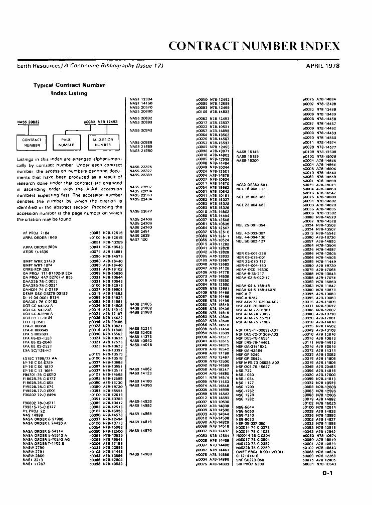
CONTRACT NUMBER INDEXEarth Resources/A Continuing Bibliography (Issue 17) APRIL 1978
Typical Contract NumberIndex Listing
NAS5 20632 PU082 N7B 12493
1 |~~[ ]
CONTRACT PAGE ACCESSION
NUMBER NUMBER NUMBER
Listings in this index are arranged alphanumen-cally by contract number Under each contractnumber the accession numbers denoting docu-ments that have been produced as a result ofresearch done under that contract are arrangedin ascending order with the AIAA accessionnumbers appearing first The accession numberdenotes the number by which the citation isidentified in the abstract section Preceding theaccession number is the page number on whichthe citation may be found
AF PROJ 7184 p0083 N78-12516ARPA ORDER 1649 pOlOO N78-12618
pOOSI N78- 13289ARPA ORDER 2894 pO031 N78- 10543ATI05 D-1635 p0075 A78-14881
p0090 N78-14575BMFTWRK 274/3 P0080 A78- 18440BMFTWRT-1074 pOOSO A78- 18440CNRS-RCP-353 pO031 A78-18102DA PROJ 1T1-61 102-B 52A pO069 N78-15630DA PROJ 4A7 62707-A 855 pO031 N78-10544DAAG29 76-C 0057 p0031 N78-10543DAAG53-75-C-0221 p0100 N78-12S13DAHCO474G-0119 pO027 N78-15601DEMR DSS-OSZ76-00183 pO019 A78-14862Dl- 1 4-34 OOO1 6134 P0068 N78-14624DNA001 76 C-0182 p0082 N78-11561DOT CG-54323 A p0026 N78-14608DOTCG-54323A p0019 A78-14914DOT CG-63898-A p0021 A78- 17197DOT FH1 1-9 144 p0039 N78- 14622EI11 1)3563 pO049 A78-20485EPA-R 80068 pO023 N78-10621EPA-R 800649 pOOIS A78-11809EPA S 802681 pO040 N78-15552EPA 68-02-1383 pO024 N78-13636EPA 68 02-2048 pO021 A78-17575EPA 68 02-2533 p0023 N78-10623ESA SC/128-HQ N78-13397
P0109 N78-13519ESTEC 1799/72 AA p0100 N78-13518EY-76 C 04-0789 p0037 N78- 13688EY-76 C 06 1830 p0087 N78-13951EY-76 C 13 1664 p0037 N78-13517F04701-75 C0090 p0101 N78-14568F19628-75 C0122 p0085 N78-12599F19628-76-C005 pOOSO A78-18730F19628-76-C074 pOOSO A78-18730F19628-77-C0001 pO094 N78-15551F3O602 72-C 0494 pOlOO N78-12618
pOOSI N78- 13289F30602 76-C-0211 p0086 N78-13412F33615-75-C0127 pO083 N78-12516HL PROJ 22 p0102 N78-15028NAS 14988 pO090 N78-14578NASA ORDER 6 21990 p0037 N78-12494NASA ORDER I. 24420 A pOlOO N78-13716
P0054 N78- 15663NASA ORDER S-541 14 pOOSO N78-12500NASA ORDER 5 55812 A pOOSI N78-10536NASA ORDER S-70243 AG pO069 N78-15541NASA ORDER T-4105-B pOO06 A78-17199NASW-2790 pO032 N78-12S53NASW-2791 p0108 N78-11448NASW-28OO pOO45 A78- 13666NAS1 3213 pO086 N78-12604NAS1 11707 P0098 N78-10539
NAS1 12304NAS1 14150NAS5 20570NAS5 20680
NAS5 20832NAS5 20899
NAS5 20942
NAS5-20986NAS5 21865NAS5 21980
NAS5 22325NAS5 22327NAS5 22389
NAS5 22597MASS 22894NAS5 22963NAS5 23434
NAS5 23677
NAS5 24106NAS5 24206NAS5 24263NAS6 2451NAS6 2639NAS7 100
NAS8 21805NAS8 31682NAS8-31980
NAS8 32214NAS8 32408NAS9 11275NAS9 13642NAS9-14016
NAS9 14052NAS9 14123
NAS9 14180NAS9 14350
NAS9- 14533NAS9 14552
NAS9 14565
NAS9 14819
NAS9- 14970
NAS9 14988
pOOSO N78- 12492p0085 N78- 12595P0083 N78- 12499PO106 A78-14823
P0082 N78- 12493P0017 A78-13837P0022 N78- 10531P0057 A78- 14893P0064 N78- 13503P0026 N78- 14587p0053 N78- 15537p0082 N78 12495P0096 A78- 13971pOO18 A78-14802p0085 N78- 12599p0088 N78- 14494P0049 N78- 10344p0024 N78-13501pO004 A78- 14876pOO07 N78- 10534pOOU N78-14570p0054 N78- 15662p0061 N78- 10542pOO41 A78-10161pOO92 N78- 15327P0093 N78- 15328PO093 N78- 15329pOOIS A78-14802P0088 N78-14494pO037 N78-13508P0061 N78- 10535p0064 N78 12507P0032 N78-12510P0083 N78 12511pOOSS A78-10524P0015 A78-11283pOO41 A78 12828p0042 A78- 12829PO095 A78- 12833P0105 A78-13667pO046 A78- 13683P0047 A78-14126p0106 A78-14778P0073 A7 8- 14808P0019 A78-15890p0084 N78 12590p0085 N78 12601p0109 N78-14465P0087 N78- 14466P0088 N78 14498pOOSO A78 18649pCO98 N78- 10436P0056 A78 14818PO063 N78- 12505pO037 N78-12506pO066 N78-14510P0036 N78-11454p0064 N78- 13509pO098 A78-17377P0041 A78-1261SpO048 A78-14875PO078 A78 16542PO048 A78 17198P0082 N78 12497pOOOS N78- 13500P0090 N78- 14569pO058 A78- 18247P0004 A78- 14880pOOII N78 14574PO099 N78-11453pOO74 A78-14S48pOOOS A7 8- 14899pO089 N78 14542pO012 N78 14593P0007 N78 10538PCOO2 A78 14808p0009 N78 14500PO003 A78 14844pOOlO N78-14538P0096 A78- 14826P0088 N78 14518p0082 N78 12497PO083 N78- 12504pOOOS N78-14459pO087 N78 14460pO087 N78 14461P0075 A78 14866
PO004 A78-14880P0075 A78-14883
NAS9 15145NAS9 15189NAS9- 1 5200
NCA2 OR363-601NGL 15-005-112
NGL 15-005-186
NGL 23 004-083
NGL 25-001-054
NGL 42-003-007NGL 44-004-130NGL 5O-002-127
NCR 05-007-328NGR 05-025-001NCR 33-010 172NGR-44-004-150NOAA-OCO 14830NOAA-6-35-217NOAA-03-5-022-17
NOAA-04-4 158-48NOAA-04-6 158-44078NRC A-7NRC A-6762NSF AEN-73 02904-A02NSF AER-76-80802NSF ATM 72-01381NSF ATM-74 23832NSF ATM-75 15791NSF ATM-75 21962
NSF DES-71-00632-A01NSFDES-72-01309-A03NSF DES-75-15551NSF ERS-76-14462NSF GA-319 16X2NSF GA-42464NSF GP 5246NSF GP-35424NSF MPS-73 08638 A02NSF OCE-76- 15627NSG-722NSG-1060NSG- 1 084NSG 1 127NSG 1203
NSG- 1252
NSG 1270
NSG 1282
NSG- 5014
NSG- 5050NSG-7310NSG-9033NSR-05-007 060N00014 74-C0273N00014 75-C-1023N00014-76-CO8O4N00017 76-C-0804N00123 73-C-2352N00228 75-C-2269OWRT PROJ 8-031 WYO(I)SF1214141BSNF G0223-060SRI PROJ 5300
P0075
p0007
P0083pOOOS
pOOOS
P0087
PO009
pOO09
POO90
pOOU
P0090
pOIOS
P0102P0004p0004PC005pOOlOP0089PO091p0079PO004P0078P0076p0091P0003P0056pOOOSPO088pO067p0024P0024P0013pOOSOP0057p0064p0026p0086P0066P0099pOOSOp0079P0098P0058P0069P0063pOOSOPOO95P0095P0015p0037p0086pOOSOPO020pOOISpO025POO43pooiepOOISP0111P0016p0072p0035P0015pOOISpOO49p0056PO020P0099p0022p0086pOOSSPO086p0019P0102pOlOOPO029PO036P0003P0032POO83PO042P0050pOOSOpOOOlp0102P0068P0099P0015P0031
A78-14884
N78-12496
N78 12498
N78 13499
N78-14456
N78-14457
N78-14462
N78-14463
N78-14560N78-14574
N78-14577
N78-12508
N78-15028A78-14846A78-14864A78-14904N78-14540N78-14558N78-14598A78-18071A78-14860A78-16542A78-14908N78-14602A78-14828A78-14835N78-13502N78-14520N78-14528N78-13508N78-13507N78-15542A78-18730A78-14893N78-13504N78-14587N78-12605N78-14508N78-11449A78 18730A78-17068N78-10549A78-17074N78-156BON78-11647N78-10678A78-13083A78-13083A78-11809N78-13622N78-12607A78-18730A78-17061A78-14810N78 14502A78-13108A78 13616A78 13616N78-14612A78 13616A78 14314A78-13082A78 11809A78-11809A78-20485A78-14816A78-170OON78-11813N78 10526N78-12608N78 12596N78 12605A78 14992N78 15626N78 12514A78 14833N78-10992A78-14827N78-11556N78-12515A78-12842N78-10674A78-18910A78-10523N78 15643N78 14624N78 12268A78-12405N78-10543
D-1

CONTRACT NUMBER INDEX
USBLM-D85 50-IA5-26USDA-AG 47-SCS00210W 7405-ENG-26W-7405-ENG-48
W-07405-ENG 48176 20-32-01176-30-31-01176 30-31-11177 52-83-07-72177 52-89-00-72177-55-31-01640 03-00-00-72683 75-33 027763031 11
POO43pO056pO036p0039p0068P0097p0022p006Sp0024p0061P0027p0024P0051p0099P0023
A78-13116A78-14818N78-10545N78-14615N78-14616A78-15013N78-10526N78-13628N78-12555N78-10541N78-15549N78-12645N78-12644N78-12113N78-12554
D-2

REPORT/ACCESSION NUMBER INDEX
Earth Resources//! Continuing Bibliography (Issue 17)
Typical Report/Accession NumberIndex Listing
APRIL 1978
NASA tmiranciruf 1DOCUMENT MICROFICHE 1SYMBOL SYMBOL fl
11 1
NASA CB- 155290 pOlOO N79 12514* I1 I
1 1REPORT PAGE ACCESSION
NUMBER NUMBER NUMBER
Listings in this index are arranged alphanumen-cally by report number The page number indi-cates the page on which the citation is locatedThe accession number denotes the number bywhich the citation is identified An asterisk *indicates that the item is a NASA report Apound sign (jj/) indicates that the item is avail-able on microfiche A plus sign ( -) indicates adocument that cannot be microfiched but forwhich one-to-one facsimile is available
ADA042372 pOOSO N78-10674 §ADA042861 pOO23 N78 10608 #ADA043046 pOOSO N78-11491 fADAO43418 pOO31 N78 10543 #AD-A043666 p0082 N78 11561 itAD AO43788 pOOSO N78 10675 jfADAO44216 p0099 N78 12268 #AD A044401 pOlOO N78 12513 ifADAO44431 p0031 N78 10544 #ADAO44598 p0083 N78 12516 jfADA044661 P0064 N78 12518 ifADAO44793 pOlOO N78 12514* jfADA044836 p0083 N78 12515ADA044997 pOlOO N78 12618ADA045161 pOOSI N78-13289ADAO45434 P0033 N78-13514ADA045466 p0 1 00 N78- 13684ADA045542 p0086 N78 13412ADA045870 p0064 N78 13513ADA045871 pOO33 N78-13516ADA046226 pOO92 N78 14613ADA046349 p0069 N78- 15630ADA046474 p0102 N78-15632ADA046629 p0102 N78-15643ADA046646 p0027 N78 15601 jf
AFGL-ERP-597 pOlOO N78-13684 *
AFGL-TR-77-0113 p0100 N78-13684 #AFGL-TR-77-0157 P0102 N78-15632 if
AIAA 77-1550 pOO46 A78 13681 #AIAA 77-1564 POO43 A78- 13656 ifAIAA 77-1565 pOO44 A78 13657* jfAIAA 77- 1566 pOO44 A78 13658* ifAIAA 77-1569 pOO44 A78 13660 jfAIAA 77-1571 pOO44 A78 13682AIAA 77-1577 pOO44 A78 13683AIAA 77-1580 POO44 A78 13684AIAA 77-1581 pOO44 A78 13665AIAA 77-1583 pOO45 A78-13666*AIAA 77 1584 pO072 A78 13686AIAA 77-1585 P0105 A78 13687* jfAIAA 77-1588 pOO45 A78 13669* ifAIAA 77-1590 pO045 A78 13670 jfAIAA 77-1591 pO046 A78 13682* jfAIAA 77-1596 pOO45 A78 13671 ifAIAA 77-1597 pOO45 A78- 13672* fAIAA 77- 1598 pOO45 A78 13673 §AIAA 77-1599 pOO45 A78- 13674 §AIAA 77-1601 pOO46 A78- 13675 fAIAA 77- 1604 pOO48 A78- 13678 jAIAA 77-1610 pOO48 A78- 13687 §AIAA 77-1611 pOO48 A78- 13683* fAIAA 77-1612 p0048 A78-13679 IAIAA 77-1616 pOO96 A78 13688 f
AMRLTR 77-33 p0083 N78-12516 #
ARCSL-TR-77-59 ^0064 N78-12518 #
ARO-117539-C p0027 N78 15601 #
BGI D-75 1 pO032 N78 1 1498 #
BLL M 24896-15828 4F) p0102 N78-14750
BLLD M 24895 (5828 4F) p0102 N78-14747BLLD M 24900-15828 4F) p0033 N78- 14453
BLLDTRANS-1287 p0033 N78- 14453
BNWL2235 p0087 N78 13951 $
BSFC/LU C/OO9 p0094 N78 15556* #
BSR-4291 p0064 N78 13503* t
CALSPAN NA-6019-M-1 p0061 N78 10630 f
CGR/DC- 15/76 p0023 N78 10808 j
CIA/DF-77/006A p0032 N78 11498 0
CMS-NASA 1-76 pOOSO N78 12492* f
CRC-APRAC CAPA 9-71 p0023 N78-10619 f
CRREL-SR-77-28 pOlOO N78-12514* #CRREL SR-77-32 p0064 N78-13513 f
CRREL 77-27 p0069 N78 15630 H
CRSR-673 p0099 N78 11449* />
CTH IEM-TR-7636 p0101 N78 14699 #
DLR-FB-77 09 p0051 N78 13313 H
DLR-IB-553-75/7 p0027 N78 14732 H
DNA-HAES 50 p0102 N78-15632 fDNA-HAES 64 pOlOO N78 13684 jf
DNA-4240F p0082 N78-11561 if
E-9396 P0024 N78-13670* 1
EIRM 122700 34 F pOOOS N78 13499* #
EPA 60O/3 77-044 p0023 N78 10621 fEPA 6OO/7 77-068 p0040 N78 15552 j/EPA-600/8 77-008 p0027 N78 14700EPA 901/9 77-002 pOO23 N78 10623EPA 906/9 77-003 p0024 N78 13636
ERIM 1O8900-9-P p0083 N78 12515ERIM 114800-37 L pOO07 N78-10534*ERIM 118500-1 F p0054 N78 15662*ERIM 122700-29 T p0083 N78 12498*ERIM 122700-31-F pOOOS N78-14458*ERIM 122700-32 F p0087 N78-14457*ERIM 122700-33 F p0007 N78- 12496*ERIM 122700-35-F1-VOL-1 pOOOS N78-14462* jfERIM 122700-35-F2 VOL-2 pOOOS N78 14463* 1ERIM 123600-1 F p011t N78 14612 jf
ERP 605 p0102 N78- 15632 #
ERT P-2273 p0023 N78-10823 f
ESA CRIPI-974 pOlOO N78 13518ESA CRIP1-977-VOL-1 p0109 N78 13519ESA CRIP1-977-VOL-2-APP-5 7 N78 13397
ESA TT 422 pOOSI N78 13313
ETL-0103 pOO31 N78 10544ETL-0111 p01OO N78 12513
E78 10001 p0062 N78 11447*E78 100O2 pOOSI N78 10530*E78 1OOO3 pOOSO N78 12492*E78 1O004 p0022 N78 10531*E78 1OOOS pOO82 N78 12493*E78 10O06 pOO49 N78 10532*
E78- 10008 pO037 N78- 12494*0E78- 10009 pOO07 N78- 10534* jf£78 10010 p0061 N78-10535* /fE78 10011 P0061 N78-10538*E78 10012 p0036 N78-10537*E78 10013 P0007 N78-10538*E78-10014 p0082 N78-12495*E78 10015 pOOOS N78-13499*E78-10016 p0007 N76-12496* ffE78-10017 pOOOS N78- 13500* jfE78 10018 p0082 N78- 12497*0678 10019 p0024 N78-13501* |E78 10020 pOOOS N78- 13502*E78 10021 P0083 N78- 12498*E78 10022 p0083 N78- 12499*E78 10023 P0064 N78- 13503*E78-10024 pOOSO N78-126OO*E78- 10026 p0083 N78- 12502*E78 10027 p0032 N78- 12503*E78- 10028 p0064 N78- 13504*E78 10029 p0064 N78- 13505*E78- 10030 p0083 N78-125O4*E78 10031 P0063 N78- 12505*E78 10032 p0037 N78-12506*E78 10033 p0064 N78-12507*E78 10034 p0024 N78- 13506*E78 10035 P0024 N78- 13507*E78 10036 p0037 N78- 13508*E78 10037 p0012 N78-15536*E78- 10038 pOOOS N78- 14455*E78-10039 pOOOS N78-14456*E78- 10040 p0087 N78- 14457* jiE78-10041 p0065 N78-14458* jfE78-10O42 P0053 N78- 15537* jfE78-10O43 pOOOS N78- 14459* jjlE78-10O44 p0087 N78-14460* jfE78-10045 p0087 N78-14461*E78-1OO46 pOO09 N78-14462*E78-10O47 p0009 N78-I4463*E78- 10048 p0053 N78- 15538* !E78-10049 pO012 N78-15539*E78-10050 P0012 N78 15540*E78-10052 P0069 N78 15541*E78-10053 p0013 N78 15542*
FHWA-RD 77-35 p0039 N78 14622 §
FSD 7700-01 P0082 N78-12495* /f
FSRPPSW-113 p0007 N78 12521 ff
FTD IDIRSII-0667-77 p0033 N78-13514 f/
FTO IDIRSIT-0326-77 P0092 N78-14613 ff
FTD 77-C OO0430 p0092 N78-14813 /f
FTR-2 pOOSI N78-13289 ff
FU15-4VOL-1 p0109 N78-13519 ffFU 15-4 VOL 2-APP 5-7 N78 13397 jf
FWS/OBS-77/48 p0027 N78- 15653 #
G-7702F 15 P0102 N78-15142* #
GC-77 10126 p0032 N78-11498 0
GJBX 17I77I-VOL 2 p0037 N78-13517 /f
GPO-94-462 pOIOS N78-12509 f/GPO-95-881 pOIOS N78-11450 jf
GSFC/LN-C/008 p0093 N78- 16548* jGSFC/LN-C/OO9 p0094 N78- 15555* jfGSFC/LN-C/010 p0093 N78- 15546* jf
GSFC/LN-77/013 p0093 N78-15535* +GSFC/LN-77/013A p0093 N78- 15547* $
GSFC/LU-C/OO8 P0094 N78- 15554* /fGSFC/LU-C/010 pO093 N78-15545* f
IAF PAPER 77-121 p0057 A78-15935
IFYGL-SPECIAL-BULL-20 pO069 N78-15660 f
INPE-1096-PE/073 p0039 N78-14611 #INPE 1118-TPT-067 pO092 N78-14894 f
E-1
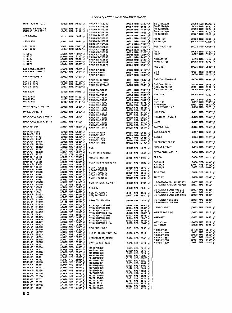
REPORT/ACCESSION NUMBER INDEX
INPE-1129-TPT/070
ISBN-92-63-10427-1ISBN-951-750 797-6
JPRS-70524
JSC-S 468
JSC-12529JSC-12910
L- 10968L-11710L- 11 767L- 11 854L- It 870
LARS-PUBL-082477LARS-PUBL-090177
LARS-TR 090677
LARS 112677LARS 112777LARS-1 12877
LBL 5209
MA-129TAMA-129TAMA-129TA
MARMAP-CONTRIB-145
MPKB/E/038/RS
NASA-CASE GSC 11976 1
NASA-CASE LEW 12217 1
NASA-CP-004
NASA CR-2895NASA-CR-2925NASA CR-141431NASA CR- 141432NASA-CR- 144976NASA CR- 145239NASA CR- 145263NASA-CR- 145277NASA CR- 145278NASA CR 145291NASA-CR- 150422NASA CR- 150423NASA CR 150446NASA CR- 150465NASA CR- 1 50467NASA-CR- 151 525NASA-CR-151530NASA-CR-151532NASA CR- 151 536NASA-CR- 151 537NASA-CR- 151 548NASA CR- 151 549NASA CR-151552NASA CR 151553NASA CR-151561NASA-CR-1 5 1563NASA-CR-151575NASA-CR- 151 576NASA-CR- 151 592NASA-CR-151609NASA CR 151610NASA CR-151635NASA CR-154510NASA CR- 154951NASA CR- 155205NASA CR- 155206NASA CR- 155207NASA CR- 155208NASA CR 155209NASA CR-155210NASA-CR-155212NASA-CR- 1552 13NASA-CR- 1552 14NASA-CR- 1552 15NASA-CR- 1552 16NASA-CR- 1552 17NASA-CR-1 55234NASA-CR-1 55247NASA-CR-1 55248NASA-CR- 155250NASA-CR- 155251NASA CR- 155252NASA CR- 155253NASA-CR 155254NASA-CR- 155257NASA-CR- 155258NASA CR 155259NASA-CR- 155260NASA CR 155261NASA CR 155262NASA CR- 155290NASA-CR 155341
p0039 N78 14610 ff
p0062 N78 11455 1P0050 N78-11292 ff
pOlll N78-15557 ff
p0051 N78- 12644 j
P0061 N78-10541*|)lp0027 N78-15549*|jl
p0065 N78- 13628*P0099 N78-12113*p0023 N78- 12554*P0024 N78- 12645*p0024 N78- 12555*
pOOOS N78- 13500* ffP0083 N78- 12504* ff
P0082 N78-12497* ff
pOOOS N78 14459* ffp0087 N78 14461* jfp0087 N78 14460* j
p0068 N78 14616 1
pOOOS N78 14459' ffp0087 N78 14460* ffp0087 N78- 14461*f
pOOSO N78- 12500* ff
P0032 N78- 12503* ff
p0007 N78- 10529*
p0037 N78- 14452*
p0084 N78-12586* ff
P0022 N78 10526* fp0086 N78 1 2608* jfp0032 N78 12510* ifP0083 N78 12511* jfp0086 N78- 12608* ifP0094 N78- 15551* ifP0098 N78 1'0539* 0pOlOO N78 13716* jfp0054 N78- 15663* ffp0102 N78- 15626*|p0063 N78- 12505* jfp0037 N78- 12506* ffpOOaS N78 10436* ifp0036 N78 11454* ifP0064 N78 13509*0P0007 N78- 10538* ifpOOOB N78- 13500*|P0083 N78-12504* (p0082 N78 12497*0p0083 N78 12498*|p0099 N78-11453*/jlpOIOS N78-12508* jfP0007 N78- 12496* jfpOOOB N78- 13499* ffpOOOS N78 14462* jfp0087 N78- 14457* ffp0009 N78 14463* jfpOOOS N78 14456* ifP0102 N78 15028*|p0087 N78 14460* jfP0087 N78 14461*0pOOOS N78 14459* ifP0036 N78 10992* 0P0064 N78-13503* ftP0062 N78- 11 447*0p0081 N78-10530* 0pOOSO N78- 12492* ifp0022 N78 10531* ifP0082 N78 1 2493* jfP0049 N78 10532* jfP0037 N78 12494* jfp0007 N78 10534* jfp0061 N78 10535* jfP0061 N78 10536* ffpO036 N78-10537* ifpOIOS N78 10968* ifpOOaa N78-11449* ffpOOOB N78- 13502* jfpOOSO N78- 12500* jfpOOaa N78-11813* IPO083 N78 12502* |P0032 N78 12503* 0P0064 N78 135O4*0p0064 N78 13505*|P0064 N78 12507* 0p0037 N78 13508* ffpOOOS N78 14455* ffp0024 N78 13507* ffp0024 N78 13506* ftp0012 N78 15536* ffpOlOO N78 12514* ffP0065 N78 14458* f
NASA-CR-1 55342NASA-CR 155358NASA-CR-1 55361NASA-CR-1 55362NASA-CR-1 55365NASA-CR- 155508NASA-CR-165509NASA-CR-155514
NASA-CR-1 55530NASA-CR-1 55631NASA-CR-1 55532NASA CR- 156640NASA-CR- 156643NASA CR- 156647NASA CR- 156658NASA-CR- 156677
NASA-RP-1009NASA-RP-1012NASA-RP-1015
NASA-TM-X 71396NASA-TM-X 71412NASA-TM-X 71413
NASA TM-58203NASA-TM-73810NASA TM-74956NASA TM-74957NASA-TM-74988NASA 7TW-74990NASA TM-74991NASA TM-74992NASA TM-74993NASA TM-75041NASA TM-75085NASA TM-78032NASA TM-78038NASA TM-78039NASA-TM-78052NASA-TM-78149
NASA TP-1021NASA-TP-1038NASA TP 1 039NASA-TP-1089NASA-TP-1 101
NCC-1
NEPRF-TR 6 76IESC)
NIWARS PUBL-41
NOAA-TM-ERL-GLERL-13
NOAA-77052503NOAA-770627O9NOAA-77062710NOAA-77072206NOAA-77082507
NOO-RP-17I76I-SUPPL-1
NRL8131
NSF/RA 770167NSF/RA-770173
NSWC/DL TR-3668
NTISUB/C/138008NTISUB/C/138-009NTISUB/C/ 138-010NTISUB/C/ 138-013ANTISUB/C/ 139-008NTISUB/C/ 139-009NTISUB/C/139-010NTISUB/C/139-013A
NYSERDA 75/22
ONERA TP NO 1977 154
ORNL/SUB-75/87988
OWRT-A-O45-IDAI3)
PB-267784/7PB-268675/6PB-268896/0PB-268996/6PB-269456/0PB-269471/9PB-270299/1PB-270304/9PB-270323/9PB-270543/2PB-270632/3PB-27 1204/0PB-27 1254/5PB-27 1278/4PB-271331/1PB-271952/4PB 2720O4/3
p0053 N78- 15537* |P0053 N78-15538* jfp0109 N78-14464* ffP0110 N78-14529* 0P0069 N78-15541* jf
p0012 N78-15539* jfP0012 N78-15540* jfp0013 N78-15542* jfp0093 N78- 15328* +P0092 N78- 15327*|P0093 N78- 15329* ifp0049 N78 10344* ifp0082 N78- 12495* jfp0083 N78- 12499* jfp0054 N78- 15662* jfP0024 N78-13501* if
p0099 N78-121 13* ffpOOSI N78- 12644 jfp0027 N78- 15549* jf
P006t N78- 10542* ifpOOSt N78-10341* ifp0023 N78- 10540* if
p006t N78 10541* |fp0024 N78 13670* ifp0094 N78 15555* jfp0094 N78-15556* ifp0093 N78- 15548*|p0093 N78- 15546* j/p0093 N78- 15547* |P0093 N78- 15545* |p0093 N78- 15535* +pOIOS N78-11448* ffp0032 N78- 12553* |P0053 N78- 15550* |pOOSI N78-11451* 0p0032 N78-11452* jfp0108 N78-13510* jfP0093 N78- 15544* jf
p0065 N78- 13628* ffp0023 N78-12554* jfp0024 N78 12645* ifP0024 N78-12555*0p0102 N78-15142* ff
pOOSO N78- 10674 ff
p0102 N78- 15643 f
p0099 N78-11496 |
p0051 N78- 12632 ff
P0050 N78- 10678 fp0063 N78-11647 ffp0098 N78- 10549 itp0051 N78- 12632 ffp0069 N78 15660 f
p0050 N78-11491 ff
p0099 N78- 12268 ff
pOlll N78-14612 0P0037 N78- 13622 jf
p0050 N78- 10675 ft
P0094 N78- 15554* 0p0094 N78- 15556* jfp0093 N78- 15545* jfP0093 N78- 15535* +p0093 N78 1 5548* ifP0094 N78- 15555* jfp0093 N78- 15546* jfp0093 N78- 15547* jf
p0061 N78- 10630 jf
P0020 A78-16214
P0036 N78- 10545 1
P0065 N78- 13522 ff
p0023 N78-10619pOOSO N78- 10678P0023 N78- 10621p0023 N78- 10623pOIOS N78-10968*P0061 N78-10630P0063 N78-11647p0032 N78-11498P0098 N78- 10549P0007 N78- 12521p0065 N78- 13522P0024 N78- 13636 |pOOSI N78- 12632 jfp0111 N78-14612 jfp0039 N78-14622 |P0037 N78- 13622 jfp0053 N78 14772 jf
PB 272152/0PB-272244/5PB-272308/8PB-272421/9PB-272691/7
PD-76-107PD 76 109
PGSTR-AP77-49
PR-5
PR- 11
PSAD-77-58PSAO-77-126
PUBL-151
QR-1
QR-1
RAD-TN- 100-044- 16
RADC-TR-77-100HADC-TR-77-101RADC-TR 77-279
REPT-S 90
REPT2REPT-165REPT-6690REPT 123000 11 F
RSC-3380
RSL-TR-291 2 VOL 1
S-478
SAI-77-911-LJ
SAND-76-0279
SAPR-8
SB-6238IAI77C 219
SDSU-RSI-77-17
SEFC-CONTRIB-77 16
SER 66
T-1314/4T-1314/4T-1314/4
TID-27689
TR 76 C2
US-PATE NT-APPL-SN-677352US-PATE NT-APPL-SN-763753
US-PATENT-CLASS 166-248US-PATENT-CLASS 166-259US-PATENT-CLASS 324-58 5B
US-PATE NT-4 052 666US-PATENT-4061 190
USCG-0-32-77
WES-TR M-77 2-2
WMO-427
W77-10175W77-11867
X 903-77-49X 922-77-260X-923-77-245X 931 77-38X 933-77-236X 953-77-239
p0069 N78- 15660P0040 N78 15552pO068 N78 14624P0027 N78 14700P0027 N78 15553
pOlOO N78 12618 ftpO051 N78- 13289 ft
p0022 N78 10526* |
P0082 N78 12493* ffp0022 N78-10531* if
p0108 N78 10968* jfP0053 N78-14772 jf
P0036 N78- 10992* jf
p0061 N78-10535* ifP0064 N78-12507* ff
pO024 N78- 13636 ff
pOlOO N78 12618 |POO51 N78 13289 |p0086 N78 13412 |
P0050 N78 11292 if
p0023 N78 10619 ffp0012 N78 15540* ffP0091 N78 14602* ifpOOSO N78 10678 jf
p0061 N78 10536* jf
P0049 N78 10344* /f
p0027 N78 15549* jf
P0022 N78- 10631* jf
p0037 N78- 13688 ff
p0024 N78- 13506* if
pOIOS N78 12508* f
p0013 N78 15542* 0
P0050 N78- 12500* if
p0068 N78 14624 jf
p0008 N78-14459* jfP0087 N78-14460* jfp0087 N78- 14461* if
p0039 N78-14615 if
pO098 N78 10539* if
pOO07 N78 10529*p0037 N78 14452*
p0037 N78 14452*P0037 N78 14452*p0007 N78 10529*
P0007 N78 10529*p0037 N78 14452*
p0023 N78 10608 ft
p0033 N78 13516 f
P0062 N78 11455 f
P0065 N78 13522 ffp0068 N7B 14624 jf
pOIOS N78 13510* fp0032 N78 11452* ifp0023 N78 10540* jfp0061 N78 10542* jfp0081 N78 11451* jfpOOSI N78 10341* jf
E-2
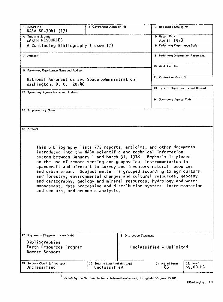
1. Report No
NASA SP-7041 (17)2 Government Accession No 3 Recipient's Catalog No
4 Title and Subtitle
EARTH RESOURCESA Continuing Bibliography (Issue 17)
5. Report Date
Apri l 19786 Performing Organization Code
7 Author(s) 8 Performing Organization Report No.
10 Work Unit No
9 Performing Organization Name and Address
National Aeronautics and Space AdministrationWashington, D. C. 205̂ 6
11 Contract or Grant No
13 Type of Report and Period Covered
12 Sponsoring Agency Name and Address
14 Sponsoring Agency Code
15. Supplementary Notes
16 Abstract
This bibliography lists 775 reports, articles, and other documentsintroduced into the NASA scientific and technical informationsystem between January 1 and March 31, 1978. Emphasis is placedon the use of remote sensing and geophysical instrumentation inspacecraft and aircraft to survey and inventory natural resourcesand urban areas. Subject matter is grouped according to agricultureand forestry, environmental changes and cultural resources, geodesyand cartography, geology and mineral resources, hydrology and watermanagement, data processing and distribution systems, instrumentationand sensors, and economic analysis.
17 Key Words (Suggested by Author(s))
BibliographiesEarth Resources ProgramRemote Sensors
18 Distribution Statement
Unclassified - Unlimited
19 Security Classif (of this report)
Unclass ified20 Security Classif (of this page)
Unclassif ied21 No of Pages
18622 Price"
$9.00 HC
For sate by the National Technical Information Service, Springfield, Virginia 22161
NASA-Langley, 1978

PUBLIC COLLECTIONS OF NASA DOCUMENTS
DOMESTICNASA distributes its technical documents and bibliographic tools to ten special librarieslocated in the organizations listed below Each library it prepared to furnish the public such services asreference assistance, interlibrary loans, photocopy service, end assistance in obtaining copies of NASAdocuments for retention
MASSACHUSETTSMassachusetts Institute of Technology. Cambridge
CALIFORNIAUniversity of California. BerkeleyCOLORADOUniversity of Colorado. BoulderDISTRICT OF COLUMBIALibrary of CongressGEORGIAGeorgia Institute of Technology. Atlanta
ILLINOISThe John Crerar Library. Chicago
MISSOURILinda Hall Library. Kansas CityNEW YORKColumbia University. New YorkPENNSYLVANIACarnegie Library of Pittsburgh
WASHINGTONUniversity of Washington. Seattle
NASA publications (those indicated by an "*" following the accession number) are also received bythe following public and free libraries
CALIFORNIALos Angeles Public LibrarySan Diego Public LibraryCOLORADODenver Public LibraryCONNECTICUTHartford Public LibraryMARYLANDEnoch Pratt Free Library. BaltimoreMASSACHUSETTSBoston Public LibraryMICHIGANDetroit Public LibraryMINNESOTAMinneapolis Public Library
MISSOURIKansas City Public LibrarySt Louis Public LibraryNEW JERSEYTrenton Public Library
NEW YORKBrooklyn Public LibraryBuffalo and Erie County Public LibraryRochester Public LibraryNew York Public LibraryOHIOAkron Public LibraryCincinnati Public LibraryCleveland Public LibraryDayton Public LibraryToledo Public Library
OKLAHOMAOklahoma County Libraries. Oklahoma CityTENNESSEEMemphis Public LibraryTEXASDallas Public LibraryFort Worth Public LibraryWASHINGTONSeattle Public LibraryWISCONSINMilwaukee Public Library
An extensive collection of NASA and NASA-sponsored documents and aerospace publications avail-able to the public for reference purposes is maintained by the American Institute of Aeronautics andAstronautics. Technical Information Service. 750 Third Avenue. New York. New York. 10017
EUROPEAN
An extensive collection of NASA and NASA-sponsored publications is maintained by the British LibraryLending Division. Boston Spa. Wetherby. Yorkshire. England By virtue of arrangements other than withNASA, the British Library Lending Division also has available many of the non-NASA publications citedin STAR. European requesters may purchase facsimile copy or microfiche of NASA and NASA-sponsoreddocuments, those identified by both the symbols "#" and "*". from ESRO/ELDO Space DocumentationService. European Space Research Organization. 114. av Charles de Gaulle, 92-Neuilly-sur-Seme.
France
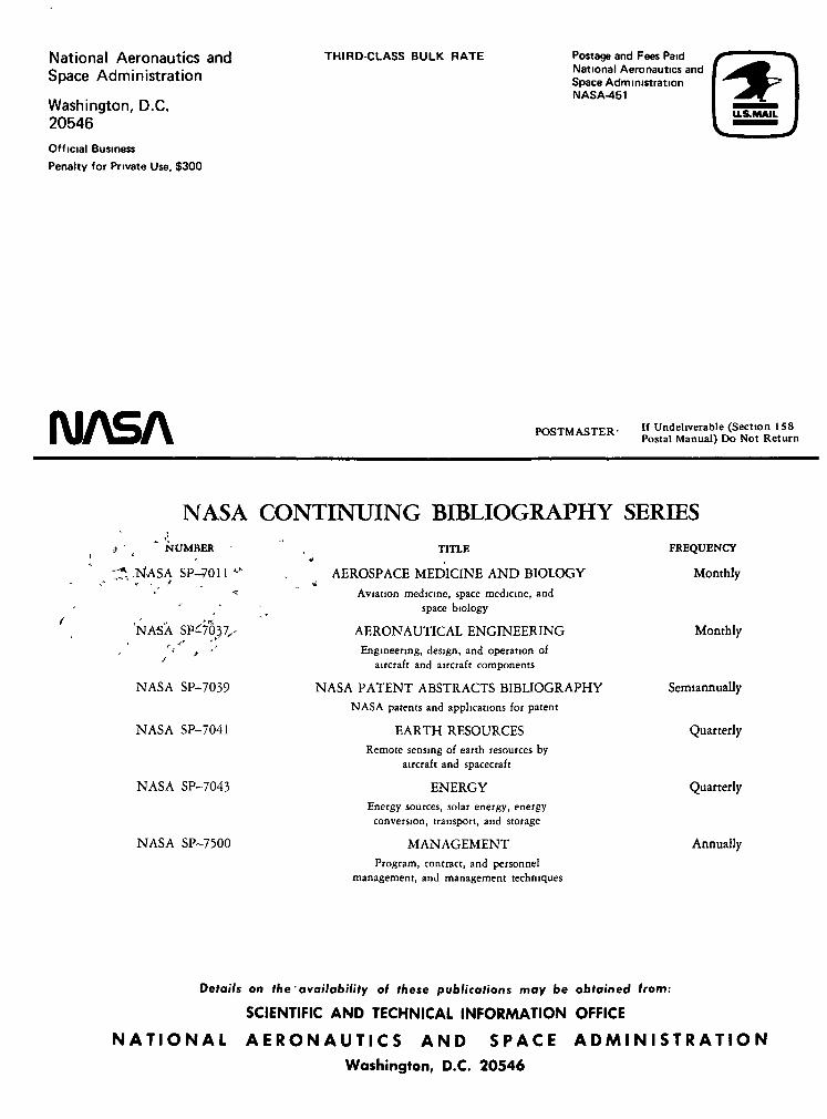
National Aeronautics andSpace Administration
Washington, D.C.20546
Official Business
Penalty for Private Use, $300
THIRD-CLASS BULK RATE Postage and Fees PaidNational Aeronautics andSpace AdministrationNASA-451
NASA POSTMASTER- If Undehverable (Section 158Postal Manual) Do Not Return
NASA CONTINUING BIBLIOGRAPHY SERIESt ' l NUMBER -
^V.NASA sp-7011 -t 1
'NASA SP^ySjT,-
NASA SP-7039
NASA SP-7041
NASA SP-7043
NASA SP-7500
TITLE*
AEROSPACE MEDICINE AND BIOLOGYjAviation medicine, space medicine, and
space biology
AERONAUTICAL ENGINEERING
Engineering, design, and operation ofaircraft and aircraft components
NASA PATENT ABSTRACTS BIBLIOGRAPHYNASA patents and applications for patent
EARTH RESOURCESRemote sensing of earth resources by
aircraft and spacecraft
ENERGYEnergy sources, solar energy, energy
conversion, transport, and storage
MANAGEMENTProgram, contract, and personnel
management, and management techniques
FREQUENCY
Monthly
Monthly
Semiannually
Quarterly
Quarterly
Annually
Details on the'availability of these publications may be obtained from:
SCIENTIFIC AND TECHNICAL INFORMATION OFFICE
N A T I O N A L A E R O N A U T I C S A N D S P A C E A D M I N I S T R A T I O N
Washington, D.C. 20546