DUKE OF EDINBURGH‟S AWARD
19
DUKE OF EDINBURGH‟S AWARD Expedition Planning Pack Bronze 2018 Mendip, Lyncombe Drive, Churchill, North Somerset, BS25 5PQ Call 01934 834 877, search www.mendip.me or email [email protected]
-
Upload
khangminh22 -
Category
Documents
-
view
2 -
download
0
Transcript of DUKE OF EDINBURGH‟S AWARD

DUKE OF EDINBURGH‟S AWARD
Expedition Planning Pack
Bronze 2018 Mendip, Lyncombe Drive, Churchill, North Somerset, BS25 5PQ
Call 01934 834 877, search www.mendip.me or email [email protected]

CONTENTS
Useful Dates + Deadlines Page 3
Route Cards Page 4
Mendip Hills Expedition Page 5
Quantock Hills Expedition Page 6
Forest of Dean Expedition Page 7
Expedition Planning Page 8– 12
Kit Page 13
Meal Planning Page 14
Emergency Procedure Page 15
Expedition Aim Page 16
Health Advice Page 17
Countryside Code Page 18
20 Conditions of DofE Page 19
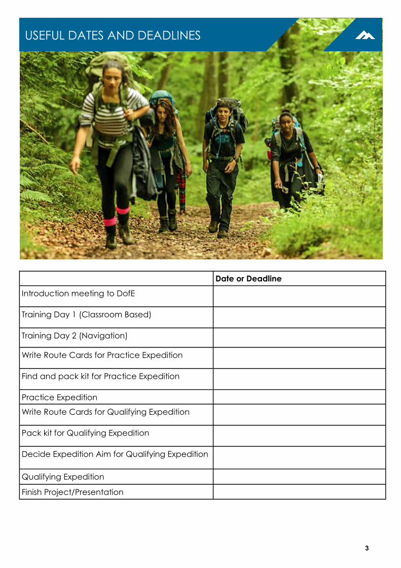
Date or Deadline
Introduction meeting to DofE
Training Day 1 (Classroom Based)
Training Day 2 (Navigation)
Write Route Cards for Practice Expedition
Find and pack kit for Practice Expedition
Practice Expedition
Write Route Cards for Qualifying Expedition
Pack kit for Qualifying Expedition
Decide Expedition Aim for Qualifying Expedition
Qualifying Expedition
Finish Project/Presentation
USEFUL DATES AND DEADLINES
3

4
PLANNING YOUR ROUTE
A key part of the expedition section is planning your route. In advance of each expedition,
your group must plan a route and submit a detailed route card.
For each expedition you are provided with a number of compulsory grid references you
must use. You must also choose additional grid references approximately every 1-2km or at
a key decision point.
ROUTE CARDS
The route card below can be downloaded from mendip.me/downloads. Plot your route
onto one of these route cards. Route cards are vitally important as they are used in order to
prove that you are competent to undertake your expedition.
Date: Day number: (1st, 2nd etc.)
Names of team members: Name of DofE Group:
Name of School:
Level: Bronze / Silver / Gold
Leg
Start Location:
Walking Speed (km/h):
General direction / bearing
Distance in km
Height climbed in
m
Time Allowed For: Total Time
for leg
Estimated Time of Arrival
Setting out time:
Walking Height Climbed
Exploring Rests Meals
Brief description of route to be followed Escape Route
Grid:
1 To:
Grid:
2 To:
Grid:
3 To:
Grid:
4 To:
Grid:
5 To:
Grid:
6 To:
Grid:
7 To:
Grid:
8 To:
Grid:
9 To:
Grid:
Totals: Expedition Aim:
You must use the compulsory checkpoints. It will also be necessary to add your own checkpoints. Use at least one route card per day. Start a new route card for each new day.
The following pages offer advice on how to write an effective route card. All groups will use
the Mendip Hills as their practice expedition. Some groups will use the Forest of Dean for
their Qualifying Expedition and some will use the Quantock Hills.
ROUTE CARDS

MENDIP HILLS: BRONZE PRACTICE EXPEDITION These compulsory grid references should be plotted on a route card
using a 1:25,000 map of the area. You must also choose additional grid
references approximately every 1-2km or at a key decision point.
Compulsory Grid References
Day 1 Description Day 2 Description
ST 516 558 Start Hamlet on B3134 ST 431 591 Lyncombe Wood Camp
ST 488 549 Multi-path junction ST 423 584 Upland Cottages
ST 485 573 Beacon Batch ST 433 579 Footpath / A38 junction
ST 465 586 5 Way Track Meeting ST 442 571
Footpath Junction
(Winterhead Hill)
ST 446 592 Path/Road junction ST 423 561 Path / A38 crossing
ST 431 591 Lyncombe Wood Camp ST 388 558 Crook peak
ST 392 551 Finish Crook Peak car park
COMPULSORY GRID REFERENCES
5
START AND FINISH LOCATIONS
START LOCATION: Hamlet on B3134, Burrington Combe Road.
Grid Reference ST 515 559 Nearest Post Code: BS40 7XW
Please meet by 10.00am
FINISH LOCATION: Crooks Peak Car Park, Compton Bishop
Grid Reference ST 392 551 Nearest Post Code: BS26 2HN
Groups normally finish by 3.30pm but please be flexible as they have been known to finish as
early as 2.30pm and as late as 5.30pm.
Nearest Hospital: Weston General Hospital (Between 8am and 10pm).
Bristol Royal Infirmary (Between 10pm and 8am).

COMPULSORY GRID REFERENCES
6
QUANTOCK HILLS: BRONZE QUALIFYING EXPEDITION These compulsory grid references should be plotted on a route card
using a 1:25,000 map of the area. You must also choose additional grid
references approximately every 1-2km or at a key decision point.
START AND FINISH LOCATIONS
START LOCATION: Cothelstone Hill Car Park
Grid Reference ST 200 329 Nearest Post Code: TA4 3DX
Please meet by 10.00am
FINISH LOCATION: Crowcombe Car Park
Grid Reference ST 140 366 Nearest Post Code: TA4 4AA
Groups normally finish by 3.30pm but please be flexible as they have been known to finish as
early as 2.30pm and as late as 5.30pm.
Nearest Hospital: Bridgwater Hospital
Compulsory Grid References
Day 1 Description Day 2 Description
ST 200 329 START Cothelstone Hill Car
Park ST 162 421 Moorhouse Farm Campsite
ST 172 333 Milton Farm Road Junction ST 158 414 A39 Road Crossing
ST 164 359 Triscombe Car Park ST 121 425 Path Junction: Perry
Combe Plantations
ST 162 382 Dead Woman’s Ditch ST 124 410 Beacon Hill Trig Point
ST 158 414 A39 Road Crossing ST 140 366 FINISH Crowcombe Car
ST 162 421 Moorhouse Farm Campsite

Compulsory Grid References
Day 1 Description Day 2 Description
SO 559 042 START St Briavels Lay-by SO 549 144 Start Biblins Camp Site
SO 554 056 Road Crossing SO 564 160 View Point
SO 537 097 PO Lower Redbrook SO 568 142 Hillersland Phone Box
SO 542 115 Knockalls Lodge SO 595 142 Eastbachmeend Inclosure
SO 546 124 Brindsey’s well SO 596 134 Road Crossing
SO 551 126 Staunton Church SO 609 124 Bridge Over Road
SO 557 128 Path Junction SO 614 120 FINISH Beechenhurst Picnic Site
SO 549 144 Finish Biblins Camp Site
COMPULSORY GRID REFERENCES
7
FOREST OF DEAN: BRONZE QUALIFYING EXPEDITION These compulsory grid references should be plotted on a route card
using a 1:25,000 map of the area. You must also choose additional grid
references approximately every 1-2km or at a key decision point.
START AND FINISH LOCATIONS
START LOCATION: St Briavels Lay-by: next door to the primary school
Grid Reference SO 559 042 Nearest Post Code: GL15 6TD
Please meet by 10.00am
FINISH LOCATION: Beechenhurst Picnic Site
Grid Reference S0 614 120 Nearest Post Code: GL16 7EJ
Groups normally finish by 3.30pm but please be flexible as they have been known to finish as
early as 2.30pm and as late as 5.30pm.
Nearest Hospital: Dilke Memorial Hospital

8
GRID REFERENCES
A grid reference is a way of marking each square on a map.
You will be using Ordnance Survey (OS) Maps with a scale of
1:25,000. This means that 1 centimetre on the map is equal to 25
metres in real life.
Ordnance Survey splits the country into 100 kilometre squares,
each of which is given a two letter identifier.
Each of these squares is divided up into further grids of 1 kilometre
squares. Within these squares the vertical lines are called the East-
ings and the horizontal lines are the Northings.
Your grid reference starts with the two letter identifier.
Then you quote the Eastings and then the Northings. The
number is quoted from the bottom left hand corner of
the square.
Remember the line: you go “along the corridor and
then up the stairs”.
This example demonstrates how to find a 4 digit grid
reference for a 1 kilometre square: TL 6233
Now imagine this square is split into 100 tiny squares with
10 squares making up each side.
This is the way to find a 6 digit grid reference: TL 625 333
This 6 digit grid reference represents a 100 metre square.
READING A MAP
In order to plan a route and go on your expedition you will need to be
able to understand how to read a map. The following information
should be used in conjunction with your DofE training.
EXPEDITION PLANNING

9
DIRECTION
To record the direction you will be walking you can use a bearing or
the general compass direction. E.g. 90° or East (E)
DISTANCE
Measure your distance careful-
ly on a map. If the leg is not in a straight line you will
need to use string and then a ruler to measure the dis-
tance.
Measure distance to the nearest 0.1km and height
gain to the nearest 10m.
TIMINGS
Your DofE route should last a minimum of 6 hours
each day, of which at least 3 hours should be spent
journeying.
Your group should start walking at a realistic time
each morning– e.g. 9.30am- and arrive at your
campsite at a reasonable time.
Make sure that you plan breaks in sensible places and at sensible times.
William Naismith created “Naismith’s Rule” in 1892. It says that the average person
walks at 5km per hour. The average DofE walking speed when wearing a heavy pack
on uneven ground is 3 or 4 km per hour.
According to Naismith’s Rule, for every 10m of height climbed, 1 minute should be
added to your timings.
Distance We recommend 3km per hour for Bronze.
(using timing information such as in the table below)
Height Gain Add 1 minute for each 10 metres climbed
(count the number of 10 metre contours climbed and add 1 min. for each)
Example At 3 Km. per hour : a distance of 1500 metres with 200 metres of height climbed
= 30 mins (distance) + 20 mins (height gain) = 50 minutes total.
Walking at 3km/hour produces the following timings:
Time (mins) 2 5 10 20 40 60
Distance (km)
0.1 0.25 0.5 1 2 3
EXPEDITION PLANNING

1 0
ROUTE DESCRIPTION
Being able to effectively describe each leg of the route will help you on your expedition
There are several ways to write an effective route description. Imagine you are telling a
story or describing how to walk to the shops. Be as efficient as possible and follow some of
the below guidelines:
The “Ds” of Navigation: Direction, Distance, Duration, Description, Dangers
Tick List: Write a list of features that you will see along your leg or that you will follow as
“handrails”.
Overshoot Features An overshoot feature is a feature that you will definitely see if you
have walked too far. For example you may decide that if you reach a road, a river or start
walking up a hill you have gone too far.
EXPEDITION PLANNING
1) Walk past the sheepfold
2) Use the river as a handrail on your right
3) Walk past a group of trees on your right
4) There is a steep rocky crag on your left
5) Keep walking into the valley
1) Cross the bridge
2) Follow the edge of the sheepfold on your
left
3) Pass some boulders on your right.
4) Watch out for the edge of the cliff.
5) Climb the ridge

1 1
ESCAPE ROUTES
An escape route is vital. It should be an instruction you can use quickly in an emer-
gency.
It could be to a previous checkpoint or to the next checkpoint if these are places of
safety.
Other places of safety might include places where you can get help and find a tele-
phone to call for help- such as a house, a road, a public house.
TIPS AND TRICKS FOR PLANNING A GOOD ROUTE
Stay off roads as much as possible. On the day of your expedition, your instructors will let
you know which roads you can cross by yourself or whether you need to meet them.
Pick a sensible route: try and avoid too
much climbing. Try to stick to paths.
Be as clear as possible: “KEEP IT SIMPLE”
Head for landmarks or obvious natural fea-
tures e.g. ruins, fence lines, rivers etc.
When marking up a route on a map it is not
good practice to draw with a pen over your
intended route. Some groups choose to draw
their route on a separate map, use a pencil or to ’trace’ the route on overhead projector
sheets (see photos). It is up to you to decide which method you want to use.
EDOFE.ORG
It is possible to map your route out
on the EDofE website.
This is a useful tool but you must
also create a route card manually
to prove that you understand the
route planning process.
EXPEDITION PLANNING

1 2
EXPEDITION PLANNING
EXAMPLE ROUTE CARD
The following are example compulsory grid references and an example route card.
Compulsory Grid References
Day 1 Description
ST 476 588 Start Burrington Combe North Car Park
ST 489 581 Burrington Combe South Car Park
ST 496 582 Luvers Lane Footpath Junction
ST 498 586 Finish Blagdon Picnic Spot
Date of expedition:
14 March 2022
Day number:
1
Names of team members: Team Member 1 Team Member 2 Team Name: Example Route Card
Name of School: Example School
Level: Bronze
Team Member 3 Team Member 4 Team Member 5
Team Member 6
Leg Start Location:
Burrington
Combe North
Car Park
Walking Speed
(km/h):
3km/h
General
direction
/
bearing
Distance
in km
Height
climbed
in m
Time Allowed For: Total Time
for leg
Estima
ted
Time
of
Arrival
Setting out time: 10.00AM
Walking Height
Climbed
Aim
Rests
Meals
Brief description of route to be followed Escape
Route
Grid: ST 476 588
1 To: High point South
East
120
0.3km 100m 6 mins 10 mins 2 mins 18 mins 10.18 Walk along road south. Go up steep hill
east. Keep going 300 metres until you
reach highest point.
Start of route.
Grid: ST 480 586
2 To: Burrington Combe South Car
Park South
East
120
1.1km 0m 22 mins 0 mins 5 mins 27 mins 10.45 Follow compass bearing of 120 down a
gentle slope past. Will pass a nature
reserve. Eventually will reach car park
by road.
South Car Park
Grid: ST 489 581
3 To: Luvers Lane footpath junction East
90
0.75 5m 15 mins 1 min 0 min 16 mins 11.01 Head north through trees for 100m then
turn east onto Luvers Lane. Follow
Luvers Lane until third footpath junction
on left.
Lower Ellick
Farm Grid: ST 496 582
4 To: Path meets lane North
East
25
0.3 0m 6 mins 0 mins 15 mins 21 mins 11.22 Follow path along fence line past small
buildings until you reach small lane.
End of route
Grid: ST 498 585
5 To: Blagdon Picnic Spot North
00
0.1 0m 2 mins 0 mins 0 mins 2 mins 11.24 Walk safely on right hand side of the
lane for 100m until reaching the picnic
spot.
End of route
Grid: ST 498 586
Totals: 2.45km 105m 51 mins 11 mins 22 mins 84 mins
(1 hour
24 mins)
Expedition Aim: To plan an example expedition for students
learning about DofE
You must use the compulsory checkpoints. It will also be necessary to add your own checkpoints.
Use at least one route card per day. Start a new route card for each new day.
The checkpoints on the left are com-
pulsory but the author of this route
card has also added the following ad-
ditional checkpoints at key decision
points
High Point: ST 480 586
Path Meets Lane: ST 498 585
NB: This route card only covers 2.45km so is not
an exact example.

This is a simple guide to kit packing. You can download a comprehensive “Dofe Expedition
Kit Guide” on https://www.dofeshopping.org/dofe-expedition-kit-guide/
GUIDE TO KIT PACKING
Pack kit yourself
Check the weight: it should be no more than 1/4 of
your body weight
Spread things out amongst the group: do you really need
your own cooking gear or toothpaste?
Pack your bag so it is evenly balanced
Make sure the straps are correctly adjusted
Avoid cotton and jeans
Avoid anything hanging off your rucksack
Please do not bring pen knives
Top of bag
Map and map case (GROUP KIT)
Compass (GROUP KIT)
Emergency Whistle (GROUP KIT)
Snacks & Lunch
Head torch
Gloves
Hat
Sun Cream
Toilet Roll
Water bottle
Middle of bag
Waterproof top and bottom
First Aid Kits (GROUP KIT)
Spare Clothes
Bottom of bag:
inside bin bag or dry bag
Tent (GROUP KIT)
Stove and fuel (GROUP KIT)
Sleeping Bag
Sleeping Mat
Breakfast & Dinner
Cutlery, Bowl, Mug
Toothbrush/toothpaste
First Aid Kit
Plasters
Scissors
Tape
Safety pins
Emergency money
Kit you will be wearing
Walking Boots with ankle
support
Thick walking socks
Warm trousers (not Jeans)
Long sleeve t-shirt
or thermal
Warm sweat shirt or fleece
KIT
1 3
KIT HIRE
Kit can be hired from Mendip
Outdoor Pursuits. Normally this is
done in conjunction with your
teacher.
Item Hire per Award
Tent (3 man) £25.00
Rucksack £5.00
Compass £2.50
Trangia Stove & fuel £5.00
If all students hire kit, the whole
package is £15 per student per
award.
Normally, kit will be given out at
the start of your expedition and
will be expected to be returned
and checked before you go
home.

MEAL PLANNING
1 4
GUIDE TO MEAL PLANNING
You must eat at least one hot meal a day.
Your food should be high in slow-release energy.
Take as many calories as possible- 3,000-5,000 calories per day.
Aim to have food you can snack on as you go, as opposed to one long lunch break.
Try to bring food which is compact and easy to carry.
There are lots of variety of ration pack meals available from supermarkets. They are great
but make sure you check the calorie count before you buy them as some of them are
very low.
HYDRATION: Bring at least two 500ml bottles of water. Ideally up to 2 litres.
SOME FOOD SUGGESTIONS
Breakfast ideas
Hot drink
Hot cross buns
Porridge
Cereal bars
Muesli
Breakfast ration pack meals
Lunch ideas
Pies / sausage rolls
Pitta bread/wraps
Crackers
Cheese
Chocolate bars / sweets
Kendal mint cake
Malt loaf
Fruit / nuts / hard boiled eggs
Dinner ideas
Ration pack meals include
chilli, sweet and sour, curry,
meatballs
Pasta & sauce
Rice
Sausage
Custard, chocolate pudding,
rice pudding

On your Practice and Qualifying Expeditions you will be given a copy of the following emer-
gency procedures. Please familiarise yourself with them in advance.
How to download OS LOCATE
Your team will be allowed one mobile which will be sealed and is only to be used
in an emergency. If possible, this phone should be a Smartphone and should
have OS LOCATE downloaded.
On your phone‟s APP STORE search for “OS LOCATE” and download. It is free and
takes up little space. If used, the app gives you a grid reference which you could
use in an emergency to let Mendip know where you are.
EMERGENCY PROCEDURE
1 5

It is a requirement of the 20 Conditions of the Dofe Expedition that you and your team
complete a project called the „Expedition Aim‟.
Your aim should be something personal and interesting to your team.
Think about whether it is suitable for your expedition area and level. Your teachers will give
you a copy of this form to help you out before your qualifying expedition.
Some ideas: Investigate the changes in local agriculture over the last 100 years; Explore an historic
place made famous in a film or television programme and document the scenery; Photograph and de-
scribe interesting old buildings along your route; Search for forms of fungi, photograph or sketch them and
record them; List and film the different kinds of birds that you see; Make a video diary of your team’s expe-
riences, from camping and cooking to reaching your destination; Design a team motif and make a badge
or accessory for each team member to wear that reflects your journey; Monitor the levels of litter on your
route and plan how you could campaign to reduce this; Consider the impact of vehicles on the environ-
ment along your route; Investigate the maintenance of footpaths and hedgerow; Record your different
emotions over the expedition and relate it to the physical challenge; Monitor what time of day people
have the most energy to push themselves harder and improve your journey times; Write a series of poems
of your experiences; Write a short ghost story or mystery tale based loosely on your expedition.
EXPEDITION AIM
1 6
What is your aim?
Please give a brief
description (1 or 2
sentences)
Example: We will keep a log of the weather and how it affects our team. In particular we want
to record the temperature.
What medium will
you use to com-
plete this aim? e.g. photography, writing
a diary, recording results
Example: We will take photos of the sky every half an hour and write a diary about how we
have adapted to the weather. We will take an outdoor thermometer with us and record the
temperature every half an hour.
What do you ex-
pect your results to
be?
Example: We think it will be really cold so we will have to work hard as a team to keep each
other in good spirit
How will you pre-
sent the results of
your aim? e.g. create a video, give a
presentation, make a book-
let
Example: We will present a report of our findings. It will include photos, quotes from our diary,
our temperature recordings and what we have learnt from the project.

As part of your DofE Training you will learn some basic First Aid. Be prepared for all conditions.
Keep an eye on each other. Your team will know you best, so any changes in personali-
ty or attitude could be an early warning for something serious.
When it‟s hot:
Keep drinking water. There will be opportunities to fill up water bottles throughout the
day.
Wear sun cream (and sunglasses) Just because it’s not sunny, doesn’t mean you wont
catch the sun.
Take breaks in shaded places.
Wear clothing to shade the sun: sun hats, light long sleeve tops, light trousers .
When it‟s cold:
Wear plenty of layers.
Wear a hat. In the winter, a hat will keep you warm. Hats are a great idea year round.
Put on a jacket when you stop for a break as your body will quickly cool down.
If there are strong winds consider avoiding the highest points of your route.
Make a hot drink when you stop for lunch.
When it‟s wet:
Wear your waterproof top and bottom when it is raining. If you get wet whilst you are
moving you won’t feel the cold but as soon as you stop you will feel freezing.
Ticks
Ticks are small animals which can attach them-
selves to you in some countryside areas. Ticks
can transmit Lyme diseases, but providing the
tick is located and removed within 24-hours it is
very rare.
To remove a tick, use a tick remover and follow the instructions, or grasp the head (as close
to the skin as possible) with a pair of tweezers and pull gently away from the skin.
Once the tick has been removed, check that the head has been fully removed to stop infec-
tion of the open bite and use an antiseptic. Keep an eye on the area, and if any unusual
changes are observed (in particular a red ring looking mark) or
lethargy and aches set in, see your GP.
How to reduce your risk of getting a tick
Wear long sleeves and trousers
Use DEET insect repellents
HEALTH ADVICE
1 7

The Countryside Code is a series of simple rules to follow in order to
look after the environment around us.
RESPECT. PROTECT. ENJOY
Enjoy the countryside and respect its life and work.
Guard against all risk of fire.
Leave all gates as you find them.
Keep your dogs under close control at all times.
Keep to public paths across farmland.
Use only gateways or stiles to cross fences, hedges and walls.
Leave livestock, crops and machinery alone.
Take all litter home with you.
Help to keep all waterways clean.
Protect wildlife, plants and trees.
Take special care on country roads.
Avoid damaging fences, hedges and walls.
Safeguard water supplies.
Respect the life of the countryside.
Avoid making unnecessary noise
Take only photographs, leave only footprints
COUNTRYSIDE CODE
1 8

In order to complete your DofE Expedition, you must fulfil all the fol-
lowing criteria:
1. Your expedition must be by your own physical effort, without any motorised
or outside assistance.
2. Your expedition must be unaccompanied and self-sufficient.
3. Your expeditions must be supervised by an adult who is able to accept re-
sponsibility for the safety of you and your team.
4. Your expedition must have an aim.
5. You must be properly equipped for your expedition.
6. You must have completed the required training and practice expeditions.
7. At least one practice expedition must be undertaken at each level of the
programme, in the same mode of travel in a similar environment to the quali-
fying expedition.
8. You and your team must plan and organise your expedition.
9. You must be assessed by an approved accredited Assessor to the DofE.
10. There must be between four and seven people in your team
11. You must be within the qualifying age of the DofE programme level.
12. Participants must be at the same level of assessment.
13. Your team must not include anyone who has completed the same or higher
level DofE expedition.
14. Your overnight accommodation should be camping.
15. Your expedition must be the minimum number of days required for your DofE
level.
16. Your expedition should normally take place between the end of March and
the end of October.
17. Your expedition should be in the recommended environment for your DofE
level.
18. You must do the minimum hours of planned daily activity for your DofE level.
19. You should cook and eat a substantial meal each day.
20. You must create and deliver a presentation after your expedition to com-
plete the section.
THE 20 CONDITIONS OF DOFE
1 9