Draft Statement OUV & Comparative Analysis World Heritage ...
252
Draft Statement OUV & Comparative Analysis World Heritage Nomination Lower German Limes Final version 2.0 July 15, 2014
-
Upload
khangminh22 -
Category
Documents
-
view
1 -
download
0
Transcript of Draft Statement OUV & Comparative Analysis World Heritage ...

Draft Statement OUV & Comparative Analysis World Heritage Nomination Lower German Limes
Final version 2.0
July 15, 2014

Company Leiden University
Date July 15, 2014
Authors Professor Dr. W.J.H. Willems
drs. E. Graafstal
dr. C. van Driel-Murray
Commissioned
by
Provincie Gelderland
Provincie Utrecht
Provincie Zuid-Holland
Rijksdienst voor het Cultureel Erfgoed

1
Table of Contents
Dutch Summary………………………………………………………………….....2
1. Statement OUV………………………………………………………………...3
A Very Brief Synthesis………………………………………………………...3
The Outstanding Universal Value……………………………………………...4
Integrity and Authenticity……………………………………………….......…5
2. Comparative Analysis………………………………………………………….9
General Description…………………………………………………….………9
Key Features and Values………………………………………….………….13
Comparison and Discussion……………………………………………….…17
3. Boundaries and Selection Criteria…………………………………………...21
Selection criteria for properties to be included as component parts in the
nomination …………………………………………………………………..21
Logical principles for the buffer zone……………………………………….24
Appendix I………………………………………………………………….….…26
2
Dutch Summary
Bij de Werelderfgoednominatie Romeinse Limes dient inzichtelijk gemaakt te
worden wat de uitzonderlijke universele waarde van de Limes is, hoe het staat met
de authenticiteit en integriteit van het voorgedragen erfgoed en hoe de Limes zich
verhoudt tot vergelijkbaar erfgoed. Hiertoe is dit document opgesteld.
Uitzonderlijke Universele Waarde (OUV) en Comparatieve Analyse
De nominatie heeft betrekking op de Nedergermaanse Limes (Lower German
Limes, LGL). Deze loopt van Katwijk aan Zee in Nederland tot Remagen in
Duitsland. De OUV van de Romeinse Limes laat zich als volgt samenvatten:
De Romeinse Limes in Nederland beslaat de hele periode van het Romeinse
Keizerrijk. Alle fasen zijn vertegenwoordigd: van de verovering tot het
uiteenvallen van het Rijk. Hierin is het Nederlandse deel van de Romeinse Limes
bijzonder; nergens anders is de Limes zo lang onafgebroken in gebruik geweest.
De Romeinse Limes in Nederland omvat daarnaast alle onderdelen van de
Romeinse militaire aanwezigheid. Niet alleen legioensbases, castella, wachttorens,
vlootbases en infrastructuur als wegen en vaarwegen zijn aanwezig, maar zelfs
restanten van watermanagement door landschapsaanpassing.
Een derde eigenschap die de Romeinse Limes in Nederland bijzonder maakt, is dat
de houtbouwfase uitzonderlijk goed bewaard is gebleven. De uitstekende
conserveringseigenschappen van de bodem hebben schepen, kades, houten
beschoeiingen en overig organisch materiaal bijna tweeduizend jaar lang behouden
en dit leidt tot unieke vondsten. Zulke kwetsbare resten zijn in overige delen van de
Limes allang vergaan, daar is alleen nog steenbouw over.
Ten aanzien van de criteria authenticiteit en integriteit wordt opgemerkt dat de
Romeinse Limes van oorsprong nooit een gesloten lijn is geweest, maar een geheel
van complexen dat effectief en efficiënt op de meest strategische locaties is
aangelegd. Dit houdt in dat de nominatie zelf ook geen aaneengesloten zone hoeft
te omvatten, maar ruimte biedt om een selectie te maken in de voor te dragen
terrein en daar bufferzones omheen te definiëren vanuit zowel archeologisch-
inhoudelijk oogpunt als vanuit het oogpunt van ruimtelijke ordening en mogelijke
conservering.
Aansluiting bij bestaand Werelderfgoed en proces
De nominatie van de Nedergermaanse Limes is een uitbreiding van het reeds
bestaand Werelderfgoed Frontiers of the Roman Empire. Het gaat daarmee om een
’transnationale seriële nominatie. Op dit moment is een aantal terreinen dat
mogelijk voorgedragen zou kunnen worden, op hoofdlijnen geselecteerd. Aan de
hand van de OUV zal bekeken worden welke terreinen daadwerkelijk in
aanmerking komen en welk onderzoek daarvoor nog nodig is. Deze terreinen
worden inhoudelijk, ambtelijk en bestuurlijk op diverse niveaus nationaal
besproken en op inhoudelijke gronden met experts uit binnen- en buitenland. Zie
hiervoor Appendix I.

3
1. STATEMENT OUV
1. A Very Brief Synthesis
The part of the Roman Frontier known as the Lower German Limes
(Niedergermanische Limes) ran for 380 km from Katwijk aan Zee at the mouth of
the Rhine in the Netherlands to Remagen in Germany. It was established gradually,
following the Caesarian and Augustan campaigns of conquest that led to its initial
infrastructure. Some of the camps that were situated south of the river Rhine as part
of the military support infrastructure for the conquest, subsequently became the
springboard for the construction of additional forts and fortlets along the left levee
of the Rhine from
40 CE onwards.
These were
supplemented with
watchtowers near
river bends, a clear
indication that the
system was intended
to create a line to
control movement
and transport both
across and along the
river. This system
was more or less
completed by the
2nd
century CE, the
main period of the
frontier at the height
of the empire, and remained in use in later years.
This part of the Limes was not a military bulwark in the sense of a closed and
interconnected system of walls, towers and forts along a more or less ‘straight’
line. Instead, it consisted of more loosely connected forts on the left bank of the
Rhine, like a necklace consisting of pearls on a string, with legionary fortresses in
between or in the immediate hinterland. Many military installations were
strategically placed in relation to the junctions of major tributaries upstream and
branch channels downstream, to control movement over water as well as over land
for military as well as economic purposes.
Following a temporary breakdown in the last decades of the 3rd
century, this system
remained in use during the 4th and the first quarter of the 5
th century as the forward
part of a defence system that in this period relied on an infrastructure reaching deep
into the hinterland over a wide area in Northern Gaul. Some new forts were
constructed and some existing facilities were partially or completely refurbished

4
while others were abandoned. Downstream, especially in the wetlands of the
western part of the Rhine delta where habitation conditions had deteriorated
significantly, the system may have served mostly to protect the trade route over the
Rhine to the province Britannia.
This infrastructure continued to influence the development of the area long after
the demise of the Roman Empire and some “pearls on the necklace” became
important Merovingian centres and later the basis for the ecclesiastical and
administrative infrastructure of the Carolingian empire.
2. The Outstanding Universal Value
In order to be admitted as World Heritage properties, nominations to the list must
demonstrate the presence of Outstanding Universal Value as well as meet the
conditions of integrity and authenticity. In addition, they must have an adequate
protection and management system in place. This is reflected in the scheme.
The World Heritage
Committee considers a
property as having
Outstanding Universal
Value (OUV) if the
property meets one or
more of ten predefined
criteria: six for cultural
properties, and four
for natural properties.
Three of these six criteria have been found relevant by the Committee for the parts
of the “Frontiers of the Roman Empire World Heritage Site” (FRE-WHS) that
have been nominated and inscribed so far. The criteria that have been found
relevant are criteria II, III and IV. This means that for new additions such as the
Lower Rhine Limes, these same criteria are appropriate. They should be defined in
such a way that they illustrate clearly what this part of the frontier adds to the FRE-
WHS as a whole.
Therefore, the OUV of this part of the Frontier is expressed as follows:
Criterion ii
Definition: to exhibit an important interchange of human values, over a span of
time or within a cultural area of the world, on developments in architecture or
technology, monumental arts, town-planning or landscape design.
The Lower German Limes formed part of the frontier throughout the entire
existence of the Roman Empire and as such reflects the development of Roman
military and related civilian facilities and infrastructure from its earliest beginnings
in the last decades BC until the mid-5th century (the building programmes of the
Roman emperors from Augustus to Valentinian III). It is also illustrative of the
development of all successive phases of its military strategy from a period of

5
conquest through a phase of stabilization and forward defence and ultimately to a
system of defence-in-depth. In addition, its built legacy served as a backbone that
shaped early Medieval civil and religious infrastructure.
Criterion iii
Definition: To bear a unique or at least exceptional testimony to a cultural
tradition or to a civilization which is living or which has disappeared.
The Lower German Limes is the only area that formed part of the frontier
throughout the entire existence of the Roman Empire, with an unbroken
occupation. It is at the same time unique because of the presence of all elements
that the military occupation could encompass, from legions in early and late forms
to regular as well as irregular auxiliaries in addition to the fleet. It is also a prime
example of a river frontier with exceptional (underground) preservation of wooden
riverine infrastructure such as quays and ships.
Criterion iv
Definition: to be an outstanding example of a type of building, architectural or
technological ensemble or landscape which illustrates (a) significant stage(s) in
human history.
As a river frontier which – in the delta area as well as the lower Rhine terrace
upstream – has always been a wetland, the Lower Rhine limes exhibits unique
testimonies of water management strategies and constructions, in addition to
holding an extremely varied dataset encompassing organic materials and artefacts
bearing unique information on frontier life and on vanished traditions such as
notably that of river boat building.
In Short:
The Lower German Frontier was in use during the entire period of existence of the
Roman imperial frontier, it had all sorts of troops and all the different types of
fortifications and it is an outstanding example of wetland and water management
in antiquity.
3. Integrity and Authenticity
Integrity
Definition: Integrity is a measure of the wholeness and intactness of the cultural
heritage and its attributes. Examining the conditions of integrity, therefore requires
assessing the extent to which the property:
a) includes all elements necessary to express its Outstanding Universal
Value;
b) is of adequate size to ensure the complete representation of the features
and processes which convey the property’s significance;
c) suffers from adverse effects of development and/or neglect)
6
In contrast to several other parts of the Limes, the Lower German Limes is a river
frontier that was never a closed line. The system was designed much as a necklace
with strategically placed “pearls on a string” and irregularly sized stretches of river
in between. There will have been a path, succeeded by a properly built road in
between, but the river was itself part of the system. Of course the design was such
that the system ideally must have been closed in the sense that all movement along,
but also across the Rhine, could be controlled.
Nevertheless, it was never a single structure but a system with cleverly arranged,
individual parts. The same approach has also been chosen for the inclusion of parts
in the World Heritage Site and no attempt has been made to physically connect the
constituent parts because they were never connected as one structure in the past
either. Moreover, as the Rhine is a living river, ending in a wide delta and, until
recently, still meandering, certain sections of the Roman Rhine have obviously not
survived to the present day. Indeed, some parts disappeared - or rather: changed
course - already during the Roman Period.
Nevertheless, geological and archaeological research has revealed that the Roman
period river system is largely extant, along with most of the infrastructure on the
south-western levee that is preserved below ground. Due to this location the
preserved remains also include very high quality organic remains much of which
have not been excavated. This provides for a very high level of archaeological
integrity, with finds and features preserved in their original context in the soil
matrix.
The remarkable standard of survival is despite the fact that sites when excavated
regularly show evidence of original layers having been washed out and redeposited
by the river, both during and after the existence of the frontier. This is considered
to be a normal part of any riverine site. It is a matter for discussion in an expert
meeting if completely washed out sites should be considered. An example in case
might be Carvium/Bijlandsche Waard, where large masses of stone indicate the
presence of an eroded military establishment at the famous moles, the dam built by
Drusus that Tacitus writes about. The remains are still present at their original
location, but redeposited at a lower level, and they constitute a well preserved and
authentic deposit containing extremely valuable historical material such as the
gravestone dredged up in 1938 belonging to the soldier Marcus Mallius from
Genoa, who according to his will, Carvio ad molem sepultus est, ´has been buried
in Carvium, at the mole’.
The Lower German Limes does not have many standing remains preserved above
ground. Some remains have been brought to light during archaeological
excavations or other works, but wooden structures have only survived in the soil or
under water level and in general, visible stone-built elements have been torn down
in the Middle Ages and later to re-use the stone in a region that was for the most
part a stoneless landscape. These fragments can be traced in many early- and late-
Medieval structures, adding another layer to the history of the Lower Rhine region.
Architectural elements of stone as well as foundations have been preserved below
ground, imparting additional significance to the high scientific value of the organic
remains. These form archaeological reserve areas all along the length of the river.
7
The World Heritage property is constituted of a selection of these areas along the
Rhine, as well as some elements of supporting infrastructure in the immediate
hinterland. In that way, the component parts represent the pearls on a necklace that
accurately reflects the structure of the past.
Elements from the hinterland comprise only those elements that can be directly and
exclusively related to the military infrastructure of the second century that
embodies the concept of forward defence. Military works from the later period
defence-in-depth system in the hinterland have been excluded. No elements from
beyond the Limes have been included, although a case could be made for those
structures that belong to the second century, the period selected to define the
frontiers of the Roman Empire as a whole. It would thus not be appropriate to
include military installations from an earlier time period (e.g. Velsen or Haltern
and the other Lippe forts), but it would be possible and in line with the nomination
to include military structures from the forward defence system in the second
century, such as marching camps (e.g. Ermelo). This remains to be discussed in an
expert meeting.
Particular areas have been included in the nomination for the contribution that they
make to the specific criteria for OUV in this part of the Roman Limes as outlined
above. Care has been taken to include the full variety of elements that is so typical
for this part of the Limes, both in a chronological sense as in covering the full
range of variability. In that way, the wholeness of the property is adequately
represented and its intactness is further supported by the fact that only sites with
substantial archaeological integrity have been selected.
The buffer zones around the proposed constituent parts need to be adapted to local
circumstances and buffer zones can be horizontal as well as vertical. In situations
where individual components are preserved as elements of the landscape, buffer
zones normally serve to control visible impacts of development. However, in
situations where large scale organic deposits and materials are present or suspected
below the surface, the buffers serve to maintain the physical integrity by
controlling the groundwater table, as well as any urban development above the
Roman remains. Buffer zones may also be extended over areas where
archaeological substance in the ground is expected on the basis of scientific
considerations, but for which there is as yet no firm evidence.
In short:
Because the Lower German Limes was never a closed line, the nomination does
not need to be a closed line either, while the integrity can still be shown to be
excellent. This provides considerable strategic freedom to decide which parts to be
included in the nomination and determining the buffer zones on the basis of not
only preserved archaeological remains but also feasibility from a spatial planning
perspective and conservation options.
Authenticity
Definition: Depending on the type of cultural heritage, and its cultural context,
properties may be understood to meet the conditions of authenticity if their cultural

8
values (as recognized in the nomination criteria proposed) are truthfully and
credibly expressed through a variety of attributes including:
• form and design;
• materials and substance;
• use and function;
• traditions, techniques and management systems;
• location and setting;
• language, and other forms of intangible heritage;
• spirit and feeling; and
• other internal and external factors.
The Lower German Limes is an archaeological property, and its location and
setting are fully authentic. Virtually all of the component parts that have been
included in the nomination are underground and remain unexcavated. They are the
original remains and as such not only exhibit a high degree of integrity but also
complete authenticity. A few parts have been excavated and have then been
properly conserved and presented. All these elements retain their authenticity.
Because the Lower Germans Limes is special also in that its authentic remains are
almost all below ground and hence invisible, their value needs some form of
translation in order to be understandable for the general public. This need has led to
some reconstructions but also to a number of innovative projects to convey these
values. Several sites are presented symbolically by expressing their boundaries on
the ground surface in some way, while protecting their authenticity as well as the
setting and integrity of the surroundings. Such symbolic representations are well
suited to create a minimum level of public experience of the Limes without
resorting to reconstruction in its classical form.
The authenticity of the nominated property is ascertained in that it is truthfully and
credibly expressed through incorporation of the full variety of Roman military and
related civilian facilities. In form and design as well as function all elements from
the chronological stages of military deployment are represented at their original
location. In many areas, organic remains are demonstrably or plausibly present, so
that here too the authenticity is credibly expressed in materials and substance.
In short:
The archaeological remains are fully authentic and they are preserved either
undisturbed or well conserved. The full variety of features from the military
infrastructure is represented.

9
2. COMPARATIVE ANALYSIS
1. General Description
In Roman times, the Lower German Limes (LGL) marked and defended the outer
boundary of the province of Lower Germany (Germania Inferior), physically
defined by the river Rhine. From the late 1st century, this frontier was held by a
cordon of c. 30 major military installations sitting of the left bank between Katwijk
and Remagen. The forts were fairly evenly dispersed along a 380 km stretch of
river – at an interval of 10 km on average, making this one of the more densely
held frontiers of the Roman world. A little upstream from Remagen, the provincial
boundary between Lower and Upper Germany was formed by a little brook named
the Vinxtbach harking back to the Latin finis for 'border'. At this point, the imperial
frontier crossed the river Rhine to continue as an artificial barrier mostly right
down to the Danube – the Upper German-Raetian Limes, protected as part of the
Frontiers of the Roman Empire WHS since 2005.
Physical setting
In terms of natural geography, the Lower German frontier can be roughly divided
in three compartments. Not surprisingly, these coincide with the administrative
boundaries between Rheinland-Palatinate, Nordrhein-Westfalen and the
Netherlands – the partners in the proposed extension of the FRE WHS. But the
subdivision would have been very real and relevant for the Romans as well. Lower
Germany was a geographical theatre in its own right, being effectively separated
from Upper Germany by the Rheinisches Schiefergebirge. Here, the 'Middle' Rhine
is mostly confined in a steep-sided valley, which made river traffic difficult in pre-
modern times. The first 10 km stretch of the LGL downstream Remagen really
belongs to this landscape. Then, at Bonn, the Lower Rhine plain
(Niederrheinebene) of Nordrhein-Westfalen opens up. Here the Rhine meandered
more freely migrating within its band of holocene sediments, about 3 km wide,
sometimes eroding the edges of the glacial Lower Terrace (Niederterrasse). This
terrace was normally flood-free, and with few exceptions the Romans planned their
military installations at the edge thereof, preferably at points where a river bend
touched it. Just past the German-Dutch border, the river delta is announced by the
bifurcation of the Rhine and Waal. Here a more marginal landscape of sandy,
elevated channel-belt and levee deposits (Dutch: stroomruggen) takes over, largely
determining where habitation and cultivation was possible – and where not. For the
Dutch sector, there is a relevant further subdivision between the Nederrrijn, which
has remained an active river since the Roman period, and the Kromme Rijn and
(west of Utrecht) Oude Rijn that have largely silted up since the 3rd century. This
subdivision neatly coincides with the provinces of Guelders on the one hand, and
Utrecht and South-Holland on the other.
The river Rhine, even the residual gully of the Kromme and Oude Rijn, is a
majestic feature of the historic environment. However, it is important to realize that
the Roman riverscape would have looked incomparably different from our
experience. The 19th- and 20th-century campaigns of river regularization have

10
completely changed its aspect. Recent research in the Dutch river delta as well as
Nordrhein-Westfalen has shown that in Roman times the river plain would have
been a complex, constantly rejuvenating system of main beds, older channels and
cut-off oxbows slowly silting up, providing shelter and harbourage at many points.
Of the stronger terrain features, the glacial moraines in the Xanten, Kalkar, Kleve
and Nijmegen areas deserve mention, as they have demonstrably influenced the
positioning of military installations from the very first stage (c. 19 BC-AD 14).
Further south, the anatomy of the Mittelrheintal clearly determined the planning of
installations like the fort at Remagen which was placed at a marked ‘bottle-neck’
position.
Historical and archaeological resources
One of the special aspects of Lower Germany is the very dense coverage of its
history, geography and peoples by Roman geographers and historians. This holds
particularly true for the formative stages of the province and its frontier. This is in
large part explained by the involvement of prominent members of the Augustan
dynasty, like Drusus, Tiberius and Germanicus, in the attempted conquest of
Germany. More coincidentally, the historian Tacitus had stayed in Belgian Gaul
and the Rhine districts when his father was head of financial administration for
these provinces. This explains his intimate knowledge of the tribes and histories of
the area, culminating in his famous account of the Batavian revolt of 69. Plinius,
writer of the Natural History, had served as a cavalry officer at Xanten (a piece of
horse gear inscribed with his name was found there!) and taken part in a campaign
to the Frisian coast in 47. Later prominent visitors include Trajan who received the
news of his election as heir presumptive to the purple while residing in Cologne as
governor of Lower Germany. In 122, Hadrian – a former commander of the 1st
Legion in Bonn – passed through the province on his way to Britain, where he was
to inspect the construction of his famous Wall in Britain. On this trip, incidentally,
Hadrian was accompanied by his secretary Suetonius, the famous biographer.
A different type of written evidence is provided by inscriptions, graffiti and stamps.
Some of these, like military brick-stamps and bronze diplomas issued at
honourable discharge, belong to the regular stock of Roman provincial
archaeology, but they are essential for reconstructing the military occupation of the
frontier installations. While Lower Germany is well provided with this material, its
collection of early Roman military tombstones, notably from the Bonn-Nijmegen
sector (the so-called Rheinische grabstelen), is something special in northwest
Europe, both in numbers and quality.
The LGL boasts an excellent research tradition and a staggering mass of excavation
data mostly accumulated since the late 19th century. Some of the great advances in
the study of Roman fortifications originated here, like the groundbreaking work of
Lehner at Xanten, Koenen at Neuss, and Van Giffen at Valkenburg. This research
tradition has resulted in a particularly strong infrastructure of universities (U) and
museums (M) at Bonn (U/M), Cologne (U/M), Xanten (M), Nijmegen (U/M),
Amsterdam (U) and Leiden (U/M). In more recent times, the Bodendenkmalpflege
offices of the respective German Länder have taken up a crucial role in research

11
and documentation. In the Dutch situation, part of this has fallen to the
responsibility of the State service (formerly ROB, now RCE) and the municipal
services of a.o. Nijmegen, Utrecht, Leiden and The Hague. As both the German
Rheinland and the central/western Netherlands continue to be very dynamic areas,
the LGL has seen a surge in developer-funded archaeology in the last two decades,
resulting in a spate of excavation reports. A final positive element is the long
gestation of this nomination, which has been fermenting since the late 1990’s. As a
result, up-to-date inventories are now available, for Nordrhein-Westfalen through
the project Bestandserhebung Niedergermanischer Limes (since 2005), for the
Netherlands through ongoing digital documentation at the RCE.
Historical outline
The first Roman military presence on the Rhine is now understood to date back to
c. 19 BC, when a two-legion force was based on the Hunerberg at Nijmegen, soon
to be followed by another major base at Neuss (c. 16 BC) and smaller installations
at Bonn and Moers-Asberg. The precise purpose of this first disposition is still
hotly debated. It certainly served to monitor the German tribes that had been
recently allowed to settle on the left bank, most famously the Ubians and
Batavians, as a measure to secure the northern periphery of Gaul. However, this
tribal reshuffling appears to have elicited raids by others, like the Sugambri in 16
BC. Whether planned or not, the punitive campaigns that followed soon developed
into a major military commitment in Germany. For a while (c. 7 BC-AD 9), it
looked as though a great-German province roughly defined by the rivers Lippe and
Lahn was underway, with its capital at Cologne. This perspective was shattered by
the massacre of Varus with three of his legions in the Teutoburger forest in AD 9,
and could not be reversed by the punitive campaigns of Germanicus (14-16).
Interestingly, when the Roman army redeployed on the left bank of the Rhine after
AD 9, it largely reverted to the bases that had served the German campaigns. In
Lower Germany, two legions were based at Xanten, opposite the Lippe, thus
controlling the major tribes of the North German plain, while another army group
settled at the old logistical base of Neuss. The first deployment on the Lower Rhine
shows a marked preference for concentrating forces at a few main bases
(Schwerpunktlager), with a number of minor installations providing local security,
logistic support etc. With four legions and some 30 auxiliary units, totaling c.
40,000 soldiers, the Bonn-Nijmegen area retained the largest concentration of
military forces in the Roman world up to the late 1st century.
Feeding this force posed an enormous challenge. It has been calculated that nearly
2,000 shiploads of grain a year were needed to meet its needs (not counting fodder
for horses), while the dependent communities of servants, soldiers’ families and
traders go a long way to double that figure. If we add staple items like wine, olive
oil, beer and meat it is clear what the river Rhine must have meant to the Romans:
a vital transport corridor to link up with crucial areas for army supply ranging from
southern Spain to Britain. Recent research has suggested that the earliest forts in
the western Netherlands were planned and manned with the specific purpose of
securing and supporting the supply traffic that passed through the Rhine delta.

12
There were other non-defensive purposes, like monitoring the integration process
of recently resettled tribes on the left bank. The Roman army can be shown to have
been involved in the development of the capitals of the administrative districts
(civitates) of the Ubii, Cugerni, Batavi and (later on) the Cananefates, at Cologne,
Xanten, Nijmegen and Voorburg, respectively. The internal peace-keeping role of
the army is highlighted by Roman responses to the Gaulish rebellion of 21 and the
Batavian revolt of 69, which brought a legion back to Nijmegen (c. 70-104). The
involvement of the Tenth Legion in building the civic infrastructure of the Batavian
civitas is a particularly fine example of the integrative role of the Roman army and
frontiers.
By the early 70’s, a dense chain of military installations had gradually clustered
along the Lower Rhine for a number of reasons (warding off external aggression,
internal security and development, supply logistics), resulting in the most strongly
held line in the Roman world at that point. After the institution of the province of
Lower Germany c. 85, a few changes were made in the positions and sizes of forts,
and the last gaps plugged. The LGL thus was the first frontier of the Roman world
to reach the fully-fledged form of the classical stage of limites as defined by the
FRE WHS. Few changes occurred thereafter, except for the gradual rebuilding of
most forts in stone in the course of this ‘happiest age of mankind’ (according to
Gibbon). An interesting development is the coastal extension of the LGL south of
the Rhine debouchment in the mid-2nd century, reflecting increasing concerns for
seaborne raiding.
Fundamental changes occurred after the middle of the 3rd century, when the
Roman provinces periodically suffered from a vicious circle of economic decline,
external aggression and internal strife. In the late Roman period, exposed frontier
provinces sometimes moved to the centre of politics, with their populations and
armies supporting imperial candidates who seemed better placed to serve their
interests, like the self-proclaimed emperor Postumus who ruled the northwestern
Roman provinces from Cologne (260-268). The answer to this was a partition of
imperial power, with junior-emperors often administering the northwest, usually
from Trier, like Constantine the Great (306-312).
Constantine’s presence here c. 310 marks the first of a series of reinstatements of
the much-exposed Rhine in the course of the 4th century. Forts were rebuilt,
sometimes reduced in size, but with much stronger defences, while completely new
types of installations were also developed, like the bridge-head-fort at Köln-Deutz.
The ability of self-contained defence appears to have gained in importance, while
elements of a system of ‘defence in depth’ along the penetration axes to the interior
seem to acknowledge the increased threat of Germanic incursions. While most of
this investment is clearly concentrated on the old core sector upstream of
Nijmegen, the area downstream reverted to its role of a transport corridor operating
between England and the Continent, with Valkenburg and Brittenburg as the main
hubs in the Rhine estuary.
13
2. Key features and values
Chronological span
The key feature of the LGL clearly is its early origin and longevity. Ranging from
c. 19 BC to about AD 440, when the capital of Cologne was taken and occupied by
the Franks, the cordon of frontier installations in Lower Germany encapsulates the
complete development of Roman frontier policies and dispositions as briefly
outlined above. From all main stages, various types and sizes of installations are
included in the proposed nomination. From the classic age of limites, in particular,
the complete spectrum of frontier installations is represented, ranging from the
stone-built watchtower at Neuss-Grimmlinghausen to the legionary fortresses at
Bonn – a difference of scale of 1:30,000 in terms of internal space. Together the
successive military dispositions reflect the changing Roman policies and attitudes
towards the populations under their control on the fringes of their Empire.
Contained in several of the proposed sites is evidence of events that shaped the
frontier’s history, like the destruction layers of the Batavian revolt found in most
Lower Rhine forts and the victims of the first great Frankish incursions in 259/60 at
Krefeld-Gellep.
Given its longevity, the LGL illustrates the complete evolution of Roman military
architecture and infrastructure up to the late 4th century. In fact, Roman
archaeologists are largely committed to Lower Germany (together with Augustan
Germany) when it comes to studying the development of the ‘classic’ Roman forts,
recognizable by their playing-card shape, their typical defenses, and regular
internal plan. This is particularly true of early legionary bases at Nijmegen, Xanten,
Neuss and Bonn, where the internal accommodation appears to reflect a highly
stratified view of human society, with the officer’s mansions mimicking the
luxurious homes of the Mediterranean municipal elite. At the same time, the
translation of received forms in local materials, like timber and wattle and daub, is
evidence of the Romans’ pragmatism and adaptability to different circumstances.
Another aspect of this is the way Roman military planners used the local terrain to
stage their monumental gestures, as expressed, for example, in the fort frontages
and prominent structures erected in Cologne, Xanten and Nijmegen, sending their
messages into Germany.
Perhaps under-estimated as a cultural resource is the late Roman period. Recent
research at Krefeld has shed light on a complex 4th-century development, while
Dormagen and Kalkar have provided evidence for the fort reductions known from
elsewhere. This period also saw new foundations like Qualburg, and innovative
designs like the small installation at Haus Bürgel or an apparent trapezoidal fort at
Alpen-Drüpt strongly resembling Altrip in Upper Germany. Several forts, like
Bonn and Utrecht, remained in use in the early medieval period, thus laying the
foundations for the first stage of urbanisation in Lower Rhine area.
Systemic integrity
Because of the multiple functions of the river Rhine as a defensive barrier, a formal
boundary and a logistic feeder, most elements of the military system of Lower
Germany were confined within this single narrow strip on the left bank of Rhine.

14
On most other Roman frontiers (and this goes for the early Roman disposition in
the Danubian provinces as well), the legionary bases, the Empire’s ‘main strength’
(Tacitus, Ann. IV.5), were kept in a rearward position, as a strategic reserve. This
is why the artificial frontiers lack this important element, the nearest legionary
fortress in England sitting 120 km south of Hadrian’s Wall.
For the same reason, the Lower German river frontier has this additional element of
the Roman fleet, the Classis Germanica, based at Cologne-Alteburg. Furthermore,
because the governor of Lower Germany also acted as commander in chief of the
forces in his province, he chose to reside close to the main legionary bases in the
German Rhineland, i.e. at Cologne – adding his imposing palace (praetorium) to
this proposed extension of the FRE WHS. The dossier thus uniquely includes the
complete hierarchy and diversity of Roman military installations.
With the legions so well represented, the LGL illustrates the remarkable range of
activities performed by the Roman army in provincial and frontiers settings. Some
of these pertain to the army’s own needs, logistic or training facilities. A
spectacular recent discovery are the scatters of practice camps in the environs of
Bonn and Xanten, the bases of Legio I Minervia and XXX Ulpia Victrix,
illustrating the proverbial discipline of the Roman army. Interestingly, the first
specimens have now also turned up at auxiliary forts, like Till-Steincheshof.
However, the Roman army is culturally relevant to us not just as a military
institution but as a living community of peoples of diverse backgrounds. This is
why the extensive extra-mural settlements of traders, artisans, shopkeepers and
military families (called canabae and vici in the case of legionary fortresses and
auxiliary forts, respectively) are an indispensable mirror element in the present
nomination, as are the extensive cemeteries that guided these conurbations. Equally
important for understanding the cultural exchange and syncretism in Roman
frontier communities are the cult sites that attracted a specifically military
following, like the sanctuary of Vagdavercustis at Kalkar.
A recent study of the Thirtieth legion based on inscriptions from all over Lower
Germany and beyond, shows the sheer scale and diversity of its employment. Thus,
detached personnel of the legions of Lower Germany can be seen at work at
military brickworks at Dormagen, Xanten and Holdeurn, stone quarries like the
Drachenfels, and the lime kilns of Iversheim. The fleet was deeply involved in this
industrial-logistic complex, as illustrated e.g. by its role in supplying the stone
material for the forum of the civil town at Xanten. The Lower German dossier
singularly charts the role of the Roman army as a default development force, also
of basic civil infrastructure, as is illustrated by the strong military element in the
peripheral town of the Cananefatians at Voorburg.
A special aspect: river transport and water management
The LGL presents us with a special aspect of river frontiers: the interconnection
between military infrastructure and security arrangements on the one hand, and
logistics, river transport and water management on the other. The choice of sites
for the forts in the western Netherlands suggests that the control of the local maze
of waterways, notably the side-rivers that exposed the Rhine corridor to waterborne
15
raiding from the north, was a key consideration for Roman military planners. The
provision of closely supervised harbourage at regular distances also clearly played
a major role here.
With few exceptions, the forts in Lower Germany appear to have been provided
with timber quays and strong revetments over hundreds of meters. In contrast to
other FRE WHS stretches, well preserved wooden structures are a familiar feature
for Dutch archaeologists digging at sites such as Vechten, De Meern, Woerden and
Valkenburg. More recently, a similarly elongated riverfront has been documented
at Moers-Asberg, while there is every reason to believe that things are no different
at Krefeld-Gellep, Kalkar and Till-Steincheshof. Of a different order would be the
artificial harbour basin suggested by remains of a stone mole in front of the
legionary fortress at Bonn, and the harbour construction at Voorburg.
A similar stone mole, known from literary and epigraphic sources, was constructed
at Herwen at the bifurcation point of the Waal and Nederrijn, in order to increase
discharge via the latter branch. At the base of the Rhine delta, a canal was dug
between the Rhine and Meuse estuaries in the early Roman period, the so-called
fossa Corbulonis, ‘in order to avoid the dangers of the sea’ (Tacitus, Ann. XI.20.2).
A second artificial canal is suspected south of the De Meern, connecting with the
Hollandsche IJssel.
The importance of the Rhine as a trade axis is clearly indicated by the remarkable
cache of votive offerings dredged up at Colijnsplaat in the Oosterschelde, on the
route to Britain. The role of Trier and Cologne in this largely civil trade in wine,
fish sauce, pottery etc. comes out clearly. Watchtowers placed at propitious points
in river bends would have surveyed this traffic, while the arrangement found at a
tower at Xanten-Lüttingen is suggestive of controlled use of the tow path that
would have been continuously provided on the left bank.
A rare resource: the materialities of a river frontier
Being largely a lowland river, and feeding one of the largest troop concentrations
in the Roman world, the Lower Rhine was the natural habitat of a specific type of
transport vessel: the river barge. Some 18 of these, of a distinctly regional design
(Prahme rheinischer Bauart), have been found, mostly accidentally, the majority of
them in the harbour fronts of forts. Dozens of these must still await discovery in the
river beds adjacent to forts, particularly in the western Netherlands where the
fossilization of the river has prevented erosion of the ship remains. However, the
same conditions probably apply to the oxbows and residuals channels on which
several forts in Nordrhein-Westfalen are situated (e.g. Moers-Asberg, Kalkar, Till).
Apart from ships, the Lower Rhine area is also famous for the practice of votive
offerings of prestigious items of military equipment in aquatic contexts, a regional
tradition going back to the Bronze Age. Roman helmets, swords and horse gear
have been dredged up at a number of places along the rivers Lower Germany, with
marked concentrations as at Nijmegen, suggesting established cult sites. A less
well-known aspect of the Roman military sites in the Lower Rhine area is that the
same type of weapon depositions regularly occurs along their river frontage as is
illustrated by finds of helmets and/or swords at, for instance Roomburg, Woerden,

16
De Meern and Vechten. Dozens, if not hundreds of such votive offerings are
probably still to be found along the river frontages of all LGL forts.
For the same reason, the silted-up river-beds in front of the forts are veritable
archaeological treasure chests in general – not because of individual spectacular
finds but because of the masses of mundane material. These contexts literally
functioned as the rubbish-dumps of the local garrisons and settlements,
accumulating sewage and kitchen waste, broken vessels and other discarded items,
as well as cuttings and offal of small industries, like butcheries, tanneries etc. The
waterlogged conditions and clay sediments typical of residual river channels
virtually guarantee the perfect preservation of perishable materials like leather,
wood, seeds etc. These deposits are a unique of source of information for the
economy and material culture of the military settlements in the frontier zone and
the extended communities that depended and fed upon them.
Furthermore, the lowland and wetland settings of most LGL sites mean that the soil
conditions (mineralogical composition and position in relation to groundwater
table) of ‘sealed’ archaeological contexts like wells, deep pits and ditches contain a
wealth of environmental and nutritional information, like well-preserved pollen,
seeds, pits and small animal and fish bones. A recent Dutch research project has
demonstrated the potential of this material for reconstructing the natural
environment of the forts as well as food procurement strategies of the Roman army.
There are two categories of perishable materials which the Roman army used in
great quantities that deserve special mention: leather and wood. In normal
circumstances, both decay within a matter of years or decades, leaving many
Roman fort sites in Europe bereft of these materials. Along the LGL, in contrast,
especially in the Dutch river delta, organic materials have been preserved in
abundance. Due to the high ground water tables in the western Netherlands, it is
common for military timber structures to have survived in the subsoil. Thus, the
foundation posts of the defences, roads and internal buildings of the first
installation at Alphen have allowed a year-by-year reconstruction of the building
process of a Roman fort (c. AD 41-43). Similarly, extensive year-ring analysis of
timber revetments of the Limes road in the western Netherlands has resulted in a
detailed picture of successive construction and repair campaigns. Recent analysis
of the ship finds from the Netherlands has proved the existence of local ship yards
and identified sources of timber supply sometimes a 100 miles away. Leather, like
wood, is an incomparable source of information about local industries, clothing and
the composition of the population. Not surprisingly, some of the most important
recent advances in environmental reconstruction as well as Roman military
provisioning strategies have come from this area.
A paradoxically positive aspect of the townscapes that have developed in much of
the Lower Rhine area is the protective cover provided by post-Roman construction
layers. At places as different as Remagen, Bonn, Dormagen, Utrecht and
Valkenburg post-Roman deposits sealed by occupation levels can be shown to have
prevented these sites from being extensively damaged by ploughing, clay-digging,
etc. At Bonn, a recent inventory has shown that c. 85 % of the former Roman
fortress has been preserved between the foundations and cellars of modern building

17
– and most of this surprisingly well at that. Similarly, the fort at Utrecht, under the
Medieval cathedral, has recently been confirmed as one of the best preserved forts
of the LGL.
3. Comparison and discussion
The LGL as a complement to existing parts of the FRE WHS
In assessing the particular contribution of the LGL to the transnational FRE WHS
site, it is important to realise that the earlier nominations of Hadrian’s Wall (1987),
the Upper-German/Raetian Limes (2005) and the Antonine Wall (2008), all
represent a specific stage and special variant of Roman frontiers: the ‘artificial’
barriers of the 2nd century. This means that there is a difference in chronological
scope. While the Hadrian’s Wall complex contains a few late 1st-century forts and
remained in operation in the late Roman period, the German Limes essentially
dates from the early 2nd century and was given up in 254 (Raetia) and 260 (Upper
Germany). The Antonine Wall functioned for two decades at most (c. 142 – 158).
Perhaps more importantly, the artificial frontiers represent just one element, if a
particularly manifest one, of the larger military disposition, the ‘preclusive’
security cordon watched by a continuous series of towers and backed up by
auxiliary forts. The British and German parts of the FRE WHS do not comprise the
legionary bases which figure so prominently in the proposed Lower German
extension, nor the wider logistical infrastructure that supported the army in the
frontier provinces. In the Lower German situation, all elements are superimposed
on the left bank of the Rhine and represented in the nomination. The foregoing
survey (§ 2.2) has highlighted various aspects of the Lower German army’s
involvement in mining, industry, logistics, building activity. In contrast to the
British and German frontiers, the towns of the Lower German frontier districts
were very much part of the same military cordon on the left bank. Although they
are not normally included in this nomination (except for military-promoted
Voorburg) urban communities, and therefore military-civilian interactions, are
firmly part of the frontier landscape of the LGL.
There are also differences between the proposed Lower German nomination and
that of the middle Danube. Here, the Roman military disposition was much slower
to concentrate on the line of the river Danube. Until the late 1st century, most of
legions and a good part of the auxiliary units were stationed in the interior of the
provinces of Noricum, Pannonia and Dalmatia. As a consequence, the crucial
formative stages (c. 15 BC-AD 85) are less completely covered in the Middle
Danube nomination. If we compare the resources of the constituent and proposed
parts of the FRE WHS, the narrative and future study of early Roman military
architecture will largely focus on Lower Germany, while the Middle Danube is
clearly the leading area when it comes to late Roman military architecture. So far,
rather less evidence of the resources and aspects covered in § 2.3 and 2.4 has come
to light in the middle Danube area. In these fields, the LGL, and the Dutch river
area in particular, possesses an unrivalled potential.
The particular contribution of LGL, then, is that is encompasses the complete
evolution, from the very earliest stage, of the Roman military disposition in the

18
widest sense, including the legions and their manifold activities, the fleet, the
command structure, etc. Of the classic 2nd-century frontiers, the LGL had most of
its hardware in place shortly after 70, making this one of the earliest linear
arrangements in the Roman world with the potential performance of a ‘prelusive’
frontier. Of particular interest is the system’s adaptation to a complex and dynamic
natural environment, notably in the Rhine delta, and its symbiosis with the water
infrastructure generally. This is reflected in specific elements like harbour
installations and water works which figure prominently in the proposed
nomination.
The LGL (and wider FRE WHS) in comparison to other fortified boundaries
Perhaps surprisingly, fortified boundaries are a much under-represented category
on the WH list. According to the thematic framework of the ‘Filling the Gaps’
report (ICOMOS 2005), this category consists of the Great Wall in China (property
nr. 438), the fortifications of Derbent (1070), and the Defense line of Amsterdam
(759). The latter, however, is of a totally different nature. Like the New Dutch
Waterline (Dutch tentative list) and the Ligne Maginot (France, 1928-1936), it
served as a linear bulwark, designed to withstand attack in force by modern armies
with heavy firepower. The Roman Limes, in contrast, was never meant as a line of
static defense, with the Roman army entrenched behind a river or a physical
barrier. By their organization, equipment, tactics and training, Roman legions and
auxiliary units were specialists in mobile, offensive warfare. If ‘defensive’ in any
meaningful way, Roman frontiers served as jumping-off points for interceptive
pursuit or punitive reprisal, or, ideally, pre-emptive strikes far beyond the Limes.
There is a second crucial difference with most fortified boundaries in recent history
in that limites were not understood to mark the extent of Roman rule – they weren’t
territorial boundaries in the modern sense. Rome always controlled a wide buffer
of polities and tribes beyond the Limes through formal agreements of client-rule or
‘friendship’ backed up armed suasion, money and occasional punitive campaigns.
In this game, the physical demonstration of Roman power as expressed in the forts
and towers placed on the edge of Empire was a crucial element, their monumental
stone facades showing Rome’s mastery over terrain, natural resources and peoples
alike.
An authentic aspect of the LGL and the Danube Limes (Tentative list of i.a.
Austria) is that they represent a special variant of fortified boundaries, sc. the ‘river
frontier’. Throughout history, rivers have been used by empires to stake claims of
hegemony – the very origin of the Rhine and Danube limites goes back to precisely
such claims by Caesar and Augustus, respectively. However, as fortified
boundaries river frontiers are scarcely represented in the human cultural record
(and absent on the WH list). For all their attraction as markers of space, rivers
really are poor separators of human communities, their valleys often functioning as
zones of exchange rather than cultural divides. This is certainly true for the LGL,
the tribal communities on both sides of the Rhine sharing much the same material
culture and values originally.
19
In functional terms, the Limes provided a line of control to monitor cross-frontier
movement and trade, and ward off small- and medium-scale security threats in the
range of brigandage and raiding. The preclusion of raiding was important, as this
was an endemic and potentially escalating element in the martial culture of the
tribal societies that lived beyond Rome’s frontiers. This aspect invites comparison
with early medieval barrier systems like the Dannevirke (Schleswig-Holstein) and
Offa’s Dyke (Wales), or perhaps the medieval Landwehre that surrounded some of
Germany’s early polities. However, these earthworks are generally less elaborate
and articulate, and therefore less informative, while there are also issues with their
integrity and state of documentation. Perhaps more importantly, they are
incomparable to the frontiers of the Roman Empire in that their extent was local
and they divided essentially similar communities.
More directly comparable would be fortified boundaries that monitored the edge of
other pre-modern empires that were exposed to nomadic infiltration or raiding. In
the geo-cultural regions spanned by the former Roman Empire, the closest parallels
are the barriers in the ancient Near and Middle East (e.g. Amurrit wall,
Cappadocian Wall); the various barriers built in Central Asia between the 2nd
century BC and the 6th AD, notably the Sassanid Wall; and the Anastasius Wall
that protected the Byzantine Empire.
As a cultural monument and resource, the Frontiers of the Roman Empire are far
more complex than the cited examples because of the sheer variety of physical and
human geography negotiated, and the corresponding variety of installations, barrier
elements and deployment patterns designed to meet specific challenges. The
archaeological resources contained in this serial property are unsurpassed in their
varied content and staggering mass, opening up endless possibilities for the
comparative research of every thinkable aspect of life in and around the military
frontier communities. This is complemented by a range of historical sources and
documentary evidence that directly pertains to the conditions of life and service on
the frontiers, such as discharge diplomata, countless inscriptions, and even parts of
military archives as preserved in the Vindolanda tablets on Hadrian’s Wall or
papyrus records in arid regions.
Perhaps, the principal contribution of the Roman frontiers to the collective human
experience resides in values signaled as under-represented in the existing WH list
by the ‘Gaps’ report. On a practical note, the Roman frontiers represent an
impressive series of ‘creative responses’ to natural and cultural challenges (terrain,
building materials, food supply, local security issues, etc.). The ‘utilization of
natural resources’ by the Roman military in a pragmatic and often sustainable
fashion is a quality that keeps surprising even the most experienced student of
Roman frontiers.
Roman frontiers are all about ‘movement of peoples’, another criterion underlined
by the ‘Gaps’ report. What is important here is not so much the obvious regulatory
function of limites, as the ongoing process of incorporation of indigenous
communities through service in the Roman army. Through recruitment, occasional
redeployments, trade and marriage, the imperial frontiers continuously circulated

20
and integrated people, material goods, cultural forms and spiritual ideas, to form
that wonderfully syncretistic culture known as provincial Roman civilization.
Also among the under-represented qualities are monuments as ‘expressions of
society’. One of the functions of Roman limites was to send a powerful message to
the amalgam of provincial populations. Orators like Aelius Aristides likened the
frontier works to a giant city wall, guaranteeing the security of the Empire’s
citizens. In a wider sense, the frontiers of the Roman world have been seen as
answering ‘a need to define the limits of a hybrid and transformational Roman
identity in the particular context of territory outside imperial control that was
occupied by ‘barbarians’’. The transcending cultural meaning of Roman limites
perhaps ultimately resides in the frontier communities, military and civilian,
developing and expressing their own identities and couleur locale in dialogue with
ideals of civilized life summed up in the Roman term humanitas.
Notes:
For this Comparative analysis a desktop comparison has been made with a number of fortified
boundaries and barriers across the world, with a special emphasis on Europe and the Near and Middle
East. This included notably the ancient and early medieval barrier walls and fortified boundaries
listed in Nunn (ed.) 2009, 25; the defensive circuits of Greek city states; the earthen barriers of the
Anglo-Saxon and Viking worlds, like Offa’s Dyke and the Dannevirke; the Anastasian Wall of
Byzantium; later medieval Landwehre in Germany.
Haynes 2013.
Hingley 2008.
Woolf 1998.

21
3. BOUNDARIES AND SELECTION CRITERIA
Definition: For nominated properties,
boundaries should be drawn to include all those
areas and attributes which are a direct tangible
expression of the outstanding universal value of
the property, as well as those areas which in the
light of future research possibilities offer
potential to contribute to and enhance such
understanding.
The nomination of the Frontier of Germania
Inferior (Lower Germany) is not one single
property, but it is a serial nomination consisting
of a number of spatially separated component
parts in two countries, which makes it
transnational as well. It is intended to become
part of an even larger serial transnational
property, the Frontiers of the Roman Empire
World Heritage Site.
As such, it is thus not an independent
nomination, and the rules of UNESCO’s World
Heritage Committee require that it should add
something to then existing World Heritage Site.
In the previous parts it has been outlined what
is so special about the Lower German Limes.
The next step is to identify which sites in the
Netherlands and in Germany should be selected
as component parts of the nomination, because they contain the elements or
attributes that add something new. In addition, they must be linked. The Ittingen
Recommendations (WHC-10/34.COM/9B, 2010) clearly state a serial nomination
must not “lead to a mere catalogue of sites without an adequate definition of the
functional links between the component parts”. For cultural sites they require that
“component parts should reflect clearly defined, cultural, social, historical, or
functional links over time”.
1. Selection criteria for properties to be included as component parts in the
nomination
It is crucially important that taken together, all aspects that have been highlighted
as being of specific importance for the Lower German Frontier, the specific OUV
(as opposed to the general OUV of the Limes as a whole that is currently being
revised), are represented on one or more component parts. Looking at the OUV as
described in chapter 1, sites should be selected on:

22
- A representation of all elements of the Roman Frontier, to illustrate the
great diversity
- Time depth, to illustrate the long period of use, and
- Preservation, to illustrate the exceptional preservation conditions that are
the reason why certain types of sites constructed from wood and other
organic material, have survived here.
Given the aspect of time depth, it is important to include sites from the conquest
phase, the Limes phase proper, as well as elements from the late Roman defence
system, so that the nomination includes examples from all different elements of the
Limes system. It is therefore necessary to select one or more sites of the following
types:
- Relevant part of the provincial capital (i.c. the praetorium in Cologne)
- Early Roman legionary camp
- Legionary fortress
- Late Roman legionary fort
- Canabae legionis
- Early Roman auxiliary camp
- Auxiliary fort with a well preserved timber phase
- Auxiliary fort with a well preserved stone phase
- Vicus adjacent to fort (Militärvicus)
- Fortlet
- Watchtower
- Practice camp cluster
- Fort across the Rhine
- Late Roman fort
- Late Roman burgus
- Some unexcavated cemeteries associated with one or more of the above
- Military sanctuary
- Naval base/harbour/quay
- Ships
- Elements of infrastructure: Limes road (wood, metalled), bridge,
causeway, culverts and the like
- Water management: dug canal, water supply system, dams and moles
- Sites with potentially well preserved domestic organic remains such as
leather, textiles and wood.
- Military industrial facilities: lime kilns, pottery kilns, tile kilns, quarry?
Some aspects should be noted about these site types.
First, all of them should be included by at least one example and of course the best
possible. In specific cases, such as the famous canal that was dug under general
Corbulo to connect the Rhine and the Meuse behind the dunes, the fossa
Corbulonis, care should be taken to make sure that the best surviving parts are
included in the nomination.
It is of course not necessary that these are all represented in each country
separately, so if we have at least one, that is fine. On the other hand, it is to be

23
recommended that if we have more than one, to ensure that, if possible, they are
situated in Germany and The Netherlands
Second, these are sites from different periods, so they may occur associated
stratigraphically or spatially in one location. Obviously, where this occurs it is
advantageous to choose these locations for inclusion in the nomination.
Third – while including evidence of time depth is important – this evidence should
only contain those sites that are actually more or less on the line of the Limes of the
second century AD. In order to stick to the principles of the Koblenz declaration, it
should not be “diluted” by including inappropriate sites such as Roman military
camps from the conquest phase in what later became the foreland of the Limes
(such as the camps along the Lippe or Oer-IJ), or post-Limes fortifications from the
late-Roman defence-in-depth system in the hinterland.
On the other hand, there are indeed sites in the foreland and hinterland that do date
to the second century and that beyond any doubt belong to the military
infrastructure. Examples would be the marching camp at Ermelo in the Netherlands
or the industrial facility at Iversheim in the Rhineland. These elements require
perhaps discussion at a separate expert meeting
Koblenz Declaration (Bratislava Group meeting 23.6.2004)
The Frontiers of the Roman Empire World Heritage Site (FRE WHS) should
consist of the line(s) of the frontier at the height of the empire from Trajan to
Septimius Severus (about 100 to 200 AD), and military installations of different
periods which are on that line. The installations include fortresses, forts, towers, the
Limes road, artificial barriers and immediately associated civil structures.
It is accepted that Roman frontiers are more complex, and that this might be
recognized in a later amendment to the above definition, but this definition is
recommended as the first step in the creation of this multi-national World Heritage
Site.
There is no obligation to be complete, with an endless repetition of similar sites.
Indeed this is not appreciated by UNESCO and here too the saying applies that in
der Beschränkung zeigt sich der Meister. So there should be a selection of the best-
preserved examples, with limited destruction by development or excavation.
Largely excavated sites should be avoided.
In addition, wherever possible clusters of component parts should be selectedthat
can be joined by a common buffer zone, to ease the management and monitoring.
Another criterion for selection is the presence of sensible and clearly defined
modern boundaries for the nominated properties as well as the buffer zone, with
respect to spatial planning control and management (vertical as well as horizontal).
In conclusion:
The idea is to incorporate in the nomination at least one example of all the
elements that have been defined in the OUV as of specific value in the Lower
German Limes, and then to reduce the number by being practical and select only

24
well protected sites with good conservation and situated in more or less equal
numbers in both countries and in contexts that allow easy clustering in common
buffer zones and having as little foreseeable risks as possible.
2. Logical principles for the buffer zone Definition: A buffer zone is an area
surrounding the nominated property which has complementary legal and/or
customary restrictions placed on its use and development to give an added layer of
protection to the property. This should include the immediate setting of the
nominated property, important views and other areas or attributes that are
functionally important as a support to the property and its protection. The area
constituting the buffer zone should be determined in each case through appropriate
mechanisms. Details on the size, characteristics and authorized uses of a buffer
zone, as well as a map indicating the precise boundaries of the property and its
buffer zone, should be provided in the nomination.
Buffer zones can therefore only be delineated more precisely once a choice has
been made as to which attributes need to be protected
It is very important to realise that while the boundaries of nominated component
parts always refer to the past (they must reflect where authentic remains with
sufficient integrity are present), the boundaries of the buffer zone always refer to
the present. They may be used to include areas of high potential value, but they
must be defined with an eye to modern boundaries relevant in spatial planning.
Whenever possible, a single buffer zone should be used around a cluster of
component parts and narrow unprotected areas between adjacent buffer zones
should be avoided as these will inevitably lead to serious questions. Unless, of
course, there are strong and convincing reasons to do so.
In consultation with the German partners and taking into account the decisions
about buffer zones that have been taken for the already inscribed parts of the
Frontiers of the Roman Empire World Heritage Site, the following types of buffer
zone can be discerned:
1. The urban buffer zone
There is no need to try and connect all nominated parts in a single uninterrupted
buffer zone. The river Rhine itself sufficiently represents its Roman predecessor as
the connecting medium in the “pearl necklace” model. Therefore, unlike in Britain
there is no need to use the buffer zones to create the continuity of the frontier. This
provides a high level of flexibility and room to choose, and thereby assures a
degree of ‘governance comfort’ for authorities. Some alternatives for types of sites
that need to be included in the nomination (cf. above) but are situated in urban
context can be found in the surrounding countryside.
Where this is not the case, buffer zones can be restricted to areas directly
surrounding component parts of the nominated property and cover areas adjacent to
such parts if there is a reasonable expectation of organic deposits and/or remains in
these areas or an otherwise high archaeological potential.

25
2. The rural buffer zone
In rural areas the buffer zone may sometimes have a role to protect the landscape
context and the visual setting of nominated component parts, a prime example
being Vetera near Xanten, where the landscape has survived as described by
Tacitus (Hist. IV, 23).
Because the Limes in Lower Germany has for the most part been preserved almost
exclusively underground, the visual setting is not always of primary importance.
Buffer zones in this context therefore serve not only the control of development
with adverse impact in a horizontal plane, but also in the vertical plane.
They should be extended over areas adjacent to nominated component parts if there
is a reasonable expectation of organic deposits and/or remains in these areas, for
example fossil river channels. In so far as secure evidence exists of such deposits
and remains, the area should preferably be included in the nominated property.
This principle should also apply to sites: if their extent is known, they should be
included in the nominated property, if not – or to the extent they are not – they
should be part of the buffer zone.
It is permissible, and has been accepted for the Obergermanisch-Raetischer Limes,
to use the buffer zone to include areas with a high expectation but uncertain value.
In these cases, there may be areas designated as buffer zones without a ‘core’ that
is part of the nomination.

26
Appendix I
Process
In the preparation for the preliminary draft of the nomination dossier, as requested
by the Dutch government to be submitted before Nov. 1, 2014, a selection of
possible sites has been made. These sites have been selected based on the available
archaeological evidence. No additional research has yet been carried out. For each
site, relevant available information has been grouped on a factsheet and discussed
with several parties, as indicated in the table below.
When Meeting Participants
30 Jan 14 Nederrijnse Limes Group Roman Archeologists from the
Netherlands
14 Feb ‘14 International Working Group LGL
WH Nomination
17 April ‘14 Managementgroup Dutch Limes
Association
Managers RCE, Provinces
15 May ‘14 Meeting with municipalities
Gelderland
Archeologists Municipalities
Gelderland
May 19 ‘14 Meeting with municipalities Zuid-
Holland
Archeologists Municipalities Zuid-
Holland
May 20 ‘14 Meeting with municipalities Utrecht Archeologists Municipalities
Utrechts
30 June ‘14 International Working Group LGL
WH Nomination
Autumn Expert Meeting
Discussion partners
The sites will be discussed further with a variety of parties:
- Municipal archaeologists: all municipal archaeologists have been
consulted several times in the past 6 months and approached actively
for their input
- Roman Archaeologists from the Netherlands: a panel of experts in
the Lower German Limes Group have been consulted in January and
will be consulted again in the future
- Roman Archaeologists from both the Netherlands and Germany:
these are consulted regularly in the International Working Group
sessions
- Expert Meeting: in the Fall, the remaining main points of attention
will be discussed with a wider panel of experts on Roman
archaeology

27
- Municipal governments: all municipal governments have been
consulted on the possibilities and restrictions concerning the sites
Planning
The main objective on this moment is to submit a preliminary draft of the
nomination dossier in October 2014. Based on this submission, the Dutch
government will decide in March 2015 in which order to submit the final
nominations. Following that decision, the remaining needed research will be
further defined, planned and carried out for the official nomination dossier.

the frontiers of the roman empire
a thematic study and proposed
world heritage nomination strategy
rené ployer, marinus polak
& ricarda schmidt


the frontiers of the roman empire
a thematic study and proposed
world heritage nomination strategy
advised by icomos-international
and commissioned by the intergovernmental committee
of the ‘frontiers of the roman empire’ world heritage site (uk, de)
and the bratislava group
rené ployer, marinus polak and ricarda schmidt
vienna / nijmegen / munich 2017

René Ployer, Marinus Polak & Ricarda Schmidt
� e Frontiers of the Roman Empire: A � ematic Study and Proposed World Heritage Nomination Strategy. Advised by Icomos-International and commissioned by the Intergovernmental Committee of the ‘Frontiers of the Roman Empire’ World Heritage Site (UK, DE) and the Bratislava Group
Vienna / Nijmegen / Munich 2017
Lay-out: Marinus Polak
Cover: Remains of the partly buried north-eastern gate of the Roman fort at Gheriat al-Ghariba (Libya) (photo David Mattingly)
René PloyerBundesdenkmalamtAbteilung für ArchäologieArchäologiezentrum Mauerbach3001 Mauerbach, Kartäuserplatz 2Österreich
Marinus PolakRadboud UniversiteitProvinciaal-Romeinse ArcheologieErasmusplein 16525 HT NijmegenNederland
Ricarda SchmidtBayerisches Landesamt für Denkmalpfl egeHofgraben 480539 MünchenDeutschland
© Bundesdenkmalamt Österreich | Radboud Universiteit Nijmegen | Bayerisches Landesamt für Denkmalpfl ege
� e authors and copyright holders grant to all users a free, irrevocable, worldwide, perpetual right of access to, and a license to copy, use, distribute, transmit and display the work publicly and to make and distribute derivative works, in any digital medium for any responsible purpose, subject to proper attribution of authorship, as well as the right to make small numbers of printed copies for their personal use.


States Parties actively involved in the preparation of this � ematic Study and the detailed Nomination Strategy for the Frontiers of the Roman Empire in Europe:
Austria, Bulgaria, Croatia, Germany, Hungary, the Netherlands, Romania, Serbia, Slovakia, the United Kingdom.
� is study also refers to the territories of the following States Parties, who may wish in due course to augment this � ematic Study and develop further a Nomination Strategy for the Frontiers of the Roman Empire in the Near East and North Africa:
Algeria, Egypt, Jordan, Libya, Morocco, Syria, Tunisia, Turkey.
states parties coveredby this study
The Danube between Weltenburg and Kehlheim (Bavaria, Germany), with the fortlet of Kehlheim-Am Galget in the foreground.


� e composition of this � ematic Study was suggested by ICOMOS in December 2015. In June 2016 René Ployer (Bundesdenkmalamt Österreich), Rien (Marinus) Polak (Radboud University, NL) and Ricarda Schmidt (Bayerisches Landesamt für Denkmalpfl ege, DE) – conveniently referred to as ‘Triple R’ – were asked to take the lead in the writing process.
It is the pleasant task of these three authors to express their gratitude to all those who supported their work, in various ways. Our thanks go fi rst of all to the representatives of the States Parties involved who provided us with site information, documents and photographs, and commented on draft versions, always under high time pressure. We are also very grateful to Susan Denyer, World Heritage adviser at ICOMOS, for her valuable advice on all aspects of the study. For practical assistance and advice we are much obliged to David Breeze (UK), Margot Klee (Hessisches Ministerium für Wissenschaft und Kunst, DE) and Martin Sterry (Leicester University, UK).
� e photographs included in this study were kindly provided by several States Parties and by David Breeze (UK), Mark Driessen (Leiden University, NL), Erik Graafstal (Municipality of Utrecht, NL), Guus Gazen beek (NL), Markus Gschwind (Bayerisches Landesamt für Denkmalpfl ege, DE), David Mattingly (Leicester University, UK) and Michel Reddé (École Pratique des Hautes Études, FR).
� e work of René Ployer and Ricarda Schmidt was supported by the Bundes denk-malamt Österreich and the Bayerische Landesamt für Denkmalpfl ege, respect ively, and that of Rien Polak by the Nederlandse Limes Samenwerking and the Bundes-kanzleramt Österreich.
René Ployer, Rien Polak and Ricarda Schmidt
March 2017
acknowledgements
The military post of Falacro in the Eastern Desert, Egypt, on the route from the Nile to Berenice on the Red Sea coast.


Summary .......................................................................................................................1
1 Purpose and scope ....................................................................................................7
2 Background - � e ‘Frontiers of the Roman Empire’ World Heritage Site .............11
3 Sources and defi nitions ...........................................................................................17
3.1 Vocabulary .......................................................................................................17
3.2 Maps and sites .................................................................................................18
3.3 Site typology ...................................................................................................20
4 Time and space.......................................................................................................23
4.1 Chronological scope ........................................................................................23
4.1.1 Africa ...................................................................................................24
4.1.2 Near East .............................................................................................26
4.1.3 Europe..................................................................................................28
4.2 Geographical scope .........................................................................................29
4.2.1 Africa ...................................................................................................29
4.2.2 Near East .............................................................................................32
4.2.3 Europe..................................................................................................36
5 A single and complex monument ...........................................................................45
5.1 Frontier types ..................................................................................................45
5.1.1 Artifi cial barriers ..................................................................................46
5.1.2 River frontiers ......................................................................................48
5.1.3 Mountain frontiers ...............................................................................50
5.1.4 Desert frontiers ....................................................................................51
5.1.5 Sea frontiers .........................................................................................52
5.2 Chronological diversity ...................................................................................54
5.3 Cultural and social aspects...............................................................................56
5.4 Characteristics of the FRE as a whole .............................................................58
list of contents
Standing remains of the legionary fortress of Be� hourus at el-Lejjun (Jordan).
6 Remains of the Roman frontier on the line of the 2nd century AD .......................61
6.1 � e Roman frontier in Africa ..........................................................................61
6.1.1 Extent ..................................................................................................61
6.1.2 Site locations ........................................................................................62
6.1.3 Site distribution ...................................................................................65
6.2 � e Roman frontier in the Near East ..............................................................66
6.2.1 Extent ..................................................................................................66
6.2.2 Site locations ........................................................................................66
6.2.3 Site distribution ...................................................................................69
6.3 � e Roman frontier in Europe ........................................................................70
6.3.1 Extent ..................................................................................................70
6.3.2 Site locations ........................................................................................71
6.3.3 Site distribution ...................................................................................76
6.3.4 Sites and Roman provinces ..................................................................80
7 Internal comparison of the Roman frontiers ..........................................................83
7.1 � e frontiers of the three continents in the 2nd century AD ..........................83
7.1.1 Brief characteristics ..............................................................................83
7.1.2 Similarities and dissimilarities ..............................................................85
7.1.3 Conclusion ...........................................................................................87
7.2 � e European river frontiers ............................................................................87
7.2.1 Natural barriers and Roman provinces .................................................87
7.2.2 Brief characteristics of frontier sections ................................................88
7.2.3 Similarities and dissimilarities ..............................................................91
7.2.4 Conclusion ...........................................................................................91
8 World Heritage Nomination strategy ....................................................................93
8.1 Background and aims ......................................................................................93
8.2 WH Nomination Strategy for the overall Frontiers of the Roman Empire ....94
8.3 WH Nomination Strategy for the European frontiers of the Roman Empire ......................................................................................97
8.3.1 � e inscribed property ‘Frontiers of the Roman Empire’ .....................97
8.3.2 � ree proposed frontier sections as additional single properties ...........98
8.4 Justifi cation for inscription of the envisaged European properties ..................99
8.4.1 � e Lower German frontier .................................................................99
8.4.2 � e Danube frontier ...........................................................................102
8.4.3 � e Dacian frontier ............................................................................103
8.5 Site selection .................................................................................................104
8.5.1 Selection criteria .................................................................................104
8.5.2 Current site selection .........................................................................104
8.6 A viable way forward: addressing the complexity ..........................................105
8.6.1 Management system ..........................................................................105
8.6.2 Collaborative framework ....................................................................105
8.6.3 Approach for the Danube ..................................................................107
8.7 Timetable ......................................................................................................108
List of illustrations.....................................................................................................111
Abbrevations .............................................................................................................113
Bibliography ..............................................................................................................113
Annex A Draft Concept statement for the Frontiers of the Roman Empire ..........117
Annex B Joint declaration FRE WHS ...................................................................121
Annex C List of sites representing the Roman frontiers of Europe ........................127
� e Netherlands ......................................................................................129
Germany (Rhine) ....................................................................................137
Gernany (Danube) - Austria ...................................................................140
Slovakia ...................................................................................................146
Hungary ..................................................................................................147
Croatia ....................................................................................................169
Serbia ......................................................................................................171
Romania ..................................................................................................178
Bulgaria ...................................................................................................205
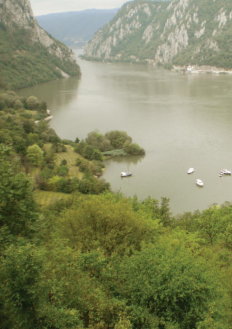

� is � ematic Study of the whole Roman frontiers has been written at the suggestion of ICOMOS, in the context of the preparation of extensions to the transnational, serial World Heritage property ‘Frontiers of the Roman Empire’ and in order to provide the necessary documentation to allow the development of a World Heritage Nomination Strategy for the Roman frontiers as a whole and in detail for Europe.
Background
� e inscription of Hadrian’s Wall in the United Kingdom (1987) provided the basis for this property, which was extended with the Upper German-Raetian Limes in Germany (2005) and the Antonine Wall in the United Kingdom (2008).
Some time before the nomination of the Upper German-Raetian Limes, the idea had been advanced to create a single World Heritage Site encompassing all the frontiers of the Roman Empire in Europe, the Near East and North Africa. Several States Parties were already preparing nominations of the frontier installations within their territories, aiming at a step-by-step extension of the existing property. With a view to the expressed ambition to include all Roman frontiers, this property had been renamed ‘Frontiers of the Roman Empire’ in 2005.
In the next few years, general concerns about the manageability of complex trans-national, serial properties and the assessment of their Outstanding Universal Value raised the question whether a phased extension of the Frontiers of the Roman Empire World Heritage Site was the best way to proceed. Alternative strategies were brought to the fore, including nominating a single property and nominating a series of single properties under a common framework (not constituting a single property). A � ematic Study of the Roman frontiers was suggested as an eff ective means to clarify how sections of the Roman frontiers might be nominated.
Outline of Thema! c Study
� is � ematic Study provides an overview of what remains of the frontiers of the Roman Empire, extending over the continents of Africa, Asia and Europe. It summarises the chronological and geographical scope of the frontiers and their functional, chronological, social and cultural links and complexity. � e � ematic Study focuses on the frontiers in the 2nd century AD, when the Roman Empire reached its largest extent. � is chronological focus was adopted in 2004 as a practical basis for the Roman frontiers as World Heritage.
An overview of the military installations and their spatial distribution serves as a starting-point for an internal comparison of the frontiers. It is argued that fi ve groups
summary

2 THE FRONTIERS OF THE ROMAN EMPIRE - A THEMATIC STUDY
can be distinguished within the whole of the frontiers of the Roman Empire as they existed in the 2nd century AD (cf. map on pp. 4-5):
- the desert frontiers of the Roman provinces of Africa, Egypt, Arabia and southern Syria;
- the frontiers of northern Syria and Cappadocia (Turkey), constituting the frontier with the powerful Parthian Empire in the East;
- the frontiers along the European rivers Rhine and Danube;- the artifi cial linear barriers of Hadrian’s Wall, the Antonine Wall and the Upper
German-Raetian Limes (the existing World Heritage Site);- the mixed frontiers of the Roman province of Dacia (Romania).
" e above frontier sections display clear diff erences in densities, disposition, type and size of military installations, which refl ect variations in climatic and geographical conditions, habitation and land use, external threats and political interests.
In a more detailed analysis of the frontiers along the Rhine and Danube it is noticed that the basins of these rivers are segmented by mountain ranges, and that in most cases these natural barriers coincide with borders between Roman provinces – with the boundary between the provinces of Pannonia (largely situated in Austria, Slovakia, Hungary and Croatia) and Moesia (largely in Serbia, Bulgaria and Romania) as an exception. It is reasoned that diff erences between (groups of ) Roman provinces along Rhine and Danube support a division of the European river frontiers into four groups:
- the frontier of Germania Inferior along the lower course of the Rhine (the Netherlands and the German Rhineland);
- the frontiers of eastern Raetia and Noricum (German Bavaria and Austria);- the frontiers of Pannonia (Austria, Slovakia, Hungary, Croatia and Serbia);- the frontiers of Moesia (Serbia, Bulgaria and Romania).
It is noticed that the frontier sections of Raetia/Noricum and Pannonia are the most similar of these groups.
Outline of Nomina� on Strategy
" e outcomes of the internal comparisons of the Roman frontiers served as the basis for the development of a proposed Nomination Strategy aimed at providing the World Heritage Committee with insight into the intended nominations, the justifi cation of the properties, the selection of sites, and the approach to management and future development.
As the current political situation in the Near East and North Africa does not allow to develop a view for these areas the Nomination Strategy is currently confi ned to the Roman frontiers of Europe.
What the Nomination Strategy thus provides is a practical and sustainable way forward for substantial and distinctive sections of the Roman frontiers to be nominated individually, initially in Europe and later in the East and North Africa, under an overall framework of the Frontiers of the Roman Empire that will actively encourage dialogue and shared practices.
" e ambition to protect the whole of the Roman frontiers as World Heritage is maintained. Its value as a refl ection of the universal culture of the Roman Empire, spanning three continents, is undisputed. " e frontiers are unifi ed by their purpose of demarcating, controlling and securing the Empire. At the same time they demonstrate an ingenuous variety of military responses to local natural and political conditions. Future nominations of sections of the Roman frontiers as World Heritage must contribute to the understanding of these fundamental aspects of unity and versatility.
" e Nomination Strategy proposes that the European frontiers, not covered by the current property, should be nominated as three sections:

3THE FRONTIERS OF THE ROMAN EMPIRE - A THEMATIC STUDY
- the Lower German (i.e. Lower Rhine) frontier;- the Danube frontier;- the frontier of the Roman province of Dacia.
! ese sections would constitute three separate World Heritage properties, beside the existing serial World Heritage property. ! e four single properties would be joined under a common framework ‘Frontiers of the Roman Empire’, which could later be extended to properties in the Near East and North Africa.
It is argued that the three envisaged additional properties each have the potential to justify Outstanding Universal Value as clearly defi ned sections of the overall frontiers. Key values would be the innovative responses to the challenges of a highly dynamic river delta (Lower Germany), the evolution of military strategies to counter the threats emanating from sustained large-scale migration (Danube), and the unparalleled mixture of military solutions developed to cope with varying landscapes and threats (Dacia). It is considered that all three properties have the potential to meet criteria (ii), (iii) and (iv) for World Heritage inscription.
Selec� on of component sites
Almost 1,000 sites remain of the Roman frontiers in Europe. Currently it is suggested that of these up to 61 would be part of the Rhine frontier, 250 of the Danube frontier and 186 of the frontier of Dacia. ! is amounts to one site per 7 km of frontier for the Rhine and Dacia, and one per 10 km for the Danube. Substantial representations are indispensable to demonstrate the linearity and coherence of the frontiers, to exemplify the character of the separate sections and the links and contrasts between them, and to support in a substantial way the proposed OUV.
Delivering the Nomina� on Strategy for Europe
To support the proposed nominations of European sections, it is proposed to create an overarching framework to promote and support inter national collaboration in all fi elds relevant to the management and development of the European frontiers as World Heritage. It is the ambition to realise this framework, which is provisionally labelled ‘Frontiers of the Roman Empire World Heritage Cluster’ building on structures developed for the management of the existing property, before the end of 2017.
For the largest of the three envisaged properties, the Danube frontier, a nomination in two steps is proposed, for reasons of timetable management. ! e fi rst step would concern the western segment consisting of the sites within the territories of Germany, Austria, Slovakia and Hungary, and the second step the eastern segment comprising the sites in Croatia, Serbia, Bulgaria and Romania; the current selections of component sites amount to about 130 for the western and 120 for the eastern segment. ! e ! ematic Study provides a clear picture of the diff erent but linked characteristics of these segments. It is suggested that the western segment could justify Outstanding Universal Value as a fi rst nomination, while the eastern segment could be added as a major extension in a second step. ! e countries involved in the nomination of the Danube frontier have successfully cooperated in previous projects, which add to the confi dence that the Danube frontier, once both parts have been inscribed, will be a feasible and manageable property.
With the foreseen submission in 2017 of an entry for the Tentative List of Romania all European frontier sections will be part of national Tentative Lists, and little harmo-nisation will be necessary. For the remainder of the nomination process the following timetable is foreseen:
end of 2017 creation of an overarching collaborative frameworkJanuary 2018 submission of the nomination dossier for the Danube frontier, western
segment
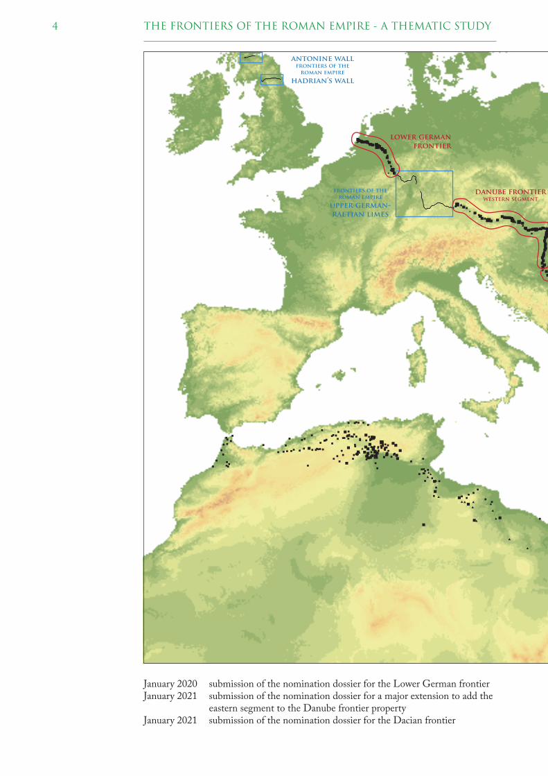
4 THE FRONTIERS OF THE ROMAN EMPIRE - A THEMATIC STUDY
danube frontierwestern segment
lower german
frontier
antonine wallfrontiers of the
roman empire
hadrian’s wall
frontiers of the
roman empire
upper german-
raetian limes
January 2020 submission of the nomination dossier for the Lower German frontierJanuary 2021 submission of the nomination dossier for a major extension to add the
eastern segment to the Danube frontier propertyJanuary 2021 submission of the nomination dossier for the Dacian frontier

5THE FRONTIERS OF THE ROMAN EMPIRE - A THEMATIC STUDY
danube frontiereastern segment
dacian
frontier
The exis� ng property ‘Fron� ers of the Roman Empire’ (blue) and the three envisaged addi� onal proper� es for the European fron� ers (red).
� e proposed Nomination Strategy is supported by all European States Parties involved, as a means to arrive at successful nominations of sections of the European frontiers in an environment stimulating collaboration, exchange of experiences, coordination and joint development.


purpose and scope 1
� is � ematic Study has been produced in the context of the preparation of a number of nominations related to the transnational, serial World Heritage property ‘Frontiers of the Roman Empire’ (FRE WHS) in various countries.
Currently, this property encompasses three component parts, located in Germany (DE) and the United Kingdom (UK):
- Hadrian’s Wall (UK), inscribed on the World Heritage List in 1987;1
- the Upper German-Raetian Limes (DE), inscribed on the World Heritage List in 2005 as an extension of Hadrian’s Wall, leading to the creation of the ‘Frontiers of the Roman Empire’ World Heritage Site,2 and
- the Antonine Wall (UK), inscribed on the World Heritage List in 2008 as an extension of the transnational, serial World Heritage Site ‘Frontiers of the Roman Empire’.3
In view of the intention of many countries to nominate further stretches of this once vast frontier system for World Heritage (cf. chapter 2, table 2.1 for an overview), it is foreseeable that, in the near future, the property might become very complex, inter alia with regard to the number of participating countries, to the number of component parts and to its manageability.
� erefore, ICOMOS and the World Heritage Centre have raised the question as to whether the concept of a single WHS, extended – as the States Parties have planned – over several cycles, is feasible for the FRE, or whether the Roman frontier should rather be split into separate sections and be nominated as separate properties linked by a thematic framework ‘Frontiers of the Roman Empire’.
Against this background, ICOMOS International has proposed the present � ematic Study in December 2015, asking specifi cally for:
- a justifi cation of how the Roman frontiers might be split up in individual sections (component parts) which on the one hand have the capacity to demonstrate Outstanding Universal Value (OUV) and on the other hand are manageable in a sustainable way;
1 11 COM VIIA.2 29 COM 8B.46: � e World Heritage Committee approves the extension of Hadrian’s Wall
(United Kingdom) to include the Frontiers of the Roman Empire - Upper German-Raetian Limes (Germany) on the World Heritage List on the basis of the cultural criteria (ii), (iii), and (iv).
3 32 COM 8B.40: � e World Heritage Committee approves the extension of the Frontiers of the Roman Empire, United Kingdom and Germany, to include the Antonine Wall on the World Heritage List on the basis of criteria (ii), (iii) and (iv).
Hadrian’s Wall to the west of the fort at Housesteads (United Kingdom).
8 THE FRONTIERS OF THE ROMAN EMPIRE - A THEMATIC STUDY
- a description of how these component parts are functionally, socially and culturally linked;
- a detailed documentation and mapping of known sites (component sites) with their scope and extent, combined with an assessment of their authenticity and integrity;
- the selection criteria of the component sites intended for World Heritage nomination.
As an element of the � ematic Study, a Nomination Strategy for the FRE has been developed, comprising an overall vision for the FRE, outlining how future nominations may be presented to the World Heritage Committee, and how they might demonstrate OUV.
� e � ematic Study for the FRE thus helps to:
- ensure the preparation of better quality Tentative Lists;- optimize success of World Heritage nominations related to the FRE;- achieve sustainable World Heritage properties in the sense of on-going protection,
conservation and management;- agree on common management principles in order to harmonise approaches for the
protection, conservation, management, interpretation and promotion of the overall FRE and of its individual component sites.
� e � ematic Study focuses mostly, but not exclusively, on the Roman frontier lines of the 2nd century AD, following the Koblenz Declaration of 2004: “� e Frontiers of the Roman Empire World Heritage Site (FRE WHS) should consist of the line(s) of the frontier of the height of the empire from Trajan to Septimius Severus (about 100-200 AD), and military installations of diff erent periods which are on that line”.4 Earlier and later military installations on the frontier lines of the 2nd century are therefore not less important.
4 Quoted from the Koblenz declaration included in Nomination fi le 430ter, p. 427 (http://whc.unesco.org/uploads/nominations/430ter.pdf ).

9THE FRONTIERS OF THE ROMAN EMPIRE - A THEMATIC STUDY
The fortlet of Deir el-Atrash in the Eastern Desert, Egypt, on the route from the Nile to Mons Porphyrites.
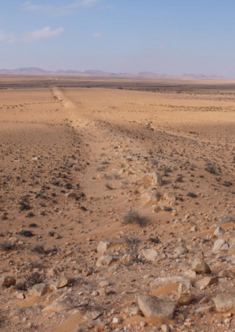

Since the early 2000s, in connection with the nomination of the Upper German-Raetian Limes for World Heritage, it has been the aim of the States Parties to inscribe the Roman frontier in its entirety on the World Heritage List, as refl ected in the Summary Nomination Statement (2004):
“� e aim of participating States Parties is, by stages through international cooperation, to create a World Heritage Site encompassing all the Frontiers of the Roman Empire, based on its proper identifi cation, recording, protection, conservation, manage ment, presentation and understanding as evidence of the remains of one of the world’s greatest civilizations and as a symbol of a common heritage”.5
Accordingly, the State Parties involved in the further development of this principle had agreed on a phased nomination of stretches of the Roman frontier as it existed in the 2nd century AD, leading to a single World Heritage Site ‘Frontiers of the Roman Empire’. In order to keep the number of nominated sites to a manageable size, the future World Heritage Site would include solely monuments located on the line of the frontiers in their widest extent in the 2nd century AD.6
In 2004, the principles agreed upon were adopted by the Bratislava Group – the scientifi c advisory body in FRE-matters – in the context of the preparation of the nomination dossier of the Upper German-Raetian Limes. � ey were summarised in the co-called Koblenz Declaration:
“� e Frontiers of the Roman Empire World Heritage Site should consist of the line(s) of the frontier of the height of the empire from Trajan to Septimius Severus (about 100-200 AD), and military installations of diff erent periods which are on that line. � e installations include fortresses, forts, towers, the Limes road, artifi cial barriers and immediately associated civil structures.”
Accordingly, the overall aim of this approach to the FRE and WH is to:
- make the Roman frontier again visible and understandable in its enormous vastness and complexity, forming the single largest monument to the Roman civilization and defi ning the maximum extent and nature of the Roman Empire, one of the greatest states the world has seen;
5 Cf. Summary Nomination Statement (2004), section 4.7.1. (http://whc.unesco.org/uploads/nominations/430ter.pdf p. 410).
6 � e Roman frontiers have never been a systematically planned network over their entire length. Due to regional confl icts and shifting political power, they have never been static and therefore today form an extensive relict landscape, consisting of thousands of archaeological and architectural monuments. Today, they form part of the heritage of altogether 19 countries and are subject to a large variety of diff erent legal and management systems.
background - the ‘frontiers of the roman empire’ world heritage site 2
The clausura or linear barrier in the Djebel Tebaga region (Tunisia), blocking a land corridor between two mountain ranges over a distance of approx. 17 km.

12 THE FRONTIERS OF THE ROMAN EMPIRE - A THEMATIC STUDY
- show that the single monuments of the frontier belong closely together thus forming an organic entity, and, last but not least,
- to extend and deepen the existing relationships among archaeologists and cultural heritage experts involved in the daily protection and management of the Roman frontier.7
� is idea and general concept have been supported by ICOMOS International in their evaluation of the nomination of the Upper German-Raetian Limes for World Heritage of 2005:
“ICOMOS supports the wider proposal to encourage further nominations to refl ect the scope and extent of the Roman Frontier, the largest single monument to Roman civilisation, initially in Europe but in due course perhaps also in Africa and Asia, and the approaches set out in the Summary Nomination Statement”.
In its Decision 29 COM 8B.46 taken at its 29th Session at Durban (South Africa) in 2005, the World Heritage Committee consequently “recommends that the nomination (i.e. of the Upper German-Raetian Limes) be seen as the second phase of a possible wider, phased, serial transboundary nomination to encompass remains of the Roman frontiers around the Mediterranean Region”.
On the basis of this, the phased approach towards the nomination of further stretches of the FRE was pursued by the States Parties in the following years. � is is refl ected by the inscription of the Antonine Wall in 2008 as an extension to the existing FRE WHS – and thus increasing the number of component parts of this World Heritage Site to three – and by the Tentative List entries submitted by ten countries (table 2.1).
� e States Parties had intended to nominate separate stretches of the FRE as phased extensions of the inscribed property as soon as they had fi nished the preparation of their dossiers, and on the basis of the ‘fi rst come, fi rst served’ principle. Evidently and without further harmonisation, this procedure could have led to the submission of two or more nomination dossiers related to the FRE in the same year.
� e approach of extending the existing World Heritage property in phases resulting in one common World Heritage Site ‘Frontiers of the Roman Empire’ was fi rst and
7 Breeze/ Jilek 2008.
Well preserved sec� on of the Antonine Wall near Watling Lodge (United Kingdom).
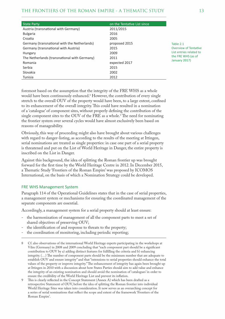
13THE FRONTIERS OF THE ROMAN EMPIRE - A THEMATIC STUDY
foremost based on the assumption that the integrity of the FRE WHS as a whole would have been continuously enhanced.8 However, the contribution of every single stretch to the overall OUV of the property would have been, to a large extent, confi ned to its enhancement of the overall integrity. � is could have resulted in a nomination of a ‘catalogue’ of component sites, without properly defi ning the contribution of the single component sites to the OUV of the FRE as a whole.9 � e need for nominating the frontier system over several cycles would have almost exclusively been based on reasons of manageability.
Obviously, this way of proceeding might also have brought about various challenges with regard to danger-listing, as according to the results of the meeting at Ittingen, serial nominations are treated as single properties: in case one part of a serial property is threatened and put on the List of World Heritage in Danger, the entire property is inscribed on the List in Danger.
Against this background, the idea of splitting the Roman frontier up was brought forward for the fi rst time by the World Heritage Centre in 2012. In December 2015, a � ematic Study ‘Frontiers of the Roman Empire’ was proposed by ICOMOS International, on the basis of which a Nomination Strategy could be developed.
FRE WHS Management System
Paragraph 114 of the Operational Guidelines states that in the case of serial properties, a management system or mechanisms for ensuring the coordinated management of the separate components are essential.
Accordingly, a management system for a serial property should at least ensure:
- the harmonization of management of all the component parts to meet a set of shared objectives of preserving OUV;
- the identifi cation of and response to threats to the property;- the coordination of monitoring, including periodic reporting;
8 Cf. also observations of the international World Heritage experts participating in the workshops at Vilm (Germany) in 2008 and 2009 concluding that “each component part should be a signifi cant contribution to OUV by a) adding distinct features for fulfi lling the criteria and b) enhancing integrity. (…) � e number of component parts should be the minimum number that are adequate to establish OUV and ensure integrity” and that “extensions to serial properties should enhance the total values of the property or improve integrity.” � e enhancement of integrity has again been brought up at Ittingen in 2010 with a discussion about how States Parties should aim to add value and enhance the integrity of an existing nomination and should avoid the nomination of ‘catalogues’ in order to ensure the credibility of the World Heritage List and prevent its infl ation.
9 � is is clearly refl ected in the Concept Statement (Annex A) which has been drafted as a retrospective Statement of OUV, before the idea of splitting the Roman frontier into individual World Heritage Sites was taken into consideration. It now serves as an overarching concept for a series of serial nominations that refl ect the scope and extent of the framework ‘Frontiers of the Roman Empire’.
Table 2.1Overview of Tenta! ve List entries related to the FRE WHS (as of January 2017)
State Party on the Tenta! ve List since
Austria (transna! onal with Germany) 2011/2015
Bulgaria 2016
Croa! a 2005
Germany (transna! onal with the Netherlands) proposed 2015
Germany (transna! onal with Austria) 2015
Hungary 2009
The Netherlands (transna! onal with Germany) 2011
Romania expected 2017
Serbia 2015
Slovakia 2002
Tunisia 2012

14 THE FRONTIERS OF THE ROMAN EMPIRE - A THEMATIC STUDY
- management at the component part level and the coordination between the component parts.
As for the WHS FRE, since 2003 an effi cient, robust and over many years thoroughly tested international management system is in place (table 2.2). It consists of three closely cooperating and interacting bodies, the Intergovernmental Committee (IGC), the Bratislava Group and the Management (or Hexham) Group. Together, these groups encourage collaboration and sharing of information, expertise and good practice.
Responsibility for the management of individual parts of the FRE WHS rests with the individual States Parties and is carried out by each in accordance with their legislative and management systems.
Organisa� onal structure of the ‘Fron� ers of the Roman Empire’ World Heritage Site.
The Roman fort at Böhming (Bavaria, Germany), part of the Upper German-Rae� an Limes. The defenses are s� ll visible, surrounding the church.

15THE FRONTIERS OF THE ROMAN EMPIRE - A THEMATIC STUDY
Table 2.2Organisa� onal structure of the ‘Fron� ers of the Roman Empire’ World Heritage Site, with indica� on of main tasks.
name tasks
Intergovernmental Commi! ee (IGC) The Intergovernmental Commi! ee (IGC) is the governing body that deals formally with UNESCO and ensures that monitoring and repor� ng requirements are carried out on behalf of the Site as a whole. This body also reviews any further nomina� ons for extending the FRE WHS.
Bra� slava Group The Bra� slava Group is a body of interna� onal experts that advises on technical and research issues and assesses proposed new addi� ons to the FRE WHS
Management (Hexham) Group The Management (Hexham) Group is a networking group of those responsible for the management and conserva� on of inscribed sec� ons, at both na� onal and local levels.


sources and definitions 3
� is chapter provides some information on terms used in this study and on the sources used for the maps in chapter 6.
3.1 VOCABULARY
In the preceding chapters various terms have been used without explaining their meaning or relation to others: frontier, frontiers, site, sites, component parts, etc. In the remaining chapters of this study more terms will be introduced. It is the aim of this paragraph to defi ne those terms which are most likely to be unfamiliar to the non-expert reader, or to give rise to confusion.
Site(s)
In the context of protection under the World Heritage Convention the term ‘site’ is used nowadays mainly as a component element of a World Heritage property, which indicates a territorial entity inscribed on the World Heritage List. A property may be built up from several component sites, in which case it is known as a serial property.
In archaeology use of the term ‘site’ is very widespread, as a general and unspecifi ed indication of a location where cultural remains from the past have been discovered. A site in this sense may have several constituent parts, for example a fort and its cemetery. It is virtually impossible to write a study on the Frontiers of the Roman Empire without using ‘site’ in this archaeological sense, and the authors have refrained from attempting.
Fron! er(s), fron! er sec! ons
� is study deals with the frontier of the Roman Empire. In a general way, the Roman Empire had a – single – frontier. However, this frontier was not a static boundary, which had been created at some point of time and had never changed since then. On the contrary, it was a very dynamic boundary, which developed over time and shifted forward and backward, breathing along with political ambitions, victories and defeats. From this point of view, there is every reason to use the plural ‘frontiers’ in many cases.
In studies on the Roman frontier, terms such as ‘artifi cial frontier’, ‘desert frontier’ and ‘river frontier’ frequently occur, both in singular and in plural. � is is an expression of an awareness that the appearance of the Roman frontier varied along the landscape in which it was located; ‘mountain frontier’ is also sometimes used. From this perspective, the use of the ‘plural’ frontiers is therefore also defensible.
Standing remains of the legionary fortress at Udhruh, to the east of Petra (Jordan).

18 THE FRONTIERS OF THE ROMAN EMPIRE - A THEMATIC STUDY
Further, frontier is often accompanied by a geographical name, e.g. the Rhine frontier or the African frontier. � is is a diff erent expression of the phenomenon addressed in the previous lines, that there are regional diff erences in the appearance of the Roman frontier. Closely related are terms such as the Lower German or Numidian frontier, referring to provinces of the Roman Empire. � e Roman army was divided along provincial lines, and there are many indications in historical sources and inscriptions that this was more than a mere practical administrative convenience. � e provincial esprit de corps echoed by these sources may well be a refl ection of territorial characteristics.
All this may explain why ‘frontier’ and ‘frontiers’ will be used side by side in this study, and without a clear contextual separation. Parts of the Roman frontier may also be called frontier sections, usually in a general sense. In chapter 7, however, ‘section’ will be used in a very specifi c way, in relation to the logical division of the Roman frontier into properties that might be seen to justify OUV.
Limes and Ripa
� e Romans themselves had various words for frontiers and their components. In both literature and epigraphy limes (plural: limites) is used to designate a land boundary of the empire, with ripa designating a river boundary. Usage changed over the centuries. Limes, originally a road, had come to be used to describe the boundary of the empire by the beginning of the 2nd century had, and later a frontier district, such as the Limes Tripolitanus (the Tripolitanian frontier).
Place names
Roman military sites and other places are often indicated by their Latin names. For instance, the Roman legionary fortress at Windisch (Brugg, CH) is much better known as Vindonissa. In many cases, the identifi cation is confi rmed by inscriptions found on site, but in other cases the Latin names are unproven assumptions. � e authors have not tried to be consistent in the use or avoidance of such names, or of Latin provincial names; for instance, Lower Germany may occur alongside Germania Inferior. � e English notation has been consistently used for the rivers Rhine and Danube, and less so for other geographical entities.
Roman military jargon
Similar remarks can be made for Roman military jargon. It is not uncommon to use Latin terms as castra for legionary fortress, or castellum for a smaller fort. However, not all of such terms are as well rooted in classical Latin as they appear. � ey are sometimes used in a much stricter sense in modern archaeology than they were at the time, and sometimes there is even little evidence for their original use. Although military jargon in Latin is generally avoided in this study, the authors have only aimed at partial consistency.
� e most frequently used terms for military installations and associated structures may be found in section 3.3, with some explanation.
3.2 MAPS AND SITES
� e chronological and spatial coverage of most existing maps of the Roman frontier is restricted, and topographical accuracy often leaves much to be desired. � e absence of a decent digital map of the military infrastructure of the Roman Empire has been a near impossible task to create, but future international collaboration might make such

19THE FRONTIERS OF THE ROMAN EMPIRE - A THEMATIC STUDY
an endeavour a realistic possibility, given a fl exible approach and the ability to adapt and modify it as knowledge develops.
For this study we were nevertheless obliged to make an eff ort to create an empire-wide digital map, if only out of a need to plot the sites considered for selection by the States Parties involved in the preparation of the nomination of the remaining European frontier sections.
� e maps displayed in chapter 6 were generated from this digital map set, which included two base layers created by external parties:
1. � e GTOPO30 global elevation model created by the U.S. Geological Survey’s Center for Earth Resources Observation and Science (EROS). � e use of these maps is allowed under a Creative Commons Attribution-NonCommercial 3.0 License. � e default colour scheme of these elevation maps has been adapted for this study.
2. � e World Reference Overlay provided by Esri (sources: Esri, DeLorme, USGS, NPS), used in conformity with the Esri Master License Agreement.
� e boundaries of Roman frontier provinces have been adapted from a series of maps created in the context of the Frontiers of the Roman Empire Culture 2000 project (2005-2008).10
� e sites displayed in the maps have been derived from three diff erent sources:
1. For the frontier in Africa a digital dataset created for the preparation of the maps in the FRE booklet on the African frontier was kindly provided by Dr Martin Sterry (Leicester University, UK).11
2. For Egypt and the Ancient Near East data were used from Pleiades, a joint project of the Ancient World Mapping Center, the Stoa Consortium, and the Institute for the Study of the Ancient World.12 � e ‘places’ dataset available for download
10 http://www.limes-oesterreich.at/html/maps_download.php [accessed September 15, 2016]. � e map set was last updated in September 2011. � e use of these maps is allowed under a Creative Commons Attribution-NonCommercial 3.0 Unported License.
11 Mattingly et al. 2013.12 R. Bagnall, et al. (eds), Pleiades: A Gazetteer of Past Places, 2016, https://pleiades.stoa.org/places
[accessed October 7, 2016]. Use of Pleiades content is allowed under a Creative Commons Attribution 3.0 License.
Remains of the legionary fortress of Satala/Sadak (Turkey), in the Roman province of Cappadocia.

20 THE FRONTIERS OF THE ROMAN EMPIRE - A THEMATIC STUDY
builds on the ‘Barrington Atlas of the Greek and Roman World’.13 From this dataset those records have been selected which have ‘fort’ or ‘earthwork’ in the ‘featureTypes’ fi eld, and ‘roman’ or ‘late-antique’ in the ‘timePeriodsKeys’ fi eld.
3. For the European provinces (except for the three sections already listed as parts of the FRE WHS) detailed site lists were provided by the States Parties involved.
3.3 SITE TYPOLOGY
In order to obtain insight into the occurrence and spatial distribution of the various types of military installations and associated structures a basic classifi cation was made. It provides defi nitions for the terms used in this study to indicate the various types of military installations and related structures. Further, it is a precondition for any eff ort to produce an overview of their frequency. " is paragraph merely deals with the typology; the quantitative analysis is part of chapter 6.
" e classifi cation draws heavily on the European frontiers, since the relevant information on the Eastern and African frontiers is much less accessible, detailed and secure.
Military installa! ons
" e term ‘military installation’ is used as a general term for any kind of structure built for defensive or off ensive purposes. " e term ‘fortifi cation’ is another broad term, but in a slightly more restricted sense, for constructions of timber or stone, excluding linear earthworks.
In this study nine categories of military installations have been distinguished. " ey are listed in alphabetical order.
bridgehead Any fortifi cation which was built across the Rhine or Danube, facing a military installation on the ‘Roman’ river bank. " e term does not imply the (former) existence of a bridge, merely a staging point looking across a river.
earthwork A linear defensive structure consisting of piled-up earth.14
fl eet base A fortifi cation serving as the operational base for a provincial fl eet.fort Any fortifi cation which is smaller than a legionary fortress and
larger than a fortlet, and which served as an accommodation for several hundreds of soldiers. Typical sizes are in the range of 1-4 ha.
fortlet A small fortifi cation, generally measuring well below 1 ha in surface, which served as an accommodation for a few to several dozens of soldiers without a headquarters building.
hill fort A fortifi cation, often of irregular plan, situated on an isolated hill or a promontory.
legionary fortress A large fortifi cation, generally measuring well above 15 ha in surface, which served as an accommodation for several thousands of (largely) legionary soldiers.
temporary camp A short-lived fortifi cation without inner buildings, usually a construction camp, marching camp or practice camp.
13 For our maps the CSV ‘places’ dataset was used: http://atlantides.org/downloads/pleiades/dumps/pleiades-places-20161007.csv.gz [accessed October 7, 2016]. For sites with multiple pairs of geographical coordinates the fi rst pair was used, extracted from the ‘bbox’ fi eld.
14 As linear barriers earthworks are equivalent to the stone walls and palisades serving as artifi cial barriers on Hadrian’s Wall, the Antonine Wall and the Upper German-Raetian Limes. " e latter categories of linear barriers are not included in this list, because these three existing component parts of the FRE WHS are not included in the quantitave analysis of chapter 6.
21THE FRONTIERS OF THE ROMAN EMPIRE - A THEMATIC STUDY
watchtower An isolated fortifi ed tower, which served as an accommodation for a dozen or less soldiers.
Obviously, the Roman military architects did not care for classifi cation in the 21st century, so inevitably there will be some overlap between categories, and the attribution of individual sites to a category may be subject to academic discussion.
Associated structures
! e frontier zone consisted of more than just military installations. ! eir functioning depended on a logistical network including harbours, roads and industrial sites. In areas without an urban tradition, the fortifi cations were often surrounded by civil settlements, labelled canabae legionis in the case of legionary fortresses and ‘(military) vicus’ (pl. vici) in case of smaller forts. In some cases, the military was involved in the development of civil towns.
For this study, the large variety of structures somehow associated with the military have been grouped into no more than fi ve categories.
civil settlement All civil agglomerations, regardless of size and character, have been brought under this single heading. ! e main categories are canabae legionis, military vici, civil towns with a legal status (municipium or colonia) and without, and rural settlements.
industrial site A detached site with industrial activities serving the military. Industrial activities have been attested in and close to many fortifi cations. Occasionally, however, these were carried out at more distant locations. ! e range of industrial sites includes stone quarries, lime kilns, potteries and tileries.
road Military installations and associated structures were usually connected by land roads. In some cases the roads predate the military occupation, in other cases they were built for military purposes. ! e road connecting the military installations in the frontier zone is often labelled ‘Limes road’.
road station A building (complex) located on a land road, off ering a bed, a meal and various services for man and animal. Road stations might be protected by a small military detachment, particularly on desert frontiers.
other Some types of structure have not been allocated to a separate group, either because they are rare or because they usually occur in combination with a diff erent kind of structure. ! ey include amongst others (military) bathhouses, (military) sanctuaries, harbours and canals.


time and space 4
� is chapter provides a brief overview of the history and geography of the frontiers of the Roman Empire, subdivided according to continents.15 � e most important military events are summarized in section 4.1. � e overview starts with the establishment of the provinces and the associated frontier system, looks to the 2nd century, the largest extent of the Roman Empire, and deals with the decline or the continuation of the borders in Late Antiquity. In section 4.2 the topography of the Roman frontiers is summarily discussed.
4.1 CHRONOLOGICAL SCOPE
� e Roman Empire as established from the Roman Republican state through the reforms of Augustus (31 BC – AD 14) fl ourished for about 500 years in its western and almost 1500 years in its eastern part. � e thoroughly equalized reforms of Augustus provided a safe foundation for the state for 300 years, extended by those of Diocletian and Constantine. It was the state of Roman citizens, but under given conditions (wealth, military service and loyalty to the Emperor) all free people could become a Roman citizen, and from Caracalla citizenship was given to all free people of the empire. � e Roman Empire had hundreds of peoples with diff erent culture, traditions and language, where Latin and the Greek (in the Eastern provinces) was the lingua franca.
� e sophisticated state organization was aristocratic and democratic at the same time. Although the highest posts in the state administration and in the army were reserved for the senatorial and equestrian orders, also wealthy provincials could enter and join the highest society. � e Republican order of annuitas (time-limited posts) was preserved and upheld. � e governors and generals accordingly served for only a few years in one or other post in diff erent parts of the Empire during their strictly determined carrier. � is measurement prevented them from disobedience and usurpation. � e commanders of the legions belonged to the senatorial order, those of the auxiliary troops to the equestrian one. � e military provinces belonged to the Emperor, so he had the right to appoint governors (legati, procurators) to them. � e rank of the person depended on the military strength of the province (more legions – one legion – auxiliary troops only). � e demilitarised provinces lay under the Senate, but also here the Emperor had the authority in appointing the leaders.
15 For this overview extensive use was made of the following publications: Bechert 1999; Breeze 2011a; Freeman 2006; Jilek 2009; Klose/Nünnerich-Asmus 2006; Klee 2006; Mattingly et al. 2013; Vagalinski et al. 2012; Visy 2003.
Remains of the Rae! an Limes near Pfahldorf (Bavaria, Germany), visible as a straight line through the landscape.

24 THE FRONTIERS OF THE ROMAN EMPIRE - A THEMATIC STUDY
� e cohesion and inner peace of the Empire could be achieved through the main principle (also republican): hard in war, mild in peace: parcere subictis et debellare superbos (Virgil, Aeneas). A Roman citizen or people of the Empire had two main obligations: loyalty to the Emperor (sacrifi ces to Jupiter Optimus Maximus for the salvation of the Emperor) and taxpaying. � e Roman system allowed a wide autonomy of the society on the basis of subsidiarity. � us the civil society in its towns, civitates, pagi and vici had an almost total autonomy. In other words the Roman Empire can be described as a complexity of self-governing towns and communities. Of course in the army there was no self-governing, but the mercenary army with a service of 20 to 25 years could be recruited and completed without any problem in the fi rst three centuries, because the soldiers got a relatively high pay, and after retirement diff erent kinds of perks (money, estate, Roman citizenship). As in the second half of the 4th century the conditions changed with more and more foreign groups allowed to enter the Empire under the condition of undertaking military service.
4.1.1 AFRICA
In Africa, the Romans controlled the area north of the Sahara, from the Atlantic Ocean to Egypt, with many sections of frontier (Limes Tripolitanus, Limes Numidiae, etc.). Rome had acquired its North African Provinces at diff erent times. Proconsular Africa was formed into a province following the fi nal defeat and destruction of Carthage in 146 BC. In this year, Rome established its fi rst African province, Africa Proconsularis or Africa Vetus (Old Africa), governed by a proconsul, in the most fertile part of what was formerly Carthaginian territory. � e province was later extended along the coast to embrace Tripolitania (modern western Libya). Cyrenaica passed to Roman control in 96 BC with the death of the last recognised client king and, in 27 BC, was administratively attached to Crete. Numidia and Mauretania became client kingdoms. � e former was abolished by Julius Caesar in 46 BC and incorporated into Africa. To the west, Rome recognised a client kingdom of Mauretania, until Caligula had its ruler Ptolemy murdered in AD 39. � e annexation was strongly resisted and when Roman control was secured under Claudius, the territory was divided into two provinces, Mauretania Caesarensis in the east and Mauretania Tingitana in the west, with governors appointed directly by the Emperor. However, control of the legionary garrison in Africa was passed from a proconsul to an imperial legate in AD 39 and Numidia was recognised as a separate province from the early 3rd century.
� e Limes Tripolitanus was built after Augustus. It was mainly a reaction to the Garamantes menace. In AD 50 Septimius Flaccus undertook a military expedition that reached the Fezzan and further south. � e Romans did not conquer the Garamantes so much as they seduced them with the benefi ts of trade and discouraged them with the threat of war. � e last Garamantes foray to the coast was in AD 69, when they joined with the people of Oea/Tripoli in battle against Leptis Magna. � e Romans, in order to defend the main Roman cities of Tripolitania (Oea, Sabratha and Leptis Magna), intervened and marched south. After that, the Garamantes became a client state of the Roman Empire, but nomads always endangered the fertile area of coastal Tripolitania. Because of this, Romans created the Limes Tripolitanus. � e fi rst fort on the Limes was built at � iges in AD 75, to protect from nomad attacks.
Under Trajan, at the greatest extent of the Empire, the southern border lay along the Sahara, which represented a natural barrier against expansion. � e Empire controlled the Mediterranean shores and the mountain ranges further inland. In the fi rst half of the 2nd century, by the time of Hadrian, the frontier of Numidia had been pushed westwards to embrace the Aurès Mountains that in eff ect formed the southern boundary of the province. One line of forts ran along the northern fringes of the mountain range and another to the south. To the north-west lay the Hodna
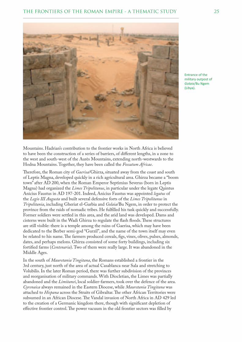
25THE FRONTIERS OF THE ROMAN EMPIRE - A THEMATIC STUDY
Mountains. Hadrian’s contribution to the frontier works in North Africa is believed to have been the construction of a series of barriers, of diff erent lengths, in a zone to the west and south-west of the Aurès Mountains, extending north-westwards to the Hodna Mountains. Together, they have been called the Fossatum Africae.
! erefore, the Roman city of Gaerisa/Ghirza, situated away from the coast and south of Leptis Magna, developed quickly in a rich agricultural area. Ghirza became a “boom town” after AD 200, when the Roman Emperor Septimius Severus (born in Leptis Magna) had organized the Limes Tripolitanus, in particular under the legate Quintus Anicius Faustus in AD 197-201. Indeed, Anicius Faustus was appointed legatus of the Legio III Augusta and built several defensive forts of the Limes Tripolitanus in Tripolitania, including Gheriat el-Garbia and Golaia/Bu Ngem, in order to protect the province from the raids of nomadic tribes. He fulfi lled his task quickly and successfully. Former soldiers were settled in this area, and the arid land was developed. Dams and cisterns were built in the Wadi Ghirza to regulate the fl ash fl oods. ! ese structures are still visible: there is a temple among the ruins of Gaerisa, which may have been dedicated to the Berber semi-god “Gurzil”, and the name of the town itself may even be related to his name. ! e farmers produced cereals, fi gs, vines, olives, pulses, almonds, dates, and perhaps melons. Ghirza consisted of some forty buildings, including six fortifi ed farms (Centenaria). Two of them were really large. It was abandoned in the Middle Ages.
In the south of Mauretania Tingitana, the Romans established a frontier in the 3rd century, just north of the area of actual Casablanca near Sala and stretching to Volubilis. In the later Roman period, there was further subdivision of the provinces and reorganisation of military commands. With Diocletian, the Limes was partially abandoned and the Limitanei, local soldier-farmers, took over the defence of the area. Cyrenaica always remained in the Eastern Diocese, while Mauretania Tingitana was attached to Hispana across the Straits of Gibraltar. ! e other African Territories were subsumed in an African Diocese. ! e Vandal invasion of North Africa in AD 429 led to the creation of a Germanic kingdom there, though with signifi cant depletion of eff ective frontier control. ! e power vacuum in the old frontier sectors was fi lled by
Entrance of the military outpost of Golaia/Bu Ngem (Libya).

26 THE FRONTIERS OF THE ROMAN EMPIRE - A THEMATIC STUDY
a number of ‘berber’ kingdoms, in part based on the populations of the old garrison settlements.
In AD 533, the Emperor Justinian, using a Vandal dynastic dispute as pretext, sent an army under the general Belisarius to recover Africa. In a short campaign, Belisarius defeated the Vandals, entered Carthage in triumph and re-established Roman rule over the province. � e restored Roman administration was successful in fending off the attacks of the Amazigh desert tribes and, by means of an extensive fortifi cation network, managed to extend its rule once again to the interior. � erefore, the Limes survived as an eff ective protection until Byzantine times.
Emperor Maurice grouped the North African provinces, together with the Roman possessions in Spain, into the Exarchate of Africa. � e exarchate prospered, and from it resulted the overthrow of the Emperor Phocas by Heraclius in AD 610. Heraclius briefl y considered moving the imperial capital from Constantinople to Carthage. After AD 640, the exarchate managed to stave off the Muslim Conquest, but in AD 698, a Muslim army from Egypt sacked Carthage and conquered the exarchate, ending Roman and Christian rule in North Africa.
� e African frontiers were not entirely peaceful, though there has been considerable disagreement about the source and severity of reported outbreaks of warfare and revolt. � e threats seem to have come in equal measure from internal communities as well as external peoples and some sectors such as Mauretania seem to have been much more severely aff ected. Nonetheless, looking at the overall picture, and considering the chronology and geographic scale, it is evident that considerable economies of force were achieved.
4.1.2 NEAR EAST
In the 70s and 60s BC, during the third war against Mithridates of Pontus, Lucullus and Pompey had explored the East, the latter almost reaching the Caspian Sea and establishing the Roman province of Syria in 64 BC. From this time, Roman interest concentrated from Pontus to Anatolia in the middle of the 1st century BC, and to Syria and Armenia around the beginning of the Common Era, and fi nally to the south of Judea in the 1st century AD and to Arabia at the beginning of the 2nd century. Under Augustus, the border was formalized by establishing Roman military bases for security. A network of client kingdoms enabled the relatively small size of the Roman occupation in the east, which consisted of eight legions, with four legions in the north of Syria. In the second half of the 1st century AD the client became regularly managed provinces.
� e Roman province of Egypt was established in 30 BC after Octavian (the future Emperor Augustus) defeated Cleopatra and Marc Antony and annexed the Ptolemaic Kingdom of Egypt to the Roman Empire. � e province encompassed most of modern-day Egypt except for the Sinai Peninsula, which was later conquered by Trajan.
In AD 106, under Trajan, the Nabataean kingdom was formally incorporated into the province of Arabia. � is was consolidated by the construction of the Via Nova Traiana from the Red Sea to the borders of Syria.
� e Roman frontiers in the Near East changed many times, of which the longest lasting was the Euphrates River, eventually to be left behind as the Romans defeated their rivals, the Parthians, with the march on their capital, Susa in AD 115. � e Parthians were a group of Iranian peoples that ruled most of Greater Iran that is now in modern-day Iran, western Iraq, Armenia and the Caucasus. In AD 118, Hadrian decided that it was in Rome’s interest to re-establish the Euphrates as the limit of its direct control. Hadrian returned to the previous state, and surrendered the territories

27THE FRONTIERS OF THE ROMAN EMPIRE - A THEMATIC STUDY
of Armenia, Mesopotamia, and Adiabene to their former rulers and client kings and did not attempt to romanize the Parthian Empire. In AD 161–166 the ‘Parthian War of Lucius Verus’ was fought between the Roman and Parthian Empires over Armenia and Upper Mesopotamia. It concluded after the Romans made successful campaigns into lower Mesopotamia and Media and sacked Ctesiphon, the Parthian capital. A fi nal war against the Parthians was led by Caracalla who died in AD 218. After his assassination, his successor, Macrinus, was defeated by the Parthians near Nisibis. In exchange for peace, he was obliged to pay for the damage caused by Caracalla.
During the Severan dynasty (AD 193–235), the Romans strengthened their defences on the Arabian frontier. " ey constructed several forts at the northwest end of the Wadi Sirhan, and improved the roads. One important fort was Qasr Azraq; another was at Auara/Humeima, from the late 2nd century AD, on the Via Nova from Petra to Aila, where up to 500 auxiliary troops could have resided. It was probably abandoned in the 4th century.
Diocletian partitioned the old province of Arabia by transferring the southern region to the province of Palaestina. Later in the 4th century, Palaestina was divided into three provinces, and the southern one was eventually called Palaestina Tertia. Each province was administered by a praeses with civil authority and a dux with military authority. Diocletian engaged in a major military expansion in the region, building a number of castella, watchtowers, and fortresses along the fringe of the desert just east of the Via Nova. " is line of defence extended from south of Damascus to Wadi al-Hasa. " e region from Wadi Mujib to Wadi al-Hasa contained four forts and a legionary fortress. " e frontier south of Wadi al-Hasa, which extended to the Red Sea at Aila (Aqaba), may have been called the Limes Palaestina. In this region, ten forts and a legionary fortress have been identifi ed. " e term may have referred to a series of fortifi cations and roads in the northern Negev, running from Rafah on the Mediterranean to the Dead Sea, or to the region under the military control of the dux Palaestinae, the military governor of the Palestinian provinces.
Troops were progressively withdrawn from the Limes Arabicus in the fi rst half of the 6th century and replaced with native Arab foederati, chiefl y the Ghassanids. After the
Northern defenses of the fortress at Qasr al-Hazraq (Jordan), seen from the interior.

28 THE FRONTIERS OF THE ROMAN EMPIRE - A THEMATIC STUDY
Arab conquest, the Limes Arabicus was left to disappear, but some fortifi cations were used and reinforced in the following centuries.
4.1.3 EUROPE
In continental Europe, the frontiers were generally well defi ned, usually following the courses of major rivers such as the Rhine and the Danube. Nevertheless, those were not always the fi nal borderlines; the province of Dacia, in modern Romania, was completely on the far side of the Danube. In Great Britain, both Hadrian and Antoninus Pius built defences to protect the province of Britannia from the peoples of Caledonia. Hadrian’s Wall, constructed in AD 122 held a garrison of 10,000 soldiers, while the Antonine Wall, constructed between AD 142 and 144, was abandoned by AD 164.
A chain of legionary fortresses and auxiliary forts guarded the line of the Rhine. It was laid out partly by Augustus and his stepson and military commander, Drusus, who began to strengthen the natural boundary of the Rhine from the year 12 BC. # e decision not to continue the conquest of the regions east of the Rhine in AD 16 resulted in the Rhine becoming the fi xed frontier of the Roman Empire in the northwest.
# e German provinces were established at the end of the 1st century AD. In Upper Germany, the military frontiers were advanced on the other side of the Rhine and up to the Danube under the Emperors Trajan and Hadrian. # e changing political situation can be observed in the displacement of troops in the Lower and Middle Rhine in this period. Under Emperor Trajan, the Limes was reinforced in Upper Germany and Raetia. # e fi ercely independent and threatening kingdom of Dacia was defeated and conquered at the second attempt by Trajan (between AD 101 and 106), who then created a new province of Dacia in Transylvania. His successor, Hadrian, gave up some provinces and occupied territories, but principly continued the policy of border security. By around AD 150, 16 legions were permanently stationed in the provinces of the European continent. # e Antonine Wall in the north of Britain
3D reconstruc! on of the legionary fortress of Bonna/Bonn (Germany) on the Lower Rhine.

29THE FRONTIERS OF THE ROMAN EMPIRE - A THEMATIC STUDY
replaced Hadrian’s Wall, but soon afterwards was given up again. At about the same time, the Limes in the Odenwald-Neckar region and an older Raetian line of forts were moved about 30 km east- respectively northwards to what is called now Upper German-Raetian Limes.
Later, more garrison sites were added to the Danube area. � is was a reaction to the insecure situation in the middle Danube region. Because of the Marcomannic wars, additional border reinforcements and troops were needed at this frontier section.
During the time of the Emperors Septimius Severus and Caracalla, the tensions on the Upper German-Raetian frontier as well as in the Carpathian basin increased. In AD 213, Caracalla defeated the Germans beyond the Raetian Limes. Under Severus Alexander, confl icts with the Germans took place on the Lower Rhine, and the Sarmatians frequently crossed the border in the middle Danube region. Although the Alamanni could be pushed back again, the damage in the Limes region was immense.
In the middle of the 3rd century, Valerian withdrew troops from the German provinces for his campaign against the Sassanid in the east of the empire. Because of unrest in Pannonia, Gallienus also moved troops from Upper and Lower Germany to the Danube. � e Germans used this situation for an attack, which led to the abandonment of nearly all the forts along the Upper German-Raetian Limes. In the fi fties and sixties of the 3rd century, the Marcomanni, other Germanic tribes and the Sarmatians overran the Danube and the Balkan provinces. � e permanent pressure and invasions of the Vandals, the Goths and the Carpians ended in the abandonment of Dacia under Aurelian. He and the successive Illyrian emperors succeeded in calming the situation on the Rhine and the Danube, to reunite the Roman Empire broken in three parts, and to manage temporary uncertainties along the frontier in North Britain. However, the former border security system never regained its strength.
In the extensive administrative and remedial reforms of the Emperors Diocletian (AD 284–305) and Constantine (AD 306–337), new fortifi cations were built on the Danube and the Rhine, which were later reinforced by the Emperors Julian and Valentinian. Since the political situation had greatly changed, Germans took over the border protection and kept the border on the Rhine and the Danube until the fi rst quarter of the 5th century. In order to ward off Germanic peoples in England, forts were built along the Saxon shore at the Channel and North Sea. � e migration of people and the chaotic conditions in an empire, now divided into two halves, caused the frontiers of Rome to be broken. � is fi nally ended in the 5th century with the collapse of the Empire in the west. Only the lower Danube frontier survived until the 7th century AD. � e Eastern Roman Empire existed, in one form or another, until the 15th century, when Constantinopolis fell to the Ottomans in 1453.
4.2 GEOGRAPHICAL SCOPE
Since the development of the frontiers is strongly related to the development of the Roman provinces, the boundaries will be described divided into the ancient provinces.
4.2.1 AFRICA
The Roman provinces of North Africa: Cyrenae (later Libya), Africa
Proconsularis (later Tripolitania), Numidia and Mauretania
� e North African Limes protected the provinces of the Mediterranean, which extended between 90 and 400 km into the interior of the country. Despite its length of 3,000 km, the Roman Limes in North Africa was always been kept by only a few
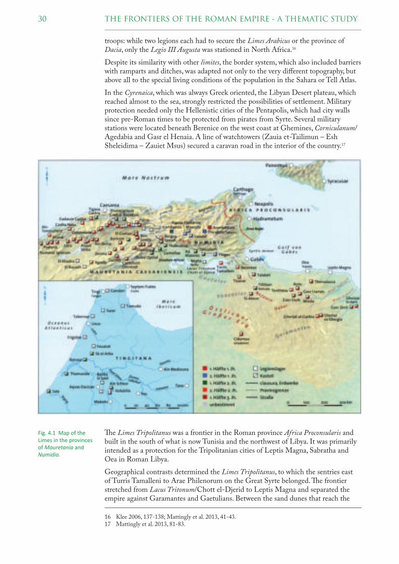
30 THE FRONTIERS OF THE ROMAN EMPIRE - A THEMATIC STUDY
troops: while two legions each had to secure the Limes Arabicus or the province of Dacia, only the Legio III Augusta was stationed in North Africa.16
Despite its similarity with other limites, the border system, which also included barriers with ramparts and ditches, was adapted not only to the very diff erent topography, but above all to the special living conditions of the population in the Sahara or Tell Atlas.
In the Cyrenaica, which was always Greek oriented, the Libyan Desert plateau, which reached almost to the sea, strongly restricted the possibilities of settlement. Military protection needed only the Hellenistic cities of the Pentapolis, which had city walls since pre-Roman times to be protected from pirates from Syrte. Several military stations were located beneath Berenice on the west coast at Ghemines, Corniculanum/Agedabia and Gasr el Henaia. A line of watchtowers (Zauia et-Tailimun – Esh Sheleidima – Zauiet Msus) secured a caravan road in the interior of the country.17
" e Limes Tripolitanus was a frontier in the Roman province Africa Proconsularis and built in the south of what is now Tunisia and the northwest of Libya. It was primarily intended as a protection for the Tripolitanian cities of Leptis Magna, Sabratha and Oea in Roman Libya.
Geographical contrasts determined the Limes Tripolitanus, to which the sentries east of Turris Tamalleni to Arae Philenorum on the Great Syrte belonged. " e frontier stretched from Lacus Tritonum/Chott el-Djerid to Leptis Magna and separated the empire against Garamantes and Gaetulians. Between the sand dunes that reach the
16 Klee 2006, 137-138; Mattingly et al. 2013, 41-43.17 Mattingly et al. 2013, 81-83.
Fig. 4.1 Map of the Limes in the provinces of Mauretania and Numidia.
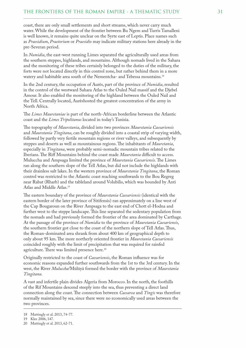
31THE FRONTIERS OF THE ROMAN EMPIRE - A THEMATIC STUDY
coast, there are only small settlements and short streams, which never carry much water. While the development of the frontier between Bu Ngem and Turris Tamalleni is well known, it remains quite unclear on the Syrte east of Leptis. Place names such as Praesidium, Praetorium or Praesidio may indicate military stations here already in the pre-Severan period.
In Numidia, the east-west running Limes separated the agriculturally used areas from the southern steppes, highlands, and mountains. Although nomads lived in the Sahara and the monitoring of these tribes certainly belonged to the duties of the military, the forts were not located directly in this control zone, but rather behind them in a more watery and habitable area south of the Nementcha- and Tebessa mountains.18
In the 2nd century, the occupation of Aurès, part of the province of Numidia, resulted in the control of the westward Sahara Atlas to the Ouled Nail massif and the Djebel Amour. It also enabled the monitoring of the highland between the Ouled Nail and the Tell. Centrally located, Aurèshosted the greatest concentration of the army in North Africa.
" e Limes Mauretaniae is part of the north-African borderline between the Atlantic coast and the Limes Tripolitanus located in today’s Tunisia.
" e topography of Mauretania, divided into two provinces Mauretania Caesariensis and Mauretania Tingitana, can be roughly divided into a coastal strip of varying width, followed by partly very fertile mountain regions or river valleys, and subsequently by steppes and deserts as well as mountainous regions. " e inhabitants of Mauretania, especially in Tingitana, were probably semi-nomadic mountain tribes related to the Iberians. " e Riff Mountains behind the coast made Mauretania diffi cult to access. Muluccha and Ampsaga limited the province of Mauretania Caesariensis. " e Limes ran along the southern slope of the Tell Atlas, but did not include the highlands with their drainless salt lakes. In the western province of Mauretania Tingitana, the Roman control was restricted to the Atlantic coast reaching southwards to the Bou Regreg near Rabat (Rharb) and the tableland around Volubilis, which was bounded by Anti Atlas and Middle Atlas.19
" e eastern boundary of the province of Mauretania Caesariensis (identical with the eastern border of the later province of Sitifensis) ran approximately on a line west of the Cap Bougaroun on the River Ampsaga to the east end of Chott el-Hodna and further west to the steppe landscape. " is line separated the sedentary population from the nomads and had previously formed the frontier of the area dominated by Carthage. At the passage of the province of Numidia to the province of Mauretania Caesariensis, the southern frontier got close to the coast of the northern slope of Tell Atlas. " us, the Roman-dominated area shrank from about 400 km of geographical depth to only about 95 km. " e more northerly oriented frontier in Mauretania Caesariensis coincided roughly with the limit of precipitation that was required for rainfed agriculture. " ere was limited presence here.20
Originally restricted to the coast of Caesariensis, the Roman infl uence was for economic reasons expanded further southwards from the 1st to the 3rd century. In the west, the River Muluccha/Mūlūyā formed the border with the province of Mauretania Tingitana.
A vast and infertile plain divides Algeria from Morocco. In the north, the foothills of the Rif Mountains descend steeply into the sea, thus preventing a direct land connection along the coast. " e connection between Caesarea and Tingis was therefore normally maintained by sea, since there were no economically used areas between the two provinces.
18 Mattingly et al. 2013, 74-77.19 Klee 2006, 147.20 Mattingly et al. 2013, 62-71.

32 THE FRONTIERS OF THE ROMAN EMPIRE - A THEMATIC STUDY
� e Roman infl uence and control in the province of Mauretania Tingitana reached from the Atlantic coast to the River Bou Regreg/Bū Rağrağ near Rabat and Salé and the tableland around Volubilis, a very fertile agricultural area. � e northern Rif and the Atlas mountains, however, were obviously never permanently under military occupation.21
� e Roman road network in North Africa provided good and timesaving logistical connections for the trade and supply of their vastly deployed troops. In Caesariensis, there were three roads parallel to the coast. In general, however, there were unpaved tracks and no cobbled streets. Natural routes - such as rivers - were not present in the province of Caesariensis. � e route along the frontier to the steppe landscape was well developed for military reasons.
4.2.2 NEAR EAST
Cappadocia
� e Cappadocian Limes begins in Trapezus on the coast of the Black Sea and continues over the Zigana Pass through the up to 3000 m high Pontic Alps southwards to Satala. It is assumed that from there the route runs southwards across Cimen Dağları and Refahiye and reaches the Euphrates near the Decius Bridge opposite Ilic. An alternative course could have led south from Satala via the Sipikor
21 Klee 2006, 147; Mattingly et al. 2013, 60-63.
Fig. 4.2 Map of the Limes in Pontus and Cappadocia.

33THE FRONTIERS OF THE ROMAN EMPIRE - A THEMATIC STUDY
Pass to the plain of Erzincan to the Euphrates and followed at low altitude the right bank to Zimara.
From southwest to northeast, the extended mountain ranges of the Antitaurus, with their heights of up to 3000 m, form numerous deeply-cut valleys which did not permit any navigation. From Zimara onwards the frontier runs along the Euphrates through the Kurdish Taurus to Melitene. South of the fort of Melitene, in the Midye region, the border between Cappadocia and Syria is assumed, where a linguistic boundary is still present.22
! e Cappadocian Limes continued eastward along the Pontine coast. East of Trapezus there are only very limited settlement possibilities because of the foothills of the Pontic Mountains. However, fertile lowlands extend beneath the Caucasus with the Colchis. At the foot of the Caucasus the northernmost sentry, Pityus, was on the Black Sea coast.
Syria
South of the Taurus, the Limes ran on the western riverbank of the Euphrates from Samosata to Sura. ! e river course, which stretched far to the west, off ered enemies the tactical advantage of the ’inner line’, but also enabled encirclement of the enemy during an attack. In the open area, the river served only as an obstacle against approaching enemies, but not as protection because of numerous transitions. From Sura the Limes ran south-westerly through the steppe area via Resafa and Palmyra to Damascus. From the 60s of the 2nd century AD onwards the Roman Empire extended as far east as the Khabur River and the Singara Mountains. ! e Limes followed the River Khabur to the River Euphrates near Dura Europos and then through the desert to Palmyra and Damascus. From there, it continues south to Bosra/Bostra, where the settled population in the cultivated land was to be protected against nomads.23
22 Klee 2006, 91-92.23 Klee 2006, 104.
View over the Euphrates from Dura
Europos.

34 THE FRONTIERS OF THE ROMAN EMPIRE - A THEMATIC STUDY
Arabia
� e Limes Arabicus begins at Bosra/Bostra in the Hauran and ends in Aila on the Gulf of Aqaba, one of the two northern arms of the Red Sea in today’s Israel. From Bosra/Bostra, the border runs south-westerly to Philadelphia/Amman. � e fertile volcanic soil and the abundant precipitation enabled intensive grain cultivation and thus a relatively dense population.24
To the east of the Dead Sea, the area is cut by the deeply incised, east-westward valleys of Wadi Yarmuk, Wadi Zerqa and Wadi Mujib. � e Via Nova Traiana is roughly the line of demarcation between the cultivated river valleys in the west and the desert and semi-desert in the east, where oases with water passages indicate the routes. � e last section of the Limes Arabicus leads from Wadi al-Hasa, which southern end fl ows into the Dead Sea, to Aila/Aqaba. To the east, the vast desert-like Hisma is extended. In this semi-arid area, caravan traffi c was the main source of income for the mostly small localities.
24 Klee 2006, 113.
Fig. 4.3 Map of the Limes in Syria and Arabia.

35THE FRONTIERS OF THE ROMAN EMPIRE - A THEMATIC STUDY
Wadi Sirhan, a deep south-eastward incline south of the Hauran, connects Syria with the Gulf of Arabia. To this day, Azraq is the most important oasis at the west end of the valley. Predatory gangs also used the much-used trade route as an incursion route.
� e Limes Arabicus had several auxiliary forts and watchtowers as well as legionary fortresses (about every 100 km), like at Adrou/Udhruh or Aila/Aqaba.25 � e reason for this defensive frontier line was to protect the Roman province of Arabia from attacks from the “barbarian” tribes of the Arabian Desert. � e main purpose of the Limes Arabicus is disputed; it may have been used both to defend from Saracen raids as well as to protect the commercial lines from robbers.
Next to the Limes Arabicus, Trajan built a major road, the Via Nova Traiana, from Bosra/Bostra to Aila, a distance of 430 km. Built between AD 111 and 114, its primary purpose may have been to provide effi cient transportation for troop movements and government offi cials as well as facilitating and protecting trade caravans emerging from the Arabian Peninsula.26
Aegyptus/Egypt
� e province of Aegyptus bordered on deserts or seas, with Nubia in the south of the country posing no threat after the northern part of the province was annexed under Augustus.27 � e army controlled the economy and trade and secured the transport routes, especially those from the Red Sea to the River Nile. Among the tasks of the
25 Klee 2006, 114-117.26 Klee 2006, 118-120.27 Breeze 2011a, 129.
Fig. 4.4 Map of the Limes in the province of Aegyptus.

36 THE FRONTIERS OF THE ROMAN EMPIRE - A THEMATIC STUDY
troops, which often had sections of camel- and dromedary-riders, was the sentry duty on the watchtowers along the desert roads. � e forts were concentrated on the roads in the Arabian Desert. � e two northern routes connected Qena with Abu Sha’ar and ed through an area with extensive quarries. Standardized and square in shape, forts were located in a distance of 20 to 30 km along the much shorter route from Quseir el-Qadim via Laqueita to Coptos. Another trade route ran from Coptos to Berenice/Ras Banas. Further south, in the area of the Dodeka- and Triakontaschoinos between Aswan, Elephantine and Philae, several military posts lie on the west bank of the Nile. With three stations in this section, the control was very dense. Small stations in the Meroitic area were occupied by auxiliary units.28
4.2.3 EUROPE
Britannia
� e fi rst Limes road in Britain, the so-called Gask Ridge, was constructed between AD 70 and 80 close to the Highland Line in Scotland but abandoned by the mid 80s. � e Gask Ridge frontier is a term describing a chain of Roman watchtowers, forts and fortlets built to monitor movement between the Highland massif and Fife.29 Although the Gask Ridge was not a wall, it may be Rome’s earliest fortifi ed land frontier. � e fortifi cations approximately follow the boundary between Scotland’s fertile Lowlands and mountainous Highlands, in Perth and Kinross and Angus. � e later Hadrian’s Wall and Antonine Wall were further south, and, by taking advantage of the heavily indented coastline of Great Britain, were considerably shorter. Construction on Hadrian’s Wall was started 42 years after the Gask Ridge (from AD 122 to 130), and the Antonine Wall was started just 12 years after the likely completion of Hadrian’s Wall (from AD 142 to 144).
Hadrian’s Wall ran 117 km long from the banks of the River Tyne near the North Sea to the Solway Firth on the Irish Sea. In Britain, where natural boundaries such as rivers are missing, the isthmus formed the most suitable site for an artifi cial barrier. To the east, the wall extends from Newcastle upon Tyne on the north bank of the Tyne west to Chesters and from there it rises up through the northernmost point at Limestone Corner to the Whin Sills. � ese cliff s of volcanic rock, with wide views, drop off steeply to the Crags. At Willowford, the wall reaches the River Irthing and follows the north bank of the river. West of Carlisle it runs into the Solway Marshes between Burgh-by-Sands and Bowness-on-Solway on the best line just above the fl ood limit. Although the curtain wall ends near Bowness-on-Solway, this does not mark the end of the line of defensive structures. � e system of milecastles and turrets is known to have continued along the Cumbria coast as far as Risehow, south of Maryport (so-called Cumberland Coast System).30
Hadrian’s Wall frontier system consists of a ditch and wall with 80 small-gated milecastle fortlets, one placed every Roman mile, holding a few dozen troops each, 79 pairs of evenly spaced intermediate turrets used for observation and signalling as well as 17 auxiliary forts.31
� e Antonine Wall crosses the narrowest part of Britain at the Forth-Clyde isthmus. � is wall stretches 63 km from Old Kilpatrick in West Dunbartonshire on the Firth of Clyde to Carriden near Bo’ness on the Firth of Forth. � e wall was intended to extend Roman territory and dominance by replacing Hadrian’s Wall 160 km to the south, as the frontier of Britannia. To the east, the course of the border between Carriden and
28 Klee 2006, 124-129.29 Klee 2006, 9-10.30 Klee 2006, 14; Breeze 2011b, 48-69.31 Klee 2006, 11-13.

37THE FRONTIERS OF THE ROMAN EMPIRE - A THEMATIC STUDY
Bridgeness remains uncertain. From the elevated south bank of the Carron River, the wall rises up over the basalt formation of Croy Hill and Bar Hill to the Kilsyth Hills and the Campsie Fells. � e wall bridges the Rivers Avon and Kelvin at the forts of Inveravon and Balmuildy. To the west, the wall moves from hill to hill. Shortly before Old Kilpatrick, the route is clearly dominated by the Kilpatrick Hills. � e sides of the border in the Forth and Clyde bays were protected. A cavalry unit secured the lower river basin at Whitemoss-Bishopton, with small fortlets to the west at Lurg Moor and Outerwards monitoring the Clyde. Up to the Tay, advanced outposts secured the Fife
Fig. 4.5 Map of Northern Britain with Hadrian’s Wall and Antonine Wall.
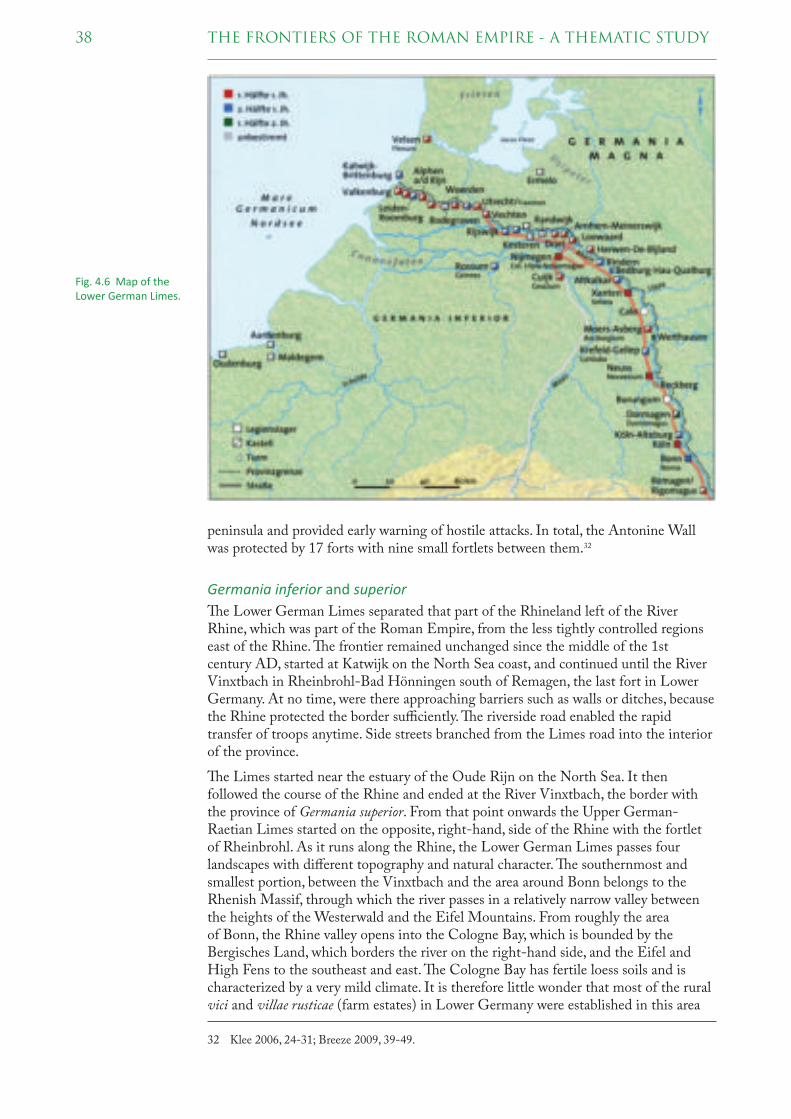
38 THE FRONTIERS OF THE ROMAN EMPIRE - A THEMATIC STUDY
peninsula and provided early warning of hostile attacks. In total, the Antonine Wall was protected by 17 forts with nine small fortlets between them.32
Germania inferior and superior
! e Lower German Limes separated that part of the Rhineland left of the River Rhine, which was part of the Roman Empire, from the less tightly controlled regions east of the Rhine. ! e frontier remained unchanged since the middle of the 1st century AD, started at Katwijk on the North Sea coast, and continued until the River Vinxtbach in Rheinbrohl-Bad Hönningen south of Remagen, the last fort in Lower Germany. At no time, were there approaching barriers such as walls or ditches, because the Rhine protected the border suffi ciently. ! e riverside road enabled the rapid transfer of troops anytime. Side streets branched from the Limes road into the interior of the province.
! e Limes started near the estuary of the Oude Rijn on the North Sea. It then followed the course of the Rhine and ended at the River Vinxtbach, the border with the province of Germania superior. From that point onwards the Upper German-Raetian Limes started on the opposite, right-hand, side of the Rhine with the fortlet of Rheinbrohl. As it runs along the Rhine, the Lower German Limes passes four landscapes with diff erent topography and natural character. ! e southernmost and smallest portion, between the Vinxtbach and the area around Bonn belongs to the Rhenish Massif, through which the river passes in a relatively narrow valley between the heights of the Westerwald and the Eifel Mountains. From roughly the area of Bonn, the Rhine valley opens into the Cologne Bay, which is bounded by the Bergisches Land, which borders the river on the right-hand side, and the Eifel and High Fens to the southeast and east. ! e Cologne Bay has fertile loess soils and is characterized by a very mild climate. It is therefore little wonder that most of the rural vici and villae rusticae (farm estates) in Lower Germany were established in this area
32 Klee 2006, 24-31; Breeze 2009, 39-49.
Fig. 4.6 Map of the Lower German Limes.

39THE FRONTIERS OF THE ROMAN EMPIRE - A THEMATIC STUDY
in Roman times. In the vicinity of the legionary fortress of Novaesium, the Cologne Bay expands further into the Lower Rhine Plain, a river terrace landscape. Only a little east of today’s German-Dutch border, between the area of the legionary fortresses of Vetera and Noviomagus, the Lower Rhine Plain transitions into the delta formed by the Rhine and Meuse and which fi nally ends at the North Sea.33
A chain of forts and fortlets for auxiliary troops guarded the Rhine line. As in other provinces, the troops were distributed along this boundary according to the conditions of the foreland. In the southern section between Remagen and Bonn there were only a few auxiliary units because there were few Germanic settlements in the Bergisches Land and the Westerwald north of the Rhine. However, in the central part apart from the two legions at Xanten and Bonn, seven to eight auxiliary units were stationed. In the westernmost section of the Lower German Limes, a marshland area with limited opportunities for settlement, an increasing number of small waterways running into the Rhine facilitated quick raids by hostile tribes. " erefore, the forts between Utrecht and Leiden are very close to the infl ows from the northern part of the moors. To the west, north-south running land routes were controlled from Katwijk and Valkenburg over the beach barriers.
" e Upper German Limes begins in Rheinbrohl opposite the Vinxtbach and runs from the Westerwald in a southerly direction to the Lahn at Bad Ems. From there it follows a prehistoric trail to Bad Schwalbach. On the hilly central ridge of the Taunus, the frontier runs to the northeast and reaches from the Emsbach valley over a steep climb the highest point on the Feldberg at 800 meters. At Butzbach, the border leaves the Taunus ridge to include the Wetterau in a wide arc over the ridge at the Gießen basin and south of the Hessian basin. " is area is criss-crossed by numerous watercourses and is very fertile due to the loess soil and the mild climate. First, the frontier was adapted to this terrain but was later straightened. At the Horloff in the eastern Wetterau, the Limes runs through the valleys of Nidda and Nidder over
33 Klee 2006, 35-36.
Fig. 4.7 Map of the Upper German and Rae� an Limes.

40 THE FRONTIERS OF THE ROMAN EMPIRE - A THEMATIC STUDY
Marköbel to the south and meets the River Main at Groß-Krotzenburg. Between Groß-Krotzenburg and Obernburg, the boundary remains as along the Rhine and the Danube on the riverbank facing the Roman Empire. In the middle of the 2nd century, the river frontier was extended through the extensive upland forests of the Main valley from Obernburg to Miltenberg.
South of the River Main the Limes runs from Miltenberg to Walldürn where the 81 km long and straight run section begins, which ends at Haghof near Welzheim. Without consideration of the topography, the frontier goes through the Jagst-, Kocher- and Murr-Valley as well as over the hilltops of the Swabian-Franconian Forest. Northeast of Lorch (at the border to the Roman province of Raetia), the Upper German Limes ends north of the River Rems.34
Rae� a
! e Raetian Limes runs from the fortlet Freimühle in the Rotenbach valley northwest of Schwäbisch Gmünd with mostly straight course above the Rems valley. From Kolbenberg at Aalen it follows in a wide arc to the northeast to Gunzenhausen and includes the Ries and the Hesselberg that widely dominates the landscape. ! is included both to the Empire, this fertile, intensively farmed area as well as the Franconian Jura where limestone was broken. To the north, the not very profi table Keuper country remained unoccupied. From Gunzenhausen and the Altmühltal onwards the Raetian Limes extends in a southeast direction through the Jura region of the Alb plateau to the Danube, which it reached at Hienheim. Between Eining and Passau, the eastern Raetian Limes represents a typical river frontier (ripa) on the south bank of the Danube.35
Noricum
! e Norican Limes is on the soil of the present-day Austrian states of Upper and Lower Austria. ! e frontier runs along the south bank of the Danube and was guarded by a loose chain of auxiliary fortlets and watchtowers. ! e Danube forms a narrow river valley in the foothills of the Bohemian Massif that widens only locally to small valleys like the Wachau. Nevertheless, this valley with its densely forested escarpments made access to the riverbank more diffi cult. Connection paths to the south are dictated by the river valleys of the Traun, Enns, Ybbs, Erlauf and Traisen while the Bohemian Forest does not allow extensive settlement in the north. At the Tullnerfeld, the Danube reaches the fi rst lowland basin before it fl ows into the Vienna Basin at Klosterneuburg on the Vienna gate north of the foothills of the Vienna Woods. A legionary fortress at Lauriacum/Enns, more than ten auxiliary forts, and several watchtowers protected the Norican Limes. Nearly every fort had its own river port or landing stage and a storage area because the Danube was not only border zone, but also the most important transport and trade route in the region.36
Pannonia superior and inferior
! e Pannonian Limes (Ripa Pannonica) is the part of the Roman fortifi ed frontier known as the Danubian Limes that runs for approximately 800 km from the Roman camp of Klosterneuburg in the Vienna Basin in Austria to the mouth of the river Sava in present-day Serbia. ! e Pannonian Limes runs through two provinces: Pannonia superior and Pannonia inferior, divided in AD 107 by Trajan.
To the east of Cannabiaca/Zeiselmauer, the Danube fl ows through the Vienna Basin, a fertile lowland basin. It crosses the border of the Alps and the Little Carpathians at
34 Klee 2006, 45.35 Klee 2006, 55; Jilek 2009, 67-69.36 Klee 2006, 63; Jilek 2009, 70-75.

41THE FRONTIERS OF THE ROMAN EMPIRE - A THEMATIC STUDY
the Devín Gate (“Porta Hungarica”) and arrives in the Little Hungarian Plain below Bratislava, where it fl ows in a southeastern direction across the alluvial fan it has deposited and continues to shape. Together with its Moson Danube branch it encircles the Szigetköz region on its right bank and on its left bank in Slovakia it fl anks the Žitný/Csallóköz island region along with the Váh River. � e largest tributaries from the south are the Rivers Leitha and Raab. � rough the valleys of Morava, Váh, Nitra and Hron, the most important connection routes led to the north. Not far beyond the city of Győr, the Danube turns and fl ows on in an easterly direction. � en, from Esztergom it cuts an S curve to the east through the narrow valley between the Visegrád and Börzsöny mountains and turns to the south. Leaving the town of Vác the river enters into the Great Hungarian Plain (Alföld) and fl ows in its western edge in a north-south direction. � e fortifi cations were built on the eastern edge of the loess plateau or near to river crossings. Numerous small river valleys enable easy access to the heights especially in the south. At Vukovar (Croatia), the river changes to the east due the mountain range Alma Mons/Fruška Gora north of Sirmium/Sremska Mitrovica. In that region the River Tisza, Drava and Sava fl ow into the Danube.37
� e four legionary fortresses and the more than 40 auxiliary forts along the Pannonian Limes were mainly located in the immediate vicinity of the riverbank. A chain of watchtowers or signal towers closed the gaps between the camps, and in some strategically important places fortifi cations were built also in the left bank of the river. � e military installations of the Ripa Pannonica were chained by the Limes road, in some places with more than 15 km long straight run sections.38
37 Jilek 2009, 70-87; Visy 2003, passim; Visy 2009a, 55-60; Visy 2011a, 12-21.38 Klee 2006, 67; Visy 2003; Visy 2009a, 61-93; Visy 2011b, 55-60; Borhy 2014, 45-53. 132-146.
Fig. 4.8 Map of the Norican and Pannonian Limes.

42 THE FRONTIERS OF THE ROMAN EMPIRE - A THEMATIC STUDY
Moesia superior and inferior
At Singidunum/Belgrade, the Sava, and near Margum/Dubravica, the Great Morava, coming from the Balkan Peninsula, fl ow into the Danube. " en comes the last and most important, 130 km long mountain breach between the South Carpathians and the Balkans: the “Iron Gate” (Đjerdap). " e Iron Gate region encompasses the banks of the Danube from Cuppae/Golubac to the fortress Diana/Karataš. In this region for millions of years, the Danube cut its way through the rocky massif of the Transylvanian Carpathians, forming one of the largest river gorges in Europe. Between the river and the mountains of Homolje, Miroč, and Deli Jovan on its south bank, the space available for human habitation is very limited. In some parts of the Danube gorge, there are many submerged reefs, rapids and cataracts, while in the Great and Small Gorges in the middle of the canyon, the Danube is the deepest river in Europe. In antiquity, the river often froze during severe winters, making crossings very easy during those periods. From the end of the Gorge, at the Roman castellum Diana/Karataš, to the mouth of the Timok River, the Danube again becomes a broad and smooth fl owing stream with numerous islands and sandbars.39
After the Iron Gate, the Danube reaches the lowlands of Wallachia. Here the riverbed with its vast swampland and river meadows lies in a 10 to 15 km wide valley close to the 100 m high steep edge of the Bulgarian chalk cliff s. " e most important tributaries from the Carpathians are Jiu, Olt and Arges, from the Balkans Timok, Isker and Jantra.
39 Klee 2006, 74; Dyczek 2008, 45-51; Jilek 2009, 87-99; Korać et al. 2014, 50-57; Vagalinski et al. 2012, 23-62.
Fig. 4.9 Map of the Moesian and Dacian Limes.

43THE FRONTIERS OF THE ROMAN EMPIRE - A THEMATIC STUDY
Before the Danube comes to the tableland of Dobrudja it turns north again, but forms a number of arms, between which there are very marshy fl oodplains. At Galaţi, the river bends to the east and reaches the mouth delta, a 4300 km² swamp area with reed beds and numerous water veins. � e three main estuaries extend several times to lakes, but are heavily muddy and so shallow that shipping is not possible.40
Dacia
� e province of Dacia encompassed the high plain of Transylvania that was surrounded by the Carpathians. Numerous mountain passes and the deeply cut river valleys of the Mureş in the west, the Someş in the north or the Olt in the east, connect the land with the Tisza plain west of the mountains or the fl atland of Walachia. � e Banat between the Danube, Tisza, Mureş and the South Carpathians was rich in iron and copper deposits but did not belonged to Dacia. � e Dacian Limes was strongly infl uenced by the topography. At the most important incursions forts secured the central settlements, which were only accessible via passes and valleys. � e largely inaccessible mountainous country made a continuous barrier unnecessary. For this reason, watchtowers, ramparts and ditches, called clausura (barrier), were installed only along shorter, apparently more vulnerable sections. A continuous wall could be excavated in the east of Alutanus/Olt.41
� e so-called Limes Alutanus was the eastern border of the Roman province of Dacia. Nowadays there is no surface evidence, but is remembered by the Tabula Peutingeriana, the Limes Alutanus was a fortifi ed line consisting of a vallum, built in the North-South direction, on the western side of the Olt River with seven Roman forts.42
� e so-called Limes Transalutanus was a fortifi ed frontier system built on the western edge of Teleorman’s forests in the Roman province of Dacia. � e frontier comprised a road following the border, a three-meter vallum 10-12 meters wide, reinforced with timber palisades on stone walls, and a ditch. � e Transalutanus Limes was 235 km long, parallel to Olt River at a distance varying from 5 to 50 km east of the river. � e construction was started in the early 2nd century; its fi nal stage took place under Septimius Severus (AD 193-211). Between AD 244 and 247, under Philip the Arab, after the Carpian and Getae attacks, the Roman Imperial army abandoned the Limes.43
40 Klee 2006, 79; Dyczek 2008, 45-51.41 Gudea/Lobüscher 2006, 3-5. 21-22; Klee 2006, 83-84.42 Gudea/Lobüscher 2006, 31-36; Klee 2006, 86; Visy 2009b, 587-588.43 Gudea/Lobüscher 2006, 31-36; Klee 2006, 87; Visy 2009b, 587-598.
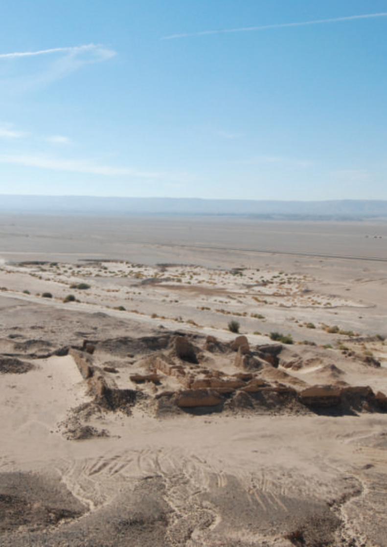

a single and complex monument 5
� e Frontiers of the Roman Empire are part of a common heritage of the countries encircling the Mediterranean Sea. Successive generations have built on that heritage and modifi ed, it thus helping to create our modern world.
� e Roman state, in one form or another, survived for over 2000 years. Its empire was one of the greatest states that the world has seen, close only to the ancient China in its size and longevity. � e Roman world was protected and at the same time defi ned by frontiers. It was as if these frontiers were, as Aelius Aristides remarked in the 2nd century AD, “enclosing the civilised world in a ring”. � e frontiers did defi ne the Roman Empire and were essential for the stability and therefore economic growth of the interior: they allowed the cities of the empire to fl ourish.
� e frontier, over 7,500 km long, defi ned the Roman Empire and is the single largest monument surviving from the Roman world. � e evidence used to understand the frontier includes literary sources and other documents such as the records on papyri and the writing tablets, inscriptions, sculpture, the fruits of archaeological excavation and survey, and the frontier works themselves. Today, the most visible and prolifi c element of all these sources of evidence is the archaeological site which is the frontier.
All the frontier sections so far nominated and accepted as part of the multinational ‘Frontiers of the Roman Empire World Heritage Site’ are artifi cial frontiers, which are defi ned by military installations linked by an artifi cial barrier. However, in most countries in Europe, in the Near East and in North Africa, the frontiers consisted of chains of military installations along natural boundaries like rivers, mountains or deserts.
In contrast to artifi cial barriers such as the Upper German-Raetian Limes, which underwent several changes in advancing lines, the river frontiers of the Roman Empire in Europe along the Rhine and the Danube established by the 1st century AD remained rather static. � ere are few exceptions to this, mainly on the Balkans, where the Emperor Trajan crossed the Danube around AD 101/102, conquered Dacia in modern Romania and established a new province, which lasted until around AD 270.
5.1 FRONTIER TYPES
� e area of the Roman frontiers encompasses a wide variety of topographic, hydro-graphical, climatic and ecological regions, including the physical and climatic zones of mountain, woods, grasslands, deserts, river valleys and deltas. � ese geo-ecological zones had an important impact upon the nature of the frontiers.
The military post at al-Heita in the Eastern Desert, Egypt, on the route from Coptos to the quarries of Mons
Porphyrites.

46 THE FRONTIERS OF THE ROMAN EMPIRE - A THEMATIC STUDY
5.1.1 ARTIFICIAL BARRIERS
Palisades
In the 2nd century, in diff erent parts of the Empire the ‘barbarians’, as the Romans called them, were separated off not by natural barriers but by artifi cial frontier-barriers such as palisades or walls. One example is the Odenwald-Limes, an early section of the Upper German Limes. It was a cross-country frontier line accompanied by forts, watchtowers and palisades, which linked the River Main with the Neckar and bridged the gap between the rivers. But there remained further advance and further fortifi cation.44
Either Hadrian or, more probably, his successor Antoninus Pius, pushed out from the Odenwald and the Danube, and marked out a new frontier roughly parallel to, but in advance of these two lines, though sometimes, as on the Taunus, coinciding with the older line. � is is the frontier, which is now visible. It consists, as is seen today, of two distinct frontier works, one, known as the Pfahlgraben, is a palisade of stakes with a ditch and earthen mound behind it, once extending from the Rhine southwards into southern Germany. � e other, which begins where the earthwork stops, was originally also a palisade, to be replaced late by a wall of stone of approximately 3 m height, the Teufelsmauer. It runs roughly east and west parallel to the Danube, which it fi nally joins at Hienheim near Regensburg. � e southern part of the Pfahlgraben is remarkably straight; for over 80 km, it shows a deviation of only a few metres from the absolute straight.45
Walls
Also in the 2nd century, other linear barriers were erected: fi rstly Hadrian’s Wall, a defensive fortifi cation in the Roman province of Britannia. It ran from the banks of the River Tyne near the North Sea to the Solway Firth on the Irish Sea, and was then the northern limit of the Roman Empire. It had a stone base and a stone wall. � ere were milecastles with two turrets in between. � ere was a fort about every fi ve Roman miles. From north to south, the wall comprised a ditch, wall, military way and vallum
44 Breeze 2011a, 56-61.45 Breeze 2011a, 76-79.
The linear barrier south of Sala (Morocco) between Bou Regreg and the coast.
47THE FRONTIERS OF THE ROMAN EMPIRE - A THEMATIC STUDY
(another ditch with adjoining mounds). In addition to the wall’s defensive role, its gates may have been custom posts.46
About 20 years after the construction of Hadrian’s Wall, Roman territory was extended to the north by some 160 km: � e Antonine Wall, a turf fortifi cation on stone foundations, was constructed between the Firth of Forth and the Firth of Clyde. Representing the northernmost frontier barrier of the Roman Empire, it spanned approximately 63 km and was about 3 m high and 5 m wide. It is thought that there was a wooden palisade on top of the turf. Security was bolstered by a deep ditch on the northern side; a military way was on the south. In addition to the 19 forts along the wall, there are at least 9 smaller fortlets, very likely at intermediate distances of a Roman mile, which formed part of the original scheme, some of which were later replaced by forts.47
Ditches
� e Fossatum Africae (“African ditch”) is a linear defensive structure claimed to extend over more than 750 km in northern Africa, constructed to defend and control the southern borders of the Roman Empire in Africa.48 Generally the fossatum consists of a ditch and earth embankments on either side using the material from the ditch. Sometimes the embankments are supplemented by dry stone walls on one or both sides; rarely, there are stone walls without a ditch. � e width of the fossatum is generally 3–6 m but in exceptional cases may be as much as 20 m. Wherever possible, it or its highest wall is constructed on the counterscarp. � e fossatum is accompanied by many small watchtowers and numerous forts, often built within sight of one another. � e purpose of the fossatum seemed to be for customs and migration control.49
� ere are similar, but shorter, fossatae in other parts of North Africa. Between the Matmata and Tabaga ranges in modern Tunisia there is a fossatum which was dupli-cated during World War II. � ere is also a 20 km long fossatum at Bou Regreg in Morocco.
Banks
Another fortifi ed frontier system was built on the western edge of Teleorman’s forests in the Roman province of Dacia (modern-day Romania) in the 2nd century. � e frontier was composed of a road following the border, a three-metre vallum 10–12 m wide, reinforced with wood palisades on stone walls, and also a ditch. � is bank with its own line of forts linked by a road is generally known as the Limes Transalutanus. It was 235 km long, parallel to Olt River at a distance varying from 5 to 50 km east of the river. � e preferred interpretation is that the bank marked the provincial boundary and controlled movement in the areas where there was no natural physical boundary to the province.50
As many as six diff erent artifi cial frontiers were constructed in Britain, Germany, Dacia and Africa within the relatively short period of sixty years. While they share some characteristics, there are many diff erences. � e position of the Hadrianic German palisade, Hadrian’s Wall in Britain and the Fossatum Africae related to existing sites, the new barriers being placed on the outer side of the earlier installations. � e Antonine Wall in Britain, the Outer Limes in Germany and the Limes Transalutanus, on the other hand, were not built in relation to any other structures. � e materials of construction varied. � is may have related to what was available. A further diff erence
46 Breeze 2011a, 61-70.47 Breeze 2011a, 71-76.48 Cf. Baradez 1949.49 Breeze 2011a, 82-84.50 Gudea/Lobüscher 2006, 31-36; Breeze 2011a, 84-85.

48 THE FRONTIERS OF THE ROMAN EMPIRE - A THEMATIC STUDY
between the frontiers is of particular importance. � e various elements of the African, Dacian and German frontiers (forts, watchtowers etc.) tend to be separate and not physically connected by the barrier, while those on the British frontiers are linked.51
5.1.2 RIVER FRONTIERS
Part of the very essence of a linear frontier system is that it forms a continuous line. In general, artifi cially constructed barriers have no major problems to demonstrate this linearity. � e fortifi cation system itself with its structural details (walls, palisades, rampart/ditches) provides the necessary link between individual monuments (watchtowers, fortlets, forts). Even forts which are placed behind the active demarca-tion line, like those on the Upper German-Raetian Limes, stand in a fairly obvious relationship to the outer frontier installations. Walking along the frontier on Hadrian´s Wall brings the visitor from watchtowers to milecastles and forts. � e relationship between the individual frontier elements is clearly visible.52
River frontiers lack those most obvious connecting elements, excepting the Limes road and very often a chain of watchtowers. Although the rivers form a linear obstacle, which connects the individual monuments, the line itself is not easy to defi ne and to present. Forts along the Rhine and Danube frontiers are 10 to 30 km apart, and inter-visibility does not often exist. Watchtowers, the intermediate elements in the archaeological landscape, are not always easy to detect. River frontiers were the River Rhine, Danube, Olt and Euphrates.53
� ere are long stretches of frontiers where we do not know much about watchtowers sited along them, especially those of the earlier Roman Empire, when they were mainly constructed of timber. An exception to this situation is the recent research on the Lower Rhine Limes, where a longer section of the earliest frontier system was investigated during rescue excavations in the area between Utrecht and Woerden (NL). Here it is clearly demonstrated that wooden watchtowers were a distinct element of the borderline along the river connected by a (Limes) road. Late Roman examples are easier to discern because of their massive stone construction. More than 200 watchtowers, mostly stone towers, are recorded along the Danube banks in Hungary, which form a very tight defence system. It can be assumed that similar systems existed on the other frontier sections too.54
A most distinctive feature of river frontiers of course is the river itself. But over the last 2000 years the river beds often changed courses. Because of such changes and fl oods, many sites on the lower grounds were destroyed by water action. In the 19th century, rivers underwent certain regulatory measures, which did not help to preserve the monuments. But quite a lot of them were detected and investigated through those activities. Even larger threats are the water power stations with their dams and reservoirs. When power stations were built in Serbia during the 1980s, many parts of the Roman frontier, e.g. forts, fortlets, watchtowers and the road through the Iron Gate were fl ooded and are no longer visible.55 � ere exists a similar situation along the Euphrates in Turkey.
Distinctive features of river frontiers are bridgehead fortifi cations.56 We do know about very few bridgehead fortifi cations in the earlier Roman frontier system, such as the fort of Iža in Slovakia and the fort of Dierna/Orşova in Romania. Both of them were
51 Breeze 2011a, 85.52 Jilek 2009, 42; Visy 2015, 27-36.53 Jilek 2009, 42.54 Jilek 2009, 42-45; Visy 2015, 32.55 Jilek 2009, 45.56 Cf. Bohy 2014, 141-146; Visy 2015, 31-32.
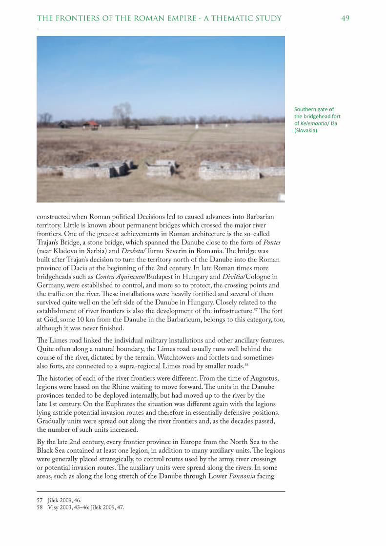
49THE FRONTIERS OF THE ROMAN EMPIRE - A THEMATIC STUDY
constructed when Roman political Decisions led to caused advances into Barbarian territory. Little is known about permanent bridges which crossed the major river frontiers. One of the greatest achievements in Roman architecture is the so-called Trajan’s Bridge, a stone bridge, which spanned the Danube close to the forts of Pontes (near Kladovo in Serbia) and Drobeta/Turnu Severin in Romania. ! e bridge was built after Trajan’s decision to turn the territory north of the Danube into the Roman province of Dacia at the beginning of the 2nd century. In late Roman times more bridgeheads such as Contra Aquincum/Budapest in Hungary and Divitia/Cologne in Germany, were established to control, and more so to protect, the crossing points and the traffi c on the river. ! ese installations were heavily fortifi ed and several of them survived quite well on the left side of the Danube in Hungary. Closely related to the establishment of river frontiers is also the development of the infrastructure.57 ! e fort at Göd, some 10 km from the Danube in the Barbaricum, belongs to this category, too, although it was never fi nished.
! e Limes road linked the individual military installations and other ancillary features. Quite often along a natural boundary, the Limes road usually runs well behind the course of the river, dictated by the terrain. Watchtowers and fortlets and sometimes also forts, are connected to a supra-regional Limes road by smaller roads.58
! e histories of each of the river frontiers were diff erent. From the time of Augustus, legions were based on the Rhine waiting to move forward. ! e units in the Danube provinces tended to be deployed internally, but had moved up to the river by the late 1st century. On the Euphrates the situation was diff erent again with the legions lying astride potential invasion routes and therefore in essentially defensive positions. Gradually units were spread out along the river frontiers and, as the decades passed, the number of such units increased.
By the late 2nd century, every frontier province in Europe from the North Sea to the Black Sea contained at least one legion, in addition to many auxiliary units. ! e legions were generally placed strategically, to control routes used by the army, river crossings or potential invasion routes. ! e auxiliary units were spread along the rivers. In some areas, such as along the long stretch of the Danube through Lower Pannonia facing
57 Jilek 2009, 46.58 Visy 2003, 43-46; Jilek 2009, 47.
Southern gate of the bridgehead fort of Keleman� a/ Iža (Slovakia).

50 THE FRONTIERS OF THE ROMAN EMPIRE - A THEMATIC STUDY
the Great Hungarian Plain, the forts were more or less equally placed, about a day’s march apart, that is 22 km, elsewhere their locations related closely to the local terrain. � e control of routes remained important for the disposition of the auxiliary units. It can be no coincidence that the cavalry units based in Lower Germany lay to each side of the legion which itself was strategically places at the start of one of the major routes into Germany, or that one of two cavalry units in Upper Germany lay on another route into Germany. � e same held for the frontier on the Euphrates: each main line of movement over the border was controlled by a legion.59
� e military installations along the river frontiers in Europe were occupied over a period of 400 years, mostly from the reign of Augustus to the fi nal years of the 4th, and on the Lower Danube even to the 5th and 6th centuries AD. In the late Roman period, those frontier defences were modernized and turned into strongly fortifi ed military bases. � e remains, which in many cases survived astonishingly well to the present day, in- and outside of settlements and in the open countryside, are the most distinctive and still visible witnesses of the European river frontiers. � e consequences of this situation are extremely complex military sites, archaeologically and chronologically.
All the river and artifi cial frontiers of continental Europe share a common feature: with very few exceptions all forts lay on, or close to, the frontier line itself, that is the river bank or the linear barrier. � e two great European rivers housed the imperial fl eets. While their primary purpose was probably defence like the soldiers of the army, they presumably also helped supply the frontier forces.60
5.1.3 MOUNTAIN FRONTIERS
Rivers can fl ow through mountainous terrain and the resulting gorges, as on the Middle Danube or the Euphrates, can act as a severe impediment to movement, and settlement. Often, the army seemed to consider that little extra protection was required in such circumstances.61
For the Romans, passes were signifi cant for the control of routes. Valleys were always important lines of communication. Forts were carefully placed in Dacia to watch over passes through the Carpathians and similarly in the Caucasus Mountains. � e speciality of such frontiers is that the forts were built in the valleys along a road, while the frontier line with towers ran within sight on top of the nearby hills. Where there were breaks in the high plateaux beside the River Euphrates which allowed for a route across, a legionary fortress was established. In Germany, every pass in the hilly countryside of the Odenwald was guarded by a fort or fortlet. In northern Britain, a network of fortlets controlled the passes through the Southern Uplands in the Antonine period. � e only mountains which appear to have been treated diff erently were the Atlas Mountains in North Africa, but this may relate in part to our poor knowledge of the details of the frontier installations.62
An unusual province in Europe was Dacia. Its frontiers were mainly defi ned by the Carpathian Mountains. � ese off ered a boundary as well as an obstacle to attack. � eir form helped create a uniquely defended province, a useful reminder that the Romans could adapt to special and diff erent circumstances. � e shape of Dacia helped to create its own unique military deployment. To the north and east, the outer shell lay in the mountains. � e main pass to the east was strongly guarded with additional units being based there. Some towers have also been recorded in this sector. A similar pattern
59 Breeze 2011a, 115.60 Breeze 2011a, 116.61 Breeze 2011a, 133.62 Breeze 2011a, 144-145.

51THE FRONTIERS OF THE ROMAN EMPIRE - A THEMATIC STUDY
pertained in the west where several auxiliary forts protected the access route along the Mureş Valley.63 A noticeable concentration of forts was in the gap between the western and northern Carpathians. � e purpose of a specifi c arrangement of forts, fortlets, towers and barriers was to control access to the province.
5.1.4 DESERT FRONTIERS
� e frontiers in the desert areas were entirely diff erent from land or river frontiers. Here water was also important, though not in the same way. Rainfall governed the extent of farming and settlement and therefore the boundary of the empire and the positioning of Roman forts. � e location of the forts in Syria and Arabia closely related to the line of the 200mm isohyet. When forts were built in the desert, their location was determined by the position of oases or the presence of sub-surface water which could be reached by wells. � e resulting pattern is rather diff erent from that on a land or river frontier. � e placing of a fort at an oasis not only had the advantage of ensuring that there was a water supply for the troops but also enabled the soldiers to supervise the civilians living there or using the oasis while travelling as well as denying its use by an enemy.64
� ere are considerable diff erences between desert frontiers. � ere are, however, two important constants, the extent of Roman rule related to the rainfall and to the area of cultivable land. On all desert frontiers, the distances between forts are larger than on the land and river frontiers of Europe which suggests that the lines of forts which can be drawn on a map do not relate to the same type of frontiers. A strong argument is that the forts constructed under Diocletian and later in Arabia were to protect travellers on the caravan route leading from the Red Sea northwards. � eir construction followed the early Saracen raids and it remains possible that the forts
63 Breeze 2011a, 133-134.64 Breeze 2011a, 118.
The desert fort of Qasr al-Bashir (Jordan).

52 THE FRONTIERS OF THE ROMAN EMPIRE - A THEMATIC STUDY
also protected the local provincials from such raids. � ere is evidence for increased agricultural production in several frontier areas which could have encouraged raiding.65
We have desert frontiers in Syria, Arabia, Egypt, Cyrenaica and Tripolitania. In Arabia and in North Africa, outposts were established at considerable distances beyond the presumed frontier line, or rather beyond the main line or group of forts. In North Africa, these almost appear to be part of a continuous forward movement of the frontier in Numidia through the 2nd century into the early 3rd. � is move, however, stopped in the early 3rd century after the actions of Severus. One purpose of his forts may have been to guard caravan routes into the empire, and this seems also to have been the situation in Arabia where the outposts sat astride routes into the province. � e outposts there may have had an additional role of maintaining contact with people beyond the frontier. One unusual feature in both Arabia and Numidia was the use of legionaries to man forts and outposts. � e reason for this is not known. It possibly refl ects the relative lack of auxiliary troops in these provinces. Possibly the legionaries here were otherwise underemployed as there were few threats.66
Diocletian was at work on all frontiers, as demonstrated by the construction of forts in a new style of architecture. In North Africa, ironically, the last major threat came with an invasion from across the sea, by the Vandals who sacked Carthage in AD 439. Roman rule ended here and in the Near East with the Arab invasions of the 7th century.67
5.1.5 SEA FRONTIERS
� e ultimate frontier was the sea. Such a frontier was achieved in the West where Rome’s armies reached the Atlantic in Mauretania Tingitana, Spain, Gaul and through much of Britain. Once the conquest of Spain and Gaul had been completed, these new provinces were largely demilitarized. Bringing the boundary of the empire to the sea accordingly had advantages in terms of stability and manpower. � e sea off ered
65 Breeze 2011a, 132.66 Breeze 2011a, 132.67 Breeze 2011a, 132.
Military outpost near the quarries of Mons
Claudianus in the Eastern Desert (Egypt).

53THE FRONTIERS OF THE ROMAN EMPIRE - A THEMATIC STUDY
important lines of communication as well as cheaper transport than travel overland. Some scattered outposts of the empire were only reached by sea, including the cities and forts around the Black Sea.68
� e Romans may not at fi rst have been sailors, but during the empire they developed their fl eets to ensure that the seaways were as open as land routes as well as using them as part of the armoury of protection in the frontier lines. Rome was normally able to control activities within the Mediterranean basin, but the western seaboard was more diffi cult. Defensive measures were taken against attacks from Franks and Saxons, but, so far as we know, no proactive military expeditions were launched to stop the problem at the source.69
� e clearest evidence for the protection of a sea frontier lies within the pages of Arrian’s Circumnavigation of the Black Sea, written in the 130s. Arrian describes the units based at four forts around the south-eastern edge of the Black Sea, and their purpose. One purpose of the forts would appear to have been to keep watch over the adjacent tribes. Arrian also describes the physical location of the forts, recording which river mouth each fort sat beside and guarded. He specifi cally mentioned pirates on the Black Sea and stated that they needed dealing with. � is was particularly important because the north Black Sea coast provided corn for the army of Cappadocia and the supply lines needed guarding from pirates, who had previously been a threat in the region.
� e forts running along the Black Sea coast eastwards from Trapezus/Trabzon had a dual role in that they faced both to sea in order to provide bases for the fl eet seeking to keep the seaways open and protect traffi c from pirates and inland to keep watch over the peoples of Colchis. After Arrian’s governorship, the chain of forts was extended further round the eastern coast of the Black Sea. � e forts along the southern and eastern fringes of the Black Sea were supported by the fl eet based at Trapezus/Trabzon located at the north-east corner of the province of Cappadocia. Several forts are known between the Danube delta and the Crimea, some probably serving as fl eet bases.70
� e roads from the Nile across the Eastern Desert and Red Sea Mountains reached the western coast of the Red Sea at several locations. Travellers along these routes were protected by soldiers based in fortlets. In AD 137, Hadrian created a new road, the via Hadriana. � e construction of this road may have been intended to improve contact between the interior of the province of Egypt and the fl eet at the Red Sea.71
At the western end of the empire, at the North Sea, piracy became a serious problem in the late 3rd century. A special command was created and given to Carausius. He had been given the responsibility throughout the Belgic and Amorican areas of clearing the sea, which was infested by Franks and Saxons. It is in this context that the forts of the Saxon Shore were constructed. � is was a military command, consisting of a series of fortifi cations on both sides of the English Channel. Already in the 230s, several units had been withdrawn from the northern frontier and garrisoned at locations in the south, and had built new forts at Brancaster, Caister-on-Sea and Reculver. Dover was already fortifi ed in the early 2nd century, and the other forts in this group were constructed in the period between the 270s and 290s.72
68 Breeze 2011a, 146.69 Breeze 2011a, 158.70 Breeze 2011a, 148-152.71 Breeze 2011a, 152.72 Breeze 2011a, 153-158.

54 THE FRONTIERS OF THE ROMAN EMPIRE - A THEMATIC STUDY
5.2 CHRONOLOGICAL DIVERSITY
During the centuries of the Roman Empire the frontiers went through several changes. In the Republic and indeed under Augustus, military frontiers to the Roman Empire did not exist. Under Augustus, some legions were based within the interior of provinces, as resistance to Rome often continued for many years. It appears that it often took some time for the new provincials to settle peacefully into their new role. It was only when the new province was pacifi ed that the army was moved from the interior onto the frontier line. � is process took nearly a hundred years to complete in Noricum and Pannonia.73
In Europe, the demarcation lines along the rivers Rhine and Danube under Augustus did not yet mark the extent of the Roman state as boundaries. In addition, they did not off er any real protection because the Germans were used to swimming across rivers. In winter, the frozen waters could be easily crossed. � rough the military control of the two rivers, Rome created a security zone in front of the empire in the west, which corresponded to the client kingdoms and federates in the east.74
� e Varus disaster of AD 9 was of enormous signifi cance for the Roman Empire. Nearly all troops were pulled back across the Rhine and settled into bases. Gradually the large army groups were broken up and units spread along the river. � is was a long-drawn-out process. During this process, the spacing between forts along the rivers Rhine and Danube was reduced from an earlier erratic framework to about 30-40 km. On other frontiers, deserts or mountains, the distance between forts was often greater, though long gaps were usually broken by fortlets and towers. In some places, gaps remained, but over the following decades, they were fi lled, as in Noricum. � ere were other areas where there was a greater concentration of troops. � ese were generally because of an actual or perceived threat from beyond the frontier, the necessity to control a route or people living close to the frontier or a particularly fertile region.75
A most signifi cant change was the greater use of towers and fortlets on the frontier. Towers appear in Upper Germany under Augustus, and along the lower Rhine under Claudius. Tiberian fortlets are known on the upper Danube. � e mere existence of these structures suggests that there are more to be found. � e fi rst evidence for their
73 Breeze 2011a, 167.74 Klee 2006, 151.75 Breeze 2011a, 167-170.
The linear barrier of Hadrian’s Wall (United Kingdom), extending over 117 km.

55THE FRONTIERS OF THE ROMAN EMPIRE - A THEMATIC STUDY
use in a more concentrated form on frontiers is in Britain in the late 1st century and shortly afterwards in Germany.
� e creation of linear barriers was the next invitation. � is is normally attributed to Hadrian, but a short length of barrier constructed in Germany appears to date to the reign of his predecessor, Trajan. Nevertheless, it would appear that it was Hadrian who developed this frontier element. Such barriers were constructed in Germany and Britain and, when both were abandoned for a new forward line, they were replaced with similar structures. � e barrier in Germany was repaired and rebuilt, but continued in use until that part of the empire was abandoned about AD 260. � e linear barrier in Britain continued in use to the end of the empire.76
� e Antonine Wall was perhaps the most developed frontier, with its linear barrier, close spacing of forts, fortlets and small enclosures. Later in the 2nd century, however, it is noteworthy that there are other developments. Under Commodus towers were erected on the Danube and fortlets in North Africa, both concerned with the protection of the frontier areas from raiders.
Septimius Severus stepped beyond the frontiers he had inherited. He sought, and obtained, new conquests in the East, though not all he wished. He advanced the line of forts in Mauretania Caesariensis, constructing a new frontier zone, and built new forts along the northern edge of the Sahara Desert in both Numidia and Tripolitania.77
On the eastern frontier a string of forts and fortlets for 800 km from the Gulf of Aqaba to the Euphrates has been erected under the reign of Diocletian. Some of Diocletian’s successors such as Constantius II, Julian and Valentinian were energetic emperors and undertook extensive building programmes. � e tools were as before, forts, fortlets and towers. Noteworthy was Valentinian who ordered an extensive programme of tower building from Britain to the eastern frontier in the 370s.78
In Europe the Limes established under Augustus was moved ahead under Domitian, Trajan, Hadrian and Antoninus Pius between the rivers Rhine and Danube, in the territory of the United Kingdom and in Romania. It was moved back under Gallienus and Aurelian in the 3rd century, and given up in the course of the 5th century. However, its eastern sector remained under Roman rule (Eastern Roman Empire) until later, up to the beginning of the 7th century. � e boundary of this late Roman sector is in the Balkan, and involves the provinces Pannonia secunda, Moesia prima, Dacia ripensis, Moesia secunda and Scythia minor. In AD 375 and after the Roman defeat at Adrianople in 378, Goths were settled down in these provinces as federates. � e division between the Western and the Eastern Roman Empire had weakened the defense on the frontier and many towns and forts along the Lower Danube were soon occupied by the Huns. After the collapse of the Hunnic rule Sirmium/Sremska Mitrovica was taken by the Goth and Gepids, and Singidunum/Belgrade was occupied by � eoderic, king of the Ostrogoths, in AD 471. � ey ceased to be Roman foederati (subsidised tribes). Justinian reoccupied the eastern part of the Danube frontier together with Pannonia secunda (with the city of Bassianae, and later also Sirmium) in the forties of the 6th century and conducted a signifi cant restoration of forts. � e Lower Danube Limes was taken by the Avars and the Slavs in waves in the last decades of the 6th and in the fi rst decades of the 7th century.
In North Africa the frontiers were held until the Vandal invasion in AD 429 which led to the creation of a kingdom there, though with signifi cant depletion of eff ective frontier control. � e power vacuum in the old frontier sectors was fi lled by a number of ‘berber’ kingdoms, in part based on the populations of the old garrison settlements. In 533, the Emperor Justinian recovered Africa for the Eastern Roman Empire.
76 Breeze 2011a, 170.77 Breeze 2011a, 171.78 Breeze 2011a, 171.

56 THE FRONTIERS OF THE ROMAN EMPIRE - A THEMATIC STUDY
� ereafter, the Limes survived as an eff ective protection until Byzantine times. In the very last years of the 7th century, the frontiers fell with the Muslim conquest of North Africa.
In the Near East the frontiers belonged from Late Antiquity on to the Roman Eastern Empire. Troops were progressively withdrawn from the Limes Arabicus in the fi rst half of the 6th century and replaced with native Arab foederati, chiefl y the Ghassanids. To secure the eastern frontier, Emperor Justinian signed a peace treaty with the Sasanian Empire. After the Arab conquest in the 7th century, the frontiers in the Near East and in Egypt were largely left to disappear. Nevertheless, some fortifi cations were used and reinforced in the following centuries.
In summary, the frontiers in the Western Roman Empire were abandoned from the 5th century onwards. An exception was the frontier in North Africa, which was conquered after the collapse of the Western Roman Empire by the Eastern Roman Empire in the 6th century. � e frontiers of the Eastern Roman Empire remained in one form or another until the late 7th century.
5.3 CULTURAL AND SOCIAL ASPECTS
Spanning three continents, the Roman Empire developed and transmitted a universal culture based on Greek and Roman civilisation over large parts of Europe. Its infl uence reached far beyond its actual boundaries in Europe and around the Mediterranean. Its culture framed and guided the cultures of Europe and beyond up to and including the present day.79
� e Frontiers of the Roman Empire form the single largest monument to this civilisation. � ey helped defi ne the very extent and nature of the Roman Empire. As a whole, they represent the defi nition of the Roman Empire as a world state. � ey also play a crucial role defi ning the development of the successor states to the Roman Empire. � e frontiers and their garrisons were also a crucial tool of Romanisation on both sides of the borderline.80
� e frontiers also have high signifi cance as illustrating the complexity and organisa-tional abilities of the Roman Empire. With only the technology and commu ni cations of a pre-industrial society, the Empire was able to plan, create and protect a frontier of
79 Breeze/Young 2008, 29.80 Breeze/Young 2008, 29-30.
Floors of a ! mber barrack of the fort at Alphen aan den Rijn (the Netherlands).

57THE FRONTIERS OF THE ROMAN EMPIRE - A THEMATIC STUDY
some 7,500 km and garrisons of tens of thousands of men. It was then able to manage and use this system, on the whole successfully, for periods of many centuries, both as a physical barrier, and also as the basis for diplomatic and military intervention far beyond the actual frontier line itself.81
Physically, the frontiers demonstrate the variety and sophistication of the responses of the Roman Empire to the common need to demarcate, control and defend its boundaries. � is had to be done in widely diff ering circumstances, refl ecting the interaction of political, military and topographical features. Mostly, the empire faced a variety of tribal groups, but on their eastern front they were confronted by the Parthian Empire, a state of equal sophistication and complexity.82
In some places the boundary ran along rivers. Elsewhere, it skirted the desert and it also ran through areas with no natural barriers. In each case, the Romans developed a local solution, making use of topographical features and political circumstances to provide a barrier that was an eff ective control of movement across the frontier as well as a strong military defence. � e variety of physical remains have outstanding value in demonstrating the complexity and success of this society in using boundary works to defi ne and protect itself in ways appropriate in each case to the local circumstances.83
� e installations on the frontiers, their size, location, type, spacing, distribution and the units based there, have much to tell us about how frontiers operated. All these factors are better interpreted when related to the landscape aff ected where people could live, where they could produce food, and the Roman military need to maintain observation of people and places. Particularly in the early empire we can see that there were no forts where there were no people.84
Logistical factors played an important role in establishing the frontiers and the movement of large groups of troops. � e troops were dependent on replenishment, and if supplies such as foodstuff s and heating materials could not be provided locally, they had to be supplied from elsewhere. � e regular arrangement of the legionary fortresses and forts along the Rhine and the Danube is justifi ed by the possibilities of defence as well as by the ideal transport conditions for bulk goods along river boundaries.
� e pursuit of an off ensive or defensive border policy depended essentially on the military strength of the enemy. A defensive border policy required deeper staggered fortress lines and practically excluded the establishment of client states as a buff er. Toward the strong Parthian and Sasanian Empire, Rome relied on a deeply staggered system of fortifi ed cities, a concept which was not applied in the western parts of the Roman Empire until Late Antiquity.85
� e Roman Empire was off ensive as well as defensive. Almost all Emperors tried to extend its territory, and they did it with greater or lesser success. However, the territory of the empire remained fairly constant from the time of Augustus, who prescribed his successor not to start new off ensives (with permanent new provinces only created in Britannia, Dacia and Arabia). � e reason for this is that the Roman Empire was substantially a sea-shore empire round the Mediterranean Sea where water routes could provide the long distance traffi c and communication lines. � e action radius into the continents could not be more than 200-300 km unless big rivers provided opportunities for deeper penetration.
People also travelled and the control of routes was important. Legions were placed so as to be in good positions to repel invasions or guard signifi cant routes. Mountains particularly focused attention on routes, in this case through passes. In Dacia and
81 Breeze/Young 2008, 30.82 Breeze/Young 2008, 30.83 Breeze/Young 2008, 30.84 Breeze 2011a, 172.85 Pfaff enbichler 2006, 8.

58 THE FRONTIERS OF THE ROMAN EMPIRE - A THEMATIC STUDY
the land frontiers of Germany, soldiers were located to ensure Roman control of the passes. � is concern extended to mountain ranges beyond the empire, for Rome always showed a keen interest in the control of the routes through the Caucasus Mountains in order to protect the eastern provinces from the depredations of the Alans and other peoples to the north. In Mauretania Caesariensis, the strong east-west lines of the Atlas Mountains together with the narrowness of the province forced a parallel east-west distribution of the single line of forts. Military deployment in the Atlas Mountains is also a useful reminder that forts had to be placed within the most sensible locations in such terrain. � is was not on the top of the mountains, but rather in the valleys. � e line of forts therefore did not in itself constitute the frontier.86
In the desert regions, wadis served as communications routes and these required controlling. Sometimes, a single fort or outpost might be suffi cient, but in Tripolitania and Numidia barriers were erected across lines of movement, presumably with the same purpose as barriers elsewhere.87
On the river frontiers, the nature of the river valleys as well as the location of tributaries aff ected the positioning of forts. Tributaries formed routes which needed guarding, while their mouths off ered safer anchorages than the main river or the open sea.88
Water always aff ected the location of forts, especially in the more arid parts of the empire. Forts in deserts tended to be placed at oases, both for the water available there as well as to deny their use to anyone else and maintain surveillance over the people living there. Water was still the basic requirement and along the eastern frontier and in North Africa the outermost forts tend to lie on the furthermost points of settlement allowed by rainfall. Food to feed the army was probably also a factor in the location of units. In many parts of the empire, it has been noted that forts were generally located close to good farmland.89
5.4 CHARACTERISTICS OF THE FRE AS A WHOLE
� e FRE form the single largest monument of the Roman Empire, one of the world’s greatest pre-industrial empires. � ese frontiers are well identifi ed, understood and documented. � eir components convey the extraordinary complexity and coherence of the FRE in Europe, the Near East and North Africa. � e FRE help defi ne the very extent and nature of the Roman Empire. Although some parts have been aff ected by land use change and natural processes, the integrity of the FRE is demonstrated through its visible remains and buried archaeological features. � eir state of survival has been researched in many areas. Many remains are in an exceptionally good state of preservation, surviving as part of a landscape which still contains signifi cant visible traces of the Roman military presence. Some areas of the frontiers have been built over, but there are many signifi cant archaeological remains still existing buried under the ground. � ere are several kinds of frontiers – artifi cial barriers, river frontiers, mountain frontiers, desert frontiers and sea frontiers – and they all have a high level of genuineness. � ey all have also been verifi ed through extensive study and research. � e materials and substance of underground archaeological remains are well-preserved, as are upstanding and visible remains. � e form and design of each representative part of the frontier, in particular its linear character, and its architectural and military elements as well as its associated structures are clear and comprehensible. � ey are still easy to understand and their location and setting in the landscape can be clearly
86 Breeze 2011a, 173.87 Breeze 2011a, 173.88 Breeze 2011a, 173-174.89 Breeze 2011a, 174.

59THE FRONTIERS OF THE ROMAN EMPIRE - A THEMATIC STUDY
appreciated. Many upstanding parts of the frontiers have been conserved in accordance with the highest standards and are in a good state of repair. Some visible sections have signifi cant heights and depths. Nevertheless, there are still many invisible, undisturbed and uncovered elements in nearly all sections of the frontiers.
� erefore, the following characteristics of the FRE can be distinguished:
- � e FRE were designed and constructed to protect the Roman Empire. � ey are a symbol of a common heritage.
- In their engineering and construction they illustrate the technological and organisa tional ability of the Roman Empire, and are a refl ection of the way that resources were deployed by the Roman army.
- � ey refl ect the enormous complexity and outstanding variety of a frontier system, the inter-relationships among the single elements and the relative completeness of the system as a whole.
- � ey refl ect the successful adaption of central planning both in a strategic and technical manner, and at the same time the ability to adjust them to the local features (climatic, geographic, strategic and ethnographic circumstances).
- � e frontier was occupied by the Romans for more than four centuries; its remains therefore display considerable evidence of repair, rebuilding, re-use, re-planning, and decay.
- � e retrievable archaeological information that survives – in the form of buried structures, artefacts, ecofacts, and data about the palaeo-environment – is still extensive and is a signifi cant attribute of the Outstanding Universal Value.
- � e setting of the FRE off ers the opportunity to understand and appreciate Roman military planning and operations.
- � e settlements associated with the frontier illustrate the impact and attraction of the Roman economy.
- � e course and extent of the frontier zone, its massive size, and its infrastructure, all infl uenced the subsequent development of the landscape, both in open country and in urban areas.In view of the extent of the remains of the Roman frontier it is impossible to present more than a very broad overview in this chapter.90 In accordance with the Koblenz declaration (chapter 2) the focus will be on the frontier line of the 2nd century AD.
90 For this overview extensive use was made of the following publications: Bechert 1999; Bishop 2012; Bowersock 1976; Breeze 2011a; Daniels 1987; Dyczek 2008; Graf 1997; Ilić/Golubović/Mrđić 2010; Jilek 2009; Karavas 2005; Kennedy 1987; Klose/Nünnerich-Asmus 2006; Korać et al. 2014; Lotter 2003; Mattingly et al. 2013; Maxfi eld 2000; Maxfi eld 2005; Rankov 2005; Sommer 2009; Spring 2015.
Remains of a ship and of the Limes road at De Meern (the Netherlands). In the centre two parallel revetments of the road are visible. In the foreground part of a cargo ship has been unearthed.


In accordance with the Koblenz declaration (chapter 2), which suggested that the focus of World Heritage nominations should be on the frontiers in the 2nd century AD, when they reached their greatest extent, this chapter will focus on the frontier line in that century. In view of the extent of the Roman frontier it is impossible to present more than a very broad overview.91
� e overview is divided in three sections: Africa, the Near East and Europe. For each section the extent, site locations and site distribution will be discussed. For Europe there is an additional discussion of the distribution of the sites over Roman provinces.
6.1 THE ROMAN FRONTIER IN AFRICA
In this study ‘Africa’ is used as a general indication of the northern edge of the African continent, from modern Morocco to Libya. Egypt, though largely situated on this continent, is generally considered as a separate entity. In this chapter, the term ‘Africa’ comprises the countries of Morocco, Algeria, Tunisia and Libya; Egypt is discussed along with the Near East (section 6.2).
� e African frontier is not very well known. Most of the fi eld work was carried out during the colonial period, as a hobby of military offi cers. On account of the tight association with that past, research of the Roman frontier today is seen as a product of its time. Most recent publications are the work of Anglo-Saxon, French and German scholars.
6.1.1 EXTENT
In the 2nd century AD the Roman military infrastructure extended over all the Roman provinces: Mauretania Tingitana, Mauretania Caesariensis, Numidia,92 Africa Pro con sularis and Cyrenae.93 � ese provinces cover all of the semi-arid and some of the
91 For this overview extensive use was made of the following publications: Bechert 1999; Bishop 2012; Bowersock 1976; Breeze 2011a; Daniels 1987; Dyczek 2008; Graf 1997; Ilić/Golubović/Mrđić 2010; Jilek 2009; Karavas 2005; Kennedy 1987; Klose/Nünnerich-Asmus 2006; Korać et al. 2014; Lotter 2003; Mattingly et al. 2013; Maxfi eld 2000; Maxfi eld 2005; Rankov 2005; Sommer 2009; Spring 2015.
92 Numidia was separated from Africa Proconsularis at the very end of the 2nd century AD.93 Cyrenae was part of the joint province of Creta et Cyrenae. It is often called Cyrenaica, the Latin
transcription of the Greek name for the area around the city of Κυρήνη, Curenae in Latin.
remains of the roman frontier on the lineof the 2nd century AD 6
Corner tower of the desert fort of Khan al-Hallabat, 39 km south-west of Palmyra (Syria).

62 THE FRONTIERS OF THE ROMAN EMPIRE - A THEMATIC STUDY
arid zones of northern Africa, from east to west over a distance c. 3,000 km as the crow fl ies.
Digital map layers with the locations of 228 forts94 and of several long and short linear barriers in these provinces have been kindly provided by Dr Martin Sterry (Leicester University, UK). " e identifi cation and location of these sites are more accurate than those of 366 records of forts and earthworks in the Pleiades database (cf. section 3.2), which include amongst others many fortifi ed farms which cannot be considered as frontier installations.
6.1.2 SITE LOCATIONS
Essentially, the military installations in Africa were situated in three diff erent land-scapes: in coastal plains, mountainous areas and along north-south routes in and out of the desert (fi g. 6.1). Although the linear arrangement of several series of forts and the occurrence of some linear barriers may readily suggest the existence of a closed frontier line, this is certainly not applicable to most of the military infrastructure in Africa. A
94 " e dataset did not include towers, but only forts, fortlets and the legionary fortress of Lambaesis.
mavretania
tingitana
mavretania
caesariensis
nvmidia
africa
proco

63THE FRONTIERS OF THE ROMAN EMPIRE - A THEMATIC STUDY
major factor in its layout is the separation between the northern coastal zone and the Sahara desert.
In Mauretania Tingitana the military installations were closely associated with the cities in the coastal area and the outskirts of the Rif and Middle Atlas mountain ranges. Most were located along two more or less parallel roads connecting the provincial capital of Tingis/Tangier on the northern coast to the cities of Sala/Rabat and Volubilis in the south. Somewhat to the south of Sala a ditch was dug over 11 km between the ocean and the Bouregreg river, supplemented with some stretches of wall, demarcating the southern boundary of the province. ! e forts of Tingitana are separated from those in the adjacent province by the Rif mountains, which were evidently never under permanent military control.
Mauretania Caesariensis and Numidia are dominated by the mountain ranges of the Tell Atlas, Saharan Atlas and Aurès. In the former province two successive series of military installations ran parallel to the coast. ! e earlier series, established in the late 1st and early 2nd century, largely followed the narrow plains halfway the Tell Atlas. ! e later one, pushed out around AD 200 and known as Nova Praetentura, mainly ran along the southern fringes of the mountain range, turning off into the mountains in the west. Both series were connected by an east-west road and served to control movement along these routes rather than across.
africa
proconsvlaris
ca
onsvlaris
(creta et)
cyrenae
aegyptvs
Fig. 6.1 Roman military installa� ons in Africa. Long and short ar� fi cial barriers are indicated by red lines and dots, respec� vely.

64 THE FRONTIERS OF THE ROMAN EMPIRE - A THEMATIC STUDY
Two lines of forts in the more southerly Saharan Atlas are a mainly 3rd century southwest extension of a large fort cluster enveloping the Aurès mountains of Numidia, initially the western part of Africa Proconsularis. In three areas the military infrastructure, pushed out in the early 2nd century from a new legionary fortress at Lambaesis/Lambèse, was supplemented with linear barriers, extending over distances varying from 40 to 150 kilometers. ! ese obstacles, provided with towers and gates, are collectively known as the Fossatum Africae, suggesting a coherence which may not refl ect the past reality. ! e large numbers of gates indicate that the primary aim of these barriers was control of movement rather than defence.
To the east of Numidia the mountains make way for the desert, with only small semi-arid areas on the coast around Leptis Magna and Cyrenae/Shahhat. In Africa Proconsularis the military infrastructure was tightly connected to the incoming desert routes. Especially in the western part the forts were regularly supplemented with so-called clausurae, short earthworks and walls evidently set up to regulate passage through natural corridors leading in and out of the areas of sedentary agriculture. In the early 3rd century some new forts were built further to the south, along trade routes.
! e military control of the Cyrenaica was confi ned to the roads connecting the coastal cities and to the water points along the main routes coming in from the desert. As such the situation is similar to that in Mauretania Tingitana.
mavretania
tingitana
mavretania
caesariensis
nvmidia
africa
proco

65THE FRONTIERS OF THE ROMAN EMPIRE - A THEMATIC STUDY
6.1.3 SITE DISTRIBUTION
� e state of research of the African frontier does not allow a proper analysis of site types and their distribution. For many sites the evidence is incomplete or unreliable. However, it is generally agreed upon that the African garrison of the 2nd and 3rd centuries was small by any standard. � e overall size probably amounted to no more than 30,000 troops, including only a single legion. � is modest army force had to secure an area extending over more than 3,000 km between the cities of Sala in the west and Cyrenae in the east – equivalent to the distance from the North Sea to the Black Sea and twice the distance from the Black Sea to the Gulf of Aqaba.
Estimates made by Sterry of the garrison sizes of 228 military installations clearly indicate that the Mauretanian provinces and Numidia received many more troops than Africa Proconsularis and Cyrenaica (fi g. 6.2). � is opposition corresponds with the division between the mountain ranges and the desert areas.
Although the legionary fortress at Lambaesis could accommodate all ten cohorts of Legio III Augusta epigraphic evidence demonstrates that many legionaries were detached to forts and watchtowers. Even so the ratio between the available troops and the number of installations reveals that most of the forts were small – fortlets rather than forts. It may be objected that not all 228 listed forts existed simultaneously, but
africa
proconsvlaris
ca
onsvlaris
(creta et)
cyrenae
1000 men
250 men
100 men
50 men
20 men
Fig. 6.2 Distribu! on of es! mated garrison sizes over the provinces of Africa.

66 THE FRONTIERS OF THE ROMAN EMPIRE - A THEMATIC STUDY
on the other hand, watchtowers are not included and had to be manned as well. � e presence of towers has been attested in many areas.
6.2 THE ROMAN FRONTIER IN THE NEAR EAST
In this chapter the term ‘Near East’ is used as short for the ‘Ancient Near East’, which is more or less equivalent to what is called the ‘Middle East’ today. � e term comprises the countries of Egypt, the Arabian Peninsula, Israel, the Palestinian territories, Lebanon, Jordan, Iraq, Iran, Syria and Turkey.
� e situation regarding this part of the frontier is clearly expressed by Kennedy: “� e archaeological evidence for the location, character and development of the eastern frontier is patchy, and often confusing. � e basic evidence for much of the region remains even now the maps of Poidebard and Stein from before the Second World War. It has long been recognized that these present a palimpsest of several centuries of occupation and, indeed, include a number of non-Roman sites”.95 Although his words date back to 1987, much is still valid.
6.2.1 EXTENT
What may be called the eastern frontier in the 2nd century AD extended over the Roman provinces of Cappadocia, Syria and Arabia, from the Black Sea to the Gulf of Aqaba, covering a distance of c. 1,300 km as the crow fl ies. � e military posts along the Nile in Egypt are stretched out over another 1,000 km.
For an overview of military sites in this area we have used data from the Pleiades project (cf. section 3.2). A selection of Pleiades sites occupied at some point during the Roman period resulted in 326 sites, of which 75 were only occupied in the Late Roman period. Some of these sites – mainly, but not exclusively of Late Roman date – are located behind or beyond the 2nd century frontier. A comparison with published maps of parts of the frontier demonstrate that the Pleiades dataset is far from complete,96 but it may be useful for a general overview.
6.2.2 SITE LOCATIONS
� e military installations of the Near Eastern frontier were situated in the mountainous areas of Cappadocia and northern Syria, along the upper course of the river Euphrates and on the fringes of the (semi-)deserts of Arabia and Egypt (fi g. 6.3).
Egypt was, in many aspects, a case of its own. � e settled area was nearly confi ned to the valley of the Nile, which was, for a large part, protected by deserts to its east and west. � e military infrastructure was divided over three areas: a limited number of forts existed in the delta and along the coast, a range of sites was stretched out along the Nile (mainly from Syene/Aswan to the south, between the First and Second Cataracts) and a large scatter of sites occurred in the Eastern Desert.
� e garrison of Upper Egypt is archaeologically not very well visible, probably because troops were regularly based in towns and villages, including a legionary force at Alexandria. � e latter city was also the base of the classis Alexandrina, the fl eet operating in the eastern Mediterranean, but also on the Nile. Syene, just downstream from the First Cataract of the Nile, served as a basis for the protection against nomadic
95 Kennedy 1987, 270, 273.96 For one thing, the dataset does not include watchtowers.
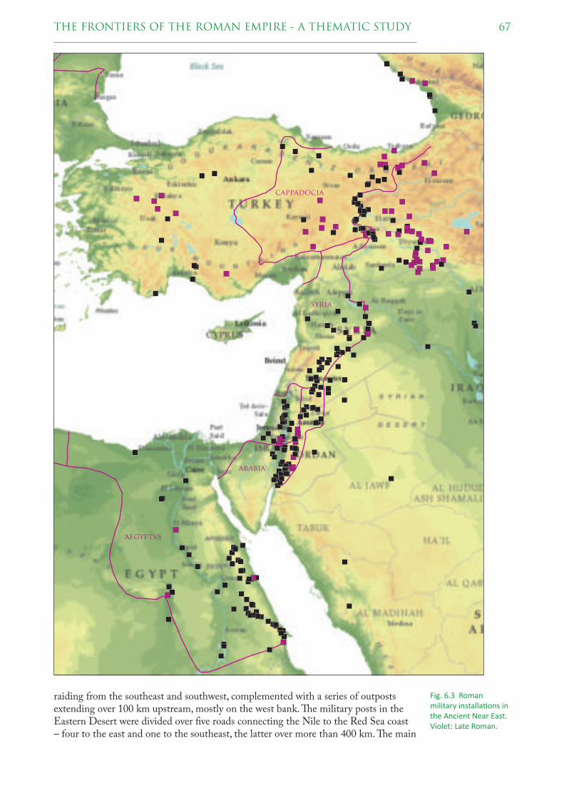
67THE FRONTIERS OF THE ROMAN EMPIRE - A THEMATIC STUDY
raiding from the southeast and southwest, complemented with a series of outposts extending over 100 km upstream, mostly on the west bank. � e military posts in the Eastern Desert were divided over fi ve roads connecting the Nile to the Red Sea coast – four to the east and one to the southeast, the latter over more than 400 km. � e main
aegyptvs
arabia
syria
cappadocia
Fig. 6.3 Roman military installa� ons in the Ancient Near East. Violet: Late Roman.

68 THE FRONTIERS OF THE ROMAN EMPIRE - A THEMATIC STUDY
destinations of the northerly two roads were mines and quarries for the exploitation of valuable minerals and stone. � e military supervision of the Red Desert therefore served various purposes: protection against raiding by nomadic tribes and pirates and supervision of mining and quarrying.
� e remainder of the Near Eastern frontier is likely to be the most volatile of all sections of the Roman frontier. � e dynamics are mainly due to the strained relations between the Romans on one side and the Parthians and later the Sasanians on the other. Changing ambitions and strategies repeatedly led to shifting territorial boundaries, ranges of infl uence and military resources.
From the reign of Augustus to the middle of the 2nd century, client kingdoms made way for provinces, but the process was whimsical. By the mid-1st century, garrisons were stationed on the Euphrates, with legions at Melitene/Malataya, Samosata/Samsat and Zeugma/Belkis. � e garrisons on the Euphrates were connected to the fl eet base of Trapezus/Trabzon on the Black Sea by the Zigana Pass with its nearby legionary base at Satala/Sadak. A series of military posts was maintained on the southeast coast of the Black Sea. In the early 2nd century, the Emperor Trajan created the province of Arabia and initiated the construction of the Via Nova Traiana from the legionary base of Bostra/Busra al-Sham near the Syrian border to Aila/Aqaba on the Red Sea. � e line from Trapezus to Aila is usually taken to represent the eastern frontier of the 2nd century.
However, in 115-117, Trajan defeated the Parthians and founded the provinces of Armenia, Mesopotamia and Assyria. His successor Hadrian immediately withdrew from these areas, and with good reason: they stretched the military resources and tripled the distance from the Mediterranean to the eastern frontier.
In the 160s, after a new Parthian War, the Roman occupation of the Euphrates was extended downstream to a large military base at Dura Europus/Salhiyah, and a further troops were stationed c. 200 km to the northeast at Nisibis/Nusaybin, on the southern
Standing remains of the military fortress built by the Emperor Diocle� an at Palmyra (Syria).

69THE FRONTIERS OF THE ROMAN EMPIRE - A THEMATIC STUDY
fringe of the mountains. At the end of the 2nd century Septimius Severus followed the example of Trajan by restoring Mesopotamia to a province, though only as far east as the Khabur river (c. 50 km west of the modern border between Syria and Iraq). In the decades to follow, the area would remain a source of dispute.
Both here and in Arabia garrisons were pushed out into oases in the desert, in the latter case possibly as far as Al Jawf near Sakakah, 400 km east of the Via Nova Traiana. ! ere is some evidence for equally remote outposts along caravan routes to the southeast of Aila as early as in the 2nd century.
! e base of the classis Pontica (Pontian fl eet) at Trapezum and the short-lived posts on the east coast served to discourage piracy on Pontus Euxinus, the Black Sea. ! e military posts between Trapezum and the Euphrates guarded the passes and accesses in the Pontian mountains. From Analibla/Iliç southwards the military installations lined along a stretch of the Euphrates winding through the Central and Southeastern Taurus mountain ranges. ! e military occupation of this area primarily served to exert control over the much contended kingdom of Armenia.
Below Samosata the Euphrates left the mountains. As far as the city of Sura near Ar-Raqqah, military posts were situated on the right bank of the river. ! ey constituted what was probably the most direct ‘contact zone’ with the Parthian Empire. ! e importance of the Euphrates appears from the presence of as many as three legions, at Melitene, Samosata and Zeugma, complemented with a fourth at Satala further north. ! is was obviously both the last line of defence against Parthian attacks and a springboard for Rome’s own actions.
From Sura a route departs in south-eastern direction, over Palmyra/Tadmur to the Damascus area, along the separation between the semi-arid steppe zone and the barren Al-Hamad desert. Around 300 the section from Palmyra to Damascus was lined with fortlets and known as the strata Diocletiana. From Damascus over Bostra to the city of Philadelphia the southward continuation of this route passed through a fertile area; later, a line of fortlets was established further east. Between Philadelphia and Aila at the Gulf of Aqaba, the Via Nova Traiana was situated on the fringe of the steppe and the desert, continuing an ancient caravan route. As yet, evidence is lacking for garrisons along these routes in the 2nd and 3rd centuries, and it is clear that, if the line of these routes is considered as a frontier, it is of an entirely diff erent character than the line between Trapezus and Samosata.
6.2.3 SITE DISTRIBUTION
! e available evidence does not permit a quantifi ed analysis of site types and their distribution, but some points can nevertheless be made.
! e size of the army of Egypt seems never to have exceeded 24,000 men, and may have counted less than 15,000 troops by the middle of the 2nd century, when the initial three legions had been reduced to a single one. It goes without saying, therefore, that most military installations were small – only three of approximately 70 posts in the Eastern Desert exceed 0.5 ha in size, the largest being Coptos on the Nile with no more than 0.9 ha.
! e standing army of the remainder of the Near East amounted to c. 60,000 troops by the middle of the 2nd century, leaving the large garrison of the province of Iudaea/Syria Palaestina aside.97 While in Egypt the legionary capacity was reduced to a single unit in the 2nd century, fi ve legions were stationed in the eastern parts
97 ! e province was initially named Iudaea, but was merged with the province of Syria under the new heading of Syria Palaestina around AD 135. By 195 two new province were split off : Syria Coele and Syria Phoenice.

70 THE FRONTIERS OF THE ROMAN EMPIRE - A THEMATIC STUDY
of Cappadocia (2), Syria (2) and Arabia (1), and a sixth closer to the Syrian coast at Raphaneae/Rafniye. From Cappadocia and Syria about fi fteen and thirty auxiliary units – the equivalent of some four legions – are known from the mid-2nd century, against a dozen in all from Arabia, underlining the overriding military importance of the frontier towards Parthia.
At the present state of knowledge it is impossible to provide an overview of site types and their distribution. Many sites known mainly or exclusively from aerial photographs cannot be properly dated.
6.3 THE ROMAN FRONTIER IN EUROPE
In the 2nd century AD the Roman frontier in Europe extended from Scotland to the Black Sea, passing through the territory of ten modern states.
" ree stretches of the frontier have already been inscribed on the World Heritage List, as component parts of the property ‘Frontiers of the Roman Empire’. All three are artifi cial barriers: Hadrian’s Wall, the Antonine Wall and the Upper German-Raetian Limes. " ese already listed sections will not be considered here.
6.3.1 EXTENT
" e remains of the Roman frontier in Europe not belonging to these three artifi cial barriers are divided over three separate areas:
1. a stretch of c. 400 km on the left bank of the (Lower) Rhine;98
2. a stretch of c. 2,400 km on the right bank of the river Danube, starting somewhat upstream from Regensburg and extending to the Black Sea;99
3. an extended area to the north of the Danube, in the Roman province of Dacia, including several defensive lines amounting to c. 1,300 km.100
Information on the remains of the Roman frontier in these three areas has been kindly provided by the States Parties involved in the preparation of their nomination for the World Heritage List. " e supplied information has been merged into a single database, covering nearly 1,000 sites (fi g. 6.4).101 " ese include sites which have been selected for possible nomination as well as sites not currently considered for nomination.
" ese almost 1,000 sites are not all the Roman military installations in Europe, but only those which are located on the line of the frontier in the 2nd century AD. " ere are many more military sites located some distance from this line, most of them dating to earlier and later periods of the Roman Empire. Sites which are not on or near the line of the 2nd century frontier are outside the scope of this " ematic Study.
98 " e length of this stretch was calculated along the modern Rhine, using the ‘Rheinkilometer’ system (revised 1939), from Remagen (D) (Rkm 633) to the bifurcation at Wijk bij Duurstede (NL) (Rkm 928), supplemented with the lengths of the downstream continuations called Kromme Rijn (28 km), Leidse Rijn (13 km) and Oude Rijn (52 km). According to this calculation, the distance between Remagen and the Rhine outlet at Katwijk amounts to 388 km.
99 " e length of this stretch was calculated along the modern Danube, using the ‘Donau-Kilometer’ system, from Hienheim (D) on the left bank of the Danube, about 20 km upstream from Kelheim (D) (2414 Donau-Kilometer). Hienheim is considered as the southeastern end of the Upper-German/Raetian Limes.
100 " is is a rough estimate of the overall length of the lines along which most of the sites are located.101 A ‘site’ in this database may consist of several component parts, e.g. a fort, the surrounding military
vicus, and harbour installations.

71THE FRONTIERS OF THE ROMAN EMPIRE - A THEMATIC STUDY
6.3.2 SITE LOCATIONS
Of the almost 1,000 sites considered here, approxi mately 650 sites are located on the bank of a river: 100 sites along the Rhine and 550 along the Danube. � e remaining 330 sites are located to the north of the Danube.
Germania Inferior
In the context of this study the Rhine is the section known as the Lower Rhine, which starts where the river leaves the Rhenish Massif near Rigomagus/Remagen, close to the Vinxtbach, where the border between Germania Inferior and Superior was situated. From Bonna/Bonn until about Burginatium/Altkalkar the forts and fortresses were built on the edge of the older river terraces, with harbour installations on the river bank underneath. � e legionary fortress of Vetera I near Xanten was an exception, being built on an ice-pushed ridge overlooking the Rhine.
Downstream from Burginatium the Rhine built up natural levees, and from Carvium/Bijlandse Waard onwards the river had a strongly meandering and bifurcating character. In this very dynamic delta the forts were built on the edge of the active river, prone to erosion. For the preservation of the sites this vulnerable position is both a blessing and a curse. Some forts were partly or entirely washed out by shifting river channels, but at other sites constructions along, and rubbish deposits in, the channels were covered by sediment, resulting in an outstanding preservation of timber and other organic remains. � e legionary fortress of Noviomagus/Nijmegen and the adjacent fort on the Kops Plateau are exceptions, as they were situated on the outskirts of an eroded ice-pushed ridge, with an excellent view over the river plain.
� e stretch downstream from Fectio/Vechten has a high density of small forts – nine divided over barely 60 km, with some additional timber watchtowers along a strongly winding stretch between Utrecht-Hoge Woerd and Laurium/Woerden. Since it has been established that most of these posts were built around AD 40 the system is considered as a protection against German pirates threatening the logistics of the
Aerial view with projec! on of geomagne! c survey of the fort of Burgina! um/Altkalkar (Germany).

72 THE FRONTIERS OF THE ROMAN EMPIRE - A THEMATIC STUDY
germania
inferior
britannia
germania
svperior
raetia
nori
hadrian’s wall
Antonine wall
upper german-
raetian limes
Fig. 6.4 Distribu� on of nearly 1,000 sites represen� ng the Roman fron� er in Europe, as far as they are located on the line of the fron� er in the 2nd century AD. Hadrian’s Wall, the Antonine Wall and the Upper German-Rae� an Limes are merely indicated by blue do� ed lines. Green: end in 1st century. Violet: start in 3rd century and later. Orange: date uncertain.
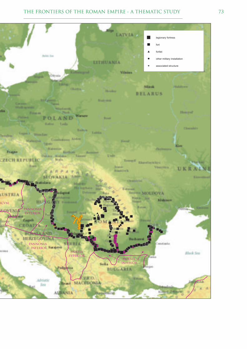
73THE FRONTIERS OF THE ROMAN EMPIRE - A THEMATIC STUDY
ricvm
pannonia
svperior
pannonia
inferior
moesia
svperiormoesia
inferior
legionary fortress
fort
fortlet
other military installation
associated structure

74 THE FRONTIERS OF THE ROMAN EMPIRE - A THEMATIC STUDY
annexation of Britain, which commenced in 43. Apart from this series of timber watchtowers this type of installation is rare on the Rhine.
� e observation of the Rhine was complemented by the classis Germanica or German fl eet, based at Köln-Alteburg. � e operation area of this fl eet was restricted to the Lower Rhine, presumably because the access to the Middle Rhine was severely hindered by transversal reefs between Koblenz and Mainz.
Rae� a and Noricum
� e river frontier of the Danube started at Abusina/Eining. Most of this stretch of the frontier faced a densely wooded area without much habitation. � is probably explains why the number of military posts was initially limited.
Due to the alternation of gorges and wide fl oodplains the location of the military installations varies, but most were built in high positions, which often – but not always – safeguarded them against river erosion. Several forts were established at river confl uences and other crossings of trade routes, like Künzing and Batavis/Passau.
Both provinces have a high proportion of fortlets and – in Noricum largely Late Roman – watchtowers. Two legionary fortresses, at Castra Regina/Regensburg and Lauriacum/Enns (with short-lived predecessors at Eining-Unterfeld and Albing, respectively), owe their origins to the Marcomannic Wars of AD 166-180. Harbours have been attested at sites including Sorviodurum/Straubing, which may have served as a secondary base of the Pannonian fl eet, and Regensburg.
Pannonia
From Klosterneuburg at the boundary between Noricum and Pannonia the Danube runs through the wide Vienna Basin until it reaches the Little Carpathians at Devín near Bratislava. � is fertile area was mainly secured by the legionary fortresses of Vindobona/Wien and Carnuntum/Petronell at its ends. � e latter was located close to the crossing of the ancient Amber Route over the river. It is often assumed that it was preceded by a military post below Devín castle at Bratislava, but as yet this has not been attested.
From Gerulata/Rusovce to Arrabona/Györ, the military posts were laid out along the Little Danube, the southerly of several parallel channels. � e mentioned forts protected the ends of this inaccessible and strongly winding river section. Somewhat further downstream the legionary fortress of Brigetio/Komárom marks another important river crossing, which played an important role in the Marcomannic Wars. Across the river a bridgehead fort is located at Kelemantia/Iža, and both military installations are surrounded by many temporary camps.
From Brigetio to the next legionary fortress at Aquincum/Budapest the Danube cuts through the outskirts of the North Hungarian Mountains. Here, and especially in the Danube bend, the number of military posts was initially limited. It was only in the Late Roman period that this section was secured with large numbers of watchtowers and some fortlets, bridgeheads and outposts.
Beyond Aquincum the Danube enters the Great Hungarian Plain. In view of the relatively close spacing of the legionary fortresses from Vindobona to Aquincum – approximately 60-200 km – it is astonishing that the distance to the next legionary base, at Singidunum/Belgrade, is over 400 km. Until the confl uence of the Drava river near Osijek the Danube has a twisting course. In the case of parallel channels the military posts were invariably built along the most westerly one; occasionally additional posts or bridgeheads were built further east at a later stage.
� roughout the Little and Great Hungarian Plains the riverbank is strewn with some 200 watchtowers. As far as their date has been established most belong to the Late

75THE FRONTIERS OF THE ROMAN EMPIRE - A THEMATIC STUDY
Roman period, but some are defi nitely earlier. � e towers varied in size, construction and position, with only few distinctive groups. Some were clearly linked to the frontier road while others occupied high positions or river bends. Between the mouths of the Drava and the Sava towers are virtually absent. It is not impossible that this partly or mainly refl ects a diff erent state of research in Hungary on the one hand and Croatia and Serbia on the other.
� e last military post in Pannonia, Taurunum/Zemun, appears to have been the main base of the classis Pannonica or Pannonian fl eet. A position downstream from its operational area can hardly be called favourable.
Moesia
At the confl uence of the Sava at Singidunum/Belgrade the outskirts of the southerly mountain ranges start closing in on the Danube. Some 100 km downstream the river fl ows into the narrow gorges of the Iron Gate. � e mouth of the Sava and a westerly entrance to Dacia were occupied by legionary fortresses at Singidunum and Viminacium/Kostolac by 85/86, at the occasion of Domitian’s Dacian War. � e Iron Gate itself was supervised by mainly small posts distributed along the more accessible parts, some already installed under Tiberius and Claudius.
From the exit of the Iron Gate the Danube took a winding course until Ratiaria/Archar. � e dense series of military posts overlooking this stretch were mainly built in the 3rd and 4th centuries.
Downstream from Ratiaria the Danube follows a relatively straight course until as far as Durostorum/Silistra, between the Wallachian/Romanian Plain to the north and the more elevated Danubian Plain to the south. For much of this c. 400 km long stretch the river has a wide and often twisting channel. � e legionary fortresses of Oescus/Gigen, Novae/Svishtov and Durostorum were built at rare spots where the river has a single, narrow bed. � e intermediate military posts were often built in high positions with a clear view over the river and the plain beyond.
Remains of the so-called ‘Hadrians bridge’ at Podravlje, (opposite Osijek (Croa� a).

76 THE FRONTIERS OF THE ROMAN EMPIRE - A THEMATIC STUDY
Downstream from Durostorum the Danube takes a northerly course, developing many twisting channels in a wide zone, before bending to the east at Barboși and creating a delta near Aegysus/Tulca. In this region the military installations were invariably built on the higher grounds along the most easterly river channel.
Dacia
" e military infrastructure of Dacia can be divided into several groups. " e core area of the Transylvanian Plateau was occupied by the legionary fortresses of Apulum/Alba Iulia and Potaissa/Turda and a few forts. " e accesses through the mountain ranges from northwest to southeast were blocked by a series of forts supplemented by towers high up in the mountains; in the north and northwest over a hundred towers constituted a very tight observation screen. Four lines of military posts connected Transylvania to the Danube: two in the southwest, departing from Lederata/Ram and Transdierna/Tekija, and two in the southeast, known as the Limes Alutanus and the Limes Transalutanus.
During the existence of the province of Dacia, c. 106-270, the Danube frontier between Viminacium and Dimum/Belene (west of the legionary fortress at Novae) lost much of its military signifi cance. " e legionary fortresses of Ratiaria and Oescus were replaced by coloniae and many smaller posts were dismantled, but the legionary fortress of Viminacium and some of the larger forts were nevertheless maintained.
6.3.3 SITE DISTRIBUTION
" e three areas distinguished above have nearly 25 sites per 100 km, but their distribution is less even than this average suggests. If the Upper, Middle and Lower Danube are separated, following a common geographical division,102 the number of sites per 100 km ranges from 14 to 41 to 11, respectively. " e strongly deviating number for the Middle Danube is caused by the frequency of watchtowers in modern Hungary. " ese towers, many of which are of Late Roman or uncertain date, account for half of the sites along the Middle Danube.
" ese fi gures demonstrate fi rstly that the distribution of military installations is far from even, and secondly that it cannot be understood without consideration of site typology and chronology.
102 We have followed the division by the Danube Commission, presented at http://www.danubecommission.org [accessed October 10, 2016], with Gönyü (HU) and Turnu-Severin (RO) separating the upper, middle and lower courses of the river, resulting in stretches of approx. 670, 860 and 930 km length, respectively. " e numbers of sites amount to 93, 356 and 101, respectively.
Table 6.1 Distribu! on of the 984 European fron! er sites (excluding the exis! ng FRE WHS).
main site type Europe Rhine U Danube M Danube L Danube Dacialegionary fortress 27 7 5 4 4 7fort 264 30 21 64 77 72fortlet 62 1 16 11 6 28watchtower 381 4 36 192 2 147bridgehead 18 1 17fl eet base 2 1 1hill fort 4 4earthwork 72 72temporary camp 46 6 3 37industrial site 9 3 3 2 1road 53 26 5 18 4road sta! on 4 1 1 2civil se# lement 17 10 4 2 1other 25 13 3 3 2 4total 984 102 93 357 101 331
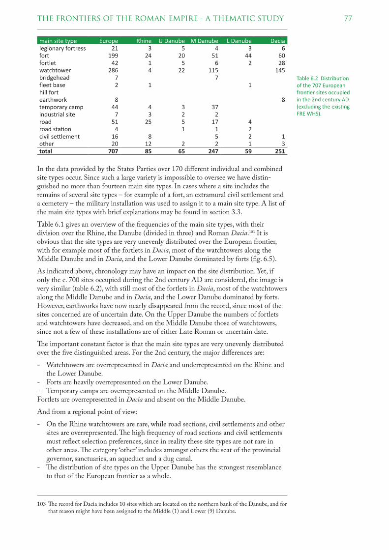
77THE FRONTIERS OF THE ROMAN EMPIRE - A THEMATIC STUDY
In the data provided by the States Parties over 170 diff erent individual and combined site types occur. Since such a large variety is impossible to oversee we have distin-guished no more than fourteen main site types. In cases where a site includes the remains of several site types – for example of a fort, an extramural civil settlement and a cemetery – the military installation was used to assign it to a main site type. A list of the main site types with brief explanations may be found in section 3.3.
Table 6.1 gives an overview of the frequencies of the main site types, with their division over the Rhine, the Danube (divided in three) and Roman Dacia.103 It is obvious that the site types are very unevenly distributed over the European frontier, with for example most of the fortlets in Dacia, most of the watchtowers along the Middle Danube and in Dacia, and the Lower Danube dominated by forts (fi g. 6.5).
As indicated above, chronology may have an impact on the site distribution. Yet, if only the c. 700 sites occupied during the 2nd century AD are considered, the image is very similar (table 6.2), with still most of the fortlets in Dacia, most of the watchtowers along the Middle Danube and in Dacia, and the Lower Danube dominated by forts. However, earthworks have now nearly disappeared from the record, since most of the sites concerned are of uncertain date. On the Upper Danube the numbers of fortlets and watchtowers have decreased, and on the Middle Danube those of watchtowers, since not a few of these installations are of either Late Roman or uncertain date.
" e important constant factor is that the main site types are very unevenly distributed over the fi ve distinguished areas. For the 2nd century, the major diff erences are:
- Watchtowers are overrepresented in Dacia and underrepresented on the Rhine and the Lower Danube.
- Forts are heavily overrepresented on the Lower Danube.- Temporary camps are overrepresented on the Middle Danube.Fortlets are overrepresented in Dacia and absent on the Middle Danube.
And from a regional point of view:
- On the Rhine watchtowers are rare, while road sections, civil settlements and other sites are overrepresented. " e high frequency of road sections and civil settlements must refl ect selection preferences, since in reality these site types are not rare in other areas. " e category ‘other’ includes amongst others the seat of the provincial governor, sanctuaries, an aqueduct and a dug canal.
- " e distribution of site types on the Upper Danube has the strongest resemblance to that of the European frontier as a whole.
103 " e record for Dacia includes 10 sites which are located on the northern bank of the Danube, and for that reason might have been assigned to the Middle (1) and Lower (9) Danube.
Table 6.2 Distribu� on of the 707 European fron� er sites occupied in the 2nd century AD (excluding the exis� ng FRE WHS).
main site type Europe Rhine U Danube M Danube L Danube Dacialegionary fortress 21 3 5 4 3 6fort 199 24 20 51 44 60fortlet 42 1 5 6 2 28watchtower 286 4 22 115 145bridgehead 7 7fl eet base 2 1 1hill fortearthwork 8 8temporary camp 44 4 3 37industrial site 7 3 2 2road 51 25 5 17 4road sta� on 4 1 1 2civil se" lement 16 8 5 2 1other 20 12 2 2 1 3total 707 85 65 247 59 251
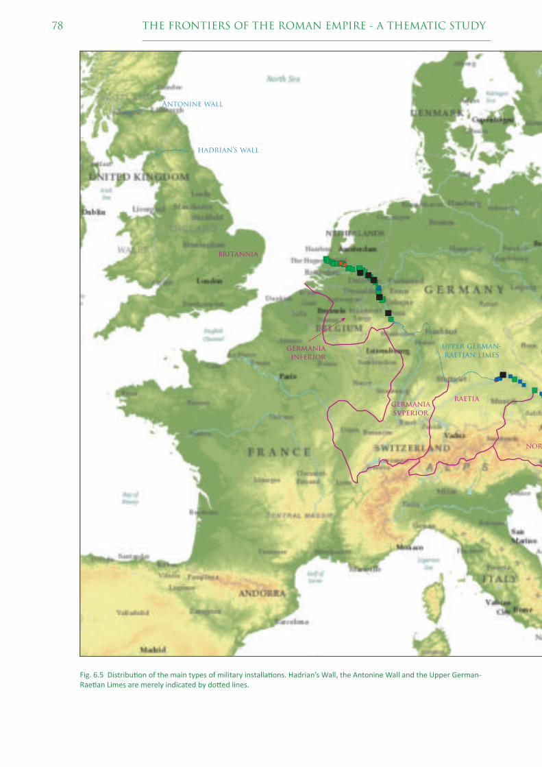
78 THE FRONTIERS OF THE ROMAN EMPIRE - A THEMATIC STUDY
Fig. 6.5 Distribu� on of the main types of military installa� ons. Hadrian’s Wall, the Antonine Wall and the Upper German-Rae� an Limes are merely indicated by do� ed lines.
germania
inferior
britannia
germania
svperior
raetia
nori
hadrian’s wall
Antonine wall
upper german-
raetian limes

79THE FRONTIERS OF THE ROMAN EMPIRE - A THEMATIC STUDY
ricvm
pannonia
svperior
pannonia
inferior
moesia
svperiormoesia
inferior
legionary fortress
fort
fortlet
watchtower

80 THE FRONTIERS OF THE ROMAN EMPIRE - A THEMATIC STUDY
- � e Middle Danube stands out by a large number of temporary camps. Most of these are situated around the legionary fortress of Brigetio and have been built during the Marcomannic Wars c. 166-180. It is also the only area for which bridgeheads from the 2nd century have been recorded, all located in or opposite Pannonia Inferior.
- � e main characteristic of the Lower Danube is the predominance of forts and the absence of watchtowers.
- Dacia displays an overrepresentation of fortlets and watchtowers, while temporary camps are currently rare. Knowledge on the latter is increasing, however, and diff erences are probably due to the history of research and methodologies employed.
Of course, the reduction of over 170 diff erent individual and combined site types to a mere fourteen categories implies a loss of information. However, it turns out that most of the variation has to do with terminology, for example by the use of the alternative terms of ‘fort’, ‘auxiliary fort’ and ‘auxiliary castellum’ for installations of similar size and purpose.
� e most frequent site types which were lost by the reduction to fourteen main site types are the civil settlements and cemeteries outside forts and other military installations. � e low frequencies and their peculiar distribution clearly indicate that the presence of remains of these associated features has not been consistently recorded (table 6.3). Hence, it is impossible to draw any conclusions from their distribution.
6.3.4 SITES AND ROMAN PROVINCES
Of the fi ve areas distinguished above, the Rhine and Dacia are equivalent to Roman provinces. � e (Lower) Rhine constitutes the external border of Germania Inferior, generally assumed to have been created as a Roman province c. AD 85. Dacia existed as a Roman province from its establishment by the Emperor Trajan in 106 until its abandonment in or soon after 271. Its internal and external boundaries underwent various changes, which are not taken into consideration in this study.
� e upper, middle and lower courses of the Danube correspond to some degree to Roman provinces as well. From the south-eastern end of the Upper German-Raetian Limes onward the Danube constitutes the external border of the provinces of Raetia, Noricum, Pannonia (Superior and Inferior) and Moesia (Superior and Inferior) – for a section of Moesia only before and after the occupation of Dacia.
� e mentioned provinces have a complicated history, which is not very relevant here. All four provinces appear to have been created in the 40s by the emperor Claudius, either transforming earlier military districts (Raetia, Noricum) or splitting up existing provinces (Pannonia from Illyricum, Moesia from Macedonia). Pannonia and Moesia were later each divided into a Superior and Inferior province, c. 106 and 85 respectively. Developments after the 2nd century are not included.
� e Upper Danube roughly corresponds to the external boundaries of Raetia, Noricum and Pannonia Superior, the Middle Danube to those of Pannonia Inferior and Moesia Superior, and the Lower Danube to the northern border of Moesia Inferior. On account of this correspondence it may be expected that the previously described characteristics
Table 6.3 Distribu! on of the civil se" lements and cemeteries associated with military installa! ons occupied during the 2nd century AD (excluding the exis! ng FRE WHS).
main site type Europe Rhine U Danube M Danube L Danube Daciaextramural se" lement 64 27 15 16 5 1cemetery 17 9 4 4all sites 707 85 65 247 59 251

81THE FRONTIERS OF THE ROMAN EMPIRE - A THEMATIC STUDY
of the three sections of the Danube will apply to the adjacent Roman provinces (table 6.4).104
From the point of view of the Roman provinces the characteristics can be summarized as follows:
- For Raetia and Noricum the numbers of sites are too low to permit any conclusions, but the diff erent ratios of forts and fortlets are remarkable.
- Pannonia Superior and Inferior have by far the most watchtowers. Superior has nearly all temporary camps (mainly around Brigetio), while Inferior has more forts.
- Moesia Superior and especially Inferior have high numbers of forts. " e absence of watchtowers and temporary camps is statistically signifi cant.
" ese peculiarities indeed largely refl ect those observed earlier for the three stretches of the Danube. Evidently, the main site types are very unevenly distributed over the Roman provinces along the Danube.
As a reminder the main conclusions regarding Germania Inferior and Dacia are repeated:
- On the Rhine watchtowers are rare.- Dacia displays an overrepresentation of fortlets and watchtowers, while temporary
camps are currently rare.
104 For Pannonia Superior and Inferior the boundary prior to c. AD 214 has been used.
Table 6.4 Distribu� on of the 373 fron� er sites along the Danube occupied during the 2nd century AD.
main site type Rae� a Noricum Pannonia S Pannonia I Moesia S Moesia Ilegionary fortress 1 2 3 2 3 2fort 3 10 12 33 20 37fortlet 6 1 7 1watchtower 1 3 50 82 1bridgehead 6fl eet base 1hill fortearthworktemporary camp 37 3industrial site 2 1 1road 9 12 1 4road sta� on 1 1 1 1civil se" lement 1 3 2 1other 2 2 1total 15 16 114 145 35 48


internal comparison ofthe roman frontiers 7
In this chapter the various frontiers of the Roman Empire will be compared. � e purpose of this comparison is to assess to what degree they are similar. � e comparison is divided in two parts. First the frontiers of the three continents will be compared, with a clear focus on the 2nd century AD. � e second part is devoted to the comparison of the European river frontiers.
Each part comprises a summary of the main characteristics of the frontiers involved, an assessment of similarities and dissimilarities and a conclusion. � e part on the European river frontiers has an extra discussion of the relationship between natural barriers and Roman provinces.
7.1 THE FRONTIERS OF THE THREE CONTINENTS IN THE 2ND CENTURY AD
7.1.1 BRIEF CHARACTERISTICS
Africa
In Africa the military infrastructure served three purposes: protection of the towns and settled agricultural areas, control of nomadic movement, and supervision of long distance trade routes. An army of probably no more than 30,000, with only a single legion, apparently suffi ced to perform these tasks. Consequently, the majority of the military installations were fortlets and towers.
In Mauretania Tingitana they were mainly located around and between the cities. In Caesariensis they were stretched out in a line parallel to the coast, which was pushed southward by AD 200. In Numidia most military posts were located in and around the Aurès mountains and its outskirts; some additional linear barriers imply that their main purpose was control of nomads.
In the eastern half of northern Africa the Roman interests were restricted to the small habitable areas around Leptis Magna and Cyrenae. � e military infrastructure was very thin there, aimed at the control of the cities and of routes coming in from the desert.
Remains of the fort of Lussonium at Paks (Hungary), with reconstructed north gate.

84 THE FRONTIERS OF THE ROMAN EMPIRE - A THEMATIC STUDY
Near East
In Egypt only the delta and valley of the Nile were habitable. Part of the military infrastructure was located within these areas – not on their periphery, as was usual elsewhere. Furthermore, a large cluster of small posts occurred in the Eastern Desert, controlling accesses from the Nile to the Red Sea and securing the exploitation of valuable minerals and stone. Finally, a series of (out)posts extending southward from Syene protected against nomadic raiding from the southwest and southeast. With possibly around 15,000 troops in the mid-2nd century, including a single legion, the army of Egypt was small, though in comparison to the settled area larger than that of the remainder of Africa.
South of the river Euphrates the Roman occupation of the East extended to the fringes of the steppe and desert, along which ancient caravan routes ran. Although one of these routes was upgraded as the Via Nova Traiana in the early 2nd century it is unclear to what degree it was provided with military posts; the later Strata Domitiana further north certainly was.
! e main part of the c. 60,000 troops of the eastern army (not counting those stationed in Iudaea) were garrisoned along the Euphrates and a northward line to the Black Sea. ! is was the boundary with the Parthian Empire and with Armenia, the bone of contention between the two empires. Four legions were deployed on the river and in the mountains to the north, and possibly as many auxiliaries.
Europe
In Europe the rivers Rhine and Danube constituted the frontier on most of the continent, separating the Roman Empire from what it considered as barbarian peoples over some 3,000 km. In Britain, where no convenient river was available as a frontier, artifi cial barriers were built between river estuaries – Hadrian’s Wall and the Antonine Wall. A further linear barrier – the Upper German-Raetian Limes – was established to provide a shortcut between Rhine and Danube, screening off a vulnerable inward bend into the Empire and embracing the fertile Agri Decumates.
Dacia is a special case, projecting up to 500 km beyond the Danube. Most of its military posts were part of two lines facing east and one facing north – the Limes
The desert fort of Khan al-Hallabat, in the desert south-west of Palmyra (Syria).

85THE FRONTIERS OF THE ROMAN EMPIRE - A THEMATIC STUDY
Alutanus, Transalutanus and Porolissensis. Two legionary fortresses and some additional forts served both as a backup and to control the interior.
Leaving the linear barriers and Dacia aside, the military infrastructure of Europe was stretched out on the ‘Roman’ bank of the Rhine and Danube, accommodating the main part of 170,000 troops of the mid-2nd century,105 including a dozen legions. In the 2nd century the focus of the military strategy shifted from Britain and the Rhine to the Danube. ! e densities and types of military installations varied along with the landscape and the relations with the peoples across the rivers.
7.1.2 SIMILARITIES AND DISSIMILARITIES
! e North African provinces, Egypt, Arabia and southern Syria have much in common. A large part of the military infrastructure in these areas was primarily aimed at controlling nomadic movement and caravan routes. ! e areas were all relatively peaceful, and the provincial armies accordingly small, comprising no more than three legions by the middle of the 2nd century, at Lambaesis, Alexandria and Bostra. ! e majority of the military posts consisted of fortlets and towers.
Within this group there are nevertheless some diff erences as well. In Mauretania Tingitana the military posts were located around and between the cities in the coastal plain and the table-land around Volubilis. In Mauretania Caesarensis and Numidia most fortlets and towers were not built on the fringe of the arid zone, but somewhat further north; yet the linear barriers of the Fossatum Africae demonstrate that control of nomadic movement was an important task of the garrisons. In Proconsularis and the Cyrenaica, a series of fortlets and towers, complemented with short artifi cial barriers in the west, protected the cities and agricultural areas from nomadic incursions; caravan routes were also under military control, involving a few remote outposts.
! e military disposition in Egypt is similar to that of the latter two provinces, but here a sizeable number of military posts were pushed out into the barren Eastern Desert to protect accesses to Red Sea ports, quarries and mines. ! e desert frontier of Arabia and southern Syria built on ancient caravan routes following the separation between the desert and the sown; however, most military posts along these routes may postdate the 2nd century. Here too some remote outposts in the desert betray a concern for the security of long distance trade.
! e military deployment in Cappadocia and the northern part of Syria is of an entirely diff erent nature. ! e installations from the 2nd century are distributed over the west bank of the upper Euphrates and northward through the mountains to the fl eet base at Trapezus. ! is area borders on the heavily contended areas of Armenia and Mesopotamia, and was protected by approximately two thirds of the eastern army. ! e forts on the south-east shores of the Black Sea belonged to the Cappadocian army and were vital to the securing of its corn supply.
! e disposition of troops along the Euphrates and in the mountains to the north at fi rst sight resembles that along the Rhine and Danube and in Dacia, but there is a fundamental diff erence. In the East army units were often garrisoned in towns and villages – as in Africa. Samosata and Zeugma, ancient cities at crossings of the Euphrates, are clear examples in the region. To Rome this was a familiar strategy, which it applied in all areas where urban centres were at hand, or other central places like the hillforts in Gaul and southern Britain. On the Rhine and Danube, however, the military infrastructure had to be built from scratch, in the absence of such centres.
! e river frontiers of Europe are a phenomenon of their own. ! e Rhine and Danube made a convenient demarcation between those parts of the continent which could
105 In this fi gure the garrisons of the Upper German-Raetian Limes and Dacia are included.

86 THE FRONTIERS OF THE ROMAN EMPIRE - A THEMATIC STUDY
be controlled from Rome and those which outreached its powers or interests. � e vulnerable inward bend shaped by the headwaters of these rivers was cut off in various stages, ending with the artifi cial barrier of the Upper German-Raetian Limes.
� e military installations along the rivers were built almost exclusively on the ‘Roman’ bank. However, bridgeheads were built across the rivers for expeditions or as more permanent alternatives for bridges. � e spacing of the military installations was on the whole closer than along the deserts, where it was dictated by the availability of water. Here, the density depended on accessibility, visibility and possible threats. Except in periods of severe frost and drought rivers were eff ective barriers, in the absence of permanent bridges and with forts, towers and fl eets to control them. Additional protection was provided by the three fl eets, on the Lower Rhine and the Pannonian and Moesian sectors of the Danube.
Dacia provides a mixture of military solutions. Evidently, the main area of interest was Transylvania, largely surrounded by the Carpathian Mountains and more or less separated from the Danube by the Wallachian/Romanian plain. To the east and north Transylvania was protected by a range of forts, with a screen of more than hundred towers controlling the accesses, complemented with short banks and barriers in some areas. � ere is no similar shield to the west of Transylvania.
� e Romanian Plain is cut by two lines of fortifi cations, which constitute a mixture of military concepts. � e earliest line is along the river Olt, which provided an easy connection between Transylvania and the Danube. � is route was secured by a series of fortifi cations on its right bank – forts in the plain and fortlets and towers upstream in the mountains – and an earthen wall to its left. Although it may have been primarily a protected north-south route it also served as a frontier to the east (Limes Alutanus). Later on the latter function was overtaken by a line of military posts some 50 km further east (Limes Transalutanus). � is line partly follows the Cotmeana/Vedea river; the remaining stretches through the plain were provided with an earthen bank.
View to the southern bank of the Danube in the area of the fort of Lederatae/Ram and the bridgehead of Contra Lederatae (Serbia).

87THE FRONTIERS OF THE ROMAN EMPIRE - A THEMATIC STUDY
7.1.3 CONCLUSION
� e diff erences emerging from the above overview vary in character. Some relate primarily to climatic and geographical conditions, others to the threats to be countered. � e main characteristics of the fi ve groups of frontiers which can be distinguished within the whole of the frontier of the Roman Empire in the 2nd century, vary accordingly (fi g. 7.1):
- the desert frontier: Africa, Egypt, Arabia and southern Syria;- the Parthian frontier: northern Syria and Cappadocia;- the river frontier: Rhine and Danube;- the artifi cial barriers: Hadrian’s Wall, the Antonine Wall, the Upper German-
Raetian Limes;- the mixed frontier of Dacia.
7.2 THE EUROPEAN RIVER FRONTIERS
In the context of the comparison of the Roman frontier of the three continents it was convenient to present the Rhine and Danube frontiers as a whole. However, this suggests a uniformity which does no justice to the diff erences which emerge on closer inspection.
7.2.1 NATURAL BARRIERS AND ROMAN PROVINCES
� roughout the basins of the Rhine and Danube narrow gorges and wide plains alternate. � e narrow sections constituted natural barriers which are likely to have had an impact on the internal structure of the frontier zone.
Danube
RhineAntonine Wall
Hadrian�s Wall
Dacia
Upper German
- Rae an Limes
Cappadocia
N Syria
S Syria
Arabia
EgyptCyrenae
Africa Proconsularis
Numidia
Mauretania
ar cial
barabariansar cial
barbarians
mixed
barbarians
river
barabarians
large army
river
barbarians
large army
mountain/river
Parthia
large army
mountain/desert
nomads/trade
+ ar cial
small army
desert
nomads/trade
+ ar cial
small army
desert
nomads/trade
small army
desert
nomads/trade
quarries/mines
small army
Fig. 7.1 Diagram of the Roman fron! ers on three con! nents, with their main characteris! cs (fron! er type, threats, garrisons). The a" ribu! on of
fron! er sec! ons to fi ve
overarching groups is
indicated in red.
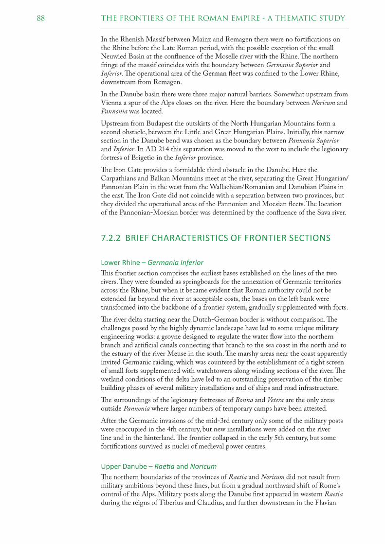
88 THE FRONTIERS OF THE ROMAN EMPIRE - A THEMATIC STUDY
In the Rhenish Massif between Mainz and Remagen there were no fortifi cations on the Rhine before the Late Roman period, with the possible exception of the small Neuwied Basin at the confl uence of the Moselle river with the Rhine. � e northern fringe of the massif coincides with the boundary between Germania Superior and Inferior. � e operational area of the German fl eet was confi ned to the Lower Rhine, downstream from Remagen.
In the Danube basin there were three major natural barriers. Somewhat upstream from Vienna a spur of the Alps closes on the river. Here the boundary between Noricum and Pannonia was located.
Upstream from Budapest the outskirts of the North Hungarian Mountains form a second obstacle, between the Little and Great Hungarian Plains. Initially, this narrow section in the Danube bend was chosen as the boundary between Pannonia Superior and Inferior. In AD 214 this separation was moved to the west to include the legionary fortress of Brigetio in the Inferior province.
� e Iron Gate provides a formidable third obstacle in the Danube. Here the Carpathians and Balkan Mountains meet at the river, separating the Great Hungarian/Pannonian Plain in the west from the Wallachian/Romanian and Danubian Plains in the east. � e Iron Gate did not coincide with a separation between two provinces, but they divided the operational areas of the Pannonian and Moesian fl eets. � e location of the Pannonian-Moesian border was determined by the confl uence of the Sava river.
7.2.2 BRIEF CHARACTERISTICS OF FRONTIER SECTIONS
Lower Rhine – Germania Inferior
� is frontier section comprises the earliest bases established on the lines of the two rivers. � ey were founded as springboards for the annexation of Germanic territories across the Rhine, but when it became evident that Roman authority could not be extended far beyond the river at acceptable costs, the bases on the left bank were transformed into the backbone of a frontier system, gradually supplemented with forts.
� e river delta starting near the Dutch-German border is without comparison. � e challenges posed by the highly dynamic landscape have led to some unique military engineering works: a groyne designed to regulate the water fl ow into the northern branch and artifi cial canals connecting that branch to the sea coast in the north and to the estuary of the river Meuse in the south. � e marshy areas near the coast apparently invited Germanic raiding, which was countered by the establishment of a tight screen of small forts supplemented with watchtowers along winding sections of the river. � e wetland conditions of the delta have led to an outstanding preservation of the timber building phases of several military installations and of ships and road infrastructure.
� e surroundings of the legionary fortresses of Bonna and Vetera are the only areas outside Pannonia where larger numbers of temporary camps have been attested.
After the Germanic invasions of the mid-3rd century only some of the military posts were reoccupied in the 4th century, but new installations were added on the river line and in the hinterland. � e frontier collapsed in the early 5th century, but some fortifi cations survived as nuclei of medieval power centres.
Upper Danube – Rae! a and Noricum
� e northern boundaries of the provinces of Raetia and Noricum did not result from military ambitions beyond these lines, but from a gradual northward shift of Rome’s control of the Alps. Military posts along the Danube fi rst appeared in western Raetia during the reigns of Tiberius and Claudius, and further downstream in the Flavian

89THE FRONTIERS OF THE ROMAN EMPIRE - A THEMATIC STUDY
period. At the beginning of the 2nd century Roman control was extended beyond the Danube in western Raetia, eventually to be fenced off by the Upper German-Raetian Limes. " e Raetian-Norican river frontier was not threatened before the Marcomannic Wars (166-180). Only then was it considered necessary to deploy legions here, one in each province. " is section has the widest spacing of military installations, probably because of the partly inaccessible landscape and the initial absence of military threats. " e military posts display a large variety in size and positioning, due to the alternation of gorges and fl oodplains.
After the Germanic raids of the mid-3rd century the frontier was restored. Especially the eastern part was further consolidated by the addition of fortlets and towers, several of which (partly) survived as parts of medieval buildings.
Middle Danube - Pannonia
" e creation of the province of Pannonia was a sequel to the Roman occupation of the Dalmatian coast, as military control of the area was gradually extended to the northeast. Once the Danube had been reached under Augustus, the Dalmatian and Pannonian tribes revolted, aborting a planned operation against the Marcomanni across the river. " e revolt explains both the large military presence and their initial concentration in the interior of the province. It was only in the Claudian period that some permanent bases were founded on the Danube, supervising river crossings.
Most of the remaining fortresses and forts on the river are Flavian or later foundations, linked with the growing pressure from across the Danube, resulting in the Dacian Wars of Domitian and Trajan. In the aftermath of the second war Pannonia was divided in two provinces, Superior and Inferior.
" e Superior province was a springboard for the Marcomannic Wars of AD 166-180, resulting in an unparalleled clustering of temporary camps around Brigetio and the bridgehead of Kelemantia.
A distinguishing characteristic of the Pannonian provinces is the high frequency of watchtowers. Many cannot be adequately dated, but it is certain that some already existed in the 1st century and some more in the 2nd century; the great majority, however, are Late Roman. Building inscriptions from the 180s indicate that the
Towpath cut into the rock of the Đerdap
(Iron Gate) near
Kladovo (Serbia),
before the water level
was raised for a hydro-
electric power sta" on.
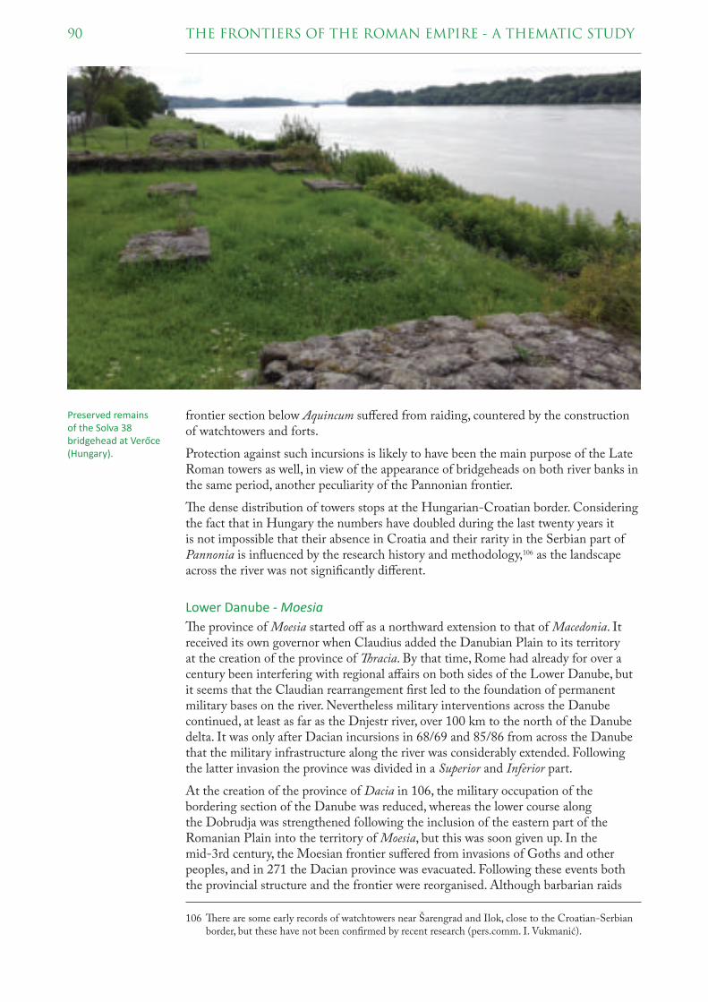
90 THE FRONTIERS OF THE ROMAN EMPIRE - A THEMATIC STUDY
frontier section below Aquincum suff ered from raiding, countered by the construction of watchtowers and forts.
Protection against such incursions is likely to have been the main purpose of the Late Roman towers as well, in view of the appearance of bridgeheads on both river banks in the same period, another peculiarity of the Pannonian frontier.
" e dense distribution of towers stops at the Hungarian-Croatian border. Considering the fact that in Hungary the numbers have doubled during the last twenty years it is not impossible that their absence in Croatia and their rarity in the Serbian part of Pannonia is infl uenced by the research history and methodology,106 as the landscape across the river was not signifi cantly diff erent.
Lower Danube - Moesia
" e province of Moesia started off as a northward extension to that of Macedonia. It received its own governor when Claudius added the Danubian Plain to its territory at the creation of the province of racia. By that time, Rome had already for over a century been interfering with regional aff airs on both sides of the Lower Danube, but it seems that the Claudian rearrangement fi rst led to the foundation of permanent military bases on the river. Nevertheless military interventions across the Danube continued, at least as far as the Dnjestr river, over 100 km to the north of the Danube delta. It was only after Dacian incursions in 68/69 and 85/86 from across the Danube that the military infrastructure along the river was considerably extended. Following the latter invasion the province was divided in a Superior and Inferior part.
At the creation of the province of Dacia in 106, the military occupation of the bordering section of the Danube was reduced, whereas the lower course along the Dobrudja was strengthened following the inclusion of the eastern part of the Romanian Plain into the territory of Moesia, but this was soon given up. In the mid-3rd century, the Moesian frontier suff ered from invasions of Goths and other peoples, and in 271 the Dacian province was evacuated. Following these events both the provincial structure and the frontier were reorganised. Although barbarian raids
106 " ere are some early records of watchtowers near Šarengrad and Ilok, close to the Croatian-Serbian border, but these have not been confi rmed by recent research (pers.comm. I. Vukmanić).
Preserved remains of the Solva 38 bridgehead at Verőce
(Hungary).

91THE FRONTIERS OF THE ROMAN EMPIRE - A THEMATIC STUDY
persisted, the area more or less survived the collapse of the Western Roman Empire in the 5th century. As part of the Eastern Roman Empire the Moesian frontier was restored in the fi rst half of the 6th century, but following invasions of Avars and Slavs heralded the end of the Danube frontier in the early 7th century.
� e long survival is a distinctive characteristic of the Moesian frontier. A further remarkable feature is the near absence of fortlets and towers, with the exception of the Iron Gate. Although it cannot be excluded that this is infl uenced by the state of research, an explanation might be that on this frontier more than elsewhere the opposite river bank was under military control.
7.2.3 SIMILARITIES AND DISSIMILARITIES
� e Rhine and Danube basins were subdivided by natural barriers. In most cases the borders between Roman provinces coincide with these barriers. � is may be a refl ection of the congruence of the territories of conquered peoples with these naturally determined spaces, or of practical strategic or administrative considerations as accessibility by land or water.
As far as their origins are concerned the provincial frontiers belong to two diff erent groups. � ose of Raetia, Noricum and Pannonia gradually shifted from the hinterland, whereas those of Germania Inferior and Moesia were established after largescale military interventions across the Rhine and Danube.
� ese two groups also diff er in the frequency of fortlets and towers, high in the fi rst and low in the second group. � is may well refl ect a diff erent approach of control of the rivers and of access across, but it is unlikely that it is linked to whether the frontier lines were shifted forward or backward. As the majority of fortlets and towers in the fi rst group are of Late Roman date, chronology can play a major role here.
On the whole, chronology is a distinguishing aspect, but along diff erent lines. � e Rhine frontier started off earlier than the Danube sections, and it was also the fi rst to collapse. � e frontiers of Raetia, Noricum and Pannonia shared the fate of the Western Roman Empire somewhat later. � e Moesian frontier survived them by more than a century as part of the Eastern Roman Empire.
Preservation is another area of distinction. � e wetland conditions of the Rhine delta have led to an outstanding preservation of timber building phases of military installations and of ships, canals and roads. In Raetia and Noricum several Late Roman stone remains have survived as parts of medieval buildings, of the legionary fortress at Regensburg and various fortlets and towers. � e same applies to Moesia, but here some of the standing remains are of even later date.
7.2.4 CONCLUSION
� e European river frontiers of the Rhine and Danube can be divided into four groups:
- Germania Inferior;- Raetia and Noricum;- Pannonia (Superior and Inferior);- Moesia (Superior and Inferior).
From these groups Raetia/Noricum and Pannonia are the most similar, but on account of the diff erences in landscape they have been separated here.


world heritage nomination strategy 8
� is chapter presents a World Heritage Nomination Strategy for the frontiers of the Roman Empire, fi rst in a general way for the frontiers as a whole – extending over the continents of Africa, Asia and Europe – and secondly in more detail for the frontiers of Europe. � is strategy builds on the results of the � ematic Study and intensive discussions with the representative of ICOMOS-International. It aims at providing the World Heritage Committee with insight into the intended nominations, the justifi cation of the properties, the selection of sites, and the approach to management and future development.
� e focus of the Nomination Strategy on the European frontiers of the Roman Empire refl ects the progress which has been made by the States Parties concerned in the preparation of their frontier sections for nomination, as well as the complicated political situation in some of the countries encompassing sections of the frontiers of Africa and the Near East. Yet, the ambition to include the frontiers of the African and Asian continents is still standing, and the States Parties involved are expressly invited to join the initiative developed here.
After an outline of the background and aims of this strategy (8.1) an overall strategy for the Frontiers of the Roman Empire is presented (8.2). � is is followed by a more detailed Nomination Strategy for Europe and a proposal for the nomination of three additional properties for the European frontier (8.3) with a brief justifi cation for their proposed OUV (8.4) and an explanation of the current selection of component sites (8.5). � e chapter is concluded by an outline of a proposed viable way forward (8.6) and a timetable (8.7).
8.1 BACKGROUND AND AIMS
In 1987 Hadrian’s Wall (UK) was inscribed on the World Heritage List. When, in the early 2000s, the nomination of the Upper German-Raetian Limes (DE) was being prepared, the idea was advanced to create a single World Heritage property encompassing all the frontiers of the Roman Empire in Europe, the Near East and North Africa (cf. chapter 2). � e World Heritage Committee expressed its support of this idea in 2005 with the inscription of the Upper German-Raetian Limes, renaming the joint property to ‘Frontiers of the Roman Empire’ (FRE). � e Antonine Wall (UK) was accepted as an extension of this property in 2008.
Excava! on of a Roman cargo ship near De Meern (Utrecht, the Netherlands). In the foreground the walls and entrance of a small deckhouse.

94 THE FRONTIERS OF THE ROMAN EMPIRE - A THEMATIC STUDY
Meanwhile preparations had started for the nomination of further sections of the Roman frontiers in Europe, as demonstrated by the submission of relevant entries on the Tentative Lists of Slovakia in 2002 and Croatia in 2005. � e remaining European States Parties with sections of the frontiers followed in due course, and in 2012 Tunisia was the fi rst – and as yet only – State Party outside Europe to submit a Tentative List entry for its Roman frontier section.
� e submission of individual Tentative List entries by the States Parties involved refl ected the envisaged gradual extension of the FRE on a national basis. A UNESCO expert meeting held in 2010 to debate the challenges of the increasing number and complexity of serial transnational nominations resulted in several recommendations for the creation (or extension) and management of such properties.107 � ese recommendations concerned amongst other things the defi nition of the properties, the explanation of their Outstanding Universal Value and the necessity of developing prior to their nomination a chosen Nomination Strategy, a comparative analysis, and a justifi cation of the number and size of component parts in relation to how they contributed to OUV.
In line with these recommendations, ICOMOS requested a � ematic Study of the Roman frontiers, clarifying the scope and nature of what remains of the frontiers, and whether the frontiers of the Roman Empire can be divided into sections that refl ect geographical and cultural aspects and which might have the capacity to demonstrate OUV. Such a study would serve as a base for the development of a Nomination Strategy that could guide future nominations.
� e preceding chapters comprise the � ematic Study of the frontiers of the Roman Empire, elucidating the character and distribution of their remains and providing substantial arguments for a division into discrete sections. � is study was based on published evidence, supplemented with data provided by the European States Parties. � e aggregated information demonstrated that although frontier installations shared many characteristics throughout the Roman Empire, regional landscapes and threats provoked diff erent responses, discernible in the distribution, positioning and design of the military posts, amongst other things.
� e Nomination Strategy unfolded in this chapter aims to convert the fi ndings of the � ematic Study into a viable approach for the nomination of sections of the overall frontier linked by the overall concept of the Frontiers of the Roman Empire as coherent entity. Each nominated section would be a single property and would demonstrate OUV for its particular distinctive characteristics.
8.2 WH NOMINATION STRATEGY FOR THE OVERALL FRONTIERS OF THE ROMAN EMPIRE
� e frontiers of the Roman Empire have gradually developed almost 2000 years ago out of a desire to protect the Roman Empire’s interests against external threats. � e linear arrangement of thousands of military installations along natural and artifi cial barriers on its periphery leaves no doubt about this fundamentally defensive purpose. Yet, the Roman frontiers had many other functions and characteristics, and they often developed into inclusive contact zones between populations on both sides of the frontier lines. Viewed in the context of the protection of World Heritage, the
107 International Expert Meeting on World Heritage and Serial Properties and Nominations, Ittingen, Switzerland, 25 – 27 February 2010. � e conclusions and recommendations resulting from this meeting have been approved by the World Heritage Committee during its 34th session (34 COM 9B).

95THE FRONTIERS OF THE ROMAN EMPIRE - A THEMATIC STUDY
conservation and protection of the military infrastructure of the frontier are essential to the ongoing generation of the understanding of its complexity.
When the idea was advanced in the early 2000s to create a World Heritage property for the whole of the frontiers of the Roman Empire, across three continents, it was envisaged that this property should refl ect the coherence as well as the diversity of the frontiers. Both aspects are addressed in the Summary Nomination Statement that was provided with the nomination of the Upper German-Raetian Limes in 2004:
“Spanning three continents, the Empire developed and transmitted a universal culture based on Greek and Roman civilisation. Its infl uence reached far beyond its actual boundaries in Europe and around the Mediterranean. � e frontiers of the Roman Empire form the single largest monument to this civilisation. � ey helped defi ne the very extent and nature of the Roman Empire. As a whole, they represent the defi nition of the Roman Empire as a world state. Physically, the frontiers demonstrate the variety and sophistication of the responses of the Roman Empire to the common need to demarcate, control and defend its boundaries. � is had to be done in widely diff ering circumstances, refl ecting the interaction of political, military and topographical features. In each case, the Romans developed a local solution, making use of topographical features and political circumstances to provide a barrier that was an eff ective control of movement across the frontier as well as a strong military defence. � e variety of physical remains has outstanding value in demonstrating the complexity and success of this society in using boundary works to defi ne and protect itself in ways appropriate in each case to the local circumstances.”108
� e envisaged spatial extent of the Frontiers of the Roman Empire World Heritage property was defi ned in 2004 as: “the line(s) of the frontier of the height of the Empire from Trajan to Septimius Severus (about 100-200 AD), and military installations of diff erent periods which are on that line. � e installations include fortresses, forts, towers, the limes road, artifi cial barriers and immediately associated civil structures.”109 � is defi nition is still maintained as an eff ective and practical delineation in time and space of the Frontiers of the Roman Empire as World Heritage.
� e � ematic Study provides a clear image of the frontiers of the Roman Empire on the lines of the 2nd century AD, demonstrating both their overall coherence and their
108 Quoted, with some omissions, from the Summary Nomination Statement, part 2 a (Statement of Signifi cance), included in Nomination fi le 430ter, pp. 399-400.
109 Quoted from the Koblenz declaration (cf. chapter 2) included in Nomination fi le 430ter, p. 427.
Remains of the Late Roman fort of Gerulata at Rusovce (Slovakia).

96 THE FRONTIERS OF THE ROMAN EMPIRE - A THEMATIC STUDY
diversity. An internal comparative analysis has provided arguments for the distinction of fi ve discrete groups of frontiers (fi g. 7.1):
� e desert frontier of Africa, Egypt, Arabia and southern Syria served to protect long distance trade routes crossing the desert and to control the nomadic tribes of the region. Within this group there is some regional variety, with for instance some artifi cial barriers and mountainous sections in Africa and a deviating positioning of military installations in Egypt.
� e Parthian frontier of northern Syria and Cappadocia (Turkey) combines a river and a mountain frontier and served as the military backbone for the Roman claims on Armenia and Mesopotamia, which were disputed by the Partian Empire.
� e river frontier of the Rhine and Danube separated the Roman Empire from areas which it considered as ‘barbaric’ and outreached its powers or interests. Varying natural conditions and threats are refl ected in regional diff erences in size, design and spacing of military installations.
� e artifi cial barriers of Hadrian’s Wall, the Antonine Wall, the Upper German-Raetian Limes – constituting the already inscribed World Heritage property – were built where no convenient rivers were available to constitute a frontier line.
� e mixed frontier of the Roman province of Dacia (Romania) provides an unparallaled mixture of military responses to natural and political conditions. It combines sections of mountain and river frontiers with long and short linear barriers.
� is division provides a basis for a nomination of discrete frontier sections as single properties. Of the four groups mentioned above besides the inscribed property, the Parthian frontier and the mixed frontier of Dacia may constitute two separate properties. � e desert and river frontiers are too large and complex – extending over thousands of kilometres and the territories of seven and eight States Parties, respectively – to be manageable as single properties. � e variety within these two groups, however, allows a further partitioning. In the case of the river frontier a division between Rhine and Danube is proposed (section 8.3). For the desert frontier it is impossible to set out a detailed strategy now, due to the current political situation and to the lacking of precise information on the character and integrity component sites in many areas. However, the � ematic Study provides various arguments to consider a further subdivision.
Each frontier section to be nominated as a single property will have to demonstrate OUV for its particular characteristics. It is argued that the three new properties proposed for the European frontiers have the capacity to do so (section 8.4), and the
The military outpost of Ksar Ghilane (Tunisia) on the eastern edge of the Grand Erg Oriental.

97THE FRONTIERS OF THE ROMAN EMPIRE - A THEMATIC STUDY
� ematic Study justifi es the expectation that this also applies to coherent sections of the frontiers in the Near East and North Africa.
� e envisaged new discrete properties would be linked by the overall concept of Frontiers of the Roman Empire, together with the already inscribed property. � e conceptual coherence is already indicated above and will be further developed (cf. Annex A). Collaboration and joint development would be furthered by an overall cooperative framework for the heritage of the Roman frontiers (section 8.6.2).
8.3 WH NOMINATION STRATEGY FOR THE EUROPEAN FRONTIERS OF THE ROMAN EMPIRE
As the complicated political situation does not permit to develop a coherent view for the frontier sections in North Africa and the Near East, only a detailed Nomination Strategy for the frontiers in Europe is presented here. It is anti cipated that discrete sections of the European frontiers of the Roman Empire will be nominated as separate, manageable properties, in a reasonably short timeframe. � e proposed Nomination Strategy is supported by all European States Parties involved, as a means to arrive at successful nominations of sections of the European frontiers in an environ-ment stimulating collaboration, exchange of experiences, coordination and joint develop ment.
� e internal comparison of the Roman frontiers (chapter 7) has clarifi ed that the European frontiers diff er from those in the Near East and North Africa. � e frontiers of Europe fall into artifi cial barriers (included in the inscribed WH property), river frontiers (along Rhine and Danube) and the mixed frontier of the Roman province of Dacia (now part of Romania). For the river frontiers a further division was suggested, along the lines of Roman provinces: Germania Inferior (Rhine), Raetia-Noricum, Pannonia and Moesia (all Danube).
In this Nomination Strategy, a route is being proposed for the nomination of the European frontiers: three additional properties besides the existing WH property. � e names used for these sections in this Nomination Strategy are provisional. � ere is much to say for names which combine a common element ‘Frontiers of the Roman Empire’ with an additional element identifying the individual property, e.g. ‘Frontiers of the Roman Empire: the Danube frontier’. � is issue will be dealt with before the fi rst nomination dossier will be submitted.
8.3.1 THE INSCRIBED PROPERTY ‘FRONTIERS OF THE ROMAN EMPIRE’
� e inscribed property ‘Frontiers of the Roman Empire’ (ref. 430ter) includes Hadrian’s Wall in northern England, the Antonine Wall in Scotland and the Upper German-Raetian Limes in southern Germany. As it happens, all three are long artifi cial barriers: Hadrian’s Wall was built in stone over 117 km, the Antonine Wall in turf over 60 km, and the Upper German-Raetian Limes in stone, earth and timber over 550 km. Although long artifi cial barriers have also been attested in North Africa (Fossatum Africae) and Romania (Limes Transalutanus) the three inscribed barriers have distinct characteristics. � e retrospective Statement of Outstanding Universal Value for this property includes the following summary of qualities:
“Together, the remains of the frontiers, consisting of vestiges of walls, ditches, earthworks, fortlets, forts, fortresses, watchtowers, roads and civilian settlements, form a social and historical unit that illustrates an ambitious and coherent system of

98 THE FRONTIERS OF THE ROMAN EMPIRE - A THEMATIC STUDY
defensive constructions perfected by engineers over the course of several generations. Each section of the property constitutes an exceptional example of a linear frontier, encompassing an extensive relict landscape which refl ects the way resources were deployed in the northwestern part of the Empire and which displays the unifying character of the Roman Empire, through its common culture, but also its distinctive responses to local geography and climate, as well as political, social and economic conditions.”110
� e already inscribed artifi cial barriers constitute a discrete group within the European frontiers, which does not call for further extension. � e artifi cial barrier of the Limes Transalutanus in Romania is part of the unparalleled mixture of the frontier solutions of the Roman province of Dacia, and corroborates the OUV of that section.
8.3.2 THREE PROPOSED FRONTIER SECTIONS AS ADDITIONAL SINGLE PROPERTIES
� e comparative analysis (chapter 7) suggested that fi ve groups can be distinguished within the overall European frontiers, besides the already inscribed artifi cial barriers. � ese groups correspond to fi ve (groups of ) former Roman provinces: Germania Inferior (Rhine), Raetia-Noricum, Pannonia and Moesia (all Danube), and Dacia. It was noted that the provincial borders coincide with major geographical obstacles, often separating natural and cultural habitats, with the exception of that between Pannonia and Moesia. Further, it was acknowledged that the diff erences between Raetia-Noricum and Pannonia are less distinct than those between others.
In line with these observations an assessment of the potential for sections to demonstrate OUV revealed that a strong case could possibly be made for the frontiers of the Roman provinces of Lower Germany (Germania Inferior) and Dacia as two distinct sections. It also demonstrated that the distinctiveness of the frontiers of the Danubian provinces stand out most prominently when viewed as a whole. Consequently, it is proposed that the European frontiers, not yet inscribed, could be
110 WHC/16/40.COM/8E.Rev, pp. 23-24.
Timber building and road within the fort at Valkenburg (the Nether lands), excavated in 1941 and demon stra! ng the excellent preserva! on condi ! ons in the Rhine delta.

99THE FRONTIERS OF THE ROMAN EMPIRE - A THEMATIC STUDY
nominated as three separate sections: the Lower German (i.e. Lower Rhine) frontier, the Danube frontier and the Dacian frontier (fi g. 8.1). � e main characteristics of these envisaged sections can be summarised as follows:
� e Lower German frontier runs for 400 km along the river Rhine. � e Lower Rhine was a very dynamic river, particularly in its extensive delta. � e challenging natural conditions invoked innovative responses of the Roman military engineers, which are outstandingly exemplifi ed by the peculiar positioning and design of many military installations and by water management works as a dug canal. By the early date of the fi rst military bases on the Rhine the Lower German frontier represents the very beginning of the linear perimeter defence of the Roman Empire.
� e Danube frontier runs for 2,400 km along the river Danube. � e river is bordered by wide fl oodplains interrupted by narrow gorges where it cuts through the mountain ranges of Central and Eastern Europe. As a whole, the Danube frontier outstandingly demonstrates the evolution of the Roman military responses to external pressure resulting from unremitting migration. � e distribution and characteristics of the military installations eminently illustrate the subsequent strategies of diplomacy, forward defence, annexation and perimeter defence. � e remains include impressive testimonies of a large-scale external war and the longest surviving river frontier section.
� e Dacian frontier consists of several lines of military posts surrounding the Transylvanian Plateau (Romania) and connecting it to the river Danube to its south. � e lines add up to more than 1,000 km and are largely situated in mountainous areas. � e frontier is an unparalleled mixture of military responses to landscapes and threats, combining a perimeter defence, backed-up by large bases in the rear, with fortifi ed accesses to and from the Danube. Because the Roman province of Dacia existed for less than two centuries the purpose and design of its frontier stand out very clearly.
8.4 JUSTIFICATION FOR INSCRIPTION OF THE ENVISAGED EUROPEAN PROPERTIES
� e � ematic Study provides various arguments which may serve as a basis for the defi nition of Statements of Outstanding Universal Value for the three proposed sections. � e earlier mentioned preliminary assessment of the potential OUV of frontier sections has added further insight into their characteristics. � e most distinctive aspects will be addressed below in separate paragraphs for each envisaged section, without pretention of being complete or defi nite. It is considered that all three sections have the potential to meet criteria (ii), (iii) and (iv). Eventually, however, it is the task and privilege of the States Parties involved to defi ne and justify the detailed potential OUV for each section and how the appropriate criteria might be met in the respective nomination dossiers.
8.4.1 THE LOWER GERMAN FRONTIER
� e envisaged section is located within the territories of the States Parties of the Netherlands and Germany. It constitutes the north-eastern boundary of the Roman province of Germania Inferior (Lower Germany), running for 400 km along the river Rhine, from the spurs of the Rhenish Massif south of Bonn in Germany to the North Sea coast in the Netherlands. � e military infrastructure was established in the last decades BC and existed, after a temporary breakdown in the late 3rd century, until the disintegration of the Western Roman Empire in the early 5th century AD.

100 THE FRONTIERS OF THE ROMAN EMPIRE - A THEMATIC STUDY
� e highly dynamic character of the Lower Rhine, particularly in its extensive delta in the Netherlands, made a strong appeal to the ingenuity of the Roman military engineers. A groyne and canals were designed to enhance its navigability, and quays
danube frontierwestern segment
lower german
frontier
antonine wallfrontiers of the
roman empire
hadrian’s wall
frontiers of the
roman empire
upper german-
raetian limes

101THE FRONTIERS OF THE ROMAN EMPIRE - A THEMATIC STUDY
and landing platforms to facilitate its use for logistical purposes. Designs of forts and roads were adapted to cope with the whimsical behaviour of the river. � ese peculiarities are demonstrated by outstanding remains of timber and other organic
Fig. 8.1 The exis� ng property ‘Fron� ers of the Roman Empire’ and the three envisaged addi� onal proper� es for the European fron� ers.
danube frontiereastern segment
dacian
frontier

102 THE FRONTIERS OF THE ROMAN EMPIRE - A THEMATIC STUDY
materials, which are excellently preserved by the wetland conditions of the Lower Rhineland.
� e Roman military infrastructure on the Rhine was established as a springboard for the conquest of Germanic territories across the river. Once this ambition had failed the left river bank was converted into a fortifi ed frontier, the fi rst European river frontier to develop. � e Lower German frontier also provides a fi ne example of the creation of an urban infra structure in a region without central places, illustrating the spread of Roman administrative and architectural traditions.
8.4.2 THE DANUBE FRONTIER
� e envisaged section is located within the territories of the States Parties of Germany, Austria, Slovakia, Hungary, Croatia, Serbia, Bulgaria and Romania. It constitutes the northern and eastern boundaries of the Roman provinces of Raetia (eastern half ), Noricum, Pannonia and Moesia, running for 2,400 km along the river Danube, from Hienheim in Germany to the Black Sea coast in Romania. � e frontier was gradually established in the 1st century AD and was strongly fortifi ed after a temporary collapse in the late 3rd century. � e western part, reaching approximately to the Croatian-Serbian border, was abandoned at the fall of the Western Roman Empire by the mid-5th century, while the eastern part continued to serve as the frontier of the Eastern Roman Empire until it was given up in the early 7th century.
For most of its length the Danube frontier is bordered by wide fl oodplains, which are separated by the outskirts of high mountain ranges forcing the mostly winding and twisting river into deep and narrow gorges. � ese alternating natural conditions are clearly refl ected by the size and positioning of the military installations, with the gorges being secured by small posts in elevated positions, and the plains by larger forts at river crossings and at points overlooking the plains. � e severe problems posed to river transports by the Ðerdap gorges or the Iron Gate in Serbia were met by the early construction of a towpath cut into the rocks.
� e distribution and chronology of the military installations on the Danube eminently refl ect the evolution of Roman strategies to counter the threats emanating from sustained large-scale migration. A long period of diplomacy, supplemented with concentrated military actions, was followed by decades of forward defence based on a gradually expanding military infrastructure on the Danube. A series of large wars with
Remains of the Roman fort of Diana at Karataš (Serbia) on the right bank of the Danube downstream from the Iron Gate.

103THE FRONTIERS OF THE ROMAN EMPIRE - A THEMATIC STUDY
the Daci was concluded with the creation of the Roman province of Dacia across the river. Subsequent confl icts with Germanic and Sarmatian peoples led to further wars. Although the establishment of another new province across the Danube seems to have been contemplated, the conclusion of these so-called Marcomannic Wars was followed by a considerable tightening of the military line on the river bank, by rebuilding timber forts in stone and adding intermediate fortlets and watchtowers. " is strategy of perimeter defence was intensifi ed after a temporary collapse of the frontier in the late 3rd century, when the Empire suff ered from civil wars and was unable to ward off its powerful external enemies. Strongly fortifi ed military bases refl ect several imperial programs of modernisation and rebuilding. " e western part of the Danube frontier broke down under attacks by the Huns and was abandoned at the fall of the Western Roman Empire in the mid-5th century, but the Lower Danube frontier survived as a border of the Eastern Roman Empire into the early 7th century, when it fell victim to invasions of Avars and Slavic tribes.
" e Danube frontier thus outstandingly demonstrates the succession of Roman military responses to external threats. A large cluster of temporary camps exemplifying the scale of an external war is one of its conspicuous assets. Dense series of fortlets and watchtowers reveal the similarity between river frontiers and artifi cial linear frontiers where the watchtowers are connected by walls of turf, timber or stone. " e transition to a strong perimeter defence is clearly exemplifi ed by heavy tower-like fortifi cations and very characteristic bridgehead fortifi cations. " e remains, which in many cases survived astonishingly well to the present day, are the most distinctive and still visible witnesses of the longest surviving river frontier section in Europe.
8.4.3 THE DACIAN FRONTIER
" e envisaged section is located within the territory of the State Party of Romania. It constitutes the frontier of the Roman province of Dacia, surrounding Transylvania and connecting it to the river Danube. " e province of Dacia was created in AD 106 to end sustained raiding into the Empire and to exploit its valuable reserves of salt, silver and gold. It was evacuated in around AD 270, when the military capacity of the Roman Empire was overstretched by extensive barbaric raids across the Rhine and Danube.
" e Dacian frontier is an unparalleled mixture of military solutions developed to cope with varying landscapes and threats. It consists of a tight screen of military posts in the Carpathian mountains along the edges of the Transylvanian Plateau, and of several fortifi ed accesses to and from the Danube. A dense series of more than a hundred watchtowers served as an early warning system for the securing of Transylvania, communicating with larger posts in the rear. " e main routes to and from the Danube were protected by lines of forts and small posts, incorporating stretches of river and, in one case, supplemented with a long earthen barrier.
" is varied assemblage of strategic concepts is a concise and outstanding illustration of the Empire’s military genius, accumulated over centuries of territorial expansion. Because of the relatively brief existence of the Dacian province the purpose and design of its frontier stand out very clearly, not being obscured by earlier or later developments. " e creation of the province refl ects the response of the Roman Empire to the failure of diplomacy, while its evacuation demonstrates the constraints of its military power.

104 THE FRONTIERS OF THE ROMAN EMPIRE - A THEMATIC STUDY
8.5 SITE SELECTION
All States Parties involved in the proposed nomination process for the European frontiers have made a selection of the component sites representing the frontier section within their territories. In this paragraph the applied selection criteria and the current selections of component sites are summarised. � is paragraph refl ects the state of August 2016; the site lists may be subject to changes as a result of fi eld research or an assessment of management issues.
8.5.1 SELECTION CRITERIA
� e compilation of the sites belonging to the Roman frontiers within the territories of every State Party demonstrated an altogether very homogenous approach regarding the selection criteria. � e individual component sites that are considered for each of the three sections are characterised by their high level of authenticity and integrity and their long-term protection and management perspectives.
8.5.2 CURRENT SITE SELECTION
� e numbers of component sites currently selected by the States Parties amount to one per 7 km of frontier for the Lower Rhine and Dacia sections, and one per 10 km for the Danube section. Considerable densities are indispensable to demonstrate the linearity and coherence of the frontiers, and to exemplify the character of the separate sections and the links and contrasts between them. A clearly discernible network of military installations and associated features will contribute to a sense of connectedness and to support for long-term protection.
Nomination dossiers for the individual sections will provide a justifi cation for the applied selection, explaining their contribution to the OUV, integrity and authenticity of the section, and to the whole of the Frontiers of the Roman Empire.
� e nine States Parties involved in the preparation of the nomination of the three proposed sections have provided lists of component sites with remains of the Roman frontiers within their territories, adding up to a ‘long list’ of nearly 1,000 sites (Annex C). By applying the criteria listed in the introduction to Annex C, this long list has currently been halved, to 497 sites in all (table 8.1).
Lower Rhine Danube Daciasite type total selected % total selected % total selected %legionary fortress 7 7 100 13 12 92 7 5 71fort 30 21 70 162 111 69 72 54 75fortlet 1 1 100 33 17 52 28 10 36watchtower 4 2 50 230 42 18 147 108 73bridgehead 1 1 100 17 7 41fl eet base 1 1 100 1 1 100hill fort 4 4 100earthwork 72 9 13temporary camp 6 6 100 40 25 63industrial site 3 3 100 6 2 33road 26 9 35 27 17 63road sta" on 4 3 75
civil se# lement 10 4 40 7 3 43 1 0 0other 13 6 46 8 6 75 4 0 0
total 102 61 60 552 250 45 331 186 56
Table 8.1 Overview
of the component site
selec" on for the three
proposed sec" ons.

105THE FRONTIERS OF THE ROMAN EMPIRE - A THEMATIC STUDY
For the three proposed sections, the average percentage of selected sites varies from 60 for the Lower Rhine to 45 for the Danube and 56 for Dacia. Some deviating individual percentages may require an explanation. ! e modest percentages for roads and civil settlements on the Rhine are due to the unconvincing evidence for many instances. On the Danube the percentage of selected watchtowers is well below average; this is caused by the insuffi cient or unknown integrity and/or authenticity of the majority of the towers. In Dacia it is uncertain for most earthworks whether they date to the Roman period.
8.6 A VIABLE WAY FORWARD: ADDRESSING THE COMPLEXITY
If the three proposed sections are inscribed on the World Heritage list, the European frontiers of the Roman Empire would be distributed over four separate World Heritage properties. ! e States Parties involved attach great value to international collaboration as a means to promote the presentation, management and development of the heritage of the European frontiers, by joint initiatives and exchange of experiences. An outline for such a collaborative framework is presented below.
For the Danube frontier, extending over 2,400 km and involving eight States Parties, a nomination in two steps is proposed as a viable approach to a successful inscription of the most complex of the three envisaged sections.
8.6.1 MANAGEMENT SYSTEM
Following the inscription of the Upper German-Raetian Limes a system of exchange and cooperation concerning all World Heritage matters and management has been established. It works successfully for the inscribed property ‘Frontiers of the Roman Empire’ (ref. 430ter), including the later extension with the Antonine Wall. ! e two main elements are the Intergovernmental Committee (IGC) and the Management Group (also known as the Hexham Group). ! eir function and procedures were laid down in a Joint Declaration (Annex B).
It is suggested that this system of Intergovernmental Committee “to coordinate overall management of the FRE WHS at an international level” and Management Group providing “the primary mechanism for sharing best practice in relation to WHS FRE”, made up “of those directly responsible for the site management of the currently inscribed sections of the WHS FRE” will be transferred to the proposed three new properties Frontiers of the Roman Empire.
8.6.2 COLLABORATIVE FRAMEWORK
When the nomination of the Upper German-Raetian Limes was handed in as a fi rst extension of Hadrian’s Wall under the joint heading of ‘Frontiers of the Roman Empire’, the nomination dossier included a paragraph defi ning a common management system.111 Since it was envisaged that the property would be further extended in the near future – as it actually was by the subsequent nomination of the Antonine Wall – the management system was designed to be able to incorporate further States Parties.
111 Included as paragraph 4 of the Summary Nomination Statement (Nomination fi le 430ter, p. 409-413).

106 THE FRONTIERS OF THE ROMAN EMPIRE - A THEMATIC STUDY
� e aims of the joint management system included “to achieve common standards of identifi cation, recording, research, protection, conservation, management, presentation and understanding of the Roman frontier, above and below ground, in an inter-disciplinary manner and within a sustainable framework”. � ese aims are fully shared by the States Parties involved in the preparation of the nomination of the three sections proposed in this Nomination Strategy.
Since it is no longer envisaged to extend the inscribed property ref. 430ter, a new overarching framework is needed to support international collaboration in those fi elds relevant to the overall management and development of the European frontiers of the Roman Empire as World Heritage. It is the ambition of the States Parties involved to realise such a framework, which is provisionally labelled ‘Frontiers of the Roman Empire World Heritage Cluster’ (hereafter: Cluster), before the end of 2017. In putting this cluster in place lessons will be learned from existing structures and collaborations.
� e Cluster will include both the inscribed and envisaged properties in Europe, and will be open to future extension with frontier sections in North Africa and the Near East (fi g. 8.2). � e Cluster will include provision to ensure appropriate levels of governance and scientifi c advice applicable to the Cluster itself and to the individual component World Heritage properties.
� e primary aims of the Cluster are the presentation of the Roman frontiers as a single, coherent monument and the furthering of international cooperation to facilitate management and development of the inscribed properties. � e existing Bratislava Group could form the basis. � is “is an international scientifi c advisory body with expert members from States Parties containing inscribed or potential parts
Antonine Wall
Hadrian�s Wall
Lower G
erman frontier
Upper G
erm
an-R
aetia
nLim
es
Danube fro
ntie
r
Dacian frontier
Cappadocia / N Syria
N A
fric
a/ E
gypt/ A
rabia
/ S
Syria
Fig. 8.2 The envisaged Fron� ers of the Roman Empire World Heritage Cluster. Dark blue: inscribed fron� er sec� ons. Light blue: envisaged new sec� ons for Europe. Grey: sec� ons in the Near East and North Africa which may be added at a later stage.

107THE FRONTIERS OF THE ROMAN EMPIRE - A THEMATIC STUDY
of the WHS FRE. � e Bratislava Group aims to share knowledge and experience of Roman frontiers and their identifi cation, protection, conservation, management and presentation, leading to the distillation of a common viewpoint. � rough technical and professional advice the Bratislava Group provides a scientifi c framework for the whole of the Roman frontiers.”112 Its responsibility could cover the four domains of policy, management, scientifi c advice and public outreach and form the bracket over the inscribed sites Frontiers of the Roman Empire.
� e above framework needs to be fully developed by the States Parties, but it may be clear that this Cluster will enable us to expand from individual sites and properties to an overarching European monument, which may grow to include parts from other continents in the future.
8.6.3 APPROACH FOR THE DANUBE
� e section envisaged to represent the Danube frontier extends over 2,400 km and is located within the territories of eight States Parties. � e current site selection comprises about 250 component sites. Previous cooperation projects such as the Culture 2000 project ‘Frontiers of the Roman Empire’ (2005-2008),113 the EU Central Europe project ‘Danube Limes – UNESCO World Heritage’ (2008-2011)114 and the EU South East Europe project ‘Danube Limes Brand’ (2012-2014)115 are demonstrations of successful cooperation by the States Parties involved in the envisaged section, resulting amongst others in the submission of entries on the Tentative Lists of Hungary (2009), Austria, Germany, Serbia (all 2015), Bulgaria (2016) and Romania (due for 2017).
� ese cooperative projects have added to the confi dence that the Danube frontier will be a feasible and manageable property. Yet, despite the considerable progress made in recent years, the preparations for nomination have advanced at diff erent speed. � e feasibility of inscription of this extensive property would considerably increase if it were nominated in two steps: the western part fi rst and the eastern part later. A successful nomination of the western part would be a major stimulus to the eastern part, and the States Parties involved in the preparation of the nomination of the latter would greatly benefi t from the experiences and support of those involved in the former.
� e western segment would comprise the component sites within the territories of Germany, Austria, Slovakia and Hungary, the eastern segment those in Croatia, Serbia, Bulgaria and Romania; the current selections of component sites amount to about 130 for the western and 120 for the eastern segment. � e � ematic Study provides a clear view of the characteristics of both parts, as the western segment covers the frontiers of the Roman provinces of Raetia (eastern part), Noricum and most of Pannonia, while the eastern segment covers the frontiers of a small part of Pannonia and all of Moesia.
� e main distinctive characteristics of the Danube frontier have been listed in section 8.4.2, clarifying that the property as a whole will be able to demonstrate OUV. In a two-step approach the western segment needs to be able to justify OUV on its own in a fi rst step, while the eastern segment needs to demonstrate attributes not present in the western segment in a second step.
� e most distinctive characteristics of the western segment are the temporary camps illustrating the military impact of external wars, the dense series of fortlets and watchtowers revealing the similarity between river frontiers and artifi cial barriers, and heavy fortifi cations and bridgeheads exemplifying the transition to perimeter defence.
112 Joint Declaration; Annex B. 113 Breeze/Jilek 2008.114 http://www.southeast-europe.net/en/projects/approved_projects/?id=251 (accessed 26.01.2017).115 http://danubeLimesbrand.org/ (accessed 26.01.2017).
108 THE FRONTIERS OF THE ROMAN EMPIRE - A THEMATIC STUDY
� ese attributes should support justifi cation for the OUV of the western segment as an outstanding example of the varied Roman military responses to external threats.
Extension of this property with the eastern segment would supplement it with the early strategy of diplomacy and with its longer survival, as part of the Eastern Roman Empire. � ese additional attributes of the eastern segment are contributory rather than suffi cient for nomination as a separate property.
8.7 TIMETABLE
With the foreseen submission in 2017 of an entry for the Tentative List of Romania all European frontier sections will be part of national Tentative Lists, and little harmo-nisation will be necessary. For the remainder of the nomination process the following timetable is foreseen:
end of 2017 creation of an overarching collaborative frameworkJanuary 2018 submission of the nomination dossier for the Danube frontier, western
segmentJanuary 2020 submission of the nomination dossier for the Lower German frontierJanuary 2021 submission of the nomination dossier for a major extension to add the
eastern segment to the Danube frontier propertyJanuary 2021 submission of the nomination dossier for the Dacian frontier

109THE FRONTIERS OF THE ROMAN EMPIRE - A THEMATIC STUDY
Standing remains of the fort of Cannabiaca at Zeiselmauer (Austria).


111THE FRONTIERS OF THE ROMAN EMPIRE - A THEMATIC STUDY
LIST OF ILLUSTRATIONS
PHOTOGRAPHS
II Bayerisches Landesamt für Denkmalpfl ege (Otto Braasch) IV Michel Reddé VI Udhruh Archaeological Project, Leiden University X Institute for the Protection of Cultural Monuments of Serbia (Siniša
Temerinski) 6 https://commons.wikimedia.org/wiki/File:Hadrian%27s_Wall_west_of_
Housesteads_3.jpg (Steven Fruitsmaak) 9 Michel Reddé 10 David Mattingly 12 Historic Scotland (Santiago Arribas) 14 Bayerisches Landesamt für Denkmalpfl ege (Klaus Leidorf ) 16 Udhruh Archaeological Project, Leiden University 19 David Breeze 22 Bayerisches Landesamt für Denkmalpfl ege (Klaus Leidorf ) 25 Markus Gschwind 27 Markus Gschwind 28 LVR-Amt für Bodendenkmalpfl ege (L!NK 3D - Digitale Archäologie) 33 René Ployer 44 Michel Reddé 46 David Mattingly 49 Monuments Board of the Slovak Republic (Magdaléna Janovská) 51 Guus Gazenbeek 52 Michel Reddé 54 Hadrian’s Wall Country 56 Radboud University Nijmegen 59 Radboud University Nijmegen 60 Markus Gschwind 68 René Ployer 71 LVR-Amt für Bodendenkmalpfl ege (Steve Bödecker) 75 Igor Vukmanić 82 Aerial Archaeological Archive of the University of Pécs (Otto Braasch) 84 René Ployer 86 Institute for the Protection of Cultural Monuments of Serbia ( Julius Olđa) 89 Institute of Archaeology, Belgrade 90 Zsolt Visy 92 Erik Graafstal 95 Monuments Board of the Slovak Republic (Peter Fratrič) 96 Markus Gschwind 98 Provinciaal Depot voor Bodemvondsten Zuid-Holland 102 Municipality of Kladovo 109 Bundesdenkmalamt Österreich (Bettina Neubauer-Pregl) 116 Aerial Archaeological Archive of the University of Pécs (Otto Braasch) 119 Markus Gschwind 120 René Ployer 126 Bundesdenkmalamt Österreich (Bettina Neubauer-Pregl)

112 THE FRONTIERS OF THE ROMAN EMPIRE - A THEMATIC STUDY
MAPS AND FIGURES
� e maps of fi gs. 4.1-4.9 were derived from Klee 2006, with kind permission by the author. � e map of fi g. 4.9 was adapted by Marinus Polak using information provided by Felix Marcu.
� e maps of fi gs. 6.1-6.5 and 8.1 were made by Marinus Polak, using various sources (cf. section 3.2).
Figs. 7.1 and 8.2 were made by Marinus Polak.

113THE FRONTIERS OF THE ROMAN EMPIRE - A THEMATIC STUDY
ABBREVATIONS
ABE Advisory Body Evaluation
FRE Frontiers of the Roman Empire
OUV Outstanding Universal Value
SOUV Statement of Outstanding Universal Value
WHS World Heritage Site
BIBLIOGRAPHY
BARADEZ 1949 – J. Baradez, Fossatum Africae. Recherches aériennes sur l’organisation des confi ns sahariens à l’époque romaine, Arts et Métiers graphiques (Paris 1949).
BECHERT 1999 – T. Bechert, Die Provinzen des Römischen Reiches. Einführung und Überblick (Mainz 1999).
BISHOP 2012 – M.C. Bishop, Handbook to Roman legionary fortresses (Barnsley 2012).
BORHY 2014 – L. Bohry, Die Römer in Ungarn (Mainz/Rhein 2014).
BOWERSOCK 1976 – G.W. Bowersock, Limes Arabicus. Harvard Studies in Classical Philology 80 (1976), 219-229.
BREEZE 2009 – D. J. Breeze, Frontiers of the Roman Empire. * e Antonine Wall. A World Heritage Site (Edinburgh 2009).
BREEZE 2011a – D.J. Breeze, * e frontiers of imperial Rome (Barnsley 2011).
BREEZE 2011b – D. J. Breeze, Frontiers of the Roman Empire. Hadrian’s Wall (Hexham 2011).
BREEZE / JILEK 2008 – D.J. Breez / S. Jilek (eds), Frontiers of the Roman Empire. * e European dimension of a World Heritage Site (Edinburgh 2008).
BREEZE / YOUNG 2008 – D. J. Breeze / Ch. Young, Frontiers of the Roman Empire World Heritage Site. Summary nomination statement. In: Breeze / Jilek 2008, 29-35.
CAMERON / RÖSSLER 2013 – Ch. Cameron / M. Rössler, Many voices, one vision. * e early years of the World Heritage Convention (Farnham 2013).
DANIELS 1987 – C. Daniels, Africa. In: Wacher 1987, 223-265.
DYCZEK 2008 – P. Dyczek, Frontiers of the Roman Empire. * e Lower Danube Limes in Bulgaria (Warsaw/Wien 2008).
FREEMAN 2006 – Ph. Freeman, Die Grenze im Nahen Osten. In: Klose / Nünnerich-Asmus 2006, 51-61.
GRAF 1997 – D.F. Graf, * e Via Militaris in Arabia. Dumberton Oaks Papers 51 (1997) 271-281.
GUDEA / LOBÜSCHER 2006 – N. Gudea / T. Lobüscher, Dacia. Eine römische Provinz zwischen Karpaten und Schwarzem Meer (Mainz 2006).
ICOMOS 2005 – ICOMOS, Filling the Gaps. An action plan for the future (Paris 2005).

114 THE FRONTIERS OF THE ROMAN EMPIRE - A THEMATIC STUDY
ILIĆ / GOLUBOVIĆ / MRĐIĆ 2010 – O. Ilić / S. Golubović / N. Mrđić, Supplying and transport along Danube Limes in Upper Moesia. Archaeology and Science 6 (2010) 61-74.
ITTINGEN 2011 – UNESCO World Heritage: Serial Properties and nominations. International expert meeting on World Heritage and serial properties and nominations. Ittingen, Switzerland, 25-27 February 2010 (Ittingen 2010).
JILEK 2009 – S. Jilek, Frontiers of the Roman Empire. ! e Danube Limes. A Roman river frontier. Der DonauLimes. Eine römische Flussgrenze (Warsaw 2009).
JOKILEHTO et al. 2008 – J. Jokilehto et al., ! e World Heritage List. What is OUV? Defi ning the Outstanding Universal Value for Cultural World Heritage properties (Paris 2008).
KARAVAS 2005 – J. Karavas, Patterns in the distribution of Roman troops and fortifi cations on the Lower Danube frontier (1st and 2nd century AD). In: Visy 2005, 189-195.
KENNEDY 1987 – D. Kennedy, ! e East. In: Wachter 1987, 266-300.
KLEE 2006 – M. Klee, Grenzen des Imperiums. Leben am römischen Limes (Stuttgart 2006).
KLOSE / NÜNNERICH-ASMUS 2006 – G. Klose / A. Nünnerich-Asmus (eds), Grenzen des Römischen Imperiums (Mainz 2006).
KORAĆ ET AL. 2014 – M. Korać / S. Golubović / N. Mrđić / G. Jeremić / S. Pop-Lazić, Frontiers of the Roman Empire. Roman Limes in Serbia. Rimski Limes u Srbji (Beograd 2014).
LOTTER 2003 – F. Lotter, Völkerverschiebungen im Ostalpen-Mitteldonau-Raum zwischen Antike und Mittelalter (375-600). Ergänzungsbänder zum Reallexikon der Germanischen Altertumskunde 39 (Berlin/New York 2003).
MATTINGLY ET AL. 2013 – D. Mattingly / A. Rushworth / M. Sterry / V. Leitch, Frontiers of the Roman Empire. ! e African frontiers. Die Grenzen in Afrika. Les frontières africaines (Edinburgh 2013).
MAXFIELD 2000 – V. Maxfi eld, ! e deployment of the Roman auxilia in Upper Egypt and the Eastern Desert during the Principate. In: G. Alföldy / B. Dobson / W. Eck (Hrsg.), Kaiser, Heer und Gesellschaft in der Römischen Kaiserzeit. Gedenkschrift für Eric Birley. Heidelberger Althistorische Beiträge und Epigrafi sche Studien 31 (Stuttgart 2000) 407-442.
MAXFIELD 2005 – V. Maxfi eld, Organisation of a desert Limes: ! e case of Egypt. In: Visy 2005, 201-210.
PFAFFENBICHLER 2006 – M. Pfaff enbichler, Grenzen im historischen Kontext. In: Klose/Nünnerich-Asmus 2006, 7-13.
RANKOV 2005 – B. Rankov, Do rivers make good river frontiers? In: Visy 2005, 175-181.
SOMMER 2009 – C.S. Sommer, Why there? ! e positioning of forts along the riverine frontiers of the Roman Empire. In: W.S. Hanson (ed.), ! e army and frontiers of Rome. Papers off ered to David J. Breeze on the occasion of his sixty-fi fth birthday and his retirement from Historic Scotland (Portsmouth Rhode Island 2009) 103-114.
SPRING 2015 – P. Spring, Great walls and linear barriers (Barnsley 2015).
UNESCO 2016 – UNESCO (ed.), World Heritage in Europe today (Paris 2016).
115THE FRONTIERS OF THE ROMAN EMPIRE - A THEMATIC STUDY
VAGALINSKI ET AL. 2012 – L. Vagalinski / N. Sharankov / S. Torbatov (eds.), � e Lower Danube Limes (1st–6th c. AD) (Sofi a 2012).
VISY 2003 – Zs. Visy (ed.), � e Roman Army in Pannonia. An archaeological guide of the Ripa Pannonica (Pécs 2003).
VISY 2005 – Zs. Visy (ed.), Limes XIX. Proceedings of the XIXth International Congress of Roman Frontier Studies held in Pécs, Hungary, September 2003 (Pécs 2005).
VISY 2009a - Zs. Visy, A Római Limes Magyarországon. � e Roman Limes in Hungary (Pécs 2009).
VISY 2009b – Zs. Visy, Archäologische Forschungen an der östlichen Grenze von Dacia superior. In: Sz. Bíró (ed.), Ex offi cina… Studia in honorem Dénes Gabler (Győr 2009) 587-598.
VISY 2011a – Zs. Visy (ed.), Romans on the Danube. � e Ripa Pannonica in Hungary as a World Heritage Site (Pécs 2011).
VISY 2011b – Zs. Visy, � e Roman army and the Limes. � e Roman Limes in Hungary (Pécs 2011).
VISY 2015 – Zs. Visy, � e river line Frontiers of the Roman Empire. In: D. J. Breeze / R. H. Jones / I. A. Oltean, Understanding Roman frontiers. A celebration for Professor Bill Hanson (Edinburgh 2015) 27-36.
WACHER 1987 – J. Wacher (ed.), � e Roman World, I (London/New York 1987).
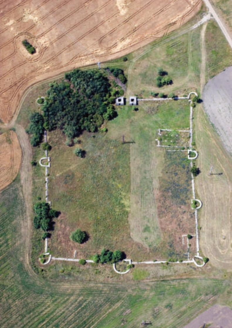

draft concept statement for the frontiers of the roman empire A
� e Roman Empire, in its territorial extent, was one of the greatest empires the world has known. Enclosing the Mediterranean world and surrounding areas, it was protected by a network of frontiers stretching from the Atlantic Coast in the west to the Black Sea in the east, from central Scotland in the north to the northern fringes in of the Sahara Desert in the south. Much of this frontier survives on and in the ground. It was largely constructed in the 2nd century AD when the Empire reached its greatest extent. � is frontier was at times a linear barrier, at other times protected spaces, or in some cases a whole military zone.
Substantial remains survive (clockwise from the west) in the United Kingdom, the Netherlands, Germany, Austria, Slovakia, Hungary, Croatia, Serbia, Bulgaria, Romania, Turkey, Syria, Jordan, Egypt, Libya, Tunisia, Algeria, and Morocco. Starting on the western coast of northern Britain, the frontier in Europe then ran along the rivers Rhine and Danube, looping round the Carpathian Mountains to the Black Sea. � e eastern frontier, stretching from the Black Sea to the Red Sea and running through mountains, great river valleys and the desert. To the south, Rome’s protective cordon embraced Egypt and then ran along the northern edge of the Sahara Desert to the Atlantic shore in Morocco.
� e remains include the lines of the linear frontier, natural elements such as the sea, rivers and deserts, and networks of military installations and ancillary features such as roads on, behind and beyond the frontier. � ese encompass both visible and buried archaeology. Together, the remains form an extensive relict cultural landscape which displays the unifying character of the Roman Empire, through its common culture, but also its distinctive responses to local geography and political and economic conditions. Each section is a substantial refl ection of the way resources were deployed in a particular part of the Empire.
� e Frontiers of the Roman Empire (FRE) as a whole was the border of one of the most extensive civilizations in human history, which has continued to aff ect the western world and its peoples till today. It had an important eff ect on urbanization and on the spread of cultures among remote regions. � e scope and extent of the frontier refl ects the unifying impact of the Roman Empire on the wider Mediterranean world, an impact that persisted long after the empire had collapsed while the frontiers are the largest single monument to the Roman civilization.
� e FRE illustrate and refl ect the complex technological and organizational abilities of the Roman Empire which allowed it to plan, create and protect a frontier of some 5000 km in length, with a garrison of tens of thousands of men, and to manage the social, economic and military implications of this frontier. � e frontier demonstrates
Aerial view of the Late Roman fortress at Tokod (Hungary).

118 THE FRONTIERS OF THE ROMAN EMPIRE - A THEMATIC STUDY
the variety and sophistication of the response to topography and political, military and social circumstances which include walls, banks, rivers, and sea.
� e frontiers as a whole refl ect the development of Roman military architecture and the impact of the frontier on the growth of transport routes, and urbanization.
� e Roman frontier is the largest monument of the Roman Empire, one of the world’s greatest preindustrial empires. � e physical remains of Limes, forts, watchtowers, settlements and the hinterland dependent upon the frontier refl ect the complexities of Roman culture, but also its unifying factors across Europe and the Mediterranean world. � e FRE’s constructions are evidence from the edges of the Empires and refl ect the adoption of Roman culture by its subject peoples. � e frontier was not an impregnable barrier: rather it controlled and allowed the movement of peoples within the military units, amongst civilians and merchants, thus allowing Roman culture to be transmitted around the region and for it to absorb infl uences from outside its borders.
� e frontier refl ects the power and might of the Roman Empire and the spread of classical culture and Romanization which shaped much of the subsequent development of Europe.

119THE FRONTIERS OF THE ROMAN EMPIRE - A THEMATIC STUDY
View on the Euphrates near the ancient river crossing at Zeugma/Belkis (Turkey).
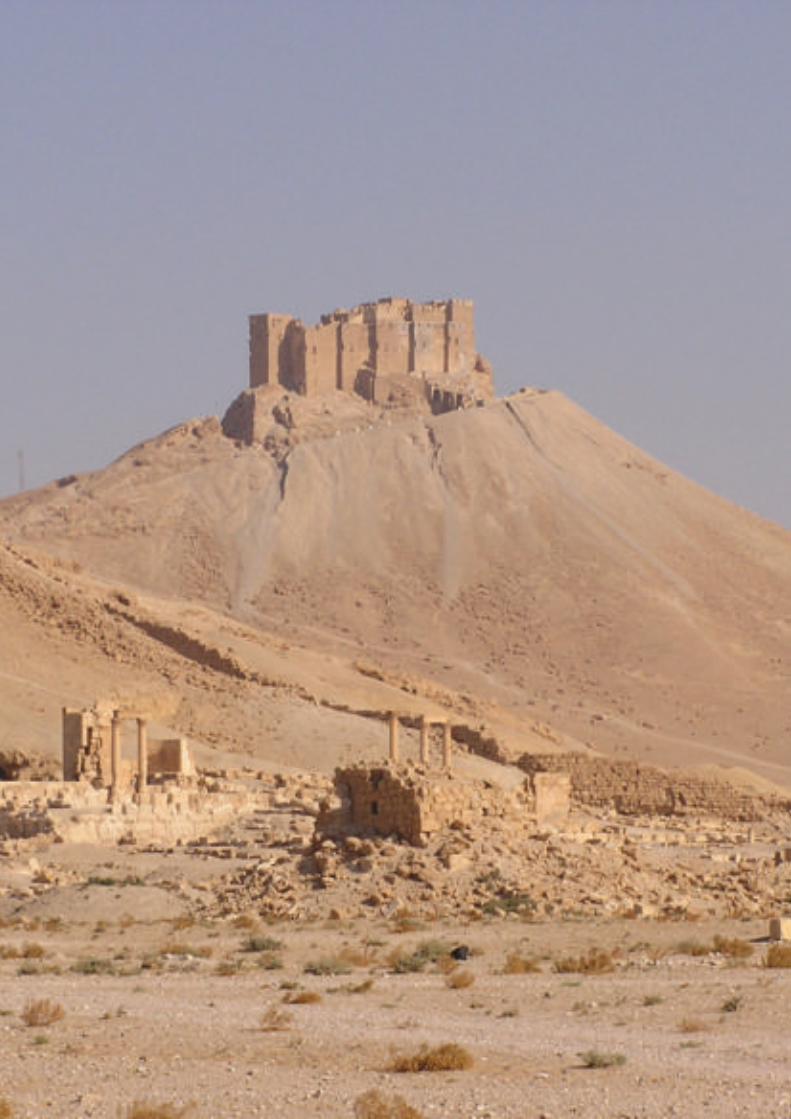
joint declaration fre whs B
RUNNING AND EXPANDING THE WORLD HERITAGE SITE FRONTIERS OF THE ROMAN EMPIRE
� e World Heritage Site - Frontiers of the Roman Empire (WHS FRE) is a serial transnational World Heritage Site (WHS).
� e State Parties involved hereby declare their aim to conserve the Outstanding Universal Value (OUV) of this exceptional archaeological structure. � ey agree to collaborate in order to preserve this WHS, to develop knowledge about it and to transmit this to future generations.
� e States Parties hereby declare their commitment to coordinate the management of the WHS. � ey
- look forward to continuing their cooperation for the benefi t and success of the WHS FRE
- will be guided by the Operational Guidelines and decisions of the World Heritage Committee relating to the WHS FRE
- recognise the importance of - and need for - coordinated management and monitoring as the foundation for practical actions between and in all participating States Parties
- agree to continue collaboration in order to identify, protect, conserve, present and transmit to future generations this common heritage of Outstanding Universal Value.
It is also the aim of the States Parties that the WHS FRE should be expanded to include as much of the preserved structures of the frontiers of the Roman Empire as feasible. � e State Parties recognise that, as the former Roman border stretches over three continents, extending the WHS will be a complex process.
Each State Party is responsible for taking care of conservation and management of the property within its territory, in accordance with the provisions of the World Heritage Convention, the Operational Guidelines for the Implementation of the World Heritage Convention (“Operational Guidelines”) and the decisions of the World Heritage Committee. � is responsibility is managed by each State Party in its own right, in accordance with its legislative and management systems.
In line with section 135 of the Operational Guidelines, an Intergovernmental Committee (IGC) is established to coordinate at an international level the management and development of the whole of the WHS.
Standing remains of the military fortress built by the Emperor Diocle! an at Palmyra (Syria). In the background the 17th-century Arab Castle.
122 THE FRONTIERS OF THE ROMAN EMPIRE - A THEMATIC STUDY
By joining the IGC, the respective national and regional governments, archaeological and heritage agencies declare their commitment to the identifi cation, protection, conservation, presentation and transmission to future generations of the site within their jurisdiction in accordance with the highest archaeological and heritage standards.
� e terms of reference of the IGC are set out below.
TERMS OF REFERENCE OF THE INTERGOVERNMENTAL COMMITTEE
1 Intergovernmental Commi� ee
� e Intergovernmental Committee (IGC) is established in order to coordinate overall management of the FRE WHS at an international level. Its Terms of Reference are approved unanimously by all the States Parties involved in the FRE WHS.
� e current State Parties involved are the Federal Republic of Germany and the United Kingdom.
2 Membership
Membership of the IGC consists of the delegations of the States Parties which care for a section of the WHS FRE currently inscribed.
� e delegations are composed of at least one member of the respective administrations in charge of the national sections of the WHS as well as at least one expert in archaeology or heritage. Delegations may not exceed 5 members.
3 Objec! ves
� e objectives of the IGC are
- to coordinate at an international level the management, monitoring and development of the WHS FRE
- to advise and support its members in their eff orts to conserve and manage those parts of the WHS FRE which are under their respective responsibility, in accordance with the World Heritage Convention
- to promote best practice and common approaches to ensure the continuing World Heritage status of the component parts of the FRE WHS
- to develop further the management systems of the FRE WHS as an evolving instrument, based on the management principles contained in the WHS FRE summary nomination statement (2004).
4 Procedures
4.1 Chair of the IGC
� e IGC is chaired by one of the State Party members of the IGC. � e Chair will provide secretariat support for organising meetings, disseminating information to IGC members, preparing documents for meetings, recording the IGC’s discussions and coordinating common actions.
� e Chairmanship changes each year on February 1. It is allocated according to the alphabetical order of the names of the States Parties in English.
4.2 Meetings
� e IGC meets at least once a year. After consulting other members, the Chair of the IGC convenes the meetings and decides on the agenda.
123THE FRONTIERS OF THE ROMAN EMPIRE - A THEMATIC STUDY
An extraordinary meeting may be requested by any State Party member of the IGC at any time, in writing to the Chair. � e Chair will then decide whether and when to convene an extraordinary meeting, after consultation with other members of the IGC.
4.3 Decisions
Decisions of the IGC are taken by a two thirds majority of States Parties members of the IGC present, except where otherwise stated below.
� e quorum for a decision is at least two thirds of all States Parties members.
Other members of the IGC and Observers participate without the right to vote.
4.4 Observers
� e Chair may invite observers to attend IGC meetings, after consultation with other members of the IGC.
� ese may include observers from those States Parties which care for a section of the WHS FRE which is not yet inscribed, particularly of those states which are in the process of developing a nomination.
� ey may also include third party observers, such as the World Heritage Centre, World Heritage Advisory Bodies and others with special competences in specifi c subjects to be dealt with at a meeting in order to make a contribution on a consultative basis.
4.5 Publications
Members of the IGC are consulted before publication of any document or statement in the name of the IGC. All publications in the name of the IGC are agreed unanimously by all State Party members.
4.6 Languages
� e working language of the IGC is English.
4.7 Expenses
� e costs of participating in IGC meetings are met by the participants.
4.8 Advisory groups
� e IGC may seek advice from advisory bodies such as the Management Group and the Bratislava Group.
4.8.1 Management Group
� e Management Group is made up of those directly responsible for the site management of the currently inscribed sections of the WHS FRE. � e Management Group provides the primary mechanism for sharing best practice in relation to WHS FRE.
4.8.2 Bratislava Group
� e Bratislava Group is an international scientifi c advisory body with expert members from States Parties containing inscribed or potential parts of the WHS FRE. � e Bratislava Group aims to share knowledge and experience of Roman frontiers and their identifi cation, protection, conservation, management and presentation, leading to the distillation of a common viewpoint. � rough technical and professional advice the Bratislava Group provides a scientifi c framework for the whole of the Roman frontiers. � e group supports States Parties by:
- advising on the signifi cance of the Roman frontiers and on the development of best practice guides for their management and improving their understanding
- developing support structures such as an overall research strategy, an international Roman frontiers database and websites.

124 THE FRONTIERS OF THE ROMAN EMPIRE - A THEMATIC STUDY
5 Tasks
5.1 Coordination
� e IGC coordinates the management of the WHS FRE at the international level. It coordinates responses to the World Heritage Centre for all questions which relate to the whole of the WHS FRE. � is task is managed by the Chair, which obtains and coordinates information from the States Parties. Individual State Parties will continue to make notifi cations to the World Heritage Centre in accordance with paragraph 172 of the Operational Guidelines.
� e IGC is guided by management principles fi rst set out in the WHS FRE summary nomination statement (2004). � e common management principles deal with those aspects of the WHS FRE management which concern more than a single national segment of the WHS FRE.
5.2 Extensions to the WHS FRE
5.2.1 Proposals to extend the WHS FRE
Any prospective State Party which on its territory does preserve a part or parts of the FRE is invited to prepare a proposal to join the transnational serial WHS.
At the request of a State Party member of the World Heritage Convention, the IGC will consider proposed extensions to WHS FRE.
In accordance with the Operational Guidelines, the member States Parties of the IGC must agree unanimously on any proposal for extension to WHS FRE before the nomination is formally submitted to UNESCO.
5.2.2 Acceptance of this Declaration and Terms of Reference
Any prospective State Party has to accept this Joint Declaration and Terms of Reference.
5.3 Monitoring / Evaluation
� e IGC supports States Parties in the UNESCO Periodic Reporting. � rough its members it coordinates all matters of evaluation of the serial property relating to WHS FRE issues.
5.4 State of conservation
It is noted that, according to the Operational Guidelines, if part of the property is at risk the whole property can be placed on the List of World Heritage in Danger.
States Parties commit themselves to inform the IGC of proposed changes of the WHS FRE with signifi cant impact on the OUV.
� e IGC may consider the state of conservation of any component part of the WHS FRE as well as planned developments or operations that could potentially damage parts of the WHS FRE or its surroundings. � e IGC may discuss with the State Party issues relating to the conservation of parts of the WHS FRE and its surroundings.
5.5 Presentation and research
� e IGC promotes the presentation of the WHS FRE. It encourages initiatives intended to contribute to the international recognition of the archaeological and historical value of the WHS FRE. It encourages scientifi c research in the WHS FRE.
6 Commencement and amendments
� e IGC and these Terms of Reference come into eff ect on the date of the signing of this Joint Declaration.

125THE FRONTIERS OF THE ROMAN EMPIRE - A THEMATIC STUDY
� e Terms of Reference may be amended at any time, subject to unanimous agreement of the State Party members.
� e Terms of Reference will be reviewed fi ve years from the date of signature of the Joint Declaration.
(signed 17.05.2012 by representatives of the United Kingdom and Germany)


list of sites representing the roman frontiers of europe C
� is annex contains the site lists provided for this � ematic Study by the States Parties involved in the preparation of the nomination of the remaining sections of the Roman frontiers of Europe for the World Heritage List.116 � e sites are listed per country or frontier section, roughly from west to east:
- the Netherlands- Germany (Rhine)- Germany (Danube) – Austria- Slovakia- Hungary- Croatia- Serbia- Romania- Bulgaria
Within each of the above groups the sites have been numbered – generally, but not consistently, from west/north to east/south. In some cases (Serbia, Romania) later corrections have caused missing site numbers, indicated by {vacat}. � e Romanian site list includes sites on the Lower Danube (RO264-294) as well as in the Roman province of Dacia.
Each site record has the same structure (underlined elements are not always present):
site number | municipality | town or village | local namehistorical name | Roman province | geographical coordinatessite type | site dateselec� on status | selec� on criteriaintegrityauthen� city
Geographical coordinates are in longitude-latitude (decimal degrees), where necessary converted from other coordinate systems. If site dates were not given as numbers these have been converted, e.g. ‘2nd century AD’ into ‘100 - 200’. � e selection status represents the situation as of August 2016.
116 � is annex therefore does not include sites representing Hadrian’s Wall, the Antonine Wall and the Upper German-Raetian Limes, being part of ‘Frontiers of the Roman Empire’ (ref. 430ter).
Standing remains of the Late Roman watchtower at Bacharnsdorf (Austria).

128 THE FRONTIERS OF THE ROMAN EMPIRE - A THEMATIC STUDY
Where recorded, selection criteria (1, 2, etc.) refer to the criteria applied by the country or section in question. With the exception of the site list of the Netherlands, the recorded criteria refer to the ‘� ree Pillars of Outstanding Universal Value’:
1. importance within the specifi c stretch of the frontier and in the context of the frontier as a whole, illustrating the great diversity of the frontier, its time depth and its functioning within a particular area;
2. good state of preservation and a high level of integrity and authenticity;3. level of protection and manageability: the sustainable protection and management
of the individual component parts is guaranteed in the long term.
In the site list of the Netherlands, the above criteria 2 and 3 apply to all selected sites. � e recorded criteria 1-5 are a further specifi cation of the above criterion 1:
1. the site existed during (part of ) the 2nd century AD;2. the site existed during a period preceding or following the 2nd century AD,
contributing to the value that the Lower German Limes existed from the earliest beginning of the Roman Empire until the breakdown of the Western Empire, always on the same line;
3. the site ranges among the military installations typical of all successive phases of military strategy (conquest, forward defence and defence-in-depth), or among associated features which are characteristic of the military landscape in the Rhineland;
4. the site refl ects the tailor-made solutions for the strategic and constructive challenges connected with the dynamic landscape of the Rhine delta;
5. the site off ers excellently preserved organic remains and metal objects, thanks to waterlogged conditions.
The ‘Three Pillars of Outstanding Universal Value’.

129THE FRONTIERS OF THE ROMAN EMPIRE - A THEMATIC STUDY
of the then uncovered features are s� ll (par� ally) intact. Timber and other organic remains are preserved at deeper, waterlogged levels. Overbuilding is restricted to the northwest corner, not very dense and is not very likely to have caused much damage.Authen� city: The presence of a Roman civil town with a harbour is well a� ested by excava� on. It is likely that the development of towns on the Lower German fron� er relied heavily on imperial interven� on and military involvement in their construc� on. The presence of a harbour along Corbulo’s canal and the fi nds assemblage indicate that the town played a part in the supply of the military infrastructure along the North Sea coast. In all, this civil town is a relevant aspect of the military infrastructure in the Rhine delta.
NL007 | Leidschendam-Voorburg | LeidschendamFossa Corbulonis | Germania inferior | 4,415765 / 52,096218Corbulo canal | Date: 40 - 270Selected: Yes | Criteria: 1, 2, 3, 4, 5Integrity: Preserved over great lengths. Time and again excava� ons have demonstrated the presence of remains of this canal, in narrow trial trenches. The remnants consist of an ar� fi cial water channel, with its sides strengthened with post rows at several places. Not rarely, these posts are preserved in very good condi� on.Authen� city: Although several canals are known from historical sources, this is the only example which has been a� ested beyond doubt. The canal is men� oned by the historian Tacitus (Annales 11.20), who credits the Lower German army commander Corbulo with its construc� on, in AD 47. However, the canal has been proven to have an earlier phase which must have preceded the command of Corbulo. This canal is therefore of immense historical value, both confi rming and correc� ng historical evidence, and expressing the adapta� on of the delta landscape to the Roman military needs.
NL008 | Voorschoten | VoorschotenFossa Corbulonis | Germania inferior | 4,433409 / 52,107885Corbulo canal | Date: 40 - 270Selected: Yes | Criteria: 1, 2, 4, 5Integrity: Cf. NL007.Authen� city: n/a
NL009 | Leiden | Leiden | Room- of MeerburgerpolderGermania inferior | 4,508076 / 52,144294military vicus | Date: 40 - 400Selected: NoIntegrity: Unknown.Authen� city: The associa� on of the fi nds and features in this area with the nearby fort and its military vicus is uncertain.
NL010 | Leiden | Leiden | Meerburg-RivierenwijkGermania inferior | 4,515039 / 52,15132military vicus, harbour | Date: 40 - 400Selected: Undecided | Criteria: 1, 2, 3, 4Integrity: Excava� ons in the 1960s have indicated the presence of remains of a military vicus and harbour to the north of the Corbulo canal. The extension and preserva� on of further remains is uncertain.Authen� city: So far the character of the remains on this loca� on is not very clear. There is no doubt that they are Roman and it is probable that they belong to the military se� lement of Roomburg, but be� er evidence is required.
NL011 | Leiden | Leiden | RoomburgMa� lo? | Germania inferior | 4,517568 / 52,149757
NL001 | Katwijk | Katwijk | Bri� enburgGermania inerior | 4,392515 / 52,21363auxiliary fort | Date: 40 - 400Selected: NoIntegrity: Unknown. The remains of the fort have only been seen in the 16th century during extremely low � de.Authen� city: Maps and pain� ngs from the period show credible remains, but recent eff orts to demonstrate the presence of a fort by modern methods (sonar etc.) have failed so far.
NL002 | Katwijk | Katwijk | UitwateringssluisGermania inferior | 4,400034 / 52,211086military vicus? | Date: 0 - 270Selected: NoIntegrity: Part of the site has been excavated. The extension and preserva� on of further remains are unknown.Authen� city: Insuffi cient, as the assumed character of a military vicus belonging to the Bri� enburg fort has not been properly a� ested.
NL003 | Katwijk | Katwijk | Zanderij WesterbaanGermania inferior | 4,414223 / 52,191843rural se� lement, cemetery, possibly Limes road | Date: 0 - 270Selected: NoIntegrity: Nearly completely excavated.Authen� city: n/a
NL004 | Katwijk | Valkenburg | CentrumPraetorium Agrippinae? | Germania inferior | 4,432816 / 52,180696fort, vicus, cemetery | Date: 40 - 400Selected: Yes | Criteria: 1, 2, 3, 4, 5Integrity: Approximately 40% of the fort has not been excavated. Although its remains are overbuilt, previous excava� ons underneath built-up areas have demonstrated that especially the earlier building phases are very well preserved, including many � mber and other organic remains. The other parts of the military se� lement (military vicus and cemetery) have been less intensively excavated, and although most of the area is overbuilt many remains are s� ll intact.Authen� city: The Valkenburg fort is famous for its preserva� on of � mber remains, especially from the earlier building phases of the fort. There are only few sites where so many authen� c details of Roman military � mber construc� on are s� ll present.
NL005 | Katwijk | Valkenburg | De WoerdGermania inferior | 4,438954 / 52,169897military vicus | Date: 40 - 270Selected: Yes | Criteria: 1, 2, 3, 4Integrity: Part of the se� lement has been excavated, and the remaining areas are largely overbuilt (mainly greenhouses). Nevertheless, many remains are likely to be s� ll present.Authen� city: Excava� on has demonstrated the presence of buildings with military aspects of design and construc� on, in a linear arrangement. This is typical of military vici and has rarely been a� ested in the Netherlands, and therefore this site is important for the knowledge and understanding of this site type in the wetland landscape of the Rhine delta.
NL006 | Leidschendam-Voorburg | Voorburg | ArentsburgForum Hadriani | Germania inferior | 4,350568 / 52,059879civil town Forum Hadriani, harbour | Date: 100 - 270Selected: Yes | Criteria: 1, 2Integrity: Considerable parts (c. 37%) of the Roman town have been excavated in the 19th and early 20th centuries, but many
THE NETHERLANDS

130 THE FRONTIERS OF THE ROMAN EMPIRE - A THEMATIC STUDY
Albanianae? | Germania inferior | 4,660677 / 52,127931auxiliary fort, military vicus | Date: 40 - 270Selected: NoIntegrity: The fort was nearly completely excavated, including large parts of the military vicus. Most of the riverside rubbish deposits were destroyed during recent construc� on works.Authen� city: n/a
NL017 | Alphen aan den Rijn | Zwammerdam | Polder SteektGermania inferior | 4,699745 / 52,111663Limes road | Date: 80 - 270Selected: NoIntegrity: The (Limes) road between Alphen aan den Rijn and Zwammerdam is considerably aff ected by clay extrac� on. Since
the remains of the road occur at a shallow depth most of it will
be eroded.
Authen� city: n/a
NL018 | Alphen aan den Rijn | Zwammerdam | Hooge Burcht
Nigrum Pullum? | Germania inferior | 4,715466 / 52,105983
auxiliary fort, military vicus, harbour, ships | Date: 50 - 270
Selected: No
Integrity: The fort has been completely excavated, including a
large part of the quays and rubbish deposits along the Roman
Rhine, and six ships. Part of the military vicus is likely to be
preserved, though probably not without damage by clay
extrac� on and overbuilding.
Authen� city: n/a
NL019 | Bodegraven-Reeuwijk | Bodegraven | Centrum
Germania inferior | 4,745302 / 52,083634
fort | Date: 40 - 270
Selected: Yes | Criteria: 1, 2, 3, 5
Integrity: Excava� ons have revealed the presence of a gate and
part of the wall of a � mber for� fi ca� on of so far uncertain size.
Parts of the defenses and of internal buildings were preserved
in condi� ons as known from Valkenburg (NL004). There is every
reason to believe that many other parts of this installa� on are
s� ll present below the town centre.
Authen� city: The � mber military installa� on at Bodegraven
may well be the best preserved and complete example of the
Lower German fron� er. Excava� on has been so limited that
its size and character remain uncertain. If the preserva� on
condi� ons observed in a few excava� ons are no excep� on, the
site is of outstanding value for the early chronology of this part
of the fron� er, and for the surviving details of military � mber
construc� on.
NL020 | Bodegraven-Reeuwijk | Nieuwerbrug aan den Rijn |
Woerden-Bodegraven
Germania inferior | 4,789864 / 52,079958
Limes road and associated structures | Date: 80 - 270
Selected: Undecided
Integrity: The presence of sec� ons of a (Limes) road between
Zoeterwoude in the west and Harmelen in the east (of which
four parts have been provisionally selected) has been confi rmed
at various loca� ons, partly in excava� ons. Further research
is needed to a� est the precise course of the road and its
preserva� on.
Authen� city: There is no doubt that there was a road
connec� ng the forts on the le� bank of the Rhine, between
Utrecht-Hoge Woerd and Leiden-Roomburg. Based on the
be� er documented situa� on immediately west of Utrecht-
Hoge Woerd watchtowers may be expected along the road,
and � mber construc� ons where the road touches the Rhine
channel or crosses tributaries and other wet areas. It seems that
shipwrecks occur every now and then in the Rhine bed, and one
auxiliary fort, military vicus, harbour | Date: 40 - 400
Selected: Yes | Criteria: 1, 2, 3, 4, 5
Integrity: Today, the area of fort and its immediate surroundings
is a park. The presence of remains of the fort defenses has
been well a� ested, but most of the fort has not been touched
by excava� on. Part of the fort and the adjacent civil se� lement
have been overbuilt by a monastery, built in 1464 and
dismantled in 1573. It is unknown to what degree the Roman
remains were damaged by this religious complex. The limited
excava� ons carried out so far have uncovered many Roman
features. Excava� ons in the vicus were confi ned to its periphery.
The se� lement was built along the exit of the Corbulo canal,
whose bank was for� fi ed with post rows and revetments, with
well preserved � mber remains and rich fi nds including organic
materials and well-preserved metal objects. Large stretches of
this embankment are likely to be s� ll present.
Authen� city: This site is a rela� vely completely preserved
example of a military se� lement, with a� ested remains of a
fort, its vicus and harbour facili� es along the northern exit of
the Corbulo canal. This completeness is its main assets from
the point of view of authen� city, as it allows to ques� on the
rela� onship between the various components, of which the
Corbulo canal is unique. Today, the former presence of a Roman
fort is marked at the surface by an earth wall with gates and
towers; material and design clearly reveal that they are not
meant as a reconstruc� on. This visible remembrance supports
the sustainable protec� on of the underlying and surrounding
Roman remains by explaining their presence.
NL012 | Zoeterwoude | Zoeterwoude-Rijndijk | Hazerswoude-
Zoeterwoude
Germania inferior | 4,546766 / 52,135551
Limes road and associated structures | Date: 80 - 270
Selected: No
Integrity: Cf. NL020.
Authen� city: Sustainable preserva� on of this sec� on of the
Limes road cannot be a� ained.
NL013 | Alphen aan den Rijn | Groenendijk | Hazerswoude-
Zoeterwoude
Germania inferior | 4,556519 / 52,131081
Limes road and associated structures | Date: 80 - 270
Selected: No
Integrity: Cf. NL020.
Authen� city: Sustainable preserva� on of this sec� on of the
Limes road cannot be a� ained.
NL014 | Alphen aan den Rijn | Groenendijk | Polder
Groenendijk
Germania inferior | 4,557742 / 52,130506
Limes road | Date: 80 - 270
Selected: No
Integrity: Cf. NL020
Authen� city: Sustainable preserva� on of this sec� on of the
Limes road cannot be a� ained.
NL015 | Alphen aan den Rijn | Hazerswoude-Rijndijk | Alphen
aan den Rijn-Hazerswoude
Germania inferior | 4,613215 / 52,128644
Limes road and associated structures | Date: 80 - 270
Selected: No
Integrity: Cf. NL020.
Authen� city: Sustainable preserva� on of this sec� on of the
Limes road cannot be a� ained.
NL016 | Alphen aan den Rijn | Alphen aan den Rijn |
Castellumstraat

131THE FRONTIERS OF THE ROMAN EMPIRE - A THEMATIC STUDY
NL026 | Utrecht | De Meern | MeerndijkGermania inferior | 5,025717 / 52,068424canal? | Date: 40 - 270Selected: NoIntegrity: It is assumed that there was a connec� on here between the main Rhine channel and a more southerly secondary branch (Hollandse IJssel) giving access to the Meuse estuary. A sec� on through this water course has been alterna� vely interpreted as natural and manmade. Much of this water course will s� ll be present under a modern road (dike).Authen� city: The ar� fi cial (manmade) character of the water course has not been unequivocally a� ested. Therefore its characterisa� on as a dug canal is uncertain.
NL027 | Utrecht | De Meern | TouwslagerslaanGermania inferior | 5,031377 / 52,082912watchtower? | Date: 40 - 270Selected: NoIntegrity: The site is unlikely to be a watchtower.Authen� city: In the past a watchtower has been supposed here on account of fi nds of po� ery (including sigillata) and a sling shot in soil extracted for the crea� on of a pond. It is now no longer considered as a candidate for a watchtower.
NL028 | Utrecht | De Meern | Hoge WoerdGermania inferior | 5,041391 / 52,087885fort, vicus and cemetery, riverside deposits | Date: 40 - 400Selected: Yes | Criteria: 1, 2, 3, 5Integrity: Excava� ons in the fort and military vicus have been very limited. They have demonstrated that many remains are s� ll present, including stone walls of a military bath house. The earlier phases of the se� lement are be� er preserved than the later ones, as usual in the Netherlands. They include preserved organic remains, especially in the silted-up river bed in front of the fort and vicus. As the Rhine has migrated away from the se� lement, much of the rubbish deposits created by its inhabitants is s� ll present. A physical marking of the fort and a small site museum have been constructed in such a way as to avoid damage to the underlying remains.Authen� city: This site is a rela� vely completely preserved example of a military se� lement, with a� ested remains of a fort, its vicus, cemeteries and riverside rubbish deposits. This completeness and the preserva� on of organic remains are its main assets from the point of view of authen� city. Today, the former presence of a Roman fort is marked at the surface by an earth wall with gates and towers; material and design clearly reveal that they are not meant as a reconstruc� on. This visible remembrance supports the sustainable protec� on of the underlying and surrounding Roman remains by explaining their presence.
NL029 | Utrecht | De Meern | Groot ZandveldGermania inferior | 5,050838 / 52,094662watchtower | Date: 40 - 400Selected: Yes | Criteria: 1, 2, 3, 5Integrity: The presence of a � mber watchtower has been demonstrated by excava� on, but its remains have been carefully preserved.Authen� city: Timber watchtowers are notoriously diffi cult to detect, and usually discovery implies destruc� on. This example is an excep� on to that rule, and therefore a very precious secure and authen� c example of this rare type of installa� on.
NL030 | Utrecht | Utrecht | Duitse HuisGermania inferior | 5,118444 / 52,087816cemetery | Date: 40 - 270Selected: No
or more may be present in areas protected primarily for the presence of the road. The en� re assemblage of road, protec� ve measures, watchtowers and ships cons� tute an extremely valuable asset of the Lower German fron� er, expressing the struggle of the Roman military with the wetland condi� ons.
NL021 | Woerden | Woerden | Woerden-BodegravenGermania inferior | 4,840782 / 52,08078Limes road and associated structures | Date: 80 - 270Selected: UndecidedIntegrity: Cf. NL020Authen� city: Cf. NL020
NL022 | Woerden | Woerden | CentrumLaurium? | Germania inferior | 4,883937 / 52,085736fort, vicus, riverside deposits and Limes road | Date: 40 - 400Selected: Yes | Criteria: 1, 2, 3, 4, 5Integrity: Excava� on of the successive forts at Woerden has been very limited so far, and it is certain that much of their remains are s� ll present below the town centre. The earlier building phases will be be� er preserved than the later ones, but Woerden is one of few military forts in the Netherlands which have produced parts of the stone walls of the latest building period. Small-scale excava� ons in a wide area around the fort have demonstrated that many remains of the military vicus are s� ll present, and also of harbour construc� ons along and ship wrecks in the Roman Rhine. Preserved � mber is not rare, and the same is true of other organic remains.Authen� city: This site is a rela� vely completely preserved example of a military se� lement, with a� ested remains of a fort, its vicus and harbour facili� es. This completeness and the preserva� on of organic remains are its main assets from the point of view of authen� city.
NL023 | Woerden | Harmelen | Harmelen-WoerdenGermania inferior | 4,932434 / 52,095856Limes road and associated structures | Date: 80 - 270Selected: UndecidedIntegrity: Cf. NL020Authen� city: Cf. NL020
NL024 | Utrecht | De Meern | De Balije/Veldhuizen/ZandwegGermania inferior | 5,007578 / 52,086927quay, ship, Limes road and associated structures | Date: 80 - 270Selected: Yes | Criteria: 1, 2, 3, 4, 5Integrity: In restricted areas very well preserved remains of a (Limes) road have been excavated, with addi� onal features including bridges, revetments, watchtowers and ships. There is every reason to suppose that many similar remains are s� ll hidden in unexcavated areas.Authen� city: This sec� on of the Limes road is the best researched and possibly the most varied sec� on of this infrastructural element in the Netherlands, clearly demonstra� ng the sensi� ve balance between the wetlands of the Rhine delta and the military needs. The preserva� on condi� ons of the � mber elements of the road, bridges, watchtowers and ships permit the establishment of a biography of the road system with an unparalleled level of detail, indica� ng both large building campaigns and small-scale repairs.
NL025 | Utrecht | De Meern | De Meern 1Germania inferior | 5,020175 / 52,080819ship, quay | Date: 100 - 200Selected: NoIntegrity: The ship has been completely excavated.Authen� city: n/a

132 THE FRONTIERS OF THE ROMAN EMPIRE - A THEMATIC STUDY
access to a motorway.Authen� city: n/a
NL035 | Bunnik | Werkhoven | Achterdijk/De KlaproosGermania inferior | 5,234659 / 52,023552rural se� lement? road? | Date: -100 - 270Selected: NoIntegrity: The presence of well-preserved remains of a se� lement is very likely.Authen� city: The site was ini� ally selected on the assump� on that the (sa� sfactorily a� ested) se� lement was located on the Limes road. Targeted survey has not confi rmed the existence of a road on the supposed line, and the se� lement is likely to be a rural se� lement without a major military associa� on. The site has been rejected.
NL036 | Bunnik | Werkhoven | Hollende Wagenweg/De Zure MaatGermania inferior | 5,255543 / 52,001601rural se� lement? road? | Date: -100 - 270Selected: NoIntegrity: The presence of well-preserved remains of a se� lement is very likely.Authen� city: The site was ini� ally selected on the assump� on that the (sa� sfactorily a� ested) se� lement was located on the Limes road. Targeted survey has not confi rmed the existence of a road on the supposed line, and the se� lement is likely to be a rural se� lement without a major military associa� on. The site has been rejected.
NL037 | Wijk bij Duurstede | Cothen | Oude LeemkolkGermania inferior | 5,277327 / 52,002388ship? | Date: 1000 - 1500Selected: NoIntegrity: It is not unlikely that part of the ship is s� ll preserved. The available evidence points however to a medieval date for this ship.Authen� city: n/a
NL038 | Wijk bij Duurstede | Cothen | Dwarsdijk-CaspargouwGermania inferior | 5,274646 / 51,996794rural se� lement? road? | Date: -100 - 270Selected: NoIntegrity: The presence of well-preserved remains of a se� lement is very likely.Authen� city: The site was ini� ally selected on the assump� on that the (sa� sfactorily a� ested) se� lement was located on the Limes road. Targeted survey has not confi rmed the existence of a road on the supposed line, and the se� lement is likely to be a rural se� lement without a major military associa� on. The site has been rejected.
NL039 | Wijk bij Duurstede | Cothen | Dwarsdijk-SmidsdijkGermania inferior | 5,287163 / 51,993085rural se� lement? road? | Date: -100 - 270Selected: NoIntegrity: The presence of well-preserved remains of a se� lement is very likely.Authen� city: The site was ini� ally selected on the assump� on that the (sa� sfactorily a� ested) se� lement was located on the Limes road. Targeted survey has not confi rmed the existence of a road on the supposed line, and the se� lement is likely to be a rural se� lement without a major military associa� on. The site has been rejected.
NL040 | Wijk bij Duurstede | Cothen | De DomGermania inferior | 5,304377 / 51,990348
Integrity: The area is largely overbuilt. The extent of the cemetery is unknown, but some remains of it are likely to be s� ll present. On account of the uncertain extent and the perspec� ves for sustainable protec� on this site has not been selected.Authen� city: The presence of a cemetery has been a� ested by excava� on. Other sites, however, are in a be� er posi� on to provide understanding of the rela� onship between cemetery, fort and military vicus.
NL031 | Utrecht | Utrecht | Domplein areaTrajectum? | Germania inferior | 5,122001 / 52,090772fort and vicus | Date: 40 - 400Selected: Yes | Criteria: 1, 2, 3Integrity: The fort is well preserved below the remains of the medieval churches and other buildings in the town centre. Excava� on has been very limited. It is one of the few sites were intact remains of the stone defensive wall from the latest building period have survived. There is every reason to believe that the remains of the military vicus are equally well preserved.Authen� city: The Domplein area is one of the few instances in this fron� er region where a former Roman military se� lement became the nucleus of a thriving early medieval centre of power. The confronta� on of Roman military and medieval religious spheres is presented underground in a visitor centre built which was built in a former excava� on trench in order to avoid damage to the remains.
NL032 | Bunnik | Houten | Houten-MarsdijkGermania inferior | 5,154466 / 52,054673Limes road | Date: 600 - 900Selected: NoIntegrity: Remains of a road have been a� ested, but they turned out to be early medieval.Authen� city: n/a
NL033 | Bunnik | Vechten | VechtenFec� o | Germania inferior | 5,167052 / 52,056773fort, vicus, cemetery, ship, riverside deposits | Date: -10 - 400Selected: Yes | Criteria: 1, 2, 3, 4, 5Integrity: Although the site is dominated today by a 19th-century fort the damage caused by that complex is limited. The successive Roman forts are for the most part located to the west of the modern fort, which has had more impact on the military vicus, of which many remains are nevertheless s� ll present. Parts of the silted-up Rhine bed and the vicus were damaged by the construc� on of a motorway. Despite all the site is s� ll rela� vely complete. Timber and other organic remains have been a� ested at various occasions.Authen� city: This is the earliest and largest military site a� ested downstream of Nijmegen. Its loca� on near the bifurca� on of the river Vecht strongly suggests that it played a prominent part in the Germanic wars of the emperors Augustus and Tiberius. This is an important assets of its authen� city. Today, the former presence of a Roman fort is marked at the surface by a concrete band and a ditch which has been dug a� er the site
had been raised to avoid damage; material and design clearly
reveal that the marking is not meant as a reconstruc� on. This visible remembrance supports the sustainable protec� on of the underlying and surrounding Roman remains by explaining their presence.
NL034 | Bunnik | Odijk | Schoudermantel/VinkenburgwegGermania inferior | 5,225319 / 52,051789rural se� lement? road? watchtower? | Date: -100 - 270Selected: NoIntegrity: The area was destroyed during the construc� on of an
133THE FRONTIERS OF THE ROMAN EMPIRE - A THEMATIC STUDY
from a Roman fort. It is likely that this was located somewhat upstream from the fi ndspot of the dredge fi nds. In itself the
fi nds assemblage is an authen� c representa� ve of many cultural
values of the eroded fort.
NL045 | Neder-Betuwe | Kesteren | Nedereindsestraat W
Germania inferior | 5,561825 / 51,931536
military vicus? | Date: -100 - 270
Selected: No
Integrity: The rural se� lement once present here has largely
been excavated.
Authen� city: The excavated remains of the se� lement point to
a rural character.
NL046 | Neder-Betuwe | Kesteren | Nedereindsestraat O
Germania inferior | 5,564778 / 51,931891
cemetery, military vicus? | Date: 70 - 270
Selected: No
Integrity: The rural se� lement and cemetery once present here
have largely been excavated.
Authen� city: The excavated remains of the se� lement point to
a rural character. The uncovered burials have no military aspects
either.
NL047 | Neder-Betuwe | Kesteren | Schildersbuurt
Carvo? | Germania inferior | 5,565722 / 51,935215
auxiliary fort? | Date: 70 - 270
Selected: No
Integrity: If a military installa� on existed here, most or all of
its remains are likely to have been eroded by post-Roman
river ac� vity. Although it is not impossible that small parts of
a military installa� on or associated features (military vicus,
cemetery) have escaped erosion, there is no posi� ve evidence
so far.
Authen� city: The (former) presence of a military installa� on is
not unlikely. This is based on the excava� on of 26 buried horses
of military size (larger than indigenous horses) and of part of a
cemetery with military aspects.
NL048 | Overbetuwe | Driel | Baarskamp
Germania inferior | 5,828118 / 51,959115
rural se� lement, road? early fort? | Date: 10 - 400
Selected: No
Integrity: The preserva� on of parts of a se� lement may be
safely assumed.
Authen� city: The fi nds assemblage is rural rather than military.
The assump� on that a military se� lement is involved, is merely
based on a dozen of early fi nds unlikely to occur outside a
military context. However, a targeted survey has failed to
produce more similar fi nds.
NL049 | Arnhem | Elden | Meinerswijk
Germania inferior | 5,87328 / 51,971422
auxiliary fort, military vicus? | Date: 10 - 400
Selected: Yes | Criteria: 1, 2, 3, 4
Integrity: About two thirds of the fort and large parts of the
military vicus have been eroded by the Rhine. The headquarters
from the latest building phase of the fort have been superfi cially
excavated but re-covered. They demonstrate that earlier
remains will be well preserved. The same appears to apply to
non-eroded parts of the vicus, judging by the results of a coring
survey.
Authen� city: Its loca� on near the bifurca� on of the river
Gelderse IJssel (probably the canal recorded by the historians
Suetonius and Tacitus as dug by Drusus in 12-9 BC) and a dozen
of early fi nds are generally accepted as an indica� on that
this site played a prominent part in the Germanic wars of the
rural se� lement? road? | Date: -100 - 270
Selected: No
Integrity: The presence of well-preserved remains of a
se� lement is very likely.
Authen� city: The site was ini� ally selected on the assump� on
that the (sa� sfactorily a� ested) se� lement was located on the
Limes road. Targeted survey has not confi rmed the existence of
a road on the supposed line, and the se� lement is likely to be a
rural se� lement without a major military associa� on. The site
has been rejected.
NL041 | Wijk bij Duurstede | Wijk bij Duurstede | Trechtweg/
Trekweg
Germania inferior | 5,319716 / 51,984929
rural se� lement? road? | Date: -100 - 270
Selected: No
Integrity: The presence of well-preserved remains of a
se� lement is very likely.
Authen� city: The site was ini� ally selected on the assump� on
that the (sa� sfactorily a� ested) se� lement was located on the
Limes road. Targeted survey has not confi rmed the existence of
a road on the supposed line, and the se� lement is likely to be a
rural se� lement without a major military associa� on. The site
has been rejected.
NL042 | Buren | Rijswijk | Roodvoet baggergaten
Levefanum? | Germania inferior | 5,361041 / 51,963616
auxiliary fort? | Date: 50 - 400
Selected: No
Integrity: The presence of a fort at or around this loca� on is
assumed on the basis of dredge fi nds. The depth at which they
were found (several meters) reveals that they were eroded from
their original loca� on and re-deposited in the (silted-up) river
channel. The assemblage may not have been en� rely destroyed
by the dredging ac� vi� es, but there is no posi� ve evidence for
this.
Authen� city: The site was not selected on account of the doubts
on its military character. The po� ery assemblage is typical of
rural se� lements. The iden� fi ca� on as the remains of a military
site was mainly inspired by the presence of remains of three
helmets and by the assumed Roman military roots of the nearby
important early medieval site of Dorestad. Helmets occur at
many sites in the Dutch river area which are defi nitely not
military.
NL043 | Buren | Rijswijk | Rijnbandijk
Germania inferior | 5,357231 / 51,960011
cemetery, military vicus? | Date: 1000 - 1500
Selected: No
Integrity: The presence of remains of a se� lement is likely, but
recent research has confi rmed that it is of medieval date.
Authen� city: n/a
NL044 | Buren | Maurik | Eiland van Maurik
Mannaricium? | Germania inferior | 5,423584 / 51,970911
auxiliary fort | Date: 50 - 400
Selected: Undecided | Criteria: 1, 2, 3, 5
Integrity: The presence of a fort at or around this loca� on is
assumed on the basis of dredge fi nds. The depth at which they
were found (several meters) reveals that they were eroded from
their original loca� on and re-deposited in the (silted-up) river
channel. The assemblage may not have been en� rely destroyed
by the dredging ac� vi� es, but there is no posi� ve evidence
for this. Addi� onal research is required to establish whether
any remains of the military se� lement have been preserved
upstream from the fi ndspot.
Authen� city: The fi nds clearly indicate that they originate
134 THE FRONTIERS OF THE ROMAN EMPIRE - A THEMATIC STUDY
campaigns of 12-9 BC. As such it is of immense historical value, expressing the adapta� on of the delta landscape to the Roman military needs.
NL053 | Overbetuwe | Driel | Elst-DrielGermania inferior | 5,828556 / 51,947483road | Date: 0 - 400Selected: NoIntegrity: Trenching has produced indica� ons for the presence of a road at two out of three loca� ons. There may be more loca� ons with more or less intact remains.Authen� city: It is likely that the a� ested remains represent a road. Considering its course it will have been a (northward) connec� on between Nijmegen and the Rhine, and it will have been used by the military. However, this does not per se make it a military road.
NL054 | Overbetuwe | Elst | Grote KerkGermania inferior | 5,849551 / 51,91987temple | Date: 0 - 270Selected: NoIntegrity: The Grote Kerk temple probably has the best preserved remains of a stone building from the Roman period in the fron� er zone in the Netherlands. As far as they have been excavated they have been preserved below the modern church.Authen� city: The preserved stone walls (accessible in a visitor centre) are authen� c remains of a temple. However, its associa� on with the military is weak. The army may have been involved in the provisioning of building materials, and possibly in the construc� on work itself, but there is no evidence of military involvement in � mber predecessors, or of a specifi cally military following.
NL055 | Overbetuwe | Elst | WesteraamGermania inferior | 5,856834 / 51,921306temple | Date: 40 - 270Selected: NoIntegrity: This temple has been completely excavated.Authen� city: n/a
NL056 | Lingewaard | Ressen | Ressen-WoerdsestraatGermania inferior | 5,869638 / 51,889939rural se� lement, road? | Date: -100 - 400Selected: NoIntegrity: The presence of well-preserved remains of a se� lement is very likely.Authen� city: The site was ini� ally selected on account of the supposi� on that the (sa� sfactorily a� ested) se� lement was located on a road connec� ng Nijmegen to the Rhine. However, this road may well have followed a diff erent course. The site has been rejected.
NL057 | Nijmegen | Ressen | Ressen-WoerdsestraatGermania inferior | 5,871456 / 51,886031rural se� lement, road? | Date: -100 - 400Selected: NoIntegrity: The presence of well-preserved remains of a se� lement is very likely.Authen� city: The site was ini� ally selected on account of the supposi� on that the (sa� sfactorily a� ested) se� lement was located on a road connec� ng Nijmegen to the Rhine. However, this road may well have followed a diff erent course. The site has been rejected.
NL058 | Nijmegen | Lent | Centrum/OverwaalGermania inferior | 5,86529 / 51,862164vicus? road? | Date: 0 - 400
emperors Augustus and Tiberius. Further, it is the only military site between Nijmegen and Vechten which has been proven to have partly escaped post-Roman erosion by the river Rhine. As such the site clearly expresses the risks of establishing a military infrastructure in a dynamic delta landscape. Today, the former presence of the headquarters of a Roman fort is marked at the surface by a construc� on of metal and natural stone; material and design clearly reveal that the marking is not meant as a reconstruc� on. This visible remembrance supports the sustainable protec� on of the underlying and surrounding Roman remains by explaining their presence.
NL050 | Lingewaard | Huissen | LoostraatGermania inferior | 5,922452 / 51,941933cemetery, rural se� lement, road? | Date: -100 - 400Selected: NoIntegrity: Many remains of a series of se� lements and one or more cemeteries have survived recent excava� ons and overbuilding.Authen� city: The linear arrangement of several se� lements has added to the belief that the road connec� ng the forts on the Rhine must have passed here. However, excava� ons have not provided any evidence of a substan� al road. An assemblage of ditches has been interpreted as the possible remains of a military post of some kind, but the evidence is not convincing, and the area in ques� on has been excavated now.
NL051 | Lingewaard | Loo | LoowaardGermania inferior | 5,99154 / 51,918641auxiliary fort | Date: 40 - 270Selected: NoIntegrity: The assumed presence of a fort at or around this loca� on is based on dredge fi nds. The depth at which they were found (several meters) reveals that they were eroded from their original loca� on and re-deposited in the (silted-up) river channel. The assemblage may not have been en� rely destroyed by the dredging ac� vi� es, but there is no posi� ve evidence for this. Addi� onal research is required to establish whether any remains of the military se� lement have been preserved upstream from the fi ndspot.Authen� city: A record of the occurrence of remains of stone walls at great depth during dredging supports the idea that the fi nds represent the eroded remains of a fort. It is likely that this was located somewhat upstream from the fi ndspot of the dredge fi nds. In itself the fi nds assemblage is an authen� c representa� ve of many cultural values of the eroded fort. Since the sites of Maurik (NL044) and Bijlandse Waard (NL052) are be� er examples of eroded forts the Loowaard site has not been selected.
NL052 | Rijnwaarden | Herwen | Bijlandse WaardCarvium? | Germania inferior | 6,091424 / 51,869933re-deposited remains of an eroded fort | Date: -10 - 270Selected: Undecided | Criteria: 1, 2, 3, 4, 5Integrity: The assumed presence of a fort at or around this loca� on is based on dredge fi nds. The depth at which they were found (several meters) reveals that they were eroded from their original loca� on and re-deposited in the (silted-up) river channel. The assemblage may not have been en� rely destroyed by the dredging ac� vi� es, but there is no posi� ve evidence for this. Addi� onal research is required to establish whether any remains of the military se� lement have been preserved upstream from the fi ndspot.Authen� city: Its loca� on at the bifurca� on of the rivers Rhine and Waal and the presence of some early fi nds strongly suggest that this fort was built to protect the groyne recorded by the historian Tacitus as built by Drusus during his Germanic

135THE FRONTIERS OF THE ROMAN EMPIRE - A THEMATIC STUDY
NL062 | Nijmegen | Nijmegen | HunerbergGermania inferior | 5,880507 / 51,84123opera� onal base, legionary fortress, vicus and cemetery | Date: -20 - 180Selected: Yes | Criteria: 1, 2, 3Integrity: This site has been overbuilt in the early 20th century, with rela� vely low building densi� es in the northern half. Excava� ons have demonstrated a varying degree of damage. In all about a quarter of the site has been excavated, mainly touching the later legionary fortress and a part of its extramural se� lement.Authen� city: The large army base established during the reign of Augustus is the earliest on the fron� er north of the Alps. It is a pivot between a phase in which Gaul was protected by troops sta� oned in its interior and a phase in which a� ack was considered the best defence. As such it is of major importance to the understanding of the Roman military strategy in the North and the development of the Rhine fron� er. The later legionary fortress, its extramural se� lement and the nearby civil town of Noviomagus cons� tute a triad which is a characteris� c element of the northern fron� er zone. At Nijmegen this assemblage is fairly well preserved and has the poten� al to convey knowledge and understanding of the rela� onship between military and civil sites in an area without an urban tradi� on.
NL063 | Nijmegen | Nijmegen | Kops PlateauGermania inferior | 5,89174 / 51,83747fort, vicus, cemetery | Date: -10 - 70Selected: Yes | Criteria: 2, 3Integrity: About two thirds of the fort have been excavated. However, the site derives its value from the overall assemblage, and substan� al parts of the extramural structures, cemeteries and a rubbish deposit s� ll remain intact.Authen� city: This early fort is in many aspects (e.g. presence of annexes, huge residen� al building) very atypical for the Rhine fron� er. It is considered as a commanding post for the Germanic wars of Augustus in its earliest phase, and as a training and recruitment centre for Batavian cavalry or a seat for a Roman supervisor of the Batavian people in a later phase. In any of these func� ons the site has a unique story to tell.
NL064 | Nijmegen | Ubbergen | Ubbergen-RijksstraatwegGermania inferior | 5,89389 / 51,840283harbour? | Date: 70 - 180Selected: NoIntegrity: The assumed presence of a harbour has not been a� ested in a trial trench.Authen� city: n/a
NL065 | Nijmegen | Nijmegen | MariënboomGermania inferior | 5,88782 / 51,825514aqueduct | Date: 70 - 180Selected: Yes | Criteria: 1, 2, 3Integrity: Large parts of earthworks considered as the remains of an aqueduct are s� ll preserved in the landscape.Authen� city: Large linear earthworks to the southeast of the military se� lement of Nijmegen-Hunerberg have been interpreted as the remains of an aqueduct. Although a water channel has not been a� ested so far, it is the obvious explana� on on account of the available evidence. Preserved remains of a military aqueduct are very rare. The authen� city of the assemblage would gain much from the fi nding of a water channel.
NL066 | Berg en Dal | Berg en Dal | MeerwijkselaanGermania inferior | 5,90747 / 51,814984
Selected: NoIntegrity: The former presence of a se� lement is certain, but it is likely to have been largely excavated.Authen� city: The site was ini� ally selected on account of 1) the excavated remains of a building considered as storage building with military aspects (but it may just as well have belonged to a villa); 2) the supposi� on that the se� lement was located on a road connec� ng Nijmegen to the Rhine. However, this road may well have followed a diff erent course. The site has been rejected.
NL059 | Nijmegen | Nijmegen | Nijmegen-WestUlpia Noviomagus Batavorum | Germania inferior | 5,847129 / 51,849411civil town Ulpia Noviomagus and cemetery | Date: 70 - 300Selected: Yes | Criteria: 1, 2Integrity: This Roman town is overbuilt by the modern town, but excava� ons on a restricted scale have clearly demonstrated that many remains are s� ll present. The cemetery has suff ered from targeted collec� oning of fi nds in the early 20th century.Authen� city: The presence of a Roman civil town is well a� ested by excava� on. It is likely that the development of towns on the Lower German fron� er relied heavily on imperial interven� on and military involvement in their construc� on. Together with the legionary fortress and its canabae legionis in the east of Nijmegen the town cons� tuted a triad which is typical of the northern fron� er zone. The town received market rights and its name from the Emperor Trajan, at about the � me when the legionary fortress lost its full garrison. This is a further expression of the narrow � es between military and urban sites in this fron� er sec� on. In all, this civil town is a relevant aspect of the military infrastructure in the Rhine delta.
NL060 | Nijmegen | Nijmegen | Valkhof areaGermania inferior | 5,870304 / 51,847843Late Roman fort | Date: 270 - 700Selected: Yes | Criteria: 2, 3Integrity: Less than 20% of the fort has been excavated. Most of the fort interior was overbuilt by a for� fi ed palace in the early medieval period, and the rare excava� ons in this part of the site have hardly reached the Roman levels, so their preserva� on is largely unknown.Authen� city: This is the only site in the Dutch fron� er zone with securely a� ested physical remains of a Late Roman for� fi ca� on. The succession of this fort by an (early and later) medieval palace refl ects the legi� ma� on of medieval power as a con� nua� on of Roman authority.
NL061 | Nijmegen | Nijmegen | Valkhof areaOppidum Batavorum? | Germania inferior | 5,871857 / 51,846462civil se� lement Oppidum Batavorum | Date: -10 - 70Selected: Yes | Criteria: 2Integrity: The extent of this se� lement is not precisely known, but it is evident that considerable parts are densily overbuilt today. Underneath cellars only wells, latrines and (Roman) cellars have survived, but outside modern buildings the preserva� on is be� er. The surviving parts have s� ll the poten� al to generate knowledge and understanding of this se� lement.Authen� city: This se� lement is considered as an administra� ve centre for the Batavian area, created by the Roman authori� es. It is assumed that its fi rst inhabitants were or at least included army veterans. The se� lement is iden� fi ed with Oppidum Batavorum, of which the historian Tacitus records that it was burnt to ashes during the Batavian revolt of AD 69-70. The site is therefore in various ways closely associated with the military history of the Rhineland.

136 THE FRONTIERS OF THE ROMAN EMPIRE - A THEMATIC STUDY
NL068 | Berg en Dal | Leuth | former mun. UbbergenGermania inferior | 5,995664 / 51,837894road | Date: 0 - 400Selected: NoIntegrity: A road has not been a� ested here.
Authen� city: It is assumed that there existed an eastward
connec� on between Nijmegen and the Rhine. The discovery of
a milestone in this area and the presence of rural se� lements
arranged more or less on a line has added to this hypothesis.
There is no posi� ve evidence, however.
NL069 | Berg en Dal | Millingen | former mun. Millingen
Germania inferior | 6,008645 / 51,851156
road | Date: 0 - 400
Selected: No
Integrity: A road has not been a� ested here.
Authen� city: It is assumed that there existed an eastward
connec� on between Nijmegen and the Rhine. The presence of
rural se� lements arranged more or less on a line has added to
this hypothesis. There is no posi� ve evidence, however.
aqueduct | Date: 70 - 180
Selected: Yes | Criteria: 1, 2, 3
Integrity: Cf. NL065.
Authen� city: n/a
NL067 | Berg en Dal | Berg en Dal | De Holdeurn
Germania inferior | 5,931774 / 51,814883
military � le works and po� ery | Date: 70 - 270
Selected: Yes | Criteria: 1, 2, 3
Integrity: Excava� ons have a� ested and destroyed several
kilns and parts of a building. However, parts of two kilns and
of the building have remained, and it is inconceivable that the
excavated features are the only remains of this industrial site.
Authen� city: There is no doubt that this was the site of a
� lery and po� ery run by the Roman army. Military po� eries
and � leries have been a� ested at various other places, but
preserved examples are rare. Such industrial sites were an
indispensable element of the military infrastructure, and as such
they have a special story to tell.

137THE FRONTIERS OF THE ROMAN EMPIRE - A THEMATIC STUDY
Integrity: Largely preserved in agricultural area; excellent preserva� on of interior buildings of the fort; large scale organic deposits; visible stretch of the road embarkment of the Limes roadAuthen� city: Extent of fort and its commanding posi� on between the the former Rhine ccourse and the Limes road s� ll recognisable
LGG009 | Uedem | Uedem | HochwaldGermania Inferior | 6,3592 / 51,6907temporary camps | Date: 30 - 200Selected: Yes | Criteria: 1, 2, 3, Integrity: Earthworks (ramparts) of 13 temporary camps well preserved in forest area Authen� city: Most of the ramparts s� ll recognisable in the forest
LGG010 | Wesel | Flüren | FlürenGermania Inferior | 6,5617 / 51,6838temporary camps | Date: 30 - 200Selected: Yes | Criteria: 1, 2, 3, Integrity: Earthworks (ramparts) of four temporary camps to a large extent preserved in forest areaAuthen� city: Most of the ramparts s� ll recognisable in the forest; important strategical posi� on in the mouth of the Lippe valley s� ll recognisable
LGG011 | Xanten | Xanten | CUT IIGermania Inferior | 6,4425 / 51,6664late roman fortress | Date: 310 - 400Selected: Yes | Criteria: 1, 3, Integrity: Ditch and remains of the stone founda� on partly preservedAuthen� city: Extent and layout are recognisable as part of the archeological park with iden� cal street pa� ern/city layout
LGG012 | Xanten | Xanten | CUT IColonia Ulpia Traiana | Germania Inferior | 6,4447 / 51,6668civil town, Limes road | Date: 100 - 300Selected: Yes | Criteria: 1, 2, 3Integrity: Layers of a for� fi ed reduc� on in the SW corner of the city with good preserva� on of stone fundamentsAuthen� city: Extent and layout are recognisable as part of the archeological park with iden� cal street pa� ern/city layout
LGG013 | Xanten | Xanten | Vetera IIGermania Inferior | 6,4861 / 51,6487re-deposited remains of an eroded legionary fortress | Date: 70 - 400Selected: Yes | Criteria: 1Integrity: Extensive re-deposited remains of the fortress in former Rhine bed; existance of preserved remains likely, but not a� estedAuthen� city: Strategic posi� on next to the roman Rhine course s� ll recognisable
LGG014 | Xanten | Xanten | Vetera IGermania Inferior | 6,4705 / 51,6419legionary fortress | Date: -12 - 69Selected: Yes | Criteria: 1, 2, 3Integrity: Largely preserved in agricultural area; earthworks of the western wodden-earthen rampart partly preserved, amphitheater s� ll fully preserved several meters highAuthen� city: The layout and topographical posi� on of the fortress at the Fürstenberg hill is s� ll recognisable following the
LGG001 | Kleve | Kleve | ReichswaldGermania Inferior | 6,093 / 51,7885Limes road | Date: 0 - 400Selected: Yes | Criteria: 1, 2, 3Integrity: Original remains of the Limes road with ditches and road embankment Authen� city: Visible stretch of the Limes road in forest area
LGG002 | Bedburg-Hau | Qualburg | QualburgQuadriburgium | Germania Inferior | 6,1781 / 51,7767Fort | Date: 270 - 400Selected: No | Criteria: -Integrity: Site partly overbuilt; extent of fort and state of preserva� on unknownAuthen� city: No visible remains
LGG003 | Bedburg-Hau | Till | KapitelshofGermania Inferior | 6,239 / 51,7776legionary fortress | Date: 70 - 75Selected: Yes | Criteria: 1, 2, 3Integrity: Largely preserved in agricultural area; excellent preserva� on of archeological layers; partly wetland condi� onsAuthen� city: Extent of the legionary fortress and its commanding posi� on in the landscape s� ll recognisable
LGG004 | Bedburg-Hau | Till | SteincheshofGermania Inferior | 6,25 / 51,7747fort | Date: 40 - 150Selected: Yes | Criteria: 1, 2, 3Integrity: Largely preserved in agricultural area; excellent preserva� on of archeological layers; presumed wetland condi� ons with deposited organic material in front of the fortAuthen� city: Extent of the fort and its posi� on next to the former Rhine bed s� ll recognisable
LGG005 | Kalkar | Kalkar | KalkarbergGermania Inferior | 6,285 / 51,7288military sanctuary | Date: -12 - 400Selected: Yes | Criteria: 1, 3Integrity: Site not overbuilt; large scale excava� on, but partly well preserved Authen� city: Extent of site and commanding view from the sancturay into the Rhine valley s� ll recognisable
LGG006 | Kalkar | Kalkar | HönnepelGermania Inferior | 6,334 / 51,7344re-deposited remains of an eroded fort | Date: 30 - 400Selected: No | Criteria: -Integrity: Finds from gravel mining indicate roman fort in this area; no original remains le� by medieval course of the Rhine
Authen� city: No visible remains
LGG007 | Kalkar | Kalkar | MonrebergGermania Inferior | 6,308 / 51,7108temporary camp | Date: -12 - 20Selected: Yes | Criteria: 1, 2, 3Integrity: Largely preserved in agricultural area; part of the front side rampart destroyed by gravel miningAuthen� city: Extent of site and commanding view from the camp into the Rhine valley s� ll recognisable
LGG008 | Kalkar | Kalkar | AltkalkarBurgina� um | Germania Inferior | 6,321 / 51,7141fort, vicus, Limes road | Date: 20 - 400Selected: Yes | Criteria: 1, 2, 3
GERMANY (RHINE)

138 THE FRONTIERS OF THE ROMAN EMPIRE - A THEMATIC STUDY
Authen� city: The layout of fortress and fort partly s� ll iden� cal with the modern street pa� ern; the main road (via principalis) is s� ll the major modern road in this area
LGG022 | Neuss | Neuss | ReckbergGermania Inferior | 6,7676 / 51,175watchtower, fortle� | Date: 40 - 270Selected: Yes | Criteria: 1, 2, 3Integrity: Site preserved in forest area; partly excavated in 19th century with small trenches Authen� city: The commanding posi� on above the former Rhine course and next to the Limes road s� ll recognisable
LGG023 | Monheim | Monheim | Haus BürgelGermania Inferior | 6,8729 / 51,1294fort | Date: 310 - 400Selected: Yes | Criteria: 1, 2, 3Integrity: Largely preserved in agricultural area; excellent preserva� on of the building with upstanding wallsAuthen� city: Upstanding walls are integrated in a medieval for� fi ca� on and s� ll visible; integrated in a museum with archeological path
LGG024 | Dormagen | Dormagen | DormagenDurnomagus | Germania Inferior | 6,8404 / 51,0927fort | Date: 90 - 400Selected: Yes | Criteria: 1, 2, 3Integrity: Partly preserved in urban area; Authen� city: The commanding posi� on above the former Rhine course s� ll recognisable; main road (via principalis) s� ll iden� cal with modern road
LGG025 | Köln | Köln | DeutzDivi� a | Germania Inferior | 6,9694 / 50,9378bridgehead | Date: 310 - 400Selected: Yes | Criteria: 1, 2, 3Integrity: Partly preserved in urban area; excellent preserva� on with upstanding walls at diff erent loca� onsAuthen� city: Upstanding walls visible at diff erent loca� ons; party integrated in open public recrea� on area; commanding posi� on opposite to the roman town of Cologne s� ll recognisable
LGG026 | Köln | Köln | PraetoriumGermania Inferior | 6,959 / 50,9385governor’s palace | Date: 30 - 400Selected: Yes | Criteria: 1, 2, 3Integrity: Largely preserved in urban area; excellent preserva� on of the building with upstanding wallsAuthen� city: Main part of the building intergrated in a museum; part of the future archeological park
LGG027 | Köln | Köln | AlteburgGermania Inferior | 6,9766 / 50,905fort (fl eet base) | Date: 30 - 250
Selected: Yes | Criteria: 1, 2, 3
Integrity: Partly preserved in urban area with large garden
areas; excellent preserva� on condi� onsAuthen� city: The posi� on of the fort as a fl eetbase and its commanding posi� on at the Rhine bank is recognisable
LGG028 | Al� er/Bornheim | Al� er/Bornheim | Ko� enforst-NordGermania Inferior | 6,9751 / 50,7201temporary camps | Date: 30 - 200Selected: Yes | Criteria: 1, 2, 3Integrity: Earthworks (ramparts) of 12 temporary camps to a large extent preserved in forest area
authen� c descrip� on of the roman historian Tacitus
LGG015 | Alpen | Alpen | BoenninghardGermania Inferior | 6,4949 / 51,5835temporary camp | Date: -12 - 100Selected: Yes | Criteria: 1, 3Integrity: Site largely preserved in agricultural area; no remains of the rampart preservedAuthen� city: Extent of site and commanding view from the camp into the Rhine valley s� ll recognisable
LGG016 | Alpen | Alpen | DrüptGermania Inferior | 6,5464 / 51,5868fort, temporary camps | Date: 30 - 200Selected: Yes | Criteria: 1, 2, 3, Integrity: Largely preserved in agricultural area; front of the 2nd/3th century fort destroyed by later Rhine course; excellent preserva� on of interior buildingsAuthen� city: Extent of the fort and its commanding posi� on between the the former Rhine course and the Limes road s� ll recognisable
LGG017 | Moers | Moers | AsbergAsciburgium | Germania Inferior | 6,6699 / 51,4317fort | Date: -12 - 100Selected: Yes | Criteria: 1, 2, 3Integrity: Partly overbuilt; s� ll large areas with good preserva� on condi� ons; organic deposits in front of the fortAuthen� city: Extent of the fort and its commanding posi� on between the the former Rhine course and the Limes road s� ll recognisable
LGG018 | Duisburg | Duisburg | WerthausenGermania Inferior | 6,7113 / 51,4221fortle� | Date: 40 - 200Selected: Yes | Criteria: 1Integrity: Partly overbuilt and excavatedAuthen� city: Strategic posi� on of the site at the banks of the roman Rhine course s� ll recognisable
LGG019 | Krefeld | Krefeld | GellepGelduba | Germania Inferior | 6,6824 / 51,3333fort | Date: 70 - 400Selected: Yes | Criteria: 1, 2, 3Integrity: Largely preserved in agricultural area; front of the 2nd/3th century fort destroyed; unusual good preserva� on of remains of 4th and 5th century ac� vi� esAuthen� city: Extent of the fort and its commanding posi� on between the the former Rhine ccourse s� ll recognisable
LGG020 | Neuss | Neuss | Novaesium INovaesium | Germania Inferior | 6,7155 / 51,1855legionary fortress | Date: -15 - 50Selected: Yes | Criteria: 1Integrity: Diff erent periods of early legionary fortresses are situated in urban area; largely excavated, but s� ll high amount of preserved areas Authen� city: Extent of the site and roman topography are hardly understandable today
LGG021 | Neuss | Neuss | Novaesium II (Koenenlager)Novaesium | Germania Inferior | 6,7244 / 51,1823legionary fortress | Date: 50 - 100Selected: Yes | Criteria: 1, 2, 3Integrity: The fortress and its succeeding fort situated in urban area; most parts are used by garden areas with good preserva� on condi� ons

139THE FRONTIERS OF THE ROMAN EMPIRE - A THEMATIC STUDY
Integrity: Well preserved remains of a series of lime kils integrated in a working building of the 30. legion from XantenAuthen� city: Most of the original lime kils are integrated in small museum
LGG032 | Königswinter | Königswinter | DrachenfelsGermania Inferior | 7,2054 / 50,6665industrial complex (stone quarry) | Date: 50 - 300Selected: Yes | Criteria: 1, 2, 3Integrity: At the Drachenfels the original remains of roman stone quarring are s� ll preserved at diff erent loca� ons
Authen� city: Large natural reserve with diff erent loca� ons
where remains of the roman stone quarring techniques are s� ll
visible
LGG033 | Remagen | Remagen | Remagen
Rigomagus | Germania Inferior | 7,2276 / 50,5797
fort | Date: -6 - 400
Selected: Yes | Criteria: 1, 2, 3
Integrity: Fort in old town city center area; excellent
preserva� on of the principia and stone rampart with upstanding
walls
Authen� city: Remains of the upstanding wall integrated in a
small museum
Authen� city: Most of the ramparts s� ll recognisable in the
forest
LGG029 | Bonn | Bonn | Bonn
Bonna | Germania Inferior | 7,0996 / 50,745
legionary fortress | Date: 30 - 400
Selected: Yes | Criteria: 1, 2, 3
Integrity: The fortress is situated in the modern town center;
s� ll very good preserva� on condi� ons
Authen� city: The layout of the fortress and the roman street
pa� ern is s� ll iden� cal with the modern street pa� ern
LGG030 | Bonn | Bonn | Ko� enforst-SüdGermania Inferior | 7,0927 / 50,6695temporary camps | Date: 30 - 200Selected: Yes | Criteria: 1, 2, 3Integrity: Earthworks (ramparts) of 11 temporary camps to a large extent preserved in forest area Authen� city: Most of the ramparts s� ll recognisable in the forest
LGG031 | Bad Münstereifel | Bad Münstereifel | IversheimGermania Inferior | 6,7739 / 50,5882industrial complex (lime kilns, 30th Legion) | Date: 50 - 300Selected: Yes | Criteria: 1, 2, 3

140 THE FRONTIERS OF THE ROMAN EMPIRE - A THEMATIC STUDY
Rae� a | 11,922306 / 48,906208Late an� que fortlet | Date: 300 - 500Selected: No | Criteria: 1Integrity: The fortlet has been destroyed almost en� rely by erosion and road construc� on works.Authen� city: n/a
DLAB008 | Regens-burg | Regensburg-Großprüfening | RegensburgRae� a | 12,036635 / 49,016523Fortlet | Date: 100 - 400Selected: Yes | Criteria: 1, 2, 3Integrity: All of the parts that cons� tute this ensemble – namely fortlet, civil se� lement and cemetery – have been preserved as archaeological monuments (underground) and have never been overbuilt.Authen� city: Small scale archaeological excava� ons confi rmed that the level of authen� city is very high. No reconstruc� on and/ or conserva� on methods of any kind have been undertaken.
DLAB009 | Regensburg | Regensburg Kumpfmühl | Regensburg KumpfmühlRae� a | 12,083713 / 49,008068Auxiliary fort, vicus | Date: 0 - 200Selected: Yes | Criteria: 1, 3Integrity: Parts of the former fort and vicus have been overbuilt in later � mes; in addi� on, the integrity has been compromised by large-scale (?) archaeological excava� ons in the 20th century. About 75 % of the original structures are preserved.Authen� city: The archaeological excava� ons confi rmed that the level of authen� city in general is high. Nevertheless, the overbuilding has compromised the authen� city of the an� que structures to a certain extent. No reconstruc� on and/ or conserva� on methods have been undertaken.
DLAB010 | Regensburg | Regensburg | RegensburgCastra Regina | Rae� a | 12,09859 / 49,020034Legionary fortress | Date: 179 - 500Selected: Yes | Criteria: 1, 2, 3Integrity: The Roman remains at Regensburg have been largely reused and overbuilt. However, the outer walls of the legionary fortress have been preserved excep� onally well (approx. 30 % of the former wall system preserved) and are to a certain extent s� ll standing upright. The remains of the fortresses’ barracks have been overbuilt by a church and are s� ll visible and accessible.Authen� city: The reuse and overbuilding of the an� que structures have compromised their authen� city to a certain extent, in par� cular with regard to their construc� on and layout.
DLAB011 | Pfa� er | Pfa� er | Pfa� erRae� a | 12,416392 / 48,974125Fortlet, vicus | Date: 100 - 300Selected: No | Criteria: 1, 2Integrity: The remains have been preserved as archaeological monuments (underground) and have never been overbuilt. The protec� on and management cannot be guaranteed in the long-term.Authen� city: The remains have never been reused or overbuilt. The level of authen� city therefore is high, in par� cular with regard to loca� on and se� ng, construc� on and layout and materials and substance.
DLAB001 | Neustadt a,d. Donau/Bad Gögging | Bad Gögging | Bad GöggingRae� a | 11,781265 / 48,825939Legionary spa | Date: 0 - 500Selected: Yes | Criteria: 1, 3Integrity: Large parts of the former spa have been overbuilt by a church in later � mes; about 15 % of the original structures are preserved.Authen� city: The reuse of the spa as a church compromised its authen� city to a certain extent, especially as the central part of the bath served as a Paleo-Chris� an sanctuary.
DLAB002 | Neustadt a,d. Donau/Eining | Eining | EiningRae� a | 11,788178 / 48,864621Watchtower, sanctuary | Date: 100 - 300Selected: Yes | Criteria: 1, 2, 3Integrity: All of the parts that cons� tute this ensemble – namely the watchtower, a single block of barracks and a sanctuary – have been preserved as archaeological monuments (underground) and have never been overbuilt.Authen� city: Archaeological excava� ons have taken place only to a limited extent. They confi rmed that the level of authen� city is very high. No reconstruc� on and/ or conserva� on methods of any kind have been undertaken.
DLAB003 | Kehlheim | Weltenburg | Kehlheim, Am GalgetRae� a | 11,82566 / 48,88926Fortlet | Date: 0 - 100Selected: No | Criteria: 1Integrity: Due to erosion and excava� ons partly preserved (approx. 40 %). The preserved parts have been aff ected by surface erosion with the result that substan� al remains survive only of the for� fi ca� ons survive but not of the internal buildings. The eastern third might be overbuilt in the future.Authen� city: The excava� ons confi rmed the authen� city of the remains, in par� cular with regard to materials and substance. Preserva� on/ conserva� on methods have not been applied.
DLAB004 | Kehlheim | Kehlheim | Kehlheim-KapfelbergRae� a | 11,983268 / 48,932701Roman and medieval quarry | Date: 100 - 300Selected: No | Criteria: 1, 3Integrity: Due to the exploita� on in later � mes (Middle Ages, 19th century), the integrity of the quarry has been compromised, in partcicular with regard to its intactness.Authen� city: Due to the exploita� on in later � mes (Middle Ages, 19th century), the authen� city of the quarry has been compromised signifi cantly.
DLAB005 | Bad Abbach | Alkofen | AlkofenRae� a | 11,977824 / 48,91603Fortlet, vicus | Date: 100 - 300Selected: No | Criteria: 1Integrity: The integrity of the site has been compromised signifi cantly by large-scale clay and gravel mining.Authen� city: n/a
DLAB006 | Bad Abbach | Bad Abbach | Bad AbbachRae� a | 12,046259 / 48,937338Legionary brickworks | Date: 100 - 300Selected: No | Criteria: 1Integrity: The area has been en� rely overbuilt.Authen� city: n/a
DLAB007 | Saal an der Donau | Untersaal | Untersaal
GERMANY (DANUBE) – AUSTRIA

141THE FRONTIERS OF THE ROMAN EMPIRE - A THEMATIC STUDY
Authen� city: The authen� city of the remains has been confi rmed by archaeological excava� ons. However, it has been compromised to a certain extent by later reuse.
DLAB018 | Engelhartszell | Oberranna | OberrannaStanacum (?) | Noricum | 13,774011 / 48,471443Fortlet | Date: 100 - 500Selected: Yes | Criteria: 1, 3Integrity: The fortlet has been preserved as an archaeological monument (largely underground, partly visible) and has only partly been overbuilt. Its integrity has been compromised to a certain extent by road construc� ons.Authen� city: The authen� city of the site has been confi rmed by archaeological excava� ons, in par� cular with regard to materials and substance. The reuse in later � mes compromised the level of authen� city to a certain extent. The remains have partly been preserved
DLAB019 | Waldkirchen am Wesen | Wesenufer | WesenuferNoricum |Fortlet (?) | Date: RomanSelected: No | Criteria: 1Integrity: n/a (The fortlet (?) cannot be localised any longer.)Authen� city: n/a
DLAB020 | St. Agatha, Haibach ob der Donau | Schlögen | SchlögenIoviacum (?) | Noricum | 13,870617 / 48,423983Vicus, Fort | Date: 100 - 500Selected: Yes | Criteria: 1, 3Integrity: The area has partly been overbuilt in modern � mes; therefore, the integrity of the site has been compromised to a certain extent.Authen� city: The authen� city of the site has been confi rmed by archaeological excava� ons, in par� cular with regard to materials and substance. Modern encroachment has compromised the level of authen� city to a certain extent. The remains have partly been preserved.
DLAB021 | Haibach ob der Donau | Mannsdorf | Kobling-RossgrabenNoricum | 13,918487 / 48,4462Watchtower | Date: 200 - 400Selected: No | Criteria: 1Integrity: The watchtower was destroyed in the course of the construc� on of the Aschach Power Plant in 1962.Authen� city: n/a
DLAB022 | Eferding | Eferding | EferdingNoricum | 14,02023 / 48,30879Fort (?) | Date: 100 - 300Selected: No | Criteria: 1Integrity: n/a (The presence of a Roman fort has been assumed on the basis of fi ndings (moveable) only; however, its precise whereabouts have not yet been localised).Authen� city: n/a
DLAB023 | Wilhering | Wilhering | WilheringNoricum | 14,172745 / 48,315222Military brickworks | Date: 200 - 400Selected: No | Criteria: 1Integrity: The structures have been overbuilt in the 20th century; their current state of preserva� on is unknown.Authen� city: n/a
DLAB024 | Wilhering | Wilhering | HirschleitengrabenNoricum | 14,224588 / 48,307483
DLAB012 | Straubing | Straubing | StraubingRae� a | 12,595444 / 48,887571Fort | Date: 0 - 400Selected: Yes | Criteria: 1, 3Integrity: Parts of the former forts have been overbuilt in later � mes; in addi� on, the integrity has been compromised by archaeological excava� ons in the 19th and 20th centuries. About 20 % of the original structures are preserved.Authen� city: The reuse and partly overbuilding of the an� que structures have compromised their authen� city to a certain extent, in par� cular with regard to their materials and substance. One of the many buildings has been restored. Nevertheless substan� als parts of the archaeological structures remain, for which is confi rmed that the level of authen� city is very high, in par� cular with regard to materials and substance.
DLAB013 | Stephans-posching | Steinkirchen | SteinkirchenRae� a | 12,837016 / 48,826849Fortlet, vicus, cemetery | Date: 100 - 300Selected: No | Criteria: 1Integrity: In large parts destroyed by erosion and quarrying.Authen� city: n/a
DLAB014 | Moos | Moos | MoosRae� a | 13,899716 / 48,405081Fort, vicus | Date: 0 - 200Selected: No | Criteria: 1Integrity: The fort has been largely destroyed by erosion; in addi� on, its integrity had been compromised by large-scale archaeological excava� ons. The vicus has been partly preserved.Authen� city: n/a
DLAB015 | Osterhofen | Osterhofen-Haardorf | Osterhofen-HaardorfRae� a | 13,003445 / 48,727479Fortlet | Date: 0 - 100Selected: No | Criteria: 1Integrity: The site has been overbuilt to a signifi cant extent; the integrity has therefore been compromised.Authen� city: Archaeological excava� ons that have compromised the site’s authen� city to a certain extent confi rmed the its authen� city, in par� cular with regard to materials and substance.
DLAB016 | Künzing | Künzing | KünzingRae� a | 13,083304 / 48,666335Amphitheatre, civil se� lement | Date: 100 - 300Selected: Yes | Criteria: 1, 3Integrity: Parts of the former fort and vicus have been overbuilt in later � mes; in addi� on, the integrity has been compromised to a certain extent by archaeological excava� ons that have, however, been conducted with great care. In the area of the wooden amphitheatre, excava� ons have been conducted only to a very limited extent. Here about 75 % of the original structures are preserved.Authen� city: The archaeological excava� ons confi rmed that the level of authen� city is very high, in par� cular with regard to materials and substance.
DLAB017 | Passau | Passau | PassauBatavis/ Boiotro | Rae� a-Noricum | 13,472035 / 48,574075Forts, watchtower | Date: 100 - 500Selected: Yes | Criteria: 1, 2, 3Integrity: The integrity of the remains has been compromised by the fact that they have been overbuilt; in addi� on, they have partly been aff ected by erosion. About 10 % of the original structures are preserved.

142 THE FRONTIERS OF THE ROMAN EMPIRE - A THEMATIC STUDY
Authen� city: The authen� city of the site has been confi rmed by archaeological excava� ons. The fact that the remains have been excavated and partly been overbuilt has compromised the level of authen� city to a certain extent, in par� cular with regard to construc� on and layout and materials and substance. The remains have partly been preserved.
DLAB030 | Wallsee-Sindelburg | Sommerau | SommerauNoricum | 14,74127 / 48,15508Fortlet | Date: 300 - 400Selected: No | Criteria: 1Integrity: The site has been destroyed, but before a rescue excava� on has been carried out.Authen� city: n/a
DLAB031 | Amste� en | Mauer bei Amste� en | Mauer bei Amste� enLocus Felix (?) | Noricum | 14,79972 / 48,09632Fort (?), vicus | Date: 300 - 400Selected: No | Criteria: 1Integrity: n/aAuthen� city: The authen� city of the site has not been confi rmed with regard to its func� on and use. Given its considerable distance to the river (approx. 18 kilometres), it is ques� onable whether the site formed part of the fron� er system a� er all.
DLAB032 | Neumarkt an der Ybbs | Neumarkt | Neumarkt
Noricum | 15,05951 / 48,14778
Watchtower | Date: 300 - 500
Selected: No | Criteria: 1
Integrity: n/a (The watchtower has been en� rely destroyed, but before a rescue excava� on has been carried out.)Authen� city: n/a
DLAB033 | Ybbs an der Donau | Ybbs | YbbsNoricum | 15,085376 / 48,177729Fortlet | Date: 300 - 400Selected: Yes | Criteria: 1, 3Integrity: The area has been overbuilt by a church; therefore, the integrity of the site has been compromised to a certain extent.Authen� city: The authen� city of the site has been confi rmed by archaeological excava� ons. The fact that the remains have been excavated and partly been overbuilt has compromised the level of authen� city to a certain extent, in par� cular with regard to construc� on and layout and materials and substance. The remains have not been preserved.
DLAB034 | Ybbs an der Donau | Sarling | SarlingNoricum | 15,11912 / 48,1693Watchtower (?) | Date: 300 - 500Selected: No | Criteria: 1Integrity: n/aAuthen� city: The authen� city of the site has not been confi rmed with regard to its func� on and use: it has not yet been confi rmed whether the remains belong to a Roman watchtower a� er all.
DLAB035 | Ybbs an der Donau | Säusenstein | Säusenstein
Noricum | 15,11304 / 48,19409
Watchtower (?) | Date: Roman
Selected: No | Criteria: 1
Integrity: The site has been en� rely destroyed in the 1950s.Authen� city: The authen� city of the site had not been confi rmed with regard to its func� on and use: prior to its destruc� on, it had not been confi rmed whether the remains
Watchtower | Date: 100 - 400Selected: Yes | Criteria: 1, 2, 3Integrity: The level of integrity of this site is remarkable: apart from the watchtower itself (preserved as underground archaeological monument), the se� ng and the surrounding
ditch have been preserved.
Authen� city: The authen� city of the site has been confi rmed by archaeological excava� ons, in par� cular with regard to materials and substance. The remains have partly been preserved.
DLAB025 | Linz | Linz | LinzLen� a | Noricum | 14,279723 / 48,304557Vicus, for� fi ca� on | Date: 0 - 500Selected: Yes | Criteria: 1, 3Integrity: The sites have partly been reused and/ or overbuilt and partly excavated; their integrity has therefore been compromised to a certain extent.Authen� city: The authen� city of the sites has been confi rmed by archaeological excava� ons, in par� cular with regard to materials and substance. The remains have partly been preserved.
DLAB026 | Enns | Enns | EnnsLauriacum | Noricum | 14,460774 / 48,217642Cemetery, civil se� lement, legionary fortress | Date: 0 - 500Selected: Yes | Criteria: 1, 3Integrity: The sites have partly been reused and/ or overbuilt and partly excavated; their integrity has therefore been compromised to a certain extent.Authen� city: The authen� city of the site has been confi rmed partly by archaeological excava� ons and, to a considerable extent, by geophysical methods (non-invasive). The fact that the remains have partly been reused and/ or overbuilt has compromised the level of authen� city to a certain extent, in par� cular with regard to construc� on and layout and materials and substance. The remains have been preserved only to a very limited extent..
DLAB027 | St. Pantaleon-Erla | Albing | AlbingNoricum | 14,550557 / 48,226623Legionary fortress | Date: 170 - 190Selected: Yes | Criteria: 1, 2, 3Integrity: The level of integrity of this site is high, in par� cular with regard to its wholeness: It has been preserved as an archaeological monument (underground) and has only partly been overbuilt. Approx. 90 % of the former remains have been preserved.Authen� city: Geophysics and archaeological excava� ons (to a very limited extent) have confi rmed the high level of authen� city of the site, in par� cular with regard to its construc� on and layout and materials and substance.
DLAB028 | St. Pantaleon-Erla | Erla | AuNoricum | 14,60185 / 48,17895Fortlet | Date: 300 - 500Selected: No | Criteria: 1Integrity: The site has been destroyed, but before a rescue excava� on has been carried out.Authen� city: n/a
DLAB029 | Wallsee-Sindelburg | Wallsee | WallseeNoricum | 14,71576 / 48,166925Fort, fortlet | Date: 0 - 500Selected: Yes | Criteria: 1, 3Integrity: The sites have partly been excavated and overbuilt; their integrity has therefore been compromised to a certain extent.
143THE FRONTIERS OF THE ROMAN EMPIRE - A THEMATIC STUDY
Selected: Yes | Criteria: 1, 3Integrity: The watchtower has been integrated into a church. Therefore, its integrity has been compromised to a certain extent, in partciular with regard to its intactness.Authen� city: The later reuse and overbuilding has compromised the level of authen� city to a certain extent, in par� cular with regard to construc� on and layout and materials and substance.
DLAB042 | Rossatz-Arnsdorf | Rossatz | WindstalgrabenNoricum | 15,521573 / 48,383179Watchtower | Date: 300 - 400Selected: Yes | Criteria: 1, 3Integrity: The northern part of the watchtower has been destroyed in the course of road construc� on works. Its integrity has thus been compromised to a certain extent.Authen� city: Archaeological excava� ons have confi rmed the high level of authen� city, in par� cular with regard to construc� on and layout and materials and substance. The remains have been preserved.
DLAB043 | Mautern an der Donau | Mautern | MauternFavianis | Noricum | 15,575386 / 48,394518Fort | Date: 0 - 500Selected: Yes | Criteria: 1, 2, 3Integrity: As for the ensemble as a whole, the level of integrity has been compromised by archaeological excava� ons and later encroachment (overbuilding). However, single elements have been preserved outstandingly well; their level of integrity is excep� onal.Authen� city: The later reuse and partly overbuilding of the structures has compromised the authen� city (that has been confi rmed by archaeological excava� ons and other scien� fi c inves� ga� ons) to a certain extent. The remains have been preserved.
DLAB044 | Krems an der Donau | Hollenburg | HollenburgNoricum | 15,68113 / 48,37997Fortlet | Date: 300 - 500Selected: No | Criteria: 1Integrity: n/a (This fortlet has been en� rely destroyed in the course of road construc� on works in 1981.)Authen� city: n/a
DLAB045 | Krems an der Donau | Hollenburg | HollenburgNoricum | 15,69194 / 48,37954Watchtower (?) | Date: 300 - 500Selected: No | Criteria: 1Integrity: n/aAuthen� city: The authen� city of the site has not been confi rmed with regard to its func� on and use: it has not yet been confi rmed whether the remains belong to a watchtower a� er all.
DLAB046 | Traismauer | Traismauer | Traismauer
Augus� anis | Noricum | 15,742329 / 48,349372Fort, fortlet | Date: 0 - 500Selected: Yes | Criteria: 1, 2, 3Integrity: As for the ensemble as a whole, the level of integrity has been compromised by the later reuse of the buildings and encroachment (overbuilding). However, single elements have been preserved outstandingly well; their level of integrity is excep� onal.Authen� city: The later reuse and partly overbuilding of the structures has compromised the authen� city (that has been confi rmed by archaeological excava� ons and other scien� fi c inves� ga� ons) to a certain extent. The remains have partly been preserved.
belong to a Roman watchtower a� er all.
DLAB036 | Pöchlarn | Pöchlarn | Pöchlarn
Noricum | 15,211098 / 48,212097
Fort, vicus, bathhouse | Date: 0 - 500
Selected: Yes | Criteria: 1, 2, 3
Integrity: As for the ensemble as a whole, the level of integrity
has been compromised by erosion, excava� ons and later encroachment (overbuilding). However, single elements like several horseshoe towers have been preserved outstandingly well; their level of integrity is excep� onal.Authen� city: The authen� city of the site has been confi rmed by archaeological excava� ons. The fact that the remains have been excavated and partly been overbuilt has compromised the level of authen� city to a certain extent, in par� cular with regard to construc� on and layout and materials and substance. The remains have not been preserved.
DLAB037 | Melk | Spielberg | SpielbergNoricum | 15,34817 / 48,23914Fortlet | Date: 300 - 500Selected: No | Criteria: 1Integrity: n/a (This fortlet has been en� rely destroyed in the course of the construc� on of the Danube Bridge.)Authen� city: n/a
DLAB038 | Schönbühel-Aggsbach | Aggsbach | BlashausgrabenNoricum | 15,395771 / 48,276362Watchtower | Date: 300 - 400Selected: Yes | Criteria: 1, 2, 3Integrity: The watchtower has been preserved as an archaeological monument (underground). The level of integrity is high due to the fact that the watchtower has not been reused/ overbuilt.Authen� city: The authen� city of the site has been confi rmed by archaeological excava� ons. The level of authen� city is high due to the fact that the watchtower has not been reused/ overbuilt. The remains have not been preserved.
DLAB039 | Rossatz-Arnsdorf | St. Johann im Mauerthale | St. Johann im MauerthaleNoricum | 15,40979 / 48,33681Watchtower | Date: 300 - 400Selected: Yes | Criteria: 1, 2, 3Integrity: The watchtower has been integrated into a church. Therefore, its integrity has been compromised to a certain extent, in partciular with regard to its intactness.Authen� city: The later reuse and overbuilding has compromised the level of authen� city to a certain extent, in par� cular with regard to construc� on and layout and materials and substance.
DLAB040 | Rossatz-Arnsdorf | Mi� erarnsdorf | Bacharnsdorf
Noricum | 15,444919 / 48,369386
Watchtower | Date: 300 - 400
Selected: Yes | Criteria: 1, 2, 3
Integrity: The level of integrity is outstanding, both with
regard to its intactness and wholeness. It is the best-preserved
watchtower along the Danube Limes.
Authen� city: Archaeological excava� ons and other scien� fi c inves� ga� ons have confi rmed the high level of authen� city of the watchtower, in par� cular with regard to its construc� on and layout and materials and substance. The remains have been preserved.
DLAB041 | Rossatz-Arnsdorf | Rührsdorf | St LorenzNoricum | 15,475403 / 48,39261Watchtower | Date: 300 - 400

144 THE FRONTIERS OF THE ROMAN EMPIRE - A THEMATIC STUDY
Integrity: The integrity, in par� cular the intactness, of the site has been compromised by later encroachment (overbuilding).Authen� city: Archaeological excava� ons and other scien� fi c inves� ga� ons have confi rmed the high level of authen� city of the component parts, in par� cular with regard to materials and substance (partly compromised by later overbuilding). The remains have partly been preserved.
DLAB053 | Wien | Heiligenstadt | HeiligenstadtPannonia Superior | 16,35527 / 48,25357Granary (?) / tomb (?) | Date: RomanSelected: No | Criteria: 1Integrity: n/aAuthen� city: The authen� city of the site has not been confi rmed with regard to its func� on and use; the func� on of the structure and its da� ng have not yet been confi rmed.
DLAB054 | Wien | Wien | WienVindobona | Pannonia Superior | 16,37276 / 48,210983Legionary fortress | Date: 0 - 500Selected: Yes | Criteria: 1, 3Integrity: The integrity, in par� cular the intactness, of the site has been compromised by later reuse and encroachment (overbuilding).Authen� city: Archaeological excava� ons and other scien� fi c inves� ga� ons have confi rmed the high level of authen� city of the component parts, in par� cular with regard to materials and substance (partly compromised by later reuse and overbuilding). The remains have partly been preserved.
DLAB055 | Schwechat | Schwechat | SchwechatAla Nova | Pannonia Superior | 16,476378 / 48,140927Fort | Date: 100 - 500Selected: No | Criteria: 1Integrity: The integrity, in par� cular the intactness of the remains is very low.Authen� city: The authen� city of the site has not been confi rmed with regard to its func� on and use, materials and substance and construc� on and layout.
DLAB056 | Fischamend | Fischamend | FischamendAequinoc� um | Pannonia Superior | 16,612638 / 48,118657Watchtowers, fort (?) | Date: 100 - 500Selected: No | Criteria: 1Integrity: The integrity, in par� cular the intactness of the remains is very low.Authen� city: The authen� city of the site has not been confi rmed with regard to its func� on and use, materials and substance and construc� on and layout. The scien� fi c interpreta� on of the remains is diffi cult/ dubious.
DLAB057 | Maria Ellend | Maria Ellend | Maria EllendPannonia Superior | 16,68027 / 48,11176Watchtowers (?) | Date: RomanSelected: No | Criteria: 1Integrity: n/aAuthen� city: The authen� city of the site has not been confi rmed with regard to its func� on and use, materials and substance and construc� on and layout. The scien� fi c interpreta� on of the remains is diffi cult/ dubious.
DLAB058 | Höfl ein | Höfl ein | Höfl einPannonia Superior | 16,785347 / 48,068699Fortlet (?) | Date: RomanSelected: No | Criteria: 1Integrity: n/aAuthen� city: The authen� city of the site has not been
DLAB047 | Zwentendorf an der Donau | Maria Ponsee | Maria PonseeNoricum | 15,82458 / 48,34766Watchtowers | Date: 100 - 300Selected: No | Criteria: 1Integrity: n/a (The watchtowers have been en� rely destroyed, but before a rescue excava� on has been carried out.)Authen� city: n/a
DLAB048 | Zwentendorf an der Donau | Zwentendorf | ZwentendorfAsturis (?) | Noricum | 15,888773 / 48,344635Fort, vicus, cemetery | Date: 0 - 500Selected: Yes | Criteria: 1, 3Integrity: The level of integrity, in par� cular its wholeness, has partly been compromised by erosion. All of the parts that cons� tute this ensemble have been preserved as archaeological monuments (underground).Authen� city: Geophysics and archaeological excava� ons have confi rmed the high level of authen� city of the site, in par� cular with regard to materials and substance. The remains have not been preserved, but they are s� ll under the ground.
DLAB049 | Tulln | Tulln | TullnComagenis | Noricum | 16,054585 / 48,333373Fort | Date: 0 - 500Selected: Yes | Criteria: 1, 2, 3Integrity: As for the ensemble as a whole, the level of integrity has been compromised by the later reuse of the buildings and encroachment (overbuilding). However, single elements have been preserved outstandingly well; their level of integrity is excep� onal.Authen� city: Archaeological excava� ons and other scien� fi c inves� ga� ons have confi rmed the high level of authen� city of the component parts, in par� cular with regard to materials and substance (partly compromised by later reuse). The remains have been preserved.
DLAB050 | Zeiselmauer-Wolfpassing | Zeiselmauer | ZeiselmauerCannabiaca | Noricum | 16,176443 / 48,329823Fort | Date: 0 - 500Selected: Yes | Criteria: 1, 2, 3Integrity: As for the ensemble as a whole, the level of integrity has been compromised by the later reuse of the buildings and encroachment (overbuilding). However, single elements have been preserved outstandingly well; their level of integrity is excep� onal.Authen� city: Archaeological excava� ons and other scien� fi c inves� ga� ons have confi rmed the high level of authen� city of the component parts, in par� cular with regard to materials and substance (partly compromised by later reuse). The remains have been preserved.
DLAB051 | St. Andrä-Wördern | Greifenstein | GreifensteinNoricum | 16,2313 / 48,34281Watchtower (?) | Date: RomanSelected: No | Criteria: 1Integrity: n/a (The presence of a Roman watchtower has been assumed on the basis of fi ndings (moveable) only; however, its precise whereabouts have not yet been confi rmed).Authen� city: n/a
DLAB052 | Klosterneuburg | Klosterneuburg | KlosterneuburgPannonia Superior | 16,32593 / 48,306839Fort | Date: 0 - 500Selected: Yes | Criteria: 1, 3

145THE FRONTIERS OF THE ROMAN EMPIRE - A THEMATIC STUDY
Authen� city: Archaeological excava� ons, geophysics (non-invasive) and other scien� fi c inves� ga� ons have confi rmed that the level of authen� city of the remains is outstanding, in par� cular with regard to construc� on and layout and materials and substance. Very few monuments have been reconstructed; their former state has been documented scien� fi cally.
DLAB060 | Engelhartste� en | Stopfenreuth | StopfenreuthPannonia Superior | 16,90395 / 48,14874Fortle� (?) | Date: RomanSelected: No | Criteria: 1Integrity: n/a (The site, discovered in the 19th century, cannot be localised any longer.)Authen� city: n/a
confi rmed with regard to its func� on and use, materials and substance and construc� on and layout. The scien� fi c interpreta� on of the remains is diffi cult/ dubious.
DLAB059 | Petronell-Carnuntum and Bad Deutsch-Altenburg | Petronell-Carnuntum and Bad Deutsch-Altenburg | Petronell-Carnuntum and Bad Deutsch-AltenburgCarnuntum | Pannonia Superior | 16,876765 / 48,118318Legionary fortress, fort, fortresses, civil se� lement, vici, cemeteries | Date: 0 - 500Selected: Yes | Criteria: 1, 2, 3Integrity: The wholeness of this relict landscape is outstanding. The intactness of the single elements that cons� tute this cultural landscape are preserved as archaeological monuments (partly underground) and have partly been overbuilt.
146 THE FRONTIERS OF THE ROMAN EMPIRE - A THEMATIC STUDY
included into the buff er zone. They lie in an open countryside,
they are not visible.
Authen� city: The remains of the fort represent an authen� cally
preserved area, its building structures have never been
replaced by a younger layer. The materials and substance of the
underground archaeological remains are well preserved, as are
visible remains. All researched and uncovered sec� ons of the
excava� ons from the beginning of the 20th century were buried
again to the level of the surrounding terrain and are covered
with grass. Thus their protec� on is ensured. The only structure
uncovered in that period, which remained unburied a� er
the excava� ons, is a cistern with a large sec� on of preserved
original Roman walls and plaster.
SK003 | Bra� slava | Bra� slava - Devín | Devín Castle
Pannonia superior | 16,978298 / 48,173907
Tower and Roman buildings
Roman buildings | Date: 0 - 400
Selected: No | Criteria: 1 (?), 4, 5, 6, 7 (?)
Integrity: Founda� ons of the Roman buildings in a strategic
posi� on of the Devín castle hill are part of se� lement from
diff erent � me periods, which prove intensive permanent
habita� on of the Devín castle hill since the Neolithic era.
Nowadays, they are incorporated into the ruins of the castle
from the 13th – 14th century, which was rebuilt mul� ple � mes
un� l its destruc� on in 1809.
Authen� city: Founda� ons of the Roman buildings are preserved
in the remains of the founda� on masonry and presented
within the museum exposi� on of the medieval castle. Several
ongoing revision researches have shi� ed and ques� oned the
interpreta� on and da� ng of the Roman fi ndings.
SK001 | Bra� slava | Bra� slava - Rusovce | Rusovce
Gerulata | Pannonia superior | 17,149639 / 48,055953
Fort | Date: 170 - 400
Selected: Yes | Criteria: 1, 2, 3, 4, 5, 6, 7, 8
Integrity: The Roman remains in Rusovce have been
incorporated into the further development of Rusovce and lot
of its parts were preserved due to the shallow grounds of later
buildings, some of them, however were dismantled and used for
construc� on of new buildings, which partly lie over or disturb
the Roman remains, but have also led to their inves� ga� on. The
whole territory of the Historic Zone Rusovce, which creates the
site’s buff er zone, is supposed to have the Roman archaeological
layer.
Authen� city: Property has been preserved under the layer of
earth 40 cm to 4 m deep. Late classical watchtower with well is
conserved and presented in authen� c form from the end of 4th
cent. AD, it is part of a museum.
SK002 | Iža | Iža | Leányvár
Keleman� a | Pannonia superior | 18,19896 / 47,744786
Fort | Date: 170 - 400
Selected: Yes | Criteria: 1, 2, 3, 4, 5, 6, 7, 8
Integrity: The fort lies directly on the le� bank of the Danube.
The area of the fort rises only slightly above the contemporary
terrain as a low, square- shaped plateau in the surrounding
lowland. The territory of the fort is presented as an in-situ,
open air archaeological site where a sec� on of the bare walls of
structures and for� fi ca� on are visible and where a predominant
part of the fi ndings con� nues to lie underground without
uncovering. Temporary camps from the Marcomannic wars
have been iden� fi ed on aerial photos near the fort, they were
SLOVAKIA

147THE FRONTIERS OF THE ROMAN EMPIRE - A THEMATIC STUDY
watchtower or bridge-head | Date: 300 - 450Selected: No | Criteria: 1, 2Integrity: A 10 m long wall from the structure is visible on earth and protected by law, but inaccessible for public because of private property. Authen� city: The preserva� on of the structure visible on earth compromised its authen� city.
H009 | Mosonmagyaróvár, Máriakálnok, Kimle, Lébény | Mosonmagyaróvár, Máriakálnok, Kimle, Lébény | Mosonmagyaróvár, Máriakálnok, Kimle, Lébény Ad Flexum-Quadrata Limes road | Pannonia Superior | 17,37014 / 47,80561Limes road | Date: 50 - 500Selected: No | Criteria: 1Integrity: The scale of integrity is uncertain.Authen� city: The present state of the fi ndspot did not compromise its authen� city.
H010 | Mosonmagyaróvár | Mosonmagyaróvár | Izabella-majorBurgus Ad Flexum 1 | Pannonia Superior | 17,333403 / 47,828335watchtower | Date: 0 - 500Selected: No | Criteria: 1Integrity: The scale of integrity is uncertain.Authen� city: The present state of the fi ndspot did not compromise its authen� city.
H011 | Kimle | Kimle | KimleBurgus Ad Flexum 2 | Pannonia Superior | 17,376637 / 47,815598watchtower | Date: 0 - 500Selected: No | Criteria: 1Integrity: The scale of integrity is uncertain.Authen� city: The present state of the fi ndspot did not compromise its authen� city.
H012 | Kimle | Kimle | Kisnyilas-pusztaBurgus Ad Flexum 3 | Pannonia Superior | 17,382846 / 47,798739watchtower | Date: 0 - 500Selected: No | Criteria: 1Integrity: The scale of integrity is uncertain.Authen� city: The present state of the fi ndspot did not compromise its authen� city.
H013 | Kimle | Kimle | KimleFortlet Ad Flexum I | Pannonia Superior |temporary camp | Date: 0 - 500Selected: No | Criteria: 1Integrity: The scale of integrity is uncertain.Authen� city: The present state of the fi ndspot did not compromise its authen� city.
H014 | Lébény/Mosonszentmiklós | Lébény/Mosonszentmiklós | Bará� öld-puszta
Quadrata | Pannonia Superior | 17,41643 / 47,77748
auxiliary castellum and vicus | Date: 100 - 450
Selected: Yes | Criteria: 1, 2, 3
Integrity: Excavated parts of the castellum are preserved below
the earth, the extent of the vicus is inves� gated by survey, both
are protected by law. The presenta� on of the site for public is
possible.
Authen� city: The preserva� on of the structure below the earth
compromised its authen� city to a certain extent, in par� cular
H001 | Rajka, Bezenye, Mosonmagyaróvár | Rajka, Bezenye,
Mosonmagyaróvár | Rajka, Bezenye, Mosonmagyaróvár
Carnuntum-Ad Flexum Limes road | Pannonia Superior |
17,19359 / 47,94339
Limes road | Date: 50 - 500
Selected: No | Criteria: 1
Integrity: The scale of integrity is uncertain.
Authen� city: The present state of the fi ndspot did not
compromise its authen� city.
H002 | Rajka | Rajka | Rajka
Burgus Gerulata 1 | Pannonia Superior |
watchtower | Date: 0 - 500
Selected: No | Criteria: 1
Integrity: Exact size and extent of the fi ndspot is uncertain.
Authen� city: Authen� city and da� ng is uncertain, because of
insuffi cient research.
H003 | Bezenye | Bezenye | Bezenye
Burgus Gerulata 2 | Pannonia Superior |
watchtower | Date: 0 - 500
Selected: No | Criteria: 1
Integrity: Exact size and extent of the fi ndspot is uncertain.
Authen� city: Authen� city and da� ng is uncertain, because of
insuffi cient research.
H004 | Bezenye | Bezenye | Bezenye
Burgus Gerulata 3 | Pannonia Superior |
watchtower | Date: 0 - 500
Selected: No | Criteria: 1
Integrity: The scale of integrity is uncertain.
Authen� city: The present state of the fi ndspot did not
compromise its authen� city.
H005 | Bezenye | Bezenye | Büdös-kú� szántók
Burgus Gerulata 4 | Pannonia Superior | 17,19048 / 47,93855
watchtower | Date: 100 - 450
Selected: Yes | Criteria: 1, 2, 3
Integrity: The excavated tower is preserved below the earth
and protected by law. The presenta� on of the site for public is
possible.
Authen� city: The preserva� on of the structure below the earth
compromised its authen� city.
H006 | Mosonmagyaróvár | Mosonmagyaróvár |
Mosonmagyaróvár
Ad Flexum Limes road | Pannonia Superior | 17,33253 /
47,82857
Limes road | Date: 50 - 500
Selected: No | Criteria: 1
Integrity: The scale of integrity is uncertain.
Authen� city: The present state of the fi ndspot did not
compromise its authen� city.
H007 | Mosonmagyaróvár | Mosonmagyaróvár |
Mosonmagyaróvár
Ad Flexum | Pannonia Superior | 17,382846 / 47,798739
auxiliary castellum and vicus | Date: 0 - 500
Selected: No | Criteria: 1
Integrity: Exact size and extent of the fi ndspot is uncertain.
Authen� city: Authen� city is uncertain, because of insuffi cient
research.
H008 | Máriakálnok | Máriakálnok | Országú� -dűlő
Burgus Ad Flexum 4 | Pannonia Superior | 17,28724 / 47,86677
HUNGARY
148 THE FRONTIERS OF THE ROMAN EMPIRE - A THEMATIC STUDY
Camp Arrabona I | Pannonia Superior | 17,70541 / 47,68562temporary camp | Date: 0 - 500Selected: No | Criteria: 1, 2, 3Integrity: The Roman structure inves� gated by aerial photos, survey and non-destruc� ve methods is only partly preserved below the earth.Authen� city: The preserva� on of the structure below the earth compromised its authen� city.
H022 | Tápszentmiklós | Tápszentmiklós | Halomszeri-dűlőPannonia Superior | 17,866377 / 47,51576temporary camp | Date: 0 - 500Selected: No | Criteria: 1Integrity: The scale of integrity is uncertain.Authen� city: The present state of the fi ndspot did not compromise its authen� city.
H023 | Győr, Gönyű, Nagyszentjános Ács | Győr, Gönyű, Nagyszentjános Ács | Győr, Gönyű, Nagyszentjános, ÁcsArrabona-Ad Statuas Limes road | Pannonia Superior | 17,79088 / 47,73269Limes road | Date: 50 - 500Selected: No | Criteria: 1Integrity: The scale of integrity is uncertain.Authen� city: The present state of the fi ndspot did not compromise its authen� city.
H024 | Győr | Győr | LikócsBurgus Arrabona 1 | Pannonia Superior |watchtower | Date: 0 - 500Selected: No | Criteria: 1Integrity: The scale of integrity is uncertain.Authen� city: The present state of the fi ndspot did not compromise its authen� city.
H025 | Győr | Győr | Esztergető-pusztaBurgus Arrabona 2 | Pannonia Superior | 17,69278 / 47,722303watchtower | Date: 0 - 500Selected: No | Criteria: 1Integrity: The scale of integrity is uncertain.Authen� city: The present state of the fi ndspot did not compromise its authen� city.
H026 | Győr | Győrszen� ván | ÚjmajorBurgus Arrabona 3 | Pannonia Superior | 17,73806 / 47,72754watchtower | Date: 0 - 500Selected: No | Criteria: 1Integrity: The scale of integrity is uncertain.Authen� city: The present state of the fi ndspot did not compromise its authen� city.
H027 | Győr | Győrszen� ván | Győrszen� vánBurgus Arrabona 8 | Pannonia Superior | 17,726166 / 47,728482watchtower | Date: 0 - 500Selected: No | Criteria: 1Integrity: The scale of integrity is uncertain.Authen� city: The present state of the fi ndspot did not compromise its authen� city.
H028 | Győr | Győrszen� ván | Véneki-csárdaBurgus Arrabona 4 | Pannonia Superior | 17,7611 / 47,73364watchtower | Date: 0 - 500Selected: Yes | Criteria: 1, 2, 3Integrity: The tower inves� gated by aerial photos and survey has been preserved below the earth and protected by law. The presenta� on of the site for public is possible.
with regard to their construc� on and layout.
H015 | Lébény, Ö� evény, Abda, Győr | Lébény, Ö� evény, Abda, Győr | Lébény, Ö� evény, Abda, GyőrQuadrata-Arrabona Limes road | Pannonia Superior | 17,42524 / 47,77106Limes road | Date: 50 - 500Selected: Yes | Criteria: 1, 2, 3Integrity: A c. 1600 m long nominated sec� on of the road at Ö� evény is well known from aerial photos and survey, its presenta� on for public is possible.Authen� city: The preserva� on of the nominated sec� on below the earth compromised its authen� city.
H016 | Mosonszentmiklós | Mosonszentmiklós | Sándorháza-pusztaBurgus Quadrata 1 | Pannonia Superior | 17,44383 / 47,75709watchtower | Date: 0 - 500Selected: No | Criteria: 1Integrity: The scale of integrity is uncertain.Authen� city: The present state of the fi ndspot did not compromise its authen� city.
H017 | Kunsziget | Kunsziget | Toronyvári-dűlőBurgus Quadrata 2 | Pannonia Superior | 17,50533 / 47,75674watchtower or bridge-head | Date: 300 - 450Selected: Yes | Criteria: 1, 2, 3Integrity: Approximately 70 m long walls of a probably late Roman military structure are known from excava� on and are visible on earth. New excava� on results speak for Roman date, but the exact extent of the military structure is uncertain. Authen� city: The preserva� on of the excavated wall sec� on compromised its authen� city a� er its restora� on.
H018 | Abda | Abda | AbdaBurgus Quadrata 3 | Pannonia Superior | 17,5471 / 47,70258watchtower | Date: 0 - 500Selected: Yes | Criteria: 1, 2, 3Integrity: The tower inves� gated by aerial photos and survey is preserved below the earth and protected by law. The presenta� on of the site for public is possible.Authen� city: The preserva� on of the structure below the earth compromised its authen� city.
H019 | Abda | Abda | DobsaBurgus Quadrata 4 | Pannonia Superior | 17,562692 / 47,688268watchtower | Date: 0 - 500Selected: No | Criteria: 1Integrity: The scale of integrity is uncertain.Authen� city: The present state of the fi ndspot did not compromise its authen� city.
H020 | Győr | Győr | GyőrArrabona | Pannonia Superior | 17,63162 / 47,68878auxiliary castellum and vicus | Date: 0 - 450Selected: Yes | Criteria: 1, 2, 3Integrity: The Roman remains at Arrabona castellum and vicus have been largely overbuilt by the medieval town Győr. Excavated parts of the castellum and vicus are preserved below the earth, both castellum and vicus are protected by law. Authen� city: The reuse and overbuilding of the an� que structures have compromised their authen� city to a certain extent, in par� cular with regard to their construc� on and layout.
H021 | Győr | Győrszen� ván | Győrszen� ván

149THE FRONTIERS OF THE ROMAN EMPIRE - A THEMATIC STUDY
/ 47,73357Limes road | Date: 50 - 500Selected: No | Criteria: 1Integrity: The scale of integrity is uncertain.Authen� city: The present state of the fi ndspot did not compromise its authen� city.
H037 | Ács | Ács | ÁcsBurgus Ad Statuas 1 | Pannonia Superior |watchtower | Date: 0 - 500Selected: No | Criteria: 1Integrity: The scale of integrity is uncertain.Authen� city: The present state of the fi ndspot did not compromise its authen� city.
H038 | Ács | Ács | FelsőszőlőkBurgus Ad Statuas 2 | Pannonia Superior |watchtower | Date: 0 - 500Selected: No | Criteria: 1Integrity: The scale of integrity is uncertain.Authen� city: The present state of the fi ndspot did not compromise its authen� city.
H039 | Ács | Ács | Bumbum-kútAd Mures | Pannonia Superior | 17,98648 / 47,74278auxiliary castellum | Date: 100 - 450Selected: Yes | Criteria: 1, 2, 3Integrity: The castellum party inves� gated by excava� on has been preserved below the earth and protected by law. The presenta� on of the site for public is possible.Authen� city: The preserva� on of the structure below the earth compromised its authen� city.
H040 | Ács | Ács | ÁcsBurgus Ad Mures 6 | Pannonia Superior |watchtower | Date: 0 - 500Selected: No | Criteria: 1Integrity: The scale of integrity is uncertain.Authen� city: The present state of the fi ndspot did not compromise its authen� city.
H041 | Komárom | Ács | ÁcsBurgus Ad Mures 1 | Pannonia Superior | 18,02014 / 47,74822watchtower | Date: 350 - 450Selected: No | Criteria: 1Integrity: The scale of integrity is uncertain.Authen� city: The present state of the fi ndspot did not compromise its authen� city.
H042 | Komárom | Koppánymonostor | Szunyogvár-tanyaBurgus Ad Mures 2 | Pannonia Superior |watchtower | Date: 0 - 500Selected: No | Criteria: 1Integrity: The scale of integrity is uncertain.Authen� city: The present state of the fi ndspot did not compromise its authen� city.
H043 | Komárom | Koppánymonostor | KoppánymonostorBurgus Ad Mures 3 | Pannonia Superior |watchtower | Date: 0 - 500Selected: No | Criteria: 1Integrity: The scale of integrity is uncertain.Authen� city: The present state of the fi ndspot did not compromise its authen� city.
H044 | Komárom | Koppánymonostor | KoppánymonostorBurgus Ad Mures 4 | Pannonia Superior | 18,05828 / 47,75053
Authen� city: The preserva� on of the structure below the earth compromised its authen� city.
H029 | Győr | Győrszen� ván | Győrszen� vánBurgus Arrabona 5 | Pannonia Superior |watchtower | Date: 0 - 500Selected: No | Criteria: 1Integrity: The scale of integrity is uncertain.Authen� city: The present state of the fi ndspot did not compromise its authen� city.
H030 | Gönyű | Gönyű | Nagy-Sáros-dűlőRoad sta� on Arrabona 11 | Pannonia Superior | 17,80639 / 47,73444muta� o | Date: 100 - 300Selected: Yes | Criteria: 1, 2, 3Integrity: The road sta� on inves� gated by excava� on has been preserved below the earth and protected by law. The restora� on of the walls and their presenta� on for public is possible.Authen� city: The preserva� on of the structure below the earth compromised its authen� city.
H031 | Gönyű | Gönyű | GönyűBurgus Arrabona 6 | Pannonia Superior |watchtower | Date: 0 - 500Selected: No | Criteria: 1Integrity: The scale of integrity is uncertain.Authen� city: The present state of the fi ndspot did not compromise its authen� city.
H032 | Nagyszentjános | Nagyszentjános | Proletár-dűlőBurgus Arrabona 9 | Pannonia Superior |watchtower | Date: 0 - 500Selected: No | Criteria: 1Integrity: The scale of integrity is uncertain.Authen� city: The present state of the fi ndspot did not compromise its authen� city.
H033 | Nagyszentjános | Nagyszentjános | Proletár-dűlőBurgus Arrabona 7 | Pannonia Superior | 17,84972 / 47,73448watchtower | Date: 0 - 500Selected: No | Criteria: 1Integrity: The scale of integrity is uncertain.Authen� city: The present state of the fi ndspot did not compromise its authen� city.
H034 | Nagyszentjános | Nagyszentjános | NagyszentjánosBurgus Arrabona 10 | Pannonia Superior | 17,894564 / 47,7343watchtower | Date: 0 - 500Selected: No | Criteria: 1Integrity: The scale of integrity is uncertain.Authen� city: The present state of the fi ndspot did not compromise its authen� city.
H035 | Ács | Ács | VaspusztaAd Statuas | Pannonia Superior | 17,90098 / 47,73596auxiliary castellum | Date: 100 - 450Selected: Yes | Criteria: 1, 2, 3Integrity: The castellum party inves� gated by excava� on has been preserved below the earth and protected by law. The presenta� on of the site for public is possible.Authen� city: The preserva� on of the structure below the earth compromised its authen� city.
H036 | Ács, Komárom | Ács, Komárom | Ács, KomáromAd Statuas-Brige� o Limes road | Pannonia Superior | 17,89145

150 THE FRONTIERS OF THE ROMAN EMPIRE - A THEMATIC STUDY
Selected: No | Criteria: 1Integrity: The scale of integrity is uncertain.Authen� city: The present state of the fi ndspot did not compromise its authen� city to a certain extent.
H051 | Komárom | Komárom | CsémpusztaCamp IV Brige� o | Pannonia Superior | 18,11049 / 47,71259temporary camp | Date: 165 - 200Selected: No | Criteria: 1Integrity: The scale of integrity is uncertain.Authen� city: The present state of the fi ndspot did not compromise its authen� city to a certain extent.
H052 | Komárom | Szőny | Macskaházi-dűlőCamp V Brige� o | Pannonia Superior | 18,16435 / 47,72188temporary camp | Date: 165 - 200Selected: Yes | Criteria: 1, 2, 3Integrity: The Roman structure has been preserved below the earth.Authen� city: The preserva� on of the structure below the earth compromised its authen� city to a certain extent, in par� cular with regard to their construc� on and layout.
H053 | Mocsa | Mocsa | Boldogasszony-SzőlőshegyCamp VI Brige� o | Pannonia Superior | 18,176 / 47,70709temporary camp | Date: 165 - 200Selected: Yes | Criteria: 1, 2, 3Integrity: The Roman structure has been preserved below the earth.Authen� city: The preserva� on of the structure below the earth compromised its authen� city to a certain extent, in par� cular with regard to their construc� on and layout.
H054 | Mocsa | Mocsa | Boldogasszony-SzőlőshegyCamp VII Brige� o | Pannonia Superior | 18,17776 / 47,70926temporary camp | Date: 165 - 200Selected: No | Criteria: 1, 2, 3Integrity: The Roman structure has been preserved below the earth.Authen� city: The preserva� on of the structure below the earth compromised its authen� city to a certain extent, in par� cular with regard to their construc� on and layout.
H055 | Komárom | Szőny | Szigetjáró-dűlőCamp VIII Brige� o | Pannonia Superior | 18,21963 / 47,72016temporary camp | Date: 165 - 200Selected: Yes | Criteria: 1, 2, 3Integrity: The Roman structure has been preserved below the earth.Authen� city: The preserva� on of the structure below the earth compromised its authen� city to a certain extent, in par� cular with regard to their construc� on and layout.
H056 | Komárom | Szőny | Szigetjáró-dűlőCamp IX Brige� o | Pannonia Superior | 18,21963 / 47,72016temporary camp | Date: 165 - 200Selected: Yes | Criteria: 1, 2, 3Integrity: The Roman structure has been preserved below the earth.Authen� city: The preserva� on of the structure below the earth compromised its authen� city to a certain extent, in par� cular with regard to their construc� on and layout.
H057 | Komárom | Szőny | Szigetjáró-dűlőCamp X Brige� o | Pannonia Superior | 18,22251 / 47,72109temporary camp | Date: 165 - 200Selected: Yes | Criteria: 1, 2, 3
watchtower | Date: 0 - 500Selected: No | Criteria: 1Integrity: The scale of integrity is uncertain.Authen� city: The present state of the fi ndspot did not compromise its authen� city.
H045 | Komárom | Koppánymonostor | KoppánymonostorBurgus Ad Mures 5 | Pannonia Superior |watchtower | Date: 0 - 500Selected: No | Criteria: 1Integrity: The scale of integrity is uncertain.Authen� city: The present state of the fi ndspot did not compromise its authen� city.
H046 | Komárom | Szőny | SzőnyBrige� o | Pannonia Superior | 18,15825 / 47,73564municipium | Date: 50 - 300Selected: Yes | Criteria: 1, 2, 3Integrity: Parts of the municipium, especially the central part had been inves� gated by excava� on are preserved below the earth and protected by law. Otherwise, most part of the site has been overbuilt by family houses with garden. The presenta� on of the excava� on results for public is possible, the famous wall pain� ngs from an excavated house are on display in the museum of Komárom.Authen� city: The preserva� on of the excavated structures below the earth compromised its authen� city to a certain extent, in par� cular with regard to their construc� on and layout.
H047 | Komárom | Szőny | SzőnyBrige� o | Pannonia Superior | 18,19383 / 47,73453legionary fortress and canabae | Date: 100 - 500Selected: Yes | Criteria: 1, 2, 3Integrity: Parts of the legionary fortress and canabae, had been inves� gated by excava� ons are preserved below the earth and protected by law. Otherwise, most part of the site has been overbuilt by the present-day town of Komárom-Szőny. The restora� on of the excavated walls and their presenta� on for public is possible, some parts of the Roman site (destroyed without documenta� on) were excluded from the nomina� on. The ruins of the recently excavated Roman bath in the northern part of the canabae will be set on display to public.Authen� city: The preserva� on of the excavated structures below the earth compromised its authen� city to a certain extent, in par� cular with regard to their construc� on and layout.
H048 | Komárom | Szőny | SzőnyCamp I Brige� o | Pannonia Superior |temporary camp | Date: 0 - 500Selected: No | Criteria: 1Integrity: The scale of integrity is uncertain.Authen� city: The present state of the fi ndspot did not compromise its authen� city.
H049 | Komárom | Komárom | KomáromCamp II Brige� o | Pannonia Superior | 18,09693 / 47,71936temporary camp | Date: 165 - 200Selected: No | Criteria: 1Integrity: The scale of integrity is uncertain.Authen� city: The present state of the fi ndspot did not compromise its authen� city.
H050 | Komárom | Komárom | KomáromCamp III Brige� o | Pannonia Superior | 18,09463 / 47,71409temporary camp | Date: 165 - 200

151THE FRONTIERS OF THE ROMAN EMPIRE - A THEMATIC STUDY
Selected: No | Criteria: 1Integrity: The scale of integrity is uncertain.Authen� city: The present state of the fi ndspot did not compromise its authen� city.
H065 | Mocsa | Mocsa | KőhányásCamp XVIII Brige� o | Pannonia Superior | 18,16435 / 47,6759temporary camp | Date: 165 - 200Selected: No | Criteria: 1Integrity: The scale of integrity is uncertain.Authen� city: The present state of the fi ndspot did not compromise its authen� city.
H066 | Komárom/Mocsa | Komárom/Mocsa | Mocsai-útra-dűlőCamp XIX Brige� o | Pannonia Superior | 18,15415 / 47,70899temporary camp | Date: 165 - 200Selected: Yes | Criteria: 1, 2, 3Integrity: The Roman structure has been preserved below the earth.Authen� city: The preserva� on of the structure below the earth compromised its authen� city to a certain extent, in par� cular with regard to their construc� on and layout.
H067 | Komárom | Komárom | Mocsai-útra-dűlőCamp XX Brige� o | Pannonia Superior | 18,14846 / 47,71171temporary camp | Date: 165 - 200Selected: Yes | Criteria: 1, 2, 3Integrity: The Roman structure has been preserved below the earth.Authen� city: The preserva� on of the structure below the earth compromised its authen� city to a certain extent, in par� cular with regard to their construc� on and layout.
H068 | Komárom/Mocsa | Komárom/Mocsa | Mocsai-határra-dűlőCamp XXI Brige� o | Pannonia Superior | 18,13522 / 47,70749temporary camp | Date: 165 - 200Selected: Yes | Criteria: 1, 2, 3Integrity: The Roman structure has been preserved below the earth.Authen� city: The preserva� on of the structure below the earth compromised its authen� city to a certain extent, in par� cular with regard to their construc� on and layout.
H069 | Mocsa | Mocsa | Komáromi-ú� -dűlőCamp XXII Brige� o | Pannonia Superior | 18,16701 / 47,70427temporary camp | Date: 165 - 200Selected: Yes | Criteria: 1, 2, 3Integrity: The Roman structure has been preserved below the earth.Authen� city: The preserva� on of the structure below the earth compromised its authen� city to a certain extent, in par� cular with regard to their construc� on and layout.
H070 | Mocsa | Mocsa | Komáromi-ú� -dűlőCamp XXIII Brige� o | Pannonia Superior | 18,16701 / 47,70427temporary camp | Date: 165 - 200Selected: Yes | Criteria: 1, 2, 3Integrity: The Roman structure has been preserved below the earth.Authen� city: The preserva� on of the structure below the earth compromised its authen� city to a certain extent, in par� cular with regard to their construc� on and layout.
H071 | Mocsa | Mocsa | Szabadosoki-dűlőCamp XXIV Brige� o | Pannonia Superior | 18,15533 / 47,69954temporary camp | Date: 165 - 200
Integrity: The Roman structure has been preserved below the earth.Authen� city: The preserva� on of the structure below the earth compromised its authen� city to a certain extent, in par� cular with regard to their construc� on and layout.
H058 | Komárom | Szőny | Szigetjáró-dűlőCamp XI Brige� o | Pannonia Superior | 18,22251 / 47,72109temporary camp | Date: 165 - 200Selected: Yes | Criteria: 1, 2, 3Integrity: The Roman structure has been preserved below the earth.Authen� city: The preserva� on of the structure below the earth compromised its authen� city to a certain extent, in par� cular with regard to their construc� on and layout.
H059 | Naszály | Naszály | Bika-rétCamp XII Brige� o | Pannonia Superior | 18,23574 / 47,71471temporary camp | Date: 165 - 200Selected: Yes | Criteria: 1, 2, 3Integrity: The Roman structure has been preserved below the earth.Authen� city: The preserva� on of the structure below the earth compromised its authen� city to a certain extent, in par� cular with regard to their construc� on and layout.
H060 | Naszály | Naszály | AlmáspusztaCamp XIII Brige� o | Pannonia Superior | 18,24441 / 47,71909temporary camp | Date: 165 - 200Selected: Yes | Criteria: 1, 2, 3Integrity: The Roman structure has been preserved below the earth.Authen� city: The preserva� on of the structure below the earth compromised its authen� city, to a certain extent, in par� cular with regard to their construc� on and layout.
H061 | Naszály | Naszály | AlmáspusztaCamp XIV Brige� o | Pannonia Superior | 18,24441 / 47,71909temporary camp | Date: 165 - 200Selected: Yes | Criteria: 1, 2, 3Integrity: The Roman structure has been preserved below the earth.Authen� city: The preserva� on of the structure below the earth compromised its authen� city, to a certain extent, in par� cular with regard to their construc� on and layout.
H062 | Naszály | Naszály | AlmáspusztaCamp XV Brige� o | Pannonia Superior | 18,24314 / 47,72578temporary camp | Date: 165 - 200Selected: Yes | Criteria: 1, 2, 3Integrity: The Roman structure has been preserved below the earth.Authen� city: The preserva� on of the structure below the earth compromised its authen� city, to a certain extent, in par� cular with regard to their construc� on and layout.
H063 | Komárom | Szőny | SzőnyCamp XVI Brige� o | Pannonia Superior |temporary camp | Date: 0 - 500Selected: No | Criteria: 1Integrity: The scale of integrity is uncertain.Authen� city: The present state of the fi ndspot did not compromise its authen� city.
H064 | Mocsa | Mocsa | MocsaCamp XVII Brige� o | Pannonia Superior | 18,17579 / 47,69477temporary camp | Date: 165 - 200

152 THE FRONTIERS OF THE ROMAN EMPIRE - A THEMATIC STUDY
Integrity: The Roman structure has been partly preserved below the earth.Authen� city: The preserva� on of the structure below the earth compromised its authen� city only to a certain extent, in par� cular with regard to their construc� on and layout.
H079 | Komárom | Szőny | Sziget-járó-dűlő
Camp XXXII Brige� o | Pannonia Superior | 18,22142 / 47,72323
temporary camp | Date: 165 - 200
Selected: Yes | Criteria: 1, 2, 3
Integrity: The Roman structure has been preserved below the
earth.
Authen� city: The preserva� on of the structure below the earth
compromised its authen� city to a certain extent, in par� cular
with regard to their construc� on and layout.
H080 | Naszály | Naszály | Bika-rét
Camp XXXIII Brige� o | Pannonia Superior | 18,23574 / 47,71471
temporary camp | Date: 165 - 200
Selected: Yes | Criteria: 1, 2, 3
Integrity: The Roman structure has been preserved below the
earth.
Authen� city: The preserva� on of the structure below the earth
compromised its authen� city to a certain extent, in par� cular
with regard to their construc� on and layout.
H081 | Naszály | Naszály | Almáspuszta
Camp XXXIV Brige� o | Pannonia Superior | 18,25621 / 47,72072
temporary camp | Date: 165 - 200
Selected: Yes | Criteria: 1, 2, 3
Integrity: The Roman structure has been preserved below the
earth.
Authen� city: The preserva� on of the structure below the earth
compromised its authen� city to a certain extent, in par� cular
with regard to their construc� on and layout.
H082 | Komárom | Szőny | Szőny
Burgus Brige� o 8 | Pannonia Superior |
watchtower | Date: 0 - 500
Selected: No | Criteria: 1
Integrity: The scale of integrity is uncertain.
Authen� city: The present state of the fi ndspot did not
compromise its authen� city.
H083 | Almásfüzitő | Almásfüzitő | Kurucdomb
Burgus Brige� o 1 | Pannonia Superior | 18,21019 / 47,7392
watchtower | Date: 350 - 450
Selected: No | Criteria: 1
Integrity: The scale of integrity is uncertain.
Authen� city: The present state of the fi ndspot did not
compromise its authen� city.
H084 | Almásfüzitő | Almásfüzitő | Perjéspuszta
Burgus Brige� o 2 | Pannonia Superior | 18,239101 / 47,732606
watchtower | Date: 0 - 500
Selected: No | Criteria: 1
Integrity: The scale of integrity is uncertain.
Authen� city: The present state of the fi ndspot did not
compromise its authen� city.
H085 | Almásfüzitő | Almásfüzitő | Almásfüzitő
Burgus Brige� o 3 | Pannonia Superior | 18,266739 / 47,729908
watchtower | Date: 0 - 500
Selected: No | Criteria: 1
Integrity: The scale of integrity is uncertain.
Authen� city: The present state of the fi ndspot did not
compromise its authen� city.
Selected: Yes | Criteria: 1, 2, 3
Integrity: The Roman structure inves� gated by aerial photos is
preserved below the earth.
Authen� city: The preserva� on of the structure below the earth
compromised its authen� city to a certain extent, in par� cular
with regard to their construc� on and layout.
H072 | Mocsa | Mocsa | Tófenék-dűlő
Camp XXV Brige� o | Pannonia Superior | 18,12643 / 47,69812
temporary camp | Date: 165 - 200
Selected: Yes | Criteria: 1, 2, 3
Integrity: The Roman structure inves� gated by aerial photos is
preserved below the earth.
Authen� city: The preserva� on of the structure below the earth
compromised its authen� city to a certain extent, in par� cular
with regard to their construc� on and layout..
H073 | Mocsa | Mocsa | Tófenék-dűlő
Camp XXVI Brige� o | Pannonia Superior | 18,12371 / 47,69646
temporary camp | Date: 165 - 200
Selected: Yes | Criteria: 1, 2, 3
Integrity: The Roman structure inves� gated by aerial photos is
preserved below the earth.
Authen� city: The preserva� on of the structure below the earth
compromised its authen� city to a certain extent, in par� cular
with regard to their construc� on and layout.
H074 | Mocsa | Mocsa | Tófenék-dűlő
Camp XXVII Brige� o | Pannonia Superior | 18,12267 / 47,69147
temporary camp | Date: 165 - 200
Selected: Yes | Criteria: 1, 2, 3
Integrity: The Roman structure inves� gated by aerial photos is
preserved below the earth.
Authen� city: The preserva� on of the structure below the earth
compromised its authen� city to a certain extent, in par� cular
with regard to their construc� on and layout.
H075 | Mocsa | Mocsa | Toroki-dűlő
Camp XXVIII Brige� o | Pannonia Superior | 18,15572 / 47,68929
temporary camp | Date: 165 - 200
Selected: No | Criteria: 1
Integrity: The scale of integrity is uncertain.
Authen� city: The present state of the fi ndspot did not
compromise its authen� city.
H076 | Mocsa | Mocsa | Toroki-dűlő
Camp XXIX Brige� o | Pannonia Superior | 18,15408 / 47,6859
temporary camp | Date: 165 - 200
Selected: No | Criteria: 1
Integrity: The scale of integrity is uncertain.
Authen� city: The present state of the fi ndspot did not
compromise its authen� city.
H077 | Komárom | Komárom | Felső-hosszú-dűlő
Camp XXX Brige� o | Pannonia Superior | 18,09314 / 47,72967
temporary camp | Date: 165 - 200
Selected: No | Criteria: 1, 2, 3
Integrity: The Roman structure has been partly preserved below
the earth.
Authen� city: The preserva� on of the structure below the
earth compromised its authen� city only to a certain extent, in
par� cular with regard to their construc� on and layout.
H078 | Komárom | Komárom | Felső-hosszú-dűlő
Camp XXXI Brige� o | Pannonia Superior | 18,09314 / 47,72967
temporary camp | Date: 165 - 200
Selected: No | Criteria: 1, 2, 3

153THE FRONTIERS OF THE ROMAN EMPIRE - A THEMATIC STUDY
watchtower | Date: 0 - 500Selected: Yes | Criteria: 1, 2, 3Integrity: The tower inves� gated by aerial photos and survey is preserved below the earth and protected by law. The presenta� on of the site for public is possible.Authen� city: The preserva� on of the structure below the earth compromised its authen� city.
H094 | Lábatlan | Lábatlan | PiszkeBurgus Odiavum/Azaum 6 | Pannonia Superior | 18,467629 / 47,759152watchtower | Date: 300 - 450Selected: No | Criteria: 1Integrity: The scale of integrity is uncertain.Authen� city: The present state of the fi ndspot did not compromise its authen� city.
H095 | Nyergesújfalu | Nyergesújfalu | Sánc-dűlő
Burgus Odiavum/Azaum 7 | Pannonia Superior | 18,533604 /
47,75628
watchtower | Date: 0 - 500
Selected: No | Criteria: 1
Integrity: The scale of integrity is uncertain.
Authen� city: The present state of the fi ndspot did not
compromise its authen� city.
H096 | Nyergesújfalu | Nyergesújfalu | Sánc-hegy
Crumerum | Pannonia Superior | 18,5363 / 47,75931
auxiliary castellum | Date: 100 - 450
Selected: Yes | Criteria: 1, 2, 3
Integrity: The castellum inves� gated by aerial photos and survey
has been preserved below the earth and protected by law. It is
overbuilt by earth works from the early 18th century, a small
part of the eastern gate and the ruins of a 18th century chapel
are visible on the site. The presenta� on of the site for public is
possible.
Authen� city: The preserva� on of the structure below the earth
compromised its authen� city to a certain extent, in par� cular
with regard to their construc� on and layout.
H097 | Nyergesújfalu, Tát, Mogyorósbánya, Tokod, Esztergom
| Nyergesújfalu, Tát, Mogyorósbánya, Tokod, Esztergom |
Nyergesújfalu, Tát, Mogyorósbánya, Tokod, Esztergom
Limes road Crumerum-Solva | Pannonia Superior | 18,6246 /
47,74171
Limes road | Date: 50 - 500
Selected: No | Criteria: 1
Integrity: The scale of integrity is uncertain.
Authen� city: The present state of the fi ndspot did not
compromise its authen� city.
H098 | Nyergesújfalu | Nyergesújfalu | Nyergesújfalu
Burgus Crumerum 1 | Pannonia Superior | 18,607015 /
47,77548
watchtower | Date: 300 - 450
Selected: No | Criteria: 1
Integrity: The scale of integrity is uncertain.
Authen� city: The present state of the fi ndspot did not
compromise its authen� city.
H099 | Tokod/Tokodaltáró | Tokod/Tokodaltáró | Várberek
Cardellaca/Cardabiaca? | Pannonia Superior | 18,67592 /
47,7277
late Roman fortress, villa and vicus | Date: 350 - 500
Selected: Yes | Criteria: 1, 2, 3
Integrity: The castellum has been partly inves� gated by
excava� ons: the remains of its walls, towers and gate and an
H086 | Almásfüzitő | Almásfüzitő | Foktorok
Odiavum/Azaum | Pannonia Superior | 18,27595 / 47,72824
auxiliary castellum | Date: 50 - 450
Selected: No | Criteria: 1
Integrity: The scale of integrity is uncertain, because the area
of the partly excavated castellum is lying below a red sludge
containment pool.
Authen� city: The present state of the fi ndspot did not
compromise its authen� city.
H087 | Almásfüzitő | Almásfüzitő | Almásfüzitő
Burgus Odiavum/Azaum 1 | Pannonia Superior |
watchtower | Date: 0 - 500
Selected: No | Criteria: 1
Integrity: The scale of integrity is uncertain.
Authen� city: The present state of the fi ndspot did not
compromise its authen� city.
H088 | Almásfüzitő | Almásfüzitő | Almásfüzitő
Burgus Odiavum/Azaum 1a | Pannonia Superior | 18,287076 /
47,726707
watchtower | Date: 0 - 500
Selected: No | Criteria: 1
Integrity: The scale of integrity is uncertain.
Authen� city: The present state of the fi ndspot did not
compromise its authen� city.
H089 | Almásfüzitő | Almásfüzitő | Almásfüzitő
Limes road Odiavum/Azaum | Pannonia Superior | 18,26484 /
47,71993
Limes road | Date: 50 - 500
Selected: No | Criteria: 1
Integrity: The scale of integrity is uncertain.
Authen� city: The present state of the fi ndspot did not
compromise its authen� city.
H090 | Dunaalmás | Dunaalmás | Dunaalmás
Burgus Odiavum/Azaum 2 | Pannonia Superior |
watchtower | Date: 0 - 500
Selected: No | Criteria: 1
Integrity: The scale of integrity is uncertain.
Authen� city: The present state of the fi ndspot did not
compromise its authen� city.
H091 | Neszmély | Neszmély | Neszmély
Burgus Odiavum/Azaum 3 | Pannonia Superior | 18,39035 /
47,73964
watchtower | Date: 350 - 450
Selected: No | Criteria: 1
Integrity: The scale of integrity is uncertain.
Authen� city: The present state of the fi ndspot did not
compromise its authen� city.
H092 | Neszmély | Neszmély | Kalin-hegy
Burgus Odiavum/Azaum 4 | Pannonia Superior | 18,39404 /
47,73998
watchtower | Date: 300 - 450
Selected: Yes | Criteria: 1, 2, 3
Integrity: The excavated tower is preserved below the earth
and protected by law. The presenta� on of the site for public is
possible.
Authen� city: The preserva� on of the structure below the earth
compromised its authen� city.
H093 | Neszmély | Neszmély | Sánci-dűlő
Burgus Odiavum/Azaum 5 | Pannonia Superior | 18,40892 /
47,7445
154 THE FRONTIERS OF THE ROMAN EMPIRE - A THEMATIC STUDY
Burgus Solva 4 | Pannonia | 18,78017 / 47,81635watchtower | Date: 350 - 435Selected: No | Criteria: 1Integrity: The scale of integrity is uncertain.Authen� city: The present state of the fi ndspot did not compromise its authen� city.
H108 | Esztergom | Esztergom | DédaBurgus Solva 5 | Pannonia | 18,793076 / 47,814955watchtower | Date: 350 - 435Selected: No | Criteria: 1Integrity: The scale of integrity is uncertain.Authen� city: The present state of the fi ndspot did not compromise its authen� city.
H109 | Esztergom | Esztergom | DédaBurgus Solva 6 | Pannonia | 18,79851 / 47,8145watchtower | Date: 350 - 435Selected: No | Criteria: 1Integrity: The scale of integrity is uncertain.Authen� city: The present state of the fi ndspot did not compromise its authen� city.
H110 | Esztergom | Esztergom | Búbánat-völgyBurgus Solva 7 | Pannonia | 18,80845 / 47,8145watchtower | Date: 350 - 435Selected: No | Criteria: 1Integrity: The scale of integrity is uncertain.Authen� city: The present state of the fi ndspot did not compromise its authen� city.
H111 | Esztergom | Esztergom | Búbánat-völgyBurgus Solva 8 | Pannonia | 18,8137 / 47,81385watchtower | Date: 350 - 435Selected: Yes | Criteria: 1, 2Integrity: The unrestored walls of the excavated tower are visible on earth in a garden of a family house, and protected by law. The garden is private property, but the Roman walls can be seen through the fence. Authen� city: The preserva� on of the structure visible on earth compromised its authen� city.
H112 | Esztergom/Pilismarót | Esztergom/Pilismarót | Hideglelős-keresztunknown | Pannonia | 18,82129 / 47,81317hillfort | Date: 350 - 435Selected: Yes | Criteria: 1, 2, 3Integrity: The castellum inves� gated by survey has been preserved below the earth and protected by law. A small part of an unrestored wall is visible on the site. The presenta� on of the site for public is possible.Authen� city: The preserva� on of the structure below the earth compromised its authen� city to a certain extent, in par� cular with regard to their construc� on and layout.
H113 | Pilismarót | Pilismarót | BasaharcBurgus Solva 9 | Pannonia | 18,8275 / 47,81346watchtower or way sta� on | Date: 300 - 435Selected: No | Criteria: 1Integrity: The scale of integrity is uncertain.Authen� city: The present state of the fi ndspot did not compromise its authen� city.
H114 | Pilismarót | Pilismarót | BasaharcBurgus Solva 10 | Pannonia | 18,8351 / 47,81175watchtower | Date: 300 - 435Selected: Yes | Criteria: 1, 2, 3
excavated horreum can be visited on the site. Authen� city: The preserva� on of the visible structure with their restored walls compromised its authen� city.
H100 | Esztergom | Esztergom | ZsidódBurgus Crumerum 2 | Pannonia Superior | 18,6873 / 47,7513watchtower | Date: 365 - 450Selected: No | Criteria: 1Integrity: The scale of integrity is uncertain.Authen� city: The present state of the fi ndspot did not compromise its authen� city.
H101 | Esztergom | Esztergom | SzentkirályBurgus Crumerum 3 | Pannonia Superior | 18,712063 / 47,775481watchtower | Date: 100 - 450Selected: No | Criteria: 1Integrity: The scale of integrity is uncertain.Authen� city: The present state of the fi ndspot did not compromise its authen� city.
H102 | Esztergom | Esztergom | Duna-szigetBurgus Crumerum 4 | Pannonia Superior | 18,732481 / 47,790576watchtower | Date: 0 - 500Selected: No | Criteria: 1Integrity: The scale of integrity is uncertain.Authen� city: The present state of the fi ndspot did not compromise its authen� city.
H103 | Esztergom | Esztergom | VárhegySolva | Pannonia Superior | 18,73646 / 47,79891auxiliary castellum | Date: 50 - 500Selected: Yes | Criteria: 1, 2, 3Integrity: The castellum has been preserved below the earth and protected by law. It is overbuilt by the medieval royal castle, some Roman layers structures below the medieval walls are set on display under a glass fl oor. Authen� city: The preserva� on of the structure below the earth compromised its authen� city to a certain extent, in par� cular with regard to their construc� on and stra� graphy.
H104 | Esztergom | Esztergom | SzentgyörgymezőBurgus Solva 1 | Pannonia | 18,74428 / 47,81194watchtower | Date: 350 - 435Selected: No | Criteria: 1Integrity: The scale of integrity is uncertain.Authen� city: The present state of the fi ndspot did not compromise its authen� city.
H105 | Esztergom | Esztergom | SzentgyörgymezőBurgus Solva 2 | Pannonia | 18,74792 / 47,81336watchtower | Date: 350 - 435Selected: No | Criteria: 1Integrity: The scale of integrity is uncertain.Authen� city: The present state of the fi ndspot did not compromise its authen� city.
H106 | Esztergom | Esztergom | SzentgyörgymezőBurgus Solva 3 | Pannonia | 18,76659 / 47,8158watchtower | Date: 350 - 435Selected: No | Criteria: 1Integrity: The scale of integrity is uncertain.Authen� city: The present state of the fi ndspot did not compromise its authen� city.
H107 | Esztergom | Esztergom | Szentgyörgymező

155THE FRONTIERS OF THE ROMAN EMPIRE - A THEMATIC STUDY
law. The presenta� on of the site for public is possible. Authen� city: The preserva� on of the excavated structure compromised its authen� city.
H122 | Pilismarót | Pilismarót | BasaharcBurgus Solva 14a | Pannonia | 18,86893 / 47,81017watchtower | Date: 100 - 200Selected: No | Criteria: 1Integrity: The scale of integrity is uncertain.Authen� city: The present state of the fi ndspot did not compromise its authen� city.
H123 | Pilismarót | Pilismarót | Duna-mellékeBurgus Solva 15 | Pannonia | 18,88208 / 47,80783watchtower | Date: 350 - 435Selected: No | Criteria: 1Integrity: The scale of integrity is uncertain.Authen� city: The present state of the fi ndspot did not compromise its authen� city.
H124 | Pilismarót | Pilismarót | Duna-mellékeBurgus Solva 15a | Pannonia | 18,88208 / 47,80783watchtower | Date: 350 - 435Selected: No | Criteria: 1Integrity: The scale of integrity is uncertain.Authen� city: The present state of the fi ndspot did not compromise its authen� city.
H125 | Pilismarót | Pilismarót | Duna-mellékeBurgus Solva 16 | Pannonia |watchtower | Date: 100 - 200Selected: No | Criteria: 1Integrity: The scale of integrity is uncertain.Authen� city: The present state of the fi ndspot did not compromise its authen� city.
H126 | Pilismarót | Pilismarót | Duna-mellékeBurgus Solva 17 | Pannonia | 18,88947 / 47,80542watchtower | Date: 350 - 435Selected: No | Criteria: 1Integrity: The scale of integrity is uncertain.Authen� city: The present state of the fi ndspot did not compromise its authen� city.
H127 | Pilismarót | Pilismarót | Duna-mellékeBurgus Solva 18 | Pannonia | 18,89563 / 47,80199watchtower | Date: 350 - 435Selected: No | Criteria: 1Integrity: The scale of integrity is uncertain.Authen� city: The present state of the fi ndspot did not compromise its authen� city.
H128 | Pilismarót | Pilismarót | Malom-patakBurgus Solva 19 | Pannonia | 18,90157 / 47,7907watchtower, fortlet | Date: 350 - 435Selected: Yes | Criteria: 1, 2, 3Integrity: The excavated tower is preserved and protected by law. The presenta� on of the unrestored walls for public is possible. Authen� city: The preserva� on of the excavated structure compromised its authen� city a� er the restora� on of the walls.
H129 | Pilismarót | Pilismarót | Kis-hegy
Castra ad Herculem (?) | Pannonia | 18,87898 / 47,78196
hillfort | Date: 275 - 435
Selected: Yes | Criteria: 1, 2, 3
Integrity: The hillfort inves� gated by excava� on has been
Integrity: The tower inves� gated by survey has been preserved
below the earth and protected by law. A small part of an
unrestored wall is visible on the site. The presenta� on of the
site for public is possible.
Authen� city: The preserva� on of the structure below the earth
compromised its authen� city.
H115 | Esztergom, Pilismarót | Esztergom, Pilismarót |
Esztergom, Pilismarót
Limes road between burgi Solva 1-19 | Pannonia | 18,79102 /
47,81198
Limes road | Date: 50 - 500
Selected: Yes | Criteria: 1, 2, 3
Integrity: A cca 1700 m long nominated sec� on of the road at
Esztergom, Hideglelős-kereszt is well known from aerial photos
and survey, its presenta� on for public is possible.
Authen� city: The preserva� on of the nominated sec� on s� ll
detectable on earth compromised its authen� city.
H116 | Pilismarót | Pilismarót | Basaharc
Burgus Solva 11 | Pannonia | 18,8504 / 47,81064
watchtower | Date: 350 - 435
Selected: Yes | Criteria: 1, 2, 3
Integrity: The excavated tower is preserved and protected
by law. The presenta� on of the unrestored walls for public is
possible.
Authen� city: The preserva� on of the excavated structure
compromised its authen� city a� er the restora� on of the walls.
H117 | Pilismarót | Pilismarót | Basaharc
Burgus Solva 11a | Pannonia | 18,8504 / 47,81064
watchtower | Date: 50 - 200
Selected: No | Criteria: 1
Integrity: The scale of integrity is uncertain.
Authen� city: The present state of the fi ndspot did not
compromise its authen� city.
H118 | Pilismarót | Pilismarót | Basaharc
Burgus Solva 11b | Pannonia | 18,8504 / 47,81064
watchtower | Date: 100 - 200
Selected: No | Criteria: 1
Integrity: The scale of integrity is uncertain.
Authen� city: The present state of the fi ndspot did not
compromise its authen� city.
H119 | Pilismarót | Pilismarót | Szobi rév
Burgus Solva 12 | Pannonia | 18,85368 / 47,8106
watchtower | Date: 100 - 200
Selected: No | Criteria: 1
Integrity: The scale of integrity is uncertain.
Authen� city: The present state of the fi ndspot did not
compromise its authen� city.
H120 | Pilismarót | Pilismarót | Basaharc
Burgus Solva 13 | Pannonia | 18,8613 / 47,81043
watchtower | Date: 350 - 435
Selected: Yes | Criteria: 1, 2, 3
Integrity: The excavated tower is preserved and protected by
law. The presenta� on of the site for public is possible.
Authen� city: The preserva� on of the excavated structure
compromised its authen� city.
H121 | Pilismarót | Pilismarót | Basaharc
Burgus Solva 14 | Pannonia | 18,86893 / 47,81017
watchtower | Date: 350 - 435
Selected: Yes | Criteria: 1, 2, 3
Integrity: The excavated tower is preserved and protected by

156 THE FRONTIERS OF THE ROMAN EMPIRE - A THEMATIC STUDY
H137 | Visegrád | Visegrád | LepenceBurgus Solva 24 | Pannonia | 18,96586 / 47,77562watchtower | Date: 372 - 435Selected: Yes | Criteria: 1, 2, 3Integrity: The tower has been inves� gated by excava� ons: its restored remains can be visited on the site. Authen� city: The preserva� on of the visible structure with their restored walls compromised its authen� city.
H138 | Visegrád | Visegrád | VisegrádBurgus Solva 25 | Pannonia | 18,96692 / 47,78587watchtower | Date: 350 - 435Selected: No | Criteria: 1Integrity: The scale of integrity is uncertain.Authen� city: The present state of the fi ndspot did not compromise its authen� city.
H139 | Visegrád | Visegrád | Sibrik-dombPone Navata | Pannonia | 18,98011 / 47,79813hillfort | Date: 325 - 435Selected: Yes | Criteria: 1, 2, 3Integrity: The hillfort has been inves� gated by excava� ons: its restored remains can be visited on the site. Authen� city: The preserva� on of the visible structure with their restored walls compromised its authen� city.
H140 | Visegrád | Visegrád | Várkert-dűlő
Burgus Solva 26 | Pannonia | 18,9835 / 47,80172
watchtower | Date: 175 - 300
Selected: No | Criteria: 1
Integrity: The scale of integrity is uncertain.
Authen� city: The present state of the fi ndspot did not
compromise its authen� city.
H141 | Visegrád | Visegrád | Kisvillám
Burgus Solva 27 | Pannonia |
watchtower | Date: 100 - 200
Selected: No | Criteria: 1
Integrity: The scale of integrity is uncertain.
Authen� city: The present state of the fi ndspot did not
compromise its authen� city.
H142 | Visegrád | Visegrád | Szentgyörgy-puszta
Burgus Solva 28 | Pannonia | 19,00434 / 47,80404
watchtower | Date: 350 - 435
Selected: Yes | Criteria: 1, 2, 3
Integrity: The tower was excavated in 2016: its remains in good
state of preserva� on can be visited on the site a� er restora� on.
Authen� city: The preserva� on of the structure can compromise
its authen� city a� er the restora� on of the excavated walls.
H143 | Visegrád | Visegrád | Szentgyörgy-puszta
Burgus Solva 29 | Pannonia | 19,00817 / 47,80336
watchtower | Date: 300 - 400
Selected: No | Criteria: 1
Integrity: The scale of integrity is uncertain.
Authen� city: The present state of the fi ndspot did not
compromise its authen� city.
H144 | Dunabogdány | Dunabogdány | Vadász-tanya
Burgus Solva 31 | Pannonia |
watchtower | Date: 0 - 500
Selected: No | Criteria: 1
Integrity: The scale of integrity is uncertain.
Authen� city: The present state of the fi ndspot did not
compromise its authen� city.
preserved below the earth and protected by law. The
presenta� on of the site for public is possible.
Authen� city: The preserva� on of the structure below the earth
compromised its authen� city to a certain extent, in par� cular
with regard to their construc� on and layout.
H130 | Dömös | Dömös | Tófenék-dűlő
Burgus Solva 20 | Pannonia | 18,90351 / 47,78066
watchtower | Date: 100 - 300
Selected: No | Criteria: 1
Integrity: The scale of integrity is uncertain.
Authen� city: The present state of the fi ndspot did not
compromise its authen� city.
H131 | Dömös | Dömös | Köves-patak
Burgus Solva 21 | Pannonia | 18,90441 / 47,77721
watchtower | Date: 350 - 435
Selected: No | Criteria: 1
Integrity: The scale of integrity is uncertain.
Authen� city: The present state of the fi ndspot did not
compromise its authen� city.
H132 | Dömös | Dömös | Hajóállomás
Burgus Solva 22 | Pannonia | 18,91612 / 47,76543
watchtower | Date: 350 - 435
Selected: No | Criteria: 1
Integrity: The scale of integrity is uncertain.
Authen� city: The present state of the fi ndspot did not
compromise its authen� city.
H133 | Dömös | Dömös | Dömös
unknown | Pannonia | 18,9119 / 47,76324
two brick fi ring kilns | Date: 165 - 250
Selected: Yes | Criteria: 1, 2, 3
Integrity: The brick fi ring kilns inves� gated by excava� on have
been preserved below the earth and protected by law. The
presenta� on of the site for public is possible.
Authen� city: The preserva� on of the structure below the earth
compromised its authen� city to a certain extent, in par� cular
with regard to their construc� on and layout.
H134 | Visegrád | Visegrád | Visegrád
unknown | Pannonia | 18,93049 / 47,76079
fortlet | Date: 365 - 435
Selected: Yes | Criteria: 1, 2, 3
Integrity: The fortlet has been inves� gated by excava� ons: its
restored remains can be visited on the site.
Authen� city: The preserva� on of the visible structure with their
restored walls compromised its authen� city.
H135 | Visegrád | Visegrád | Lepence
Burgus Solva 23 | Pannonia | 18,95211 / 47,76669
watchtower | Date: 100 - 300
Selected: No | Criteria: 1
Integrity: The scale of integrity is uncertain.
Authen� city: The present state of the fi ndspot did not
compromise its authen� city.
H136 | Visegrád | Visegrád | Lepence
Burgus Solva 35 | Pannonia | 18,95211 / 47,76669
watchtower | Date: 371 - 435
Selected: Yes | Criteria: 1, 2, 3
Integrity: The tower has been inves� gated by excava� ons: its
restored remains can be visited on the site.
Authen� city: The preserva� on of the visible structure with their
restored walls compromised its authen� city.

157THE FRONTIERS OF THE ROMAN EMPIRE - A THEMATIC STUDY
H153 | Tahitó� alu, Leányfalu | Tahitó� alu, Leányfalu |
Tahitó� alu, Leányfalu
Limes road Cirpi-Ulcisia | Pannonia Inferior |
Limes road | Date: 50 - 435
Selected: No | Criteria: 1
Integrity: The scale of integrity is uncertain.
Authen� city: The present state of the fi ndspot did not
compromise its authen� city.
H154 | Tahitó� alu | Tahitó� alu | Tahitó� alu,
Burgus Cirpi 1 | Pannonia Inferior | 19,08713 / 47,7445
watchtower | Date: 300 - 400
Selected: No | Criteria: 1
Integrity: The scale of integrity is uncertain.
Authen� city: The present state of the fi ndspot did not
compromise its authen� city.
H155 | Leányfalu | Leányfalu | Leányfalu,
Burgus Cirpi 2 | Pannonia Inferior | 19,08842 / 47,71714
watchtower | Date: 350 - 435
Selected: Yes | Criteria: 1, 2, 3
Integrity: The tower has been inves� gated by excava� ons: its
restored remains can be visited on the site.
Authen� city: The preserva� on of the visible structure with their
restored walls compromised its authen� city.
H156 | Szentendre | Szentendre | Hunka-domb
Burgus Cirpi 3 | Pannonia Inferior | 19,08442 / 47,68954
watchtower | Date: 350 - 435
Selected: No | Criteria: 1
Integrity: The scale of integrity is uncertain.
Authen� city: The present state of the fi ndspot did not
compromise its authen� city.
H157 | Tahitó� alu | Tahitó� alu | Szentpéteri-dűlő,
Burgus Cirpi 4 | Pannonia Inferior | 19,08239 / 47,76802
bridge-head? | Date: 300 - 400
Selected: No | Criteria: 1
Integrity: The scale of integrity is uncertain.
Authen� city: The present state of the fi ndspot did not
compromise its authen� city.
H158 | Tahitó� alu | Tahitó� alu | Balhavár,
Burgus Cirpi 5 | Pannonia Inferior | 19,12278 / 47,76236
bridge-head | Date: 350 - 435
Selected: No | Criteria: 1
Integrity: The scale of integrity is uncertain.
Authen� city: The present state of the fi ndspot did not
compromise its authen� city.
H159 | Szigetmonostor | Szigetmonostor | Gödi-rév,
Burgus Cirpi 6 | Pannonia Inferior | 19,12031 / 47,68224
watchtower? | Date: 0 - 500
Selected: No | Criteria: 1
Integrity: The scale of integrity is uncertain.
Authen� city: The present state of the fi ndspot did not
compromise its authen� city.
H160 | Vác | Vác | Csata-dűlő
Burgus Cirpi 7 | Pannonia Inferior |
bridge-head? | Date: 0 - 500
Selected: No | Criteria: 1
Integrity: The scale of integrity is uncertain.
Authen� city: The present state of the fi ndspot did not
compromise its authen� city.
H161 | Szentendre | Szentendre | Szentendre
H145 | Dunabogdány | Dunabogdány | Kőszegtő
Burgus Solva 32 | Pannonia | 19,05989 / 47,79055
watchtower | Date: 350 - 435
Selected: No | Criteria: 1
Integrity: The scale of integrity is uncertain.
Authen� city: The present state of the fi ndspot did not
compromise its authen� city.
H146 | Dunabogdány | Dunabogdány | Dunabogdány
Burgus Solva 33 | Pannonia |
watchtower | Date: 0 - 500
Selected: No | Criteria: 1
Integrity: The scale of integrity is uncertain.
Authen� city: The present state of the fi ndspot did not
compromise its authen� city.
H147 | Szob | Szob | Hideg-rét
Burgus Solva 34 | Pannonia | 18,853233 / 47,817536
bridge-head | Date: 350 - 435
Selected: No | Criteria: 1
Integrity: The scale of integrity is uncertain.
Authen� city: The present state of the fi ndspot did not
compromise its authen� city.
H148 | Kisoroszi | Kisoroszi | Kisoroszi
unknown | Pannonia | 19,0029 / 47,80793
fortlet | Date: 350 - 435
Selected: No | Criteria: 1
Integrity: The scale of integrity is uncertain.
Authen� city: The present state of the fi ndspot did not
compromise its authen� city.
H149 | Kisoroszi | Kisoroszi | Pusztatemplom
Burgus Solva 36 | Pannonia | 19,00222 / 47,81488
watchtower | Date: 350 - 435
Selected: No | Criteria: 1
Integrity: The scale of integrity is uncertain.
Authen� city: The present state of the fi ndspot did not
compromise its authen� city.
H150 | Kisoroszi | Kisoroszi | Pásztorkert
Burgus Solva 37 | Pannonia | 19,04935 / 47,81241
watchtower | Date: 350 - 435
Selected: No | Criteria: 1
Integrity: The scale of integrity is uncertain.
Authen� city: The present state of the fi ndspot did not
compromise its authen� city.
H151 | Verőce | Verőce | Dunamező-dűlő
Burgus Solva 38 | Pannonia | 19,05156 / 47,81872
bridge-head | Date: 350 - 435
Selected: Yes | Criteria: 1, 2, 3
Integrity: The bridge-head has been inves� gated by excava� ons:
its restored remains can be visited on the site.
Authen� city: The preserva� on of the visible structure with their
restored walls compromised its authen� city.
H152 | Dunabogdány | Dunabogdány | Váradok-dűlő
Cirpi | Pannonia Inferior | 19,07537 / 47,77073
auxiliary castellum | Date: 65 - 435
Selected: Yes | Criteria: 1, 2, 3
Integrity: The castellum inves� gated by excava� on has
been preserved below the earth and protected by law. The
presenta� on of the site for public is possible.
Authen� city: The preserva� on of the structure below the earth
compromised its authen� city to a certain extent, in par� cular
with regard to their construc� on and layout.

158 THE FRONTIERS OF THE ROMAN EMPIRE - A THEMATIC STUDY
H168 | Budapest District III | Budapest | CsillagtelepBurgus Ulcisia 5 | Pannonia Inferior | 19,06794 / 47,58569watchtower | Date: 175 - 300Selected: No | Criteria: 1Integrity: The scale of integrity is uncertain.Authen� city: The present state of the fi ndspot did not compromise its authen� city.
H169 | Budapest District III | Budapest | Római fürdőBurgus Ulcisia 6 | Pannonia Inferior | 19,06648 / 47,57982watchtower | Date: 350 - 435Selected: No | Criteria: 1Integrity: The scale of integrity is uncertain.Authen� city: The present state of the fi ndspot did not compromise its authen� city.
H170 | Budapest District III | Budapest | Homokos-dűlőBurgus Ulcisia 7 | Pannonia Inferior | 19,06288 / 47,56379watchtower | Date: 350 - 435Selected: No | Criteria: 1Integrity: The scale of integrity is uncertain.Authen� city: The present state of the fi ndspot did not compromise its authen� city.
H171 | Szigetmonostor | Szigetmonostor | Horány, Burgus Ulcisia 8 | Pannonia Inferior | 19,11245 / 47,65843bridge-head | Date: 350 - 435Selected: Yes | Criteria: 1, 2, 3Integrity: The bridge-head has been inves� gated by excava� ons: its restored remains can be visited on the site. Authen� city: The preserva� on of the visible structure with their restored walls compromised its authen� city.
H172 | Dunakeszi | Dunakeszi | Dunakeszi Burgus Ulcisia 9 | Pannonia Inferior | 19,11942 / 47,65841bridge-head | Date: 350 - 435Selected: Yes | Criteria: 1, 2, 3Integrity: The bridge-head has been inves� gated by excava� ons: the restored remains of the southern tower can be visited on the site in a cellar of a family house. Authen� city: The preserva� on of the visible structure with their restored walls compromised its authen� city.
H173 | Szigetmonostor | Szigetmonostor | Felső-rétek, Burgus Ulcisia 10 | Pannonia Inferior | 19,04358 / 47,36004watchtower | Date: 0 - 500Selected: No | Criteria: 1Integrity: The scale of integrity is uncertain.Authen� city: The present state of the fi ndspot did not compromise its authen� city.
H174 | Budapest District IV | Budapest | ÚjpestBurgus Ulcisia 11 | Pannonia Inferior | 19,04483 / 47,35188watchtower | Date: 0 - 500Selected: No | Criteria: 1Integrity: The scale of integrity is uncertain.Authen� city: The present state of the fi ndspot did not compromise its authen� city.
H175 | Budapest District IV | Budapest | ÚjpestBurgus Ulcisia 12 | Pannonia Inferior |watchtower | Date: 0 - 500Selected: No | Criteria: 1Integrity: The scale of integrity is uncertain.Authen� city: The present state of the fi ndspot did not compromise its authen� city.
Ulcisia | Pannonia Inferior | 19,07391 / 47,66492auxiliary castellum | Date: 65 - 435Selected: Yes | Criteria: 1, 2, 3Integrity: The castellum inves� gated by excava� on has been preserved below the earth and protected by law. The presenta� on of the site for public is possible, some gravestones from the site are on display in a small lapidarium near the castellum.Authen� city: The preserva� on of the structure below the earth compromised its authen� city to a certain extent, in par� cular with regard to their construc� on and layout.
H162 | Göd | Felsőgöd | Bócsaújtelepunknown | Barbaricum | 19,16297 / 47,68381counter fortress | Date: 373 - 374Selected: Yes | Criteria: 1, 2, 3Integrity: The counter fortress inves� gated by aerial photos and excava� on has been preserved below the earth and protected by law. The presenta� on of the site for public is possible.Authen� city: The preserva� on of the structure below the earth compromised its authen� city to a certain extent, in par� cular with regard to their construc� on and layout.
H163 | Szentendre, Budakalász, Budapest | Szentendre, Budakalász, Budapest | Szentendre, Budakalász, BudapestLimes road Ulcisia-Aquincum | Pannonia Inferior | 19,07015 / 47,62098Limes road | Date: 50 - 435Selected: No | Criteria: 1Integrity: The scale of integrity is uncertain.Authen� city: The present state of the fi ndspot did not compromise its authen� city.
H164 | Szentendre | Szentendre | Dera-stream Burgus Ulcisia 1 | Pannonia Inferior | 19,07946 / 47,64157bridge-head | Date: 350 - 435Selected: No | Criteria: 1Integrity: The scale of integrity is uncertain.Authen� city: The present state of the fi ndspot did not compromise its authen� city.
H165 | Budakalász | Budakalász | Luppa-inn Burgus Ulcisia 2 | Pannonia Inferior | 19,08532 / 47,62271watchtower | Date: 350 - 435Selected: No | Criteria: 1, 2Integrity: The walls of the excavated tower are visible on earth in a garden of a family house (partly under the house), and protected by law. The lot is private property, it is badly accessible, only with the consent of the owner. Authen� city: The state of preserva� on of the structure compromised its authen� city, but depends on the owner.
H166 | Budakalász | Budakalász | Barát-stream Burgus Ulcisia 3 | Pannonia Inferior | 19,07544 / 47,60817watchtower | Date: 0 - 500Selected: No | Criteria: 1Integrity: The scale of integrity is uncertain.Authen� city: The present state of the fi ndspot did not compromise its authen� city.
H167 | Budapest District III | Budapest | CsillagtelepBurgus Ulcisia 4 | Pannonia Inferior | 19,06883 / 47,58857watchtower | Date: 300 - 400Selected: No | Criteria: 1Integrity: The scale of integrity is uncertain.Authen� city: The present state of the fi ndspot did not compromise its authen� city.

159THE FRONTIERS OF THE ROMAN EMPIRE - A THEMATIC STUDY
47,50842auxiliary castellum(?) | Date: 50 - 150Selected: Yes | Criteria: 1Integrity: The Roman remains of an earlier supposed auxiliary castellum at Aquincum have been largely reused and overbuilt by the later legionary fortress on nominated property.Authen� city: The reuse and overbuilding of the an� que structures could have compromised their authen� city to a certain extent.
H182 | Budapest District III | Budapest | ÓbudaAquincum, castellum II | Pannonia Inferior | 19,00039 / 47,48126auxiliary castellum | Date: 73 - 200Selected: Yes | Criteria: 1, 2, 3Integrity: The Roman remains of another early auxiliary castellum at Aquincum have been largely reused and overbuilt by the later legionary fortress on nominated property.Authen� city: The reuse and overbuilding of the an� que structures could have compromised their authen� city to a certain extent.
H183 | Budapest District II | Budapest | BudaújlakBurgus Aquincum 1 | Pannonia Inferior | 19,03756 / 47,52646watchtower | Date: 0 - 500Selected: No | Criteria: 1Integrity: The scale of integrity is uncertain.Authen� city: The present state of the fi ndspot did not compromise its authen� city.
H184 | Budapest District II | Budapest | BudaújlakBurgus Aquincum 2 | Pannonia Inferior | 19,03908 / 47,51759watchtower | Date: 350 - 435Selected: No | Criteria: 1Integrity: The scale of integrity is uncertain.Authen� city: The present state of the fi ndspot did not compromise its authen� city.
H185 | Budapest District I-II | Budapest | VízivárosAquincum, castellum III | Pannonia Inferior | 19,03704 / 47,50842auxiliary castellum and vicus | Date: 50 - 400Selected: No | Criteria: 1Integrity: The largely overbuilt area has been partly inves� gated by excava� ons, however, the exact scale of integrity is uncertain.Authen� city: The present state of the fi ndspot did not compromise its authen� city.
H186 | Budapest District I | Budapest | VízivárosBurgus Aquincum 3 | Pannonia Inferior | 19,03704 / 47,50842watchtower | Date: 0 - 500Selected: No | Criteria: 1Integrity: The scale of integrity is uncertain.Authen� city: The present state of the fi ndspot did not compromise its authen� city.
H187 | Budapest District I | Budapest | VízivárosBurgus Aquincum 4 | Pannonia Inferior | 19,04143 / 47,49641watchtower | Date: 300 - 400Selected: No | Criteria: 1Integrity: The scale of integrity is uncertain.Authen� city: The present state of the fi ndspot did not compromise its authen� city.
H188 | Budapest District I | Budapest | TabánBurgus Aquincum 5 | Pannonia Inferior | 19,04447 / 47,49109watchtower | Date: 350 - 435
H176 | Budapest District IV | Budapest | ÚjpestBurgus Ulcisia 13 | Pannonia Inferior |watchtower | Date: 0 - 500Selected: No | Criteria: 1Integrity: The scale of integrity is uncertain.Authen� city: The present state of the fi ndspot did not compromise its authen� city.
H177 | Szigetmonostor | Szigetmonostor | Fácános, Burgus Ulcisia 14 | Pannonia Inferior | 19,05502 / 47,38217watchtower | Date: 0 - 500Selected: No | Criteria: 1Integrity: The scale of integrity is uncertain.Authen� city: The present state of the fi ndspot did not compromise its authen� city.
H178 | Budapest District III | Budapest | ÓbudaBurgus Ulcisia 15 | Pannonia Inferior | 19,02564 / 47,33087watchtower | Date: 135 - 300Selected: No | Criteria: 1Integrity: The scale of integrity is uncertain.Authen� city: The present state of the fi ndspot did not compromise its authen� city.
H179 | Budapest District III | Budapest | ÓbudaAquincum | Pannonia Inferior | 19,0484 / 47,56494municipium | Date: 65 - 335Selected: Yes | Criteria: 1, 2, 3Integrity: The Roman remains of the municipium of Aquincum have been partly excavated and conserved at the eastern part of the aqueduct, dividing the town into two parts. Another parts of the town in the western part and at the eastern suburb are below earth, partly overbuilt. Shrines, baths, aqueduct, macellum, mithraea, amphitheatre and dwelling houses are presented to the public in the eastern part of the municipium and in the northern suburb. The reconstruc� on of a dwelling house (the house of the painter) is based on authen� c excava� on results. Authen� city: The present state of the fi ndspot has compromised its authen� city to a certain extent, in par� cular with regard to their construc� on and layout.
H180 | Budapest District II-III | Budapest | ÓbudaAquincum | Pannonia Inferior | 19,04174 / 47,54269legionary fortress, canabae | Date: 89 - 500Selected: Yes | Criteria: 1, 2, 3Integrity: The Roman remains at Aquincum have been largely reused and overbuilt by the medieval Old-Buda. However, the eastern gate, southern gate, military bath of the legionary fortress with the house of the tribunus la� clavius and with some military barracks have been preserved and presented to the public. The southern walls of the late Roman fortress and the military bath overbuilt as military governor’s palace is visible on earth, too. The area of the vicus is completely overbuilt by the present-day district III of Budapest, but the ruins of a late Roman cella trichora, the so called Hercules-villa with mosaics, a house at Pacsirtamező street, and the military amphitheatre can be seen on Earth. The partly excavated remains of the governor’ s palace on the Hajógyár-Island are below the earth. The presenta� on of the site for public is possible. Authen� city: The reuse and overbuilding of the an� que structures have compromised their authen� city to a certain extent, in par� cular with regard to their construc� on and layout.
H181 | BudapestDistrict III | Budapest | ÓbudaAquincum, castellum I (?) | Pannonia Inferior | 19,03704 /

160 THE FRONTIERS OF THE ROMAN EMPIRE - A THEMATIC STUDY
insuffi cient research.
H197 | Budapest District V | Budapest | Pest downtownBurgus Aquincum 13 | Pannonia Inferior | 19,04724 / 47,4997watchtower (?) | Date: 0 - 500Selected: No | Criteria: 1Integrity: Exact size and extent of the fi ndspot is uncertain.Authen� city: Authen� city and da� ng is uncertain, because of insuffi cient research.
H198 | Budapest District V | Budapest | Pest downtownContra Aquincum (?) | Pannonia Inferior | 19,05155 / 47,49241counter fortress | Date: 165 - 435Selected: Yes | Criteria: 1, 2, 3Integrity: The counter fortress has been inves� gated by excava� ons: the restored remains of an U-shape tower can be visited on the site. Authen� city: The preserva� on of the visible structure with their restored walls compromised its authen� city.
H199 | Budapest District IX | Budapest | FerencvárosBurgus Aquincum 14 | Pannonia Inferior | 19,06716 / 47,48003watchtower (?) | Date: 0 - 500Selected: No | Criteria: 1Integrity: Exact size and extent of the fi ndspot is uncertain.Authen� city: Authen� city and da� ng is uncertain, because of insuffi cient research.
H200 | Budapest District XI | Budapest | Alber� alvaunknown | Pannonia Inferior | 19,04696 / 47,43847auxiliary castellum | Date: 50 - 300Selected: Yes | Criteria: 1, 2, 3Integrity: The castellum inves� gated by excava� on has been preserved below the earth and protected by law. The presenta� on of the site for public is possible.Authen� city: The preserva� on of the structure below the earth compromised its authen� city to a certain extent, in par� cular with regard to their construc� on and layout.
H201 | Dunaharasz� | Dunaharasz� | Dunaharasz� unknown | Barbaricum |counter fortress (?) | Date: 0 - 500Selected: No | Criteria: 1Integrity: Exact size and extent of the fi ndspot is uncertain.Authen� city: Authen� city and da� ng is uncertain, because of insuffi cient research.
H202 | Budapest District XXII | Budapest | NagytétényCampona | Pannonia Inferior | 18,98516 / 47,39064auxiliary castellum and vicus | Date: 100 - 435Selected: Yes | Criteria: 1, 2, 3Integrity: The castellum inves� gated by excava� on has been preserved below the earth and protected by law. Only some parts of the eastern and southern gate are visible on earth. The presenta� on of the site for public is possible.Authen� city: The preserva� on of the structure below the earth compromised its authen� city to a certain extent, in par� cular with regard to their construc� on and layout.
H203 | Budapest, Érd, Százhalomba� a | Budapest, Érd, Százhalomba� a | Budapest, Érd, Százhalomba� aLimes road Campona-Matrica | Pannonia Inferior | 18,93206 / 47,34518Limes road | Date: 50 - 435Selected: Yes | Criteria: 1, 2, 3Integrity: A short sec� on of the road south of Érd has been nominated, known from aerial photos and excava� on, which
Selected: No | Criteria: 1Integrity: The scale of integrity is uncertain.Authen� city: The present state of the fi ndspot did not compromise its authen� city.
H189 | Budapest District I | Budapest | Rudas-fürdőBurgus Aquincum 6 | Pannonia Inferior | 19,04768 / 47,48919watchtower | Date: 0 - 500Selected: No | Criteria: 1Integrity: The scale of integrity is uncertain.Authen� city: The present state of the fi ndspot did not compromise its authen� city.
H190 | Budapest District I | Budapest | Gellért-fürdőBurgus Aquincum 7 | Pannonia Inferior | 19,05234 / 47,48392watchtower | Date: 300 - 400Selected: No | Criteria: 1Integrity: The scale of integrity is uncertain.Authen� city: The present state of the fi ndspot did not compromise its authen� city.
H191 | Budapest District XI | Budapest | Nádor-kertBurgus Aquincum 8 | Pannonia Inferior |watchtower | Date: 0 - 500Selected: No | Criteria: 1Integrity: The scale of integrity is uncertain.Authen� city: The present state of the fi ndspot did not compromise its authen� city.
H192 | Budapest District XI | Budapest | Alber� alvaBurgus Aquincum 9 | Pannonia Inferior |watchtower | Date: 0 - 500Selected: No | Criteria: 1Integrity: The scale of integrity is uncertain.Authen� city: The present state of the fi ndspot did not compromise its authen� city.
H193 | Budapest District XIII | Budapest | MargitszigetBurgus Aquincum 10 | Pannonia Inferior | 19,05338 / 47,5362watchtower (?) | Date: 0 - 500Selected: No | Criteria: 1Integrity: Exact size and extent of the fi ndspot is uncertain.Authen� city: Authen� city and da� ng is uncertain, because of insuffi cient research.
H194 | Budapest District XIII | Budapest | Margit-szigetBurgus Aquincum 11 | Pannonia Inferior | 19,04386 / 47,51745watchtower (?) | Date: 0 - 500Selected: No | Criteria: 1Integrity: Exact size and extent of the fi ndspot is uncertain.Authen� city: Authen� city and da� ng is uncertain, because of insuffi cient research.
H195 | Budapest District XIII | Budapest | AngyalföldTransaquincum (?) | Pannonia Inferior | 19,06351 / 47,54038counter fortress, bridge-head (?) | Date: 165 - 435Selected: No | Criteria: 1Integrity: The scale of integrity is uncertain.Authen� city: The present state of the fi ndspot did not compromise its authen� city.
H196 | Budapest District V | Budapest | Pest downtownBurgus Aquincum 12 | Pannonia Inferior | 19,04568 / 47,5071watchtower (?) | Date: 0 - 500Selected: No | Criteria: 1Integrity: Exact size and extent of the fi ndspot is uncertain.Authen� city: Authen� city and da� ng is uncertain, because of

161THE FRONTIERS OF THE ROMAN EMPIRE - A THEMATIC STUDY
Authen� city: Authen� city and da� ng is uncertain, because of insuffi cient research.
H211 | Százhalomba� a | Százhalomba� a | Hosszú-völgyBurgus Matrica 8 | Pannonia Inferior | 18,908949 / 47,280492watchtower (?) | Date: 0 - 500Selected: No | Criteria: 1Integrity: Exact size and extent of the fi ndspot is uncertain.Authen� city: Authen� city and da� ng is uncertain, because of insuffi cient research.
H212 | Ercsi | Ercsi | Osztonok-dűlőBurgus Matrica 2 | Pannonia Inferior | 18,91384 / 47,26559watchtower | Date: 0 - 500Selected: No | Criteria: 1Integrity: Exact size and extent of the fi ndspot is uncertain.Authen� city: Authen� city and da� ng is uncertain, because of insuffi cient research.
H213 | Ercsi | Ercsi | ErcsiBurgus Matrica 9 | Pannonia Inferior | 18,89489 / 47,26329watchtower | Date: 0 - 500Selected: No | Criteria: 1Integrity: Exact size and extent of the fi ndspot is uncertain.Authen� city: Authen� city and da� ng is uncertain, because of insuffi cient research.
H214 | Ercsi | Ercsi | ErcsiBurgus Matrica 3 | Pannonia Inferior |watchtower (?) | Date: 0 - 500Selected: No | Criteria: 1Integrity: Exact size and extent of the fi ndspot is uncertain.Authen� city: Authen� city and da� ng is uncertain, because of insuffi cient research.
H215 | Sziget-újfalu | Sziget-újfalu | SzigetújfaluBurgus Matrica 13 | Pannonia Inferior | 18,91558 / 47,2474bridge-head (?) | Date: 0 - 500Selected: Undecided | Criteria: 1Integrity: Exact size and extent of the fi ndspot is uncertain.Authen� city: Authen� city and da� ng is uncertain, because of insuffi cient research, a! er the evalua� on of the results and of the excava� on in 2016, the nomina� on can be decided.
H216 | Ercsi | Ercsi | ErcsiBurgus Matrica 10 | Pannonia Inferior |watchtower (?) | Date: 0 - 500Selected: No | Criteria: 1Integrity: Exact size and extent of the fi ndspot is uncertain.Authen� city: Authen� city and da� ng is uncertain, because of insuffi cient research.
H217 | Ercsi | Ercsi | Zsellér-holdBurgus Matrica 4 | Pannonia Inferior |watchtower (?) | Date: 0 - 500Selected: No | Criteria: 1Integrity: Exact size and extent of the fi ndspot is uncertain.Authen� city: Authen� city and da� ng is uncertain, because of insuffi cient research.
H218 | Ercsi | Ercsi | ErcsiBurgus Matrica 4a | Pannonia Inferior |watchtower (?) | Date: 0 - 500Selected: No | Criteria: 1Integrity: Exact size and extent of the fi ndspot is uncertain.Authen� city: Authen� city and da� ng is uncertain, because of insuffi cient research.
could prove the integrity of the fi nd spot at the nominated sec� on. Its presenta� on for public is possible.Authen� city: The preserva� on of the nominated sec� on below the earth compromised its authen� city.
H204 | Érd | Érd | ÓfaluBurgus Campona 1 | Pannonia Inferior |watchtower (?) | Date: 0 - 500Selected: No | Criteria: 1Integrity: Exact size and extent of the fi ndspot is uncertain.Authen� city: Authen� city and da� ng is uncertain, because of insuffi cient research.
H205 | Érd | Érd | Érdi-fennsíkBurgus Campona 2 | Pannonia Inferior | 18,92947 / 47,34641watchtower | Date: 0 - 500Selected: No | Criteria: 1Integrity: Exact size and extent of the fi ndspot is uncertain.Authen� city: Authen� city and da� ng is uncertain, because of insuffi cient research.
H206 | Érd | Érd | Érdi-fennsíkBurgus Campona 3 | Pannonia Inferior |watchtower (?) | Date: 0 - 500Selected: No | Criteria: 1Integrity: Exact size and extent of the fi ndspot is uncertain.Authen� city: Authen� city and da� ng is uncertain, because of insuffi cient research.
H207 | Százhalomba� a | Százhalomba� a | Alsó-LedinaBurgus Campona 4 | Pannonia Inferior |watchtower (?) | Date: 0 - 500Selected: No | Criteria: 1Integrity: Exact size and extent of the fi ndspot is uncertain.Authen� city: Authen� city and da� ng is uncertain, because of insuffi cient research.
H208 | Százhalomba� a | Százhalomba� a | DunafüredMatrica | Pannonia Inferior | 18,91775 / 47,29975auxiliary castellum and vicus | Date: 100 - 435Selected: Yes | Criteria: 1, 2, 3Integrity: The castellum inves� gated by excava� on has been preserved below the earth and protected by law. It is overbuilt by earth works from the early 19th century, the presenta� on of the site for public is possible. From the area of the vicus only a building of a bath is visible on display to public, with restored walls.Authen� city: The preserva� on of the structure below the earth compromised its authen� city to a certain extent, in par� cular with regard to their construc� on and layout.
H209 | Százhalomba� a, Ercsi, Iváncsa, Adony | Százhalomba� a, Ercsi, Iváncsa, Adony | Százhalomba� a, Ercsi, Iváncsa, AdonyLimes road –Matrica-Vetus Salina | Pannonia Inferior | 18,87616 / 47,20208Limes road | Date: 50 - 435Selected: Yes | Criteria: 1, 2, 3Integrity: A more than 7000 m long sec� on of the road at Ercsi has been nominated, known from aerial photos and survey.Authen� city: The preserva� on of the nominated sec� on below the earth compromised its authen� city.
H210 | Százhalomba� a | Százhalomba� a | Hosszú-völgyBurgus Matrica 1 | Pannonia Inferior |watchtower (?) | Date: 0 - 500Selected: No | Criteria: 1Integrity: Exact size and extent of the fi ndspot is uncertain.

162 THE FRONTIERS OF THE ROMAN EMPIRE - A THEMATIC STUDY
Selected: No | Criteria: 1Integrity: The scale of integrity is uncertain: the partly excavated castle has been largely destroyed by the Danube bank. Authen� city: The present state of the fi ndspot did not compromise its authen� city.
H228 | Adony, Kulcs, Rácalmás, Dunaújváros | Adony, Kulcs, Rácalmás, Dunaújváros | Adony, Kulcs, Rácalmás, DunaújvárosLimes road –Vetus Salina-Intercisa | Pannonia Inferior | 18,88971 / 47,06672Limes road | Date: 50 - 435Selected: Yes | Criteria: 1, 2, 3Integrity: A more than 350 m long sec� on of the road at Rácalmás, near burgus Vetus Salina 8 has been nominated, known from aerial photos and survey.Authen� city: The preserva� on of the nominated sec� on below the earth compromised its authen� city.
H229 | Adony | Adony | Szentmihály-pusztaBurgus Vetus Salina 1 | Pannonia Inferior | 18,87102 / 47,09827watchtower | Date: 350 - 435Selected: No | Criteria: 1Integrity: The scale of integrity is uncertain.Authen� city: The present state of the fi ndspot did not compromise its authen� city.
H230 | Adony | Adony | Zsellér-dűlő
Burgus Vetus Salina 11 | Pannonia Inferior | 18,87568 /
47,08535
watchtower | Date: 350 - 435
Selected: No | Criteria: 1
Integrity: The scale of integrity is uncertain.
Authen� city: The present state of the fi ndspot did not
compromise its authen� city.
H231 | Adony | Adony | Adony
Burgus Vetus Salina 2 | Pannonia Inferior | 18,875677 /
47,085353
watchtower | Date: 0 - 500
Selected: No | Criteria: 1
Integrity: The scale of integrity is uncertain.
Authen� city: The present state of the fi ndspot did not
compromise its authen� city.
H232 | Kulcs/Adony | Kulcs/Adony | Kulcs/Adony
Burgus Vetus Salina 3 | Pannonia Inferior | 18,890284 /
47,062795
watchtower | Date: 0 - 500
Selected: No | Criteria: 1
Integrity: Exact size and extent of the fi ndspot is uncertain.
Authen� city: Authen� city and da� ng is uncertain, because of
insuffi cient research.
H233 | Kulcs | Kulcs | KulcsBurgus Vetus Salina 4 | Pannonia Inferior |watchtower | Date: 350 - 435Selected: No | Criteria: 1Integrity: The scale of integrity is uncertain.Authen� city: The present state of the fi ndspot did not compromise its authen� city.
H234 | Rácalmás | Rácalmás | Rét-földekBurgus Vetus Salina 5 | Pannonia Inferior | 18,917341 / 47,023635watchtower | Date: 0 - 500Selected: No | Criteria: 1Integrity: The scale of integrity is uncertain.
H219 | Ercsi | Ercsi | SinatelepBurgus Matrica 11 | Pannonia Inferior |watchtower | Date: 0 - 500Selected: No | Criteria: 1Integrity: Exact size and extent of the fi ndspot is uncertain.Authen� city: Authen� city and da� ng is uncertain, because of insuffi cient research.
H220 | Ercsi | Ercsi | SinatelepBurgus Matrica 5 | Pannonia Inferior | 18,867924 / 47,181818watchtower | Date: 350 - 435Selected: No | Criteria: 1Integrity: Exact size and extent of the fi ndspot is uncertain.Authen� city: Authen� city and da� ng is uncertain, because of insuffi cient research.
H221 | Ercsi | Ercsi | SinatelepBurgus Matrica 14 | Pannonia Inferior |watchtower | Date: 350 - 435Selected: No | Criteria: 1Integrity: The scale of integrity is uncertain.Authen� city: The present state of the fi ndspot did not compromise its authen� city.
H222 | Ercsi | Ercsi | SinatelepBurgus Matrica 15 | Pannonia Inferior |watchtower | Date: 0 - 500Selected: No | Criteria: 1Integrity: The scale of integrity is uncertain.Authen� city: The present state of the fi ndspot did not compromise its authen� city.
H223 | Ercsi | Ercsi | Fehér-árokBurgus Matrica 12 | Pannonia Inferior | 18,86042 / 47,16228watchtower | Date: 0 - 500Selected: No | Criteria: 1Integrity: The scale of integrity is uncertain.Authen� city: The present state of the fi ndspot did not compromise its authen� city.
H224 | Ercsi | Ercsi | Dunamelléki dűlő
Burgus Matrica 6 | Pannonia Inferior | 18,867924 / 47,181818
watchtower | Date: 0 - 500
Selected: No | Criteria: 1
Integrity: The scale of integrity is uncertain.
Authen� city: The present state of the fi ndspot did not
compromise its authen� city.
H225 | Iváncsa | Iváncsa | Lapos
Burgus Matrica 7 | Pannonia Inferior | 18,866083 / 47,149099
watchtower | Date: 0 - 500
Selected: No | Criteria: 1
Integrity: The scale of integrity is uncertain.
Authen� city: The present state of the fi ndspot did not
compromise its authen� city.
H226 | Iváncsa | Iváncsa | Iváncsa
unknown | Pannonia Inferior |
temporary camp (?) | Date: 0 - 500
Selected: No | Criteria: 1
Integrity: The scale of integrity is uncertain.
Authen� city: The present state of the fi ndspot did not
compromise its authen� city.
H227 | Adony | Adony | Adony
Vetus Salina | Pannonia Inferior | 18,86565 / 47,13024
auxiliary castellum | Date: 50 - 300

163THE FRONTIERS OF THE ROMAN EMPIRE - A THEMATIC STUDY
Integrity: A more than 5500 m long sec� on of the road at Dunaújváros, Kisapostag and Baracs near the watchtowers Intercisa 5, 6 and 10. has been nominated, known from aerial photos and survey.Authen� city: The preserva� on of the nominated sec� on below the earth compromised its authen� city.
H242 | Dunaújváros | Dunaújváros | DunaújvárosBurgus Intercisa 1 | Pannonia Inferior |watchtower | Date: 0 - 500Selected: No | Criteria: 1Integrity: The scale of integrity is uncertain.Authen� city: The present state of the fi ndspot did not compromise its authen� city.
H243 | Dunaújváros | Dunaújváros | DunaújvárosBurgus Intercisa 2 | Pannonia Inferior | 18,93555 / 46,95829watchtower | Date: 0 - 500Selected: No | Criteria: 1Integrity: The scale of integrity is uncertain.Authen� city: The present state of the fi ndspot did not compromise its authen� city.
H244 | Dunaújváros | Dunaújváros | Dunai vasmű
Burgus Intercisa 3 | Pannonia Inferior |
watchtower | Date: 350 - 435
Selected: No | Criteria: 1
Integrity: The scale of integrity is uncertain.
Authen� city: The present state of the fi ndspot did not
compromise its authen� city.
H245 | Dunaújváros | Dunaújváros | Dunai vasmű
Burgus Intercisa 15 | Pannonia Inferior | 18,93339 / 46,93736
watchtower | Date: 300 - 435
Selected: No | Criteria: 1
Integrity: The scale of integrity is uncertain.
Authen� city: The present state of the fi ndspot did not
compromise its authen� city.
H246 | Dunaújváros | Dunaújváros | Farkastanya
Burgus Intercisa 9 | Pannonia Inferior | 18,93139 / 46,93105
watchtower | Date: 275 - 400
Selected: No | Criteria: 1
Integrity: The scale of integrity is uncertain.
Authen� city: The present state of the fi ndspot did not
compromise its authen� city.
H247 | Kisapostag | Kisapostag | Kisapostag
Burgus Intercisa 4 | Pannonia Inferior | 18,930922 / 46,925218
watchtower | Date: 0 - 500
Selected: No | Criteria: 1
Integrity: The scale of integrity is uncertain.
Authen� city: The present state of the fi ndspot did not
compromise its authen� city.
H248 | Kisapostag | Kisapostag | Kisapostag
Burgus Intercisa 5 | Pannonia Inferior | 18,92705 / 46,91561
watchtower | Date: 350 - 435
Selected: Yes | Criteria: 1, 2, 3
Integrity: The tower inves� gated by aerial photos and
excava� on has been preserved below the earth and protected
by law. The presenta� on of the site for public is possible.
Authen� city: The preserva� on of the structure below the earth
compromised its authen� city.
H249 | Kisapostag | Kisapostag | Kisapostag
Burgus Intercisa 10 | Pannonia Inferior | 18,92242 / 46,90279
Authen� city: The present state of the fi ndspot did not
compromise its authen� city.
H235 | Rácalmás | Rácalmás | Szesszió
Burgus Vetus Salina 8 | Pannonia Inferior | 18,92484 / 47,01822
watchtower | Date: 350 - 435
Selected: Yes | Criteria: 1, 2, 3
Integrity: The tower inves� gated by aerial photos and survey
has been preserved below the earth and protected by law. The
presenta� on of the site for public is possible.
Authen� city: The preserva� on of the structure below the earth
compromised its authen� city.
H236 | Rácalmás | Rácalmás | Rácalmás
Burgus Vetus Salina 9 | Pannonia Inferior |
watchtower | Date: 350 - 435
Selected: No | Criteria: 1
Integrity: The scale of integrity is uncertain.
Authen� city: The present state of the fi ndspot did not
compromise its authen� city.
H237 | Dunaújváros | Dunaújváros | Dunaújváros
Burgus Vetus Salina 6 | Pannonia Inferior | 18,928931 /
46,987827
watchtower | Date: 350 - 435
Selected: No | Criteria: 1
Integrity: The scale of integrity is uncertain.
Authen� city: The present state of the fi ndspot did not
compromise its authen� city.
H238 | Lórév | Lórév | Lórév
Burgus Vetus Salina 7 | Pannonia Inferior | 18,928931 /
46,987827
watchtower | Date: 0 - 500
Selected: No | Criteria: 1
Integrity: Exact size and extent of the fi ndspot is uncertain.
Authen� city: Authen� city and da� ng is uncertain, because of
insuffi cient research.
H239 | Sárszentágota | Sárszentágota | Sárszentágotaunknown | Pannonia Inferior |temporary camp (?) | Date: 0 - 500Selected: No | Criteria: 1Integrity: Exact size and extent of the fi ndspot is uncertain.Authen� city: Authen� city and da� ng is uncertain, because of insuffi cient research.
H240 | Dunaújváros | Dunaújváros | Öreg-hegyIntercisa | Pannonia Inferior | 18,93668 / 46,97616auxiliary castellum and vicus | Date: 100 - 435Selected: Yes | Criteria: 1, 2, 3Integrity: The Roman remains of the castellum and vicus of Intercisa have been partly excavated. Some parts of the castellum, an apsidal building, a military bath and a dwelling house from the vicus are visible on the site with conserved walls. A po� ery fi ring kiln in the vicus is situated below the
earth, its presenta� on for public is possible.
Authen� city: The present state of the fi ndspot has
compromised its authen� city to a certain extent, in par� cular
with regard to their construc� on and layout.
H241 | Dunaújváros, Kisapostag, Baracs | Dunaújváros,
Kisapostag, Baracs | Dunaújváros, Kisapostag, Baracs
Limes road Intercisa-Annama� a | Pannonia Inferior | 18,92591
/ 46,90575
Limes road | Date: 50 - 435
Selected: Yes | Criteria: 1, 2, 3

164 THE FRONTIERS OF THE ROMAN EMPIRE - A THEMATIC STUDY
Burgus Intercisa 16 | Pannonia Inferior | 18,94773 / 46,988025watchtower | Date: 0 - 500Selected: No | Criteria: 1Integrity: The scale of integrity is uncertain.Authen� city: The present state of the fi ndspot did not compromise its authen� city.
H258 | Dunaújváros | Dunaújváros | DunaújvárosBurgus Intercisa 17 | Pannonia Inferior |watchtower | Date: 0 - 500Selected: No | Criteria: 1Integrity: The scale of integrity is uncertain.Authen� city: The present state of the fi ndspot did not compromise its authen� city.
H259 | Baracs | Baracs | BaracsAnnama� a | Pannonia Inferior | 18,92182 / 46,86858auxiliary castellum and vicus | Date: 50 - 435Selected: Yes | Criteria: 1, 2, 3Integrity: The castellum inves� gated by excava� on has been preserved below the earth and protected by law. The presenta� on of the site for public is possible.Authen� city: The preserva� on of the structure below the earth compromised its authen� city to a certain extent, in par� cular with regard to their construc� on and layout.
H260 | Baracs, Dunaföldvár, Bölcske, Paks | Baracs, Dunaföldvár, Bölcske, Paks | Baracs, Dunaföldvár, Bölcske, PaksLimes road Annama� a-Lussonium | Pannonia Inferior | 18,89721 / 46,76414Limes road | Date: 50 - 435Selected: Yes | Criteria: 1, 2, 3Integrity: Short sec� ons of the Limes road at Dunaföldvár has been nominated, known from aerial photos and survey. Authen� city: The preserva� on of the nominated sec� on below the earth compromised its authen� city.
H261 | Baracs | Baracs | BaracsBurgus Annama� a 1 | Pannonia Inferior | 18,91388 / 46,86057watchtower | Date: 0 - 500Selected: No | Criteria: 1Integrity: Exact size and extent of the fi ndspot is uncertain.Authen� city: Authen� city and da� ng is uncertain, because of insuffi cient research.
H262 | Dunaföldvár | Duna-földvár | DunaföldvárBurgus Annama� a 2 | Pannonia Inferior | 18,91135 / 46,84958watchtower | Date: 0 - 500Selected: No | Criteria: 1Integrity: Exact size and extent of the fi ndspot is uncertain.Authen� city: Authen� city and da� ng is uncertain, because of insuffi cient research.
H263 | Dunaföldvár | Dunaföldvár | DunaföldvárBurgus Annama� a 3 | Pannonia Inferior | 18,90957 / 46,83801watchtower | Date: 0 - 500Selected: No | Criteria: 1Integrity: Exact size and extent of the fi ndspot is uncertain.Authen� city: Authen� city and da� ng is uncertain, because of insuffi cient research.
H264 | Dunaföldvár | Dunaföldvár | DunaföldvárBurgus Annama� a 4 | Pannonia Inferior | 18,915872 / 46,99016watchtower (?) | Date: 0 - 500Selected: No | Criteria: 1Integrity: Exact size and extent of the fi ndspot is uncertain.Authen� city: Authen� city and da� ng is uncertain, because of
watchtower | Date: 300 - 435Selected: Yes | Criteria: 1, 2, 3Integrity: The tower inves� gated by aerial photos and excava� on has been preserved below the earth and protected by law. The presenta� on of the site for public is possible.Authen� city: The preserva� on of the structure below the earth compromised its authen� city.
H250 | Kisapostag | Kisapostag | KisapostagBurgus Intercisa 6 | Pannonia Inferior | 18,92233 / 46,89871watchtower | Date: 350 - 435Selected: Yes | Criteria: 1, 2, 3Integrity: The tower inves� gated by aerial photos and excava� on has been preserved below the earth and protected by law. The presenta� on of the site for public is possible.Authen� city: The preserva� on of the structure below the earth compromised its authen� city.
H251 | Baracs | Baracs | BaracsBurgus Intercisa 7 | Pannonia Inferior | 18,91797 / 46,88145watchtower | Date: 350 - 435Selected: No | Criteria: 1Integrity: The scale of integrity is uncertain.Authen� city: The present state of the fi ndspot did not compromise its authen� city.
H252 | Baracs | Baracs | BaracsBurgus Intercisa 18 | Pannonia Inferior |watchtower | Date: 300 - 435Selected: No | Criteria: 1Integrity: The scale of integrity is uncertain.Authen� city: The present state of the fi ndspot did not compromise its authen� city.
H253 | Dunaújváros | Dunaújváros | DunaújvárosBurgus Intercisa 11 | Pannonia Inferior |watchtower | Date: 0 - 500Selected: No | Criteria: 1Integrity: The scale of integrity is uncertain.Authen� city: The present state of the fi ndspot did not compromise its authen� city.
H254 | Dunaújváros | Dunaújváros | DunaújvárosBurgus Intercisa 12 | Pannonia Inferior |watchtower | Date: 0 - 500Selected: No | Criteria: 1Integrity: The scale of integrity is uncertain.Authen� city: The present state of the fi ndspot did not compromise its authen� city.
H255 | Dunaújváros | Dunaújváros | DunaújvárosBurgus Intercisa 13 | Pannonia Inferior |watchtower | Date: 0 - 500Selected: No | Criteria: 1Integrity: The scale of integrity is uncertain.Authen� city: The present state of the fi ndspot did not compromise its authen� city.
H256 | Baracs | Baracs | BaracsBurgus Intercisa 14 | Pannonia Inferior | 18,925672 / 46,87847watchtower | Date: 0 - 500Selected: No | Criteria: 1Integrity: Exact size and extent of the fi ndspot is uncertain.Authen� city: Authen� city and da� ng is uncertain, because of insuffi cient research.
H257 | Dunaújváros | Dunaújváros | Dunaújváros

165THE FRONTIERS OF THE ROMAN EMPIRE - A THEMATIC STUDY
Selected: No | Criteria: 1Integrity: The scale of integrity is uncertain.Authen� city: The present state of the fi ndspot did not compromise its authen� city.
H273 | Bölcske | Bölcske | BölcskeBurgus Annama� a 8 | Pannonia Inferior | 18,88411 / 46,72177watchtower | Date: 350 - 435Selected: Yes | Criteria: 1, 2, 3Integrity: The tower inves� gated by aerial photos, survey and non-destruc� ve methods has been preserved below the earth and protected by law. The presenta� on of the site for public is possible.Authen� city: The preserva� on of the structure below the earth compromised its authen� city.
H274 | Bölcske | Bölcske | BölcskeBurgus Annama� a 16 | Pannonia Inferior | 18,88607 / 46,69719watchtower | Date: 0 - 500Selected: No | Criteria: 1Integrity: The scale of integrity is uncertain.Authen� city: The present state of the fi ndspot did not compromise its authen� city.
H275 | Paks | Dunakömlőd | DunakömlődBurgus Annama� a 9 | Pannonia Inferior | 18,88413 / 46,68724watchtower | Date: 350 - 435Selected: Yes | Criteria: 1, 2, 3Integrity: The tower inves� gated by aerial photos and survey has been preserved below the earth and protected by law. The presenta� on of the site for public is possible.Authen� city: The preserva� on of the structure below the earth compromised its authen� city.
H276 | Bölcske | Bölcske | LesvölgyBurgus Annama� a 10 | Pannonia Inferior | 18,89835 / 46,69547watchtower | Date: 0 - 500Selected: No | Criteria: 1Integrity: Exact size and extent of the fi ndspot is uncertain.Authen� city: Authen� city and da� ng is uncertain, because of insuffi cient research.
H277 | Bölcske | Bölcske | Madai-hegyBurgus Annama� a 11 | Pannonia Inferior | 18,89217 / 46,68884watchtower | Date: 0 - 500Selected: No | Criteria: 1Integrity: Exact size and extent of the fi ndspot is uncertain.Authen� city: Authen� city and da� ng is uncertain, because of insuffi cient research.
H278 | Bölcske | Bölcske | Szentandrás-pusztafort Bölcske 1, Alta Ripa castellum (?) | Pannonia Inferior | 18,93225 / 46,72785fortress (?), vicus | Date: 0 - 500Selected: No | Criteria: 1Integrity: Exact size and extent of the fi ndspot is uncertain.Authen� city: Authen� city and da� ng is uncertain, because of insuffi cient research.
H279 | Bölcske/Solt | Bölcske/Solt | Danube river bank of BölcskeBurgus Annama� a 12 | Pannonia Inferior | 18,9831 / 46,74266bridge-head (?) | Date: 350 - 435Selected: Yes | Criteria: 1, 2Integrity: The Roman structure inves� gated by underwater excava� ons has been preserved below the Danube Bank and protected by law. The presenta� on of the site for public is only
insuffi cient research.
H265 | Dunaföldvár | Dunaföldvár | DunaföldvárBurgus Annama� a 5 | Pannonia Inferior | 18,928033 / 46,808826watchtower | Date: 0 - 500Selected: No | Criteria: 1Integrity: Exact size and extent of the fi ndspot is uncertain.Authen� city: Authen� city and da� ng is uncertain, because of insuffi cient research.
H266 | Dunaföldvár | Dunaföldvár | MissevárBurgus Annama� a 13 | Pannonia Inferior |watchtower | Date: 0 - 500Selected: No | Criteria: 1Integrity: Exact size and extent of the fi ndspot is uncertain.Authen� city: Authen� city and da� ng is uncertain, because of insuffi cient research.
H267 | Dunaföldvár | Dunaföldvár | PénzhányásBurgus Annama� a 6 | Pannonia Inferior | 18,88639 / 46,74833watchtower | Date: 0 - 500Selected: No | Criteria: 1Integrity: The scale of integrity is uncertain.Authen� city: The present state of the fi ndspot did not compromise its authen� city.
H268 | Dunaföldvár | Dunaföldvár | PénzhányásBurgus Annama� a 14 | Pannonia Inferior | 18,889116 / 46,748218watchtower | Date: 0 - 500Selected: No | Criteria: 1Integrity: The scale of integrity is uncertain.Authen� city: The present state of the fi ndspot did not compromise its authen� city.
H269 | Dunaföldvár | Dunaföldvár | DunaföldvárBurgus Annama� a 19 | Pannonia Inferior |watchtower | Date: 0 - 500Selected: No | Criteria: 1Integrity: The scale of integrity is uncertain.Authen� city: The present state of the fi ndspot did not compromise its authen� city.
H270 | Bölcske | Bölcske | LeányvárBurgus Annama� a 7 | Pannonia Inferior | 18,88115 / 46,73752watchtower | Date: 275 - 435Selected: Yes | Criteria: 1, 2, 3Integrity: The tower inves� gated by aerial photos, survey and non-destruc� ve methods has been preserved below the earth and protected by law. The presenta� on of the site for public is possible.Authen� city: The preserva� on of the structure below the earth compromised its authen� city.
H271 | Bölcske | Bölcske | LeányvárBurgus Annama� a 15 | Pannonia Inferior | 18,884145 / 46,738801watchtower | Date: 0 - 500Selected: No | Criteria: 1Integrity: Exact size and extent of the fi ndspot is uncertain.Authen� city: Authen� city and da� ng is uncertain, because of insuffi cient research.
H272 | Bölcske | Bölcske | BölcskeBurgus Annama� a 18 | Pannonia Inferior |watchtower | Date: 350 - 435

166 THE FRONTIERS OF THE ROMAN EMPIRE - A THEMATIC STUDY
watchtower | Date: 0 - 500Selected: Yes | Criteria: 1, 2, 3Integrity: The tower inves� gated by aerial photos, survey and excava� on has been preserved below the earth and protected by law. The presenta� on of the site for public is possible.Authen� city: The preserva� on of the structure below the earth compromised its authen� city.
H287 | Dunaszentgyörgy | Dunaszentgyörgy | DunaszentgyörgyBurgus Lussonium 12 | Pannonia Inferior | 18,809728 / 46,544823watchtower | Date: 0 - 500Selected: Yes | Criteria: 1, 2, 3Integrity: The tower inves� gated by aerial photos and survey has been preserved below the earth and protected by law. The presenta� on of the site for public is possible. The western part of the tower compromised also its integrity, but it is situated below motorway Nr. 6.Authen� city: The preserva� on of the structure below the earth compromised its authen� city.
H288 | Dunaszentgyörgy | Dunaszentgyörgy | DunaszentgyörgyBurgus Lussonium 4 | Pannonia Inferior |watchtower | Date: 0 - 500Selected: No | Criteria: 1Integrity: The scale of integrity is uncertain.Authen� city: The present state of the fi ndspot did not compromise its authen� city.
H289 | Dunaszentgyörgy | Dunaszentgyörgy | DunaszentgyörgyBurgus Lussonium 5 | Pannonia Inferior | 18,809897 / 46,544823watchtower | Date: 0 - 500Selected: No | Criteria: 1Integrity: The scale of integrity is uncertain.Authen� city: The present state of the fi ndspot did not compromise its authen� city.
H290 | Dunaszentgyörgy | Dunaszentgyörgy | DéllőBurgus Lussonium 6 | Pannonia Inferior | 18,792827 / 46,507029watchtower | Date: 100 - 400Selected: No | Criteria: 1Integrity: The scale of integrity is uncertain.Authen� city: The present state of the fi ndspot did not compromise its authen� city.
H291 | Fadd | Fadd | ÚtmellékBurgus Lussonium 8 | Pannonia Inferior | 18,792827 / 46,507029watchtower | Date: 0 - 500Selected: No | Criteria: 1Integrity: The scale of integrity is uncertain.Authen� city: The present state of the fi ndspot did not compromise its authen� city.
H292 | Fadd | Fadd | Bolhás-dűlőBurgus Lussonium 9 | Pannonia Inferior | 18,79376 / 46,49095watchtower | Date: 350 - 435Selected: Yes | Criteria: 1, 2, 3Integrity: The tower inves� gated by aerial photos and survey has been preserved below the earth and protected by law. The presenta� on of the site for public is possible. Authen� city: The preserva� on of the structure below the earth compromised its authen� city.
H293 | Fadd | Fadd | Cseri-dűlő
in case of a sort of “diver tourism” possible.Authen� city: The preserva� on of the structure below the Danube bank compromised its authen� city.
H280 | Solt | Solt | Kali-majorBurgus Annama� a 17 | Pannonia Inferior | 18,98854 / 46,74273bridge-head (?) | Date: 0 - 500Selected: No | Criteria: 1Integrity: Exact size and extent of the fi ndspot is uncertain.Authen� city: Authen� city and da� ng is uncertain, because of insuffi cient research.
H281 | Paks | Dunakömlőd | SánchegyLussonium | Pannonia Inferior | 18,88175 / 46,65571auxiliary castellum and vicus | Date: 35 - 435Selected: Yes | Criteria: 1, 2, 3Integrity: The Roman remains of the castellum have been partly excavated. Some parts of the castellum, the northern gate, southern gate, barracks behind the southern gate and a late Roman inner tower (or fortlet) behind the southern gate are visible on the site with conserved walls. Authen� city: The present state of the fi ndspot has compromised its authen� city to a certain extent, in par� cular with regard to their construc� on and layout.
H282 | Paks, Dunaszentgyörgy, Fadd, Tolna | Paks, Dunaszentgyörgy, Fadd, Tolna, | Paks, Dunaszentgyörgy, Fadd, Tolna Limes road Lussonium-Alta Ripa | Pannonia Inferior | 18,81056 / 46,51452Limes road | Date: 50 - 435Selected: Yes | Criteria: 1, 2, 3Integrity: A short sec� on of the Limes road at Fadd has been nominated, known from aerial photos, survey and excava� on, which could prove the integrity of the fi nd spot at the nominated sec� on. Authen� city: The preserva� on of the nominated sec� on below the earth compromised its authen� city.
H283 | Paks | Dunakömlőd | ImsósBurgus Lussonium 1 | Pannonia Inferior | 18,879924 / 46,649518bridge-head (?) | Date: 0 - 500Selected: No | Criteria: 1Integrity: Exact size and extent of the fi ndspot is uncertain.Authen� city: Authen� city and da� ng is uncertain, because of insuffi cient research.
H284 | Paks | Dunakömlőd | DunakömlődBurgus Lussonium 7 | Pannonia Inferior | 18,88832 / 46,642136watchtower | Date: 0 - 500Selected: No | Criteria: 1Integrity: The scale of integrity is uncertain.Authen� city: The present state of the fi ndspot did not compromise its authen� city.
H285 | Paks | Paks | PaksBurgus Lussonium 2 | Pannonia Inferior | 18,837087 / 46,579997watchtower (?) | Date: 0 - 500Selected: No | Criteria: 1Integrity: Exact size and extent of the fi ndspot is uncertain.Authen� city: Authen� city and da� ng is uncertain, because of insuffi cient research.
H286 | Paks | Csámpa | Püspök-hillBurgus Lussonium 3 | Pannonia Inferior | 18,8197 / 46,55452

167THE FRONTIERS OF THE ROMAN EMPIRE - A THEMATIC STUDY
photos and non-destruc� ve methods has been preserved below the earth and protected by law. The presenta� on of the site for public is possible. Authen� city: The preserva� on of the structure below the earth compromised its authen� city to a certain extent, in par� cular with regard to their construc� on and layout.
H301 | Szekszárd | Szekszárd | Keselyűsi útBurgus Alisca 1 | Pannonia Inferior | 18,76971 / 46,33874watchtower | Date: 0 - 500Selected: No | Criteria: 1Integrity: Exact size and extent of the fi ndspot is uncertain.Authen� city: Authen� city and da� ng is uncertain, because of insuffi cient research.
H302 | Szekszárd | Szekszárd | BárányfokBurgus Alisca 2 | Pannonia Inferior | 18,781181 / 46,35685watchtower | Date: 300 - 435Selected: No | Criteria: 1Integrity: The scale of integrity is uncertain.Authen� city: The present state of the fi ndspot did not compromise its authen� city.
H303 | Őcsény | Őcsény | SoványtelekBurgus Alisca 3 | Pannonia Inferior | 18,69163 / 46,30354watchtower | Date: 350 - 435Selected: Yes | Criteria: 1, 2, 3Integrity: The excavated tower is preserved below the earth and protected by law. The presenta� on of the site for public is possible.Authen� city: The preserva� on of the structure below the earth compromised its authen� city.
H304 | Várdomb | Várdomb | ÚjberekBurgus Alisca 4 | Pannonia Inferior | 18,692811 / 46,250912watchtower or vicus (?) | Date: 0 - 500Selected: No | Criteria: 1Integrity: Exact size and extent of the fi ndspot is uncertain.Authen� city: Authen� city and da� ng is uncertain, because of insuffi cient research.
H305 | Várdomb | Várdomb | VárdombAd Statuas | Pannonia Inferior | 18,68715 / 46,24843auxiliary castellum and vicus | Date: 50 - 435Selected: No | Criteria: 1Integrity: Exact size and extent of the fi ndspot is uncertain.Authen� city: Authen� city and da� ng is uncertain, because of insuffi cient research.
H306 | Bátaszék | Bátaszék | KövesdBurgus Ad Statuas 1 | Pannonia Inferior | 18,68887 / 46,19836watchtower | Date: 0 - 500Selected: No | Criteria: 1Integrity: The scale of integrity is uncertain.Authen� city: The present state of the fi ndspot did not compromise its authen� city.
H307 | Bátaszék | Bátaszék | LajvérRoad sta� on Ad Statuas 5 | Pannonia Inferior | 18,69708 / 46,2102muta� o | Date: 175 - 250Selected: Yes | Criteria: 1, 2, 3Integrity: The excavated building is preserved below the earth and protected by law. The presenta� on of the site for public is possible.Authen� city: The preserva� on of the structure below the earth compromised its authen� city.
Burgus Lussonium 10 | Pannonia Inferior | 18,80168 / 46,46466watchtower | Date: 300 - 435Selected: No | Criteria: 1Integrity: The scale of integrity is uncertain.Authen� city: The present state of the fi ndspot did not compromise its authen� city.
H294 | Tolna | Tolna | TolnaAlta Ripa (?) | Pannonia Inferior | 18,794537 / 46,423244auxiliary castellum (?) | Date: 0 - 500Selected: No | Criteria: 1Integrity: Exact size and extent of the fi ndspot is uncertain.Authen� city: Authen� city and da� ng is uncertain, because of insuffi cient research.
H295 | Tolna, Szekszárd, Őcsény | Tolna, Szekszárd, Őcsény | Tolna, Szekszárd, ŐcsényLimes road Alta Ripa-Alisca | Pannonia Inferior | 18,74537 / 46,33226Limes road | Date: 50 - 435Selected: No | Criteria: 1Integrity: The scale of integrity is uncertain.Authen� city: The present state of the fi ndspot did not compromise its authen� city.
H296 | Tolna | Mözs | Janicsár hillBurgus Alta Ripa 1 | Pannonia Inferior | 18,74241 / 46,40899watchtower | Date: 0 - 500Selected: No | Criteria: 1Integrity: The scale of integrity is uncertain.Authen� city: The present state of the fi ndspot did not compromise its authen� city.
H297 | Szekszárd/Tolna | Szekszárd/Mözs | Mözsi-dűlőBurgus Alta Ripa 2 | Pannonia Inferior | 18,70943 / 46,39222watchtower | Date: 300 - 400Selected: Yes | Criteria: 1, 2, 3Integrity: The excavated tower is preserved below the earth and protected by law. The presenta� on of the site for public is possible.Authen� city: The preserva� on of the structure below the earth compromised its authen� city.
H298 | Szekszárd | Szekszárd | Szekszárdunknown castelum (?) | Pannonia Inferior |fortress (?), vicus | Date: 0 - 400Selected: No | Criteria: 1Integrity: Exact size and extent of the fi ndspot is uncertain.Authen� city: Authen� city and da� ng is uncertain, because of insuffi cient research.
H299 | Szekszárd/Őcsény | Szekszárd/Őcsény | Ördögve! etésLimes road Szekszárd-Alisca | Pannonia Inferior | 18,74537 / 46,33226Limes road | Date: 50 - 435Selected: Yes | Criteria: 1, 2, 3Integrity: Five short sec� ons of the Limes road visible at a cca. 2200 m long track has been nominated, known from aerial photos and survey. Authen� city: The preserva� on of the nominated sec� on below the earth compromised its authen� city.
H300 | Őcsény | Őcsény | Gábor-tanyaAlisca | Pannonia Inferior | 18,76805 / 46,32626auxiliary castellum and vicus | Date: 50 - 435Selected: Yes | Criteria: 1, 2, 3Integrity: The auxiliary castellum and vicus inves� gated by aerial

168 THE FRONTIERS OF THE ROMAN EMPIRE - A THEMATIC STUDY
excava� on. Authen� city: The preserva� on of the excavated wall sec� on compromised its authen� city a� er its restora� on.
H314 | Bár | Bár | BárBurgus Lugio 2 | Pannonia Inferior |watchtower (?) | Date: 0 - 500Selected: No | Criteria: 1Integrity: Exact size and extent of the fi ndspot is uncertain.Authen� city: Authen� city and da� ng is uncertain, because of insuffi cient research.
H315 | Mohács | Mohács | MohácsBurgus Lugio 3 | Pannonia Inferior |watchtower (?) | Date: 0 - 500Selected: No | Criteria: 1Integrity: Exact size and extent of the fi ndspot is uncertain.Authen� city: Authen� city and da� ng is uncertain, because of insuffi cient research.
H316 | Mohács | Mohács | MohácsBurgus Lugio 4 | Pannonia Inferior |watchtower (?) | Date: 0 - 500Selected: No | Criteria: 1Integrity: Exact size and extent of the fi ndspot is uncertain.Authen� city: Authen� city and da� ng is uncertain, because of insuffi cient research.
H317 | Dunaszekcső | Dunaszekcső | DunaszekcsőHalena | Pannonia Inferior | 18,73662 / 46,06308brick fi ring kiln | Date: 0 - 500Selected: Yes | Criteria: 1, 2, 3Integrity: The scale of integrity is certain a� er the results of the excava� ons in 2012.Authen� city: The present state of the fi ndspot can compromise its authen� city.
H318 | Dunaszekcső | Dunaszekcső | DunaszekcsőBurgus Lugio 6 | Pannonia Inferior | 18,73304 / 46,06069watchtower (?) | Date: 0 - 500Selected: No | Criteria: 1Integrity: Exact size and extent of the fi ndspot is uncertain.Authen� city: Authen� city and da� ng is uncertain, because of insuffi cient research.
H319 | Kölked | Kölked | Hajlok-partAl� num | Pannonia Inferior | 18,68432 / 45,95616auxiliary castellum | Date: 65 - 435Selected: Yes | Criteria: 1, 2, 3Integrity: The auxiliary castellum, vicus and late Roman fort inves� gated by aerial photos, excava� on and non-destruc� ve methods has been preserved below the earth and protected by law. The presenta� on of the site for public is possible. Authen� city: The preserva� on of the structure below the earth compromised its authen� city to a certain extent, in par� cular with regard to their construc� on and layout.
H320 | Sátorhely | Sátorhely | Török-dombBurgus Al� num 1 | Pannonia Inferior | 18,66004 / 45,92796watchtower | Date: 0 - 500Selected: No | Criteria: 1Integrity: The scale of integrity is uncertain.Authen� city: The present state of the fi ndspot did not compromise its authen� city.
H308 | Szekszárd Őcsény, Várdomb, Bátaszék, Báta, Dunaszekcső | Szekszárd Őcsény, Várdomb, Bátaszék, Báta, Dunaszekcső | Szekszárd Őcsény, Várdomb, Bátaszék, Báta, DunaszekcsőLimes road Ad Statuas-Lugio | Pannonia Inferior | 18,71551 / 46,17123Limes road | Date: 50 - 435Selected: Yes | Criteria: 1, 2, 3Integrity: A short sec� on at Báta, near the burgi Ad Statuas 2-3 has been nominated, known from aerial photos, survey and excava� on, which could prove the integrity of the fi nd spot at the nominated sec� on.Authen� city: The preserva� on of the nominated sec� on below the earth compromised its authen� city.
H309 | Báta | Báta | BátaBurgus Ad Statuas 2 | Pannonia Inferior | 18,73918 / 46,12852watchtower | Date: 300 - 400Selected: Yes | Criteria: 1, 2, 3Integrity: The tower inves� gated by aerial photos and survey has been preserved below the earth and protected by law. The presenta� on of the site for public is possible. Authen� city: The preserva� on of the structure below the earth compromised its authen� city.
H310 | Báta | Báta | BátaBurgus Ad Statuas 3 | Pannonia Inferior | 18,74904 / 46,11931watchtower | Date: 300 - 400Selected: Yes | Criteria: 1, 2, 3Integrity: The tower inves� gated by aerial photos and survey has been preserved below the earth and protected by law. The presenta� on of the site for public is possible. Authen� city: The preserva� on of the structure below the earth compromised its authen� city.
H311 | Báta | Báta | BátaBurgus Ad Statuas 4 | Pannonia Inferior | 18,75339 / 46,11297watchtower | Date: 0 - 500Selected: No | Criteria: 1Integrity: The scale of integrity is uncertain.Authen� city: The present state of the fi ndspot did not compromise its authen� city.
H312 | Dunaszekcső | Dunaszekcső | Várhegy, Szt, János hegyLugio | Pannonia Inferior | 18,7618 / 46,08838auxiliary castellum and vicus | Date: 35 - 435Selected: Yes | Criteria: 1, 2, 3Integrity: The bridge-head inves� gated by underwater survex and excava� on preserved below the earth and protected by law. The presenta� on of the site for public is possible at the western part of the castellum and vicus, avoided by erosion, so this part of the fi ndspot can be nominated.Authen� city: The preserva� on of the structure below the earth compromised its authen� city to a certain extent, in par� cular with regard to their construc� on and layout especially at the western part of the spot, avoided by the danger of erosion.
H313 | Dunafalva | Dunafalva | DunafalvaBurgus Lugio 1, contra Floren� am | Pannonia I nferior | 18,76909 / 46,08782bridge-head | Date: 350 - 435Selected: Yes | Criteria: 1, 2, 3Integrity: Approximately 7-10 m long unrestored walls are visible at the shore, partly in the Danube bank. The late Roman structure itself is known from underwater survey and
169THE FRONTIERS OF THE ROMAN EMPIRE - A THEMATIC STUDY
incursions, which compromised the authen� city of the Roman fort on Dragojlov brijeg to a certain extent, almost en� re layout of the site is a� ested preserved there.
HR007 | Bilje | Lug | GradinaAlbanum | Pannonia | 18,77332 / 45,66419For� fi ca� on?, Cemetery | Date: 200 - 400Selected: Undecided | Criteria: 1, 2Integrity: Late Roman site in Lug has in Middle and Modern Ages here and there been overbuilt. Although small segments of the locality were professionally surveyed, its larger parts were demolished without proper documenta� on. Authen� city: Even though overbuilding of the an� que structures in Lug has compromised their authen� city to a certain extent, the locality is in places conserved underground.
HR008 | Bilje | Kopačevo | Mali Sakadaš (Báksad)Ad Labores? | Pannonia | 18,792916 / 45,605453Quadriburgium? | Date: 200 - 400Selected: Yes | Criteria: 1, 2Integrity: Certain parts of late Roman for� fi ca� on in Kopačevo are today overbuilt and reused. Local contemporary road could have also destroyed one of the ramparts of installa� on in ques� on.Authen� city: In Kopačevo, the modern day land use and overbuilding of previous structures did to a certain extent compromise the authen� city of local Roman residues.
HR009 | Bilje | Bilje | Biljska cesta (Kovačke Livade)Pannonia | 18,7292 / 45,593327Road | Date: 0 - 500Selected: Yes | Criteria: 1, 2, 3Integrity: Small sec� on of Roman Limes road paved with pebblestones, po� ery sherds and � les is found in the vicinity of Bilje. The road is here and there damaged due to agriculture and river fl oods. Authen� city: Although in danger because of fl ooding and land use, the authen� city of the site in ques� on has been professionally verifi ed. This claim is also strengthened by the discovery of three milestones between Osijek and Bilje.
HR010a | Osijek | Osijek | Donji gradMursa | Pannonia | 18,718085 / 45,562155Bridge | Date: 0 - 500Selected: No | Criteria: 1, 2, 3Integrity: Groups of systema� cally built wooden bridge pylons from Roman period can be seen during low water level (Hadrian’s bridge, the Drava) in Podravlje vis-a-vis Osijek. The site had in places been demolished when securing the modern day waterway.Authen� city: The modern day Drava river maintenance has compromised the authen� city of the bridge which was in Roman period built in between what today are Osijek and Podravlje to a certain extent. However, at least two of 6 bridge pedestals were a� ested preserved on the river bo� om.
HR010b | Osijek | Osijek | Donji gradMursa | Pannonia | 18,718085 / 45,562155civil town, fort?, cemeteries | Date: 0 - 500Selected: Yes | Criteria: 1, 2, 3Integrity: Many Roman architecture and cemetery remains at Osijek were largely overbuilt, reused and demolished. Consequently, only small segments of local in situ residues can today be visited. It is presumed that the core of a later colony in Mursa could have been early Roman fort.Authen� city: n/a
HR001 | Draž | Ba� na | GradacAd Militare (II) | Pannonia | 18,84469 / 45,852474Fort | Date: 120 - 260Selected: Yes | Criteria: 1, 2, 3Integrity: Although the Roman site Ad Militare (II) in Ba� na has in places been overbuilt in Modern Ages, stone founda� ons of the specifi ed fort are well preserved underground. However, sec� ons of the forts ramparts were somewhat destroyed.Authen� city: The building of modern day co� ages and contemporary road above Ad Militare (II) in Ba� na in many places did not interrupt with the local Roman remains.
HR002 | Draž | Ba� na | SrednoAd Militare (I) | Pannonia | 18,842207 / 45,847568Fort | Date: 85 - 130Selected: No | Criteria: 1, 2Integrity: Only small sec� ons of the entrenchments of Roman fort Ad Militare (I) are known. The site has been sparsely overbuilt with recent structures.Authen� city: n/a
HR003 | Kneževi Vinogradi | Zmajevac | Gradac (Várhegy)Ad Novas | Pannonia | 18,806646 / 45,80181Hill Fort? | Date: 200 - 400Selected: Yes | Criteria: 1, 2, 3Integrity: Finds on the locality which is situated on the top of the loess hill in Zmajevac indicates that it was a part of late Roman for� fi ca� on zone. Stra� graphy of the site is apparent in the western slope of the local hill.Authen� city: Whereas the locality in ques� on had never been overbuilt, it is presumably well preserved beneath the local vineyard.
HR004 | Kneževi Vinogradi | Zmajevac | MocsolásAd Novas (?) | Pannonia | 18,804018 / 45,805094Cemetery | Date: 200 - 400Selected: Yes | Criteria: 1, 3Integrity: Par� ally excavated large late Roman-barbaric cemetery with rich and deep burials which are slightly endangered by erosion and/or land use.Authen� city: Even though the late Roman necropolis in Zmajevac is interrupted by a vinyard, local graves are well preserved underground.
HR005 | Kneževi Vinogradi | Kneževi Vinogradi | Crvena ćuprija (Oranica Ciglana)Pannonia | 18,730835 / 45,737731Military installa� on | Date: 0 - 200Selected: Yes | Criteria: 1, 2, 3Integrity: Small sec� on of an entrenchment of an uniden� fi ed type of Roman military installa� on is known in Crvena Ćuprija. The site has in places been destroyed due to modern-day drainage canal and a contemporary road. Authen� city: Although the site in ques� on is in a constant agricultural use and par� ally destroyed, authen� city of rest of the therein Roman remains is not compromised.
HR006 | Kneževi Vinogradi | Kneževi Vinogradi | Dragojlov brijegDona� anae? | Pannonia | 18,740271 / 45,722856Fort, Cemetery | Date: 180 - 260Selected: Yes | Criteria: 1, 2, 3Integrity: Sec� ons of ditch(es?), stone rampart founda� ons and the internal buildings of Roman fort at Dragojlov brijeg are found conserved underground. Minor segment of the locality is endangered by modern day burials and land use. Authen� city: In spite of aggressive agiculture and modern
CROATIA

170 THE FRONTIERS OF THE ROMAN EMPIRE - A THEMATIC STUDY
Integrity: The Roman fort in So� n is at present in places overbuilt with houses and occupied by gardens and fi elds. A number of small chance fi nds are known to originate from the locality. Authen� city: Modern day church installments built over the remains of Roman fort in So� n – in par� cular with regard to their construc� on and layout – have compromised its authen� city to a certain extent.
HR014 | Vukovar | So� n | JarošiPannonia | 19,100911 / 45,289622Temporary camp | Date: 0 - 200Selected: No | Criteria: 1, 3Integrity: In So� n, small sec� on of an entrenchment beeing a possible remnant of Roman temporary camp has been excavated. Authen� city: n/a
HR015 | Ilok | Ilok | Gornji gradPannonia | 19,372699 / 45,223647Fort?, Cemeteries | Date: 0 - 400Selected: Undecided | Criteria: 1, 2Integrity: Neither the precise posi� on, neither the da� ng of a probable Roman fort in Ilok is known. However, several early Roman graves were excavated nearby. Presumably, the site has been largely overbuilt. Authen� city: n/a
HR011 | Erdut | Dalj | Dalj, BanjkasTeutoburgium | Pannonia | 19,004041 / 45,500755Fort | Date: 0 - 400Selected: Undecided | Criteria: 1, 2Integrity: While some parts of the Roman fort in Dalj are in places collapsed into the Danube river, others were demolished due to local brickyard digs. Early Roman tombstones were also found in the area. Authen� city: n/a
HR012 | Borovo | Borovo | GradacPannonia | 19,011406 / 45,430029Fort? | Date: Selected: Yes | Criteria: 1, 2, 3Integrity: Roman military installa� on of an uniden� fi ed type, which is today endangered due to erosion of the Danube, is found in the vicinity of Borovo. Immediatelly next to the river a sec� on of Roman wall can be seen. Authen� city: Although threatend by an erosion, a sec� on of eastern wall of an undetermined type of a Roman military installa� on is s� ll visible near Borovo. The obvious on site entrenchment could have equally been of Roman origin.
HR013 | Vukovar | So� n | Popino brdoCornacum | Pannonia | 19,098712 / 45,297072Fort | Date: 0 - 400Selected: Yes | Criteria: 1, 2, 3

171THE FRONTIERS OF THE ROMAN EMPIRE - A THEMATIC STUDY
that parts of the walls of the ancient fort. A rampart tower with a gateway stood above the Danube bank.
RS008 {vacat}
RS009 | Inđija | Čortanovci | ProsjaniceAd Herculа� | Pannonia inferior | 20,012336 / 45,168567Auxiliary fort | Date: 300 - 400Selected: Yes | Criteria: 1, 2, 4Integrity: Decision on proclama� on of cultural property (archaeological site) – 1962. The monument has the status of a monument of an outstanding value in the Republic of Serbia. The remains of the round tower are located in the wood. There exists a landscaped driveway; regularly clearing is performed; and an informa� on board is set.Authen� city: Trench excava� ons conducted in 1956 and in 1961–1962 at the south-eastern part of the for� fi ca� on, recorded a circular tower 13 m in diameter with walls 1.20 m thick, preserved to the height of about 3 m.
RS010 {vacat}
RS011 | Inđija | Slankamen | Stari SlankamenAcumincum | Pannonia inferior | 20,254325 / 45,145131Auxiliary fort | Date: 0 - 400Selected: Yes | Criteria: 1, 4Integrity: Decision on proclama� on of cultural property (medieval fortress) – 1948. The monument has the status of a monument of an outstanding value in the Republic of Serbia. The medieval fortress of Slankamen was erected at the place of the Roman military fortress.Authen� city: Systema� c excava� ons from 1955 to 1957 established that medieval walls extended from the Roman walls, following their direc� on. The posi� on and the fi nds indicate that the Roman se! lement Acuminicum stood here and that Cuneus equitum Constan� um and Equites sagi! arii were posted in it.
RS012 | Stara Pazova | Surduk | GradinaRi" um | Pannonia inferior | 20,330375 / 45,071686Auxiliary fort | Date: 0 - 400Selected: Yes | Criteria: 1Integrity: The remains of Roman architecture are located under the ground. They are on private plots that are used as agricultural land.Authen� city: Reconnaissance and minor trenching in 1955 uncovered the remains of an early Roman se! lement with imperial coins dated to the 1st century, as well as the remains of a military camp and brick built tombs.
RS013 | Stara Pazova | Novi Banovci | GradinaBurgenae | Pannonia inferior | 20,284219 / 44,982389Auxiliary fort | Date: 0 - 400Selected: No | Criteria: 1, 4Integrity: The remains of the Roman architecture that were under the ground were destroyed by the construc� on of private houses and the new local road.Authen� city: Archaeological excava� ons were mounted in 1889, while contemporary systema� c works began in 1971. The fort is made from stone and brick courses, with hoof shaped towers at the corners.
RS014 | Zemun | Zemun | GardošTaurunum | Pannonia inferior | 20,409761 / 44,848308Auxiliary fort | Date: 0 - 400Selected: Yes | Criteria: 1
RS001 {vacat}
RS002 | Beočin | Susek | Nad livadamaPannonia inferior | 19,53755 / 45,222158Watchtower | Date: 0 - 400Selected: No | Criteria: 1Integrity: The Roman remains are hidden in the shrubbery.Authen� city: Reconnaissance conducted in 1963, uncovered a watchtower.
RS003 | Beočin | Banoštor | BanoštorMalata Bononia | Pannonia inferior | 19,635289 / 45,213206Auxiliary fort | Date: 0 - 400Selected: Yes | Criteria: 1Integrity: The Roman fort remains completely have been overbuilt by the present day Orthodox church and se! lement. Authen� city: Several structures have been inves� gated in part (the bathhouse, the aqueduct) as well as brick built tombs. Several Roman coins were also found, as well as the bricks with seals of the VI legion Herculia and II cohort Alpinorum.
RS004 | Beočin | Čerević | GradacPannonia inferior | 19,665783 / 45,207872Auxiliary fort | Date: 0 - 400Selected: Yes | Criteria: 1Integrity: Decision on proclama� on of cultural property (archaeological site) – 1964. The Roman remains are hidden in the shrubbery.Authen� city: Reconnaissance conducted in 1963, uncovered a for� fi ca� on made from crushed stone and bricks bound with hydraulic mortar. The for� fi ca� on is surrounded by smaller trenches.
RS005 | Novi Sad | Begeč | KuvaCastellum Onagrinum | Barbaricum | 19,630744 / 45,231614Auxiliary fort | Date: 300 - 400Selected: Yes | Criteria: 1, 4Integrity: Decision on proclama� on of cultural property (archaeological site) – 1970. The remains of Roman architecture are located under the ground. They are on private plots that are used as agricultural land.Authen� city: Archaeological excava� ons conducted from 1967 to 1975: the remains of the tower with the semi-circular founda� ons have been explored.
RS006 | Beočin | Beočin | Dumbovački potokPannonia inferior | 19,766439 / 45,205289Watchtower | Date: 300 - 400Selected: Yes | Criteria: 1, 4Integrity: The Roman remains are hidden in the shrubbery.Authen� city: The speculum of a rectangular shape was built of ashlars and rubble stone. Archaeological excava� ons were conducted from 1972 to 1974.
RS007 | Petrovaradin | Petrovaradin | Petrovaradinska tvrđavaCusum | Pannonia inferior | 19,86085 / 45,255083Auxiliary fort | Date: 0 - 400Selected: Yes | Criteria: 1, 4Integrity: Decision on proclama� on of cultural property (medieval fortress) – 1946. The monument has the status of a monument of an outstanding value in the Republic of Serbia. The medieval fortress of Petrovaradin was erected at the place of the Roman military fortress. Authen� city: Rescue archaeological excava� ons of the plateau of the Upper Tower conducted in 2001 and 2002 established
SERBIA

172 THE FRONTIERS OF THE ROMAN EMPIRE - A THEMATIC STUDY
RS022 {vacat}
RS023 | Smederevo | Dubravica | OrašjeMargum | Moesia superior | 21,046297 / 44,706292Municipium | Date: 100 - 600Selected: Yes | Criteria: 1Integrity: The Roman remains are underground and hidden in the shrubbery.Authen� city: Archaeological excava� ons were conducted between 1947 and 1949 on a limited area. In 2007 the Roman ramparts were documented with the Lidar technology.
RS024 | Kostolac | Požarevac | Stari KostolacViminacium | Moesia superior | 21,215819 / 44,736531Legionary fort, municipium, colonia | Date: 100 - 700Selected: Yes | Criteria: 1, 2, 3, 4Integrity: Decision on proclama� on of cultural property (archaeological site) – 1949. Cultural property has the status of the archaeological site of the outstanding value for the Republic of Serbia. The area covered by this ancient Roman city and military encampment (over 450 hectares of the wider city region and 220 hectares of the urban area) presently lies under cul� vated arable land, with objects and fragments from the Roman era strewn throughout its furrows. Viminacium is an archaeological park with the appropriate infrastructure: it has partly covered remains of Roman buildings, a visitor center with info area and souvenir shop, tourist facili� es, professional guides in English, informa� on boards, landscaped area for children.Authen� city: An important military centre and a Roman provincial capital, Viminacium, was built on a territory belonging to the Cel� c tribe Scordisci. It owed its size and signifi cance to the rich hinterland in the Mlava River Valley, as well as to its excep� onally favourable geographical posi� on, both within the defence system of the Empire’s northern borders and as a crossroad for road, river and trade networks. In the late 19th and early 20th century, M. Valtrović and M. Vasić conducted excava� ons on the right banks of the Mlava River, at the Čair site, revealing the encampment’s rectangular base, 442 x 385 meters, as well as a large civilian se� lement not far from its western rampart.
RS025 | Veliko Gradište | Ram | RamLederata� | Moesia superior | 21,339681 / 44,816699Auxiliary fort | Date: 100 - 400Selected: Yes | Criteria: 1, 2, 4Integrity: Decision on proclama� on of cultural property (archaeological site) – 1986. Cultural property has the status of the archaeological site of the outstanding value for the Republic of Serbia. Roman remains are mostly underground. The site is threatened by illegal excava� ons conducted to collect archaeological fi ndings.Authen� city: Today visible stone founda� on remains of the up to 3 m thick rampart and a rectangular fort of 140 m ! 200 m dimensions, with 11 semi-circular towers and a main entrance on its south side are most commonly iden� fi ed as Lederatae. As an addi� onal protec� on an outside rampart was built and a trench dug in the space between.
RS026 | Bela Crkva | Banatska Palanka | SapajaContra Lederata� | Barbaricum | 21,337597 / 44,825186For� fi ca� on | Date: 200 - 600Selected: Yes | Criteria: 1, 4Integrity: In the course of the construc� on of the Đerdap Hydroelectric Power Plant, the le# bank of the Danube changed its confi gura� on and the island with roman remains was submerged.
Integrity: Decision on proclama� on of cultural property (medieval fortress) – 1965. The Roman remains have been lagerely overbuilt. Authen� city: Smaller units of the VII legion Claudia were posted in the fort; a military port and the home base of the Pannonian fl eet Classis Flavia Pannonica were on the river bank.
RS015 | Stari Grad | Belgrade | Beogradska tvrđavaSingidunum | Moesia superior | 20,453989 / 44,821003Legionary fort, municipium, colonia | Date: 0 - 600Selected: Yes | Criteria: 1, 4Integrity: Decision on proclama� on of cultural property (medieval fortress) – 1964. Cultural property has the status of the archaeological site of the outstanding value for the Republic of Serbia. The Roman remains have been lagerely reused and overbuilt. Parts of the Roman rampart are used for construc� on of the medieval fortress. One element of the Roman rampart is presented within the contemporary building.Authen� city: The remains of a Roman military camp of the Legio IV Flavia were discovered and par� ally inves� gated during the years of excava� on in the Belgrade Fortress area. Its ramparts, the oldest ves� ge of any for� fi ca� on on the site were poorly preserved.
RS016 | Palilula | Belgrade | VišnjicaAd Octavum | Moesia superior | 20,56755 / 44,842255Auxiliary fort | Date: 500 - 600Selected: Yes | Criteria: 1Integrity: Decision on proclama� on of cultural property (archaeological site) – 1965. The Roman remains are hidden in the shrubbery. The archaeological site is threatened by the illegal excava� ons made for collec� ng fi ndings.Authen� city: The for� fi ca� on is a Byzan� ne fortress built in the 6th century by Emperor Jus� nian. It is rectangular, ca 180 x 100 meters, surrounded by massive bulwarks 5 meters thick and built in fl agstone from the local quarry. The for� fi ca� on was located on the eighth mile from Singidunum.
RS017 {vacat}
RS018 {vacat}
RS019 | Grocka | Belgrade | RitopekTricornium | Moesia superior | 20,651264 / 44,739283Auxiliary fort | Date: 100 - 400Selected: Yes | Criteria: 1Integrity: The Roman remains are destroyed by a cemetery which was formed in recent � mes.Authen� city: In the Ritopek area, numerous objects have been found da� ng from the 1st – 4th centuries period, evidence of a small se� lement that was formed along the for� fi ca� on and the cemetery.
RS020 {vacat}
RS021 | Smederevo | Smederevo | SeoneAureus Mons | Moesia superior | 20,824039 / 44,652447Auxiliary fort | Date: 100 - 200Selected: Yes | Criteria: 1Integrity: The remains of Roman architecture are located under the ground on private plots that are now either used as agricultural land, or are overgrown with vegeta� on.Authen� city: The archaeological inves� ga� ons published in 1963 designated the remains of a Roman for� fi ca� on, dimensions of 150 x 130 paces, on the Seona stream le# bank, directly before its Danube confl uence.

173THE FRONTIERS OF THE ROMAN EMPIRE - A THEMATIC STUDY
RS032 | Golubac | BrnjicaMoesia superior | 21,764883 / 44,655881Auxiliary fort | Date: 100 - 200Selected: Yes | Criteria: 1, 4Integrity: Decision on proclama� on of cultural property (archaeological site) – 1966. The en� re site is submerged due to the Đerdap PP construc� on and a heightened water level.Authen� city: The site was par� ally explored in 1970 at the � me of the Đerdap PP construc� on. A wall 1.2 m thick and 6.5m long was discovered along with another one 31 m long and 1.5 m thick. They were built from crushed stone and mud mortar.
RS033 {vacat}
RS034 {vacat}
RS035 | Golubac | ČezavaNovae | Moesia superior | 21,840338 / 44,649923Auxiliary fort | Date: 0 - 300Selected: Yes | Criteria: 1, 4Integrity: Decision on proclama� on of cultural property (archaeological site) – 1966. Due to the Đerdap PP construc� on the level of the Danube increased, so that the fort was mostly submerged.Authen� city: Archaeological research was made in the period between 1965 and 1970, but the en� re site hasn’t been explored. The fort suff ered numerous modifi ca� ons during the cited period, but its base kept its square form of 140 � 120 m dimensions, with rounded corners and 14 towers which were altering their appearance and only to some extent changed their posi� on.
RS036 | Golubac | Turski potokMoesia superior | 21,941061 / 44,634828Fortlet | Date: 100 - 200Selected: Yes | Criteria: 1, 4Integrity: Decision on proclama� on of cultural property (archaeological site) – 1966. The en� re site is submerged due to the Đerdap PP construc� on and a heightened water level.Authen� city: On a gentle slope by the right river bank of the Turkish stream, at its confl uence into the Danube, there are the remains of a smaller Roman fort almost of a square plan. The fort dimensions are 16 � 23 m, and ramparts are up to 2 m thick.
RS037 | Golubac | Dobra | ZidinacMoesia superior | 21,960442 / 44,630086Watchtower | Date: 200 - 300Selected: Yes | Criteria: 1, 4Integrity: The en� re site is submerged due to the Đerdap PP construc� on and a heightened water level.Authen� city: On the Zidinac stream west bank, near its Danube confl uence, a watchtower has been inves� gated of a square ground plan, dimensions 17.5 x 17.5 m.
RS038 | Golubac | SaldumCantabaza | Moesia superior | 21,908503 / 44,641436Auxiliary fort | Date: 0 - 600Selected: Yes | Criteria: 1, 4Integrity: Decision on proclama� on of cultural property (archaeological site) – 1966. The en� re site is submerged due to the Đerdap PP construc� on and a heightened water level.Authen� city: The site was systema� cally inves� gated for four years in 1969–1970. It was possible to dis� nguish fi ve horizons of life.
RS039 {vacat}
Authen� city: Systema� c excava� ons conducted from 1967 to 1970, revealed a Roman and a medieval for� fi ca� on. A rectangular for� fi ca� on (92.5 x 92 x 93 x 93 m) was found, with four rectangular corner towers and a middle tower on the interior side of the eastern and the western ramparts. On the basis of architectural and movable objects, the following phases were established: the late Imperial period for� fi ca� on with strong Sarma� an presence (3rd–4th centuries); the Hunnish invasion at the beginning of the 5th century; the renova� on and the extension of the for� fi ca� on in the 4th century and the late medieval layer (14th–16th century).
RS027 | Veliko GradištePincum | Moesia superior | 21,523228 / 44,767463Fortlet | Date: 100 - 400Selected: No | Criteria: 1Integrity: Decision on proclama� on of cultural property (archaeological site) – 1966. The Roman remains have been lagerely reused and overbuilt. Modern city street is named Pinkum.Authen� city: On the le" bank of the mouth of the river Pek into Danube recorded the remains of a rectangular fortress with round towers at the corners.
RS028 | Golubac | Golubac | KupeCuppae | Moesia superior | 21,629417 / 44,651256Auxiliary fort | Date: 100 - 600Selected: Yes | Criteria: 1Integrity: Roman remains are visible in some places, but for the most part are underground on private parcels, which are processed.Authen� city: On a natural hill, rising over the Danube bank, with the Golubac se# lement in between, there are massive remains of the Roman for� fi ca� on walls. Numerous fi nds tes� fy to a se# lement and a cemetery.
RS029 | Golubac | Golubac | TvrđavaMoesia superior | 21,678142 / 44,661409Part of Roman road (se# lement) | Date: 100 - 200Selected: Yes | Criteria: 1, 4Integrity: Decision on proclama� on of cultural property (mediaeval fortress) – 1948. Cultural property has the status of the outstanding value for the Republic of Serbia. The mediaeval fortress of Golubac rises over a part of a Roman road which is in this sec� on cut into a rock. The remains of the road could also be seen at the foot of the fortress. Some 200 m to the southeast from the fortress there are remains of a building with massive walls.Authen� city: The remains of Roman buildings have been explored archaeologically 2014.
RS030 {vacat}
RS031 | Golubac | LivadicaMoesia superior | 21,688108 / 44,659361Fortlet | Date: 100 - 300Selected: Yes | Criteria: 1, 4Integrity: Decision on proclama� on of cultural property (archaeological site) – 1966. The en� re site is submerged due to the Đerdap PP construc� on and a heightened water level.Authen� city: In the � me of the Đerdap PP construc� on the site was par� ally explored. On that occasion the founda� on remains were discovered. They were of irregular square ground plan. Its north rampart was completely destroyed by the Danube river fl ow, while the south rampart was 29 m long, the east one was 17 m long, and the west one was 25 m long.
174 THE FRONTIERS OF THE ROMAN EMPIRE - A THEMATIC STUDY
the Đerdap PP construc� on and a heightened water level.
Authen� city: The inves� ga� ons of the site established all the
construc� on stages, from an earthen fort da� ng from the period
when the road was built, period of Emperor Tiberius, to its
restora� on in the period of Emperor Jus� nian.
RS048 {vacat}
RS049 | Majdanpek | Ravna
Compsa | Moesia superior | 22,052147 / 44,506556
Auxiliary fort | Date: 200 - 600
Selected: Yes | Criteria: 1, 4
Integrity: Decision on proclama� on of cultural property
(archaeological site) – 1966. The en� re site is submerged due to
the Đerdap PP construc� on and a heightened water level.
Authen� city: The for� fi ca� on was inves� gated in the 1967–
1970 period. All the for� fi ca� on elements were found (the
ramparts, the tower, the gates) and a great part of its interior.
The fortress dimensions are 40 m x 40 m. In the 4th century, at
their corners, the ramparts were reinforced with strong towers
of various shapes and orienta� ons.
RS050 {vacat}
RS051 | Majdanpek | Donji Milanovac | Ribnica
Moesia superior | 22,125689 / 44,467058
For� fi ca� on | Date: 100 - 200
Selected: Yes | Criteria: 1, 4
Integrity: Decision on proclama� on of cultural property
(archaeological site) – 1966. The en� re site is submerged due to
the Đerdap PP construc� on and a heightened water level.
Authen� city: A lot of Roman material was found on the site, but
for� fi ca� on has not been defi ned so far. A mediaeval cemetery
destroyed most of the ancient layers.
RS052 | Majdanpek | Donji Milanovac | Veliki Gradac
Taliata | Moesia superior | 22,170231 / 44,4683
Auxiliary fort | Date: 200 - 600
Selected: Yes | Criteria: 1, 4
Integrity: Decision on proclama� on of cultural property
(archaeological site) – 1966. The en� re site is submerged due to
the Đerdap PP construc� on and a heightened water level.
Authen� city: There is a large rectangular for� fi ca� on, 134
m x 126 m dimensions. Excava� ons in 1958–1966 revealed
defensive walls, several building phases including both inner
and outer towers. A civilian se� lement was confi rmed in the
vicinity of the for� fi ca� on.
RS053 | Majdanpek | Porečka reka
Moesia superior | 22,173494 / 44,445275
Fortlet | Date: 200 - 300
Selected: Yes | Criteria: 1, 4
Integrity: Today the complex is submerged, but during periods
of drought, parts of the fort and the tower become visible.
Authen� city: It was a supply and distribu� on centre for the
Roman army in the Iron Gate. The Porečka river confl uence was
closed by a strong defensive wall blocking the way inland along
the river. Behind the wall on the right bank, a� ached to it, was
a small for� fi ca� on (60 m x 60 m). Two granaries held enough
provision to supply small outposts along the river. These were
posi� oned outside the for� fi ca� on but behind the defensive
wall. A Roman bath was also excavated in this complex.
RS054 | Kladovo | Veliko Golubinje
Moesia superior | 22,203422 / 44,504506
Watchtower | Date: 200 - 300
Selected: Yes | Criteria: 1, 4
RS040 {vacat}
RS041 | Golubac | Bosman
Ad Scorfulas | Moesia superior | 21,979603 / 44,632178
Auxiliary fort | Date: 100 - 600
Selected: Yes | Criteria: 1, 4
Integrity: Decision on proclama� on of cultural property
(archaeological site) – 1966. The en� re site is submerged due to
the Đerdap PP construc� on and a heightened water level.
Authen� city: The fort remains are located at the beginning
of the Upper Gorge about 1.5 km away from Gospođin Vir
rock where plaques of kings Tiberius, Claudius and Domi� an
carved in rocks tes� fy to the road cut through the gorge. It had
a peculiar triangular ground plan with circular towers on the
corners and a gate in the east rampart.
RS042 | Golubac | Gospođin Vir
Moesia superior | 22,020364 / 44,582164
Watchtower | Date: 100 - 200
Selected: Yes | Criteria: 1, 4
Integrity: Decision on proclama� on of cultural property
(archaeological site) – 1966. The en� re site is submerged due to
the Đerdap PP construc� on and a heightened water level.
Authen� city: The evidence of the Roman road construc� on
through the gorge are the plaques of kings Tiberius, Claudius
and Domi� an carved in the rocks. By the road there used to be
a sentry box a� ached to the rock, so that it had only three stone
walls and two small rooms inside. Base dimensions were 10.9 "
4.5 " 4.95m.
RS043 {vacat}
RS044 | Golubac | Pesača
Moesia superior | 22,019103 / 44,573908
Watchtower | Date: 100 - 200
Selected: Yes | Criteria: 1, 4
Integrity: The en� re site is submerged due to the Đerdap PP
construc� on and a heightened water level.
Authen� city: The Roman tower a� ached to the defensive wall
enclosing a larger area around it.
RS045 | Majdanpek | Bolje� n | Velike livadice
Moesia superior | 22,024692 / 44,560172
Fortlet | Date: 100 - 200
Selected: Yes | Criteria: 1, 4
Integrity: Decision on proclama� on of cultural property
(archaeological site) – 1966. The en� re site is submerged due to
the Đerdap PP construc� on and a heightened water level.
Authen� city: The remains of a for� fi ca� on of dimensions 40 m x
40 m have been archaeologically inves� gated.
RS046 | Majdanpek | Bolje� n | Male livadice
Moesia superior | 22,025861 / 44,558386
Watchtower | Date: 0 - 100
Selected: Yes | Criteria: 1, 4
Integrity: Decision on proclama� on of cultural property
(archaeological site) – 1966. The en� re site is submerged due to
the Đerdap PP construc� on and a heightened water level.
Authen� city: The remains of a watchtower, dimensions 20 m x
17.5 m.
RS047 | Majdanpek | Bolje� n | Gradac na Lepeni
Smorna | Moesia superior | 22,036594 / 44,542706
Auxiliary fort | Date: 100 - 600
Selected: Yes | Criteria: 1, 4
Integrity: Decision on proclama� on of cultural property
(archaeological site) – 1966. The en� re site is submerged due to

175THE FRONTIERS OF THE ROMAN EMPIRE - A THEMATIC STUDY
wall.
RS060 | Kladovo | KaratašDiana Zanes | Moesia superior | 22,544336 / 44,653675Auxiliary fort | Date: 100 - 600Selected: Yes | Criteria: 1, 2, 3, 4Integrity: Decision on proclama� on of cultural property (archaeological site) – 1965. Cultural property has the status of the archaeological site of the outstanding value for the Republic of Serbia because of its historical importance and preserva� on. Archaeological park: the wider area of the fortress has been included in the preserva� on and conserva� on process.Authen� city: The fort protected the entrance to the canal that was dug in order to avoid cataracts in the main river course. With an area of over 3 hectare, it was certainly one of the largest auxiliary fortresses/camps on the Roman borders. The fortress is one of the best explored fortresses on the Roman fron� er in the Upper Moesia.
RS061 | Kladovo | SipMoesia superior | 22,491583 / 44,688911Fortlet, canal | Date: 0 - 100Selected: Yes | Criteria: 1Integrity: Decision on proclama� on of cultural property (archaeological site) – 1966. The en� re site is submerged due to the Đerdap PP construc� on and a heightened water level.Authen� city: There is a small auxiliary fort, rectangular in shape 29 x 31 m with rectangular corner towers. It protected the entrance zone to the Trajan’s canal.
RS062 {vacat}
RS063 | Kladovo | Kladovo | Fe� slamMoesia superior | 22,602322 / 44,616683Fortlet | Date: 100 - 200Selected: Yes | Criteria: 1, 2, 3, 4Integrity: Decision on proclama� on of cultural property (Turkish fortress) – 1964. Cultural property has the status of the archaeological site of the outstanding value for the Republic of Serbia. The northern half of the fort was presented within the Turkish fortress. The archaeological park with the appropriate infrastructure.Authen� city: There is a small auxiliary fort of a rectangular in shape, 57 m x 58 m dimensions, with round corner towers. It was located 500 m to the west from the Turkish fort of Fe� slam. Originally, it was a watchtower (18 m x 19 m) with a defensive wall built later on to reinforce its defensive poten� al.
RS064 | Kladovo | KostolPontes | Moesia superior | 22,669269 / 44,614058Auxiliary fort, bridge | Date: 100 - 600Selected: Yes | Criteria: 1, 2, 3, 4Integrity: Decision on proclama� on of cultural property (archaeological site) – 1981. Cultural property has the status of the archaeological site of the outstanding value for the Republic of Serbia.because of its historical importance and preserva� on. Archaeological park: the wider area of the fortress has been included in the preserva� on and conserva� on process.Authen� city: The complex at Pontes consists of the remains of Trajan’s Bridge and a small auxiliary fort that protected access to it on the right river bank.The Roman fort retained its original shape, characteris� c of the auxiliary Roman for� fi ca� ons of the Trajan’s period. They were square fortresses with rounded corners and square towers on the inside of the stone walls, on corners and at the gates. The North Gate – porta praetoria and the South Gate – porta decumana, were placed in a central posi� on of the rampart. The interior was also divided by an
Integrity: Decision on proclama� on of cultural property (archaeological site) – 1966. The en� re site is submerged due to the Đerdap PP construc� on and a heightened water level.Authen� city: Archaeological inves� ga� ons revealed a small watch tower of a square ground plan.
RS055 | Kladovo | Malo GolubinjeMoesia superior | 22,220514 / 44,530447Fortlet | Date: 200 - 600Selected: Yes | Criteria: 1, 4Integrity: Decision on proclama� on of cultural property (archaeological site) – 1966. The en� re site is submerged due to the Đerdap PP construc� on and a heightened water level.Authen� city: It is a small rectangular for� fi ca� on with outer round towers. The defensive towers, walls and access stairs are very well preserved. The site was par� ally excavated in 1968–1969.
RS056 {vacat}
RS057 | Kladovo | Hajdučka vodenicaMoesia superior | 22,303544 / 44,638436Fortlet | Date: 500 - 600Selected: Yes | Criteria: 1, 4Integrity: Decision on proclama� on of cultural property (archaeological site) – 1966. Part of the fort was submerged a� er the Đerdap I PP construc� on. A large por� on of the site is
s� ll visible on the shore of the accumula� on lake.
Authen� city: A Roman military dimensions are 70 x 50 m,
with solid, strong ramparts, about 3.2 m thick, extremely well
preserved from 4 to 7 metres in height, with round towers
on corners and one polygonal tower. The remains of a late
An� quity square tower (burgus) were found in the centre of the
fortress. The size of the early Byzan� ne fortress was doubled by
adding a for� fi ed annex towards the edge of the plateau.
RS058 | Kladovo | Trajanova tabla
Tabula Traiana | Moesia superior | 22,308056 / 44,654722
Road, building inscrip� on | Date: 0 - 100
Selected: Yes | Criteria: 1, 2, 4
Integrity: Decision on proclama� on of cultural property
(archaeological site) – 1949. Cultural property has the status of
the archaeological site of the outstanding value for the Republic
of Serbia. Tabula Traiana has been elevated from its original
posi� on to the upper level that is higher for 21.5 m.
Authen� city: Because of the narrow gorge and steep cliff s in the
Iron Gate Gorge was no space to build a regular road. So the
legionnaires had to cut the road into the rock itself and to widen
it by construc� ng a walking path supported by wooden consoles
hanging above the river. This undertaking lasted for several
decades, star� ng from 32–33 AD under Emperor Tiberius, with
massive works and reconstruc� on under Domi� an and fi nally
completed under Emperor Trajan in prepara� ons for the Dacian
Wars.
RS059 | Kladovo | Tekija
Transdierna | Moesia superior | 22,407725 / 44,686219
Auxiliary fort | Date: 100 - 200
Selected: Yes | Criteria: 1, 4
Integrity: Decision on proclama� on of cultural property
(archaeological site) – 1966. The en� re site is submerged due to
the Đerdap PP construc� on and a heightened water level.
Authen� city: This was twin military complex with a mirror
situa� on on the le� bank of Danube in Romania (Roman
Dierna). Archaeological remains exist on both sides of Tekija
stream. Fort on the right bank had rhomboid plan 32 x 25 m.
Special situa� on on this fort was existence of double defensive

176 THE FRONTIERS OF THE ROMAN EMPIRE - A THEMATIC STUDY
Selected: Yes | Criteria: 1Integrity: The en� re site is submerged due to the Đerdap PP
construc� on and a heightened water level.
Authen� city: It is a large rectangular for� fi ca� on with round
corner towers.
RS074 | Nego� n | Mihajlovac
Clevora | Moesia superior | 22,490517 / 44,412094
Auxiliary fort | Date: 300 - 400
Selected: Yes | Criteria: 1
Integrity: A large part of the fort was destroyed when the local
road was built.
Authen� city: It consists of a watchtower and a defensive wall
surrounding it (burgus type).
RS075 | Nego� n | Mora Vagei
Moesia superior | 22,508022 / 44,364231
Fortlet | Date: 0 - 600
Selected: Yes | Criteria: 1
Integrity: The Roman remains are visible and preserved.
Authen� city: It consists of a watchtower and a defensive wall
surrounding it (burgus type). Excava� ons collected a lot of data
on the organiza� on and architecture of this small fron� er post.
RS076 | Nego� n | Borđej
Moesia superior | 22,54515 / 44,317731
Fortlet | Date: 200 - 300
Selected: Yes | Criteria: 1
Integrity: The en� re site is submerged due to the Đerdap PP
construc� on and a heightened water level.
Authen� city: This is a small auxiliary for� fi ca� on that consists
of a large watchtower – tetra pylon, protected by two defensive
walls. The tower was 19.6 m x 19.6 m in size and an outer wall
was 36 m x 36 m.
RS077 | Nego� n | Kusjak
Moesia superior | 22,557356 / 44,301833
Harbour | Date: 200 - 300
Selected: Yes | Criteria: 1
Integrity: The ancient remains were en� rely destroyed when the
Đerdap II PP was built.
Authen� city: Remains of a Roman port.
RS078 {vacat}
RS079 | Nego� n | Prahovo
Aquae | Moesia superior | 22,590703 / 44,29535
Auxiliary fort, harbour | Date: 100 - 600
Selected: Yes | Criteria: 1
Integrity: The en� re site is submerged due to the Đerdap PP II
construc� on and a heightened water level.
Authen� city: The site was confi rmed as a river port.
RS080 | Nego� n | Radujevac
Moesia superior | 22,656306 / 44,228830
Small for� fi ca� on | Date: 200 - 300
Selected: Yes | Criteria: 1
Integrity: The Roman remains are underground and hidden in
the shrubbery.
Authen� city: A small for� fi ca� on that protected the road and
access to a bridge over the Timok river. F. Kanitz le� a drawing
of the for� fi ca� on in the late 19th century.
RS081 | Nego� n | Rakovica
Dor� cum | Moesia superior | 22,66475 / 44,216114
Small for� fi ca� on | Date: 200 - 300
Selected: Yes | Criteria: 1
axis, according to the rules of the � me, with the headquarters
building – principium, in the centre of the intersec� on of the
two main streets.
RS065 {vacat}
RS066 | Kladovo | Rtkovo | Glamija
Moesia superior | 22,757625 / 44,541456
Fortlet | Date: 200 - 300
Selected: Yes | Criteria: 1
Integrity: The Roman remains are underground and hidden in
the shrubbery.
Authen� city: This auxiliary fort consists of an earlier small
for� fi ca� on – tower based on the tetra pylon within a small
defensive wall, and later larger rectangular for� fi ca� on with
round corner towers.
RS067 | Kladovo | Vajuga
Moesia superior | 22,647445 / 44,548896
Auxiliary fort | Date: 200 - 600
Selected: Yes | Criteria: 1
Integrity: Decision on proclama� on of cultural property
(archaeological site) – 2012. The Roman remains are partly
visible, mostly are underground and hidden in the shrubbery.
Authen� city: There is an auxiliary rectangular fort with round
corner towers. Drawings are known from the 19th century.
RS068 | Kladovo | Milu� novac
Moesia superior | 22,574122 / 44,550456
Auxiliary fort | Date: 200 - 600
Selected: Yes | Criteria: 1
Integrity: Decision on proclama� on of cultural property
(archaeological site) – 2012. The en� re site is submerged due to
the Đerdap PP construc� on and a heightened water level.
Authen� city: This is an auxiliary rectangular for� fi ca� on with
round corner towers.
RS069 {vacat}
RS070 | Kladovo | Ljubičevac
Moesia superior | 22,532653 / 44,481964
Auxiliary fort | Date: 200 - 600
Selected: Yes | Criteria: 1
Integrity: The en� re site is submerged due to the Đerdap PP
construc� on and a heightened water level.
Authen� city: This auxiliary fort consists of earlier small
for� fi ca� on – tower is based on the tetra pylon within a small
defensive wall, and later larger rectangular for� fi ca� on with
round corner towers.
RS071 {vacat}
RS072 | Kladovo | Brza Palanka | Brza Palanka
Egeta | Moesia superior | 22,447292 / 44,463414
Auxiliary fort | Date: 100 - 600
Selected: Yes | Criteria: 1
Integrity: The Roman remains are underground and hidden in
the shrubbery.
Authen� city: There were three for� fi ca� ons of diff erent shapes
and from diff erent periods of the empire. This was one of the
few naval bases that have been confi rmed along our sec� on of
the fron� er. It had its own defensive system connected to one
of the forts.
RS073 | Kladovo | Ušće sla� nske reke
Moesia superior | 22,469861 / 44,429992
Auxiliary fort | Date: 200 - 600
177THE FRONTIERS OF THE ROMAN EMPIRE - A THEMATIC STUDY
(archaeological site) – 1986. The Roman remains are underground and hidden in the shrubbery.Authen� city: The fortress is located high above the Danube, on a vantage spot from which it was possible to control all the movements along the Roman road on the right bank and the condi� ons on the le� bank. The terrain confi gura� on indicates that it may have been a structure of about 100 m x 100 m dimensions. No archaeological inves� ga� ons have been conducted.
RS084 | Kladovo | Pecka baraMoesia superior | 22,290219 / 44,630578For� fi ca� on | Date: 200 - 600Selected: Yes | Criteria: 1Integrity: Decision on proclama� on of cultural property (archaeological site) – 1966. The en� re site is submerged due to the Đerdap PP construc� on and a heightened water level.
Authen� city: The inves� ga� ons established the remains of a
small Roman fortress.
Integrity: The Roman remains are underground and hidden in
the shrubbery.
Authen� city: Located on both banks of the Timok river, near the
confl uence with the Danube. Marked on the map of Ptolemy,
and confi rmed as a fort of a cavalry detachment.
RS082 | Stara Pazova | Belegiš | Duvarine
Pannonia inferior | 20,342122 / 45,018075
Watchtower | Date: 100 - 200
Selected: No | Criteria: 1
Integrity: The Roman remains are underground and hidden in
the shrubbery.
Authen� city: In the profi le of the Danube bank wall foo� ngs
done in lime mortar had been encountered previously.
RS083 | Majdanpek | Miroč
Gerulata | Moesia superior | 22,246939 / 44,481836
Fort | Date: 300 - 600
Selected: Yes | Criteria: 1
Integrity: Decision on proclama� on of cultural property

178 THE FRONTIERS OF THE ROMAN EMPIRE - A THEMATIC STUDY
Selected: No | Criteria:1, 2Integrity: The Roman remains are located outside the modern village. Therefore the fort was not overbuilt in later � mes. The authen� city of the Roman fort is compromised by the lack of documenta� on.Authen� city: n/a
RO007 | Caransebeș | Jupa | Cetate
Tibiscum | Dacia Superior | 22,189789 / 45,465808
Fort | Date: c. 101 - 270
Selected: Yes | Criteria:1, 2, 3
Integrity: The Roman remains are located outside the modern
village and are part of the Archaeological Reserva� on Tibiscum.
Just a small part (north-east side) of the military vicus was
overbuilt by a modern mill. The north and east gates, the
external walls, part of the principia and other buildings from
the eastern part of the fort are preserved and par� ally restored.
The southern sector of the external walls (of the fort) were
destroyed by the fl uctua� ng course of Timiș river.
Authen� city: The natural destruc� ons and old excava� ons
(without documenta� on) have compromised the authen� city
of the Roman structures to a certain extent, in par� cular with
regard to their construc� on and layout.
RO008 | Obreja | Iaz | Traianu
Tibiscum | Dacia Superior | 0 / 0
Fort | Date: 106 - 150
Selected: Yes | Criteria:1, 2
Integrity: Although the an� que remains are located outside
the modern village, the inhabitants reused parts of the Roman
construc� on material. Plus, a large part of the Roman fort has
been overbuilt in the 2nd/3rd century AD with new buildings –
parts of the Roman municipium.
Authen� city: The human destruc� on of the Roman structures
(both modern and an� que) have compromised their
authen� city to a certain extent, in par� cular with regard to their
construc� on and layout.
RO009 | Zăvoi | Zăvoi
Agnaviae (?) | Dacia Superior | 22,410844 / 45,525283
Fort | Date: 101 - 106
Selected: Yes | Criteria:1, 3
Integrity: Approx. 40% of the Roman fort has been overbuilt
by private houses, households, modern roads, and the railway
infrastructure. A large part of the northern wall was destroyed
by the fl uctua� ng course of Bistra river. No systema� c
excava� ons have been conducted, but the outer wall system is
s� ll visible in some parts.
Authen� city: The natural destruc� ons and the overbuilding of
the Roman structures have compromised their authen� city to
a certain extent, in par� cular with regard to their construc� on
and layout.
RO010 | Zăvoi | Voislova
Pons Augus� (?) | Dacia Superior | 22,470358 / 45,525269
Fort | Date: c. 106 - 270
Selected: Yes | Criteria:1, 2
Integrity: Large parts of the Roman fort have been overbuilt by
private households in later � mes; no systema� c excava� ons
have been conducted, but the wall system is s� ll visible in some
parts.
Authen� city: The lack of documenta� on and the overbuilding of
the Roman structures have compromised their authen� city to a
certain extent, in par� cular with regard to internal structure of
the fort.
RO001 | Vărădia | Vărădia | Pustă
Arcidava (?) | Dacia Superior | 21,551817 / 45,0796
Fort | Date: 106 - 118
Selected: Yes | Criteria:1, 2, 3
Integrity: The Roman remains are located outside the modern
village. Although the fort was not overbuilt in later � mes,
the inhabitants reused parts of the Roman construc� on
material. The fort was aff ected, from � me to � me, by
natural phenomena: fl oods caused by the increasing of the
groundwater.
Authen� city: The natural and human destruc� ons of the Roman
structures have compromised their authen� city to a certain
extent, in par� cular with regard to their construc� on and
layout.
RO002 | Vărădia | Vărădia | Chilii
Dacia Superior | 21,546953 / 45,086492
Fort | Date: 101 - 106
Selected: Yes | Criteria:1, 2, 3
Integrity: The Roman remains are located outside the modern
village. During the � me of the Austro-Hungarian Empire a
natural park was organized (the fort was also included in the
park) and trees were planted.
Authen� city: The reuse of the an� que structures have
compromised their authen� city to a certain extent, in par� cular
with regard to their construc� on and layout.
RO003 | Foro� c | Surducu Mare | Rovină
Centum Putea (?) | Dacia Superior | 21,599819 / 45,273453
Fort | Date: 106 - 118
Selected: No | Criteria:1
Integrity: Although the Roman remains are located outside
the modern village, a part of the fort was overbuilt by a road
(direc� on: NE-SW). Plus, a rainwater channel is crossing
the centre of the fort. The authen� city of the Roman fort is
compromised by the lack of documenta� on and by the human
interven� ons.
Authen� city: n/a
RO004 | Berzovia | Berzovia
Berzobis | Dacia Superior | 21,629522 / 45,427136
Fortress | Date: 106 - 118
Selected: Yes | Criteria:1, 3
Integrity: Almost the en� re Roman fortress (90%) has been
overbuilt by the modern city. Some parts of the the outer wall
system is s� ll visible in the northern side of the fortress.
Authen� city: The human destruc� on and overbuilding of the
Roman structures have compromised their authen� city to a
certain extent, in par� cular with regard to their construc� on
and layout.
RO005 | Fârliug | Fârliug
Aizis (?) | Dacia Superior | 0 / 0
Fort | Date: 106 - 118
Selected: No | Criteria:1
Integrity: The Roman remains are located outside the
modern village. Therefore the fort was not overbuilt in later
� mes. No systema� c excava� ons have been conducted. The
authen� city of the Roman fort is compromised by the lack of
documenta� on.
Authen� city: n/a
RO006 | Păl� niș | Cornuțel | Cetățuie
Caput Bubali (?) | Dacia Superior | 22,086769 / 45,421867
Fort | Date: 101 - 117
ROMANIA

179THE FRONTIERS OF THE ROMAN EMPIRE - A THEMATIC STUDY
Germisara | Dacia Superior | 23,190375 / 45,893664Fort | Date: c. 106 - 270Selected: Yes | Criteria:1, 2, 3Integrity: Situated on the second, high terrace of the river Mures, on its northern bank, it has a peculiar internal layout. Its posi� on and some for� fi ca� on elements are visible on the ground as they follow the natural landscape. Authen� city: Excava� ons in the years 2000, in principia and other offi cial buildings, restora� ons of those walls s� ll visible on the ground.
RO017 | Hunedoara | Vețel | Grădiște
Micia, pagus Miciensis | Dacia Superior | 22,814967 /
45,913106
Fort and vicus | Date: c. 106 - 270
Selected: Yes | Criteria:1, 2, 3
Integrity: Situated on the fi rst terrace of the Mures river,
basically on its southern bank, its structures are not clearly
visible on the ground, only some of the structures of the civil
se! lement.
Authen� city: Excava� ons all throughout the 20th century,
without any restora� ons. In the vicinity, the civil se! lements
present some building restora� ons (amphitheatre, bathhouse).
RO018 | Hunedoara | Hunedoara | Dealul Sânpetru
Dacia Superior | 22,885889 / 45,746222
Tower (?) | Date: c. 106 - 270
Selected: No | Criteria:1
Integrity: Close to the Corvin castle, it is overlapped by a
medieval fortress and was discovered by excava� ons in 2016.
Authen� city: Completely overlapped by the medieval fortress.
RO019 | Alba | Abrud | Cetă"uia (Cetă"eaua)
Dacia Superior | 23,077839 / 46,262678
burgus | Date: c. 106 - 270
Selected: Yes | Criteria:1, 2
Integrity: Situated SW of the city, on a plateau, it has a 300 m
perim and the ditch is visible on the ground.
Authen� city: No excava� ons or further altera� ons of the
monument.
RO020 | Alba | Zlatna
Dacia Superior | 23,169331 / 46,143064
Tower (?) | Date: c. 106 - 270
Selected: No | Criteria:1
Integrity: In the town boundaries it is presumed a Roman
se! lement, which could be a for� fi ca� on.
Authen� city: n/a
RO021 | Alba | Ighiu | Măgulici
Dacia Superior | 23,507707 / 46,129338
Fort | Date: c. 106 - 270
Selected: Yes | Criteria:1, 2
Integrity: Situated on the Magulici hilltop, the enclosure is
visible, with the dimensions 40x50 m. Currently the terrain is
used as pasture.
Authen� city: Very few excava� ons and no other interven� ons
on site.
RO022 | Alba | Războieni | Grajduri CAP
Dacia Superior | 23,864029 / 46,412299
Fort | Date: c. 106 - 270
Selected: Yes | Criteria:1, 2
Integrity: The fort is situated on the second terrace of the river
Mures, on the northern edge of the village, in the backyard of
the former communist farming enterprise. Very few for� fi ca� on
elements visible on the ground, which is heavily ploughed since
RO011 | Teregova | Teregova | La Hideg
Ad Pannonios (?) | Dacia Superior | 22,307092 / 45,168464
Fort | Date: c. 106 - 270
Selected: Yes | Criteria:1, 2
Integrity: Parts of the fort and vicus have been overbuilt by
regional, and European roads (E70). A household was overbuilt
on the north side of the fort. The local river and the constant
fl oods destroyed a large part of the Roman structures, but
the north-west part of the fort (the intervallum area) is s� ll
preserved.
Authen� city: The natural process and human destruc� on of
the Roman structures have compromised their authen� city to
a certain extent, in par� cular with regard to their construc� on
and layout.
RO012 | Mehadia | Mehadia | Zidină
Ad Mediameter (?) | Dacia Superior | 22,35075 / 44,935817
Fort | Date: c. 106 - 270
Selected: Yes | Criteria:1, 2
Integrity: The Roman fort is located in the proximity (the north
side) of Bela Reka river. The frequent fl oods have brought
in the fort a thick layer of ballast and river stones, some of
considerable size. These fl oods have aff ected especially the
north and east sides of the fort. These segments were also
aff ected by anthropogenic destruc� on (a house and household
annexes were constructed using Roman material). The southern
and western sides of the fort are best preserved. The vicus
(located on the west side of the fort) was also aff ected by Bela
Reka river.
Authen� city: The natural processes and human destruc� on of
the Roman structures have compromised their authen� city to
a certain extent, in par� cular with regard to their construc� on
and layout.
RO013 | Pojejena | Pojejena | Șitarnița
Dacia Superior | 21,569808 / 44,77385
Fort | Date: c. 106 - 270
Selected: Yes | Criteria:1, 2
Integrity: The Roman fort and vicus are mainly aff ected by the
intensive agriculture. The inhabitants also reused parts of the
an� que material. Par� cularly the south-west side of the fort
was aff ected by public u� lity works. In case of the south-west
side – the modern interven� ons have aff ected the structure of
the wall.
Authen� city: The reuse and overbuilding of the an� que
structures have compromised their authen� city to a certain
extent, in par� cular with regard to their construc� on and
layout.
RO014 | Hunedoara | Brad | Petrineș�
Dacia Superior | 22,787969 / 46,13006
Se! lement | Date: c. 106 - 270
Selected: No | Criteria:1
Integrity: In the town boundaries it is presumed a Roman
se! lement, which could be a for� fi ca� on.
Authen� city: n/a
RO015 | Hunedoara | Bozeș
Dacia Superior | 23,170936 / 45,97375
For� fi ca� on (?) | Date: c. 106 - 270
Selected: No | Criteria:1
Integrity: Is assumed that in the village boundary it would be a
Roman fortress.
Authen� city: n/a
RO016 | Hunedoara | Cigmău | Progadie, Cetatea (Dealul)
Urieșilor, Magazia Urieșilor, Calea cu Dâmb pe Platoul Turiac
180 THE FRONTIERS OF THE ROMAN EMPIRE - A THEMATIC STUDY
interven� on.
RO028 | Bistrița-Năsăud | Negrileș� | Dealul Sfl ederului
Dacia Porolissensis | 24,016683 / 47,284983
Tower | Date: c. 106 - 270
Selected: Yes | Criteria:1, 2, 3
Integrity: Its ruis are preserved very well, the dimensions being
impressive. There are no traces of plaster or stone, just some
burning traces.
Authen� city: There are no archaeological research to clarify
the situa� on of this object. Anyway, its ruins and ditch that is
encircling the objec� ve and also its role in the intervisibility
network clarify its authen� city.
RO029 | Bistrița-Năsăud | Negrileș� | Cetatea lui Negru-Vodă
Dacia Porolissensis | 24,050095 / 47,287193
Fortlet | Date: c. 106 - 270
Selected: No | Criteria:1
Integrity: Beginning with the 19th century of maybe earlier
on the surface of this fortlet were built several houses. At this
moment it is barely visible on corner of the structure. Near this
fortlet there is a se� lement aff ected by repeated agricultural
work.
Authen� city: It is almost impossible to establish the layout
or the internal planning of this fortlet. What draws a� en� on
anyway is the large quan� ty of potsherd, the remains of a
corner of the building and two inscrip� ons, one raised by a
decurion from Arcoba(da)ra and one probably by a miles.
RO030 | Bistrița-Năsăud | Negrileș� | Cornul Malului
Dacia Porolissensis | 24,055187 / 47,2967
Tower | Date: c. 106 - 270
Selected: No | Criteria:1
Integrity: Visible ruins and a ditch that encricles them. No traces
of archaeological material (even the fi eld researches from early
70’ men� ons some roman potsherds). The structure is 80%
destroyed by heavy deforesta� on.
Authen� city: n/a.
RO031 | Bistrița-Năsăud | Ciceu-Poieni | Dealul Podului
Dacia Porolissensis | 23,965309 / 47,280414
Tower | Date: c. 106 - 270
Selected: Yes | Criteria:1
Integrity: Ruins of conical form destroyed 20% by deforesta� on.
Authen� city: Even there is an intense deforesta� on in the area,
the surface is not aff ected by modern structures or any later
interven� on.
RO032 | Bistrița-Năsăud | Ciceu-Poieni | Vârful Osoiului
Dacia Porolissensis | 24,095469 / 47,310417
Tower | Date: c. 106 - 270
Selected: Yes | Criteria:1, 2, 3
Integrity: On the surface it can be seen a square structure. The
tower was excavated. It was established that was of square
shape with a single phase of construc� on and earthen rampart.
Authen� city: The tower is not aff ected by later buildings.
RO033 | Bistrița-Năsăud | Purcărete | Fața Carpenului
Dacia Porolissensis | 24,066892 / 47,300139
Tower | Date: c. 106 - 270
Selected: Yes | Criteria:1, 2, 3
Integrity: The tower has a round form, the stone masonry being
visible on the surface. Also, the ditch is s� ll visible. The structure
is 10% aff ected by the deforesta� on.
Authen� city: There are some modern houses in the area but the
structure is not overbuilt by any of it.
the mid 20th century.
Authen� city: The southern enclosure is overlapped by the
backyards of the houses in the village, otherwise no other later
altera� on or structure in present on the site.
RO023 | Alba | Alba-Iulia
Dacia Superior | 23,572583 / 46,068278
Fortress | Date: c. 106 - 270
Selected: Yes | Criteria:1, 2, 3
Integrity: The fortress is situated on the plateau Cetate, inside
the city. It has become the medieval, later modern fortress
and was always under stress regarding the habitat. Part of
the northern enclosure is visible as it was reused to erect the
Transylvania Principality Residence.
Authen� city: The fortress wall became the medieval fortress
wall and was subsequently replaced by a modern Vauban
fortress. Excava� ons all throughout the 20th century, signifi cant
restora� ons of the porta principalis dextra, part of the principia
and of the barracks in praetentura. The surface of the fortress
was for centuries the civic centre of the city and is overlapped
by monumental buildings: two cathedrals (catholic and
orthodox), Principality Palace, the university, the museum,
military barracks and arsenals etc.
RO024 | Bistrița-Năsăud | Ciceu-Corabia | Ponița
Dacia Porolissensis | 23,933708 / 47,289633
Tower | Date: c. 106 - 270
Selected: Yes | Criteria:1, 2, 3
Integrity: The tower was fully excavated, the walls and the ditch
being primary conserved.
Authen� city: There is no post roman stratum over the roman
ruins. Also, there are documented several phases and an annex.
The chronological spectrum falls between early 2nd century to
the late 3rd century.
RO025 | Bistrița-Năsăud | Ilișua | Vicinal
Arcoba(da)ra | Dacia Porolissensis | 24,095846 / 47,21043
Fort | Date: c. 106 - 270
Selected: Yes | Criteria:1, 2, 3
Integrity: Archaeological remains well preserved, a quarter of
its surface is currently build on. The rest is agricultural fi eld,
worked on yearly bases. Excava� ons since the 19th century un� l
recently.
Authen� city: Except for archaeological excava� ons, no later
interven� ons or altera� ons were executed on the fort.
RO026 | Bistrița-Năsăud | Chiueș� | Muncelul Chiueș� ului
Dacia Porolissensis | 23,92365 / 47,297667
Tower | Date: c. 106 - 270
Selected: Yes | Criteria:1, 2, 3
Integrity: The tower’s founda� on is well preserved and it can be
observed above ground. There are no archaeological research
carried on this structure.
Authen� city: There are no signs of later interven� on. On the
surface of the ruins one can observe a rich archaeological
material as potsherds and adobe fragments.
RO027 | Bistrița-Năsăud | Dumbrăveni | Vârful Runcului
Dacia Porolissensis | 23,998633 / 47,277417
Tower | Date: c. 106 - 270
Selected: Yes | Criteria:1
Integrity: The ruins are very bad preserved. On the surface one
can observe some circular ruins with strong traces of burning
and few potsherd. There are also visible the trace of the
excava� ons carried out in early 1970s. Its structure was aff ected
by an intensive agricultural work.
Authen� city: The surface of the tower is nor aff ected by later

181THE FRONTIERS OF THE ROMAN EMPIRE - A THEMATIC STUDY
Integrity: The structure of the tower is fully covered with vegeta� on.Authen� city: n/a
RO042 | Bistrița-Năsăud | Perișor | Comoară
Dacia Porolissensis | 24,235533 / 47,323383
Fortlet | Date: c. 106 - 270
Selected: Yes | Criteria:1
Integrity: The ruins are totally destroyed.
Authen� city: n/a
RO043 | Bistrița-Năsăud | Perișor | Vârful Zgăului
Dacia Porolissensis | 24,246233 / 47,321583
Tower | Date: c. 106 - 270
Selected: Yes | Criteria:1, 2, 3
Integrity: The ruins of the founda� on are s� ll visible. It was
excavated in the late 1960s. Some parts of the wall are s� ll
visible and also the ditch.
Authen� city: Heavy traces of later interven� on. Archaeological
diggings and most probably stone extrac� on.
RO044 | Bistrița-Năsăud | Perișor | Vârful Colnicului
Dacia Porolissensis | 24,252083 / 47,322517
Tower | Date: c. 106 - 270
Selected: Yes | Criteria:1, 2
Integrity: The ruins are completely preserved but are covered
with vegeta� on.
Authen� city: No signs of late interven� on.
RO045 | Bistrița-Năsăud | Zagra | Dealul Ciorilor
Dacia Porolissensis | 24,297217 / 47,32185
Tower | Date: c. 106 - 270
Selected: Yes | Criteria:1, 2, 3
Integrity: The ruins are well preserved with a li� le vegeta� on on themAuthen� city: Even the ruins are near a village there are no traces of later interven� on on the structure.
RO046 | Bistrița-Năsăud | Salva | Dealul Belei
Dacia Porolissensis | 24,335705 / 47,312709
Tower | Date: c. 106 - 270
Selected: Yes | Criteria:1
Integrity: The ruins are completely destroyed by the local people
who extracted stones and bricks from its structure.
Authen� city: The structure was fi lled with earth and stones,
completely.
RO047 | Bistrița-Năsăud | Salva | Roata lui Todoran
Dacia Porolissensis | 24,359164 / 47,308789
Tower | Date: c. 106 - 270
Selected: Yes | Criteria:1, 2, 3
Integrity: Being located in a cemy, the ruins are well preserved.
In its ditch was placed a commemora� ve cross.
Authen� city: The only later interven� on is a cross located in the
ditch of the tower.
RO048 | Bistrița-Năsăud | Salva | Cetățea
Dacia Porolissensis | 24,360498 / 47,306179
Fortlet | Date: c. 106 - 270
Selected: Yes | Criteria:1, 2, 3
Integrity: The surface of the fortlet is basically preserved due
to the fact that there is a huge amount of stones and potsherds
that prevent the agricultural works.
Authen� city: The structure is completely unaff ected by modern
structures, only from agricultural works.
RO049 | Bistrița-Năsăud | Salva | Dealul Dumbravă
RO034 | Bistrița-Năsăud | Ciceu-Poieni | Strunga Găvojdenilor
Dacia Porolissensis | 24,07445 / 47,30355
Tower | Date: c. 106 - 270
Selected: Yes | Criteria:1
Integrity: The excava� ons from 1973 states that the tower had a
rectangular form with only a � mber phase. Now the structure is
completely destroyed.
Authen� city: n/a
RO035 | Bistrița-Năsăud | Ciceu-Poieni | Podul Milcoiei
Dacia Porolissensis | 24,084267 / 47,303583
Tower | Date: c. 106 - 270
Selected: No | Criteria:1
Integrity: In the 1970s the rectangular wall of the tower was
archaeological inves� gated. At the moment the tower is
completely destroyed.
Authen� city: n/a
RO036 | Bistrița-Năsăud | Dobricel | Rângoiță
Dacia Porolissensis | 24,108012 / 47,305305
Tower | Date: c. 106 - 270
Selected: No | Criteria:1
Integrity: The ruins was destroyed by the local people who
extracted worked stones. Furthermore, the structure was
aff ected by agricultural works.
Authen� city: Even the structure was aff ected, there are no
traces of later interven� on.
RO037 | Bistrița-Năsăud | Dobricel | Vârful Lazului
Dacia Porolissensis | 24,116719 / 47,304479
Tower | Date: c. 106 - 270
Selected: Yes | Criteria:1, 3
Integrity: Ruins of conical form preserved in a quite good
condi� on. One can be see the ditch and the earthen rampart.
Authen� city: Ruins in good condi� ons with no modern
interven� on.
RO038 | Bistrița-Năsăud | Dobricel | Locul Fătului
Dacia Porolissensis | 24,124119 / 47,312097
Tower | Date: c. 106 - 270
Selected: No | Criteria:1
Integrity: Completely destroyed by agricultural works.
Authen� city: n/a
RO039 | Bistrița-Năsăud | Sita | Casa Urieșilor
Dacia Porolissensis | 24,202033 / 47,32395
Tower | Date: c. 106 - 270
Selected: Yes | Criteria:1, 2, 3
Integrity: Extremely well preserved. On the surface it can be
observed its circular stone structure.
Authen� city: Ruins in a good state if preserva� on with no later
interven� on.
RO040 | Bistrița-Năsăud | Perișor | Turnu’ Popii
Dacia Porolissensis | 24,227183 / 47,321817
Tower | Date: c. 106 - 270
Selected: Yes | Criteria:1, 2
Integrity: The tower is 10% destroyed by agricultural works. The
ruins are rela� vely well preserved, on the surface being visible
its round structure made of stones and bricks.
Authen� city: A newly discovered site with no traces of later
interven� on.
RO041 | Bistrița-Năsăud | Perișor | Corobană
Dacia Porolissensis | 24,233 / 47,322333
Tower | Date: c. 106 - 270
Selected: Yes | Criteria:1

182 THE FRONTIERS OF THE ROMAN EMPIRE - A THEMATIC STUDY
Integrity: The structure was completely destroyed by the agricultural works.Authen� city: n/a
RO057 | Bistrița-Năsăud | Budacu de Jos | Vârful Măgurii
Dacia Porolissensis | 24,524551 / 47,045481
Tower | Date: c. 106 - 270
Selected: Yes | Criteria:1
Integrity: The ruins of the wall are visible on the surface. There
are traces of stone exploita� on and a part of it is destroyed by
the deforesta� on.
Authen� city: The signs of a later inves� ga� on is the heavy
exploita� on of the stone from the structure of the tower.
RO058 | Bistrița-Năsăud | Șieu | Dealul Sburătorilor
Dacia Porolissensis | 24,588496 / 47,002423
Tower | Date: c. 106 - 270
Selected: No | Criteria:1
Integrity: Conical ruins surrounded by an earthen rampart.
There are clearly traces of recent interven� on.
Authen� city: Traces of later interven� on.
RO059 | Bistrița-Năsăud | Monor | Dealul Braniște
Dacia Porolissensis | 24,707233 / 46,919233
Tower | Date: c. 106 - 270
Selected: Yes | Criteria:1
Integrity: On the surface one can observe parts of a round
structure, destroyed by the heavily deforesta� on.
Authen� city: Recent deforesta� on destroyed the structure of
the tower.
RO060 | Bistrița-Năsăud | Domneș� | Tabla Pietroasă
Dacia Porolissensis | 24,473021 / 47,037325
Fortlet? | Date: c. 106 - 270
Selected: Yes | Criteria:1, 2, 3
Integrity: For� fi ed enclosure with natural features. The
structure is aff ected by intensive agricultural works.
Authen� city: The heavily agricultural work changed the is
destroying slowly the structure. There are no traces of other
structures on the site.
RO061 | Cluj | Chiueș� | Dealul Crucii
Dacia Porolissensis | 23,84798 / 47,292043
Tower | Date: c. 106 - 270
Selected: Yes | Criteria:1, 2, 3
Integrity: The ruins have a circular shape. On the north, west
and south, the tower’s ditch can be observed, having a size
approximately of 4 m in diameter.
Authen� city: The only later interven� on is a medieval stone
structure places inside the tower.
RO062 | Cluj | Chiueș� | Dealul lui Mihai
Dacia Porolissensis | 23,863468 / 47,272179
Tower | Date: c. 106 - 270
Selected: Yes | Criteria:1, 2, 3
Integrity: The fairly well preserved tower has circular ruins.
The wall is intact, 70 cm high, also the ditch, having a size
approximately of 3 m in width.
Authen� city: No later interven� on on the structure.
RO063 | Sălaj | Fălcușa | Vârful Țîglii
Dacia Porolissensis | 23,811639 / 47,25503
Tower | Date: c. 106 - 270
Selected: Yes | Criteria:1, 3
Integrity: A number of rela� vely young shrubs have destroyed
about 30 % of the wall structure. Wall sizes are ranging between
0.80 and 0.60 m. The ditch is observed on the north-east side,
Dacia Porolissensis | 24,383463 / 47,32095
Tower | Date: c. 106 - 270
Selected: Yes | Criteria:1, 2
Integrity: Traces of a wooden tower covered par� ally by
vegeta� on. There are also visible traces of a ditch.
Authen� city: No signs of later interven� on.
RO050 | Bistrița-Năsăud | Livezile | Poderei
Dacia Porolissensis | 24,575306 / 47,183972
Fort | Date: c. 106 - 270
Selected: Yes | Criteria:1, 2
Integrity: The fort is situated in the backyards of the village
houses, but the ground is used mostly as pasture. No
permanent buildings on site.
Authen� city: Minor excava� ons in the 60s, otherwise, not post-
roman or later interven� ons.
RO051 | Bistrița-Năsăud | Orheiul Bistriței
Dacia Porolissensis | 24,595718 / 47,095274
Fort | Date: c. 106 - 270
Selected: Yes | Criteria:1
Integrity: The fort is completely overlapped by the modern
village, especially the evangelic church and cemy. Not much is
visible on the ground due to agricultural works.
Authen� city: Excava� ons in the 50s and 60s, spoliage of stone
on all its surface. Otherwise, no altera� ons.
RO052 | Bistrița-Năsăud | Șintereag | Dealul Oului
Dacia Porolissensis | 24,2916 / 47,194883
Tower | Date: c. 106 - 270
Selected: Yes | Criteria:1, 2, 3
Integrity: The ruins of the tower are preserved almost
completely. There are signs of recent interven� ons in its
structure.
Authen� city: n/a
RO053 | Bistrița-Năsăud | Sărățel | Sărățel 1
Dacia Porolissensis | 24,425785 / 47,050396
Tower | Date: c. 106 - 270
Selected: Yes | Criteria:1, 2, 3
Integrity: Square tower archaeologically researched. The walls
and the excava� on trenches are s� ll visible.
Authen� city: No later interven� ons except the archaeological
inves� ga� on which remain unpublished.
RO054 | Bistrița-Năsăud | Sărățel | Sărățel 2
Dacia Porolissensis | 24,428435 / 47,05033
Tower | Date: c. 106 - 270
Selected: Yes | Criteria:1, 2, 3
Integrity: Square tower archaeologically researched. The walls
and the trenches are s� ll visible.
Authen� city: No later interven� ons except the unpublished
archaeological inves� ga� on.
RO055 | Bistrița-Năsăud | Budacu de Jos | Dealul Cetății
Dacia Porolissensis | 24,519934 / 47,10318
Tower | Date: c. 106 - 270
Selected: Yes | Criteria:1, 2, 3
Integrity: Square tower archaeologically researched. The walls
and the trenches are s� ll visible.
Authen� city: No later interven� ons except the archaeological
inves� ga� on.
RO056 | Bistrița-Năsăud | Buduș | La Ulmi
Dacia Porolissensis | 24,547251 / 47,065831
Tower | Date: c. 106 - 270
Selected: No | Criteria:1

183THE FRONTIERS OF THE ROMAN EMPIRE - A THEMATIC STUDY
RO070 | Sălaj | Gâlgău | Casa Popii/Poianu
Dacia Porolissensis | 23,721531 / 47,284523
Tower | Date: c. 106 - 270
Selected: No | Criteria:1
Integrity: Destroyed by a trench that goes through half of the
ruin.
Authen� city: The old excava� ons (without documenta� on)
have compromised the authen� city of the Roman structures to
a certain extent, in par� cular with regard to their construc� on
and layout.
RO071 | Sălaj | Bârsău Mare | La Cetățea
Dacia Porolissensis | 23,676723 / 47,289977
Tower | Date: c. 106 - 270
Selected: Yes | Criteria:1, 3
Integrity: The ruins are visible in a mound shape. The ditch on
the south side is destroyed by erosion. Large parts of the former
tower were destroyed by a forest road.
Authen� city: The natural destruc� ons and old excava� ons
(without documenta� on) have compromised the authen� city
of the Roman structures to a certain extent, in par� cular with
regard to their construc� on and layout.
RO072 | Sălaj | Bârsău Mare | La Cetățea
Dacia Porolissensis | 23,677029 / 47,290144
Tower | Date: c. 106 - 270
Selected: Yes | Criteria:1, 3
Integrity: The ruins have a horseshoe shape. The northern side
of the wall structure is rela� vely well preserved. Few traces
of the ditch can be dis� nguished. Damaged by a previous
excava� on.
Authen� city: The natural destruc� ons and old excava� ons
(without documenta� on) have compromised the authen� city
of the Roman structures to a certain extent, in par� cular with
regard to their construc� on and layout.
RO073 | Sălaj | Glod | Toaca Glodului
Dacia Porolissensis | 23,637618 / 47,30653
Tower | Date: c. 106 - 270
Selected: No | Criteria:1, 3
Integrity: 40% of the preserved ruins were destroyed without
a documenta� on by the modern exploita� on of the building
material. The ruins are preserved in the form of horseshoe
shape, due to strong interven� on on the southern side. The wall
surface is preserved on the north, western and eastern side.
Authen� city: The wall is built of local Limestone. On the
surface appear bricks, burned clay and plaster. The reuse of the
southern part have compromised its authen� city to a certain
extent regarding the layout.
RO074 | Sălaj | Ileanda
Dacia Porolissensis | 23,621586 / 47,306066
Tower | Date: c. 106 - 270
Selected: No | Criteria:1
Integrity: The tower ruins appear as a fl a� ened mound.
Authen� city: n/a
RO075 | Sălaj | Ileanda | Coama Pietrar
Dacia Porolissensis | 23,619425 / 47,310915
Tower | Date: c. 106 - 270
Selected: Yes | Criteria:1, 3
Integrity: Ruins have a circular shape. The ruins are preserved
to a height of 80-90 cm. The wall is built of local Limestone and
tuff . The trench is fully preserved except the west side. Its size is
about 2 m.
Authen� city: The natural destruc� ons and old excava� ons
(without documenta� on) have compromised the authen� city
very li� le elsewhere, due to the abundant vegeta� on.
Authen� city: The natural processes and human destruc� on of
the Roman structures have compromised their authen� city to
a certain extent, in par� cular with regard to their construc� on
and layout.
RO064 | Sălaj | Fălcușa | Muchia Poienii Lupului
Dacia Porolissensis | 23,790074 / 47,264318
Tower | Date: c. 106 - 270
Selected: No | Criteria:1
Integrity: The ruins of the tower are extremely fl a� ened. A small
ditch is observed around the tower.
Authen� city: n/a
RO065 | Sălaj | Muncel | Comoruță
Dacia Porolissensis | 23,77055 / 47,258517
Tower | Date: c. 106 - 270
Selected: No | Criteria:1
Integrity: The ruins appear to be circular and fl a� ened.
Authen� city: n/a
RO066 | Sălaj | Căpâlnă | Hotroapă
Dacia Porolissensis | 23,753112 / 47,27904
Tower | Date: c. 106 - 270
Selected: Yes | Criteria:1, 2, 3
Integrity: It was arcaeologically researched in the 1970s but
remained unpublished.
Authen� city: The old excava� ons (without documenta� on)
have compromised the authen� city of the Roman structures to
a certain extent, in par� cular with regard to their construc� on
and layout.
RO067 | Sălaj | Căpâlna | Dâmbul lui Golaș
Dacia Porolissensis | 23,743033 / 47,2749
Tower | Date: c. 106 - 270
Selected: Yes | Criteria:1, 3
Integrity: The ruins are fl a� ened. The tower has a ditch of 2 m in
width, well preserved on all the sides. The defensive wall is 1.5
m high.
Authen� city: The natural processes have compromised its
authen� city to a certain extent, in par� cular with regard to their
construc� on and layout.
RO068 | Sălaj | Căpâlna | Casa Popii
Dacia Porolissensis | 23,738826 / 47,283984
Tower | Date: c. 106 - 270
Selected: Yes | Criteria:1, 2, 3
Integrity: The ruins have a mound shape and are visible for a
height of 1.20 m. A good part of the wall is preserved almost
en� rely.
Authen� city: The old excava� ons (without documenta� on)
have compromised the authen� city of the Roman structures to
a certain extent, in par� cular with regard to their construc� on
and layout.
RO069 | Sălaj | Căpâlna | Casa Urieșilor
Dacia Porolissensis | 23,749457 / 47,280365
Tower | Date: c. 106 - 270
Selected: Yes | Criteria:1, 3
Integrity: Tower ruins appear as a fl a� ened mound. The ditch is
visible from all sides of the tower. The structure is aff ected by a
forest road ditch and probably further interven� on.
Authen� city: The old excava� ons (without documenta� on)
have compromised the authen� city of the Roman structures to
a certain extent, in par� cular with regard to their construc� on
and layout.

184 THE FRONTIERS OF THE ROMAN EMPIRE - A THEMATIC STUDY
Integrity: The ruins have a circular shape but are heavily covered with vegeta� on.Authen� city: n/a
RO084 | Sălaj | Ciocmani | Mănăs� re
Dacia Porolissensis | 23,331451 / 47,262213
Tower | Date: c. 106 - 270
Selected: Yes | Criteria:1, 2
Integrity: The tower ruins have a rela� vely quadrangular shape;
the interior is pre� y much sunk. The tower trench tower is
visible on all sides except the southern one.
Authen� city: There are no signs of later interven� on. Except
the natural decay over � me the tower preserves the structural
elements as walls and trench.
RO085 | Sălaj | Rogna | La Bontauă
Dacia Porolissensis | 23,579516 / 47,342739
Tower | Date: c. 106 - 270
Selected: Yes | Criteria:1, 2, 3
Integrity: Quadrangular tower built in opus incertum technique.
The towers trench is less visible. In and around the tower
structure is plenty of vegeta� on. The wall has a thickness of 70
cm. It was fully excavated but not published yet.
Authen� city: The human destruc� on of the Roman structures
has compromised their authen� city to a certain extent, in
par� cular with regard to their construc� on and layout.
RO086 | Sălaj | Podișu | Podișu
Dacia Porolissensis | 23,596783 / 47,318416
Fortlet | Date: c. 106 - 270
Selected: Yes | Criteria:1, 2
Integrity: As being located inside the village,it is highly probable
that one of the houses was built over the SE corner of the
fortlet. The remaining parts are situated in the backyard of
that house. 70% of this territory is compromised by the annual
ploughing. It was researched in the 1970s.
Authen� city: The lack of documenta� on and the overbuilding of
the Roman structures have compromised their authen� city to a
certain extent, in par� cular with regard to internal structure of
the fort.
RO087 | Sălaj | Negreni | Podireu
Dacia Porolissensis | 23,962962 / 47,346492
Tower | Date: c. 106 - 270
Selected: No | Criteria:1
Integrity: Destroyed without documenta� on. The exact place of
the men� oned tower cannot be iden� fi ed because of both the
advanced destruc� on and the abundant vegeta� on that blocks
any observa� on on the ground.
Authen� city: n/a
RO088 | Sălaj | Negreni | Poiana La Arbore
Dacia Porolissensis | 23,537409 / 47,331504
Tower | Date: c. 106 - 270
Selected: Yes | Criteria:1, 2, 3
Integrity: In large parts destroyed without documenta� on. The
preserved structure has a very fl at spherical shape. The tower
trench is poorly visible on the south and east sides. An old forest
road intersects the tower structure, fl a� ening pre� y much the
western side of the tower. In the southern part of the ruin there
is a further interven� on in the form of trench, which is most
likely the former archaeological survey.
Authen� city: The preserved structure has a very fl at spherical
shape, bordered on two sides by the trench. An old forest
road intersects the tower structure, fl a� ening pre� y much
the western side of the tower. In the southern part of the ruin
there is a further interven� on, which is most likely the former
of the Roman structures to a certain extent, in par� cular with
regard to their construc� on and layout.
RO076 | Sălaj | Ileanda | La Căsoi
Dacia Porolissensis | 23,61895 / 47,333033
Tower | Date: c. 106 - 270
Selected: No | Criteria:1
Integrity: 30% of the preserved ruins were destroyed without a
documenta� on by a topographical landmark. The tower ruins
are fl a� ened.
Authen� city: n/a
RO077 | Cluj | Cășeiu | Cetățele
Samum | Dacia Porolissensis | 23,837639 / 47,186208
Fort | Date: c. 106 - 270
Selected: Yes | Criteria:1, 2, 3
Integrity: Situated in the valley of the Somes, close to the river,
on a dis� nc� ve paramount. Surrounded by agricultural fi elds, it
is not build upon or otherwise endangered.
Authen� city: Excava� ons in the interwar period, and then in the
80s. No consequent building or other altera� ons present.
RO078 | Sălaj | Șoimușeni | Din deal în jos
Dacia Porolissensis | 23,365089 / 47,337341
Tower | Date: c. 106 - 270
Selected: No | Criteria:1
Integrity: Located at the height of the hill, one can see a faint
following of a ditch, facing north – east part.
Authen� city: n/a
RO079 | Sălaj | Șoimușeni | La Cărămidă
Dacia Porolissensis | 23,364479 / 47,342814
Fortlet? | Date: c. 106 - 270
Selected: No | Criteria:1
Integrity: The ruins are seen only on the south - east part, with
the size of 18 m. The structure was aff ected by landslides. There
is not a clear planimetry.
Authen� city: n/a
RO080 | Sălaj | Cozla | Piatra Cozlii
Dacia Porolissensis | 23,374468 / 47,358774
Tower | Date: c. 106 - 270
Selected: No | Criteria:1
Integrity: The ruins are heavily covered with vegeta� on.
Authen� city: n/a
RO081 | Sălaj | Cozla | Piatra Cozlii
Dacia Porolissensis | 23,375204 / 47,359096
Tower | Date: c. 106 - 270
Selected: No | Criteria:1
Integrity: The ruins have a circular shape, a small trench on the
south side.
Authen� city: n/a
RO082 | Sălaj | Vălișoara | Valea Rea
Dacia Porolissensis | 23,393458 / 47,351809
Tower | Date: c. 106 - 270
Selected: No | Criteria:1
Integrity: The ruins have a circular form. The ruins are preserved
to a height of 40-50 cm. It does not seem to be aff ected by
subsequent interven� ons.
Authen� city: n/a
RO083 | Sălaj | Vălișoara | Valea Rea
Dacia Porolissensis | 23,393684 / 47,368624
Tower | Date: c. 106 - 270
Selected: No | Criteria:1
185THE FRONTIERS OF THE ROMAN EMPIRE - A THEMATIC STUDY
RO095 | Sălaj | Preluci | Holm / Volm
Dacia Porolissensis | 23,444326 / 47,308319
Tower | Date: c. 106 - 270
Selected: Yes | Criteria:1, 2, 3
Integrity: The tower is fully preserved even if a road passes near
it. Its structure does not have stones but a large quan� ty of
burnt clay. It was probably a wooden tower replaced by a stone
tower built near it.
Authen� city: The ditch of the tower was aff ected by a road. No
other traces of interven� ons were visible.
RO096 | Sălaj | Cliț | Fața Chicerii
Dacia Porolissensis | 23,433905 / 47,299977
Tower | Date: c. 106 - 270
Selected: No | Criteria:1
Integrity: Par� ally destroyed by the process of natural erosion
and the forest vegeta� on. The ruins are shaped like fl a� ened
dome. By the middle can be observed a ditch that virtually cut
the tower in half.
Authen� city: n/a
RO097 | Sălaj | Surduc | De-asupra Văii Hrăii
Dacia Porolissensis | 23,35755 / 47,274283
Tower | Date: c. 106 - 270
Selected: No | Criteria:1
Integrity: The tower, par� ally documented in the 70’s, is almost
or prac� cally en� rely destroyed. Today there is no observable
shape or clear trace at the ground surface. But on site, under
the superfi cial coat of leaves, it’s a very consistent layer of
roman � les, probably from a roof structure.
Authen� city: n/a
RO098 | Sălaj | Tihău | Cetate
Dacia Porolissensis | 23,342025 / 47,238303
Tower | Date: c. 106 - 270
Selected: Yes | Criteria:1
Integrity: The ruins are well preserved but also very fl a� ened.
On the surface it can be seen some traces of ashes.
Authen� city: n/a
RO099 | Sălaj | Tihău | Grădiște
Dacia Porolissensis | 23,335433 / 47,242417
Auxiliary fort | Date: c. 106 - 270
Selected: Yes
Integrity: The fort is situated on a plateau, outside of the village,
on former agricultural land, currently not under exploita� on.
The vallum is visible in some instances, its posi� on and general
layout as well.
Authen� city: Minor excava� on in the 90s, otherwise no
posterior interven� ons or buildings.
RO100 | Sălaj | Var | Dealul Taraboilor
Dacia Porolissensis | 23,282779 / 47,231602
Tower | Date: c. 106 - 270
Selected: Yes | Criteria:1, 2, 3
Integrity: The preserved tower ruin is a high spherical calo� e,
with a pronounced deepened inner part. A wide tranch is visible
all around. The tower diameter is 8 m, while the diameter of
the en� re structure is approx. 20 m. The northern side is slightly
aff ected because of the loca� on here of a guard point in the
years 1938-1940. In the tower rampart is located a geodesic
landmark.
Authen� city: Except the areas slightly destroyed by the later
guard point and the landmark, the main structural elements of
the tower (walls and trench) are well preserved, being aff ected
only by the passing of � me.
archaeological survey from the ‘70s.
RO089 | Sălaj | Cormeniș | Dealul Hoancelor
Dacia Porolissensis | 23,531583 / 47,333267
Tower | Date: c. 106 - 270
Selected: No | Criteria:1
Integrity: 20% of the preserved ruins were destroyed without
a documenta� on by the a modern forest road. The ruins are
hardly percep� ble. A ditch is observed very weakly, on the south
side of the tower. Its width is approximately 1,5 m. The tower is
damaged on the south - east part by an old forest road.
Authen� city: n/a
RO090 | Sălaj | Cormeniș | Picioarele Andreichii
Dacia Porolissensis | 23,502346 / 47,33359
Tower | Date: c. 106 - 270
Selected: Yes | Criteria:1, 2, 3
Integrity: The preserved ruins of the tower are in a very good
state. They appear as a circular shape, with the middle part
fi rmly deepen. On the west side can be no� ced a well preserved
entrance. The trench is fully preserved on all sides.
Authen� city: Structural elements of the tower are s� ll visible
(walls, entrance, trench). On the east side of the tower seem to
be a series of annexes and facili� es.
RO091 | Sălaj | Valea Leșului | Țiclău
Dacia Porolissensis | 23,49513 / 47,327188
Tower | Date: c. 106 - 270
Selected: Yes | Criteria:1, 2, 3
Integrity: In large parts destroyed without documenta� on. It is
60% destroyed by a forest road, which cut the tower in half. The
pieces of sandstone are sca� ered around the tower. The trench
can be observed in some places.
Authen� city: The ruins have the shape of spherical calo� e, with
mid deepened slightly and a trench observable in some places
around the tower.
RO092 | Sălaj | Lozna | Curmăturăță
Dacia Porolissensis | 23,479551 / 47,323447
Tower | Date: c. 106 - 270
Selected: No | Criteria:1
Integrity: In large parts destroyed without documenta� on. The
tower ruin is spherically shaped, deepened in the centre. The
tower earth rampart shape is visible on all sides, but the ditch
around is not anymore discernible. The western part of the
tower is destroyed by the trees.
Authen� city: n/a
RO093 | Sălaj | Lozna | Curmăturița
Dacia Porolissensis | 23,479389 / 47,323732
Tower | Date: c. 106 - 270
Selected: No | Criteria:1
Integrity: In large parts destroyed by treasure hunters. The
tower structure is completely covered by vegeta� on. Its
spherical calo� e is observable if the vegeta� on is removed.
Authen� city: n/a
RO094 | Sălaj | Preluci | Hornicior
Dacia Porolissensis | 23,445016 / 47,307846
Tower | Date: c. 106 - 270
Selected: Yes | Criteria:1
Integrity: 20% of the preserved ruins were destroyed without
a documenta� on by the a modern forest road. The ruins are
hardly percep� ble. A ditch is observed very weakly, on the south
side of the tower. Its width is approximately 1,5 m. The tower is
damaged on the south - east part by an old forest road.
Authen� city: n/a

186 THE FRONTIERS OF THE ROMAN EMPIRE - A THEMATIC STUDY
Dacia Porolissensis | 23,199293 / 47,230899Tower | Date: c. 106 - 270Selected: Yes | Criteria:1, 2, 3Integrity: The tower ruins are very well preserved. The spherical calo� e is about 16 m in diameter and 2 m high.
Authen� city: The tower preserves the structural elements as
walls and trench.
RO108 | Sălaj | Brebi | Mănăs� re
Dacia Porolissensis | 23,193332 / 47,231112
Tower | Date: c. 106 - 270
Selected: Yes | Criteria:1, 2, 3
Integrity: Very well profi led mound of earth and rocks, circular
shape, approx. 12 m in diameter, 2 m high.
Authen� city: The tower preserves the structural elements as
walls and trench.
RO109 | Sălaj | Brebi | Dealu Mare
Dacia Porolissensis | 23,171336 / 47,21888
Tower | Date: c. 106 - 270
Selected: Yes | Criteria:1, 2, 3
Integrity: The tower remains appear like a spherical calo� e (10
m diameter, 1.5 m high), slightly deepened in the middle.
Authen� city: The tower preserves the structural elements as
walls and trench.
RO110 | Sălaj | Brebi | Dealu Mare
Dacia Porolissensis | 23,165312 / 47,223906
Tower | Date: c. 106 - 270
Selected: Yes | Criteria:1, 2, 3
Integrity: The ruins appear like a very well profi led spherical
calo� e (approx. 10 m diameter, 1.8 m high), slightly deepened
in the middle. The stone wall is s� ll visible at the surface.
Authen� city: The tower preserves the structural elements as
walls and trench.
RO111 | Sălaj | Brebi | Dealu Mare
Dacia Porolissensis | 23,171336 / 47,21888
Tower | Date: c. 106 - 270
Selected: Yes | Criteria:1
Integrity: The tower remains appear like a large elongated earth
ring (up to 16 m in diameter and 2 m high), around a big hollow,
par� ally destroyed by forest and possible treasure hunters.
Authen� city: The tower preserves the structural elements as
walls and trench.
RO112 | Sălaj | Mirșid
Dacia Porolissensis | 23,148147 / 47,225774
Earthen Rampart | Date: c. 106 - 270
Selected: Yes | Criteria:1, 2
Integrity: The earthen rampart is almost fully preserved. In
some places the rampart is destroyed.
Authen� city: The rampart connects two fortlets and is a part o a
large fron� er system with gates and towers in it.
RO113 | Sălaj | Ortelec | Măgurița
Dacia Porolissensis | 23,398298 / 47,206631
Earthen Rampart | Date: c. 106 - 270
Selected: Yes | Criteria:1, 2
Integrity: The preserved tower ruins is a high spherical calo� e
with pronounce deepening inner part (50-60 cm depth). The
trench around is not clearly visible. It has been destroyed
par� ally by the forest vegeta� on and by the archaeological
trench in 10%. The tower with its rectangular plan has a
diameter of 9 m, while the trench is of 2 m wide.
Authen� city: It was archaeologically researched in the 1970s,
on the surface there are s� ll visible stone, bricks and po� ery
RO101 | Sălaj | Prodăneș� | Corabie
Dacia Porolissensis | 23,268132 / 47,236115
Earthen Rampart | Date: c. 106 - 270
Selected: Yes | Criteria:1, 2
Integrity: The remains are s� ll visible on a length of more than
500 m, even if they are very eroded and par� ally covered by
young vegeta� on. In two places it was destroyed by recent
construc� ons (gsm antennas).
Authen� city: n/a
RO102 | Sălaj | Prodăneș� | Pe Șanț
Dacia Porolissensis | 23,248275 / 47,235042
Earthen Rampart | Date: c. 106 - 270
Selected: Yes | Criteria:1, 2, 3
Integrity: The remains are visible on a length of 1 km or more.
First 200-300 m of the eastern end are very strong and high
profi led (up to 2.0 m). The trench appears on the northern side
in some places.
Authen� city: The natural erosion of the hill has blurred to some
extent the structural elements, in par� cular the trench along
the rampart.
RO103 | Sălaj | Prodăneș� | Pe Șanț
Dacia Porolissensis | 23,254148 / 47,234961
Tower | Date: c. 106 - 270
Selected: Yes | Criteria:1, 2, 3
Integrity: The tower remains are profi led as about half meter
high ring of earthen rampart, deepened in the middle. It was
not inves� gated archaeologically and on the surface does not
appear clear archaeological material.
Authen� city: n/a
RO104 | Sălaj | Ciglean | Fundătura
Dacia Porolissensis | 23,232025 / 47,224772
Tower | Date: c. 106 - 270
Selected: Yes | Criteria:1, 2, 3
Integrity: There are remains of a big tower. The spherical
calo� e is about 20-22 m in diameter and about 2 m high with a
deepened middle.
Authen� city: The tower structure has the specifi c elements
as the spherical calo� e shape of the precinct, deepened in
the middle and the trench around it. On the west side can be
observed something resembling with an annex of the tower.
RO105 | Sălaj | Brebi
Dacia Porolissensis | 23,215851 / 47,230665
Tower | Date: c. 106 - 270
Selected: Yes | Criteria:1, 2, 3
Integrity: There are remains of a big tower. The spherical calo� e
is about 16 m in diameter and about 1.80 m high with a slightly
deepened middle. On the tower ring and around it are a lot of
disturbed construc� on stones.
Authen� city: The tower preserves the structural elements as
walls and trench.
RO106 | Sălaj | Brebi | Voievodeasa
Dacia Porolissensis | 23,208118 / 47,230156
Tower | Date: c. 106 - 270
Selected: Yes | Criteria:1, 2, 3
Integrity: The tower remains are very fl a� ened but discernible
on the ground. The spherical calo� e is about 14 m in diameter
and about 0.90 m high with a slightly deepened middle. On the
tower ring and around it are disturbed construc� on stones.
Authen� city: The tower preserves the structural elements as
walls and trench.
RO107 | Sălaj | Brebi | Voievodeasa

187THE FRONTIERS OF THE ROMAN EMPIRE - A THEMATIC STUDY
destroyed by forest vegeta� on. Archaeological material is not visible on the surface. Probably it was a wooden construc� on.Authen� city: n/a
RO120 | Sălaj | Ortelec | Clocoțel
Dacia Porolissensis | 23,109037 / 47,195634
Tower | Date: c. 106 - 270
Selected: Yes | Criteria:1
Integrity: It has a very regular, but fl at (30 cm high) rectangular
form, par� ally destroyed by forest vegeta� on on its eastern
side. Archaeological material is not visible on the surface.
Authen� city: n/a
RO121 | Sălaj | Zalău | La Țigani
Dacia Porolissensis | 23,106086 / 47,187744
Tower | Date: c. 106 - 270
Selected: Yes | Criteria:1
Integrity: A rela� vely destroyed tower, the southern side
is intersected with an old forest road, which caused the
fl a� ening of that part of the tower, while the northern side was
compromised by the dense forest vegeta� on.
Authen� city: The surface is s� ll full of the former stone building
material, and at some places the traces of the former walls are
observable as well. It was researched in the 1980s.
RO122 | Sălaj | Zalău | Dealul Dojii
Dacia Porolissensis | 23,106187 / 47,184677
Tower | Date: c. 106 - 270
Selected: Yes | Criteria:1, 2
Integrity: The very well preserved tower is high spherical
calo� e (1,5 m high). The trench around is clearly visible, and it
has a 2 m width. It has been destroyed par� ally by the forest
vegeta� on. Unpublished documenta� on.
Authen� city: It was researched in the 1980s, archaeological
material is not visible on the surface.
RO123 | Sălaj | Zalău
Dacia Porolissensis | 23,099524 / 47,177827
Tower | Date: c. 106 - 270
Selected: Yes | Criteria:1
Integrity: Rela� vely well preserved tower ruins, the exis� ng
structure has a rela� ve fl at circular shape. The trench is poorly
visible on the N-NE side. The forest vegeta� on and natural
erosion has damaged the tower.
Authen� city: The tower preserves the structural elements as
walls and trench.
RO124 | Sălaj | Zalău
Dacia Porolissensis | 23,096877 / 47,175103
Tower | Date: c. 106 - 270
Selected: Yes | Criteria:1
Integrity: 20% of the tower was destroyed without
documenta� on, as on the NE side a forest road is crossing
trough it. However, a rela� vely fl at spherical calo� e is s� ll
visible. The trench is only visible on the eastern and western
sides.
Authen� city: The tower preserves the structural elements as
walls and trench, however is aff ected by a road passing through.
RO125 | Sălaj | Zalău
Dacia Porolissensis | 23,092408 / 47,167692
Tower | Date: c. 106 - 270
Selected: Yes | Criteria:1, 2
Integrity: 20% of the tower was destroyed without
documenta� on by the forest vegeta� on. However, on the
eastern side is clearly visible the calo� e form and the trench of
the tower.
fragments.
RO114 | Sălaj | Ortelec | Sub Puguior
Dacia Porolissensis | 23,139262 / 47,220456
Fortlet | Date: c. 106 - 270
Selected: Yes | Criteria:1, 2
Integrity: The fortlet has a square structure. It was included in
the earthen rampart. Its structure was made of stone.
Authen� city: Important posi� on within the fron� er system. It
was par� ally excavated and published.
RO115 | Sălaj | Ortelec | Puguior
Dacia Porolissensis | 23,133684 / 47,215009
Tower | Date: c. 106 - 270
Selected: Yes | Criteria:1, 2, 3
Integrity: The tower remains appear like a big spherical calo� e,
with a deep middle. The wall was extract, stones being used as
construc� on material.
Authen� city: Archaeological campaigns from 1900 and 1976
en� rely uncovered the wall. It had a circular outline and was
built in opus incertum technique. Today can be observed only its
shape in the ground. A rich archaeological material was found
during the excava� ons.
RO116 | Sălaj | Oretelec | Fântâna Șușigului
Dacia Porolissensis | 23,127965 / 47,212271
Fortlet | Date: c. 106 - 270
Selected: Yes | Criteria:1, 2, 3
Integrity: The fortlet outline is very clear shaped in the forest
edge (approx. 65 x 25 m). There are well profi led contours of the
rectangular fortlet wall, of the trench and of an exterior earthen
rampart all around.
Authen� city: The specifi c elements as precinct walls, trenches,
earthen rampart of the en� re structure are well preserved (they
are aff ected only by present forest).
RO117 | Sălaj | Ortelec | Măgurița
Dacia Porolissensis | 23,120997 / 47,205376
Tower | Date: c. 106 - 270
Selected: Yes | Criteria:1, 2, 3
Integrity: In this area the en� re assembly – earthen rampart and
ditch – is very well preserved on a length of more then 500 m.
The rampart height reaches up to 2 m. On the western side lays
the ditch.
Authen� city: Together with the fortlets belongs to the complex
defensive system from the area.
RO118 | Sălaj | Ortelec | Clocoțăl
Dacia Porolissensis | 23,110494 / 47,195944
Tower | Date: c. 106 - 270
Selected: Yes | Criteria:1, 2
Integrity: The fairly well preserved ruin is a high spherical
calo� e, of which deepening inner part has a 1,5 m depth. The
trench on the northern side is not visible because of the natural
erosion. The en� re structure ha a diameter of 15 m, while the
tower itself has a diameter of approximately 8 m. Treasure
hunters and the growing vegeta� on has caused damage in its
condi� on.
Authen� city: It was researched in the 1980s. The archaeological
material is not visible on the surface. It is disturbed only by the
archaeological trenches.
RO119 | Sălaj | Ortelec | Clocoțăl
Dacia Porolissensis | 23,110457 / 47,195971
Tower | Date: c. 106 - 270
Selected: Yes | Criteria:1
Integrity: It has a very regular, but fl at rectangular form, par� ally

188 THE FRONTIERS OF THE ROMAN EMPIRE - A THEMATIC STUDY
forest road and the modern exploita� on of the former stone
building materiel, just as well by treasure hunters. It has a
diameter of 20 m. However, the 2 m wide trench is mostly
visible on the SW side.
Authen� city: It was archaeologically researched in the 1970s.
The tower preserves the structural elements as walls and
trench.
RO132 | Sălaj | Zalău | Druia
Dacia Porolissensis | 23,121572 / 47,176714
Tower | Date: c. 106 - 270
Selected: Yes | Criteria:1
Integrity: Cannot be iden� fi ed on spot.Authen� city: n/a
RO133 | Sălaj | Zalău | Sub Druia
Dacia Porolissensis | 23,123696 / 47,176749
Tower | Date: c. 106 - 270
Selected: Yes | Criteria:1, 2, 3
Integrity: A rela� vely well preserved ruin with a rectangular
plan, of which trench is clearly visible. The eastern side of the
trench was destroyed by a forest road.
Authen� city: The tower preserves the structural elements as
walls and trench. It was researched in the 1970s.
RO134 | Sălaj | Moigrad | La Poiană
Dacia Porolissensis | 23,128456 / 47,183208
Tower | Date: c. 106 - 270
Selected: Yes | Criteria:1, 2, 3
Integrity: A rela� vely well preserved ruin with a rectangular
plan. The en� re structure has a diameter of 35 m, while the
tower itself has a diameter of 8 m. Fragments of the wall is s� ll
visible on the surface.
Authen� city: In the 1970s there was an archaeological research
at the site, The tower preserves the structural elements as walls
and trench.
RO135 | Sălaj | Moigrad | Dealul Ferice
Dacia Porolissensis | 23,152106 / 47,184517
Tower | Date: c. 106 - 270
Selected: Yes | Criteria:1
Integrity: On the surface are visible a calo� e form and a
trench around of it, also remains of stone building material
can be observed. The ruins are seriously damaged by the
modern exploita� on of the building material and by the forest
vegeta� on and natural erosion.
Authen� city: The tower preserves the structural elements as
walls and trench.
RO136 | Sălaj | Moigrad | Pomăt
Porolissum, | Dacia Porolissensis | 23,157419 / 47,179269
Fort | Date: c. 106 - 270
Selected: Yes | Criteria:1, 2, 3
Integrity: The fort is situated on a hilltop, and is part of an
archaeological reserva� ons. Most of the vallum is visible on the
ground.
Authen� city: Major excava� ons all throughout the 20th century,
and major restora� ons/reconstruc� ons: a few buildings inside
the fort, part of the northern enclosure and porta praetoria.
RO137 | Sălaj | Moigrad | Dealul Citera
Porolissum | Dacia Porolissensis | 23,168517 / 47,183667
Fort | Date: c. 106 - 270
Selected: Yes | Criteria:1, 2, 3
Integrity: Situated on a nearby hilltop from Pomat, it is
completely covered by forest, with the enclosure visible on the
ground.
Authen� city: The tower preserves the structural elements as
walls and trench.
RO126 | Sălaj | Zalău
Dacia Porolissensis | 23,094637 / 47,1636
Tower | Date: c. 106 - 270
Selected: Yes | Criteria:1
Integrity: 80% of the tower was destroyed by the forest road
crossing trough it, also the forest vegeta� on has damaged
the structure. As a result the shape of the tower is not visible,
but the surface is full of the former building material (stones,
bricks).
Authen� city: n/a
RO127 | Sălaj | Stâna | Măgura Stânii
Dacia Porolissensis | 23,102127 / 47,153035
Tower | Date: c. 106 - 270
Selected: Yes | Criteria:1
Integrity: The ruins were par� ally destroyed by the installa� on
of a telecommunica� on system. The forest vegeta� on is so
dense, that it is hardly visible. The tower has a diameter of
9 m. The structure has an approximately rectangular shape.
Unpublished documenta� on.
Authen� city: It was archaeologically researched in 2002. The
tower preserves the structural elements as walls and trench.
RO128 | Sălaj | Stâna | Măgura Stânii
Dacia Porolissensis | 23,103635 / 47,153378
Tower | Date: c. 106 - 270
Selected: Yes | Criteria:1, 2
Integrity: The tower ruins have an approximately rectangular
plan, the interior is pre� y much sank. The structure’s diameter
is 8 m. The forest vegeta� on has caused par� al damage.
Unpublished documenta� on.
Authen� city: It was archaeologically researched between 1968-
1970. The tower preserves the structural elements as walls and
trench.
RO129 | Sălaj | Stâna | Sub Măgura Stânii
Dacia Porolissensis | 23,106895 / 47,155639
Tower | Date: c. 106 - 270
Selected: No | Criteria:1, 2
Integrity: A rela� vely well preserved ruin with a rectangular
plan. The en� re structure has a diameter of 35 m, while the
tower itself has a diameter of 8 m. The former stone building
material is s� ll visible on the surface. The interior is pre� y much
sank. On the surface at some places the traces of the wall are
visible. Unpublished documenta� on.
Authen� city: It was archaeologically researched in the 1970s,
The tower preserves the structural elements as walls and
trench.
RO130 | Sălaj | Stâna | La oroieși
Dacia Porolissensis | 23,106727 / 47,159319
Tower | Date: c. 106 - 270
Selected: No | Criteria:1
Integrity: The ruin, shaped like a fl a� ed dome, was mostly
destroyed by the logging and re-growing vegeta� on. The en� re
structure has a diameter of 10 m. The trench is not visible on
the surface.
Authen� city: n/a
RO131 | Sălaj | Stâna | La balize
Dacia Porolissensis | 23,107147 / 47,166737
Tower | Date: c. 106 - 270
Selected: Yes | Criteria:1
Integrity: The ruin was mostly destroyed by the logging, the

189THE FRONTIERS OF THE ROMAN EMPIRE - A THEMATIC STUDY
RO144 | Sălaj | Treznea | Vârful Teghișului
Dacia Porolissensis | 23,069839 / 47,125534
Tower | Date: c. 106 - 270
Selected: Yes | Criteria:1, 2, 3
Integrity: The ruins are in a rela� ve good state of preserva� on.
It was fully excavated. The walls are 1 m. thick with mul� ple
phases of reconstruc� on.
Authen� city: There was a large scale excava� on on the
structure, being 30% destroyed by now.
RO145 | Sălaj | Treznea | Gura Teghișului
Dacia Porolissensis | 23,061873 / 47,122935
Tower | Date: c. 106 - 270
Selected: Yes | Criteria:1
Integrity: The tower is completely destroyed, a fact stated also
by the archaeological report. Its walls were taken out by the
local people.
Authen� city: There is a later heavily interven� on, undated but
probably a modern one, in search for the stones.
RO146 | Sălaj | Treznea | Vârful Ciungii
Dacia Porolissensis | 23,040358 / 47,117681
Tower | Date: c. 106 - 270
Selected: Yes | Criteria:1, 2
Integrity: The tower has rela� vely preserved ruins. It has
circular plan with a wall made in opus incertum technique,
with a thickness of approx. 80 cm. There is no published
documenta� on.
Authen� city: There are no traces of modern interven� ons
except some archaeological trenches.
RO147 | Sălaj | Treznea | Coasta Ciungii 2
Dacia Porolissensis | 23,03408 / 47,113446
Tower | Date: c. 106 - 270
Selected: Yes | Criteria:1, 2, 3
Integrity: The ruins are of a circular aspect with some trees
grown on the edge of them. The walls had a thickness of approx.
1 m. worked in the opus incertum techinque.
Authen� city: The only later interven� on are the archaeological
trenches which uncovered the half of the structure.
RO148 | Sălaj | Treznea | Coasta Ciungii 2
Dacia Porolissensis | 23,029366 / 47,111535
Tower | Date: c. 106 - 270
Selected: Yes | Criteria:1, 2
Integrity: In the fi eld there can be seen the conical ruins of an
excavated tower with a circular plan and a s� ll visible ditch.
There is no published documenta� on.
Authen� city: The later interven� ons are some archaeological
trenches.
RO149 | Sălaj | Sângeorgiu de Meseș | Coasta Lata
Dacia Porolissensis | 23,012637 / 47,095551
Tower | Date: c. 106 - 270
Selected: Yes | Criteria:1
Integrity: The ruins were damaged by trees. It was par� al
excavated. The walls were made out of stones � ed together
with earth, in an opus incertum technique. There is no
published documenta� on.
Authen� city: There are traces of local stone exploita� on and
traces of two archaeological trenches.
RO150 | Sălaj | Buciumi | Groapa Mare
Dacia Porolissensis | 23,008329 / 47,071655
Tower | Date: c. 106 - 270
Selected: No | Criteria:1
Integrity: Ruins of a conical shape. In the excava� on were found
Authen� city: Few excava� ons in the 1990s, no other
interven� on present.
RO138 | Sălaj | Brebi | Sub Citeră
Dacia Porolissensis | 23,182784 / 47,19392
Fortlet | Date: c. 106 - 270
Selected: Yes | Criteria:1, 2, 3
Integrity: Situated on a high plateau, north of Porolissum, has
the enclosure perfectly visible on the ground, currently used
as pasture. The rectangular precinct very well preserved (up to
2-2.5 m high); also the trench and the earthen rampart around
s� ll well profi led.
Authen� city: Excava� ons in the 70s, no other interven� on. Two
large archaeological surveys (T-shaped) revealed for� fi ca� on
structure.
RO139 | Sălaj | Brebi | Dunga
Dacia Porolissensis | 23,182743 / 47,199123
Fortlet | Date: c. 106 - 270
Selected: Yes | Criteria:1, 2, 3
Integrity: Situated on a high plateau, north of the previous one,
has the enclosure perfectly visible on the ground, currently used
as pasture. The rectangular precinct very well preserved; also
the trench and the earthen rampart around s� ll well profi led.
Authen� city: Excava� ons in the 70s, no other interven� on. A
large archaeological survey revealed for� fi ca� on structure.
RO140 | Sălaj | Romita | La ruine
Cer� ae | Dacia Porolissensis | 23,214572 / 47,155378
Fort | Date: c. 106 - 270
Selected: Yes | Criteria:1, 2, 3
Integrity: Close to the village, and the Agrij river, it is not build
on, but agriculture is executed on all its surface. Almost no trace
is visible on the ground, except of the remains of one gate.
Authen� city: Excava� ons in the 1990s, conducted at the
porta praetoria and in the external bathhouse. No other later
interven� on.
RO141 | Sălaj | Zalău | Vârful Păstaie/Păstăiasa
Dacia Porolissensis | 23,079107 / 47,139003
Tower | Date: c. 106 - 270
Selected: Yes | Criteria:1, 2, 3
Integrity: Extremely well preserved. The stone structure is
s� ll visible and also the ditch. There is a li� le bit covered with
vegeta� on. There is no published documenta� on.
Authen� city: It was archaeological excavated, being recorded its
structure and a big amount of roman archaeological material.
RO142 | Sălaj | Zalău | Sub Păstaie
Dacia Porolissensis | 23,075689 / 47,133472
Tower | Date: c. 106 - 270
Selected: Yes | Criteria:1
Integrity: The ruins are covered with vegeta� on. Its remains are
of a conical shape. It was excavated with insuffi cient results.
Authen� city: Except of the traces of the excava� ons there are is
no later interven� on.
RO143 | Sălaj | Românași
Largiana | Dacia Porolissensis | 23,1725 / 47,106972
Fort | Date: c. 106 - 270
Selected: Yes | Criteria:1, 2, 3
Integrity: Situated on a plateau south of the village, it is
not build on, but is close to the modern village graveyard.
The enclosure is visible on the ground, which is intensively
cul� vated.
Authen� city: Outside of the recent excava� ons, no other
modern interven� ons is present.

190 THE FRONTIERS OF THE ROMAN EMPIRE - A THEMATIC STUDY
Integrity: The tower has conical ruins verry fl a� ened. There is
no published documenta� on.
Authen� city: The later interven� ons are consis� ng of few
archaeological excava� ons.
RO158 | Sălaj | Stârciu | Dealul Boului/Coasta Julii
Dacia Porolissensis | 22,950026 / 47,055662
Tower | Date: c. 106 - 270
Selected: No | Criteria:1, 2
Integrity: The tower has a rectangular structure with thick walls
about 1 m. made in the opus incertum technique. Considering
the huge quan� ty of stone, it is possible that the tower was
made completely of this local hone. There is no published
documenta� on.
Authen� city: It was archaeologically inves� gated. There are no
traces of later interven� ons.
RO159 | Sălaj | Sângeorgiu de Meseș | Dealul /Boului Măgurița
Dacia Porolissensis | 22,935253 / 47,046338
Tower | Date: c. 106 - 270
Selected: Yes | Criteria:1, 2, 3
Integrity: Round tower with thick walls made of local stone in
the opus incertum technique. Their actual state of preserva� ons
is quite high. There is no published documenta� on.
Authen� city: There are no traces of later interven� on except 2
archaeological trenches.
RO160 | Sălaj | Sângeorgiu de Meseș | Dealul Boului/La ferice
Dacia Porolissensis | 22,951468 / 47,044764
Tower | Date: c. 106 - 270
Selected: Yes | Criteria:1, 2
Integrity: The tower has a round structure built of stones
without any traces of mortar. It is rela� vely well preserved with
trees grown near its structure.
Authen� city: The tower was par� ally excavated. No traces of
other interven� ons.
RO161 | Sălaj | Huta | Arsură
Dacia Porolissensis | 22,947424 / 47,04031
Tower | Date: c. 106 - 270
Selected: Yes | Criteria:1, 2, 3
Integrity: The ruins are well preserved. The tower was
excavated. It has a circular structure with the wall made in the
opus incertum technique. There is no published documenta� on.
Authen� city: The tower was completely excavated, its structures
being in a permanent degrada� on.
RO162 | Sălaj | Huta | Arsură
Dacia Porolissensis | 22,947462 / 47,04032
Tower | Date: c. 106 - 270
Selected: No | Criteria:1
Integrity: Conical ruins with trees grown on them.
Authen� city: n/a
RO163 | Sălaj | Huta | Dealu Mare
Dacia Porolissensis | 22,949666 / 47,038883
Tower | Date: c. 106 - 270
Selected: Yes | Criteria:1
Integrity: The ruins are in a bad state of preserva� on. It was
par� ally excavated. It has a round structure with a wall made of
local stones in the opus incertum technique.
Authen� city: There are two archaeological trenches within this
structure but no other later interven� ons men� oned.
RO164 | Sălaj | Huta | Salhiger
Dacia Porolissensis | 22,938259 / 47,019055
Tower | Date: c. 106 - 270
some stones and plaster fragments, but no archaeological
material.
RO151 | Sălaj | Buciumi | Sub Padină
Dacia Porolissensis | 22,991794 / 47,071828
Tower | Date: c. 106 - 270
Selected: No | Criteria:1, 2, 3
Integrity: The ruins are well preserved. The tower has a circular
plan made out of local stones in opus incertum technique. The
stra� graphy suggests that the destruc� on of the tower was very
slowly.
Authen� city: The structure is 70% destroyed because of some
19th century treasure hunters.
RO152 | Sălaj | Buciumi | Sub Padină/Coasta Ograzii
Dacia Porolissensis | 22,990458 / 47,067737
Tower | Date: c. 106 - 270
Selected: Yes | Criteria:1, 2
Integrity: Conical ruins with trees grown near it. It was
excavated. Its plan it is circular with a wall made of local stones
built in opus incertum technique. At this moment the ruins are
20% deteriorated. There is no published documenta� on.
Authen� city: The only later interven� ons are a series of
archaeological trenches.
RO153 | Sălaj | Buciumi | Poiana Șeredanilor
Dacia Porolissensis | 22,969818 / 47,060825
Tower | Date: c. 106 - 270
Selected: Yes | Criteria:1, 2, 3
Integrity: The ruins are rela� vely well preserved. Square
tower excavated, with 1 m thick walls made in opus incertum
technique. It was excavated also in 1935 by some hobbyist who
destroyed a part of the wall.
Authen� city: The structure was par� ally destroyed by some
random diggings and was later completely uncovered.
RO154 | Sălaj | Stârciu | Sub Cornet
Dacia Porolissensis | 22,967441 / 47,063393
Tower | Date: c. 106 - 270
Selected: No | Criteria:1, 2
Integrity: The ruins are in a rela� vely good state of
preserva� ons. The walls are made of local chalk.
Authen� city: There are no traces of later interven� ons except
two archaeological trenches.
RO155 | Sălaj | Stârciu | Sub Cornet
Dacia Porolissensis | 22,965407 / 47,063978
Tower | Date: c. 106 - 270
Selected: Yes | Criteria:1
Integrity: The ruins are devastated by the treasure hunters. Near
the pits one can observe stones and plaster fragments.
Authen� city: There are some later interven� ons made by the
treasure hunters who destroyed some 40% of the structure.
RO156 | Sălaj | Stârciu | Dealul Secuiului
Dacia Porolissensis | 22,967184 / 47,062588
Tower | Date: c. 106 - 270
Selected: No | Criteria:1
Integrity: The ruins are very bad preserved. On the surface one
can observe few � les, and plaster traces. Devastated by treasure
hunters.
Authen� city: n/a
RO157 | Sălaj | Stârciu | La Frapsin/Dealul Boului
Dacia Porolissensis | 22,957566 / 47,055445
Tower | Date: c. 106 - 270
Selected: No | Criteria:1

191THE FRONTIERS OF THE ROMAN EMPIRE - A THEMATIC STUDY
interven� ons. There is no published documenta� on.
Authen� city: No later interven� ons except some archaeological
excava� ons.
RO171 | Cluj | Hodișu | Dealul Cornii
Dacia Porolissensis | 22,901895 / 46,938378
Tower | Date: c. 106 - 270
Selected: No | Criteria:1
Integrity: Very fl a� ened conical ruins with some sherds on its
surface.
Authen� city: n/a
RO172 | Cluj | Poieni | Dealul Bonciului
Dacia Porolissensis | 22,890938 / 46,927294
Tower | Date: c. 106 - 270
Selected: Yes | Criteria:1, 2
Integrity: The ruins are in a good state of preserva� on. The
structure was excavated and it has a circular wall made in the
opus incertum technique.
Authen� city: The structure was fully excavated.
RO173 | Cluj | Poieni | Râmbușoi
Dacia Porolissensis | 22,888362 / 46,921763
Tower | Date: c. 106 - 270
Selected: Yes | Criteria:1, 2, 3
Integrity: The ruins are very well preserved. It was excavated.
The wall has a square structure made of local stone in the opus
incertum technique. Inside there was found a fi replace a and
repara� on layer with potsherds mixed with concrete.
Authen� city: The structure was half excavated. No other traces
of later interven� ons.
RO174 | Cluj | Poieni | Dosu Marcului
Dacia Porolissensis | 22,88309 / 46,916256
Tower | Date: c. 106 - 270
Selected: Yes | Criteria:1
Integrity: The ruins of conical shape fi lled with stones. In the
excava� on there was no trace of a wall structure. There was
traces of burnt clay.
Authen� city: The later interven� ons are visible in the complete
lack of the structure.
RO175 | Cluj | Poieni | Horhiș
Dacia Porolissensis | 22,877763 / 46,914445
Tower | Date: c. 106 - 270
Selected: Yes | Criteria:1
Integrity: The ruins are destroyed. It was excavated. The
wall was built in the opus incertum technique and was of a
rectangular shape.
Authen� city: The later interven� ons are visible in the complete
lack of the structure.
RO176 | Cluj | Poieni | Cetățea
Dacia Porolissensis | 22,874461 / 46,910616
Tower | Date: c. 106 - 270
Selected: Yes | Criteria:1, 2, 3
Integrity: Very small structure, well preserved. It was excavated.
The walls are made of local stone in the opus incertum
technique. The archaeological material was sca� ered through
the demoli� on layer.
Authen� city: The structure was excavated by some treasure
hunters and later two archaeological trenches were made on its
structure.
RO177 | Cluj | Poieni | Poieni 1
Dacia Porolissensis | 22,8709 / 46,911183
Tower | Date: c. 106 - 270
Selected: Yes
Integrity: Conical ruins. It was excavated but there was no traces
of structures, just some potsherds and fragments of � les.
Authen� city: n/a
RO165 | Sălaj | Huta | Dealul Cozlii
Dacia Porolissensis | 22,922508 / 47,006796
Tower | Date: c. 106 - 270
Selected: Yes | Criteria:1
Integrity: Ruins destroyed by the trees and stone exploita� on.
Some parts of the wall was found during the excava� ons. The
wall was made in the opus incertum technique . There is no
published documenta� on.
Authen� city: The structure was almost completely destroyed by
the stone exploita� on. It was also archaeologically inves� gated.
RO166 | Sălaj | Huta | Dealul lui Gyuri
Dacia Porolissensis | 22,917584 / 47,005879
Tower | Date: c. 106 - 270
Selected: Yes | Criteria:1
Integrity: Conical ruins almost fully destroyed. In the excava� on
there was found a part of the wall.
Authen� city: The ruins are almost fully destroyed by the local
stone extrac� on.
RO167 | Cluj | Vânători | Cornu Vlașinului
Dacia Porolissensis | 22,9121 / 46,979334
Tower | Date: c. 106 - 270
Selected: Yes | Criteria:1, 2, 3
Integrity: Very well preserved ruins. The structure was
excavated. Its walls has a thickness of about 1 m. The wall is
made in the opus incertum technique. The interior of the tower
was easily disturbed. There is no published documenta� on.
Authen� city: No traces of later interven� ons except three
archaeological trenches.
RO168 | Sălaj | Buciumi | Grădiște
Dacia Porolissensis | 23,046546 / 47,048493
Fort | Date: c. 106 - 270
Selected: Yes
Integrity: Situated on a paramount in the northern part of the
village, 2/3 of its surface is archaeological reserva� on, 1/3 being
used for agriculture.
Authen� city: Intensive excava� ons and restora� ons made
in the 20th century and more recently: the main building –
principia, some other internal buildings, the southern part of
the enclosure.
RO169 | Cluj | Vânători | Grebăn
Dacia Porolissensis | 22,899434 / 46,945943
Tower | Date: c. 106 - 270
Selected: Yes | Criteria:1, 2, 3
Integrity: The ruins are well preserved. On the surface, even
a" er the excava� on there can bee seen animal bones and a
huge amount of po� ery. Its walls are made of local stones in the
opus incertum technique. Its dimensions are impressive: 12,5 x
12,5 m.
Authen� city: The structure was almost fully excavated. The
artefact a� ests a Middle- Ages interven� on on the structure.
RO170 | Cluj | Hodișu | Cornul Sonului
Dacia Porolissensis | 22,903042 / 46,94009
Tower | Date: c. 106 - 270
Selected: Yes | Criteria:1, 2, 3
Integrity: The ruins are very well preserved. The structure
was excavated and it has a square structure with walls made
in the opus incertum technique. There are no traces of later

192 THE FRONTIERS OF THE ROMAN EMPIRE - A THEMATIC STUDY
Opta� ana | Dacia Porolissensis | 23,242778 / 46,988861
Fort | Date: c. 106 - 270
Selected: Yes | Criteria:1, 2, 3
Integrity: Situated in the wide valley of Almas river, it is buried
under a thick layer of silt, on which intensive agriculture is
conducted. Nothing visible on the ground.
Authen� city: Only recently located precisely, is has been very
shallowly excavated. No other interven� ons on site.
RO185 | Cluj | Gilău
Dacia Porolissensis | 23,380944 / 46,756917
Fort | Date: c. 106 - 270
Selected: Yes | Criteria:1, 2, 3
Integrity: Situated on a plateau west of the village, in the
gardens of the medieval/modern Wass-Bannfy Castle. The
enclosure is par� ally visible on the ground.
Authen� city: Excava� ons in the 80s and 90s inside the fort
and on the enclosure and minor restora� ons of a gate, one
corner tower and part of the principia. The eastern part of the
enclosure was completely taken out by the medieval castle
ditch. Otherwise, no other building on the surface of the fort.
RO186 | Cluj | Liteni | Cetate
Dacia Porolissensis | 23,457944 / 46,621
Fortlet | Date: c. 106 - 270
Selected: No | Criteria:1
Integrity: Under the medieval fortress it is presumed a Roman
fortlet, because archaeological material was found.
Authen� city: n/a
RO187 | Cluj | Turda | Dealul Cetății
Potaissa | Dacia Porolissensis | 23,772861 / 46,570361
Fortress | Date: c. 106 - 270
Selected: Yes | Criteria:1, 2, 3
Integrity: On a high plateau, at the north-western edge of the
city, it is an archaeological reserva� on since the 90s. Part of the
structures are visible on the ground.
Authen� city: Excava� ons since the 19th century, on the
enclosure and inside the fort. Restora� ons of the principia,
the bathhouse, a few towers and enclosure wall. It is par� ally
covered by a couple of backyards and a non-permanent building
serving as archaeological headquarters.
RO188 | Cluj | Turda | La Furci
Dacia Porolissensis | 23,709194 / 46,611056
Tower | Date: c. 106 - 270
Selected: No | Criteria:1
Integrity: On the western slope of the Tureni Keys, close to
Transylvania Motorway, it is presumed a tower.
Authen� city: n/a
RO189 | Cluj | Vânători | Poic
Dacia Porolissensis | 22,916175 / 46,984528
Fortlet | Date: c. 106 - 270
Selected: Yes | Criteria:1, 2, 3
Integrity: The fortlet remains are s� ll visible even if they are
covered by high vegeta� on and young trees. There are rectangle
outlines of two ramparts and of an outer ditch. The en� re
structure is about 30 m by 29 m on the surface and 0.50 m high.
Authen� city: Fragments of po� ery and plaster emerged from an
archaeological survey (in 1984).
RO190 | Mureș | Vătava | Felsőrépa,
Dacia Superior | 24,770669 / 47,000442
Tower | Date: c. 106 - 270
Selected: Yes | Criteria:1, 2, 3
Integrity: The for� fi ca� on is situated on the edge of a plateau
Selected: Yes | Criteria:1, 2
Integrity: Preserved ruins. It was excavated. The tower has its
walls very thick and very well preserved. The top of the wall was
demolished.
Authen� city: The tower was excavated almost completely. No
other traces of later interven� ons.
RO178 | Cluj | Poieni | Poieni 2
Dacia Porolissensis | 22,870689 / 46,911425
Tower | Date: c. 106 - 270
Selected: Yes | Criteria:1, 2, 3
Integrity: The ruins are in a good state of preserva� on. The
interior was not aff ected by subsequent interven� ons. The walls
are made of local stone in the opus incertum technique.
Authen� city: The later interven� ons are quan� fi ed in two
archaeological trenches. No other traces of other interven� ons.
RO179 | Cluj | Bologa | Măgura Bologii
Dacia Porolissensis | 22,851999 / 46,872856
Tower | Date: c. 106 - 270
Selected: Yes | Criteria:1, 2
Integrity: The ruins are in a bad state of preserva� on. The tower
was excavated and it has a square structure made of local stone
in the opus incertum technique. The wall was preserved 1 m.
above the founda� on.
Authen� city: No traces of later interven� ons, just three
archaeological trenches .
RO180 | Cluj | Poieni | Poieni
Dacia Porolissensis | 22,865602 / 46,912452
Fortlet | Date: c. 106 - 270
Selected: No | Criteria:1, 2
Integrity: The fortlet is described in an account from the 19th
century. Today, the structure is completely destroyed.
Authen� city: n/a
RO181 | Cluj | Poieni | Poieni
Dacia Porolissensis | 22,865953 / 46,912503
Earthen Rampart | Date: c. 106 - 270
Selected: Yes | Criteria:1, 2, 3
Integrity: Very well preserved with the excep� on of its valley
sector were its destroyed by some recent houses.
Authen� city: The reuse and par� ally overbuilding aff ected its
authen� city to a small degree.
RO182 | Cluj | Poieni | Poieni
Dacia Porolissensis | 22,874463 / 46,910621
Earthen Rampart | Date: c. 106 - 270
Selected: Yes | Criteria:1, 2, 3
Integrity: Very well preserved.
Authen� city: The reuse and par� ally overbuilding aff ected its
authen� city to a small degree.
RO183 | Cluj | Bologa | Grădiște
Dacia Porolissensis | 22,88622 / 46,885901
Fort | Date: c. 106 - 270
Selected: Yes | Criteria:1, 2, 3
Integrity: Situated on a plateau at the eastern edge of the
village is it very well preserved and visible (the enclosure and
two ditches) on the ground. Inside it is used for small-scale
agricultural works.
Authen� city: Signifi cant spoliage of the stone buildings at the
beginning of the 20th century, archaeological excava� ons in the
30s, 70s and presently. No modern building or interven� on on
site.
RO184 | Cluj | Sutor
193THE FRONTIERS OF THE ROMAN EMPIRE - A THEMATIC STUDY
le� -hand side of the river, on a small plateau used as a meadow.
The for� fi ca� on has a rectangular plan with rounded corners,
overall dimensions of 27 m x 21.5 m and inner dimensions of
13.5 m x 17.5 m. Its defences consist of a ditch and rampart
system. Good state of preserva� on.
Authen� city: The existence of the site is known since 1975.
The fi rst excava� on made in 1979. Research at the site
recommenced in 2011 with a small scale excava� on. Since then,
fi eld and aerial surveys, geophysical measurements were also
carried out.
RO196 | Mureș | Chiheru de Sus | Feslőköhér
Dacia Superior | 25,054728 / 46,715142
Tower | Date: c. 106 - 270
Selected: Yes | Criteria:1, 2, 3
Integrity: The site is located in the forest on a ridge belonging
to the Pogor Hill. The for� fi ca� on has a rectangular plan with
overall dimensions of 31 m x 35 m, the interior measuring 15.5
m x 18 m. The defences consist of a ditch and rampart system.
Good state of preserva� on.
Authen� city: The hitherto unknown watchtower was iden� fi ed
through an aerial survey in 2011. Since that several campaigns
of fi eld-walking, aerial archaeological surveys and geophysical
surveys were carried out.
RO197 | Mureș | Câmpul Cetății | Vármező
Dacia Superior | 25,056014 / 46,714683
Tower | Date: c. 106 - 270
Selected: Yes | Criteria:1, 2, 3
Integrity: The watchtower is on the top of a mountain ridge
situated between the Niraj and Săcădat Valleys in the forest. The
for� fi ca� on has a roughly square plan, measuring 34 m x 31.1
m, with the interior dimensions of 16.5 m x 18 m. Its defenses
consisted of a ditch and rampart. Good state of preserva� on
except two pits from the WW.
Authen� city: First men� oned in the la" er half of the 19th
century. Since 2011 several campaigns of fi eld-walking, aerial
archaeological surveys and geophysical surveys were carried
out.
RO198 | Mureș | Eremitu | Nyárádremete
Dacia Superior | 24,989292 / 46,656317
Tower | Date: c. 106 - 270
Selected: Yes | Criteria:1, 2, 3
Integrity: The site is located on a ridge belonging to the Tompa
Hill on the edge of the forest. Both enclosures have rectangular
plans. The overall dimensions of the western one are 24.5 m
x 30 m, the interior measuring 12 m x 15.5 m. Its defences
comprised a double ditch and a rampart. The eastern enclosure
was somewhat smaller with the overall dimensions of 24.5 m
x 22 m and interior dimensions of 12 m x 12 m. The entrance
was probably placed on the southern side. Good state of
preserva� on.
Authen� city: First men� oned in the la" er half of the 19th
century. Is consis� ng of two watchtowers placed side by
side. Since 2011 several campaigns of fi eld-walking, aerial
archaeological surveys and geophysical surveys were carried
out.
RO199 | Mureș | Eremitu | Nyárádremete
Dacia Superior | 25,098075 / 46,670317
Earthworks | Date: c. 106 - 270
Selected: Yes
Integrity: Preserved on more than 100 m in the forest, southern
sec� on damaged by a forestry road.
Authen� city: First men� oned at the early 20st century. Ditch
and a rampart running parallel with the Limes blocking the
on a meadow. The overall dimensions of the enclosure are
approx. 15 m x 15 m, its defences consis� ng of a system of ditch
and rampart. On the eastern side a stream bed can be found
instead of the defensive ditch. Good state of preserva� on.
Authen� city: The watchtower was iden� fi ed during a fi eld-
walking organised in the autumn of 2011. Since 2011 several
campaigns of fi eld-walking, aerial archaeological surveys and
geophysical surveys were carried out. Small scale excava� ons
done in 2013-2014.
RO191 | Mureș | Bistra Mureșului | Dédabisztra
Dacia Superior | 24,880483 / 47,002031
Tower | Date: c. 106 - 270
Selected: Yes
Integrity: Smaller tower without ditch and rampart using a
natural rock. Used as a for� fi ca� on also during the medieval
period.
Authen� city: Iden� fi ed during fi eld walking in 2011. Roman
metal fi nds discovered.
RO192 | Mureș | Brâncoveneș� | Marosvécs
Dacia Superior | 24,766731 / 46,861772
Fort | Date: c. 106 - 270
Selected: Yes | Criteria:1, 2, 3
Integrity: The site is located on the north-eastern edge of
today’s village. During the Middle Ages a for� fi ca� on was built
on the south-eastern part of the Roman fort, destroying much
of the praetentura dextra. The for� fi ca� on was later converted
into a Renaissance castle. The auxiliary buildings of the former
estate along with the buildings of the hospital func� oning on
the property seriously damaged the remains of the praetentura
and the latera praetorii of the Roman fort. The vicus is located
north and West of the fort. The new hospital buildings are
occupying the north-western part.
Authen� city: The earliest archaeological excava� ons made in
1847 and 1942. The fi rst systema� c excava� ons from 1970 to
1987 in the fort and the vicus. Rescue excava� ons from 2007
to 2011 in the vicus. In 2008 a geophysical survey in the north
western part of the vicus. In 2012 two areas within the Roman
fort were excavated. Since 2011 several campaigns of fi eld-
walking, aerial archaeological surveys and geophysical surveys
were carried out in the fort and the vicus.
RO193 | Mureș | Ideciul de Sus | Felsőidecs
Dacia Superior | 24,788058 / 46,843489
Tower | Date: c. 106 - 270
Selected: Yes | Criteria:1, 3
Integrity: Smaller tower without ditch and rampart located in
the forest.
Authen� city: Iden� fi ed in 2015 during fi eld walking. Roman
metal fi nds discovered.
RO194 | Mures | Glăjărie | Görgényüvegcsűr,
Dacia Superior | 24,990458 / 46,850181
Earthworks | Date: c. 106 - 270
Selected: Yes | Criteria:1, 2
Integrity: Preserved on several hundred m in the forest.
Authen� city: First men� oned at the early 20st century. Ditch
and a rampart running parallel with the Limes blocking the
access from the east. No da� ng evidence un� l now, probably
roman.
RO195 | Mureș | Ibăneș� -Pădure | Erdőlibánfalva
Dacia Superior | 24,960872 / 46,753483
Tower | Date: c. 106 - 270
Selected: Yes | Criteria:1, 2, 3
Integrity: The for� fi ca� on is found in the Gurghiu Valley, on the
194 THE FRONTIERS OF THE ROMAN EMPIRE - A THEMATIC STUDY
Integrity: A presumed square fortlet of 36 m and one gate. It is
not sure that it’s roman.
Authen� city: n/a
RO205 | Harghita | Băile Homorod | -
Dacia Superior | 25,442406 / 46,339944
Fortlet (?) | Date: c. 106 - 270
Selected: No
Integrity: The stone structures are par� ally excavated in the 70s.
Authen� city: The remains of the fortlet are covered with
cement, they therefore lost their authen� city.
RO206 | Harghita | Bădeni
Dacia Superior | 25,346761 / 46,217131
Fortlet (?) | Date: c. 106 - 270
Selected: No | Criteria:1
Integrity: It is presumed the existence of a Roman fortlet It is
not sure that it’s roman.
Authen� city: n/a
RO207 | Harghita | Sânpaul
Dacia Superior | 25,379475 / 46,194828
Fort | Date: c. 106 - 270
Selected: Yes | Criteria:1
Integrity: The Roman remains from Sânpaul have been largely
overbuilt by the modern village.
Authen� city: The overbuilding of roman fort have compromised
their authen� city to a certain extent, in par� cular with regard to
their construc� on and layout.
RO208 | Covasna | Baraolt
Dacia Superior | 25,564287 / 46,061839
Fort | Date: c. 106 - 270
Selected: Yes | Criteria:1, 2, 3
Integrity: The fort is situated outside of the village and the
ground is used mostly as pasture. No permanent buildings on
site.
Authen� city: Minor excava� ons in the 60s, otherwise, not post-
roman or later interven� ons.
RO209 | Covasna | Olteni
Dacia Superior | 25,845893 / 45,981896
Fort | Date: c. 106 - 270
Selected: Yes | Criteria:1
Integrity: Large parts of the former fort have been overbuilt
by a medieval castle; about 25 % of the original structures are
eventually preserved.
Authen� city: Some medieval and modern buildings
compromised the authen� city of the roman fort.
RO210 | Covasna | Brețcu
Angus� a
Dacia Superior | 26,312858 / 46,05081
Fort | Date: c. 106 - 270
Selected: Yes | Criteria:1, 2, 3
Integrity: The fort is situated in the backyards of the village
houses, but the ground is used as pasture. No permanent
buildings on site.
Authen� city: Minor excava� ons in the 19. and 20. Century,
otherwise, not visible post-roman or later interven� ons.
RO211 | Covasna | Boroșneu Mare
Dacia Superior | 25,998625 / 45,819621
Fort | Date: c. 106 - 270
Selected: Yes | Criteria:1
Integrity: The Roman remains from Boroşneu Mare have been
largely overbuilt by the modern village.
access from the east. No da� ng evidence un� l now, probably
roman.
RO200 | Mureș | Călugăreni | Mikháza
Dacia Superior | 24,875894 / 46,626414
Fort | Date: c. 106 - 270
Selected: Yes | Criteria:1, 2, 3
Integrity: The Roman fort is located on the south-western edge
of the village, on the le� bank of the Niraj River. The vicus was situated on the northern, western and eastern side of the fort, possibly bordered to the north by the Niraj/Nyárád River. Based on our current informa� on, the bathhouse was probably the most prominent structure of the vicus. Approximately 1/3 of the vicus is covered by the modern village and 1/8 of the forts for� fi ca� on is also covered by modern building.Authen� city: First men� oned in the early 18th century. The fi rst excava� ons carried out in 1878. The fi rst systema� c excava� ons done in 1961. In 2004 excava� ons made in the praetentura of the fort. 2011-2012 systema� c excava� ons in the northern, and north western part of the vicus. Since 2011 several campaigns of fi eld-walking, aerial archaeological surveys and geophysical surveys were carried out in the fort and the vicus. Since 2013 systema� c archaeological inves� ga� ons have been carried out in the principia of the auxiliary fort (area A), the bathhouse (area B), and the northern part of the vicus (area C). Since 2015 an archaeological park was established.
RO201 | Mureș | Sărățeni | Sóvárad
Dacia Superior | 25,012325 / 46,561728
Fort | Date: c. 106 - 270
Selected: Yes | Criteria:1, 2, 3
Integrity: The Roman fort is situated roughly in the centre of
today’s village, lying east of the Reformed church. It is covered
en� rely by the modern se" lement, as are large por� ons of the vicus, including the bathhouse. According to the results of the fi eld surveys the civilian se" lement developed in the area to the north and west of the fort.Authen� city: First men� oned in the middle of the 19th century. Systema� c archaeological excava� ons were carried out in 1959, which followed a fi eld survey completed in the previous year. Beginning with 2012 several campaigns of fi eld-walking, aerial and geophysical surveys have been carried out in the fort and in the vicus.
RO202 | Harghita | Inlăceni
Dacia Superior | 25,118361 / 46,428472
Fort | Date: c. 106 - 270
Selected: Yes | Criteria:1, 2, 3
Integrity: It is found outside the village, it hasn’t been aff ected by large scale agricultural works, it was insignifi cantly aff ected by archaeological researches.Authen� city: Minor excava� ons in the 60s, otherwise, not post-roman or later interven� ons.
RO203 | Harghita | Odorheiul Secuiesc | Cădișeni
Dacia Superior | 25,303148 / 46,311705
Fort | Date: c. 106 - 270
Selected: Yes | Criteria:1
Integrity: The fort is situated outside of the village, however we
don’t know yet the precise loca� on. It was iden� fi ed in 1874,
but documenta� on remained unpublished.
Authen� city: n/a
RO204 | Harghita | Satu Mare | Cekend
Dacia Superior | 25,408806 / 46,348139
Fortlet (?) | Date: c. 106 - 270
Selected: No | Criteria:1

195THE FRONTIERS OF THE ROMAN EMPIRE - A THEMATIC STUDY
RO220 | Vâlcea | Câineni
Pons Vetus? | Dacia Inferior | 24,307289 / 45,498239
tower? | Date: c. 106 - 270
Selected: No
Integrity: Fortlet, unexcavated and un-researched. Li� le
evidence on site for this fortlet.
Authen� city: Too li� le informa� on is available to make an
accurate evalua� on.
RO221 | Vâlcea | Racovița
Praetorium II | Dacia Inferior | 24,310472 / 45,400961
Fort | Date: c. 106 - 270
Selected: Yes | Criteria:1, 2, 3
Integrity: Auxiliary fort built in stone. Excavated, no restora� on,
plenty poten� al.
Authen� city: Has no restora� on or later interven� ons. High
authen� city.
RO222 | Vâlcea | Copăceni
Praetorium I | Dacia Inferior | 24,309869 / 45,395561
Fortlet | Date: c. 106 - 270
Selected: No
Integrity: Fortlet, unexcavated and un-researched. Li� le
evidence on site for this fortlet.
Authen� city: Too li� le informa� on is available to make an
accurate evalua� on.
RO223 | Vâlcea | Titeș�
Dacia Inferior | 24,391053 / 45,410908
Fortlet | Date: c. 106 - 270
Selected: No | Criteria:1, 2
Integrity: Fortlet built in stone. Poor documenta� on.
Authen� city: n/a
RO224 | Vâlcea | Perișani?
Dacia Inferior | 24,398492 / 45,370525
Site type unknown | Date: c. 106 - 270
Selected: No
Integrity: The site is not posi� vely iden� fi ed on the ground.
Authen� city: n/a
RO225 | Vâlcea | Călimăneș�
Arutela | Dacia Inferior | 24,312481 / 45,276339
Fortlet | Date: c. 106 - 270
Selected: Yes | Criteria:1, 3
Integrity: Fortlet, par� ally reconstructed a! er it was moved
from the original site. The original site is, today, beneath the Olt
riverbed.
Authen� city: No or poor authen� city.
RO226 | Vâlcea | Rădăcineș�
Dacia Inferior | 24,441369 / 45,282131
Fortlet | Date: c. 106 - 270
Selected: No | Criteria:1, 2
Integrity: Fortlet with two phases: fi rst in � mber, second in
stone. The site is scarcely excavated.
Authen� city: High level of authen� city, given the fact that the
site is scarcely excavated.
RO227 | Vâlcea | Jiblea | La Gai� ni
Dacia Inferior | 24,361583 / 45,231472
Fortlet | Date: c. 106 - 270
Selected: No | Criteria:1, 2
Integrity: Possibly an auxiliary fortlet. Few excava� ons, almost
invisible from the ground level.
Authen� city: High level of authen� city due to few excava� ons.
Authen� city: The overbuilding of roman fort have compromised
their authen� city to a certain extent, in par� cular with regard to
their construc� on and layout.
RO212 | Covasna | Comalău | Cetate
Dacia Superior | 25,900354 / 45,844126
Fort | Date: c. 106 - 270
Selected: Yes | Criteria:1, 3
Integrity: The fort is situated extra village and the ground is used
mostly as pasture. No permanent buildings on site.
Authen� city: The reuse and destroying of the an� que structures
in the medieval and modern � me have compromised their
authen� city to a certain extent, in par� cular with regard to their
layout.
RO213 | Brașov | Râșnov/Rosenau
Cumidava | Dacia Inferior | 25,441581 / 45,618708
Fort | Date: c. 106 - 270
Selected: Yes | Criteria:1, 2, 3
Integrity: Auxiliary fort built in stone. The fort is systema� cally
excavated. No restora� on in place; has plenty poten� al.
Authen� city: No restora� on or later interven� ons. High
authen� city.
RO214 | Brașov | Hoghiz
Dacia Inferior | 25,278964 / 45,977992
Fort | Date: c. 106 - 270
Selected: Yes | Criteria:1, 2, 3
Integrity: Auxiliary fort built in stone. Not properly excavated,
only probed and surveyed. Huge novelty poten� al.
Authen� city: Not excavated, has an important authen� city
element.
RO215 | Brașov | Cincșor/Kleineschenk
Dacia Inferior | 24,855336 / 45,835842
Fort | Date: c. 106 - 270
Selected: Yes | Criteria:1
Integrity: Auxiliary fort built fi rst in � mber and earth, then in
stone. Excavated, today is par� ally covered by a lake.
Authen� city: Poor preserva� on state.
RO216 | Brașov | Feldioara
Dacia Inferior | 24,690381 / 45,798853
Fort | Date: c. 106 - 270
Selected: Yes | Criteria:1, 2, 3
Integrity: Fort, par� ally excavated,. Has two construc� on
phases, the second one is made of stone.
Authen� city: Poor preserva� on, high authen� city.
RO218 | Sibiu | Boița
Caput Stenarum | Dacia Inferior | 24,266253 / 45,632097
Fort | Date: c. 106 - 270
Selected: Yes | Criteria:1
Integrity: Fort, summarily researched, no excava� on. There is a
plan of the fort. Can’t be seen from the ground level.
Authen� city: Li� le informa� on available to make an accurate
evalua� on.
RO219 | Vâlcea | Râul Vadului
Dacia Inferior | 24,272808 / 45,523639
tower? | Date: c. 106 - 270
Selected: No
Integrity: Fortlet unexcavated and un-researched. Li� le evidence
on site for this fortlet.
Authen� city: Too li� le informa� on is available to make an
accurate evalua� on.
196 THE FRONTIERS OF THE ROMAN EMPIRE - A THEMATIC STUDY
Dacia Inferior | 24,757444 / 43,733306
Fortress (?) | Date: c. 106 - 270
Selected: No | Criteria:1
Integrity: Most probably an auxiliary fort. Nowadays nothing
from the fort can be seen on the ground. Unexcavated.
Authen� city: n/a
RO237 | Brașov | Bran | Drumul Carului
Dacia Inferior | 25,300583 / 45,473861
Fortlet | Date: c. 106 - 270
Selected: No | Criteria:1, 2
Integrity: Fortlet, par� ally preserved beneath the surface,
overlapped by a modern building.
Authen� city: Good state of preserva� on, only par� ally
overlapped by modern structures.
RO238 | Argeș | Rucăr | Scărișoara
Dacia Inferior | 25,178592 / 45,398444
Fortlet | Date: c. 106 - 270
Selected: No | Criteria:1, 2
Integrity: Fortlet, only par� ally preserved and inves� gated. It
was in used only during Trajan’s reign.
Authen� city: The archaeological remains are only par� ally (half
of the fortlet) overlapped by some modern structures. Li� le is
known about the level of conserva� on.
RO239 | Argeș | Voineș� | Mailatoaia
Dacia Inferior | 25,076194 / 45,29825
Thermae | Date: c. 106 - 270
Selected: No | Criteria:1, 2, 3
Integrity: The military baths and the fort in the nearby were only
used in the � me of Trajan. Very good state of preserva� on, the
en� re structures are preserved at diff erent levels.
Authen� city: High level of authen� city.
RO240 | Argeș | Câmpulung Muscel I | Jidova
Dacia Inferior | 25,012703 / 45,220997
Fort | Date: c. 106 - 270
Selected: Yes | Criteria:1, 2, 3
Integrity: Fort, the only fort with a stone enclosure on the so-
called Limes Transalutanus. Par� ally restored.
Authen� city: Good level of authen� city.
RO241 | Argeș | Câmpulung Muscel II | Pescăreasca
Dacia Inferior | 25,011108 / 45,217036
Fortlet | Date: c. 106 - 270
Selected: No | Criteria:1, 2
Integrity: Fortlet part of a strategic concept. Par� ally preserved
beneath the soil surfaces, not overlapped by any modern
buildings.
Authen� city: Diffi cult to es� mate the state of conserva� on.
RO242 | Argeș | Purcăreni
Dacia Inferior | 24,8912 / 44,971297
Fort | Date: c. 106 - 270
Selected: No | Criteria:1
Integrity: Fort on the Limes Transalutanus, par� ally destroyed by
the modern ac� vi� es. Earthen rampart.
Authen� city: Not inves� gated. Poor state of conserva� on,
overlapped by modern houses.
RO243 | Argeș | Albota
Dacia Inferior | 24,838583 / 44,771871
Fort | Date: 200 - 245
Selected: No | Criteria:-
Integrity: Fort on the Limes Transalutanus, no visible structures
at the surface. The loca� on of the fort was not fi rmly
RO228 | Vâlcea | Sâmbo� n
Castra Traiana | Dacia Inferior | 24,374106 / 45,1736
Fortlet | Date: c. 106 - 270
Selected: No | Criteria:1
Integrity: Fortlet on which few excava� ons were made. Two
construc� on phases, second one in stone. Mostly destroyed,
only the eastern corner is visible.
Authen� city: Low level of preserva� on.
RO229 | Vâlcea | Stolniceni
Buridava | Dacia Inferior | 24,314792 / 45,043861
Fortlet | Date: c. 106 - 270
Selected: No | Criteria:1
Integrity: Presumably auxiliary fort, unexcavated. Nothing visible
on site.
Authen� city: n/a
RO230 | Vâlcea | Ioneș� i Govorii
Pons Alu� | Dacia Inferior | 24,235833 / 44,8828
Thermae | Date: c. 106 - 270
Selected: No | Criteria:1
Integrity: Presumably auxiliary fortlet, earth and � mber
construc� on. Unexcavated and un-researched.
Authen� city: n/a
RO231 | Vâlcea | Drășășani (fost Momoteș� )
Rusidava | Dacia Inferior | 24,270008 / 44,650317
Fortlet | Date: c. 106 - 270
Selected: No | Criteria:1
Integrity: Presumably auxiliary fortlet, earth and � mber
construc� on. Few excava� ons.
Authen� city: n/a
RO232 | Olt | Enoșeș�
Acidava? | Dacia Inferior | 24,303239 / 44,374803
Fort | Date: c. 106 - 270
Selected: No | Criteria:1
Integrity: Presumably an earth-and-� mber auxiliary fort. Not
inves� gated, any probed.
Authen� city: n/a
RO233 | Olt | Reșca
Romula/Malva | Dacia Inferior | 24,396853 / 44,173436
Fort | Date: c. 106 - 270
Selected: Yes | Criteria:1, 2, 3
Integrity: The Fort from Resca is comprised by a complex of
for� fi ca� ons. There are three forts on site, all with earthen
rampart. Precarious state of preserva� on.
Authen� city: n/a
RO234 | Dolj | Slăveni
Dacia Inferior | 24,528947 / 44,081881
Fort | Date: c. 106 - 270
Selected: Yes | Criteria:1, 2, 3
Integrity: Large auxiliary fort. It has two construc� on phases;
the second one is in stone. The site is preserved in a good state,
heavily restored.
Authen� city: Extensive restora� on, li� le authen� city.
RO235 | Olt | Tia Mare
Dacia Inferior | 24,651428 / 43,866367
Fortlet | Date: c. 106 - 270
Selected: No | Criteria:1
Integrity: Auxiliary fort. Not inves� gated.
Authen� city: n/a
RO236 | Teleorman | Izlaz-Vedea | Racovița

197THE FRONTIERS OF THE ROMAN EMPIRE - A THEMATIC STUDY
RO252 | Teleorman | Roșiorii de Vede | Valea Mocanului
Dacia Inferior | 24,948588 / 44,074849
Rampart | Date: 200 - 245
Selected: Yes | Criteria:1
Integrity: Rampart, near Roman road, both well preserved.
Authen� city: Well preserved.
RO253 | Teleorman | Roșiorii de Vede | Valea Mocanului
Dacia Inferior | 24,947025 / 44,074718
Tower | Date: 200 - 245
Selected: Yes | Criteria:1, 2
Integrity: Tower, placed100 m behind the palisade, not
excavated.
Authen� city: Rela� vely well preserved as known from
magnetometry.
RO254 | Teleorman | Roșiorii de Vede | Valea Urlui
Dacia Inferior | 24,938873 / 44,061664
Fort | Date: 200 - 245
Selected: Yes | Criteria:1, 2
Integrity: Tower. No excava� ons.
Authen� city: Rela� vely well preserved as known from
magnetometry.
RO255 | Teleorman | Roșiorii de Vede | Epureasca
Dacia Inferior | 24,941591 / 44,04138
Tower | Date: 200 - 245
Selected: No
RO256 | Teleorman | Băneasa
Dacia Inferior | 24,966752 / 43,938109
Fort | Date: 105 - 118
Selected: Yes | Criteria:1, 2
Integrity: Fortlet. No excava� ons.
Authen� city: Rela� vely well preserved as known from fi eld
survey.
RO257 | Teleorman | Băneasa
Dacia Inferior | 24,963411 / 43,936204
Fort | Date: 200 - 245
Selected: Yes | Criteria:1, 2, 3
Integrity: Fort. Excavated, an� que ground level is intact, at least
in the south-western corner.
Authen� city: Rela� vely well preserved, good level of
authen� city.
RO258 | Teleorman | Pu� neiu
Dacia Inferior | 24,96688 / 43,89811
Fort | Date: 200 - 245
Selected: Yes | Criteria:1
Integrity: Fortlet. Extensive excava� ons in the western half, the
agger is well profi led in the fi eld.
Authen� city: Well preserved, high level of authen� city.
RO259 | Teleorman | Traian | Flămânda
Dacia Inferior | 24,984842 / 43,734827
Fort | Date: 200 - 245
Selected: No
RO260 | Prahova | Drajna de Sus
Dacia Inferior | 26,071808 / 45,257864
Fort | Date: 106 - 150
Selected: Yes | Criteria:1, 2, 3
Integrity: Fort, built of stone, excavated. Archaeological research
was carried out in several stages. A building (praetorium?) was
recently researched.
Authen� city: Well preserved, good level of authen� city. The fort
established. Earthen rampart.
Authen� city: n/a
RO244 | Argeș | Săpata de Jos
Dacia Inferior | 24,765506 / 44,709241
Fort | Date: 200 - 245
Selected: No | Criteria:1
Integrity: Fort on the Limes Transalutanus, no visible structures
at the surface. The fort was built of bricks. Overlapped by an
orchard.
Authen� city: Par� ally, inves� gated. Good state of conserva� on.
RO245 | Argeș | Săpata de Jos
Dacia Inferior | 24,765013 / 44,707569
Thermae | Date: 235 - 245
Selected: No | Criteria:1
Integrity: Baths, par� ally preserved.
Authen� city: Poor state of conserva� on.
RO246 | Argeș | Săpata de Jos
Dacia Inferior | 24,765135 / 44,708272
Fort | Date: 235 - 245
Selected: No | Criteria:1
Integrity: Fortlet, located at 35 m from the main fort (RO245).
Earthen rampart. Par� ally overlapped by an electricity
transmission tower.
Authen� city: Par� ally inves� gated, being therefore diffi cult to
es� mate state of conserva� on.
RO247 | Argeș | Izbășeș�
Dacia Inferior | 24,786235 / 44,603696
Fort | Date: 200 - 245
Selected: No | Criteria:1
Integrity: Fort on the Limes Transalutanus, earthen structures to
be seen at the surfaces. Earthen rampart.
Authen� city: Par� ally inves� gated, therefore is impossible to
es� mate the state of conserva� on.
RO248 | Argeș | Urlueni
Dacia Inferior | 24,762969 / 44,48616
Fort | Date: 200 - 245
Selected: No | Criteria:1, 2
Integrity: Fort on the Limes Transalutanus, made of bricks. No
visible remains at the surface.
Authen� city: Good state of preserva� on.
RO249 | Argeș | Urlueni
Dacia Inferior | 24,763861 / 44,484985
Fort | Date: 200 - 245
Selected: No | Criteria:1
Integrity: Fort on the Limes Transalutanus, no visible remains at
the surface. Earthen rampart.
Authen� city: Poor state of conserva� on due to agriculture
ac� vi� es.
RO250 | Olt | Crâmpoia
Dacia Inferior | 24,7626 / 44,308142
Fort | Date: 200 - 245
Selected: No
RO251 | Teleorman | Gresia
Dacia Inferior | 24,919287 / 44,172998
Fort | Date: 200 - 245
Selected: Yes | Criteria:1, 2, 3
Integrity: Fort, surveying a fron� er pass.
Authen� city: Rela� vely well preserved, good level of
authen� city.

198 THE FRONTIERS OF THE ROMAN EMPIRE - A THEMATIC STUDY
Selected: No
RO267 | Constanța | Izvoarele | Pârjoaia
Sucidava | Moesia Inferior | 27,568383 / 44,181808
For� fi ca� on/ Auxiliary fort | Date: 106 - 650
Selected: Yes | Criteria:1
Integrity: Iden� fi ed, but not inves� gated yet by any
archaeological means. Most likely not superposed by later
habita� on layers, i.e. in good state of preserva� on and with a
high level of integrity.
Authen� city: Most likely presen� ng a high level of authen� city.
RO268 | Constanța | Ol� na | Măciuca
Al� num | Moesia Inferior | 27,688361 / 44,1867
For� fi ca� on | Date: 270 - 600
Selected: No
RO269 | Constanța | Viile | Beilic
Moesia Inferior | 27,765597 / 44,172225
For� fi ca� on | Date: 106 - 600
Selected: No
RO270 | Constanța | Dunăreni | Dunăreni
Sacidava | Moesia Inferior | 27,848897 / 44,240081
For� fi ca� on/ Auxiliary fort | Date: 106 - 650
Selected: Yes | Criteria:1, 2, 3
Integrity: Minor archaeological inves� ga� ons, not superposed
or overbuilt. Good state of preserva� on and integrity.
Authen� city: High level of authen� city.
RO271 | Constanța | Rasova | Rasova
Flaviana | Moesia Inferior | 27,900431 / 44,231206
Horreum/se� lement | Date: 106 - 600
Selected: No
RO272 | Constanța | Cernavodă | Hinog
Axiopolis | Moesia Inferior | 28,018525 / 44,312914
Auxiliary fort/ Legionary fortress | Date: 106 - 650
Selected: Yes | Criteria:1, 2, 3
Integrity: Par� ally inves� gated in the beginning of the
20th c. Most likely high level of integrity and good state of
conserva� on. Nowadays military restricted area.
Authen� city: High level of authen� city.
RO273 | Constanța | Seimenii Mari | Seimenii Mari
Moesia Inferior | 28,063025 / 44,389397
Burgus | Date: 280 - 500
Selected: No
RO274 | Constanța | Capidava | Capidava
Capidava | Moesia Inferior | 28,090381 / 44,493803
Auxiliary fort | Date: 80 - 650
Selected: Yes | Criteria:1, 2, 3
Integrity: Under archaeological inves� ga� on since 1924. High
level of integrity of the ancient curtain walls, as well as a good
state of preserva� on before recent interven� ons.
Authen� city: The reuse and overbuilding of the an� que
structures have compromised their authen� city to a certain
extent, in Byzan� ne � mes (curtain walls and intra muros
habita� on). Authen� city of the curtain walls altered during
the 2015 restora� on interven� on, aiming at changing facings
and eleva� ng curtains, towers, as well as the gates. Previously,
curtain walls preserved 3-4 m high and up to 6 m.
RO275 | Constanța | Topalu | Topalu
Moesia Inferior | 28,039744 / 44,585733
Fortress | Date: 280 - 600
is par� ally overlapped by the current village.
RO261 | Prahova | Mălăeș�
Dacia Inferior | 26,013044 / 45,091667
Fort | Date: 106 - 150
Selected: Yes | Criteria:1, 2, 3
Integrity: The Roman remains are located outside the modern
village. Although the fort was not overbuilt in later � mes, the
inhabitants reused parts of the Roman construc� on material.
Recent archaeological inves� ga� ons are ongoing. The bath have
been fully inves� gated and will be restored.
Authen� city: The fort is rela� vely well preserved as known
from archaeological excava� ons and fi eld survey. High level
of authen� city of the an� que structures. The bath is very well
preserved.
RO262 | Prahova | Târgșorul Vechi
Dacia Inferior | 25,9274 / 44,890092
Fort | Date: 106 - 150
Selected: Yes | Criteria:1, 2, 3
Integrity: The fort is par� ally overlapped by a monastery. The
bath are located on church property. Archaeological research
indicates its par� al destruc� on by medieval housing.
Authen� city: Rela� vely well preserved, good level of
authen� city.
RO263 | Buzău | Pietroasele
Dacia Inferior | 26,577572 / 45,093833
Fort | Date: 106 - 150
Selected: No
Integrity: The fort is overlapped by the village.
Authen� city: The bath are well preserved. The fort is
overlapped by the current village.
RO264 | Silistra | Durostorum | Durostorum
Durostorum | Moesia Inferior | 27,30575 / 44,111247
Auxiliary fort/ Legionary fortress | Date: 0 - 650
Selected: Yes | Criteria:1, 2, 3
Integrity: Roman legionary fortress since late 1st – early 2nd
c. AD un� l 7th c. 10th-11th c. Byzan� ne for� fi ca� on. The
Roman legionary fortress, as well as the Late Roman city
walls superposed by the modern city of Silistra. Canabae and
necropolises are on Bulgarian territory. Under current research.
The civil se� lement and municipium in Romania are partly
aff ected by the river erosion (mostly the kilns of the workshops
on the southern bank of the Danube).
Authen� city: Durostorum/ Ostrov, site „Ferma 4”/Regie
(commun. of Ostrov, Constanța County), 2-2,5 km from the
legionary fortress. This area belongs to the civil se� lement
and the municipium of Durostorum (municipium Aurelium
Durostorum). Da� ng: 2nd-4th c. AD; es� mated surface: approx.
24 ha, with intense archaeological inves� ga� ons since 1997.
Po� ery kilns, a thermal edifi ce with hypocaust and palaestra;
horreum ? and water adduc� on system; another building (No 3)
north of the baths, as well as private buildings north and south
of the baths and building no 3. In the same direc� on, a 4th c.
necropolis, and a 10th-11th c. habita� on layer horizon. Private
property (vineyard). Good level of authen� city.
RO265 | Constanța | Dervent | Dervent
Moesia Inferior | 27,481686 / 44,132878
For� fi ca� on | Date: 106 - 400
Selected: No
RO266 | Constanța | Canlia | Canlia
Cimbrianae | Moesia Inferior | 27,506678 / 44,147828
For� fi ca� on/ Auxiliary fort | Date: 106 - 700

199THE FRONTIERS OF THE ROMAN EMPIRE - A THEMATIC STUDY
RO282 | Galați | Galați | Barboși
Moesia Inferior | 27,989672 / 45,405
Auxiliary fort | Date: 106 - 400
Selected: Yes
Integrity: The is a central part of a territory located at the
confl uence of the Danube with river Siret. This territory is
bordered by a semicircular vallum of about 25 km long. It’s
visible on nearly half of its route. The best preserved areas are
heads wave (south and east). Inside the territory there are some
small fortlets and numerous tumuli.
Authen� city: Good level of authen� city.
RO283 | Tulcea | Luncavița | Luncavița
Moesia Inferior | 28,272375 / 45,312853
Auxiliary fort | Date: 106 - 600
Selected: No
Integrity: The walls were removed in modern � mes. No
archaeological research. There are no known data on housing
during the early Roman period.
Authen� city: High level of authen� city.
RO284 | Tulcea | Isaccea | Noviodunum
Moesia Inferior | 28,493069 / 45,270256
Auxiliary fort/Legionary fortress/ Fleet headquarters for Classis
Flavia Moesica | Date: 0 - 650
Selected: Yes | Criteria:1, 2, 3
Integrity: Complex site, with pre-Roman (Cel� c?) habita� on,
Roman (fortress, basilica thermae, 3 defensive ditches,
necropolises, civil se� lement, aqueduct traces, covering
over 100 ha) from the 1st to the 7th c., Byzan� ne to Turkish
for� fi ca� on (16th c.). Archaeological inves� ga� ons since 1955.
The Northern curtains and the ancient have been heavily
aff ected by the river erosion. High level of integrity and good
state of conserva� on of the defensive system, as well as the
interior buildings (though superposed/ overbuilt in medieval
� mes).
Authen� city: High level of authen� city of the an� que structures,
though aff ected by several overbuilding/ reuse episodes in
Medieval � mes.
RO285 | Tulcea | Tulcea | Tulcea
Aegysus | Moesia Inferior | 28,815578 / 45,185892
Auxiliary fort | Date: 0 - 600
Selected: Yes | Criteria:1, 2, 3
Integrity: Site occupying the upper part of the Hill with the
Independence Monument, within the Archaeological Reserve
and Museum Complex. Pre-Roman se� lement, thermae, Roman
for� fi ca� on walls, storehouses (?) Superposed by the Byzan� ne
habita� on and for� fi ca� on elements, as well as a later 14th c.
habita� on. Good state of preserva� on, high level of integrity
respec� vely.
Authen� city: Important level of authen� city of the an� que
structures, though aff ected by overbuilding of the whole
Acropolis area.
RO286 | Tulcea | Mahmudia | Mahmudia
Salsovia | Moesia Inferior | 29,067672 / 45,100486
For� fi ca� on/ Auxiliary fort | Date: 106 - 700
Selected: Yes | Criteria:1, 2
Integrity: Minor archaeological inves� ga� ons undertaken, not
superposed or overbuilt. Assumedly, a fair state of preserva� on
and integrity, though aff ected by First World War trenches,
modern stone robbing ac� vity. The da� ng of the for� fi ca� on
and the se� lement on the promontory is certain just for the
Late Roman � mes (i.e. late 3rd – 6th c. AD), though artefacts
from the 1st-3rd c. are commonly known.
Authen� city: Most likely presen� ng a good level of authen� city
Selected: No
RO276 | Constanța | Hârșova | Hârșova
Carsium | Moesia Inferior | 27,952478 / 44,681786
Auxiliary fort | Date: 0 - 650
Selected: Yes | Criteria:1, 2, 3
Integrity: Under current systema� c inves� ga� on, par� ally
superposed by the modern town (necropolises and civil
se� lement). The only Late Roman part of the for� fi ca� on that
kept its integrity is the Northern Gate, excep� ng intra muros
habita� on structures. Also preserved the mediaeval curtain
(northern and western sectors), as well as parts of the ancient
port.
Authen� city: The for� fi ca� on site superposes a rocky cliff
legally declared as natural and landscape reserve. Authen� c,
but severely damaged during Middle Ages and Modern Times.
Roman remains in Hârșova have been largely reuse d, overbuilt
and destroyed during 19th c. Turkish occupa� on.
RO277 | Constanța | Gârliciu | Gârliciu
Civs | Moesia Inferior | 28,061592 / 44,723142
Auxiliary fort | Date: 106 - 400
Selected: Yes | Criteria:1, 2
Integrity: Excellent aerial/ satellite visibility, but not inves� gated
yet by any archaeological means. Most likely not superposed
by later habita� on layers, i.e. in good state of preserva� on and
with a high level of integrity.
Authen� city: Most likely presen� ng a high level of authen� city.
RO278 | Tulcea | Frecăței | Frecăței
Beroe | Moesia Inferior | 28,140278 / 44,896244
Auxiliary fort | Date: 106 - 650
Selected: Yes | Criteria:1, 2
Integrity: Minor archaeological inves� ga� ons of the Roman fort,
overbuilt in medieval � mes. Unknown state of preserva� on and
integrity, but not altered in modern � mes.
Authen� city: Possibly presen� ng an important level of
authen� city, but likely to have been altered during medieval
reuse of the site.
RO279 | Tulcea | Turcoaia | Turcoaia
Troesmis | Moesia Inferior | 28,195075 / 45,143264
Auxiliary fort/Legionary fortress | Date: 0 - 650
Selected: Yes | Criteria:1, 2, 3
Integrity: Complex system consis� ng of 2 large for� fi ca� ons,
Roman legionary fortress, civil habita� on, necropolises, water
supply system/ aqueduct. Par� ally inves� gated during 19th
and 20th c. Western for� fi ca� on prac� cally unaff ected. The
la� er is superposed/overbuilt in medieval � mes. Good state of
preserva� on, high level of integrity respec� vely.
Authen� city: High level of authen� city.
RO280 | Tulcea | Măcin | Măcin
Arrubium | Moesia Inferior | 28,128117 / 45,239394
Auxiliary fort | Date: 0 - 400
Selected: No
RO281 | Tulcea | Garvăn | Garvăn
Dinoge� a | Moesia Inferior | 28,138842 / 45,378956
For� fi ca� on | Date: 106 - 650
Selected: Yes | Criteria:1, 2, 3
Integrity: Under archaeological research since 1939. High level
of integrity and good state of conserva� on of the defensive
system, as well as the interior buildings (though superposed/
overbuilt in medieval � mes).
Authen� city: High level of authen� city.
200 THE FRONTIERS OF THE ROMAN EMPIRE - A THEMATIC STUDY
Selected: No | Criteria:1
Authen� city: temporary camp, auxiliary fort.
RO296 | Mehedinți | Turnu-Severin | Turnu-Severin
Drobeta | Dacia Superior | 22,668119 / 44,624969
Auxiliary fort/Legionary fortress | Date: 106 - 600
Selected: Yes | Criteria:1, 2, 3
Integrity: Auxiliary fort, excavated and researched, overlapped
by medieval tower in the south-west corner of the fort. Located
in the court yard of the local museum.
Authen� city: Good state of preserva� on. However, because
of the preserva� on and restora� on process lost some of its
authen� city.
RO297 | Hinova | Hinova | Hinova
Moesia Inferior | 22,770983 / 44,545961
Legionary fortress | Date: 270 - 400
Selected: Yes | Criteria:1, 2, 3
Integrity: Fort/quadriburgium, en� rely excavated, not
overlapped.
Authen� city: Very well preserved , small restora� on work high
level of authen� city.
RO298 | Dolj | Desa | Desa
Dacia Inferior | 22,963731 / 43,82105
Auxiliary fort/Legionary fortress | Date: 106 - 400
Selected: No | Criteria:n/a
RO299 | Dolj | Bistreț | Bistreț
Dacia Inferior | 23,548064 / 43,818972
Auxiliary fort/Legionary fortress | Date: 106 - 400
Selected: No | Criteria:n/a
RO300 | Olt | Grojdibodu | Grojdibodu
Dacia Inferior | 24,253342 / 43,702967
Auxiliary fort | Date: c. 106 - 270
Selected: No | Criteria:n/a
RO301 | Olt | Celei | Celei
Sucidava | Dacia Inferior | 24,459553 / 43,764325
Fortress | Date: 106 - 600
Selected: Yes | Criteria:1, 2, 3
Integrity: Temporary Camp / Fortress, excavated an researched,
part of an archaeological park, good preserva� on, not
overlapped.
Authen� city: Very well preserved, because of the restora� on, it
may have lost some of its authen� city but it has big parts of it
untouched by restora� on with high level of authen� city.
RO302 | Sânnicolau Mare | Sânnicolau Mare | Sânnicolau Mare
1
Dacia Superior | 20,662364 / 46,067483
earthworks | Date: uncertain
Selected: No
Integrity: The rampart is s� ll visible in the fi eld, having a height ranging between 0.5 and 1 m. The rampart is constantly aff ected by intensive agriculture, being subjected to con� nuous deteriora� on.Authen� city: n/a
RO303 | Sânnicolau Mare | Sânnicolau Mare | Sânnicolau Mare 2Dacia Superior | 20,674214 / 46,072261earthworks | Date: uncertainSelected: NoIntegrity: The rampart is s� ll visible in the fi eld, having a height ranging between 0.5 and 1 m. The rampart is constantly
and coherence.
RO287 | Tulcea | Murighiol | MurighiolHalmyris/Salmorus | Moesia Inferior | 29,198022 / 45,024411Auxiliary fort | Date: 106 - 700Selected: Yes | Criteria:1, 2, 3Integrity: Pre-Roman site (6th-1st c. BC) and Roman for� fi ca� on with civil se� lement and harbour (early 2nd c. – 7th c. AD. Archaeological inves� ga� on since 1981. Good state of preserva� on, high level of integrity respec� vely. One should count here the curtain walls and the towers, the bishopric basilica, thermae next to the Northern Gate, barracks and a central offi cial building (Principia). Excep� onal bishopric basilica with crypt and relics found in situ (AD 290, martyrs Epictetus and As� on). Authen� city: High level of authen� city of the an� que structures, not superposed or altered a! er early 7th c.
RO288 | Tulcea | Dunăvățu de Sus | Dunăvățu de Sus
Ad Stoma | Moesia Inferior | 29,22575 / 45,019925
Fortlet | Date: 200 - 600
Selected: No
RO289 | Constanța | Ol� na | Capu Dealului
Moesia Inferior | 27,631589 / 44,191803
se� lement | Date: 106 - 600
Selected: No
RO290 | Tulcea | Peceneaga | Peceneaga
Moesia Inferior | 28,146706 / 44,978886
quadriburgium | Date: 300 - 600
Selected: No
RO291 | Tulcea | Traian | Traian
Moesia Inferior | 28,237544 / 45,03165
quadriburgium | Date: 270 - 600
Selected: No
RO292 | Tulcea | Jijila | Jijila
Moesia Inferior | 28,147372 / 45,316161
quadriburgium | Date: 270 - 600
Selected: No
RO293 | Tulcea | Rachelu | Rachelu
Moesia Inferior | 28,337311 / 45,281928
quadriburgium | Date: 270 - 600
Selected: No
RO294 | Tulcea | Dunăvățu de Sus | Cetatea Zaporojenilor
Gra� ana? | Moesia Inferior | 29,154381 / 44,980111
Fortlet | Date: 270 - 600
Selected: Yes | Criteria:1, 2
Integrity: For� fi ca� on that had the task of guarding the
entrance to the Danube. Iden� fi ed by certain authors with
Gra� ana, has been examined in the second half of the 19th c.
and archaeologically inves� gated between 1987-1993. Small
size for� fi ca� on with no stone walls inside (but with structures
using wood and adobe instead), with the possible traces of
a harbour nearby. Late Roman layers, star� ng in the 4th c.,
maybe da� ng the complex to the reign of Valens. Good state of
preserva� on and integrity.
Authen� city: High level of authen� city of the an� que structures,
not superposed by later interven� ons.
RO295 | Mehedinți | Insula Banului | Insula Banului
Transdiana | Dacia Superior | 22,547336 / 44,660825
Legionary fortress | Date: c. 106 - 270

201THE FRONTIERS OF THE ROMAN EMPIRE - A THEMATIC STUDY
Selected: No
Integrity: The structure of the rampart is very fl a� ened,
maintaining a high between 0.25 and 0.5 m. The ditch is not
visible any more, being clogged. The agriculture aff ected
irreparably the internal structure of the rampart, almost
levelling it.
Authen� city: n/a
RO311 | Satchinez | Satchinez | Satchinez 1
Dacia Superior | 21,014236 / 45,952556
earthworks | Date: uncertain
Selected: No
Integrity: The structure of the rampart is very fl a� ened
maintaining a high between 0.25 and 0.5 m. The ditch is
not visible any more being clogged. The agriculture aff ected
irreparably the internal structure of the rampart, almost
levelling it.
Authen� city: n/a
RO312 | Satchinez | Satchinez | Satchinez 2
Dacia Superior | 21,062358 / 45,937925
earthworks | Date: uncertain
Selected: No
Integrity: The structure of the rampart is very fl a� ened
maintaining a high between 0.25 and 0.5 m. The ditch is
not visible any more being clogged. The agriculture aff ected
irreparably the internal structure of the rampart, almost
levelling it.
Authen� city: n/a
RO313 | Satchinez | Satchinez | Satchinez 3
Dacia Superior | 21,068758 / 45,936281
earthworks | Date: uncertain
Selected: No
Integrity: The structure of the rampart is very fl a� ened
maintaining a high between 0.25 and 0.5 m. The ditch is
not visible any more being clogged. The agriculture aff ected
irreparably the internal structure of the rampart, almost
levelling it.
Authen� city: n/a
RO314 | Or�işoara | Călacea | Călacea 1
Dacia Superior | 21,076969 / 45,930108
earthworks | Date: uncertain
Selected: No
Integrity: The structure of the rampart is very fl a� ened
maintaining a high between 0.25 and 0.5 m. The ditch is
not visible any more being clogged. The agriculture aff ected
irreparably the internal structure of the rampart, almost
levelling it.
Authen� city: n/a
RO315 | Or�işoara | Călacea | Călacea 2
Dacia Superior | 21,094622 / 45,932117
earthworks | Date: uncertain
Selected: No
Integrity: The structure of the rampart is very fl a� ened
maintaining a high between 0.25 and 0.5 m. The ditch is
not visible any more being clogged. The agriculture aff ected
irreparably the internal structure of the rampart, almost
levelling it.
Authen� city: n/a
RO316 | Or�işoara | Călacea | Călacea 3
Dacia Superior | 21,096464 / 45,929436
earthworks | Date: uncertain
Selected: No
aff ected by intensive agriculture, being subjected to con� nuous
deteriora� on.
Authen� city: n/a
RO304 | Saravale | Saravale | Saravale 1
Dacia Superior | 20,716544 / 46,084733
earthworks | Date: uncertain
Selected: No
Integrity: The rampart is s� ll visible in the fi eld, having a
height ranging between 0.5 and 1 m. The rampart is constantly
aff ected by intensive agriculture, being subjected to con� nuous
deteriora� on.
Authen� city: n/a
RO305 | Saravale | Saravale | Saravale 2
Dacia Superior | 20,735875 / 46,088936
earthworks | Date: uncertain
Selected: No
Integrity: The rampart is s� ll visible in the fi eld, having a
height ranging between 0.5 and 1 m. The rampart is constantly
aff ected by intensive agriculture, being subjected to con� nuous
deteriora� on.
Authen� city: n/a
RO306 | Saravale | Saravale | Saravale 3
Dacia Superior | 20,751925 / 46,088919
earthworks | Date: uncertain
Selected: No
Integrity: The rampart is s� ll visible in the fi eld, having a
height ranging between 0.5 and 1 m. The rampart is constantly
aff ected by intensive agriculture, being subjected to con� nuous
deteriora� on.
Authen� city: n/a
RO307 | Sânpetru Mare | Igriş | Igriş 1
Dacia Superior | 20,755533 / 46,091483
earthworks | Date: uncertain
Selected: No
Integrity: The rampart is s� ll visible in the fi eld having a height
ranging between 0.5 and 1 m. The rampart is constantly
aff ected by intensive agriculture, being subjected to con� nuous
deteriora� on.
Authen� city: n/a
RO308 | Sânpetru Mare | Igriş | Igriş 2
Dacia Superior | 20,761047 / 46,09535
earthworks | Date: uncertain
Selected: No
Integrity: The rampart is s� ll visible in the fi eld, having a
height ranging between 0.5 and 1 m. The rampart is constantly
aff ected by intensive agriculture, being subjected to con� nuous
deteriora� on.
Authen� city: n/a
RO309 | Sânpetru Mare | Igriş | Igriş 3
Dacia Superior | 20,773803 / 46,101117
earthworks | Date: uncertain
Selected: No
Integrity: The rampart is s� ll visible in the fi eld, having a
height ranging between 0.5 and 1 m. The rampart is constantly
aff ected by intensive agriculture, being subjected to con� nuous
deteriora� on.
Authen� city: n/a
RO310 | Periam | Periam | Periam 1
Dacia Superior | 20,913969 / 46,037214
earthworks | Date: uncertain

202 THE FRONTIERS OF THE ROMAN EMPIRE - A THEMATIC STUDY
RO324 | Satchinez | Hodoni | Hodoni
Dacia Superior | 21,070836 / 45,909306
earthworks | Date: uncertain
Selected: No
Integrity: In this area the structure is completely destroyed and
it is no longer visible on the fi eld.
Authen� city: n/a
RO325 | Or�işoara | Calacea | Calacea 6
Dacia Superior | 21,126869 / 45,9631
earthworks | Date: uncertain
Selected: No
Integrity: In this sector the rampart is s� ll visible, having an
eleva� on of 0.25 m to 0.5 m. The ditch is also visible, having a
depth of 0.5 m.
Authen� city: n/a
RO326 | Moravi�a | Moravi�a | Moravi�a
Dacia Superior | 21,246189 / 45,245369
earthworks | Date: uncertain
Selected: No
Authen� city: n/a
RO327 | Moravi�a | Dejan | Dejan
Dacia Superior | 21,291994 / 45,297178
earthworks | Date: uncertain
Selected: No
Authen� city: n/a
RO328 | Moravi�a | Dejan | Dejan 1
Dacia Superior | 21,294989 / 45,313561
earthworks | Date: uncertain
Selected: No
Authen� city: n/a
RO329 | Gătaia | Percosova | Percosova
Dacia Superior | 21,312964 / 45,328919
earthworks | Date: uncertain
Selected: No
Authen� city: n/a
RO330 | Denta | Rovinita Mare | Rovinita Mare
Dacia Superior | 21,275072 / 45,386839
earthworks | Date: uncertain
Selected: No
Integrity: In this sector the rampart is s� ll visible having an
eleva� on of 0.5 m to 1 m. The ditch is also visible having a depth
of 0.5 m.
Authen� city: n/a
RO331 | Voiteg | Folea | Folea
Dacia Superior | 21,282372 / 45,498572
earthworks | Date: uncertain
Selected: No
Authen� city: n/a
RO332 | Liebling | Iosif | Iosif
Dacia Superior | 21,256442 / 45,564033
earthworks | Date: uncertain
Selected: No
Authen� city: n/a
RO333 | Padureni | Padureni | Padureni
Dacia Superior | 21,210294 / 45,603372
earthworks | Date: uncertain
Selected: No
Integrity: In this sector the rampart is s� ll visible having an
Integrity: The structure of the rampart is very fl a! ened
maintaining a high between 0.25 and 0.5 m. The ditch is
not visible any more being clogged. The agriculture aff ected
irreparably the internal structure of the rampart, almost
levelling it.
Authen� city: n/a
RO317 | Or�işoara | Călacea | Călacea 4
Dacia Superior | 21,12105 / 45,931303
earthworks | Date: uncertain
Selected: No
Integrity: The structure of the rampart is very fl a! ened
maintaining a high between 0.25 and 0.5 m. The ditch is
not visible any more being clogged. The agriculture aff ected
irreparably the internal structure of the rampart, almost
levelling it.
Authen� city: n/a
RO318 | Or�işoara | Călacea | Călacea 5
Dacia Superior | 21,128531 / 45,929308
earthworks | Date: uncertain
Selected: No
Integrity: The structure of the rampart is very fl a! ened
maintaining a high between 0.25 and 0.5 m. The ditch is
not visible any more being clogged. The agriculture aff ected
irreparably the internal structure of the rampart, almost
levelling it.
Authen� city: n/a
RO319 | Sânandrei | Carani | Carani 1
Dacia Superior | 21,176097 / 45,928769
earthworks | Date: uncertain
Selected: No
Integrity: The structure of the rampart is very fl a! ened
maintaining a high between 0.25 and 0.5 m. The ditch is
not visible any more being clogged. The agriculture aff ected
irreparably the internal structure of the rampart, almost
levelling it.
Authen� city: n/a
RO320 | Otelec | Otelec | Otelec
Dacia Superior | 20,840914 / 45,622497
earthworks | Date: uncertain
Selected: No
Authen� city: n/a
RO321 | Cenei | Cenei | Cenei
Dacia Superior | 20,889133 / 45,716575
earthworks | Date: uncertain
Selected: No
Authen� city: n/a
RO322 | Carpiniş | Carpiniş | Carpiniş
Dacia Superior | 20,927733 / 45,786964
earthworks | Date: uncertain
Selected: No
Authen� city: n/a
RO323 | Becicherecu Mic | Becicherecu Mic | Becicherecu Mic
Dacia Superior | 20,977792 / 45,840722
earthworks | Date: uncertain
Selected: No
Integrity: In this sector the rampart is s� ll visible, having an
eleva� on of 0.25 m to 0.5 m. The ditch is also visible, having a
depth of 0.5 m.
Authen� city: n/a
203THE FRONTIERS OF THE ROMAN EMPIRE - A THEMATIC STUDY
Authen� city: n/a
RO341 | Maşloc | Maşloc | Maşloc
Dacia Superior | 21,441294 / 46,005889
earthworks | Date: uncertain
Selected: No
Integrity: In this sector the rampart has an eleva� on of 0.5-1
m, the ditch being also well observable with a depht of 0,5 m.
However the structure is subject to con� nuous degrada� on due
to the intensive agriculture.
Authen� city: n/a
RO342 | Maşloc | Alioş | Alioş
Dacia Superior | 21,478472 / 46,046161
earthworks | Date: uncertain
Selected: No
Integrity: In this sector the rampart has an eleva� on of 1-1.5
m, the ditch being also well observable (with a depth of 1 m).
However the structure is subject to con� nuous degrada� on due
to the intensive agriculture.
Authen� city: n/a
RO343 | Albia Mureşului Sud | Albia Mureşului Sud
Dacia Superior | 21,530186 / 46,114469
earthworks | Date: uncertain
Selected: No
Authen� city: n/a
RO344 | Jamu Mare | Jamu Mare | Jamu Mare
Dacia Superior | 21,362803 / 45,223253
earthworks | Date: uncertain
Selected: No
Authen� city: n/a
RO345 | Jamu Mare | Gherman | Gherman
Dacia Superior | 21,374686 / 45,267697
earthworks | Date: uncertain
Selected: No
Authen� city: n/a
RO346 | Gătaia | Bu� n | Bu� n
Dacia Superior | 21,392936 / 45,339206
earthworks | Date: uncertain
Selected: No
Authen� city: n/a
RO347 | Birda | Berecu�a | Berecu�a
Dacia Superior | 21,355956 / 45,413314
earthworks | Date: uncertain
Selected: No
Integrity: In this sector the rampart has an eleva� on of only 0.25
m, the ditch being completely clogged. The intensive agriculture
fl a� ened the an� que structures.
Authen� city: n/a
RO348 | Birda | Birda | Birda
Dacia Superior | 21,357275 / 45,433908
earthworks | Date: uncertain
Selected: No
Integrity: In this sector the rampart has an eleva� on of only 0.25
m, the ditch being completely clogged. The intensive agriculture
fl a� ened the an� que structures.
Authen� city: n/a
RO349 | Tormac | Şipet | Şipet
Dacia Superior | 21,362753 / 45,5183
earthworks | Date: uncertain
eleva� on of 0.5 m. The ditch is also visible keeping a depth
ranging between 0.25 m to 0.5 m.
Authen� city: n/a
RO334 | Şag | Şag | Şag
Dacia Superior | 21,191689 / 45,651722
earthworks | Date: uncertain
Selected: No
Integrity: In this sector the rampart is s� ll visible having an
eleva� on of 0.5 m. The ditch is also visible keeping a depth
ranging between 0.25 m to 0.5 m.
Authen� city: n/a
RO335 | Timişoara | Timişoara | Timişoara 1
Dacia Superior | 21,193922 / 45,712236
earthworks | Date: uncertain
Selected: No
Integrity: The rampart is completely overlaid by the city of
Timisoara.
Authen� city: n/a
RO336 | Timişoara | Timişoara | Timişoara 2
Dacia Superior | 21,225542 / 45,789603
earthworks | Date: uncertain
Selected: No
Integrity: The rampart is completely overlaid by the city of
Timisoara.
Authen� city: n/a
RO337 | Giarmata | Cerneteaz | Cerneteaz
Dacia Superior | 21,257339 / 45,838094
earthworks | Date: uncertain
Selected: No
Integrity: In this sector the rampart retains an eleva� on of
0.25 m to 0.5 m, being harder to no� ce on the fi eld. The ditch
was completely clogged. In this sector, in 2004 and 2010 an
archaeological excava� on was conducted.
Authen� city: n/a
RO338 | Pişchia | Pişchia | Pişchia 1
Dacia Superior | 21,271097 / 45,867978
earthworks | Date: uncertain
Selected: No
Integrity: In this sector the structure is well preserved, because
of the forest that is transi� ng. In this sector archaeological
excava� ons where conducted in1978, but the results have not
been published yet.
Authen� city: n/a
RO339 | Pişchia | Pişchia | Pişchia 2
Dacia Superior | 21,331683 / 45,912461
earthworks | Date: uncertain
Selected: No
Integrity: In this sector the structure is well preserved, because
of the forest that is transi� ng. In this sector archaeological
excava� ons where conducted in1978, but the results have not
been published yet.
Authen� city: n/a
RO340 | Fibiş | Fibiş | Fibiş
Dacia Superior | 21,412311 / 45,977564
earthworks | Date: uncertain
Selected: No
Integrity: In this sector the rampart has an eleva� on of 0.5-1
m, the ditch being also well preserved with a depth of 0.5 m.
However the structure is subject to con� nuous degrada� on due
to the intensive agriculture.

204 THE FRONTIERS OF THE ROMAN EMPIRE - A THEMATIC STUDY
RO358 | Maşloc | Remetea Mica | Remetea Mica 1
Dacia Superior | 21,471131 / 45,942042
earthworks | Date: uncertain
Selected: No
Integrity: In this sector the rampart is visible on the fi eld, having an eleva� on of 2 to 4 m. Also the ditch is keeping a depht of 1 to
2 m. The main factor which resulted in maintaining a good state
of preserva� on was the presence of the forest.
Authen� city: n/a
RO359 | Maşloc | Remetea Mica | Remetea Mica 2
Dacia Superior | 21,471169 / 45,9781
earthworks | Date: uncertain
Selected: No
Integrity: In this sector the rampart is visible on the fi eld, having an eleva� on of 0.5 to 1 m. Also the ditch is keeping a depht of
0.5 m. Especially the intensive agriculture caused the fl a� ening
of the rampart.
Authen� city: n/a
RO360 | Bogda | Charlo� enburg | Charlo� enburgDacia Superior | 21,506464 / 45,989092earthworks | Date: uncertainSelected: NoAuthen� city: n/a
RO361 | Zăbrani | Chesin! | Chesin! 1
Dacia Superior | 21,530744 / 46,012933
earthworks | Date: uncertain
Selected: No
Integrity: In this sector the rampart is visible on the fi eld, having an eleva� on of 1 to 2 m. Also the ditch is keeping a depht of 0.5
m. Especially the intensive agriculture caused the fl a� ening of
the rampart.
Authen� city: n/a
RO362 | Zăbrani | Chesin! | Chesin! 2
Dacia Superior | 21,551986 / 46,013669
earthworks | Date: uncertain
Selected: No
Integrity: In this sector the rampart is visible on the fi eld, having an eleva� on of 1 to 2 m. Also the ditch is keeping a depht of 0.5
m. Especially the intensive agriculture caused the fl a� ening of
the rampart.
Authen� city: n/a
RO363 | Zăbrani | Chesin! | Chesin! 3
Dacia Superior | 21,582442 / 46,043653
earthworks | Date: uncertain
Selected: No
Integrity: In this sector the rampart is visible on the fi eld, having an eleva� on of 1 to 2 m. Also the ditch is keeping a depth of 0.5
m. Especially the intensive agriculture caused the fl a� ening of
the rampart.
Authen� city: n/a
RO364 | Zăbrani | Neudorf | Neudorf
Dacia Superior | 21,594897 / 46,076039
earthworks | Date: uncertain
Selected: No
Authen� city: n/a
Selected: No
Authen� city: n/a
RO350 | Liebling | Cerna | Cerna
Dacia Superior | 21,380875 / 45,566181
earthworks | Date: uncertain
Selected: No
Authen� city: n/a
RO351 | Sacoşu Turcesc | Otveş� | Otveş�
Dacia Superior | 21,424186 / 45,622828
earthworks | Date: uncertain
Selected: No
Authen� city: n/a
RO352 | Chevereşu Mare | Dragşina | Dragşina
Dacia Superior | 21,400125 / 45,694106
earthworks | Date: uncertain
Selected: No
Authen� city: n/a
RO353 | Moşni!a Noua | Albina | Albina
Dacia Superior | 21,38945 / 45,711603
earthworks | Date: uncertain
Selected: No
Integrity: In this area the structure is completely destroyed and
it is no longer visible on the fi eld.
Authen� city: n/a
RO354 | Moşni!a Noua | Moşni!a Veche | Moşni!a Veche
Dacia Superior | 21,360083 / 45,746356
earthworks | Date: uncertain
Selected: No
Integrity: In this area the structure is completely destroyed and
it is no longer visible on the fi eld.
Authen� city: n/a
RO355 | Remetea Mare | Remetea Mare | Remetea Mare
Dacia Superior | 21,356619 / 45,783314
earthworks | Date: uncertain
Selected: No
Integrity: In this area the structure is completely destroyed and
it is no longer visible on the fi eld.
Authen� city: n/a
RO356 | Remetea Mare | Ianova | Ianova
Dacia Superior | 21,408614 / 45,849839
earthworks | Date: uncertain
Selected: No
Integrity: In this sector the rampart is visible on the fi eld, having
an eleva� on of 0.5 to 1 m. Also the ditch has a depth of 0.5 m.
Especially the intensive agriculture caused the fl a� ening of the
rampart.
Authen� city: n/a
RO357 | Pişchia | Bencecu de Jos | Bencecu de Jos
Dacia Superior | 21,459825 / 45,905631
earthworks | Date: uncertain
Selected: No
Integrity: In this sector the rampart is visible on the fi eld, having
an eleva� on of 2 to 4 m. Also the ditch is keeping a depht of 1 to
2 m. The main factor which resulted in maintaining a good state
of preserva� on was the presence of the forest.
Authen� city: n/a

205THE FRONTIERS OF THE ROMAN EMPIRE - A THEMATIC STUDY
BG007 | Vidin | Gomotartsi | Magura
Moesia Superior, Dacia Ripensis | 22,99289 / 44,09289
Fort/Fortlet | Date: 300 - 600
Selected: No | Criteria: n/a
Integrity: There is no informa� on about the size and layout of
the fort. Its remains are overbuilt by a Turkish redoubt from the
19th c.
Authen� city: No informa� on
BG008 | Vidin | Koshava | Ceta�ui
Ad malum? | Moesia Superior, Dacia Ripensis | 23,033056 /
44,061445
Road sta� on/Fort/Fortlet | Date: 300 - 600
Selected: No | Criteria: n/a
Integrity: There is no informa� on about the size and layout of
the site. The building material had been systema� cally robbed
in the past by the local popula� on and now the remains are
almost completely erased by agricultural ac� vi� es.
Authen� city: There are no traces of later habita� on at the site.
BG009 | Vidin | Vidin | Kaleto
Bononia | Moesia Superior, Dacia Ripensis | 22,886842 /
43,992733
Fort/Town | Date: 0 - 600
Selected: Yes | Criteria: 1
Integrity: The remains of the site are totally overbuilt by
medieval, O� oman and modern structures. The layout of the
Late Roman circuit wall is revealed by rescue excava� ons and
certain parts of it are s� ll visible in good state of preserva� on.
Authen� city: Par� ally preserved authen� c appearance.
BG010 | Vidin | Dunavtsi | Kurvin grad
Novo? | Moesia Superior, Dacia Ripensis | 22,827778 /
43,90195
Fort/Fortlet | Date: 300 - 600
Selected: No | Criteria: n/a
Integrity: There is no informa� on about the precise layout of
the fort. The for� fi ed area and its vicinity are badly damaged by
modern treasure-hun� ng.
Authen� city: There are no traces of later habita� on at the site.
BG011 | Vidin | Tsar Simeon | Golemi nivi
Moesia Superior, Dacia Ripensis | 22,822222 / 43,859171
Civil se� lement | Date: 0 - 400
Selected: No | Criteria: n/a
Integrity: Almost completely destroyed by treasure-hun� ng in
modern � mes
Authen� city: No traces of later habita� on at the site.
BG012 | Dimovo | Archar | Kaleto
Colonia Ulpia Traiana Ra� aria | Moesia Superior, Dacia Ripensis
| 22,90261 / 43,816468
Road sta� on/Legionary fortress/Town | Date: 0 - 600
Selected: Yes | Criteria: 1, 2, 3
Integrity: The site has been systema� cally robbed by treasure-
hunters for more than two centuries. Nevertheless, the regular
and rescue excava� ons prove that some of the structures are
s� ll in compara� vely good state of preserva� on.
Authen� city: No traces of later habita� on at the site.
BG013 | Dimovo | Archar | ?
Moesia Superior, Dacia Ripensis | 22,99 / 43,793934
Fort/Fortlet | Date: 0 - 400
Selected: No | Criteria: n/a
Integrity: There is only literary informa� on about the size and
BG001 | Bregovo | Vrav | Kaleto/Cetatea
Dor� cum | Moesia Superior, Dacia Ripensis | 22,705556 /
44,198584
Fort/Road sta� on | Date: 0 - 600
Selected: No | Criteria: n/a
Integrity: The layout of the circuit wall is s� ll discernible on the
ground, although badly damaged by extrac� on of stone material
in modern � mes. The inner buildings and the whole territory
of the large extramural se� lement are almost completely
destroyed by treasure-hun� ng.
Authen� city: The Roman and Early Byzan� ne remains are
par� ally overlaid by medieval and modern structures.
BG002 | Bregovo | Vrav | Cetatea
Moesia Superior, Dacia Ripensis | 22,756667 / 44,187209
Fort/Fortlet | Date: 300 - 600
Selected: No | Criteria: n/a
Integrity: The northern wall is probably destroyed by
the Danube. The other walls lie beneath high earthen
embankments. The for� fi ed area is par� ally damaged by
treasure-hun� ng.
Authen� city: There are no traces of later habita� on at the site.
BG003 | Novo selo | Novo selo
Moesia Superior, Dacia Ripensis | 22,799611 / 44,155
Fort/Fortlet | Date: 300 - 600
Selected: No | Criteria: n/a
Integrity: The layout is not discernible on the ground. A border
post was built and func� oned at the same place in the late-19th
and in the fi rst half of 20th c. Insignifi cant traces of treasure-
hun� ng in recent � mes.
Authen� city: At least part of the site seems to be preserved in
its authen� c appearance.
BG004 | Novo selo | Floren� n | Valea Turcilor
Floren� ana? | Moesia Superior, Dacia Ripensis | 22,858611 /
44,134181
Fort/Fortlet | Date: 300 - 600
Selected: No | Criteria: n/a
Integrity: There are no visible remains of the Late Roman/
Early Byzan� ne fort. A medieval fortress had been built over its
ruins in the 12th-13th c. and con� nued func� oning un� l the
beginning of the 19th c.
Authen� city: No informa� on.
BG005 | Novo selo | Yasen
Moesia Superior, Dacia Ripensis | 22,878333 / 44,122519
Fort/Fortlet | Date: 300 - 600
Selected: No | Criteria: n/a
Integrity: A small piece of a precinct wall is visible in the profi le
of the tumbled-down low Danube terrace. The northernmost
part of the site is destroyed by the river. There is no informa� on
about the size and layout of the fort. Its remains are within the
limits of a private yard plot.
Authen� city: The preserved part of the site seems to be in its
authen� c appearance.
BG006 | Novo selo | Yasen | [F]unia alba
Moesia Superior, Dacia Ripensis | 22,914722 / 44,099195
Fort/Fortlet | Date: 0 - 600
Selected: No | Criteria: n/a
Integrity: There is no informa� on about the size and layout of
the fort. Its standing place and the adjacent areas are almost
completely destroyed by treasure-hun� ng in modern � mes.
Authen� city: There are no traces of later habita� on at the site.
BULGARIA

206 THE FRONTIERS OF THE ROMAN EMPIRE - A THEMATIC STUDY
BG019 | Kozloduy | Kozloduy | Kiler Bair
Burgus Zonus/ Zonus/Onos | Moesia Inferior, Dacia Ripensis |
23,6325 / 43,787662
Fort | Date: 300 - 600
Selected: No | Criteria: n/a
Integrity: Due to erosion of the high Danube bank, the greater
part of the fort is completely destroyed. The remaining part is
badly damaged by modern treasure-hun� ng.
Authen� city: There are no traces of later habita� on at the site.
BG020 | Kozloduy | Kozloduy | Magura piatra/Cetatea
Regianum/Bigranae | Moesia Inferior, Dacia Ripensis |
23,748558 / 43,780134
Civil se� lement/Fort | Date: 0 - 600Selected: Yes | Criteria: 2, 3Integrity: The building material from the circuit wall has been almost completely robbed by the local popula� on. The whole area of the site is badly damaged by modern treasure-hun� ng.Authen� city: There are no traces of later habita� on at the site.
BG021 | Kozloduy | Harlets | KaletoAugustae | Moesia Inferior, Dacia Ripensis | 23,840595 / 43,732641Fort/Town | Date: 0 - 600Selected: Yes | Criteria: 2, 3Integrity: The earlier and later for� fi ca� ons as well as (small) parts of the inner building of the site have been unearthed through regular excava� ons. The compara� vely bad state of preserva� on of the remains is due to systema� c extrac� on of building material in the last two centuries.Authen� city: Large-scale conserva� on and restora� on ac� vi� es were carried out at the site some thirty years ago.
BG022 | Oryahovo | Oryahovo | KaletoMoesia Inferior, Dacia Ripensis | 23,997426 / 43,730287Prehistoric se� lement/Tower/Fortlet | Date: 0 - 400Selected: Yes | Criteria: n/aIntegrity: The remains were par� ally destroyed in the near past, when the terrain was used as vineyard. The structures beneath the modern ground level seem to be intact.Authen� city: There are no traces of later habita� on at the site.
BG023 | Oryahovo | Leskovets | KaletoVariana | Moesia Inferior, Dacia Ripensis | 24,026944 / 43,713263Road sta� on/Fort | Date: 0 - 600Selected: No | Criteria: n/aIntegrity: Almost completely destroyed by treasure-hun� ng in modern � mesAuthen� city: No traces of later habita� on at the site.
BG024 | Oryahovo | Ostrov | KaletoPedoniana | Moesia Inferior, Dacia Ripensis | 24,148611 / 43,666052Road sta� on/Fort | Date: 0 - 400Selected: No | Criteria: n/aIntegrity: The literary informa� on about the site needs further ground verifi ca� on.Authen� city: ?
BG025 | Oryahovo | Dolni VadinMoesia Inferior, Dacia Ripensis | 24,231389 / 43,684947Roman quarry for Limestone | Date: Selected: Yes | Criteria: 1, 2, 3Integrity: The quarry is s� ll in very good state of preserva� on.Authen� city: There is no evidence of quarrying ac� vi� es at the site in later � mes.
layout of the fort. Now it is almost completely destroyed by treasure-hun� ng.Authen� city: No traces of later habita� on at the site.
BG014 | Lom | Orsoya | ?Remetodia | Moesia Superior, Dacia Ripensis | 23,096389 / 43,777847Road sta� on | Date: 0 - 400Selected: No | Criteria: n/aIntegrity: No architectural remains from the Roman period are visible on the ground. The place had been rese� led in the Middle Ages (9th-11th c. ) and this seems to have aff ected the remains from the earlier period.Authen� city: The medieval habita� on must have aff ected the remains from the Roman period.
BG015 | Lom | Lom | KaletoAlmus | Moesia Superior, Moesia Inferior, Dacia Ripensis | 23,237778 / 43,831209Road sta� on/Fort | Date: 0 - 600Selected: Yes | Criteria: 1, 2Integrity: The remains of the site are heavily overbuilt by medieval, O� oman and modern structures. Due to rescue excava� ons, the western Late Roman/Early Byzan� ne circuit wall is par� ally unearthed and is now visible in compara� vely good state of preserva� on.Authen� city: The later century-long habita� on at the site has badly damaged the earlier structures but some of those are surprisingly well preserved.
BG016 | Lom | Dolno Linevo | GradishtetoTrikesa? | Moesia Inferior, Dacia Ripensis | 23,325278 / 43,841781Fort/Fortlet | Date: 300 - 600Selected: No | Criteria: n/aIntegrity: The greater part of the fort is destroyed by the Danube. The southern (?) precinct wall is s� ll visible in the profi le of the eroded river bank.Authen� city: There are no traces of later habita� on at the site. Some ten years ago a big new house was built immediately to the south of the remains.
BG017 | Lom | Stanevo | Mal tepePomodiana/ Cumodiana/ Putedis | Moesia Inferior, Dacia Ripensis | 23,442222 / 43,84319Road sta� on/Fort | Date: 0 - 600Selected: No | Criteria: n/aIntegrity: The earlier structures are overlaid by a smaller by size Late Roman fort (or a big tower?). Moreover, there are traces of habita� on at the same place in the Middle Ages (9th-11th c. ). The site is badly damaged by modern treasure-hun� ng.Authen� city: The small-scale excava� ons at the site a few decades ago proved compara� vely good state of preserva� on and authen� c appearance of the Late Roman remains.
BG018 | Valchedram | Dolni TsibarCebrus/ Kebros | Moesia Inferior, Dacia Ripensis | 23,516441 / 43,815284Road sta� on/Fort | Date: 0 - 600Selected: Yes | Criteria: 2Integrity: There is no informa� on about the size and layout of the fort. Its remains lie within private yard plots and are par� ally overbuilt by modern structures.Authen� city: The place has been con� nuously inhabited in later � mes (in the early Middle Ages and ever since the O� oman period).

207THE FRONTIERS OF THE ROMAN EMPIRE - A THEMATIC STUDY
BG032 | Gulyantsi | Somovit | Boruna/ Karierite
Lapidarias/Dacia Ripensis | Dacia Ripensis | 24,78 / 43,693589
Fort | Date: 300 - 600
Selected: No | Criteria: n/a
Integrity: The remains are par� ally aff ected by extrac� on of
building material in modern � mes.
Authen� city: No traces of later habita� on at the site.
BG033 | Nikopol | Cherkovitsa
Anasamus | Moesia Inferior, Dacia Ripensis | 24,85138 /
43,694962
Road sta� on/Civil se� lement | Date: 0 - 400Selected: Yes | Criteria: n/aIntegrity: The remains lie within private yard plots and are par� ally overbuilt by modern structures.Authen� city: The place was rese� led only in the beginning of the 20th c.
BG034 | Nikopol | Cherkovitsa | Osamsko kaleAnsamus/Asemus | Moesia Secunda | 24,851389 / 43,694425Fort/Town | Date: 300 - 600Selected: No | Criteria: 1, 2Integrity: Sec� ons of the Late Roman circuit wall and the Early Byzan� ne proteichisma are s� ll well preserved and visible on the ground. The inner buildings are par� ally damaged by treasure-hun� ng.Authen� city: The site was also inhabited during the Middle Ages (10th-12th c.), which might have brought changes to some of the earlier structures.
BG035 | Nikopol | Nikopol_DragashMoesia Secunda | 24,922308 / 43,710262Roman road sec� on with pavement Nikopol - Dragash, 3,6 km length | Date: 0 - 600Selected: Yes | Criteria: 1, 2Integrity: The road sec� on is in good state of preserva� on.Authen� city: Repaving of the sec� on in late-19th/early-20th c. is not to be excluded.
BG036 | Nikopol | Nikopol | Byalata kanara/Zmiyskata kanara/Nikopolsko kaleSecurisca | Moesia Inferior, Moesia Secunda | 24,946389 / 43,705262Road sta� on/Fort | Date: 300 - 600Selected: No | Criteria: n/aIntegrity: The site is destroyed to a great extent by treasure-hun� ng in modern � mes.Authen� city: No traces of later habita� on at the site.
BG037 | Belene | BeleneDimum | Moesia Inferior, Moesia Secunda | 25,130938 / 43,652341Fort | Date: 50 - 600Selected: Yes | Criteria: 1, 2, 3Integrity: The northern part of the fort is destroyed by the Danube. The s� ll exis� ng remains are par� ally overbuilt by modern structures.Authen� city: The place has been con� nuously inhabited in later � mes, ever since the mid-9th c.
BG038 | Belene | Belene | Kale/Gorno gradishteQuintodimum | Moesia Secunda | 25,225964 / 43,641038Fort | Date: 300 - 600Selected: Yes | Criteria: 2Integrity: The remains of a corner tower are s� ll visible on the ground. The fort is threatened by complete destruc� on, in view of the ongoing construc� on ac� vi� es in its immediate vicinity.
BG026 | Oryahovo | Dolni VadinValeriana | Moesia Inferior, Dacia Ripensis | 24,273077 / 43,69065Road sta� on/Fort | Date: 0 - 600Selected: Yes | Criteria: 2, 3Integrity: Due to erosion of the Danube bank, the greater part of the fort is completely destroyed. The southern precinct wall, with small adjacent sec� ons of the western and eastern walls, is clearly discerned on the ground and seems to be very well preserved.Authen� city: The place was par� ally rese� led and inhabited in the Early Middle Ages (10th-11th c.), which might have infl uenced the authen� city of the earler structures.
BG027 | Oryahovo - Dolna Mitropoliya | Dolni Vadin - Baykal
24,387011 / 43,688708
Roman road sec� on with pavement Dolni Vadin - Baykal, 7,1 km
length | Date: 0 - 600
Selected: Yes | Criteria: 1, 2
Integrity: The road sec� on is s� ll in very good state of
preserva� on.
Authen� city: There is no evidence of any later repairs.
BG028 | Dolna Mitropoliya | Baykal | Selishte
Pala� um/Pala� olum/Palastolon | Moesia Superior, Dacia
Ripensis | 24,431471 / 43,711034
Civil se� lement/Fort | Date: 0 - 600Selected: Yes | Criteria: 2Integrity: The remains lie within private yard plots and are par� ally overbuilt by modern structures.Authen� city: The place has been con� nuously inhabited in later � mes (in the early Middle Ages and ever since the O� oman period).
BG029 | Gulyantsi | Gigen | GradishteColonia Ulpia Oescus | Moesia Inferior, Dacia Ripensis | 24,465682 / 43,710722Legionary fortress/Town | Date: 0 - 600Selected: Yes | Criteria: 1, 2, 3Integrity: The excavated parts of the site reveal a series of very well preserved samples of Roman and Late Roman military, civil and cult architecture. Some of them are overbuilt by medieval and modern structures but the la� er do not seriously aff ect the
integrity of the an� qui� es.
Authen� city: The authen� city of certain monuments is par� ally
aff ected by later structures and restora� on ac� vi� es.
BG030 | Gulyantsi | Gigen
Moesia Inferior, Dacia Ripensis | 24,613645 / 43,668387
Roman road track without preserved pavement Oescus - Utus,
16,96 km length | Date: 0 - 600
Selected: Yes | Criteria: 1, 2
Integrity: Parts of the road might have been silted by regular
seasonal fl ooding in the more distant past. The remains of the
pavement are destroyed by diff erent human ac� vi� es in more
recent � mes.
Authen� city: A series of regularly spaced ar� fi cial mounds s� ll
clearly mark the route of the road on the ground.
BG031 | Gulyantsi | Milkovitsa | Selishte
Utus | Moesia Superior, Dacia Ripensis | 24,730278 / 43,65331
Road sta� on/Fort | Date: 0 - 600
Selected: No | Criteria: n/a
Integrity: The site is almost completely destroyed by extrac� on
of building material and treasure-hun� ng in modern � mes.
Authen� city: Traces of habita� on at the site during the Early
Middle Ages (10th-11th c.).

208 THE FRONTIERS OF THE ROMAN EMPIRE - A THEMATIC STUDY
BG045 | Ivanovo | Pirgovo | Dolnoto skele
Mediolana? | Moesia Secunda | 25,840833 / 43,749721
Fort | Date: 300 - 600
Selected: No | Criteria: n/a
Integrity: There are no visible remains of the Late Roman/Early
Byzan� ne fort. A medieval fortress had been built over its ruins
in the 12th-13th c.
Authen� city: No informa� on
BG046 | Ruse | Ruse | Centre
Sexaginta Prista | Moesia Inferior, Moesia Secunda | 25,944597
/ 43,845971
Fort | Date: 0 - 600
Selected: Yes | Criteria: 1, 2, 3
Integrity: Pre-Roman pit sanctuary, Roman sanctuary, long and
well preserved sec� ons of the Late Roman circuit wall, en� rely
excavated Late Roman principia. The structures are par� ally
aff ected by habita� on at the site during the O� oman period and
in modern � mes.
Authen� city: The later interven� ons did not bring about
signifi cant loss of authen� city of the earlier structures, some of
which underwent conserva� on works in the last few decades.
BG047 | Ruse | Marten | Martensko kale
Tegra/Tegris/Tigris | Moesia Inferior, Moesia Secunda |
26,07661 / 43,925367
Fort | Date: 0 - 600
Selected: Yes | Criteria: 1, 2
Integrity: There are no visible remains of the Roman and Late
Roman/Early Byzan� ne fort, but a great part of its circuit wall
lies intact (?) beneath high earthen embankments. Possible
medieval habita� on at the site. A border post was built at
the same place in the Late O� oman period and con� nues
func� oning un� l present.
Authen� city: No informa� on
BG048 | Slivo Pole | Ryahovo | Hisarya/ Kaleto/ Gredata
Appiaria | Moesia Inferior, Moesia Secunda | 26,309167 /
44,018889
Fort/Town | Date: 0 - 600
Selected: No | Criteria: n/a
Integrity: Almost half of the site is completely destroyed by
the Danube. The remaining part is badly damaged by modern
irriga� on installa� ons.
Authen� city: No informa� on
BG049 | Tutrakan | Nova Cherna | Kaleto
Kynton? | Moesia Secunda | 26,448056 / 44,005555
Fort | Date: 300 - 600
Selected: No | Criteria: n/a
Integrity: Remains of two forts – a Late Roman and an Early
Byzan� ne. The later overlays the earlier one. The stone material
from the walls is completely robbed in modern � mes.
Authen� city: The layout of both forts is reconstructed according
to the ditches le� a� er robbing the stone material.
BG050 | Tutrakan | Staro Selo | Mal tepe
Moesia Secunda | 26,448082 / 44,005734
Fort | Date: 300 - 600
Selected: Yes | Criteria: 1, 2, 3
Integrity: There are no visible remains of the fort, but its circuit
wall lies beneath high earthen embankments and is clearly
discernible on the ground. Insignifi cant traces of treasure-
hun� ng in modern � mes.
Authen� city: There are no traces of later habita� on at the site.
BG051 | Tutrakan | Tutrakan | Centre
Authen� city: No traces of later habita� on at the site.
BG039 | Svishtov | Svishtov | Chukata
Theodoropolis | Moesia Secunda | 25,344444 / 43,621382
Fort | Date: 300 - 600
Selected: No | Criteria: n/a
Integrity: No remains from the Late An� quity are visible on
the ground. A medieval fortress was built at the same place in
the 13th c. Now the terrain is par� ally overbuilt with modern
structures.
Authen� city: No informa� on
BG040 | Svishtov | Svishtov | Staklen
Novae | Moesia Inferior, Moesia Secunda | 25,393954 /
43,613797
Road sta� on/Legionary fortress/Town | Date: 0 - 600
Selected: Yes | Criteria: 2
Integrity: The regular excava� ons have revealed well preserved
structures of diff erent nature from all the historical periods
registered at the site. Extrac� on of building material, modern
construc� on and treasure-hun� ng have only par� ally aff ected
the structures.
Authen� city: The authen� city of the excavated structures is
beyond doubt, but recent conserva� on ac� vi� es have blurred it
to a certain extent.
BG041 | Tsenovo | Krivina | Gradishteto
Iatrus | Moesia Secunda | 25,578689 / 43,622753
Road sta� on/Fort | Date: 300 - 600
Selected: Yes | Criteria: 1, 2
Integrity: Clearly discernible structures from all the building
periods registered at the site. Some of them are aff ected by
later (medieval) habita� on at the site and extrac� on of building
material in more recent � mes.
Authen� city: The restora� on ac� vi� es of the 1980s did not
aff ect the authen� city of the remains.
BG042 | Borovo | Ba� n | Gredata
Moesia Secunda | 25,64053 / 43,661286
Tower | Date: 300 - 500
Selected: Yes | Criteria: 1, 2, 3
Integrity: The excava� ons revealed remains of two towers. The
later one overlaps the northern wall of the earlier. The rest of
whose ruins were later destroyed by a medieval cemetery.
Authen� city: The remains of both towers underwent par� al
conserva� on a few years ago.
BG043 | Borovo | Ba� n | Kale bair/Umishteto
Scaidava/Skedeba | Moesia Secunda | 25,682233 / 43,668478
Road sta� on/Fort | Date: 300 - 600
Selected: Yes | Criteria: 2
Integrity: No Late Roman for� fi ca� on remains have been registered at the site un� l present. The intensive habita� on during the Middle Ages and the thin earth layer over the mainland rock at the place seem to explain the situa� on.Authen� city: n/a
BG044 | Ivanovo | Mechka | DikilitashTrimammium | Moesia Inferior, Moesia Secunda | 25,798056 / 43,713054Road sta� on/Fort | Date: 100 - 600Selected: Yes | Criteria: 1, 2, 3Integrity: The Roman and Late Roman structures are par� ally overlaid by such from the medieval period, which had aff ected
in certain cases the integrity of the former ones.
Authen� city: Despite the medieval habita� on, most of the
earlier structures have preserved their authen� c appearance.

209THE FRONTIERS OF THE ROMAN EMPIRE - A THEMATIC STUDY
en� rely overbuilt during the Early Middle Ages.
Authen� city: No informa� on
BG055 | Silistra | Popina - Vetren
Moesia Inferior, Moesia Secunda | 26,991633 / 44,127869
Roman road track without pavement Popina - Vetren, 5,09 km
length | Date: 0 - 600
Selected: Yes | Criteria: 1, 2
Integrity: Parts of the road sec� on are silted by regular seasonal
fl ooding in the past. Others are destroyed by human ac� vi� es in
more recent � mes.
Authen� city: There is no evidence about later repairs.
BG056 | Silistra | Vetren | Devnya
Tegulicium | Moesia Inferior, Moesia Secunda | 27,033493 /
44,140097
Fort | Date: 0 - 600
Selected: Yes | Criteria: 2, 3
Integrity: Only a small sec� on of the southern wall is now
visible on the ground, but the layout of the rest of the circuit
wall, which lies beneath earthen embankments, is s� ll clearly
discernible on the ground. The site was intensively inhabited
during the Middle Ages. Traces of treasure-hun� ng in modern
� mes.
Authen� city: No informa� on
BG057 | Silistra | Silistra | Centre
Durostorum | Moesia Inferior, Moesia Secunda | 27,260556 /
44,121111
Fort/Legionary fortress/Town | Date: 0 - 600
Selected: Yes | Criteria: 1, 2, 3
Integrity: The remains are sca� ered all over the central part
of the modern town. Although totally overbuilt by medieval,
O� oman and modern structures, many structures of diff erent
nature from the An� quity and Late An� quity have been
successfully unearthed and are now visible.
Authen� city: Par� ally preserved authen� c appearance.
Transmarisca | Moesia Inferior, Moesia Secunda | 26,60548 /
44,049172
Fort | Date: 0 - 600
Selected: Yes | Criteria: 1, 2, 3
Integrity: The remains of the site are totally overbuilt by
medieval, O� oman and modern structures. The layout of the
Roman and the Late Roman circuit walls is par� ally revealed by
rescue excava� ons and certain parts of it are s� ll visible in good
state of preserva� on.
Authen� city: Par� ally preserved authen� c appearance. Large-
scale restora� on ac� vi� es in recent � me.
BG052 | Glavinitsa | Dolno Ryahovo | Lyaskovets
Nigrinianis | Moesia Inferior | 26,794602 / 44,085343
Fort | Date: 0 - 300
Selected: Yes | Criteria: 1
Integrity: The layout of the fort (earth-and-� mber one, later
rebuilt in stone) is well discernible on the ground, but the en� re
for� fi ed area is badly damaged by treasure-hun� ng.
Authen� city: There are no traces of habita� on at the site a� er
the mid-3rd c.
BG053 | Glavinitsa | Malak Preslavets | Gradishteto/ Marata
Candidiana | Moesia Secunda | 26,829074 / 44,098647
Fort | Date: 300 - 600
Selected: Yes | Criteria: 1, 2, 3
Integrity: Preserved sec� ons of the circuit wall, with 2 towers.
Only the southernmost part of the fort was rese� led and
inhabited during the Early Middle Ages.
Authen� city: The greater part of the fort keeps its Late Roman/
Early Byzan� ne authen� city.
BG054 | Sitovo | Popina | Gradishteto
Moesia Secunda | 26,918611 / 44,124167
Fort | Date: 300 - 600
Selected: No | Criteria: n/a
Integrity: Now there are no visible remains of the fort. It was