Katalog_52_2006.pdf - Internationale Kurzfilmtage Oberhausen
Upload
khangminh22Category
view
2download
0
CR 2002/33
International Court Cour internationaleof Justice de Justice
THE HAGUE LA HAYE
YEAR 2002
Public sitting
held on Monday 10 June 2002, at 10 a.m., at the Peace Palace,
President Guillaume presiding,
in the case concerning Sovereignty over Pulau Ligitan and Pulau Sipadan(Indonesia/Malaysia)
____________________
VERBATIM RECORD____________________
ANNÉE 2002
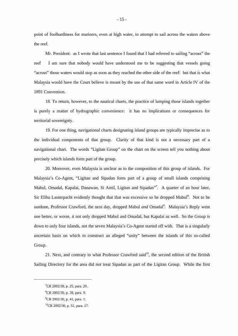
Audience publique
tenue le lundi 10 juin 2002, à 10 heures, au Palais de la Paix,
sous la présidence de M. Guillaume, président,
en l’affaire relative à la Souveraineté sur Pulau Ligitan et Pulau Sipadan(Indonésie/Malaisie)
________________
COMPTE RENDU________________
- 2 -
Present: President GuillaumeVice-President Shi
RanjevaHerczeghFleischhauerKoromaVereshchetinHigginsParra-ArangurenKooijmansRezekAl-KhasawnehBuergenthalElaraby
Judges ad hoc WeeramantryFranck
Registrar Couvreur

- 3 -
Présents : M. Guillaume, présidentM. Shi, vice-président
RanjevaHerczeghFleischhauerKoromaVereshchetin
Mme HigginsMM. Parra-Aranguren
KooijmansRezekAl-KhasawnehBuergenthalElaraby, juges
MM. WeeramantryFranck, juges ad hoc
M. Couvreur, greffier
- 4 -
The Government of the Republic of Indonesia is represented by:
H. E. Dr. N. Hassan Wirajuda, Minister for Foreign Affairs,
as Agent;
H. E. Mr. Abdul Irsan, Ambassador of Indonesia to the Kingdom of the Netherlands,
as Co-Agent;
Mr. Alain Pellet, Professor at the University of Paris X-Nanterre, Member and former Chairman ofthe International Law Commission,
Mr. Alfred H. A. Soons, Professor of Public International Law, Utrecht University,
Sir Arthur Watts, K.C.M.G., Q.C., Member of the English Bar, Member of the Institute ofInternational Law,
Mr. Rodman R. Bundy, avocat à la Cour d'appel de Paris, Member of the New York Bar, FrereCholmeley/Eversheds, Paris,
Ms Loretta Malintoppi, avocat à la Cour d'appel de Paris, Member of the Rome Bar, FrereCholmeley/Eversheds, Paris
as Counsel and Advocates;
Mr. Charles Claypoole, Solicitor of the Supreme Court of England and Wales, FrereCholmeley/Eversheds, Paris,
Mr. Mathias Forteau, Lecturer and Researcher at the University of Paris X-Nanterre, Researcher atCEDIN Paris X (Nanterre)
as Counsel;
Mr. Hasyim Saleh, Deputy Chief of Mission, Embassy of the Republic of Indonesia, The Hague,
Dr. Rachmat Soedibyo, Director General for Oil & Natural Resources, Department of Energy &Mining,
Major General S. N. Suwisma, Territorial Assistance to Chief of Staff for General Affairs,Indonesian Armed Forces Headquarters,
Mr. Donnilo Anwar, Director for International Treaties for Politics, Security & Territorial Affairs,Department of Foreign Affairs,
Mr. Eddy Pratomo, Director for International Treaties for Economic, Social & Cultural Affairs,Department of Foreign Affairs,
Mr. Bey M. Rana, Director for Territorial Defence, Department of Defence,

- 5 -
Le Gouvernement de la République d’Indonésie est représenté par :
S. Exc. M. Hassan Wirajuda, ministre des affaires étrangères,
comme agent;
S. Exc. M. Abdul Irsan, ambassadeur d’Indonésie aux Pays-Bas,
comme coagent;
M. Alain Pellet, professeur à l’Université de Paris X-Nanterre, membre et ancien président de laCommission du droit international,
M. Alfred H. A. Soons, professeur de droit international public à l’Université d’Utrecht,
Sir Arthur Watts, K.C.M.G., Q.C., membre du barreau anglais, membre de l’Institut de droitinternational,
M. Rodman R. Bundy, avocat à la cour d’appel de Paris, membre du barreau de New York, cabinetFrere Cholmeley/Eversheds, Paris,
Mme Loretta Malintoppi, avocat à la cour d’appel de Paris, membre du barreau de Rome, cabinetFrere Cholmeley/Eversheds, Paris,
comme conseils et avocats;
M. Charles Claypoole, Solicitor à la Cour suprême d’Angleterre et du Pays de Galles, cabinet FrereCholmeley/Eversheds, Paris,
M. Mathias Forteau, chargé de cours et chercheur à l’Université de Paris X-Nanterre, chercheur auau Centre de droit international de l’Université de Paris X-Nanterre (CEDIN),
comme conseils;
M. Hasyim Saleh, chef de mission adjoint à l’ambassade d’Indonésie à La Haye,
M. Rachmat Soedibyo, directeur général pour les ressources pétrolières et naturelles, ministère del’énergie et des mines,
Le général de division S. N. Suwisma, assistant pour les questions territoriales auprès du chefd’état-major pour les affaires générales, quartier général des forces armées indonésiennes,
M. Donnilo Anwar, directeur des traités internationaux pour les questions de politique, de sécuritéet de territoire au ministère des affaires étrangères,
M. Eddy Pratomo, directeur des traités internationaux pour les questions économiques, sociales etculturelles au ministère des affaires étrangères,
M. Bey M. Rana, directeur de la défense territoriale, ministère de la défense,

- 6 -
Mr. Suwarno, Director for Boundary Affairs, Department of Internal Affairs,
Mr. Subyianto, Director for Exploration & Exploitation, Department of Energy & Mining,
Mr. A. B. Lapian, Expert on Borneo History,
Mr. Kria Fahmi Pasaribu, Minister Counsellor, Embassy of the Republic of Indonesia, The Hague,
Mr. Moenir Ari Soenanda, Minister Counsellor, Embassy of the Republic of Indonesia, Paris,
Mr. Rachmat Budiman, Department of Foreign Affairs,
Mr. Abdul Havied Achmad, Head of District, East Kalimantan Province,
Mr. Adam Mulawarman T., Department of Foreign Affairs,
Mr. Ibnu Wahyutomo, Department of Foreign Affairs,
Capt. Wahyudi, Indonesian Armed Forces Headquarters,
Capt. Fanani Tedjakusuma, Indonesian Armed Forces Headquarters,
Group Capt. Arief Budiman, Survey & Mapping, Indonesian Armed Forces Headquarters,
Mr. Abdulkadir Jaelani, Second Secretary, Embassy of the Republic of Indonesia, The Hague,
Mr. Daniel T. Simandjuntak, Third Secretary, Embassy of the Republic of Indonesia, The Hague,
Mr. Soleman B. Ponto, Military Attaché, Embassy of the Republic of Indonesia, The Hague
Mr. Ishak Latuconsina, Member of the House of Representatives of the Republic of Indonesia,
Mr. Amris Hasan, Member of the House of Representatives of the Republic of Indonesia,
as Advisers;
Mr. Martin Pratt, International Boundaries Research Unit, University of Durham,
Mr. Robert C. Rizzutti, Senior Mapping Specialist, International Mapping Associates,
Mr. Thomas Frogh, Cartographer, International Mapping Associates
as Technical Advisers.
The Government of Malaysia is represented by:
H. E. Tan Sri Abdul Kadir Mohamad, Ambassador-at-Large, Ministry of Foreign Affairs
as Agent;

- 7 -
M. Suwarno, directeur des affaires frontalières, ministère de l’intérieur,
M. Subiyanto, directeur de l’exploration et de l’exploitation, ministère de l’énergie et des mines,
M. A. B. Lapian, expert sur l’histoire de Bornéo,
M. Kria Fahmi Pasaribu, ministre conseiller à l’ambassade d’Indonésie à La Haye,
M. Moenir Ari Soenanda, ministre conseiller à l’ambassade d’Indonésie à Paris,
M. Rachmat Budiman, ministère des affaires étrangères,
M. Abdul Havied Achmad, chef de district, province de Kalimantan est,
M. Adam Mulawarman T., ministère des affaires étrangères,
M. Ibnu Wahyutomo, ministère des affaires étrangères,
Le capitaine Wahyudi, quartier général des forces armées indonésiennes,
Le capitaine Fanani Tedjakusuma, quartier général des forces armées indonésiennes,
Le colonel Arief Budiman, département de la topographie et de la cartographie, quartier général desforces armées indonésiennes,
M. Abdulkadir Jaelani, deuxième secrétaire à l’ambassade d’Indonésie à La Haye,
M. Daniel T. Simandjuntak, troisième secrétaire à l’ambassade d’Indonésie à La Haye,
M. Soleman B. Ponto, attaché militaire à l’ambassade d’Indonésie à la Haye,
M. Ishak Latuconsina, Membre de la Chambre des Représentants de la République d’Indonésie,
M. Amris Hasan, Membre de la Chambre des Représentants de la République d’Indonésie,
comme conseillers;
M. Martin Pratt, unité de recherche sur les frontières internationales de l’Université de Duhram,
M. Robert C. Rizzutti, cartographe principal, International Mapping Associates,
M. Thomas Frogh, cartographe, International Mapping Associates,
comme conseillers techniques.
Le Gouvernement de la Malaisie est représenté par :
S. Exc. M. Tan Sri Abdul Kadir Mohamad, ambassadeur en mission extraordinaire, ministère desaffaires étrangères,
comme agent;

- 8 -
H. E. Dato’ Noor Farida Ariffin, Ambassador of Malaysia to the Kingdom of the Netherlands
as Co-Agent;
Sir Elihu Lauterpacht, Q.C., C.B.E., Honorary Professor of International Law, University ofCambridge, Member of the Institut de Droit International,
Mr. Jean-Pierre Cot, Emeritus Professor, University of Paris-I (Panthéon-Sorbonne), FormerMinister,
Mr. James Crawford, S.C., F.B.A., Whewell Professor of International Law, University ofCambridge, Member of the English and Australian Bars, Member of the Institute ofInternational Law,
Mr. Nico Schrijver, Professor of International Law, Free University, Amsterdam and Institute ofSocial Studies, The Hague; Member of the Permanent Court of Arbitration
as Counsel and Advocates;
Dato’ Zaitun Zawiyah Puteh, Solicitor-General of Malaysia,
Mrs. Halima Hj. Nawab Khan, Senior Legal Officer, Sabah State Attorney-General’s Chambers,
Mr. Athmat Hassan, Legal Officer, Sabah State Attorney-General’s Chambers,
Mrs. Farahana Rabidin, Federal Counsel, Attorney-General’s Chambers
as Counsel;
Datuk Dr. Nik Mohd. Zain Hj. Nik Yusof, Secretary General, Ministry of Land and Co-operativeDevelopment,
Datuk Jaafar Ismail, Director-General, National Security Division, Prime Minister’s Department,
H. E. Ambassador Hussin Nayan, Under-Secretary, Territorial and Maritime Affairs Division,Ministry of Foreign Affairs,
Mr. Ab. Rahim Hussin, Director, Maritime Security Policy, National Security Division, PrimeMinister’s Department,
Mr. Raja Aznam Nazrin, Principal Assistant Secretary, Territorial and Maritime Affairs Division,Ministry of Foreign Affairs,
Mr. Zulkifli Adnan, Counsellor of the Embassy of Malaysia in the Netherlands,
Ms Haznah Md. Hashim, Assistant Secretary, Territorial and Maritime Affairs Division, Ministryof Foreign Affairs,
Mr. Azfar Mohamad Mustafar, Assistant Secretary, Territorial and Maritime Affairs Division,Ministry of Foreign Affairs
as Advisers;

- 9 -
S. Exc. Mme Dato’ Noor Farida Ariffin, ambassadeur de la Malaisie auprès du Royaume desPays-Bas,
comme coagent;
Sir Elihu Lauterpacht, Q.C., C.B.E., professeur honoraire de droit international à l’Université deCambridge, membre de l’Institut de droit international,
M. Jean-Pierre Cot, professeur émérite à l’Université de Paris 1 (Panthéon-Sorbonne), ancienministre,
M. James Crawford, S.C., F.B.A., professeur de droit international à l'Université de Cambridge,titulaire de la chaire Whewell, membre des barreaux anglais et australien, membre de l’Institutde droit international,
M. Nico Schrijver, professeur de droit international à l’Université libre d’Amsterdam et à l’Institutd’études sociales de La Haye, membre de la Cour permanente d’arbitrage,
comme conseils et avocats;
Mme Dato’ Zaitun Zawiyah Puteh, Solicitor General de la Malaisie,
Mme Halima Hj. Nawab Khan, juriste principale au cabinet de l’Attorney-General de l’Etat duSabah,
M. Athmat Hassan, juriste au cabinet de l’Attorney-General de l’Etat du Sabah,
Mme Farahana Rabidin, conseil fédéral au cabinet de l’Attorney-General,
comme conseils;
M. Datuk Dr. Nik Mohd. Zain Hj. Nik Yusof, secrétaire général du ministère de l’aménagement duterritoire et du développement coopératif,
M. Datuk Jaafar Ismail, directeur général du département de la sécurité nationale, services dupremier ministre,
S. Exc. M. Hussin Nayan, ambassadeur, sous-secrétaire au département des affaires territoriales etmaritimes du ministère des affaires étrangères,
M. Ab. Rahim Hussin, directeur de la politique de sécurité maritime, département de la sécuriténationale, cabinet du premier ministre,
M. Raja Aznam Nazrin, secrétaire adjoint principal au département des affaires territoriales etmaritimes du ministère des affaires étrangères,
M. Zulkifli Adnan, conseiller de l’ambassade de la Malaisie aux Pays-Bas,
Mme Haznah Md. Hashim, secrétaire adjointe au département des affaires territoriales et maritimesdu ministère des affaires étrangères,
M. Azfar Mohamad Mustafar, secrétaire adjoint au département des affaires territoriales etmaritimes du ministère des affaires étrangères,
comme conseillers;

- 10 -
Mr. Hasan Jamil, Director of Survey, Geodetic Survey Division, Department of Survey andMapping,
Mr. Tan Ah Bah, Principal Assistant Director of Survey, Boundary Affairs, Department of Surveyand Mapping,
Mr. Hasnan Hussin, Senior Technical Assistant, Boundary Affairs, Department of Survey andMapping
as Technical Advisers.

- 11 -
M. Hasan Jamil, directeur de la topographie, service des levés géodésiques, département de latopographie et de la cartographie,
M. Tan Ah Bah, sous-directeur principal de la topographie, service des frontières, département dela topographie et de la cartographie,
M. Hasnan Hussin, assistant technique principal du service des frontières, département de latopographie et de la cartographie,
comme conseillers techniques.

- 12 -
Le PRESIDENT : Veuillez vous asseoir. La séance est ouverte. Nous sommes réunis
aujourd’hui pour entendre le second tour de plaidoiries de la République d’Indonésie.
M. Oda, pour des raisons dont il a dûment fait part à la Cour, ne peut être présent sur le
siège.
Je donne immédiatement la parole, au nom de la République d’Indonésie, à Sir Arthur Watts.
Sir Arthur WATTS: Thank you Mr. President.
1. Mr. President and Members of the Court. In beginning this second round in the
presentation of Indonesia’s arguments, I will respond to Malaysia’s arguments on two main issues.
First, the geography of the area in which Sipadan and Ligitan are located, and second, the 1891
Convention.
Sipadan and Ligitan: Geographic considerations
2. Sipadan, the Court will recall1 is heavily wooded; Ligitan2, in contrast, is mainly sand
with just a few low shrubs and trees. Neither island sustained a permanent resident population.
3. Malaysia attributes considerable weight to the closeness of the two islands to the
Malaysian mainland coast, and their relative distance from the Indonesian mainland coast of East
Kalimantan.
4. There is, however, nothing in international law which stipulates that an island (at least one
which is outside the territorial sea) which is closer to one State’s mainland than to another’s
therefore, and solely by reason of that greater proximity, belongs to that first State.
5. Proximity and sovereignty are completely separate matters. There is no doubt, for
example, that by virtue of the Anglo-United States Treaty of 1930 the Turtle Islands belonged to
the United States despite being over 150 nautical miles from Jolo (the nearest large Philippine
island) but only some 10 nautical miles from the Borneo mainland; the British Channel Islands are
under British sovereignty even though they are only 8 nautical miles from France but 60 from the
United Kingdom; there is no doubt also that numerous islands in the Aegean Sea within sight of
1Indonesia’s first round, judges’ folders, tab 3.2Ibid., tab 4.

- 13 -
Turkey’s Anatolian coast belong to Greece. There are many other similar examples, but those
three will suffice to make the point.
6. As to the geographical facts, the Parties are in broad agreement. Sipadan is some
15 nautical miles from the Malaysian mainland coast, and just over 40 nautical miles from the
Indonesian east coast of the island of Sebatik. For Ligitan those distances are respectively in the
region of 21 nautical miles and 57 nautical miles.
7. Compared with the distances involved in the other examples which I have just quoted,
they are neither so close to Malaysia, nor so distant from Indonesia, as to invite comment.
8. On the screen now, and at tab 1 in the judges’ folders, is a modern nautical chart of the
area: it was published by the United States Defense Mapping Agency, and corrected to
16 November 1985. Sipadan and Ligitan are identified, now in larger format. Sipadan is clearly
quite separate. The mass of moderate-depth soundings close to the coast contrasts sharply with the
isolation of Sipadan in much deeper water. If we go in even closer, we can see how sharply
Sipadan rises from the sea floor from depths of several hundred fathoms just a few hundred
metres offshore. In fact, Sipadan is of volcanic origin. It is the top of a steep sea-mountain some
600-700 m above the basic sea floor.
9. Moreover, Sipadan is clearly well to the south of the famous 4° 10’ N line. Both
Malaysia3 and Indonesia4 agree that its latitude is 4° 6’ 39” N.
10. Ligitan is very differently formed. It is an island part of a more extensive, largely
submerged, coral reef. It is distinct from mainland Malaysia, being separated from it by waters
running as deep as some 40 m, forming a clear navigational channel. I should here just explain that
the representation of the reef on the chart as a dark shaded area does not mean that that whole area
is, even at low tide, above water: it is not, and indeed for the most part it is at all times submerged
to a greater or lesser depth the shading on the chart is in effect simply a clear indication to
mariners to keep well away.
11. A word of explanation about the nomenclature adopted on the chart and on other
maps and charts of the area which may help.
3CR 2002/30, p. 24, para. 15.4Memorial of Indonesia, para. 2.8.

- 14 -
12. One matter may be quickly disposed of. The Parties agree that the feature marked on
many maps as “Ligitan Reefs”, well to the west of the island of Ligitan and of the so-called Ligitan
Group, is quite separate from Ligitan Island, and is not the subject of the present dispute5.
13. Second and again the Parties agree Ligitan itself is an island that is, an area of
land surrounded by water, and permanently above water at high tide. The Parties have given its
co-ordinates Malaysia puts it at 4° 09’ 48” N6. Both Parties agree that the island lies to the
south of the 4° 10’ N parallel of latitude.
14. Third, that island of Ligitan is near the southern tip of an approximately star-shaped coral
reef. Most of this reef is permanently under water, but at low tide parts of it are exposed up to
1.2 m. Most of this reef structure lies to the north of the Convention line at 4° 10’ N.
15. The situation can readily be illustrated. On the screen now is the chart showing the
features with which the Court is familiar. It shows the maritime features visible at low tide the
familiar star-shaped reef, the islands of Si Amil and Danawan at the northern end of the reef and
Ligitan near the southern end, and other relevant islands (Mabul, Kapalai, Sipadan and Omadal) in
the surrounding waters.
16. But now let us depict the rising waters at high tide, the sea level which is legally relevant
for islands. The result is on the screen now, and at tab 2 in the judges’ folders. The reef has
disappeared. Si Amil, Danawan and Ligitan are now seen in their true light separate islands,
with Si Amil and Danawan close together in the north, and Ligitan out on its own in the south,
isolated, and separated by some 9 nautical miles from the other two. Malaysia’s attempt to link
Ligitan with the others as if they constituted a single geographical unity, is now seen to be utterly
misplaced.
17. That brings me to my fourth point the practice whereby the islands in this reef area
may be referred to on charts and maps as “the Ligitan Group”. They are clearly important as a
navigational hazard for vessels sailing around the Semporna Peninsula, and there is really no other
way of signalling that than by regarding them as a group. It would obviously be unwise to the
5For Malaysia’s view in this sense, see CR 2002/30, p. 23, para. 10.6CR 2002/30, p. 24, para. 13. Indonesia places Ligitan at 4° 9’ 35”: Indonesia Memorial, p. 6, para. 2.8.
- 15 -
point of foolhardiness for mariners, even at high water, to attempt to sail across the waters above
the reef.
Mr. President: as I wrote that last sentence I found that I had referred to sailing “across” the
reef I am sure that nobody would have understood me to be suggesting that vessels going
“across” those waters would stop as soon as they reached the other side of the reef: but that is what
Malaysia would have the Court believe is meant by the use of that same word in Article IV of the
1891 Convention.
18. To return, however, to the nautical charts, the practice of lumping those islands together
is purely a matter of hydrographic convenience: it has no implications or consequences for
territorial sovereignty.
19. For one thing, navigational charts designating island groups are typically imprecise as to
the individual components of that group. Clarity of that kind is not a necessary part of a
navigational chart. The words “Ligitan Group” on the chart on the screen tell you nothing about
precisely which islands form part of the group.
20. Moreover, even Malaysia is unclear as to the composition of this group of islands. For
Malaysia’s Co-Agent, “Ligitan and Sipadan form part of a group of small islands comprising
Mabul, Omadal, Kapalai, Danawan, Si Amil, Ligitan and Sipadan”7. A quarter of an hour later,
Sir Elihu Lauterpacht evidently thought that that was excessive so he dropped Mabul8. Not to be
outdone, Professor Crawford, the next day, dropped Mabul and Omadal9. Malaysia’s Reply went
one better, or worse, it not only dropped Mabul and Omadal, but Kapalai as well. So the Group is
down to only four islands, not the seven Malaysia’s Co-Agent started off with. That is a singularly
uncertain basis on which to construct an alleged “unity” between the islands of this so-called
Group.
21. Next, and contrary to what Professor Crawford said10, the second edition of the British
Sailing Directory for the area did not treat Sipadan as part of the Ligitan Group. While the first
7CR 2002/30, p. 25, para. 20.8CR 2002/30, p. 28, para. 9.9CR 2002/30, p. 41, para. 1.10CR 2002/30, p. 51, para. 17.

- 16 -
edition did include Sipadan among the “Ligitan Islands”, by the time of the second edition of
1903 after the area had been more fully surveyed by the Egeria Sipadan was no longer
treated as part of the Ligitan Group but was listed separately.
22. Malaysia’s Co-Agent’s inclusion of Mabul and Omadal in the Group demonstrated the
implausibility of the “unity” idea for Mabul and Omadal, being within 9 miles from the coast,
were included within the 1878 grant by the Sultan of Sulu to Dent and van Overbeck, and thereby
became part of British North Borneo, while all the other islands in this so-called “united” group did
not. So much for the unity of this Group!
23. Malaysia’s contention that Sipadan and Ligitan are part of this “Ligitan Group”, and that
they are somehow a social, geographic and economic unity, is demonstrably wrong.
Let me take first Sipadan. It is far-fetched to consider it part of this Group at all: it simply is
not. It clearly is not a geographic unity with any of the other islands. The map on the screen
makes this clear. Sipadan is an entirely distinct and isolated marine feature, volcanic in origin,
and separate from Ligitan, the other neighbouring islands, and the Malaysian mainland. I also
draw the Court’s attention to map 20 in Malaysia’s Atlas. That map marks the Ligitan Group,
but places the international boundary between it and Sipadan: and that map is an official
Malaysian map, clearly separating Sipadan from the rest of the so-called Group.
Turning to Ligitan, Malaysia suggests that Ligitan was socially and economically a unit with
Danawan and Si Amil, since fishermen from those two islands visited Ligitan in the course of
their fishing activities. But such visits do not make separate territories a “unity”, with
implications for territorial sovereignty. These visits about which the Court has been
supplied with no detailed statistical evidence as to their social or economic significance
were at best no more than occasional, seasonal visits by private persons engaged in their private
pursuits. As the Tribunal said in its recent Award in the First Phase of the Eritrea/Yemen
arbitration11, “substantial evidence of individual fishing practices . . . is not indicative as such
of state activity supporting a claim for administration and control of the Islands”.
11Eritrea/Yemen Arbitration (First Phase), 9 October 1998, at para. 315.

- 17 -
Even more is this so when, as with Ligitan, the evidence is far from “substantial”, and the fishing
activities, such as they were, were only sporadic and seasonal.
24. Mr. President, this Malaysian “unity” argument is simply fanciful: it cannot be
sustained.
1891 Convention: object and purpose
25. Let me turn, Mr. President, to the 1891 Convention. Malaysia suggests that the
underlying purpose of the 1891 Convention was to settle the problem of the island of Sebatik12,
rather than, as Indonesia has shown, to reach a permanent settlement of all actual and future
territorial problems in the area.
26. There is, perhaps, not a great deal between the two Parties on this issue. Indonesia has
shown that both Parties clearly wanted to avoid actual and future disputes. The geographical
uncertainty over the vast inland areas of Borneo, the territorial uncertainty between the Sultans of
Boeloengan and Sulu, the repeated problems over, for example, flag-flying at Batoe Tinagat, the
activities of Dutch naval vessels at the island of Mabul all these sorts of things contained the
seeds of serious trouble.
27. It was to put a stop, once and for all, to such problems that the Parties wanted to reach a
settlement. But such a settlement affected the whole Tidoeng-Semporna region of their mutual
rivalry. It was then clear that in that region there was a major problem over Sebatik, which had to
be settled as part of the same package. So far as concerns this present case, Article IV of the
Convention encapsulates, within its single sentence, both aspects of what the Parties wanted to
achieve.
1891 Convention: travaux préparatoires
28. Turning to the travaux préparatoires, Malaysia has said that unilateral statements by one
of the Parties in the course of negotiation are not part of the travaux préparatoires13. But this must
be wrong, for the travaux will most often consist of such unilateral statements by each negotiating
12CR 2002/31, p. 17, para. 21 (Mr. Cot).13CR 2002/31, p. 24, para. 56 (Mr. Cot).

- 18 -
party; and they are relevant, for they throw light on what the Parties had in mind in concluding the
treaty.
29. But more than that, there is the question whether recourse to the travaux préparatoires is
admissible at all. Such recourse is permissible when the application of the normal rules of treaty
interpretation leaves the meaning ambiguous or obscure. If the parties have clearly set out in the
treaty the outcome of their negotiations, one must not subsequently unravel their agreement by
recourse to the travaux: they agreed whatever it was that they agreed, for their own good reasons,
which may or not have been evident in the record of their meetings.
30. In Indonesia’s view, Article IV is, by the application of the normal rules of treaty
interpretation set out in Article 31 of the Vienna Convention on the Law of Treaties, perfectly
clear. Whatever the reasons might have been, the parties did a deal. All we know is that they
agreed Article IV which (especially in contrast to Article III, and in line with the Convention’s
object and purpose) expressly required the line to “be continued eastward along” the 4° 10’ N
parallel of latitude that is exactly what it said, and what the parties must be taken to have meant
in agreeing to it.
31. Professor Cot then had a lot of fun with what he tried to laugh off as
Professor Alain Potter’s cartographic magic show: it was all an illusion, Professor Cot said14. So
entranced was he by the magic, however, that he missed the real show which was on stage. He was
at pains to try to show that a particular British proposal the one, the Court will recall, with the
line going south-east between Sebatik and Nanoekan and then due east along the 4° parallel to
point D had never been put to the Dutch.
32. But that missed the point completely. Indonesia was not trying to establish that the
Dutch had in the negotiations seen and agreed to such a line, as put forward by the British. The
point was rather that, contrary to the position taken by Malaysia, the British themselves were not
thinking solely of a line on land, but had in mind also a line going out eastwards to sea. For that
purpose, British proposals and whether or not conveyed to the Dutch are directly relevant:
they show beyond question that some significant degree of maritime extent for the line eventually
14CR 2002/31, p. 27, para. 66.

- 19 -
to be agreed was in the minds of the British. And that matches what we also clearly know of the
Dutch view, since we have, in the Explanatory Memorandum map, their understanding of the
outcome. And it is probably no coincidence that the point D line which the British had in mind
extended eastwards to almost exactly the same distance as did the eastward line on the Dutch
Explanatory Memorandum map in both cases the line goes about 10 nautical miles beyond
Sipadan.
33. We know for the record clearly shows that both sides were contemplating different
ideas and lines as ways of settling the issues before them. We know too that the two sides were
exchanging proposals, sometimes formally at meetings, sometimes less formally during other
meetings or in correspondence. We know that the British did put to the Dutch a proposal for a line
going between Sebatik and Nanoekan. We know that the British themselves contemplated the
more complete line going out to point D, and that that line was framed in British internal papers as
a proposal to be used in the negotiations. And nor does “point D” proposal stand alone. It is as
Professor Pellet showed15 part of a pattern of similar maps, just as one would expect in a
negotiation.
34. All these things are clear from the record. And Indonesia relies on them to show one
thing namely, that during the negotiations both parties, and in particular the British themselves,
had in mind a line extending out to sea and not just limited to the mainland of Borneo. That single
fact is amply demonstrated by the record and it is totally inconsistent with Malaysia’s arguments
that the parties were only thinking of a land-based settlement.
1891 Convention
35. As for the 1891 Convention itself, Malaysia briefly discussed the meaning of the word
“across”. In its Memorial and Counter-Memorial16 Indonesia set out its, different, view as to the
meaning of that word, as involving movement over and beyond the object being crossed. And as I
showed a few minutes ago, that is the perfectly natural meaning of the word as I happened to use it
in relation to sailing across the waters above a reef.
15CR 2002/27, pp. 53-55, paras. 51-59.16Counter-Memorial of Indonesia, para. 5.43 (h); Counter-Memorial of Indonesia, paras. 5.22-5.23.

- 20 -
36. What was most significant about Professor Cot’s discussion of the word “across” was
that he took it on its own, without reference to its context. That word accompanies the phrase
requiring the agreed Convention line to be “continued eastward along”. That phrase, in the main
clause of the sentence, gives the context within which the word “across” is to be understood.
“Across” is in no way inconsistent with the natural meaning of the treaty requirement that the line
“be continued eastward along” the agreed parallel: indeed it confirms it.
37. On 6 June Sir Elihu Lauterpacht posed a number of questions, to which he said that there
was no answer which supported Indonesia’s case17. On the contrary, there are answers to his
questions simple and straightforward answers and all of them do support Indonesia’s case.
Let me deal briefly with his first eight questions, which are those which relate directly to the
1891 Convention.
38. His first question noted that the Convention related to the boundary “in” the island of
Borneo, and he asked therefore why it should extend out to sea well to the east of the land areas
claimed by the Netherlands. The answer is threefold: first, it is quite usual for major land areas to
be referred to as including their associated islands, as Indonesia explained in its
Counter-Memorial18; second, the line needed to extend out to sea because there were potential
disputes there as well as on land witness the visit of the Admiraal van Kinsbergen to the island
of Mabul , at the time a sufficiently recent reminder of a potential source of trouble; third, the
Dutch claim line on land was irrelevant to its claims at sea and certainly did not mean that there
were no such claims any more than the equal absence of British claim lines at sea meant that the
British had no claims to islands. Both States had maritime interests and insular pretensions, and
they had to be settled if the aim of a comprehensive avoidance of future disputes was to be
achieved.
39. Second, Sir Elihu asked how the boundary came to extend more than 50 miles out to sea,
and pointed to the word “across” as not itself having that effect. Answer: “across” is perfectly
consistent with that consequence, particularly when read with the immediately preceding words
“continued eastward along”. That is the treaty basis for extending the line seawards indeed, it is
17CR 2002/30, pp. 30-37, paras. 15-25.18Counter-Memorial of Indonesia, para. 5.14 (e).

- 21 -
the treaty requirement for doing so. It might have been expressed differently: so might almost any
treaty provision. But it wasn’t, and the way it was expressed in Article IV was entirely sufficient to
achieve the intended purpose of continuing along the agreed parallel.
40. Third, he asked why there should be any mention of a line running “across Sebatik” if
not to indicate that those words indicated a limitation on the extent of the line, and not a
continuation of it. Answer: the need for a reference to the line crossing Sebatik was to make it
clear that the other options considered in the negotiations of giving Sebatik wholly to one side
or the other were rejected19. Just as the emphasis on the attribution of the northern part of the
island to the British North Borneo Company “unreservedly” similarly made it clear as Malaysia
has itself said20 that the options of some kind of lease-back arrangement or servitude involving
rights of transport were also being rejected.
41. Fourth, he asked a composite series of questions about the Explanatory Memorandum
map: (a) why should it be allowed to vary the text of the Convention? (b) can one party put its
own interpretation on a treaty? (c) how many people in Great Britain would have focused on the
map? Answers:
As to (a): the map did not “vary” the text, it illustrated the Dutch Government’s view of what
it meant a view entirely consistent with the terms of Article IV, “continued eastward along”.
As to (b): one party can indeed put its own interpretation on a treaty that is what in fact
usually happens. That view does not, of course, taken on its own, commit the other party; a
unilateral interpretation only commits the other party if it had in some way agreed to it or
acquiesced in it which is precisely what happened here, as I will show in a moment.
As to (c): I will answer this more fully in a moment as well, but for now I will just say that we
know that Britain’s diplomatic representative in The Hague, for one, focused on the map he
drew particular attention to it.
42. Fifth, Sir Elihu asked why, if the line was intended to be an allocation line, there was no
later consistency in the maps. Answer: but there was a large measure of consistency in later maps,
many showing but only after 1891 a line following the 1891 Convention line out to sea.
19See CR 2002/28, p. 17, para. 37 (Sir Arthur Watts).20CR 2002/31, p. 28, para. 69 (Mr. Cot).

- 22 -
What other basis could there have been after 1891 for depicting such a line? That is a question
which Malaysia has not answered, even in relation to such lines appearing on Malaysia’s own
official maps. As Ms Malintoppi will explain, any line out at sea along the 4° 10’ N parallel
undermines Malaysia’s case; repeated lines fatally undermine it; and repeated lines on Malaysia’s
own maps take Malaysia’s case beyond all hope of resurrection.
43. Sixth, Sir Elihu noted the apparent confusion between a “boundary” line and an
“allocation” line. Answer: read Indonesia’s Counter-Memorial21. There Indonesia showed that a
line is often termed a “boundary” line even though it is in fact what may be called a line of
attribution.
44. Here I might interpolate a word about Professor Cot’s disquisition on lines of
attribution22 four words in fact: “elegant”, “erudite”, “academic”, and “unpersuasive”.
Much of what he said was in accord with Indonesia’s view of the matter. Thus, of the two
characteristic traits to which he drew attention, the first that lines of attribution are not lines of
maritime delimitation causes Indonesia no problems. Such lines are indeed mere cartographic
devices.
45. But it is wrong to go on to argue that because a treaty uses the term “boundary” it is
necessarily prescribing a line which separates adjacent sovereign territories, and therefore cannot
be establishing a line of attribution. “Boundary” is used in treaties which expressly allocate islands
by way of lines of attribution at sea: the Anglo-United States Treaty of 1930 is but the simplest of
examples23.
46. What matters is the substantive effect of the line, not its name: substance is
determinative, not form. If a line in fact separates adjacent areas subject to a sovereignty of
different States, it is indeed not a line of attribution but what one might call a frontier stricto sensu:
but if a line even perhaps a different part of the same line delineates areas which are not
themselves subject to State sovereignty but which contain territories whose allocation is determined
by their relationship to the line, then the line is an allocation line.
21Counter-Memorial of Indonesia, para. 5.12.22CR 2002/31, pp. 19-24, paras. 28-54.23See Counter-Memorial of Indonesia, para. 5.12.

- 23 -
47. Moreover, it is a caricature to suggest, as did Professor Cot24, that Great Britain and the
Netherlands were, in 1891, agreeing to a line of attribution only in the abstract, and in ignorance of
whether there were any islands to share. They knew, as the record, and contemporary cartography,
make abundantly clear, that there were many islands out to sea, eastwards of Sebatik. That is
precisely why it was necessary to deal with them one way or the other as they did, in Article IV.
48. Professor Cot’s second “characteristic trait” was that treaties establishing attribution lines
expressly state that islands on either side of the line belong to the designated State. There are three
responses to this. First, to show that that is what States often, even usually, do does not establish
that as a matter of law they cannot achieve their purpose in some other way. Second, it is clear
from Professor Cot’s examples that there are various ways, as a matter of treaty language, of
achieving the desired result. Third, the 1891 Convention exemplifies such a variation: it
establishes a boundary not a term with exclusively territorial connotations between the
Netherlands and British possessions again not a term with exclusively territorial connotations
by adopting a line which, in relevant part, is required to “be continued eastward along” an agreed
parallel of latitude eastwards, of course, being known to the parties as being out to the open sea.
The parties might have chosen to achieve their desired result in many different ways: but they
chose the way they did, and that way was entirely adequate to achieve their purpose.
49. To return now to Sir Elihu’s questions, in his seventh he noted that, as regards the
distinction between Articles III and IV, there was an identifiable place on the west coast
Tandjong Datoe “to” which Article III could say that the line ran, while there was no such
named town on the east coast of Sebatik. Answer: you do not need a town: it would have been
very easy to say “follow the 4° 10’ N parallel until it meets the east coast of the island” which,
in fact, is exactly what the parties did in Article I in identifying the starting point for the line:
“shall start from 4° 10’ N latitude on the east coast of Borneo”. But they carefully did not say that
in Article IV, because that was, in that context, not what they intended.
50. Sir Elihu’s eighth question and the last which I shall dispose of was why the
1913 Joint Commission Report, incorporated into the 1915 Agreement, made no mention of any
24CR 2002/31, p. 21, para. 39.

- 24 -
extension of the boundary eastwards of the pillar on the east coast of Sebatik. I shall deal with the
1915 and 1928 Agreements more fully in a moment, but the immediate answer is that the 1913
Commission dealt only with part of the boundary, and was essentially a demarcation exercise. You
cannot demarcate at sea in anything but the shallowest of waters; there is no need to demarcate at
sea where a line is delimited as simply following a parallel of latitude that is all you need in
order to fix the actual course of the line on the surface; and in any case, one does not demarcate a
line of attribution.
51. Let me turn now to another of Malaysia’s arguments that Great Britain could not, by
the 1891 Convention, have given Sipadan and Ligitan to the Netherlands because they were not
Britain’s to give. The argument is both unrealistic and misconceived.
52. It ignores the extent to which the situation at that time was wholly uncertain. It was that
very uncertainty which had prompted the conclusion of the 1891 Convention in the first place.
Boeloengan’s and Sulu’s domains were a matter for sharp differences; in any event Sulu was now
out of the picture; and Spain was not in the least interested in what was going on south and west of
the Sulu Archipelago. The record in this case shows a number of instances of the BNBC,
admittedly without having any title, taking action in relation to various of the offshore islands25.
The British proposal for a line out to sea south of Sebatik and following the 4° N parallel of latitude
showed scant regard for who (other than the Netherlands) might be interested in the affected
waters. In fact, both parties assumed that they were in practice the only relevant actors in the area,
and that British proposal clearly showed that Great Britain had an interest in the waters and their
islands east of Sebatik.
53. The Malaysian argument is misconceived because, as Indonesia has already pointed out
in its written pleadings26, the 1891 Convention was not a treaty of cession. Neither party was
“giving” its territory to the other, and this was as true of the Netherlands for possessions north of
the Convention line as it was for Great Britain’s for possessions south of it.
25Thus “The Sulu grant of 1878 did not extend to islands (such as Sipadan and Ligitan) which were more than
nine nautical miles offshore, but in fact these islands were administered by the BNBC”: Counter-Memorial of Malaysia,p. 52, para. 3.1.
26Reply of Indonesia, para. 1.13.
- 25 -
54. The circumstances leading up to the Convention precluded any interpretation of its
provisions as involving cessions. The Convention was as it was precisely because the parties could
not agree on the extent of their respective territories. It would therefore have been impossible for
them to have reached an agreement whereby either of them could have accepted a transfer of
territory to itself from the other party, for that would have been to recognize that that other party
itself had title to the territory in question, and that was the very thing they could not agree upon.
55. Nothing in the circumstances leading up to the Convention suggests that either of the
parties would have contemplated receiving ceded possessions from the other; nothing in the
Convention itself suggests that cession of territory was in the parties’ minds; nothing in the
language of the Convention reflects the usual language of cessions of territory; and nothing after
the Convention represented the normal tradition of the possessions ceded from the one sovereign to
the other.
56. Rather, the Convention simply prescribed a line forming the boundary between the
parties’ respective possessions that is exactly how the starting point for the boundary is
described in Article I. As between the two contracting States, the Netherlands was agreeing that it
had no possessions north of the agreed line and that for its part it recognized that possessions to the
north were British; similarly, Great Britain was agreeing that it had no possessions to the south of
the line, and that for its part it accepted that those southern possessions were Dutch.
57. Whether any of those possessions belonged to any other State was an entirely different
matter. It is in fact clear that, as I have said, both parties were satisfied that they were at the time
the only two competing States in the region: Sulu had left the scene, and Spain had no interest in
the islands to the south and east of the Sulu Archipelago. If any third party chose to come forward
at a later date, it would, of course, have regarded the Anglo-Dutch Convention of 1891 as res inter
alios acta, and the matter would have had to have been resolved on its merits. But that was for
later (if at all), and would be a matter to be dealt with either between the British and that third
party, or between the Dutch and that third party: but, as between the Dutch and the British, the
matter was settled neither had any claim to possessions on the other’s side of the agreed line.

- 26 -
58. In fact, that is the key to the whole situation. Malaysia hypothesizes some third party
title holder. But who? As Mr. Bundy showed last week27, it could not have been Sulu, because the
Sultan of Sulu had by then given up its interests to the British North Borneo Company or to Spain;
not Spain, which by then had no interest in the islands in that area; not the United States, which
had not yet come on the scene. Yet they were not terrae nullius, for Malaysia is most insistent on
that28. That Malaysia’s argument leads to such an impasse demonstrates that the argument itself is
flawed.
59. What we have in the 1891 Convention is an agreement by which, inter alia, Great Britain
agreed with the Netherlands that Great Britain had no possessions south of the line. Then by the
1930 Anglo-United States Treaty we have the culmination of Malaysia’s alternative line of
argument whereby title, having passed eventually to the United States — so they say — was then
passed on to Great Britain: be that as it may — and Indonesia does not accept it — it is
nevertheless clear that as between the United States and Great Britain, the United States accepted
that it had no claims to the islands and left them to Britain but that acknowledgment can avail
Malaysia nothing, for it would immediately bring into play the 1891 Anglo-Dutch agreement that
Great Britain had no possessions south of the agreed line.
60. In short, in this case between the successors in title to the Netherlands and Great Britain,
Malaysia, as successor to Great Britain, cannot, as against the Netherlands, or now Indonesia, rely
on the 1930 Anglo-United States Treaty to provide a title which can prevail over the
1891 Anglo-Dutch Convention: that 1930 Convention was, for the Netherlands, and now
Indonesia, res inter alios acta.
1891 Convention: Explanatory Memorandum map
61. Let me turn to Malaysia’s treatment of the Explanatory Memorandum map. Malaysia
has sought to challenge the evidentiary value of that map in two ways first, by denigrating it as
solely a “unilateral” or “internal” Dutch map; and second, by seeking to show that the British
Government never acquiesced in it.
27CR 2002/28, p. 44, paras. 1 ff.28Memorial of Malaysia, para. 3.1. Indonesia agrees: Counter-Memorial of Indonesia, para. 2.14.

- 27 -
62. Indonesia accepts that the Explanatory Memorandum map was, initially, a Dutch map
rather than an agreed map, and that it was prepared by the Dutch Government for the domestic
purpose of securing the ratification of the 1891 Convention. But those two considerations do not
deprive the map of its singular importance in this case.
63. The map is a clear indication of the Dutch Government’s understanding of the effect of
Article IV of the Convention.
64. The map was contemporaneous with the Convention: it was placed before the Dutch
States-General just one month after the Convention’s signature.
65. The map was an official publication of the Dutch Government.
66. The map was no secret map, prepared only for internal purposes of the Dutch
administration: it was publicly available.
67. The map showed what the Dutch Government understood Article IV to mean.
68. The map’s purpose was to assist in securing the ratification of the 1891 Convention, the
approval of the States-General being an express requirement of Article VIII of the Convention.
69. This was a map of obviously international significance, even if its preparation by the
Dutch Government was inevitably, initially, a unilateral act of that Government. But that does not
deprive it of its international value.
70. Things might have been different had the map been contested by the British Government,
but that is the whole point the British Government did not dissent from the map. It acquiesced
in the map, and in particular in its depiction of the agreed line as one extending out to sea beyond
the coast of Sebatik.
71. Malaysia has argued that the map was not officially communicated to the British
Government by the Dutch Government, and that therefore knowledge of the map cannot be
officially attributed to the British Government. Mr. President, this takes pedantry and formalism to
the level of the absurd.

- 28 -
72. First, the Court has already determined the standard in this sort of situation. Last week29
Indonesia drew attention to the so-called Livre Jaune map which featured in the Frontier Dispute
(Libyan Arab Jamahiriya/Chad) case30. As explained then,
there the Court was faced with a French map which differed from the text of the Anglo-French
Declaration which it illustrated: here we have a map which is consistent with the treaty text in
question;
there, as here, the map was prepared by one party to the treaty in question;
there, as here, it was both a contemporary and an official map;
there, as here, the map was published and submitted to Parliament as part of the ratification
process;
there, as here, the map was public knowledge;
but there, unlike here, the Court gave no indication that the map was actually known to the
British Government: the Court seems to have regarded it as sufficient that the map was public
knowledge, and that the British Government must be taken to have shared in that knowledge.
73. In that case the Court concluded that the French map constituted an authentic
interpretation of the Anglo-French Declaration then in question. For the reasons just given the
circumstances surrounding the Explanatory Memorandum map present an a fortiori case.
74. In the present case, the British Government’s actual knowledge of the Explanatory
Memorandum map can be demonstrated beyond any doubt and quite apart from any knowledge
it may be presumed to have had simply because of the general public awareness of the map.
75. Thus, first, the British Legation in The Hague followed the ratification debates in the
Dutch Parliament very carefully. Those debates were regularly reported back to the Foreign
Office.
76. Second, we know that the Minister Sir Horace Rumbold specifically knew of the
map. He sent two copies of it back to London with his despatch of 26 January 189231, with which
he also sent back the Explanatory Memorandum. And he singled out the map for special
29CR 2002/28, p. 23, para. 67.30I.C.J. Reports 1994, p. 6.31Reply of Indonesia, Vol. 2, Ann. 3.

- 29 -
mention it was, he said, the only “interesting thing” in the papers he was sending back. He
clearly knew what it was, and what it depicted.
77. Pausing there for a moment, it is amply sufficient to show that knowledge is attributed to
a State through the knowledge of the head of its diplomatic mission in a foreign State, certainly
where that knowledge was acquired in the course of his official functions and related to a matter of
direct concern to the relations between the two States. Diplomatic missions are the official
representative arms of their States in foreign States. What they do, what they know, is done by,
and is known to, the States they represent.
78. But in our present case, the British Legation’s knowledge goes further than that. As
Professor Pellet showed last week32, and as Indonesia has set out in its written pleadings33,
Sir Horace Rumbold was an active participant and channel for communication in the negotiations
leading up to the 1891 Convention. He knew what was going on. And when he saw a Dutch map
which depicted a line which Malaysia would have the Court believe was not what Article IV
prescribed, he simply so Malaysia suggests sent it back to London with the comment that the
map was “interesting”.
79. That simply is not credible. Had the line not been correct, he would, in sending the map
back to the Foreign Office, have made some comment to that effect. But no, he just said the map
was “interesting”. He will have known that, as Indonesia has maintained throughout these
proceedings, it depicted the agreed line perfectly correctly, as following the Convention line out to
sea along the 4° 10’ N parallel of latitude.
80. Quite apart from Sir Horace Rumbold’s conduct, it is clear that the map was known not
just to the British diplomatic mission in The Hague, but also to the Foreign Office in London.
Indonesia has submitted the signed Foreign Office slip acknowledging that the maps were
received34. The Foreign Office kept the map in its archives, along with the Convention itself. And
in due course those Foreign Office archives were transferred to the Public Record Office, the
official depository for State archives.
32CR 2002/27, p. 52.33Memorial of Indonesia, paras. 5.7 and 5.2.34Reply of Indonesia, Ann. 3.

- 30 -
81. Clearly, therefore,
as a result of public knowledge of the Explanatory Memorandum map, and
as a result of the knowledge of it on the part of the British Legation in The Hague and of the
head of that diplomatic mission in particular, Sir Horace Rumbold, and
as a result of the Foreign Office’s knowledge of the map, and its placement in the United
Kingdom’s official archives,
there can be no doubt that direct and contemporaneous knowledge of the map is attributable to the
British Government.
82. Faced with that knowledge, the British Government did nothing. There is no record of
any dissent from the map, whether in the Foreign Office, or in the Legation in The Hague.
83. The conclusion is irresistible. The map was correct. The British Government knew it
was correct. It saw no need to protest, because it accepted the correctness of the map. It thereby
acknowledged that Article IV of the 1891 Convention prescribed a line extending out to sea beyond
Sebatik, and that as a result offshore islands to the north of that line were British, and those to the
south were Dutch. That was what the deal had been; and that was what the Convention
provided and what the Explanatory Memorandum map correctly depicted.
1915 and 1928 Agreements
84. Malaysia has contrasted the Explanatory Memorandum map unfavourably with the map
annexed to the later, 1915, Anglo-Dutch Agreement. Since that later map was agreed by both
parties, and depicted a boundary which stopped at the eastern coast of the island of Sebatik,
Malaysia argues that it shows that the 1891 Convention line also stopped at that coast.
85. But that argument involves an astounding non sequitur.
86. As Indonesia explained last week, the two later Anglo-Dutch Agreements which
determined with greater precision parts of the 1891 line were only concerned with limited sectors
of that line. The sketch-map which was shown last week is on the screen again now, it is at tab 3 in
the folders. It illustrates the very limited areas covered by the 1915 and 1928 Agreements only
about 20 per cent of the total.
- 31 -
87. While that 20 per cent of the Convention line may indeed have been superseded or
improved by the terms and maps of the two later conventions, in no way can it be argued
that the remaining 80 per cent of the Convention line was wiped away. That remaining 80 per cent
remains as it originally was, that is, as specified in the Convention. That remaining 80 per cent of
the Convention line, whether to the east or the west of that limited stretch, was simply not touched
or affected by those Agreements.
88. While the stretch of boundary covered by the 1915 Agreement may have started (or
ended, depending which way you are going), at the east coast of Sebatik, there is nothing in the text
to suggest that the Convention line started (or ended) there.
89. The two Governments had appointed Commissioners to delimit the boundary. The
Commissioners prepared a Joint Report, with an accompanying map, and signed it on
17 February 1913. The two Governments agreed in the 1915 Agreement35 to “confirm the
aforesaid Joint Report and map”. They then, in the Agreement, set out the text of the Joint Report.
90. The immediately relevant provisions are the introductory words of paragraph 3, and its
first two subparagraphs. They are on the screen now, and at tab 4 in the judges’ folders. They
show that the Commissioners have determined the boundary as “taking the following course”,
which they go on to describe as follows:
“(1) Traversing the island of Sibetik, the frontier line follows the parallel of 4° 10’north latitude, as already fixed by Article 4 of the Boundary Treaty and markedon the east and west coasts by boundary pillars.
(2) Starting from the boundary pillar on the west coast of the island of Sibetik, theboundary follows the parallel of 4° 10’ north latitude westward until . . .”
and then the text describes its further inland course.
91. What is apparent from this language is that the Commissioners simply noted the passage
of the line across the island of Sebatik, as something settled previously it had been “already
fixed” by Article IV and “marked on the east and west coasts by boundary pillars”. Their use of
the word “Traversing” was simply a reflection of the fact that Article IV itself said that the line
went “across” Sebatik.
35Memorial of Indonesia, Vol. 3, Ann. 118.

- 32 -
92. The Commissioners’ own line did not start from that east coast. Their line started from
the pillar on the west coast of Sebatik: the Report says so “Starting from the boundary pillar on
the west coast of the island of Sebitik”.
93. Moreover, there was no need, or even physical possibility, for the Commissioners to do
anything about the eastward extension of the Convention line out to sea. Their task was, in modern
usage, to demarcate the boundary they used natural features, coupled with four pillars; they
explain that in paragraph 2 of the Report. But no demarcation can be carried out at sea, a parallel
of latitude at sea does not need demarcating, and in any case, as I have said, a line of attribution
calls for no demarcation at all.
94. In short, their task did not require them to look eastwards: their job was demarcation
westwards from the stretch previously demarcated, which had ended at the western pillar on the
island of Sebatik.
95. Mr. President, that brings me to the end of what I have to say on those two matters. I
now thank the Court for its courtesy and patience, and may I invite you to call upon
Professor Soons to continue this second round presentation of Indonesia’s case.
Le PRESIDENT : Je vous remercie, sir Arthur. Je donne maintenant la parole au professeur
Alfred Soons.
Mr. SOONS: Thank you, Mr. President. Mr. President, Members of the Court,
TERRITORY OF SULTAN OF BOELOENGAN
DISPLAYS OF SOVEREIGNTY BY THE NETHERLANDS
INTERNAL DUTCH DELIBERATIONS ON DELIMITATION OF THE TERRITORIAL SEAOFF SEBATIK ISLAND
1. It will be my task, in this second round of Indonesia’s presentation, to briefly deal with
three issues addressed by counsel for Malaysia during the first round: (1) Indonesia’s position with
respect to the title to Sipadan and Ligitan obtained through the Sultan of Boeloengan; (2) the
Dutch exercises of sovereignty over Sipadan and Ligitan; and (3) the significance, for our case, of
the internal Dutch deliberations in the 1920s on the delimitation of the territorial sea off Sebatik
Island.

- 33 -
I. The Netherlands acquired title to Sipadan and Ligitanthrough the Sultan of Boeloengan
2. Counsel for Malaysia raised questions as to what Indonesia’s position is with respect to
claims to Pulau Sipadan and Pulau Ligitan as part of the territory of the Sultan of Boeloengan. My
friend and colleague, Professor Schrijver, seemed to discern shifts in Indonesia’s position on this
issue (see CR 2002/30, p. 38), but that is not the case. I can be very short here, also in the light of
Sir Arthur Watts’s presentation just now. Indonesia clearly maintains the position it has taken
throughout the written pleadings, and as also expressed during the first round by Professor Pellet
and myself (CR 2002/27, pp. 31-34 and CR 2002/28, pp. 44-50). And that is that through contracts
with the Sultan of Boeloengan, the Netherlands acquired title to Sipadan and Ligitan. However, as
was common in this region at the time, the precise extent of the Sultanate’s possessions was
unclear. As a result, soon after the BNBC had established itself in North Borneo, it became
apparent that the concession area the Company claimed and the territory claimed by Boeloengan
overlapped. The area of overlap has been fully explained by Professor Pellet last Monday.
3. The very reason for the Dutch and the British to start the negotiations which led to the
conclusion of the 1891 Convention was the uncertainty flowing from this overlap of claimed
territories, and the 1891 Convention once and for all, and comprehensively, put an end to this
uncertainty.
4. Malaysia states that there is no evidence at all through contemporary documents of Dutch
claims specifically to the islands of Sipadan and Ligitan (CR 2002/30, p. 42). Mr. President, I
submit that that is not a very helpful comment. Also the British did not mention during the
negotiations specifically islands claimed by the BNBC apart, of course, from Sebatik Island. It
was understood by both States that offshore islands were included in the two claims involved and
would have to be part of the settlement to be reached in the negotiations. I will come back to this
issue of offshore islands claimed by the Dutch in a moment.
5. Finally, on Boeloengan, Professor Schrijver continues to refer to Boeloengan as a purely
land-based Sultanate. We have already shown that this is simply incorrect, but I do not want to
repeat myself. The coastal population of Boeloengan did participate in fishing and maritime
trading. The Bugis, originally from Sulawesi but fully assimilated in the local communities, were

- 34 -
renowned and still are for their seafaring skills. I refer to our written pleadings and to what I
said in the first round.
II. Displays of sovereignty over Sipadan and Ligitan by the Netherlands
(a) Before 1891
6. Mr. President, Members of the Court, I now turn to the more important issue of displays of
sovereignty over the two islands by the Netherlands. According to counsel for Malaysia, there was
no exercise of jurisdiction by the Netherlands over Sipadan and Ligitan prior to 1891 (CR 2002/30,
p. 45). However, the activities of the Admiraal van Kinsbergen in 1876 indicate something
different. As mentioned earlier, on 10 June 1876 this warship, patrolling the area, landed an armed
sloop on Maboel Island. It took a proa from the island, which it returned the following day
(Counter-Memorial of Indonesia, Vol. 2, Ann. 12). This incident proves, first of all, that, contrary
to what Malaysia argues (Mr. Schrijver, CR 2002/30, pp. 43-44; Mr. Crawford, CR 2002/30,
p. 54), the Dutch were present east of Batoe Tinagat, as can be seen on the map now shown on the
screen; it is in the judges’ folders under tab 5. The island of Maboel is at the same latitude as
Batoe Tinagat: 4º 14’ N latitude. It is approximately 39 nautical miles east of Batoe Tinagat.
Thus, the Dutch did exercise territorial jurisdiction east of Batoe Tinagat.
7. Secondly, it shows a Dutch claim to offshore islands in St. Lucia Bay the northern
shore of St. Lucia Bay that is a Dutch claim to an island close to Sipadan, but 8 nautical miles to
the north of that island. If this incident proves anything, it is in any case that there were claims to
offshore islands in the area which were a potential source of disputes that needed to be resolved.
8. The Admiraal van Kinsbergen was not the only Dutch warship patrolling this part of the
Dutch East Indies. Since 1879 the Dutch permanently had a cruiser stationed near the mouth of the
Tawau River, operating from Tarakan, specifically as a reaction to BNBC activities potentially
encroaching upon Dutch territory.
9. In 1883 there was another incident involving Maboel Island, to which Indonesia has
referred in its Reply (Reply of Indonesia, para. 1.41, and Reply of Indonesia, Vol. 2, Ann. 2). A
copy of the relevant document is in the judges’ folders under tab 6. In October of 1883 an
unnamed Dutch warship was reported by BNBC officials as having been engaged in policing the

- 35 -
waters very close to Maboel, where she even seized a native boat. The correspondence refers to
more such Dutch patrols in that period. Again, this shows exercise of jurisdiction by the Dutch east
of Batoe Tinagat contrary to what our opponents maintained.
10. Turning now to the period after 1891 or, perhaps I should say, after 1892, since the
Convention only entered into force in May 1892 , I would like to distinguish between two
categories of activities: hydrographic surveying and naval patrols.
(b) Hydrographic surveying
11. I will first deal with hydrographic surveying activities, that is: the collection of data at
sea for the production of nautical charts. Charts, I might add, are depictions of parts of the ocean
specially created for mariners, for the safety and efficiency of navigation. In order to avoid any
misunderstanding, I want to be more precise about Indonesia’s position with respect to the
significance of hydrographic surveying activities as display of State functions, or evidence of
sovereignty, in general. Indonesia of course is not saying that publication of nautical charts of an
area means a claim of sovereignty to islands or other territory shown on the chart. But what
matters here is the effort of the collection of the data at sea. The main point that Indonesia has
stressed here is that the Dutch went to the area around Sipadan and Ligitan to collect their own
data, and did not rely solely on data provided by the British who had also surveyed the northern
shore of St. Lucia Bay. The Dutch Navy evidently did this because the Netherlands both
considered itself responsible for maintaining reliable charts of the area, and felt the need for itself
to have detailed hydrographical information of the areas surrounding the Dutch islands located
south of 4º 10’ N latitude, the 1891 Convention line.
12. As appears from the ship’s commander’s report (Memorial of Indonesia, Vol. 3,
Ann. 105), the Macasser surveyed the area around the two islands in 1903. The resulting chart
No. 59 was published and maintained by the Netherlands Hydrographic Service. Indonesia has in
its Memorial referred to a Memorandum on Hydrographic Surveying Activities by the Royal
Netherlands Navy in the Netherlands East Indies, dated 16 February 1948; it is Annex 127 of the
Indonesian Memorial. From this Memorandum it appears, inter alia, that the Dutch themselves
corrected the data from British charts for the north-eastern part of chart 59, that is the area

- 36 -
surrounding Sipadan and Ligitan, based on their own data. The Memorandum also explicitly states
that the Dutch continued their detailed hydrographic surveying off the north-eastern Borneo coast
during the period 1901-1903, and I quote from the English translation of an excerpt from the
Memorandum: “until the British boundary (4º 10’ N)”. From the report of the Macasser’s
commander we know he understood that as including the offshore areas around Sipadan and
Ligitan.
13. Notwithstanding my explanation in the first round last Monday, Malaysia still raises the
point of the boundary line occurring on this chart No. 59, issued in 1905, which is shown on the
mainland of Borneo and Sebatik Island. Professor Schrijver asks again: how can the boundary line
on Borneo be explained? How can the boundary line on the island of Sebatik be explained? Well,
it is quite simple. Published charts generally showed the land boundaries on the mainland, but did
not indicate maritime boundaries or territorial allocation lines, or identified for each and every
island in the sea to which State it belonged. Thus, there is nothing significant in this chart correctly
depicting the land boundary on Borneo, including Sebatik, and nothing more. It would have been
strange if it had depicted more. The information on the chart says nothing about sovereignty over
Sipadan or Ligitan.
14. Finally, I think it is appropriate under this heading to deal with a question raised by
Professor Cot. He referred to the activities of the Dutch ship Banda in 1891, as contrasted with
those of the British ships Egeria and Rattler, and he wondered why I had not mentioned the Banda
(CR 2002/31, pp. 29-31). Well, again, it is quite simple: much as I would have loved to mention
her exploits, I did not, because they had nothing to do with Sipadan and Ligitan.
15. The Banda went there, to Sebatik Island, specifically for the project of determining and
demarcating, jointly with the Royal Navy, the exact location of the boundary which had in
principle been agreed during the Anglo-Dutch negotiations: that is, the intersection of the 4º 10’
line with the coast of mainland Borneo and the island of Sebatik. The three ships had the task to do
this there on the spot there were no other intersections of the Convention line with land or
islands to be determined by them. And this is precisely what the Banda did in June 1891.
16. In contrast to the Banda, the Egeria had another mission as well. She carried out a major
hydrographic survey of the coastal areas off the State of North Borneo. She went where she had to

- 37 -
go for that purpose. Incidentally, it is interesting to note from the map shown on Friday by
Malaysia depicting the voyages of the Egeria in 1891 you find it in the Malaysian judges’
folders under tab 26 that, while the Macasser in 1903, as we have seen surveyed closely around
Sipadan and Ligitan, and the other nearby islands like Maboel, the Egeria did not survey close to
the Dutch coastal islands. Of course not: the British had no interests there, no need for data, no
responsibilities. But the Dutch went far offshore from the mainland, to Sipadan and Ligitan, their
islands.
17. Mr. President, just one quick last little point on the Banda to wind up this story. After
the Banda had completed her work, she immediately returned to Soerabaja, the central naval base
in the Netherlands East Indies on east Java. Soerabaja is still called Surabaya, and is not the
previous name of present Jakarta as Professor Cot thought (CR 2002/31, p. 30).
(c) Dutch law enforcement/naval patrols
18. Mr. President, Members of the Court, I now turn to the law enforcement and naval
patrols by the Royal Netherlands Navy. Indonesia is not hiding away from the fact that only a few
instances of such patrols specifically including Sipadan and Ligitan can be shown. But the
evidence provided here should be seen in its context.
19. First, it is important to stress that the Dutch Navy in the East Indies had a huge
geographical area to control; you will have seen enough maps of Indonesia by now, to be familiar
with the area. But there were limited resources available, and these resources had to be deployed
according to priorities. Sipadan and Ligitan were at the outer limit of Dutch possessions, they were
small and uninhabited.
20. In this light, Professor Crawford’s suggestion on Friday (CR 2002/31, p. 42) that after
1891 the Dutch should have established a naval base in the vicinity of Sipadan and Ligitan is
baffling. One could have equally asked: Why did the British not do so? At least the Dutch sent
naval patrols what the British never did. Taking into account the factors I just mentioned, it is
remarkable what effort the Dutch made. To show that the Dutch were indeed regularly present in
this area, Indonesia submitted the list of ships of the Royal Netherlands Navy which were present
off the coast of North-East Borneo during the period 1895-1928 (Counter-Memorial of Indonesia,

- 38 -
Vol. 2, Ann. 32). This list was compiled from the Annual Reports on the Colonies, submitted to
Parliament by the Dutch Government. To answer the question why this list stops in 1928, I can
inform the Court that after that year the Reports on the Colonies no longer included this
information.
21. However, the mission reports or patrol reports of these ships are no longer available. I
can only repeat that the archives for this period of the Commander Naval Forces Netherlands East
Indies, where these reports were kept, do not exist anymore in Indonesia. Of some of these ships
the logbooks are available in the archives in the Netherlands, but not, as Malaysia seems to suggest,
all of them: in fact, only a minority of these logbooks have survived. For example, the logbook of
the Lynx and you can imagine we have searched for that for 1921 is not there. Incidentally,
Professor Schrijver must be mistaken in his reference to a “huge archive of the Netherlands East
Indies twentieth century administration, located in Bogor” (CR 2002/31, p. 60). This part of the
National Archives of Indonesia, concerning the General Secretariat of the Netherlands Indies
Government and not the Navy Department, has been moved to Jakarta some years ago. As I
mentioned earlier, the Navy archives were destroyed in 1942.
22. Malaysia tries to create the impression that complete archives exist, still containing all
documents that ever existed and were relevant to our case. But that would be a complete distortion
of reality. In reality there are significant gaps, as any expert in these matters will point out. To
give another example: the archives of the local Dutch administration in Tarakan, the Dutch
administrative centre closest to our islands, were also destroyed during the war. Indonesia had
chosen not to devote special attention to these facts in its written pleadings. But I could not keep
silent on this now, provoked by the misleading statements on Friday by counsel for Malaysia.
Perhaps this is an appropriate moment for us to break, Mr. President.
Le PRESIDENT : Je vous remercie beaucoup, Monsieur le professeur. La séance de la Cour
est suspendue pour une dizaine de minutes.
L’audience est suspendue de 11 h 30 à 11 h 40.

- 39 -
Le PRESIDENT : Veuillez vous asseoir. La séance est reprise et la parole est au
professeur Soons.
Mr. SOONS: Thank you, Mr. President.
23. Mr. President, Members of the Court, I now turn to the actual effectivités. Professor
Schrijver mentioned again the Koetei (CR 2002/31, pp. 58-59). According to Indonesia, her trip in
1910 is an example of a Dutch warship not staying close to the shore, when she reached Sebatik
Island where the land boundary and consequently the territorial sea boundary with British North
Borneo was located. From there she went offshore, across St. Lucia Bay towards Sipadan and
Ligitan. Professor Schrijver stated that evidently the ship passed “the boundary”, but there is no
evidence for that. And what would it mean anyway? I simply do not understand what significance
he attaches to the events he quoted; I hope he realizes that the ship’s logbook mentions anchoring
at the boundary west of Sebatik Island.
24. Then we come to the series of patrols of the Lynx and her seaplane to Sipadan and
Ligitan in November and December 1921. Here, Malaysia remains remarkably silent. The ship’s
exploits are acknowledged and then simply dismissed by Professor Crawford and
Professor Schrijver (CR 2002/31, pp. 59-60). They attempt to lay a smoke-screen over this highly
important episode, because they are embarrassed by it. They have nothing to say, and therefore
attempt to downgrade it. But this episode has to be taken seriously, and deserves careful, cool,
clinical analysis.
25. Mr. President, Members of the Court, Malaysia did not even bother to answer the
specific questions I asked about the significance of the various law enforcement actions undertaken
by the destroyer and its seaplane. We may therefore take it that it has no other answers than
offered by Indonesia.
26. Commander Smit of the Lynx had clear instructions from the highest naval commander in
the Netherlands East Indies that islands to the south of the 1891 Convention line of 4º 10’ N
latitude should be regarded as Dutch, and islands to the north as belonging to British North Borneo.
Accordingly, he visited Sipadan and even landed armed personnel there to search the island an
operation which would have taken a few hours to complete , but stayed outside the territorial sea

- 40 -
of the British island of Si Amil. The seaplane repeatedly flew over Sipadan and Ligitan, but stayed
outside the 3-mile limit of Si Amil.
27. Malaysia argues that this was an anti-piracy operation and therefore entailed no
implications for sovereignty. This is a puzzling statement, and is difficult to react to because no
arguments are advanced.
28. British North Borneo Company officials were notified at various levels, including
directly by the commander of the Lynx; no objections to her activities were ever raised by the
British.
29. Professor Schrijver mentions that the Lynx report makes frequent reference to the Sulu
Islands and Sulu (CR 2002/31, p. 59). So what? The pirates came from the Sulu Islands that is,
the real Sulu Islands, and not those islands newly styled by Professor Schrijver by that name the
Ligitan Group and it is recorded that they returned there.
30. He also posed the question how often the commander of the Lynx in his report made a
reference to the 4º 10’ line. The answer is indeed: not a single time. But why would he? He knew
his instructions from the Commander Naval Forces Netherlands East Indies to whom his report was
addressed and applied them in practice, scrupulously. And we know from the correspondence of
his commander, the admiral, that he, as far as the territorial sea boundary off Sebatik Island was
concerned, had specifically referred to the Convention line (Counter-Memorial of Malaysia, Vol. 2,
Ann. 4).
31. In addition, counsel for Malaysia stated that Indonesia has only the Lynx. Referring to
effectivités that could be invoked by Indonesia, Professor Crawford emphatically used the name of
the ship, apparently now also dear to him, and repeated it three times in just one very short sentence
to convey this view (CR 2002/32, p XX). However, when it comes to such displays of sovereignty
by Malaysia’s predecessors in alleged title, I would be tempted to summarize those by: nothing,
nothing and nothing. The BNBC did not perform a single act on the ground. As Professor Pellet
will explain this afternoon, Malaysia has no effectivité at all. Only Indonesia’s predecessor in title
has actually physically exercised sovereignty over the two islands: landing the armed sloop on
Sipadan, and overflying both islands.

- 41 -
32. Mr. President, I will of course not go over again the exploits of the Lynx and its seaplane.
We have included the two photographs in the judges’ folders at tab 7. There is one additional point
for the record: on Monday I did not mention one other trip of the seaplane to Si Amil. On the
screen you now see the map depicting that trip. It is in the judges’ folders under tab 8. In fact, this
was its first reconnaissance trip, on which it also landed for the first time outside the territorial sea
of Si Amil where it had spotted the pirate fleet, and the plane’s pilot talked to the supposed head of
the pirate fleet. You will find the full story in the report of the commander of the Lynx (Memorial
of Indonesia, Vol. 4, Ann. 120, p. 3).
33. After this expedition, no further law enforcement patrols by the Dutch Navy to Sipadan
and Ligitan have been reported. To the best of our knowledge, no piracy incidents were reported
here after 1921. In fact, the Lynx report mentions how effective its operation was. But also for any
further demonstrations of sovereignty there was no need: the BNBC had not protested, and no
dispute existed with respect to sovereignty over the two islands.
34. In conclusion, the series of patrols of the Lynx and its seaplane over a period of two
weeks in 1921 constitute the clearest possible public and physical display of State functions by the
Netherlands over Sipadan and Ligitan, thereby confirming Dutch title to the islands as allocated by
the 1891 Convention.
III. The internal Dutch deliberations on the delimitation ofthe territorial sea off Sebatik Island
35. Mr. President, Members of the Court, I now turn to my third and last topic, the internal
Dutch deliberations in the 1920s on the delimitation of the territorial sea off Sebatik Island.
Counsel for Malaysia were surprised to learn that these are regarded by Indonesia as totally
irrelevant for our case. Professor Schrijver states that Indonesia neglects totally that these
deliberations were triggered by the Lynx activities in the neighbourhood of Sipadan (CR 2002/31,
p. 61). But his version of what provoked the discussions is evidently inaccurate. The relevant
correspondence contained in the record shows that the discussion was triggered by questions raised
about the territorial sea boundary in Cowie Bay (Counter-Memorial of Malaysia, Vol. 2, Ann. 4).
On his initial patrols along the coast of Boeloengan, the commander of the Lynx had been
confronted with unclarity about the exact limits of the Dutch territorial sea off Sebatik Island, in

- 42 -
case he would have wanted to arrest pirates. During the subsequent discussions in the 1920s, there
was in particular concern about the future maintaining of neutrality in these waters, so close to the
important Dutch oil port of Tarakan.
36. This can be inferred from the letter dated 10 December 1922 of the Governor-General of
the Netherlands East Indies to the Minister for the Colonies in The Hague (Counter-Memorial of
Malaysia, Vol. 2, Ann. 4), in which he brings the matter of the territorial sea delimitation for the
first time to the attention of the Minister.
37. It can be seen clearly from the sketch used in the deliberations, and the new sketch made
by Malaysia, now shown again on the screen, that these discussions involved just a tiny area off the
coast of Sebatik: the only location where a delimitation of territorial sea was called for.
38. Unfortunately, Mr. President and Members of the Court, counsel for Malaysia did not
react to my explanations given in the first round on the significance of these deliberations, but
keeps asking the same questions as in Malaysia’s written pleadings. I therefore feel compelled to
try one more time to explain what the real meaning was.
39. Professor Schrijver asked four questions, intended as rhetorical, and each time he asks if
the facts he notes are indeed “totally irrelevant” as Indonesia had stated in its Reply and I had
confirmed on Monday. The answer to each of his four questions is: yes. They are irrelevant for
our case, which is about the nature of the line established by the 1891 Convention for the area east
of Sebatik Island, beyond its territorial sea, which Indonesia submits is an allocation line. And I
will explain again.
40. His first question concerned what triggered the internal Dutch deliberations. And I have
already answered that question a moment ago. It is not what he says it did.
41. His second question was, if it was totally irrelevant that in 1922 the Commander Naval
Forces Netherlands East Indies preferred the perpendicular line rather than the continuation of the
land boundary. Yes, for our purposes it was. There were two options, and he, the admiral, and
rightly so preferred this one. The application of the general rule of international law, which had
the effect of ensuring that the sea area in front of the coast was subject to the sovereignty of the
same State. Such a territorial sea boundary left the Convention line intact further offshore as the
allocation line. This can be deduced from the fact that not a single official involved in the internal

- 43 -
Dutch deliberations questioned the actions by the commander of the Lynx with respect to Sipadan,
Ligitan and Si Amil, and they all had had a copy of his report. The Admiral, however, out of
caution had instructed the Lynx to stay south of the Convention line in Cowie Bay since he was not
sure the British would accept the perpendicular line as the boundary, and this was precisely why he
started the discussion on this issue. He wanted clarity for future patrols near Cowie Bay, and for
the maintaining of neutrality if necessary.
42. His third question, as rephrased by me, was whether it was not strange that nobody
involved in the deliberations during the 1920s had referred to the existence of the allocation line.
Well, of course not. The discussions dealt with the territorial sea delimitation off Sebatik Island, in
Cowie Bay; the record explicitly says so, and the sketch we have seen confirms this; they were not
concerned with any outlying islands located beyond the territorial sea.
43. The fourth question concerns a remark made by the Resident of the Southern and Eastern
Division of Borneo, stationed in Banjermasin, in a letter to the Governor-General on this issue.
That remark, to the effect that there were no islands beyond Sebatik, made by someone stationed
more than 900 km to the south of Sebatik, only shows again that there were no islands close
enough to the eastern shore of Sebatik Island which should have been taken into account in a
territorial sea delimitation with British North Borneo.
44. We know the outcome of this story. The perpendicular line was regarded as the right one
to apply, but the matter was not considered worth discussing with the British. End of story. The
internal Dutch deliberations were irrelevant for the issue of title to Sipadan and Ligitan.
45. Mr. President, Members of the Court, this has brought me to the end of my second round
presentation. I thank you again for your patience and attention, and would like to ask you,
Mr. President, to invite my colleague, Mr. Bundy, to the podium to continue Indonesia’s
presentation.
Le PRESIDENT : Je vous remercie, Monsieur le professeur, et je donne maintenant la parole
à M. Rodman R. Bundy.

- 44 -
Mr. BUNDY: Merci, Monsieur le président.
REBUTTAL OF MALAYSIA’S CHAIN OF TITLE ARGUMENT
1. Mr. President, Members of the Court. At this stage of Indonesia’s rebuttal, it is
appropriate to return to Malaysia’s basis of its claim to Sipadan and Ligitan based on its chain of
title theory. That will be my task in the remaining this morning, and in so doing, I will respond to
principally to arguments that were advanced last Thursday and Friday by Professor Crawford.
2. Once again, a preliminary comment is called for. It is that Malaysia bears the burden of
proving that four separate entities the Sultan of Sulu, Spain, the United States and Great
Britain each had a valid title to both of the islands during the relevant period for Malaysia’s case
to succeed. Having listened with great care to what Malaysia had to say about each of these
entities last week, our opponents, in my submission, are nowhere nearer to sustaining that burden
today than they were one week ago. The evidence simply is not there to support any of the links in
the Malaysian thesis.
A. Malaysia’s failure to demonstrate that the Sultan of Sulu had title to the islands
3. Let me start with the Sultan of Sulu. Counsel apparently thought it inappropriate for me to
refer to the Diplomatic Note of 5 April 2001 sent by the Philippines in which the Philippines
expressly disclaimed having any territorial interest whatsoever in Sipadan or Ligitan (CR 2002/30,
p. 55). That Note is clearly relevant. The issue is not whether the Philippines claim to a portion of
Sabah is “plausible” or not. That is not an issue that the Court has to decide. The important point
is that the Philippines has made it very clear that it maintains a claim to all territories to which it
considers it has an historic title, but at the same time, the Philippines has made it equally clear that
it does not maintain a claim to Sipadan and Ligitan, and therefore that it did not consider either of
those two islands to fall within the Sultan of Sulu’s domains. Otherwise, the Philippines would
have claimed them. Given that one of the issues before this Court is whether the Sultan of Sulu’s
possessions included Sipadan or Ligitan, the Philippines view on that issue is relevant, particularly
in the light of its unique relationship as the successor to the Sultan.

- 45 -
4. Counsel would have preferred it if I had referred to what he called “contemporary
documents”. I would have done so, Mr. President, if there had been anything of any substance to
refer to. But there is not. Let me take the five so-called contemporary examples that counsel
referred to in his presentation last week (CR 2002/30, pp. 52-53).
(1) There is the account of Hunt written in 1837. The date of that entry in itself is perplexing if
we are speaking of contemporaneity. It was published 54 years before the 1891 Convention
was signed. In a report of 30 densely written pages on Sulu, counsel relies on a mere six
words for that’s all there is. In speaking of the coast off the Going River and the Going
River is located at the back of Darvel Bay, north of our area of concern but in speaking of
that area, Hunt writes: “Pulo Giya, off this coast, abounds with deer, Semperan with
abundance of green turtle” (Memorial of Malaysia, Ann. 34, p. 56). That’s it. Apart from the
misspelling of the island, and its misidentification in Darvel Bay, those mere six words are
scarcely compelling evidence of Sulu sovereignty over Sipadan and Ligitan.
(2) There are the 1855 “Notes on Borneo” written by the Dutch official von Dewall (Reply of
Indonesia, Ann. 1). There is no mention of either Sipadan or Ligitan in this document. In
contrast, there is a clear account that the northern point of the boundary for the Dutch on the
east coast of North Borneo was fixed at the 4° 21’ N latitude. There is also an interesting
entry in von Dewall’s accounts stating that this coast came under the tributary of the Sultan of
Sulu “in name only”.
(3) Counsel argued that so-called “agents” of Sultan exercised authority over the island Omadal.
But if reference is made back to the document which was cited in support of this proposition,
once more, no mention of Sipadan or Ligitan will be found (Memorial of Malaysia, Ann. 76).
(4) There is the unofficial and privately prepared 1870 Dutch map to which reference was made
(Memorial of Malaysia, Atlas, map 3). This did not place the geographic features depicted on
the map in even remotely the correct place; it is a very inaccurate map. And the islands are
not necessarily indicated as being Sulu.
(5) Counsel contends that the Dutch Government, in response to questions raised in Parliament,
affirmed that it “never disputed the activity of Spain over the dependencies of Sulu in the
north-east portion” of Borneo. Apart from the fact that there was again no mention of Sulu

- 46 -
sovereignty over Sipadan or Ligitan, the reference was totally unspecific as to what was
comprised within the “north-east portion” of Borneo (Memorial of Malaysia, Ann. 51). As
Indonesia has demonstrated, and as Sir Arthur again referred to this morning, the background
to the 1891 Convention reveals that its whole purpose was to resolve once and for all uncertain
and overlapping claims in the area.
5. Can it really be said that these five items referred to by counsel establish the existence of
the Sultan of Sulu’s sovereignty over Ligitan or Sipadan? One begins to see, I think, why the
Philippines did not consider that it had a claim to either island based on the historical domains of
the Sultan.
B. Malaysia accepts that Spain was utterly indifferent to the islands
6. I now turn to the position of Spain. The Court will recall that, in my first round
presentation, I pointed out that Malaysia itself, on numerous occasions in its written pleadings, had
admitted that Spain had no interest or claims to islands lying as far south as Sipadan or Ligitan
(CR 2002/28, pp. 48-49). Indeed in 1903, a British North Borneo official even went so far as to
write to the Governor of North Borneo stating that the “Spanish never claimed or exercised
sovereign rights” on the islands (Memorial of Malaysia, Ann. 57).
7. Malaysia made no attempt, last week, to deny these facts. In fact, counsel agreed. To
quote his words: “Spain did nothing” (CR 2002/31, p. 42). And despite that admission, Malaysia
still invites the Court to find that Spanish sovereignty over Sipadan and Ligitan was firmly
established during the last 22 years of the nineteenth century. It certainly would have surprised
Spain at the time to learn that it possessed sovereignty over such extensive tracts that it had never
claimed, nor occupied and as to which it had never exercised any authority. Nonetheless, the
proposition that Spain held title to the islands is an indispensable component of Malaysia’s case
and its chain of title theory. Because without it, Malaysia’s title fails. As Judge Huber stated in the
Island of Palmas case: “It is evident that Spain could not transfer more rights than she herself
possessed.” (II UNRIAA (1928), p. 842.)
8. Counsel tries to cure this lacuna by referring to the 1885 Protocol. Counsel’s argument is
that, by this instrument, Britain recognized Spanish sovereignty over all islands lying more than

- 47 -
9 miles from the coast down to the Sibuko River (CR 2002/30, p. 57). But this is to misread the
actual text of the 1885 Protocol. It also ignores the fact that the Netherlands did not accept that
Sulu territory extended as far south as the Sibuko River. By 1885, as Professor Soons has
explained, the Dutch had already installed themselves as far north as Batoe Tinagat and had sent
armed troops to the island of Mabul (see, also, CR 2002/27, pp. 47-48.) Moreover, the
1885 Protocol was not binding on the Netherlands in any event, because it was not a party to it.
9. Under Article I of the Protocol and this is an article that Professor Crawford did not
bother to cite Great Britain only recognized Spanish sovereignty over places effectively
occupied or not yet occupied by Spain in the Sulu Archipelago. With respect to places not yet
occupied, under Article IV of the Protocol, Spain was under an obligation to notify Britain of any
effective occupation that it undertook afterwards. We heard from Professor Crawford that Spain
did nothing, it was totally inactive in the area. There was no Spanish occupation of the disputed
islands in 1885 and there was no Spanish occupation that was notified to either Britain or
Germany the other parties to the 1885 Protocol any time thereafter. Consequently, there was
no recognition of Spanish sovereignty over any islands stretching down to the Sibuko River under
the actual terms of the 1885 Protocol.
10. In addition, it is a fact that the Protocol itself makes no reference to the Sibuko River. It
simply repeats the formula that had appeared in the 1836 Capitulation that the Sulu Archipelago
extended from the western point on Mindanao to the island of Palawan which is way to the
north and to Borneo. But it said nothing about the southern extent of the Archipelago.
11. That problem the southern extent in the 1885 Protocol was specifically referred to
in a letter that the United States Secretary of State sent to the British Ambassador in Washington
in 1904. In that letter, the Secretary of State noted: “[T]he protocols are silent as to the points of
the North Bornean coast where the 3-league line begins and ends.” (Memorial of Malaysia,
Ann. 65.) On that point, it is worth recalling that the 1927 Universal Illustrated Encyclopaedia of
Spain that Indonesia produced with its written pleadings placed the southern limits of the
Sulu Archipelago at the 4° 40” N latitude, in other words, the latitude of the island of Sibutu
(Memorial of Indonesia, Ann. 124). And it is also worth recalling that the Secretary of State of the

- 48 -
United States had voiced the opinion in October 1903 that Sibutu Island represented the limit of
Spanish possessions in the area (Memorial of Indonesia, Ann. 104).
12. Further evidence of what Spain and the United States considered to be the limits of
Spanish possessions in the area is provided by examining the extent of the territory that Spain
ceded to the United States under the 1898 and 1900 Treaties. This involves the third link to
Malaysia’s chain of title argument to which I will now turn.
C. The United States did not inherit Sipadan or Ligitan from Spain
1. The 1900 Treaty
13. From Malaysia’s first round presentation, it is pretty clear that Malaysia is distinctly
uncomfortable about the role that the 1900 Treaty plays in this case.
14. The distinguished Agent for Malaysia stated that: “Sovereignty over the Ligitan Group
was acquired as a result of treaties between Great Britain and the United States in 1907 and 1930.”
And he added: “An earlier treaty, the Madrid Protocol with Spain in 1885, was essential
background to these two treaties.” (CR 2002/30, pp. 14-15.) Surprisingly, the Agent made no
reference to the 1900 Treaty.
15. Sir Elihu followed the same course. In discussing Malaysia’s chain of title, he too
referred to the 1885 Protocol, the 1907 Exchange of Notes and the 1930 Anglo-American
Convention. Once again, the 1900 Treaty was conspicuously missing from this chain (CR 2002/30,
pp. 34-35).
16. When it came to Professor Crawford, he too gave very short shrift to the 1900 Treaty.
On Thursday afternoon, he led off his discussion of the process by which Malaysia is said to have
acquired title to the islands by referring to a series of transactions in the period from 1885 to 1930.
Well, what were those transactions? In Professor Crawford’s words:
“They were the Tripartite Protocol between Britain, Germany and Spain of1885 sometimes referred to as the Madrid Protocol , the Anglo-AmericanExchange of Notes of 1907 and the Anglo-American Boundary Convention of 1930.”(CR 2002/30, p. 49.)

- 49 -
17. Mr. President, is there something wrong with the 1900 Treaty? Can it be mere oversight
that in all three of these presentations the 1900 Treaty is strangely absent? Malaysia seems to
avoid it like the plague.
18. To be fair, Professor Crawford finally got around to mentioning the Treaty in a couple of
sentences on Friday. But counsel offered absolutely no response to the reference in the Treaty
providing that it dealt particularly with the islands of Cagayan Sulu and Sibutu and their
dependencies (CR 2002/30, pp. 44-45). Nor did he address the opinion that was voiced by the
United States Secretary of State in his letter of 23 October 1903 in which the Secretary of State
observed: “The Treaty of Nov. 7, 1900, by expressly including the Island of Sibutu may have
intended such inclusion as exceptional and as a limit to the claims of Spanish dominion to the
southwest of the Sulu group”.
19. As I showed in my first round presentation, the consistent position of the United States
after 23 October 1903 was that Sibutu Island was the south-westernmost island of the Philippine
group that the United States had laid claim to on the basis of the possessions it had inherited from
Spain. No claim was ever advanced afterwards to islands south of Sibutu, including Sipadan and
Ligitan.
20. Apart from these considerations, there is a further official map prepared by the United
States, and submitted as part of the United States pleadings in the Island of Palmas case, which
supports Indonesia’s position. This map was included in Indonesia’s Atlas as map 8, and it also
may be found in the judges’ folders under tab 9. [Place map 8 from Indonesian Atlas on screen.]
21. The map depicts the extent of the possessions that the United States considered it had
inherited from Spain under the 1898 and 1900 Treaties. You can see the two boxes around Sibutu
Island and Cagayan Sulu and their dependencies represent the additional islands that were not
included in the 1898 Treaty, but which were covered by the 1900 Treaty. Note, if you would,
Mr. President and Members of the Court, that the United States was under no illusion that it had
acquired any islands south of Sibutu. [Enlarge map on screen.] This can be seen on the
enlargement of the map, which you also have in your folders. Sipadan Island falls well to the
south-west of the United States claims.

- 50 -
22. It is worth emphasizing that this map was introduced by the United States in arbitral
proceedings against the Netherlands. And the Netherlands was thus entitled to rely on it as an
accurate depiction of any US claims that might affect the Netherlands interests. The Netherlands
would have concluded from the United States presentation of this map that the United States made
no claim to Sipadan or Ligitan.
23. The truth of the matter is that the 1898 Treaty of Peace between the United States and
Spain had inadvertently neglected to include either Sibutu or Cagayan Sulu amongst the
possessions that were transferred by Spain. And the whole purpose of the 1900 Treaty was to
rectify that omission. But it came at a price. As recorded in the 1900 Treaty itself, the United
States was obliged to pay Spain $100,000 for the inclusion of these two islands in 1900.
24. The pleadings filed by the parties in the Island of Palmas case are kept just upstairs in the
records of the Permanent Court of Arbitration. If one consults the submissions of the United States
in that case, as Malaysia in its written pleadings has said that it has done (Counter-Memorial of
Malaysia, para. 5.13), one is left with no doubt as to the fact that Sibutu Island and Cagayan Sulu
were the sole focus of the 1900 Treaty. Indeed, the Award in the case makes this clear. It is just
after the portion of the Award where Judge Huber stated that Spain could not transfer more rights
than she herself possessed. He went on to say the following:
“This principle of law [i.e., the principle that Spain could not transfer more thanit had] is expressly recognized in a letter dated April 7th, 1900, from the Secretary ofState of the United States to the Spanish Ambassador in Washington concerning adivergence of opinion which arose about the question whether two islands claimed bySpain as Spanish territory and lying just outside the limits traced by the Treaty of Paris[the 1898 Treaty] were to be considered as included in, or excluded from the cession”.(Island of Palmas case, II UNRIAA, p. 842.)
25. The two islands referred to by Judge Huber were Sibutu and Cagayan Sulu.
26. Subsequently, in the negotiations with Great Britain leading up to the 1930 Convention,
the United States was also to claim the Turtle and Mangsee Islands lying much further north off the
coast of Borneo. But with respect to the Netherlands and Great Britain, the United States made no
claims to islands lying south of Sibutu.
27. With respect to the 1900 Treaty, counsel for Malaysia asked, “where were the Dutch?”
Helpfully, he then immediately provided the answer: He stated “They were not concerned.”

- 51 -
(CR 2002/31, p. 45.) That, Mr. President, is correct. Why should they have been? The
1900 Treaty dealt with islands lying well to the north of the 4° 10’ parallel of latitude.
28. That point was also made abundantly clear in correspondence contemporaneously
exchanged between the Dutch Ambassador in Madrid, who was following these developments
between Spain and the United States very closely, and the Dutch Foreign Minister. (See
Counter-Memorial of Indonesia, Anns. 28 and 29.) On 3 March 1900, the Dutch Ambassador in
Spain reported back to The Hague that Sibutu and Cagayan Sulu both lay outside the scope of the
1898 Treaty. He concluded, however: “This territory does not lie in the immediate proximity of
the Dutch-Indies’ possessions, but between British North Borneo and the Philippines.” (Ann. 28.)
But the Dutch Foreign Minister agreed with this assessment. He wrote back: “From this it became
clear to me that the United States had not yet abandoned their fancied claims to these islands
[Sibutu and Cagayan Sulu] and that these are not located in the vicinity of our Colonies.”
(Ann. 29.)
2. The events of 1903
29. I now come to the events of 1903. And here, Malaysia has had to undertake a hasty
damage control mission. This has been necessary as a result of the complete discrediting of the two
main items of evidence adduced in support of Malaysia’s claim the mission of Lt. Boughter with
the Quiros, and the provisional map issued by the United States Hydrographic Office in the
summer of 1903.
30. First of all, as to the voyage of the Quiros, Professor Crawford insists that the United
States did not disavow Lt. Boughter (CR 2002/31, p. 44). That assertion is not supported by the
evidence evidence which counsel neglected to refer to. The fact of the matter is that on 2 March
1904, the Secretary of State of the United States wrote to the Secretary of the Navy suggesting that
an order be given to United States Naval officers in the region “to abstain from any assertion of our
sovereignty” (Memorial of Indonesia, Ann. 106). And nine days later, on 11 March 1904, the
Secretary of the Navy instructed Lt. Boughter’s superior officer in the Pacific to refrain from any
assertions of sovereignty (Memorial of Indonesia, Ann. 107). Now that correspondence hardly
represents an endorsement of Lt. Boughter’s claims.

- 52 -
31. Counsel also insists that the United States did assert claims to islands south-west of
Sibutu and that it did negotiate those claims (CR 2002/31, p. 44). But where are those assertions of
claims, and where are the negotiations that dealt with Sipadan and Ligitan? They are not in the
documentation that accompanied the negotiation of the 1907 Exchange of Notes, and they are not
in the records of the discussions leading up to the conclusion of the 1930 Convention. If Malaysia
can point to a single instance where the United States claimed sovereignty over Sipadan or Ligitan
after the Secretary of State’s letter of 23 October 1903, it should produce that evidence on
Wednesday, because it has not done so thus far. Regardless of whether the British may have felt
that they the British might not be able to claim title to islands lying more than 9 miles from
the Borneo coast, the United States did not make any claim.
32. The second piece of evidence relied on by Malaysia as a centrepiece of its claim is
Chart 2117 prepared by the United States Hydrographic Office. I confess that I was astonished
when Professor Crawford, in his map presentation on Friday afternoon, again produced the version
of the chart with the boundary line drawn around Sipadan and Ligitan and complained that
Indonesia treated this chart as irrelevant (CR 2002/32, p. 39, para. 62, Mr. Crawford).
33. Mr. President, the map is irrelevant. It was the subject of the Secretary of State’s clear
instructions in October 1903 to delete the boundary line and it was rapidly replaced with a second
edition of the map which showed no boundary line. [Place second edition map on screen.] That is
the second edition and that is the map that counsel should have shown.
34. Professor Crawford claimed that the only reason why the United States did not go ahead
and disseminate the provisional version of the map was because Great Britain had urged that some
agreement be entered into and the United States had indicated that it was amenable to the
suggestion (CR 2002/31, p. 49). That is incorrect. The record shows unequivocally that
instructions were given to delete the boundary line appearing on Chart 2117 on 25 November 1903,
just one month after the Secretary of State’s letter. You can see that if you look at the list of
endorsements on the map that we have included at tab 10 of your folders (Reply of Indonesia,
Ann. 5). The bottom endorsement, dated 25 November, represents the instructions to the
Hydrographic Office to delete the boundary line. And that, that date 25 November 1903 was
well before any suggestion had been made by the British to enter into negotiations with the United

- 53 -
States. In short, the United States reissued the final version of Chart 2117 on its own initiative.
Not because of the British, but rather because the Secretary of State did not consider that the
boundary line that had been placed on the provisional version of this map could be sustained. (The
reissued map may be found as map 8 to the Reply of Indonesia, p. 116.)
35. That brings me to Map Hydrographic Office 529 subsequently published by the United
States Hydrographic Office in order to illustrate its claims in the area. [Place map 9 from
Indonesia’s Reply on screen.] That map now appears on the screen. Other than to say that this
map was probably prepared in the 1920s as a precursor to the 1930 Convention, counsel for
Malaysia refused to discuss this map. He complained that Indonesia had not produced the full
document or any provenance for it (CR 2002/31, p. 44).
36. You have the full document on the screen (Reply of Indonesia, map 9). Moreover, you
have a stamp dated 1926 from the Library of Congress on the map. The map was deposited not
only in the Library of Congress, but in the United States National Archives as well.
37. What is so mysterious about this map other than the fact that Malaysia does not like the
limits of the United States jurisdiction in the Philippines which the map depicts? The map, at the
top, refers to the Hydrographic Officer’s Memorandum of 8 August 1903, a document which
Malaysia itself produced with its written pleadings and to which Professor Crawford made
reference last week (Memorial of Malaysia, Ann. 62). The map speaks for itself. The United
States viewed the limits of its possessions in the Philippines as extending no further south than
Sibutu Island. The red line on the map graphically illustrates this position. And as such, this map
was no more than a confirmation of the United States position as it had been expressed in the
Secretary of State’s letter of 23 October 1903. It fundamentally contradicts Malaysia’s argument
that the United States claimed Sipadan or Ligitan or held title to either island.
3. The 1907 Exchange of Notes
38. I can now turn to the 1907 Exchange of Notes between the United States and Great
Britain. Counsel for Malaysia concedes that the attention of the United States was focused at the
time on the Turtle Islands lying well to the north (CR 2002/31, p. 43). Notwithstanding that
- 54 -
concession, counsel argues that the United States claim extended down to 4° N latitude and covered
all the islands lying to the west of the so-called Durand line referred to in the Exchange of Notes.
39. Once again, I would submit that this hypothesis suffers from a failure to read the 1907
Exchange of Notes for what it is. Nowhere does the Exchange refer to the assertion of any
United States claims, whether to the 4° N latitude or elsewhere. It placed the entire boundary issue
on hold until a treaty could be negotiated, and it also expressly stipulated that any privilege of
BNBC administration on islands lying to the west of the line did not carry with it any territorial
rights.
40. Moreover, the United States and British documentation that I reviewed last week made it
clear that the islands that were the subject of the 1907 Exchange were the Turtle Islands and the
Mangsee Islands (CR 2002/29, pp. 13-14). Malaysia has offered no response whatsoever to that
documentation.
4. The 1930 Anglo-American Convention
41. That brings me, Mr. President, to the final element of Malaysia’s chain the
1930 Anglo-American Convention. Counsel for Malaysia acknowledged that the Turtle Islands
and Mangsee Islands were affected by this Convention. And he further admitted: “It is true that
the United States evinced no interest over the more southerly islands, which from its point of view
were very minor features.” (CR 2002/31, p. 52.) Why the more southerly features were any more
minor than features such as the Mangsee Islands, which are very small, was not explained.
42. Without explaining this, counsel went on to suggest, without any evidence whatsoever,
that the United States ceded to Great Britain the southerly islands, including presumably Sipadan
and Ligitan, because States, including the United States, tend to think that it is more blessed to
receive than to give.
43. Now that is a truly extraordinary proposition. One can search the diplomatic exchanges
between Britain and the United States in vain for any reference whatsoever to the fact that the
United States had a claim to Sipadan and Ligitan that it was prepared to relinquish to Great Britain.
44. Apparently, Malaysia believes that the United States, by sheer inadvertence or
disinterest, gave Sipadan and Ligitan and other islands to Great Britain. According to

- 55 -
Professor Crawford, no mention was made of a quid pro quo during the negotiations because this
would have made the task of concluding the 1930 Convention more difficult (CR 2002/31, p. 52).
Apart from the fact that my distinguished opponent once again failed to produce any evidence for
this assertion, it is well to recall in this context the celebrated observation once made by the
distinguished Brazilian jurist, Gilberto Amado, where he said: “Les Etats ne sont pas des enfants.”
45. States cannot be presumed to cede territory without compelling evidence to that effect.
And that is particularly true where the State concerned, in this case, the United States, was under
intense pressure, as I pointed out last week, both from the United States Senate and from the
Philippine Government not to give up anything (CR 2002/29, p. 16). Malaysia bears a heavy
burden to prove that the United States intended to cede territory. And it has not even begun to meet
that burden.
46. No, Mr. President, there was no cession by the United States, and no quid pro quo in
terms of a trade-off of islands. Islands south of Sibutu were not discussed in the negotiations
leading up to the Convention or implicated by the Convention itself for the simple reason that they
were not at issue. The United States had no claims in the area.
47. Professor Crawford placed heavy emphasis on the fact that the 1930 Convention was
published, as were the maps. And he asked, once again: “Where were the Dutch?” (CR 2002/31,
p. 53.)
48. Since this time counsel did not provide the answer, I shall do so. In fact, there are two
answers. The first is that the 1930 Convention was in no way binding on the Netherlands. It was,
as I had observed last week, res inter alios acta as far as the Dutch were concerned. That point
seems to have been overlooked by our opponents. Yet, the Sole Arbitrator, Max Huber, made the
point very forcefully in the Island of Palmas case. He stated: “It is evident that whatever may be
the right construction of a treaty, it cannot be interpreted as disposing of the rights of independent
third Powers.” (Island of Palmas case, II UNRIAA, p. 842.)
49. The second answer to counsel is equally compelling. It centres on the fact that Dutch
interests simply were not affected by the 1930 Convention.
50. Recall if you would, Mr. President, Members of the Court, that four years before the
1930 Convention was concluded, the Netherlands was engaged in arbitral proceedings with the

- 56 -
United States in the Island of Palmas case. We have heard a great deal about that case over the
past week, and rightly so because it concerns the same general area. During the course of those
proceedings, the United States introduced evidence as to what it, the United States, considered to
be the limits of Dutch possessions in the area to be.
51. [Place Indonesia Map Atlas, map 7, on the screen] One map relied upon extensively by
the United States was an 1897 map in other words, a map produced just six years after the
1891 Convention (Memorial of Indonesia, Map Atlas, map 7). That map is on the screen and is
also in tab 11 of your folders. It is not, I might add, Professor Crawford’s “jumbo jet” map, but
another, larger scale map introduced by the United States in its pleadings against the Netherlands.
52. The United States went to great lengths to describe for Judge Huber the authoritative
character of the map. Rather than have me explain what the map shows, let me quote from what
the Government of the United States had to say about it. Recall, if you would, that this
presentation was made in the course of State-to-State arbitral proceedings against the Netherlands.
The United States described the map as follows:
“The map reproduced indicates sovereignty both by color and by conventionalboundaries in the sea. The Philippine Islands are colored green and are designated as‘Spanish’. The Netherlands East Indies are colored in light brown. British andPortuguese possessions are colored pink and dark brown, respectively.”
53. [Enlarge relevant section of the map] Now if we enlarge the relevant area, the Court will
see the boundary between Spanish and British possessions to the east of British North Borneo. The
United States Memorandum filed in the Island of Palmas case observed that this boundary was
evidently intended to separate the small Spanish islands south-west of Mindanao from the small
British islands north-east of British North Borneo. Sibutu was identified and shown as constituting
the south-westernmost limit of the Spanish possessions in the area.
54. The United States Memorandum in the case continued as follows:
“Similarly, a black boundary south of Mindanao, made up of long and shortdashes, is designated ‘Boundary of Dutch Possessions’. It extends in an easterlydirection from the boundary between the British and the Dutch portions of Borneo to apoint some distance east of Mindanao.”
55. The “Boundary of Dutch Possessions”. That is how the United States described the
line the “conventional boundary” in the sea extending east of Sebatik. Mr. President, that

- 57 -
dashed line east of Sebatik was portrayed in the same manner as the line on the land and on the
continent of Borneo.
56. In its Counter-Memorial, Malaysia suggested that this map was unimpressive from the
standpoint of “general repute” (Counter-Memorial of Malaysia, para. 5.9). But the map’s
importance lies not so much in the fact that it is an example of general repute, but rather in the fact
that it depicted the limits of Dutch possessions in the region that were expressly endorsed and
relied upon by the United States in judicial proceedings against the Netherlands.
57. By introducing this map against the Netherlands, the United States was setting forth its
view as to the limits of Dutch and Spanish possessions in the area. In the case, the Netherlands
argued that it held title to the Island of Palmas, which lay above this line further over towards
Mindanao. But neither party — neither the United States nor the Netherlands — questioned the
fact that everything south of the line on the map was Dutch.
58. Mr. President, Members of the Court, the Island of Palmas Award was rendered two
years before the conclusion of the Anglo-United States Convention of 1930. With respect to the
boundary position off North Borneo, the Netherlands was fully entitled to rely on the position set
forth by the United States as to what the United States considered the limits of Dutch possessions
to be. Indeed, in the area off Sebatik, the United States position coincided with the Dutch position
as it had been depicted in the Explanatory Memorandum map.
59. The United States was on record as recognizing that the limit of those possessions was
bounded by a line drawn east from the island of Sebatik a line which would have included
Sipadan and Ligitan as Dutch possessions. British possessions lay exclusively to the north of those
lines, and Spanish possessions, which the United States inherited in 1900, were not viewed as
extending to either island.
60. Now that being the case, why was the Netherlands expected to have any reaction to the
1930 Convention? The United States did not claim anything south of Sibutu. The
1930 Convention line lay to the north of the line depicting the limits of Dutch possessions that the
United States had presented against the Netherlands during the Island of Palmas proceedings.
Dutch interests simply were not affected by the Convention.

- 58 -
61. Professor Crawford also referred in his map presentation to the official chart that was
issued illustrating the limits of the 1930 Convention line. [Place map as screen] Here is that chart
to which counsel made reference. Counsel then asserted that the 1930 Convention line left the
Ligitan Group to North Borneo (CR 2002/32, p. 25, para. 9, Mr. Crawford). But look, if you
would, at the map. It does not even extend south of Darvel Bay and it certainly does not depict
either Sipadan or Ligitan. And the Netherlands was supposed to react?
62. The fact that the Convention stipulated that “all islands to the south and west of the said
line shall belong to the State of North Borneo” could only apply as between the parties to the
Convention Great Britain and the United States — and, in any case, could not be taken literally,
the necessarily implied limitation being that the southerly and westerly islands only belonged to
North Borneo if they did not already belong to someone else. The United States had no claims to
the south and west of the 1930 line. But Great Britain was still bound by the provisions of the
1891 Convention with the Netherlands. That Convention dealt with the boundary separating
British and Dutch possessions to the south of the areas covered by the 1930 Convention.
63. As of 1930, therefore, the matter had been settled. As between the United States and
Great Britain, the United States had no claim to Sipadan or Ligitan. As between the Netherlands
and Great Britain, Sipadan and Ligitan had been allocated to the Netherlands in 1891, while the
other islands, such as Si Amil, etc., lying north of the 4° 10’ N latitude had been allocated to Great
Britain.
64. Mr. President, that concludes my presentation and I would be grateful, perhaps I think
after lunch, if you would be good enough to call upon Ms Malintoppi to continue Indonesia’s
presentation.
Le PRESIDENT : Je vous remercie, Monsieur Bundy. La séance est levée. Nous
reprendrons cet après-midi à 15 heures.
L’audience est levée à 13 heures.
___________
Copyright © 2022 FDOKUMEN