
Contaminated Land Strategy - City of York Council
56
Public Protection City of York Council Eco Depot, Hazel Court James Street York YO10 3DS 01904 551525 [email protected] Contaminated Land Strategy February 2016
-
Upload
khangminh22 -
Category
Documents
-
view
4 -
download
0
Transcript of Contaminated Land Strategy - City of York Council
1
Public Protection
City of York Council
Eco Depot, Hazel Court
James Street
York
YO10 3DS
01904 551525
Contaminated Land Strategy
February 2016

Page | 1
EXECUTIVE SUMMARY
The UK has a legacy of historic land contamination derived from past industrial
activities and waste disposal practices. Land contamination can be hazardous to
people, property and the environment. Common contaminants include heavy metals,
petroleum hydrocarbons (oils and fuels), polycyclic aromatic hydrocarbons, asbestos
and landfill gas.
The contaminated land regime was introduced in 2000 to protect people from harm
(such as life threatening diseases, serious injuries and birth defects) caused by
exposure to historic land contamination. The regime also protects ecological
systems, crops and livestock, property, buildings and controlled waters from harm or
pollution. The regime provides a system for dealing with contaminated land, to
ensure that unacceptable risks are removed and that the land is suitable for its
current use.
City of York Council is responsible for implementing and enforcing the contaminated
land regime in the city. Our work helps to create a clean and safe environment for all.
We protect residents from exposure to harmful contamination and we encourage the
sustainable development of Brownfield sites.
This strategy outlines how we will inspect the city for contaminated land and how we
will deal with any land that is found to be contaminated. City of York Council‟s first
contaminated land strategy was published in July 2001 with subsequent updates in
2005, 2010 and 2016. This 2016 version incorporates recent changes in
contaminated land guidance and provides an update on progress made to date.

Page | 2
CONTENTS 1. INTRODUCTION .......................................................................................................................... 4
1.1 The Contaminated Land Regime ....................................................................................... 4
1.2 Definition of Contaminated Land ........................................................................................ 5
1.3 Definition of Radioactive Contaminated Land .................................................................. 5
1.4 Contaminant Linkages ......................................................................................................... 6
1.5 Other Regulatory Regimes ................................................................................................. 6
1.6 The Planning Regime .......................................................................................................... 7
2. AIMS AND OBJECTIVES ........................................................................................................... 9
2.1 Aims ........................................................................................................................................ 9
2.2 Objectives .............................................................................................................................. 9
3. THE CITY OF YORK ................................................................................................................. 11
3.1 Characteristics of the Area................................................................................................ 11
3.2 Past Industrial Activity ....................................................................................................... 12
3.3 Geology ................................................................................................................................ 12
3.4 Hydrogeology ...................................................................................................................... 13
3.5 Hydrology............................................................................................................................. 14
3.6 Ecological Systems ............................................................................................................ 14
3.7 Historic Buildings, Monuments & Archaeological Deposits ......................................... 16
4. THE INSPECTION PROCESS ................................................................................................ 17
4.1 Information Collection ........................................................................................................ 17
4.2 Prioritisation ......................................................................................................................... 18
4.3 Detailed Inspection ............................................................................................................. 21
4.4 Determination of Contaminated Land ............................................................................. 22
4.5 Remediation ........................................................................................................................ 23
5. PROCEDURES .......................................................................................................................... 24
5.1 Powers of Entry .................................................................................................................. 24
5.2 Record of Determination ................................................................................................... 24
5.3 Public Register .................................................................................................................... 25
5.4 Special Sites ....................................................................................................................... 26
5.5 Liability ................................................................................................................................. 26

Page | 3
5.6 Cost Recovery .................................................................................................................... 27
5.7 Enforcement Policy ............................................................................................................ 27
6. PROGRESS AND PRIORITIES ............................................................................................... 28
6.1 Progress............................................................................................................................... 28
6.2 Timescale ............................................................................................................................ 30
6.3 Priorities ............................................................................................................................... 30
7. STRATEGY CONSULTATION AND REVIEW ...................................................................... 31
7.1 Strategy Consultation ........................................................................................................ 31
7.2 Strategy Review ................................................................................................................. 32
8. ACCESS TO INFORMATION .................................................................................................. 33
8.1 Viewing the Contaminated Land Strategy ...................................................................... 33
8.2 Viewing the Public Register .............................................................................................. 33
8.3 Enquiries .............................................................................................................................. 33
REFERENCES ................................................................................................................................... 34
GLOSSARY......................................................................................................................................... 35
APPENDIX 1: CONTAMINANT SOURCES ................................................................................... 41
APPENDIX 2: PATHWAYS .............................................................................................................. 43
APPENDIX 3: RECEPTORS ............................................................................................................ 44
APPENDIX 4: SPECIAL SITES ....................................................................................................... 45
APPENDIX 5: ENFORCEMENT POLICY ...................................................................................... 47

Page | 4
1. INTRODUCTION
1.1 The Contaminated Land Regime
The contaminated land regime places a duty on local authorities to inspect their
areas and identify land where contamination is causing unacceptable risks to human
health or the wider environment. The regime provides a system for dealing with
contaminated land, to ensure that unacceptable risks are removed and that the land
is suitable for its current use.
Part 2A of the Environmental Protection Act 1990 establishes a legal framework for
dealing with contaminated land in England. It was created by Section 57 of the
Environment Act 1995 and it came into force in April 2000 with the implementation of
the Contaminated Land (England) Regulations 2000. The regulations have
subsequently been modified to change various definitions and widened to include
land contaminated by radioactivity.
Central government has produced Statutory Guidance, in accordance with Section
78YA of the Environmental Protection Act 1990, to explain how the contaminated
land regime should be implemented and to provide procedures for determining
whether land is contaminated in the legal sense of the term.
Statutory Guidance is legally binding and must be strictly followed by the council.
The current version of the Statutory Guidance was published in April 2012 by the
Department for Environment, Food and Rural Affairs (DEFRA) and is entitled
„Environmental Protection Act 1990: Part 2A – Contaminated Land Statutory
Guidance‟. Separate guidance specifically for radioactive contaminated land was
published in April 2012 by the Department of Energy and Climate Change and is
entitled „Environmental Protection Act 1990: Part IIA – Radioactive Contaminated
Land Statutory Guidance‟.
Under the contaminated land regime, the starting point will always be that land is not
contaminated unless there is a reason to consider otherwise. Only land where
unacceptable risks are clearly identified, after a risk assessment has been
undertaken in accordance with this strategy and the Statutory Guidance, will be
considered to meet the Part 2A definition of contaminated land.

Page | 5
1.2 Definition of Contaminated Land
The legal definition of contaminated land, as defined in Section 78A(2) (as modified)
of the Environmental Protection Act 1990, is:
“Any land which appears to the local authority in whose area it is situated to be in
such a condition, by reason of substances in, on or under the land, that
a) significant harm is being caused or there is a significant possibility of such harm
being caused; or
b) significant pollution of the water environment is being caused or there is a
significant possibility of such pollution being caused.”
Where “harm” means harm to person (i.e. death; life threatening diseases; other
diseases likely to have serious impacts on health; serious injury; birth defects; and
impairment of reproductive functions), harm to other living organisms or interference
with the ecological systems of which they form part, and harm to property (i.e.
damage to crops, livestock or buildings).
1.3 Definition of Radioactive Contaminated Land
The legal definition of contaminated land is slightly different if harm is due to
radioactivity, as defined in Regulation 5(1) of The Radioactive Contaminated Land
(Modification of Enactments) (England) Regulations 2006:
“Any land which appears to the local authority in whose area the land is situated to
be in such a condition, by reason of substances in, on or under the land, that
a) harm is being caused; or
b) there is a significant possibility of harm being caused.”
“Harm” means lasting exposure to any person resulting from the after effects of a
radiological emergency, past practice, or past work activity.
Page | 6
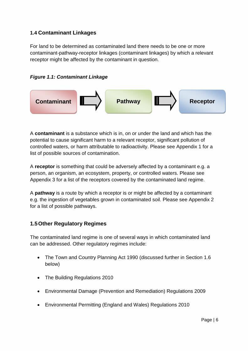
1.4 Contaminant Linkages
For land to be determined as contaminated land there needs to be one or more
contaminant-pathway-receptor linkages (contaminant linkages) by which a relevant
receptor might be affected by the contaminant in question.
Figure 1.1: Contaminant Linkage
A contaminant is a substance which is in, on or under the land and which has the
potential to cause significant harm to a relevant receptor, significant pollution of
controlled waters, or harm attributable to radioactivity. Please see Appendix 1 for a
list of possible sources of contamination.
A receptor is something that could be adversely affected by a contaminant e.g. a
person, an organism, an ecosystem, property, or controlled waters. Please see
Appendix 3 for a list of the receptors covered by the contaminated land regime.
A pathway is a route by which a receptor is or might be affected by a contaminant
e.g. the ingestion of vegetables grown in contaminated soil. Please see Appendix 2
for a list of possible pathways.
1.5 Other Regulatory Regimes
The contaminated land regime is one of several ways in which contaminated land
can be addressed. Other regulatory regimes include:
The Town and Country Planning Act 1990 (discussed further in Section 1.6
below)
The Building Regulations 2010
Environmental Damage (Prevention and Remediation) Regulations 2009
Environmental Permitting (England and Wales) Regulations 2010
Receptor
Pathway
Contaminant

Page | 7
Part 3 of the Environmental Protection Act 1990 relating to statutory nuisance
Water Resources Act 1991 (Amendment) (England and Wales) Regulations
2009
The Statutory Guidance states that enforcing authorities should only use the
contaminated land regime (Part 2A) where no appropriate alternative solution exists.
Therefore, Part 2A will not be used where other legislation can be enforced or where
contamination has arisen due to a breach of an existing license or permit.
1.6 The Planning Regime
All planning applications have to be considered for potential contamination issues to
ensure compliance with the Town and Country Planning Act 1990, the National
Planning Policy Framework and associated Planning Practice Guidance, and the
council‟s Local Plan. Contaminated land issues that arise through planning
applications will be controlled through the planning regime as opposed to the
contaminated land regime, in line with government policy.
The council‟s development management team consults the public protection team on
all planning applications and associated contaminated land reports. We are
responsible for reviewing all investigation and remediation work undertaken by
developers, to ensure that it is completed to a satisfactory standard.
Through the planning regime, it is the responsibility of the developer to ensure that a
site can and will be made suitable for its proposed future use and that there are no
unacceptable risks to human health, controlled waters, the environment, or property.
Where a proposed development introduces a vulnerable end use (i.e. residential
housing or a school) and/or contamination could be present due to past activities (i.e.
an old factory or refuse tip), the developer should always consider potential
contamination issues and must submit an appropriate contamination assessment
with their planning application.
Planning consent will not be granted if a contamination assessment does not fully
assess all possible contamination risks, as we need to be certain that the proposed
development is feasible and that any contamination can be suitably mitigated. For
further information please refer to the Yorkshire and Humberside Pollution Advisory
Page | 8
Council‟s technical guidance for developers, landowners and consultants on
„Development on Land Affected by Contamination‟.
If the contamination assessment is acceptable, then planning conditions requiring
investigation and remediation of the contamination will be attached to the planning
consent as necessary. Please note that planning conditions will not be discharged
until we are satisfied that a site has been made safe and is suitable for its proposed
use.
The majority of contaminated sites are voluntarily remediated through the planning
regime by developers and landowners looking to bring land back into beneficial use.
Hundreds of sites in York have already been investigated and remediated through
this route and will therefore not require Part 2A action.

Page | 9
2. AIMS AND OBJECTIVES
2.1 Aims
The aims of this strategy are:
To protect people, ecological systems, buildings, property, crops and livestock
from significant harm caused by exposure to historic land contamination.
To protect controlled waters from significant pollution derived from historic
land contamination.
To meet the statutory obligation placed on the council to produce a written
strategy under Part 2A.
To adopt a strategic approach for dealing with contaminated land.
To encourage the remediation and redevelopment of Brownfield sites.
To ensure that remedial action is reasonable, practicable, effective and
durable.
To encourage the voluntary remediation of sites.
2.2 Objectives
The objectives of this strategy are:
To provide a strategic framework which we will use to identify, inspect and
determine contaminated land. Inspections will be carried out in priority order,
so the highest risk sites will be inspected first.
To ensure that development on potentially contaminated land is not permitted
unless an appropriate contamination assessment has been submitted and we
are satisfied that the proposed development is feasible and that the
contamination can be suitably mitigated.

Page | 10
To ensure that developers undertake sufficient remedial work to make land
safe and suitable for its proposed use.
To deal with sites as a matter of urgency if we suspect that there is an
immediate serious risk to human health or the environment.
To prepare written records of determination and risk summaries for land that
is found to be contaminated land (as defined by Part 2A) and written
statements for land that is not.
To maintain a public register of contaminated land.
To secure the appropriate remediation of sites determined as contaminated
land in order to protect public health and the environment.
To outline the council‟s procedures regarding powers of entry, liability, cost
recovery, special sites and enforcement.
To inform the public and stakeholders of the council‟s responsibilities and
intentions in relation to contaminated land.

Page | 11
3. THE CITY OF YORK
3.1 Characteristics of the Area
The City of York lies in the centre of the vale of York, approximately 30 miles north
east of Leeds and 50 miles inland from the east coast. The landscape of the area is
broadly characterised as flat and low lying agricultural land, which rises slightly
towards the east.
York is one of England‟s most historic cities, with a diverse history that can be traced
back nearly 2,000 years. It is characterised by a compact urban area surrounded by
several small settlements. The compactness of the main urban area, with York
Minster as the focal point, is a key feature of the city.
Figure 3.1 shows the extent of the City of York Council area, which covers an area of
approximately 105 square miles (272 square kilometres). In 2013, the population of
York was 202,400 residents. The majority of the population resides in the urban
area, with the remainder residing in and around the numerous surrounding villages.
Figure 3.1: Map Showing the City of York Council Boundary

Page | 12
3.2 Past Industrial Activity
Contamination can arise from a wide variety of processes and activities associated
with industry and its development and growth. The industrial history of an area can
therefore provide a useful insight into the land which might contain contamination.
The City of York has a long and varied history, evident from the many historical
buildings and monuments that remain today. In the middle ages, York was an
important port and manufacturing centre for wool, leather and other crafts. By the
17th century the textile industry and port activity had declined and by the 18th century
York contained a diverse range of small crafts such as brewers, bakers, tailors,
jewellers, shoe makers, coopers and pipe makers.
The railways came to York in 1839, bringing the industrial age with them. The railway
carriage works became a major employer of over 5,000 people. By the late 19th
century a number of other industries had also become established in the city, such
as confectionary, flour milling and the manufacture of optical instruments.
During the 20th century confectionary was big business in York with Rowntree‟s,
Terry‟s and Craven‟s all manufacturing within the city. Printing, sugar production and
the manufacture of railway carriages and optical instruments were also important
industries during this period.
Over the last few decades, much of the major manufacturing industry has declined in
York. Today, York is home to a diverse and dynamic business base and has
economic strengths in science, technology, creative industries and professional and
financial services. Tourism also makes an important contribution to York‟s economy,
with approximately 7 million visitors each year.
3.3 Geology
The geology of a site can influence whether a contaminant is likely to remain close to
the source or migrate. Sandstone and sandy soils, with large grain sizes, are highly
permeable and they allow contamination to move through the ground. Whereas
mudstone and clayey soils, with small grain sizes, have negligible permeability which
prevents the movement of contamination.
The bedrock beneath most of York is Sherwood Sandstone, apart from a small area
of Mercia Mudstone in the Strensall area. Much of this is overlain by superficial
geological deposits of silt and clay or sand and gravel, principally of glacial origin.

Page | 13
Bands of alluvium deposits are also present along the paths of the River Ouse and
River Foss.
3.4 Hydrogeology
Water beneath the earth‟s surface is called groundwater and it can be found within
the following types of aquifers:
Principal aquifers are layers of rock or superficial deposits that have high
intergranular and/or fracture permeability – meaning that they usually provide
a high capacity for water storage. They may support water supplies and/or
river base flow on a strategic scale.
Secondary aquifers are layers of rock or superficial deposits that have a
wide range of water permeability and water storage capacities. Secondary
aquifers are subdivided into three types: Secondary A (which support water
supplies at a local scale), Secondary B (which store and yield small amounts
of groundwater due to localised features i.e. fissures), and Secondary
Undifferentiated (which contain features of categories A and B due to
variability within the rock type).
Unproductive Strata are layers of rock or superficial deposits that have low
permeability that have negligible significance for water supplies or river base
flow.
Within York, the Sherwood Sandstone is designated as a principal aquifer and it
supports a large number of water abstractions for domestic, agricultural and
industrial uses. Whereas, the Mercia Mudstone is designated as unproductive strata
and it does not support any major water abstractions.
The superficial geological deposits within York range from sands and gravels to silts
and clays, and are either designated as secondary aquifers or unproductive strata.
Groundwater vulnerability is classified based on the characteristics of the aquifer.
Where the Sherwood Sandstone is covered by permeable sand and gravel deposits,
the groundwater is vulnerable to pollution by surface activities (including areas of
contaminated land). Where the Sherwood Sandstone is covered by a substantial
thickness of clay, which has a low permeability, the groundwater will generally be
protected against pollution from surface activities.

Page | 14
3.5 Hydrology
York has three main surface watercourses, which are the River Ouse, the River
Foss, and the River Derwent. The Environment Agency currently classifies the
ecological status of all three of these rivers as „moderate‟.
These river systems are used as water supplies and the majority of the abstractions
are used for agricultural spray irrigation. There are also a number of licensed
abstractions from the River Ouse and the River Derwent for public drinking water
supplies.
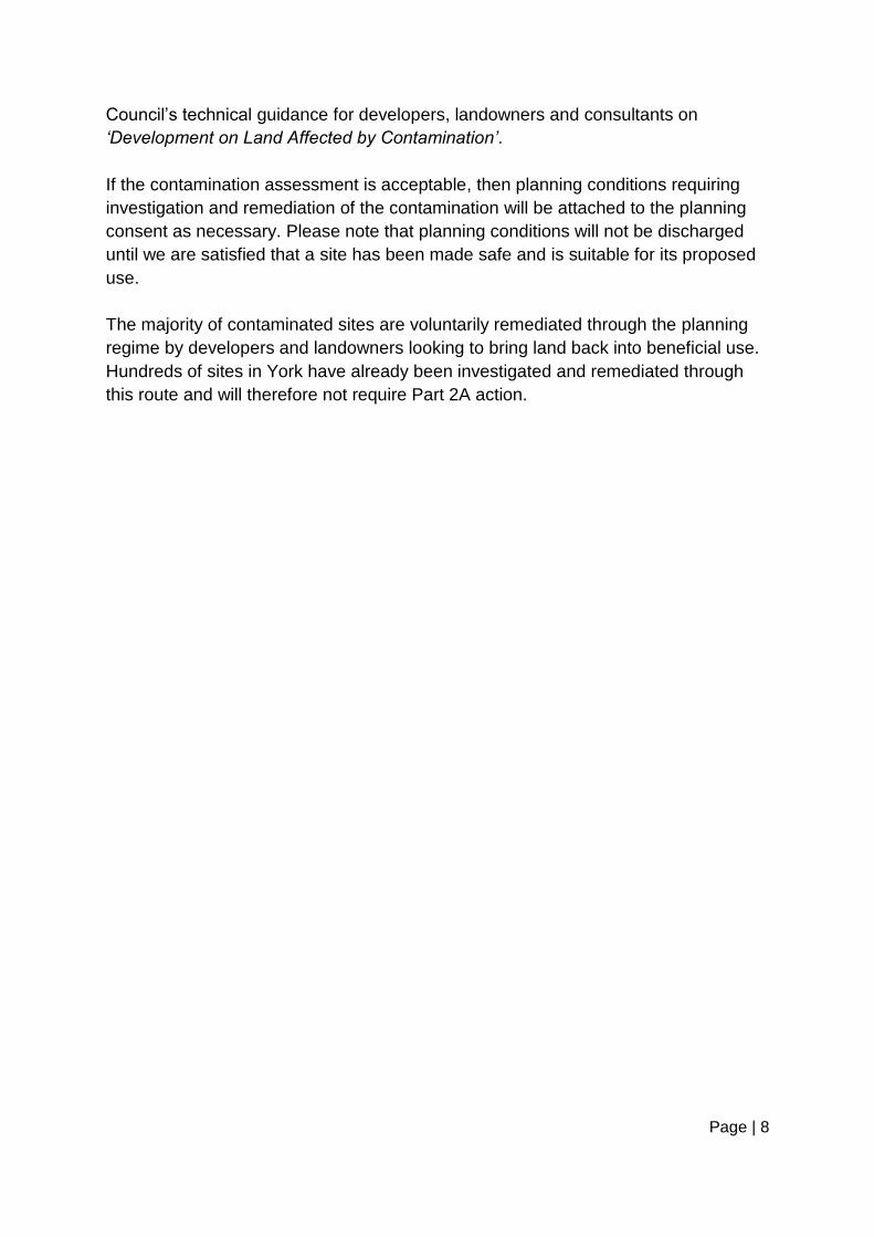
3.6 Ecological Systems
A number of areas of ecological importance are present in York and in the
surrounding area, these include 15 Sites of Special Scientific Interest (SSSIs) and a
national nature reserve – further details can be found below in Table 3.1.
Table 3.1: Areas of Ecological Importance in York
Designation Description Designated Sites
Sites of Special
Scientific Interest
(SSSIs)
Sites of Special Scientific
Interest (SSSIs) are areas of
special interest by reason of
any of its flora, fauna,
geological or physiographical
features. Designations are
made under the Wildlife and
Countryside Act 1981.
- Acaster South Ings
- Askham Bog
- Breighton Meadows
- Church Ings
- Clifton Ings and Rawcliffe
Meadows
- Derwent Ings
- Fulford Ings
- Heslington Tillmire
- Melbourne and Thornton Ings
- Naburn Marsh
- Newton Mask
- Pocklington Canal
- River Derwent
- Skipwith Common
- Strensall Common
Special Areas of
Conservation
Special Areas of
Conservation (SACs) are
- Lower Derwent Valley
- River Derwent
Page | 15
Designation Description Designated Sites
(SACs) strictly protected sites
designated under the EC
Habitats Directive. The
habitat types and species
covered are those considered
to be most in need of
conservation at a European
level (excluding birds).
- Skipwith Common
- Strensall Common
Special
Protection Areas
(SPAs)
Special Protection Areas
(SPAs) are strictly protected
sites classified in accordance
with Article 4 of the EC Birds
Directive. They are classified
for rare and vulnerable birds,
and for regularly occurring
migratory species.
- Lower Derwent Valley
National Nature
Reserve (NNRs)
National Nature Reserves
(NNRs) contain examples of
some of the most important
natural and semi-natural
terrestrial and coastal
ecosystems in Great Britain.
- Lower Derwent Valley
Ramsar Ramsar sites are wetlands of international importance designated under the Ramsar Convention.
- Lower Derwent Valley
Page | 16
3.7 Historic Buildings, Monuments & Archaeological Deposits
York‟s rich history has provided a complex mosaic of buildings and streets unique in
character. It‟s wealth of historic buildings include: 22 scheduled ancient monuments
(including York Minster, the City Walls, Clifford‟s Tower and St Mary‟s Abbey), 35
conservation areas and approximately 1,600 listed buildings.
The importance of York is highlighted by the city‟s status as only one of five historical
centres in England designated as an Area of Archaeological Importance. It is
Britain's largest, deepest and best preserved urban archaeological site. York's low-
lying location and underlying clay mean that archaeological deposits are waterlogged
beneath the water table and remain in an excellent state of preservation.

Page | 17
4. THE INSPECTION PROCESS
4.1 Information Collection
In order to identify potentially contaminated land, it is first necessary to identify past
land uses which have the potential to give rise to contamination. It is also necessary
to identify relevant receptors, so that contaminant linkages can be assessed in light
of the current use of a particular site. The datasets listed in Table 4.1 have been
collated for this purpose.
Table 4.1: Sources of information
Dataset
Source
Maps (historic & present day)
Ordnance Survey
Past industrial use
(1843-1893, 1891-1912, 1904-1943,
1945-1970 and 1970-1996)
Landmark Information Group
& Trade Directories
Closed landfill sites
Environment Agency
& City of York Council
Active landfill sites
Environment Agency
Part A1, A2 and B permitted installations
Environment Agency
& City of York Council
Geology (solid and superficial)
British Geological Survey
Groundwater vulnerability
Environment Agency
Source protection zones
Environment Agency
Groundwater abstraction points
Environment Agency
Watercourses
Environment Agency
Private water supplies
City of York Council
Page | 18
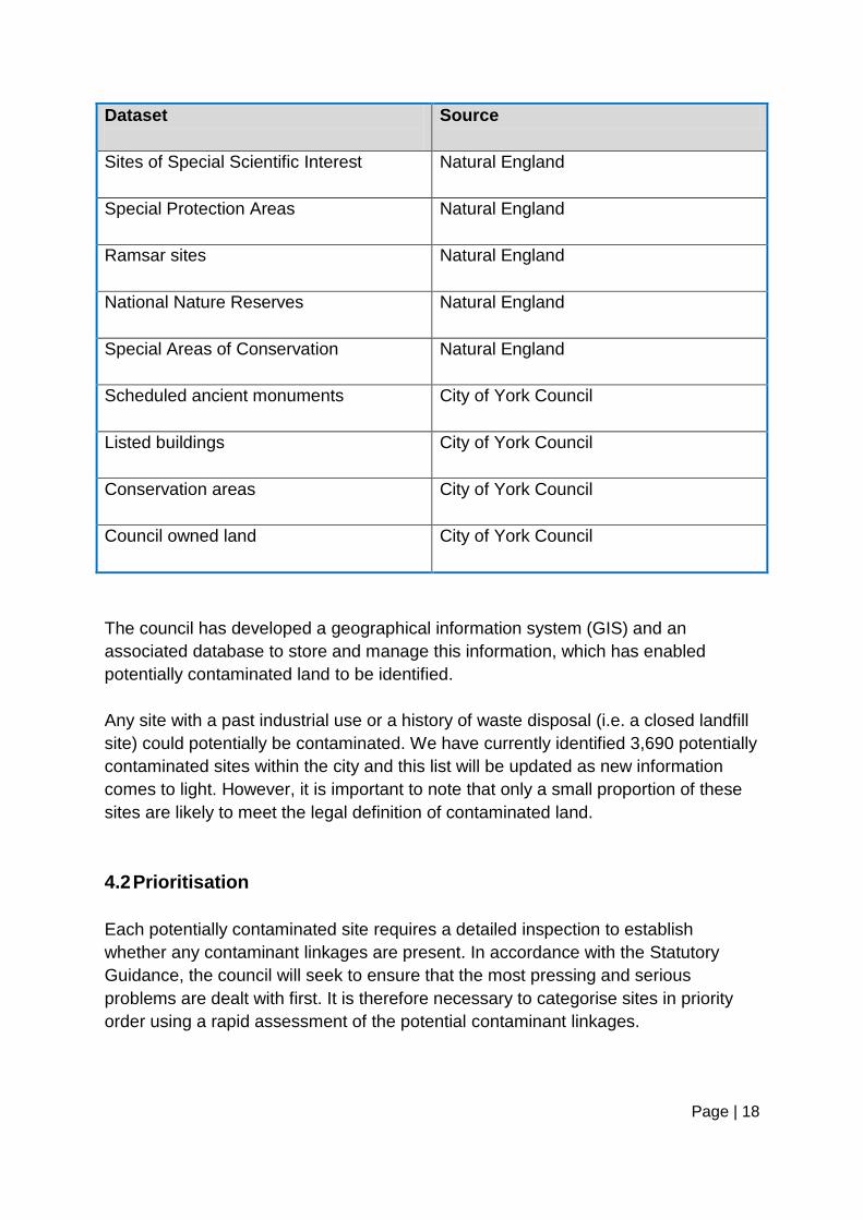
Dataset
Source
Sites of Special Scientific Interest
Natural England
Special Protection Areas
Natural England
Ramsar sites
Natural England
National Nature Reserves
Natural England
Special Areas of Conservation
Natural England
Scheduled ancient monuments
City of York Council
Listed buildings
City of York Council
Conservation areas City of York Council
Council owned land City of York Council
The council has developed a geographical information system (GIS) and an
associated database to store and manage this information, which has enabled
potentially contaminated land to be identified.
Any site with a past industrial use or a history of waste disposal (i.e. a closed landfill
site) could potentially be contaminated. We have currently identified 3,690 potentially
contaminated sites within the city and this list will be updated as new information
comes to light. However, it is important to note that only a small proportion of these
sites are likely to meet the legal definition of contaminated land.
4.2 Prioritisation
Each potentially contaminated site requires a detailed inspection to establish
whether any contaminant linkages are present. In accordance with the Statutory
Guidance, the council will seek to ensure that the most pressing and serious
problems are dealt with first. It is therefore necessary to categorise sites in priority
order using a rapid assessment of the potential contaminant linkages.

Page | 19
In line with the council‟s first contaminated land strategy, published in 2001, we
completed the initial prioritisation in-house and incorporated a policy decision to rank
closed landfill sites as the highest priority. This decision was based on the number
and size of closed landfill sites in York, the limited amount of information available on
them, their close proximity to receptors and their frequent use as public open space,
and the wide variety of contaminants often found at landfill sites.
Once an initial assessment of the closed landfill sites was complete, a more detailed
prioritisation system was needed. In 2008, we purchased a sophisticated GIS based
site prioritisation tool (called ConSEPT) from the British Geological Survey. This was
used to prioritise all of the 3,690 potentially contaminated sites.
The ConSEPT prioritisation tool is based on the contaminant linkage concept and it
scores the different sources, pathways and receptors for a site and its surroundings.
The total scores allow potentially contaminated sites to be ranked in priority order.
Each site is allocated to one of five priority categories (A to E). Table 4.2 shows how
the council has defined these categories and the number of potentially contaminated
sites within each category.
Please note that the ConSEPT prioritisation tool cannot identify contaminated land,
but it does prioritise land which has the potential to be contaminated. It is designed
to be used with expert judgement to assess whether the combination of sources,
pathways and receptors requires a detailed investigation. A detailed inspection will
then enable a determination to be made as to whether any significant pollutant
linkages are present.
The process of identifying potentially contaminated land is an ongoing activity.
Further information may come to light at any stage and we will take into account any
information obtained from or volunteered by the public, site owners, businesses and
voluntary organisations. New and updated information will also often be provided as
a result of exchanges of information between departments (particularly between
public protection and development management) and with the Environment Agency
and other statutory bodies.

Page | 20
Table 4.2 – Priority Categories
Category Number
of Sites
Description
A
88
Contaminants certainly or probably present. One or more
pathways to identified receptors are likely to exist. There is
a high risk of an unacceptable impact on identified
receptors. The current use of the site may not be suitable.
High priority, with action to inspect the site being required
in the short term.
B
1,563
The presence of contaminants is likely. One or more
pathways to identified receptors are likely to exist. There is
a high-medium risk of an unacceptable impact on identified
receptors. The current use of the site may not be suitable.
High to medium priority, with action to inspect the site
being required in the short to medium term.
C
465
Contaminants may be present. One or more pathways to
identified receptors are likely to exist. There is a medium-
low risk of an unacceptable impact on identified receptors.
Medium to low priority, with action to inspect the site
being required in the medium to long term.
D
373
Contaminants may be present. There is a medium-low risk
of the existence of pathway(s) to identified receptors. It is
unlikely that the contaminants will have a significant effect
on identified receptors. Low priority, with action to inspect
the site being required in the long term.
E
1,201
Contaminants may be present. There is a low risk of the
existence of pathway(s) to identified receptors. It is highly
unlikely that the contaminants will have a significant effect
on identified receptors. Very low priority, with action
unlikely to be needed whilst site remains in present use or
is undisturbed.

Page | 21
4.3 Detailed Inspection
The purpose of carrying out a detailed inspection is to gain sufficient information to
determine whether or not there is a significant contaminant linkage and whether the
site meets the legal definition of contaminated land. We will inspect potentially
contaminated sites in priority order, starting with the highest risk sites first.
Please note that a significant number of sites identified as potentially contaminated
are likely to be suitable for their current use, or will have already been dealt with
through the planning regime.
It is possible that there is some land where council activities (e.g. vehicle
maintenance and waste disposal activities) may have caused contamination.
Therefore, within each priority category, land that was previously or is currently
owned by the council will be inspected first. This approach will be adopted to allow
the council to set precedents on the identification and remediation of contaminated
sites and to demonstrate its commitment to discharging its responsibilities under Part
2A. It is hoped that this approach will be followed by other land owners and will
encourage the voluntary remediation of sites.
The first phase of investigation (Phase 1) is to collect and assess as much
information as possible about a particular site from maps and historic records and by
undertaking a site walkover survey. If the findings confirm that there is potential for
contamination to be present, then further investigation will be required.
The next phase of investigation (Phase 2) is to carryout a site investigation to
determine the nature and extent of any contamination on a site. The sampling and
analysis of soil, water and/or ground gases may be required to assess the amount
and type of contamination present.
A risk assessment will then be carried out inline with current guidance and best
practice, to determine whether the level of contamination found at a site could pose
an unacceptable risk to human health, controlled waters, ecological systems, crops,
livestock, buildings or property.
Contaminant levels will be compared against the Department for the Environment,
Food and Rural Affairs (DEFRA) Category 4 Screening Levels (C4SLs), which were
published in December 2013. If contaminant levels are lower than the C4SLs, then
the site is considered to be low risk and no further assessment or remediation is
needed. If contaminant levels are higher that the C4SLs, then further assessment is
needed.

Page | 22
4.4 Determination of Contaminated Land
Once a detailed inspection is complete, the council will have identified any significant
contaminant linkage(s) and carried out a robust, appropriate, scientific and technical
assessment of all the relevant and available evidence. We can then decide whether
or not a site meets the legal definition of contaminated land.
A site can only be determined as contaminated land for one (or more) of the
following reasons:
Significant harm is being caused.
There is a significant possibility that significant harm could be caused.
Significant pollution of controlled waters is being caused.
Significant pollution of controlled waters is likely to be caused.
Harm attributable to radioactivity is being caused.
There is a significant possibility that harm attributable to radioactivity could be
caused.
Making a determination is a complex process and we will always refer to the
Statutory Guidance and seek advice from relevant experts. We will consult Public
Health England when considering health effects, we will consult the Environment
Agency when considering the pollution of controlled waters, we will consult Natural
England when considering ecological effects and we will consult English Heritage
and the council‟s Design, Conservation & Sustainable Development team when
considering property effects.
All regulatory decisions will refer to the Statutory Guidance‟s four-category system
for classifying land. Category 1 covers sites where the level of risk is clearly
unacceptable, whereas Category 4 covers sites where the level of risk posed is
acceptably low. Sites will be determined as contaminated land if they fall within
Category 1 or 2, whereas sites within Category 3 or 4 will not be determined as
contaminated land.
Part 2A was introduced to help to identify and deal with land that poses
unacceptable levels of risk. It is not intended to apply to sites with normal levels of
contamination (i.e. natural background contamination or contamination caused by
low level diffuse pollution / common human activity), so these sites will not be

Page | 23
determined as contaminated land.
4.5 Remediation
If a significant contaminant linkage has been identified, remedial action will be
needed to reduce or remove that linkage. This may involve cleaning up the
contamination, breaking the pathway, or modifying the receptor. The overall aim of
remediation is to remedy harm/pollution and to ensure that risks are reduced to an
acceptable level.
We aim to encourage the voluntary remediation of sites through regular interaction
and discussions, rather than through a process of naming and shaming individuals or
companies. However, if no solution can be reached, then the site will be determined
as contaminated land and the polluter or other appropriate person will have a legal
responsibility to remediate it. In these cases we will issue a remediation notice to
ensure that suitable remediation is undertaken.

Page | 24
5. PROCEDURES
5.1 Powers of Entry
For the purposes of identifying contaminated land, the council has been granted
powers of entry under Section 108 of the Environment Act 1995. These powers allow
any person authorised in writing by the council to enter premises and inspect the
area and any records connected to the site, to determine if significant harm is being
caused.
In most circumstances we will write to the occupier to give seven days notice of our
intention to enter premise. We may then enter the premises either with the consent
of the occupier or under the authority of a warrant issued by a magistrate.
In an emergency we may exercise our powers of entry forthwith to prevent
immediate harm to public health or the environment, or pollution of controlled waters.
5.2 Record of Determination
If we determine a site as contaminated land, we shall give notice of that fact to the
Environment Agency, the owner of the land, any person who appears to be in
occupation of the whole or any part of the land, and each person who appears to be
an appropriate person. A written record of determination will be provided to relevant
parties and a copy will also be kept on file.
A written record of determination will include:
A map showing the location, boundaries and area of the land in question.
A risk summary (including details of the identified contaminant linkages,
potential impacts and risks, uncertainties behind the risk assessment and
possible remediation options).
A summary of why we consider that the requirements of relevant sections of
the Statutory Guidance have been satisfied
If it is clear, following an inspection, that land does not meet the legal definition of
contaminated land, we will issue a written statement to that effect to the owners of

Page | 25
the property and other interested parties. A copy of this statement will also be kept
on file, along with the reasons for making the decision.
5.3 Public Register
Part 2A requires the council to maintain a public register containing the following
information:
Remediation notices
Appeals against remediation notices
Remediation declarations
Remediation statements
Appeals against charging notices
Designation of Special Sites
Notifications of claimed remediation
Convictions for offences under section 78M of the Environmental Protection
Act 1990
Site specific guidance issued by the Environment Agency
Other environmental controls
The public register can be viewed online on the council‟s website, or viewed in
person by prior arrangement at the council offices. Reasonable charges will be made
to cover any photocopying costs.

Page | 26
5.4 Special Sites
For a site to be classified as a Special Site it must meet the criteria outlined in the
contaminated land regime, as summarised in Appendix 4.
The regulation of Special Sites falls to the Environment Agency, but it is the council‟s
responsibility to identify and designate these sites before further action can be taken.
We will only designate a site as a Special Site after we have had detailed
discussions with relevant personnel at the Environment Agency. If we already have
information that would allow the classification of a Special Site, arrangements can be
made so that the Environment Agency carries out the inspection of the site on our
behalf.
Once a site has been designated as a Special Site, regulation and enforcement are
passed over to the Environment Agency.
5.5 Liability
It is the intention of Part 2A that the appropriate person, ideally the polluter, pays for
the cost of remediation as a result of voluntary or formal action.
For any land determined as contaminated land, the council must establish who
should bear responsibility for carrying out the remediation. This will follow the polluter
pays principle, where the person who caused or knowingly permitted the
contamination will be the appropriate person to cover the cost of remediation.
However, if it is not possible to find such a person, the Statutory Guidance states
that the cost may fall to the owner or occupier of the land.
Inline with the Statutory Guidance, we will also undertake a number of tests to
decide whether an appropriate person should be excluded from liability. Liability can
then be apportioned accordingly between the remaining liable parties.
If no appropriate person can be found, or the appropriate person is exempted by one
of the relevant statutory provisions, the significant contaminant linkage will become
an orphan linkage. In these instances, the council will be responsible for carrying out
the remediation at its own cost.

Page | 27
5.6 Cost Recovery
In making any cost recovery decision, the Statutory Guidance recommends that the
following general principles should be followed:
The council should aim for an overall result which is as fair and equitable as
possible to all who may have to meet the costs of remediation, including
national and local taxpayers.
The polluter pays principle should be applied with a view that, where possible,
the costs of remediating pollution should be borne by the polluter. The council
should therefore consider the degree and nature of responsibility of the
relevant appropriate person(s) for the creation, or continued existence, of the
circumstances which lead to the land in question being identified as
contaminated land.
We will seek to recover all reasonable costs. However, we will consider waiving or
reducing the recovery of costs to avoid any undue hardship which the recovery may
cause to the appropriate person, or to reflect one or more of the specific
considerations set out in the Statutory Guidance.
In certain circumstances, we may consider deferring the recovery of costs and
securing them by a charge on the land in question. Such deferral may lead to
payment from the appropriate person either in installments or when the land is next
sold.
5.7 Enforcement Policy
We will carryout our responsibilities under Part 2A in a clear and transparent
manner. We will endeavour to promote the voluntary remediation of sites and will
only proceed with enforcement action when all other avenues have been exhausted.
However should enforcement action be required, for example due to the failure to
fulfill the requirements of a remediation notice, action will be taken in accordance
with our enforcement policy.
Page | 28
6. PROGRESS AND PRIORITIES
6.1 Progress
Considerable progress has been made since the publication of the council‟s first
Contaminated Land Strategy back in 2001. We have collated detailed information on
possible sources, pathways and receptors and we have prioritised all of the
potentially contaminated sites. We are currently working our way through the
detailed inspections in priority order.
Of the 88 high priority (Category A) sites identified in York:
13 sites have been inspected under Part 2A and 9 of these required Phase 2
investigations,
20 sites have already been, or soon will be, investigated through the planning
regime (including Heworth Green gas works, York Central and British Sugar),
49 sites are currently in use as industrial / commercial premises and no
further action is required at present, and
6 sites have not yet been inspected.
The nine Phase 2 investigations were carried out at the highest priority and most
complex sites – please see Table 6.1 for details. Elevated levels of contamination
were detected at all of these sites, but none of the levels were high enough to pose
an unacceptable risk to health or the wider environment. Consequently, none of
these sites met the Part 2A definition of contaminated land and no further action was
warranted.
Phase 2 investigations are expensive (often costing tens of thousands of pounds)
and time consuming. All of the Part 2A inspections carried out to date has been
funded by central government contaminated land capital grants. Unfortunately, this
grants programme was withdrawn in April 2014 and we have had insufficient funds to
undertake any investigations since this date.
In addition to the above, hundreds of sites in York have been investigated and
remediated through the planning regime. As discussed in Section 1.6, contaminated
land is a material planning consideration, so the council‟s development management
team consults the public protection team on all planning applications and associated
contaminated land reports. We are responsible for reviewing all investigation and
remediation work undertaken by developers, to ensure that it is completed to a
satisfactory standard and that the site is suitable for its proposed use. Please note
that no additional Part 2A action will be required at these sites.

Page | 29
Table 6.1 – List of Detailed Inspections
Date Site Name & Address Past Industrial Use
Determined as
Contaminated Land?
2004-07 Water End Closed landfill site No
2006-07 Fulford Cross
Walled gardens
Allotments
York Steiner
School
Danesgate Pupil
Support Centre
None
(contamination was
found by contractors, so
it was investigated as an
urgent case under Part
2A)
No
2006-08 Nun Ings, Butcher
Terrace
Closed landfill site No
2006-08 King George‟s Field,
Huntington Road
Closed landfill site No
2006-08 Fifth Avenue
Closed landfill site No
2007-09 Fulford Cross
Public open space
Danesmead
Community
Orchard
Closed landfill site No
2009-11 Chapman‟s Pond,
Moor Lane,
Dringhouses
Closed landfill site No
2009-11 Land behind Westfield
School, Askham Lane
Closed landfill site No
2012-14 Foxwood Lane Closed landfill site
No
Page | 30
6.2 Timescale
Progress in carrying out detailed inspections is reliant upon resources and service
priorities. No budget is available at present, so it is not possible to set an accurate
timescale for the implementation of this strategy.
6.3 Priorities
Our current priorities are to:
Carryout detailed inspections of potentially contaminated sites in priority order
as resources and service priorities allow. However, no budget is available at
present for this.
Assess planning applications and associated contaminated land reports to
ensure that land is investigated and remediated appropriately by developers,
so it does not pose a risk to health or the environment.
Deal with urgent cases as and when they arise.

Page | 31
7. STRATEGY CONSULTATION AND REVIEW
7.1 Strategy Consultation
In preparing this strategy a number of statutory bodies, adjoining local authorities,
internal council departments and other relevant organisations have been consulted.
Please see below for a list of the consultees:
Development Management, City of York Council
Design, Conservation & Sustainable Development, City or York Council
Public Health, City of York Council
Department for Environment, Food & Rural Affairs (DEFRA)
Environment Agency (Yorkshire and North East Region)
Natural England (Yorkshire and North Lincolnshire Region)
English Heritage (Yorkshire Region)
Environmental Hazards and Emergencies Department, Public Health England
Public Protection Team, East Riding of Yorkshire Council
Environmental Health, Hambleton District Council
Environmental Protection, Harrogate Borough Council
Environmental Health, Ryedale District Council
Environmental Health, Selby District Council
All consultation responses have been carefully considered in the preparation of this
strategy. It is also our intention to continue to take contributions from consultees who
have not yet made a response and from any other individual or organisation that
would like to comment on this strategy. We propose to consider these responses as
part of our regular reviews of the strategy.

Page | 32
7.2 Strategy Review
As recommended in the Statutory Guidance, this strategy will be reviewed at least
every five years to ensure that it remains up to date and relevant.

Page | 33
8. ACCESS TO INFORMATION
8.1 Viewing the Contaminated Land Strategy
This contaminated land strategy is available to download free of charge from the
council‟s website. A paper version is also held at the Eco Depot, Hazel Court and
can be viewed during normal office hours.
8.2 Viewing the Public Register
The contaminated land public register can be viewed on the council‟s website. A
paper version is also held at the Eco Depot, Hazel Court and can be viewed during
normal office hours.
8.3 Enquiries
Requests for information and enquiries regarding contaminated land can be made by
telephone, email or in writing. We aim to respond to all requests within 3 working
days.
Please note that there may be a charge to cover our costs to reply to some kinds of
query, but you will always be advised in advance if there is a charge.
Please note that circumstances may arise where specific information cannot be
released due to commercial confidentiality, an ongoing investigation, or where legal
action is required to enforce a remediation notice.
Enquiries should be directed to:
Public Protection
City of York Council
Eco Depot, Hazel Court
James Street
York
YO10 3DS
Tel: 01904 551525
Email: [email protected]

Page | 34
REFERENCES
Department for Communities and Local Government (2012). National Planning
Policy Framework. DCLG, London.
Department for Environment, Food and Rural Affairs (2012). Environmental
Protection Act 1990: Part 2A Contaminated Land – Contaminated Land
Statutory Guidance. The Stationery Office, London.
Department of Energy and Climate Change (2012). Environmental Protection Act
1990: Part 2A Contaminated Land – Radioactive Contaminated Land Statutory
Guidance. The Stationery Office, London.
Environment Agency (2004). CLR11: Model Procedures for the Management of
Land Contamination. Environment Agency, Bristol.
Environmental Permitting (England and Wales) Regulations 2010. Statutory
Instrument (SI 2010/676).
Environmental Protection Act 1990, Part 2A: inserted by the Environment Act
1995, Section 57. See Environment Act 1995 for text for Part 2A.
The Contaminated Land (England) (Amendment) Regulations 2012. Statutory
Instrument (SI 2012/263).
The Contaminated Land (England) Regulations 2006. Statutory Instrument
(SI 2006/1380).
The Environmental Damage (Prevention and Remediation) Regulations 2009.
Statutory Instrument (SI 2009/153).
Water Resources Act 1991 (Amendment) (England and Wales) Regulations
2009. Statutory Instrument (SI 2009/3104).
Yorkshire and Humberside Pollution Advisory Council (2016). Development on
Land Affected by Contamination: Technical Guidance for Developers,
Landowners and Consultants. Version 7.2. YAHPAC, UK (available to download
from https://www.york.gov.uk/downloads/file/3803/yahpac_planning_guidance_version_72pdf).
Page | 35
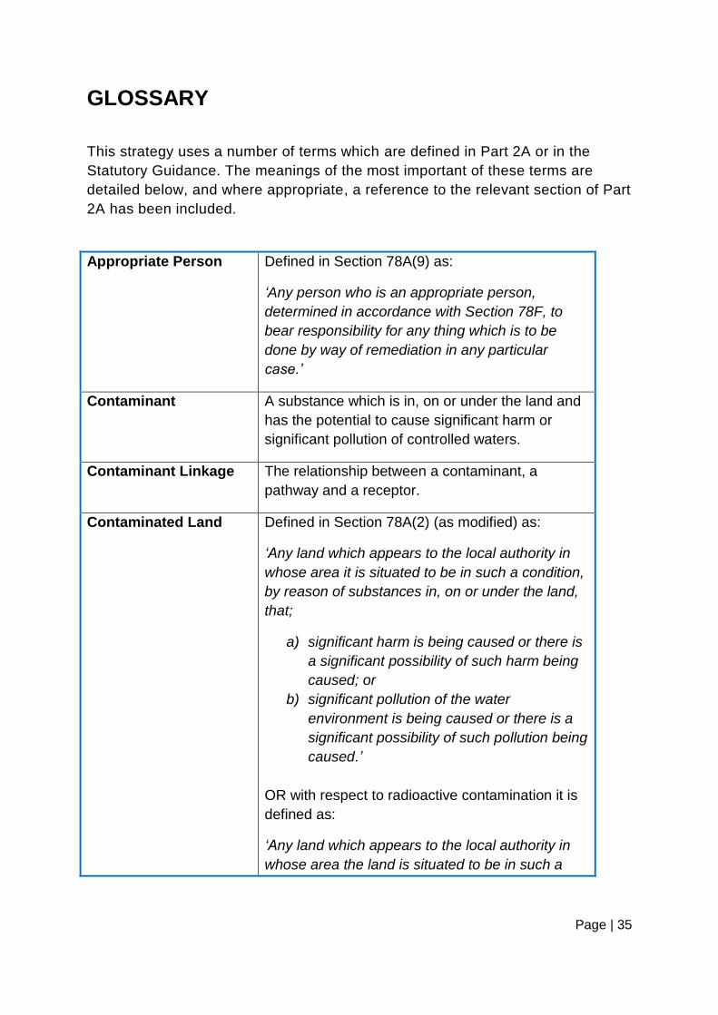
GLOSSARY
This strategy uses a number of terms which are defined in Part 2A or in the
Statutory Guidance. The meanings of the most important of these terms are
detailed below, and where appropriate, a reference to the relevant section of Part
2A has been included.
Appropriate Person Defined in Section 78A(9) as:
„Any person who is an appropriate person,
determined in accordance with Section 78F, to
bear responsibility for any thing which is to be
done by way of remediation in any particular
case.‟
Contaminant A substance which is in, on or under the land and
has the potential to cause significant harm or
significant pollution of controlled waters.
Contaminant Linkage The relationship between a contaminant, a
pathway and a receptor.
Contaminated Land Defined in Section 78A(2) (as modified) as:
„Any land which appears to the local authority in
whose area it is situated to be in such a condition,
by reason of substances in, on or under the land,
that;
a) significant harm is being caused or there is
a significant possibility of such harm being
caused; or
b) significant pollution of the water
environment is being caused or there is a
significant possibility of such pollution being
caused.‟
OR with respect to radioactive contamination it is
defined as:
„Any land which appears to the local authority in
whose area the land is situated to be in such a

Page | 36
condition, by reason of substances in, on or under
the land, that;
a) harm is being caused; or
b) there is a significant possibility of harm
being caused.‟
Controlled Waters Has the same meaning as in Part III of the Water
Resources Act 1991, and includes relevant
territorial waters, coastal waters, inland
freshwaters and ground waters. Except that
ground waters does not include waters contained
in underground strata but above the saturation
zone.
Ecological Systems Only the following ecological systems can be
considered for the purposes of Part 2A:
A site of special scientific interest
A national nature reserve
A marine nature reserve
An area of special protection for birds
A “European site” within the meaning of
regulation 8 of the Conservation of Habitats
and Species Regulations 2010
Any habitat or site afforded policy
protection on nature conservation (i.e.
candidate Special Areas of Conservation,
potential Special Protection Areas and
listed Ramsar sites); or
Any nature reserve established under
section 21 of the National Parks and
Access to the Countryside Act 1949.
Enforcing Authority Special sites will be enforced by the Environment
Agency and all other contaminated land sites will
be enforced by the local authority in whose area
the land is situated.
Geology The study of the structure of rocks, minerals and
soils in specific geographical areas.
Page | 37
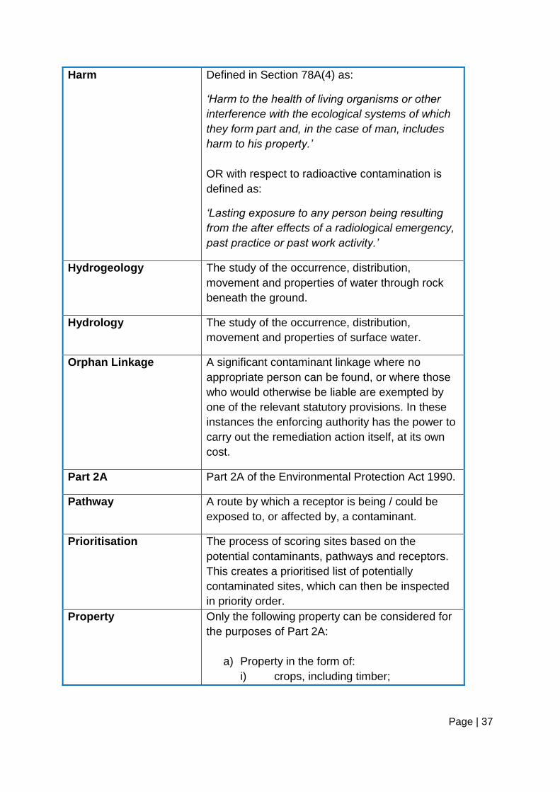
Harm Defined in Section 78A(4) as:
„Harm to the health of living organisms or other
interference with the ecological systems of which
they form part and, in the case of man, includes
harm to his property.‟
OR with respect to radioactive contamination is
defined as:
„Lasting exposure to any person being resulting
from the after effects of a radiological emergency,
past practice or past work activity.‟
Hydrogeology The study of the occurrence, distribution,
movement and properties of water through rock
beneath the ground.
Hydrology The study of the occurrence, distribution,
movement and properties of surface water.
Orphan Linkage A significant contaminant linkage where no
appropriate person can be found, or where those
who would otherwise be liable are exempted by
one of the relevant statutory provisions. In these
instances the enforcing authority has the power to
carry out the remediation action itself, at its own
cost.
Part 2A Part 2A of the Environmental Protection Act 1990.
Pathway A route by which a receptor is being / could be
exposed to, or affected by, a contaminant.
Prioritisation The process of scoring sites based on the
potential contaminants, pathways and receptors.
This creates a prioritised list of potentially
contaminated sites, which can then be inspected
in priority order.
Property Only the following property can be considered for
the purposes of Part 2A:
a) Property in the form of:
i) crops, including timber;

Page | 38
ii) produce grown domestically, or on
allotments, for consumption;
iii) livestock;
iv) other owned or domesticated
animals;
v) wild animals which are the subject of
shooting or fishing rights.
b) Property in the form of buildings. For this
purpose, „building‟ means any structure or
erection, and any part of a building
including any part below ground level, but
does not include plant or machinery
comprised in a building, or buried services
such as sewers, water pipes or electricity
cables.
Public Register Register maintained by the council of particulars
relating to contaminated land.
Receptor Something that could be adversely affected by a
contaminant, for example a person, an organism,
an ecosystem, property, or controlled waters.
Remediation Removing identified significant contaminant
linkages, or permanently disrupting them, to
ensure that they are no longer significant and that
risks are reduced to an acceptable level.
Remediation may involve a range of treatment,
assessment and monitoring actions to secure the
overall cleanup of the land.
Remediation Notice Defined in Section 78E(1) as a notice specifying
what an appropriate person is to do by way of
remediation and the periods within which he is
required to do each of the things so specified.
Remediation Statement In any case where the enforcing authority is
precluded from serving a remediation notice, the
responsible person shall prepare and publish a
remediation statement. The document will detail
what remediation actions are being / have been /

Page | 39
are expected to be done, appropriate timescales
and the name and address of the responsible
person.
Risk A combination of the probability / frequency of
occurrence of a defined hazard and the magnitude
(including the seriousness) of the consequences.
Significant Harm to
Human Health
The following health effects should always be
considered to constitute significant harm to human
health: death, life threatening diseases (e.g.
cancers), other diseases likely to have serious
impacts on health, serious injury, birth defects,
and impairment of reproductive functions.
Significant Pollution of
Controlled Waters
The entry into controlled waters of any poisonous,
noxious or polluting matter or any solid waste
matter.
Significant Possibility The decision on whether the possibility of
significant harm / pollution being caused is
significant is a regulatory decision to be taken by
the relevant enforcing authority. Decisions will be
made inline with the Statutory Guidance.
Special Site Defined by Section 78A(3) as:
„Any contaminated land –
a) which has been designated as such a site
by virtue of section 78C(7) or 78D(6)…;
and
b) whose designation as such has not been
terminated by the appropriate Agency
under section 78Q(4)…‟
See Appendix 4 of this document for further
details.
Substance Defined in Section 78A(9) as:
„Any natural or artificial substance, whether in
solid or liquid form or in the form of a gas or
vapour.‟

Page | 40
OR with respect to radioactive contamination is
defined as:
„Whether in solid or liquid form or in the form of a
gas or vapour, any substance which contains
radionuclides which have resulted from the after-
effects of a radiological emergency or which are or
have been processed as part of a past practice or
past work activity, but shall not include radon gas
or the following radionuclides: Po-218, Pb-214, At-
218, Bi-214, Rn-218, Po-214 and Tl-210.‟

Page | 41
APPENDIX 1: CONTAMINANT SOURCES
The following historic activities are known to produce contamination and could
therefore give rise to land contamination. Please note that this list is for guidance
only and is not exhaustive.
Smelters, foundries, steel works, metal processing & finishing works
Coal & mineral mining & processing, both deep mines and opencast
Heavy engineering & engineering works, e.g. car manufacture, shipbuilding
Military/defense related activities
Electrical & electronic equipment manufacture & repair
Gasworks, coal carbonisation plants, power stations
Oil refineries, petroleum storage & distribution sites
Manufacture & use of asbestos, cement, lime & gypsum
Manufacture of organic & inorganic chemicals, including pesticides,
acids/alkalis, pharmaceuticals, solvents, paints, detergents and cosmetics
Rubber industry, including tyre manufacture
Munitions & explosives production, testing & storage sites
Glass making & ceramics manufacture
Textile industry, including tanning & dyestuffs
Paper & pulp manufacture, printing works & photographic processing
Timber treatment
Food processing industry & catering establishments
Railway depots, dockyards (including filled dock basins), garages, road
haulage depots, airports

Page | 42
Landfill, storage & incineration of waste
Sewage works, farms, stables & kennels
Abattoirs, animal waste processing & burial of diseased livestock
Scrap yards
Dry cleaning premises
All types of laboratories
Burial sites and graveyards
Agriculture – specifically the excessive use or spills of pesticides, herbicides,
fungicides, sewage sludge & farm waste disposal

Page | 43
APPENDIX 2: PATHWAYS
The following pathways may create linkages between contaminants in the ground
and relevant receptors. Please note that this list is for guidance only and is not
exhaustive.
Ingestion of soil and dust
Ingestion of vegetables & soil attached to vegetables
Inhalation of indoor & outdoor dust
Inhalation of indoor & outdoor vapours
Dermal contact with soils and dusts
Risk of fire / explosion
Migration of soluble or mobile contaminants into groundwater
Migration of soluble or mobile contaminants into surface water bodies
Surface run-off into surface water bodies
Permeation through water pipes
Impact on areas of ecological importance
Impact on crops or domestically grown produce
Impact on livestock and wild animals subject to shooting / fishing rights
Impact on buildings and / or foundations

Page | 44
APPENDIX 3: RECEPTORS
The following receptors are covered by Part 2A. Please refer to the Statutory
Guidance for further details and information on what constitutes significant harm to
each receptor.
Human beings
Any ecological system, or living organism forming part of such system, within
a location which is:
i) A site of special scientific interest
ii) A national nature reserve
iii) A marine nature reserve
iv) An area of special protection for birds
v) Any European site within the meaning of regulation 10 of the
Conservation Regulations 1994 e.g. special areas of conservation and
special protection areas.
vi) Any candidate special areas of conservation or special protection areas
vii) Any habitat afforded protection under paragraph 6 of planning policy
statement 9 (PPS9) e.g. RAMSAR sites
viii) Any nature reserve under section 21 of the National Parks and Access
to the Countryside Act 1949
Property in the form of;
i) Crops, including timber
ii) Produce grown domestically, or on allotments for consumption
iii) Livestock
iv) Other owned or domesticated animals
v) Wild animals which are the subject of shooting or fishing rights
Property in the form of buildings. For this purpose “building” means any
structure or erection, and any part of a building including any part below
ground level, does not include plant/machinery within a building.
Controlled waters, as defined by the Water Resources Act 1991. Including
relevant territorial waters, coastal waters, inland freshwaters and ground
waters. For the purposes of Part 2A, ground waters does not include waters
contained in underground strata but above the saturation zone.

Page | 45
APPENDIX 4: SPECIAL SITES
A special site is a contaminated land site that is regulated by the Environment
Agency instead of the local authority. The definition of a special site is given in the
Contaminated Land (England) (Amendment) Regulations 2006 and is reproduced
below for information. Reference should be made to the full text of the legislation and
Statutory Guidance for a full legal definition and for details of references where
quoted.
„Contaminated land of the following descriptions is prescribed for the purposes of
section 78C(8) as land required to be designated as a special site:
a) land affecting controlled waters in the circumstances specified in regulation 3;
b) land which is contaminated land by reason of waste acid tars in, on or under
the land;
c) land on which any of the following activities have been carried on at any time;
i) the purification (including refining) of crude petroleum or of oil extracted
from petroleum, shale or any other bituminous substance except coal;
or
ii) the manufacture or processing of explosives;
d) land on which a prescribed process designated for central control has been or
is being carried on under an authorisation, where the process does not solely
consist of things being done which are required by way of remediation;
e) land on which an activity has been or is being carried on in a Part A(1)
installation or by means of Part A(1) mobile plant under a permit, where the
activity does not solely consist of things being done which are required by way
of remediation;
f) land within a nuclear site;
g) land owned or occupied by or on behalf of -
i) the Secretary of State for defence;
ii) the defence council,
iii) an international headquarters or defence organisation, or

Page | 46
iv) the service authority of a visiting force, being land used for naval,
military or air force purposes;
h) land on which the manufacture, production or disposal of -
i) chemical weapons,
ii) any biological agent or toxin which falls within section 1(1)(a) of the
Biological Weapons Act 1974 (restriction on development of biological
agents and toxins), or
iii) any weapon, equipment or means of delivery which falls within section
1(1)(b) of that Act (restriction on development of biological weapons)
has been carried on at any time;
i) land comprising premises which are or were designated by the Secretary of
State by an order made under section 1(1) of the Atomic Weapons
Establishment Act 1991 (arrangements for development etc of nuclear
devices);
j) land to which section 30 of the Armed Forces Act 1996 (land held for the
benefit of Greenwich hospital) applies;
k) land which is contaminated land wholly or partly by virtue of any radioactivity
possessed by any substance in, on or under that land; and
l) land which -
i) is adjoining or adjacent to land of a description specified in any of sub–
paragraphs (b) to (k); and
ii) is contaminated land by virtue of substances which appear to have
escaped from land of such a description.‟

Page | 47
APPENDIX 5: ENFORCEMENT POLICY
Approved: 6 February 2012 Page 1 of 8
Environmental Health, Trading Standards, Licensing, Public Protection
and Street Environment and Enforcement Services
Enforcement Policy
This document is the enforcement policy for City of York Council’s public
protection, environmental health, trading standards, licensing and street
environment and enforcement services. It sets out the key principles under
which officers will seek to achieve compliance with the legislation enforced by
these services. In carrying out their duties officers will adhere to the
principles of good enforcement set out in the ‘Statutory Code of Practice for
Regulators’ and all other relevant codes of good practice including those with
the investigation of offences or the prosecution of offenders.
All enforcement activity undertaken under this policy will have regard to the
Human Rights Act 1998 and the European Convention of the Protection of
Human Rights and Fundamental Freedoms.
1.0 Introduction
The main purpose of the public protection, environmental health, trading
standards, licensing and street environment and enforcement services is to
maintain a fair and safe trading environment for consumers and businesses,
to help reduce the actual and perceived impact of violent, aggressive and
nuisance behaviour on people in York and to improve and protect public
health and improve the environment. We recognise that effective and well-
targeted regulation is essential in achieving this.
We will ensure legal compliance by:
Helping and encouraging businesses and individuals to understand and
comply with the law.

Approved: 6 February 2012 Page 2 of 8
Responding proportionately to breaches of the law.
We want to achieve the following outcomes:
Support economic growth, especially in small businesses, by ensuring a
fair, responsible and competitive trading environment
Protect the environment for future generations including tackling the
threats and impacts of climate change
Improve quality of life and wellbeing by ensuring clean and safe
neighbourhoods
Help people to live healthier lives by preventing ill health and harm, and
promoting public health
Ensure a safe, healthy and sustainable food chain for the benefits of
consumers and the rural economy.
2.0 Economic Progress
We will consider the impact that our regulatory activities may have on
businesses, including consideration of costs, effectiveness and perceptions of
fairness. We will only adopt a particular approach if the benefits justify the
costs and in doing so will endeavour to try to keep any perceived burdens to
a minimum.
(References to costs and benefits include economic, social and
environmental costs and benefits).
3.0 Risk Assessment
We will allocate our resources where they will be most effective by assessing
the risks due to non-compliance with the law. The risk factors include:
the potential impact on residents, consumers, business and the
environment in failing to meet legal requirements.
the likelihood of non-compliance, taking into account matters such as:
o the past history,
o the systems a business has in place,
Approved: 6 February 2012 Page 3 of 8
o management competence of the business; and
o willingness to comply.
4.0 Advice and Guidance
We recognise that prevention is better than cure and will actively work with
business and residents to advise on and assist with, compliance with the law.
In doing this we will ensure that:
Legal requirements are made available and communicated promptly
upon request.
The information we provide will be in clear, concise and accessible
language. Advice will be confirmed in writing where necessary.
We will clearly distinguish between legal requirements and guidance
aimed at improvements above minimum standards.
5.0 Inspections and Other Visits
All inspections and other visits to businesses will be undertaken after
consideration of the risk the business poses if it fails to comply with the law
(see paragraph 3.0 above), where the business has requested advice or
where intelligence/information suggests that an inspection or visit is
appropriate.
Where we carry out inspections we will give feedback to the business
on what the officer has found; this will include positive feedback to
encourage and reinforce good practice.
Where practicable we will co-ordinate inspections with other regulators
to minimise the burden on businesses.
Random inspection will be undertaken where government guidelines
require us to do so. A small amount of random inspection may also be
undertaken to test our risk assessments or the effectiveness of any
action we have taken.
Approved: 6 February 2012 Page 4 of 8
6.0 Information Requirements
We will only ask businesses for information that is necessary after
considering the cost and benefit to obtaining the information. Where possible
we will share this information with our partners (taking account of data
protection) to prevent the need for providing the information more than once.
7.0 Compliance and Enforcement Actions
We recognise that most businesses and individuals wish to comply with the
law, however firm action will be taken against those who break or flout the law
or act irresponsibly.
We will carry out all of our enforcement duties, including taking formal
enforcement action, in a fair, equitable and consistent manner. Whilst officers
exercise judgement in individual cases, we will have arrangements in place to
promote consistency, including liaison with other agencies and authorities.
Formal enforcement action will only be considered and taken in the first
instance in cases involving unfair commercial practices against consumers or
businesses, commercial fraud, sales of age restricted products, supply of
counterfeit goods, intellectual property crime, occupational health and safety,
public safety, risk to public health (including food safety), statutory nuisances,
animal health and welfare, the compositions and safety or animal feeding
stuffs, damage to the environment, overloaded goods vehicles, dog fouling,
trading standard offences committed by doorstep sellers, breaches of licence
conditions, operation of unlicensed taxis, unauthorised street trading activities
and charitable collections, or in any other case in which a head of service
considers formal enforcement action is necessary.
Formal enforcement action will also be considered and may be taken where
advice has been ignored.
Where formal enforcement action is necessary, we will consider the most
appropriate course of action (from the range of sanctions and penalties
available) with the intention of: -
Aiming to change the behaviour of the offender
Aiming to eliminate any financial gain or benefit for non-compliance
Approved: 6 February 2012 Page 5 of 8
Being responsive and considering what is appropriate for the particular
offender and issue involved, including punishment and the public
stigma that may be associated with criminal convictions
Being proportionate to the nature of the offence and harm caused
Aiming to restore the harm caused by non-compliance
Aiming to deter future non-compliance.
Before formal enforcement action is taken:
There will be an opportunity to discuss the circumstances of the case,
unless immediate action is required e.g. to prevent the destruction or
loss of evidence or there is an imminent risk to the environment, public
health or health and safety. This discussion will usually follow an
interview under caution if a prosecution is being considered.
Where immediate formal enforcement action is taken, which will usually
be the service of a written notice, reasons for such action will be given
at the time (if possible) and confirmed in writing within 10 working days.
Where there are rights of appeal against formal enforcement action,
notification of the appeal mechanism will be clearly set out in writing at
the time the action is taken.
Clear reasons will be given for any formal enforcement action taken and
will be confirmed in writing.
For the purpose of this policy ‘formal enforcement action’ includes serving a
legal notice (e.g. an improvement, suspension, prohibition, fixed penalty or
abatement notice), the seizure of goods, the seeking of an injunction, the
issue of a ‘simple’ written caution and prosecution. In cases involving food
safety and the issue of legal notices and voluntary closure of premises we will
follow guidance set out in the appropriate Food Standards Agency Food Law
Code of Practice.
If the formal enforcement action being considered is a prosecution we will
also consider a number of additional factors in line with the Code for Crown
Prosecutors and any other nationally recognised guidance such as the
Approved: 6 February 2012 Page 6 of 8
Enforcement Management Model published by the Health and Safety
Executive. These factors may include the following:
The seriousness of the alleged offence
The history of the party concerned
The willingness of the business or the individual to prevent a recurrence
of the problem and co-operate with officers
Whether it is in the public interest to prosecute
The realistic prospect of conviction
Whether any other action (including other means of formal enforcement
action) would be more appropriate or effective
The views of any complainant and other persons with an interest in
prosecution.
These factors are NOT listed in order of significance. The rating of the
various factors will vary with each situation under consideration.
In investigations that may result in a prosecution for an acquisitive crime i.e.
the acquiring of assets (including money) from offences such as fraud or
intellectual property crime, we will undertake a financial investigation into the
circumstances of the case. This may result in an investigation into money
laundering and confiscation action being taken through the courts.
8.0 Accountability
We will be accountable for the efficiency and effectiveness of our activities,
whilst giving opportunities for feedback on our service.
We shall provide businesses and individuals with effective consultation
and opportunities for feedback on our service.
Officers will be courteous, fair and efficient at all times, and will identify
themselves by name and, where appropriate, identity card.
Any complaints about the way you have been treated will follow the City
of York Council’s complaints procedure, which is easily accessible to all
Approved: 6 February 2012 Page 7 of 8
service users, and explains how to make a complaint and the
timescales involved. A copy of the complaints procedure can be
obtained from 9 St Leonard’s Place, York, by telephoning 01904
551550 or via our website at www.york.gov.uk
9.0 Application of our enforcement policy
All officers will have regard to this document when making enforcement
decisions.
Any departure from this policy must be exceptional, capable of justification
and be fully considered by the head of service before a final decision is taken.
This proviso shall not apply where a risk of injury or to health is likely to occur
due to a delay in any decision being made. In cases of emergency or where
exceptional circumstances prevail, the chief executive may suspend any part
of this policy where it is necessary to achieve the effective running of the
service and/or where there is a risk of injury or to health of employees or any
members of the public.
10.0 Review
This document will be subject to review as and when required. Improvements
will be made if there are any changes in legislation or in local needs.
If you have any comments please contact the head of public protection by
calling 01904 551550 or by writing to 9 St Leonard’s Place, York, YO1 7ET or
email to [email protected]

Approved: 6 February 2012 Page 8 of 8