Communities and Conservation traditions - ICCA Consortium
59
COMMUNITIES AND CONSERVATION TRADITIONS A collecon of Indonesian stories and perspecves on ICCAs
-
Upload
khangminh22 -
Category
Documents
-
view
0 -
download
0
Transcript of Communities and Conservation traditions - ICCA Consortium

Communities and Conservation traditions
A collection of Indonesian stories and perspectives on ICCAs

“Every single leaf on the tree is calling for rain and
the roots of the tree will hold the water”
Taken from Pasang ri Kajang, a collection of messages from Ammatoa Kajang
ancestors of Bulukumba, South Sulawesi

Customary Territories, Community Traditions, Nature Conservation
A collection of Indonesian stories and perspectives on ICCAs
The Working Group for Indonesia ICCAs (WGII) was formed after the ICCAs Symposium in
Bogor (Indonesia), October 2011, to create awareness and to promote ICCAs and their role in
conservation and equitable natural resource management.
© A
MAN

The Working Group on ICCAs in Indonesia (WGII) would like to thank the many indigenous and local communities that have shared their conservation stories with us and which now form the basis of the chapters of this book. Specifically, we are grateful to the Kasepuhan Karang community of Banten, Suku Kajang of Bulukumba, South Sulawesi, Haruku community of Haruku Island, Maluku, Orang Rimba of Jambi, Pulau Kaladan community of Central Kalimantan, Dayak Meratus of South Kalimantan, and the Dayak Kenyah of Malinau, North Kalimantan. Their inspiration makes us believe that ICCAs do exist in Indonesia and form an important part of conservation areas currently being managed in the country.
We thank the members of WGII and their partners who took time to document the different featured ICCAs and to deliver these stories namely Rojak Nurhawan & Nia Ramdhaniaty (RMI, partner of JKPP), Wahyu Chandra (Jurnal Celebes, partner of AMAN Sulsel), Eliza Kissya & Annas Radin Syarif (Haruku community and AMAN), Furwoko Nazor (KKI-WARSI), April Perlindungan (Pusaka), Rudy Redhani (SLPP Kalsel, partner of JKPP), Anye Apui (BPTU), Andris Salu (BPTU) and Cristina Eghenter (WWF-Indonesia). We also thank Sandoro Purba (HuMa) for his perspectives on Indonesian law and ICCAs.
Our gratitude goes to our writeshop facilitator, Mr Andreas Harsono, and those who provided translation services: Albertus Hadi Pramono, Dina Septi Utami and OWLingua. We thank our layout artist, Mr. Wahyu Widhi. We are also thankful for our book editors Natasya Muliandari (NTFP-EP-Indonesia), Crissy Guerrero (NTFP-EP-Asia), Tanya Conlu (NTFP-EP-Asia) and Cristina Eghenter (WWF-Indonesia). We also recognize other members of the WGII for conceptualizing, facilitating and coordinating the documentation work and following up on different pieces of this book namely AMAN: Arifin Monang Saleh, Feri Nur Oktaviani, Yoga Kipli, JKPP: Deny Rahadian, Imam Hanafi, Rahmat Sulaiman, KIARA: Ahmad Marthin Hadiwinata, Pusaka: Franky Samperante, Sawit Watch: Maryo Saputra Sanuddin, Yoka E. Binsang, WALHI: Khalisah Khalid, and NTFP-EP Jusupta Tarigan. Special thanks to Kasmita Widodo for his untiring leadership of WGII.
We are grateful to the ICCA Consortium for supporting WGII and providing guidance in various ways.
Finally, we thank IUCN-NL and WWF Indonesia for the financial support that has made this book possible.
acknowledgments
© A
MAN
Customary Territories, Community Traditions, Nature Conservation - 01
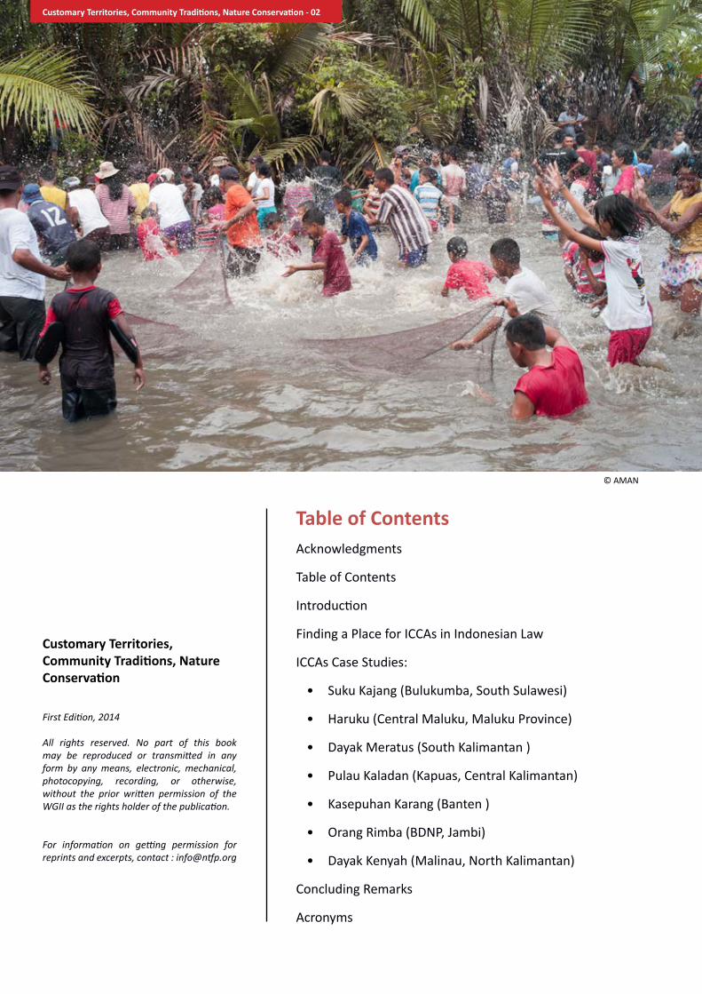
table of Contents Acknowledgments
Table of Contents
Introduction
Finding a Place for ICCAs in Indonesian Law
ICCAs Case Studies:
• Suku Kajang (Bulukumba, South Sulawesi)
• Haruku (Central Maluku, Maluku Province)
• Dayak Meratus (South Kalimantan )
• Pulau Kaladan (Kapuas, Central Kalimantan)
• Kasepuhan Karang (Banten )
• Orang Rimba (BDNP, Jambi)
• Dayak Kenyah (Malinau, North Kalimantan)
Concluding Remarks
Acronyms
Customary territories, Community Traditions, Nature Conservation
First Edition, 2014
All rights reserved. No part of this book may be reproduced or transmitted in any form by any means, electronic, mechanical, photocopying, recording, or otherwise, without the prior written permission of the WGII as the rights holder of the publication.
For information on getting permission for reprints and excerpts, contact : [email protected]
© AMAN
Customary Territories, Community Traditions, Nature Conservation - 02

Indonesia is one of the world’s biologically mega-diverse countries that consists of around 17,000 islands, with the total combined area of the islands at 1,904,569 km2. Indonesia has a number of Indigenous peoples’ and community conserved territories and areas (ICCAs)1 types across the country with different cultural and environmental value that can be found in lakes and rivers, peatland, forests and coastal areas. Though the terminology “ICCA” is relatively new, indigenous communities in Indonesia have been practicing conservation of natural resources for centuries. The Ammatoa Kajang of Bulukumba, South Sulawesi have been protecting Borong karamaka or sacred forests for generations. The Haruku people of Maluku practice Sasi or “customary prohibition”, especially in monitoring the growth and movements of the lompa fish to allow a bountiful harvest, but also to allow replenishment for succeeding generations. Finally, the Dayak Kenyah of Malinau, North Kalimantan reserve part of the forest and river watersheds as Tana Ulen. These areas are strictly monitored by a special committee and transgressors pay fines.
Unfortunately, ICCAs have encountered some hurdles along the way and more often than not, go unrecognized for the value of conservation efforts that communities provide. Issues and concerns that have emerged regarding ICCAs in Indonesia, revolve around
• securing the rights and traditional practices of indigenous peoples and local communities at local and national level, and ICCAs as part of them;
• addressing the development needs of forest communities in addition to their
1 ICCA stands for Indigenous Communities’ Conserved Areas and Territories, or places where in a community has a close association with their territory, combined with their own governance and conservation system. ICCAs are a source of identity, culture, everyday needs and livelihood – the very life force of these peoples.
rights over resources; • offering appropriate recognition to
the customary institutions capable of governing natural resources, and to their accompanying knowledge and management practices;
• tackling conflicting visions of the desired future, and poor communication among indigenous peoples, conservation NGOs and national park staff;
• enhancing the level of participation and consultation of local stakeholders (including women);
• changing both the repressive approaches to conservation that are often still at play as well as the negative perceptions of conservation that generally accompany them ;
• providing higher transparency of information and ensuring prior informed consent of relevant indigenous peoples and local communities wherever the government and/or private sector companies affect their land and resources;
• engaging in fair partnerships and negotiations;
• encouraging good governance and responsible leadership at all levels.
ICCAs encounter both internal and external challenges. The internal challenges include border conflicts and degradation of traditional knowledge and local wisdom. Besides those internal challenges, the external challenges are also something that indigenous communities have to cope with. These challenges include recognition of the status of the territory, as many areas are being opened up for development projects like plantations, mining, etc; policies that are generally not favorable to ICCAs; and the modern world that draws attention away from sustaining traditional practices. There is also a significant lack of political will from the government to endorse community conservation.
Introduction
© R
MI
Customary Territories, Community Traditions, Nature Conservation - 03

Despite this, there are examples where community conservation is starting to be recognized by the government. In Malinau District, in 2012 the Malinau District Government issued Regulation No.10 / 2012 on the Recognition and Protection of the Rights of Indigenous Peoples in Malinau, North Kalimantan. In the District of Lebak, Banten, the government issued the local district regulation No. 32/2001 on the Protection of Baduy Land Rights, and in 2013 the Regent of Lebak signed Decree 430 of 2013 on the Recognition of Indigenous Presence in the Indigenous Territory of Banten Kidul in Lebak.
However these local regulations alone cannot ensure deeper institutional change and require the support of a broader legal framework.
Recently, the Constitutional Court issued a ruling No 35 / PUU-IX / 2012 on the judicial review of the Forestry Law No 41/1999 brought on by AMAN. This provides space for further recognition of indigenous communities conserved areas and territories, especially customary forests. This decision highlighted that customary forest (or forest claimed and managed by indigenous peoples) is not ‘hutan negara’ or state forest but another, rightful and separate category of forest land. This legal decision opens a new course of action for the recognition of customary forests in Indonesia. It is definitely a fundamental legal milestone for ICCAs in Indonesia. However, for the recognition of customary forest to take effect, local governments need to first draft and approve release appropriate legislation to support “hutan adat”. Furthermore, the Ministry of Forestry is also raising questions on the interpretation of this court decision.
ICCAs are imperative in securing positive conservation outcomes, and it is important that government stakeholders understand and promote the values of ICCAs. Traditional conservation practices and mechanisms have proven their effectiveness and can run alongside conventional state approaches to conservation.
To promote ICCAs further in Indonesia, the Working Group on ICCAs in Indonesia (WGII) was established after the ICCAs Symposium in Bogor, October 2011. Participant organizations include: JKPP (Participatory Mapping Network in Indonesia), NTFP-EP (Non-Timber Forest Products –Exchange Programme –Asia), WWF Indonesia, KIARA (Peoples Coalition for Fisheries Justice), HuMa (Association for Community and Ecology-based Law Reform), Pusaka ( an Indigenous Peoples advocacy organization), AMAN (Alliance of Indigenous Peoples of Indonesia), Sawit Watch (Oil Palm Watch Indonesia), WALHI (Indonesian Environmental Forum / Friends of the Earth Indonesia). This compilation of ICCA stories is one of the steps being taken by WGII to promote ICCAs practices and recognition in Indonesia.
This compilation is still a work in progress. It represents the initial release of a collection of case studies and experiences of ICCAs in Indonesia.
© K
KI W
ARSI
Customary Territories, Community Traditions, Nature Conservation - 04

Finding a Place for iCCas in indonesian Lawby : sandoro Purba
The basis of ICCAs in Indonesian National Law
Indigenous and Community Conserved Areas or ICCAs1 can be found across the Indonesian archipelago. These conservation areas and practices existed even before the Republic of Indonesia was born. These practices, beliefs and areas were based on indigenous law practiced for centuries.
It is ironic, therefore, that the birth of the Indonesian state seemed to have closed the door on indigenous law and legal pluralism. The new state failed to recognize the existence of the diverse customary laws of different indigenous peoples. Indigenous territories then were absorbed into the state territory of Indonesia. This consolidation then did not leave much space for the appreciation of local wisdom and customary law and customary tenurial practice which was and is often the foundation of community natural resource management practice.
Indonesia embraced legal unification and mirrored the legal system on continental European tradition, where the authority to produce laws and regulations was in the hands of the parliament and the president. This saw the beginning of a disconnect with law created by the state and laws stemming from time tested, age old traditions and beliefs.
The amendment of the constitution in 2002 finally recognized the rights of indigenous communities and the right to a healthy environment. In Indonesia’s National Constitutional framework, which is in the second amendment of the Constitution of 1945, we find two articles as legal basis for ICCAs:
1) Article 28H paragraph (1) Constitution of 1945: “Each person has the right to a life of well-being in body and mind, to a place to dwell, to enjoy a good and healthy environment, and to receive medical care.”
2) Article 28 I paragraph (3) Constitution of 1945: “The cultural identities and rights of traditional communities are to be respected in conjunction with progressing times and civilization.”
1 ICCAs have been in the international discourse since the 4th World Conservation Congress in Barcelona. Indigenous and Community Conserved Areas (ICCAs) is defined as: "natural and/or modified ecosystems containing significant biodiversity values and ecological services, voluntarily conserved by (sedentary and mobile) indigenous and local communities, through customary laws or other effective means." (World Parks Congress Recommendation V26, 2003). For further information visit websites related to ICCAs: http://www.iccaregistry.org/en/about , http://www.iccaconsortium.org/?page_id=55
Referring to the Indonesian Constitution, the discourse about ICCAs first refers to the rights over a good and healthy environment and second on the position of cultural identity and the rights of traditional communities. ICCAs is the intersection of these two rights. The cultural identity of the local communities is the basis for their traditional rights.
After the Indonesian Constitution was amended, there were old rules and regulations that were still valid without having been adjusted to the Amended Constitution of 1945. With regards to ICCAs, there have not been any rules in national legislation with the intention of giving full authority to indigenous communities in managing their own conservation areas. Legislation issued by the government on every level is still centralized.
Legislation on Conservation in Indonesia
Today, Indonesia still uses the Law on the Conservation of Living Resources and Their Ecosystems (Law No.5 of 1990). This Law ratified the Convention on Biological Diversity (CBD).2 In one of its articles, it stated that at the time this Law took effect, the following Legislation, that was applicable during Dutch colonial times, was abolished:
1) Hunting Ordinance (Jachtordonnantie 1931 Staatsblad 1931 Nummer 133);
2) Wild Animal Protection Ordinance (Dierenbeschermingsordonnantie 1931Staatsblad 1931 Nummer 134);
3) Java and Madura Hunting Ordinance (Jachtoddonnantie Java en Madoera 1940 Staatsblad 1939 Nummer 733);
4) Conservation Ordinance (Natuurbeschermingsordonnantie 1941 Staatsblad 1941 Nummer 167);
Although the Law on the Conservation of Living Resources and Their Ecosystems replaced colonial legislation, its logic was the logic of the Dutch in doing conservation which imitated the ways of German Forestry scholars. The management based on this logic required that the forest should be managed by the state and gave little credence to customary forest management.
The Law on the Conservation of Living Resources and Their Ecosystems divides nature conservation areas into three types, i.e.:3 “a. national park; b. grand forest park; c. natural recreation park.” In addition, there is also the term natural sanctuary,4 which aims at preserving an ecosystem in order to maintain its use in its original condition. The natural
2 Read also Report of The Government of Indonesia on CBD in Indonesia, in “National Report on the Implementation of the Convention on Biological Diversity. The First National Report: Implementation of Article 6, General Measures for Conservation and Sustainable Use.”
3 Article 29 paragraph (1) UU Law on the Conservation of Living Resources and Their Ecosystems
4 See Article 12 Law on the Conservation of Living Resources and Their Ecosystems “The preservation of plant and animal diversity and their ecosystems shall be implemented by maintaining the integrity of natural sanctuary reserves in their original condition.”
Customary Territories, Community Traditions, Nature Conservation - 05

sanctuary consists of: “a. nature reserve; b. wildlife sanctuary.” This Law had made uniform forests all over Indonesia. It did not provide any space for different indigenous and local communities to use their own terms and conditions in accordance to their local wisdom in protecting their ICCAs.
This Law also confirmed the central roles of the state in controlling and managing conservation areas. In terms of the management of nature conservation areas, the Law on the Conservation of Living Resources and Their Ecosystems stated that the management of conservation areas is carried out by the Government. This is stated particularly in Article 34 paragraph (1) of the Law “Management of National Parks, Grand Forest Parks and Natural Recreation Parks is carried out by the Government.” The utilization and access to the conservation areas is for tourism purposes.5 While concession rights can promote public participation,6 it is evident that legislation is very centralized in conservation areas in Indonesia. Strictly speaking, therefore, according to national laws, the only space left for indigenous peoples and local communities is their participation in tourism, although nobody knows the concept of participation offered by this Law.
To place local communities as mere participants in conservation actions and to place the government as main actor basically is an action to separate peoples, particularly indigenous and local communities from their life which is integral to nature. Legislation states that the government has the dual role of regulation and implementation.7 This is ironic considering that the government may not know better than the conservation practices that the indigenous and local communities have known all their lives. The government needs to learn from the indigenous peoples about managing their conservation areas, and then both parties can collaborate together in conserving nature.
The Law on the Conservation of Living Resources and Their Ecosystems was issued in 1990 while the Indonesian Constitution of 1945 has been amended twice, the last revision being in 2002. It is time for the Law on the Conservation of Living Resources and Their Ecosystems to be adjusted with the constitutional rights of indigenous and local communities. Constitutional rights of indigenous and local communities must be integrated into legislation in addition to the recognition they have received in the amended Constitution of 1945. It has been a long and bumpy road for civil society in
5 See Article 34 paragraph (2) Law on the Conservation of Living Resources and Their Ecosystems “Tourism facilities may be developed in the Utilization Zone of the National Park, Grand Forest Park and Natural Recreation Park, based on the management plan”
6 See Article 34 paragraph (3) Law on the Conservation of Living Resources and Their Ecosystems “For tourism and recreation activities, the government may grant concession rights in Utilization Zone of National Park, Grand Forest Park, and Natural Recreation Park. The rights holder should promote public participation.”
7 See Article 37 paragraph (1) Law on the Conservation of Living Resources and Their Ecosystems “The government will lead and mobilize its citizen to participate in conservation of living resources and their ecosystems through an efficient and effective manner.
their efforts to change this particular Law.
Other than the Law on the Conservation of Living Resources and Their Ecosystems, Indonesia also has many rules of the same level which also regulate conservation. Indonesia has a Law on Forestry, a Law on Water Resources, a Law on Fisheries, a Law on the Management of Coastal Areas and Small Islands, a Law on the Protection and Management of the Environment. Conservation Areas are regulated sectorally and centrally. It is the ministries and institutions under the control of the Central Government who hold the authority to implement conservation laws. In order to implement the different kinds of laws mentioned, in Indonesia there are the Ministries of Forestry, Environment and Fisheries respectively. The areas of conservation are managed by a local agency which is established by a certain ministry to exercise one of the authorities mentioned in the law. However, it is important to note that regional autonomy has fractured this authority and much power is now wielded by the local government at the provincial and district/city level.8
One of the laws that provides great authority or control over forest areas in Indonesia is the Forestry Law.9 This Law also mentions conservation. Article 1 paragraph 9 of this law states that: “Conservation forest is a forest area with typical characteristics, with the main function being to conserve bio-diversity and the ecosystem thereof.” One of the functions of the forest is thus for conservation.10 Furthermore, the Law establishes that conservation forest consists of: a. nature preserve forest area; b natural preservation forest area; and c. hunting resort.11 The authority on determining the forest area type is fully in the hands of the Ministry of Forestry. The function of the regional government is only in terms of coordination. This is because their authority is related to determining the use of the land other than forest. The local government holds the authority in structuring “other land use”.12
Conservation clauses can also be found in the Water Resources Law.13 Article 1 paragraph 18 of this Law says that: “Water Resources Conservation is the endeavor to maintain the existence and
8 See Law No. 32 of 2004 on Regional Government 9 See Law No. 41 of 1999 on Forestry10 See Article 6 paragraph (1) of Law on Forestry says that
forest shall have three functions, namely: a. conservation, b. protection, and c. production.
11 See Article 7 of Law on Forestry 12 See Law No 26 of 2007 on Spatial Planning 13 See Law No. 7 of 2004 on Water Resources
© A
MAN
Customary Territories, Community Traditions, Nature Conservation - 06

continuation of the condition, nature, and function of water resources to ensure continued availability in sufficient quantity and quality to fulfill the needs of living creatures for present and for future generations.” This piece of legislation states that water resources in conservation areas, determined by the government,14 shall be conducted in: “...rivers, lakes, dams, swamps, groundwater depressions, irrigation systems, water catchment areas, natural sanctuaries, natural conservation areas, forest areas, and beach areas.”15 This Law also requires the establishment of “water resources management”16 to perform the inter-sectoral and inter-regional coordination function in water resources conservation efforts.
In the Fisheries Law,17 conservation terms are also included. Article 1 paragraph 8 of the Law says that:
“Conservation of Fish Resources are efforts to protect, preserve and utilize fish resources, including ecosystems, types and genetic resources to ensure the existence availability, and continuity by maintaining and increasing the quality of the value and variety of fish resources.”
According to this Law, it is the minister who is authorized to determine a “water conservation area.”18 This law maintains the main function of water conservation with the central government.
The Law on Management of Coastal Areas and Small Islands19 also regulates conservation. Article 1 paragraph 19 of this Law states that:
“Conservation of coastal areas and small islands is the effort to protect, preserve and utilize the coastal areas and small islands including ecosystems, to ensure the existence availability, and continuity of coastal areas and small islands resources by maintaining and increasing their quality of value and variety.”
14 See Article 14 of Law on Water Resources 15 See Article 25 of Law on Water Resources
16 See Article 85 and Article 86 of Law on Water Resources.17 See Law No. 31 of 2004 on Fisheries, then replaced by Law
No.45 of 2009.18 See Article 7 of Law on Fisheries.19 See Law No. 27 of 2007 Law on the Management of
Coastal Areas and Small Islands (it is known as UU PWP3K), then replaced by Law No.1 of 2014.
In terms of the authority to determine the uses of areas for conservation, it is in the hands of the minister as mentioned in the said Law. The Law on the Management of Coastal Areas and Small Islands states that: “Changes in the designation and functions of the core zones of conservation areas for exploitation shall be determined by the Minister based on the results of integrated research.”20 In addition, the designation of this area is also integrated with provincial and district/city spatial planning.21
The newest law on conservation is the Law on Environmental Protection and Management.22 Article 1 paragraph 18 of this Law states that: “Natural Resource Conservation shall be the management of natural resources to assure wise utilization and the continued availability of the same by preserving and enhancing the quality and value natural resources as well as of biodiversity itself.” Furthermore, the minister in charge, under this law, is authorized with stipulations on eco-regions23 as an integrated part in natural resources conservation. However, management continues to be centralized in the hand of the minister. In addition, the law provides government officials with the authority to issue environmental permits24 which are the prerequisites of all extractive industries in Indonesia.
In the meantime, peoples’ or public participation as stated in the Law of Environmental Protection and Management is limited. This can be found in the following provision on:25 “a. social control; b. suggestion, opinion, recommendation, objection, complaint; and/or c. information and/or report.” None of the provisions provide indigenous and local communities any access to manage forest areas for the purpose of conservation.
We can conclude that all of the laws that regulate conservation are not deliberately in favor of indigenous and local communities. In national legislation, we hope there will be one law which could provide indigenous and local communities with secure access to their areas. If this legislation is in place, in the future, indigenous and local communities can avoid conflict with government agencies while implementing their own conservation practices.
Community Conservation
Indonesia’s legal perspective embraces the state as the one who has a major role in conservation. The participation of local communities is often minimal. This gap has prevented indigenous and local
20 See Article 28 of Law UU PWP3K21 See Article 7 of Law No. 26 of 2007 on Spatial Planning. In
addition, the authority on spatial planning is on the hand of regional government on provincial and district/city level as regulated in Law No. 32 of 2004 on Regional Government.
22 See Law No. 32 of 2009 on Environmental Protection and Management.
23 See Article 7 of Law on Environmental Protection and Management.
24 See Article 36 of Law on Environmental Protection and Management.
25 See Article 70 of Law on Environmental Protection and Management.
© A
MAN
Customary Territories, Community Traditions, Nature Conservation - 07

communities to have full access over their ICCAs. The discourse on the public’s direct involvement in conservation which has been discussed in different forums has not changed the government’s paradigm in relating with its peoples.
Many studies show that indigenous communities have conducted more effective nature conservation under their own local rules.26 WWF Indonesia collected 50 stories from all over the country that reflect this as well. From these 50 stories we can see that peoples’ initiatives around conservation areas contribute to both nature conservation and livelihood enhancement. However, these local initiatives are only partially accommodated by national law. With greater access to conservation areas, indigenous peoples could enjoy the benefits of sustainable livelihoods and they could strengthen conservation efforts as well. In some areas, the local government is starting to recognize indigenous conservation actions. However, these initiatives should not be evaluated only on face value. These success stories are still few and far between and refer to certain situations and conditions. They are often the result of strong lobby work and the existence of officials in favor of community management over conservation areas.
In the national context, Indonesia needs strong legal legitimacy and supportive organizations to ensure recognition and implementation of community conservation areas. If this is not fulfilled, then the exclusion of indigenous peoples from the access and management over their ICCAs will continue. With this lack of community involvement is the denial of the rights of local communities to welfare, livelihood and cultural practice leading to greater poverty and possible forest mis-management. The World Forestry Congress in 1978 agreed that “forest management should be aimed at improving peoples’ welfare especially poor people who live around the forest.” Three decaces after that congress, there should have been national policies that could accommodate ICCAs in Indonesia.
the License regime over indonesia’s Forests
Much of Indonesia’s forests are under a license regime where the access of persons or corporations to natural resources is based on their capacity to meet requirements related to that license. Often this also comes with costs. In the context of Indonesia’s forestry management, many conservation forests are being converted into
26 Further read “Masyarakat dan Konservasi: 50 Kisah yang Menginspirasi dari WWF untuk Indonesia” (2012, WWF-Indonesia)
protected forest. In Indonesia, protected forest can be accessed by a forest lease. In this case, an area can be used “temporarily” for mining or other supportive means which is considered strategic by the government.27
Customary or local law which has been the guide for indigenous and local communities in managing their protected areas has been replaced by state law. To gain recognition, indigenous and local communities have to enter this framework where they have to compete with corporations or other communities who have economic motives in obtaining permits.
One forest management access permit available for communities provided by the state is Community-based Forest: Hutan Kemasyarakatan or known as Hkm. “A community-based forest or Hkm is state forest where the main purpose is for local people’s empowerment.”28 To avail of the community-based forest program, indigenous and local comunities must have permits from the head of the district/mayor or governor. Then there will be some verification until finally the Minister of Forestry will decide whether he will grant the permit or not.29
Another way to access forests is through the Village Forest scheme. Village forest is “... state forest which is managed by and utilized by the village and for the village’s welfare and where there is no existing permit nor other right over it.30” In order to obtain a permit to use the village forestry scheme, one has to go through a long and complicated bureaucratic process, just as in Hkm, just to avail of this program. The process starts with village officials who propose a site for village forestry to the head of a district/mayor with notification to the governor. The permit will be verified by a team established by the Minister of Forestry by involving upper levels inside the Ministry of Forestry.
We then can imagine how long a remote village, far away from the capital would wait for the approval of a minister to be able to access a forest which might be only one hundred meters from the village. According to the National Forestry Council, there are thirty thousand villages inside forest areas designated by the Ministry of Forestry.31 The designation of forest areas has never been followed with the required next steps which are forest area boundaries setting, forest area mapping, and
27 See Article 4 of Government Regulation No. 24 of 2010 on The Use of Forest Areas, then replaced by Government Regulation No. 61 of 2012.
28 See Article 1 paragraph 1 of Ministry of Forestry Regulation No P.37/Menhut-II/2007 on Community-Based Forest (Hutan Kemasyarakatan)
29 Further see Ministry of Forestry Regulation No P.37/Menhut-II/2007 on Community-Based Forest (Hutan Kemasyarakatan)
30 See Article 1 paragraph 7 of Ministry of Forestry Regulation No P.49/MENHUT-II/2008 on Village Forest, then replaced by Ministry of Forestry Regulation P.53/Menhut-II/2011.
31 http://dkn.or.id/wp-content/uploads/2013/04/Olahan-Berita-Seputar-RUU-P2H.pdf, accessed on August 14, 2014. Also look: http://www.mongabay.co.id/2013/03/25/soal-ruu-pph-dkn-ingatkan-ada-30-ribu-desa-di-kawasan-hutan/, accessed on August 15, 2014.
© K
KI W
ARSI
Customary Territories, Community Traditions, Nature Conservation - 08

forest gazetting.32 The Indonesian Constitutional Court has ruled on the government’s obligation to follow the steps of forest gazetting in 2011.
emerging Laws on Customary Forest and Customary village
The Indonesian Constitutional Court has asserted the restoration of indigenous peoples’ rights especially in terms of customary forests or hutan adat by enacting the Constitutional Court Ruling No.35/PUU-X/2012. Through this ruling, the Constitutional Court decided to take customary forests out of state forest or hutan negara, which means that customary forests are forests subject to rights or hutan hak.. If the Constitutional Court Ruling is implemented strictly, then there will be a guarantee for indigenous peoples’ tenural security and for the implementation of ICCAs in the field.
The implementation of Constitutional Court Ruling No.35/PUU-X/2012 is not so simple, however. First off, it involves two agencies in Indonesia, the Ministry of Home Affairs and the Ministry of Forestry, which have authority over the process of releasing customary forests to indigenous peoples. The Ministry of Forestry has already issued the amendment on Inauguration Forest Areas (P.62/MENHUT-II/2013, previously P.44/MENHUT-II/2012). By this regulation, the Minister of Forestry declares that customary forests shall be excluded from state forest after a district or province has issued a local regulation recognizing their existence and their distinct area. This is also a complicated and political process.
After The Constitutional Court Ruling No.35/PUU-X/2012, the Ministry of Home Affairs issued a regulation regarding the Guidelines for the Recognition And Protection Of Indigenous Peoples or Peraturan Menteri Dalam Negeri Nomor 52 Tahun 2014. Through this regulation, every district or kabupaten shall form a committee to implement the process of recognizing indigenous peoples. Although, Indonesia has these two regulations, there is still a challenge to ensure that every local government will carry out their obligations in the recognition of indigenous peoples, their customary forests and their ICCAs. The Ministry of Home Affairs used to have authority to determine policies at the local government level. However, this regulation becomes difficult to implement with the regulation on regional autonomy. (Law number 32 Year 2004 on Local Government). Since both the Ministry of Foreign Affairs and the Ministry of Forestry require local government regulations before indigenous peoples rights can be recognized, the enjoyment of this right will definitely be an uphill battle for indigenous communities in Indonesia.
The legislation process in Indonesia provides a better position for indigenous and local communities against the state through the enactment of the Village Law.33 This Law states that Indigenous communities are free to choose 32 See at Article 15 of Law on Forestry and reasserted by
Constitutional Court Ruling No. 45/PUU-IX/2011.
33 See Law No. 6 of 2014 on Village.
their own governance scheme that is most fitting to the communities’ development. The indigenous community has the choice to convert the administration of the village into a Customary Village or “Desa Adat” or to name it using local terminology. Through this legislation, a “Desa Adat” will have better chances of accessing its own Village Forest. This legal space could actually be the bridge for indigenous and local communities to be able to exercise complete self determination in terms of governance and ICCA management.
Closing remarks
Conservation areas are often conflict ridden in finding the middle ground between the implementation of various state laws alongside local community laws. There is still a lot of room for national laws to accommodate indigenous and community conservation areas and to recognize the benefits of more participatory forms of conservation management. Though there are some recent developments which provide some hope, many different government entities are involved in the final recognition of community conservation claims, and thus, political will is important to get this process going. It is important for the State to affirm the existence of indigenous peoples and seek to protect their rights. It is about time that effective local, indigenous laws and practices over the conservation of natural resources can formally be recognized as indigenous, community conserved areas (ICCAs).
© K
KI W
ARSI
Customary Territories, Community Traditions, Nature Conservation - 09

The Ammatoa Kajang is one of the oldest indigenous communities in South Sulawesi still existing today. They live in a region called Kawasan Ammatoa Kajang in Desa (Village) Tana Toa, Kecamatan (Sub-district) Kajang, Kabupaten (District) Bulukumba, South Sulawesi. This community is widely known for their consistency in rejecting modernization and in holding their custom firmly intact, including their customary practices in protecting their forest.
Geographically, Desa Tana Toa is located between 5o-6o southern latitute and 120oeastern longitude with its area obliquely positioned from northwest to southwest. It covers 7.1 Km2. Desa Tana Toa consists of 8 dusuns (hamlets), namely: Dusun Sobbu, Dusun Benteng, Dusun Tombolo, Dusun Lurayya, Dusun Balambina, Dusun Pangi, Dusun Jannaya and Dusun Balagana. Its population is
4,024 individuals consisting of 1.882 men and 2.142 women, making up 957 households1.
The Kajang community holds firmly the customary institution of Ammatoa Kajang that is called Pangngadakkang or the adat structure. The role and function of the adat2 institution is based on Pasang ri Kajang. Pasang ri Kajang is believed to be a collection of messages from the ancestors.
Pasang ri Kajang is a philosophy of life that governs all aspects of Indigenous Kajang life. Pasang ri Kajang says that: Ammatoa mana’ ada’ or Ammatoa gave birth to adat and Ammatoa mana’ Karaeng or Ammatoa gave birth to Karaeng. Karaeng is interpreted as the ruler of a region or area. In the structure of the the Ammatoa Kajang Adat Institution, the Ammatoa holds the highest position in terms of customary law and governance. Below the Ammatoa in the structure is Anrong that consists of two officials which are Anrong ta ri Pangi and Anrong ta ri Bongkina. The figure of Ammatoa is so sacred, that nobody is allowed to take his
photograph nor to publish a photo of him. Taking his photograph or publishing his photograph is taboo.
1. Source of data: Potential population of Tana Toa, official Tana Toa village data, 2014
2. Adat means custom, customary or customary law.
Protecting Forests, Preserving Customs On Forest Protection and Management in the Ammatoa Kajang Indigenous Community Bulukumba
By: Wahyu Chandra
© A
MAN
Customary Territories, Community Traditions, Nature Conservation - 10
To the Kajang community, the Ammatoa is known as “Bohe’ Amma.” In Konjo, “Bohe” means old, elders, respectable, or honourable. ‘Amma’, on the other hand, means father (a married man, a head of household). ‘Bohe’ Amma’ means the kepala adat (traditional chieftain) who can foster and direct the indigenous community on the right path, according to their belief and customary rules.
The local wisdom of “Bohe’ Amma” as a chieftain is seen in the way he directs, fosters, decides and shares his wisdom. This local wisdom is held firmly by all people. If any one violates this, sanctions will be implemented in accordance with the applicable adat rules.
The Life of the Ammatoa Kajang Indigenous Community
The economic life of Kajang people depends mostly on agriculture. Most Kajang people are subsistence farmers. They use most of their agricultural products to meet their own needs and for religious adat rituals. Almost every house in Kajang has a paddy or corn barn. Paddy or corn is saved in the ceiling of every house which is called para. Paddy fields are located outside the area, while corn, clove, coconut, banana and tubers are inside the adat territory, and around the sacred forest. Kajang people are also known as enau (Arenga pinnata) growers. They make palm sugar out of this plant. In every ritual, they serve tuak3 that is made out of liquid tapped from enau midribs as their main beverage.
In addition to farming, Kajang people generally also raise cattle such as chicken, ducks, cows, buffalo and horses. Almost each house has a horse. Kajang people use horses for their local means of transportation.
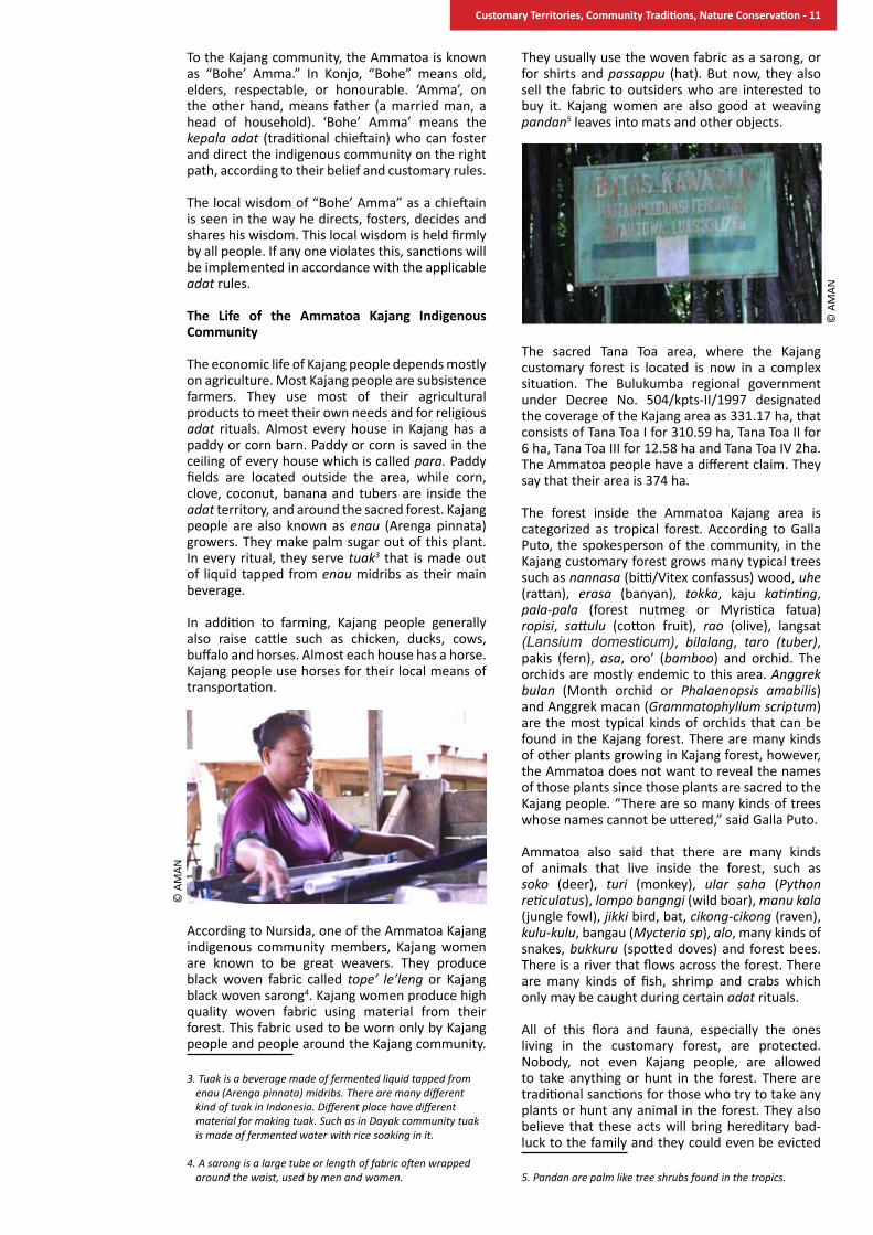
According to Nursida, one of the Ammatoa Kajang indigenous community members, Kajang women are known to be great weavers. They produce black woven fabric called tope’ le’leng or Kajang black woven sarong4. Kajang women produce high quality woven fabric using material from their forest. This fabric used to be worn only by Kajang people and people around the Kajang community.
3. Tuak is a beverage made of fermented liquid tapped from enau (Arenga pinnata) midribs. There are many different kind of tuak in Indonesia. Different place have different material for making tuak. Such as in Dayak community tuak is made of fermented water with rice soaking in it.
4. A sarong is a large tube or length of fabric often wrapped around the waist, used by men and women.
They usually use the woven fabric as a sarong, or for shirts and passappu (hat). But now, they also sell the fabric to outsiders who are interested to buy it. Kajang women are also good at weaving pandan5 leaves into mats and other objects.
The sacred Tana Toa area, where the Kajang customary forest is located is now in a complex situation. The Bulukumba regional government under Decree No. 504/kpts-II/1997 designated the coverage of the Kajang area as 331.17 ha, that consists of Tana Toa I for 310.59 ha, Tana Toa II for 6 ha, Tana Toa III for 12.58 ha and Tana Toa IV 2ha. The Ammatoa people have a different claim. They say that their area is 374 ha.
The forest inside the Ammatoa Kajang area is categorized as tropical forest. According to Galla Puto, the spokesperson of the community, in the Kajang customary forest grows many typical trees such as nannasa (bitti/Vitex confassus) wood, uhe (rattan), erasa (banyan), tokka, kaju katinting, pala-pala (forest nutmeg or Myristica fatua) ropisi, sattulu (cotton fruit), rao (olive), langsat (Lansium domesticum), bilalang, taro (tuber), pakis (fern), asa, oro’ (bamboo) and orchid. The orchids are mostly endemic to this area. Anggrek bulan (Month orchid or Phalaenopsis amabilis) and Anggrek macan (Grammatophyllum scriptum) are the most typical kinds of orchids that can be found in the Kajang forest. There are many kinds of other plants growing in Kajang forest, however, the Ammatoa does not want to reveal the names of those plants since those plants are sacred to the Kajang people. “There are so many kinds of trees whose names cannot be uttered,” said Galla Puto.
Ammatoa also said that there are many kinds of animals that live inside the forest, such as soko (deer), turi (monkey), ular saha (Python reticulatus), lompo bangngi (wild boar), manu kala (jungle fowl), jikki bird, bat, cikong-cikong (raven), kulu-kulu, bangau (Mycteria sp), alo, many kinds of snakes, bukkuru (spotted doves) and forest bees. There is a river that flows across the forest. There are many kinds of fish, shrimp and crabs which only may be caught during certain adat rituals.
All of this flora and fauna, especially the ones living in the customary forest, are protected. Nobody, not even Kajang people, are allowed to take anything or hunt in the forest. There are traditional sanctions for those who try to take any plants or hunt any animal in the forest. They also believe that these acts will bring hereditary bad-luck to the family and they could even be evicted
5. Pandan are palm like tree shrubs found in the tropics.
© A
MAN
© A
MAN
Customary Territories, Community Traditions, Nature Conservation - 11

from the village. Other than fish, shrimp and crabs, only forest honey can be taken by Kajang people and only for adat and religious rituals.
The Kajang community benefits indirectly from their forest. They use the spring water for their daily use and also for farming. They use the forest mostly for customary rituals. The Kajang people do not see the forest as an economic source. They are very adherent to the rules around the forest. They do not take any plants and fruits from the forest nor do they hunt any animals in the forest. However, they are allowed to take plants that grow outside the forest, such as taro, plants that they use to dye their yarn to be woven into cloth, and also enau or inru (Arenga pinnata) as the main material for making tuak and palm sugar. They are also allowed
to take a few pieces of wood from the forest on the border or borong batasayya. However, they will have to get permission from the Ammatoa and this is only allowed under certain rules. They also have to go through certain rituals first. For Kajang people, a forest is not an ecosystem nor a tourism service nor a project-based carbon provider. The Ammatoa implicitly said, however, that we will have to protect the forest in order to maintain universal balance. Forests are also important as a source of clean air.
Cool the earth
There is a ritual in the Kajang Community called addingingang or to “cool the earth”. It is an annual ritual, usually held towards the end of the year. The ritual is done usually to show the Kajang people’s appreciation for nature. Hundreds of people from inside and outside the Kajang community usually attend the ritual by carrying different kinds of food with them to be served. They will consume this food after the ritual. During the ritual, no modern devices are allowed. Modern eating utensils are also not allowed. People are only allowed to use plates that are made of woven enau leaves and cups made of coconut shells. Copper trays will have to stay outside the Kajang community.
Local and also provincial officials usually attend the big addingingang ritual of the Kajang Community. Traditional food is placed on woven enau leaves, banana leaves, bowls made of coconut shells, or baku (containers) made of dry enau leaves and served in the ritual. The ritual consists of different kinds of dances and an old ritual called attunu panroli which means “to burn a crowbar”. The crowbar will be burnt in the middle of an open field until it is very hot and red. It is said that this ritual is carried out in order to know one’s heart. When a dispute happens then in order to decide who tells the truth or who lies they use the attunu
the importance of the Forest for Life inside Pasang ri kajang • “Punna tenamo pokok-pokok, runtummi
buttayya, naikmi je’neka” If there are no trees, there will be landslides and floods.
• “Naiyya, boronga antu parruna linoa”
The forest is the Earth’s lung.
• “Pokok-pokoka antu, raunna kiyo bosi, aka’na moli je’ne” Every single leaf on a tree is calling for rain and the roots of the tree will hold the water.
• “Punna ritabbang kajua ri boronga angngurangi bosi appatanrei tumbusu, anjo boronga angngontaki bosiya aka’na kajua appakalompo tambusu napau tau riolo” If the trees in the forest are cut down, there will be less rain and finally there will be less water in the springs, because it is the trees that call the rain to fall, just as what our ancestors told us.
© A
MAN
© A
MAN
© A
MAN
Customary Territories, Community Traditions, Nature Conservation - 12

panroli ritual. “If one has a good heart and if one is telling the truth, then one will not feel the heat nor be burnt when one holds the burning crowbar. On the other hand, one will feel the heat and will be burnt if one tells a lie,” explains Nursida.
In order to understand Ammatoa forest management, one should understand their culture and their rituals. For generations, forests have been an integral part of the Kajang community that their very existence is closely linked to the very existence forests. As long as the forest is protected and intact, the Kajang community will still exist. The cultural and spiritual significance of the forest for the Kajang community can be seen in each important ritual that is carried out in the sacred forest, start from the birth ritual, to the wedding ritual to the funeral ritual.
For the Ammatoa Kajang indigenous community, the forest is a place where their ancestors first settled. They believe that they should protect and preserve the forest since it has historical values that remind them of their origin and the greatness of their ancestors in the past. Nevertheless, it does not mean that people cannot benefit from the forest. To protect the forest is an integral part of a human’s effort to fulfill their needs.
The use of forest products for customary rituals, economic needs, building a house and opening a field is allowed as long as it is in accordance with the applicable rules that have been set by Pasang and with the permission from the Ammatoa. The Ammatoa’s blessing can be obtained by pleading directly to the Ammatoa and other adat elders. According to Mansyur Embas, one of the Kajang elders who now lives outside the area, how central the forest is to the Kajang Indigenous community’s life can be seen in the use of forest in the procession of Ammatoa assignation. It is the most sacred ritual for the Ammatoa community, which only happens when the former Ammatoa has passed away and while waiting for the successor. After the Ammatoa has passed away (a’linrung), there will be a pause for three years before the next one is assigned. After three years, there will be a ritual of selecting a new Ammatoa. This selection is carried out by the two most important women in the Kajang community that are called Anrong, namely Anrongata ri Pangi and Anrongta ri Bongkina. Anrong has a unique position in the adat structure, they are not under Ammatoa but on the same level. They have a vital role since they prepare all the customary equipment. For the selection of the Ammatoa, both of them will carry out several rituals inside the forest, which will last at least three months.
In addition to cultural significance, the Kajang community forest also has a vital role in preserving the water inside the area. The Kajang believe that if the forest is protected, even in a dry season they would still have water. The availability of water will guarantee the high productivity of their land. Right in the middle of their village, there is a well. This well is the only one inside the area. The Kajang people use the well to get clean water. Inside the forest, there is another well. But the water only can be used for rituals.
Historically speaking, the effort to protect the Kajang forest has been carried out since the birth of this community hundreds of years ago. The Ammatoa said that the Kajang area used to be very wide, not only covering Kabupaten Bulukumba but almost the entire Sulawesi Island and even outside the island. However the forest has been reduced to 374 hectares since then. Although the Ammatoa’s power is less, the forest stays intact.
The community is closed to the outside world, especially in terms of forest management. Some reforestation and forest rejuvenation projects offered by the government have even been rejected. The reason was simple. According to the Ammatoa, when an outsider plants inside their sacred forest, it means that outsider can claim that forest as his. “The Kajang forest does not need any help nor support from outsiders, since it has been protected and preserved by itself, says the Ammatoa. One day, it was proposed that the Ammatoa was to be awarded with the Kalpataru (prestigious government award for environmental protection). He rejected it because the Kalpataru is made of gold. Gold for the Kajang people is a symbol of luxury, something that they have avoided all this time. Not only environmental programs, many kinds of assistance in the form of money have been rejected by the Kajang community.
In addition, the Ammatoa is also careful in receiving guests. It is understandable. So much information about this community has circulated and not all of it is correct thus there are many misconceptions about the Ammatoa’s statements. Many researchers have made wrong conclusions only based on very little data and often based on data that has not been validated. Unfortunately, there have also been guests with insincere intentions.
Legal status and Governance The government has categorized the Kajang forest as limited production forest. In the Kajang community there is embaya. It is a term used by the Tana Toa community to define the existence of their community with all their characteristics.
The Ammatoa divides the forest into two parts. Borong karamaka is the sacred forest. It is the forbidden forest located in Dusun Benteng. According to Pasang, this is a forbidden forest, nobody is allowed to enter, measure the width and also note the width of the forest. The prohibition is called kasimpalli. It is also prohibited to disturb the flora and fauna inside the forest. The prohibition shows the Kajang community’s concern in
© A
MAN
Customary Territories, Community Traditions, Nature Conservation - 13

protecting their forest or borong karamaka. They believe that the forest is where their ancestors reside (pammantanganna sikamma tau rioloanta), the place to assign or appoint the Ammatoa (appadongko’ laparuntu pa’nganro), and also aka’ kajunna appakalompo tumbusu raung kajuna angngonta bosi or where the roots will preserve water, and where the leaves will call the rain.
Borong karamaka is divided into seven parts, namely: Borong Tode, Borong Naraka, Borong Karanjang, Borong Katintinga, Borong Sobbu, Borong Campaga Puang dan Borong Topalo. There is also borong battasaya or forest on the border. This type of forest is located on the border between three villages namely Desa Bonto Baji, Desa Pattiroang and Desa Tana Toa. In this forest, Kajang people are allowed to take timber under certain provisions. For the Kajang people, borong karamaka and also borong batasayya have their own sacred values. Both forests are sacred forest, and nobody is just allowed to enter them.
The local government respects the existence of the Kajang forest and leaves the forest management to the customary institution. The effort to protect the forest is carried out indirectly, but it is included in the local government regulation on the protection of the Kajang ndigenous community which was drafted in 2013. The idea of issuing a Local Government Regulation on the Protection of the Kajang Indigenous Community emanated from the Kabupaten Bulukumba Government as stated by the Head of the Forestry Departement of Kabupaten Bulukumba, Mibawati A. Wawo. “We have thought about this idea for so long since we really realize the importance of a regulation in favor of the Kajang indigenous community,” she explains.
During the reign of Sukri Sappewali, the former Bupati (Head of District), in 2008, there was an effort to draft a local government regulation on the Kajang indigenous community. It was in the final process, the draft was finished, but without any clear reason, the effort was abandoned. The effort found its momentum when CIFOR provided support in drafting the Local Government Regulation on the Kajang Indigenous Community with a different spirit and content from the previous one. Today’s Head of the Bulukumba District, Zainuddin Hasan, responded positively to the idea of issuing a Head of District Decree, or SK Bupati on the establishment of a local government regulation drafting team on July 2013 to tackle this same concern. The process was dynamic with some NGOs such as AMAN and LSM Balang and also the Kajang Community figures being involved in this process.
The effort to protect the Kajang area is regulated in Pasang ri Kajang. Pasang has been the reference for the Kajang people not only in terms of forest management but also in all aspects of the Kajang people’s lives. The Ammatoa admits that there are seldom violations in terms of forest management done by the Kajang Dalam (Inner Kajang) people. It is mainly because of the heavy customary sanctions for any violation, not to mention their belief that magic power protects the forest from
outsiders.
According to Galla Puto, the spokesperson who helps the Ammatoa, the Kajang forest is covered with magic power called passau meaning that there is a magic canopy that protects the entire forest. This magic is spread in all directions, instills fear in the people of Kajang and is said to protect the forest from intruders. Related to sanctions, when someone is violating the rules and does not pay the fine for the violation one has committed or runs away somewhere else, then the sanction will be upon one’s next of kin for seven generations to come.
As told by the Ammatoa, there was a Kajang who insisted on entering the forest without seeking first the Ammatoa and disregarded the applicable rules. This person turned into a deer with antlers. He was turned back into a human by the Ammatoa.
Another example of the worst violation ever committed was the one committed by the Head of Environment Department, the Head of the Forestry Department and the Head of the Village of Bulukumba. They cut down the trees on 147 hectares inside the Kajang area which is claimed by the Ammatoa as the Kajang forest. They did that with the knowledge that this was considered as production forest. During the adat meeting, it was decided that a sanction needed to be given to these government officials. The sanction was that they had to reforest the land where they had cut down the trees.
Sometimes conflict between the Kajang people occurs. The conflict usually ends with quarrelling parties denouncing each other, something that is forbidden in this community. When there is a conflict, a fine will be imposed on the ones in conflict. The amount of the fine depends on how big the mistake is that has been made. There are different levels of fines in Kajang. The highest fine is called poko’ ba’bala. The amount is 12 real or around 12 million rupiahs (close to USD 1,000). The highest fine is for big mistakes. For moderate mistakes the fine is called tangngah ba’bala or moderate sanction, and the amount is 8 real or around 8 million rupiahs. The lowest fine is called cappa ba’bala, the amount is 6 real or around 6 million rupiah. Once the elders have decided the amount of the fine, then one should pay the fine. The refusal to pay the fine will not only impact on oneself but also on one’s family.
© A
MAN
Customary Territories, Community Traditions, Nature Conservation - 14

Women have an important role in the Kajang indigenous community. The two most respected women are called Anrong. There is also a woman healer called sanro who will give blessings and say the prayers in each ritual. Ombo is the Ammatoa’s wife who also has a major role, especially in preparing ritual needs. Jannang are women who are responsible for organizing the rituals and other activities and who also for the work in the kitchen. The women mentioned earlier are always involved in every decision making process of the Ammatoa.
Forest Utilization
The conservation of the Kajang community forest has had direct impact on people’s lives. The Ammatoa says that the benefit from the sustainably managed forests of Kajang have been enjoyed by all human kind. Economically, the sustainable forest guarantees the availability of water and it provides food for people. The protected forest will also save them from drought. Because the forest absorbs the water and then saves it, then, during dry season the water will still be available for them.
The Ammatoa’s philosophy is that he believes that there is a link between protected forests and climate. The trees in the forest call the rain to fall, and when they do, their roots will keep the water flowing between them. Protected plants and untouched orchids will be the source of nutrition for all habitats inside the forest. The Ammatoa prohibits anyone from taking even the fallen trees from the forest, because someday they will be the fertilizer for the soil under the forest.
The Ammatoa also needs the forest to be protected and stay intact with all the flora and fauna untouched to be able to read nature’s signs. The Ammatoa can envision important events that will happen in the future by reading the messages of nature. Birds are not to be killed because the Ammatoa reads their movements and behavior to know what is happening or what is going to happen in the future. The Ammatoa and some of the Kajang people can even tell the time by listening to the sounds they hear around them.
The Power and Endurance of Forest Protection Initiatives
The Kajang Ammatoa Indigenous community has a high level of compliance with the rules as represented by the Ammatoa as the messenger of Pasang. The Ammatoa’s influence is not only felt in Kajang Dalam (inside) but also in Kajang Luar (outside). There is an example of this. The Ammatoa is known as an orthodox community leader and refuses anything modern or influenced from outside Kajang. Inside Kajang, modern things are absent. The road inside Kajang is made by the community themselves. There has never been any paved road although different kinds of development projects have tried to enter Kajang.
The Ammatoa does not go out of Kajang very often. When the Ammatoa decides to go out of Kajang to visit some friends, it is considered uncommon. One day he attended a wedding of a Kajang figure outside Kajang. Upon hearing of his plan to attend the wedding, all modern things including electricity in the house were shut down. The lights went out, they only used candles. Radio, TV, music were turned off. All the guests just obeyed and understood the situation.
The story above shows how people still respect and obey the Ammatoa. Nevertheless, there are also violations. There are efforts of outsiders to erode Kajang customary values, sometimes in the name of development. An example is found in the plan to install electricity in Kajang Luar which is still very close to the forest. The plan was strongly resisted by the Ammatoa and up until today the same electricity poles are still stuck in the ground on the side of the road but without any cables.
Problems and Challenges Indigenous community-based forest protection inside Kajang is still effective until today. There are not many obstacles since they have a powerful customary mechanism which is strictly followed. The Kajang people strongly believe in the sacredness of the Kajang forest.
The biggest challenge that is faced is the pressure
© A
MAN
© A
MAN
Customary Territories, Community Traditions, Nature Conservation - 15
from outside that forces modernization in the area through tourism. The Ammatoa is still persistent in refusing any such program. Conflict usually arises when the local government, through the head of Tana Toa village, tries to intrude and the Ammatoa does not agree with them. The project of the rumah adat (traditional house) miniature building is an example. The Ammatoa had rejected this project in the first place because the design and material to be used are not the ones that are used in the real house. Another problem is that the house would be electrified, something that is opposed by the Ammatoa.
In terms of forest management, there will be problems and challenges in the future. Different claims between the government and the Ammatoa in terms of the width of the Ammatoa customary forest shows that the government does not fully respect the existence of customary law in the Ammatoa customary land. Moreover, there have been planting efforts inside the Kajang forest which has always been opposed by the Ammatoa. The influences coming from outside Kajang will always be coming and felt by the Kajang community. There has been migration to outside Kajang for different reasons which will also keep happening. The reason usually is to find jobs or to go to school. The Kajang community used to reject schools too, but now they understand its usefulness. There are people who used to live inside Kajang who now live in Makassar or in Java to study in universities or look for work.
The large migration of Kajang people outside the area happened during the 1970s. The lack of arable land inside the area had encouraged people to look for arable land outside the area. They did this but still obeyed and remained under the influence of the Ammatoa Kajang. They then opened land for gardens and wet-rice fields that ranged from Kajang to Tanete. They also built settlements although they did not leave their identity as Kajang Dalam. The problem arose when PT Lonsum, a plantation company, entered the area in the 1980s. This company was supported by the government. They just carved up the land. Some people lost their land. Although they lost some of their land, people still lived in their settlement and farmed on their small plot of land.
Social changes are inevitable, especially in terms of economic and consumption patterns. Most Kajang people work as farmers, today slowly some Kajang people have turned into laborers somewhere outside Kajang. Their consumption patterns also changed drastically. There were times when they ate sago and corn. This was the time when they were under Dutch colonial rule and this was followed by the period under the Darul Islam/ Indonesian Islamic Army rule(DI/TII)6. Now the Kajang people eat rice from their sawah (paddy fields) that can be harvested twice a year. They also started eating modern food such as instant noodles. The Kajang people’s daily activities do not change much. Sanitation facilities (for bathing, washing and toilets) have not changed much either. They still use the same facilities as people in the olden days. The only well in the village is still the one in the middle of the settlement. They also still wear only black clothes and no shoes.
Political Participation Kajang people’s political participation is increasing in the last few years. Some people with Kajang blood in their veins are members of the DPRD (Regional House of Representatives) of Kabupaten Bulukumba. The Ammatoa, though not having any access to modern information devices, has a lot of information about what is happening outside the area.
The Ammatoa said that climate change does not have much effect on the Ammatoa Kajang indigenous community. Planting and harvest time are just the same like many years before. Sowing the seed is still in April, planting is in May and harvest is in July. They still harvest the rice twice a year. The villages around Kajang have changed, but not Kajang.
6. DI / TII was a political movement launched in 1949 by Sekarmadji Maridjan Kartosuwirjo in Tasikmalaya, West Java. This movement aimed to make the Republic of Indonesia a theocratic state with Islam as the state religion. In Sulawesi, the movement was led by Kahar Muzakkar.
© A
MAN
© A
MAN
Customary Territories, Community Traditions, Nature Conservation - 16

“As an adat figure I do not seek popularity. I do this because of my conscience. I want to show to the world that, in terms of environmental management, there is local wisdom in my kampong (village), Negeri Haruku, Maluku, that has proven capable of protecting the environment.” Eliza Kissay, the Head of Kewang Negeri Haruku.
For the last 35 years, Eliza Kissya has devoted his life as the head of Kewang, protecting the land and water, the legacy of his ancestors in Haruku Island, Maluku. Kewang is a customary institution authorized to govern the community’s economy and natural resources, and also to supervise the enforcement of adat rules in the community.
negeri Haruku at a Glance Haruku is a small island in Kabupaten (District) Maluku Tengah, Maluku Province, located between Ambon and Saparua islands. The name Haruku is derived from Haruku-Ukui, the local word for Baru Tree or Waru Tree (Hibiscus tiliaceus). From there emerged Aman Haru-ukui or Negeri Haruku meaning Land of Haruku. Haruku island is around 473 km2, which is located 10 kilometers east of the island of Ambon. Haruku island then became a kecamatan (sub-district). It consists of 11 negeris or hamlets namely: Negeri Haruku, Negeri Haruku, Negeri Oma, Negeri Wasu, Negeri Aboru, Negeri Hulaliu, Negeri Ori, Negeri Kariuw, Negeri Pelauw, Negeri Kailolo, Negeri Rohomoni and Negeri Kabauw.
Based on monographic data from the office of Kabupaten Maluku Tengah (2010) the population of Haruku stood at 2,098 people approximating 530 households. The indigenous peoples of Negeri Haruku mostly work as peasants and fishermen. This is because Haruku Island mainly consists of coastal areas and many smaller islands. The life of the Haruku people is very much affected by the climate and seasons. During the fishing season, when the tide is low, Haruku people go fishing in the sea. When the tide is high, they farm in their gardens and sawah (wet paddy fields). Other than work as peasants and fishermen, some of the Haruku people also work as entrepreneurs, sea-faring traders, carpenters, tailors, artisans and also as government officials (teachers).
the sasi of negeri Haruku By Eliza Kissya1 and annas radin syarif2
1 Eliza Kissya is a head of Kewang Negeri Haruku since 1979 until today. He was a member of National Board of AMAN from 2007 – 2012.
2 Annas Radin Syarif is the Director of Community Service, Deputy III of Empowerment and Community Service Department, Executive Board of AMAN periode of 2012 - 2017.
© A
MAN
Customary Territories, Community Traditions, Nature Conservation - 17

negeri Haruku’s Customary territory Land ownership in Negeri Haruku is under a customary system. Based on a spatial plan and adhering to customary rules, there are 3 kinds of lands that are managed customarily. The first type of land is called Tanah Dati. This land is managed by families. The rule in the management of this land is women are not allowed to manage land inside Dusun (sub-village) Dati. Women only receive the share of farming products. The second type is Tanah Pusaka, which is the land that is managed and owned by a marga or clan. The third type is Tanah Negeri. The ownership of this land belongs to the Negeri or community so the community manages this land. Usually this land is managed for conservation. For example, there are rules about the management of land on certain slopes which are not allowed to be used for farming.
Local Wisdom in Natural Resources Management Local wisdom in natural resources management is understood as the wisdom of certain local communities who manage their natural resources in a sustainable manner. This wisdom is created from interactions between humans and the natural environment around them. The accumulation of these different interactions shapes a knowledge system. There are different knowledge systems across different communities, depending on the characteristics of the territory where communities live and on the natural resources found within these territories.
In Negeri Haruku, there is local wisdom derived from the local community. Two bodies of local knowledge exist around determining fishing areas or the fishing period and in the timing of cultivation practices.
NanakuNanaku is Negeri Haruku’s local knowledge in determining fishing areas. The location is called Saaru or Rep. The names of Saaru have been known since ancestral times, some of them are: Sair, Rurete, Oha lau (panjang), Oha dara, Pasal, Wamarima dan Rutial. In the realm of fisheries, Saaru is known as fishing ground. Principally, Nanaku is the way to mark Saaru in order to know the availability of fish in certain places. Some ways in marking Saaru are as follows:
- Looking at the tide. If the tide is low or in times when the sea level is very low, fish is expected to be abundant. While during high tide, there is often no fish in the sea. An outward moving stream or current signals the time for fishing. When there is an inward moving stream, usually there are less fish in the sea so nobody goes fishing.
- Natural landmarks and landscapes. Often the Haruku people use landscapes and landmarks such as capes extending into the sea and mountains. Other than these markers, they also observe the position of certain trees in reference to the cape. When fishers have lost their way, these landmarks help guide them to Saaru.
- “Tanati” or auspicious times. Negeri Haruku people believe that there are good times to do certain activities which are called Tanati. These times are often dictated by the movement of the moon. Tanati during full moon (Bulan Jadi, Bulan Kelihatan or Bulan berdiri) starts from the seventh day of a full moon. This is a good time for Haruku people to go fishing. Tanati during the new moon also starts from the seventh day of the new moon. On the seventh day of the new moon, Haruku People start to go fishing. Signals of auspicious times are also observed by the tide of the sea.
Time for cultivation/farming Farming and gardening are the Haruku people’s main livelihood other than fishing. They plant cassava, taro, banana, vegetables, paddy and some commodity crops such as clove and nutmeg. Just like in determining fishing areas and periods, the Haruku people also have particular cultivation practices that have been passed on from generation to generation. In order to determine the time to plant, the Haruku people also observe the sea tide. High tide signals a good time to plant, and vice versa. Cultivating plants are not allowed at noontime. The Haruku people believe that the shadow of someone planting should not fall on the dug hole where seeds are to be sown. They believe that if shadows should fall on the dug holes, beasts may emerge to devour the plants or pests like wild boars may invade the farms.
© A
MAN
© A
MAN
Customary Territories, Community Traditions, Nature Conservation - 18
Challenges of the Haruku People: Laws, trawl nets, mining and Climate Change
The struggle of the Kewang institution in Haruku has never been easy. Different kinds of problems arise such as legal issues, natural resource destruction and the influence of commercialization. The criminalization of the Haruku people in relation to their coastal and small islands management practices is also sadly common.
One of the biggest challenges of the Kewang institution is Law No.5 of 1999 on village administration, which was aimed at making administration systems all over Indonesia uniform, including in Negeri Haruku. The consequence of the implementation of Law No.5 of 1999 is that all customary governmental systems should be changed into village governmental systems. This has weakened the adat institution in Negeri Haruku.
The function of a Raja or King to govern over an area and people while supervising traditional practices or adat had been reduced and transferred to Kepala Desa or village chieftain. Customary structures such as Soa, Kapitan, Marinyo and Kewang lost their function as customary institutions of Negeri Haruku.
“Although Law No.5 of 1999 has failed to recognize our adat systems directly, I do not lose hope. I will keep on fighting. There will still be a Kewang institution and it will be functioning as it used to be,” said Eliza Kissya. Together with Berthy Ririmasse, Raja of Negeri Haruku at that time, Eliza struggled to keep the Kewang institution as an adat institution in Negeri Haruku along with their ancestral tradition in protecting natural resources. One of their struggles was to implement their customary law, called Sasi.
Sasi is “customary prohibition”. The Haruku believe that it is forbidden to take certain natural resources during certain periods of time. This wisdom has been passed on from Negeri Haruku ancestors for generations in order to manage the relations between humans and nature and the relations among human beings themselves. The purpose of this Sasi is to give nature a chance to recover. It is said that Sasi has been implemented
in Negeri Haruku since the 1600s and continues to be upheld today.
One of the apparent benefits of the implementation of Sasi is the sustainability of sago trees in Negeri Haruku. Starch producing sago trees sufficiently provide the staple food for the Maluku people. Sago helps to meet the subsistence needs of the Haruku people.
“In other places, there are people who sell sago fields to be converted into oil palm plantations and other crops. We learn from that bitter experience. Haruku people will still maintain sago and will live happily. Then we can say that we are independent on our own land,” said Eliza Kissya.
Besides Law No.5 of 1999, other challenges faced by the Kewang institution are the excessive use of dynamite fishing and trawl nets in catching fish that have drastically reduced Lompa fish population. Sasi for lompa 1fish usually is lifted once a year. We used to lift or end the Sasi twice or three times a year. That time, fish were abundant, but now there is less fish in the sea,” Eliza Kissya said.
In 1991, Eliza Kissya, together with the Kewang institution, tried to stop the use of dynamite fishing and trawl nets in fishing areas around Haruku Island. Eliza reported the use of dynamite fishing in fishing areas to the national government at the ministerial level. Eliza was threatened by one of those using dynamite fishing in fishing activities. However, the threat has never stopped Eliza to keep struggling to stop the destructive fishing practices that destroy Lompa fish habitat.
The bigger threat came from state-owned mining exploration in Haruku from 1992-1997. In the 1990s, a state-owned mining company, PT Antam, started its gold mining exploration activities right on Haruku Tanah Dati and Tanah Pusaka. One day people came and put poles on Haruku customary land without notice or permission from the community. Since then, Haruku people could no longer sleep well. The Haruku then agreed to stop mining activities in Haruku for good.
“That time, we tried very hard to reject the mine. We did not want to be tempted by gold. People may think that if our people have gold there will be
1 The Latin name of lompa fish is Thryssa Baelama. It is a small anchovy or sardine like fish.
© A
MAN
© A
MAN
Customary Territories, Community Traditions, Nature Conservation - 19
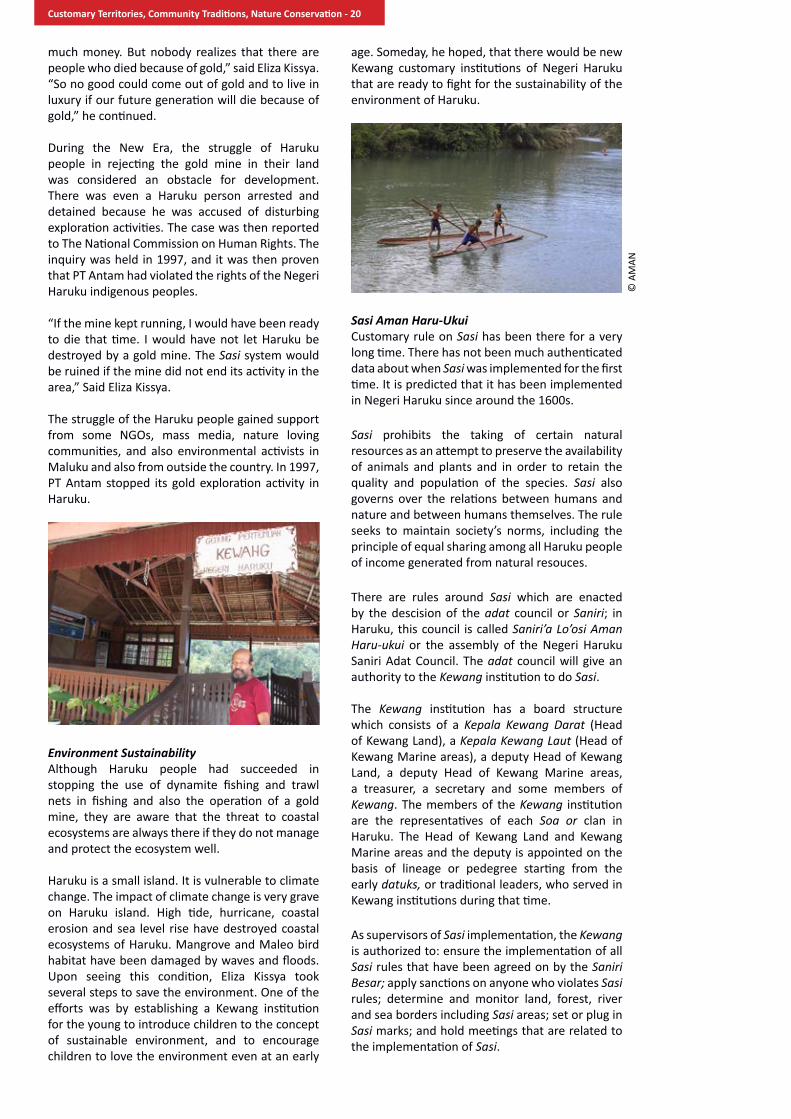
much money. But nobody realizes that there are people who died because of gold,” said Eliza Kissya. “So no good could come out of gold and to live in luxury if our future generation will die because of gold,” he continued.
During the New Era, the struggle of Haruku people in rejecting the gold mine in their land was considered an obstacle for development. There was even a Haruku person arrested and detained because he was accused of disturbing exploration activities. The case was then reported to The National Commission on Human Rights. The inquiry was held in 1997, and it was then proven that PT Antam had violated the rights of the Negeri Haruku indigenous peoples.
“If the mine kept running, I would have been ready to die that time. I would have not let Haruku be destroyed by a gold mine. The Sasi system would be ruined if the mine did not end its activity in the area,” Said Eliza Kissya.
The struggle of the Haruku people gained support from some NGOs, mass media, nature loving communities, and also environmental activists in Maluku and also from outside the country. In 1997, PT Antam stopped its gold exploration activity in Haruku.
Environment Sustainability Although Haruku people had succeeded in stopping the use of dynamite fishing and trawl nets in fishing and also the operation of a gold mine, they are aware that the threat to coastal ecosystems are always there if they do not manage and protect the ecosystem well.
Haruku is a small island. It is vulnerable to climate change. The impact of climate change is very grave on Haruku island. High tide, hurricane, coastal erosion and sea level rise have destroyed coastal ecosystems of Haruku. Mangrove and Maleo bird habitat have been damaged by waves and floods. Upon seeing this condition, Eliza Kissya took several steps to save the environment. One of the efforts was by establishing a Kewang institution for the young to introduce children to the concept of sustainable environment, and to encourage children to love the environment even at an early
age. Someday, he hoped, that there would be new Kewang customary institutions of Negeri Haruku that are ready to fight for the sustainability of the environment of Haruku.
Sasi Aman Haru-UkuiCustomary rule on Sasi has been there for a very long time. There has not been much authenticated data about when Sasi was implemented for the first time. It is predicted that it has been implemented in Negeri Haruku since around the 1600s.
Sasi prohibits the taking of certain natural resources as an attempt to preserve the availability of animals and plants and in order to retain the quality and population of the species. Sasi also governs over the relations between humans and nature and between humans themselves. The rule seeks to maintain society’s norms, including the principle of equal sharing among all Haruku people of income generated from natural resouces.
There are rules around Sasi which are enacted by the descision of the adat council or Saniri; in Haruku, this council is called Saniri’a Lo’osi Aman Haru-ukui or the assembly of the Negeri Haruku Saniri Adat Council. The adat council will give an authority to the Kewang institution to do Sasi.
The Kewang institution has a board structure which consists of a Kepala Kewang Darat (Head of Kewang Land), a Kepala Kewang Laut (Head of Kewang Marine areas), a deputy Head of Kewang Land, a deputy Head of Kewang Marine areas, a treasurer, a secretary and some members of Kewang. The members of the Kewang institution are the representatives of each Soa or clan in Haruku. The Head of Kewang Land and Kewang Marine areas and the deputy is appointed on the basis of lineage or pedegree starting from the early datuks, or traditional leaders, who served in Kewang institutions during that time.
As supervisors of Sasi implementation, the Kewang is authorized to: ensure the implementation of all Sasi rules that have been agreed on by the Saniri Besar; apply sanctions on anyone who violates Sasi rules; determine and monitor land, forest, river and sea borders including Sasi areas; set or plug in Sasi marks; and hold meetings that are related to the implementation of Sasi.
© A
MAN
Customary Territories, Community Traditions, Nature Conservation - 20
Kinds of Sasi There are four kinds of Sasi in Negeri Haruku, namely Sasi Laut (Marine Sasi), Sasi Kali (River Sasi), Sasi Hutan (Forest Sasi) and Sasi dalam Negeri (Sasi inside the community area). The rules of Sasi implementation were documented in a meeting of the Dewan Adat Negeri Haruku (Saniri’a Lo’osi Aman Haru-ukui or the Adat Council of Negeri Haruku) on June 10, 1985. But it is worth noting that the Sasi rules and provisions were set long ago. In June 1985, the rules and provision then were written, basically to re-assert the implementation of customary laws in Negeri Haruku which have been passed on from generation to generation by their ancestors.
However, as we could see in the written Sasi Kali (River Sasi) rules, there are additional rules in order to keep up with today’s development. For example, there is a rule that prohibits the start of a motor boat’s engine in the river. There is also the provision of a fine exacted for certain violations paid in cash. This provision is also one that has been adjusted to today’s situation. Another example of an additional provision is Karoro Sasi Laut. This is a prohibition to use factory (karoro)-made nets with small pores. The Haruku people never used this kind of net. It emerged a few years ago. Based on the Haruku people’s experience, certain kinds of fishing gear, such as trawl net, are destructive since they would catch fish of all sizes including the smallest and youngest ones.
There was a prohibition for women to climb trees under the Sasi Negeri rules. Now the rule has been revised. Women are allowed to climb trees as long as they are properly dressed. This is based on today’s developments as well. Women can also wear trousers to climb trees.
Sasi is not a set of rigid customary rules, but Sasi is dynamic and can be updated. As long as the spirit of Sasi, which is the sustainability and balance of the human life, relations between humans, and humans with the nature, will be unchanged and mantained.
Marine Sasi (Sasi Laut) Rules 1. The boundaries of Sasi Laut : in the north is
the corner of the Village Hall (Balai Desa or Baileo Negeri), in the west is the boundary at 200 meters out to the sea, in the south is Tanjung Wairusi and towards the east is the coastal and river estuary (Learisa Kayeli estuary)
2. The boundaries of Lompa Sasi in the sea: Labuhan Vetor in the north, 200 meters out to sea in the west and Tanjung Hi-i in the south.
3. It is forbidden to catch fish inside the area of Sasi with fishing gear. Only use of a net is allowed. The use of a boat is also forbidden. Haruku people will have to walk out into the sea to catch fish. One is allowed to catch fish
only up to where the water is as high as an adult waist.
4. The area of Labuhan Bebas starts from the corner of the Balai Desa (Village Hall) up to Tanjung Waimaru. Inside Labuhan Bebas, people are allowed to go fishing using a net, but fishermen are not allowed to have disputes among each other inside Labuhan Bebas. If there are disputes inside Labuhan Bebas, the area will become a forbidden area too.
5. If there is any Lompa fish inside Labuhan Bebas, people are not allowed to catch any of them using a net.
6. Inside any Sasi area or Labuhan Bebas, people are not allowed to catch fish using karoro net (factory-made nets).
River Sasi (Sasi Kali) Rules 1. The boundaries of Sasi Kali are from Wai
Learissa Kayeli estuary to Wari Harutotui; and from Wai Learisa Kayeli estuary to Air Kecil.
2. If Lompa fish enter the river, people are not allowed to disturb it or catch it, although there are other kind of fish in the river.
3. When Lompa fish Sasi is over, washing the fish and throwing the gut and head into the river is not allowed.
4. Washing dishes and other cooking utensils in the river is forbidden.
5. Men are forbidden to bathe in the same part of the river as the women. They have to bathe in their own specified places:
a. For women: Air Besar, Air Pohon Lemon, Air Kecil, Air Pohon Lenggua. Next to water sources, there are Sasi marks set by the Kewang.
b. For men: Air Piting, Air Cabang Dua. Next to water sources there are Sasi marks set by the Kewang.
6. It is forbidden to enter the river with a motor boat with the engine on.
7. It is forbidden for people to wash their clothes or any other things that need to be washed in the area where drinking water is sourced.
8. It is forbidden for people to cut trees on the river bank where the Sasi is imposed except for sago trees.
Forest Sasi (Sasi Hutan) Rules 1. It is forbidden for people to pick young and
unripe fruits such as pineapple, walnuts, cempedak2, durian, areca3, etc.
2. It is forbidden to cut fruiting areca trees or to cut other fruit trees to make fences out of them.
3. It is forbidden to cut young Sago midribs (hahesi) for roofing before asking permission from its owner and also from the Kewang.
2 Cempedak is a local fruit variety somewhat like a jackfruit3 Areca are plam species found in the tropical forest
Customary Territories, Community Traditions, Nature Conservation - 21

Inside Village Sasi (Sasi Dalam Negeri) rules 1. It is forbidden to make noise and fuss on
Saturday nights. 2. For any occasion that will be held at night,
such as a party, one will have to get permission from the Saniri Negeri.
3. It is forbidden for anyone to go fishing in the sea (taba) on Sundays, starting from 5 p.m. til 7 pm. Eastern Indonesia Time.
4. It is forbidden for anybody to go to the forest on Sundays, unless there is a very urgent need or during the clove season. However, even for these exceptions, permission is still sought from the Kewang.
5. It is forbidden to dry out sago midribs (for roofing) or coconut shells or to burn weeds on the roads.
6. It is forbidden to dry clothes on the fence. 7. It is forbidden to throw grass and feces into
the river. 8. Grass and weeds must be thrown away at
least 4 meters from the river bank and in the place which has been determined by the Kewang.
9. It is forbidden for women to walk back to the
home from the river only wearing a piece cloth that covers up to one’s chest.
10. It is forbidden for men to wear sarong during the day, except for the ones who are sick, and to wear deker (boxer shorts) or sling a towel over one’s shoulder and to wander around on the roads.
11. It is forbidden for women to climb trees in the village unless they wear proper clothes (trousers).
12. The area of Kolam Jawa is declared closed and protected and it will be preserved so it will not be destroyed.
Anybody who violates any of these Sasi rules will be sanctioned and fined.
Sasi Lompa (Lompa Fish Sasi )From the different kinds of Sasi in Negeri Haruku, Lompa Fish Sasi is the most famous and unique. Sasi Lompa is the combination of Sasi Laut and Sasi Kali which are enacted to protect the habitat of Lompa fish or Thryssa baelama. This Sasi is unique because it is only found in Negeri Haruku.
the Legend of the Lompa Fish of negeri Haruku
There is a folk story in Haruku that goes like this. Once upon a time, in the Learissa Kayeli River, there lived a female crocodile. Since there was only one crocodile that lived there, people named her “Raja Learissa Kayeli” or “The Queen of Learissa Kayeli.”
The crocodile was very dear to the people of Haruku. A long time ago there was not any bridge over Learissa Kayeli River. So when the tide was high, the Haruku people would have to swim across the river every time they would want to go to the forest on the other side. The crocodile often helped the Haruku people cross the river to the other side by letting them ride on its back as it swam across. As a reward, usually the Haruku people would gave a ring made of ijuk (Arenga pinnata) fibres and would put them on the crocodile's fingers.
During the era of datuks, the Haruku people believed in magical powers which always helped them. They also believed that animals could talk with humans. One day, there were fights between some crocodiles from Seram Island with a big snake from Tanjung Sial. In those fights, the crocodiles from Seram were mostly beaten by the big snake. When the crocodiles were desperate, they went to Learissa Kayeli River to ask help from the female crocodile who lived there. One time, the Learissa crocodile was pregnant. But in the name of solidarity for her friends from Seram, “The Queen of Learissa Kayeli” went to Tanjung Sial. The fights were fierce. The big snake lost and died. The Learissa crocodile, however, was badly injured. As a present, the crocodiles from Seram gave lompa fish, make ( a kind of tembang fish or sardine, Sardinella sp) and Parang-parang(Chirocentrus dorab) to her for her future baby.
The Learissa crocodile went back home to Haruku by swimming down the coast of Liang and Wai. When she arrived at Wai, the Learissa crocodile could not continue her journey because of her wounds. She was stranded there and local people hit her. Mercifully, she did not die. The crocodile said “You should take a broom stick and stick it into my navel.” The Wai people did what the crocodile asked and stuck the broom stick into the crocodile's navel. And “the Queen of Learissa Kayali” passed away.
But before her last breath, the crocodile gave birth to her baby. Her baby then went back to Haruku by swimming down the coast of Tulehu but then he got lost and he reached Passo beach. The baby crocodile carried all the fish presents from the Seram crocodiles. He was so busy looking for his way home that he left some of his fish along the way. He left parang-parang fish in Passo but he carried lompa and make back home to Haruku. Ever since then lompa and make (Sardinilla sp) have been the primary marine product in Haruku, while parang-parang is the primary marine product in Passo.
Customary Territories, Community Traditions, Nature Conservation - 22

Lompa has similar cycles and struggles as the Salmon. They migrate from the sea to the river. During the day, from morning till dusk, Lompa will be in Learissa Kayeli River up to 1,500 meters from the estuary. When night falls, Lompa will return to the sea to find food and then they will go back to the river the next morning. Based on that knowledge of the Lompa’s movements, Lompa Sasi is imposed on Lompa habitat and its migration lines. It is forbidden for anybody to catch Lompa and to interrupt the migration.
Sasi Lompa ends during the Pesta Rakyat, or community party, of the Negeri Haruku at the end of the harvest period. On any given day, the Head of Kewang opens the ritual by ‘calling’ the Lompa to Learissa Kayeli River. The ritual is held in the night, it starts when the Lobe (big torch made of dry coconut leaves) is on the beach. The next morning, the Lompa will be come from the sea and swim into the river. Together, people will catch the Lompa fish in the river using net and other gear.
In past times, at the end of Sasi Lompa, Haruku People could catch 30 tons of Lompa. The fish that were caught were prioritized for widows and orphans in the village. “Orphans and widows would get one pile of fish. While ordinary people like us would also get one pile. If other people got two piles, the widow and orphans would get 4 piles.” explained Eliza Kissya. The fish would not only suffice for today’s need but also for future needs. The Implementation and Rules of Sasi Lompa
Lompa fry called nener usually start to appear in groups along the coast line of Haruku between April and May. During these months, the Sasi for Lompa begins. Usually, at the age of one to two months after the lompa appear for the first time, groups of fry start to go to the estuary to enter the river.
What the Kewang do during these months is that Sasi officials place the Sasi markers. Sasi markers are in the form of wooden poles with young coconut leaves (janur) on one end. These markers signify that Lompa Sasi has begun the moment that the poles are stuck into their respective places. The rules are as follow:
1. During Sasi, nobody is allowed to catch or disturb Lompa using any gear in any way.
2. Motor boats are not allowed to enter Learissa Kayeli River if the engine is still on.
3. People are not allowed to wash dishes and cooking utensils in the river.
4. People are not allowed to throw any trash into the river, but they are allowed to throw garbage at least 4 meters from the river bank in the places defined by the Kewang.
5. If anybody needs bait for fishing, he may catch lompa using a fishing rod, but not in the river.
6. Anybody who violates the rules will be charged with sanctions or punishment in accordance with the rules of Sasi, usually a fine. Children who violate will be punished with 5 strokes using a rattan cane. This means that the child must bear the burden of the mandate of the five Soa (clans) in Haruku.
sasi Lompa ritual In the beginning of the Sasi period, there is always a ritual called panas sasi. The ritual is held three times a year, starting from the time when the lompa fry are seen for the first time. The panas Sasi ritual is usually held at night at around 8 p.m. The ritual begins when all the Kewang members are present in “Balileo Kewang” or in the Head of Kewang’s house. They carry dry coconut leaves (lobe) with them to make a torch. After praying together, the main fire is lit and all the Kewangs go to the center of Sasi (Batu Kewang) while carrying the main torch.
In Batu Kewang, the Head of Kewang then starts to light the bonfire accompanied by the music
© A
MAN
© A
MAN
Customary Territories, Community Traditions, Nature Conservation - 23

coming from tifa4 pounding in the night sky indicating the presence of lima Soa (the 5 clans) in Negeri Haruku. When the tifa sounds fade away, all Kewang members together shout “Sirewei!” (the call of determination and promise).
The Head of Kewang then says the kapata (sermon) in honor of the negeri and then the datuks state that from that very moment, Sasi Laut and Sasi Darat are valid and should be respected.
The Kewang secretary is obliged to read all Sasi Lompa rules and sanctions carried within the Sasi period so they resonate in the Haruku people’s minds.
The ritual is done at each intersection of the village where tabaos (edicts) are usually announced to all Haruku people. This ritual is finished by 10 p.m. in front of the Balileo Negeri (village hall) where the rest of the lobe have been burnt and are to be thrown into the sea.
Installation of Sasi Lompa Signs The ritual of panas sasi is followed by the installation of Sasi signs. The signs are called ‘kayu buah sasi.’ The signs consist of sasi mai (main sasi) and kayu buah sasi pembantu (secondary sasi signs). The pole is made of wood with young coconut leaves on one of each pole’s ends which are then stuck in certain places to determine the width of the Sasi area. According to the rule, the only person who will remove or withdraw the kayu buah sasi mai from the forest is the Head of Kewang Darat. He will then stick it into the land. The Head of Kewang Laut is authorized then to remove kayu buah sasi in the sea from the beach. This stick is also called ‘kayu buah sasi anak’. A stick of tongke (a mangrove species) and then keker ( beach plant) leaves are tied on it. The kayu buah sasi is usually thrust into the beach as a sasi sign. The width of the sasi lompa area in the sea is about 600 X 200 meter, while on land (river) it is 1,500 x 40 merters starting from the estuary to the upstream of the river.
4 Tifa is a drum-like musical instrument usually made of local hide.
The End or Lifting of Sasi LompaAfter the protected lompa is big enough and ready to be harvested, around 5-7 months since the first time it is seen on the beach, the Kewang in the weekly Friday night meeting would decide the perfect time to end the sasi (buka sasi). The decision on the ‘D’ day will be reported to Raja Kepala Desa (the traditional head of the village) to be announced to all Haruku people.
The second ritual of panas sasi is then held. The tutup sasi (end of the sasi) ritual is done like the first panas sasi ritual. After the ritual at 3 a.m, the Kewang continue their job by eating together and then lighting the bonfire close to the estuary of Learissa Kayeli River with the purpose of attracting lompa to enter the river earlier based on the calculation of high tide. By this time, groups of lompa enter the river. By the time the lompa enters the river, people are ready to install nets around the estuary so when the tide is low the fish cannot go back to the sea.
Right when the tide is receding, the first tifa is sounded as a sign for the Haruku people, young and old, big and small. By this time, everyone is ready to go to the river. The second tifa is sounded as a sign that Raja, the Saniri Negeri and Priest have walked to the river and that everyone must take their places on the river bank. The group with the head of the village then arrives at the river bank. The head of the village then spreads the first net, followed by the Priest and then everyone in the village is free to catch any lompa fish they can find.
Usually, sasi is only opened for two days. It is then closed again with the panas sasi ritual. A research conducted by faculty of fisheries of Pattimura University during the end of sasi in 1984 shows that the total sum of lompa fish caught during the harvest was more or less 35 tons. It is a big sum of fish for one harvest in an easy and affordable way. The fish provide nutritious food and also additional income for all Haruku people.
© A
MAN
© A
MAN
Customary Territories, Community Traditions, Nature Conservation - 24
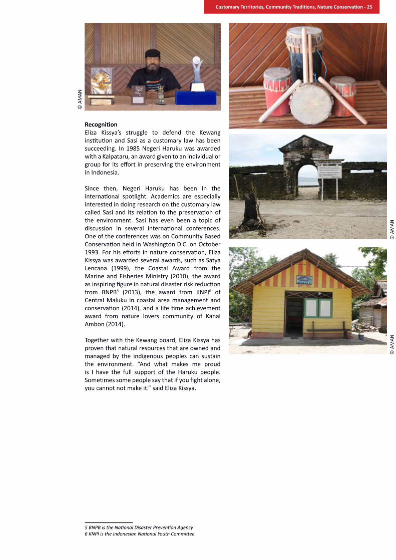
RecognitionEliza Kissya’s struggle to defend the Kewang institution and Sasi as a customary law has been succeeding. In 1985 Negeri Haruku was awarded with a Kalpataru, an award given to an individual or group for its effort in preserving the environment in Indonesia.
Since then, Negeri Haruku has been in the international spotlight. Academics are especially interested in doing research on the customary law called Sasi and its relation to the preservation of the environment. Sasi has even been a topic of discussion in several international conferences. One of the conferences was on Community Based Conservation held in Washington D.C. on October 1993. For his efforts in nature conservation, Eliza Kissya was awarded several awards, such as Satya Lencana (1999), the Coastal Award from the Marine and Fisheries Ministry (2010), the award as inspiring figure in natural disaster risk reduction from BNPB5 (2013), the award from KNPI6 of Central Maluku in coastal area management and conservation (2014), and a life time achievement award from nature lovers community of Kanal Ambon (2014).
Together with the Kewang board, Eliza Kissya has proven that natural resources that are owned and managed by the indigenous peoples can sustain the environment. “And what makes me proud is I have the full support of the Haruku people. Sometimes some people say that if you fight alone, you cannot not make it.” said Eliza Kissya.
5 BNPB is the National Disaster Prevention Agency6 KNPI is the Indonesian National Youth Committee
© A
MAN
© A
MAN
© A
MAN
Customary Territories, Community Traditions, Nature Conservation - 25
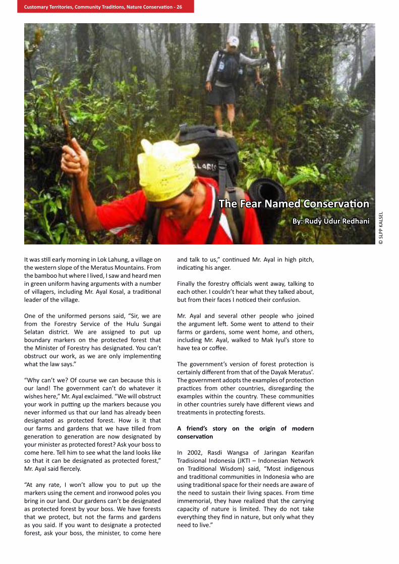
It was still early morning in Lok Lahung, a village on the western slope of the Meratus Mountains. From the bamboo hut where I lived, I saw and heard men in green uniform having arguments with a number of villagers, including Mr. Ayal Kosal, a traditional leader of the village.
One of the uniformed persons said, “Sir, we are from the Forestry Service of the Hulu Sungai Selatan district. We are assigned to put up boundary markers on the protected forest that the Minister of Forestry has designated. You can’t obstruct our work, as we are only implementing what the law says.”
“Why can’t we? Of course we can because this is our land! The government can’t do whatever it wishes here,” Mr. Ayal exclaimed. “We will obstruct your work in putting up the markers because you never informed us that our land has already been designated as protected forest. How is it that our farms and gardens that we have tilled from generation to generation are now designated by your minister as protected forest? Ask your boss to come here. Tell him to see what the land looks like so that it can be designated as protected forest,” Mr. Ayal said fiercely.
“At any rate, I won’t allow you to put up the markers using the cement and ironwood poles you bring in our land. Our gardens can’t be designated as protected forest by your boss. We have forests that we protect, but not the farms and gardens as you said. If you want to designate a protected forest, ask your boss, the minister, to come here
and talk to us,” continued Mr. Ayal in high pitch, indicating his anger. Finally the forestry officials went away, talking to each other. I couldn’t hear what they talked about, but from their faces I noticed their confusion.
Mr. Ayal and several other people who joined the argument left. Some went to attend to their farms or gardens, some went home, and others, including Mr. Ayal, walked to Mak Iyul’s store to have tea or coffee.
The government’s version of forest protection is certainly different from that of the Dayak Meratus’. The government adopts the examples of protection practices from other countries, disregarding the examples within the country. These communities in other countries surely have different views and treatments in protecting forests.
a friend’s story on the origin of modern conservation
In 2002, Rasdi Wangsa of Jaringan Kearifan Tradisional Indonesia (JKTI – Indonesian Network on Traditional Wisdom) said, “Most indigenous and traditional communities in Indonesia who are using traditional space for their needs are aware of the need to sustain their living spaces. From time immemorial, they have realized that the carrying capacity of nature is limited. They do not take everything they find in nature, but only what they need to live.”
The Fear Named ConservationBy: Rudy Udur Redhani
© S
LPP
KALS
EL
Customary Territories, Community Traditions, Nature Conservation - 26

Rasdi continued telling his experiences engaging with indigenous and traditional communities in Indonesia. “They use religious and spiritual realms in limiting or prohibiting people from extracting things that have economic and social values from nature. They believe if they take something much more than they need or taboo, they will have to pay the price in life.”
After meeting Rasdi, I met Wayan Dirgayusa when he joined an expedition team in Mount Meratus Conservation Management Project in 2005. Wayan provided me with insights on conventional and traditional conservation in Indonesia, particularly in Meratus. From them I understood the difference between modern conservation and conservation practices of indigenous peoples.
On conservation and my homeland
The preservation movement has contributed substantially to the nature conservation in Indonesia, particularly during the colonial time. This cannot be separated from the negative impacts of the exploitation policies on nature introduced by the Dutch East Indies government, particularly the expansion of plantations in some areas between the 16th and 19th centuries. In addition, the killings and trading of wild animals, particularly big mammals, were substantial as they were considered pests in plantations. This caused uncontrolled forest degradation. In 1696, Cornelis Castelein, a lawmaker in the Dutch East Indies government, granted a land parcel of six hectares in Depok, a town south of Jakarta, for a nature reserve to represent the lowland tropical rainforest.
Although the history of modern conservation started two centuries earlier, post-independent nature conservation in Indonesia was only taken into account in state policies in the 1960s. Law No. 5 of 1967 on Basic Provisions of Forestry has a category of nature preservation area, namely nature reserve, wildlife reserve, and recreation forest. A few years earlier the conservation division of the Ministry of Agriculture – which was then responsible for forestry issues – proposed a set of categories of protected areas that had more categories than what the law stipulated. The conservation policies were developed in late 1970s with the drafting of the Law on the Conservation of Biological Resources and their Ecosystems.
The drafting of the proposed law was also influenced by several important international events. In 1978 Indonesia hosted the Eighth World Forestry Congress with “Forests for People” as a theme and recognized the importance of forests as source of water and food, so thus for ecological sustainability. On the same year, IUCN issued 10 categories of protected areas, later revised into six, that much influenced the policies on the creation of protected areas in many countries. Two years later IUCN published World Conservation Strategy, which promotes the maintenance of essential ecological processes and life-support systems and the development of national conservation strategies. In 1982 the Government of Indonesia hosted another international event, the 3rd World Parks Congress. The congress issued the Bali Declaration, with an emphasis to promote “a worldwide network of national parks and protected areas, exemplifying all ecological regions.” During the congress the government announced a plan to establish 11 national parks.
All these thoughts are reflected in the law, which was passed in 1990 as Law No. 5 of 1990 on the Conservation of Biological Resources and their Ecosystems. The law has two types of protected areas. The first is kawasan suaka alam (nature preservation areas) with two management categories: nature reserve and wildlife reserve. The second is kawasan pelestarian alam (nature conservation areas) that has three categories: national park, taman hutan raya (close to IUCN’s
© S
LPP
KALS
EL
Customary Territories, Community Traditions, Nature Conservation - 27

category of managed resource protected area) and nature recreation park. Later, Law No. 41 of 1999 on Forestry added another category, which
is hunting park. This law also introduces a category of hutan adat or customary forest, although it is regulated as a part of state forests, which triggered a resistance from indigenous communities. Representing the indigenous communities and along with two of its community members, Aliansi Masyarakat Adat Nusantara (AMAN – Indigenous Peoples’ Alliance of the Archipelago) filed a petition to the Constitutional Court of the Republic of Indonesia to take out customary forest from the state forest category. In May 2013 the Court ruled in favor of the petition and separated customary forests from state forests, because indigenous communities have constitutional rights over their lands.During its course, conservation development can backfire if the designation of a protected area is carried out without the consent from local communities. In Indonesia there are too many cases of proteced area designation that is only meant to meet the target of hectarage, without taking into account the interests of local communities and other stakeholders. Such an approach leads to conflicts in every protected area, including national parks. Using an example close to home, the establishment of the Sebangau National Park in Central Kalimantan emphasized the effort on park zonation, while undermining community participation. Recently, the Ministry of Forestry introduced a plan to establish the Meratus Hulu National Park. But its development has been slow, and it has not been done in the best interests of the local communities.
A fundamental issue in conservation policies and practices in Indonesia is that human settlement is prohibited within the protected area. The applicable laws, particularly Law No. 5 of 1990, do not explicitly ban the existence of settlements in the park. However, it implies such prohibition as it forbids any activity that is not in line with conservation activities or that transforms the landscape within the park. Such policy contradicts
the fact that in most conservation areas indigenous communities have settled and managed the landscape long before the protected areas were established.
the importance of our ancestors’ heritage: the dayak meratus and their land
Mr. Ayal Kosal sat on the bamboo floor in a hut that lies on the far side of Lok Lahung village. He told me, “In managing our land, Dayak communities respect the boundaries we have agreed with other villages. The land was divided by our ancestors who made a peranggan (agreement) with ancestors of neighboring villages. They made an oath not to disturb or appropriate territories of which they were not the rightful owner. If they or their descendants violate the agreement, it is believed that they will receive a curse from the Creator, for example, bahuma, or failure to have good harvest from rice farming.”
From my observation and discussions as well as interviews with several villagers including Mr. Ayal Kosal, I learned that the community of Lok Lahung divide their land into several land uses, such as for settlement, pahumaan (active rice farms) balukar anum and jurungan (fallow areas), gardens including fruit gardens, sacred sites and kayuan. As most other indigenous communities living in the uplands, the Dayak Meratus also practice swidden agriculture in which they rotate the rice farm plots from year to year. For that reason, there are plots that are under active farming, whereas many other plots are under fallow period with different stages of ecological succession.
Pahumaan or the active rice farms are areas of dry rice plots that are newly cleared with slash and burn techniques. The community works in groups to plant rice by making holes using pointed wooden sticks and placing rice seeds in those holes. The new rice seeds are called banih tugal. In most cases rice is intercropped with other cash crops. After harvest, the plot is planted with legumes to improve soil fertility and extend its use for another planting or another year. The community calls the act of planting from clearing to harvest as humai. Afterwards, the plot will be left to recover through a long fallow period.
Balukar anum is a fallow area that was planted one to seven years earlier and is dominated by shrubs. Such an area is usually infertile as the soil does not have sufficient nutrients from decomposing organic materials.
Jurungan is a fallow area with seven to 12 years of ecological succession. The area has transformed into a young forest of different tree species with diameters of around 20 cm. This area has sufficient soil nutrients, so that it can be cleared for new dry rice plots or pahumaan.
© SLPP KALSEL
Customary Territories, Community Traditions, Nature Conservation - 28

Kampungan is a fallow area where the community plants crop trees such as rubber, cinnamon, candlenut, sintuk and kupang. If the area is planted with fruit species, it is called kampung buah. By planting, the planter claims some sort of ownership over the land. This reduces the extent of communal land. The larger the kampungan, the smaller there is communal land that can be cleared for pahumaan.
All of these land uses are not permanent, because, for example, a kampungan can be cleared for pahumaan. Or a settlement can be converted into pahumaan. Such conversion does not apply to protected lands.
Mr. Kosal changed the position of his body but remained talking about the subject, and continued. “Our ancestors have divided the protected lands into two kinds. The first is daerah keramat or sacred sites that are usually graveyards of the ancestors or areas which the community believes are the homes of the urang halus (unseen beings). These areas are very common in any Dayak village and cannot be disturbed or destroyed. The second is kayuan, a type of forest reserve from which the community collect limited amount of timber for their houses and balai adat (meeting hall), medicinal plants, game, and other needs. The reserves tend to be in mountain tops and have never been converted into agricultural lands.”
Basically the community of Lok Lahung has areas assigned for production and those for protection, just like the modern conservation regime. However, customary laws and practices regulating indigenous land uses have not only penal sanctions, but also social and spiritual sanctions. Mr. Kosal continued, his eyes looking at the distance toward the direction of the forest he was referring to that was blanketed with fog, “Whoever violates the customary rules in sacred sites or kayuan, the whole community will have to pay the price. For example, if someone cuts down a tree in a sacred site or a tree in kayuan for commercial purposes, the community of Lok Lahung will suffer the negative impacts, such as serious diseases.”
He added, “Violators of customary laws, both members of the Lok Lahung community and
outsiders, will be summoned to attend a customary trial. Pangulu Balai or also known as Tuha Balai will act as a judge and determine the amount and form of the fine for the committed violation.”
Modern conservation meets indigenous conservation practices
Conservation that came from other countries cannot be easily implemented in Indonesia. There are a set of problems and prerequisites that need to be taken into account. Mr. Ayal Kosal, as an indigenous leader, would be disenfranchised with modern conversation.
He said, “Speaking of conservation or forest protection, I still don’t believe that our government can accommodate the way the Dayak Meratus protect their forests. In our view nature isn’t to be conquered or destroyed. Instead, we must put ourselves as a part of nature. Forest protection should also take into account our needs.”
He continued, “In the government’s view, conservation or forest protection is in the forms of protected forests and national parks. We are prohibited to open rice gardens or plant rubber within them. The reality is that we have grown dry rice and rubber long before the land was designated as protected forests. Of course, we are against the plan, because we own the forests that we have maintained for generations. Even though our rules are not the same as those of the government, the fact is that the forests still exist and are intact.”
Often the traditional conservation values are displaced by exploitative values of foreign origins named development or even modern conservation itself. Introduction of foreign values in conservation are not impossible, but the approaches should be adaptive. It should not eradicate community identity and practices in managing natural resources that they have expressed and employed from generation to generation.
To date the term tradional conservation has been clearly described, although it has long been studied by anthropologists. Traditional conservation practices cannot be separated from indigenous knowledge of the local communities, because based on that particular knowledge the communities apply conservation norms in their respective territories. Traditional conservation values and practices are basically a part of the knowledge system of a given community that they have gained and developed from their interactions with nature.
The knowledge system is dynamic as it interacts with other knowledge systems to develop a new equilibrium as a response to the community’s problems. Tradional conservation embraces all management and utilization actitivities
© S
LPP
KALS
EL
Customary Territories, Community Traditions, Nature Conservation - 29

that indigenous communities have directly or indirectly practiced in their relations with nature for generations. Such practices are also known as traditional or local wisdom.
The encounter between modern conservation and traditional conservation tends to harm the latter. In its study on the land use and customary laws of Dayak Meratus in 2003, Yayasan Cakrawala Hijau Indonesia (YCHI) found that communities in Balai Malaris, Loa Panggang and Balai Haratai have divided their lands into different land uses, including settlement, dry rice farms, rubber farms, fruit gardens, forest reserves, and sacred sites including graveyards. But the overlay of maps produced by the community and state forest land maps shows that land for dry rice farms and rubber farms in Balai Malaris fall under state-sanctioned protection forest. Such different land uses have high potential of criminalization against the community, since protected forest prohibits land clearing. This condition indicates that the designation of protection forest is a unilateral act from the government.
Furthermore, the participatory inventory of important plant species conducted during the participatory mapping identified that the fallow lands and protected lands in Lok Lahung are sources of key economic plant species for commercial purposes (62 species), food (89 species), timber (64 species), household needs (42 species), handicrafts (25 species), customary rituals (9 species), and other needs (9 species). All of them are from different plant parts: root (41 species), leaves (36 species), trunk (82 species), resin (5 species), bark (11 species), and fruits (72 species). Therefore, the fallow and protected lands do not only provide ecological services for land water catchment, but also have economic importance for their livelihoods.
Another example is from the resource management practices of the communities living in peatlands of Central Kalimantan. To fish, the communities in the area employ the beje trapping method which uses the tidal difference between rainy season and dry season in natural or man-made pools or canals. For man-made pools or canals they position them in east-west direction, since in certain periods the fish need shade. The communities also take into account the vegetation composition and landscape condition in building the beje. In the watershed of Mengkatip River the communities plant certain rattan species such as taman and irit, along the riverbank. These species require certain soil types, which then reduce the risk of erosion. Both practices dramatically changed when the Mega Rice Project started. The project destroyed the rattan gardens and beje traps, and thus community livelihoods.
In early 2014 the Forestry Office of the South Kalimantan province proposed the creation of
Meratus Mountains National Park as a means of protecting the remaining tropical forests in higher elevation due to the high rate of deforestation in the lower areas. Since then, there has been a growing campaign to support the proposal. With the current practices of unilateral designation of protected areas, it is most unlikely that the ministry will promote the participation of Meratus communities in the planning stages of the park. The main stakeholders in the process are generally those who are not directly affected by the park’s creation. Furthermore, the representatives of local communities in the process tend to be local elites, who may have different interests from other community members. If there is a consultation process with local communities, it will most likely be a one-way communication from the government officials. Meanwhile, the decision making process within the communities for such a massive impact can be a long process of deliberation.
Under these circumstances, there is a high chance that the local communities will be dispossessed from the park. Modern conservation should not displace traditional conservation practices. Instead, both conservation regimes should co-exist. To reduce the risks of dispossession in the creation of Meratus Hulu National Park, the Ministry of Forestry should consider:
1. Full recognition of the Dayak Meratus indigenous communities and their customary laws and land use in the creation of Meratus Hulu National Park;
2. Review of the plan of park creation, particularly pertaining to access to the traditional utilization of forest resources. There should be a way in developing a park management concept that combines state-based park management and community-based forest management based on indigenous resource management practices; and
© S
LPP
KALS
EL
Customary Territories, Community Traditions, Nature Conservation - 30
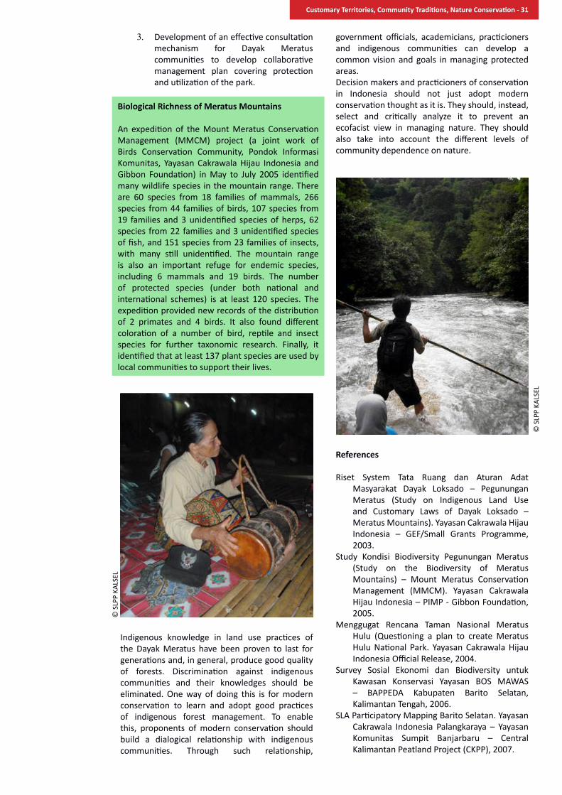
3. Development of an effective consultation mechanism for Dayak Meratus communities to develop collaborative management plan covering protection and utilization of the park.
Indigenous knowledge in land use practices of the Dayak Meratus have been proven to last for generations and, in general, produce good quality of forests. Discrimination against indigenous communities and their knowledges should be eliminated. One way of doing this is for modern conservation to learn and adopt good practices of indigenous forest management. To enable this, proponents of modern conservation should build a dialogical relationship with indigenous communities. Through such relationship,
government officials, academicians, practicioners and indigenous communities can develop a common vision and goals in managing protected areas. Decision makers and practicioners of conservation in Indonesia should not just adopt modern conservation thought as it is. They should, instead, select and critically analyze it to prevent an ecofacist view in managing nature. They should also take into account the different levels of community dependence on nature.
references
Riset System Tata Ruang dan Aturan Adat Masyarakat Dayak Loksado – Pegunungan Meratus (Study on Indigenous Land Use and Customary Laws of Dayak Loksado – Meratus Mountains). Yayasan Cakrawala Hijau Indonesia – GEF/Small Grants Programme, 2003.
Study Kondisi Biodiversity Pegunungan Meratus (Study on the Biodiversity of Meratus Mountains) – Mount Meratus Conservation Management (MMCM). Yayasan Cakrawala Hijau Indonesia – PIMP - Gibbon Foundation, 2005.
Menggugat Rencana Taman Nasional Meratus Hulu (Questioning a plan to create Meratus Hulu National Park. Yayasan Cakrawala Hijau Indonesia Official Release, 2004.
Survey Sosial Ekonomi dan Biodiversity untuk Kawasan Konservasi Yayasan BOS MAWAS – BAPPEDA Kabupaten Barito Selatan, Kalimantan Tengah, 2006.
SLA Participatory Mapping Barito Selatan. Yayasan Cakrawala Indonesia Palangkaraya – Yayasan Komunitas Sumpit Banjarbaru – Central Kalimantan Peatland Project (CKPP), 2007.
Biological Richness of Meratus Mountains
An expedition of the Mount Meratus Conservation Management (MMCM) project (a joint work of Birds Conservation Community, Pondok Informasi Komunitas, Yayasan Cakrawala Hijau Indonesia and Gibbon Foundation) in May to July 2005 identified many wildlife species in the mountain range. There are 60 species from 18 families of mammals, 266 species from 44 families of birds, 107 species from 19 families and 3 unidentified species of herps, 62 species from 22 families and 3 unidentified species of fish, and 151 species from 23 families of insects, with many still unidentified. The mountain range is also an important refuge for endemic species, including 6 mammals and 19 birds. The number of protected species (under both national and international schemes) is at least 120 species. The expedition provided new records of the distribution of 2 primates and 4 birds. It also found different coloration of a number of bird, reptile and insect species for further taxonomic research. Finally, it identified that at least 137 plant species are used by local communities to support their lives.
© S
LPP
KALS
EL
© S
LPP
KALS
EL
Customary Territories, Community Traditions, Nature Conservation - 31

One day in 2007, excavators operating for the oil company PT Rezeki Alam Semeta Raya cut across the handil of Sei Tabatik, Saka Singa, Saka Suru and Sapagan. Handil is a long small canal dug out by a community group who converts a natural stream and manages it to irrigate their agricultural lands in the peatlands of Central Kalimantan. The term was adopted from a Dutch word aandeel, meaning collaboration. The excavation cut off the community’s access to their agricultural lands, and resulted in the loss of livelihoods to H. Kakan, the late Karman Edo, Berwin and Siwo, who managed the canals respectively. Afterward, they discussed the matter to find a way out of the problem they were facing. They finally decided to meet community leaders to ask them to join forces. One of these leaders was Tanduk O. Kasan, an indigenous leader who has been critical of policies which harm communities.
Community lands – agricultural lands, forests and water bodies – on which inhabitants of hundreds of villages in Central Kalimantan rely for their livelihoods, are shrinking. This is particularly the case in areas where the Mega Rice Project, initiated by the late President Suharto, was once developed in the mid 1990s. The project started after the issuance of Presidential Decree No. 82 of 1995 on the Development of Peatlands for Food Estates in Central Kalimantan that designated 1.5 million hectares of peatlands in the districts of Kapuas, South Barito and Pulang Pisau as well as in the city of Palangkaraya to be converted into rice fields. Since then, the local communities, particularly the indigenous ones, have endlessly undergone social and ecological problems, including eviction from their agricultural lands, destruction of the surrounding forests that provide alternative income to them, and severe ecological
degradation of the peatlands on which their lives depend on.
The project started with the construction of a massive irrigation network crisscrossing the huge landscape. First, it built a 187-kilometer Principal Primary Canal (Saluran Primer Induk) connecting Kahayan River in the west and Barito River in the east. Next was the construction of a network of the 958-km Main Primary Canals (Saluran Primer Utama), followed by the construction of secondary and tertiary canal network totaling thousands of kilometers. All of these cut across many peat domes.
The project has created unprecedented destruction and disasters: massive floods during rainy seasons, severe droughts in dry seasons, massive forest fires and rampant illegal logging. All lead to the ecological destruction of peatlands and the rupture of social orders in the villages. Not only that, the project was also rampant with criminal acts. The project executants, for instance, intentionally cut down precious wood in peat forests and surrounding forests to supply a timber company in Banjarmasin, South Kalimantan, owned by PT Barito Pacific Timber Group, whose owner is a close ally of the Suharto family. The timber fed the needs of the rich consumers in Japan, United States, Germany and other countries.
A Story of Pulau Kaladan
Pulau Kaladan is one of the hundreds of villages that has undergone such a sad experience. It is one of the villages in the Mantangai subdistrict, Kapuas district, Central Kalimantan. It lies 244 km from Kuala Kapuas, the district capital. To reach it, one
Long Path for the Sake of RecognitionBy: April Perlindungan
© P
USA
KA
Customary Territories, Community Traditions, Nature Conservation - 32

has to ride both road and water vehicles that take two to three hours in total depending on the road condition.
The village is among the oldest villages in the subdistrict. Between 1885 and 1912, under the administration of Ngabe Bakar, its territory spanned from Manusup up to Danau Rawah-Muroi. It was split into a number of villages after Indonesian independence. The majority of its population believe that the original population of the village are the descendants of Ngabe Bakar. Moreover, most of the handil managers claim the famous leader as their ancestor.
The village totals 60,000 hectares with a population of 3,647 as of 2014 that belong to 1,001 households. Half of the population is Moslem, 40% are Christians, and the rest embrace the indigenous religion Kaharingan. Most of them are Dayak Ngaju, a dominant indigenous Dayak group in Central Kalimantan.
Today the villagers are facing an obvious threat from land grabbing by oil palm companies. At least 10,000 hectares of the land have been converted into oil palm plantations: PT Graha Inti Jaya (GIJ) claims 3,000 hectares, PT Rezeki Alam Semesta Raya (RASR) 5,000 hectares, and PT Globalindo Agung Lestari (GAL) 2,000 hectares. Until now the villagers are still struggling to defend their lands from the expansion of oil palm plantations. One of the most damaging actions of the companies is the filling and blocking of handil.
In an interview Tanduk Kasan said, “Our communities have reflected much from past events and this is not how to manage our land. Therefore, we will defend our small, remaining land.” Along with his fellow villagers, he has tirelessly fought to defend their lands from land-hungry companies. One of their actions was to seek legal recognition over 33 hectares of their customary forest in Pulau Lampahen and set set aside 16,000 hectares in Sei Tabatik for handil management.
In defending their lands, the communities have employed several means. They confiscated heavy equipment, met with decision makers, and occupied plantations. However, so far there is no long term solution, since they do not have formal legal documents or land titles. “So when the Constitutional Court ruled that customary forests are no longer part of state forests, we wanted to seize the opportunity,” said Kasan.
Kasan and his colleagues in the collective action group sought new breakthroughs. They explained to their fellow villagers – including village officials, mantir adat (customary officials) and handil managers – the importance of having state recognition over their community lands through a decree of the district head or a district by-law, which is crucial for the future of coming generations. “It’s
not easy to convince them. I realize that our fight has not achieved good outcomes. However, we continue to hope,” Kasan said optimistically.
There was bitterness when the communities described the pressures and threats they were facing. Meanwhile, the district government showed its indifference to community complaints. “The oil palm company, PT RASR, has blocked our handil canals. To whom should we express our anger? The government doesn’t pay any attention to our problem,”exclaimed H. Kakan, the head of the handil in Sei Tabatik. After decades of being entrusted with the management of the handil, it was the first time he witnessed the audacious acts of the oil palm companies, worse than thieves of any kind. He told us that the handil regime will be defended and maintained, so that their rights over lands cannot be easily transferred to outsiders, especially investors. “Since the 70s I have managed this handil for the wellbeing of the community. I’m very happy that the Dayak people can grow rice and rubber. But now oil palm comes and destroys our lands and makes the Dayak people poor,” H. Kakan continued.
the history of the handil system
The watershed of Kapuas River in southern Borneo has been inhabited by Dayak Ngaju groups prior to Dutch colonial time. The people here collected forest products for their subsistence. They travelled into the forests through saka (short stream) and sei (long, small river). When the Dutch came to the area, the Dayak people were afraid of meeting the whites. They ran away from their original settlements and hid in the saka. They believed that the saka provided excellent protection to them as the Dutch patrols could not spot it. During low tide, the Ngaju groups covered the mouths of saka with foliage.
Later on, the hiding families settled in the area and grew rice on the banks of the saka. “Evidences that the saka has been managed from generation to generation are the big sacred grave in Sapagan, the Uju Galuang Usuk grave in Sei Tatumbu, and the former fortress in Duhian canal,” said H. Kakan. He continued, ”Because the group was growing, they started to dig new small canals. Back then, the canals provided access to collect forest products. The canals are called tatas.”
© P
USA
KA
Customary Territories, Community Traditions, Nature Conservation - 33
It was in 1876 when Christian missionaries first came to the area. As they considered the condition safe, they openly re-settled on the bank of the Kapuas River. They began to use the lands around tatas by planting rubber trees as suggested by zending, the Protestant mission. Since then, the land around tatas has been planted for both rice and rubber gardens. The groups began to dig new straight canals for both species. These straight, long canals are the handil.
“The community members use the handil freely for mobilization into the forests or their gardens. But, when they want to open land plots, they need to talk to me as a handil manager,” said H. Kakan. For members who transport timber using a certain handil, they have to pay a levy with an amount they set themselves for handil maintenance. In building handil, the community needs to have consensus on their proposed sites and work together in digging them. The land will be distributed to the participating members during the digging. The handil regime also imposes sanctions to those who break the rules.
“Back in the old days, every member can have a lot of 33 fathoms wide. Nowadays, in new handil digging, a participating member has a land parcel of one hectare,” added Siwu, a handil manager of Saka Suru. He continued, “The boundary of one handil to the next is usually in the middle of its distance. The boundary is in most cases marked with a rei (small ditch).”
According to Siwu, the handil system in Pulau Kaladan is still currently effective, with 32 handil in the village. Siwu also claims that the system is pretty effective in curbing the expansion of land-based investments into their lands. Outsiders cannot claim the ownership of the land as they wish. The handil system has a set of rules, such as:
1. Land ownership is determined by participation in handil construction.
2. A handil member can get distributed land parcels when they participate in land clearing held every year.
3. If the parcel is not used for three consecutive years, it should be returned to the handil manager. On the existence of such parcel, the decision shall be taken by consensus.
4. One can borrow a land parcel based on the agreement with its original owner, including profit sharing. If the borrower participates in the new digging, he or she can get a land parcel.
5. The parcel can be sold to other handil members, their relatives and other parties. The new owner has to use the land. If unused, the parcel has to be returned to the handil manager.
6. Other party could borrow a land under agreement with the land owner. If they
involved in a new excavation, the party who borrows the land can get distributed land.
7. If boundary dispute occurs and both disputing parties claim the truth, they are asked to take the menetek ewei ritual. The false claimant is believed to find death or sickness after the ritual.
From the perspective of customary law, the arrangement of handil in the village is very autonomous as it only deals with the land on its banks. The system also maintains handeep hapakat, a culture of mutual help among the members in managing the lands. Due to the effectiveness of the handil system, once nearly extinct, the collective action passed down by their ancestors continues to survive. It also largely contributes to maintain peatland sustainability. In addition to its effectiveness as an irrigation system, it prevents the expansion of forest fires. Customary laws that regulate the system require caution in clearing agricultural lands using slash and burn techniques. The rules put the farmer fully accountable to the land parcel he or she is using, including controlling fire.
Apart from handil, the villagers of Pulau Kaladan have other land use categories:
1. Pahewan is protected or sacred forest that should be kept intact or untouched. An example is the forest of Lampahen Island, in which extractive activities are prohibited.
2. Sahep is a forest category where the community has limited access in extracting timber. The area is usually marked by tatas.
3. Kaleka is a shrub area under fallow that will be cleared some time in the future for dry rice planting.
4. Tajahan is a land parcel that is planted with dry rice, cash crops and rubber trees. It is active agricultural land.
5. Bahu is active agricultural land outside peatland that can be used for plantation.
Such categorization is an example of an indigenous land use system that divides land to be protected, used for current needs, and saved for future use. With the continuous practice of handil system, indigenous land use system is maintained.
Customary Territories, Community Traditions, Nature Conservation - 34

In addition, the Ngaju communities in the peatland of Central Kalimantan have intimate knowledge of soil types. First, petak katam is mineral soil along riverbanks that is suitable for settlement. The soil can be identified easily. An informant said: “When you see crabs build their burrows, the soil is petak katam.” Second, petak pamatang is mineral soil suitable for dry rice or perennial trees such as rubber and rattan. Third, petak sahep is thin peat soil predominantly in swamps or small lakes, where communities catch fish using traditional fishing equipment. In this soil type, fish can grow comfortably. Finally, tanah luwaw is a type of peat soil that crumbles when squeezed. Before chemical fertilizer (urea) was available in the market, this soil was used as organic fertilizer.
The emergence of community land protection initiative
Not long after Suharto’s New Order administration fell in 1998, it was announced that the Mega Rice Project had failed. However, the land-based investments in the area kept increasing. Under the siege of land grabbing in the area, the communities began to launch their protection initiative over their lands that have been passed down from their ancestors. Centuries of indigenous peatland management became almost extinct due to the mega project, but now it is reviving.
Tanduk Kasan already learned that the permit of PT RASR was revoked with the Decree of District Head No. 153 of 2009, which cancelled all land clearing permits for private companies in the district. This meant that the company can no longer operate or clear land in Kapuas. He also learned that the company does not only clear land for agricultural purposes, but also within state-
sanctioned protected forests. The company also destroyed peatland ecosystems, which due to its vulnerability cannot be transformed into large-scale plantations.
The lands around the handil of Saka Suru, Saka Singa, Sapagan and Sei Tabatik are the only remaining lands available for the communties, which is only 16,000 hectares, around 25 % of their territory. Realizing the threat in front of their eyes, H. Kakan and his colleagues requested Tanduk Kasan to find organizations that could assist them in defending their rights. They engaged in a serious discussion.
“Indeed, without supporters our lands will be gone. What a shame for our children and our grandchildren. But first we should have a planning meeting with the whole village,” Kasan suggested. “Do they understand our intention?” H. Kakan asked.
“Let’s meet the village head. Let him invite the community, especially all handil managers.”“Do you think he is willing to?”“Let’s try.”
They began to draft a plan. They decided that protection of customary forests around the handil of Saka Suru and Tabatik is the priority. They estimated that the forests cover an area of 16,000 hectares with 400 families as active users. They also planned to divide the area into different land uses: rubber gardens (3,000 ha), rattan plantations and dry rice farms (2,000 ha), forest for timber extraction (3,000 ha), and catchment area or forest reserves (8,000 ha, where the peat soil is 3-7 meters deep). They felt the strong need to reach a consensus in the area planning processes, particularly as there are overlapping claims or functions on the land. The planned site for customary forest is within the oil palm concession of PT Rezeki Alam Semesta Raya and ecosystem restoration concession of PT Hutan Amanah Lestari as well as state-sanctioned production forest and protected forest.
Tanduk Kasan and his colleagues went to see the village head, Berli, to discuss the proposal. After hearing it, he immediately commented, “If we want to propose the area as customary forest, is there any forest left? To my knowledge, the remaining forest is only in Lampahen Island!”
Kasan replied, “Actually what we mean with the forest is peatland. We don’t need to follow how the government is defining the forest, which requires the existence of forest stand. If the peatland is destroyed, I’m afraid that our village life will also vanish. Therefore, our customary forest is a means to protect our lands.”
Berli responded, “If that is the case, I understand. This is not like the BOS Mawas project, is it? I’ll try
© P
USA
KA©
PU
SAKA
Customary Territories, Community Traditions, Nature Conservation - 35

to invite the villagers in order to discuss this matter together.”
On 16 April 2014, around 80 people consisting of indigenous leaders, women, youth, handil managers and village officials gathered in the village meeting hall. On the wall a large map was hung showing the Village Land Use Plan. The village head presented a plan on customary forest management in Pulau Kaladan village. He explained the opportunities and challenges if the village submits a proposal on the establishment of customary forest to the authorities. He also explored the potentials of having such forest for their survival in the future.
Ita, a member of the women’s group on rattan handicraft and Community Empowerment Board of Pulau Lampahen, later said, “The villagers were very passionate and had lively discussions. It was the first time I saw their strong enthusiasm and eagerness to participate”.
The meeting came up with a consensus on a work plan and the formation of a team to map the customary forest. The participants agreed that the remaining lands should also be reserved as customary forests.
Looking for opportunity in public policies
Domo’s cell phone, which was hanging on the wooden wall, rang. After placing the small equipment on his ear, he talked to the caller in a serious tone. Half an hour later, taking a flashlight in his hand, he hurriedly went toward a lanting, a floating house built on big logs commonly found in the rivers of Kalimantan. He then went down to a slim wooden boat with an outrigger motor and released the boat rope he tied that afternoon.
As the motor roared, he went west into the dark. Domo is a member of Barisan Pertahanan Masyarakat Adat Dayak (Defense Front of Indigenous Dayak Community), popularly known as Batamad.
At his destination, his four friends had been waiting. His flashlight spotted white thick letters
on the wall of a twelve-meter boat showing its name, Budi Berkat 02. After tying his boat, with a nod all of them jumped onto the big boat’s deck. There they met the boat operator and three miners. Domo and his friends immediately had a heated discussion with the operator, who most likely was the leader. After 15 minutes, the boat engine stopped.
All four of the big boat crew were taken to the village to face a customary trial presided by a council of customary officials, or the kerapatan mantir adat. As no one claimed responsibility, they were not released or allowed to go home. Their boat was also seized as warranty.
During the session, in front of the head of the council, village officials and hundreds of villagers, it was revealed that the Budi Berkat 02 has been illegally mining the sand in Kapuas River for almost a week. They were mining near Lampahen Island, which is considered sacred by the village community. With a dredging capacity of 400 cubic meters per day, the community was worried that the mining operation would not only harm the integrity of the island, but also disturb the land contour of the settlement.
“The land may subside, if the sand mining continues,” said Domo. Batamad has a duty to assist the heads of the council to enforce customary law. He explained that Budi Berkat 02 was not the only boat facing the trial. There were three or four other boats that were facing a similar situation.
In addition to the handil of Sei Tabatik, Lampahen Island is also protected as it can prevent saltwater
© P
USA
KA
© P
USA
KA©
PU
SAKA
Customary Territories, Community Traditions, Nature Conservation - 36

intrusion in dry season. “During dry season, the water on the downstream side of Lampahen Island is salty, whereas the one on the upstream side is freshwater. That’s why we consider the island as sacred,” said Domo. The island is a site for customary rituals, particularly those related to hajat or communal interests. The island is only one of the several places that the community establishes as protected sites.
Considering their efforts in protecting their land, the rights of indigenous community should duly be respected by the district government, especially the district head, by issuing a decree on the management of customary forest in Pulau Kaladan village. This is an initial legal protection before the district legislature passes a by-law on the recognition and protection of ancestral domains.
Apart from the fact that they keep upholding customary laws in their daily lives, the community had produced a village land use map, a planning map and a village boundary map. To submit a legal application for customary forest, a community has to meet a set of general conditions, particularly: a. history/origin of the community, b. the existence of customary institution, c. the existence of customary law, and d. existing natural resource management practices.
Prior to the ruling of the Constitutional Court on the case no. 35/PUU-X/2012, the government of Central Kalimantan had previously issued a number of by-laws such as the Provincial Regulation No. 16 of 2008 as amended by Provincial Regulation No. 1 of 2010 on Customary Institutions, and Governor’s Executive Order No.13 of 2009 on Customary Lands and Customary Rights on the Land. Both by-laws provide an enabling environment for Dayak indigenous communities in taking legal means in protecting and maintaining their rights. Bearing that in mind, if indigenous rights are not recognised by the state, it is thus plausible that the indigenous communities will disregard the existence of the state.
Customary Territories, Community Traditions, Nature Conservation - 37
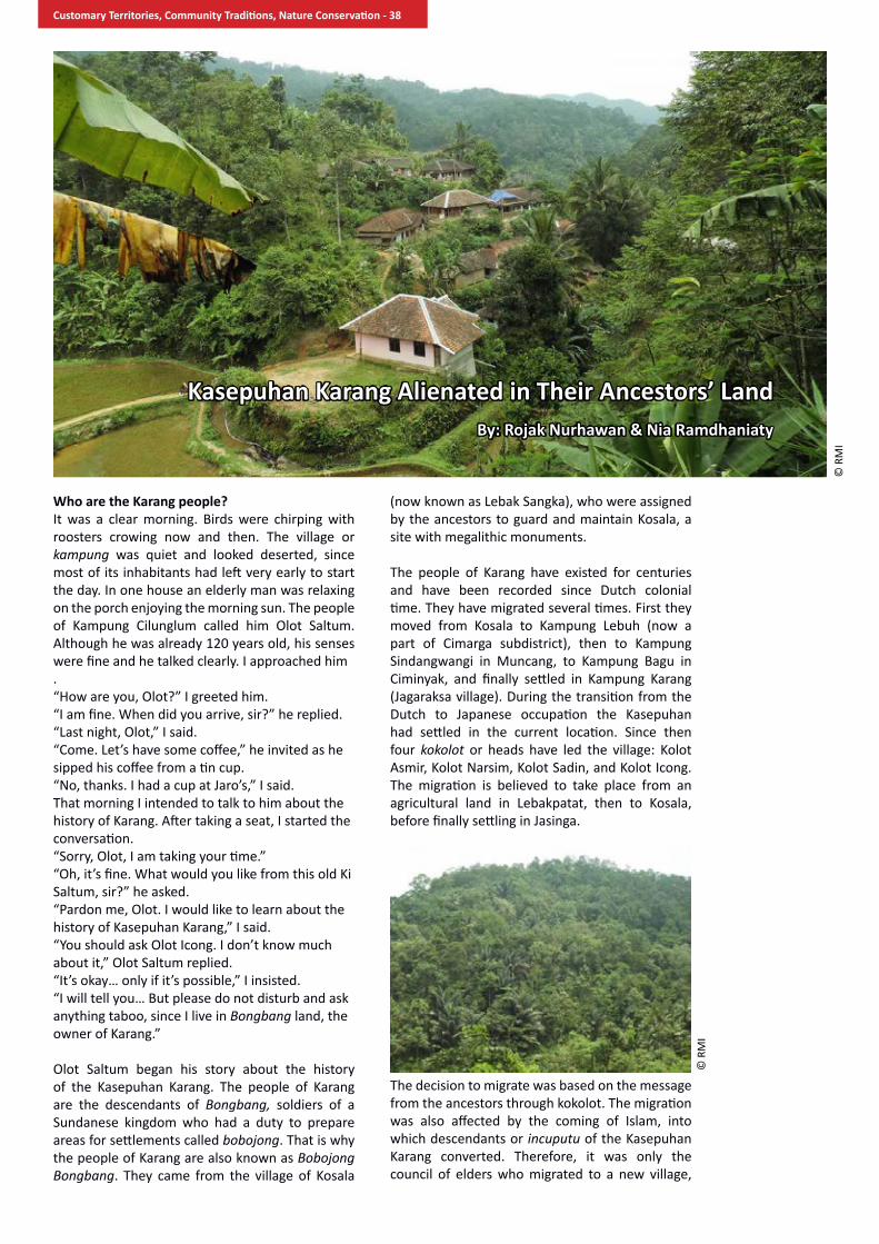
Who are the Karang people?It was a clear morning. Birds were chirping with roosters crowing now and then. The village or kampung was quiet and looked deserted, since most of its inhabitants had left very early to start the day. In one house an elderly man was relaxing on the porch enjoying the morning sun. The people of Kampung Cilunglum called him Olot Saltum. Although he was already 120 years old, his senses were fine and he talked clearly. I approached him.“How are you, Olot?” I greeted him.“I am fine. When did you arrive, sir?” he replied. “Last night, Olot,” I said. “Come. Let’s have some coffee,” he invited as he sipped his coffee from a tin cup.“No, thanks. I had a cup at Jaro’s,” I said. That morning I intended to talk to him about the history of Karang. After taking a seat, I started the conversation. “Sorry, Olot, I am taking your time.”“Oh, it’s fine. What would you like from this old Ki Saltum, sir?” he asked.“Pardon me, Olot. I would like to learn about the history of Kasepuhan Karang,” I said.“You should ask Olot Icong. I don’t know much about it,” Olot Saltum replied.“It’s okay… only if it’s possible,” I insisted.“I will tell you… But please do not disturb and ask anything taboo, since I live in Bongbang land, the owner of Karang.”
Olot Saltum began his story about the history of the Kasepuhan Karang. The people of Karang are the descendants of Bongbang, soldiers of a Sundanese kingdom who had a duty to prepare areas for settlements called bobojong. That is why the people of Karang are also known as Bobojong Bongbang. They came from the village of Kosala
(now known as Lebak Sangka), who were assigned by the ancestors to guard and maintain Kosala, a site with megalithic monuments.
The people of Karang have existed for centuries and have been recorded since Dutch colonial time. They have migrated several times. First they moved from Kosala to Kampung Lebuh (now a part of Cimarga subdistrict), then to Kampung Sindangwangi in Muncang, to Kampung Bagu in Ciminyak, and finally settled in Kampung Karang (Jagaraksa village). During the transition from the Dutch to Japanese occupation the Kasepuhan had settled in the current location. Since then four kokolot or heads have led the village: Kolot Asmir, Kolot Narsim, Kolot Sadin, and Kolot Icong. The migration is believed to take place from an agricultural land in Lebakpatat, then to Kosala, before finally settling in Jasinga.
The decision to migrate was based on the message from the ancestors through kokolot. The migration was also affected by the coming of Islam, into which descendants or incuputu of the Kasepuhan Karang converted. Therefore, it was only the council of elders who migrated to a new village,
Kasepuhan Karang Alienated in Their Ancestors’ LandBy: Rojak Nurhawan & Nia Ramdhaniaty
© R
MI
© R
MI
Customary Territories, Community Traditions, Nature Conservation - 38

whereas incuputu had a choice to stay. The leaders and elders did not insist or force the others to move. They upheld the philosophy “ngaula ka ratu tumut ka jaman”, meaning adopting the changes of the new age. Such philosophy enables the Kasepuhan Karang to make a choice freely without any interference or imposition from the elders. It is the very reason that the number of the incuputu in Kasepuhan Karang keeps decreasing. But the former territories of Kasepuhan Karang are not discounted. The overall territories of the populations that have genealogical link to Kasepuhan Karang are known as Bongbang land.
The members of kasepuhan are also called incuputu, and are indigenous communities who still practice and observe customary law. Therefore, the population of incuputu is not confined by state administrative division. Outside the village of Karang, the incuputu live in Cikadu, Cilunglum and Cibangkala, all within the village of Jagaraksa. There are also incuputu in other villages, subdistricts and districts. In 2013 the total number of incuputu of the Kasepuhan Karang was 450 persons. This is based on the number of people who came to seren taun or the harvest festival, in which all incuputu are required to attend as a part of their balik taun obligation. Balik taun is a process for them to re-affirm their identity that they will express throughout the course of their lives. Balik taun is also a form of obedience to the kasepuhan and a reflection upon the course of their lives in the past, present and future.
Just like a state, kasepuhan has a territory, population and government. To date the governance structure of Kasepuhan Karang is led by a kokolot or olot, who is assisted by a group of officials called Baris Kolot. These officials have different roles and duties. Wakil kokolot or Jurubasa represents the kasepuhan in dealing with outsiders. Pangiwa has a duty to keep order in the village and to lead activities related to state government . Ronda kokolot guards imah gede, the main house of the kasepuhan where the Olot lives. Amil has a duty teaching religion to the incuputu and leads wedding ceremonies and funerals. Mabeurang or Paraji helps in baby delivery or midwifery. Bengkong provides circumcision service. Palawari leads ceremonies or customary
events organized by the kasepuhan and serves guests.
“That’s enough for now, sir. It’s time for me to take a nap,” said Olot Saltum.“Please. Thank you, Olot,” I replied.
Olot Saltum stood up. He promised me to continue his story the next day. He also said that I could ask the history of Kasepuhan Karang from Jaro Wahid, his grandson who became the first village head of Jagaraksa, which was established by the state. I stood up and went to Jaro Wahid’s house.“Where did you go, Kang (Brother)?” asked Jaro Wahid“I just came from the Olot’s, sir,” I answered. “I see. You just talked to Olot,” he said. “Yes, sir. I asked him about the history of Kampung Karang. Olot said that if I want to know the history, you can tell me,” I said. “You’re kidding, aren’t you? It’s better to hear it from Olot,” he said. “I’m not kidding at all. I just told you what Olot said,” I replied.“Ha ha ha! Sure, sure, Kang. Tonight, okay. Do you have anything to do today?” Jaro asked. “Where are we going to go, sir?” I asked.“We are going to Kampung Cikadu. The villagers and I are building a road. On the way back we can drop by at imah gede. What do you think?” he asked. “Okay. Fine with me,” I said.
In a short while, after preparing our things, Emon, Jaro Wahid and I left for Kampung Cikadu.
How do the Kasepuhan Karang manage their land?
Along the way from Cilunglum to Cikadu we saw wet rice fields with their golden grains carpeting the landscape, as well as trees and fruits. It was an amazing view. From the distance in the dense natural forests, we noticed birds flying from tree to tree. Suddenly, Jaro Wahid said, “Kang, stop please.”“What’s going on, Jaro?” Emon asked.“Look. This is the way the people of Kasepuhan Karang manage nature,” Jaro Wahid said.“Emon, take pictures of the landscape,” I said.
© R
MI
© R
MI
Customary Territories, Community Traditions, Nature Conservation - 39

After Emon took some shots, we continued our journey. On the way Jaro Wahid explained how his people manage the land. “Here we have areas that we must protect together. We call them aub lembur,” he started. “What is that, Jaro?” I asked.
“Aub lembur is an area where water springs are located. We also bury the dead there. Therefore, we consider it as sacred. We prohibit people to cut down trees or collect timber from the area.” Jaro Wahid said.
He continued, “The other sacred area is leuweung kolot or old growth forest. It is also known as paniisan which literally means a resting place, because it is where people from kasepuhan take a rest. The kasepuhan also let the land within the area rest, so the forest can grow and maintain its water catchment function to provide freshwater for the people. The importance of water in their lives is expressed in the idiom “Salamet ku Peso, bersih ku Cai”, meaning “Knives give a life, water give cleanliness.”
He explained, “With such thinking, incuputu are always reminded to be appropriate, sharp, in harmony, and simple in all circumstances and situations. If one makes a mistake, he/she should immediately cleanse his/her body or soul to regain this harmony and simplicity, including in managing and using natural resources. We, therefore, believe that in managing nature we must emphasize balance. Whatever we take must be in equal proportion to what we give back to nature.” As we talked, we did not realize that we were entering Cikadu.
“Okay, that’s all for now. Don’t forget to write down what I have told you. Please don’t forget. Alright?” Jaro Wahid chuckled.
“Of course, Jaro. I have recorded it in my mind,” Emon responded.
“Thank God if you remember. Please don’t contract hard-to-understand or easy-to-forget syndrome. Okay...” Jaro Wahid teased us.
“Look, sir. The villagers have started working,” I said.
“Indeed. Let’s join them,” Jaro Wahid said.
Forest management
The next evening, while sitting in the living room of Jaro Wahid’s house, Emon and I heard the voices of so many animals as if they were singing about the nature’s beauty. It gave a warm, lively feeling to us. In the distance, we heard the rhythms of Sundanese songs or hariring as the villagers were relaxing in their chit-chats after a long day of hard work in their wet rice fields and gardens.
Suddenly, roars of two motorbikes broke the silence as they approached the house.
“Hi,” a middle-aged man greeted us while knocking on the door. “Hi, Mr. Ikok. I didn’t realize it was you. Come on in,” Emon invited. “How are you, Kang? When did you arrive?” Iwan asked us. “We’ve been here for two nights. Thank God, we’re fine,” Emon replied. “Hey Kang Rojak, you’re here too,” Sarbini, the head of a hamlet in Kampung Karang, said as he turned to me. “Please, come in. Let’s have coffee,” I responded.
Four men came to the house – Sakri a.k.a Mang Akik, Iwan, Olot Santika and Sarbini. They were the team members assigned by Kokolot and Jaro to carry out participatory mapping in Kasepuhan Karang and Jagaraksa village.
“I invited Mang Akik and his team to discuss the completion of the mapping that we have done. Also I just want to chit-chat before going to bed,” said Jaro Wahid.
“The map isn’t done yet, Kang?” asked Iwan, turning to Emon.
“The fieldwork is completed, but there are some information that need to clarified,” answered Emon.
“What kind of information? Let Kang Emon and Kang Rojak explain. Our task is to answer. We’re resource persons, aren’t we? Wow, that sounds so big. Resource person,” said Jaro Wahid with a chuckle.
“That’s right, Jaro. Kang Rojak and Kang Emon will be our students tonight,” said Mang Akik.
“Okay, okay. Tonight we will be students, but you teachers have to make coffee first. So we can have a good talk,” said Emon with a laugh.
“What..? How come the teachers have to make the coffee? It should be the other way around. The students make coffee for teachers,” said Iwan with a chuckle.
That evening the house was very lively. We had a lot of laughs, making the talk so much fun.
© R
MI
Customary Territories, Community Traditions, Nature Conservation - 40

The Kasepuhan Karang divide their land into several land uses, as follows:
1. Leuweung kolot, also known as paniisan or leuweung titipan, is a forest that serves as water catchment area. The people have to keep the forest intact and maintain its sustainability. In a participatory mapping exercise in 2014, it was identified that the kasepuhan has 2,101 hectares of such forest.
2. Leweung cawisan is forest or land allocated for future conversion into agricultural land and settlement, totaling an area of 4,176 hectares. This category is divided into several sub-categories that, depending upon their contours and slopes, have different functions:
Gunung kayuan is a forest with various tree species that cannot be cut down.
Lamping awian are steep slopes planted with plants, such as bamboo that can prevent the soil from eroding while providing fresh water to the population.
Lebak sawahan are areas at the foot of the mountains used for paddy fields to provide staple food for the community.
Legok balongan is a small basin that holds water used as fish pond.
Datar imahan is a flat land used for settlement.
These categories show that the people of the kasepuhan make every effort to balance the protection and utilization of their land.
Farms
The people of kasepuhan practice agroforestry by planting various species of fruits, wood and cash crops, which they call kebun talun. The total area under this category is 181.29 hectares. Table 1 lists fruits found in the farms.
These planted species are the sources of livelihood that provide income on a daily, monthly, and annual basis. Unproductive fruit plants are cut down. However, to ensure sustainability of the species, for one tree felled, the owner will plant at least five seedlings of the same species.
Farms provide economic security to the community when they have urgent needs. They mortgage the farms, which is as valuable as gold to them as a guarantee for their loans.
Except for economic reasons, the maintenance of mixed farms or agroforests is to protect the environment, to maintain water catchment areas, and to reduce the risk of landslides. In addition, the agroforests are the feeding sites for many animals, including birds, monkeys, squirrels, and wild pigs.
Table 1. Fruit species in the farms of Kasepuhan Karang no Fruit species types of use Frequency of harvest1. Durian Fruit and Timber Annual2. Duku Fruit and Timber Annual, Fruit mast
every three years 3. Clove Fruit and Fuelwood Annual4. Coffee Fruit Annual5. Rambutan Fruit, Timber,
FuelwoodAnnual
6. Melinjo Fruit and Leaves Monthly7. Mango Fruit, Timber,
FuelwoodAnnual
8. Binglu Fruit and Timber Annual9. Mangosteen Fruit Annual10. Coconut Fruit and Timber All year long11. Jackfruit Fruit and Timber Quarterly12. Stink bean
(Parkia speciosa)Fruit and Timber Annual
13. Jengkol (Archidendron pauciflorum)
Fruit & Timber Annual
14. Sugar palm Palm sugar, Fruit and Timber
Daily
15. Picung Fruit and Timber Annual16. Kapok Fruit and Timber Annual17. Rubber Latex, Fuelwood,
Timber Daily
18. Manii Timber and Fuelwood Every five years19. Albizzia sp. Timber and Fuelwood Every five years20. Lame Timber Every seven years21. Huru Badak Timber Every ten years 22. Banana Fruit Monthly 23. Pineapple Fruit Weekly24. Bamboo Timber and Handicraft As needed
Source: Field notes of RMI, 2014
© R
MI
© R
MI
Customary Territories, Community Traditions, Nature Conservation - 41

Plant species grown in the farms are substantial for their incomes, as shown in Table 2.
Rubber contributes the largest portion of the household income. On average, every household can get IDR 4 million per month. Other fruit species provide additional income. However, the average land parcels are quite small, at 0.2 hectare per household. Those who have large land parcels are the elites, especially the close relatives of the kolot. Land ownership is both based on inheritance and through land purchase.
Paddy fields
Prior to Dutch influence, they practiced swidden agriculture by making new plots or huma annually. When Kolot Asmir led the kasepuhan, the Dutch came to introduce rubber. The creation of rubber farms led to land scarcity for swidden farming. The people decided to grow wet rice instead. During this transition there was not enough rice for them. Since then wet rice farming has been their main agricultural activity. To store the harvest, every household has two or three rice barns called leuit. The whole village has a communal leuit that serves as savings to be used in the events held by village. With such arrangement, they are self-sufficient for their rice needs.
The people grow both local varieties and high-yield varieties introduced by the government. The local varieties are Rajawesi, Srikuning, Cere, Kui, Kewal, Cere Ketan, Langkasari, Ketan Bogor, Ketan Tawa, Ketan Putri, Ketan Hideung, and Gantang. Traditionally, they are only required to grow rice once a year. If a family grows rice a second time in the same year, the practice is known as ngebon because the second rice planting is considered to have additional income. Therefore, it is not required for all incuputu.
“Guys, look, it’s midnight. I didn’t realize it’s already this late,” Olot Santika said.
“Right, we should call this a day. How about if we talk again another day?” asked Emon.
“I’m ready anytime. Even till dawn if you want to. Just let me know,” Iwan said.
“What? You Iwan? You always go to bed early. I can talk all night long. Ask Kang Rojak, once we had a discussion until five in the morning. Right, Kang?” said Jaro Wahid.
“Okay. Let’s go home then. My eyes are very heavy now. I still have work to do in our rice fields. Ha ha...” said Iwan.
“I’m right, aren’t I? Go home now , Iwan,” said Jaro Wahid.
“Kang Rojak, Kang Emon. When are you both going to leave?” asked Sarbini.
“Tomorrow, sir,” answered Emon.
“What!! Why are you in such a hurry? Please, spend some more time,” said Sakri.
“We have so many duties to finish. And we don’t have much time,” Emon said.
“Duties...? What kind of duties? You’re just making it up, aren’t you? Aren’t they duties from you wife?” said Iwan jokingly.
“Are you such a weak husband, Iwan?” Emon teased.
We finally ended the discussion with jokes. Indeed, it was a fun night. We felt so close to each other.
The history of land conflict
As mentioned earlier, Kasepuhan Karang has existed long before Indonesian independence. Things started to change when the Dutch imposed a new land use regime on the land. Then most adults worked as labor in Pasirhaur Plantation . At the same time, they opened lands for paddy fields, hill rice plots and mixed farms in Mount Haruman, which was then a forest reserved for new agricultural lands. Their lives went well. No one prohibited them to observe their customary system. Land conflicts began to manifest when the Forestry Service of the Dutch East Indies government declared Halimun Mountains as protected forests during the period of 1924-1934. It was the beginning of a new era of restricting the people of Kasepuhan Karang to enter their own forests.
Table 2. Incomes from mixed gardens no Plant species Harvest
cycleaverage income per household
1. Rubber Weekly 20 kg x IDR 5000 = IDR. 1,000,000
2. Banana Weekly 3 bunches x IDR 20,000 = IDR 60,000
3. Coffee Annually 10 kg x IDR 15,000 = IDR 150,000
4. Clove Annually 15 kg x IDR 60,000 = IDR 900,000
5. Mangosteen Annually 600 kg x IDR 4,000 = IDR 2,400,000
6. Duku Annually 500 kg x IDR 3,000 = IDR 1,500,000
Note: USD1 is approximately IDR12,000Source: Field notes of RMI, 2014
© R
MI
Customary Territories, Community Traditions, Nature Conservation - 42

In post-independence Indonesia the protected forest was declared as a nature reserve in 1963 under the responsibility of the Forestry Service. Afterwards the Forestry Service instructed the communities in the area to plant tree species in what was known after as Mount Haruman forest block. In effect, the communities can no longer grow hill rice or ngahuma. In 1978 a part of the reserve was designated as production forest under the management of West Java Unit of Perum Perhutani (State Forest Corporation). The company introduced a collaboration scheme of social forestry nature called Pengelolaan Hutan Bersama Mayarakat (PHBM). However, the company imposed a levy of 25% to the community, just like paying a tribute to a ruler. Again, the most vulnerable members of the community, such as the women, landless peasants, and farm laborers, were most affected.
The dispossession process continued. In 2003 the Ministry of Forestry re-designated the production forest into a conservation area making up more than 113,000 hectares of Mounts Halimun-Salak National Park. Declaration of the area as a part of the park created notorious impact, as the people were prohibited to access their own lands, including their customary forest. This prohibition further pushed them deeper into the abyss of poverty.
From the tenurial, management and licensing perspectives, the conflict in Kasepuhan Karang is caused by at least two factors. First, by the different bases of claims. The indigenous peoples in all kasepuhan in the western part of Java believe that the ancestors entrusted Kendeng Mountain (also known as Halimun-Salak mountain range) to them and will be passed down to the children and support their lives. Therefore, they have to protect and maintain the mountain range to keep its integrity. Since the people of Kasepuhan Karang have lived in Mount Haruman prior to Indonesian independence, they are highly dependent on the land where they have their farms and rice fields. Moreover, the mountain is the safe haven for animals and provides them with freshwater. Thus they have developed local wisdom to guard and sustain the mountain. The Ministry of Forestry in behalf of the state, on the other hand, claims its rights based on the available laws and regulations. The Ministry’s main legal principle on this matter follows a colonial one that is “all lands that are not proven to be the rights of any legal person are within the state domain.” The problem is that the state only considers written documents as evidence of such claims, which indigenous communities do not have.
Second, in principle the park managers and local communities have the same intention of protecting the forests. However, there are
conflicting land use categories between those of the park and those of the communities, and there are unclear boundaries, both outer boundary and zonation of the park. The park managers employ zoning system within the park, whereas the communities have their own indigenous land use system. For example, the community converts land in Mount Haruman into agricultural land and settlement because they consider it as leuweung cawisan, which is a kind of land bank available for conversion. The state considers such act an illegal activity, because the function does not conform to the designated function of the forest area. In 1978, Perum Perhutani, which was then assigned to
manage the area, only allowed the planting of pine trees, an important species for forest industry. With the declaration of the area as a part of Mounts Halimun-Salak National Park in 2003, the park managers consider all community activities within the park illegal.
Later, the managers divided the park into four main zones: core zone, wilderness zone, utilization zone, and other zones which include traditional, rehabilitation, religious, cultural and historical, and special zones. The overlay of the map produced by the people of Kasepuhan Karang and the map of park zonation shows nearly 50% of the kasepuhan territory falls into the special zone (See Figure 1). The assignment of such zone is due to the actual fact that communities, infrastructure and utility facilities have existed prior to the park’s creation. For now the people of Kasepuhan Karang can live in this assigned zone. However, with unclear legal status of their agricultural lands they can be labeled as forest squatters. The legality of their status within the park can be provided through a by-law on the recognition of their indigenous status or a memorandum of understanding between the people and the park on the management of the special zone.
Concluding remarks
The main challenge on the recognition of indigenous peoples’ rights is the commitment of the government, particularly regional government,
Customary Territories, Community Traditions, Nature Conservation - 43

in respecting and recognizing their rights as innate, not given. However, it is much affected by local politics and the strong bias toward exploitative natural resource management policies.
The programs and activities relating to indigenous peoples carried out by the government have not yet touched on basic problems. An example of such programs is the empowerment of Komunitas Adat Terpencil, officially translated as Isolated Traditional Community. This is administered by the Ministry of Social Affairs and has a strong bias toward physical development. To date the existing policies on the recognition of indigenous peoples emphasize on the physical forms of cultural expression such as performing art, clothing and ceremonies. Meanwhile, the basic problem of indigenous peoples is the lack of access and control over natural resources because the state has not recognized their rights over land and natural resources. The ruling of Constitutional Court on the case No. 35/PUU-X/2012 affirms the constitutional rights of indigenous peoples and thus separates customary forests from state forests. The recognition and protection of indigenous peoples, however, requires a by-law at the district level, which is a challenge for both the indigenous peoples concerned and the respective district government.
Another important challenge is to keep the internal strength of the indigenous community, so they need to maintain their worldview and behavior, and have pride in their identity. Without these they will be vulnerable and feel unconfident, a common condition of indigenous peoples throughout the country and elsewhere as an outcome of a long dispossession processes. Therefore, reclaiming their identity and building their self-confidence are crucial for them. It is also important to ensure that the community can protect and manage the forest resources sustainably and fairly among its members. It is imperative that the most vulnerable groups of the community, such as the landless male, female peasants, and female heads of poor households, get equal access to information and natural resources.
© R
MI
Customary Territories, Community Traditions, Nature Conservation - 44

”Ado rimba ado bunga, ado bunga ado dewo. Hopi ado rimba hopi ado bunga, hopi ado bunga hopi ado dewo.” “When there is forest there are flowers, when there are flowers there are gods, Without forest there are no flowers, without flowers there are no gods.”-Temenggung Tarib
Temenggung Tarib is one of the 1,600 Orang Rimba living in Bukit Duabelas National Park (BDNP). Orang Rimba, which literally means “People of the Forest”, is an indigenous community in Jambi Province who live by hunting and gathering forest products. They are distributed throughout the forest in small groups. BDNP is 60,500 hectares in area and has been home to the Orang Rimba since the days of their ancestors. The Orang Rimba needs the BDNP which provides for their livelihoods, and BDNP also needs the protection of the Orang Rimba.
The Orang Rimba maintain and protect their indigenous land that is closely tied to their sources of livelihood, traditions, and culture. They do not randomly clear land for farming because there is a customary law that regulates this. Around the area are trees regarded as sacred, burial grounds (pasoron), areas for giving birth (peranaan) and bathing babies (memandiko budak), areas for wedding rituals (bebalai), lands protected by the gods (tanoh bedewo), and medicinal plants that they protect. Although some of the Orang Rimba, especially those of the Paku Aji group, have lived and settled in the housing area built by the Regional Social Agency, they still maintain their culture and traditions and respect the boundaries of their customary lands in the forest.
The Orang Rimba strongly maintain their culture
and traditions that depend on the condition of the forest inherited from their ancestors, especially their customary law and local wisdom. The Orang Rimba also protect a diverse collection of plant and animal species to help maintain their sources of livelihoodfrom hunting, gathering, and collecting forest products without degrading the value of the biodiversity. The Orang Rimba protect these resources wisely. For example, one of the more important food components for the Orang Rimba is wild game that they call louq (protein). Louq is made into primary side dishes to accompany their carbohydrate staples such as cassava, wild roots and rice. The role of louq is significant. Louq can become a source of quarrel between individuals, families, and groups if not divided in accordance to customary rules.
The men are responsible in meeting the louq requirements. Eight-year old boys have already learned to set up game traps and by 9 years have followed their fathers in hunting trips. Hunting is a dominant activity among the men. They hunt nearly every day and discussions around louq are a part of their everyday lives. Hunting is done during the day or night, both in the dry as well as rainy seasons. These depend on the hunting techniques used and the behavior of the game animal. For example, during the rainy season the Orang Rimba would rely on dogs, while hunting at night they utilize flashlights and go out alone or in pairs.
The Orang Rimba’s main hunting equipment are their spears such as the kujur, serampang, and tiruk. They also use additional equipment like flashlight at night and dogs during the day, and usually bring their machetes. Various traps are often used. All the materials are available around them. However, today man-made materials such as nylon and rubber are also widely used, and even
The Forest of Bukit Duabelas National Park:Protecting the Lives and Livelihoods of the Orang Rimba
By: Furwoko Nazor
© K
KI W
ARSI
Customary Territories, Community Traditions, Nature Conservation - 45

the use of home-made firearms is now often found. Fish are caught using fish traps called bubu, luka, and tekalak, and various poison called tubaderived from forest plants. Tuba does not kill but instead intoxicates fish, making them easy to catch. Fish recover when the tuba concentration decreases.
The Orang Rimba hunt a number of wildlife species for their consumption. There is no research yet on this, but based on daily observations, there are many game species hunted, both large and small mammals, such as deer, tapir, muntjac, mousedeer, wild boar, cinceher, binturong, treeshrews, posou, and other species. Bird species hunted include great argus, peasantfowl, tugang, penyiul, and pigeons. The Orang Rimba also hunt reptiles and amphibians such as snakes, monitors lizards, some frog species, and nearly all turtle species such as softshell turtles, pangkak, and sebodo. They also consume a wide range of fish, but the more common ones are catfish, snakeheads, belido, ikan tanah, rasboras, kokopo, lapam, keleso, and other species.
Even with the diverse species of game and fish consumed, the Orang Rimba restricts louq consumption with a taboo system related to their social system. They have a prohibition to eat certain animals or animal parts based on gender, age, if a woman is pregnant, shaman or non-shaman, bulih or sempuh. For example, the pangkak turtle can only be eaten by men, while the liver of certain animals can only be eaten by women. There are certain animals that pregnant women cannot eat.
Although there are many species that the Orang Rimba consume, many animals are prohibited for consumption, including tiger, elephant, sun bear, and primates like monkeys, siamang, leaf monkeys, macaques, and others. Some birds cannot be eaten, including malkoha, hornbills, kingfishers, and eagles. All of these species are placed by the Orang Rimba within their belief system with their gods.
When logging companies operated in the 1970s, followed by plantations and transmigration in the 1980s, much of the forest around the Orang Rimba was cut down and transformed. This forest function change caused habitat loss for many wildlife species that have lived in the forest ecosystem. The frightening impact was experienced by the Orang Rimba who lost their forest and land resources. Today, there are many landless Orang Rimba living along the trans-Sumatra road in Jambi Province. The Orang Rimba living in this area will no longer see most of the animals that once lived in the forests and were once part of the Orang Rimba’s life system.
The Orang Rimba in Bukit Dua Belas are experiencing the same suffering but they are more fortunate. Part of their living area still remains, which is recognized by the government as the Orang Rimba’s land for livelihood (kawasan penghidupan)as part of the National Park. In this area, the Orang Rimba can still rely on forest resources, including game animals for their primary source of protein. However, several animal species have disappeared from the area while others are becoming rarer. The
rhinoceros has disappeared from the area around the 70s, while elephants disappeared from the Orang Rimba’s area in 1985. Tigers are believed to still exist in the area but indications of its presence have been seen less and less. Game animals like deer and mousedeer are also disappearing. On the other hand, wild boar population is increasing, while the nangoy boar that usually live in groups are becoming rarer. The large river terrapin (Batagur sp.) is now very rare and difficult to find. Several fish species are also rare now. Giant featherbacks that were once abundant in Blido River is now rarely seen, as well as the arowana. The Orang Rimba often say that the reason is that they are often poisoned by outsiders.
The decrease in fish and game populations has made it difficult for the Orang Rimba to obtain louq for their daily needs. The Orang Rimba has admitted that this condition is threatening their lives in addition to their identity. One of the characteristics of the Orang Rimba is to raise argus as their chicken and muntjac as their goats. It is for thisreason that they do not eat chicken, goat, cow, or other livestock that people generally eat. This taboo for outside livestock is an important part of the Orang Rimba’s cultural identity that separates the contrasting cultural dichotomy between Orang Rimba and Orang Terang, the term for outsiders. If the forest areas continue to shrink and the resources contained within continue to disappear, the lives of the Orang Rimba will continue to become marginalized. It would be more terrifying if an ethnocide were to occur, or the loss of the tribe’s self-identity. The Orang Rimba living on the trans-Sumatra road is one clear example. (Aritonang, 2014)
The Orang Rimba also keep their culture of processing and utilizing non-timber forest products such as dammar resin, rattan, honey, wild forest roots, dragon’s blood (Daemonorops draco) resin, various medicinal plants, and a number of forest durian species.
© K
KI W
ARSI
Customary Territories, Community Traditions, Nature Conservation - 46

dammarresin (Shorea spp.)Dammar resin is found in many areas in BDNP, and dammar-producing trees including kendundung muda, gemuru, nuaron godong, tanoh kepayong, aek behan, kejasung besar,terab, and others are widely distributed. Dammar resin is useful for lighting in the homes of the Orang Rimba who wraps the resin in meranti bark. Dammar resin is also used for lighting in bebalai rituals, when they call the gods in wedding receptions. It has been used for lighting since the days of their ancestors.The Orang Rimba in BDNP produce several types of dammar resin: demor sapot, demor sarong (kelulut), demor meranti (solur), demor tulang, demor congol (cat eye), demor kedundung, demor beyung,and demor kepalo tupai.
Rattan (Calamus spp.)BDNP is located in the Air Hitam sub-river basin (Sarolangun District) and Kejasung sub-river basin (Batanghari District) and has great potential forrattan diversity and abundance. There are even transmigration areas in Sarolangun District that are known as “rattan fields”. There are rattan species that live along hills in 300 masl such as Calamus manna, tetebu, C. scipionum, and balam, to rattan speciesthat live around swamps such as C. caesus and C. melanoloma.
Rattan has become increasingly rare. Only few are left due to exploitation by villagers and the Orang Rimba themselves, without replanting or allowing natural regrowth. Although the Orang Rimba havetheir own traditional wisdom and fining system concerning rattan harvest such as prohibiting harvest of young rattan, this tradition has been lost. Reduced rattan population is mostly due to the degradation of the surrounding vegetation, because the vegetation that shades the rattan has been cut down, making it difficult for rattan to grow. (Hasan, 2003)
The Orang Rimba are known as great rattan collectors, especially those in the BDNP. They usually collect rattan in groups, organized by group leaders, who are organized by outsiders acting as middlemen. While rattan is still abundant in the park, transporting it from the forest to the nearest village requires hard work and considerable amount of time. Road access is still poor. After rattan is collected and the Orang Rimba has a potential buyer, rattan is lifted onto a truck and taken to rattan processing mills that are usually located along the Sumatra road, such as in Senamat in Bungo, Muaro Bungo District, Jambi.
Manau rattan (C. manan Miq.)The Orang Rimba referto one of the most profitable rattan species as manau. When collecting manau, or bermanau, they involve all members of their group to search for manau that is ready for harvest. Manau grows by climbing around trees in dense and good forests. It grows in areas in the BDNP where the Orang Rimba usually cultivate, that is part of their livelihood and living areas.
When collecting manau the group must first split their members into several work groups based on kinship. When harvesting manau, they must first survey to determine the harvest site. They mark their harvest sites by either tying a rope to the manau (gegelangon), cutting part of the manau (tukak tanggo), or clearing the area around the manau (rerambo). The group stays overnight near the harvest site and they also hunt for food. The harvest begins with cutting the manau trip by climbing the tree (nuntung poncak).Afterward, the manau is measured using a wooden pole to get three depa tangan or approximately three meters. One manau stem can produce four to ten pieces (tuntung), with each piece measuring three meters.
Honey/Honeybees (Apis dorsata)Ampelocissus thyrsiflorae, or as the Orang Rimba refer to as the bee hive tree or sialang, is an important resource protected by the Orang Rimba. The value of one sialangtree is equal to the life of one person. Sialang can be several forest tree species where bees make their hives, such as kedundung/kedondong, kruing, blackboard tree, kayu kawon, and pari.
The Orang Rimba refer to honey as mani rapaand deem it sacred. Honey is believed to come from flowers that have bloomed and then carried by bees (rapa)on their heads and legs. The Orang Rimba also believe that young bees (anak rapa) come from the dew inserted into the neatly divided hives with their equally sized cells. These
© K
KI W
ARSI
© K
KI W
ARSI
© K
KI W
ARSI
Customary Territories, Community Traditions, Nature Conservation - 47

young bees start out as klawot (bee eggs, larvae, and pupae), and feed on honey to grow into adults with heads, legs, and wings, and become darker when they turn into sub-adult bees which can still be eaten. As their story goes, rapa is a honeybee from Kerinci Mountain with guards whoare fierce and have red eyes, with white skin and tall stature like the Dutchmen. They said that there is a sialang batuor beehive rock where the bees stop and rest. Bees come like the seasons, when flowers are about to bloom. Night and day bees work to collect honey.
To harvest honey, the Orang Rimba must undergo certain rituals. The first is a ritual to wash oneself to prevent bee stings (songot rapa). This washing ritual is done by bathing without soap. In addition, the honey collectors are prohibited from consuming chili and salt before climbing the honey trees. This taboo is strict and is called bermambu or of strong smells, such as spicy and salty. Other foods that are prohibited are catfish, keli, kepuyu, sepat, kebakang, rat, and boar meat, because they are believed to have characteristics similar to bees.
As the day progresses into evening, grown men who have learned to climb the sialang begin to nail wood planks on the sialang tree from the base to the first branch, and continue in the evening on the smaller branches. These planks or lantak function as steps to facilitate climbing trees that can reach 30 meters high.
Before climbing, the climber must recite a number of verses of poems (tomboy/pantun)that are very systematic in nature. In the evening the verse is used to seduce the “girl” to allow to be milked. The “girl” in the verse refers to bees, which based on their anatomy are called kepalo, rapa, anak, orinduk rapa, all within one hive. The entire sialangis viewed as having a supernatural “owner” who must be named one by one in the verse to avoid obstacles and greetings from evil spirits living in the tree. The climber must recite a mantra to drive away the demon, setan buyoto, inhabiting the tree which has the appearance of a rat, cobra, or a human being.
The sialang tree itself is personified as a balai panjang (stilt house) and in this balai panjangis a girl who is the betrothed and the induk (mother) is guarding the girl. Honey collection is illustrated as the engagement process between the girl and a handsome young man. This begins by temporarily moving the sialang tree inhabitants so as not to bother and block the process, continued by asking for permission
to enteras a greeting to walk around the balai panjang (besetabik),then by removing the induk or lowering through persuasions. When the process
is over, it is ended by a farewell verse(pantun berpamit) as the climber descends the tree. When reciting the mantra to separate the bees from their hive, the climber descends and brings anember from the repayingtree to drive away the bees.
During honey collection, all the equipment must be new: thelantak (large wooden nail, functioning as a plank/ladder), geganden, tunom (bark ember to smoke out bees), tali hanyut, sludang, sengkorot (rope made from bark to climb branches), kemanyang (connector for tali hanyut and tembelong or pot), and the tembelong or pot. Once the bees have been smoked out, the hive is then lowered using tali hanyut made from strong temiyang rattan. Sludang, which is light but strong and made of tree bark shaped like a four-sided bucket, is used as container to hold honey.(Siagian 2014)
Wild forest rootsThe Orang Rimba has extensive knowledge of root species of high carbohydrate content, such as benor, beyoi, gedung, and sagu. These wild roots are useful when the Orang Rimba are facing remayo and melangun. Remayo are times when livelihoods are scarce, or times of hardships. Melangunis a unique customthat when a family member or friend within the group passes away, the Orang Rimba have to travel for weeks or even months to find a suitable place to start a new life.
During melangun, they do not carry sufficient food and the length of time for melangun cannot be determined, and food may run out before finding a site deemed suitable as sonsudunganor temporary camping site. In such events, often times there is hunger. If food ration is low, the children become thepriority.
The Orang Rimba also use other non-timber forest products, such as the resin of dragon’s blood, jelutong (Dyera costulata), medicinal plants, benuaron, balam sap (Palaquium gutta), gaharu (Aqualaria malaccensis), and various species of wilddurian.
BDNP as the Last Fort for the Orang RimbaBDNP forest is critical for the Orang Rimba in protecting and maintaining their identity. Without the forest, their culture and traditions disappear. Every aspect of their life and livelihood need the forest and their lives are sheltered by the BDNP forest.
BDNP is administratively located within three districts: Batanghari, Sarolangun, and Tebo
© K
KI W
ARSI
© K
KI W
ARSI
Customary Territories, Community Traditions, Nature Conservation - 48

Districts. Specifically there are 24 villages functioning as buffers that are directly connected to the area through land and natural resources use in the BDNP.
With this area’s conservation status, the law is expected to protect the rights and resources of the Orang Rimba and consider the park as their roving territory. It is supposed tostop industrial plantation forest concessions’ operations to convert the forest into monoculture forest estates.
National Park Legal Status provides Sovereignty for the orang rimba indigenous Peoples
The legal status of the national park has given sovereignty to the Orang Rimba Indigenous Peoples, whether intended or not, by providing protection for their lives and livelihoods, protecting their rights to maintain their culture and traditions, and giving them freedom to manage their customary rights.
If the Orang Rimba did not receive the government’s attention especially for legal protection, major companies with Cultivation Rights Permit (HGU) and industrial plantation forests will convert the land within their territory into a monoculture plantation, which is happening today. Communities outside of the territory (outsider communities and transmigators) can also claim their customary rights because the land comprises the tribes’ lands from around the BDNP. Then the Orang Rimba will end up like the others living along the trans-Sumatra road.
After the Orang Rimba obtained their rights for sovereignty, there is great hope for them to have their fundamental rights to be equal to the outside communities in terms of education, health, economy, society and culture, and the rights to obtain other public services.
They also hope that these lands will not be freely cleared and sold to outsiders, who will then be the only ones to enjoy the land that they have long fought for. The Orang Rimba want to manage their land sustainably from generation to generation.
Hompongon as a meansto prevent illegal logging and as a source of economic livelihood and ecological protection for ecosystems surrounding BDNP
Hompongonis a way to fence off the national park area managed by the Orang Rimba. This is
their effort to preserve the area from destructive activities such as encroachment and land grabbing by outside partiesby constructing a fence surrounding the park. Thehompongon is planted with rubber trees through agroforestry for a number of functions, including conservation and hydrology, as well as alternative economy. Hompongonis a traditional wisdom orally passed on through generations. Other commercial local species can be planted in a hompongon, such as mango, Baccaurea racemosa, bitter bean, and rambutan,which has fruits that can be harvested. They also plant jelutong that can be harvested for its sap, and meranti, fig, and blackboardfor timber.Rubber produced from the hompongon is sold to markets to obtain not only outsider’s goods but also rice, fruits, fish, and tobacco.
The Orang Rimba’s tenacity to maintain the BDNP has rewarded Temenggung Tarib and his group to receive the environmental Kalpataru award in 2006 from the Indonesian Ministry of Environment, presented by then President Susilo Bambang Yudhoyono in the State Palace. The award was given for Tarib and his group’s efforts in saving the forest and biodiversity in and around BDNP.
Challenges1. Pressures from encroachment and land
clearing for farms from outsider communities threaten the lives of Orang Rimba.
2. The Orang Rimba has limited knowledge of their land.
3. There is high level of interaction with outsiders which is not balanced by knowledge and skills.
4. The Orang Rimba still face a trade system with a lengthy economic chain, therefore they can only obtain little profit.
references• Aritonang,Robert.Juni 2014.Alam Sumatera.
Jambi: KKI Warsi• Hasan,Nurdin.Oktober 2003.Alam Sumatera.
Jambi:KKI Warsi• Siagian,Marahalim.Juni 2014.Alam Sumatera.
Jambi:KKI Warsi
© K
KI W
ARSI
© K
KI W
ARSI
Customary Territories, Community Traditions, Nature Conservation - 49

Among the Kenyah people in the interior of Kalimantan (Indonesian Borneo), conservation and use of natural resources amount to the same thing: to care for the forest as a source of livelihood, food and good health, as well as cultural identity, and the belief that forest resources, if well managed, are going to continue to sustain the community in the future. This approach pervades the traditional management approach in Kenyah indigenous territories that are now part of the provinces of East and North Kalimantan, Indonesia. It is also most evident in the tradition of ‘tana ulen.’
Tana ulen, is tana, or land, which is m/ulen or restricted, prohibited. It is a forest area rich in natural resources such as rattan (Calamus spp), sang leaves (Licuala sp.), hardwood for construction (e.g., Dipterocarpus spp, Shorea spp, Quercus sp), fish and game, all of which have high use value for the local community.
Originally tana ulen might have been more appropriately called ‘sungai ulen,’ that is the ‘restricted river’ and the land or forest area comprising the watershed and land surrounding a particular tributary. Indeed, the name of the tana ulen often reflects this origin. For example, the tana ulen Sungai Nggeng or the restricted land of the Nggeng River, near the village of Long Alango, sub-district of Bahau Hulu, Malinau.
This is also the tana ulen story we are going to tell.
In the past, tana ulen functioned mostly as forest reserves managed by the aristocratic families on behalf of the entire community. The forest was considered a public good for which the aristocratic
leaders were entrusted as managers and keepers. There was also another kind of tana ulen ‘rattan concession’ managed by the community, but this was not the most common arrangement in the past. Another case was that of reserves granted by the village chief to families of commoners who had distinguished themselves in warfare or had defended the community against the enemy.
Nowadays, responsibilities for the management of the forest reserves have been transferred to the customary councils that together with the community manage tana ulen forests according to customary law. While the balance of power has shifted from private aristocratic reserves to village reserves, other aspects of the social and political context have stayed the same. Regulations with regard to access to and control of tana ulen areas might now rest with the customary assembly or lembaga adat, but the head of the customary assembly is still an aristocrat, often the descendant of previous managers of tana ulen.
Tana Ulen: Forest Conservation the Kenyah WayBy: Anye Apui, Andris Salu and Cristina Eghenter
© A
ndris
Sal
u
Customary Territories, Community Traditions, Nature Conservation - 50

In general, tana ulen areas are strategically located near the village where management and control are easier (there might be other areas with abundant forest resources but just too far away from the village). The size of a tana ulen territorial area varies from 3,000 hectares to up to over 12,000 hectares. When the people in Long Kemuat decided to move downriver to what is now the village of Long Alango, the then customary chief Apui Njau looked for a good forest to be established as tana ulen near the new settlement. This was in 1901. The area identified was that of the Nggeng River, a tributary of the Bahau River. The area is about 11,000 hectares in size and varies in elevation from 400m to over 1,500m. It is a good hunting ground and has valuable timber, in addition to many non-timber forest products (NTFPs). The area also contains important archaeological remains (stone burials), a clear indication that the area was inhabited and used by the ancestors of the communities in Hulu Bahau over 350 years ago.
Tana ulen might be a limited forest area, however, it is an integral part of the whole indigenous territory referred to as wilayah adat, or customary land. In a way, the tana ulen represents the ‘protected area’ of the indigenous territory. Tana Ulen Sungai Nggeng is situated in the wilayah adat of Hulu Bahau (Malinau) which comprises (6) villages along the main Bahau River. The total population of the area is 1610.
Why were tana ulen areas so important in traditional Kenyah communities? In the past, religious beliefs required the organization of celebrations throughout the year to mark the agricultural cycle and other social occasions like the safe return of war parties and traders. The village chief acted as prime host. He gave hospitality to travellers and delegations from other communities that visited the area. He also had to prepare the meals for the people of the community working in his fields. All these responsibilities implied that he and his family needed to ensure there was enough food, especially fish and game for the guests. In addition
to food, construction timber for longhouses was also an important resource in tana ulen. Tana ulen areas were also opened to community members on certain occasions, but the decision on when to open a tana ulen rested with the aristocrats who held the privilege to manage the forest reserve.
As a general rule, no forest may be cleared in tana ulen to open rice fields, and this is true until today. Collection of specific products is restricted by customary regulations. In Tana Ulen Sungai Nggeng, collection of specific, tools and methods employed. Collection of forest resources on a collective basis, for either direct consumption or sale, is contingent upon the need to procure money for village celebrations at Christmas and New Year or special projects like the building of a community centre. Sometimes, regulations contain only a general clause that customary fines would be incurred by all individuals who do not comply. Sometimes, details about the amount of the fines, in money or heirloom items like parang (knife) or gongs, are provided with regard to specific violations. Recently, a man who had cut down a tree for construction near the Sungai Nggeng was fined Rp 1,000,000 by the customary council.
In 1991, WWF for the first time arrived in Hulu Bahau and discussed with the local community about building a forest research station in their territory (“Lalut Birai”). The customary chief suggested that it might be good to build it in the tana ulen Sungai Nggeng if the activities at the station complied with the adat regulations and the special purpose of that forest. The Lalut Birai forest station was built and supported by WWF for over ten years before management was turned over to the community in 2007.
Upon their own initiative, the people of Long Alango also decided to establish a “Badan Pengurus Tana’ Ulen,” (BPTU) or Management Committee, in charge of strengthening protection and management of the tana ulen and to help the customary council in its responsibilities. BPTU is led by the Customary Chief. The decision was based on the need to adjust the governance of tana ulen to changed conditions and evolving social dynamics. It was also a response to the increasing number
© A
ndris
Sal
u
© A
ndris
Sal
u
Customary Territories, Community Traditions, Nature Conservation - 51

of visitors and researchers who were coming to Hulu Bahau to conduct research at the Lalut Birai Forest Station. Increasingly, local people felt that visitors should also acknowledge local rights and decided to impose a fee for researchers (domestic and foreign alike, but different rates) in exchange for the permission to do research at Lalut Birai and other areas around the community territory. The fees are managed as part of a collective “social safety” fund for purposes like helping people in need, travel costs to a hospital, education, etc. In 2011, the BPTU was recognized with a village regulation as the manager of the Tana Ulen on behalf of the community.
The tana ulen Sungai Nggeng is now part of the Kayan Mentarang National Park. However, the special status is recognized by being part of the traditional use zone of the park. Moreover, in the Criteria and Indicators for the zonation document, tana ulen is specifically mentioned as a sustainable form of forest management, and the community is allowed to continue accessing the area and use natural resources based on their customary regulations. In 2011, BPTU and the Management Unit of the National park have signed a Memorandum of Understanding (MoU) to ensure that the customary council and BPTU maintain control of the tana ulen area while management is shared as part of the protected area.
The people in Long Alango and the Hulu Bahau Wilayah Adat realize that their strength is adat1. By ensuring resilience of the adat system of natural resource management the community can preserve the environmental basis of their livelihoods as well as their identity. There is no Dayak community without forest, as they like to say. Looking into the future, young leaders of the community plan to establish a youth organization in defense of adat rights and to get stronger recognition by the local government for all the Tana Ulen in the area. The ongoing mapping and re-mapping of customary territories as a result of the Constitutional Ruling no 35 on customary forest and the local regulation (PERDA no. 10 th 2012) on the recognition and protection of Indigenous Peoples’ rights, offer the right momentum for action in the district of Malinau.
Names of those interviewed about Tana Ulen are the following:• Oko Jangin Lenjau• Pak Jan Lawai• Kule Lawai • Kepala Adat Besar Wilayah Bahau Hulu
(Customary Leader of the Hulu Bahau Area) - Oko Anyie Apuy
1 Customs, traditions, indigenous ways and even indigenous law
© A
ndris
Sal
u
© A
ndris
Sal
u
Customary Territories, Community Traditions, Nature Conservation - 52

ICCAs: for Conservation, Cultural Identity, Equity, and Sustainable development
At the ICCAs symposium held in Bogor, Indonesia (October 2011), one strong recommendation made by participants was the need to have forest tenure reform for the future of ICCAs in Indonesia. Three years later is probably too soon to evaluate any reform movement, but the fundamental Constitutional Court ruling no. 35 issued on May 16th 2013 that customary forests, including ICCAs, can no longer be considered state property, have opened new opportunities for moving forward and accelerating forest tenure reform. Districts around Indonesia are legislating on the recognition and protection of Indigenous Peoples’ rights, which is currently the basis for actualizing customary rights. Moreover, another law (No 1, 2014) has sanctioned the rights and role of customary and local communities in managing coastal and marine resources. Similarly, the new Village Act (2014), can strengthen the recognition and support of customary practices.
This is the tenure framework of change within which we need to place discussion and work linked to the documentation, registration, recognition, and management of ICCAs.
ICCAs are examples of how traditional management of natural resources and conservation is more holistic and integrates various aspects: livelihoods, food and water security, conservation and environmental security, and cultural identity. From a rights perspective, ICCAs are the realization of economic, environmental rights, social and cultural rights. As the stories and examples in this
report show, ICCAs not only conserve a vast range of habitats, biodiversity and ecosystem services, have their own zonation system, they are also the basis of livelihoods for millions of people by securing resources and income. Decision makers and others should also realize that the cultural bonding between indigenous communities and their territories is important, and that community mapping is a good way to help strengthen this.
ICCAs can be examples of effective and equitable conservation and natural resource management, and help improve power sharing, transparency, accountability, participation, and equitable distribution of costs and benefits. ICCAs can provide the right incentive structures to promote good governance in natural resources.
The establishment of ICCAs can balance the need for protecting critical forest areas while securing the rights of local and Indigenous communities. Communities can secure their entitlements as rights holders and managers of the area. In the face of the severity of climate change challenges, and the vulnerability of many indigenous and poor communities exposed to those risks, ICCAs can offer new opportunities for engaging communities and local stakeholders in conserving and managing natural assets and services in return for appropriate benefits. ICCAs can play an important role in mitigation and adaptation strategies in climate change. In the draft revision of the law on biodiversity conservation (No 5 1990), community conserved areas and related traditional knowledge are recognized and adopted as a new governance type in addition to national parks. It is important also to remind ourselves that governance models imply also the locally developed, endogenous mechanisms for administering justice and
Concluding remarks
© A
MAN
Customary Territories, Community Traditions, Nature Conservation - 53

legislating (hukum adat) in support of sustainability and good management of natural resources.
ICCAs were traditionally integrated in a broader management system. Looking into the future of ICCAs, this element is key. It encourages us to take a landscape approach and recognize that the cultural and natural values of landscapes and customary territories are inextricably linked, and that local and Indigenous communities are central to sustaining them.
The advances in the recognition of ICCAs do not diminish the need to continue advocacy efforts at all levels, local (village) to national.
The documentation of ICCAs acquires more significance. Mapping has regained momentum and strength in many parts of the archipelago and multiple examples already exist of customary areas and ICCAs recognized in local spatial plans (e.g., Merauke). Understanding how local and indigenous communities manage natural resources, fulfill their needs and develop economically their ICCAs in good ways can help appreciate the contribution of ICCAs for conservation, equity and sustainability.
The dilemma of conservation versus development is never far away from the conditions of customary communities, especially when threats in the form of mining, exploitation and conversion happen around and inside their areas and territories. Communities aspire to economic empowerment. Investment like oil palm plantations offers tempting alternatives for local people. Talking about conservation only is not enough. The examples in the report indicate efforts and community initiatives to build additional value of forest commodities and natural resources to improve profits, benefits and sustainability.
Ultimately, the strength of ICCAs and traditional conservation initiatives depend as much on the existence of international and national instruments as much as on the strength of the customary law and traditional knowledge of the communities themselves (”how strong and committed we are”). Local institutions need to be sustained and strengthened, and empowered through information, capacity building and skills sharing, to be participants and champions of improved governance of forests and natural resources in Indonesia.
© A
MAN
Customary Territories, Community Traditions, Nature Conservation - 54

aCronYm
AMAN Indigenous Peoples’ Alliance of the Archipelago
BDNP Bukit Duabelas National Park
CBD Convention on Biological Diversity
HuMa Association for Community and Ecologybased Law Reform
HKM Community Forestry
ICCAs Indigenous peoples’ and community conserved territories and areas
IUCN-NL International Union for Conservation of Nature-The Netherlands
JKKP Participatory Mapping Network in Indonesia
JKTI Indonesian Network on Traditional Wisdom
KKI WARSI The Indonesian Conservation Community
KIARA Peoples Coalition for Fisheries Justice
NGOs Non-Governmental Organizations
NTFP-EP Non-Timber Forest Products –Exchange Programme
Pusaka An Indigenous Peoples advocacy organization
RMI The Indonesian Institute for Forest and Environment
Sawit Watch Oil Palm Watch Indonesia
SLPP JKPP partner at provincial level
WALHI Indonesian Environmental Forum / Friends of the Earth Indonesia
WGII Working Group on ICCAs in Indonesia
WWF Indonesia World Wide Fund for Nature-Indonesia
Customary Territories, Community Traditions, Nature Conservation - 55

Customary territories, Community Traditions, Nature Conservation
indonesia is one of the world’s biologically mega-diverse countries comprising around 17,000 islands. there are many indigenous peoples’ and community conserved territories and areas (ICCAs) across the archipelago displaying multiple cultural and environmental values linked to lakes and rivers, peatland, forests and coastal areas. Though the term “ICCA” is relatively new in Indonesia, indigenous communities in Indonesia have been practicing conservation of natural resources
for centuries.
To further promote ICCAs in Indonesia, the Working Group on ICCAs in Indonesia (WGII) has embarked on a documentation effort to tell the stories of community conservation systems across the archipelago. This compilation is still a work in progress. It represents the initial release of a collection of case studies and
experiences of iCCas.