Comment (2) of Ross Melinchuk on Behalf of Texas Parks and ...
184
UEA PAKU ~7r~ ~~/2 November 5, 2010 HULY'VjVLCIVES NOV~F ~ I Ac 'N- 8:5 3 R .HF\Ac:D Life's better outside.: Commissioners Peter M. Holt Chairman San Antonio T. Dan Friedkin Vice-Chairman Houston Mark E. Bivins Amarillo Ralph H. Duggins Fort Worth Antonio Falcon, M.D. Rio Grande City Karen J. Hixon San Antonio Dan Allen Hughes, Jr. Beeville Margaret Martin Boerne S. Reed Morian Houston Lee M. Bass Chairman-Emeritus Fort Worth Ms. Cindy K. Bladey Chief, Rulemaking and Directives Branch Office of Administration Mail Stop: TWB-05-BOIM U.S. Nuclear Regulatory Commission Washington, DC 20555-0001 RE: Proposed Comanche Peak Nuclear Power Plants Units 3 and 4 Combined License Application Review, Draft Environmental Impact Statement (DEIS), Somervell and Hood Counties Dear Ms. Bladey: Carter R Smith Executive Director Texas Parks and Wildlife Department (TPWD) received the August 6, 2010 notification for issuance of and request for comment on the above-referenced DEIS. The notification was submitted in accordance with the National Environmental Policy Act of 1969, as amended (NEPA), and the Fish and Wildlife Coordination Act of 1934, as amended. Nuclear Regulatory Commission (NRC) prepared the DEIS as part of its review of Luminant Generation Company LLC (Luminant) application for combined licenses for construction and operation of two new nuclear units at its existing Comanche Peak Nuclear Power Plant (CPNPP) site near Glen Rose, Texas. U.S. Army Corps of Engineers Fort Worth District (USACE) is a cooperating agency in the DEIS so that the EIS can be used to decide on issuance of permits pursuant to Section 404 of the Clean Water Act and Section 10 of the Rivers and Harbors Act. Based on TPWD staff review of the information provided, TPWD offers specific recommendations regarding the DEIS and concerns regarding the project that can be found in Attachment A to this letter. Listed below are TPWD's principal concerns, which are more fully addressed in Attachment A: * Hydrologic changes in the Brazos River ecosystem will result from increased withdrawals and consumptive water losses and associated alterations in water management from Possum Kingdom Lake to the Brazos River below Lake Granbury. Impacts on aquatic and wetlands biota and habitat could be substantial as a result of hydrologic alterations to the Brazos River system, particularly Lake Granbury, Possum Kingdom Lake, and the river below Lake Granbury. The reductions in water levels would likely change shoreline vegetation, affect shallow water habitats, and affect access to both public and private boat docks and ramps, especially during drought conditions. Reduced Brazos River flows downstream of Lake Granbury may impact aquatic 6 L~W5~ ~ h~e 1~ -i/-~ ,4F-ý_411)5 -:::: &,DIA4- 03 4200 SMITH SCHOOL ROAD AUSTIN, TEXAS 78744-3291 512.389.4800 www.tpwd.state.tx.us To manage and conserve the natural and cultural resources of Texas and to provide hunting, fishing and outdoor recreation opportunities for the use and enjoyment of present and future generations.
-
Upload
khangminh22 -
Category
Documents
-
view
2 -
download
0
Transcript of Comment (2) of Ross Melinchuk on Behalf of Texas Parks and ...

UEAPAKU
~7r~ ~~/2November 5, 2010
HULY'VjVLCIVES
NOV~F ~ I Ac 'N- 8:5 3
R .HF\Ac:DLife's better outside.:
Commissioners
Peter M. HoltChairman
San Antonio
T. Dan FriedkinVice-Chairman
Houston
Mark E. BivinsAmarillo
Ralph H. DugginsFort Worth
Antonio Falcon, M.D.Rio Grande City
Karen J. HixonSan Antonio
Dan Allen Hughes, Jr.Beeville
Margaret MartinBoerne
S. Reed MorianHouston
Lee M. BassChairman-Emeritus
Fort Worth
Ms. Cindy K. BladeyChief, Rulemaking and Directives BranchOffice of AdministrationMail Stop: TWB-05-BOIMU.S. Nuclear Regulatory CommissionWashington, DC 20555-0001
RE: Proposed Comanche Peak Nuclear Power Plants Units 3 and 4 CombinedLicense Application Review, Draft Environmental Impact Statement(DEIS), Somervell and Hood Counties
Dear Ms. Bladey:
Carter R SmithExecutive Director
Texas Parks and Wildlife Department (TPWD) received the August 6, 2010notification for issuance of and request for comment on the above-referencedDEIS. The notification was submitted in accordance with the NationalEnvironmental Policy Act of 1969, as amended (NEPA), and the Fish andWildlife Coordination Act of 1934, as amended. Nuclear Regulatory Commission(NRC) prepared the DEIS as part of its review of Luminant Generation CompanyLLC (Luminant) application for combined licenses for construction and operationof two new nuclear units at its existing Comanche Peak Nuclear Power Plant(CPNPP) site near Glen Rose, Texas. U.S. Army Corps of Engineers Fort WorthDistrict (USACE) is a cooperating agency in the DEIS so that the EIS can be usedto decide on issuance of permits pursuant to Section 404 of the Clean Water Actand Section 10 of the Rivers and Harbors Act.
Based on TPWD staff review of the information provided, TPWD offers specificrecommendations regarding the DEIS and concerns regarding the project that canbe found in Attachment A to this letter. Listed below are TPWD's principalconcerns, which are more fully addressed in Attachment A:
* Hydrologic changes in the Brazos River ecosystem will result from increasedwithdrawals and consumptive water losses and associated alterations in watermanagement from Possum Kingdom Lake to the Brazos River below LakeGranbury. Impacts on aquatic and wetlands biota and habitat could besubstantial as a result of hydrologic alterations to the Brazos River system,particularly Lake Granbury, Possum Kingdom Lake, and the river below LakeGranbury. The reductions in water levels would likely change shorelinevegetation, affect shallow water habitats, and affect access to both public andprivate boat docks and ramps, especially during drought conditions. ReducedBrazos River flows downstream of Lake Granbury may impact aquatic
6 L~W5~ ~ h~e1~-i/-~ ,4F-ý_411)5 -:::: &,DIA4- 034200 SMITH SCHOOL ROADAUSTIN, TEXAS 78744-3291
512.389.4800
www.tpwd.state.tx.us
To manage and conserve the natural and cultural resources of Texas and to provide hunting, fishingand outdoor recreation opportunities for the use and enjoyment of present and future generations.

Ms. Cindy K. BladeyPage TwoNovember 5, 2010
resources including the state-threatened Brazos Water Snake (Nerodia harteri)and state-threatened and rare mussels.
Proposed new location 345-kV transmission line routes have not been fullyassessed through a routing and alternatives evaluation, thus impacts associatedwith the proposed new lines are not fully articulated. Without an assessmentof routes and their alternatives for inclusion in the DEIS, the NRC may besegmenting project impacts under Section 1508.27 (7) of NEPA. This sectionstates, "Significance [of impacts] cannot be avoided by terming an actiontemporary or by breaking it down into small component parts."
* Because the new transmission lines are in the vicinity of potential habitat,known occurrences, and migratory corridors of endangered species, there maybe unforeseen impacts to the federal- and state-endangered Black-cappedVireo (Vireo atricapilla) (BCV), Golden-cheeked Warbler (Dendroicachrysoparia) (GCW), and Whooping Crane (Grus americana). Potentialimpacts to these species associated with transmission line construction andoperation cannot be determined from the information presented in the DEIS,as site surveys along the routes for suitable breeding and/or migratorystopover habitat have not been conducted.
* The approximate location of the proposed 345-kV Whitney transmission lineshown in the DEIS crosses Dinosaur Valley State Park. In addition toproviding habitat for the BCV and GCW, this state park offers publicrecreation activities that would be impacted by construction of a transmissionline across or in sight of the park. This park and its viewshed should beavoided if at all possible. If the final project design requires that transmissionlines cross any state-owned or managed lands, such as Dinosaur Valley StatePark, the NRC, Luminant, and Oncor should be aware of the requirements ofChapter 26 of TPW Code (Chapter 26) discussed in Attachment A.
TPWD appreciates the opportunity to provide comments on this important projectand participate in the NEPA process. Please direct any questions to KathyBoydston at (512) 389-4638.
Sincerely,
Ross Melinchuk
Deputy Executive Director, Natural Resources
RM:KB:CB:KH:gg
Attachments

Attachment A
This attachment contains Texas Parks and Wildlife Department (TPWD) specific recommendationsregarding the Draft Environmental Impact Statement (DEIS) and concerns regarding LuminantGeneration Company LLC's (Luminant's) construction and operation of two new nuclear units at itsexisting Comanche Peak Nuclear Power Plant (CPNPP) site near Glen Rose, Texas. This attachmenthas been affixed to TPWD's November 5, 2010 cover letter to the Nuclear Regulatory Commission(NRC).
These recommendations are organized to parallel the DEIS format. TPWD provided scopingcomments for the project, as follows:
* August 3, 2007, Letter to William Wenstrom, Enercon Services, Inc. for preliminary rare,threatened and endangered species information from Celeste Brancel
* February 16, 2009, Letter to Michael Lesar, NRC for scoping comments on EnvironmentalReport for preparation of Draft Environmental Impact Statement from Carter Smith via e-mailfrom Kathy Boydston
" April 24, 2009, Letter to Michael Lesar, NRC follow-up to site audit visit on February 2, 2009
from Karen Hardin
Project Description
The proposed project involves construction andoperation of two new Mitsubishi Heavy IndustriesU.S. Advanced Pressurized-Water Reactors, Units 3 and 4, to be located within the 7,950-acreproperty boundary that includes Luminant's existing reactors, Units 1 and 2. The new units would be0.5 miles from the existing units and placed within a previously disturbed site. The project includesconstruction of two wet mechanical draft cooling towers for each nuclear reactor. Cooling waterwould be obtained from Lake Granbury in Hood County by way of two new 42-inch pipelines. Anew 400-acre blowdown water treatment facility (BDTF), including two large ponds, would be builtto reduce total dissolved solids (TDS) and chlorides of blowdown water. The BDTF would produce atreated permeate stream, which would then be blended with the remaining untreated blowdown androuted to Lake Granbury via two new 42-inch pipelines and underwater diffusers in the lake. Potablewater for personnel and support activities would be obtained from Wheeler Branch Reservoir (WBR).The Somervell County Water District recently built WBR to supply water to the City of Glen Rose,the CPNPP and surrounding communities. Additionally, the project would require associatedconstruction of five new 345-kilovolt (kV) transmission lines, three of which would be single-circuitlines located on existing tower structures and two of which would be double-circuit expansionsrequiring new or expanded 160-foot wide right-of-ways' (ROW). The transmission lines requiringnew ROW include a 45-mile line to Whitney and a 17-mile line to DeCordova.
The proposed action evaluated three alternative sites within Texas, referred to as the Coastal(Victoria-Refugio County), Pineland (near Pineland, Sabine County) and Tradinghouse (near Waco,McLennan County) sites. In addition to site location alternatives, the DEIS included a no actionalternative, system design alternatives and onsite mitigation alternatives to minimize impacts.
TPWD Attachment A -1I-

General Comments
The NRC transmittal letter indicated that the NRC and USACE have different regulatory authoritiesand requests that if TPWD issues an incidental take statement then TPWD should specify within thestatement which terms and conditions are imposed on which agency.
Under Chapter 68, Texas Parks and Wildlife (TPW) Code, state-listed species are prohibited fromtake. TPW Code does not establish an incidental take permit analogous to the U. S. Fish and WildlifeService (USFWS) Section 10 permit established under the Endangered Species Act. TPWD cannotprovide an incidental take permit in response to a DEIS.
Recommendation: Although TPWD does not provide incidental take permits, only personnelwith a TPWD scientific collection permit are allowed to handle and move state-listed species.Should the applicant require moving state-listed species out of harms way for constructionactivitieS, the person handling the species must possess a scientific collection permit, which canbe obtained from TPWD Permitting Specialist, Chris Maldonado, at (512) 389-4647 or atChris.Maldonado(tpwd~state.tx.us.
TPWD notes various inconsistencies in the DEIS including the following:
" The number of potable groundwater wells stated on Page 2-20 differs from what is stated onPage 2-24.
" Section 5 species-specific reference for the Guadalupe bass (Micropterus trecUliii), TPWD2009d, is used for the reference on every state-listed species on Page 5-23.
" Section 7, Page 7-4 states the Squaw Creek Reservoir (SCR) is closed to recreationalactivities, though Section 2 and most other references have been updated to indicate SCR isnow open for boating and fishing.
Recommendation: TPWD recommends all numerics, references and duplicative statementsbetween sections of the DEIS be checked for consistency and accuracy to ensure the proposedaction is represented accurately and any contradictory statements have been removed from DEIS.
Specific Comments
1.0 Introduction
1.1.2 Preconstruction Activities
The NRC defines "construction" as those activities within its regulatory authority. NRC indicatesactivities associated with the project that are not within the purview of the NRC action to licenseUnits 3 and 4 are grouped under the term "preconstruction" and include clearing and grading,excavating, erection of support buildings and transmission lines, and other associated activities. TheNRC does not consider the preconstruction activities as direct impacts from the proposed action andhas evaluated preconstruction activities in the cumulative impacts analysis.
Recommendation: TPWD does not agree with NRC's decision regarding the exclusion ofpreconstruction activities from the proposed action. TPWD finds the scope as defined by NRC to
TPWD Attachment A -2-

4
be too narrow to meet the requirements and intent of NEPA regulations. Under Council onEnvironmental Quality regulations, Section 1502.4, "(a) Agencies shall make sure the proposalwhich is the subject of the environmental impact statement (EIS) is properly defined.. .Agenciesshall use the criteria for scope (Section150825)."
Section 1508.25 clarifies the Scope criteria to include "connected actions," defined in part as "(ii)Cannot or will not proceed unless other actions are taken previously or simultaneously; (iii) Areinterdependent parts of a larger action and depend on the larger action for their justification."
TPWD recommends the scope of the DEIS be revised to include the preconstruction activities.Activities such as clearing, grading,. excavating, and erection of support buildings andtransmission lines, and other associated activities are necessary to build, operate and maintain thenuclear reactor. These preconstruction activities are an integral part of the larger action andshould be under the scope of the DEIS.
2.0 Affected Environment
2.1 Site Location
The DEIS refers to the site plan Figure 2-3 when discussing various features of the facility, thoughnot all features are included or labeled on the figure. Major water features not represented on the siteplan include the safety shutdown impoundment, non-radioactive wastewater evaporation ponds, anemergency spillway, stormwater retention ponds, and drainage swales. The terminology referring toseveral features is inconsistent or overlaps current features that support Units 1 and 2.
Recommendation: TPWD recommends the DEIS clearly label various features as they relate tothe current units and the proposed units on the site. TPWD recommends all water featuresdiscussed in the DEIS be shown and labeled on Figure 2-3 or a new figure to facilitate readerclarity of the water features.
2.2.2 Transmission Lines and Other Offsite Corridors
Figure 2-9 Federal Lands and State Parks in the Region does not include a representation of stateparks within the project vicinity.
Recommendation: Geographic information system (GIS) shapefiles of park boundaries can beobtained from TPWD GIS Laboratory Manager Kim Ludeke at (512) 389-8071 [email protected]~tx.us. Figure 2-9 should include state parks or wildlife management.areas that occur within the vicinity of the project including Cleburne State Park (SP), DinosaurValley SP, Lake Whitney SP, Meridian SP, Lake Mineral Wells SP and Trailway, PossumKingdom SP, and Cedar Hill SP. The Eagle Mountain State Recreation Area is no longer ownedby TPWD, though identification of this park should be delineated on the map.
Section 2.3.2 Water Use
Page 2-20 includes information regarding regional water projections of annual consumptive waterdemand across the region, however the DEIS indicates that the regional water demand projections donot include water requirements for the project nor for expanded development of natural gas from the
TPWD Attachment A -3-

Barnett Shale. Section 5.2.2 indicates that Luminant has participated in the Brazos Region G WaterPlanning Group process to ensure that Units 3 and 4 water use impacts are managed in coordinationwith other users. The DEIS lacks a summary of Luminant's involvement in the process, does notreveal an estimated projection of water demand based on the project or the Barnett Shale gasdevelopments, nor does it reveal when reports supporting such information would be available. Thesefactors are essential to future projections and should be analyzed.
Recommendation: Because the water consumption of the project and the gas development of theBarnett Shale are essential to future water demand and supply projections, TPWD recommendsthese water use requirements be included in the discussion of Texas Water Development Board'sregional water demand projections and the Texas State Water Plan. The DEIS should indicatewhy these projections were left out of the Texas Water Development Board's projections andTexas State Water Plan. The DEIS should indicate when Luminant began its involvement in theRegion G water planning process for Units 3 and 4 and should provide an estimate of waterdemand projections based on the project. The DEIS should indicate when reports supportingfuture water demands for the project and for expanded development of natural gas from theBarnett Shale will be available.
Section 2.3.2.1 Surface Water Use
TPWD recommended in its February 16, 2009 comments that SCR be opened for recreational use.As such, DEIS page 2-24 indicates Luminant has reopened the reservoir for limited public use,including boating and fishing.
Comment: TPWD recognizes and appreciates Luminant's efforts at providing public recreationopportunity at SCR.
Section 2.4.1.1 Terrestrial Resources - Site and Vicinity
Page 2-40 indicates the CPNPP site is a migratory stopover for birds, especially waterfowl. WithinTexas, the federal- and state-listed endangered Whooping Crane (Grus americana) utilizes a 200-milewide primary migration corridor. The CPNPP site occurs within the central-most 60-mile widecorridor within which 75 percent of migration sightings have been documented.
Recommendation: TPWD recommends the DEIS Page 2-40 reflect the Whooping Cranemigration corridor as an important migratory and stopover route that crosses the CPNPP site.
In addition to the ecologically oriented recreational areas and wildlife protection areas listed on page2-40 and 2-41 of the DEIS, the Paluxy River and the section of the Brazos River below the LakeGranbury dam down to its confluence with Camp Creek are both identified by TPWD as ecologicallysignificant stream segments (ESSS). Through extensive review by TPWD staff, ESSSs throughoutthe state were identified to assist regional water planning groups in designating ecologically uniquestream segments under Texas Administrative Code Title 31 Section 357.8. Until approved by thelegislature, they are not a legal designation. The Brazos River ESSS was identified because it was aTexas Natural Rivers System nominee for outstandingly remarkable wildlife values and was rated thenumber one scenic and recreational river in the northern half of Texas by the National Parks Service(NPS) in 1995. The Paluxy River ESSS was identified as a riparian conservation area containingDinosaur Valley State Park, which is a National Natural Landmark. Additional information about
TPWD Attachment A -4-

ESSSs can be found at http://www.tpwd.state.tx.us/landwater/water/environconcerns/water quality/siasegs/.
Recommendation: TPWD recommends these two stream segments be included as ecologicallyoriented recreational areas and wildlife protection areas in the DEIS.
Section 2.4.1.3 Important Terrestrial Species and Habitats
Page 2-45 indicates the federal- and state-listed endangered Black-capped Vireo (Vireo atricapilla)(BCV) is only found in Oklahoma and Texas. BCV are known to nest in Mexico and winterexclusively in Mexico.
Recommendation: TPWD recommends the DEIS include BCV current range.
Pages 2-46 and 2-47 and Chapter 4 pages 4-20 and 4-21 correctly indicate the BCV and the federal-and state-listed endangered Golden-cheeked Warbler (Dendroica chrysoparia) (GCW) have beenobserved .as foraging and nesting within Dinosaur Valley SP. TPWD records indicate the BCV andGCW have also been observed at Fossil Rim Wildlife Center.(Fossil Rim) and are identified as TexasNatural Diversity Database (TXNDD) Element Occurrence Record (EOID) 7664 and EOID 2780,respectively. These occurrences were mapped and provided in DEIS reference TPWD 2009i. Pleaserefer tothe additional attached detail records for these locations.
Recommendation: The DEIS should be updated to.indicate that the BCV and GCW have beenrecorded at Fossil Rim, which tentatively occurs within -the proposed corridor of the 45-mileWhitney transmission line. TPWD recommends the NRC contact Fossil Rim directly for morecurrent information on the documented rare, threatened and endangered species present at the site.This facility conducts research and breeding programs for endangered species, including nativeand exotic endangered species. Subsequent chapters thataddress impacts should includepotentialimpacts at Fossil Rim. Please note that later sections in this letter address TPWD concerns relatedto transmission lines in the vicinity of state parks and impacts-of transmission line construction onwildlife, habitats and paleontological resources.
Page 2-47 indicated the Whooping Crane could possibly migrate over the project area, though nonatural heritage records for occurrence exist for the species in Hood, Somervell or Bosque counties,nor are there natural heritage records for occurrences within 10 miles of the site, transmission lines,and pipelines.
It is important to understand the basis and limitations of the TXNDD dataset for appropriateinterpretation. For the Whooping Crane, methodology includes mapping only wintering grounds andrepeated-use stopover sites in Texas. Because observations of birds in migration would not bemapped, the TXNDD is not expected to contain an occurrence record of a migratory flyover or singleconfirmed stopover of the Whooping Crane. As indicated in previous correspondence, for federally-listed species it is important to contact the USFWS for additional data and information on thesespecies.
Recommendation: TPWD recommends the NRC consult with the USFWS for possibleadditional information on the nearest and most current recorded stopover sites for the WhoopingCrane in central and north Texas.
TPWD Attachment A -5-

The DEIS should include additional detail on this species, including the potential on-site habitatand suitable stopover habitat in the vicinity of the proposed transmission lines and pipelines.Wetland habitat should not be limited to jurisdictional wetlands, as non-jurisdictional wetlandsalso provide habitat for the Whooping Crane. Further information on the Whooping Cranemigration corridor and Whooping Crane migratory behaviors are available in the InternationalRecovery Plan for the Whooping Crane (USFWS 2007) at http://ecos.fws.goV/docs/recovery plan/070604 v4.pdf and in Whooping Cranes and Wind Development: An Issue Paper(USFWS 2009) at http://www.fws.aov/southwest/es/librarv.
Page 2-50 mentions a record for the species of conCern Glen Rose yucca (Yucca necopina) aspossibly occurring within the discharge pipeline ROW. TPWD is including more'detailed reports andmaps for all records of rare and listed species within 1.5 miles of the project site, transmission linesand pipelines. Please note that three records for this species, EOID 8961, 7952 and 813, could occurin the ROW of the transmission line or water pipeline, depending on the final proposed alignments.As indicated through previous correspondence, the TXNDD does not include a representativeinventory of rare resources in the state. Absence of information in the database does not imply that aspecies is absent from the area.
Recommendation: TPWD recommends updating the DEIS to indicate.that Glen Rose yucca mayoccur where suitable habitat is present and suitable habitat for the species may occur within theproject site including the proposed transmission line and pipeline ROWs.
Figure 2--13 shows the approximate 345-kV transmission line alignment to Whitney could crossthrough both Dinosaur Valley SP and Fossil Rim. Ecologicallyoriented recreational areas identifiedin the DEIS as wildlife protection areas include, among others, Dinosaur Valley SP and Fossil Rim,though Page 2-50 indicates that Dinosaur Valley SP is the only wildlife protection area that couldpotentially be affected by new transmission line construction.
Recommendation: The DEIS page 2-50 should be updated to reflect that Fossil Rim may also beaffected by a transmission line crossing. Subsequent DEIS evaluation of impacts associated withthe Whitney transmission line should also include Fossil Rim.
Section 2.4.2.1 Aquatic Resources - Site and Vicinity
The discussion of Lake Granbury aquatic community states that fish populations have been adverselyaffected since 2001 by golden alga (Prymnesium parvum) and that Lake Granbury has experiencedrelatively recent major fish kills, dated 2005, as a result of golden alga blooms. These findings werebased on a 2009 reference to TPWD's website for golden alga. Please note that in 2009, golden algaedid not create a large fish kill as in years prior to the fish studies conducted in 2007 and 2008 byLuminant's consultant, Bio-West. TPWD's data regarding the reduced impacts -due to golden algae inrecent years do not support the DEIS claim that the Lake Granbury fishery is declining due to thealgae. TPWD previously commented on this during the scoping process. Additional links onTPWD's website provide status reports showing that from 2007-2009 Lake Granbury did notexperience further fish kills of large magnitude.
Additionally, pages 2-54 and 2-66, and portions, of Chapter 7, Section 7.3.2 continue to use olderreferences and suggests that the fisheries in Lake Granbury have been severely impacted by goldenalgae. This conclusion is not warranted or scientifically documented. Current information is
TPWD Attachment A -6-

available online to more appropriately describe the status of the Lake Granbury fisheries. LakeGranbury is still a very good fishery, though varies depending on the species.
Recommendation: TPWD recommends the DEIS be modified to correctly characterize thehistoric and current condition of the fisheries in Lake Granbury using the best currently availableinformation. The most recent survey ýis online at http://www~tpwd.stateitx.us/publicatioris/pwdpubs/media/lake survey/pwd rp t3200 1300 2009.pdf.
The status for the state-listed threatened Brazos Water Snake (Nerodia harteri) on page 2-74 and inChapters 4 and 5 notes the species as havirig not been observed in 20 years. Recent thesis work hasfound populations of this snake above and below Lake Granbury in the Brazos River. These surveyswere conducted in 2006-2008. This species was not found in Lake Granbury; the researcher notedthat high lake levels and undesirable sampling period (July) combined to reduce the likelihood offinding this snake. Habitat for this species was found just below the Decordova dam and at theconfluence of the Paluxy River and Brazos River (McBride 2009).
Recommendation: TPWD recommends the DEIS include more current information on thisspecies, its prey and habitat. A copy of the thesis is attached for your reference.
Page 2-54 indicates surveys of the lake bottom above the Lake Granbury dam identified a limitedcommunity of benthic macroinvertebrates. No mussels appear to have been found; however allsampling. appears to have been conducted around the cooling water intake and discharge points. Themethodology used to identify sample locations on the lake bottom was not described.
Recommendation: The DEIS should clarify why sampling was restricted to the areas around theintake and discharge points. Since effects in an aquatic environment can spread to both upstreamand downstream reaches of a 'waterbody, the methodology used to select the sampling locationsshould be described. To properly characterize' the benthic fauna, sampling should include areasrepresentative of the variations in habitat used by benthic macroinvertebrates.
On November 5, 2009, the Texas Parks and Wildlife Commission acted to place 15 native freshwatermussel species on the state threatened species list; therefore, previous TPWD correspondenceregarding the proposed project did not fully address the newlylisted species. The DEIS correctlyidentifies the threatened listing status of the Texas Fawnsfoot (Truncilla macrodon), False Spike(Quadrula mitchelli), and Smooth Pimpleback (Q. houstonensis). However, the 2007 and 2008 Bio-West fish surveys, which occurred at the project footprint location within Lake Granbury and atlimited survey locations downstream of Decordova Dam within the Brazos River do not appear tohave utilized appropriate survey methodology to assess mussels in the Brazos River from Possum.Kingdom Lake (PKL) to downstream reaches below Lake Granbury. These areas of the river wouldexperience changes in flow rate due the project as discussed later in the DEIS.
The DEIS indicates that the Brazos River from Lake Granbury downstream to Lake Whitney couldcontain habitat supportive of rare and threatened mussels, though none were found during the Bio-West studies and none are known to occur in this river segment. Please note that the Brazos Riverfrom the dam at PKL in Palo Pinto County downstream to FM 2580 in Parker County, is designatedby Texas Administrative Code (TAC Title 31, §57.157) as a mussel sanctuary. Surveys determinedthat some of the last remaining Texas Fawnsfoot mussels occur in this area. Texas Fawnsfoot onlyoccurs in Central Texas and only about a dozen specimens have been found alive in recent decades
TPWD Attachment A -7-

(Howells 2004). Additionally, TPWD survey records of Brazos River in the vicinity of the project,which are not currently included in the TXNDD, indicate Texas Fawnsfoot in the area. Live TexasFawnsfoot were found in Palo Pinto and Parker counties, and dead Texas Fa~wnsfoot ranging fromrecently dead to very long dead were found in Somervell, McLennan, and Stephens counties (Howells1994 and 1996). Texas Mussel Watch Program found dead shells or valves in the following countiesand years: Hood 2005, 2006, 2007; Somervell 2007; and Palo Pinto 2000.
Recommendation: TPWD recommends the DEIS include a description of the mussels samplingmethodology and its appropriateness for obtaining baseline data. The DEIS should include asummary of existing TPWD survey data for mussels from PKL to downstream of Lake Granbury.Because the data may be outdated, TPWD recommends Luminant conduct additional pre-operation mussels sampling from PKL to downstream reaches below Lake Granbury. Usingsurvey methodology appropriate for mussels, sampling should assess the habitats that havesuitable conditions to support mussels. For additional data regarding mussel survey records forthe Brazos River in the project vicinity, please coordinate with Michael Warriner, TPWDInvertebrate Biologist, at (5.12) 38948759.
Page 2-75 indicates that specific operational monitoring programs have not yet been established forCPNPP Units 3 and 4, though they are expected to be similar to or modifications of existingmonitoring programs for Units 1 and 2. Monitoring of fish and other components of ecologicalcommunities of Lake Granbury, SCR, PKL, and Brazos River may also be required by stateregulatory agencies.
Recommendation: TPWD recommends Luminant conduct long-term operational monitoring formussels and Brazos Water Snake Within the Brazos River system in the project vicinity.
Section 2.5.2.4 Aesthetics and Recreation
Page 2-91 indicates that Luminant installed low-sodium lighting at Units I and 2 as a result of localresident complaints of light pollution. The DEIS indicates the same type of low-sodium lighting forUnits 3 and 4 would be installed.
Recommendation: TPWD recommends DEIS indicate the amount of light pollution that exists atUnits 1 and 2 with the use of low-sodium lighting. Subsequent impact evaluations in the DEISshould include the magnitude of light pollution increase that would occur with Units 3 and 4.
The DEIS discusses the abundance of outdoor recreation offered at area lakes and parks. The arealakes and parks offering such recreation are listed on page 2-91, though Possum Kingdom SP is notincluded. Table 2-10 identifies ecological oriented public recreation areas within 50 miles of CPNPP.Although Possum Kingdom SP is not within 50 miles of CPNPP, the project will require waterwithdrawls from PKL and affect its-water levels.
Recommendation: Because the project would require water withdrawls from PKL to supplyLake Granbury, Possum Kingdom SP should be included in the list of recreation areas within theproject area: Subsequent evaluations in the DEIS should address potential impacts to PossumKingdom SP.
TPWD Attachment A -8-

3.0 Site Layout and Plant Description
Section 3.2.2.2 Blowdown Treatment Facility (BDTF) and Ponds
Page 3-12 discussed the BDTF as a conceptual design with design details not yet complete, thoughthe parameters for the facility may change as Luminant pursues a permit from the state for dischargingblowdown water to Lake Granbury. The 400-acre, area would consist of reverse osmosis andultrafiltration equipment buildings, a 47-acre storage. pond, and a 128-acre evaporation pond.Approximately 83 percent of blowdown would pass through ultrafiltration followed by reverseosmosis to create a product stream with low total dissolved solids (TDS) and chloride concentrations,which will be mixed with the remaining 13 percent, untreated blowdown water from the coolingtowers that is allowed to bypass the BDTF. This mixture will be discharged to Lake Granbury.Waste streams recovered from the reverse osmosis and ultrafiltration process would be combined inthe storage pond. Storage pond water would be routed ,to the evaporation pond to evaporatewastewater to the point salts could be. disposed of at a landfill. To accelerate evaporation, theevaporation pond would have 182 misters, each with a sound level of 95 decibels at a distance of 25feet. Spray from the misters would be forced approximately 60 feet into the air, and the pond wouldbe surrounded by a 16-foot tall fabric fence to capture saltdrift falling out of the spray.
Recommendation: When the final design for the BDTF has been completed, TPWDrecommends the applicant provide the complete BDTF description and an environmental analysisfor review as a supplemental report to the DEIS.
Section 3.2.2.3 Power Transmission System
The DEIS indicates that Oncor Electric Delivery Company (Oncor) is the transmission serviceprovider for CPNPP and that it. is a. regulated electric distribution and transmission business thatprovides reliable electricity delivery to customers. They are responsible for operating, building,maintaining, dispatching, and marketing the electric transmission system from the generator bus barsthrough the distribution substations. Oncor is a member of Electric Reliability Council of Texas(ERCOT) which schedules the power on the electric grid. ERCOT is subject to oversight by PublicUtility Commission of Texas (PUCT) and the Texas Legislature.
Off-site transmission circuits will be required to distribute the power that would be produced by Units3 and 4. Of the five new transmission lines to be constructed, two would require new ROW includingthe line to Whitney and the line to DeCordova. At this time the approximate routes are provided onFigure 2-1.3, though the DEIS indicates that changes may be made during a routing study that will beconducted by Oncor and reviewed by the PUCT. The PUCT will review the application for aCertificate of Convenience and Necessity (CCN) to construct a transmission line. THE DEISindicates that the study process calls for identifying areas where transmission lines are excluded orshould be avoided.
Recommendation: As stated in previous TPWD comments, this project is a federal action, andwould therefore be subject to NEPA requirements. Although the CCN process is not alwayssubject to NEPA, the transmission lines associated with the CPNPP would be associated with afederally-regulated project and would therefore have a federal nexus. As stated previously, to notfully address the direct impacts of the proposed transmission line corridors in the final EIS couldappear to be "segmenting" by attempting to address the impacts of these transmission corridors
TPWD Attachment A -9-

under the CCN process. An analysis of alternative routes and a preferred route for each proposednew transmission line should be identified for the EIS.
Section 3.3.1.10 Clearing, Grubbing and Grading
Twelve million dry pounds of wood fiber would be generated from clearing the main constructionarea, and would be used as hydraulic mulch for on-site erosion control. TPWD has concernsregarding the quality of the stormwater runoff. Depending on the binding agent used in the mulch,the stormwater runoff could potentially carry elevated levels of nutrients, or chemicals, such asnitrogen and ammonium, as a result of mulch decays. Luminant has not accounted for finaldisposition of 36 million pounds of biomass associated with BDTF clearing.
Recommendation: TPWD recommends Luminant consider the potential effects to water qualityfrom stormwater runoff associated with decaying hydromulch material and include measures tomonitor and/or treat such runoff water in the Stormwater Pollution Prevention Plan for theCPNPP site. TPWD recommends the applicant find a beneficial use for excess mulchedvegetation that would not be needed for hydraulic mulching. Beneficial use could be in the formof materials donation to the Texas Department of Transportation Fort Worth and Waco Districtsfor erosion control On road construction projects or recycling at acomposting facility.
Section 3.3.3.2 Clearing of Corridors
Page 3-28 discussed Oncor's full-cut clearing and selective-cut transmission line ROW clearingstandards, but notes the standard does not contain a directive documenting the circumstances underwhich either method would be applied.
Recommendation: TPWD recommends NRC request clarification from the applicant or Oncoron the directives specify.ing the conditions under which each method is to be used. Given the160-foot wide corridors required for the lines, the selective-cut method should be employedwhere safety precautions permit.
Page 3-28 also states the electrical lines would. meet or exceed the design requirements set forth in theNational Electrical Safety Code and American National Standards Institute. The Avian Power LineInteraction Committee (APLIC) has developed the following guidelines for minimizing adverseencounters with wildlife.
" APLIC. 1994. Mitigating Bird Collisions with Power Lines: The State of the Art in 1994.Edison Electric Institute, Washington, D.C., 78 pp.
" APLIC.. 2006. Suggested Practices for Avian Protection on Power Lines: The State of theArt in 2006. Edison Electric Institute, APLIC, and the California Energy Commission,Washington, D.C. and Sacramento, CA, 140 pp.
Recommendation: TPWD recommends Luminant and Oncor incorporate these guidelines intothe project to limit adverse impacts to wildlife, including migratory birds. These resources areavailable online at: www.aplic.org, www.eei.org, www.energy.ca.gov or at 1-800-334-5453.
TPWD Attachment A - 10-

Section 3.4.3 Radioactive Waste Management System
Liquid, gaseous, and solid radioactive waste would be produced as a byproduct of the facilityoperation. Each effluent will be processed to maintain releases within regulatory limits and as low asreasonably achievable before being released to the. environment. The waste-processing systems aredesigned to meet objectives of federal guidelines discussed in the DEIS. Liquid. radioactive waste isprocessed with radiation detection and sampling prior to release. The treated stream is discharged toSCR via CPNPP Units 1 and 2 circulating return line. The DEIS indicates that SCR tritium levelsmay approach allowable levels with all four units discharging to SCR at the same time, so Luminantplans to divert a portion the efflUent to an evaporation pond, which would create an airborne dosepathway of tritium that is evaluated in Chapter 5 impacts. The DEIS does not indicate whichevaporation pond and, where liquid effluent from the evaporation pond discharges. Based on thediscussion of the LRW handling processes, it is unclear if effluent other than to SCR may potentiallycontain tritium. Gaseous radioactive waste (GRW) containing radioactive isotopes, xenon, krypton,and iodine is processed to control and minimize release to the environment. The processed GRW isdiluted with heating, ventilating and air conditioning (HVAC) flow and their release system isequipped with a discharge valve that closes if the radiation set point is exceeded. The temporary on-site storage of solid radioactive waste. (SRW) is designed to store Waste for up to 10 years.Approximately 30,000 cubic feet of SRW would be shipped from Units 3 ýand 4 annually. The DEISdoes not indicate where the SRW would be shipped afternleaving CPNPP.
Recommendation: TPWD recommends the DEIS 'indicate to which evaporation pond the LRWmay be routed, if liquid effluent from this pond is discharged, and to which surface water theevaporation pond discharges. TPWD recommends 'the DEIS indicate where .the SRW would beshipped after temporary on'site storage. Impacts associated with SRW transportation should beassessed in subsequent chapters of the DEIS.
4,O Construction Impacts at~the Proposed Site
The DEIS identifies NRC's authority related to building new nuclear units as being limited toconstruction activities that have a reasonable nexus to radiological health and safety and/or commondefense and security. NRC regulations require impacts of preconstruction activities such as clearing,grading, excavating, erection of support buildings and transmission lines, and other associatedactivities be addressed in the cumulative impacts evaluation.
Because of the collaborative effort between NRC and USACE, the combined impacts of constructionand preconstruction activities are presented in Chapter 4 relating to direct construction impacts. Foreach resource area, the DEIS describes the impacts of NRC-authorized construction activities as wellas assesses the impacts of both construction and preconstruction activities.
Section 4.1.2 Land-Use Impacts: Transmission Line and Pipeline Right(s)-of-Way and Off-site Areas
Figure 2-13 shows the approximate corridors of the two proposed new location 345-kV transmissionlines associated with the project, including the 17-mile route to DeCordova and the 45-mile route toWhitney. The DEIS indicates the routes would occupy approximately 148 acres and 954 acres,respectively, that consist of grassland, oak/juniper woodlands, and developed land. The figure showsthe Whitney corridor potentially crosses Dinosaur Valley SP and Fossil Rim Wildlife Center. As
TPWD Attachment A -11 I-

previously mentioned, the exact routes have not yet been decided, and the routes would be developedas required by ERCOT and PUCT.
The DEIS evaluation of direct impacts on land use indicates the proposed Whiney transmission linecorridor, as currently shown, would pass very close to Dinosaur Valley SP, possibly encroaching onits western boundary, and would cross Fossil Rim. The DEIS indicates that land-use impacts ofconstruction and preconstruction activities associated with transmission lines and pipelines would beMODERATE and impacts of NRC-authorized construction activities would be SMALL. Page 4-4suggests mitigation. measures for land use impacts. of transmission line ROWs could includedesignating Dinhosaur Valley State Park and Fossil Rim, and all areas visible from the park and FossilRim, as exclusion areas for the routing study.
Dinosaur Valley SP exhibits some of the world's best preserved fossil records of dinoSaur tracks,provides endangered species habitat, and, is a popular camping and hiking area. Fossil Rim is anonprofit center specializing in breeding indigenous and exotic threatened and endangered species.Crossing through either area could adversely impact the wildlife, habitats and paleontologicalresources that have been protected to support their recovery and preservation for the benefit of thepublic. Part of the enjoyment of natural. area recreation activities includes viewsheds devoid of man-made structures. Visibility of the transmission line would degrade the recreational experience for thepark and wildlife center Visitors.
Recommendation: TPWD supports the mitigation measures, presented in this section andsummarized in NRC's conclusions and recommendations Table 10-1, to designate DinosaurValley SP and Fossil Rim and all areas visible from these properties as land use exclusion areasduring the transmission line routing study. TPWD recommends every effort be made to avoidcrossing these -facilities.
If the final project design requires that transmission lines cross any state-owned or managed lands,such as Dinosaur Valley State Park, the NRC, Luminant, and Oncor should be aware of therequirements of Chapter 26 of TPW Code (Chapter 26). Chapter 26 is modeled on a federalstatute, known as "section 4(f)" and codified at 49 U.S.C. §303, In fact, much of Chapter 26 istaken word for word from section 4(f). Chapter 26 requires that before any department, agency,political subdivision, county or municipality of this state can approve any project that will resultin the use or taking of public land designated as a park, public recreation area, scientific area,wildlife refuge, or historic site, that entity must provide certain notice to the public, conduct ahearing, and render a finding that there is no reasonable or prudent alternative and that the projectincludes all reasonable planning to minimize harm to taking of such lands. If it appears thetransmission lines may cross or come near a state park, please contact David Riskind of TPWDState Parks Division Natural Resources Program at (512) 389-4897.
Section 4.3.1.1 Ecological Impacts: Terrestrial Resources - Site and Vicinity
The DEIS indicates that the native grasses are the preferred cover for most disturbed areas andpromote diversity. However, page 4-13 refers to buffalograss (Bouteloua dactyloides) as animproved grass that would be used in highly erosive areas.
Recommendation: Buffalograss is a native grass and TPWD recommends correcting the text.TPWD supports the use of this species in landscaped areas mixed with Blue grama (Bouteloua
TPWD Attachment A -12-

gracilis) for a low maintenance turf grass. Buffalograss can be used elsewhere for erosion controlin diverse native seed mixes with Blue grama, Green sprangletop (Leptochloa dubia), Curlymesquite (Hilaria berlangeri), Indiangrass (Sorghum nutans), Little bluestem (Schizachyriumscoparium), Prairie wildrye (Elymus canadensis), Texas cupgrass (Eriochloa sericea), Sanddropseed (Sporobolus cryptandrus), Sand Lovegrass (Eragrostis trichodes), Cane bluestem(Bothriochloa barbinodis) and Sideoats grama (Bouteloua curtipendula).
Section 4.3.1.3 Ecological Impacts: Important Terrestrial Species and Habitats
Page 4-21 states the map provided by TPWD showed no records of rare species occurrences at FossilRim. As previously discussed, occurrences for the BCV and GCW, EOID 7664 and 2870,respectively, have been recorded for Fossil Rim. The discussion of impacts indicates that, other thanDinosaur Valley SP, construction and preconstruction would have minimal impact on importanthabitat.
TPWD notes that Dinosaur Valley SP and Fossil Rim are not the only important terrestrial habitat inthe area. Large acreages of grassland and forest occur Within the affected counties. It is erroneous toassume that the managed preserves and areas with known TXNDD occurrences of rare resources arethe only important sources of habitat. Not only are known locations of rare resources important, alsoimportant are undocumented locations of rare resources. The absence of data in the TXNDD is not tobe interpreted as absence of rare and protected species or important habitats on the landscape.
Recommendation: TPWD recommends every effort "be made to avoid crossing Dinosaur ValleySP and Fossil Rim and to avoid disturbance to wildlife habitat along the transmission line routeswith potential to support rare species. Wildlife habitat contiguous with Dinosaur Valley SP andFossil Rim should also be avoided. To protect large areas of habitat important to wildlife, TPWDalso recommends that the transmission lines be sited in previously disturbed areas, along existingutility ROW, and away from areas of habitat to minimize the fragmentation that results fromtransmissions lines. Site surveys of the preferred and alternative routes should be conducted forthe EIS to assess the habitat and determine potential impacts, including potential impacts to listedspecies and their habitat. Mitigation measures, of this section and NRC's conclusions andrecommendations Table 10-1, should include avoidance of Fossil Rim as well as avoidance ofareas of BCV and GCW suitable habitat.
The discussion of avoiding impacts to BCV and GCW, pages 4-21, 4-22 and 10-3, suggest thatOncor could adjust the timing of building and the location of the transmission lines within thecorridors.
Recommendation: Adjustments to ROW clearing and construction timing to avoid impacts maynot be an acceptable practice and should be discussed with USFWS prior to implementing thepractice. TPWD supports the recommendation to adjusting the location of the transmission linesto avoid habitat of BCV and GCW habitat. TPWD recommends Luminant and Oncor avoidremoval of BCV and GCW habitat, wherever feasible, and mitigate for the loss of habitat for bothspecies when avoidance is not feasible. Avoiding removal of habitat should be practiced in thevicinity of Dinosaur Valley SP and Fossil Rim as well as other locations within the affectedcounties that exhibit habitat for these species. Surveys should be conducted along the proposedroutes to identify suitable habitat. USFWS should be consulted regarding permits required fortake of federal-listed species and plans to offset the loss of habitat for either of these species. If
TPWD Attachment A - 13-
recommended by the USFWS, Oncor and Luminant should manage for BCV habitat withintransmission line ROW, where site characteristics are appropriate.
The DEIS page 4-23 discusses mitigation actions to be utilized if the Glen Rose yucca is encounteredduring pipeline placement. As previously commented, the Glen Rose yucca may occur where suitablehabitat is present throughout the project-area including the transmission line and pipeline ROWs..
Recommendation: TPWD supports our previous recommendation to survey for the Glen Roseyucca in areas of suitable habitat that would be disturbed by the project activities. TPWDrecommends avoiding impact to the Glen Rose yucca during site planning and design. If the GlenRose yucca is found in an area that must be disturbed, transplanting the specimens to a newlocation should be done under the guidance of a botanist familiar with this rare species and withthe requirements specific to cultivating this species.
Page 4-22 states that monitoring for federally and state protected species would take place during pre-construction activities, and Luminant would stop work and contact state agency officials if workersencounter special status species, their habitat or vegetation.
Recommendation: TPWD appreciates that Luminant has made this commitment to help protectsensitive state resources. Lumninant may contact the following staff if special status species areencountered at the site: TPWD regional diversity biologist Nathan Rains at (817) 641-3367 [email protected]~us. TPWD Headquarters Diversity Program at (512) 389-8111, orTPWD assessment biologist Celeste Brancel at (512) 389-8021 orCeleste.Brancel(Ltpwd.state~tx.us.
4.3.1.6 Ecological Impacts: Summary of Impacts to Terrestrial Resources during Construction andPreconstruction Activities
There is no reference to Fossil Rim regarding potential areas of important species impacts.
Recommendation: TPWD recommends including the potential for impacts to Fossil Rim ascontributing to the potential for'moderate impacts.
4.3.2.2 Aquatic Ecology and Wetland Impacts from Construction and Preconstruction: AquaticResources and Wetlands - Transmission Lines and Cooling Water Pipelines
The DEIS indicates that the entire proposed DeCordova transmission line, 27 miles of the Whitneytransmission line, and the proposed intake and discharge pipelines would parallel existing ROW.Infrastructure currently present to allow vehicles to cross streams in the existing transmission line andpipeline ROW could be used during the construction and long-term maintenance of the newtransmission lines and pipeline. To further minimize stream and riparian habitat impacts, thepipelines would bore under all streams. However, the initial 18-mile segment of the Whitneytransmission line would be located on new-location ROW; thus installation of permanent culvertcrossings at streams for construction and long-term maintenance access roads are proposed.
Recommendation: TPWD supports the plan to bore pipelines under stream crossings and theirassociated riparian corridors. TPWD recommends placing the bore entry/exit locations andequipment staging areas outside riparian habitat in previously disturbed sites.
TPWD Attachment A - 14-

To minimize unnecessary disturbance to stream and riparian habitat along the new locationportions of the Whitney transmission line, all efforts should be made to locate construction andmaintenance access roads so that placement of temporary and/or permanent culverts in streamscan be avoided. Culverts can also disrupt stream morphology as well as migration of aquaticwildlife in the stream; thus existing roads and bridge crossings should be used.
4.3.2.3 Important Aquatic Species and Wetlands Species and Habitat
Page 4-33 discusses construction and preconstruction impacts to the state-listed threatened BrazosWater Snake. The potential for encounters with most rare species is low due to the rarity of thespecies. The Brazos Water Snake has a very restricted range but does occur infportions of the projectarea. Although there are specific habitat features along lake and river shoreline that attract the BrazosWater Snake, it may travel along the Brazos River and Lake Granbury outside of its preferred habitat.Potential construction impacts to this snake or its habitat may occur at the project footprint along LakeGranbury shoreline. The cooling water :intake/discharge structures could impede access for thisspecies to its shoreline habitat along Lake Granbury.
Recommendation: TPWD :recommends Luminant restore all shoreline areas temporarilydisturbed by project activities with habitat features appropriate for this species. If structures
would be permanently placed at the shoreline, the. structure-water. interface should contain rockyhabitat appropriate for this species. TPWD private lands biologist Dean Marquardt should becontacted at (8,17) 32-5373:or Dean.Marquardt(ltpwd.state.txus, for assistance in design detailsthat would benefit this species.
5.0 Operational Impacts at the Proposed ,Site
Section 5.2.2.1 Water-Related Impacts: Surface Water Use Impacts
The DEIS indicates that Luminant has been active in Region G and H Water :Planning Groups andthat water for Units. 3 and 4 would be obtained primarily from the more efficient system-wideoperations developed as part of the Brazos Water Authority (BRA) permit application on file TCEQ.The proposed system-wide operations are intended to achieve efficiency and additional water yield forits customers. The DEIS indicates stored or banked waters in BRA reservoirs under BRA current orfuture water rights would mitigate the risk of supplies being inadequate for Units 3 and 4 duringextreme drdughts. It is expected during extreme droughts that BRA would apportion the reductions inwater availability to all of its contract customers.
The DEIS states that withdrawl and use of water from Lake Granbury for use by Units 3 and 4 wouldresult in consumptive uses for Units 3 and 4 estimated at 61,617 acre-feet/year. These consumptiveuses would result in lower water levels in Lake Granbury and decreased flows in the Brazos Riverdownstream. Additionally, Brazos River system operations would be altered to accommodate theadditional withdrawals including changes in timing of water releases from PKL, resulting in loweredwater levels in that lake. Water levels would fall 2 feet or more below full pool for Lake Granbury,and 5 feet or more for PKL, 25 percent of the time. This would occur 15 percent more often thanunder current conditions which is 10 percent of the time.
The DEIS does not clearly convey 1) the effects on water levels during drought and drought-of-recordconditions, and 2) definitions for drought and extreme drought. The DEIS should clearly identify
TPWD Attachment A - 15-

Lake Granbury and PKL water levels during drought conditions and drought-of-record, under currentand proposed conditions.
It is TPWD's understanding that the BRA permit application has not yet been approved by TCEQand, pending the outcome of the contested case hearing, could result in changes to the strategies thatwere evaluated in the DEIS.
Recommendation: The DEIS should include an evaluation of impacts the anticipatedwithdrawals would have on lake system water levels under various seasonal and climaticconditions including drought-of-record scenarios. TPWD is concerned the water withdrawal andconsumptive use for Units 3 and 4 and the associated alterations in system-wide watermanagement within the basin will have a significant impact on the lake system levels and overallhydrology of the Brazos River Basin.
5.2.5 Water-Related Impacts. Potential Mitigation Measures for Operation-Related Water Impacts
The DEIS indicates that the intake structure may alter flow patterns in the vicinity of the proposeddiffuser during periods of low flow through the DeCordova Dam, which may diminish theeffectiveness of the diffuser in mixing effluent from Units 3 and 4 while it is discharged to LakeGranbury. Locally elevated concentrations of effluent chemicals and temperature are possible underthese conditions. Luminant has indicated that BRA controlled releases fromPKL upstream wouldsupply the flow required by the intake structure, thereby mitigating the potential for flow patternalteration and any resultant local water quality perturbations. The DEIS states additional mitigationprocedures that could be taken by Luminant and the BRA to support the effectiveness of theirmitigation measures would include hourly or daily local flow monitoring, decision-support systemsand processes, or water management policies.
Recommendation: TPWD supports these measures and recommends additional water qualitymonitoring in Lake Granbury and Brazos River downstream, particularly during low flow periodsto confirm water quality-criteria-arebeing-met.
5.3.1.1 Ecological Impacts. Terrestrial Resources - Site and Vicinity
The DEIS notes the vicinity of the proposed BDTF ponds under and adjacent to existing transmissionlines and discusses the potential of the ponds to attract birds and cause collision-related deaths. TheDEIS indicates that Luminant is prepared to monitor for potential impacts to birds, conduct birddeterrent procedures, and install bird deterrent equipment as needed including noise cannons, netting,artificial predators, periodic patrols, and minimizing periods of time in which standing water ispresent. Such bird deterrent procedures and devices would be selected during final design based ondiscussions with TPWD and USFWS.
Recommendation: Because the design of the BDTF is not yet finalized, TPWD recommends theapplicant consider a proactive approach by locating the BDTF ponds away from existing orproposed transmission lines. This would eliminate the need for avoidable long-term, labor-intensive, or costly preventative measures. TPWD prefers locating the BDTF in areas of previousdisturbance or low quality habitat, where feasible. An alternative consideration would be to re-locate the existing transmission lines away from the proposed ponds.
TPWD Attachment A - 16-

Page 5-17 indicates that fogging may occur within 0.25 mile north and south of the cooling towersincluding areas around SCR and small wetlands. The DEIS did not indicate if tall structures would bewithin 0.25 mile of the cooling towers and potentially within the fog plume.
Recommendation: The DEIS should address if fogging due to the cooling towers could increasepotential bird collisions With existing or proposed tall structures within.0.25 mile of Units 3 and 4cooling towers. Tall structures in the area may include Units 1 and 2 and existing or proposedtransmission lines and towers.
The DEIS identifies many areas of uncertainty associated with the BDTF, including distance of saltdeposition, concentration in the salt spray, effectiveness of the salt intercepting fence, level of wildlifesafety hazard and exclusion controls.
Recommendation: TPWD recommends the uncertainty issues surrounding the BDTF operationbe resolved prior to licensing. The uncertainties should be resolved in'a manner that avoids andminimizes adverse impacts on wildlife and the surrounding habitat.
The DEIS indicates that additional nighttime artificial lighting would be minimal, and it would belessened by using 'low sodium lighting as was previously done to lessen lighting impact from Units 1and 2. Nighttime artificial lighting can induce fatal light attraction phenomenon on night migratingbirds. Additional nighttime light may contribute -to the effects on night-migrating bii-ds Whennighttime light combines-with coolingtower fog.
Recommendation: As appropriate to Chapters 2, 3, and 5, TPWD recommends the DEIS includediscussions on the amount :of additional nighttime light created by the proposed project and thepotential effect increased lighting combined with cooling tower fog may have on wildlife. Inaddition to lowering lighting levels, TPWD recommends down shielding lights to prevent lightfrom being directed up into the night sky.
The shoreline habitat discussion on page 5-19 identified a reduction in Water levels in PKL and LakeGranbury and a reduction in Brazos River flows between Lake Granbury and Lake Whitney. TheDEIS indicates a maximum modeled change during periods of extreme drought in Lake Granbury is2.5 feet and at PKL is 12,6 feet. The DEIS did not indicate the amount of reduction in Brazos Riverflows. Some shoreline areas contain steep, rocky terrain, while other portions, such as coves, containshallower wetland habitat. The water level changes in the lakes will cause shoreline vegetation tomigrate to a lower elevation. Drastic changes in water level can cause colonization of undesirable orinvasive vegetation and affect shallow wetland habitat.
Recommendation: TPWD recommends the applicant mitigate for the ecosystem impactsresulting from drops in water levels. TPWD suggests Luminant delineate and quantify shorelinehabitat from PKL to the Brazos River at Lake Whitney and utilize these data to develop a strategicmonitoring and mitigation plan to account for impacts to the Brazos River ecosystem includingimpacts to shoreline habitat and wetlands. Habitats should be delineated pre-operation and atincremental periods once operation begins. Mitigation could include monitoring and controllingundesirable or invasive species and restoring diverse wetland habitats along the lakes and rivershoreline. The anticipated amount of reduction in Brazos River flows should be provided in theDEIS.
TPWD Attachment A -17-

5.3.1.3 Important Terrestrial Species and Habitat
The DEIS and the Biological Assessment of Appendix F (BA) do not assess operational impacts tothe federal- and state-listed endangered Whooping Crane. The BA analysis relies on observations atthe CPNPP site and known occurrences in the TXNDD and does not consider migration stopover.The BA indicates Whooping Crane are not likely to use the inland habitats found on the site forforaging, roosting, or nesting; thus they are not considered further in the BA.
As previously indicated, the project site is located within the Whooping Crane migratory corridor,which is based on all verified stopover and fatality sites recorded for the cranes,. These records areestimated to only account for approximately 4 percent of stopovers. The entire alignment for theproposed transmission lines is within the 60-mile wide central pathway of the statistical corridor.Please note the only naturally occurring population of the Whooping Crane in the wild is currentlyestimated at less than 250 individuals, and collisions with power lines are a known cause of fledgedWhooping Crane mortality. Whooping Cranes can choose stopover sites opportunistically and due toweather conditions. Project site features that can attract Whooping Cranes include wetlands,shoreline, lakes (as large distinct landmarks), rivers, rural setting, and distance from previous stopoversite. The DEIS. page 4-29 noted the DeCordova transmission line would cross several inlets of theSCR Sqa .r'6 th Brzo Rie . , ,.., ,
SCR, Squaw creek, the Brazos River, and Lake Granbury. The Whitney transmission line wouldcross the Paluxy River, Lake Whitney and tributaries of the Brazos RiVer. Sixty to 80 percent ofWhooping Crane deaths occur during migration, and electrical utility lines are a leading known causeof death in Whooping Cranes. The issue paper previously cited, Whooping Cranes and WindDevelopment, includes a discussion on the impacts from utility lines.
Two repeated-use Whooping Crane stopover sites, the Salt Plains National Wildlife Refuge (NWR),Oklahoma and the Quivira NWR, Kansas, are just over 300 and 400 miles from CPNPP, respectively.Whooping Cranes average between 200 and 400 miles between stopovers, possibly giving the projectand surrounding area a higher probability for birds to stopoveri if they have utilized these NWRs astheir previous stops.
Recommendation: The DEIS should address potential operational impacts to the federal- andstate- endangered Whooping Crane. Additional information regarding the Whooping Cranemigration corridor and potential impacts to this species from transmission lines should becoordinated with the USFWS. The existing transmission lines and lattice towers and the project'sproposed addition of new lines and towers could pose a threat to migrating cranes that may utilizestopover habitat in the vicinity of the project. The biological assessment of Appendix F and theDEIS should incorporate and assess potential impacts to the Whooping Crane and should identifyall reasonable factors that may adversely impact this species.
Luminant and Oncor should develop, maintain, and operate the transmission line system under anAvian Protection Plan (APP). TPWD recommends the plan ensure all transmission lines on theCPNPP site and the five new 345-kV lines proposed beyond the CPNPP site provide the bestavailable protection for BCV, GCW, and Whooping Crane as well as other avian species. TPWDrecommends contacting the USFWS to discuss the most appropriate safety measures toincorporate on the powerlines and poles to protect Whooping Cranes and other large birds fromcollision hazards. TPWD recommends the plan be developed in accordance with the guidanceprovided by the Avian Power Line Interaction Committee, accessible online athttp://www.aplic.org/ as referenced earlier in this letter, and with guidance from the USFWS.
TPWD Attachment A -18-

Section 5.3.2 Ecological Impacts: Aquatic and Wetland Impacts
This section and its subsections of the DEIS assess potential operational impacts on aquatic andwetland ecosystems of Lake Granbury, SCR, Brazos River, PKL, WBR, Paluxy River, andwaterbodies crossed by the proposed transmission line and pipeline ROWs. TPWD recommendationsto minimize impacts described in these subsections are provided after Section 5.3.2.11 Summary ofOperational Impacts on Aquatic and Wetland Resources.
Section 5.3.2.1 Impacts on the Lake Granbury Ecosystem and Section 5.3.2.4 Impacts on the PKLEcosystem
The subsection addressing the impacts from hydrological changes for Lake Granbury and PKL statesthat the Water Availability Model (WAM) predicts similar magnitude fluctuations in water levels,though an increase in the frequency of lower water levels for operating Units 3 and 4. Operation ofUnits 3 and 4 would reduce average water levels in Lake Granbury by 0.6 foot and PKL by 1.5 feet.Water levels would fall 2 feet or more below full pool for Lake Granbury, and 5 feet or more forPKL, 25 percent of the time. This would occur 15 percent more often than under current conditionswhich is 10 percent of the time.
The DEIS indicates the increased frequency of lower water levels may reduce the spawning success offish, if occurring during spawning seasons and desiccating shallow habitats where fish nest or deposittheir eggs. The potential for populations of. fish to be measurably affected by reductions inreproductive success would *be dependent on the timing and duration of low water levels, thecharacteristics of the species, and the proportion of their spawning habitats affected. Thus, giventhese uncertainties, the DEIS indicates adverse effects on aquatic biota and habitat may range fromnegligible to noticeable for both Lake Granbury and PKL. No actions are proposed to mitigate forimpacts from hydrological changes in Lake Granbury or PKL.
Section 5.3.2.3 Impacts on the Brazos River Ecosystem
Seasonal distribution of streamflow between PKL and Lake Granbury would be altered with lowerflows during the wetter months of the year (typically May and June) and higher flows during the driermonths, as BRA would release water from PKL to sustain water supply in Lake Granbury and Units 3and 4 operations. This is likely to reduce the variability of flow-regime in this stretch of the river.
Smaller releases from Lake Granbury and lower streamflow in Brazos River near Glen Rose wouldoccur except during peak flood flows and periods of low flow when a minimum release would bemaintained by BRA. However, the DEIS does not identify the expected lower flow rates. The DEISpage 3-9 indicates that the new units under normal operation would require a total 63,550 gallons perminute (gpm) of water withdrawal from Lake Granbury and a total discharge of 26,076 gpm back toLake Granbury. The DEIS indicates streamflow reduction could reduce average extent and volume ofaquatic habitat available for fish and invertebrates, increased predation, crowding and competition,affect reproduction, affect stream substrate characteristics, increase water temperatures, reduceturbulence, and reduce dissolved oxygen levels. The DEIS indicates such streamflow reduction couldreduce the populations of some species of fish and invertebrates.
The DEIS indicates there is uncertainty about the magnitude of impacts on riverine biota that mayresult from the relatively limited alterations in river flow associated with operation of Units 3 and 4
TPWD Attachment A -19-

an'd such impacts may range from negligible to substantial depending on the species and the degree towhich its habitat is affected. No actions are proposed to mitigate for impacts from hydrologicalchanges in the Brazos River ecosystem.
Section 5.2.3.8 Impacts on Important Aquatic Species and Habitat
Regarding impacts on recreational fishery species within PKL, Lake Granbury, and Brazos Riverbelow Lake Granbury as a result of changes in water levels and flow regime, the DEIS indicates thatimpacts may range from negligible to noticeable. The impacts are dependent on the species anddegree to which their habitat is affected, as Well as the uncertainties of project impacts tocharacteristics associated with reproductive success.
Regarding aquatic threatened and endangered -species, the DEIS indicates no potential effects to thestate-threatened Brazos Water Snake based on 1) no TXNDD reported observations of the snake inthe vicinity of the project in more than 20 years, 2) the operation of submerged intake and dischargestructures in Lake Granbury would not substantially alter the shallow, shoreline habitat potentiallyutilized by the snake nor reduce populations of small forage fish on which the snake would feed, and3) there would be limited effects of water level changes on shoreline .habitat along PKL and theBrazos River between PKL and Lake.' However, as previously discussed :in this letter, recent thesiswork found populations of this snake above and below Lake Granbury in the Brazos River.
Recommendation: Transmission lines across waterbodies can serve as perch sites for raptorsthat prey on aquatic species, including on the Brazos Water Snake. Long-term changes to thewater levels proposed for the project could further modify the habitat of this species by movingthe water level away from the current shoreline and leaving riffle areas dry*. The sensitivity of thisspecies and its prey 'base to changes in water quality, levels and temperatures are unknown. Whilejuvenile snakes seem to adhere to the near shore areas, adults utilize deeper waters; therefore, theanalysis should indicate whether this species could become impinged on the intake screens. Theanalysis provided in the DEIS should identify all reasonable factors that could come into play toadversely impact this species.
.The DEIS indicates that although habitat of all five of therare mussels discussed in the document mayoccur within the Brazos River between Lake Granbury and Lake Whitney, none are known to occurthere and none were found during the recent Bio-West studies conducted for this project. The DEISindicates minimal impacts would occur to rare mussels. As previously discussed in this letter, there ispotential for occurrence of state-threatened and rare mussels within the Brazos River below LakeGranbury to Lake Whitney, and lack of occurrences in TXNDD cannot be used as absence data fromthat region. Additionally, the Bio-West studies conducted for the project did not appear to targetmussels and were limited in scope, though detailed survey methodology was not presented in theDEIS. No actions are proposed to mitigate for potential impacts to recreational fishery species, state-threatened Brazos water snake, or state-threatened and rare mussels.
Section 5.2.3.9 Aquatic Monitoring during Operation
Luminant does not plan to perform formal monitoring of aquatic ecosystems or wetlands duringoperations because Luminant indicates operational impacts are expected to be minimal and states thatno additional preoperational or operational monitoring is warranted or planned, with the possibleexception of specific locations along the new transmission line ROWs, unless the need for monitoring
TPWD Attachment A -20 -

arises during the course of obtaining necessary regulatory permits or approvals required to constructand operate the proposed additional units at CPNPP. Thus, the USACE or TCEQ may require aquaticmonitoring in conjunction with their permitting requirements.
Section 5.3.2.10 Potential Mitigation Measures for Operation-Related Aquatic and Wetland Impacts
Luminant does not plan to perform mitigation measures for operation-related impacts to aquaticresources beyond those discussed in the DEIS. No mitigation measures are discussed or presented byLuminant in the DEIS for the impacts identified in this letter under Section 5.3.2.
Section 5.3.2.11 Summary of Operational Impacts on Aquatic and Wetland Resources
The NRC review team summary of operational impacts on aquatic and wetland resources (Section5.3.2.11) states substantial uncertainty associated with the magnitude of ecological effects that mayresult from hydrological changes in the Brazos River as well as Lake Granbury and PKL. The DEISfinds operational impacts on aquatic resources may range "from SMALL to MODERATE andadditional mitigation may be warranted to help .reduce adverse effects of flow alterations on theBrazos River and suggest such mitigation measures could include managing water releases from PKLand Lake Granbury to maintain higher base flows and to periodically provide episodic high flows thatwould better simulate the natural instream flows regime of the rivern
TPWD is concerned that the anticipated changes in water levels at PKL and Lake Granbury will causereductions in the fish and benthic invertebrate habitat and both aquatic and terrestrial cover along theedges of the lakes, which can have cascading adverse effects on reproduction and reduce recreationalfishing areas. TPWD is also concerned that reduced flows anticipated for the Brazos Riverdownstream of Lake Granbury to Lake'Whitney Will affect native organisms that rely on variable flowand certain water levels, including the Brazos Water Snake and rare mussels.
Recommendation: Because of the uncertainty of impacts to biota and habitat of PKL, LakeGranbury, and Brazos River both below and above Lake Granbury as a result of water levelchanges and flow regime changes, TPWD recommends the NRC and USACE conservativelyassume the effects are noticeable and substantial until Luminant is able to prove otherwise. Giventhe findings addressed in Section 5.3.2 Ecological Impacts: Aquatic and Wetland Impacts,TPWD recommends operational monitoring of aquatic resources (biota and habitat) of PKL, LakeGranbury and Brazos River from PKL downstream to Lake Whitney. Operation proceduresshould be developed to detect levels of aquatic biota and habitat impact and to implementmitigation strategies as impacts above negligible levels are detected. An adaptive managementstrategy should be incorporated to mitigate the impacts revealed through monitoring. Additionalpressures on biota and habitat as a result of the project should be reduced through mitigation torestore, enhance or create habitat to help offset anticipated impacts. As discussed in this sectionand in NRC's conclusions and recommendations Table 10-2, TPWD supports the NRC reviewteam suggestion of manipulating base flows and episodic releases to simulate the natural instreamflow regime of the river to aid in mitigating impacts.
5.4.4.2 Recreation
The DEIS states the operation of Units 3 and 4 could affect the recreational use of Lake Granbury andPKL by decreasing water level elevations, especially during summer months. With Units 3 and 4, the
TPWD Attachment A -21 -

average water level of Lake Granbury could decrease by a minimum of 0.6 foot and a maximum of2.9 feet. The water level in PKL could decrease by a! minimum of 1.5 feet and a maximum of 14.8feet. The maximum reductions in water level provided in this section are different than those given inthe discussion of shoreline habitat in Section 5.3.1.1, page 5-19. During the 2009 drought, LakeGranbury water level dropped 3.5 feet, the lowest level since 1984. During that time in 2009, half ofthe public boat ramps (3) and many of the private boat ramps and fixed boat docks Were out of thewater. The DEIS concludes that a 0.6-foot decrease would have a SMALL impact on recreationaluse, and a 2.9-foot decrease in water level during drought conditions would have a MODERATEimpact on recreational use, particularly on the use of boatramps and fixed boatdocks. This would beespecially noticeable given that most of the residential boat docks are fixed docks and cannot adjust tochanges in water level.
In the 2009 drought PKL level dropped 5.2 .feet below full pool elevation. The DEIS concluded that a1.5-foot decrease at PKL would have a SMALL impact on recreational use; a 14.8-foot decreaseduring drought conditions would have a MODERATE impact on recreational use. The DEISconcludes that impact to recreation on PKL might be less noticeable than on Lake Granbury, due tothe fact that most residential boat docks on PKL are floating docks that can adjust somewhat tochanges in water level.
TPWD is concerned with the amount of boat docks and boat ramps that would be left dry duringdrought periods combined with water level reductions due to Units 3 and 4. It appears that waterlevels would be at their lowest during spring and summer when recreational use of boat docks andramps is at its highest. Nighttime lighting is not addressed in this section on recreation, althoughDinosaur Valley SP is located approximately 2.5 miles from the CPNPP site.
Recommendation: TPWD recommends the applicant propose mitigation for loss of access topublic and private boat ramps and docks. TPWD recommends Luminant provide financialassistance to both public and private entities for retrofitting existing ramps and docks to allowreasonable access to these surface waters. WAM models should include an assessment of theamount of time water levels would be reduced such that any of the existing public boat rampswould be dry and access from the boat ramps would be impacted. The values given for maximumwater level reductions should be consistent 'throughout the document. Potential impactsassociated with increased nighttime light pollution to park users at Dinosaur Valley SP should beaddressed. Measures to minimize impacts to state. parks should be developed in coordination withDavid Riskind of TPWD State Parks Division Natural Resources Program at (512) 389- 4897.
6.0 Fuel Cycle, Transportation, and Decommissioning
Section 6.1.6 Radiological Wastes
The DEIS indicates that Class A low-level radioactive water (LLW) would be acceptable for disposalat the Energy Solutions site in Clive, Utah, though Class B and C LLW would not be acceptable at theEnergy Solutions site in Barnwell, South Carolina.
The DEIS indicates that Class A, B, and C LLW created from CPNPP Units 3 and 4 may likely bedisposable at the Waste Control Specialists, LLC (WCS) newly licensed radioactive material low-level waste facility in Andrews County, Texas. WCS received its license from TCEQ in September2009, though at the time of the DEIS, construction and operation of the facility had not yet been
TPWD Attachment A - 22 -

approved. Approval of the WCS facility is expected in late 2010. The DEIS indicated it is likelyalternate disposal pathways for Class B and C LLW would include compaction and storage at offsitevendor locations until disposal is secured aid blending of waste types with subsequent disposal atavailable disposal sites. It is anticipated that Luminant could also temporarily store Class B and CLLW onsite in accordance with existing NRC regulations until offsite storage is available.
The DEIS indicates that high-level and transuranic wastes are to be buried at a repository such as thecandidate repository at Yucca Mountain, Nevada. The NRC Waste Confidence Decision, 10 CFR51.23, has made the generic determination that if necessary, spent fuel generated in any reactor can bestored safely and without significant environmental impacts for at least 30 years beyond the licensedlife for operation of that reactor at its spent fuel storage basin or at either onsite or offsite independentspent fuel storage installations. Additionally, the NRC believes there is reasonable assurance that atleast one mined geologic repository will be available within the first quarter of the 2 1s' century andsufficient repository capacity will be available within 30 years beyond the licensed life for operationof any reactor to dispose of the commercial high-level waste and spent fuel originating in such reactorand generated up to that time. Thus the NRC concludes SMALL impact associated with LLW andhigh level waste generated by Units 3 and 4.
Recommendation: If the DEIS and EIS are not finalized until 2011, TPWD recommends thedocuments'be updated to indicate the construction and operation status of the LLW WCS facilityin Andrews County, Texas. Updates regarding the status of pending availability of high-levelwaste repositories should also be included as the EIS becomes finalized.
7.0 Cumulative Impacts
Section 7.2 Water Use and Quality
Page 7-7 indicates the U.S. Global Climate Research Program projects this region (Great Plains) maywarm as much as 12 degrees Fahrenheit between 2000 and 2090 and tend to have less rainfall. Page7-9 notes water management, under proposed changed strategies in this water planning region, wouldminimize adverse impacts on water availability for users with valid water rights. The decreasedprecipitation and increased temperatures associated with global climate change would reduce surfacewater runoff and increase evapotranspiration, contributing to cumulative impacts on water quantity ofstreamflows. The NRC review team identifies the cumulative impacts on surface water quantity asMODERATE with noticeable alterations in the Brazos River system. The surface-water qualityimpacts discussion in Section 7.2.2.1 (page 7-11) states these changes could reduce the ability ofLake Granbury and the Brazos River to dilute natural salt concentrations and waste heat and otherconstituents in the effluent from Units 3 and 4. The cumulative impacts to surface water quality isevaluated as SMALL to MODERATE with the MODERATE level based on the potential impacts toambient water conditions and downstream users from increased dissolved solids, particularly duringlow flow conditions. The DEIS, however, does state that current and future potable water userswould still be required to treat water to address salinity regardless of the increase in saltconcentrations attributable to Units 3 and 4. Aquatic life in the Brazos River Basin does notpresently qualify for a water right and under the current system, has been adversely impacted. It isunclear if the ecosystem could stabilize, under these future cumulative conditions.
Recommendation: The facility should plan to address adverse impacts imposed by globalclimate changes. To offset cumulative impacts, TPWD recommends that Luminant's discharge to
TPWD Attachment A - 23 -

Lake Granbury during seasonal and drought low flow conditions be maintained at or belowambient lake concentrations. It would result in larger volumes of salt solids needing to bedisposed off site, but would only occur during drought and summer periods. This mitigationmeasure would avoid the added stress of the lake and river needing to dilute Units 3 and 4effluents.
Section 7.3 Ecology
The DEIS indicates that new transmission lines are not anticipated to cause any increase in birdcollisions if proper mitigation were employed and would not be expect to increase and contribute tocumulative effects.
TPWD is concerned that the proposedproject and future development in the area would increase thenumber of transmission lines in the area, and Without guaranteed mitigation measures, may causecumulative increases in bird collisions. At this time, mitigation measures to reduce birds:collisions forthis project have not been decided for the five proposed transmission lines associates with the project.Additionally, the BDTF site layout has not been :finmailized; thus strategic placement of the evaporationponds away from existing transmission lines to minimize bird collisions has not been finalized oremployed.
The DEIS indicates the proposed project and future development in the area would likely reducehabitat of the Limestone Cut Plain of the Western Cross Timbers ecoregion, and such impacts may besufficient to noticeably alter the important attributes of wildlife habitat. Cumulative impacts toterrestrial ecological resources are assessed as MODERATE.
Recommendation: Strategic transmission line placement and 'guaranteed use of bird collisiondeterrent devices would be actions to.reduce .the cumulative impacts., To mitigate for cumulativelosses to wildlife habitat, developers for this and future -projects should employ site planning,design, and construction to limit disturbance footprints and to permanently set aside largecontiguous areas and corridors to support wildlife, habitat.: Because -the CPNPP site encompasses.a large area of habitat that will remain undeveloped, management, strategies to promote wildlifeconservation and diversity will aid in mitigating the cumulative impact associated with habitat lossdue to the project.
Withdrawals of water from the Brazos River system for Units 3 and 4 would be a major component ofthe increased withdrawals planned for under BRA water management policy. However, theseincreases are likely to occur even without Units 3 and 4 because the 2060 Brazos G Water Plan callsfor full utilization of the yield from the Brazos River system between now and 2060. The DEISindicates that future development of industries that compete for Water along the Brazos River, as wellas management of water budgets across the state, would likely affect aquatic resources in the BrazosRiver. The DEIS indicates noticeable SMALL to MODERATE cumulative effects on aquatic biotafrom the hydrological changes in the Brazos River, PKL, and Lake Granbury associated withincreased water consumption by the proposed Units 3 and 4 in comnbination with other future users ofBRA water allocations.
Recommendation: TPWD recommends a mitigation measure to minimize cumulative effects onaquatic resources through aquatic life water allocations within the Brazos River. Any future
TPWD Attachment A - 24 -

innovations in cooling operating processes that reduce water consumption should be consideredand employed, where feasible, at the CPNPP site.
9.0 Environmental Impacts of Alternatives
Section 9.1 No-Action Alternative
Under the no-action alternative, Luminant would not be given an NRC license or USACE permit toconstruct and operate Units 3 and 4. Unless other proposed power plants get built in lieu of theproposed project or other strategies are implemented in its place, the benefits of the additionalelectrical capacity and electricity generation to be provided by the project would not occur. IfLuminant does nothing in responise to license and permit denial, Luminant'would not be able to meetits ability to maintain an adequate reserve margin and would fail to meet its public service obligationsto provide sufficient power within its service territory. In such a case, ERCOT would need to pursuealternative options in power generation or demand reduction by implementing one or a combinationof actions including more aggressive demand-side management programs, purchase insignificantamounts of power from Other suppliers for short-term needs, and/or construct other baseload poweroptions, such as nuclear power station construction at one of Luminant's alternative sites. Thesepower alternatives could have environmental impacts themselves.
Section 9.3 Alternative Sites
The intention of alternative site analysis bY the NRC is to determine if any obviously superioralternative exists to the site proposed. Within Luminant's region of interest for creating power,screening criteria were applied to evaluate sites and, after following different evaluation and selectionrefinement processes, led to the selection of the preferred and alternative sites. Eventually, fourcandidate sites were chosen, Coastal, Pineland, Tradinghouse, and Comanche Peak, and furtherevaluated to determine the preferred site, Comanche Peak. The NRC found Luminant's methodologyof selecting the sites was reasonable and did not arbitrarily exclude locations that might be suitablechoices. NRC's 'evaluation of the sites did not find differences that were sufficient to determine thatany of the sites would be environmentally preferable, and no alternatives sites were identified asobviously superior. The USACE will conclude its analysis of both offsite and onsite alternatives in itsRecord of Decision.
Section 9.4 System Design Alternatives
The NRC considered three alternative closed-loop cooling tower systems (wet/dry, natural draft wet,and dry) and alternative intake, discharge, and water supply systems, concluding that none of thealternatives was environmentally preferable to the proposed CPNPP Units 3 and 4 systems. Theproposed closed-loop cooling system utilizes less quantity of water by comparison to once-through(open) cooling systems; thus once-through systems were identified as inappropriate in the DEIS forthe proposed project.
Dry cooling towers and combination mechanical wet/dry cooling towers utilize less water than wetcooling systems; however, dry cooling functions create inefficient power generation. Dry portions ofthese systems come with energy and efficiency penalties and are not as cost-effective as wet orevaporative systems. The project would need to be supplemented with power generated from analternate source to meet the project's purpose. The inefficiencies and thermal energy losses translate
TPWD Attachment A -25 -

into increased fuel needs, increased fuel cycle impacts, displaced environmental impacts, air qualityimpacts, socioeconomic impacts, or a combination of these impacts.
Wet natural draft cooling towers induce circulation through 500-foot tall and 400-foot diametertowers by cascading warmed water downward through the tower. Rising heated air in the towerinduces more air to enter the tower through its open base to replace exiting air at the top of the tower.This system requires a 20 degree Fahrenheit temperature difference between the warmed air and theambient air temperature, which cannot be reliably achieved during warmer times of the year. Thecurrent thermal conditions and the size of Lake Granbury, which provides cool water for the process,cannot meet the required parameters, unless Lake Granbury would be expanded.
Regarding the circulating water system intake, the DEIS indicates that Lake Granbury is preferablelocation over SCR because using SCR has the disadvantage of further degrading the water supplysituation in SCR. The various alternatives for intake structures at Lake Granbury all have similarminimal environmental impacts as the proposed structure.
Lake Granbury as the discharge location was identified as having the least environmental impactsover discharge to Brazos River, SCR, Squaw Creek, Paluxy River, and PKL. SCR cannot support thethermal load of Units 3 and 4 without affectingUnits 1 and 2. Brazos River flow is not great enoughto accept the thermal .plume or dissipate/dilute receiving effluent. Discharging into Squaw Creek,which discharges to the Brazos River, would create the Same impacts as directly discharging to theBrazos River. Discharges to Paluxy River could impact the natural heritage of Dinosaur Valley SP.Discharge to PKL would require many miles of pipeline. Zero liquid discharge means no outfall forCPNPP units and would create significant volume of salt solids during evaporation of cooling waterto the point of dryness. Lake Granbury was identified as the only viable source of water for Units 3and 4 because there are no reusediwater sources and no suitable groundwater sources.
Anpendix D - Response to TPWD Comments on ER/Scopin2
Page D-40, response to comment 0029-5, regarding TPWD's and the applicant's aquatic biotastudies indicates that TPWD fisheries data would be considered, but did not indicate it would send therequested Bio-West studies to TPWD. Additionally, the NRC website shows an environmentalRequest for Additional Information (RAI) dated August 3, 2009, for which no response was receivedfrom Luminant (http-://www.nrc.gov/reactors/new-reactors/col/comanche-peak/rai.htmi). The, RAIrequested copies of reference materials be placed on the NRC docket and reading room for citationand reference in the EIS. The Bio-West 2008a and 2008b studies were included in this request.TPWD was not able to locate these documents in the NRC reading room.
Recommendation: TPWD has not received the studies, but is still interested in reviewing thedocuments. Please send Bio-West 2008a and 2008b reference materials to the attention of GloriaGarza, TPWD Wildlife Habitat Assessment Program, at TPWD headquarters [email protected] for proper receipt/internal tracking and distribution to appropriatereview personnel.
Materials submitted with this document are provided in Appendix A and include:
1) TXNDD Occurrences within 1.5-miles of the CPNPP site, transmission lines, and pipelines2) McBride thesis for the Brazos Water Snake
TPWD Attachment A - 26 -

References:
Howells, R.G. 1994. Distributional Surveys of Freshwater Bivalves in Texas: Progress Report for1994. TPWD, Austin.
Howells, R.G. 1996. Distributional Surveys of Freshwater Bivalves in Texas: Progress Report for1996. TPWD, Austin.
Howells 2004. Texas Freshwater Mussels: Species of Concern. Wildlife Diversity meeting, SanMarcos, Texas.
McBride, Dustin Lee. Distribution and Status of the Brazos Water Snake (Nerodia harteri harteri)..M.S., Tarleton State University, 2009, 91 pp.
USFWS. 2007. International Recovery Plan Whooping Crane (Grus americana). Final ThirdRevision. March
USFWS. 2009. Whopping Cranes and Wind Development- An Issue Paper. USFWS Regions 2 and6. April.
TPWD Attachment A - 27-

Appendix A
Texas Natural Diversity Database Records with in 1.5 miles ofProposed Comanche Peak Nuclear Power Plant Units 3 and 4,
Including Transmission Line and Cooling Water Pipeline Planning Corridors
EO ID4067
660134846956213766480842098
EONumber
21146135134245237
21
896813
2871536479528961
1301190269628706205643777086560
30-3
1246
66229
64213228
656710
Scientific NameJuniperus ashei-quercus spp. seriesVireo atricapillaVireo atricapillaVireo atricapillaVireo atricapillaVireo atricapillaVireoatricapillaNerodia harteriUlmus crassifolia-celtis laevigataseriesYucca necopinaYucca necopinaYucca necopinaYucca necopinaYucca necopina.Dendroica chrysopariaDendroica chrysopariaDendroica chrysopariaDendroica chrysopariaDendroica chrysopariaDendroica chrysopariaDendroica chrysopariaNotropis buccula
Common NameAshe Juniper-oak SeriesBlack-capped VireoBlack-capped VireoBlack-capped VireoBlack-capped VireoBlack-capped VireoBlack-capped VireoBrazos Water SnakeCedar Elm-sugarberrySeriesGlen Rose yuccaGlen Rose yuccaGlen Rose yuccaGlen Rose yuccaGlenRose yuccaGolden-cheeked WarblerGolden-cheeked WarblerGolden-cheeked WarblerGolden-cheeked WarblerGolden-cheeked WarblerGolden-cheeked WarblerGolden-cheeked WarblerSmalleye Shiner
FederalStatus
LELELELELELE
LELELELELELELEC
StateStatus
EEEEEET
EEEEEEE
Notes:Federal Status: LE = Listed Endangered, C = Candidate for Federal ListingState Status: E = Endangered, Blank = Species of Concern or Model Example of Natural PlantCommunity
Source:Texas Natural Diversity Database, Revision Date June 7, 2010. TPWD Diversity Program, WildlifeDivision.
TPWD Attachment A -28 -

Brazos Rver209, iLake
801Ceburtate Park
¾I
--- Vertebrate Animal L • -. i-79Vascular Plant t
• --- " Rookery 7
-- Significant Stream SegmentFoslRn--- Plant Community Wildlife Center • !e Managed Area
r Waterway A 5County Boundary Wlif Cne
-- Proposed Project Area
FIGURE 1,Statistical Centerline of
Proposed Comanche Peak Nuclear Power Plant WhoopingnCrane Migration Corridor 119
Expansion Units 3 and 4 Project Areas, Element OccurrenceRepresentations and Identification Numbers 5060
Compiled by Texas Parks and Wildlife Department. Mrda~aePrWildlife Habitat Assessment Program and N MEridTexas Natural Diversity Database, Revision Date June 2010.Base Map County Boundaries. Q

IT-MM-1-1 -79k
V•
>~ ~\
~ 2:
A
L,.
V
I -
~
NY~CA P M
r~I',
-" 2
Bon
Brazos R ernd-ý -:,
F I . 4 ý C 0 P 0 0 V A
7
" -• t •LegendSVertebrate Animal
Vascular PlantSignificant Stream Segment
Managed ArearProposed Project Area
FIGURE 2
* S Proposed Comanche Peak Nuclear Power Plant ExpansionUnits 3 and 4 Northern Project Area, Element Occurrence• • Representations and Identification Numbers
S C~oimlptile~dabyi Ttex~as Parks and Wildlife Department.i~e00+ F
STexas Natural Diversity Database, Revision Date June 2010. wBase Map National Geographic TOPO1. , j
I

TPWD Recommendations for Electrical Transmission/Distribution LineDesign and Construction
Construction of the line should be performed to avoid adverse impacts not only to theenvironment but the local bird populations and to restore or enhance environmental quality tothe greatest extent practical. In order to minimize the possible project effects upon wildlife,the following measures are recommended.
TPWD recommends that each electrical company develop an Avian Protection Plan tominimize the risks to avian species that are protected by the Migratory Bird Treaty Act.
Avian Electrocution Risks
Birds can be electrocuted by simultaneously contacting energized and/or grounded structures,conductors, hardware, or equipment. Electrocutions may occur because of a combination ofbiological and electrical design. Biological factors are those that influence avian use of poles,such as habitat, prey and avian species. The electrical design factor is most crucial to avianelectrocutions is the physical separation between energized and/or grounded structures,conductors, hardware, or equipment that can be bridges by birds to complete a circuit. As ageneral rule, electrocution can occur on structures with the following:
" Phase conductors separated by less than the wrist-to-wrist or head-to-foot (flesh-to-flesh)distance of a bird;
" Distance between grounded hardware (e.g. grounded wires, metal braces) and anyenergized phase conductor that is less than the wrist-to-wrist or head-to-foot (flesh-to-flesh) distance of a bird (Avian Power Line Interaction Committee 2006).
To protect raptors and eagles, procedures should be followed as outlined in:
Suggested Practices for Raptor Protection on Power Lines: The State of the Art in2006. by Avian Power Line Interaction Committee (APLIC). 2006. Distributed by theAvian Power Line Interaction Committee (APLIC).
Mitigating Bird Collisions with Power Lines: the State of the Art in 1994.Avian Power Line Interaction Committee (APLIC). 1994. Edison Electric Institute.Washington D.C.
Line alterations to prevent bird electrocutions should not necessarily be implemented after suchevents occur, as all electrocutions may not be known or documented. Incorporation ofpreventative measures along portions of the routes that are most attractive to birds (as indicatedby frequent sightings) prior to any electrocutions is much preferred.
Preventative measures include: phase covers, bushing cover, arrester covers, cutout covers,jumper wire hoses, and covered conductors. In addition, perch discouragers may be used to

deter birds from landing on.hazardous (to birds) pole locations, where isolate, covers; or otherinsulating techniques cannot be used- (Avian Power Line Interaction Committee 2006)..
Use wood or non-conducting cross arms ,,for: distribution lines, to minimize the possibility ofelectrical contact with perching birds
When possible, for distribution lines, install electrical. equipment on the bottom cross arm toallow top cross arm for perching.
TPWD recommends using nest management strategies which include installing nestingplatforms* on or near power. structures to provide nesting sites for several protected specieswhile minimizing the risks of electrocution, equipment damage, or outages (Avian Power LineInteraction Committee 2006).
Avian Collision Risks
Birds typically establish flight corridors along and within river and creek drainages.Transmission lines that cross or are located very near these drainages should have line markersinstalled at the crossings or closest points to the drainages, to reduce the potential of collisionsby birds flying along or near the drainage corridors.
If transmission lines are located in an area with tall trees, the height of the transmission lineshould not be taller than the trees to reduce collision risks.
Transmission lines should be located to avoid separating feeding and nesting areas. If thiscannot be avoided lines should be clearly marked to minimize avian collisions with the lines(Avian Power Line Interaction Committee 1994).
Transmission lines should be buried, when practical, to reduce the risks of avian collisions.
Habitat Impacts
Construction should avoid identified wetland areas. Coordination with appropriate agenciesshould be accomplished to ensure regulatory compliance. Construction should occur duringdry periods.
Construction should attempt to minimize the amount of flora and fauna disturbed. Reclamationof construction sites should emphasize replanting with native grasses and leguminous forbs.
Existing rights-of-way should be used to upgrade facilities, where possible, in order to avoidadditional clearing and prevent adverse impacts associated with habitat loss and fragmentationof existing blocks of wooded habitat.
Forest and woody areas provide food and cover for wildlife, these cover types should be

preserved. Mature trees, particularly those which produce nuts or acorns, should be retained.Shrubs and trees should be trimmed rather than cleared'.
Transmission lines should be designed to cross streams at right angles, at points of narrowestwidth, and/or at the lowest banks whenever feasible to provide. the least disturbance to streamcorridor habitat.
Implementation of wildlife managementwhenever feasible.
All pole design should be single phaseaesthetics of the area.
plans along rights-of-way should ýbe considered
(without, arms),, where possible, to preserve the

AN ALTERNATIVE TO EGE-TO-TEOGE EEECTPIC TRANSM!SSIQN LINE POW CLEARING
MAXIMUM. HElIGHT OF T-IM ER LIN IE. FOK"I IiGHT-OF-WA Y CLEARING
IW SELE'CTIVE CUT CLEAKING AIEAS
Not to Scale
Variable clearedarea extends to
Understory speciesleft within the POW
50' .30' 20' 10' 0' -. 0' 10' 20' 30' 40' 50'200
Pel:-Pimary Cleared Area

Au t3, 2007
Mr. Willi1am Wenstromn PhDE8nerdoh Ser'vices; Inc.33020 Conifer DriveTrinidaddCO 8 1082
J')SEI'1B C." F'ITZSIMOS • Dear M t." W e.stro,N ANTlI -010.ý
•i , ,MTsetcrlis'ý,n response your revieýw request, dated June 5, 2007; for P.tential
MARK mNtrae ,' arn~ erd species from the propnos ,ed addition toE 'lmpats tfaethlreatenedad ndrgQAMRLO the Comanche Peak S~tearn. EetiStatior coipsisting of an Add ,itionall nuclear
JROBER1 BROWN- 'E P-S poergneration.-facihyi oev County.
.... . T; DA...N FRIEDKI'
NBased on the proj-ec..t'as. pre.-nt hn- suitable. habitat is presenttýihe following• 4"4' . : IIEID S. HOL.ES:" b " "" . .
, ~~ ~ ~ ~ o y, ,~mp 's. p. oi::::.£ :.;: :., ,.:.HOUSTON species coild potetfitjll'belnatdk h rpsdpoetPET ER M HOLT
SN A1170NIO
....LI MONTGOME Federal and State Listed EndangeredJl.HH PAKER Golden cheeked WiirblKer (Deni-orica .chiysopciiia)" c)".. PARKERa/ i
.. C.AI,,ANEMERD.S Federal andState Threatened (Federally Dclis:e:ei Effective ,gu82•i0)..
* ~Bald" Eale (alaieltis Zeucocephalus)R4O6EPT L COOK
E.EC-TIV .•D•IREC.O State Lsted ThreatenedBrazos water snake (Ner'dia ha:.eri.)Texas horned lizard (Phniynosoma corn utum)ýTimber/Caniebrake 'rattleshak-e (Ci otclzls hor!-idiis)
Fe~deral Candidate for: Listn* Sharpnose shiner. (Nbiro/..p rin chus) 4
Spcies of Copjcern__ ,Pistolgrip .( Trogonia.. veriUcosa).
* UT:00R81Take kid The, Golden-checked, War bler ispeet nTxs only dO~pig bedin esn
Thuning Ar f'ishn ro aout ri-P4rh tomdAumt The j-4iiribler usually occurs, in matureV.. .:-%i:Asci-ei.ilplrdIeCidubis.,tttereewoodlahds§. ,-Basedion he habitajt shown the aerial-
Visit. :a t.e.-. p 4 ageryincluded wi•th yoi @eust. .thi• spc&ces:rriay o°cur on°he 'idje~t site and,
oistric site could be'. 'd'. el impacted by 'your-pr"jt icti'Vities Ad
for. ith managenicrt an dnevtion ees o this' species can be'pbtairied At
4200 SNAITI- SCHOOL RPAD /M Nri I(I c?~ hidI~VII f, iflju r' s/I 011 Ij ;h j U//f P rtJ l';ssfi . Jcxr wJ i ) U.II r"I I J/C h1 itlm I i'. /ilI 1(
AUJSTIN.. TE:XAS 787A4ý-29
%'t~7I 2.Ii8t I'0 1(1Q ,6 ric r." to ',-"' ie'1dP j;1ew /'j'n

Mr. Dr. Wiltiam Wenstrom,'Incircon,Comandce! Peak SteamEleccric Station.iExpansion), Sorner,ý'eU Co' ..Page 2.
Rejiiacemrnitit'f habita't "for ýthis, sp~eci es takes, ma'ny years. .. Harassent.e ,and;Asu aneofhspecs' ~Poht, I xcept by ,a, Pq nilt iss~ued u ider jh,ýnaiee Sp'eoi Ac and
,', trý Treaty Act ,( A,~ SWS.
I 'c~ iiie-datois'',llieiti gPt,,, re,,
'yegetationjIfliith~propos IoJ~ owr ýai andiits iaccess~rlu
avp dahtb 'is Aot e Iib
* Gurvihy PPWdhasd~ irn.-h 'o o p1Secief6
srreies IfweedA, hghey1 ;ais f krmai'wA O'tpQPI eiap ct: acai regarding; rare
assstluer ge' eorarespec 1 q r p
ra'e iqneso ,6rc ,srairi resources /'if t . aba'& b(TXed', t
reaY, rr~pi ~~1 dat P-eolo abh DýJj tdi'd rii ýti a arte a n~Ah nto thof p 1ifre m eIabsencAil can'dar taoei:o ,i p' s, S~s` S 0 'f:Unt,
C,-Ss;ýiivTXNDdoe ntnci 1 e arereena.;
infroprtibri'T6o Fopubtiir pro d xu q~fa~~curentoTXNý`)i~ib Iaeeor ,,..,eý,t TPW'D t~,
reaardiagh'sed Ibo pFfý ýs h,,dtaao~t'"s riiv s thýen aositocurent!l fh, il "Alo' revewtrPW'D - snc, co rity cis.IASlaliotm~ni ass:, Orhe var 'r t ait
-A t,-ýhe nta 7s'peci ýs-xhhii]. ',,.,If'
Prs,void iisenactn ar' res ve~se ksp , io '.
j hIi I , 1ý / e ii l gss
Th eI TXpr9COIS~i) sedtlra1 Aq~ puptdall IforiýTN~ DQSW Dh"~pc~f~ 6 f"! ljdflej~I I i I b 's'dsx preyino/asence u ofii zhed
e~e4k~rbl~DII SIF W ~ ; itet)ýý;fr 't'n`'7r~u' urpoeo W /,&-,ihe io- i,4 acte~'Kpms OA e ýenc of.
only w thrpetdngatiebs½iotkg ino ao, '~th ~reiai e' thentots c6Atiruting
avail~t the nlc of dwet~l presecel. Onln at

Dr. William Wenstrorn, EnerconComanche Peak Steam Electric Station Expansion, Somervell Co.Page 3
Recommendations: The US Fish and Wildlife Service (USFWS) should be contacted forpermitting, survey protocols, and mitigation for federally listed species. Please providethis office with copies of survey results and any additional written consultation you mayconduct with the USFWS regarding rare resources.
Most native bird species. may not be disturbed and nust be dealt with in a manner consistent withthe Migratory Bird Treaty Act (MBTA). The MBTA implicitly prohibits intentional andunintentional take of nearly all native birds,. except when authorized under a USFWS permit.Additional informnation regarding the MBTA may be obtained through the USFWS Region 2Migratory Bird Permit Office at (505) 248-7882;
Recommendations:, TPWD recommends excluding all clearing activities during thegeneral bird nesting season, March through August, to avoid adverse impacts> to thisgroup, including ground nesting species.
Long term and cumulative impacts should also be addressed.
Recommendations: In addition to analyzing the direct construction related impacts, theenvironmental. documentation . should discuss, long term impacts. For example, thediscussion should include changes resulting from operation of the new units, if any, suchas changes in the water temperature near the discharge outlet in the cooling reservoir,changes in water intake and discharge, quantity and quality. Such changes could havedirect impacts on aquatic fauna, which could potentially have adverse impacts further upthe foodchain, for instance potential for loss of an adequate supply of crustaceans andfish for the birds known to utilize 'the site, such as sandpipers, terns, and gulls. If thereare no changes planned for these operational items, this should be clarified. If changesare planned, further analysis should be attempted to assess the potential for impacts.
Thank you for the opportunity to comment on this project. Please contact me if you have anyquestions or need additional assistance (512) 912-7021.
Sincerely,
Celeste Brancel, Environmental Review CoordinatorWildlife Habitat Assessment ProgramThreatened and Endangered Species

Life's better outside:'
Commissioners
Peter M. HoltChairman
San Antonio
T. Dan FriedkinVice-Chairman
Houston
Mark E. BivinsAmarillo
J. Robert BrownEl Paso
Ralph H. DugginsFort Worth
Antonio Falcon, M.D.Rio Grande City
Karen J. HixonSan Antonio
Marqaret MartinBoerne
John D. ParkerLufkin
Lee M. BassChairman:Emeritus
Fort Worth
April 24, 2009
Michael Lesar, ChiefRules and Directives BranchDivision of Administrative ServicesMail Sfop T-6D59U.S. Nuclear Regulatory CommissionWashington, D.C. 20555-0001
RE: Dockets 52-034 and 52-035Luminant Generation Company LLCComanche Peak Nuclear Power Plant Units 3 & 4Combined License Application (Hood and Somervell Counties, Texas)
Dear Chief Lesar:
In response to the Nuclear Regulatory Commission's (NRC) request forparticipation in the scoping process in preparation of an Environmental ImpactStatement (EIS) for the project referenced above, the Texas Parks andWildlife Departmen t (TPWD) provided a response letter February 16, 2009.Since that time, TPWD:participated in a portion of the Environmental ReviewSite Audit and the applicant, Luminant Generation Company LLC(Luminant), submitted additional iniforniatioin to the NRC regarding specificlocations of the alternative sites. This letfer is intended to provide the NRCwith 1)a summary of the findings regarding identification Of specific yuccaspecies during the Site Audit and 2) refined data regarding known Occurrencesof rare resources in the vicinity of the specific alternative sites.
Environmnental Review Site Audit - Yucca Species
During the February 2, 2009, site visit of the proposed Comanche PeakNuclear Power Plant (CPNPP) site, Yucca species were observed by TPWDpersonnel in the peninsula area proposed for the construction of the coolingtowers for units 3 and 4. Because occurrences of Glen Rose Yucca (Yuccanecopina), a state rare species, occurs within the vicinity of the project area,TPWD requested to see the plants again during the Environmental ReviewSite Audit to record their location and obtain photographs for properidentificatiOn of the species.
Evaluation of the photographs indicate that the Yucca plants observed on theslopes of the peninsula for the proposed cooling towers of unit§ 3 and 4 are
Carter P. SmithExecutive Director
4200 SMITH SCHOOL ROADAUSTIN. TEXAS 78744-3291
512,389.4800
www.tpwd.state.tx.usTo manage and conserve the naturaf and cultural resources of Texas and to provide hunting, fishingand outdoor recreation opportunities for the use and enjoyment of present and future generations.

'-I
Michael Lesar, ChiefPage TwoApril 24, 2009
Yucca pallida and not Glen Rose Yucca. The Yucca pallida were observedatapproximately NAD83 Zone 14N UTM 0613235 Easting, 3574724 Northing.
Comment. Yucca pallida are endemic to the area and TPWDrecommends transplanting them somewhere else on the CPNPPproperty to maintain the population, such as native landscaping areasor grassland areas that would not be mowed. They ate very easy totransplant, since they have small toot systems and are not hard to digup and move. They can be planted in shallow ground.
Comment. Because Glen Rose Yucca occur within the vicinity of theproject area, TPWD recommends that Yucca species found in otherareas proposed for clearing be identified to the species level. GlenRose Yucca identified should be relocated to miaintain the population.TPWD can assist with species identification and development ofrelocation plans.
The Texas Natu-ral Diversity Database (TXNDD)
At the time of TPWD's February 16, 2009 response letter, Luminant had notrevealed the alternative site locations because they held the locations asproprietary information. Therefore, TPWD presented data regarding knownoccurrences of rare resources based on countywide sets of data for twocounties per site including a 10 mile radius buffer. Submitting occurrencedata across such a large area resulted in data sets that may not have beenrepresentative of the project area, though were based on the best dataavailable.
Since that time, Luminant provided the NRC with specific alternative sitelocations; therefore, TPWD has conducted a new search of the TXNDD forknown occurrences of rare resources within 10 miles of the coordinate pointOf the'CPNPP and alternative sites. This data should replace the data providedfor the county-wide alternatives analysis and allow the NRC to evaluate thealternative sites more effectively.
Please refer to the attachment regarding the new TXNDD search results forthe CPNPP and Alternative Sites.

Michael Lesar, ChiefPage ThreeApril 24, 2009
TPWD appreciates the opportunity to comment on this project. Please do nothesitate tb contact me at (512) 917-4155 if you have any questions.
Sincerely,
Karen HardinWildlife Habitat Assessment ProgramWildlife Division
KH:gg. I 3698B
Attachment

I i MIAFebruary 16, 2009
Life's better outside2=
Mr. Michael Lesar, ChiefCommissioners Rules and Directives Branch
Division of Administrative ServicesPeter M. Holt SoChairman Mail Stop T-6D59
San Antonio U.S. Nuclear Regulatory CommissionT. Dan FriedkinVice-Chairman Washington,ýD.C. 20555-0001
Houston
Mark E. BivinsAmarillo
J. Robert BrownEl Paso
Ralph H. DugqinsFort Worth
Antonio Falcon, M.D.Rio Grande City
Karen J. HixonSan Antonio
Marqaret MartinBoerne
John D. ParkerLufkin
Lee M BassChairman-Emeritus
Fort Worth
Carter P. Smith,
Executive Director
RE: Dockets 52-034 and 52-035Comanche Peak Nuclear Power Plant Units 3 and 4Combined License Application (Hood. and Somervell Counties, Texas)
Dear Mr. Lesar:
Texas Parks and Wildlife Department (TPWD) received the Nuclear RegulatoryCommission (NRC) request for participation in the scoping process, in preparationof an Environmental Impact Statement (EIS) for the project referenced above.Luminant Generation Company LLC (Luminant) has applied for two combinedlicenses for construction and operation of two new nuclear power plants. at itsComanche Peak Nuclear Power Plant (CPNPP). The NRC seeks informationrelevant to state-listed, proposed, and candidate species and protected habitat inthe vicinity of the proposed CPNPP site, the alternative sites, and the transmissionline right-of-ways (ROW). The NRC also invited any information, comments, orconcerns that TPWD feels appropriate on the scope of the proposed action by theend of the comment period, February 17, 2009.
Under section 12.0011 of the Texas Parks and Wildlife Code, TPWD is chargedwith "providing recommendations that will protect fish and wildlife resources tolocal, state, and federal agencies that approve, permit, license, or constructdevelopmental projects" and "providing information on fish and wildliferesources to any local, state, and federal agencies or private organizations thatmake decisions affecting those resources."
TPWD provides the following comments and concerns regarding the proposedproject: the comments have been organized to coincide with Luminant'sEnvironmental Report (ER):
4200 SMITH SCHOOL ROADAUSTIN, TEXAS 78744-3291
512.389.4800
www.tpwd.state.tx.us
To manage and conserve the natural and cultural resources of Texas and to provide hunting, fishing
and outdoor recreation opportunities for the use and enjoyrnent of present and future generations.

Mr. Michael LesarPage TwoFebruary 16, 2009
Chapter 2 --Existini Environment
Section 2.4 of the ER references a List of Somervell County Threatened andEndangered Species to address state-listed threatened or endangered species thatmay occur at the proposed CPNPP site. The ER failed to include the TPWDAnnotated List of Rare Species for Hood County, though it appears thatcomponents of the project would occur within Hood County. Additionally, theER only addressed state-listed threatened or endangered -species, but did notaddress all species .included on the Annotated County List of Rare Species. Thosespecies on the list with a blank under federal or state status are tracked by TPWDand considered rare. Rare species are of conservation concern by TPWD withinTexas, and efforts to minimize impact to such species are encouraged to helpprevent future listing of the species.
The most up-to-date TPWD Annotated County Lists of Rare Species are availableat http://gis.tpwd.state.tx. us/TpwEndazngeredSpecies/DesktopDefault.aspx. Thelists provide information regarding rare species that have potential to occur withineach county. Rare species could potentially be impacted if suitable habitat ispresent at or near the project site.
Comment: The EIS should address all species on the Hood andSomervell County Lists including rare, threatened, and endangeredspecies. The project site should be assessed to determine if suitablehabitat for any of these species occurs within or near the proposed areaand to determine if construction and operation of the project would impactthe species or habitats.
Section 2.4.2.2 of the ER provides basic details about the fish studies conductedfor Squaw Creek Reservoir and Lake Granbur'y. Fish avoidance of gill nets is aknown problem in reservoirs with high water clarity, such as Squaw CreekReservoir and near the dam on Lake Granbury:
Comment: Further information is needed about the monofilament netsused to sample the fish, population, the depth at which gill nets wereplaced, and the gill net mesh size used. Mesh sizes too large to capturesmaller fish would produce inaccurate results. Electrofishing, even withhigh total dissolved solids, would likely provide important additionalinformation on fish populations in both reservoirs. Seining in littoral areascould provide information about smaller species that are unlikely to becaptured by gill nets.
Section - 2.3.3.1.9 Golden Algae - see comments under Chapter 5

Mr. Michael LesarPage ThreeFebruary 16, 2009
Chapter 3 - Plant Description
The ER does not provide details of the site plan for the blowdown treatmentfacility. (BDTF) other than large blocks showing the proposed location. TheFebruary 2, 2009 site visit indicated that several ponds of unknown size, shape or
location would be constructed within this area. Power transmission lines wereobserved in the area.
Comment: The size, shape, and location of the BDTF ponds relative tothe transmission lines need to be revealed in a site plan drawing.
Chapter 4 - Construction Impacts
Aquatic Impacts
During the February 2, 2009 site visit, and in Section 4.3.2.4 of the. ER, it wasmentioned that fish populations are struggling in Lake Granbury. Theconsultant's sampling at four Sites near the dam claims to support this opinion.The TPWD Inland Fisheries staff conducts full fishery studies on the lake everyfour years as well as ongoing fish sampling. These studies show that only a few
fish species have declined post-golden algae kills, many have remained at thesame population levels, and some have increased in numbers (Baird and Tibbs2006). The opinion that the fishery is "dead" by the dam due to golden algae isnot supported by the information provided..
Request:, TPWD requests a copy of the fish studies conducted byLuminant's consultant, specifically the studies referenced in Chapter 2.4
of the ER, Bio-West 2008a and 2008b: TPWD staff may have additionalcomments following review of the consultant's report.
Vegetation Impacts
Wooded riparian corridors along streams generally provide nesting habitat forbirds, soil stabilization for enhanced water quality, and food, cover, and travelcorridors for wildlife, Riparian habitat is a high priority habitat type- forconservation by TPWD across the state.
Comment: The project should be designed and constructed to avoiddisturbance to stream and riparian areas.
The proposed project is situated in the .Cross Timbers and Prairies Ecoregion ofTexas which has generally supported native grassland valley communities withhigher wooded divides. Native grassland communities have become increasinglyrare in Texas due to historical conversion to row crop agriculture, overgrazing,

Mr. Michael LesarPage FourFebruary 16, 2009
invasion by woody species from a lack of fire on the landscape, conversion tonon-native pastures and hayland, and other development associated with humans.Native grasslands are an important resource for wildlife adapted to grasslandenvironments. -Population declines of many grassland birds are attributed to thisloss of habitat.
Comment: The. location of facilities should be sited to avoid nativegrassland communities and placed in areas of previous disturbance or inareas previously converted to non-native pasture.
Because native vegetation is adapted to the soil and climate, of the area, it usuallyrequires less maintenance and watering than introduced species. Water
conservation is warranted for the relatively dry climate' of the project area. Thedisease tolerance of native vegetation provides longevity to the landscape withouthigh cost. Mature trees and shrubs provide nesting, loafing, and forage habitat forbirds and other wildlife.
Comment: The project site should be carefully planned and constructedto avoid and preserve existing native, vegetation.. To eliminate or reducethe need for permanent -irrigation, native trees, shrubs, grasses, and ýforbsshould be incorporated into the landscape, plan. The following websites
.. describe appropriate native vegetation for the project area,http://www.tpwd.state.tx.tis/huntwild/wild/wildscapes/ and http://tpid.tpwdlstateltx.us/.Comment: The revegetation and maintenance plan for, temporary
disturbed areas should focus on re-establishing native cover throughnatural, regeneration and/or planting and .shoiuid be developed incoordination, with TPWD. Plans for natural regeneration and/orrevegetation of disturbed areas should 'include measures to treat andcontrol undesirable and/or invasive species and should includemanagement practices to benefit wildlife.
The ER did not address the potential for the project site to contain rare plantspecies or sensitive plant communities that are tracked by TPWD and/or includedon our annotated county' lists of rare species; therefore impacts to those species orcommunities were not addressed.
Comment: Sites should be surveyed to identify potential impacts to rareplant species and natural communities identified by TPWD.
Protecting vegetated buffers is discussed in Section 4.3.1.1, though no vegetatedbuffer areas are specifically identified in the ER.
i '

Mr. Michael LesarPage FiveFebruary 16, 2009
Comment: The vegetated buffer areas that would receive protection needto be identified and mapped.
Figure 4.2-1 indicates that the area immediately adjacent to the wetland identifiedalong SCR on the cooling tower peninsula is slated as a construction .area, Duringthe February 2, 2009 site visit, Luminant noted that a buffer area would be placedaround the wetland. It'is unclear the amount of wooded area on the slopes of thedraw that would be excluded from construction activities to serve as the bufferarea to the wetland.
Comment- A buffer area developed in coordination with TPWD shouldbe'established along the slopes to protect water quality, provide wildlifehabitat, and shelter the wetland located down slope at this location.
Section 4.3.1 of the ER indicates that. the disturbed area is equivalent to. 275 acresand 384 acres, for the CPNPP and the BDTF, respectively. The ER does notdistinguish between permanent and temporary disturbance areas per the CPNPPsite and the BDTF.. The 275-acr'e CPNPP site is the only area showing impacts by.cover type, but the amount of each cover type lost to permanent construction isnot provided. No impact assessment per cover type is provided for the 384-acreBDTF, the pipelines, the power transmission lines, or the intake. and returnstructure areas.
Comment: The permanent and temporary disturbances should berevealed per cover type (grassland, scrub brush, disturbed, juniperwoodland, wetland, hardwood forest, etc.) per facility (CPNPP, BDTF,power transmission lines, pipelines, and'intake and return structure areas).Total temporary and permanent impacts per cover type should be providedfor the proposed project, inclusive of the CPNPP, the BDTF, the pipelines,the transmission lines, and the intake and discharge structure areas. Thistype data can easily be presented in table form.
Wildlife Impacts
Comment: Construction crews should be informed of the rare species inthe project counties and should avoid disturbance to sensitive species ifencountered during construction. Only personnel with a TPWD scientificcollection permit are allowed to handle and move state listed species. Forfurther information on' the required permit please contact Chris Maldonadoat (512) 389-4647.
The ER did not address the potential for the project site to contain rare speciesthat are tracked by TPWD and included on our .annotated county lists of rare

Mr. Michael LesarPage SixFebruary 16, 2009
species; therefore impacts to those species were not addressed. The ER does notinclude a detailed evaluation of impacts associated with the BDTF construction.
Comment: Site surveys of the CPNPP and BDTF sites for fare specieswith potential to occur within the area should be conducted prior toconstruc.tion. Occurrences. should be avoided or a mitigation plandeveloped in coordination with TPWD.
Chapter 5 - Operation Impacts
Section 5.2 discuSses water-related impacts associated with water withdrawalfrom Lake Granbury, water loss, and return discharge to Lake Granbury. The ERclaims that -there is currently minimal use of water -in the Brazos River fromPossum Kingdom Lake to Lake Whitney; and due to the minimal water use andother users returning water to the Brazos River Basin, the project impacts are notexpected to affect the available water for other water users nor for the aquaticecological communities of the Brazos River. The ER considers the impacts fromthe CPNPP water withdrawal and discharge rates as small. The ER presents thereported mean monthly discharges at DeCordova Bend Dam at 1,031 cubic feetper second (cfs) and indicates that anticipated normal discharge would be 55.43cfs during operation of CPNPP Units 3 and 4.
The operational impacts associated with wate'r use do not specifically addresspotential impacts to aquatic resources such as potential impacts to the state-threatened Brazos Water Snake (Nerodia harteri), various rare species ofmollusks listed. on the county lists, and other aquatic resources occurring orpotentially occurring downstream of Lake Granbury.
Comment: Potential impacts associated with CPNPP water losses need tobe specifically addressed for aquatic resources within the Brazos RiverBasin.
Chapter 2 Section - 2.3.3.1.9 and Chapter 5 Sections - 5.2J1.7 and 5.2.3.4
Golden algae, specifically Prymnesium parvum, are microscopic plants present inPossum Kingdom Reservoir, Lake. Granbury, and Lake Whitney, as well as otherareas in the state. The alga prefers saltier water for growth as it is a marinespecies. Lower water levels in Possum Kingdom Reservoir would likely makethe lake more susceptible to golden alga. Like most other reservoirs, when thewater level in Possum Kingdom Reservoir is low, conditions become more salineand nutrients become more concentrated. Historically, both conditions have beenassociated with increased occurrence and severity of golden algal blooms inPossum Kingdom Reservoir and other Texas reservoirs. An increase in salinity(conductivity) within Lake Granbury would likely also cause enhanced golden

Mr. Michael LesarPage SevenFebruary 16, 2009
algal blooms. With the return water entering by the dam, the potential forincreased conductivity by the dam and immediately downstream is a concern aswell.
Comment: If golden alga occurrences increase in severity after periods ofwater loss, *then Luminant may be required through TPWD's civilrestitution process to mitigate. for fish mortalities from these golden algakills and may be asked to contribute to annual restocking efforts or goldenalga treatment and research.
Section 5.2.1.2
The typical golden algal bloom within a Brazos River Basin reservoir starts in theshallow areas where the river enters the. reservoir. These shallow areas cool fasterthan the deeper parts. of the lake found at the dams, allowing for temperatures todrop to levels where golden algal blooms are found. The sediments in these.shallow areas are easily resuspended into the water column, supporting the goldenalga cysts within these sediments to hatch. The increased releases from PossumKingdom. Reservoir to provide makeup water .in Lake Granbury may increaseresuspension rates and lead to increased golden algal blooms. In the typicalprogression, the area of the reservoir closest tO the dam is affected by golden algaonce flow or current has moved the algal bloom downstream. The new intake forthe proposed units will increase circulation within Lake Granbury and has thepotential to spread the golden algal blooms ,throughout 'the lake at a faster rate.Although the relationship between golden algal blooms and toxicity, which kills
the fish, is not yet well understood, it is likely that increased golden algal bloomscould lead to larger, lake-wide fish kills once the golden algae become toxic.
TPWD has concerns about increased selenium levels in Lake Granbury anddownstream portions of the Brazos River. resulting from the discharge. As stated.in Section 5.2.3.4, "When half the detection limit was used to estimateconcentrations that would result -from CPNPP Units 3 and 4 2.4-cycle coolingtower operation, selenium was estimated to exceed the Texas Commission onEnvironmental Quality (TCEQ) Criteria *for Specific Metals in Water forProtection of Aquatic Life and also for both the mean and maximumconcentrations when mixed with Lake Granbury at low flow. However, seleniumis expected to be reduced to concentrations less than the TCEQ standards forSpecific Metals in Water for-Protection of Aquatic Life at the edge of the mixingzone in Lake Granbury during the annual mean flow for both mean and maximumconcentrations." The acute freshwater criteria for selenium is 0.020 mg/L andfreshwater chronic criteria is 0.005 mg/L (TCEQ 2008). Exceeding the setcriteria can be harmful to aquatic life within and downstream of the reservoir.

Mr. Michaei LesarPage EightFebruary 16, 2009
Section 5.2.2.3. 1
The consumptive demands from .the project are a concern for the Brazos RiverBasin. Chapter 3 Section 4 indicates that Luminant will use up to 103,000 acre-feet per year (ac-ft/yr) of Water from Lake Granbury for the cooling process withan estimated evaporative loss of 61,000 ac-ft/yr. The loss of 61,000 ac-ft/yr fromPossum Kingdom Reservoir, Lake Granbury and the Brazos River will lead todeclines in lake levels, a reduction of streamflow downstream of Lake Granbury,and a resultant wide range of impacts on fish and wildlife resources andrecreation.
Potential recreational, effects span from Possum Kingdom Reservoir, to below theLake Granbury dam, to the Brazos River below the city of Waco. PossumKingdom Reservoir receives heavy recreational use, Lake Granbury supportsrecreational use, water skiers frequently use the Brazos. River between LakeGranbury and Lake Whitney, and Lake Whitney has been rated the top destinationby the citizens in the Dallas/Fort: Worth area. Downstream of Lake Whitney, theBrazos River has been recognized as a canoeing and kayaking destination andLake Brazos within the city of Waco is currently being.developed into a majorgreenbelt.
Fisheries may be impacted; reduced flows in the Brazos River.below Waco mayimpact several imperiled fish species, as well as a vulnerable alligator gar fishery.Water levels are also anticipated to drop in Possum Kingdom Reservoir since thewater for' Units 3 and ,4 will be taken from Lake Granbury but supplied byreleases from Possum Kingdom Reservoir. Currently, Possum KingdomReservoir struggles with having enough water to inundate littoral vegetation
during spawning times for a variety of sport fish. The proposed water loss wouldexacerbate an already less than desirable condition. In addition, lowering thewater level in Possum Kingdom Reservoir will expose fish habitat used forsheltering and feeding, as well as for breeding. This loss of habitat, especiallyduring spawning season, is likely to impact fish populations.
It is not apparent that Chapter 5 of the ER addresses impacts to wildlife associatedwith operation of the BDTF. The proposed site for the BDTF would include alarge area of ponds that may be placed near and/or under existing powertransmission lines. The BDTF area is also in close proximity to a large reservoir.Therefore, there is increased potential for use of the area near the transmissionlines by migratory and resident waterfowl and shorebirds once the BDTF pondsare installed. The attractiveness of the BDTF ponds to birds would increase thepotential for bird collision with the transmission lines,
Comment: Potential collision impacts to migratory and resident birds asa result of constructing large ponds near and/or under transmission lines

Mr. Michael LesarPage NineFebruary 16, 2009
should be addressed. Measures to avoid or mitigate potential impactsshould be developed in coordination with TPWD, such as transmissionline marking, relocation of the proposed BDTF ponds, and pre- and post-construction monitoring.
Comment: Any potential dangers to wildlife as a result of exposure to theBDTF ponds should also be made apparent. Significant impacts should bemitigated.
Comment: TPWD is concerned that high salinity reject water (brine)from any desalination process be disposed of in a manner that does notimpact fish and wildlife resources. TPWD may offer additional commentwhen Luminant provides greater detail of proposed operations of theBDTF.
Because the CPNPP boundary encompasses approximately 7,950 acres inclusiveof Squaw Creek Reservoir and large areas of undeveloped property, there isopportunity for Luminant to develop a working plan for conservation, protection,and management of fish and wildlife resources within the CPNPP boundary.
Comment: An adaptive wildlife management plan should be developedin coordination with TPWD. Suggestions for activities to address in themanagement plan include, but are not limited to:
- Opening Squaw Creek Reservoir Or portions of the reservoir forpublic fishing
- Creating and maintaining, native grassland communities within.transmission line ROWs and areas of noa-native~grasslands
- Creating and protecting riparian corridor habitat- Developing a grazing management plan for areas leasel to
livestock- Developing livestock exclusion areas or rotation plans near ponds
to help improve Water quality and increase wildlife diversity- Conducting deer management in areas that are. overpopulated- Monitoring and treatment of invasive or undesirable species
Rare Resource Occurrences
To support preparation of the EIS, the NRC has requested information regardingstate-listed, proposed, and candidate species and protected habitat that may be inthe vicinity of the proposed site, the alternative sites, and the transmission lineROWs.

Mr. Michael LesarPage TenFebruary 16, 2009
The ER indicates that three alternative sites and a preferred site were considered,for the proposed nuclear power plants. The applicant has not revealed thealternative site locations because they hold the locations as proprietaryinformation. The three alternative sites have been described as occurring A) nearthe border of Victoria and Calhoun counties, B) near the border of San Augustineand Sabine counties, and C) near the border of McLennan and Limestonecounties. Therefore, TPWD must present the data regarding known occurrencesof rare resources based on countywide. sets of data for two counties per site.TPWD has included a 10-mile radius buffer beyond the two. counties becauseincluding a buffer to .a project site is typical practice for Texas Natural DiversityDatabase (TXNDD) searches. This buffer also encompasses area that may be in adifferent county, but still within 10 miles of the border of the iwo given counties.To eliminate bias. in the evaluation of site alternatives by the NRC, TPWD issubmitting data for the proposed site in the same manner encompassing Hood andSornervell, counties and a I 0-mile: radius buffer area.
If the actual locations of the alternative sites are provided to TPWD, then we willprovide a less intensive list of TXNDD occurrences to the NRC by site locationrather than countywide.
TPWD is also submitting a set of data specific to the proposed site locationincluding occurrenceS within a 10-mile buffer area. This data should beconsidered when assessing the potential impacts t6 rare resources if thealternatives analysis of the EIS indicates that the, proposed site is adequate as thepreferred site. Thus, an appropriate. evaluation of impacts to rare resourcesspecific to the preferred site can be conducted.
The ER identifies two new proposed 345-kV transmission line routes requiringnew ROW, one extending 45 miles to a substation near Lake Whitney in BosqueCounty and one extending 17 miles to a switching station near Lake Granbury.There are also two new proposed circuits, that will be added to vacant positions ontwo separate existing 345-kV double lattice steel tower structures, one extending44.8 miles to a switching station in Tarrant County and one extending 41.6 milesto a switching station in Parker County. TPWD understands that the proposedtransmission line ROW routes are preliminary and not final. Therefore, theinformation provided regarding resources within the. vicinity of the two newproposed 345-kV transmission line ROWs will need to be updated and anassessment of.potential impacts to rare resources will need to be reevaluated oncespecific routes are identified.
Determining the actual presence of a species in a given area depends on manyvariables including daily and seasonal activity cycles, environmental activitycues, preferred habitat, transiency and population density (both wildlife andhuman). The absence of a species can be demonstrated only with great difficulty

Mr. Mi-hae1 LesarPage ElevenFebruary 16, 2009
and then only with repeated negative observations, taking into account all thevariable factors contributing to the lack of detectable presence.
The TXNDD is intended to assist users in avoiding harm to rare species orsignificant ecological features. Given the small proportion of public versusprivate land in Texas, the TXNDD does not include a representative inventory ofrare resources in the state. Absence of information in the database does not implythat a species is absent from that area. Although it is based on the best dataavailable to TPWD regarding rare species, the data -from the TXNDD do notprovide a definitive statement as to the presences, absence or condition of specialspecies, natural communities, or other significant features within your projectarea. These data are not inclusive and cannot be used as presence/absence data.They represent species that could potentially be in your project area. Thisinformation cannot be substituted for on-the-ground surveys. The TXNDD is
'updated continuously based on new, updated and undigitized records. Forquestions regarding a record, please contact [email protected].
Please refer to the attachment regarding TXNDD search results for thecountywide alternatives analysis, for the proposed site, and for the preliminarytransmission line ROWs.
Comment: If rare plant or animal species or natural communities areidentified within the project vicinity, then site surveys for those species orcommunities should be conducted within the project area to assesspotential impacts. An example includes verifying the species of yuccafound on the project site because occurrences of Glen Rose Yucca (Yuccanecopina), a state rare species, occurs within the vicinity of the projectarea.
Comment: Additionally, potential impacts to specific occurrences ofspecies or natural communities within or near the project area should beassessed. An example includes the project's potential to impact the state-threatened Brazos Water Snake, which occurs within the Brazos Riverbelow Lake Granbury Dam.
Comment: If rare resources would be impacted by the proposed project,TPWD should be contacted to determine avoidance, minimization, andmitigation strategies. Further consultation with TPWD would bewarranted upon detection of a Texas-listed rare, threatened, or endangeredspecies or tracked vegetative community within or near the ROW at anytime prior to or during construction and operation of the facilities.

Mr. Michael LesarPage TwelveFebruary 16, 2009
TPWD appreciates the opportunity to comment on this important project andparticipate in the scoping process. Please direct any questions to Kathy Boydstonof the Wildlife Division Wildlife Habitat Assessment Program at (512) 389-4638.
Sincerely,
Carter Smith
Executive Director
CS:KB:11H:gg
Attachments
References:
Baird, M. S., and J. Tibbs. 2006. 2005 Survey Report Granbury Reservoir.Texas Parks and Wildlife Department, Austin, TX.
Texas Commission on Environmental Quality. 2008. 2008 Guidance forAssessing and Reporting Surface Water Quality in Texas, March 2008.Texas Commission on Environmental Quality, Austin, TX.

Element Occurrence Record
Scientific Name: Juniperus ashei-quercus spp. series Occurrence #: 21 Eo Id: 4067
Common Name: Ashe Juniper-oak Series TX Protection Status: ID Confirmed: Y
Global Rank: G4 State.Rank: S4 Federal Status:
Location Information:
Watershed Code: Watershed Description:
12060202' ''"' MiddleWBr:zos-L"ke Whitne..-.-:A,,-.. .
County Code: County Name: Mapsheet Code: Mapsheet Name: State:
TXSOME Somervell 32097-C7 Hill City TX
32097-B7 Glen Rose West TX
Directions:
STEEP SLOPES AND ROLLING UPLANDS BETWEEN DENIO BRANCH AND BUCKEYE CREEK, DINOSAUR VALLEY SP
Survey Information:First Observation: Survey Date: 1990-07-02 Last Observation: 1990
Eo Type: EO Rank: BC - Good or fair estimated viability EO Rank Date: 1990-07-02
Observed Area (acres); EstimatedRepresentation Accuracy:
Comments:
General 'EVERGREEN/DECIDUOUS SHRUBLAND ON GLEN ROSE LIMESTONEDescription:
Comments:
Protection
Comments:
Management
Comments:
Data:
EO Data: DESCRIPTION AND PLANT LIST IN DLI REPORT, SITE 2
Manazed Area:
Managed Area Name: Managed Area Type:
DINOSAUR VALLEY STATE PARK SPWPK
Reference:
Full Citation:
TEXAS PARKS & WILDLIFE DEPARTMENT. 1990. DINOSAUR VALLEY STATE PARK. SUMMARY OF REPRESENTATIVE
PLANT COMMUNITIES.
10/27/2010 Page' 1 of 40

Element Occurrence Record
Specimen:
Associated: Secies: .
Page.2 of 4010/27/2010

Element Occurrence-Record
Scientific Name: Vireo atricapilla Occurrence #: 146 Eo Id: '660
Common Name: Black-capped Vireo TX Protection Status: E ID Confirmed: Y
Global Rank: G2G3 State Rank: S2B Federal Status: LE
Location Information:
Watershed Code: Watershed Description:
12060202 Middle Brfizos-Lake Whiffiiy
County Code: County Name: Mapsheet Code: Mapsheet Name: State:
TXSOME- -- -.. .Somhervell . 2 0.. 9 11"C- 207.C ~ H Cifyi' ' r
Directions:
FROM HEAD OFWILDCAT HOLLOW TO PALUXY RIVER INCLUDING UNNAMED EAST DRAINAGE ENTERING WILDCATHOLLOW; SLOPES ON BOTH SIDES OF WILDCAT HOLLOW AND INCLUDING HILLTOP BETWEEN FORKS OF DRAINAGESTO EAST-FACING SLOPES OF DRAINAGE INTO DENIO BRANCH AND PARK BOUNDARY ON NORTHEAST; DINOSAUR
VALLEY SP
Survey Information:
First Observation: Survey-Date: 1991 Last Observation: 1991
Eo Type: EO Rank: EO Rank Date:
Observed Area (acres); Estimated Representation Accuracy:
Comments:
General
Description:
Comments:
ProtectionComments:
Management
Comments:
Data:
EO Data: 3 MALES OBSERVED
Managed Area:
Managed Area Name: Managed Area Type:
DINOSAUR VALLEY STATE PARK SPWPK
Reference:
Page 3 of 4010/27/2010

Element Occurrence Record'i
Full Citation:
SCOTT, P. 1991. SURVEYS FOR BLACK-CAPPED VIREOS AND GOLDEN-CHEEKED WARBLERS IN CENTRAL TEXAS
STATE PARKS AND NATURAL AREAS;MAY-iJNE 1991.
Specimen: I..
Associated Species:
Species Name Type Comments
Page 4.of4010/27/2010

Element-Occurrence Record
Scientific Name: Yucca necopina Occurrence #: 3 Eo Id: 8i3
.Common Name:,, -Glen Rose yucca .. . . . TX ProtectionStatus:: ' JD Confirmed:. Y .
Global Rank: GIG2 State Rank: SIS2 Federal Status:
Location Information:
Watershed Code: Watershed Description:
12060201 Middle Brazos-Palo Pinto
County Code: County Name: Mapsheet Code: Mapsheet Name: State:
TXHOOD Hood' -j20§7-C6--"* . Neno . TX
Directions:
ON FM 3210/2425 IN VICINITY OF CORDOVA DAM, GRANBURY LAKE
Survey Information:
First Observation: 1992-08-02 Survey Date: Last Observation: 1992-08-02
• T EO:Rank: EO Rank Date:
Observed Area.(acres); Estimated Representation Accuracy:
Comments:
General ON THIN SOILS ABOVE LIMESTONE OUTCROP [NOTEDescription: SOUTHEAST OF DAM]
Comments: COUNTY GIVEN BY K. CLARY AS SOMERVELL COUN
ProtectionComments:
ManagementComments:
QUATERNARY TERRACE DEPOSITS ARE MAPPED
TY, LOCATION IS IN HOOD COUNTY
Data:
EO Data: 1992-08-02, INFREQUENT, PLANTS WITH PANICULATE SCAPE, COLLECTED CAPSULES WITH SEEDS
Managed Area:
Managed Area Name: Managed .Area Type:
Reference:
Full .Citation:
Page 5 of 4010/27/2010

Element Occurrence Recofd
UNIVERSITY OF TEXAS AT AUSTIN HERBARIUM. 1992. K.H. CLARY #320, SPECIMEN # ? TEX. 2 AUGUST 1992.
Associated Species:
Page 6 of 4010/27/20 10
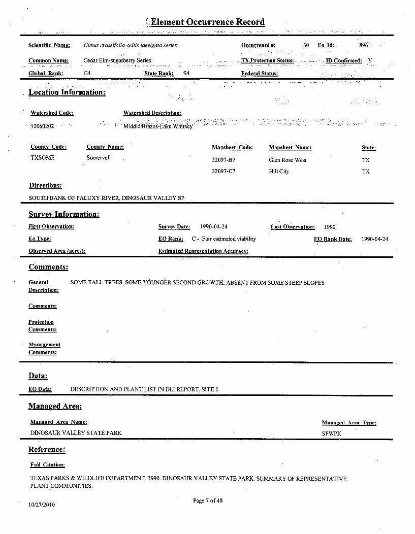
Element Occurrence Record
Scientific Name: Ulmus crassifolia-celtis laevigata series Occurrence #: 30 Eo Id: '896
Common Name: . Cedar.Elm-sugarberry Series . .... TX Protection Status: ......... IDConfirmed: Y
Global Rank: G4 State Rank: S4 Federal Status:
Location Information:
Watershed Code: Watershed Description:
12060202 Middle'Br-o0s-l*ake'Whfitney" .
County Code: County Name: Mapsheet Code: Mapsheet Name: State:
TXSOME Somervell 32097-B7 Glen Rose West TX
32097-C7 Hill City TX
Directions:
SOUTH BANK OF PALUXY RIVER, DINOSAUR VALLEY SP
Survey Information:
First Observation: Survey Date: 1990w04-24 Last Observation: 1990
Eo Type: EO Rank: C - Fair estimated viability EO Rank Date: 1990-04-24
ObservedArea:(acres): Estimated Representation Accuracy:
Comments:
General SOME TALL TREES, SOME YOUNGER SECOND GROWTH, ABSENT FROM SOME STEEP SLOPESDescription:
Comments:
ProtectionComments:
Management
Comments:
Data:
EO Data: DESCRIPTION AND PLANT LIST IN DLI REPORT, SITE 1
Managed Area:
Managed Area Name: Managed Area Type:
DINOSAUR VALLEY STATE PARK SPWPK
Reference:
Full Citation:
TEXAS PARKS & WILDLIFE DEPARTMENT. 1990. DINOSAUR VALLEY STATE PARK. SUMMARY OF REPRESENTATIVEPLANT COMMUNITIES.
10/27/2010 Page 7 of 40

Element Occurrence Record K
Specimen:
Associated Species: . .
. , ý I ; I I .
Page 8 of 4010/27/2010

Element Occurrence-Recbord
Scientific Name: Dendroica chrysoparia Occurrence #: 229 Eo Id: 1190
-Common Name: - Golden-cheeked Warbler. - TX Protection Status: . E .... IDConfirmed: Y
Global Rank: G2 State Rank: S2B Federal Status: LE .
Location Information:
Watershed Code: Watershed Description:
12060202 Middle BrazosýLake Whithney
County Code: County Name: Mapsheet Code: Mapsheet Name: State:
TXBOSQ Bosque 31097-H4 Allen Bend , TX'
Directions:
WEST OF LAKE WHITNEY/BRAZOS RIVER, SOUTH SIDE OF CEDRON CREEK AND WEST OF FM 56
Survey Information:
First.Observation: 1996m04-13 Survey:Date: Last Observation: 1996-05-03
goType: EO Rank: EO Rank Date:
Observed Area (acres): Estimated Representation Accuracy:
Comments:
General MATURE JUNIPER/OAK WOODLAND CA. 30 FEET IN HEIGHT WITH OVER 70% CAvDescription:
Comments:
Protection
Comments:
Management
Comments:
4OPY COVER
Data:
EO Data: 3 TERR
Managed Area:
Mangd Area Name:
ITORIES
Managed Area Type:
Reference:
Full Citation:
DLS ASSOCIATES. 1996. ENDANGERED SPECIES INVESTIGATION MID-BRAZOS PROJECT - LAKE WHITNEY, HILL AND
BOSQUE COUNTIES, TEXAS. JULY 1996.
Page 9 of 4010/27/2010

Element ,Occurrence Record
Specimen:
Associated Species:'
Page 10 of 4010/27/2010

SElement Occurrence Record
Scientific Name: Vireo atricapilla Occurrence #: 135 Eo Id: 1348
Common Name: Black-cappedViteo,, .iTX Protecfion Status:..:.• E'.. ID Confirmed: Y.
Global Rank: G2G3 State Rank: S2B Federal Status: LE -
Location Information:
Watershed Code:
12060202
County Code:
Watershed Description:
Middle Brazos-Lake Whitney
County Name: Mapsheet Code: Mapsheet Name: State:
UTXSOME'- ../i-;. -- Somnervell 32097- HillC..CityT
Directions:
WEST OF WILDCAT HOLLOW, NORTH OF PALUXY RIVER; CA. 2.6 AIR MILES SOUTH OF STATE ROUTE 201
INTERSECTION WITH HOOD-SOMERVELL COUNTYLINE; HILLTOP AND EAST-FACING SLOPES DOWN TO WILDCAT
HOLLOW; DINOSAUR VALLEY SP
Survey Information:
First Observation: Survey Date: 1993 Last Observation: 1993
Eo Tyne: EO Rank: EO. RankDate:
Observed Aream(acres): Estimated Representation Accuracv:
Comments:
General VERY SMALL PATCH OF OAK SHINNERY SURROUNDING THE 850 TO 800 CONTOURS OF KNOB TO THEDescription: WEST OF WILDCAT HOLLOW; BIRDS USING JUNIPER ALSO
Comments:
Protection
Comments:
Management
Comments:
Data:
EO Data: 2 MALES - VISUAL CONTACT
Managed Area:
Managed Area Name: Managed Area Type:
DINOSAUR VALLEY STATE PARK SPWPK
Reference:
Pagel of 4010/27/2010

Element•Occurrence Record,,*l
Full Citation:
CONNALLY, W.A.S. 1993. SURVEY OF PUBLIC LANDS - TEXAS PARKS AND WILDLIFE DEPARTMENT - FOR
BLACK-CAPPED VIREO AND GOLDEN-CHEEKED WARBLER. INVESTIGATIONS FROM 17 APRIL TOJ -JULY -1993. . ,...':,, ..
gý
Page 12 of 4010/27/2010

Element Occurrence Record
Scientific Name: Nerodia harleri Occurrence #: I Eo Id: 2098
Common Name: Brazos Water Snake TX Protection Status: T ID Confirmed: Y
Global Rank: G2 State Rank: S2 Federal Status:
Location Information:
Watershed Code: Watershed Description:
12060202 Middle Brazos-Lake Whitney
12060201 Middle Brazos-Palo Pinto
County Code: County Name: Mapshteet Code: Mapsheet Name: State:
TXSOME.. Somervell 32097-C6 .Nemo TX
TXJOHN Johnson 32097-B6 Glen Rose East *TX
TXHOOD Hood 32097,D6 Acton TX
3209.7-C5 Bono TX.
Directions:
BRAZOS RIVER DOWNSTREAM FROM LAKE GRANBURY TO A FEW KM BELOW GLEN ROSE, PATCHY DISTRIBUTIONALONG RIVER.
Survey Information:FirstObservation: 1984 Survey Date: 1985w05,06 Last Observation: 1984
Eo Type: EO Rank: B - Good estimated viability EO Rank Date:
Observed Area (acres): Estimated Representation Accuracy:
Comments:
General MEDIUM SIZE RIVER, LIMESTONE BEDROCK; RIFFLES WITH SMALL TO LARGE ROCKS AND BOULDERS.Description: SWIFT CLEAR WATER.
Comments: RECENTLY CONFIRMED ON RIVER AND FOUND TO BE IN FAIR NUMBERS.
Protection SUPPORT FEDERAL LISTING AS THREATENED.
Comments:
Management PRESERVE RIFFLE HABITAT STRETCH OF RIVER.Comments:
Data:
EO Data: A LOCALLY COMMON WATERSNAKE FOUND IN MAIN RIVER BED, USUALLY ASSOCIATED WITH RIFFLESAND BOULDER STREWN BANKS.
Managed Area:
Managed Area Name: Managed Area Type:
Page 13 of 4010/27/2010

Element Occurrence:Record
Reference:
Full Citation:
MAXWELL, T.C. 1982. STATUS AND DISTRIBUTION OF NERODIA HARTERI HARTERI, FINAL REPORT. USF& WS,ALBQ., NM. 40 PP. .
SCOTT, DR. NORMAN J. 1984. USF& W SERVICE, REGION 2, ALBUQUERQUE, NEW MEXICO. PHm505/766-3903.
U84SCOO1TXUS - Created by EO conversion
SCOTT, NORM. 1985. USF& W SERVICE REGION 2 ALBUQUERQUE, N.M. PH-505/766-3903. JANUARY 1985.
Specimen:
Associated Species:
Species Name - Comments-
Page 14 of 4010/27/2010

>Element Occurrence. Record
Scientific Name: Dendroica chrysoparia Occurrence #: 64 Eo Id: 2696
Common Name: Golden-cheeked Warbler TX Protection Status: E ID Confirmed: Y.
Global Rank: G2 State Rank: S2B FederalStatus: - 'LE
Location Information-"
Watershed Code: Watershed Description.
12060202 Middle Brazos-Lake Whitney
-,County Code:. ,County. Name:,, Mansheet, Code:, Manshect Name: .State:,
TXSOME Somervell 32097-C7 Hill City TX
Directions: .
FROM CA. 0.3 RIVER MILE UP DENIO BRANCH FROM CONFLUENCE WITH PALUXY RIVER TO. PARK BOUNDARY; SLOPES,OF BOTH SIDES OF DRAINAGE TO HILLTOPS ON SOUTH AND EAST EXTENDING TO PARK BOUNDARY; DINOSAURVALLEY SP
Survey Information:
First Observation: Survey, Date: 1993 Last Observation: 2000
EO Rank: EO Rank- Date:
Observed Area (acres): Estimated Representation Accuracy:
Comments:
General
Description:
Comments:
Protection
Comments:
Management
Comments:
Data:
EO Data: ONE GOLDEN-CHEEKED WARBLER; IN 1991, THIS ENSCRIBED AREA HAD 3 SINGLE MALES AND ONEPAIR; BLACK-CAPPED VIREOS ALSO FOUND HERE; IN 2000, NUMEROUS GOLDEN-CHEEKED WARBLERSHEARD DURING BRIEF BLACK-CAPPED VIREO SURVEY
Managed Area:
Managed Area Name: Managed Area Type:
DINOSAUR VALLEY STATE PARK SPWPK
Reference:
Page 15 of 4010/27/2010

ElementOccurrence Record
Full Citation:
CONNALLY, W.A.S. 1993. SURVEY OF PUBLIC LANDS - TEXAS PARKS AND WILDLIFE DEPARTMENT - FORBLACK-CAPPED VIREO AND GOLDEN-CHEEKED WARBLER. INVESTIGATIONS FROM 17 APRIL TO.1 JULY 1993.
SCOTT, P. 1991. SURVEYS FOR BLACK-CAPPED VIREOS AND GOLDEN-CHEEKED WARBLERS IN CENTRAL TEXAS-',ST-ATE PARKS.ANT) NATURAL ARE-AS, MAY-JUNE 1991 -
HORIZON ENVIRONMENTAL SERVICES, INC. 1999. LETTER TO USFWS RE: ENDANGERED SPECIES PERMITPRT-798998 FOR 1999 YEAR DATA. 7 FEBRUARY 2000.
MARESH, JOHN. 2000. BLACK-CAPPED VIREO CENSUS AND MONITORING PROJECT FIELD NOTES.
Specimen:
Associated Species:
CommentsSpedes Name T~,
i
............
Page 16 of 4010/27/2010

Element Occurrenlce Record
Scientific Name: Dendroica ch
Common Name: Golden-cheek.
Global Rank: 'G2 w,
Location Information:
Watershed Code:
12060202
County Code: County Nar
TXSOME ' -SoSmervell
rysoparia
ed Warbler
State'Rank: ' S2B'
..Watershed.Description:..
Middle Brazos-Lake Whitney
Occurrence #: 66 Eo Id: 130
TX Protection'Status: E! 4ID Confirmed: Y
Fe eral Status: LE
ne: . -Mapsheet- Code: . Mapsheet Name: State.
32097-B7 Glen Rose West TX
32097C7 .. .Hility TX
Directions:
ON EAST SIDE OF PALUXY RIVER; MAJORITY OF SLOPES, HILLTOPS, AND'DRAINAGES IN EASTERN PORTION OF PARKEAST OF DENIO BRANCH WATERSHED; DINOSAUR VALLEY,SP..
Survey Information:
First Observation: Survey.Date: 1993 Last Observation: 1999
En Type: EO Rank: EO Rank Date:
Observed Area (acres); Estimated Representation Accuracy:
Comments:
General SOME JUNIPER APPEARED OVER ONE FOOT IN DIAMETER; BLACK-CAPPED VIREO PRESENT ALSO
Description:
Comments:
Protection
Comments:
Management
Comments:
Data:
EO Data: AT LEAST 4 TERRITORIES; ONE FEMALE OBSERVED; IN 1991, SCOTT OBSERVED 6 MALES PLUS ONEWITH 2 JUVENILE GOLDEN-CHEEKED WARBERS
Mananed Area:
Mana2ed Area Name: Managed Area Type:
DINOSAUR VALLEY STATE PARK SPWPK
Reference:
Page 17 of 4010/27/2010

Element Occurrence Record
Full Citation:
CONNALLY, W.A.S. 1993. SURVEY OF PUBLIC LANDS - TEXAS PARKS AND WILDLIFE DEPARTMENT - FOR
BLACK-CAPPED VIREO AND GOLDEN-CHEEKED WARBLER. INVESTIGATIONS FROM 17 APRIL TO4 JULY 1993.
SCOTT, P. 1991. SURVEYS FOR BLACK-CAPPED VIREOS AND GOLDEN-CHEEKED WARBLERS IN CENTRAL TEXAS.STATE PARKSAND NATUR-ALAREAS;-MAýY-JIUNEI991-. ý.•:.-•.-., : ... ,,-.,.
HORIZON ENVIRONMENTAL SERVICES, INC. 1999. LETTER TO USFWS RE: ENDANGERED SPECIES PERMIT,.PRT-798998 FOR 1999 YEAR DATA. 7 FEBRUARY 2000.
S• ecimen: . . .... . "
Associated S~ecies:
Page 18 of,4010/27/2010

Element Occurrence, Record
Scientific Name: Yucca necopina Occurrence #: 1 Eo Id: 2871
Common Name: - Glen, Rosei yucca: TX Protection'Status:. ID- Confirmed: Y,
Global Rank: G1G2 State Rank: S1S2 Federal Status:
..Location-Information:
Watershed Code: - Watershed Description:-,..
12060202 Middle Brazos-Lake!Whitney
12060201 Middle Brazos-Palo Pinto
County Code: County .Name: Mapsheet Code: Mapsheet .Name: State:
TXSOME Somervell 32097-C6 Nemo- TX
32097-B6 Glen Rose East TX
Directions:
THREE MILES NORTHEAST OF-GLEN ROSE ON OLD ROAD
- Survey Information:
First Observation: 1955 Survey Date: Last Observation: 1955-05-06
Eo Type: EO Rank: EO Rank, Date:
Observed Area (acres); Estimated Representation Accuracy:
Comments:
General FENCEROW BY SANDY FIELD
Description:
Comments: - TYPE LOCALITY; ONLY OCCURRENCE; MAY BE OF HYBRID ORIGIN
Protection
Comments:
ManagementComments:
Data:
EO.Data: IN FLOWER; ABUNDANT
Managed Area:
Managed Area Name: Managed Area Type:
Reference:
Page 19 of 4010/27/2010

Element Occurrence Record`3j
Full Cit fiation: I
Specimen:
Southern Methodist University Herbarium. 1955. L.H. Shinners #20102, Specimen # none SMU. 6 May 1955. Type Locality.
Associated Species:
Page 20 of 4010/27/2010

Element Occurrence Record
Scientific Name: Yucca necopina Occurrence #: 6 Eo Id: 8961
Common-Name: GlenRose yucca TX Protection'Status: - ID Confirmed: 'Y
Global Rank: GIG2 State Rank: S1S2 Federal Status:
Location Information: ..
Watershed Code: Watershed Description:.........
12060201 Middle Brazos-Palo Pinto:
County Code: County Name: . Mapsheet Code: Mapsheet Name: State:
- THOD Hod32097-'C6'~ Nemo TX
Directions:
2.2 miles south of the intersection of F.M. 2425 (Hayworth Highway) and F.M. 32104 Locatedbetween River View Trail and County Road
313. On the east side of F.M. 2425.
Survey Information:
First Observation: 2008-07-02 Survey Date: 2008-07-02 Last Observation: 2008-07-02
Eo type: EO Rank: E - Verified extant (viability not assessed) EO Rank Date: 2008-07-02
ObservedArea(acres); 0 Estimated"Representation Accuracy: High
Comments:
General Plants were in a highway ROW that was 95 percent grass. The soil was clay with limestone rocks.
Description:
Comments: A specimen from this population was collected on 2 July, 2008, and will be submitted to the Plant Resources Center at theUniversity of Texas, Austin.
Protection
Comments:
Management
Comments:
Data:
EO Data: 64 plants were observed. Plants were in a highway ROW that was 95 percent grass. The soil was clay with limestone
rocks.
Managed Area:
Managed Area Name: Managed Area Type:
Reference:
Page 21 of 4010/27/2010

Element Occurrence Record
Full Citatio'n:
Sawey, Jamye and Alvin D Meyer, 2008. Texas Natural Diversity Database Reporting Form regarding a population of Yucca necopinaalong F.M: 2425 in Tarrant County.
Specimnen:.
Associated Species:
Page. 22 of 4010/27/2010

,, Element Occurrence"'Record
Scientific Name: Vireo atricapilla Occurrence N: 134 Eo Id: 4695
Common Name: ,Black-capped Vireo, TX Protection Status: E' ID Confirmed: Y
Global Rank: G2G3, State Rank: S2B1o ' Federal Status: :. LE . i.
Location Information:
Watershed Code: Watershed Description:
12060202 Middle Brazos-Lake Whitney
.,-,County Code:_, County Name: ,,. Masheet Coe: ... ,Mapsheet Name: .. . State:.,
TXSOME Somervell 32097-C7 Hill'City TX
Iiree ons:
CA. 2.7 AIR MILES SOUTH-SOUTHEAST OF STATE ROUTE 201 INTERSECTION WITH HOOD-SOMERVELL COUNTYLINE;
CA. 0.8 AIR MILE NORTHEAST OF DENJO BRANCH/PALUXY RIVER CONFLUENCE; NORTH-FACING SLOPE JUST OUTSIDEDINOSAUR VALLEY STATE PARK BOUNDARY; ALSO OBSERVED IN DINOSAUR VALLEY STATE PARK; FROM
CONFLUENCE .OFDENIO BRANCHIWITHPALUXY•Y-RIVERG•.¥?R1 ýGi• CA>3 ER'MIE' ENIO•B NCHT~UST BEYOND.
PARK BOUNDARY; SLOPES ON BOTH SIDES OF DRAINAGE TO HILLTOPS ON SOUTH ANDEAST
Survey Information:
FirstObservation: .1991-05-19 Survey Date: 1993 Last Observation: 1999
Eo TVe EO Rank: EO Rank.Date:
Observed Area (acres); Estimated Representation Accuracy:
Comments:
General
Description:
Comments:
Protection
Comments:
Management
Comments:
Data:
E_2 Data: 1993, ONE MALE VOCALIZED CA. 15 MINUTES, DID NOT COME ONTO PARK PROPERTY; 1991, ONE SINGLE
MALE AND TWO PAIR, ONE WITH NEST, ON PARK PROPERTY
Managed Area:
Managed Area Name: Managed Area Type:
DINOSAUR VALLEY STATE PARK SPWPK
Page 23 of 4010/27/2010

Element Occurrence Record"
Full Citation:
CONNALLY, WAS. 1993. SURVEY OF PUBLIC LANDS - TEXAS PARKS AND WILDLIFE DEPARTMENT - FORBLACK-CAPPED VIREO AND GOLDEN-CHEEKED WARBLER. INVESTIGATIONS FROM' 17,APRIL TO .1 JULY,993.9
HORIZON ENVIRONMENTAL SERVICES, INC. 1999. LETTER TO USFWS RE- ENDANGERED SPECIES PERMIT
PRT-798998 FOR 1999 YEAR DATA. 7 FEBRUARY 2000.
SCOTT, P. 1991. SURVEYS FOR BLACK-CAPPED VIREOS AND GOLDEN-CHEEKED WARBLERS IN CENTRAL TEXAS
STATE PARKS AND NATURAL AREAS, MAY-JUNE 1991. . . .
Specimen:
Associated. Svecies:
Secies Name CommentsSI e.. Name... ...! ... . . . . . . . ,. . . ..
. . . . . . . . . . . . .. . . . . . . . .
-J
¾
Page 24 of 4010/27/2010

Element Occurrence Record
Scientific Name: Dendroica chrysoparia Occurrence #: 228 Eo Id: 6205
Common Name: Golden-cheeked Warbler TX Protection Status: E.- IDConfirmed: 'Y
Global Rank: G2 StateWRank: S2B Federal StatUs:' E.
Location Information:
Watershed Code: Watershed Description:
12060202 Middle Brazos-Lake Whitney
County Code: County Name: Mapsheet Code: Mapsheet Name: State:
TXBOSQ Bosque 32097-A4 Lake ide Village TX
TXHILL Hill 32097-A5 Morgan TX
Directions:
WEST OF LAKE WHITNEY/BRAZOS RIVER, JUST NORTH OF LAKESIDE VILLAGE COMMUNITY ON "POWELLDALE
MOUNTAINS"
Survey Information:
First Observation: 1998-04-22 SurvevyDate: Last Observation: 1998-04-22
Eo Type: EO Rank: EO Rank Date:
Observed Area (acres); Estimated Representation Accuracy:
Comments:
General MATURE JUNIPER/OAK WOODLAND,ON EAST SIDE OF HILL JUST WEST (?) OF RADIO TOWER,
Description: ABUNDANCE OF TEXAS OAK NEAR TOP OF THE HILL
Comments:
Protection
* Comments:
Management
Comments:
Data:
EO Data: TWO S]
Mannged Area:
Managed Area Name:
[NGING MALES
Managed Area Type:
Reference:
Page 25 of 4010/27/2010

Element Occurreence Record
Full Citation:
ESPEY,-HUSTON & ASSOCIATES, INC. 1998. FINAL REPORT. MID-BRAZOS PROJECT - LAKE WHITNEY 1998ENDANGERED SPECIES INVESTIGATIONS. 'AUGUST 1998.
DLS ASSOCIATES. 1996. ENDANGERED SPECIESJNVESTIGATION MID-BRAZOS PROJECT - LAKE WHITNEY, HILL AND-BOSQUECOUNTIES,rTEXAS:;JULY9 1996..: ' ....
Specimen:
Associated Species:
3<.,~
Page 26 of 4010/27/2010

"i~Element Occurrence Record
Scientific Name: Vireo atricapilla Occurrence #: 245 Eo Id: 6213
Common Name: Black-capped Vireo TX Protection Status: E ID Confirmed: Y
Global Rank: G2G3. State Ranki S2B3 Federal Status .: L
Location Information:
Watershed Code: Watershed Description:
12060202 Middle Brazos-Lake Whitney
County Code: County Name: Mapsheet Code: Mapsheet Name: State:
TXSOME Somervell 32097-B7 Glen Rose West TX
Directions: .
NORTH AND SOUTH OF FM 205, CA. 3 MILES WEST OF US 67/FM 205 INTERSECTION; SOUTH OF DINOSAUR VALLEY
Survey IInformation:First Observation: 2000-05-27 Survey Date: 2000-05-27 Last Observation: 2002-04-23
Eo Type. EO Rank: EO Rank Date:
Observed Area,(acres)i EstimatedRepresentation Accuracy:
Comments:
General IN 2000, GOOD HABITAT ON RIDGETOP THAT HAD BEEN BURNED WITHIN PAST 10 YEARSDescription:
Comments:
ProtectionComments:
ManagementComments:
Data:
EO Data: IN 2000,2 TERRITORIES, PAIR WITH TWO NESTS SOUTH OF FM 205, BOTH NESTS PARASITIZED-BYBROWN-HEADED COWBIRDS AND ABANDONED; IN 2001,2 MALES HEARD ON EITHER SIDE OF FM 205(SAME TERRITORIES AS IN 2000); 2002,.2 MALES HEARD ON EITHER SIDE OF FM 205 (SAME TERRITORIES)
Managed Area:
Managed Area Name: Managed Area Type:
Reference:
Page 27 of 4010/27/2010

Element Occurrence Record
Full Citation:
MARESH, JOHN. 2000. BLACK-CAPPED VIREO CENSUS AND MONITORING PROJECT FIELD NOTES.
PINKSTON, JANE,'NED WRIGHT, AND'JOHN'MARESH. 2002. POPULATION MONITORING FOR BLACK-CAPPED VIREO
(VIREO ATRICAPILLUS) AT FOSSIL RIM WILDLIFE CENTER, DINOSAUR VALLEY. STATE PARK, AND ADJACENT.
PRIVATE, PROPERTY- IN SOMERVELL COUNTYM TEXAS. 20102FIELD'SEASON.
MARESH, JOHN. 2002. FIELD NOTES FROM SPRING/SUMMER 2002 FIELD SEASON.
Specimen:
* - ... I~ ~t-.4b?. - I 'II
Page 28 of 4010/27/2010

Element Occurrence Record
Scientific Name: Notropis buccula Occurrence #: .10 Eo Id: .6560
Common Name: Smalleye Shiner' TX Piotection Status: ID Confirmed: Y,
.Global'Rank.. G2Q: State Rank: S2 R pFed61lSiii as"-
Location Information:
Watershed Code: Watershed Description:
12060202 Middle Brazos-Lake Whitney m
County Code: County Name: Mapsheet Code: Mapsheet Name: State:
TXBOSQ Bosque 31097-G3 Smiths Bend TX
TXHILL Hill
Directions:
TRIBUTARY TO BRAZOS RIVER 4 MILES SOUTH OF WHITNEY DAM, BOSQUE COUNTY; [MAPPED 1.5 MILES EAST AND2.4 MILES SOUTH OF WHITNEY DAM]
Survey Information:
First Observation: Survey Date: Last Observation: 1952-04w08
Eo Type: EORank: D - Poor estimated viability EO Rank Date:
Observed Area (acres), Estimated Representation Accuracy:
Comments:
General A MEDIUM SIZED CREEK
Description:
Comments: SURVEY IN BRAZOS RIVER BY HUBBS NEAR HERE IN 1986, THEY DID NOT FIND SPECIES
Protection
Comments:
Management
Comments:
Data:
EO Data: 16 FISH COLLECTED HERE BY SUTTKUS AND ANDERSON (RDS2277). TULANE COLLECTION NO. 4993.
Managed Area:
Managed Area Name: Managed Area Type:
Reference:
Full Citation:
Page 29 of 4010/27/2010

Element OccurrenceRecord
Specimen:
Tulane University, Museum of Natural History. 1952. R.D..Suttkus #RDS2277 and P.K. Anderson, Catalog # 4993,TUMNH.. 8 April
1952.
Ass`ciateAd Species:
• ,-" .!,g;
Page 30 of 4010/27/2010

Element Occurrence Record
Scientific Name: Dendroica chrysoparia Occurrence #: 65 Eo Id: 6437
Common Name: Golden-cheeked Warbler TXProtection Status: E ID Confirmed: Y
Global Rank: G2. ' ' StateRank: S2B ' .. 'Federal St'atus:' - ' :LE .
Location Information: .
Watershed Code: Watershed Description:
12060202 Middle Brazos-Lake Whitney
County Code: County Name: Mapsheet Code: Mapsheet Name: Staie: .
TXSOME Somervell 32097-C7 Hill City TX
Directions:
FROM HEAD OF WILDCAT HOLLOW TO PALUXY RIVER INCLUDING UNNAMED EAST DRAINAGE ENTERING WILDCATHOLLOW, SLOPES'ON BOTH SIDES OF 3W1DCAT HOLLOW AND INCLUDING HILLTOP:BETWEEN FORKS OF DRAINAGES
TO EAST-FACING SLOPES OF DRAINAGE INTO DENIO BRANCH AND PARK BOUNDARY ON NORTHEAST; DINOSAUR
VALLEY SP
Survey Information:
First Observation: Survey Date: 1993 Last Observation: 2000
Eo.Tye EO Rank: EO Rank Date:
Observed Area (acres:) Estimated Representation Accuracy:
Comments:
GeneralDescription:
Comments:
Protection
Comments:
Management
Comments:
Data:
EO Data: IN 1991, 3 GOLDEN-CHEEKED WARBLER MALES OBSERVED; ONE GOLDEN-CHEEKED WARBLER MALE IN1993; IN 2000, NUMEROUS GCW HEARD DURING BRIEF BCV SURVEY
Managed Area:
Managed Area Name: Managed Area Type:
DINOSAUR VALLEY STATE PARK SPWPK
Reference:
Page 31 of 4010/27/2010

Element Occurrence Record.'
Full Citation:
CONNALLY, W.A.S. 1993. SURVEY OF PUBLIC LANDS - TEXAS PARKS AND WILDLIFE DEPARTMENT - FOR
BLACK-CAPPEDV[REO AND GOLDEN-:CHEEKEDýWARBLER. INVESTIGATIONS FROM 17 APRIL TO I JULY 199 3.,
SCOTT, P. 1991. SURVEYS FORBLACK-CAPPED:VIREOS AND GOLDEN-CHEEKED WARBLERS IN CENTRAL TEXAS,
STATE'PARKSAND NATURALAREAS,'MAJIJUNEf.1991..-.
MARESH, JOHN. 2000. BLACK-CAPPED VIREO CENSUS AND MONITORING PROJECT FIELD NOTES.
Specimen:
t t
................. , .,.~........
¾
Page 32 of 4010/27/2010

Element. Occurience Record
Scientific Name: Dendroica chrysoparia Occurrence N: 67 Eo Id: 7708
Common Name: Golden-cheeked Warble'r TX Protection Statusl E . IDConfirmed: Y
Global Rank: G2 "State Rank: 213 . Federal Stat:,i:' LE
Location Information:
Watershed Code: Watershed Description: .
12060202 Middle Brazos-Lake Whitney
County Code: County Name: Mapsheet Code:. Mapsheet Name: State:
TXSOME Somerveli 32097-B7 Glen Rose West TX
.32097-C-7 HillCity,, " TX
Directions:
CA. 1.7 AIR MILES NORTHWEST OF HIGHWAY 67 AND STATE ROUTE 205 INTERSECTION; CA. 1.1 AIR MILES NORTHEAST
OF PARK ENTRANCE; SOUTHEAST-FACING SLOPE ALONG:EAST PARK BOUNDARY; DINOSAUR VALLEY SP
Survey Information:
First Observation: Survey Date: 1993 Last Observation: 1993
Eo Type: EORank: EO Rank Date:
Observed Area (acres); Estimated Representation Accuracy:
Comments:
General JUNIPER - MATURE WOODLAND
Description:
Comments:
Protection
Comments:
Manauement
Comments:
Data:
EO Data: ONE MALE - NO VISUAL CONTACT, ONLY VOCAL; IN 1991, SCOTT HAD 2 TERRITORIES IN THISLOCATION
Managed Area:
Managed Area Name: Mananed Area Type:
DINOSAUR VALLEY STATE PARK SPWPK
Reference:
Page 33 of 4010/27/2010

Element Occurrence Record
Full W-Ci.ation:
CONNALLY, W.A.S. 1993. SURVEY OF PUBLIC LANDS - TEXAS PARKS AND WILDLIFE DEPARTMENT - FORBLACK-CAPPED VIREO ANDTGOLDEN,-CHEEKED WARBLER. INVESTIGATIONS FROM 17 APRIL TO IJULYJ1993.
SCOTT, P. 1991. SURVEYS FOR BLACK-CAPPED VIREOS AND GOLDEN-CHEEKED WARBLERS IN CENTRAL TEXAS... STATE PARKS AND NATURAL AREAS, MAY.. ..NE 1991.,-.."'
Specimen:
Associated Species:
I *.
.~
Page 34 of 4010/27/2010

ElementOccurrence Record
Scientific Name: Vireo atricapilla Occurrence #: 237 Eo Id: 7664Common Name: Black-capp'ed'Vireo - -Tx ProteconStatus: "E D Confirmed: ,Y"
Global Rank: G2G3 StatejRank: S2B Federail Status: LE,
Location0infOrmatioM:
Watershed Code: Watershed Description:
1206002 Mddle tr~aiziL~k' e itney "--
Coiiny Code: . C~unt* Name:. Mapsheet Code: Maasheet Name: State:
TXSOME Somervell 32097-B7 Glen Ro0se West TX
-Directions:. . - - ~---.~,"FOSSIL'RIM WILDLIFE CENTER,-CA. 2.5. MILES SOUTH OF US 67 OFF CR 2009
Survey Informition:
First Observation: 1998-05-29 Suni'vy Date: 1998-05-29 Last Observation: 2001-05
Eo Type: EO Rank: EO Rank Date:
Observed Area (acres): - Estimated ,Representation Acciiracy:
Comments:
General SHIN OAK/SUMAC HABITAT
Description:
Comments:
Protection
Comments:
Management
Comments:
Data:
EO:Data: ONE BCV HEARD/SEEN IN 1998; IN 2001, THREE MALE AND TWO FEMALE BCV OBSERVED ON TWOTERRITORIES, ONE NEST FOUND, NO PRODUCTION OBSERVED
Managed Area:
Managed Area Name: Managed Area Type:
Reference:
Page 35 of 4010/27/2010

Element ,Occurrence Record
Full Citti o ,n:
PINKSTON, JANE, NED WRIGHT, AND JOHN MARESH. 2002. POPULATION MONITORING FOR BLACK-CAPPED VIREO
(VIREO ATRICAPILLUS) ATTFOSSIL RIM WILDLIFE CENTER, DINOSAUR VALLEY STATE PARK, AND.ADJACENT
PRIVATE PROPERTY IN SOMERVELL COUNTY, TEXAS. 2001 FIELD SEASON.MARESH, ,J.P..AND' G.A.-ROWELL. 2000.PROJECT89:EXTENSION OF BLACK-CAPPED'VIREOROADSIDE.SURVEY AND.,
DEVELOPMENT OF SATELLITE HABITATMAPS IN TEXAS. SECTION 6 -FINAL REPORT.
Specimen:
Associated Species:
- . I . . - - - __ - I I - i -_ __ , , .
Page 36-of 4010/27/2010

Element Occurrence Record
Scientific Name: Vireo atricapilla Occurrence #: 2 Eo Id: '8084
Common Name: Black-capped Vireo TX-Protection Status:. E I DConfirmed: Y
Global Rank: -G2G3 State Rank: S2B Federal Status: LE
Location Information: - .
Watershed Code: Watershed Description:
12060202 MiddleBra0s-l/ke.Wbifiey'
County Code: County Name:, Mansheet Code: Minsheet Name:. State:
TXSOME So.me.rvell 32097-C7:, Hill City TX
... .32097B7 'Glen Rose West TX
Directions:ý ~-' - -~''
DINOSAUR VALLEY STATE PARK, ABOUT 25 MILES SOUTH OF GLEN ROSE
Survey Information:
First Observation: 1984 Survey Date: 1993 Last. Observation: 1991 .
..Eo.Ty.e: - ............ ---EO-Rank: - C- - Fairestimated viability ` EO Rank"Date: 1986-04-29
Observed Area (acres); EstimateilRepresentation Accuracy:
Comments:
General OAK-JUNIPER WOODLAND; DWARF OAK, JUNIPER AND SUMAC WITH WELL VEGETATED STRATA; MANYDescription: JUNIPERS WITH CANOPY CLOSING IN
Comments: THREATS INCLUDE HABITAT MODIFICATION AND COWBIRD PARASITISM
ProtectionComments:
Management COWBIRD TRAP PLACED AT SITE APRIL 29, 1986Comments:
Data:
EO Data: 2 OR 3 INDIVIDUALS SEEN ON SEVERAL DAYS (1984); 3 SINGING MALES HEARD (1985); NO SINGINGMALES HEARD BY WAHL IN 1986; HABITAT APPEARS MARGINAL; IN 1993, NO BLACK-CAPPED VIREOSLOCATED IN THIS AREA OF THE PARK; HABITAT APPEARS OVERGROWN AND INVADED BY MUCHJUNIPER; IN 1991, AT LEAST 4. BLACK-CAPPED VIREO TERRITORIES; NO VIREOS OBSERVED IN 2001.
Managed Area:
Managed Area Name: Managed Area Type:'
DINOSAUR VALLEY STATE PARK SPWPK
Reference:
Page 37 of 4010/27/2010

Element Occurrence Record..
Full Citation:
CONNALLY, W.A.S. 1993. SURVEY OF PUBLIC LANDS - TEXAS PARKS AND WILDLIFE DEPARTMENT - FORBLACK'CAPPED-VIREO AND GOLDEN-CHEEKEKEDWARBLER. INVESTIGATIONS FROM 17 APRIL TO I1JY 1993.
PINKSTON, JANE, NED WRIGHT, AND JOHN MARESH. 2002. POPULATIONMONITOR1NG FOR BLACK-CAPPED VIREO
(VIREO ATRICAPILLUS) AT FOSSIL RIM W IED LIFE CEN TERD IN O SAUR'V ALLEY STATE PARK , AN D AD JA CEN T ................... •....... .
PRIVATE PROPERTY IN SOMERVELL COUNTY, TEXAS. 2001 FIELD SEASON.
SCOTT, P. 1991. SURVEYS FOR BLACK-CAPPED VIREOS AND GOLDEN-CHEEKED WARBLERS IN CENTRAL TEXAS
STATE PARKS AND NATURAL AREAS, MAY-JUNE 1991.
MARSHALL, I. T., R. B. CLAPP AND J. A. GRZYBOWSKI. 1984. INTERIM STATUS REPORT: VIREO ATRICAPILLUS
WOODHOUSE, BLACK-CAPPED VIREO. USF& WS, ALBUQUERQUE, NM.-,
RISKIND, DAVID, PH.D. TEXAS PARKS AND WILDLIFE DEPARTMENT 4200 SMITH SCHOOL ROAD AUSTIN, TEXAS
78744 PH-512/479-4897 (WORK) .. ..
MARSHALL, J. T., R. B. CLAPP AND J. A. GRZYBOWSKI. 1985. STATUS REPORT: VIREO ATRICAPILLUS WOODHOUSE(BLACK-CAPPED VIREO). REPORT:TO.USF& WS, ALBUQUERQUE, NEW MEXICO. 4 8pp.
WAHL, C. R., 1986. FIELD TRIPTO MERIDIAN AND DINOSAUR VALLEY STATE PARKS (TO INSTALL COWBIRD
TRAPS) OF APR. 28-29, 1986.
S p e c im e n : t.. . . .. . . ... .. .. .... .... .... . .,• =o . .. . .. ..
Associated Speie•s:
I I
Smcis Nan tTiv[.
Page 38 of 4010/27/2010

Element Occurrence Record
Scientific Name: Dendroica chrysoparia Occurrence #: 213 Eo Id: 2870...
Common Name: Golden-cheeked Warbler. ..... .. TX Protection Status: :.E ID Confirmed: Y
Global Rank: G2 . - State Rank: S2B Federal Status.: 'LE '
Location Information:
Watershed Code: Watershed Description:
12060202' Middle Brazos-Lake Whitney
County Code: County Name: Mapsheet Code: Mapsheet Name: State:
TXSOME Somervell 32097IB7.. .Glen Rose West TX
Directions:
FOSSIL RIMWILDLIFECENTER(CONSERVATION CAMP AREA), COUNTY ROAD 2009, CA. 0.7 MILE FROM INTERSECTIONWITH CR 2008
Survey Information:First Observation: 2000-04-25 Survey Date: Last Observation: 2000-04-25
Eo T .pe: EO Rank: EO Rank Daie:
Observed Area (acres)* Estimated Representation:Accuracy:
Comments:
Description:
Comments:
ProtectionComments:
Management
Comments:
Data:
EO Data: AT LEAST 5 GCW'S HEARD
Managed Area:
Managed Area Name: Managed Area Type:
Reference:
Full Citation:
MARESH, JOHN. 2000.,BLACK-CAPPED VIREO CENSUS AND MONITORING PROJECT FIELD NOTES.
Page 39 of 4010/27/2010

Element Occurrence Record
Specimen:
Associated Species:
Page 40 of 4010/27/2010

, CodeiKey for Printouts fromTexas Parks and Wildlife Department
Texas Ntural Divesiy Daiabase (TXNDD)
This information is 'your assistance only; due to contingingdata updates, vulnerability of pivate Iand to trespass and of species to disturbanceor collection, please referallrequoesters toour office to obtain themost current information available. Also; please'nbte identification of a
species in a given area does not necessarily mean the species currently exists at the point or area indicated.
. - '-LEGAL STATUS AND CONSERVATION-RANKSFEDERAL STATUS (as determined by the US'Fishand Wildlife Service)
LE Listed Endangered'LT ListedThreatened.PE Proposed to be listed EndangeredPT Proposed to be listed Threateifed -.
PDL Proposed to be Delisted (Note: Listing-status retainied while pr'oposed)SAE, SAT :'Listed tEfidanigered on'basis of Similarity: of Appear a'e, Listed Threateiied on basis of Similariity of
Appearance .DL Delisted Endangered/Threatened '' -
C Candidate. USFWS.has substantial information on biological vulnerability and threats to support proposingto list as threatened or endangered. Data are being gathered on'habittianieeds'sird/or critical habitat.designations, - , .2 A> . '. -" :" . --. "
C* -,•bUt lackinlg kbown o crurrenesC*.* .C-,,but'lac'kng known!ioccurrences, except iincaptivit c/ultivati nXE ,Essential!Experimental Populatin i on.
XN Nonir-esential Expierimednial PopulationBlank Species is not fed6rally listed :
TXPROTECTION (as:determined-by the Texas Parks and Wildlife.Department)E ListeddEndangeredT -Listed Threatened '- ..
Blank , -Species. not state-listed .,-,: :-
GLOBAL RANK (as determined by.NatureServe). - - - - '. , - -.
Gi Critically imperiledglobally, extremely rare, typically:5 or fewer-viable-occurrencesG2 Imperiled globally, very rare, typically 6 to.20 viable occurrencesG3 Very rare and local throughout range or f6iiid locaily in restricted range, typically 21 to 100 viable
- occurrences z1-,;; - - -
G4 Apparently secure globally .G5 Demonstrably secure globally 9̀ :GH Of historical occuirrencethrough'its range - ,'- -
GU .. .. Possiblyin,- peril range-wide,:but stattis uncertain-•: . . '
G#G# Ranked within a range as status uncertainGX Apparently extinct throughout rangeQ Rank qualifier denoting taxonomic assignment is ifiestionable#? hk'q"'a•alifier deioting unceitain rank -. - - - .C In captivity or cultivation only -:
G#T# "G"'refers-to species rank; "T" refers to varietyor subspecies rank
STATE (SUBNATIONAL) RANK (as determined by the Texas Pafks and Wildlife Department)S1 Critically imperiledin state,- extremely rare,. vulnerable to extirpation, typically 5 or fewer viable
occurrences,S$2 Imperiled in state very rare, vulnerable to extirpation, typally 6 to 20 viable occurrencesS3 Rare or uncommon in state, typically 21 to 100 viable occurrTencesS4 Apparently secure in State,.S5 Demonstrably secure in State -....
S#S# Rai ed within a rarigeas status'uncertainSH Of historical occurrence in state and may be rediscoveredSU Unrankable - due to lack of information or substantially conflicting informationSX Apparently extirpated from State
SNR Unranked - State status not yet assessedSNA Not applicable - species id not a suitable target for conservation activities
Rank qualifier denoting uncertain rank in State
Revised 1 Apr 2008

Element OccurrenceRecord (EOR)
c6currence #
Watershed CodeWatershed
QuadrangleDirections
First/Last Observation
Survey Date
ELEMENT OCCURRENCE RECORD f'Spatial and talar reco rd of an area of lIdndand/or water in which a species, natural community, orother significaintfeature of natural diversity 'is, or' was, pre`sent and associated information; may bea single contiguous area or may be comprised of discrete patches or subpopulationsUnfiuiie numiber assigned to each o:ccurrence of eachelement when added to 6the NDD.
LOCATION. INFORMATIONEight digit numerical code determinedby US Geological-Survey (USGS)Name ow~f tershed as determined by USGS
Name -of USGS'iopogfaphical ma*. ' :Directions to geographic location where occurrence was observed, as described by observernor insource "
SURVEY INFORMATION ..Date aparticular occurrence wasfirst/last obse ed; refers only to species occurrence as noted insource and does not imply the first/last date the species was presentIf conducted; date of survey ..
EO TyPe State raik qualifiers , ..M Migrant s• pecies occurring regularly on migration at staging areas, oK.concentration
along particular corridors; status refers~to the.transient.population ifith•e•State
B Qualifier. indicating basic.rank refers to the breeding population:inStai6,N Qualifier indicating basic rank refers to the non-breeding Populatioqnin,,State
EO Rank A Excellent A. ,. ExcellentIntroducedB Good' .3" B .' GoodIntroduced4C Marginal C" Marginal,gIntroduced
D Poo d - .. l -D i Poor;,'IntroducedE Extant/Present El Extant, tinodu e dH Historical/No Field Information HI HistoricaýInIAtroducedX Destroyed/Extirpated XI f;.i.,-.:Destroyed,4:Introduced0 Obscure 01 Obscure, Introduced
)Rank Date Latest date EO rank was determined-orrevised-,'.. . .served Area cres.,funleýssndicatedo0therwise ,-, . -
Description General physical description .of atea'anf•abitat where occurrence is located,iincluding associatedspecies, soils, geology,.,and urrundig land use 6d'
Comments Comments concerning the quality or condition oftheelementýýoccurrence at time of surveyn Comments Observer comments concerning'legal protectionlof theloccurrence.,t Comments .Observer commentsconcerning managementreconmendations appropriate for occurrence.
conservation "" ..
DATA ',4
EO Data Biological data; may include'number ofindividuals,.vigor, flowering/fruiting data, nest success,behaviors observed, or unusual characteristic, etc.
EOOb
Protectio,Managemen
SýTkI TE
-Site Name
Managed Area Name
AliasAcres
Manager
I tle, given to site oy surveyor 4,
MANAGED AREA INFORMATIONPlace name or (on EOR printout) name of area when the EO is located within or partially within anarea identified for conservatio.n such-as State or Federaljands, natu!ie preserves, parks, etc.Additional names the property is knrwn'by '
Total acreage of property, including non-contiguous tractsContact name, address, and telephone number for area or nearest area land steward
Please use one of the following citations to credit the source forthe printout information:
Texas Natural Diversity Database. [year of printouts]. Wildlife Diversity Program of Texas Parks &',Wildlife Department. [day month year ofprintouts).
Texas Natural Diversity Database. [year of printouts]. Element occurrence printouts for [scientific name] *records #[occurrence number(s)].Wildlife Diversity Program of Texas Parks & Wildlife Department. [day month year of printouts]. *Use of record #'s is optional.
Revised 1 Apr 2008

DISTRIBUTION AND STATUS ýOF THEBRAZOS WATER`SNAKE
(NERODIA HARTERI HARTERI)
TH4ESIS
Presented to the College f Graduate-StudiesTarleton. State University
.In Pailfl Fui6i6ment o1f heRequirements, .fortheiDereo
MASTER OF SCIENCE
By
DUSTIN LEE MCBRIDE
Stephenville, TexasMay 2009

Life's better outside.'•
February 20, 2009
Texas Parks and Wildlife Dept.Attn: Rosie RoegnerWildlife Division4200 Smith School Rd.Austin, TX 78744
Commissioners Dear Rosie,Peter M. Holt
ChairmanSan Antonio
T. Dan FriedkinVice-Chairman.
-ouston
Mark E, BlvinsAmarillo
J. Robert BrownEl Paso
Ralph H. DugqinsFort Worth
Antonio FalconM*D,Rio Grande Citl
°
I have enclosed paper and cd copies of Dustin McBride's thesis titled"Distribution and Statuso~fthe Brazos Water Snake." The thesis should serve asthe project's final report and meet the T-39 reporting requirements. Additionaldatafiles and maps will be forthcoming after Mr: McBride's thesis defensescheduled for March 17, 2009.
Sincerely,
N
Chai
Karen J. HIxon Michael MillerSan Antonio.......Mai Technical Guidance Biologist
4argaret Martin PBoerne Texas Parks and Wildlife;Dept.
John0. ,Parker Box T•.•.70Lufkin
Lee M. Bass Stephenville, TX 79402rman-Emeritus 254-968-9879
Fort Worth
. +. ," +.• +! -
Carter P. SmithExecutive, Director
4200 SMITH SCHOOL ROADAUSTIN. TEXAS 78744-3291
512.389.4800
www.tpwd.state.tx.us
To manage and conserve the natur3l and culturai resources of Texas and to Drovide hunting, tishing
ana outdoor recreation opportunities tor the use ana enjoyment of present and future generations.

ACKNOWLEDGEMENTS.:-. h
The completion of this thesis retqiired contributions from numerous individuals.Foremost, I would like to express my gratitude to my advisor, Dr. James M. Mueller. I
will be forever grateful for Dr. Mueller's support, advice, and patience as both a mentor
and friend throughout this entire project. Members of my committee, Dr. James M.
Mueller, Dr. Jeff B. Breeden, Dr. Christopher L. Higgins, and Mich aelS. Miller (Texas
Parks and Wildlife Department), provided much needed supportlan'd encouragement
during this study, and constructive criticisms of this thesis.;
I am especially thankful for the logistic and field support provided by the Texas
Parks and Wildlife Department (TPWD) and TPWD biologists Nathan Rains and Dean
Marquardt during this project. I also owe many thanks for the help of several field
assistants who gave their time and energy to this project: Kyle Salzmann, Pat Kostecka,
Cory and Carly Chesnut, Kim Littlefield, James Arno, Daniel Taylor, and Elizabeth
Reidlinger. I am indebted to the many landowners who granted me access to their
property and to Mitch Baird (Texas Historical Commission) and the personnel at Fort
Griffin State Historic Site for providing campsites and additional logistical support.
My gratitude is extended to Dr. Michael R. J. Forstner (Texas State University -
San Marcos) for the opportunity to assist with genetic research of the Brazos Water
Snake, and to Dr. Lou D. Densmore (Texas Tech University) and Dr. David Rodriguez
iii

(Texas Tech University) for their hospitality and assistance in the lab. Dr. Russell S. Pfaugenerously donated supplies for collection of blood and tissue samples.
Funding for this study was provided by the Texas Parks and Wildlife Departmentand Tarleton State University.
k , , .. , ",,
iv

TABLE OF CONTENTS
Page
LIST O F GRA PH ICS ................................................................................................... vii
INTRODUCTION ...............................................
MATERIALS AND METHODS ................................... ... 6
Study Area .......................................................................................................... 6
Field Surveys ............ ........................................................................................ 8
Habitat Quantification and D elineation ........................................................... 12
M odeling .......... ; .............................................................................................. 13
RESU LTS ...................................................................................................................... 15
Field Surveys ......................... ....................................................................... 15
Habitat Quantification and D elineation ........... I ............................................ 22
M odeling ........................................................................................................... 25
D ISCU SSION ...................................................................... : ............................................. 29
Current Status ..................... ....................... 29
Potential Causes of Decline ................................................................................... 30
D istribution and Habitat ......................................................................................... 40
M odeling ........................................................................................................... 45
Future ..................................................................................................................... 46
v

REFEREN CES CITED ................................................................................................. 52
APPEND IX 1 ............................................................................................ ......... : . ........... 62.........-•' ., •!:i "•::
APPEN D IX 2 ................................................................................................................... 66
A PPEN DIX 3 .................................................................................................................... 68
'A.
N N
vi

win=
LIST OF GRAPHICS
FIGURE Page
1. Map of locations along ,the upper Brazos River drainageTexas, where
N. h. harteri were found, 2006-2008 ........................................................ 18
2. Size class distribution by sex for N. h. harteri captured along the upper
Brazos River drainage, Texas, 2006-2008 ..... ...... . ............. 20
3. Map of sections of river along the upper Brazos River drainage, Texas,
which contained the greatest amount of rocky habitat, 2006-2008 ............ 24
4. Median monthly streamflow at the type locality of N.ý. harteri, 11 km
north of Palo Pinto, Texas, before and after impoundment of the
Brazos River upstream by Morris Sheppard Dam .in 1941 ............................ 33
5. Number of days the rate of change of strearnflow switched direction at
the type locality of N. h. harteri, 11 km north of Palo Pinto, •Texas,
before and after impoundment of the Brazos River upstream nby. Morris
Sheppard Dam in 1941 ......................... ........... 36
6. Map of proposed site for Cedar Ridge Reservoir along the upper,
Brazos River drainage, Texas ................................................................... 48
7. Photograph of the largest N. h. harteri captured along the upper Brazos
River drainage, Texas, in hand for scale reference, 2006-2008 .................. 67
vii

8. Nerodia h. harteri habitat alongDeadman Creek near Rising Sun
Cemetery, Jones, County, Texas, May 2008... ....... %.... .............................. 69
9. Muddy flat upstream of dam on.Paint!Creek, Haskell County, Texas,
approximately 2 km below Lake Stamford Dam, May 2008 ..................... 69
10. Nerodia h. harteri habitat along Paint.Creek, Haskell County, Texas,
M ay 2008 .......... ...... .............................. .............. 0......7
11. Histric locality ofN.. hharteri along the Clear Fork of the Brazos
River at an old dam .and-grist mill near Lueders, Jones County, Texas,
" -. "' lking downstream, May 2008 1 ...... ........................ 70
12. Histo-ic 61oality of N.h haýrteri along the Clear Fork of the Brazos
-Iv' aer~at an old damn aid grist mill near Lueders, Jones County, Texas,
looking upstream, May 2008.......... ........... ............... 71
13.- istoric ocahlty of N. h arteri along the Clear, ork of the Brazos
RiV&vat.Paint Crossing'on the Lambshead.Ranch, Throckinorton,
County, Texas,.April 2008 ........ ...... ....... ......... ....................... 71
"14. Example ofone of the seven low-head dams along-the Clear Fork of
.the Brazo's PRiver within the range of N. h. harteri, April 2008 .................. 72
515. Nerdia kh. harteri habitat in Possum Kingdom Lake along the mouth
of Ramsey Creek, Palo Pinto County, Texas, May 2008 ..... ...................... 72
16.Nerodia h:. harteri habitat in Possum Kingdom Lake near the end of
Farm-to-Market 1148, Palo Pinto County, Texas, with a snake peering
"; out from the rocks at the center of the photograph, May 2008 .................. 73
viii

17. Nerodia h. harteri habitat in Possum Kingdom Lae near the end of
F Famfnto-Market:, 1148, Palo Pinto C.ounty, Texas, May 2008 ..................... 73
18., Nerodia h: harteri habitat along ihe Brazos Ri'ver at Forte Bend, P al•PtTexas, Mayu200 8. ..................... a.....74• Pint•C ountyýT x s ay. • i:.+.(••! .•.•.•.•!:.:!•••2......... ....... ....................... 7
19.. .!9Nerodiah.harterihabitatalong the Brazos iver at Dalton Bend, Palo
Pinto County, Texas, May 2008...:....................................... 7520..NerodiahA.harteri.habitat-along the Brazos River at Littlefield Bend,
Parker-County;,Texaski Setemberd 2006..........................76_p .0 ......~ ......... . ........
2,1. Historic !locality-of N. h.'' h arteri 416fgýthieBrzs; Rver at the U.S.'mHlghiway 67Tcrossing east of Glen Rose, Somervell County, Texas,
-M ay 2008 . ...... ......... ............... ............... ....76
22. Historic locality of N h harteri along theBraosRiver at the old
Farimto-Market 200 croissg, east of Rainbow, Somvell County,
Texas,,M ay. 2008., .7..7....'. ........ ......................................................... 77
23. Nerodia h. harteri, habitat along the Brazos Riv.er east of Glen Rose,
Somervell County, Texas, May: 2008................... .... ........ . .................... 77
TABLE Page
1. Species and number of snakes observed along the upper Brazos River
drainage, Texas, 2006'2008.......................................... ................................. 16
ix

2. Comparison of streamflow recorded4 AuguSt 2004to hIistoric
streamflow for4 August fom U.S. Geological Survey hydrologicAton Rive ,,, eex-.... ... ....,.....,, ........................ 26sttinalg theupper Brazos River, Texas.,-, ........ 2
3. Results from logistic regression analysisused tomodel the likelihood
of finding N. h. harterialong the upper Brazos River, drainage, Texas,
2006-2008 .-- ....... 2............7.......... .... ........ ....... ... ....., ........................ 27
4. -Comparison of extreme flow, events at the type'locality-of. '•h. harteri,
11 km north of Palo -linto, Texas, before and after impoundment of theBrazos River upstream by MorrisSheppd Dam in 1941 ................ 34
5. Data for individual N. h.harteri captured, ,ong the upper Brazos River
drainage, Texas, 2006-2008 ..................................... .. ... ........ .............. 63
4 4,-. 44-4
x

McBride,: DustinLE., Distribution and Status of the.Brazos Water Snake (Nerodia harteriharteri , Master of Science (gulture),May, 2009, 89 pp., 5 tables, 23 figures,
references cited,;72 titles. .
Nerodia h. harteriP (Brazos -ater.Snake) is a state threatened endemic Texas
snake foundaong l the uer Brazos.river dinage in north-central Texas.nA rage-wide
survey was conducted from 2006-2008 to determinethieýcurreit distiibutionad relativeabundance of N.;hharteri6 identif ynpientialha'ltat,'and investigate- habitat-relationships
of thes'nake. Wule -the range: of N.ih. hartead suiitable habitat rmaindintact, the snake
is now rare. Logistic regression analysisandi cated the •kelihoodbof findig the snake was
positively related to both the amount: ofrock (>l cm)4Uat-a'siteanid surrounding a•site.
Reasons for the population declineremain unclear; howver;, results illustrateý the
importance of riffle habitat for-the future conservation -ofthis Texas~snake'..-
xi

NTRODUCT]ON
4-,
SNer'odia h. harter'i (Brazos Water Snake) is a relatively small natricine snake
endernmicto the upper"Brazos Riverd'ainage in nor-central Texas (Scott et al, 1989;
.W ler er andDixon, r2000). initially-discovered-int4ih late'l1930s'along rocky stretches ofS razosRivrinreriwasfcrnly escbd i 1941
Tad 14 I 6 anlloPatinc,"populatio'nfrom the Conch'o and Colorado rivers
in centralTexas wa~sdescnbed (Tikl eand•Conant; 1961), tihereb~y Jviding N. harteri
into two suspeie iýSUD 7-t I Nerodia h. haier: fmt. euppe ver drainage, ad N. h.
,,.paucimaculata:(Conchlo Watr- Snke), "from the upper Concho-Colorado River drainage.
; The taonomy-and systenatics of thesetwo poplations is a source of contention, with
some autho&r'spposig i-elevatinbofi N ýh.ýpaucimaculata.to specfic status (Rose and
Selcer,`1989; Densmore & al.,1992); however, recent biologists have retained the
subspecific status foi' th6see tiwo taia (e.g., Werler and ,Dixon, 2000; Gibbons and Dorcas,
2004;- Whiting et al., 2008). In accordance with recent literature and just completed
population genetics results g(M, R. J. Forstner, Texas State University - San Marcos,
personal communication), the more conservative subspecific assignment of these taxa is
retained herein.
Collectively, N. harteri is the only species of Nerodia endemic to a single state
(Gibbons and Dorcas, 2004), and is one of just two snake species endemic to Texas (the
I

2
other being the Trans-Pecos Black-headed"Snake, Tantilla cucullata; erand ixon,
2000). Nerodia harteri. inhabits 3a-limited porti6n of stream corridor and reservoir
shoreline within t"eupper reaches of two-river drainages (Scotf et al., 1989), giving it
one of the most resticted geographicranges of any North" erican snake species.
Despite being locally abundant in ,areas with'suitable habitat. (Trapido, 194f,; Scott et al.,1989),tthe state of Texas placed both subspecies on the6sthtehlist of endangere species i
1977 due to their himitedkdistnbution, specific habibtat requirements, and prceived threats
from future water development projectS (Sco tt nd:Fitzgýrald; 1985).. In 1986, N. h.paucimaculata was -listed, as Threatened by.theU :Sh Fih sand Wildlife Service (Stefferud,
1986), and was subsequentlytIhe focusof' several andepth eologIcal stu ies (e.g,, Greene
et al., 1994; Witinga 200N h.
harteri has received little attentionýfroin!th!e sci•eitific comm.u.t .. ,.
Knowled specific to.. N.A., harteri is 'limited and-has acumulate slowly since
its :formal description. oDetailedbibliographies, Species accuns, and literature reviews"' Z' ec pýa3 33eaue~eiw
have been compiled by several authorsý(Dixioi,2•0•0Wr.and Dixon, 2000;Erst and
Ernst, 2003; Gibbons and Dorcas, 2004 )kcAebncise literature review i• provided here tohighlight the available information pertaining to this subspecies. Following the original
species descriptiom brief distributional -records.(Tinkle and Knopf, 1964; Wade, 1968;Smith, 1983),and notes pertaining to;reproduction and young(Conantg 1942; McCallion,
1944; Carl, 1981). were. published, Worley (1970),deschibed a single survey, Mechan
(1983) reviewed current knowledge, and Seigel and ýFitch (I984)' summarized relative
clutch mass-data for over 100 populations of snakes, including N h. hharteri. The

3
phylogenetic relationships of AN. Ih. harteri have been discussed by -everal authors
S(Eberle,, 1972; Kilpatrick ndZimmrerman, 1973; Lawslor1987; Rose and Selcer, 1989;
Densmore. etaL, 1992).,,ad two clearly defined taxa hav.e been described. Scott et al.
0(1989) conducted. themost cgmprehensiVeinvestigatfion ofthe ecol6gy of N. h. harteri to
date. Other authors have reported further 'onthe status And distribution of the snake
(Dorcas and Mendelson, 199t1; Rossi an&Rossi, 1999, Forstneret al., 2006), its parasites
(McAllister and Upton, l989,Uptoni et al., 989,McAlht" ad ̀13Brsey, 2008), and
c~aptive maintenancef Rssi,,andRos, 200).
Between,1979 and.-1987, Soteetxalte(1989) nsesurveys for both
N. h. harteri and N. h.Ipauacmaculata.,TheyfoudýAtatthe range of N. h. harteri
encompassed approximately.700 ,km,"ofe-'upper Brazos, er drafiage, and within this
range the snake: was Ihfoud onytoinabitapproxmately 300 km ofnver cordor and
portions qf two, reservoirsPossum Kihgdomfate-and- LeGranury .(Scott et al.,1989). Theýpatchy distribu ton ofN. h.,,hartenwihin even this verylhmite range is
• . ... . • .. . . . .. . ......... .... .. i. .. .. .... 'th i v 'y....+ .!, im it • r n g i
likely linked to ithe availabilty~ofsuitablejuvenle •habitat (Scott et , 1989). Scott et al.
(1989) found that the most: important-habitatfeatures -forjuveniles rthpree of
medium (> 10 cmr)to large flat rocks on, unshaded shboelifie 'for _c ver•a• d adjaient rocky
shallows for foraging. Along the Brazos River andi'ts"tributaries these features are
typically associated with riffles, and.within Possum Kingdom Lake and Lake Griabury
N. h. harteri is, knownto o"cpy ,shoreline with! similar featres (Scott et al., 1989).
Adults utilize a much wider range of habitats than juveniles, such aeeper waters, and
their distribution is believed to be limited by the distance theycan travel from suitable

4
juvenile habitat and their need for deeper. more secure -rocky cover.(Scbtt et Al., 1989).
Scott et al. (1989) conceded that N.:kh.harteri might lose somie•habitat due to future dams
and development proiects, but con ludedfti4t it was notlikely to experience any threat
that would jeopardize its'longterm -:persstence. This conclusion was based' on the
assumption that no threat could likely, affect theentire population because it"wa divided
into at least five isolated segments, (Scott et a., 1989).:However;, they believed that the
barriers Which isolate these populations also would -iiibit recoloniation -shouIld the
population of any segment be extirpated (Scott et al., 1989).
Several herpetologists have recently noted the apparent eitiripation of N. h. harterifrom parts of its. historic range (Rossi and -Rossi, 1999; Forstner et al., 2006; C. T.
McAllister, HotSprings NationalDPark,:-ARpersonal-communciation). The cauises ofthese declines are ukon, aLthougl 6pot1ialfthreatslinclude direct killing by humans,
drought, habitat de&radation,,!and rý4.ed..iUetinsinz prey aviailability (Ma0well, 1982; Rossi
and Rossi, 1999; Benderr et al, 2005;.Forstnet etfa1,; 2006).'. Atfpre8sentN. h. arteri is
classified as Threatened by the Texas Parks,,and WildiffDepaýýtent ('Texa-s Parks and
Wildlife Department, 2007a) and has~a G2:(Imperiied)global s.tatu (iLe., at 'high risk of
extinction; NatureServe, 2008). The IUCN lists N. h.: harteri as Near Threatened due to
its limited range, and states that it is close to qualifying as Vulnerable (Hammerson,
2007). The Texas Wildlife Action Plan identified research and monitoring for species of
concern as a high priority for the Brazos River Basin, and identifiedN, h. harteri as a
medium priority conservation need (Bender et.al., 2005). Furthermore, surveying current

5
populations and defining the exient of potentil aab'itaf were identified as priority
conservation actions forN, h. harteri (Bender et al. '2005).
Given the apparent recent population declines, a sstematic survey was needed to
,assessthecurrentdistributionhand, relative abudance of the snake. In addition, a better
understanding was needed of the' habitat characteristics of sites occupied by N. h. harterias compared to unoccupie sites.-The objectives of this study were to 1) determine the
current distribution and relative abudance of N. h. harteri, 2) identify potential habitat,
and 3) investigate the:relationship be tween N h. harterid habitatqualityan density.

MATERIALS AND METHODS
Study A rea.-'Surveys for, N.- h. hariieri w'ere conducted throughout the range of
the.snake, including stretches listed as uninhabited by Scott• t al. (1989). The upstream
lImt Were Deadman Creek (32'37.05'N, 9903 7.60'W) in Jones County, and Paint Creek
bel-ow Lake Stamiford Dam (330064.58'N, 990 33.4OrW) in Haskell County, both tributaries
~to the Clear Fork of the: Brazos River. Downstream, surveys extended along the Clear
Forkfrom the. mouth of Deadan Creek. to the confluence with.the Brazos River in
Young County, and down the Brazos River to the FM (Farm-to-Market) 1118 .bidge
crossing (32e12.25N', 97y36.33'o) near Brazos Point, Bosque County. Searches of
tibuaries, aidjacen to thi's range and not known to be occupied by N. h. harteri were also
t Ded opportunistically. Counties included within the study area were Jones,
Shackelford, Haskell, Throckmorton, Stephens, Young, Palo Pinto , Parker, Hood,
Somervell, Johnson, Bosque, and Hill1.
The climate of north-central Texas is Subtropica -S ubhumid and characterized by
hot surnmers and relatively mild, dry winters (Larkin and Bomar, 1983). The average
annual temperature of the region is 18.2tC, with a low monthly mean terperature of
6.8bC in January and a high of 28.7aC in July (National Oceanic and Atmospheric V
Administration, 2002). Precipitation is highly variable across the region and drought
conditions are common and sometimes persistent (Stable and Cleveland, 1988;
6

7
Woodhouse and Overpeck, 1998). Precipitation falls in a seasonally bimodal pattern,
with the greatest amounts typically falling in the month of May, followed. by September
and October (National Oceanic and Atmospheric Administration,2002). Mean annual
precipitation within the study area ranges from 88.4 cm in the east (Glen Rose, Texas) to
72.3 cm in the West (Albany, Texas;:National Oceanic and Atmospheric Administration,
the study area.lies primarily within the Cross Timbers and Prairies ere on of
Texas and extends westward into the Rolling Plains (Gould et al., 1960). The upland
vegetation adjacent to the riparian corridor varies congiderably throughout the study area.
Beginning at the upstream limits in Jones Cout, theriver corridor bisects the .following
vegetative and cover associations described by McMahan et'al. (1984):,Mesquite.
.(Prosopis glandulosa),Lotebush (Ziziph.us.obtusfolia.) Shrub, !Mesquite, Brush, Post Oak
(Quercus stellata) Parks/Woods, Live Oak,(Q. virin~ana)-iAshe Juniper (Juniperus
ashei) Parks, Ashe Juniper Parks/Woods, Oak-Mesquit-Ji, iniper Parks/Woods, and Silver
Bluestem (Bothriochloa saccharoides -Texas Wintergrass (Nassella leucotricha)-
Grasland. The riparian vegetation is dominated by pecan (Carya illinoinensis),
cottonwood (Populus deltoides), black willow (Salix nigra), elm,(Ulmus spp.), hackberry
(Celtis spp.), ash (Fraxinus spp.), western soapberry (Sapindus drummondii), and bur oak
(Q.•nmacrocarpa). Mesquite and saltcedar (Tamarix spp.) become increasingly common
riparian trees toward the west, particularly along the. Clear Fork of the Brazos River and
the Brazos River above Possum Kingdom Lake. Throughout most of the study area tall
grasses line the low banks and islands within the stream channel, of which the most

8
prominent species is switchgrass (Panicum virgatum). In some areas bermudagrass
(CynOdon dactylon) .has be'meestablished."
•Field Su'eys.-'Siveys -6r N h.fhire~i and potential juvenile habitat were
conducted between September-200& ad' Otobie •200. From September 2006 to
<,,September 2002, surveya -wee neducte along the lower half of the range of N. h.
.harteri', from Mois'Shepprd ari4 (Possuii :Kingdom Lake), Palo Pinto County, to the
:upper reaches-of Lake'Whitfie,'J jlhs'on County. From -October 2007 to October 2008surveysiwere condiucted aldng t pper -,hoalf othe range, fron Deadman Creek, Jones
C--,ounty, to<Possxn'Kii'gdomVLake, PAlo Pinto County, in addition to surveys along the
Slowerportion6of&the-'fage"-.Field' workvas tconceated during the spring (April-May)
.andfall.(September-October)•,periods .IeiiN. harteri.activityis highest and: densities
.. are ,greatest (Muellr9906 •rne, 1993J).FloOding events during the spring of 2007
preqvented s-urveysthiough6utmost6ffApril and May that year. During this period,i,,-ismaller ributaines wereisearched oppo tiically betw'een flood pulses. Surveys along
the Brazos River, resumedd when"high'flows receded in July 2007. Additionally, heavy
rain eventSihafipered survey efforts a1Ong most of the Clear Fork upstream from the
confluencef, Paint Cvr6eek in 2008 .
- am.,i of a least two people conducted surveys along the Brazos River and its
tributaries using canoes. The shoreline, overhanging vegetation, and water were carefully
,,searchedforrsnakes,'and the habitat Was Subjectively assessed for juvenile N. h. harteri
suitability. ,Upon encountering pboential habiia:(it.e', shallow riffle areas), intensive timed
searches were conducted on foot. This consiste~d of searching all cover that could harbor a

9
snake within 3 m of the water's edge, including searching un.der allocks (>06cm),
crevices, debris piles, and vegetationm.Deadman Creek couldnoit be ,suirveyed by canoe
due to lack of access and its, small size; however, several road crossings of'the creek were
examined and extended searches were made ,at.two of these. -
Snakes were captured by hand, measured (snout-vent ltengthl {[SV.L.],itail. length,
and mass), sexed, and released. Snout-ventiand tail,1n wer eae Y mm) by
holding the snake along a metal tape untiLthe ebody. was:fuliy relaxeda but not-over-
stretched, and mass was measured (±0.5jg):by clippig a sp -gsc, e -to the tailbofthesnake and holding it vertically in the air. Sexasi. d manuallyaextruding the
hemipenes, if present,: or by visual inspection~ofehtail regionibgining in 'April 2008,
blunt sexing probes were used to determine;sex. Thbe'accuracy of sex determination in the
'field, particularly during the period beforp,•eýxiggiprobeswereistsa;wais examined by
calculating the ratio of tail; lengh to toal: engtkhfor all W "h. arter •with ,complete tails.
Results were compared repratios previoslyreoed for N.4 h. harteri by Trapido(l941),
Tinkle and Conant (19601), an. Carl(1:98 0), wher theyyrang6ed6frm0i244r-O.291 for
males and 0.220-0.25 8 for females. If the tail: lengthto total length .katio0 fell Within the
overlap between the sexes-(0.244-0.258), snakes:(N.= 7),were assumedrto-be sexed
correctly. Four snakes (3 males and ] female,)were identified: as beingsexed. incorrectly
in the field. The sex ratio was tested against a null hypothesis of 1L.usiig chi-square: I4 . ' - .- -
- .
analysis. Relative age (juvenile or adult) of captured N hL.har-teri ,Was determnied4by,'the
minimum SVL at sexual maturity (adultrmale: >380 ramm, adult female:, Ž460:m) -i),
reported for N. h. paucimaculata (Greene et al., 1999). When snakes were, found under

10
rocks, the dimensions (thickness x×longest axis ,x shortest ýaxis§; -1 cm)of t he rock were
recorded. Comparisons were made betweenithe•sizes0 of rock uftilize byiadults and
juveniles using a Student's -t-test. :Additional data c6olle"cted includ6d theoortdinates
where snakes were found, time of observatio•n, airiie iip'eratUrat grouSndivel, water
temperature, a written description-ýof the habitatd'and iA' additionalo•sbs ations
regarding the condition'of the snakeot:rthe niatriie inwhiciit waso-6sb:ed. Caoiured
snakes were not marked duringthis study due to the unlikely nature of recapture given
the large study area, and no snakes- were collectedli. otogr•aps of capfured snakes were
takenftinost cases,S; Beginningin-•April2008,'blood °rtitssuedsamples werecollectclfrom 25 N. h.
harteriBloo Y vdasfdrawn (S. 1 ml) frm etral cocygeani6f the tail (Willette-
'Frahm,'1995) .usng a 25-gaugetuberculin syinrgeand was1storedminl.5 mlpo.,•lypropylene tubes containing ig~ of y~o5 lsis buffer(L6n ir et al., 1`M988). When
blogd collectio Was unccessful;a small (L<:.5cm) portin'ofteiip of the' tail was
clipped and stored i:n1.5 ml polypropylendtiibes.c6nt • gim :4g0.5 mI of lsis buffer. All
samples ,were accession-ed into; the MF Tissuie Cata6g ,at TexasSitate 7Uhivdrity -SanM a c s ... . el .. .. t:. i Ph -.• ýý , .' . " , " ,. ::'J•:;• .[ ? :i:
pMarcos, Deptentqof Biology (Michael Forster, Curator). Photographs were taken of
each snake,,to 4document--the-,morphological traits reporteN by Tine .andConnt (1961),
and consisted~of the following 'mages:.dorsal-head,;ventralihead, right and left side of
head, ventral pre,-cloaca, and ventral pogt-cloaca••;:":'
in addition to-intensive searches at riffle areas', visual searches while triavýeling
between sites in the canoe were used to document N. h. harteri presence. An attempt was

11
made to capture or positiyely identify.all snakes obs'-tved'fo speces• •nd the -total time
spent wasreoded. Commercial minnow traps were usd
opportunistically to sample fr snakes alonigthe river. Trapsýwere etpýali"ll submerged
alongthe shoreline and parallel toobjects,(e&g:,rocký.pilesy.4ithin shallow fiffle habitat.
Traps were checked'approximatelygver2y2-3.hiorfin. the moringif etr ve6fiit. The
coordinates of traps,,total time trapswere set, and air and watertemperatures were
recordqd-.,,C.
The shorelines of Lae Grabury and PossumKigdom ak¢weresurveyed by at
least 2 people in a small motorized boat. Surveys consisted , of siibje"i "'el'assessing the
shoreline for. _h. hartersuitability e.g., ashallw*.genty seoping l•e'ottom adjacent
to:rocky shoreline) and then slowlyfloating alongsuitable-sho-relines ,,while looking for
snakes. Areaswere, searched o n -foot ý,whený-pssi6ile•:Pnrior ,to conducting surveys along
Lake Granbury'and Possum Kixngdom -1ake.,thisgtonici6catfios of N h. bar-eri from Scott
et al. (1989) were:plotted on lake maps t ,ensure sampling at those'git6esýtThe •eniti're
Shoreline, of Lake Granbu-y•as surveyed on <10-1! July,2007 andlthe locations of all
potential habitat were, plotted,,ona.lakeimap., Onecanoe tilp`made on8 May2007 to
survey Strouds Creek, a small tributary to Lake Granbury at Thor1p Spring, Texas', and
adjacent lake habitat. To supplement, visualsearches, commercial minnOw-traps were
placed along the shoreline of Lake.Granbury:in'areasgdeemed potentially suitabl6 on 8
May 2007, and 16-19 July 2007. Minnow traps 'were fittedwith foam floats tI prevent
drowning of captured snakes, placed parallel to .the shoreline,',and tied to'hearby
vegetation, rocks, or debris. Engine failure on 17, July 2007 precluded traps friom being

12
checkeduntil 9 July 2007(2 nights) and halted trapping efforts in Lake Granbury.Surveys of:Possum Kingdom Lake on 1,5-1,6 May 2008 were concentrated along theupper portion -of the lake in, areas where Scott et atL(419899) docu•fient N h. harteri, andminnow traps were not used.,,%
Habitat Quantfication andDelineatibn-Afer searchesforo snakes were, ~ ~ ~ l •th
r ,,,. .•.S,• '. i ffle was~~i•'completed at each site along the rbier, the linear exte'ntof the'habitat (ie., the riffle) wasmeasured usinga GPS unit, and theavailable rock cover along both banks and anyislands, ff presept, w•quantified using a poit inter:ept technque. This consisted ofwalking.along.the, shoreline-at-,itsinterfacewvith th"efwiteran-di ategorizig• •ei rockysubstrate located atth tip ofh4 tfoot intooneof thresieclasses (0: <99nam; 1: 100-256 mm; 2..>256 mm). at anintervaof eN) otherstep. Tsrth~d provided an index
of the amounitof rocky habitat av1bet c.hriat ech -s Iite. _These data -were notcollected, whenwaterrlvelsweCAb6Ve nral because tl•' maj of rock at a sitebecame. inundated-.
*'. 'r':..<
The amount of rock in each of therthreie.z ietclasses wa. calculatedfor each siteafter field surveys were completed,; andithe, linearetet fit6ffief habitatwas pjlotted on amap of the river system. The amount of rock in size:'classes I and2J (ioe., >10 cm) wassummed to provideaa meastre of the abundancetof-rodky'cO v'et available to N. h. harteriat each site. Sites with shoreline composed entirelyof substrate S99 mm (i.e., size class0) were omitted since they, lacked suitable juvenile cover.To6 pro6vid&' anieasure of thedensity, of ptential habitat surrounding a site, lthe number o riffles within 5 km of eachsite was summed. In addition, the amount of rock >:10 cm was summed for all riffles

13
within 5 km of each,, site. To ,identify.the most important stretches off iver for N. h.
harteri, (i.e., those thatý contain ithe greatest amount of rcky-habitit), the amount of rock
>. 0: cm withineafch,5 krm segment And,'de corresponding central nffie was summed. This
created segments of river approximately were0 ceitered on each site.
The values of available habitat-witlhin eaeh 10 'km segmenrwere divided into quartiles,
ranked, and ,plotted on a map9•f the rinversystem. -
The. efficacyvof usingaeral photographyto remotely delimit potentially suitable
juvenile NA harterihabitat (iee.shallowriffilesWasminvestipgat us'ing'igital imagery
with a 1 -mr resolution. Imager-yof thetentire-stud"y area wsobtafied' fom the Texas
Natural Resources Information System(208)' and'c-nsistedofcoVor-minf iddlgtalorthophoto,.quarterquadrangles withimage•yfrom"2004 provid edby the-National
Agr'IculturAlImagyProgra•m(NA).Thie rver cbmdor Jandlakeshore -within the studyarea was examined, for the preen e k 'ithin3,m"ofte waier's edge atapatial
scale of 1:3,500. Viewing the imageryatqaspatial scale beyond this'pinti(ife, at a finer
scale). caused ttheimage .o becme pixilated:andincreasiny difficult•to interpret. All
mapping and. imag ey analysis was ccompleted withsArcView 9.2 so•wa're"''
(Environmental Systems ResearchInstitute; Redlands, CA, 2006).
Modeling. -Logistic regression analysiscan be used to assess the relationship
between a devendent binary esponse variable:(eig., presence'or abseic•) and one ormore explanatory independentvariables (ie.,ecovariats) by' appling maximum
likelihood estimation after transforming the dependent variable ito logit variable
(Hosmer and Lemeshow, 2000). Indoing so, logistic regressionest iates the odds of a

14
certain event occurring. The logistic regression model has the form: 4x() - e-x)/( 1 +
e&x)), where n(x) is the probabilityof a successful event (eg., finiding N. h. harteri at a
site), and g(x), the logit.transformation function, is"given by: g(x) - 3O + PI3xz + P2X2 +
.+ Xn, where PO is a constant and I . :are the coefficienis of the xi .. .X~nvariables
(Hosmer and Lemeshow, 2000). Noqassumptions. remade aboautthe distributions of the
independent variables in logistice regression, and 'a linear .relationship Nbetween ýthe
dependent and the independent variables is no6t assumed. Rather, logistic regression
assumes a linear relationshipDbetween the independenit variables and-the lo0git-of the
dependent variable. Additional assumptionsof0fte logistic regression model ,include
absence of multicollinearity between independent variables, inclusion of allirele'vant
variables and.exclusion of all ,irrelevantvariable oittdendeiit observations, independent
variables, measured without worronoioutlie'rs,ý an ag ampe ie
Logistic regression wasusd to.test :for a significant -eiatirionsp bepweenfthe logit
of finding, N. h. harteri at a ie(w. ife)~ tec m iainof. haitat'qualityan
density. Habitat quality, was quatified usin-th ab'u e of rocky ve•ravailable to
N. h. harteri ata site (i.e, the sum of~roCk i sze claSss I and,2). The d~nsity of
potential habitat surroundinga site was measured.by surming the amount ofrocky cover
available to N. h. harteri within 5:km up- and downstream:of a site. Significanceof the
model was assess•d using a full-!reduced model: likelihood ratio chi'-squarertest. Allstatistical analyses were conducted using SPSS 16.0 software (Statistical Package for the
Social Sciences, Inc., Chicago,,IL, 2007), with a = 0.05.

1 ; : i id gu':evo :p ,.L"-- , tota •i( i m: .: ...... • • : ... - i:: :/? :
Field Sureys.-:-Atotal of 574 (94%) of river coir within the range of N.harteri& was surveyed by canoe. Including -of r sections, 985 km were
rh . I, ' ske~ y. rempin g" 64 i " c
floatedduring 25trips that spand57 days. Trips ranged from 4.113 h to 8 days in length.;A ,total ofs 50.35$•h• (733':92 man-li)were spens arching for snakes while floating in a
,-,canoe, a•d, 12.412hý(232.407 iAOan) werespent initensively searching for snakes during
330 searchesý.. ..':-Duringthis study 816 snakes and neSlenderGlass Lizard (Ophisaurus
attenuatu) were o•be'rV-ed. PSiositiv ideentifidsnakes (N 5 comprised 14 different
S speciesý(Table ;I). The most commonwspcies encouniteredw e'.. . rhombi.er
(Diamondback 'Water Snake;'N- 421)and N. erythro'aster transversa (Blotched Water
, Snake; N = 253), which comprise1d55.8% and-331.55%of all psitively identified snakes,
respectively. Forty-ýtwo(5.6%)• Nh. harter/iwee obser'ved (Fig. and 38 were
captured.. Twoýwere. recaptures (determindby obvious scarring of the individuals and
examination of photographs):aind one'"idividual escaped before measurements could be
recorded, therefore, data •ere collected from '35 snakes. Of these, 11 (3i %) were adult
males,-'6 (l71/o) were juvenile males, 9 ý(26%/) -were adult eimaes, and 9 (26%) Were
juvenile females (Fig. 2). The overall sxkratio-(ý2 --0.03, P- 0.87), and te sex ratio of
juveniles (X,2 = 0.60, P = 0.44) and adults (X2, = 0.20, P 0.66) were not significantly
15

0
16
TABLE 1. Species and number ofisnakes~observed along the upper'Brazos Riv'er
drainage, Texas, 2006-2008.
SpeciesNerodia rhombiferN. erythrogaster transversa
N. h. harteri
Thamnophis proximusPantherophis pbsoletus ,.Coluber constrictor flaviventrisAgkistrodon contortrix latcinctusýA. piscivorus leucostoma
P. emoriyLampropeltis getula splendidaOpheodrys aestivus•.
Regina grahamii
Sonora semiannulataT. marcianus.
Total
'No'. observed4212534217
32:2
*1
I11
.755 , .
Percent (%)55.833.5
5.62.3
":1.2
0.40.30.3
0.10.10.1ý0.1.0.10.1
10.0 o~o•

17
FIGURE 1.. Mapof locations alongthe. pper Bfazos Ri.'erd\rainage, Texas, where N. h.
har-teri were found,.'2006-208. Locations where sndkeswere fou-ndare indicated by
stars. Some ars coverf ore•than a singl e site.
..............................,....%*-&
44

J
/1
.4
I
~
00

19
FIGURE 2. Size class distribution by sex for N. h. harteri captured along the upper
Brazos Riverdrainage, Texas, 2006-2008. Solid-horizonitl lines represent the minimum
SVEJat sexually maturity reported for N. h. paucimaculata (Greene et al., 1999).
"•, 1

20
fe e Male
'3 2'>~> C) 1 2 3 4 5
Fequency
-A-.

21
different from parity. Captured N. h,, harteri (N= 35) had a meafan'(+ I SE 'range) SVL of
456.6 mm (±28.1, 245-805), tail length of 143.4.,`im(-±8.3, 73-235), and mass of 80.2 g
(±-12.7,'7.5-32-2 0). Two adult.femrales had totallengths >902rmm, which is the total length
of the largest known specimen Of N.-h. harteri (Werler and Dixon, 2000) prior to this
study. The largest snake had a total lenigt of, 1040, mm exceeding th~e previous record by
'138 mm. ~ ~Twenty-five N. h. hartei (9 adults, 16juývienes) were:founddunngI 5 intensive
•, searches, and 17 (adults): were found ,while visually searching'frfoni 'a ý b-oat. A greata nf ert wanecessary to find N hý harteri during this study. Along the
river corridor, catch-per-unit-effort, ,(PU) .lwasr1 Nhi.l h•ariteri,39 30b" ma" h an-h and I N. h.
harteril91l,.74 man-h for intensive searching and observing from a canoe,.respectively. In
.Possum.Kingdom Lak~enine N h. harte&wiqw~eeobserved:in 47.80.man-h, resulting in
CPUE of I N. h. harteri/5.3t mn-h Sury t,,ýimes .were not recorded during searches of
Lake Granbury; therefore, survey effort couldnot be calculated. Additionally, no N h,
harteri were captured using minnow..taps, and because of their limited use in this study,
these data were excluded. Overall., CPUE during this study was I N. h. harteri/24.15
man-h.
During intensive searches, 17 N.. h. harteri were found under rock' (3 adults, 14
juveniles), 7 (5 adults, 2 juveniles) were found in the water, and 1 (adult) was basking on
a rock shelf. All N. h. harteri observed from a boat (N= 1.7) were adults swimming in the
water, except for one adult found partially exposed in a rock pile along the shoreline. The
mean (±1 SE, range) dimensions of rock (thickness x longest axis x shortest axis) that

22
adults and juveniles were fOUndunder w Ire 113 cJii (2.3, 7-;15) x 86.7 cm (±16.3, 61-
J117) x.×65.3cmr(±9.8, 4678),' and 8.21 m (0.7, :414) x 55.6 cm (±7.6, 30-127) x 36.5 cm0(4.1, .1 5-60),:respectively.Noigifieatdifference was detected in thickness (t15
!.65,P .= Q. 12)-or longest:-xis'(4"' =17 .7lP -0.11) of rocks that adult and juvenile N. h.
harteri were found under; however',adiults',were found .under rocks.that had a
significantly longer shortest axis (ts = 2.91, P- 0.01). This result is likely an artifact of
larger snakes: needing larger cove obet
Habitat Quantfication and Delineation.-six sections of river within the range of
N. h. harteri contained themost rocky habitat(ile., these stretches had counts for rock
>10 cm that, were in the highest two quartiles; i ig. 3) Ali sections identified
encompassed localities where N:. h. iharteri have been previously documented except for
one, immediately west of Eiiasville, Texasi.Habitat data could not be collected alongapproximately, 46 kmof the.Clear•Fok of the Biraos River, beging in northwestern
Shackelford County, downstream tothe.confluence ofPant Crk, due to. high water
following heavy .rain, events during each of two •uirvys along this stretch of river.
Additionally, habitat datawere not -ollected along Deadman Creek due to a lack of
access.
Using aerial imagery to delimit juvenile N. h. harteri habitat was unsuccessful for
a number of reasons. Aerial photographs from Possum Kingdom Lake down to the upper
reaches of Lake Whitney were taken on 04 August 2004, and photographs of the upper
portion of the range ofN, h. harteri were taken on 14-18 October 2004. Initial

23
FIGURE 3. Map of sections of riveralong the upperTBrazos River drainage,.Texas, which
contained thegeatestaimount of rocky habitat, 2006-2008. Locations where'N , h. harteri
were founds, during this study are indicatedby stars. Some stars may covermore than a
single site. Habitat data w"ere riot collected.along Deadman Creek and approximately 46
km of the Clear. Fork of the Brazos River,indicated by. the ,?.
4 t
4. 4-.4-
, .., .4'4
,.. :: .• • !,. ,.. :: • . ..• < ii : .• •.. ?' ':j Z• .',! -,•, .... ••:, . . "::• .: •-
-1 X'
4~4 - 4~

I 0 10 20. 240Kilon
0 5 101 .20 Mi~e

25
examination of the imagery indicated that water.levelswere above normal throughout
most "of the stu dyarea at the time the photogaphs were tan. Examination of
streaniffiowdata collectedfrom U.S. Geological Survey hydrologic stations (U.S.
Geological Survey, 2008) withinjthe study area confirmed this observation (Table 2).
Another problem with this methodwas the resolution of the imagery; despite having a 1-
m resolution, unvegetated rocky shorelineaqong th*jjiyr as virtually indistinguishable
from sand or any other bare substrate.'Furthe rore, calculation ofthe area of rock within
3i0 of water would encompass only 3 pii•ies at thisiresolution. Finally, NAIP imagery is
obtained, during the growingkseason (sprng andisummerrnonths) for "leaf on" conditions
(Texas.Natural Resources Information-Syste-m, 2008).Thii prevents. the :majot of...
shoreline-from being visible&. If remote delitneation ofN. h. hartieri habitat is to be
effective, %these issues need to be addressed.. Suitable 4imageryfor this task should ha asub-meter resolution, and aerial photographs shouldbetaeduiing the non-growing
duringh should off" toaknen. . .... " diiiig me o.-rwn
season during "leaf off' conditions, when streamflow is att or below, normal.
Modeling.--Using logistic regression anlysis, a sinficant lineart elati nship
was detected between the logit of findingN. baA en aitiatriffle and the combination of
the amount of rock >I 0 cm at a site (i.e., habitat quality),: and the total amount of rock
>10 cm surrounding that site (i.e., habitat density; '2 = 8.046 P <0.001). The l0git of
finding-N hN. harteri increased as both habitat quality at a site and habitat density
surrounding a site increased (Table 3). The regression equationtook the form: g(x),
-5.318 + 0.020(habitati quality) + 0.016(habitat density). The likelihood of finding N, h.

TABLE 2. Comparison of streamflow recorded 4 August 2004. to historic streamflow for 4 August from U.S. GeologicalSurvey hydrologic stations along the upper Brazos Riveri Texas., Discharge >75th percentile is above normal. Data obtainedfrom U.S. Geological Survey (2008).
Mean daily discharge Historic median daily - 75th percentileStation no. Location 4 Aug 2004 (t 3/sec) discharge (m3isec) :(m3/Sec)80886108 Brazos River near Graford, TX 75.32 9A43 16.238089000 Brazos River near Palo Pinto, TX 90.90 11.47 :30.028090800 Brazos River near Dennis, TX - 151,78 11.38 20.258091000 Brazos River near Glen Rose, TX , .- .3 8 10.48 ':. 29.73a<30 yr of recorded data.

TABLE 3. Results from logistic regression analysis used to model the likelihood of finding N. h. harteri along the upper
Brazos River drainage, Texas, 2006-2008.
95%CI for eO
Variable d.f SE Wald ,2 P ep Lower: UpperConstant 1 -5.318 1.080 24.250 <0.001 0.005 - -
Habitat qualitya 1 0.020 0.010 4.487 0.034 1.021 1.002 1.040-Habitat densityb 1 0.016 0.005 10.617 0.001 1.016 1.006 1,.026
aAmount of rock >10 cm at a site.bAmount of rock >10 cm within 5 km up- and downstream from a site.
.4
",..

28
harteri at a ,site increased by 2.1 % with ever additional rock >10 cm recorded at amsite,
holding habitat density constant. Likewise, the likelihood of finding N. h. harteri at a site
increased by 1.6% with every additional rock >O'cmn recorded Within 5 km up- and
downstream of a site, holding habitat quality constant.
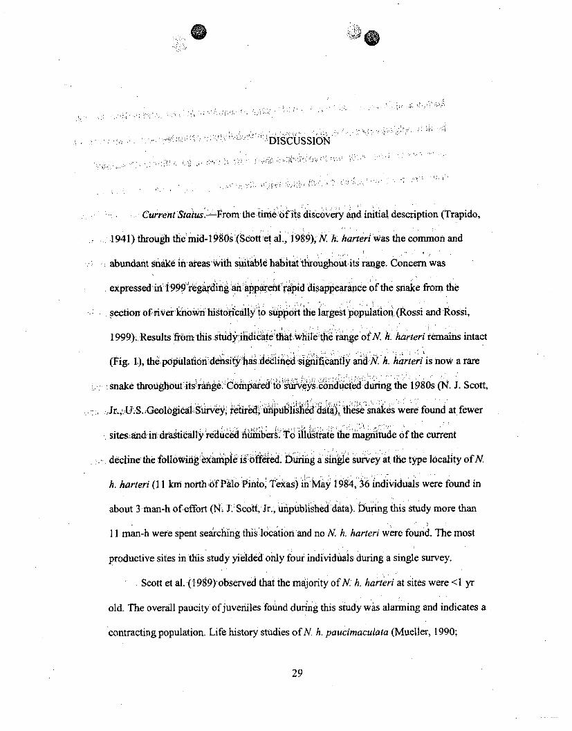
DISCUSSION
CurrentStatusUs.From the time"of its discovery and initial description (Trapido,
1941) through themid-1980s (Scott fet al., 1989), N. h. harteri was the common andSabundant snakein areas -with suitable habitatthroughout its range. Concern was
expressed in 19990regarding an apparent rapid disappearance of the snake from the,section ofriver own historically to support ihe largestpopulation (Rossi and Rossi,
1999).,Results from thiis stuidiate that while'the range of N. kh harteri remains intact
(Fig. 1), the populatio"A n'density has deline significantly andN h. harteri is now a rare
snake throughOut its range. Comparedto surveys conducted during the 1980s (N. J. Scott,-. Jr..,U.S.,Geologcal Survey, retired, riphsddata), these snakes were found at fewer
sites and-in drasticlly creduced numibers. To illulstriae the 'magnitude of the current
declin the fl nexample is offed. Durng a single survey at the type locality ofN
h. harteri (11 kmi north!of Pilo Pinito, Texas)ii May 1984, 36 individuals were found in
about 3 ,man-h of effort (NJ 1. Scott, Jr., unipublished data). During this study more than
11 man-h were spent• sea;ching this'location and no N. h. harteri were found. The most
productive sites in this study yielded only four individuals during a single survey.
Scott et al. (1989)'observed that the majority of N. h. harteri at sites were <1 yr
old. The overall paucity ofjuveniles found during this study was alarming and indicates a
contracting population. Life history studies of N. h. paucimaculata (Mueller, 1990;
29

30
Greene et a!., 999Witing et al,; 2008) sigges 'that N h."harteri is :an early-maturing,
short-lived snake that exhibits relatiVelYhigh- fecundity tooffset low annual survivorship.
Female N-h. pqucimacuiata give biftih tc'their first'clutch at 24-25 or 36-37 months
,_(Werler and Dixoný,2000).ý Clutch sizes irage frým 4-29 young (mean - 11) and are
posjtiyely.correlated.with feinaleSV'-(Greie'ent ial:, 1999). "Cluth sizes reported for N.
h. harteri range-from,4-23 youngý(Cnant, ,'942. McCallion, 1944; Carl, 1981). Annual
.. survival ,for adultvand juvenile.N ,h.-pazicimaculata is abo6ut0.23 and- 0.14, respectively
(rhitng et al., 2008), and approximately-, in 100 (0.012-0.O18) snakes are estimated to
survive to age five (Mueller,ýA1990; Whiting,1993).Gi thiis lifehistory strategy, a highjuvenile.',o adult rat'ioisexpectedcfor.a:relativeyti ' e bae or expandhng population.
Potentfial CausesoffDechn'D e.Sl'S fictors have been associated,with the
worldwide declie of amphiban sad reptiles:habitatloss andde radation, introduced
invas!ye species,•environmental pollution,-disesae and parasitism, unsustainable use, and
global climatechange (Gibbons and Stange1999). Whletlhis% study was not:able to
providqdiret-evidenice toexplainevl i rnt endrecine. oi NfN.,, har.h r,4'anecdotal evidence
has allowed forspeculation ona,,number.of bpientiUlfactors..
Dams, and water, development projects' -•iavbee'n the primary factor responsible
for the degradation:and Jloss ofXNh.-, hart•ei habitat (bSot :et ., 1989). Several low-head
dams along the Clear Fork of the Brazos River and two rajor impoundments along the
BrazosRive Possum Kingdom Lakeand Lake Granbury, lie-within the range of N h.
harteri. Aside from inundatin, of river habitat 'pstream from these dams, the negative
effects from a modified flow regim emust be considered. Analysis of streamflow data

31
(U.S. Geological Surey, 2008)recordedat the. type locality of N h.'harteri clearly
demonstrates how impoundment-of eupper;BrazosRiver drai nageas dramaticallyaltered the natural flow regime of the systeim(Fig. 4).Pri tothe mi"ekioiofPo
e ~ ~ ~ ~ T n fo. e.: e• . ;ror t-:te~cor ein ossumn
Kingdom Lake in 1941, stream flow mimicked the bimnodal pattern of recpitaion, with a
late spring peak followed by a smallerpeak inthe fall. FolloWing impOundment, the
magnitude of spring and -fall streamflow, has beeed reduced and there is now a siiigoe peak
in early sumrmher. followed bya kgradua! reduction in flowtlvotheffall. S mer flow is
dramatically higher and winter flow. is si§ghtly greater. Additionally thef magnitude of
extreme high and low. flow.events has been- reduced f6olowing impondn et-t (Table 4)
andthe variability of streamflow has incr.easedWdramatically •Fi 5), With, -the ihdian
annual numberof reversals (i.e..,the!number of daysin-which-the directioh of flow rate
reverses) more than doubling from 71'.5 4to 147 ,forTpre-T andpPostimpoundment-
conditions, respectively. Suitable rocky fiffles 'still exist below Possnn KifigdoAYLake,
and while the Brazos River has not expeiencdsedimentatin of rffi6 -Itatsike that
observed along the Colorado River',(ig,• innScoatietial., 1989),-the] ereuctidnof eitreme
high flow events has likely reduced, flushing andscouring ofthe river ciannel and
threatens juvenile N h. harteri habitat ..Furthermore, ,the attenuation'of extreme events
may affect the riparian. vegetation bypromoting the establishment of invasive species
such as saltcedar over natiye plants. As discussed below, ýthis can also lead 'fo degradation
of riffle habitat. Finally, the constant variability of flow caUsed~by frequent hycdfodelctric
releases, particularly during the summer months, mayvdirectly affect N h. 'harteri. These
usually short periods of increased flow cause riffle habitat.to become;inundated. The

32FIGURE,4..Median monthly streamflow at the type locality of N.. h. harteri, 11 rkm northof Paio Pinto, -Texas, before andafler ,imipoundment of the BrazosRiverwupstream
byMons Sheppard Dam in 1941. Data wererecorded from U.S. Geological Survey
hydroýgc atin f090 .S. G''e al Surey 2008). rhydrolgic tto 8089000 (U.S%;GD ,o.gclSre,20)
1~

33
35
~25
:E 15
0E 10
5
0
S. _
;e P"rdam (1925-1940)
- --- .Post-dam (1941ý2007)
Jan • Febb ' MaWr Apr MAy Jun Jul. Aug Sep Oct 'Nov DecMonth,

34
TABLE 4. Comparison of extreme fi6weýents at the 0tye lo6ality'of N. h. harteri, 11 km
north 6fPalo. Pinto, .Texas, before •adnafter:impoundment :of the Brazos River upstream
by MorriS.Sheppard Dam in 1941. Data we-re .eorded fr6m U.S. Geological Survey
hydrologic stationw8089000 (U.S.Gogiciac Survey, 2008).
Median (m3isec) Median (m3/sec)Low flow events Pre-dam Postldam High flow events Pre-dam Post-dam1-day minimum 0.000' 0.623 . 1-day maximum 872.2 368.13-day minimum 0.000 0.670 3-day maximum 683.4 262.67-day minimum 0.001 0.777 7-day, maximum 444.0 166.730-dayminimum 0.111 1.518 30-day maximum 149.2 88.390-day minimum 1.3793--.' .! 3.288, 90-day maximum 75.6 46.9

35
FIGURE 5. Number of days the rate of change of streamflow switched direction at the
type locality of N. h. harteri, 1 1 km north9f Palo. Pinto, Texasý, bef6ie ýd after
impoundment of the 8'razos River upstrean by'Morrs SheppardfDAmin,1941. Data Were
recorded from U.S. Geological .Survey hydrologic .'statioiiý 8089000 (U.S. Geological
Survey, 2008). .

36
" 225: 7-r
200
175
1250~
oo-E 75,
25
1920
:4 • •..
%Y' ! i
• . 3.• • ..;:• .!• .!J .'.<: !: i.'..... .... (i•'; '"•!a•'
"-.-- Pre-dam (1925-1940)* . ,.~ 4-Post-dam (1941-2007)
1930 .1940 1950 1960 1970;
Year
1980, ;1990.. 1000V 2010
of, •.•: 'ýz
'A

37
timing of these releases is likely very detrimental to birthing on a: riffle (J. R. Dixon,
Texas, A&M University, personal communication). These short bursts 0f high water may
reduce foraging opportunities for neonates h.nd increase the risks of predation by forcingsnakes to frequently move out fom under rocks when the river rises.,,
Invasive species, particularly saltcedar and thered rimported fire ant (Solenopsis
invicta), potentially :threaten N. h. harteri populations andi habitat. Saltcedar' becomes
increasingly common Along the stream ichannel-abovePossum Kingdom Lae. This
.mva§ive shrub, consumes large quantitieso water, competes with native plants, increases
sediment deposition within the stream channel, and ultimately results in contraiction of
the stream channel (Blackburn et al., 1982; Brotherson and Field, 1987). These effects
can quickly reduce a rocky riffle to a slow, sediment filledchannel, arnd: threaten juvenile
N. h. harteri habitat. Negative impacts of S. i nvicta, bothdircrt and indirectf(e g., reducedsurvival, behavioral changes, and changesin.habita4 use), have beenreported forseveral
species of herpetofauna (reviewed in Allen et al., 204), including snakes. These ants are
commonrin Texas, and were observed at seVer4• potentially suitableiriffles where they
were found under nearly every rock turned. No. snakes of any species were found in this
situation, and a snake seeking refuge in. these areas would likely be exposed to significant
risks of injury or mortality from ants. No direct evidence exists to indicate that S. invicta
negatively impacts N. h. harteri; however, these ants are recognized as a threat to N. h.
paucimaculata (Forstner et al., 2006) and can likewise be considered a threat to N. h.
harteri.

38
A• nther factor-potentially affecting•N'h. harteri populations are the rather recentoutbreakswof toxic Prymnesium parvum (golden algae) blooms within the Brazos Riverdrainage. Toxins produced during blooms are not kno)wýn to directly affect lung-respiringorganisms;-however, ichthyotoxingsreleased by'P. parvum disrupt the functioning of gillsin -fish, mollusks, arthropods, and •gillbreathing amp6-il,' ns (Paster, 1973), and can result
in extensive mortalities (Joaes-t6n De-La rua 1989; Rhodes and Hubbs, 1992). Withinthe Brazos.Riverdrainageqconfimnid fish kills'byP. parvi'M blooms'were first reportedin 1988and have subseqluentlycontinud 'to t'be'ddocumente throughout the range of N. h.
harteri (Texas: Parks Iand WildIi fe Departet 2•ent'7b)k. While the prevalence of P.parum Te r derstd tsb effect on fish popula.tons may pose a,-signifcntthreat totN.;h -•harterd. eTh diet ofN, h. harteri, inferred from the feeding-ecology of N ih.peaucimacuka-(G eeeietl aL.,'- #•)', is alnost entirely piscivorus withminno~ws2 (Cyprini•dae) •consti~~tutigh est4compon6eht. A reduction in preyavailability, ;paic-uyduring rcalfeeding periods (e.g., after spring emergence orSafter. parturiionithe fal~l),may redluce siurvivors ip. The actual effects of P. parvumblooms on N h. harteri prey aremnot wellknow'n; however, the coincidence of massivefish kills within ;therange of. Nh. .harteri and' e obseVed decline of the snake isapparent
2,,.
-Rossi.andýRossi (i1999)founid mlany juv"nile N eythrogaster transversa in areaswhere N h. harteri were previouslylfo&nd an&d uggestea that competition betweensyntopic snake, species for food and hiding places may be a significant factor affecting N.h. harteri populations. According to the competitive exclusion principle (Gause, 1934;

39
Hardin, 1960), species competing for the samer,,tesources can6t coexist indefinitely in a
stable environment. Nerodia h.r•harer i-fills a unique-niche'(i.e;.,'shallo''" riffle habitats)
not typically exploit.ed by rhombferand;N e. :transversa '(Werler and Dixon, 2000),
except perhaps for a short period when snakes are ,young., During' thig .'isytjuved, le N
rhombifer and :N. e. transversawere found uander,,rocks Iini ipparently suitable habitat
lackingN. h. harteri. Addiionally, juvenilers ofall.•three.snakeswere fdund'ocupypg the
same riffles, and on occasiomn"N-h. har•eri ,werefound under-the".s'ae rok as a congener.
Large N. rhombifer and N. e. transversa.were not found Min sshad llorffsdurnng this
study, but adults of all three snakes.were found• together indeepe6 waters. These areasghowever, were typically ocupied.only by Nrhomkifernd N:e. trnvrs.''cott et al.
(1989) reported similar findings. -Niche partitioinig and ontogenetic'shiits i prey, habitat
preferences, and activity paterslike.ly. ida ire t ompeti fnbsbefween these- syntopicsnakes (see Gibbons and Dorcas,.200). ýhile ompetition mayalive hadan imortant
influence in the present distributionwof theseAthree:snake specie .(Tinke•da•&Conaht,
196) it is unlkely that ithas had a major role in, mhe red6ction o6f. Nhe harteri pre'sently
observed.
A final potential factor warrantig discussion i•sdirectantioop6genlc ifmpacts on
N. h. harteri. Of particular concern are, the combined pressures from increasing human
densities and recreational use of the Brazos. River.system. DDuring this study recreational
use was observed to be highest along the Brazos River below.Possumr Kingdom Lake;
however, evidence of extensive recreational, use was also)observed :alonge'the more remote
stretches of the Clear Fork along, the western extentof thexange of N. Ah.'arteri. Jivenile

840
N. h. harterihabitat consists of low lying, rockyshorelines adjacent to shall6w waters,
and this habitat is-ideal for human recreation',,During .this estudy,6may people were
observed utilizing these areas.;Additionally, anglers often tufrnrocksaong the riverbank
in search of fishing bait. These .circumstances !hlaveundoubtedly, led•to th• unex pected
discovery of snakes and their likely demise. Turtlesgand one N. ee. transversa were foundshot by small;caliber firea rs during this study., Turtles were' aso foundsnagged on trot-
lines and one dead N. rhombifer was. foundentangled in a limb-lie ov eianging the
river. Furthermore, extensive. efforts -were made seirchingfor Nh.,h`harteri atzone of the
historically most productive:sites without suc-cess;coicdentally, thisis alsotfie smte of a
very popular.- 'pgoud, While thisyeidence .i largelyancdotaland .spe6ulativ-e, the
notion of direct, anthropogenic impacts on,. X, !khar•teriis shred-byother ex erienced
herpetologists (J :R.,Dixon,; personAl cmniunicato Mit.- ý J. Forstner, per'son•/=a
communication).
Distribution and" Habitat. svided'id af1 he
distribution of N. h. harteri through range ifhs Fi g. 1). At'themost
upstream extent of the range, Scptt et al. (19 89) ;nOted an,-apparently. isolated population
along Deadman Creek, a smal tribuýiýa, to •the ,Clear Fork of t eBrazos Ri'ver eastof
Lake Fort Phantom Hill, Jones County., A single indivXidual ýwas •found 7kim upstream
from the confluence with the Clear Fork, and approximately 3.5 ki•i-downistream from the
locality reported*by Scott et al,..(.1989). In, accordanice with Sc6tt et al. (1989), habitat
exists from the mouth of the, creek upstream approximately 16 km., At all sites examined

41
upstreamfrom this~point,-theteek w•asslow flowing, cioked by heavy vegetation, and
,un~suitabl~e forN.A Ih., ýhartei.i
Along Paint'. Cree, Sith e(1[9r3) :rortd N. h. h~artiri from just below Lake
Stamford !Dari in HaskellFCounty. Scott etal. (1989), found the snake approximately 2 km
,,below ,thedam and assumed populations to be present along.fhe en tirety of the creek:belowLake Stamford. Subsequenttothe, study. by S.ott et h1.(1989)adam was built on
Paint Creek near where :they reportl•finding N. h. harteri. The dam allows water to pass
durinngnor.mlafl6ws, butinundiates t:hestteamchanneland surrunhnpg area upstream
duringngighA•fows . sýa resuIt, theupstreamthabitat has 6eenre uced to a muddyfatand
-unsuitablefor d ti .• at the dam on Paint Creek,
approximately 2rk-mbelo wO ke Stamford and proceedd downstream to the creek's
confluence•with theClear ýFork One 'Nh,"ha'e/ri •as funtid <1 km downstream from
,where, Scott et al. (1989),ureportedfindig thesnbe, andsisx aditimonal snakes were found<4.5 km dop tream (Fig. h )No~adtiotial'N.h.harterz were observed along Paint
Am _w, am • d " n Paint,
Crekbeonbtisoint despit the presnce 1of suitable habitat.
BelowtheconfluenceofDdk CeaooteBrazos River is
i:impounded qapproximately 14 krmdownstreffie ýýyani od•1'am d grist mill at the small
,town of Lueders, Jones.County.and, s unsuitable for N h. harteri. Previous investigators
have-documented NhA, harteri-,frorm'belo6w the:dam At LiJdrs(S ot et Ed, 1989;
Forstner et al., 2006; F: L.ARose, Texas State'University - San` Marcos, personal
communication); however, none -werefoundduringthis s tudy. From .u-ders downstream
to the confluence of Paint Creek in Throckmorton County, N. h. harteri have not been

42
documented prior to-this survey, but'were assumed:to bepreSent (Scott'et aL, 1989). One
individual was found,8.8 km downstream fromi ifhedam at-Lueersand' another was
found 10.9 km upstream from the confluence of Paint Creek (Fig 1)k Approximately 17kmn downstream from Lueders iriverha bitat iS impounded 'by a low-head dam. and wateris backed ýup for several kilometers upstrea Ad' snsuitable for N.m h. harteri.
Nerodiar , h., harteri havpreviously i been documentd' along the ClearFork near
the mouth ofPaint.Creeký,downstreamnat Re3nolds 'Brnd,.ThirckmortonCounty, and at
Fort Griffin, Shackqlford Co (Tikeand Koph, i!964;4 Scott et al., 1989). During
this study N. h. har~teri were, not founid, atpy-. of thsJociations, or~long the remainder ofthe Clear Fork below the P antCreek confluence., Habita fwas present along the ClearFork from the dam.at Luedespdo ns ,t0, Ihe Shaclelford/Stephens countyline. This
finding is similar -to Scotr.et ialt (1i89) whb5rpred'suit able habitat from Lueders
downstream to Fort . Griffin: v -Exf•r••t fdrietch, ofiver near fthe mouthofPaint Creek,rocky habitat was never"abundanta.long'te .lear.Fork. andwas oftn rseparated by long
stretches of deep,.slow movi ngwater.D WD6*nstream fro She a f6Sh c ieSford-tepheh scounty line, rockyA hiver mipounded'by'a series of six low-
head dams friombelow the U.S Highway.!;83 cfossing'in Stephens"S County, downstream
to Eliasville, Young Count These dars createsi bakats for'several kilometers
upstream, and•only shortsectionsýof iver flow at normal levels downstream before
becomingimpounded again. Below EliasVillI6habi4tatis la*"kihg ov erall, except for anisolated rocky riffie at the confluence of the Clear Fork and the Brazos River.

43
The Brazos River below the confluenrce of the Clear' Fork is impounde by
Possum Kindorm Lake and unsuitable, forN.h A.harter. Porter (1969) repoit6d the snake" "' • " "N.• a K..- or'e -( ••,
in the still waters of Possum Kingdom ;a1e-, and'Scott aet a.'(989) found italong
approximately 17 km of the upper end :o thelake.E ightfN.•h. hrteri,(not including a
recapture) were found at three sites,• rviouslyreporte by Scott et al. (1989;-Fig. 1). All
sites where N h. harteri were found.had similar, habitaichkracieistic•s'• at included a
gently sloping, rocky.lake bottom4adjacentto rockyshoreline, andwere inirelatively calm
waters protected from wave action, Thesefindngsl are.s"mIlar 'tothosereported by Scott
et al. (1989), and by Whitinmgeta1. (997), _whoinvestigated thespatialdecology Of N. h.
paucimaculata at E. V. Spence Reservor in Coke Couity, XTe• s
Between Morris Sheppard Darn, PaloPint0 COunty, ,andLake` Granbury, Hood
County, N. h. harteri have been reported-fromin 6e1era loaine'."'ipdo 91
Tinkle and Conant, 196 1; Scott et al. 989 PDra WMd'Mede 96n19-91). Nineee N.
h. harteri were found at eight locations •iggthissteh of river (Fig 'I),and of these,
four locations have not been pre iously reported. Sott et al (4:989) Nbserved a 100 km
hiatus in the distribution of N. h.,harteri from Hittson'Benfid, n46 ream i--to Lake
Granbury, and attributed it to a lack of cover-and the sandy'iiatire of.the rivr along this
section. Furthermore, they assumedpopulations?-within thigs tretdchof river to be sparse
and ephemeral (Scott et al., 1989). In agreement with-:Scott et al.,(1989),the riVe-bekl
below Hittson Bend becomes increasingly sandy :and habitatfWas less abundant compared
to upstream; however, some habitat does occur, such as atLittlefield 'Bend wher N. h.
harteri were found in this study and by others (Wade, 1968; Dorcas and Mendelson,

44
1 991). Downstream from LittlefieldBend, habitat becomes increasingly rare. The BrazosRiver ,reaches Lake Granb'Wry at HorsheshoeBend, approximately 12 km downstream from
,,the, FM .1:189 crossi neargD'enis, P.lwker (ounty.
Sc .1989)docurnented '.h. harteri at only one:location within Lake. ,Granby (U.S• Highway3773bydgenearGrbury TX), and this has been the onlyrepo e ssence the lake s impoundment in 1969. Prior to
nd e a4 ! 6-)'.. .. 44• .. .. ........' .... . ... ',. im oundment, , W (1968) fundt Nh. .art .near hWalters Bend, approximately 4.8
jc. upstream'from De, Codova' Dam Nerodia h harteri were not observed within LakeGrrb during,,tlhis ~study; iowever,t iiimportant to:note that surveys of the lake were.pconductedprimari.y 'I JuIy 2007, and thie coined efects of high lake levels fromspring floodirgngand&reduced actfi 'ity of N. harteri during hot'summer months (Greene etal. 1993) !ikelyTr&luce&dhenes 4of de ectinf g the. snake. Furthermore, the shoreline
around Lake ;Granbury has, b i~iiifi•etensively byhuma development and verylittle habitat was observedI•i f opuiltions!are -present within the lake,: theyare likelyinsolated, and smaill.-- , .... ,.•.... ........
Below Lake Grianbury, Wade (1968) documented N h. harteri along De Cordova.Bend approximately*4.5 kImbelow the dam, and at the U.S. Highway 67 bridge east of
. •44 .L. ... + ,,,*"' *:5 .< • : . .Glen Rose,, Somervell aCounity.ý Scott et al. (1989): found N h. harteri at the FM 200crqssinigeast of'RlinboW, Somervell'Couty,' and at the FM 1118 bridge east of Brazos.Point, Bosque County.: While no N . hk lratenri were found at these locations during this"
$-. 7 . . -{•" .,• " f ' 4".4 •study, three snakes-.were'found' at a ne' 16cality east of Glen Rose, Texas, 10.5 kmn
downstream from'the U.S. Highway 67 crossing (Fig. 1). In agreement with Scott et al.

45
(1989), the river below De Cordova Darnis suitable downstrea'miito thý'e FM 118 bridge.
A short distance below.this point.therver becomes inundated :by 'Lake-Whitrey. Nerodia
/h.-harteri have not been documented .fmLakeWhitney pr any poinit do. 6 team.
Modeling.-The objective of this'studX Bas not only-to assessý the current status of
N h. harteri, but also to investigate habitat itelatignshiip oftthe snak.-L6ogistic- regressionanalysis indicated that the -abundance of- rock >10 cmO along the shoreline, bothat a riffleand m proximity to a riffle, were significantly related to1 telikelihood of finding N h.harteri at a site. The scope and design of flti study.didnotallow,, for tuhe useofpresence-
absence data to estimate occupancy and-detectioIn probabilitiesas ,descnibedaby
MacKefizie et al. (2006). The, low. poýabilitýf. detection, baseýdon7 Stidie' 4,of N h.
et n 4444-4.4, 'e''soh 4z
fi dic fo )paucimaculata (<0.2; J. M. Mueller, Tarlet]n State University, personalo ucation),
and the perceived low occupancy:(probably :0.15 )suggest that Ž7 suveysat each site
would be necessary to estimate occupan•cy (acKvenie etL,• . 2006). Ths was not
feasible in this study. These nfindings supggest thatN..•h.,harteri:are moreý ioelikely•,tobe foundin areas with higher amountsof rockyv shoreline,pand this fits the currentundeiranding ofthe needs ofjuveniles..-
, 4 .,
An attempt was made to incorporate human recreational useofthe~riVv•e ,-tem
into the logistic regression model by calculating the shortest distance ofpublic acesspoints (iLe., road crossings, campgrounds, pubýicvuseareas) for each'site."When added to
the model, analysis indicated-that the covariate was not.useful (Waldi• -0.269, P ,
0.604) in explaining Where N. h. harteri were found during this study. Several'access
points exist above Possum Kingdom Lake,, in areas that are far less denselypopulated'

46
ýcompared tobelow the lake. To accurately, model'the impa6tfof humanuse along then.ver,ithe. chosen variable ,needs to incorporate notonly acesspois along theeriver, but
also the surrounding human density.. This was-niot possible during this's :tudy.
Future.-Historically,;N. h. hartei '•:.ere found to be remarkably abundant in
rocky areas throughout the range -ofthe snake (Trapido, 194 1; Scott et al., 1989);
however, narrow habitat requirements and a limited distributiondmake it exceptionally
vulnerable to environmental disturbances (Scott et6al.,; 1 989). Nerodia h. harteri hasexperienced a drastic reduction inpopulation size ine the 1980sand the reasons for this
contraction are not well understood.: Several'potential•actors ha•r ve been addressed,
although suppotting e.vidence- is :largely anecdota'l."Anthropogenic factor, part icularly
dam construction,. appear to have had h, geatest effect, on reducing N., h. harteri habitat
(Scott et al, 19889)., In response.to.poj ."'edin.creasing' ate' de'mands for the City of
Abilene and:irrigate#dagriculture•,in okmotonCounty, the 2007 State Water Plan
(Texas Water Development Board, 20077)' i'e6eoinm d that Cedr Ridge Reservoir, a
proposed impoundmentproject; along the:C:leC r FOr-ikofthe B-razos •iver in southwestern
Throckmorton County (Fig. 6), be designated as a unique reservoir site by the Texas
legislature to ensure availability of-the site for future water supply development. If
constructed, Cedar Ridge Reservoir will inuindate approximately 55 kmn of river habitat.
Although N. h. harteri have not been documented alonglthis stretch of river, snakes were
found both up- and downstream from the proposed impoundment during this study (Fig.
6), and populations are likely present. In addition'to inundating occupied river habitat,
Cedar Ridge Reservoir will likely significantly alter the flow regime below the dam and

47
FIGURE 6. Map ofproposed~sitefor Cedar Ridge Reservoir along theu piper Brazos
River drainage, Tex•as. 4-ocatjo ns wýhere-N h.- harteri were found during this siudy are
indicated by stars.
C.-
$ ,--
1' C ~- 4 - -~
7 ~-
) N
A-
A 3

Aid,,,r~
ReynoIlsDend
9
_HA"SkELL
Fort GrI~rk
0 -0 20 KilonetersN1 0 3 03 12 I 2Miles
Lueders
00

49
curtail genetic exchange between populations iseparated by the dam. If completed, the
_median monthly streamflow, d+ownstream -of the reservoir is estimated to-be reduced by
>85% from July-October (Brazos G Regional.Water PlanningGroup,2006). The ability
of N. h. harteri to persist in a reservoir environments (Scott et al., .1989; this study) will
partially mitigate the direct effects pf flooding riverh•abitat.EHowever, in an investigationof the population dynamics of"N.h. paucimactata, Wiing etal. (2008)notedthat while
i the snake can persist in lakes, they tend to occur in relativel6,,low densities. Surveys
during this study indicated that habitat is limited along the section of river to be
Sinundated by the reservoir project, and the•ouplation of N. h. harteriwas probably nevergreat in numbers even before therecent ine In ligtofthis, the proposed
re,. n2 ecn,,Inlgh.o hit.e iple
impoundment could potentially increase available habitat so l0ng a apropiate measures
are taken to ensure adequate distribution of gently sloping, rocky shorelifies along the
entire. ,verfical ,grdient of the reservoir.ý Doing so will ensure that habitat is present across
the range of lake surface elevations (Wfiting et al., 1997). Onceeablished, protection of
these rocky shorelines from development or improvement wwill'-ýalso be critical.
Furthermore, the potential effects of aimodified flow me deserve careful
consideration and provisions should be implementedto assure adequatestreamfiow for
the maintenance of riffle habitat downstream from the proposed, reservoir. .
Nerodia h. harteri can obtain high local populationýdensities within the river
system (Trapido, 1941; Scott et al., 1989) and can persist in unnatural lh"keenvironments
(Scott et al., 1989; this study). In the absence of long term population-trend datif&r N. h.
harteri, it is difficult to assess whether the observed recent decline is within the natural

50
rangeof variability for the population.(Gibbons.et al., 2000)., Nnetheles, s mall
population size.,(Pimmniet al;, 1988), smialIgiograp iciaige' (Gastbn 1994),arind
specialized habitat.reqiremnents (Brown, 1,995) have been: hypothesized to increase a
species Vunerability to extiction:. Furthrm6re,"Pimm-et a" (1988) pr6dicted that risk of, ~ ~ t 11 "b d' .,e:d :- , fat
extinction is greaterfatlow poulation densities'forpecies thtArdsmallbodied, fast-
Wgrowig, and:short-lived,,,compared to •those that are large-bodied, slow-,growing, and
long-lved. Nerodia dh. harteri s restrcted'to-one dfithe smNlstgeographic ranges of any,'North American A snake,Ilandis a highly aquaticrfffeendent shae, whose life history
is charactefized by a -arelativelyushort life Spaquickimaturation, and high• fecundity.
Given the recent populationi declineand currentscarcityofN. : harteii, hiii recreational
use of the Brazis River system, adproposed water development projects within its
range, this snake may now be m rmre vulnerable than N. h. paucimaculata, Which has
recently been proposed foib removal ftom the list of species protected by the Endangered
Species Act.
This stud investigated the current status and distribution of N. h. harteri
throughout its range and modeled the relationship between the abundance of rocky
habitat: and the likelihood of finding the snake. Results suggest that N. h. harteri is now a
rare snake and the presence of riffle habitat is crucial for its continued persistence.
Education and public awareness will be key in mitigating direct human impacts on N. h.
harteri populations'and habitat. In light of ever increasing human densities and demands
for water and the climatic uncertainties of global climate change, the assurance of
adequate instream flows and maintenance of the river channel will be critical for the

51
conservation of this Texas endemic snake.,Giiven the rateat which this snake has
declined,. future conservation efforts need to ýbe'imlemented in a timely marnzer, and
consideration of a captive breeding program.and potential ,reintroductioiiinsm'aybe
warranted. Future research shoul4 focus on assessmentmof Iocal pbpulation ynamics, as
well as the feasibility of reintroduqtion efforts sOther researcnshould iiilude, an accurate
survey of Lake Granbury, an assessment of the flow regime-necss :formaintenance ofS , ! ,c s,
riffle habitat, and the prevalence of. fishkillsýcused byvthe microiga4P., parvum within
the upper Brazos River drainageand.•dhees-ponseof'forage fish poiýulatibngs. Fin1ally, if
construction of Cedar Rid eervoir is approved:,ýtheredwill be a uniqueiopportunity to
investigate the responseof N- h. harteri to a major imnpoundment projft.
4 4

ýý 0
REERENCES ýCITED
52
53
Allen, C. R., D. M. Epperson, and A. S. Garmestani. 2004. Red imported fire ant impacts
on wildlife: a decade of research. Arerican Midland Naturalsit 152:88-1031
Bender, S., S. Shelton, K. C. Bender, and A. Kalmbach. 2005. Texas. wildlife action plan2005-2010: Texas comprehensive wildlife conservation strategy. Texas Parks and
Wildlife Department, Austin.,,,
Blackburn, W. H., R. W. Knight, and J. L. Schuster. 1982. Saltcedar influence on
sedimentation in the Brazos River.Journal of Soil and Water Conservafion
37:298-301.
Brazos G Regional Water !Pa ng Group. 2006. 2006 Brazos G Regional Water Plan.
Texas Water Develpment(Board, Austin.
Brotherson, J. D., and D. Field. 1987..Tamarix: impacts;.of-a successful. weed. Rangelands
9:110-112.
Brown, J. H. 1995. Macroecology. University o Chicago Press, Chicago,'Illinois.Carl, G. 1981. Reproduction, in the captive. Brazos Water Snake,Nerodia harteri. Texas
Journal of Science 33:77-78.
Conant, R. 1942. Notes on the young of threerecently described snakes, with comments
upon their relationships. Bulletin of the Chicago Academy of Sciences 6:193-200.
Densmore, L. D., III, F. L. Rose, and S., J. Kain.- 1992. Mitochondrial DNA evolution and
speciation in water snakes (Genus Nerodia) with special reference to Nerodia
harteri. Herpetologica 48:60-68.

54
; Dixon;, J.R,. 2000. Amphibians§and Reptiles of Texas: wifth Keys, Taxonomic Synopses,
Bibliography,• and-Distribution M~psSecond edition. Teias A&M University
Press, •Col•ege Station.:..
..... ,Dorcas,M.ME•, and J.R!Mendelsen ies . 1991 : Distributional notes on Nerodia harteriharter in Parker and Palo Pinto o:ui'ties, Texas. Herpetological Review 22:117-
118.
Eberle, MW.-..G.,, 1972.. Comparatve 6chIomosomat morphology ofthe New 'World natricme
S ,, snakreegenera Natrix and Regmin. Heipetologica 28:98-105.
Ernst, C. H., and E. M. Erst. 2003. Snakes ofthe'United States and Canada. Smithsonian
Institution Press, hWasfingtonD.C(:
4 M1,44
4.4-4'n -Forstner;,M.Ri. RJ,.'. M. Reilly and JR. Djxon. 2006. Persistence and distributn of
Nerodia harteri in Texas river systems. Unpublished Report, U.S. Fish and
GastoqnK. J. t1994.:Rarity•. Chapmanand Hall, London.
Gause, G. F. 1934. The Struggle for Existence. WiIlia'ts and Wilkins, Baltimore, MD.
Gibbons,JW,,,and M. E:.Dor..... 2004. North' American Water Snakes: A Natural- 'Histoiy. Univeisity of Oklcima Press, Noinan.'
Gibbons, J. W.'; and P. W. Stangel, coordinators. 1999. Conserving Amphibians andRetlsfl6 'lWM I fenbn . ,Pr .6e.dn , ,th P••• '... . :d':•, Rept~les in theNew M~ilenniui.' Proceedin:gs o the Partners in Amphibian and
Reptile Conservation (PARC) Conference. PARC 2-4 June 1999, Atlanta, GA.
Savannah River Ecology Laboratory, Herp Outreach Publicaiton #2. Aiken, SC.

55
Gibbons, J. W., D. E..Scott, T. J. Ryan, K. A. Buhlmann,' . D; ubrili, a S, Metts, J.L. Greene,,T. Mills,: Y. Leide•i, S:-Poppy, and C. T. Winne.•2000. The global
decline of reptiles, d~jA vu am phitians. BioScience 50"653-666.
Gould, F. W., G.0. Hof and CP.A •echenthin. 1960.,Vegetatinal, areasbfTexas.
Texas A&M University, Texas Agricultural 1xperiment Station L-492, College
Station'.
Greene, B.D. D! 993. Life history and ecologyiof the Concho Water Snake, Nerodia
harteripaucimaculata. Unpublished Ph.,D. issertation,;Texas ,A&M University,
College Station. .. . - .
Greene, B.:D., J. R. Dixon, J. M.z Muelle, ,M. J. Whiting, and ,OA. ,Thomton, Jr. 1994.
Feeding ecology of the Concho ,Water Snake, Nerodia hiteri•paUCimaculata,
Jiournalof Herpetoilogy28:1ý65ý-.172'. .0
Greene,. B. D., J. R Dixon, and M.. W-luhiting, J- M•-Mueller. 1999 Reproductive
ecology of the Concho Water.Snake,Ne"odia harteripaucimaculata.; Copeia
1999:7014-0~
Hammerson, G. A.,2007. Nerodia harteri. In:, IUCN- 2008...2008>IUCN.Red Lisi of
Threatened Species. <www.iucnredlistkorg .,Accessed"21 Januaryv.,2009.
Hardin, G. 1960. The competitive exclusion prinCiple. Science 13,1:1292-1297.
Hosmer, D. W., and S. Lemeshow. 2000. Applied Logistic.Regression. Second edition.
John Wiely and Sons Inc., New York, NY .

56
James, T., :andh ADe LaCruz. 1,9,89. PrmnesimparvuinCarter (Chsophyceae) as a
suspect of. mass mortalities of fish"andshelfish: communities in western Texas.
,Texas Journal-of Science 41:429-3ý0.
....KilpatricC.Ck W.X , and E.G.Zimme an., 1973. Karyolg• of Nrth" Aerican natricine
snakes (family Colubridae)ýoffthe'ýgera Natrand:': dRegina.: Cihadian Journal of
Genetics and Cytolo'gy. 15!355-361,.~
..Larkin,.T:'J, .and G.,W.. ,Bomar. 1.983. Climatic atlas of Texas..;Texas{)epartment&of
WaterResources •(now.•Texas xWaterDeveloprnntBoard)iReport LP- 192, Austin.
LawsoniR, 1987. Molecular studieS ofithamnophine snaes: 1.,The4phlogenyof the
genus Nerodia..JournalOf Herpeti:ogy 24 :140-1.57.
Logmr, .. A K ewsN C BonJ.M.*ukinlaL.M C Mlar, D Jones,
L. J. Meincke, J. Meyne;,R..,.atliff, -F. Ray, R. P.<Wagner,ýandR. K.
Moyis l98.sblati6ntan mo&,, ar characteiization ofaý hihl poyorphic
centromerictandem repea in..t'he!`, famly-'A~conia". G'nkmis.2:14-4
Mackenzie, D. 1, ,J. D. Nichols; J. A. Royle, K.H. Pollock•,-•.f iley; and J. E. Hines.
, 2006. Oupancy Egtimation and Modelinig: nerr•ig P-attesad Deynacs of
Species Occurrence,. Academic',,Piess; Burlington,i . MA-;" v`.
Maxwell, T. C. 1982. 'Status and, distribution of Nerodihtarteri hfiNteri6 Unpublished
<Report,,Endangered Species, U.S.: Fish and Wdlife Seve, Albuquerque, New
Mexico.,---
McAllister; :C. T., and C. R.; Bursey: 2008. First .rep0rt of Ochetosoma aniarum (Digena:
Ochetosomatidae) from the Brazos Water Sni.ke; Nerodia harteri (Serpentes:

8
57
Co•1ubridae), in Texas,: with a summar "ofdefinitive.hostsof this*'parsite. Texas
Journal of Science 60t63!68-, •,
McAllister, C. T., and S. J. Upton. 1989,:Coccidianp.arasites.( Apiicompexa: Eimeriidae)of Nerodia spp.,(Serpentes: wColubridae)ith4adescription of anew4species of
.....Eimneria..JournalofProgozooloy36;271-74,
McCallion, J. 1944. Notes on Natrix harteriifincaptivity. C 1peia 944.63.
McMahanm .C.,L A.,(R. G.Frye, 4:and K. wL.Bro. 1984 The V egetaýtnin Lypes of Texas,IncludingiCroplan.. Texas Parks.AdWldlife Department,,Austm.
,Mecham,:1-J S. 1983. Nerodiajharteri(Trapido) 'Harters ater.Sn'e. Catalogue of
American Amphibiansand, Reptiles,33.'0,.1 2.'*,.:1-.2 , ..:,, ,'.,
Mueller,F. M. 1990o. ••pulationl 4 namics0o•the Conho Whater ;Snake. Unpublished
thesisjTeas.,A&M, UniversityColege station. .
NatureSIoe. 200. NatureServe Expl6r'n ýA .online 'encylopdliaoif,, life [web
application.].:ersin 7.0n,. Nat Serveington;"Virginia '
,http•//,wwwnatureere exploer>.i Access6d 26Au'gust2008.
National Oceanic and Atmospheric Administration: 2002. Climatography'6f the United
States No. 85: Divisional.,normals, and standard deviations of temperature,
precipitation., and heating and cooling degree days. 197 1-2000' (arid previous
normals periods). NOAA, National Climatic.Data Center, Asheville, NC.
National Oceanic and Atmospheric Administration. 2004. Climatography of the United
States No. 20: Texas monthly, stationclimate.summaries; -197,1-2000. NOAA
National Climatic DataCenter, Asheville, NC.

58
Paster, Z.K; 973. Pharmacology and' mde'ofaction in prymnesin. in: D. F. Martin and• M.!Padilla (eds.).•Cell •biology: A Seies ofMonographs, Maxine
Pharmacognosy,. Action of-MarineBiotoxkis at the Cellular Level, pp. 241-263.
-Academic~f 'P'ssNeiw Yok;,N.
,Pimn, S. L.,•H•., L.Joes, andJ: Diamon:. t 988 h on the risk of exction. The American
Naturalist P32:757-785.Porter, S..T-.An ecologicalsurvey oftfieherpetofauna.of PaloPto County, Texas.
Unpublished thesis N~orth Texas State University, Denton,"
Rhodes, K.,and•C:. Hubb•s,:992,Reco4&vyofP-oH River fishes frOm a red tide fish kill.
The Southwestern Natralist.37:178-4187.: .Genet'degence of th populations of
Nerodia hat'eri. JodiimloflH'ý etb1y 23261e261•.1
Rossi, .J,, and R. Rossi:1999. A•pi~pjlatitix esuvey of the Brazbos Water Snake, Nerodia
harteri harteri, and 6ther water snak on the Brazos River, Texas, with notes on
a captive'brding aid release program i Bu11etin'of t Chicago Herpetological
-Society 34:251 -253.
. ... 2000Comparisonaof growth,' behai ir, parasites and oral bacteria of Brazos Water
Snakes, Nerodia harteri harteri, raised in' an outdoor enclosure with related
specimens raised indoors.,Bulletin oftheChicago6 Heret61oogal Society 35:221 -
228.:

59
Scott, N. J.,Jr, and L. A.-Fitzgerald.1 985,.Status.surveyofNerodiaharter ,Brazos and
-Concho-Colorado RiversTexas. Unpublished Report5 Edanýgefed Species, U. S.
Fish and Wildlife Service, Albuq uerque, NM. .
Scott, N. J.,, Jr.,-T.%C. Maxwell, O. W.'Tho•nton, Jr, L. A. ,Fitzgeraldand J. W. Flury.
1989. Distribution;-habitat, and future:of Harter's.Water!Snýake Ne-6di' harteri
in Texas. Journal of Herpetology 23:373-389.:
Seigel, R. A., and.H. S. Fitch.4It984.-Ecological patt6rnsofielativeclitch masslin snakes.
Oecologia 61:293-301._- 4- '47
Smith, D.:D. 1983. Geogaphic distribution.Nerodia hartri hariteýi(Brazos Water
Snake).jHerpetological.Review. 14::84-85,.,-'.-,
Stable, D. W., and M. K. Cleaveland. J1988. Te droght oreconstcte'.anahalyzed from 1698 to 1980. Jou.rin6fClimate 1:5974
Stefferud, S. 1986. 50 CERPart 17. Endangei'r n t .t aten'ed wildlife ahd plants;
determination, o-fNerodia.,harteripaui.inaculata (Coihi6'&Water Snake) to be a
threatened species; final rule. FederalRegisR -t51:31412-1422.
Tinkle, D. W,, and9R. Conant. 196 1. The rediscovery of thewater sniake, Natrix harteri,
in western Texas, with the description of a new subspecies. Southwestern
Naturalist 6:33 -44.
Tinide, D. W., and G. N.:Knpf. 1964•. Biologically significant distributionm records for
amphibians and reptiles in northwest Texas. Herpetologica 20:42-47.

60
Texas.Natural Resources InformationwSystem. i2008. TNRlS home page. Texas Water
Development BOard, AuStin.<http:/, wtnrisistate.'txt'.,us.ýAccessed 26 August
2008. ,
Texas Parks and Wildlife:,Departmn,-.2007a.Endangered mand tfii6eaten•d reptiles and
amphibians in Texas and M theUited States.Texas' Parks"nd Wildlife'D15 partment,
ttp :/ywww. tpw.stateltx,.us/huntwild/wild/specisendang I h . spilesý amp
, hi'bis>. Accessed 26,August 2008. .
2007b. Historic blooms, in Texas: ,historical fish kil! events finvolving'the golden
ag aeP, Pymnesium parum, .n Texas.%--TexaskiP arks Iand WldlifeD artmnt,a.] g . .,, &+ and. i+ .... &D ... t
Austin.
<http:'//wwwtpw 4.s"txAt, axjdwaterAvater/environconcemsýhab/ga/blooms.pht
ml>., Accessed 15 J.41 w -20.9".Texas Water Development BarCd...2007,'W-ater foTexas -2007.ý esWafer
t' - Develo ent ard, Austi.
Trapido, H.. 1941. Anewspecies of Natri•.rm Texas AmericanMidland Natrist25:673-680.
U.S. Geological Survey. 2008. USGS water data for Texas.<http:-//waterdata~usgs gov/tx/nwis/>. -Accesie 8-Decembe 2008.
Upton, S. L, C.T. McAllister, P. S. Freed, S. M. Barnard..1989. CrptoSporidium spp. in
wild and captive reptiles. Journal of Wildlife Diseases 25:20-30.

61
Wade,. V. E. 1968., A range extension of ,,the 'water. shake, Natrix hartei Jh"arteri Trapido.
Texas JournalofScience 20:1.94-,196 .
Werler, J. E,, and J. R. Dixon. 2000. Texas Snakes: Identification, Di~sibution, andNatural History. Universityof ,Texas ,P.ress;:,Austiný,.
Whiting, M.J-1993. PopUlation ecology of-the Concho6Water: Snake,Nerodia harteri
paucimaculata. Unpublished thesis, Texas A&M University,' Co"llege Station.
Whiting, M. J., J. ,D ixon, and •B.: •G e ee1 99,7.; Spatial •eology of. the Concho
Water Snake (Nerodia harteri;paucimaculata) inalarlge lakiesystem. Journal of
Herpetology, 31,327-335. . .Whiting, M. J.,J..R.Dixon,,B.D. GreeneJ. M.' Mueler, 0: W. hrnton Jr., J. S.
Hatfield, J. D. Nichols, and J. E. Hines. 2008. Population.dynamics of the Concho
.Water Snake inzrivesAndý rese-ois.Copei 208438-445.'!
Willette-Frahm, M. 1995. Blood.6cllection tecliniques in"ahibians-and reptiles. In J. D.
,q.BonaguraWandRW. Kirk,,(eds.), Kirk's:Current Vetinary Therapy XlISmallAnimal Practice, pp. 1344-1348; W. B. Saunders C omp Phladelpha, PA.
Woodhousejý,C.,A., and J.lT.-Overpeck. 1998. 2000years ofdrought varabili il the
Central United States. Bulletin of the American Meteorological Society 79:2693-
2714.
Worley, M. 1970.9 Insearchoqf Natrix harteri. SBUlletin of theChicago Herpetological
Society,5"41-43.

APPENDIX 1
62

TABLE 5. Data for individual N. h. harteri, captured along the upper Brazos River drainage, Texas, 2006-2008.
Length (mm)b Rock size (cm)e
Date County" Coordinates . SVL T TL T:TLc Mass (g) Sex Age MF no.d T L S1. 03 Sep 2006 PP 32-49.60'N,8°21.O,$ Wf 730 201 9319 0.216 180.0 F ad - -
2. 16 Sep 2006 PA 32°42.40'N9, 0 3.28V 255 93 348 0.267 12.0 Mh juv 7 62 48
3.16 Sep 2006 PA 32°42.40'N 98003.28V 245 78 323 0.241 9.5 F juv - 8 61 60
4. 16 Sep 2006 PA 32 042.37'N 98 0 03.26'W 248 78 326 0.239 9.0 F ju€v ' 10 34 33
5. 07 Oct 2006. PA 32038.91'N 98001•2•VWf 268 100:,-368 0.272 12.0 Mh j uv¢ li 41 22,
6.07 Oct 2006 PA 338.91 2 64 90.2 354 0.254 9.5 F ju, - 6 35 25
7. 07 Oct 2006 PA 32°38.91'N 98001;2V1'Wf 249 :,82 2 331 0.248 9.5 F juv - 4.1 15
8.22 May 2007 PP 32 046.26Nd 980,11.70V'W. 642 204 .I-- 846 0.241 200.0 F juv
9. 31 Jul 2007 PP 32 048.;52'N 98 0 23.98'W 407, u3 5'40 0.246 48.0 F juv -
10. 15 Sep 2007 PP 32 048.69'N 98020.58'W 577 174 751, 01232 125.0 Fh ad -
IL. 08 Apr 2008 PP 32'45.05.N 9810.125 Wf 805 235, 1040 0.226. 320.0 F ad 27370 -
12. 08 May 2008 PP 32°48.46rN 98723190VW 248 '91 339 0.268 7.5 M juv 27371 7 30 22
13. 08 May2008 PP 32048A6'N980 23.90'W 301 112 413 0.271 13.0 Mh juv 27372 6 46 37
14:09 May 2008 PP 32049.;53'N 9 8021.05'W 470, 160; 630 0.254 63.0 M ad 27373 . • .15. 09May 2008 PP 32 050.04'N98 020.0VW 637- 182. 819- 0.222 150.0 F ad 27374 - ....
16: 14 May 2008 SO 3 2 014 .6 2 N 9 7 °4 1.03 'Wr 568' 211.. .779 0.271 98.0 M ad 27375 -
17. 14 May 2008 SO 32014.55.N97040.95'Wf 715 .187 902 0.207 210.0 F ad 27376 -
18. 14 May 2008 SO 320 14.60'N 97041.03Wf 690, ! 200. 890 0.225 195.0 F ad 27377 -
0Oh

TABLE 5. Continued.
Length (mm)b Rock size (m)'
Date County' Coordinates SVL .. T TL .T:TLC Mass (g). Sex Age MF no0 d T L S
•19.15 May 2008 PP 32 054.53N980 29.57'W 582 165 '747 -. 105.0 M ad 27378. -,
20.15 May 2008' PP 32054.53N 98029.57'W - " - - - - ad - -
21. 15 May 2008i PP 32058.37N 98024,78VW - : - - - - ad
22. 16May-2008' PP 32054.58'N98*29.67'W -,. -. •ad - -. . -
23. 16 May 2008 PP 32 05453YN98929.58VW . - - - - -: '
24.,16 May 2008 PP 32P0 58.25'N 98 024.98VW 61.7 195 -812 01240 148.0 F ad 27379
25. 16 M ay 2008' PP 32 5 ,8.2 4 w98 25 ,02 W - - - - - ad : - -2 a"32"5824'N98 02502W 555 171 726, - 108.0 M " ad 27380 -&,
26. 16 May'2008 PP. 982.2'W 55. t- a 78
27. 16 Maym2008.. PP 32057.919'Y9802351. :-518 146 664 . 80.0 M ad 27381 - -
28. 20 MaY2008 H' A '3 65 08'N 9932154W 257 80. 33-7 0.237, 105, .F : juV 27382 12 40 24.
29...20 May, 2008' MA,,~ 5 2 9 14 417- 142 -559 0~. 5. d 233 7 17 304?j .8 "'f2.7383 7 117 .78
30. 20 May'2008 HA 3301057§6:6'991"31 3 6' Wr 333 :93: 426 0.'2 8 23.5 F j uv 27384 4. 49 3,4.
31'.20 May 2 0'0 8k 1-IA 33'05;706'N99ý?3l73!- , --
32. 20 May 200 8 1 HA 33 05376'N 9903,i:3-'W" - , - , -
33. 20 May 2008. HA 33005 76'N 99, 331. f 303 .91 -. 394 0.231 . 19.5i 9Fi37'u0
34.21 May 2008 HA 33005.99••99031.21"Wf - 2 7 6,' 1 ' 0 1 M..236 ...... 26;-;a I -q;• 9i:'.•-'36•: 7:-- 0.248 15..5 M u 2 3 6 -. ,,44.:!: : • 26o,
35. 21 May 2008 HA 33o0,6.01,N9931.2Wf, 579-227 05 0..'282 130.0 M ad 27387.36.23 May 2008 JO 32'40.60'N 99"37.04'Wf, K524.->183 - N.259 90.0 M ad .27388
37. 23 May_2008 SH 32o49.60N 99033,73Wf 555 136 691 118.0 F ad 27389

TABLE 5. Continued'
~Length (m . Rock size (crn)e
Date County' Coordinites. SVL T. .TLý T:TL. Mass.(g) Sex Age.- .MFfno.d T L S.38.27May~ ~~ 200 TH 35:9N92.9' ýý f I" . ... "..38. 27 May 2008 TH 3265ý05 ý98'N9023.39TV 494 185 679 0.272 68.0 M ad 27390 -
39. 03 Jun 2008 PA 32 042.38WN 98P'03;24'W 386 73 459 - 32.0 M ad 27391 15 82 72
40. 03 Jun 2008 PA 32 042.40'N-980 03.28 W 455 141 596 0.237 52.0 F juv 27392 10 58 49
41. 03 Juh "26008 PA 32042.43N 98003.34W 374 136' 510 0.267 29.0 M .uv j2'3 14 127 5842. 03. Jun 2008" PA. 324242'N98*03.30'7W 439 152 591- 0.257 50.0 M ad 27394 12 61 146aPP,= Palo Pinto, PA Parker, SO `SomeivellHA Hiskell, JO = Jones, SH -Shackelford, TH - Thlockniorton.'..bSVL = snout-vent length, T = tail length, TL •t6tal length . .,- ,Tail lengthltotal length ratio calculated for sMakes with complete tails.
dMF Tissue ,Catalog no. at3TexasSifke Universigt San Marcos Depten of Biology (Michael F6rstner, curator). :'T = thickness, L = long axis, S = short axis . .
New Iocality record 1 kii from preyiouslyreported records.g> largest known specimen (Werler ajd Don 2000)hCorecnted sex based on tail length:totAl• length r-atio.-,-'
.Observation lonly.'Recapture of no. 19."Recapture of no. 29.'Escaped afer capture.
0*1

4 944 444 4< ~ '4'4 ~
•4• •4 9•
4• •4• '~• Cti,'4 1 • 4 "•4>9
.94 444 ••4'•4 49 -4 4 9 44
4 4
Kr fl•4•' '' •.•~4•44 •41.4 4~ •9Th>
44 44444 99 1~ 1 4944 4 9~ 44
4 •'~• •'4\• •99• "4 j••94.4 '44 ~ 4>4• •94"'44 '>••fl '~K•4~•4t•. 4.9fi;~4$" .t'
44 •94 ~ 449A~ 449 4 It'44
44 '49,•t•4".h 1 -0~'~~ ' - '4931 •4 -•9
'4 •••-•i•-• *4441.94{•¶94•.99 '9 ¼44 • '9'<4•" >~4 ~
4 •4 9 9•.4•94944494•949i, 9•t. ~ 4•9'4•9•4~'.., •••4•' ~ 9 4• 4 44 4 ~ - ~ ~ '44 9' 4•
'4'. •4 4
4 .•.4.4'-•4•4'1'-•4• ••41.4'4•44• 41>4, '
A 4~4 '4 4 44994 4.~-. '~'4•• •~ 44,499--'-4•
•4
4' 4 4
~APPENDIX2 4 99 949
44
4•4• ' •94•9 4
•4
•4 -
66

67
FIGURE 7. Photograph of the: arg~st-NW..' ~harteicaptured alon the upper Braztos River
drainage, Texas, in handfor scale reference, 20062008. Total length - 1040 mm.

4..
: :• : . < *:z' A4:J,'. .. ' ,• '"' :••!•: -¾ 1.-p ,• ." . . -' .i -. i••i~i': , i.:< ,•,i . !. • : >
- - •,.' -,=:• = :-s . ,,"•, , . .. -•,•.,.,•, ... •.;• -•.,:,• .• • • !." <A'•¢•• , •:•,.', •I:'•• •{ •&•'I p":,', §2••<••'•- +9• <•' •<,• .•.• •-• •.• • •. i tt': • '• • -, ,::;°-.L >,9 <,'- ,t,•
•'••'•-'• :•Q•• '"P a ' '';•f•:••• k : '; ' '• ••<q•-: .v'• •
•,•.•.,,:<•<• "-'v. ':•••':ii -!,,•• :': p:, !,•::. : :! '. ,: .. • • ••1: "••<<,•,, §2 '• "• : " ',- .- -r-"T• i,',<:-,'- r"i•••:,% ' ,.:< .•• ••,::':• %?' .• • 4'! •, • • • • • • ••' :•••>-.. A •,,*.- ......• ,W ,' . .•
p •,• • ' p ' " • ••• ••• •, -• •'• • --, ',.!' S: 9 ,',r•="•:••'''• [<'<@L• i• ,• ,••• <i§,2 . - ,-•-' t,;i•••r-4.•,•, !• •$--* 4 •••"'• :
:• •'•',• • • •.,•:" ,'.•2"••--' -• <.,• • 3•--'p 9 P? A",•. •,.- p'4- (4'-,, r " '-"pi,,•<i.•i: : -:•:.4i <•',•::, •! •<• ':•'•:•-•<•' ,
.... ~ ~ ~ ~ § . :..: :,.,. . 'q. i..,• '-, . •'" A P P E N D IX"• ,: .• ,< o:,,,•... .': :': .' '', .. .. . 3,. •,, : •••" ' ; "•••.,,, .+ ,. ... '"',.•.....,, .• ,! i .'J ',
68

69
Pictures of habitat encountered during this study andexamples of habitat
occupied by N :h.harteri.
' '
FIGURE 8. Nerdia h. hartierihabitat along Deadman Cfeek near the Rising Sun
Cemetery, Jones County, Texas, May 2008.
FIGURE 9. Muddy flat upstrear of dam on Paint.Creek,,HaskellCounty, Texas,
approximately 2 km below Lake Stamford Dam, May 2008.

70
;FIGURE,ý, 1O.Nddia h. hqrteri habitat aIx~ Prnt Creek, 'Haskell1Cotinty",'Te-ka', May
anol da ! ns il-er-udr'lns ony, xs _ igdwnsran a
2008,
i FIGURE 1I itrclclt fNhhrer ln h la oko h rzsRvra
an~od da an gris ' mil"ea Lueer Jones: County, Tea, looin donsremMa
2008., .• .. ,

71
i~i :,.7.!:( iii• " • ""
FIGURE 12: Historic locality of N h. harteri along the Clearr of the-Bra'zosi River at
an old dam and gistmilnear Lueder JQnesCoty, Texas, looking uspstream," . May
2008.
Figure 13. Historic locality ofAT hharteri" along theCleýr Fork.of theeBrazos River atPaint Crossing on the Lambshead Ranchj.hrocknorton. County, Texas, April. 2008.

FIGURE 14. Exam'le o
Brazos 1River withingth
Highway 183 crossinig,:
72
ear ork of the
castthe U.S.
A',~, ~, A' 5
'r ... , .... :!,;!:on , e m
FIGURE 15. Neroia h'> .i Possum ngom e l the mouth of
Ramsey Creek, Palo Pinto Co6ty, texas,, "May 2008. '

73
FIGURE 16.,,Nerodia h. ha rler
to-Market 1.148, PaloTinto C9'
center of the photograph, May
armtherend of Farm-
from the -rocks at the
FIGURE, 7. Nerodia h., harteriihabitat :in'Possum.Kingdom Lakenear the end of Farm-
to-Market 1148, Palo Pinto County, Texas, May 2008.

74
FIGURE 18. Nere"iz I, hrten abita along tii<Si ......... at Fotn BedPl
PintOConyTa My20
...
* '., ..4 ..- ,,•. "' 4, • A:i :. ".. "-:;, :V- .. ,•• ., . .

0 0--1
75
FIGURE 19. Nerodia h. harteri habitataiongthe,,razo.s':River atDalton Bend, Palo
Pinto
A'J-
'¼ S

76
FIGURE 20. Ner6
County, Texas'", Sc
erat Li efdBend, Parker
FIGURE 2'1 Hito~ IoaitvoA.h alrangte-BzRiver at the U.S. Highway
67 crossing east of Glen Rose, Somerell :County, Texas, May 2008.,

ýO
77
'FIGURE'22. 'Historic localIijtyf Nih. h eH along th raz§ kiver at the old. Farm-to-Market 200 crossing• eastSof eirvino Somreitdouxitt , May 2008." Ndt6 the
new Farm-to-Maket 200 crossing inthebackgr
FIGURE 23. Nerodia h. rarterthalqtat aloh.g the Brazosl Rive east of Glen Rdse,
Somervell CoUnty, Texas, May 2008.