Chapter 1 Thinking about maps - The University of Manchester
32
1 Chapter 1 Thinking about maps Rob Kitchin 1 NIRSA and Department of Geography, National University of Ireland, Maynooth, Ireland Chris Perkins School of Environment and Development, University of Manchester Introduction ‘A map is, in its primary conception, a conventionalized picture of the Earth’s pattern as seen from above’ (Raisz 1938). ‘Every map is someone’s way of getting you to look at the world his or her way’ (Lucy Fellowes, Smithsonian curator, quoted in Henrikson 1994). Given the long history of map-making and its scientific and scholarly traditions one might expect the study of cartography and mapping theory to be relatively moribund pursuits with long established and static ways of thinking about and creating maps. This, however, could not be further from the truth. As historians of cartography have amply demonstrated, cartographic theory and praxis has varied enormously across time and space, and especially in recent years. As conceptions and philosophies of space and scientific endeavour have shifted so has how people come to know and map the world.
-
Upload
khangminh22 -
Category
Documents
-
view
4 -
download
0
Transcript of Chapter 1 Thinking about maps - The University of Manchester
1
Chapter 1
Thinking about maps
Rob Kitchin1
NIRSA and Department of Geography, National University of Ireland, Maynooth,
Ireland
Chris Perkins
School of Environment and Development, University of Manchester
Introduction
‘A map is, in its primary conception, a conventionalized picture of the
Earth’s pattern as seen from above’ (Raisz 1938).
‘Every map is someone’s way of getting you to look at the world his or
her way’ (Lucy Fellowes, Smithsonian curator, quoted in Henrikson
1994).
Given the long history of map-making and its scientific and scholarly traditions one
might expect the study of cartography and mapping theory to be relatively moribund
pursuits with long established and static ways of thinking about and creating maps.
This, however, could not be further from the truth. As historians of cartography have
amply demonstrated, cartographic theory and praxis has varied enormously across
time and space, and especially in recent years. As conceptions and philosophies of
space and scientific endeavour have shifted so has how people come to know and map
the world.
2
Philosophical thought concerning the nature of maps is of importance because it
dictates how we think about, produce and use maps; it shapes our assumptions about
how we can know and measure the world, how maps work, their techniques,
aesthetics, ethics, ideology, what they tell us about the world, the work they do in the
world, and our capacity as humans to engage in mapping. Mapping is epistemological
but also deeply ontological - it is both a way of thinking about the world, offering a
framework for knowledge, and a set of assertions about the world itself. This
philosophical distinction between the nature of the knowledge claims that mapping is
able to make, and the status of the practice and artefact itself, is intellectually
fundamental to any thinking about mapping.
In this opening chapter we explore the philosophical terrain of contemporary
cartography, setting out some of the reasons as to why there are a diverse constellation
of map theories vying for attention and charting some significant ways in which maps
have been recently theorised. It is certainly the case that maps are enjoying something
of a renaissance in terms of their popularity, particularly given the various new means
of production and distribution. New mapping technologies have gained the attention
of industry, government and to some extent the general public keen to capitalise on
the growing power, richness and flexibility of maps as organizational tools, modes of
analysis and, above all, compelling visual images with rhetorical power. It is also the
case that maps have become the centre of attention for a diverse range of scholars
from across the humanities and social sciences interested in maps in-and-of-
themselves and how maps can ontologically and epistemologically inform other visual
and representational modes of knowing and praxis. From a scientific perspective, a
growing number of researchers in computer science and engineering are considering
aspects of automation of design, algorithmic efficiency, visualization technology and
human interaction in map production and consumption.
These initiatives have ensured that mapping theory over the past twenty years has
enjoyed a productive period of philosophical and practical development and
reflection. Rather than be exhaustive, our aim is to demonstrate the vitality of present
thinking and practice, drawing widely from the literature and signposting relevant
contributions amongst the essays that follow. We start the chapter by first considering
the dimensions across which philosophical differences are constituted. We then detail
3
how maps have been theorised from within a representational approach, followed by
an examination of the ontological and epistemological challenges of post-
representational conceptions of mapping.
Dimensions across which map theory is constituted
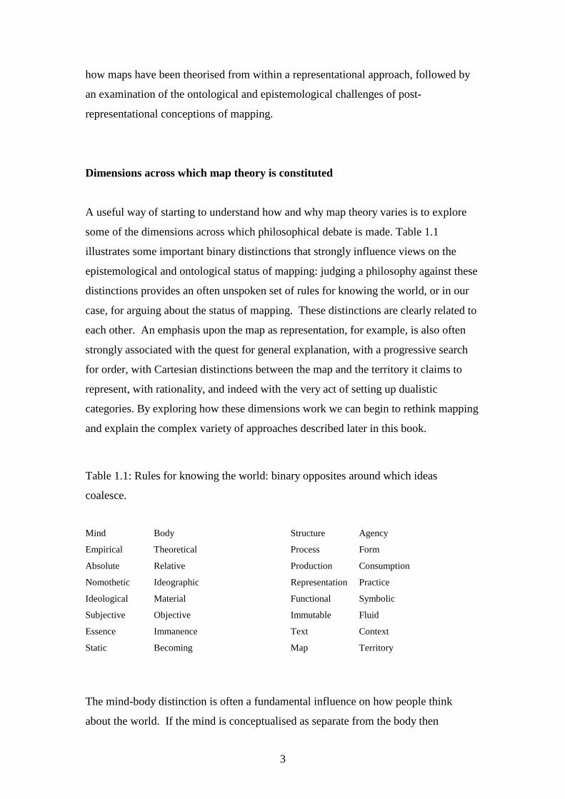
A useful way of starting to understand how and why map theory varies is to explore
some of the dimensions across which philosophical debate is made. Table 1.1
illustrates some important binary distinctions that strongly influence views on the
epistemological and ontological status of mapping: judging a philosophy against these
distinctions provides an often unspoken set of rules for knowing the world, or in our
case, for arguing about the status of mapping. These distinctions are clearly related to
each other. An emphasis upon the map as representation, for example, is also often
strongly associated with the quest for general explanation, with a progressive search
for order, with Cartesian distinctions between the map and the territory it claims to
represent, with rationality, and indeed with the very act of setting up dualistic
categories. By exploring how these dimensions work we can begin to rethink mapping
and explain the complex variety of approaches described later in this book.
Table 1.1: Rules for knowing the world: binary opposites around which ideas
coalesce.
Mind Body Structure Agency
Empirical Theoretical Process Form
Absolute Relative Production Consumption
Nomothetic Ideographic Representation Practice
Ideological Material Functional Symbolic
Subjective Objective Immutable Fluid
Essence Immanence Text Context
Static Becoming Map Territory
The mind-body distinction is often a fundamental influence on how people think
about the world. If the mind is conceptualised as separate from the body then
4
instrumental reason becomes possible: the map can be separated from the messy and
subjective contingencies that flow from an embodied view of mapping. As such,
science and reason become possible and a god-like view from nowhere can represent
the world in an objective fashion, like a uniform topographic survey. On the other
hand assuming a unity of mind and body and emphasising the idea of embodied
knowing focuses attention on different more hybrid and subjective qualities of
mapping, rendering problematic distinctions between the observer and observed.
The question of whether geographic knowledge is unique or whether the world might
be subject to more general theorizing also has fundamental implications for mapping.
An ideographic emphasis on uniqueness has frequently pervaded theorizing about
mapping in the history of cartography: if each map was different, and described a
unique place, searching for general principles that might govern design, or explain use
would be doomed to fail. Instead mapping becomes the ultimate expression of
descriptive endeavour, an empirical technique for documenting difference. Artistic
approaches to mapping that privilege the subjective may be strongly compatible with
this kind of interpretation. On the other hand a more nomothetic approach which
emphasizes laws and denies idiosyncratic difference risks reifying artificially
theorized models or generalizations whilst at the same time offering the possibility of
scientific universalisation. Many of the approaches described in chapters by
Goodchild and Gartner in this volume subscribe to this quest for order. Debate
continues around the nature of map generalization and whether mapping is holistic or
fragmentary, stochastic or regular, invariant or contingent, natural or cultural,
objective or subjective, functional or symbolic, and so on. It is clear, however, that
since the Second World War a number of different scientific orthodoxies have
pervaded the world of Western academic cartographic research which almost all trade
on the notion of searching for a common, universal approach. Yet, paradoxically,
everyday ideas of geography and mapping as ideographic and empirical survive.
As we examine in detail later in the chapter, the idea of viewing maps as texts,
discourses or practices emerged in the late 1980s, in stark opposition to the more
practical and technologically driven search for generalization. These new theoretical
ways of understanding mapping often emphasized the discursive power of the
medium, stressing deconstruction, and the social and cultural work that cartography
5
achieves. Here, the power of mapping becomes a more important consideration than
the empirical search for verifiable generalization and the chapters by Crampton,
Harris and Hazen, and Propen in this volume considers some of these alternative
approaches.
Structural explanations of the significance of mapping have also strongly influenced
understandings of maps. Insights drawn might stem from class relations, from
cultural practice, from psychoanalysis, or linguistics: for example semiotic approaches
to mapping have been a powerful and influential way of approaching the medium and
its messages for academic researchers. There is an ongoing debate in relation to
mapping over how the agency of an individual might be reconciled with this kind of
approach, given that structural approaches often posit fundamental and inevitable
forces underpinning all maps. There is also a continuing debate over the philosophical
basis of the structural critique. For example, is it grounded in a materialist view of the
world, or in a more ideological reading of the human condition.
The distinction between forces producing the world and the forces consuming it also
has a strong resonance in philosophical debates around mapping. The cultural turn in
academic Geography encouraged a growing emphasis on the contexts in which maps
operate, encouraging a shift away from theorizing about production and towards
philosophies of mapping grounded in consumption. Here, the map reader becomes as
important as the map maker. Technological change that reduced the significance of
barriers to accessing data, and the democratization of cartographic practice have also
encouraged this changed emphasis. Associated with this shift has been the
increasingly nuanced drift towards poststructuralist ways of knowing the world, which
distrust all-encompassing knowledge claims. Instead of a belief in absolute space, or a
socially constructed world, an alternative way of understanding mapping has
emphasised relativity and contingency in a universe where notions of reality come to
be replaced by simulation and in which the play of images replaces visual work, or in
which speed of change itself gains agency.

6
Representational cartography
Maps as truth
It is usually accepted that cartography as a scientific endeavour and industry seeks to
represent as faithfully as possible the spatial arrangements of phenomena on the
surface of the earth. The science of cartography aims to accurately capture relevant
features and their spatial relations and to re-present a scaled abstraction of that
through the medium of a map. Maps seek to be truth documents; they represent the
world as it really is with a known degree of precision. Cartography as an academic
and scientific pursuit then largely consists of theorising how best to represent and
communicate that truth (through new devises, e.g., choropleth maps, contour lines;
through the use of colour; through ways that match how people think, e.g., drawing on
cognitive science).
This quest for producing truth documents has been the preoccupation for Western
cartographers since the late middle ages, and especially with the need for accurate
maps with respect to navigation, fighting wars, and regulating property ownership. It
was only in the 1950s, however, that the first sustained attempts began to emerge in
the USA to reposition and remould academic cartography as an entirely scientific
pursuit. Up until then the history of cartography was a story of progress. Over time
maps had became more and more precise, cartographic knowledge improved, and
implicitly it was assumed that everything could be known and mapped within a
Cartesian framework. The artefact and individual innovation were what mattered.
Space, following Kant, became conceived as a container with an explicit geometry
that was filled with people and things, and cartography sought to represent that
geometry. Scientific principles of collecting and mapping data emerged, but
cartography was often seen as much of an art as a science, the product of the
individual skill and eye of the cartographer. Mapping science was practical and
applied and numerous small advances built a discipline.
In the latter part of the twentieth century, U.S. scholar Arthur Robinson and his
collaborators sought to re-cast cartography, focusing in particular on systematically
7
detailing map design principles with the map user in mind. His aim was to create a
science of cartography that would produce what he termed ‘map effectiveness’ – that
is, maps that capture and portray relevant information in a way that the map reader
can analyse and interpret (cf. Robinson and Petchenik 1976). Robinson suggested
that an instrumental approach to mapping grounded in experimental psychology might
be the best way for cartography to gain intellectual respectability and develop a
rigorously derived and empirically tested body of generalizations appropriate for
growing the new subject scientifically. Robinson adopted a view of the mind as an
information-processing device. Drawing upon Claude Shannon’s work in information
theory, complexity of meaning was simplified into an approach focusing on input,
transfer, and output of information about the world. Social context was deemed to be
irrelevant; the world existed independent of the observer and maps sought only to map
the world. The cartographer was separate from the user and optimal maps could be
produced to meet different needs.
The aims of the cartographer were normative - to reduce error in the representation
and to increase map effectiveness through good design. Research thus sought to
improve map designs by carefully controlled scientific experimentation that focused
on issues such as how to represent location, direction and distance; how to select
information; how best to symbolise these data; how to combine these symbols
together; and what kind of map to publish. Framed by an empiricist ideology, the
research agenda of cartography then was to reduce signal distortion in the
communication of data to users. Art and beauty had no place in this functional
cartographic universe.
Out of this context in the late 1960s and 1970s emerged an increasingly sophisticated
series of attempts to develop and position cartographic communication models as the
dominant theoretical framework to direct academic research. Communication models
encouraged researchers to look beyond a functional analysis of map design, exploring
filters that might hinder the encoding and decoding of spatial information (Figure
1.1). For researchers such as Grant Head (1984) or Hansgeorg Schlichtmann (1979)
the map artefact became the focus of study, with an emphasis on the semiotic power
of the map as opposed to its functional capacity. While Christopher Board (1981)
showed how the map could be conceived as a conceptual, as well as a functional,

8
model of the world. As models of cartographic communication multiplied so
attention also increasingly focussed on the map-reader, with cognitive research
seeking to understand how maps worked, in the sense of how readers interpreted and
employed the knowledge maps sought to convey. Drawing on behavioural
geography, it was assumed that map reading depended in large part upon cognitive
structures and processes and research sought to understand how people came to know
the world around them and how they made choices and decisions based on that
knowledge. This approach is exemplified in the work of Reginald Golledge, Robert
Lloyd and Cynthia Brewer. Here the map user is conceived as an apolitical recipient
of knowledge and the cartographer as a technician striving to deliver spatially precise,
value-free representations that were the product of carefully controlled laboratory-
based experiments that gradually and incrementally improved cartographic knowledge
and praxis. Most research investigated the filters in the centre of this system
concerned with the cartographers’ design practice, and the initial stages of readers
extracting information from the map (such work continues, e.g., Fabrikant et al.
2008). Little work addressed either what should be mapped or how mapping was
employed socially because this was beyond the philosophical remit for valid research.
[Figure 1.1 about here]
Figure 1.1. The basic map communication model, conceptualising cartography in
terms of stages in the transmission of spatial data from cartographer to reader via the
map. (Source: redrawn from Keates 1996: 114.)
Other strands of scientific research into mapping emphasised the technologies that
might be employed. Waldo Tobler’s (1976) analytical cartography emerged in the
early 1970s, offering a purely mathematical way of knowing the world, and laying the
foundations for the emergence of geographic information science. This analytical
approach sought progress through the application of mathematical models and the
subsequent application of technology so as to create new conceptual bases for
mapping the world. Over time, conceptual and technically-driven developments in
computer graphics, computation and user interfaces have begun to fundamentally
transmute the role of the map from a finished product to a situation where the map is
9
displayed within a visual toolbox to be used interactively for exploratory data analysis
(typically with the interlinking of multiple representations such as statistical charts,
three-dimensional plots, tables, and so on). This changing conceptualisation of the
map is at the heart of the emerging field of geovisualization, which in the last decade
or so has been one of the leading areas of applied cartographic research (cf. Dodge et
al. 2008; Dykes et al. 2005). Whilst distinctly positivist epistemologies underlie most
of the geovisualization research, some have tried to open up the scope of visualisation
in more politically progressive directions, for example Craine and Aitken’s chapter in
this volume that considers the emotional energy latent in cinematic qualities of maps,
and Kwan’s (2007) work in fusing geospatial technologies with feminist theory to
map affect and emotional geographies.
In other contexts different theoretical positions were adopted. For example, the
French disciplinary tradition was much less influenced by Robinsonian functionalism
and empirical research. Semiotic approaches were much more influential in this
context, and may be traced back to the influential theories of Jacques Bertin. In 1967
Bertin derived from first principles a set of visual variables which might be
manipulated by designers concerned with the effective design of mapping and other
visualizations.
By the mid 1980s the cartographic communication model as an organizing framework
for academic research was beginning to wane. Technological changes rendered
problematic a single authoritative view of the world at a time when data were
becoming much more readily available, and when technologies for the manipulation
and dissemination of mapping were also being significantly changed. Users could
become mappers and many possible mappings could be made. Digital mapping
technologies separated display from printing and removed the constraint of fixed
specifications. GIS increasingly supplanted many technical aspects of cartographic
compilation and production. Digital position, elevation and attribute data could be
captured from remotely sensed sources, and easily stored and manipulated in a digital
form. Imagery could be generated to provide frequent updates of changing contexts.
Maps could become animated. From the late 1990s the Internet has allowed maps to
be evermore widely shared and disseminated at low cost. Mapping needed to be
understood as much more of a process than was possible in communication models.
10
In the face of these profound challenges a second dominant approach to mapping
research had replaced cartographic communication by the mid 1990s as the scientific
orthodoxy. The linear inevitability of communication was supplanted by a
multifaceted and multi-layered merging of cognitive and semiotic approaches, centred
on representational theory, and strongly influenced by the work of Alan MacEachren
(1995). Articulating ideas grounded in Peircean semiotics, this approach recognised
the need for a much less literal and functional positioning of maps. The iconic
diagrammatic description of this approach is the notion of ‘cartography cubed’
(Figure 1.2). The dimensions of interactivity, the kind of knowledge, and the social
nature of the process show the three key ways in which scientific understanding has
been repositioned. Mapping can now be investigated as collaborative, the social
context beyond map reading per se can be charted, and the process of knowing
explored. And mapping is one of many kinds of visualization. However, mapping is
still about revealing truth through a scientific approach reliant upon Western ways of
seeing and upon technologies of vision; it still depends upon scientific
experimentation and a representational view of the world.
[Figure 1.2 about here]
Figure 1.2. MacEachren’s conceptual device, the “cartography cube” employs the
three different axes to encapsulate the distinctive characteristics of contemporary map
use. (Source: MacEachren 1994, 6.)
Maps as social constructions
The view that cartography produces maps of truth in an objective, neutral, scientific
fashion has been challenged by a number of scholars. In the late 1980s, the work of
Brian Harley began to question how mapping operated as a powerful discourse,
challenging the scientific orthodoxy of cartographic research. He proposed a new
research agenda concerned with the roles maps play in different societies, arguing that
maps often reinforce the status quo or the interests of the powerful, and that we should
investigate the historical and social context in which mapping has been employed. In
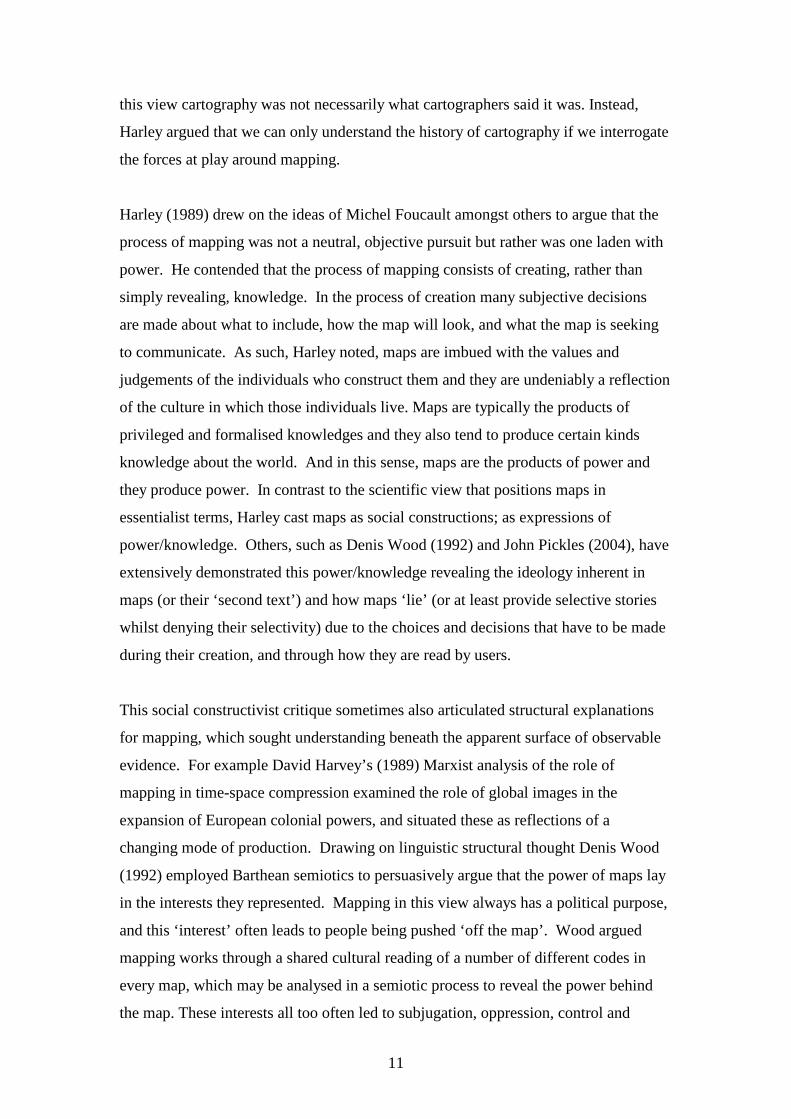
11
this view cartography was not necessarily what cartographers said it was. Instead,
Harley argued that we can only understand the history of cartography if we interrogate
the forces at play around mapping.
Harley (1989) drew on the ideas of Michel Foucault amongst others to argue that the
process of mapping was not a neutral, objective pursuit but rather was one laden with
power. He contended that the process of mapping consists of creating, rather than
simply revealing, knowledge. In the process of creation many subjective decisions
are made about what to include, how the map will look, and what the map is seeking
to communicate. As such, Harley noted, maps are imbued with the values and
judgements of the individuals who construct them and they are undeniably a reflection
of the culture in which those individuals live. Maps are typically the products of
privileged and formalised knowledges and they also tend to produce certain kinds
knowledge about the world. And in this sense, maps are the products of power and
they produce power. In contrast to the scientific view that positions maps in
essentialist terms, Harley cast maps as social constructions; as expressions of
power/knowledge. Others, such as Denis Wood (1992) and John Pickles (2004), have
extensively demonstrated this power/knowledge revealing the ideology inherent in
maps (or their ‘second text’) and how maps ‘lie’ (or at least provide selective stories
whilst denying their selectivity) due to the choices and decisions that have to be made
during their creation, and through how they are read by users.
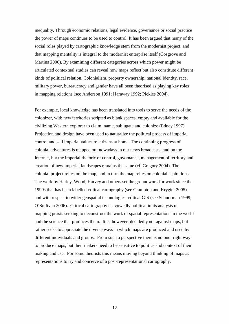
This social constructivist critique sometimes also articulated structural explanations
for mapping, which sought understanding beneath the apparent surface of observable
evidence. For example David Harvey’s (1989) Marxist analysis of the role of
mapping in time-space compression examined the role of global images in the
expansion of European colonial powers, and situated these as reflections of a
changing mode of production. Drawing on linguistic structural thought Denis Wood
(1992) employed Barthean semiotics to persuasively argue that the power of maps lay
in the interests they represented. Mapping in this view always has a political purpose,
and this ‘interest’ often leads to people being pushed ‘off the map’. Wood argued
mapping works through a shared cultural reading of a number of different codes in
every map, which may be analysed in a semiotic process to reveal the power behind
the map. These interests all too often led to subjugation, oppression, control and
12
inequality. Through economic relations, legal evidence, governance or social practice
the power of maps continues to be used to control. It has been argued that many of the
social roles played by cartographic knowledge stem from the modernist project, and
that mapping mentality is integral to the modernist enterprise itself (Cosgrove and
Martins 2000). By examining different categories across which power might be
articulated contextual studies can reveal how maps reflect but also constitute different
kinds of political relation. Colonialism, property ownership, national identity, race,
military power, bureaucracy and gender have all been theorised as playing key roles
in mapping relations (see Anderson 1991; Haraway 1992; Pickles 2004).
For example, local knowledge has been translated into tools to serve the needs of the
colonizer, with new territories scripted as blank spaces, empty and available for the
civilizing Western explorer to claim, name, subjugate and colonize (Edney 1997).
Projection and design have been used to naturalize the political process of imperial
control and sell imperial values to citizens at home. The continuing progress of
colonial adventures is mapped out nowadays in our news broadcasts, and on the
Internet, but the imperial rhetoric of control, governance, management of territory and
creation of new imperial landscapes remains the same (cf. Gregory 2004). The
colonial project relies on the map, and in turn the map relies on colonial aspirations.
The work by Harley, Wood, Harvey and others set the groundwork for work since the
1990s that has been labelled critical cartography (see Crampton and Krygier 2005)
and with respect to wider geospatial technologies, critical GIS (see Schuurman 1999;
O’Sullivan 2006). Critical cartography is avowedly political in its analysis of
mapping praxis seeking to deconstruct the work of spatial representations in the world
and the science that produces them. It is, however, decidedly not against maps, but
rather seeks to appreciate the diverse ways in which maps are produced and used by
different individuals and groups. From such a perspective there is no one ‘right way’
to produce maps, but their makers need to be sensitive to politics and context of their
making and use. For some theorists this means moving beyond thinking of maps as
representations to try and conceive of a post-representational cartography.

13
Post-representational cartography
From ontic knowledge to ontology
Despite the obvious advances of the various social constructivist approaches in
rethinking maps, more recent work has sought to further refine cartographic thought
and to construct post-representational theories of mapping. Here, scholars are
concerned that the critique developed by Harley and others did not go far enough in
rethinking the ontological bases for cartography, which for them has too long been
straitjacketed by representational thinking. As Denis Wood (1993) and Jeremy
Crampton (2003) outline, Harley’s application of Foucault to cartography is limited.
Harley’s observations, whilst opening a new view onto cartography, stopped short of
following Foucault’s line of inquiry to its logical conclusion. Instead, Crampton
(2003: 7) argues that Harley’s writings ‘remained mired in the modernist conception
of maps as documents charged with “confessing” the truth of the landscape’. In other
words, Harley believed that the truth of the landscape could still be revealed if one
took account of the ideology inherent in the representation. The problem was not the
map per se, but ‘the bad things people did with maps’ (Wood 1993: 50, original
emphasis); the map conveys an inherent truth as the map remains ideologically
neutral, with ideology bound to the subject of the map and not the map itself.
Harley’s strategy was then to identify the politics of representation in order to
circumnavigate them (to reveal the truth lurking underneath), not fully appreciating,
as with Foucault’s observations, that there is no escaping the entangling of
power/knowledge.
Crampton’s solution to the limitations of Harley’s social constructivist thinking is to
extend the use of Foucault and to draw on the ideas of Heidegger and other critical
cartographers such as Edney (1993). In short, Crampton (2003: 7) outlines a ‘non-
confessional understanding of spatial representation’ wherein maps instead of ‘being
interpreted as objects at a distance from the world, regarding that world from
nowhere, that they be understood as being in the world, as open to the disclosure of
things’. Such a shift, Crampton argues necessitates a move from understanding
cartography as a set of ontic knowledges to examining its ontological terms. Ontic
knowledge consists of the examination of how a topic should proceed from within its
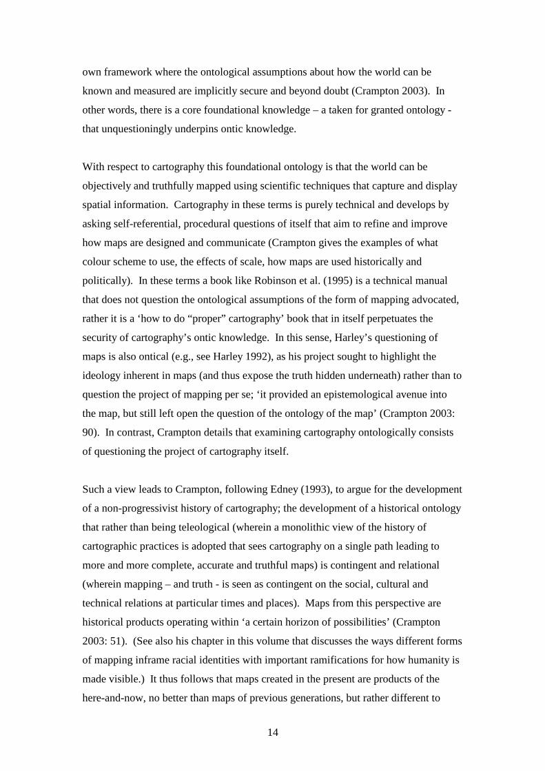
14
own framework where the ontological assumptions about how the world can be
known and measured are implicitly secure and beyond doubt (Crampton 2003). In
other words, there is a core foundational knowledge – a taken for granted ontology -
that unquestioningly underpins ontic knowledge.
With respect to cartography this foundational ontology is that the world can be
objectively and truthfully mapped using scientific techniques that capture and display
spatial information. Cartography in these terms is purely technical and develops by
asking self-referential, procedural questions of itself that aim to refine and improve
how maps are designed and communicate (Crampton gives the examples of what
colour scheme to use, the effects of scale, how maps are used historically and
politically). In these terms a book like Robinson et al. (1995) is a technical manual
that does not question the ontological assumptions of the form of mapping advocated,
rather it is a ‘how to do “proper” cartography’ book that in itself perpetuates the
security of cartography’s ontic knowledge. In this sense, Harley’s questioning of
maps is also ontical (e.g., see Harley 1992), as his project sought to highlight the
ideology inherent in maps (and thus expose the truth hidden underneath) rather than to
question the project of mapping per se; ‘it provided an epistemological avenue into
the map, but still left open the question of the ontology of the map’ (Crampton 2003:
90). In contrast, Crampton details that examining cartography ontologically consists
of questioning the project of cartography itself.
Such a view leads to Crampton, following Edney (1993), to argue for the development
of a non-progressivist history of cartography; the development of a historical ontology
that rather than being teleological (wherein a monolithic view of the history of
cartographic practices is adopted that sees cartography on a single path leading to
more and more complete, accurate and truthful maps) is contingent and relational
(wherein mapping – and truth - is seen as contingent on the social, cultural and
technical relations at particular times and places). Maps from this perspective are
historical products operating within ‘a certain horizon of possibilities’ (Crampton
2003: 51). (See also his chapter in this volume that discusses the ways different forms
of mapping inframe racial identities with important ramifications for how humanity is
made visible.) It thus follows that maps created in the present are products of the
here-and-now, no better than maps of previous generations, but rather different to
15
them. Defining a map is dependent on when and where the map was created, as what
constitutes a map has changed over time. For Crampton (2003: 51) this means that a
politics of mapping should move beyond a ‘critique of existing maps’ to consist of ‘a
more sweeping project of examining and breaking through the boundaries on how
maps are, and our projects and practices with them’; it is about exploring the ‘being of
maps’; how maps are conceptually framed in order to make sense of the world.
Several other cartographic theorists have been following similar lines of enquiry to
Crampton in seeking to transfer map theory from ontic knowledge to ontology and it
is to them that we now turn.
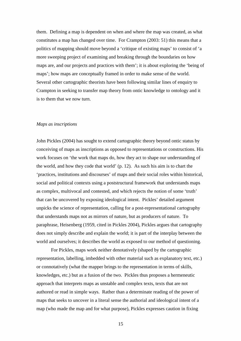
Maps as inscriptions
John Pickles (2004) has sought to extend cartographic theory beyond ontic status by
conceiving of maps as inscriptions as opposed to representations or constructions. His
work focuses on ‘the work that maps do, how they act to shape our understanding of
the world, and how they code that world’ (p. 12). As such his aim is to chart the
‘practices, institutions and discourses’ of maps and their social roles within historical,
social and political contexts using a poststructural framework that understands maps
as complex, multivocal and contested, and which rejects the notion of some ‘truth’
that can be uncovered by exposing ideological intent. Pickles’ detailed argument
unpicks the science of representation, calling for a post-representational cartography
that understands maps not as mirrors of nature, but as producers of nature. To
paraphrase, Heisenberg (1959, cited in Pickles 2004), Pickles argues that cartography
does not simply describe and explain the world; it is part of the interplay between the
world and ourselves; it describes the world as exposed to our method of questioning.
For Pickles, maps work neither denotatively (shaped by the cartographic
representation, labelling, imbedded with other material such as explanatory text, etc.)
or connotatively (what the mapper brings to the representation in terms of skills,
knowledges, etc.) but as a fusion of the two. Pickles thus proposes a hermeneutic
approach that interprets maps as unstable and complex texts, texts that are not
authored or read in simple ways. Rather than a determinate reading of the power of
maps that seeks to uncover in a literal sense the authorial and ideological intent of a
map (who made the map and for what purpose), Pickles expresses caution in fixing
16
responsibility in such a manner, recognising the multiple, institutional and contextual
nature of mapping. Similarly, the power of maps is diffuse, reliant on actors
embedded in contexts to mobilise their potential effects: ‘All texts are … embedded
within chains of signification: meaning is dialogic, polyphonic and multivocal – open
to, and demanding of us, a process of ceaseless contextualization and
recontextualization’ (Pickles 2004: 174).
Alongside a hermeneutic analysis of maps, Pickles proposes that a post-
representational cartography consists of the writing of denaturalised histories of
cartography and the production of de-ontologised cartography. Denaturalised
histories reveal the historicizing and contextualizing conditions that have shaped
cartographic practices to: ‘explore the ways in which particular machines, disciplines,
styles of reasoning, conceptual systems, bodies of knowledge, social actors of
different scales … and so forth, have been aligned at particular times and particular
places’ (Pickering 1995, quoted in Pickles 2004: 70). In other words, they consist of
genealogies of how cartography has been naturalized and institutionalised across
space and time as particular forms of scientific practices and knowledge. A de-
ontologised cartography is on the one hand about accepting counter-mappings as
having equal ontological status as scientific cartographic (that there many valid,
cartographic ontologies), and on the other, deconstructing, reading differently, and
reconfiguring scientific cartography (to examine alternative and new forms of
mapping).
Maps as propositions
Like Pickles, Crampton and others, Wood and Fels (2008) extend the notion of a map
as social construction to argue that the map itself, its very make-up and construction –
its self-presentation and design, its symbol set and categorisation, its attendant text
and supporting discourse - is ideologically loaded to convey particular messages. A
map does not simply represent the world, it produces the world. They argue that maps
produce the world by making propositions which are placed in the space of the map.
Maps achieve their work by exclaiming such propositions and Wood and Fels define
this process as one of ‘posting’ information on map. Posting is the means by which
17
an attribute is recognized as valid (e.g., some class of the natural world) and is
spatialized. It is the means by which the nature of maps (is - category) and the nature
of maps (there - sign) conjoin to create a unified spatial ontology (this is there).
However, the map extends beyond spatial ontology by enabling higher order
propositions (this is there and therefore it is also; Wood and Fels 2008) to link things
in places into a relational grid.
Wood and Fels argue that the power of this spatial propositional framework is
affirmed through its call to authority – by being an objective reference object that is
prescriptive not descriptive. So the map produces and reaffirms territory rather than
just describing it. Authority is conveyed through what they term the paramap. A
paramap is the combination of perimap and epimap. The perimap consists of the
production surrounding a map: the quality of the paper, the professionalism of the
design, the title, legend, scale, cartouches, its presentation and so on. The epimap
consists of the discourse circulating a map designed to shape its reception:
advertisements, letters to reviewers, endorsements, lectures, articles, etc. Together,
the perimap and epimap work to position the map in a certain way and to lend it the
authority to do work in the world.
Because maps are prescriptive systems of propositions, Wood and Fels contend that
map creation should not solely be about presenting information through attractive
spatial representations as advocated by the majority of cartographic textbooks (which
borrow heavily from graphic design traditions). Instead they suggest map design
should be about the ‘construction of meaning as a basis for action’ (p. xx). They
propose turning to cognitive linguistics to rethink map design as a form of ‘cognitive
cartographics’. Cognitive linguistics examines the ways in which words activate
neural assemblages and open up ‘thinking spaces’ in the mind within which meaning
is constructed by linking present information with past knowledge. They contend that
maps perform like words, by firing-up thinking spaces. Employing cognitive
cartographics, they suggest, will create a non-representational approach to map design
focused on the construction of meaning rather than graphic design and the nature of
signs. It will also enable cartographic theory to move beyond the compartmentalised
thinking that has divided map-making from map-use by providing a more holistic
framework. In other words, both map design and map reading can be understood
18
through a cognitive cartographics framework. These ideas are developed in Krygier
and Wood’s chapter in this volume.
Maps as immutable mobiles and actants
In his book, Science in Action, Bruno Latour (1987) used the example of cartography
to explore how the cultures and mechanisms involved in production of Western
scientific knowledge gained their power and authority to make truth claims about the
world that in turn are employed to do work in the world. He cogently argued that the
assemblage of cartographic theory, mapping technologies (e.g., quadrants, sextants,
log books, marine clocks, rulers, etc.), and disciplinary regimes of trade and service
(e.g., sea captains all taught the same principles and practices of surveying, recording
and bringing back spatial data) worked together to enable information from distant
places to be accumulated in a cyclical and systematic fashion and for maps to enable
appropriate action at a distance (maps informed their readers as to local conditions
and guided their safe navigation).
As the scientific basis of map-making and map-use became conventionalised, Latour
argues that maps increasingly took on the status of immutable mobiles. That is the
mechanisms used to generate cartographic information and the form maps took (in
terms of scale, legend, symbols, projection, etc) became familiar and standardised
through protocols so that the map became a stable, combinable and transferable form
of knowledge that is portable across space and time. As such, a map produced in
South America by Argentinean cartographers is decipherable to someone from
another country because it shares common principles that render it legible. Moreover,
spatial data transported from South America in the form of latitude and longitude can
be used to update charts of the area or be combined with other information, despite
the fact that the cartographer is unlikely to have ever visited the area they are
mapping.
Mapping then is seemingly transformed into a ‘universal’ scientific practice and maps
become mobile and immutable artefacts through which the world can be known and a
vehicle through which spatial knowledge can be transported into new contexts. What
19
is mapped, how it is mapped, and the power of maps is the result of Western science’s
ability to set the parameters and to dominate the debate about legitimate forms of
knowledge. As Latour notes, however, cartographic theory and praxis is seemingly
immutable in nature because it disciplines its practioners and silences other local
mapping knowledges. And yet immutable Western cartographic practice is itself
similarly the product of localised practices that are deemed appropriate within a
limited circle of practioners and mapping agencies, who exercise powerful claims to
scientific objectivity and truth. The immutability of maps is then at one level a
powerful illusion, but one that readily does work in the world.
Latour contends that the immutability, combinability and mobility of maps allowed
exploration, trade and ultimately colonialism to develop by allowing control to be
exerted from afar and knowledges about new territories to be effectively transported
globally. Maps became a vital part in the cycle of knowledge accumulation that
allowed explorers to ‘bring the lands back with them’ and to successfully send others
in their footsteps (Latour 1987: 220, original emphasis). Latour thus argues that the
European cartographers of the Renaissance produced centres of calculation (key sites
of cartographic practice) that came to dominate the world. In so doing, maps he
suggests do not simply represent space at a particular time, but produce new spaces-
times. Maps open up new possibilities – such as international trade and territorial
conquest - and thus create new geographies and histories.
To understand maps then, Latour suggests that it is necessary to unpick the cultures,
technologies and mechanics of how a particular form of mapping came to gain
immutability and mobility to reveal its contingencies and relationalities. Following
on from his work, the development of Actor Network Theory (ANT) in science
studies has provided a framework for considering how maps work in concert with
other actants and actors to transform the world. ANT involves the tracing out the
context and instruments of mapping – its assemblage - not just cartographic praxis.
For example understanding the road system, Latour argues, cannot be fully realised by
looking at infrastructure and vehicles alone, it also needs to consider civil
engineering, plans of roads, standards for signage, garages, mechanics, drivers,
political lobbying, funding, spare parts and so on.
20
Maps do not have meaning or action on their own; they are part of assemblage of
people, discursive processes and material things. They are deployed in an actor-
network of practices rather than existing as de-corporalized, a priori, non-ideological
knowledge objects. ANT then seeks to provide a broader and richer understanding of
the creation of maps through particular actor-networks (e.g., a national mapping
agency) and the use of maps as actants within various actor-networks (e.g., land
conservation) by considering the diverse, day-to-day practices of, and the interactions
and the circulation of ideas and power between, various actors (people, texts, objects,
money) (Perkins 2006). In so doing, ANT identifies the nature of ‘boundary objects’
(objects such as technical standards that enable the sharing of information across
networks), ‘centres of calculation’ (locations such as mapping agencies where
observations are accumulated, synthesised and analysed), ‘inscription devices’
(technical artefacts that record and translate information such as tables of coordinates
or satellite imagery), ‘obligatory points of passage’ (a site in a network that exerts
control and influence such as government department), ‘programs of action’ (the
resources required for an actor to perform certain roles), and ‘trials by strength’ (how
competing visions and processes within the network compete for superiority) (cf.
Martin 2000). From this perspective, the stories of mapping always need to be
considered as historically contingent actor-networks; as timed, placed, cultured and
negotiated; a web of interacting possibilities in which the world is complex and
nothing is inevitable. The focus shifts from what the map represents to how it is
produced and how it produces work in the world (Perkins 2006).
From ontology to ontogenesis: Maps as practices
In recent years, there has been a move towards considering cartography from a
relational perspective, treating maps not as unified representations but as
constellations of ongoing processes. Here it is recognized that maps are produced and
used through multiple sets of practices. Spatial data are surveyed, processed, cleaned;
geometric shapes are drafted, revised, updated, copied, digitized and scanned;
information is selected for inclusion, generalized, and symbolized. A map is then
worked upon by the world and does work in the world. It might be folded or rolled,
converted to another file format, embedded in other media; it might be packaged,
21
marketed, sold, bought, used, stored, collected, re-used, thrown away, or recycled; it
might be read in different ways in different contexts; it might be employed to plan a
journey, make money, play a game (see Perkins in this volume) or teach moral values.
Map-making and map-use is understood as processual in nature, being both embodied
and dynamic.
Mapping can then be conceptualised as a suite of cultural practices involving action
and affects. This kind of approach reflects a philosophical shift towards performance
and mobility and away from essence and material stability. This rethinking of
cartography is supported by historical and contemporary work. Researchers
concerned with historical contexts increasingly stress the interplay between place,
times, actions and ideas. Mapping in different cultures reflects multiple traditions
including: an internal or cognitive set of behaviours involving thinking about space; a
material culture in which mapping is recorded as an artefact or object; and a
performance tradition where space may be enacted through gesture, ritual, song,
speech dance or poetry (Woodward and Lewis 1998). In any cultural context there
will be a different blend of these elements. Interpreting mapping then means
considering the context in which mapping takes place; the way it is invoked as part of
diverse practices to do work in the world. Instead of focusing on artefacts, aesthetics,
human agency, or the politics of mapping, research focuses on how maps are
constituted in and through diverse, discursive and material processes.
Arguments presently emerging in the literature extend both the notion of maps as
processes and the ontological thought underpinning cartography by problematizing
the ontological security enjoyed by maps. The idea that a map represents spatial truth
might have been challenged and rethought in a number of different ways, but a map is
nonetheless understood as a coherent, stable product – a map; a map has an
undeniable essence which can be interrogated and from which one can derive
understanding. Moreover, the maps and mapping practices maintain and reinforce
dualities with respect to their conceptualisation – production-consumption, author-
reader, design-use, representation-practice, map-space. This position has been
rejected by those adopting performative and ontogenetic understandings of mapping.
Maps rather are understood as always in a state of becoming; as always mapping; as
simultaneously being produced and consumed, authored and read, designed and used,
22
serving as a representation and practice; as mutually constituting map/space in a
dyadic relationship.
James Corner (1999) argues that cartographic theory has been hampered by a pre-
occupation to view maps in terms of what they represent and mean rather than what
they do. Drawing on poststructural theory, he problematizes the conception of maps
as representations that are separate and proceeding from territory. Following
Baudrillard, Corner argues that a territory does not precede a map, but that space
becomes territory through bounding practices that include mapping. Moreover, given
that places are planned and built on the basis of maps, so that space is itself a
representation of the map, the ‘differentiation between the real and the representation
is no longer meaningful’ (p. 222). Maps and territories are co-constructed. Space is
constituted through mapping practices, amongst many others, so that maps are not a
reflection of the world, but a re-creation of it; mapping activates territory.
Corner develops an understanding of maps as unfolding potential; as conduits of
possibilities; as the sites of imagination and action in the world. The ‘function of
maps is not to depict but to enable’; ‘mappings do not represent geographies of ideas;
rather they effect actualization’ (p. 225; original emphasis). Mapping involves
processes of ‘gathering, working, reworking, assembling, relating, sifting, …
speculating and so on … [that] allow certain sets of possibility to become actual’ (p.
228, our emphasis). In this sense, maps remake ‘territory over and over again, each
time with new and diverse consequences’ (p. 213). Corner explains that maps
engender such re-territorializations because they are doubly projective: they both
capture elements from the world and also project back a variety of effects through
their use. As such, the agency of maps lies not in ‘their reproduction or imposition,
but in uncovering realities previously unseen or unimagined’ (p. 213). He thus
suggests that cartographic research and practice needs to focus on mapping actions
and mapping effects and not solely on the construction of maps per se. He charts four
practices of mapping - drift, layering, game-space and rhizome – to illustrate how the
processes of mapping and the on-going construction of space entwine. To take one of
these, Corner (1999: 244) argues that the map acts as a rhizome because it is infinitely
open with many diverse entry points and exits that enable ‘a plurality of readings, uses
and effects’, opening up milieus to new possibilities of action. So a ‘standard’

23
topographic map sheet from the Ordnance Survey for example has ‘multiple
entryways, diverse uses and applications, infinite routes and networks, and potentially
endless surfaces of engagement’ (p. 246) that when enacted brings the world into
being in new ways.
Tim Ingold (2000) also develops an approach to mapping grounded in cultural
practice. He makes a distinction between mapping, map-making and map-use and
argues that map-use (navigation) is to navigate by means of a map, plotting a course
between one location to another in space. Mapping, in terms of wayfinding practices,
however consists of moving from one place to another in a region. He argues that
maps that chart peoples’ experiences of movement – such as sketch maps, indigenous
maps – are expressions of mapping. For him, because these mappings refer to the
itineraries of their inhabitants they do not detail locations in space but histories of
movement that constitute place. Such movements consist of passages through vistas,
rather than an abstracted Cartesian landscape and therefore encode mobility as
opposed to location (see Figure 1.3). As such, the resulting mappings are ‘not so
much representations of space as condensed histories’ (Ingold 2000: 220) and
therefore un-maplike. They are un-maplike because the knowledge they portray is
bound to the place where they are made, unlike Western cartographic practice which
seeks to be non-indexical – that is a view from nowhere. However, as Turnbull
(1989) and others have noted, the non-indexical nature of maps is an illusion – they
are always a view from somewhere bound within the practices and knowledges of
their makers.
(Figure 1.3 about here)
Figure 1.3. An paper rendering of indigenous hunting ‘map’ created by Andamanese
person for an anthropology researcher. (Source: Pandya 1990: 790.)
Western cartography, according to Ingold (2000: 203), thus ‘transforms everywhere-
as-region, the world as experienced by a mobile inhabitant, into everywhere-as-space,
the imaginary ‘bird’s-eye view’ of a transcendent consciousness (see also Propen’s
chapter this volume who discusses the nature of disembodied views of the whole
24
earth). In so doing, people and their experiences are obliterated from the map and the
structure of the world is fixed without regard to the movements and actions of its
inhabitants – ‘the world it describes is not a world in the making, but one ready-made
for life to occupy’ (p. 235); ‘in the cartographic world … all is still and silent’ (p.
242). Maps as reminders of paths and expressions of experience, as they were
conceived in the European middle ages, morphed into supposed representations of
space through the application of scientific principles. The issue is, however, that
people live in the everywhere-as-region and know as they go – they are constantly
mapping as they move through places employing a form of process cartography – so
there is a disconnect between Western notions of a map, and the everyday ways in
which people come to know and be in the world. This leads to a paradox – the more a
map ‘aims to furnish a precise and comprehensive representation of reality, the less
true to life this representation appears’ (p. 242). For Ingold, we need to
simultaneously understand and value the process cartography of mapping and critique
and reform representational modes of cartography.
Del Casino and Hanna (2005) draw on poststructural theory, and in particular the
ideas of Deleuze and Guattari and Judith Butler, to argue that maps are in a constant
state of becoming; that they are ‘mobile subjects’ whose meaning emerges through
socio-spatial practices of use that mutate with context and is contested and
intertextual. For them the map is not fixed at the moment of initial construction, but
is in constant modification where each encounter with the map produces new
meanings and engagements with the world. Del Casino and Hanna (2005: 36) state
that ‘[m]aps are both representations and practices … simultaneously. Neither is fully
inscribed with meaning as representations nor fully acted out as practices.’ In so
doing, they argue that maps are not ‘simply visual objects ripe for deconstruction. …
Maps … are tactile, olfactory, sensed objects/subjects mediated by the multiplicity of
knowledges we bring to and take from them through our everyday interactions and
representational and discursive practices’ (p. 37).
Maps and spaces co-produce each other through spatial practices to create what they
term ‘map spaces’, wherein it is impossible to disentangle fully how the map does
work in the world from how the world shapes how the map is performed – they are
co-constitutive. Del Casino and Hanna (2005) illustrate their arguments by an
25
examination of how visitors produce the historic town of Fredericksburg in Virginia,
by deploying tourist maps, along with other texts and narratives (such as a guided
tour), which together shape how people interact with the space and the town. They
show that the real is read back into the map making it more legible. Tourists are both
consumers and producers of the map; authors and readers. Meaning emerges through
action and action is shaped by meaning in a complex, recursive and intertextual
performativity. The tourist map of Fredericksburg then is never complete, but is
always mobile; always being produced by tourists and producing Fredericksburg.
In a similar vein, Kitchin and Dodge (2007) have argued that map theory needs to
shift in perspective from seeking to understand the nature of maps (how maps are) to
examining the practices of mapping (how maps become). Maps they argue are not
ontologically secure representations but rather a set of unfolding practices. They
state: ‘[m]aps are of-the-moment, brought into being through practices (embodied,
social, technical), always re-made every time they are engaged with; mapping is a
process of constant re-territorialization. As such, maps are transitory and fleeting,
being contingent, relational and context-dependent. Maps are practices – they are
always mappings; spatial practices enacted to solve relational problems (e.g., how
best to create a spatial representation, how to understand a spatial distribution, how to
get between A and B, and so on)’ (Kitchin and Dodge 2007: 5, emphasis original).
From this perspective, they contended that Figure 1.4 is not unquestioningly a map; it
is rather a set of points, lines and colours that is brought into being as a map through
mapping practices (an inscription in a constant state of re-inscription). As such, the
map is (re)made every time mapping practices, such as recognising, interpreting,
translating and communicating, are applied to the pattern of ink. These mapping
practices give the map the semblance of an immutable mobile and ontological security
because they are learned and constantly reaffirmed. As Pickles (2004: 60-61)
explains: ‘Maps work by naturalizing themselves by reproducing a particular sign
system and at the same time treating that sign system as natural and given. But, map
knowledge is never naïvely given. It has to be learned and the mapping codes and
skills have to be culturally reproduced.’

26
[Figure 1.4 about here]
Figure 1.4. Is this image a map? Population change in Ireland, 1996–2002. (Source:
R. Kitchin.)
Maps do not then emerge in the same way for all individuals. Rather they emerge in
contexts and through a mix of creative, reflexive, playful, tactile and habitual
practices; affected by the knowledge, experience and skill of the individual to perform
mappings and apply them in the world. This applies as much for map making as for
map reading. As such, the map does not re-present the world or make the world, it is
a co-constitutive production between inscription, individual and world; a production
that is constantly in motion, always seeking to appear ontologically secure.
Conceiving of maps in this way reveals that they are never fully formed but emerge in
process and are mutable (they are re-made as opposed to mis-made, mis-used or mis-
read).
In terms of cartographic research, this conceptualisation of maps necessitates an
epistemology that concentrates on how maps emerge – how maps are made through
the practices of the cartographer situated within particular contexts and how maps re-
make the world through mutually constituted practices that unite map and space. As
Brown and Laurier (2005: 19, original emphasis) note this requires a radical shift in
approach from ‘imagined scenarios, controlled experiments or retrospective accounts’
to examine how maps emerge as solutions to relational problems; to make sense of the
‘unfolding action’ of mapping. Their approach is the production of detailed
ethnographies of how maps become; map-making and use is observed in specific,
local contexts to understand the ways in which they are constructed and embedded
within cultures of practices and affect. In their study they examined how maps are
used in the context of navigating while driving between locations through video-based
ethnography. Their work highlighted how a map, journey and social interaction
within the car emerged through each other in contingent and relational ways within
the context of the trip.
27
Conclusion
Mapping, its theory, praxis and technologies, is a rapidly changing and exciting field
of study. Intellect, capital, culture and innovation are reshaping how maps are made,
used and thought about. In this book we are particularly concerned with exploring the
diverse constellation of contemporary mapping theories. As we have so far
demonstrated, the theories of mapping consists of a set of winding and contested
journeys through philosophical and practical terrains. These journeys are far from
over and the philosophical underpinnings of maps remain a fertile ground in which to
explore issues of space, representation and praxis. The chapters that follow provide
detailed examinations into contemporary cartographic theory. They highlight that
there are many rich ways of rethinking maps both ontologically and
epistemologically. It is certainly not clear if any of these different modes of thought
will emerge to become paradigmatic and it may be the case that we are entering a
period characterised by theoretical diversity and exchange. For us, such a period will
continue to be highly productive in terms of thinking through the nature and role of
maps, their production and use, and the work that they do in the world. There is much
rethinking yet to be done!
28
References
Anderson, B. (1991) Imagined Communities: Reflections on the Origin and Spread of
Nationalism, London: Verso.
Bertin, J. (1967) Sémiologie Graphique, Paris: Gauthier-Villars.
Board, C. (1981) ‘Cartographic communication’, Cartographica, 18(2): 42-78.
Brewer, C.A., MacEachren, A.M., Pickle, L.W., Herrmann, D. (1997) ‘Mapping
mortality: Evaluating color schemes for choropleth maps’, Annals of the Association
of American Geographers, 87(3): 411-438.
Brown, B. and Laurier, E. (2005) ‘Maps and journeys: an ethno-methodological
investigation’, Cartographica, 40(3): 17-33.
Corner, J. (1999) ‘The agency of mapping: speculation, critique and invention’, in D.
Cosgrove (ed.) Mappings, London, Reaktion Books.
Cosgrove, D. and Martins, L.L. (2000) ‘Millennial geographics’, Annals of the
Association of American Geographers, 90(1): 97-113.
Crampton, J. (2003) The Political Mapping of Cyberspace, Edinburgh: Edinburgh
University Press.
Crampton, J. and Krygier, J. (2005) ‘An introduction to critical cartography’, ACME:
An International E-Journal for Critical Geographies, 4(1): 11-33.
Del Casino, V.J. and Hanna, S.P. (2005) ‘Beyond the ‘binaries’: A methodological
intervention for interrogating maps as representational practices’, ACME: An
International E-Journal for Critical Geographies, 4(1): 34-56.
29
Dodge, M., McDerby, M. and Turner, M. (2008) Geographic Visualization: Concepts,
Tools and Applications, Chichester, England: John Wiley and Sons.
Dykes, J., MacEachren, A.M. and Kraak, M-J. (2005) Exploring Geovisualization,
London: Elsevier.
Edney, M.H. (1993) ‘Cartography without ‘progress’: Reinterpreting the nature and
historical development of mapmaking’, Cartographica, 30(2/3): 54-68.
Edney, M.H. (1997) Mapping an Empire: The Geographical Construction of British
India, Chicago: University of Chicago Press.
Fabrikant S.I., Rebich-Hespanha, S., Andrienko, N., Andrienko, G. and Montello,
D.R. (2008) ‘Novel method to measure inference affordance in static small-multiple
map displays representing dynamic processes’, The Cartographic Journal, 45(3): 201-
215.
Golledge R.G. (1999) Wayfinding Behavior: Cognitive Mapping and Other Spatial
Processes, Baltimore: Johns Hopkins University Press.
Gregory, D. (2004) The Colonial Present: Afghanistan, Palestine, Iraq, London:
Blackwell.
Haraway, D. (1992) Simians, Cyborgs, and Women: The Reinvention of Nature, New
York: Routledge.
Harley, J.B. (1989) ‘Deconstructing the map’, Cartographica, 26(2): 1-20.
Harley, J.B. (1992) ‘Rereading the maps of Columbian encounters’, Annals of the
Association of American Geographers, 82(3): 522-536.
Harvey, D. (1989) The Condition of Postmodernity, London: Blackwell.
30
Head, C.G. (1984) ‘The map as natural language: a paradigm for understanding’,
Cartographica, 31(1): 1-32.
Henrikson A K, (1994) “The power and politics of maps”, in G.J. Demko and W.B.
Wood (eds.) Reordering the World: Geopolitical Perspectives on the Twenty-First
Century, Boulder, CO: Westview Press.
Ingold, T. (2000) The Perception of the Environment: Essays in Livelihood, Dwelling
and Skill, London: Routledge.
Keates, J.S. (1996) Understand Maps, Harlow, England: Addison Wesley.
Kitchin, R. and Dodge, M. (2007) ‘Rethinking maps’, Progress in Human Geography,
31(3): 331-44.
Kwan, M-P. (2007) ‘Affecting geospatial technologies: Toward a feminist politics of
emotion’, The Professional Geographer, 59(1): 22-34.
Latour, B. (1987) Science in Action, Cambridge, MA: Harvard University Press.
MacEachren, A.M. (1994) ‘Visualization in modern cartography: setting the agenda’,
in A.M. MacEachren and D.R.F. Taylor (eds.) Visualization in Modern Cartography,
Oxford: Pergamon.
MacEachren, A.M. (1995) How Maps Work: Representation, Visualization and
Design, New York: Guilford Press.
Martin, E. (2000) ‘Actor-networks and implementation: examples from conservation
GIS in Ecuador’, International Journal of Geographical Information Science, 14(8):
715-38.
O’Sullivan, D. (2006) ‘Geographic information science: Critical GIS’, Progress in
Human Geography, 30(6): 783-791.
31
Pandya, V. (1990) ‘Movement and space: Andamanese cartography’, American
Ethnologist, 17(4): 775-797.
Perkins, C. (2006) ‘Mapping golf: A contextual study’, The Cartographic Journal,
43(3): 208-23.
Perkins, C. (2009a) ‘Performative cartographies’, in R. Kitchin and N. Thrift (eds.),
International Encyclopedia of Human Geography, Oxford: Elsevier.
Perkins, C. (2009b) ‘Philosophy and mapping’, in R. Kitchin and N. Thrift (eds.),
International Encyclopedia of Human Geography, Oxford: Elsevier.
Pickles, J. (2004) A History of Spaces: Cartographic Reason, Mapping and the Geo-
Coded World, London: Routledge.
Raisz, E. (1938) General Cartography, New York: McGraw-Hill.
Robinson, A.H., Morrison, J.L., Muehrcke, P.C., Kimmerling, A.J. and Guptil, S.C.
(1995) Elements of Cartography, Sixth Edition, New York: Wiley.
Robinson, A.H. and Petchenik, B.B. (1976) The Nature of Maps, Chicago: The
University of Chicago Press.
Schlichtmann, H. (1979) ‘Codes in map communication’, The Canadian
Cartographer, 16(1): 81-97.
Schuurman, N. (1999) ‘Critical GIS: Theorizing an emerging discipline’,
Cartographica, 36(4): 5-21.
Tobler, W.R. (1976) ‘Analytical cartography’, American Cartographer, 3(1): 21-31.
Turnbull, D. (1989) Maps are Territories: Science is an Atlas, Chicago: University of
Chicago Press.
32
Wood, D. (1992) The Power of Maps, New York: Guilford Press.
Wood, D. (1993) ‘The fine line between mapping and mapmaking’, Cartographica,
30(4): 50-60.
Wood, D. and Fels, J. (2008) The Natures of Maps: Cartographic Constructions of
the Natural World, Chicago: University of Chicago Press.
Woodward, D. and Lewis, G.M. (1998) The History of Cartography. Volume 2. Book
3. Cartography in the Traditional African, American, Arctic, Australian, and Pacific
Societies, Chicago, University of Chicago Press.
1 Parts of this chapter are based upon Kitchin and Dodge (2007), Kitchin (2008) and Perkins (2009a/b).