BEVERLY HILLS - Granicus
258
BEVERLY HILLS AGENDA REPORT Meeting Date: November 6, 2018 Item Number: G-2 To: Honorable Mayor & City Council From: Susan Healy Keene, AICP, Director of Community Development Subject: AN APPEAL OF THE PLANNING COMMISSION’S SEPTEMBER 14, 2017 DECISION DIRECTING STAFF TO RECORD A NOTICE OF VIOLATION PURSUANT TO SUBDIVISION MAP ACT §66499.36 FOR APN 4391-028-012 Attachments: 1. Request for Continuance 2. Appeal Petition 3. Planning Commission Staff Report: September 14, 2017 4. Correspondence from Owner’s Representative: September 19, 2016 5. Correspondence from Owner’s Representative: November 22, 2016 6. Correspondence from City: January 9, 2017 7. Correspondence from Owner’s Representative: February 10, 2017 8. Correspondence from Owner’s Representative: April 14, 2017 9. Location Map 10. Assessor’s Parcel Map 11. Photo of Subject Area 12. Ordinance No. 329 13. Ordinance No. 503 14. Ordinance No. 811 15. Tract Map No. 21360 16. Ordinance No. 1058 17. Ordinance No. 1075 18. Lot 99 Grant Deed (1959) 19. Subdivision Map Act Section 66499.36 20. Preliminary Title Report, dated April 27, 2016 21. Draft Notice of Violation 22. Applicant-prepared Timeline of Relevant Events and Supporting Documents Page 1 of 8 9
-
Upload
khangminh22 -
Category
Documents
-
view
2 -
download
0
Transcript of BEVERLY HILLS - Granicus

BEVERLYHILLS
AGENDA REPORT
Meeting Date: November 6, 2018
Item Number: G-2
To: Honorable Mayor & City Council
From: Susan Healy Keene, AICP, Director of Community Development
Subject: AN APPEAL OF THE PLANNING COMMISSION’S SEPTEMBER 14,2017 DECISION DIRECTING STAFF TO RECORD A NOTICE OFVIOLATION PURSUANT TO SUBDIVISION MAP ACT §66499.36 FORAPN 4391-028-012
Attachments: 1. Request for Continuance2. Appeal Petition3. Planning Commission Staff Report: September 14, 20174. Correspondence from Owner’s Representative: September 19,
20165. Correspondence from Owner’s Representative: November 22,
20166. Correspondence from City: January 9, 20177. Correspondence from Owner’s Representative: February 10, 20178. Correspondence from Owner’s Representative: April 14, 20179. Location Map10. Assessor’s Parcel Map11. Photo of Subject Area12. Ordinance No. 32913. Ordinance No. 50314. Ordinance No. 81115. Tract Map No. 2136016. Ordinance No. 105817. Ordinance No. 107518. Lot 99 Grant Deed (1959)19. Subdivision Map Act Section 66499.3620. Preliminary Title Report, dated April 27, 201621. Draft Notice of Violation22. Applicant-prepared Timeline of Relevant Events and Supporting
Documents
Page 1 of 8
9

Meeting Date: November 6, 2018
RECOMMENDATION
It is recommended that the City Council decide whether to grant an additional continuance ofthe appeal hearing pursuant to the applicant’s request.
The applicant submitted a request that the appeal hearing be continued from the May 1, 2018City Council hearing while they prepared to submit a request for entitlements in an attempt toresolve the subdivision violation. At the meeting, the City Council granted the requestedcontinuance and set the appeal hearing date for November 6, 2018. Subsequently, theapplicant submitted to the City a request for entitlements on June 13, 2018 in an attempt toresolve the subdivision violation and to construct an accessory structure on the subject property.The requested entitlements include Variances, a Trousdale R-l Permit, an Accessory DwellingUnit Use Permit, and a Lot Merger/Lot Line Adjustment. The application was reviewed by Citystaff and deemed incomplete and a correction letter was issued on July 12, 2018. On October17, 2018, Mr. Fischer submitted a written request (Attachment 1) to continue the appeal hearingto a future date to provide for additional time to review the corrections issued by the City andsubmit revised plans. The applicant submitted revised plans to the City on October 23, 2018and these plans are currently under review for completeness. When the application is deemedcomplete, the requested entitlements will be scheduled for a hearing before the PlanningCommission. If the Council chooses to grant a continuance to allow for more time for thePlanning Commission to review a project at the site, staff recommends that the hearing becontinued to the Council’s first meeting in May 2019 to provide the applicant sufficient time toprepare a complete set of plans responsive to staff comments and to conduct a hearing beforethe Planning Commission. Staff does not recommend any further continuances beyond May2019, as ample time will have been provided by the City for the applicant to develop a resolutionto the subdivision violation issue.
In the event that the City Council wishes to proceed with the appeal hearing as scheduled, it isrecommended that the Council uphold the Planning Commission’s determination that thesubject property was illegally divided and direct staff to record a Notice of Violation with the LosAngeles County Recorder,
BACKGROUND
On May 16, 2016, the City received a request from Vance Owen, property owner, for certificatesof compliance related to certain land within the City bearing Assessor’s Parcel Numbers (APN)4391-028-020, 4391-028-012, and 4391-028-008. The three parcels were created by grantdeed in the late I 950s by dividing the subject parcels from three larger lots created by a City-approved tract map that had lot frontage on Hillcrest Road within the City of Beverly Hills. Thethree subject parcels were held back by the original subdividers of Trousdale Estates, theTrousdale Construction Company and Texas Construction Company, when they sold the frontportions of the three lots fronting on Hillcrest Road for development in the 1950s.
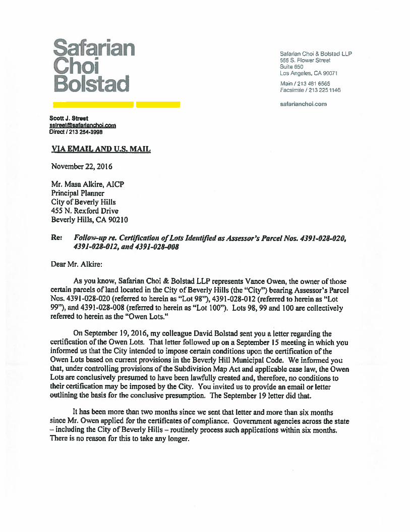
On September 19, 2016, the Property Owner’s representative submitted a letter (Attachment 4)in response to a meeting held on September 15, 2016, during which the City expressed intent toimpose conditions on the requested certificates of compliance. The letter expressed theirposition that APNs 4391-028-020, 4391-028-012, and 4391-028-008 were lawfully created andthat the City may not impose any conditions on the requested certificates of compliance. OnNovember 22, 2016, the Property Owner’s representative submitted a follow-up letter(Attachment 5) re-stating their position that such parcels were lawfully created and inquiringabout the status of the certificates of compliance.
Page2of8

Meeting Date: November 6, 2018
On January 9, 2017, the City issued a response to the requested certificates of compliance anda Notice of Intention to Record a Notice of Violation (Attachment 6) against APN 4391-028-012.The City found that the parcel was created in violation of Ordinance No. 1058, adopted onFebruary 3, 1959 and effective March 6, 1959, which established subdivision regulations for anydivisions of land of not more than four lots and required City approval of a map for all suchsubdivisions. Such notice was sent pursuant to the requirements of Section 66499.36 of theSubdivision Map Act. The grant deeds resulting in the subdivision of parcels located directlyadjacent to the subject parcel (APN 4391-028-008 to the north and APN 4391-028-020 to thesouth) occurred prior to the effective date of Ordinance No. 1058. While such subdivisionsappeared to violate Tract Map No. 21360 (Attachment 15), which created the parcels in theTrousdale Estates, they were created prior to the effective date of Ordinance No. 1058, whichrequired a City Engineer approval of any map resulting from a subdivision of four or fewerparcels.
On February 10, 2017, the Property Owner’s representative submitted a response in objectionto the Notice of Intention to Record a Notice of Violation against APN 4391-028-012, which isincluded as Attachment 7 of this report. On April 14, 2017, the Property Owner’s representativesubmitted a follow-up letter (Attachment 8) reaffirming their objection to the City’s determinationthat the subject parcel was created in violation of Ordinance No. 1058.
On July 10, 2017, the Property Owner’s representative agreed via email to a hearing date onAugust 10, 2017. However, the hearing was subsequently continued to September 14, 2017 bythe Planning Commission on advisement from the City Attorney’s office that outside legalcounsel should be retained for the Planning Commission to ensure due process to the propertyowner, as discussed below.
Planning Commission SynopsisThe purpose of the Planning Commission hearing was to determine, based upon the City’sinformation and Property Owner’s presented evidence, whether the subject parcel (APN 4391-028-012) was illegally subdivided. If the City determined that the parcel APN 4391-028-012 wasillegally subdivided, then the City would move forward with recording the Notice of Violationagainst the parcel with the County Recorder. If the City determined that the parcel was notillegally subdivided, then the City would prepare a clearance letter indicating that there was nosubdivision violation.
At the Planning Commission meeting on September 14, 2017, the Property Owner’srepresentatives, attorneys Murray Fischer and David Bolstad, submitted a timeline andsupplemental documentation (Attachment 22) to support their position that the parcel wassubdivided legally at the time the grant deed was issued. Additionally, they submittedinformation on the court case Nightilfe Partners, Ltd. v. City of Beverly Hills, which concludedthat in order to protect due process rights, a “hearing officer shall not be advised by any personwho has served as City’s advocate in this or any related case.” In accordance with the CityAttorney’s prior recommendation, and due to the City Attorney Office’s involvement in advisingstaff on this matter, Mr. Alan Seltzer had been retained to advise the Planning Commissionduring the hearing on this matter to ensure that there was no violation of the Property Owner’sdue process rights. Similarly, Mr. Seltzer has been retained to provide legal counsel to the CityCouncil when this matter is considered.
The Property Owner’s representatives provided testimony at the September 14, 2017 PlanningCommission hearing regarding the bona fide purchase of the property in 2008, assignment of
Page3of8

Meeting Date: November 6, 2018
parcel numbers by the Los Angeles County Assessor, tax payments, and prior City knowledgeof the subdivision. This included testimony from Joe Tilem, who represented the property ownerof 1151 Hillcrest Road in 1993 regarding a project on that property that is described later in thisreport. Mr. Tilem testified that a lot split that resulted in the parcel that is addressed 1151Hillcrest Road and the parcel that is identified as APN 4391-028-012 was approved by Ed Tufte,who was the City Engineer at the time, and that it was subsequently approved by the CityCouncil, and signed by the City Clerk confirming the validity of the lot split. This information wasused as the basis to request a certificate of compliance in 1993, which was never completed orissued by the City and no such documentation has been provided, or discovered uponsubsequent research, to verify this information. Information was also provided by the PropertyOwner’s representatives regarding a desire to detach the property from the City of Beverly Hillsand annex it into the City of Los Angeles, as well as the Property Owner’s desire to develop theproperty and the desire to identify a remedy to the existing situation to provide for thatopportunity.
The Planning Commission considered the testimonies presented at the hearing and evidencesubmitted prior to and during the hearing. Additionally, the Planning Commission acknowledgedthe Property Owner’s desire to develop the property, but determined that the intent of thehearing was to determine if the property had been illegally subdivided via grant deed and wasnot related to any future development potential. Based upon the testimony and evidence, thePlanning Commission found that the information in the staff report demonstrated that the parcelhad been subdivided in violation of the City’s subdivision ordinances in place at the time andthat the applicant’s testimony was insufficient to prove that the parcel had not been subdividedillegally. As such, the Planning Commission unanimously directed staff to record a Notice ofViolation pursuant to Subdivision Map Act §66499.36 for APN 4391-028-012, located in theTrousdale Estates Area of the City, based upon the submitted evidence. It should be noted thatCommissioner Shooshani did not participate in the proceedings to avoid any appearance of aconflict because an adjacent parcel is owned by members of his extended family.
On September 26, 2017, Murray Fischer, attorney of the property owner, filed a timely appeal ofthe Planning Commission’s decision. On October 17, 2017, the City Council set the appealhearing for January 9, 2018.
City Council SynopsisOn December 19, 2017, Mr. Fischer submitted a written request to continue the appeal hearingfor a period of two months to allow additional time for the property owner to bring the subjectparcels into compliance with the City’s current subdivision requirements and to further developarchitectural plans for an accessory structure and/or an addition to the existing single-familyresidence located at 9304 Warbler Way in the City of Los Angeles.
On January 9, 2018, the City Council discussed the connection between the applicant’s requestfor continuance, which would allow time to develop architectural plans for an accessorystructure, and the subdivision violation. The applicant shared with the City Council that they hadbeen in discussions with City staff to identify solutions to the subdivision violation and requiredadditional time to develop plans that complied the required conditions identified in the City’sJanuary 9, 2017 letter. Subsequently, the City Council decided to continue the hearing to thefirst meeting in May; the hearing could not be scheduled earlier due to Council and staffingconflicts.
On April 19, 2018, Mr. Fischer submitted a written request to continue the appeal hearing aspreliminary documents have been provided to the City that outline a potential remedy to the
Page 4 of 8

Meeting Date: November 6, 2018
violation. Based on information provided by the applicant, the proposed project would requirereview by the Planning Commission for variances from certain Trousdale Estates developmentstandards (construction off of a level pad, grading, front yard paving, and wall height) and aTrousdale R-1 Permit to locate an accessory structure within 100’ of a front property line. TheLot Merger application would be reviewed concurrently with the variances and Trousdale R-1Permit.
On May 1, 2018, the City Council held a public hearing regarding the matter and received a staffpresentation outlining the Planning Commission’s determination on the subdivision violation andthe current status of the applicant’s coordination with the City on submitting plans in an attemptto resolve such violation. Subsequent to staff’s presentation, Mr. Fischer provided additionalinformation on the applicant’s attempt to legalize the subject properties and on the status of afuture project submittal to the City. The Council asked questions of staff regarding the intentand purpose of the subdivision violation, access to utilities for any future development on theproperty, and general implications that may arise with a dual jurisdiction property.Subsequently, based upon the applicant’s request, the City Council decided to continue theappeal hearing to November 6, 2018.
On June 13, 2018, responsive to statements made by the applicant in writing and at the May 1,2018 City Council hearing, the applicant submitted for a number of entitlements in an attempt toresolve the subdivision violation and to construct an accessory structure on the site. Theapplication was deemed incomplete on July 12, 2018. On October 17, 2018, Mr. Fischersubmitted a written request to continue the appeal hearing to a future date to provide foradditional time to review the corrections issued by the City. Revised plans were submitted tothe City on October 23, 2018 and are currently under review for completeness.
DISCUSSION
Based upon Planning Commission and Planning Division review of City records and thematerials submitted by the property owner as part of the request for certificates of compliancefor the three parcels, it has been found that parcel APN 4391-028-012 was created in violationof the City’s subdivision ordinances in effect at the time the original subdivider deeded the frontportion of the lot to George Stephens and retained ownership of the rear portion of Lot 99. Suchdivision was found to be in direct contravention of Ordinance No. 1058, which required a mapfor the division of four or fewer parcels and required City Engineer approval of a map for all suchsubdivisions.
A full explanation of all legislative history relevant to this matter is provided in the City’s January9, 2017 letter to the property owner (Attachment 6).
The division of Lot 99 by deed violated the City’s subdivision ordinances in effect at that timebecause no subdivision map was submitted for review and approval by the City Engineer.Thus, the deed transfer creating the property now referred to as APN 4391-028-012 constitutedan illegal subdivision, Further, the deed transfer resulted in a substandard parcel that did notcomply with the City’s subdivision standards at the time. As such, the transfer was in violationof the City’s local subdivision ordinance, and in direct contravention of the tract map forTrousdale Estates (Tract Map No. 21360), which was approved in 1955.
The applicant’s presumption, expressed in letters dated September 19, 2017 and February 10,2017, that parcels created prior to March 4, 1972, were lawfully created does not apply to thesubject property. The deed transfer violated the City’s subdivision ordinance in effect at the
Page5of8

Meeting Date: November 6, 2018
time of the illegal transfer that required a subdivision map for division of land creating between 2and 4 parcels and conflicted with City-approved Tract Map No. 21360.
The City concluded in its January 9, 2017 letter to the property owner that each of the threeproperties subject to the owner’s request are only eligible for conditional certificates ofcompliance pursuant to Government Code Section 66499.35(b). This Government Codesection gives the City the authority to impose the City’s subdivision standards in effect onFebruary 22, 2008, the date the property owner acquired the properties. In the January 9, 2017letter, the City outlined conditions that it intended to impose on each of the three parcels forwhich the owner had requested a certificate of compliance. The letter outlined the specificcriteria that the City intended to impose on the parcel that is the subject to this notice of violationhearing (APN 4391-028-012).
Prior City Action on 1151 Hillcrest RoadOn March 28, 1983, the City issued a certificate of occupancy for a new single-family residenceconstructed on the property located at 1151 Hillcrest Road.
On April 28, 1993 the Planning Commission approved a second-story addition to the single-family residence constructed in 1983. The staff report acknowledged the existence of the tearportion of the property and referenced a grant deed reflecting a 1952 sale of the additionalportion of the property. The 1993 Planning Commission staff report further indicated that thecreation of the parcel occurred before the Trousdale Estates Area was annexed into BeverlyHills, was not subject to local Beverly Hills Ordinances, and was eligible for a Certificate ofCompliance.
However, a 1952 grant deed as described in the 1993 staff report has not been located in theCity’s records and is not identified in the preliminary title report supplied by the property owner(Attachment 20). As such, staff has not been able to verify the information contained in the1993 staff report. The 1993 staff report statement is inconsistent with the evidence submittedby the Applicant for the current request for Certificates of Compliance and is inconsistent withthe research of City records conducted by staff, in part because the overall lot (Lot 99) was notcreated until December 1955, with the recordation of Tract Map No. 21360. Nonetheless, itshould be noted that the Subdivision Map Act (Govt. Code Section 66499.35 (c)) provides that acertificate of compliance shall be issued for any real property that has been approved fordevelopment. Thus, the portion of Lot 99 fronting on Hillcrest Road, having been issued apermit for construction and having been developed, would be entitled to a certificate ofcompliance.
AnalysisBased on the timeline of actions identified outlining the legislative, subdivision and grant deedhistory applicable to the subject parcel, the available evidence indicates that the subject parcelwas subdivided illegally after the City had established a map requirement for the division of fouror fewer parcels. Although there was a prior City report suggesting that the parcel was createdlegally, the basis for this prior City assumption was that the subject parcel was created by grantdeed in 1952, which was before the Trousdale Estates area was annexed into the City (1955)and before the City had adopted Ordinance No. 1058, which required a map for the division offour or fewer parcels.1
1 In addition to the lack of a parcel map for the creation of the subject parcel, it was noted at the PlanningCommission meeting that the subject parcel also likely violates the Subdivision Map Act based on case law regardingsuccessive subdivisions. When contiguous parcels are successively divided by the same subdivider, earlier divisions
Page6of8

Meeting Date: November 6, 2018
However, all available information indicates that the subject parcel was created by deed inAugust 1959. The Trousdale Estates area was annexed into the City in 1955 and Tract MapNo. 21360 was recorded in that same year. Therefore, the existence of the alleged 1952 deedappears unlikely, and in fact no such deed has been located or provided in the record of theseproceedings.
Additionally, any certificate of compliance that may be issued would be conditional and subjectto compliance with the criteria listed in the January 9, 2017 letter (Attachment 6). The subjectparcel, in its current configuration, does not comply with the required criteria. The applicant hasmet with City staff on various occasions to discuss potential remedies to the Notice of Violation.Subsequently, the applicant submitted for a number of entitlements in an attempt to resolve thesubdivision violation and to construct an accessory structure on the site.
Notwithstanding the foregoing, if the City Council decides to proceed with the appeal hearing asscheduled, the conclusion of City staff is that, currently, there is a violation of the SubdivisionMap Act and a Notice of Violation should be recorded against the property through the LosAngeles County Recorder, in the form generally as set forth in Attachment 21 to this report.
FISCAL IMPACT
No fiscal impact to the City is anticipated from a Council decision on this matter.
PUBLIC OUTREACH AND NOTIFICATION
Public notice was provided for the City Council hearing on October 16, 2018 in the form of directmailing to the property owners and residents of those properties located in the City of BeverlyHills and directly adjacent to the subject parcel. Notice was previously provided in the samemanner for the January 9, 2018 and May 1, 2018 City Council hearings regarding this matter.Additionally, the Planning Commission also held a duly noticed public hearing on September 14,2017 and a public notice was provided in the same manner.
are also considered when determining the total number of parcels created. In this case, when the original Trousdalesubdivider divided the original three lots contemplated in Tract Map 21360 into six lots, a tract map arguably couldhave been required. (Bright v. Board of Supervisors (1977) 66 Cal.App.3d 191.) At this point, staff has not pursuednotices of violation for the two other parcels owned by Mr. Owen on these grounds, in large part because of theintention to record Conditional Certificates of Compliance for those parcels, which would require compliance with theCity’s lot and development standards before any development could occur.
Page 7 of 8

Meeting Date: November 6, 2018
ENVIRONMENTAL ASSESSMENT
This project has been assessed in accordance with the authority and criteria contained in theCalifornia Environmental Quality Act (CEQA), the State CEQA Guidelines2, and theenvironmental regulations of the City. The project qualifies for a Class 21 CategoricalExemption (Enforcement Actions by Regulatory Agencies) in accordance with the requirementsof Section 15321 (a)(2) of the Guidelines. Specifically, the administrative decision to enforce theSubdivision Map Act is related to the adoption of an administrative decision or order enforcing orrevoking the lease, permit, license, certificate, or entitlement for use or enforcing the generalrule, standard, or objective, and is therefore exempt from further review under the provisions ofCEQA.
Susan Healy Keene, AICPDirector of Community Development
4j4& (4LU Approved B
2 The CEQA Guidelines and Statue are available online at http://ceres.ca.pov/cega/guidelines
Page 8 of 8

Attachment IRequest for Continuance

fttMurray D. Fischer
433 N. camden Drive, Suite 970A PROFESSIONAL CORPORATION Beverly Hills, CA 90210
Telephone: (310) 276-3600Fax: (310) 2764345
October 17, 2018 Email: [email protected]
3850.001Via Email: jgoldbeverlyhills.org
Honorable Mayor, Julian Gold, M.D.Member of the Beverly Hills City Council455 N. Rexford DriveBeverly Hills, CA 90210
Re: Vance Owen - 9304 Warbler Way, Los Angeles, CA 90069
Dear Dr. Gold,
We have submitted a Lot Line Merger, along with Plans and furthermaterials to Cindy Gordon. After we submitted all of the above, we received aCorrection Letter from Cindy, which required additional materials and soilsinformation. We have been diligently working to supply her with all of theinformation she requested for her review, and will submit the final materialsOctober 23, 2018.
Therefore, we request additional time for her to review all of the correctionmaterials, which again, we anticipate that the Lot Line Merger will legalize the lotsin question and therefore eliminate the necessity for a further Hearing.
Thank you very much for your anticipated cooperation in this matter.
Very truly yours,Law Offices of Murray D. FischerA Professional Corporation
/cR/)( g*Murray D. Fis@er
cc: Cindy Gordon - cgordonbeverlyhills.orgRobert Anderson - [email protected] Gohlich - rgohlichbeverlyhills.orgVance Owner - [email protected]

Attachment 2Appeal PetWon

REVISED
APPEAL PETITIONS MUST BE FILED WITH THE CITY CLERK’S OFFICE WITHIN
____________
14 CALENDAR DAYS AFTER THE DATE OF THE DEUSION
APPEAL TO CITY COUNCIL
PLEASE TYPE OR PRINT CLEARLYIN BLACK INK September 26, 2017
Date
In accordance with the appeals procedure as authorized by the provisions of the Beverly Hills Municipal Code,the undersigned hereby appeals from the decision of Planning Commission (Official, Boardor Commission involved) rendered on September 14, 2017
,
______;
which decision consisted of:The grounds submitted for this appeal are as follows: (WARNING: State gjj grounds for appeal. Describehow decision is inconsistent with law. Use extra paper if necessary.)
Please See Attached
Pv* Lt3tI. )O
*** CORRECT APN #4391—O28
The undersigned disctissed the decision being appealed with:
Masa Alkire
(Department Head(s) Involved)on
,-. -
-< —‘
.1.— m
1 —
September 19, 2017 at 10:30AM
Date
It is requested that written notice of the time and place for the hearing on this appeal before the City Council besent to:
Law Office of Murray D. Fischer 433 North Camden Drive Suite 970 Beverly Hills, CA 90210
Fee Paid (For City Clerk’s use)
LOG NO. 45j \3_ Written Notice mailed to appellant:
Copies to: City Council. City Manager, City Attorney. 14j C1I9D.v’v1rVt
Name Address
Address :w ‘o7Telephone Number & Fax Number 757
DATE RECEIVED
Involved f5epartmenl

lhe /\ppellant (Applicant). Mr. Vance t) en, hereby appeals the decision of thePlanning Commission made on September 14, C I based upon the fact that the PlanningCommission vas led to hehie e that the onk renied ,u ailable to Appellant, who was ahotialide purchaser, ciS to declare the propen ‘ iii sit)IatiOfl of tile Resolution No. 1058and California 5uhdi lsI{)fl ( odes. Further, ad ersar to the holding in Ni’hthIc Rlrti]etc.
L 7!). et ii., i (‘hi of B; er/i [fiitc, 10$ Cal.App4th.$ I, the Chair and Vice Ch.tir o thePlanning ( olnniission pre n usit met with iiidependeiit counsel ithout the Appellanttieent to discuss the Ilk 015 41 the City ot let en I fills’ position ith respect to declaringa ‘ lolatlon. This prior fleeting prejudiced Mr. ( )wcn\ positions and did lot gie him a lairand unbiased hearing. the purpose of ATh,’ht///e I1nnc,s is to ensure there isa fair and justhearing, and the independent uiisel was to advise the Manning ( nunhission for legalissues and not on how to su hst anti ate tli e violati )i1.
Iu rther, the liaii iii ng ( t imniission was ad’ ised thu. even tlii tigh Mr. C )wen’s wasnot the Suhdis ider and the suhdi ision took I iace iii I 6, I our mouths alter irousdaleexcepted the parcel sii a grant deed to Mr. Stc’ ens, the ( ‘in of Bc crl I lills failed to takean action .tgai list Irousdale ( )nstructiun ( oiiipan for their actions. it was also noted inthe Stat I Report on April $. I )3, that the Cit i-ctiuested a C ertilicatc ol Compliancewhich would have established [lie propert Ii iles, and I urther put tile ( it v on notice tilIt
there was a iolatioii. llw C it uie er coinplel ed its ohhgation cit issuing a C ertil icate olC oiupliaiicc. which would ha e put the A ppehtailt oil actual notice that that the parcel wasin ‘ iolation of Resolution No. 105$, tm which the /\ppellant would ha e never decided topurchase the lot or the adiaceiit lots in otder to hui Id a house I or his parents. Ihet\ppellant was further mu wuiied liv a pre ious senior stat I member t the Plan iii ng)epirt nient that the I ngiiieeri hg )epartnient )t tile f it’s o Be ci I 1111 Is had k ntiwledgc
til thiS 1i’I and ttirther did flOt bring i ilOtIC4 4)1 iolation against 1 rousdale Construction
( ompan or the ow tiers of lIST N. I tillcrest w ho steps into the shoes of ‘frotisdale and1cquisces that a it dati on had ccurred.
It is the intention of \lr. ( )wen to cause these three parcels to he detached from theit oh 8e erl I tills st that he can merge tli t liuee hots together and build a house I or his
parents. (See attached a letter to Mr. Aluzri 1ec1uestiiig the City ot Heterl Hills’cooperation cif the detachiiient). Ibis detachiiieiit is consistent with the detachment thattook place in 1 )$D whiereh Mr. Ow ens thereatter purchased the parcel and built his ownhome.

cflr (t?icc CMurray D. Fischer
433 N. Camden Drive, SuIte 970A PROFESSIONAL CORPORATION Beverly Hills, CA 90210
Telephone: (310) 276-3600Fas: (310) 276-4345
Email: mdfrelaw’earthlink.net
ViA EMAIl. AND US. MAIL
September 26, 2017
Mr. Mahdi AluzriCity Manager of Beverly Hills455 N. Rexford DriveBeverly Hills, CA 90210
Re: Request for City of Beverly Hills’ agreement to cooperate in initiating LAFCO proceedings for thereorganization/detachment of parcels
Dear Mr. Aluiri:
Please be advised that this ollice still represents Mr. Vance Owen. the owner of those certainparcels of land located in the City ol’ Beverly Hills (the City’), bearing Assessor’s Parcel Nos. 4391-028-f)20 (referred to herein as “Lot 98”), 4391-028-012 (referred to herein as “Lot 99”), and 4391-028-008(referred to herein as ‘Lot 100’). Lots 98. 99 and 100 are collectively referred to herein as the “OwenLots.’ Enclosed is a picture of the three parcels and a record of survey showing the Owen Lots.
At its September 14, 2017 hearing, the Planning Commission Found that Lot 99 was in violationof the Subdivision Map Act because the Trousdale Construction Company subsequently transferred thepared to our client alter Resolution No. 1058 was adopted in 1956. Otir client purchased that propertyfor valid consideration without actual or constructive knowledge of the violation. As such, he is ahonaflde purchaser in good Faith. However, as a honaflde purchaser, he gets no protection as theviolation runs with the land. We have discussed the potential alternatives with the Planning Departmentand City Attorney’s olce and their options, as presented, do not give Mr. Owen the ability to build onLot 99. Therefore, we wotild like to detach the Owen t.ots From the City to the City of Los Angeleswhereby we can merge the lots to a single lot and build a house for Mr. Owen’s parents.
Therefore, we hereby respectfully request that the City work with us in order to obtain adetachment of Lot 99 and the adjacent two parcels which have informally been determined by the Cityto be extremely difficult to develop, as represented by the Planning Department as they will not able tomeet the Trousdale Development Standards. While we have not seen the certiflcates of compliance forLot 98 and Lot 100, in the meeting with the City, we were lcd to believe that the conditions to beimposed were very limiting and the development of them would be impracticable. You should aiso knowthat Mr. Owen initially applied for these certificates of compliance in May 2016 and it’s only now thatwe have been told that we will get them shortly.
We are hoping that the C’ity will cooperate with the detachment as not only is there no Streetfrontage in the City, but it would be extremely difTlcult to develop these parcels through the City.

tflj (‘///flY / Murray D. Fischer
Further, For your information, the parcels adjacent to this parcel in 1980 were already detachedFrom the City to the City of Los AneIes as Detachment #7. Please find enclosed a copy of some of thedetachment documents.
We would like the Citys cooperation to meet with the proper parties and the officials, includingthe City of Los Angeics. in our discussion with LAFCO, they have requested we send this letter to youalong with the City of Los Angeles. 1 would appreciate it if we could commence the process as soon aspossible in order to accomplish the detachment of the Owen Lots. Should you have any questions orcomments, we will appreciate the opportunity to work with you and address any of those inquiries orcomments. Please do not hesitate to contact me at (310) 276-3600.
Sinccrely,.
LAW OFFICES OF MURRAY D. F1S(i-IERA PROFESSIONAL, C RPORA1’ION
MURRA D. IISCIIER
inc/ostires

Attachment 3Planning Commission Staff Report
September 14, 2017

BEVERLYRLYCity of Beverly Hills
Planning Division455 N, Ro,docd Drive Bev&y H1II, CA 90210
TEL (310) 285-1141 FAX (310) 658-5966
Planning Commission Report
September 14, 2017
APN 4291 -028-012Notice of Subdivision Violation HearingRequired meeting regarding the City’s Notice of Intention to Record aNotice of Violation pursuant to Subdivision Map Act Section 66499.36Continued from the August 10, 2017 Planning Commission Hearing.
Vance Owen
That the Planning Commission:1. Conduct a public heating and receive testimony regarding the matter;
and2. Direct staff to record a notice of subdivision violation with the Los
Angeles County Recorder.
Report Author and Contact Information:Cindy Gordon, AICP, Associate Planner
(310) [email protected]
115
Meeting Date:
Subject:
Property Owner
Recommendation:
REPORT SUMMARYA Notice of Violation Subdivision Hearing was originally scheduled to be heard by the PlanningCommission at its regular meeting on Thursday, August 10, 2017. However, after the hearingwas noticed, the City Attorney’s office advised that outside legal counsel should be retained forthe Planning Commission. As such legal counsel was not available for the scheduled hearingdate, the City recommended, and the property owner agreed, to continue the hearing to theCommission’s regularly scheduled Thursday, September 14, 2017 meeting.
The August 10, 2017 staff report and all associated attachments are included as Exhibit I to thisreport. The August 10, 2017 staff report contains background information as well as staff analysisof the issue. There have been no changes to the staff analysis since the originally scheduledAugust 10, 2017 hearing and therefore no changes have been made to the attached report.Outside legal council is scheduled to be in attendance at the September 14, 2017 meeting.
Masa Alkire, AICP, Principal Planner
Exhibit(s):Staff Report and Attachments: August 10, 2017

Planning Commission ReportAPN 4391-028-012
September 14, 2017Page2of2
Exhibit IStaff Report and Attachments: August 10, 2017
116
BEVERLYHILLS

August 10, 2017
City of Beverly HillsPlanning Division
456 N. Rd 0cM kwdy HI.. CA 5iOTEL (310) 266.1141 FAX. (310) 56I.5iI
Planning Commission Report
Subject: APN 4291428-012Notice of SubdMslon Violation HearingRequited meeting regarding the City’s Notice of Intention to Record aNotice of Violation pursuant to Subdivision Map Act Section 66499.36
Property Owner
Recommendation:
Vance Owen
That the Planning Commission:1. Conduct a public hearing and receive testimony regarding the mafter
and2. Direct staff to record a notice of subdivision violation with the Los
Angeles County Recorder.
REPORT SUMMARYOn May 16, 2016, the City received a request from Vance Owen, property owner, for certificatesof compliance related to certain land within the City bearing Assessor’s Parcel Numbers (APN)4391-028-020, 4391-028-012, and 4391-028-008. The three parcels were created by grant deedin the late 1950s by dividing the three subject parcels from three larger lots created by a City-approved tract map, with lot frontage on Hillcrest Road within the City of Beverly Hills. The threesubject parcels were held back by the original subdMders of Trousdale Estates, the TrousdaleConstruction Company and Texas Construction Company, when they sold the front portions ofthe three lots fronting on Hillcrest Drive for development in the 1950s. Based upon PlanningDivision review of City records and the materials submitted by the property owner as part of therequest for certificates of compliance for the three parcels, it has been found that parcel APN4391-028-012 was created in violation of the Citys subdivision ordinances in effect at the timethe original subdMder deeded the front portion of the lot to George Stephens and retainedownership of the rear portion of Lot 99.
Attachment(s):A. Correspondence from Ownets Representative: September 19,2076B. Correspondence from OwnWs Representative: November 22, 2016C. Correspondence from City: January 9, 2017D. Correspondence from Ovm?s Representative: February 10,2017E. Correspondence from Owner’s Representative: April 14,2017F. Location MapG. Assessor’s Parcel MapH. Photo of Subject AreaI. Ordinance No. 329J. Ordinance No. 503K. Ordinance No. 811L TractMapNo.21360M. Ordinance No. 1058N. Ordinance No. 10750. Lot 99 Grant Deed (1959)P. SubdMsion Map Act SectIon 66499.36Q. PrelWninary Title Report, dated April 27,2016R. Draft Notice of Violation
Report Author and Contact Information:Man Aidre, AICP, Principal Planner
(310) 285-1135malkire©beverlyhib.org
Cindy Gordon, AICP, Associate Planner(310) 285-1191
cgordon©beverlyhliis.org
WI THOUT ATTACHMENTS
Meeting Date:
117

Planning Commission ReportAPN 4391-028-012
August 10, 2017Page 2 of?
This Notice of Violation hearing relates specifically to APN 4391-028-012, which is located directlybehind and adjacent to 1151 Hillcrest Road, and created by grant deed on August 29, 1959. Theparcel was created in violation of Ordinance No. 1058 (Attachment M), adopted by the City onFebruary 3, 1959, which established subdivision regulations for any divisions of land of not morethan four lots and required City approval of a parcel map for all such subdivisions.
This report provides a detailed description of the City’s legislative history on subdivisionrequirements, evidence submitted by the applicant to object to the City’s intent to record a Noticeof Violation, and prior City actions related to 1151 Hillcrest Road. Staff’s analysis concludes thatAPN 4391-028-012 was created in violation of the City’s subdMsion requirements in place at thetime and a Notice of Violation should be recorded against the property.
PROPERTY AND NEIGHBORHOOD SETTINGProoertv Information
Address A portion of LOT 99 (known as APN 4391 -028-012) as shown inAttachment G
Assessors Parcel No. 4391-028-012
Zoning District R-1 One-Family ResidentialGenera! Plan Single-Family Residential — Low DensityExisting Land Use(s) Vacant Land
Lot Dimensions & Area Irregular shape —0.37 acres /15,900 square feet
Adiacent Zoning and Land Uses
North R-1 One-Family ResidentialEast City of Los AngelesSouth R-1 One-Family ResidentialWest R-1 One-Family Residential
REQUIRED PROCESSThe Subdivision Map Act provides a required process that a local agency must take when it hasknowledge that real property has been divided in violation of the Subdivision Map Act or localordinances enacted pursuant to it. Pursuant to Section 66499.36 of the Subdivision Map Act(Attachment P), such process is summarized as follows:
1. The City shall mail a Notice of Intention to Record a Notice of Violation to the owner ofrecord. The notice must describe the property, explain why the subject parcel was notcreated by a lawful subdivision, and provide the owner with an opportunity to presentevidence at a City Planning Commission meeting as to why the Notice of Violation shouldnot be recorded.
118

Planning Commission ReportAPN 4391-028-012
August 10, 2017Page 3 ofT
2. The City shall record the Notice of Violation with the County Recorder if the owner fails toinform the local agency of their objection to recording the Notice of Violation within 15 daysof receipt of the notice.
3. If, at the Planning Commission meeting, the owner presents evidence and It is determinedby the City that there has been no violation, the City shall mail the owner a clearanceletter.
4. If the owner presents evidence and the City determines that the property has been illegallydivided, the City shall record the Notice of Violation with the County Recorder.
5. Such notice shall be deemed to be constructive notice of the violation to all successors ininterest in such property.
REQUEST CHRONOLOGYOn May 16, 2016, the Property Owner submitted a request for certificates of compliance relatedto certain land within the City bearing Assessor’s Parcel Numbers (APN) 4391-028-020, 4391-028-012, and 4391-028-008 (Attachment G). These parcels are located directly behind andadjacent to the properties located at 1157 Hillcrest Road, 1151 Hillcrest Road, and 1145 HillcrestRoad, respectively.
On September 19, 2017, the Property Owner’s representative submitted a letter (Attachment A)in response to a meeting held on September 15, 2017 to express their position that APNs 4391-028-020, 4391-028-012, and 4391-028-008 were lawfully created and that the City may notimpose any conditions. On November 22, 2016, the Property Owner’s representative submitteda follow-up letter (Attachment B) re-stating their position that such parcels were lawfully createdand inquinng about the status of issuance regarding the certificates of compliance.
On January 9, 2017, the City issued a response to the request for certificates of compliance anda Notice of Intention to Record a Notice of Violation (Attachment C) against APN 4391-028-012as it had been found that the parcel was created in violation of Ordinance No. 1058, whichestablished subdivision regulations for any divisions of land of not more than four lots and requiredCity approval of a map for all such subdivisions. Such notice was sent pursuant to therequirements of Section 66499.36 of the Subdivision Map Act.
On February 10, 2017, the Property Owner’s representative submitted a response in objection tothe Notice of Intention to Record a Notice of Violation against APN 4391-028-012, which isincluded as Attachment D of this report. On April 14, 2017, the Property Owner’s representativesubmitted a follow-up letter (Attachment E) reaffirming their objection to the City’s determinationthat the subject parcel was created in violation of Ordinance No. 1055.
Since that time, City staff has exchanged emails with the Property Owner’s representativesmutually agreeing to postpone the violation heaiing due to availability and time necessary to allowboth the property owner and the City to conduct further research regarding the subdivision history
119

Planning Commission ReportAPN 4391-028-012
August 10, 2017Page 4 of 7
of the subject parcel. On July 10, 2017, the Property Owner’s representative agreed via email toa hearing date on August 10, 2017.
LEGISLATIVE AND SUBDIVISION HISTORYThe following table outlines the City’s legislative history regarding subdivision ordinances andrequirements. The table also includes the date on which the City approved the subdMsion mapfor Trousdale Estates and the date the subject parcel was illegally subdMded by grant deed (bothin bold text). Ordinance No. 1058 Is highlighted in yellow below, as that is the subdMsionordinance that was violated by the August 29, 1959 grant deed. A full explanation of all legislativehistory relevant to this matter is provided in the City’s January 9, 2017 letter to the property owner(Attachment C).
Date Action
City adopted Ordinance No. 329 (Attachment I). Applied tosubdMsions consisting of 5+ parcels over the course of a year.
City adopted Ordinance No. 503 (Attachment J). Provided furtherMay 29, 1940 subdMsion regulations and continued to require maps for
subdMsions that created 5+ parcels over the course of a year.
City adopted Ordinance No. 811 (Attachment K). EstablishedDecember 9, 1952 specIfic subdMsion criteria for all lots in the northern area of the City
(i.e., the area north of Sunset Boulevard).
CIty approved Tract Map No. 21360 (Attachment L) for
Decembe 15 1955 Trousdale Estates. Created the lots underlying the subjectt‘ properties. Th. map Included lots laid out in conformance with
the standards established by Ordinance No. 811.
City adopted Ordinance No. 1058 (Attachment M). EstablishedFebruary 3, 1959 subdivision regulations for any division of land of not more than fourEffective: March 6 1959 lots. Required City Engineer approval of map for all such
subdivisions.
August 18, 1959 City adopted Ordinance No. 1075 (Attachment N). Required CityEflcUve: September 18, 1959 Council approval for divisions of land north of Sunset Boulevard.
Lot number 99 of Tract Map No. 21360 (now addressed 1151Hillcrest Road) was sold with the back portion of that lot, nowdescribed as APN 4391-028-012, held back by grantorsTrousdale ConstructIon Company and Texas ConstructionCompany pursuant to the grant deed (Attachment 0)
The dMsion of Lot 99 by deed violated the City’s subdMsion ordinances in effect at that timebecause no subdivision map was submitted for review and approval by the City Engineer. Thus,the deed transfer creating the property now referred to as APN 4391-026-012 constituted anillegal subdivision. Further, the deed transfer resulted in a substandard parcel that did not comply
February 16, 1923
August 29, 1959
120

bL’Y
with the City’s subdivision standards at the time. As such, the transfer was in violation of theCity’s local subdivision ordinances, and in direct contravention of the tract map for TrousdaleEstates (Tract Map No. 21360), whIch was approved in 1955.
The applicant’s presumption, expressed in letters dated September 19, 2017 and February 10,2017, that parcels created prior to March 4, 1972, were lawfully created does not apply to thesubject property because the deed transfer violated the City’s subdMsion ordinance in effect atthe time of the illegal transfer that required a subdMslon map for division of land creating between2 and 4 parcels and conflicted with City-approved Tract Map No. 21360.
CERTIFICATE OF COMPUANCE REQUESTThe City concluded in its January 9, 2017 letter to the property owner that each of the threeproperties subject to the owner’s request are only eligible for conditional certificates of compliancepursuant to Government Code Section 66499.35(b). This Government Code section gives theCity the authority to impose the City’s subdMsion standards in effect on February 22, 2008, thedate the property owner acquired the properties. In the January 9, 2017 letter, the City outlinedconditions that it Intended to impose on each of the three parcels for which the owner hadrequested a certificate of compliance. The letter outlined the specific criteria that the City Intendedto impose on the parcel that is the subject to this notice of violation hearing (APN 4391 -028-01 2)The criteria are as follows:
1. A parcel map shall be required in light of the illegal subdivision that occurred when thesubject parcel was dMded from the remainder of Lot 99 of Tract Map No. 21360, nowknown as APN 4391-028-011; and shall be subject to all provisions of the City’ssubdivision regulations.
2. The property shall contain at least 100 feet of frontage on a public street;
3. The property shall have an area of at least 43,560 square feet;
4. The property shall contain a building site of at least approximately 4,000 square feet, nopart of which shall have a slope greater than one vertical in five horizontal feet, eitherexisting or guaranteed to be constructed under the subdivider’s surety bond;
5. The property shall have a depth at its longest dimension of at least one hundred fifty feet(150’), shall conform as nearly as practicable to other lots in the vicinity, and shall have itsbuilding site located, so far as possible, to prevent the rear portion of one lot from beingadjacent to the front portion of another lot and
6. The property shall be compatible in shape and topography with other lots in the vicinity.
7. Development of the property shall be found not to be contrary to the public health or thepublic safety, and if found to be contrary to the public health or public safety, the City maybe precluded from granting any approvals necessary to develop the property pursuant toGovernment Code Section 66499.34.
Planning CommIssion ReportAPN 4391-028-012
August 10, 2017Page 5 of 7
121

Planning Commission ReportAPN 4391-028-012
August 10, 2017Page 6 of?
8. The layouts of the streets, alleys, lots, and easements shall be such as to provide forsanitary sewers and storm drainage in conformity with good engineering practices in amanner satisfactory to the city engineer. When construction is considered necessary tocare for such drainage, such construction shall be guaranteed by the subdMder filingsecurity for the Improvements as provided in the City’s subdivision regulations.
PRIOR CITY ACTION ON 1161 HILLCREST ROADOn Match 28, 1983, the City issued a certificate of occupancy for a new single-family residenceconstructed on the property located at 1157 Hillcrest Road. The property dimensions as shownon the architectural plans submitted to and approved by the City are consistent with those shownon the Los Angeles County Assessor Map, which does not contain that rear portion of the propertycurrently subject to the proposed Notice of Violation.
On April 28, 1993 the Planning Commission approved a second-story addition to the single-familyresidence constructed in 1983. The staff report acknowledged the existence of the rear portionof the property and stated the following:
• The rear property line of the project site is near the City of Los Angeles boundaiy. Thelegal description for the property as submitted by the applicant, reflects the configurationand dimensions described in this report The records on file in the EngineeringDepartment of the City of Beverly Hills, howeve, reflect a large, undMded parceL Theapplicant has submitted a grant deed reflecting a 1952 sale of the additional portion of theparcel shown on the Engineering Department documents. The Subdivision Map Actprovides properly owners the right to request a Certificate of Compliance if the parce wascreated before 1972 and if the creation of the parcel did not violate the local ordinances ineffect at that time. The creation of this parcel occurred in 7952, before the TmusdaleEstates Area was annexed to Beverly Hills. Therefore, the creation of this parcel was notsubject to local Beverly Hills ordinances. A condition of approval included in the attachedresolution requires the ownerto apply fore Certificate of Compilances priorto the issuanceof building permits so that the City maps can be updated.
However, the 1952 grant deed described in the 1993 staff report has not been located in the City’srecords and is not identified in the preliminary title report supplied by the property owner(Attachment Q). As such, staff has not been able to verify the information contained in the 1993staff report. Such information is inconsistent with the evidence submitted by the Applicant for thecurrent request for Certificates of Compliance and is inconsistent with the research of City recordsconducted by staff, in part because the overall lot (Lot 99) was not created until December, 1955,with the recordatlon of Tract Map No.21360. Nonetheless, it should be noted that the SubdMsionMap Act (Govt. Code Section 66499.35 (c)) provides that a certificate of camplianc shall be issuedfor any real property that has been approved for development. Thus, the portion of Lot 99 frontingon Hillcrest Road, having been issued a permit for construction and having developed the lotwould be entitled to a certificate of compliance.
122

Planning Commission ReportAPN 4391-028-012
August 101 2017Page 7 of 7
ANALYSISBased on the timeline of actions identified in the table outlining the legislative, subdivision andgrant deed history applicable to the subject parcel, the available evidence indicates that thesubject parcel was subdMded illegally after the City had established a map requirement for thedMsion of four or fewer parcels. Although there was a prior City report suggesting that the parcelwas created legally, the basis for this prior City determination was that the subject parcel wascreated by grant deed in 1952, which was before the Trousdale Estates area was annexed Intothe City (1955) and before the City had adopted Ordinance No. 1058, which required a map forthe dMsion of four or fewer parcels.
However, all available information indicates that the subject parcel was created by deed in August1959. The Trousdale Estates area was annexed into the City in 1955 and Tract Map No. 21360was recorded in that same year. Therefore, the existence of the alleged 1952 deed appearsunlikely, and in fact no such deed has been located or provided in the record of these proceedings.
Additionally, any certificate of compliance that may be issued would be conditional and subject tocompliance with the criteria listed earlier in this report. The subject parcel, in its currentconfiguration, does not comply with the required criteria and there may be no feasible way toobtain approval of a parcel map or to meet the applicable lot standards that have been in effectsince prior to the approval of Tract Map No. 21360.
As such, the conclusion of City staff is that there is a violation of the Subdivision Map Act and aNotice of Violation should be recorded against the property through the Los Angeles CountyRecorder.
NEXT STEPSStaff recommends that the Planning Commission conduct the required meeting and review anyevidence presented by the owner of the property. As of writing of this report, the Planning Divisionhas not received any additional evidence that the subject parcel was created in a mannerconsistent with the subdivision regulations in effect at the time the parcel was created. Thereforethe recommendation is for the Planning Commission to determine that the subject property wasillegally divided and the Commission should direct staff to record a Notice of Violation with theLos Angeles County Recorder.
Alternatively, the Planning Commission may consider the following actions:1. If the property owner presents adequate information to establish that there is not a violation,
direct staff to mail a clearance letter to the owner of the property.
Report Reviewed By:
Ryffhlich, AlCAssisIant Director ofcbmiiunlty Development I City Planner
123

Attachment 4Correspondence from Owner’s
Representative: September 19, 2016

Safarian Safarian Chol &
CIic S. Flower StreetSuite 650
B iLos Angeles, CA 90071
O S a Main/213 481 6565Facsimile /2132251146
safananchoLcom
David C. Boistaddbolstadafadanchpl.comDirect /213 481-6575
VIA EMAIL AND U.S. MAIL
September 19, 2016
Mr. Masa Alkire, AICPPrincipal PlannerCity of Beverly Hills455 N. Rexford DriveBeverly Hills, CA 90210
Re: Certification ofLots Identfied as Assessor’s Parcel Nos. 4391-028-020, 4391-028-012,and 4391-028-008
Dear Mr. Alkire:
Safadan Choi & Bolstad LLP represents Mr. Vance Owen, the owner of those certainparcels of land located in the City of Beverly Hills (the “City”), bearing Assessor’s Parcel Nos.4391-028-020 (referred to herein as “Lot 98”), 4391-028-012 (referred to herein as “Lot 99”),and 439 1-028-008 (referred to herein as “Lot 100”). Lots 98, 99 and 100 are collectivelyreferred to herein as the “Owen Lots.”
This will follow up our meeting of September 15, 2016, in which you informed us thatthe City had intended to impose certain conditions upon the certification of the Owen Lots basedon current provisions in the Beverly Hill Municipal Code. We informed you that, undercontrolling provisions of the Subdivision Map Act and applicable case law, the Owen Lots areconclusively presumed to have been lawfully created and, therefore, no conditions to theircertification may be imposed by the City. You invited us to provide an email or letter outliningthe basis for the conclusive presumption and, therefore, we provide the following.
As we discussed, Section 66412.6(a) of the Subdivision Map Act provides:
For purposes of this division or of a local ordinance enacted pursuant thereto,any parcel created prior to March 4, 1972, shall be conclusively presumed tohave been lawfully created if the parcel resulted from a division of land inwhich fewer than five parcels were created and if at the time of the creation ofthe parcel, there was no local ordinance in effect which regulated divisions ofland creating fewer than five parcels.

Mr. Masa AtkireSeptember 19, 2016Page 2
Cal. Gov. Code Section 66412, et seq. (the “Map Act”).
By this provision, lots that were legally created by deed prior to the implementation ofthe March 4, 1972 amendments to the Map Act (which added the requirement of a parcel map fordivision of land into fewer than five parcels), are conclusively presumed to be lawful and notsubject to the requirements and restrictions of subsequently enacted city ordinances governingthe division of lands.
And that is precisely the situation with respect to each of the Owen Lots.
(1) The Creation of Lot 98 in 1958.
Lot 9$ is located adjacent to, and easterly of the real property located at 1157 NorthHillcrest Road, Beverly Hills, California, more particularly identified as Assessor’s Parcel No.4391-028-0 18 (the “1 157 N. Hillcrest Property”).
Prior to 1958, Lot 9$ and the 1157 N. Hillcrest Property were part of the same parcel ofland identified as Lot 9$ of Tract 21360 in the City of Beverly Hills, County of Los Angeles,State of California, as shown on map recorded in Book 587, Pages 59 to 63 inclusive of maps,records of said county (the “Original Lot 98”). At that time, the Original Lot 9$ was owned byTrousdale Construction Company and Texas Construction Company (“Trousdate”).
By Corporation Grant Deed dated February 20, 1958, and recorded on March 11, 1958 asInstrument No. 1867, Book D39, Page 645 (the “Garrett Deed”), Trousdale conveyed a portionof the Original Lot 98 to J.C. Garrett thereby legally creating Lot 98. A copy of the Garrett Deedis attached hereto as Exhibit A for your reference.
(2) The Creation of Lot 99 in 1959.
Lot 99 is located adjacent to, and easterly of, the real property located at 1151 NorthHillcrest Road, Beverly Hills, California, more particularly identified as Assessor’s Parcel No.4391-028-011 (the “1151 N. Hillcrest Property”).
Prior to 1959, Lot 99 and the 1151 N. Hillcrest Property were part of the same parceL ofland identified as Lot 99 of Tract 21360 in the City of Beverly Hills, County of Los Angeles,State of California, as shown on map recorded in Book 587, Pages 59 to 63 inclusive of maps,records of said county (the “Original Lot 99”). At that time, the Original Lot 99 was owned byTrousdale.
By Corporation Grant Deed dated August 25, 1959, and recorded on September 3, 1959as Instrument No. 2239 of Official Records, in the Office of the Los Angeles County Recorder,State of California, Trousdale conveyed a portion of the Original Lot 99 to George Stevens (the“Stevens Deed”), thereby legally creating Lot 99. A copy of the Stevens Deed is attached heretoas Exhibit B for your reference.

Mr. Masa AlkireSeptember 19, 2016Page 3
(3) The Creation of Lot 100 in 1956.
Lot 100 is located adjacent to, and southerly of, the real property located at 1145 NorthHiLlcrest Road, Beverly Hills, California, more particularty identified as Assessor’s Parcel No.439 1-028-009 (the “1 145 N. Hillcrest Property”).
Prior to 1959, Lot 100 and the 1145 N. Hillcrest Property were part of the same parcel ofland identified as Lot 100 of Tract 21360 in the City of Beverly Hills, County of Los Angeles,State of California, as shown on map recorded in Book 587, Pages 59 to 63 inclusive of maps,records of said county (the “Original Lot 100”). At that time, the Original Lot 100 was owned byTrousdale.
By Corporation Grant Deed dated June 20, 1956, and recorded in Book 51957 at Page 35of Official Records, in the Office of the Los Angeles County Recorder, State of California,Trousdale conveyed a portion of the Original Lot 100 to Irving Shafer (the “Shafer Deed”),thereby legally creating Lot 100. A copy of the Shafer Deed is attached hereto as Exhibit C foryour reference.
* * *
Thus, each of the Owen Lots satisf’ the requirements for the conclusive presumption inSection 66412.6(a) of the Map Act because: (1) they were created “prior to March 4, 1972;” (2)their creation by deed “resulted in the division of land in which fewer than five parcels werecreated;” and (3) at the time of their creation, “there was no local ordinance in effect whichregulated divisions of land creating fewer than five parcels.” In fact, the initial City ordinancegoverning the division of land creating fewer than five parcels appears to have been enacted in1975, many years after the creation of the Owen Lots. See Ord. 75-0-1561, eff. 34-75.
California courts have applied the concLusive presumption of Section 66412.6(a) incircumstances virtually identical to those here. For example, in Heather Point Patters No. 4,LP. v. County ofSanta Cruz, eta!., 2013 WL 1792500 (6th Dist. Ct. Appeal, 2013) the court ofappeal affirmed the trial court’s order that the County of Santa Cniz issue UnconditionalCertificates of Compliance (“UCOC”) on four lots that (1) were created by deeds datedDecember 20, 1971, prior to 1972 amendments to the Map Act, (2) the division of which createdfewer than five parcels, and (3) were created at a time when there was no local ordinance ineffect regulating the division of lands into fewer than five parcel. The court stated that “the plainlanguage of Section 66412.6 [of the Map Act] is unambiguous. . . .“ Where the requirements forthe conclusive presumption are met, UCOC’s must be issued. See also Lakeview MeadowsRanch v. County ofSanta Clara, (1994)27 Cal. App. 4th 593 (plaintiff entitled to UCOCs as amatter of law where three parcels created prior to the enactment of any laws governingsubdivision of land).

Mr. Masa AlkireSeptember 19, 2016Page 4
Accordingly, on behalf of Mr. Owen, we respectfully request the City promptly issueUCOCs’ for each of the Owen Lots. Should you have any questions or would like to discuss thismatter further, I am available at your convenience.
Sincerely,
David C. Boistad
Enclosures

EXHIBIT A

oa cowers
Corporation Grant Deed AzIL5_
By thIs hndru,nent dated *si7 .......,fo a wiusNe vndAatha,
I’ZUSDAIZ STZJCTIOW c*usT, a Ca2iforal.a Corporation, sad IREIR COICTION
anized under th. laws of the Stain of
J. C. GA1, a 2id
the kflawing deunilmd toI junpsrty dStain of V.Wli, County of ‘,
(am. et+.amh.4 r4• a pct liamnef) - -— —-
IDt U of oto. 21)60 Ia th Clip of $wp Kills. ‘y of las
of Odulotuia, as shown en map reuadad In lack 39?. Ie.s 19 to $3
Inofuetwe of maps, r.ds of said County.
tWVd mu thai pcdl thawof lying Rut of t feUewladu
leulneing at a point In th. Jcy line of said tat U, said nt being iteet
Ruth U 0$’ osat t1m 101.20 feet bm the Wc,..t-, tbam*
on Ruth-1° ‘$tP Eu$ULUJ1 vaLin.thaSo’Une4
l1DIG tSQEFRGU to am the k.uU”a, resuun,
ope and of a tilavtsine m’a, nendelte, wires, oddm.,
m sIaanri and all sppam.a neoeswy to receive, c’deet, friesmit
sad relay Lalavialce and signals ov the toflowing d.albd tloas of
addint
1.A ap of ld 10 ‘met in wi lying 5 bat on undi aid. mmaan4 at right angina
-
lline:
1i’” iS a O. .L In the X4rt*sy line of siLl Lot SI, dcstamt Ruth 100 554 95
W.t 11,05 feet thereon C tha most N1herIy mer of said 1ot thence Ruth
a4 as sr last 83.15 feet thamo. 4h 140 SZ’ 00 Want 54.91 bat to a p ber
.* r”’id to an Point A’, the ldsIlp of said esq5at to he 1”iim.I rn
mted ieee to leain in the West lin, of add lothe serthesly lia of
;__ 2 dwwih.d.
_____
the beeninbe d.srntbed Patet A”; “Iy S o1° 01’ W weec
iSe thmc. outh U U’ W West 20 bali — 10° or .o Rut 20 fang
osth I1 $2’ or Rut 10 tl Rath 01 as’ or w. 10 feet to
—of____
Tngmthit add ei toswioi
• . .•b. • • • •••
1867F STAAWS IN flUS *a
FER
a’
1

_____—
—— sD 9 pad4G
B J? 0s 0aieeite, Oxiliti000, oatristi nemeitd
saset1, right., s4 right&Of of
jngtaiinmt of sS7.8
TIs 1,.flOIiS de eoopted, end said 1rop.t is grmtid,
rib3.ct to the oo,eniita, caditio5S ei reetrioldeos en sit forth in that
certain Dicizrsti of WtriOtiCOi as ThiWsit Jo. 3k96
Deoeer 20, 395 is Io* 1d.6 page 2k?0imOi of toe Angi’
OceM, CaiifmL sU as aogh est forth herein In foil. It is
enderstood end agreed betseen the partiU herein * the right at si—
£uzoent of said oovmiit#, oanditi r.sbictLens is 33.ei.tad
the provisiS of Iroi. V thereof • no right of reversion rilti.
0PPW.iO II
ie.M1ITLcemioo. •_u UhT1LMJ
L ciauvS I7tflk. cni-——°Cpest
end IU ooeiJ! OorporationI 57 Pahlfr I •c’
Im.wIDmI
____
= a— . ——.., -. ‘4 .-, -
—
tzvaidJ— u,,ae
___ __
been to — to he the
_
to ie.L.4- - -
c]
JH
7.__ r. li/,is
A,..h6
p.
_____
I
Iq
EXHIBIT B

RECOMOES USf
—
-.‘a
it..TAALPSWI’HnwAa
$21
2Z9
:
-
C rporalion Grant Deed --
Az LRS. $
By this instnunent dated *upst 25, 2959, lot a Vablhk consideration,
l’ronsdala Constrecon Cqas’, a CilLfcroia Coi arati and T.xu Construction
airporat,.rn organized under the Jaws of the State of Oeiniar.
‘t’re, GRANTSto
George Stevens, an onsaried ani
rIi Plowing danaibed x1 preput3 in the of California, County at lee iaggee
AU of lot 99 o.ract 23360 up uç recorded in dock 587 Pagee5P-63 of Nape, in the
ofce of the Cty Eecordev of said Conn, ‘r therefroa afl that p’ntioa thereof Zyia
Southeestariy of the foUai ag dasn4 ]in.t 8agMg mt a point in the eoatharly line of
said Zat 99, said point being distanr 85’ 00’ East tharear, 2.69.20 feet (ran the 5outh—
vest corner thereof; theons North ia 23 East i1Jk feet to a point La the Northeastg
line of said lot 97, said point being di: tent South 37 0l’ 00’ East thereon 201i.29 feet fi
the !icrtest coruer thereof.
S’bJect %toz Gr.1 end Spaniel tasas ith cc not yet due
C.11,..aata, oncrn, resntians, rescwatisn, eants, ri5ht.,
nd rights of vey, not of record.
This oanw.7anc. is de ixapted end said prap.z4 is here’ grentid,
stih,foct to Un co#enenta, ocic reetriotion. en set forth in that certain D.c1ccti
Rtji.j recorded en 1nst No. 31i96 on Deoeier 20, 2355 , in Sock k9Slib, Page
2h7, 0. E. ot toe Angel.. Cono- California; ill as theogh set forth herein in fiU. It in
undustood and agreed br.ew the p.rtiesharain that the right of enforcet of said oceina I
cnndivions and re riattane is united to the p!wisL of irticla flY thereof, and no
rigid o! rc.reion saiste.
STATt or CALWOSHtA
co•.in.y or 1o.j.]a Ctrctieo Cosp.uy, .orporatiou
——
---
Cid Cen7 •a CeiparaUn
[ : UlL i,K’.t
I,
‘.
tw..... a
•“ “ugiLeLjL J3ft2 1.4..... ..
I%.t.,. I lA. ... ,..j J,, ,,g q
.-
&P 1 b II.. jpn — .hi.p aa.. —
—.
;
pa saow 100 aetoaofrs USE cear
EII’. LU —i_I
) tOUt C anitrec en
and
,ItcoROu) ri urrt 1t RCctRDs
.L ,.., ,.r
OF LOS AJLGEIIS UWLtT. CaLIF
FUR LANO iahE I $U’l4t.CE
.
-...
SEP 3 199 ATLOt &M.
Comm expires I I II 9RAY F. LEE &unty Rec
- -5 ] Li.r.A...€
-d
TuJe Utdr Sn.
Ei.t n,’ (U Loan No

EXHIBITC

-U,‘a.
—
-.-
at
___ ___I___,t%
‘Lk$1400—an*i*n’ns’um:azosa
23
-
_
psagi‘as4w,•
__________
#fl4—tAflt.ttrtcr_7S‘ --i
--.----.÷-:
a‘aiLI .A.q
‘flKøsaø9#;-*k..4
.-,4:-c
-
--r_-’
jI
4
C,-C#•,c.tCpL).C-

Attachment 5Correspondence from Owner’s
Representative: November22, 2016
Safatiaii Safarian Choi &
CIi S. Flower Street
I Suite 650
B I t dLos Angeles, CA 90071
O S a Main/213481 6565Facsimile / 2132251146
safananchoi.com
Scott J. Streetsstreetsafarianchpi,comDirect /213 254-3998
VIA EMAIL AND U.S. MAIL
November 22, 2016
Mr. Masa Alkire, AICPPrincipal PlannerCity of Beverly Hills455 N. Rexford DriveBeverly Hills, CA 90210
Re: follow-up re. Certficatio,t ofLots Identified as Assessor’s Parcel Ntis. 4391-028-020,4391-028-012, and 4391-028-008
Dear Mr. Alkire:
As you know, Safarian Choi & Boistad LLP represents Vance Owen, the owner of thosecertain parcels of land located in the City of Beverly Hills (the “City”) bearing Assessor’s ParcelNos. 4391-028-020 (referred to herein as “Lot 98”), 4391-028-012 (referred to herein as “Lot99”), and 4391-028-008 (referred to herein as “Lot 100”). Lots 98, 99 and 100 are collectivelyreferred to herein as the “Owen Lots.”
On September 19, 2016, my colleague David Boistad sent you a letter regarding thecertification of the Owen Lots. That letter followed up on a September 15 meeting in which youinformed us that the City intended to impose certain conditions upon the certification of theOwen Lots based on current provisions in the Beverly Hill Municipal Code. We informed youthat, under controlling provisions of the Subdivision Map Act and applicable case law, the OwenLots are conclusively presumed to have been lawfully created and, therefore, no conditions totheir certification may be imposed by the City. You invited us to provide an emaiL or letteroutlining the basis for the conclusive presumption. The September 19 letter did that.
It has been more than two months since we sent that letter and more than six monthssince Mr. Owen applied for the certificates of compliance. Government agencies across the state— including the City of Beverly Hills — routinely process such applications within six months.There is no reason for this to take any longer.

Mr. Masa AlkireNovember 22, 2016Page 2
Accordingly, on behalf of Mr. Owen, we again respectfully request that the City promptlyissue Unconditional Certificates of CompLiance (“UCOC”) for each of the Owen Lots. We areavailable to discuss any more questions you may have and welcome your call.
Please let us know by next Wednesday, November 30.2016 if the City will issue theUCOC for the Owen Lots. Nothing in this letter should be deemed to waive any of Mr. Owen’srights of remedies; they are all expressly reserved.
Sincerely,

Attachment 6Correspondence from City:
January 9, 2017

\BiVER LY\\HILLS
WITHOUT ATTACHMENTS
January 9, 2017
Mr. Vance Owen9304 Warbler WayLos Angeles, CA 90069
VIA Certified Mail
RE: Request for Certificates of Compliance / Notice of Intention to Record a Notice ofViolation
Dear Mt. Vance Owen,
The City of Beverly Hills (City) has received and considered your application forcertificates of compliance related to certain land within the City bearing Assessor’sParcel Numbers (APN) 4391-028-020, 4391-028-12, and 4391 -028-008 (referred tohereafter as the properties, or individually as property), and has consulted with the CityAttorney’s office regarding the request.
Our research regarding the properties, and the relationship to the City’s subdivisionregulations, revealed the following.
The City first adopted subdivision regulations on February 16, 1932, with its adoption ofOrdinance No. 329. These regulations applied to subdivisions consisting of five or motelots over the course of a year based on definitions in State subdivision law at that time,which were set forth in California statutes of 1929, chapter 837. On May 29, 1940, theCity adopted Ordinance No. 503 adopting further subdivision regulations and continuingto requiring maps for subdivisions defined in State law as the creation of five or moreparcels over the course of a year, as set forth in California Statutes of 1937, Chapter670. On December 9, 1952, the City adopted Ordinance No. 811 which, among otherthings, established the following specific subdivision criteria for all lots in the northern

Mr. Vance Owen re: Certificates of ComplianceJanuary 9, 2017Page 2
area of the City, defined as that area north of Sunset Boulevard, which includes thesubject properties:
“Every lot in the northerly zone above referred to shall have at leastapproximately one hundred (100) feet of frontage on a public street and containat least approximately 20,000 square feet. Every such lot either in its existingcondition or as part of the improvement proposed by the subdivider andguaranteed by his surety company bond shall contain a building site of at feastapproximately 4000 square feet, no part of which building site shall have a slopeof greater than one vertical in five horizontal feet. ... Every lot shall have a depthin its longest dimension of at least approximately 150 feet. The lots shall conformas nearly as practical to other lots in the vicinity. The building site on each lotshall be located so far as possible to prevent the rear portion of one lot frombeing adjacent to the front portion of another lot.”
The foregoing provision was added as subsection (5) of subsection (C) of Section 10-903 entitled “Subdivisions: Tentative Maps, Requirements, For Approval Of’, and thusconstituted subdivision design regulations, and not more general zoning regulations.
On December 15, 1955, Tract Map No. 21360 as approved by the City was recorded,creating the lots underlying the subject properties, specifically lots 98, 99 and 100. TractMap No. 21360 included lots laid out in conformance with the lot standards establishedby Ordinance No. 811.
Thereafter, on June 20, 1956, Lot 100 of Tract Map No. 21360 was sold, howevertheback portion of the lot now described as APN 4391—028—008, was held back bygrantors Trousdale Construction Company and Texas Construction Company pursuantto the grant deed. This resulted in the remainder parcel that failed to comply with the lotstandards set forth in the City’s subdivision ordinances at that time. By furthersubdividing Lot 100 as approved in Tract Map No. 21360, the grant deed transfer andresulting substandard parcel failed to comply with the City’s subdivision standards.When the subdivider transferred the front portion of lot 100 and retained the rear portionof the lot by deed, the subdivider engaged in a property transfer that was not consistentwith Tract Map No. 21360 as reviewed and approved by the City. Tract Map No. 21360established lots that were consistent with the City’s subdivision design standards for lotsnorth of Sunset Boulevard, and the inconsistent transfer resulted in a property that failedto comply with the City’s adopted subdivision design standards. As such, the transferwas in violation of the City’s local subdivision ordinances, and in direct contravention ofthe approved Tract Map No. 21360.
2

Mr. Vance Owen re: Certificates of ComplianceJanuary 9, 2017Page 3
Similarly, on February 20, 1958, Lot 98 of Tract Map No. 21360 was sold with the backportion of that lot, now described as APN 4391—028—020, held back by grantorsTrousdale Construction Company and Texas Construction Company pursuant to thegrant deed. This also resulted in a remainder parcel that failed to comply with the lotstandards set forth in the City’s subdivision ordinances at that time. By furthersubdividing the lot as approved in Tract Map No. 21360, the deed transfer and resultingsubstandard parcel failed to comply with the City’s subdivision standards. When thesubdivider transferred the front portion of lot 98 and retained the rear portion of the lotby deed, the subdMder engaged in a property transfer that was not consistent withTract Map No. 21360 as reviewed and approved by the City. Tract Map No. 21360established lots that were consistent with the City’s subdivision design standards for lotsnorth of Sunset Boulevard, and the inconsistent transfer resulted in a property that failedto comply with the City’s adopted subdivision design standards. As such, the transferwas in violation of the City’s local subdivision ordinances, and in direct contravention ofthe approved Tract Map No. 21360.
On Febwary 3, 1959, the City adopted Ordinance No. 1058, which establishedsubdivision regulations for any divisions of land of not more than four lots, and requiredCity approval of a map for all such subdivisions. Further, on August 18, 1959 the Cityadopted Ordinance No. 1075 requiring City Council approval for divisions of land northof Sunset Boulevard.
On August 29, 1959, Lot number 99 of Tract Map No. 21360 was sold with the backportion of that lot, now described as APN 4391—028—012, held back by grantorsTrousdale Construction Company and Texas Construction Company pursuant to thegrant deed. The division of Lot 99 by deed violated the City’s subdivision ordinances ineffect at that time because no subdivision map was submitted for review and approvalby the City. Thus, the deed transfer creating the property now referred to as APN 4391-028-012 constituted an illegal subdivision. Further, the deed transfer and resultingsubstandard parcel failed to comply with the City’s subdivision standards for thereasons set forth above regarding the other two properties. As such, the transfer was inviolation of the City’s local subdivision ordinances, and in direct contravention of theapproved Tract Map No. 21360.
Based on the foregoing analysis, the City has concluded that each of the properties iseligible only for conditional certificates of compliance pursuant to Government CodeSection 66499.35(b). Further, the presumption that parcels created prior to March 4,1972, were lawfully created does not apply to any of the subject properties because thedeed transfers violated the City’s subdivision ordinances in effect at the time of theillegal transfers, conflicted with the City-approved Tract Map No. 21360, and with
3

Mr. Vance Owen re: Certificates of ComplianceJanuary 9,2017Page 4
respect to lot number 99, violated the City’s express requirement that approval of asubdivision map was required for divisions of land creating between 2 and 4 parcels.
Further, because the City now has knowledge that lot number 99 of Tract Map No.21360 was divided in violation of local ordinances in effect at the time, pursuant toGovernment Code Section 66499.36, this letter is sent by certified mail and also servesas a notice of intention to record a notice of violation, If the property owner fails toinform the City of his or her objection to the recording of the notice of violation, thenotice will be recorded with the Los Angeles County Recorder. If the property ownerobjects to the filing of the notice of violation, he or she will be given an opportunity topresent evidence as to why a notice of violation should not be recorded at a forthcomingPlanning Commission meeting held between 30 and 60 days from the date this letterwas mailed. Any determination by the Planning Commission would thereafter beappealable to the City Council. Pursuant to Government Code Section 66499.35(b), theCity has the authority to impose conditions requiring compliance with the City’ssubdivision standards in effect on February 22, 2008, the date on which you acquiredthe properties. The City will impose conditions as to the specific lots requiringcompliance with lot standards as set forth in Beverly Hills Municipal Code Section 10-2-203, which was last amended in 1991, well before the date on which you acquired theproperties. These standards apply equally to tentative tract maps as well as parcelmaps, pursuant to Beverly Hills Municipal Code Section 10-2-504.
The following are the conditions that the City intends to impose on the conditionalcertificates of compliance for each of the subject properties:
APN 4391—028—008: Prior to the issuance of any permit for development, or approvalfor development of the subject property:
1) The property shall contain at least 100 feet of frontage on a public street;2) The property shall have an area of at least 43,560 square feet;3) The property shall contain a building site of at least approximately 4000 square
feet, no part of which shall have a slope greater than one vertical in fivehorizontal feet, either existing or guaranteed to be constructed under thesubdivider’s surety bond;
4) The property shall have a depth in its longest dimension of at least one hundredfifty feet (150’), shall conform as nearly as practicable to other lots in the vicinity,and shall have its building site located, so far as possible, to prevent the rearportion of one lot from being adjacent to the front portion of another lot; and,
5) The property shall be compatible in shape and topography with other lots in thevicinity.
4

Mr. Vance Owen re: Certificates of ComplianceJanuary 9, 2017Page 5
6) Development of the property shall be found not to be contrary to the public healthor the public safety, and if found to be contrary to the public health or publicsafety, the City may be precluded from granting any approvals necessary todevelop the property pursuant to Government Code Section 66499.34.
7) The layout of streets, alleys, lots, and easements shall be such as to provide forsanitary sewers and storm drainage in conformity with good engineeringpractices in a manner satisfactory to the city engineer. When construction isconsidered necessary to care for such drainage, such construction shall beguaranteed by the subdivider filing security for the improvements as provided inthe City’s subdivision regulations.
Development of the property wilt be subject to all other applicable requirements fordevelopment of the site in the event that the foregoing conditions are met, includingcorrecting any and all municipal code and/or building code violations that may existon the site before development will be permitted, complying with all applicablezoning requirements, processing any and all entitlement applications necessary fordevelopment of the site and obtaining the necessary entitlements, and complyingwith any and all conditions of approval as may be imposed on the requiredentitlements that may be granted.
In the interest of full disclosure, the property known as APN 4391-028-008 does notmeet many of the above criteria at present, and there may be no feasible way tomeet the applicable lot standards which have been in effect since prior to theapproval of the underlying Tract Map No. 21360.
APN 4391—028-020: Prior to the issuance of any permit for development, or approvalfor development of the subject property:
1) The property shall contain at least 100 feet of frontage on a public street;2) The property shall have an area of at least 43,560 square feet;3) The property shall contain a building site of at least approximately 4000 square
feet, no part of which shall have a slope greater than one vertical in fivehorizontal feet, either existing or guaranteed to be constructed under thesubdivider’s surety bond;
4) The property shall have a depth in its longest dimension of at least one hundredfifty feet (150’), shall conform as nearly as practicable to other lots in the vicinity,and shall have its building site located, so far as possible, to prevent the rearportion of one lot from being adjacent to the front portion of another lot; and,
5) The property shall be compatible in shape and topography with other lots in thevicinity.
5

Mr. Vance Owen re: Certificates of ComplianceJanuary 9, 2017Page 6
6) Development of the property shall be found not to be contrary to the public healthor the public safety, and if found to be contrary to the public health or publicsafety, the City may be precluded from granting any approvals necessary todevelop the property pursuant to Government Code Section 66499.34.
7) The layout of streets, alleys, lots, and easements shall be such as to provide forsanitary sewers and storm drainage in conformity with good engineeringpractices in a manner satisfactory to the city engineer. When construction isconsidered necessary to care for such drainage, such construction shall beguaranteed by the subdivider filing security for the improvements as provided inthe City’s subdivision regulations
Development of the property will be subject to all other applicable requirements fordevelopment of the site in the event that the foregoing conditions are met, includingcorrecting any and all municipal code and/or building code violations that may existon the site before development will be permitted, complying with all applicablezoning requirements, processing any and all entitlement applications necessary fordevelopment of the site and obtaining the necessary entitlements, and complyingwith any and all conditions of approval as may be imposed on the requiredentitlements that may be granted.
In the interest of full disclosure, the property known as APN 4391-028-020 does notmeet many of the above criteria at present, and there may be no feasible way tomeet the applicable lot standards which have been in effect since prior to theapproval of the underlying Tract Map No. 21360.
APN 4391—028—012: Prior to the issuance of any permit or approval for development ofthe subject parcel:
1) A parcel map shall be required in light of the illegal subdivision that occurredwhen the subject parcel was divided from the remainder of Lot 99 of Tract mapnumber 21360, now known as APN 4391-028-011; and shall be subject to allprovisions of the City’s subdivision regulations.
2) The property shall contain at least 100 feet of frontage on a public street;3) The property shall have an area of at least 43,560 square feet;4) The property shall contain a building site of at least approximately 4000 square
feet, no part of which shall have a slope greater than one vertical in fivehorizontal feet, either existing or guaranteed to be constructed under thesubdivider’s surety bond;
5) The property shall have a depth in its longest dimension of at least one hundredfifty feet (150’), shall conform as nearly as practicable to other lots in the vicinity,
6

Mr. Vance Owen re: Certificates of ComplianceJanuary 9, 2017Page 7
and shall have its building site located, so far as possible, to prevent the tearportion of one tot from being adjacent to the front portion of another lot; and,
6) The property shall be compatible in shape and topography with other lots in thevicinity.
7) Development of the property shall be found not to be contrary to the public healthor the public safety, and if found to be contrary to the public health or publicsafety, the City may be precluded from granting any approvals necessary todevelop the property pursuant to Government Code Section 66499.34.
8) The layout of streets, alleys, lots, and easements shall be such as to provide forsanitary sewers and storm drainage in conformity with good engineeringpractices in a manner satisfactory to the city engineer. When construction isconsidered necessary to care for such drainage, such construction shall beguaranteed by the subdivider filing security for the improvements as provided inthe City’s subdivision regulations.
Development of the property will be subject to all other applicable requirementsfor development of the site in the event that the foregoing conditions are met,including correcting any and all municipal code and/or building code violationsthat may exist on the site before development will be permitted, complying withall applicable zoning requirements, processing any and all entitlementapplications necessary for development of the site and obtaining the necessaryentitlements, and complying with any and all conditions of approval as may beimposed on the required entitlement that may be granted.
In the interest of full disclosure, the property known APN 4391-028-012 does notmeet these criteria now, and there may be no feasible way to obtain approval ofa parcel map or to meet the applicable lot standards which have been in effectsince prior to the approval of the underlying Tract Map No. 21360. Further, asdescribed above, the City intends to record a notice of violation against theproperty because it was subdivided in violation of the then applicable locallyadopted requirement for approval of a parcel map.
Attached for your information, please find copies of the following documents cited inthis letter:
Ordinance No. 329Ordinance No. 503Ordinance No. 811Ordinance No. 1058
7

Mr. Vance Owen re: Certificates of ComplianceJanuary 9, 2017Page 8
Should you have any questions regarding the foregoing analysis, please contactMasa Alkire at 310 285-1135.
Best regards,
Ryan Gohlich, AICPAssistant Director of Community Development
Cc: David Snow, Assistant City Attorney
Enclosures
8

Attachment 7Correspondence from Owner’s
Representative: February 10, 2017

.JI 433 N. C*Mogp. 0gMURRAY 1. FISCHER
bunc bbbA PCrbRiOvwl CONPONATION •cvcy H.LB. cAIroqN,A 9021 0
Tt(.gpHoN (3 10) 276-3O00MUbIAY 0. FI3CHEP TCccOpIcm (3 I 0) 26-4345
LMAII.. UOFRC(..AU@CA(Th L(N.NLT
OF COUNBEL
WALTg wg,ag RCFCR TO Fig NO.
VIA EMAIL AND US. MAIL
February 10, 2017
Mr. Mahdi AluzriCity Manager of Beverly Hills455 N. Rexford DriveBeverly Hills, CA 90210
With a copy to:Mr. Masa Alkire, AICPPrincipal PlannerCity of Beverly Hiiis455 N. Rexford DriveBeverly Hills, CA 90210
Re: Response to City’s Determination for Request of Certificates of Compliance / Noticeof Intention to Record a Notice of Violation
Dear Mr. Aluzri:
Please be advised that this office along with the office of Safarian Choi & BoistadLLP represents Mr. Vance Owen, the owner of those certain parcels of land located in theCity of Beverly Hills (the “City”), bearing Assessor’s Parcel Nos. 4391-028-020 (referredto herein as “Lot 98”), 4391-028-012 (referred to herein as “Lot 99”), and 4391-028-008(referred to herein as “Lot 100”). Lots 9$, 99 and 100 are collectively referred to herein asthe “Owen Lots.”
This letter is in response to the City’s most recent letter, dated Januar)r 9, 2017. Insaid letter, the City provided analysis regarding Mr. Owen’s request for unconditionalcertificates of compliance and concluded that the Owen Lots are not entitled to theconclusive presumption provided by Section 66412.6(a) of the Subdivision Map Act. Wehave reviewed the City’s analysis along with the various ordinances provided with theletter, and we respectfully disagree with the City’s determinations that the Owen Lots donot qualify for the conclusive presumption. We believe that the relevant City ordinancesconflict with the Map Act and are thus preempted from restricting the ability to obtainunconditional certificates of compliances for the Owen Lots. Our contention with the
1

City’s determination and support for the position that the Owen Lots are in fact entitled tothe conclusive presumption is supported by the following discussion.
Section 66412.6(a) of the Subdivision Map Act Governs
Section 66412.6 provides: “For purposes of this division or of a local ordinanceenacted pursuant thereto, any parcel created prior to March 4, 1972, shall be conclusivelypresumed to have been lawfully created if the parcel resulted from a division of land inwhich fewer than five parcels were created and if at the time of the creation of the parcel,there was no local ordinance in effect which regulated divisions of land creating fewer thanfive parcels.” (S 66412.6, subd. (a).)
In the analysis below, we will determine for each of the three respective lots (Lot 98,99, 100, collectively referred as the “Owen Lots”) if (1) the parcel was created prior toMarch 4, 1972; (2) the parcel was created by a division of land into fewer than five parcels;and (3) whether any “local ordinance” within the meaning of the conclusive presumptionstatute was then in effect regulating divisions of land into fewer than five parcels.
The Creation of Lot 9$ in 195$.
Lot 9$ was created prior to March 4, 1972, evidenced by the Garrett Deed date of1958. Therefore, the first requirement of Section 66412.6(a) is met. Further, the parcel wascreated by a division of land into fewer than five parcels and thus the second requirement ismet. With regards to the third requirement of 66412.6(a) that no “local ordinance” withinthe meaning of the conclusive presumption statute was then in effect regulating divisions ofland into fewer than five parcels, we must look at the Ordinances cited and provided by theCity in the January 9th letter.
The City first cites Ordinance No. 329 and No. 503 in support of their argument.The City first adopted subdivision regulations on February 16, 1932, with its adoption ofOrdinance No. 329. These regulations, as explained by Mr. GoMich, applied tosubdivisions consisting of five or more lots over the course of a year based on definitions inState subdivision law at that time, which were set forth in California statutes of 1929,chapter 837. On May 29, 1940, the City adopted Ordinance No. 503 adopting furthersubdivision regulations and continuing to require maps for subdivisions defined in Statelaw as the creation of five or more parcels over the course of a year, as set forth inCalifornia Statutes of 1937, Chapter 670. These ordinances do not support the City’sdetermination because they do not involve the conclusive presumption and apply tosubdivisions of five or more parcels. Here, the explicit language of Section 664 12.6(a) of theSubdivision Map Act requires that there is no local ordinance in effect which regulateddivisions of land creating “Iwcr than fiveparcels.”
2

Regarding Ordinance No. 811, the City’s letter states, “Tract Map No. 21360included lots laid out in conformance with the lot standards established by Ordinance No.811.” Ordinance No. 1058, which the City adopted on February 3,1959, establishedsubdivision regulations for any divisions of land of not more than four lots, and requiredCity approval of a map for all such subdivisions. However, the City’s reliance onOrdinance No. 1058 to not allow the conclusive presumption is unsubstantiated becausethis Ordinance is adopted more than eleven months following the creation of Lot 98.Therefore, none of the ordinances preclude the application of the conclusive presumptionfor Lot 98.
Moreover, the City’s argument that the conclusive presumption does not apply toLot 98 due to the transfer violating the City’s subdivision ordinances in effect at the time isunwarranted because the presumption applies regardless of whether the creation of theparcels violated a provision of a subsequent City ordinance. While the January 9th lettermay reflect an internal City determination that the 1958 subdivision was illegal, the Cityfails to demonstrate why such an internal determination should have any impact on theparcels’ eligibility for application of the conclusive presumption. The facts do no indicatethat this is a situation where the legality of the creation of the parcels had been previouslylitigated so as to create an estoppel of some kind. Thus, the City should issue anunconditional certificate of compliance for Lot 92.
The Creation of Lot 99 in 1959.
Here, Lot 99 was created prior to March 4, 1972, evidenced by the Stevens Deeddate of 1959. Therefore, the first requirement of Section 66412.6(a) is met. further, theparcel was created by a division of land into fewer than five parcels and thus the secondrequirement is met. With regards to the third requirement of 66412.6(a) that no “localordinance” within the meaning of the conclusive presumption statute was then in effectregulating divisions of land into fewer than five parcels, we contend that Lot 99’s creationsubsequent to Ordinance No. 1058 should not bar the conclusive presumption. We firmlybelieve that upon a review of the legal merits, application of the canons of construction, andstatutory interpretation, that Ordinance No. 105$, does not fall in line with the definitionof ‘local ordinance’ pursuant to Section 66421 of the Subdivision Map Act. While we wereunable to obtain legislative history for Ordinance No. 105$, as Jason Lawrence in the CityClerk’s office could not locate it and noted that the procedure was different at the time ofadoption, we believe that the intent of said ordinance goes beyond regulation of the designand improvement of the subdivision in violation of Section 66421. MURRAY: I AMUNCLEAR ON THIS ARGUMENT. CAN YOU CALL ME TO CLARIFY? -DAVE
Assuming arguendo, that the City can show that Ordinance No. 1058, did not gobeyond regulation of the design and improvement of the subdivision in violation of Section66421, we further contend that said ordinance is repealed and superseded by Ordinance
3

No. 75-0-1561, which became effective March 4, 1985. Ordinance No. 75-0-1561 providesan amendment to the definition of Subdivision:
“The division of any improved or unimproved land, shown on the latestequalized county assessment roll as a unit or as contiguous units, for thepurpose of sale, lease, or financing, whether immediate or future. Propertyshall be considered as contiguous units, even if it is separated by roads,streets, utility easements, or railroad rights of way. “Subdivision” shallinclude any common interest deve]opment, as defined in section 1351 of theCalifornia Civil Code or its successor statute. Any conveyance of land to agovernmental agency, public entit, or public utility shall not be considered adivision of land for the purposes of computing the number of parcels.”
Note that this language defining ‘subdivision’ expressly differs from the one provided inOrdinance No. 105$. Therefore, Ordinance No. 1058 is not applicable, was effectivelyrepealed, and should not be discussed with regards to make a determination of theconclusive presumption. Rather, Ordinance No. 75-0-1561 applies in this instance.However, this ordinance will not preclude a conclusive presumption of legality for Lot 99,because it was adopted several years after the creation of Lot 99. Thus, the City shouldissue an unconditional certificate of compliance for Lot 99. Furthermore, Mr. Owen wouldlike to, and hereby does,formally object to the filing of the notice of violation regarding Lot99 or any of the Owen Lots.
The Creation of Lot 100 in 1956
Here, Lot 100 was created prior to March 4, 1972, evidenced by the Shafer Deeddate of 1956. Therefore, the first requirement of Section 664 12.6(a) is met. further, theparcel was created by a division of land into fewer than five parcels and thus the secondrequirement is met. The third requirement of 66412.6(a) that no “local ordinance” withinthe meaning of the conclusive presumption statute was then in effect regulating divisions ofland into fewer than five parcels is satisfied here for the same reasons listed above for Lot98. The Shafer Deed dated June 20, 1956 precedes the operative date of Ordinance No.1058.
To reiterate the argument made for Lot 98, while the January 9th letter may reflectan internal City determination that the 1956 subdivision was illegal, the City again herefails to demonstrate why such an internal determination should affect the parcels’ eligibilityfor application of the conclusive presumption. No facts here show that this is a situationwhere the legality of the creation of the parcels had been previously litigated so as to create
an estoppel of any kind. Thus, the City should issue an unconditional certificate of
compliance for Lot 100,
Thank you, Mr. Aluzri, for your prompt attention to the foregoing analysis and Ihope that I have effectively emphasized Mr. Owen’s position as to the City’s response. Our
4

goal is to cooperate with the City and reach an amicable solution without resorting to otherlegal remedies. Therefore, I am writing to respectfully request a meeting with you or amember of your staff to further discuss our challenging contention and foregoing analysisand, to alternatively, explore options with the City going forward with respect to the OwenLots. Thank you very much for your consideration of this request. I will wait to hear fromyou to schedule a meeting with us. In the interim, if I can be of any assistance to you or yourstaff or if you have any questions, please do not hesitate to contact me at (310) 276-3600.
Sincerely,
LAW OFFICES OF MURRAY D. FISCHERA PR SI AL CORPORATION
M RAY D. FISCHER
cc:David C. Bolstad, Esq.Safarian Choi & Boistad [email protected]
5
Attachment 8Correspondence from Owner’sRepresentative: April 14, 2017

Safatlafl Safarian Choi &
Ch• 555 S. Rower Street
OI Suite 650
BLos Angeles, CA 90077
oIstaci Main / 213 481 6565FacslmlIof2l3 225 1146
safarianchoi.com
David C. Boistaddhostad@safañanchc,icornDirect / 213 481-6575
April 14, 2017
VIA EMAIL AND U.S. MAIL
Mr. Masa Alkire, AICPPrincipal PlannerCity of Beverly Hills455 N. Rexford DriveBeverly Hills, CA 90210
Re: Certification of Lots Identified as Assessor’s Parcel Nos. 4391-028-020, 4391-028-012,and 4391-028-008 (the “Owen Lots”)
Dear Mr. Alkire:
This will follow up our meeting of March 15, 2017 in which we discussed the status ofVance Owen’s Application for Certification of the Owen Lots and, in particular, Lot 99 thereof,bearing Assessor’s Parcel No. 439 1-028-012 (“Lot 99”), which is located adjacent to, andeasterly of, the real property located at 1151 North Hillcrest Road, Beverly Hills, California,bearing Assessor’s Parcel No. 4391-028-011 (the “1151 N. Hillcrest Lot”).
As you know, prior to 1959, Lot 99 and the 1151 N. Hillcrest Lot were part of the sameparcel of land identified as Lot 99 of Tract 21360 in the City of Beverly Hills, County of LosAngeles, State of California, as shown on map recorded in Book 587, Pages 59 to 63 inclusive ofmaps, records of said county (the “Original Lot 99”). At that time, the Original Lot 99 wasowned by Trousdale Construction Company and Texas Construction Company (“Trousdale”).
By Corporation Grant Deed dated August 25, 1959, and recorded on September 3, 1959as Instrument No. 2239 of Official Records, in the Office of the Los Angeles County Recorder,State of California, Trousdale conveyed a portion of the Original Lot 99 consisting of the 1151N. Hillcrest Lot, to George Stevens (the “Stevens Deed”), thereby creating both the 1151 N.Hillcrest Lot and Lot 99.
Thereafter, as you know, in 1993 the City of Beverly Hills issued a certification ofcompliance determining that the 1151 N. Hillcrest Lot had been legally created in the t950s prior

Mr. Masa AlkireApril 14, 2017Page 2
to the City’s regulation of subdivisions creating fewer than five parcels. Nevertheless, in yourJanuary 9, 2017 letter, the City has taken the fundamentally inconsistent position that Lot 99 isillegal because the Stevens Deed was dated August 25, 1959 more than six months afterOrdinance No. 1058 was adopted by the City on February 3, 1959.
As we informed you at our meeting, we believe Lot 99, like the 1151 N. Hillcrest Lot,was legally created and, in all events, the City would be estopped from taking the position thatLot 99 was illegally created given the City’s subsequent issuance of a certification of compliancefor the 1151 N. Hillcrest Lot. Indeed, at the time that certification of compliance was issued forthe 1151 N. Hillcrest Lot, the City was well aware of the manner in which that parcel wascreated by the Stevens Deed and the resulting remainder lot—Lot 99. Yet the City took noaction whatsoever against Trousdale, which divided the lots, nor imposed any conditions uponthe use of the remainder Lot 99. Moreover, the City issued no citation for the alleged improperlysubdivided lot, despite its awareness of the Stevens Deed and the manner in which Lot 99 wascreated. Now, twenty five years later, after Mr. Owen purchased Lot 99 from Trousdale, theCity asserts for the first time that Lot 99 was illegally subdivided and seeks to impose conditionsupon certification that render the Lot useless.
We believe the facts make clear that Lot 99 is, and was the Lime the 1151 N. Hillcrest Lotwas certified, a legal lot. But even assuming, arguendo, that Lot 99 is not in compliance, wewould request that the City provide us with alternative conditions that can be met such that Lot99 may be developed by Mr. Owen and thereby provide, among other things, much needed taxbase for the City. Such conditions might include a requirement that lots 98, 99 and 100 be tiedinto a single lot, or a requirement that Mr. Owen obtain and confirm Street frontage and accessthrough Warbler Way in the City of Los Angeles.
Again, we invite the City to consider and propose these and other such alternativeconditions that will not have the effect of rendering the Owen Lots unusable, thereby constitutinga taking subject to compensation. As always, Murray Fischer and I are willing and available todiscuss options and alternatives and we look forward to your response.
Sincerely,
David C. Bolstad
cc: Murray Fischer, Esq.

Attachment 9Location Map

TROUSDALE ESTATES
HILLSIDE RE -
--s
-
-.-..A----:- :—---:-

Attachment 10Assessor’s Parcel Map

FOR
PREy.
ASSM
’r.SEE:
16
75
32
10
-21-5
9I-30-0
2-1
7-6
2
I./?
-4Q
7,O
D3
SCALE
I’—
100’
TR
AC
TN
O.
21
36
0M
.B
.587-
59
-63
cO
De
2442
RE
CO
RD
OF
SU
RV
EY
R.S
.79-2
8
LS
S[S
SQ
E’$
uAP
COUNTYOF
LOSA
NG
ELES,C
ALIF.

Attachment 11Photo of Subject Area

1157 Hillcrest Road
Aerial Photograph
Perspective Photograph

Attachment 12Ordinance No. 329

ORDINAIWE NO. 329
AN ORDINANCE PSCRIBING RULES AJ!D REGULATIONSGOVERNING THE FILING AND APPBOVA OF SUBDIVISIONS OF LkNI) IN AND DJACEIT TO 1T CITYOF BEVERLY HILLS, dUCH SAID ORDINANCE IS ADOPTEDPURSUANT TO THE PROVISIONS OF ChAPTER 837 OF THESTATUTES OF 1929 OF STATE OF C..LIFORNIA,APPROVED YUHE 1?, 1929.
The City Council of the City of Beverly Hills do
ordain as follows:
Section 1. For the purpose of this Ordinance, certain
terms used herein are defined as follows:
All words used in the present tense shall include the
future; all words of the plural number shall include the singular
number, and all words useã in the singular number shall include the
Dlural number unless otherwise expressly specified herein.
All words end terms used herein which are defined in
Chapter 837 of the Statutes of 1929 of the State of California, as
amended, shall have the same meaning as therein defined.
“Council” shall mean the City Council of the City of
Beverly Hills.
“Street Vidth” is defined as the distance between
property lines.
“Primary Street” shall mean any thoroughfare of an
existing or intended one hundred foot (100’) width between property
lines, or greater, or its eqjiivalent width in traffic carrying
capacity (including sidewalks) when siown as such on the official
Street plans of the City.
“Secondary Street” shall mean any thoroughfare which is
not a primary street, as above defined, but which exists or is
intended for through traffic carrying purposes, and which is shown
as such on the official street plans of the City.
“Key Lot” shall mean the first lot to the rear of a
corner lot, the front line of which is a continuation of the side line
of the corner lot and which lot fronts on the street which intersects
the street upon which the coner lot fronts.
\
“Building Line” shall mean a line between which line
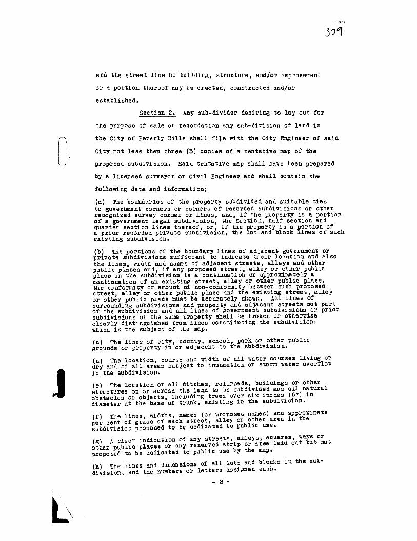
321
and the street line no building, structure, and/or improvement
or a portion thereof may be erected, constructed and/or
established.
Sect±on 2. y sub—divider desiring to lay out for
the purpose of sale or recordation any sub—division or land in
fl the City of Beverly Hills shall fi’e with the City Engineer of said
City not less than three (3) copies of a tentative map of the
proposed subdivision. Said tentative map shall have been prepared
by a licensed surveyor or Civil Engineer and shall contain the
following data and information;
(a) The boundaries of the property subdivided and suitable tiesto government corners or corners of recorded subdivisions or otherrecognized survey corner or lines, and, if the property Is a portionof a government legal subdivision, the Section, half section andquarter section lines thereof, or, if the property is a portion ofa prior recorded private subdivision, the lot and block lines of suchexisting subdivision.
(b) The portions of the boundry lines of adjacent government orprivate subdivisions snfficieut to indicate their location and alsothe lines, width and names of adjacent streets, alleys and otherpublic places and, if any proposed street, alley or other publicplace in the subdivision is a continuation or appro.mately acontinuation of an. existing street, alley or other public place,the conformity or amount of non-conformity between such proposedstreet, alley or other public place and the e.sting street, alleyor other public place must be accurately shown. AU lines ofsurrounding subdivisions and property and adjacent streets not partof the subdivision and all lines of government subdivisions or priorsubdivisions of the same pxperty shall be broken or otherwiseclearly distinguished from lines constituting the subdivision:
which is the subject of the map.
Cc) The lines of city, county, school, p4rk or other public
grounds or property in or adjacent to the sbbdivision.
(a) The location, course anc width of all water courses living or
dry and of all areas subject to inundation or storii water overflow
Jin the subdivision.
(e) The location of all ditches, railroads, buildings or other
structures on or across the land to be subdivided an.d all natural
obstacles or objects, including trees over six indies (6”) in
diameter at the base of trunk, existing in the subdivision.
(fj The lines, widths, names (or proposed names) and approximate
per cent of grade of each street, alley or other area in the
subdivision proposed to be dedicated to public use.
fg) A clear indication of any streets, alleys, squares, ways or
other public nlaces or any reserved strip or area lai out but not
proposed to be dedicated to public use by the map.
(Ii) The lines and dimensions of all lots and blocks in the sub
division, and the numbers or letters assigned each.
-2-

fi) The location and description by sy7nbol of all monuments orstakes set in the subdivision.
fd) The radius and beginning and ending of each curve, withcustomary curve data and the degrees in. each angle except thatright angles need be indicated only at block corners or othergoverning points.
(k) All dimensions linear and angular necessary to locateboundaries of the subdivision, lots, blocks1 streets, alleys andother lines or parts of the subdivision.
(1) Dotted lines showing easements for public utilities, drainageand other public uses.
(in) Plan and easements for drainage end for handling storm waters.
fu) Indication of any other lines, restrictions or ei.stingnatural or artificial conditions in the subdivision affecting theuse of the property for subdivision purposes.
fo) North point with basis of bearing.
(p) Scale of the map, which shall be one hundred feet (100’) or1e55 to the inch, provided, that in acreage subdivisions wherelots are one—half (1/2) acre or more in area, the scale may betwo hundred feet (200’) to the inch. If necessary to provide theproper scale, more than one sheet may be used, but the relationof the several sheets must be clearly shown on each, and, if morethan tour (4) sheets are used, a key map must be filed therewith.
fq) Date of survey and ante of map.
fr) The name, title and tract number under which the sub—division
map is to be recorded.
(s) Legal description of the property contained in the subdivisions
ft) tre name of the owner or subdivider and of the engineer Or
surveyor preparing the mar and the name and address of the person
to whom notices of the approval or disapproval 01’ the map and other
notices are to be sent.
fu) Contour lines referring to City datum in all cases where the
slope of the land in the subdivision, or any part thereof, is one
percent (1%) or more. The contour intervals shall be indicated on
the map and shall be such distance, not more than five feet (s’),
as
fully to show the configuration of the land and any and all
depressions which present a drainage problem. Such contour lines
may be shown on a separate map attached to and made a part of the
tentative map.
fv) A profile of each street in the subdivision showing among
other necessary data the gutter grades. Such profile may be shown
on a separate sheet attached to and made a part of the tentative
map.
Before said tentative map may be ccepted by the City
council, each copy thereof shall have been certified to by the City
Engineer as to its compliance with the above specifications and a
tract number or name shall have been secured from the County
Surveyor of Los Angeles County. Such aaditional maps as may be

required by the City Council or the City Engineer shall be filed
by the sub—divider at the time of presenting a tentative map for
approval
At the time of tiling such tentative map, the sub
divider shall rile therewith a statement as to the.general
character of improvements which he proposed to make on the streets
in said proposea sub—division, such as trees, ornamental lighting‘ ) system, sidewalks, curbs, paving, conduits and public utilities,
mains and ser’ie.
Section 3. The City Council shall not take action on
any tentative map until a report has been received from the City
Engineer, unless more than Litteen (15) days have elapsed since the
map was first filed. In the approval of tentative maps, the City
Council shall require as a condition of approval and shall enumerate
the changes necessary to conform to the following regulations.
(a) STREETS
1. The width and ailgbment of all primary and secondary
streets shall conform to those streets already existing in the City
of Beverly Hills adjacent to said sub-division, and to the require
ments of the City Council, and shall conform to any proceeding
affecting the sub-division which may have been initiated by the
Council or approved by said Council, upon initiation by other
legally
constituted bodies of the County or State.
. All streets as rar as practicable shall be required to be
in alignment with existing adjacent streets or their proper
projection and in general conformity with the general street plan
of the City, provided that in cases where the holdings are large
enough, a modified curved street layout may be required or permitted
nrovided such a layout will not interfere with the general street
plan and that all boundary connections are made satisfactorily.
3. A ijinimum width of sixty feet (601) between property lines
shall be maintained on all 11j streets unless it can be definitely
-4-

shown that topography or local conditions will not Dermit such awidth or that a lesser width is more suitable.
4. The width of streets or roads on hillside ormountainous land shall be determined by expected future traffic
needs
and topographical conditions and the decision of the City
Council thereon shall be conclusive. All mountainous highways
which form a part of primary or secondary traffic routes shall
have a minimum width of forty feet (40’) between property lines
but shall be made wider on curves where the topography will permit.Other mountainous roads Of more than frontage importenee shall have
a minimum width of thirty feet (30’) between property lines. These
widths shall be approved only where the Council, in the exercise
of reasonable discretion, determines that the cross slope will not
permit of a greater width.
5. The rate of grades of all streets shall be kept as
low as possible, bearing in mind the advantageous development or the
property. Streets of more than local importance shall not exceed a
maximum grade of ten percent C 10%) and no street shall be approved
with a maximum grade in excess of fifteen percent (15%) unless
by special permission of the Council.
6. A minimum center line radius of fifty feet (50’)
shall be maintained on all winding mountainous streets, while a
minimum
of three hundred feet fOO’) shall be required on all
through traffic stzees. xzxxi Streets of less than thirty feet
(30’) in width shall be widened to a thirty-foot (30’) width when
the center line radius is the minimum or near the minimum. Street
intersections shall be as nearly at right angles as possible, and
care shall be taken in laying out intersections that adequate, but
not excessive area is offered for dedication. Grades of
streets leading into through streets from above shall be reducea
as much as practicable near the intersection.
—5—

‘7 At all block corners, rounding or cutting back
at the property lines shall be required. The intersection corners
on all primary and secondary streets shall be rounded by twenty-
Loot (20’) radii on property line; nil other corners shall be
rounded by ten—toot (l0’) radii on property line. Where business
development
is anticipated, in order to simplify building
construction, an optional method of a diagonal cutoff substantially
equivalent may be used, instead of rounding.
8. Private streets, alleys or ways shall not be
approved.
(b) ALLEY8
1. Alleys twenty feet (20’) in width shall be required
at the rate oL lots fronting on primary or secondary streets and
at the rear of all lots shown as business property on the Zone PLap,
such alleys to be at a minimum distance of one hundred twenty feet
(120’) from such streets, except where the property between such
alley and such street is zoned for business purposes; and provided,
further, that such alleys shqll be laid out in a manner that does
not interfere more than necessary with traffic on the principal
streets adjacent to such block. AU alleys other than those
mentioned above shall have a minimum width of twenty feet (20’)
and shall be required at the rear of all lots except where the
topography makes them impracticable. When two (2) alleys intersect,
the
intersecting corners shall be cut back or rounded in a manner
satisfactory to the City Engineer.
Where alleys are not provided at the rear of lots,
easements for water pipes, gas pipes, heat pipes, storm and sanitary
sewer pipes and man holes, telephone, electric and signal lines
and such other public utilities as may come into use shall be
dedicated not less than ten feet (10’) in width or five feet (5’)
on each side of all rear lot lines and side lot lines where
necessary to reach existing pipes, mains and lines, or, in their
—6—

absence1 proposed pipes) mains and lines; provided, that in all
cases the proposed right—of—way must avoid entering or crossing
streets wherever possible.
(c) LOTS
L.
The City oI’ Beverly Hills shall be divided into
three (5) zones) to—wit:
NOB1ELY ZONE
The Northerly zone shall consist or all property lying
between Sunset Boulevard and the Northerly boundary of said City.
The lots in that zone shall in ail subdivisions conform with present
adjacent and existing contiguous lots, blocks and subdivisions and
use of property and all conditions shall be subject to the approval
of the City Council.
SOUflLY ZONE
The Southerly zone shall consist cf all lots lying
southerly ci’ the northerly line of Santa Monica Boulevard and/or
Wilshire Boulevard, together with @1 lots fronting on Doheny D;iVe,
and such lots shall have a minimum frontage width of fifty feet
t50’) and a minimum area of six thousand (6,000) square feet except
in circular or irregular blooks in which case the area may wary at
the discretion of the city Council. Provided, however, that all
business lots ‘wherever situated shall have a minimum area of five
thousand
(5,000) square feet and residential income lots wbereyer
situated shall have a minimum frontage of fifty feet (50’) and a
minimum area ci seven thousand five bunured (7,50O) square feet.
CENTRAL ZONE
The Central zone shall consist of all of the remainder
ci’ the city of Beverly Hills.
2. Where lots adjoin primary or secondary streets,
they shall front on said streets, and on local sreets, all lots
shall front upon the streets which parallel the 1oz dimension of
—7—

3ac
the block. Key lots shall not be permitted unless it can be
deTinitely established that they cannot be avoided.
3. The side lot lines of all rectangular lots end
all other lots so tar as possible shall be at right angles to the
street on which the lot fronts. Double frontage lots shall not
be approved unless conditions are shown which, in the reasonable
exercise of judgment or the Council, show that such double front
age lots cannot be avoided.
4. There parcels of land are sub-divided into larger
lots than building lots (acre farms or larger), such parcels shall
be divided so as to allow for the opening and ultimate extension of
adjacent local streets. Where parcels are so divided1 each lot
indicated shall be of such size and shape to permit any individual
owner to re-subdivide, giving each lot legal aCcess, independent of
the adjoining owners.
(d) BLOCES
Blocks over six hundred sixty feet (660’) are not
desirable anã shall not be approved except where the topography
or other special conditions make it imperative in the reasonable
judgment or the Council to provide longer blocks. In every case
where blocks of more than nine hundred feet (900’) are platted
for residential development, they shall be broken near the center
by
a ten foot (10’) walkway. No.walkway shall be approved which has
a grade exceeding thirty percent (50%).
(a) DEAINAG
In all sub—divisions, the lay-out of streets, alleys,
lots and easements must be such as to provide for sanitary sewer
and drainage in a manner satisfactory to the City Engineer, and
where construction is considered necessary to care for such
drainage, said construction must be guaranteed by a bond satisfactory
to the City Attorney.
(t) BUILDING LINES
Front line set—backs shall be required whenever the
-8-
4

City Council, in the exercise of sound judgment, determines that
the public health, safety, convenience ahd general welfare will be
conserved or furthered by such requirements. The same may also
be required in lieu of street widenings. When required, such
building lines shall be indicated on the map at the distance from
the
street lines as specified.
(g) STREET NAMES
Any street which is a prolongation or approximately
a prolongation of an existing street shall be given the same name;
otherwise no street shall be designated by the same name us that
borne by any other street in the city irrespective of the use of the
suffix “street”, “avenue”, “boulevard”, “drive”, “way”, “place”,
“court”, or other similar term. The City Engineer shall have power
to suggest to the Council and the Council shall have power to change
the name of any street shown on a subdivision map, or to designate
a name where no name is shown.
fh) DEDICATIONS
Every street, alley or other public place shown on any
sub-division map of land within the City shall be dedicated to the
City when such dedication is deemed necessary by the City Council
for the public use, but this shall not be construed as an acceptance
of any such dedication.
Reserve strips of land controlling access to or egress
frog
other property or to or from any street or alley or having the
effect of restricting or damaging the adjoining property for sub
division purposes or which will not be taxable or assessable for
special improvements shail not be permitted in any subdivision
unless such reserve strips are conveyed to the city.
Ci) EXCEP1IONS
It is realized that certain parcels of land exist of
such size, subject to such title restrictions, so affected by
topographical location, and devoted to such usage, that it is
impossible for the owner to conform to the above rules and
—9—
_______________--------
—

regulations when sub-dividing. Exceptions may be granted in suck
cases only when the City Council shall, in the exercise of sound,
reasonable judgment, determine that condition.s affecting the
property in question warrant and require such exceptions,
provided1 however, that no exceptions may be made to any require
ments, imposed by Chapter 637 of the Statutes of 1929 of the
State of California, approved June 1?, 1929, as it is now or may
hereafter be amended. The fact that any requirement is made by
the City Council, or that any sub-division map is approved by
the Council with enumerated changes or without change shall be
conclusive evidence that the Council has considered and has made
the necessary findings supporting such map or requirements.
Section 6. In the event that the Council’s action is
for disapproval, the grounds for suck disapproval shall be stated
and the sub-divider and the City ngineer notified of such action,
and the file returned to the City Engineer.
No final map of said tract shall be accepted for check
by the City Engineer until the Council’s action on said tentative
map shall have been received by him, and then only in the event
that said final map shall conform to the Council’s action thereon.
Section 5. Within one (1) year after the return of
the tentative map to the sub4divider, or at a later date fixed by
mutual
agreement between the City Couhcil and the sub—divider, the
sub-divider shall, after having had completed a careful and correct
survey leaving such permanent monuments as may be required by the
city Engineer, file with sale City Engineer one (1) original on
tracing cloth and three (3) prints of the viual sub—division map,
otherwise all proceedings shall automatically terminate and a new
tentative map shall be submitted. The City Engineer shall refuse
to accept any final map which does not conform to all the provisions
of Chapter 637 of the Statutes of 1929 of the State of California
as it is now or hereafter may be amended, and to the conditions of
— 10 —
a

tentative approval, upon which center line data has not been
indicated, accompanied by the following;
(a) A statement that all taxes payable on all
property within the limits of the tract are paid in full and an
adequate tax bond, when such tax bond is required by the City
Engineer;
(b) A dedicatin letter dedicating all streets,
alleys, public improvements and utilities to the City of Beverly
Hills,
fc) Traverse sheets showing all blocks closing
mathematically within the limits of the tract, said traverse to be
made both on center lines and property lines.
(d) A receipt for the payment of all special assess
ments which may be paid in full and to which the sub—division is
subject, or a letter from the City Engineer stating that in lieu
of such payment, the sub—divider has filed with said City Engineer
a surety bond insuring the payment of all interest and principal
payments for a period of five (5) years from the date of said bond,
and furthermore, insuring the payment of the outstanding principal
in full within five (5) years from said date.
fe) A bond in the amount of one hundred percent (100%)
of the cost of all proposed street improvements as estimated by the
City Engineer, which bond shall expressly state the kind and
character
of improvements which the Contractor proposes to make
and the time within which such improvements shall be made, that is,
as to street paving, curbs, sidewalks, sewels, trees, ornamental
lighting systems and public utility instailationa, which bond shall
be conditioned on the faithful performance of such work and shall
stipulate that judaent may be had thereon as providea in Chapter
837 of the Statutes of 1959 of the Stte of California, as the same
may now or hereafter be amended; also a bond for labor and material
in the amount of fifty percent (50%) of the estimated cost.
-U-

ill said street inmrovements in any subdivision
shall be made in accordance with the standard specifications for
such improvements on file in the office of the City Engineer, and
in accordance with the requirements of the City Engineer and City
Council.
The
City Engineer shall check the final map e.nã when
satisfied that all the conditions of tentative approval imposed by
the City Council have been satisfactorily met: that all of the
provisions of Chapter 657 of the Statutes of 1929 of the State of
California, as it Is now or mai hereafter be amended have been
complied with and that all center line data monuments, survey
data and mathematical data and computations are correctly and
satisfactorily indicated on the map and on the ground shall within
fourteen (14) days a’ter the filing of said final map and other
required information and data, certify to its correctness thereon
and transmit ±t together with such other information end recommend
ations as deemed necessary to the City Council, or shalireturn said
map to the sub—divider, together with a statement setting forth the
grounds for its disapproval and the necessary steps to make it
acceptable. If said City Council approves said final map, it shall
return the map to the City Engineer, who shall, in turn, transmit it
to the County ecorder of Los Angeles County for recordation. If
the map i disapproved by the City Council, it shall be returned‘ with the reasons for such disapproval to the City Engineer, who shall
return the same to the sub-divider.
Nothing contained in this section shall be construed
as prohibiting any sub—divider from filing such a bond as
described in Sub—section (ci) hereof.
Section 6. If any section, sub—section, sentence,
clause or phrase of this Ordinance is, for any reason, held to be
invalid or unconstitutional by the decision of any Court of
competent jurisdiction, such decision shall not affect the validity
-12-

of the remaining portions of the Ordinance. The Council 0± the
City of Beverly Hills hereby declares that it would have passed
this Ordinance, and each section, sub—section, sentence, clause
and phrase thereoi irrespective of the fact that any one or more
other sections, sub—sections, clauses or phrases be declares
invalid or unconstitutional.
j Section 7. The City Clerk shall certify to the
passage and adottion of this Ordinance, and to its approval by the
City Council and shall cause the same to be published once in the
Beverly Hills Citizen, a newspaper of general circulation, printed,
published and circulated in said City of Beverly Hills, and thirty
(30) days after the passage and adoption hereof, this Ordinance
shall be in full force and effect. The City Clerk shall,
immediately upon the adoption of this Ordinance, record a certified
copy hereof in the office of the County Recorder of the County of
Los Angeles, State of California.
Adopted and approved this 16th day of February , 1952.
Mayor o1 the City ofBeverly Hills, California.
er
I

Attachment 13Ordinance No. 503

ORDINANCE NO. 5
AN ORDINANCE RElATING TO SUBDIVISIONSAND REPEALING ALL ORDINANCES IN CONFLICT ThERE?!ITH
The City Council of the Cit7 of Beverly Hills does ordain
as
follows:
Section 1. For the purpose of this ordinance, certain terms
used herein are defined as follows:
AU words used in the present tense shall include the future;
all words of the plural number shall include the singular number; and
aU words used in the singular number shall include the plural number,
unless otherwise expressly specified herein.
All words and t erms used herein which are defined in the
Subdivision Map Act, Chapter 670, Statutes of l97, page 1863, et seq,
of the State of California, as amended, shall have the same meaiing
as therein defined, except as herein specifically defined.
“Council” shall mean the City Council of the City of
Beverly Bills.
“Street width” is defined as the distance between property
lines.
“Primary street” shall mean any thoroughfare of an existing
or intended one hundred foot (100’) width between property lines,
including therein the sidewalk, if any, or any greater width or its
equivalent width in traffic carrying capacity when shown as such
thoroughfare
on the official street plans of the City.
“Secondary street” shall mean any thoroughfare which is not
a primary street as above defined, but which exists or is intended
for through traffic carrying purposes and which is shown as such
thoroughfare on an official plan of the City or on any proposed street
plan of a proposed subdivision filed with the City, but which is not
less than sixty (60) feet in width between property lines.
“Key lot” shall mean the first lot to the rear of a corner
lot, the front line of which is a continuation of the side line of
the corner lot and which key lot fronts on the street which intersects
the street upon which the corner lot fronts.

603
“Building line” shall mean a line between which line and the
street line no building, structure, and/or improvement, or a portion
thereof, may be erected, constructed, and/or established.
Section 2. Any subdivider desiring to lay out for the purpose
of
sale or recordation any subdivision of land in the City of Beverly
Hills shall file with the City Engineer of said City not less than
three (3) copies of a tentative map of the proposed subdivision. Said
tentative map shall have been prepared by a licensed surveyor or Civil
Engineer and shall contain the following data and information:
A) The boundaries of the property subdivided and suitable ties
to government corners or corners of recorded subdivisions or other
recognized survey corner or lines; and, if the property is a portion of
a government legal subdivision, the Section, half—section, and quarter-
section lines thereof; or, if the property is a portion of a prior
recorded private subdivision, the lot and block lines of such existing
subdivision.
B) The portions of the boundary lines of adjacent government or
private subdivision sufficient to indicate their location and also the
lines, width, and names of adjacent streets, alleys, and other public
places and, if any proposed street, alley, or other public place in the
subdivision is a continuation or approximately a continuation of an
existing street, alley, or other public place, the conformity or degree
of non-conformity between such proposed street, alley, or other public
place
and the existing street, alley, or other public place must be
accurately a hown. All lines of surrounding subdivisions and property
and adjacent streets not part of the subdivision and all lines of
government subdivision or prior subdivisions of the same property shall
be broken or otherwise clearly distinguished from lines constituting
the subdivision which is the sub3ect of the map.
(C) The lines of city, county, school, park, or other public grounds
or property in or adjacent to the subdivision.
-2—

ö 03
CD) The location, course, and width of all water courses, living
or dry, and of all areas subject to inundation or storm water overflow
in the subdivision.
CE) The location of all ditches, railroads, buildings, or other
structures on or across the land to be subdivided and nfl natural
obstacles
or objects, including trees over six inches f6It) in diameter
at the base of trunk, existing in the subdivision.
C F) The lines, widths, names (or proposed names) and approximate
per cent of grade of each street, alley, or other area in the sub
division proposed to be dedicated to public use.
(G) A clear indication of ay streets, alleys, squares, ways, or
other public places, or any reserved strip or area laid out but not
proposed to be dedicated to public use by the map.
(H) The lines and dimensions of all lots and blocks in the sub
division, and the numbers or letters assigned each.
(I) The location and description by symbol of all monuments or
stakes set in the subdivision.
(J) The radius and beginning and ending of each curve, with cust
omary curve data and the degrees in each angle except that right angles
need be indicated only at block corners or other governing points.
(K) All dimensions linear and angular necessary to locate boundar
ies of the subdivision, lots, blocks, streets, alleys, and other lines
or parts of the subdivision.
CL) Dotted lines showing easements for public utilities, drainage,
and
other public uses.
(M) Plan and easements for drainage and for drains for handling
storm waters.
tN) Indications of any other lines, restrictions, or existing
natural or artificial conditions in the subdivision affecting the use
of the property for subdivision purposes.
(0) North point with base of bearing.
C?) Scale of the map, ich shall be one inch (1”) to one hundred
(100’) feet, or less, provided that in acreage subdivision where lots
are one-half (1/2) acre or more in area, the scale may be one inch
-5-

-503 q
(1”) to two hundred feet (200’). If necessary to provide the proper
scale, more than one sheet may be used, but the relation of the several
sheets must be clearly shown on each, and if more than four (4) sheets
are used, a key map must be filed therewith.
Q) Date of survey and date of map.
(R)
The name, title, and tract number under which the subdivision
map is to be recorded.
Cs) Legal description of the property contained in the subdivision.
CT) The name of the owner or subdivider and of the engineer or
surveyor preparing the map and the name and address of the person to
whom notices of the approval or disapproval of the map and other
notices are to be sent.
(U) Contour lines referring to City datum in all cases where the
slope of the land in the sdivision, or any part thereof, is one per
cent (1%) or more. The contour intervals shall be indicated on the
map and shall be such distance, not more than five feet (5’), as
fully to show the configuration of the land and any and all depressions
which present a drainage problem. Such contour lines may be shown on
a separate map attached to and made a part of the tentative map;
provided that if as much as fifty (50) square feet ofany lot in any
proposed subdivision shall have been flUed as much as eighteen (18)
inches above the natural surface, such fill shall be Indicated by
contour lines or other legible manner on the tentative map of such
subdivision or upon a special map attached thereto.
(V)
p. profile of each street in the subdivision showing among
other necessary data the gutter grades. Such profile may be shown on
a separate sheet attached to and made a part of the tentative map.
Before said tentative map may be accepted by the City Council,
each copy thereof shall have been certified to by the City Engineer as
to its complaince with the above specifications, and a tract number or
name shall have been secured from the County Surveyor of Lee Angeles
County. Such additional maps as may be required by the City Council
or the City Engineer shall be filed by the subdivider at the time of
presenting a tentative map for approval.
-4-

,4;; q
At the time of filing such tentative map, the subdivider
shall file therewith a statement as to the general character of im
provements which lie proposes to make on the streets in said proposed
subdivision1 such as trees, ornamental lighting system, sidewalks,
curbs, paving, conduits, and public utilities, mains and services,
and
shall indicate the set-back line applicable to each lot therein.
Section 3. The City Council shall not take action on any
tentative map until a report has been received from the City 2ngineer,
unless more than fifteen (15) days have elapsed since the map was
first filed. In the approval of tentative maps, the Cit7 Council
shall require a a a condition of approval any changes necessary to
produce conformity with the requirements of this ordinance.
A) STREETS
1. The width and alignment of all primary and secondmy
otreets shall conform to the width and alignment of those streets
already existing in the City of Beverly Hills adjacent to said sub
division and to the requirements of the City Council in conformity
therewith or subsidiary thereto, and shall conform to any proceeding
affectin6 the subdivision which may have been initiated by the Council,
or approved by said Council upon initiation by other legally constituted
bodies of the County or State, unless by action of said. Council and
such other bodies a different width and allfgnment shall be approved.
2. All streets as far as practicable shall be required to be
in alignment with existing adjacent streets or their proper pro-
jection
and in general conformity with the general a treet plan of the
City; provided that in cases where the holdings are large enough, a
modified curved street layout may be required or permitted in the
event that such a layout will not interfere with the general street
plan and that all boundary connections are made satisfactorily.
3. A minimum width of sixty feet (60’) between property lines
shall be maintained on all streets unless it can be definitely shown
that topography or local conditions will not permit such a width or
that a lesser width is more suitable.
-5—

O3
4. The width of streets or roads on hillside or mountainous
land shall be determined by expected future traffic needs and topo
graphical conditions and the decision of the City Council thereon,
after investigation and hearing, shall be conclusive. All mountain
Qua highways which form a part of primary or secondary traffic routes
shall have a minimum width of forty (40’) feet between property lines
but shall be made wider on curves where thø topography will permit.
Other mountainous roads of more than local importance shall h ave a
minimum width of thirty feet (50’) between property lines. These
widths shall be approved only where the Council, in the exercise of
reasonable discretion, determines that the topography will not permit
of a greater width.
5, The rate of grades of all streets shall be kept as low as
possible, bearing in mind the advantageous development of the sub
division and surrounding property, Streets of more than local im
portance shall not exceed a maximum grade of eight per cent (8%),
and no street shall be approved with a maximum grade in excess of
twelve per cent (12%) unless by special permission of the Council.
6. A minimum center line radius of fifty feet (50’) shall be
maintained an all winding mountainous streets, and a minimum of three
hundred feet (300’) shall be required on all through traffic streets.
Existing streets of less than thirty feet (50’) in width shall be
widened to a thirty-foot (50’) width when the center line radius is
the minimum or near the minimum. Street intersections shall be as‘ nearly at right angles as possible; and care shall be taken in laying
out intersections that adequate, but not excessive area, is offered
for dedication. Grades of streets leading into through streets from
above shall be reduced as much as practicable near the intersection.
7. At all block corners, rounding or cutting back at the pro
perty lines shall be required. The intersecting corners on all pri
mary and secondary streets shall be rounded by a curve whose radius
of curvature is at least twenty feet (20’) on the property line; all
other corners shall be rounded by curves whose radii of the curvature
are at least ten feet (10’) on the property line. Where business
—6—

- I
EOS 1
development is anticipated, an optional method of a diagonal cutoff
substantially equivalent may be used instead of rounding, in order
to simplify building construction.
8. Private streets, alleys, or ways shall not be approved,‘ except where the City Council, after investigation and hearing,
finds that public dedication is impractical. All alleys and private
streets shall be paved and approved the same as public alleys or
streets.
(3) ALLEYS
1. Alleys twenty feet (20’) in width shall be required at the
rear of lots fronting on primary or secondary streets and at the rear
of all lots shown as business property; and provided further that such
alleys shall be laid out in a manner which will not cause greater
interference with traffic on the principal streets adjacent to such
block than is necessary. All alleys other than those mentioned above
shall have a minimum width of twenty feet (20’) and shall be required
at the rear of all lots except where the topography makes them im
practicable. When two (2) alleys intersect, the intersecting corners
shall be cut back or rounded, if practicable, in a manner satis
factory to the City Engineer, to facilitate the movement of trucks.
Where alleys are not provided at the rear of lots and it is
or may become necessary to have easements to reach existing pipes,
mains, and lines, or proposed pipes, mains, or lines, such easements
shall be dedicated and shall be not less than ten feet (10’) in width.
All
rights of way and easements shall avoid entering or crossing
streets whenever possible.
(C) LOTS
1. The Cit7 of Beverly Hills for the purposes of this ordin
ance shall be divided into three (3) zones, to-wit: The Northerly
Zone shall consist of all property lying between Sunset Boulevard
and the northerly boundary of said City. The lots in that zone shall
in all subdivisions conform with present adjacent and nearby lots,
blocks, and subdivisions, and use of property, and all conditions
shall be in general conformity therewith so far as practicable, and
—7—

603
shall be subject to the approval of the Cit7 Council. The Southerly
Zone shall consist of all lots lying southerly of the northerly line
of Santa Monica Boulevard and/or Wilshire Boulevard, together with all
lots fronting on Doheny Drive; and such lots shall have a minimum
frontage
width of fifty feet (50’) and a minimum area of six thousand
(6,000) square feet, except in circular or irregular blocks, in which
case the area may vary, but shall be of such area as nearly as possible,
at the discretion of the City Councili provided, however, that all
business lots wherever situated shallave a minimum area of five
thousand (5,000) square feet4 and residential income lots wherever sit
uated shall have a minimum frontage of fifty feet (50’) and a minimum
area of seven thousand five hundred (7,500) square feet. The Central
Zone shall consist of all of the remainder of the City of Beverly Hills.
2. Where lots adjoin primary or secondary streets, they shall
front on said streets; and on local streets all lots shail front upon
the streets which parallel the long dimension of the block. Key lots
shall not be permitted unless it can be definitely established that
they cannot be avoided.
3. The side lot lines of all rectangular lots and all other
lots so far as possible shall be at right angles to the street on which
the lot fronts. Double frontage lots shall not be approved unless
conditions exist which, in the reasonable exercise of judgment of the
Council, show that such double frontage lots cannot be avoided if the
dimensions set forth in paragraph 2 of subsection 1 of this Section
are
to be secured for the majority of the other lots in the subdivision.
4. Where parcels of land are subdivided into larger lots than
building lots (acre farms or larger), such parcels shall be divided
so as to allow for the opening and ultimate extension of adjacent local
streeta. Where parcels are so divided, each lot indicated shall be of
such size and shape to permit any individual owner to resubdivide,
giving each lot legal size, shape, and access, independent of the
adjointing owners.
-6—

3 I
fD) BLOCKS
Blocks over six hundred-sixty (660’) feet are not desirable
and shall not be approved except where the topography or other special
conditions make it iiriperative, in the reasonable Judgment of the
Council,
to provide longer blocks. In every case where blocks of
more than nine hundred feet (900’) are platted for residential develop
ment, they shall be broken ne the center by a ten foot (10’) walkway.
No walkway shall be approved which has a grade exceeding thirty per
cent (30%).
fE) DRAINAGE
In all subdivisions the layout of streets, alleys, lots, and
easements must be such as to provide for sanitary sewers and storm
drainage in conformity with good engineering practice, in a manner
satisfactory to the City Engineer; and where construction is considered
necessary to care for such drainage, said construction must be guar
anteed by a bond satisfactory to the City Attorney.
(F) BTJU4DING LINES
Front line set backs shall be required whenever the City
Council, in the exercise of sound Judgment, determines that the public
health, safety, convenience, and general welfare will be conserved or
furthered by such requirements. The same may also be required in
lieu of street widonIngs. When required, such building lines shall be
indicated on the map at the distance from the street lines as specified.
The requirement by the Council of such set-back line shall be evidence
that
the Council has investigated and made a finding supporting such
decision.
(G) STREET NAMES
Any street which is a prolongation or approximately a pro
longation of an existing street shall be given the same name; otherwise,
no street shall be designated by the same name as that borne by any
other street in the City irrespective of the use of any suffix, such
as “street,” “drive,” liway,U “place,” “court,”
or other similar term. The City Engineer shall have power to suggest
to the Council and the Council shall have power to change the name of
any street shown on a subdivision map or to designate a name where no
name is shown. -9—

(H) DEDICATIONS
Every street, alley, or other public place shown on any sub
division map of land within the City shall be dedicated to the City
when such dedication is deemed necessary by the City Council for the
public
use, but this shall not be construed as an acceptance of any
such dedication until such dedication is rormauy accepted by resolution
of the City Council.
Reserved strips of land controlling access to or egress from
other property,or to or from any street or alloy,or having the effect
of restricting or damaging the adjoining property for subdivision
purposes, or which will not be taxable or assessable for special im
provements shall not be permitted in any subdivision unless such
reserved strips are conveyed to the City.
(I) EXCEPTIONS
It is realized that certain parcels of land exist of such
size, subject to such title restrictions, so affected by topographi
cal location, and devoted to such usage, that it is practically im
possible for the owner to conform to the above rules and rsgulations
in every respect when subdividing. Exceptions may be granted in such
cases only when the City Council shall, in the exercise of sound,
reasonable judnent, after investigation and hearing with the sub
divider, determine that conditions affecting the property in question
warrant and require such exceptions; provided, however, that no ex
ceptions may be made to any requirements imposed by laws of the
State
of California as they are now or as hereafter amended. The fact
that any subdivision map is approved by the Council with enumerated
changes or without change shall be conclusive evidence that the
Council has considered such map and has made the necessary findings
supporting such map.
Section 4. In the event that the Council’s action is for
disapproval, the grounds for such disapproval shall be stated and the
subdivider and the City Engineer notified of such action, and the file
returned to the City Engineer. The fact of such disapproval shall
-10-

O3
be conclusive evidence that the Council has considered the proposed
map and has madE the necessary findings supporting its disapproval.
No final map of said tract shall be accepted for check by
the City Engineer until the Councile action on said tentative map
shall
have been received by him, and then only in the event that said
final trap shall conform to the Council’s action thereon.
Section 5. Within one (1) year after the return of the
tentative map to the subdivider, or at a later date fixed by mutual
agreement between the City Council and the subdivider, the subdivider
shall, after having had completed a careful and correct survey leaving
such permanent nonuments as may be required by the City Engineer, file
with said City Engineer one (1) 6riginal on tracing cloth and three
(3) prints of the final subdivision map; otherwise, all proceedings
shall automatically terminate and a new tentative map shall be submitted
The City Engineor shall refuse to accept any final map which does not
conform to all the provisions of law of the State of California as it
is now or as hereafter amended, and to the conditions of tentative
approval by the City Engineer or which is not accompanied by the fol
lowing:
a) A stateaent that all taxes payable on all property within
the limits of the tract are paid in full, or a letter from the Clerk
of the Board o Supervisors stating that a satisfactory bond has been
filed to secure such payment.
(b) A dedication letter dedicating all streets, alleys,public
improvements and utilities and easement rights to the City of
Beverly Hills.
(c) Traverse sheets chewing all parcels closing mathematically
within the limits of the tract, saidtraverse to be made both on
center lines and property lines.
Cd) Proof o the payment of all special assessments which may be
paid in full and to which the subdivision is subject, or a letter
from the Clerk of the Board of Supervisors stating that in lieu of
such paynEnt, the subdivider has filed with said Board of Supervisors
—11—

a satisfactory surety bond insuring the payment of all interest and
principal payments for a period of five (5) years from the date of
said bond, and further more, insuring the payment of the outstanding
principal in full within five (5) years from said date.
Ce)
A satisfactory surety company bond in the amount of one
hundred per cent (100%) of the cost of all proposed street improve
ments as estimated by the City Engineer, which bond shall expressly
state the kind and character of improvements which the contractor
proposes to make and the time within which such improvements shall be
made; that is, as to street paving, curbs, sidewalks, sewers, trees,
ornamental lighting systems, and public utility installations, which
bond shall be conditioned on the faithful performance of such work
and shall stipulate that summary judgment may be had thereon as provided
by law as mow existing or as hereafter amended; also a bond for labor
and material in the amount of ftftyper cent (50%) of the estimated
cost; provided that a single combination bond in the amount of one
hundred per cent (100%) of both labor and material may be accepted.
All said street improvements in any subdivision shall be
made in accordance with the standard specifications for such un
provenents on file in the office of the City gineer and in accord
ance with the requirements of the City Engineer and City Council.
The City Engineer shall check the final map upon receipt,
and when satisfied that all the conditions of tentative approval
imposed by the City Council have been satisfactorily met; that all of
the provisions of laws of the State of California as they are now or
may hereafter be amended have been complied with; and that all
center line date monuments, survey data and mathematical data and
computations are correctly and satisfactorily indicated on the map
and on the ground, shall within thirty (30) days alter the filing by
the subdivider of said final map and other required information and
date, certify to its correctness thereon and transmit it, together
with such other information and recommendations as deemed necessary
to the City Council, or shall return said map to the subdivider,
-12-

o81
together with a statement setting forth the grounds for its
and the necessary steps to make it acceptable. If said City Co
approves said final map, it shall return the nap to the Clerk
Board of Supervisors of Los Angeles County for recordatfon. I
map is disapproved by the City Council, ft shall be returnöd. w
the
reasons for such disapproval to the City Engineer, who
return the same to the subdivider, together with a statement in,
detail of the reasons for its return. The subdivider shall th
at his own option make such additions or corrections and take
action as necessary to overcome objections of the Council, as s€.
in the statement of the City Engineer, and resubmit to said City).1
Engineer for recheck and resubmission to the City Council in tbe
manner as in the first instance. Said nap shall thereafter be ac
upon as further set forth in this section. Nothing contained in t
section shall be construed as prohibiting any subdivider from f
such a bond as described in subsection fd) hereof.
Section 6. If any section, subsection, sentence, clause,
phrase of this ordinance is, for any reason, held to be invalid or
unconstitutional by the decision of any Court of competent juriediot”
such decision shall not affect the validity of the remaining portionq
of the ordinance. The Council of the City of Beverly Hills hereby
declares that it would have passed this ordinance and each section,
subsection, sentence, clause, and phrase thereof irrespective of
the fact that any one or more other sections, subsections, clauses,
or
phrases be declared invalid or unconstitutional.
Section 7. That Ordinance No. 329, entitled, “AN ORDINAN
PRESCRIBING RU S AND REGUIk TIONS GOVERNING ThE FILING AND APPROVAL
OF SUBDIVISIONS OF LPND IN AND ADJACENT TO TIlE CITY OF BEVERLY RThI
WHICH SAID ORDINANCE IS ADOPTED PURSUANT TO TIlE PROVISIONS OF
837 OF TEE STATUTES OF 1929 OF THE STATE OF CALIFORNIA, APPROVED
JU 17, 1929,” shall be, and it hereby is, repealed.
Section 8. The City Clerk shall certify to the passage
adoption of this ordinance, and to its approval by the City
and shall cause the same to be published once in the Beverly Rule
-13-
r
h.

6031
Citizen, a newspaper of general circulation, printed, published, and
circulated in said City of Beverly Hills, and thirty (30) days after
the passage and adoption hereof, this ordinance shall be in full force
and effect. The City Clerk, iimaediately upon the adoption of this
ordinance, shall transmit a certified copy hereof to the County Sur
veyor and shall record a certified copy hereof in the office of the
County Recorder of the County of Los Angeles, State of California.
Adopted and approved this t)- th” r 2ty, 1941
L!ayor of the Cicy Ø’ Beverly Hills,California
Attest:—
STATE OF CALIFORNIACOUNTY OF LOS ANGELES ) ssCITY OF BEVERLY HILLS
I, 3. J. FIRZINGHR, City Clerk of the City of Beverly Hills,
California, do hereby certify that the whole nuniber of members of
the City Council of the City of Beverly Hills is five, and that the
foregoing ordinance, being Ordinance No. DD:, was ãuly passed, ap
proved, and adopted by said City Council, approved and signed by the
1ayor, and attested by the City Clerk, all at a regular meeting of
the said Cit7 Council, held on the 2th d of , and that thesane was passed and adopted by the following vote, to-wit:
AYES: CD-llh Ck, Dentzcl tn
NOES: N.:i
ABSE.T: r;r’, “ ,
ity Clerk of tbVity ofBeverly Hills, California
(SEAL)
—14—

Attachment 14Ordinance No. 811

ORDINANCE NO.
_________
AN ORDINANCE AIEilDING CHAPTER X OF TilE LZVERLYHILLS MTmICI?AL CODE CONCERNLIG ZO::L:G AND SUBDIVISIONS BY ADDING SUBSECTION (5) TO SUBSECTION(c) SECTION 10-903 CONCERNING REQUIREMENTS FORAPPROVAL OF TENTATIVE StJBDIVISION .iPS
The City Council of the City of Beverly Hills does herebywdain as fo11ows
Section 1 That Chapter X of the Beverly Hills Municipalzde concerning zoning and subdivisions and particularly SectionD-9O3 thereof concerning requirements for approval of tentative
subdivision maps be, and the same hereby is amended by adding;bsection (5) to Subsection fc) of said Section 10-903 to readi fllotis:
“SEC. 10-903 SUBDIVISIONS TENTATIVE I.IAPS,IEUflEtNTS, FOR APPROVtiL OP
(c) LOTS
(5) Every lot in the northerly zone above referred to shall have at least approximately one hundred (100) feet of frontage on a public street andcontain at least approdmately 2O,0O square reet.Every such lot eIther i.n its e:Istin conditIon orao a part of the irprovements proposed by the subCivdcr an guaranteed by hio surety company tonshall contain a biIlding site of at least ap2roxi-nately 4000 square feet, no part of ‘:hich buildingSitO shall have a slope greater than one vertical infive horizontal feet. Every lot in the outhcrlzone above referred to shall have at least approit.,ately fifty (50) feet of frontac on a ulIc streetand contain at lca2t aroxiatal 7,500 square feet.very lot in tho central zone above referred to shallhave frontae of at least appro:cluately ninoty (so)feet uooi a public street and contain at least aproxitnatelr l3,0O) square feet. Every lot shall have aeth .in Its lor.est ciension of at least a,pro.matel, one hundred fifty (150) feet. The lots shallconform as near as practical to other lots in thevIclnit. The buildin site on each lot shall beThcated so far as possible to prevent the rear ortiono one lot from being adjacent to the front portion ofanother lot.
!henever the size o the parcel of land to be subdividcd, the street and &.lc frontages of such pa’olof land and the contour of such parcel of land, a:d itslocation With re’erence to surrounding propert are Quchthat tbe above reçuironeits wrk udte and unusual hardhi and a difcrent site and arrangement of the lots inthe propoSed subdivis!.on ;iould be beneficial to the futureomers of said lots and t.’ould not result ift undue detriment to surroundin property or rcodents thereof, the CityCouncil may init3 discreation approve a different sire andarranement of the lots ln said proposed subdivision.

1*— OS.. “
Ct.’ -. .
n:Is.-’ -“ — —
2;. 2,
-. -_ :2-..::c. v.
C
-
- - 1 ;;_ ;v:..
‘. c•
3_I t•.,..J
[..
3l
..C
c _,2- (... .L ..
p. - - . - i—i
3rL. Cr • ;.1 ..c-sr.... .. . ._1
c -
C C
I
bfll
2 Th
I. ‘
—
— -_-,‘.-
- ., C ..J ——
• ) .•
Section 2 The City Clerk shall certify to the passage
adoption of this ordinance and to its approval by the City
;ouncil, and shall cause the same to be published once in the
everly Hills Citizen, a neuspaper of general circulation, printed,
liahed and circulated in said City of Beverly Hills, and thirty
-s after the final passage and adoption, this ordinance shall be
full force and effect.
Adopted and approved this 9th day of Decn ber
9oaMayor of the City of BeverlyHills, California
- OP B_ -- }f
I, 3. 1. PDUIINGBR, City Clerk of the City or Beverly
tills, California, do hereby certify that the foregoing ordinance,
Ordinance No. ll , was passed by the City Council of said
y, signed by the Mayor and attested by the City Clerk all at a
egular meeting of the said Council1 held on the 9th day of
Dcember , 1952, and that the same was passed by the follow-
vote, to wit:
AYES:
NOES: None
GENT: None
C—.
Councilmen YicConnell, Fischer, George and Davis andNayor Tannenbaunt
$of tneci4?iyHills, Californ a
-2-

Attachment 15Tract Map No. 21360

SCALE r — lao
Barnett Hopen and SmithCivil Engine.r and Land San.yersAUGUST, 1955 V
/ 49,-e4 an//4c 40/ / a, o laneS Swv- of Me 5/mv ofCa/rfo,-n,g; /40/ /49 mo ,zc-4,ta, a’ 3 ,has%r, sor,oc-t/y ,‘‘sorniso trac moo’ comp/e% ,c’,-ve mVoo an49v my j/osV 4,
/R5S3 that /40 manomnbr of Mo na-oc-1m- and loan/ian, 40anas/I 49 inphaa I Joha than Sept4a l94 and that ,roid ,-
ann. suffic/an/ to anob4, the score4, to 49 iana/y te/,oc-d.a,,d that No 00/0.! /0 ,-4ne mancane0/a ,,ri%’ be on nb on MeF40 of the 0,4, Engnas,- not later then
V
/
V
/ hare4, cerf/4, that / ham osa,,,med this map; that it cunfors
3chs7onl/o//4, /0 the /,n/of/,’e mop and approved o/tasvlioo,, themof;
that oil pronn/on.r of app//cab/c jd,mjjo,, 0/000cc. of Moof Bono-4, MY/n have bonn camp/ha’ with and /40/ / as, ,ra//j ,9as’/49/ /h,s ,nsap 4, haflmco/’y sort.,,,’ ,v/M pe,00a’ /0 cY4’ ,,n.andc
•2yBog/now- ->4, 40or4’ hills
/ h.wy cw//4 that all 6Y1Of5’97/s /a’r/as/ wono€’ Mojcvhe*tMo
of the d/g of 49,w-’ Ni//s / ic-b/sb Me /and i/odeS thiha ,r/,’h/n
V
° aty pa-I thetca’ it su4iec/ and wh/c-h amy be puW
14 foil, have bee,, pa/I 4, f0//V
SHEET I OF S SHEETS
f//’
lYe bombq oerhfq /49/ cc am Me o.n.#a-, ‘ a— a-In land rnctoded as/bin 142 JaI5Mo on 4/c anna-ed map,r,tbrn the co/at.d ho,Wot /0099, 000’ ff9 000500/ Ia Mep,and rca-do//on olsad o’ap ond jubdws,n and hme% Wea/cohi 4,4,24, the pub/ic usa the Drive lane,,, Nido ad Road sham, an4,/s mop ff1/h/n sid wca/n,an. 40 Me/ha- an-t0/j /40/ exca/ an
On 0 Z004 of thi, mop an f//c i, 40 off/ce of/he i)4sof the City of Bevep,y H//Is, we know of no easemon,&ci.pVng as/hI,, the easame,,/, hm’vøy o4/.md for deayno//0,, 4,pvbhd use, a/he,- than pabhc/y eased sank- b,ses, onsw,, a-mi,,.,that we mU mnt no rgh/ or ,nleta-t c/Ibm Me boandor,c-.., a’ jail‘ozreman/s ofbi-ed 4, the pub/N a-co.p/ ohm-a such ,,h/ a- ,nbna-t/3 c/Dress/f moa4° svbject /0 jo/I- r09,90/n We 0/so gra,# and ck-a4,lb 49 c-iiy ofBean7 Hi//s perpoloal easements 49- sani*o.-y san, ,n/O, /05s
and dnowao ponone. oven the Strips of/and so o’espnakd on 501dm/a .540,,said Subd.’insn
/ han.-4y c-er/if11 that the City Coonc-i/ of the Ci/y of Beverly
H/his by motion panned cc-. 0. /159 approved the of/a-bed asep and
accepted on 4949/f of the pub//c fat- highway purposes Me Drive.
lanej,, ,/‘,am and //ad sham, on sold map sr/lb/n .oad sob0/,/r/on
and them/n offered for ded’caf40, as pubha h’hswy3 /syethenwi/fl he easements ton sanifary sewers, -Wa/er lines and *eiflag.
pwoses see,- stops of land so hesigna/ed on said map wi/h/n said
Sob4idslbn,
Dated mOo 7 /$JfV
VV
V
V
City of Beva1r/y H/h.
E E AMLLACE ,ATrustee under deed,, of hz’st ,m,,Wee’s, Baok-131.27 ,se/j,
04’a-a/ %‘‘dc, ,Bank 4d-./ll7 ,‘Ecn, 4’c2R Oha,a/ Reco,ds, oha’ ocook
40an’ of /r,sw’ ,ecwded Dc/abet ,W BC, 7nj/,Vsane,,/ /s04//3 oN 9,
a//a5 -
f/ate of Cahfbrma zCanoty a’las Anye/eJ •‘
V
On 40sasya’td. JOBS hesfrn.p,e 4.quaAa C A,d,ew.
A’oi/cy Pub/ic in ano’ for Java’ Caon4, and J/9k pe.ssana/4’ oqons-ml
,q444 111 T201Jf52412 kwn 4, ian to 49 Mo Pams*of one’ DYAe13 N
CNI/E’CH, know, 4, me /049/40 .‘n./ar, of/he 272.Z’f&Alf 4W
fTi6iCT/O// COAIPAJ/Y /40 n-,a-io,’mn Mo,” nrecatod 1/a 515/49
a#d known /0 ,n.e%’40 Me peosas astd deco/edSand ,con3z’mcn/
on 4s’4Y of/he zssaneW,at Move,,, .awn4 andec1anw4oW*mo /hof ,,,0/
cvrpacilon ejc-L/0W /49 Ja,00
60Os,c000# sçP,re5%i ‘‘V
V
,*,_n4,?*, eui,t’ISI V
-hve-%mO iflb*red4,..-rIO, 04- 0’ ia4,v.’ 4 ,.,efil,l’4,,o-
4/5O07as,4 -
Aod / .aowfiorssa 8’j I?#WoV373 I ,i —
Rd,oz’4 / p (yf- VV
54,4, of Coi,4.,no Lcow/j o’4ev.4eOo - V
V itoj a’Jjl,mc 40,’oaac-- OPeL £ 5aFi 4,05, ,,,.dd,
oso’ i5, ol J5kd4 pn.oi/ VV’
,.,o.a 4,oek40/he osobe4e,Wo4moiC,sv_VV.
MOos Mn. OA 4.
s/Sit. 4,o,-W of 515,1w nod 40o 0.n.tha- a’fo 04 0’40 -(weAn-. 49 mn-e40 4sf’ 0’Afr
BAs,ia-n/a’Jbnfrr sod 49w of/h, 04’ s/to, As1ok,, tAn soawsW on--pan49, ,/0ieao4,dh*.
e,he oWnssno4 Owns 4,s, 4,4, hfeo,sho soo,Oo’he ,,,Nvc n.4,oa-,/ s,/nSM’o’i.,l
0a-4,oo/o,’ AbAnnood Acwn of ho 04 of£, o5,qoO, sod ee4noOs4.od Vn.an 3-
a.,a’pe/ w-,s.-st,se w’4d 49._n,,, VV V
iii )V/OYt.U’ 51,w505a i ho,n- he-w,aAn .d.%. bad ohosd.it. o,9aofo,o/ 4,.4,y a h1w*,5,.* 40,1 wnbbe
Mr s,,a1vre a//he &A’ of /09 Aarks owner of an, raseir,e,,/
o€ictthed, deed pc-co’s/edJo bask 6707 pope 47 of ofbc-’.olllecab
- hIs bees nm/I/ed k accndance .w’h Sec/von /1567 sob:ecl,o,, (a]
of/he Subd,WS,so /fsp fat V The,1 in/c-on-I /3 such that vi’ cannever r,oen mb a Ice /.r/e andsaid aynature is no? reçwrto’
- V by fle 6ec-n,-l Nil/i CvIy Council,
NO. 21360
8759
t5- V
- 4pm.
- IN THE CITY OF BEVERLY HILLS - V -
BEING A SUBDIVISION OF LOTS C, D, AND PORTIONS OF LOTS A AND B OFDOHENY RANCH TRACT AS SHOWN ON MAP RECORDED IN BOOK 24, —
PAGE 91 OF MAPS, -ALSO A PORTION OF LOT A OF THE RANCHO RODEODE LAS AGUAS’ AS SHOWN ON MAP RECORDED IN BOOK 107, PAGES210, 211 & 212 OF MISCELLANEOUS RECORDS, BOTH RECORDS OF THE COUNTY
OF LOS ANGELES, CALIFORNIA
-2i< C,.esr_/4900/leo/a- — C/ty of N//I,,
7200544/B 4DNST2UCT7QM COMPAf/y ( I
___
- President fecre
9%Ooi
rts %‘‘o-4a-/ o’ Hfs&s,W /6.no- s/hi. 04sf/a. Ains.40 ion.09 _nwO MM, on.lsa
Who so,ooods ad ,cbevOos OW tsa4jo.so 049 annc’,.,, 149 49w,, Om%cno4, *
14 .449/1.4, .,MOv% ,ea-,e,4 405am, ibM, 04’ Its, As,s-4, 5, Mc.,,, oelAnaoh/ ofand
Opsa-ia.sn’ sny _n’ off. vos.ib ,.y’%i, OW a,-wb s...W 4m..i44 -‘o,soWVOn.s-4OW
a, ,eSoo40noon, sod Mo co,os/o5ar 51VO4n-i 4,49 wodba, 45,/cools-on-os..
5,49e- s4,//a,o, insane, *w40 oOo, ass’ .0n-w49os’ 0’ cowo/ w’o,fea*co4sa, ,_nn./
a c-banheeni s/say os/en s—a pp., avwhd ,an.4 inn. a she, fovO,/ caba- ,,/,d of
sad t40patsoo/ aasafohd ha Om40 soo/cO,9 aas,osmooWefoy,oc040sflOWa
or .40a4a9 sdi., ,o,,00, a,p,mw,ea/ ee,b ,.d40, od3nba,woa;eo’m,s sW,/i.dAn
1404.-then noaWhs, 49/ boh,it40 niteno5,,a s-dna am-o../ebanaw-fo,’n,- sow,cf.’aaseah .,p.A#o s4wmZ-j oi.# 40 cons oovd p*ons’as-a4sod,,
orass-OWmsco,4,
s-c-4b s/cob, a4,wl ibe m,,s, 0/ass’ 49s--fn.a/ -
_bitoAn s/)5,.o 7€&ss% a3*IIeOJN
n a’ ,ja.,3oitq ofO’34Oif — A,frs
ne sqq,f t4sbo(/ —m od1Be i5,,h ads/a/c- ped9
- -Caes.e , coos ,hwi.4cPie U
franc,’ 4.., 4,40/40 Sa-eban, n’49 TS7A$i1So5r5L577740 4tSWPAW /40
V/5,/p.oso1w 59 colt., .,s,bOoc-,,’mVbass
-
b,sMk 49,wwns.ti. ._no’.dmdant.OW
a404,h’lto mn.si.s Maw, cooled/4,/oat cosoo%ona.ns.,id
/4,V
V
1’: V
—°4gj - LeD,I
5/04, a’ hoe. 2/aw4 of .00” i’3
0nf4a4,L..y dt&.. /4,57 bait,-,— ,405 ,S 7.o.O n(’Any And,
a s0/,5,od th,n4’ ‘J4,* ,owoOW/9
cc wAr/Ac, d,,Acoa,/oa,*40thepaw’ obas n.s
MaMo,’ Asanohd Mcao,s a boa/so
paAt, awsano. ,,vw
aa . (/57
I hereby certify bet I hove eaoainti fbi, mop, that if eespiil,with opplkoble Slete law, enS that low toti,fled that thi. niop itt.drnkaIly eat In eli reepwte not certified to it5 the City Entn..,’.
Dt.
V
- Deputy
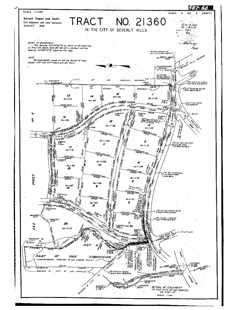
SCALE t—l0O’ SHEET 2 Of 5 - SHEETS
Barneft Hopen and Smith I QCivil Engineers and Land Surveynrs .V N •
AUGUST, 195510 -4rIN THE CITY OF BEVERLY HILLS
945/5 Of BEA,QfM6’S. V- The hecvng MO53’)Y e, .rhce.c 0’ Me fest 4cc
of T,oct MO /06.(f. fcE /,A1-4’-..d c ,declecf ,,vth the4enw’9 uoe’srø’ c4,,e., /4t.ç mop
VV
flONOTE
-‘
V
A/I m,Omr shorn, asset a kimod dasp Vescepi 51T’.,co’ LtT’ whmh o set f/ash,j 0’l_ I - C
OF LA COLW71 jO
V V:
Vciry OF SOS AYOfLV$ BOUNDARY ( ‘cMFO7W.’Y
—- N’ USDA 4A/3M7/V -
- 4O /10 - .OUSV
C/TY OF OLVERLY HILLS BOUNDARY 7554 4/g//3.-/ V
V i 2
i i.‘ ‘‘
Ac90
Ac.L09 2 .
AcU8 /// \\V
, / ‘c. ‘.oe a h / / tFWdcII AC..I.12 Z7
Ac.LI5
NO.e01
c. l.0Z q, V
Ac..93 /0Ac. .06 4/8 /
4 V I /11%.4’
‘ ‘ / Ac. 1.01 t V
I Ac. .99- &Ac..97 9 - .
I..I :‘.-- ,
V
2jtDAnAc...I.0l
Ac..6I JDR . a,
V VF‘—. •- -H c I. /Y.5/2OO.i,,, s
-aeeo,•
•SAYS
if1/OF- 7 ..
V
Ac.Z.lO v’BOUNDARY OP
f
0 ‘.
,- CITy dYI
5tBEVESCy HLL5 - -NOT A ‘ ,,.
4 aDA’
.\ V
PAQT OF THIS ‘O/YISiOh’‘ \
V V
jZ- W 6707-67
SOALS /SO’
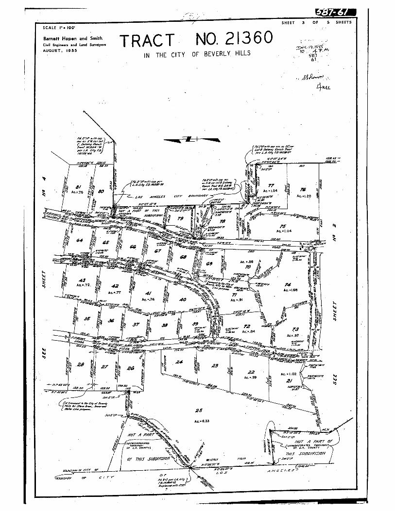
SCALE - 100
Barnetf Hoper, and SmithCviI Engin..r and Land SuIveyerAUGUST, 1955
7,,Ae W1NCr ‘ 0
A
if0if
-.
4 — Ac104
A
/ V -- --
/ / 1.9 A/Jj • A1• %k” ( Ac6 41k A -
- 4 A— ‘ ‘a
Ac.??Ac.I.65
Ac...7S 4Q A .91/p m. -N N
y471
AA / 1
A V
A37 3, 39
-‘
-Cr— __• ?:e-—‘I AC:..84 V
k ,, -
Ac...87
24VCU
V
24O 27 ‘
Ac...99AC.C 02
4- 2/“ H -
/2040 2?5Q /2?_,U
if/•3-X-t
V
A
SC4- N*..’
25-‘
400/p
• Ac .6537Th-
. // 11cr A PA,t’T I
1/ I11cr A PART or
1 / •C
f or t.*. counTy) 4’ C or C.., COUNTY
I I ‘4o .
V
k rn/s SU5JJ/V/S/OW
V
I I or TM/S SUD/Y/i/O/Y rnzo.u
/ J
___________
V
“°‘-
——
————
——
--
b
op C I T Y
TRACT NO.21360
VIN THE CITY OF BEVERLY. HILLS
SHEET 3 OF 5 SHEETS
S67
4a
I”
I.’‘4‘9
•04
‘4J4)
OZY

EQ
SHEET 4 OF 5 SHEETS
I I9to 4pM
e762-
a)‘I
k
SCALE - IOO
Bamett Hopen and 5mthCvfl Engineers and Land SurveyorsAUGUST 1955
IN THE CITY OF BEVERLY HILLS
I’E24,z ,fA5IlMT/4’ LoTs

4 -
5 OF 5 SHEETS
Bamett Hopen and SmithCivil Engine.r and Land SurveyonAUGUST 1955
TRACT NO. 21360IN THE CITY OF BEVERLY HILLS-
,EC l9,I9
o

Attachment 16Ordinance No. 1058

-J
ORDINANCE NO.1058
AN ORDINANCE OF THE CITY OF BEVERLY HILLS ADDINGARTICLE 10 TO CHAPTER X OF THE BEVERLY HILlSMUNICIPAL CODE REGULATING SUBDIVISIONS CBEATIHGNOT MORE THAN FOUR LOTS.
“ARTIClE 10SUBDIVISION CREATING NOT MORE THAN POUR LOTS
SEC. 10-1001 SUBDIVISION: DEFINITION
For the purpose of this article only, the term“subdivision” shall be deemed to mean and refer to anyreal property located in a residential zone, improvedor unimproved, or portion thereof, shown on the lastpreceding tax roll as a unit or as contiguous units,which is divided for the purpose of sale, whether immediate or future, by any person into two but not morethan four (4) parcels.
SEC. 10-1002 SALES PROHIBITED
No person shall offer to sell1 contract to sellor sell any subdivision as defined in this article orany part thereof until a map in full compliance withthe provisions of this article has been duly recordedin the office of the County Recorder of Los AngelesCounty. No permit of any kind shall be issued to anyapplicant to be used in connection with or pertainingto any premises in a residential zone which has beensplit or divided in violation of this article.
SEC. 10-1003 MAP ACT REQ.UIRENENTS NOT BINDING
Any person who desires to subdivide a piece ofland located in a residential zone in the city SO asto create not more than four new lots and who does notwish to record a map, under the provisions of Article 9 of this chapter or of the Map Act, Sections11500 to 11628 of the Business and Professions Code,shall comply with the provisions of this article.
SEC. 10-1004 SPLIPrING OF A LOT
Nc lot located in any residential zone shall beseparated in ownership or reduced in size below theminimum lot width or lot area required in this chapterexcept in conformity with the provisions of thisarticle. In any event a lot, piece or parcel orparcels may be divided only if each parcel createdthereby has an area and street frontage equal to the
1 05
I
The City Council of the City of Beverly Hills does hereby
ordain as follows:
Section 1. Chapter X of the Beverly Hills Municipal Code
hereby is amended by adding thereto a new article to be designated
Article 10 and to read as follows:

minimum requirements for lots in the zone in whichsuch parcel is located. Provided, however, that ifin any proposed lot split, a resulting parcel containsless than such minimum standards such substandardparcel may be permitted provided that:
(a) Such substandard parcel is combined with anadjacent parcel as a unit and;
fo) That such combined parcels then equal or exceed the standard for lots in the zone in which itis located. “Adjacent” as used herein shall mean
parcels
having contiguous boundaries at the frontlot line and to a depth of at least fifty (50)feet.
SEC. 10-1005 MAP TO BE PILED WITH CITY ENGINEER
An original and four (4) signed legible printsof a map of such proposed subdivision prepared by alicensed surveyor or registered civil engineer shallbe filed with the City Engineer. Such map shall beprepared on a sheet or sheets of tracing clotheighteen (18) inches wide by twenty—six (26) incheslong and shall contain the following information:
a) Existing and proposed utility services to
all lots shown thereon, proposed drainage andproposed changes in drainage, if any, and proposed regrading involving cuts and fills requiring the issuance of a grading permit from theBuilding Department under the provisions of thisCode.
(b) A statement to the effect that all new lots
to be created will be furnished with utilityinstallations running separately to or from a
main source of supply or disposal located in apublic Street) alley or easement.
(c) The dimensions and area of lots within500 feet of the perimeter of the new lots.
(d) All improvements located on the new lots.
(e) Exact dimensions and bearings or each line,
the monuments set and all other matters required by Sections 8760 to 8772 of the Businessand Professions Code.
SEC.
10-1006 TITLE EP0RT REQUIRED
The map required herein shall be accompanied by
a current preliminary title report showing title tothe property proposed to be divided, to be vested inthe applicant.
-2-
1

05
SEC. 10-1007 PEE
Each map filed under the provisions of this article shall be accompanied by a fee of Fifty Dollars(50.O0) to cover the cost of filing, processing andinvestigation.
SEC. 10-1008 COMPLIANCE WITH MINIMUM REQUIREMENTS
All lots proposed to be created under the provisions of this article shall confonu to the minimum
requirements
for new subdivisions set forth in Article 9 of Chapter X of this Code and shall all havefrontage on a public street.
SEC. 10-1009 EXAMINATION: APPROVAL
On receipt of such map, the City Engineer shallforthwith examine the same to ascertain whether or notit complies with all the requirements of this article.In the event the City Engineer finds that such mapcomplies with all legal requirements he shall forthwith approve such map.
The City Engineer shall have authority ingranting such approval to impose such conditions asare deemed necessary to protect the best interest ofthe surrounding property or neighborhood consistentwith the general purpose and Intent of this chapter,Inc luding but not limited to adequate provisions forfire protection, easements for public utilities andimprovementot all abutting streets and alleys tothe standards in this chapter or such lesser standardsas may be approved by the City Engineer and securityas provided in Article 9 of this chapter to guaranteeinstallation of such public utilities and Improvements.
SEC. 10-1010 FILING AND RECORDING OF MAP WHENAPFMOVKI)
If the City Engineer approves of such map he shallindicate such approval by his signature on the facethereof and shall thereupon file one copy thereof inhis office, Additional copies shall be transmitted forfiling to the Superintendent of the Building Departmentand the County Assessor of Los Age1es County. Theapplicant shall be notified of such approval.
SEC. 10-1011 REJECTION OR MODIFICATION BY CITY ENGINEER:
PILING
I4AP AS MODIFIED
If the City Engineer finds that such map does notcomply with such legal requirements, or some thereof,he shall reject such map, or order its modification tocontonu with such legal requirements. In the event ofsuch rejection or order ror modification by the CityEngineer he shall forthwith notify by mail the personfiling such map of his action with reference thereto.
-3—

The applicant may amend or modify such map and thecopies thereof, to conform with such order of theCity Engineer, or prepare a new map, and file four(4) copies thereof with City Engineer in the formand manner licreinbefore provided. The same procedure provided with reference to the filing, approval, rejection or modification of the originalmap shall be followed with reference to such amended,modified or new map, except that no additional feeshall be paid ir such refiling is accomplished withinsixty (60) days of the date of rejection by the CityEngineer, provided that written notice of intention
to
modify is filed with the City Engineer withinfifteen (15) days after notification from the CityEngineer.
SEC. 10-1012 APPEAL FROM ORDER OF MODIFICATION ORRdUT1UN: LiMITATiON
The applicant may file an appeal in writing fromany decision or order of the City Engineer with theCity Council within fifteen (15) days after themailing or delivery of such order for modification,or such rejection. In the absence of such appealthe decision of the City Engineer shall be final andthe applicant and his successors and assigns shall bebarred from filing a new application with referenceto such lot or parcel or any part thereof for a periodof one year from the expiration of such period offifteen (15) days except upon the ground of new evidence or changed conditions. At such hearing on appeal, to be held not less than ten (10) days nor morethan thirty (30) days after the filing of such appealwith the City Clerk the City Council may approve,overrule or modify any ruling or order of the CityEngineer made with regard to the matter on appeal andmay make such findings and impose such conditions asare not inconsistent with the provisions of thischapter.
SEC. lO- FILING MAP ON APPROVAL BY CITY COUNCIL
In the event of the approval of such map by theCity Council,1, upon appeal by the applicant, the CityClerk shall forthwith notify the applicant by mail,and shall forthwith deliver in person or by mail forfiling, one copy of such map to each of the following:City Engineer, the Superintendent of the Building Department and the County Assessor of Los Angeles County.
SEC.
10-10 14 fECORDING OF MAP
Upon approval by the City Engineer or the CityCouncil, such map shall be recorded in the Office ofthe County Recorder of Los Angeles County by the applicant at his expense. No building permit to constructany improvements upon the lots indicated on Such mapshall be issued until the applicant has submittedproof of such recording to the Superintendent of theBuilding Department.
-4-
51

1 05 F
SEC. 10-1015 ORDER OF REJECTION BY CITY COUNCIL
In the event of rejection or modification of suchmap by the City Council, the City Clerk shall forthwith notify the applicant by mail.
In the event modification has been ordered bythe City Council, such applicant may thereuponamend or modify such map in accordance with the actionof the council, or prepare a new map, and file four(L4) copies thereof with the City Engineer as herein-before provided. The same procedure liereinbefore pro-
vided
with reference to the filing, approval, rejectionor modification of the original map shall be followedwith reference to such amended, modified or new map.
SEC. 10-1016 REJECTION BY CITY COUNCIL: LIMITATION
In the event the City Council shall have rejectedsuch map, upon appeal by the applicant, the applicantand his successors and assigns shall be barred fromfiling a new application with reference to such lot orparcel or any part thereof £ or a period of one yearfrom the date of such rejection except upon the groundof new evidence or changed conditions.
SEC. 10-1017 COMPUTATIONS FROM NEW LOT LINES
After the recording of such map all side yard,front yard and other area and set back requirementsof Chapter X and XI of this Code shall be computedfrom the new lot lines as established on said map.
SEC. 10-1018 VOIDABILITY OF DEEDS OR CONTRACTSVIOLATING ARTICLE
Any deed of conveyance, sale or contract to sellmade contrary to the provisions of this article isvoidable at the sole option of the grantee, buyer orperson contracting to purchase, his heirs, personalrepresentative, or trustee in insolvency or bankruptcywithin one (1) year after the date of execution of thedeed of conveyance, sale or contract to sell, but thedeed of conveyance, sale or contract to sell isbinding upon any assignee or transferee of the grantee,buyer or person contracting to purchase) other thanthose above enumerated, and upon the grantor, vendoror person contracting to sell, or his assignee, heiror devisee.”
Section
2. The City Clerk shall certify to the passage and
adoption of this ordinance and to its approval by the City Council,
— and shall cause the same to be published once in the Beverly Hills
Citizen, a newspaper of general circulation, printed, published and
circulated in said City of Beverly Hills five days per week, and
thirty days after the final passage and adoption, this ordinance shall
-5-

2Q5
be in full force and effect.
Adopted and approved this 3no day of FEBRUARY , 1959.
?Mayor,f the City orBevery Hills, CJ.ifornia
ATTEST:
Ct&2,DuTY ‘ City Cleric
STATE
OP CALIFORNIA )COUNTY OP LOS ANGELES ) SS.CITY OF BEVERLY HILLS
I, C. RAYMOND WOOD, City Clerk of the City of Beverly Hills,
California, do hereby certify that the roregoing ordinance, being
Ordinance No. io8 , was passed by the City Council of said City,
signed by the Mayor and attested by the City Clerk at a regular meeting
of the said Council held on the no day of Fsiuv , 1959,
and that the same was passed by the following vote, to wit:
AYES: COUNCILMEN GEORGE, FREAN BnooIs Wvor D*vI5
NOES: NONE
ABSENT: CouNca.iAu DARLING
U/DEIuTv City Clerk of the City or
- Beverly Hills, California
(SEAL)
City Atto ey
Approved as to content:
rYL24i7— irector o’ Pu ic Wor4cs
I Superintendent of Building Department
-6-

Attachment 17Ordinance No. 1075

.oZ 5
ORDINANCE NO. 1075
AN ORDINANCE OF THE CITY OF BEVERLY HILLS AMENDING SECTIONS 10-1005, 10-1009, 10-1010 AND 10-1014GOVERNING THE PROCEDURE FOR SUBDIVISIONS CREATINGNOT MORE THAN FOUR LOTS.
The Council of the City of Beverly Hills does hereby
ordain as follows:
Section 1. Sections 10-1005, 10-1009, 10-1010 and
10-1014 of the Beverly Hills Municipal Code are hereby amended to
read as follows:
“SEC. 10-1005 MAPS TO BE FILED WITH CITY ENGINEER
The subdivider shall file with the City Engineeran original and four (4) signed legible prints of eachof the following maps of the proposed subdivisionprepared by a licensed surveyor or registered Civilengineer on a sheet or sheets of tracing clotheighteen (18) inches wide by twenty-six (26) incheslong:
a) A Record of Survey Map of the entirelot, piece or parcel of land to be divided,containing the exact dimensions and bearingsof each line, the monuments set and allother matters required by Section 8760 to8772 of the Business and Professions Code.
(b) A vicinity map containing the following information:
(1) The dimensions and area of lotswithin 500 feet of the perimeter ofthe new lots
(2) All improvements located on thenew lots.
(3) Existing and proposed utility ser
vices
to all lots shown thereon, proposed drainage and proposed changes indrainage, it any, and proposed regradinginvolving cuts and fills requiring issuance of a grading permit from the BuildingDepartment under the provisions of thisCode.
(4) A statement signed by the owner tothe effect that all new lots to be createdwill be furnished with utility installationsrunning separately to or from a main sourceof supply or disposal located in a publicstreet, alley or easement.”
1

O75
“SEC. 10-1009 EXAMINATION: APPROVAL
On receipt of such map, the City Engineer shallforthwith examine the same to ascertain whether ornot it complies with all the requirements of thisarticle. In the event the City Engineer finds thatsuch map complies with all legal requirements heshall forthwith approve such sap unless the propertyproposed to be subdivided lies in the Northerly zone.
The City Engineer shall have authority in granting
such
approval to impose such conditions as are deemednecessary to protect the best interest of the surrounding property or neighborhood consistent with thegeneral purpose and intent of this chapter, includingbut not limited to adequate provisions for fire protection, easements for public utilities and improvement of all abutting streets and alleys to thestandards in this chapter or such lesser standardsas may be approved by the City Engineer and securityas provided in Article 9 of this chapter to guaranteeinstallation of such public utilities and improvements.
All subdivisions in the Northerly Zone as definedin Section lO-903fc)(l), to-wit all property lyingbetween Sunset Boulevard and the northerly boundaryof the City shall be submitted to the City Councilfor approval. If in the opinion of the City Councilthe proposed lots conform in area and width topresent adjacent and nearby lots the Council shallapprove the subdivision. The Council may approve lotsnot in conformity with adjacent or nearby lots if itfinds that such requirement would work undue and unusual hardship on the owner and a different size andarrangement of lots in the proposed subdivisionwould not result in undue detriment to surroundingproperty or the residents thereof.”
“SEC. 10-1010 FILING OF MAP WHEN APPROVED
If the City Engineer approves of such map he shallindicate such approval by his signature on the facethereof and shall thereupon file one copy thereof inhis office. A copy shall be transmitted for filing tothe Superintendent of the Building Department. Theapplicant shall be notified of such approval.
“SEC.
lOlOl4 PILING OF MAP WITH COUNTY RECORDER
Upon approval by the City Engineer or the CityCouncil the Record of Survey map bearing only thecertificates required by Section 8764.5 of theBusiness and Professions Code shall be filed inthe office of the County Recorder of Los AngelesCounty by the applicant at his expense. No building permit to construct any improvements upon thelots indicated on such map shall be issued until theapplicant has submitted proof of such filing to thesuperintendent of the Building Department, consistingof a print of the map showing the filing information.”
-- 2--
3

5Section 2. The City Clerk shall certify to the -
passage and adoption of this ordinance and to its approval by
the City Council, and shall cause the same to be published once
in the Beverly Hills Citizen, a newspaper of general circulation,
printed, published and circulated in said City of Beverly Hills
five days per week, and thirty days after the final passage and
adoption, this ordinance shall be in full force and effect.
Adopted and approved this 18th day of August , 1959.
Mayor e yofBeve y Hills California
ATTEST:
1/’ /1 )(_. yLC L.’)
I pty Cle
STATE OF CALIFORNIACOUNTY OF LOS ANGElES SS.CITY OF BEVERLY HILLS
I, C. RAYMOND WOOD, City Clerk of the City of Beverly
Hills, California, do hereby certify that the foregoing ordinance
being Ordinance No. 1.0$ , was passed by the Cfty Council
of said City, signed by the Mayor and attested by the City Clerk at
a regular meeting of the said Council hold on the 18th day of iugust
1959, and that the same was passed by the following vote, to wit:
AYES: Counci]man George, Brooks, Freeman, Darling and Mayor Davis.
NOES: None.
ABSEN.‘: t’
—, - {City Clerk oI te City of
CSEAL) - - Beverly Hills, California
Approv as to content;
Aotinblic Works
a roved as o form:
tQ
--3--

Attachment 18Lot 99 Grant Deed (1959)

I
for a valuable consideration,
Tjd C.roccn C*zt, a California Corporation and Texas Construction
a corporstitin organized under the laws of the State of Deiniare
‘erth GRANTS to
George Stevens, an trnmarried nan
the k.llowing described real pmpert in the of California, County of los ingeles
All of lot 99 ciTract 22360 asper aç recorded in Bock 58? PagesS943 of raps, in the
ofce of the County Recorder of said County: C therefros all that portion thereof 2.fln
Southeasterly of the foUo E deacri liner Begimmi ng at a point in the southerly line of
said Lot 99, said point being a tan5r 8’ 00* East thereor, 169.20 feet fran the South—
vest corner thereof; thence North l 23’ 50’ East )J.$J feet to a point in the Northeaster
line of said let 99, said point being di: taut South 37 • 01’ 00’ East thereon 201.29 feet fr
the Norttwest corner thereof.
Subject tor General and 3peoial taxes iith are not yet due
Caresants, conditions, restrictions, reservations, easenents, rights,
and rights of say, nee of record.
This conveyance is and. accepted and said property is hereby granted,
subject to the coi anants, conditions an restrictions as set forth in that certain Declerati
of Restrictions recorded as Instrt No. 31r96 on Deceaber 20, 1955 , in Bock h98k6, Fag.
2k?, 0. R. of Ice Angeles County California; an as though set forth herein in foil. It is
untrrstood and agreed bs..seert the partiesherein that the right of enforcement of said coves
conditions and re.srictiona is liaited to the prtwisions of Article XtV thereof, and no
right of rreraion exists.
t.•
‘
I
t ‘e JPL Angel.. I
• it August3J.J,j — Iwhrr me.,, • under
a N.,t,s I oLin in and In, naid I Hunt, and %t,I, ywrnngfl.
•
u.n.. in me ta I,. th. p.r... .uhw n.m.
-b-intl ihn,..u,t),tn In,tfliIeitI. a th, Atlnrne_ •i Liti ol
Troug a .onstructon omauy. ant:
T-ek. Cuaau.taU,.tpfl CJMplhy
an htpu]ed0eJ to ow that .ii,-into.I th name lot
Trousaaie (aOflstruction Compary the,etr..
E
‘a 1 —n. )hani aid o.ar
- 1 -.o----‘iota I ohm to and lot oainj in. anti Si, tr
My Comm. expirea lUta79
-;,Za
c
Title Order Nd
1O THIS N’Fpa RECORDER’S USE
t.:It..
.fl . * • ...
TAA’?S IN !HIS SPACE
2239
By this instrument dated Jugust 25, 1959
Corporaaon Grant Deed AfixLRS.$_______
STATE OF CALWORNIA
CO”NTY OF
I
I
and Texas c truntia CoenyTro.sda Conatriction Coepany, a orpcration
I-J
a Corporation
k
SPACZ BELOW FOB RECORDER’S USE ONLY
I
RECORDEO IN orrr in
OF LOS AHOELr CL)JuTY, CALIF.
FOR LAND TtTi,t i’tj5AFiCE
SEP 3 1959 AT 8:01 A.M.
RAY E. LEE, County Recocder
Escrow or Loan No.

Attachment 19Subdivision Map Act Section 66499.36

11312018
GOVERNMENT CODE - GOV
TiTLE 7. PLANNING AND LAND USE [65000 - 66499.5$] (Heading of Title 7 amended byStats. 1974, Cti. l536.)
DiVISION 2. SUBDiVISIONS [66410 - 66499.38] (Division 2 added by Stats. 1974, Ch.1536.)
CHAPTER 7. Enforcement and Judicial Review [66499.30 - 66499.38] (Chapter 7added by Stats. 1974, Ch. 1536.)
ARTICLE 2. Remedies [66499.32 - 66499.36] (Article 2 added by Stats. 1974, Ch. 1536.)
Whenever a local agency has knowledge that real property has been divided in violation of the provisions of thisdivision or of local ordinances enacted pursuant to this division, it shall cause to be mailed by certified mail to the then66499.36.current owner of record of the property a notice of intention to record a notice of violation, describing the realproperty in detail, riRming the owners thereof, and stating that an opportunity will be given to the owner to present
evidence. The notice shall specify a time, date, and place for a meeting at which the owner may present evidence to the legislativebody or advisory agency why the notice should not be recorded. The notice shall also contain a description of the violations and anexplanation as to why the subject parcel is not lawful under subdivision (a) or (b) of Section 66412.6.
The meeting shall take place no sooner than 30 days and no later than 60 days from date ofmailing. If, within 15 days of receipt ofthe notice, the owner of the real property fails to inform the local agency ofhis or her objection to recording the notice ofviolation,the legislative body or advisory agency shall record the notice ofviolation with the county recorder. if, after the owner has presentedevidence, it is determined that there has been no violation, the local agency shall mail a clearance letter to the then current owner ofrecord. If, however, after the owner has presented evidence, the legislative body or advisory agency determines that the property hasin fact been illegally divided, the legislative body or advisory agency shall record the notice ofviolation with the county recorder.The notice ofviolation, when recorded, shall be deemed to be constructive notice of the violation to all successors in interest in suchproperty. The county recorder shall index the names of the fee owners in the general index.
(Amended by Stats. 1984, Ch. 864, Sec. 2.)
Ill

Attachment 20Preliminary Title Report,
dated April 27, 2016

CLTA Preliminary Report Form Order Number: 5164648
(Rev. 11/06) Page Number: 1
çT
FirstAmerican Title
First American Title Company655 North Central Avenue, 8th Floor
Glendale, CA 91203
California Department of Insurance License No. 151
Maggie DefinaCamden Escrow9595 Wilshire Boulevard, Suite 701Beverly Hills, CA 90212-2507Phone: (310)247-8549Fax: (310)247-8559
Customer Reference: Owen
Order Number: 5164648 (MP)
Title Officer: Michelle PascualPhone: (818)550-2517Fax No.: (866)878-7977E-Mail: [email protected]
Property: Vacant LandBeverly Hills, CA
PRELIMINARY REPORT
In response to the above referenced application for a policy of title insurance, this company hereby reports that it is prepared to issue, orcause to be issued, as of the date hereof, a Policy or Policies of Title Insurance describing the land and the estate or interest thereinhereinafter set forth, insuring against loss which may be sustained by reason of any defect, lien or encumbrance not shown or referred to asan Exception below or not excluded from coverage pursuant to the printed Schedules, conditions and Stipulations of said Policy forms.
The printed Exceptions and Exclusions from the coverage and Limitations on covered Risks of said policy or policies are set forth in Exhibit Aattached. The policy to be isu& may contabi an arbitration dause. When the Amount ofInsurance is less than that set forth h’i thearbitration clause, all arbitrable matters shall be arbitrated at the option ofeither the Company or the Insured as the exclusive remedy of theparties. Limitations on covered Risks applicable to the CLTA and ALTA Homeowner’s Policies of litle Insurance which establish a DeductibleAmount and a Maximum Dollar Limit of Liability for certain coverages are also set forth in Exhibit A. copies of the policy forms should beread. They are available from the office which issued this report.
Please read the exceptions shown or referred to below and the exceptions and exclusions set forth in Exhibit A of thisreport carefully. The exceptions and exclusions are meant to provide you with notice of matters which are not coveredunder the terms of the title insurance policy and should be carefully considered.
It is important to note that this preliminary report is not a written representation as to the condition of title and may notlist all liens, defects, and encumbrances affecting title to the land.
This report (and any supplements or amendments hereto) is issued solely for the purpose of facilitating the issuance of a policy of titleinsurance and no liability is assumed hereby. If it is desired that liability be assumed prior to the issuance of a policy of title insurance, aBinder or commitment should be requested.
first Amer/can TitlePage 1 of 15

Order Number: 5164648Page Number: 2
Dated as of April 27, 2016 at 7:30 A.M.
The form of Policy of title insurance contemplated by this report is:
ALTA/CLTA homeowner’s (EAGLE) Policy of Title Insurance (2010) and ALTA Ext Loan Policy1056.06 (06-17-06) if the land described is an improved residential lot or condominium unit onwhich there is located a one-to-four family residence; or ALTA Standard Owner’s Policy 2006(WRE 06-17-06) and the ALTA Loan Policy 2006 (06-17-06) if the land described is anunimproved residential lot or condominium unit
A specific request should be made if another form or additional coverage is desired.
Title to said estate or interest at the date hereof is vested in:
Vance Owen, a single man
The estate or interest in the land hereinafter described or referred to covered by this Report is:
FEE
The Land referred to herein is described as follows:
(See attached Legal Description)
At the date hereof exceptions to coverage in addition to the printed Exceptions and Exclusions in saidpolicy form would be as follows:
1. General and special taxes and assessments for the fiscal year 2016-20 17, a lien not yet due orpayable.
2. The lien of supplemental taxes, if any, assessed pursuant to Chapter 3.5 commencing withSection 75 of the California Revenue and Taxation Code.
3. Covenants, conditions, restrictions and easements in the document recorded August 27, 1954as Instrument No. 938 in Book 45427, Page 48 of Official Records, which provide that a violationthereof shall not defeat or render invalid the lien of any first mortgage or deed of trust made ingood faith and for value, but deleting any covenant, condition or restriction indicating apreference, limitation or discrimination based on race, color, religion, sex, handicap, familialstatus, national origin, sexual orientation, marital status, ancestry, source of income or disability,to the extent such covenants, conditions or restrictions violate litle 42, Section 3604(c), of theUnited States Codes or applicable state law. Lawful restrictions under state and federal law onthe age of occupants in senior housing or housing for older persons shall not be construed asrestrictions based on familial status.
First American fltlePage 2 of 15

Order Number: 5164648Page Number: 3
4. Covenants, conditions, restrictions and easements in the document recorded December 20,1955 as Instrument No. 3496 in Book 49846, Page 247 of Official Records, but deleting anycovenant, condition, or restriction indicating a preference, limitation or discrimination based onrace, color, religion, sex, sexual orientation, marital status, ancestry, disability, handicap, familialstatus, national origin or source of income (as defined in California Government Code§12955(p)), to the extent such covenants, conditions or restrictions violate 42 U.S.C. §3604(c) orCalifornia Government Code §12955. Lawful restrictions under state and federal law on the ageof occupants in senior housing or housing for older persons shall not be construed as restrictionsbased on familial status.
Document(s) declaring modifications thereof recorded July 24, 1963 as Instrument No. 3203 inBook M1311, Page 342 and August 2, 1965 as Instrument No. 4031, both of Official Records.
5. The terms and provisions contained in the document entitled ‘Agreement’ recorded December28, 1955 as Instrument No. 2441 in Book 19807, Page 102 of Official Records.
6. The terms and provisions contained in the document entitled “Agreement” recorded December28, 1955 as Instrument No. 2442 in Book 49897, Page 414 of Official Records.
7. The terms and provisions contained in the document entitled “Agreement” recorded December28, 1955 as Instrument No. 2443 in Book 49897, Page 431 of Official Records.
8. The terms and provisions contained in the document entitled “Agreement for Installation ofImprovements” recorded December 28, 1955 as Instrument No. 2445 in Book 49897, Page 440of Official Records.
9. The terms and provisions contained in the document entitled “Memorandum of Agreement”recorded January 27, 1957 as Instrument No. 4183 in Book 53426, Page 76 of Official Records.
10. The terms and provisions contained in the document entitled “Deed & Bill of Sale”recorded March 25, 1957 as Instrument No. 2887 of Official Records.
11. The terms and provisions contained in the document entitled “Deed and Bill of Sale”recorded October 22, 1957 as Instrument No. 3346 of Official Records.
12. Water rights, claims or title to water, whether or not shown by the public records.
First American TitlePage 3 of 15

Order Number: 5164648Page Number: 4
Ezz_zzzzz INFO RMATIONAL NOTES
Note: The policy to be issued may contain an arbitration clause. When the Amount of Insurance is lessthan the certain dollar amount set forth in any applicable arbitration clause, all arbitrable matters shall bearbitrated at the option of either the Company or the Insured as the exclusive remedy of the parties. Ifyou desire to review the terms of the policy, including any arbitration clause that may be included,contact the office that issued this Commitment or Report to obtain a sample of the policy jacket for thepolicy that is to be issued in connection with your transaction.
1. General and special taxes and assessments for the fiscal year 2015-2016.First Installment: $207.34, PAIDPenalty: $0.00Second Installment: $207.33, PAIDPenalty: $0.00Tax Rate Area: 10-02442A. P. No.: 4391-028-020
2. General and special taxes and assessments for the fiscal year 2015-2016.First Installment: $156.46, PAIDPenalty: $0.00Second Installment: $156.46, PAIDPenalty: $0.00Tax Rate Area: 10-02442A. P. No.: 4391-028-012
3. General and special taxes and assessments for the fiscal year 2015-2016.First Installment: $74.43, PAIDPenalty: $0.00Second Installment: $74.43, PAIDPenalty: $0.00Tax Rate Area: 10-02442A. P. No.: 4391-028-008
4. The property covered by this report is vacant land.
5. According to the public records, there has been no conveyance of the land within a period oftwenty-four months prior to the date of this report, except as follows:
None
6. We find no open deeds of trust. Escrow please confirm before closing.
NOTE to proposed insured lender only: No Private transfer fee covenant, as defined in FederalHousing Finance Agency Final Rule 12 CFR Part 1228, that was created and first appears in thePublic Records on or after February 8, 2011, encumbers the Title except as follows: None
First American 77t/ePage4ofls

Order Number; 5164648Page Number; 5
The map attached, if any, may or may not be a survey of the land depicted hereon. First Americanexpressly disclaims any liability for loss or damage which may result from reliance on this map except tothe extent coverage for such loss or damage is expressly provided by the terms and provisions of the titleinsurance policy, if any, to which this map is attached.
first American TitlePage 5 of 15

Order Number: 5164648Page Number: 6
LEGAL DESCRIPTION
Real property in the City of Beverly Hills, County of Los Angeles, State of California, described asfollows:
PARCEL NO. 1
LOT 98 TRACT 21360, IN THE CifY OF BEVERLY HILLS, COUNTY OF LOS ANGELES, STATE OFCALIFORNIA, AS PER MAP RECORDED IN BOOK 587 5 TO 63 INCLUSIVE OF MAPS, INTHE OFFICE OF THE COUNTY RECORDER OF SAID COUNTY.
EXCEPTING THEREFROM THAT PORTION AS DESCRIBED IN DEED FROM TROUSDALECONSTRUCTION COMPANY, A CORPORATION AND TEXAS CONSTRUCTION COMPANY, ACORPORATION TO J.C GARRETT, A MARRIED MAN, RECORDED MARCH 11, 1958 INSTRUMENTNO. 1867 BOOK D39 PAGE 645 AND IN DEED FROM TEXAS CONSTRUCTION COMPANY, ACORPORATION AND TROUSDALE CONSTRUCTION COMPANY, RECORDED DECEMBER 21, 1962INSTRUMENT NO. 3678 BOTH OF OFFICIAL RECORDS, IN THE OFFICE OF THE LOS ANGELESCOUNTY RECORDER, STATE OF CALIFORNIA.
PARCEL NO. 2
LOT 99 TRACT 21360, IN THE CiTY OF BEVERLY HILLS, COUNTY OF LOS ANGELES, STATE OFCALIFORNIA, AS PER MAP RECORDED IN BOOK 587L PAGES 59 TO63 INCLUSIVE OF MAPS, INTHE OFFICE OF THE COUNTY RECORDER OF SAID COUNTY.
EXCEPTING THEREFROM THAT PORTION AS DESCRIBED IN DEED FROM TROUSDALECONSTRUCTION COMPANY, A CORPORATION AND TEXAS CONSTRUCTION COMPANY, ACORPORATION TO GEORGE STEVENS, AN UNMARRIED MAN, RECORDED SEPTEMBER 3, 1959INSTRUMENT NO. 2239 OF OFFICIAL RECORDS, IN THE OFFICE OF THE LOS ANGELES COUNTYRECORDER, STATE OF CALIFORNIA.
PARCEL NO. 3
LOT 100 TRACT 21360, IN THE CITY OF BEVERLY HILLS, COUNTY OF LOS ANGELES, STATE OFCALIFORNIA, AS PER MAP RECORDED IN BOOK 587 PAGES 59 TO 63 INCLUSIVE OF MAPS, INTHE OFFICE OF THE COUNTY RECORDER OF SAID COUNTY.
EXCEPTING THEREFROM THAT PORTION AS DESCRIBED IN DEED FROM TROUSDALECONSTRUCTION COMPANY, A CORPORATION AND TEXAS CONSTRUCTION COMPANY, ACORPORATION TO IRVING HAFER, A MARRIED MAN, RECORDED AUGUST 7, 1956 INSTRUMENTNO. 2170 BOOK 51957 PAGE 35 OF OFFICIAL RECORDS, IN THE OFFICE OF THE LOS ANGELESCOUNTY RECORDER, STATE OF CALIFORNIA.
APN: 4391-028020 and 4391-028-012 and 4391-028-008
First American flt/ePage 6 of 15

Order Number: 516464$Page Number: 7
N
‘p
0
o(D >
Zu 01r-
U,ODU
< 0
0N
00U N
J2
U
Arst American 77t/ePage 7 of 15

Order Number; 5164648Page Number; 8
NOTICE
Section 12413.1 of the California Insurance Code, effective January 1, 1990, requires that any title insurancecompany, underwritten title company, or controlled escrow company handling funds in an escrow or sub-escrowcapacity, wait a specified number of days after depositing funds, before recording any documents in connectionwith the transaction or disbursing funds. This statute allows for funds deposited by wire transfer to be disbursedthe same day as deposit. In the case of cashier’s checks or certified checks, funds may be disbursed the next dayafter deposit. In order to avoid unnecessary delays of three to seven days, or more, please use wire transfer,cashier’s checks, or certified checks whenever possible.
firstAmerican TitlePage 8 of 15

Order Number: 5164648Page Number: 9
First American Title Company655N. Central Aye, Suite 800
FirstAmerican Title 0g’203
First American TitlePage 9 of 15

Order Number: 5164648Page Number: 10
WIRE INSTRUCTIONSfor
First American Title Company, Demand/Draft Sub-Escrow DepositsLos Angeles County, California
PAYABLE TO: First American Title Company
BANK: First American Trust, FSB
ADDRESS: 5 First American Way, Santa Ana, CA 92707
ACCOUNT NO: 3013510000
ROUTING NUMBER: 122241255
PLEASE REFERENCE THE FOLLOWING:PROPERTY: Vacant Land, Beverly Hills, CA
FILE NUMBER: 5164648 (MP)
PLEASE USE THE ABOVE INFORMATION WHEN WIRING FUNDS TO First AmericanTitle Company. FUNDS MUST BE WIRED FROM A BANK WITHIN THE UNITEDSTATES. PLEASE NOTIFY Michelle Pascual AT (818)550-2517 OR [email protected] WHEN YOU HAVE TRANSMiTTED YOUR WIRE.
IF YOUR FUNDS ARE BEING WIRED FROM A NON-U.S. BANK, ADDITIONAL CHARGES MAY APPLY.PLEASE CONTACT YOUR ESCROW OFFICER/CLOSER FOR INTERNATIONAL WIRING INSTRUCTIONS.
AN ACH TRANSFER CANNOT BE ACCEPTED FOR CLOSING, BECAUSE if IS NOT THE SAME AS A WIREAND REQUIRES ADDITIONAL TIME FOR CLEARANCE.
FIRST AMERICAN TRUST CONTACT INFO: Banking Services 1-877-600-9473
ALL WIRES WILL BE RETURNED IF THE FILE NUMBERAND/OR PROPERTY REFERENCE ARE NOT INCLUDED
With cyber crimes on the increase, it is important to be ever vigilant. If you receive an e-mail or anyother communication that appears to be generated from a First American employee that contains new,revised or altered bank wire instructions, consider it suspect and call our office at a number you trust.Our bank wire instructions seldom change.
First American TitlePage 10 of 15

Order Number: 5164648Page Number: 11
EXHIBIT ALIST OF PRINTED EXCEPTIONS AND EXCLUSIONS (BY POLICY TYPE)
CLTA/ALTA HOMEOWNER’S POLICY OF TITLE INSURANCE (02-03-10)
EXCLUSIONS
In addition to the Exceptions in Schedule B, You are not insured against loss, costs, attorneys’ fees, and expenses resulting from:1. Governmental police power, and the existence or violation of those portions of any law or government regulation concerning:
(a) building; (d) improvements on the Land;
(b) zoning; (e) land division; and
(c) land use; (f) environmental protection.
This Exclusion does not limit the coverage described in Covered Risk 8.a., 14, 15, 16, 18, 19, 20, 23 or 27.
2. The failure of Your existing structures, or any part of them, to be constructed in accordance with applicable building codes. This Exclusiondoes not limit the coverage described in Covered Risk 14 or 15.
3. The right to take the Land by condemning it. This Exclusion does not limit the coverage described in Covered Risk 17.4. Risks:
(a) that are created, allowed, or agreed to by You, whether or not they are recorded in the Public Records;
(b) that are Known to You at the Policy Date, but not to Us, unless they are recorded in the Public Records at the Policy Date;(c) that result in no loss to You; or(d) that first occur after the Policy Date - this does not limit the coverage described in Covered Risk 7, 8.e., 25, 26, 27 or 28.
S. Failure to pay value for Your Title.6. Lack of a right:
(a) to any land outside the area specifically described and referred to in paragraph 3 of Schedule A; and(b) in streets, alleys, or waterways that touch the Land.This Exclusion does not limit the coverage described in Covered Risk 11 or 21.
7. The transfer of the Title to You is invalid as a preferential transfer or as a fraudulent transfer or conveyance under federal bankruptcy, stateinsolvency, or similar creditors’ rights laws.
LIMITATIONS ON COVERED RISKS
Your insurance for the following Covered Risks is limited on the Owner’s Coverage Statement as follows: For Covered Risk 16, 18, 19, and 21Your Deductible Amount and Our Maximum Dollar Limit of Liability shown in Schedule A.
Your Deductible Amount Our Maximum DollarLimit of Liability
Covered Risk 16: 1% of Policy Amount or $2,500.00 (whichever is less) $10,000.00Covered Risk 18: 1% of Policy Amount or $5,000.00 (whichever is less) $25,000.00
Covered Risk 19: 1% of Policy Amount or $5,000.00 (whichever is less) $25,000.00Covered Risk 21: 1% of Policy Amount or $2,500.00 (whichever is less) $5,000.00
ALTA RESIDENTIAL TITLE INSURANCE POLICY (6-1-87)
EXCLUSIONS
In addition to the Exceptions in Schedule B, you are not insured against loss, costs, attorneys’ fees, and expenses resulting from:1. Governmental police power, and the existence or violation of any law or government regulation. This includes building and zoning
ordinances and also laws and regulations concerning:
(a) and use
(b) improvements on the land
(c) and division
(d) environmental protection
This exclusion does not apply to violations or the enforcement of these matters which appear in the public records at Policy Date.This exclusion does not limit the zoning coverage described in Items 12 and 13 of Covered Title Risks.
2. The right to take the land by condemning it, unless:
FZ’-st American TitlePage 11 of 15

Order Number: 5164648Page Number: 12
(a) a notice of exercising the right appears in the public records on the Policy Date
(b) the taking happened prior to the Policy Date and is binding on you if you bought the land without knowing of the taking3. Title Risks:
(a) that are created, allowed, or agreed to by you(b) that are known to you, but not to us, on the Policy Date -- unless they appeared in the public records(c) that result in no loss to you(d) that first affect your title after the Policy Date -- this does not limit the labor and material lien coverage in Item 8 of Covered Title Risks
4. Failure to pay value for your title.5. Lack of a right:
(a) to any land outside the area specifically described and referred to in Item 3 of Schedule A OR
(b) in streets, alleys, or waterways that touch your land
This exdusion does not limit the access coverage in Item 5 of Covered Title Risks.
2006 ALTA LOAN POLICY (06-17-06)
EXCLUSIONS FROM COVERAGE
The following matters are expressly excluded from the coverage of this policy, and the Company will not pay loss or damage, costs, attorneysfees, or expenses that arise by reason of:
1. f a) Any law, ordinance, permit, or governmental regulation (including those relating to building and zoning) restricting, regulating,prohibiting, or relating to
(i) the occupancy, use, or enjoyment of the Land;
(ii) the character, dimensions, or location of any improvement erected on the Land;
(iii) the subdivision of land; or
(iv) environmental protection;
or the effect of any violation of these laws, ordinances, or governmental regulations. This Exclusion 1(a) does not modify or limit thecoverage provided under Covered Risk 5.(b) Any governmental police power. This Exclusion 1(b) does not modify or limit the coverage provided under Covered Risk 6.
2. Rights of eminent domain. This Exclusion does not modify or limit the coverage provided under Covered Risk 7 or 8.3. Defects, liens, encumbrances, adverse claims, or other matters
(a) created, suffered, assumed, or agreed to by the Insured Claimant;(b) not Known to the Company, not recorded in the Public Records at Date of Policy, but Known to the Insured Claimant and not disclosedin writing to the Company by the Insured Claimant prior to the date the Insured Claimant became an Insured under this policy;(c) resulting in no loss or damage to the Insured Claimant;(d) attaching or created subsequent to Date of Policy (however, this does not modify or limit the coverage provided under Covered Risk 11,13, or 14); or(e) resulting in loss or damage that would not have been sustained if the Insured Claimant had paid value for the Insured Mortgage.
4. Unenforceability of the lien of the Insured Mortgage because of the inability or failure of an Insured to comply with applicable doing-business laws of the state where the Land is situated.
5. Invalidity or unenforceability in whole or in part of the lien of the Insured Mortgage that arises out of the transaction evidenced by theInsured Mortgage and is based upon usury or any consumer credit protection or truth-in-lending law.
6. Any claim, by reason of the operation of federal bankruptcy, state insolvency, or similar creditors rights laws, that the transaction creatingthe lien of the Insured Mortgage, is(a) a fraudulent conveyance or fraudulent transfer, or(b) a preferential transfer for any reason not stated in Covered Risk 13(b) of this policy.
7. Any lien on the Title for real estate taxes or assessments imposed by governmental authority and created or attaching between Date ofPolicy and the date of recording of the Insured Mortgage in the Public Records. This Exclusion does not modify or limit the coverageprovided under Covered Risk 11(b).
The above policy form may be issued to afford either Standard Coverage or Extended Coverage. In addition to the above Exclusions fromCoverage, the Exceptions from Coverage in a Standard Coverage policy will also include the following Exceptions from Coverage:
EXCEPTIONS FROM COVERAGE
This policy does not insure against loss or damage (and the Company will not pay costs, attorneys’ fees or expenses) that arise by reason of:1. (a) Taxes or assessments that are not shown as existing liens by the records of any taxing authority that levies taxes or assessments on real
property or by the Public Records; (b) proceedings by a public agency that may result in taxes or assessments, or notices of suchproceedings, whether or not shown by the records of such agency or by the Public Records.
2. Any facts, rights, interests, or claims that are not shown by the Public Records but that could be ascertained by an inspection of the Land orthat may be asserted by persons in possession of the Land.
3. Easements, liens or encumbrances, or claims thereof, not shown by the Public Records.
First American flt/ePage 12 of 15
Order Number: 516464$Page Number: 13
4. Any encroachment, encumbrance, violation, variation, or adverse circumstance affecting the Title that would be disclosed by an accurateand complete land survey of the Land and not shown by the Public Records.
5. (a) Unpatented mining claims; (b) reservations or exceptions in patents or in Acts authorizing the issuance thereof; (c) water rights, claimsor title to water, whether or not the matters excepted under (a), (b), or (c) are shown by the Public Records.
6. Any lien or right to a lien for services, labor or material not shown by the public records.
2006 ALTA OWNER’S POLICY (06-17-06)
EXCLUSIONS FROM COVERAGE
The following matters are expressly excluded from the coverage of this policy, and the Company will not pay loss or damage, costs, attorneysfees, or expenses that arise by reason of:
1. (a) Any law, ordinance, permit, or governmental regulation (including those relating to building and zoning) restricting, regulating,prohibiting, or relating to
(i) the occupancy, use, or enjoyment of the Land;
(ii) the character, dimensions, or location of any improvement erected on the Land;
(iii) the subdivision of land; or
(iv) environmental protection;
or the effect of any violation of these laws, ordinances, or governmental regulations. This Exclusion 1(a) does not modify or limit thecoverage provided under Covered Risk 5.
(b) Any governmental police power. This Exclusion 1(b) does not modify or limit the coverage provided under Covered Risk 6.2. Rights of eminent domain. This Exclusion does not modify or limit the coverage provided under Covered Risk 7 or 8.3. Defects, liens, encumbrances, adverse claims, or other matters
(a) created, suffered, assumed, or agreed to by the Insured Claimant;(b) not Known to the Company, not recorded in the Public Records at Date of Policy, but Known to the Insured Claimant and not disclosedin writing to the Company by the Insured Claimant prior to the date the Insured Claimant became an Insured under this policy;(c) resulting in no loss or damage to the Insured Claimant;(d) attaching or created subsequent to Date of Policy (however, this does not modify or limit the coverage provided under Covered Risk 9 or10); or(a) resulting in loss or damage that would not have been sustained if the Insured Claimant had paid value for the Title.
4, Any claim, by reason of the operation of federal bankruptcy, state insolvency, or similar creditors’ rights laws, that the transaction vestingthe Title as shown in Schedule A, is(a) a ftaudulent conveyance or fraudulent transfer, or(b) a preferential transfer for any reason not stated in Covered Risk 9 of this policy.
5. Any lien on the Title for real estate taxes or assessments imposed by governmental authority and created or attaching between Date ofPolicy and the date of recording of the deed or other instrument of transfer in the Public Records that vests Title as shown in Schedule A.
The above policy form may be issued to afford either Standard Coverage or Extended Coverage. In addition to the above Exclusions fromCoverage, the Exceptions from Coverage in a Standard Coverage policy will also include the following Exceptions from Coverage:
EXCEPTIONS FROM COVERAGE
This policy does not insure against loss or damage (and the Company will not pay costs, attorneys’ fees or expenses) that arise by reason of:
1. (a) Taxes or assessments that are not shown as existing liens by the records of any taxing authority that levies taxes or assessments on realproperty or by the Public Records; (b) proceedings by a public agency that may result in taxes or assessments, or notices of suchproceedings, whether or not shown by the records of such agency or by the Public Records.
2. Any facts, rights, interests, or claims that are not shown by the Public Records but that could be ascertained by an inspection of the Land orthat may be asserted by persons in possession of the Land.
3. Easements, liens or encumbrances, or claims thereof, not shown by the Public Records.
4. Any encroachment, encumbrance, violation, variation, or adverse circumstance affecting the Title that would be disclosed by an accurateand complete land survey of the Land and not shown by the Public Records.
5. (a) Unpatented mining claims; (b) reservations or exceptions in patents or in Acts authorizing the issuance thereof; (c) water rights, claimsor title to water, whether or not the matters excepted under (a), (b), or (c) are shown by the Public Records.
6. Any lien or right to a lien for services, labor or material not shown by the public records.
ALTA EXPANDED COVERAGE RESIDENTIAL LOAN POLICY (07-26-10)
EXCLUSIONS FROM COVERAGE
The following matters are expressly excluded from the coverage of this policy, and the Company will not pay loss or damage, costs, attorneys’fees, or expenses that arise by reason of:
First American TitlePage 13 of 15

Order Number: 5164648Page Number: 14
(a) Any law, ordinance, permit, or governmental regulation (including those relating to building and zoning) restricting, regulating,prohibiting, or relating to
(i) the occupancy, use, or enjoyment of the Land;
(ii) the character, dimensions, or location of any improvement erected on the Land;
(iii) the subdivision of land; or
(iv) environmental protection;
or the effect of any violation of these laws, ordinances, or governmental regulations. This Exclusion 1(a) does not modify or limit thecoverage provided under Covered Risk 5, 6, 13(c), 13(d), 14 or 16.(b) Any governmental police power. This Exclusion 1(b) does not modify or limit the coverage provided under Covered Risk 5, 6, 13(c),13(d), 14 or 16.
2. Rights of eminent domain. This Exclusion does not modify or limit the coverage provided under Covered Risk 7 or 8.3, Defects, liens, encumbrances, adverse claims, or other matters
(a) created, suffered, assumed, or agreed to by the Insured Claimant;(b) not Known to the Company, not recorded in the Public Records at Date of Policy, but Known to the Insured Claimant and not disclosedin writing to the Company by the Insured Claimant prior to the date the Insured Claimant became an Insured under this policy;(c) resulting in no loss or damage to the Insured Claimant;(d) attaching or created subsequent to Date of Policy (however, this does not modify or limit the coverage provided under Covered Risk 11,16, 17, 18, 19, 20, 21, 22, 23, 24, 27 or 28); or(a) resulting in loss or damage that would not have been sustained if the Insured Claimant had paid value for the Insured Mortgage.
4. Unenforceability of the lien of the Insured Mortgage because of the inability or failure of an Insured to comply with applicable doing-business laws of the state where the Land is situated.
5. Invalidity or unenforceability in whole or in part of the lien of the Insured Mortgage that arises out of the transaction evidenced by theInsured Mortgage and is based upon usury or any consumer credit protection or truth-in-lending law. This Exclusion does not modify or limitthe coverage provided in Covered Risk 26.
6. Any claim of invalidity, unenforceability or lack of priority of the lien of the Insured Mortgage as to Advances or modifications made after theInsured has Knowledge that the vestee shown in Schedule A is no longer the owner of the estate or interest covered by this policy. ThisExclusion does not modify or limit the coverage provided in Covered Risk 11.
7, Any lien on the Title for real estate taxes or assessments imposed by governmental authority and created or attaching subsequent to Dateof Policy. This Exclusion does not modify or limit the coverage provided in Covered Risk 11(b) or 25.
8. The failure of the residential structure, or any portion of it, to have been constructed before, on or after Date of Policy in accordance withapplicable building codes. This Exclusion does not modify or limit the coverage provided in Covered Risk 5 or 6.
9. Any claim, by reason of the operation of federal bankruptcy, state insolvency, or similar creditors’ rights laws, that the transaction creatingthe lien of the Insured Mortgage, is(a) a fraudulent conveyance or fraudulent transfer, or
(b) a preferential transfer for any reason not stated in Covered Risk 27(b) of this policy.
First American TitlePage 14 of 15

Order Number: 516464$Page Number: 15
First American Title
Privacy InformationWe Are Committed to Safeguarding Customer InformationIn order to better serve your needs now and i the future, we may ask you to provide us with certain information. We understand that you may be concerned about what we will do with suchinformation - particularly any personal or finandal information. We agree that you have a right to know how we will utilize the personal information you provide to us. Therefore, together with oursubsidiaries we have adopted this Privacy Policy to govern the urn and handling of your personal information.
ApplicabilityThis Privacy Policy governs our use of the information that you provide to us. It does not govern the manner in which we may use information we have obtained from any other source, such asinformation obtained from a public record or from another person or entity. First American has also adopted broader guidelines that govern our use of personal information regardless of its source.First American calls these guidelines its Fair Information Values.
Types of InformationDepending upon which of our services you are utilizing, the types of nonpublic personal information that we may collect include:
• Information we receive from you on applications, forms and in other communicationu to uu, whether in writing, in person, by telephone or any other means;• Information about your tranuactions with us, our affiliated companies, or otheru; and• Information we receive from a consumer reporting agency.
Use of InformationWe request information from you for our own legitimate business purposes and not for the benefit of any nonaffihiated party. Therefore, we will not release your information to nonaffiliated partiesexcept: (1) as necessary for us to provide the product or service you have requested of us; or (2) as permitted by law. We may, however, store such information indefinitely, including the periodafter which any customer relationship has ceased. Such information may be used for any internal purpose, such as quality control efforts or customer analysis. We may also provide all of the types ofnonpublic personal information listed above to one or more of our affiliated companies. Such affiliated companies include financial service providers, such as title insurers, property and casualtyinuurers, and trust and investment advisory companies, or companies involved in real estate services, such as appraisal companies, home warranty companies and escrow companies. Furthermore,we may also provide all the information we collect, as described above, to companies that perform marketing services on our behalf, on behalf of our affiliated companies or to other financialinstitutions with whom we or our affiliated companies have joint marketing agreements.
Former CustomersEven if you are no longer our customer, our Privacy Policy will continue to apply to you.
Confidentiality and SecurityWe will use our bent efforts to ensure that no unauthorized parties have access to any of your information. We restrict access to nonpublic personal information about you to those individuals andentities who need to know that information to provide products or services to you. We will use our best efforts to train and oversee our employees and agents to ensure that your information will behandled responsibly and in accordance with this Privacy Policy and First American’s Fair Information Values. We currently maintain physical, electronic, and procedural safeguards that comply withfederal regulations to guard your nonpublic personal information.
Information Obtained Through Our Web SiteFirst American Financial Corporation is sensitive to privacy issues on the tstemet, We believe it is important you know how we treat the information about you we receive on the Internet.In general, you can visit First American or its affiliates’ Web sites on the World Wide Web without telling us who you are or revealing any information about yourself. Our Web servers collect thedomain names, not the e-mail addresses, of visitors. This information is aggregated to measure the number of visits, average time spent on the site, pages viewed and similar information. FirstAmerican uses this information to measure the use of our site and to develop ideas to improve the content of our site.There are times, however, when we may need information from you, such as your name and email address. When information is needed, we will use our best efforts to let you know at the time ofcollection how we will use the personal information. Usually, the personal information we collect is used only by us to respond to your inquiry, process an order or allow you to access specificaccount/profile information. If you choose to share any personal information with us, we will only use it in accordance with the policies outlined above.
Business RelationshipsFirst American Financial Corporation’s site and its affiliates’ sites may contain links to other Web sites. While we try to link only to sites that share our high standards and respect for privacy, we arenot responsible for the content or the privacy practices employed by other sites,
CookiesSome of First American’s Web sites may make use of “cookie” technology to measure site activity and to customize information to your personal tastes. A cookie is an element of data that a Web sitecan send to your browser, which may then store the cookie on your hard drive.Frrst4m.com uses stored cookies. The goal of this technology is to better serve you when visiting our site, save you time when you are here and to provide you with a more meaningful andproductive Web site experience.
Fair Information ValuesFairness We consider consumer expectations about their privacy in all our businesses. We only offer products and services that assure a favorable balance between consumer benefits and consumerprivacy.Public Record We believe that an open public record creates significant value for society, enhances consumer choice and creates consumer opportunity. We actively support an open public recordand emphasize its importance and contribution to our economy.Use We believe we should behave responsibly when we use information about a consumer in our business. We will obey the laws governing the collection, use and dissemination of data.Accuracy We will take reasonable steps to help assure the accuracy of the data we collect, use and disseminate. Whem possible, we will take reasonable steps to correct inaccurate information.When, as with the public record, we cannot correct inaccurate information, we will take all reasonable steps to assist consumers in identifying the source of the erroneous data so that the consumercan secure the required corrections.Education We endeavor to educate the users of our products and services, our empioyees and others in our industry about the importance of consumer privacy. We will instruct our employees onour fair information values and on the responsible collection and use of data. We will encourage others in our industry to collect and sue information in a responsible manner,Security We will maintain appropriate facilities and systems to protect against unauthorized access to and corruption of the data we maintain.
Form 50-PRIVACY (9/1/10) Page 1 of 1 Privacy Information (2001-2010 First American Financial Corporation)
First American TitlePage 15 of 15

Attachment 21Draft Notice of Violation

RECORDING REQUESTED BYAND WHEN RECORDED MAIL TO:
City of Beverly HillsCity Clerk’s Office455 N. Rexford Drive, Room 190Beverly Hills, California 90210
[Space Above Line For Recorder’s Usel
Recording Fee: Exempt pursuant to California Government Code Section 27383
[DRAFT] NOTICE OF VIOLATIONCITY OF BEVERLY HILLS SUBDIVISION ORDINANCES AND
SUBDIVISION MAP ACT (GOVERNMENT CODE SECTIONS 66410, et seq.)
(Recorded pursuant to Government Code Section 66499.36)
PROPERTY OWNER: Vance Owen
NOTICE IS HEREBY FILED, as a public record that the real property within the City ofBeverly Hills, as more specifically described below, has been DIVIDED IN VIOLATION of theSubdivision Map Act (Sec. 66410 et. seq., Government Code, State of California) and/or the Cityof Beverly Hills Subdivision Ordinances requiring, after March 5. 1959, a parcel map fordivisions of land into four or fewer lots.
REFERENCE IS MADE TO DEED DATED August 25, 1959, and recorded in the officialrecords of Los Angeles County (Instrument No. 2239) on September 3, 1959 at 8:01A.M., bywhich Trousdale Construction Company and Texas Construction Company, without approval ofa parcel map, granted to George Stevens a portion of Lot 99 of Tract 21360, but exceptingtherefrom the back portion of Lot 99 now known as Assessor’s Parcel Number 4391-028-012,and consisting of approximately 15,900 square feet of property. This notice shall apply only tothat property legally described as:
LOT 99 TRACT 21360, EN THE CITY OF BEVERLY HILLS, COUNTY OF LOSANGELES, STATE OF CALIFORNIA, AS PER MAP RECORDED IN BOOK 587.PAGES 591063 INCLUSIVE OF MAPS, [N THE OFFICE OF THE COUNTYRECORDER Of SAID COUNTY. EXCEPTING THEREFROM THAT PORTION ASDESCRIBED IN DEED FROM TROUSDALE CONSTRUCTION COMPANY, ACORPORATION AND TEXAS CONSTRUCTION COMPANY, A CORPORATIONTO GEORGE STEVENS, AN UNMARRIED MAN, RECORDED SEPTEMBER 3,1959 INSTRUMENT NO. 2239 OF OFFICIAL RECORDS, TN THE OFFICE OF THELOS ANGELES COUNTY RECORDER, STATE OF CALIFORNIA

NOTICE Of VIOLATION OfBEVERLY HILLS SUBDIVISION ORDINANCES ANDSTATE SUBDIVISION MAP ACTPage 2
This notice shall be deemed to be constructive notice of said VIOLATION to successors ininterest on such property, and pursuant to California Government Code Section 66499.36, theCounty Recorder shall names of the fee owners in the general index.
DETERMINATION Of VIOLATION
I hereby certify that the City of Beverly Hills Planning Commission has reviewed the division ofthe above-cited real property and has found it in violation of applicable provisions of theSubdivision Map Act and/or the applicable Beverly Hills subdivision ordinances because aparcel map was required in order to subdivide Lot 99 of Tract 21360, and creation of the parcelnow known as 4391-028-012 by deed failed to comply with the parcel map requirement.
Subdivision Map Violation Case By:
___________________________
Susan Healy KeeneDirector of Community Development
B07$5-0009\2 I 03808v I doc

Attachment 22AppHcant-prepared Timeline of Relevant
Events and Supporting Documents

PLAN NtNG COMMISSIONParcel APN 4291-028-012 Subdivision Hearing
Thursday, September 14, 2017
TIMELINE OF RELEVANT EVENTSAND SUPPORTING DOCUEMENTS
CITY OF BEVERLY HILLSCouncil Chamber
455 North Rexford DriveBeverly Hills, California 90210

TIME LINE OF RELEVANT EVENTSAND SUPPORTING DOCUEMENTS
1927 Doheny ranch is created.
1952 Lot 99 deed cited in 1993 the Beverly Hills City staff report. Exhibit 1
1954 Trousdale buys the Doheny Ranch.
1955 10/22/1955 Trousdale Estates Declaration of restrictions is approved. Exhibit 2
08/29/1955 Trousdale Estates became part of Beverly Hills. Exhibit 3
12/19/1955 Tract 21360. Exhibit 4
12/28/1955 Final approval an acceptance of map of tract 21360.
1956 8/7/1956 lot 100 is subdivided and deeded into two lots. Exhibit 5
1958 3/11/1958 lot 98 is subdivided and deeded into three new lots: lots 1, 2 and 98.Exhibit 6
1959 9/3/1959 lot 99 is subdivided and deeded into two lots. Exhibit 7
Los Angeles County Assessor appraised the new subdivided lot 99 APN: 4391-028-012.ExhibitS
1962 An exception (10-2-311) is introduced in the BHMC to allow new subdivisions withspecial circumstances to avoid some restrictions. Exhibit 9
6/12/1962 Track 21360 modified showing the merger and the subdivision of lots 97 and98 into lots 1, 2 and 98. It also shows the subdivisions of lots 99 and 100. Exhibit 10
12/21/1962 lot 98 is subdivided again and the resultant parcel would be eventuallyceded to the City of Los Angeles. Exhibit 11

1980 4/25/1980 The lot resultant of the 1962 lot 98 subdivision is ceded to the City of LosAngeles. Exhibit 12
1982 5/6/1982 Mr. Owen’s Warbler lot is created. Exhibit 13
1992 An exception (10-3-2603 A-i) is introduced in the Trousdale Estate section of the BHMCto allow undeveloped land without a level pad to be developed. Exhibit 14
1993 4/28/1993 Staff report acknowledge the particular characteristics of the Lot 99subdivision. Exhibit 1
4/28/1993 Resolution 852 of the Planning Commission asks for the issue of a Certificateof compliance prior to the issuance of building permits. Exhibit 15
4/22/1993 Joseph Tilem request for the issuance by the city of a Certificate ofCompliance for 1151 Hillcrest. Exhibit 16
Building permits for 1151 Hillcrest were issued and Construction starts.
2000 10/22/2000 The Trousdale Estates declaration of restrictions expired.
200$ 3/21/2008 Mr. Owen buys Lots 98,99 and 100 directly from the Trousdale Family.Exhibit 17
2016 05/16/2016 Mr. Owen applied for a Certificate of Compliance for Lots 98, 99 and 100.Exhibit 18
2017 Beverly Hills City Staff acknowledge the 1993 request of a Certificate of Compliance andthe issuance of Building permits for 1151 Hillcrest but aren’t able to find a copy of theCertificate of Compliance.

EXHIBIT1

U
TO Ruth Nadel, Director of Planning & CommunityDevelopment
PROM: Daniel Gleiberman, Associate Planner
SUBJECT: Second-story Addition to an Existing Residence inTrousdale at 1151 Rilicrest Road..
Project Description
An application has been submitted by Mr. and Mrs. Larry Gershmanfar a proposed 1,026 square-foot addition on the second floor ofan existing two—story single-family residence fn Trousdale at1151 Hillcrest Road. The proposed addition over the garagewould not exceed the overall height of the existing Structure,which is currently 22 feet in height.
A letter has been submitted, dated April 15, 1993 (attached),from representatives of the Trousdale Homeowners’ Associationindicating that they have reviewed the project plans and visited
) the site and that they do not oppose the request.
)
Existing Proposed Code Required
Lot Size 39,988 39,988 43,560House Size 7,817 8,843 17,400(Sq. Ft)P.A.R. 0.19 022 043Height (ft.) 22 22 14 w/review
Sit• aid Area Charact.risfics
The 39,988 square-foot site is located on the east side ofHillcrest Road. The subject lot is developed with a 7,817square-foot, one and partial two—story residence, a 400 squarefoot one-story pool cabana, a motor court, three car garage, anda swimming pool. The project site slopes steeply downward beyondthe pool and pool cabana.
8ThP7 REPORT
CITY OP BEVERLY HILLS
Per the PianingCoiseion X..ting ofApril 28, 1993
) Prolect Data

Planning CommissiOhAddition to 1151 Hillcrest RoadApril 28, 1993Page 2
The project site is located in the Trousdale Estates Area, and issurrounded by single-family residential development. Theresidence to the north is a one and two—story residentia1structure. The residence to the south is a one—story residentialstructure.
The rear property line of the project site is near the City ofLos Angeles boundary. The legal description for the property, assubmitted by the applicant, reflects the configuration anddimensions described in this report. The records on file in theEngineering Department of the City of Beverly Hills, however,reflect a larger, undivided parcel. The applicant has submitteda grant deed reflecting a 1952 sale of the additional portion ofthe parcel shown on the Engineering Department documents. TheSubdivision Map Act provides property owners the right to requesta Certificate of Compliance if the parcel was created before 1972and if the creation of the parcel did not violate the localordinances in effect at that time. The creation of this parceloccurred in 1952, before the Trousdale Estates Area was annexedto Beverly Hills. Therefore, the creation of this parcel was notsubject to local Beverly Hills ordinances. A condition ofapproval included in the attached resolution requires the ownerto apply for a Certificate of Compliance prior to the issuance ofbuilding permits so that the City maps can be updated.
Zoning
The project site is zoned R—l (single—family residential).Section 10—3.2552(a) of the Beverly Hills Municipal Code allows amaximum height of 14 feet for buildings or structures inTrousdale. However, this Code Section also authorizes thePlanning Commission to allow additions to existing structures toexceed 14 feet in height if the proposed addition meets all ofthe following criteria:
1. Will not exceed 20 percent of the existing floor area;
2. Will not exceed the height of the existing structure;
L Will not materially impair the view or line of sight ofneighboring homes.
4. Will not materially change the scale, integrity, orcharacter of the area; and
5. Will not adversely affect the utility and value ofneighboring properties or the general welfare of theneighborhood.

CPlanning CommissionAddition to 1151 Hillcrest RoadApril 28, 1993Page 3
na1ysIs;
. Floor Area: The proposed addition would add 1,026 squarefeet to the existing residence. This is approximately 13%of the overall existing floor area. The requirement thatthe addition not exceed 20 of the existing floor area hasbeen met.
2. Height: The height of the existing structure, as shown onthe plans and as confirmed by the records in the Departmentof Building and Safety, is 22 feet, and the height of theproposed addition would be 21 feet. Therefore, the heightof the proposed addition would be lower than the height ofthe existing structure.
3. View or Line of Sight: The existing residence lies on theeast side of Hillcrest Road, and is terraced between theproperties to the north and south. The existing residenceto the north is approximately 60 feet from the subjectproperty, and is located at an elevation approximately 45feet above the subject property. The proposed additionwould not obstruct any view from the neighboring property tothe north because of the existing difference in elevationbetween the two properties.
4. Character: The proposal would not appear obtrusive fromnearby properties. The residences abutting the subjectproperty are similar to the existing residence, and theproposed addition would match the architecture of thesubject residence.
The addition would be approximately 20 feet from HillcrestRoad, directly over the existing garage. A two-storystructure at this distance from the street will be perceiveddifferently than a one—story structure. However, there is alarge eucalyptus tree adjacent to this area which, alongwith additional landscaping if deemed appropriate, willreduce the visual impact of the addition as viewed from thestreet.
5. General Welfare: There is no evidence that the proposedaddition would adversely affect the utility or value ofneighboring properties or the general welfare of theneighborhood.
Environzntl Aessment
A Categorical Exemption has been issued for the project incompliance with the California Environmental Quality Act (CEQA)

U UPlanning ComjissionAddition to 1151 Hillcrest RoadApril 28, 1993Page 4
Recemzon4atjQ
Based on the information submitted, it appears that the proposalwould be in compliance with the height and floor arearequirements of the Code and would not materially impair theview, vista, character, or the general welfare of theneighborhood. Therefore, it is recommended that the Commissionadopt the attached resolution approving the request, subject tothe following conditions:
1. All construction related parking shall be in accordancewith a parking plan approved by the Department ofTransportation in an effort to limit the amount of onstreet parking on Hillcrest Road.
2. All existing landscaping shall be maintained.
3. A Certificate of Compliance application shall besubmitted.
DELERMAN
kf. DGSR493 .doc

EXHIBIT2

0
CO
PY
RE
QU
ES
TF
OR
M
Dat
eo
rR
equ
est:
Com
pan
yL
oca
tion:
Conta
ctE
-Mai
l:
Conta
ctF
ax:
Rec
ord
ing
Co
un
ty:
Com
pan
yN
ame:
4v
vijca.,v
.
Con
tact
Nam
e:tA
A,c
L,Ile
1ci5
tiic
t
Conta
ctP
ho
ne:
Ord
erlR
ef.
No.
:
a-f3=
(15
CcP.
/w
.1i’)V
\
DA
TE
OF
DO
CU
ME
NT
DE
SC
RIP
TIO
N1
RE
CO
RD
ING
TY
PE
#O
FC
OP
IES
DO
CU
ME
NT
NU
MB
ER
BO
OK
PA
GE
ID
OC
UM
EN
T(G
rni
Dee
d.D
eed
otT
wsi
,si
c)
—
JO.R
.5I D
EE
DS
JO
TH
ER
PLA
INC
ER
T.
—I
3L
q,
)-H
.DO
_I__
___
PL
EA
SE
E-M
AIL
AL
LC
OPY
RE
QU
EST
STO
:C
OU
RT
STA
FF@
DPS
X.C
OM
OR
FAX
TO:
(714
)48
2-2O
99
SE
RV
ICE
SA
VA
ILA
BL
EIN
•Ala
med
a•E
ID
orad
o-L
ake
-Mod
ocR
iver
side
-Sen
Mat
eoS
tan
isla
us
•Yub
a-A
lpin
e•F
resn
oL
asse
n-M
ono
-Sac
ram
ento
-San
taB
arba
ra-S
utte
r-A
mad
or•G
lenn
-Los
Ang
eles
-Mon
tere
y•S
anB
enit
o-S
anta
Cla
ra•T
eham
a-B
utte
-Hum
bold
t-M
ader
a-N
apa
-San
Ber
nard
ino
-San
taC
ruz
-Trin
ity•C
aiav
eras
•mpe
rlal
-Man
n-N
evad
a-S
anD
iego
•Sh
asta
-Tul
are
-Co
lusa
•Iny
o-M
arip
osa
-Ora
nge
-San
Fra
nci
sco
-Sis
kiyo
u-T
uolo
umne
-Con
tra
Cost
a-K
ern
-Men
doci
noP
lace
rS
anJo
aquin
-Sol
ano
-Ven
tura
-Del
Nor
te•K
lngs
-Mer
ced
-Plu
mas
•San
Lui
sO
bisp
o•S
onom
a-Y
olo
(]:
Ifa
Co
un
tyIs
NO
Tm
enti
oned
above,
ple
ase
inq
uir
ew
ith
our
Corp
ora
teof
fice
at(7
14)
482-2
060.
Than
kyou
INT
ER
NA
LU
SE
QN
LY
DP
SC
HE
CK
#2
t%C
HE
CK
AM
OU
NT
$SL
4L1
cU
TIT
LE
CH
EC
K#
CH
EC
KA
MO
UN
T$
UP
DT
D12
1212
009

I
-e’’. 217
DECLARATION OF RESTRICTIONS
(Trousdale Estates)
THIS DECLARATION, made this 22nd day of October, liTh, liv
TROUSD&LE CONSTRUCTION COMPANY, a California corpornticm, and
TEXAS CONSTRUCTION COMPANY, a Delaware corporation, hereinafter
referred to as “Derlarants”,
WITNESSETH:
WHEREAS, Declarants are the owners of the real property in the
City of Beverly hills, County of Los Angeles, Statc! of California, herein
referred to as “said property”, and hereinafter more particularly den
rribd, and
WHEREAS, Declarants delre to establish a general plan for the
Improvement and development of said property nd to snbjc’t-t said iroperty
to the following conditions, restrictinas, covenants and reservations upon
and ubjcct to which all of said property shall he lipid, improved and conveyed;
NOW THEREFORE, Declarants hereby declare that said ltP’TtY
is and shall be held and conveyed upon and subject to the conditions, rpntrtc
tions, covenants and reservations hereinafter act forth, arh and a:l of whit ii
are for the benefit of the owner of each part or portion of said property,
and each and oH of which shall inure to and pass with each and ivory parcel
of said property and shall apply to and hind the respective suce,’s;nrs in
interest of said property and any part or hiortlirn thereof, as follow:;:
The real property subject to this Declaration is situated in hit’
County of Los Angeles, State of California, and is more particularly
described as follows:
Lots I to 117, both incluie, of Trat No. 21360, as
per Map recorded in Book ‘d7, Page 9to6j_1n1jve
Official Records, in the offict of the County Recorder
of Los Angeles County, Caitforn:a.
)
)
I
‘I
3
I

fl1A4984G r,fl248 -
Wherever used in this Declaration, the following terms shall have
the following meanings:
(a) “Builthng”, “structure” and “outbuilthng” shall include both
the main portion of such structures and ali projections therefrom.
(b) “Lot”, means one of the numbered parcels on the map of said
property recorded in the Office of the County Recorder of Los Angeles
County, California.
(c) “Building site”, means either a lot as shown on said map or a
parcel consisting of a portion of any lot or contiguous portions of any two or 4more lots or contiguous parcels of land into which any of said property may
be divided, subdivided or resubdivided or with which any of said propert) jmay be consolidated.
(d) “Said property”, means the property described in Article I hen of.
(e) “Seet”, means any street, highway or other thoroughfare show:;
on the map of said property.
111
(a) No building, structure or improvement shall be constructed,
erected, altered, placed or permitted to remain on any of said lots or any
building site on said property other Ihan one single family dwelling designed
for occupation for not more than one faintly together with the outbuildings
hereinafter permitted.
(b) No building, structure or improvement shalt he L onstructed,
erected, altered, placed or permitted to remain on any of said lots or any
building site on said property exceeding twenty-two (22) feet in height above
the ground level, except with the prior written consent and approval of the
Architectural Committee.
(e) Outbuildings or garages erected and maintained upon an, lot en
building sIte shall conform generally in archttectural design and exterior
material to the finish of the dwellmg hooses to which they are appurtenant,
and may be, hut need not be, attached to said dwelling.
2.
I
7’j
j
I
I
I
I
I
)I
1
I
I
-7

1r498t’ -24°
(U) No shed, or tent or trailer or temporary buildings shall be
erected, maintained or used on any lot or building site.
fe) No building shall be in any manner occupied while in the
course of original construction or until it complies with all requirernent;
as to the area and all other conditions and restrictions applicable thereto.
Construction of any building or structure shall b Prosecuted with reasonable
diligence continuously from the time of commencement until fully com
pleted. No building constructed elsewhere shall be moved to or constructed
on said property.
ff) None of Lots I to 22 both inclusive, Lot 25, and Lots 70 to 77
both inclusive, shall be divided, subUiv,dd or resubdjvidvrj, nor stmtl
any portion thereof be consoLidated with .iny c,tlier parcel of land, tiulesi,
the resulting lot, parcel or building tide sun]] contain at least one (1) acre
in area measured to the ceflter of any adjacent sired, alley or way, ,tod rio
ret-idential building or structure shall hi’ contructcd, erected, aliens),
placed or permitted to remain upon any cit said lots, vIrc-ols or building
sites having a ground floor area oxrltitik’e of ujwn porches, outbuclrhnto, nd
garages, of less than three thousand (3, 000 aquare feet.
(g) None of Lots 23 and 21, a’id Lot’i Ij to GO built tnclustvp, and
Lots 78 to 117 both inrlUtiiv, shall he ]ivitled, subdivided or reauhdc’. idi ci,
nor shall any portion thereof be t:on.olidat.d with any other p.ir I of land
unless tin’ resulting lot, parcel or buildng tilto shall contain at least
one—hatf (1/2) acre in area measured to rho center of any ad)arent streets,
alleys and ways, and no residential building o— structure shall be constructed,
erected, altered, placed or permitted ho remain upon any of said lots,
parcels or building sites having a ground floor area excluivt- of open
porches, outbuildings and garages, of loss than twenty—five hundred (2, Still)
square feet.
(Ii) No road, alley, driveway or other facility providing vehicul it’
ingress or egress to or from Doheny Ruac shall be ctmstruc’ted, erec ted,
3.

;25O -
placed or permitted to remain on any of its 1 to 7 inclusive of said
Tract 21360.
(i) No road, alley, driveway or oilier facility providing
vehicular ingress or egress to or from Hillcrest Road shall be constructed,
erected, placed or permitted to remain on any of Lots 2, 12, 17 and 74 ut
said Tract 21360.
(j) No road, alley, driveway or other facility providing vehicular
ingress or egress to or from Loma Vista Drive shall be innstrucied,
erected, placed or permitted to remain on any of Lots 7, 8, 19 and 73
of said Tract 21360.
IV
No hedge or hedgerow, or wall or fence or other strut lure
shall be planted, erected, located or maintained upon any lot in sac Ii
location or In such height as to unreasonably obstruct the view from any
other lot or lots on said Tract,
V
No sign or other advertising devtie of any character sleUl be
erected or maintained upon any part of said property or on any hit or
building site advertising the property for sale or rent; provided,
however, that Declarants may erect and maintain on said property
such signs and oilier advertising devices or structures as may he
permitted by the ordinances of the City of Beverly lulls as they may
deem necessary or proper in connection with the conduct of their
operations for the development, improvement, subdivision and sale of
said property.
VI
No stable, poultry house or ysrd, or rabbit hutch or house, sli.iil
be constructed or maintained en any building site. No horses, c attic,
cows, goats, sheep, rabbits, hares, game, game birds, or other zanrnala
4.

i 14( 425tfowls, or poultry, shall be kept, raised or permitted upon said real
property or any part thereof; except that domestic dogs, cats, birds and
fish may be kept as household pets upon said property provided that they
4. are not kept, bred or raised thereon for commercial purposes or in
unreasonable quantities.
vi’
fa) The owner of each lot of satd tract shall keep said property
free and clear of all weeds and rubbish and do all other things necessary
or desirable to keep the premises neat and In good order, and it is hereby
agreed that in the event of the derault in the performance of this covenant,
the Declarants, their successors or assigns, hereby reserve the right
to enter.upon the property of such owner and remove all weeds and
rubbish and do all other things necessary to plaie said property in a neat
and orderly condition in accordane with this covenant, and the expense
thereof shall become due and payable from such owner to the Declarants,
their successors or assigns, within live (5) days after written demand
therefor.
tb) All service yards or service areas on any lot shall be eric lost’cI
or fenced in such manner as to be obstructed from view from any adjacent
ict or street.
fc) No outside television or radio pole or antenna shall be ml
strurted, erected or maintained on any building jr on any lot or building srtc
or located in such manner as to be iiible from Itie otrtsid of any sacil build
ing, except by and with the prior written consent of the Architectural Committee.
VIII
Said property shall not nor shalt any part thereof nor any lot or
building site therein, be used for the purpose of mining, quarrying, drilling,
exploring for, taking or producing therefrom, water, oil, gas or tither
hydrocarbon substances, minerals or ores of any kind.
lx
No noxious or offeoelvc trade or activity shall be carried ri upon
5.

pr484fi FA1252said property or any part thereof, nor shall anything be done or maintained
thereon which may be or become an annoyanne or nuisance to the neighborhood.
xSaid real property nd the lots and building sites included therein
are subject to such easements and rights of way as may be necessary or
convenient for erecting, constructing, maintaining and operating public ocr-
vice wires, and conduits for lighting, heating, power, telephone and other
method of conducting and performing any public or quasi—public utility service
or function as such easements and rights of way are shown and designated on
the map of said real property recorded in the office of the County Rec-order
of Los Angeles County, California, and all of said easem eats and rights of
way are reserved for the purposes herein and in said map set forth.
xlDeclarants hereby expressly reserve the right to make any and all
such cuts and fills on said property and on the lots and building sites included
therein and to do such grading us their judgment may be necessary to
grade street, lots and building siten designated or delineated upon any map
of said property or any part thereof, and to do such works of improvement
thereon as may be necessary to complete the subdivision, development and
improvement of said property in accordance with such map or any part
theteof until saId subdivision and all improvements thereon shall have been
accepted by the City of Beverly Hills.
a) building, structure, garage, outbuilding, fence, pole or
other structufe shall be c-onstructcd, erected, altered, remodeled, placed,
maintained o he permitted to remain on said property or any portion thei-eaf
unless and urtil two complete sets of plans and specifications therefor pre
pared by a dfy licensed architect including finished grading plans, plot
plan showing the location of such structures on the building Site, floor and
roof plan, exterior elevations, sections and salient exterior details and color
scheme, andlandseaping and planting plans, including the type and location
of trees, fences, hedges and walls, shall have been submitted to and approvid
ii.

I
19f ‘i253in writing by a committee known and designated as thc Archite tural Com
mittee, composed of Paul W. Trousdale, Chas. H. Church an Willard Lewis,
or by a representative designated by a majority of the membex? of said
Committee. In the event of the death or resignation of any mebiber of said
Committee or of a designated representative of said Committe the ematnmg
member or members shalt have full authority to approve or di approve such
plans and specifications or to designate a representative with ke authority.
fb) Said Committee shall designate and appoint a reprjsentative
who shall be a duly licensed architect and a majority of the mdmbers of
said Committee may from time to time remove or replace representa
tive. The designated representative of said Committee may b but need not
be a member of the Architectural Committee.
fc) The representative designated and appointed by said Committee
shall review, study and check plans and specifications for original construe
tion and for all additions and all alterations subnijttecl to the Arhiteclurol1
Committee for approval and shall advise with the Architcctura Commtttce
and with the owner and his agent and shall be vntitied to rtce4e, a:; compcn
sation for such services, a fee of $200.00 for each complete et of plans and
specifications presented to the Architectural Committee fur aproval. Si;d
fee ahail be borne and paid equally by the owner of the lot or building site sub
mitting said plans and specificatlon5 and by ttie Derlerant, its sucrpsse)c;
or assigns.
fd) Owner may. prior to the submission of complete plans and
specifications as provided in subparagraph (a) hereof, submit to the Arelti
tectural Committee or to the designated representative tlwrcof ireIimiitary
or tentative plans and specifications which shall clearly and completely show
and set forth the esentia1 architectural features and intent of the buildtngs
and Improvements propood to be constructed on any such lot or building site
and the Architectural Committee or its duly designated representative may
approve or disapprove the essential architectural features and intent of such
building and improvements subject to the preparation, submission and approval
of the building plans and specifications as provided in subparagraph (a) hereof.
7.
I
)
3
I
I
I

.4$f ct54
(e) A1 plans and specifications for original construction or for
the remodelln or any alteration affecting the exterior of any building shall
be submitted in writing for approval over the signature of the owner of the F
lot or bufld1n she or over the signature of his duly authorized agent, together
with the sum of $100.00, being the ownerts share of the fee to be paid to the
desfgnated rpresentahve of the Architectural Committee as provided in
subparagraph(c) hereof. One set of said plans shall be returned to the owner
and one set shaM be retained by the Architectural Committee.
(f) Said Architectural Committee or its designated representative
shall have po1ver and authority to approve or disapprove the plans and speil- [fications, an1 the approval of said plans, specifications and plot plan may be
withheld not nly because of the non-compliance with any of the specific con
ditions, covepants and restrictions contained in this Declaration, but also by
reason of the!reasonable dissatisfaction of the Committee with the grading
plan, locatioA of the structure on the lot or building site, the finished ground
elevation, th color scheme, finish, aesign, proportions, architecture,
shape, heih. style and appropriateness of the proposed structures or
altered structures, the materials used therein, the kind, pitch or type of
roof propose1l to be placed thereon, the planting, landscaping, size, height or
location of trees on the lot or building site, or because of its reasonable
dissatisfacticr with any or all other matters or things which, in the reasonable
judgment of tjhe Committee, will render the proposed structure inharmonious
or out of keeping with the general plan of improvement of said property or
with the struitures erected on other building sites in the said tract.
(g) The approval of the Committee of any plans or specifications sub
nutted for aprovat as herein specified for use on any building site shall not
be deemed t be a waiver by the Committee of its right to object to any of the
features or elements embodied ft such plans and specifications, if or when the
same features or elements are embodied in any subsequent plans and spec ihea
tions submitted for approval as herein provided for uae on other building sites.
fh) If the Committee or its designated representative fails to approve
or disapprove such plans and specificatioxis within thirty (30) days after
8.
I
I
I-4
J
-4

)iyj
said p]ans, specifications and plot plans have been submitterto it, and
payment of the fee provided for in subparagraph Ce) hereof, ik shall be pre—
sumed that the Committee has approved said plans, specifijtjons and plot
plans as submitted. If, after such plans and specifications hIve been
approved, the building, fence1 Wall or other StTUctUT shall e altered,
erected, or maintained upon the lot or building site ntherwis than approved
by the Committee, such alteration, erection and maintenanccj shall b deemed
to have been nndertaken without the approval of the Committ]e having been
obtained as required by this Declaratlcpn.
fi) Any member or agent of the Architectural Committee mayfrom time to time at any reasonable hour or hours enter and inspert any
property subject to the jurisdiction of the Committee as to it maintenance
or improvement in compliance with the pruvisos hereof.
(j) For the purpose of making a search upon or guaranteeing or
insuring title to or any lien on and/or interest in any lot or parcel or
building site of said property, and for the purpose of protecting purchascru
and encumbrancers for value and in good faith as against the performance’
or nonperformance of any of the ads in this Declaration authorized or per
mitted to be approved by the Architectural Committee, the Committee may
issue a certificate showing that the plans and specifications for the improve
ment or other matters herein provideil for are authorized, have been apIrovn’d,
and that said improvements have bcpn made in accordance therewith, which
shall be prima farie evidence and sal1 fully justify and protect soy title
company or persons certifying, guaranteeing or insuring said title or any
loan thereon and/or any interest therein, and shall also fully protect any
purchaser or encumbrancer in good faith for value in acting thereon as to
all matters within th jurisdiction of the Committee.
fk) In any event, after the expiration of one year from the date of
completion of any structure, work, improvement or alteration, said
F structure, work, improvement or alteration shall, in favor of purchasers
and enrumbrancers in good faith and for value, be deemed to comply with all
of the provisIons hereof unless actual notice, executed by the Architectural
I
)
3
S
3

- q84c 256Committee of such noncompliance or noncomplution shaU appear of record
in the Office of the County Recorder of Los Angeles County1 California, or
legal proceedings shall have been instituted to enforce compliance and
completion. -
(1) The powers and duties of the Architectural Committee
and of its designated representative shail cease after 1967, unless prior
to said date and effective thereon a written instrument shall be executed
by the record owners of a majority of the lots in said real property and
duly recorded, appointing a representative or representatives who shall
thereafter exercise the same powers and authorities previously exercised
by the Architectural Committee.
XIII
(a) The restrictions, easements, covenants, cundition
and reservations herein contained shall run with the land and shall be binding
and in force and effect until 2000 for the mutual benefit of all of the lots
and building sites in said real property with each other, both as to scrvicnt
and dominant tenements as against all other lots in said tract.
tb) At any time after the 22nd day of October, 2000 A.D, the
owners of record of lots or building sites in said property then subject to
this Declaration having an aggregate area equivalent to not less than 65%
of the total area of all of said property, and who shall include in their
number the owners of record of not less than 75% of the building sites thereon
or therein on which dwelling houses or other principal structures art’ then
located, may modify, amend, cancel and annul, with respect to all of said
property, all or any of the covenants, conditions and restrictions contained
in this Declaration and any supplement or amendment theretu by instrument
in writing signed by said owners and acknowledged by them so as to entitle it
to be recored in the office of the Recorder of Los Angeles County, California.
XIV
(a) Violation or breach of any of the conditions, covenants,
restrictions or reservations herein cmtained shall give the Declarants
and/or the Architectural Committee andlor any owner or owners of
10.
3
-I
)3
‘1
I
2

-
- “257lots or hujldjt sites in said property, the right to enter Upon aiidproperty upon or as to which such Violation er_breach exists, arid tO[ abate and remove at the expense of the owner thereof, any structure,thing or condition that may be or est thereon contrary to tire intentand meaning of the provisions hereof, or to prosecuti a proreedirittat law or in equity against the person or persons who have violated orace attempting to violate any of the covenants, conditions, reStriction;and reservations, to prevent or enjoin them from so d )in to cansesaid violation to be remedied or to rercwc’r damages for said v intalinir.
) The result of every act or omj5s’c, wtrt•ccbv .rnconditions, covenants, restriclion; or rerwre,ltjorm hercin (‘Ofltorner]
is violated in whole or in part, fr; hereby d’ctared to be and “OSIIttr1e.,
a nuisance, and every remedy allowed by law or equity anowner, either public or private, shall be applicable against everys’it’h result and may be “xercuwc1 by Det larants, the Arrhjtec turalCommittee or the owner or owners of any lot, huildin site, or p ‘rtron
of said property. In any legal of ttahie procetdrng for lht cnforrc-ment or to restrain the violar Inc of this J)i’ laration or aIy’provtsroq;
thcreof, the losing part•y or parties shall pay the ,itlnrnrvs for’, if
the winning party or p:rrtie Ic turn amount as may 1; fisod by theP Court in such proeeedjn. Such remerilca shall b decmed eunrtjjjIio
and not exciuSivO.
XV
y and afl of ihe rights, paw’rs an-i fOstreat toni cii
Declarants and/or tire Ahitcetura1 Committee herein rootsinol mayb assigned to any other corporation or association whir Ii is now
and which lt assume the duties of Drclircnt; Snd/c)r the Arc-hit te-IlirdCommittee pertainln to ha partirilar rights and powers and reservatii;assigned, and spon any ueh corporation Or ss.)ria evidencing rtunsent in writing to adept arch assignment and assume such du;it t
1J.
)I
/
‘1
,1
]
3
‘I
-i
0

t) ‘‘498t i,r258shall, to the extent of such assignment, have the same rights and powers
and be subject to the same obligations and duties as are given to and
assumed by Declarante andlor the Architectural Committee herein.
XVI
The provisions contatned in this Declaration hafl bind and
inure to the benefit of nd be enforceable by Declarante. the Architot tural
Committee, and the owner OT owners of any portion of said property, or
their and each o their legal representatives, heirs, successors and
assigns.
XVII
Failure by Declarants or by the Architectural Committee
or by any property owner or their legal representatives, heirs, SCeiCS
sore and assigns to enforce any such conditions, restrictionS, covenaflt,
or reservations herein contuined, shau In no event be U’ertied a waiver
of the right to do so hereafter.
IN WiTNESS WHEREOF, TROtSDALE CONSTRUCTION
COMPANY and TEXAS CONSTRUCTiON COMPANY, the DeclarantS
herein, have caused their corporate names to be hereunto subsi ribed
by their oIficers thereunto daly authorized, and their corporate ,iaIs
to be hereunto affixed, this ,‘_d.Iy ofLj)Z.v__, ll)3.
TROUSDALE CONSTRUCTION COMPANT/
By
BY —
-
I I
I d -
TEXASCONSTRUC0NC0.
BY\
12.
I
]
3
I
.7
I
I
I
1
I

rcflS!
STATE OF CALIFORNIAas.
COUNTYOFLOSANGELES ) -
, 1955, b.fort’
me the undarsigncd, a Notary Public in and for said Coarty ant Sane,
personally appeared ZZ biawo not t’
to bit the and •
known to me to be the \C-cL.C- of TROUSDALE
CONSTRUCTION COMPANY, the corporation that executed the within
instrument, known to me to be the perstint; who ‘cociited the withtn
Instrument on h’half of said corporation, aiicl at knowlt’Jed to nic tht
audi corporation executed the within instrument pursuant to its hy-hiwr;
or a rso1utIon of its board of directors.
WITNESS my hand arid official ,.al.
-,: J. ‘i’-
ot.iry PiibTc insoifior s nil -(‘ou!u and State
Idy C’onirris-ann /IJ
STATE OF TEXAS
COUNTY OF DALLAS )
On thia c day cii. —. bt’fo’i’
me, the undcr.tac’d, .1 lary Ththlir in acid fur :nid County .nnd Sutut r,
personally appeared( u, ‘i k’. civ icc nilI)t
to ac the_ ,antI - - f - ( ‘4.j ;it\...
kn.wn to mc’ to be the - “ ‘ci I-
ccl TLtXAS CONSTIiUC ioc-----t -
COIVIPANY, tilt’ corp.rat .ini that tnrc-;uti U lit’ within m;:Tumcn’ • hlctcwH
tin mc’ Iii be the persona ho oct cit c-d lb e wit Ii in to train c’n 1 out hi ‘lit If of
said corporation, and a -kucoWleCJSt’d a ace’ that stub to rpocatc tin ‘a-c cit i-U
the within instramint j ursula it tic ‘t’t h -laws cur i ro.,olution of iL,
•bo.crd of directors.-
I at WITNESS tfl’c litre] •d ccli c ;ii taatl.
t-Ft;ni it. ! I. ic
and i- -
CoUnty .i-ucl 5’ ‘Ic
- ly Cimintasnon Expires: i
13.
a
)

• u.:JU .269
• -- . ‘•‘r -
C
, 2:--2 , PECIflED Al PEauET o,
ij
- c2O -H 4’M’cce;4984G rc47
- -
.. — W’flcc ñCORD5• - PH C LFE,RECO!UEP
LOS AkSEtI C(lUifltAUF.—
I full Reconveyance
Whercus, Sccurit-Firt Natioui 1unk ci Lcs Angeles, .1 tation.il t.uiikiug .\e ,n.i,,tIulI. • .f I. ..\ii.,t Ii .
C.tliL,riii, Ti i ivc- under flrt-,l ,.! Tru 4 ,lgc,1 ‘u. IT;, •‘ • I’ ‘ iili•lti ii
itIzTT. i[. . It.
•]VtU ((it, eii,t tti,tiitit on Jill r :‘i, I-ia • Iii Iio-L; i’r I
iii (HIiii.tt i,vr,,td.. HI hit i,tIit’.r,’ the Ist c,td, r L,L,i’ ce., L lilt.. IT..
ILL i’.t,d ItLill I tteb- r. tliiittunlrr .1 ti hilt lttili ,i ii illS Li .i .1 .1111.1 L.IitLL it iii Viii iii”
..nil lie i r,•s iii aid I) ii iii 1i , ,t. -,.tid SeiiiriLy-1’ lf,t Nut n.ii Ii.inT oh Lus Anieici. ti, till lieI
I-riihiV:loi1513. tsnhiOItt tiit..i,t. Ii. ihi jil Ii.. lIt I.. ‘‘IL. trtt itt yiI.Ili I ttiIlI tii, tl LittI lii,. Iii’l I V
it lIiciei thii.
—
I i.. .t lkrurny-FtrtNatiuflil t]unk ci Angi Ti
Ni - . . I I
iii
V i_il iI
V .V! I t)t (,\LIL-UlNiA. ,PACl tlULOS’d FOR HiCORJCRS Usc ONLV —-
L1i T-,;T UI I’,-F V
V j V
I rit., 1.. -: .. . • . ii
—iii iViVilIi _,i..! l.iiL ;n •ii.ifl3 I(i(VVii•l V . —
Ifl)51Vj%le.i•.t •VV
• •n• 5,- 0 . t5c r I’,e .i!i a,!. an!. V( V
• ,j,t, -
[VII .: ‘ill tnt, tIir.’Sl-,Isi,l I it. i Iratrul 1St - t-
•VIr it. -Fir—I saIlc,:iu Ua,ikoI l.,•-..5:rI H tat oa
liii ib it M. uttil lit niUdo H; •trtnieti. 1.0, isIl (H 0,’ fl
tin per-in’ isli , ttrUtId the is a:i In it. 1511(4 in in
I, l.jIi of tSr .5 , t,aboft thitilIttI’. H.! il..ii’ a’ (0.0
in it’ I: it ‘,uji A,)LIatafl ttLLUtLl! (5 V 4th. :.‘
(lIt b oi Ii I ar4 oil i
I,, -
-. 11
.,I - -:4946 ‘.26o0
iNEl RD____AZ E C =
t:.. .t.
( toi
-‘i-f ‘-1JL/4._...- . -•VVV
R.c orde6 aM coalpared: RAY £. L, County Re ord.r1- -.-- -—
- V V
)

EXHIBIT 3

Septber 16, 1955
:•r. Fred P Hartssociate Valuation Engineer
ion llviaion:.tate 3oard of Squalixation3aeraMento 14, California
ie2’ 3ir:
3U!3JECT: City of Beverly HiUs“Trousdale Estates nnexat icn”
?roceedings for ‘Trous6e1, Estates Annexation” to the.. ity of S.’irly ifls were completed and the annexed teritory hec*s a pert of the city on August 29, 1955 when theproceedings were filed by the Secretary of State,
The enclosed tabulation indicates the effect of tuicity annexation upon thi spcia1 d1strits nvo1ved.
This statement, with the enclosed tabulation, legaldescription of boundary and rap of the annexaticn is subrnitted to yrni for filing in coi*plianc. with the provisionsof Title 5, Division 2, Part 1 Chapter (SectIons 54900et seq..) of the overnrnGnt ode.
Yours very truly,
ifliaa J. ?oxU{’T ENC!ER
ORIGINAL SIGNED
arc.ii A. Rarris, fliviicn Enineer
HA-1-FF :A!nc1. (3)cc: J.R. Quinn, Co. Assessor
Wm.F. ThGmsozz, Dist. Ta.x 4dmr.H.Da Houston Dep. Assr. (with ends.)L.H. Lucas/File (2) /

FOX COUNTY Of LOS ANGELESCUHTY CNWNEER
RO9ERT L IREOORY DEPARTMENT OF COUNTY ENGINEERATATDIVNENGINEERCHIEF DEPUTY
MAPPING DIVISION113$ WEST SECIJND ST1FET
L-05 AN3ELES 12, CALIFD!NIA
MADIsON 9-4747
September 16, 1955
SUBJECT: City of Beverly Hills“Trousdale Estates Annexation”
County Departments and DistrictsAuditorFlood ControlForester and Fire WardenHealth - Division of Vital RecordsParks and RecreationPublic LibraryRegional PlanningRegistrar of VotersRoadSanitationSheriffSuperintendent of SchoolsTax CollectorJudicial DistrictCalifornia Highway PatrolLos Angeles City Board of Education
Gentlemen:
Proceedings for “Trousdale Estates Annexation”
to the City of Beverly Hills Were completed
and the annexed territory became a part of the city on
August 29, 1955 when the proceedings were filed by the
Secretary of State.
Yours very truly,
William J. FoxCOUNTY EIGINEER
Harold A. Harris, Division Engineer

September 16, 1955
Annexation “Trousdale Estates Annexation”
City of Beverly Hills
Filed with the secretary o.’ state August 29, 1955Territory covered by this nnexatinn was automaticallyaffected as follows:
Road District No. w hdrawn from
L. A. County Public Library Tax Withdrawn fromMetropolitan Water District — Cuj..verQyL — No change
L. A. County Flood Cnntrol District No changeCounty Sanitatiin Di3trict No. _1 No change
(1927 Act)*Sewer Maintenance District- No change
Lighting District — Wet KoJJ.... Withdrawn fromLighting Maintenance District NoneCounty Fire Protection District os1 td_ - No changeSchool Districts:
L.A. City School District No changeL.A. City High School District No changeL.A. City Jr. College District No changeBeverly Hills Unified School District No changeL.A. City Hjgh School District BLO 1 No change
Other Districts:
West Basin Municipal Water (Culver City) No change
Judicial Districts:
Los Angeles Judicial District Withdrawn fromBeverly Hills Judicial District Addedto
Remarks:
*No change in district pending modification of WaterContracts. (Per Mr. Bravender 9-16-55) (Under H. & S.Code Section 4926)

3•v.rly Hills
c 3$V1i UIiLSdTrouia1e states Annz*tion
iNRBiTE) TUI 1DiT(tinder Governent oe ction 35300 et s.q4)
Pusuant to a ResclntiL,n o the ..ity of Beverly Hills inltiatik procdings; 0rdiar: o. 913 f tke ity of Beverly -fi11sas adopted July 26, 195 approving the nnex*t.ion; notice filedwIth the 3crstary of August 29, 1955, the following dccTibei teritor’y was annexed:
eginning at the ortnwst corner of Lot C Joheny anchTract as Shown Gfl nap recorded in Rook 24.ge 91 of Maps, records of thetnty of Los An.les, 3tate of a1ifornIa, said corner beingai an angl. point in the 2oundary Line of the Jity of Ls AngeLesr aid County and State as established ‘ay 16, 1923 by .‘rthnan
4570 N S. of sad city; thence aat.r1y and Southerly,following said L3clundary Lijie of said City of Los Angeles so established along its various courses to the 1orbb.ast corner of Lotcif aid Doheny Ranch TLract; thence Southerly following the oimdary Line of said Cit1 of os &ngeles sc •stabiished to the first3n(1e point therein; thence 3outherly along the astcr1y line ofai Lot 3 of Dohany Jaiic:h Tract and the Southerly prolongationthereof to its intersction with the N3rtherly 1oundary Lfa. of I’’the Ity of 9evcrly }Ull in said County an4 state as it now exists
arki 14, 1955); thence iserly, and following the Rouridary Lineof *id City of’ 1ev.rly hills to an angle point therein, said last;ntioned angle point being in the oundary Line of saii Doheny.*nch Tract and !arked on said ap as “Sta. o. 6 o. Rodeo de
thence North 42’ 29’ %5’ West, along the 3outhw&sterlyof said Doheny ianch ract1 being also the 1crth.aaterly
..ouzary Line of said City of 3e’er1y U1s, a dIstance of 31.‘eet to a point distant thereon 3outh 42 29’ 45’ st 256.50feet fron the eeter1y line of said DoIkeny anch Tract; thenccorth 25’ i6’ 30” est 26.09 teet; thence along a tangent curveconcave to the Rat and having a radius of 74.L.2 feqt, an arcd1tance of p5.77 feet; thence North 40’ 45’ 301 Est, tangentto said curve, g2o6 feet; thence rth 31 31’ 30” Zast 34.03feet; thence Plorth 410 59 30’ iast 95. l feet; thence North 23)5’ 30” mast 57O4 feet; thence North 11’ 3’ 25W iest 23.2% feetthence !orth 64’ 31’ 10” est 51.55 feet; tca North 35’ 56’ 55’eat 231.1 feet; thence north 3’ 09’ 40” east 300.61 feet; thriceJ;uth E4’ 2?’ 30” ilest 17l.2 feet t a pcit ii the west Unef said Doheny Ranch Tract being also the oundary Line of sa.d.ity of Los Angeles so established; thence J4orth 0’ 2’ 43” .est,altn. said aoundary Line of the City of L.s Angeles so etab1ishcd1%l&i.34 feet to the 5outherly terminus of th 1asterly line of.ut 1, ract !o. l061 ,a shown on ap thereof recorded ifl cok1S4, pa.a 42, 43 and 44 of 1aps, ords of said County; thence
• 6’ 20” aa: 14.69 r..t to the b.giing of a tangentcurve concave to U* Southastand having a radius of’ 400.00 feet;thence ortb.aster1y along said last eetion.4 curve, 69IF1 Feet;thence North 55 06’ 20 ast 50.00 feet tc the beginning of a

everly 9ifls iO
tan.nt cuxv concava T4)r MestGrly and bain a radius of 5O0.)f#et tiinc. asatrly, along said last .ntiond curve13O.0 fist; ttnce {orth 40° 06’ 20 Sast 50.CX) fiat to twbeginning of a tasgint UrVe nCve ?orthw,wt.r1y and having aradius of 140.00 feet; thence !orth.st.rly and forther1y, a1osaid last eutioned curve, 107.51 feet; thence north 67’ 21’ 41t.st 292.2 fist to the orther1y terwiimas of the Zastmrly linef aid Lot I of Tract Nc. 10613 &own on said trap thereof aa havIng a .ari* and length of !orth 0 29’ 43” 4•at Z122. 15 reet;thence krtherly to1Iowix the t3ounda.ry jne o said City of Loge1e so •st.arlIshed, beiug also the boundary lin of said1beny Ranch Tract, alng tt ariue ccuraes to the piritbegiflflifl.

January 30, 1962
4r1 Fred P. HartAssoaiato Valuation gineerValuaUon DivisionState Board of EqualizationSacremento 14, California
Dear Sir:
CITY OF BEVERLY HILLS WIThDRAWALSFROM WEST HOLLYWOOD AND SHKRMANSEWER MAINTENANCE DISTRICT
Suppl.nting our reports to you regarding the effect on specialtaxing districts of the following annexations to the City ofBeverly Hills, we further report as follows:
On Januai’ 23, 1962, the City Council of the City of Beverly Hillspassed Resolution No. 3075 withdrawing froixi West Hollywood and8hezn $mier Maintenance District all those portions of saiddistrict within the following annexationst
ANNEXATIONS DATE OF OUR REPORT
Trousdale Estates Minexation 5epteiber 16 1955AnnexatioñNo. iO January 15, 1962A crtified copy of this Resolution s accepted and filed by theBoard of Supervisors on January 29, 1962 as required by Section.926 of the Health and Safety tode.
Inasmuch as thre are no outstanding contracts to be modified orcancelled, these withdrawals are effective as of January’ 29, 1962.
Yours sincerely,
John A. TA$lbieCOUNT! ENGINEER
tW:GRW-ff
t City ClerkJ.R. Qu5iin, Co. Aser.c.R. Hughes uicIGINAL SIGNEDAuditor f 2).B. Dickson Robert K. Williams
be: Chadsey Division EngineerJ.Je 3tupFi2, (4,)

January 30, 1962
DESCRIPTIONS OF TERRITORIES WITHDRAWN FROM WEST HOLLYWOODAND 3HMAN SEWER MAINTENANCE DI$TEICT BY RESOLUTION NO. 3075OF mx CITY OF BEVERLY HILLS
Pursuant to Resolution No. 3075 of the City of West Hollywood andSherman, adopted January 23 1962, and filed with the Board ofSupervisors on January 29, i962, those portions of the West Hollywood and 5hers.u Sewer Maintenance District within th. below listedannexations were withdrawn.
ANNEXATIONS
TROIJSDALE ESTATES ANNEXATIONSANNEXATION NO. 10
Inasmuch as there ar. no outstanding contracts to be modified orcancelled, these withdrawals are effective as of January 29, 1962.
cc: Description BookSewer Maintenance District FileCity Annex File (2)

January 11, 1960
Mr. Fred F HartAssociate Valuation EngineerValuation DivisionStat. Board of EqualizationSacramento 14, California
near Sir:
CITY OF BEVERLY HILLS “TaOUSDALEESTATES ANNEXATION” WITHDRAWALFROM CONSOLIDATED COUTT FIRE?RfYf ECT ION DISTRICT
In your letter of Dscenb.r 30, 1959 to us acknowledging r.—ceipt of our letter of D.ce*b.r 2, 1959, you stated that“no filing of esolution No. 2919 a6opted by the City ofBeverly Hills had been filed with this (your) offlee”.
We wish to infors you that the provisions of Sctions 34.540et seq. of the kaith and Safety Code, am amended in 1959no longer rquir. the city to file the resolution of withdrewal with the State Board of Equalization, the Board ofSupervisors the County Assessor the County Clerk or Registrar of Voters. However, this ofiee will still continueto file the with4rewal, when completed, with the State Boardof Equalisation and the County Assessor under the provisionsof Section 54900 of the Government Code.
Tours sincerely,
John A. Iambi.COUNTI ENGINEEB
ORiGINAL SIGNED
LDM:JLD-ff D. MooreDiyi5ion Engineer
cc J,R. Quinn
bc:4ile (3)

GEORSE E REtLLYFIR1 PITIICT. LkN YRPNCIICO
JOHN W. LYNCHIECO. DIR1llCT TULE
PAUL R. LEAKEThIIW IT$l6T. WDODL.ANfl
RICHARD NEVINSFOURTH OIItRICT, LO* F.NOZLEJ
ALAN CRANSTON. COHTROLLIACKAI4ENIO
DIXWELL L PIERCE. .crm.y
This is to acknowledge receipt of the statement(s), filedpursuant to Section 54900, et seq. of the Government Code, aettinforth with respect to the withdrawal of terrftxy known as “Tro 1.Estats knnaxatIon*, which was ana.x tD h. City cC Sv.r1y Mills,fr-os thc Consoli4at.d County ?ir. ?r.tecti Dietristt
The 1960 Board roll will reflect the action evIdenced by thestatement(s), unless the latter is found to be inadequate in somerespect or its validity for assessment or taxation purposes isquestioned by an interested party. We will, of course, bring anysuch matter to your attention.
The following applies only in the case of the formation of,or annexation to, a city within a county having a contract withthis Board for state administration of local sales and use taxes:
____
Filing is adequate for sales and use tax purposes.
____
Sales Tax Division will ask for additional information.
JAN 11 136Q y E. 1iIS,Chi.-V%LUATION DIVISIO
MAPPING DIVISIONOo-!C. John R. QuiiAflg.S County AsssCe’1ê’. John A. Lbia, ‘I ij4ti.er
OFFICE OF
VPLUATtCV4 OI IS?OP
BROLEY £. TRAVISCHIEF
STATE BOARD OF EQUALIZATIONSTATE OF CALIFORNIA
1020 N STREET
SACRAMENTO
)ê C. vad WoodCity C1 and Dir-actor of F1IL,rzc•City”Ia11fl.v.r\7 hUe, Ca1ifrnia
Dar X. Wood:
MAIL ADDR!8R P.O. ox 17SAcRAlTO 8. CALIFOflHIA
January , 1960
!aur coimsicatiae r.c.iv.d in thisoffic. on January 1960
Legal description(s) of boundaries__ Nap(s) indicating boundaries
z... Resolution(s) iio2919
_____
Ordinane(a)
______
Order ( a)— Other:
)
))
1
1
*k sap indioatin tbo*ndarl..s ofthie withdraarli we filed with thisethos whas it was annazeta th City of Beverly Hi

Decenber 2, 1959
Mr. Fred P. Hartoiate Viuiion EninserValuation DivisionState ]3ord of FoualizatjonSacramento 14., California
Dear 31r
CITY OF BEVERLY H1LL3 “TRCXTSDALE1STTES NEX%TION” WiTHDRAWAL FROfCONSOLIDATED COUNTY FIRE PROTECTIONDISTRICT
Sup1ssating our report to yo of Septezaber 16, 1955, regarding the effect on special taxing diatTicts Of “TrousdaleEstates Annexation” to the City of ever1y Hills, we furtherreport as fo11oisZ
On November 17, 1959 the City Council of the City of BeverlyHills passed Resolution No. 2919 withdrawing tron ConsolidatedCounty Fire Protection District all that portion of said district within the above annexation. The withdrawn portions donot cospriss the entire annexation.
The affeetive date of the withdrawal as specified in the aboveResolution is D.ceber’ 31, 1959 Section 14.540 of the Health andSafety Code (Amended Stats 1959).
We have been informed by our Forester ant Fire Warden that thereare no contracts to be modified or ,ancsl1ed.
Yours sincerely,
LDM:JLD—ff John &. LaibieCOUNT! ENGXER
cc: City Clerk, City ofBeverly Mile OGtNAC SlGND
J.R. Quinn, Co. Asar.K,E. K1inpr Co. F.P. Diets.Auditor (2) L. . 7’Iocre
bet L.B. K*DZ Dirision EngineerR.3. Dickson11.3. ChadeeyJ.J. Stusp
,.,File (3)

Dcasar 30, 195Y
DzIcaUflOS or in*moar wiriwuu nyu comsouDa?a1CU1?T flu ILOt1TZ0S DISflIC? $1 *I$OLUTXOW SO. 21f
(URdOT Ssa1h aad Smt.t Cod 3.etiu 1440 CA.*4..d b Itota. 19tCe$ 15w]
7t ,ui.a .f Co.o1idai.d Cwaly 7ir. h.t.oti.a Diartetaa : zn.4 c Der 31 19S withift Treaiü1.n.xaian i the City of 8ovor1 HLU.
O.O5 Sq.er. MIlas
Iseash is Share *re a wter ootrsets to he difI.dr use.U.4 the •ff.alivs dat. •t the withirewl as
apeciftad i the above R.alutfca, is Oas.r 31, 1959.
ccx D..crl.ybi.* 1oskKZ1 fl**(9r, G P1.P. Dirt.iwditar (2)Fire Prêt viaL. ‘iis
t’jy &asei lila

november 2?, 1959
Mr. L i. KingerCou.ty- Forester and Firo Warden1320 North Eastern tiveneLos Angeles 5+, California
Attention ChIef Lathan BrewerResearch Division
Dear Sir:
CITY OF BEVERLY HIUS “TROUSDAL ANNiYbATION11WIThDRAWAL FRO: CONSOkDAT COUNTY ‘IREPROTECTION DISTRI CT
On November 17 1959 the City Conci3. of the City of Beverly!il1s passed !eso1ution No. 291 withdrawing front ConsolidatedCounty Fire Protection District all that portion of said district within “Trousdale Annexation’ to said city.
Cop1ying with the provisions of Section Th5’+o (Amended, Stats1959) of the Health Safety Code, the City specified the effective date of the withdrawal as Decebor 31, 199.
Please inform us as to whether or not there are any ‘water contracts to be modified or cancelled in the area covered by saidannexation so that ‘we may rtify the State Board of Equalization ‘when he provisiona of Section l1t5+8 of the Health andSafety Code regarding these contracts have been complied with,and the withdrawal is cosp1ete.
Yours sincerely,
Jorn A. LambieCOUNTY E11NEEfl
ORfGINAL SKNFfl.
L. D. MooreLDM:TL1T-ay Division Engineercc: Chief Clerk, 3d. of Supv.be: L.B. Knox
R.B. Dickson4’i1e (2)

arch 22, 1?55
Herbert C. Legg, Chairiancounty Boundary Commission3l Hall of Records
Attention r. Ray E. Lee
hear 31r
i’HJECT City of i3evecly HillsDoheny Ranch Tract Annexation” (Revised)
Pursuant to your request of March 21, regarding the propossu“ioheny Ranch Tract Annexation (Revised) to the City of BeverlyNIlIs, we have reviewed the legal description of the boundariessubmitted by Barnet, Hopen and Smith by gi1 Hopen, 35 South.aymond Avenue, Pasadena 1, California, and find that the description requires some revision to provide the definiteness andcertainty intended under the provisions of Section 35002 of theCovernment Code.
Therefore, we have prepared the enclosed revised descrip-.-ion of boundaries, which we recommend that the Commission.pprove and forward to Mr. Hopen.
:aps showingthis Droposed annexation, nd all originalpapers regarding this matter are enclosed.
Thurs very truly,
?j11jam J. oxCOUNTY HNlINRORGINAL S1G11’
Harold A. Harris, DIvision Engineer- t —. -
anc1s (4)
ce Ray . LeeRLG‘i le

COUNTY BOUNDARY COM-M+S1-t1HrCOUNTY Of LOS ANGELES
501 Hall of Records
March 21, 1955
Re; Proposed “Dohe Ranch TractAnnexation” to the City ofBeverly Hills (Revised)
Mr. William J. FoxCounty Engineer108 West Second Street
Dear Mr. Fox:
Attached is a communication from Barnett, Hopen and $sith,by Egil Hopen, 35 South Raymond Avenue, Pasadena 1, Calif.
requesting the County Boundary Commission to check asto definiteness and certainty, In accordance withSection 35002 of the Government Code) the boundariesof the above designated territory proposed to beannexed to the City of Beverly Hills.
Will you kindly review the description and map attachedand return them with your recommendation to the CountyBoundary Commission.
Sincerely yours,
*
‘ 5ee’etary
REL : hkAttach.cc: R. F. Flickwir
County Eng1neers Office
(Map and boundaries description delivered directly toCounty Engineer’s Office).

D.$CRIPTION OF TERRITORYAUTOMATICALLY WITHDRAWN FROMWEST KNOLL LIGHTING DISTRICT
Under $ & I-i. Code Sec. 19290
That portion of West Knoli Lighting District a saneexisted on 8-29-55 within Trou5dale Estate to theCity of Beverly Hi11s
cc: Decr. bookLighting Dist. Ffle/City Annex, File

?ILINGS EY TifE CRcTAtYC)F s’rATF
, rank M. Jordan %cr.tary of State of the State of Calitarnia,do hereby certify:
That on the
_______
day of ‘Q/ 1955, pursuant to theprovisions of the Annexatió 97 Uninhabited Territory Act ofl939 sore particularly S.ctiq 35317 of the Govermaent Code,there was filed in sy office:
a copy of Ordinance No.
___________
of the City ofcertified by the City C1skf ,aid City (
further cart I fy that the 2(Is stated in the certificate of said itwhich said Ordinance was regularly pacity ounci1 f said City and
hat *aid ornancy’ s.,t,s,4orth approval of the annexation tot’i ity of1”-.t i of certain uainhabited t•rritoryi description of t1s beundarics and the desigiiatin thereof as:
/ I .14f4
In Witness whereof, 1 hereuntoset ny hand and affix the GreatSeal of the 3tate CalIfornia
this 2f cy of 1%
3igned - 3ecretary ;f 3tat’
1955,
by th

COUNTY BOUNDARY COMMISSION—. L)
& SURVE ‘OR
- COUNTY OF LOS ANGELES MEMBERSHerbert C. Legg
Chairman.-q, p 1)i Hall of Records John R. Quinn
Los Angeles 12 County Assessor
Xarch 23, 1955 tr-CntruiierRt’-’ ft1 ‘ Ri_I. Mikini BreivogelrJ. Kr 0. Director of
j Regional PianningL b‘X’i[Uam J. foa
County EngineerBarnett, Hopen end SiitIiLivii )gine€T5 and Land urvyors35 South Rayrond AvenuePasadena 1, California
Attnz Egil Hopen ft Annexation to the City of 3ev€r1UUs, Doheny Ranch Tract(Revisec
Gent1eien
At the meeting held on March 23, 1955, the County Boundary Coissionreviewed the boundary description and snap subøitted by you vith yourletter of Karob 21, 1955, of the proposed annexation to the City ofBevr1y Hills, Doheny Ranch TractfRavieed).
tpon recommendation of the County Lnginer, slight revisionsof the boux1ary descZiption were a4e to provide the definitenessand certainty requirEd by Section 3X)2 of the Govsrnzant Code.Said revisions were in the wording of the bow*dary description andsad. no change in the location of the boundaries as shown on the sap.
With these revisions, the County Boundary Cossission approvedthe boundaris of the above propos.6 aimexatioii. A copy of the
) approved revised legal description iG enclosed for your use.
Th. County Boundary Cosais1on su,gge etc that the City of BeverlyRiUs coisidar the annexation of the two excluded parcell in thesouthwest corner of the proposed *nnqTaUon, which would Create twoassll, unincorporated islands if the proposed annsxatiaia is co1ipl.ted.
Vary truly yours,
Ray B. L.a Secretarycomrr BO1JDAR! CO)4(ZSIOfl
REt1 ta sBud.cc: City Clark, ever1y 1’i-lls
Wi’tiz J. Fox, County iginear—R. F. FUckwir, Co. Bug. Office
Ray E. Ice, Secretary

B2ikNETr, HOPEN AND SMiTHCIVIL ENGINBp.S AND LAND SUkVEYOKS
SO RAMONO AVPNUEP.&ADENA CAL.IFQRNI*
ircfl 21, 1955
I.ID i. ThE CITY )F BEVEILY lifli OF P:m.i ii O)1Y2t!CI’ IIU&i — . 3. 2+ — 91
iiennin at the Northwest corrwr of Lot G, Doheny Rnch Irct asshowii on map recorded in Book 24, e 91 of naps, Rocordr of theowity of Los JAgeles, State of California, said corner being alsoan an,1e point in the Boundary Line of c.he City of Los .:.ngeles iLl
OV said Cotwty and tate as established ay l, 19?3 by Orlinance No.
r lF59r/Q -• said City thence i.ser1y and oktlkerly, followingsaid Uoundsry .jJ.ne of said Cij of L35 jngeles so established aloneitS ViOUS courses to tAe i’Ortflea5 corner of lot B of iaid Dohenyilanch raot; thence 5auther1y, following th• i3oindary Line of saicCiL/ of Los rhneies so eitab1ished arid the 3outheriy pro1ongtiont.hereof, to the int,er3ection wiLt-i the hortherly o.inñar ine of
ID i.he Ci.r of iever1y iii1s In said cotcnty and Lue as it. now exists(Iarc! 1955); tnefle i0TtM11eSter1 following said cunth&ry Ilne ofsaid city of i3eiierly t.o an angle joint theretn, 3aid anglepoint being an iaI JOiflt in the outhei’ly line of said ‘ohenyRicL ract; thence rtn 2°29’i% Je3t, aion: sIii ouLnor1y lineof Dononj Ranch ract :inii i1oiig t;ie 1orther1y 3oundary ine of said
y city 01 ever.j i, 3i. feeL., ojf,3 rest 2b.09feet; h-’nc, a gent rvc concavs r the s. ai’ having arer.&i.s of ‘/+.1f feet, n •rc ilstance of 3.77 feet; horth
J”4’ ‘ i .o u”o, 32cX iret; tbn n-rth 31°31’3C’ 3+.03 feetç coice rwi +1°5%’3u ast feet;tlienc orih ?3°15 ‘30 i. 5’7.0’s foei; thence x’tn ;west fee; thenee ;en 4°i’i0’ west feet; tencc:;rUc. 35,L’5” .aI.i3 foot; t.iecce iori. 309t40’t asL 30O.61’£ee.; thence oi.t.h j4a%7I3fl .Wst i7i.82,f to a toint in :lG West1iri cf saii ‘oieny anci’ io’1ary .ine of said Cityof s eies so e ihiisiied; thence Io.h QoIL3t ‘es. along saidon’1rj tine 01 z.rte ciLy 01 LOS ne1es so La1ish-i, 11i.3 feet
ç 2A lOL. 1 ..ract o. 1uL1 i..i SOWik‘:a triereof rc3corded Th Book l4 Pa.es 42, 3 and 41+ of aps, Recordsf said Cowty; tHence orth 45O0ct2OII i3ast 14.69 feet io the ue..
.LLLLLLI1 oi. tanent curve concave o tiLe ouez an’ hiving aradius or 1+oo.oo feet; thence Northeasterly along aic1c.irve, 69.lfeet; thence North 55°Ot’20’ East. 50.00 feet to t boginn1n, of atangent cLIrve concave Northwesterly aud ha1ng a railus of lkO.OOfeel; thence Northerly, along saiñ Curve, lO’.51 f•et; thetico Nortn

3RNE’rr, HOPEN AND SMiTH
CIVIL ENGfNEERS kND LAND SURVEYOR,3 SO. RAYMOND AVENUE
PfSAONA . CALIFORNIA
ge ‘iWO
kroposed .nnexatian to the city of ]ever1y Hills of Part of Doheny
Ijanch Trac L — 13. — 91.larcfl 21, 1955
(z7O21I11JfII West 292.6 feel lo the intersection with the West line of
said Doheny flnnch Tract and said Boundary Line of the City of Los
ngeles so established; thence Northerly, following the Boundary
CLine of said City of Los angeles so established, being also the
westerly boundary line of said Doheny Ianch Tract, along iL.s Various
courses, to the point of beginning.
aIT
Trousth*Je
il8l5.)
Y

PROPOSED A NN6XATION
a4NEn HOPE) & 5MITfi

— s..cJarmt$fl3.. . . -.
ICITY COUNCIL - DANILY SELL
O(ORGS W. DAVIS lye4 CITY TMEASUIICfl
MAYOR 9 P TI JDNN 3. WENflF. t. FISCHER I AOH,NI5tnAY.vCOrrjcrtn
• GtN.HAROLflLOEORGE I WRCCTCIROFflNAHCEDAVID TANNCNOAUM I i City CLCMI
C [Ti OF [3IcvIRLv Ilinst:ALHt:y?N IA
• I, C RAYMOND WOOD, City Clerk of the City of Beverly
Hills, California, do hereby certify that all require
ments of all the ]aws concerning annexation of terri
tory known as “The Trousdale Estates Annexation”, de
scribed in the accompanying description, and map de
lineating said boqndaries, have been complied With.,
ditt Clerk of’$he CityBeverly Hills, California

U — riTh tmuxw,
__
— amU Si flDw
city cu .r city .r i1y atit. h.P.bgei. — e
t ‘L5w *0 ** 1O dai or say, 195— tUam st Olty Co**jl of U City of sew1y liflis,
a wi$ w.s.$ os Iq*Zt1aa 0Ll by o of not lossfi,%) of o 3 1 assaji *0Witopy by saee and
by aem yw.yepty w1*. as swi- lan sqilizd asossa
.ans IU of Ct1 of Loa Anpios, that said tornt7 dasanitod In said petitios aa* to the City of a.vsrlyatfla. That said tssnt, WE at all tI Zri,i mntlanad
*0 said city of at;;. That tha daaoripgjonof said tasaitopy haroinbow fii’.i, to ard by13)aft.Z’ dascp1had 1fSu$ to ar* appoow as *0 definiti.uand Oe1*0X*&ty by’ the Cmmty 2oa,ie Cj.s of tha Cotyof ide *aplas. t said toenitory has bosmi 1aoi istha ECbiy oh and zw 1s as and is has.In dElimited and
*0 as td51gZgtote.aj hassafbo .1ito OffiCtIILZ as TroiSdal. atatea AnzLjan. That tha saidtowltea7 sin r.tart.d to and besaIxiart jj s.sai is within th Coty at Lo Ab,].S it riot Within any 1noo-pe,et.,d city. t the said witte raquest or petitii c1ie4in and tows with 14w.
.UaG_Z t after the flIIng of said wa’ittan iwqsestow Z*Uftan, the City C.irj; of Ui City of Seroerly Allis adoptedZ.salitI JO. 2301 on 4y 10, 1355 satiu.d, “A flJOWa 01cm coiri. or cm y’ vnz ?1-fl TU Tn Pb)V111035
Si 01 flAXg TniflfliX ACT 01 1939, S A tU01 Si 80V_ CZi, QIVI KOU 01 Tn Pi0Po AUpoor WW) I!*’Z TO Si CITZ IIVULT ItLrJ,
Si
________
01 UID uzø j.,ac *n Si SiI* Zass —.I so ta • -- -.
cOi1J uxi saa an= or

-c. -
— — SeED S sGmrL Will. a raona* mazas MU,_toa_ iTa • S a .o at
-- ap-s1 thereinNId is — Kilo ii OUi.. at . Citjr Ctes of the Citjof 1.wr3y ‘ills. I said apeia s$e 2op wtain t.rma,
40re*1i., 55dis and p’te in oonosa Lion with Lb.
of said opsaty, xder th)..i_ 0K said aiiit, oso. of said lwop.wty d0s4iarby adoptian at said fiaolutjan Of Inttta it WS propOsed,
aid by ths adop$i of this ordinance it is ordained that saidprorty in id rrihery shall upon the ano5satioi threor to theCity of Me1y xiii. be subject to any and all bonded indebtednessor said citj existing as of date of Lb. adoption of said resaluLion and any itwurvd wlop to the effectiv, date or an.zetion,and that said psopepty shall be taxed squally and proporuanatal3-with property now wid beratofox. within the City at vewIy Killsto pay th antirs bOnded ifldabbdeas outstand1n a. of Lb. dateof such esation lacluillng iadebb.dn.ss tharstofoz authorizedand to be repeseai by hernia of the City or a.v.a.ly Hills novand thereafter to b iSsued, and any 1ndstt4dn.s. or liability ofthe City of beverly Mills cont,aced ig’io. to or existing at thet1 of such anItjon and subsequent thereto • That the tasea,cofla14yjq, p7tses and referred to in said rseoluLion and adopted by this ordinsne are airs partlcuieriy .st rorLbin amid a9’at d th first and oond supp1.na astthere4a.
oti That Lb. said iasoliatjan So. 2301 adoptedSay 10, 1955 fixed the 91st day of Ja1e, 1955 at the to or sevenfOrty-five (V45) o’c1o p. s., or said lay, In the C..nsU Ch..brin City Mall, 450 Iorth Crescent rlve, City of Srerly Mills,Goaitjr of Z.* State of Ca1iroaij, as She tlxe and placefor lb. bearing of objection.., if any, a4’-S the utI.on ofamid territory “farmed to in said re,lut1 and in this ordLraiqand he,.j,*f*., d.eoihei.
4 That theceafte, the City Clest at the Cityof Svarly Aills saed said Seaolution Ma. 1341, pte4 May 10,1955, to be pukU.hed Wi.. but net of5ai * case a ak is

— —.— -—-
. — - —
t4’ ZX EM Yf 4I cT”t’
- - — - Sit*id, pibI ‘i)id,
— dalPJ Ia 11 øi at 1j flUe, sod .t 1it twice
tel t aft_li as a - 1* West K.Ulwod triba., a
at ual e1iralati p.h,6 oulal4 of the city ,r
S1y ‘I’, bit Ia She Cowety at Los A1se, In ich in
lasa tesrlba’y- døeitbed Is said resolution sod to be asn.zei.
That th. pllsotI.i in esk or said spmpere Wa clsted at
‘iy (10) days ieIaw to the date sit tar the hearing an
said eopD.ed aimrtlan, he witi Jams 21, 19. That the said
City C)aVc i1ed notiles of She daption of said resolution to all
ssos osiic real psUp4rLy In She district described in said
resolution to he apMaSd. .snsaes 6sddress•s spar on
U last sqisUsed aaee —it roll for comty taxes or a• nasea
and addresses were to said City Ciiic and to .11 j,qr.ona
had tiled Ir rapsetire O* and addresses and the dasig
nation at the 1s in 1ch they- respectively had srz Interest,
either 11 or quitabls,, with the said City Claric, ina1s)In
a stetisant of t1 and plus and purpose of a hear
Ing on the said resolution of Intention, and further recitIng that
any person interested sight fil• a protest to the said proposed
annsseticn at any tie. not later then seven forty-nv, f7t45)
o’clock p.s., an the 21st day at Jirie ;95 in the Council Chaab’er
in the City- Kail of the C!.ty of heverly Kills, 43U Morth Crescent
Drive, Severly- Kills, Califoa’nia, being the ties and place fixed
in said resolution for hearing on said petition and said resolutionof intention to - territory therein and herein referred tosod hereinafter described, to the City at a.werly Kills • The saidCity Cia* fig’tbep csLm,id wwitten notice of s proposed aonesation to be mil,d to the board of Supewviaers of the Co*ity ofLos lis to t City CirdU of City Of Los AogsI.a and tothe oeri of Direotore of the Z)payhe.nt of Ue5p ?az’ of theCity of Los An1es. Th City Cleat also certified to the sasaand adaption of said l.solutjan ao. 2301, on She 10th day or s.y,1955, caad the 1 to be ent in the auc of .oluUen.,in U Office of She City Clajc, in the City Zall, in She City of
-3-
I

— — —
‘ 4 tIiof2i W — jØ’*
°e - rrfltç
iIa*ils — • TlR at %$a at said Cttjr
mei1 — 1 - said t1’iti - JUl — adiptod.
t vi :- rssalsltan or
lalsaUsa U — it heiag, safle, it said sawsationof s.d buiter usia i eis aotIteed to d dsaeniZad samduJj callid — — — —
notice a Ia sm$4 rsaolstia the Cit, Clerk sahoa1 that nottlsa Itetoete had h SUed, 1 ieaae$s rs
callid fsa’ sivai. t r.I’ts fz. the heads of
sa.ris 4earm of - Cit, of heserl7 Hill. tharitefors
had be — to the City Cmmail of said City that the arxationof said brs’itory wuld rit be to the detsint, of said city orIto electors or lnbabi*aata or to the xspsatj,e deapt of
said city and sauld I7os. no xa1im burden upon the Said city, its
deaWata ar its elector. or liihabitanta. e Citj
Co,ici1 has rsvissad said repowu and the agrssaent and riz’st andsecond su’p3te1 aU.ta coaserning the annexation of said
hereby find et the aiv*satiwi of said territoryviii not he to the detrIni of said cit, or to its respectivedapepzt.a or to elsotor. or inhabjtans or .aiu city and winiio. no m4no burdns ucri the said city or its resp.ctjy. d.iaztsanto ow u the e3e$oz ow Inhabitant. of saiG city, it annexedIa accoz’de with said RasOltjon of Intention and the said t,rse
t — first — seci supp entai aaat• t the publicP50a health, safety and nersl wifaze require —Iof said witory.
a.ct1.1 6 t sa’. said City Ciarc and the said CityCoasoU of the City of hevrly am. thereupon and hereb d.o1.weeUt the Iihsjt titOS7 Nfoned to and dsca’id in saidpetition and In said sol&tjoê at Intention So. 5301, adoptedSay 10, 1955
- hereinafter descrihed, shell be and hereby isto the City it Savqa’ly kills, a saalioipai corporation in
“ Coaty of Los Aa1sa, in the teb of Califorsia In asnordgwith th maid Sasolutlon it IatIon and toe said au._utfirst and e supplanta_1 a#elt’ thirila beretsaefewre to, lnolndin,g but not Uwic to ovisioo tonsea’ning
4-

‘biw s#Ic rø
— --
tPJ L of vid iiU_ ut am In
— JJf — — d *iht toStitomi —
1* —t 27 5JN__...1 to itoa.,., 4 said toceitcep is e$igmam is ito Cityof 1.uel Kill., in Cematy of Las list. at Calffoznia,
d is sawibed pswStaxj a tol1aw
PO “I’—’iz aA 810? tEA—10 Cfl Or wsaui TU. f1.vis.dJ
begllng at 1W_.st ::jsar of I..t 0, fatoq Panmh Pw.ctas ma p aa Ia lack *4, Pap 91 of pm, sacceds attto CO%lg at 141 Asl, flato at CaUJamaIa, maid com.r beingala. — angie petal Ia Re’ary Tine at the City of Im Angst..in amid Ceimt asl State a asb.blicksd iby 16, i3 L7 UrdinancSo. 45g70 LI. of maid Cjtyj J liaise s lmathwly, followIng maid Ies lane of said City of*15mg ii. j. is ito Seaitos am at s or said
_____
east; e Southerly, fallowing tha )mmdai’y laneat amid City .1 Lam_*ngeam_me a.t.b21.bed to flail anglep.1*1 therein; ‘—:: a.thsely almag the laaiswly bc of said LotI of ckmay tmmh 1101 — - 1euew1 pre ptima ttoaiof tolIe inisuijItm. wiWi *hp Saa’Usw1y Sodary L11w of the City oflerarir III’— is said Oamty d Stab as it now azist. ($uoh 14,1953)j W..tosl,, fOliaving U i4xas of maidCIty of leyssIp Kills to ma i1a paint thessizz, maid l..t nttcosdangl p.1st being In - *oza,y lane of meld Deheriy lanch i)sat
ma arid — am ‘fla. So. 6 Ia. *od da Aqu.m”j thEe 41’ 19’ 43 V*t, Slang the 1oaieriy line of said Dobsayth .t, being aloe 1ae1heasbi Soia.Lary 141W at said Cityat_lavasly 1111. a dee of 31.82 (met to a point distant
loath 4l 29’ 65 East 136.50 tact tram the V.st.riy line ofsaid Dy ek ?wsat; IWth 2 16’ 30w’ Vial R9 fitj“tM•, almag a tmapnt a’. a,e to the lest having a
1t of 4.42 fist, ara distance of es.,i net, ios North3 45’ 30 S, t—iil to said oia’m 82.06 t..t to. lorth31 31’ 30’ last 34.03 ta.t so.’ 4;O ‘ 30 11 95.18£1.1; t lawth *30 05’ 30” East 57.04 fiat; ¶ton.e losth 110
%r°300.61 fast; thence South 840 17’ 30 Vest 171.82 fast to a pointin the Vest line at said Poherq lah met being also the Soan4.ryLiis of said Cty of lam Ampies so aatah1’r’; iam loath 29’43 Wa.t, a1s*g said eiaiy U at the City of Tam topics maamtahl4.d, 416.36 fist to tto sooUiaz’33 temalaus of the 2saterl.line at lot 1., t Is. 1061.3 am p ssa( ai.ma inSook 184,_ta.ans 41 43 ad 46 of Saps, Iscoads of said ComaIjits K.451 0’ SO last 14.9 fiat to the beI.’g at atb san asacasa to the loutheest maS hawing a ladii at 400.Oofact; s st’a’3y algag amid l$ tIe4 siam, 69.81fast; -rais North 3 ê’ 20 last 50.00 f_I Is the gtlng of atsat ram concern S rU—.tma1y a having a tdiiae at 500.00list: Smrmam1y, aang maid last ttrqWji 13090fistJ n SerUx 4 06’ 20 lest 30.00 ft So - belaning ata isopet .iaw soncarn Vorliasly a having a radian at 140.00tact, x,. Sertheasterly
— Samas’1y, aacg amid lastox.,., 107.31_f_ti ‘w. Earth 67 *1’ 44 Vest 291.18 f_I toias’ip !rxus at leebaly line of id LoS 1 of Jmet So.10633 soma ma ai.d p wasf am teeing a bearing langib atIseth 0 *9 43 ibat tam.i3 fist, ‘ai fU1iceig —Sousdary lan. of maid City of l. A1sa astahita, heiág alsethe bowxdawy line at said J)iyhooana.c to tU point at begLIs..
-5-

w —---—-- — ‘ii— — —
$*t# — pLr *T::s-T:,q 1*k%’rt It e%iU tP5 1inc
* 11 iI 4er the inhebit.d
Lmi*.y A.I t — ae rrs, — at of the O.wesisaut cad
— aa2y e*. 33310 to —_ laoluaim.
ci. “ m.tify to the iaaage
— .$im of this Ø1ni to its açi’oval the City
Cmetl ll s s to be p.hI4d o€wo In ILmUfs,
• of ar’qml clYoi4a$lsra, ieLn L*lblI.)id circu
lobed In - City of Jwrly Ellis, ai*1 thIrty (303 days after the
pessee adaptlma *sof this ozrdiasese shell be In full force
-- fiet. City ci 1d1.ately upwi this ot’dInathce becom
112fi oflbetive -l’ be r seal of the Cit7 of ewor1.y
Mills t.snmit to the becstuy of ths Ztate of California,
coo cerUflad copy of this ordliwsee giving the data of It. adopUmi
mad shall request the mid ISoNtary of Ztt to file the said copy
i his office sed snaimit a cUtil’Scahe of fUlg theof to the
mid City claw, sed ‘wtUicate of the fling thereat to the
or 5urw1aoie of the Coisity of las Angles, state of
Celitoada. City Claw shill also t.snmi$ a certif1a copy of
this ordinance to the City Cla$c of the City of Le Angeles, to the
of 1ZmUsAtion at U stats or California, to the boez’d of
Directors of t Msti’opQlit.n Water District of the 3tat. of
Calltarnia, sad to Use Offic. of the County icoyder of Laa Angels.
County CallZoraLa. That the City ng11wsw of U City of beverly
Mills shell s’eire a sep or said enned territory staving
the extant thereof i lb location with respect to the r1nder
of the city of beverly Mill., sad the Cit7 C1a stall cause a copy
of said sep to be amt th the verio cold*. of this ordinance tobe tted as hersia dIc$d. Th City Claw shall also tU•in the Office of the Coiøty Sesordsw at Las Angeles Cocty,California viUa the copy at this ordinance, an affidavit a batingthat all z’squiremnta of all of the law. ococerning said ance$ii
L*’veeedlnge bece been co1iad with, .ich affidavit shell be
acojad by a oewtifid copy of the bewdary deaeribed sat
D-
tth Ia u d p 6eUasatln8 said boada
*depbd aM elIacv.6 this 16th dm1 of July, 1955.
0. U. 1AVI
Major of U CLty ofilsvsz’;y ilia, Caltfornja
C • S&em WOOD
Oily Clms’k
aA OF CALWOIMZACOU1fl QI IDa eIK3 )CI?T QF VflLT ilILL )
I, C • MThOM WOOD • City Clerk of the City of 13mvz’ly
iliUm, Califbwnia, ao herby certify that the for.oin ordinance,
being Oldinanoe Mo. 913 we peeled by the City ColEcil of sale
City, Rid by the Major aid alteated by the City Clerk all
at a r*u1., sating at the maid CotxciX, held i the 2thdey at July, 1955, and that the iw we passed by the toUowing
vote, to vitt
fr1St Coaicli.n Fischer, Tmimenbe.a and Mayor Dcvii
aos: None
ABNt: Coacj3.. 1l.e,ston. end Oaore
LLCity Clerk of the City ofhevrly ilium, CallrornLa
)
]
)
)

1U1W71 Cr pN iaear SAMU TaLC? AZ’TIOJto tos SITE It SmILE lULl tht.ed)
bjbaia as the Mit*heeal ea it Lit 6, Sehmey ha,) Taut as hum— p .ee,66 Is leek *4 kfl it Mije raiee’4s at the Cety atLi. lagelas Ilata it c.ut.NIi, meld maimer W*aj alma as ag1. p1a1is t Edsa it the GIl, it Li. Amgel.s is said Cimety mad Stateas e.Ub1l May 16, 1,8 hy lirdimma Mi. 65570 1. 1. it sal.d l,;them#e hatary d S.s1her17, feUsdag ld Ime.dsry Lime it said Cityit Lii *elas eslabUabel aig ite merimel emeries t. the Sirthustseamer flm $ it maid likely Taut; theai Smetberly, f,Uud.agthe lemedery Us. it ield Ciy it Lu Ample. e emlabliahed to the firstugi. palmS thereis; . imettari, shag the Easterly Us. it maid LitI it lOamy haik Treat sad %be Sesiherly yralamptie. Shereit I. its ia.terseatlam idSh She Siriherl! ledary Lime at the City it lererly hillsis said Gemesy sad Slate as jI mes lsts (Maaib 14, 1S5) s theme. Westerly• d feflaidag She blary Lime it said City it leverly Mills to
megle sadat Sher.Is. said last aemsimeed megle paist heisI Is theS.bry LIa. it said Trait - Marked said Map as‘St.. Si. £ I.. hI.. 1. laW.’; thamc Mirth 4P$’ 45’ West. shagthe Ia.tslerly 11*. at seJ4 lehamy Trait helag ala. the Mirtheastilly )arr 14*e it s44 City it Miserly iih,, mjnamee if 31.12feet Sm a palmS listast thera. kalk 4S*’ 49 last 256,50 feet trthe Westerly lime at meld y hash Trait; thse Mirth 21 16’ 30’West 26.C bet; the... ahaiga e.peS ase saav. t. the East madbeviag a aediss ei fl.U f.et, as an dislas.. it 15.77 feat; thamesSeth 40 65’ 30’ last, lasmt Sm meld .se, 12.06 f..ta theme. Mirth31’ 31’ 30’ la 34. felt; th,a,e Mirth 41’ 5’ 30’ last .X1 fa.t;‘:s Mirth 23’ 05’ 30’ kit 57% feet; 1, Mirth U’ 31’ 25’We6 23.29 feet; theac. Mirth 64’ 31’ 10’ w. 51.55k Shme.. Slrtb35’ 56’ 55’ 5s4 *11.13 t..S Shease Mirth 3’ 05’ 40’ East 300.11 feet;Ihamee hath 14’ *7’ 30’ Wait 17112 feet Ii a pusS Is the West lisait said lehesy bash Treat bØag mime the Sary Lisa it id Cityit Li. Aagelse me estabilOad; ths Smeth 0’ 2’ 43’ Weal. 111mgsail Sary Lisa it the City at Lee Asgelee me established1 416.34feet Ii the $e.thirly t.rmi. .1 the Easterly 11*. of Lit lj Trait I..10633 ma am p thermaç mailed Is leek 114 Pages 4*, 43 iad 44it Maje, $a.ewds it meld G.5y; thimee Mirth 45’ k’ 20’ kit 34.69feet Sm the begll*g at a tIagt iMrVS esi te the ketheen awlbaviag a rUts. it 450.00 feet; thesee Mirtheasterl, alsag said lasttiad merve, Ø.. feet; theme. Ith 5P 01’ *0’ East 30.00 feetIi the bagisalag if a *pm cmiv. e.v. - Merlhweatarly awl baviag araILs. at 500.90 feet; thsi Sertheaslarly, al.sg said last atf.aed..rv. 130.90 feet; theme. Sth 60’ 06’ 20’ kit 50.00 feel Si the begiastag it a tageit nasave Ierthsest.rly sad haviag a radimsit 140.00_feeS; bemee lerthaisterly sad Serthealy aliag said last aSlimed 107.51 feat; thames Mirth 67e *1’ 44’ MesS 292,21 feeS tothe Ierth.rly tarmiams at the Easterly lime it said Let 1 .t Tract Mi.
meld p thereat ma hsvisg a beeriag sad lugth at lertk1 West 422.1 feet; thesce I.rtherly felledag the Seary
Lime it said City if Li. Asplas me established, balag mIme the helidary11*. if said I.ha.y Isach TrieS, mimeg its variws meermes S. the palmSat begismiag.
I, C. RAflIOSD WOOD, City Clark if the Cfty at leverly Mills Califersia,do hereby certify that the fqiepizg is a tame sarrest rnriptie.or lb. Sirritery m.zed by diaaiea Mi. p13, adapted the 25th dayif Jvly, 1555.
1’, Clerk fIb. Ci*.fMiserly Bilis, Calffe*sia

EXHiBIT 4

SCALE ro too SHEET I OF S SHEETS
1 korei-ii ceflfi //in•/ / a,,, a linins,d Sm’egaa of the f/aft ci’ca/fforn,a, that this nap cnsnisiinq of 5 sheets, carrfI9 rerrcsenkG true ceo’ ca/Pp/tie surreg mood UnOr tSf $L/OeflflhjOfl ]SiflC
p955, foot Me matnii,,enfs of the foarsM,- and Iota/hen., ,rhnan henanits/I be hap/one no/ ia/er Man Jepteniber 19S6 and Mat Said anonanen/z are jaR/s/tnt Ia enable the sort-eu Ic he read//f eefracedand Mat t, ac/es to centerline manca,entz n’s/I be on Ale on theOff/ce of the ciJy Engineer not la/er than 5ep/m’ber 1956
/ hereig cant/tb that / have em,,,aed tb/s map, Mat it ounihisortsubstanhally ta the /entati,e mop and approved a//era/ions /berecf,that a/I prarIsicn5 of applicable zz,bd,nsson erd/nances it’ Mc Cl9of .9evtry hells have beer, comphed s-i/ft and ,fta/ / cc’fist lbs map ii frefoaica/y corfect noifo ,ei’aac/ to C/i’0’ resni’dS
Dated _m /‘, — 7
)d hereby oarhfq that cc ore the aorta, of on cmha land inc/uded nathin ,fte subdird/on shan’n an the annesed,n/hm the colored bora’e,’ knot, and s-c canse.,I to Me pie,sarat,oncod rerordat/ca ci’sod mop and tube’ vision one’ hereby dedicate A, theIc the paths use Mc Dr/re , lanes Ridge and Road shon, antb/s nap s-i/kIn taid tiitOYcvbiot Ill’ further certrfg that eaiet asshear, on 0 SOpf of this nap or ti/c it Mc office of the (>f Engifleerof the C,/0’ of Sever!1, fl/is, an ,Fno,,’ of no casements orstran/si,eses/sling in/tm Ike cavemen/s terebg a/ft-red for addicotian Is thepaths use, other Man publici caned s-attn lines, i-es-tn art/arm chat,,that we nit grant no riyht on rnttrtsl a//bib the boundaries of saidcasements afft,-td A, the public micepi where such figh/ or ,n/erealis expressly made subject to said easements We also 9ran+ end dedicateit It, citj af Sever! Hills perpetual easements fee January sensors, 1554r 1fneand dra,na9e psçcnsts aver the strips of land xc des,vnatot’ ar ss,d moo wrinsaid
i ntreiy certi/i that a/I asiesametab levied cinder Mc jurisducherof the city cf Btrs-r%t f/y/i’ Ia ,rhbh /he land ,ncladed he Me wi/din,subdsr,sicn or any pat-i thereof It sijiajeci and ‘fl,ch may be paidii 4/,’, hart bten paid In f/i/I
toted dst-rea-e
/ hor,bni certify that the City touncil of Ihe c//h’ of beverlyHill4 by nat/ar passed 55cc, 4 Mi-S approved the attached cs4o andaccepted en behalf of Ihe pub/ft for high wag purposes Mc Drive,
lanes, Ridge and Rood shot-n on said map ar/dun sod snohal ret/an
and therein offered the dedication as paths highossys tsye Me,with the easemenis far sanifart sewers, Wafer lines and deanage
purposes aver strips of land so des,gnatcd on said map tasthin said
anti/ft/stan,
Oiled hoc. p inSt
i-coin offt-ac,Canal,’ et.oths
Oe /4’ssJj,Wo,’ ef, ,s,a: itt-totiOitay Psi//a
a and etr,,va,W Coed/a andsitte ,cn’nma/sN.L.Coel’e. Satan
i/scar tome moot/a ,5n,s/sar dine 15545ccwsr/Piei?ciy CasipA/sy be reps-s/si
n’c’ssem,’t,ic tin s-fSa c_stat-zn? a,s’inss,t
o,s-,40e tM,aomoe ,.,4., s,oeultdsc,d san/sc/s
a,ooSe0’m’lSt- es-’,aos-to, itt-san .s-svd ass’baa lintson, ca-easostat .ososOa’
“t-’2 ,1051 I’
,SSi 0ats3I5 ay,n’1EjsaOLl. l’I7
S S tM/lAOS drTrustee ceder chests af irs’sf isorordad n’s Bock-d5i’27 ,a’geiSi,
0/heal Records, itt Soak 555527 n0ga .202, Of/heal Resorifo ore’ cadre
dead of/mis1 çotarded O,sloher IS / ,h’Ras fri,s/rc,srnon/ ,_s5ll3 ,/l
i/s sft’c’fia/ of Sc/s a/s Fast- attic n/set Sac Satofu, bin/si noarn it rio a/si/son0 tic n,,aict’ or, cc’ sn/i/nsa, — 5eit4i,/,si ,,ft. va/son o’ tic ,loc.’/ Cm’hbax# ii,
ii,,, coin, a/In ,riraer/ rina’r zor,r rt. 54’ a/Is, Once/a C. (iti,r a,//aie// o(0
i-.yo’h’/s 01a c/s v( t-uinatn.s- flpnr cc ‘nlinoiie anon’ /s ,saai,Il,n asof’t’saa’ h’so_sais,l
sc,,’,uat:ru,n, raW 54,, iran1 sass-n an’ no’ ssitrct C SO art/sr Sal an cm’ a
aSairaner s/ar’ n, nip near,? circa’ oar’ see’ C,irelsn? scion? alcOiro/salan, 050,0/
ciaasrsannz/s dcn/ ac-/s oem ps/a. mat/si any arson.’ cat.’ fins/i/si oi,ic, s-n/inC cf
acid i-crieo’sOon/ ratoseilafit ‘ Me nan/ri- ehennfn’st-,urainami’alc5ti iha’ i/s’/ —
ma’ o- Om art-? ps/ac ,e;rnaree.n’ s-sal - i4,n nan’ an/sOon, ,.tn,ss, cc’,,ss,atentAr ,ic-l3 ao5i tic? nO ,tn,ldsa stac/i,,e C’w’hv’ içatatnreni s-tots-es-, i-hat-,- i/sn
/ocat,sx,.,Sii ,,W5iaiIit5/i) s/c.’,’ in rena/colic, ,oteed o’s-oaiirss-t’ ,c”a a’ness-ran
rut/a a’ inn’ alt-at 540 vt,,,,1 v/sc/s SOn-Inert
fist—/non,’ or it/c/er aaRon alfi, Mer’tn’ ,tnao/asn’siatat’cfatloivnd/so’r5 tsn,s ‘-s-n ae5/et/i atiatsinOaCos
mrLau4,fi0/sO,od E PM 1 ,t3
‘
- Sort/san
/Zde,prata A”, 505th en- ‘i’s’s5/se of i’ni/an,a /cart-tin efia,A,’,JeatI5
nt, maptnef,A&,!,, 79ff ito/be at, ftoLLbiuLsMri attica5 toxic
a,,,’ itt?, cm’ SaC i/f aroosoin/soaa’s’.ar, 0.,’io.rt ceeafi at
stoat Ct-se it/a I/s crane/st asd,,,&om%,,,aC,’’S,Ss_,,,,, anus-, Cm nOv/it .ta-ranip
at/at inn,,’ St Otter C/s sian ritonadsoi0 of/Pc Op /4n, Sn,./a, tin cannons 0i4’ sOJe
s/tnr’ne,,Idiiov? e’sa’ tom’ s/Ste 0. alien Aiçelzi, tic 5,05000? m’pocotc ,/s/,cm,//s,Sv
s-tea osW,a,e,/ kscna, ne/a/a 5t-/ac,s-,5 ,o5,a.itnd be osiia ms/n-eon’ Sitiall alas-,,’
O,a’4,i .,t ta/er tea’ inn- aI h/a 04 et4or sir,nk c/s cviae.Weot,d C St-i ian,’ u’
,‘s,nic,cci ,r,sen,’as, s-miCa teams
a,’ ir/r5P55 Wi-i-Of/157 1 atm s-oinlc ia/mi ,t-nd Can’ eli/ned c’s a//re! is-ia,,
airy c/s a tic c/shea,’ h’s? eSce si/st-n
dJ,td%%-Ite__
Barnefl Hopon end SmithCivil Eneinaers and Land Sunioyars
AUGUST, 955NO. 21360
IN THE CITY OF BEVERLY HILLS
BEING A SUBDIVISION OF LOTS C 0, AND PORTIONS OF LOTS A AND B OFDOHENY RANCH TRACT AS SHOWN ON MAP RECORDED IN BOON 24,PAGE 91 OF MAPS ALSO A PORTION OF LOT A OF THE RANCHO RODEODE LAS AGUAS’ AS SHOWN ON MAP RECORDED IN BOOK 0?, PAGES210, 211 & 212 OF MISCELLANEOUS RECORDS, BOTH RECORDS OF THE COUNTY
OF LOS ANGELES, CALIFORNIA
cl7sln p,ID 4pA,
587‘59
Oity figmeer ‘City /Eeci%i to/f
T2OL1SDACE C STRIJCT/O/V C0,ttA,’vY to nsnuml’ntins
Me Ctllees’cr — City ad Bet-c/Iy Nfl/s
TSiVAS cows-,/i&Apr,oIy CCYM4n’ V
City Ci?-k - CuI’ of Sac nt H//la
f/a/c of CoilMt-n.m00cr/f c/lan Angeles-f55
On Mes,2,day du’Ccitbcn iP5s before mei,d1AAe’,3dAi-Sto/°
A’rdory Public sn and itt- said Corn/u arid JYak personal/5v appncis-d
Ps/Mit IV 76OUfD4LE, krnoaun Ia Jo he is/a Prasidrnf and C/5t’A,€It’f H
cwu,ecs’, kna.vmn he me/abe/itt fcarei’ary a//ba 77h’&USDALS t2ilti
STRtJOT/O,Y COibJF’AIYY /ht corptrakon heal estcMad al/s Orb/itt
irslrasnrnn/ and k,ranns Ia cAzbe ti/c ,onaazv avilo cis-suild said ,soil,’ZZmnl
an behoff of Me xatioeo,i’an filer-inn ssnec, are’ashsos-itches/a inc Mel tacitcorpora/ion eteoutad Me some
My çxrrnlrsn.n es/ire, JOel. $7, /f OW
Sirlzefitaci 2
iSntis,/sL, ott’ olOf,O5e,,, ,i/It be/se
,nm,,D,4,5.i,2SdLL.,,_,t tia’ya, asic sin son’ Ca-nfl’ a/si-Cl’ ,mraatCi,n,przd 55 tel/ACE at ss,at tao C/atic ,es-toa .7050 roat aaoixvii500’ astir
_asia it,/,s00t-/ 551 au-no4 ,E ,tmtaa,’Secec,,/ea’ttosn as/sn/ye
.5’ menus/en arlene 5/a, 1,057
I ho,,I,y ,nnify hat I base n,animd Chit mops hot it oampll.swith oppltabta Stub law, arid but I am n,titfted that ih, s-op it.shnedtty ane,t in all ,apatit natseSilted to by the City En5inoee
ted,nJ6/c/9f’
]QH A, IE
ate’ fin sa4 cefZJit £Jit,’
‘i7/c s/tao/nrc n//he cr/I’ or’ ,a,nlny,bc,,.,rnerafan,?jsc.,nci,/
dsrcn,bsdS sized tra,’dedin tact 677 pa4ne 47 a! aficiol it’ecards
his dci,, an//ted a ancsraarOo nt-Yb Sen/ian 11557 sudsipls sin 9-)of/bc Med,s,tar Mop Art Thcir in/omit ,, tuth Me/ In c_srirare, ripen in/c a he lit’? andsass’ siyna ‘arc ‘a nat re/a/rca’
by 5hz Bcs’er.’y i/i//i City cauoti/,

SCALE I —100•
Barntt Hopen nd SmithCivil Enginoorn and Land SurveycraAUGUST 955
41/ mcnc,nen/5 shean cx sei are bur,ed S deepdjCep/ S/Ta,,d LfT’nhah a,- 5e/ 1/ash
TRACT NO. 21360IN THE CITY OF BEVERLY HILLS
s%5/5 0F8&42.diGSTh earng ,Y02S/3Y xx aharaa a, /Px txü
aF 7xef N /C/J. A/B //d62.dt a ,,Ixa/ x,/h /.LebxaxLx9 i’o%S’.lr/l sxax a., //x ,rap
SHEET 2 OF S SHEETS
__Dav_. I9I9çç
10 4pj
60
=Cr A4dtL SS
k.1
Vt
—. jhrJsr
P4 PT OF THIS .5 £ID.D/Y/SION(uNx-xpxa.axo lsnv,rxRy OP LOO avnccrx /ca,Zr
ecardo /0 C,TY or ocs ACECO
/
JCAL e-sG’

C
•iO 4T
SCALE IIOO
Barneti Hopen and SmithCI Enine.n erd Land Snyr
AUCUST, 955TRACT NO. 21360
SHEET 3 OF 5 SHEETS
IN THE CITY OF BEVERLY HILLS

SCALE t 100 SHEET 4 CE 5 SHEETS
in 4pM
5a7
Bamelt Hopen and SmithCivil Enineor nd Land Sur’eyar
AUGUST 1955TRACT NO. 21360
IN THE CITY OF BEVERLY HILLS
Cf .ASf/s1.7PTin’ LCTJ.8393

SCALE I. lCD SHEET S GE 5 SHEETS
Barnett Hopen and SmithCl Enga.en and Land 5urnynoAUGUST 955
TRACT NO. 21360
I-
IN THE CITY OF BEVERLY HILLS
l93pM-
587
A
tfd,n1
iM aQrIfNh.Mn
can p.

TRACT NO. 21360THE EIY Or tfl ItiT

EXHIBIT 5

SV121V:ao
.pPQrI.ZDttTISGflOpI0.JN,ISaL—)ivii4AlMAS0TttlSU tsofl.I4sios*W$ALO
1uqo.aMISOZIS10 uot‘uDPTSUT7eit’SuF’.o.za‘pà,qf.s.zoteip.zpsia.zo.zo 0521005JW*I£0tSttpsai.S#41OaEIUOpaD0 UTA0flOJ—0PX.pai*15aoasR*uooSTt
-u1uT.uTs.z.‘io;. qnoqis‘jo..tw1sp.Ca*ooo.pu-pas4Qqa.t,.oos.j.zsi,; £qDAJOti(sT1OmiD‘4voi.t.uy-.aip1‘owjo#qaT ‘nq..oa9i•-üSWp.p.Eooa.*IQThDTOgjouosx.oacjus.z.o uq.zoótia.zpaiaq.o;aaqu ‘p.053LqisITP1W5_555pu.s;IOWCSA000IIt
agy-
‘w’4c5-;0-s1ZIT.x Utst.t‘SVlMS.*‘IV1J_E.Isi‘UOr4D3JSaj‘IaaT;waoa‘S;USUSL0OQLI_1DNflS
(
C
(((
(
1.I
I
t
I
-W1PTU30iiu.zOo4C1.ZaII;sooq.soZj..;6%?oao.z.q. .MOO.Lnogu4ITpTwTodPWI‘OOtWIpTstJo.1fl .qTuTodSo;1.0039t‘tat1S1.ttv9aoU.q‘J00Z10.zoD £t.no;saq50231.J‘gthuo.1qtaDq;.toi tUTsqlulodPT”‘DotWIPT”JOaafltZ*lsi.qUT‘,UTOds!2u-E2a-
-
.uflpT.tossp t*T.iotto;.qLt.zsisaqqogr2g20azsqaoflzodauzirir
--?15p100uXX4D.itfl.JO•UI3JO it4UTid(30MTSfltOUT£9eq.6saw‘Jgçpoosw ‘SltiUyI’71£Iaq;oIQ*‘T.uF‘c9t1‘oot1!
sstaav.xo5mxcu2oxioisqi:6oi!t21,sRp1TA0ttoJqq.
‘ts‘WI_i_VHStAI
ii
£q.zaq
--*-;

1
a,I,
43Vp
AUG 7 f95BAT.oiA,K,
mr51957 fi35,
H
SPACE ABOVE THIS UNE FOR RECOROEWS USE
Request for NoticeUNDI SiCTION 2?24 QVE coci
In nrrnr,liinre with Section 29241, CMI Code, reqiirsI is hereby made that a copy of any noticef Irfnuit nn t. copy of my notice of male undrr the Deed of Tnxmt recorded ma InatrunientIC’,,. uui i9
•0 L cL.rria’ ..hL J Li. .. in hook, pane... -
)flii is) Iti’i,rIs if. ..: . County, CaIitoriuiii, and deac:ibing ian,1 therein ma
- C • .,.
1’
)
)
1
)
)
I
)
‘I
I
I
)3
S.
)
))
)
))
)
)
I tr utrul I
i.hiclu
IuuefirIar, ,ud
I.,’ unsil,’,I Ii,
ma Truitor,
.Janamcdn!
._ , ma Truatce,
_,J s,_
IAfl iF ALW0ItNIA(:iItTv tw
Ii.
SPACE BEl.W FOR RKCOPXR’S USE ONI’,’
De -
b-ir, mi’. ihi cadertgaed, a N.tary P.btie Iaanj I.,, akt Caucir cad State, plta.acIIy ippeirad
LL DL,acT
i.. rae ‘n Ii.’ uht jr_._ whac. . 4.n,t.nt to the .dthn b.ucai aa,t achu.)c4j.d thai
.e
cii t,aauI aus4 .dal an),
S I.i qamm.
)‘,c.l
I
11’
-,
w_iifS1fl7tt’pI’Ur ,,J’r
‘ 1956PAsr B A.M.
oc1937 .r, A
Thir Ordar
___
v4V ctcoiw€D Wall. to
‘arv
_____________
¶ ____,._ ,,s,,_ fl

EXHIBIT6

I’ 1867tUE STAMPS IN THIS SPACE
; 3
Corporation Grant Deed
BODE D 39 1cf845
TROUSDALE CONSTRUCTION COMPANY, a California Corporation, and TEXAS CONSTRUCTION
COMPANY
acorporationorganized underthelawsof theStateof
hereby GRANTS to
J, C GAB.RETf, a married man
the following described reel proty in the State of California, County of ios-Jngel..
f see attached rider made a part heraot)
Lot 91 of Tract o. 21160 te the City of 8.verly Hills, unty of Los Angalee,
state of Cellfornis, as shown on map recorded to 9ook 58?, -ages 59 to 63
inclualve of maps, record. of said Oounty.
KOZPT THZFROM ill that portion th.of lying Zait of the fdUow1x described
line:
a.1nn1ng at a point in the Sertherly lin, of said tot 98, said point befeg distant
South 69 05’ o’ta.st th.r.en 169.20 feet frQJ-n the $thwast oornur th.reof
thence $jflfJ) 0 oz 52” test 276.45 feet to a pci l4h. Souths.axta1y line ci said
Z,c* *8, said point being distant Sath 45° 41’23” ther. ZOO feet from angle
at in the South.o. Le1y line of cud Lot $8.
XEDJG THUZFRO)4 to 8eU an eusmeat for the oun)tw3tton, reconikiation,
opeatlon and maintenance of a television antenna, conduits, wire., cahlas,
conoreto auctw. and all epiartanences n.cessy to receive, conthwt, kansmit
and relay television t*ograas and signals over the following descrIbed portions of
said lot:
p5.Iflfi. j•
A skip of Land 10 ‘e-qt in width lying 5 feet on each side mcas*d at right angle. fras
the foUing d. ‘t.d line:
Segiardag at a po.. . Ia the Northwesterly km. of saW Lot 96, distant South 200 55’ 00”
Wait 11.09 feet th.on from the moat Xcrth1y olxnarof said lot; th.nce South
640 56’ ar East 83.15 feet; thence South 140 5V 00” West 54.91 f..tto a point h&ein—
aftes referred to a. Point “A”, the iidellnes of said .asnt to be lengthened or
shortened so as to tmmlnate in the West liii ci said 1azrth. Ncrtharly lin, of
Poai I h.re1aaft desxib.d.
‘nei. 2.4g at the he1abefas desorih.d Point Wi thence Nth 110 09’ 00’ West
10 b.t theace South 21° 51’ r w..t 20 Lsat thence South g50 OS’ bO” test 20 iuet
thence Morth 210 52’ 50” East 20 Ii thence Nxth 510 08’ 00” Weit 10 feet to t
— of
____
Tog.th,rw riht grant said .ueei to others wiit ounsldaUea.
—- JI
S S •• •
-—-S__•
“E FOR RECORDEWS USE
—I
))
)
)
3
)
)
By this instrument dated Febrisry 20, i
2K
Affix I.R.S. $ 6s.h
for a valuable consideration,

)
no D 39 PACEG46
SUB JFXT T0 Cavena.nts, Conditions, restrictions, reserratione,
easements, rights, and rightsi-of-ms of record
Second instailment of .957-8 taxee
This conveyance is mad. sid accepted3 and said property is hereby graited,
subject to the covenaits, conditions and restrictions as set forth in that
certain Declaration of Restrictions recorded as ThztTusent No. 3196 on
December 20, l95 in Book l96Ii6 page 27 Official Records of me Ang.l
County, Caiiforrda; afl ac though et forth herein in foil. It is
understood and agreed between the parties herein that the right of en—
forcnt of said covonaits, conditions and restrictions is lieited to
the provisiOns of Article XIV thereof and no right of reversion ed.ste.
I
ndrra3gned, • Nataxi Pu1fr i and fnr aad Coamyind
Stats, y .ppexed
known In me the. .Pr.,ld and
—..—------- *t —— __SetarILfl
RECOROFD omcw. twOF LOS ANLfl COW(r CAUIFOR UNO TTTLE lNS**N
MM ii. 151AT&O1AU%MY S LU. UflY RRX
F
ONTms 20 clay of i-irii A. D, l9&, before toe,
1att /,1-ei . a N&y PublLc hi and for th.d Ci’unfy
V and Stats, peiionailij appeared - C ,.-/L f’ ilür€L‘ mown to ma to be the pei,oe whose name Li subscribed to the within Irwtnm.r
as 12k jan z.ad,a$
_Jta ,nl,.crii,sai the ,çme
.
if 7ir.n Ao.. sa’sy
I. thereto as prlnclpal_ and hlL own name as A fri-tmct
IN Wmzss Wazazor, I heeuno set my hapdanfr4rml m%ad..a1.
the day and year hi twfttes
I ‘‘-—-
7A: ---,--Z#’
STATZ OF CALIfORNIACOUNTY OF H
..LI..CONSCTI0)L...C0iA1 ,a Corporation
and TEUS COZWfIWCTIQN COMPANI a Corpcration
Fact
TA
I
CowIty”
T1,...LIck
IMy c.icn t,iu Fibniri 25, — -.
IACItNOWI,EDOMENT — A1TeaEY 1K FAct — St.*NN CoWctr S STATS — Wm.cdTTa Vc 217
NotJ’sth&•
••
C.

EXHIBIT 7

BECOft1EWS USE
•1
AxLRS.$________
, for a valuable consideration,
?rocisdi Cotrcction Cc*ny, a California CorporaUxi and T.xas Ccxzstruction
a corporation organized under the laws of the State of De1&ra
berth GRANTS to
George Ste-rena, an unaarri.d ext
tht Icilowing described reel propert3 in theS of California, County of 105 Angeles
All of tot 99 ofTract 2i360 asp.r ç recorded in I3ock 587 Pa€ea59-63 of Mafe, in the
offfce of the Ccemty Recorder af said CountE therefrom ill that Frtj thereof lyin
Sontheaat.rly of the foiloid. ag desc4 liner B.g4nMrtg at a paint in the scntharll line of
said Lot 99, said point being distauE7’ g5$ 00’ East thar.or, 169.20 fo.t from the Sauth
wart corner thereof; thence north l 23t East if.6j feet to a point in the North art
line of said tot 99, said paint being di-tant South 37’ 0l’ 00’ East thereon 201i.29 feet fr
the Nortlweet corner thereof.
Sobj.ct tor Giniral and Speaia]. taxes thith er not yet due
Cor.naats, co i.one, rsstrictio, rei.ry aticsts, eaeee.ata, rights,
Lxi rights of way, - of record.
This ceyanc. is .de axi aac.pt.d Kid e24 property is here granted,
5ub3.ct to tlu cKiats, citi and restriatioae as set forth in that certain D.cleratil
of Rsstrictiws recorded as Instrtzeest No. 3)96 on Deoeaber 20, 1955 , in Bock h98, Page
2Z7, 0. Rn of toe Ang.iaa Cwty California; l1 as thcaigh set forth herein in (nil. It is
uniarstood &nd agre.d b.ss.n the partiesherain that the right of enforc.meot of said ooves.
conditi and re.trictia is liaited to the prowiai of .Lrticle 117 thereof, and no
right of rceraiort exists.
r ir a I IluR,.I
‘.1
Ia. itgu.atjl. I9Q -__ka.tnna,,und,,.
• .i.r, I’a.jaIa, an .rnj In, a., nunq .nd S.i, f.annaak
‘•‘V
cI::f.a%sa. N. V=
La,.., a.—. t, 1. th. pn,,.......,h.., .._
________
-—‘rI—4 a nan,,, arnaaq,.1ac tin,’ AII.nn,y_ a, tart n(
I rousdj tan.t ruction om?anv.anc. Vpnaap4
*.. .
lI’44 nnaa,nt .mt aa.
I’a1.b an and mr ..a4 inuato and %t,I,
My Comrn. expire. 11/t8/59
Q;1w/r
.
Title Order
TAMPS IN !HS SPACE
Corporation Grant Deed
By this instrument dated. .Augugt 25, 1959
STATt OE CALIFOSNIA
C0NTT OF H -t
si Tczej Con tructaia Caaiysdaie Ccsistyictiou Co.ay, z ‘orporation
I
aCorporaUoa
SPACE BELOW FOB RECOID€WS USE ONt
RECORDED IN OFFIC[nt RLCORD5
OF LOS ANGELES COUNT’i, CALIF.
FOR LAND Titt.E Ir5URANCE CO.
SEP 3 1959 AT8:01AM.
RAY E. LEE. County RecDEder
Escrow or Loan No.

EXHIBIT 2

C N Arurri C:: 4nnetos t0: porla! s45sorlaccniCty aD’
LAsMgdesCowrtyAssessor Portal
krow All. Hide incttoe Rclli:
a291.j2e.oi%
l)hmr0er --B4 HT! fliIi1, Raccitftn Sq Dod fcc D0J fCl 0C2 .Toal VaIu, LjndVakj., Rson Sm 1tojrwvem.cfViu:2SZ-oc!_ - . :. - - -. - z -
.‘ 75 °5’ 9 A 3915 It9it, 37 1 ISiS :1 1547 03 li3 7 0 731: 0 731 -2 15750 73 57;:5 9 5 9, l45 ‘,;4 1t2 15 1557 oS L-S S 75.5 75, 51 5
s:c I o2-l’:22rl 4,l5 ‘n-CS ‘j-S :‘ 757 Cs 0T-f l?-O’ S A ll”l 11.5 127 215 -357 (5 C ?41,,73:
- 7 —I
- A-. 13571311 P Cil’ifl’ 4 143- 45 7357 5 ,- S S 5. -, iii7 S A A- 571
lill 51 5 111171 137,4 4 154,-. C S u S 7i3- A 7555 t’— 1 3(3 0 9 Iii .111 0 153 7575 1947 5550 t75 C- 157- 0 73
BiSTupeSIt SiaLsu
-- Dais Created
-Date to A45r,TaxPeasou Cole
Toe 0,1001 ColeTazRa55AreaflRstCorasrner Pnc iode (CPAPrrxeuuio CodsRcrr3o tlaie
- Sorusoce tidic-r,1 DOCtalINit ledliSEr
- Dou.nsflt RsasooOwoersh.p CoIn ICsoonss21çiCcde2
PooenllntonsotQton Kas
- 13fl3V4lueRu,Lord Vatue0nn Dlc
• Coed App’aisal Do7eIrnp,vuemuni VaSie Reao.o
tneni4rl V9jtio1 7757015 “1557 Açp’a-at Aslu
S Ss&si 5141 SIA. 017549Cr AU4757
1111117723:1053- Uu0i-.cO,n OtUIlOl€,i Coite
• Un’ijwn Cr Unuoed Cole
024427 01
02457790
- Unkooon cc Unu5od AdS- Ut,k.57efl Cl Unrond Gedv
20970557 crc Unused CodeUr,knnwll so Unused Cr15
0-375-4- Norlo
A- H-0l01iC4l 1015 Rpra;210233.7075(r73C—II107BA Hstcsooi 3075 RoaprIa:sa(027211975
9CC TypeNCC Dare 0NC LaodlaoedValso S CNC lrrpdaeS Value S C
T0IMNC S C
Vase S £92‘rlIplovenseni V21u S 0
Trlal 90 S 002—
.E•1-5,Prusonal Pisparly Value 9 0Solute Vrie S 0
To4OIPP S 0:‘o:
Slurno Owner Eoernp6err (9053 5 0Real Estate 5369171100 S 0001olflOi P’cr,erly Exemplon S 055Ul6 5391595741 5 0
Trout Esoiplons S 0— I

EXHIBIT 9

BHMC
10-2-311: EXCEPTIONS:
It is recognized that certain parcels of land exist of such size, subject tosuch title restrictions, so affected by topographical location, and devoted tosuch usage, that it is practically impossible for the owner to conform to therules and regulations of this article in every respect when subdividing.Exceptions maybe granted in such cases only when the planningcommission shall, in the exercise of sound, reasonable judgment, after aninvestigation and a hearing with the subdivider, determine that conditionsaffecting the property in question warrant and require such exceptions;provided, however, no exception may be made to any requirementsimposed by laws of the state as they now exist or ate hereafter amended.(1962 Code § 10-903; amd. Ord. 75-0-1561, efl. 3-4-1975)

EXHIBIT 10

CODE
2442
TRACT NO. 21360M. 8. 587-59-63
RECORD OF SURVEYR.S. 79-28
£ ‘C-tfO-2I-5I -3D-
‘;-7 -a
SESSariI 11AP
COUNTY OF LOS ANGELES, CALiF.
FOR PREY, ASSMT, SEE t67E—,2

SCALE SHEEt CF SHEETS
BARNETT d”jH &SALITCVL ENGINE5 AND LAND SuR’ErCps
DATE 962 RECORD OF SURVEYIN THE CITY OF BEVERLY HILLS CALl FORNIA
9EJNC A SUPVEY OF LOT 97 & PORT ION OF LOT 99 796Cr 632360 95 .OCN ON MAP RECOROLO Ill80CR 597 PAGES 59 509152 AND 55 RECORDS OF ThE COUNTY OF LOS ANGELES
FIlED
JJAE I2.,i2
ACY7l
2 / thi I hays s;aneall/Yd sa7.T :091 ,/ DOn,p’/SY 3,16 p1/ p(b/a:0S o! 1h9 C,& of 3s,sfv hI/s pad
,,,, r,sd thaT lAys n,aa Jo technysp/J,j.1 Sri:’, yen, ed Ia CF1. &o.n-de
P ao,-fiF’, that IA5 ctIns hs. -,,pfys., pooysnt.ys-p,o
COVHfl 599995095 C%RTISICADETh km bmn ,apin.d f- pp.
F,69n 6556 I6 qaAnse. S t#p.15 l Dl55n S I lIp 8ahp,, psd
P,t.p9p,. Cm9. th3.......t/i_4.y 1
J.%n A. Caph9.C095
nc, ccr,-ey//c represent; aflY fl75 OP C’’Y’c7 nc A,P001,Cn in rc’-fcn-ncnc
colA Tht a? ohcpler ‘5 a! Dñ’is,cn 3 a!rAy BuJ’-,ess and prc fCfl,cn5 code a tArp 1 D-aJdad C’eoys/zchcn ca on ,I?a,h /562
5s,s, of fleasomosThe eosnaa t/43’d) 235 cc sAps,,
IhC Sd545d-lJO t;,e p1 frpt/ NC 21350 — .e ,-
1555 V.5W 05 lhe BOOtS C! BECrinfiS shown pntAos nyoc
Nois: n,n;—n/3 shoc,,2500 SpaY 3IT

EXHIBIT 11

)
)
)
E •fcrpc,. RIC.IJthtCD 1
I .1 fl
Blake 4larwi’-Owe..s’sith
2B4 flicker Place
Fic$ywoCsl Caiforns
-
3878 --
..AY t ilL, ,..,‘‘l
$PhLtflOWC 7,415 cI,1 FOR Pt _ORQ(R USC
-i
NOht
CONSIDERATION LLzS THAN $100.00.
* S SI I lIII I 4\—Ji,) !t•,T111’, .1 .1 . .,.j,,. k.. .1.1,—I ‘E)C,.S CONSTRU7!te
COPMiY, a curporetion organized under the 1a.s tf thu State of
De1awre. and TROUSDALE CONTRL’CTIQN CtPIPANY.
I I..’ t..4O.,..,. California.
UI MI—I iii I ,oI (\Il Id III 141W- I.. BL?JCZ Wf..RWICK—OIIENBMITJI an..
!PJ1LDJi4E C. WARI4’IC)(-OWV1SI{Ifli. husband and wifo. as Joint tenants,
That portion ol Lot 3B f Tract 140. 2ib0, as per nap re
corded in Book 5B7. pages 13 to U), inclusive, of ap in the 1fi-:’-
of toe County Recorder of said County. tying soutneasterly of a
line parallel to and 50 fCet northwesterly mcasurcd at a ragnt unqte
(nsa the southeasterly line of asd Lot )B. sa_rI 5otheastenly line
!IavinJ a bearing of N 45 41’ 2) E.
.XCPTtNG TiRfROt that portion of asic lot lying westerly of to
followins described line4
3etnn1ng at a paint in toe Northerly line of said Lot 99. said
poInt Leing distant Soutn 530 j5’ 0 Cast thereon L63.i’ feet 1rn
toe Northwest corner thereof; thence Soutn g0 02 12” East 276.43
lest to a point in toe Southeasterly line of atd Lot B.said point
being distant Soutn 450 41’ 23 West toereon 200 feet (roe toe anIc
point in toe Southeasterly line of said Lot 38.
T ros H2REIN RESERVE to to,sge1ves and their ouccessors and
assigns, an caCernant for the construction. reconstruction, ‘saintenanr’.
operation and repair of a road or roads, drainage, sewer, water and
gas pipes. conduits ano wIres and otner meanu of conveying to and
fro’ toe doeinan’ teneiscot surface water, scweraçe, water and ‘455.
tclepnar.’, tolevi5on, elect_ic irgot Sod power service Snd otOer
to; nge toat ,say ec ‘orr.enient to toe rriers ot toe deininant terenont.
:0. upon. over, unddr and acrort toe tlorthca’iterly )rj feet of the Land
‘onveyea by t’ira deed, -‘hich caeenent is for tne oenefit of and
appurtenant to toit portion of said Lot 39 of Tract ho. 21360 ow0c’J
by toe Graptors and can; part tr.ereof. wit:oat 1lmitatin. n7O wniro
said do’sinaot tenrent nay he divided as to owncr5hb’, t 1.0cr wito
toe rqSt and power to aedicOte or grant si.ino CaSIO-lOot or any part
toereaf for pu1n purposes.
LoS .ngeles
,t,I
•— .1
EIOII9IT
c-roI.
I
________
- —

‘IC”C-)I.’
9/Zt/IuoTET3A.nflçrn•InaJpt.,.JutI,.rv’.
P,,P,1‘%
—.s_r1p
rrxiudrrioUOT1m2r1O3Xa,L
puvsdrrrouozruWuO3sxJ.fltStJjII’*#?jI‘I
STsNt4j1.f!.,,’I4*fl
tar“
96I‘ei
531DYRrui
iqgi’tr1
tJ
\
•-r.P1
tL
pu;Jrw03o3ngNo3S’X2I.
f
V
p.ltst9InI1fllMUfla1-’jI
t1$flIflJJI.“IltJULflI
-‘;r.Ji.tlti
I-I

EXHIBIT 12

j
April 29, 1980
Mr. Martin C. Rohrke, SupervisorTax Area Services-Valuation DivisionState Board of EqualizationP. 0. Box 1799Sacramento, California 95808
Dear Martin:
Detachment No. 7 from the City of Beverly Hills(Annexation to the City of Los Angeles) -
The attached filing is submitted to your office in compliance with the provisions of Sections 54900 et seq. of the Government Code.
The required filing fee in the amount of $120 accompanies this filing.
Sincerely,
(Mrs.) Michi TakahashiAdministrative Assistant
Ends.cc: County Assessor
County Auditor— County Engineer
City of Los AngelesCity of Beverly HillsApplicant
1i
BY

flct&’er 2i, 1070
rs. T’utl’ Benell, fxecutive OfficerLocal Agency formation CommissionCounty of Los Argeles
PenT Mrs. ene11:
CITY OF P7ftLY HILLSDACFTh1ENT “fl. 7
In compliance with your request of Anusf 17, 1°79, :e l-’ve reviewedthe submitted legal descrintion of the -‘o’rndaries of this nronosalfor annexation of territory and re”ort - r1 lows:
1. The boundaiés conform with record lines and linessofo%ership
2. The submitted mao requires TOV1S1On.
3. The legal description as u’’itted repires revisinnto onfrm with State Poard of Fquaiization requirements.
4. Because of item 3 above, we have prepared tle enclosedrevised description wHcT can he approved as todefinitness and certainty in accordance with Sections54778 and 54790(f) of the floverrment Code.
i. list of cities and special districts involved and l conies of therevised map are enclosed.
Ty truly yours,
ST1PHF 7. KOONCPrount n’ineer
Pichard P. uhisAssistant Peput)r County fngineeraprin njvjsjop
REK:NC—jww 44
Enclosures
dc: file

I ‘Uii
Ic’LOc:AL AGENtIFORilA T1OX (MiS1O.%LOS ANGELES COINTY
MEMBERS OF THECOMMISSION
JOE U. FN)9ERCna PuA,
JOHN 0. PHLLtPSRO5ERTC ST CLAR
STATE OF CALIFORNIA) PETtRFSCHABARUU
‘I LA.MESA.HAVES/ ALTEHflZE 3EMDC
County of Los Angeles ) ENNETH,CHAppELL
RUrNEZCCUTI%E OFF;CE,
U(CHI rAKAHASHI
I, RUTH BENELL, Executive Officer of the Local Agency Formation
CommiBsion of the County of Los Angeles, do hereby certify that the
attached is a full, true, and correct copy of the original Certificate of
Completion for ‘Tètachment No. 7” from the City of Beverly Hills -
(Annexation to the City of Los Angeles)
recorded with the County Recorder of the County of Los Angeles on
April 25, 1980 as Document No. 80-422848
IN WITNESS WHEREOF, I havehereunto set my hand this
25th day of April , 1980
RUTH BENELL, Executive Officer
383 HALL OF ADMINISTRATION! LOS ANGELES 90012 974-1448

CERTIFICATE OF COMPLETION
Boundary Change or Creation of City/District
I, RUTH BENELL, Executive Officer of the Local Agency Forrnadon Commission of the County of Los Angeles, do hereby certify that Ihave examined the attached resolution with respect to the Hthabtzd/uninhabitedproposal designated as rDetnchment No. 7 from the City of everly Hills
fAnnexation to the City of Los Angeles)
and have found said document to be in compliance with the resolution ofapproval adopted by the Local Agency Formation Commission of the Countyof Los Angeles on October ‘4, I 97c
All of the information required by Section(s) 54797. 2/56451 and 54900et seq. of the Government Code is contained in the attached docuirnt and bythis reference incorporated herein. The affected territory hall/KlIlLtCbe taxed for any existing bonded indebtedness or contractual obligations.
The effective date of this boundary change/crnatiQn:of cityfdiriis April 25, 1980
IN WITNESS WHEREOF, I executethis Certificate this 5th day of-
141i1 , j9_$0
RUTH BENELL, Executive Officer
Att.
OF \ST.:TrQ. LOS \:LF2 C

(TY OF LOS ANGEL SCAL) FOR N IA
E LAYTON OFFICE OFCITY CLERI( CITY CLERK
POOH IRS. CITY -ACI.
LOS ANGELES. CALIF 50012495-5705
WHEN MAKINO INQUIRIESRELATIVE To THIS MATTER.REFER TO FILE NO.
79—5212
CD #2
January 17, 1980
Honorable Tom Bradley, MayorCity Clerk (w/copy of Resolution)Election Division (w/copy of Resolution)Board of Public WorksCity Planning DepartmentSuperintendent, of BuildingMaster Plan Advisory Board (w/copy of Resolution)City Attorney fw/copy of Resolution)Fire Commission fAttn: Board Secretary)Police Commission (Attn: Board Secretary)Water and Power Commission (Attn: Judith Davison)
City of Beverly Hills fw/certified copy of Resolution)
Local Agency Formation Commission (w/7 cettified letters and certifiedRoom 383, Hall of Administration copies of Resolution)500 West Temple StreetLos Angeles, CA 90012
I HEREBY CERTIFY that at the meeting of the Council heldJanuary 17, 1980, a resolution was adopted ordering the annexationof certain territory designated as “Detachment #7 from BeverlyHills” located on .23 acres southwest of Warbler Way and north ofFlicker Place, pursuant to the provisions of Section 35234 of theGovernment Code of the State of California.
REX E. LAYTON, CITY CLERK
ByDeputy
dm
TOM BRADLEYM A Y 0 R
AN EQUAL EMPLOYMENT OPPORTUNITY—AFFIRMATIVE ACTION EMPLOYER

!ileNo. 79-5212
TO THE COuNCIL OF THE -
CITY OF LOS ANGELES
Your PLANNING AND ENVIRONMENT Committee
reports as follows:
RECOMMENDATION
That the attached Resolution transmitted by the Local Agency formationCommission, pursuant to Government Code Section 35234, ordering theannexation of certain uninhabited territory designated “DetachmentNo. 7 from Beverly Hills” and the payment of the necessary filing fees,BE ADOPTED.
STATEMENT OF FINDINGS
The Local Agency formation Commission of Los Angeles County submitsResolution No. C-l979-93 approving a detachment from the City ofBeverly Hills and annexation to the City of Los Angeles of certainuninhabited territory designated as “Detachment No. 7.” The Agencyalso transmits an additional Resolution for the City of Los Angeles toadopt ordering the preparation of the necessary documents to completethe transfer of said property.
When your Committee reviewed this file on December 11, 1979, the representative of the Chief Legislative Analyst explained the proposal. TheCommittee members concurred with the action of the Local Agency formationCommission.
Respectfully submitted,
PLANNING AND ENVIRONMENT COMMITTEE
/AE 1: mw12-18—79Adj CD2
Farm No 42

1; )
RESOLUTION OF THE CITY COUNCIL OfTHE CITY OF LOS ANGELESORDERING THE ANNEXATION OF CERTAINTERRITORY, DESIGNATED AS DETACHMENT$7 FROM BEVERLY HILLS
WHEREAS, a (petition) of application for the proposed annexation
of territory to the City of Los Angeles, in the County of Los Angeles,
was heretofore filed with the Local Agency Formation Commission by
Victor Paddock, Chief Petitioner; and
WHEREAS, the reason or reasons for said proposal are: Land Owners Request
WHEREAS, the Local Agency formation Commission of the County of
Los Angeles on November 14, 1979 adopted a resolution approving said
proposal, assigning ‘Detachment #7 from Beverly Hills” as the distinctive short
form designation, approving the boundaries of the affected territory as
described in Exhibit “A”, attached hereto and made a part hereof, determining
that all the owners of land within the proposal have consented to this
annexation, and determining such territory to be (inhibited/uninhabited) ; and
WHEREAS, said Commission authorized this Council to conduct said
proceedin,s without notice, hearing and election; and
WHEREAS, said Commission’s resolution making determinations provides for
the following terms and conditions: None
NOW, THEREFORE, the City Council of the City of Los Angeles
DOES HEREBY RESOLVE, DETERMINE AND ORDER as follows:
Section 1. Pursuant to Government Code Section 35234 said annexation is
ordered witnout notice, hearing and election.
Section 2. The City Clerk is directed to file certified copies of this
resolution, other necessary documents, and processing fees, with the
Executive Officer of the Local Agency Formation Commission.
bylhe ccwct cl tl. City o$ Lo
at ts rnqtir9 heW
JN1’t 1380REX)? LAYT9tI)Cft Clerk
—- r ‘ ,, 7

DESCRIPTION OF PROPOSED‘DETACHMENT NO. 7” FROMTHE CITY OF BEVERLY HILLS
(ANNECATION TO THE CITY OF LOS ANGELES)
(Revised Description)
Beginning at the southeasterly corner of Parcel 1 as
shown on map filed in Book 79, page 28 of Record of Surveys,
in the office of the Recorder of the County of Los Angeles,
said corner being a point in the conunon boundary between the
City of Beverly Hills and the City of Los Angeles as same
existed on August 1, 1979; thence northerly along the easterly
line of said parcel to a line parallel with and 50 feet north
westerly, measured at right angles from the southeasterly line
of said parcel; thence northeasterly along said parallel line
to the northerly line of Lot 98 of Tract No. 21360 as shown on
map filed in Book 587, pages 59 to 63 inclusive of Maps, in
the office of said recorder; thence easterly along said north
erly line to the northeasterly corner of said lot; thence
southerly and southwesterly along said boundary to the point
of beginning.
Containing: 0.233 acres0.00036 sq. mi.
:CRlITrON PPROVt2
CT 21STEHEN,k KOONu.
CQUI
-/DEPUTi

OTT
.,NE
N*r
IOT
.T
fl0,1
CIT
YO
FL
OS
AN
GE
LE
S,
CA
UF
OR
NIA
000010
CT
I.tT
0AT
.CT
TY00
0IN
EC
O
CIT
YNT
MV
IlL
’M
ICIS
—V
ET
ICH
OT
INT
NO
NO
TE
S
lOU
TN
OF
INC
AR
IATO
IFA
2*T
0300
TOm
lO
TT
OF
LOR
0H
lO1T
SC
TPE.
A.0
23
3*
ES
OF
00
00
31
SM
IlE
1111
.13
IFT
0000
TO
0T
3O
FL
OS
00
01
10
30
00
10
11
11
0
10010000
0011
1€O
TF
OF
10
3*
13
11
10
10
10
0707T
4130C
00T
11
ET
INE
TIN
ID
AT
EO
NT
HIS
F8
EV
ER
LH
ILL
S—
OE
TA
CH
UE
NT
NO.
7
I1
41
.13
3I
Dlt
Mff
_L
OU
.___011.l
3!iH
.Lni_
P,.
0L
I
Ic”ci!
F,I
.-
OlI
NN
N,,,
AH
NIH
2_-__._
—
I0
00
00
01
“o
ço
ITO
.c&
tC1
1E
,,

R E S 0 L U T I 0 N
]USOLUTJ ON OF TIlE C trY COUIJC H. OF TIlE C]TY OFLOS ANGELES APP}10V1 NG J1D ACCEPT! NC NEGOTIATIONSTHAT ThERE WI 1.L lIE 140 EXChh1.JGE OF INOPERTY TAX REVENUESRESULT] NG FRO1I TIlE ANNEYJTION OF UNINCORPORATEDTERRITORY TO ThE CITY OF LOS ANGEI.tS, ‘BEVEBLY HILLSDETACIIIIENT NO. 7” fROM TIlE CITY OF UEVWRLY HILLS
THEREAS, pursuant to Section 99 of the Revenue and Taxation Code,
prior to the effective date of any jurisdictional change the governing
bodies of all agencies whose service areas of service responsibilities
would be altered by such change must determine the amount of property
tax revenues to be exchanged between the affected agencies and approve
and accept the negotiated exchange of property tax revenues by
resolution; and
!HEREAS, the City Council of the City of Los Angc]on end the City
Council of the City of Beverly hills have determined that the a’uount
of property tax revenues to be exchanged between their repctive
agencies as a result of the annexation of unincorporated terriLory to
the City of Los Angeles, entitled “Beverly Hills I)etnchment No. 7”
is as set forth be1ow
N0t1, THEREFORE, BE IT RF1SOLVED as follows:
1. The negotiated exchange of property Lax revenuns bctuen th
City of Los Angeles and the Cily of Beverly hills rusultinc; from thc’
annexation of unincorporaled territory to the CiLy in the Etnuxation
en Li tied Beverly III 11s Dot achmn t No. 7” is approved arid acccpt.d;
2.. For fiscal years conun’ncilig on and after July ), 19130, no
transfer of property lax revenues from the City of Beverly hills to
the City of Los Angeles shall be made _ac’ll.ojtJannexn1ion.-,
Ccu:t cf Ii City c Lar.: r.9 .ZId
L’, Cr Cr
.kc

RESOLUTION NO. BC-R— 6167This ISflTIEO TO BE A TIII
RESOLUTION OF THE COUNCIL OF THE CITY OT.. AND CO\11\PY OF THE OI
BEVERLY HILLS APPROVING AND ACCEPTINGD\H Oh ICE
NEGOTIATIONS THAT THERE WILL BE NOEXCHANGE OF PROPERTY TAX REVENUES RESULTINF’.FROM THE DETACHMENT OF TERRITORY TO THE Clii CLERK
CITY OF LOS ANGELES -— DETACHMENT NO.7’
WHEREAS, pursuant to Section 99 of the Revenue and
Taxation Code, prior to the effective date of any jurisdictional
change the governing bodies of all agencies whose service areas
or service responsibilities would be altered by such change
must determine the amount of property tax revenues to be
exchanged between the affected agencies and approve and accept
the negotiated exchange of property tax revenues by resolution;
and
WHEREAS, the City Council of the City of Beverly Hills
and the City Council of the City of Los Angeles have determined
that the amount of property tax revenues to be exchanged be—
tween their respective agencies as a result of the annexation
of territory to the City of Los Angeles, entitled Detachment
No. 7’ is as set forth below, and
WHEREAS, since brush fire protection is the only
service now rendered to the undeveloped parcel, and because
no recent fires have occurred on that site, no money has
been spent on the property and thus there is no need to trans
fer any tax money.
NOW, THEREFORE, the Council of the City of Beverly
Hills does hereby resolve as follows:

Section 1. The negotiated exchange of property tax
revenues between the City of Los Angeles and the City of
Beverly Hills resulting from the annexation of territory to
the city of Los Angeles in the annexation entitled “Detach
ment No. 7” is approved and accepted.
Section 2. for fiscal years commencing on and
after July 1, 1980, no transfer of property tax revenues from
the City of Beverly Hills to the City of Los Angeles shall be
made as a result of this annexation.
Section 3. The Clerk of the City of Beverly Hills
is hereby directed to file a certified copy of this resolution,
together with the necessary documents and processing fees,
with the Executive Officer of the Local Agency Formation
Commission, Room 383, Hall of Administration, 500 West Temple
Street, Los Angeles, California 900l, and to Jim Williams,
Room 255 City Hall, 200 North Spring Street, Los Angeles 90012.
Section 4. The City Clerk shall certify to the
adoption of this resolution and shall cause this resolution
and her certification to be entered in the Book of Resolutions
of the Council of this City.
Adopted April 2Z, 1930
‘yor of the Ciff 0;
Beverly Hills, California
Approved as o content:
SEAL) City
Planning Director 6
ATTEST:
Approved as to form:Attorney
Sr. Asst. City Attorney
2

BEVERLY HILLS DETACHMENT #7
Affected Cities: Beverly HillsLos Angeles
Subject AresLegal Description
That portion of Lot 98 of Tract No. 21360, in the City of Beverly
Hills, as per map recorded in Book 587 ?ages 59 to 63 inclusive of
Maps, in the office of the County Recorder of caid County, lying
Southeasterly of a line parallel to and 50 feet Northwesterly
aeasured at a right angle from the Southeasterly line of said
Lot 93, said Southeasterly line having a hearing of North !,541’
23” fast.
Excepting Therefrom that portion cf said Lot lying Westerly of the
following described line:
Beginning at a poinU ifl the Northerly line of said Lot 98, said
point being distant South 69 05 0’ East Thereon 169.20 feet from
the Northwest corner thereof; thence South 9d02 52” East 276.9
feet to a point in the Southeasterly line of said Lot 93, said
point being dis;an SouTh 4541’ 23” West thereon 200 feet from
the angle point in the Southeasterly line of said Lot 98.
S&VE

..
....
——
‘—
..--
,,.
,‘,.,
-.—
..—
..,,
—.
-.-
——
.‘—
&.,
s....
m
N
E—
4-
-
0
m
H 2:

EXHIBIT 13

SCALE I” 20’ SHEET I OF 2 SHEETS
lIED
EAT r Of.
62— 47::)f3 “ 3”
BONG A SUBDIVISION OF A PORTION OF LOT I, TRACT N0 9908, PER MAPRECORDED IN BOO( l, PAGES 35 AND 36 AND A PORTION OF LOT 98, TRACT ND21360, PER MAP RECORDED IN BOOK 587, PAGES 59 TO 63 INCLUSIVE, BOTH OF ‘
MAPS, RECORDS OF LOS ANGELES COUNTY.
‘CE I
SURVEYOR’S CERTIFICATE
r ‘to rEEA 6,( 14’. t iEZ M( O1OU
AZ’ LL 6305z7 LWOU FIELO, L,U2J( EU CONFLIE 4A3306 ‘*STITILE FRUIE6M8otW, OF ‘TIE C,y E’J1,IOf3 MA° ACT -k$oLoUt. DI,iU14EE Lt T,I3 ELLEOr OF VICTOE POt7D0iL DliDEttt566 2. Ft$I I lLE26f OfTATS T,tT TLO. PE.ZCSL isrUTIALL1 CNiO 10 Tta A?Ot6Xo LEg C0LtOtTIO1.IAI.i’ AOfJ6 tATh46 IAAIL’ P AJ-( I,IiT ‘T*8 liO14U -
M07fl. CøtO’Ul4 IiS2EOj.1 Th 66 \‘JILL 66 D,Et 6-fME AE4D ‘3.16 T16 UDTEC. ‘ID ALL CJThUU6 MOUUM3Ai1V,
‘EJILL 66 Dli PILE 114 ‘348 OF T.4E 0I1( 6LIG4E66‘E3TLIli 2.A krt11Ie, FEOM tIE FluliE, DOTE C.4o4i Ei6FBOLL
IE4. DALE Fgh.LYt LO 4r6
BASIS OF BEARINGSt,.IE 6EAZIUQ.U.I724’OO’E OF TIE C614T8ZLII4 0€ \\36LEg
‘lJfrf AC, C,4DUU 014 MAt OF 148 ‘‘t10 AC, CAEVCS7 114SXEL Lao, P3353 U TO l, 01 O4’LUP,E6082tZ, op CCC, Ali6LEC,COUU3C, liLAC, TUCEE4 AC, Ti4E 5,EThIC, oe 66LEEUC, C,4ooSJ CSi3.LIC. I.LAP
OP D&UFttEI4IACb.O41- OF LDC. L14C,ELEc,I
014 ‘tC, E DO-t F d’0, R8I 6EFOEE OAL(IILJA RiO
3. HCYTA6L’ PIiLIC 114 31 FO C,Mt, CILTETE, PB0O14AW,’3.Pr3.b,Ztt ViCw WOLC Aj3P LIUDO c,AI66, LD.tli ‘ID
ME. TO 66 ‘ILlS P P&liCo ‘JEIDC,6 140MEV. AZS V.LE&,C61660
13 ‘5.16 ‘Lrr.IIU I TEC4MEOLT A$u A Lli8’ELLEDBO 10 MEt,U.r ‘ILl#.-i’ 6CUT6D ToL
‘‘ 14OI-( Pt66.4C1111111I1
TALE 6l6li$TUE OF- ThE £mf OF LD AU3ELE,0W086 - .5.14 6139N’r E Ia.4? OFTE3S-t 1109009E&CO9D6P 311 9000 P0363 39314933 OP UAPOt C06153’ op LOS&uC,ELEQ, COUU’r-L’, I-lAS Ee1.1 L1’IEC’ LIf3DE ‘T,-IOPOUIC.l0oO, OF V.EOTtOI-4 CLo, C.1430,EET1OU CLt’E OF ‘5.16C.UBt’]IC,i0U MAP ACT3 ITh II3TEEEC.T IS, C.UCol T,]AT rtCMII4BT gIPEE3 iu-ro A P66. TVOLE 3310 C,3.tt, C.LU3.3.EJ Nat g6,toEE90 S-f Tie Lr0, 1LRSLEC, CrF( 0Of030IL.
cpRIA15 Of
I NEfiY E5RT1FY 39 150 C’IyP01 COP .4 La M.4os pp.pvtd 53. nfl °‘
p01 .44010 &
3.d4aINo .I,flI h..ao. ,nloa 0439.401 ‘01
Opt POoo 10411.3 ‘P10400 50011
—s,,,, 01 ‘-r,o. L..a,,011t p01.40d
1110 0104014 39.41 004P01flJ oOoII
________
II 00 OOlflO 01 017
0’ 0P “P 10004. &lq 7,0101401004
39
_t\0.1_E -I
PARCEL MAP LA. NQ 4810IN THE CITY OF LOS ANGELES
STATE OF CALIFORNIAPOR SUBDIVISION PURPOSES
OWNER CERTIFICATE‘1116 UOoEOf( C66’tIFt 11461 ‘316 5z r,L6 0’, OF Or irEIUTSE6V.TEE’ 414 1E’E LAND 4148144060 SIIT,4IE4 T,lE liIS,os.j
ON ‘TJLC, 1443.? ‘44tTJ1I-4 ‘5.16 Dl5.T3E8lTli6 Eogvez LIsto,•ANt, 316 QCOEC,534T TO ‘146 PEEPJ.EATIDLL A31r PILjp5, SF G,Io
MA? 3140 031 I’LEV.40143 3.349 ‘tE 413€66, OEDIC4J2 10 TILEP1j8LIC 1406, T.LE OFEEETC, UIO,16JMC, 3340 Dr.166 FO16LIO ‘EJkIt.
014 0,549 MOP 5J3T..l14 0,3.10 ON6DWIS,4D4.t.
J
I
‘I
eLOtCO PIDD004 04150
.A oL.oLc33
SOU DRTFr,por 5 71,11.41 wXsj. C.E. Po. ,1fl.1
510104510*0 HZPOfi7Pi’ippz.p 07 P..,oSaj. RI.
-
lOPRODOIl OP 00561 G1fTNW15104490 10EE.IOEIID
..fl 44 0041101 041104 POt tt10401 fly 01— — IN = .1 ntn,a — •1”04 — 4=
Wfl 501.1144 tI 01 11.1,0411] 0.3 1301 aEa.,. 13.*1111.1 0003 nfl rc1,. r01,, 01W 04*0110)01 .01
.a,q,, 011W t?W, P01 .111., 04aug01 040
040&#&04]..tLC. 4)IIaSZL
CIRCO1LIT.SPICLQ 1500559(1
I =004 — 70 0.0.040470
— 04, 110110100) & 010
0 bW3.& 111) )*0).44 — 0101101
fla ‘1 — 01KV
aJG 04.00W
q
150 Wp39 .4 39 Mop 394150 50 flfllo.4 — 391t,p 39,, 39.3
‘flJt50on 0104 os olEIL. Ha01• .4 baILIng plE, on lo 04±11,1paonfly. S50, fault. .9 6. 1,0150 .1111 0,01.3, Ikn. a 04. COon1mon0 .4 94±1134 39Looly ha rbaad .o04lt 04*4,0.34± 0107 01.4
i.04o& t50 a H 3am, 0450.4L
I Il991 1504 7504 .4 ml 5.4 In 39
.46. .4 ta CA7 14nnon .4 39 C*y& La
AooI% Cmg9.4 La g,39 54040
I 3970014. mooo hy PlO._I_.
.43909,07040II. onrEIt/,tlg 134, It 00011040 han 504500150
I’o) 139 39 7,37 p7311010 W.oa .4ha —.
.010
I-401
/

MJL
(L
UO
FLO
T1.
1.
Mo.
-E
L’JA
r.a
EC
oW
.iN
&L
rJ(
.ao.
T.I
EC
,Etf
LIM
EO
FIE
.MO
1-IT
rC(
LIM
EO
FL
4t
LC
EIE
€t’
W,
PiZ
EL
‘2E
l-e’E
OD
cI-r
OFE
Fi’l
.,l1
TD
,IM
OT
IIJM
E1.
rrM
O.IL
LIT
D.c
.A
tOE
’-E
,AC
,r,
ETI
.E-I
.(LI
ME
OF
D.I
Z?.
10

CORNER RECORD ‘kintu?‘VFB 1515 PAGE 115
ec 4‘ pm. AlL %‘8/o
CORNER TYPECOORDINATES
(optional)
Govt. Corner D N.
________________________
D Meander LProperty E.
_____________________________
I D Rancho D Other Zone
__________
Datum
__________
Date of Survey: c1D — Elev.
____________________________
Corner — D J,eft as Found D Found & Tagged D EstablishedLrReestablished D Rebuilt
IdentifIcation & Type of Cornet Found: Evidence used to identify or procedure used to establish or reestablish the corner./ /
.—..--
cSC
LS. or R.C.E. No..
Surveyor’s Statement
County Surveyor’s Statement
This Corner Record was Received SEP 0 5 1995jg and Examined and Filed SEP 1 4 195
Signed:
Title: DEPUTY COUNTY SURVEYOR
County Surveyor’s Comment:
City of County of Los Angeles, California
Brief Legal Description:
A Description of the Physical Condition of the Monument as Found and as Set or Reset:
flfl rDM AflQ 7 6—CR? 9

PWFB 1515 PAGE
L 44
13’
I!Lu
k
HOUSE
(
PARCEL
MONUMENT NOTES:FOIL7C r • 4TIAR Of TL*OTLC C4.O 0l*OPFO .4 flitCENItII OF COP IS 074 Fl *1.1. 470010FF. OCt OFrSOPEOtt 0004C4. ILuj 0 WOflt 0 4,70 Ft P440poorEj,il 004004. 041004004 SIlK I_OCMISH Al O070or coil oomyoi CREWS AS 444754 CL C0f4. 40.04-ISOOTE4 44f.44 lPlt.000IJSIJCTIO)fl. 10044 01
PoLio, 014 CR. raSoCD4.c.C. 10700 POll CLF.8.I47.444-144,, 0101107 OF PFE 000447 47CT. 4470 441CY. SF P40007TY 0044407. i..I 44 SVIISO’ W 4444FOCI FROFCOfl 0044(4. 70044 4. ISS401000 01 44000
I’
I

561 21 TRA67
D0 2450
NN
CD
BK.
1
TRAcT NO.9970 M E. 40-14-16 TRACT NO 1404 M 6214-18 -!9
TRACT NO. 9906 M 6. 69-35-36
PARCEL MAP P. M 5186:67

.I2000
‘3
L1
00
INDEX -55615CALE - 300 FT
OF LOS ANGEL
COUNTY OF LOS 5005LE5, COLIf
‘9If
II)

i)
0
-V
/
00
C,
/C
)C
).t1
w1-t
0P
lO<
U)
P1
2:
;j:r
’o
-<G
)O
Jm
U,Z
C, ‘i -x 0

EXHIBIT 14

BHMC
10-3-2603: CONSTRUCTION RESTRICTED TO LEVEL PAD:
No portion of any building or structure in Trousdale Estates shall extend
beyond the level pad, except fences and hedges as permitted by section10-3-2616 of this chapter which are “open to public view’ as defined inarticle 1 of this chapter.
A. Exceptions: The following exceptions shall apply to the provisions
of this section:
1. This section shall not be applied to any undeveloped site which does
not have a level pad and is not subject to a valid subdivision or parcelmap that shows construction of a level pad.
2. Construction may extend beyond the level pad for any city project.
3. Portions of structures which extend beyond the level pad and which werelegally constructed prior to October 15, 1987, may be rebuilt or remodeled.However, no addition to such structures shall be permitted in any areaother than the level pad. Nor shall any increase in the height or change infootprint of such structures be permitted in any area other than the levelpad. (Ord. 92-0-2147, elf. 9-4-1992; amd. Ord. 95-0-2239, eff. 7-7-1 995)

EXHIBIT 15

There is no evidence that the proposed addition will affect the
utility or value of neighboring properties or the general welfare
of the neighborhood.
Section 5. Based upon the foregoing, the Planning
Commission hereby approves the proposed project subject to the
o11owing conditions:
1.. The project shall be constructed in substantial
compliance with the plans submitted by Applicant and on file with
the city.
2. The proposed addition shall not exceed twenty-one
(21) feet in height.
3. The existing landscaping, as shown on the plans on
file with the City, shall be maintained and shall not be removed.
4. Construction related parking shall confor to a
construction parking and hauling plan approved by the Director of
Transportation.
5. Heavy vehicle hauling shall be prohibited between the
hours of 4:00 p.m. and 10:00 am. and shall conform to a
construction parking and hauling plan approved by the Director of
Transportation.
—4—

7. A cash deposit of $2,500 shall be deposited with the
City to ensure compliance with the conditions of this resolution
regarding construction activities, Such deposit shall be returned
to Applicant in the event that no more than two violations of such
conditions or the Eeverly Kills Municipal Code occur.. In the event
that three or more such violations occur, the city may: (a) retain
the deposit to cover costs of enforcement; (b) notify the Applicant
that the Applicant may request a hearing before the City within ten
days of the notice; and fe) issue a stop work notice until such
time that an additional deposit of $5,000 is deposited with the
City to cover the costs associated with subsequent violations.
Work shall not resume for a minimum of two days after the day that
the additional deposit is received by the City. If the Applicant
timely requests a hearing, said deposit will not be forfeited until
after such time that the Applicant has been provided an opportunity
to appear and offer evidence to the City, and the City determines
that substantial evidence sapporte forfeiture. Any subsequent
violation will trigger forfeiture of the additional deposit, the
issuance of a stop work notice, and the deposit of an additional
$5,000, pursuant to the procedure set forth hereinabove. All
amounts deposited with the City shall be deposited in an interest
bearing account. Applicant shall be reimbursed all interest
accruing on monies deposited
8. A certificate of compliance application shall be
subidttcd to the Department of Planning and Community Development
—5—ó4Ow
by the Applicant prior to the issuance of building permits.
Section 6. The Secretary of the Planning Commission
shall certify to the passage, approval, and adoption of this
resolution, and shall cause this resolution and his certification
to be entered in the Book of Resolutions of the Planning Commission
of the City.
Paul SelwynChairman of the PlanningCommission for the City ofBeverly Hills
A1PEST:
Secretary
Approved a to form:
________
‘Laurence S. WienerAssistant City Attorney
Adopted: April 26, 1993
Approved as to content:
1e1uth Nadel 4-Director of Planning &Community Development
4/23/92
S4O1w—6—

EXHIBIT 16

I
TILEM & GOLE,%%.4,,- ./ y
%- _9
JOSFPH N TEM (9//;J 97999/9GARY M GOCE
April 28, 1993
Planning DepartmentCity of Beverly Hills4S5 North Rexford DriveBeverly Hills, California 90210
Attention: Daniel Gleiberman
RE: 1151 Hillcrest Road — Certificate of Compliance
Dear Daniel:
Please consider this letter a request for the issuance by theCity of a Certificate of Compliance. This condition is containedin the Planning Commission Resolution with respect to the permitfor an addition to the single family residence at 1151 HillcrestRoad, Beverly Hills.
The property was divided by a previous owner in 1952. Theprovisions of the Government Code provide that property owners havea right to request a Certificate of Compliance if the parcel wascreated before March 4, 1972, and if the creation did not violateany local ordinances at the time. This parcel, having been createdin 1952 and before the property was annexed to the City of BeverlyHills did not violate any Beverly Hills ordinances and therefore isentitled to the Certificate of Compliance.
Please contact this office if any further information isrequired to issue the requested Certificate.
Very truly yours,
/JNT/ cam
cc: Mr. & Mrs. Larry Gersflman

EXHIBIT 17

AhI This page is part of your document - DO NOT DISCARD A
20080489089 Pages:
IhI 11111 II IIh IM tI III II Ill Ill hf 111111Recorded/Filed in Official Records Fee 29 00Recordets Off1ce Los Angeles County,
California Tax: 336.00
03121108 AT 08:OOAM
Title Company
TITLE(S) DEED
ON h I Illll fl ll Null A
LEAD SHEET
Assessor’s Identification Number (MN)To be completed by Examiner OR Title Company in black ink. Number of AIN’s Shown
A. THIS FORM IS NOT TO BE DUPLICATED A

EMCOLA’RESALERECORDtNG REQUESTED 8Y:
Camden Escrow 03121108
Order No. 9O1 z 1Escrow No, 5521-MD 11th 1 8 1 0
Parcel No. 4391-028-020, 4391-028-012, 200804890894391-028-008
AND WHEN RECORDED MAtLTO:
VANCE OWEN9304 WARBLER WAYLOS ANGELES, CA 90069
SPACE AUU’IE 11415 IJNE FOR RECORDER’S USE
CORPORATION GRANT DEED
ThE UNDERSIGNED GRANTOR(S) DECLARE(S) THAT DOCUMENTARY TRANSFER TAX IS 56.UO asd CITY 5270.00
X computed oh full value of property conveyed, or
computed on full valuc less liens or encumbrances remaining at the time otsale
J unincorporated area; X Las Angeles, and
FOR A VALUABLE CONSIDERATION, receipt oIwhtch is hereby acknowledged,
Trousdale Construction Co., a California Corporation, , ‘texas Construction Company, a Delaware Corporation, in
equal undivided interests
organized under the laws of the State of California
hereby GRANT(S) to t’ance Owen, a single man
(f’\ the following described real property in We Couniy of Los Angeles, State of California.
legal dcscriptinn per attached Exhibit “A” which is made a part hereof.
The purpose of this conveyance is to conclude the business of the sellers, as defunct corporations, with regard to the
subject properties.
THIS DEED IS BEING EXECUTED IN COUNTERPARTS.
Dated Februaty 22, 2008
Trousdale Construction Co. a California Corporation
By; Adnenne Trousdale, President
Texas Construction Company, a Delaware
Cotion
By: Gene W. eweu, resident
SIGNATURES MUS’f BE NOTARIZED
Ma1 T Si mrna to SAME AS ABOVE or AUdres Notod Orluw

3RECORDING REQUESTED LIV:
Camden EscrowOrder No. 93053031Escrow No. 5521-MDParcel No, 4391-028-020, 4391-028-012,4391-028-008
AND WHEN RECORDED MAILTO:
VANCE OWEN9304 WARBLER WAYLOS ANGELES, CA 90069
SPACE AUOVL 1 IllS tINE LOS RECOROLS’S USE
CORPORATION GRANT DEED
THE UNDERSIGNED GRANTOR(S) DECLARE(S)THAT DOCUMENTARY TRANSFER TAX IS 1 and ClThX computed on full value of property conveyed, orLI computed on full value less liens or encumbrances remaining at the time of sale.
LI unincorporated area: X Los Angclcs, and
FOR A VALUABLE CONSIDERATION, receipt of which is hereby acknowledged,Trousdale Construction Co a Califlirnin Corporation, Tcxas Construction Company, a Dehiwair Corporation, inequal undivided interests
organized under the laws of the Stale of California
hereby GRANT(S) to Vance Owen, a single man
the following described real property in the County of Los Angeles. State of California
Legal description per attached Exhibit ‘A” which is made a part hereof,
The purpose of this conveyance is to conclude the business of the sellers, as defunct corporations, with regard to thesubject properties.
TiltS DEED IS BEING EXECU’IED IN COUNTERPARt’S.
Dated Febniaiy 22, 2008
usd e Construction., a California rporati
%øy: Adrienne Tr’da c, President
Texas Construction Company, a DelawareCorporation
0
________________________
By: Gene W, hewett, President
0
SIGNATURES MUST BE NO’fAZED
Mnt Ta Siaiemnts in SAME AS Atti)VF nr Md N:ncd ttto

q
000
C
00
00
ACKNOWLEDGEMENT
State ofø ft5,’ri Texas
County of Dallas
On 3/13/08 before me, Barbara Hardwick, Notary Public,
(here insert name and tWe ot the officer)
personally appeared Gene W. Hewett
who proved to me on the basis of satisfactory evidence to be the person(s) whose
name(s) is/are subscribed to the within instrument and acknowledged to me that
he/she/they executed the same in his/her/their authorized capacity(ies), and that by
his/her/their signature(s) on the instrument the person(s), or the entity upon behalf of
which the person(s) acted, executed the instrument.
Texas
I certify under PENALTY OF PERJURY under the laws of the State of f2LlfátcAié that
the foregoing paragraph is true and correct. ... ..
/‘•.,\ BARBARAHAPOwIcKNotarV PuOiC
WITNESS my hand and official seal. STATE OF TEXAS
Th -,rnsscn EpI,e! I
Signature ,d€%itEJ
(Seal)

0
0
0
1.:)
NOTARY INFORMAflON FORMPlease complete this form and return with document
Notary Name: Barbara Hardwick
Address: 4144 North Central Expressway, Suite 900 — Dallas, Texas 75204
PH# 216-647—2200 Commission Expiration Date: 11/30/08
Commission ft___________________________________________ State: Texas
Date of signature: 3/13/08 Date of Document: 2/22/08
Typeofdocument Corporation Grant Deed
Name of signer(s): Gene W. Hewett
Signature of Notary: S€€t4J
3/13/08 (Stamp)Date:_____________________________ -•‘ •‘c• BARBAHAHAROWICK*5521-MD \e/ on Epg
Escrow#_______________________________________
Vacant land 3 Parcels, Los Angeles, CA 90069Property address:

UI;’)
C)
tOC)
i)
6AiJi 1FH]c2/-A4I)
ACKNOWLEDGEMENT
State of Ca)iforniaCounty of L.,f%7 ih@_
2Th before me &fltZWLDp12. hrivy Pt6It,,(heretoert namnd le of-the officer)
personally appeared _L2dtfl’/%e] / -‘-
who proved to me on the basis of satislactory evidence to be the persoieWhose
nameL2e subscribed to the within instrument and acknowledged to me that
,J%TEexecuted the same ir3teiauthorized capacity(1e) and that by
h.thir signature-trn the instrument the person&) or the entity upon behalf of
which the person(e)-acted, executed the instrument.
I certify under PENALTY OF PERJURY under the laws of the State of California that
the foregoing paragraph is true and correct.
WITNESS my hand and official seal.
Signature
(Seal)
Comminion 0 1744399I Nolory Public CoUtorn)G
lanto Sarbo!o County -

C)
CD
U)C)
U)
1NOTARY INFORMATION FORM
Please complete this form and return with document
Nota Name: M4/
Address:J41 Rd £ (A t91PH# 2%_S 7i2b Commission Expiration Date: /3 2z2”
Commission# 4 State:_____________________
Date of signature: ? Date ol Document: - -
Typeoldocument: C1ióName of signer(s). //Ai?
Signature of Nota:_________________________________________
Date:_____________________ (Stamp)
Escrow#________________________________________
Property address:__________________________________________________

EXH;B;f “A”
LEGAL. DESCRIPTION
Real property in the City of Beverly Hills, County of Los Angeles, State of California, described asfollows:
PARCEL NO. 1
LOT 98 TRACT 21360, IN THE CITY OF BEVERLY HILLS, COUNTY OF LOS ANGELES, STATE OFCALIFORNIA, AS PER MAP RECORDED IN BOOK 587, PAGES 59 TO 63 INCLUSIVE OF MAPS, INTHE OFFICE OF THE COUf’fl’Y RECORDER OF SAID COUNTY.
EXCEPTING THEREFROM THAT PORTION AS DESCRIBED IN DEED FROM TROUSDALECONSTRUCtION COMPANY, A CORPORATION AND TEXAS CONSTRUCTION COMPANY, ACORPORATION TO IC GARRETT, A MARRIED MAN, RECORDED MARCH 11, 1958 INSTRUMENTNO. 1867 BOOK D39 PAGE 645 AND IN DEED FROM TEXAS CONSTRUCtION COMPANY, ACORPORATION AND TROUSDALE CONSTRUCtION COMPANY, RECORDED DECEMBER 21, 1962INSTRUMENT NO. 3678 BOTH OF OFFICIAL RECORDS, IN THE OFFICE OF THE LOS ANGELESCOUNTY RECORDER, STATE OF CALIFORNIA.
PARCEL NO. 2
LOT 99 TRACT 21360, IN THE CiTY OF BEVERLY HILLS, COUNTY OF LOS ANGELES, STATE OFCALIFORNIA, AS PER MAP RECORDED IN BOOK 587, PAGES 59 TO 63 INCLUSIVE OF MAPS, INThE OFFICE OF ThE COUNTY RECORDER OF SAID COUNTY.
EXCEPTING THEREFROM THAT PORTION AS DESCRIBED IN DEED FROM TROUSDALECONSTRUCTION COMPANY, A CORPORATION AND TEXAS CONSTRUCTION COMPANY, ACORPORATION TO GEORGE STEVENS, AN UNMARRIED MAN, RECORDED SEPTEMBER 3, 1959INSTRUMENT NO. 2239 OF OFFICIAL RECORDS, IN THE OFFICE OF ThE LOS ANGELES COUNTYRECORDER, STATE OF CALIFORNIA.
PARCEL NO. 3
LOT 100 TRACT 21360, IN THE CITY OF BEVERLY HILLS, COUNTY OF LOS ANGELES, STATE OFCALIFORNIA, AS PER MAP RECORDED IN BOOK 587, PAGES 59 TO 63 INCLUSIVE OF MAPS, INTHE OFFICE OF ThE COUNTY RECORDER OF SAID COUNTY.
EXCEPTING THEREFROM THAT PORTION AS DESCRtBED IN DEED FROM TROUSDALECONSTRUCTION COMPANY, A CORPORATION AND TEXAS CONSTRUCTION COMPANY, ACORPORATION TO IRVING HAFER, A MARRIED MAN, RECORDED AUGUST 7, 19S6 INSTRUMENTNO, 2170 BOOK 51957 PAGE 35 OF OFFICIAL RECORDS, IN THE OFFICE OF ThE LOS ANGELESCOUNTY RECORDER, STATE OF CALIFORNIA.
APN: 4391-028-020 and 4391-028-012 and 4391-028-008
0
0
EXHIBIT “A”cOC
CD

EXHIBIT 18

oJt
CD rj
C)
0) 1,
CC)
0 U)
CC) q
v,
CDC
i
oQ
oc
C
U)
CC)
3 Q (C)
Ca
Ch z 0 3 0 3
3 3 C,.
-4 3 0 C))
C,
0 3 3- 0 0 3 0 C 3
;ip
03
fC
)3
C),
Cfl
flV
()
CD
<Q
3.U
Q-’
Zr
-
c’
_Z
L.
C)i
0—
cc
(3
a)
L>
CC)
0—
C).
30
C0
03
-,
(C)3
cc”
3—-
-
C__i
0C
DCC
I-
CC)
..)
;cC
‘U 0 14 0 ‘U ‘C) 3 0 C.
C CD ‘1 -U Co CD 3
CD <L
fl>
9cD
>z C
c
mm
m 00
CD
’U
0tt’0
C-
:to33
_1m
C)
-Z
-‘c&
z-4
-0
r,i
0
4F
6’ CD
6%U
iC
DC
iU
)LI
’
tn
C))
— ! ‘-<
U’
‘‘
03
‘-n
6% C’
C’
6%6%
CDIA
LI)
CD
Ci
(ii
Ci.
CJi
CDC
i-
Ci
—
OCD
CDC
DC
D
IA CD CD
LI)
Ci
6% CD
LI) CD CD
-i>
mO
QL
.)0
3
C’
QC
DI— 2.
is5
0CD
CC)
0)
-ø C).