ASOR Syrian Heritage Initiative (SHI): Planning for Safeguarding Heritage Sites in Syria...
24
ASOR Syrian Heritage Initiative (SHI): Planning for Safeguarding Heritage Sites in Syria 1 NEA-PSHSS-14-001 Weekly Report 7 – September 22, 2014 Michael D. Danti and Kurt W. Prescott Heritage Timeline September 22, 2014 APSA posted eight new photos to their website showing damage to the Citadel of Aleppo. September 20, 2014 APSA posted a report on their website, including two videos, detailing the illicit excavations at Apamea. • DGAM posted a small report and two photos documenting the illegal excavations at Tell Ash’ari in the western countryside of Daraa. • DGAM posted a small report regarding damage to the Hammam Yalbugha in the Aleppo Old City. September 19, 2014 AAAS released a report documenting the status of Syrian world heritage sites via satellite imagery (see http://www.aaas.org/page/ancient-history-modern- destruction-assessing-current-status-syria’s-world-heritage- sites-using) September 17, 2014 APSA posted photos to their Facebook page showing damage to the Sheikh Ibrahim Mosque in Idlib – Binnish. 1 This report is based on research conducted by the “Syria Preservation Initiative: Planning for Safeguarding Heritage Sites in Syria.” Weekly reports reflect reporting from a variety of sources and may contain unverified material. As such, they should be treated as preliminary and subject to change.
Transcript of ASOR Syrian Heritage Initiative (SHI): Planning for Safeguarding Heritage Sites in Syria...
ASOR Syrian Heritage Initiative (SHI): Planning for Safeguarding Heritage Sites in Syria1
NEA-PSHSS-14-001
Weekly Report 7 – September 22, 2014
Michael D. Danti and Kurt W. Prescott
Heritage Timeline September 22, 2014 APSA posted eight new photos to their website showing
damage to the Citadel of Aleppo. September 20, 2014 APSA posted a report on their website, including two videos,
detailing the illicit excavations at Apamea. • DGAM posted a small report and two photos documenting
the illegal excavations at Tell Ash’ari in the western countryside of Daraa.
• DGAM posted a small report regarding damage to the
Hammam Yalbugha in the Aleppo Old City. September 19, 2014 AAAS released a report documenting the status of Syrian
world heritage sites via satellite imagery (see http://www.aaas.org/page/ancient-history-modern-destruction-assessing-current-status-syria’s-world-heritage-sites-using)
September 17, 2014 APSA posted photos to their Facebook page showing
damage to the Sheikh Ibrahim Mosque in Idlib – Binnish.
1 This report is based on research conducted by the “Syria Preservation Initiative: Planning for Safeguarding Heritage Sites in Syria.” Weekly reports reflect reporting from a variety of sources and may contain unverified material. As such, they should be treated as preliminary and subject to change.
Military and Political Context During the reporting period2, the primary theaters of military engagement and insurgent activity in Syria were:
1) Northern Aleppo Governate, where Islamic State overran 15 YPG controlled villages
around Ayn al-Arab/Kobani, setting in motion a refuge crisis as villagers fled to/across the Turkish border;
2) Damascus, where Jabhat al-Nusra and allied militant groups sought to break SARG’s siege of southern Damascus;
3) Hasakeh, where there were ongoing clashes in the south of the city and to the east at the Iraq border between YPG (backed by SARG) and IS and IS affiliated gunmen;
4) Hama, where SARG continued to push northwest from the city to regain vital supply lines to the coast severed by JN and Opposition forces.
Cultural heritage in Aleppo and in northern Aleppo Governate continues to be at high risk of destruction given the intensity of fighting in these areas and the risks posed by Islamic State’s ongoing intentional destructions of tombs, shrines, mosques, and other monuments and artifacts. IS territorial gains in Kurdish areas around Ayn al-Arab/Kobani place increasing numbers of monuments at risk of intentional destruction and jeopardizes archaeological sites and cultural property over a vast area. IS access to border crossing into Turkey would likely result in increased trafficking of looted antiquities and stolen cultural property. Regime and Opposition groups continue to report on looting and other cultural heritage damage, particularly incidents occurring in territory controlled by their opponents. Key Heritage Recommendations and Actions 1) Islamic State territorial gains in northern Aleppo Governate places large numbers of historic buildings and monuments at risk of intentional destruction by militants. *SHI is currently monitoring social networking sites and contacting in-country Syrians to gather evidence of intentional destructions, verify the claims, and identify the perpetrators. 2) Ongoing fighting in southern Damascus and other sections of the city places large numbers of historic sites at risk. Recent monitoring and assessment has not focused on Damascus. *Although it will require a great effort, recent satellite imagery of Damascus should be analyzed for signs of new destruction and to identify known incidents such as the destruction of the Jobar Synagogue.
2 For detailed coverage of weekly events see Institute for the Study of War Syria Update August 24–29, 2014.
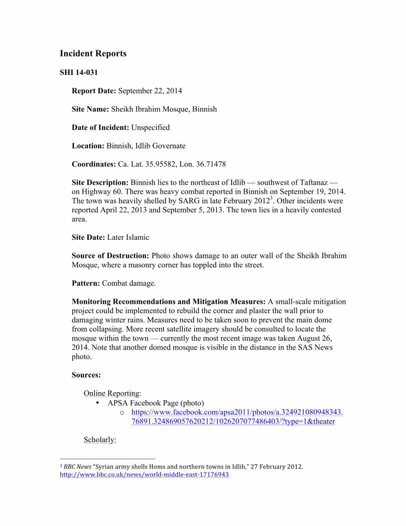
Incident Reports SHI 14-031
Report Date: September 22, 2014 Site Name: Sheikh Ibrahim Mosque, Binnish Date of Incident: Unspecified Location: Binnish, Idlib Governate Coordinates: Ca. Lat. 35.95582, Lon. 36.71478 Site Description: Binnish lies to the northeast of Idlib — southwest of Taftanaz — on Highway 60. There was heavy combat reported in Binnish on September 19, 2014. The town was heavily shelled by SARG in late February 20123. Other incidents were reported April 22, 2013 and September 5, 2013. The town lies in a heavily contested area. Site Date: Later Islamic Source of Destruction: Photo shows damage to an outer wall of the Sheikh Ibrahim Mosque, where a masonry corner has toppled into the street.
Pattern: Combat damage. Monitoring Recommendations and Mitigation Measures: A small-scale mitigation project could be implemented to rebuild the corner and plaster the wall prior to damaging winter rains. Measures need to be taken soon to prevent the main dome from collapsing. More recent satellite imagery should be consulted to locate the mosque within the town — currently the most recent image was taken August 26, 2014. Note that another domed mosque is visible in the distance in the SAS News photo. Sources:
Online Reporting: • APSA Facebook Page (photo)
o https://www.facebook.com/apsa2011/photos/a.324921080948343.76891.324869057620212/1026207077486403/?type=1&theater
Scholarly:
3 BBC News “Syrian army shells Homs and northern towns in Idlib,” 27 February 2012. http://www.bbc.co.uk/news/world-‐middle-‐east-‐17176943
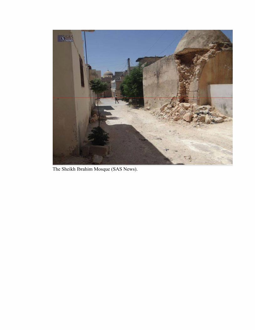
The Sheikh Ibrahim Mosque (SAS News).
SHI 14-032
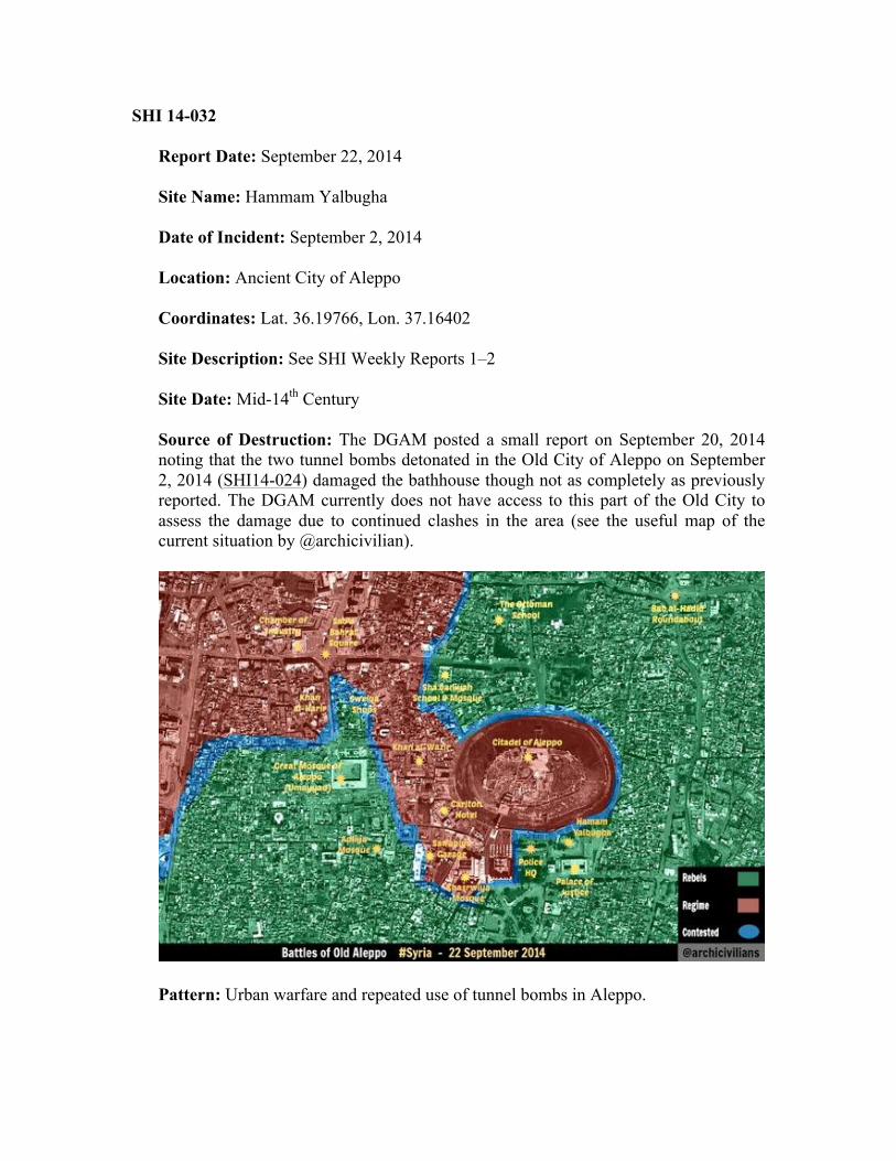
Report Date: September 22, 2014 Site Name: Hammam Yalbugha Date of Incident: September 2, 2014 Location: Ancient City of Aleppo Coordinates: Lat. 36.19766, Lon. 37.16402 Site Description: See SHI Weekly Reports 1–2 Site Date: Mid-14th Century Source of Destruction: The DGAM posted a small report on September 20, 2014 noting that the two tunnel bombs detonated in the Old City of Aleppo on September 2, 2014 (SHI14-024) damaged the bathhouse though not as completely as previously reported. The DGAM currently does not have access to this part of the Old City to assess the damage due to continued clashes in the area (see the useful map of the current situation by @archicivilian).
Pattern: Urban warfare and repeated use of tunnel bombs in Aleppo.
Monitoring Recommendations and Mitigation Measures: SHI continues to monitor the Ancient City of Aleppo as one of its top priorities. The most recent satellite image dates to August 10, 2014, i.e., prior to the tunnel bombing of Sept. 2. Sources:
Online Reporting: • DGAM Website
o Yalbouga Hammam: http://www.dgam.gov.sy/?d=314&id=1422 o Tunnel Bombs:
http://www.dgam.gov.sy/index.php?d=314&id=1405 Scholarly: See SHI Weekly Report 1–2
SHI 14-033
Report Date: September 22, 2014 Site Names: Tell Ashaari/Tell Ash’ari and/or Tell Ashtara Date of Incident: September 2014 Location: Daraa Governate. Tell Ashaari/Tell Ash’ari lies southwest of modern Al-Ashaary, and Astartu is located southeast of modern Adawan. Coordinates: Tell Ashaari/Tell Ash’ari — Lat. 32.74343, Lon. 36.01441; Tell Astartu — Lat. 32.80445, Lon. 36.01547 Site Description: Tell Ashaari/Tell Ash’ari is situated about 20 kilometers northwest of Daraa on the western edge of the Hauran along the Wadi Harir. Akkermans and Schwartz summarize4,
In the western Hawran, Tell Ashtara (ancient Ashtaroth?) north of Der’a, which may have served as the regional center, was briefly investigated by Abou Asaf, who also excavated a stone-lined roofed dolmen grave in Tayyibeh. Collective tombs cut into rock were excavated by salvage operations at Tell al-Ash’ari and Der’a in the 1990s.
Satellite images show that Tell Ashaari/Tell Ash’ari has been scientifically excavated in the recent past (Lat. 32.74343, Lon. 36.01441). Although it is difficult to ascertain, the DGAM photos of looting appear to show cuts into the side of a steep mound, which is also consistent with the morphology and current conditions of nearby Tell Ashtara (Lat. 32.80445, Lon. 36.01547). However, Casana and Panahipour have documented recent looting/disturbance at Ash’ari, which they misidentified as Ashtara5. The poor resolution of the most recent satellite image of the site from September 24, 2014 does not help to clarify matters.
Site Date: Various Source of Destruction: The DGAM posted two additional photos showing illegal excavations at Tell Ashaari/Tell Ash’ari, including people carrying out probing at the site. The DGAM claims individuals are selling artifacts through an on-site broker. This evidence builds upon an earlier DGAM report from June 2014 that highlighted looting and illicit excavations in the Daraa region, which included several photos from Tell Ashaari as well. DGAM reports are potentially biased given this area lies within Opposition control.
Pattern: Large-scale looting throughout Syria.
4 Akkermans and Schwartz 2003: 320. 5 Casana and Panahipour 2014: Fig. 11.
Monitoring Recommendations and Mitigation Measures: SHI is currently preparing Incident Reports on a large number of looted sites identified by SHI co-director Dr. Jesse Casana, University of Arkansas. Sources:
Online Reporting: • DGAM Website
o http://www.dgam.gov.sy/?d=314&id=1420 o June Report (http://www.dgam.gov.sy/?d=314&id=1286)
Scholarly: Abou Assaf, A. 1968. “Tell ‘Ashtara in Südsyrien. Erste Kampagne 1966,” Annales Archéologiques Arabes Syriennes 18: 103–22. Akkermans, P. and G. Schwartz. 2003. The Archaeology of Syria. (Cambridge University Press). Al-Maqdissi, M., ed. 1993. “Chronique des activités archéologiques en Syrie (I),” Syria 70: 443–576. Casana, J. and M. Panahipour. 2014. “Notes on a Disappearing Past. Satellite-Based Monitoring of Looting and Damage to Archaeological Sites in Syria,” Journal of Eastern Mediterranean Archaeology and Heritage Studies 2/2: 128–151.
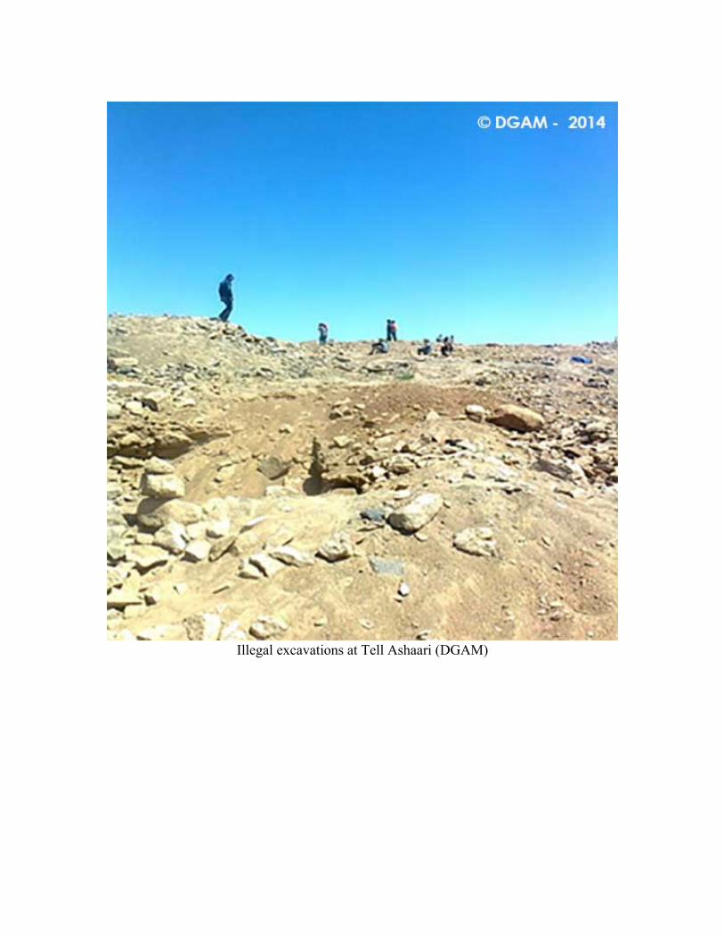
Illegal excavations at Tell Ashaari (DGAM)
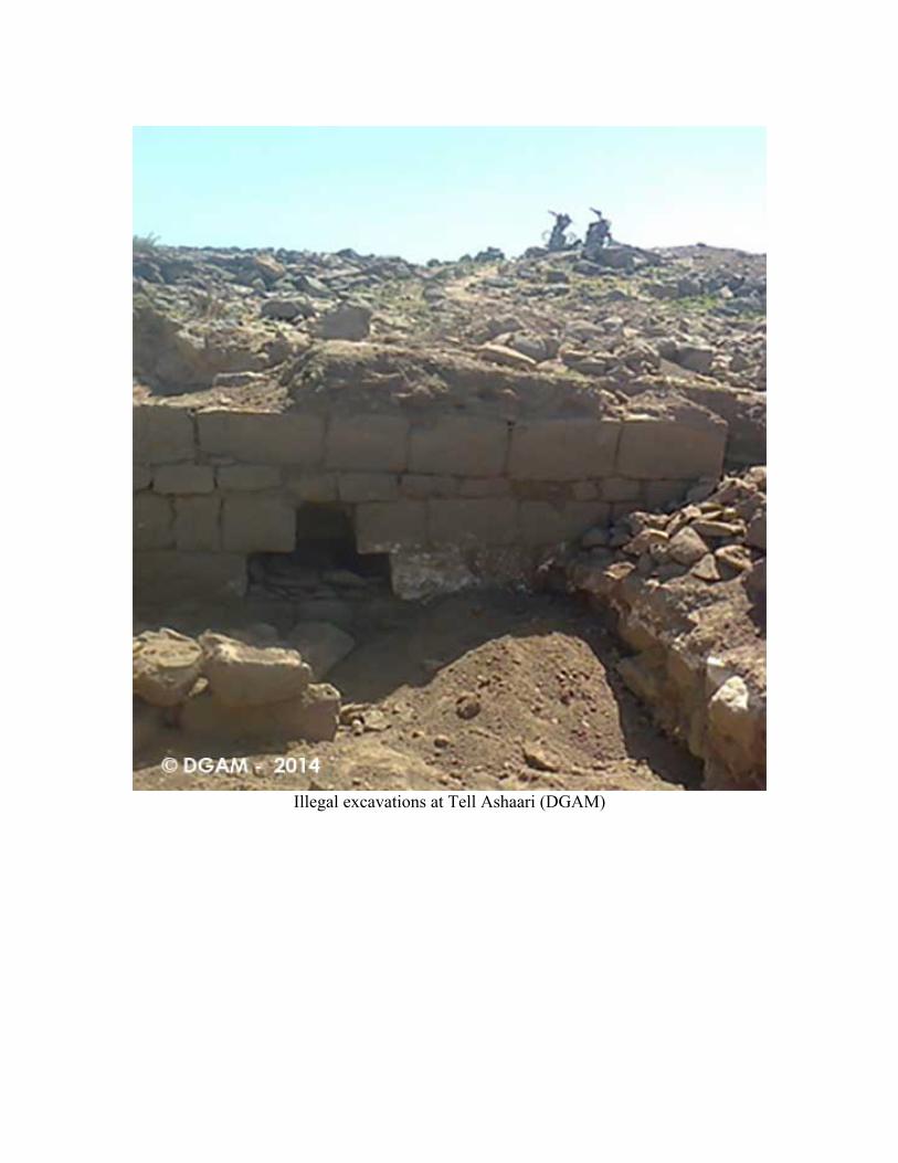
Illegal excavations at Tell Ashaari (DGAM)
SHI 14-034
Report Date: September 22, 2014 Site Name: Apamea Date of Incident: Since 2011 Location: Apamea, Hama Governate, 55 km north of Hama Coordinates: Lat. 35.42124, Lon. 36.40165 Site Description: According to Ross Burns,
The mound of Qalaat Mudiq (‘fortress of the defile’) lies west of the classical walled city and is still occupied by some of the town’s inhabitants. The mound, an artificial accumulation on a natural rocky outcrop, has indications of settlement going back at least to the Bronze Age. The site was chosen as the location for one of the four cities founded by Seleucus I Nicator at the end of the fourth century BC. Originally named Pharnake, the name was changed to Apameia to honour Seleucus’ Persian wife, Apama […] In 64 BC, Apamea was taken by the Romans under Pompey and its citadel was razed. Under Roman rule, it was again favoured as a military base. The theatre, baths, temples, and villas, constructed during the town’s peak period of prosperity, the boom years of the second century AD, were perhaps initiated when Trajan ordered the rebuilding of the city after a severe earthquake in 115. The colonnaded main street was completed in its present form under Marcus Aurelius (161–80) and served both as an axis and a market, lined with stalls and shaded arcades6.
Site Date: Various, mainly Hellenistic, Roman, Byzantine, Medieval, and Ottoman Source of Destruction: APSA posted two videos filmed by Thabet Ismael that highlight the clandestine operations underway at Apamea. The second video in particular shows the official army checkpoint, earth dikes, and the installation of heavy weapons in the archaeological area.
The APSA report attributes the damage to two primary causes: the conversion of the site into a military camp and the intentional looting of the site. The former has meant the presence of tanks and the digging of trenches, while the latter has resulted in pits up to two meters deep. The number of pits far exceeds the excavated areas from the Belgian archaeological mission (aerial photographs from April 2013 showed over 5,000 looter holes), highlighting the massive scale of the illicit digging.
Pattern: According to APSA, the looting was allegedly spurred on by remarks from the head of a detachment of the military, which encouraged looters to find and sell ancient treasures (“…les trésors antiques sont à votre portée, fouillez et rapportez tout ce que vous pouvez trouver et vendez-le! C’est plus rentable que de manifester…”). APSA alleges there is a cooperative agreement between the Syrian authorities and the
6 Burns, Ross. 2010. The Monuments of Syria. A Guide. (I.B. Tuaris), p. 60.
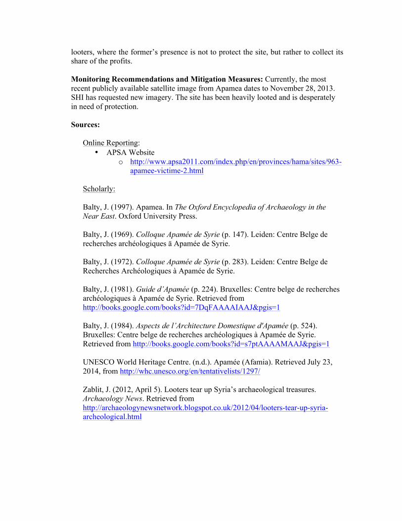
looters, where the former’s presence is not to protect the site, but rather to collect its share of the profits. Monitoring Recommendations and Mitigation Measures: Currently, the most recent publicly available satellite image from Apamea dates to November 28, 2013. SHI has requested new imagery. The site has been heavily looted and is desperately in need of protection. Sources:
Online Reporting: • APSA Website
o http://www.apsa2011.com/index.php/en/provinces/hama/sites/963-apamee-victime-2.html
Scholarly:
Balty, J. (1997). Apamea. In The Oxford Encyclopedia of Archaeology in the Near East. Oxford University Press.
Balty, J. (1969). Colloque Apamée de Syrie (p. 147). Leiden: Centre Belge de recherches archéologiques ä Apamée de Syrie.
Balty, J. (1972). Colloque Apamée de Syrie (p. 283). Leiden: Centre Belge de Recherches Archéologiques à Apamée de Syrie.
Balty, J. (1981). Guide d’Apamée (p. 224). Bruxelles: Centre belge de recherches archéologiques à Apamée de Syrie. Retrieved from http://books.google.com/books?id=7DqFAAAAIAAJ&pgis=1
Balty, J. (1984). Aspects de l’Architecture Domestique d'Apamée (p. 524). Bruxelles: Centre belge de recherches archéologiques à Apamée de Syrie. Retrieved from http://books.google.com/books?id=s7ptAAAAMAAJ&pgis=1
UNESCO World Heritage Centre. (n.d.). Apamée (Afamia). Retrieved July 23, 2014, from http://whc.unesco.org/en/tentativelists/1297/
Zablit, J. (2012, April 5). Looters tear up Syria’s archaeological treasures. Archaeology News. Retrieved from http://archaeologynewsnetwork.blogspot.co.uk/2012/04/looters-tear-up-syria-archeological.html
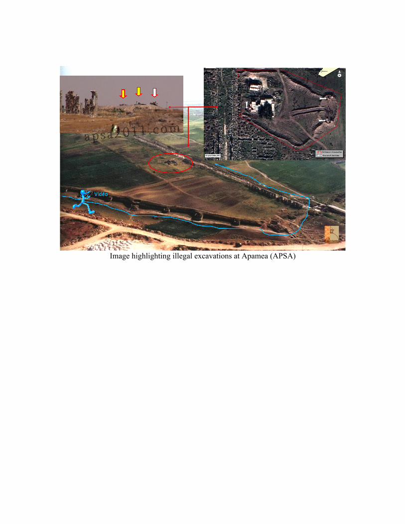
Image highlighting illegal excavations at Apamea (APSA)
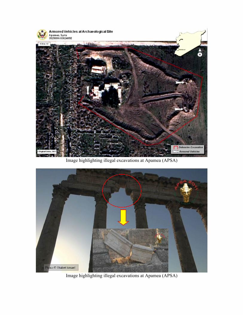
Image highlighting illegal excavations at Apamea (APSA)
Image highlighting illegal excavations at Apamea (APSA)
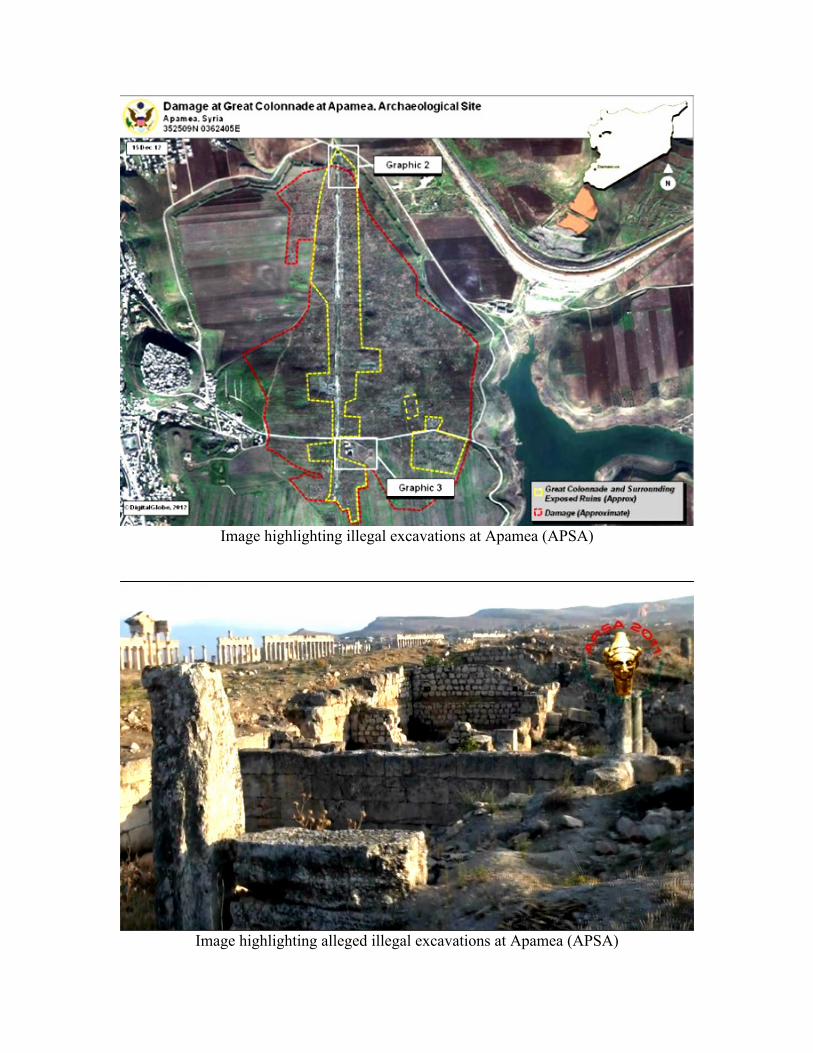
Image highlighting illegal excavations at Apamea (APSA)
Image highlighting alleged illegal excavations at Apamea (APSA)
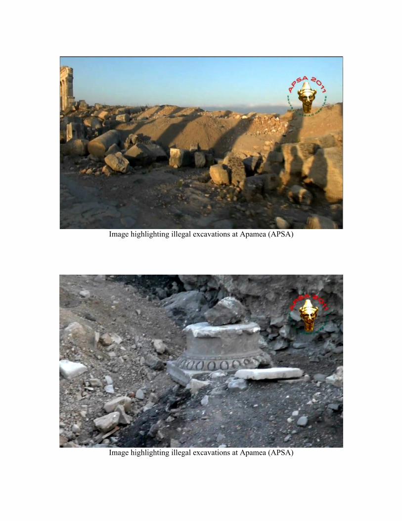
Image highlighting illegal excavations at Apamea (APSA)
Image highlighting illegal excavations at Apamea (APSA)
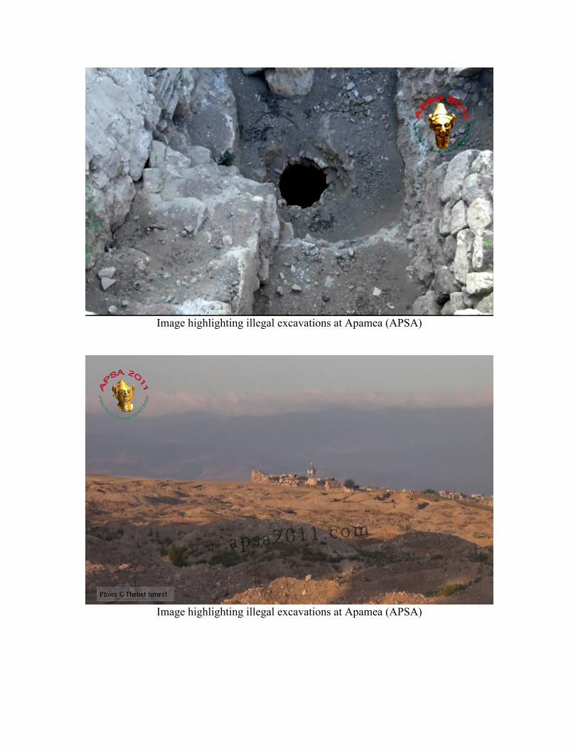
Image highlighting illegal excavations at Apamea (APSA)
Image highlighting illegal excavations at Apamea (APSA)
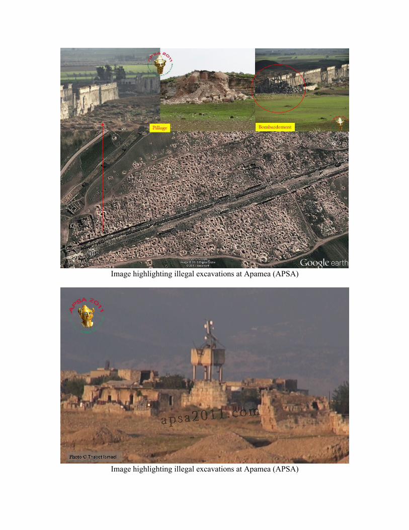
Image highlighting illegal excavations at Apamea (APSA)
Image highlighting illegal excavations at Apamea (APSA)
SHI 14-035
Report Date: September 22, 2014 Site Name: Citadel of Aleppo Date of Incident: Unspecified Location: Aleppo Coordinates: — Site Description: See SHI Weekly Reports 1–2 Site Date: — Source of Destruction: APSA posted eight new photos to their website highlighting damage to the Aleppo Citadel.
Pattern: Continued destruction of the UNESCO World Heritage Site Ancient City of Aleppo by urban warfare, airstrikes, fires, and tunnel bombs. Monitoring Recommendations and Mitigation Measures: SHI is currently monitoring Aleppo as a high priority site. Sources:
Online Reporting: • APSA
o http://www.apsa2011.com/index.php/en/provinces/aleppo/monuments/966-citadel-of-aleppo-2.html
Scholarly:
Gonnella, J. (2006). The Citadel of Aleppo: Recent Studies. History of Warfare, 35 (Muslim Military Architecture in Greater Syria: From the Coming of Islam to the Ottoman Period), 165–175.
Jodido, P. (2011). Citadel of Aleppo. In The Aga Khan Historic Cities Programme: Strategies for Urban Regeneration (pp. 254–259). Munich: Prestel.
Juha, F. (1976). Qal’at Halab [The Citadel of Aleppo]. Majallat ‘Adiyat Halab, 2, 96–165.
Saouaf, S. (1964). The Citadel of Aleppo. Visitor’s Guide (p. 30). Unknown: Unknown.

Seirafi, F., & Attar, N. (1954). La Citadelle d’Alep (p. 57). Aleppo: Imprimeire Chiraz.
Sha’ath, S., & Gritani, M. (1977). Qal’at Halab [Citadel of Aleppo]. Damascus: Matbu’at al-Mudiriyya al-'Amma lil-Athar wal-Matahif.
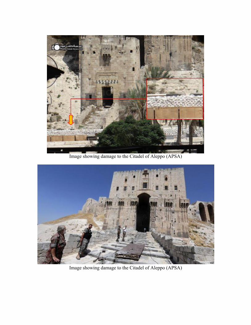
Image showing damage to the Citadel of Aleppo (APSA)
Image showing damage to the Citadel of Aleppo (APSA)
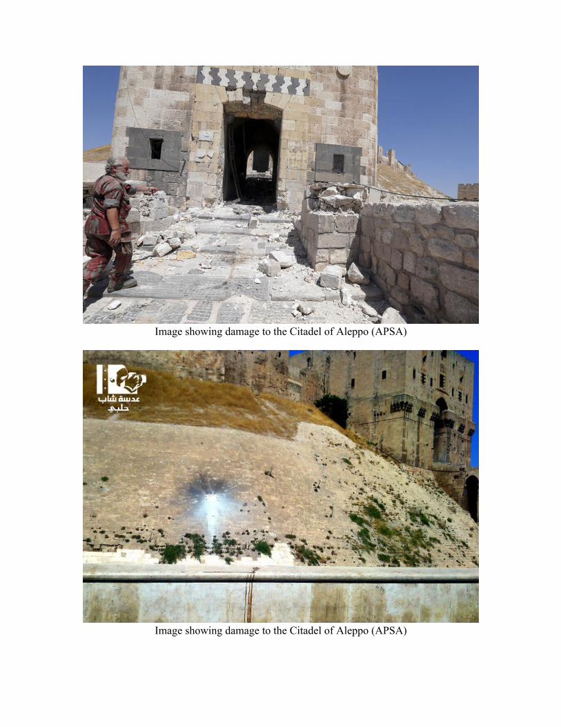
Image showing damage to the Citadel of Aleppo (APSA)
Image showing damage to the Citadel of Aleppo (APSA)
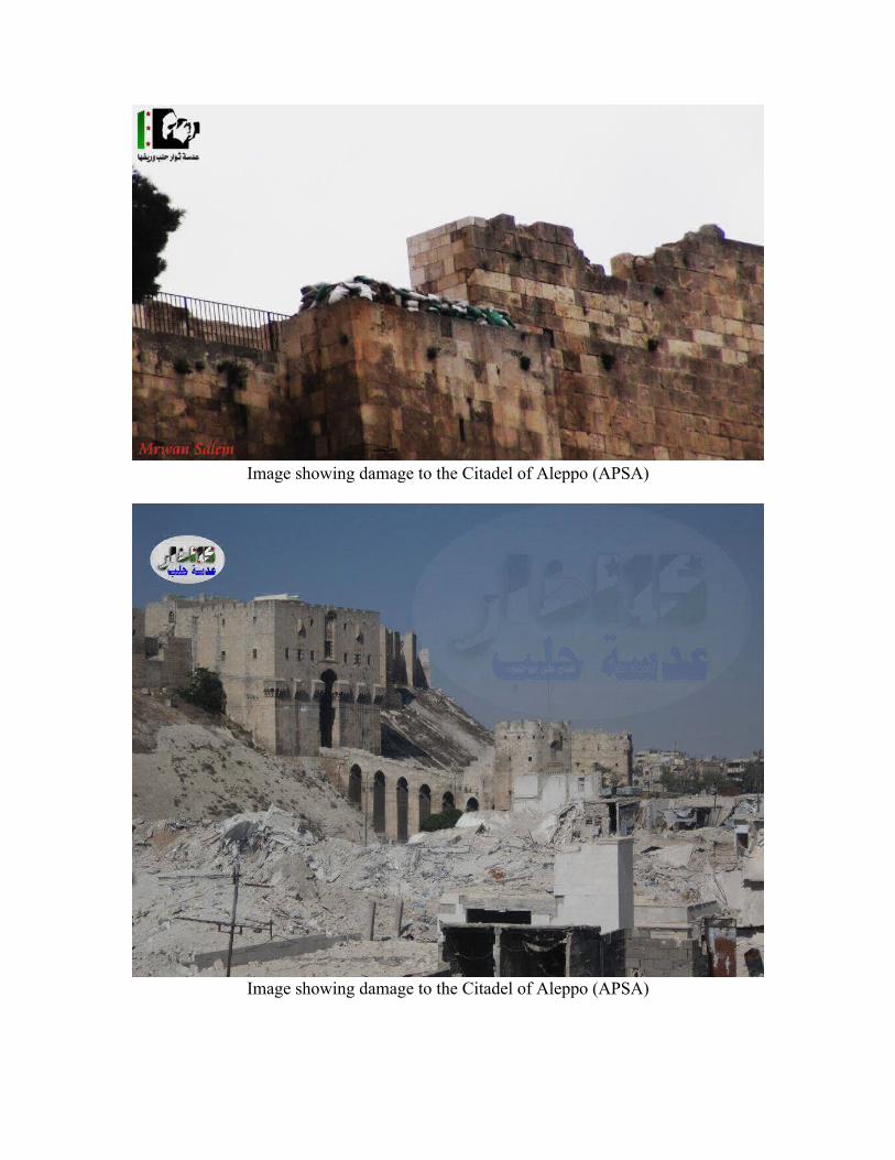
Image showing damage to the Citadel of Aleppo (APSA)
Image showing damage to the Citadel of Aleppo (APSA)
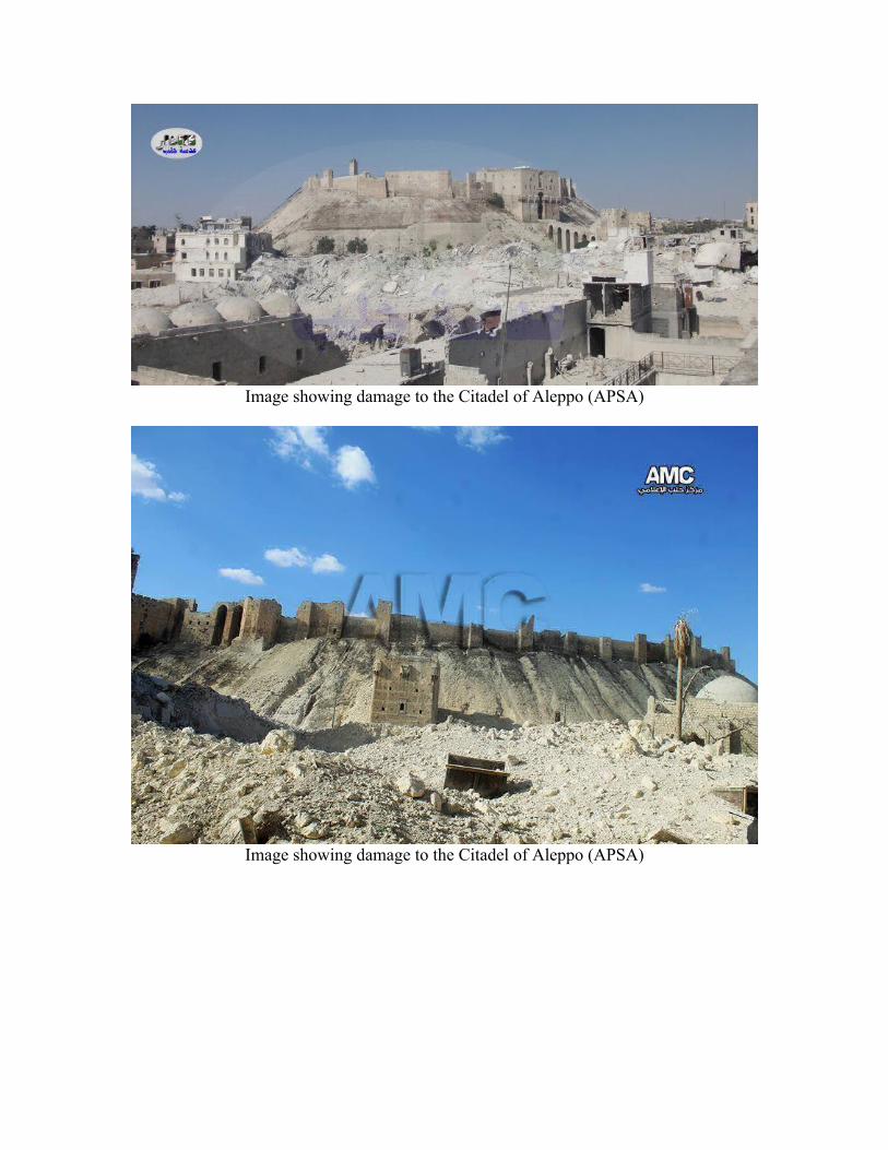
Image showing damage to the Citadel of Aleppo (APSA)
Image showing damage to the Citadel of Aleppo (APSA)