ulster county multi-jurisdictional natural hazard mitigation plan
Upload
khangminh22Category
view
3download
0
APPROVED JURISDICTIONAL DETERMINATION FORM
U.S. Army Corps of Engineers
This form should be completed by following the instructions provided in Section IV of the JD Form Instructional Guidebook. SECTION I: BACKGROUND INFORMATION A. REPORT COMPLETION DATE FOR APPROVED JURISDICTIONAL DETERMINATION (JD): July 28, 2017 B. DISTRICT OFFICE, FILE NAME, AND NUMBER: SPL-2010-00945-VCL - JD 2 C. PROJECT LOCATION AND BACKGROUND INFORMATION:
State: CA County/parish/borough: Kern County City: N/A Center coordinates of site (lat/long in degree decimal format): Lat. 34.95424° N, Long. -118.32405° W.
Universal Transverse Mercator: 379107 m E, 3868768 m N Name of nearest waterbody: Oak Creek
Name of nearest Traditional Navigable Water (TNW) into which the aquatic resource flows: N/A Name of watershed or Hydrologic Unit Code (HUC): Tropico Hill- Oak Creek, California, 1809020617
Check if map/diagram of review area and/or potential jurisdictional areas is/are available upon request. Check if other sites (e.g., offsite mitigation sites, disposal sites, etc…) are associated with this action and are recorded on a
different JD form. D. REVIEW PERFORMED FOR SITE EVALUATION (CHECK ALL THAT APPLY):
Office (Desk) Determination. Date: July 25, 2017 Field Determination. Date(s):
SECTION II: SUMMARY OF FINDINGS A. RHA SECTION 10 DETERMINATION OF JURISDICTION. There Are no “navigable waters of the U.S.” within Rivers and Harbors Act (RHA) jurisdiction (as defined by 33 CFR part 329) in the review area. [Required]
Waters subject to the ebb and flow of the tide. Waters are presently used, or have been used in the past, or may be susceptible for use to transport interstate or foreign commerce.
Explain: . B. CWA SECTION 404 DETERMINATION OF JURISDICTION. There Are no “waters of the U.S.” within Clean Water Act (CWA) jurisdiction (as defined by 33 CFR part 328) in the review area. [Required] 1. Waters of the U.S. a. Indicate presence of waters of U.S. in review area (check all that apply): 1 TNWs, including territorial seas Wetlands adjacent to TNWs Relatively permanent waters2 (RPWs) that flow directly or indirectly into TNWs Non-RPWs that flow directly or indirectly into TNWs Wetlands directly abutting RPWs that flow directly or indirectly into TNWs Wetlands adjacent to but not directly abutting RPWs that flow directly or indirectly into TNWs Wetlands adjacent to non-RPWs that flow directly or indirectly into TNWs Impoundments of jurisdictional waters Isolated (interstate or intrastate) waters, including isolated wetlands
b. Identify (estimate) size of waters of the U.S. in the review area: Non-wetland waters: linear feet: width (ft) and/or acres. Wetlands: acres. c. Limits (boundaries) of jurisdiction based on: Not Applicable. Elevation of established OHWM (if known): . 2. Non-regulated waters/wetlands (check if applicable):3 Potentially jurisdictional waters and/or wetlands were assessed within the review area and determined to be not jurisdictional.
Explain:
The project area containsa total of 157 aquatic features. These features include Oak Creek, which is an intermittent stream in the southern Tehachapi foothills with four segments and an associated seasonal wetland in the study area, and becomes an ephemeral wash on the desert floor with five segments in the study area, before dissipating near Cactus Queen Mine. Additional
1 Boxes checked below shall be supported by completing the appropriate sections in Section III below. 2 For purposes of this form, an RPW is defined as a tributary that is not a TNW and that typically flows year-round or has continuous flow at least “seasonally” (e.g., typically 3 months). 3 Supporting documentation is presented in Section III.F.
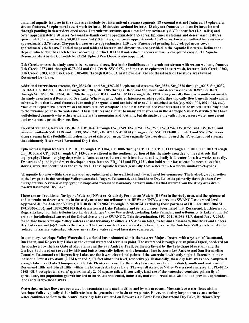
unnamed aquatic features in the study area include two intermittent streams segments, 18 seasonal wetland features, 33 ephemeral stream features, 54 ephemeral desert wash features, 10 forested wetland features, 28 claypan features, and two features formed through ponding in desert developed areas. Intermittent streams span a total of approximately 6,370 linear feet (1.21 miles) and cover approximately 1.70 acres. Seasonal wetlands cover approximately 2.85 acres. Ephemeral streams and desert wash features span a total of approximately 80,923 linear feet (15.3 miles), and cover approximately 10.67 acres. Forested wetland features cover approximately 2.76 acres. Claypan features cover approximately 0.29 acre. Features of ponding in developed areas cover approximately 0.18 acre. Labeled maps and tables of features and dimensions are provided in the Aquatic Resources Delineation Report, which identifies each feature according to which HUC-10 watershed it occurs within. A completed copy of the Aquatic Resources sheet in the Consolidated ORM Upload Workbook is also appended. Oak Creek, crosses the study area in two separate places, first in the foothills as an intermittent stream with season wetland, features Oak Creek_0273-001 through 0273-004 and Oak Creek_SW_0272, and then as an ephemeral desert wash, features Oak Creek_0302, Oak Creek_0303, and Oak Creek_0305-001 through 0305-003, as it flows east and southeast outside the study area toward Rosamond Dry Lake. Additional intermittent streams, Str_0263-001 and Str_0263-002; ephemeral streams, Str_0232, Str_0234 through _0235, Str_0237, Str_0241, Str_0256, Str_0274 through Str_0283, Str_0285 through _0288 and Str_0290; and desert washes Str_0289, Str_0291 through Str_0301, Str_0304, Str_0306 through Str_0312, and Str_0318 through Str_0328, also generally flow east - southeast outside the study area toward Rosamond Dry Lake. Where aquatic features intersect existing roads, they typically flow beneath roadways in culverts. Note that several features have multiple segments and are labeled as such in attached tables [e.g. 0326-001, 0326-002, etc.). Most of the ephemeral desert wash and ditch features dissipate and do not have defined channels that can be traced all the way down to the terminal point in the watershed. These features are similar to many other streams in the Antelope Valley Watershed that have well-defined channels where they originate in the mountains and foothills, but dissipate on the valley floor, where water movement during storms is primarily sheet flow. Forested wetlands, features FW_0233, FW_0246 through FW_0249, FW_0251, FW_252, FW_0254, FW_0255, and FW_0265, and seasonal wetlands SW_0238 and _0239, SW_0242, SW_0245, SW_0250 (11 segments), SW_0253-001 and -002 and SW_0261 occur along streams in the foothills in northern part of this study area. These aquatic features drain toward the aforementioned streams that ultimately flow toward Rosamond Dry Lake. Ephemeral claypan features, CP_1000 through CP_1004, CP_1006 through CP_1008, CP_1010 through CP_1011, CP_1016 through CP_1020, and CP_1022 through CP_1034, are scattered in the southern portion of this the study area due to the relatively flat topography. These low-lying depressional features are ephemeral or intermittent, and typically hold water for a few weeks annually. Two areas of ponding in desert developed areas, features PD_1013 and PD_1021, that hold water for at least fourteen days after storms, were also identified in the study area. These aquatic features generally hold water for a few weeks similar to claypans. All aquatic features within the study area are ephemeral or intermittent and are not used for commerce. The hydrologic connection to the low point in the Antelope Valley watershed, Rogers, Rosamond, and Buckhorn Dry Lakes, is primarily through sheet flow during storms. A review of topographic maps and watershed boundary datasets indicates that waters from the study area drain toward Rosamond Dry Lake. There are no Traditional Navigable Waters (TNWs) or Relatively Permanent Waters (RPWs) in the study area, and the ephemeral and intermittent desert streams in the study area are not tributaries to RPWs or TNWs. A previous SWANCC watershed-level Approved JD for Antelope Valley (HUC10 #s 1809020609 through 1809020624, excluding those portions of HUC12s 18090206151, 1901902061102, and 180902061103 that drain toward Lake Palmdale and its tributaries) determined that Rosamond, Buckhorn and Rogers Lakes, and their tributaries, (i.e. the Antelope Valley Watershed, excluding Lake Palmdale and tributaries to Lake Palmdale) are non-jurisdictional waters of the United States under SWANCC. This determination, SPL-2011-01084-SLP, dated June 7, 2013, found that these Antelope Valley waters are not tributary to either a TNW or an (a)(3) water and Rosamond, Buckhorn and Rogers Dry Lakes are not (a)(3) waters themselves. The Corps made this watershed conclusion because the Antelope Valley watershed is an isolated, intrastate watershed without any surface water related interstate commerce.
In summary, Antelope Valley Watershed is a closed basin situated within the western Mojave Desert, with a system of Rosamond, Buckhorn, and Rogers Dry Lakes as the central watershed terminus point. The watershed is roughly triangular-shaped, bordered on the southwest by the San Gabriel Mountains and the San Andreas Fault, on the northwest by the Tehachapi Mountains and the Garlock Fault, and on the east by hills and buttes generally following the boundary line between Los Angeles and San Bernardino Counties. Rosamond and Rogers Dry Lakes are the lowest elevational points of the watershed, with only slight differences in their individual lowest elevations (2,274 feet and 2,270 feet above sea level, respectively). Historically, these dry lake areas once comprised a single lake area (Lake Thompson) in the late Pleistocene era. The three dry lakes are located immediately south and southeast of Rosamond Hills and Bissell Hills, within the Edwards Air Force Base. The overall Antelope Valley Watershed analyzed in SPL-2011-01084-SLP occupies an area of approximately 2,400 square miles. Historically, land use of the watershed consisted primarily of agriculture, but population growth has led to increased residential, industrial, and commercial uses within both previous agricultural lands and undeveloped areas. Watershed surface flows are generated by mountain snow pack melting and by storm events. Most surface water flows within Antelope Valley typically either infiltrate into the groundwater basin or evaporate. However, during large storm events surface water continues to flow to the central three dry lakes situated on Edwards Air Force Base (Rosamond Dry Lake, Buckhorn Dry

Lake, and Rogers Dry Lake). Storm water runoff from the surrounding mountains and hills is typically carried by ephemeral stream courses. Within the Valley floor, runoff is primarily carried by sheetflow. Surface flows that reach the dry lakes are typically are subject to evaporation rather than deep infiltration due to underlying clay soils. Additionally, a previous approved jurisdictional determination was made for Oak Creek and some tributaries to Oak Creek (SPL-2012-00214-SLP, JD-1) on June 28, 2012. This determination found that the terminus for Oak Creek and its tributaries is Rosamond Dry Lake, and reiterated the non-jurisdictional status of tributaries to Rosamond Dry Lake. Previously approved jurisdictional determinations have been made for tributaries to these dry lakes. When these lakes were analyzed in SPL-2011-01084-SLP, the Corps found no published commercial uses of the surface waters of any tributaries to Rosamond, Buckhorn and Rogers Dry Lakes, and determined that a review of aerial photographs (Google Earth) also did not depict surface water usage of any drainages tributary to the dry lakes. The Corps found that all tributaries to Rosamond, Buckhorn and Rogers Dry Lakes are not (a)(3) waters as defined by 33 C.F.R. section 328.3(a)(3)(i-iii). The previous determination found that since Rosamond, Buckhorn and Rogers Dry Lakes are intrastate isolated, waters without a surface water connection to commerce, all tributaries to Rosamond, Buckhorn and Rogers Dry Lakes as part of the overall watershed system are also isolated and additionally have no nexus to commerce. A review of current conditions and updated literature review found that conditions have not changed since the SPL-2011-01084-SLP determination for Antelope Valley. Based on the information above, the subject drainages Oak Creek, two intermittent streams segments, 18 seasonal wetland features, 33 ephemeral stream features, 54 ephemeral desert wash features, 10 forested wetland features, 28 claypan features, and two desert ponds are NONJURISDICTIONAL waters of the United States, since the waters are NOT tributary to either a TNW or an (a)(3) water and are NOT (a)(3) waters themselves. The Corps makes such a conclusion since the waters are tribuatary to an isolated, intrastate dry lake .

SECTION III: CWA ANALYSIS A. TNWs AND WETLANDS ADJACENT TO TNWs The agencies will assert jurisdiction over TNWs and wetlands adjacent to TNWs. If the aquatic resource is a TNW, complete
Section III.A.1 and Section III.D.1. only; if the aquatic resource is a wetland adjacent to a TNW, complete Sections III.A.1 and 2 and Section III.D.1.; otherwise, see Section III.B below.
1. TNW Identify TNW: .
Summarize rationale supporting determination: .
2. Wetland adjacent to TNW Summarize rationale supporting conclusion that wetland is “adjacent”: .
B. CHARACTERISTICS OF TRIBUTARY (THAT IS NOT A TNW) AND ITS ADJACENT WETLANDS (IF ANY): This section summarizes information regarding characteristics of the tributary and its adjacent wetlands, if any, and it helps
determine whether or not the standards for jurisdiction established under Rapanos have been met. The agencies will assert jurisdiction over non-navigable tributaries of TNWs where the tributaries are “relatively permanent
waters” (RPWs), i.e. tributaries that typically flow year-round or have continuous flow at least seasonally (e.g., typically 3 months). A wetland that directly abuts an RPW is also jurisdictional. If the aquatic resource is not a TNW, but has year-round (perennial) flow, skip to Section III.D.2. If the aquatic resource is a wetland directly abutting a tributary with perennial flow, skip to Section III.D.4.
A wetland that is adjacent to but that does not directly abut an RPW requires a significant nexus evaluation. Corps districts and
EPA regions will include in the record any available information that documents the existence of a significant nexus between a relatively permanent tributary that is not perennial (and its adjacent wetlands if any) and a traditional navigable water, even though a significant nexus finding is not required as a matter of law.
If the waterbody4 is not an RPW, or a wetland directly abutting an RPW, a JD will require additional data to determine if the waterbody has a significant nexus with a TNW. If the tributary has adjacent wetlands, the significant nexus evaluation must consider the tributary in combination with all of its adjacent wetlands. This significant nexus evaluation that combines, for analytical purposes, the tributary and all of its adjacent wetlands is used whether the review area identified in the JD request is the tributary, or its adjacent wetlands, or both. If the JD covers a tributary with adjacent wetlands, complete Section III.B.1 for the tributary, Section III.B.2 for any onsite wetlands, and Section III.B.3 for all wetlands adjacent to that tributary, both onsite and offsite. The determination whether a significant nexus exists is determined in Section III.C below.
1. Characteristics of non-TNWs that flow directly or indirectly into TNW
(i) General Area Conditions: Watershed size: Pick List Drainage area: Pick List Average annual rainfall: inches Average annual snowfall: inches (ii) Physical Characteristics: (a) Relationship with TNW: Tributary flows directly into TNW. Tributary flows through Pick List tributaries before entering TNW. Project waters are Pick List river miles from TNW. Project waters are Pick List river miles from RPW. Project waters are Pick List aerial (straight) miles from TNW. Project waters are Pick List aerial (straight) miles from RPW. Project waters cross or serve as state boundaries. Explain: . Identify flow route to TNW5: . Tributary stream order, if known: .
4 Note that the Instructional Guidebook contains additional information regarding swales, ditches, washes, and erosional features generally and in the arid West. 5 Flow route can be described by identifying, e.g., tributary a, which flows through the review area, to flow into tributary b, which then flows into TNW.

(b) General Tributary Characteristics (check all that apply): Tributary is: Natural Artificial (man-made). Explain: . Manipulated (man-altered). Explain: .
Tributary properties with respect to top of bank (estimate):
Average width: feet Average depth: feet Average side slopes: Pick List. Primary tributary substrate composition (check all that apply):
Silts Sands Concrete Cobbles Gravel Muck Bedrock Vegetation. Type/% cover: Other. Explain: . Tributary condition/stability [e.g., highly eroding, sloughing banks]. Explain: . Presence of run/riffle/pool complexes. Explain: . Tributary geometry: Pick List Tributary gradient (approximate average slope): % (c) Flow: Tributary provides for: Pick List Estimate average number of flow events in review area/year: Pick List Describe flow regime: . Other information on duration and volume: . Surface flow is: Pick List. Characteristics: . Subsurface flow: Pick List. Explain findings: . Dye (or other) test performed: . Tributary has (check all that apply): Bed and banks OHWM6 (check all indicators that apply):
clear, natural line impressed on the bank the presence of litter and debris changes in the character of soil destruction of terrestrial vegetation shelving the presence of wrack line vegetation matted down, bent, or absent sediment sorting leaf litter disturbed or washed away scour sediment deposition multiple observed or predicted flow events water staining abrupt change in plant community other (list):
Discontinuous OHWM.7 Explain: .
If factors other than the OHWM were used to determine lateral extent of CWA jurisdiction (check all that apply): High Tide Line indicated by:
oil or scum line along shore objects fine shell or debris deposits (foreshore) physical markings/characteristics
tidal gauges other (list):
Mean High Water Mark indicated by: survey to available datum; physical markings; vegetation lines/changes in vegetation types.
(iii) Chemical Characteristics:
Characterize tributary (e.g., water color is clear, discolored, oily film; water quality; general watershed characteristics, etc.). Explain: .
Identify specific pollutants, if known: .
6A natural or man-made discontinuity in the OHWM does not necessarily sever jurisdiction (e.g., where the stream temporarily flows underground, or where the OHWM has been removed by development or agricultural practices). Where there is a break in the OHWM that is unrelated to the waterbody’s flow regime (e.g., flow over a rock outcrop or through a culvert), the agencies will look for indicators of flow above and below the break. 7Ibid.

(iv) Biological Characteristics. Channel supports (check all that apply): Riparian corridor. Characteristics (type, average width): . Wetland fringe. Characteristics: . Habitat for:
Federally Listed species. Explain findings: . Fish/spawn areas. Explain findings: . Other environmentally-sensitive species. Explain findings: . Aquatic/wildlife diversity. Explain findings: . 2. Characteristics of wetlands adjacent to non-TNW that flow directly or indirectly into TNW
(i) Physical Characteristics: (a) General Wetland Characteristics: Properties: Wetland size: acres Wetland type. Explain: . Wetland quality. Explain: . Project wetlands cross or serve as state boundaries. Explain: .
(b) General Flow Relationship with Non-TNW: Flow is: Pick List. Explain: . Surface flow is: Pick List Characteristics: . Subsurface flow: Pick List. Explain findings: . Dye (or other) test performed: . (c) Wetland Adjacency Determination with Non-TNW:
Directly abutting Not directly abutting Discrete wetland hydrologic connection. Explain: . Ecological connection. Explain: . Separated by berm/barrier. Explain: . (d) Proximity (Relationship) to TNW
Project wetlands are Pick List river miles from TNW. Project waters are Pick List aerial (straight) miles from TNW.
Flow is from: Pick List. Estimate approximate location of wetland as within the Pick List floodplain. (ii) Chemical Characteristics:
Characterize wetland system (e.g., water color is clear, brown, oil film on surface; water quality; general watershed characteristics; etc.). Explain: .
Identify specific pollutants, if known: . (iii) Biological Characteristics. Wetland supports (check all that apply): Riparian buffer. Characteristics (type, average width): . Vegetation type/percent cover. Explain: . Habitat for:
Federally Listed species. Explain findings: . Fish/spawn areas. Explain findings: .
Other environmentally-sensitive species. Explain findings: . Aquatic/wildlife diversity. Explain findings: .
3. Characteristics of all wetlands adjacent to the tributary (if any) All wetland(s) being considered in the cumulative analysis: Pick List Approximately ( ) acres in total are being considered in the cumulative analysis.

For each wetland, specify the following: Directly abuts? (Y/N) Size (in acres) Directly abuts? (Y/N) Size (in acres)
Summarize overall biological, chemical and physical functions being performed: .
C. SIGNIFICANT NEXUS DETERMINATION
A significant nexus analysis will assess the flow characteristics and functions of the tributary itself and the functions performed by any wetlands adjacent to the tributary to determine if they significantly affect the chemical, physical, and biological integrity of a TNW. For each of the following situations, a significant nexus exists if the tributary, in combination with all of its adjacent wetlands, has more than a speculative or insubstantial effect on the chemical, physical and/or biological integrity of a TNW. Considerations when evaluating significant nexus include, but are not limited to the volume, duration, and frequency of the flow of water in the tributary and its proximity to a TNW, and the functions performed by the tributary and all its adjacent wetlands. It is not appropriate to determine significant nexus based solely on any specific threshold of distance (e.g. between a tributary and its adjacent wetland or between a tributary and the TNW). Similarly, the fact an adjacent wetland lies within or outside of a floodplain is not solely determinative of significant nexus. Draw connections between the features documented and the effects on the TNW, as identified in the Rapanos Guidance and discussed in the Instructional Guidebook. Factors to consider include, for example: Does the tributary, in combination with its adjacent wetlands (if any), have the capacity to carry pollutants or flood waters to
TNWs, or to reduce the amount of pollutants or flood waters reaching a TNW? Does the tributary, in combination with its adjacent wetlands (if any), provide habitat and lifecycle support functions for fish and
other species, such as feeding, nesting, spawning, or rearing young for species that are present in the TNW? Does the tributary, in combination with its adjacent wetlands (if any), have the capacity to transfer nutrients and organic carbon that
support downstream foodwebs? Does the tributary, in combination with its adjacent wetlands (if any), have other relationships to the physical, chemical, or
biological integrity of the TNW? Note: the above list of considerations is not inclusive and other functions observed or known to occur should be documented
below: 1. Significant nexus findings for non-RPW that has no adjacent wetlands and flows directly or indirectly into TNWs. Explain
findings of presence or absence of significant nexus below, based on the tributary itself, then go to Section III.D: . 2. Significant nexus findings for non-RPW and its adjacent wetlands, where the non-RPW flows directly or indirectly into
TNWs. Explain findings of presence or absence of significant nexus below, based on the tributary in combination with all of its adjacent wetlands, then go to Section III.D: .
3. Significant nexus findings for wetlands adjacent to an RPW but that do not directly abut the RPW. Explain findings of
presence or absence of significant nexus below, based on the tributary in combination with all of its adjacent wetlands, then go to Section III.D: .
D. DETERMINATIONS OF JURISDICTIONAL FINDINGS. THE SUBJECT WATERS/WETLANDS ARE (CHECK ALL
THAT APPLY):
1. TNWs and Adjacent Wetlands. Check all that apply and provide size estimates in review area: TNWs: linear feet width (ft), Or, acres. Wetlands adjacent to TNWs: acres.
2. RPWs that flow directly or indirectly into TNWs.
Tributaries of TNWs where tributaries typically flow year-round are jurisdictional. Provide data and rationale indicating that tributary is perennial: .
Tributaries of TNW where tributaries have continuous flow “seasonally” (e.g., typically three months each year) are jurisdictional. Data supporting this conclusion is provided at Section III.B. Provide rationale indicating that tributary flows seasonally: .

Provide estimates for jurisdictional waters in the review area (check all that apply): Tributary waters: linear feet width (ft). Other non-wetland waters: acres.
Identify type(s) of waters: .
3. Non-RPWs8 that flow directly or indirectly into TNWs. Waterbody that is not a TNW or an RPW, but flows directly or indirectly into a TNW, and it has a significant nexus with a
TNW is jurisdictional. Data supporting this conclusion is provided at Section III.C. Provide estimates for jurisdictional waters within the review area (check all that apply): Tributary waters: linear feet width (ft). Other non-wetland waters: acres.
Identify type(s) of waters: . 4. Wetlands directly abutting an RPW that flow directly or indirectly into TNWs. Wetlands directly abut RPW and thus are jurisdictional as adjacent wetlands. Wetlands directly abutting an RPW where tributaries typically flow year-round. Provide data and rationale
indicating that tributary is perennial in Section III.D.2, above. Provide rationale indicating that wetland is directly abutting an RPW: .
Wetlands directly abutting an RPW where tributaries typically flow “seasonally.” Provide data indicating that tributary is
seasonal in Section III.B and rationale in Section III.D.2, above. Provide rationale indicating that wetland is directly abutting an RPW: .
Provide acreage estimates for jurisdictional wetlands in the review area: acres.
5. Wetlands adjacent to but not directly abutting an RPW that flow directly or indirectly into TNWs. Wetlands that do not directly abut an RPW, but when considered in combination with the tributary to which they are adjacent
and with similarly situated adjacent wetlands, have a significant nexus with a TNW are jurisidictional. Data supporting this conclusion is provided at Section III.C.
Provide acreage estimates for jurisdictional wetlands in the review area: acres.
6. Wetlands adjacent to non-RPWs that flow directly or indirectly into TNWs.
Wetlands adjacent to such waters, and have when considered in combination with the tributary to which they are adjacent and with similarly situated adjacent wetlands, have a significant nexus with a TNW are jurisdictional. Data supporting this conclusion is provided at Section III.C.
Provide estimates for jurisdictional wetlands in the review area: acres. 7. Impoundments of jurisdictional waters.9 As a general rule, the impoundment of a jurisdictional tributary remains jurisdictional.
Demonstrate that impoundment was created from “waters of the U.S.,” or Demonstrate that water meets the criteria for one of the categories presented above (1-6), or Demonstrate that water is isolated with a nexus to commerce (see E below).
E. ISOLATED [INTERSTATE OR INTRA-STATE] WATERS, INCLUDING ISOLATED WETLANDS, THE USE,
DEGRADATION OR DESTRUCTION OF WHICH COULD AFFECT INTERSTATE COMMERCE, INCLUDING ANY SUCH WATERS (CHECK ALL THAT APPLY):10
which are or could be used by interstate or foreign travelers for recreational or other purposes. from which fish or shellfish are or could be taken and sold in interstate or foreign commerce. which are or could be used for industrial purposes by industries in interstate commerce. Interstate isolated waters. Explain: . Other factors. Explain: . Identify water body and summarize rationale supporting determination: .
8See Footnote # 3. 9 To complete the analysis refer to the key in Section III.D.6 of the Instructional Guidebook. 10 Prior to asserting or declining CWA jurisdiction based solely on this category, Corps Districts will elevate the action to Corps and EPA HQ for review consistent with the process described in the Corps/EPA Memorandum Regarding CWA Act Jurisdiction Following Rapanos.
Provide estimates for jurisdictional waters in the review area (check all that apply): Tributary waters: linear feet idth (ft) w . Other non-wetland waters: acres.
Identify type(s) of waters: . Wetlands: acres.
F. NON-JURISDICTIONAL WATERS, INCLUDING WETLANDS (CHECK ALL THAT APPLY): If potential wetlands were assessed within the review area, these areas did not meet the criteria in the 1987 Corps of Engineers
Wetland Delineation Manual and/or appropriate Regional Supplements. Review area included isolated waters with no substantial nexus to interstate (or foreign) commerce.
Prior to the Jan 2001 Supreme Court decision in “SWANCC,” the review area would have been regulated based solely on the “Migratory Bird Rule” (MBR).
Waters do not meet the “Significant Nexus” standard, where such a finding is required for jurisdiction. Explain: . Other: (explain, if not covered above): . Provide acreage estimates for non-jurisdictional waters in the review area, where the sole potential basis of jurisdiction is the MBR
factors (i.e., presence of migratory birds, presence of endangered species, use of water for irrigated agriculture), using best professional judgment (check all that apply):
Non-wetland waters (i.e., rivers, streams): 87,293 linear feet averaging 1 to 25 width (ft). Lakes/ponds: acres. Other non-wetland waters: 0.48 acres. List type of aquatic resource: Claypans 0.29 acres and Ponding in Developed Areas 0.18
acres. Wetlands: 2.76 acres of forested wetlands and 2.85 acres of seasonal wetlands or a total of 5.61 acres.
Provide acreage estimates for non-jurisdictional waters in the review area that do not meet the “Significant Nexus” standard, where such a finding is required for jurisdiction (check all that apply):
Non-wetland waters (i.e., rivers, streams): linear feet, width (ft). Lakes/ponds: acres. Other non-wetland waters: acres. List type of aquatic resource: . Wetlands: acres.
SECTION IV: DATA SOURCES. A. SUPPORTING DATA. Data reviewed for JD (check all that apply - checked items shall be included in case file and, where checked
and requested, appropriately reference sources below): Maps, plans, plots or plat submitted by or on behalf of the applicant/consultant: Features are depicted on Map Sheets 79-132 in
Appendix E of the submitted delineation.. Data sheets prepared/submitted by or on behalf of the applicant/consultant.
Office concurs with data sheets/delineation report. Office does not concur with data sheets/delineation report.
Data sheets prepared by the Corps: . Corps navigable waters’ study: . U.S. Geological Survey Hydrologic Atlas: See attached Watershed maps for NHD flowlines and HUC boundaries.
USGS NHD data. USGS 8 and 12 digit HUC maps.
U.S. Geological Survey map(s). Cite scale & quad name: Willow Springs, Rosamond, Monolith, Tehachapi South7.5 minute quadrangles.
USDA Natural Resources Conservation Service Soil Survey. Citation: . National wetlands inventory map(s). Cite name: . State/Local wetland inventory map(s): . FEMA/FIRM maps: . 100-year Floodplain Elevation is: (National Geodectic Vertical Datum of 1929) Photographs: Aerial (Name & Date): NAIP Imagery 2005 and 2014 at 1-m resolution; Kern County Imagery 2010 and 2014 at a
1-foot resolution . or Other (Name & Date): .
Previous determination(s). File no. and date of response letter: SPL-2011-01084-SLP, June 7, 2013. Applicable/supporting case law: . Applicable/supporting scientific literature: . Other information (please specify):Aquatic Resources Delineation Report prepared by the applicant/consultant references
additional materials; also Appendix E contains map sheets; Appendix F contains dimensions. HUC watershed maps of review areas with NHD Data provided by the applicant/consultant; general use of NAIP Imagery 2009, 2010, and 2012 at 1-m resolution; Kern County

Imagery 2008 at 1-foot resolution; 2015 Site specific IR Imagery, 3-inch color pixel; Bing Aerial Imagery - multiple years (scale dependent); ESRI World Imagery (streaming service) multiple years (scale dependent); Google Earth Historic Photos (used for reference and includes portions from above listed sources).
B. ADDITIONAL COMMENTS TO SUPPORT JD: Waters_Name Cowardin_Code HGM_Code Amount Units Waters_Type Latitude Longitude Str_0232-001 R6 RIVERINE 0.008 ACRE ISOLATE 35.07089964 -118.371989Str_0232-002 R6 RIVERINE 0.05 ACRE ISOLATE 35.07167768 -118.3723889FW_0233 PSS RIVERINE 0.39 ACRE ISOLATE 35.070162 -118.369529Str_0234 R6 RIVERINE 0.13 ACRE ISOLATE 35.06812639 -118.3690731Str_0235 R6 RIVERINE 0.0004 ACRE ISOLATE 35.0618265 -118.3762554Str_0237-001 R6 RIVERINE 0.05 ACRE ISOLATE 35.06055966 -118.3748802Str_0237-002 R6 RIVERINE 0.02 ACRE ISOLATE 35.06166921 -118.3759774SW_0238 PEM SLOPE 0.13 ACRE ISOLATE 35.062229 -118.373726SW_0239 PEM SLOPE 0.24 ACRE ISOLATE 35.0627 -118.372948Str_0241-001 R6 RIVERINE 0.03 ACRE ISOLATE 35.05938215 -118.3679036Str_0241-002 R6 RIVERINE 0.007 ACRE ISOLATE 35.05953554 -118.3681928Str_0241-003 R6 RIVERINE 0.27 ACRE ISOLATE 35.06284235 -118.3720058SW_0242 R4SB RIVERINE 0.006 ACRE ISOLATE 35.066395 -118.369173SW_0245 PEM SLOPE 0.20 ACRE ISOLATE 35.065384 -118.367612FW_0246 PSS RIVERINE 0.57 ACRE ISOLATE 35.064001 -118.366751FW_0247 PSS RIVERINE 0.51 ACRE ISOLATE 35.062844 -118.365643FW_0248 PSS RIVERINE 0.14 ACRE ISOLATE 35.062357 -118.36497FW_0249 PSS RIVERINE 0.17 ACRE ISOLATE 35.062148 -118.364346
SW_0250-001 R4SB RIVERINE 0.007 ACRE ISOLATE 35.06631518 -118.3691178 SW_0250-002 R4SB RIVERINE 0.39 ACRE ISOLATE 35.06115369 -118.3620797 SW_0250-003 R4SB RIVERINE 0.08 ACRE ISOLATE 35.06189754 -118.3639417 SW_0250-004 R4SB RIVERINE 0.02 ACRE ISOLATE 35.06217143 -118.3645924 SW_0250-005 R4SB RIVERINE 0.03 ACRE ISOLATE 35.06255626 -118.3653438 SW_0250-006 R4SB RIVERINE 0.11 ACRE ISOLATE 35.06336059 -118.3661438 SW_0250-007 R4SB RIVERINE 0.0007 ACRE ISOLATE 35.06426596 -118.3671351 SW_0250-008 R4SB RIVERINE 0.001 ACRE ISOLATE 35.06438918 -118.3672127 SW_0250-009 R4SB RIVERINE 0.32 ACRE ISOLATE 35.06463373 -118.3674653 SW_0250-010 R4SB RIVERINE 0.01 ACRE ISOLATE 35.06520752 -118.3679605 SW_0250-011 R4SB RIVERINE 0.14 ACRE ISOLATE 35.06039312 -118.3605073 FW_0251 PSS RIVERINE 0.06 ACRE ISOLATE 35.06077432 -118.3595157 FW_0252 PSS RIVERINE 0.21 ACRE ISOLATE 35.066116 -118.362436 SW_0253-001 R4SB RIVERINE 0.0009 ACRE ISOLATE 35.06479534 -118.3614884 SW_0253-002 R4SB RIVERINE 0.04 ACRE ISOLATE 35.06577655 -118.3622546 FW_0254 PSS RIVERINE 0.48 ACRE ISOLATE 35.06556969 -118.3621369 FW_0255 PSS RIVERINE 0.001 ACRE ISOLATE 35.063691 -118.360766 Str_0256 R6 RIVERINE 0.02 ACRE ISOLATE 35.06715497 -118.3528962 SW_0261 PEM SLOPE 0.27 ACRE ISOLATE 35.059503 -118.363689 Str_0263-001 R4SB RIVERINE 0.0007 ACRE ISOLATE 35.052274 -118.361668 Str_0263-002 R4SB RIVERINE 1.15 ACRE ISOLATE 35.05272393 -118.3614583 FW_0265 PSS RIVERINE 0.23 ACRE ISOLATE 35.060324 -118.360863 Str_0266 R6 RIVERINE 0.01 ACRE ISOLATE 35.05879969 -118.3533507 OakCreek_0273-001 R4SB RIVERINE 0.37 ACRE ISOLATE 35.04945057 -118.3590331 OakCreek_0273-002 R4SB RIVERINE 0.004 ACRE ISOLATE 35.049709 -118.357418 OakCreek_0273-003 R4SB RIVERINE 0.14 ACRE ISOLATE 35.05027202 -118.3537842 OakCreek_0273-004 R4SB RIVERINE 0.04 ACRE ISOLATE 35.05167279 -118.3480346 OakCreek_SW_0272 PEM RIVERINE 0.85 ACRE ISOLATE 35.049986 -118.355916 Str_0274-001 R6 RIVERINE 0.09 ACRE ISOLATE 35.04847843 -118.353961 Str_0274-002 R6 RIVERINE 0.004 ACRE ISOLATE 35.05019723 -118.3528526 Str_0275-001 R6 RIVERINE 0.0008 ACRE ISOLATE 35.05161593 -118.3481134 Str_0275-002 R6 RIVERINE 0.0004 ACRE ISOLATE 35.05192819 -118.3522977 Str_0276 R6 RIVERINE 0.008 ACRE ISOLATE 35.05105594 -118.3474543 Str_0277 R6 RIVERINE 0.004 ACRE ISOLATE 35.05181788 -118.3468988 Str_0278 R6 RIVERINE 0.01 ACRE ISOLATE 35.02974107 -118.3518117 Str_0279 R6 RIVERINE 0.35 ACRE ISOLATE 35.02756826 -118.3518391 Str_0280-001 R6 RIVERINE 0.0008 ACRE ISOLATE 35.02055 -118.350477 Str_0280-002 R6 RIVERINE 0.19 ACRE ISOLATE 35.01886825 -118.3493744 Str_0280-003 R6 RIVERINE 0.08 ACRE ISOLATE 35.01942449 -118.3503523 Str_0280-004 R6 RIVERINE 0.29 ACRE ISOLATE 35.02198987 -118.3512186 Str_0281 R6 RIVERINE 1.40 ACRE ISOLATE 35.02153518 -118.3493867

Str_0282 R6 RIVERINE 0.04 ACRE ISOLATE 35.02491465 -118.3403424 Str_0283 R6 RIVERINE 0.14 ACRE ISOLATE 35.02442684 -118.3391678 Str_0285-001 R6 RIVERINE 0.69 ACRE ISOLATE 35.01421061 -118.3470793 Str_0285-002 R6 RIVERINE 0.001 ACRE ISOLATE 35.01416 -118.347156 Str_0286 R6 RIVERINE 0.22 ACRE ISOLATE 35.01027927 -118.3465063 Str_0287 R6 RIVERINE 0.19 ACRE ISOLATE 35.00713853 -118.345548 Str_0288-001 R6 RIVERINE 0.09 ACRE ISOLATE 35.00370159 -118.3398925 Str_0288-002 R6 RIVERINE 0.27 ACRE ISOLATE 35.00334332 -118.3440616 Str_0289 R6 RIVERINE 0.06 ACRE ISOLATE 34.9979731 -118.3409841 Str_0290 R6 RIVERINE 0.09 ACRE ISOLATE 35.00408507 -118.338804 Str_0291-001 R6 RIVERINE 0.39 ACRE ISOLATE 34.99982403 -118.3329638 Str_0291-002 R6 RIVERINE 0.05 ACRE ISOLATE 35.00385264 -118.3382263 Str_0292-001 R6 RIVERINE 0.37 ACRE ISOLATE 34.9931771 -118.3318504 Str_0292-002 R6 RIVERINE 0.74 ACRE ISOLATE 34.99546241 -118.3410558 Str_0293 R6 RIVERINE 0.06 ACRE ISOLATE 34.98733397 -118.3389431 Str_0294 R6 RIVERINE 0.17 ACRE ISOLATE 34.98051687 -118.3351046 Str_0295 R6 RIVERINE 0.36 ACRE ISOLATE 34.97015828 -118.3285573 Str_0296 R6 RIVERINE 0.02 ACRE ISOLATE 34.96246179 -118.3271466 Str_0297 R6 RIVERINE 0.05 ACRE ISOLATE 34.96154378 -118.3263624 Str_0298-001 R6 RIVERINE 0.04 ACRE ISOLATE 34.95236697 -118.314833 Str_0298-002 R6 RIVERINE 0.10 ACRE ISOLATE 34.95441451 -118.3213341 Str_0298-003 R6 RIVERINE 0.06 ACRE ISOLATE 34.95943685 -118.3284496 Str_0299-001 R6 RIVERINE 0.04 ACRE ISOLATE 34.95448041 -118.3148423 Str_0299-002 R6 RIVERINE 0.03 ACRE ISOLATE 34.96075576 -118.3224763 Str_0299-003 R6 RIVERINE 0.02 ACRE ISOLATE 34.96263851 -118.325201 Str_0300-001 R6 RIVERINE 0.02 ACRE ISOLATE 34.94997614 -118.3267013 Str_0300-002 R6 RIVERINE 0.01 ACRE ISOLATE 34.95047808 -118.3278945 Str_0301 R6 RIVERINE 0.009 ACRE ISOLATE 34.94369619 -118.2996996 OakCreek_0302 R6 RIVERINE 0.16 ACRE ISOLATE 34.94482524 -118.2922043 OakCreek_0303 R6 RIVERINE 0.06 ACRE ISOLATE 34.96172241 -118.2917322 Str_0304 R6 RIVERINE 0.06 ACRE ISOLATE 34.96994166 -118.2925356 OakCreek_0305-001 R6 RIVERINE 0.03 ACRE ISOLATE 34.98852256 -118.2910917OakCreek_0305-002 R6 RIVERINE 0.07 ACRE ISOLATE 34.98905176 -118.2917905OakCreek_0305-003 R6
RIVERINE
0.24
ACRE
ISOLATE
34.9913417
-118.2921901
Str_0306 R6 RIVERINE 0.03 ACRE ISOLATE 34.99495854 -118.2928093 Str_0307 R6 RIVERINE 0.10 ACRE ISOLATE 34.99285253 -118.2924373 Str_0308-001 R6 RIVERINE 0.06 ACRE ISOLATE 34.99218396 -118.2914681 Str_0308-002 R6 RIVERINE 0.03 ACRE ISOLATE 34.9939592 -118.2924704 Str_0309 R6 RIVERINE 0.03 ACRE ISOLATE 34.99142148 -118.2914009 Str_0310 R6 RIVERINE 0.06 ACRE ISOLATE 34.99861458 -118.2913142 Str_0311-001 R6 RIVERINE 0.07 ACRE ISOLATE 34.99938 -118.29186 Str_0311-002 R6 RIVERINE 0.07 ACRE ISOLATE 35.00010 -118.29294 Str_0312-001 R6 RIVERINE 0.02 ACRE ISOLATE 35.01399273 -118.2918666 Str_0312-002 R6 RIVERINE 0.02 ACRE ISOLATE 35.01471519 -118.2926763 Str_0318 R6 RIVERINE 0.03 ACRE ISOLATE 34.90013307 -118.2732297 Str_0319 R6 RIVERINE 0.03 ACRE ISOLATE 34.90011877 -118.2723393 Str_0320 R6 RIVERINE 0.09 ACRE ISOLATE 34.89619945 -118.2711285 Str_0321-001 R6 RIVERINE 0.05 ACRE ISOLATE 34.89617924 -118.2669376 Str_0321-002 R6 RIVERINE 0.006 ACRE ISOLATE 34.89964014 -118.2696483 Str_0321-003 R6 RIVERINE 0.002 ACRE ISOLATE 34.90017906 -118.2698337 Str_0322 R6 RIVERINE 0.15 ACRE ISOLATE 34.892823 -118.2640874 Str_0323 R6 RIVERINE 0.12 ACRE ISOLATE 34.89154733 -118.2657629 Str_0324 R6 RIVERINE 0.09 ACRE ISOLATE 34.88927379 -118.2637535 Str_0325 R6 RIVERINE 0.02 ACRE ISOLATE 34.8914772 -118.2632475 Str_0327 R6 RIVERINE 0.01 ACRE ISOLATE 34.89090185 -118.2631937 Str_0326-001 R6 RIVERINE 0.0002 ACRE ISOLATE 34.8895 -118.263177 Str_0326-002 R6 RIVERINE 0.15 ACRE ISOLATE 34.8894491 -118.2633067 Str_0328 R6 RIVERINE 0.50 ACRE ISOLATE 34.88340519 -118.2578687 Str_0329 R6 RIVERINE 0.02 ACRE ISOLATE 34.87796327 -118.2535968 Str_0330 R6 RIVERINE 0.13 ACRE ISOLATE 34.87620586 -118.2527288 Str_0331 R6 RIVERINE 0.04 ACRE ISOLATE 34.87344628 -118.2516704 Str_0332 R6 RIVERINE 0.29 ACRE ISOLATE 34.87056416 -118.2496162 Str_0333 R6 RIVERINE 0.002 ACRE ISOLATE 34.85387991 -118.236816 Str_0334 R6 RIVERINE 0.04 ACRE ISOLATE 34.85405478 -118.2362984 Str_0335 R6 RIVERINE 0.04 ACRE ISOLATE 34.85391832 -118.2362887 Str_0336 R6 RIVERINE 0.27 ACRE ISOLATE 34.85325624 -118.2327254

Str_0337 R6 RIVERINE 0.05 ACRE ISOLATE 34.85326116 -118.2284108 Str_0338 R6 RIVERINE 0.08 ACRE ISOLATE 34.85270243 -118.2281414 CP_1000 PUB DEPRESS 387 SQ_FT ISOLATE 34.855082 -118.234067 CP_1001 PUB DEPRESS 273 SQ_FT ISOLATE 34.851852 -118.233856 CP_1002-001 PUB DEPRESS 17 SQ_FT ISOLATE 34.851556 -118.233568 CP_1003 PUB DEPRESS 69 SQ_FT ISOLATE 34.85431 -118.233543 CP_1004 PUB DEPRESS 58 SQ_FT ISOLATE 34.854673 -118.233538 CP_1006 PUB DEPRESS 97 SQ_FT ISOLATE 34.852411 -118.233504 CP_1007 PUB DEPRESS 99 SQ_FT ISOLATE 34.851946 -118.233501 CP_1008 PUB DEPRESS 129 SQ_FT ISOLATE 34.852011 -118.233489 CP_1010-001 PUB DEPRESS 205 SQ_FT ISOLATE 34.851569 -118.233474 CP_1011 PUB DEPRESS 132 SQ_FT ISOLATE 34.855206 -118.233468 PD_1013 PUB DEPRESS 45 SQ_FT ISOLATE 34.856492 -118.233439 CP_1016 PUB DEPRESS 1 SQ_FT ISOLATE 34.856104 -118.232141 CP_1017 PUB DEPRESS 41 SQ_FT ISOLATE 34.856124 -118.232136 CP_1018 PUB DEPRESS 54 SQ_FT ISOLATE 34.856085 -118.232129 CP_1019 PUB DEPRESS 50 SQ_FT ISOLATE 34.856281 -118.232122 CP_1020 PUB DEPRESS 591 SQ_FT ISOLATE 34.856009 -118.232063 PD_1021 PUB DEPRESS 7992 SQ_FT ISOLATE 34.852037 -118.231826 CP_1022 PUB DEPRESS 2782 SQ_FT ISOLATE 34.853835 -118.231769 CP_1023 PUB DEPRESS 147 SQ_FT ISOLATE 34.853876 -118.231609 CP_1024 PUB DEPRESS 40 SQ_FT ISOLATE 34.854899 -118.230152 CP_1025 PUB DEPRESS 81 SQ_FT ISOLATE 34.854617 -118.229501 CP_1026 PUB DEPRESS 68 SQ_FT ISOLATE 34.854765 -118.229235 CP_1027 PUB DEPRESS 236 SQ_FT ISOLATE 34.85383 -118.229232 CP_1028 PUB DEPRESS 263 SQ_FT ISOLATE 34.853977 -118.229228 CP_1029 PUB DEPRESS 3237 SQ_FT ISOLATE 34.854342 -118.229167 CP_1030 PUB DEPRESS 61 SQ_FT ISOLATE 34.854471 -118.229114 CP_1031 PUB DEPRESS 2838 SQ_FT ISOLATE 34.854397 -118.229066 CP_1032 PUB DEPRESS 629 SQ_FT ISOLATE 34.853708 -118.228981 CP_1033 PUB DEPRESS 182 SQ_FT ISOLATE 34.85356 -118.228966 CP_1034 PUB DEPRESS 10 SQ_FT ISOLATE 34.851349 -118.226952.

California High‐Speed Rail Project
Bakersfield to Palmdale Project Section: Watershed Maps to Support Approved Jurisdictional Determination – Tropico Hill – Oak Creek Watershed Page | 1
~ CALIFORNIA ~ High-Speed Rail Authority
~ lo.
). ~
.. ~ ◄
~ ..,, ~ ...
~
PRELIMINARY DRAFT/SUBJECT TO CHANGE - HSRALIGNMENT IS NOT DETERMINED SOURCE : ESRI/USGS Topographic Basemap (2016) ; USGS 30m Hillshade (2015); Phase 4B Engineering data from CaHSRA (4/2016) ; Watershed Boundary Dataset/National Hydrography Dataset (2015) .
j 0 I
Miles 0 2
Ki lometers
2 I
4
► Cu lvert
BP HSR Mapped Streams with OHWM in Tropico Hill - Oak Creek Watershed Study Area
-► Ephemeral Stream
-► Inte rm ittent Stream
IC]
CJ D
Study Area in the Trop ico Hill -Oak Creek Watershed
Tropico Hill - Oak Creek Watershed HUC-10
Other HUC-10 Watersheds
D Wetlands Study Area (Project Footprint + 250 ft Buffer)
--► Direction of flow based on NHD flowlines
Tropico Hill - Oak Creek Watershed
Hydrologic Connectivity
~ t,i.S.D.pc{IJ,-,Joll~ ~ Fedeml RoillOQd Adminl,trolion
November 14, 2016

California High‐Speed Rail Project
Bakersfield to Palmdale Project Section: Watershed Maps to Support Approved Jurisdictional Determination – Tropico Hill – Oak Creek Watershed Page | 2
~ CALIFORNIA . ~ High-Speed Rail Aulhonty
~ 0 0.8 1.6
Miles 0 1.5 3
Kilometers
. the Tropico Hill -Study Area in d II II Oak Creek Watershe
. H.11 • Oak Creek Trop1co I 10 c:::J Watershed HUC-
Wetlands Study Ar:~so ft Buffer) D (Project Footprint
based on Direction of flow ~-► NHD flowlines
~ I.I.S.D.pc{1i,-,J:"1 d Adminlstr ion - at' ~ Fedeml Ro1IIOQ
PRELIMINARY DRAFT/SUBJECT TO CHANGE - HSR ALIGNMENT IS NOT DETERMINEDSOURCE: ESRI/USGS Topographic Basemap (20\16); USGS 30m Hillshade (2015); Phase 4B Engineering datafrom CaHSRA (4/2016); Watershed Boundary Dataset/National Hydrography Dataset (2015).
. k Creek Watershed Tropico Hill - Oa . Connectivity
Study Area Hydrolog1c

California High‐Speed Rail Project
Bakersfield to Palmdale Project Section: Watershed Maps to Support Approved Jurisdictional Determination – Tropico Hill – Oak Creek Watershed Page | 3
~ CALIFORNIA ~ High-Speed Rail Authority
PRELIMINARY DRAFT/SUBJECT TO CHANGE - HSR ALIGNMENT IS NOT DETERMINED SOURCE: ESRI/USGS Topograph ic Basemap (2016) ; USGS 30m Hillshade (2015); Phase 4B Engineering data from CaHSRA (4/2016); W!tershed Boundary Dataset/National Hydrography Da taset (2015).
j 0 5 10
Miles 0 8 16
Kilometers
D Cl
Tropico Hill-Oak Creek watershed HUC-10
Antelope Valley Watershed (as described in SPL-2011-01084-SLP)
HUC-12 Watersheds excluded from SPL-2011-01084-SLP
rr======il Wetlands Study Area tD (Project Footprint + 250 ft Buffer)
The U.S. Army Corps of Engineers issued a SWAN CC watershed-level Approved Jurisdictional Determination for Antelope Valley (HUG 10 #s 1809020609 through 1809020624) on June 7, 2013. Note that this determination specifically excluded the areas of Lake Palmdale and all waters tributary to Lake Palmdale (portions of HUG 12 #s 180902061501 , 180902061102, 180902061103) . This figure illustrates the location of the study area relative to the previous watershed-level decision.
Tropico Hill-Oak Creek Watershed
Location Within Antelope Valley Watershed
~ t,i .S. D.pc{IJ,-,Joll~ ~ Fedeml RoillOQd Adminl,trolion
November 17 , 2016

California High-Speed Rail Project
Bakersfield to Palmdale Project Section: Aerial Photos to Support Approved Jurisdictional Determination for Tropico Hill – Oak Creek Watershed Page | 1
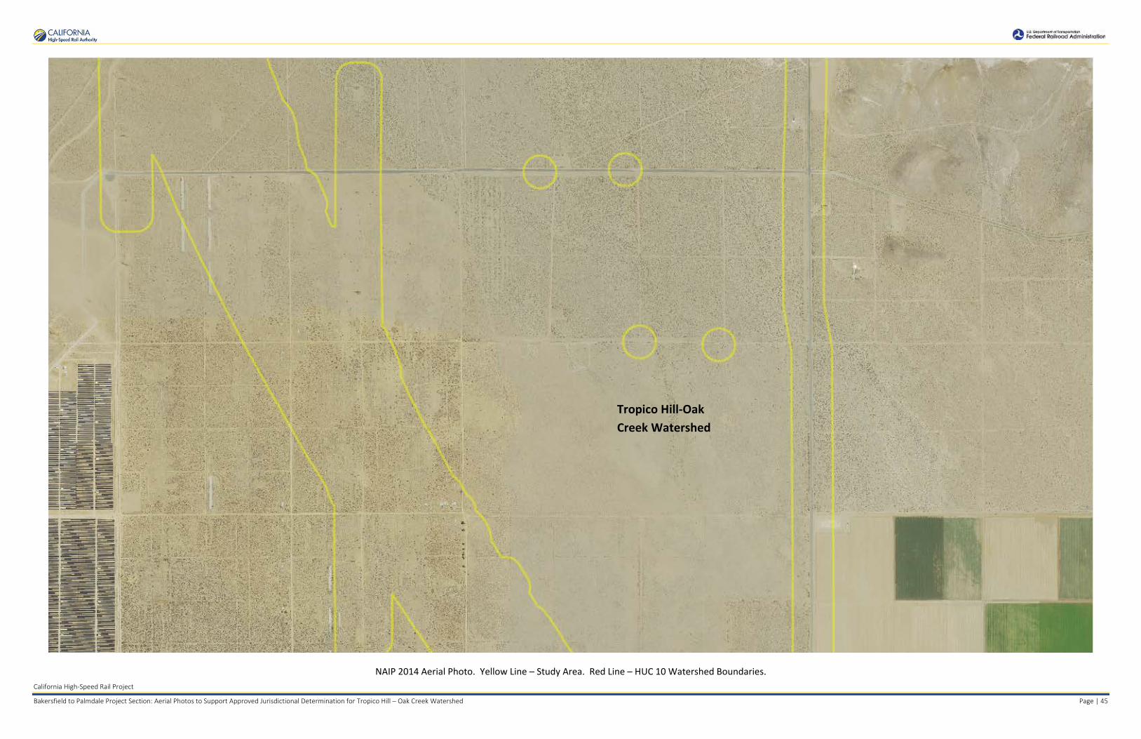
Kern County 2014 Aerial Photo. Yellow Line – Study Area. Red Line – HUC 10 Watershed Boundaries.
Tropico Hill-Oak Creek Watershed
Bissel Hills Watershed
Lower Cache Creek Watershed
Rosamond Lake Watershed
Rock Creek Buckhorn Lake Watershed
Rosamond Lake Watershed
Cottonwood Creek – Tylerhorse Canyon Watershed
Sacatara Creek - Kings Canyon Watershed
Upper Cache Creek Watershed
Tehachapi Creek Watershed
Tejon Creek Watershed

California High-Speed Rail Project
Bakersfield to Palmdale Project Section: Aerial Photos to Support Approved Jurisdictional Determination for Tropico Hill – Oak Creek Watershed Page | 2
Kern County 2014 Aerial Photo. Yellow Line – Study Area. Red Line – HUC 10 Watershed Boundaries.
Tropico Hill-Oak Creek Watershed
Upper Cache Creek Watershed
Upper Cache Creek Watershed

California High-Speed Rail Project
Bakersfield to Palmdale Project Section: Aerial Photos to Support Approved Jurisdictional Determination for Tropico Hill – Oak Creek Watershed Page | 3
Kern County 2014 Aerial Photo. Yellow Line – Study Area. Red Line – HUC 10 Watershed Boundaries.
Tropico Hill-Oak Creek Watershed
California High-Speed Rail Project
Bakersfield to Palmdale Project Section: Aerial Photos to Support Approved Jurisdictional Determination for Tropico Hill – Oak Creek Watershed Page | 4
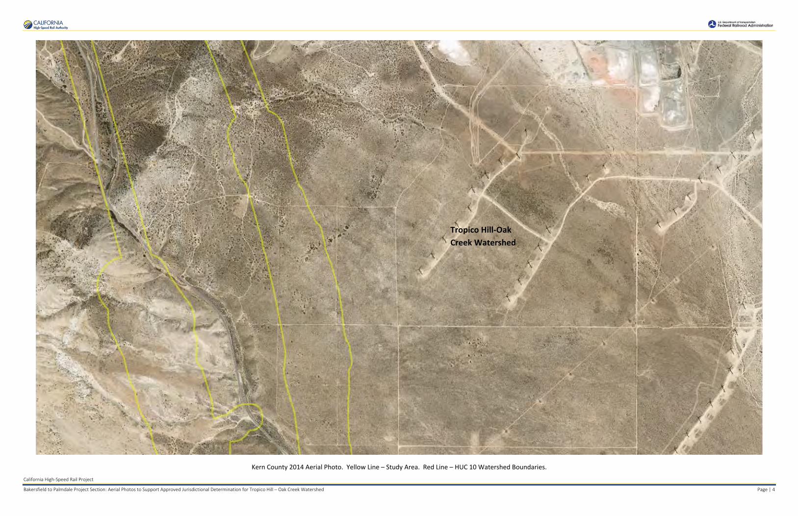
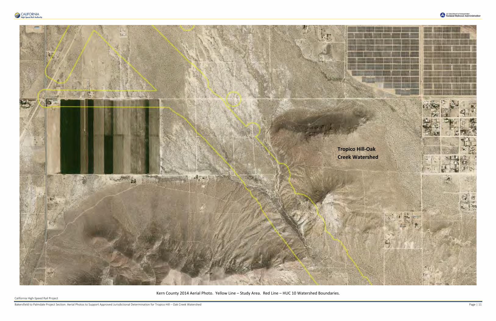
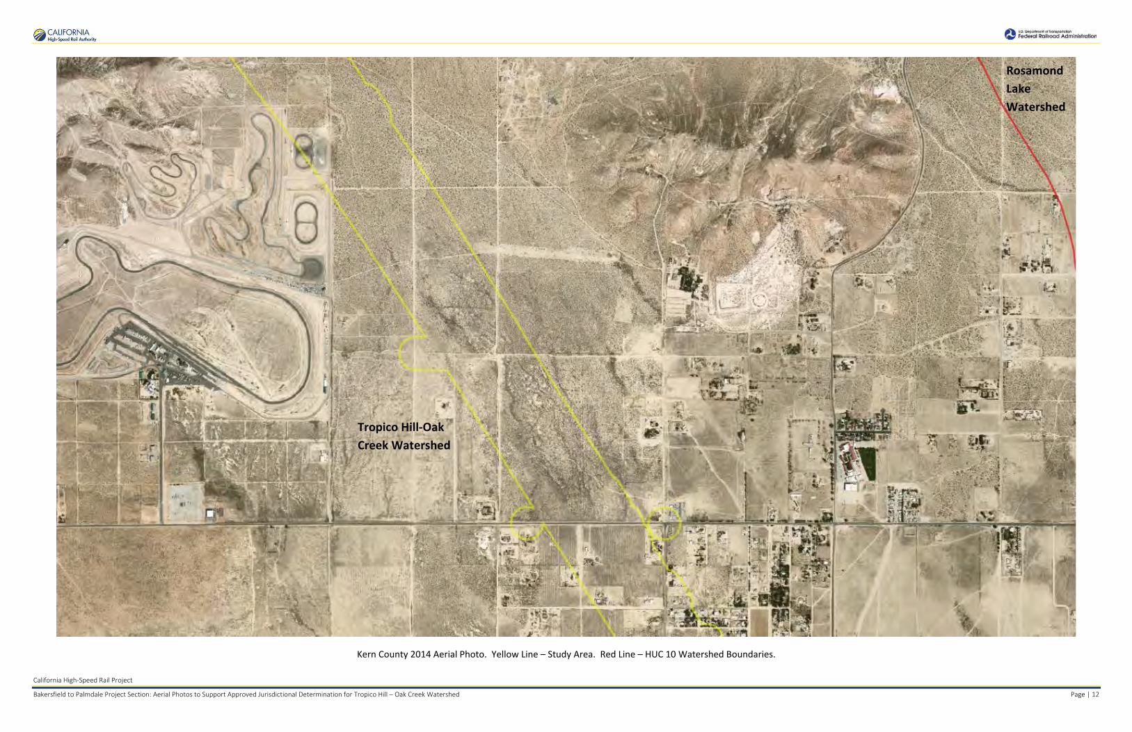
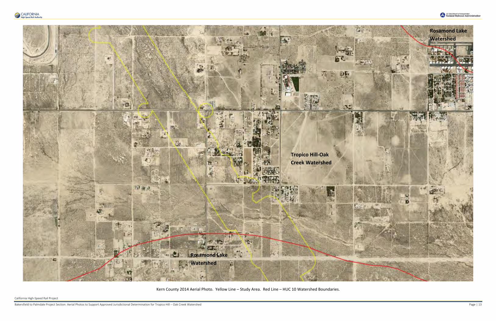
Kern County 2014 Aerial Photo. Yellow Line – Study Area. Red Line – HUC 10 Watershed Boundaries.
Tropico Hill-Oak Creek Watershed

California High-Speed Rail Project
Bakersfield to Palmdale Project Section: Aerial Photos to Support Approved Jurisdictional Determination for Tropico Hill – Oak Creek Watershed Page | 5
Kern County 2014 Aerial Photo. Yellow Line – Study Area. Red Line – HUC 10 Watershed Boundaries.
Tropico Hill-Oak Creek Watershed

California High-Speed Rail Project
Bakersfield to Palmdale Project Section: Aerial Photos to Support Approved Jurisdictional Determination for Tropico Hill – Oak Creek Watershed Page | 6
Kern County 2014 Aerial Photo. Yellow Line – Study Area. Red Line – HUC 10 Watershed Boundaries.
Tropico Hill-Oak Creek Watershed

California High-Speed Rail Project
Bakersfield to Palmdale Project Section: Aerial Photos to Support Approved Jurisdictional Determination for Tropico Hill – Oak Creek Watershed Page | 7
Kern County 2014 Aerial Photo. Yellow Line – Study Area. Red Line – HUC 10 Watershed Boundaries.
Tropico Hill-Oak Creek Watershed
Bissel Hills Watershed

California High-Speed Rail Project
Bakersfield to Palmdale Project Section: Aerial Photos to Support Approved Jurisdictional Determination for Tropico Hill – Oak Creek Watershed Page | 8
Kern County 2014 Aerial Photo. Yellow Line – Study Area. Red Line – HUC 10 Watershed Boundaries.
Tropico Hill-Oak Creek Watershed
Bissel Hills Watershed

California High-Speed Rail Project
Bakersfield to Palmdale Project Section: Aerial Photos to Support Approved Jurisdictional Determination for Tropico Hill – Oak Creek Watershed Page | 9
Kern County 2014 Aerial Photo. Yellow Line – Study Area. Red Line – HUC 10 Watershed Boundaries.
Tropico Hill-Oak Creek Watershed

California High-Speed Rail Project
Bakersfield to Palmdale Project Section: Aerial Photos to Support Approved Jurisdictional Determination for Tropico Hill – Oak Creek Watershed Page | 10
Kern County 2014 Aerial Photo. Yellow Line – Study Area. Red Line – HUC 10 Watershed Boundaries.
Tropico Hill-Oak Creek Watershed
California High-Speed Rail Project
Bakersfield to Palmdale Project Section: Aerial Photos to Support Approved Jurisdictional Determination for Tropico Hill – Oak Creek Watershed Page | 11
Kern County 2014 Aerial Photo. Yellow Line – Study Area. Red Line – HUC 10 Watershed Boundaries.
Tropico Hill-Oak Creek Watershed
California High-Speed Rail Project
Bakersfield to Palmdale Project Section: Aerial Photos to Support Approved Jurisdictional Determination for Tropico Hill – Oak Creek Watershed Page | 12
Kern County 2014 Aerial Photo. Yellow Line – Study Area. Red Line – HUC 10 Watershed Boundaries.
Tropico Hill-Oak Creek Watershed
Rosamond Lake Watershed
California High-Speed Rail Project
Bakersfield to Palmdale Project Section: Aerial Photos to Support Approved Jurisdictional Determination for Tropico Hill – Oak Creek Watershed Page | 13
Kern County 2014 Aerial Photo. Yellow Line – Study Area. Red Line – HUC 10 Watershed Boundaries.
Rosamond Lake Watershed
Tropico Hill-Oak Creek Watershed
Rosamond Lake Watershed

California High-Speed Rail Project
Bakersfield to Palmdale Project Section: Aerial Photos to Support Approved Jurisdictional Determination for Tropico Hill – Oak Creek Watershed Page | 14
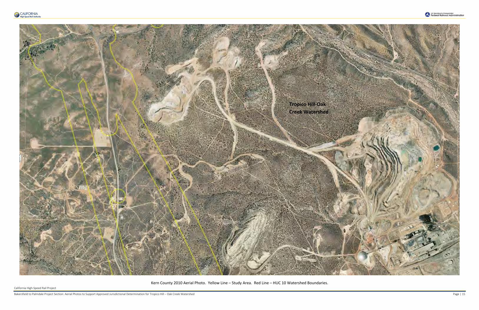
Kern County 2010 Aerial Photo. Yellow Line – Study Area. Red Line – HUC 10 Watershed Boundaries.
Tropico Hill-Oak Creek Watershed
Upper Cache Creek Watershed
Upper Cache Creek Watershed
California High-Speed Rail Project
Bakersfield to Palmdale Project Section: Aerial Photos to Support Approved Jurisdictional Determination for Tropico Hill – Oak Creek Watershed Page | 15
Kern County 2010 Aerial Photo. Yellow Line – Study Area. Red Line – HUC 10 Watershed Boundaries.
Tropico Hill-Oak Creek Watershed

California High-Speed Rail Project
Bakersfield to Palmdale Project Section: Aerial Photos to Support Approved Jurisdictional Determination for Tropico Hill – Oak Creek Watershed Page | 16
Kern County 2010 Aerial Photo. Yellow Line – Study Area. Red Line – HUC 10 Watershed Boundaries.
Tropico Hill-Oak Creek Watershed

California High-Speed Rail Project
Bakersfield to Palmdale Project Section: Aerial Photos to Support Approved Jurisdictional Determination for Tropico Hill – Oak Creek Watershed Page | 17
Kern County 2010 Aerial Photo. Yellow Line – Study Area. Red Line – HUC 10 Watershed Boundaries.
Tropico Hill-Oak Creek Watershed
California High-Speed Rail Project
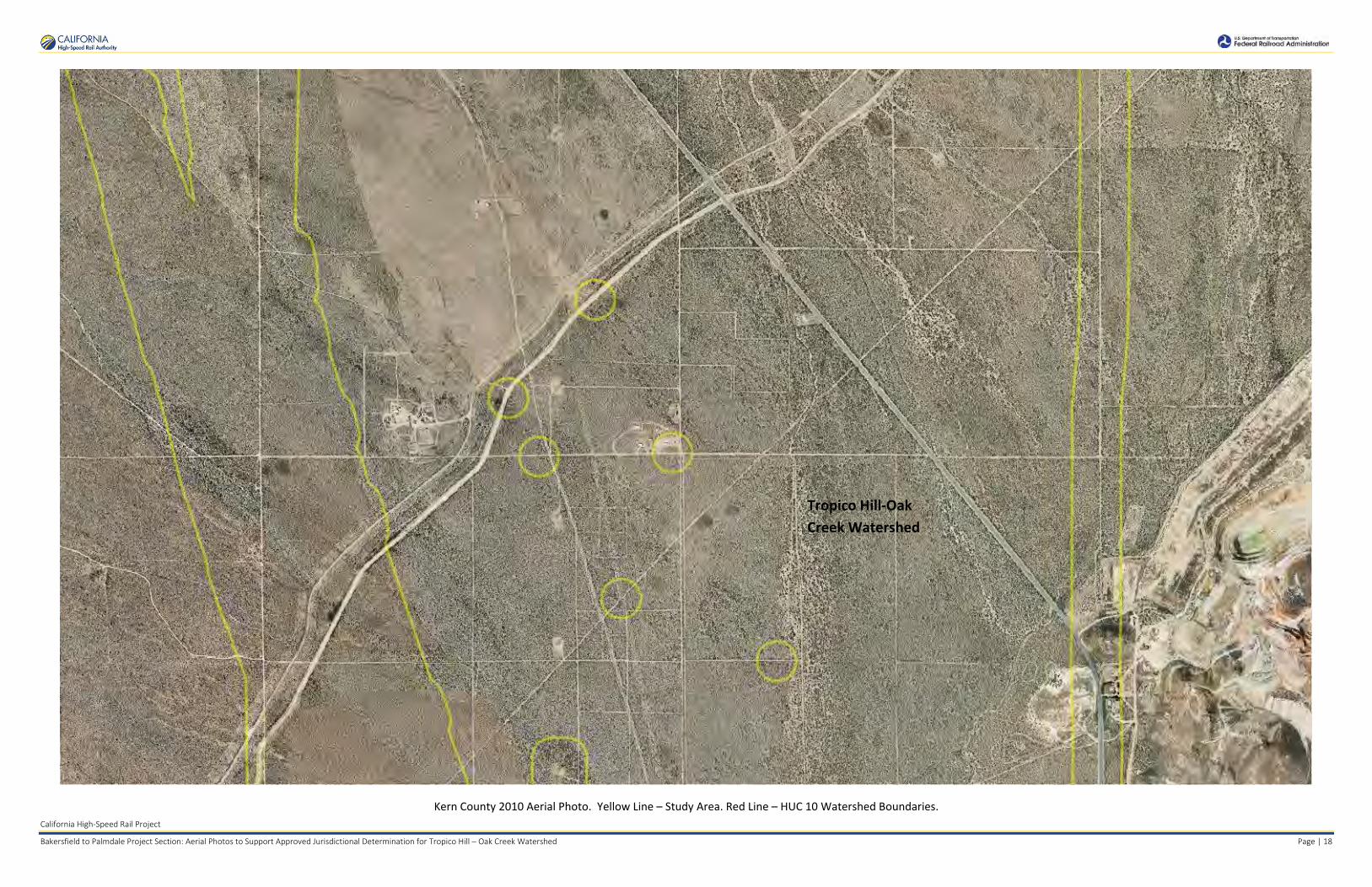
Bakersfield to Palmdale Project Section: Aerial Photos to Support Approved Jurisdictional Determination for Tropico Hill – Oak Creek Watershed Page | 18
Kern County 2010 Aerial Photo. Yellow Line – Study Area. Red Line – HUC 10 Watershed Boundaries.
Tropico Hill-Oak Creek Watershed

California High-Speed Rail Project
Bakersfield to Palmdale Project Section: Aerial Photos to Support Approved Jurisdictional Determination for Tropico Hill – Oak Creek Watershed Page | 19
Kern County 2010 Aerial Photo. Yellow Line – Study Area. Red Line – HUC 10 Watershed Boundaries.
Tropico Hill-Oak Creek Watershed
Bissel Hills Watershed

California High-Speed Rail Project
Bakersfield to Palmdale Project Section: Aerial Photos to Support Approved Jurisdictional Determination for Tropico Hill – Oak Creek Watershed Page | 20
Kern County 2010 Aerial Photo. Yellow Line – Study Area. Red Line – HUC 10 Watershed Boundaries.
Tropico Hill-Oak Creek Watershed
Bissel Hills Watershed

California High-Speed Rail Project
Bakersfield to Palmdale Project Section: Aerial Photos to Support Approved Jurisdictional Determination for Tropico Hill – Oak Creek Watershed Page | 21
Kern County 2010 Aerial Photo. Yellow Line – Study Area. Red Line – HUC 10 Watershed Boundaries.
Tropico Hill-Oak Creek Watershed

California High-Speed Rail Project
Bakersfield to Palmdale Project Section: Aerial Photos to Support Approved Jurisdictional Determination for Tropico Hill – Oak Creek Watershed Page | 22
Kern County 2010 Aerial Photo. Yellow Line – Study Area. Red Line – HUC 10 Watershed Boundaries.
Tropico Hill-Oak Creek Watershed

California High-Speed Rail Project
Bakersfield to Palmdale Project Section: Aerial Photos to Support Approved Jurisdictional Determination for Tropico Hill – Oak Creek Watershed Page | 23
Kern County 2010 Aerial Photo. Yellow Line – Study Area. Red Line – HUC 10 Watershed Boundaries.
Tropico Hill-Oak Creek Watershed
California High-Speed Rail Project
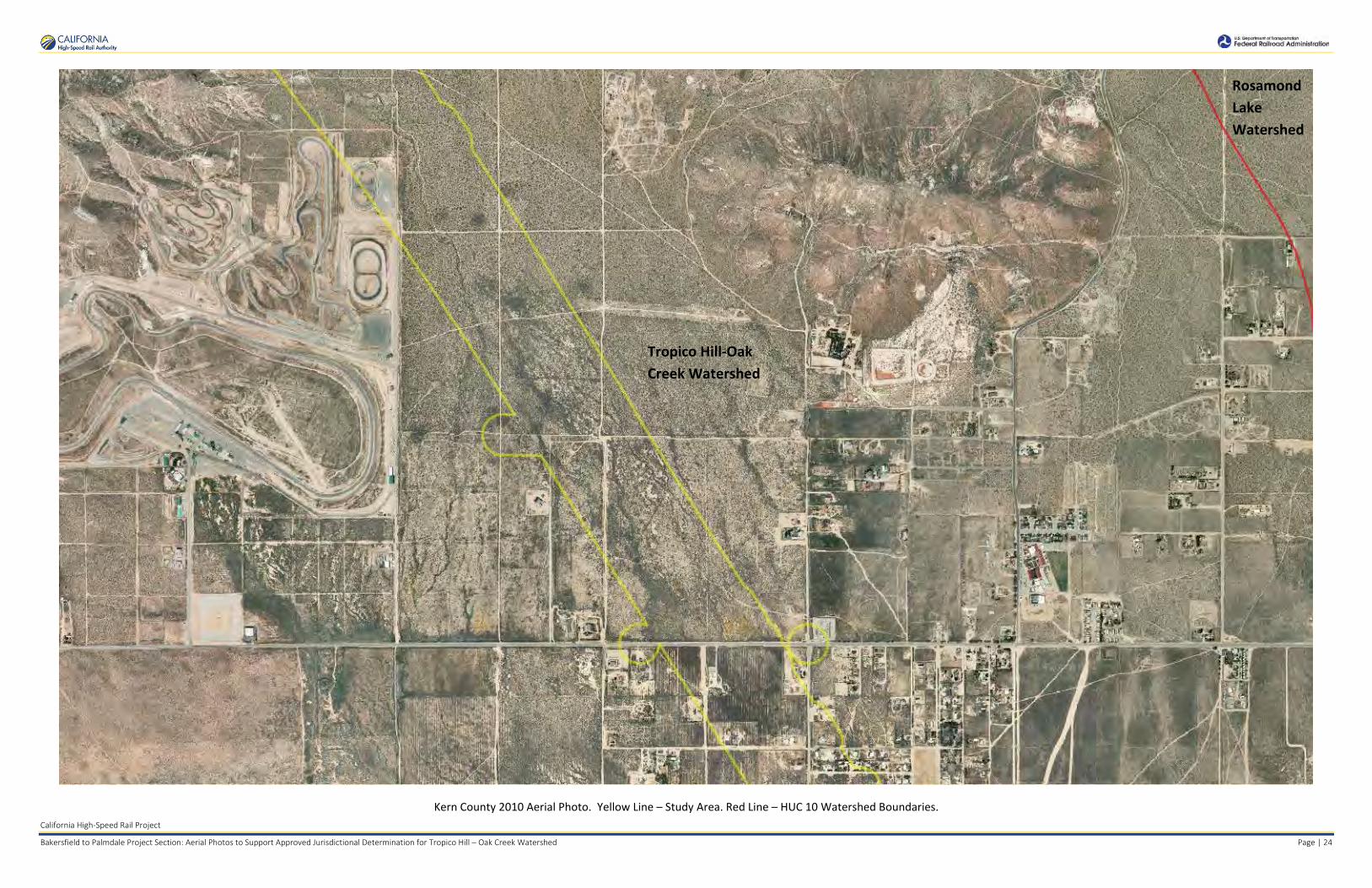
Bakersfield to Palmdale Project Section: Aerial Photos to Support Approved Jurisdictional Determination for Tropico Hill – Oak Creek Watershed Page | 24
Kern County 2010 Aerial Photo. Yellow Line – Study Area. Red Line – HUC 10 Watershed Boundaries.
Tropico Hill-Oak Creek Watershed
Rosamond Lake Watershed

Rosamond Lake Watershed
Tropico Hill-Oak Creek Watershed
Rosamond Lake Watershed
California High-Speed Rail Project
Bakersfield to Palmdale Project Section: Aerial Photos to Support Approved Jurisdictional Determination for Tropico Hill – Oak Creek Watershed Page | 25
Kern County 2010 Aerial Photo. Yellow Line – Study Area. Red Line – HUC 10 Watershed Boundaries.

Tropico Hill-Oak Creek Watershed
Upper Cache Creek Watershed
Upper Cache Creek Watershed
California High-Speed Rail Project
Bakersfield to Palmdale Project Section: Aerial Photos to Support Approved Jurisdictional Determination for Tropico Hill – Oak Creek Watershed Page | 26
NAIP 2005 Aerial Photo. Yellow Line – Study Area. Red Line – HUC 10 Watershed Boundaries.

Tropico Hill-Oak Creek Watershed
California High-Speed Rail Project
Bakersfield to Palmdale Project Section: Aerial Photos to Support Approved Jurisdictional Determination for Tropico Hill – Oak Creek Watershed Page | 27
NAIP 2005 Aerial Photo. Yellow Line – Study Area. Red Line – HUC 10 Watershed Boundaries.

Tropico Hill-Oak Creek Watershed
California High-Speed Rail Project
Bakersfield to Palmdale Project Section: Aerial Photos to Support Approved Jurisdictional Determination for Tropico Hill – Oak Creek Watershed Page | 28
NAIP 2005 Aerial Photo. Yellow Line – Study Area. Red Line – HUC 10 Watershed Boundaries.

Tropico Hill-Oak Creek Watershed
California High-Speed Rail Project
Bakersfield to Palmdale Project Section: Aerial Photos to Support Approved Jurisdictional Determination for Tropico Hill – Oak Creek Watershed Page | 29
NAIP 2005 Aerial Photo. Yellow Line – Study Area. Red Line – HUC 10 Watershed Boundaries.
Tropico Hill-Oak Creek Watershed
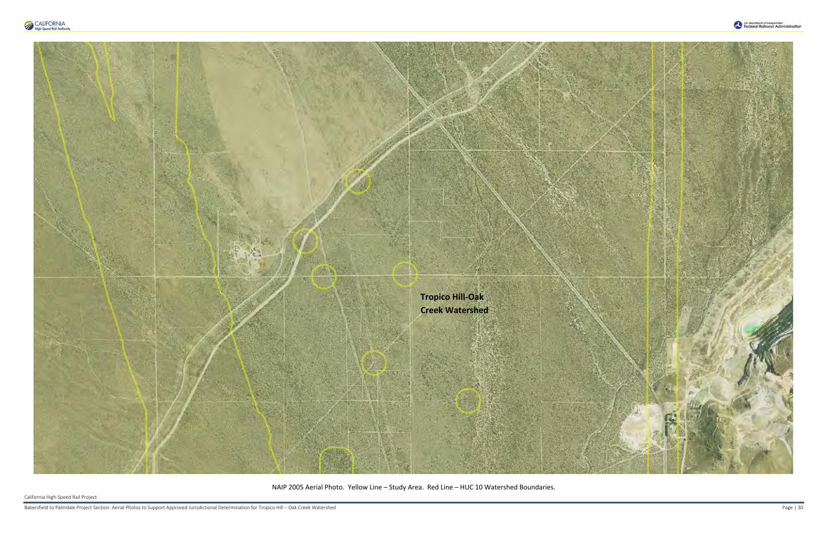
California High-Speed Rail Project
Bakersfield to Palmdale Project Section: Aerial Photos to Support Approved Jurisdictional Determination for Tropico Hill – Oak Creek Watershed Page | 30
NAIP 2005 Aerial Photo. Yellow Line – Study Area. Red Line – HUC 10 Watershed Boundaries.

Tropico Hill-Oak Creek Watershed
Bissel Hills Watershed
California High-Speed Rail Project
Bakersfield to Palmdale Project Section: Aerial Photos to Support Approved Jurisdictional Determination for Tropico Hill – Oak Creek Watershed Page | 31
NAIP 2005 Aerial Photo. Yellow Line – Study Area. Red Line – HUC 10 Watershed Boundaries.

Tropico Hill-Oak Creek Watershed
Bissel Hills Watershed
California High-Speed Rail Project
Bakersfield to Palmdale Project Section: Aerial Photos to Support Approved Jurisdictional Determination for Tropico Hill – Oak Creek Watershed Page | 32
NAIP 2005 Aerial Photo. Yellow Line – Study Area. Red Line – HUC 10 Watershed Boundaries.

Tropico Hill-Oak Creek Watershed
California High-Speed Rail Project
Bakersfield to Palmdale Project Section: Aerial Photos to Support Approved Jurisdictional Determination for Tropico Hill – Oak Creek Watershed Page | 33
NAIP 2005 Aerial Photo. Yellow Line – Study Area. Red Line – HUC 10 Watershed Boundaries.

Tropico Hill-Oak Creek Watershed
California High-Speed Rail Project
Bakersfield to Palmdale Project Section: Aerial Photos to Support Approved Jurisdictional Determination for Tropico Hill – Oak Creek Watershed Page | 34
NAIP 2005 Aerial Photo. Yellow Line – Study Area. Red Line – HUC 10 Watershed Boundaries.

Tropico Hill-Oak Creek Watershed
California High-Speed Rail Project
Bakersfield to Palmdale Project Section: Aerial Photos to Support Approved Jurisdictional Determination for Tropico Hill – Oak Creek Watershed Page | 35
NAIP 2005 Aerial Photo. Yellow Line – Study Area. Red Line – HUC 10 Watershed Boundaries.

Tropico Hill-Oak Creek Watershed
Rosamond Lake Watershed
California High-Speed Rail Project
Bakersfield to Palmdale Project Section: Aerial Photos to Support Approved Jurisdictional Determination for Tropico Hill – Oak Creek Watershed Page | 36
NAIP 2005 Aerial Photo. Yellow Line – Study Area. Red Line – HUC 10 Watershed Boundaries.

Rosamond Lake Watershed
Rosamond Lake Watershed
Tropico Hill-Oak Creek Watershed
California High-Speed Rail Project
Bakersfield to Palmdale Project Section: Aerial Photos to Support Approved Jurisdictional Determination for Tropico Hill – Oak Creek Watershed Page | 37
NAIP 2005 Aerial Photo. Yellow Line – Study Area. Red Line – HUC 10 Watershed Boundaries.

Upper Cache Creek Watershed
Upper Cache Creek Watershed
Tropico Hill-Oak Creek Watershed
California High-Speed Rail Project
Bakersfield to Palmdale Project Section: Aerial Photos to Support Approved Jurisdictional Determination for Tropico Hill – Oak Creek Watershed Page | 38
NAIP 2014 Aerial Photo. Yellow Line – Study Area. Red Line – HUC 10 Watershed Boundaries.

Tropico Hill-Oak Creek Watershed
California High-Speed Rail Project
Bakersfield to Palmdale Project Section: Aerial Photos to Support Approved Jurisdictional Determination for Tropico Hill – Oak Creek Watershed Page | 39
NAIP 2014 Aerial Photo. Yellow Line – Study Area. Red Line – HUC 10 Watershed Boundaries.

Tropico Hill-Oak Creek Watershed
California High-Speed Rail Project
Bakersfield to Palmdale Project Section: Aerial Photos to Support Approved Jurisdictional Determination for Tropico Hill – Oak Creek Watershed Page | 40
NAIP 2014 Aerial Photo. Yellow Line – Study Area. Red Line – HUC 10 Watershed Boundaries.

Tropico Hill-Oak Creek Watershed
California High-Speed Rail Project
Bakersfield to Palmdale Project Section: Aerial Photos to Support Approved Jurisdictional Determination for Tropico Hill – Oak Creek Watershed Page | 41
NAIP 2014 Aerial Photo. Yellow Line – Study Area. Red Line – HUC 10 Watershed Boundaries.

Tropico Hill-Oak Creek Watershed
California High-Speed Rail Project
Bakersfield to Palmdale Project Section: Aerial Photos to Support Approved Jurisdictional Determination for Tropico Hill – Oak Creek Watershed Page | 42
NAIP 2014 Aerial Photo. Yellow Line – Study Area. Red Line – HUC 10 Watershed Boundaries.

Tropico Hill-Oak Creek Watershed
Bissel Hills Watershed
California High-Speed Rail Project
Bakersfield to Palmdale Project Section: Aerial Photos to Support Approved Jurisdictional Determination for Tropico Hill – Oak Creek Watershed Page | 43
NAIP 2014 Aerial Photo. Yellow Line – Study Area. Red Line – HUC 10 Watershed Boundaries.

Bissel Hills Watershed
Tropico Hill-Oak Creek Watershed
California High-Speed Rail Project
Bakersfield to Palmdale Project Section: Aerial Photos to Support Approved Jurisdictional Determination for Tropico Hill – Oak Creek Watershed Page | 44
NAIP 2014 Aerial Photo. Yellow Line – Study Area. Red Line – HUC 10 Watershed Boundaries.
Tropico Hill-Oak Creek Watershed
California High-Speed Rail Project
Bakersfield to Palmdale Project Section: Aerial Photos to Support Approved Jurisdictional Determination for Tropico Hill – Oak Creek Watershed Page | 45
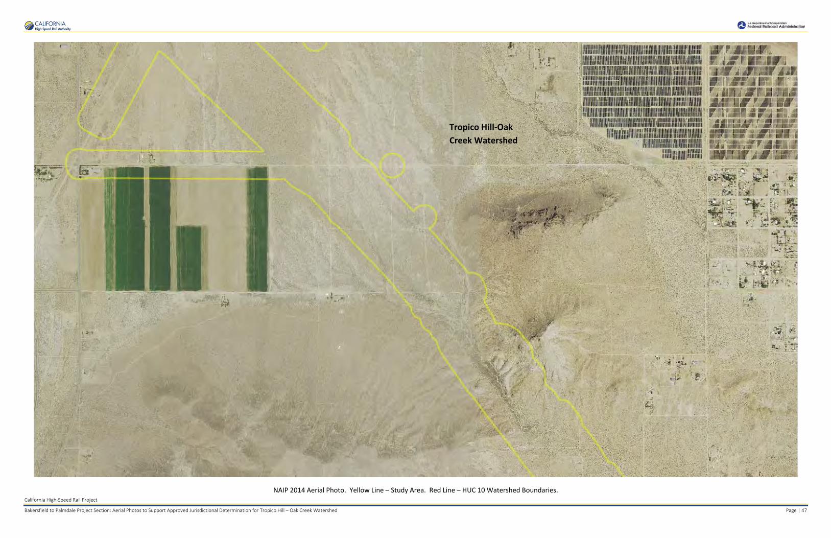
NAIP 2014 Aerial Photo. Yellow Line – Study Area. Red Line – HUC 10 Watershed Boundaries.

Tropico Hill-Oak Creek Watershed
California High-Speed Rail Project
Bakersfield to Palmdale Project Section: Aerial Photos to Support Approved Jurisdictional Determination for Tropico Hill – Oak Creek Watershed Page | 46
NAIP 2014 Aerial Photo. Yellow Line – Study Area. Red Line – HUC 10 Watershed Boundaries.
Tropico Hill-Oak Creek Watershed
California High-Speed Rail Project
Bakersfield to Palmdale Project Section: Aerial Photos to Support Approved Jurisdictional Determination for Tropico Hill – Oak Creek Watershed Page | 47
NAIP 2014 Aerial Photo. Yellow Line – Study Area. Red Line – HUC 10 Watershed Boundaries.
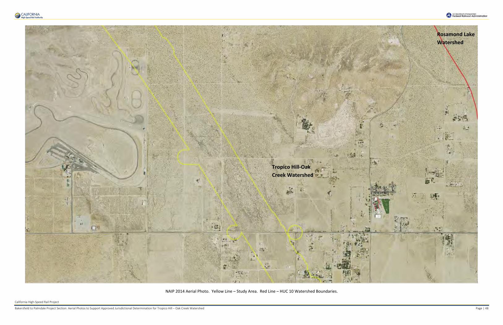
Tropico Hill-Oak Creek Watershed
Rosamond Lake Watershed
California High-Speed Rail Project
Bakersfield to Palmdale Project Section: Aerial Photos to Support Approved Jurisdictional Determination for Tropico Hill – Oak Creek Watershed Page | 48
NAIP 2014 Aerial Photo. Yellow Line – Study Area. Red Line – HUC 10 Watershed Boundaries.

Rosamond Lake Watershed
Rosamond Lake Watershed
Tropico Hill-Oak Creek Watershed
California High-Speed Rail Project
Bakersfield to Palmdale Project Section: Aerial Photos to Support Approved Jurisdictional Determination for Tropico Hill – Oak Creek Watershed Page | 49
NAIP 2014 Aerial Photo. Yellow Line – Study Area. Red Line – HUC 10 Watershed Boundaries.
Aerial Sources: http://maps.co.kern.ca.us/arcgis/services/ and http://gis.apfo.usda.gov/arcgis/services/NAIP/
Retrieved November 4, 2016.

Bissel Hills Watershed
Tropico Hill-Oak Creek Watershed
California High-Speed Rail Project
Bakersfield to Palmdale Project Section: Aerial Photos to Support Approved Jurisdictional Determination for Bissell Hills Watershed Page | 4
NAIP 2014 Aerial Photo. Yellow Line – Study Area. Red Line – HUC 10 Watershed Boundaries.
Aerial Sources: http://maps.co.kern.ca.us/arcgis/services/ and http://gis.apfo.usda.gov/arcgis/services/NAIP/
Retrieved November 14, 2016.

.
APPROVED JURISDICTIONAL DETERMINATION FORM U.S. Army Corps of Engineers
This form should be completed by following the instructions provided in Section IV of the JD Form Instructional Guidebook.
SECTION I: BACKGROUND INFORMATION A. REPORT COMPLETION DATE FOR APPROVED JURISDICTIONAL DETERMINATION (JD): July 28, 2017
B. DISTRICT OFFICE, FILE NAME, AND NUMBER: SPL-2010-00945-VCL - JD3
C. PROJECT LOCATION AND BACKGROUND INFORMATION:State: CA County/parish/borough: Kern County City: N/ACenter coordinates of site (lat/long in degree decimal format): Lat. 35.096907° N, Long. -118.391170° W.
Universal Transverse Mercator: 373200 m E, 3884676 m N Name of nearest waterbody: Proctor Lake
Name of nearest Traditional Navigable Water (TNW) into which the aquatic resource flows: N/AName of watershed or Hydrologic Unit Code (HUC): Proctor Lake, California - HUC12 #181902060102
Check if map/diagram of review area and/or potential jurisdictional areas is/are available upon request. Check if other sites (e.g., offsite mitigation sites, disposal sites, etc…) are associated with this action and are recorded on a
different JD form.
D. REVIEW PERFORMED FOR SITE EVALUATION (CHECK ALL THAT APPLY): Office (Desk) Determination. Date: July 25, 2017 Field Determination. Date(s):
SECTION II: SUMMARY OF FINDINGS A. RHA SECTION 10 DETERMINATION OF JURISDICTION.
There Are no “navigable waters of the U.S.” within Rivers and Harbors Act (RHA) jurisdiction (as defined by 33 CFR part 329) in the review area. [Required]
Waters subject to the ebb and flow of the tide. Waters are presently used, or have been used in the past, or may be susceptible for use to transport interstate or foreign commerce. Explain:
B. CWA SECTION 404 DETERMINATION OF JURISDICTION.
There Are no “waters of the U.S.” within Clean Water Act (CWA) jurisdiction (as defined by 33 CFR part 328) in the review area. [Required]
1. Waters of the U.S. a. Indicate presence of waters of U.S. in review area (check all that apply): 1
TNWs, including territorial seas Wetlands adjacent to TNWs Relatively permanent waters2 (RPWs) that flow directly or indirectly into TNWs Non-RPWs that flow directly or indirectly into TNWsWetlands directly abutting RPWs that flow directly or indirectly into TNWs Wetlands adjacent to but not directly abutting RPWs that flow directly or indirectly into TNWsWetlands adjacent to non-RPWs that flow directly or indirectly into TNWs Impoundments of jurisdictional waters Isolated (interstate or intrastate) waters, including isolated wetlands
b. Identify (estimate) size of waters of the U.S. in the review area: Non-wetland waters: linear feet: width (ft) and/or acres.Wetlands: acres.
c. Limits (boundaries) of jurisdiction based on: Not Applicable. Elevation of established OHWM (if known): .
2. Non-regulated waters/wetlands (check if applicable):3
Potentially jurisdictional waters and/or wetlands were assessed within the review area and determined to be not jurisdictional. Explain:
The project area contains eight unnamed ephemeral streams spanning a total of approximately 9,722 linear feet (1.84 miles) and covering approximately 1.90 acres; two ditches that carry flow from some of these streams spanning a total of approximately 1,776 linear feet (0.34 miles) and covering approximately 0.21 acre; two seasonal wetlands totaling approximately 0.27 acre; and three basins totaling approximately 0.39 acre in the study area. The basins were constructed in uplands that do not capture waters of the U.S. Labeled maps and
1 Boxes checked below shall be supported by completing the appropriate sections in Section III below. 2 For purposes of this form, an RPW is defined as a tributary that is not a TNW and that typically flows year-round or has continuous flow at least “seasonally” (e.g., typically 3 months). 3 Supporting documentation is presented in Section III.F.

tables of each of the above aquatic resources with dimensions are provided in the Aquatic Resources Delineation Report, which identifies each feature according to which HUC-12 watershed it occurs within. A completed copy of the Aquatic Resources sheet in the Consolidated ORM Upload Workbook is also appended.
There are no Traditional Navigable Waters (TNWs) or relatively permanent waters (RPWs) in the study area. Proctor Lake, an intermittent lake located east-northeast of the study area, is the low point in the watershed and terminus of surface water flows in this watershed. Unnamed ephemeral streams that cross through the study area, features Str_0211, Str_0213, Str_0215 through Str_0217, Str_0219, Str_0222 and Str_0229, originate in the hills southeast of the town of Tehachapi. Drainage is generally northeast toward Proctor Lake. In the hills, the channels are well-defined with an easily discerned bed and bank, and within the study area, the Ordinary High Water Mark was used to determine extent of these features. As topography flattens in the eastern Tehachapi Valley, these channels become swales, and the hydrologic connection to Proctor Lake includes sheet flow and overland flow. As the low point in the basin, Proctor Lake is the terminal receiving water for streams in the study area. In two locations, ditches constructed along roads capture water from these streams and transport it downstream and back into natural channels. Water from stream feature Str_0213 flows into a ditch, Ditch_0214, along Highline Road. Downstream of the study area, water from the ditch returns to a natural channel and flows toward Proctor Lake. A second ditch, Ditch_0210, conveys water rerouted around an industrial building and under Jameson Road into a natural channel downstream, Str_0211, that flows offsite toward Proctor Lake. A seasonal wetland just south of East Tehachapi Boulevard, feature SW_204, is in a shallow depression within a swale. When the depression overflows, water flows toward Proctor Lake in a swale and then as overland flow. A second seasonal wetland, feature SW_0226, is supported by a hillside seep. Overflowing water would run downhill into stream feature Str_0222.
Additionally, three small basins (Basin_0203, Basin_0208, and Basin_0209) are present in the study area. Basin_0203 appears to be a detention basin, and Basin_0208 and Basin_0209 appear to be holding ponds for irrigation water. All three are constructed as depressions in the ground. In the event that these features overflowed, water would sheet flow toward surface channels and overland toward Proctor Lake.
Features crossing through the study area were evaluated along their entire length to their terminus. Primary land uses within the study area include ranching, farming, surface mines for cement and aggregate, and wind power generation facilities. Rural residential uses were also noted. The drainages and ditches reviewed are ephemeral along their entire length, flowing for only a short time during and after storms, with no discernable commercial or industrial uses. The two seasonal wetlands may have shallow surface water for several weeks, but do not support any discernable commercial or industrial uses, and are not navigable. The detention basin appears to serve as a stormwater control feature, while the irrigation ponds support cultivated agricultural uses. Water is not captured or used for mining or another interstate or foreign commerce.
A previous approved jurisdictional determination was made for tributaries to Proctor Lake with similar characteristics to those identified in this study area. On June 28, 2012, a determination was made for drainages in the SCE Antelope Transmission Line Project: TRTP Segment 3B area, that drain toward Proctor Lake (SPL-2012-00214-SLP, JD2). The previous determination found that Proctor Lake is the low point for drainages that fall within the watershed. It serves as the terminus for the ephemeral waters analyzed in the 2012 determination, as well as for all other waters within this isolated basin. All surface flows that enter Proctor Lake either evaporate or percolate into the groundwater table. Heavy pumping in areas south of Tehachapi and Monolith has altered the movement of groundwater due to the creation of a large pumping depression (See California Groundwater Bulletin 118). No perennial streams exist within the study area for the Proctor Lake watershed. The determination made in 2012 found that there are no published commercial uses of any of the surface waters and a review of current conditions indicated that this has not changed in the intervening years. A site visit conducted on July 18, 2016 confirmed that Proctor Lake is an intermittently dry lake, that is currently a meadow grazed by cattle, that does not support navigation, and does not support commercial or industrial uses of surface waters.
Proctor Lake, as the terminus for the project waters, is not a TNW. Moreover, Proctor Lake is not an (a)(3) water as defined by 33 C.F.R. section 328.3. Proctor Lake does not meet criteria (a)(3)(i-iii), as it: i) does not have use for surface water recreation or other purposes by foreign or interstate travelers, ii) does not have harvesting activities of fish or shellfish that may be sold in interstate or foreign commerce, and iii) does not have surface water industrial usage by industries in interstate commerce. Lastly, the project waters are not (a)(3) waters as defined by 33 C.F.R. section 328.3. The above is based upon the Aquatic Resources Delineation Report for the California High-Speed Rail Project, Bakersfield to Palmdale Section, and all other references listed in Section IV of this form, as well as the review of aerial photographs (Google Earth) that also did not show surface water usage of the subject waters or the dry lake terminus. Therefore, since Proctor Lake is an intrastate, isolated water without a surface water connection to commerce, all project waters as part of the overall Proctor Lake watershed system are also isolated and additionally have no nexus to commerce. Based on the above information, all subject waters (isolated non-RPWs) within the Proctor Lake watershed are non-jurisdictional, since the waters are not tributary to either a TNW or an (a)(3) water and are not (a)(3) waters themselves. Therefore, the eight segments of unnamed ephemeral streams, two segments of ditches, two seasonal wetlands, and three basins within the study are intrastate, isolated waters with no interstate or foreign commerce connection and therefore are not currently regulated.

SECTION III: CWA ANALYSIS
A. TNWs AND WETLANDS ADJACENT TO TNWs
The agencies will assert jurisdiction over TNWs and wetlands adjacent to TNWs. If the aquatic resource is a TNW, complete Section III.A.1 and Section III.D.1. only; if the aquatic resource is a wetland adjacent to a TNW, complete Sections III.A.1 and 2 and Section III.D.1.; otherwise, see Section III.B below.
1. TNW Identify TNW: .
Summarize rationale supporting determination: .
2. Wetland adjacent to TNW Summarize rationale supporting conclusion that wetland is “adjacent”: .
B. CHARACTERISTICS OF TRIBUTARY (THAT IS NOT A TNW) AND ITS ADJACENT WETLANDS (IF ANY):
This section summarizes information regarding characteristics of the tributary and its adjacent wetlands, if any, and it helps determine whether or not the standards for jurisdiction established under Rapanos have been met.
The agencies will assert jurisdiction over non-navigable tributaries of TNWs where the tributaries are “relatively permanent waters” (RPWs), i.e. tributaries that typically flow year-round or have continuous flow at least seasonally (e.g., typically 3 months). A wetland that directly abuts an RPW is also jurisdictional. If the aquatic resource is not a TNW, but has year-round (perennial) flow, skip to Section III.D.2. If the aquatic resource is a wetland directly abutting a tributary with perennial flow, skip to Section III.D.4.
A wetland that is adjacent to but that does not directly abut an RPW requires a significant nexus evaluation. Corps districts and EPA regions will include in the record any available information that documents the existence of a significant nexus between a relatively permanent tributary that is not perennial (and its adjacent wetlands if any) and a traditional navigable water, even though a significant nexus finding is not required as a matter of law.
If the waterbody4 is not an RPW, or a wetland directly abutting an RPW, a JD will require additional data to determine if the waterbody has a significant nexus with a TNW. If the tributary has adjacent wetlands, the significant nexus evaluation must consider the tributary in combination with all of its adjacent wetlands. This significant nexus evaluation that combines, for analytical purposes, the tributary and all of its adjacent wetlands is used whether the review area identified in the JD request is the tributary, or its adjacent wetlands, or both. If the JD covers a tributary with adjacent wetlands, complete Section III.B.1 for the tributary, Section III.B.2 for any onsite wetlands, and Section III.B.3 for all wetlands adjacent to that tributary, both onsite and offsite. The determination whether a significant nexus exists is determined in Section III.C below.
1. Characteristics of non-TNWs that flow directly or indirectly into TNW
(i) General Area Conditions: Watershed size: Pick List Drainage area: Pick List Average annual rainfall: inchesAverage annual snowfall: inches
(ii) Physical Characteristics:(a) Relationship with TNW:
Tributary flows directly into TNW. Tributary flows through Pick List tributaries before entering TNW.
Project waters are Pick List river miles from TNW. Project waters are Pick List river miles from RPW. Project waters are Pick List aerial (straight) miles from TNW. Project waters are Pick List aerial (straight) miles from RPW. Project waters cross or serve as state boundaries. Explain: .
Identify flow route to TNW5: .Tributary stream order, if known: .
4 Note that the Instructional Guidebook contains additional information regarding swales, ditches, washes, and erosional features generally and in the arid West. 5 Flow route can be described by identifying, e.g., tributary a, which flows through the review area, to flow into tributary b, which then flows into TNW.
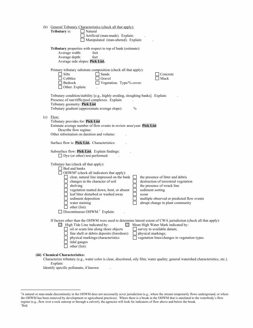
(b) General Tributary Characteristics (check all that apply): Tributary is: Natural
Artificial (man-made). Explain: . Manipulated (man-altered). Explain: .
Tributary properties with respect to top of bank (estimate): Average width: feetAverage depth: feet Average side slopes: Pick List.
Primary tributary substrate composition (check all that apply): Silts Sands Concrete Cobbles Gravel Muck Bedrock Vegetation. Type/% cover: Other. Explain: .
Tributary condition/stability [e.g., highly eroding, sloughing banks]. Explain: .Presence of run/riffle/pool complexes. Explain: .Tributary geometry: Pick List Tributary gradient (approximate average slope): %
(c) Flow:Tributary provides for: Pick List Estimate average number of flow events in review area/year: Pick List
Describe flow regime: .Other information on duration and volume: .
Surface flow is: Pick List. Characteristics: .
Subsurface flow: Pick List. Explain findings: . Dye (or other) test performed: .
Tributary has (check all that apply): Bed and banks OHWM6 (check all indicators that apply):
clear, natural line impressed on the bank the presence of litter and debris changes in the character of soil destruction of terrestrial vegetation shelving the presence of wrack line vegetation matted down, bent, or absent sediment sorting leaf litter disturbed or washed away scour sediment deposition multiple observed or predicted flow events water staining abrupt change in plant community other (list):
Discontinuous OHWM.7 Explain: .
If factors other than the OHWM were used to determine lateral extent of CWA jurisdiction (check all that apply): High Tide Line indicated by:
oil or scum line along shore objects fine shell or debris deposits (foreshore) physical markings/characteristics tidal gauges other (list):
Mean High Water Mark indicated by: survey to available datum; physical markings; vegetation lines/changes in vegetation types.
(iii) Chemical Characteristics: Characterize tributary (e.g., water color is clear, discolored, oily film; water quality; general watershed characteristics, etc.).
Explain: . Identify specific pollutants, if known: .
6A natural or man-made discontinuity in the OHWM does not necessarily sever jurisdiction (e.g., where the stream temporarily flows underground, or where the OHWM has been removed by development or agricultural practices). Where there is a break in the OHWM that is unrelated to the waterbody’s flow regime (e.g., flow over a rock outcrop or through a culvert), the agencies will look for indicators of flow above and below the break. 7Ibid.

(iv) Biological Characteristics. Channel supports (check all that apply): Riparian corridor. Characteristics (type, average width): . Wetland fringe. Characteristics: . Habitat for:
Federally Listed species. Explain findings: . Fish/spawn areas. Explain findings: . Other environmentally-sensitive species. Explain findings: . Aquatic/wildlife diversity. Explain findings: .
2. Characteristics of wetlands adjacent to non-TNW that flow directly or indirectly into TNW
(i) Physical Characteristics: (a) General Wetland Characteristics:
Properties:Wetland size: acresWetland type. Explain: .Wetland quality. Explain: .
Project wetlands cross or serve as state boundaries. Explain: .
(b) General Flow Relationship with Non-TNW: Flow is: Pick List. Explain: .
Surface flow is: Pick List Characteristics: .
Subsurface flow: Pick List. Explain findings: . Dye (or other) test performed: .
(c) Wetland Adjacency Determination with Non-TNW: Directly abutting Not directly abutting
Discrete wetland hydrologic connection. Explain: . Ecological connection. Explain: . Separated by berm/barrier. Explain: .
(d) Proximity (Relationship) to TNW Project wetlands are Pick List river miles from TNW. Project waters are Pick List aerial (straight) miles from TNW. Flow is from: Pick List. Estimate approximate location of wetland as within the Pick List floodplain.
(ii) Chemical Characteristics: Characterize wetland system (e.g., water color is clear, brown, oil film on surface; water quality; general watershed
characteristics; etc.). Explain: .Identify specific pollutants, if known: .
(iii) Biological Characteristics. Wetland supports (check all that apply): Riparian buffer. Characteristics (type, average width): .
Vegetation type/percent cover. Explain: . Habitat for:
Federally Listed species. Explain findings: . Fish/spawn areas. Explain findings: . Other environmentally-sensitive species. Explain findings: . Aquatic/wildlife diversity. Explain findings: .
3. Characteristics of all wetlands adjacent to the tributary (if any) All wetland(s) being considered in the cumulative analysis: Pick List Approximately ( ) acres in total are being considered in the cumulative analysis.

For each wetland, specify the following:
Directly abuts? (Y/N) Size (in acres) Directly abuts? (Y/N) Size (in acres)
Summarize overall biological, chemical and physical functions being performed: .
C. SIGNIFICANT NEXUS DETERMINATION
A significant nexus analysis will assess the flow characteristics and functions of the tributary itself and the functions performed by any wetlands adjacent to the tributary to determine if they significantly affect the chemical, physical, and biological integrity of a TNW. For each of the following situations, a significant nexus exists if the tributary, in combination with all of its adjacent wetlands, has more than a speculative or insubstantial effect on the chemical, physical and/or biological integrity of a TNW. Considerations when evaluating significant nexus include, but are not limited to the volume, duration, and frequency of the flow of water in the tributary and its proximity to a TNW, and the functions performed by the tributary and all its adjacent wetlands. It is not appropriate to determine significant nexus based solely on any specific threshold of distance (e.g. between a tributary and its adjacent wetland or between a tributary and the TNW). Similarly, the fact an adjacent wetland lies within or outside of a floodplain is not solely determinative of significant nexus.
Draw connections between the features documented and the effects on the TNW, as identified in the Rapanos Guidance and discussed in the Instructional Guidebook. Factors to consider include, for example: Does the tributary, in combination with its adjacent wetlands (if any), have the capacity to carry pollutants or flood waters to
TNWs, or to reduce the amount of pollutants or flood waters reaching a TNW? Does the tributary, in combination with its adjacent wetlands (if any), provide habitat and lifecycle support functions for fish and
other species, such as feeding, nesting, spawning, or rearing young for species that are present in the TNW? Does the tributary, in combination with its adjacent wetlands (if any), have the capacity to transfer nutrients and organic carbon that
support downstream foodwebs? Does the tributary, in combination with its adjacent wetlands (if any), have other relationships to the physical, chemical, or
biological integrity of the TNW?
Note: the above list of considerations is not inclusive and other functions observed or known to occur should be documented below:
1. Significant nexus findings for non-RPW that has no adjacent wetlands and flows directly or indirectly into TNWs. Explain findings of presence or absence of significant nexus below, based on the tributary itself, then go to Section III.D: .
2. Significant nexus findings for non-RPW and its adjacent wetlands, where the non-RPW flows directly or indirectly into TNWs. Explain findings of presence or absence of significant nexus below, based on the tributary in combination with all of its adjacent wetlands, then go to Section III.D: .
3. Significant nexus findings for wetlands adjacent to an RPW but that do not directly abut the RPW. Explain findings of presence or absence of significant nexus below, based on the tributary in combination with all of its adjacent wetlands, then go to Section III.D: .
D. DETERMINATIONS OF JURISDICTIONAL FINDINGS. THE SUBJECT WATERS/WETLANDS ARE (CHECK ALL THAT APPLY):
1. TNWs and Adjacent Wetlands. Check all that apply and provide size estimates in review area: TNWs: linear feet width (ft), Or, acres. Wetlands adjacent to TNWs: acres.
2. RPWs that flow directly or indirectly into TNWs. Tributaries of TNWs where tributaries typically flow year-round are jurisdictional. Provide data and rationale indicating that
tributary is perennial: .Tributaries of TNW where tributaries have continuous flow “seasonally” (e.g., typically three months each year) are jurisdictional. Data supporting this conclusion is provided at Section III.B. Provide rationale indicating that tributary flows seasonally: .

Provide estimates for jurisdictional waters in the review area (check all that apply): Tributary waters: linear feet width (ft).Other non-wetland waters: acres. Identify type(s) of waters: .
3. Non-RPWs8 that flow directly or indirectly into TNWs. Waterbody that is not a TNW or an RPW, but flows directly or indirectly into a TNW, and it has a significant nexus with a TNW is jurisdictional. Data supporting this conclusion is provided at Section III.C.
Provide estimates for jurisdictional waters within the review area (check all that apply): Tributary waters: linear feet width (ft). Other non-wetland waters: acres.
Identify type(s) of waters: .
4. Wetlands directly abutting an RPW that flow directly or indirectly into TNWs. Wetlands directly abut RPW and thus are jurisdictional as adjacent wetlands.
Wetlands directly abutting an RPW where tributaries typically flow year-round. Provide data and rationale indicating that tributary is perennial in Section III.D.2, above. Provide rationale indicating that wetland is directly abutting an RPW: .
Wetlands directly abutting an RPW where tributaries typically flow “seasonally.” Provide data indicating that tributary is seasonal in Section III.B and rationale in Section III.D.2, above. Provide rationale indicating that wetland is directly abutting an RPW: .
Provide acreage estimates for jurisdictional wetlands in the review area: acres.
5. Wetlands adjacent to but not directly abutting an RPW that flow directly or indirectly into TNWs. Wetlands that do not directly abut an RPW, but when considered in combination with the tributary to which they are adjacent and with similarly situated adjacent wetlands, have a significant nexus with a TNW are jurisidictional. Data supporting this conclusion is provided at Section III.C.
Provide acreage estimates for jurisdictional wetlands in the review area: acres.
6. Wetlands adjacent to non-RPWs that flow directly or indirectly into TNWs. Wetlands adjacent to such waters, and have when considered in combination with the tributary to which they are adjacent and with similarly situated adjacent wetlands, have a significant nexus with a TNW are jurisdictional. Data supporting this conclusion is provided at Section III.C.
Provide estimates for jurisdictional wetlands in the review area: acres.
7. Impoundments of jurisdictional waters.9
As a general rule, the impoundment of a jurisdictional tributary remains jurisdictional. Demonstrate that impoundment was created from “waters of the U.S.,” or Demonstrate that water meets the criteria for one of the categories presented above (1-6), or Demonstrate that water is isolated with a nexus to commerce (see E below).
E. ISOLATED [INTERSTATE OR INTRA-STATE] WATERS, INCLUDING ISOLATED WETLANDS, THE USE, DEGRADATION OR DESTRUCTION OF WHICH COULD AFFECT INTERSTATE COMMERCE, INCLUDING ANY SUCH WATERS (CHECK ALL THAT APPLY):10
which are or could be used by interstate or foreign travelers for recreational or other purposes. from which fish or shellfish are or could be taken and sold in interstate or foreign commerce. which are or could be used for industrial purposes by industries in interstate commerce. Interstate isolated waters. Explain: . Other factors. Explain: .
Identify water body and summarize rationale supporting determination: .
8See Footnote # 3. 9 To complete the analysis refer to the key in Section III.D.6 of the Instructional Guidebook. 10 Prior to asserting or declining CWA jurisdiction based solely on this category, Corps Districts will elevate the action to Corps and EPA HQ for review consistent with the process described in the Corps/EPA Memorandum Regarding CWA Act Jurisdiction Following Rapanos.

Provide estimates for jurisdictional waters in the review area (check all that apply): Tributary waters: linear feet width (ft). Other non-wetland waters: acres.
Identify type(s) of waters: .Wetlands: acres.
F. NON-JURISDICTIONAL WATERS, INCLUDING WETLANDS (CHECK ALL THAT APPLY): If potential wetlands were assessed within the review area, these areas did not meet the criteria in the 1987 Corps of Engineers Wetland Delineation Manual and/or appropriate Regional Supplements. Review area included isolated waters with no substantial nexus to interstate (or foreign) commerce.
Prior to the Jan 2001 Supreme Court decision in “SWANCC,” the review area would have been regulated based solely on the “Migratory Bird Rule” (MBR).
Waters do not meet the “Significant Nexus” standard, where such a finding is required for jurisdiction. Explain: .Other: (explain, if not covered above): .
Provide acreage estimates for non-jurisdictional waters in the review area, where the sole potential basis of jurisdiction is the MBR factors (i.e., presence of migratory birds, presence of endangered species, use of water for irrigated agriculture), using best professional judgment (check all that apply):
Non-wetland waters (i.e., rivers, streams): 9722 linear feet ranging from 5 to 20 feet in width (ft). Lakes/ponds: acres. Other non-wetland waters: 1.33 acres. List type of aquatic resource: Basins 0.39 acres, Ditches 0.21 acres, Streams 1.90 acres (
9,722 linear feet). Wetlands: 0.27 acres.
Provide acreage estimates for non-jurisdictional waters in the review area that do not meet the “Significant Nexus” standard, where such a finding is required for jurisdiction (check all that apply):
Non-wetland waters (i.e., rivers, streams): linear feet, width (ft). Lakes/ponds: acres.
Other non-wetland waters: acres. List type of aquatic resource: . Wetlands: acres.
SECTION IV: DATA SOURCES.
A. SUPPORTING DATA. Data reviewed for JD (check all that apply - checked items shall be included in case file and, where checked and requested, appropriately reference sources below):
Maps, plans, plots or plat submitted by or on behalf of the applicant/consultant: Features are depicted on Map Sheets 66-79 in Appendix E of the submitted delineation. .
Data sheets prepared/submitted by or on behalf of the applicant/consultant. Office concurs with data sheets/delineation report. Office does not concur with data sheets/delineation report.
Data sheets prepared by the Corps: . Corps navigable waters’ study: .
U.S. Geological Survey Hydrologic Atlas:HUC12 boundaries and NHD flowlines are shown on the enclosed figures.. USGS NHD data. USGS 8 and 12 digit HUC maps.
U.S. Geological Survey map(s). Cite scale & quad name: Monolith, Tehachapi North, and Tehachapi South 7.5-minute quadrangles.
USDA Natural Resources Conservation Service Soil Survey. Citation: . National wetlands inventory map(s). Cite name: .
State/Local wetland inventory map(s): . FEMA/FIRM maps: .
100-year Floodplain Elevation is: (National Geodectic Vertical Datum of 1929) Photographs: Aerial (Name & Date): NAIP Imagery 2005 and 2014 at 1-m resolution; Kern County Imagery 2010 and 2014 at
1-foot resolution. or Other (Name & Date):See attached Photos from 2015 and 2016 consultant-conducted field work.
Previous determination(s). File no. and date of response letter: SPL-2012-00214-SLP, JD2, dated June 28, 2012; additional previous determinations are cited in SPL-2012-00214-SLP, JD2.
Applicable/supporting case law: . Applicable/supporting scientific literature: . Other information (please specify): Aquatic Resources Delineation Report prepared by the applicant/consultant references
additional materials; also note Appendix E contains map sheets; Appendix F contains dimensions. HUC watershed maps of review areas

with NHD Data provided by the applicant/consultant. Streaming imagery sources were reviewed, including Bing Aerial Imagery - multiple years (scale dependent), ESRI World Imagery (streaming service) multiple years (scale dependent); Google Earth imagery. The California Groundwater Bulletin 118 report for the Tehachapi East groundwater basin (last updated 2004) was also reviewed (enclosed).
B. ADDITIONAL COMMENTS TO SUPPORT JD: Waters_Name Cowardin_Code HGM_Code Amount Units Waters_Type Latitude Longitude Basin_0203 PUB RIVERINE 0.20 ACRE ISOLATE 35.125046 -118.412559SW_0204 PEM DEPRESS 0.04 ACRE ISOLATE 35.122714 -118.383971Basin_0208 PUB RIVERINE 0.09 ACRE ISOLATE 35.124114 -118.414622Basin_0209 PUB RIVERINE 0.10 ACRE ISOLATE 35.122218 -118.413230Ditch_0210 R6 RIVERINE 0.04 ACRE ISOLATE 35.111278 -118.379226Str_0211 R6 RIVERINE 0.06 ACRE ISOLATE 35.111964 -118.378768Str_0213 R6 RIVERINE 0.01 ACRE ISOLATE 35.109555 -118.405087Ditch_0214 R6 RIVERINE 0.17 ACRE ISOLATE 35.109763 -118.402784Str_0215-001 R6 RIVERINE 0.18 ACRE ISOLATE 35.096715 -118.397401Str_0215-002 R6 RIVERINE 0.35 ACRE ISOLATE 35.102019 -118.397420Str_0216-001 R6 RIVERINE 0.08 ACRE ISOLATE 35.080638 -118.394665Str_0216-002 R6 RIVERINE 0.03 ACRE ISOLATE 35.082092 -118.394515Str_0216-003 R6 RIVERINE 0.14 ACRE ISOLATE 35.095748 -118.390665Str_0217 R6 RIVERINE 0.16 ACRE ISOLATE 35.097302 -118.391986Str_0219-001 R6 RIVERINE 0.04 ACRE ISOLATE 35.084680 -118.384014Str_0219-002 R6 RIVERINE 0.20 ACRE ISOLATE 35.086047 -118.381765Str_0222-001 R6 RIVERINE 0.12 ACRE ISOLATE 35.081107 -118.392630Str_0222-002 R6 RIVERINE 0.04 ACRE ISOLATE 35.082118 -118.393911SW_0226 PEM SLOPE 0.23 ACRE ISOLATE 35.082256 -118.391571Str_0229 R6 RIVERINE 0.49 ACRE ISOLATE 35.080231 -118.376609.

------
► ~ ,(.
A ◄ ◄
" ..,.. ► -' .. ~
""-
" ~ "P'" :.i.:
► ►
PRELIMINARY DRAFT/SUBJECT TO CHANGE - HSRALIGNMENT IS NOT DETERMINED SOURCE : ESRI /USGS Topographic Basemap (2016); USGS 30m Hillshade (2015); Phase 4B Engineering data from CaHSRA (4/2016); Watershed Boundary Dataset/National Hydrography Dataset (2015).
j BP HSR Mapped Streams with OHWM in Proctor Lake Watershed Study Area
0 0.5 ► Culvert I I
Miles -► Ephemeral Stream 0 2
Kilometers -►Ditch
Jo,.
~
IDI Study Area in Proctor Lake
Proctor Lake HUC-12 watershed
D Other HUC-12 Watersheds
D Wetlands Study Area (Project Footprint + 250 ft Buffer)
, ~
Will OOOO©<BI!! " @(1001!! ~ ;,
"'
NHD waterbodies
--► Direction of flow based on NHD flow lines
--•► Presumed Hydrologic Path
Bas ins
....
@DO &€l@i@@a@fil@[i)©
@(1001!!
r ~&m:1:~:[i)© @(1001!! "
'
~ ~
~"' "' '
"" ~
' ~©ul(!)tll
.... ~!.!I□© , ~[i)©©()
~
'
~ ~
' :Ji.;
' ' ..... "
' ' ►-" 't
"
j "' "' "' '.Jo,.
►
~
,....
Jo..
November 15, 2016
California High-Speed Rail Project
Bakersfield to Palmdale Project Section: Watershed Maps to Support Approved Jurisdictional Determination for Proctor Lake Watershed Page | 1
~ CALIFORNIA °Q'I High-Speed Rail Authority
-
,... u., . ~ ~ l of Tronl?Qrtolion 'IIJij; Federal Railroad Admini$lration
Proctor Lake Watershed Hydrolog ic Connectivity

-------
PRELI MINARY DRAFT/SUBJECT TO CHANGE - HSR ALIGNMENT IS NOT DETERMINED SOURCE : ESRI/USGS Topog raphic Basemap (2016) ; USGS 30m Hi llshade (2015); Phase 4B Engineering data from CaHSRA (4/2016); Watershed Boundary Dataset/National Hydrography Dataset (2015).
j BP HSR Mapped Streams with OHWM in Proctor Lake Watershed Study Area
0 0.25 0.5 ► Culvert
Miles
0 0.5 -► Ephemera l Stream Kilometers
-► Ditch
ID I Study Area in Proctor Lake Watershed
Proctor Lake CJ HUC-12 Watershed
D Wetlands Study Area (Project Footprint + 250 ft Buffer)
NHD Wa terbodies
--► Direction of flow based on NHD flowlines
-- •► Presumed Hydro log ic Path
Basins
November 15, 2016
California High-Speed Rail Project
Bakersfield to Palmdale Project Section: Watershed Maps to Support Approved Jurisdictional Determination for Proctor Lake Watershed Page | 2
~ CALIFORNIA °Q'I High-Speed Rail Authority
-
,... u., .~~l ofTronl?Qrtolion 'IIJij; Federal Railroad Admini$lration
Proctor Lake Watershed Study Area
Hydrolog ic Connectivity

Proctor Lake
Watershed
Upper Tehachapi
Creek Watershed
Oak Creek
Watershed
Whiterock Creek
Watershed
Waterfall Canyon
- Cache Creek
Watershed
California High-Speed Rail Project
Bakersfield to Palmdale Project Section: Aerial Photos to Support Approved Jurisdictional Determination for Proctor Lake Watershed Page | 1
Kern County 2014 Aerial Photo. Yellow Line – Study Area. Red Line – HUC 12 Watershed Boundaries.

California High-Speed Rail Project
Bakersfield to Palmdale Project Section: Aerial Photos to Support Approved Jurisdictional Determination for Proctor Lake Watershed Page | 2
Proctor Lake
Watershed
Upper Tehachapi
Creek Watershed
Whiterock Creek
Watershed
Kern County 2014 Aerial Photo. Yellow Line – Study Area. Red Line – HUC 12 Watershed Boundaries.

California High-Speed Rail Project
Bakersfield to Palmdale Project Section: Aerial Photos to Support Approved Jurisdictional Determination for Proctor Lake Watershed Page | 3
Proctor Lake
Watershed
Upper Tehachapi
Creek Watershed
Waterfall Canyon – Cache
Creek Watershed
Oak Creek
Watershed
Kern County 2014 Aerial Photo. Yellow Line – Study Area. Red Line – HUC 12 Watershed Boundaries.

California High-Speed Rail Project
Bakersfield to Palmdale Project Section: Aerial Photos to Support Approved Jurisdictional Determination for Proctor Lake Watershed Page | 4
Proctor Lake
Watershed
Upper Tehachapi
Creek Watershed
Oak Creek
Watershed
Waterfall
Canyon – Cache
Creek
Watershed
Kern County 2014 Aerial Photo. Yellow Line – Study Area. Red Line – HUC 12 Watershed Boundaries.

California High-Speed Rail Project
Bakersfield to Palmdale Project Section: Aerial Photos to Support Approved Jurisdictional Determination for Proctor Lake Watershed Page | 5
Proctor Lake
Watershed
Upper Tehachapi
Creek Watershed
Whiterock Creek
Watershed
Kern County 2010 Aerial Photo. Yellow Line – Study Area. Red Line – HUC 12 Watershed Boundaries.

California High-Speed Rail Project
Bakersfield to Palmdale Project Section: Aerial Photos to Support Approved Jurisdictional Determination for Proctor Lake Watershed Page | 6
Proctor Lake
Watershed
Upper Tehachapi
Creek Watershed
Oak Creek
Watershed
Waterfall Canyon – Cache
Creek Watershed
Kern County 2010 Aerial Photo. Yellow Line – Study Area. Red Line – HUC 12 Watershed Boundaries.

California High-Speed Rail Project
Bakersfield to Palmdale Project Section: Aerial Photos to Support Approved Jurisdictional Determination for Proctor Lake Watershed Page | 7
Proctor Lake
Watershed
Upper Tehachapi
Creek Watershed
Oak Creek
Watershed
Waterfall
Canyon – Cache
Creek Watershed
Kern County 2010 Aerial Photo. Yellow Line – Study Area. Red Line – HUC 12 Watershed Boundaries.

California High-Speed Rail Project
Bakersfield to Palmdale Project Section: Aerial Photos to Support Approved Jurisdictional Determination for Proctor Lake Watershed Page | 8
Proctor Lake
Watershed
Upper Tehachapi
Creek Watershed
Whiterock Creek
Watershed
NAIP 2005 Aerial Photo. Yellow Line – Study Area. Red Line– HUC 12 Watershed Boundaries.

California High-Speed Rail Project
Bakersfield to Palmdale Project Section: Aerial Photos to Support Approved Jurisdictional Determination for Proctor Lake Watershed Page | 9
Proctor Lake
Watershed
Upper Tehachapi
Creek Watershed
Oak Creek
Watershed
Waterfall Canyon –
Cache Creek Watershed
NAIP 2005 Aerial Photo. Yellow Line – Study Area. Red Line– HUC 12 Watershed Boundaries.

California High-Speed Rail Project
Bakersfield to Palmdale Project Section: Aerial Photos to Support Approved Jurisdictional Determination for Proctor Lake Watershed Page | 10
Proctor Lake
Watershed
Upper Tehachapi
Creek Watershed
Oak Creek
Watershed
Waterfall
Canyon – Cache
Creek Watershed
NAIP 2005 Aerial Photo. Yellow Line – Study Area. Red Line– HUC 12 Watershed Boundaries.

California High-Speed Rail Project
Bakersfield to Palmdale Project Section: Aerial Photos to Support Approved Jurisdictional Determination for Proctor Lake Watershed Page | 11
Proctor Lake
Watershed
Upper Tehachapi
Creek Watershed
Whiterock Creek
Watershed
NAIP 2014 Aerial Photo. Yellow Line – Study Area. Red Line– HUC 12 Watershed Boundaries.

California High-Speed Rail Project
Bakersfield to Palmdale Project Section: Aerial Photos to Support Approved Jurisdictional Determination for Proctor Lake Watershed Page | 12
Proctor Lake
Watershed
Upper Tehachapi
Creek Watershed
Oak Creek
Watershed
Waterfall Canyon –
Cache Creek Watershed
NAIP 2014 Aerial Photo. Yellow Line – Study Area. Red Line– HUC 12 Watershed Boundaries.

California High-Speed Rail Project
Bakersfield to Palmdale Project Section: Aerial Photos to Support Approved Jurisdictional Determination for Proctor Lake Watershed Page | 13
Proctor Lake
Watershed
Upper Tehachapi
Creek Watershed
Oak Creek
Watershed
Waterfall Canyon
– Cache Creek
Watershed
NAIP 2014 Aerial Photo. Yellow Line – Study Area. Red Line– HUC 12 Watershed Boundaries.
Aerial Sources: http://maps.co.kern.ca.us/arcgis/services/ and http://gis.apfo.usda.gov/arcgis/services/NAIP/
Retrieved December 5, 2016.

APPROVED JURISDICTIONAL DETERMINATION FORM
U.S. Army Corps of Engineers
This form should be completed by following the instructions provided in Section IV of the JD Form Instructional Guidebook. SECTION I: BACKGROUND INFORMATION A. REPORT COMPLETION DATE FOR APPROVED JURISDICTIONAL DETERMINATION (JD): July 28, 2017 B. DISTRICT OFFICE, FILE NAME, AND NUMBER: SPL-2010-00945-VCL-JD-4 C. PROJECT LOCATION AND BACKGROUND INFORMATION:
State: CA County/parish/borough: Kern and Los Angeles City: N/A Center coordinates of site (lat/long in degree decimal format): Lat. 34.81623° N, Long. 118.20510° W.
Universal Transverse Mercator: 389784 m E, 3853326 m N Name of nearest waterbody: Rosamond Lake
Name of nearest Traditional Navigable Water (TNW) nto which the aquatic resource flows: N/A iName of watershed or Hydrologic Unit Code (HUC): Rosamond Lake, California, 1809020624
Check if map/diagram of review area and/or potential jurisdictional areas is/are available upon request. Check if other sites (e.g., offsite mitigation sites, disposal sites, etc…) are associated with this action and are recorded on a
different JD form. D. REVIEW PERFORMED FOR SITE EVALUATION (CHECK ALL THAT APPLY):
Office (Desk) Determination. Date: July 25, 2017 Field Determination. Date(s):
SECTION II: SUMMARY OF FINDINGS A. RHA SECTION 10 DETERMINATION OF JURISDICTION. There Are no “navigable waters of the U.S.” within Rivers and Harbors Act (RHA) jurisdiction (as defined by 33 CFR part 329) in the review area. [Required]
Waters subject to the ebb and flow of the tide. Waters are presently used, or have been used in the past, or may be susceptible for use to transport interstate or foreign commerce.
Explain: . B. CWA SECTION 404 DETERMINATION OF JURISDICTION. There Are no “waters of the U.S.” within Clean Water Act (CWA) jurisdiction (as defined by 33 CFR part 328) in the review area. [Required] 1. Waters of the U.S. a. Indicate presence of waters of U.S. in review area (check all that apply): 1 TNWs, including territorial seas Wetlands adjacent to TNWs Relatively permanent waters2 (RPWs) that flow directly or indirectly into TNWs Non-RPWs that flow directly or indirectly into TNWs Wetlands directly abutting RPWs that flow directly or indirectly into TNWs Wetlands adjacent to but not directly abutting RPWs that flow directly or indirectly into TNWs Wetlands adjacent to non-RPWs that flow directly or indirectly into TNWs Impoundments of jurisdictional waters Isolated (interstate or intrastate) waters, including isolated wetlands
b. Identify (estimate) size of waters of the U.S. in the review area: Non-wetland waters: linear feet: width (ft) and/or acres. Wetlands: acres. c. Limits (boundaries) of jurisdiction based on: Not Applicable. Elevation of established OHWM (if known): . 2. Non-regulated waters/wetlands (check if applicable):3 Potentially jurisdictional waters and/or wetlands were assessed within the review area and determined to be not jurisdictional.
Explain:
Within the project area of the Rosamond Lake HUC 10, there are a total of 375 aquatic features. These features
include 33 unnamed ephemeral desert stream features, 325 claypan features, and 17 features formed through ponding.
1 Boxes checked below shall be supported by completing the appropriate sections in Section III below. 2 For purposes of this form, an RPW is defined as a tributary that is not a TNW and that typically flows year-round or has continuous flow at least “seasonally” (e.g., typically 3 months). 3 Supporting documentation is presented in Section III.F.

Ephemeral desert wash streams span a total of approximately 22,059 linear feet (4.17 miles) and cover approximately 2.81 acre and claypan features cover approximately 4.19 acres. Ponded features cover approximately 0.40 acre. Labeled maps and tables of features and dimensions are provided in the Aquatic Resources Delineation Report, which identifies each feature according to which HUC-10 watershed it occurs within. A completed copy of the Aquatic Resources sheet in the Consolidated ORM Upload Workbook is also appended.
The unnamed ephemeral desert washes, features Str_0339, Str_0346 through _0347, Str_0349 through Str_0370,
Str_0372 and Str_0372, generally flow east within the study area. Water carried by these streams continues eastward outside the study area, flowing slowly toward Rosamond Dry Lake. Note that several aquatic features have multiple segments and are labeled as such in attached tables (e.g. Str_0358-001, Str_0358-002, etc.). Most of the ephemeral desert wash and ditch features dissipate and do not have defined channels that can be traced all the way down to the terminal point in the watershed. These features are similar to many other streams in the Antelope Valley Watershed that have well-defined channels where they originate in the mountains and foothills, but dissipate on the valley floor, where water movement during storms is primarily sheet flow.
Many ephemeral claypan features (CP_1002, CP_1005, CP_1009, CP_1010, CP_1012, CP_1035 through CP_1077,
CP_1111, CP_1115 through CP_1117, CP_1119 through CP_1129, CP_1131 through CP_1171-005, CP_1178 through CP_1302, CP_1313 through CP_1316, CP_1321 through CP_1323, CP_1325, CP_1328, CP_1332, CP_1334 through CP_1335, CP_1337 through CP_1339, CP_1341 through CP_1342-005, CP_1345, CP1346, CP3333-059 through CP3338-055, CP_3340, and CP33344-062) are scattered throughout the study area due to the relatively flat topography. These low-lying depressional features are ephemeral or intermittent, and typically hold water for a few weeks annually.
Seventeen areas of ponding , features PD_1014, PD_1015, PD_1159, PD_1172 through 1174-08, PD_1176, PD_1177-001
and -002, and PD_1288, that hold water for at least fourteen days after storms, were also identified in the study area. These aquatic features generally hold water for a few weeks similar to claypans.
All aquatic features within the study area are ephemeral or intermittent and are not used for commerce. The
hydrologic connection to the low point in the Antelope Valley watershed, Rogers, Rosamond, and Buckhorn Dry Lakes, is primarily through sheet flow during storms. A review of topographic maps and watershed boundary datasets indicates that waters from the study area drain toward Rosamond Dry Lake.
There are no Traditional Navigable Waters (TNWs) or Relatively Permanent Waters (RPWs) in the study area, and
the ephemeral desert streams in the study area are not tributaries to RPWs or TNWs. A previous SWANCC watershed-level Approved JD for Antelope Valley (HUC10 #s 1809020609 through 1809020624, excluding those portions of HUC12s 18090206151, 1901902061102, and 180902061103 that drain toward Lake Palmdale and its tributaries) determined that Rosamond, Buckhorn, and Rogers Dry Lakes, and their tributaries, (i.e. the Antelope Valley Watershed, excluding Lake Palmdale and tributaries to Lake Palmdale) are non-jurisdictional waters of the United States under SWANCC. This determination, SPL-2011-01084-SLP, dated June 7, 2013, found that these Antelope Valley waters are not tributary to either a TNW or an (a)(3) water and Rosamond, Buckhorn and Rogers Dry Lakes are not (a)(3) waters themselves. The Corps made this watershed conclusion because the Antelope Valley watershed is an isolated, intrastate watershed without any surface water related interstate commerce.
Previously approved jurisdictional determinations have been made for tributaries to these dry lakes. When these lakes
were analyzed in SPL-2011-01084-SLP, the Corps found no published commercial uses of the surface waters of any tributaries to Rosamond, Buckhorn and Rogers Dry Lakes, and determined that a review of aerial photographs (Google Earth) also did not depict surface water usage of any drainages tributary to the dry lakes. The Corps found that all tributaries to Rosamond, Buckhorn, and Rogers Dry Lakes are not (a)(3) waters as defined by 33 C.F.R. section 328.3(a)(3)(i-iii). The previous determination found that since Rosamond, Buckhorn and Rogers Dry Lakes are intrastate isolated waters without a surface water connection to commerce, all tributaries to Rosamond, Buckhorn, and Rogers Dry Lakes as part of the overall watershed system are also isolated and additionally have no nexus to commerce. A review of current conditions and updated literature review found that conditions have not changed since the SPL-2011-01084-SLP determination for Antelope Valley.
The above is based upon the review of aerial photographs (Google Earth, accessed July 25, 2017 ) that also did not
show surface water usage of the project drainages or the Rosamond Dry Lake terminus. Since the Rosamond Dry Lake is an intrastate, isolated water without a surface water connection to commerce (see prior AJD file No. SPL-2011-01084-SLP), the subject Project drainages 33 unnamed ephemeral desert stream features, 325 claypan features, and 17 ponded features, as part of the same overall system, are also isolated and additionally have no nexus to commerce.
Based on the information above, the subject drainages, 33 unnamed ephemeral desert stream features, 325 claypan
features; and 17 desert ponds, are NONJURISDICTIONAL waters of the United States, since the waters are NOT tributary to either a TNW or an (a)(3) water and are NOT (a)(3) waters themselves. The Corps makes such a conclusion since the waters are tribuatary to an isolated, intrastate dry lake .
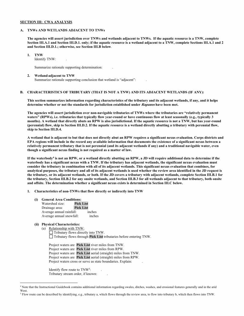
SECTION III: CWA ANALYSIS A. TNWs AND WETLANDS ADJACENT TO TNWs The agencies will assert jurisdiction over TNWs and wetlands adjacent to TNWs. If the aquatic resource is a TNW, complete
Section III.A.1 and Section III.D.1. only; if the aquatic resource is a wetland adjacent to a TNW, complete Sections III.A.1 and 2 and Section III.D.1.; otherwise, see Section III.B below.
1. TNW Identify TNW: .
Summarize rationale supporting determination: .
2. Wetland adjacent to TNW Summarize rationale supporting conclusion that wetland is “adjacent”: .
B. CHARACTERISTICS OF TRIBUTARY (THAT IS NOT A TNW) AND ITS ADJACENT WETLANDS (IF ANY): This section summarizes information regarding characteristics of the tributary and its adjacent wetlands, if any, and it helps
determine whether or not the standards for jurisdiction established under Rapanos have been met. The agencies will assert jurisdiction over non-navigable tributaries of TNWs where the tributaries are “relatively permanent
waters” (RPWs), i.e. tributaries that typically flow year-round or have continuous flow at least seasonally (e.g., typically 3 months). A wetland that directly abuts an RPW is also jurisdictional. If the aquatic resource is not a TNW, but has year-round (perennial) flow, skip to Section III.D.2. If the aquatic resource is a wetland directly abutting a tributary with perennial flow, skip to Section III.D.4.
A wetland that is adjacent to but that does not directly abut an RPW requires a significant nexus evaluation. Corps districts and
EPA regions will include in the record any available information that documents the existence of a significant nexus between a relatively permanent tributary that is not perennial (and its adjacent wetlands if any) and a traditional navigable water, even though a significant nexus finding is not required as a matter of law.
If the waterbody4 is not an RPW, or a wetland directly abutting an RPW, a JD will require additional data to determine if the waterbody has a significant nexus with a TNW. If the tributary has adjacent wetlands, the significant nexus evaluation must consider the tributary in combination with all of its adjacent wetlands. This significant nexus evaluation that combines, for analytical purposes, the tributary and all of its adjacent wetlands is used whether the review area identified in the JD request is the tributary, or its adjacent wetlands, or both. If the JD covers a tributary with adjacent wetlands, complete Section III.B.1 for the tributary, Section III.B.2 for any onsite wetlands, and Section III.B.3 for all wetlands adjacent to that tributary, both onsite and offsite. The determination whether a significant nexus exists is determined in Section III.C below.
1. Characteristics of non-TNWs that flow directly or indirectly into TNW
(i) General Area Conditions: Watershed size: Pick List Drainage area: Pick List Average annual rainfall: inches Average annual snowfall: inches (ii) Physical Characteristics: (a) Relationship with TNW: Tributary flows directly into TNW. Tributary flows through Pick List tributaries before entering TNW. Project waters are Pick List river miles from TNW. Project waters are Pick List river miles from RPW. Project waters are Pick List aerial (straight) miles from TNW. Project waters are Pick List aerial (straight) miles from RPW. Project waters cross or serve as state boundaries. Explain: . Identify flow route to TNW5: . Tributary stream order, if known: .
4 Note that the Instructional Guidebook contains additional information regarding swales, ditches, washes, and erosional features generally and in the arid West. 5 Flow route can be described by identifying, e.g., tributary a, which flows through the review area, to flow into tributary b, which then flows into TNW.

(b) General Tributary Characteristics (check all that apply): Tributary is: Natural Artificial (man-made). Explain: . Manipulated (man-altered). Explain: .
Tributary properties with respect to top of bank (estimate):
Average width: feet Average depth: feet Average side slopes: Pick List. Primary tributary substrate composition (check all that apply):
Silts Sands Concrete Cobbles Gravel Muck Bedrock Vegetation. Type/% cover: Other. Explain: . Tributary condition/stability [e.g., highly eroding, sloughing banks]. Explain: . Presence of run/riffle/pool complexes. Explain: . Tributary geometry: Pick List Tributary gradient (approximate average slope): % (c) Flow: Tributary provides for: Pick List Estimate average number of flow events in review area/year: Pick List Describe flow regime: . Other information on duration and volume: . Surface flow is: Pick List. Characteristics: . Subsurface flow: Pick List. Explain findings: . Dye (or other) test performed: . Tributary has (check all that apply): Bed and banks OHWM6 (check all indicators that apply):
clear, natural line impressed on the bank the presence of litter and debris changes in the character of soil destruction of terrestrial vegetation shelving the presence of wrack line vegetation matted down, bent, or absent sediment sorting leaf litter disturbed or washed away scour sediment deposition multiple observed or predicted flow events water staining abrupt change in plant community other (list):
Discontinuous OHWM.7 Explain: .
If factors other than the OHWM were used to determine lateral extent of CWA jurisdiction (check all that apply): High Tide Line indicated by:
oil or scum line along shore objects fine shell or debris deposits (foreshore) physical markings/characteristics tidal gauges other (list):
Mean High Water Mark indicated by: survey to available datum; physical markings; vegetation lines/changes in vegetation types.
(iii) Chemical Characteristics:
Characterize tributary (e.g., water color is clear, discolored, oily film; water quality; general watershed characteristics, etc.). Explain: .
Identify specific pollutants, if known: .
6A natural or man-made discontinuity in the OHWM does not necessarily sever jurisdiction (e.g., where the stream temporarily flows underground, or where the OHWM has been removed by development or agricultural practices). Where there is a break in the OHWM that is unrelated to the waterbody’s flow regime (e.g., flow over a rock outcrop or through a culvert), the agencies will look for indicators of flow above and below the break. 7Ibid.
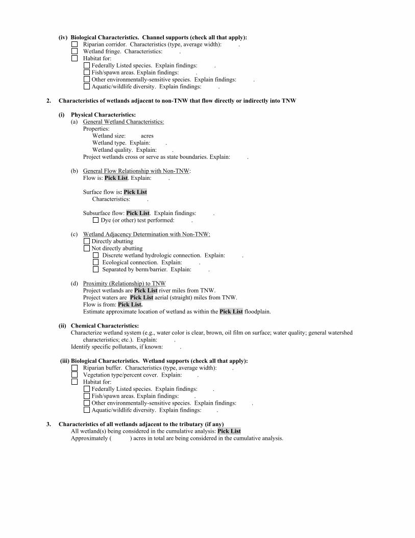
(iv) Biological Characteristics. Channel supports (check all that apply): Riparian corridor. Characteristics (type, average width): . Wetland fringe. Characteristics: . Habitat for:
Federally Listed species. Explain findings: . Fish/spawn areas. Explain findings: . Other environmentally-sensitive species. Explain findings: . Aquatic/wildlife diversity. Explain findings: . 2. Characteristics of wetlands adjacent to non-TNW that flow directly or indirectly into TNW
(i) Physical Characteristics: (a) General Wetland Characteristics: Properties: Wetland size: acres Wetland type. Explain: . Wetland quality. Explain: . Project wetlands cross or serve as state boundaries. Explain: .
(b) General Flow Relationship with Non-TNW: Flow is: Pick List. Explain: . Surface flow is: Pick List Characteristics: . Subsurface flow: Pick List. Explain findings: . Dye (or other) test performed: . (c) Wetland Adjacency Determination with Non-TNW:
Directly abutting Not directly abutting Discrete wetland hydrologic connection. Explain: . Ecological connection. Explain: . Separated by berm/barrier. Explain: . (d) Proximity (Relationship) to TNW
Project wetlands are Pick List river miles from TNW. Project waters are Pick List aerial (straight) miles from TNW.
Flow is from: Pick List. Estimate approximate location of wetland as within the Pick List floodplain. (ii) Chemical Characteristics:
Characterize wetland system (e.g., water color is clear, brown, oil film on surface; water quality; general watershed characteristics; etc.). Explain: .
Identify specific pollutants, if known: . (iii) Biological Characteristics. Wetland supports (check all that apply): Riparian buffer. Characteristics (type, average width): . Vegetation type/percent cover. Explain: . Habitat for:
Federally Listed species. Explain findings: . Fish/spawn areas. Explain findings: .
Other environmentally-sensitive species. Explain findings: . Aquatic/wildlife diversity. Explain findings: .
3. Characteristics of all wetlands adjacent to the tributary (if any) All wetland(s) being considered in the cumulative analysis: Pick List Approximately ( ) acres in total are being considered in the cumulative analysis.

For each wetland, specify the following: Directly abuts? (Y/N) Size (in acres) Directly abuts? (Y/N) Size (in acres)
Summarize overall biological, chemical and physical functions being performed: .
C. SIGNIFICANT NEXUS DETERMINATION
A significant nexus analysis will assess the flow characteristics and functions of the tributary itself and the functions performed by any wetlands adjacent to the tributary to determine if they significantly affect the chemical, physical, and biological integrity of a TNW. For each of the following situations, a significant nexus exists if the tributary, in combination with all of its adjacent wetlands, has more than a speculative or insubstantial effect on the chemical, physical and/or biological integrity of a TNW. Considerations when evaluating significant nexus include, but are not limited to the volume, duration, and frequency of the flow of water in the tributary and its proximity to a TNW, and the functions performed by the tributary and all its adjacent wetlands. It is not appropriate to determine significant nexus based solely on any specific threshold of distance (e.g. between a tributary and its adjacent wetland or between a tributary and the TNW). Similarly, the fact an adjacent wetland lies within or outside of a floodplain is not solely determinative of significant nexus. Draw connections between the features documented and the effects on the TNW, as identified in the Rapanos Guidance and discussed in the Instructional Guidebook. Factors to consider include, for example: Does the tributary, in combination with its adjacent wetlands (if any), have the capacity to carry pollutants or flood waters to
TNWs, or to reduce the amount of pollutants or flood waters reaching a TNW? Does the tributary, in combination with its adjacent wetlands (if any), provide habitat and lifecycle support functions for fish and
other species, such as feeding, nesting, spawning, or rearing young for species that are present in the TNW? Does the tributary, in combination with its adjacent wetlands (if any), have the capacity to transfer nutrients and organic carbon that
support downstream foodwebs? Does the tributary, in combination with its adjacent wetlands (if any), have other relationships to the physical, chemical, or
biological integrity of the TNW? Note: the above list of considerations is not inclusive and other functions observed or known to occur should be documented
below: 1. Significant nexus findings for non-RPW that has no adjacent wetlands and flows directly or indirectly into TNWs. Explain
findings of presence or absence of significant nexus below, based on the tributary itself, then go to Section III.D: . 2. Significant nexus findings for non-RPW and its adjacent wetlands, where the non-RPW flows directly or indirectly into
TNWs. Explain findings of presence or absence of significant nexus below, based on the tributary in combination with all of its adjacent wetlands, then go to Section III.D: .
3. Significant nexus findings for wetlands adjacent to an RPW but that do not directly abut the RPW. Explain findings of
presence or absence of significant nexus below, based on the tributary in combination with all of its adjacent wetlands, then go to Section III.D: .
D. DETERMINATIONS OF JURISDICTIONAL FINDINGS. THE SUBJECT WATERS/WETLANDS ARE (CHECK ALL
THAT APPLY):
1. TNWs and Adjacent Wetlands. Check all that apply and provide size estimates in review area: TNWs: linear feet width (ft), Or, acres. Wetlands adjacent to TNWs: acres.
2. RPWs that flow directly or indirectly into TNWs.
Tributaries of TNWs where tributaries typically flow year-round are jurisdictional. Provide data and rationale indicating that tributary is perennial: .
Tributaries of TNW where tributaries have continuous flow “seasonally” (e.g., typically three months each year) are jurisdictional. Data supporting this conclusion is provided at Section III.B. Provide rationale indicating that tributary flows seasonally: .

Provide estimates for jurisdictional waters in the review area (check all that apply): Tributary waters: linear feet width (ft). Other non-wetland waters: acres.
Identify type(s) of waters: .
3. Non-RPWs8 that flow directly or indirectly into TNWs. Waterbody that is not a TNW or an RPW, but flows directly or indirectly into a TNW, and it has a significant nexus with a
TNW is jurisdictional. Data supporting this conclusion is provided at Section III.C. Provide estimates for jurisdictional waters within the review area (check all that apply): Tributary waters: linear feet width (ft). Other non-wetland waters: acres.
Identify type(s) of waters: . 4. Wetlands directly abutting an RPW that flow directly or indirectly into TNWs. Wetlands directly abut RPW and thus are jurisdictional as adjacent wetlands. Wetlands directly abutting an RPW where tributaries typically flow year-round. Provide data and rationale
indicating that tributary is perennial in Section III.D.2, above. Provide rationale indicating that wetland is directly abutting an RPW: .
Wetlands directly abutting an RPW where tributaries typically flow “seasonally.” Provide data indicating that tributary is
seasonal in Section III.B and rationale in Section III.D.2, above. Provide rationale indicating that wetland is directly abutting an RPW: .
Provide acreage estimates for jurisdictional wetlands in the review area: acres.
5. Wetlands adjacent to but not directly abutting an RPW that flow directly or indirectly into TNWs. Wetlands that do not directly abut an RPW, but when considered in combination with the tributary to which they are adjacent
and with similarly situated adjacent wetlands, have a significant nexus with a TNW are jurisidictional. Data supporting this conclusion is provided at Section III.C.
Provide acreage estimates for jurisdictional wetlands in the review area: acres.
6. Wetlands adjacent to non-RPWs that flow directly or indirectly into TNWs.
Wetlands adjacent to such waters, and have when considered in combination with the tributary to which they are adjacent and with similarly situated adjacent wetlands, have a significant nexus with a TNW are jurisdictional. Data supporting this conclusion is provided at Section III.C.
Provide estimates for jurisdictional wetlands in the review area: acres. 7. Impoundments of jurisdictional waters.9 As a general rule, the impoundment of a jurisdictional tributary remains jurisdictional.
Demonstrate that impoundment was created from “waters of the U.S.,” or Demonstrate that water meets the criteria for one of the categories presented above (1-6), or Demonstrate that water is isolated with a nexus to commerce (see E below).
E. ISOLATED [INTERSTATE OR INTRA-STATE] WATERS, INCLUDING ISOLATED WETLANDS, THE USE,
DEGRADATION OR DESTRUCTION OF WHICH COULD AFFECT INTERSTATE COMMERCE, INCLUDING ANY SUCH WATERS (CHECK ALL THAT APPLY):10
which are or could be used by interstate or foreign travelers for recreational or other purposes. from which fish or shellfish are or could be taken and sold in interstate or foreign commerce. which are or could be used for industrial purposes by industries in interstate commerce. Interstate isolated waters. Explain: . Other factors. Explain: . Identify water body and summarize rationale supporting determination: .
8See Footnote # 3. 9 To complete the analysis refer to the key in Section III.D.6 of the Instructional Guidebook. 10 Prior to asserting or declining CWA jurisdiction based solely on this category, Corps Districts will elevate the action to Corps and EPA HQ for review consistent with the process described in the Corps/EPA Memorandum Regarding CWA Act Jurisdiction Following Rapanos.

Provide estimates for jurisdictional waters in the review area (check all that apply): Tributary waters: linear feet width (ft). Other non-wetland waters: acres.
Identify type(s) of waters: . Wetlands: acres.
F. NON-JURISDICTIONAL WATERS, INCLUDING WETLANDS (CHECK ALL THAT APPLY): If potential wetlands were assessed within the review area, these areas did not meet the criteria in the 1987 Corps of Engineers
Wetland Delineation Manual and/or appropriate Regional Supplements. Review area included isolated waters with no substantial nexus to interstate (or foreign) commerce.
Prior to the Jan 2001 Supreme Court decision in “SWANCC,” the review area would have been regulated based solely on the “Migratory Bird Rule” (MBR).
Waters do not meet the “Significant Nexus” standard, where such a finding is required for jurisdiction. Explain: . Other: (explain, if not covered above): . Provide acreage estimates for non-jurisdictional waters in the review area, where the sole potential basis of jurisdiction is the MBR
factors (i.e., presence of migratory birds, presence of endangered species, use of water for irrigated agriculture), using best professional judgment (check all that apply):
Non-wetland waters (i.e., rivers, streams): 22,059 linear feet averaging 2 to 12 feet in width (ft). Lakes/ponds: acres. Other non-wetland waters: 4.59 acres. List type of aquatic resource: Claypans 4.19 acres and Ponding in Developed Areas 0.40
acre. Wetlands: acres.
Provide acreage estimates for non-jurisdictional waters in the review area that do not meet the “Significant Nexus” standard, where such a finding is required for jurisdiction (check all that apply):
Non-wetland waters (i.e., rivers, streams): linear feet, width (ft). Lakes/ponds: acres. Other non-wetland waters: acres. List type of aquatic resource: . Wetlands: acres.
SECTION IV: DATA SOURCES. A. SUPPORTING DATA. Data reviewed for JD (check all that apply - checked items shall be included in case file and, where checked
and requested, appropriately reference sources below): Maps, plans, plots or plat submitted by or on behalf of the applicant/consultant: Features are depicted on Map Sheets 132, 133, and
135-139 in Appendix E of the submitted delineation.. Data sheets prepared/submitted by or on behalf of the applicant/consultant.
Office concurs with data sheets/delineation report. Office does not concur with data sheets/delineation report.
Data sheets prepared by the Corps: . Corps navigable waters’ study: . U.S. Geological Survey Hydrologic Atlas: See attached watershed maps for HUC boundaries and NHD flowlines.
USGS NHD data. USGS 8 and 12 digit HUC maps.
U.S. Geological Survey map(s). Cite scale & quad name: Rosamond 7.5 minute quadrangle. USDA Natural Resources Conservation Service Soil Survey. Citation: . National wetlands inventory map(s). Cite name: . State/Local wetland inventory map(s): . FEMA/FIRM maps: . 100-year Floodplain Elevation is: (National Geodectic Vertical Datum of 1929) Photographs: Aerial (Name & Date): NAIP Imagery 2005 and 2014 at 1-m resolution; Kern County Imagery 2010 and 2014 as
a 1-foot resolution; LA County Imagery 2011 and 2013 at a 1-foot resolution. or Other (Name & Date): .
Previous determination(s). File no. and date of response letter: SPL-2011-01084-SLP, June 7, 2013. Applicable/supporting case law: . Applicable/supporting scientific literature: . Other information (please specify):Aquatic Resources Delineation Report prepared by the applicant/consultant references
additional materials; also Appendix E contains map sheets; Appendix F contains dimensions. HUC watershed maps of review areas with NHD Data provided by the applicant/consultant; general use of NAIP Imagery 2009, 2010, and 2012 at 1-m resolution; LA County Imagery 2011, 2013, and 2015 at 1-foot resolution; 2015 Site specific IR Imagery, 3-inch color pixel; Bing Aerial Imagery - multiple
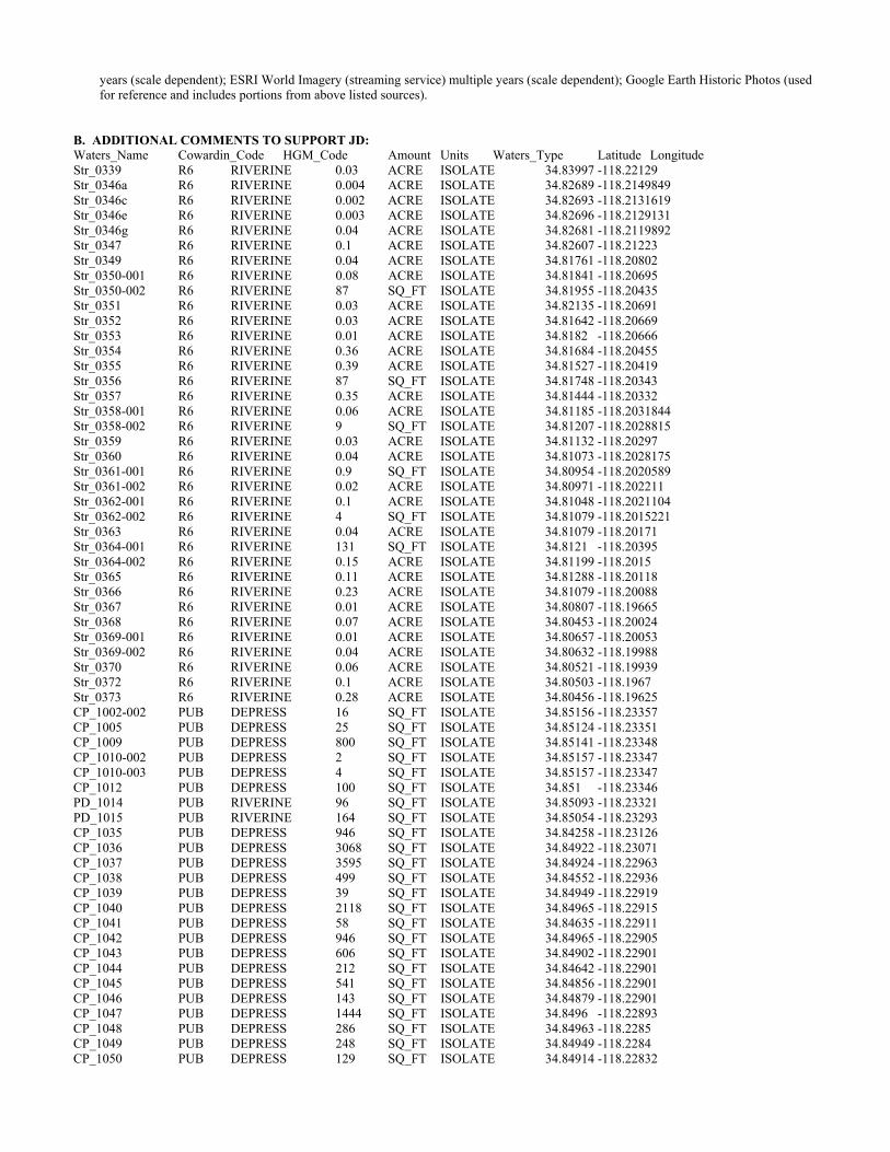
years (scale dependent); ESRI World Imagery (streaming service) multiple years (scale dependent); Google Earth Historic Photos (used for reference and includes portions from above listed sources).
B. ADDITIONAL COMMENTS TO SUPPORT JD: Waters_Name Cowardin_Code HGM_Code Amount Units Waters_Type Latitude Longitude Str_0339 R6 RIVERINE 0.03 ACRE ISOLATE 34.83997 -118.22129 Str_0346a R6 RIVERINE 0.004 ACRE ISOLATE 34.82689 -118.2149849 Str_0346c R6 RIVERINE 0.002 ACRE ISOLATE 34.82693 -118.2131619 Str_0346e R6 RIVERINE 0.003 ACRE ISOLATE 34.82696 -118.2129131 Str_0346g R6 RIVERINE 0.04 ACRE ISOLATE 34.82681 -118.2119892 Str_0347 R6 RIVERINE 0.1 ACRE ISOLATE 34.82607 -118.21223 Str_0349 R6 RIVERINE 0.04 ACRE ISOLATE 34.81761 -118.20802 Str_0350-001 R6 RIVERINE 0.08 ACRE ISOLATE 34.81841 -118.20695 Str_0350-002 R6 RIVERINE 87 SQ_FT ISOLATE 34.81955 -118.20435 Str_0351 R6 RIVERINE 0.03 ACRE ISOLATE 34.82135 -118.20691 Str_0352 R6 RIVERINE 0.03 ACRE ISOLATE 34.81642 -118.20669 Str_0353 R6 RIVERINE 0.01 ACRE ISOLATE 34.8182 -118.20666 Str_0354 R6 RIVERINE 0.36 ACRE ISOLATE 34.81684 -118.20455 Str_0355 R6 RIVERINE 0.39 ACRE ISOLATE 34.81527 -118.20419 Str_0356 R6 RIVERINE 87 SQ_FT ISOLATE 34.81748 -118.20343 Str_0357 R6 RIVERINE 0.35 ACRE ISOLATE 34.81444 -118.20332 Str_0358-001 R6 RIVERINE 0.06 ACRE ISOLATE 34.81185 -118.2031844 Str_0358-002 R6 RIVERINE 9 SQ_FT ISOLATE 34.81207 -118.2028815 Str_0359 R6 RIVERINE 0.03 ACRE ISOLATE 34.81132 -118.20297 Str_0360 R6 RIVERINE 0.04 ACRE ISOLATE 34.81073 -118.2028175 Str_0361-001 R6 RIVERINE 0.9 SQ_FT ISOLATE 34.80954 -118.2020589 Str_0361-002 R6 RIVERINE 0.02 ACRE ISOLATE 34.80971 -118.202211 Str_0362-001 R6 RIVERINE 0.1 ACRE ISOLATE 34.81048 -118.2021104 Str_0362-002 R6 RIVERINE 4 SQ_FT ISOLATE 34.81079 -118.2015221 Str_0363 R6 RIVERINE 0.04 ACRE ISOLATE 34.81079 -118.20171 Str_0364-001 R6 RIVERINE 131 SQ_FT ISOLATE 34.8121 -118.20395 Str_0364-002 R6 RIVERINE 0.15 ACRE ISOLATE 34.81199 -118.2015 Str_0365 R6 RIVERINE 0.11 ACRE ISOLATE 34.81288 -118.20118 Str_0366 R6 RIVERINE 0.23 ACRE ISOLATE 34.81079 -118.20088 Str_0367 R6 RIVERINE 0.01 ACRE ISOLATE 34.80807 -118.19665 Str_0368 R6 RIVERINE 0.07 ACRE ISOLATE 34.80453 -118.20024 Str_0369-001 R6 RIVERINE 0.01 ACRE ISOLATE 34.80657 -118.20053 Str_0369-002 R6 RIVERINE 0.04 ACRE ISOLATE 34.80632 -118.19988 Str_0370 R6 RIVERINE 0.06 ACRE ISOLATE 34.80521 -118.19939 Str_0372 R6 RIVERINE 0.1 ACRE ISOLATE 34.80503 -118.1967 Str_0373 R6 RIVERINE 0.28 ACRE ISOLATE 34.80456 -118.19625 CP_1002-002 PUB DEPRESS 16 SQ_FT ISOLATE 34.85156 -118.23357 CP_1005 PUB DEPRESS 25 SQ_FT ISOLATE 34.85124 -118.23351 CP_1009 PUB DEPRESS 800 SQ_FT ISOLATE 34.85141 -118.23348 CP_1010-002 PUB DEPRESS 2 SQ_FT ISOLATE 34.85157 -118.23347 CP_1010-003 PUB DEPRESS 4 SQ_FT ISOLATE 34.85157 -118.23347 CP_1012 PUB DEPRESS 100 SQ_FT ISOLATE 34.851 -118.23346 PD_1014 PUB RIVERINE 96 SQ_FT ISOLATE 34.85093 -118.23321 PD_1015 PUB RIVERINE 164 SQ_FT ISOLATE 34.85054 -118.23293 CP_1035 PUB DEPRESS 946 SQ_FT ISOLATE 34.84258 -118.23126 CP_1036 PUB DEPRESS 3068 SQ_FT ISOLATE 34.84922 -118.23071 CP_1037 PUB DEPRESS 3595 SQ_FT ISOLATE 34.84924 -118.22963 CP_1038 PUB DEPRESS 499 SQ_FT ISOLATE 34.84552 -118.22936 CP_1039 PUB DEPRESS 39 SQ_FT ISOLATE 34.84949 -118.22919 CP_1040 PUB DEPRESS 2118 SQ_FT ISOLATE 34.84965 -118.22915 CP_1041 PUB DEPRESS 58 SQ_FT ISOLATE 34.84635 -118.22911 CP_1042 PUB DEPRESS 946 SQ_FT ISOLATE 34.84965 -118.22905 CP_1043 PUB DEPRESS 606 SQ_FT ISOLATE 34.84902 -118.22901 CP_1044 PUB DEPRESS 212 SQ_FT ISOLATE 34.84642 -118.22901 CP_1045 PUB DEPRESS 541 SQ_FT ISOLATE 34.84856 -118.22901 CP_1046 PUB DEPRESS 143 SQ_FT ISOLATE 34.84879 -118.22901 CP_1047 PUB DEPRESS 1444 SQ_FT ISOLATE 34.8496 -118.22893 CP_1048 PUB DEPRESS 286 SQ_FT ISOLATE 34.84963 -118.2285 CP_1049 PUB DEPRESS 248 SQ_FT ISOLATE 34.84949 -118.2284 CP_1050 PUB DEPRESS 129 SQ_FT ISOLATE 34.84914 -118.22832

CP_1051 PUB DEPRESS 1299 SQ_FT ISOLATE 34.84952 -118.22825 CP_1052 PUB DEPRESS 68 SQ_FT ISOLATE 34.84934 -118.22791 CP_1053 PUB DEPRESS 301 SQ_FT ISOLATE 34.84936 -118.22777 CP_1054 PUB DEPRESS 916 SQ_FT ISOLATE 34.84417 -118.2274 CP_1055 PUB DEPRESS 3524 SQ_FT ISOLATE 34.84435 -118.22715 CP_1056 PUB DEPRESS 59 SQ_FT ISOLATE 34.84382 -118.22628 CP_1057 PUB DEPRESS 204 SQ_FT ISOLATE 34.84422 -118.22584 CP_1058 PUB DEPRESS 70 SQ_FT ISOLATE 34.84447 -118.22535 CP_1059 PUB DEPRESS 9 SQ_FT ISOLATE 34.84514 -118.22488 CP_1060 PUB DEPRESS 91 SQ_FT ISOLATE 34.84167 -118.22906 CP_1061 PUB DEPRESS 154 SQ_FT ISOLATE 34.8418 -118.22905 CP_1062 PUB DEPRESS 203 SQ_FT ISOLATE 34.84138 -118.22905 CP_1063 PUB DEPRESS 21 SQ_FT ISOLATE 34.84174 -118.22905 CP_1064 PUB DEPRESS 101 SQ_FT ISOLATE 34.84187 -118.22904 CP_1065 PUB DEPRESS 140 SQ_FT ISOLATE 34.84195 -118.22879 CP_1066 PUB DEPRESS 5684 SQ_FT ISOLATE 34.84196 -118.2282 CP_1067 PUB DEPRESS 52 SQ_FT ISOLATE 34.84192 -118.22814 CP_1068 PUB DEPRESS 31 SQ_FT ISOLATE 34.84193 -118.22805 CP_1069 PUB DEPRESS 683 SQ_FT ISOLATE 34.84189 -118.22785 CP_1070 PUB DEPRESS 538 SQ_FT ISOLATE 34.84175 -118.22758 CP_1071 PUB DEPRESS 17 SQ_FT ISOLATE 34.84056 -118.22608 CP_1072 PUB DEPRESS 100 SQ_FT ISOLATE 34.842 -118.22573 CP_1073 PUB DEPRESS 205 SQ_FT ISOLATE 34.84216 -118.2256 CP_1074 PUB DEPRESS 821 SQ_FT ISOLATE 34.84225 -118.22549 CP_1075 PUB DEPRESS 689 SQ_FT ISOLATE 34.84241 -118.22527 CP_1076 PUB DEPRESS 474 SQ_FT ISOLATE 34.84244 -118.22501 CP_1077 PUB DEPRESS 199 SQ_FT ISOLATE 34.84244 -118.22374 CP_1111 PUB DEPRESS 634 SQ_FT ISOLATE 34.82642 -118.21469 CP_1115 PUB DEPRESS 6562 SQ_FT ISOLATE 34.8259 -118.21371 CP_1116 PUB DEPRESS 161 SQ_FT ISOLATE 34.8252 -118.2131 CP_1117 PUB DEPRESS 9 SQ_FT ISOLATE 34.82657 -118.21305 CP_1119 PUB DEPRESS 1 SQ_FT ISOLATE 34.82563 -118.21291 CP_1120 PUB DEPRESS 303 SQ_FT ISOLATE 34.82653 -118.21288 CP_1121-001 PUB DEPRESS 0.1 SQ_FT ISOLATE 34.82421 -118.21269 CP_1121-002 PUB DEPRESS 30937 SQ_FT ISOLATE 34.82421 -118.21269 CP_1122 PUB DEPRESS 0.1 SQ_FT ISOLATE 34.82383 -118.21262 CP_1123 PUB DEPRESS 5244 SQ_FT ISOLATE 34.82372 -118.21251 CP_1124 PUB DEPRESS 26 SQ_FT ISOLATE 34.82544 -118.21243 CP_1125 PUB DEPRESS 2 SQ_FT ISOLATE 34.82557 -118.21242 CP_1126-001 PUB DEPRESS 2 SQ_FT ISOLATE 34.82567 -118.21241 CP_1126-002 PUB DEPRESS 14168 SQ_FT ISOLATE 34.82567 -118.21241 CP_1127-001 PUB DEPRESS 20 SQ_FT ISOLATE 34.82693 -118.21241 CP_1127-002 PUB DEPRESS 81 SQ_FT ISOLATE 34.82693 -118.21241 CP_1127-003 PUB DEPRESS 48 SQ_FT ISOLATE 34.82693 -118.21241 CP_1128 PUB DEPRESS 10 SQ_FT ISOLATE 34.8254 -118.21225 CP_1129-001 PUB DEPRESS 29 SQ_FT ISOLATE 34.82684 -118.21215 CP_1129-002 PUB DEPRESS 5 SQ_FT ISOLATE 34.82684 -118.21215 CP_1129-003 PUB DEPRESS 10 SQ_FT ISOLATE 34.82684 -118.21215 CP_1129-004 PUB DEPRESS 2 SQ_FT ISOLATE 34.82684 -118.21215 CP_1129-005 PUB DEPRESS 224 SQ_FT ISOLATE 34.82684 -118.21215 CP_1131 PUB DEPRESS 612 SQ_FT ISOLATE 34.82482 -118.21181 CP_1132 PUB DEPRESS 22 SQ_FT ISOLATE 34.82488 -118.21176 CP_1133 PUB DEPRESS 199 SQ_FT ISOLATE 34.82306 -118.21155 CP_1134 PUB DEPRESS 2209 SQ_FT ISOLATE 34.82431 -118.2115 CP_1135 PUB DEPRESS 3341 SQ_FT ISOLATE 34.825 -118.21148 CP_1137 PUB DEPRESS 50 SQ_FT ISOLATE 34.82423 -118.21143 CP_1138 PUB DEPRESS 27 SQ_FT ISOLATE 34.82646 -118.2114 CP_1139 PUB DEPRESS 8 SQ_FT ISOLATE 34.82641 -118.21136 CP_1140 PUB DEPRESS 93 SQ_FT ISOLATE 34.82436 -118.21132 CP_1141 PUB DEPRESS 214 SQ_FT ISOLATE 34.82316 -118.21132 CP_1142 PUB DEPRESS 34 SQ_FT ISOLATE 34.82501 -118.21126 CP_1143-001 PUB DEPRESS 51 SQ_FT ISOLATE 34.82638 -118.21125 CP_1143-002 PUB DEPRESS 3 SQ_FT ISOLATE 34.82638 -118.21125 CP_1143-003 PUB DEPRESS 1 SQ_FT ISOLATE 34.82638 -118.21125 CP_1143-004 PUB DEPRESS 407 SQ_FT ISOLATE 34.82638 -118.21125 CP_1143-005 PUB DEPRESS 145 SQ_FT ISOLATE 34.82638 -118.21125

CP_1144 PUB DEPRESS 111 SQ_FT ISOLATE 34.82465 -118.21094 CP_1145 PUB DEPRESS 369 SQ_FT ISOLATE 34.82462 -118.21063 CP_1146 PUB DEPRESS 40 SQ_FT ISOLATE 34.8247 -118.21059 CP_1147-001 PUB DEPRESS 13 SQ_FT ISOLATE 34.82611 -118.21051 CP_1147-002 PUB DEPRESS 0.1 SQ_FT ISOLATE 34.82611 -118.21051 CP_1147-003 PUB DEPRESS 67 SQ_FT ISOLATE 34.82611 -118.21051 CP_1148 PUB DEPRESS 196 SQ_FT ISOLATE 34.82609 -118.21046 CP_1149 PUB DEPRESS 773 SQ_FT ISOLATE 34.82537 -118.21045 CP_1150 PUB DEPRESS 10 SQ_FT ISOLATE 34.82599 -118.21033 CP_1151-001 PUB DEPRESS 2 SQ_FT ISOLATE 34.82604 -118.21032 CP_1151-002 PUB DEPRESS 1 SQ_FT ISOLATE 34.82604 -118.21032 CP_1151-003 PUB DEPRESS 0.1 SQ_FT ISOLATE 34.82601 -118.21032 CP_1151-004 PUB DEPRESS 128 SQ_FT ISOLATE 34.82601 -118.21032 CP_1152 PUB DEPRESS 107 SQ_FT ISOLATE 34.82376 -118.20885 CP_1153 PUB DEPRESS 44 SQ_FT ISOLATE 34.82299 -118.21152 CP_1154 PUB DEPRESS 6 SQ_FT ISOLATE 34.82183 -118.21133 CP_1155 PUB DEPRESS 6 SQ_FT ISOLATE 34.82184 -118.21132 CP_1156 PUB DEPRESS 37 SQ_FT ISOLATE 34.82186 -118.2113 CP_1157 PUB DEPRESS 788 SQ_FT ISOLATE 34.82252 -118.2113 CP_1158 PUB DEPRESS 35 SQ_FT ISOLATE 34.82185 -118.21103 PD_1159 PUB RIVERINE 56 SQ_FT ISOLATE 34.82047 -118.21016 CP_1160 PUB DEPRESS 1008 SQ_FT ISOLATE 34.82025 -118.21012 CP_1161 PUB DEPRESS 18 SQ_FT ISOLATE 34.82203 -118.20953 CP_1162 PUB DEPRESS 5 SQ_FT ISOLATE 34.82202 -118.2095 CP_1163 PUB DEPRESS 2292 SQ_FT ISOLATE 34.82205 -118.20931 CP_1164 PUB DEPRESS 131 SQ_FT ISOLATE 34.8201 -118.20917 CP_1165 PUB DEPRESS 94 SQ_FT ISOLATE 34.81996 -118.2091 CP_1166 PUB DEPRESS 507 SQ_FT ISOLATE 34.82159 -118.2086 CP_1167 PUB DEPRESS 1102 SQ_FT ISOLATE 34.8212 -118.20844 CP_1168 PUB DEPRESS 384 SQ_FT ISOLATE 34.82143 -118.20823 CP_1169 PUB DEPRESS 892 SQ_FT ISOLATE 34.82126 -118.20818 CP_1170-001 PUB DEPRESS 10 SQ_FT ISOLATE 34.8187 -118.20817 CP_1170-002 PUB DEPRESS 0.1 SQ_FT ISOLATE 34.8187 -118.20817 CP_1171-001 PUB DEPRESS 27 SQ_FT ISOLATE 34.8186 -118.20799 CP_1171-002 PUB DEPRESS 0.1 SQ_FT ISOLATE 34.8186 -118.20799 CP_1171-003 PUB DEPRESS 184 SQ_FT ISOLATE 34.8186 -118.20799 CP_1171-004 PUB DEPRESS 8 SQ_FT ISOLATE 34.8186 -118.20799 CP_1171-005 PUB DEPRESS 13 SQ_FT ISOLATE 34.8186 -118.20799 PD_1172 PUB RIVERINE 1040 SQ_FT ISOLATE 34.82051 -118.20658 PD_1173 PUB RIVERINE 7 SQ_FT ISOLATE 34.82093 -118.20635 PD_1174-001 PUB RIVERINE 1 SQ_FT ISOLATE 34.82096 -118.20633 PD_1174-002 PUB RIVERINE 12 SQ_FT ISOLATE 34.82096 -118.20633 PD_1174-003 PUB RIVERINE 8 SQ_FT ISOLATE 34.82096 -118.20633 PD_1174-004 PUB RIVERINE 2610 SQ_FT ISOLATE 34.82096 -118.20633 PD_1174-005 PUB RIVERINE 316 SQ_FT ISOLATE 34.82096 -118.20633 PD_1174-006 PUB RIVERINE 406 SQ_FT ISOLATE 34.82096 -118.20633 PD_1174-007 PUB RIVERINE 1672 SQ_FT ISOLATE 34.82096 -118.20633 PD_1174-008 PUB RIVERINE 313 SQ_FT ISOLATE 34.82096 -118.20633 CP_1175 PUB DEPRESS 8723 SQ_FT ISOLATE 34.81539 -118.206 PD_1176 PUB RIVERINE 360 SQ_FT ISOLATE 34.82026 -118.20597 PD_1177-001 PUB RIVERINE 7 SQ_FT ISOLATE 34.82091 -118.20595 PD_1177-002 PUB RIVERINE 64 SQ_FT ISOLATE 34.82091 -118.20595 CP_1178 PUB DEPRESS 1080 SQ_FT ISOLATE 34.81876 -118.20592 CP_1179-001 PUB DEPRESS 0.1 SQ_FT ISOLATE 34.81839 -118.2059 CP_1179-002 PUB DEPRESS 244 SQ_FT ISOLATE 34.81839 -118.2059 CP_1179-003 PUB DEPRESS 55 SQ_FT ISOLATE 34.81839 -118.2059 CP_1179-004 PUB DEPRESS 76 SQ_FT ISOLATE 34.81839 -118.2059 CP_1180 PUB DEPRESS 69 SQ_FT ISOLATE 34.81875 -118.20574 CP_1181 PUB DEPRESS 160 SQ_FT ISOLATE 34.81821 -118.20572 CP_1182 PUB DEPRESS 216 SQ_FT ISOLATE 34.81837 -118.2057 CP_1183 PUB DEPRESS 135 SQ_FT ISOLATE 34.81835 -118.20558 CP_1184-001 PUB DEPRESS 0.1 SQ_FT ISOLATE 34.81867 -118.20557 CP_1184-002 PUB DEPRESS 32 SQ_FT ISOLATE 34.81867 -118.20557 CP_1185 PUB DEPRESS 58 SQ_FT ISOLATE 34.8176 -118.20553 CP_1186-001 PUB DEPRESS 0.1 SQ_FT ISOLATE 34.81868 -118.20542 CP_1186-002 PUB DEPRESS 150 SQ_FT ISOLATE 34.81868 -118.20542

CP_1187-001 PUB DEPRESS 5 SQ_FT ISOLATE 34.81893 -118.2054 CP_1187-002 PUB DEPRESS 31 SQ_FT ISOLATE 34.81893 -118.2054 CP_1188-001 PUB DEPRESS 8 SQ_FT ISOLATE 34.81913 -118.20505 CP_1188-002 PUB DEPRESS 19 SQ_FT ISOLATE 34.81913 -118.20505 CP_1189 PUB DEPRESS 170 SQ_FT ISOLATE 34.81629 -118.20495 CP_1190 PUB DEPRESS 119 SQ_FT ISOLATE 34.81695 -118.20476 CP_1191 PUB DEPRESS 61 SQ_FT ISOLATE 34.8172 -118.20367 CP_1192 PUB DEPRESS 71 SQ_FT ISOLATE 34.81582 -118.20347 CP_1193 PUB DEPRESS 624 SQ_FT ISOLATE 34.81724 -118.20345 CP_1194-001 PUB DEPRESS 136 SQ_FT ISOLATE 34.81676 -118.20343 CP_1194-002 PUB DEPRESS 6 SQ_FT ISOLATE 34.81676 -118.20343 CP_1194-003 PUB DEPRESS 5 SQ_FT ISOLATE 34.81676 -118.20343 CP_1195 PUB DEPRESS 111 SQ_FT ISOLATE 34.81703 -118.20337 CP_1196 PUB DEPRESS 9 SQ_FT ISOLATE 34.81682 -118.2033 CP_1197 PUB DEPRESS 466 SQ_FT ISOLATE 34.81406 -118.20538 CP_1198 PUB DEPRESS 1978 SQ_FT ISOLATE 34.81367 -118.20504 CP_1199 PUB DEPRESS 2294 SQ_FT ISOLATE 34.81349 -118.20448 CP_1200 PUB DEPRESS 1313 SQ_FT ISOLATE 34.81308 -118.20367 CP_1201 PUB DEPRESS 8 SQ_FT ISOLATE 34.81167 -118.20366 CP_1202-001 PUB DEPRESS 13 SQ_FT ISOLATE 34.81167 -118.20339 CP_1202-002 PUB DEPRESS 22 SQ_FT ISOLATE 34.81167 -118.20339 CP_1202-003 PUB DEPRESS 7 SQ_FT ISOLATE 34.81167 -118.20339 CP_1202-004 PUB DEPRESS 729 SQ_FT ISOLATE 34.81167 -118.20339 CP_1202-005 PUB DEPRESS 0.1 SQ_FT ISOLATE 34.81167 -118.20339 CP_1202-006 PUB DEPRESS 0.1 SQ_FT ISOLATE 34.81167 -118.20339 CP_1203 PUB DEPRESS 29 SQ_FT ISOLATE 34.81441 -118.20334 CP_1204 PUB DEPRESS 17 SQ_FT ISOLATE 34.81089 -118.20314 CP_1205 PUB DEPRESS 383 SQ_FT ISOLATE 34.81166 -118.20276 CP_1206 PUB DEPRESS 952 SQ_FT ISOLATE 34.81154 -118.20276 CP_1207 PUB DEPRESS 15 SQ_FT ISOLATE 34.8109 -118.20259 CP_1208-001 PUB DEPRESS 45 SQ_FT ISOLATE 34.81223 -118.20257 CP_1208-002 PUB DEPRESS 10 SQ_FT ISOLATE 34.81223 -118.20257 CP_1209-001 PUB DEPRESS 0.1 SQ_FT ISOLATE 34.81227 -118.20254 CP_1209-002 PUB DEPRESS 25 SQ_FT ISOLATE 34.81227 -118.20254 CP_1210-001 PUB DEPRESS 1868 SQ_FT ISOLATE 34.81215 -118.20245 CP_1210-002 PUB DEPRESS 445 SQ_FT ISOLATE 34.81215 -118.20245 CP_1211 PUB DEPRESS 22 SQ_FT ISOLATE 34.81239 -118.20243 CP_1212 PUB DEPRESS 20 SQ_FT ISOLATE 34.81157 -118.20243 CP_1213 PUB DEPRESS 8 SQ_FT ISOLATE 34.81173 -118.20242 CP_1214 PUB DEPRESS 40 SQ_FT ISOLATE 34.80991 -118.20242 CP_1215 PUB DEPRESS 72 SQ_FT ISOLATE 34.81225 -118.20234 CP_1216 PUB DEPRESS 30 SQ_FT ISOLATE 34.80992 -118.20232 CP_1217 PUB DEPRESS 160 SQ_FT ISOLATE 34.81129 -118.20224 CP_1218 PUB DEPRESS 10 SQ_FT ISOLATE 34.81112 -118.2022 CP_1219 PUB DEPRESS 108 SQ_FT ISOLATE 34.81067 -118.2022 CP_1220 PUB DEPRESS 36 SQ_FT ISOLATE 34.81227 -118.20215 CP_1221 PUB DEPRESS 148 SQ_FT ISOLATE 34.81113 -118.20213 CP_1222 PUB DEPRESS 410 SQ_FT ISOLATE 34.81485 -118.20205 CP_1223 PUB DEPRESS 13 SQ_FT ISOLATE 34.81238 -118.20198 CP_1224-001 PUB DEPRESS 8 SQ_FT ISOLATE 34.81216 -118.20198 CP_1224-002 PUB DEPRESS 66 SQ_FT ISOLATE 34.81216 -118.20198 CP_1225 PUB DEPRESS 38 SQ_FT ISOLATE 34.81106 -118.20197 CP_1226 PUB DEPRESS 16 SQ_FT ISOLATE 34.81239 -118.20196 CP_1227 PUB DEPRESS 19 SQ_FT ISOLATE 34.81211 -118.20196 CP_1228 PUB DEPRESS 56 SQ_FT ISOLATE 34.81215 -118.20194 CP_1229 PUB DEPRESS 12 SQ_FT ISOLATE 34.81104 -118.20193 CP_1230 PUB DEPRESS 37 SQ_FT ISOLATE 34.81109 -118.20192 CP_1231 PUB DEPRESS 4 SQ_FT ISOLATE 34.81104 -118.20191 CP_1232 PUB DEPRESS 31 SQ_FT ISOLATE 34.81106 -118.2019 CP_1233 PUB DEPRESS 73 SQ_FT ISOLATE 34.81113 -118.20186 CP_1234 PUB DEPRESS 12 SQ_FT ISOLATE 34.81067 -118.20184 CP_1235 PUB DEPRESS 11 SQ_FT ISOLATE 34.81069 -118.20182 CP_1236 PUB DEPRESS 11 SQ_FT ISOLATE 34.81109 -118.20181 CP_1237 PUB DEPRESS 15 SQ_FT ISOLATE 34.81221 -118.20179 CP_1238 PUB DEPRESS 593 SQ_FT ISOLATE 34.81107 -118.20177 CP_1239 PUB DEPRESS 264 SQ_FT ISOLATE 34.81058 -118.20177

CP_1240-001 PUB DEPRESS 33 SQ_FT ISOLATE 34.81072 -118.20175 CP_1240-002 PUB DEPRESS 13 SQ_FT ISOLATE 34.81072 -118.20175 CP_1241 PUB DEPRESS 60 SQ_FT ISOLATE 34.81041 -118.20176 CP_1242 PUB DEPRESS 19 SQ_FT ISOLATE 34.81102 -118.20175 CP_1243-001 PUB DEPRESS 13 SQ_FT ISOLATE 34.81201 -118.20162 CP_1243-002 PUB DEPRESS 22 SQ_FT ISOLATE 34.81201 -118.20162 CP_1243-003 PUB DEPRESS 6 SQ_FT ISOLATE 34.81201 -118.20162 CP_1243-004 PUB DEPRESS 13 SQ_FT ISOLATE 34.81201 -118.20162 CP_1243-005 PUB DEPRESS 1 SQ_FT ISOLATE 34.81201 -118.20162 CP_1243-006 PUB DEPRESS 3 SQ_FT ISOLATE 34.81201 -118.20162 CP_1244 PUB DEPRESS 509 SQ_FT ISOLATE 34.81039 -118.20161 CP_1245-001 PUB DEPRESS 15 SQ_FT ISOLATE 34.81196 -118.20145 CP_1245-002 PUB DEPRESS 1 SQ_FT ISOLATE 34.81196 -118.20145 CP_1246-001 PUB DEPRESS 5 SQ_FT ISOLATE 34.81009 -118.20142 CP_1246-002 PUB DEPRESS 343 SQ_FT ISOLATE 34.81009 -118.20142 CP_1247 PUB DEPRESS 70 SQ_FT ISOLATE 34.81005 -118.20141 CP_1248 PUB DEPRESS 11 SQ_FT ISOLATE 34.81194 -118.20139 CP_1249 PUB DEPRESS 622 SQ_FT ISOLATE 34.81036 -118.20137 CP_1250-001 PUB DEPRESS 104 SQ_FT ISOLATE 34.80974 -118.20135 CP_1250-002 PUB DEPRESS 3 SQ_FT ISOLATE 34.80974 -118.20135 CP_1251 PUB DEPRESS 148 SQ_FT ISOLATE 34.81017 -118.20136 CP_1252-001 PUB DEPRESS 3 SQ_FT ISOLATE 34.81191 -118.20132 CP_1252-002 PUB DEPRESS 17 SQ_FT ISOLATE 34.81191 -118.20132 CP_1252-003 PUB DEPRESS 9 SQ_FT ISOLATE 34.81191 -118.20132 CP_1252-004 PUB DEPRESS 0.1 SQ_FT ISOLATE 34.81191 -118.20132 CP_1252-005 PUB DEPRESS 19 SQ_FT ISOLATE 34.81191 -118.20132 CP_1253-001 PUB DEPRESS 3 SQ_FT ISOLATE 34.81184 -118.20125 CP_1253-002 PUB DEPRESS 1 SQ_FT ISOLATE 34.81184 -118.20125 CP_1253-003 PUB DEPRESS 6 SQ_FT ISOLATE 34.81184 -118.20125 CP_1253-004 PUB DEPRESS 4 SQ_FT ISOLATE 34.81184 -118.20125 CP_1254-001 PUB DEPRESS 640 SQ_FT ISOLATE 34.81031 -118.2012 CP_1254-002 PUB DEPRESS 3 SQ_FT ISOLATE 34.81031 -118.2012 CP_1255 PUB DEPRESS 23 SQ_FT ISOLATE 34.8118 -118.2012 CP_1256 PUB DEPRESS 9 SQ_FT ISOLATE 34.81076 -118.2011 CP_1257-001 PUB DEPRESS 1 SQ_FT ISOLATE 34.81176 -118.2011 CP_1257-002 PUB DEPRESS 12 SQ_FT ISOLATE 34.81176 -118.2011 CP_1257-003 PUB DEPRESS 68 SQ_FT ISOLATE 34.81176 -118.2011 CP_1258-001 PUB DEPRESS 2 SQ_FT ISOLATE 34.80998 -118.2011 CP_1258-002 PUB DEPRESS 13 SQ_FT ISOLATE 34.80998 -118.2011 CP_1259 PUB DEPRESS 227 SQ_FT ISOLATE 34.81041 -118.20106 CP_1260 PUB DEPRESS 88 SQ_FT ISOLATE 34.81033 -118.20106 CP_1261 PUB DEPRESS 28 SQ_FT ISOLATE 34.81077 -118.20105 CP_1262 PUB DEPRESS 10 SQ_FT ISOLATE 34.81034 -118.20095 CP_1263-001 PUB DEPRESS 135 SQ_FT ISOLATE 34.81173 -118.2009 CP_1263-002 PUB DEPRESS 58 SQ_FT ISOLATE 34.81173 -118.2009 CP_1263-003 PUB DEPRESS 1 SQ_FT ISOLATE 34.81173 -118.2009 CP_1264 PUB DEPRESS 121 SQ_FT ISOLATE 34.81054 -118.20086 CP_1265 PUB DEPRESS 3032 SQ_FT ISOLATE 34.80982 -118.20079 CP_1266 PUB DEPRESS 787 SQ_FT ISOLATE 34.80866 -118.20075 CP_1267 PUB DEPRESS 20 SQ_FT ISOLATE 34.81081 -118.20061 CP_1268 PUB DEPRESS 14 SQ_FT ISOLATE 34.81044 -118.20038 CP_1269 PUB DEPRESS 252 SQ_FT ISOLATE 34.81042 -118.20034 CP_1270 PUB DEPRESS 190 SQ_FT ISOLATE 34.81171 -118.20024 CP_1271 PUB DEPRESS 2333 SQ_FT ISOLATE 34.808 -118.20017 CP_1272 PUB DEPRESS 1411 SQ_FT ISOLATE 34.81047 -118.20004 CP_1273 PUB DEPRESS 8286 SQ_FT ISOLATE 34.80992 -118.20001 CP_1274 PUB DEPRESS 5 SQ_FT ISOLATE 34.81039 -118.19998 CP_1275 PUB DEPRESS 2 SQ_FT ISOLATE 34.81038 -118.19998 CP_1276 PUB DEPRESS 162 SQ_FT ISOLATE 34.81073 -118.19984 CP_1277 PUB DEPRESS 21 SQ_FT ISOLATE 34.81057 -118.19961 CP_1278 PUB DEPRESS 89 SQ_FT ISOLATE 34.81064 -118.1992 CP_1279 PUB DEPRESS 1045 SQ_FT ISOLATE 34.8093 -118.19879 CP_1280 PUB DEPRESS 14 SQ_FT ISOLATE 34.81055 -118.1987 CP_1281 PUB DEPRESS 12 SQ_FT ISOLATE 34.80951 -118.19859 CP_1282 PUB DEPRESS 9 SQ_FT ISOLATE 34.81068 -118.19856 CP_1283 PUB DEPRESS 198 SQ_FT ISOLATE 34.80971 -118.19834
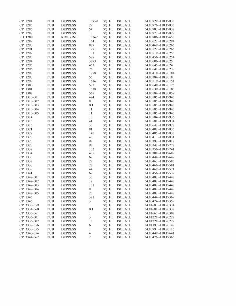
CP_1284 PUB DEPRESS 10959 SQ_FT ISOLATE 34.80729 -118.19833 CP_1285 PUB DEPRESS 29 SQ_FT ISOLATE 34.80976 -118.19833 CP_1286 PUB DEPRESS 54 SQ_FT ISOLATE 34.80983 -118.19832 CP_1287 PUB DEPRESS 13 SQ_FT ISOLATE 34.80973 -118.19829 PD_1288 PUB RIVERINE 10262 SQ_FT ISOLATE 34.80706 -118.19653 CP_1289 PUB DEPRESS 1641 SQ_FT ISOLATE 34.80622 -118.20294 CP_1290 PUB DEPRESS 889 SQ_FT ISOLATE 34.80469 -118.20265 CP_1291 PUB DEPRESS 1291 SQ_FT ISOLATE 34.80522 -118.20265 CP_1292 PUB DEPRESS 131 SQ_FT ISOLATE 34.80519 -118.20255 CP_1293 PUB DEPRESS 528 SQ_FT ISOLATE 34.80456 -118.20254 CP_1294 PUB DEPRESS 3893 SQ_FT ISOLATE 34.80606 -118.2025 CP_1295 PUB DEPRESS 453 SQ_FT ISOLATE 34.80645 -118.2024 CP_1296 PUB DEPRESS 26 SQ_FT ISOLATE 34.80641 -118.20237 CP_1297 PUB DEPRESS 1278 SQ_FT ISOLATE 34.80418 -118.20184 CP_1298 PUB DEPRESS 55 SQ_FT ISOLATE 34.80384 -118.2018 CP_1299 PUB DEPRESS 1616 SQ_FT ISOLATE 34.80519 -118.20151 CP_1300 PUB DEPRESS 572 SQ_FT ISOLATE 34.80648 -118.20125 CP_1301 PUB DEPRESS 1538 SQ_FT ISOLATE 34.80639 -118.20105 CP_1302 PUB DEPRESS 567 SQ_FT ISOLATE 34.80584 -118.20059 CP_1313-001 PUB DEPRESS 424 SQ_FT ISOLATE 34.80585 -118.19943 CP_1313-002 PUB DEPRESS 8 SQ_FT ISOLATE 34.80585 -118.19943 CP_1313-003 PUB DEPRESS 0.1 SQ_FT ISOLATE 34.80585 -118.19943 CP_1313-004 PUB DEPRESS 11 SQ_FT ISOLATE 34.80585 -118.19943 CP_1313-005 PUB DEPRESS 11 SQ_FT ISOLATE 34.80585 -118.19943 CP_1314 PUB DEPRESS 13 SQ_FT ISOLATE 34.80584 -118.19936 CP_1315 PUB DEPRESS 41 SQ_FT ISOLATE 34.80581 -118.19934 CP_1316 PUB DEPRESS 30 SQ_FT ISOLATE 34.80642 -118.19922 CP_1321 PUB DEPRESS 81 SQ_FT ISOLATE 34.80402 -118.19835 CP_1322 PUB DEPRESS 140 SQ_FT ISOLATE 34.80405 -118.19833 CP_1323 PUB DEPRESS 43 SQ_FT ISOLATE 34.804 -118.19831 CP_1325 PUB DEPRESS 98 SQ_FT ISOLATE 34.80392 -118.19812 CP_1328 PUB DEPRESS 98 SQ_FT ISOLATE 34.80342 -118.19772 CP_1332 PUB DEPRESS 132 SQ_FT ISOLATE 34.80356 -118.19741 CP_1334 PUB DEPRESS 435 SQ_FT ISOLATE 34.80308 -118.19689 CP_1335 PUB DEPRESS 62 SQ_FT ISOLATE 34.80444 -118.19649 CP_1337 PUB DEPRESS 27 SQ_FT ISOLATE 34.80463 -118.19583 CP_1338 PUB DEPRESS 28 SQ_FT ISOLATE 34.80466 -118.19581 CP_1339 PUB DEPRESS 44 SQ_FT ISOLATE 34.80469 -118.19571 CP_1341 PUB DEPRESS 62 SQ_FT ISOLATE 34.80456 -118.19539 CP_1342-001 PUB DEPRESS 30 SQ_FT ISOLATE 34.80482 -118.19447 CP_1342-002 PUB DEPRESS 12 SQ_FT ISOLATE 34.80482 -118.19447 CP_1342-003 PUB DEPRESS 101 SQ_FT ISOLATE 34.80482 -118.19447 CP_1342-004 PUB DEPRESS 8 SQ_FT ISOLATE 34.80482 -118.19447 CP_1342-005 PUB DEPRESS 20 SQ_FT ISOLATE 34.80482 -118.19447 CP_1345 PUB DEPRESS 321 SQ_FT ISOLATE 34.80444 -118.19369 CP_1346 PUB DEPRESS 3 SQ_FT ISOLATE 34.80474 -118.19359 CP_3333-059 PUB DEPRESS 1 SQ_FT ISOLATE 34.8168 -118.20334 CP_3334-060 PUB DEPRESS 0.1 SQ_FT ISOLATE 34.81681 -118.20332 CP_3335-061 PUB DEPRESS 1 SQ_FT ISOLATE 34.81667 -118.20302 CP_3336-001 PUB DEPRESS 3 SQ_FT ISOLATE 34.81228 -118.20222 CP_3336-002 PUB DEPRESS 10 SQ_FT ISOLATE 34.81228 -118.20222 CP_3337-056 PUB DEPRESS 6 SQ_FT ISOLATE 34.81197 -118.20147 CP_3338-055 PUB DEPRESS 1 SQ_FT ISOLATE 34.8099 -118.20115 CP_3340-054 PUB DEPRESS 4 SQ_FT ISOLATE 34.80449 -118.19641 CP_3344-062 PUB DEPRESS 2 SQ_FT ISOLATE 34.80476 -118.19365.

California High-Speed Rail Project
Bakersfield to Palmdale Project Section: Watershed Maps to Support Approved Jurisdictional Determination – Rosamond Lake Watershed Page | 1
PRELIM INARY DRAFT/SUBJECT TO CHANGE - HSR ALIGNMENT IS NOT DETERM INED SOURCE: ESRI/USGS Topograph ic Basemap (2016) ; USGS 30m Hillshade (2015); Phase 4B Eng ineering data from CaHSRA (4/2016); Wltershed Boundary Da taset/National Hydrography Dataset (2015).
j 0 2
Miles 0 4
Kilometers
4
8
BP HSR Mapped Streams with OHWM in Rosamond Lake Watershed Study Area
-► Ephemeral Stream
IC ]
c::::J
► '
~ ~~
Study A rea in the Rosamond Lake Creek watershed
Rosamond Lake Watershed HUC-10
D Other HUC-10 Wate rsheds
D l:S] --►
Wetlands Study Area (Project Footprint + 250 ft Buffer)
La ke Palmda le HUC-12 watershed
Direction of flow based on NHD flow lines
~
November 21, 2016
~ CALIFORNIA °Q'I High-Speed Rail Authority
Rosamond Lake Watershed
Hydrologic Connectivity
..... U.~ Dep(lfllllfilll'cl"'°'""°"'a1 1Qn ~ Federal Rairrood Administration

California High-Speed Rail Project
Bakersfield to Palmdale Project Section: Watershed Maps to Support Approved Jurisdictional Determination – Rosamond Lake Watershed Page | 2
~ CALIFORNIA °Q'I High-Speed Rail Authority
PRELI MINARY DRAFT/SUBJECT TO CHANGE - HSRALIGNMENT IS NOT DETERMINED SOURCE : ESRI/USGS Topog raph ic Basemap (2016) ; USGS 30m Hi llshade (2015); Phase 4B Eng ineering data from CaHSRA (4/2016) ; Wa tershed Boundary Dataset/Na tional Hydrography Dataset (20 15).
j 0 0.25
Miles 0 0.5
Kilometers
0.5
-► Ephemeral Stream
BP HSR Mapped Streams with OHWM in Rosamond Lake Watershed Study Area
►
IC]
CJ
-....
Study Area in the Rosamond Lake Creek Watershed
Rosamond Lake Watershed HUC-10
~~~~
" \.._\ ~ --....
~►-►
►
D Wetlands Study Area (Project Footprint+ 250 fl Buffer)
--► Direction of flow based on NHD flowlines
Rosamond Lake Watershed
Study Area Hydrologic Connectivity
..... U.~ Dep(lfllllfilll'cl"'°'""°"'a1 1Qn ~ Federal Rairrood Administration
November 14, 2016

California High-Speed Rail Project
Bakersfield to Palmdale Project Section: Watershed Maps to Support Approved Jurisdictional Determination – Rosamond Lake Watershed Page | 3
PRELI MINARY DRAFT/SUBJECT TO CHANGE - HSR ALIGNMENT IS NOT DETERMINED SOURCE : ESRI/USGS Topog raph ic Basemap (2016) ; USGS 30m Hi llshade (2015); Phase 4B Eng ineering data from CaHSRA (4/2016) ; Watershed Boundary Dataset/Na tional Hydrography Dataset (2015) .
j 0 5 10
Miles 0 8 16
Kilometers
D Cl Antelope Valley Watershed
(as described in SPL-2011-01084-SLP)
Rosamond Lake watershed HUC-10
HUC-12 Watersheds excluded from SPL-2011-01084-SLP
rr===il Wetlands Study Area (Project Footprint+ 250 ft Buffer) ic:J
The U.S. Army Corps of Eng ineers issued a SWANCC watershed-level Approved Jurisdictional Determination for Antelope Valley (HUC 10 #s 1809020609 through 1809020624) on June 7, 2013. Note that this determination specifically excluded the areas of Lake Pa lmda le and all waters tributary to Lake Palmdale (portions of HUC 12 #s 180902061501, 180902061102, 180902061103). This figure illustrates the location of the study area relative to the previous watershed-level decision.
November 17, 2016
~ CALIFORNIA °Q'I High-Speed Rail Authority
Rosamond Lake Watershed
Location Within Antelope Valley Watershed
..... U.~ Dep(lfllllfilll'cl"'°'""°"'a1 1Qn ~ Federal Rairrood Administration

California High-Speed Rail Project
Bakersfield to Palmdale Project Section: Aerial Photos to Support Approved Jurisdictional Determination - Rosamond Lake Watershed Page | 1
Kern County 2014 Aerial Photo. Yellow Line – Study Area. Red Line – HUC 10 Watershed Boundaries.
Rosamond Lake Watershed
Cottonwood Creek-Tylerhorse Canyon Watershed
Rosamond Lake Watershed
Rosamond Lake Watershed Tropico Hill – Oak
Creek Watershed
Sacatara Creek Kings Canyon Watershed

California High-Speed Rail Project
Bakersfield to Palmdale Project Section: Aerial Photos to Support Approved Jurisdictional Determination - Rosamond Lake Watershed Page | 2
Kern County 2014 Aerial Photo. Yellow Line – Study Area. Red Line – HUC 10 Watershed Boundaries.
Rosamond Lake Watershed
Cottonwood Creek-Tylerhorse Canyon Watershed
Tropico Hill-Oak Creek Watershed

California High-Speed Rail Project
Bakersfield to Palmdale Project Section: Aerial Photos to Support Approved Jurisdictional Determination - Rosamond Lake Watershed Page | 3
Kern County 2014 Aerial Photo. Yellow Line – Study Area. Red Line – HUC 10 Watershed Boundaries.
Rosamond Lake Watershed
Sacatara Creek Kings Canyon Watershed
Cottonwood Creek-Tylerhorse Canyon Watershed

California High-Speed Rail Project
Bakersfield to Palmdale Project Section: Aerial Photos to Support Approved Jurisdictional Determination - Rosamond Lake Watershed Page | 4
Kern County 2010 Aerial Photo. Yellow Line – Study Area. Red Line – HUC 10 Watershed Boundaries.
Cottonwood Creek-Tylerhorse Canyon Watershed
Rosamond Lake Watershed
Tropico Hill-Oak Creek Watershed

California High-Speed Rail Project
Bakersfield to Palmdale Project Section: Aerial Photos to Support Approved Jurisdictional Determination - Rosamond Lake Watershed Page | 5
Kern County 2010 Aerial Photo. Yellow Line – Study Area. Red Line – HUC 10 Watershed Boundaries.
Cottonwood Creek-Tylerhorse Canyon Watershed
Rosamond Lake Watershed
Sacatara Creek Kings Canyon Watershed

California High-Speed Rail Project
Bakersfield to Palmdale Project Section: Aerial Photos to Support Approved Jurisdictional Determination - Rosamond Lake Watershed Page | 6
NAIP 2005 Aerial Photo. Yellow Line – Study Area. Red Line – HUC 10 Watershed Boundaries.
Cottonwood Creek-Tylerhorse Canyon Watershed
Rosamond Lake Watershed
Tropico Hill-Oak Creek Watershed

California High-Speed Rail Project
Bakersfield to Palmdale Project Section: Aerial Photos to Support Approved Jurisdictional Determination - Rosamond Lake Watershed Page | 7
NAIP 2005 Aerial Photo. Yellow Line – Study Area. Red Line – HUC 10 Watershed Boundaries.
Sacatara Creek Kings Canyon Watershed
Rosamond Lake Watershed
Cottonwood Creek-Tylerhorse Canyon Watershed

California High-Speed Rail Project
Bakersfield to Palmdale Project Section: Aerial Photos to Support Approved Jurisdictional Determination - Rosamond Lake Watershed Page | 8
NAIP 2014 Aerial Photo. Yellow Line – Study Area. Red Line – HUC 10 Watershed Boundaries.
Cottonwood Creek-Tylerhorse Canyon Watershed
Rosamond Lake Watershed
Tropico Hill-Oak Creek Watershed

California High-Speed Rail Project
Bakersfield to Palmdale Project Section: Aerial Photos to Support Approved Jurisdictional Determination - Rosamond Lake Watershed Page | 9
NAIP 2014 Aerial Photo. Yellow Line – Study Area. Red Line – HUC 10 Watershed Boundaries.
Aerial Sources: http://maps.co.kern.ca.us/arcgis/services/ and http://gis.apfo.usda.gov/arcgis/services/NAIP/
Retrieved November 14, 2016.
Cottonwood Creek-Tylerhorse Canyon Watershed
Sacatara Creek Kings Canyon Watershed
Rosamond Lake Watershed

APPROVED JURISDICTIONAL DETERMINATION FORM
U.S. Army Corps of Engineers
This form should be completed by following the instructions provided in Section IV of the JD Form Instructional Guidebook. SECTION I: BACKGROUND INFORMATION A. REPORT COMPLETION DATE FOR APPROVED JURISDICTIONAL DETERMINATION (JD): August 3, 2017 B. DISTRICT OFFICE, FILE NAME, AND NUMBER:SPL-2010-00945-JD5 C. PROJECT LOCATION AND BACKGROUND INFORMATION:
State: CA County/parish/borough: Kern and Los Angeles City: N/A Center coordinates of site (lat/long in degree decimal format): Lat. 34.83166° N, Long. 118.21721° W. Universal Transverse Mercator: 388699 m E, 3855050 m N Name of nearest waterbody: Rosamond Lake
Name of nearest Traditional Navigable Water (TNW) nto which the aquatic resource flows: N/A iName of watershed or Hydrologic Unit Code (HUC): Cottonwood Creek- Tylerhorse Canyon, California 1809020618
Check if map/diagram of review area and/or potential jurisdictional areas is/are available upon request. Check if other sites (e.g., offsite mitigation sites, disposal sites, etc…) are associated with this action and are recorded on a
different JD form. D. REVIEW PERFORMED FOR SITE EVALUATION (CHECK ALL THAT APPLY):
Office (Desk) Determination. Date: July 25, 2017 Field Determination. Date(s):
SECTION II: SUMMARY OF FINDINGS A. RHA SECTION 10 DETERMINATION OF JURISDICTION. There Are no “navigable waters of the U.S.” within Rivers and Harbors Act (RHA) jurisdiction (as defined by 33 CFR part 329) in the review area. [Required]
Waters subject to the ebb and flow of the tide. Waters are presently used, or have been used in the past, or may be susceptible for use to transport interstate or foreign commerce.
Explain: . B. CWA SECTION 404 DETERMINATION OF JURISDICTION. There Are no “waters of the U.S.” within Clean Water Act (CWA) jurisdiction (as defined by 33 CFR part 328) in the review area. [Required] 1. Waters of the U.S. a. Indicate presence of waters of U.S. in review area (check all that apply): 1 TNWs, including territorial seas Wetlands adjacent to TNWs Relatively permanent waters2 (RPWs) that flow directly or indirectly into TNWs Non-RPWs that flow directly or indirectly into TNWs Wetlands directly abutting RPWs that flow directly or indirectly into TNWs Wetlands adjacent to but not directly abutting RPWs that flow directly or indirectly into TNWs Wetlands adjacent to non-RPWs that flow directly or indirectly into TNWs Impoundments of jurisdictional waters Isolated (interstate or intrastate) waters, including isolated wetlands
b. Identify (estimate) size of waters of the U.S. in the review area: Non-wetland waters: linear feet: width (ft) and/or acres. Wetlands: acres. c. Limits (boundaries) of jurisdiction based on: Not Applicable. Elevation of established OHWM (if known): . 2. Non-regulated waters/wetlands (check if applicable):3 Potentially jurisdictional waters and/or wetlands were assessed within the review area and determined to be not jurisdictional.
Explain: Within the Cottonwood Creek-Tylerhorse Canyon HUC 10, the project area contains 57 aquatic features. These features include eight unnamed ephemeral desert wash stream features, 48 claypan features, and one ponded area. Ephemeral desert wash streams span a total of approximately 6,958 linear feet (1.31 miles) and cover approximately 0.52 acre; claypan features cover approximately 1.60 acres; and one ponded area occupies 8 square feet. Labeled maps and tables of features and dimensions are
1 Boxes checked below shall be supported by completing the appropriate sections in Section III below. 2 For purposes of this form, an RPW is defined as a tributary that is not a TNW and that typically flows year-round or has continuous flow at least “seasonally” (e.g., typically 3 months). 3 Supporting documentation is presented in Section III.F.

provided in the Aquatic Resources Delineation Report, which identifies each feature according to which HUC-10 watershed it occurs within. The unnamed ephemeral desert washes, features Str_0340 through Str-0346 and Str_0348, generally flow east within the study area and continue to flow generally east outside the study area toward Rosamond Dry Lake. Most of the ephemeral desert wash features dissipate and do not have defined channels that can be traced all the way down to the terminal point in the watershed. These features are similar to many other streams in the Antelope Valley Watershed that have well-defined channels where they originate in the mountains and foothills, but dissipate on the valley floor, where water movement during storms is primarily sheet flow. Ephemeral claypan features, CP_1078 through CP_1110, CP-1112 through 114, CP_1118, CP_1130, and CP_1136, are scattered throughout the study area due to the relatively flat topography. Note that some features have multiple segments and are labeled as such in attached tables (e.g. CP_1095-001, CP_1095-002, etc.). These low-lying depressional features are ephemeral or intermittent, and typically hold water for a few weeks annually. One area of ponding, feature PD_1103, holds water for at least fourteen days after storms, was also identified in the study area. This aquatic feature generally holds water for a few weeks similar to claypans. All aquatic features within the study area are ephemeral and are not used for commerce. The hydrologic connection to the low point in the Antelope Valley watershed, Rogers, Rosamond, and Buckhorn Dry Lakes, is primarily through sheet flow during storms. A review of topographic maps and watershed boundary datasets indicates that waters from the study area drain toward Rosamond Dry Lake. There are no Traditional Navigable Waters (TNWs) or Relatively Permanent Waters (RPWs) in the study area, and the ephemeral desert streams in the study area are not tributaries to RPWs or TNWs. A previous SWANCC watershed-level Approved JD for Antelope Valley (HUC10 #s 1809020609 through 1809020624, excluding those portions of HUC12s 18090206151, 1901902061102, and 180902061103 that drain toward Lake Palmdale and its tributaries) determined that Rosamond, Buckhorn, and Rogers Dry Lakes, and their tributaries, (i.e. the Antelope Valley Watershed, excluding Lake Palmdale and tributaries to Lake Palmdale) are non-jurisdictional waters of the United States under SWANCC. This determination, SPL-2011-01084-SLP, dated June 7, 2013, found that these Antelope Valley waters are not tributary to either a TNW or an (a)(3) water and Rosamond, Buckhorn, and Rogers Dry Lakes are not (a)(3) waters themselves. The Corps made this watershed conclusion because the Antelope Valley watershed is an isolated, intrastate watershed without any surface water related interstate commerce. This previous determination is still in effect, and is appended as a supporting document for this determination. Previously approved jurisdictional determinations have been made for tributaries to these dry lakes. When these lakes were analyzed in SPL-2011-01084-SLP, the Corps found no published commercial uses of the surface waters of any tributaries to Rosamond, Buckhorn and Rogers Dry Lakes, and determined that a review of aerial photographs (Google Earth) also did not depict surface water usage of any drainages tributary to the dry lakes. The Corps found that all tributaries to Rosamond, Buckhorn and Rogers Dry Lakes are not (a)(3) waters as defined by 33 C.F.R. section 328.3(a)(3)(i-iii). The previous determination found that since Rosamond, Buckhorn, and Rogers Dry Lakes are intrastate, isolated waters without a surface water connection to commerce, all tributaries to Rosamond, Buckhorn, and Rogers Dry Lakes as part of the overall watershed system are also isolated and additionally have no nexus to commerce. A review of current conditions and updated literature review found that conditions have not changed since the SPL-2011-01084-SLP determination for Antelope Valley. Thus, the eight unnamed ephemeral desert wash stream features, 48 claypan features, and one feature formed through ponding in desert developed areas in this study area are intrastate, isolated waters with no interstate or foreign commerce connection and therefore are not currently regulated. The above is based upon the review of aerial photographs (Google Earth, accessed July 25, 2017 ) that also did not show surface water usage of the project drainages or the Rosamond Dry Lake terminus. Since the Rosamond Dry Lake is an intrastate, isolated water without a surface water connection to commerce (see prior AJD file No. SPL-2011-01084-SLP), the subject 33 unnamed ephemeral desert stream features, 325 claypan features, and 17 ponded features , as part of the same overall system, are also isolated and additionally have no nexus to commerce. Based on the information above, the subject features: 8 unnamed ephemeral desert wash stream features, 48 claypan features, and one ponded area, are NONJURISDICTIONAL waters of the United States, since the waters are NOT tributary to either a TNW or an (a)(3) water and are NOT (a)(3) waters themselves. The Corps makes such a conclusion since the waters are tribuatary to an isolated, intrastate dry lake.
.

SECTION III: CWA ANALYSIS A. TNWs AND WETLANDS ADJACENT TO TNWs The agencies will assert jurisdiction over TNWs and wetlands adjacent to TNWs. If the aquatic resource is a TNW, complete
Section III.A.1 and Section III.D.1. only; if the aquatic resource is a wetland adjacent to a TNW, complete Sections III.A.1 and 2 and Section III.D.1.; otherwise, see Section III.B below.
1. TNW Identify TNW: .
Summarize rationale supporting determination: .
2. Wetland adjacent to TNW Summarize rationale supporting conclusion that wetland is “adjacent”: .
B. CHARACTERISTICS OF TRIBUTARY (THAT IS NOT A TNW) AND ITS ADJACENT WETLANDS (IF ANY): This section summarizes information regarding characteristics of the tributary and its adjacent wetlands, if any, and it helps
determine whether or not the standards for jurisdiction established under Rapanos have been met. The agencies will assert jurisdiction over non-navigable tributaries of TNWs where the tributaries are “relatively permanent
waters” (RPWs), i.e. tributaries that typically flow year-round or have continuous flow at least seasonally (e.g., typically 3 months). A wetland that directly abuts an RPW is also jurisdictional. If the aquatic resource is not a TNW, but has year-round (perennial) flow, skip to Section III.D.2. If the aquatic resource is a wetland directly abutting a tributary with perennial flow, skip to Section III.D.4.
A wetland that is adjacent to but that does not directly abut an RPW requires a significant nexus evaluation. Corps districts and
EPA regions will include in the record any available information that documents the existence of a significant nexus between a relatively permanent tributary that is not perennial (and its adjacent wetlands if any) and a traditional navigable water, even though a significant nexus finding is not required as a matter of law.
If the waterbody4 is not an RPW, or a wetland directly abutting an RPW, a JD will require additional data to determine if the waterbody has a significant nexus with a TNW. If the tributary has adjacent wetlands, the significant nexus evaluation must consider the tributary in combination with all of its adjacent wetlands. This significant nexus evaluation that combines, for analytical purposes, the tributary and all of its adjacent wetlands is used whether the review area identified in the JD request is the tributary, or its adjacent wetlands, or both. If the JD covers a tributary with adjacent wetlands, complete Section III.B.1 for the tributary, Section III.B.2 for any onsite wetlands, and Section III.B.3 for all wetlands adjacent to that tributary, both onsite and offsite. The determination whether a significant nexus exists is determined in Section III.C below.
1. Characteristics of non-TNWs that flow directly or indirectly into TNW
(i) General Area Conditions: Watershed size: Pick List Drainage area: Pick List Average annual rainfall: inches Average annual snowfall: inches (ii) Physical Characteristics: (a) Relationship with TNW: Tributary flows directly into TNW. Tributary flows through Pick List tributaries before entering TNW. Project waters are Pick List river miles from TNW. Project waters are Pick List river miles from RPW. Project waters are Pick List aerial (straight) miles from TNW. Project waters are Pick List aerial (straight) miles from RPW. Project waters cross or serve as state boundaries. Explain: . Identify flow route to TNW5: . Tributary stream order, if known: .
4 Note that the Instructional Guidebook contains additional information regarding swales, ditches, washes, and erosional features generally and in the arid West. 5 Flow route can be described by identifying, e.g., tributary a, which flows through the review area, to flow into tributary b, which then flows into TNW.

(b) General Tributary Characteristics (check all that apply): Tributary is: Natural Artificial (man-made). Explain: . Manipulated (man-altered). Explain: .
Tributary properties with respect to top of bank (estimate):
Average width: feet Average depth: feet Average side slopes: Pick List. Primary tributary substrate composition (check all that apply):
Silts Sands Concrete Cobbles Gravel Muck Bedrock Vegetation. Type/% cover: Other. Explain: . Tributary condition/stability [e.g., highly eroding, sloughing banks]. Explain: . Presence of run/riffle/pool complexes. Explain: . Tributary geometry: Pick List Tributary gradient (approximate average slope): % (c) Flow: Tributary provides for: Pick List Estimate average number of flow events in review area/year: Pick List Describe flow regime: . Other information on duration and volume: . Surface flow is: Pick List. Characteristics: . Subsurface flow: Pick List. Explain findings: . Dye (or other) test performed: . Tributary has (check all that apply): Bed and banks OHWM6 (check all indicators that apply):
clear, natural line impressed on the bank the presence of litter and debris changes in the character of soil destruction of terrestrial vegetation shelving the presence of wrack line vegetation matted down, bent, or absent sediment sorting leaf litter disturbed or washed away scour sediment deposition multiple observed or predicted flow events water staining abrupt change in plant community other (list):
Discontinuous OHWM.7 Explain: .
If factors other than the OHWM were used to determine lateral extent of CWA jurisdiction (check all that apply): High Tide Line indicated by:
oil or scum line along shore objects fine shell or debris deposits (foreshore) physical markings/characteristics tidal gauges other (list):
Mean High Water Mark indicated by: survey to available datum; physical markings; vegetation lines/changes in vegetation types.
(iii) Chemical Characteristics:
Characterize tributary (e.g., water color is clear, discolored, oily film; water quality; general watershed characteristics, etc.). Explain: .
Identify specific pollutants, if known: .
6A natural or man-made discontinuity in the OHWM does not necessarily sever jurisdiction (e.g., where the stream temporarily flows underground, or where the OHWM has been removed by development or agricultural practices). Where there is a break in the OHWM that is unrelated to the waterbody’s flow regime (e.g., flow over a rock outcrop or through a culvert), the agencies will look for indicators of flow above and below the break. 7Ibid.

(iv) Biological Characteristics. Channel supports (check all that apply): Riparian corridor. Characteristics (type, average width): . Wetland fringe. Characteristics: . Habitat for:
Federally Listed species. Explain findings: . Fish/spawn areas. Explain findings: . .
Other environmentally-sensitive species. Explain findings: Aquatic/wildlife diversity. Explain findings: .
2. Characteristics of wetlands adjacent to non-TNW that flow directly or indirectly into TNW
(i) Physical Characteristics: (a) General Wetland Characteristics: Properties: Wetland size: acres
Wetland type. Explain: .Wetland quality. Explain:
Project wetlands cross or serve as state boundaries. Explain: .
.
(b) General Flow Relationship with Non-TNW:
Flow is: Pick List. Explain: . Surface flow is: Pick List Characteristics: . Subsurface flow: Pick List. Explain findings: . Dye (or other) test performed: . (c) Wetland Adjacency Determination with Non-TNW:
Directly abutting Not directly abutting .
Discrete wetland hydrologic connection. Explain: Ecological connection. Explain: .
Separated by berm/barrier. Explain: . (d) Proximity (Relationship) to TNW
Project wetlands are Pick List river miles from TNW. Project waters are Pick List aerial (straight) miles from TNW.
Flow is from: Pick List. Estimate approximate location of wetland as within the Pick List floodplain. (ii) Chemical Characteristics:
Characterize wetland system (e.g., water color is clear, brown, oil film on surface; water quality; general watershed characteristics; etc.). Explain: .
Identify specific pollutants, if known: . (iii) Biological Characteristics. Wetland supports (check all that apply): Riparian buffer. Characteristics (type, average width): . Vegetation type/percent cover. Explain: . Habitat for:
Federally Listed species. Explain findings: . s:
.Fish/spawn areas. Explain finding
Other environmentally-sensitive species. Explain findings: . Aquatic/wildlife diversity. Explain findings: .
3. Characteristics of all wetlands adjacent to the tributary (if any) All wetland(s) being considered in the cumulative analysis: Pick List Approximately ( ) acres in total are being considered in the cumulative analysis.

For each wetland, specify the following: Directly abuts? (Y/N) Size (in acres) Directly abuts? (Y/N) Size (in acres)
Summarize overall biological, chemical and physical functions being performed: .
C. SIGNIFICANT NEXUS DETERMINATION
A significant nexus analysis will assess the flow characteristics and functions of the tributary itself and the functions performed by any wetlands adjacent to the tributary to determine if they significantly affect the chemical, physical, and biological integrity of a TNW. For each of the following situations, a significant nexus exists if the tributary, in combination with all of its adjacent wetlands, has more than a speculative or insubstantial effect on the chemical, physical and/or biological integrity of a TNW. Considerations when evaluating significant nexus include, but are not limited to the volume, duration, and frequency of the flow of water in the tributary and its proximity to a TNW, and the functions performed by the tributary and all its adjacent wetlands. It is not appropriate to determine significant nexus based solely on any specific threshold of distance (e.g. between a tributary and its adjacent wetland or between a tributary and the TNW). Similarly, the fact an adjacent wetland lies within or outside of a floodplain is not solely determinative of significant nexus. Draw connections between the features documented and the effects on the TNW, as identified in the Rapanos Guidance and discussed in the Instructional Guidebook. Factors to consider include, for example: Does the tributary, in combination with its adjacent wetlands (if any), have the capacity to carry pollutants or flood waters to
TNWs, or to reduce the amount of pollutants or flood waters reaching a TNW? Does the tributary, in combination with its adjacent wetlands (if any), provide habitat and lifecycle support functions for fish and
other species, such as feeding, nesting, spawning, or rearing young for species that are present in the TNW? Does the tributary, in combination with its adjacent wetlands (if any), have the capacity to transfer nutrients and organic carbon that
support downstream foodwebs? Does the tributary, in combination with its adjacent wetlands (if any), have other relationships to the physical, chemical, or
biological integrity of the TNW? Note: the above list of considerations is not inclusive and other functions observed or known to occur should be documented
below: 1. Significant nexus findings for non-RPW that has no adjacent wetlands and flows directly or indirectly into TNWs. Explain
findings of presence or absence of significant nexus below, based on the tributary itself, then go to Section III.D: . 2. Significant nexus findings for non-RPW and its adjacent wetlands, where the non-RPW flows directly or indirectly into
TNWs. Explain findings of presence or absence of significant nexus below, based on the tributary in combination with all of its adjacent wetlands, then go to Section III.D: .
3. Significant nexus findings for wetlands adjacent to an RPW but that do not directly abut the RPW. Explain findings of
presence or absence of significant nexus below, based on the tributary in combination with all of its adjacent wetlands, then go to Section III.D: .
D. DETERMINATIONS OF JURISDICTIONAL FINDINGS. THE SUBJECT WATERS/WETLANDS ARE (CHECK ALL
THAT APPLY):
1. TNWs and Adjacent Wetlands. Check all that apply and provide size estimates in review area: TNWs: linear feet width (ft), Or, acres. Wetlands adjacent to TNWs: acres.
2. RPWs that flow directly or indirectly into TNWs.
Tributaries of TNWs where tributaries typically flow year-round are jurisdictional. Provide data and rationale indicating that tributary is perennial: .
Tributaries of TNW where tributaries have continuous flow “seasonally” (e.g., typically three months each year) are jurisdictional. Data supporting this conclusion is provided at Section III.B. Provide rationale indicating that tributary flows seasonally: .

Provide estimates for jurisdictional waters in the review area (check all that apply): Tributary waters: linear feet width (ft). Other non-wetland waters: acres.
Identify type(s) of waters: .
3. Non-RPWs8 that flow directly or indirectly into TNWs. Waterbody that is not a TNW or an RPW, but flows directly or indirectly into a TNW, and it has a significant nexus with a
TNW is jurisdictional. Data supporting this conclusion is provided at Section III.C. Provide estimates for jurisdictional waters within the review area (check all that apply): Tributary waters: linear feet width (ft). Other non-wetland waters: acres.
Identify type(s) of waters: . 4. Wetlands directly abutting an RPW that flow directly or indirectly into TNWs. Wetlands directly abut RPW and thus are jurisdictional as adjacent wetlands. Wetlands directly abutting an RPW where tributaries typically flow year-round. Provide data and rationale
indicating that tributary is perennial in Section III.D.2, above. Provide rationale indicating that wetland is directly abutting an RPW: .
Wetlands directly abutting an RPW where tributaries typically flow “seasonally.” Provide data indicating that tributary is
seasonal in Section III.B and rationale in Section III.D.2, above. Provide rationale indicating that wetland is directly abutting an RPW: .
Provide acreage estimates for jurisdictional wetlands in the review area: acres.
5. Wetlands adjacent to but not directly abutting an RPW that flow directly or indirectly into TNWs. Wetlands that do not directly abut an RPW, but when considered in combination with the tributary to which they are adjacent
and with similarly situated adjacent wetlands, have a significant nexus with a TNW are jurisidictional. Data supporting this conclusion is provided at Section III.C.
Provide acreage estimates for jurisdictional wetlands in the review area: acres.
6. Wetlands adjacent to non-RPWs that flow directly or indirectly into TNWs.
Wetlands adjacent to such waters, and have when considered in combination with the tributary to which they are adjacent and with similarly situated adjacent wetlands, have a significant nexus with a TNW are jurisdictional. Data supporting this conclusion is provided at Section III.C.
Provide estimates for jurisdictional wetlands in the review area: acres. 7. Impoundments of jurisdictional waters.9 As a general rule, the impoundment of a jurisdictional tributary remains jurisdictional.
Demonstrate that impoundment was created from “waters of the U.S.,” or Demonstrate that water meets the criteria for one of the categories presented above (1-6), or Demonstrate that water is isolated with a nexus to commerce (see E below).
E. ISOLATED [INTERSTATE OR INTRA-STATE] WATERS, INCLUDING ISOLATED WETLANDS, THE USE,
DEGRADATION OR DESTRUCTION OF WHICH COULD AFFECT INTERSTATE COMMERCE, INCLUDING ANY SUCH WATERS (CHECK ALL THAT APPLY):10
which are or could be used by interstate or foreign travelers for recreational or other purposes. from which fish or shellfish are or could be taken and sold in interstate or foreign commerce. which are or could be used for industrial purposes by industries in interstate commerce. Interstate isolated waters. Explain: . Other factors. Explain: . Identify water body and summarize rationale supporting determination: .
8See Footnote # 3. 9 To complete the analysis refer to the key in Section III.D.6 of the Instructional Guidebook. 10 Prior to asserting or declining CWA jurisdiction based solely on this category, Corps Districts will elevate the action to Corps and EPA HQ for review consistent with the process described in the Corps/EPA Memorandum Regarding CWA Act Jurisdiction Following Rapanos.

Provide estimates for jurisdictional waters in the review area (check all that apply): Tributary waters: linear feet width (ft). Other non-wetland waters: acres.
Identify type(s) of waters: . Wetlands: acres.
F. NON-JURISDICTIONAL WATERS, INCLUDING WETLANDS (CHECK ALL THAT APPLY): If potential wetlands were assessed within the review area, these areas did not meet the criteria in the 1987 Corps of Engineers
Wetland Delineation Manual and/or appropriate Regional Supplements. Review area included isolated waters with no substantial nexus to interstate (or foreign) commerce.
Prior to the Jan 2001 Supreme Court decision in “SWANCC,” the review area would have been regulated based solely on the “Migratory Bird Rule” (MBR).
Waters do not meet the “Significant Nexus” standard, where such a finding is required for jurisdiction. Explain: . Other: (explain, if not covered above): . Provide acreage estimates for non-jurisdictional waters in the review area, where the sole potential basis of jurisdiction is the MBR
factors (i.e., presence of migratory birds, presence of endangered species, use of water for irrigated agriculture), using best professional judgment (check all that apply):
Non-wetland waters (i.e., rivers, streams): 6958 linear feet averaging 3 to 11 feet in width (ft). Lakes/ponds: acres. Other non-wetland waters: 1.60 acres. List type of aquatic resource: Claypans (1.6 acres) and other ponded areas (8 sq ft). Wetlands: acres.
Provide acreage estimates for non-jurisdictional waters in the review area that do not meet the “Significant Nexus” standard, where such a finding is required for jurisdiction (check all that apply):
Non-wetland waters (i.e., rivers, streams): linear feet, width (ft). Lakes/ponds: acres. Other non-wetland waters: acres. List type of aquatic resource: . Wetlands: acres.
SECTION IV: DATA SOURCES. A. SUPPORTING DATA. Data reviewed for JD (check all that apply - checked items shall be included in case file and, where checked
and requested, appropriately reference sources below): Maps, plans, plots or plat submitted by or on behalf of the applicant/consultant: Features are depicted on Map Sheets 133-135 in
Appendix E of the submitted delineation.. Data sheets prepared/submitted by or on behalf of the applicant/consultant.
Office concurs with data sheets/delineation report. Office does not concur with data sheets/delineation report.
Data sheets prepared by the Corps : . Corps navigable waters’ study: . U.S. Geological Survey Hydrologic Atlas:(see enclosed map package for NHD flowline and watershed boundary data).
USGS NHD data. USGS 8 and 12 digit HUC maps.
U.S. Geological Survey map(s). Cite scale & quad name: Rosamond 7.5 minute quadrangle (See enclosed map package). tion: .tion: .USDA Natural Resources Conservation Service Soil Survey. Cita . . National wetlands inventory map(s). Cite name: State/Local wetland inventory ma p(s): . maps: . maps: . FEMA/FIRM 100-year Floodplain Elevation is: (National Geodectic Vertical Datum of 1929) Photographs: Aerial (Name & Date): NAIP Imagery 2005 and 2014 at 1-m resolution; Kern County Imagery 2008 and 2015 at
1-foot resolution; Los Angeles County 2011 and 2013 at a 1-foot resolution. or Other (Name & Date): .
Previous determination(s). File no. and date of response letter: SPL-2011-01084-SLP, June 7, 2013. Applicable/supporting case law: . Applicable/supporting scientific literature: . Other information (please specify):Aquatic Resources Delineation Report prepared by the applicant/consultant references
additional materials; also Appendix E contains map sheets; Appendix F contains dimensions. HUC watershed maps of review areas with NHD Data provided by the applicant/consultant; general use of NAIP Imagery 2009, 2010, and 2012 at 1-m resolution; LA County Imagery 2012 and 2014 at a 1-foot resolution; 2015 Site specific IR Imagery, 3-inch color pixel; Bing Aerial Imagery - multiple years

(scale dependent); ESRI World Imagery (streaming service) multiple years (scale dependent); Google Earth Historic Photos (used for reference and includes portions from above listed sources).
B. ADDITIONAL COMMENTS TO SUPPORT JD: Waters_Name Cowardin_Code HGM_Code Amount Units Waters_Type Latitude Longitude Str_0340 R6 RIVERINE 0.1 ACRE ISOLATE 34.83676 -118.220615 Str_0341 R6 RIVERINE 0.03 ACRE ISOLATE 34.83775 -118.219569 Str_0342 R6 RIVERINE 0.07 ACRE ISOLATE 34.83529 -118.220422 Str_0343 R6 RIVERINE 0.07 ACRE ISOLATE 34.83436 -118.218316 Str_0344 R6 RIVERINE 0.06 ACRE ISOLATE 34.82896 -118.214727 Str_0345 R6 RIVERINE 0.14 ACRE ISOLATE 34.8286 -118.212903 Str_0346b R6 RIVERINE 0.03 ACRE ISOLATE 34.82733 -118.2140673 Str_0346d R6 RIVERINE 0.002 ACRE ISOLATE 34.82702 -118.2130697 Str_0346f R6 RIVERINE 0.003 ACRE ISOLATE 34.82701 -118.2127448 Str_0348 R6 RIVERINE 0.01 ACRE ISOLATE 34.82731 -118.211299 CP_1078 PUB DEPRESS 849 SQ_FT ISOLATE 34.83765 -118.223017 CP_1079 PUB DEPRESS 2242 SQ_FT ISOLATE 34.83797 -118.221775 CP_1080 PUB DEPRESS 219 SQ_FT ISOLATE 34.83785 -118.220491 CP_1081-001 PUB DEPRESS 678 SQ_FT ISOLATE 34.83662 -118.220235 CP_1081-002 PUB DEPRESS 1209 SQ_FT ISOLATE 34.83662 -118.220235 CP_1082 PUB DEPRESS 640 SQ_FT ISOLATE 34.8375 -118.220189 CP_108 3 PUB DEPRESS 31 SQ_FT ISOLATE 34.83654 -118.220149 CP_1084-001 PUB DEPRESS 263 SQ_FT ISOLATE 34.83657 -118.220076 CP_1084-002 PUB DEPRESS 362 SQ_FT ISOLATE 34.83657 -118.220076 CP_1085 PUB DEPRESS 1977 SQ_FT ISOLATE 34.83758 -118.219374 CP_1086 PUB DEPRESS 109 SQ_FT ISOLATE 34.83475 -118.220989 CP_1087-001 PUB DEPRESS 8 SQ_FT ISOLATE 34.83529 -118.220713 CP_1087-002 PUB DEPRESS 2045 SQ_FT ISOLATE 34.83529 -118.220713 CP_1087-003 PUB DEPRESS 1635 SQ_FT ISOLATE 34.83529 -118.220713 CP_1088 PUB DEPRESS 466 SQ_FT ISOLATE 34.83456 -118.220533 CP_1089-001 PUB DEPRESS 1879 SQ_FT ISOLATE 34.83402 -118.220339 CP_1089-002 PUB DEPRESS 2173 SQ_FT ISOLATE 34.83402 -118.220339 CP_1090 PUB DEPRESS 28 SQ_FT ISOLATE 34.83451 -118.220247 CP_1091 PUB DEPRESS 533 SQ_FT ISOLATE 34.83352 -118.220214 CP_1092-001 PUB DEPRESS 414 SQ_FT ISOLATE 34.83534 -118.220169 CP_1092-002 PUB DEPRESS 96 SQ_FT ISOLATE 34.83534 -118.220169 CP_1092-003 PUB DEPRESS 1279 SQ_FT ISOLATE 34.83534 -118.220169 CP_1093 PUB DEPRESS 938 SQ_FT ISOLATE 34.83468 -118.220085 CP_1094 PUB DEPRESS 5495 SQ_FT ISOLATE 34.83254 -118.219582 CP_1095-001 PUB DEPRESS 1 SQ_FT ISOLATE 34.83488 -118.219318 CP_1095-002 PUB DEPRESS 29315 SQ_FT ISOLATE 34.83488 -118.219318 CP_1096 PUB DEPRESS 195 SQ_FT ISOLATE 34.83237 -118.219267 CP_1097 PUB DEPRESS 35 SQ_FT ISOLATE 34.83459 -118.219256 CP_1098 PUB DEPRESS 57 SQ_FT ISOLATE 34.83459 -118.21912 CP_1099 PUB DEPRESS 1242 SQ_FT ISOLATE 34.8326 -118.218335 CP_1100-001 PUB DEPRESS 10 SQ_FT ISOLATE 34.83468 -118.218293 CP_1100-002 PUB DEPRESS 715 SQ_FT ISOLATE 34.83468 -118.218293 CP_1101 PUB DEPRESS 138 SQ_FT ISOLATE 34.83242 -118.218245 CP_1102 PUB DEPRESS 1736 SQ_FT ISOLATE 34.83481 -118.218238 PD_1103 PUB DEPRESS 8 SQ_FT ISOLATE 34.83079 -118.218211 CP_1104 PUB DEPRESS 206 SQ_FT ISOLATE 34.83156 -118.217122 CP_1105 PUB DEPRESS 340 SQ_FT ISOLATE 34.83485 -118.217033 CP_1106 PUB DEPRESS 449 SQ_FT ISOLATE 34.83091 -118.21678 CP_1107 PUB DEPRESS 752 SQ_FT ISOLATE 34.83068 -118.213893 CP_1108 PUB DEPRESS 351 SQ_FT ISOLATE 34.83031 -118.21778 CP_1109 PUB DEPRESS 7010 SQ_FT ISOLATE 34.83021 -118.217256 CP_1110 PUB DEPRESS 68 SQ_FT ISOLATE 34.82921 -118.214855 CP_1112-001 PUB DEPRESS 1 SQ_FT ISOLATE 34.82715 -118.214573 CP_1112-002 PUB DEPRESS 63 SQ_FT ISOLATE 34.82715 -118.214573 CP_1113 PUB DEPRESS 341 SQ_FT ISOLATE 34.82917 -118.214026 CP_1114 PUB DEPRESS 552 SQ_FT ISOLATE 34.82845 -118.213755 CP_1118 PUB DEPRESS 185 SQ_FT ISOLATE 34.82828 -118.213045 CP_1130 PUB DEPRESS 68 SQ_FT ISOLATE 34.82785 -118.212047 CP_1136 PUB DEPRESS 359 SQ_FT ISOLATE 34.82724 -118.211456.

California High-Speed Rail Project
Bakersfield to Palmdale Project Section: Watershed Maps to Support Approved Jurisdictional Determination – Cottonwood Creek – Tylerhorse Canyon Watershed Page | 1
► ►
PRELI MINARY DRAFT/SUBJECT TO CHANGE - HSRALIGNMENT IS NOT DETERMINED SOU RCE : ESRI/USGS Topog raphic Basemap (2016) ; USGS 30m Hi llshade (2015); Phase 4B Engineering data from CaHSRA (4/2016) ; Wa tershed Boundary Dataset/Na tional Hydrography Dataset (2015).
j 0 1.5
Miles 0 2.5
Kilometers
3
5
BP HSR Mapped Streams with OHWM in Cottonwood Creek-Tylerhorse Canyon Study Area
-► Ephemeral Stream
IC]
CJ D
@@atl®lil\W®®@I @0'@@13° 'if'WO@~@li'©@
©@lilW@lil
Study Area in the Cottonwood CreekTylerhorse Canyon Watershed
Cottonwood Creek-Tylerho rse Canyon Watershed HUC-10
Other HUC-10 Watersheds
.--, Wetlands Study Area l,_J (Project Footprint + 250 ft Buffer)
--► Direction of flow based on NHD flowlines
► ►
►
November 14, 2016
~ CALIFORNIA °Q'I High-Speed Rail Authority
Cottonwood Creek -
Tylerhorse Canyon Watershed
Hydrologic Connectivity
..... U.~ Dep(lfllllfilll'cl"'°'""°"'a1 1Qn ~ Federal Rairrood Administration
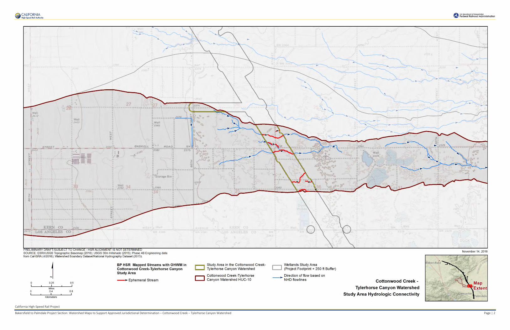
California High-Speed Rail Project
Bakersfield to Palmdale Project Section: Watershed Maps to Support Approved Jurisdictional Determination – Cottonwood Creek – Tylerhorse Canyon Watershed Page | 2
TR r_
PRELI MINARY DRAFT/SUBJECT TO CHANGE - HSR ALIGNMENT IS NOT DETERMINED SOURCE : ESRI/USGS Topog raph ic Basemap (2016) ; USGS 30m Hi llshade (2015); Phase 4B Eng ineering data from CaHSRA (4/2016) ; Watershed Boundary Dataset/Na tional Hydrography Dataset (2015) .
j 0 0.25
Miles 0 04
Kilometers
0.5
08
BP HSR Mapped Streams with OHWM in Cottonwood Creek-Tylerhorse Canyon Study Area
-► Ephemeral Stream
IC]
CJ
Study A rea in the Cottonwood CreekTylerhorse Canyon Watershed
Cottonwood Creek-Tylerhorse Canyon Watershed HUC-10
.---, Wetlands Study Area L........J (Project Footprint + 250 ft Buffer)
--► Direction of flow based on NHD flowlines
~►
November 14, 2016
~ CALIFORNIA °Q'I High-Speed Rail Authority
Cottonwood Creek -
Tylerhorse Canyon Watershed
Study Area Hydrologic Connectivity
..... U.~ Dep(lfllllfilll'cl"'°'""°"'a11Qn ~ Federal Rairrood Administration

California High-Speed Rail Project
Bakersfield to Palmdale Project Section: Watershed Maps to Support Approved Jurisdictional Determination – Cottonwood Creek – Tylerhorse Canyon Watershed Page | 3
PRELIM INARY DRAFT/SUBJECT TO CHANGE - HSR ALIGNMENT IS NOT DETERM INED SOURCE: ESRI/USGS Topographic Basemap (2016) ; USGS 30m Hillshade (2015); Phase 4B Engineering data from CaHSRA (4/2016); V\atershed Boundary Dataset/National Hydrography Dataset (2015).
j 0 5 10
Miles 0 8 16
Kilometers
D c::::J
Cottonwood Creek-Tylerhorse Canyon watershed HUC-1 o
Antelope Valley Watershed (as described in SPL-2011-01084-SLP)
~ HUC-12 Watersheds excluded ~ from SPL-2011-01084-SLP
[D Wetlands Study Area D (Project Footprint + 250 ft Buffer)
The U.S. Army Corps of Engineers issued a SWAN CC watershed-level Approved Jurisdictional Determination for Antelope Valley (HUG 10 #s 1809020609 through 1809020624) on June 7, 2013. Note that this determination specifically excluded the areas of Lake Palmdale and all waters tributary to Lake Palmdale (portions of HUG 12 #s 180902061501 , 180902061102, 180902061103) . This figure illustrates the location of the study area relative lo the previous watershed-level decision.
November 17, 2016
~ CALIFORNIA °Q'I High-Speed Rail Authority
Cottonwood Creek -
Tylerhorse Canyon Watershed
Location Within Antelope Valley Watershed
..... U.~ Dep(lfllllfilll'cl"'°'""°"'a1 1Qn ~ Federal Rairrood Administration

California High-Speed Rail Project
Bakersfield to Palmdale Project Section: Aerial Photos to Support Approved Jurisdictional Determination for Cottonwood Creek – Tylerhorse Canyon Watershed Page | 1
Kern County 2014 Aerial Photo. Yellow Line – Study Area. Red Line – HUC 10 Watershed Boundaries.
Rosamond Lake Watershed
Cottonwood Creek-Tylerhorse Canyon Watershed
Rosamond Lake Watershed Tropico Hill – Oak
Creek Watershed

California High-Speed Rail Project
Bakersfield to Palmdale Project Section: Aerial Photos to Support Approved Jurisdictional Determination for Cottonwood Creek – Tylerhorse Canyon Watershed Page | 2
Kern County 2010 Aerial Photo. Yellow Line – Study Area. Red Line – HUC 10 Watershed Boundaries.
Cottonwood Creek-Tylerhorse Canyon Watershed
Rosamond Lake Watershed
Rosamond Lake Watershed
Tropico Hill – Oak Creek Watershed

California High-Speed Rail Project
Bakersfield to Palmdale Project Section: Aerial Photos to Support Approved Jurisdictional Determination for Cottonwood Creek – Tylerhorse Canyon Watershed Page | 3
NAIP 2005 Aerial Photo. Yellow Line – Study Area. Red Line – HUC 10 Watershed Boundaries.
Cottonwood Creek-Tylerhorse Canyon Watershed
Rosamond Lake Watershed
Rosamond Lake Watershed
Tropico Hill – Oak Creek Watershed

California High-Speed Rail Project
Bakersfield to Palmdale Project Section: Aerial Photos to Support Approved Jurisdictional Determination for Cottonwood Creek – Tylerhorse Canyon Watershed Page | 4
NAIP 2014 Aerial Photo. Yellow Line – Study Area. Red Line – HUC 10 Watershed Boundaries.
Aerial Sources: http://maps.co.kern.ca.us/arcgis/services/ and http://gis.apfo.usda.gov/arcgis/services/NAIP/
Retrieved November 14, 2016.
Cottonwood Creek-Tylerhorse Canyon Watershed
Rosamond Lake Watershed
Rosamond Lake Watershed
Tropico Hill – Oak Creek Watershed

APPROVED JURISDICTIONAL DETERMINATION FORM
U.S. Army Corps of Engineers
This form should be completed by following the instructions provided in Section IV of the JD Form Instructional Guidebook. SECTION I: BACKGROUND INFORMATION A. REPORT COMPLETION DATE FOR APPROVED JURISDICTIONAL DETERMINATION (JD): August 3, 2017 B. DISTRICT OFFICE, FILE NAME, AND NUMBER:SPL-2010-00945-VCL-JD-6 C. PROJECT LOCATION AND BACKGROUND INFORMATION:
State: CA County/parish/borough: Los Angeles County City: N/A Center coordinates of site (lat/long in degree decimal format): Lat. 34.79805° N, Long. 118.19372° W. Universal Transverse Mercator: 390801 m E, 3851298 m N Name of nearest waterbody: Sacatara Creek
Name of nearest Traditional Navigable Water (TNW) nto which the aquatic resource flows: N/A iName of watershed or Hydrologic Unit Code (HUC): Sacatara Creek- Kings Canyon, California, 1809020613
Check if map/diagram of review area and/or potential jurisdictional areas is/are available upon request. Check if other sites (e.g., offsite mitigation sites, disposal sites, etc…) are associated with this action and are recorded on a
different JD form. D. REVIEW PERFORMED FOR SITE EVALUATION (CHECK ALL THAT APPLY):
Office (Desk) Determination. Date: July 25, 2017 Field Determination. Date(s):
SECTION II: SUMMARY OF FINDINGS A. RHA SECTION 10 DETERMINATION OF JURISDICTION. There Are no “navigable waters of the U.S.” within Rivers and Harbors Act (RHA) jurisdiction (as defined by 33 CFR part 329) in the review area. [Required]
Waters subject to the ebb and flow of the tide. Waters are presently used, or have been used in the past, or may be susceptible for use to transport interstate or foreign commerce.
Explain: . B. CWA SECTION 404 DETERMINATION OF JURISDICTION. There Are no “waters of the U.S.” within Clean Water Act (CWA) jurisdiction (as defined by 33 CFR part 328) in the review area. [Required] 1. Waters of the U.S. a. Indicate presence of waters of U.S. in review area (check all that apply): 1 TNWs, including territorial seas Wetlands adjacent to TNWs Relatively permanent waters2 (RPWs) that flow directly or indirectly into TNWs Non-RPWs that flow directly or indirectly into TNWs Wetlands directly abutting RPWs that flow directly or indirectly into TNWs Wetlands adjacent to but not directly abutting RPWs that flow directly or indirectly into TNWs Wetlands adjacent to non-RPWs that flow directly or indirectly into TNWs Impoundments of jurisdictional waters Isolated (interstate or intrastate) waters, including isolated wetlands
b. Identify (estimate) size of waters of the U.S. in the review area: Non-wetland waters: linear feet: width (ft) and/or acres. Wetlands: acres. c. Limits (boundaries) of jurisdiction based on: Not Applicable. Elevation of established OHWM (if known): . 2. Non-regulated waters/wetlands (check if applicable):3 Potentially jurisdictional waters and/or wetlands were assessed within the review area and determined to be not jurisdictional.
Explain: Within the project area of the Sacatara Creek-Kings Canyon HUC 10, there are a total of 279 aquatic features. These features include 8 unnamed ephemeral desert wash stream features, 6 ephemeral ditches, and 265 claypan features. Ephemeral desert wash streams span a total of approximately 6,636 linear feet (1.26 miles) and cover approximately 0.56 acre; ephemeral ditches span approximately 1,053 linear feet (0.20 mile), and cover approximately 0.08 acre; and claypan features cover a total of
1 Boxes checked below shall be supported by completing the appropriate sections in Section III below. 2 For purposes of this form, an RPW is defined as a tributary that is not a TNW and that typically flows year-round or has continuous flow at least “seasonally” (e.g., typically 3 months). 3 Supporting documentation is presented in Section III.F.

approximately 1.03 acres. Labeled maps and tables of features and dimensions are provided in the Aquatic Resources Delineation Report, which identifies each feature according to which HUC-12 watershed it occurs within.
The unnamed ephemeral desert washes, features Str_0371, Str_0374, Str_0376 through Str_0378, and Str_381 through Str_382, generally flow east within the study area. Features Str_378, Str_381, and Str_382 flow east offsite toward Rosamond Dry Lake. The ephemeral ditches, features Ditch_379 and Str_380, are located along road shoulders and generally flow north-south along 30th Street West until reaching culverts where the water flows under the road, or or low points where the water flows across the road, rejoining natural aquatic features or sheet flow that convey the water farther east toward Rosamond Dry Lake. Note that features Str_0378 and Ditch_0379 have multiple segments and are labeled as such in attached tables (e.g. Ditch_0379-001, Ditch_0379-002, etc.). Most of the ephemeral desert wash and ditch features dissipate and do not have defined channels that can be traced all the way down to the terminal point in the watershed. These features are similar to many other streams in the Antelope Valley Watershed that have well-defined channels where they originate in the mountains and foothills, but dissipate on the valley floor, where water movement during storms is primarily sheet flow. Ephemeral and intermittent claypan features, CP_1303 through CP_1312, CP_1317 through CP_1320, CP_1324, CP_1326, CP_1327, CP_1329 through CP_1331, CP_1333, CP_1336, CP_1340, CP_1343 through CP_1344, CP_1347 through CP_1399, CP_1401 through CP_1425, CP_1427 through CP_1528, CP_3339, CP_3341 through CP_3343, CP_3345, and CP_3346, are scattered throughout the study area due to the relatively flat topography. These low-lying depressional features collect water, and when full, would overflow into surrounding areas, accumulating with sheet flow that generally moves very slowly toward Rosamond Dry Lake. Claypan aquatic resources are ephemeral or intermittent, and typically hold water for a few days to a few weeks annually. All aquatic features within the study area are emphmeral or intermittent and are not used for commerce.The hydrologic connection to the low point in the Antelope Valley watershed, Rogers, Rosamond, and Buckhorn Dry Lakes, is primarily through sheet flow during storms. A review of topographic maps and watershed boundary datasets indicates that waters from the study area drain toward Rosamond Dry Lake. There are no Traditional Navigable Waters (TNWs) or Relatively Permanent Waters (RPWs) in the study area, and the ephemeral desert streams in the study area are not tributaries to RPWs or TNWs. A previous SWANCC watershed-level Approved JD for Antelope Valley (HUC10 #s 1809020609 through 1809020624, excluding those portions of HUC12s 18090206151, 1901902061102, and 180902061103 that drain toward Lake Palmdale and its tributaries) determined that Rosamond, Buckhorn, and Rogers Dry Lakes, and their tributaries, (i.e. the Antelope Valley Watershed, excluding Lake Palmdale and tributaries to Lake Palmdale) are non-jurisdictional waters of the United States under SWANCC. This determination, SPL-2011-01084-SLP, dated June 7, 2013, found that these Antelope Valley waters are not tributary to either a TNW or an (a)(3) water and Rosamond, Buckhorn, and Rogers Dry Lakes are not (a)(3) waters themselves. The Corps made this watershed conclusion because the Antelope Valley watershed is an isolated, intrastate watershed without any surface water related interstate commerce. This previous determination is still in effect, and is appended as a supporting document for this determination. Previously approved jurisdictional determinations have been made for tributaries to these dry lakes. When these lakes were analyzed in SPL-2011-01084-SLP, the Corps found no published commercial uses of the surface waters of any tributaries to Rosamond, Buckhorn, and Rogers Dry Lakes, and determined that a review of aerial photographs (Google Earth) also did not depict surface water usage of any drainages tributary to the dry lakes. The Corps found that all tributaries to Rosamond, Buckhorn, and Rogers Dry Lakes are not (a)(3) waters as defined by 33 C.F.R. section 328.3(a)(3)(i-iii). The previous determination found that since Rosamond, Buckhorn, and Rogers Dry Lakes are intrastate isolated waters without a surface water connection to commerce, all tributaries to Rosamond, Buckhorn, and Rogers Dry Lakes as part of the overall watershed system are also isolated and additionally have no nexus to commerce. A review of current conditions and updated literature review found that conditions have not changed since the SPL-2011-01084-SLP determination for Antelope Valley. Thus, the eight ephemeral desert stream segments, six ephemeral ditches, and 265 ephemeral or intermittent claypan features in this study area are intrastate, isolated waters with no interstate or foreign commerce connection and therefore are not currently regulated. The above is based upon the review of aerial photographs (Google Earth, accessed July 25, 2017 ) that also did not show surface water usage of the project drainages or the Rosamond Dry Lake terminus. Since the Rosamond Dry Lake is an intrastate isolated water without a surface water connection to commerce (see prior AJD file No. SPL-2011-01084-SLP), the subject 8 unnamed ephemeral desert wash stream features, 6 ephemeral ditches, and 265 claypan features, as part of the same overall system, are also isolated and additionally have no nexus to commerce. Based on the information above, the subject drainages: 8 unnamed ephemeral desert wash stream features, 6 ephemeral ditches, and 265 claypan features, are NONJURISDICTIONAL waters of the United States, since the waters are NOT tributary to either a TNW or an (a)(3) water and are NOT (a)(3) waters themselves. The Corps makes such a conclusion since the waters are tribuatary to an isolated, intrastate dry lake.

SECTION III: CWA ANALYSIS A. TNWs AND WETLANDS ADJACENT TO TNWs The agencies will assert jurisdiction over TNWs and wetlands adjacent to TNWs. If the aquatic resource is a TNW, complete
Section III.A.1 and Section III.D.1. only; if the aquatic resource is a wetland adjacent to a TNW, complete Sections III.A.1 and 2 and Section III.D.1.; otherwise, see Section III.B below.
1. TNW Identify TNW: .
Summarize rationale supporting determination: .
2. Wetland adjacent to TNW Summarize rationale supporting conclusion that wetland is “adjacent”: .
B. CHARACTERISTICS OF TRIBUTARY (THAT IS NOT A TNW) AND ITS ADJACENT WETLANDS (IF ANY): This section summarizes information regarding characteristics of the tributary and its adjacent wetlands, if any, and it helps
determine whether or not the standards for jurisdiction established under Rapanos have been met.
The agencies will assert jurisdiction over non-navigable tributaries of TNWs where the tributaries are “relatively permanent waters” (RPWs), i.e. tributaries that typically flow year-round or have continuous flow at least seasonally (e.g., typically 3 months). A wetland that directly abuts an RPW is also jurisdictional. If the aquatic resource is not a TNW, but has year-round (perennial) flow, skip to Section III.D.2. If the aquatic resource is a wetland directly abutting a tributary with perennial flow, skip to Section III.D.4.
A wetland that is adjacent to but that does not directly abut an RPW requires a significant nexus evaluation. Corps districts and EPA regions will include in the record any available information that documents the existence of a significant nexus between a relatively permanent tributary that is not perennial (and its adjacent wetlands if any) and a traditional navigable water, even though a significant nexus finding is not required as a matter of law.
If the waterbody4 is not an RPW, or a wetland directly abutting an RPW, a JD will require additional data to determine if the waterbody has a significant nexus with a TNW. If the tributary has adjacent wetlands, the significant nexus evaluation must consider the tributary in combination with all of its adjacent wetlands. This significant nexus evaluation that combines, for analytical purposes, the tributary and all of its adjacent wetlands is used whether the review area identified in the JD request is the tributary, or its adjacent wetlands, or both. If the JD covers a tributary with adjacent wetlands, complete Section III.B.1 for the tributary, Section III.B.2 for any onsite wetlands, and Section III.B.3 for all wetlands adjacent to that tributary, both onsite and offsite. The determination whether a significant nexus exists is determined in Section III.C below.
1. Characteristics of non-TNWs that flow directly or indirectly into TNW
(i) General Area Conditions: Watershed size: Pick List Drainage area: Pick List Average annual rainfall: inches Average annual snowfall: inches (ii) Physical Characteristics: (a) Relationship with TNW:
Tributary flows directly into TNW. Tributary flows through Pick List tributaries before entering TNW.
Project waters are Pick List river miles from TNW. Project waters are Pick List river miles from RPW. Project waters are Pick List aerial (straight) miles from TNW. Project waters are Pick List aerial (straight) miles from RPW. Project waters cross or serve as state boundaries. Explain: .
Identify flow route to TNW5: . Tributary stream order, if known: .
4 Note that the Instructional Guidebook contains additional information regarding swales, ditches, washes, and erosional features generally and in the arid West. 5 Flow route can be described by identifying, e.g., tributary a, which flows through the review area, to flow into tributary b, which then flows into TNW.

(b) General Tributary Characteristics (check all that apply): Tributary is: Natural Artificial (man-made). Explain: . Manipulated (man-altered). Explain: .
Tributary properties with respect to top of bank (estimate):
Average width: feet Average depth: feet Average side slopes: t. Pick Lis Primary tributary substrate composition (check all that apply):
Silts Sands Concrete Cobbles Gravel Muck Bedrock Vegetation. Type/% cover: Other. Explain: . Tributary condition/stability [e.g., highly eroding, sloughing banks]. Explain: . Presence of run/riffle/pool complexes. Explain: . Tributary geometry: Pick List Tributary gradient (approximate average slope): % (c) Flow: Tributary provides for: Pick List Estimate average number of flow events in review area/year: Pick List Describe flow regime: . Other information on duration and volume: . Surface flow is: Pick List. Characteristics: . Subsurface flow: Pick List. Explain findings: . Dye (or other) test performed: . Tributary has (check all that apply): Bed and banks OHWM6 (check all indicators that apply):
clear, natural line impressed on the bank the presence of litter and debris changes in the character of soil destruction of terrestrial vegetation shelving the presence of wrack line vegetation matted down, bent, or absent sediment sorting leaf litter disturbed or washed away scour sediment deposition multiple observed or predicted flow events water staining abrupt change in plant community other (list):
Discontinuous OHWM.7 Explain: .
If factors other than the OHWM were used to determine lateral extent of CWA jurisdiction (check all that apply): High Tide Line indicated by:
oil or scum line along shore objects fine shell or debris deposits (foreshore) physical markings/characteristics tidal gauges
other (list):
Mean High Water Mark indicated by: survey to available datum; physical markings; vegetation lines/changes in vegetation types.
(iii) Chemical Characteristics:
Characterize tributary (e.g., water color is clear, discolored, oily film; water quality; general watershed characteristics, etc.). Explain: .
Identify specific pollutants, if known: .
6A natural or man-made discontinuity in the OHWM does not necessarily sever jurisdiction (e.g., where the stream temporarily flows underground, or where the OHWM has been removed by development or agricultural practices). Where there is a break in the OHWM that is unrelated to the waterbody’s flow regime (e.g., flow over a rock outcrop or through a culvert), the agencies will look for indicators of flow above and below the break. 7Ibid.

(iv) Biological Characteristics. Channel supports (check all that apply): Riparian corridor. Characteristics (type, average width): . Wetland fringe. Characteristics: . Habitat for:
Federally Listed species. Explain findings: . Fish/spawn areas. Explain findings: . Other environmentally-sensitive species. Explain findings: . Aquatic/wildlife diversity. Explain findings: . 2. Characteristics of wetlands adjacent to non-TNW that flow directly or indirectly into TNW
(i) Physical Characteristics: (a) General Wetland Characteristics: Properties: Wetland size: acres Wetland type. Explain: . Wetland quality. Explain: . Project wetlands cross or serve as state boundaries. Explain: .
(b) General Flow Relationship with Non-TNW: Flow is: Pick List. Explain: . Surface flow is: Pick List Characteristics: . Subsurface flow: Pick List. Explain findings: . Dye (or other) test performed: . (c) Wetland Adjacency Determination with Non-TNW:
Directly abutting Not directly abutting Discrete wetland hydrologic connection. Explain: . Ecological connection. Explain: . Separated by berm/barrier. Explain: . (d) Proximity (Relationship) to TNW
Project wetlands are Pick List river miles from TNW. Project waters are Pick List aerial (straight) miles from TNW.
Flow is from: Pick List. Estimate approximate location of wetland as within the Pick List floodplain. (ii) Chemical Characteristics:
Characterize wetland system (e.g., water color is clear, brown, oil film on surface; water quality; general watershed characteristics; etc.). Explain: .
Identify specific pollutants, if known: . (iii) Biological Characteristics. Wetland supports (check all that apply): Riparian buffer. Characteristics (type, average width): . Vegetation type/percent cover. Explain: . Habitat for:
Federally Listed species. Explain findings: . Fish/spawn areas. Explain findings: .
Other environmentally-sensitive species. Explain findings: . Aquatic/wildlife diversity. Explain findings: .
3. Characteristics of all wetlands adjacent to the tributary (if any) All wetland(s) being considered in the cumulative analysis: Pick List Approximately ( ) acres in total are being considered in the cumulative analysis.

For each wetland, specify the following: Directly abuts? (Y/N) Size (in acres) Directly abuts? (Y/N) Size (in acres)
Summarize overall biological, chemical and physical functions being performed: .
C. SIGNIFICANT NEXUS DETERMINATION
A significant nexus analysis will assess the flow characteristics and functions of the tributary itself and the functions performed by any wetlands adjacent to the tributary to determine if they significantly affect the chemical, physical, and biological integrity of a TNW. For each of the following situations, a significant nexus exists if the tributary, in combination with all of its adjacent wetlands, has more than a speculative or insubstantial effect on the chemical, physical and/or biological integrity of a TNW. Considerations when evaluating significant nexus include, but are not limited to the volume, duration, and frequency of the flow of water in the tributary and its proximity to a TNW, and the functions performed by the tributary and all its adjacent wetlands. It is not appropriate to determine significant nexus based solely on any specific threshold of distance (e.g. between a tributary and its adjacent wetland or between a tributary and the TNW). Similarly, the fact an adjacent wetland lies within or outside of a floodplain is not solely determinative of significant nexus. Draw connections between the features documented and the effects on the TNW, as identified in the Rapanos Guidance and discussed in the Instructional Guidebook. Factors to consider include, for example: Does the tributary, in combination with its adjacent wetlands (if any), have the capacity to carry pollutants or flood waters to
TNWs, or to reduce the amount of pollutants or flood waters reaching a TNW? Does the tributary, in combination with its adjacent wetlands (if any), provide habitat and lifecycle support functions for fish and
other species, such as feeding, nesting, spawning, or rearing young for species that are present in the TNW? Does the tributary, in combination with its adjacent wetlands (if any), have the capacity to transfer nutrients and organic carbon that
support downstream foodwebs? Does the tributary, in combination with its adjacent wetlands (if any), have other relationships to the physical, chemical, or
biological integrity of the TNW? Note: the above list of considerations is not inclusive and other functions observed or known to occur should be documented
below: 1. Significant nexus findings for non-RPW that has no adjacent wetlands and flows directly or indirectly into TNWs. Explain
findings of presence or absence of significant nexus below, based on the tributary itself, then go to Section III.D: . 2. Significant nexus findings for non-RPW and its adjacent wetlands, where the non-RPW flows directly or indirectly into
TNWs. Explain findings of presence or absence of significant nexus below, based on the tributary in combination with all of its adjacent wetlands, then go to Section III.D: .
3. Significant nexus findings for wetlands adjacent to an RPW but that do not directly abut the RPW. Explain findings of
presence or absence of significant nexus below, based on the tributary in combination with all of its adjacent wetlands, then go to Section III.D: .
D. DETERMINATIONS OF JURISDICTIONAL FINDINGS. THE SUBJECT WATERS/WETLANDS ARE (CHECK ALL
THAT APPLY):
1. TNWs and Adjacent Wetlands. Check all that apply and provide size estimates in review area: TNWs: linear feet width (ft), Or, acres. Wetlands adjacent to TNWs: acres.
2. RPWs that flow directly or indirectly into TNWs.
Tributaries of TNWs where tributaries typically flow year-round are jurisdictional. Provide data and rationale indicating that tributary is perennial: .
Tributaries of TNW where tributaries have continuous flow “seasonally” (e.g., typically three months each year) are jurisdictional. Data supporting this conclusion is provided at Section III.B. Provide rationale indicating that tributary flows seasonally: .

Provide estimates for jurisdictional waters in the review area (check all that apply): Tributary waters: linear feet width (ft). Other non-wetland waters: acres.
Identify type(s) of waters: .
3. Non-RPWs8 that flow directly or indirectly into TNWs. Waterbody that is not a TNW or an RPW, but flows directly or indirectly into a TNW, and it has a significant nexus with a
TNW is jurisdictional. Data supporting this conclusion is provided at Section III.C. Provide estimates for jurisdictional waters within the review area (check all that apply): Tributary waters: linear feet width (ft). Other non-wetland waters: acres.
Identify type(s) of waters: . 4. Wetlands directly abutting an RPW that flow directly or indirectly into TNWs. Wetlands directly abut RPW and thus are jurisdictional as adjacent wetlands. Wetlands directly abutting an RPW where tributaries typically flow year-round. Provide data and rationale
indicating that tributary is perennial in Section III.D.2, above. Provide rationale indicating that wetland is directly abutting an RPW:
. Wetlands directly abutting an RPW where tributaries typically flow “seasonally.” Provide data indicating that tributary is
seasonal in Section III.B and rationale in Section III.D.2, above. Provide rationale indicating that wetland is directly abutting an RPW: .
Provide acreage estimates for jurisdictional wetlands in the review area: acres.
5. Wetlands adjacent to but not directly abutting an RPW that flow directly or indirectly into TNWs. Wetlands that do not directly abut an RPW, but when considered in combination with the tributary to which they are adjacent
and with similarly situated adjacent wetlands, have a significant nexus with a TNW are jurisidictional. Data supporting this conclusion is provided at Section III.C.
Provide acreage estimates for jurisdictional wetlands in the review area: acres.
6. Wetlands adjacent to non-RPWs that flow directly or indirectly into TNWs.
Wetlands adjacent to such waters, and have when considered in combination with the tributary to which they are adjacent and with similarly situated adjacent wetlands, have a significant nexus with a TNW are jurisdictional. Data supporting this conclusion is provided at Section III.C.
Provide estimates for jurisdictional wetlands in the review area: acres. 7. Impoundments of jurisdictional waters.9 As a general rule, the impoundment of a jurisdictional tributary remains jurisdictional.
Demonstrate that impoundment was created from “waters of the U.S.,” or Demonstrate that water meets the criteria for one of the categories presented above (1-6), or Demonstrate that water is isolated with a nexus to commerce (see E below).
E. ISOLATED [INTERSTATE OR INTRA-STATE] WATERS, INCLUDING ISOLATED WETLANDS, THE USE,
DEGRADATION OR DESTRUCTION OF WHICH COULD AFFECT INTERSTATE COMMERCE, INCLUDING ANY SUCH WATERS (CHECK ALL THAT APPLY):10
which are or could be used by interstate or foreign travelers for recreational or other purposes. from which fish or shellfish are or could be taken and sold in interstate or foreign commerce. which are or could be used for industrial purposes by industries in interstate commerce. Interstate isolated waters. Explain: . Other factors. Explain: . Identify water body and summarize rationale supporting determination: .
8See Footnote # 3. 9 To complete the analysis refer to the key in Section III.D.6 of the Instructional Guidebook. 10 Prior to asserting or declining CWA jurisdiction based solely on this category, Corps Districts will elevate the action to Corps and EPA HQ for review consistent with the process described in the Corps/EPA Memorandum Regarding CWA Act Jurisdiction Following Rapanos.
Provide estimates for jurisdictional waters in the review area (check all that apply): Tributary waters: linear feet width (ft). Other non-wetland waters: acres.
Identify type(s) of waters: . Wetlands: acres.
F. NON-JURISDICTIONAL WATERS, INCLUDING WETLANDS (CHECK ALL THAT APPLY): If potential wetlands were assessed within the review area, these areas did not meet the criteria in the 1987 Corps of Engineers
Wetland Delineation Manual and/or appropriate Regional Supplements. Review area included isolated waters with no substantial nexus to interstate (or foreign) commerce.
Prior to the Jan 2001 Supreme Court decision in “SWANCC,” the review area would have been regulated based solely on the “Migratory Bird Rule” (MBR).
Waters do not meet the “Significant Nexus” standard, where such a finding is required for jurisdiction. Explain: . Other: (explain, if not covered above): . Provide acreage estimates for non-jurisdictional waters in the review area, where the sole potential basis of jurisdiction is the MBR
factors (i.e., presence of migratory birds, presence of endangered species, use of water for irrigated agriculture), using best professional judgment (check all that apply):
Non-wetland waters (i.e., rivers, streams): approximately 6,637 linear feet ranging from 1 to 12 feet in width (ft). Lakes/ponds: acres. Other non-wetland waters: 1.11 acres. List type of aquatic resource: Claypans 1.03 acres and Ditches 0.08 acres. Wetlands: acres.
Provide acreage estimates for non-jurisdictional waters in the review area that do not meet the “Significant Nexus” standard, where such a finding is required for jurisdiction (check all that apply):
Non-wetland waters (i.e., rivers, streams): linear feet, width (ft). Lakes/ponds: acres. Other non-wetland waters: acres. List type of aquatic resource: . Wetlands: acres.
SECTION IV: DATA SOURCES. A. SUPPORTING DATA. Data reviewed for JD (check all that apply - checked items shall be included in case file and, where checked
and requested, appropriately reference sources below): Maps, plans, plots or plat submitted by or on behalf of the applicant/consultant: Features are depicted on Map Sheets 138-140 in
Appendix E of the submitted delineation.. Data sheets prepared/submitted by or on behalf of the applicant/consultant.
Office concurs with data sheets/delineation report. Office does not concur with data sheets/delineation report.
Data sheets prepared by the Corps: . Corps navigable waters’ study: . U.S. Geological Survey Hydrologic Atlas: .
USGS NHD data. USGS 8 and 12 digit HUC maps.
U.S. Geological Survey map(s). Cite scale & quad name: Rosamond 7.5 minute quadrangle. USDA Natural Resources Conservation Service Soil Survey. Citation: . National wetlands inventory map(s). Cite name: . State/Local wetland inventory map(s): . FEMA/FIRM maps: . 100-year Floodplain Elevation is: (National Geodectic Vertical Datum of 1929) Photographs: Aerial (Name & Date): NAIP Imagery 2005 and 2014 at 1-m resolution; Kern County Imagery 2010 and 2014 at
1-foot resolution; LA County Imagery 2011 and 2014 at a 1-foot resolution. or Other (Name & Date): .
Previous determination(s). File no. and date of response letter: SPL-2011-01084-SLP, June 7, 2013. Applicable/supporting case law: . Applicable/supporting scientific literature: . Other information (please specify):Aquatic Resources Delineation Report prepared by the applicant/consultant references
additional materials; also Appendix E contains map sheets; Appendix F contains dimensions. HUC watershed maps of review areas with NHD Data provided by the applicant/consultant; general use of NAIP Imagery 2009, 2010, and 2012 at 1-m resolution; LA County Imagery 2015 at 1-foot resolution; Kern County Imagery 2008 at a 1-foot resolution; 2015 Site specific IR Imagery, 3-inch color pixel;

Bing Aerial Imagery - multiple years (scale dependent); ESRI World Imagery (streaming service) multiple years (scale dependent); Google Earth Historic Photos (used for reference and includes portions from above listed sources).
B. ADDITIONAL COMMENTS TO SUPPORT JD: Waters_Name Cowardin_Code HGM_Code Amount Units Waters_Type Latitude Longitude Str_0371 R6 RIVERINE 0.03 ACRE ISOLATE 34.80112439 -118.1985431 Str_0374 R6 RIVERINE 0.02 ACRE ISOLATE 34.7998403 -118.1948202 Str_0376 R6 RIVERINE 0.28 ACRE ISOLATE 34.79668022 -118.1932502 Str_0377 R6 RIVERINE 0.05 ACRE ISOLATE 34.79706909 -118.1862042 Str_0378 -001 R6 RIVERINE 0.14 ACRE ISOLATE 34.79869106 -118.1857991 Str_0378-002 R6 RIVERINE 0.03 ACRE ISOLATE 34.79873505 -118.1846352 Ditch_0379-001 U RIVERINE 3 SQ_FT ISOLATE 34.79711977 -118.1848153 Ditch_0379-002 U RIVERINE 87 SQ_FT ISOLATE 34.79726851 -118.1848276 Ditch_0379-003 U RIVERINE 9 SQ_FT ISOLATE 34.79767594 -118.1848579 Ditch_0379-004 U RIVERINE 131 SQ_FT ISOLATE 34.79757409 -118.1848512 Ditch_0379-005 U RIVERINE 0.01 ACRE ISOLATE 34.79845801 -118.184978 Ditch_0380 U RIVERINE 0.06 ACRE ISOLATE 34.79756514 -118.1845932 Str_0381 R6 RIVERINE 131 SQ_FT ISOLATE 34.7987416 -118.1845126 Str_0382 R6 RIVERINE 87 SQ_FT ISOLATE 34.79688421 -118.1843751 CP_1303 PUB DEPRESS 903 SQ_FT ISOLATE 34.802967 -118.200095 CP_1304 PUB DEPRESS 179 SQ_FT ISOLATE 34.802792 -118.200007 CP_1305 PUB DEPRESS 1283 SQ_FT ISOLATE 34.80287 -118.199886 CP_1306 PUB DEPRESS 26 SQ_FT ISOLATE 34.802812 -118.199805 CP_1307 PUB DEPRESS 79 SQ_FT ISOLATE 34.801771 -118.199803 CP_130 8 PUB DEPRESS 6 SQ_FT ISOLATE 34.801708 -118.199766 CP_1309 PUB DEPRESS 10 SQ_FT ISOLATE 34.801726 -118.199764 CP_1310 PUB DEPRESS 104 SQ_FT ISOLATE 34.801952 -118.199755 CP_1311 PUB DEPRESS 4 SQ_FT ISOLATE 34.801649 -118.199528 CP_1312 PUB DEPRESS 76 SQ_FT ISOLATE 34.801622 -118.199444 CP_1317-001 PUB DEPRESS 90 SQ_FT ISOLATE 34.801329 -118.198922 CP_1317-002 PUB DEPRESS 66 SQ_FT ISOLATE 34.801329 -118.198922 CP_1318 PUB DEPRESS 46 SQ_FT ISOLATE 34.801371 -118.198515 CP_1319 PUB DEPRESS 15 SQ_FT ISOLATE 34.801335 -118.198451 CP_1320 PUB DEPRESS 113 SQ_FT ISOLATE 34.801725 -118.198381 CP_1324 PUB DEPRESS 17 SQ_FT ISOLATE 34.801341 -118.198192 CP_1326 PUB DEPRESS 44 SQ_FT ISOLATE 34.801713 -118.197786 CP_1327 PUB DEPRESS 157 SQ_FT ISOLATE 34.801588 -118.19776 CP_1329 PUB DEPRESS 69 SQ_FT ISOLATE 34.801501 -118.19763 CP_1330 PUB DEPRESS 47 SQ_FT ISOLATE 34.801478 -118.197552 CP_1331 PUB DEPRESS 91 SQ_FT ISOLATE 34.80143 -118.19751 CP_1333
PUB DEPRESS 109 SQ_FT ISOLATE 34.802041 -118.197179 CP_1336 PUB DEPRESS 1445 SQ_FT ISOLATE 34.802262 -118.196193 CP_1340 PUB DEPRESS 17 SQ_FT ISOLATE 34.801436 -118.195582 CP_1343 PUB DEPRESS 122 SQ_FT ISOLATE 34.802861 -118.194365 CP_1344 PUB DEPRESS 14 SQ_FT ISOLATE 34.802218 -118.194345 CP_1347 PUB DEPRESS 793 SQ_FT ISOLATE 34.801908 -118.19358 CP_1348 PUB DEPRESS 790 SQ_FT ISOLATE 34.801317 -118.193572 CP_1349 PUB DEPRESS 11 SQ_FT ISOLATE 34.802733 -118.192885 CP_1350 PUB DEPRESS 23 SQ_FT ISOLATE 34.802701 -118.192819 CP_1351 PUB DEPRESS 16 SQ_FT ISOLATE 34.802394 -118.192354 CP_1352 PUB DEPRESS 8 SQ_FT ISOLATE 34.802397 -118.192338 CP_1353 PUB DEPRESS 5 SQ_FT ISOLATE 34.802386 -118.192333 CP_1354 PUB DEPRESS 75 SQ_FT ISOLATE 34.802276 -118.192178 CP_1355 PUB DEPRESS 33 SQ_FT ISOLATE 34.801973 -118.191824 CP_1356 PUB DEPRESS 121 SQ_FT ISOLATE 34.802078 -118.191823 CP_1357 PUB DEPRESS 24 SQ_FT ISOLATE 34.800755 -118.199103 CP_1358-001 PUB DEPRESS 51 SQ_FT ISOLATE 34.801262 -118.198852 CP_1358-002 PUB DEPRESS 100 SQ_FT ISOLATE 34.801262 -118.198852 CP_1359-001 PUB DEPRESS 14 SQ_FT ISOLATE 34.801201 -118.198767 CP_1359-002 PUB DEPRESS 2 SQ_FT ISOLATE 34.801201 -118.198767 CP_1360 PUB DEPRESS 58 SQ_FT ISOLATE 34.801309 -118.198372 CP_1361-001 PUB DEPRESS 0.1 SQ_FT ISOLATE 34.801076 -118.198335 CP_1361-002 PUB DEPRESS 2 SQ_FT ISOLATE 34.801076 -118.198335 CP_1361-003 PUB DEPRESS 0.3 SQ_FT ISOLATE 34.801076 -118.198335 CP_1361-004 PUB DEPRESS 0.1 SQ_FT ISOLATE 34.801076 -118.198335

CP_1361-005 PUB DEPRESS 158 SQ_FT ISOLATE 34.801076 -118.198335 CP_1361-006 PUB DEPRESS 54 SQ_FT ISOLATE 34.801076 -118.198335 CP_1361-007 PUB DEPRESS 0.1 SQ_FT ISOLATE 34.801076 -118.198335 CP_1361-008 PUB DEPRESS 16 SQ_FT ISOLATE 34.801076 -118.198335 CP_1362-001 PUB DEPRESS 33 SQ_FT ISOLATE 34.800982 -118.198091 CP_1362-002 PUB DEPRESS 225 SQ_FT ISOLATE 34.800982 -118.198091 CP_1363 PUB DEPRESS 41 SQ_FT ISOLATE 34.80004 -118.198061 CP_1364-001 PUB DEPRESS 39 SQ_FT ISOLATE 34.800792 -118.198028 CP_1364-002 PUB DEPRESS 54 SQ_FT ISOLATE 34.800792 -118.198028 CP_1365 PUB DEPRESS 29 SQ_FT ISOLATE 34.800875 -118.197901 CP_1366 PUB DEPRESS 9 SQ_FT ISOLATE 34.80049 -118.197451 CP_1367 PUB DEPRESS 53 SQ_FT ISOLATE 34.798967 -118.197422 CP_1368-001 PUB DEPRESS 86 SQ_FT ISOLATE 34.800575 -118.197392 CP_1368-002 PUB DEPRESS 0.1 SQ_FT ISOLATE 34.800575 -118.197392 CP_1369 PUB DEPRESS 34 SQ_FT ISOLATE 34.800976 -118.197285 CP_1370 PUB DEPRESS 15 SQ_FT ISOLATE 34.80089 -118.197258 CP_1371 PUB DEPRESS 54 SQ_FT ISOLATE 34.800672 -118.197196 CP_1372 PUB DEPRESS 143 SQ_FT ISOLATE 34.801191 -118.197154 CP_1373 PUB DEPRESS 30 SQ_FT ISOLATE 34.800942 -118.197095 CP_1374 PUB DEPRESS 401 SQ_FT ISOLATE 34.800991 -118.196908 CP_1375 PUB DEPRESS 13 SQ_FT ISOLATE 34.800718 -118.196887 CP_1376 PUB DEPRESS 41 SQ_FT ISOLATE 34.80085 -118.196736 CP_1377-001 PUB DEPRESS 0.5 SQ_FT ISOLATE 34.800251 -118.196728 CP_1377-002 PUB DEPRESS 20 SQ_FT ISOLATE 34.800251 -118.196728 CP_1377-003 PUB DEPRESS 28 SQ_FT ISOLATE 34.800251 -118.196728 CP_1377-004 PUB DEPRESS 21 SQ_FT ISOLATE 34.800251 -118.196728 CP_1378 PUB DEPRESS 122 SQ_FT ISOLATE 34.800371 -118.196714 CP_1379 PUB DEPRESS 49 SQ_FT ISOLATE 34.800503 -118.19671 CP_1380 PUB DEPRESS 26 SQ_FT ISOLATE 34.800448 -118.19669 CP_1381 PUB DEPRESS 28 SQ_FT ISOLATE 34.800469 -118.196678 CP_1382 PUB DEPRESS 29 SQ_FT ISOLATE 34.797324 -118.196654 CP_1383 PUB DEPRESS 11 SQ_FT ISOLATE 34.797295 -118.196649 CP_1384 PUB DEPRESS 16 SQ_FT ISOLATE 34.797254 -118.196623 CP_1385 PUB DEPRESS 23 SQ_FT ISOLATE 34.796879 -118.196403 CP_1386 PUB DEPRESS 52 SQ_FT ISOLATE 34.800294 -118.196364 CP_1387 PUB DEPRESS 25 SQ_FT ISOLATE 34.797076 -118.196159 CP_1388 PUB DEPRESS 24 SQ_FT ISOLATE 34.797051 -118.196148 CP_1389 PUB DEPRESS 1018 SQ_FT ISOLATE 34.796387 -118.195916 CP_1390 PUB DEPRESS 35 SQ_FT ISOLATE 34.798368 -118.19587 CP_1391 PUB DEPRESS 60 SQ_FT ISOLATE 34.798329 -118.195864 CP_1392 PUB DEPRESS 24 SQ_FT ISOLATE 34.798392 -118.195852 CP_1393 PUB DEPRESS 21 SQ_FT ISOLATE 34.797117 -118.195855 CP_1394 PUB DEPRESS 37 SQ_FT ISOLATE 34.800312 -118.195687 CP_1395 PUB DEPRESS 9 SQ_FT ISOLATE 34.800324 -118.195602 CP_1396 PUB DEPRESS 20 SQ_FT ISOLATE 34.796682 -118.195492 CP_1397 PUB DEPRESS 53 SQ_FT ISOLATE 34.801129 -118.195476 CP_1398 PUB DEPRESS 15 SQ_FT ISOLATE 34.801087 -118.195442 CP_1399 PUB DEPRESS 66 SQ_FT ISOLATE 34.7987 -118.195335 CP_1401 PUB DEPRESS 26 SQ_FT ISOLATE 34.797272 -118.194703 CP_1402 PUB DEPRESS 46 SQ_FT ISOLATE 34.797216 -118.194689 CP_1403 PUB DEPRESS 21 SQ_FT ISOLATE 34.798595 -118.194571 CP_1404 PUB DEPRESS 270 SQ_FT ISOLATE 34.797936 -118.194525 CP_1405 PUB DEPRESS 12 SQ_FT ISOLATE 34.798589 -118.194482 CP_1406 PUB DEPRESS 12 SQ_FT ISOLATE 34.798571 -118.194427 CP_1407 PUB DEPRESS 42 SQ_FT ISOLATE 34.797028 -118.194311 CP_1408-001 PUB DEPRESS 20 SQ_FT ISOLATE 34.796988 -118.194218 CP_1408-002 PUB DEPRESS 2 SQ_FT ISOLATE 34.796988 -118.194218 CP_1408-003 PUB DEPRESS 26 SQ_FT ISOLATE 34.796988 -118.194218 CP_1409 PUB DEPRESS 100 SQ_FT ISOLATE 34.798005 -118.194147 CP_1410-001 PUB DEPRESS 38 SQ_FT ISOLATE 34.796951 -118.194126 CP_1410-002 PUB DEPRESS 2 SQ_FT ISOLATE 34.796951 -118.194126 CP_1411 PUB DEPRESS 58 SQ_FT ISOLATE 34.796873 -118.194085 CP_1412 PUB DEPRESS 44 SQ_FT ISOLATE 34.798408 -118.19407 CP_1413-001 PUB DEPRESS 0.1 SQ_FT ISOLATE 34.796926 -118.194034 CP_1413-002 PUB DEPRESS 29 SQ_FT ISOLATE 34.796926 -118.194034 CP_1413-003 PUB DEPRESS 2 SQ_FT ISOLATE 34.796926 -118.194034

CP_1413-004
PUB DEPRESS 16 SQ_FT ISOLATE 34.796926 -118.194034CP_1413-005 PUB DEPRESS 0.1 SQ_FT ISOLATE 34.796926 -118.194034CP_1414 PUB DEPRESS 27 SQ_FT ISOLATE 34.796679 -118.193836 CP_1415 PUB DEPRESS 24 SQ_FT ISOLATE 34.796691 -118.1938 CP_1416 PUB DEPRESS 4 SQ_FT ISOLATE 34.800228 -118.193767 CP_1417 PUB DEPRESS 19 SQ_FT ISOLATE 34.796659 -118.193686 CP_1418 PUB DEPRESS 87 SQ_FT ISOLATE 34.798319 -118.193668 CP_1419 PUB DEPRESS 42 SQ_FT ISOLATE 34.800676 -118.193568 CP_1420 PUB DEPRESS 20 SQ_FT ISOLATE 34.800707 -118.193559 CP_1421 PUB DEPRESS 39 SQ_FT ISOLATE 34.800681 -118.19355 CP_142 2 PUB DEPRESS 90 SQ_FT ISOLATE 34.798328 -118.193549 CP_1423 PUB DEPRESS 95 SQ_FT ISOLATE 34.797913 -118.193382 CP_1424 PUB DEPRESS 28 SQ_FT ISOLATE 34.797975 -118.193106 CP_1425 PUB DEPRESS 337 SQ_FT ISOLATE 34.79785 -118.193001 CP_1427 PUB DEPRESS 58 SQ_FT ISOLATE 34.798498 -118.192782 CP_1428 PUB DEPRESS 1427 SQ_FT ISOLATE 34.799278 -118.192529 CP_1429 PUB DEPRESS 615 SQ_FT ISOLATE 34.79999953 -118.192276 CP_1430 PUB DEPRESS 46 SQ_FT ISOLATE 34.798364 -118.192098 CP_1431 PUB DEPRESS 18 SQ_FT ISOLATE 34.800646 -118.191882 CP_1432 PUB DEPRESS 40 SQ_FT ISOLATE 34.797988 -118.191875 CP_1433 PUB DEPRESS 119 SQ_FT ISOLATE 34.800623 -118.191796 CP_1434 PUB DEPRESS 2113 SQ_FT ISOLATE 34.800786 -118.191712 CP_1435 PUB DEPRESS 288 SQ_FT ISOLATE 34.799892 -118.191693 CP_1436 PUB DEPRESS 10 SQ_FT ISOLATE 34.800627 -118.191691 CP_1437 PUB DEPRESS 12225 SQ_FT ISOLATE 34.799726 -118.19162 CP_1438 PUB DEPRESS 14 SQ_FT ISOLATE 34.797335 -118.191466 CP_1439 PUB DEPRESS 100 SQ_FT ISOLATE 34.799467 -118.191421 CP_1440 PUB DEPRESS 47 SQ_FT ISOLATE 34.799557 -118.191412 CP_1441 PUB DEPRESS 15 SQ_FT ISOLATE 34.799585 -118.191403 CP_1442 PUB DEPRESS 6 SQ_FT ISOLATE 34.799604 -118.191378 CP_1443 PUB DEPRESS 20 SQ_FT ISOLATE 34.798686 -118.191106 CP_1444 PUB DEPRESS 23 SQ_FT ISOLATE 34.798876 -118.19083 CP_1445 PUB DEPRESS 131 SQ_FT ISOLATE 34.798935 -118.190767 CP_1446 PUB DEPRESS 69 SQ_FT ISOLATE 34.797634 -118.190715 CP_1447 PUB DEPRESS 142 SQ_FT ISOLATE 34.797557 -118.190634 CP_1448 PUB DEPRESS 9 SQ_FT ISOLATE 34.799107 -118.190546 CP_1449 PUB DEPRESS 39 SQ_FT ISOLATE 34.796928 -118.190495 CP_1450 PUB DEPRESS 42 SQ_FT ISOLATE 34.797965 -118.19029 CP_1451 PUB DEPRESS 632 SQ_FT ISOLATE 34.797452 -118.190286 CP_1452 PUB DEPRESS 12 SQ_FT ISOLATE 34.798033 -118.190219 CP_1453 PUB DEPRESS 119 SQ_FT ISOLATE 34.797908 -118.190174 CP_1454 PUB DEPRESS 316 SQ_FT ISOLATE 34.797583 -118.19012 CP_1455 PUB DEPRESS 22 SQ_FT ISOLATE 34.797496 -118.190027 CP_1456 PUB DEPRESS 65 SQ_FT ISOLATE 34.797813 -118.189967 CP_1457 PUB DEPRESS 14 SQ_FT ISOLATE 34.797625 -118.189895 CP_1458-001 PUB DEPRESS 2 SQ_FT ISOLATE 34.797672 -118.189852CP_1458-002 PUB DEPRESS 9 SQ_FT ISOLATE 34.797672 -118.189852CP_1459-001 PUB DEPRESS 0.3 SQ_FT ISOLATE 34.797633 -118.189844CP_1459-002 PUB DEPRESS 47 SQ_FT ISOLATE 34.797633 -118.189844CP_1460 PUB DEPRESS 349 SQ_FT ISOLATE 34.79763 -118.189481 CP_1461 PUB DEPRESS 266 SQ_FT ISOLATE 34.797894 -118.189476 CP_1462 PUB DEPRESS 26 SQ_FT ISOLATE 34.798621 -118.189277 CP_1463 PUB DEPRESS 424 SQ_FT ISOLATE 34.797165 -118.189198 CP_1464-001 PUB DEPRESS 0.7 SQ_FT ISOLATE 34.796584 -118.189186CP_1464-002 PUB DEPRESS 17 SQ_FT ISOLATE 34.796584 -118.189186CP_1464-003 PUB DEPRESS 17 SQ_FT ISOLATE 34.796584 -118.189186CP_1465 PUB DEPRESS 10 SQ_FT ISOLATE 34.797563 -118.189112 CP_1466 PUB DEPRESS 23 SQ_FT ISOLATE 34.797705 -118.18906 CP_1467 PUB DEPRESS 42 SQ_FT ISOLATE 34.797492 -118.188908 CP_1468 PUB DEPRESS 90 SQ_FT ISOLATE 34.797461 -118.188769 CP_1469 PUB DEPRESS 41 SQ_FT ISOLATE 34.798004 -118.188749 CP_1470 PUB DEPRESS 26 SQ_FT ISOLATE 34.798026 -118.188747 CP_1471 PUB DEPRESS 21 SQ_FT ISOLATE 34.797516 -118.188601 CP_1472 PUB DEPRESS 16 SQ_FT ISOLATE 34.797949 -118.188578 CP_1473 PUB DEPRESS 12 SQ_FT ISOLATE 34.797518 -118.188571 CP_1474 PUB DEPRESS 57 SQ_FT ISOLATE 34.79739 -118.188546
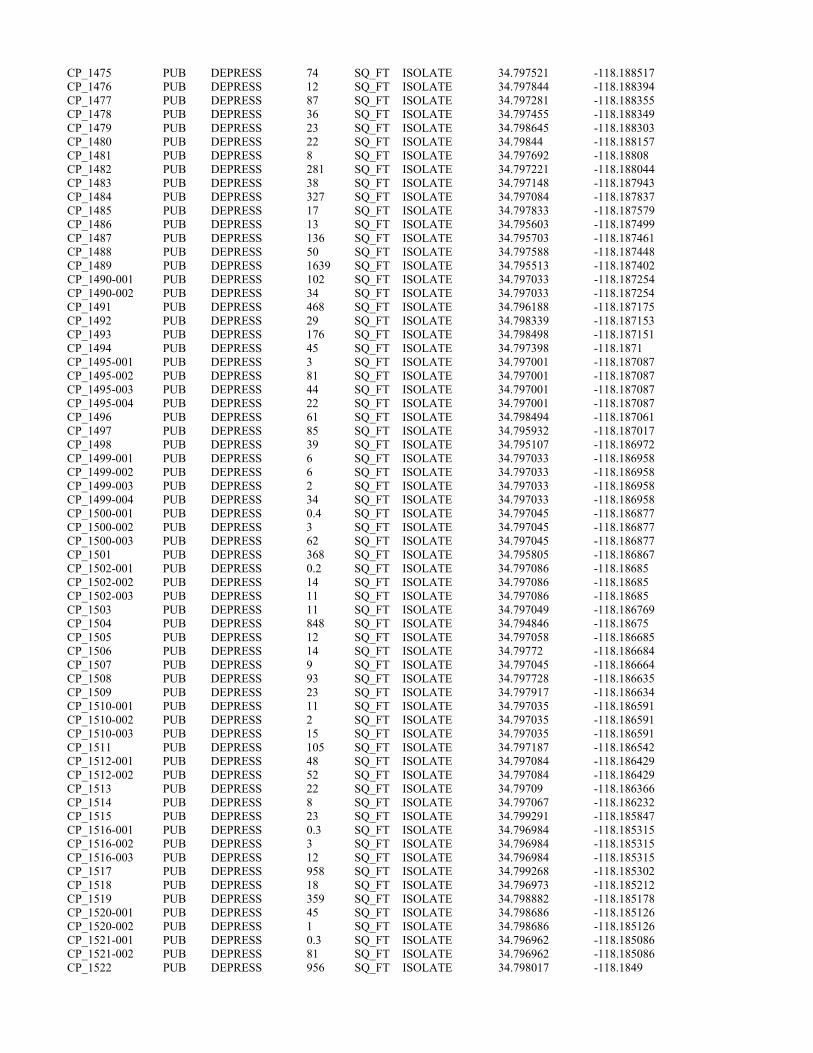
CP_1475 PUB DEPRESS 74 SQ_FT ISOLATE 34.797521 -118.188517 CP_1476 PUB DEPRESS 12 SQ_FT ISOLATE 34.797844 -118.188394 CP_1477 PUB DEPRESS 87 SQ_FT ISOLATE 34.797281 -118.188355 CP_1478 PUB DEPRESS 36 SQ_FT ISOLATE 34.797455 -118.188349 CP_1479 PUB DEPRESS 23 SQ_FT ISOLATE 34.798645 -118.188303 CP_1480 PUB DEPRESS 22 SQ_FT ISOLATE 34.79844 -118.188157 CP_1481 PUB DEPRESS 8 SQ_FT ISOLATE 34.797692 -118.18808 CP_1482 PUB DEPRESS 281 SQ_FT ISOLATE 34.797221 -118.188044 CP_1483 PUB DEPRESS 38 SQ_FT ISOLATE 34.797148 -118.187943 CP_1484 PUB DEPRESS 327 SQ_FT ISOLATE 34.797084 -118.187837 CP_1485 PUB DEPRESS 17 SQ_FT ISOLATE 34.797833 -118.187579 CP_1486 PUB DEPRESS 13 SQ_FT ISOLATE 34.795603 -118.187499 CP_1487 PUB DEPRESS 136 SQ_FT ISOLATE 34.795703 -118.187461 CP_1488 PUB DEPRESS 50 SQ_FT ISOLATE 34.797588 -118.187448 CP_1489 PUB DEPRESS 1639 SQ_FT ISOLATE 34.795513 -118.187402 CP_1490-001 PUB DEPRESS 102 SQ_FT ISOLATE 34.797033 -118.187254CP_1490-002 PUB DEPRESS 34 SQ_FT ISOLATE 34.797033 -118.187254CP_1491 PUB DEPRESS 468 SQ_FT ISOLATE 34.796188 -118.187175 CP_1492 PUB DEPRESS 29 SQ_FT ISOLATE 34.798339 -118.187153 CP_1493 PUB DEPRESS 176 SQ_FT ISOLATE 34.798498 -118.187151 CP_1494 PUB DEPRESS 45 SQ_FT ISOLATE 34.797398 -118.1871 CP_1495-001 PUB DEPRESS 3 SQ_FT ISOLATE 34.797001 -118.187087CP_1495-002 PUB DEPRESS 81 SQ_FT ISOLATE 34.797001 -118.187087CP_1495-003 PUB DEPRESS 44 SQ_FT ISOLATE 34.797001 -118.187087CP_1495-004 PUB DEPRESS 22 SQ_FT ISOLATE 34.797001 -118.187087CP_1496 PUB DEPRESS 61 SQ_FT ISOLATE 34.798494 -118.187061 CP_1497 PUB DEPRESS 85 SQ_FT ISOLATE 34.795932 -118.187017 CP_1498 PUB DEPRESS 39 SQ_FT ISOLATE 34.795107 -118.186972 CP_1499-001 PUB DEPRESS 6 SQ_FT ISOLATE 34.797033 -118.186958CP_1499-002 PUB DEPRESS 6 SQ_FT ISOLATE 34.797033 -118.186958CP_1499-003 PUB DEPRESS 2 SQ_FT ISOLATE 34.797033 -118.186958CP_1499-004 PUB DEPRESS 34 SQ_FT ISOLATE 34.797033 -118.186958CP_1500-001 PUB DEPRESS 0.4 SQ_FT ISOLATE 34.797045 -118.186877CP_1500-002 PUB DEPRESS 3 SQ_FT ISOLATE 34.797045 -118.186877CP_1500-003 PUB DEPRESS 62 SQ_FT ISOLATE 34.797045 -118.186877CP_1501 PUB DEPRESS 368 SQ_FT ISOLATE 34.795805 -118.186867 CP_1502-001 PUB DEPRESS 0.2 SQ_FT ISOLATE 34.797086 -118.18685CP_1502-002 PUB DEPRESS 14 SQ_FT ISOLATE 34.797086 -118.18685CP_1502-003 PUB DEPRESS 11 SQ_FT ISOLATE 34.797086 -118.18685CP_1503 PUB DEPRESS 11 SQ_FT ISOLATE 34.797049 -118.186769 CP_1504 PUB DEPRESS 848 SQ_FT ISOLATE 34.794846 -118.18675 CP_1505 PUB DEPRESS 12 SQ_FT ISOLATE 34.797058 -118.186685 CP_1506 PUB DEPRESS 14 SQ_FT ISOLATE 34.79772 -118.186684 CP_1507 PUB DEPRESS 9 SQ_FT ISOLATE 34.797045 -118.186664 CP_1508 PUB DEPRESS 93 SQ_FT ISOLATE 34.797728 -118.186635 CP_1509 PUB DEPRESS 23 SQ_FT ISOLATE 34.797917 -118.186634 CP_1510-001 PUB DEPRESS 11 SQ_FT ISOLATE 34.797035 -118.186591CP_1510-002 PUB DEPRESS 2 SQ_FT ISOLATE 34.797035 -118.186591CP_1510-003 PUB DEPRESS 15 SQ_FT ISOLATE 34.797035 -118.186591CP_1511 PUB DEPRESS 105 SQ_FT ISOLATE 34.797187 -118.186542 CP_1512-001 PUB DEPRESS 48 SQ_FT ISOLATE 34.797084 -118.186429CP_1512-002 PUB DEPRESS 52 SQ_FT ISOLATE 34.797084 -118.186429CP_1513 PUB DEPRESS 22 SQ_FT ISOLATE 34.79709 -118.186366 CP_1514 PUB DEPRESS 8 SQ_FT ISOLATE 34.797067 -118.186232 CP_1515 PUB DEPRESS 23 SQ_FT ISOLATE 34.799291 -118.185847 CP_1516-001 PUB DEPRESS 0.3 SQ_FT ISOLATE 34.796984 -118.185315CP_1516-002 PUB DEPRESS 3 SQ_FT ISOLATE 34.796984 -118.185315CP_1516-003 PUB DEPRESS 12 SQ_FT ISOLATE 34.796984 -118.185315CP_1517 PUB DEPRESS 958 SQ_FT ISOLATE 34.799268 -118.185302 CP_1518 PUB DEPRESS 18 SQ_FT ISOLATE 34.796973 -118.185212 CP_1519 PUB DEPRESS 359 SQ_FT ISOLATE 34.798882 -118.185178 CP_1520-001 PUB DEPRESS 45 SQ_FT ISOLATE 34.798686 -118.185126CP_1520-002 PUB DEPRESS 1 SQ_FT ISOLATE 34.798686 -118.185126CP_1521-001 PUB DEPRESS 0.3 SQ_FT ISOLATE 34.796962 -118.185086CP_1521-002 PUB DEPRESS 81 SQ_FT ISOLATE 34.796962 -118.185086CP_1522 PUB DEPRESS 956 SQ_FT ISOLATE 34.798017 -118.1849

CP_1523 PUB DEPRESS 58 SQ_FT ISOLATE 34.797635 -118.184876 CP_1524 PUB DEPRESS 105 SQ_FT ISOLATE 34.797673 -118.184861 CP_1525 PUB DEPRESS 413 SQ_FT ISOLATE 34.797422 -118.184836 CP_1526 PUB DEPRESS 3595 SQ_FT ISOLATE 34.796622 -118.184816 CP_1527-001 PUB DEPRESS 43 SQ_FT ISOLATE 34.798751 -118.184759CP_1527-002 PUB DEPRESS 85 SQ_FT ISOLATE 34.798751 -118.184759CP_1528 PUB DEPRESS 47 SQ_FT ISOLATE 34.796732 -118.1845 CP_3339-053 PUB DEPRESS 9 SQ_FT ISOLATE 34.797347 -118.196711CP_3341-001 PUB DEPRESS 0.6 SQ_FT ISOLATE 34.797209 -118.196246CP_3341-002 PUB DEPRESS 0.4 SQ_FT ISOLATE 34.797209 -118.196246CP_3341-003 PUB DEPRESS 0.1 SQ_FT ISOLATE 34.797209 -118.196246CP_3342-047 PUB DEPRESS 15 SQ_FT ISOLATE 34.796792 -118.194015CP_3343-001 PUB DEPRESS 0.1 SQ_FT ISOLATE 34.796772 -118.193844CP_3343-002 PUB DEPRESS 1 SQ_FT ISOLATE 34.796772 -118.193844CP_3345-001 PUB DEPRESS 0.2 SQ_FT ISOLATE 34.796573 -118.189389CP_3345-002 PUB DEPRESS 0.1 SQ_FT ISOLATE 34.796573 -118.189389CP_3345-003 PUB DEPRESS 1 SQ_FT ISOLATE 34.796573 -118.189389CP_3345-004 PUB DEPRESS 2 SQ_FT ISOLATE 34.796573 -118.189389CP_3345-005 PUB DEPRESS 17 SQ_FT ISOLATE 34.796573 -118.189389CP_3346-001 PUB DEPRESS 3 SQ_FT ISOLATE 34.797082 -118.185686CP_3346-002 PUB DEPRESS 0.3 SQ_FT ISOLATE 34.797082 -118.185686.

California High-Speed Rail Project
Bakersfield to Palmdale Project Section: Watershed Maps to Support Approved Jurisdictional Determination – Sacatara Creek – Kings Canyon Watershed Page | 1
~ CALIFORNIA °Q'I High-Speed Rail Authority
©@@@8@fi' . 11@@1k0 ~Dlil®~
©@lil}Y®lil
/)r
PRELIM INARY DRAFT/SUBJECT TO CHANGE - HSR ALIGNMENT IS NOT DETERMINED SOURCE : ESR I/USGS Topograph ic Basemap (2016); USGS 30m Hillshade (2015); Phase 48 Engineering data from CaHSRA (4/2016); 1/Vatershed Boundary DataseUNational Hydrography Dataset (2015).
j 0 1.5
Miles 0 2.5
Kilometers
3
5
BP HSR Mapped Streams with OHWM in Sacatara Creek - Kings Canyon Watershed Study Area
► Culvert
-► Epheme ral Stream
-►Ditch
IC]
CJ D
Study Area in the Sacatara Creek -Kings Canyon watershed
Sacatara Creek - Kings Canyon Watershed HUC-10
Other HUC-10 Watersheds
.---, 1/1/etlands Study Area L......J (Project Footprint + 250 ft Buffer)
Direct ion of flow based on --► NHD flow lines
~ ~
► '
....
Sacatara Creek -
Kings Canyon Watershed
Hydrologic Connectivity
..... U.~ Dep(lfllllfilll'cl"'°'""°"'a11Qn ~ Federal Rairrood Administration
.... .... "
....
,..
.,,
►
November 14, 2016

California High-Speed Rail Project
Bakersfield to Palmdale Project Section: Watershed Maps to Support Approved Jurisdictional Determination – Sacatara Creek – Kings Canyon Watershed Page | 2
~ CALIFORNIA °Q'I High-Speed Rail Authority
PRELIMINARY DRAFT/SUBJECT TO CHANGE - HSRALIGNMENT IS NOT DETERMINED SOURCE : ESRI/USGS Topographic Basemap (2016) ; USGS 30m Hillshade (2015) ; Phase 48 Engineering data from CaHSRA (4/2016); Watershed Boundary Dataset/National Hydrography Dataset (2015).
j 0 0.15
Miles 0 0.25
Kilometers
0.3
0.5
BP HSR Mapped Streams with OHWM in Sacatara Creek - Kings Canyon Watershed Study Area
► Culvert
-► Ephemeral Stream
-►Ditch
lc=JI
CJ
Study Area in the Sacatara Creek -Kings Canyon Watershed
Sacatara Creek - Kings Canyon Watershed HUC-10
D Wetlands Study Area (Project Footprint + 250 ft Buffer)
Direction of flow based on --► NHD flowlines Sacatara Creek -
Kings Canyon Watershed
Study Area Hydrologic Connectivity
..... U.~ Dep(lfllllfilll'cl"'°'""°"'a1 1Qn ~ Federal Rairrood Administration
November 14, 2016

California High-Speed Rail Project
Bakersfield to Palmdale Project Section: Watershed Maps to Support Approved Jurisdictional Determination – Sacatara Creek – Kings Canyon Watershed Page | 3
~ CALIFORNIA °Q'I High-Speed Rail Authority
PRELIMINARY DRAFT/SUBJECT TO CHANGE - HSRALIGNMENT rs NOT DETERMINED SOURCE: ESRIIUSGS Topographic Basemap (2016); USGS 30m Hillshade (2015); Phase 4B Engineering data from CaHSRA (412016); Watershed Boundary DataseVNationa l Hydrog raphy Dataset (2015).
j 0 5 10
Miles 0 8 16
Kilometers
D Cl
Sacatara Creek - Kings Canyon V\latershed HUC-1 0
Antelope Valley Watershed (as described in SPL-2011 -01084-SLP)
till HUC-12 Watersheds excluded from SPL-201 1-01084-SLP
rr=il 1/'ktlands Study Area iD (Project Footprint + 250 ft Buffer)
The U.S. Army Corps of Engineers issued a SWANCC watershed-level Approved Jurisdictional Determination for Antelope Valley (HUC 10 #s 1809020609 through 1809020624) on June 7, 2013. Note that this determination specifically excluded the areas of l.Bke Palmdale and all waters tributary to Lake Palmdale (portions of HUC 12 #s 180902061501, 180902061102, 180902061103). This figure illustrates the location of the study area relative to the previous watershed-level decision.
Sacatara Creek -
Kings Canyon Watershed
Location Within Antelope Valley Watershed
..... U.~ Dep(lfllllfilll'cl"'°'""°"'a1 1Qn ~ Federal Rairrood Administration
November 17, 2016

California High-Speed Rail Project
Bakersfield to Palmdale Project Section: Aerial Photos to Support Approved Jurisdictional Determination for Sacatara Creek – Kings Canyon Watershed Page | 1
Kern County 2014 Aerial Photo. Yellow Line – Study Area. Red Line – HUC 10 Watershed Boundaries.
Rosamond Lake Watershed
Sacatara Creek-Kings Canyon Watershed
Lake Palmdale- Piute Ponds Watershed
Amargosa Creek Watershed

California High-Speed Rail Project
Bakersfield to Palmdale Project Section: Aerial Photos to Support Approved Jurisdictional Determination for Sacatara Creek – Kings Canyon Watershed Page | 2
Kern County 2010 Aerial Photo. Yellow Line – Study Area. Red Line – HUC 10 Watershed Boundaries.
Sacatara Creek-Kings Canyon Watershed
Rosamond Lake Watershed
Lake Palmdale-Piute Ponds Watershed
Amargosa Creek Watershed

California High-Speed Rail Project
Bakersfield to Palmdale Project Section: Aerial Photos to Support Approved Jurisdictional Determination for Sacatara Creek – Kings Canyon Watershed Page | 3
NAIP 2005 Aerial Photo. Yellow Line – Study Area. Red Line – HUC 10 Watershed Boundaries.
Rosamond Lake Watershed
Sacatara Creek-Kings Canyon Watershed
Lake Palmdale-Piute Ponds Watershed
Amargosa Creek Watershed
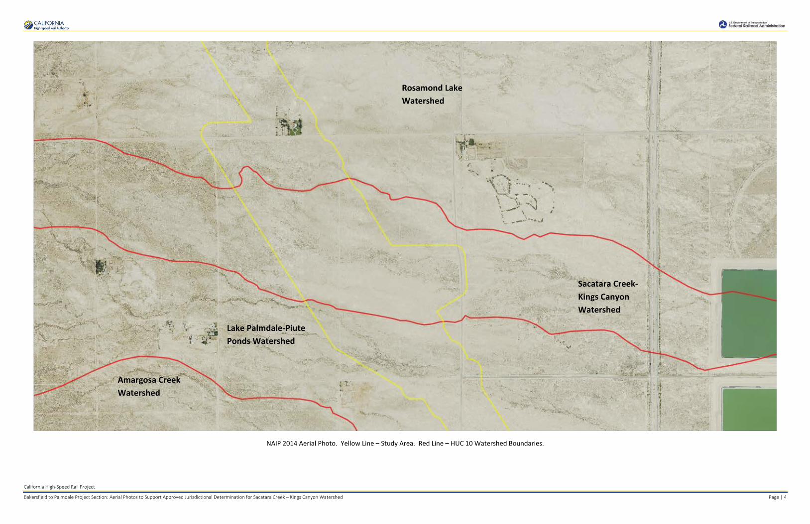
California High-Speed Rail Project
Bakersfield to Palmdale Project Section: Aerial Photos to Support Approved Jurisdictional Determination for Sacatara Creek – Kings Canyon Watershed Page | 4
NAIP 2014 Aerial Photo. Yellow Line – Study Area. Red Line – HUC 10 Watershed Boundaries.
Sacatara Creek-Kings Canyon Watershed
Rosamond Lake Watershed
Lake Palmdale-Piute Ponds Watershed
Amargosa Creek Watershed

California High-Speed Rail Project
Bakersfield to Palmdale Project Section: Aerial Photos to Support Approved Jurisdictional Determination for Sacatara Creek – Kings Canyon Watershed Page | 5
Los Angeles County 2011 Aerial Photo. Yellow Line – Study Area. Red Line – HUC 10 Watershed Boundaries.
Rosamond Lake Watershed
Sacatara Creek-Kings Canyon Watershed
Lake Palmdale-Piute Ponds Watershed
Amargosa Creek Watershed

California High-Speed Rail Project
Bakersfield to Palmdale Project Section: Aerial Photos to Support Approved Jurisdictional Determination for Sacatara Creek – Kings Canyon Watershed Page | 6
Los Angeles County 2013 Aerial Photo. Yellow Line – Study Area. Red Line – HUC 10 Watershed Boundaries.
Aerial Sources: http://maps.co.kern.ca.us/arcgis/services/ and http://gis.apfo.usda.gov/arcgis/services/NAIP/
Retrieved November 14, 2016.
Rosamond Lake Watershed
Sacatara Creek-Kings Canyon Watershed
Lake Palmdale-Piute Ponds Watershed
Amargosa Creek Watershed

APPROVED JURISDICTIONAL DETERMINATION FORM
U.S. Army Corps of Engineers
This form should be completed by following the instructions provided in Section IV of the JD Form Instructional Guidebook. SECTION I: BACKGROUND INFORMATION A. REPORT COMPLETION DATE FOR APPROVED JURISDICTIONAL DETERMINATION (JD): August 25, 2017 B. DISTRICT OFFICE, FILE NAME, AND NUMBER: SPL-2010-00945-VCL-JD-7 C. PROJECT LOCATION AND BACKGROUND INFORMATION:
State: CA County/parish/borough: Los Angeles County City: N/A Center coordinates of site (lat/long in degree decimal format): Lat. 34.79088° N, Long. 118.18622° W. Universal Transverse Mercator: 391478 m E, 38504 m N Name of nearest waterbody: Piute Ponds
Name of nearest Traditional Navigable Water (TNW) into which the aquatic resource flows: N/A Name of watershed or Hydrologic Unit Code (HUC): Piute Ponds, California, HUC-12 #180902061502
Check if map/diagram of review area and/or potential jurisdictional areas is/are available upon request. Check if other sites (e.g., offsite mitigation sites, disposal sites, etc…) are associated with this action and are recorded on a
different JD form. D. REVIEW PERFORMED FOR SITE EVALUATION (CHECK ALL THAT APPLY):
Office (Desk) Determination. Date: July 25, 2017 Field Determination. Date(s):
SECTION II: SUMMARY OF FINDINGS A. RHA SECTION 10 DETERMINATION OF JURISDICTION. There Are no “navigable waters of the U.S.” within Rivers and Harbors Act (RHA) jurisdiction (as defined by 33 CFR part 329) in the review area. [Required]
Waters subject to the ebb and flow of the tide. Waters are presently used, or have been used in the past, or may be susceptible for use to transport interstate or foreign commerce.
Explain: . B. CWA SECTION 404 DETERMINATION OF JURISDICTION. There Are no “waters of the U.S.” within Clean Water Act (CWA) jurisdiction (as defined by 33 CFR part 328) in the review area. [Required] 1. Waters of the U.S. a. Indicate presence of waters of U.S. in review area (check all that apply): 1 TNWs, including territorial seas Wetlands adjacent to TNWs Relatively permanent waters2 (RPWs) that flow directly or indirectly into TNWs Non-RPWs that flow directly or indirectly into TNWs Wetlands directly abutting RPWs that flow directly or indirectly into TNWs Wetlands adjacent to but not directly abutting RPWs that flow directly or indirectly into TNWs Wetlands adjacent to non-RPWs that flow directly or indirectly into TNWs Impoundments of jurisdictional waters Isolated (interstate or intrastate) waters, including isolated wetlands
b. Identify (estimate) size of waters of the U.S. in the review area: Non-wetland waters: linear feet: width (ft) and/or acres. Wetlands: acres. c. Limits (boundaries) of jurisdiction based on: Not Applicable. Elevation of established OHWM (if known): . 2. Non-regulated waters/wetlands (check if applicable):3 Potentially jurisdictional waters and/or wetlands were assessed within the review area and determined to be not jurisdictional.
Explain: Within the project area of the Piute Ponds HUC 10, there are a total of 173 aquatic features. These features include 14 unnamed ephemeral desert wash stream features, 19 segments of ephemeral ditches, and 140 claypan features. Ephemeral desert wash streams span a total of approximately 9,953 linear feet (1.89 miles) and cover approximately 0.65 acre; ephemeral ditches span a total of approximately 3,900 linear feet (0.74 mile), and cover approximately 0.27 acre; and claypan features cover approximately
1 Boxes checked below shall be supported by completing the appropriate sections in Section III below. 2 For purposes of this form, an RPW is defined as a tributary that is not a TNW and that typically flows year-round or has continuous flow at least “seasonally” (e.g., typically 3 months). 3 Supporting documentation is presented in Section III.F.

0.97 acres. Labeled maps and tables of features and dimensions are provided in the Aquatic Resources Delineation Report, which identifies each feature according to which HUC-12 watershed it occurs within.
The unnamed ephemeral desert washes, features Str_0375, Str_0383 through Str_0386, Str_0388 through Str_0390, and Str_0396 through Str_0398 generally flow east within the study area. Where these aquatic features approach existing roads, the water flows into ditches. Ephemeral ditches, features Ditch_0387 (multiple segments) and Ditch_0391 through Ditch 0395 (multiple segments), move water along 30th Street West and along West Avenue C, generally following along road shoulders until reaching culverts where the water flows under the road, or low points where the water flows across the road, rejoining natural features or sheet flow that convey the water further east toward Rosamond Dry Lake. Note that some wash and ditch features have multiple segments and are labeled as such in attached tables (e.g. Ditch_0387-001, Ditch_0387-002, etc.). Most of the ephemeral desert wash and ditch features dissipate and do not have defined channels that can be traced all the way down to the terminal point in the watershed. These features are similar to many other streams in the Antelope Valley Watershed that have well-defined channels where they originate in the mountains and foothills, but dissipate on the valley floor, where water movement during storms is primarily sheet flow.
Ephemeral and intermittent claypan features, CP_1400, CP_1426, CP_1529 through CP_1630, CP_1632, CP_1633, CP_1636, CP_1638 through CP_1662, and CP_1664, are scattered throughout the study area due to the relatively flat topography. These low-lying depressional features are ephemeral or intermittent and typically hold water for a few weeks annually. All aquatic features within the study area are ephemeral or intermittent and are not used for commerce. The hydrologic connection to the low point in the Antelope Valley watershed, Rogers, Rosamond, and Buckhorn Dry Lakes, is primarily through sheet flow during storms. A review of topographic maps and watershed boundary datasets indicates that waters from the study area drain toward Rosamond Dry Lake.
There are no Traditional Navigable Waters (TNWs) or Relatively Permanent Waters (RPWs) in the study area, and the ephemeral desert streams in the study area are not tributaries to RPWs or TNWs. A previous SWANCC watershed-level Approved JD for Antelope Valley (HUC10 #s 1809020609 through 1809020624, excluding those portions of HUC12s 18090206151, 1901902061102, and 180902061103 that drain toward Lake Palmdale and its tributaries) determined that Rosamond, Buckhorn, and Rogers Dry Lakes, and their tributaries, (i.e. the Antelope Valley Watershed, excluding Lake Palmdale and tributaries to Lake Palmdale) are non-jurisdictional waters of the United States under SWANCC. This determination, SPL-2011-01084-SLP, dated June 7, 2013, found that these Antelope Valley waters are not tributary to either a TNW or an (a)(3) water and Rosamond, Buckhorn, and Rogers Dry Lakes are not (a)(3) waters themselves. The Corps made this watershed conclusion because the Antelope Valley watershed is an isolated, intrastate watershed without any surface water related interstate commerce. This previous determination is still in effect, and is appended as a supporting document for this determination.
The above is based upon the review of aerial photographs (Google Earth, accessed July 25, 2017 ) that also did not show surface water usage of the project drainages or the Rosamond Dry Lake terminus. Since the Rosamond Dry Lake is an intrastate, isolated water without a surface water connection to commerce (see prior AJD file No. SPL-2011-01084-SLP), the subject 14 unnamed ephemeral desert wash stream features, 19 segments of ephemeral ditches, and 140 claypan features, as part of the same overall system, are also isolated and additionally have no nexus to commerce.
Based on the information above, the subject drainages 33 unnamed ephemeral desert stream features (14 unnamed ephemeral desert wash stream features, 19 segments of ephemeral ditches, and 140 claypan features), are NONJURISDICTIONAL waters of the United States, since the waters are NOT tributary to either a TNW or an (a)(3) water and are NOT (a)(3) waters themselves. The Corps makes such a conclusion since the waters are tribuatary to an isolated, intrastate dry lake.
.
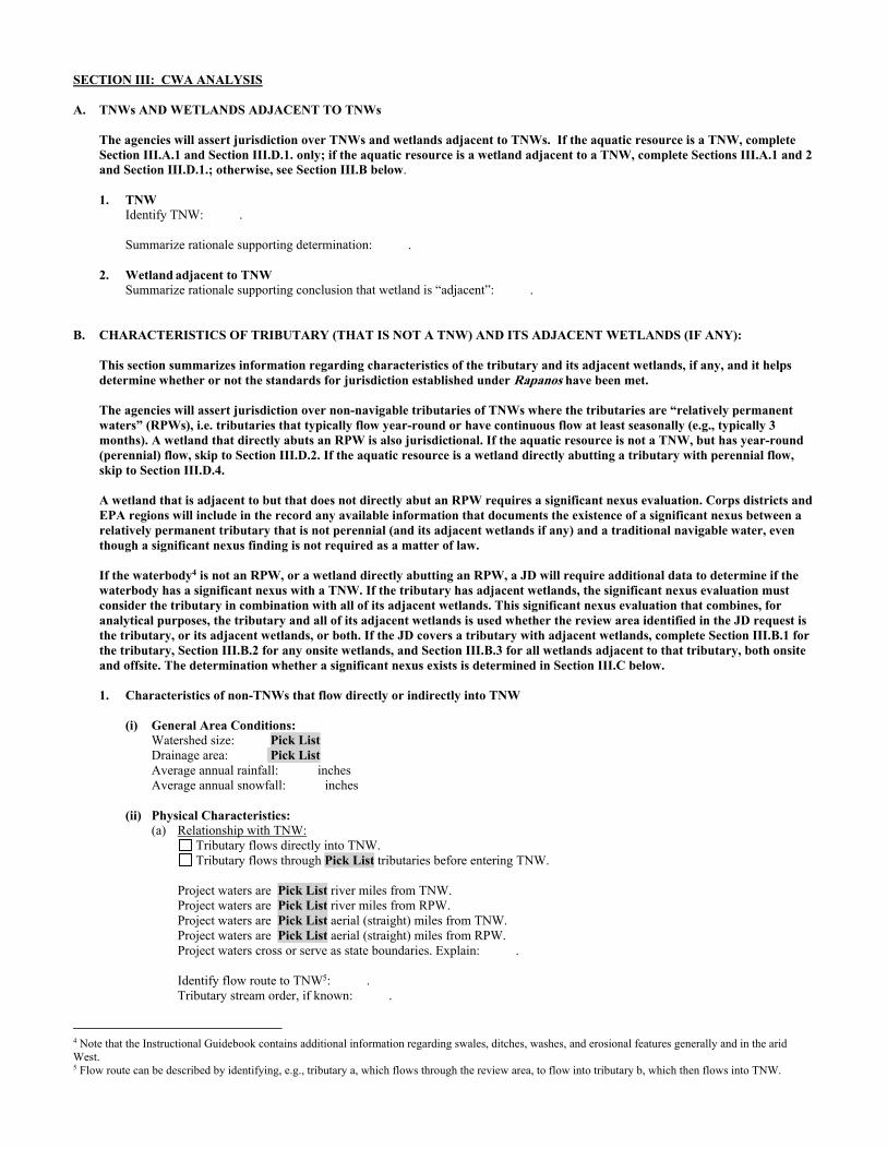
SECTION III: CWA ANALYSIS A. TNWs AND WETLANDS ADJACENT TO TNWs The agencies will assert jurisdiction over TNWs and wetlands adjacent to TNWs. If the aquatic resource is a TNW, complete
Section III.A.1 and Section III.D.1. only; if the aquatic resource is a wetland adjacent to a TNW, complete Sections III.A.1 and 2 and Section III.D.1.; otherwise, see Section III.B below.
1. TNW Identify TNW: .
Summarize rationale supporting determination: .
2. Wetland adjacent to TNW Summarize rationale supporting conclusion that wetland is “adjacent”: .
B. CHARACTERISTICS OF TRIBUTARY (THAT IS NOT A TNW) AND ITS ADJACENT WETLANDS (IF ANY): This section summarizes information regarding characteristics of the tributary and its adjacent wetlands, if any, and it helps
determine whether or not the standards for jurisdiction established under Rapanos have been met. The agencies will assert jurisdiction over non-navigable tributaries of TNWs where the tributaries are “relatively permanent waters” (RPWs), i.e. tributaries that typically flow year-round or have continuous flow at least seasonally (e.g., typically 3 months). A wetland that directly abuts an RPW is also jurisdictional. If the aquatic resource is not a TNW, but has year-round (perennial) flow, skip to Section III.D.2. If the aquatic resource is a wetland directly abutting a tributary with perennial flow, skip to Section III.D.4.
A wetland that is adjacent to but that does not directly abut an RPW requires a significant nexus evaluation. Corps districts and EPA regions will include in the record any available information that documents the existence of a significant nexus between a relatively permanent tributary that is not perennial (and its adjacent wetlands if any) and a traditional navigable water, even though a significant nexus finding is not required as a matter of law.
If the waterbody4 is not an RPW, or a wetland directly abutting an RPW, a JD will require additional data to determine if the waterbody has a significant nexus with a TNW. If the tributary has adjacent wetlands, the significant nexus evaluation must consider the tributary in combination with all of its adjacent wetlands. This significant nexus evaluation that combines, for analytical purposes, the tributary and all of its adjacent wetlands is used whether the review area identified in the JD request is the tributary, or its adjacent wetlands, or both. If the JD covers a tributary with adjacent wetlands, complete Section III.B.1 for the tributary, Section III.B.2 for any onsite wetlands, and Section III.B.3 for all wetlands adjacent to that tributary, both onsite and offsite. The determination whether a significant nexus exists is determined in Section III.C below.
1. Characteristics of non-TNWs that flow directly or indirectly into TNW
(i) General Area Conditions: Watershed size: Pick List Drainage area: Pick List Average annual rainfall: inches Average annual snowfall: inches (ii) Physical Characteristics: (a) Relationship with TNW: Tributary flows directly into TNW. Tributary flows through Pick List tributaries before entering TNW. Project waters are Pick List river miles from TNW. Project waters are Pick List river miles from RPW. Project waters are Pick List aerial (straight) miles from TNW. Project waters are Pick List aerial (straight) miles from RPW. Project waters cross or serve as state boundaries. Explain: . Identify flow route to TNW5: . Tributary stream order, if known: .
4 Note that the Instructional Guidebook contains additional information regarding swales, ditches, washes, and erosional features generally and in the arid West. 5 Flow route can be described by identifying, e.g., tributary a, which flows through the review area, to flow into tributary b, which then flows into TNW.

(b) General Tributary Characteristics (check all that apply): Tributary is: Natural Artificial (man-made). Explain: . Manipulated (man-altered). Explain: .
Tributary properties with respect to top of bank (estimate):
Average width: feet Average depth: feet Average side slopes: Pick List. Primary tributary substrate composition (check all that apply):
Silts Sands Concrete Cobbles Gravel Muck Bedrock Vegetation. Type/% cover: Other. Explain: . Tributary condition/stability [e.g., highly eroding, sloughing banks]. Explain:
Presence of run/riffle/pool complexes. Explain: . Tributary geometry: Pick List Tributary gradient (approximate average slope): %
. (c) Flow: Tributary provides for: Pick List Estimate average number of flow events in review area/year: Pick List Describe flow regime: . Other information on duration and volume: . Surface flow is: Pick List. Characteristics: . Subsurface flow: Pick List. Explain findings: . Dye (or other) test performed: . Tributary has (check all that apply): Bed and banks OHWM6 (check all indicators that apply):
clear, natural line impressed on the bank
the presence of litter and debris changes in the character of soil destruction of terrestrial vegetation shelving the presence of wrack line vegetation matted down, bent, or absent sediment sorting leaf litter disturbed or washed away scour sediment deposition multiple observed or predicted flow events water staining abrupt change in plant community other (list):
Discontinuous OHWM.7 Explain: .
If factors other than the OHWM were used to determine lateral extent of CWA jurisdiction (check all that apply): High Tide Line indicated by:
oil or scum line along shore objects fine shell or debris deposits (foreshore)
physical markings/characteristics tidal gauges
other (list):
Mean High Water Mark indicated by: survey to available datum; physical markings; vegetation lines/changes in vegetation types.
(iii) Chemical Characteristics:
Characterize tributary (e.g., water color is clear, discolored, oily film; water quality; general watershed characteristics, etc.). Explain: .
Identify specific pollutants, if known: .
6A natural or man-made discontinuity in the OHWM does not necessarily sever jurisdiction (e.g., where the stream temporarily flows underground, or wherethe OHWM has been removed by development or agricultural practices). Where there is a break in the OHWM that is unrelated to the waterbody’s flow regime (e.g., flow over a rock outcrop or through a culvert), the agencies will look for indicators of flow above and below the break.
7Ibid.

(iv) Biological Characteristics. Channel supports (check all that apply): Riparian corridor. Characteristics (type, average width): . Wetland fringe. Characteristics: . Habitat for:
Federally Listed species. Explain findings: . Fish/spawn areas. Explain findings: . Other environmentally-sensitive species. Explain findings: . Aquatic/wildlife diversity. Explain findings: . 2. Characteristics of wetlands adjacent to non-TNW that flow directly or indirectly into TNW
(i) Physical Characteristics: (a) General Wetland Characteristics: Properties: Wetland size: acres
Wetland type. Explain: Wetland quality. Explain:
. . Project wetlands cross or serve as state boundaries. Explain: .
(b) General Flow Relationship with Non-TNW: Flow is: Pick List. Explain: . Surface flow is: Pick List Characteristics: . Subsurface flow: Pick List. Explain findings: . Dye (or other) test performed: . (c) Wetland Adjacency Determination with Non-TNW:
Directly abutting Not directly abutting Discrete wetland hydrologic connection. Explain: . Ecological connection. Explain: . Separated by berm/barrier. Explain: . (d) Proximity (Relationship) to TNW
Project wetlands are Pick List river miles from TNW. Project waters are Pick List aerial (straight) miles from TNW.
Flow is from: Pick List. Estimate approximate location of wetland as within the Pick List floodplain. (ii) Chemical Characteristics:
Characterize wetland system (e.g., water color is clear, brown, oil film on surface; water quality; general watershed characteristics; etc.). Explain: .
Identify specific pollutants, if known: . (iii) Biological Characteristics. Wetland supports (check all that apply): Riparian buffer. Characteristics (type, average width): . Vegetation type/percent cover. Explain: . Habitat for:
Federally Listed species. Explain findings: . Fish/spawn areas. Explain findings: .
Other environmentally-sensitive species. Explain findings: . Aquatic/wildlife diversity. Explain findings: .
3. Characteristics of all wetlands adjacent to the tributary (if any) All wetland(s) being considered in the cumulative analysis: Pick List Approximately ( ) acres in total are being considered in the cumulative analysis.

For each wetland, specify the following: Directly abuts? (Y/N) Size (in acres) Directly abuts? (Y/N) Size (in acres)
Summarize overall biological, chemical and physical functions being performed: .
C. SIGNIFICANT NEXUS DETERMINATION
A significant nexus analysis will assess the flow characteristics and functions of the tributary itself and the functions performed by any wetlands adjacent to the tributary to determine if they significantly affect the chemical, physical, and biological integrity of a TNW. For each of the following situations, a significant nexus exists if the tributary, in combination with all of its adjacent wetlands, has more than a speculative or insubstantial effect on the chemical, physical and/or biological integrity of a TNW. Considerations when evaluating significant nexus include, but are not limited to the volume, duration, and frequency of the flow of water in the tributary and its proximity to a TNW, and the functions performed by the tributary and all its adjacent wetlands. It is not appropriate to determine significant nexus based solely on any specific threshold of distance (e.g. between a tributary and its adjacent wetland or between a tributary and the TNW). Similarly, the fact an adjacent wetland lies within or outside of a floodplain is not solely determinative of significant nexus. Draw connections between the features documented and the effects on the TNW, as identified in the Rapanos Guidance and discussed in the Instructional Guidebook. Factors to consider include, for example: Does the tributary, in combination with its adjacent wetlands (if any), have the capacity to carry pollutants or flood waters to
TNWs, or to reduce the amount of pollutants or flood waters reaching a TNW? Does the tributary, in combination with its adjacent wetlands (if any), provide habitat and lifecycle support functions for fish and
other species, such as feeding, nesting, spawning, or rearing young for species that are present in the TNW? Does the tributary, in combination with its adjacent wetlands (if any), have the capacity to transfer nutrients and organic carbon that
support downstream foodwebs? Does the tributary, in combination with its adjacent wetlands (if any), have other relationships to the physical, chemical, or
biological integrity of the TNW? Note: the above list of considerations is not inclusive and other functions observed or known to occur should be documented
below: 1. Significant nexus findings for non-RPW that has no adjacent wetlands and flows directly or indirectly into TNWs. Explain
findings of presence or absence of significant nexus below, based on the tributary itself, then go to Section III.D: . 2. Significant nexus findings for non-RPW and its adjacent wetlands, where the non-RPW flows directly or indirectly into
TNWs. Explain findings of presence or absence of significant nexus below, based on the tributary in combination with all of its adjacent wetlands, then go to Section III.D: .
3. Significant nexus findings for wetlands adjacent to an RPW but that do not directly abut the RPW. Explain findings of presence or absence of significant nexus below, based on the tributary in combination with all of its adjacent wetlands, then go to Section III.D: .
D. DETERMINATIONS OF JURISDICTIONAL FINDINGS. THE SUBJECT WATERS/WETLANDS ARE (CHECK ALL
THAT APPLY):
1. TNWs and Adjacent Wetlands. Check all that apply and provide size estimates in review area: TNWs: linear feet width (ft), Or, acres. Wetlands adjacent to TNWs: acres.
2. RPWs that flow directly or indirectly into TNWs.
Tributaries of TNWs where tributaries typically flow year-round are jurisdictional. Provide data and rationale indicating that tributary is perennial: .
Tributaries of TNW where tributaries have continuous flow “seasonally” (e.g., typically three months each year) are jurisdictional. Data supporting this conclusion is provided at Section III.B. Provide rationale indicating that tributary flows seasonally: .

Provide estimates for jurisdictional waters in the review area (check all that apply): Tributary waters: linear feet width (ft). Other non-wetland waters: acres.
Identify type(s) of waters: .
3. Non-RPWs8 that flow directly or indirectly into TNWs. Waterbody that is not a TNW or an RPW, but flows directly or indirectly into a TNW, and it has a significant nexus with a
TNW is jurisdictional. Data supporting this conclusion is provided at Section III.C. Provide estimates for jurisdictional waters within the review area (check all that apply): Tributary waters: linear feet width (ft). Other non-wetland waters: acres.
Identify type(s) of waters: . 4. Wetlands directly abutting an RPW that flow directly or indirectly into TNWs. Wetlands directly abut RPW and thus are jurisdictional as adjacent wetlands. Wetlands directly abutting an RPW where tributaries typically flow year-round. Provide data and rationale
indicating that tributary is perennial in Section III.D.2, above. Provide rationale indicating that wetland is directly abutting an RPW:
. Wetlands directly abutting an RPW where tributaries typically flow “seasonally.” Provide data indicating that tributary is
seasonal in Section III.B and rationale in Section III.D.2, above. Provide rationale indicating that wetland is directly abutting an RPW: .
Provide acreage estimates for jurisdictional wetlands in the review area: acres.
5. Wetlands adjacent to but not directly abutting an RPW that flow directly or indirectly into TNWs. Wetlands that do not directly abut an RPW, but when considered in combination with the tributary to which they are adjacent
and with similarly situated adjacent wetlands, have a significant nexus with a TNW are jurisidictional. Data supporting this conclusion is provided at Section III.C.
Provide acreage estimates for jurisdictional wetlands in the review area: acres.
6. Wetlands adjacent to non-RPWs that flow directly or indirectly into TNWs.
Wetlands adjacent to such waters, and have when considered in combination with the tributary to which they are adjacent and with similarly situated adjacent wetlands, have a significant nexus with a TNW are jurisdictional. Data supporting this conclusion is provided at Section III.C.
Provide estimates for jurisdictional wetlands in the review area: acres. 7. Impoundments of jurisdictional waters.9 As a general rule, the impoundment of a jurisdictional tributary remains jurisdictional.
Demonstrate that impoundment was created from “waters of the U.S.,” or Demonstrate that water meets the criteria for one of the categories presented above (1-6), or Demonstrate that water is isolated with a nexus to commerce (see E below).
E. ISOLATED [INTERSTATE OR INTRA-STATE] WATERS, INCLUDING ISOLATED WETLANDS, THE USE,
DEGRADATION OR DESTRUCTION OF WHICH COULD AFFECT INTERSTATE COMMERCE, INCLUDING ANY SUCH WATERS (CHECK ALL THAT APPLY):10
which are or could be used by interstate or foreign travelers for recreational or other purposes. from which fish or shellfish are or could be taken and sold in interstate or foreign commerce. which are or could be used for industrial purposes by industries in interstate commerce. Interstate isolated waters. Explain: . Other factors. Explain: . Identify water body and summarize rationale supporting determination: .
8See Footnote # 3. 9 To complete the analysis refer to the key in Section III.D.6 of the Instructional Guidebook. 10 Prior to asserting or declining CWA jurisdiction based solely on this category, Corps Districts will elevate the action to Corps and EPA HQ for review consistent with the process described in the Corps/EPA Memorandum Regarding CWA Act Jurisdiction Following Rapanos.

Provide estimates for jurisdictional waters in the review area (check all that apply): Tributary waters: linear feet width (ft). Other non-wetland waters: acres.
Identify type(s) of waters: . Wetlands: acres.
F. NON-JURISDICTIONAL WATERS, INCLUDING WETLANDS (CHECK ALL THAT APPLY): If potential wetlands were assessed within the review area, these areas did not meet the criteria in the 1987 Corps of Engineers
Wetland Delineation Manual and/or appropriate Regional Supplements. Review area included isolated waters with no substantial nexus to interstate (or foreign) commerce.
Prior to the Jan 2001 Supreme Court decision in “SWANCC,” the review area would have been regulated based solely on the “Migratory Bird Rule” (MBR).
Waters do not meet the “Significant Nexus” standard, where such a finding is required for jurisdiction. Explain:
. Other: (explain, if not covered above): . Provide acreage estimates for non-jurisdictional waters in the review area, where the sole potential basis of jurisdiction is the MBR
factors (i.e., presence of migratory birds, presence of endangered species, use of water for irrigated agriculture), using best professional judgment (check all that apply):
Non-wetland waters (i.e., rivers, streams): approximately 9,953 linear feet averaging 2 to 4 ft in width (ft). Lakes/ponds: acres. Other non-wetland waters: 1.24 acres. List type of aquatic resource: Claypans 0.97 acres and Ditches 0.27 acres. Wetlands: acres.
Provide acreage estimates for non-jurisdictional waters in the review area that do not meet the “Significant Nexus” standard, where such a finding is required for jurisdiction (check all that apply):
Non-wetland waters (i.e., rivers, streams): linear feet, width (ft). Lakes/ponds: acres. Other non-wetland waters: acres. List type of aquatic resource: . Wetlands: acres.
SECTION IV: DATA SOURCES. A. SUPPORTING DATA. Data reviewed for JD (check all that apply - checked items shall be included in case file and, where checked
and requested, appropriately reference sources below): Maps, plans, plots or plat submitted by or on behalf of the applicant/consultant: Features are depicted on Map Sheets 139-141, 166,
and 168-171 in Appendix E of the submitted delineation. . Data sheets prepared/submitted by or on behalf of the applicant/consultant.
Office concurs with data sheets/delineation report. Office does not concur with data sheets/delineation report.
Data sheets prepared by the Corps: . Corps navigable waters’ study:
. U.S. Geological Survey Hydrologic Atlas: See attached figures for NHD flowlines and HUC boundaries.
USGS NHD data. USGS 8 and 12 digit HUC maps.
U.S. Geological Survey map(s). Cite scale & quad name: Rosamond, Palmdale, 7.5 minute quadrangles. USDA Natural Resources Conservation Service Soil Survey. Citation: . National wetlands inventory map(s). Cite name: . State/Local wetland inventory map(s): . FEMA/FIRM maps: . 100-year Floodplain Elevation is: (National Geodectic Vertical Datum of 1929) Photographs: Aerial (Name & Date): NAIP Imagery 2005 and 2014 at 1-m resolution; LA County Imagery 2011 and 2013 at a
1-foot resolution. or
Other (Name & Date): .
Previous determination(s). File no. and date of response letter: SPL-2011-01084-SLP, June 7, 2013. Applicable/supporting case law: . Applicable/supporting scientific literature: . Other information (please specify): Aquatic Resources Delineation Report prepared by the applicant/consultant references
additional materials; also Appendix E contains map sheets; Appendix F contains dimensions. HUC watershed maps of review areas with NHD Data provided by the applicant/consultant; general use of NAIP Imagery 2009, 2010, and 2012 at 1-m resolution; LA County Imagery 2015 at 1-foot resolution; 2015 Site specific IR Imagery, 3-inch color pixel; Bing Aerial Imagery - multiple years (scale

dependent); ESRI World Imagery (streaming service) multiple years (scale dependent); Google Earth Historic Photos (used for reference and includes portions from above listed sources).
B. ADDITIONAL COMMENTS TO SUPPORT JD:
Waters_Name Cowardin_Code HGM_Code Amount Units Waters_Type Latitude Longitude Str_0375 R6 RIVERINE 0.14 ACRE ISOLATE 34.79476795 -118.1935542 Str_0383-001 R6 RIVERINE 0.1 SQ_FT ISOLATE 34.79313089 -118.1935022 Str_0383-002 R6 RIVERINE 15 SQ_FT ISOLATE 34.79313387 -118.193526 Str_0383-003 R6 RIVERINE 104 SQ_FT ISOLATE 34.79314576 -118.1936325 Str_0383-004 R6 RIVERINE 0.01 ACRE ISOLATE 34.79335376 -118.1938654 Str_0384 R6 RIVERINE 39 SQ_FT ISOLATE 34.79321644 -118.1938732 Str_0385 R6 RIVERINE 0.03 ACRE ISOLATE 34.79253608 -118.1923106 Str_0386 R6 RIVERINE 0.04 ACRE ISOLATE 34.79198903 -118.1903849 Ditch_0387-001 R6 RIVERINE 0.04 ACRE ISOLATE 34.79137 -118.1895874 Ditch_0387-002 R6 RIVERINE 133 SQ_FT ISOLATE 34.79146775 -118.1878928 Ditch_0387-003 R6 RIVERINE 0.7 SQ_FT ISOLATE 34.7914777 -118.1877988 Ditch_0387-004 R6 RIVERINE 0.03 ACRE ISOLATE 34.79149783 -118.1870111 Ditch_0387-005 R6 RIVERINE 4 SQ_FT ISOLATE 34.79151643 -118.1861691 Str_0388 R6 RIVERINE 0.17 ACRE ISOLATE 34.79255307 -118.1875324 Str_0389 R6 RIVERINE 0.08 ACRE ISOLATE 34.79157185 -118.1874733 Str_0390 R6 RIVERINE 0.07 ACRE ISOLATE 34.79095079 -118.1869502 Ditch_0391 R6 RIVERINE 0.04 ACRE ISOLATE 34.79123813 -118.1856591 Ditch_0392-001 R6 RIVERINE 0.2 SQ_FT ISOLATE 34.7883347 -118.1847854 Ditch_0392-002 R6 RIVERINE 110 SQ_FT ISOLATE 34.78829137 -118.1847917 Ditch_0392-003 R6 RIVERINE 3 SQ_FT ISOLATE 34.78835793 -118.1847869 Ditch_0392-004 R6 RIVERINE 315 SQ_FT ISOLATE 34.78859215 -118.1847965 Ditch_0392-005 R6 RIVERINE 16 SQ_FT ISOLATE 34.78929259 -118.1847988 Ditch_0392-006 R6 RIVERINE 0.02 ACRE ISOLATE 34.78944706 -118.1847984 Ditch_0392-007 R6 RIVERINE 57 SQ_FT ISOLATE 34.79081904 -118.1848122 Ditch_0392-008 R6 RIVERINE 8 SQ_FT ISOLATE 34.79088403 -118.1848133 Ditch_0392-009 R6 RIVERINE 2 SQ_FT ISOLATE 34.7909082 -118.1848141 Ditch_0392-010 R6 RIVERINE 271 SQ_FT ISOLATE 34.79114743 -118.1848141 Ditch_0393 R6 RIVERINE 0.05 ACRE ISOLATE 34.79246143 -118.1847958 Ditch_0394 R6 RIVERINE 0.04 ACRE ISOLATE 34.79228552 -118.1845449 Ditch_0395 R6 RIVERINE 0.03 ACRE ISOLATE 34.79151897 -118.1839038 Str_0396
R6 RIVERINE 0.08 ACRE ISOLATE 34.78777903 -118.1823926 Str_0397b R6 RIVERINE 0.01 ACRE ISOLATE 34.7866508 -118.1841345 Str_0398a R6 RIVERINE 0.02 ACRE ISOLATE 34.7867349 -118.181833 CP_1400 PUB DEPRESS 38 SQ_FT ISOLATE 34.795211 -118.194843 CP_1426 PUB DEPRESS 210 SQ_FT ISOLATE 34.795178 -118.192932 CP_1529 PUB DEPRESS 55 SQ_FT ISOLATE 34.793186 -118.193713 CP_1530 PUB DEPRESS 22 SQ_FT ISOLATE 34.79313 -118.193551 CP_1531 PUB DEPRESS 600 SQ_FT ISOLATE 34.79434 -118.193523 CP_1532 PUB DEPRESS 58 SQ_FT ISOLATE 34.793135 -118.193503 CP_1533 PUB DEPRESS 96 SQ_FT ISOLATE 34.794641 -118.193421 CP_1534 PUB DEPRESS 16 SQ_FT ISOLATE 34.794516 -118.193262 CP_1535 PUB DEPRESS 29 SQ_FT ISOLATE 34.792382 -118.192192 CP_1536 PUB DEPRESS 8 SQ_FT ISOLATE 34.792866 -118.191899 CP_1537 PUB DEPRESS 32 SQ_FT ISOLATE 34.792884 -118.191828 CP_1538 PUB DEPRESS 141 SQ_FT ISOLATE 34.792398 -118.191435 CP_1539 PUB DEPRESS 493 SQ_FT ISOLATE 34.792492 -118.191428 CP_1540 PUB DEPRESS 45 SQ_FT ISOLATE 34.79201 -118.191223 CP_1541-001 PUB DEPRESS 0.2 SQ_FT ISOLATE 34.791995 -118.191006 CP_1541-002 PUB DEPRESS 157 SQ_FT ISOLATE 34.791995 -118.191006 CP_1541-003 PUB DEPRESS 0.1 SQ_FT ISOLATE 34.791995 -118.191006 CP_1541-004 PUB DEPRESS 107 SQ_FT ISOLATE 34.791995 -118.191006 CP_1542
PUB DEPRESS 48 SQ_FT ISOLATE 34.792546 -118.190968 CP_1543 PUB DEPRESS 65 SQ_FT ISOLATE 34.792522 -118.190884 CP_1544 PUB DEPRESS 16 SQ_FT ISOLATE 34.792868 -118.190525 CP_1545 PUB DEPRESS 40 SQ_FT ISOLATE 34.792252 -118.190519 CP_1546 PUB DEPRESS 117 SQ_FT ISOLATE 34.791772 -118.190294 CP_1547 PUB DEPRESS 13 SQ_FT ISOLATE 34.793171 -118.19015 CP_1548 PUB DEPRESS 52 SQ_FT ISOLATE 34.791714 -118.189891 CP_1549 PUB DEPRESS 15 SQ_FT ISOLATE 34.792514 -118.189705 CP_1550-001 PUB DEPRESS 16 SQ_FT ISOLATE 34.791645 -118.189571

CP_1550-002 PUB DEPRESS 17 SQ_FT ISOLATE 34.791645 -118.189571CP_1551-001 PUB DEPRESS 11 SQ_FT ISOLATE 34.791622 -118.1895CP_1551-002 PUB DEPRESS 10 SQ_FT ISOLATE 34.791622 -118.1895CP_1552 PUB DEPRESS 36 SQ_FT ISOLATE 34.793681 -118.189265 CP_1553-001 PUB DEPRESS 1 SQ_FT ISOLATE 34.791384 -118.189233CP_1553-002 PUB DEPRESS 15 SQ_FT ISOLATE 34.791384 -118.189233CP_1554 PUB DEPRESS 24 SQ_FT ISOLATE 34.791397 -118.189229 CP_1555 PUB DEPRESS 86 SQ_FT ISOLATE 34.791944 -118.189189 CP_1556 PUB DEPRESS 105 SQ_FT ISOLATE 34.79139 -118.188966 CP_1557 PUB DEPRESS 31 SQ_FT ISOLATE 34.790531 -118.188824 CP_1558 PUB DEPRESS 631 SQ_FT ISOLATE 34.791071 -118.188525 CP_1559 PUB DEPRESS 13 SQ_FT ISOLATE 34.791786 -118.188473 CP_1560 PUB DEPRESS 153 SQ_FT ISOLATE 34.791298 -118.18811 CP_1561 PUB DEPRESS 42 SQ_FT ISOLATE 34.791533 -118.188107 CP_1562 PUB DEPRESS 91 SQ_FT ISOLATE 34.791534 -118.188031 CP_1563 PUB DEPRESS 71 SQ_FT ISOLATE 34.791463 -118.187992 CP_1564 PUB DEPRESS 11 SQ_FT ISOLATE 34.790498 -118.187845 CP_1565 PUB DEPRESS 27 SQ_FT ISOLATE 34.791473 -118.187814 CP_1566 PUB DEPRESS 59 SQ_FT ISOLATE 34.790308 -118.187807 CP_1567 PUB DEPRESS 15 SQ_FT ISOLATE 34.791983 -118.187789 CP_1568 PUB DEPRESS 9 SQ_FT ISOLATE 34.790424 -118.1877 CP_1569 PUB DEPRESS 34 SQ_FT ISOLATE 34.790399 -118.187675 CP_1570 PUB DEPRESS 416 SQ_FT ISOLATE 34.791142 -118.187584 CP_1571 PUB DEPRESS 1736 SQ_FT ISOLATE 34.794322 -118.187541 CP_1572 PUB DEPRESS 20 SQ_FT ISOLATE 34.790393 -118.187461 CP_1573 PUB DEPRESS 2 SQ_FT ISOLATE 34.790408 -118.187454 CP_1574 PUB DEPRESS 36 SQ_FT ISOLATE 34.790374 -118.187441 CP_1575 PUB DEPRESS 2 SQ_FT ISOLATE 34.790379 -118.187433 CP_1576 PUB DEPRESS 5 SQ_FT ISOLATE 34.790377 -118.187424 CP_1577 PUB DEPRESS 113 SQ_FT ISOLATE 34.791186 -118.18734 CP_1578 PUB DEPRESS 6 SQ_FT ISOLATE 34.793439 -118.187256 CP_1579 PUB DEPRESS 39 SQ_FT ISOLATE 34.791167 -118.187218 CP_1580 PUB DEPRESS 344 SQ_FT ISOLATE 34.79348 -118.187141 CP_1581 PUB DEPRESS 124 SQ_FT ISOLATE 34.7913 -118.187117 CP_1582 PUB DEPRESS 296 SQ_FT ISOLATE 34.79115 -118.186932 CP_1583 PUB DEPRESS 51 SQ_FT ISOLATE 34.794379 -118.186873 CP_1584 PUB DEPRESS 34 SQ_FT ISOLATE 34.794409 -118.186788 CP_1585 PUB DEPRESS 12 SQ_FT ISOLATE 34.790333 -118.186706 CP_1586 PUB DEPRESS 48 SQ_FT ISOLATE 34.794401 -118.186687 CP_1587 PUB DEPRESS 129 SQ_FT ISOLATE 34.791504 -118.186154 CP_1588 PUB DEPRESS 491 SQ_FT ISOLATE 34.794379 -118.186033 CP_1589 PUB DEPRESS 33 SQ_FT ISOLATE 34.789683 -118.185999 CP_1590 PUB DEPRESS 133 SQ_FT ISOLATE 34.791456 -118.185869 CP_1591 PUB DEPRESS 4885 SQ_FT ISOLATE 34.788818 -118.185659 CP_1592 PUB DEPRESS 49 SQ_FT ISOLATE 34.789038 -118.185626 CP_1593 PUB DEPRESS 42 SQ_FT ISOLATE 34.78897 -118.185469 CP_1594 PUB DEPRESS 96 SQ_FT ISOLATE 34.789166 -118.185443 CP_1595 PUB DEPRESS 479 SQ_FT ISOLATE 34.789223 -118.185409 CP_1596 PUB DEPRESS 13 SQ_FT ISOLATE 34.789846 -118.185193 CP_1597 PUB DEPRESS 15 SQ_FT ISOLATE 34.789844 -118.185141 CP_1598 PUB DEPRESS 13 SQ_FT ISOLATE 34.791639 -118.185131 CP_1599 PUB DEPRESS 91 SQ_FT ISOLATE 34.789333 -118.185126 CP_1600 PUB DEPRESS 20 SQ_FT ISOLATE 34.791629 -118.185098 CP_1601 PUB DEPRESS 5028 SQ_FT ISOLATE 34.788774 -118.185035 CP_1602 PUB DEPRESS 83 SQ_FT ISOLATE 34.789988 -118.184997 CP_1603 PUB DEPRESS 1052 SQ_FT ISOLATE 34.789296 -118.18492 CP_1604 PUB DEPRESS 57 SQ_FT ISOLATE 34.790044 -118.184874 CP_1605 PUB DEPRESS 292 SQ_FT ISOLATE 34.789515 -118.184815 CP_1606 PUB DEPRESS 0.1 SQ_FT ISOLATE 34.789426 -118.184808 CP_1607 PUB DEPRESS 3212 SQ_FT ISOLATE 34.789011 -118.184806 CP_1608 PUB DEPRESS 1783 SQ_FT ISOLATE 34.790654 -118.184806 CP_1609 PUB DEPRESS 82 SQ_FT ISOLATE 34.789657 -118.184631 CP_1610 PUB DEPRESS 10 SQ_FT ISOLATE 34.789584 -118.184628 CP_1611 PUB DEPRESS 727 SQ_FT ISOLATE 34.788756 -118.184414 CP_1612 PUB DEPRESS 154 SQ_FT ISOLATE 34.790012 -118.184132 CP_1613 PUB DEPRESS 373 SQ_FT ISOLATE 34.789952 -118.184124

CP_1614 PUB DEPRESS 40 SQ_FT ISOLATE 34.789428 -118.184049 CP_1615 PUB DEPRESS 93 SQ_FT ISOLATE 34.788893 -118.18394 CP_1616 PUB DEPRESS 170 SQ_FT ISOLATE 34.788803 -118.183776 CP_1617 PUB DEPRESS 5 SQ_FT ISOLATE 34.79002 -118.18365 CP_1618 PUB DEPRESS 27 SQ_FT ISOLATE 34.789235 -118.183645 CP_1619 PUB DEPRESS 348 SQ_FT ISOLATE 34.789292 -118.183361 CP_1620 PUB DEPRESS 3270 SQ_FT ISOLATE 34.788487 -118.185729 CP_1621 PUB DEPRESS 174 SQ_FT ISOLATE 34.788486 -118.184989 CP_1622 PUB DEPRESS 322 SQ_FT ISOLATE 34.787766 -118.184896 CP_1623 PUB DEPRESS 36 SQ_FT ISOLATE 34.788779 -118.184857 CP_1624 PUB DEPRESS 165 SQ_FT ISOLATE 34.788386 -118.18479 CP_1625 PUB DEPRESS 4189 SQ_FT ISOLATE 34.787654 -118.184789 CP_1626 PUB DEPRESS 459 SQ_FT ISOLATE 34.788059 -118.184263 CP_1627 PUB DEPRESS 254 SQ_FT ISOLATE 34.788156 -118.184206 CP_1628 PUB DEPRESS 553 SQ_FT ISOLATE 34.78692 -118.18394 CP_1629 PUB DEPRESS 30 SQ_FT ISOLATE 34.790107 -118.183302 CP_1630-001 PUB DEPRESS 23 SQ_FT ISOLATE 34.786479 -118.183159CP_1632 PUB DEPRESS 38 SQ_FT ISOLATE 34.788562 -118.183092 CP_1633-001 PUB DEPRESS 13 SQ_FT ISOLATE 34.789626 -118.183068CP_1633-002 PUB DEPRESS 1 SQ_FT ISOLATE 34.789626 -118.183068CP_1636 PUB DEPRESS 7 SQ_FT ISOLATE 34.78959 -118.183036 CP_1638 PUB DEPRESS 2 SQ_FT ISOLATE 34.789894 -118.182989 CP_1639 PUB DEPRESS 3 SQ_FT ISOLATE 34.789803 -118.182948 CP_1640 PUB DEPRESS 17 SQ_FT ISOLATE 34.789528 -118.182935 CP_1641 PUB DEPRESS 324 SQ_FT ISOLATE 34.789462 -118.182796 CP_1642 PUB DEPRESS 73 SQ_FT ISOLATE 34.789282 -118.182777 CP_1643 PUB DEPRESS 18 SQ_FT ISOLATE 34.789322 -118.182766 CP_1644 PUB DEPRESS 18 SQ_FT ISOLATE 34.789355 -118.182747 CP_1645 PUB DEPRESS 3 SQ_FT ISOLATE 34.789357 -118.182718 CP_1646 PUB DEPRESS 870 SQ_FT ISOLATE 34.789402 -118.18264 CP_1647 PUB DEPRESS 22 SQ_FT ISOLATE 34.787315 -118.1826 CP_1648 PUB DEPRESS 38 SQ_FT ISOLATE 34.787254 -118.182569 CP_1649 PUB DEPRESS 61 SQ_FT ISOLATE 34.788559 -118.182481 CP_1650 PUB DEPRESS 49 SQ_FT ISOLATE 34.788417 -118.182452 CP_1651 PUB DEPRESS 88 SQ_FT ISOLATE 34.789382 -118.182426 CP_1652 PUB DEPRESS 184 SQ_FT ISOLATE 34.789427 -118.182393 CP_1653 PUB DEPRESS 48 SQ_FT ISOLATE 34.788582 -118.182392 CP_1654 PUB DEPRESS 3 SQ_FT ISOLATE 34.789349 -118.182328 CP_1655 PUB DEPRESS 3 SQ_FT ISOLATE 34.78935 -118.182318 CP_1656 PUB DEPRESS 15 SQ_FT ISOLATE 34.789377 -118.182293 CP_1657 PUB DEPRESS 74 SQ_FT ISOLATE 34.789326 -118.18225 CP_1658 PUB DEPRESS 288 SQ_FT ISOLATE 34.789279 -118.18216 CP_1659 PUB DEPRESS 31 SQ_FT ISOLATE 34.788124 -118.182064 CP_1660 PUB DEPRESS 15 SQ_FT ISOLATE 34.789211 -118.181999 CP_1661 PUB DEPRESS 347 SQ_FT ISOLATE 34.78806 -118.181976 CP_1662 PUB DEPRESS 1508 SQ_FT ISOLATE 34.788685 -118.181958 CP_1664 PUB DEPRESS 1264 SQ_FT ISOLATE 34.789005 -118.181885.

California High-Speed Rail Project
Bakersfield to Palmdale Project Section: Watershed Maps to Support Approved Jurisdictional Determination – Piute Ponds Watershed Page | 1
~ CALIFORNIA °Q'I High-Speed Rail Authority
lm!J<OO@ ~ ~
PRELI MINARY DRAFT/SUBJECT TO CHANGE - HSR ALIGNMENT ' IS NOT DETERMINED SOURCE : ESRI/USGS Topog raph ic Basemap (2016); USGS 30m Hillshade (2015); Phase 4B Eng ineering data from CaHSRA (4/2016) ; Wa tershed Boundary Dataset/Na tional Hydrography Dataset (2015) .
j 0
Miles 0 1.5
Kilometers
2
3
BP HSR Mapped Streams with OHWM in Piute Ponds Watershed Study Area
-► Epheme ral Stream
-►Ditch
[D Study A rea in the CJ Piute Ponds Watershed
11 Piu te Ponds L.....J Watershed HUC-12
D Other HUC-12 Watersheds
V\/etlands Study Area D (Project Footprint + 250 ft Buffer)
--► Direction of flow based on NHD flowlines
Piute Ponds Watershed
Hydrologic Connectivity
..... U.~ Dep(lfllllfilll'cl"'°'""°"'a1 1Qn ~ Federal Rairrood Administration
November 15, 2016

California High-Speed Rail Project
Bakersfield to Palmdale Project Section: Watershed Maps to Support Approved Jurisdictional Determination – Piute Ponds Watershed Page | 2
~ CALIFORNIA °Q'I High-Speed Rail Authority
PRELIM INARY DRAFT/SUBJECT TO CHANGE - HSR ALIGNMENT IS NOT DETERM INED SOURCE: ESR I/USGS Topograph ic Basemap (2016) ; USGS 30m Hillshade (2015); Phase 4B Eng ineering data from CaHSRA (4/2016); Vlk!tershed Boundary Dataset/National Hydrog raphy Dataset (2015).
j 0 0.1 5
Miles 0 0.25
Kilometers
0.3
0.5
BP HSR Mapped Streams with OHWM in Piute Ponds Watershed Study Area
-► Ephemeral Stream
-► Ditch
IC]
c::::J
Study A rea in the Piute Ponds Watershed
Piu te Ponds Watershed HUC-12
CJ Wetlands Study Area (Project Footprint + 250 ft Buffer)
--► Direction of flow based on NHD flow lines
Piute Ponds Watershed
Study Area Hydrologic Connectivity
..... U.~ Dep(lfllllfilll'cl"'°'""°"'a1 1Qn ~ Federal Rairrood Administration
November 18 , 2016

California High-Speed Rail Project
Bakersfield to Palmdale Project Section: Watershed Maps to Support Approved Jurisdictional Determination – Piute Ponds Watershed Page | 3
~ CALIFORNIA °Q'I High-Speed Rail Authority
PRELIMINARY DRAFT/SUBJECT TO CHANGE - HSR ALIGNMENT IS NOT DETERMINED SOURCE: ESRI/USGS Topograph ic Basemap (2016); USGS 30m Hillshade (2015); Phase 48 Engineering data from CaHSRA (4/2016); Watershed Boundary Da taset/National Hydrography Dataset (2015) .
j 0 5 10
Miles 0 8 16
Kilometers
D Cl
Piute Ponds Watershed HUC- 12
Antelope Valley Watershed (as described in SPL-2011-01084-SLP)
HUC-12 Watersheds exc luded from SPL-2011 -01084-SLP
[D \/Vetlands Study Area D (Project Footprint + 250 ft Buffer)
The US Army Corps of Engineers issued a SWAN CC watershed-level Approved Jurisdictional Determination for Antelope Valley (HUC 10 #s 1809020609 through 1809020624) on June 7, 2013. Note that this determination specifically excluded the areas of Lake Palmdale and all waters tributary to Lake Palmdale (portions of HUC 12 #s 180902061501, 180902061102, 180902061103). This figure illustrates the location of the study area relative to the previous watershed-level decision.
Piute Ponds Watershed
Location Within Antelope Va lley Watershed
..... U.~ Dep(lfllllfilll'cl"'°'""°"'a1 1Qn ~ Federal Rairrood Administration
November 17, 2016

California High-Speed Rail Project
Bakersfield to Palmdale Project Section: Aerial Photos to Support Approved Jurisdictional Determination –Piute Ponds Watershed Page | 1
Los Angeles County 2013 Aerial Photo. Yellow Line – Study Area. Red Line – HUC 12 Watershed Boundaries.
Sacatara Creek-Kings Canyon Watershed
Piute Ponds Watershed
Amargosa Creek Watershed
Rosamond Lake Watershed
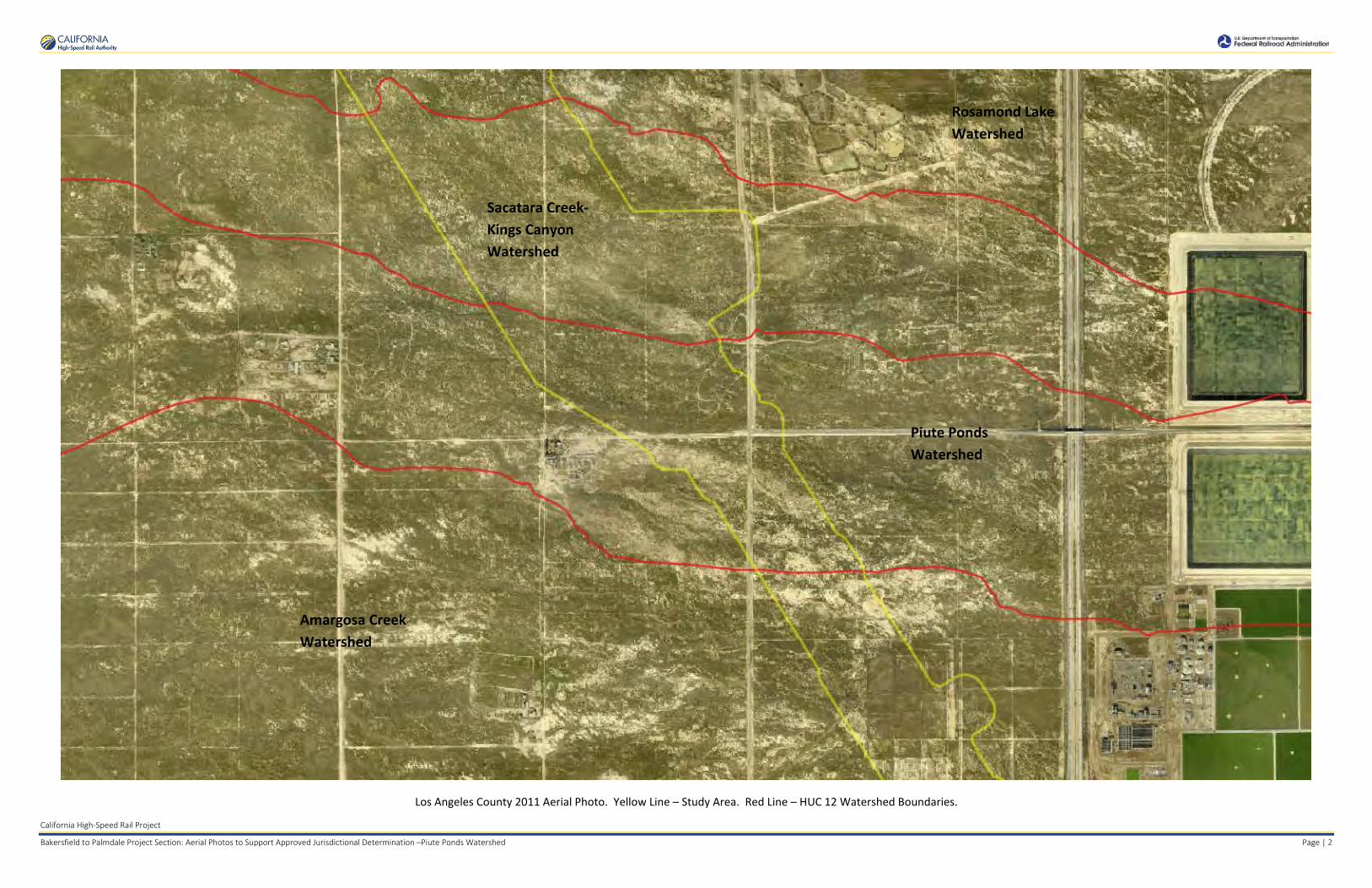
California High-Speed Rail Project
Bakersfield to Palmdale Project Section: Aerial Photos to Support Approved Jurisdictional Determination –Piute Ponds Watershed Page | 2
Los Angeles County 2011 Aerial Photo. Yellow Line – Study Area. Red Line – HUC 12 Watershed Boundaries.
Amargosa Creek Watershed
Piute Ponds Watershed
Sacatara Creek-Kings Canyon Watershed
Rosamond Lake Watershed

California High-Speed Rail Project
Bakersfield to Palmdale Project Section: Aerial Photos to Support Approved Jurisdictional Determination –Piute Ponds Watershed Page | 3
NAIP 2005 Aerial Photo. Yellow Line – Study Area. Red Line – HUC 12 Watershed Boundaries.
Amargosa Creek Watershed
Piute Ponds Watershed
Sacatara Creek-Kings Canyon Watershed
Rosamond Lake Watershed

California High-Speed Rail Project
Bakersfield to Palmdale Project Section: Aerial Photos to Support Approved Jurisdictional Determination –Piute Ponds Watershed Page | 4
NAIP 2014 Aerial Photo. Yellow Line – Study Area. Red Line – HUC 12 Watershed Boundaries.
Piute Ponds Watershed
Amargosa Creek Watershed
Sacatara Creek-Kings Canyon Watershed
Rosamond Lake Watershed

APPROVED JURISDICTIONAL DETERMINATION FORM
U.S. Army Corps of Engineers
This form should be completed by following the instructions provided in Section IV of the JD Form Instructional Guidebook. SECTION I: BACKGROUND INFORMATION A. REPORT COMPLETION DATE FOR APPROVED JURISDICTIONAL DETERMINATION (JD): August 25, 2017 B. DISTRICT OFFICE, FILE NAME, AND NUMBER: SPL-2010-00945-VCL-JD-8 C. PROJECT LOCATION AND BACKGROUND INFORMATION:
State: CA County/parish/borough: Los Angeles County City: N/A Center coordinates of site (lat/long in degree decimal format): Lat. 34.686462° N, Long. 118.135180° W. Universal Transverse Mercator: 396017 m E, 3838860 m N Name of nearest waterbody: Amargosa Creek
Name of nearest Traditional Navigable Water (TNW) into which the aquatic resource flows: N/A Name of watershed or Hydrologic Unit Code (HUC): Amargosa Creek, California, 1809020614
Check if map/diagram of review area and/or potential jurisdictional areas is/are available upon request.
Check if other sites (e.g., offsite mitigation sites, disposal sites, etc…) are associated with this action and are recorded on a different JD form.
D. REVIEW PERFORMED FOR SITE EVALUATION (CHECK ALL THAT APPLY):
Office (Desk) Determination. Date: July 25, 2017
Field Determination. Date(s):
SECTION II: SUMMARY OF FINDINGS A. RHA SECTION 10 DETERMINATION OF JURISDICTION. There Are no “navigable waters of the U.S.” within Rivers and Harbors Act (RHA) jurisdiction (as defined by 33 CFR part 329) in the review area. [Required]
Waters subject to the ebb and flow of the tide.
Waters are presently used, or have been used in the past, or may be susceptible for use to transport interstate or foreign commerce. Explain: .
B. CWA SECTION 404 DETERMINATION OF JURISDICTION. There Are no “waters of the U.S.” within Clean Water Act (CWA) jurisdiction (as defined by 33 CFR part 328) in the review area. [Required] 1. Waters of the U.S. a. Indicate presence of waters of U.S. in review area (check all that apply): 1
TNWs, including territorial seas Wetlands adjacent to TNWs Relatively permanent waters2 (RPWs) that flow directly or indirectly into TNWs Non-RPWs that flow directly or indirectly into TNWs
Wetlands directly abutting RPWs that flow directly or indirectly into TNWs Wetlands adjacent to but not directly abutting RPWs that flow directly or indirectly into TNWs Wetlands adjacent to non-RPWs that flow directly or indirectly into TNWs
Impoundments of jurisdictional waters Isolated (interstate or intrastate) waters, including isolated wetlands
b. Identify (estimate) size of waters of the U.S. in the review area: Non-wetland waters: linear feet: width (ft) and/or acres. Wetlands: acres. c. Limits (boundaries) of jurisdiction based on: Not Applicable. Elevation of established OHWM (if known): . 2. Non-regulated waters/wetlands (check if applicable):3
Potentially jurisdictional waters and/or wetlands were assessed within the review area and determined to be not jurisdictional. Explain:
Within the project area of the Amargosa Creek HUC 10, there are a total of 1,843 aquatic features. These features include two forks of Amargosa Creek, specifically 6 segments of desert wash and 3 segments of ditches, as well as 29 unnamed ephemeral desert wash stream features, 21 additional ephemeral ditches, one seasonal wetland, 10 basins, 1,667 claypan features, and 106 ponded features. Amargosa Creek is the only named stream that crosses through the study area. Two forks of this creek cross
1 Boxes checked below shall be supported by completing the appropriate sections in Section III below. 2 For purposes of this form, an RPW is defined as a tributary that is not a TNW and that typically flows year-round or has continuous flow at least “seasonally” (e.g., typically 3 months). 3 Supporting documentation is presented in Section III.F.

the study area: one fork crosses north of Lancaster near W Avenue F, and the other fork crosses south of Lancaster near Sierra Highway, before being routed into a system of ditches. Together these segments of Amargosa Creek span a total of 8,664 linear feet (1.64 miles) and cover approximately 1.91 acre. Other ephemeral desert wash streams span a total of approximately 17,837 linear feet (3.38 miles) and cover approximately 4.02 acre; ephemeral ditches span a total of approximately 24,334 linear feet (4.61 mile), and cover approximately 3.63 acre; the seasonal wetland covers approximately 0.32 acre; and claypan features cover approximately 5.83 acres. Basins cover approximately 14.93 acres. Features of ponding cover approximately 1.40 acre. These features are quantified in this analysis and identified in the attached report to demonstrate that all surface aquatic resources in the study area were evaluated to determine their type, water source, and investigate for connections to waters of the U.S. Labeled maps and tables of features and dimensions are provided in the Aquatic Resources Delineation Report, which identifies each feature according to which HUC-10 watershed it occurs within.
Amargosa Creek segments, labeled AmargosaCreek_0411, AmargosaCreek_0437-001 through -004, AmargosaCreek_0438, and AmargosaCrk_Ditch_0430 through _0432, flow northeast toward Rosamond Dry Lake. These stream and ditch segments carry only ephemeral flow in the study area. The unnamed ephemeral desert washes, features Str_0397 through Str_0410, Str_0427 through _0428, Str_0433 through _0436, Str_0447 through_0451, Str_0453, Str_0455, and Str_0456 generally flow east–northeast within the study area. These aquatic features continue to flow northeast outside the study area toward Rosamond Dry Lake. The ephemeral ditches, Ditch_0416 through _0419, Ditch_0421 through 0422, Ditch_0424 through _0425, Ditch_0429, Ditch_0441 through _0444, Ditch_0452, Ditch_0454, and Ditch_0457 through Ditch_0460, are located along road shoulders and generally flow along roadsides until reaching culverts where the water flows under the road, or low points where the water flows across the road, rejoining natural features or sheet flow that convey the water farther northeast east toward Rosamond Dry Lake. Note that several stream and ditch features have multiple segments and are labeled as such in attached tables (e.g. Ditch_0421-001, Ditch_0421-002, etc.). Most of the ephemeral desert wash and ditch features dissipate and do not have defined channels that can be traced all the way down to the terminal point in the watershed. These features are similar to many other streams in the Antelope Valley Watershed that have well-defined channels where they originate in the mountains and foothills, but dissipate on the valley floor, where water movement during storms is primarily sheet flow.
Ephemeral and intermittent claypan features, features labeled “CP_” in the attached ORM sheet (CP_1630, CP_1631, CP_1634-001, CP_1634-002, CP_1635, CP_1637 (five segments), CP_1663, CP_1665 through CP_2774, CP_2777 through CP_2779, CP_2781, CP_2783, CP_2784, CP_2787 through CP_2792, CP2796 through CP_2797, CP_2799, CP_2801, CP_2805, CP_2809 through CP_2953, CP_2966 through CP_2971, CP_2975 through CP_2977, CP_2979 through CP_2982, CP_2986 through CP_2987, CP_2989 through CP_2993, CP_2995 through CP_2999, CP_3001 through CP_3021, CP_3023, CP_3025, CP_3026, CP_3028 through CP_3063, CP_3065, CP_3067 through CP_3068, CP_3070, CP_3072 through CP_3074, CP_3076 through CP_3078, CP_3081 through CP_3085, CP_3087 through CP_3090, CP_3092, CP_3096 through CP_3181, CP_3185-001 and -002, CP_3191 through CP_3229, CP_3231 through CP_3232, CP_3234 through CP_3290, CP_3292, CP_3295 through CP_3300, CP_3302 through CP_3315, and CP3347-039 through CP_3353-002; multiple segments labeled as previously noted), are scattered throughout the study area due to the relatively flat topography. These low-lying depressional features are ephemeral or intermittent, and typically hold water for a few weeks annually.
There were 106 areas of ponding identified in the study area which are features labeled “PD_” in the attached ORM sheet (PD_2775 through_2776, PD_2780, PD_2782, PD_2785 through PD_2786, PD_2793 through PD_2795, PD_2798, PD_2800, PD_2802 through PD_2804, PD_2806 through PD_2808, PD_2948 through PD_2952, PD_2954 through PD_2965, PD_2972 through PD_2974, PD_2978, PD_2983 through PD_2985, PD_2988, PD_2994, PD_3000, PD_3022, PD_3024, PD_3027, PD_3064, PD_3066, PD_3069, PD_3071, PD_3075, PD_3079, PD_3080, PD_3086, PD_3091, PD_3093 through PD_3095, PD_3182 through PD_3184, PD_3186, PD_3187, PD_3188, PD_3189, PD_3190, PD_3230, PD_3233, PD_3276 through PD_3289, PD_3291, PD_3293, PD_3294, PD_3301, and PD_3316 through PD_3332), and that hold water for at least fourteen days after storms. These intermittent features generally hold water for a few weeks similar to claypans.
Ten basins, Basin_0412 through _0415, Basin_0420, Basin_0423, Basin_0439 through _0440, and Basin_0445 through _0446, are isolated, constructed features that appear to be stormwater detention/retention basins. Some basins hold water for only a short duration, while others appear to be perennially wet based on review of aerial imagery.
The seasonal wetland, SW_0426, is in a low swale adjacent to an existing commercial development near Division Street, with a few inches of surface water periodically present, supporting hydrophytic vegetation. The feature appears to be supplemented by urban runoff from adjacent landscaping. It is not adjacent to a stream or ditch. Water leaves the site primarily through evaporation.
Nearly all aquatic features within the study area are ephemeral or intermittent (only a few may be potentially perennial) and all the aqautic features are not used for commerce. The hydrologic connection to the low point in the Antelope Valley watershed, Rogers, Rosamond, and Buckhorn Dry Lakes, is primarily through sheet flow during storms. A review of topographic maps and watershed boundary datasets indicates that waters from the study area drain toward Rosamond Dry Lake.
There are no Traditional Navigable Waters (TNWs) or Relatively Permanent Waters (RPWs) in the study area, and the ephemeral desert streams in the study area are not tributaries to RPWs or TNWs. A previous SWANCC watershed-level Approved JD for Antelope Valley (HUC10 #s 1809020609 through 1809020624, excluding those portions of HUC12s 18090206151, 1901902061102, and 180902061103 that drain toward Lake Palmdale and its tributaries) determined that Rosamond, Buckhorn, and Rogers Dry Lakes, and their tributaries, (i.e. the Antelope Valley Watershed, excluding Lake Palmdale and tributaries to Lake Palmdale) are non-jurisdictional waters of the United States under SWANCC. This determination, SPL-2011-01084-SLP, dated June 7, 2013, found that

these Antelope Valley waters are not tributary to either a TNW or an (a)(3) water and Rosamond, Buckhorn, and Rogers Dry Lakes are not (a)(3) waters themselves. The Corps made this watershed conclusion because the Antelope Valley watershed is an isolated, intrastate watershed without any surface water related interstate commerce. This previous determination is still in effect, and is appended as a supporting document for this determination.
Additionally the Corps made a similar determination regarding Amargosa Creek near the study area (File No. 2013-00507-SLP). In this determination, the Corps evaluated two forks of Amargosa Creek near Palmdale, close to the southern segments evaluated in the current study area, and found that these waters, and ephemeral tributaries to the forks of Amargosa Creek, are tributaries to Rosamond Dry Lake. On the basis of the previous determination that Rosamond Dry Lake is not a TNW, RPW, or a 33 C.F.R. section 328.3 (a)(3)(i-iii) water, Amargosa Creek and tributaries were determined to be waters that are not currently regulated. The segments of Amargosa Creek in the current study area, and their tributaries, have similar characteristics to the features reviewed in 2013-00507-SLP.
The above is based upon the review of aerial photographs (Google Earth, accessed July 25, 2017 ) that also did not show surface water usage of the project drainages or the Rosamond Dry Lake terminus. Since the Rosamond Dry Lake is an intrastate isolated water without a surface water connection to commerce (see prior AJD file No. SPL-2011-01084-SLP), the subject 6 segments of desert wash and 3 segments of ditches of Amargosa Creek, 29 unnamed ephemeral desert wash stream features, 21 additional ephemeral ditches, one seasonal wetland, 10 basins, 1,667 claypan features, and 106 ponded features, as part of the same overall system, are also isolated and additionally have no nexus to commerce.
Based on the information above, the subject drainages, 6 segments of desert wash and 3 segments of ditches of Amargosa Creek, 29 unnamed ephemeral desert wash stream features, 21 additional ephemeral ditches, one seasonal wetland, 10 basins, 1,667 claypan features, and 106 ponded features, are NONJURISDICTIONAL waters of the United States, since the waters are NOT tributary to either a TNW or an (a)(3) water and are NOT (a)(3) waters themselves. The Corps makes such a conclusion since the waters are tribuatary to an isolated, intrastate dry lake.

SECTION III: CWA ANALYSIS A. TNWs AND WETLANDS ADJACENT TO TNWs The agencies will assert jurisdiction over TNWs and wetlands adjacent to TNWs. If the aquatic resource is a TNW, complete
Section III.A.1 and Section III.D.1. only; if the aquatic resource is a wetland adjacent to a TNW, complete Sections III.A.1 and 2 and Section III.D.1.; otherwise, see Section III.B below.
1. TNW Identify TNW: .
Summarize rationale supporting determination: .
2. Wetland adjacent to TNW Summarize rationale supporting conclusion that wetland is “adjacent”: .
B. CHARACTERISTICS OF TRIBUTARY (THAT IS NOT A TNW) AND ITS ADJACENT WETLANDS (IF ANY): This section summarizes information regarding characteristics of the tributary and its adjacent wetlands, if any, and it helps
determine whether or not the standards for jurisdiction established under Rapanos have been met. The agencies will assert jurisdiction over non-navigable tributaries of TNWs where the tributaries are “relatively permanent waters” (RPWs), i.e. tributaries that typically flow year-round or have continuous flow at least seasonally (e.g., typically 3 months). A wetland that directly abuts an RPW is also jurisdictional. If the aquatic resource is not a TNW, but has year-round (perennial) flow, skip to Section III.D.2. If the aquatic resource is a wetland directly abutting a tributary with perennial flow, skip to Section III.D.4.
A wetland that is adjacent to but that does not directly abut an RPW requires a significant nexus evaluation. Corps districts and EPA regions will include in the record any available information that documents the existence of a significant nexus between a relatively permanent tributary that is not perennial (and its adjacent wetlands if any) and a traditional navigable water, even though a significant nexus finding is not required as a matter of law.
If the waterbody4 is not an RPW, or a wetland directly abutting an RPW, a JD will require additional data to determine if the waterbody has a significant nexus with a TNW. If the tributary has adjacent wetlands, the significant nexus evaluation must consider the tributary in combination with all of its adjacent wetlands. This significant nexus evaluation that combines, for analytical purposes, the tributary and all of its adjacent wetlands is used whether the review area identified in the JD request is the tributary, or its adjacent wetlands, or both. If the JD covers a tributary with adjacent wetlands, complete Section III.B.1 for the tributary, Section III.B.2 for any onsite wetlands, and Section III.B.3 for all wetlands adjacent to that tributary, both onsite and offsite. The determination whether a significant nexus exists is determined in Section III.C below.
1. Characteristics of non-TNWs that flow directly or indirectly into TNW
(i) General Area Conditions: Watershed size: Pick List Drainage area: Pick List Average annual rainfall: inches Average annual snowfall: inches (ii) Physical Characteristics: (a) Relationship with TNW: Tributary flows directly into TNW. Tributary flows through Pick List tributaries before entering TNW. Project waters are Pick List river miles from TNW. Project waters are Pick List river miles from RPW. Project waters are Pick List aerial (straight) miles from TNW. Project waters are Pick List aerial (straight) miles from RPW. Project waters cross or serve as state boundaries. Explain: . Identify flow route to TNW5: . Tributary stream order, if known: .
4 Note that the Instructional Guidebook contains additional information regarding swales, ditches, washes, and erosional features generally and in the arid West. 5 Flow route can be described by identifying, e.g., tributary a, which flows through the review area, to flow into tributary b, which then flows into TNW.

(b) General Tributary Characteristics (check all that apply): Tributary is: Natural Artificial (man-made). Explain:
.
Manipulated (man-altered). Explain: . Tributary properties with respect to top of bank (estimate):
Average width: feet Average depth: feet Average side slopes: Pick List. Primary tributary substrate composition (check all that apply):
Silts Sands Concrete Cobbles Gravel Muck
Bedrock Vegetation. Type/% cover: Other. Explain: . Tributary condition/stability [e.g., highly eroding, sloughing banks]. Explain: . Presence of run/riffle/pool complexes. Explain: . Tributary geometry: Pick List Tributary gradient (approximate average slope): % (c) Flow: Tributary provides for: Pick List Estimate average number of flow events in review area/year: Pick List Describe flow regime: . Other information on duration and volume: . Surface flow is: Pick List. Characteristics: . Subsurface flow: Pick List. Explain findings:
.
Dye (or other) test performed: . Tributary has (check all that apply): Bed and banks OHWM6 (check all indicators that apply):
clear, natural line impressed on the bank
the presence of litter and debris changes in the character of soil destruction of terrestrial vegetation shelving the presence of wrack line
vegetation matted down, bent, or absent sediment sorting leaf litter disturbed or washed away scour
sediment deposition multiple observed or predicted flow events water staining abrupt change in plant community
other (list):
Discontinuous OHWM.7 Explain: .
If factors other than the OHWM were used to determine lateral extent of CWA jurisdiction (check all that apply): High Tide Line indicated by:
oil or scum line along shore objects fine shell or debris deposits (foreshore) physical markings/characteristics tidal gauges other (list):
Mean High Water Mark indicated by: survey to available datum;
physical markings; vegetation lines/changes in vegetation types.
(iii) Chemical Characteristics:
Characterize tributary (e.g., water color is clear, discolored, oily film; water quality; general watershed characteristics, etc.). Explain: .
Identify specific pollutants, if known: .
6A natural or man-made discontinuity in the OHWM does not necessarily sever jurisdiction (e.g., where the stream temporarily flows underground, or where the OHWM has been removed by development or agricultural practices). Where there is a break in the OHWM that is unrelated to the waterbody’s flow regime (e.g., flow over a rock outcrop or through a culvert), the agencies will look for indicators of flow above and below the break. 7Ibid.

(iv) Biological Characteristics. Channel supports (check all that apply): Riparian corridor. Characteristics (type, average width): . Wetland fringe. Characteristics: . Habitat for:
Federally Listed species. Explain findings: . Fish/spawn areas. Explain findings: . Other environmentally-sensitive species. Explain findings: . Aquatic/wildlife diversity. Explain findings: . 2. Characteristics of wetlands adjacent to non-TNW that flow directly or indirectly into TNW
(i) Physical Characteristics: (a) General Wetland Characteristics: Properties: Wetland size: acres Wetland type. Explain: . Wetland quality. Explain: . Project wetlands cross or serve as state boundaries. Explain: .
(b) General Flow Relationship with Non-TNW: Flow is: Pick List. Explain: . Surface flow is: Pick List Characteristics: . Subsurface flow: Pick List. Explain findings: . Dye (or other) test performed: . (c) Wetland Adjacency Determination with Non-TNW:
Directly abutting Not directly abutting Discrete wetland hydrologic connection. Explain: . Ecological connection. Explain: . Separated by berm/barrier. Explain: . (d) Proximity (Relationship) to TNW
Project wetlands are Pick List river miles from TNW. Project waters are Pick List aerial (straight) miles from TNW.
Flow is from: Pick List. Estimate approximate location of wetland as within the Pick List floodplain. (ii) Chemical Characteristics:
Characterize wetland system (e.g., water color is clear, brown, oil film on surface; water quality; general watershed characteristics; etc.). Explain: .
Identify specific pollutants, if known: . (iii) Biological Characteristics. Wetland supports (check all that apply):
Riparian buffer. Characteristics (type, average width):
. Vegetation type/percent cover. Explain: . Habitat for:
Federally Listed species. Explain findings: . Fish/spawn areas. Explain findings: .
Other environmentally-sensitive species. Explain findings: . Aquatic/wildlife diversity. Explain findings: .
3. Characteristics of all wetlands adjacent to the tributary (if any) All wetland(s) being considered in the cumulative analysis: Pick List Approximately ( ) acres in total are being considered in the cumulative analysis.

For each wetland, specify the following: Directly abuts? (Y/N) Size (in acres) Directly abuts? (Y/N) Size (in acres)
Summarize overall biological, chemical and physical functions being performed: .
C. SIGNIFICANT NEXUS DETERMINATION
A significant nexus analysis will assess the flow characteristics and functions of the tributary itself and the functions performed by any wetlands adjacent to the tributary to determine if they significantly affect the chemical, physical, and biological integrity of a TNW. For each of the following situations, a significant nexus exists if the tributary, in combination with all of its adjacent wetlands, has more than a speculative or insubstantial effect on the chemical, physical and/or biological integrity of a TNW. Considerations when evaluating significant nexus include, but are not limited to the volume, duration, and frequency of the flow of water in the tributary and its proximity to a TNW, and the functions performed by the tributary and all its adjacent wetlands. It is not appropriate to determine significant nexus based solely on any specific threshold of distance (e.g. between a tributary and its adjacent wetland or between a tributary and the TNW). Similarly, the fact an adjacent wetland lies within or outside of a floodplain is not solely determinative of significant nexus. Draw connections between the features documented and the effects on the TNW, as identified in the Rapanos Guidance and discussed in the Instructional Guidebook. Factors to consider include, for example: Does the tributary, in combination with its adjacent wetlands (if any), have the capacity to carry pollutants or flood waters to
TNWs, or to reduce the amount of pollutants or flood waters reaching a TNW? Does the tributary, in combination with its adjacent wetlands (if any), provide habitat and lifecycle support functions for fish and
other species, such as feeding, nesting, spawning, or rearing young for species that are present in the TNW? Does the tributary, in combination with its adjacent wetlands (if any), have the capacity to transfer nutrients and organic carbon that
support downstream foodwebs? Does the tributary, in combination with its adjacent wetlands (if any), have other relationships to the physical, chemical, or
biological integrity of the TNW? Note: the above list of considerations is not inclusive and other functions observed or known to occur should be documented
below: 1. Significant nexus findings for non-RPW that has no adjacent wetlands and flows directly or indirectly into TNWs. Explain
findings of presence or absence of significant nexus below, based on the tributary itself, then go to Section III.D: . 2. Significant nexus findings for non-RPW and its adjacent wetlands, where the non-RPW flows directly or indirectly into
TNWs. Explain findings of presence or absence of significant nexus below, based on the tributary in combination with all of its adjacent wetlands, then go to Section III.D: .
3. Significant nexus findings for wetlands adjacent to an RPW but that do not directly abut the RPW. Explain findings of presence or absence of significant nexus below, based on the tributary in combination with all of its adjacent wetlands, then go to Section III.D: .
D. DETERMINATIONS OF JURISDICTIONAL FINDINGS. THE SUBJECT WATERS/WETLANDS ARE (CHECK ALL
THAT APPLY):
1. TNWs and Adjacent Wetlands. Check all that apply and provide size estimates in review area: TNWs: linear feet width (ft), Or, acres. Wetlands adjacent to TNWs: acres.
2. RPWs that flow directly or indirectly into TNWs.
Tributaries of TNWs where tributaries typically flow year-round are jurisdictional. Provide data and rationale indicating that tributary is perennial: .
Tributaries of TNW where tributaries have continuous flow “seasonally” (e.g., typically three months each year) are jurisdictional. Data supporting this conclusion is provided at Section III.B. Provide rationale indicating that tributary flows seasonally: .

Provide estimates for jurisdictional waters in the review area (check all that apply): Tributary waters: linear feet width (ft). Other non-wetland waters: acres.
Identify type(s) of waters: .
3. Non-RPWs8 that flow directly or indirectly into TNWs. Waterbody that is not a TNW or an RPW, but flows directly or indirectly into a TNW, and it has a significant nexus with a
TNW is jurisdictional. Data supporting this conclusion is provided at Section III.C. Provide estimates for jurisdictional waters within the review area (check all that apply): Tributary waters: linear feet width (ft). Other non-wetland waters: acres.
Identify type(s) of waters: . 4. Wetlands directly abutting an RPW that flow directly or indirectly into TNWs. Wetlands directly abut RPW and thus are jurisdictional as adjacent wetlands. Wetlands directly abutting an RPW where tributaries typically flow year-round. Provide data and rationale
indicating that tributary is perennial in Section III.D.2, above. Provide rationale indicating that wetland is directly abutting an RPW: .
Wetlands directly abutting an RPW where tributaries typically flow “seasonally.” Provide data indicating that tributary is
seasonal in Section III.B and rationale in Section III.D.2, above. Provide rationale indicating that wetland is directly abutting an RPW: .
Provide acreage estimates for jurisdictional wetlands in the review area: acres.
5. Wetlands adjacent to but not directly abutting an RPW that flow directly or indirectly into TNWs. Wetlands that do not directly abut an RPW, but when considered in combination with the tributary to which they are adjacent
and with similarly situated adjacent wetlands, have a significant nexus with a TNW are jurisidictional. Data supporting this conclusion is provided at Section III.C.
Provide acreage estimates for jurisdictional wetlands in the review area: acres.
6. Wetlands adjacent to non-RPWs that flow directly or indirectly into TNWs.
Wetlands adjacent to such waters, and have when considered in combination with the tributary to which they are adjacent and with similarly situated adjacent wetlands, have a significant nexus with a TNW are jurisdictional. Data supporting this conclusion is provided at Section III.C.
Provide estimates for jurisdictional wetlands in the review area: acres. 7. Impoundments of jurisdictional waters.9 As a general rule, the impoundment of a jurisdictional tributary remains jurisdictional.
Demonstrate that impoundment was created from “waters of the U.S.,” or Demonstrate that water meets the criteria for one of the categories presented above (1-6), or Demonstrate that water is isolated with a nexus to commerce (see E below).
E. ISOLATED [INTERSTATE OR INTRA-STATE] WATERS, INCLUDING ISOLATED WETLANDS, THE USE,
DEGRADATION OR DESTRUCTION OF WHICH COULD AFFECT INTERSTATE COMMERCE, INCLUDING ANY SUCH WATERS (CHECK ALL THAT APPLY):10
which are or could be used by interstate or foreign travelers for recreational or other purposes. from which fish or shellfish are or could be taken and sold in interstate or foreign commerce. which are or could be used for industrial purposes by industries in interstate commerce. Interstate isolated waters. Explain: . Other factors. Explain: . Identify water body and summarize rationale supporting determination: .
8See Footnote # 3. 9 To complete the analysis refer to the key in Section III.D.6 of the Instructional Guidebook. 10 Prior to asserting or declining CWA jurisdiction based solely on this category, Corps Districts will elevate the action to Corps and EPA HQ for review consistent with the process described in the Corps/EPA Memorandum Regarding CWA Act Jurisdiction Following Rapanos.
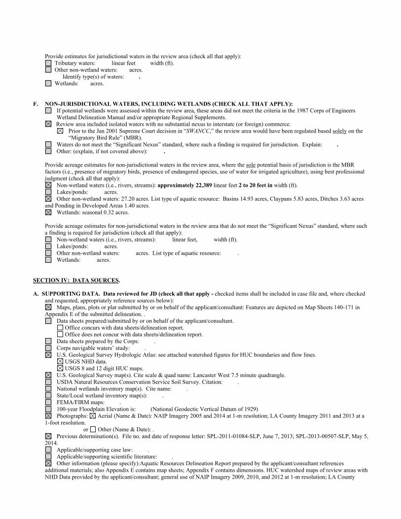
Provide estimates for jurisdictional waters in the review area (check all that apply): Tributary waters: linear feet width (ft). Other non-wetland waters: acres.
Identify type(s) of waters: . Wetlands: acres.
F. NON-JURISDICTIONAL WATERS, INCLUDING WETLANDS (CHECK ALL THAT APPLY): If potential wetlands were assessed within the review area, these areas did not meet the criteria in the 1987 Corps of Engineers
Wetland Delineation Manual and/or appropriate Regional Supplements. Review area included isolated waters with no substantial nexus to interstate (or foreign) commerce.
Prior to the Jan 2001 Supreme Court decision in “SWANCC,” the review area would have been regulated based solely on the “Migratory Bird Rule” (MBR).
Waters do not meet the “Significant Nexus” standard, where such a finding is required for jurisdiction. Explain: . Other: (explain, if not covered above): . Provide acreage estimates for non-jurisdictional waters in the review area, where the sole potential basis of jurisdiction is the MBR
factors (i.e., presence of migratory birds, presence of endangered species, use of water for irrigated agriculture), using best professional judgment (check all that apply):
Non-wetland waters (i.e., rivers, streams): approximately 22,389 linear feet 2 to 20 feet in width (ft). Lakes/ponds: acres. Other non-wetland waters: 27.20 acres. List type of aquatic resource: Basins 14.93 acres, Claypans 5.83 acres, Ditches 3.63 acres
and Ponding in Developed Areas 1.40 acres. Wetlands: seasonal 0.32 acres.
Provide acreage estimates for non-jurisdictional waters in the review area that do not meet the “Significant Nexus” standard, where such a finding is required for jurisdiction (check all that apply):
Non-wetland waters (i.e., rivers, streams): linear feet, width (ft). Lakes/ponds: acres. Other non-wetland waters: acres. List type of aquatic resource: . Wetlands: acres.
SECTION IV: DATA SOURCES. A. SUPPORTING DATA. Data reviewed for JD (check all that apply - checked items shall be included in case file and, where checked
and requested, appropriately reference sources below): Maps, plans, plots or plat submitted by or on behalf of the applicant/consultant: Features are depicted on Map Sheets 140-171 in
Appendix E of the submitted delineation. . Data sheets prepared/submitted by or on behalf of the applicant/consultant.
Office concurs with data sheets/delineation report. Office does not concur with data sheets/delineation report.
Data sheets prepared by the Corps: . Corps navigable waters’ study: . U.S. Geological Survey Hydrologic Atlas: see attached watershed figures for HUC boundaries and flow lines.
USGS NHD data. USGS 8 and 12 digit HUC maps.
U.S. Geological Survey map(s). Cite scale & quad name: Lancaster West 7.5 minute quadrangle. USDA Natural Resources Conservation Service Soil Survey. Citation:
. National wetlands inventory map(s). Cite name: .
State/Local wetland inventory map(s): . FEMA/FIRM maps: . 100-year Floodplain Elevation is: (National Geodectic Vertical Datum of 1929) Photographs: Aerial (Name & Date): NAIP Imagery 2005 and 2014 at 1-m resolution; LA County Imagery 2011 and 2013 at a
1-foot resolution. or Other (Name & Date): .
Previous determination(s). File no. and date of response letter: SPL-2011-01084-SLP, June 7, 2013; SPL-2013-00507-SLP, May 5, 2014.
Applicable/supporting case law: . Applicable/supporting scientific literature: . Other information (please specify):Aquatic Resources Delineation Report prepared by the applicant/consultant references
additional materials; also Appendix E contains map sheets; Appendix F contains dimensions. HUC watershed maps of review areas with NHD Data provided by the applicant/consultant; general use of NAIP Imagery 2009, 2010, and 2012 at 1-m resolution; LA County

Imagery 2015 at 1-foot resolution; 2015 Site specific IR Imagery, 3-inch color pixel; Bing Aerial Imagery - multiple years (scale dependent); ESRI World Imagery (streaming service) multiple years (scale dependent); Google Earth Historic Photos (used for reference and includes portions from above listed sources).
B. ADDITIONAL COMMENTS TO SUPPORT JD: Waters_Name Cowardin_Code HGM_Code Amount Units Latitude Longitude Str_0397a R6 RIVERINE 0.00 ACRE 34.78655 -118.1843669 Str_0397c R6 RIVERINE 0.11 ACRE 34.78617 -118.1820365 Str_0398b R6 RIVERINE 0.02 ACRE 34.78617 -118.1813046 Str_0399 R6 RIVERINE 0.220 ACRE 34.78502 -118.181059 Str_0400 R6 RIVERINE 0.00 ACRE 34.78617 -118.1797037 Str_0401 R6 RIVERINE 0.01 ACRE 34.78505 -118.1794268 Str_0402 R6 RIVERINE 0.01 ACRE 34.78544 -118.1791358 Str_0403 R6 RIVERINE 0.11 ACRE 34.78402 -118.1792059 Str_0404 R6 RIVERINE 0.05 ACRE 34.78284 -118.1812322 Str_0405 R6 RIVERINE 0.03 ACRE 34.78247 -118.1811284 Str_0406 R6 RIVERINE 0.01 ACRE 34.78233 -118.1810439 Str_0407 R6 RIVERINE 0.06 ACRE 34.77539 -118.1752071 Str_0408 R6 RIVERINE 0.15 ACRE 34.77241 -118.1735731 Str_0409-001 R6 RIVERINE 0.010 ACRE 34.76984 -118.1714605 Str_0409-002 R6 RIVERINE 0.00 ACRE 34.77178 -118.1735966 Str_0410 R6 RIVERINE 0.09 ACRE 34.7491 -118.1520713 AmargosaCreek_0411 R6 RIVERINE 0.14 ACRE 34.74635 -118.151514 Basin_0412 PUB RIVERINE 0.29 ACRE 34.73304 -118.140983 Basin_0413 PUB RIVERINE 1.29 ACRE 34.73286 -118.136711 Basin_0414 PUB RIVERINE 1.30 ACRE 34.73287 -118.135845 Basin_0415 PUB RIVERINE 0.82 ACRE 34.72268 -118.143427 Ditch_0416-001 R6 RIVERINE 0.005 ACRE 34.71352 -118.1389889 Ditch_0416-002 R6 RIVERINE 0.02 ACRE 34.7138 -118.1401715 Ditch_0417 R6 RIVERINE 0.06 ACRE 34.71626 -118.1396852 Ditch_0418 R6 RIVERINE 0.01 ACRE 34.7139 -118.1395531 Ditch_0419 R6 RIVERINE 0.02 ACRE 34.71259 -118.1390817 Basin_0420 PUB RIVERINE 3.93 ACRE 34.71754 -118.138295 Ditch_0421-001 R6 RIVERINE 0.04 ACRE 34.71232 -118.1382373 Ditch_0421-002 R6 RIVERINE 0.0007 ACRE 34.71355 -118.1385169 Ditch_0422 R6 RIVERINE 0.08 ACRE 34.71579 -118.1373747 Basin_0423 PUB RIVERINE 3.35 ACRE 34.69627 -118.132236 Ditch_0424 R6 RIVERINE 0.08 ACRE 34.69207 -118.1351291 Ditch_0425 R6 RIVERINE 0.24 ACRE 34.68227 -118.1334178 SW_0426 PEM RIVERINE 0.32 ACRE 34.67435 -118.1279328 Str_0427 R6 RIVERINE 0.02 ACRE 34.64457 -118.1357612 Str_0428 R6 RIVERINE 0.04 ACRE 34.64135 -118.1282437 Ditch_0429 R6 RIVERINE 0.005 ACRE 34.6419 -118.1279017 AmargosaCrk_Ditch_0430 R6 RIVERINE 0.08 ACRE 34.64513 -118.1273144 AmargosaCrk_Ditch_0431 R6 RIVERINE 0.01 ACRE 34.64613 -118.1273593 AmargosaCrk_Ditch_0432 R6 RIVERINE 0.97 ACRE 34.63986 -118.1271351 Str_0433 R6 RIVERINE 0.3 ACRE 34.63691 -118.137527 Str_0434 R6 RIVERINE 0.02 ACRE 34.63299 -118.1283876 Str_0435 R6 RIVERINE 0.04 ACRE 34.6343 -118.12022 Str_0436 R6 RIVERINE 0.02 ACRE 34.6279 -118.1343827 AmargosaCreek_0437-001 R6 RIVERINE 0.002 ACRE 34.62719 -118.1318041 AmargosaCreek_0437-002 R6 RIVERINE 0.09 ACRE 34.62709 -118.1324838 AmargosaCreek_0437-003 R6 RIVERINE 0.01 ACRE 34.6275 -118.1323855 AmargosaCreek_0437-004 R6 RIVERINE 0.02 ACRE 34.63072 -118.1301677 AmargosaCreek_0438 R6 RIVERINE 0.59 ACRE 34.63335 -118.1289324Basin_0439 PEM RIVERINE 2.01 ACRE 34.61722 -118.127358 Basin_0440 PEM RIVERINE 1.73 ACRE 34.61745 -118.12582 Ditch_0441 R6 RIVERINE 0.68 ACRE 34.61392 -118.123645 Ditch_0442 R6 RIVERINE 0.09 ACRE 34.61211 -118.122061 Ditch_0443 R6 RIVERINE 0.002 ACRE 34.60932 -118.121441 Ditch_0444 R6 RIVERINE 0.1 ACRE 34.60044 -118.124843 Basin_0445 PUB RIVERINE 0.04 ACRE 34.60717 -118.12367 Basin_0446 PEM RIVERINE 0.17 ACRE 34.6016 -118.116003 Str_0447 R6 RIVERINE 0.12 ACRE 34.60151 -118.113538 Str_0448 R6 RIVERINE 0.51 ACRE 34.60141 -118.112426

Str_0449 R6 RIVERINE 0.03 ACRE 34.60233 -118.112154 Str_0450 R6 RIVERINE 0.06 ACRE 34.60244 -118.111885 Str_0451 R6 RIVERINE 1.1 ACRE 34.59603 -118.121769 Ditch_0452 R6 RIVERINE 0.35 ACRE 34.59477 -118.119996Str_0453 R6 RIVERINE 0.28 ACRE 34.59724 -118.119794 Ditch_0454 R6 RIVERINE 0.14 ACRE 34.59203 -118.119585Str_0455 R6 RIVERINE 0.31 ACRE 34.59409 -118.119431 Str_0456 R6 RIVERINE 0.29 ACRE 34.59599 -118.119377 Ditch_0457 R6 RIVERINE 1.18 ACRE 34.58465 -118.118415Ditch_0458 R6 RIVERINE 0.5 ACRE 34.57638 -118.117216Ditch_0459 R6 RIVERINE 0.02 ACRE 34.57205 -118.129479Ditch_0460 R6 RIVERINE 0.01 ACRE 34.57243 -118.128693CP_1630-002 PUB DEPRESS 132 SQ_FT 34.78648 -118.183159 CP_1631 PUB DEPRESS 6 SQ_FT 34.78486 -118.183099 CP_1634-001 PUB DEPRESS 33 SQ_FT 34.78488 -118.183071 CP_1634-002 PUB DEPRESS 21 SQ_FT 34.78488 -118.183071 CP_1635 PUB DEPRESS 6 SQ_FT 34.7849 -118.183053 CP_1637-001 PUB DEPRESS 96 SQ_FT 34.78502 -118.183007 CP_1637-002 PUB DEPRESS 1 SQ_FT 34.78502 -118.183007 CP_1637-003 PUB DEPRESS 330 SQ_FT 34.78502 -118.183007 CP_1637-004 PUB DEPRESS 8 SQ_FT 34.78502 -118.183007 CP_1637-005 PUB DEPRESS 29 SQ_FT 34.78502 -118.183007 CP_1663 PUB DEPRESS 22 SQ_FT 34.78513 -118.181906 CP_1665 PUB DEPRESS 44 SQ_FT 34.7842 -118.181379 CP_1666 PUB DEPRESS 53 SQ_FT 34.78427 -118.181352 CP_1667 PUB DEPRESS 61 SQ_FT 34.7842 -118.18134 CP_1668 PUB DEPRESS 182 SQ_FT 34.78429 -118.180589 CP_1669 PUB DEPRESS 68 SQ_FT 34.78487 -118.180594 CP_1670 PUB DEPRESS 76 SQ_FT 34.78363 -118.179799 CP_1671 PUB DEPRESS 5 SQ_FT 34.7837 -118.179739 CP_1672 PUB DEPRESS 6 SQ_FT 34.78368 -118.179634 CP_1673 PUB DEPRESS 78 SQ_FT 34.78345 -118.179602 CP_1674 PUB DEPRESS 35 SQ_FT 34.78345 -118.17955 CP_1675 PUB DEPRESS 236.0 SQ_FT 34.78361 -118.179549 CP_1676-001 PUB DEPRESS 0.2 SQ_FT 34.78383 -118.179548 CP_1676-002 PUB DEPRESS 33 SQ_FT 34.78383 -118.179548 CP_1677 PUB DEPRESS 82 SQ_FT 34.78417 -118.179216 CP_1678 PUB DEPRESS 38 SQ_FT 34.78359 -118.179053 CP_1679 PUB DEPRESS 18 SQ_FT 34.78401 -118.178082 CP_1680-001 PUB DEPRESS 2 SQ_FT 34.784 -118.178017 CP_1680-002 PUB DEPRESS 39 SQ_FT 34.784 -118.178017 CP_1680-003 PUB DEPRESS 13 SQ_FT 34.784 -118.178017 CP_1681-001 PUB DEPRESS 9.0 SQ_FT 34.78243 -118.181417 CP_1681-002 PUB DEPRESS 0.5 SQ_FT 34.78243 -118.181417 CP_1681-003 PUB DEPRESS 0.2 SQ_FT 34.78243 -118.181417 CP_1681-004 PUB DEPRESS 0.1 SQ_FT 34.78243 -118.181417 CP_1681-005 PUB DEPRESS 67 SQ_FT 34.78243 -118.181417 CP_1682-001 PUB DEPRESS 2 SQ_FT 34.78236 -118.181315 CP_1682-002 PUB DEPRESS 9 SQ_FT 34.78236 -118.181315 CP_1682-003 PUB DEPRESS 65.0 SQ_FT 34.78236 -118.181315 CP_1683-001 PUB DEPRESS 0.1 SQ_FT 34.78232 -118.18105 CP_1683-002 PUB DEPRESS 128 SQ_FT 34.78232 -118.18105 CP_1683-003 PUB DEPRESS 1 SQ_FT 34.78232 -118.18105 CP_1684 PUB DEPRESS 20 SQ_FT 34.78185 -118.180758 CP_1685 PUB DEPRESS 379.00 SQ_FT 34.78215 -118.180658 CP_1686 PUB DEPRESS 0.03 ACRE 34.78164 -118.180635 CP_1687 PUB DEPRESS 6 SQ_FT 34.78164 -118.180603 CP_1688 PUB DEPRESS 62 SQ_FT 34.78226 -118.180387 CP_1689 PUB DEPRESS 26 SQ_FT 34.78252 -118.180309 CP_1690 PUB DEPRESS 4 SQ_FT 34.78297 -118.180288 CP_1691 PUB DEPRESS 9 SQ_FT 34.783 -118.180279 CP_1692 PUB DEPRESS 3 SQ_FT 34.78296 -118.180271 CP_1693 PUB DEPRESS 26 SQ_FT 34.78251 -118.180236 CP_1694 PUB DEPRESS 163 SQ_FT 34.78183 -118.180224 CP_1695 PUB DEPRESS 11 SQ_FT 34.78303 -118.180157 CP_1696 PUB DEPRESS 5.00 SQ_FT 34.78301 -118.180155

CP_1697
--
PUB
PUB DEPRESS 0.25 ACRE 34.781 -118.180099 CP_1698 PUB DEPRESS 104 SQ_FT 34.7827 -118.180096 CP_1699 PUB DEPRESS 19.00 SQ_FT 34.78312 -118.180083 CP_1700 DEPRESS 0.02 ACRE 34.78256 -118.180065 CP_1701 PUB DEPRESS 6 SQ_FT 34.78229 -118.179944 CP_1702 PUB DEPRESS 48.00 SQ_FT 34.78202 -118.179902 CP_1703 PUB DEPRESS 0.02 ACRE 34.78279 -118.179878 CP_1704 PUB DEPRESS 0.03 ACRE 34.78222 -118.179855 CP_1705 PUB DEPRESS 37 SQ_FT 34.78288 -118.179804 CP_1706 PUB DEPRESS 19 SQ_FT 34.78284 -118.179804 CP_1707 PUB DEPRESS 15 SQ_FT 34.78281 -118.17979 CP_1708 PUB DEPRESS 9 SQ_FT 34.7817 -118.179768 CP_1709 PUB DEPRESS 22 SQ_FT 34.78285 -118.179755 CP_1710 PUB DEPRESS 27 SQ_FT 34.78281 -118.179736 CP_1711 PUB DEPRESS 9.00 SQ_FT 34.78277 -118.179735 CP_1712 PUB DEPRESS 0.03 ACRE 34.78302 -118.179721 CP_1713 PUB DEPRESS 308.00 SQ_FT 34.78192 -118.179713 CP_1714 PUB DEPRESS 0.01 ACRE 34.78266 -118.179707 CP_1715 PUB DEPRESS 40 SQ_FT 34.78285 -118.179688 CP_1716 PUB DEPRESS 14 SQ_FT 34.7828 -118.179682 CP_1717 PUB DEPRESS 466 SQ_FT 34.78014 -118.179669 CP_1718 PUB DEPRESS 37 SQ_FT 34.78016 -118.179305 CP_1719 PUB DEPRESS 124 SQ_FT 34.78001 -118.179201 CP_1720 PUB DEPRESS 10 SQ_FT 34.77935 -118.17913 CP_1721 PUB DEPRESS 232.00 SQ_FT 34.7792 -118.178952 CP_1722 PUB DEPRESS 0.06 ACRE 34.78037 -118.178931 CP_1723 PUB DEPRESS 0.04 ACRE 34.77963 -118.178862 CP_1724 PUB DEPRESS 0.06 ACRE 34.78047 -118.17866 CP_1725 PUB DEPRESS 0.07 ACRE 34.7791 -118.178645 CP_1726 PUB DEPRESS 0.0 ACRE 34.77889 -118.178576 CP_1727 PUB DEPRESS 0.1 SQ_FT 34.77892 -118.178481 CP_1728 PUB DEPRESS 26 SQ_FT 34.78013 -118.178113 CP_1729 PUB DEPRESS 88 SQ_FT 34.77747 -118.177889 CP_1730 PUB DEPRESS 93 SQ_FT 34.7775 -118.177808 CP_1731 PUB DEPRESS 277.00 SQ_FT 34.77747 -118.177639 CP_1732 PUB DEPRESS 0.04 ACRE 34.77979 -118.177575 CP_1733 PUB DEPRESS 49 SQ_FT 34.77721 -118.177452 CP_1734 001 PUB DEPRESS 4.00 SQ_FT 34.7775 -118.177421CP_1734 002 PUB DEPRESS 0.02 ACRE 34.7775 -118.177421CP_1735 PUB DEPRESS 0.02 ACRE 34.77831 -118.177414 CP_1736 PUB DEPRESS 116 SQ_FT 34.77976 -118.177413 CP_1737 PUB DEPRESS 24.00 SQ_FT 34.77719 -118.177408 CP_1738 PUB DEPRESS 0.02 ACRE 34.77889 -118.177408 CP_1739 PUB DEPRESS 0.01 ACRE 34.78008 -118.177233 CP_1740 PUB DEPRESS 11 SQ_FT 34.77679 -118.177223 CP_1741 PUB
DEPRESS 15.00 SQ_FT 34.7807 -118.177223 CP_1742 PUB DEPRESS 0.02 ACRE 34.77752 -118.177162 CP_1743 PUB DEPRESS 25 SQ_FT 34.77746 -118.177063 CP_1744 PUB DEPRESS 9 SQ_FT 34.77746 -118.176998 CP_1745 PUB DEPRESS 29 SQ_FT 34.77753 -118.17693 CP_1746 PUB DEPRESS 60 SQ_FT 34.77748 -118.176918 CP_1747 PUB DEPRESS 7.00 SQ_FT 34.77752 -118.1769 CP_1748 PUB DEPRESS 0.04 ACRE 34.77749 -118.176603 CP_1749 PUB DEPRESS 106.00 SQ_FT 34.78087 -118.17653 CP_1750 PUB DEPRESS 0.03 ACRE 34.78003 -118.176516 CP_1751 PUB DEPRESS 208.00 SQ_FT 34.77893 -118.176495 CP_1752 PUB DEPRESS 0.06 ACRE 34.78051 -118.17648 CP_1753 PUB DEPRESS 21 SQ_FT 34.78105 -118.176458 CP_1754 PUB DEPRESS 15 SQ_FT 34.78102 -118.176449 CP_1755 PUB DEPRESS 21 SQ_FT 34.77889 -118.176414 CP_1756 PUB DEPRESS 33 SQ_FT 34.78095 -118.176391 CP_1757 PUB DEPRESS 68 SQ_FT 34.78199 -118.176366 CP_1758 PUB DEPRESS 36 SQ_FT 34.78202 -118.176359 CP_1759 PUB DEPRESS 28 SQ_FT 34.7789 -118.176359 CP_1760 PUB DEPRESS 172.00 SQ_FT 34.77731 -118.17632 CP_1761 PUB DEPRESS 0.06 ACRE 34.77753 -118.176313

CP_1762 PUB DEPRESS 0.02 ACRE 34.77789 -118.17627 CP_1763 PUB DEPRESS 13.00 SQ_FT 34.77733 -118.17626 CP_1764 PUB DEPRESS 0.11 ACRE 34.7772 -118.176182 CP_1765 PUB DEPRESS 192 SQ_FT 34.77592 -118.176104 CP_1766 PUB DEPRESS 8.00 SQ_FT 34.78207 -118.176022 CP_1767 PUB DEPRESS 0.58 ACRE 34.78124 -118.175977 CP_1768 PUB DEPRESS 434 SQ_FT 34.78053 -118.175903 CP_1769 PUB DEPRESS 123 SQ_FT 34.77708 -118.17563 CP_1770 PUB DEPRESS 9 SQ_FT 34.77718 -118.175629 CP_1771 PUB DEPRESS 74 SQ_FT 34.77671 -118.175624 CP_1772-001 PUB DEPRESS 5 SQ_FT 34.77632 -118.175595 CP_1772-002 PUB DEPRESS 2 SQ_FT 34.77632 -118.175595 CP_1772-003 PUB DEPRESS 5 SQ_FT 34.77632 -118.175595 CP_1772-004 PUB DEPRESS 17.0 SQ_FT 34.77632 -118.175595 CP_1772-005 PUB DEPRESS 0.2 SQ_FT 34.77632 -118.175595 CP_1772-006 PUB DEPRESS 6 SQ_FT 34.77632 -118.175595 CP_1772-007 PUB DEPRESS 12 SQ_FT 34.77632 -118.175595 CP_1772-008 PUB DEPRESS 40 SQ_FT 34.77632 -118.175595 CP_1773 PUB DEPRESS 8 SQ_FT 34.77665 -118.175572 CP_1774 PUB DEPRESS 4 SQ_FT 34.77672 -118.175564 CP_1775-001 PUB DEPRESS 120 SQ_FT 34.77708 -118.175559 CP_1775-002 PUB DEPRESS 9 SQ_FT 34.77708 -118.175559 CP_1776 PUB DEPRESS 46 SQ_FT 34.77713 -118.175552 CP_1777 PUB DEPRESS 22 SQ_FT 34.77656 -118.175521 CP_1778 PUB DEPRESS 9 SQ_FT 34.7766 -118.175496 CP_1779 PUB DEPRESS 3 SQ_FT 34.77657 -118.175487 CP_1780 PUB DEPRESS 340.00 SQ_FT 34.777 -118.175464 CP_1781 PUB DEPRESS 0.02 ACRE 34.77951 -118.175454 CP_1782 PUB DEPRESS 0.01 ACRE 34.77655 -118.175415 CP_1783 PUB DEPRESS 11 SQ_FT 34.77573 -118.175403 CP_1784 PUB DEPRESS 331 SQ_FT 34.77677 -118.1754 CP_1785 PUB DEPRESS 23 SQ_FT 34.77672 -118.175384 CP_1786 PUB DEPRESS 7 SQ_FT 34.77573 -118.175382 CP_1787 PUB DEPRESS 10 SQ_FT 34.77672 -118.175358 CP_1788 PUB DEPRESS 56 SQ_FT 34.77647 -118.175352 CP_1789 PUB DEPRESS 51 SQ_FT 34.77904 -118.175303 CP_1790 PUB DEPRESS 50 SQ_FT 34.77876 -118.17525 CP_1791 PUB DEPRESS 65 SQ_FT 34.7764 -118.175248 CP_1792 PUB DEPRESS 208 SQ_FT 34.77659 -118.175197 CP_1793 PUB DEPRESS 36 SQ_FT 34.77712 -118.175166 CP_1794 PUB DEPRESS 15 SQ_FT 34.77702 -118.175157 CP_1795 PUB DEPRESS 15 SQ_FT 34.77701 -118.175112 CP_1796 PUB DEPRESS 174.00 SQ_FT 34.77663 -118.175101 CP_1797 PUB DEPRESS 0.04 ACRE 34.77677 -118.175098 CP_1798 PUB DEPRESS 0.02 ACRE 34.77711 -118.174887 CP_1799 PUB DEPRESS 24 SQ_FT 34.77533 -118.174875 CP_1800 PUB DEPRESS 5 SQ_FT 34.77679 -118.174853 CP_1801 PUB DEPRESS 18 SQ_FT 34.77701 -118.174837 CP_1802 PUB DEPRESS 19 SQ_FT 34.77676 -118.174804 CP_1803 PUB DEPRESS 4 SQ_FT 34.77661 -118.174674 CP_1804 PUB DEPRESS 91 SQ_FT 34.77663 -118.174657 CP_1805 PUB DEPRESS 94.00 SQ_FT 34.781 -118.174578 CP_1806 PUB DEPRESS 0.02 ACRE 34.77679 -118.174517 CP_1807 PUB DEPRESS 217 SQ_FT 34.77662 -118.174469 CP_1808 PUB DEPRESS 419 SQ_FT 34.7787 -118.174403 CP_1809 PUB DEPRESS 105 SQ_FT 34.77645 -118.174382 CP_1810 PUB DEPRESS 146 SQ_FT 34.77876 -118.174289 CP_1811 PUB DEPRESS 156.00 SQ_FT 34.77668 -118.174276 CP_1812 PUB DEPRESS 0.06 ACRE 34.77735 -118.174174 CP_1813 PUB DEPRESS 375 SQ_FT 34.77666 -118.174164 CP_1814 PUB DEPRESS 9 SQ_FT 34.77568 -118.174112 CP_1815 PUB DEPRESS 12 SQ_FT 34.77746 -118.174069 CP_1816 PUB DEPRESS 8 SQ_FT 34.77657 -118.174061 CP_1817 PUB DEPRESS 19 SQ_FT 34.7775 -118.173351 CP_1818 PUB DEPRESS 395 SQ_FT 34.77741 -118.173318 CP_1819 PUB DEPRESS 14 SQ_FT 34.77745 -118.173285

CP_1820-001 PUB DEPRESS 2 SQ_FT 34.77739 -118.173271CP_1820-002 PUB DEPRESS 17 SQ_FT 34.77739 -118.173271CP_1821 PUB
DEPRESS 17 SQ_FT 34.77739 -118.173242 CP_1822 PUB DEPRESS 11 SQ_FT 34.77742 -118.173018 CP_1823 PUB DEPRESS 14 SQ_FT 34.77729 -118.172946 CP_1824 PUB DEPRESS 9 SQ_FT 34.77731 -118.172902 CP_1825 PUB DEPRESS 7 SQ_FT 34.77732 -118.172811 CP_1826 PUB DEPRESS 35 SQ_FT 34.77669 -118.172721 CP_1827 PUB DEPRESS 131 SQ_FT 34.77669 -118.17254 CP_1828 PUB DEPRESS 262 SQ_FT 34.77642 -118.17229 CP_1829 PUB DEPRESS 45 SQ_FT 34.77629 -118.172198 CP_1830 PUB DEPRESS 9 SQ_FT 34.77638 -118.172073 CP_1831 PUB DEPRESS 204.0 SQ_FT 34.77562 -118.171583 CP_1832-001 PUB DEPRESS 0.4 SQ_FT 34.77507 -118.174942CP_1832-002 PUB DEPRESS 5 SQ_FT 34.77507 -118.174942CP_1832-003 PUB DEPRESS 9 SQ_FT 34.77507 -118.174942CP_1833-001 PUB DEPRESS 1 SQ_FT 34.77511 -118.174929CP_1833-002 PUB DEPRESS 2 SQ_FT 34.77511 -118.174929CP_1833-003 PUB DEPRESS 28 SQ_FT 34.77511 -118.174929CP_1834-001 PUB DEPRESS 2 SQ_FT 34.77502 -118.174908CP_1834-002 PUB DEPRESS 16 SQ_FT 34.77502 -118.174908CP_1835 PUB DEPRESS 3 SQ_FT 34.775 -118.17482 CP_1836-001 PUB DEPRESS 12 SQ_FT 34.7747 -118.174618CP_1836-002 PUB DEPRESS 9.0 SQ_FT 34.7747 -118.174618CP_1837-001 PUB DEPRESS 0.3 SQ_FT 34.77445 -118.174393CP_1837-002 PUB DEPRESS 5 SQ_FT 34.77445 -118.174393CP_1837-003 PUB DEPRESS 1 SQ_FT 34.77445 -118.174393CP_1837-004 PUB DEPRESS 11 SQ_FT 34.77445 -118.174393CP_1838 PUB
DEPRESS 53 SQ_FT 34.77451 -118.174345 CP_1839 PUB DEPRESS 7 SQ_FT 34.7745 -118.17429 CP_1840 PUB DEPRESS 33 SQ_FT 34.77444 -118.174233 CP_1841 PUB DEPRESS 77 SQ_FT 34.77447 -118.17423 CP_1842 PUB DEPRESS 3 SQ_FT 34.77435 -118.174116 CP_1843 PUB DEPRESS 5 SQ_FT 34.77438 -118.174089 CP_1844 PUB DEPRESS 92 SQ_FT 34.77431 -118.17401 CP_1845 PUB DEPRESS 3 SQ_FT 34.77429 -118.173836 CP_1846 PUB DEPRESS 9 SQ_FT 34.7743 -118.173833 CP_1847 PUB DEPRESS 14 SQ_FT 34.77367 -118.173612 CP_1848 PUB DEPRESS 37.0 SQ_FT 34.77339 -118.173576 CP_1849-001 PUB DEPRESS 0.1 SQ_FT 34.77171 -118.173565CP_1849-002 PUB DEPRESS 0.3 SQ_FT 34.77171 -118.173565CP_1849-003 PUB DEPRESS 16 SQ_FT 34.77171 -118.173565CP_1850 PUB
DEPRESS 49 SQ_FT 34.77404 -118.173517 CP_1851 PUB DEPRESS 13 SQ_FT 34.77182 -118.173503 CP_1852 PUB DEPRESS 5 SQ_FT 34.77335 -118.173487 CP_1853 PUB DEPRESS 8 SQ_FT 34.77398 -118.173464 CP_1854 PUB DEPRESS 8 SQ_FT 34.774 -118.173454 CP_1855 PUB DEPRESS 10 SQ_FT 34.77401 -118.173435 CP_1856 PUB DEPRESS 93 SQ_FT 34.77344 -118.173381 CP_1857 PUB DEPRESS 3 SQ_FT 34.77392 -118.173346 CP_1858 PUB DEPRESS 35 SQ_FT 34.77339 -118.17334 CP_1859 PUB DEPRESS 16 SQ_FT 34.77334 -118.173257 CP_1860 PUB DEPRESS 39 SQ_FT 34.77383 -118.173231 CP_1861 PUB DEPRESS 22 SQ_FT 34.77373 -118.173227 CP_1862-001 PUB DEPRESS 3 SQ_FT 34.77178 -118.172968CP_1862-002 PUB DEPRESS 1 SQ_FT 34.77178 -118.172968CP_1862-003 PUB DEPRESS 3 SQ_FT 34.77178 -118.172968CP_1863 PUB
DEPRESS 5 SQ_FT 34.77327 -118.172435 CP_1864 PUB DEPRESS 151 SQ_FT 34.77332 -118.172393 CP_1865 PUB DEPRESS 4 SQ_FT 34.77205 -118.172321 CP_1866 PUB DEPRESS 215 SQ_FT 34.77337 -118.17224 CP_1867 PUB DEPRESS 23.00 SQ_FT 34.77333 -118.172235 CP_1868 PUB DEPRESS 0.01 ACRE 34.77326 -118.171851 CP_1869 PUB DEPRESS 69 SQ_FT 34.77333 -118.171831 CP_1870 PUB DEPRESS 6 SQ_FT 34.77334 -118.171727 CP_1871 PUB DEPRESS 327 SQ_FT 34.77097 -118.171679

CP_1872 PUB DEPRESS 28 SQ_FT 34.76984 -118.171595 CP_1873 PUB DEPRESS 4 SQ_FT 34.77044 -118.171475 CP_1874 PUB DEPRESS 7.00 SQ_FT 34.76984 -118.171466 CP_1875 PUB DEPRESS 0.01 ACRE 34.77333 -118.171449 CP_1876 PUB DEPRESS 3 SQ_FT 34.7697 -118.171333 CP_1877 PUB DEPRESS 48 SQ_FT 34.77335 -118.171332 CP_1878 PUB DEPRESS 25.00 SQ_FT 34.77311 -118.171149 CP_1879 PUB DEPRESS 0.05 ACRE 34.77329 -118.171122 CP_1880 PUB DEPRESS 0.03 ACRE 34.77472 -118.171114 CP_1881 PUB DEPRESS 58 SQ_FT 34.77296 -118.171098 CP_1882 PUB DEPRESS 13 SQ_FT 34.77285 -118.170184 CP_1883 PUB DEPRESS 11 SQ_FT 34.77289 -118.17018 CP_1884 PUB DEPRESS 73 SQ_FT 34.76748 -118.169774 CP_1885 PUB DEPRESS 19 SQ_FT 34.7676 -118.169674 CP_1886 PUB DEPRESS 3 SQ_FT 34.77262 -118.169664 CP_1887 PUB DEPRESS 6 SQ_FT 34.77214 -118.169525 CP_1888 PUB DEPRESS 76 SQ_FT 34.7678 -118.169517 CP_1889 PUB DEPRESS 9 SQ_FT 34.76917 -118.169152 CP_1890 PUB DEPRESS 6 SQ_FT 34.76808 -118.169124 CP_1891 PUB DEPRESS 107 SQ_FT 34.76828 -118.16907 CP_1892 PUB DEPRESS 13 SQ_FT 34.76824 -118.169038 CP_1893 PUB DEPRESS 18 SQ_FT 34.76741 -118.168995 CP_1894 PUB DEPRESS 5 SQ_FT 34.7696 -118.168994 CP_1895 PUB DEPRESS 36 SQ_FT 34.768 -118.16878 CP_1896 PUB DEPRESS 37 SQ_FT 34.76747 -118.168766 CP_1897 PUB DEPRESS 12 SQ_FT 34.76802 -118.168755 CP_1898 PUB DEPRESS 24 SQ_FT 34.76867 -118.168735 CP_1899 PUB DEPRESS 13 SQ_FT 34.76866 -118.168679 CP_1900 PUB DEPRESS 4 SQ_FT 34.76776 -118.168546 CP_1901 PUB DEPRESS 41 SQ_FT 34.76806 -118.168459 CP_1902 PUB DEPRESS 8 SQ_FT 34.76777 -118.168451 CP_1903 PUB DEPRESS 10 SQ_FT 34.76852 -118.168418 CP_1904 PUB DEPRESS 22 SQ_FT 34.76733 -118.168399 CP_1905 PUB DEPRESS 92 SQ_FT 34.76875 -118.168378 CP_1906 PUB DEPRESS 10 SQ_FT 34.76873 -118.168348 CP_1907 PUB DEPRESS 62 SQ_FT 34.76918 -118.168217 CP_1908 PUB DEPRESS 13 SQ_FT 34.76915 -118.168202 CP_1909 PUB DEPRESS 56 SQ_FT 34.76916 -118.168174 CP_1910 PUB DEPRESS 24 SQ_FT 34.77062 -118.168155 CP_1911 PUB DEPRESS 53 SQ_FT 34.76914 -118.168128 CP_1912 PUB DEPRESS 12 SQ_FT 34.76891 -118.168115 CP_1913 PUB DEPRESS 6 SQ_FT 34.76892 -118.168103 CP_1914 PUB DEPRESS 9 SQ_FT 34.76889 -118.168101 CP_1915 PUB DEPRESS 7 SQ_FT 34.76912 -118.168074 CP_1916 PUB DEPRESS 71 SQ_FT 34.77056 -118.168037 CP_1917 PUB DEPRESS 13 SQ_FT 34.7706 -118.168036 CP_1918 PUB DEPRESS 50 SQ_FT 34.77047 -118.168012 CP_1919 PUB DEPRESS 4 SQ_FT 34.76749 -118.167994 CP_1920 PUB DEPRESS 17 SQ_FT 34.76737 -118.167916 CP_1921 PUB DEPRESS 26 SQ_FT 34.76941 -118.167885 CP_1922 PUB DEPRESS 12 SQ_FT 34.76989 -118.167845 CP_1923 PUB DEPRESS 19 SQ_FT 34.76881 -118.167438 CP_1924 PUB DEPRESS 7 SQ_FT 34.76816 -118.167316 CP_1925 PUB DEPRESS 7 SQ_FT 34.7687 -118.167226 CP_1926 PUB DEPRESS 2 SQ_FT 34.7687 -118.167216 CP_1927 PUB DEPRESS 17 SQ_FT 34.76852 -118.167213 CP_1928 PUB DEPRESS 5 SQ_FT 34.76797 -118.166807 CP_1929 PUB DEPRESS 28 SQ_FT 34.76804 -118.166806 CP_1930 PUB DEPRESS 4 SQ_FT 34.76793 -118.166765 CP_1931 PUB DEPRESS 35 SQ_FT 34.76797 -118.166754 CP_1932 PUB DEPRESS 135 SQ_FT 34.76749 -118.166748 CP_1933 PUB DEPRESS 377 SQ_FT 34.76844 -118.166746 CP_1934 PUB DEPRESS 422 SQ_FT 34.76735 -118.166731 CP_1935 PUB DEPRESS 32 SQ_FT 34.76757 -118.166504 CP_1936 PUB DEPRESS 12 SQ_FT 34.76846 -118.166394 CP_1937 PUB DEPRESS 147 SQ_FT 34.76896 -118.166364

CP_1938 PUB DEPRESS 48 SQ_FT 34.76848 -118.166358 CP_1939 PUB DEPRESS 477 SQ_FT 34.76861 -118.166353 CP_1940 PUB DEPRESS 477 SQ_FT 34.76849 -118.166308 CP_1941 PUB DEPRESS 115 SQ_FT 34.76845 -118.166252 CP_1942 PUB DEPRESS 40 SQ_FT 34.76841 -118.16618 CP_1943 PUB DEPRESS 15 SQ_FT 34.76733 -118.166168 CP_1944-001 PUB DEPRESS 3 SQ_FT 34.76843 -118.166144 CP_1944-002 PUB DEPRESS 1 SQ_FT 34.76843 -118.166144 CP_1945 PUB DEPRESS 6 SQ_FT 34.76843 -118.166134 CP_1946 PUB DEPRESS 3 SQ_FT 34.76839 -118.166127 CP_1947 PUB DEPRESS 12 SQ_FT 34.76838 -118.166114 CP_1948 PUB DEPRESS 15 SQ_FT 34.76841 -118.166105 CP_1949 PUB DEPRESS 1 SQ_FT 34.76842 -118.165932 CP_1950 PUB DEPRESS 7 SQ_FT 34.76803 -118.165863 CP_1951 PUB DEPRESS 31 SQ_FT 34.76802 -118.16573 CP_1952 PUB DEPRESS 10 SQ_FT 34.76771 -118.165565 CP_1953 PUB DEPRESS 19 SQ_FT 34.76722 -118.169388 CP_1954 PUB DEPRESS 432 SQ_FT 34.76725 -118.169334 CP_1955 PUB DEPRESS 48 SQ_FT 34.76692 -118.169296 CP_1956 PUB DEPRESS 148 SQ_FT 34.76684 -118.169254 CP_1957 PUB DEPRESS 28 SQ_FT 34.76682 -118.169212 CP_1958 PUB DEPRESS 14 SQ_FT 34.76686 -118.169199 CP_1959 PUB DEPRESS 25 SQ_FT 34.76716 -118.169143 CP_1960 PUB DEPRESS 82 SQ_FT 34.76698 -118.169142 CP_1961 PUB DEPRESS 7 SQ_FT 34.76717 -118.169043 CP_1962 PUB DEPRESS 3 SQ_FT 34.76716 -118.169024 CP_1963 PUB DEPRESS 212 SQ_FT 34.76651 -118.168976 CP_1964 PUB DEPRESS 56 SQ_FT 34.76654 -118.16883 CP_1965 PUB DEPRESS 88 SQ_FT 34.76714 -118.168821 CP_1966 PUB DEPRESS 49 SQ_FT 34.76658 -118.168798 CP_1967 PUB DEPRESS 10 SQ_FT 34.76716 -118.168782 CP_1968 PUB DEPRESS 6 SQ_FT 34.76683 -118.168692 CP_1969 PUB DEPRESS 13 SQ_FT 34.76684 -118.168661 CP_1970 PUB DEPRESS 14 SQ_FT 34.7673 -118.168637 CP_1971 PUB DEPRESS 80 SQ_FT 34.76587 -118.168532 CP_1972 PUB DEPRESS 13 SQ_FT 34.76592 -118.168495 CP_1973 PUB DEPRESS 24 SQ_FT 34.76595 -118.168461 CP_1974 PUB DEPRESS 3 SQ_FT 34.76591 -118.168433 CP_1975 PUB DEPRESS 1 SQ_FT 34.76722 -118.168375 CP_1976 PUB DEPRESS 38 SQ_FT 34.7659 -118.168353 CP_1977 PUB DEPRESS 1 SQ_FT 34.76726 -118.168336 CP_1978 PUB DEPRESS 36 SQ_FT 34.76703 -118.168289 CP_1979 PUB DEPRESS 20 SQ_FT 34.76701 -118.168237 CP_1980 PUB DEPRESS 16 SQ_FT 34.76701 -118.168211 CP_1981 PUB DEPRESS 31 SQ_FT 34.76701 -118.168185 CP_1982 PUB DEPRESS 61 SQ_FT 34.76575 -118.168085 CP_1983 PUB DEPRESS 28 SQ_FT 34.76706 -118.168055 CP_1984 PUB DEPRESS 17 SQ_FT 34.76703 -118.168048 CP_1985 PUB DEPRESS 7 SQ_FT 34.76712 -118.168045 CP_1986 PUB DEPRESS 20 SQ_FT 34.76702 -118.168009 CP_1987 PUB DEPRESS 10 SQ_FT 34.76574 -118.167891 CP_1988 PUB DEPRESS 11 SQ_FT 34.76666 -118.167836 CP_1989 PUB DEPRESS 7 SQ_FT 34.76664 -118.167834 CP_1990 PUB DEPRESS 4 SQ_FT 34.7666 -118.167758 CP_1991 PUB DEPRESS 13 SQ_FT 34.76693 -118.167746 CP_1992 PUB DEPRESS 43 SQ_FT 34.76571 -118.167639 CP_1993 PUB DEPRESS 54 SQ_FT 34.7664 -118.167582 CP_1994 PUB DEPRESS 42.00 SQ_FT 34.76711 -118.167449 CP_1995 PUB DEPRESS 0.01 ACRE 34.76421 -118.167316 CP_1996 PUB DEPRESS 6 SQ_FT 34.76603 -118.167293 CP_1997 PUB DEPRESS 14 SQ_FT 34.76606 -118.167288 CP_1998 PUB DEPRESS 4 SQ_FT 34.76605 -118.167267 CP_1999 PUB DEPRESS 28 SQ_FT 34.76596 -118.167223 CP_2000 PUB DEPRESS 6 SQ_FT 34.76585 -118.16706 CP_2001 PUB DEPRESS 51 SQ_FT 34.76588 -118.167042 CP_2002 PUB DEPRESS 54 SQ_FT 34.76431 -118.167025

CP_2003 PUB DEPRESS 391 SQ_FT 34.7666 -118.167023 CP_2004 PUB DEPRESS 21 SQ_FT 34.76506 -118.166958 CP_2005 PUB DEPRESS 450 SQ_FT 34.76429 -118.166954 CP_2006 PUB DEPRESS 17 SQ_FT 34.76505 -118.166934 CP_2007 PUB DEPRESS 61 SQ_FT 34.76517 -118.166925 CP_2008 PUB DEPRESS 26 SQ_FT 34.76635 -118.166856 CP_2009 PUB DEPRESS 92 SQ_FT 34.76557 -118.166793 CP_2010 PUB DEPRESS 134 SQ_FT 34.76659 -118.166792 CP_2011 PUB DEPRESS 16 SQ_FT 34.76655 -118.166756 CP_2012 PUB DEPRESS 54 SQ_FT 34.76654 -118.166743 CP_2013 PUB DEPRESS 25 SQ_FT 34.76608 -118.166731 CP_2014 PUB DEPRESS 42 SQ_FT 34.76573 -118.166728 CP_2015 PUB DEPRESS 177 SQ_FT 34.76399 -118.166722 CP_2016 PUB DEPRESS 108 SQ_FT 34.7665 -118.166715 CP_2017 PUB DEPRESS 51 SQ_FT 34.76616 -118.166704 CP_2018 PUB DEPRESS 394 SQ_FT 34.76453 -118.1667 CP_2019 PUB DEPRESS 5 SQ_FT 34.76516 -118.1667 CP_2020 PUB DEPRESS 68 SQ_FT 34.76525 -118.166697 CP_2021 PUB DEPRESS 15 SQ_FT 34.7643 -118.166694 CP_2022 PUB DEPRESS 101 SQ_FT 34.76481 -118.166694 CP_2023 PUB DEPRESS 34 SQ_FT 34.76393 -118.166693 CP_2024 PUB DEPRESS 216 SQ_FT 34.764 -118.166687 CP_2025 PUB DEPRESS 333 SQ_FT 34.76324 -118.166687 CP_2026 PUB DEPRESS 4 SQ_FT 34.76652 -118.166671 CP_2027 PUB DEPRESS 10 SQ_FT 34.76452 -118.166653 CP_2028 PUB DEPRESS 29 SQ_FT 34.76523 -118.166433 CP_2029 PUB DEPRESS 133 SQ_FT 34.76635 -118.166364 CP_2030 PUB DEPRESS 56 SQ_FT 34.7645 -118.166318 CP_2031 PUB DEPRESS 29 SQ_FT 34.76549 -118.166188 CP_2032 PUB DEPRESS 31 SQ_FT 34.76436 -118.166185 CP_2033 PUB DEPRESS 24 SQ_FT 34.76593 -118.166181 CP_2034 PUB DEPRESS 52 SQ_FT 34.76462 -118.166154 CP_2035 PUB DEPRESS 38 SQ_FT 34.76606 -118.166152 CP_2036 PUB DEPRESS 22 SQ_FT 34.76592 -118.166149 CP_2037 PUB DEPRESS 9 SQ_FT 34.76591 -118.166113 CP_2038 PUB DEPRESS 31 SQ_FT 34.76451 -118.165973 CP_2039 PUB DEPRESS 16 SQ_FT 34.76445 -118.165899 CP_2040 PUB DEPRESS 3 SQ_FT 34.76606 -118.165855 CP_2041 PUB DEPRESS 19 SQ_FT 34.766 -118.165754 CP_2042 PUB DEPRESS 21 SQ_FT 34.76542 -118.165714 CP_2043 PUB DEPRESS 17.00 SQ_FT 34.7662 -118.165697 CP_2044 PUB DEPRESS 0.02 ACRE 34.76451 -118.165608 CP_2045 PUB DEPRESS 79 SQ_FT 34.76551 -118.165594 CP_2046 PUB DEPRESS 75 SQ_FT 34.76605 -118.16558 CP_2047 PUB DEPRESS 11 SQ_FT 34.76567 -118.165575 CP_2048 PUB DEPRESS 15 SQ_FT 34.76534 -118.16557 CP_2049 PUB DEPRESS 181 SQ_FT 34.76594 -118.165539 CP_2050 PUB DEPRESS 33 SQ_FT 34.76402 -118.165484 CP_2051 PUB DEPRESS 4.00 SQ_FT 34.76393 -118.165469 CP_2052 PUB DEPRESS 0.14 ACRE 34.76579 -118.165468 CP_2053 PUB DEPRESS 18 SQ_FT 34.76604 -118.1654 CP_2054 PUB DEPRESS 15 SQ_FT 34.7645 -118.16539 CP_2055 PUB DEPRESS 87 SQ_FT 34.76636 -118.165339 CP_2056 PUB DEPRESS 15 SQ_FT 34.76606 -118.165337 CP_2057 PUB DEPRESS 22 SQ_FT 34.76477 -118.1653 CP_2058 PUB DEPRESS 14 SQ_FT 34.76618 -118.165298 CP_2059 PUB DEPRESS 141 SQ_FT 34.76484 -118.165251 CP_2060 PUB DEPRESS 20 SQ_FT 34.766 -118.165246 CP_2061 PUB DEPRESS 5 SQ_FT 34.76465 -118.165221 CP_2062 PUB DEPRESS 15 SQ_FT 34.76455 -118.165205 CP_2063 PUB DEPRESS 11 SQ_FT 34.76645 -118.165181 CP_2064 PUB DEPRESS 22 SQ_FT 34.76599 -118.165172 CP_2065 PUB DEPRESS 78 SQ_FT 34.76575 -118.165166 CP_2066 PUB DEPRESS 3 SQ_FT 34.76645 -118.16514 CP_2067 PUB DEPRESS 13 SQ_FT 34.76548 -118.165079 CP_2068 PUB DEPRESS 3 SQ_FT 34.76475 -118.165064

CP_2069 PUB DEPRESS 56 SQ_FT 34.76547 -118.165043 CP_2070 PUB DEPRESS 64 SQ_FT 34.76471 -118.165032 CP_2071 PUB DEPRESS 117 SQ_FT 34.76459 -118.165025 CP_2072 PUB DEPRESS 12 SQ_FT 34.76547 -118.164994 CP_2073 PUB DEPRESS 9 SQ_FT 34.76462 -118.164945 CP_2074 PUB DEPRESS 8 SQ_FT 34.76548 -118.164937 CP_2075-001 PUB DEPRESS 3 SQ_FT 34.7646 -118.164932CP_2075-002 PUB DEPRESS 8 SQ_FT 34.7646 -118.164932CP_2076 PUB DEPRESS 12 SQ_FT 34.76545 -118.164913 CP_2077 PUB DEPRESS 35 SQ_FT 34.76455 -118.164899 CP_2078 PUB DEPRESS 46 SQ_FT 34.76459 -118.164899 CP_2079 PUB DEPRESS 8 SQ_FT 34.76456 -118.164861 CP_2080 PUB DEPRESS 80 SQ_FT 34.76454 -118.164835 CP_2081 PUB DEPRESS 4 SQ_FT 34.76457 -118.164806 CP_2082 PUB DEPRESS 101 SQ_FT 34.76473 -118.16479 CP_2083 PUB DEPRESS 31 SQ_FT 34.7666 -118.164753 CP_2084 PUB DEPRESS 13 SQ_FT 34.7654 -118.164729 CP_2085 PUB DEPRESS 26 SQ_FT 34.76528 -118.164727 CP_2086 PUB DEPRESS 28 SQ_FT 34.76656 -118.164721 CP_2087 PUB DEPRESS 11 SQ_FT 34.76658 -118.164704 CP_2088 PUB DEPRESS 7 SQ_FT 34.76657 -118.164701 CP_2089 PUB DEPRESS 15 SQ_FT 34.76473 -118.164692 CP_2090 PUB DEPRESS 20 SQ_FT 34.76438 -118.164656 CP_2091 PUB DEPRESS 30 SQ_FT 34.76441 -118.164602 CP_2092 PUB DEPRESS 18 SQ_FT 34.76637 -118.164593 CP_2093 PUB DEPRESS 37 SQ_FT 34.76418 -118.164569 CP_2094 PUB DEPRESS 19 SQ_FT 34.76441 -118.164484 CP_2095 PUB DEPRESS 11 SQ_FT 34.7644 -118.164464 CP_2096 PUB DEPRESS 59 SQ_FT 34.76438 -118.164414 CP_2097 PUB DEPRESS 45 SQ_FT 34.7646 -118.164248 CP_2098 PUB DEPRESS 5 SQ_FT 34.76625 -118.164223 CP_2099 PUB DEPRESS 51 SQ_FT 34.7652 -118.164136 CP_2100 PUB DEPRESS 41 SQ_FT 34.76456 -118.164133 CP_2101 PUB DEPRESS 80 SQ_FT 34.7645 -118.164102 CP_2102 PUB DEPRESS 21 SQ_FT 34.76586 -118.16406 CP_2103 PUB DEPRESS 14 SQ_FT 34.76586 -118.164029 CP_2104 PUB DEPRESS 155 SQ_FT 34.76455 -118.163999 CP_2105 PUB DEPRESS 20 SQ_FT 34.76418 -118.163984 CP_2106 PUB DEPRESS 112 SQ_FT 34.76539 -118.163974 CP_2107 PUB DEPRESS 8 SQ_FT 34.76554 -118.163892 CP_2108 PUB DEPRESS 49 SQ_FT 34.7641 -118.163866 CP_2109 PUB DEPRESS 45 SQ_FT 34.76555 -118.163845 CP_2110 PUB DEPRESS 19 SQ_FT 34.76434 -118.163781 CP_2111 PUB DEPRESS 12 SQ_FT 34.76389 -118.16375 CP_2112 PUB DEPRESS 44 SQ_FT 34.76426 -118.163598 CP_2113 PUB DEPRESS 4 SQ_FT 34.76426 -118.163542 CP_2114 PUB DEPRESS 71 SQ_FT 34.76423 -118.163508 CP_2115 PUB DEPRESS 10 SQ_FT 34.76421 -118.163454 CP_2116 PUB DEPRESS 29 SQ_FT 34.76423 -118.163432 CP_2117 PUB DEPRESS 54 SQ_FT 34.76408 -118.163423 CP_2118 PUB DEPRESS 9 SQ_FT 34.76394 -118.163402 CP_2119 PUB DEPRESS 3 SQ_FT 34.76342 -118.163398 CP_2120 PUB DEPRESS 13 SQ_FT 34.76343 -118.16336 CP_2121 PUB DEPRESS 12 SQ_FT 34.76309 -118.163355 CP_2122 PUB DEPRESS 7 SQ_FT 34.76351 -118.163329 CP_2123 PUB DEPRESS 66 SQ_FT 34.76392 -118.163318 CP_2124 PUB DEPRESS 10 SQ_FT 34.76403 -118.16327 CP_2125 PUB DEPRESS 76 SQ_FT 34.76392 -118.163256 CP_2126 PUB DEPRESS 57 SQ_FT 34.76403 -118.163219 CP_2127 PUB DEPRESS 9 SQ_FT 34.76393 -118.163175 CP_2128 PUB DEPRESS 13 SQ_FT 34.764 -118.163142 CP_2129 PUB DEPRESS 15 SQ_FT 34.76347 -118.163142 CP_2130 PUB DEPRESS 8 SQ_FT 34.76368 -118.163127 CP_2131 PUB DEPRESS 7 SQ_FT 34.76395 -118.163014 CP_2132 PUB DEPRESS 39 SQ_FT 34.76404 -118.162979 CP_2133 PUB DEPRESS 14 SQ_FT 34.76394 -118.162949

CP_2134 PUB DEPRESS 8 SQ_FT 34.76372 -118.162929 CP_2135 PUB DEPRESS 7 SQ_FT 34.76351 -118.162875 CP_2136 PUB DEPRESS 5 SQ_FT 34.76338 -118.162874 CP_2137 PUB DEPRESS 11 SQ_FT 34.76396 -118.162857 CP_2138 PUB DEPRESS 35 SQ_FT 34.76399 -118.162825 CP_2139 PUB DEPRESS 22 SQ_FT 34.76393 -118.162687 CP_2140 PUB DEPRESS 174 SQ_FT 34.76397 -118.162675 CP_2141 PUB DEPRESS 9 SQ_FT 34.76226 -118.162328 CP_2142 PUB DEPRESS 3 SQ_FT 34.76225 -118.162303 CP_2143 PUB DEPRESS 23 SQ_FT 34.7623 -118.162237 CP_2144 PUB DEPRESS 19 SQ_FT 34.76158 -118.162229 CP_2145 PUB DEPRESS 28 SQ_FT 34.76156 -118.162199 CP_2146 PUB DEPRESS 50 SQ_FT 34.7594 -118.161941 CP_2147 PUB DEPRESS 4 SQ_FT 34.75945 -118.16189 CP_2148 PUB DEPRESS 6 SQ_FT 34.75951 -118.161887 CP_2149-001 PUB DEPRESS 4 SQ_FT 34.75946 -118.161877 CP_2149-002 PUB DEPRESS 16 SQ_FT 34.75946 -118.161877 CP_2150 PUB DEPRESS 139 SQ_FT 34.75936 -118.161676 CP_2151 PUB DEPRESS 36 SQ_FT 34.76201 -118.161543 CP_2152 PUB DEPRESS 16 SQ_FT 34.76199 -118.161497 CP_2153 PUB DEPRESS 16 SQ_FT 34.762 -118.161476 CP_2154 PUB DEPRESS 35 SQ_FT 34.76201 -118.161456 CP_2155 PUB DEPRESS 16 SQ_FT 34.76184 -118.161419 CP_2156 PUB DEPRESS 73 SQ_FT 34.76082 -118.160541 CP_2157 PUB DEPRESS 5 SQ_FT 34.75874 -118.163194 CP_2158 PUB DEPRESS 12 SQ_FT 34.75827 -118.162192 CP_2159 PUB DEPRESS 38 SQ_FT 34.75832 -118.162189 CP_2160 PUB DEPRESS 21 SQ_FT 34.75838 -118.162184 CP_2161 PUB DEPRESS 19 SQ_FT 34.75849 -118.162182 CP_2162 PUB DEPRESS 17 SQ_FT 34.75914 -118.161663 CP_2163 PUB DEPRESS 28 SQ_FT 34.75877 -118.160973 CP_2164 PUB DEPRESS 19 SQ_FT 34.75876 -118.160964 CP_2165 PUB DEPRESS 4 SQ_FT 34.75683 -118.160842 CP_2166 PUB DEPRESS 15 SQ_FT 34.75591 -118.160068 CP_2167 PUB DEPRESS 10 SQ_FT 34.75572 -118.159428 CP_2168 PUB DEPRESS 21 SQ_FT 34.75809 -118.159284 CP_2169 PUB DEPRESS 26 SQ_FT 34.75747 -118.158309 CP_2170 PUB DEPRESS 65 SQ_FT 34.75495 -118.157753 CP_2171 PUB DEPRESS 70 SQ_FT 34.75467 -118.157746 CP_2172 PUB DEPRESS 47 SQ_FT 34.75682 -118.157741 CP_2173-001 PUB DEPRESS 47 SQ_FT 34.75521 -118.157451CP_2173-002 PUB DEPRESS 32 SQ_FT 34.75521 -118.157451CP_2174 PUB DEPRESS 3 SQ_FT 34.75537 -118.157321 CP_2175 PUB DEPRESS 25 SQ_FT 34.75522 -118.157169 CP_2176 PUB DEPRESS 11 SQ_FT 34.75258 -118.156001 CP_2177 PUB DEPRESS 19 SQ_FT 34.75312 -118.155989 CP_2178-001 PUB DEPRESS 28 SQ_FT 34.75288 -118.155801CP_2178-002 PUB DEPRESS 55 SQ_FT 34.75288 -118.155801CP_2179 PUB DEPRESS 75 SQ_FT 34.75164 -118.155078 CP_2180 PUB DEPRESS 39 SQ_FT 34.75124 -118.156234 CP_2181 PUB DEPRESS 29 SQ_FT 34.75062 -118.15495 CP_2182-001 PUB DEPRESS 46 SQ_FT 34.75052 -118.154944CP_2182-002 PUB DEPRESS 5 SQ_FT 34.75052 -118.154944CP_2183 PUB DEPRESS 75 SQ_FT 34.75016 -118.154933 CP_2184 PUB DEPRESS 52 SQ_FT 34.74943 -118.154885 CP_2185 PUB DEPRESS 42 SQ_FT 34.74938 -118.15487 CP_2186 PUB DEPRESS 70 SQ_FT 34.74923 -118.154867 CP_2187 PUB DEPRESS 12 SQ_FT 34.74934 -118.154867 CP_2188 PUB DEPRESS 6 SQ_FT 34.74931 -118.154865 CP_2189 PUB DEPRESS 25 SQ_FT 34.74914 -118.154863 CP_2190 PUB DEPRESS 19 SQ_FT 34.74876 -118.154851 CP_2191 PUB DEPRESS 70 SQ_FT 34.74856 -118.154836 CP_2192 PUB DEPRESS 8 SQ_FT 34.74834 -118.15483 CP_2193 PUB DEPRESS 15 SQ_FT 34.74752 -118.154361 CP_2194 PUB DEPRESS 15 SQ_FT 34.74685 -118.153664 CP_2195 PUB DEPRESS 19.00 SQ_FT 34.74593 -118.153405

CP_2196 PUB DEPRESS 0.02 ACRE 34.74799 -118.153161 CP_2197 PUB DEPRESS 28 SQ_FT 34.7461 -118.153131 CP_2198 PUB DEPRESS 41 SQ_FT 34.75024 -118.153128 CP_2199 PUB DEPRESS 18 SQ_FT 34.74977 -118.153114 CP_2200 PUB DEPRESS 24 SQ_FT 34.74719 -118.153099 CP_2201 PUB DEPRESS 106 SQ_FT 34.74869 -118.153099 CP_2202 PUB DEPRESS 16 SQ_FT 34.74983 -118.153097 CP_2203 PUB DEPRESS 5 SQ_FT 34.74978 -118.153094 CP_2204 PUB DEPRESS 18 SQ_FT 34.74862 -118.153091 CP_2205 PUB DEPRESS 437 SQ_FT 34.7481 -118.153076 CP_2206 PUB DEPRESS 12 SQ_FT 34.74719 -118.153059 CP_2207 PUB DEPRESS 7 SQ_FT 34.74533 -118.15303 CP_2208 PUB DEPRESS 45 SQ_FT 34.74716 -118.153021 CP_2209 PUB DEPRESS 187 SQ_FT 34.74723 -118.153006 CP_2210 PUB DEPRESS 6 SQ_FT 34.7453 -118.153004 CP_2211 PUB DEPRESS 15 SQ_FT 34.7465 -118.152983 CP_2212 PUB DEPRESS 67 SQ_FT 34.74714 -118.152952 CP_2213 PUB DEPRESS 18 SQ_FT 34.74528 -118.152916 CP_2214 PUB DEPRESS 8 SQ_FT 34.74726 -118.152898 CP_2215 PUB DEPRESS 4 SQ_FT 34.74528 -118.152894 CP_2216 PUB DEPRESS 53 SQ_FT 34.74542 -118.152862 CP_2217-001 PUB DEPRESS 107 SQ_FT 34.74574 -118.153253 CP_2217-002 PUB DEPRESS 1 SQ_FT 34.74574 -118.153253 CP_2217-003 PUB DEPRESS 382.00 SQ_FT 34.74585 -118.152856 CP_2217-004 PUB DEPRESS 0.02 ACRE 34.74585 -118.152856 CP_2217-005 PUB DEPRESS 2 SQ_FT 34.74585 -118.152856 CP_2217-006 PUB DEPRESS 326 SQ_FT 34.74585 -118.152856 CP_2217-007 PUB DEPRESS 26.00 SQ_FT 34.74585 -118.152856 CP_2218 PUB DEPRESS 0.06 ACRE 34.74691 -118.152742 CP_2219 PUB DEPRESS 15 SQ_FT 34.74962 -118.15271 CP_2220 PUB DEPRESS 40 SQ_FT 34.74607 -118.152695 CP_2221 PUB DEPRESS 90 SQ_FT 34.74728 -118.152585 CP_2222 PUB DEPRESS 2 SQ_FT 34.7478 -118.152538 CP_2223 PUB DEPRESS 5 SQ_FT 34.74779 -118.152512 CP_2224 PUB DEPRESS 51 SQ_FT 34.74627 -118.152458 CP_2225 PUB DEPRESS 12 SQ_FT 34.74779 -118.15245 CP_2226 PUB DEPRESS 10 SQ_FT 34.74588 -118.152436 CP_2227 PUB DEPRESS 4 SQ_FT 34.74723 -118.152401 CP_2228 PUB DEPRESS 66.00 SQ_FT 34.74735 -118.152394 CP_2229 PUB DEPRESS 0.01 ACRE 34.748 -118.152371 CP_2230 PUB DEPRESS 14 SQ_FT 34.74739 -118.152357 CP_2231 PUB DEPRESS 54 SQ_FT 34.74613 -118.152334 CP_2232 PUB DEPRESS 10 SQ_FT 34.74515 -118.152315 CP_2233 PUB DEPRESS 47 SQ_FT 34.74743 -118.152314 CP_2234 PUB DEPRESS 2 SQ_FT 34.74717 -118.152303 CP_2235 PUB DEPRESS 3 SQ_FT 34.74715 -118.152276 CP_2236 PUB DEPRESS 4 SQ_FT 34.74721 -118.15227 CP_2237 PUB DEPRESS 9 SQ_FT 34.74719 -118.152223 CP_2238-001 PUB DEPRESS 2 SQ_FT 34.74913 -118.152156 CP_2238-002 PUB DEPRESS 338.00 SQ_FT 34.74913 -118.152156 CP_2238-003 PUB DEPRESS 0.01 ACRE 34.74913 -118.152156 CP_2238-004 PUB DEPRESS 210 SQ_FT 34.74913 -118.152156 CP_2239 PUB DEPRESS 42 SQ_FT 34.74901 -118.152167 CP_2240 PUB DEPRESS 7.00 SQ_FT 34.74774 -118.152156 CP_2241 PUB DEPRESS 0.26 ACRE 34.7477 -118.15215 CP_2242 PUB DEPRESS 3 SQ_FT 34.74718 -118.15213 CP_2243 PUB DEPRESS 216 SQ_FT 34.74799 -118.152074 CP_2244-001 PUB DEPRESS 62 SQ_FT 34.74826 -118.15201 CP_2244-002 PUB DEPRESS 2 SQ_FT 34.74826 -118.15201 CP_2244-003 PUB DEPRESS 7 SQ_FT 34.74826 -118.15201 CP_2244-004 PUB DEPRESS 95.0 SQ_FT 34.74826 -118.15201 CP_2244-005 PUB DEPRESS 0.1 SQ_FT 34.74826 -118.15201 CP_2245 PUB DEPRESS 30 SQ_FT 34.74387 -118.151951 CP_2246 PUB DEPRESS 36 SQ_FT 34.74569 -118.151933 CP_2247 PUB DEPRESS 41 SQ_FT 34.74778 -118.151915 CP_2248 PUB DEPRESS 48 SQ_FT 34.74552 -118.151877

CP_2249 PUB DEPRESS 255 SQ_FT 34.74612 -118.151768 CP_2250 PUB DEPRESS 17 SQ_FT 34.74761 -118.151721 CP_2251 PUB DEPRESS 15 SQ_FT 34.74895 -118.151613 CP_2252 PUB DEPRESS 16 SQ_FT 34.74828 -118.151592 CP_2253 PUB DEPRESS 58 SQ_FT 34.74834 -118.151535 CP_2254-001 PUB DEPRESS 17 SQ_FT 34.7493 -118.151492 CP_2254-002 PUB DEPRESS 1 SQ_FT 34.7493 -118.151492 CP_2255 PUB DEPRESS 24 SQ_FT 34.74576 -118.151491 CP_2256 PUB DEPRESS 17 SQ_FT 34.74574 -118.151477 CP_2257-001 PUB DEPRESS 41 SQ_FT 34.74455 -118.151446 CP_2257-002 PUB DEPRESS 21 SQ_FT 34.74455 -118.151446 CP_2258 PUB DEPRESS 5 SQ_FT 34.74574 -118.151426 CP_2259 PUB DEPRESS 13 SQ_FT 34.74575 -118.151401 CP_2260 PUB DEPRESS 19 SQ_FT 34.74826 -118.1514 CP_2261-001 PUB DEPRESS 7 SQ_FT 34.74655 -118.151348 CP_2261-002 PUB DEPRESS 1 SQ_FT 34.74655 -118.151348 CP_2261-003 PUB DEPRESS 99 SQ_FT 34.74655 -118.151348 CP_2261-004 PUB DEPRESS 31 SQ_FT 34.74655 -118.151348 CP_2261-005 PUB
PUB DEPRESS 121 SQ_FT 34.74655 -118.151348
CP_2261-006 DEPRESS 1 SQ_FT 34.74655 -118.151348 CP_2261-007 PUB DEPRESS 67 SQ_FT 34.74655 -118.151348 CP_2261-008 PUB DEPRESS 291 SQ_FT 34.74655 -118.151348 CP_2262 PUB DEPRESS 82 SQ_FT 34.74459 -118.151265 CP_2263 PUB DEPRESS 235 SQ_FT 34.74401 -118.151215 CP_2264 PUB DEPRESS 56 SQ_FT 34.74402 -118.151172 CP_2265 PUB DEPRESS 25 SQ_FT 34.74397 -118.151163 CP_2266 PUB DEPRESS 9 SQ_FT 34.74811 -118.151157 CP_2267 PUB DEPRESS 5.00 SQ_FT 34.74425 -118.151134 CP_2268 PUB DEPRESS 0.03 ACRE 34.748 -118.151053 CP_2269 PUB DEPRESS 16 SQ_FT 34.744 -118.150964 CP_2270 PUB DEPRESS 22 SQ_FT 34.74834 -118.150941 CP_2271 PUB DEPRESS 111 SQ_FT 34.74362 -118.150871 CP_2272 PUB DEPRESS 31 SQ_FT 34.7436 -118.150845 CP_2273 PUB DEPRESS 27 SQ_FT 34.74353 -118.150821 CP_2274 PUB DEPRESS 18 SQ_FT 34.7444 -118.150793 CP_2275-001 PUB DEPRESS 89 SQ_FT 34.7474 -118.150708 CP_2275-002 PUB DEPRESS 7 SQ_FT 34.7474 -118.150708 CP_2275-003 PUB DEPRESS 18 SQ_FT 34.7474 -118.150708 CP_2275-004 PUB DEPRESS 56 SQ_FT 34.7474 -118.150708 CP_2275-005 PUB DEPRESS 170.00 SQ_FT 34.7474 -118.150708 CP_2275-006 PUB DEPRESS 0.03 ACRE 34.7474 -118.150708 CP_2276 PUB DEPRESS 127 SQ_FT 34.74355 -118.150699 CP_2277 PUB DEPRESS 3 SQ_FT 34.74711 -118.150687 CP_2278 PUB DEPRESS 281 SQ_FT 34.74344 -118.150679 CP_2279 PUB DEPRESS 30 SQ_FT 34.7436 -118.150558 CP_2280 PUB DEPRESS 9 SQ_FT 34.74364 -118.150552 CP_2281 PUB DEPRESS 215 SQ_FT 34.74716 -118.150545 CP_2282 PUB DEPRESS 16 SQ_FT 34.74482 -118.150533 CP_2283 PUB DEPRESS 9 SQ_FT 34.74474 -118.150442 CP_2284 PUB DEPRESS 200 SQ_FT 34.74493 -118.150437 CP_2285 PUB DEPRESS 4 SQ_FT 34.74697 -118.150384 CP_2286 PUB DEPRESS 105 SQ_FT 34.74725 -118.150378 CP_2287 PUB DEPRESS 3 SQ_FT 34.74505 -118.150374 CP_2288 PUB DEPRESS 11 SQ_FT 34.74497 -118.150364 CP_2289 PUB DEPRESS 455 SQ_FT 34.74638 -118.150322 CP_2290 PUB DEPRESS 14 SQ_FT 34.74702 -118.150277 CP_2291 PUB DEPRESS 77 SQ_FT 34.74556 -118.150226 CP_2292 PUB DEPRESS 9 SQ_FT 34.74426 -118.150219 CP_2293 PUB DEPRESS 49 SQ_FT 34.74371 -118.150216 CP_2294 PUB DEPRESS 116 SQ_FT 34.74362 -118.150215 CP_2295 PUB DEPRESS 24 SQ_FT 34.74365 -118.150194 CP_2296 PUB DEPRESS 22 SQ_FT 34.74685 -118.150194 CP_2297 PUB DEPRESS 140 SQ_FT 34.74555 -118.150182 CP_2298 PUB DEPRESS 10 SQ_FT 34.7456 -118.150167 CP_2299 PUB DEPRESS 10 SQ_FT 34.7445 -118.150163 CP_2300 PUB DEPRESS 22 SQ_FT 34.74359 -118.150162

CP_2301 PUB DEPRESS 150 SQ_FT 34.74538 -118.150155 CP_2302 PUB DEPRESS 21 SQ_FT 34.7451 -118.150134 CP_2303 PUB DEPRESS 32 SQ_FT 34.74367 -118.15012 CP_2304 PUB DEPRESS 88 SQ_FT 34.74684 -118.150114 CP_2305 PUB DEPRESS 71 SQ_FT 34.74449 -118.150113 CP_2306 PUB DEPRESS 6 SQ_FT 34.74422 -118.150104 CP_2307 PUB DEPRESS 5 SQ_FT 34.74543 -118.150086 CP_2308 PUB DEPRESS 51 SQ_FT 34.7438 -118.150081 CP_2309 PUB DEPRESS 11 SQ_FT 34.74535 -118.150073 CP_2310 PUB DEPRESS 16 SQ_FT 34.7442 -118.150072 CP_2311 PUB DEPRESS 12 SQ_FT 34.74377 -118.15007 CP_2312 PUB DEPRESS 37 SQ_FT 34.74552 -118.150067 CP_2313 PUB DEPRESS 81 SQ_FT 34.74385 -118.150053 CP_2314 PUB DEPRESS 8 SQ_FT 34.74454 -118.150044 CP_2315 PUB DEPRESS 19 SQ_FT 34.74478 -118.150037 CP_2316 PUB DEPRESS 44 SQ_FT 34.74472 -118.150031 CP_2317 PUB DEPRESS 14 SQ_FT 34.74532 -118.150027 CP_2318 PUB DEPRESS 27 SQ_FT 34.74394 -118.150006 CP_2319 PUB DEPRESS 22 SQ_FT 34.74513 -118.149999 CP_2320 PUB DEPRESS 17 SQ_FT 34.74504 -118.149994 CP_2321 PUB DEPRESS 32 SQ_FT 34.74396 -118.149992 CP_2322 PUB DEPRESS 19 SQ_FT 34.74389 -118.149974 CP_2323 PUB DEPRESS 14 SQ_FT 34.74515 -118.149974 CP_2324 PUB DEPRESS 29 SQ_FT 34.74453 -118.14997 CP_2325 PUB DEPRESS 15 SQ_FT 34.74406 -118.149967 CP_2326 PUB DEPRESS 43 SQ_FT 34.74375 -118.149965 CP_2327 PUB DEPRESS 13 SQ_FT 34.74401 -118.14996 CP_2328 PUB DEPRESS 15 SQ_FT 34.74503 -118.149955 CP_2329 PUB DEPRESS 41 SQ_FT 34.74382 -118.149947 CP_2330 PUB DEPRESS 15 SQ_FT 34.74481 -118.149934 CP_2331 PUB DEPRESS 16 SQ_FT 34.74502 -118.149928 CP_2332 PUB DEPRESS 6 SQ_FT 34.74465 -118.149928 CP_2333 PUB DEPRESS 15 SQ_FT 34.7445 -118.149924 CP_2334 PUB DEPRESS 178 SQ_FT 34.74343 -118.149918 CP_2335 PUB DEPRESS 24 SQ_FT 34.74458 -118.149907 CP_2336 PUB DEPRESS 19 SQ_FT 34.74441 -118.149892 CP_2337 PUB DEPRESS 25 SQ_FT 34.74437 -118.149881 CP_2338 PUB DEPRESS 25 SQ_FT 34.74628 -118.149879 CP_2339 PUB DEPRESS 15 SQ_FT 34.74433 -118.149878 CP_2340 PUB DEPRESS 13 SQ_FT 34.74504 -118.149864 CP_2341 PUB DEPRESS 8 SQ_FT 34.74428 -118.149863 CP_2342 PUB DEPRESS 29 SQ_FT 34.7465 -118.149861 CP_2343 PUB DEPRESS 11 SQ_FT 34.74486 -118.14986 CP_2344 PUB DEPRESS 8 SQ_FT 34.74455 -118.149859 CP_2345 PUB DEPRESS 26 SQ_FT 34.7441 -118.149857 CP_2346 PUB DEPRESS 25 SQ_FT 34.74529 -118.14985 CP_2347 PUB DEPRESS 111 SQ_FT 34.74349 -118.149842 CP_2348 PUB DEPRESS 14 SQ_FT 34.74413 -118.149841 CP_2349 PUB DEPRESS 13 SQ_FT 34.74419 -118.149835 CP_2350 PUB DEPRESS 103 SQ_FT 34.74537 -118.149826 CP_2351 PUB DEPRESS 13 SQ_FT 34.74366 -118.149823 CP_2352 PUB DEPRESS 36 SQ_FT 34.74557 -118.149802 CP_2353-001 PUB DEPRESS 193 SQ_FT 34.74453 -118.149798 CP_2353-002 PUB DEPRESS 84 SQ_FT 34.74453 -118.149798 CP_2354 PUB DEPRESS 7 SQ_FT 34.74554 -118.149785 CP_2355 PUB DEPRESS 16 SQ_FT 34.7446 -118.149779 CP_2356 PUB DEPRESS 151 SQ_FT 34.74355 -118.149777 CP_2357 PUB DEPRESS 18 SQ_FT 34.74577 -118.149763 CP_2358 PUB DEPRESS 108 SQ_FT 34.74372 -118.14976 CP_2359 PUB DEPRESS 48 SQ_FT 34.74376 -118.149752 CP_2360 PUB DEPRESS 47 SQ_FT 34.74562 -118.149745 CP_2361 PUB DEPRESS 57 SQ_FT 34.74526 -118.149727 CP_2362 PUB DEPRESS 23 SQ_FT 34.74508 -118.149718 CP_2363 PUB DEPRESS 22 SQ_FT 34.74449 -118.149698 CP_2364 PUB DEPRESS 72 SQ_FT 34.74569 -118.149693 CP_2365 PUB DEPRESS 9 SQ_FT 34.74461 -118.149691
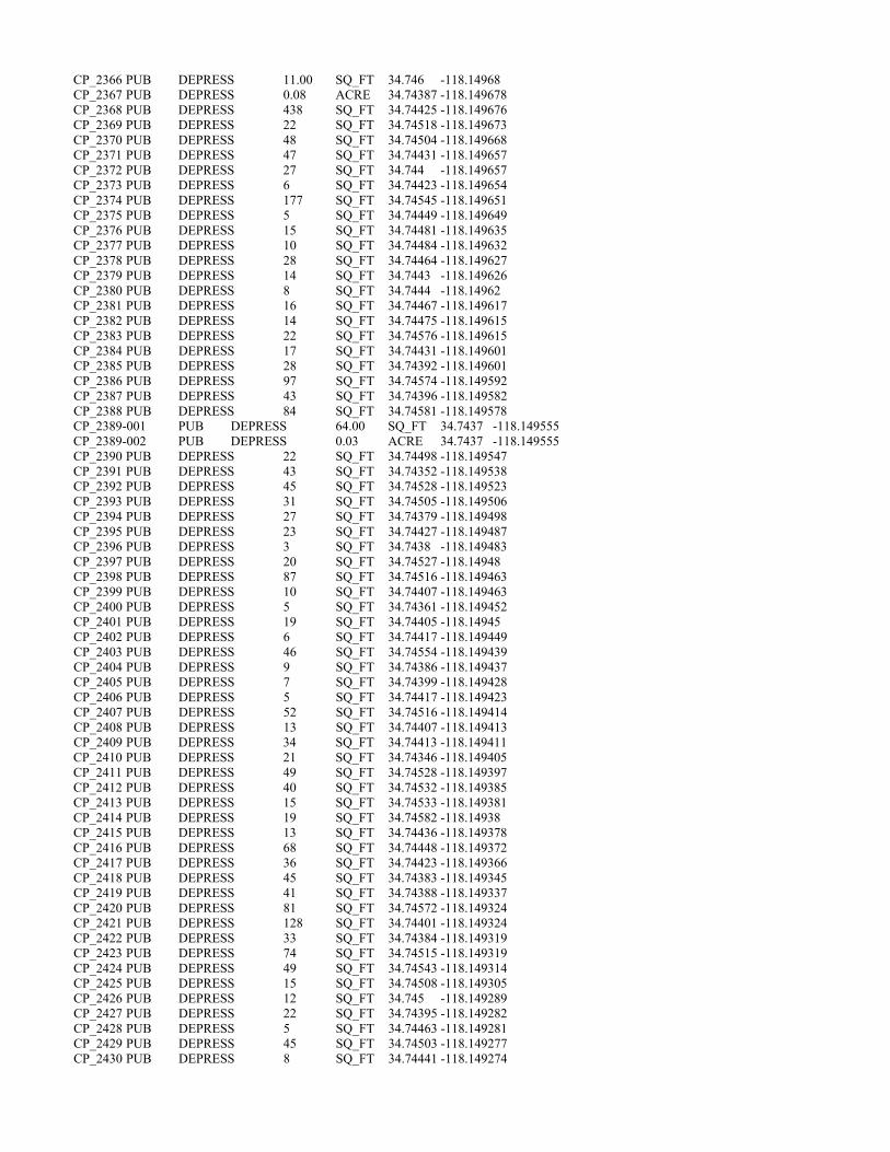
CP_2366 PUB DEPRESS 11.00 SQ_FT 34.746 -118.14968 CP_2367 PUB DEPRESS 0.08 ACRE 34.74387 -118.149678 CP_2368 PUB DEPRESS 438 SQ_FT 34.74425 -118.149676 CP_2369 PUB DEPRESS 22 SQ_FT 34.74518 -118.149673 CP_2370 PUB DEPRESS 48 SQ_FT 34.74504 -118.149668 CP_2371 PUB DEPRESS 47 SQ_FT 34.74431 -118.149657 CP_2372 PUB DEPRESS 27 SQ_FT 34.744 -118.149657 CP_2373 PUB DEPRESS 6 SQ_FT 34.74423 -118.149654 CP_2374 PUB DEPRESS 177 SQ_FT 34.74545 -118.149651 CP_2375 PUB DEPRESS 5 SQ_FT 34.74449 -118.149649 CP_2376 PUB DEPRESS 15 SQ_FT 34.74481 -118.149635 CP_2377 PUB DEPRESS 10 SQ_FT 34.74484 -118.149632 CP_2378 PUB DEPRESS 28 SQ_FT 34.74464 -118.149627 CP_2379 PUB DEPRESS 14 SQ_FT 34.7443 -118.149626 CP_2380 PUB DEPRESS 8 SQ_FT 34.7444 -118.14962 CP_2381 PUB DEPRESS 16 SQ_FT 34.74467 -118.149617 CP_2382 PUB DEPRESS 14 SQ_FT 34.74475 -118.149615 CP_2383 PUB DEPRESS 22 SQ_FT 34.74576 -118.149615 CP_2384 PUB DEPRESS 17 SQ_FT 34.74431 -118.149601 CP_2385 PUB DEPRESS 28 SQ_FT 34.74392 -118.149601 CP_2386 PUB DEPRESS 97 SQ_FT 34.74574 -118.149592 CP_2387 PUB DEPRESS 43 SQ_FT 34.74396 -118.149582 CP_2388 PUB DEPRESS 84 SQ_FT 34.74581 -118.149578 CP_2389-001 PUB DEPRESS 64.00 SQ_FT 34.7437 -118.149555 CP_2389-002 PUB DEPRESS 0.03 ACRE 34.7437 -118.149555 CP_2390 PUB DEPRESS 22 SQ_FT 34.74498 -118.149547 CP_2391 PUB DEPRESS 43 SQ_FT 34.74352 -118.149538 CP_2392 PUB DEPRESS 45 SQ_FT 34.74528 -118.149523 CP_2393 PUB DEPRESS 31 SQ_FT 34.74505 -118.149506 CP_2394 PUB DEPRESS 27 SQ_FT 34.74379 -118.149498 CP_2395 PUB DEPRESS 23 SQ_FT 34.74427 -118.149487 CP_2396 PUB DEPRESS 3 SQ_FT 34.7438 -118.149483 CP_2397 PUB DEPRESS 20 SQ_FT 34.74527 -118.14948 CP_2398 PUB DEPRESS 87 SQ_FT 34.74516 -118.149463 CP_2399 PUB DEPRESS 10 SQ_FT 34.74407 -118.149463 CP_2400 PUB DEPRESS 5 SQ_FT 34.74361 -118.149452 CP_2401 PUB DEPRESS 19 SQ_FT 34.74405 -118.14945 CP_2402 PUB DEPRESS 6 SQ_FT 34.74417 -118.149449 CP_2403 PUB DEPRESS 46 SQ_FT 34.74554 -118.149439 CP_2404 PUB DEPRESS 9 SQ_FT 34.74386 -118.149437 CP_2405 PUB DEPRESS 7 SQ_FT 34.74399 -118.149428 CP_2406 PUB DEPRESS 5 SQ_FT 34.74417 -118.149423 CP_2407 PUB DEPRESS 52 SQ_FT 34.74516 -118.149414 CP_2408 PUB DEPRESS 13 SQ_FT 34.74407 -118.149413 CP_2409 PUB DEPRESS 34 SQ_FT 34.74413 -118.149411 CP_2410 PUB DEPRESS 21 SQ_FT 34.74346 -118.149405 CP_2411 PUB DEPRESS 49 SQ_FT 34.74528 -118.149397 CP_2412 PUB DEPRESS 40 SQ_FT 34.74532 -118.149385 CP_2413 PUB DEPRESS 15 SQ_FT 34.74533 -118.149381 CP_2414 PUB DEPRESS 19 SQ_FT 34.74582 -118.14938 CP_2415 PUB DEPRESS 13 SQ_FT 34.74436 -118.149378 CP_2416 PUB DEPRESS 68 SQ_FT 34.74448 -118.149372 CP_2417 PUB DEPRESS 36 SQ_FT 34.74423 -118.149366 CP_2418 PUB DEPRESS 45 SQ_FT 34.74383 -118.149345 CP_2419 PUB DEPRESS 41 SQ_FT 34.74388 -118.149337 CP_2420 PUB DEPRESS 81 SQ_FT 34.74572 -118.149324 CP_2421 PUB DEPRESS 128 SQ_FT 34.74401 -118.149324 CP_2422 PUB DEPRESS 33 SQ_FT 34.74384 -118.149319 CP_2423 PUB DEPRESS 74 SQ_FT 34.74515 -118.149319 CP_2424 PUB DEPRESS 49 SQ_FT 34.74543 -118.149314 CP_2425 PUB DEPRESS 15 SQ_FT 34.74508 -118.149305 CP_2426 PUB DEPRESS 12 SQ_FT 34.745 -118.149289 CP_2427 PUB DEPRESS 22 SQ_FT 34.74395 -118.149282 CP_2428 PUB DEPRESS 5 SQ_FT 34.74463 -118.149281 CP_2429 PUB DEPRESS 45 SQ_FT 34.74503 -118.149277 CP_2430 PUB DEPRESS 8 SQ_FT 34.74441 -118.149274
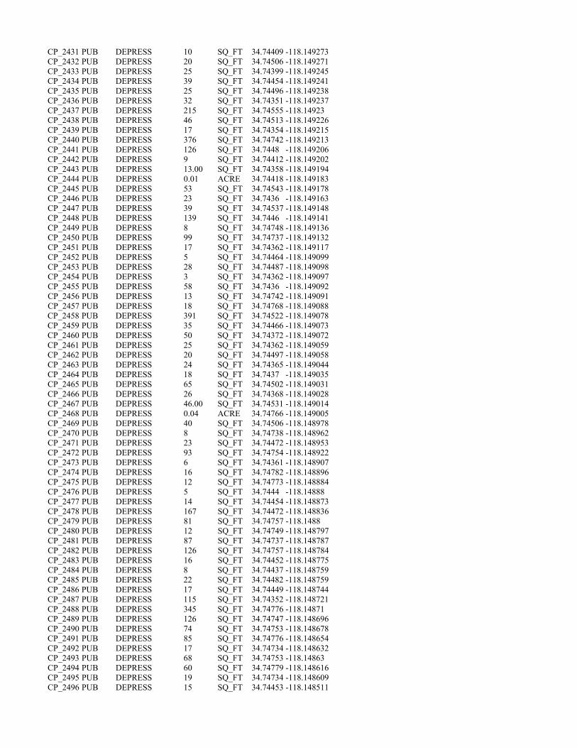
CP_2431 PUB DEPRESS 10 SQ_FT 34.74409 -118.149273 CP_2432 PUB DEPRESS 20 SQ_FT 34.74506 -118.149271 CP_2433 PUB DEPRESS 25 SQ_FT 34.74399 -118.149245 CP_2434 PUB DEPRESS 39 SQ_FT 34.74454 -118.149241 CP_2435 PUB DEPRESS 25 SQ_FT 34.74496 -118.149238 CP_2436 PUB DEPRESS 32 SQ_FT 34.74351 -118.149237 CP_2437 PUB DEPRESS 215 SQ_FT 34.74555 -118.14923 CP_2438 PUB DEPRESS 46 SQ_FT 34.74513 -118.149226 CP_2439 PUB DEPRESS 17 SQ_FT 34.74354 -118.149215 CP_2440 PUB DEPRESS 376 SQ_FT 34.74742 -118.149213 CP_2441 PUB DEPRESS 126 SQ_FT 34.7448 -118.149206 CP_2442 PUB DEPRESS 9 SQ_FT 34.74412 -118.149202 CP_2443 PUB DEPRESS 13.00 SQ_FT 34.74358 -118.149194 CP_2444 PUB DEPRESS 0.01 ACRE 34.74418 -118.149183 CP_2445 PUB DEPRESS 53 SQ_FT 34.74543 -118.149178 CP_2446 PUB DEPRESS 23 SQ_FT 34.7436 -118.149163 CP_2447 PUB DEPRESS 39 SQ_FT 34.74537 -118.149148 CP_2448 PUB DEPRESS 139 SQ_FT 34.7446 -118.149141 CP_2449 PUB DEPRESS 8 SQ_FT 34.74748 -118.149136 CP_2450 PUB DEPRESS 99 SQ_FT 34.74737 -118.149132 CP_2451 PUB DEPRESS 17 SQ_FT 34.74362 -118.149117 CP_2452 PUB DEPRESS 5 SQ_FT 34.74464 -118.149099 CP_2453 PUB DEPRESS 28 SQ_FT 34.74487 -118.149098 CP_2454 PUB DEPRESS 3 SQ_FT 34.74362 -118.149097 CP_2455 PUB DEPRESS 58 SQ_FT 34.7436 -118.149092 CP_2456 PUB DEPRESS 13 SQ_FT 34.74742 -118.149091 CP_2457 PUB DEPRESS 18 SQ_FT 34.74768 -118.149088 CP_2458 PUB DEPRESS 391 SQ_FT 34.74522 -118.149078 CP_2459 PUB DEPRESS 35 SQ_FT 34.74466 -118.149073 CP_2460 PUB DEPRESS 50 SQ_FT 34.74372 -118.149072 CP_2461 PUB DEPRESS 25 SQ_FT 34.74362 -118.149059 CP_2462 PUB DEPRESS 20 SQ_FT 34.74497 -118.149058 CP_2463 PUB DEPRESS 24 SQ_FT 34.74365 -118.149044 CP_2464 PUB DEPRESS 18 SQ_FT 34.7437 -118.149035 CP_2465 PUB DEPRESS 65 SQ_FT 34.74502 -118.149031 CP_2466 PUB DEPRESS 26 SQ_FT 34.74368 -118.149028 CP_2467 PUB DEPRESS 46.00 SQ_FT 34.74531 -118.149014 CP_2468 PUB DEPRESS 0.04 ACRE 34.74766 -118.149005 CP_2469 PUB DEPRESS 40 SQ_FT 34.74506 -118.148978 CP_2470 PUB DEPRESS 8 SQ_FT 34.74738 -118.148962 CP_2471 PUB DEPRESS 23 SQ_FT 34.74472 -118.148953 CP_2472 PUB DEPRESS 93 SQ_FT 34.74754 -118.148922 CP_2473 PUB DEPRESS 6 SQ_FT 34.74361 -118.148907 CP_2474 PUB DEPRESS 16 SQ_FT 34.74782 -118.148896 CP_2475 PUB DEPRESS 12 SQ_FT 34.74773 -118.148884 CP_2476 PUB DEPRESS 5 SQ_FT 34.7444 -118.14888 CP_2477 PUB DEPRESS 14 SQ_FT 34.74454 -118.148873 CP_2478 PUB DEPRESS 167 SQ_FT 34.74472 -118.148836 CP_2479 PUB DEPRESS 81 SQ_FT 34.74757 -118.1488 CP_2480 PUB DEPRESS 12 SQ_FT 34.74749 -118.148797 CP_2481 PUB DEPRESS 87 SQ_FT 34.74737 -118.148787 CP_2482 PUB DEPRESS 126 SQ_FT 34.74757 -118.148784 CP_2483 PUB DEPRESS 16 SQ_FT 34.74452 -118.148775 CP_2484 PUB DEPRESS 8 SQ_FT 34.74437 -118.148759 CP_2485 PUB DEPRESS 22 SQ_FT 34.74482 -118.148759 CP_2486 PUB DEPRESS 17 SQ_FT 34.74449 -118.148744 CP_2487 PUB DEPRESS 115 SQ_FT 34.74352 -118.148721 CP_2488 PUB DEPRESS 345 SQ_FT 34.74776 -118.14871 CP_2489 PUB DEPRESS 126 SQ_FT 34.74747 -118.148696 CP_2490 PUB DEPRESS 74 SQ_FT 34.74753 -118.148678 CP_2491 PUB DEPRESS 85 SQ_FT 34.74776 -118.148654 CP_2492 PUB DEPRESS 17 SQ_FT 34.74734 -118.148632 CP_2493 PUB DEPRESS 68 SQ_FT 34.74753 -118.14863 CP_2494 PUB DEPRESS 60 SQ_FT 34.74779 -118.148616 CP_2495 PUB DEPRESS 19 SQ_FT 34.74734 -118.148609 CP_2496 PUB DEPRESS 15 SQ_FT 34.74453 -118.148511

CP_2497 PUB DEPRESS 12 SQ_FT 34.74351 -118.148493 CP_2498 PUB DEPRESS 10 SQ_FT 34.74449 -118.14849 CP_2499 PUB DEPRESS 32 SQ_FT 34.74367 -118.148485 CP_2500 PUB DEPRESS 49 SQ_FT 34.7437 -118.148472 CP_2501 PUB DEPRESS 8.00 SQ_FT 34.74346 -118.148456 CP_2502 PUB DEPRESS 0.05 ACRE 34.74356 -118.148417 CP_2503 PUB
DEPRESS 56 SQ_FT 34.74378 -118.148336
CP_2504 PUB DEPRESS 20 SQ_FT 34.74377 -118.148304 CP_2505 PUB DEPRESS 62 SQ_FT 34.74374 -118.148288 CP_2506 PUB DEPRESS 8.00 SQ_FT 34.74415 -118.148288 CP_2507 PUB DEPRESS 0.04 ACRE 34.744 -118.148274 CP_2508 PUB DEPRESS 0.05 ACRE 34.74359 -118.148192 CP_2509 PUB DEPRESS 23 SQ_FT 34.74306 -118.151264 CP_2510 PUB DEPRESS 15 SQ_FT 34.74313 -118.151175 CP_2511 PUB DEPRESS 14 SQ_FT 34.74315 -118.151141 CP_2512 PUB DEPRESS 26 SQ_FT 34.74322 -118.151088 CP_2513 PUB DEPRESS 7 SQ_FT 34.74319 -118.151007 CP_2514 PUB DEPRESS 8 SQ_FT 34.7432 -118.150996 CP_2515 PUB DEPRESS 8 SQ_FT 34.74218 -118.150905 CP_2516 PUB DEPRESS 26 SQ_FT 34.74334 -118.150889 CP_2517 PUB DEPRESS 16 SQ_FT 34.74233 -118.150865 CP_2518 PUB DEPRESS 14 SQ_FT 34.74233 -118.15082 CP_2519 PUB DEPRESS 14 SQ_FT 34.74231 -118.150794 CP_2520 PUB DEPRESS 17 SQ_FT 34.74335 -118.150789 CP_2521 PUB DEPRESS 5 SQ_FT 34.74287 -118.15077 CP_2522 PUB DEPRESS 14 SQ_FT 34.7423 -118.150749 CP_2523 PUB DEPRESS 6 SQ_FT 34.7433 -118.150749 CP_2524 PUB DEPRESS 10 SQ_FT 34.74226 -118.150748 CP_2525 PUB DEPRESS 37 SQ_FT 34.74291 -118.150717 CP_2526 PUB DEPRESS 5 SQ_FT 34.74177 -118.150716 CP_2527 PUB DEPRESS 12 SQ_FT 34.74283 -118.150714 CP_2528 PUB DEPRESS 8 SQ_FT 34.74279 -118.150707 CP_2529 PUB DEPRESS 76 SQ_FT 34.74286 -118.150703 CP_2530 PUB DEPRESS 15.00 SQ_FT 34.74177 -118.150694 CP_2531 PUB DEPRESS 0.01 ACRE 34.74332 -118.150671 CP_2532 PUB DEPRESS 80 SQ_FT 34.74274 -118.150665 CP_2533 PUB DEPRESS 23 SQ_FT 34.74181 -118.150656 CP_2534 PUB DEPRESS 4 SQ_FT 34.74332 -118.150633 CP_2535 PUB DEPRESS 25 SQ_FT 34.74297 -118.15062 CP_2536 PUB DEPRESS 61 SQ_FT 34.74303 -118.150597 CP_2537 PUB DEPRESS 45 SQ_FT 34.74189 -118.150586 CP_2538 PUB DEPRESS 46 SQ_FT 34.7415 -118.150563 CP_2539 PUB DEPRESS 29 SQ_FT 34.74156 -118.150562 CP_2540 PUB DEPRESS 41 SQ_FT 34.74285 -118.150531 CP_2541 PUB DEPRESS 38 SQ_FT 34.74184 -118.150526 CP_2542 PUB DEPRESS 10 SQ_FT 34.74143 -118.150524 CP_2543 PUB DEPRESS 13 SQ_FT 34.74321 -118.150501 CP_2544 PUB DEPRESS 26 SQ_FT 34.74298 -118.150496 CP_2545 PUB DEPRESS 25 SQ_FT 34.74281 -118.150487 CP_2546 PUB DEPRESS 9 SQ_FT 34.74199 -118.150482 CP_2547 PUB DEPRESS 36 SQ_FT 34.74183 -118.150472 CP_2548 PUB DEPRESS 37 SQ_FT 34.74294 -118.150461 CP_2549 PUB DEPRESS 15 SQ_FT 34.74169 -118.150451 CP_2550 PUB DEPRESS 111 SQ_FT 34.74267 -118.150422 CP_2551 PUB DEPRESS 71 SQ_FT 34.74275 -118.15042 CP_2552 PUB DEPRESS 258 SQ_FT 34.7417 -118.150419 CP_2553 PUB DEPRESS 63 SQ_FT 34.74316 -118.15041 CP_2554 PUB DEPRESS 7 SQ_FT 34.74242 -118.15039 CP_2555 PUB DEPRESS 26 SQ_FT 34.74173 -118.150368 CP_2556 PUB DEPRESS 230 SQ_FT 34.74321 -118.150365 CP_2557 PUB DEPRESS 49 SQ_FT 34.74294 -118.150345 CP_2558 PUB DEPRESS 22 SQ_FT 34.74337 -118.150343 CP_2559 PUB DEPRESS 110 SQ_FT 34.74327 -118.150322 CP_2560 PUB DEPRESS 310.0 SQ_FT 34.74301 -118.150294 CP_2561 PUB DEPRESS 0.1 SQ_FT 34.74175 -118.15029 CP_2562 PUB DEPRESS 145 SQ_FT 34.74173 -118.150288

CP_2563 PUB DEPRESS 33 SQ_FT 34.74238 -118.150273 CP_2564 PUB DEPRESS 33 SQ_FT 34.74272 -118.150266 CP_2565 PUB DEPRESS 115 SQ_FT 34.74245 -118.15026 CP_2566 PUB DEPRESS 32 SQ_FT 34.74271 -118.150238 CP_2567 PUB DEPRESS 18.00 SQ_FT 34.74288 -118.150236 CP_2568 PUB DEPRESS 0.03 ACRE 34.74184 -118.150228 CP_2569 PUB DEPRESS 9 SQ_FT 34.74329 -118.150209 CP_2570 PUB DEPRESS 29 SQ_FT 34.74283 -118.150197 CP_2571 PUB DEPRESS 14 SQ_FT 34.74307 -118.150187 CP_2572 PUB DEPRESS 63 SQ_FT 34.74286 -118.150181 CP_2573 PUB DEPRESS 29 SQ_FT 34.74202 -118.150164 CP_2574 PUB DEPRESS 14 SQ_FT 34.74138 -118.150161 CP_2575 PUB DEPRESS 15 SQ_FT 34.74308 -118.150157 CP_2576 PUB DEPRESS 26 SQ_FT 34.74286 -118.150157 CP_2577 PUB DEPRESS 131 SQ_FT 34.74198 -118.150125 CP_2578 PUB DEPRESS 57 SQ_FT 34.74247 -118.15008 CP_2579 PUB DEPRESS 112 SQ_FT 34.74331 -118.150076 CP_2580 PUB DEPRESS 74 SQ_FT 34.74139 -118.150071 CP_2581 PUB DEPRESS 18 SQ_FT 34.74262 -118.150062 CP_2582 PUB DEPRESS 9 SQ_FT 34.74099 -118.150057 CP_2583 PUB DEPRESS 14 SQ_FT 34.74264 -118.150053 CP_2584 PUB DEPRESS 51 SQ_FT 34.74136 -118.150045 CP_2585 PUB DEPRESS 347 SQ_FT 34.74189 -118.150044 CP_2586 PUB DEPRESS 46 SQ_FT 34.74337 -118.150026 CP_2587 PUB DEPRESS 5 SQ_FT 34.74255 -118.150016 CP_2588 PUB DEPRESS 45 SQ_FT 34.74221 -118.149994 CP_2589 PUB DEPRESS 10 SQ_FT 34.74339 -118.149988 CP_2590 PUB DEPRESS 113 SQ_FT 34.74105 -118.149954 CP_2591 PUB DEPRESS 272 SQ_FT 34.74217 -118.149936 CP_2592-001 PUB DEPRESS 19.00 SQ_FT 34.74049 -118.149921 CP_2592-002 PUB DEPRESS 0.06 ACRE 34.74049 -118.149921 CP_2593 PUB DEPRESS 15 SQ_FT 34.74246 -118.149915 CP_2594 PUB DEPRESS 15 SQ_FT 34.74334 -118.149909 CP_2595 PUB DEPRESS 26 SQ_FT 34.74097 -118.149895 CP_2596 PUB DEPRESS 10 SQ_FT 34.74257 -118.149868 CP_2597 PUB DEPRESS 83 SQ_FT 34.74253 -118.14986 CP_2598 PUB DEPRESS 49 SQ_FT 34.74216 -118.149856 CP_2599 PUB DEPRESS 17 SQ_FT 34.74218 -118.149853 CP_2600 PUB DEPRESS 6 SQ_FT 34.74249 -118.149849 CP_2601 PUB DEPRESS 6 SQ_FT 34.74247 -118.149849 CP_2602 PUB DEPRESS 6 SQ_FT 34.74214 -118.149848 CP_2603 PUB DEPRESS 19 SQ_FT 34.7425 -118.149844 CP_2604 PUB DEPRESS 81 SQ_FT 34.74209 -118.149827 CP_2605 PUB DEPRESS 7 SQ_FT 34.7425 -118.149801 CP_2606 PUB DEPRESS 6 SQ_FT 34.7406 -118.14979 CP_2607 PUB DEPRESS 30 SQ_FT 34.7406 -118.149765 CP_2608 PUB DEPRESS 139 SQ_FT 34.74049 -118.149757 CP_2609 PUB DEPRESS 15 SQ_FT 34.74259 -118.149757 CP_2610 PUB DEPRESS 51 SQ_FT 34.74272 -118.149756 CP_2611 PUB DEPRESS 56 SQ_FT 34.74187 -118.149743 CP_2612 PUB DEPRESS 7 SQ_FT 34.7424 -118.14972 CP_2613 PUB DEPRESS 13 SQ_FT 34.7418 -118.149717 CP_2614 PUB DEPRESS 10 SQ_FT 34.74268 -118.149708 CP_2615 PUB DEPRESS 5 SQ_FT 34.74239 -118.149702 CP_2616 PUB DEPRESS 6 SQ_FT 34.74244 -118.149697 CP_2617 PUB DEPRESS 11 SQ_FT 34.74251 -118.149694 CP_2618 PUB DEPRESS 35 SQ_FT 34.7406 -118.149686 CP_2619 PUB DEPRESS 16 SQ_FT 34.74146 -118.149685 CP_2620 PUB DEPRESS 166 SQ_FT 34.74172 -118.149679 CP_2621 PUB DEPRESS 11 SQ_FT 34.74327 -118.149673 CP_2622 PUB DEPRESS 13 SQ_FT 34.74247 -118.149671 CP_2623 PUB DEPRESS 31 SQ_FT 34.74177 -118.149664 CP_2624 PUB DEPRESS 29 SQ_FT 34.74327 -118.149637 CP_2625 PUB DEPRESS 59 SQ_FT 34.74209 -118.149619 CP_2626 PUB DEPRESS 211 SQ_FT 34.74325 -118.149609 CP_2627 PUB DEPRESS 6 SQ_FT 34.7406 -118.14959
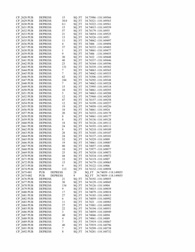
CP_2628 PUB DEPRESS 15 SQ_FT 34.73986 -118.149566 CP_2629 PUB DEPRESS 38.0 SQ_FT 34.74321 -118.149563 CP_2630 PUB DEPRESS 0.1 SQ_FT 34.74322 -118.149561 CP_2631 PUB DEPRESS 15 SQ_FT 34.74015 -118.149559 CP_2632 PUB DEPRESS 57 SQ_FT 34.74179 -118.14955 CP_2633 PUB DEPRESS 21 SQ_FT 34.74054 -118.149525 CP_2634 PUB DEPRESS 13 SQ_FT 34.74326 -118.14951 CP_2635 PUB DEPRESS 11 SQ_FT 34.74062 -118.149497 CP_2636 PUB DEPRESS 4 SQ_FT 34.7406 -118.149494 CP_2637 PUB DEPRESS 37 SQ_FT 34.74333 -118.149483 CP_2638 PUB DEPRESS 1 SQ_FT 34.74061 -118.149477 CP_2639 PUB DEPRESS 9 SQ_FT 34.7406 -118.149455 CP_2640 PUB DEPRESS 30 SQ_FT 34.7432 -118.149448 CP_2641 PUB DEPRESS 40 SQ_FT 34.74337 -118.149446 CP_2642 PUB DEPRESS 23 SQ_FT 34.74344 -118.149396 CP_2643 PUB DEPRESS 131 SQ_FT 34.74339 -118.149382 CP_2644 PUB DEPRESS 7 SQ_FT 34.74063 -118.149365 CP_2645 PUB DEPRESS 7 SQ_FT 34.74042 -118.149353 CP_2646 PUB DEPRESS 62 SQ_FT 34.74306 -118.149351 CP_2647 PUB DEPRESS 244 SQ_FT 34.74292 -118.149348 CP_2648 PUB DEPRESS 7 SQ_FT 34.74062 -118.149328 CP_2649 PUB DEPRESS 15 SQ_FT 34.73995 -118.149318 CP_2650 PUB DEPRESS 10 SQ_FT 34.74061 -118.149293 CP_2651 PUB DEPRESS 5 SQ_FT 34.74063 -118.149288 CP_2652 PUB DEPRESS 12 SQ_FT 34.73968 -118.149285 CP_2653 PUB DEPRESS 47 SQ_FT 34.74157 -118.149258 CP_2654 PUB DEPRESS 12 SQ_FT 34.74199 -118.149257 CP_2655 PUB DEPRESS 19 SQ_FT 34.74058 -118.149256 CP_2656 PUB DEPRESS 10 SQ_FT 34.74061 -118.14924 CP_2657 PUB DEPRESS 20 SQ_FT 34.74333 -118.149179 CP_2658 PUB DEPRESS 8 SQ_FT 34.74061 -118.149177 CP_2659 PUB DEPRESS 8 SQ_FT 34.74136 -118.149128 CP_2660 PUB DEPRESS 18 SQ_FT 34.74126 -118.149112 CP_2661 PUB DEPRESS 24 SQ_FT 34.74193 -118.149111 CP_2662 PUB DEPRESS 8 SQ_FT 34.74218 -118.149109 CP_2663 PUB DEPRESS 28 SQ_FT 34.74105 -118.149107 CP_2664 PUB DEPRESS 24 SQ_FT 34.74137 -118.149101 CP_2665 PUB DEPRESS 52 SQ_FT 34.74329 -118.14909 CP_2666 PUB DEPRESS 19 SQ_FT 34.74061 -118.149087 CP_2667 PUB DEPRESS 80 SQ_FT 34.74057 -118.14908 CP_2668 PUB DEPRESS 10 SQ_FT 34.73977 -118.149077 CP_2669 PUB DEPRESS 25 SQ_FT 34.74338 -118.149073 CP_2670 PUB DEPRESS 44 SQ_FT 34.74334 -118.149072 CP_2671 PUB DEPRESS 33 SQ_FT 34.74119 -118.14907 CP_2672 PUB DEPRESS 15 SQ_FT 34.74179 -118.149065 CP_2673 PUB DEPRESS 9 SQ_FT 34.74122 -118.14906 CP_2674 PUB DEPRESS 113 SQ_FT 34.74132 -118.149058 CP_2675-001 PUB DEPRESS 28 SQ_FT 34.74059 -118.149055 CP_2675-002 PUB DEPRESS 9 SQ_FT 34.74059 -118.149055 CP_2676 PUB DEPRESS 21 SQ_FT 34.74192 -118.149055 CP_2677 PUB DEPRESS 30 SQ_FT 34.74129 -118.149045 CP_2678 PUB DEPRESS 134 SQ_FT 34.74126 -118.14904 CP_2679 PUB DEPRESS 9 SQ_FT 34.74015 -118.149039 CP_2680 PUB DEPRESS 17 SQ_FT 34.74079 -118.149018 CP_2681 PUB DEPRESS 27 SQ_FT 34.74185 -118.149013 CP_2682 PUB DEPRESS 6 SQ_FT 34.74059 -118.148992 CP_2683 PUB DEPRESS 11 SQ_FT 34.7421 -118.148983 CP_2684 PUB DEPRESS 27 SQ_FT 34.73881 -118.148982 CP_2685 PUB DEPRESS 22 SQ_FT 34.74194 -118.148951 CP_2686 PUB DEPRESS 3 SQ_FT 34.74059 -118.148949 CP_2687 PUB DEPRESS 40 SQ_FT 34.74046 -118.14894 CP_2688 PUB DEPRESS 4 SQ_FT 34.74061 -118.14889 CP_2689 PUB DEPRESS 7 SQ_FT 34.73919 -118.148867 CP_2690 PUB DEPRESS 40 SQ_FT 34.73919 -118.148796 CP_2691 PUB DEPRESS 7 SQ_FT 34.74299 -118.148738 CP_2692 PUB DEPRESS 8 SQ_FT 34.74281 -118.148732
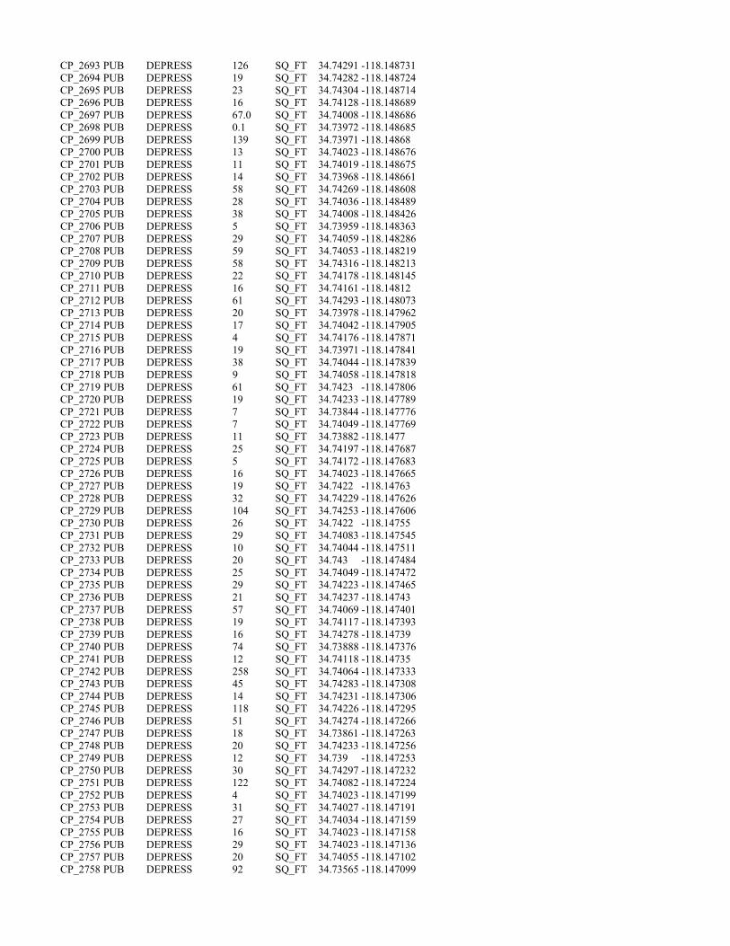
CP_2693 PUB DEPRESS 126 SQ_FT 34.74291 -118.148731 CP_2694 PUB DEPRESS 19 SQ_FT 34.74282 -118.148724 CP_2695 PUB DEPRESS 23 SQ_FT 34.74304 -118.148714 CP_2696 PUB DEPRESS 16 SQ_FT 34.74128 -118.148689 CP_2697 PUB DEPRESS 67.0 SQ_FT 34.74008 -118.148686 CP_2698 PUB DEPRESS 0.1 SQ_FT 34.73972 -118.148685 CP_2699 PUB DEPRESS 139 SQ_FT 34.73971 -118.14868 CP_2700 PUB DEPRESS 13 SQ_FT 34.74023 -118.148676 CP_2701 PUB DEPRESS 11 SQ_FT 34.74019 -118.148675 CP_2702 PUB DEPRESS 14 SQ_FT 34.73968 -118.148661 CP_2703 PUB DEPRESS 58 SQ_FT 34.74269 -118.148608 CP_2704 PUB DEPRESS 28 SQ_FT 34.74036 -118.148489 CP_2705 PUB DEPRESS 38 SQ_FT 34.74008 -118.148426 CP_2706 PUB DEPRESS 5 SQ_FT 34.73959 -118.148363 CP_2707 PUB DEPRESS 29 SQ_FT 34.74059 -118.148286 CP_2708 PUB DEPRESS 59 SQ_FT 34.74053 -118.148219 CP_2709 PUB DEPRESS 58 SQ_FT 34.74316 -118.148213 CP_2710 PUB DEPRESS 22 SQ_FT 34.74178 -118.148145 CP_2711 PUB DEPRESS 16 SQ_FT 34.74161 -118.14812 CP_2712 PUB DEPRESS 61 SQ_FT 34.74293 -118.148073 CP_2713 PUB DEPRESS 20 SQ_FT 34.73978 -118.147962 CP_2714 PUB DEPRESS 17 SQ_FT 34.74042 -118.147905 CP_2715 PUB DEPRESS 4 SQ_FT 34.74176 -118.147871 CP_2716 PUB DEPRESS 19 SQ_FT 34.73971 -118.147841 CP_2717 PUB DEPRESS 38 SQ_FT 34.74044 -118.147839 CP_2718 PUB DEPRESS 9 SQ_FT 34.74058 -118.147818 CP_2719 PUB DEPRESS 61 SQ_FT 34.7423 -118.147806 CP_2720 PUB DEPRESS 19 SQ_FT 34.74233 -118.147789 CP_2721 PUB DEPRESS 7 SQ_FT 34.73844 -118.147776 CP_2722 PUB DEPRESS 7 SQ_FT 34.74049 -118.147769 CP_2723 PUB DEPRESS 11 SQ_FT 34.73882 -118.1477 CP_2724 PUB DEPRESS 25 SQ_FT 34.74197 -118.147687 CP_2725 PUB DEPRESS 5 SQ_FT 34.74172 -118.147683 CP_2726 PUB DEPRESS 16 SQ_FT 34.74023 -118.147665 CP_2727 PUB DEPRESS 19 SQ_FT 34.7422 -118.14763 CP_2728 PUB DEPRESS 32 SQ_FT 34.74229 -118.147626 CP_2729 PUB DEPRESS 104 SQ_FT 34.74253 -118.147606 CP_2730 PUB DEPRESS 26 SQ_FT 34.7422 -118.14755 CP_2731 PUB DEPRESS 29 SQ_FT 34.74083 -118.147545 CP_2732 PUB DEPRESS 10 SQ_FT 34.74044 -118.147511 CP_2733 PUB DEPRESS 20 SQ_FT 34.743 -118.147484 CP_2734 PUB DEPRESS 25 SQ_FT 34.74049 -118.147472 CP_2735 PUB DEPRESS 29 SQ_FT 34.74223 -118.147465 CP_2736 PUB DEPRESS 21 SQ_FT 34.74237 -118.14743 CP_2737 PUB DEPRESS 57 SQ_FT 34.74069 -118.147401 CP_2738 PUB DEPRESS 19 SQ_FT 34.74117 -118.147393 CP_2739 PUB DEPRESS 16 SQ_FT 34.74278 -118.14739 CP_2740 PUB DEPRESS 74 SQ_FT 34.73888 -118.147376 CP_2741 PUB DEPRESS 12 SQ_FT 34.74118 -118.14735 CP_2742 PUB DEPRESS 258 SQ_FT 34.74064 -118.147333 CP_2743 PUB DEPRESS 45 SQ_FT 34.74283 -118.147308 CP_2744 PUB DEPRESS 14 SQ_FT 34.74231 -118.147306 CP_2745 PUB DEPRESS 118 SQ_FT 34.74226 -118.147295 CP_2746 PUB DEPRESS 51 SQ_FT 34.74274 -118.147266 CP_2747 PUB DEPRESS 18 SQ_FT 34.73861 -118.147263 CP_2748 PUB DEPRESS 20 SQ_FT 34.74233 -118.147256 CP_2749 PUB DEPRESS 12 SQ_FT 34.739 -118.147253 CP_2750 PUB DEPRESS 30 SQ_FT 34.74297 -118.147232 CP_2751 PUB DEPRESS 122 SQ_FT 34.74082 -118.147224 CP_2752 PUB DEPRESS 4 SQ_FT 34.74023 -118.147199 CP_2753 PUB DEPRESS 31 SQ_FT 34.74027 -118.147191 CP_2754 PUB DEPRESS 27 SQ_FT 34.74034 -118.147159 CP_2755 PUB DEPRESS 16 SQ_FT 34.74023 -118.147158 CP_2756 PUB DEPRESS 29 SQ_FT 34.74023 -118.147136 CP_2757 PUB DEPRESS 20 SQ_FT 34.74055 -118.147102 CP_2758 PUB DEPRESS 92 SQ_FT 34.73565 -118.147099

CP_2759 PUB DEPRESS 18 SQ_FT 34.74045 -118.147094 CP_2760 PUB DEPRESS 20 SQ_FT 34.74018 -118.147086 CP_2761 PUB DEPRESS 12 SQ_FT 34.74004 -118.146973 CP_2762 PUB DEPRESS 21 SQ_FT 34.74218 -118.146803 CP_2763 PUB DEPRESS 20 SQ_FT 34.73944 -118.146784 CP_2764 PUB DEPRESS 33 SQ_FT 34.73941 -118.146737 CP_2765 PUB DEPRESS 26 SQ_FT 34.74177 -118.146666 CP_2766 PUB DEPRESS 127 SQ_FT 34.73858 -118.146549 CP_2767 PUB DEPRESS 40 SQ_FT 34.73854 -118.146509 CP_2768 PUB DEPRESS 7 SQ_FT 34.74104 -118.146355 CP_2769 PUB DEPRESS 65 SQ_FT 34.73749 -118.146257 CP_2770 PUB DEPRESS 12 SQ_FT 34.73561 -118.146242 CP_2771 PUB DEPRESS 10 SQ_FT 34.73591 -118.146102 CP_2772 PUB DEPRESS 8 SQ_FT 34.73804 -118.146076 CP_2773 PUB DEPRESS 239 SQ_FT 34.73595 -118.146001 CP_2774 PUB DEPRESS 10 SQ_FT 34.73739 -118.145982 PD_2775 PUB DEPRESS 43 SQ_FT 34.73551 -118.145942 PD_2776 PUB DEPRESS 28 SQ_FT 34.73558 -118.145936 CP_2777 PUB DEPRESS 12 SQ_FT 34.73594 -118.145877 CP_2778 PUB DEPRESS 12 SQ_FT 34.7399 -118.145859 CP_2779 PUB DEPRESS 12.00 SQ_FT 34.73993 -118.14584 PD_2780 PUB DEPRESS 0.04 ACRE 34.73579 -118.145804 CP_2781 PUB DEPRESS 16 SQ_FT 34.74002 -118.145792 PD_2782 PUB DEPRESS 36 SQ_FT 34.73589 -118.145705 CP_2783 PUB DEPRESS 9 SQ_FT 34.73715 -118.145687 CP_2784 PUB DEPRESS 48 SQ_FT 34.73918 -118.145669 PD_2785 PUB DEPRESS 3 SQ_FT 34.73585 -118.14562 PD_2786 PUB DEPRESS 63 SQ_FT 34.73587 -118.14553 CP_2787 PUB DEPRESS 99 SQ_FT 34.7387 -118.145518 CP_2788 PUB DEPRESS 30 SQ_FT 34.73597 -118.145502 CP_2789 PUB DEPRESS 30 SQ_FT 34.73598 -118.145491 CP_2790 PUB DEPRESS 19 SQ_FT 34.73714 -118.145392 CP_2791 PUB DEPRESS 10 SQ_FT 34.73709 -118.145359 CP_2792 PUB DEPRESS 11 SQ_FT 34.73711 -118.145343 PD_2793 PUB DEPRESS 166 SQ_FT 34.73579 -118.145319 PD_2794 PUB DEPRESS 36 SQ_FT 34.73575 -118.145312 PD_2795 PUB DEPRESS 17 SQ_FT 34.73575 -118.145278 CP_2796 PUB DEPRESS 31 SQ_FT 34.73702 -118.145273 CP_2797 PUB DEPRESS 10 SQ_FT 34.73782 -118.145199 PD_2798 PUB DEPRESS 308 SQ_FT 34.7359 -118.145189 CP_2799 PUB DEPRESS 6 SQ_FT 34.73692 -118.145155 PD_2800 PUB DEPRESS 19 SQ_FT 34.73589 -118.145127 CP_2801 PUB DEPRESS 11 SQ_FT 34.7369 -118.145116 PD_2802 PUB DEPRESS 110 SQ_FT 34.73589 -118.145003 PD_2803-001 PUB DEPRESS 3 SQ_FT 34.73555 -118.144903 PD_2803-002 PUB DEPRESS 38 SQ_FT 34.73555 -118.144903 PD_2804-001 PUB DEPRESS 87 SQ_FT 34.7355 -118.14487 PD_2804-002 PUB DEPRESS 8 SQ_FT 34.7355 -118.14487 CP_2805 PUB DEPRESS 208 SQ_FT 34.73792 -118.144856 PD_2806 PUB DEPRESS 173.00 SQ_FT 34.73583 -118.144781 PD_2807 PUB DEPRESS 0.04 ACRE 34.73565 -118.143783 PD_2808 PUB DEPRESS 50 SQ_FT 34.7355 -118.143381 CP_2809 PUB DEPRESS 361 SQ_FT 34.736 -118.1433 CP_2810 PUB DEPRESS 14 SQ_FT 34.73796 -118.142322 CP_2811 PUB DEPRESS 149.00 SQ_FT 34.7376 -118.142253 CP_2812 PUB DEPRESS 0.02 ACRE 34.73675 -118.142224 CP_2813 PUB DEPRESS 42 SQ_FT 34.73559 -118.142202 CP_2814 PUB DEPRESS 51 SQ_FT 34.7365 -118.142184 CP_2815 PUB DEPRESS 28 SQ_FT 34.73696 -118.141896 CP_2816 PUB DEPRESS 59 SQ_FT 34.73705 -118.141765 CP_2817 PUB DEPRESS 115 SQ_FT 34.73713 -118.141685 CP_2818 PUB DEPRESS 139 SQ_FT 34.73707 -118.141651 CP_2819 PUB DEPRESS 14 SQ_FT 34.73637 -118.141525 CP_2820 PUB DEPRESS 120.00 SQ_FT 34.73556 -118.140042 CP_2821 PUB DEPRESS 0.10 ACRE 34.73601 -118.139805 CP_2822 PUB DEPRESS 0.24 ACRE 34.73609 -118.139297
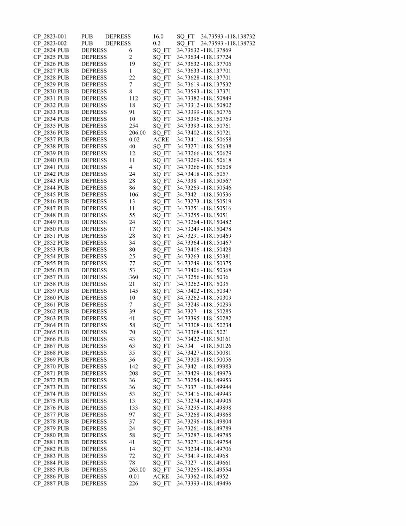
CP_2823-001 PUB DEPRESS 16.0 SQ_FT 34.73593 -118.138732 CP_2823-002 PUB DEPRESS 0.2 SQ_FT 34.73593 -118.138732 CP_2824 PUB DEPRESS 6 SQ_FT 34.73632 -118.137869 CP_2825 PUB DEPRESS 2 SQ_FT 34.73634 -118.137724 CP_2826 PUB DEPRESS 19 SQ_FT 34.73632 -118.137706 CP_2827 PUB DEPRESS 1 SQ_FT 34.73633 -118.137701 CP_2828 PUB DEPRESS 22 SQ_FT 34.73628 -118.137701 CP_2829 PUB DEPRESS 7 SQ_FT 34.73619 -118.137532 CP_2830 PUB DEPRESS 8 SQ_FT 34.73593 -118.137371 CP_2831 PUB DEPRESS 112 SQ_FT 34.73382 -118.150849 CP_2832 PUB DEPRESS 18 SQ_FT 34.73312 -118.150802 CP_2833 PUB DEPRESS 91 SQ_FT 34.73399 -118.150776 CP_2834 PUB DEPRESS 10 SQ_FT 34.73396 -118.150769 CP_2835 PUB DEPRESS 254 SQ_FT 34.73393 -118.150761 CP_2836 PUB DEPRESS 206.00 SQ_FT 34.73402 -118.150721 CP_2837 PUB DEPRESS 0.02 ACRE 34.73411 -118.150658 CP_2838 PUB DEPRESS 40 SQ_FT 34.73271 -118.150638 CP_2839 PUB DEPRESS 12 SQ_FT 34.73266 -118.150629 CP_2840 PUB DEPRESS 11 SQ_FT 34.73269 -118.150618 CP_2841 PUB DEPRESS 4 SQ_FT 34.73266 -118.150608 CP_2842 PUB DEPRESS 24 SQ_FT 34.73418 -118.15057 CP_2843 PUB DEPRESS 28 SQ_FT 34.7338 -118.150567 CP_2844 PUB DEPRESS 86 SQ_FT 34.73269 -118.150546 CP_2845 PUB DEPRESS 106 SQ_FT 34.7342 -118.150536 CP_2846 PUB DEPRESS 13 SQ_FT 34.73273 -118.150519 CP_2847 PUB DEPRESS 11 SQ_FT 34.73251 -118.150516 CP_2848 PUB DEPRESS 55 SQ_FT 34.73255 -118.15051 CP_2849 PUB DEPRESS 24 SQ_FT 34.73264 -118.150482 CP_2850 PUB DEPRESS 17 SQ_FT 34.73249 -118.150478 CP_2851 PUB DEPRESS 28 SQ_FT 34.73291 -118.150469 CP_2852 PUB DEPRESS 34 SQ_FT 34.73364 -118.150467 CP_2853 PUB DEPRESS 80 SQ_FT 34.73406 -118.150428 CP_2854 PUB DEPRESS 25 SQ_FT 34.73263 -118.150381 CP_2855 PUB DEPRESS 77 SQ_FT 34.73249 -118.150375 CP_2856 PUB DEPRESS 53 SQ_FT 34.73406 -118.150368 CP_2857 PUB DEPRESS 360 SQ_FT 34.73256 -118.15036 CP_2858 PUB DEPRESS 21 SQ_FT 34.73262 -118.15035 CP_2859 PUB DEPRESS 145 SQ_FT 34.73402 -118.150347 CP_2860 PUB DEPRESS 10 SQ_FT 34.73262 -118.150309 CP_2861 PUB DEPRESS 7 SQ_FT 34.73249 -118.150299 CP_2862 PUB DEPRESS 39 SQ_FT 34.7327 -118.150285 CP_2863 PUB DEPRESS 41 SQ_FT 34.73395 -118.150282 CP_2864 PUB DEPRESS 58 SQ_FT 34.73308 -118.150234 CP_2865 PUB DEPRESS 70 SQ_FT 34.73368 -118.15021 CP_2866 PUB DEPRESS 43 SQ_FT 34.73422 -118.150161 CP_2867 PUB DEPRESS 63 SQ_FT 34.734 -118.150126 CP_2868 PUB DEPRESS 35 SQ_FT 34.73427 -118.150081 CP_2869 PUB DEPRESS 36 SQ_FT 34.73308 -118.150056 CP_2870 PUB DEPRESS 142 SQ_FT 34.7342 -118.149983 CP_2871 PUB DEPRESS 208 SQ_FT 34.73429 -118.149973 CP_2872 PUB DEPRESS 36 SQ_FT 34.73254 -118.149953 CP_2873 PUB DEPRESS 36 SQ_FT 34.7337 -118.149944 CP_2874 PUB DEPRESS 53 SQ_FT 34.73416 -118.149943 CP_2875 PUB DEPRESS 13 SQ_FT 34.73274 -118.149905 CP_2876 PUB DEPRESS 133 SQ_FT 34.73295 -118.149898 CP_2877 PUB DEPRESS 97 SQ_FT 34.73268 -118.149868 CP_2878 PUB DEPRESS 37 SQ_FT 34.73296 -118.149804 CP_2879 PUB DEPRESS 24 SQ_FT 34.73261 -118.149789 CP_2880 PUB DEPRESS 58 SQ_FT 34.73287 -118.149785 CP_2881 PUB DEPRESS 41 SQ_FT 34.73271 -118.149754 CP_2882 PUB DEPRESS 14 SQ_FT 34.73234 -118.149706 CP_2883 PUB DEPRESS 72 SQ_FT 34.73419 -118.14968 CP_2884 PUB DEPRESS 78 SQ_FT 34.7327 -118.149661 CP_2885 PUB DEPRESS 263.00 SQ_FT 34.73265 -118.149554 CP_2886 PUB DEPRESS 0.01 ACRE 34.73362 -118.14952 CP_2887 PUB DEPRESS 226 SQ_FT 34.73393 -118.149496

CP_2888 PUB DEPRESS 24 SQ_FT 34.73372 -118.149488 CP_2889 PUB DEPRESS 38 SQ_FT 34.73374 -118.149449 CP_2890 PUB DEPRESS 28 SQ_FT 34.73358 -118.149431 CP_2891 PUB DEPRESS 6 SQ_FT 34.73405 -118.14939 CP_2892 PUB DEPRESS 32 SQ_FT 34.734 -118.149387 CP_2893 PUB DEPRESS 43 SQ_FT 34.73421 -118.149366 CP_2894 PUB DEPRESS 48 SQ_FT 34.73268 -118.149267 CP_2895 PUB DEPRESS 29 SQ_FT 34.73353 -118.149241 CP_2896 PUB DEPRESS 106 SQ_FT 34.73415 -118.149183 CP_2897 PUB DEPRESS 53 SQ_FT 34.73249 -118.149161 CP_2898 PUB DEPRESS 61 SQ_FT 34.73241 -118.149108 CP_2899 PUB DEPRESS 47 SQ_FT 34.7324 -118.149013 CP_2900 PUB DEPRESS 89 SQ_FT 34.73279 -118.148874 CP_2901 PUB DEPRESS 33.00 SQ_FT 34.73226 -118.148817 CP_2902 PUB DEPRESS 0.06 ACRE 34.73266 -118.148743 CP_2903 PUB DEPRESS 15 SQ_FT 34.73362 -118.148712 CP_2904 PUB DEPRESS 28 SQ_FT 34.73363 -118.148693 CP_2905 PUB DEPRESS 21 SQ_FT 34.73366 -118.148666 CP_2906-001 PUB DEPRESS 77 SQ_FT 34.73409 -118.148589 CP_2906-002 PUB DEPRESS 5 SQ_FT 34.73409 -118.148589 CP_2907 PUB DEPRESS 5 SQ_FT 34.73397 -118.148585 CP_2908 PUB DEPRESS 33 SQ_FT 34.73382 -118.148582 CP_2909 PUB DEPRESS 9 SQ_FT 34.73407 -118.148573 CP_2910 PUB DEPRESS 21 SQ_FT 34.734 -118.148566 CP_2911 PUB DEPRESS 59 SQ_FT 34.73355 -118.148564 CP_2912 PUB DEPRESS 28 SQ_FT 34.73396 -118.148562 CP_2913 PUB DEPRESS 26 SQ_FT 34.73351 -118.14856 CP_2914 PUB DEPRESS 179 SQ_FT 34.73246 -118.148449 CP_2915 PUB DEPRESS 130 SQ_FT 34.73295 -118.148448 CP_2916 PUB DEPRESS 385 SQ_FT 34.73227 -118.148444 CP_2917 PUB DEPRESS 40 SQ_FT 34.73228 -118.14829 CP_2918 PUB DEPRESS 69 SQ_FT 34.73223 -118.148288 CP_2919 PUB DEPRESS 248 SQ_FT 34.73235 -118.148272 CP_2920 PUB DEPRESS 99 SQ_FT 34.73239 -118.148225 CP_2921 PUB DEPRESS 34 SQ_FT 34.73255 -118.147843 CP_2922 PUB DEPRESS 84 SQ_FT 34.73256 -118.147775 CP_2923 PUB DEPRESS 142 SQ_FT 34.73269 -118.147746 CP_2924 PUB DEPRESS 6 SQ_FT 34.73262 -118.147732 CP_2925 PUB DEPRESS 36 SQ_FT 34.73258 -118.147725 CP_2926 PUB DEPRESS 52 SQ_FT 34.733 -118.147712 CP_2927 PUB DEPRESS 43 SQ_FT 34.73288 -118.147643 CP_2928 PUB DEPRESS 11 SQ_FT 34.73325 -118.147563 CP_2929 PUB DEPRESS 5 SQ_FT 34.73325 -118.147527 CP_2930 PUB DEPRESS 4 SQ_FT 34.73326 -118.147504 CP_2931 PUB DEPRESS 119 SQ_FT 34.73157 -118.147412 CP_2932 PUB DEPRESS 80 SQ_FT 34.73144 -118.147309 CP_2933 PUB DEPRESS 114 SQ_FT 34.73241 -118.147295 CP_2934 PUB DEPRESS 91 SQ_FT 34.73255 -118.147203 CP_2935 PUB DEPRESS 121 SQ_FT 34.73308 -118.147116 CP_2936 PUB DEPRESS 117 SQ_FT 34.73104 -118.146985 CP_2937 PUB DEPRESS 86 SQ_FT 34.73327 -118.14687 CP_2938 PUB DEPRESS 17 SQ_FT 34.73476 -118.146577 CP_2939 PUB DEPRESS 9 SQ_FT 34.73474 -118.146568 CP_2940 PUB DEPRESS 140 SQ_FT 34.73521 -118.146542 CP_2941 PUB DEPRESS 70 SQ_FT 34.73447 -118.146427 CP_2942 PUB DEPRESS 71 SQ_FT 34.73431 -118.146335 CP_2943 PUB DEPRESS 86 SQ_FT 34.73499 -118.146136 CP_2944 PUB DEPRESS 4 SQ_FT 34.73491 -118.146005 CP_2945 PUB DEPRESS 10 SQ_FT 34.73492 -118.145987 CP_2946 PUB DEPRESS 262 SQ_FT 34.73316 -118.145974 CP_2947 PUB DEPRESS 165 SQ_FT 34.73354 -118.145941 PD_2948 PUB DEPRESS 79 SQ_FT 34.73537 -118.145912 PD_2949 PUB DEPRESS 10 SQ_FT 34.73501 -118.145887 PD_2950 PUB DEPRESS 12 SQ_FT 34.73513 -118.145876 PD_2951 PUB DEPRESS 56 SQ_FT 34.7353 -118.145876 PD_2952 PUB DEPRESS 14 SQ_FT 34.73523 -118.145873

CP_2953 PUB DEPRESS 186 SQ_FT 34.73467 -118.145872 PD_2954 PUB DEPRESS 107 SQ_FT 34.7349 -118.145871 PD_2955 PUB DEPRESS 116 SQ_FT 34.73517 -118.145868 PD_2956 PUB DEPRESS 92 SQ_FT 34.7348 -118.145838 PD_2957 PUB DEPRESS 7 SQ_FT 34.73522 -118.145836 PD_2958 PUB DEPRESS 6 SQ_FT 34.73512 -118.145788 PD_2959 PUB DEPRESS 7 SQ_FT 34.73481 -118.145781 PD_2960 PUB DEPRESS 10 SQ_FT 34.73507 -118.145767 PD_2961 PUB DEPRESS 52 SQ_FT 34.73502 -118.145764 PD_2962 PUB DEPRESS 45 SQ_FT 34.73503 -118.145751 PD_2963 PUB DEPRESS 4 SQ_FT 34.73498 -118.145739 PD_2964 PUB DEPRESS 8 SQ_FT 34.73496 -118.145731 PD_2965 PUB DEPRESS 44 SQ_FT 34.73484 -118.145711 CP_2966 PUB DEPRESS 11 SQ_FT 34.73314 -118.145675 CP_2967-001 PUB DEPRESS 6.00 SQ_FT 34.73467 -118.14566 CP_2967-002 PUB DEPRESS 0.03 ACRE 34.73467 -118.14566 CP_2968 PUB DEPRESS 9 SQ_FT 34.73461 -118.145576 CP_2969 PUB DEPRESS 68 SQ_FT 34.72786 -118.145526 CP_2970 PUB DEPRESS 2 SQ_FT 34.7346 -118.1455 CP_2971 PUB DEPRESS 31 SQ_FT 34.73459 -118.145477 PD_2972 PUB DEPRESS 34 SQ_FT 34.73477 -118.145475 PD_2973 PUB DEPRESS 20 SQ_FT 34.73481 -118.145465 PD_2974 PUB DEPRESS 18 SQ_FT 34.73479 -118.145444 CP_2975 PUB DEPRESS 6 SQ_FT 34.73318 -118.145401 CP_2976 PUB DEPRESS 12 SQ_FT 34.73457 -118.145386 CP_2977 PUB DEPRESS 38 SQ_FT 34.72831 -118.145351 PD_2978 PUB DEPRESS 12 SQ_FT 34.73483 -118.145339 CP_2979 PUB DEPRESS 7 SQ_FT 34.73456 -118.145327 CP_2980 PUB DEPRESS 49 SQ_FT 34.72834 -118.145314 CP_2981-001 PUB DEPRESS 40 SQ_FT 34.73454 -118.145245 CP_2981-002 PUB DEPRESS 13 SQ_FT 34.73454 -118.145245 CP_2982 PUB DEPRESS 24 SQ_FT 34.72836 -118.145244 PD_2983 PUB DEPRESS 65 SQ_FT 34.73484 -118.145158 PD_2984 PUB DEPRESS 21 SQ_FT 34.73483 -118.145096 PD_2985 PUB DEPRESS 381.00 SQ_FT 34.73481 -118.144959 CP_2986 PUB DEPRESS 0.01 ACRE 34.73464 -118.144952 CP_2987 PUB DEPRESS 5 SQ_FT 34.72886 -118.144872 PD_2988 PUB DEPRESS 12 SQ_FT 34.73536 -118.144869 CP_2989 PUB DEPRESS 7 SQ_FT 34.7336 -118.144819 CP_2990 PUB DEPRESS 88 SQ_FT 34.73238 -118.144733 CP_2991 PUB DEPRESS 21.00 SQ_FT 34.73453 -118.144717 CP_2992 PUB DEPRESS 0.02 ACRE 34.7337 -118.144712 CP_2993 PUB DEPRESS 63 SQ_FT 34.73451 -118.144689 PD_2994 PUB DEPRESS 56 SQ_FT 34.73482 -118.144672 CP_2995 PUB DEPRESS 21 SQ_FT 34.73401 -118.144613 CP_2996 PUB DEPRESS 3 SQ_FT 34.73383 -118.144595 CP_2997 PUB DEPRESS 7 SQ_FT 34.73401 -118.144595 CP_2998 PUB DEPRESS 352 SQ_FT 34.73379 -118.144592 CP_2999 PUB DEPRESS 33 SQ_FT 34.73388 -118.14459 PD_3000 PUB DEPRESS 479 SQ_FT 34.7349 -118.144588 CP_3001 PUB DEPRESS 7 SQ_FT 34.73394 -118.144583 CP_3002 PUB DEPRESS 6 SQ_FT 34.73399 -118.14458 CP_3003 PUB DEPRESS 7 SQ_FT 34.73396 -118.144579 CP_3004 PUB DEPRESS 3 SQ_FT 34.73409 -118.144576 CP_3005 PUB DEPRESS 6 SQ_FT 34.73426 -118.144573 CP_3006 PUB DEPRESS 3 SQ_FT 34.73387 -118.144573 CP_3007-001 PUB DEPRESS 16 SQ_FT 34.73404 -118.144572 CP_3007-002 PUB DEPRESS 63 SQ_FT 34.73404 -118.144572 CP_3008 PUB DEPRESS 10 SQ_FT 34.73433 -118.14457 CP_3009 PUB DEPRESS 7 SQ_FT 34.73394 -118.14457 CP_3010 PUB DEPRESS 2 SQ_FT 34.73437 -118.144569 CP_3011 PUB DEPRESS 3 SQ_FT 34.73438 -118.144567 CP_3012 PUB DEPRESS 7 SQ_FT 34.73403 -118.144561 CP_3013 PUB DEPRESS 8 SQ_FT 34.73426 -118.144559 CP_3014 PUB DEPRESS 9 SQ_FT 34.73408 -118.144558 CP_3015 PUB DEPRESS 15 SQ_FT 34.73428 -118.144554

CP_3016 PUB DEPRESS 1 SQ_FT 34.7343 -118.144553 CP_3017-001 PUB DEPRESS 23 SQ_FT 34.73436 -118.144552 CP_3017-002 PUB DEPRESS 1 SQ_FT 34.73436 -118.144552 CP_3018 PUB DEPRESS 20 SQ_FT 34.73457 -118.144545 CP_3019 PUB DEPRESS 6 SQ_FT 34.73439 -118.14454 CP_3020 PUB DEPRESS 13 SQ_FT 34.73257 -118.144526 CP_3021 PUB DEPRESS 19 SQ_FT 34.73258 -118.144489 PD_3022 PUB DEPRESS 178 SQ_FT 34.73477 -118.144487 CP_3023 PUB DEPRESS 160 SQ_FT 34.73279 -118.144484 PD_3024 PUB DEPRESS 256 SQ_FT 34.73524 -118.144473 CP_3025 PUB DEPRESS 4 SQ_FT 34.73278 -118.14442 CP_3026 PUB DEPRESS 2 SQ_FT 34.73201 -118.14441 PD_3027 PUB DEPRESS 222 SQ_FT 34.73505 -118.144401 CP_3028 PUB DEPRESS 4 SQ_FT 34.73201 -118.144371 CP_3029 PUB DEPRESS 28 SQ_FT 34.73193 -118.144356 CP_3030 PUB DEPRESS 20 SQ_FT 34.73151 -118.144338 CP_3031 PUB DEPRESS 10 SQ_FT 34.73155 -118.14424 CP_3032 PUB DEPRESS 37 SQ_FT 34.73256 -118.144239 CP_3033 PUB DEPRESS 11 SQ_FT 34.73154 -118.144223 CP_3034 PUB DEPRESS 11 SQ_FT 34.73151 -118.144205 CP_3035 PUB DEPRESS 23 SQ_FT 34.72977 -118.144202 CP_3036 PUB DEPRESS 175 SQ_FT 34.7297 -118.144193 CP_3037 PUB DEPRESS 27 SQ_FT 34.72936 -118.144164 CP_3038 PUB DEPRESS 3 SQ_FT 34.72934 -118.144156 CP_3039 PUB DEPRESS 19 SQ_FT 34.73127 -118.144151 CP_3040 PUB DEPRESS 11 SQ_FT 34.72935 -118.144146 CP_3041 PUB DEPRESS 13 SQ_FT 34.72873 -118.144142 CP_3042 PUB DEPRESS 9 SQ_FT 34.72876 -118.14414 CP_3043 PUB DEPRESS 62 SQ_FT 34.72866 -118.144139 CP_3044 PUB DEPRESS 172 SQ_FT 34.72837 -118.144134 CP_3045 PUB DEPRESS 10 SQ_FT 34.72859 -118.144129 CP_3046 PUB DEPRESS 29 SQ_FT 34.72755 -118.144126 CP_3047 PUB DEPRESS 494 SQ_FT 34.72806 -118.144125 CP_3048 PUB DEPRESS 51 SQ_FT 34.72783 -118.144125 CP_3049 PUB DEPRESS 25 SQ_FT 34.73099 -118.144121 CP_3050 PUB DEPRESS 9 SQ_FT 34.72778 -118.144116 CP_3051 PUB DEPRESS 12 SQ_FT 34.7278 -118.144115 CP_3052 PUB DEPRESS 13 SQ_FT 34.72768 -118.144112 CP_3053 PUB DEPRESS 84 SQ_FT 34.72856 -118.144109 CP_3054 PUB DEPRESS 10 SQ_FT 34.72761 -118.144106 CP_3055 PUB DEPRESS 3 SQ_FT 34.72783 -118.144102 CP_3056 PUB DEPRESS 159 SQ_FT 34.73449 -118.143982 CP_3057 PUB DEPRESS 18 SQ_FT 34.73461 -118.143959 CP_3058 PUB DEPRESS 59 SQ_FT 34.73452 -118.14388 CP_3059 PUB DEPRESS 19 SQ_FT 34.73297 -118.143864 CP_3060 PUB DEPRESS 8 SQ_FT 34.73232 -118.143858 CP_3061 PUB DEPRESS 13 SQ_FT 34.7328 -118.143853 CP_3062 PUB DEPRESS 70 SQ_FT 34.73454 -118.143814 CP_3063 PUB DEPRESS 4 SQ_FT 34.73241 -118.143773 PD_3064 PUB DEPRESS 183 SQ_FT 34.73487 -118.143736 CP_3065 PUB DEPRESS 95 SQ_FT 34.73462 -118.143732 PD_3066 PUB DEPRESS 23 SQ_FT 34.73537 -118.143697 CP_3067 PUB DEPRESS 12 SQ_FT 34.73168 -118.143696 CP_3068 PUB DEPRESS 33 SQ_FT 34.73172 -118.143693 PD_3069 PUB DEPRESS 28 SQ_FT 34.73543 -118.143657 CP_3070 PUB DEPRESS 26 SQ_FT 34.73208 -118.143649 PD_3071 PUB DEPRESS 11 SQ_FT 34.73487 -118.143622 CP_3072 PUB DEPRESS 93 SQ_FT 34.73177 -118.143618 CP_3073 PUB DEPRESS 182 SQ_FT 34.73165 -118.143565 CP_3074 PUB DEPRESS 70 SQ_FT 34.7316 -118.143529 PD_3075 PUB DEPRESS 31 SQ_FT 34.73487 -118.14351 CP_3076 PUB DEPRESS 6 SQ_FT 34.73207 -118.143491 CP_3077 PUB DEPRESS 31 SQ_FT 34.7345 -118.143487 CP_3078 PUB DEPRESS 143 SQ_FT 34.72937 -118.143415 PD_3079 PUB DEPRESS 13 SQ_FT 34.73544 -118.14336 PD_3080 PUB DEPRESS 9 SQ_FT 34.73482 -118.143356

CP_3081 PUB DEPRESS 85 SQ_FT 34.72995 -118.143335 CP_3082 PUB DEPRESS 74 SQ_FT 34.72938 -118.143292 CP_3083 PUB DEPRESS 244 SQ_FT 34.73456 -118.143291 CP_3084 PUB DEPRESS 55 SQ_FT 34.7346 -118.143246 CP_3085 PUB DEPRESS 185 SQ_FT 34.72947 -118.143142 PD_3086 PUB DEPRESS 16 SQ_FT 34.73548 -118.143102 CP_3087 PUB DEPRESS 78.00 SQ_FT 34.73456 -118.143029 CP_3088 PUB DEPRESS 0.11 ACRE 34.73144 -118.142909 CP_3089 PUB DEPRESS 342 SQ_FT 34.7346 -118.142897 CP_3090 PUB DEPRESS 14 SQ_FT 34.73132 -118.142787 PD_3091 PUB DEPRESS 9 SQ_FT 34.73529 -118.142782 CP_3092 PUB DEPRESS 480 SQ_FT 34.73453 -118.14278 PD_3093 PUB DEPRESS 10 SQ_FT 34.73525 -118.142776 PD_3094 PUB DEPRESS 4 SQ_FT 34.73521 -118.142773 PD_3095 PUB DEPRESS 3 SQ_FT 34.73521 -118.142762 CP_3096 PUB DEPRESS 57 SQ_FT 34.73472 -118.14271 CP_3097 PUB DEPRESS 465 SQ_FT 34.73414 -118.14267 CP_3098 PUB DEPRESS 356.00 SQ_FT 34.73427 -118.142631 CP_3099 PUB DEPRESS 0.03 ACRE 34.73201 -118.142284 CP_3100 PUB DEPRESS 50 SQ_FT 34.73464 -118.142047 CP_3101 PUB DEPRESS 55 SQ_FT 34.73519 -118.141993 CP_3102 PUB DEPRESS 110 SQ_FT 34.73394 -118.141969 CP_3103 PUB DEPRESS 154 SQ_FT 34.73386 -118.14195 CP_3104 PUB DEPRESS 61 SQ_FT 34.73547 -118.141949 CP_3105 PUB DEPRESS 78 SQ_FT 34.73538 -118.141924 CP_3106 PUB DEPRESS 115 SQ_FT 34.73424 -118.141836 CP_3107 PUB DEPRESS 392 SQ_FT 34.73539 -118.141813 CP_3108 PUB DEPRESS 79 SQ_FT 34.73511 -118.141768 CP_3109 PUB DEPRESS 74 SQ_FT 34.73447 -118.141756 CP_3110 PUB DEPRESS 74 SQ_FT 34.73355 -118.141597 CP_3111 PUB DEPRESS 183 SQ_FT 34.7354 -118.141383 CP_3112 PUB DEPRESS 15 SQ_FT 34.73068 -118.14128 CP_3113 PUB DEPRESS 74 SQ_FT 34.72944 -118.14123 CP_3114 PUB DEPRESS 45 SQ_FT 34.72915 -118.141177 CP_3115 PUB DEPRESS 167 SQ_FT 34.72982 -118.141149 CP_3116 PUB DEPRESS 31 SQ_FT 34.72974 -118.141135 CP_3117 PUB DEPRESS 21 SQ_FT 34.73003 -118.141089 CP_3118 PUB DEPRESS 89 SQ_FT 34.72846 -118.141074 CP_3119 PUB DEPRESS 25 SQ_FT 34.73015 -118.141071 CP_3120 PUB DEPRESS 18 SQ_FT 34.72934 -118.141067 CP_3121 PUB DEPRESS 6 SQ_FT 34.72926 -118.141053 CP_3122 PUB DEPRESS 3 SQ_FT 34.72924 -118.141052 CP_3123 PUB DEPRESS 40 SQ_FT 34.73007 -118.14105 CP_3124 PUB DEPRESS 5 SQ_FT 34.72922 -118.14104 CP_3125 PUB DEPRESS 23 SQ_FT 34.72999 -118.141038 CP_3126 PUB DEPRESS 86 SQ_FT 34.73118 -118.141017 CP_3127 PUB DEPRESS 30 SQ_FT 34.72992 -118.141009 CP_3128 PUB DEPRESS 92 SQ_FT 34.7296 -118.140996 CP_3129 PUB DEPRESS 22 SQ_FT 34.72992 -118.140979 CP_3130 PUB DEPRESS 186 SQ_FT 34.72953 -118.140944 CP_3131 PUB DEPRESS 32 SQ_FT 34.7276 -118.14093 CP_3132 PUB DEPRESS 83 SQ_FT 34.72853 -118.140929 CP_3133 PUB DEPRESS 117.00 SQ_FT 34.72961 -118.1409 CP_3134 PUB DEPRESS 0.02 ACRE 34.73041 -118.140888 CP_3135 PUB DEPRESS 391 SQ_FT 34.7305 -118.140858 CP_3136 PUB DEPRESS 82 SQ_FT 34.73068 -118.140828 CP_3137 PUB DEPRESS 72 SQ_FT 34.72977 -118.140737 CP_3138 PUB DEPRESS 6 SQ_FT 34.72842 -118.140725 CP_3139 PUB DEPRESS 8 SQ_FT 34.73013 -118.14066 CP_3140 PUB DEPRESS 21 SQ_FT 34.72832 -118.140659 CP_3141 PUB DEPRESS 16 SQ_FT 34.72788 -118.140597 CP_3142 PUB DEPRESS 15 SQ_FT 34.73 -118.140564 CP_3143 PUB DEPRESS 36 SQ_FT 34.72947 -118.140539 CP_3144 PUB DEPRESS 65 SQ_FT 34.72966 -118.140508 CP_3145 PUB DEPRESS 38 SQ_FT 34.72994 -118.1405 CP_3146 PUB DEPRESS 2 SQ_FT 34.7289 -118.140498

CP_3147 PUB DEPRESS 18 SQ_FT 34.72923 -118.140494 CP_3148 PUB DEPRESS 77 SQ_FT 34.72891 -118.140484 CP_3149 PUB DEPRESS 20 SQ_FT 34.72887 -118.140453 CP_3150 PUB DEPRESS 24 SQ_FT 34.72853 -118.140409 CP_3151 PUB DEPRESS 16 SQ_FT 34.72863 -118.140404 CP_3152 PUB DEPRESS 53 SQ_FT 34.73006 -118.14038 CP_3153 PUB DEPRESS 7 SQ_FT 34.72885 -118.140374 CP_3154 PUB DEPRESS 102 SQ_FT 34.72986 -118.140372 CP_3155 PUB DEPRESS 24 SQ_FT 34.72839 -118.14037 CP_3156 PUB DEPRESS 70 SQ_FT 34.72899 -118.140359 CP_3157 PUB DEPRESS 22 SQ_FT 34.72914 -118.140341 CP_3158 PUB DEPRESS 22 SQ_FT 34.72947 -118.140337 CP_3159 PUB DEPRESS 193 SQ_FT 34.72891 -118.140336 CP_3160 PUB DEPRESS 55 SQ_FT 34.72942 -118.140309 CP_3161 PUB DEPRESS 82 SQ_FT 34.72842 -118.140294 CP_3162 PUB DEPRESS 33.0 SQ_FT 34.72945 -118.140291 CP_3163 PUB DEPRESS 0.1 SQ_FT 34.72948 -118.140257 CP_3164 PUB DEPRESS 18 SQ_FT 34.72949 -118.140255 CP_3165 PUB DEPRESS 19 SQ_FT 34.72889 -118.140211 CP_3166 PUB DEPRESS 35 SQ_FT 34.72833 -118.140185 CP_3167 PUB DEPRESS 28 SQ_FT 34.72767 -118.140181 CP_3168 PUB DEPRESS 24 SQ_FT 34.72967 -118.140181 CP_3169 PUB DEPRESS 14 SQ_FT 34.72833 -118.140165 CP_3170 PUB DEPRESS 43 SQ_FT 34.72828 -118.140161 CP_3171 PUB DEPRESS 48 SQ_FT 34.72813 -118.140104 CP_3172 PUB DEPRESS 19 SQ_FT 34.72755 -118.140099 CP_3173 PUB DEPRESS 11 SQ_FT 34.72944 -118.140094 CP_3174 PUB DEPRESS 40 SQ_FT 34.72834 -118.14008 CP_3175 PUB DEPRESS 16 SQ_FT 34.72818 -118.140026 CP_3176 PUB DEPRESS 24 SQ_FT 34.72811 -118.14002 CP_3177 PUB DEPRESS 15 SQ_FT 34.72861 -118.140006 CP_3178 PUB DEPRESS 27 SQ_FT 34.72852 -118.139936 CP_3179 PUB DEPRESS 27 SQ_FT 34.7277 -118.139929 CP_3180 PUB DEPRESS 47 SQ_FT 34.72761 -118.13978 CP_3181 PUB DEPRESS 43 SQ_FT 34.73297 -118.139455 PD_3182 PUB DEPRESS 383.00 SQ_FT 34.73308 -118.13914 PD_3183 PUB DEPRESS 0.02 ACRE 34.7333 -118.138341 PD_3184 PUB DEPRESS 313 SQ_FT 34.73346 -118.138108 CP_3185-001 PUB DEPRESS 48 SQ_FT 34.73428 -118.13655 CP_3185-002 PUB DEPRESS 277 SQ_FT 34.73428 -118.13655 PD_3186 PUB DEPRESS 117 SQ_FT 34.73375 -118.135508 PD_3187 PUB DEPRESS 44 SQ_FT 34.73259 -118.135361 PD_3188 PUB DEPRESS 106 SQ_FT 34.73258 -118.135272 PD_3189 PUB DEPRESS 263.00 SQ_FT 34.73354 -118.13456 PD_3190 PUB DEPRESS 0.93 ACRE 34.73298 -118.134494 CP_3191 PUB DEPRESS 13 SQ_FT 34.73408 -118.133999 CP_3192 PUB DEPRESS 20 SQ_FT 34.72568 -118.144758 CP_3193 PUB DEPRESS 45 SQ_FT 34.72581 -118.144694 CP_3194 PUB DEPRESS 16 SQ_FT 34.72583 -118.144571 CP_3195 PUB DEPRESS 24 SQ_FT 34.72584 -118.144457 CP_3196 PUB DEPRESS 19 SQ_FT 34.72563 -118.144323 CP_3197 PUB DEPRESS 6 SQ_FT 34.72582 -118.144237 CP_3198 PUB DEPRESS 77 SQ_FT 34.72574 -118.144181 CP_3199 PUB DEPRESS 6 SQ_FT 34.72725 -118.144124 CP_3200 PUB DEPRESS 7 SQ_FT 34.72739 -118.144123 CP_3201 PUB DEPRESS 23 SQ_FT 34.7273 -118.144123 CP_3202 PUB DEPRESS 7 SQ_FT 34.72612 -118.144114 CP_3203 PUB DEPRESS 4 SQ_FT 34.72615 -118.144114 CP_3204 PUB DEPRESS 16 SQ_FT 34.72604 -118.144113 CP_3205 PUB DEPRESS 5 SQ_FT 34.72672 -118.144113 CP_3206 PUB DEPRESS 13 SQ_FT 34.7261 -118.144112 CP_3207 PUB DEPRESS 40 SQ_FT 34.72652 -118.144111 CP_3208 PUB DEPRESS 5 SQ_FT 34.72658 -118.14411 CP_3209 PUB DEPRESS 6 SQ_FT 34.72639 -118.14411 CP_3210 PUB DEPRESS 19 SQ_FT 34.72608 -118.144099 CP_3211 PUB DEPRESS 7 SQ_FT 34.72685 -118.144099

CP_3212 PUB DEPRESS 9 SQ_FT 34.72651 -118.144096 CP_3213 PUB DEPRESS 4 SQ_FT 34.72626 -118.144095 CP_3214 PUB DEPRESS 7 SQ_FT 34.72642 -118.144094 CP_3215 PUB DEPRESS 10 SQ_FT 34.72583 -118.144086 CP_3216 PUB DEPRESS 18 SQ_FT 34.72573 -118.144085 CP_3217 PUB DEPRESS 17 SQ_FT 34.72559 -118.144058 CP_3218 PUB DEPRESS 11 SQ_FT 34.72556 -118.144044 CP_3219 PUB DEPRESS 30 SQ_FT 34.72552 -118.14389 CP_3220 PUB DEPRESS 123 SQ_FT 34.72357 -118.143484 CP_3221 PUB DEPRESS 23 SQ_FT 34.72626 -118.143303 CP_3222 PUB DEPRESS 27 SQ_FT 34.72622 -118.143297 CP_3223 PUB DEPRESS 368 SQ_FT 34.72352 -118.143283 CP_3224 PUB DEPRESS 79.00 SQ_FT 34.7268 -118.143088 CP_3225 PUB DEPRESS 0.01 ACRE 34.72374 -118.143008 CP_3226 PUB DEPRESS 48.00 SQ_FT 34.72533 -118.142984 CP_3227 PUB DEPRESS 0.01 ACRE 34.72347 -118.142769 CP_3228 PUB DEPRESS 476 SQ_FT 34.72331 -118.142653 CP_3229 PUB DEPRESS 15.00 SQ_FT 34.72401 -118.142543 PD_3230 PUB DEPRESS 0.02 ACRE 34.72095 -118.142388 CP_3231 PUB DEPRESS 12 SQ_FT 34.72251 -118.142273 CP_3232 PUB DEPRESS 49 SQ_FT 34.72728 -118.142186 PD_3233 PUB DEPRESS 59 SQ_FT 34.72107 -118.142041 CP_3234 PUB DEPRESS 69 SQ_FT 34.72304 -118.141946 CP_3235 PUB DEPRESS 27 SQ_FT 34.72618 -118.140706 CP_3236 PUB DEPRESS 67 SQ_FT 34.72611 -118.140693 CP_3237 PUB DEPRESS 30.00 SQ_FT 34.72602 -118.140679 CP_3238 PUB DEPRESS 0.02 ACRE 34.72414 -118.140615 CP_3239 PUB DEPRESS 222 SQ_FT 34.72451 -118.140577 CP_3240 PUB DEPRESS 36 SQ_FT 34.72696 -118.140045 CP_3241 PUB DEPRESS 19 SQ_FT 34.72701 -118.139961 CP_3242 PUB DEPRESS 26 SQ_FT 34.72628 -118.139908 CP_3243 PUB DEPRESS 26 SQ_FT 34.72625 -118.139905 CP_3244 PUB DEPRESS 5 SQ_FT 34.72621 -118.139891 CP_3245 PUB DEPRESS 13 SQ_FT 34.72751 -118.139886 CP_3246-001 PUB DEPRESS 39 SQ_FT 34.72634 -118.139882 CP_3246-002 PUB DEPRESS 59 SQ_FT 34.72634 -118.139882 CP_3247 PUB DEPRESS 52 SQ_FT 34.72673 -118.139839 CP_3248 PUB DEPRESS 63 SQ_FT 34.72682 -118.139839 CP_3249 PUB DEPRESS 22 SQ_FT 34.72473 -118.139807 CP_3250 PUB DEPRESS 24 SQ_FT 34.72623 -118.139687 CP_3251-001 PUB DEPRESS 33 SQ_FT 34.72625 -118.139675 CP_3251-002 PUB DEPRESS 20 SQ_FT 34.72625 -118.139675 CP_3252 PUB DEPRESS 73 SQ_FT 34.72629 -118.139672 CP_3253 PUB DEPRESS 38 SQ_FT 34.72619 -118.139625 CP_3254 PUB DEPRESS 40 SQ_FT 34.72653 -118.139614 CP_3255 PUB DEPRESS 38 SQ_FT 34.7238 -118.139592 CP_3256 PUB DEPRESS 473 SQ_FT 34.72395 -118.139544 CP_3257 PUB DEPRESS 61 SQ_FT 34.72617 -118.139419 CP_3258 PUB DEPRESS 236 SQ_FT 34.72048 -118.139379 CP_3259 PUB DEPRESS 115 SQ_FT 34.72274 -118.139302 CP_3260 PUB DEPRESS 38 SQ_FT 34.72131 -118.13929 CP_3261 PUB DEPRESS 160 SQ_FT 34.72032 -118.139267 CP_3262 PUB DEPRESS 61 SQ_FT 34.72123 -118.139137 CP_3263 PUB DEPRESS 52 SQ_FT 34.72253 -118.139122 CP_3264 PUB DEPRESS 13 SQ_FT 34.72251 -118.139028 CP_3265 PUB DEPRESS 104 SQ_FT 34.72244 -118.138986 CP_3266 PUB DEPRESS 53.00 SQ_FT 34.72044 -118.138963 CP_3267 PUB DEPRESS 0.01 ACRE 34.72314 -118.138865 CP_3268 PUB DEPRESS 37 SQ_FT 34.72169 -118.138836 CP_3269 PUB DEPRESS 107 SQ_FT 34.72304 -118.13883 CP_3270 PUB DEPRESS 50 SQ_FT 34.7208 -118.13873 CP_3271 PUB DEPRESS 14 SQ_FT 34.72257 -118.138515 CP_3272 PUB DEPRESS 39.00 SQ_FT 34.72156 -118.138428 CP_3273 PUB DEPRESS 0.04 ACRE 34.71861 -118.147788 CP_3274 PUB DEPRESS 21.00 SQ_FT 34.71946 -118.146244 CP_3275 PUB DEPRESS 0.04 ACRE 34.71931 -118.145537
PD_3276 PUB DEPRESS 110 SQ_FT 34.71556 -118.141676 PD_3277 PUB DEPRESS 25 SQ_FT 34.71399 -118.141062 PD_3278 PUB DEPRESS 214.00 SQ_FT 34.71313 -118.140978 PD_3279 PUB DEPRESS 0.02 ACRE 34.7137 -118.140893 PD_3280 PUB DEPRESS 209 SQ_FT 34.71359 -118.140858 PD_3281 PUB DEPRESS 336 SQ_FT 34.71395 -118.140691 PD_3282 PUB DEPRESS 268.00 SQ_FT 34.71378 -118.14042 PD_3283 PUB DEPRESS 0.04 ACRE 34.71525 -118.139839 PD_3284 PUB DEPRESS 2 SQ_FT 34.71924 -118.139811 PD_3285 PUB DEPRESS 10 SQ_FT 34.71919 -118.139803 PD_3286 PUB DEPRESS 187.00 SQ_FT 34.71927 -118.13979 PD_3287 PUB DEPRESS 0.02 ACRE 34.71911 -118.139767 PD_3288 PUB DEPRESS 73 SQ_FT 34.71815 -118.139616 PD_3289 PUB DEPRESS 68 SQ_FT 34.71158 -118.138387 CP_3290 PUB DEPRESS 90 SQ_FT 34.71518 -118.138114 PD_3291 PUB DEPRESS 130.00 SQ_FT 34.71386 -118.13796 CP_3292 PUB DEPRESS 0.02 ACRE 34.715 -118.137868 PD_3293 PUB DEPRESS 84.00 SQ_FT 34.71387 -118.137862 PD_3294 PUB DEPRESS 0.02 ACRE 34.71379 -118.137765 CP_3295 PUB DEPRESS 0.08 ACRE 34.71681 -118.137249 CP_3296 PUB DEPRESS 42 SQ_FT 34.71618 -118.137224 CP_3297 PUB DEPRESS 141 SQ_FT 34.71542 -118.137157 CP_3298 PUB DEPRESS 13 SQ_FT 34.71504 -118.136838 CP_3299 PUB DEPRESS 9 SQ_FT 34.7173 -118.136811 CP_3300 PUB DEPRESS 11 SQ_FT 34.71731 -118.136789 PD_3301 PUB DEPRESS 1.00 SQ_FT 34.7145 -118.136749 CP_3302 PUB DEPRESS 0.05 ACRE 34.71581 -118.136738 CP_3303 PUB DEPRESS 0.03 ACRE 34.71686 -118.1365 CP_3304 PUB DEPRESS 120 SQ_FT 34.71636 -118.136461 CP_3305 PUB DEPRESS 46 SQ_FT 34.71761 -118.136329 CP_3306 PUB DEPRESS 339 SQ_FT 34.71599 -118.136319 CP_3307 PUB DEPRESS 56 SQ_FT 34.71669 -118.13627 CP_3308 PUB DEPRESS 11 SQ_FT 34.71886 -118.136013 CP_3309 PUB DEPRESS 38 SQ_FT 34.71885 -118.135962 CP_3310 PUB DEPRESS 14 SQ_FT 34.71895 -118.135217 CP_3311 PUB DEPRESS 138.00 SQ_FT 34.71876 -118.134597 CP_3312 PUB DEPRESS 0.01 ACRE 34.7182 -118.134172 CP_3313 PUB DEPRESS 234 SQ_FT 34.71826 -118.134098 CP_3314 PUB DEPRESS 483 SQ_FT 34.71768 -118.133773 CP_3315 PUB DEPRESS 107.00 SQ_FT 34.71828 -118.13342 PD_3316 PUB DEPRESS 0.06 ACRE 34.70424 -118.144209 PD_3317 PUB DEPRESS 3 SQ_FT 34.70366 -118.141855 PD_3318 PUB DEPRESS 74 SQ_FT 34.70789 -118.138675 PD_3319 PUB DEPRESS 24 SQ_FT 34.70786 -118.138634 PD_3320 PUB DEPRESS 13 SQ_FT 34.70919 -118.138201 PD_3321 PUB DEPRESS 214 SQ_FT 34.70575 -118.137953 PD_3322 PUB DEPRESS 56 SQ_FT 34.70549 -118.137876 PD_3323 PUB DEPRESS 39 SQ_FT 34.70572 -118.137804 PD_3324 PUB DEPRESS 10 SQ_FT 34.70566 -118.137773 PD_3325 PUB DEPRESS 10 SQ_FT 34.7086 -118.136237 PD_3326 PUB DEPRESS 24 SQ_FT 34.70723 -118.135946 PD_3327 PUB DEPRESS 8 SQ_FT 34.70345 -118.141684 PD_3328 PUB DEPRESS 23 SQ_FT 34.70177 -118.136376 PD_3329 PUB DEPRESS 34 SQ_FT 34.70149 -118.13636 PD_3330 PUB DEPRESS 24.00 SQ_FT 34.70116 -118.136325 PD_3331 PUB DEPRESS 0.01 ACRE 34.70149 -118.136312 PD_3332 PUB DEPRESS 245.0 SQ_FT 34.70355 -118.13098 CP_3347-039 PUB DEPRESS 0.1 SQ_FT 34.78484 -118.180517 CP_3348-038 PUB DEPRESS 0.2 SQ_FT 34.78349 -118.179818 CP_3349-001 PUB DEPRESS 3 SQ_FT 34.74934 -118.152331 CP_3349-002 PUB DEPRESS 4 SQ_FT 34.74934 -118.152331 CP_3349-003 PUB DEPRESS 3 SQ_FT 34.74934 -118.152331 CP_3349-004 PUB DEPRESS 14 SQ_FT 34.74934 -118.152331 CP_3350-001 PUB DEPRESS 10 SQ_FT 34.74615 -118.152025 CP_3350-002 PUB DEPRESS 2 SQ_FT 34.74615 -118.152025 CP_3351-031 PUB DEPRESS 3 SQ_FT 34.74826 -118.151967

CP_3352-030 PUB DEPRESS 17 SQ_FT 34.7462 -118.151845 CP_3353-001 PUB DEPRESS 3 SQ_FT 34.74902 -118.151836 CP_3353-002 PUB DEPRESS 5 SQ_FT 34.74902 -118.151836.

California High-Speed Rail Project
Bakersfield to Palmdale Project Section: Watershed Maps to Support Approved Jurisdictional Determination – Amargosa Creek Watershed Page | 1
~ CALIFORNIA °Q'I High-Speed Rail Authority
j 0 1.5
Mrles 0 2.5
Kilometers
3
5
► Culvert
-► Ephemeral Stream
-►Ditch
Study Area in the Amargosa Creek Watershed
Amargosa Creek Watershed HUC-10
BP HSR Mapped Streams with OHWM in Amargosa Creek Watershed Study Area
D Other HUC-10 Watersheds
~liiil@ff@@@@l @[j'@©f3
Wetlands Study Area (Project Footprint + 250 ft Buffer)
Lake Palmdale HUC-12 Watershed
--► Direction of flow based on NHD flowlines Amargosa Creek Watershed
Hydrologic Connectivity
..... U.~ Dep(lfllllfilll'cl"'°'""°"'a1 1Qn ~ Federal Rairrood Administration
November 21 , 2016 PRELIMINARY DRAFT/SUBJECT TO CHANGE - HSR ALIGNMENT IS NOT DETERMINEDSOURCE: ESRI/USGS Topographic Basemap (2016); USGS 30m Hillshade (2015); Phase 4B Engineering datafrom CaHSRA (4/2016); Watershed Boundary Dataset/National Hydrography Dataset (2015).

California High-Speed Rail Project
Bakersfield to Palmdale Project Section: Watershed Maps to Support Approved Jurisdictional Determination – Amargosa Creek Watershed Page | 2
~ CALIFORNIA °Q'I High-Speed Rail Authority
SOURCE : ESRI/USGS Topog raphic Basemap (2016) ; USGS 30m Hillshade (2015); Phase 4B Engineering data from CaHSRA (4/2016) ; Watershed Boundary Dataset/National Hydrography Dataset (2015).
------z
0 0.6
Miles 0 1
Kilometers
1.2
2
► Culvert
BP HSR Mapped Streams with OHWM in Amargosa Creek Watershed Study Area
-► Ephemeral Stream
-►Ditch
[D] Study Area in the Amargosa Creek Watershed
,---, Amargosa Creek L.....J Watershed HUC-10
11 Wetlands Study Area L......J (Project Footprint+ 250 ft Buffer)
IS::SI Lake Palmdale HUC-12 Watershed
Direction of flow based on --► NHD flowlines
D Basins Amargosa Creek Watershed
Study Area Hydrologic Connectivity
..... U.~ Dep(lfllllfilll'cl"'°'""°"'a1 1Qn ~ Federal Rairrood Administration
November 21 , 2016

California High-Speed Rail Project
Bakersfield to Palmdale Project Section: Watershed Maps to Support Approved Jurisdictional Determination – Amargosa Creek Watershed Page | 3
~ CALIFORNIA °Q'I High-Speed Rail Authority
PRELI MINARY DRAFT/SUBJECT TO CHANGE - HSR ALIGNMENT IS NOT DETERMINED SOURCE : ESRI/USGS Topog raphic Basemap (2016); USGS 30m Hillshade (2015); Phase 4B Engineering data from CaHSRA (4/2016); Watershed Boundary Dataset/National Hydrography Dataset (20 15).
j 0 5 10
Miles 0 8 16
Kilometers
D Cl
Amargosa Creek watershed HUC-10
Antelope Va lley Watershed (as described in SPL-2011-01084-SLP)
HUC-12 Watersheds excluded from SPL-2011-01084-SLP
rr=====il \/Vetlands Study Area tD (Project Footprint+ 250 ft Buffer)
The U.S. Army Corps of Eng ineers issued a SWANCC watershed-level Approved Jurisdictional Determination for Antelope Valley (HUG 10 #s 1809020609 through 1809020624) on June 7, 2013. Note that this determination specifically excluded the areas of Lake Palmdale and all waters tributary to Lake Palmdale (portions of HUG 12 #s 180902061501, 180902061102, 180902061103) This figure illustrates the location of the study area relative to the previous watershed-level decision.
Amargosa Creek Watershed
Location Within Antelope Valley Watershed
..... U.~ Dep(lfllllfilll'cl"'°'""°"'a1 1Qn ~ Federal Rairrood Administration
November 17, 2016

California High-Speed Rail Project
Bakersfield to Palmdale Project Section: Aerial Photos to Support Approved Jurisdictional Determination – Amargosa Creek Watershed Page | 1
NAIP 2014 Aerial Photo. Yellow Line – Study Area. Red Line – HUC 10 Watershed Boundaries.
Lake Palmdale- Piute Ponds (HUC10) Watershed
Lake Palmdale- Piute Ponds Watershed
Amargosa Creek Watershed
Town of Pearblossom Watershed Rosamond
Lake Watershed
Rosamond Lake Watershed
Little Rock Wash Watershed
Rock Creek Buckhorn Lake Watershed Sacatara Creek
Kings Canyon Watershed
Castaic Creek Watershed
Upper Santa Clara River Watershed
Bouquet Canyon Watershed
Headwaters Santa Clara River Watershed

California High-Speed Rail Project
Bakersfield to Palmdale Project Section: Aerial Photos to Support Approved Jurisdictional Determination – Amargosa Creek Watershed Page | 2
Los Angeles County 2013 Aerial Photo. Yellow Line – Study Area. Red Line – HUC 10 Watershed Boundaries.
Amargosa Creek Watershed
Lake Palmdale- Piute Ponds Watershed
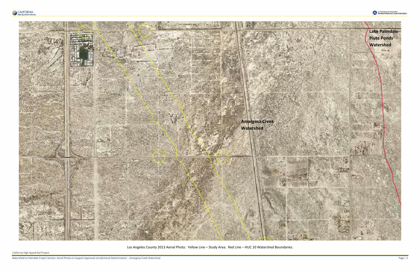
California High-Speed Rail Project
Bakersfield to Palmdale Project Section: Aerial Photos to Support Approved Jurisdictional Determination – Amargosa Creek Watershed Page | 3
Los Angeles County 2013 Aerial Photo. Yellow Line – Study Area. Red Line – HUC 10 Watershed Boundaries.
Amargosa Creek Watershed
Lake Palmdale- Piute Ponds Watershed

California High-Speed Rail Project
Bakersfield to Palmdale Project Section: Aerial Photos to Support Approved Jurisdictional Determination – Amargosa Creek Watershed Page | 4
Los Angeles County 2013 Aerial Photo. Yellow Line – Study Area. Red Line – HUC 10 Watershed Boundaries.
Amargosa Creek Watershed
Lake Palmdale- Piute Ponds Watershed

California High-Speed Rail Project
Bakersfield to Palmdale Project Section: Aerial Photos to Support Approved Jurisdictional Determination – Amargosa Creek Watershed Page | 5
Los Angeles County 2013 Aerial Photo. Yellow Line – Study Area. Red Line – HUC 10 Watershed Boundaries.
Amargosa Creek Watershed

California High-Speed Rail Project
Bakersfield to Palmdale Project Section: Aerial Photos to Support Approved Jurisdictional Determination – Amargosa Creek Watershed Page | 6
Los Angeles County 2013 Aerial Photo. Yellow Line – Study Area. Red Line – HUC 10 Watershed Boundaries.
Amargosa Creek Watershed

California High-Speed Rail Project
Bakersfield to Palmdale Project Section: Aerial Photos to Support Approved Jurisdictional Determination – Amargosa Creek Watershed Page | 7
Los Angeles County 2013 Aerial Photo. Yellow Line – Study Area. Red Line – HUC 10 Watershed Boundaries.
Amargosa Creek Watershed

California High-Speed Rail Project
Bakersfield to Palmdale Project Section: Aerial Photos to Support Approved Jurisdictional Determination – Amargosa Creek Watershed Page | 8
Los Angeles County 2013 Aerial Photo. Yellow Line – Study Area. Red Line – HUC 10 Watershed Boundaries.
Amargosa Creek Watershed

California High-Speed Rail Project
Bakersfield to Palmdale Project Section: Aerial Photos to Support Approved Jurisdictional Determination – Amargosa Creek Watershed Page | 9
Los Angeles County 2013 Aerial Photo. Yellow Line – Study Area. Red Line – HUC 10 Watershed Boundaries.
Lake Palmdale- Piute Ponds Watershed
Amargosa Creek Watershed
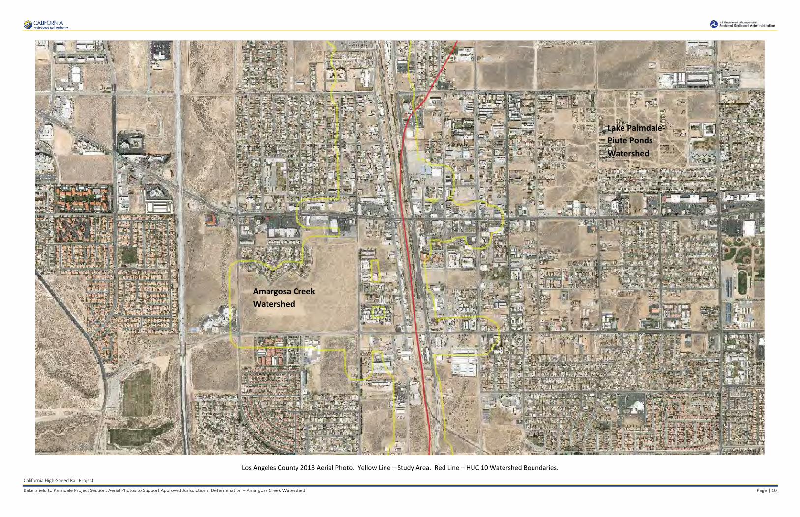
California High-Speed Rail Project
Bakersfield to Palmdale Project Section: Aerial Photos to Support Approved Jurisdictional Determination – Amargosa Creek Watershed Page | 10
Los Angeles County 2013 Aerial Photo. Yellow Line – Study Area. Red Line – HUC 10 Watershed Boundaries.
Lake Palmdale- Piute Ponds Watershed
Amargosa Creek Watershed

California High-Speed Rail Project
Bakersfield to Palmdale Project Section: Aerial Photos to Support Approved Jurisdictional Determination – Amargosa Creek Watershed Page | 11
Los Angeles County 2013 Aerial Photo. Yellow Line – Study Area. Red Line – HUC 10 Watershed Boundaries.
Amargosa Creek Watershed
Lake Palmdale- Piute Ponds Watershed
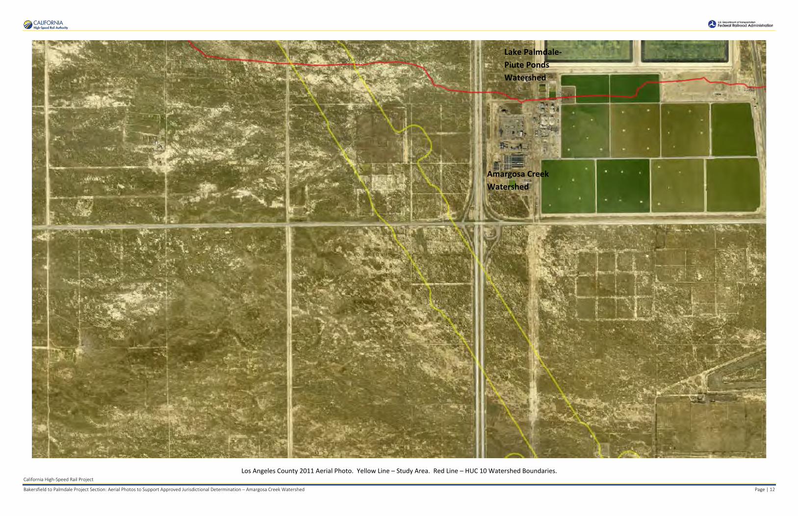
California High-Speed Rail Project
Bakersfield to Palmdale Project Section: Aerial Photos to Support Approved Jurisdictional Determination – Amargosa Creek Watershed Page | 12
Los Angeles County 2011 Aerial Photo. Yellow Line – Study Area. Red Line – HUC 10 Watershed Boundaries.
Amargosa Creek Watershed
Lake Palmdale- Piute Ponds Watershed

California High-Speed Rail Project
Bakersfield to Palmdale Project Section: Aerial Photos to Support Approved Jurisdictional Determination – Amargosa Creek Watershed Page | 13
Los Angeles County 2011 Aerial Photo. Yellow Line – Study Area. Red Line – HUC 10 Watershed Boundaries.
Lake Palmdale- Piute Ponds Watershed
Amargosa Creek Watershed

California High-Speed Rail Project
Bakersfield to Palmdale Project Section: Aerial Photos to Support Approved Jurisdictional Determination – Amargosa Creek Watershed Page | 14
Los Angeles County 2011 Aerial Photo. Yellow Line – Study Area. Red Line – HUC 10 Watershed Boundaries.
Lake Palmdale- Piute Ponds Watershed
Amargosa Creek Watershed

California High-Speed Rail Project
Bakersfield to Palmdale Project Section: Aerial Photos to Support Approved Jurisdictional Determination – Amargosa Creek Watershed Page | 15
Los Angeles County 2011 Aerial Photo. Yellow Line – Study Area. Red Line – HUC 10 Watershed Boundaries.
Amargosa Creek Watershed
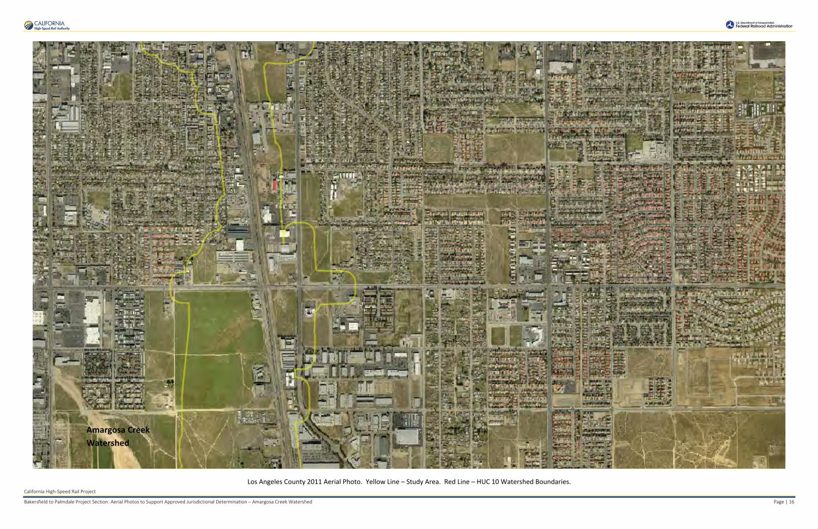
California High-Speed Rail Project
Bakersfield to Palmdale Project Section: Aerial Photos to Support Approved Jurisdictional Determination – Amargosa Creek Watershed Page | 16
Los Angeles County 2011 Aerial Photo. Yellow Line – Study Area. Red Line – HUC 10 Watershed Boundaries.
Amargosa Creek Watershed

California High-Speed Rail Project
Bakersfield to Palmdale Project Section: Aerial Photos to Support Approved Jurisdictional Determination – Amargosa Creek Watershed Page | 17
Los Angeles County 2011 Aerial Photo. Yellow Line – Study Area. Red Line – HUC 10 Watershed Boundaries.
Amargosa Creek Watershed

California High-Speed Rail Project
Bakersfield to Palmdale Project Section: Aerial Photos to Support Approved Jurisdictional Determination – Amargosa Creek Watershed Page | 18
Los Angeles County 2011 Aerial Photo. Yellow Line – Study Area. Red Line – HUC 10 Watershed Boundaries.
Amargosa Creek Watershed

California High-Speed Rail Project
Bakersfield to Palmdale Project Section: Aerial Photos to Support Approved Jurisdictional Determination – Amargosa Creek Watershed Page | 19
Los Angeles County 2011 Aerial Photo. Yellow Line – Study Area. Red Line – HUC 10 Watershed Boundaries.
Lake Palmdale- Piute Ponds Watershed
Amargosa Creek Watershed

California High-Speed Rail Project
Bakersfield to Palmdale Project Section: Aerial Photos to Support Approved Jurisdictional Determination – Amargosa Creek Watershed Page | 20
Los Angeles County 2011 Aerial Photo. Yellow Line – Study Area. Red Line – HUC 10 Watershed Boundaries.
Lake Palmdale- Piute Ponds Watershed
Amargosa Creek Watershed

California High-Speed Rail Project
Bakersfield to Palmdale Project Section: Aerial Photos to Support Approved Jurisdictional Determination – Amargosa Creek Watershed Page | 21
Los Angeles County 2011 Aerial Photo. Yellow Line – Study Area. Red Line – HUC 10 Watershed Boundaries.
Lake Palmdale- Piute Ponds Watershed
Amargosa Creek Watershed

California High-Speed Rail Project
Bakersfield to Palmdale Project Section: Aerial Photos to Support Approved Jurisdictional Determination – Amargosa Creek Watershed Page | 22
NAIP 2005 Aerial Photo. Yellow Line – Study Area. Red Line – HUC 10 Watershed Boundaries.
Amargosa Creek Watershed
Lake Palmdale- Piute Ponds Watershed
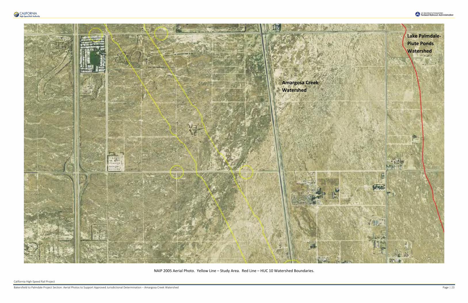
California High-Speed Rail Project
Bakersfield to Palmdale Project Section: Aerial Photos to Support Approved Jurisdictional Determination – Amargosa Creek Watershed Page | 23
NAIP 2005 Aerial Photo. Yellow Line – Study Area. Red Line – HUC 10 Watershed Boundaries.
Lake Palmdale- Piute Ponds Watershed
Amargosa Creek Watershed

California High-Speed Rail Project
Bakersfield to Palmdale Project Section: Aerial Photos to Support Approved Jurisdictional Determination – Amargosa Creek Watershed Page | 24
NAIP 2005 Aerial Photo. Yellow Line – Study Area. Red Line – HUC 10 Watershed Boundaries.
Lake Palmdale- Piute Ponds Watershed
Amargosa Creek Watershed

California High-Speed Rail Project
Bakersfield to Palmdale Project Section: Aerial Photos to Support Approved Jurisdictional Determination – Amargosa Creek Watershed Page | 25
NAIP 2005 Aerial Photo. Yellow Line – Study Area. Red Line – HUC 10 Watershed Boundaries.
Amargosa Creek Watershed

California High-Speed Rail Project
Bakersfield to Palmdale Project Section: Aerial Photos to Support Approved Jurisdictional Determination – Amargosa Creek Watershed Page | 26
NAIP 2005 Aerial Photo. Yellow Line – Study Area. Red Line – HUC 10 Watershed Boundaries.
Amargosa Creek Watershed

California High-Speed Rail Project
Bakersfield to Palmdale Project Section: Aerial Photos to Support Approved Jurisdictional Determination – Amargosa Creek Watershed Page | 27
NAIP 2005 Aerial Photo. Yellow Line – Study Area. Red Line – HUC 10 Watershed Boundaries.
Amargosa Creek Watershed

Amargosa Creek Watershed
California High-Speed Rail Project
Bakersfield to Palmdale Project Section: Aerial Photos to Support Approved Jurisdictional Determination – Amargosa Creek Watershed Page | 28
NAIP 2005 Aerial Photo. Yellow Line – Study Area. Red Line – HUC 10 Watershed Boundaries.
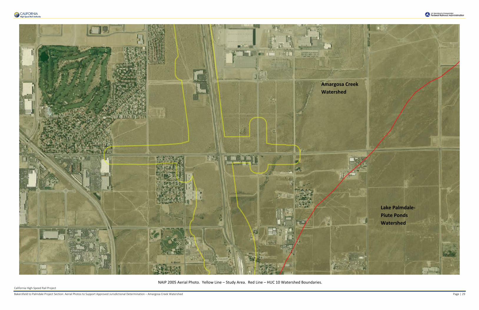
Amargosa Creek Watershed
Lake Palmdale- Piute Ponds Watershed
California High-Speed Rail Project
Bakersfield to Palmdale Project Section: Aerial Photos to Support Approved Jurisdictional Determination – Amargosa Creek Watershed Page | 29
NAIP 2005 Aerial Photo. Yellow Line – Study Area. Red Line – HUC 10 Watershed Boundaries.

Amargosa Creek Watershed
California High-Speed Rail Project
Bakersfield to Palmdale Project Section: Aerial Photos to Support Approved Jurisdictional Determination – Amargosa Creek Watershed Page | 30
NAIP 2005 Aerial Photo. Yellow Line – Study Area. Red Line – HUC 10 Watershed Boundaries.
Lake Palmdale- Piute Ponds Watershed

Amargosa CreekWatershed
Lake Palmdale- Piute Ponds Watershed
California High-Speed Rail Project
Bakersfield to Palmdale Project Section: Aerial Photos to Support Approved Jurisdictional Determination – Amargosa Creek Watershed Page | 31
NAIP 2005 Aerial Photo. Yellow Line – Study Area. Red Line – HUC 10 Watershed Boundaries.

Amargosa Creek Watershed
Lake Palmdale- Piute Ponds Watershed
California High-Speed Rail Project
Bakersfield to Palmdale Project Section: Aerial Photos to Support Approved Jurisdictional Determination – Amargosa Creek Watershed Page | 32
NAIP 2014 Aerial Photo. Yellow Line – Study Area. Red Line – HUC 10 Watershed Boundaries.

Amargosa Creek Watershed
Lake Palmdale- Piute Ponds Watershed
California High-Speed Rail Project
Bakersfield to Palmdale Project Section: Aerial Photos to Support Approved Jurisdictional Determination – Amargosa Creek Watershed Page | 33
NAIP 2014 Aerial Photo. Yellow Line – Study Area. Red Line – HUC 10 Watershed Boundaries.
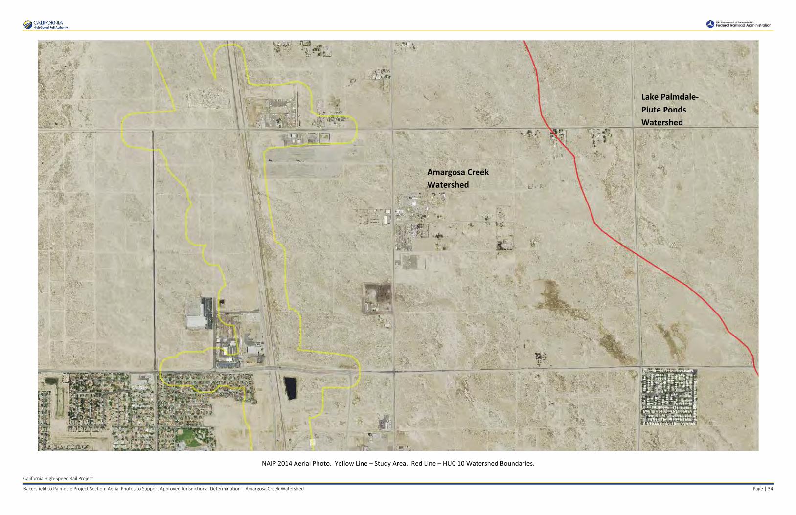
Amargosa Creek Watershed
Lake Palmdale- Piute Ponds Watershed
California High-Speed Rail Project
Bakersfield to Palmdale Project Section: Aerial Photos to Support Approved Jurisdictional Determination – Amargosa Creek Watershed Page | 34
NAIP 2014 Aerial Photo. Yellow Line – Study Area. Red Line – HUC 10 Watershed Boundaries.

Amargosa Creek Watershed
California High-Speed Rail Project
Bakersfield to Palmdale Project Section: Aerial Photos to Support Approved Jurisdictional Determination – Amargosa Creek Watershed Page | 35
NAIP 2014 Aerial Photo. Yellow Line – Study Area. Red Line – HUC 10 Watershed Boundaries.

Amargosa Creek Watershed
California High-Speed Rail Project
Bakersfield to Palmdale Project Section: Aerial Photos to Support Approved Jurisdictional Determination – Amargosa Creek Watershed Page | 36
NAIP 2014 Aerial Photo. Yellow Line – Study Area. Red Line – HUC 10 Watershed Boundaries.

Amargosa Creek Watershed
California High-Speed Rail Project
Bakersfield to Palmdale Project Section: Aerial Photos to Support Approved Jurisdictional Determination – Amargosa Creek Watershed Page | 37
NAIP 2014 Aerial Photo. Yellow Line – Study Area. Red Line – HUC 10 Watershed Boundaries.

Amargosa Creek Watershed
California High-Speed Rail Project
Bakersfield to Palmdale Project Section: Aerial Photos to Support Approved Jurisdictional Determination – Amargosa Creek Watershed Page | 38
NAIP 2014 Aerial Photo. Yellow Line – Study Area. Red Line – HUC 10 Watershed Boundaries.

Amargosa Creek Watershed
Lake Palmdale- Piute Ponds Watershed
California High-Speed Rail Project
Bakersfield to Palmdale Project Section: Aerial Photos to Support Approved Jurisdictional Determination – Amargosa Creek Watershed Page | 39
NAIP 2014 Aerial Photo. Yellow Line – Study Area. Red Line – HUC 10 Watershed Boundaries.

Amargosa Creek Watershed
Lake Palmdale- Piute Ponds Watershed
California High-Speed Rail Project
Bakersfield to Palmdale Project Section: Aerial Photos to Support Approved Jurisdictional Determination – Amargosa Creek Watershed Page | 40
NAIP 2014 Aerial Photo. Yellow Line – Study Area. Red Line – HUC 10 Watershed Boundaries.

Amargosa Creek Watershed
Lake Palmdale- Piute Ponds Watershed
California High-Speed Rail Project
Bakersfield to Palmdale Project Section: Aerial Photos to Support Approved Jurisdictional Determination – Amargosa Creek Watershed Page | 41
NAIP 2014 Aerial Photo. Yellow Line – Study Area. Red Line – HUC 10 Watershed Boundaries.
Aerial Sources: http://public.gis.lacounty.gov/public/rest/services/LACounty_Cache and http://gis.apfo.usda.gov/arcgis/services/NAIP/
Retrieved November 14, 2016.

APPROVED JURISDICTIONAL DETERMINATION FORM
U.S. Army Corps of Engineers
This form should be completed by following the instructions provided in Section IV of the JD Form Instructional Guidebook. SECTION I: BACKGROUND INFORMATION A. REPORT COMPLETION DATE FOR APPROVED JURISDICTIONAL DETERMINATION (JD): August 25, 2017 B. DISTRICT OFFICE, FILE NAME, AND NUMBER: SPL-2010-00945-VCL-JD-9 C. PROJECT LOCATION AND BACKGROUND INFORMATION:
State: CA County/parish/borough: Los Angeles County City: N/A Center coordinates of site (lat/long in degree decimal format): Lat. 34.567070° N, Long. 118.114223° W.
Universal Transverse Mercator: 397790 m E, 3825598 m N Name of nearest waterbody: Lake Palmdale (south of the study area)
Name of nearest Traditional Navigable Water (TNW) nto which the aquatic resource flows: N/A iName of watershed or Hydrologic Unit Code (HUC): Lake Palmdale, California, 180902061501
Check if map/diagram of review area and/or potential jurisdictional areas is/are available upon request. Check if other sites (e.g., offsite mitigation sites, disposal sites, etc…) are associated with this action and are recorded on a
different JD form. D. REVIEW PERFORMED FOR SITE EVALUATION (CHECK ALL THAT APPLY):
Office (Desk) Determination. Date: July 25, 2017 Field Determination. Date(s):
SECTION II: SUMMARY OF FINDINGS A. RHA SECTION 10 DETERMINATION OF JURISDICTION. There Are no “navigable waters of the U.S.” within Rivers and Harbors Act (RHA) jurisdiction (as defined by 33 CFR part 329) in the review area. [Required]
Waters subject to the ebb and flow of the tide. Waters are presently used, or have been used in the past, or may be susceptible for use to transport interstate or foreign commerce.
Explain: . B. CWA SECTION 404 DETERMINATION OF JURISDICTION. There Are no “waters of the U.S.” within Clean Water Act (CWA) jurisdiction (as defined by 33 CFR part 328) in the review area. [Required] 1. Waters of the U.S. a. Indicate presence of waters of U.S. in review area (check all that apply): 1 TNWs, including territorial seas Wetlands adjacent to TNWs Relatively permanent waters2 (RPWs) that flow directly or indirectly into TNWs Non-RPWs that flow directly or indirectly into TNWs Wetlands directly abutting RPWs that flow directly or indirectly into TNWs Wetlands adjacent to but not directly abutting RPWs that flow directly or indirectly into TNWs Wetlands adjacent to non-RPWs that flow directly or indirectly into TNWs Impoundments of jurisdictional waters Isolated (interstate or intrastate) waters, including isolated wetlands
b. Identify (estimate) size of waters of the U.S. in the review area: Non-wetland waters: linear feet: width (ft) and/or acres.
Wetlands: acres.
c. Limits (boundaries) of jurisdiction based on: Not Applicable. Elevation of established OHWM (if known): . 2. Non-regulated waters/wetlands (check if applicable):3 Potentially jurisdictional waters and/or wetlands were assessed within the review area and determined to be not jurisdictional.
Explain: Within the project area of the Lake Palmdale HUC 12, there are a total of 3 aquatic features. These features include two ditches, spanning a total of approximately 190 linear feet and covering approximately 0.018 acre, and one unnamed ephemeral stream, spanning approximately 47 linear feet and covering approximately 0.007 acre. Note that ditches constructed in uplands that do not capture waters of the U.S. and do not drain to waters of the U.S. are not typically regulated. Labeled maps and tables of
1 Boxes checked below shall be supported by completing the appropriate sections in Section III below. 2 For purposes of this form, an RPW is defined as a tributary that is not a TNW and that typically flows year-round or has continuous flow at least “seasonally” (e.g., typically 3 months). 3 Supporting documentation is presented in Section III.F.

features and dimensions are provided in the Aquatic Resources Delineation Report, which identifies each feature according to which HUC-12 watershed it occurs within. The two ephemeral ditches, features Ditch_0461 and Ditch_0462, originate adjacent from run-off from along Sierra Highway and the existing railroad, and flow into the unnamed ephemeral stream, feature Str_0463. This unnamed ephemeral stream flows in a northeastern direction toward Rosamond Dry Lake north of the study area. Immediately outside the study area, this feature flows through an undeveloped lot towards residential and commercially developed lots. At this point, the hydrologic path of this feature is obscured by development. No discernable hydrologic connection can be traced to other surface waters downslope of this study area. However, a review of topographic maps and watershed boundary datasets indicates that waters from these features drain toward Rosamond Dry Lake. There are no Traditional Navigable Waters (TNWs) or Relatively Permanent Waters (RPWs) in the study area, and the ephemeral desert streams in the study area are not tributaries to RPWs or TNWs. A previous SWANCC watershed-level Approved JD for Antelope Valley (HUC10 #s 1809020609 through 1809020624, excluding those portions of HUC12s 18090206151, 1901902061102, and 180902061103 that drain toward Lake Palmdale and its tributaries) determined that Rosamond, Buckhorn and Rogers Dry Lakes, and their tributaries, (i.e. the Antelope Valley Watershed, excluding Lake Palmdale and tributaries to Lake Palmdale) are non-jurisdictional waters of the United States under SWANCC. This determination, SPL-2011-01084-SLP, dated June 7, 2013, found that these Antelope Valley waters are not tributary to either a TNW or an (a)(3) water and Rosamond, Buckhorn and Rogers Dry Lakes are not (a)(3) waters themselves. The Corps made this watershed conclusion because the Antelope Valley watershed is an isolated, intrastate watershed without any surface water related interstate commerce. This previous determination is still in effect, and is appended as a supporting document for this determination. Previously approved jurisdictional determinations have been made for tributaries to these dry lakes. When these lakes were analyzed in SPL-2011-01084-SLP, the Corps found no published commercial uses of the surface waters of any tributaries to Rosamond, Buckhorn and Rogers Dry Lakes, and determined that a review of aerial photographs (Google Earth) also did not depict surface water usage of any drainages tributary to the dry lakes. The Corps found that all tributaries to Rosamond, Buckhorn and Rogers Dry Lakes are not (a)(3) waters as defined by 33 C.F.R. section 328.3(a)(3)(i-iii). The previous determination found that since Rosamond, Buckhorn and Rogers Dry Lakes are intrastate, isolated waters without a surface water connection to commerce, all tributaries to Rosamond, Buckhorn and Rogers Dry Lakes as part of the overall watershed system are also isolated and additionally have no nexus to commerce. A review of current conditions and updated literature review found that conditions have not changed since the SPL-2011-01084-SLP determination for Antelope Valley. While Ditch_0461, Ditch_0462, and Str_0463 are located within the Lake Palmdale watershed, these features do not flow to either Lake Palmdale or tributaries to Lake Palmdale. Further, these features flow towards Rosamond Dry Lake. Thus, the one ephemeral stream segment and two ditches in this study area are intrastate, isolated waters with no interstate or foreign commerce connection and therefore are not currently regulated. The above is based upon the review of aerial photographs (Google Earth, accessed July 25, 2017 ) that also did not show surface water usage of the project drainages or the Rosamond Dry Lake terminus. Since the Rosamond Dry Lake is an intrastate, isolated water without a surface water connection to commerce (see prior AJD file No. SPL-2011-01084-SLP), the subject two ditches and one unnamed ephemeral desert wash, as part of the same overall system, are also isolated and additionally have no nexus to commerce. Based on the information above, the subject two ditches and one unnamed ephemeral desert wash, are NONJURISDICTIONAL waters of the United States, since the waters are NOT tributary to either a TNW or an (a)(3) water and are NOT (a)(3) waters themselves. The Corps makes such a conclusion since the waters are tribuatary to an isolated, intrastate dry lake.

SECTION III: CWA ANALYSIS A. TNWs AND WETLANDS ADJACENT TO TNWs The agencies will assert jurisdiction over TNWs and wetlands adjacent to TNWs. If the aquatic resource is a TNW, complete
Section III.A.1 and Section III.D.1. only; if the aquatic resource is a wetland adjacent to a TNW, complete Sections III.A.1 and 2 and Section III.D.1.; otherwise, see Section III.B below.
1. TNW Identify TNW: .
Summarize rationale supporting determination: .
2. Wetland adjacent to TNW Summarize rationale supporting conclusion that wetland is “adjacent”: .
B. CHARACTERISTICS OF TRIBUTARY (THAT IS NOT A TNW) AND ITS ADJACENT WETLANDS (IF ANY): This section summarizes information regarding characteristics of the tributary and its adjacent wetlands, if any, and it helps
determine whether or not the standards for jurisdiction established under Rapanos have been met. The agencies will assert jurisdiction over non-navigable tributaries of TNWs where the tributaries are “relatively permanent
waters” (RPWs), i.e. tributaries that typically flow year-round or have continuous flow at least seasonally (e.g., typically 3 months). A wetland that directly abuts an RPW is also jurisdictional. If the aquatic resource is not a TNW, but has year-round (perennial) flow, skip to Section III.D.2. If the aquatic resource is a wetland directly abutting a tributary with perennial flow, skip to Section III.D.4.
A wetland that is adjacent to but that does not directly abut an RPW requires a significant nexus evaluation. Corps districts and
EPA regions will include in the record any available information that documents the existence of a significant nexus between a relatively permanent tributary that is not perennial (and its adjacent wetlands if any) and a traditional navigable water, even though a significant nexus finding is not required as a matter of law.
If the waterbody4 is not an RPW, or a wetland directly abutting an RPW, a JD will require additional data to determine if the waterbody has a significant nexus with a TNW. If the tributary has adjacent wetlands, the significant nexus evaluation must consider the tributary in combination with all of its adjacent wetlands. This significant nexus evaluation that combines, for analytical purposes, the tributary and all of its adjacent wetlands is used whether the review area identified in the JD request is the tributary, or its adjacent wetlands, or both. If the JD covers a tributary with adjacent wetlands, complete Section III.B.1 for the tributary, Section III.B.2 for any onsite wetlands, and Section III.B.3 for all wetlands adjacent to that tributary, both onsite and offsite. The determination whether a significant nexus exists is determined in Section III.C below.
1. Characteristics of non-TNWs that flow directly or indirectly into TNW
(i) General Area Conditions: Watershed size: Pick List Drainage area: Pick List Average annual rainfall: inches Average annual snowfall: inches (ii) Physical Characteristics: (a) Relationship with TNW: Tributary flows directly into TNW. Tributary flows through Pick List tributaries before entering TNW. Project waters are Pick List river miles from TNW. Project waters are Pick List river miles from RPW. Project waters are Pick List aerial (straight) miles from TNW. Project waters are Pick List aerial (straight) miles from RPW. Project waters cross or serve as state boundaries. Explain: . Identify flow route to TNW5: . Tributary stream order, if known: .
4 Note that the Instructional Guidebook contains additional information regarding swales, ditches, washes, and erosional features generally and in the arid West. 5 Flow route can be described by identifying, e.g., tributary a, which flows through the review area, to flow into tributary b, which then flows into TNW.

(b) General Tributary Characteristics (check all that apply): Tributary is: Natural Artificial (man-made). Explain: . Manipulated (man-altered). Explain: .
Tributary properties with respect to top of bank (estimate):
Average width: feet Average depth feet : Average side slopes: Pick List. Primary tributary substrate composition (check all that apply):
Silts Sands Concrete Cobbles Gravel Muck Bedrock Vegetation. Type/% cover: Other. Explain: . Tributary condition/stability [e.g., highly eroding, sloughing banks]. Explain: . Presence of run/riffle/pool complexes. Explain: . Tributary geometry: Pick List Tributary gradient (approximate average slope): % (c) Flow: Tributary provides for: Pick List Estimate average number of flow events in review area/year: Pick List Describe flow regime: . Other information on duration and volume: . Surface flow is: Pick List. Characteristics: . Subsurface flow: Pick List. Explain findings: . Dye (or other) test performed: . Tributary has (check all that apply): Bed and banks OHWM6 (check all indicators that apply):
clear, natural line impressed on the bank the presence of litter and debris changes in the character of soil destruction of terrestrial vegetation shelving the presence of wrack line vegetation matted down, bent, or absent sediment sorting leaf litter disturbed or washed away scour sediment deposition multiple observed or predicted flow events water staining abrupt change in plant community other (list):
Discontinuous OHWM.7 Explain: .
If factors other than the OHWM were used to determine lateral extent of CWA jurisdiction (check all that apply): High Tide Line indicated by:
oil or scum line along shore objects fine shell or debris deposits (foreshore)
physical markings/characteristics tidal gauges other (list):
Mean High Water Mark indicated by: survey to available datum; physical markings; vegetation lines/changes in vegetation types.
(iii) Chemical Characteristics:
Characterize tributary (e.g., water color is clear, discolored, oily film; water quality; general watershed characteristics, etc.). Explain: .
Identify specific pollutants, if known: .
6A natural or man-made discontinuity in the OHWM does not necessarily sever jurisdiction (e.g., where the stream temporarily flows underground, or where the OHWM has been removed by development or agricultural practices). Where there is a break in the OHWM that is unrelated to the waterbody’s flow regime (e.g., flow over a rock outcrop or through a culvert), the agencies will look for indicators of flow above and below the break. 7Ibid.

(iv) Biological Characteristics. Channel supports (check all that apply): Riparian corridor. Characteristics (type, average width): . Wetland fringe. Characteristics: . Habitat for:
Federally Listed species. Explain findings: . Fish/spawn areas. Explain findings: . Other environmentally-sensitive species. Explain findings: . Aquatic/wildlife diversity. Explain findings: . 2. Characteristics of wetlands adjacent to non-TNW that flow directly or indirectly into TNW
(i) Physical Characteristics: (a) General Wetland Characteristics: Properties: Wetland size: acres Wetland type. Explain: . Wetland quality. Explain: . Project wetlands cross or serve as state boundaries. Explain: .
(b) General Flow Relationship with Non-TNW: Flow is: Pick List. Explain: . Surface flow is: Pick List Characteristics: . Subsurface flow: Pick List. Explain findings: . Dye (or other) test performed: . (c) Wetland Adjacency Determination with Non-TNW:
Directly abutting Not directly abutting Discrete wetland hydrologic connection. Explain: . Ecological connection. Explain: . Separated by berm/barrier. Explain: . (d) Proximity (Relationship) to TNW
Project wetlands are Pick List river miles from TNW. Project waters are Pick List aerial (straight) miles from TNW.
Flow is from: Pick List. Estimate approximate location of wetland as within the Pick List floodplain. (ii) Chemical Characteristics:
Characterize wetland system (e.g., water color is clear, brown, oil film on surface; water quality; general watershed characteristics; etc.). Explain: .
Identify specific pollutants, if known: . (iii) Biological Characteristics. Wetland supports (check all that apply): Riparian buffer. Characteristics (type, average width): . Vegetation type/percent cover. Explain: . Habitat for:
Federally Listed species. Explain findings: . Fish/spawn areas. Explain findings: .
Other environmentally-sensitive species. Explain findings: . Aquatic/wildlife diversity. Explain findings: .
3. Characteristics of all wetlands adjacent to the tributary (if any) All wetland(s) being considered in the cumulative analysis: Pick List Approximately ( ) acres in total are being considered in the cumulative analysis.

For each wetland, specify the following: Directly abuts? (Y/N) Size (in acres) Directly abuts? (Y/N) Size (in acres)
Summarize overall biological, chemical and physical functions being performed: .
C. SIGNIFICANT NEXUS DETERMINATION
A significant nexus analysis will assess the flow characteristics and functions of the tributary itself and the functions performed by any wetlands adjacent to the tributary to determine if they significantly affect the chemical, physical, and biological integrity of a TNW. For each of the following situations, a significant nexus exists if the tributary, in combination with all of its adjacent wetlands, has more than a speculative or insubstantial effect on the chemical, physical and/or biological integrity of a TNW. Considerations when evaluating significant nexus include, but are not limited to the volume, duration, and frequency of the flow of water in the tributary and its proximity to a TNW, and the functions performed by the tributary and all its adjacent wetlands. It is not appropriate to determine significant nexus based solely on any specific threshold of distance (e.g. between a tributary and its adjacent wetland or between a tributary and the TNW). Similarly, the fact an adjacent wetland lies within or outside of a floodplain is not solely determinative of significant nexus. Draw connections between the features documented and the effects on the TNW, as identified in the Rapanos Guidance and discussed in the Instructional Guidebook. Factors to consider include, for example: Does the tributary, in combination with its adjacent wetlands (if any), have the capacity to carry pollutants or flood waters to
TNWs, or to reduce the amount of pollutants or flood waters reaching a TNW? Does the tributary, in combination with its adjacent wetlands (if any), provide habitat and lifecycle support functions for fish and
other species, such as feeding, nesting, spawning, or rearing young for species that are present in the TNW? Does the tributary, in combination with its adjacent wetlands (if any), have the capacity to transfer nutrients and organic carbon that
support downstream foodwebs? Does the tributary, in combination with its adjacent wetlands (if any), have other relationships to the physical, chemical, or
biological integrity of the TNW? Note: the above list of considerations is not inclusive and other functions observed or known to occur should be documented
below: 1. Significant nexus findings for non-RPW that has no adjacent wetlands and flows directly or indirectly into TNWs. Explain
findings of presence or absence of significant nexus below, based on the tributary itself, then go to Section III.D: . 2. Significant nexus findings for non-RPW and its adjacent wetlands, where the non-RPW flows directly or indirectly into
TNWs. Explain findings of presence or absence of significant nexus below, based on the tributary in combination with all of its adjacent wetlands, then go to Section III.D: .
3. Significant nexus findings for wetlands adjacent to an RPW but that do not directly abut the RPW. Explain findings of
presence or absence of significant nexus below, based on the tributary in combination with all of its adjacent wetlands, then go to Section III.D: .
D. DETERMINATIONS OF JURISDICTIONAL FINDINGS. THE SUBJECT WATERS/WETLANDS ARE (CHECK ALL
THAT APPLY):
1. TNWs and Adjacent Wetlands. Check all that apply and provide size estimates in review area: TNWs: linear feet width (ft), Or, acres. Wetlands adjacent to TNWs: acres.
2. RPWs that flow directly or indirectly into TNWs.
Tributaries of TNWs where tributaries typically flow year-round are jurisdictional. Provide data and rationale indicating that tributary is perennial: .
Tributaries of TNW where tributaries have continuous flow “seasonally” (e.g., typically three months each year) are jurisdictional. Data supporting this conclusion is provided at Section III.B. Provide rationale indicating that tributary flows seasonally: .

Provide estimates for jurisdictional waters in the review area (check all that apply): Tributary waters: linear feet width (ft). Other non-wetland waters: acres.
Identify type(s) of waters: .
3. Non-RPWs8 that flow directly or indirectly into TNWs. Waterbody that is not a TNW or an RPW, but flows directly or indirectly into a TNW, and it has a significant nexus with a
TNW is jurisdictional. Data supporting this conclusion is provided at Section III.C. Provide estimates for jurisdictional waters within the review area (check all that apply): Tributary waters: linear feet width (ft). Other non-wetland waters: acres.
Identify type(s) of waters: . 4. Wetlands directly abutting an RPW that flow directly or indirectly into TNWs. Wetlands directly abut RPW and thus are jurisdictional as adjacent wetlands. .
Wetlands directly abutting an RPW where tributaries typically flow year-round. Provide data and rationale indicating that tributary is perennial in Section III.D.2, above. Provide rationale indicating that wetland is directly abutting an RPW:
Wetlands directly abutting an RPW where tributaries typically flow “seasonally.” Provide data indicating that tributary is seasonal in Section III.B and rationale in Section III.D.2, above. Provide rationale indicating that wetland is directly abutting an RPW: .
Provide acreage estimates for jurisdictional wetlands in the review area: acres.
5. Wetlands adjacent to but not directly abutting an RPW that flow directly or indirectly into TNWs. Wetlands that do not directly abut an RPW, but when considered in combination with the tributary to which they are adjacent
and with similarly situated adjacent wetlands, have a significant nexus with a TNW are jurisidictional. Data supporting this conclusion is provided at Section III.C.
Provide acreage estimates for jurisdictional wetlands in the review area: acres.
6. Wetlands adjacent to non-RPWs that flow directly or indirectly into TNWs.
Wetlands adjacent to such waters, and have when considered in combination with the tributary to which they are adjacent and with similarly situated adjacent wetlands, have a significant nexus with a TNW are jurisdictional. Data supporting this conclusion is provided at Section III.C.
Provide estimates for jurisdictional wetlands in the review area: acres. 7. Impoundments of jurisdictional waters.9 As a general rule, the impoundment of a jurisdictional tributary remains jurisdictional.
Demonstrate that impoundment was created from “waters of the U.S.,” or Demonstrate that water meets the criteria for one of the categories presented above (1-6), or Demonstrate that water is isolated with a nexus to commerce (see E below).
E. ISOLATED [INTERSTATE OR INTRA-STATE] WATERS, INCLUDING ISOLATED WETLANDS, THE USE,
DEGRADATION OR DESTRUCTION OF WHICH COULD AFFECT INTERSTATE COMMERCE, INCLUDING ANY SUCH WATERS (CHECK ALL THAT APPLY):10
which are or could be used by interstate or foreign travelers for recreational or other purposes. from which fish or shellfish are or could be taken and sold in interstate or foreign commerce. which are or could be used for industrial purposes by industries in interstate commerce. Interstate isolated waters. Explain: . Other factors. Explain: . Identify water body and summarize rationale supporting determination: .
8See Footnote # 3. 9 To complete the analysis refer to the key in Section III.D.6 of the Instructional Guidebook. 10 Prior to asserting or declining CWA jurisdiction based solely on this category, Corps Districts will elevate the action to Corps and EPA HQ for review consistent with the process described in the Corps/EPA Memorandum Regarding CWA Act Jurisdiction Following Rapanos.

Provide estimates for jurisdictional waters in the review area (check all that apply): Tributary waters: linear feet width (ft). Other non-wetland waters: acres.
Identify type(s) of waters: . Wetlands . : acres
F. NON-JURISDICTIONAL WATERS, INCLUDING WETLANDS (CHECK ALL THAT APPLY): If potential wetlands were assessed within the review area, these areas did not meet the criteria in the 1987 Corps of Engineers
Wetland Delineation Manual and/or appropriate Regional Supplements. Review area included isolated waters with no substantial nexus to interstate (or foreign) commerce.
Prior to the Jan 2001 Supreme Court decision in “SWANCC,” the review area would have been regulated based solely on the “Migratory Bird Rule” (MBR).
Waters do not meet the “Significant Nexus” standard, where such a finding is required for jurisdiction. Explain: . Other: (explain, if not covered above): . Provide acreage estimates for non-jurisdictional waters in the review area, where the sole potential basis of jurisdiction is the MBR
factors (i.e., presence of migratory birds, presence of endangered species, use of water for irrigated agriculture), using best professional judgment (check all that apply):
Non-wetland waters (i.e., rivers, streams): 47 linear feet 6 feet in width (ft). Lakes/ponds: acres. Other non-wetland waters: 0.018 acres. List type of aquatic resource: Ditches. Wetlands: acres.
Provide acreage estimates for non-jurisdictional waters in the review area that do not meet the “Significant Nexus” standard, where such a finding is required for jurisdiction (check all that apply):
Non-wetland waters (i.e., rivers, streams): linear feet, width (ft). Lakes/ponds: acres. Other non-wetland waters: acres. List type of aquatic resource: . Wetlands: acres.
SECTION IV: DATA SOURCES. A. SUPPORTING DATA. Data reviewed for JD (check all that apply - checked items shall be included in case file and, where checked
and requested, appropriately reference sources below): Maps, plans, plots or plat submitted by or on behalf of the applicant/consultant: Features are depicted on Map Sheets 171 in
Appendix E of the submitted delineation.. Data sheets prepared/submitted by or on behalf of the applicant/consultant.
Office concurs with data sheets/delineation report. Office does not concur with data sheets/delineation report.
Data sheets prepared by the Corps: . Corps navigable waters’ study: . U.S. Geological Survey Hydrologic Atlas: .
USGS NHD data. USGS 8 and 12 digit HUC maps.
U.S. Geological Survey map(s). Cite scale & quad name: Palmdale 7.5 minute quadrangle. tion: .tion: .USDA Natural Resources Conservation Service Soil Survey. Cita National wetlands inventory map(s). Cite name: . State/Local wetland inventory map(s): . FEMA/FIRM maps: maps: . . 100-year Floodplain Elevation is: (National Geodectic Vertical Datum of 1929) Photographs: Aerial (Name & Date):NAIP Imagery 2005 and 2014 at 1-m resolution; LA County Imagery 2011 and 2013 at a
1-foot resolution. or Other (Name & Date): .
Previous determination(s). File no. and date of response letter: SPL-2011-01084-SLP, June 7, 2013. Applicable/supporting case law: . : .: .Applicable/supporting scientific literature Other information (please specify): Aquatic Resources Delineation Report prepared by the applicant/consultant references
additional materials; also Appendix E contains map sheets; Appendix F contains dimensions. HUC watershed maps of review areas with NHD Data provided by the applicant/consultant; general use of NAIP Imagery 2009, 2010, and 2012 at 1-m resolution; LA County Imagery 2015 at 1-foot resolution; 2015 Site specific IR Imagery, 3-inch color pixel; Bing Aerial Imagery - multiple years (scale

dependent); ESRI World Imagery (streaming service) multiple years (scale dependent); Google Earth Historic Photos (used for reference and includes portions from above listed sources).
B. ADDITIONAL COMMENTS TO SUPPORT JD: Waters_Name Cowardin_Code HGM_Code Amount Units Latitude Longitude Ditch_0461 R6 RIVERINE 0.009 ACRE 34.5667 -118.115 Ditch_0462 R6 RIVERINE 0.009 ACRE 34.56725 -118.114 Str_0463 R6 RIVERINE 0.007 ACRE 34.56697 -118.114.

California High‐Speed Rail Project
Bakersfield to Palmdale Project Section: Watershed Maps to Support Approved Jurisdictional Determination – Lake Palmdale Watershed Page | 1
PRELIM INARY DRAFT/SUBJECT TO CHANGE - HSR ALIGNMENT IS NOT DETERMINED SOURCE: ESRI/USGS Topograph ic Basemap (20 16); USGS 30m Hillshade (2015); Phase 48 Engineering data from CaHSRA (4/2016); \/1/atershed Boundary Dataset/National Hydrography Dataset (2015)
j 0
Miles 0 1.5
Kilometers
2
3
BP HSR Mapped Streams in the Lake Palmdale Watershed Study Area
-► Ephemeral Stream
-►Ditch
DJ Study Area in the Lake Palmdale watershed
r--, Lake Palmdale L......I watershed HUC-1 2
D Other HUC-12 Watersheds
CJ \flktlands Study Area (Project Footprint+ 250 ft Buffer)
Direction of flow based on --► NHD flowlines
-- •► Presumed Hydrologic Path
Governor Edmund G Brown California Aqueduct
November 22 , 2016
~ CALIFORNIA ~ High-Speed Rail Authority
Lake Palmdale Watershed
Hydrologic Connectivity
~ t,i.S.D.pc{IJ,-,Joll~ ~ Fedeml RoillOQd Adminl,trolion

California High‐Speed Rail Project
Bakersfield to Palmdale Project Section: Watershed Maps to Support Approved Jurisdictional Determination – Lake Palmdale Watershed Page | 2
PRELIMINARY DRAFT/SUBJECT TO CHANGE - HSR ALIGNMENT IS OT DETERMINED SOURCE: ESRI/USGS Topographic Basemap (2016); USGS J0m Hillshade (2015); Microsoft Bing Aerial (2016); Phase 4B Engineering data from CaHSRA (4/2016); Wa tershed Boundary Dataset/National Hydrography Dataset (2015).
J 0 0.2
Miles 0 0.3
Kiometers
0.4
0.6
BP HSR Mapped Streams in the Lake Palmdale Watershed Study Area
-► Ephemeral Stream
-►Ditch
Inset Map Extent
Study Area in the Lake Palmdale Watershed
Lake Pa lmda le \/Vatershed HUC-1 2
0 -
11 We tlands Study Area L.......J (Project Footprint+ 250 ft Buffer)
Direction of flow based on --► NHD flow lines
- - •► Presumed Hydrolog ic Pa th
.-• I• ---- --: ... -:-:-:-
I
November 18, 2016
~ CALIFORNIA ~ High-Speed Rail Authority
Lake Palmdale Watershed
Study Area Hydrologic Connectivity
~ t,i.S.D.pc{IJ,-,Joll~ ~ Fedeml RoillOQd Adminl,trolion

California High‐Speed Rail Project
Bakersfield to Palmdale Project Section: Watershed Maps to Support Approved Jurisdictional Determination – Lake Palmdale Watershed Page | 3
PRELIMINARY DRAFT/SUBJECT TO CHANGE - HSR ALIGNMENT IS NOT DETERMINED SOURCE: ESRI/USGS Topographic Basemap (2016) ; USGS 30m Hillshade (2015); Phase 4B Engineering data from CaHSRA (4/2016) ; W!tershed Boundary Dataset/National Hydrography Dataset (2015).
j 0 5 10
Miles 0 8 16
Kilometers
D Cl
Lake Palmdale Watershed HUC-12
Antelope Valley Watershed (as described in SPL-2011-01084-SLP)
HUC-12 Watersheds excluded from SPL-2011-01084-SLP
rr=====il \/Vetlands Study Area tD (Project Footprint + 250 ft Buffer)
The U.S. Army Corps of Engineers issued a SWAN CC watershed-level Approved Jurisdictional Determination for Antelope Valley (HUG 10 #s 1809020609 through 1809020624) on June 7, 2013. Note that this determination specifically excluded the areas of Lake Palmdale and all waters tributary to Lake Palmdale (portions of HUG 12 #s 180902061501, 180902061102, 180902061103) This figure illustrates the location of the study area relative to the previous watershed-level decision .
November 17 , 2016
~ CALIFORNIA ~ High-Speed Rail Authority
Lake Palmdale Watershed
Location Within Antelope Valley Watershed
~ t,i.S.D.pc{IJ,-,Joll~ ~ Fedeml RoillOQd Adminl,trolion

Anaverde Creek HUC 12 Watershed (Amargosa Creek HUC10 Watershed)
Lake Palmdale HUC 12 Watershed
California High-Speed Rail Project
Bakersfield to Palmdale Project Section: Aerials to Support Approved Jurisdictional Determination – Lake Palmdale Watershed Page | 1
NAIP 2005 Aerial Photo. Yellow Line – Study Area. Red Line – HUC 12 Watershed Boundaries.

Anaverde Creek HUC 12 Watershed (in Amargosa Creek HUC10 Watershed)
Lake Palmdale HUC 12 Watershed
California High-Speed Rail Project
Bakersfield to Palmdale Project Section: Aerials to Support Approved Jurisdictional Determination – Lake Palmdale Watershed Page | 2
NAIP 2014 Aerial Photo. Yellow Line – Study Area. Red Line – HUC 12 Watershed Boundaries.

Anaverde Creek HUC 12 Watershed (in Amargosa Creek HUC10 Watershed)
Lake Palmdale HUC 12 Watershed
California High-Speed Rail Project
Bakersfield to Palmdale Project Section: Aerials to Support Approved Jurisdictional Determination – Lake Palmdale Watershed Page | 3
Los Angeles 2011 Aerial Photo. Yellow Line – Study Area. Red Line – HUC 12 Watershed Boundaries.

Anaverde Creek HUC 12 Watershed (in Amargosa Creek HUC10 Watershed)
Lake Palmdale HUC 12 Watershed
California High-Speed Rail Project
Bakersfield to Palmdale Project Section: Aerials to Support Approved Jurisdictional Determination – Lake Palmdale Watershed Page | 4
Los Angeles 2013 Aerial Photo. Yellow Line – Study Area. Red Line – HUC 12 Watershed Boundaries.
Copyright © 2022 FDOKUMEN