and ethnosynonymic data from northern california tribes
157
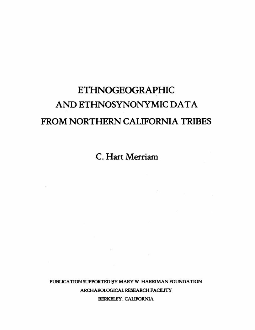
ETHNOGEOGRAPHIC AND ETHNOSYNONYMIC DATA FROM NORTHERN CALIFORNIA TRIBES C. Hart Merriam PUBLICATION SUPPORTED AY MARY W. HARRIMAN FOUNDATION ARCHAEOLOGICAL RESEARCH FACHIITY BERKELEY, CALIFORNIA
-
Upload
khangminh22 -
Category
Documents
-
view
6 -
download
0
Transcript of and ethnosynonymic data from northern california tribes
ETHNOGEOGRAPHIC
AND ETHNOSYNONYMIC DATA
FROM NORTHERN CALIFORNIA TRIBES
C. Hart Merriam
PUBLICATION SUPPORTED AY MARY W. HARRIMAN FOUNDATION
ARCHAEOLOGICAL RESEARCH FACHIITY
BERKELEY, CALIFORNIA

CONTRIBUTIONS TO NATIVE CALIFORNIA ETHNOLOGYFROM THE C. HART MERRIAM COLLECTION
Number 1 November 1976
ETHNOGEOGRAPHIC AND ETHNOSYNONYMIC DIATA FROMNORTHERN CALIFORNIA TRIBES
C. Hart Merriam
Assembled and edited by Robert F. Heizer
PUBLICATION SUPPORTED BY THE MARY W. HARRIMAN FOUNDATION
Archaeological Research FacilityDepartment of AnthropologyUniversity of CaliforniaBerkeley

TABLE OF CONTENTS
Preface 000000000000000ee@@@@sco@@@@@oooo@@@@@@@@@@olo0
About the ethnogeography-ethnosynonymy lists presentedhere . . . . ...*.0.0 **000.*0. 00* 000*oo***@@.......** iii
C. Hart Merriam as anthropologist 00000600000@000000oo@ v
Poliklan tribes, bands and villages ... ..1
Rancherias of the middle Klamath River, I000000..........0 15
Rancherias of the middle Klamath River, II.......0000..... 19
Karok (Artrar) tribes and villages 00000000000@@000@0oo@@ 23
Shastan tribes, bands, and villages 00*000................. 37
Tlo-hom-tah-hoi (Tlo-mah-tah-hoi) villages ....0000000000 58
Hah-to -ke-he-wuk tribe and village list .59
Konomeho tribe and village list ...000600.000*00000*0000... 60
Soo-lah -te-luk ("Wiyot") tribes and villages .62
Athapaskan tribes, bands and villages ......0.............. 75
Huss (Hah-wun-kwut) bands and villages ....0............... 98
Hoopaw or Tin -nung-hen-ha-o tribe, bands and villages .... 104
Tsa-nung-wha tribe and rancherias ......................... 111
Hwilkut bands, camps and villages ........................0 113
Mawenok tribe and village list ...0...0........0000.. 000..0 125
Chemareko tribe names and villages ....................... 127
'Kahto' tribe and villages .0... . .......0....... 00.....0 129
Oo-kot-on-tel-ka tribe and villages .......................0 133
Oo-kum-nom tribe and villages .........................0.. 135
Catalogue numbers of items in the Merriam Collection *...... 140
Map showing location of tribes *.........................*. .** 141

PREFACE
Clinton Hart Merriam, who signed his name C. Hart Merriamwas a naturalist who spent part of his professional life studyingCalifornia Indians. He worked assiduously with native informants.For Merriam's background, which was that of a biologist and not ananthropologist, the reader is referred to a following section writtenby Alfred L. Kroeber, "C. Hart Merriam as Anthropologist." AlthoughMerriam had a formal tie with the Smithsonian Institution which helda bequest known as the E.H. Harriman Fund, he was not a member of theSmithsonian staff. He had, in brief, an institutional connection, buthe did not work under the direction of that institution.
Merriam worked alone, or more accurately usually with a memberof his family, driving around, inquiring about Indians living in theneighborhood and if it could be arranged, sitting down, talking withthem, and recording place names, names of tribes and word lists.Judging from a large collection of letters addressed to him by NativeCalifornians, he got along well with these people and became longterm friends with many of them. Some informants he visited repeatedlyto check and verify or expand information secured earlier. He did allthis with the aim of securing as detailed and accurate a record aswas possible. Merriam clearly had a special aptitude for finding lastsurvivors of tribes in some out-of-the-way place where they were spinningout their remaining years, and by becoming friendly with them securedmany data which would otherwise have not been made a matter of record.
Merriam accumulated a very extensive file of data which is variedin its content and emphasis. This collection came, in 1950, to theDepartment of Anthropology at Berkeley. Merriam did not publish onCalifornia Indians very much during his life. For a list of publicationson this subject see Merriam 1955:229. Since 1950 not only has aconsiderable amount of information in the Merriam Collection beenpublished under his name as author, but the Merriam Collection hasbeen consulted by hundreds of scholars looking for photographs,linguistic recordings., ethnogeographic data and ethnological facts.
From 1950 to 1974 there was a balance in the E.H. HarrimanFund held by the Smithsonian Institution, and this was utilized tosupport the costs of extracting data, copying and publishing them underthe auspices of the University of California Archaeological Survey(until 1960) or the Archaeological Research Facility (since 1960).The E.H. Harriman Fund of the Smithsonian Institution is now exhausted,and we are pleased to acknowledge a grant from the Mary W. HarrimanFoundation, through Governor W. Averell Harriman and his brother E.Roland Harriman, to select copy and print two volumes of Merriam'sethnogeography-ethnosynonymy lists.
These are not for popular reading, but rather are syntheses ofpublished data extracted by Merriam and combined with data recorded by
i

him. Names collected by Merriam in the field are followed by hisinitials, CHM. The day is long past when such information can besecured from living persons, and it is therefore being placed on publicand more available record in this and the following volume where theywill serve all interested scholars. The data presented here are thevery stuff of the Indian occupation of California, and students whocontinue to analyze and refine what we now know will find these ofLmportance in their work.
As editor I have provided only the most nimal guidance tothe use of these documents. True scholars will know how to use them,and they will excuse the imperfections of Merriam's linguisticabilities, because of their fundamental value to our knowledge oforiginal information that is now completely a part of the past.
We hope to publish additional volumes of similar basic andundigested Merriam data with the conviction that anthropologists inthe future will find them useful. The volume to follow this one willpresent similar data from Central California tribes.
ii

ABOUT THE ETHNOGEOGRAPHY - ETHNOSYNONCMY LISTS PRESENTED HERE
Merriam's lists are published here exactly as he recorded them.No changes have been made in conformity with the agreement made withhis heirs when the Merriam Collection was accepted by the Department ofAnthropology at Berkeley. Merriam's phonetic system can be found atthe end of this section.
Since this kind of information will be used by persons withsome background in the existing literature on California Indians, noattempt has been made to add full citations to his abbreviated refer-ences to published works. Author's name, date of publication, andknowledge of tribe referred to will send researchers to the appropriatesection in G.P. Murdock and T. O'Leary, Ethnographic Bibliography ofNorth America (Human Relations Area Press, New Haven, 1975). Referencesby Merriam to "Handbook" are usually to be read as the F.W. Hodgeedited Handbook of North American Indians (1907-1910), rather thanthe A.L. Kroeber's Handbook of the Indians of California (1925)which is usually indicated by the mention of Kroeber's name.
Merriam, as stated, worked alone. His tribes and languagestocks number much greater than those identified by Kroeber andDixon who were practiced in detecting linguistic affiliations betweenlanguages which to the uninitiated seemed to be quite different.Merriam who did not profess to be a linguist, took the vocabularieshe elicited from informants and made a simple comparison in search ofcognates. Languages which a trained linguist would immediatelyrecognize as related were undetected by him, the result being that heclassified California Indian languages into 26 stocks in a summaryprepared in 1939 (referred to as No. 1 on the following page), whileby 1917 Kroeber and his colleagues had combined the native Californialanguages into 6 stocks. Since that time Modoc (called by KroeberLutuamian) has been classified as Penutian, thus reducing the numberof stocks or families to 5. Merriam's method of linguistic classifi-cation was no improvement over that of Stephen Powers who did ethnologyin the northern two-thirds of the state in the 1870's. The readerinterested in all of this can consult Heizer (1966 - cited as No. 2on the following page) and W. Shipley's article entitled "California"published in Current Trends in Linguistics 10:1046-1078 (Mouton,1974).
The greatest care has been taken to present Merriam's listsexactly as he wrote them. This has been done in order not to introduceinterpretations, explanations and corrections in the original, aprocedure which might cause confusion.
In this publication the apostrophe (') should be read as anacute accent (It) to indicate a stressed syllable.
We do not know the years in which these data were recorded,nor in many cases what informants provided the recorded facts. Thisinformation probably could be secured by consulting Dr. Merriam'sJournals which are on deposit in the Library of Congress, and the
iii

manifold natural history and linguistic schedules in Berkeley whichdo indicate names of informants, locations of interviews and dates.
For the identification of tribes, as named by Merriam, thestudent will need to consult already published references:
1. C. Hart Merriam and Z.M. Talbot, Boundary Descriptionsof California Indian Stocks and Tribes. ArchaeologicalResearch Facility, Department of Anthropology, Universityof California, Berkeley, 1974.
2. R.F. Heizer, Languages, Territories and Names ofCalifornia Indian Tribes. University of California Press,1966, (see especially list of Merriam's stocks and tribes,pp. 37-47, and map in end pocket).
3. Catalogue of the C. Hart Merriam Collection of DataConcerning California Tribes and Other American Indians.Prepared by Robert F. Heizer with the assistance of DennisBailey, Marke Estis and Karen Nissen. ArchaeologicalResearch Facility, Department of Anthropology, Universityof California, Berkeley, 1969 (80 pp.).
Two other published works of Merriam will be helpful:
1. C. Hart Merriam. Studies of California Indians. Universityof California Press, 1955.
2. C. Hart Merriam. Ethnographic Notes on California IndianTribes. University of California Archaeological SurveyReport No. 68, Parts I, II, III. Berkeley, 1966 (448 pp.).
iv

KE:Y TO DIACRITICAL MARKS
THE ALPHABETMy vocabularies are written, so far as possible, in simple phonetic English. The words are divided
into syllables separated by hyphens. The accented syllable is marked with the acute accent (9.i. Sounds that have a fixed and definite value in English, like our words pin, peg, hat, not, and so
on, are pronounced exactly as in English. In such syllables diacritical marks are unnecessary and asa rule are omitted.
2. Sounds represented in English by a double consonant, or by a syllable the pronunciation ofwhichis not phonetic, are always spelled phonetically. Thus the sounds represented by our words all andwho are written awl and hoo.
3. Unmarked vowels, except in syllables having a fixed value like those mentioned in section I,have the usual long or pure sound given them in the English alphabet.
. An unmarked vowel standing alone (as a syllable or word) always takes its long or pure alpha-betic sound.
KEY TO VOWEL SOUNDS, DLACRI?TCAL MAIX, AND SO ONa as in acorn, date, late, mane.a as in fat, bat, hat, have, man.
ah as in far, father, what.aw as in awl, awful.e (or e unmarked) as in eject, eternal, meat.e as in end, met, net, check, peg, pen, her.i (or i unmarked) as in ice, iron, pine, file.
as in it, ill, pin, fin, fit, pick, adimit.O (or o unmarked) as in note. poke.6 as in not, pot, odd, frog.Oo as in ooze, spoon.Oi as in oil, boil, join.ow as in how, plow, out.u (or u unmarked) as in mule, mute, acute. If the u sound forms a syllable by itself, it is com-
monly spelled yu, pronounced you.u as in tub, mud, us.u for a somewhat uncertain or obscure vowel sound, as in but and sun, known as the 'neutral
vowel.'Prolonged vowels are indicated by doubling the letter (as aa, ee, &c.)Prolonged or trilled consonants are indicated by a double acute accent ('9.The consonants, except c, g, and q, have their ordinary English values, c and g having in English
both hard and soft sounds, require special treatment, q is not used. The q sound occurs only beforeu, and is better represented by kw (kween instead of queen).
c is never used except before h, as in chin, chum, chap, church. It is commonly preceded by t torender the pronounciation more correct. Hence the usual combination is tch, as in hatch.g is always hard, as in get, give, grind.
is always soft, as in jet, jam, jelly, judge.has its usual value, as in kill, keep, king. It is also used instead of c for the hard sound of c in
our words cat, cow, come, cold, cream, clinic, and the like.S has its usual sound, as in see, sink, soft, &c, and is also used instead of c for the soft sound of c in
our words cent, cinder, mice.A (super) has the soft sound as in german ach, biich, &c. (In MS written ik).(super) is nasalized, and follows a nasalized vowel, as ox. (In MS written :).
An apostrophe (') after a vowel followed by another letter gives the long sound to the vowel, andmay also indicate an omitted or silent letter.An apostrophe (') at either end of a syllable calls for an exploded sound.An exclamation (!) after a letter indicates that the letter is stressed.
' This statement reproduces the first page ofDr. Merriam's printed vocabulary forms.Dr. Merriam's views on phonetic transcription are outlined in his paper, TAe Clastification and
Di.tribution of the Pit Ritir Indians of California, Smithsonian Misc. Coils., Vol. 78, No. 3 (Publ.2784), 1926.-Ed.

C. HART MERRIAM AS ANTHROPOLOGIST*
by
A.L. KROEBER
C. Hart Merriam was one of the great naturalists of hisgeneration. It is because of his intense drive as a naturalist thathe undertook the geographic, ethnological, and linguistic studiesof the surviving California Indians of which a part constitutes thisbook.
For the first half of his adult life, from 1876 to 1910, Dr.Merriam would have been unhesitatingly classified by all who knew himas a biologist. From 1910 to 1942 the greater part of his time wasspent in the study of historic and living Indians of California, andhe was thus de facto an anthropologist. In fact, during at least thelatter part of this second period he changed his nominal adherencefrom the section of biology to the sub-section of anthropology inthe National Academy of Sciences.
Nevertheless, the same points of view and similar motivationsand methods characterized his work in the two halves of his life.
Dr. Merriam was born in northern New York state in 1855. Atthe age of seventeen he went with a government exploring expeditionto the Yellowstone region and at the age of eighteen published afifty-page report on the mammals and birds encountered there.Subsequently he studied medicine and practiced actively for severalyears but never laid aside his preoccupation with living animals.He was only twenty-two when he reviewed the birds of Connecticut andtheir habits in a publication of the Academy of Arts and Sciencesof that state. He was twenty-seven when the first volume of his greatMammals of the Adirondack Region began to appear. A year later hehelped found the American Ornithologists' Union and became its secretaryand probably most active member.
At the age of thirty Merriam gave up the practice of medicineto join a section of the government's Department of Agriculture.This section was gradually expanded and became famous as theBiological Survey, of which he was Director.
*Reprinted from C. Hart Merriam. Studies of CaliforniaIndians. University of California Press, 1955 (pp. vii-xiv).
v

From the beginning the Biological Survey specialized in mappingthe geographical distribution of animals with a view to ascertainingthe natural faunal areas or life zones of North America. In 1892,Merriam for the first time formally outlined the life zones of thecontinent, with increasing emphasis on the manmals.
In 1899 E.H. Harriman, the railroad financier, asked Merriamto organize and direct an Alaskan expedition to accompany him on avacation during the summer of that year. Merriam also edited theseries of volumes that resulted from this many-membered expedition.More important, a personal friendship resulted which led in 1910 toMrs. Harriman's establishing a trust to be administered by theSmithsonian Institution to provide Merriam with lifetime living andsupport for research of his own choosing. At the age of fifty-fiveaccordingly, he resigned his government position, wholly relieved ofeconomic cares, and free to follow his own interests in the work hewas henceforth to do.
It was then that he formally switched from subhuman mammalsto California Indians. Not that the change was abrupt. In followingthe intricacies of the life zones of birds, manumls, and plants inCalifornia, he had increasingly come across remnants of the aborigines,mostly tucked away in remote spots off from highways. In 1903 hehad published his first ethnological paper, one dealing with basketmaterials, and in the years that followed until 1910, he had issuedeight more such publications, including a book of tales calledThe Dawn of the World. Nor did he ever abandon biology. As late as1918 he published his monumental review of the bears of North America.And his very last two papers dealt with Roosevelt as a naturalist andwith ocean-dwelling seals. But, as time passed, more and more ofMerriam's working time as an explorer and field student was devotedto his Indian friends. He took to living half the year in the woodedcountry at the rear foot of Mount Tamalpais whose front looks fromacross the bay down on San Francisco. From there he sallied forth,first on horseback and with wagon, later by automobile, hunting up andinterviewing and pumping Indians who were still lingering on in themost out-of-the-way spots of the length and breadth of California.
While the subject matter of Merriam's studies shifted fromanimals to men in the second half of his career, he brought the sameinterests, attitudes, and approaches to bear. In each case thedistribution of the phenomena dealt with was in the forefront of hisattention. His attack merely swung from questions of the preciseranges occupied by species and sub-species to the problems of theexact location of aboriginal human languages, tribes, villages, beliefsand customs. Merriam's definitions of distributions were precise andparticularistic, never sketchy. The finest detail of fact seemedworth recording in the interest of accuracy. What he valued was theprimary and original data as he secured them in the field:classification and generalization would come later.
vi

As a biologist, the main classification he made was into thelife zones already mentioned. Positing of causes was something hescarcely attempted--except for asserting cumulative temperature as theprincipal determining factor of life zones. Similarly in his ethnologyMerriam went as far as to accept and validate the classification ofvillages into tribes, of tribes into speech families. He did nottry to push beyond the family into superstocks or orders, but aimedrather at precision of geographic occurrence of tribes, subtribes, andon down to villages and settlements. This was entirely parallel tohis being what used to be called a "splitter" and not a "lumper"in regard to recognition of animal species--as evident in his famousdiscussion in Science with President Theodore Roosevelt about coyotesand bears. So with his Indians: he cut his data probably finer thandid almost any of the anthropologists; he declined to deal with theprinciples and general factors that lay beyond the primary organizationof the data. As in his biology he wanted to know everything about themamanls and birds of America, but was not concerned with those ofother continents, let alone the world as a whole--so in ethnology herestricted himself to the Indians of California and the nearer partsof Nevada and other adjacent states.
In regard to both bodies of material, then, it is evident thatMerriam practiced "natural history" rather than "natural science."In some respects his work was comparable to that of a philologiststudying a particular language, or a group of related languages, ratherthan to that of the theoretical linguist. He had the same value forfactual accuracy even in minutiae. His work was empirical, basic,and oriented toward attainment of precision and completeness.
Yet in some respects his ethnological work did differ from hisbiological. He was now working alone, instead of with a corps ofassociates and assistants as in the days of the Biological Survey.This may have been due to his having become an unhampered free lance;and again it may have had something to do with the restriction ofhis ethnology to California, whereas his biology ranged over NorthAmerica. Perhaps the continent was too large for him to cope withsinglehanded. Another reason may also have been of some influence.Over most of the United States and Canada the Indians tend to live onreservations that represent only shrunken fragments of their aboriginalhabitat. Sometimes they have even been moved far from their originalcenters. In California, however, the Indians, where they surviveat all, mostly dwell today where their great-grandfathers did; or ifthey have retreated, it is usually only a few miles. They have there-fore kept contact and familiarity with their old sod. Their distri-bution is essentially the "native" or wild one--as in the case ofnondomesticated animals. California thus lent itself much more advan-tageously to precise distribution studies of its Indians than anyother part of our country. This fact may have tended to influenceMerriam in concentrating his human studies in California.
vii

For decades he spent five to six months each year actuallytraversing the countryside, interviewing aged Indians and writingdown voluminous records of what they were still able to tell him.For while the Indians might live where their ancestors had, theywere no longer following the old customs, but were living as best theymight as modern Americans--mostly very poverty-stricken Americansat that. The task thus was one in the main of searching theirmemories. This Merriam did with a patience, tact, and sympathy whichelicited cooperation from his informants. To this I can testify fromhaving spoken to many of them with whom Merriam had worked, who alwaysremembered him with affection and approval.
In the course of his many years of this field work, Merriamalso read all that had been written on the California Indians andcopied and extracted from it voluminously--even to assembling newspaperclippings and personal letters. All this material survives in the vastcollection which he left. The core of it, however, consists of hisown recordings from the lips of Indians; and what he published duringhis lifetime is based almost wholly thereon.
Much the same proportion of source holds for the essays whichconstitute this volume. True, the "synonomies" of tribal and placenames are of course from previously published work. Also based on theliterature are discussions of the appropriateness or correctness ofcertain names like Piute, Beneme, Mono. And again based on recordsare the Tcholovone vocabulary and the baptismal records from theCalifornia missions--the last doubly valuable because the originalsfrom which Merriam's copies were made have since in part been lost.
Yet the great majority of papers printed here rest flatly andcompletely on Merriam's own recordings and observations. Perhapsbecause in his ethnology he worked singlehanded; perhaps for otherreasons, such as that an adequate vocabulary is necessarily longerthan the description of a species; or that a list of all place namesknown to a tribe in their territory is more voluminous than a delineationof their geographical range--at any rate Merriam published duringhis own lifetime only a small fraction of all the Indian material hehad gathered. Indeed, though nearly half of his professional careerwas primarily devoted to Indians, he published only twenty-nine papers,articles, and books on them, as against five hundred biological ones.Even during the years when his interest in Indians was most active,1911-1930, his bibliography shows only twenty titles in ethnologyas against sixty in biology. His biological work in the period wasevidently still traveling on momentum from the past; whereas thetime-consuming preparation of ethnological manuscript was slow ingetting under way.
By far the greater mass of Merriam's data on Indians thus hasactually never seen the light of publicity. Even the present volumedoes not too seriously diminish the bulk of what remains unpublished.In fact, what this volume represents is a sort of skimming of the cream,
viii

a putting together of those scattered portions of his data whichMerriam left most nearly in finished form ready for publication.The much larger but less organized remainder of his original datawill no doubt continue to be drawn on for generations as a rich mineof information on the California Indians.
Merriam stipulated that, whoever it might be that publishedany of his collected Indian data posthumously, should reproduce himexactly, without alteration, either of his statements or of theform in which he wrote native names.
Both stipulations have been observed in this volume and willbe maintained in any future ones.
As regards substance, the proviso obviously is only one offairness. One does not use another man's laboriously accumulated butunpublished information as grist for one's own mill, as material forone's own views. Scientific as well as moral responsibility are atone in this matter. What Merriam wrote, we, the selectors and editors,have left exactly as he wrote it. Anything added to clarify statementsor supply relevance or context has been put into square brackets orotherwise indicated to be clearly distinguishable.
As regards orthography, Merriam held all his life that the"scientific spelling" of anthropologists was a technical mannerism andan unnecessary one. He employed the "common" usage of Webster'sDictionary. It is hard not to have sympathy with this or any viewslanted away from pedantic technicalities. It can be said fairlyenough that an artificial orthography is in a sense a necessary evileven though it be more accurate--more unambigious. Anthropologistsdid not come to write native words with the special characters whichthey have successively employed merely in order to parade arcana oflearning before the world. They used them because they felt they hadto use them, if they wished to be as clear as possible to otherscientists. As a matter of fact, the way they were writing Indianwords when Merriam entered the field was in a system different fromthat used when the Bureau of Ethnology was first established inWashington in 1879; aftd it has in turn been considerably modifiedsince then under the influence of the pure linguists.
Merriam's position corresponded somewhat to that of a hypothe-tical anthropologist entering the biological field and insisting onnever calling a coyote Canis latrans, even in professional journals.If such a hypothetical newcomer to biology brought new information oncoyotes, his papers would no doubt be printed, though his insistencewould be considered a mannerism. After all, the Latinified binomialnomenclature with its rigid and often embarrassing rules of strictpriority, its perpetual preservation of typographical errors, itsdecapitalization of proper names like Washington or Virginia, and otherliterary barbarisms, has been gradually and in the main reluctantlyaccepted as a needed instrument by biologists--not as an ornament,
ix

flourish, luxury of ostentation, or trademark. And their verdicthas been accepted by nonbiological scientists. Similarly as regardsthe recording of the sounds of words in new or exotic languages:the tendency of general science to let professional linguistsdecide how these sounds are best represented in international andscientific writing. So Merriam stood proud and pretty much alone inhis adherence to the "common English" ways of writing non-Englishwords; but one can respect the courage and integrity of his aestheticor temperamental resistance to the majority.
Also, it is to be remembered that Merriam did not set outto do linguistics, did not profess to, and.obviously would not haveknown how. He remained a natural historian recording the distributionof words as a means to ascertaining the precise distribution ofdialects, languages, tribes, families, and their beliefs and customs--as earlier he had recorded the distribution of song sparrows and grizzlybears and yellow pines, of species and subspecies of Canis latrans,in order to delimit life zones. What was at stake was not phoneticor phonemic accuracy as the basis for elucidating grammars--whichMerriam never dreamed of doing--but an identification of words.Was the name for house, or for, say, jackrabbit, the same here andin the native village ten miles away, or was it similar, or drasticallydifferent? For this purpose, Merriam's nontechnical means definitelysufficed.
As a matter of fact, when simon-pure linguists come to utilizehis data for comparative or historical purposes they will almostcertainly prefer them in his "everyday English" orthography than if hehad tried to write as an imitation linguist. As it is, they will knowthey have his own original forms. And if they are like the linguistsof today, they will themselves transpose his spellings into whateverorthography they will then be using, rather than have to guess, fromrewritings orthographically "normalized" or "standardized" by, say,Heizer or myself, what in such forms was likely to have been Merriam'sand what Heizer's or Kroeber's idea of what Merriam heard. So we, hiseditors, approve of the rule of unalterability which he laid down,and approve it cheerfully.
While the twenty articles in this book represent not so muchwhat Merriam considered most important in his own work, but what hehad happened to have put together most completely, I should like topoint out some of his contributions that seem likely to be valuedand used most by anthropologists, historians, and those interestedin Indians.
There are, for instance, detailed eyewitness accounts of nativerituals attended by Merriam, such as the Wintun Big-head, the PomoSahte, the Mewuk Mourning Cry, the Autumn Ceremony in Yosemite; or,where the rite had long since been abandoned, like the Kotomut atTejon, Merriam recorded its description by a surviving native witnessand participant. This last account is a genuine treasure recovered,to rank with the accounts of southern California religion by Boscana
x

and Reid. The Sahte record somewhat parallels Barrett's Patwin-WintunHesi in both being revivalist versions of parts of ancient aboriginalcult systems. The Big-head is touched on also by Cora Du Bois in herGhost Dance volume. Mourning Cries were held over much of California;Merriam's is perhaps the fullest description extant.
Of unusual and permanent value are Merriam's photographs ofnative dwellings and dance houses. This is a uniquely full series,further supplemented by descriptions in other articles, as the one onthe Yokiah Pomo.
Very typical are the tribal territory studies, as for theTuleyome, Mono Paiute, Beneme, and under "Distribution" in the notes on"Tribes of Wintoon Stock." These are little monographs of intimatelandscape utilization and detailed ethnic local history. The patternfor these Merriam had set as early as 1904 with an article in Scienceon the distribution of tribes in the southem Sierra, and had followedup with detailed studies of the Mewan stock (1907), Yosemite Valley(1917), Pit River tribes (1926), New River Tlohomtahhoi (1930), andEmtimbitch (1930). All of these, like their successors herein,contribute precise information not to be found anywhere else.
From the great mass of vocabulary material which Merriamsecured from subtribe after subtribe according to a standardizedlist, and some of which he also subsequently brought togethercomparatively, we have extracted from this volume only a slight sample:the native words for "tobacco" and "pipe" in 161 California and Nevadadialects.
From Merriam's copies of the Baptismal Records kept in theFranciscan Missions we reproduce five sets. These give the nativename of the settlement, rancheria, or subtribe to which the convertsbelonged. They are thus a treasury of local geographical informationfor those missionized parts of California in which Merriam could notsecure the data from the Indians themselves because these had diedout before his time or become absorbed in the Mexican population.As these records are dated by years, they also possess direct historicalvalue. They make possible the tracing out of the year-by-year spreadof each mission's influence and tributary territory.
Finally, there is a wide array of most diverse themes treatedeither in short separate topical articles or in sections of tribalones. Such are native hats; Indians as basket collectors; wild tobacco;native doctors; great Wintun chiefs; acorn cooking; battles andmassacres. They illustrate the range of Merriam's interest andactivity.
xi
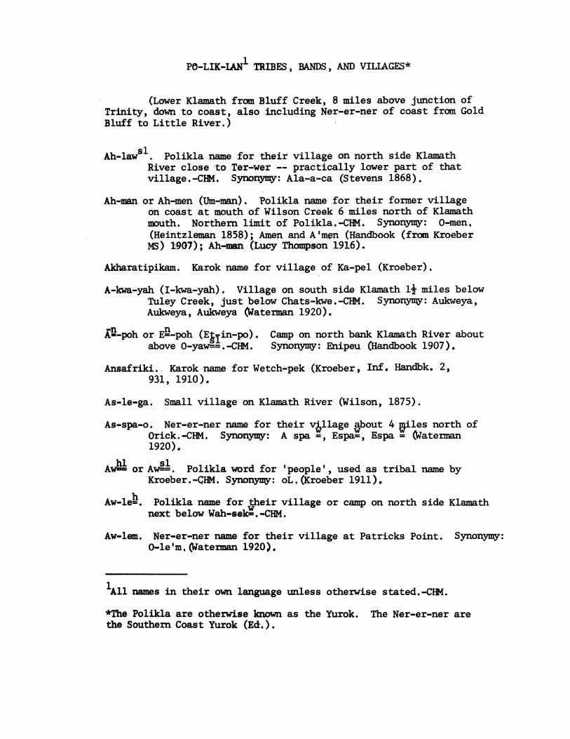
PO-LIK-IAN1 TRIBES, BANDS, AND VILLAGES*
(Lower Klamath from Bluff Creek, 8 miles above junction ofTrinity, down to coast, also including Ner-er-ner of coast from GoldBluff to Little River.)
Ah-laws. Polikla name for their village on north side KlamathRiver close to Ter-wer -- practically lower part of thatvillage.-CHM. Synonymy: Ala-a-ca (Stevens 1868).
Ah-man or Ah-men (Um-man). Polikla name for their former villageon coast at mouth of Wilson Creek 6 miles north of Klamathmouth. Northern limit of Polikla. -CHM. Synonymy: 0-men,(Heintzleman 1858); Amen and A'men (Handbook (from KroeberMS) 1907); Ah-man (Lucy Thompson 1916).
Akharatipikam. Karok name for village of Ka-pel (Kroeber).
A-kwa-yah (I-kwa-yah). Village on south side Klamath 1j miles belowTuley Creek, just below Chats-kwe.-CHM. Synonymy: Aukweya,Aukweya, Aukweya (Waterman 1920).
AL-poh or EO-poh (Eklin-po). Camp on north bank Klamath River aboutabove 0-yaw-=.-CHM. Synonymyy: Enipeu (Handbook 1907).
Ansafriki. Karok name for Wetch-pek (Kroeber, Inf. Handbk. 2,931, 1910).
As-le-ga. Small village on Klamath River (Wilson, 1875).
As-spa-o. Ner-er-ner name for their village about 4 ailes north ofOrick.-CHM. Synonymy: A spa =, Espa=, Espa = (Waterman1920).
Awim or Asl. Polikla word for 'people', used as tribal name byKroeber.-CHN. Synonymy: oL.(Kroeber 1911).
Aw-le=h. Polikla name for their village or camp on north side Klamathnext below Wah-sek=.-CHM.
Aw-lem. Ner-er-ner name for their village at Patricks Point. Synonymy:0-le'm, (Waterman 1920).
1All names in their own language unless otherwise stated.-CHM.
*The Polikla are otherwise known as the Yurok. The Ner-er-ner arethe Southern Coast Yurok (Ed.).

2
Aw-men-nok (Om-ma-nok, 0-ma-nok). Village on north side KlamathRiver at foot of Bowie's Hill about 1 mile above presentRequa.-CHM.
Aw-paw. Village on south bank Klamath at Touth of Ah Pah Creek,opposite and straight west of 0-yawg-*-CHM.
Chah-pak. Ner-er-ner name for their village on coast side of StoneLagoon.-CHM. Synonymy: Tsahpekw, Tsah'pekw (Handbook,from Kroeber, 1910), Tsa'peq=, Tsahpek=, Tsa'hpek=.(Waterman 1920).
Chalts-kwe (Tsa'ts-kwe). Village on north side Klamath 4 milebelow Tuley Creek.-CHM. Synonymy: Tseltskwi, Tsetskwi(Waterman 1920).
Che-gah-la-o. Village on south bank Klamath opposite Wah-tek°=°=.-CHM.
Cho-ri. Polikla name for Ner-er-ner village on coast at Trinidad.Called Choo-re-ra (Tsoo-re-ra) by the Ner-er-ner.-CHM.Synonymy: Chori (Gibbs 1853), Kori (McKee 1853), Tschura,Tschura-Allequas (Meyer 1855), Tsurau (Handbook, fromKroeber MS, 1907, 1910), Cho-ri (Lucy Thompson 1916),Tsurai (Waterman 1920).
Em-mets. Former village at Johnson Creek about 6 or 7 milessouth of Klamath mouth.-CHM.
Er-ner. Village on north bank Klamath at mouth Blue Creek.-CHM.Synonymy: Unuh (Powers 1872), Erner (Handbook, fromKroeber MS, 1907), Ur-ner (Lucy Thompson 1916), R'nr,Rnr (Waterman 1920).
Er-teer' Er-ta-er. Village on south side Klamath next belowKaLnek. -CHM.
Es-ser-rer' (Es-slerlrer). Village on south side Klamath oppositeWetchpek on west side mouth of Trinity (on narrow tonguebetween Klamath and Trinity).-CHM. Called Pah-hip-pre-e-kum by Karok.-CHM. Synonymy: Ertlerger (Handbook, fromKroeber MS, 1907), RLrgr, RLrgr', Rlrgr' (Waterman 1920).
E-toot-ko. Karok name for Polikla village of Pek-tool, whichsee.-CHM.
- SI chHa-me=l= (He-meh==). Village on north side Klamath opposite mouth
of Roach Creek.-CHM. Synonymy: Hayk-meek (Folsom 1885),He-melth (Lucy Thompson 1916), HI-meL, HimeL, Hime'L,(Waterman 1920).

3
Haw-wa-goh. Camp former village, on_gouth side Klamath on Lamb' splace directly across from TawC=ter and nearly opposite0-le-a-ken.-CHM. Synonymy: Hay-way-gaw (Lucy Thompson1916), Ho'wego, Howego' (Waterman 1920).
Henah. Name on Randall's MS map lower Klamath River, 1866(Waterman 1920).
witHer-gwer (written "Hr'gwr"', "Hrgwr', Hrgwr'i-'', and "HrgY"qby Waterman). (Nererner) village on east side StoneLagoon (Waterman).
Heyomu. Village on north side Klamath about 1+ miles aboveWetchpek at mouth of Trinity. Also called Loo-la-go,which see (Waterman).
Hik-tawk. Soo-lah-te-luk name for Ner-er-ner of Trinidadregion. -CHM.
Hle-mek-wes. Village on north side Klamath close below 0-le-e-kennbut on Del Norte side county line.-CHM,
Hop-pa-o (Ho-pa-oo). Village on north side Klamath about a mileabove mouth of Hoppow Creek and four above Requa.-CHM.Synonymy: Hopaiuh (Gibbs 1853), Ho-paiuh (McKee 1853),Hop-pow (Stevens 1868), Hoppa (Rept. Commissioner IndianAffairs 1882), Hoppaw (Hoopa Valley Indian ReservationMap 1912), Hog-paw and Hop-pow (Lucy Thompson 1916),Ho'paW=, Ho'pa= (Waterman 1920).
I-koch=-o (written "Aiq'o" and "Aiqoo" by Waterman). Village onsouth side Klamath about a mile below mouth of BluffCreek (Waterman).
Jehehak. Name on Randalls MS Map of 1866 (Waterman 1920).-ch
Ka=i-kem. Village on south bank of Klamath 21 miles above .Jobnson's. Now occupied (1922).-CHM. Synonymy: Ke'-kem,Ke&xkem, ke'lxkem (Waterman 1920). (Note: Waterman alsogives Ke'=xkem as name of settlement on east side ofmiddle of Big Lagoon.)
Kamelch. Name Randall's MS map of 1866 (Waterman 1920).See Ha-me==.
Ka-nek. Village on south bank Klamath at mouth of Tuley Creek.-CHM. Synonymy: Kay-neck (Folsom 1885), Kenek (Handbook,from Kroeber MS 1904, 1907), Qenek (Kroeber 1911), Ca-neck(Thompson 1916), Shwufum (Karok name, Handbook, fromKroeber MS 1904, 1907), Kanick (Hoopa Valley IndianReservation Map 1912). (Note: Folsom mentions 2 villages -Kay-neck on right bank and Kay-neckie-ko on left bank.Hoopa Valley Indian Reservation Map (1912) locates Kanickon north bank 1 mile below mouth of Tuley Creek.)

4
hi a
Ka-pe- (Ka-pel). Village on south side Klamath 10 or 12miles below Wetchpek and nearly opposite mouth of CappellCreek.-CHM. Synonymy: Capell, Cap pels (Daily AltaCalif. 1851), Kai-petl, Capel (Gibbs 1853), Cap-pel,Cappels (McKee 1853), Cappel (Folsom 1885), Kepel(Handbook 1907), Capell (Hoopa Valley Indian ReservationMap 1912), Cap-poll (Lucy Thompson 1916), Ka'pel, Kapel(Waterman 1920), Akharatipikam (Karok name, Handbook,from Kroeber MS 1904, 1907).
Katep. Randall MS Map 1866 (Waterman 1920). See KoLLtep.
Kia-we-no (Ka-we-noo). Eel camp on south bank Klamath about 3miles above Blue Creek.-CHM.
Kay-neckie-ko. Village on north bank Klamath opposite Kay-neck(Folsom 1885). See Ka-nek.
Ke-nah (Kin-nah'). Hoopa name for Polikla.-CHM.
Ken-nah-hah. 'Hwilkut name for Polikla.-CHM.
Kepero r (Ke peror). Former village on south side Klamath* mile above mouth of Metah Creek (Waterman).
Ker-e. Village on south side Klamath about 2 miles from mouth.-CHM.
Kestitsa. Village on south side of mouth of Klamath (Waterman).
Khwunrghunme (Qwun-rxun-me). Tolowa name for village allegedto have been on coast just south of Klamath mouth (Hand-book, after Dorsey). Synonymy: Qwun-rxun-me (Dorsey1890), Khwunrghunme (Handbook, after Dorsey, 1907).
Klamath. Erroneous and confusing term popularly applied to bothPolikla and Karok. Term properly belongs to Klamath tribeof Lutuamian stock in Klamath Lake region.-CHM. Synonymy:Lower Klamaths, Klaxnth Rivers, Yurok, Pohlik.
Koppa. Name on Randall's MS Map of 1866 (Waterman 1920), atmouth Turep Creek.
Ko-tep (Kaw-tep). Village on north side Klamath River about jmile below Pek-wahn.-CHM. Synonymy: Kau-weh (Gibbs1853), Kauweh (McKee 1853), Cor-tet (Stevens 1868), Cot-tep(Folsom 1885), Kootep and Ko-o-tep (Handbook, from KroeberMS 1905, 1907), Cor-tep, Cortep, Costep (misprint) (LucyThompson 1916), Qo-otep,- Qo otep, Qootep (Waterman 1920).

5
Kutch-a-wi-aw-wik. Weyot name for band of Ner-er-ner atTrinidad Bay.-CHM.
Lagune Indians. Name mentioned by Meyer for small settlementof Nererner at southern end of Big Lagoon. Synonymy:Lagune Indians (Meyer 1855).
Leg-goo-naw. Village on south bank Klamath between Met-tahand Ser-ra-gon.-CHM.
Loo-la-go. Village on north side Klamath about 1l miles aboveWetchpek at mouth of Trinity (Kroeber and Waterman).Also called Heyomu (Waterman). Synonymy: Loolego,Lo-o-le-go (Handbook, from Kroeber MS 1904, 1907),Lo'ole go, Loolego, Lo-o-le go (Waterman 1920).
Lower Klamaths. Common designation of Polikla in populat usageand in Reports of Indian Commissioner. See Klamaths.
Ma'ats. (Nererner) village on east side of southern third ofBig Lagoon (Waterman).
Mah-reep. Village on north side Klamath 3 miles below TuleyCreek.-CHM. Synonymy: Nah-rip (Stevens 1868), Merip(Handbook, from Kroeber MS, 1907), Ma-reep (Lucy Thompson1916), Mareep (Hoopa Valley Indian Reservation Map 1912),Me rip, Merip (Waterman 1920), Ma-rep (Randall's MSMap 1866; Waterman 1920).
Mangosh. Name on Randall's MS map 1866 (Waterman 1920) oppositeBlue Creek.
Mets-kaw. Ner-er-ner name for their village at mouth of LittleRiver, on north side just below store.-CHM.
Metsko (Metchkor). Polikla dialect spoken at Trinidad andLittle River (Kroeber; Loud).
Met-tah. Village on south bank Klamath 3 or 4 miles aboveJohnson's and about * mile below Metah Creek (near Young'smining claim).-CHM. Synonymy: Mehteh (Gibbs 1853),Meh-ta (Stevens 1868), Met-tah (Folsom 1885), Mita(Powers 1877), Mita (Powell 1891), Meta (Handbook 1907),Mettah (Hoopa Valley Indian Reservation Map 1912), Meta,Meta' (Watennan 1920).

6
Mo-rekk-W (Moo-rek). Village on north side Klamath River 2mile below mouth of Cappell Creek.-CHM. Synonymy:Mooris, Moor-i-ohs, Moo-ri-ohs, Morias, Mo-ri-ohs(McKee 1853); Morai-uh (Gibbs 1853); Mur-iohs (Meyer1855); Moreo (Humbolt Times 1855); Moruk (Stevens 1868);Moo-ruck (Folsom 1885); Murek (Handbook 1907); Mo-reck,Mor-eck (Lucy Thompson 1916); Mu'rek, Murek (Waterman 1920);Moreck (Hoopa Valley Indian Reservation Map 1912); Moor-is;Mor-ri-ahs; Mo-ri-os; Mo-ri-ahs; Mo-rec; Morros; Moor-iohs(Daily Alta California 1851).
Muh-rook-throov. Karok name for Polikla village at Ot-sep-poron north side Klamath River at mouth of Bluff Creek.-CHM.
ctNaht-skoo or Nah===skoo (Nawt-skoo). Village on south bank
Klamath about 1* miles above mouth of Metah Creek.-CHM.Synonymy: Noht-scho (Gibbs 1853); Nox-co (Stevens 1868);Nats-koo (Folsom 1885); Nakhtskum (Handbook after KroeberMS 1905 1910); Natchko (Hoopa Valley Indian ReservationMap 1912); Notch-co and Notchko (Lucy Thompson 1916);No xtskum, Nohtskum, No htskum, Nohxtska (Waterman 1920).
Ner-er-ner. Their own name (used also by Polikla) forPoliklan tribe extending from edge of timber nearOs-sa-gen (Gold Bluff) south to Trinidad and LittleRiver.-CHM.
Ner-er-nits. Name used for the Ner-er-ner by the polikla ofKlamath mouth.-CHM.hiNi-ge=-. Village on west side Klamath River opposite mouthof Blue Creek.-CHM. Synonymy: Nai-a-gutl (Gibbs 1853);Nai-aguth (McKee 1853); Naagetl (Handbook 1910); Ni-galth(Lucy Thompson 1916); Na giL, Na:giL, NagiL (Waterman1920).
0-ke-to. Polikla name for Ner-er-ner village at Big Lagoon.Synonymy: Oketo (Handbook from Kroeber MS 1910);Ah-ca-tah (Lucy Thompson 1916); Oke to and 0-ke to(Waterman 1920).
0-le-e-ken (0-la-a-ken). Former village on north side Klamathabout 3 miles below Blue Creek. On Humboldt County sideof county line and close to Hle-mek-wes. Named for0-le-e-ken Bar, at the upper end of which it is located.-CHM. Synonymy: Auh-leek-kin (Lucy Thompson 1916);Rliiken-pets, Rli i ken-pets (Waterman 1920).

7
O-le'm. See Aw-lem.
Olliq-uahs. (Word for Indians). J.B. Roseborough 1872;MS Hayes Scpbks, Bancroft Library. See Polik lah.
0-pylu-weg. (Ner-er-ner) village at southwest end of BigLagoon near coast (Waterman).
Ork. Ner-er-ner name for their village on south side ofRedwood Creek Lagoon from which Orick takes its name.-CHM. Synonymy: Arekw (Handbook 1907); Ore qw, Oreqw(Waterman
wO-ra=. (Ner-er-ner) camp site at junction of Prarie Creek
with Redwood Creek; North of Redwood and west of PrarieCreek (Waterman).
O-slegoi ts (Oslegoi ts, Oslegoits). Village on east bankTrinity 1+ miles above mouth of Bull Creek (Waterman).
O-sloqw (Osloqw=, 0-slo q7q Oslo q7=). (Nererner) village oneast side of Big Lagoon (Waterman).
Osmemo RL (OsmemoRl, O-smemo'RL). Village on east bank Trinityat mouth Bull Creek. Grew up after white invasion(Waterman).
Os-sa-gen (Os-se-gen). Former village at Gold Bluff, on coastabout 8 miles south of Klamath mouth. Northernmostvillage of Ner-er-ner.-CHM. Synonymy: Osse-gonGibbs 1853); Ashegen (Handbook 1907); Os-sa-gon (LucyThompson 1916); Osegen, Osegen (Waterman 1920).
O-tmekwo' R (Otmekwor, OtmekwR). Former (Nererner) villageon north side of Redwood Creek Lagoon (Waterman).
Ot-saL (O-tsa 1). Former village site on north bank Klamathabout 1* miles above mouth of Tektah Creek (Waterman).
Ot-sap. Former village on north bank Klamath just abovemouth of Tuley Creek (Waterman). Synonymy: Atsep(Handbook 1907); Otsap, O-tsap, O-tsep (Waterman 1920).
Ot-sep-por (Se-per-rah, Karok name). Village on north sideKlamath near mouth of Bluff Creek.-CHM. Located byWaterman on south side i mile below mouth of Bluff Creek.Syny: Otche-poh (Gibbs 1852); Seheperrh (Gibbs1853); Ut-cha-pas, Ut-cha-pah, Ut-chap-pah (McKee 1853);Ut-scha-pah (Meyer 1855); Atsepar (Handbook 1907);Otsepo r, Otsepor, O-tsepo r (Waterman 1920).

8
Ot-ta. Village on south bank Klamath across from and a littleabove Stah-wen. Not an old town.-CHM.
Otwe go. Former village on south side mouth of Klamath(Waterman).sl hl0-yaw = (0-yo==). Village on north bank Klamath oppositemouth Ahpah Creek about 3/4 mile above Blue Creek.-CHM.Synonymy: Oiyotl (Gibbs 1853); Ai-yolch (ReportCommissioner Indian Affairs 1881); Yotl (Handbook 1907);A-yoL, AyoL, A:yo L (Waterman 1920); Jehehak (RandallMS Map 1866), (Waterman 1920).
Pa'ar (Pa ar). Village on east side of north end of BigLagoon (Waterman).
Pah-hip-pre-e-kum. Karok name for Polikla village of Es-ser-er,which see.-CHM.
Pegwola=. Former village on south side mouth of Klamath(Waterman).
Pek-ta'ow. Village on south side Klamath on east side mouthof Trinity and opposite Wetchpek. Called E-toot-ko bythe Karok.-CHM. Synonymy: Pectow (Stevens 1868);Pac-ta (Wilson 1875); Pekwuteu and Pekwututl (Handbook(from Kroeber MS 1905) 1910); Peck-toolth, Pec-toolth(Lucy Thompson 1916); Pe'k=tuL, Pekw=tu'L, Pek-tuL(Waterman 1920); Porah (Randall MS map 1866), (Waterman1920).
Pek-wahn. Village on north bank Klamath at mouth PekwanCreek about 1 mile above Johnson's.-CHM. Synonymy:Pak-wans (Daily Alta California 1851); Pec-quan (Gibbs1853); Packwans, Pak-wan (McKee 1853); Pahk-wans (Meyer1855); Pec-wan (Stevens 1868); Pek-wan (Powers 1877);Peek-wan (Folsom 1885); Pekwan (Powell 1891); Pe'kwan(Kroeber 1911); Pe kwan, Pekwan (Waterman 1920); Tirip'-ama(Karok name) (Handbook (from Kroeber MS 1904) 1910).
Pekw-U-tuL. Waterman 206, 1920. See Pek-ta-ow.
Pi Npa (PiNpa). Settlement on south side Big Lagoon (Waterman).
Plet-kosom-ili. Pahtowat name for "Yurok" (=Ner-er-ner)village or camp at mouth of Little River near TrinidadBay (L.L. Loud). Probably same as Mets-kaw.-CHM.
9
Po-lik-lah. Their name for themselves. (As spoken by LucyThompson and other members of tribe).-CHM. Synonymy:Poh-liks or lower Klamath Indians (Daily Alta California1851); Poh-lik or Lower Klamath (McKee 1853); Pohlik-Klamath (Gibbs 1853); Po-lick Ai-li-qua (Taggart 1854);Allequas or Wood Indians (Meyer 1855); A-li-kwa(Contributions North American Ethnology from Gibbs 18521877); To-lick Si-li-qua (typog. error, HistoryHumbolt County 1882); Olliquahs (Roseborough 1872-Hayes Scrapbooks, MS Bancroft Library); Pa-lik Ai-li-qua(typographical error, Bledsoe 1885), Pohlik (Royce 1899),Po-lick-las, Po-lickla's (Lucy Thompson 1916); WoodIndians (Meyer 1855); See also Yurok.
Porah. Randall's MS map 1866 (Waterman 1920). See Pek1U-tuL.
Rek-woi (Rek-kwoi). Former village at mouth of Klamath Riveron north side (lowermost village), 1 mile below presenttown of Requa and near a big rock on present WilliamBrooks place.-CHM. Synonymy: Rek-qua (Gibbs 1853);Re-quoi (Stevens 1868); Requa (Powers 1872); Ri-kwa(Powers 1877); Regua and Rikwa (Powell 1891); Rekwoi(Handbook 1910); Reck-woy, Reckwoy (Lucy Thompson 1916);Suf ip (Karok name) (Handbook from Kroeber MS 19041910).
Rhakwa Indians. Term used by Meyer for Indians of lowerKlamath River. Synonymy: Rhakwa Indians (Meyer 1855);Applied to Indians of Witchpek region.
RLi iken-pets. See 0-le-e-ken.
Sah-ah. Ancient village at fish dam on south bank KlamathRiver close to Ka-pel. Synonymy: Shaa (Handbookfrom Kroeber MS 1907 1910); Si-ah and Sy-ah (Lucy
Thompson 1916); Sa'a, Saa (Waterman 1920).
Sa-aAl (Sa-eh==, Sa-es2=). Village on north side Klamath11 miles above mouth of McGarwy Creek and oppositeToo-rep.-CHM. Synonymy: Schaitl (Gibbs 1853); Shaitl(McKee 1853); Sa-ac (Stevens 1868); Sah-sil (ReportCommissioner Indian Affairs 1881); Scaath (Hoopa ValleyIndian Reservation 1912); Si-elth and Si-alth (LucyThompson 1916); Sa'al, Sa'al, Sa al (Waterman 1920).
Soo-per (Ser-per). Village on north side Klamath 4 or 4+miles above Blue Creek or midway between Blue Creek andJohnson's.-CHM. Sche-perrh (Gibbs 1853);Seh-pur (Stevens 1868); Sur-pur (Report CommissionerIndian Affairs 1881); Susper (misprint) (ReportCounissioner Indian Affairs 1889); Serper (Handbook1910); Srpr (Watennan 1920).
10
Se-per-rah. Karok name for Polikla village Otsepor at SaintsRest.
Ser-ra-gon (Ser-ra-goo-on). Village on north side Klamath11 or 2 miles above Johnson's.-CHM. Synonymy: Ser-a-goines(Daily Alta California 1851); Schre-gon and Serragoin(Gibbs 1853); Ser-a-goins, Siragrins, Seragoins,Sca-goines (McKee 1853); Ser-a-goines (Meyer 1855);Shrir-goin (Stevens 1868); Sri-gon (Powers 1877); Shrayg-ron(Folsom 1885); Shragoin and Sugon (Powell 1891); Shregegon(Handbook 1910); Surgone (Hoopa Valley Indian ReservationMap 1912); Ser-e-goin and Ser-e-goine (Lucy Thompson 1916);Srego n, Sre gon, Sregon (Waterman 1920).
Shumig. Ancient Nererner camp site at Patricks Point, 5 or6 miles north of Trinidad (Handbook). Synonymy: Shumig(Handbook 1910); Sume (Lucy Thompson 1916).
Shwufum. Karok name for village of Ka-nek (Kroeber).
Si-gwets. Former settlement on south side Redwood Creek Lagoon,a little north of Or" (Waterman).
Stah-wen (Sto-wen). hYillage on north bank Klamath about amile above Sa-a==. Not an old town.-CHM. Synonymy:Stowen (Waterman 1920); Stahwin (Lucy Thompson 1916).
Sufip. Karok name for village of Rekwoi (Kroeber).
Sugon. See Ser-ra-gon.
Surgoin. Randall's MS Map 1866 (Waterman 1920). See Ser-ra-gon.
Surpah. Randall's MS Map 1866 (Waterman 1920). See See-per.
Sy-ah. See Sah-ah.
Tak-tah (Tek-tah). Village on south bank Klamath at mouthTektah Creek about 1+ miles below Johnson's.-CHM.Synonymy: Sec-tow (Stevens 1868); Takta (Handbook 1910);Tec-tah (Creek) (Lucy Thompson 1916); Te kta, Tekta(Waterman 1920).
"Ta-pel-o". 'Wiyot' (=Pahtewat) name for (Nererner) villageat mouth of Luffenholtz Creek, a little south of TrinidadBay (L.L. Loud). Probably Ta-wah-le-a.
Tarep. Randall's MS Map 1866 (Waterman 1920). See Too-rep.
Ta-wah-le-a. Ner-er-ner name for their village on northside of mouth of Luffenholtz Creek.-CHM.

11
ch ch c,hTaw==-ter (Awi=- tar, To==-ter). Village on north bank Klamathright across from Haw-wa-goh. -CHM
Ter-wer. Village on north side Klamath at mouth of TurnerCreek (old Klamath Reservation), said to be 6 or 7 milesabove present Requa.-CHM. Synonymy: Terwar (Taylor1960); Terwer (Handbook 1910); Tr wr, Trwr (Waterman1920).
Te=kwr. (Nererner) campsite about midway between PatricksPoint and mouth of Mill Creek (Waterman).
Tes-wan. Hoopa and 'Hwilkut name for Ner-er-ner tribe oncoast from Gold Bluff to Trinidad and Little River.-CHM.
Tet-le-mus. Crescent City Huss name for Lower Klamath Rivertribe.
Tiriplama. Karok name for village of Pekwan (Kroeber).
T'mer-ra. Village on north side Klamath at Salmon canneryabout half a mile below present town of Requa.-CHM.Synonymy: Mrh (Powers 1872); Tmr'i, Tmri (Waterman1920).
To-lick Si-li-qua (typographical error). See Polik-lah.
Too-rep (Toor-rep). Village on south side Klamth about 7or 8 miles above Requa and opposite Sa-a== at mouth ofTarup Creek.-CHM. Synonymy: Tuh-rip (Stevens 1868);Too-rup (Report Commissioner Indian Affairs 1882);Turip (Kroeber 1911); Tu-rep (Lucy Thompson 1916);Tu rip, turip, Ru-rip (typographical error, Waterman1920); Tarep (Randall MS Map 1866) (Waterman 1920).
1Torah. Old village on west side Klamath close to Ni-geh=
(opposite mouth of Blue Creek). Randall's MS Map1866 (Waterman 1920).
Tor-re. Ner-er-ner name for their village at Big Lagoon.-CHM.
Tse kwel (Tse.kwel). Village or house site on south bankKlamath at mouth just above WeLkwa (=Wes-kwa-o) (Waterman).
Tso tskwi. (Nererner) village south of Stone Lagoon (Waterman).
Tsurai (Tsurau) Waterman. See Cho-ri. Ner-er-ner villageat Trinidad.
Unuh. Village on Lower Klamath (Powers 1872). ProbablyEr-ner.

12
Wah-si. Village on north side Klamath River on present CooperPlace 2 miles above mouth of Cappell Creek.-CHM. Synonymy:Wa-a-sa (Stevens 1868), Wa'shoi (Handbook 1910), Wah-say(Lucy Thompson 1916), Wa'ase, Wa ase, Waase (Waterman1920).kwWah-sek=w=. First villa e on north side of Klamath below mouthof Trinity, X or X mile below Martins Ferry.-CHM.Synonymy: Wuh-sis (Daily Alta Calif. 1851), Wah-sherr(Gibbs 1853), Wah-sher, Wah-si, Wich-sis (McKee 1853),Wi-uh-sis (Meyer 1855) not verified, Wah-sook (Folsom1885), Wah-si ('18 Calif. Treaties' of 1852, 1905),Wakhshek (Handbook, from Kroeber MS 1907, 1910), Waseek(Hoopa Valley Indian Reservation Map 1912), Wa hsek, Wahsek("site used to be called Teke tin", Waterman 1920).
Wats-poos (Weitspus). Old name of Wetchpek.-CHM.
hl- 1 hlWaw-ke== (Waw-keh=, Wah-.keh==). Village on south side Klamathopposite Hop-pa-oo and midway between mouths of Turwarand Waukell Creeks.-CHM. Synonymy: Waukel (Stevens1868), Wakel (Report Commissioner Indian Affairs 1882),Wah-kell (Lucy Thompson 1916), Wakhkel (Handbook 1907),Wo' ke'l, Wo:ke'l, O'ke'l (Waterman 1920).
Waw-ker-rah (Wah-ker-rah). Village on north bank Klamath hooabout 200 rods below Johnson's house. So near Was-tek==-as hardly deserving an independent name.-CHM. Synonymy:Wakhker (Handbook 1910), Wah-ker-ah (Lucy Thompson 1916),Woxkero, Woxke ro, Woxhke ro, Wohke ro (Waterman 1920).
Waw-tek-== (Waw-tek 2=). On north bank Klamath at KlamathBluffs. Site of former Klamath store and post office(now Johnson's) and close to Waw-ker-rah. Waw-tek wasthe home of ancient white people called Waw-ga.-CHM.Synonymy: Wauh-tecq (Gibbs 1853), Mauh-tecg (misprint,McKee 1853)., Waugh-tec (Stevens 1868), Wah-tek (Folsom1885), Wakhtek (Handbook, from Kroeber MS 1907, 1910),Wauteck (Hoopa Valley Indian Reservation Map 1912),Wah-tec and Wah-teck (Lucy Thompson 1916), Wo xtek,Woxtek (Waterman 1920), Watek (Randall MS Map 1866,Waterman 1920).
Weitspekan Family. Stock name (Henshaw and Mooney 1885;Powell 1891)=Yurok=Po-lik-lah.
We 'iqem (We'=qem, We '=qem). Camp site on south side Klamathat mouth Roach Creek (Waterman).
Wei tspus (Waterman). See Wats-poos.

13
Wekeswah. Randall's MS Map 1866 (Waterman 1920). See Wes-kwa-o.
Welch-peh (misprint). Randall's MS Map 1866 (Waterman 1920).See Wetchpek.
Wer-er-ger. Village on north bank Klamath River, across fromMet-tah, and a little above it.-CHM.
Wes-kwa-o (Wesh-kwa-o). Former village on hill near mouth ofKlamath River on south side opposite Rek-woi. The peopleneed to come here to pray that salmon would come.-CHM.Synonymy: Weht'l-qua (Gibbs 1853); Wehtl-qua (McKee1853); Wilsch-kow (Stevens 1868); Wirks-wah (ReportCammissioner Indian Affairs 1881); Wetlko (Handbook 1910);Wealth-quow (Lucy Thompson 1916); We Lkwa, WeLkwa, We Lkwa=(Waterman 1920).
Wetch-pek (Old name Wats-poos). Village on north side KlamathRiver opposite junction of Trinity.-CHM. SynonYmy:Watch-pecks (Daily Alta California 1851); Weits-pek (Gibbs1853); Wech-pecks, Wech-pecs, Wetch-pec, Wech-peks(McKee 1853); Witsch-piks (Meyer 1855); Weitspuk(Latham 1856); Weitspeek (Stevens 1868); Witch-peck(Folsom 1885); Wait-spek (Powers 1877); Weitchpeck(Hallidie 1887); Weitspus (Handbook 1910); Weitchpecs,Weitchpec Indians (Rebellion Records 1897); Weitspuc(Kroeber 1911); Weitchpec (Lucy Thompson 1916);We itspus, We itspus, We itspus, Weitspus, (Watenman1920); Ansafriki (Karok name) (Handbook from KroeberMS 1904 1910).
Wokkel. Randall MS Map 1866 (Waterman 1920). See Waw-ke--
Wood Indians. Term used by Meyer for Polikla tribe. SeePolikla.
Yak-tar. Village on south bank Klamath River at mouth ofMcGarvey Creek.-CHM. Waterman gives Yox=tr wroi as nameof McGarvey Creek but says nothing as to a village atits mouth.
chYaw-=-ter (Yo-terr"). Village on south side Klamath about
2 mile above Pek wahn.-CHM. Synonymy: Yau-terrh(Gibbs 1853); Sock-ter (Folsom 1885); Yatuckets (Taylor1860); Yokhter (Handbook 1910); Yocta (Hoopa ValleyIndian Reservation Map 1912); Yo xtr, Yoxtr (Waterman1920); Yotum (Randall MS Map 1866, Waterman 1920).
Yuch-ar-rah (Yuruk-v-arara). Karak name for Poliklah, which see.
Yurock Indians. See Yurok.

14
Yu-rok (Yu-ruk-war-rah). Karok name for Polikla tribe onlower Klamath River from Bluff Creek, 8 miles above mouthof Trinity River, westerly to coast; north along coastto Wilson Creek, and south nearly to Gold Bluff, wheretheir relatives the Ner-er-ner begin. See Po-lik-lah.-CHM. Synonymy: Eurooks (Sacramento Daily Transcript1850); Youruk (Gibbs 1853); Eurocs (Powers 1872);Yu-rok (Powers 1877); Eurok (Gatschet 1877); Yurok(Gatschet 1890); Yuruk-v-arara (Kroeber 1911); Yorok(Davio 1925); Yurock Indians (Oakland Tribune, Apr.16, 1927).

15
RANCHERIAS OF THE MIDDLE KLAMATH RIVER, I
Comparison of lists given by Gibbs MS map 1852, and Journal inSchoolcraft III, p. 151, 1853; Redick McKee (Ind. Agt.), Sen.Doc. 4, Special Session 161, 194, 211, 1853; Carl Meyer,Nach dem Sacramento, 282, 1855; A.S. Taylor (after a letterfrom G.W. Taggart to Walter Van Dyke, Orleans Bar, 1856) inCalifornia Farmer, March 23, 1860; C.Hart Merriam, MS Vocab.obtained on Upper Klamath, Oct. 1 and 2, 1910.
YUROK
Gibbs, 1852,53 McKee 1853 Meyer 1855 Taylor 1856
Ut-chap-pah Ut-scha-pahsUt-cha-pah
Ut-cha-pas
Sehe-perrh (possibly a Karok Village)
Merriam 1910
Ot-sep-porMuh-rook-throov(Karok name)
Se-per-rah
KAROK
Gibbs, 1852 McKee 1853 Meyer 1855 Taylor 1856 Merriam 1910
*Oppegoeh (map)Oppegach (jrn.)
Shah-woo-rum
Tshei-nik-kee
*Up-pah- *1goines
Up-pa-goine
Sa-vow-raSa-ron-raSa-vour-as
Cha-ma-ko-necCham-ma-ko- Inec
Cha-ma-ko-nees
Up-pa-goines Woo-pum
Sa-wa-rahs
Woo-pum n
Op-pa-goi(Yurok name)
SahC=-woo-rumSu-wur-ram
Tscha-wa-so-nihs
Chah-me-knee-nutch
T'shah-nee (map) Chee-nahTchai-noh or CheinaSkeina (Journ.)
Tschih-nahsTe-shun-neek
* Yurok name,
Otche-poh

16
KAROK
Gibbs 1852 McKee 1853 Meyer 1855 Taylor 1856 Merriam 1910
Pa-nom-nik
*Cock-o-mansCoc-co-mansCoc-co-man Cok-ka-mansCoc-ko-nan(Chief=Pa-nam-o-nee)
Pah-nahm-neek& Yu-sah
Kah-tee-pee-rah(Azocrs?)
Kah-te-pe-duc
T'cheh-nits Chee-nitch Chee-nitch
T'sof-ka-ra
*Oppe-yoh (Jrn.)Asha-nahm-ka(Map)
(Ya-phip-pa' s)
Tuck-a-soof-curra
_-*Opp-pe-oo(s)Chief=Ya-fip-pa Ahs-sah-nahm-
kar-ruk
Tish-rawa
*Eh-qua-neck(Journ.)
Oon-harik (map)(Hopa's)
*He-co-necksKe-ko-neckChief =Hou-a-puck-if-ma
Woon-whar-rukOn Salmon River
*Eh-nek (Journ.)Mik-iara
*In-neck A-mi-ke-ar-rum Ah-ma-ke-ah-rahm
*Sche-wohIsshe-pishe-rah
Kah-ose
*Si-wahs, SewahChief =Es-se-pish-ra
Ish-e-pish-e Ish-she-pish
Sun-numSum-maun
CouthSoo-pas-ipYutoo-ye-roop
chYu==-too-e-re-pah
*Yurok name.

17
KAROK
Gibbs 1852 McKee 1853 Taylor 1856 Merriam 1910
Hakh-kutsor-Yurok name (Kroeber)
E-no-tucks
If-terram
I-yiss
Soof-curra
Pas-see-roo
Home-nip-pah
E-swhedip
Home-war-roop
E-nam x
Os-se-puk
In-noo-tnk-kutchKwat-te -
(A-Kwah-te)Ook-rum-ke-rik
Ish-e-rahm-he-rukEen-peetIp-poon-war-rah
I-yeech-dim orI-ye-e-thrim(at I-yess Bar)
Thoof-kah-rom
Te
Pus-se-roor-re
eh'Hoom-ne-pah=-=
Oo-ri-e
Oo-roo-hus
Ish-we-dip-te
chAhC=-rah-hah-soo-ruk
Oot-ke
chTah-sah==-kahk
Hoo-mah-ro
Tin-hoom-ne-pah
In-nom or E-nahmch h
Yu-=-t oo-e-re-pah(moved from vicinityof Salmon River,probably after fireof 1852).

18
KAROK
Gibbs 1852 McKee 1853 Taylor 1856 Merriam 1910
Ik-ku-re-rus-so
Kus-am-we-rok
As-sif-soof-tish-e-ram (At or nearIndian Creek).
A-the-thoof

19
RANCHERIAS OF THE MIDDLE KLAMATH RIVER, II
(Names and localities obtained by CHM unless otherwise noted).
Name for themselves
YUROK
Karok name
Ot-sep-por Muh-rook-throov
Se-per-rah (possibly a Karok rancheria)
NW side, mouth BluffCreek
SE side, opposite mouthBluff Creek (Gibbs);at Saints Rest (CHM)
KAAROK
Name for themselves
Woo-pum
Sah'---woo-rum
Chah-me-knee-nutchTshei-nik-kee (Gibbs)
Te-shun-neek(TT'shah-nee of Gibbs)
Pah-nahm-neek& Yu-sah
Kah-te-pe-duc
Yurok name
Op-pa-goin
Aperger (Kroeber)
Possibly Oler(Kroeber)
Olegel (Kroeber)
Coc-ko-man (McKee)Koomen (Kroeber)
Che-nitch
T' cheh-nits (Gibbs)
J'T' sof-ka-ra Possibly Witsogo(Kroeber)
Locality
NW side, Red Cap Bar
SE side, 2 miles abovelast (near Moutn.Boise Cr.)
SE side, 1 mile belowCamp Creek.
NW side, at mouthCamp Creek.
NW side, at OrleansBar.
SE side, 1 mile belowOrleans.
SE side, below mouthof Cheenitch Creek.
SE side, about a mileabove Orleans.
SE side, a little aboveChe-nitch.
Locality
4

-20
KAROK
Name for themselves Yurok name Locality
Ahs-sah-nahm-kar-ruk Op-peos (Chief=Asha-nahm-ka (Gibbs map) Ya-fip-pa) (McKee)
Ah-ma-ke-ah-rahm
SE, 3 miles belowmouth of Salmon(CHM); at mouth SalmonRiver (Gibbs).
NW side, oppositeAhs-sah-nabm-kar-ruk.
SE, at junction ofSalmon, E side, northof Salmon (on SalmonRiver).
NW side, a mile or more? N of mouth of SalmonRiver (Gibbs): oppositemouth Salmon Riverprobably moved afterfire (CHM).
Kah-te-meenOon-harik (Gibbs)(=Woon-whar-rak)
Ish-she-pish
Apyu (Kroeber?)
Sewah, Chief Es-se-pish-ra (McKee)
Kepar (Kroeber)?
Kah-ose (Gibbs) burnt 1852
Y-chtoo-e-roop-mahYutoo-ye-roop(Gibbs)
SE side, oppositeIsshe-pishe-rah (Gibbs).
SE side, just N ofIsshe-pishe-rah (Gibbs);NW side, at Wingate Bar,probably moved afterfire (CHM).
Ah-ma-ke-ah -rahmMik-jara (Gibbs)
E-nek, name forlower part ofvillage; (Kroeber);
Tumitl, name forupper part (Kroeber)
SE side, directly oppositeYutoo-ye-roop (Gibbs).(Ah-ma-ke-ah-rahm is onNW side 3 miles belowmouth of Salmon River;probably moved afterfire of 1852 (CHM).
Os-se-puk NW side at Ten Eyck.
In-noo-tuk-kutch NW side 1' miles belowReynolds Creek.
Ah-kwah-AeKwat-te-=
SE side, opposite last.NW side at Reynolds Creek.SE side, at Halverson's.
SE side at Stenshaws.Ook-rum-ke-rik

21
KAROK
Name for themselves Yurok name Locality
Een-peet
Ish-e-rahm-he-ruk
I-yeech-dim orI-ye-e-thrim
Ip-poon-war-rah(="resting place")
Thoof-kah-rom
Te
Pus-se-roor-re
ch'Hoom-ne-pah=-
Oo-ri-e
OO-roo-hus
Ish-we-dip-techAh-=-rah-hah-soo-ruk
Oot-ke
Hoo-mah-ro
chTah-sah==O-kahk
At-Sn-hom-nip-panTin---hoom-ne-pah
In-nom or E-nahm
chYuz=-too-e-re-pah
Ik-ku-re-rus-so
SE side at Sandy Bar.
NW side at Flowers Flat,opposite Een-peet.
NW side at I-yess Bar,1 mile below Rock Creek.
SE side at Dutch Henry'sopposite I-yeech-dim.
NW side at mouth RockCreek.
SE side, 6 miles belowDillon Creek.
SE side, 5 miles belowDillon Creek.
NW side at Dillon Creek.
SE side at Thomas Mine.
NW side at Cottage Grove.
NW side at Swillup Flat.
NW side at Meligan's Bar.
NW side at Sneeden Bar.
SE side at Ferry Point.
NW side, opposite Hoo-mah-ro.
NW side at 'Franks', 31miles below Clear Creek.
NW side, at mouth ClearCreek.
NW side at Wingate Bar.
NW side of Indian Creek,little above Happy Camp,mouth Doolittle Creek.

22
KAROK
Name for themselves Yurok name
Kus-am-we-rok (Fishing Camp)
A-the-thoof (Kah-rah-ko)
Locality
SE side, about 6 milesbelow Happy Camp.
SE side, mouth Elk Creek.
Happy Camp.

23
KAROK (ARRAR) TRIBES AND VILIAGES
Adatars. Name used by Kelsey for Karok.chAh-chah-e-pan-nitch. Village on north side Klamath River
on a small creek about i mile below Woopum.-CHM.ch
An-i=-hah-soo-ruk (Ah-hah-soo-rup, Ah-hah-soo-rook). Villageon west side Klamath River at Meligan's Bar, 3+ milesbelow Oot-ke. -CHM.
Ah-chip-che-an-ke. On east side Klamth River just abovemouth of Carter Creek.-CHM.
Ah-kwah-te-ve, Ah-kwah-tev (A-kwah-te, A-ko-tev). On northwestside of Klamath at mouth of Reynolds Creek.-CHM.
Ah-ma-ke-ah-ralhm (Ah-mak-ke-ar-rahm, Amaikiara, A-mi-ke-ar-rnm,Micarrah (Roseborough 1872), Mik-iara). Village onnorthwest side Klamath River 2 or 3 miles below mouthof Salmon. Great place for drying salmon. The 'JumpDance' held here.-CHM.
Ah-ook-ne (Aukni, Dixon). Village shown on Dixon's Shastemap (1907) as on east side Klamath River oppositeHappy Camp.
Ah-poo-roo-wah-ne. Insignificant suburb a little south ofAh-sun-nahm-kar-ruk.-CHM.
Ah-se-pahk. A few houses on lower part of same flat withSum-se-re-he-rik and only about 200 yards from it;hardly worthy of distinct village name.-CHM.
Ah-show-roo (Asouru, Dixon). Village shown on Dixon's Shastemap as on north side Klamath River, apparently at junctionof Portuguese Creek.
Ah-sow-co-we-yu. On east side Klamath River in angle southof mouth of Salmon River.-CHM.
Ahs-so-kah-ko-kum. On northwest side Klamath River close toriver and under Pook-rahm, which is high up on bench.-CHM.
Ah-sum-mahm (Sum-maun, Sumaun). Large village on west sideKlamath 200 to 300 yards above Ah-ma-ke-ah-rahm on sameflat. A favorite salmon fishing place.-CHM. Inhabitedin 1856 (Taylor).

24
Ah-sun-nahm-kar-ruk (Ahs-sah-nahm-kar-ruk, Ah-sum-nahm-kar-ruk,Asha-nahm-ka (Gibbs map 1852), Shanamkarak, Ya-phip-pas).Village on southeast side Klamath River about 2 milesbelow mouth of Salmon River and opposite Ah-ma-ke-ah-rahm.Shown on Gibbs map of 1851 as on both sides of river.Probably the village called Op-pe-o by the Polikla.-CHM.
Ah-tish-num-hun-ne. On Indian Creek at junction of East Fork(place called Sedros).-CHM.
Ah-wish-ve-he-rah. On west side Klamath River a little aboveCarter Creek, but on opposite side.-CHM.
AkonileL. Given by Waterman as Polikla name for village onnorthwest side Klamath near Happy Camp. ProbablyAh-the-thoof but wrongly placed on map.
A-kwah-te-e-ve. Village on northwest side Klamath River alittle above mouth of Reynolds Creek. -CHM.
chAperger. Polikla name for Karok village Sah--=-woo-rum.-CHM.
Apye- (Waterman), Apyu (Kroeber). Given by Waterman as Poliklaname for village on east side Klamath 3 or 4 miles belowU-ko-nom Creek; and by Kroeber as Polikla name for northpart of Kah-te-men.
Aranimokw. Polikla name of Karok village near Red Cap Creek(Kroeber). The village opposite mouth of Red Cap Creekis Woo-pum.-CHM.
Ar-rahr (Arara, Arrahl, Arrar, Karuk-v-arara, Ara, Arra-arra,Arr-Arra (Gibbs map 1852). Their name for themselves.The 'Karok' of Orleans Bar region call themselves Ar-rahrand some Tf them say there should be an 1 at the end, makingit Ar-rar=. Some double it, making Ar-rah-ar-rahr.-CHM.
Asouru. Village shown on Dixon's Shaste map as on north sideKlamath River apparently at junction of Portuguese Creek,May possibly have been Shaste rather than Karok, butprobably Karok.
As-pev-ne-te-hatch. Village on north side Klamath just abovemouth of Bluff Creek. Last and lowermost village oftribe.-CHM.
As-si-e-pen. Insignificant suburb a short distance north ofAh-sun-nahm-kar-ruk.-CHM.
A-sut-tan-nan-nitch. Village on east side Klamath Riveror 1 mile above Thomas Creek.-CHM.
25
A-the-thoof (Ah-the-thoof, As-se-soof-oo-oo-nuk, Asisufuunuk,As-sif-soof-tish-e-ram). Village on northwest side ofKlamath River at Happy Camp, at junction of Indian Creekwith Klamath (original site on east side Indian Creek inpresent town).-CHM.
A-tin-hom-nip-pah (Tin-hoom-nip-pah). Village on northwestside Klamath River (at 'Franks") 24 - 3 miles below mouthof Clear Creek.-CHM.
Aukni. Village shown on Dixon's Shaste map (1907) as oneast side Klamath River opposite Happy Camp.
Cahroc (Car-rock, Ar-rahr = Karok Arra = Pehtsik). Tribe onKlamath River from Bluff Creek up 90 miles to Happy Camp.See Karok.
Car-rook Ar-rah (Bledsoe, Indian Wars, 146, 1885). See Karokand Arrar.
Caw-sh-man (of Lucy Thompson). Polikla name for village ofE-ke-rik-e-ra-en, now called Pah-nahm-neek, at OrleansBar. See Ko-ko-man.
Chah-me-knee-nitch (Cha-ma-co-nee (Daily Alta California 1851),Chah-me-knee-notch, Cha-ma-ko-nec, Cham-ma-ko-nec,Cham-ma-ko-nee, Cha-ma-ko-nees, Chawakoni, Chimikanee(Roseborough 1872), Tsha-wa-co-nihs, Tschei-nik-knee).Karok village on south side Klamath river at Wilders,opposite Te-shun-neek (about 14 miles below OrleansBar).-CHM.
Chainiki. See Tshei-nik-kee.
Chee-nitch. (Chee-nah (McKee 1851, 1853), Chee-nahs (DailyAlta California 1851), Chee-neetch, Che-nutch, Chinits,Cheenich (Roseborough 1872), Chee-nitch, Tcheh-nits).Karok village on southeast side Klamath River just aboveOrleans Bar bridge and below Chenitch Creek.-CHM.
Denakwate-lak (or Gura-dalil-rakwe-lak). 'Wiyot' name forKarok language (Kroeber MS, Loud).
E-dum-ne-he-ruk. On northwest side Klamath River at Lord'son Horseshoe Bend.-CHM.
Eh-kwa-nek (Eh-qua-nek, Ikwanek, He-co-neck, Ke-ko-neck).Polikla name for Karok village Kah-te-meen.
Eh-nek (Ehnik, Enek, In-nek, Enek). Polikla name for Karokband at junction Salmon and Klamath Rivers. Yurok namefor lower part of village of Ah-ma-ke-ah-rahm (Kroeber).

26
Ehnikan (=Karok). Stock name (Henshaw and Mooney 1885).
E-ke-rik-e-ra-en. Original and proper name of village atOrleans Bar commonly called Pah-nahm-neek.-CHM.
E-nohm'thoof Kah-rom. Old town on bench where reed lives?.-CHM.
E-nahm (In-nom, Inam, E-nam). Village on northwest sideKlamath River at mouth of Clear Creek. Still inhabited.-CHM.
Enek. Given by Waterman as Polikla name for Ah-ma-ke-ah-rahm,but wrongly located. See Eh-nek.
E'n-pet (Een-peet). Village on southeast side Klamath Riverat Sandy Bar (mouth of Sandy Bar Creek), 3 miles belowIp-poon-war-rum.-CHM.
E'n-sho-ruk. On east side Indian Creek 21 miles north ofHappy Camp.-CHM.
E-vah-rut-te-de. Village on southeast side Klamath Riveropposite Os-se-puk.-CHM.
E-wah-pe (Oh-wau-kee). Upper Shasta name for tribe at HappyCamp on Klamath River.-CHM. Also Konomeho name forKarok.-CHM.
Gura-daliL. 'Wiyot" name for Karok Indians (Kroeber Ms -Loud).
Gura-dalil-rakwe-lak (or Denakwate-lak). 'Wiyot" name forKarok language (Kroeber MS - Loud).
Hakh-kutsor, HaLkutsor. Polikla name for Karok villageOs-se-puk (Kroeber). Given by Waterman as Polikla namefor village on east side Klamath, near place called'Bucket Ranch.' His map indicates Hoo-mah-roo, butlocation probably wrong, as Kroeber identifies it asOs-se-puk.
Hav-rahm-man-nik. On southeast side Klamath River at Halversons(Harley Ranch).-CHM.
He-ko-nek (Ke-co-nek, He-ko-neck, Hiqwonek (Waterman 1920),Eh-qua-nek, Ikwanek). Polikla name for Karok villageKah'-te-meen.
chHoom-ne-pah (Hoom-ne-pah==, Hem-ne-pahk, Home-nip-pah,
Homnipa). Village on northwest side Klamath River atmouth of Dillon Creek.-CHM.

27
Hoom-wah-roo (Hoom-war-roo, 'Hoo-mah-ro, Hoo-mah-roo, Home-war-roop,Homuarup). On southeast side Klamath River at mouth ofTitus Creek (Pumpkin Hill), about opposite Ferry Point,1 mile below Tin-hoom-nip-pah. -CHM.
Ho-par-is-ish-a-rahm. On southwest side Elk Creek about imile above Malones (approximately 10 miles from HappyCamp). (Ish-rahm = salt lick, deer lick).-CHM.
chAh=--wah-hitch, 'Hwah-hitch. On southeast side Klamath Riverabout 1 mile above Albars.-CHM.
'Hwah-nip-ne. On northwest side Klamath River just above andclose to Ah-ma-ke-ah-rahm. -CHM.
Ift (If-terram, probably misprint for Is-herram). Village onKlamath River (Taylor). See Ish-e-rahm-he-ruk.
Ik-ku-re-rus-so (Ik-koo-re-rus-so). Fishing camp on westside Indian Creek i mile above Happy Camp, betweenDoolittle and Perkins Creeks.-CHM.
Im-poo-ruk. On southeast side of Klamath River in loop ofKlamath River 1 mile east-northeast of Happy Camp andopposite Reeves Ranch.-CHM.
Im-thaht-wer-nim-mahm. On northwest side Klamath River at(or below) mouth of Bluff Creek.-CHM. (mar-rahm = long).
In-nahm, In-nom (E-nahm). On northwest side Klamath River onbench just above (north of) mouth of Clear Creek.-CHM.
In-noo-tuk-itch (In-noo-tuk-kutch, In-no-tuk-kutch, Inotuks,E-no-tucks). On northwest side Klamath River about +mile below Reynolds Creek and 1 mile above TeneyckCreek.-CHM.
Ip-poon-war-rum (E-poon-war-rum, Ip-poon-war-rah). On south-east side Klamath River at Albars ranch above Sandy Bar,opposite I-yeeth-rum.-CHM.
Ish-rahm-he-ruk (Is-se-rahm-he-ruk, Ish-e-rahm-he-ruk,If-terram, Ift). On northwest side Klamath River atFlowers Flat, opposite E'n-peet but slightly below.-CHM.
Ish-she-pish (Ishipishi, Ish-e-pish-e, Isshe-pishe-rah). Onnorthwest side Klamath River opposite Kah-te-meen,at head of Ish-she-pish-she Falls (long rapids).-CHM.Yurok name, Sche-woh (Siwahs, Sewah). A former chief =Es-se-pish-ra.

28
Ish-she-rahm-so-wah. Former small village on south sideKlamath River just below mouth of Whitmore Creek.-CHM.
Ish-we-dip-te (Ish-swe-rip-te, Ishwidip, E-swhedip).Village on northwest side Klamath River on upper part ofSwillup Flat, at or above Elliott's.-CHM.
I-yeeth-rum (I-e-se-rim, I-ye-se-rim, I-yeech-dim, I-ye-e-thrim,Iyis, I-yiss). On northwest side of Klamath River at orabove I-yeeth Bar (about a mile below Rock Creek). Stillinhabited.-CHM. (Yeeth=different).
Iyis. See I-yeeth-rum.
John's Tribe. Tribe of "Klamath Indians" 15 miles from ScottsBar (Cartwright 1875).
Kah-hah ar-reh. Name used by Orleans Karok for Happy CampKarok.-CHM.
Kah-ah-mo-nits, Kah-o-mah-nits. Po-lik-la (Yurok) name forKarok at Orleans Bar.-CHM.
Kah-ose. On southeast side Klamath River, opposite Ish-she-pish.Burnt in 1852 (Gibbs map). Apparently on site of presentKah-te-meen (not mentioned by Gibbs). Name Kah-ose notgiven to me.-CHM.
Kah-pah-rahm. Former village on ridge near copper mine on branchof Red Cap Creek about 5 miles in air line from mouth ofRed Cap Creek.-CHM.
Kah-rah-ko-hah (Kah-rah-ko-hit, Kah-rah-ko). Branch of Karoktribe on Klamath River from Sciad Creek down to HappyCamp and on Indian Creek. Their name for themselves.-CHM.They are called Kah-hah ar-rah by their relatives of theOrleans region, and Kah-te-roo by the Shasta.-CHM.
O-Kah-rum-ke-rik. On northwest side Klamath River below I-eesBar (2 miles or more below Flowers Flat).-CHM.
Kah-te-meen (Katimin, Sege=, Polikla name, Waterman 1920).On southeast side Klamath River at north base of Sugarloaf,opposite Ish-she-pish, just above mouth of Salmon.-CHM.
Kah-te-pe-ruk (Kah-te-pe-duk, Kah-te-pee-rah, Katipiama,Kah-tee-pee-rah). On southeast side Klamath River about1 mile below Orleans.-CHM.
Kah-te-roo (Katiru). Shasta name for Kah-rah-ko-hah, whichsee.
29
Kah-tsah-ve-nahs. Soo-lah-to-luk name for Karok tribe atOrleans Bar. -CHM.
Ka-nah. Hwilkut name for Karok and Polikla. -CHM.
Karok (Kahroc, Karoh, Kahrok, Cahroc, Kyrock, Krock, Kworatem,Coratem, Koratem, Quoratem, Orleans, Car-rook, Kahruk).(Name meaning "up river") in couon use for stock.
Karouck. Of Somes Bar (Dances), Cedarville Record, Calif.,Feb. 6, 1955.
Katiru. Name used by Dixon for tribe on Klamath River fromSciad on to Happy Camp, who he regarded as Shastan. SeeKah-te-roo.
Ke-nas. Hwilkut name for Karok.-CHM.
Ke-nus. Hoopah name for the Karok.-CHM.
Kepar. Yurok name for Ish-she-pish-e.
Ko-che-e-e-ve, Ko-che-e-va (Ko-che-e-vah). On northwest sideKlamath River at Spinks, about opposite mouth of RodgerCreek.-CHM.
Ko-che-ve-se-ar-rah-kum. On southeast side Klamath River atmouth of Spinks Bend (or Loop) about 4 mile above RodgersCreek.-CHM.
Ko-ko-man (Co-co-man, Koamen, Kokaman, Caw-ah-man, Coc-co-man,Coc Ka-mans (Daily Alta California 1851), Coc-ko-man,Coc-ko-nan, Cock-o-mans, Cok-ka-mans). Koomen = Poliklaname for village of Pah-nabm-neek (Kroeber). Pa-nam-o-neewas said to be a chief of Ko-ko-man. See Pah-nahm-neekand E-ke-rik-e-ra-en.
Koomen, Ko'omen (Waterman 1920). Polikla name for village ofPanamenik' (Kroeber). See Ko-ko-man and Pah-nahm-neek.
Koos-re-pish ah-mi-yow. On northwest side Klamath River a littlesouth of mouth of Camp Creek.-CHM.
Koo-ye-ve. Small village on northwest side Klanmath Riveropposite mouth of Whitmore Creek (a little below).-CHM.
Kouth (Couth). Karok village on Klamath River (Taylor).Probably in vicinity of Salmon River. Not to be confusedwith Thoof-kah-r-m.
Kus-am-we-rok. Fishing camp rancheria on southeast side KlamathRiver, said to be near mouth of Buzzard Creek about 6miles below Happy Camp.-CHM.

30
chKwat-te==. Village on northwest side Klamath River just above
Reynolds Creek, 5 miles below Halverson's.-CHM. SeeA-kwah-te-e-ve.
Kwe-ahts-wah. Shaste name for village on south side KlamathRiver at Grider's Ranch (v or 3/4 mile west of SciadCreek but on opposite side of Klamath).-CHM.
Kworatem. Proper spelling of Quoratem and Coratem, the Poliklaname for the place at mouth of Salmon River (word Kworatemnot Karok.-CHM).
Ma'a. Given by Waterman as Polikla name for village shownon his map in position of Ah-sow-oo-e, which see.
Mah-rook-throov (Mu-rook-throov). See Yu-rook-throov. Not avillage.
Mik-iara. On east side Klamath, opposite and slightly aboveIsh-he-pish. Burnt in 1852 (Gibbs map). Present villageAh-ma-ke-ah-rahm is on west side of Klamath about 2 or3 miles below mouth of Salmon.-CHM.
Muh-rook-throov (Mah-rook-throov). Village on northwest sideKlamath River at Bluff Creek.-CHM. Yu-rook-soof. Nameof Bluff Creek. Orleans Karok say no village there.
Naastok. Given by Waterman as Polikla name for village oneast side Klamath 3 or 4 miles south of Salmon. ApparentlyAh-sah-nahm-kar-ruk.
Nahm-war-roo. Acorn camp on northwest side Klamath River onwest part of Spinks Bend.-CHM.
Num-nav-voo-noo-pe. On Indian Creek at Forest Ranger Station,6 miles north of Happy Camp.-CHM.
Ahf-tah-rahm, Off-tah-rum (Af-tar-rum). On southeast sideKlamath River on small flat just below Stenshaws.-CHM.
Ohetoor (Ohetur). Yurok name for Karok village opposite andbelow Orleans Bar (Kroeber), probably Kah-te-pe-ruk.-CHM.
O-kah-rum-ke-rik. Village on northwest side Klamath Riverbelow I-ees Bar (2 miles or more below Fowlers Flat).-CHM.
Olegel, O-legeL, OlegeL (Waterman 1920). Polikla name forKarok village at mouth of Camp Creek (Kroeber). Thisvillage is Te-shun-neek.-CHM.
Oler. Yurok name for Karok village between Orleans Bar andRed Cap Creek (Kroeber).

31
Ook-rum-ke-rik, Ook-rum-ke-ruk. On northwest side KlamathRiver a mile or two above Stenshaws (just above FlowersFlat).-CHM.
Oo-ri-e, Oo-rah-i (O-ri-e). On southeast side Klamath Riverat Thomas mine, north side mouth of Thomas Creek andnearly opposite Cottage Grove.-CHM.
Oo-roo-hus. On northwest side Klamath River at Cottage Grove(Aubreys) on lower part Swillup Flat.-CHM.
Oos-e-ve. On northeast side Elk Creek opposite Ho-par-ris-ish-a-rahm.-CHM.
Oos-se-ne (Ussini, Dixon). Village shown on Dixon's Shastemap (1907) as on west side Klamath River opposite IndianPoint and about 31 miles easterly (a little north ofeast) from Happy Camp.
Oot-ke (Oot-kev). Village on northwest side of Klamath Riverchat Sneeden Bar, 1y miles below Tah-sah==-hahk, oppositemouth of Independence Creek.-CHM.
Oot-too-shoo (Uttutsu, Dixon). Village shown on Dixon'sShaste map (1907) at or near old Fort Goff, on northside Klamath River about 21 miles east of Nolton andbelieved by him to be Shaste.
Op-pa-goill (Opegoi, Oppegach, Oppegoeh, Op-pe-o, Oppe-yoh,O-prgr, Oprgr (Waterman 1920), Redcaps, Up-pa-goine(s),Up-pa-goines (Daily Alta California 1851), Up-pah-goines).Polikla name for Karok village of Woo-pum on northwestside Klamath River, opposite mouth of Red Cap Creek.-CHM.See Woo-pum.
Op-pe-o (Op-peos, Oppe-yoh). Polikla name for band near junctionof Salmon and-Klamath. Chief, Ya-fip-pa (Gibbs and McKee1853). Probably Polikla name for Ah-sah-nahm-kar-ruk.
Os-se-puk (Ashipak). Village on northwest side Klamath Riverat Teneyck. I mile below In-noo-tuk-itch.-CHM. CalledHakh-kutsor by the Yurok (Kroeber).
Ot-sep-por (Otche-poh, Ut-chap-pah, Ut-chapahs (Daily AltaCalifornia 1851), Ut-cha-pah, Ut-cha-pas, Ut-scha-pas,Uchapa, Atsepar). Yurok name for Bluff Creek.-CHM.Also name of village on northwest side Klamath Riverat mouth Bluff Creek (Gibbs). Called by KarokMuh-rook-throov, which see.-CHM.

32
Pah-nahm-neek (Panumna (Roseborough 1872), Pah-nahm-neek andYusah, Pahnamenik, Pa-nom-nik, E-ke-rik-e-ra-en, oldname, CHM MS). The Ye-rah-he-ve or New Year Ceremony ofthe Karok is held here about the end of September. Thereis a sweathouse here. On northwest side Klamath River onflat at present Orleans Bar.-CHM. Called Koomen by theYurok (Kroeber). Pa-nam-o-nee was chief of Coc-ko-manband (McKee 1853). The proper name of the town isE-ke-rik-e-ra-en. -CHM.
Pah-se-roo-ver-rah, Pah-se-roo (Pus-se-roo, Pah-se-roo-oo-rah,Pus-se-roor-re, Pas-see-roo, Pasara). On southeast sideKlamath River about 5 miles below Dillon Creek.-CHM.
Pahtch-ech-e-rish, Patch-e-e-rish. On northwest side Klamathat Oak Flat nearly opposite mouth Buzzard Creek, and onupper (north) side Oak Flat Creek.-CHM.
Peh-tsik (Patesick, Pate-ricks (Daily Alta California 1851),Patih-rik, Pech-ic-las, Pech-ic-las, Petch-ic-la,Peh-tsic, Petit-sick, Peh-tuck, Pehtuck). Po-lik-lahname for tribe and stock on Klamath River from a littleabove mouth of Trinity to above mouth of Salmon (Gibbs1853; Lucy Thompson 1916) = Kah-rok = Quoratem.
Pook-krahm. On northwest side Klamath River on high bench(Sanderson Ranch) 2 mile below Sah-voo-rahm on oppositeside.
Quoratean Family. Stock name (Powell 1891).
Quoratem (Coratem, Kworatem). Yurok name for tribe at mouthof Salmon River.
Rayoik. Given by Waterman as Polikla name for village 'Ayis'on west side Klamath (by his map 7 or 8 miles belowHappy Camp). If intended for I-yeeth-rum, location iswholly wrong.-CHM.
.nRedcaps. See Op-pe-goi=. Red Cap - mentioned by Gen. John E.Wool Aug. 10, 1855 - H.R. Doc. 76, 34th Cong. 3d Sess. p.91, 1857.
Sah-mi. Kah-rah-ko-hah village on north side Klamath at mouthof Sciad Creek. Claimed by both Kah-rah-ko-hah andShaste.-CHM.
ch chSah;==--woo-rUm (Sah-voo-rahm, Sah==_-woo-rum Sa-vou-ras (Daily
Alta California 1851), Sa-vou-ra, Sa-vour-ras, Sa-vow-ra,Savorum (Roseborough 1872), Sa-von-ra, Sa-ron-ra, Sa-wa-rahs,Sawuara, Sogorem, Shah-woo-rum). On south side KlamathRiver just below Boise Creek and about 4 miles below OrleansBar (2 miles below Wilders and opposite Won-we-ruk).-CHI.(Called by the Yurok Aperger - Kroeber.)

33
Salmon River or Coratem. See Koratem.
Sege= (Segwe=). Given by Waterman as Polikla name-for Kah-te-meenbut wrongly located.
Se-per-rah (Sehe-perrh). Village on northwest side KlamathRiver at place called Saint's Rest, I' mile below mouthof Bluff Creek.-CHM. Lowermost village of Karok orMiddle Klamathc ribe (Gibbs). Yurok. See Ot-sep-por.Called Sam-tah-=-kah-kah by the Karok.-CHM.
Se-te-pitch. Kah-rah-ko village on north side Klamath atmouth of Thompson Creek.-CHM.
Se-rah-rah-a-pen. On northwest side Klamath, just below mouthof Reynolds Creek.-CHM. A little above E-no-tuk-ketch.
Shegoashkwu. Yurok name of Karok villages below Orleans Bar(Handbook).
She-woh (Se-wah, Sche-woh, Shegwuu, Si-wah). Yurok name forKarok village Ish-she-pish, near junction of Salmon andKlamath Rivers. Chief, Es-se-pish-ra (McKee).
Sit-tip-koor (Tcitatowaki of Dixon). On northwest side KlamathRiver at mouth of Thompson Creek (Nolton) on Big NorthBend Klamath River.-CHM.
Soof-yu-roo-kum. Village on north side Klamath River acrossgulch from Sah-voo-rahm.-CHM.
Ah-soo-pa-is-ip-hahn, Soo-pas-ip (Supasip). Boat landing 4mile above Ish-she-pish, to cross to Kah-te-meer.-CHM.Given by Alese S. Taylor as village on Klamath Riverinhabited in 1856.
Sum-se-re-he-dik. On northwest side Klamath River on sameflat with Ossepuk and 1/2 to 3/4 mile below In-noo-tuk-itch(about 1 mile above Teneyck Creek?).-CHM.
Sun-ne-pah. Former small village on Sandy Bar on northwestside Klamath River about opposite mouth of Pearch Creek(about 1 mile above Orleans).-CHM.
Sum-mahm (Sun-num, Sunum). Small village at mouth of NelsonCreek.-CHM. Inhabited in 1856 - Taylor.
Su-wur-rum (Sah---woo-rum). On northwest side Klamath Riverat Big Bar, 2-3 miles below (above?) Red Cap Creek.Error - See Sah-voo-rahm.

34
Tah-kah-soof-kah-rahn (Tsof-ka-ra, Tuck-a-soof-curra, Taha-soofcarrah). On southeast side Klamath River about vmile above Pearch Creek, a little above Chee-nitch.Not to be confused with Thoof-kah-rum at mouth of RockCreek.-CHM.
Tahk-re-pah, Tah==-re-pahk. Camp on dance ground near mouthof Clear Creek on northwest side Klamath River. Notpenmanent village.-CHN.
ch ch chcTah-sah==-hah-ahk, Tah-sah-=-hahk (Tah-sah2=-kahk, Tas-sa-1hahk).On northwest side Klamath River opposite Hoom-wah-roo.-CHM.
Tcitatowaki. Dixons rendering of Shaste name for Karok villageSit-ip-poor, which he believed to be Shaste. SeeSit-tip-koor.
Te (Te-e). On southeast side Klamath River about 6 miles belowDillon Creek, and 1 mile below Pah-se-roo-rah.-CHM.
Te-he-roo-kum. On southeast side Klamath River just below Te.
Te-shun-neek (Tshah-nee, T'shah-nee, Tsano, Tchai-noh, Skeina).On northwest side Klamath River at mouth of Camp Creek,on north side.-CHM.
Te-waht-ok (Te-wah-tok). On southeast side Klamath River atmouth of China Creek (Indian Point), about 4 miles dueeast of Happy Camp.-CHM.
Thoof-kah-rum (Soof-kah-rum, Soof-curra, Thoof-kah-rum).On northwest side Klamath River a little above mouth ofRock Creek.-CHM. Not to be confused with Tah-kah-soof-kah-rahm (T'sof-ka-ra) on southeast side river severalmiles below, between Camp Creek and Salmon Creek.-CHM.
ch-Tin-hoom-nip-pah (At-tin-hom-nip-pah, Tin=--hoom-ne-pah).Village on nbrthwest side Klamath River about 2+-3 milesbelow mouth of Clear Creek (at Frank's).-CHM. SeeA-tin-hom-nip-pah. -CHM.
Tish-shahn (Tish-rawa, Tishrawa (Gibbs). On north side SalmonRiver just above its junction with Klamath River.-CHM.
Ti-yees. Former village on southeast side Klamath River about12 mile below mouth of Red Cap Creek. -CHM.
Too-e (Tui). Yurok name for Karok village on west side Klamathbetween Orleans Bar and Red Cap Creek (Kroeber).
Too-e-ke-rik. Insignificant suburb on same flat or bench withAh-sun-nahm-kar-ruk.
35
Too-yu-yook, Too-yuk (or Too-e-yook, Tooyook, Roseborough1872). On northwest side Klamath River a short distancebelow Koos-re-pish ah-mi.-yow and just below UllathornCreek.-CHM.
'TsanoL. Given by Watenman as Polikla name for village onwest side Klamath 8 or 10 miles below stream apparentlyintended for U-ko-nom Creek.
Tshah-nee (Gibbs Map 1851). Given me as Te-shun-neek, whichsee.
Tshei-nik-kee (Gibbs Map=Chainiki of Kroeber). Southeast sideKlamath River below Orleans Bar. Probably same asChah-me-knee-nitch, which see.
Tsof-ka-ra (Gibbs Map). Southeast side Klamath and littleabove "Tcheh-nits" (=Chee-nitch). Given to me asTah-kah-soof-kah-rahm, which see.
TunoiyoL (TunoiyoL). Given by Waterman as Polikla name forvillage on east side Klamath about 2 miles north ofSalmon.
Up-pah-goines (Up-pa-goines (McKee 1853; Daily Alta California1851), Upnpa-goine). Band near Red Cap Bar. SeeOp-pa-goi= = Yurok name for Woo-pum.
Ussini. Village shown on Dixon's Shaste Map (1907) as onwest side Klamath River opposite Indian Point and about31 miles easterly (a little north of east) from HappyCamp.
Ut-cha-pah (Ut-cha pahs (Daily Alta California 1851), Ut-chap-pah,Ut-scha-pahs, Ut-scha-pahs, Uchapa). Probably Yurok namefor band near mouth of Bluff Creek. If location is correct,must be village called Muh-rook-throov by the Karok. SeeOt-sep-por.
Uttutsu. Village shown on Dixon's Shaste Map (1907) at or nearold Fort Goff on north side Klamath River about 24 mileseast of Nolton and believed by him to be Shaste.
Vah-hah-e-wah. Shaste name for Karok village on south sideKlamath River at Brickleys, about a mile east-southeastof Sciad Creek. Easternmost village of Karok.-CHM.
Vetsets. Given by Waterman as Polikla name for village onnorthwest side Klamath a.few miles south of Salmon.Apparently Koo-ye-ve.-CHM.

36
Wetsitsiko, Witsogo. Polikla name of Karok village betweenSalmon River and Orleans Bar (Kroeber). Polikla namefor Klamath village, probably Tsofkara (Kroeber). (Tsofkaranot to be confused with Thoof-kah-rum.-CHM).
Witch-ah. Old village on southeast side Klamath nearly oppositemouth of Wilson Creek (slightly below).-CHM.
Woon-har-ruk (Woon-whar-ruk, Oon-harik). On north side SalmonRiver, about 1 mile above Somes and 3 miles above mouthof river. -CHM.
Won-we-ruk (Woon-we-ruk). Large village on north side KlamathRiver opposite Sah-woo-rahm. -CHM.
Woo-pum (Woo-pum, Woo-pum, Wopum). On north side KlamathRiver opposite mouth of Red Cap Creek, 3 miles belowSah-voo-rahm. The lower fish dam was at or nearWoo-pum.-CHM. Polikla name Oppegach, Oppegoch,0-pa-goin.
Ya-phip-pas. See Ah-sah-nahm-kar-ruk. (Yu-frip-pah was a man(now dead), not a place or village.)-CHM.
Yu==-roop-wah-woo-noo-pah. On southeast side Klamath River atjunction of Elk Creek (south side mouth of Elk Creek).-CHM.
ch ch -chYu-thoo-e (Yu----thoo-e-re-pah, Yu---tooe-re-pah, Yutoyara).
On northwest side Klamath River at or near WingateBar, above mouth of Wingate Creek.-CHM.
ch ch -Yu-=-too-ye-roop-mah, Yu=-:-too-e-roop-mah (Yutoo-ye-roop,
Gibbs Map 1852). On southeast side Klamath River, justabove Kah-te-meen and hardly distinct from it (abovemouth of Salmon). Formerly on opposite side Klamath Riverjust above Is-she-pish; burnt in 1852 (Gibbs Map).-CHM.
Yu==-nabm, Yu-hoo-nabm. On east side Klamath River below mouthU-ko-nom Creek.-CHM.
Yu-e-te-he-ruk. On south side Salmon River at Somes Bar (peopleall dead).-CHM.
Yu-sah. Old time nickname for Pah-nahm-neek, the proper nameof which is E-ke-rik-e-ra-en.-CHM. Village on northwestside Klamath River at Orleans Bar.
Yu-sah-hah-rim. Camp on dance ground near mouth Clear Creek,on northwest side Klamath River. -CHM.

37
SHASTAN TRIBES, BANDS, AND VILLAGES*
Not including the Atchomawe and Atsokawe
Ab-se-kow. Shaste village on Scott River about 19 miles belowFt. Jones.-CHM.
A-chit-ter-rah-kah. Shaste village on river flat on southeastside of Klamath River 2-3 miles above mouth of ShastaRiver, behind a mountain called Round Hill on the mapsbut locally known as Black Mountain. The Shaste Indianname of this mountain is Mah-ho-rik or Mah-ho-witch.-CHM.
ch chA==-te-roo-witch-e-rah (Ahc==-te-doo-witch-e-rah). Shaste
village on Moffit Creek on east side of Scott Valley,below Hah-soo-ri.-CHM.
Ah-ah-wah. Shaste village on south side of Klamath River belowHamburg (at Camp R ). Hamburg dialect. Location notdefinitely fixed.-CHM.
A-ha-ke-took. Old Shaste village on western edge of ShastaValley 2 or 3 miles southwest of Gazelle and close to themountains, where Willow Creek comes out. (Named for theIndian bean, Ah-ha-ke.) Doubtless same as Ah-ha-keet-ah-mah.-CHM.
"Ahawaswig". Shasta village shown on Dixon's Shasta Map (1907)high up on Shasta River directly west of Mt. Shasta, whichwould place it between Sisson and Weed. Not obtained byme.-CHM.
Ah-hah-hah. Shaste village on south side Klamath River 1 milebelow mouth of Shovel Creek (between river and wragonroad). The house of Henry Spanis now stands on therancheria site.-CHM.
Ah-ha-keet-ah-mah. Shaste village on Willow Creek at base ofScott Mountains, 3 or 4 miles above Gazelle. Doubtlesssame as A-ha-te-took. The tenminal word ah-mah meanshouses and is frequently attached to village names.-CHM.
Ah-ho-wuk-kah. Shaste village on south side of Klamath Riveron a flat west of the mouth of Big Hamburg Creek. -CHM.
1 Unless otherwise stated, all names are in the Shastelanguage as spoken in Shasta and Yreka valleys andUpper Klamath Canyon.
Shasta villages are listed and mapped by R.F. Heizer and T.R. Hester,Shasta Villages and Territory. Contributions of the University ofCalifornia Archaeological Research Facility No. 9:119-158, 1970.
38
Ahk-na-mah. Shaste village on Willow Creek in a tongue ofShasta Valley at base of Scott Mountains southwest ofGazelle, and about half a mile above A-ha-ke-took.-CHM.
Ah-mah-is-se. Konomehoo name of Kah-hoo-tin-e-ruk villageon Petersburg Flat, on south side of South Fork SalmonRiver, 4 miles above Cecilville.-CHM.
Ah-me-soo-ish. Name for themselves used by the HamburgShaste; includes those on north side of Klamath Rivercalled Wah-te-roo by the Shasta Valley and Upper KlamathShaste.-CHM.
A-ho-te-da (Ah-ho-te-da-e, A-hoo-te-da, Ahotida'e, Ho-te-day).Place name (in Shaste language) for northwest part ofShasta Valley, especially about Montague. Has been usedalso in tribal sense. The inhabitants are calledA-hoo-te-da-et-soo-ish (written Ahotire'itsu by Dixon)but only in a geographic - not a tribal - sense.-CHM.
Ah-pah-rah-oo-chi-rah (Ah-par-rah-hoo-oo-chi-rah, Ah-pi-rah-ho-cha-rah). Shaste village at Callahan's ranch at southend of Scott Valley. Same as place name.-CHM.
Ah-po-ne (or Ap-po-ne). Large Shaste village on Shasta River2 or 2- miles northwest of Montague, on west side ofShasta River. This part of Shasta River was calledAh-po-ne; the upper part, near Gazelle, was calledAhs-tah.-CHM.ch
Ah-rah-m=-e (Araxi). Village at mouth of Grider Creek on southside of Klamath River, shown on Dixon's Shasta Map of1907. May be Shaste name for Karok village of Kwe-ahts-wah,given me as situated at this point. (Dixon's map is notclear as to exact location but Dixon writes me that it was,Grider Creek). -CHM.
Ah-re-kwe. Konomehoo name for their village on south sideSalmon River opposite mouth of Little North Fork, at or nearAhlgren Schoolhouse. Highest up of the Konomehoo villages,there being none at Sawyers Bar. -CHM.
Ah-ro-a-re-ho-rah. Shaste village in Scott Valley, on the bigflat near Ft. Jones. Ah-roo is the name of the northernor black cottonwood tree.-CHM.
chAh-ro-wah---hah-kah-ro-sah. Shaste village on the large islandon east side of Scott Valley (near center) about 8 milesabove Ft. Jones.-CHM.
Ah-show-roo ("Asouru"). Village shown on Dixon's Map, 1907,on north side Klamath River, apparently at mouth ofPortuguese Creek. Probably not Shaste but Karok. Notobtained by me.

39
Ah-soon-nah-ko-witch-e-rah. Shaste village on pine flat onsouth side Klamath River a short distance below Kopkodam. (A Portuguese lives there now.)chNamed for theyellow or Ponderosa pine. Ah-soon-nah==.-CHM.
Ah-soo-pahk (Ash-sho-pahk, As-soo-pahk, Ussopag of Dixon'sMap). Shaste village at Scott Bar (whose name it bears)on Scott River.-CHM.
Ah-soo-rah (Asurahawa, error). Large and important Shastevillage on Bogus Creek 4 miles above its junction withKlamath River. Cedar bark from the old houses may beseen there yet. Named from Bogus Creek, Ah-soo-rah, whichin turn was named for the pale manzanita (Arctostaphylosviscida). The inhabitants were called Ah-soo-rah-ah-choo-ish.-CHM.
Ah-soor-a-how-wah (possibly Wah-soor-a-hah-wah). Shaste villageat Klamath Hot Springs at mouth of Shovel Creek in Klamathcanyon--the easternmost village of the tribe. The inhabi-tants were called Ah-soor-ah-hah-wah-choo-ish, orAh-soo-rah-how-wah choo-ish. The old village Ah-soo-ra-how-wahwas on the south side of Klamath River, on the flat on westside of Shovel Creek (site of present Beswick Hotel)at Klamath Hot Springs, in a grove of large northerncottonwood (Populus trichocrapa). Named from Shovel Creek,which bears the same name.-CHM.
Ah-soo-ri (Hah-soo-ri). Old Shaste village on Moffit Creekin Scott Mountains 9 or 10 miles from Ft. Jones. A largerancheria. Named from Moffit Creek, Ah-soo-ri'.-CHM.
Ahs-tah (or Ah-stah, Asta, As'-tah). Shaste village on WillowCreek at Gazelle, in western edge of Shasta Valley. Namesame as that of Willow Creek at Gazelle.-CHM.
Ah-wah (Awa of Dixon). Shaste rancheria on north side KlamathRiver at Quigley's ranch (on small creek near bridge),and east of Oak Bar about 4 miles below Ko-ho-wi-took.Named from place called Ah-wah or Ah-wan.-CHM Near whites?
Ah-wah-kah-kahtch (or Ah-wah-kah-hatch). Shaste village oneast side of Scott Valley about 4 miles southeast ofEtna (near McBrides).-CHM.
Ah-wi'-mah. Shaste summer salmon fishing camp on KlamathRiver at mouth of Shasta River.-CHM.
Ah-wuk-hah. Old Shaste village on north side of Klamath Riverat mouth of Cottonwood Creek about 2 miles south ofHornbrook. Name same as that of Cottonwood Creek.-CHM.

40
Am-mah-hah-wuk-kah-wah. Konomeho name for their village onbluff on east side Salmon River, on south side CrapoCreek (place now all mined out).-CHM.
Ah-mut-ak-we (Amutakhwe). Hoopa name for "New River Shasta"(Kroeber, Dixon, Merriam). Probably same as Kah-hoo-tin-e-ruk.-CHM.
Ap-sok-kwe-o (Ab-suk-kwe-ah, Ahp-sahk,kwe-wah, Ap-sok-kwe-o).Shaste village and place name at Etna Mills in Scott Valley(on site of Union Flour Mill).-CHM.
A-ras (A-rahs, Eras, Er-ras). Shaste village on flat on southside Klamath River at Klamathon bridge, on wagon roadfrom Ager and Thrall to Hornbrook.-CHM.ch ch
Ar-rah==-hah (Ar-rah-ah-=). Shaste village at site of presentHawkin8Xille, on Yreka Creek. Its inhabitants are calledAr-rah==-hah choo-ish.-CHM.
Ar-rah-hah-rah-chi-to-atch-ah (or Ar-rah-hah-rah-chi-ko-kut-ted-de-kway). Shaste village at hot springs several mileseast of Chi-ri-wah, on Little Shasta Creek. The placemay be the hot Soda Springs on the Terwilliger Ranch about2 miles east of Little Shasta postoffice. The long namerefers to the antics of the bubbling boiling water.-CHM.
Ar-roo-took. Shaste rancheria on small creek about 1 mileabove poor hospital at Yreka. (There were others alongthis creek whose names I did not get.)-CHM.
"Asouru". Village on north side Klamath River, apparently atmouth of Portuguese Creek, shown on Dixon's Shasta Map,1907, and supposed by him to be Shaste, but probablyNorthern Karok. -CHM.
Atch-ah-wah-pahk (Ahts-ah-wah-pahk). Shaste village at headof Moffit Creek near Gazelle Mountain in Scott Mountains.Big rancheria. Named from the nearby mountain. Thereused to be a Deer Fence there.-CHM.
A-te (Xte). Modesse name for tribe on Squaw Creek south ofMt. Shasta and extending northeasterly=Wi-muk of theWintoon;=Okwanutsu of Dixon.-CHM. Called Oo-chah-hah-roochah-wish by Shaste of Yreka Valley.-CHM.
At-tik-kah-ap-se-rook. Shaste village on Scott River a fewmiles above Scott Bar.-CHM.
At-tik-kah-ha-tat-so. Shast6 village on north side of KlamathRiver at the old railroad crossing near mouth of JennyCreek. Taht-soo is the Shaste word for sand.-CHM.
41
Chah-=-wahtch. Konomehoo name for their village on SalmonRiver just above Sawmill Gulch (about 1/2 or 3/4 mileabove Bonalys).-CHM.
Chah-hahk-tok. Shaste village on south side of KlamathRiver on a flat 2 miles below Beaver Creek.-CHM.
Chah-hah-took. Shaste winter camp in a long cave at base ofcliff on north side of Klamath River opposite KlamathHot Springs meadow. The Hot Springs are calledCha-cha-took; the word for cave is Chah-ne-ktwah.-CHM.
Chah-ho-wah. Shaste village on Willow Creek in mountainsabout 4 miles above Ager and 11 miles above E-cho-hah-ka.Chah-ho is the Shaste name for the fever bush (Garrya).-CHM.
Che-poo-sah-took. Shaste rancheria on small creek atCaldwell ranch, about 2:- miles southerly from Yreka (onwest side of road).-CHM.
Chi-ri-wah. Shaste village at junction of Little Shasta Creekwith Shasta River, near the little hill at Montague, onnorthwestern border of Shasta Valley.-CHM. See also'Ikahig'.
Chi-wah-ho-tok. Shaste village on south side Klamath Rivernearly opposite (but a little below) Koo-tat-soo.-CHM.
chChoo-pah==-took. Shaste village on north side Klamath Riverbelow Ik-lkweek and now under water from Kopko dam.Choo-pah is the Shaste wvord for fawn, a young deer.-CHM.
Cho-pahn-na. Old Shaste village about 4 miles south of Yrekaand 1 mile south of Kwilknoo, near a small reservoir.-CHM.
Cho-pah-wah-how (Tso-pah-wah-ho). Konomehoo name for theirvillage on south side South Fork Salmon River about 1mile below Yocumville (Orcutts).-CHM.
E-chah-tah-is. Achomawe name for tribe on Upper McCloud River.(Doubtless the Wi-muk of the Wintoon; Okwanutsu of Dixon.)-CHM.
E-cho-hah-ka. Shaste village on Willow Creek about 2 milesabove Ager. E-choo-te is the Shaste name for a spring ofwater.-CHM.
E-doo-i-soo-ish (E-roo-i-choo-ish). See It-o-wi-soo-ish.

42
E-eh (E'eh, E-oh). "Tribcehin Scott Valley," (Gibbs and McKee).Probably error for E , the Shaste name of a place onScott River above Scott Bar.-CHM.
E-kah-ruk (E-kah-rah-kah choo-ish). Name used by the Shasteof Yreka and Shasta valleys and Klamath Canyon forrelated tribe north of the Siskiyou Mountains.-CHM.
Ek-pe-me (Ek-pi-me, Ekpimi). Name given by Jeremiah Curtinas the Ilmawe name for the Shaste tribe. But theModesse Achomawe (who are closely related to the Ilmawe)gave me Ek-pe-me as their name for the Wintoon.-CHM.
Em-mah-kwit-te. Shaste village on Willow Creek at Ager. Namesame as that of the locality.-CHM.
Em-muk-kah-kah-hah-pahs (Am-muk-kah-kah-pahs). Shaste villageat Tom Orr's place, 8 or 9 miles southeasterly from Yrekaon road to Gazelle.-CHM.
E-roo-i-choo-is (E-doo-i-soo-ish). Name used by Shaste of Shastaand Yreka valleys for Scott Valley branch of tribe. Sameas It-to-wi-choo-ish.-CHM.
E't-sah-kah-re-he-wah. Old Shaste village on Moffit Creek oneast side Scott Valley (exact location uncertain).Possibly same as Is-sa-kvah-pah.-CHM. Not verified in1919.
E't-sow-ootch-e-rah (E't-sah-ootch-e-rah). Old Shaste villag-iin Scott Mountains high up on Duzel Creek, above Ip-sah==-wah-kow (under Skukum Rock, It-sow-che-rah).-CHM.
Et-tah-kah. Shaste village on north side Klamath River 12miles above Horse Creek.-CHM.
Ha==. Shaste village on southwest side of Scott River a littlebelow Wahtch-ah-he-mah.-CHM.
Hah-na-poch. Old Shaste village about 32 miles south of Yreka(about half a mile south of Kwik-noo).-CHM.
Hahs-ko-wah-na. Shaste village on south side Klamath River3 miles below Horse Creek.-CHM.
Hahs-nit (or Hahs-neet). Large Shaste village on small flatof same name on north side of Klamath River about 2 milesbelow Henley.-CHM.
Hah-too-ke-wah (or Hah-to-kwe-wah, Hah-to-kwa-wah). Name usedby the Shaste of Shasta Valley and Upper Klamath Canyonfor the Wintoon tribe south of themselves on SacramentoRiver. Though given me as Wintoon, may be Dixon's Okwanutsu,called Wi-muk by the Wintoon.-CHM.

43
Han-now-took. Shaste deer camp, and mountain of same name,in Scott Mountains. Highest-up camp on Moffit Creek.-CHM.
He-kah-tok. Shaste village on flat on north side of KlamathRiver a little below (opposite) mouth of Scott River.-CHM.
chHe-wa-ah (or He-xwa-ah---, "Ihiweax" of Dixon). Large Shaste
village on Shasta River just below mouth of Yreka Creek(4 miles below Yreka and near electric power house).-CHM.
Ho-a-te-took. Shaste village on north side of Klamath River,6 miles below Beswick and 3 miles below wagon bridge.Now under water from Kopko dam.-CHM.
Hoo-wi-e-took. Konomehoo name for their village on north sideSouth Fork Salmon River at mouth of Indian Creek.-CHM.
Hoop-po-ho. Konomeho name for their village at junction ofPlummer Creek with South Fork Salmon River. Uppermostand southernmost village of tribe.-CHM.
How-te-te-oh ("Hudedut", "Wowtetch", misprint). Village ofTekelma tribe at Rogue River Ferry, Oregon, members ofwhich were visiting Shaste Indians in Scott Valley in 1853(Gibbs).
Humbug tribe. (San Franicsco Weekly Bull. 1867 - from YrekaJournal).
I-dah-kah-ri-oo-ke (Ida-kara-wak-a-ha, Ida-ka-riuke, Idakariuke,I-da-kar-i-waka-ha, Idakariwakaha, I-do-ka-rai-uke).Name of former chief applied to his band in Shasta Valley.Not a village name.-CHM.
Id-doo-kwi. Shaste village on north side of Klamath River oneast side of-mouth of Camp Creek.-CHM.
I"-kah (Ailka, Ika, I-ka, I-e-kah, T-ka misprint). Large Shastevillage at Hamburg on south side of Klamath River. Namedfrom the locality, I"-kah. (Not to be confused withWi-e-kah, the Shaste name of Mt. Shasta, nor with I-kIa-ruk,a name sometimes loosely applied to the members of tribein Shasta Valley.)-CHM.
E-kah-heg ("Ikahig"). Shasta village shown on Dixon's Map (1907)in angle of junction of Little Shasta Creek with ShastaRiver. Dixon write me that it "was on (Shasta) river bysmall hill back of Montague."-CHM.

44
I-ka-ruk (I-ka-nuck, I-ka-ruck, Ika-ruck, I-kar-uck, Ikaruck).Shaste band in Shasta Valley, named after a chief. Nota village name.
Ik-e-rah-koot-soo (Ikirakutsu). Shastan tribe on Stewart andRogue Rivers, Oregon (Dixon).
Ik-kweek. Shaste village on north side Klamath River belowHo-a-te-took and likewise under water from Kopko dam.-CHM.
"Ikwahawa". Shaste village shown on Dixon's Shasta Map (1907)as at present Jacksonville, Oregon.ch
Ip-sah==-wah-kow. Shaste village on Duzel Creek above MoffitCreek in Scott Mountains. Big rancheria. Former homeof full blood Scott Valley Shaste woman known as Mrs.Ruff, who was raised at Koor-took.-CHM.
"Iqusadewi". An Achomawe and Atsulawe name for Okwanutcu(Dixon).
Ir-oo-i-tsoo (Iruwaitsu, Iruaitsu, Iruwai, Scott Valley Indians).Locative name for Scott Valley Shaste, from Ir-roo-i,Indian Creek. Given by Dixon as one of his four divisionsof the main body of the Shasta. Dixon gives alsoWiwehawakutsu for Scott Valley Shaste. See alsoIt-to-i-choo-ish.-CHM.
"Irutatiru". Shaste village shown on Dixon's Shasta Map(1907) as well up on Little Shasta Creek. The onlyvillage known to me in this region is Koo-roo-tah-tah-kah.-CHM.
Ish-she-te-ahm-mah (Ish-sheet-ah-mah, Icui of Dixon=Ish-shu-e).Shaste village at Oak Bar on Klamath River. The placename of Oak Bar is Ish-shu-we.-CHM.
Ish-she-to-ah-wah. Shaste village on north side KlamathCanyon just below Hamburg (in Hamburg dialect).-CHM.
Ish-she-yow-wut. Shaste village on south side Klamath Riveracross from mouth of Beaver Creek.-CHM.
Ish-shom-pe (E-sahm-pe, E-shom-pe, E-shum-pe, Icumpi, Ish-shom-be).Old Shaste village on north side Klamath River at Gottville.A large Indian graveyard there. Name same as that oflocality.-CHM.
Is-sa-kwah-pah. Old Shaste village on Moffit Creek--2 or 3miles below Duzel Creek on east side of Scott Valley.-Cffvi.

45
Is-se-put-chup. Konomeho name for their village on bluff oneast side Salmon River, on north side Crapo Creek.-CHM.
"Itaiyax". Shaste village in Scott Valley shown on Dixon'sMap as 9 or 10 miles southwest of Ft. Jones. (The onlyrancheria_Lpnown to me in this neighborhood isAh-ro-wah==-hah-hah-ro-sah.-CHM.)
It-sah-kwah-he-hoo-rah. Shaste village on south side ofKlamath River across from Fall Creek.-CHM.
"Itsa Wehetiraga". Shaste village shown on Dixon's ShastaMap (1907) as at junction of Stewart River with RogueRiver, Oregon.
It-shah wit-te wuh-kah. Shaste village on north side ofKlamath River opposite mouth of Big Humbug Creek. It-shah(or It-shaw) is the Shaste word for rock.-CHM.
It-te-wvuk-kah (E-te-wah-kah, It-e-wah-kah, Itiwulkha, It-te-wah-kah,It-te-wuh-kah). Large Shaste village on north side ofKlamath River at mouth of Horse Creek. Named from HorseCreek, It-te-wuk-kah-kow. The inhabitants are calledIt-te-xwuk-kah-so-ish. Name on Dixon's map incorrectlyplaced.-CHM.
It-to-wi (Edhowe, Edohwe, E-roo-i-choo-is, Id-do-a, Iddoa,Iruwai, It-o-wi, It-to-we). Place name of Scott Valleyin their own language. The name has been erroneouslyused in a tribal sense for the Scott Valley branch ofShaste.-CHM.
It-to-wi-choo-ish (E-doo-i-soo-ish, E-roo-i-choo-ish,Ir-oo-i-tsoo, Iruaitsu, Iruwaitsu). Locative name forScott Valley Indians--so called by their relations inYreka and Shaste valleys and Klamath Canyon.-CHM.
Jalitason (Djalitason). Chimariko name for New River Shasta(Kroeber).
Kah=ch-ar-rah. Karok name for Shaste of Klamath Canyon fromSciad Creek up. The name means "up tribe." See alsoKah-sah-ar-rah.-CHM.
Kah-hoo-tin-e-ruk (Kah-hoo:ch-e-ne-rook, New River Shasta,Chimalakwe?). Konomehoo name for extinct Shastan tribefLormerly occupying South Fork Oalmon River from PlummerCreek easterly and southerly. On the north theirterritory adjoined that of the Konomehoo. Doubtlesssame as New River Shasta of Dixon, and probably have asChimalakwe of Powers and others.-CHMn

46
Kah-maht-wah (Kammaa' twa Dixon). Name given me for Scott RiverShaste, especially those about Scott Bar, by the Shasteof upper Klamath Canyon (near Shovel Creek). Same nameused by Dixon for the Wah-te-roo or Shaste of KlamathCanyon from Scott River to Sciad Creek.-CHM.
"Kahosadi". Shaste tribe in southwest oregon (Dixon).
Kah-sah-ar-rah. Lower (or Orleans) Karok name fRr Shasteof Scotts and Yreka valleys. See also Kah==-ar-rah.-CHM.
"Katiru" (pronounced Kah-te-roo). Name used by Dixon forIndians of Klamath Canyon from Sciad Creek westerly toHappy Camp, whom he regarded as Shastan but who reallyare northern Karok (or Ar-rahd).-CHM.
Ke-kahts (Gie-kahtch, Gik-kahtch, Ke-gahts, Ke-kahtch, Ki-kat-sik,Kakatsik). Proper name of Shaste tribe as used by them-selves. Dixon gives Kikatsik as name of tribe in ScottValley, and also as tribe in Shasta Valley and upperKlamath Canyon from Klamath Hot Springs to Scott River.The name, variously pronounced Ke-kahts, Ke-kahtch, orGik-kahtch, has been given me by the Shaste of upperKlamath Canyon, Shasta and Yreka valleys, and ScottValley as the proper tribal name for themselves; and theKonomeho of Salmon River call them by the same name,Ke-kahtch.-CHM.
'Ke-mah-kwah-mah. Konomehoo name for their village on south-west side of Salmon River just below mouth of NordheimerCreek.-CHM.
Kes-ap-po-whe-wah ka-pak-how. Konome'ho name for their villageon point on east side Salmon River 1/2 or 3/4 mile abovemouth of Crapo Creek. (Now all gone; mined to bedrock.)-CHM.
Klo-me-tah-wah. Hoopah name for 'Salmon River Indians'(apparently including both the Konomeho and the Kah-hoo-tin-e-ruk).-CHM.
Ko-hah-pah (Ko-hahp-pah). Konomehoo name for their villageon south side Salmon River at Bonalys, about a mile aboveForks of Salmon.-CHM.
Ko-hah-pah (Ho-hah-pah-soo-ish, Ka-hah-pah-choo-ish,Ko-hah-pah-soo-ish, Ko-hahp-pah, Ko-ho-pah). Shastename for Konomehoo tribe on Salmon River (Sawyers Barand Forks of Salmon). Named from Konomehoo village ofsame name on Salmon River. cWhe Shaste of Scott Valleyalso call the Konomehoo Tah==-i-ish.-CHM.

47
Ko-ho-wi-took (0-ho-we-took). Shaste village on south sideof Klamath River where creek comes out (Tosin Cr.?miner?), about 2 miles below Chah-hahk-tok.-CHM.
Ko-huk-ke-ne. Konomehoo name for their village on southside of Salmon River at Red Bank (Shanks).-CHM.
Ko-kwan-nut. Small Shaste village on south side of KlamathRiver about half a mile above mouth of Deer Creek.Now under water from Kopko dam.-CHM.
Ko-no-me-hoo (Konomihu). Shastan tribe on Salmon River; theirname for themselves. Called Ko-hah-pah-soo-ish by theShaste, (from the village Ko-hah-pah on Salmon River);and Mah-soo-ar-rah by the Karok. First visited by me in1898. Visited by Dixon in 1903, and mentioned aspractically extinct. Full vocabulary obtained by me in1919.-CHM.
Koo-ches-ches (Kutsastsus of Dixon). Shaste village on northside of Klamath River at mouth of Fall Creek.-CHM.
Koo-kwah-re-kah. Shaste village on north side Klamath Riverat mouth of Jenny Creek.-CHM.
Koo-mah-hah-mah-tok. Shaste village on north side of KlamathRiver opposite mouth of Bogus Creek.-CHM.
Koo-roo-tah-tah-gah (Kwe-roo-tah-tahOgah). Shaste villageknown as 'Little Shasta rancheria' and 'Table Rockrancheria' at Little Shasta village--"up by Table Rock."Name same as that of Table Rock.-CHM.
Koor-took. Shaste village on east side of Scott Valley about4 miles above Ft. Jones. crs. Ruff was raised there butafterward lived at Ip-sah==-wah-kow.-CHM.
Koos-taht soo-ish. Their own name (Shaste) for the inhabitantsof Kos-tah rancheria, situated within the limits of thepresent town of Yreka, and sometimes more loosely appliedto all the Shaste of Yreka Valley.-CHM.
Koo-tah-tah. Shaste village on flat on south side of KlamathRiver, a little west of mouth of Shasta River.-CHM.
Koo-tat-soo. Shaste village on north side of Klamath River 3miles below mouth of Shasta River.-CHM.
Koo-ter-rah-kah. Shaste village about 5 miles south of Yreka,(about half a mile south of Hah-na-poch and one milewest of Cho-pahn-na).-CHM.

48
Ko-pitch-ke. Konomehoo name for their village on south sideof South Fork Salmon River at mouth of Henry Bill Creek,half a mile above Te-po-i. The only Konomehoo rancheriastill inhabited (1918).-CHM.
Ko-soo-rah. Small Shaste village on north side of KlamathRiver close to Kopko dam and to a round hill.-CHM.
Kos-tah (Koostch, Ko-se-tah, Kose-tah, Kosetah, Kos-tah,Kusta of Dixon). Big Shaste rancheria within presentlimits of Yreka (on site of Poor Hospital) on YrekaCreek. Place name for Yreka Creek and Valley. Theinhabitants were called Kos-tahtsoo-ish or Koos-taht-soo-ish.-CHM.
Ko-tse-tsah. Konomeho name for their village on both sidesof South Fork Salmon River at mouth of Methodist Creek(site of Yocumville on north and Orcutts on south).-CHM.
Ko-watch-ah-hah (Ko-watch-a-hah, Ko-wats-a-hah, Ko-wut-tap-hahin Hamburg dialect, Kwatch-ah-hah, O-wah-tah-ho). Shastevillage at mouth of Scott River on south side of KlamathRiver. Home of chief and a great place for fishing.(Place now washed out.) Named from Scott River,Ko-wats-ah-hah. Called Ko-wut-tap-hah in the Wah-te-roo(Hamburg) dialect.-CHM.
Kwah-pa-sah-se-rah. Shaste village in Scott Valley on siteof present Ft. Jones village. A big rancheria. Thename, meaning a light spot, is that of the site--theFt. Jones locality.-CHM.
Kwahr-ro-took. Old Shaste village on north side of KlamathRiver, about half a mile below Bogus Creek.-CHM.
Kwah-soo-ne-pe (Kwoshonipu, Kroeber). Konomehoo name for theirvillage ("Indian Bottom rancheria") on southwest sideof Salmon River about 2 miles below Bullock Creek and1j miles above Butler Creek.-CHM. (Erroneously referredto Chemareko by Kroeber.)-CHM.
Kwah-tah-kah-pahk. Shaste village on north side of KlamathRiver about one mile (perhaps more) below Koo-kwah-re-kah.Kwah-tuk is the Shaste name of the coyote.-CHM.
Kwah-too-ar-rah-pah. One of the names sometimes applied tothe Shaste of upper Klamath Canyon; probably referringoriginally to the inhabitants of Kwah-tah-kah-pahk, avillage on the north side of Klamath River between JennyCreek and Camp Creek.-CHM.
49
Kwah-wash-ah-se-wah-kah (Kwah-wash-ah-se-wah-kwah, Kwah-wash-ah-sow-wah-kah). Shaste village on south side of KlamathRiver at mouth of Willow Creek below Ager (a great placefor fishing).-CHM.
Kwas-so-ho-took. Shaste village at Edgewood (a little northof town in the south end of Shasta Valley).-CHM.
"Kwasuk". Shaste village on south side of Klamath River,shown on Dixon's Shasta Map (1907) as a little east ofmidway between Sciad and Hamburg. Not obtained by me.-CHM.
Kwe-ahts-wah. Village on south side of Klamath River atGriders Ranch, nearly opposite but a little below mouthof Sciad Creek. Given me as Karok, though included byDixon in Shaste area. -CHM.
Kwe-chik-kik-ke-eh. Shaste village on north side of KlamathRiver 2 or 2-1 miles below Beswick (about half a mileabove Wahk-nim-pah and same distance above wagon bridgeacross Klamath River).-CHM.
Kwe-he-pi-rah (Ko-ha-pi-rah, Kwa-ha-pi-rah). Shaste rancheriaon flat at Henley, near Hornbrook. Name same as that ofHenley flat, and sometimes used loosely for the Hombrookregion. Similarly, the term Kwve-ha-pi-rah-choo-ish issometimes applied to the inhabitants of that region withoutregard to the particular rancheria to wvhich they may belong.-CHM.
Kwe-kah-ek-ke. Old Shaste rancheria on Deer Creek, 7 mileswest of Shovel Creek and 1-2 miles south of KlamathRiver on south side of present wagon road. Fine springthere. Still inhabited; present (1919) residence of oldShaste Chief, E-it-te-kah-hah, locally know7n as Bogus TomSmith, and his wife. Name sane as that of the spring.visited by me in 1907 and 1919.-CHM.
Kwer-re-bak-kik-stok. Shaste village on north side of KlamathRiver about half a mile below 0-kwer-ker-ram-mah.-CHM.
Kwesh-shah. Shaste village on south side of Klamath River atmouth of Little Bogus Creek. -CHM.
Kwi-he-re-ho-tuk. Shaste village on south side of KlamathRiver 2 miles below Shovel Creek and close to river.House of Herman Spanis now on or very near rancheriasite.-CHM.

50
Kwik-noo. Old Shaste village about 3 miles south of Yrekaon road to Gazelle; now part of Thomas ranch. Presenthome of old chief known as 'Shasta Jake' or 'MoffitCreek Jake'. Old Indian graveyard there.-CHM.
Kwits-sahts-sah-wish. Shaste village at spring at Sheep Rock,just north of Mt. Shasta. (Named from Sheep Rock,Kwit-sah).-CHM.
Mah-soo-ar-rah (Mashukhara). Karok name for Ko-no-me-hooof Salmon River.-CHM.
Maht-te-kwar (Kwaht-te-kwar). Mountain and former smallShaste village (or camp) about 4 miles southwest ofYreka on road to Ft. Jones. Named from the root calledMattekwa.-CHM.
New Rivers (New River Shasta). Name used by Dixon for tribeon New River. Probably same as Kah-hoo-tin-e-rook.-CHM.
Nom-ke-je (Nomkidji). An Achomawe name for Shaste tribe(Dixon).
O-che-ga-te. Old Shaste village on Moffit Creek, belowAh-=-te-doo-witch-e-rah and above White's (or a white)house.-CHM.
O-chin-na-rah-kah. Old Shaste village at mouth of ScarfaceGulch on west edge of Shasta Valley about 4 miles north-west of Gazelle, on road to Moffit Creek.-CHM.
O-de-i-lah (O-de-eilah, Odeilah). Band reported by Gibbs andMcKee in 1851 as having 24 'grounds' or villages onKlamath River (near mouth of Scott River?). Not verifiedby me.-CHM.
O-ko-ho-i-wah (Ko-ho-i-wah). Shaste village on flat on Green-horn Creek, near present schoolhouse at forks of road1* miles southwest of Yreka. Name same as that of theflat.-CHM.
Ok-wah-noo-choo (Okwanuchu, Okwanutcu). Roland Dixon in 1905introduced the term Okwanuchu (later amended to Okwanuitcu)for a Shastan tribe on Upper Sacramento and Upper McCloudrivers, reaching down to Salt and Squaw creeks. The termappears to mean 'south people', from the Shaste wordsO-kwah-too south and soo-ish people (or dwellers). Theyare called Wi-muk by the McCloud River Wintoon andHah-to-kwe-wah by the Shaste.-CHM.

51
"Okwayig". Shaste village on north side of Klamath River shownon Dixon's Shasta Map (1907) as at mouth of CottonwoodCreek south of Hornbrook. But the village at this pointwas Ah-wuk-kah. There may have been another near by.-CHM.
0-kwer-ker-ram-mah (hit him). Shaste village on north sideof Klamath River, half a mile below Camp Creek.-CHM.
Oo-chah-hah-roo chah-wish. Shaste name, in Yreka Valleydialect for tribe east of Mt. Shasta. Called A-te bythe Modesse; Ya-te by the A-ju-mah-we.-CHM.
Oo-kve-kwi-ah-kah. Large Shaste village on west side of ScottValley on a beautiful pine flat on French Creek, about4 miles south of Etna Mills.-CHM.
Oo-te-ta-po. Shaste village on Evans Creek in Scott Valley(present Mugginsville, Quartz Valley).-CHM.
O-pe-goo-kwah (0-pe-woo-kwah). Shaste village on Little ShasteCreek only a short distance above Chi-ri-wah, which wasat junction of Shaste and Little Shasta Rivers. Namedfrom Little Shasta Creek, O-pe-goo-kIaah.-CHM.
Op-se-rook (Opciruk of Dixon). Shaste village on north sideof Klamath River at mouth of Beaver Creek.-CHM.
O-ra-has-te-rah. Shaste village in narrow south part of ScottValley, 4 miles north of Callahans.-CHM.
0-ro-we-shi-rah ("Orowitcaira"). Shaste village in ScottValley shown on Dixon's Map (1907) as near site of Green-view. The only rancheria kmown to me in this locality isWa-re-kwi-ah-kah.-CHM.
0-te-ta. Shaste village on south side of Klamath River nearLittle Bogus Creek and half a mile below Kwahr-ra-took.-CHM.
0--wah-tah-ho. Name given me for Scott River Indians by an oldShaste woman at Hamburg on Klamath River. Probably anerror for Ko-wvats-a-hah, the old village at mouth of ScottRiver.-CHM.
Po-gas-koo-chas-chas. Shaste village or fishing camp on southside of Klamath River, on flat at mouth of Bogus Creek.Great place for big salmon.-CHM.
Poo-e-soos (Poospooshs?). Powers (1874) gave Pooesoos as nameof a 'mixed race' on extreme Upper 3acramento and in SquawValley--the people later called by Dixon Okoianuchu. TheWintoon name for this tribe is Wi-muk.-CHM.

52
Poo-rah-wha-e. Large Shaste rancheria at Big Spring in junipersin Shasta Valley. Named from the juniper, Poo-roo-whe.-CHM.
Sas-te-che, Shas-te-che. Modesse name for Shaste of ShastaValley and Klamath River.-CHM MS.
Sastean Family. Stock name, (Saste Hale, Ethnogr. WilkesEdepd. 569, 1846; Sastean Powell, 1891).
Sas-te-che (Shas-ti-ka; Sastidji of Dixon). Achomawe and Modessename for Shasta. -CHM.
Scott Valley Indians (Scott River Indians). Shaste of ScottValley. Not a distinct tribe or even subtribe. SeeKah-maht-wa and It-to-wi.
Shasta (Dart 1851, and numerous others to date). All earlyreferences to the tribal name give it Shaste or Shasty.Derived from Klamath (Lutuame) name for them.
Shaste (Chasta (part), Chastay (part), Saste, Shasta tribe(San Francisco Weekly Bull 1867, from Yreka Journ.),Shastas (San Francisco Chronicle 1854), Sasti, Shasta,Shas-te, Shastes, Shasti, Shaste (Brooks 1849), Shasti orSasti (Klaxmath name, Gatschat 1890), Shastie, Shasteeca,Shastika, Shas-ti-ka, Shastis, Shasto, Shasty, Sasty(La Framboise 1835), Shastas (Roseborough 1872, Gov.Joseph Lane 1854), Tsashtl). Tribe in northern Californiaand southern Oregon, mainly in Shasta and Scott Valleysand the valley of Klamath River from Sciad Creek easterlyto Shovel Creek. The tribal name Shaste (Shasta or Saste)appears to cover all of these except the Konomehoo andKah-hoo-tin-e-ruk and the "Okwanutcu" of Dixon. Neverthe-less, the Shaste of Shasta and Yreka valleys and UpperKlamath River consider themselves tribally distinctfrom those of Scott Valley, whom they call Kah-maht-wa.The Indians everywhere pronounce the name Shas-te--neverShasta.-CHM.
Shas-te-che (Shas-ti-ka, Shastika (Wells 1880), Shastika(Gatschet, from Powers, 1890), Sastldji of Dixon).Achomawe and Modesse name for Shaste.-CHM.Saste, Sasti, Shaste. Gatschet, Klamath Dect. 290,1890.
Siskiyous (Sis-ky-oue). Name applied loosely to Indians inmountains of same name along California-Oregon boundary.Lord, naturalists in British Columbia, Vol. 1, 2H-2,216, 1866.

53
Skatchpalikni. Given by Gatschet (1890) as Klamath name forShaste of Scott Valley.
Sum-mi-ish-she-to-am-mah (Sah-mi, Shah-mi, Summai, Sum-mi).Shaste village on Sciad Creek, north side of Klamath River.Westernmost village of Shaste tribe. Named from SciadCreek, Sum-mi-kow.-CHM.
"Sustidji". Atsookae name for Shasta tribes (Dixon).
chTah==-i-ish. Name used by the Scott Valley Shaste for theextinct tribe Kah-hoo-tin-e-ruk on South ForkSalmonchRiver. Doubtless named from the village Tah==-i-yah==.-CHM.
ch.
chTah=1-i-yah==. Kah-hoo-tin-e-ruk village on south side South
Fork Salmon River at Summerville (about a mile below mouthof Rush Creek).-CHM.
chTah-=-wah-tok. Shaste village on north side of Klamath Riverabout 6 miles above Horse Creek.-CHM.
chTah-=-wah-tok. Shaste village on Scott River near a Deer Lick
3 miles below Ab-se-kow. This is the only case so fardiscovered when two villages bear identically the samename.-CHM.
Tah-her-ruk-kwe. Small Shaste village on south side ofKlamath River at mouth of Deer Creek. Now under waterfrom Kopko dam.-CHM.
Taht-soo-kah-ho (Taht-soo-gow, Tat-soo-kah-o). Shaste villageon south side of Klamath River on or near Big HumbugCreek, whose name it bears. Situated in gulch of samename near a big mountain. The word Taht-soo means sand.-CHM.
Tcitatowaki (Sit-ip-koor). Village on north side of KlamathRiver at mouth of Thompson Creek, shown on Dixon's Map,1907. Doubtless the Shaste name for Sit-ip-koor, anorthern Karok (not Shaste) village.-CHM.
Te-po-i. Konomehoo name for their village on south side SouthFork Salmon River at mouth of Knownothing Creek.-CHM.
"Tishravarahi". Karok name for Shaste language (Kroeber MS1903), Dixon 1910.
Tis-kum-nok-ke. Konomeho name for their rancheria on westside Salmon River opposite Bloomer Mine (which is betweenMorehouse and Crapo Creeks). Village on top of Tis-kumMt. (nok-kee means on top).-CHM.
54
Too-loo-kwah-kah-wah. Shaste village in narrow south part ofScott valley 5 miles north of Callahans. "Lots of wildplums there."-CHM.
Uka (Yuka). Tribe "in Shasta Mountains" (Taylor). The nameUka, usually written Yuka or Yuke, is a Wintoon word meaningenemies and is applied by them to several tribes, includingthe Shaste.-CHM.
"Umtaxawa". Shaste village shown on Dixon's Shasta Map (1907)as on north side of Klamath River near mouth of HorseCreek. Dixon writes me that its location is on the rightside of Horse Creek 2 miles up from its mouth. The nameof the village at its mouth is It-te-wuk-kah.-CHM.
Us-se-ne (Ussini). Village given by Dixon as on northwest sideof Klamath River, apparently about 3- miles east-northeastof Happy Camp. Said to be on the Karok-Shaste boundary,but clearly in Karok--not Shaste--territory.-CHM.
"Uttutsu". Village on north side of Klamath River, apparentlyat or near Fort Goff, shown on Dixon's Shasta Map, 1907.Supposed to be Shaste but probably Karok.-CHM.
Wah-ah-ye. Shaste village on Fall Creek where present power-house is, on north side of Klamath River. "In early timeseverybody came here to catch fish."-CHM.
Wah-hah-e-wah. Village on south side of Klamath River at mouthof Walker Creek. Locality included by Dixon in Shastearea, but claimed by Karok, of which tribe it was saidto be the easternmost village.
Wah-i-yeh. Big Shaste rancheria at Big Spring by a big rockhigh up on Bogus Creek.-CHM.
Wahk-nim-pah. Shaste village on north side of Klamath Riverjust above the wagon bridge 3 miles below Shovel Creek.-CHM.
Wahp-pre-wa-o. Shaste village on south side of Klamath River,nearly opposite the mouth of Camp Creek.-CHM.
chWahp-sak-kah-ah==-te-ha. Konomehoo name for their village on
southwest side of Salmon River near Inskips, about a milebelow Forks of Salmon. My informant, a Konomehoo, wasborn there.-CHM.
Wah-room-pah. Shaste village on southwest side of Scott Riverabout 11 miles below Ft. Jones and opposite Wicks ranch.Big village and graveyard.-CHM.

55
Wah-skoo-rah-how-wah (Wah-skoo-dah-how-wah). Shaste village onflat south of Hawkinsville. Name same as that of the flat.-CHM.
Wah-soo-re-a-wah. Konomehoo name for their village at Forksof Salmon. The word Wah-soo-rah means canyon.-CHM.
Wah-te-roo. Name commonly used by Shaste of Shasta, Yreka,and Scott valleys and Upper Klamath Canyon for relatedIndians living on north side of Klamath River betweenSciad Creek and Hornbrook.-CHM.
Wah-we-hum-pik. Konomehoo name for Kah-hoo-tin-e-ruk villageon south side of South Fork Salmon River about l- milesbelow (west of) Cecilville.-CHM.
Wa-re-kwi-ah-kah. Shaste village in Scott Valley on site ofpresent Greenview. -CHM.
Wa-ta-shoo-kah-rah-kah. Konomehoo name for their village atmouth of Oak Bottom Creek on north side of Salmon River.This was the northernmost village of the tribe and thelowest on the Salmon River. Below was Karok territory.-CHM.
Wats-ah-he-wah (Watch-ah-he-mah, Watsaghika, Wat-sa-he-wa,Watsahewa, Watsahewah, Watsa-he-wa, Wat-sah-he-wah,Wat-so-ke-wa). Shaste village in canyon of Scott Riverabout 11 or 12 miles below Ft. Jones (on north 2sde ofriver); a little below Wicks place but above Ha==.(Told me by S-cott Valley Indians.-CHM.) Mentioned byGibbs and McKee as a Scott Valley tribe in 1853.-CHM.
"Waukniwa (Waukaiwa misprint). Village on north side KlamathRiver shown on Dixon's Shasta Map (1907) as about midwaybetween Ah-wah and Op-se-ruk. Not obtained by me.-CHM.
We-chah-kah-kah-hah-kah. Shaste village in Scott Valley abouthalf a mile southeast of Etna, on creek at present bridge.-CHM.
We-o-how (We-ohow). Name applied by E. Steele (1864) to partof Shaste tribe living east of Shasta River and southof Siskiyou Mountains. Doubtless derived from villageWe-yah-hah-mer ('Wiyahawir') mentioned by Dixon as onShasta River below Montague. Not obtained by me.-CHM.
We-row-we-te-nah. Konomehoo name for their village on northeastside of South Fork Salnfon River at mouth of MatthewsCreek. It was a large village.-CHM.

56
Wer-re-kwah=- te-kwer-rah-kah (Wer-re-tsok-kah-rah-i-wah).Old Shaste village on west edge of Scott Valley at pointwghere Scott River leaves the valley, half a mile south-west of Fort Jones, at east base of a long hill ortapering ridge. Used to be a great place for mussels.-CHM.
Wer-re-wah-kah. Old Shaste village on west edge of ScottValley immediately north of point where Scott Riverleaves the valley, west of Ft. Jones; situated at baseof a conspicuous round hill of same name, the word forhill in Shaste being Wah-rah-wah-kah. Hardly half a milefrom Wer-re-kwah==-te-kwer-rah-kah.-CHM.
We-yah-hah-wer (Wiyahawir, We-o-how). Said by Dixon to beformer village of 'Kikatsik Shasta' on right bankShasta River below Montague. Not identified by me unlessit is Wah-skoo-rah-how-wah.-CHM.
Wi-e-kai-. Wintoon name for Shaste tribe. Shaste place namefor Mt. Shasta. Not used by Shaste Indians for any tribeor band. Origin of names Wi-re-ka, Wai-ri-ka, Yreka &c;sometimes erroneously used by whites in tribal or sub-tribal sense. Not to be confused with I-kah or I-e-kah,a Shaste village at Hamburg in Klamath canyon.-CHM.
Wi-ken-muk (Waikenmok, Waikenmuk, Wikainmoc, Wi-Kain Moc,Wi-ken-mok, Wik-en-muk, Wy-a-muk). Wintoon name forShaste (Dixon; CHM). Band in Scott Mountains erroneouslyreferred to by Powers as Wintun.
Wi-muk. Wintoon name for 'Okwanutsu' of Dixon, an extincttribe formerly living on upper Sacramento and upperMcCloud rivers.-CHM. See also Hah-too-kwe-wah.
Wi-re-ka (Wai-ri-ka, Wi-ri-ka, Yreka). Name sometimes(erroneously) applied to Shasta tribe (Powers). (FromWi-e-kah, Mt.-Shasta, and Yreka town, which see).-CHM.
"Wiruhikwaiiruk!aa" ("Wirahikwaiirukla"). Term applied byDixon to Klamath River Shaste, and said to be same asKikatsik and Kammatwa.
"Wiwehawakutsu". The name most used by Dixon for Scott Valleydivision of Shaste tribe, for which he also uses Iruaitsu.Apparently derived from the Shaste village Wa-re-kwi-ah-kah,situated at Greenview in Scott Valley.-CHMN.
Wi-yu-ke. Northern Wintoon name (meaning "northern enemy")for Shaste tribe.-CHM.
57
Wulx. Takelma name, meaning 'enemies', for northern Shasta(Sapir).
Wo-stik-nah-kah. Konomeho name for their village on east sideSalmon River, 1/2 or 3/4 mile above Inskins (now McNeilsplace).-CHM.
"Xarokwi". Shaste village on north side of Klamath River shownon Dixon's Shasta Map (1907) as midway between Sciad andHamburg. Dixon writes me that the location was WalkerBar. Not obtained by me.-CHM.
Ye-ti. Achomawe and Ahtsookae name for Okwanutcu (Dixon).
Yreka (Wai-re-ka, Wi-re-ka, Wi-ri-ka). Name sometimeserroneously applied to branch of Shaste tribe in ShastaValley west of Shasta River. The town Yreka (inSiskiyou County) derives its name from Wi-e-kah, the Shastename of Mt. Shasta. -CHM.
Yk-ke (Uka; Uke) Northern Wintoon word meaning enemies, appliedby them to both the Shaste and Yahnah or Nos-se. Not inany sense a definite tribal name. Not to be confusedwith tribes farther south (mainly in Mendocino County)commonly known by the same unfortunate Wintoon name.-CHM.The northern Wintoon also called the Shaste, Wi-yu-kemeaning "northern enemy" and the Nos-se or YahnaPoo-el-yu-ke meaning "eastern enemy".-CHM.

58
TLO-HCXM-TAH-HOI OR TLO-MAH-TA.H-HOI* VILLAGES
Chal-tah-soom. Chemareko name for New River Tlo-mah-tah-hoiSally Noble).-.CHM.
E-tah-chin. Hoopah name for New River Tlo-mah-tah-hoi.-CHM.
E-tahk-na-lin-na-kah. Hoopah name for New River. Sometimesapplied also to the tribe. See E-tah-chin.-CHM.
Kek-kah-na-tung. Former village on New River at MarthaZiegler's place. May be Che-mar-re-ko.-CHM.
Ki-ooch-wet-tung. Former village on New River at SallyNoble's place, about 4 mile below mouth of PantherCreek.-CHM.
Klo-nes-tung. Former village on New River at present siteof Quinby.-CHM.
New River Indians. Name commonly applied to Tlo-mah-tah-hoitribe, but sometimes so used as to include theChe-mar-re-ko.-CHM.
Tsa-nah-ning-ah-tung. Former village at New River Forks,at junction of East Fork with main New River. On thebar or flat at the forks.-CHM.
*The New River Shasta (Ed.).

59
HAH-TO-KE-HE-WUK TRIBE AND VILLAGE LIST%
South Fork Salmon River
Tribe said to be extinct. Present information from FredKearney (Oct. 1919) and Mrs. Hugh Grant (1921), members of theadjoining Konomehoo tribe. One survivor, Mrs. George, interviewedfor me by Mrs. T.A. Bigelow (1929).-CHM.
Ah-mah-is-se. Konomeho name for village at Petersburg Flat,on south side of South Fork Salmon River, 4 miles aboveCecilville.-CHM.
Hoo-num-ne-choo. Chemareko name. ("Talk different from all othertribes.").-CHM.
Kah-hoo-tin-e-ruk (Kah-hootch-e-ne-rook). Konomeho name forextinct tribe (Shastan?) formerly occupying South ForkSalmon River from Plummer Creek easterly and southerly.On the north and west their territory adjoined that ofthe Konomeho; on the south, that of the Chemareko.-CHM.
Ke per. Given by Watenman as Polikla name for town (in whathe called "New River Shasta" territory) on South ForkSalmon. The distance above Forks of Salmon on Waterman' s
ars to correspond with the position of Tah=-I-yah=.-HM.
chh chTah==-i-yah:==. Kah-hoo-tin-e-ruk name for their village onSouth Fork Salmon River at Cecilville.-CHM.
Wah-we-hum-pik. Konomeho name for Hah-to-ke-he-wuk villageon south side of South Fork Salmon River about l2 or 2miles below (west of) Cecilville.-CHM. There were othervillages but my informants did not remember them. Theterritory of the tribe lay along South Fork Salmon fromPlummer Creek east to the high mountains (Salmon Alps),and south to the high divide between the waters ofSalmon and Trinity Rivers.-CHM.
*A Shastan group about wh-ich little is known. Some ofMerriam's writings (cited in the beginning of this volume)discuss this matter. (Ed.)

60
KONaMEHO TRIBE AND VILLAGE LIST*
Ah-re-kwe. On south side Salmon River, opposite mouth LittleNorth Fork (near Ahlgren School House).-CHM.
Am-mah-hah-wuk-kah-wah. On bluff on east side Salmon River,on south side Crapo Creek. (Place now all mined out.)-CHM.
chChah==-watch. On north side Salmon River on east side mouthof Sawmill Gulch.-OHM.
Cho-pah-wah-how. On southwest side South Fork Salmon Riveropposite mouth of Niggerville Creek.-CHM.
Hoo-num-ne-choo. Chemareko name for both Konomeho andKehootenerook tribes on South Fork Salmon River (SallyNoble).-CHM.
Hoop-po-ho. At junction of Plummer Creek with South ForkSalmon River. Uppermost and southernmost village.-CHM.
Hoo-wi-e-took. At junction of Indian Creek with South ForkSalmon.-CHM.
Is-se-put-chup. On bluff on east side Salmon River, on northside Crapo Creek.-CHM.
Ke-mah-kwah-mah. On southwest side Salmon River at junctionof Nordheimer Creek.-CHM.
Kes-ap-po-whe-wah ka-pak-how. On point on east side SalmonRiver 1/2 or 3/4 mile above mouth of Crapo Creek. (Nowall gone; mined to bedrock.)-CHM.
KeskiL, KeskiL. Given by Waterman as Polikla name for "Karok"town on north side of junction of South Fork with mainSalmon. But this place is in Konomeho (not Karok)territory. -CHM.
Klo-me-tah-wha. Hoopah name for Salmon River Indians, includingapparently both Konomeho and Kah-hoo-tin-e-ruk.-CHM.
Ko-hah-pah. On south side Salmon at Bonalys.-CHM.
Ko-huk-ke-nah. On south side Salmon River at Shanks (RedBank). All mined off now.-CHM.
Ko-no-me-ho (Ko-no-me-hoo). Their name for themselves.-CHM.
*Also known as Konomihu, a Shastan tribe (Ed.).

61
Ko-pitch-ke. On southwest side South Fork Salmon River alittle below mouth of Hotelling Creek.-CHM.
Ko-tse-tsah. On both sides of South Fork Salmon Riverat mouth of Methodist Creek (site of Yocumville onNorth and Orcutts on South).-CHM.
Kwah-soo-ne-pah (Kwoshonipu Kroeber). Indian Bottom Rancheria.On southwest side Salmon River on ridge between ButlerFlat and Indian Bottom, about 1 mile above ButlerFlat.-CHM. (Erroneously referred to Chemareko by Kroeber.)
Mah-soo-ar-rah. Karok name for Konomeho.-CHM.
Sepola. Given by Waterman as Polikla name for "Karok" town onSalmon River, about 8 miles above junction with Klamath.But this is in Konomeho (not Karok) territory.-CHM.
Te-po-i. On south side South Fork Salmon at mouth ofKnownothing Creek. -CHM.
(Name forgotten). On top of Bluff on east side of SalmonRiver and south side Morehouse Creek at Sourkraut Mine(back up east from Salmon River).-CHM.
Tis-kum-nok-ke. On west side Salmon River opposite BloomerMine (which is between Morehouse and Crapo creeks).Village on top of Tis-kum Mt.,(nok-kee means on top).-CHM.
chWahp-sak-kah-ah-=--te-ha. On southwest side Salmon River oppositeInskips.-CHM.
Wah-soo-re-a-wah. At Forks of Salmon.-CHM.
We-row-we-te-nah. At mouth of Matthews Creek.-CHM.
Wo-stik-nah-kah. On east side Salmon River, 1/2 to 3/4 mileabove Inskips (now McNeils place).-CHM.

62
SOO-LAH-TE-LUK ("WIYOT) TRIBES AND VILIAGES*
(Humbolt Bay region, including lower Eel and lower Mad Rivers).
Ar-ca-tah. Yurok name for site of present town of Arcata(Lucy Thompson).
AtwhutkaruwiltaliweL. 'Wiyot' (Soo-lah-te-luk) name forarchaeological site on east side Salmon Creek in HumboldtBay region, used in 1850 as 'Wiyot' village or camp site(Loud, 1918).
Ayo. Polikla name for town south of Humboldt Bay (Waterman 1920).
Batwat-dare-daliL. 'Wiyot' (Soo-lah-te-luk) name for 'Wiyot'Indians on Mad River (Kroeber MS - Loud).
Begutsglits (Bikatslikatwayawik). 'Wiyot' (Soo-lah-te-luk)name for archaeological site on west side Mad RiverSlough, 2 miles above mouth (Loud, 1918).
Betser (Tidil-tin). "Wiyot" (Pah-to-waht) name for villageon bend of Mad River on ranch of W.E. Clark (Loud).
Bikatslikatwayawik. Athapascan name for village of Begutsglits(Loud 1918).
Char-ro-che-che-ah (Djer6chichichiwil, TsarutsitsiwiL). We-kevillage on east side Humboldt Bay, on North Bay, west ofKah-waht. Site now covered by Eureka.-CHM.
Chaw-ro-ke-utch-kuk (Djorokegochkuk, Tserokigetsk). We-kevillage on east side of Humboldt Bay at Humboldt Point.-CHM.
Cho-ma-oo-ah (Chumi, Djome, Yegidilos-ten). Pah-to-wahtvillage on north side Mad River, about 4 miles up.-CHM.Is this same as our named Sepora by Palikla?
Cho-muk-kwa (Djo'mak). We-ke village on inner or Bay sideof North Peninsula of Humboldt Bay, where town of Samoanow is.-CHM.
*The Soo-lah-te-luk are otherwise known as the Wiyot.Merriam considers them a separate linguistic stock comprisingthree tribes: (1) Pah-to-waht of Mad River; (2) We-ke of HumboldtBay; (3) We-yot of lower Eel River (Ed.).

63
Dama-miLauilin-tin. Athapascan name for 'Wiyot' (Pah-to-waht)village site on east side Mad River, south of Hall Creek(Loud).
Da-sulatelu. 'Wiyot' name for Non-Athapascan people of UpperMad River (Kroeber MS - Loud).
Dat-owok (Datogak). 'Wiyot' name for archaeological site atmouth Oil Creek, just north of Cape Fortunas, used in1850 as 'Wiyot' village or camp site (Loud).
DigawethakiL (Tekewethatkl). 'Wiyot' (Soo-lah-te-luk) namefor archaeological village or camp site on NorthPeninsula, Humboldt Bay, 1 mile south of Samoa (Loud).
Djadenesno-ten. Athapascan name for 'Wiyot' (Pah-to-waht)village site south of Mad River across from Blue Lake(Loud).
Djedjolineme. Athapascan name for archaeological villagesite on north side and near mouth of Mad River (Loud).
Djegedjoho. 'Wiyot' (Pah-to-waht) name for village or campsite on west side Mill Creek, north of Mad River (Loud).
Djemashun-dasun-den. Athapascan name for 'Wiyot' (Pah-to-waht)village site on north side Mad River, near mouth LindseyCreek (Loud).
DoLokoli. 'Wiyot' (Pah-to-waht) name for archaeologicalvillage or camp site on a little creek about 2 milesnorth of mouth of Mad River (Loud).
Ek-saw-re (Iksori, Iksare). We-ke village on east sideHumboldt Bay at mouth Elk River.-CHM.
Enikole'L (Eni'qoleL, Loud 1918). Polikla name for town atbase of North Peninsula, Humboldt Bay (Waterman 1920).Loud identifies as ToKalewiLk.
Enukakachi. Athapasacan name for Hatpileka (Loud). SeeHet-wel-luk-kah.
ErotpiL. 'Wiyot' (Soo-lah-te-luk) name for archaeologicalvillage or camp site on east shore of south arm ofHumboldt Bay (Loud).
E-sin-chin. 'Hwilkut name for Soolahteluk.-CHM.
EtpidoL wotperoL (Atberol). -'Wiyot' (Soo-lah-te-luk) namefor archaeological site on Gunther Island in HumboldtBay used in 1850 as village or camp site (Loud).

64
E-sin-chin. 'hWilkut name for Soo-lah-te-luk.-CHM.
Genasnanime. Athapascan name for 'Wiyot' (Pah-to-waht) villagesite on north side of Mad River, west of Vance Creek(Loud).
Gerari-dersiskawin (Gerari-desiskadawin, Yahotkete-ten).'Wiyot' (Pah-to-waht) name for former village on southside of Mad River, west of Warren Creek (Loud).
Gomeododog. 'Wiyot' (Soo-lah-te-luk) name for village onFreshwater Creek east of Humboldt Bay (Loud).
Gwisok (Tet-ming-a). 'Wiyot' (Pah-to-waht) name for formervillage north of Mad River, just west of Mill Creek(Loud).
Hah-ne-kah-tin. 'hWilkut name for We-yot of lower Eel River.-CHM.
Het-wel-luk-kah (Hatpileka, Enukakachi). We-ke village oninner or Bay side of North Peninsula of Humboldt Bayjust south? of where Fairhaven now is.-CHM.
Hi'kets, (Hike'ts). Polikla name for town at Eureka(Waterman 1920).
Hokonwoyok. Wiyot village on south side Eel River, oppositePalmer Creek (Loud).
Holchek-me! Athapascan name for village of Klichimat (Loud).See Klichimat.
Hoo-wid'-dah-t5lCh (Howetotol). We-ke village on inner orBay side of North Peninsula of Humboldt Bay a littlesouth of Tah==-wi-ah-wa.-CHM.
Hotwaiyorwok (Katawayawik). 'Wiyot' (Soo-lah-te-luk) namefor archaeological site at entrance to Humboldt Bay onNorth Peninsula, used in 1850 as village or camp site(Loud).
HowotkiL. Wiyot village on north side Eel River near presentvillage of Singley (Loud).
Ikatchipi. 'Wiyot' (Soo-lah-te-luk) name for archaeologicalsite on Humboldt Bay, used in 1850 as village or campsite (Loud).

65
Il-lo-kwah-me (Il-lo-wah'-me). Modesse name for people ofHumboldt Bay and Del Norte County. Not specificallyapplied to any tribe but used for all.-CHM.
Itegok'whule. Wiyot village on north side and near mouthof Eel River (Loud).
ItikikuLman-tin. Athapascan name for 'Wiyot' (Pah-to-waht)village site on west side Mad River almost opposite townof Blue Lake (Loud).
Itsin-ietulin-tin. Athapascan name for 'Wiyot' (Pah-to-waht)village site on west side Mad River about a mile belowBlue Lake (Loud).
Itsin-ohogindis-ten. Athapascan name for Wiyot (Pah-to-waht)village on Mad River on west side of present town ofBlue Lake (Loud).
Kah-waht'. We-ke village on east side Humboldt Bay, on NorthBay just east of Eureka (Loud).
Kahs-ten-ni. Lo-lahn-kok name for We-yot of lower Eel River.-CHM.
Kaiaidikik-tin. Athapascan name for "Wiyot" (Pah-to-waht)village of Kotsil-howi-loli (Loud).
Khokwo-siltin-tin. Athapascan name for "Wiyot" (Pah-to-waht)village site on south side Mad River, east of WarrenCreek (Loud).
Kidjeholin-tin. AthaRascan name for "Wiyot" (Pah-to-waht)village of Kolikeme (Loud).
KigergodoliL (Kigdergodolti). Wiyot village or camp site atmouth and north side of Van Duzen River (Loud).
KlauwegidiL (Drauarerkweratchker). Wiyot name for archaeologicalvillage or camp site on west side Mad River Slough, northof Humboldt Bay (Loud).
Klichibot (Tachenkalchwhe-ten). 'Wiyot" (Pah-to-waht) namefor first village above the county bridge on south sideMad River (Loud).
Klichimat (Holchek-me'). 'Wiyot" (Pah-to-waht) name for villageon south side Mad River west of first big bend (Loud).
Kliwatkut. "Wiyot" (Pah-to-waht) name for archaeologicalvillage or camp site on north side and near mouth ofMad River (Loud).

66
Kloche-na-lin-tin. Athapascan name for village of TisopilogeLi(Loud). See Saw-pel-lew-esh-ik.
Klochimeik'il-tin. Athapascan name for 'VWiyot" (Pah-to-waht)village site on north side Mad River, east of MillCreek (Loud).
Klokai-kemeklok. Athapascan name for 'Wiyot" (Pah-to-waht)village site on south side Mad River at the bend (Loud).
Klokeche. Athapascan name for "Wiyot" (Pah-to-waht) villagesite just north of Blue Lake (Loud).
Klokwo-sesko-ten. Athapascan name for "Wiyot" (Pah-to-waht)village Tokelerboku' (Loud).
Kochweke-ten. Athapascan name for "Wiyot" (Pah-to-waht) villagesite on south side Mad River, about opposite mouth ofLindsay Creek (Loud).
Ko hso. Polikla name for town on north side of mouth of MadRiver (Waterman 1920).
Koktan (Goketen, Koktin, Kokte). We-ke village on east sideHumboldt Bay where village of Bayside now is.-CHM.
Kolikeme (Kidjeholin-tin). "Wiyot" (Pah-to-waht) name forarchaeological site at mouth and on north side Mad Riverused in 1850 as village or camp (Loud).
Koot-soo-we-sik (KutserwaLik, KutsoweLik). We-ke village oneast side Humboldt Bay where Buckport now is.-CHM.
Kos-tah'-che. Nekanni nickname for Weyot of Lower Eel River.-CHM.
Kos-tenaiete-ten. Athapascan name for 'Wiyot" (Pah-to-waht)village site on south side Mad River (Loud).
Kosubopla. "Wiyot" (Soo-lah-to-luk) name for archaeologicalsite on south side and at a fork of Salmon Creek, used in1850 as village or camp site (Loud).
Kotch'-kraw-etch-ker-uk-kah (Krochgroyekruk, Tasiswa, Tasol-tin).Pah-to-waht village on south side Mad River 1+ miles abovemouth. -CHM.
Kotsil-howi-loli (Kaiaidikik-tin). 'Wiyot" (Pah-to-waht)name for village on north side Mad River at mouth VanceCreek (Loud).

67
Kwetols. "Wiyot" (Soo-lah-te-luk) name for a village at thejuncture of Ryans and Freshwater Creeks (Loud).
LekaliwiL (Sgekeliwisg). "Wiyot" (Soo-lah-te-luk) name forarchaeological site on North Peninsula, Humboldt Bay, 2miles north of Samoa, used in 1850 as village or campsite (Loud).
Leple n (Le plen, LepLen, Leplem, Loud 1918). Polikla namefor town at south end of Humboldt Bay (Waterman 1920).
Likagerolik. "Wiyot" (Soo-lah-te-luk) name for archaeologicalvillage or camp site on east shore of Southern Peninsula,Humboldt Bay (Loud).
Lokelebu. "Wiyot" (Soo-lah-te-luk) name for archaeologicalsite on east shore southern peninsula, Humboldt Bay, usedin 1850 as a "Wiyot" village or camp site (Loud).
Lolito'dek (Loliso'tak, Lalitara'dek). Wiyot name for arch-aeological site at mouth Guthrie Creek, south of EelRiver, used in 1850 as Wiyot village or camp site (Loud).
Mad River Indians (Pah-to-waht). Tribe on lower Mad Riverbelow Blue Lake.
Miplok. Wiyot village on north side and near mouth Eel River(Loud).
Mis-krit. Athapascan name for "Wiyot" (Pah-to-what) village ofPlet-er-sowet (Loud).
Mis-kritikrit. Athapascan name for chief (Soo-lah-te-luk)village in vicinity Blue Lake at time of "Chilula"attack (Loud).
Mo-per-rok-kw (Moper-akw). We-ke village on east side HumboldtBay 1 mile south of Char-ro-che-che-ah. Site now coveredby city of Eureka.-CHM.
MoroLrok. "Wiyot" (Soo-lah-te-luk) name for archaeologicalsite on Humboldt Bay used in 1850 as "Wiyot" village orcamp site (Loud).
Nah-lootch-wuk-kwa. We-ke village on inner or Bay side ofNorth Peninsula of Humboldt Bay, south of Tah-pot.-CHM.
0-knu L, Oknu L (OknuL, EknuL, Loud 1918). Polikla namefor town south of mouth of Elk River (Waterman 1920),Loud identifies as Djorokegochkok (=Chaw-ro-ke-utch-kuk).

68
Pah-to-waht (Pat-a-wat, Pot-ta-watt Co-will, Taggart 1854,Batawat Culin 1907, Put-ta-wott Co-will of Bledsoe, MadRiver Indians). Tribe on lower Mad River from Blue Lakenear junction of north Fork down to coast, and thencesouth to northern shore of Humboldt Bay. One of the3 tribes of the Soo-lah-te-luk.-CHM.
0-log (Olo'g). Polikla name for town on Indian Island,Humboldt Bay, just in front of city of Eureka,(Watenman 1920). Probably Too-loo-waht (Loud).
Pa-met (Pa-mn-dah, Pimin, Betmet, Bimiri). We-ke village atnorth end of South Beach, South Peninsula, Humboldt Bay.-CHM. Loud gives Polikla name as Pimin.
Pe gwe (Pegwe ) Polikla name for town on north side Mad River(Waterman 1920).
Per-wer. Yurok name for Eureka and sometimes for whole HumboldtBay country (Lucy Thompson).
Pi min. Polikla name for town on South Peninsula, HumboldtBay (Waterman 1920). Probably Pa-met? (Loud).
Plet-er-sowet (Mis-krit). "Wiyot" (Pah-to-waht) name for villageon north side Mad River, east of Mill Creek (Loud).
Plets-wok. "Wiyot" (Soo-lah-te-luk) name for archaeologicalsite on Humboldt Bay, used in 1850 as "Wiyot" villageor camp site (Loud).
Potatoli. "Wiyot" (Soo-lah-te-luk) name for archaeologicalsite on Humboldt Bay, used in 1850 as "Wiyot" villageor camp site (Loud);
Puk-wer-rah-gah-yah. We-yot village on north side Eel River,1+ mile above Singley.-CHM. (Loud locates Kwigergoyokon south side Eel River, 2 or 3 miles above Singley.)
Rtr'qr, R trqr (Erterqer, Loud 1918). Polikla name for townon North Peninsula, Humboldt Bay (Waterman 1920).
Saw-pel-lew-esh-ik (Tisopiligeli?, Kloche-na lin-tin).Pah-to-waht village on north side Mad River, perhaps 1mile above Cho-ma-oo-ah.-CHM.
Sepora. Polikla name for town on north side (mouth) of MadRiver (Waterman 1920). Probably Cho-ma-oo-ah.
69
Sho (Tokelibowok). "Wiyot" (Pah-to-waht) name for northernpart of a stretch of prehistoric remains of surf-fishingcamps on ocean shore south of Mad River (Loud).
Shotosherokotkerel (Miset). "Wiyot" (Soo-lah-te-luk) namefor archaeological village or camp site on west sideMad River Slough, north of Humboldt Bay (Loud).
Soo-lah-te-luk (So-lot-luck, Sulatelak). Humboldt Bay Stock,including lower Eel and lower Mad Rivers. Comprises3 tribes: the Pah-to-waht of Mad River; the We-ke ofHumboldt Bay, and the We-yot of lower Eel River. Theirname for themselves.-CHM.
SowokwokertsokoweL. "Wiyot" (Soo-lah-te-luk) name for archaeo-logical site on west side of Salmon Creek, used in 1850as "Wiyot" village or camp site (Loud).
Sweanawochkro. Wiyot village or camp site on south sideEel River (Loud).
Tachenkalchwhe-ten. Athapascan name for "Wiyot" village ofKlichibot (Loud).
Tagoriok. "Wiyot" (Soo-lah-te-luk") name for archaeologicalsite on North Peninsula, Humboldt Bay, 1 mile south ofmouth of Mad River Slough, used in 1850 as "Wiyot" villageor camp site (Loud).
ch2Tah==-wi-ah-wa (Witachwhayuwin, Mole'L). We-ke village oninner or Bay side of North Peninsula, Humboldt Bay.-CHM. c
Tah-ho-lahs-lin. 'hWilkut name for We-ke tribe of HumboldtBay.-CHM.
Tah-ke. 'hWilkut-name for Pah-te-waht of lower Mad River.-CHM.
Tah-kok-tor-o-wes-ser (TokoktaweLer). Paht-to-waht villageon north side Mad River, not far above Saw-pel-lew-esh-ik.-CHM.
Tah-pot (Tapo't). We-ke village on inner or Bay side of NorthPen sula of Humboldt Bay, a little south of Hoo-wid-dah-tol .-CHM. (Loud gives Tapo't and Howetolol as 2 namesfor the same village.)
Tah-te-kwo-uk. Pah-to-waht village on Blue Lake on northside Mad River. Uppenmost and easternmiost village oftribe.-CHM.

70
Taikew-shun-den. Athapascan name for "Wiyot" (Pah-to-waht)village site on south side of town of Blue Lake (Loud).
Tariwerwiyugun (Toi-hunsel-ten). 'Wiyot" (Pah-to-waht) namefor village on south side Mad River at mouth Warren Creek(Loud).
Taw-kwer-raw-kw (Tokwherok). We-yot village on North sideEel River a little below Singley.-CHM. (Loud locateson south side Eel River a little below Singley.)
Tegwo L (Tegwol, Loud 1918). Polikla name for town on southside of mouth of Mad River (Waterman 1920). Identifiedby Loud as Hatpile ka=Hat-wel-luk-kah.
Tekwogok. Formerly important Weyot village at mouth and onnorth side Eel River (Loud).
Tel-la-ba=h-an-ne. Nekkanni name for We'yot of lower EelRiver. -CHM.
Tel-bus-tah. Se Keneste (Set-ten-bilden and Si-yahng) namefor lower Eel Weyot.-CHM.
Tepa axk. Polikla name for town on North Peninsula, HumboldtBay (Waterman 1920).
Tet-ming-a. Athapascan name for "Wiyot" village of Gwisok(Loud).
Te-uk-ko-wil-- (Te-ok-a-wilk, Yee-ok-a-wall, Ko-wilth, Ko-quilth).Hill tribe e"t of Humboldt Bay (Gibbs). The wordTe-ok-ko-wil== in the Soo-lah-te-luk language is notthe name of a tribe but means "other tribes", and isapplied by the Soo-lah-te-luk to the tribe east ofthemselves and also to the Mattole tribe south of EelRiver. -CHM.
Tidil'-tin. Athapascan name for "Wiyot" (Pah-to-waht) villageBetser (Loud).
Ti-keo-whe. 'Hwilkut name for Pahtewat.-CHM.
TisopologeLi (Kloche-na lin-tin). "Wiyot" (Pah-to-waht) namefor village on Samuel Turner Ranch on top of a bluffto the east of Mill Creek (Loud). See Saw-pel-lew-esh-ik.
T5i-huns;l-ten. Athapascan name for "Wiyot"t (Pah-to-waht)village Tariwerwiyugun (Loud).

71
TokalewiLk (TokelibesL, TokalibwiL). "Wiyot" (Soo-lah-te-luk)name for archaeological site on North Peninsula, HumboldtBay, 2' miles north of Samoa, used in 1850 as village orcamp site (Loud). Polikla name Eni'goleL (Loud).
Tokelerboku (Klokwo-sesko-ten). "Wiyot" (Pah-to-waht) namefor village on south side Mad River, downstream fromW.E. Clark's ranch and diagonally across from it (Loud).
Tokertayenvok (Dakdayogak). Wiyot name for archaeologicalsite on coast about 1 mile north of Branstadter Creek,used in 1850 as Wiyot village or camp site (Loud).
Toktowoka. "Wiyot" (Soo-lah-te-luk) name for archaeologicalsite on west side Salmon Creek at abrupt bend about 2miles south of town of Beatrice, used in 1850 as "Wiyot"village or camp site (Loud).
ToleL. "Wiyot" (Soo-lah-te-luk) name for archaeological siteon southeast shore of Humboldt Bay, used in 1850 as "Wiyot"village or camp site (Loud).
ToloiapLik. "Wiyot" (Soo-lah-te-luk) name for archaeologicalsite on Humboldt Bay, used in 1850 as "Wiyot" villageor camp site (Loud).
ToLokoliL (ToklokoliL, TaLekaliL). "Wiyot" (Soo-lah-te-luk)name for archaeological village or camp site, onHumboldt Bay, west of Eureka (Loud).
TolotpiLik. Chief Wiyot village site on south side Eel Rivernear mouth, surrounded by sloughs (Loud).
Too-loo-waht (Tolowat, Dulawat). Former We-ke village onIndian Island, Humboldt Bay. Largest and most importantvillage.-CHM. Polikla name Olog (Loud).
Topoderos (Tapoteros). "Wiyot" (Pah-to-waht) name for villageon Lindsey Creek north of Mad River (Loud).
Toporok. "Wiyot" (Soo-lah-te-luk) name for archaeologicalsite on Humboldt Bay, on east shore of South Arm, usedin 1850 as "Wiyot" village or camp site (Loud).
Toternerklomuk. "Wiyot" (Soo-lah-te-luk) name for archaeologicalvillage or camp site east of Salmon Creek near HumboldtBay (Loud).
Tototuk. Wiyot name for village on inlet north of mouth ofEel River (Loud).

72
Traht-wes-sik (TolotpiLik). We-yot village on south side ofmouth of Eel River.-CHM.
Tsa-minilgetindik-tin. Athapascan name for place on north sideMad River opposite mouth Warren Creek, where "many ofthe first people who existed before the Indians, lived"(Loud).
Tsa-tikai-tin. Athapascan name for 'Wiyot" (Pah-to-waht)village site on south side Mad River, east of WarrenCreek (Loud).
Tserketsok. "Wiyot" (Soo-lah-te-luk) name for archaeologicalsite on North Peninsula, Humboldt Bay, about 1 milenorth of Fairhaven, used in 1850 as "Wiyot" village orcamp site (Loud).
Tsok. 'Wiyot" (Soo-lah-te-luk) name for archaeological siteabout 1 mile southeast of Humboldt Bay, used in 1850as "Wiyot" village or camp site (Loud).
Tsolskoge. Wiyot village or camp site on west side EelRiver, about 2 miles north of mouth of Van Duzen River(Loud).
Tswokerok. Wiyot village on east side of Eel river at mouthand south side of Strongs Creek (Loud).
Twet-kah-kah (Twetkoka, Twetkok'ker). We-ke village on southshore of South Bay (south end of Humboldt Bay).-CHM.
Viard (Veeard). Same as We-yot.
Wadiswa. "Wiyot (Pah-to-waht) name for southern part ofstretch of prehistoric remains of surf-fishing camps onocean shore south of Mad River (Loud).
Weh-sel-lu (Wosala). Large We-yot village on south side lowerEel River across from Fortuna.-CHM. Loud locates thisvillage on north side Eel River near Singley.
Wahtch-wootch-kah (Hochwochkor). We-yot village on southside lower Eel River a little above Traht-wes-sik.-CHM.
Wal-la-walloo (Walla-wallo). Name applied to Humboldt Bayand Eel River Indians by tribes farther north.
Wallies. Tribe on sandy coast north of Humboldt Bay (Bancroft).
Weeyotan (=Wishoskan). Stock names (Mason). Soo-lah-te-luk.Synonymy: Wishosk or Wiyot (Gatschet 1890).

73
We-ke (We-ke tah-tah-li , Wiki-daredaliL). Tribe on HumboldtBay, comprising 17 villages. One of the 3 tribes of theSoo-lah-te-luk.-CHM. Also village name for rancheriajust below Table Bluff at southwest corner Humboldt Bay.Place locally called Indianola - a very bad name as thereis a regular town Indianola on east side Humboldt Baynorth of Eureka.-CHM.
WelapL. "Wiyot" (Soo-lah-te-luk) name for archaeologicalvillage or camp site southwest of Humboldt Bay (Loud).
We-pet' (or We-pat, Mipa't). We-ke village on north end ofHumboldt Bay just west of Arcata, close to Bay shore.-CGN.
Werkatkoluitoli (WerkatkolowotoleL). "Wiyot" (Soo-lah-te-luk)name for archaeological village or camp site on SouthPeninsula, Humboldt Bay (Loud).
We skwenet-o-tna w. Polikla name for town at northeast cornerHumboldt Bay (Waterman 1920). (Koktan?)
Weyo. Polikla name for town on South Peninsula, Humboldt Bay(Waterman 1920).
We-yot (Weeyot, We-yot, Weott, Weyots, Weyet, Wiyat, Wi-yot,Veeards, Viard). Tribe on lower Eel River below mouthof Van Duzen. One of the 3 tribes of the Soo-lah-te-luk.-CHM. Way-yets applied to Indians of Humboldt Bay regionby Lucy Thompson.
Wishosk (Wee Shotch). Name used by Eel River Indians for sametribe on Humboldt Bay and Mad River (Gibbs), and forNekanni of Bear River and Cape Mendocino (CHM). Tribeon Van Dusen Fork of Eel River (Buchanan). (We-shashkor We-shoshk is word for women.)
Wishoskan. Stock name (Henshaw and Mooney, 1885; Powell, 1891).Soo-lah-te-luk.
Witachwhayuwin. "Wiyot" (Soo-lah-te-luk) name for archaeolog-ical site on Humboldt Bay at mouth of Mad River Slough,used in 1850 as "Wiyot" village or camp site (Loud).
Wiyot-dare-daliL. Wiyot name for Wiyot Indians on Eel River(Loud).
WotsaLik. Wiyot name for one of their villages on a littleisland at mouth of Eel River (Loud). (Note: Not to beconfused with We-ke village Wots-atklik located by Loudon Humboldt Bay.)

74
Wots-atklik (Tsewakwer-akw). "Wiyot" (Soo-lah-te-luk) namefor one of their archaeological village or camp siteslocated on Humboldt Bay southwest of Eureka (Loud).(Note: Not to be confused with Wiyot village at mouthof Eel River.)
Wotwetwok. Wiyot village or camp site on north side of SaltRiver, north of Ferndale (Loud).
Yahotkete-tan (Gerari-dersiskawin). Athapascan name for'Wiyot" Pah-to-waht village of Gerari-dersiskawin (Loud).
Yawonawoch. "Wiyot" (Soo-lah-te-luk) name for archaeologicalsite about half a mile southeast of Humboldt Bay, usedin 1850 as "Wiyot" village or camp site (Loud).
Yowo. "Wiyot" (Soo-lah-te-luk) name for archaeological siteon west side Salmon Creek about 2 miles southeast ofHumboldt Bay, used in 1850 as "Wiyot" village or campsite (Loud).

75
ATHAPASKAN TRIBES, BANDS, AND VILLAGES*
hiSpeaking the Nung-ka language (in which the word forpeople is Ken-nes-te).
Not including the Hoopah, Hwilkut, Mawenok, To-chil-peke-ah-hahng (Kahto), and Tolowa (or Huss), which tribes speakdifferent languages and are independently listed.
A-dok-chatch. Soo-lah-te-luk name for Kit-tel ('Lassik') onEel River above mouth of Van Duzen.-CHM.
Ah-chahng-ket. Tsen-nah ken-nes village on east side EelRiver a mile or two south of Horseshoe Bend (from tip).-CHM. Written Akyankat by Goddard. Opposite mouth ofRaft Creek.
Ahn-sin-tah-che-be. Lolahnkok name for old rancheria ofKe-tel tribe just above schoolhouse at or near Bridge-ville. -CHM.
Athapaskan Family. Synonymy: Athapascas (Gallatin 1836),Athapascan (Turner 1856; Powell 1891).
Bah-gahng ke-ah. Name applied to the coast Athapaskans fromUsal Creek to Shelter Cover (Yosawl) by the Tsen-nahken-nes of Bell Springs region.-CHM.
Bah-gung ke-ah. Lolahnkok name for Oo-ko-ton-til-kah(commonly called 'Coast Yuke').-CHM.
* This is a composite list of villages and ethnosynosynonymiesfor a number of Athabascan speaking tribes in northwesternCalifornia. The accompanying map shows the location of theseas determined by Merriam. A newer mapping which attempts toharmonize often conflicting data is by M.A. Baumhoff (CaliformiaAthabascan Groups. Anthropological Records 16(5), 1958).
Merriam's Mattoal are more familiarly known as theMattole; his Set-ten-bi-den Ke-ah are the Lassik; his Tsen-nah ken-nes are the Eel River Wailaki; his Mawenok arepart of the Whilkut tribe; his Nekanni are confused as towhether they are Mattole or Lassik; his Lo-lahn-kok are thenorthern Sinkyone; the Torjho-be Ke-ah are the SouthernSinkyone; and the Nung-ka-- are the Nongatl. (Ed.)

76
Bah-ne-ko ke-ah. (Named from Bah-na-kot, North Fork EelRiver.) Tribe on lower 6 or 7 miles of North Fork ofmain Eel River (both sides) and continuing south 2 or3 miles (nearly to Bell Springs station from main Eelto Big Bend and Summit Valley) on east side of main EelRiver. Said by Tsen-nah-ken-nes to speak both Oo-kum-nomof Round Valley, and southern Athapaskan of the adjacentTsen-nah ken-nes.-CHM. North nearly to Mina.
Babng ka-ah. Set-ten-bi-den name for the coast Yosawl.Given as Bahn-kuk ka-ah by the Che-teg-ge-kah, andBah-gahng ke-ah by the Tsen-nah ken-nes. See alsoBung ke-ah, To-cho-be ke-ah, and Sinkyome.-CHM.
Bahng-kut ke-ah. (Name from Bahng-kut, Island Mt. on westside of Eel River just south of Island Mt. station.)Band of Tsen-nah-ken-nes at Island Mountain on main EelRiver. Their own name.-CHM. East of head Chemise Cr.
Bas-ka-ah-hahng (Bas-ki-yah, Bus-ka-ah-hahng). Band on eastside of Eel River at mile or two north of Indian Creek(in Fenton Range country), Maj.-CHM. (Goddard makes"Baskaiya" a 'subtribe'.)
Bet-tol (or Pet-tol). Name used by themselves for coast tribecommonly called Mat-tol.-CHM. Also name of head village.
Bung-ke-ah (also pronounced Mung-ke-ah). (Meaning 'Oceanpeople'). Lolahnk7k name for Nekanni of Bear River.The same name, pronounced Bahng-ka-ah by the Set-ten-bi-den ka-ah, and Bah-gahng ke-ah by the Tsen-nah-ken-nes,is applied to the coast Yo-sawl.-CHM.
Chal-ko-chah. Nek-an-ni name for their village at Capetown,above (north of) mouth of Bear River. Same name fortown and place.-CHM.
Chal-ko. Name used by the Mat-tol for the Bear River Nek-an-ni.-CHM.
Cha-tang-ahng. Lolahnkok name for Che-teg-ge-kah ("HorseRanch tribe") North Fork Eel River. Also said to liveon upper South Fork Eel from East Branch south.
Chaw-ken-na-che. To-cho-be ke-ah name for Yo-sawl.-CHM.
Che-teg-gah-ahng (Pitch Indians). Tsen-nah-ken-nes name forChe-teg-ge-kah.-CHM. Tribe on Bald Knob Mountain andLong Ridge north of Round Valley. Nicknamed Si-yahn,'Sand Eaters'. See Che-teg-ge-kah.

77
Ches-kot ke-ah-hahng. (Chis-ko-ke-ah, Ches-ko-ke-ah), CopperSpring band on Coppermine Creek (Chis-kot or Ches-kot)on east side Eel River at south end of Horseshoe BendTunnel. Also called Tos-ahng-kut. Both names byTsen-nah-ken-nes.-CHM. Goddard gives "Chiskokaiya"and Tciskokaiyah as a 'subtribe'.
Chen-nes-no-ke-ah, Chen-nes-no ke-ah-hahng (Maj.). Termsometimes used by Tsen-nah-ken-nes for their own peopleon main Eel River from Sko-den-ke-ah (a few miles southof Kekewaka Creek) southward to the Bah-ne-ko-ke-ah ofNorth Fork.-CHM. Band on Chen-nes-no-kot Creek (IndianCreek) on east side Eel River from Lake Mt. to Eel River.(Name sometimes applied to all people east side on EelRiver from North Fork to Horseshoe Bend-Maj.)
Che-teg-ge-kah (Pitch Indians). Tribe claiming a large areanorth of Round Valley, extending from Salt Creek andNorth Fork main Eel River easterly to the high mountainsfrom North Yolla Bolly to Castle Peak and WilliamsValley, including the greater part of North Fork ofMiddle Eel River. Their name for themselves. CalledChe-teg-gah-ahng by the Tsen-nah-ken-nes, and nicknamedSi-yahn, Sandeaters, and Cha-teng-ahng by the Lolahnk3k.Nickname Si-yahng, meaning 'sand-eaters'. On the norththe Che-teg-ge-kah adjoin the related Set-ten-bi-den-ke-ah;on the south, the 'Yuke' Oo-kum-n3m of Round Valley.-CHM.
Chi-chin-kah ke-ah. Lolahnkok name for Elk Ridge band orsubtribe, living between upper waters of Bull Creek andElk Ridge.-CHM.
Chin-to-bin-nung. Given by Major as Tsen-nah-ken-nes villageon upper part McDonald Creek (about 3 miles up).
Chit-ken-ne-tung ke-ahng (lst syllable may be 'Kit'). Tsen-nah-ken-nes name for tribe or band on main Eel River"10 or 12 miles north of Island Mountain" (=near AlderPoint). Another name, Sa-tah-ke-alng, Sa-tah-che ke-ah-hahng.Evidently a band of Set-ten-bi-den-ke-ah.-CHM.
Cholatchekot. Given by Goddard ('Tcolattcikat') as a largevillage on west bank of Eel River "few hundred yardsdownstream from mouth of Djonkot".
chChoo-wil-choo==-kah-be. Mat-tol village on North ForkMattole River at Petrolia.-CHM.
Chug-ge-tah. Samll rancheria on east side Eel River north ofNorth Fork Eel (Maj.).-CHM, between Indian Creek (2 milessouth) and 4 miles south of Horseshoe Bend. Only 1 or 2families (Maj. and Nancy).

78
Chul-lo-ko. Nek-an-ni name for their village at Morrison'sRanch, 5 or 6 miles up Bear River.-CHM.
Chum-ten-nah. Nekanni name for tribe supposed to live highup on South Fork Eel. Location uncertain.-CHM.
Chus-nah-te-gul-lah chen-ne-tung. Tsennahkennes name ofrancheria, southeast of North Fork about 2 miles fromjunction and 2 miles south of North Fork (Maj.).
Chung-tahng-cho-be. Tsen-nah-ken-nes, village on north sideof mouth of Chemise Creek (west side Eel River).-CHM.
Dahbascheangden (Goddard). See Tsennahkennes list.
De-ok-o-witch. Weyot name for 'Lassik'="same as Bear RiverIndians."
Dok-chatch, Dah-dit-tah-Li=h (upstream tribe). Soolahtelukname of tribe on Eel River from Van Duzen to Dyervilleand Bull Creek.
E-le-tung. Mat-tol name for coast people at Needle Rock.-CHM. The To-cho-be keah and Shelter Cove people callNeedle Rock Chel-te-tung.-CHM.
E-nah-sal-li-be. Former Mat-tol village on flat on MattoleRiver 2 or 3 mile south of Petrolia.-CHM.
Flonko (Flonho, misprint). Corruption of Lolonko, Lolonkuk.See Lolahnkok.
Hah-ke-der, Hah-de-der we-tah-lik (Van Duzen tribe). Soo-lah-te-luk name for 'Lassik' of Van Duzen River.-CHM.
Ihlkodan-kaiya (Goddard). See Sko-den-ke-ah.
Kah-chung-gah-tung. At Snowfield on west side Wilson Creekand about 2 miles north mouth Wilson Creek.
Kah-ki-tel-dung. Tsen-nah-ken-nes name of Che-teg-ge-kahrancheria on east side of Bald Mountain about two milessouth of mouth of Hollis Creek (at fork of creek).
Kahl-li-cho-be. Former Lolahnkok village between Englewoodand Dyerville on southwest side main Eel River.-CHM.
Kahs-cho-boo-ah-me. Former Lolahnkok village and flat, on eastside of South Fork Eel River at Miranda 14-2 miles southof Dyerville called Kahs-cho-gah-me by the To-cho-be keah.-CHM.

79.
Kahs-cho-chin-net-tah. Former Lolahnk3k village on Bull Creekat Schoolhouse Flat 7 miles from Dyerville.-CHM.
Kahs-cho-gah-me. To-cho-be ke-ah name for former Lolahnkokrancheria and open flat at Miranda, on east side SouthFork Eel River. Called Kahs-cho boo-ah-me by theLolahnkok.-CHM.
Kahs-cho ka-ah. General term, meaping "Redwood Indians",applied by southeast Nung-kah== to all Indians inhabitingthe redwood country from Bridgeville westerly.-CHM0
Kahs-cho. Term applied to Athapaskan tribes of redwood forestcountry of lower Van Duzen and South Fork Eel byCheteggekah, Settenbiden and Tsennahkannes. PronouncedKush-cho by Ko-se-ke of Garberville.
Kahs-cho-so-be. Lolahnkok name for old village on South ForkEel about 4 miles southerly from Garberville and notin sight from present highway.-CHM.
Kahsh-bahn. Former Set-ten-bi-den ka-ah village on wxest sidemain Eel River about 2 miles above mouth of Jewett Creek.Large town. Their own name.-CHM.
Kahs-ne-kot-ke-ah (Kas-na-kot ke-ah-hahng, also called Yu-e-yet-te ke-ah). Tsen-nah-ken-nes name for tribe on eastside Eel River on and north of Kekewaka Creek to DobbinCreek. Same as Set-ten-bi-den ke-ah or part of it.-CHMoWritten Kasnaiketkaiya by Goddard. (From Kahs-ne-kot,Kekawaka Creek.-Maj.)
Kaiyekiyahang, (Goddard). See Tsennahkennes list. See Ki-ye-ke-ah-hahng.
"Kaitcilintadan". Given by Goddard as village on east sideEel River nearly east of Island Mt. Station. SeeTsennahkenes list.
Kak-wits. "Yuke" name for "Wi-lak-ke" (Powers, TribesCalif. 124, 1877).
Kandankaiya (Goddard). Band on Jewett Creek.
"Kaus or Kwokwoos". On a small river between the Umpqua andKlamath (Hale, Ethnography, Wilkes Expedition 221, 1846;Wilkes-after Hale-Western Am. 101, 1849). Doubtless'Coos', which is on Oregon aide.-CHM. (Don't belongin this list.)

80
Kas-tel Pomo. Pomo name for tribe between main Eel Riverand South Fork Eel River, south to Big Chemise andBlue Rock (Powers, 147, 1877).
Ke-il-lah. Lolahnkok name for 'Hwilkut' tribe of RedwoodCreek, Humboldt County.-CHM.
Ken-nis-no-kut-ke-ah-hahng. Big village and powerful band onIndian Creek (east side Eel-Maj.).-CHM.
Ken-nes-te. Name used by Goddard as a group name for thesouthern Athapaskan tribes who call their peopleKen-nes-te and are usually classed as 'Wi-lak-ke'.Synonymy: Ken-es-ti (Powers 1877), Kenesti (Powell1891), Kuneste (Goddard MS 1904; Handbook 1907).
Ken-tes-che ke-ah-hahng. Band residing 6 or 8 miles by trailfrom Harris (apparently southwest of upper Chemise CreekDoubtless same as Ken-tes-ke-ah. Cf. with next entry.
Ken-tes ke-ah (Tip). Tribe in Long and Kahto Valleys(To-chil-pe-ke-ah hahng). Called Taw-chus ke-ah-hahngby Fred Major. Cf. with last entry.
Kes-tah-che. Former Set-ten-bi-den ka-ah village on east sidemain Eel River nearly opposite (a little above) mouth ofJewett Creek. Their own name.-CHM.
Ketch-ing Keah hahng. To-chil-pe keah hahng name for Yo-sawl.-CHM.
Ke-tel. Lolahnkok name for Ket-tel (also spoken Kit-tel).-CHM.
Kit-tel, Ket-tel. Tribe extending from Bridgeville on VanDuzen River northerly to Yager Creek and Iaqua, andsoutherly to Dobbin Creek. Their name for themselves.They call their language Yah-ken-nes. The Lolahnk3kcall them Ke-tel. They are commonly known as 'Lassik'after a former powerful chief.-CHM.
Ket-tin-tel-be. Lolahnkok and To-cho-be ke-ah name forLolahnkok village and flat on edge of redwood forest oneast side of South Fork Eel River 18 miles south ofDyerville and 11 miles north of Garberville. Place oftencalled 'Phillipsville' .-CHM.
'Ki-che-be. Former large Set-ten-bi-den ka-ah village onsite of present store at Ruth on Mad River. Their ownname.-CHM.

81
Ki-ke-che ke-ah-hahng. Tsen-nah-ken-nes name of band on westside Eel River just south of Chemise Creek south to PineCreek on Horseshoe Bend. Rahcheria said to be south sidemouth Chemise Creek.-CHM. See Ki-kat-ke-ah-hahng.
Ki-Poma. A foolish name used by Bancroft, Powers and othersfor the southwestern group ofhyalifornia Athapaskans.Known as Kenaste and Nung-gah== and Wi-lak-ke.-CHM.
Kit-te-ken-ne-din (Tip) or Kit-ken-ne-tung (Maj.). Largerancheria and band on west side Eel River near south end ofHorseshoe Bend tunnel. Tsen-nah-ken-nes.
Ki-ye ke-ah hahng. Band on both sides North Fork Eel at mouthof Wilson Creek.-CHM.
Ki-kot-ke-ah-hahng. Band on west side Eel River fromChemise Creek south to Pine Creek (Fred Maj.)0 Anothername for Ki-ke-che ke-ah-hahng.-CHM.
Ki-nah-nung ah-chen-ne-tung. Tsen-nah-ken-nes name ofChe-teg-ge-kah rancheria on west side Bald Mountaintwo or three miles south of North Fork.
Ki-ye ke-ah-hahng. Both sides North Fork Eel River at WilsonCreek. From Tsen-nah-ken-nes Maj. and Nancy, 1924,Kaiyekiyahang of Goddard.
Klaht-el-kos-tah. Nek-an-ni name for their village near headof Bear River (at least 12 or 15 miles up ). Was largetown with Big Dance House.-CHM.
Ko'l-a. "Yuke" name for Wi-lak-ke (Kroeber). Synonymy:Ko'l-a (Kroeber 1911), Kool (Kroeber MS 1893).
-KchKoos-ke (Ko=-kshe?). Very large band and village("hundreds of people") of Bet-tol (=Mat-tol). Tribeformerly on Koosky (or Cooskie) Creek on or near coast2+ or 3 miles southeast of Punta Gorda Lighthouse.-CHM.
Ko-se-ke (or Ko-se-che). Lolahnkok name for rancheria andopen area on both sides of South Fork Eel 28.6/10 scant1 mile north of Garberville (just north of new highwayconcrete bridge).-CHM. May be To-kub-be tribe.
Ko-se-ten. Che-teg-ge-kah name for their summer fishingcamp (called 'Fishtown') on North Fork Middle Eel Rivereast, or southeast, of Leach Lake Mountain.-CHM.
Kos-kah-ting ke-ah-hahng (Maj.). Tsennahkennes for Blocksburgtribe (Kit-tel) Lassik's tribe.

82
Kos-kah-tun-den ka-ah. Settenbiden name for related band inBlocksburg region, now extinct. Language same as thatof Bridgeville tribe, but with many words different fromSettenbiden ka-ah.-CHM.
Kos-kun-tes-kah. Lolahnkok name for To-kub-be keah rancheria onSouth Fork Eel River on sloping grassy flat about 4 milenorth of Garberville.-CHM.
Ko-stah-che (Kos-tah-che). Nek-an-ni name for their camp atOil Creek.-CHM.
Kos-ten ka-ah. Settenbiden name for Larrabee Creek Indians(from Kos-ten, the name of Larrabee Creek).-CHM.
Ko-wil-. Oo-kom-nom (of Round Valley) name for 'Wi-lak-ke.-CHM.
Kun-nun-dung ke-ah-hahng. Tsen-nah-ken-nes name on west sideEel River between Pine and Chemise Creeks, also given orcalled Ki-kot-ke-ah-hahng.
Kun-tes-che-kut. Tsenahkennes village on west side Eel River2 mile north of tunnel.-CHM. Probably nearly opposite mouthof Horseshoe Bend Creek. (Written Kanteltcekat by Goddard).
Kun-tes-cho-be. Lo-lahn-kok name for their rancheria on flatof same name on east side South Fork Eel River, about8 miles south of Dyerville near Myers roadhouse and 10miles north of Ket-tin-tel-be (sometimes called Phillips-ville).-CHM. Called Kun-tes cho-tung ("wide flat") byTo-cho-be ke-ah (Sally Bell).-CHM.
Kush-kah-ten-na. To-cho-be-ke-ah name for Blocksburg tribe.
Kush-kish. Coast tribe attributed to Shelter Cover by Tobinin 1858. See Koos-ke. Synonymy: Coaski (Indian Indenture,Court House, Eureka, 1861), "Mattole or Cooskey tribe"(Indian Indenture, Court House, Eureka, 1862), Kush-kish(Tobin 1858, Humboldt Times 1858), Kuslikieh.
Lah-sa-se-ta. Former village at Shively on main Eel River,claimed by the Lo-lahn-kok.-CHM.
Las-sik. Name in common use (from name of former chief) fortribe extending from east side of valley of South ForkEel River easterly to Mad River and South Fork Mountain,and from Yager Creek and Iaqua (north of Bridgeville)southerly on Mad River to within 2 miles of Ruth; on VanDuzen River to headwaters (but not reaching KettenshawValley); on main Eel River from mouth of Larrabee Creekto Dobbin Creek; and reaching from the Lolahnkok of BullCreek easterly to the crest of South Fork Mountain.-CHM.

83
Las-sik (Cont.). Lolahnkok say "Lassik" same as themselves -talk same language. Synonymy: Lassics (Bancroft, afterPowers MS, 1874; Gatschet 1877; Bancroft 1875), Las-sic'sband, Las-Sic's band (Rebellion Records 1897), Las-sik(Powers, Tribes Calif, 121, 1877; Mad River, head to LowGap), Lassik (Goddard 1905; Handbook, from Goddard MS,1907), Sassics (Typog. error), (Bancroft, after Pfeiffer1856, 1874).
Lo-lahn-kok. Tribe on Bull Creek and lower part of South ForkEel River from its mouth up stream to Rocky Glen Creek(Se-tes-kok) on the east side and to Redwood Creek on thewest side; also claiming main Eel from Shively to Scotia.Their name for themselves. Erroneously united by Goddardwith "Usal" (=Yo-sawl) to form his "Sinkyone".-CHM.Synonymy: Flonho (typog. error for Flonko), (Mason 1902),Flonk-o, Flonko ("wh-ite man's corruption of Lo-lon-kuk"),(Powers 1877), Lolanko (Handbook 1907; Handbook, fromGoddard MS, 1910), Loloncooks (Bancroft, from Powers MS,1874), Lolonkuh (typog. error), (Mason 1902), Lo-lon-kuk(Powers, 1877), Loolanko (Handbook from Kroeber MS 1903,1907).
Mad River Indians. Name applied to Indians living on Mad River(Rebellion Records 1897).
Mat-tol. Name usually applied by whites to Coast tribe onMattole River, and used also by the Nekanni and Lolahnkok.Name sometimes stretched to include their relatives, theNekanni of Bear River and Cape Mendocino. But the so-called Mat-tol call themselves Bet-tol (or Pet-tol).-CHM.Synonymy: Matole (Bancroft 1875), Matoles (Bancroft 1875),Mat-toal (Powers 1877), Mattoal (Mason 1902), Mattole(Austin Wiley in Rept. Commr. Ind. Affairs 1865; Handbook1910; Dixon 1910, 1913, and 1915), Mattoles (Powers 1872;Bancroft 1875), Tul-bush (Wi-lak-ke name, Powers 1877).
Mel-mut-ke on-tel-kah. Oo-kot-on-tel-ka name for tribe atGarberville (probably Ko-se-ko).-CHM.
Nahn-tol-che-ket. In hills east of Eel River 2 miles north ofIndian Creek and 2 southeast of Fenton ranchhouse. Givenby Major as Tsen-nah-ken-nes.
Nahs-lin-che ke-ah. To-cho-be ke-ah name for related band or'tribe' on South Fork Eel River next south of Garberville.(Named from the locality, Nahs-lin-che,) CalledNas-lin-ko=ke-ah by the Lolahbkok.-CHM.
Nahs-lin-che. Area and rancheria on loop of South Fork Eela few miles south or southwest of Garberville, accordingto Lolahnkok.

84
Nas-lin-ko ke-ah. Lolahnkok name for "tribe" next south ofGarberville on west side South Fork Eel River.-CHM.The To-cho-be keah name for same people is Nahs-lin-chekeah.-CHM. The To-chilpe keah-hahng name for same peopleis Nas-ling-che keah-hahng.-CHM.
Natallinki. Village given by Goddard on east side Eel Rivera mile or two south of Coppermine Creek. See Tsennah-kennes list.
Ne-che-cho-ket. Large Tsen-nah-ken-nes village on east sideEel River a mile or more south of mouth of North ForkEel. ("Rocky place; Red Hill ground; Salmon stop here;great fishing"-Tip).-CHM. Apparently opposite part ofthe elongated village, Ning-ken-ne-che. (Written"Neltcikyokat" and Nehlchikyokaiya by Goddard.)
Ne-chung ke-ah-hahng (the people), (Ne-chung-ket - the rancheria-Tip). Tsen-nah-ken-nes rancheria on east side Eel abovemouth of North Fork Eel.-CHM. About 2 mile south ofAh-chahng-ket.
Ne-chung-ket. Tsennahkennes village on east side Eel Riverabout 1 mile south of Ah-chahng-ket.-CHM.
Nek-an-ni. Tribe at Cape Mendocino and on Bear River. Theirname for themselves.-CHM. Including, they say, 'Wecall Mattol and Lassik Nek-kan-ni! Name applied to"Lassik" by the Ne-kam-ni ("same as us").
Nes-te-be. Former Mattol village on present Goff Ranch onbeach on north side Mattole River about 3 miles upstreamfrom ocean.-CHM.
Ne-tahs. Tsen-nah-ken-nes name of fishing village on EelRiver south.of North Fork; inhabitants called Ne-tahske-ah-hahng. Mainly winter village. Originally calledSes-kush ke-ah-hahng (Maj.). (Called by Goddard"Netacbi"'.)
Net-tin-ah-be. Former Mattol village on present Clark Ranchsouth on southeast of Petrolia schoolhouse and near it.-CHM.
Ne-tahs ke-ah-hahng (Maj.) ("Ground walk people"=people onwalking ground, slide ground). Inhabitants of Eel Riverslopes along southeast slopes of Island Mountain southerlyto Bell Springs Creek. People wintering on Eel River atFishtown (Ne-tahs)--a large rancheria strung along bothsides of River from about 2 miles north of Bell Springsstation northward. Village a mile or more long and agreat place for fishing. Shared by the Bah-ne-ko-ke-ah(Fred Maj.). Written Netacbi by Goddard. The old name ofNe-tahs was Ses-kush and the inhabitants were calledSes-kush ke-ah-hahng (Maj.).

85
Ni-i-che. Lolahnkok, Set-ten-bi-den, and Tsen-nah ken-nesname for small tribe of Wintoon stock between Mad Riverand Post Creek just north of Auto Rest (=Forest Glen).Now extinct. (I am told that the Ni-i-che areNor-rel-muck.)-CHM.
Ning-ken-ne-tset (Nin-ken-netch ka-ah-hahng, Nung-ken-ne-che).Tsennahkennes name for their big village at fishing placeopposite mouth of North Fork and extending upstream (onwest side). Called Fishtown.-CHM, (from Tip). IslandMountain people came here for winter fishing. Inhabitantsof village called Nung-ken-ne-tse ke-ah (Tip), Ne-tahske-ah-hahng, and Nin-ken-netch ka-ah-hahng (Maj.). Namemeans 'slow talkers'. Old name of village Ses-kush, thepeople, Ses-kush ke-ah-hahng (Maj.). See Ne-tahs. SeeNung-ken-ne-tse ke-al.
Noan-kakhl. "[-lak-ke name for Saiaz" (Powers 1877). SeeNung-kah==.
Noi-soo (Noi-su). Band on Mad River. May be Ma-we-nok.-CHM.
No-le-tung. Nekanni name for Bridgeville tribe.-CHM.hl
Nung-kah==. Name applied by Powers in 1877 and Goddard in1913 to Northern or Van Duzen River division of the so-called "Lassik" (including those on Yager and LawrenceCreeks). But the word has a much broader significance,for the southernmost Kenneste (the Che-teg-e-kah and theSet-ten-bi-den-ka-ah and Tsen-nah-ken-nes of the mountainsjust north of Round Valley) tell me that it is the nameof their language and covers all dialects from theircountry north to the Van Duzen and Yager.-CHM. Synonymy:Noan-kakhl (Powers 1877), Nongpil (Goddard 1913; Loud,after Goddard, 1918), Nung-kah== (Merriam, Am. Anthroph.Vol. 25, No. 2, p. 276-277, 1923).
Nung-ken-ne-tse ke-ah (Pronounced also by members of band;Ning-ken-ne-chet, Ning-ken-ne-che, Ning-ken-neetch ke-ah-hahng). Band of Tsen-nah-ken-nes on east side of mainEel River at Island Mountain. Probably only the inhab-itants of a single village, as the people living in theIsland Mountain country are called Bahng-kut ke-ah,from Bahn-kut, the name of Island Mountain. Their namefor themselves.-CHM. See Ning-ken-ne-tset. Bell Springs-Spy Rock (Tip).
Oo-ko-nek-kah. One of the two Oo-kot-on-tel-ka names forYo-sawl, the southwesternmost coast division of theAthapaskan To-cho-be ke-ah just north of Usal Creek.The other name is She-show-che.-CHM. These people areoften called Ken-nes-te Wi-lak-ke, or simply Wi-lak-ke.-CHM.
86
Pet-tol (or Bet-tol). Name used for themselves by coast tribecommonly called Mat-tol.-CHM.
Sa-bahng-kahng (or Sa-bung-kahng). Mattol name for tribe or bandeast or northeast of themselves, apparently in Elk Ridgeregion.-CHM.
Sa-be-ah. Former Mattol village on ocean beach one mile northof mouth of Mattole River.-CHM.
Sa-cho ke-ah-hahng (see Se-cho ke-ah-hahng). Tsen-nah-ken-nes band on north side north Fork Eel River west ofand below Wilson Creek. Named from Sa-cho (or Se-cho)a big rock. "Thousands of Indians killed there by whitemen" say the Tsen-nah-ken-nes.-CHM.
Sa-cho-yeh. Former large Settenbiden village on east sidemain Eel River about 21 miles above Alder Point (creekon north side). Their own name.-CHM. Large town withroundhouse.
Sah-nah-che. Former Lolahnkok village on west side South ForkEel on flat opposite Miranda (now nearly washed away).-CHM.
Sa-gah-ket (Se-kah-ke-ahng, Se-ki-ah-hahng). Bah-ne-ko-ke-ahvillage on south side mouth of North Fork Eel River.-CHM.(Tip).
Sah-ba-les chen-ne-tung. Big Tsen-nah-ken-nes village in hillsabout a mile-east of Eel River and 2 miles south of Horse-shoe Bend (Major).-CHM.
Sah-nah-chung-kut, Sah-nah-chin-che ke-ah-hahng, Sah-nah-che-chen-ne-tung. Large Tsennahkennes village on east sideEel River 1 or 2 miles south of North Fork near McDonaldCreek.-CHM. Recent "after Indians got gentle't 4 mile eastof main Eel and 3 miles south of North Fork Junction.Near McDonald Creek (Maj.).
Sa-tah-ke-ahng (Sa-tah-be ke-ah-hahng). Tsen-nah-ken-nes namefor band in Horseshoe Bend on main Eel River. Said byTsen-nah-ken-nes to be same as Chit-ken-ne-tung ke-ahng(or 'Kit-ken-ne-tung-ke-ahng).-CHM. Which see.
Sa-tahl-che-cho-be. Set-ten-bi-den name for their old villageon east side main Eel River about 2 mile or mile belowmouth of Kekewaka Creek (Red Rocks). Falls and whirl-pool there. Called Sko-teng (Sko-den ke-ah) andSko-ka-ah-hahng by the Tsen-nah-ken-nes.C-HMI.

87
Sa-tan-do-che ke-ah-hahng. Bah-ne ko-ke-ah, Tsen-nah-ken-nesvillage or band on lower part of North Fork Eel River about4 mile from mouth. Name means "rock reaching into water".-CHM. Written Setandongkiyahang by Goddard and given as'subtribe'.
Sa-yahs kun-dung. Upgraf fishery, Fishtown Spring on North Forkabout 5 miles up. Tsen-nah-ken-nes name fishing campfor drying salmon from March till river dry up.
Seb-bin-ne bug-gah-be. Mattol name for their acorn camp onsouth side Mattole River a little below present Hansenplace, about 3 miles from mouth of river.-CHM.
Se-cho ke-ah-hahng (Maj.). Village and band of Tsen-nah-ken-nesat Se-cho (Big Rock) on north side North Fork Eel Rivera mile or more above its mouth. "Thousands of Indianskilled there," (Maj.). Given by Goddard as Sechokiyahang(Setcokiyahan) 'subtribe' with three villages on bothsides of North Fork Eel below Wilson Creek. Goddard givesvillage Secholi (Setcolai) on north side North Fork about1* mile above its mouth.
Se-cho-tah (Sa-cho-tung). Nek-an-ni name for their villageat mouth of Bear River (south side).-CHM.
Sel-to-tah-tung. Tsen-nah-ken-nes name of Che-teg-ge-kahrancheria about two miles west of Bald Mountain, halfmile, or mile northeast of Ki-nah-nung ah-chen-ne-tung.
Sel-di-kot. Village of Tsen-nah-ken-nes on east side EelRiver south of Bell Springs Creek (Maj.).
Sen-chah ke-AhlThen-chah-ke-ah. Band of Tsen-nah-ken-nesNung-gah== at Blue Rock (about 5 miles south of BellSprings) in northwestern Mendocino County. Their ownname.-CHM. Called Se-so ke-ah-hahng by Fred Major.
Se-ski-cho-ding. Tsen-nah-ken-nes village on east side EelRiver at White Rock near Big Bend (on opposite side fromBlue Rock Station).-CHM. 4-5 miles south of North Fork.
Ses-kush and Ses-kush ke-ah-hahng (Maj.). Old names for villagenow called Ne-tahs (the people Ne-tahs ke-ah-hahng) andNing-ken-ne-che (the people Nin-ken-netch ka-ah-hahng).
Se-tso-ik. Mattol name for tribe or band east or northeastof themselves, apparently in Rainbow Ridge region.Named from Rainbow Peak (Se-tso-Zk).-CHM.

88
Se-so ke-ah-hahng. Blue Rock band (Maj.). Apparently sameas Sen-chah ke-ah or Then-chah ke-ah (Tip).
Se-tah-be (Se-tah-a-be). Tsen-nah-ken-nes name of rancheriaon west side Eel River on west side of south end ofHorseshoe Bend tunnel and nearly opposite mouth ofCoppermine Creek; not far from Island Mountain Stationand nearly opposite To-che-ting (called Sedakkandan byGoddard). Bog (big?) rancheria. The inhabitants ofSe-tah-be rancheria are called Set-tah'ke-ah-hahng orSa-tah ke-ah-hahng (Maj.). Band said to reach south toIndian Creek, mainly on east side, but in winter on bothsides. Goddard writes the name "Setakaiva" and calls ita 'subtribe'. Named from Set-tah-be Rock.
Set-tel-bi ke-ah. Tsen-nah-ken-nes name for Set-ten-bi-denkeah, but apparently restricted to band in Eel RiverValley below the light-colored slide rock just south ofAlder Point. Set-bi ke-ah-hahng of Fred Maj (Van Duzenco try). Name more accurately written Set'l-bi orSe==-bi.
She-show-che (or Shish-cho-che ke-ah). Oo-kot-on-tel-ka namefor tribe *(or subtribe) in Usal region. See alsoOo-kon-nek-kah.
Si-ah. We-yot and Hwilkut name for "way off' tribe, appliedto Ket-tel ("Lassik") of Van Duzen and Eel Rivers.-CHM.Nekanni name for distant unknown tribe.-CHM.. TheTsen-nah-ken-nes tell me that they are called Si-ah bythe We-yot. Not to be confused with Si-yang.-CHM.Synonomy: Saia (Hoopa name for Athapaskan tribes southof themselves, Goddard 1910), Sai-az (Powers 1877),Saiaz (Repts Commr. Ind. Affairs 1877, 1879-1909 inc.;Powell, 1891; Dixon 1910), Seaws (Mason 1889), Siahs(Tribe on narrow strip of land between lower Eel andVan Duzen Rivers, Powers 1872), Siah (Kenn 1878), "Siansor Siahs" (Gibbs 1860), Siaws (Spalding 1870), S-yarsStevens 1868).
Si-cho-kuk. Former large rancheria of To-kub-be tribe on eastside of South Fork Eel River at site of Garberville bridge.Told me by George Burk, Lolahnkok.
Sin-ken-ne. Tribe or language, north or northeast of UpperMattole region, apparently in Elk Mountains (west side)or Rainbow Mountains region. Needs information.-CHM.Lolahnkok name of tribe on or near Elk Ridge (or RainbowRidge).

89
Sinkyone. Name applied by Goddard to tribe on Bull Creekand South Fork Eel River and extending southwest tocoast (including the Lo-lahn-kok and To-cho-be ke-ah).Doubtless derived from Sin-ke-kok, the name of SouthFork Eel. The Bull Creek Lo-lahn-kok and BricelandTo-cho-be ke-ah tell me that there never was any suchname as applied to any tribe or band. Goddard may havecoined it from Sin-ke-kok, the name of the river (SouthFork Eel).-CHM. Synonymy: Sinkine (Goddard 1907),Sinkyone (Goddard 1910), Sinkyone (Gifford, after Goddard,Cultural Position of Coast Yuki, Am Anthrop., Vol. 30,No. 1, p. 112-115, Jan. 1928).
Sin-tah-hahng. Name used by Tsen-nah-ken-nes (Fred Maj)for members of his tribe on main Eel River.-CHM.
Si-yahng (meaning Sand Eaters). Nickname by Tsen-nah-ken-nesfor Che-teg-ge-kah, the tribe on Bald Mountain Ridge.-CHM.
Sko-den ke-ah (Sko-teng, village name). Tsen-nah-ken-nes namefor band on east side of main Eel River about 2 milesouth of Kekewaka Creek (the people called Sko-ka-ah-hahng by old Tip). Called Sa-tahl-che-cho-be by theSet-ten-bi-den. This so-called tribe, along with theTaht-so-ke-ah adjoining it on the west side of EelRiver, constitute the Then-chah-tung of the Set-ten-bi-denke-ah.-CHM. Written Ilkodankaiya by Goddard.
Tah-bus-che-sahng-tung. Small village in hills 1 mile east ofEel River and 1 mile south of Indian Creek (Maj.).
Tah-che-ke-ah. Lo-lahn-kok name for Mat-tol tribe (from MattoleRiver south to Spanish Flat.-CHM.
Tah-chis-ting (or Tah-chis-tin ke-ah-hahng, Maj; Tah-tes-cho-ting, Tip). Rancheria and band on west side Eel Rivera little below (north of) North Fork Eel.-CHM. WrittenTatishokaiya by Goddard and given by him as 'subtribe'on west side Eel from Natoikut Creek south to oppositemouth of North Fork Eel.
Tah-i-be. Former Mattol village on south side Mattole Riverabout 31 miles above its mouth.-CHM.
Tah-kah-ta-cho-be. Former large Settenbiden village on eastside Mad River (on flat on Hay's place about 10 milesabove Ruth). Their own name.-CHM.

90
Tahng-ah-ting keah. Lolahnkok name for coast tribe at ShelterCove. Called Tahng-i-keah by themselves and by theTo-cho-be keah.-CHM.
Tahng-i-keah. Shelter Cove and Point Delgada band of theTo-cho-be keah. Their name for themselves, used alsoby the To-cho-be keah. The Lolahnkok call the ShelterCove band Tahng-ah-ting keah. The Tsen-nah-ken-nes useTahng-i-kaah in a larger sense, for all bands fromShelter Cove easterly to Briceland and South Fork EelRiver.-CHM.
Tahn-'hra-lah-be. Former Mattol village at mouth of MattoleRiver (on lagoon near Indian Duncan's place).-CHM.
Tahs-ahng ke-ah-hahng. Tsen-nah-ken-nes name for tribe or bandin Harris region (Maj).
Tahs-ki-ke. Lolahnkok name for village of To-kub-be tribe oneast side South Fork Eel River at mouth of Dean Canyon,about 42 miles north of Garberville (on Buhne ranch).Called Tahs-ki-che by To-cho-be keah.-CHM. Named fromTahs-ki-kok, the Lolahnkok name of Dean Canyon Creek(name means White-flag Creek).
Tah-tah-ke-ke. Former Mattol village on small flat on southside of Mattole River about 4 mile back from river(ocean?).-CHM.
Taht-aht. Tsen-nah-ken-nes name for their big village oneast side Eel River at southern part of Horseshoe Bend andopposite Se-tahObe west of mouth of Coppermine Creek.(A big town). (Tip).-CHM.
Tah-tes-cho-tung, (Tip). Tah-chis-tin-ke-ah-hahng (Maj),Tsen-nah-ken-nes name for their village and band onEel River 2 mile or more below (north of) mouth ofNorth Fork Eel. Also called Tah-chis-ting by Tsen-nah-ken-nes.-CHM. Written "Taticcodan" by Goddard andorigin of his 'subtribe' "Tatishokaiya" which he putsfrom about opposite mouth North Fork downstream to NotoikutCreek.
Taht-so keah (Taht-so-ko keah from Taht-so-kut Creek). Rancheriaon Underhill Ranch (now owned by Glenn or Green). Saidby the Tsen-nah-ken-nes to be the name of a related tribeon the west side of main Eel River north of Chemise Creekbetween Harris and Bell Springs--north of the Tsen-nah-ken-nes belonging to the Kahs-ne-kot keah (or Yu-e-yet-teke-ah) of Kekawaka Creek. The Taht-so keah and Sko-den keahof the Tsen-nah-ken-nes together constitute the Then-chah-tung of the Set-ten-bi-den keah.-CHM. (Called "Dalsokaiya"

91
Taht-so keah (Cont.). by Goddard who forgot to cross his 't'or else meant Dahlsokaiya). Formerly called Ses-kush'ke-ah-hahng (Maj). Came down main Eel for winter atNing-ken-ne-chet, place known as Underhill Ranch now(1924) owned by Bob Glen (or Green).
Tan-cho-ke-ah (mea:ning Eel River people). Tribal name usedby Tsen-nah-ken-nes for their own tribe proper, fromBell Springs Creek downstream (north) to mouth of ChemiseCreek.-CHM.
Tek-ko-li-be. Former Mat-tol village on site of presentPetrolia. -CHM.
Tek keah-halng. To-chil-pe keah-hahng name for Tsen-nah-ken-nes tribe, on north side Rattlesnake Creek (northof Long Valley and east of South Fork Eel River).-CHM.
ch cTe-uk-ko-wil== or Te-ok-ko-wil==. Term used by Humboldt Bay
Soo-lah-te-luk for "other tribes" and usually appliedto coast tribes south of Eel %ver. PronouncedDe-ok-o-wilth and Te-ok-e-wil== by We-yot (of lower EelRiver) and applied by them to both the Nek-an-ni of CapeMendocino and the "Lassik" of Van Duzen River.Synonymy: Ock-co-witth (Buchanan 1857), Tee-oc-a-walls(Indian Indenture, Humboldt Co 1861), Te-ok-a-wilk (School-craft 1853), Yeeath (Nekanni; Tobin 1857), Yee-ok-a-wall(Mattol; Tobin 1857).
Tha-cho-yeh. Old Settenbiden village on main Eel River on flatunder a high standing rock. Above Sa-cho-yeh. Their ownname. -CHM.
hlTah-kah-kun-teh-=. Former Settenbiden village on east sideof main Eel River at Alder Point. Their own name.-CHMo
Tha-ken-nes-ten (Talking Rock). Former large Settenbidenvillage on east side Mad River near a big rock on bendof river at present Johnson place (couple miles belowRuth, near a big white house). Their own name.-CHM0Big town with roundhouse.
Tha-tha-che. Large Settenbiden winter village in Soldier Basinon North Fork Eel River (present Gilman place). Theirown name. -CHM.
Then-chah ke-ah (Tip); Se-so-ke-ah-hahng (Maj). Band ofTsen-nah-ken-nes in mountains at Blue Rock (about 5 milessouth of Bell Springs. Thei'r own name. Called Then-chah-tung ka-ah by Set-ten-bi-den ka-ah.

92
Then-chah-tung ka-ah (from Then-chah-tung, the name of BlueRock). Name given me by Set-ten-bi-den ka-ah for relatedAthapaskan tribe extending from Kekewaka Creek and apoint a mile or two south of Harris, southerly to BlueRock, and from Red Mountain easterly across main EelRiver to Salt Creek. Thus the ternm Then-chah-tung, asused by the Settenbiden, includes 3 closely related Wilakke'tribes' as recognized by the Tsen-nah-ken-nes, namely,the Taht-so-ke-ah, Sko-den ke-ah, and Tsen-nah-ken-nes.But the TsenOnah-ken-nes restrict the term (which theyabbreviate to Then-chah ke-ah) to the Blue Rock band.-CHM.
Thing-tah-hahn. Che-teg-ge-kah name for a related tribe fromIsland Mountain to Bell Spring (enemies). Apparentlythe division called Taht'-so-ke-ah by the Tsen-nak'ken-nes'.-CHM.
Ti-kehc (Taike). Hwilkut name for 'Lassik' village at mouthof Dobbin Creek (Goddard).
Til'-che-ye'-ah-kuk. Lolahnkok name for Maple Creek Ma-we-nok.-CHM.
To-be-se-a-tung. Former Set-ten-bi-den village high up on eastside Mad River, above Bushman place. Their own name.-CHM.
To-che'-ting. Tsen-nah-ken-nes name for big rancheria on eastside Eel River at Horseshoe Bend (oppoaite Se-tah-a-be).Tip.-CHM, Only short distance above (south of) Taht-aht'.(Tip.-CHM). Probably less than 4 mile southeast of IslandMountain Station, on opposite side of Eel River.
To-chil'-be ke-ah. Lolahnkok name for To-chil-pe keah-hahng,commonly known as Kahto tribe.-CHM.
To-cho-be ke-ah. Their own name, and Lo-lahn-kok name, for tribe(and village) in Briceland region (between South Fork EelRiver and coast). Used also in larger sense for all bandsspeaking same dialect from west side South Fork Eel River(in Garberville region) to coast. Not to be confused withTo-kub-be ke-ah.-CHM. Pronounced Taw-chaw-be keah bythemselves, To-cho-be keah by the Lolahnkok.
To-ke-muk. Former small village on Eel River, 14 miles down-stream from Scotia (Loud, 1918).
To-ke-ne-wo-lok. 'Wiyot' name for village at Scotia, nearEel River (Loud, 1918),

93
To-ko-be ke-ah (To-kah-be, To-kub-be). Lo-lahn-kok andTo-cho-be ke-ah name for related tribe extending easterlyfrom South Fork Eel at East Branch South Fork nearGarberville to Harris (To-kah-be) and Kekewaka Creek,including present Wood Ranch on main Eel and thence northto Fort Sewerd. On South Fork Eel reached north to nearlyopposite Bear Buttes--probably to Rocky Glen Creek(=Sa-tes-kok). Different tribe from one on meain EelRiver from Alder point to Kekewaka. Dialect differentfrom Lo-lahn-kok. Two aged full blood Indians belongingto neighboring related tribes (Sally Bell, To-cho-be ke-ah,and George Burt, Lo-lahn-kok) have independently told methat the old To-kub-by rancheria was on a hill south (orsoutheast) of Garberville and near or on East Branch.The rancheria Si-cho-kuk near Garberville Bridge belongedto the To-kub-be tribe.-CHM. Not to be confused with theTo-cho-be ke-ah of Briceland region, west of South ForkEel River. Called To-ko-be by Tsen-nah-ken-nes (fromTo-ka-kut, East Branch South Fork Eel).
To-nis-cho-be (named for an unidentified blue flower). FormerChe-teg-ge-kah village, large, with roundhouse, at presentNina postoffice (on Charley Moore place). Their own name.-CHM.
Ton-klan-be ko-cho-be. Tsen-nah-ken-nes village on north sideof mouth of North Fork Eel (on east side main Eel). Tip.-CHM. Written Tonlembe by Goddard.
To-lem-be, Tonlembe of Goddard. Big village in angle betweenEel River North Fork (north side North Fork). See Ton-klan-be-ko-cho-be.
Tos-ahng ke-ah, Tos-ahng-kut. Band in loop of Horseshoe Bendon main Eel River. Tsen-nah-ken-nes name. Also calledChis-ko-ke-ah.-CHM. From Chis-kut, Coppermine Creek.(Written Tosankaiya and Chiskokaiya by Goddard.)
To-sos-ten. Settenbiden name for their former village on eastside main Eel River a mile or two above Alder Point.-CHM.
hlTsen-nah-ken-nes. Their name for themselves of Nung-kah=-
tribe including all bands on main Eel River from KekewakaCreek to a few miles south of North Fork Eel on east side,and east to Salt Creek; west to South Fork Eel from EastFork of South Fork to Rattlesnake Creek. Members of tribetell me that the name Tsen-nah-ken-nes means "straighttalkers" and that it is equivalent to the term Wylakke.

94
Tsi-to-ting ke-ah. Band of Tsen-nah-ken-nes at Bell Springsin extreme northern Mendocino County. Their own namefor Tsi-to-ting Mountain (Bell Springs Mountain).-CHM.Told me by Wylakke Tip member of tribe - born there.
Tul-bush. Wi-lak-ke name for Mattole (Nek-kan-ni included)and Lolahnkok, (Powers, Tribes Calif., 124, 1877).
Uk-ke. Former Che-teg-ge-kah winter village on Hulls Creekon southeast side of Bald Mountain. Their own name.-CHM.
chWetah==. Kahto name for southern Athapaskan 'Wylakke' tribes.-CHM.
Whistlers. Name given to small tribe east of Cape Mendocinobecause of their continued whistling - (MarysvilleWeekly Express, 1858).
Wi-lak-ke. Name commonly applied locally and in the literatureto a series of Athapaskan tribes in northern Mendocino,southern Humboldt, and southwestern Trinity counties,in Long and Jackson Valleys, all of wh call their peopleKen-nes-te and their language Nung-kah==. Goddard (1907)restricts the Wilekke to the region south of KekewakaCreek. Not to be confounded with the Wintoon tribe ofsame name on upper Trinity, upper Sacramento, and McCloudRivers.-CHM. Given by Lolahnkok as "tribe south of DobbinCreek". Synonymy: Kak-wits ("Yuki name", Powers 1877),Ken-es-ti ("Their own name", Powers 1877), Kenesti (Powell1891), Ko'l-a ("Yuki name", Koreber 1911), Ko-wils (RoundValley Oo-kom-nom name for Wi-lak-ke, CHM MS 1912),Kuneste (Handbook, from Goddard MS, 1907), Nylackee(typog. error, Fairfield in Rept. Commr. Ind. Affairs1866), Tlackees (typog. error, Taylor 1862), Uye Lackes(Stevenson in Rept. Commr. Ind. Affairs 1857, identificationuncertain. On Nome Lackee Reservation.), Wailaki (Goddard1903; Dixon 1910, 1913, and 1915; Repts. Commr. Ind.Affairs 1900-1909 incl.; Royce 1901), Wailaki (Gatschet1890), Wai-lak-ki, Wailakki (Powers 1877, in part),Wailakki (Repts. Commr. Ind. Affairs 1877, 1877-99 incl.;Powell 1891), Wi-Lackee (Bancroft 1875), Wi-Lackees(Bancroft, after Powers MS, 1874), Wilackee (Calif.Legislature, Special Joint Commission, Mendocino War,1860), Wilacki (Bancroft 1875; Keane 1878), Wi-Lakees(Gatschet 1877), Wileakee (Rebellion Records 1897),Wi Laki (Gatschet 1876), Wilakies (Fairfield 1867),Wi Tackees (typog. error; Powers 1872. Identificationuncertain), Wrylackers (Maltby in Rept. Commr. Ind. Affairs1866), Wye-lackees (Geiger in Rept. Commr. Ind. Affairs1858. Identification uncertain), Wyelackee (Steele in
95
Wi-lak-ki. Synonymy: (Cont.)Rept. Commr. Ind. Affairs 1864), Wye-Lackees (Geigerin Rept. Commr. Ind. Affairs 1860; also Repts. Commr.Ind. Affairs 1857, 1863; also Taylor, after Rept.Commr. Ind. Affairs 1863, 1863; identification uncertain.On Nome Lackee Reservation), Wye Lackees (Geiger inRept. Commr. Ind. Affairs 1859; identification uncertain.On Clear Lake), Wylachies (Maltby, Rept. Conmmr. Ind. Affairs1865), Wylackees (Calif. Legislature, Special JointCommission Mendocino War 1860; Kingsbury in Rept. Comnr.Indian Affairs 1866; Rebellion Records 1897), Wylackie,Wylackies (Gatschet 1876; Repts. Commr. Indian Affairs1872-4 incl., 1877, 1880-2 incl.; Powers 1877; Hist.Mendocino Co. 1880; Truchot in Sherman Bull. 1911;Rebellion Records 1897), Wylackies (Austin Wiley inRept. Commr. Ind. Affairs 1865; Ann. Repts. Board Ind.Commrs. 1872-74 incl.; Round Valley), Wylackies (Hudson,Pomo Basketnakers, Overland Monthly, 561, June 1893),Wylakies (Gatschet 1877), Wylacks (Taylor 1860; identifi-cation uncertain. Mountains of Trinity County), Wylaskies(Rept. Commr. Ind. Affairs 1865. Identification uncertain.Smith River Agency), Ylackee (Hanson in Rept. Commr. Ind.Affairs 1863), Ylackes (Stevens in Rept. Commr. Ind.Affairs 1868. Identification uncertain. Smith RiverReservation), Ylacca, Wailaki (Royce 1899, 1901).
Wish-osk. Name given by Weyot of lower Eel River to theNekanni of Bear River and Cape Mendocino. A term ofcontempt.-CHM. Synonymy: Wiclack (Kroeber 1911), Wis ask(Loud 1918), Wish-osk (Gibbs 1851), Wishosk (Gatschet1877; Bancroft 1874 and 1875), Wis-ahsk.
Wisi-lak. "Wiyot" name for Athapaskan language (Loud, afterKroeber MS, 1918).
Yah-ken-nes. Name used by the Ket-tel tribe of lower VanDuzen for their own language. The Lolahnkok use theterm Yah-ken-nes in a tribal sense for the Van DuzenRiver Ket-tel, calling them indifferently Ke-tel andYah-ken-nes.-CHM.
Yeeath. Tribe at Cape Mendocino (Tobin). See Nekanni.
Ye-sing-tah-hahn. Name given me by Set-ten-bi-den for relatedtribe or band beginning on the north about a mile southof mouth of Kekewaka Creek and reaching southerly 4 or 5miles to Horseshoe Bend of main Eel River, and westerly toSouth Fork Eel. Not sure of boundaries, May be same asTaht-so-ke-ah and Sko-den ke-ah mentioned by Tsen-nah-ken-nes,Language same as that of Set-ten-bi-den ka-ah. The nameimplies a South Fork Eel tribe, South Fork being YiJlsing-ka-kuk in their language, and Sin-ke-kok in Non-gah==dialects farther west.-CHM,

96
Yee-ok-a-wall (Yeeaths). Band on coast south of Mattole River(Probably near or south of Point Gorda) where redwoodis replaced by yellow fir (Toben). Tribe llear CapeMendocino. Probably same as Te-ok-ko-wil==, a name appliedby the Humboldt Bay Soo-lah-te-luk to "other tribes".-CHM.
Yes-sa-cheb-be. Former Mat-tol village on or near site of oldbarn south of junction of North Fork with main Mattole,near Petrolia.-CHM.
Yet-tah-kah. Nek-kan-ni name for Hill People way off.
Yis-sing-kun-ne. Set-ten-bi-den name for related tribe(to-cho-be keah) south of Lolahnkok from South ForkEel River at Garberville westerly to Briceland and coast.-CHM.
Yit-tah-ken-nuk. Lolahnkok name for Hoopa tribe.-CHM.
Yo-sawl. Southernmost coast division of Athapaskan stock inCalifornia, probably best regarded as a sub-divisionof the To-cho-be keah. Territory extending north fromUsal Creek, south of which are the Yukean Oo-kot-on-tel-ka.Name given me by Oo-kot-on-tel-ka, who say that the pro-nunciation here given is that of the Yo-sawl themselves.The Oo-kot-on-tel-ka have two names for the Yo-sawl:Oo-ko-nek-kah and She-show-che. The To-cho-be keah callthe Yo-sawl, Chaw-ken-na-che. The Kahto call themKetch-ing keah-hahng.-CHM. Synonymy: "Usals or CamalelPomos" ("Coast people on Usal Creek", Powers 1872;Bancroft, after Powers, 1874); (Note: Powers' informationwas incorrect, he regarding the 'Usal' and Kam-ah-lelpo-mah as the same and considering both to be Pomo, whereasneither is Pomoan. Kam-ah-lel po-mah is the Pomo namefor the tribe calling themselves Oo-kot-on-tel-ka, (aYukean tribe) reaching north to Usal Creek, which is theboundary between them and the southernmost coast Athapaskan(Wilakke) tribe, locally called Yo-sawl).-CHM, "Usals orCamalel Pomos" (Gatschet 1877), Usal (Keane 1878), Usal("part of the Sinkyone"; Handbook, from Goddard MS, 1910),Utinom ("Yuki" name meaning 'reed people'; Handbook, fromKroeber MS 1903, 1910), Yon-sal-pomas (Tobin in Rept.Commr. Indian Affrs. 1858), Yonsal Pomos (Bancroft, afterTobin, 1874), Yoshol (Pomo name; Handbook, from KroeberMS 1903, 1910), Yo-sol Pomas (Wiley in Rept. Commr. IndianAffrs. 1865), Yosul-Pomas (H.L. Ford in Calif. Legislature,Special Joint Committee, Mendocino War, 1860), "YusalPo-mo or Kam-a-lel Po-mo" (Powers 1877), "Yusal (orKamalel) Pomo" (Powell 1891).

97
Yu-e-yet-te ke-ah (North People). Teen-nah-ken-nee name fortribe or tribes north of themselves.-CHM. On east sideEel River on and north of Kekawaka Creek. Also calledKahs-ne-kot ke-ah.
Yu-fah-ha-rah ar-rar. Karok name for .tribes south of HumboldtBay, including the Nek-an-ni.-CHM.
98
HUSS (HUH-WUN-KWUT) BANDS AND VILIAGES*
From Winchuk Creek on California-Oregon line south toWilson Creek, 8 miles north of Klaxnath mouth.
A-choo-lik (A-choo-le, A-choo-let). Huh-wun-kwut name forvillage on east side Lake Earl 5 miles north of CrescentCity. Pronounced Eh-choo-le by Crescent City Huss.-CHM.Synonomy: Echulit (Handbook 1907), E-tcu-let tunne(Handbook, from Dorsey MS, 1907), E-tcu-lit or E-tcu-lit("Tutu" name; Dorsey 1890), Tcse-qan-me ("Naltunne tunne"name; Dorsey 1890).
Aqusta. Given in Dorsey MS as "Naltunne tunne" name forTol-lo-wah, which see.
A-ta-a-kut. Given by Dorsey (1890) as "Naltunne tunne" namefor people south of Smith River known to the whites asYon-tock-etts. See Yahnk-tah-kut. Synonymy: Ataakut(Powell 1891; Handbook 1907).
A-ta-a-kut-ti. Given by Dorsey (1890) as "Thtu" name forpeople south of Smith River known to the whites asYon-tock-etts. See Yahnk-tah-kut.
Caw-pay Indians. Given by Lucy Thompson (1916)has Poliklahname for Crescent City Indians. See Kaw==-pa.
Chesthltishtun. Given by Dorsey as village on coast southof Smith River. May be Kush-nash-kis-tun.Chesthltishtun (Handbook 1907), Tces-cltic-tun (Dorsey1890).
Chetko (Chetco). Tribe on coast southwest Oregon.
Dalawa. Given by Loud (from Kroeber NS) 1918, as "Wiyot"name for "Crescent City and Smith River Indians." SeeTol-lo-wah.
Eenaghs or Eenahs (Ee nags). Given by Gibbs (1853) as bandon Smith River. See He-nag-gi.
Erl. Given by Watennan as Poliklah name for town on Lagoonof same name south of Crescent City. Synonymy: RL(Waterman 1920).
* The Huss are also known as the Tolowa (Ed.).

99
Hah-wun-kwut (or How-wung-kwut, Hah-wun-wut hra-she). Name fortheir own tribe. Named from their village Hah-wun-kwuton Smith River near mouth. Pronounced Hah-wun-nut byCrescent City Huss. Synonymy: Howwinquit (San FranciscoChronicle 1922), Khoonkhwuttunne (Handbook 1907),Qo-on-qwut tun-ne ("Tutu" name; Dorsey 1890), Qu-wun-kqwut ("Naltunne tunne" name; Dorsey 1890), Hu-wun-kut(Oakland Post Enquirer, Apr. 30, 1927).
Haynaggi. Erroneously given by Keane (1878) as Hoopa tribe.See He-nag-gi.
He-na (or He-nas). Given by Lucy Thompson (1916) as Poliklahname for Smith River Indians. See He-nag-gi.
He-nag-gi. Given by Powers (1877) as name for subtribe onSmith River, Del Norte County. Synonymy: Eenaghs orEenahs (Gibbs 1853), Engas (Indian Affrs. Report for1856, 1857), Hanags (Taylor 1860; 1861; Bancroft 1874),Haynaggis (Bancroft, from Powers NS, 1874), Haynaggi(Erroneously given as Hoopa tribe; Keane 1878), Haynargee(Handbook, from Gibbs MS, 1907), Hay-narg-ger (Handbook,from Hamilton MS, 1907), He-na, He-nas, He-na's (Poliklahname; Lucy Thompson 1916), He-nag-gi (Powers 1877),Henaggi (Handbook 1907), He-nar-ger (Handbook, fromHamilton MS, 1907), Hinei, (Poliklah name; Waterman 1920),Hunas (Bancroft, from Pfeiffer, 1877).
Hinei. Given by Waterman as Poliklah name for Tolowa town onsouth side Smith River near mouth. See He-nag-gi.
Hunas. Given by Bancroft (from Pfeiffer) as tribe "inCalifornia a little south of Rogue River on the waynorth from Crescent City". See He-nag-gi.
Huss. Name (meaning people) used by themselves for tribe innorthwestern corner of California, commonly calledTol-lo-wah.-CHM. Synonymy: Kaus (Hale, Ethnogr. WilkesExpd., p. , 1846), Kaus (Wilkes, after Hale, WesternAm. inc. Calif. and Oregon, 101, 1849), Kaus (Latham,Proc. Philological Soc. London, Vol. 6, p. 82, 1854),Kaus (Latham, Opuscula 311, 1860).
Kal-wa-natc-kuc-te-ne. Given in Dorsey MS as "Khaanotene"(Hah-wun-kwut) name for village on site of CrescentCity or south of it (Handbook 1907).
Kaus. See Huss.ch-
KawE=-pa. Poliklah name for country of the Tol-lo-wah aboutCrescent City.-CHM. Synonymy: Caw-pay Indians, Caw-paw,(Lucy Thompson 1916), Cops (Taylor, from Crescent CityHerald 1857, 1861).

100
Khaamotene. Given by Dorsey (1890) as their own name for SmithRiver Indians. Probably same as Hah-wun-kwut (the m maybe misprint for w). Said to be at mouth of Smith River.Synonymy: Khaamotene (Handbook 1907), Qa-a-mo te-ne(Dorsey 1890).
Khoonkhwuttunne (Dorsey's spelling Qo-on-qwut tun-ne). Givenby Dorsey (1890) as "Tutu" name for village at mouth ofSmith River. See Hah-wun-kwut.
Khosatunne. Given by Dorsey as "Tutu" name for village atforks of Smith River, Synonymy: Khosatunne (Handbook190A), Qo-sa tun-ne ("Tutu" name; Dorsey 1890),Qwa=-sa-a-tun ("Naltunne tunne" name; Dorsey 1890).
Kush-nahsh-kis-tun. Hah-wun-kwut name for village on LakeEarl about 1 mile from village of A-choo-lik.-CHM.Synonymy: Chesthltishtun (Handbook 1907), Tc'es-cl'tic-tun (Dorsey 1890).
Lagoons. Name used by Heintzelman (1858) for tribe at Lagoon(Lake Earl) near Crescent City.
Lopas. Given by Heintzelman (1858) as tribe on or near SmithRiver, Del Norte County (probably from name of Lopesfamily. -CHM. )
Meetkeni. Given in Dorsey MS as village on South Fork SmithRiver, Synonymy: Meetkeni (Handbook 1907), Me-et-ke-ni(Handbook, from Dorsey MS 1884, 1907), Me-rxet-ke (Handbook,from Dorsey MS 1884, 1907).
Mes-teth-tung. Hah-wun-kwut name for village on south end ofPebble Beach betweenpCrescent City and Point St. George.Pronounced Mes==-te==-ten by the Crescent City Huss.-CHM.Synonymy: Mes-tecl-tun (Dorsey 1890), Mestethltun(Handbook 1907).
Mistiks (or Mistsiks). Given by Waterman (1920) as Poliklahname for small settlement on South Fork Smith Riverabout 4 miles above junction with main river. Probablysame as Mus-ye-ah huss.
Mus-ye-ah huss. Haw-wung-kwut name for related 'tribe' orsubtribe in Gasquet Valley at Forks of Smith River.-CHM.
Neng-le chun-tung. Hah-wun-kwut name for village on SmithRiver 2 or 3 miles above Smith River bridge. (Probably5 or 6 miles above Smith River mouth).-CHM.

101
Ni-yank-ta-ke-te te-ne. Given in Handbook (from Dorsey MS)as another name for village of Ataakut. See Yahnk-tah-kut.
Nororpeg. Given by Waterman (1920) as Poliklah name for townon coast about 4 miles north of Smith River.
0-smetsken. Given by Waterman (1920) as Poliklah name (meaning"where Chipmunk") for village about 6 miles south ofCrescent City.
San-ne-haht. Crescent City Huss name for old big village atnorth end of present Crescent City, on coast at base oflong wharf (or between sharf and Lighthouse Point).-CHM.
Sa-thun-lat. Hah-wun-kwut name (meaning "on top of rock")for village on Rocky Point on west side of Lake Earl,across or opposite from A-choo-lik.-CHM.
Smith River Indians. Name commonly used for Hah-wun-kwut,Huss, or 'Tol-lo-wa' tribe in northwestern corner ofCalifornia comprising practically all of Del NorteCounty. Synonymy: Smith River Indians (Hanson 1897;Board Indian Commissioners 1872; Dixon 1915; LucyThompson 1916). Smith Rivers (Lucy Thompson 1916).
Stuntusunwhott. Given in Handbook (from Hamilton MS) asvillage on Smith River. Synonymy: Stuntusunwhott(Handbook 1907), Stun-tus-un-whott (Handbook, fromHamilton MS, 1907).
Tachikhwutme. Given by Dorsey as "village on Plateau northof the mouth of Klamath River, which the Athapaskanscall Ta-tci-qwut (Tachikhwut; Plateau River)". Maybe Poliklan. Synonymy: Tachikhwutme (Handbook 1907),Ta-tci-qwut-me (Dorsey 1890), Ta-tci-te-ne (IKhstenename; Handbook, from Dorsey MS 1884, 1907).
Tah-ah-ten. Hah-wun-kwut name for village formerly on siteof Crescent City, (attributed also to Smith River).-CHM. Synonymy: Kal-wa-natc-kuc-te-ne (Khaamotene name;Handbook, from Dorsey MS 1884, 1907), Lototen, Ta-ah-tens(Handbook, from Powers 1872, 1910), Ta-a te-ne (Handbook,from Dorsey MS 1884, 1910), Taat-oc-thin (Culin 1901),Tahahteens (Bancroft 1875; Gatschet 1877; Keane 1878),Tahatens (Bancroft, from Powers MS, 1874), Ta-ta-tem,Ta-ta-ten (Powers 1877), Ta-tca-tun (Dorsey 1890;Naltunne tunne name), Ta-tin-tun (Dorsey 1890), Tatla-tunie (Handbook 1907), Ta-tla-tun-ne (Tututni name;Dorsey 1890), Ta-tqlaq-tun-tun-ne (Handbook, from DorseyMS, 1910), Ta-tqla-tun (Naltunne-tunme name; Handbook,from Dorsey MS 1884, 1910).

102
Tah-e-ah-te. Crescent City Huss name for village on last pointon coast north of Pebble Beach (which is between CrescentCity and Point St. George).-CHM.
Tah-te-ten (or Tah-tahk-ten). Crescent City Huss name forvillage on north end of Pebble Beach between CrescentCity and Point St. George.-CHM.
Targhinaatun. Given by Dorsey as village on coast north ofCresceRt City. Synonymy: Targhinaatun (Handbook 1910),Ta-rxi=-a-a-tun (Dorsey 1890).
Ta-tin-tun. Given by Dorsey (1890) as village on site ofCrescent City.
Tces-qan-me. Given by Dorsey (1890) as "Naltunne tunne'name for village of A-choo-lik, which see.
Terwars. Dorsey (1890) errs in stating: the "Terwars ofsome authors" were probably the Tces-cltic-tun (Chesthl-tishtun) who lived next the 'Yon-tock-etts' of CrescentCity region. Terwar was a Poliklah village on KlamathRiver.
Thltsusmetunne. Given by Dorsey (1890) as village "on the sand"south of Crescent City and north of Klamath River.Synonymy: Clts'us-me (Dorsey 1890), Thltsusmetunne(Handbook 1910).
Tolana (Rept. Commr. Ind. Affrs. 1858). Probably typographicalerror for Tolowa. See Tol-lo-wah.
Tol-lo-wah. Poliklah and Humboldt Bay Soolahteluk name forHuss tribe extending from Wilson Creek north to Oregonincluding the Lagoon (Lake Earl) and Crescent City, DelNorte County.. Often pronounced Tol-lo-wis by thePoliklah of Klamath River mouth.-CM. Synonymy:A-qu-sta, Aqusta, Au-kwu-cta ("Naltunne tunne" name;Handbook, from Dorsey MNS, 1910), Dalawa ("Wiyot" name;Loud, from Kroeber MS, 1918), Tah-le-wah (Gibbs 1853;Ludewig 1858), Tahlewah (Gatschet 1876), Tahlewahs(Bancroft, from Ludewig, 1874), Tahluwah (Pilling 1885),Talawa (Patterson 1856; Heintzelman 1858), Tolana (typog.error; Heintzelman 1858), Tolawas (Taylor, from CrescentCity Herald 1857, 1861; Bancroft, from Crescent CityHerald 1857, 1874), Tolewa or Tahlewah (Gatschet 1877),Tol-e-wahs (Gibbs 1853), Tolewah (Bancroft 1875; Keane1878; Powel4 1891), Tol-lo-wis (one of Polikla usages.-CHM), Toloq= (Poliklah name; Waterman 1920), Tolowa(Powell 1891; Handbook 1910; Dixon 1913 & 1915), Tol-o-wa(Powers 1877; Bancroft 1874).

103
Tol-lo-wis. Form of name often heard from Poliklah of Klamathmouth as applied to the Tollowa of Crescent City. Maybe a corruption of Tol-lo-was.-CHM.
Toloqw. Given by Waterman (1920) as Poliklah name for town oneast side Lake Earl on Pond's Ranch, which gives nameTolowa to the tribe. See Tol-lo-wah.
Tonaton. Mentioned by Gen. McIntosh (1877) as tribe innorthern California.
Tototin. Mentioned by Bancroft (1875) at north end of hislist of California tribes, but really confined to westernOregon.
Trus-me. Hah-wun-kwut name for village at foot of hill atsouth end of Crescent Bay 4+ miles southerly fromCrescent City. Pronounced Tsus-soo-mra by Crescent CityHuss.-CHM.
Turghestltsatun. Given by Dorsey as "Naltunne tunne" namefor Tolowa village on coast north of mouth of KlamathRiver. Synonymy: Ta-kecl-tun tun-ne, Ta-kescl-tsa te-neand Tu-rxestl tsa-tun (Handbook, from Dorsey MS, 1910).
Tutunahs. Erroneously given by Bancroft (1877) as tribe innorthwest California. Same as Too-too-tah-ne (Tututany)tribe of southwest Oregon.
Um-sahng-ten. Hah-wun-kwut name for their northernmost village(on Winchuk River on California-Oregon boundary).Pronounced Um-sah=-ten by Crescent City Huss.-CHM.
Yahnk-tah-kut (or Yu-tah-kut). Hah-wun-kwut name for villageon coast at Burnt Ranch about 3 miles south ofSmith River mouth. Pronounced Yu-tah-kut by CrescentCity Huss.-CHM; Given me by Crescent City band asYah-tah-kut.-CHM. Synonymy: A-ta-a-kut (Dorsey 1890),Ataakut (Powell 1891), Ataakut (Handbook 1907), A-ta-a-kut-ti ("Tutu" name; Dorsey 1890), A-ta-ke-te tun-ne(Handbook, from Dorsey MS 1884, 1907), Ni-yank-ta-ke-tete-ne (Handbook, from Dorsey MS 1884, 1907), Yah-nih-kahs(Handbook, from Hamilton MS, 1907), Yantuckets (Bancroft,from Crescent City Herald 1857, 1874), Yatuckets (Taylor1860), Yau-tuck-ets (Taylor, from Crescent City Herald1857, 1861), Yon-tockets (Stevens 1868), Yon-tock-etts(Dorsey 1890).

104
HOOPAW OR TIN-NUNG-'HEN-N9-O TRIBE, BANDS AND VILLAGES*
A-gar-its (Agaraits, A-gar-it-is (Daily Alta Calif. 1851;McKee 1851, 1853), Eh-grertsh, Hergerits, Rgr its,O-gahrittis). Poliklah name for Mis-kut.
A-hel-tah (Khlel-ta, Kel-ta, Kailtas, Ta-hail-la, Ta-hail-ta,Tahahteen). See Tlel'-ting.
Ahp-tah-nah. Soo-lah-te-luk name for Hoopa.-CHM. CalledHop-tah-nah by the Weyot.-CHM.
Aknutl. Poliklah name for 'Hon-sah-tung (Goddard in Handbook1907).
Al-a-a-kut (Alaaklut, Kentuck, Howungkut, Xowunkut). See'Ho-wung-kut.
Ar-me-musees (Num-ee-muss, Azpell). Poliklah name forHoopaw (Lucy Thompson).
Big Jim's band. Mentioned in Rebellion Records (1897) as bandliving on Trinity River in 1864 at old Matilta Ranch,above Fort Gaston and on opposite side of river.
Cernalton. See Tsa-wun-al-mit-tung.
Chah-par-ah-he-hoo (Chaparahihu). Shasta name for Hoopaw(Handbook 1907, from Kroeber MS 1903).
Chah-pi-rah-he-hoo. Konomeho name for Hoopah.-CHM.
Chca-en-ta-ko-ting (Chan-ta-ko-da, Powers 1877; Chail-kut-kai-tah, Power$ 1877; Chailkulkaituk; Cheindekhotding,Handbook after Goddard, 1907; Tceideqotdin, Goddard1903). Former village on west bank Trinity River a littleabove Socktish Creek (Goddard 1903; CHM 1921). Namemeans 'flopped out".-CHM.
Chail-kut-kai-tuh (Chailkulkaituk). Unidentified village inHoopaw Valley (Powers 1877). Possibly Cha-en-ta-ko-ting.
Chan-ta-ko-da (Powers 1877). See Cha-en-ta-ko-ting.
Djishtangading (Djictanadin, Goddard 1903). See Tish-tahng-ahtung.
* The Hupa (Ed.).

105
Ech-hoo. Chemareko name for Hoopah tribe (Sally Noble).-CHM.
E-nah-chin. 'Hwilkut name for Hoopa of "Willow Creek" (NewRiver tribe) part of Trinity River.-CHM. Doubtlessmisplacement of E-tah-chin.-CHM.
E-tah-chin; E-tahk-na-lin-na-kah. Hoopa name for unrelatedtribe on New River country believed by Dixon to beShastan. See separate list.-CHM.
Hap'tana. "Wiyot" name for "Hupa Indians", Loud (from KroeberMS).
'Has-lin-ting (Has-lin-tah, Gibbs 1853; Hass-lin-tung, Powers1877; Haslinding, Handbook after Goddard 1907; Hoslinda,Rebellion Records 1897; Kas-lin-ta, McKee 1851; DailyAlta Calif. 1851; Xaslindin, Goddard 1903; NasLindin).Village on east bank lower Trinity River 3 miles aboveHoopaw Valley proper. Uppermost village classed withHoopaw (Goddard 1903; CHM 1921).-CHM.
Hergerits (Agaraits, Gibbs 1853; A-gar-it-is, McKee 1853;Eh-grertsh, Gibbs Map 1852; 0-gahrit-tis, Meyer 1855).Poliklah name for Mis-kut (Handbook 1907 from GoddardMS 1903).
Hitch-hoo (Etch-hoo & Hitch-hoo, CHM 1921; Hich'hu, Handbook1907 from Kroeber MS 1903). Chemarieko name for Hoopaw(Kroeber in Handbook 1907; CHM 1921).-CHM.
'Hon-sah-tung (Honsading, Handbook after Goddard 1907;Hoonselton, Hoonsolton, Ind. Affairs Repts. 1870, 1872;Hun-sa-tung, Powers 1877; Loonsalton, misprint H.R.Rept. 1872; Onsata, Rebellion Records 1897; Xonsadin,Goddard 1903). Former village on east bank TrinityRiver at north end-Hoopaw Valley (Goddard 1903; CHM 1921).-CHM. Called Aknutl (Oka-no, Okahno, Oke-noke, Oke-nope,0-knu L) by the Poliklah.
Hoo-paw (Hoopa; Hoopah; Honpa, misprint; Hoophs, Ho-pah, Hupa,Hupah, Hoo pahs, Daily Alta Calif. 1851; "Hoopas orTrinity Indians", Daily Alta Calif. 1851; Trinity (Hoopa)Indians, Rebellion Records 1897; Hoopas, MarysvilleWeekly Express 1858; Hupo, Up-pa). Main tribe in HoopawValley. Members of tribe tell me that Hoopaw is not theirname for themselves; they regard it as a white man'sname. They call their tribe Tin-nung-'hen-nR-o.-CHM.
Hop-tah-nah. Weyot name for Hoopa. Called Ahp-tah-nah by theHumboldt Bay Soolahteluk.-CHM.

106
Hosler (Hostler). See Tah-ke-mis-ting (called Hos-lerrancheria, the head village).-HM.
'Ho-wung-kut (Alaakut, Mason 1889; Ala-a-ca, Stevens 1868;Kentuck, Spalding 1870; Howungkut, Handook afterGoddard 1907; Xowunkut, Goddard 1903; Wang-kat, Pawers1877). Village of So Division, south of Ma-til-le-tung and1 mile from south end of Valley on west bank of TrinityRiver (Goddard 1903; CHM 1921).-CHM.
Ipupukmdam. Karok name for Ma-til-le-tung (Handbook frominformation Goddard 1903, 1907).
It-tah-ken-nah. Set-ten-bi-den and Si-yahng Keneste namefor Hoopa. -CHM.
Ka-la-te (Daily Alta Calif.). See Ma-til-le-tung.
Ka-la-tih (Meyer 1855). See Ma-til-le-tung.
Kas-lin-ta (McKee, 1851, 1853). See 'Has-lin-ting.
Ka-tah-te (Ka-tah-te, McKee 1851; Kah-teht'l, Kahtetl, Gibbs1853 & 1952). See Ma-til-le-tung.
Kentucks. See 'Ho-wung-kut.
Khlel'-ta (Kel-ta, Khlel-ta, Kailtas, A-hel-tah). See Tlel'-ting.
Kin-choo-whu-kut (Kinchuwhikut, Handbook after Goddard 1907;Kintcuwhwikut, Kintcuhwikut, Goddard 1903). Village oneast side Trinity near north end of Hoopaw Valley andjust below mouth of Mill Creek (Goddard 1903; CHM 1921).-CEM.
Kish-ah-ka-var-rah (Kish-shuk-ka-war-rah, Kish-shah-ka-war,Kish-ah-ka-war, CHM KS; Kishakevira, 1908, Kroeber MS1903). Karok name for Hoopaw.-CHM.
Kotcmittadin. Said to be old name for Tselundin (Goddard1914).
Ma-til-le-tung.(Ipupukhmam, Karok name, Handbook, Goddard MS1903, 1907; Kahtet'l, Polikla name, Gibbs 1852; Ka-la-te,Daily Alta Calif. 1851; Ka-la-tih, Meyer 1855; Ka-tah-te,McKee 1851; Matilta Ranch, Rebellion Records 1897;Mv-til-ten; Ma-til-ting, CHM; Mantiltan, Red BluffIndependent 1863, from Trinity Journal; Matildens,Spalding 1870; Ma-til-tins; Matilton; Medildin, Goddard1903; MeisdiLdin, Goddard 1914; Mi-til-ti, Powers 1877;Mis-til-ti; Medilding, Handbook after Goddard 1907).Village in upper part of Hoopaw Valley on east side

107
Ma-til-le-tung (Cont.). Trinity River, 2 miles from southend of valley (Goddard 1903; CHM 1921). It was thelargest village but not the head village, Tah-ka-mis-ting being the head town. Ma-til-le-tung was the big boatranch of the Hoopaw and was named for Ma-til, the dugoutcanoe.-CHM. Called Ipupukhmam by the Karok (Goddard)and Kah-teht'l by the Poliklah (Gibbs).
Mis-kut-e-ta-e-tuk (Mis-ke-toi-i-tok, Powers 1877; Miskeloitok).Former unidentified village in Hoopaw Valley (Powers1877; CHM 1921).
Me-em-ma (Me-yemma, Gibbs 1853). Village on north sideTrinity River 1j miles above mouth of South Fork TrinityRiver (on present Fountain Ranch).-CHM. (Gibbs, 139,1853; McKee, 194, 1853; Meyer, 282, 1855). Belonged toTsanunghwa.-CHM. = Burnt Ranch.
Mis-kut or Mis-ket (Agaraits, Gibbs 1853; A-gar-it-is, McKee1853; Eh-grertsh, Gibbs 1852; Miscolt, Ind. Aff. Rept.1872; Miscott, Ind. Affairs Rept. 1870; Miscrat,Rebellion Records 1897; Miskeet; Mis-kut, Powers 1877;Miskut; Meskut, Goddard 1903; 0-gahrit-tis, Meyer 1855).Village on east side Trinity below Hostler Creek (Goddard1903; CHM 1921).-CHM. Called by the Poliklah Hergerits.
Nabiltse (Nabil-tse, Gibbs 1853; Nabittse, Latham 1854). Nameused for Hoopaw by Gibbs.
Nah-tin-noo (Natano, Ray 1886; No-tin-oah, Azpell MS). Theirown name for Hoopa Valley - not tribal name. Erroneouslyused by Lt. Ray (published by Mason) for band atTish-tahng-ah-tung. -CHM.
Nah-tin-noo-whoi (meaning Hoopa Valley people). Name sometimesused by Hoopa1x to indicate their people who live in thevalley proper.. Not tribal name.-CHM.
Nah'-tin-nuk-ka. 'Hwilkut name for Hoopah.-CHM.
NasLindin. See 'Has-lin-ting.
No-ten-ta-yah, No-oo-stah (No-ten-ta-yah, No-co-stah, typog.error in Bledsoe 1885). Given as tribe on Trinity frommouth up to South Fork (=Hoopaw) (Taggart 1854).
Num-ee-muss. Polikla name for Hoopaw. See Ar-me-musees.Azpell MS.
Oka-no (0-ka-no, Daily Alta Calif. 1851; Oke-noke; Okah-no;Okenope, Gibbs Map). Poliklah name for Hoopaw. SeeAknutl and Hon-sah-ting.

108
Ollep-paugh'l (Ollepot'l, Gibbs Map; We-la-poth). See Tsa-wun-al-mit-tung.
Onsota. See Hon-sah-tung.
Ople-goh (Op-le-gow, O-ple'go, Up-le-goh, Up-la-goh). Poliklahname for Tah-kah-mil-ting, which see.
Petsawan (Pa-tes-oh, Pates-oh, Daily Alta Calif. 1851; Pat-isch-oh; Peht-sau-an, Gibbs Map; Pepht-soh; Petso=). SeeTish-tahng-ah-tung.
Sehachpeya (Seh-ach-pe-ya, Gibbs Map). Former village onwest bank Trinity below mouth of Willow Creek (GibbsMS 1852; Handbook 1910).
Senalton (Cernalton, Sermalton, Sermolten). See Tsa-wun-al-mit-tung.
Soc-kail-kit (Sock-kail-kit, Daily Alta Calif. 1851; Soc-kail-kit,McKee 1853; So-kea-keit, Gibbs 1853; Sok-kail-kit, Meyer1855; Socktish, Handbook information Kroeber 1910; Sokchit,Handbook information Kroeber 1904, 1910; Soktich, Handbookinformation Krocber 1910). Village on Trinity River,named from Sow==-chitch (commnly written Sok-titch), aman who lived on this cree. It is not a proper villagename.-CHM. (The word Sow==-tish means to throw (acorn)flour in the mouth.-CHM.)
Tah-kah-mil-ting or Tah-ka-mis-ting (Hosler, Powers 1877;Hostler, Spalding 1870; Ople-goh, Gibbs 1852; Tagleeminta,Rebellion Records 1897; TakimiLdin, Goddard 1903;Ti-mis-ting, CHM 1910; Up-la-goh, McKee 1851, DailyAlta Calif. 1851; Up-le-goh, Gibbs 1853; Hostler Ranch).Head village of tribe; situated on east bank Trinity alittle above Hostler Creek. Contained large ceremonialhouse. Name given me by 'Hwilkut as Ti-mis-ting.-CHMfCalled by the Poliklah Op-le-go (Ople-goh, Up-la-goh,Up-le-goh). -CHM.
Tash-huan-ta (Tscha-wan-ta, Meyer 1855; Tash-wan-ta, Daily AltaCalif. 1851; Tashuanta; Tash-wau-ta, McKee 1853). Givenby Gibbs as village on lower Trinity River. May beTish-tah-ah-tung.
Tin-nung-'hen-na-o. Proper tribal name of the Hoopaw as usedby themselves.-CHM.

109
Tish-tahng-ah-tung (Djictanadin, Goddard 1903; Djishtangading,Handbook after Goddard 1907; Pa-tes-oh, McKee 1851;Patisch-oh, Meyer 1855; Peht-sau-an, Gibbs 1852; Pepht-soh, Gibbs 1853; Petsawan, Goddard 1903; Petso-, Waterman1920; Testangatang, Rebellion Records 1897; Tish-tan-a-tan,Powers 1877; Tish-tang-a-tang; Tishlanaton, typog. error).Village on east bank Trinity River, at south end of HoopawValley proper (Goddard 1903; CHM 1921).-CHM. CalledPetsawan (Peht-sau-an, Pepht-soh, Pa-tes-oh) by thePoliklah.
Tlel-ting (A-hel-tah, Gibbs 1853; Kailtas, Powers 1872; Kel-ta,Powers 1877; Khlel-ta, Powers 1877; Leldin, Goddard 1903;Ta-hail-la, McKee 1851; Ta-hail-ta, Daily Alta Calif.1851; Ta-hail-ta, Meyer 1855; Tlelding, Handbook afterGoddard 1910). Village on south side Trinity River onboth sides of mouth of South Fork Trinity. The namemeans junction.-CHM.
Tol-skots-a-tung (Tolsasding, Handbook after Goddard 1910;ToLtsasdin, Goddard 1903). Former village on westsside Trinity south of mouth of Supply Creek (Goddard1903; CHM 1921).-CHM.
Trinity Indians. Name applied to Indians on lower TrinityRiver. See Hoopa. Synonymy: Trinity Indians (DailyAlta Calif, 1851; McKee 1853; Hist. Humboldt Co. 1882),Trinity River (Royce 1899, 1901), Trinity (Humboldt Times),Trinity (Hoopa) Indians, Trinity Indians, Trinity RiverIndians (Rebellion Records 1897).
Tsa-me-tah (Tsemeta, Goddard 1914). Place name (not rancheria)for creek and place north of Hosler Creek. Dancesare still held there.-CHM.
Tsa-nung-wha. Related tribe of South Fork Trinity.
Tsa-wun-al-mit-tung, slurred to Tsa-wun-nal-tung (Cernalton,Ind. Affairs Rept. 1871; Olle-pot'l, Gibbs 1852;Ollep-pauh'l; Sermalton, Ind. Affairs Rept. 1877;Senalton; Sermolton; Sonaltar, Rebellion Records 1897;Tsewenaldin, Goddard 1903; Tsewenalding, Handbook afterGoddard 1910; Tsa-oo-nal-ten, CHM; We-la-poth, McKee 1851;Wi-la-pusch, Meyer 1855). Former village on east sideTrinity near middle of valley (Goddard).-CHM.
Tselunding (Tselundin, Kotcmittadin, Goddard 1914). Place,possibly rancheria, on east bank Trinity River on bend,just north of Mill Creek (Goddard Map, Nov. 1914).

110
Up-la-goh (Up-la-goh, Daily Alta Calif. 1851; Up-le-goh;Ople-goh). Poliklah name for Tah-kah-mil-ting orTah-ka-mis-ting, which see.
Valley Indians. Term applied to Indians of Hoopa Valley(Rebellion Records 1897).
Wauch-ta. Village of 6 houses on west bank Trinity Riversouth of Willow Creek (Gibbs 1852).
Wang-kat (Way kat). Tribe in Hoopaw Valley (Powers). See'Ho-wung-kut.
Waug-ulle-wutle-kauh (Wangullewutlekauh, Handbook after Gibbs1910). Poliklah name for former village on east bankTrinity River between South Fork and Willow Creek andsouth of Waug-ulle-watl (Gibbs).
Waug-ulle-watl (Wangullewatl, Handbook after Gibbs 1910).Poliklah name for former village on west bank TrinityRiver near mouth of Willow Creek (Gibbs 1852). Not tobe confused with Waug-ulle-wutle-kauh on opposite bankand south of Waug-ulle-watl.
We-la-poth (We-la-poth, McKee; Wee-la-pooth, Daily Alta Calif.1851; Wi-la-pusch, Meyer; Olle-pot'l; Ollep-pauh'l, Gibbs).Poliklah name for Tsa-wun-al-mit-tung.
Wis-so-man-chuh (Wissomanshuh). Unidentified band in HoopaValley (Powers 1877).

1ll
TSA-NUNG-WHA TRIBE AND RANCHERIAS*
Chil2Li-til-tung, On west side South Fork Trinity River l2mile above its mouth.-CHM.
E-nuk-kut-te-nan-tung. On south side main Trinity River atMcDonnell ranch, Burnt Ranch. (Name means "south slopeplace".)-CHM.
Hlal-tung. On both sides of mouth of South Fork Trinity Riveron high bench ground.-CHM.
'Hlit-choo =-tung. On east side South Fork Trinity River5 or 6 miles above mouth.-CHM.
Hoi-ti sah-ahn-me. On south side main Trinity River atHennessy Ranch, Burnt Ranch (Postoffice in 1921).-CHM.
Klo-kum-me. On east side South Fork TrinitghRiver about 8miles above mouth (2 above 'Hlit-choo==-tung).-CHM.
Me-meh (or Me-a-meh). On north side main Trinity River onsite of present Fountain Ranch, about a mile and a halfabove mouth of South Fork Trinity, but on opposite sideof Trinity River.-CHM. Synonymy: Me-em-ma-(McKee 1851,1853; Daily Alta Calif. 1851), Me-yemma (Gibbs 1853),Mi-em-ma.
Num-nor-muk. Nor-rel-mok (of Hay Fork) name for Tsanungwha,-CHM.
Os-tahn-tung. On east side South Fork Trinity River 2+ milesabove mouth.-CHM.
Tah-choo==-tung. On east side South Fork Trinity River about10 or 12 miles above mouth.-CHM.
Ti-koo-et-sil-la-kut. On north side main Trinity River onbench opposite mouth of South Fork, about 1+ miles belowFountain Ranch. Belonged to South Fork branch of tribe.-CHM.
Til-tswetch-a-ki. On west side South Fork Trinity River atmouth of Madden Creek (=Upper Campbell Cr k). Oldimportant town. (About a mile below Chil==-tal-tung.)-CHM.
* The Tsa-nung-wha are the Southern Hupa (Ed.).

112
Tin-noo==-tung. On south side main Trinity River at CedarFlat. Easternmost village of tribe, near or adjoiningterritory of the Chemareko.-CHM.
Tsa-nung-wha. Their name for themselves. Also used by theHoopah.-CHM.

113
HWILKUT BANDS, CAMPS AND VILLAGES*
P n o b c=h--let-'kh or Ho-e.-chProper name of tribe Hoi==-let-'kah or Ho-e==-kut-ka.
Territory: Valley of Redwood Creek and adjacent Bald Hills,beginning on the north 10 or 12 miles from coast(at Orick) and extending southerly to head ofriver, a distance in an air line of about 38 miles.
Divisions: The trihe comprises 3 divisions: Ho-e==-ki-e-teor Hfie ---kut-ke-e-te, Northern or Lower Redwoods;Ho-e==-ki-e-nok, Southern or Upper Redwoods; andHo---tin-net, Indians of Blue Lake and North ForkMad River.
Authority: When a name rests on a single authority the authoris always given. My initials (CHM) mean that thename, and usually the location also, has been obtainedby me from the Indians, irrespective of earlierrecord.-CHM.
Ahn-keo-he-la. Camp or village on east side Redwood Creek,low down. Probably error for King-keo-he-la, whichsee.-CHM.
Bald Hills Indians (Gibbs & McKee 1851, and subsequent authors)as designation for 'Hwilkut tribe.
Chalula (Samuel Parker, Expl. Tour Beyond the Rocky Mts.,1842). See Chilula and Cho-lo-lah.
Cherkhu (Cherr'h-quuh, Gibbs 1853; Cherr'L-quih). Poliklaname for lowest village of 'Chilula' on Redwood Creek(Gibbs 1853; Kroeber 1907). (Doubtless same as No-leh-tine.-CHI) Synonymy: Cherr'hquuh, Cherhkwer (KroeberHndb. Inds. Calif., p. 138, 1925).
Chil-lu-la (Powers MS 1873, quoted by Bancroft; Chilula,Chillu-lah). Hoopa name for Hwilkut.-CHM. See alsoChilula.
Chilula (Goddard). 'Notes on Chilula Indians of NorthwestCalifornia', University of California Publications inArchaeology and Ethnology, Vol. 10, No. 6, April 3,1914; also Chilula Texts, MAid, Vol. 10, No. 7, Nov.25, 1914. Also Kroeber in Hdbk. Am. Inds., 269, 1907;Hdbk. Inds. Calif., 137-191, 1925.
*Otherwise known as Whilkut (Ed.).

114
Chim-mah-non-ah-kut (Tcimmananakut, Goddard, Chilula Texts,375, 1914). Former village on east side RedwoodCreek at Bonny Crogan's ranch.-CHM.
Cho-lo-lah (Choo-loo-leh, Tsu-lu-la, Tcho-lo-lah). Poliklaname for Hwilkut.-CHM. See also Chilula.
Dah-sun-chah-kut (Dah-sun-tshah-kut, Dasuntcakut, Goddard).Former village in Bald Hills on east side RedwgRd Creekbelow Minor Creek and close to Ken-nah-hun-tah==-ten(Goddard, Chilula, p. 276, 1914).-CHM.
E-chin-ho==-chin-tish-ting. Another name for Ho==h-tin-net.-CHM.
E-nok-ka-no-mit-sa or Ye-nuk-a-no-mit-sa (Yinukanomittsedin,Goddard). Former village on Howard place "1/8 milesouthwest of Howard Ranch buildings".-CHM.
E-nuk-ka-cheng-tish-ting. Former village where Berry ranchhouse (called 'Redwood') now stands, on high ground eastof Redwood Creek bridge.-CHM.
Es-tish-chem-meh (ILtistceni, Goddard, Chilula Texts, 375,1914). Former village on east side Redwood Creek about 4miles above Berry bridge.-CHM.
E't-sow. Ner-er-ner name for lowermost Hwilkut village onRedwood Creek, doubtless Ho-wung'-kut, No-leh-ting.-CHM.
Gestakat (Kis-ta-a-kut). "Athapascan name" for village siteon south side North Fork Mad River about 14 milesabove its mouth (Loud, Wiyot, 291, 1918). Erroneouslygiven as "Wiyot".
Hah-we-che-mah-rah. Che-mar-re-ko name for Hwilkut.-CHM.-chHo==-tahn-ho-lah-ting. On east side of Redwood Creek above
"5" Tsin-se-lah-tin?-CHM.
Ho---tin-net ('Ko-tin-net). Tribe or subtribe at Blue Lakeand on North Fork Mad River.-CHM.-ch -~o_chHo-e==h-ke-:te or Ho-e==-ki-e-tah (meaning Redwoods north),Ho-e==-kit-whi. Their own name for northern divisionof tribe. Not a village name.-CHM.
*-hHo-e-=-kut-kew-yah-ne-ahm (meaning Redwood acorn eaters).
Name often applied to themselves.-CHM.

115
Ho-e==-ki-e-nuk (meaning South Redwoods). Their own name forsouthern division of tribe.-CHM.
ch -ch c'Hoi==-lgf-kah or Ho-e==-kut-ka (Ho-il-let-'hah, 'Hoi==-let='ha,
Oi==-let-kah, Hoil-kut, Ho-al-kut-whuh, Holtz Indianer,'Hwil-kut, Whilcut, Whil-kut, Wheelcut, Wheelkut, Wheel-cutta, Xoilkut). Tribe on Redwood Creek and Bald Hillsfrom Ho-wung-kut and No-le-ting up to head of river.Theyciall themselves colactively 'Ho-il-let-'hah,'Hoi==-let-'kah, or Ho-e==-kut-ka.-CHK.
Holtz Indianecrh(Meyer 1855). German name meaning "Woods Indians"0See Hoi==-let-kah.ch ch c
Ho-nah==-te-na-keh, Ho-tah =-tin-nek or Ho'-nah==-tin-a-ke(Hon-naht-te-na-keh). Given me as "Large village" andalso as "Summer camp" on Redwood Creek in Bald Hillsright at Stoffer's, on ridge about a mile above (southof) Cold Spring (called Tos-katch-ting) and approximatelymidway between Bair's and Berry's. (f Stoffercl formerlyHook r's, theE is a place called Koo==-mit-tah== orKew==-mit-tah==, meaning "between the alders", but itappears to be a place name only, though one informant saysit was a camp.)-CHM.
hal chHon-te==-me (Hon-tes=-=-meh, XonteLme Goddard, Chilula, 275,
282, 1914). Camp on east side Redwood Creek above NorthFork, "on site of Beaver farm buildings".-CHM. Synonymy:Hontetlme (Kroeber, Hdbk. Inds. Calif., p. 138, map p.139, 1925).
'Ho-tin-net. Blue Lakes branch of Hwilkut; their own name forthemselves.
Hoo-tso-e-choo-kah. Camp formerly on site of present storeat Korbel,-CHM.
Hos-ta-che-me. Village or camp 8R west side Redwood Creekabout 2 miles above Ki-loo==-tah-ting.-CHM.
Ho-un-kut. Former village on west side Redwood Creek about4 mile from Dah-sun-chah-kut but on opposite side ofCreek. Name much like that of Ho-wung-ah-kut, thelowermost village of.tribe.-CHM.
Howurakut. Lowermost village on Redwood Creek (Kroeber, Hdbk.Inds. Calif., p. 138, map.p. 139, 1925). See alsoHo-wung-ah-kut.

116
Ho-wung-ah-kut, Ho-wun-nah-kut (Xowunnakut, Goddard). Formervillage in Bald Hills north of Redwood Creek. Northernmostand lowermost village. (Located by Goddard (Chilula,272, 282, 1914) as "about a mile east of Redwood Creek",approximately in S6 T9 R2 E.)-CHM.
chHwoi-il-kut-wah. Hoopah name for Hwilkut. See Hoi==-let-kah.
Is-ta-a-kut. Camp on North Fork Mad River at present Korbelpicnic ground. See also Kis-ta-a-kut.-CHM.ch.cKah-kus-tahm=-ting (Kahs-tah==-ten, Kahs-tah-ten, Kaxustadin,
Kah'-hus-ta'ding, Goddard, Chilula, 276, 282, 1914).Former village on Sweathouse Flat, on east side of Red-wood Creek at junction of Sweathouse Creek, whose nameit bears. Approximately 2 miles below Berry Bridge.Goddard states that the Hoopa consider it the southern-most village "of the XoilkutyidexoE or Chilula" (=LowerRedwoods, who call themselves Ho-e==-ke-e-te.)-CHM.Synonymy: Kahustahding (Kroeber, Hdbk. Inds. Calif.,p. 138, 1925).
Kahtch-wahn-to-ting. Summer camp.
Ka-tsi-a-too. Camp site just below big rock at Korbel.-CHM.
Kaw-cho-sish-tin-tang. Former large village at Blue Lake,belonging to Ho-tin-net or 'Ko-tin-net subtribe, a fewof whom still live there.-CHM.
chKen-nah-hung-tah==-t'ng (Ke -nah-hun-tah-ten; Kinnaxonta din;Kin-nah-hon-ta -ding, Goddard, Chilula, 276, 282, 1914).Former big village on east side Redwood Creek just belowMinor Creek, "x mile north of Tom Bair's". A chief livedthere.-CHM. Synonymy: Kinahontahding (Kroeber, Hdbk.Inds. Calif., p. 138, map p. 139, 1925).
Ke-il-lah. Lolahnkok name for Hwilkut tribe of Redwood Creek.
chKe-tan-nah-tah==-ting (Kit-tahn-nah-tah-ten). Former villageon site of Tom Bair's house, near mouth of Minor Creek.-CHM. East side Redwood Creek about i mile below bridge.Uppermost village??
Ke-wah-ahn-tis-ting. Camp on ridge at line fence between Lyon'sand Stoffer's ranches.-CHM.
ch ch ch ch'Kew=_-mut-tah==- (or Koo==-Mit-tah==). Camp "between the alders"
at Stoffer's ranch.-CHM.

117
Khaiyame. "Athapascan name" for Hwilkut village site on eastside North Fork Mad River about 3 miles above its mouth(Loud, Wiyot, 291, 1918). Erroneously given as "Weyot".ch ch ch ch
Ki-loo==-tah==-ting, Ki-e-loo-tah==-ten (Ki-loo-tah.=-ten;Kailuwta din, Ki-looh'w-ta'ding, Goddard, Chilula, 275,282, 1914). Camp on east side Redwgod Creek a mile(or less) south of Klitch-hoo-e-nah==-ting but onopposite bank of Redwood Creek.-CHM. Written 'Kailuwta din'by Goddard and located west side Redwood Creek (Goddard,Pliny E., Chilula Indians of northwestern California, 275,282, April 1914). Synonymy: Kailuhwtahding (Kroeber,Hdbk. Inds. Calif., p. 138, map p. 139, 1925).
Ki-loo-tsheng-elk-ting, Ki-looh w-tsheng-elk-ding (Ki-loo==h-tseng-elk-ding; KailuwtceneLdin, Goddard, Chilula, 275,282, 1914). Village located by Goddard in Bald Hillson east side Redwood Creek at "NW cor. S21 T7N R3 E".I have not found anyone who knows it, (P.E. Goddard,Univ. Calif. Pub. Eth., Vol. 10, No. 6, 275, 282, April1914, Chilula Inds. NW Calif.) Synonymy: Kailuhwchengetl-ding (Kroeber, Hdbk. Inds. Calif., p. 138, map p. 139,1925).
Ki-loo-whit-teng. Fishing camp on North Fork Mad River 4-2mile above Korbel (at place where gum trees are, justbelow Picnic ground).-CHM.
King-keo-'hli or King-kyo-li (or King-keo-he-la; Kinkyolai,Goddard). Large village or summer camp on top of hill inBald Hills about a mile east of Jonathan Lyon's ranchhouse, (S24 T9 R2 East, Goddard, Chilula, 273, 282, 284,1914).-CHM. Synonymy: Kingkyolai (Kroeber, Hdbk. Inds.Calif., p. 138, map p. 139, 1935).
King-ye-ke-ke-ah-mung-ah or King-ke-kaw-mung-ah (Kinyukky5muna,=Kin-yuk-kyom-mung-ah, Goddard, Chilula, 274, 282, 1914).Village on east side Redwood CreekcAin Bald Hills at mouthof Coyote Creek, a little above Ho==-tahn-ho-lah-ting, anda little above Lyons' place.-CHM. Synonymy: Kingyukyo-munga (Kroeber, Hdbk. Inds. Calif., p. 138, map p. 139,1925).
Kis-ta-a-kut (Gastakat, Loud 1918). Camp for winter fishing onNorth Fork Mad River at Camp Bar, now Korbel PicnicGround, about a mile north of Korbel.-CHM. See Is-ta-a-kut.hl_ ch
Kit-de==-wis-sah-kut, Kit-dil==-wis-sah-kut (KitdiLwissakut,Goddard). Acorn and hunting camp near northwest cornerof Hoopa Reservation in Bald Hills (Goddard, ChilulaInds. NW CGlif., 277, 282, 1914).

118
KitOshu-nah-me-ding, Kit-tshoo-nah-meh-ding (Kittcunamedin,Goddard). Sunmer camp on west side of main ridge ofBald Hills north of North Fork Creek (Goddard, Chilula,277, 282, 1914). Near southwest corner S15 T8 R3 E.
Kit-tahn-nah-tah-ten. About 4 miles below bridge (uppermostof our tribe).
Kittcunamedin. See Kit-shu-nah-me-ding.
'Klesh-mah-kut. Former village on ridge on east side RedwoodCreek.-CHM.
'Klew-taw-me-ting ('Kew-taw-ting). Former village on eastside Redwood Creek.-CHM.
ch chKlitch-hoo-cnah==-ting, Klit-tsho2 hwin-nowN=ding ('Hlit-chgo-
a-nah==-teng, At-choo-e-nah==-ting, 'gitch-oo-e-nowc==-tenKlitch-a-en-na==-ten, 'Hlit-chew-a-nah==-tung, Littcuwinn-auwdin, Littcuwhinnauwdin, Goddard). Former village about3 miles above Beaver's, on west side Redwood Creek, aboveNorth Fork. Located by Goddard on "NE cor. S17 T7 R3E".-CHM. Synonymy: Littcuwinnadin (Goddard, Chilula,275, 282, 1914), Hlichuhinauhwding (Kroeber, Hdbk. Inds.Calif., p. 138, map p. 139, 1925).
Klo-che-ka, Klo-tsheh-keh (Klo-tseh-keh; Lotceke (Goddard,Chilula, 275, 282, l9j). Village onc ast 'de RedwoodCreek between 'Hon-te==-me and Ki-loo==-tah==-ting. -CHM.Synonymy: Tlocheke (Kroeber, Hdbk. Inds. Calif., p. 138,map p. 139, 1925).
'Klo-ke ching-ching-e-nok (meaning "Prarie place south"). Oneof the names for the upper or southern division of theHwilkut.-CHM.
Klo-tshim-meh (Lotcimme, Goddard). Camp (village) on RedwoodCreek about a mile above No-leh-ting.-CHM. (Goddard,Chilula Inds. NW Calif., pp. 273, 282, 1914.) Synonymy:Tlochime (Kroeber, Hdbk. Inds. Calif., p. 138, map p.139, 1925).
Klo-ts'hbot-dah-wil-lin-ding (Lotsxotdawillindin, Goddard, Chilula277, 282, 1914). Sunner camp in Bald Hills in hollowredwood tree 1+ mile east of Noleding (Goddard 1914).
ch ch ch chKoo==-mit-tah== or Kew==-mit-tah== ("between alders"). Placenear Stoffer's, said by one informant to be place nameold camp site.-CHM.

119
ch'Ko-tin-net or Ho==-tin-net, Tribe or subtribe at Blue Lake(their name for themselves).-CHM.
Kuff-keo-me.chCamp on west side Redwood Creek across fromKi-loo==-tah-ting.-CHMI.
Ma-ma-a-kut (Ma-ma-a-'hwut, Ma-mia-kut). Former big village atjunction of Ma-ina-kut Creek with Redwood Creek.-CHM.
Me-ka-ta-met (Miketime, Loud, Wiyot, 291, 1918). Former villageon north side North Fork Mad River between Korbel andRiverside. -CHM.
Mes-ta-tim-teng (Mes-ta-tim-ten, Mis-ta-ten). Former villageon east side Redwood Creek above Es-tish-chem-meh.-CHm.
Ming-kut-te-ke or Mung-kut-te-ke, Ming-kut-de-ke-ye-mahr-tshin-tshing (Minkutdekeymnantcintcin hGoddard Chilula, 277, 282,1914). Camp at mouth of Ho-tah==-ting Creek at or nearFort Camp between Lyon's and Stoffer's.-CHM. Oppositemouth north Fork Creek (Goddard 1914). See also Mung-kut-te-ke.
Minkutdekeyinantcintcin. See Ming-kut-te-ke.
Mis-kenehu-ten. "Athapascan name" for village on south sideof North Fork Mad River just above its junction withMad River (Loud 1918). Erroneously given as "Wiyot".
Mis-meh (Misme, Goddard, Chilula, 276, 282, 1914). Formervillage on east side of Redwood Creek "between MinorCreek and Swcethouse Creek", and about 1+ mile belowKahs-kus-tah==-ting.-CHM.
Mountain-Allequas and Mountain Indians (Meyer, Nach dem Sacremento,273, 1855). Probably Hwilkut.
Mis-ta-ten. Athapascan name for first village above CanyonCreek on northeast side Mad River (Loud, Wiyot, 291, 1918).
Mung-kut-te-ke, Ming-kah-te-ke, Mung-kut-te-keh (Minkutdekeyl-mantcintcin, Goddard). Camp or village on RedWgod Creekat Fort Camp, in Bald Hills at mouth of Ho-tah==-tingCreek, between Lyon's and Stoffer's. Located by Goddardas "across the creek from Alber's place, opposite mouthof North Fork Creek".-CHM. See also Ming-kut-te-ke.
Nahs-kah-nah-kut (Nahs-kahn-nah-kut). Former village high up onRedwood Creek.-CHM. Exact location not recorded.

120
New-wil-tso-me-ah, Noo-wil-sol-me-yeh (Niiwilsolmiye, Goddard,Chilula, 277, 282, 1914). Spring and summer camp at headof branch of Coyote Creek in Bald Hills. Called "CoyoteCamp".oCHM.
Ni-is-'kwahl-la-kut. Former village at head of Redwood Creek.Last and southernmost village of tribe.-CHM.
Nok-ka-no-mit-se. Village on Redwood Creek above North Fork.-CHM. See also Ye-nuk-ah-no-mit-tse-ting.
No-le-meh (Noo-le-me). Fishing camp at falls on North Fork MadRiver half a mile above Korbel Picnic Ground. Only onekind of salmon can get up these falls.-CHM.
ch-No-leh-ting (No-leh==tin; Noledin, Goddard, Chilula, 273, 282,
map facing 282, 1914). Village on Redwood Creek in BaldHills about 12 miles from coast. (Located by Goddardin S9 T9 R2 E.) The name means falls. Lowermst of thevillages actually on Redwood Creek.-CHM. Probably cameas Chorkhu &c. Synonymy: Noleding (Kroeber, Hdbk. Inds.Calif., p. 138, map p. 139, 1925).
Oh-nah. Polikla name for a Hwilkut village (Gibbs in School-craft, Ind. Tribes, Vol. 3, 139, 1853).
Ona. Kroeber in Handbook, p. 121, 1910 as third village ofChilula on Redwood Creek counting fr below. Synonymy:Ohnah, Ono (Kroeber, Hdbk. Inds. Calif., p. 138, 1925).
Opa. (Polikla name for) "Fourth Chilula village on RedwoodCreek," (Handbook Am. Inds., Pt. 2, 137, 1910).
Oh-pah. Gibbs spelling of Polikla name for Hwilkut village onLower Redwood Creek (Gibbs in Schoolcraft, Ind. Tribes,Vol. 37, p. 139, 1853). Mentioned by Goddard as "4thChilula village on Redwood Creek." Synonymy: Ohpah,Opau (Kroeber, Hdbk. Inds. Calif., p. 138, 1925).
Oruk. Name erroneously given by Gibbs in 1853 as used by "CoastIndians" for Redwood Creek Indians. Refers of course toOrik at mouth of Redwood Creek.-CHM.
0-tlep (T.T. Waterman, Yurock Geography, U.C., p. 188, May,1920). Polikla name for Hwilkut village 'Howungkult, nearRedwood Creek and about 10 miles up stream from Orick.
Otshpeth (Ot-teh-petl, Otshpetl). Polikla name for band of BaldHills Indians (Gibbs, Schoolcraft, III, 139, 1853). Probablysame as 0-tlep of Waterman. Synonrymy: Ottepetl, Otepetl(Kroeber, Hdbk. Inds. Calif., p. 138, 1925).

121
Ottepetl, See Otshpeth.
Redwood Indians (McKee 1851; Calif. Legislature 1860; RebellionRecords 1897; Redwoods, Redwood tribe, Marysville WeeklyExpress 1858, 1859).
Roktsho (Roque-choh). Highest (up stream) 'Chilula' (Hwilkut)village on Redwood Creek (Kroeber, Hdbk. Am. Inds.,269, 1907; 394, 1910; after Kroeber MS Rooktsu).
Roque-choh. Polikla name for Hwilkut in Bald Hills (Gibbsin Schoolcraft, Ind. Tribes, Vol. 3, 139, 1853; Ktoeber1907). The "highest village" (Handbook, 1910). Synonymy:Roquechoh, Roktso (Kroeber, Hdbk. Inds. Calif., 138, 1925).
Schwung-hah-lah-ding or Tshwung - hah-lah-ding (Tcwunxaladin,Goddard, Chilula, p. 278, 282, 1914). Summer camp onmain ridge of Bald Hills in middle of southern part ofS23 T8 R3 E (Goddard 1914).
Senalmatsdin (Goddard, Chilula, 277, 282, 1914). Summer campfor gathering seeds on south side of main ridge eastof King-keo-'hli, probably in SE corner of S24, T9, R2 E(Goddard 1914).
Shit-de-el-ye-ding, Tshit-deel-yeh-ding (Tcitdeelyedin, Goddard,Chilula, 277, 282, 1914). Sumner camp near branch ofRoach Creek, tributary of Kiamath River (Goddard 1914).Probably northwest quarter S31 TIO R2 E.
Sink-king-choo-me-tah==-ting (Sik-king-choong-ma-tah==-ting;Sik-king-tshwung-mit-ta-ding; Sikkintcwunmitta din, Goddard).Village on east side Redwood Creek. Given me as about 2miles below Tom Bair's place on Minor Creek. Located byGoddard (Chilula, 276, 282, 1914) in "Northwest quarterS21 T7 R3 E".-CHM.
chSikkintcwunmittadin. Sik-king-choo-ma-tah=-ting.Tah=--cha-nahl-ting (Dah-clhi-nahl-teng). Former large village
on east side Redwood Creek just below Tom Bair's, nearthe big barn and sheep corral.-CHM.
chTah==-mah-no-ah-ting. Summer camp on Bald Hills Ridge.-CHM.
Tah=t-sahn-che-ting. On east side Redwood Creek.-CHM. May beerror for Tah-sung-cha-kut.
Tah-nah-nah-kut (Tenakut, Goddard, Chilula Texts, 375, 1914).Village on east side uppbr Redwood Creek back from river,above Mes-ta-tim-teng. -CHM.

122
chTahs-ung-cha-kut (Tah=---sabn-che-ting?). Former vSlage on east
side Redwood Creek about 200 yards above Tah==-cha-nahl-ting.-CHM.
T'chil-kahn-ting (T'2L-kahng-ten or T'ch=-kahn-ting, E2 hkahn-ten,sometimes pronounced like Chis-kahn-ting). Village onsmall open flat on east bank of Redwood Creek, on TomBlair's ranch just under Berry ranch and about i milebelow old covered bridge near Berry's ('Redwood').Village now moved to higher point on high slope + milefarther south,-CHM.
Tcho-lo-lah (Tsu-lu-la, Cho-lo-la, Choo-loo-le, Chu-lu-la).Polikla name for Hwilkut of Redwood Creek and BaldHills (Tcho-lo-lah, Gibbs in Schoolcraft, Vol. 3, 139,1853). See also Chil-lu-la (Hoopa name) and Teswan.
Tcwunxaladin (Goddard, Chilula, 278, 282, 1914). See Schwung-hah-lah-ding.
chTe-ok-ko-wil==. Soo-lah-te-luk name for "Mountain Indians"and "other tribes"; applied to Hwilkut and others.
Tes-i-kut, Teh-si-kut (Tesaikut, Goddard, Chilula, 277, 282,1914). Acorn and deer camp on northeast slope of ridgewest of Tuley Creek (Goddard 1914). Probably northermpart S16, T9, R2E.
Tes-wan (Powers Tribes of Calif., 87, 1877). Error, Tes-wanbeing the Hoopa and Hwilkut name for the coast Ner-er-ner,not Hwilkut.-CHM.
Tlo=h-tik-nah-lah-ting. 'Cabin Camp'. Camp at old school house1 mile south of E-nok-ka-no-mit-sa.-CHM.
Tondinnundin. See Ton-te-nahn-ting.
To'n-te-nahn-ting (Ton-din-nun-ding; Tondinnundin, Goddard,Chilula, 274, 282, 1914). Old village on east side RedwoodCreek in Bald Hills ("700 yards east of Redwood Creek and400 yards north of North Fork Creek", Goddard). NedWoodward, who was born here, tells me the village was ona side hill at or very near Stoffer's.-CHM. Synonymy:Tondinunding (Kroeber, Hdbk. Inds. Calif., p. 138, mapp. 139, 1925).
Tor-re-boos. Soo-lah-te-luk name for Hwilkut.-CHM.
Tos-kahtch-ting. Camp on ridge at Cold Springs i mile aboveKe-wah-ahn-tis-ting, between ranches of Lyons andStoffer.-CHM.

123
Tsa-nah-ti-a-kut. Village on east side upper Redwood Creek,far up in hills near Chaparral Mountain.-CHM.
Tse-iritiilwo-ten. "Athapascan name" for camp site south ofNorth Fork Mad River about 2 miles west of its mouth(Loud, Wiyot, 253, 291, 1918). Referred by Loud to"Wiyot".
Tsin-tes-ki-meh (Nen-tes-ki-meh). Village on east side RedwoodCreek a little below Mes-ta-tim-ten.-CHM.
Tsin-tse-lah-ting (Tsin-se-lah-tin; Tsinsilladin, Goddard,Chilula, 274, 282, 1914). Village below Stoffer's andbelow Ho-tach-ting (located by Goddard in S18 T8 R3 E)O-CHM. Synonymy: Tsinsilading (Kroeber, Hdbk. Inds.Calif., p. 138, map p. 139, 1925).
Wheelcuttas (Bancroftcflfter Powers MS, Vol. I, 446, 1874). SeeWhilkut and Hoi==-let-kah.
Whil-kut (Powers, 1877 and modern authors; Hoopah Rame forRedwood Creek tribe). See Hwilkut and Ho-e==-kut-ka.
Wis-ask. 'Wiyot" name for Hwilkut (Kroeber and Waterman, quotedby Loud, Wiyot, 292, 1918).
Wit-ke-rik ar-rar. Karok name for 'Hwilkut.
X5ilkutyIdexoi. Given by Goddard as apparently the Hoopa namefor "Chilula"-by which name he designatescXhe lower ornorthern division of the Hwilkut-the Ho-e==-ke-e-te(Chilula, 276, 1914).
Ye-nuk-ka-no-mit-sa (Nok-ka-no-mits-seh; Ye-nuk-ah-no-mit-tseh-ting; Yin omittsedin, Goddard). Former village onHoward Ranch. About 1/8 mile southwest of ranch buildings(Goddard, Chilula, 275, 282, 1914).-CHM. Synonymy:Yi omitseding (Kroeber, Hdbk. Inds. Calif., p. 138,map p. 139, 1925). See also E-nok-ka-no-mit-sa andYsnukanomittsedin.
Ye-sin-ning-i-kut or E-tsin-ning-i-kut (Yisinninaikut, Goddard,Chilula, 274, 282, 1914). Village i tule east of RedwoodCreek and south of main ridge south of Coyote Creek(Goddard 1914).-CHM. Between Lyons and Stoffers. Synonymy:Yisiningtaikut (Kroeber, Hdbk. Inds. Calif., p. 138, mapp. 139, 1925).
124
Ye-tsin-na-ah-kut-shing, Ye-tsin-neah-kut-tshing (YItsinneakuttcin,Goddard, Chilula, 277, 282, 1914). Acorn summer campwest of Redwood Creek, west of Noleding, and southwestof Howunakut (Goddard). Half way up ridge west ofRedwood Creek.
Yinukanxmittsedin. Former important village on flat near Creekabout 1/8 mile southwest of Hower ranch buildings(S31 T8N R3E, Goddard, Chilula, 275, 282, 1914). See alsoYe-nuk-ka-no-mit-sa).

125
MAWENOK TRIBE AND VILLAGE LIST*
Dj'endjee-ten and Dj'endje-whot. "Athapascan names" for villageon west side Mad River on north side mouth Wind Creek(Loud, 1918).
Djinakhe-ten. "Athapascan name" for village on west side MadRiver one mile below North Fork (Loud, 1918).
Ka-tahs-lahLting (or 'Ke-ah-tahs-lah-ting). Village on southside Canon Creek (in air line about 31 miles south ofKorbel).-CHM.
Khowo-the-ten. Village on east side Mad River south ofCanyon Creek ("2d village above Canyon Creek") (Loud1918). Canyon Creek is 3 miles in air line south ofKorbel.
Ma-o-we-nok. Hoopa name for Ma-we-nok.-CHI.
Ma-we-nok. Their own name (used also by 'Hwilkut) for tribeon Mad River from Korbel southerly for 21 miles.-CHM.
Me-ka-ta-met. Village on North Fork Mad River between Korbeland Riverside but nearer Riverside.-CHM.ch chMe-kaw--=-ting (or Me-ke-aw---ting). Village at Jim Anderson'splace about 3 miles south of Korbel.-CHM.
Me-meh. Village at Three Cabins, on Mad River about 3 milesabove Maple Creek (16 miles south of Korbel), on TomBair's Mad River place. Not to be confused withTsa-nung-wha village of same name on Trinity River justabove South Fork.-CHM.
Ti-keo-tchun-tin. Former village on site of present Riverside.Between Mad River and North Fork of Mad River.-CHM.
Til-chwah-hew-a-kut (Til-tchwa-hu-ut). Village on Maple Creekabout 14 miles (9 in air line) south of Korbel. Largevillage.-CHM.
Tolkaie-ten. "Athapascan name" for village on west side MadRiver 1* miles below North Fork (Loud 1918).
Tsa-te-tis-ting (Tse-didis-ten, Loud). Camp on Mad River atFala Ranch, 10 or 12 miles south of Korbel. Camp forcatching eels.-CHM.-
* The Ma-we-nok are a Mad River Whilkut tribelet (Ed.).

126
Tseng-nah-neng-ahl-teng, Tseng-nah-neng-ah-ten (meaning "rocksacross river'"). Large village at John Ahlgren's placeon or near Bug Creek; uppermost (i.e., southernrmst)limit of tribe.-CHM.
Whonta. Small village at mouth of Canon Creek (Loud 1918).
Whotsdjotache-tin. Village site on Mad River 3 or 4 milesbelow Maple Creek.-Loud.
Yah-ahs-yah'ng-ahl-ting. Village on Mad River.-CHM.
Yi-kil-le-yah'ng-ah-ting. Village at John Anderson's place.-CHM.
Yinok. Settlement of 2 houses on east side Mad River 2 or 3miles below Maple Creek.-Loud 1918.

127
CHEMAREKO TRIBE, NAMES, AND VILLAGES*
(All names are in their own language unless otherwise stated.)
Bah-na-che ke-ah. Seb-ten-bi-den and Si-yahng kenneste namefor Chemareko of Hyampom. -CHM.
Che-chan-mah. Village at Taylor Flat on main Trinity River.Written Tcitca nma by Dixon.-CHM.
Che-mar-e-ko (Chi-mal-a-kwe, Chimalakwe, Chimalaquays, Chimaliko,Chimalquays, Chimariko, Chunariko misprint, Djinaliko ofKroeber). Tribe name. Their name for themselves.-CHM.
Chi-mal-a-kwe (Chimalakwe, Chimalaquays, Chimalquays). Nameintroduced by Powers for unknown tribe on lower NewRiver. Obvious error for Chemareko.-CHM.
Chin-hap-mo. Village at Big Flat on Trinity River.-CHM.
Choo-tam-ta-che (Choo-tam-daj-je). Large village at BurntRanch.-CHM.
Citimaadje. Village at Big Bar, Trinity River (Dixon).
Grouse Creek Indians. Name used by Lieut. L.C. Beckwith (1864)for Indians on Grouse Creek, Trinity County (War ofRebellion Records, 1897).
Ha dinaktcohada. Village at Cedar Flat on Trinity River belowBig Bar (Dixon).
Hah-mi-dah-je (Hanai dadji Dixon). Village at Hawkins Bar,Trinity River.-CHM.
He-cha-koot. Former village below Big Bar on Trinity River.-CHM.
Hi-en-bos. Wintu and Nor relmuk name for Chemareko.-CHM.
Itch-hah-po'-stah (Itcxapo'sta Dixon). Hunting camp at Dyers,on New River.-CHM.
* The Chimariko (Ed.).,

128
Kwoshonipu. Name given by Kroeber as applying to Chemareko,but really the Konomeho name for their village Kwah-soon-ne-pah on Salmon River.-CHM.
Mah-tet-sa. Village with large sweathouse at upper end ofHyampom Valley about 1 mile above Hyampom postoffice.(On southeast corner of present Olsen place.)-CHM.
Mai djasore. Hunting camp at Thomas', on New River (Dixon),
Mamsu'idji. Village on Trinity River just above mouth ofSouth Fork, Trinity County (Dixon).
Me-a-meh (Me-em-me; McKee in Daily Alta Calif. 1851; McKee1853; Meyemma, Gibbs 1853; Mi-em-ma, Meyer 1855).Tsanungwha village on north side Trinity River onFountain Ranch, 1+ miles above mouth of South ForkTrinity.-CHM. Attributed to Chemareko by Handbook.-CHM.
Mi-chah. Village on site of present Hyampom, at junction ofHay Fork Creek with South Fork Trinity.-CHM.
Pak-too-nah-che (Pakto'nadji Dixon). Hunting camp at SallyNoble's ranch on New River (Sally Noble).-CHM.
Pat-a-way (Patch-wies, Taggart 1854). Name used by Powers(and Bledsoe) for tribe on middle Trinity River.Probably error for Patch-wi, the Chemareko name forNorrelmok and Wintoon.-CHM.
Sa-hah-tum-mu-che. Former village on site of Bill Gray'sRanch on south side Trinity River 12+ miles aboveWillow Creek.-CHM.
Tcitca nma (Dixon). Village at Taylor Flat. See Che-chan-mah.
Tsuda mdadji (Dixon). Village at Burnt Ranch. See Choo-tam-ta-che, Choo-tam-daj-je.
Yin-nah-chin. Hoopah name for Chemareko, meaning 'SouthPeople'; applied rather loosely to any tribe south ofthe Hoopah. -CHM.

129
'KAHTO' TRIBE AND VILLAGES*
Kahto and Long Valleys, Mendocino County
Kahto and Long Valleys, Mendocino County. Reaching northto Twin Rocks, Cumnings, and the junction of Rattlesnake Creekwith South Fork Eel River; south to extreme south end of LongValley; west to Jackson Valley. Their own tribal name isTo-ke-ah-hahng, To-chil-pe-keah-kahn.-CHM.
Buntch-.non-del-ye, Bunch-non-de-li-e. Name given by Barrettfor old 'Wi-lak-ke' village just northwest of Layton-ville and near place now (1907) occupied by Indians.Synonymy: Buntcn3ndilyi (Barrett 1908).
Buntch-te-non-del-kut (Bunch-te-non-dil-kut). Name given byBarrett for old 'Wi-lak-ke' village site about 1 milesouth-southwest of Cahto, on north bank of north branchof head of South Fork Eel River. Synonymy: Buntctenon-dilkut (Barrett 1908).
"Cabadilapo". McKee's name for Long Valley Kahto in 1851.
Che-pa-tah-kut. Present Kahto rancheria (1920-1924).-CHM.
Che-ba-tah-kut. Name given by Barrett for former village about1 mile southwest of Laytonville, and about + mile aboveconfluence of creek which drains Cahto Valley with EastFork of South Fork Eel River. Synonymy: Tcibetakut(Barrett 1908).
Chehulikia. Name used by A.E. Sherwood of Sherwood Valleyfor people of Cahto Valley (Barrett, after Lake CountyHist., 1881). (Sherwood is elsewhere quoted as statingthat Che-hul-i-kai was name of Sherwood Valley.)
Dis-ta-gut-se-oo. Given by Barrett as name for former villageon west side Long Valley about 2 miles south-southeastof Laytonville. Synonymy: Distggutslu (Barrett 1908).
Kah-i-bi. Given by Barrett as former village on northeastbank of East Fork of South Fork Eel River about 3 milesdownstream from Laytonville. Synonymy: Kaibi (Barrett1908).
Kahto. Name commonly used for tribe living in Cahto and LongValleys. Their own name for themselves was To-chil-pokeah-hahng, slurred to To-ke-ah-hahng.-CHM. Synonymy:Cahto (Keane 1878; Powell, after Keane, 1891), CahtoPomo (Powers 1877), Cahto P-ons (Gatschet 1877), CahtoPomos (Palmer, Hist. of Lake and Napa Counties, SlocumBowen & Co., p. 28, 1881), Chehulikia (Barrett, after
* The Kah-to (or Kato) are the southenwost Atbabascanspeaking tribe in California (Ed.).

130
Kalhto (Cont'd.)Synonymy: Sherwood in Hist. Lake County 1881, 1908),Kai Po-mo (Powers 1877), Kai-Pomo (Dixon 1910), Kato(Handbook 1907), Ka-to Po-mo (Powers 1877), Kato Pomo("Lake People", Powell 1891), Ki Pomas (Wiley 1865),Ki-Pomos (Powers 1872; Bancroft, after Powers, 1874),Ki Pomos (Gatschet 1877; Bancroft 1874), Tiokeang(their own name, Handbook, after Kroeber MS, 1907),Laleshiknom (Miyakma name, Handbook, after Kroeber MS1903, 1907).
Kai-neh-moo. Native Indian name for Long Valley (Palmer,History of Mendocino County, 167, 1880).
Kaw-awl on-tel-kah. Oo-ko-ton-tel-ka name for Kahto tribe.-CHM. Imp on-tel-kah also given as Oo-ko-ton-tel-kaname for same tribe.-CHM.
Ken-tes keah. Tsen-nah-ken-nes name for Kahto tribe.-CHM.
Ki-po-mah. Pomo name for Kahto tribe.-CHM. See Kahto.
Ki Po-mah. Me-tum-ki name for Long Valley Kahto.-CHM.
Kai-Pomo. Name used by Powers and others for Kahto tribe.Poro name. See Kahto.
Kol-o-kum-nom. Round Valley Oo-kom-n&n name for Kahto tribe.-CHM.
Kon-tels-be. Former village 5 miles north of Laytonville innorthern part of Long Valley (on James White's place).-CHM.
Kosh-be. Name given by Barrett for former village on southwestbank of East Fork of South Fork Eel River, about 1+ mileswest-southwest of Laytonville. Synonymy: Kocbi (Barrett1908).
Kush-ye-oo-ye-to-kut. Name given by Barrett for former villageon north bank of South Fork Eel River about 3 milessouthwest of Cahto, and about j mile east of the Clarkranch house. Synonymy: Kucyiuyetokut (Barrett 1908).
Laleshikrom. Given by Kroeber as Miyakma name for Kahto tribe.
Nebosh-a-gut. Name given by Barrett for former village onWilson ranch about 1 mile west of Laytonville. Synonymy:Nebocegut (Barrett 1908).

131
Nech-e-le-gut or Netch-e-le-gut. Name given by Barrett for formervillage about 9 miles nearly due west of Laytonville andabout 3 miles southeast of confluence of East Fork ofSouth Fork Eel River with South Fork Eel River. Synonymy:Netceligut (Barrett 1908).
Ne-e-yi. Name given by Barrett for former village on southbank of South Fork Eel River about 3 miles south ofBranscomb. Synonymy: Neiyi (Barrett 1908).
Oo-se-tung. Former village at "south head" of Long Valley.-CHM.
Sa-nech-kut, San-ech-kut. Name given by Barrett for formervillage, about 3 miles a little south of east of Branscomb,and on northwest bank of Mud Springs Creek, a smallstream tributary to South Fork Eel River. Synonymy:Senetckut (Barrett 1908).
Se=gi-che-lin-dah. Name given by Barrett for former villagein Long Valley about a mile north of Laytonville andabout 300 yards east of house on "old" John Reed ranch.Synonymy: .SeLgaitcelinda (Barrett 1908).
Sen-ahn-sahO-kut. Name given by Barrett for former villageon east bank of South Fork Eel River about 1+ milesbelow Branscomb. Synonymy: Senansa=kut (Barrett 1908).
Sen-chah-oo-kut. Name given by Barrett for former village onBig Rock Creek 1+ miles from junction with East Fork ofSouth Fork Eel River, and 5+ miles west of Laytonville.Synonymy: Sentcaukut (Barrett 1908).
Sen-chow-ten. Kahto name for their rancheria at Big Rock,about 4 miles north of present rancheria in Long Valley.-CHMI.
Sin-kok keah-hahng. Jackson Valley (including Branscomb)branch of Kahto tribe.-CHM. Told me by Kahto To-chil-peKeah-hahng. -CHM.
Tiokeang. Given by Kroeber as name of Kahto tribe for them-selves. See To-ke-ah-hahng, Kahto.
To-chil-pe. Kahto name for rancheria at Cahto settlement(close to former pond)O-CHM. Synonymy: TodjiLbe(Barrett 1908).
To-chil-pe ke-ah-hahng (To-ke-ah-hahng). Their tribal namefor themselves (tribe of Kahto and Long Valleys).-CHM.

132
To-ji -bi, Tejel-be. Name given by Barrett for vilLage i mileswest of Kahto. See To-chil-pe.
Tonch-a-kut. Name given by Barrett for former village about1 mile southwest of Branscomb, and about 4 mile west ofSouth Fork Eel River. Synonymy: Tontcekut (Barrett1908).
Yesh-chil-ten-kut. Name given by Barrett for former village onsouth bank of East Fork of South Fork Eel River about 5miles west-northwest of Laytonville. Synonymy:YictciLtinkut (Barrett 1908).
133
0O-KOT-ON-TEL-KA TRIBE AND VILIAGES*
Northwestern Mendocino County along coast from TenmileRiver (some say from Inglenook, midway between Fort Bragg andTenmile River) on the south, northerly to Usal.-CHM.
Awl-nuk-no (Big trees people) and Oo-kot-mo (Big water people).Oo-kum-nom (of Round Valley) names for Coast Oo-kot-on-tel-ka. -CHM.
Bahn-ke-jung (Bahng keah-hahng). Kahto name for Oo-kEot-on-tel-ka.-CHM.
Bay-ma-pomas. Name given by Tovin for band 10-12 miles northof Tenmile River. Synonymy: Bay-ma-pomas (Tobin 1857),Bayma Pomos (Bancroft, after Tobin, 1874).
Be-dah-to. Given by Barrett as Northern Pomo dialect namefor old village at mouth of Tenmile River (short distanceback from shoreline). Synonymy: Bidato (Barrett 1908).
Coast Yuki. Term used by Barrett and others for Oo-kot-on-tel-ka(Barrett, Gifford, E .W., Cultured Position Coast Yuki,Am. Anthro., Vol. 30, No. 1, 112-115, Jan. 1928).
Kah-ba-dim-ah. Given by Barrett as Northern Pomo dialectname for old camp site on coast near north bank of DeHaven Creek. Synonymy: Kabedima (Barrett 1908).
Ke-tem. Former Oo-kot-on-tel-kah village at Rockport. Toldme by Tom Bell.-CHM.
Kam-ah-lel po-mah. Me-tum-mah Poma name for the Oo-ko-ton-tel-ka tribe inhabiting the coast region from Usal Creeksouth to Tenmile River (some say to Inglenook).-CHM.Synonymy: Kameloponees (Hutchings Calif. Magazine 1858),Camel-el-poma (Tobin and Lewis, Report Commr. IndianAffairs 1857; Royce, 1899, 1901), Camebell-Poma, H.L.Ford in Calif. Legislature, Special Joint Committee,Mendocino War, 1860; Barrett, after Ford, 1908),Cam-el-lel Pomas (Wiley, Rept. Commr. Indian Affairs,1865), "Usals or Camalel Pomos" ("Coast people on UsalCreek", Powers 1872), (Note: Power's information wasincorrect, he regarding the 'Usal' and Kam-ah-lel po-mahas the same and considering both to be Pomo, whereas
* These are otherwise known as the Coast Yuki.
134
neither is Pomoan. Kam-ah-lel Po-mah is the Pomo namefor the tribe calling themselves Ookotontelka (aMiyakman or 'Yukean' tribe) reaching north to Usal Creek,which is the boundary between them and the southernmostcoast Athapaskan (Wilakke) tribe, locally called Yo-sawl.-CHM.), Camalel Pomos (Bancroft, after Powers, 1874),"Usals or Camalel-Pomos" (Gatschet 1877), "Yu-sal Po-moor Kam-a-lel Po-mo (Powers 1877), "Yusal (or Kamalel)Pomo" (Powell 1891), Camelelpoma (Royce, 1899, 1901).
Lil-lem. Former Oo-k3t-on-tel-kah village at Mussel Rockabout 3 miles south of Westport. Told me by Tony Bell.-CHm.
Oo-kot-no (Big water people) and Awl-nuk-ko (Big trees people).Oo-kum-nom names for coast Oo-kot-on-tel-ka.
Oo-kot-on-tel-ka (Oo-ko-ton-til-kah, Oo-ko-ton-til-lik-kah).Yukean tribe in northwestern Mendocino County, formerlyoccupying coast from Tenmile River (some say from Inglenook,midway between Fort Bragg and Termile River) on the south,northerly to Usal. Name in their own language means'Ocean people' and is not really a proper tribal name.-CHM. Synonymy: Uk-hoat-nom (Powers 1877), Ulk-hot-nom(Barrett 1908), Ukhotnom (Handbook, from Kroeber MS 1903,1910), Ukohtontilka (Handbook, from Kroeber MS, 1910).
Se-esh-ene. Given by Barrett as Northern Pomo dialect namefor old village about * mile southeast of Westport.Synonymy: Seecene (Barrett 1908).
Shoo-oo-kam, Shoo-kam (Shew-a-kam). Ookotontelka name for theirvillage on coast at Rockport according to Tony Bell.But Tom Bell located it 1l miles south of Westport.-CHM.
Tchoo-shah-mah-chem. Given by Barrett as Northern Pomo dialectname for old village on coast about 1 mile north of HardyCreek. Synonymy: Tcucamatcen (Barrett 1908).
Uk-hoat-nom. Given by Powers, Barrett, and Kroeber as "Yukli"name for "Coast Yuki".* See Ookotontelka. Synonymy:Uk-hoat-nom (Powers 1877), Uk-hot-nom (Barrett 1908),Ukhotnom (Handbook, from Kroeber MS 1903, 1910).
135
00-KUM-NaM TRIBE AND VILLAGES*
Round Valley region.
Chah-he-lil-nom. Given by Kroeber as village indefinitelylocated somewhere toward Middle Eel River from Poonkiny.Synonymy: Tcahe-lil-nom (Barrett, from Kroeber MS,1908).
Choch-hahn-ook. Name given by Barrett for former village inRound Valley about X mile east of Agency. Synonymy:Tcotchan-uk (Barrett 1908).
Chu-mai-a. Given by Powers as band in Eden Valley and onMiddle Eel River south of Round Valley. Located byBarrett in and about Gravelly Valley. Synonymy:Chu-mai-a (Powers 1877), Chumaya (Powell 1891), Shumairs,Shumaya ("Mendocino War", Calif. Legislature, 1860),Shumeias (Powers 1872; Bancroft, after Powers, 1874;Gatschet 1877), Tcimaia (Barrett 1908).
Hah-ke. Name given by Barrett for village in Round Valley,on site of flour mill 2 miles from agency. Synonymy:Ha-ke (Barrett 1908).
Hah-=ch-hot-nom. Name given by iroeber for village east ofEel River. Synonymy: Ha=tc-hot-nom (Barrett, fromKroeber MS, 1908).
Hoon-kah-lich. Name given by Barrett for villagebank of South Eel River in Gravelly Valley.Synonymy: Hnkalitc (Barrett 1908).
on north(Hooch nom).
Ho-ning-wil-tatch. Hoopah name (meaning "tattooed faces")for Oo-ko-nom of Round Valley.
Huititnom. Given by Kroeber as branch of "Yuki" on SouthFork of Middle Eel River. See Oo-tit-nom.
I-wil-hahn-nom. Given by Barrett as "Yuke" name forpeople of Stony Creek Valley about Stony Ford.Iwil-han-nom (Barrett 1908).
theirSynonymy:
Kahsh-ut-sit-nu. Band in mountains west of Round Valley, onboth sides Eel River, from Bell Springs Station to BurgerCreek and Dos Rios.-CHK.
* A Yuki tribelet, the Ukomno'm, of Round Valley (Ed.).

136
Kah-shah=-sich-nom. Name given bX Kroeber for village nearEel River. Synonymy: Kaca=sitc-nom (Barrett, fromKroeber NS, 1908).
Ke-chil-pit. Given by Kroeber as name for village west ofEel River., Synonymy: KItcil-pit (Barrett, from KroeberMS, 1908).
Ke-li-kot. Name given by Barrett for village in WilliamsValley, on or near Williams Creek and above old villageof Mothuyup. Synonymy: KIliGkt (Barrett 1908).
Kliliku. Given by Kroeber as Oo-ko-nom name for village innorthern end of Eden Valley; and in Handbook as adivision of the Witukomnom, who lived in Eden Valley.Synonymy: K'iliku (Barrett, from Kroeber KS, 1908),Kilikunom (Handbook, from Kroeber MS, 1907).
Kit-tung-whoi. Hoopah name (meaning 'Devils') for Oo-ko-nomof Round Valley.
Lel-hahk-si. Name given by Barrett for village in WilliamsValley on or near Williams Creek and above village ofKilikot. Synonymy: Lelhaksi (Barrett 1908).
Lel-tam-non. Name given by Barrett for band at Blue NoseMountain north of Round Valley (Nonlatc-nom of Kroebernear same place). Synonymy: LUl-tam-non (Barrett 1908).
Lil-shik-nom. Name given by Kroeber for village about 10 milesbelow junction of South and Middle Eel Rivers (at largerock). Synonymy: Lil-cik-nom (other forms Lil-cai-nom,Lil-nui-nom; Barrett, from Kroeber KS, 1908), Lilshiknom(Handbook, from Kroeber KS, 1907).
Mah-mesh-ish-mo. Name given by Barrett for old village onagency grounds, Round Valley. Synonymy: Mamecicmo(Barrett 1908).
Mah=l-chahl-nom. Given by Barrett as "Yuke" name for theirpeRple along head of Middle Eel River. Synonymy:Ma=l-tcal-nom (Barrett 1908).
Mah=t-nom. Name given by KEoeber for "Yuke" village near EelRiver. Synonymy: Ma=t-nom (Barrett, from Kroeber KS,1908).
Mol-kus. Name given by Barrett for old village in northeastpart of Round Valley (just east of Nomlake cemetery).Synonymy: Molkus (Barrett 1908).

137
Mo'thuyup. Name given by Barrett (1908) for old village inWilliams Valley on Williams Creek.
Mot-noom. Given by Barrett (1908) as Huchnom dialect name forvillage at junction Middle and South Eel Rivers.
Mo-yi. Name given by Barrett for old village in WilliamsValley on or near Williams Creek and above Yukuwaskal.
Nom-kult. Name used for Oo-ko-nom of Round Valley. Givenby Powers as American corruption of Wintoon name forRound Valley, Nome kechl, meaning 'western tribe'.Synonymy: Noam-kekhl (Powers 1877), Noam-kult (Powers1877), Nome Cult (Reports Commissioner of Indian Affairs1862; Powers 1874), Nome Cults (Gatschet, after Powers,1877), Nome-Cults (Reports Commissioner Indian Affairs1856, 1857, 1858), Nome Kechl (Powers 1874), Nomee Cults(Taylor 1860; Bancroft, after Taylor, 1874), Numculty(Humboldt Times 1856).
Nonlatc-nom. Name obtained by Kroeber for band at Blue NoseMountain north of Round Valley. (Lil-tam-nom of Barrett,which see.)
No-nuk-ahk. Name given by Barrett for old village in WilliamsValley, on or near Williams Creek.
Nun-kol. Given by Barrett as name of Gravelly Valley "Yuke"for themselves.
On-ah&=s. Name given by Barrett for old village in small eastarm of Round Valley behind Tule Ridge (on McCombre ranch).
Oh-hui-nom. Given by Barrett as Eden Valley "Yuke" name forRound Valley "Yuke".
On-kol-oo-kum (On-kol-uk-om-nom). Given me by Round Valley"Yuke" as name of related band in Gravelly Valley nearHullville. -CHM.
Oo-kah-chim-nom. Given by Barrett as "Yuke" name for theirpeople in Poonmans Valley northeast of Round Valley(Barrett 1908).
00-ko-nom. Name for tribe in Round Valley and surroundingcountry. Their name for themselves, meaning 'valleypeople'. Synonymy: Ukom-nom (Barrett 1908), Ukomnom(Handbook, after Kroeber, 1910), Uk-um-nom (Powers1877).
Oo-lah-mol-nom. Name given by Barrett and Kroeber for villageeast of Eel River.
Oo-oom naw-mah. Oo-ko-ton-tel-ka name for Oo-ko-nom of RoundValley.
138
Oo-tit-nom. Given by Kroeber and Barrett as name used by"Yuke" for their people at junction of South and MiddleEel Rivers. Kroeber gives Huitit-nom for people on SouthFork of Middle Eel River adjacent to the Yuke-Wintoonboundary. Synonymy: Utit-nom (Barrett 1908), Utitnom(Handbook 1907).
Oo-wit. Name given by Barrett (1908) for old village in RoundValley 2 miles from Agency.
Oo-woo-loo-e-me. Given by Barrett (1908) as northeastern Pomodialect name for village in Gravelly Valley on SouthEel River southwest of Hullville.
Po-mah-hah=-nom. Name given by Kroeber for village east ofEel River. Synonymy: PonahaLnom (Barrett, from KroeberMs, 1908).
Po-mo. Name given by Barrett (1908) for village in northeastpart of Round Valley.
Shipi-mah=1-nom. Given by Barrett (1908) as "Yuke" name fortheir people in Williams Valley.
Son. Name given by Barrett (1908) for old village on westshore of small tule pond near west border of RoundValley.
Son-kahsh. Name given by Barrett (1908) for old village innortheast arm of Round Valley.
Son-lahl-nom. Name given by Kroeber for village at or nearPookiny. Synonymy: Sonlal-nom (Barrett, from KroeberMS, 1908).
Spanish Yuki (Powers). See Witukomnom.
Suk-ah-nom. Name given by Kroeber for village on north bankMiddle Eel River near coal mine, south of Covelo.Synonymy: Suka-nom (Barrett, from Kroeber MS, 1908),Sukanom (Handbook 1910).
Suk-shul-tah-tah-nom. Name given by Kroeber for village nearBuck Mountain, on North Fork of Middle Fork Eel Riverand Hull Creek. Synonymy: Sukcultata-nom (Barrett,after Kroeber MS, 1908).
kwTah==., Kahto name for Oo-ko-n&m of Round Valley.

139
Tah-nom. Given by Kroeber as "Yuke" name for their peopleon east side Eel River, west of Round Valley. Synonymy:Ta-nom (Barrett, from Kroeber MS, 1908), Tanom (Handbook,from Kroeber MS, 1910).
Wet-oo-kum. Name given me by Round Valley "Yuke" for band inEden Valley.-CHM. Barrett also gives Witukom as name forold village at south end of Eden Valley. Synonymy:Witukomnom (Handbook, from Kroeber MS 1905, 1910),Wit-ukom-nom (Barrett 1908), Spanish Yuki (Powers 1877).
Yek-rnah=l-nom, Given by Barrett (1908) as "Yuke" name fortheir people in vicinity of Travelers Home on SouthEel River.
Yoo-koo-wahs-kahl. Name given by Barrett (1908) for old villagein Williams Valley, on or near Williams Creek and aboveNonuka k.
Yuke. Wintoon name (and name in general use) for tribe inRound Valley. Synonymy: Eukas (Wiley 1865), Ucas(Hanson 1863), Ukie (Reports Commissioner Indian Affairs1872, 1874, 1875, 1876, 1886, 1881), Ukie Indians(Fairfield 1867), Ukies (Maltby 1865), Ukis (Burchard1874; Purdy 1902, 2d ed.), Yuke (Gibbs MS; Ross MS;Powers 1877; Barrett 1908).

140
Catalogue numbers of items in the Merriam Collection*
Poliklan tribes, bands and villages ................
Rancherias of the middle Klamath River, I ..........
Rancherias of the middle Klamath River, II .........
Karok (Ar rar) tribes and villages .................
Shastan tribes, bands, and villages
Tlo-hom-tah-hoi (Tlo-mah-tah-hoi) villages .........
Hah-to -ke-he-wuk tribe and village list
Konomeho tribe and village list
Soo-lah -te-luk ("Wiyot") tribes and villages
Athapaskan tribes, bands and villages
Huss (Hah-wun-kwut) bands and villages
Hoopaw or Tin -nung-hen-ha-o tribe, bands andvillages ...................................
Tsa-nung-wha tribe and rancherias 00...............
Hwilkut bands, camps and villages O................
Mawenok tribe and village list 00..................
Chemareko tribe names'and villages ................
'Kahto' tribe and villages .........................
Oo-kot-on-tel-ka tribe and villages .....
Oo-kum-nom tribe and villages ......................
B/2b/N5
I/General/Nl
I/General/Nl
I/8a-8b/N2
G/General/Nl
J/9a/Nl
G/6e/N3
G/6a/N2
G/General/Nl
A/lf-lo/N2
A/la/N4
A/lb/N5
A/le/N8
A/lb/N7
A/lc/N6
K/lOa/Nl
A/10/N22
D/14a/N3
D/4b/N4
* For reference to Catalogue see p. iv.
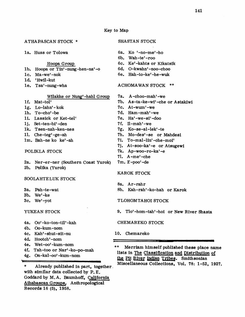
141
Key to Map
ATHAPASCAN STOCK *
la. Huss or Tolowa
lb.lc.ld.le.
Hoopa GroupHoopa or Tin'-nung-hen-na'-oMa-we'-nok'Hwil-kutTsa' -nung-wha
Wilakke or Nung'-hahl Grouplf. Mat-tol'lg. Lo-lahn' - koklh. To-cho' -beHi. Lassick or Ket-tel'lj. Set-ten-bi' -denlk. Tsen-nah-ken-nes11, Che-teg'-ge-ahlm. Bah-ne ko ke' -ah
POLIKLA STOCK
2a. Ner-er-ner (Southern2b. Polika (Yurok)
Coast Yurok)
SHASTAN STOCK
6a. Ko '-no-me'-ho6b. Wah-te'-roo6c. Ke'-kahts or Kikatsik6d. O-kwahn' -noo-choo6e. Hah-to-ke'-he-wuk
ACHOMAWAN STOCK **
7a. A-choo-mah'-we7b. As-ta-ke-wi'-che or Astakiwi7c. At-wum'-we7d. Ham-mah'-we7e. Ha'-we-si'-doo7f. Il-mah' -we7g. Ko-se-al-lek' -te7h. Mo-des'-se or Mahdesi7i. To-mal-lin' -che-moi'7j. At-soo-ka'-e or Atsugewi7k. Ap-woo-ro-ka' -e71. A-me'-che7m. E-poo'-de
KAROK STOCKSOOLAHTELUK STOCK
3a.3b.3c.
8a. Ar-rahr8b. Kah-rah'-ko-hah or KarokPah-te-wat
We'-keWe'-yot TLOHOMTAHOI STOCK
YUKEAN STOCK 9. Tlo'-hom-tah'-hoi or New River Shasta
4a.4b.4c.4d.4e.4f.4g.
Oo' -ko-ton-til' -kahOo-kum-nomKah'-shut-sit-nuHootch'-nomWet-oo'-kum-nomTah-too or Nar'-ko-po-mahOn-kal-oo'-kum-nom
* Already published In part, togetherwith similar data collected by P. E.Goddard by M. A. Baumhoff, CaliforniaAthabascan Grous. Anthropological
Records 16 (5), 1958.
CHEMAREKO STOCK
10. Chemareko
** Merriam himself published these place namelists in The Classification and Distribution of
$P River ndiain Tries. SmithsonianMiscellaneous Collections, Vol. 78: 1-52, 1927.

me m- T m
6b I
Bc
19d
Im
din
IIIIIIIIIIIIIIIIIIIIIIII
V A- Vk -