44238-012: Technical Assistance Consultant's Report - Asian ...
494
Technical Assistance Consultant’s Report This consultant’s report does not necessarily reflect the views of ADB or the Government concerned, and ADB and the Government cannot be held liable for its contents. (For project preparatory technical assistance: All the views expressed herein may not be incorporated into the proposed project’s design. Project Number: 44238 September 2014 Nepal: Urban Transport Planning and Management Prepared by IMC Worldwide United Kingdom For Ministry of Urban Development
-
Upload
khangminh22 -
Category
Documents
-
view
1 -
download
0
Transcript of 44238-012: Technical Assistance Consultant's Report - Asian ...

Technical Assistance Consultant’s Report
This consultant’s report does not necessarily reflect the views of ADB or the Government concerned, and ADB and the Government cannot be held liable for its contents. (For project preparatory technical assistance: All the views expressed herein may not be incorporated into the proposed project’s design.
Project Number: 44238 September 2014
Nepal: Urban Transport Planning and Management
Prepared by
IMC Worldwide
United Kingdom
For Ministry of Urban Development

ADB Grant : TA 7948-NEP
September 2014
Consultancy Services for
Urban Transport Planning and Management
Final Report Vol I : Urban Transport Strategy and Policy Brief

URBAN TRANSPORT PLANNING AND MANAGEMENT, NEPAL ADB GRANT TA 7948 – NEP
i
Imprint
Project Officer Chen Chen TASU, Asian Development Bank, Manila, Philippines
Project Director Suraj Rana IMC Worldwide
64-68 London Road, Redhill, Surrey, RH1 1LG, United Kingdom [email protected]
Project team Gottfried Roelcke Urban Transport Planner and Team Leader
[email protected] Madan Maleku Urban Transport Specialist and Deputy Team Leader
Krishna Ram Amatya Urban Environmental Specialist Subash Dhungel Urban Transport Infrastructure Specialist
Brendan Finn Urban Public Transport Specialist David Green Urban Environmental Specialist Jibgar Joshi Urban Development and Landuse Specialist
Douglas Lucius Urban Transport Demand Modeler Ananda Shrestha Urban Public Transport Specialist
Shreejan Shrestha Urban Environmental Specialist Rodney Stickland Urban Transport Infrastructure Specialist
Roy Wong Urban Street Design Engineer Charlotte Brown, Matteo Mazzoni Assistant Report Editors
This report can be downloaded from the following URL address: © Asian Development Bank

URBAN TRANSPORT PLANNING AND MANAGEMENT, NEPAL ADB GRANT TA 7948 – NEP
ii
Table of Contents
1 INTRODUCTION ............................................................................................................................................... 1
2 BIRATNAGAR CITY – LAND USE AND TRANSPORTATION ...................................................................... 3 2.1 BIRATNAGAR AN OVERVIEW ....................................................................................................................... 3 2.2 FUTURE DEVELOPMENT PROSPECTS FOR BSC ......................................................................................... 3
3 LANDUSE STRATEGY AND INSTRUMENTS TO IMPLEMENT THE STRATEGY .................................... 9 3.1 EXISTING LANDUSE PATTERN ..................................................................................................................... 9
3.1.1 The City Centre ........................................................................................................................ 9 3.1.2 The Residential Areas ............................................................................................................ 10 3.1.3 The Peri-Urban Areas ............................................................................................................ 10 3.1.4 The Industrial Corridor to the North....................................................................................... 10
3.2 LANDUSE CLASSES CURRENTLY USED BY BSC ....................................................................................... 10 3.3 LANDUSE CLASSES / PATTERNS FROM AN URBAN GEOGRAPHICAL PERSPECTIVE ................................... 11
3.3.1 Analytical Aspects .................................................................................................................. 11 3.3.2 Planning Aspects .................................................................................................................... 13
3.4 LANDUSE STRATEGY ................................................................................................................................ 14 3.4.1 Background............................................................................................................................. 14 3.4.2 Problems and Issues.............................................................................................................. 15 3.4.3 Vision ...................................................................................................................................... 16 3.4.4 Goal and Objectives ............................................................................................................... 16 3.4.5 Proposed Landuse Strategy .................................................................................................. 17
3.5 LANDUSE CLASSES PROPOSED FOR FUTURE URBAN MANAGEMENT ....................................................... 17 3.6 PROPOSED MECHANISM FOR FUTURE LANDUSE MANAGEMENT AND CONTROL ......................................... 22
3.6.1 Linkages Between Landuse Planning and Transport Planning ........................................... 22 3.6.2 Development Actors and Stakeholders................................................................................. 23 3.6.3 Regulatory Framework ........................................................................................................... 23
4 URBAN TRANSPORT INFRASTRUCTURE IN 2012 ................................................................................... 25 4.1 ELEMENTS OF CURRENT URBAN TRANSPORT INFRASTRUCTURE ............................................................. 25
4.1.1 Koshi Highway ........................................................................................................................ 25 4.1.2 Old Main Road........................................................................................................................ 26 4.1.3 Postal Road (Rangeli Road and Keshaliya Road) ............................................................... 26 4.1.4 Ring Road ............................................................................................................................... 26 4.1.5 Streets in the City Centre ....................................................................................................... 26 4.1.6 Collector Road Network ......................................................................................................... 26 4.1.7 Access Lane Network ............................................................................................................ 27 4.1.8 Road Network Planning and Development ........................................................................... 27 4.1.9 Sidewalks and Dedicated Lanes ........................................................................................... 27 4.1.10 Bridges .................................................................................................................................... 27 4.1.11 Bus Terminals, Tempo Terminals, and Bus/Tempo Stops .................................................. 27
URBAN TRANSPORT PLANNING AND MANAGEMENT, NEPAL ADB GRANT TA 7948 – NEP
iii
4.1.12 Taxi Stands ............................................................................................................................. 28 4.1.13 Border Crossing Point ............................................................................................................ 28
4.2 TRAFFIC MANAGEMENT ............................................................................................................................ 29 4.2.1 Parking Facilities .................................................................................................................... 29 4.2.2 Parking Regulation and Management ................................................................................... 29 4.2.3 Parking Behavior .................................................................................................................... 30 4.2.4 Traffic Management and Factual Use of Road Space ......................................................... 31 4.2.5 Factors Restricting the Use of Transport Infrastructure ....................................................... 31 4.2.6 Traffic Related Problems and Issues on the Existing Koshi Highway ................................ 31
4.3 CURRENT PASSENGER TRANSPORT SERVICES AND FACILITIES IN BIRATNAGAR ...................................... 32 4.3.1 Assessment of the Urban Passenger Transport in Biratnagar ............................................ 33 4.3.2 Issues to be Considered in Future Plans (Access, Affordability, Safety, Sustainability) ... 35 4.3.3 Institutional Capacity and Industry issues (Municipality, DoTM, Operators) ...................... 36
4.4 OVERALL CONCEPT AND MAIN PRINCIPLES OF THE UPT IMPROVEMENT PLAN ......................................... 37
5 URBAN TRANSPORT STRATEGY FOR BSC ............................................................................................. 40 5.1 PROBLEM STATEMENT ............................................................................................................................. 40 5.2 LONG-TERM VISION .................................................................................................................................. 41 5.3 TEN-YEAR GOALS .................................................................................................................................... 43 5.4 FIVE-YEAR GOALS.................................................................................................................................... 43 5.5 OBJECTIVE STATEMENT ........................................................................................................................... 43 5.6 PERFORMANCE INDICATORS AND TARGETS ............................................................................................. 46
5.6.1 Performance Indicators for Long Term Vision ...................................................................... 46 5.6.2 Performance Indicators for 10 Year Goals ........................................................................... 46 5.6.3 Performance Indicators for 5 Year Goals ............................................................................. 46 5.6.4 Specific Performance Indicators............................................................................................ 47
5.7 URBAN TRANSPORT STRATEGY - PRINCIPLES .......................................................................................... 49 5.8 ACTION PROGRAM FOR IMPROVING THE URBAN TRANSPORT SYSTEM .................................................... 51
5.8.1 General Aspects ..................................................................................................................... 51 5.8.2 Development of Infrastructure System.................................................................................. 52 5.8.3 Improvement of Traffic and Parking Management ............................................................... 67 5.8.4 Enhancement of Urban Public Transport.............................................................................. 69 5.8.5 Facilitation of Non-Motorized Transport ................................................................................ 74 5.8.6 Policy Action ........................................................................................................................... 76
5.9 SPECIAL CHALLENGES AND PROGRAMS ................................................................................................... 78 5.9.1 Improvement of the Koshi Highway’s Intra-Urban Section .................................................. 78 5.9.2 Improvement Plan for the Central Area ................................................................................ 78
5.10 LONG LIST OF CONCEIVABLE PROJECTS .................................................................................................. 79 5.11 FISCAL SUSTAINABILITY AND BUDGET CONSTRAINTS ............................................................................... 79
5.11.1 Fiscal Situation ....................................................................................................................... 79
6 ENHANCEMENT OF INSTITUTIONAL CAPACITY FOR TRANSPORT PLANNING AND MANAGEMENT ............................................................................................................................................... 81
6.1 OVERALL APPROACH................................................................................................................................ 81

URBAN TRANSPORT PLANNING AND MANAGEMENT, NEPAL ADB GRANT TA 7948 – NEP
iv
6.2 LEGAL AND INSTITUTIONAL FRAMEWORK.................................................................................................. 81 6.2.1 Introduction ............................................................................................................................. 81 6.2.2 Institutional Mapping .............................................................................................................. 82 6.2.3 Town Development Committee (TDC) .................................................................................. 84 6.2.4 Nepal Road Board .................................................................................................................. 85 6.2.5 Strengthening Town Development Fund .............................................................................. 85
6.3 FUNCTION/ORGANIZATION OF BSC .......................................................................................................... 86 6.3.1 General Issues ....................................................................................................................... 86 6.3.2 Capacity Gaps ........................................................................................................................ 87 6.3.3 Existing Measures to Address Capacity Gaps ..................................................................... 89
6.4 PROPOSED INSTITUTIONAL ENHANCEMENT ACTION PROGRAM ................................................................ 89 6.4.1 Purpose ................................................................................................................................... 89 6.4.2 Reorganization ....................................................................................................................... 89 6.4.3 Scope of work for Landuse Planning and Transport Management Section ....................... 90 6.4.4 Linkage with Policy, Program and Budget Estimate of BSC for FY 2013/14 ..................... 91 6.4.5 Coordination Mechanism in Urban Transport in BSC .......................................................... 91 6.4.6 Action Program ....................................................................................................................... 94 6.4.7 List of Actions ......................................................................................................................... 94 6.4.8 Expected Outputs & Outcomes of IEAP ............................................................................... 95
7 DESIGN AND MONITORING FRAMEWORK ............................................................................................... 97 7.1 ACTIVITIES PERFORMED WITH MILESTONES REACHED BY SEPTEMBER 2014 .......................................... 97
7.1.1 Comprehensive urban transport and land use strategy ....................................................... 97 7.1.2 Institutional enhancement ...................................................................................................... 97
7.2 OUTPUTS .................................................................................................................................................. 99 7.3 OUTCOME AND IMPACT ............................................................................................................................. 99 7.4 A WAY FORWARD ...................................................................................................................................100

URBAN TRANSPORT PLANNING AND MANAGEMENT, NEPAL ADB GRANT TA 7948 – NEP
v
Abbreviations ADB Asian Development Bank
BSC Biratnagar Sub-Metropolitan City
CBD Central Business District
CBS Central Bureau of Statistics
DoR Department of Roads in the MPPW / MPPWTM
DoTM Department of Transport Management in the MPPW / MPPWTM
DUDBC Department of Urban Development and Building Construction; until April 2012 part of the MPPW, since May 2012 part of the newly formed Ministry of Urban Development (MoUD)
DWSS Department of Water Supply and Sewerage
EO Executive Officer
FAR Floor Area Ratio
FGD Focus Group Discussion
FNNTP Federation of Nepal National Transport Entrepreneurs
GIZ German Technical Cooperation (until 2010 named GTZ)
GoN Government of Nepal
GTZ German Technical Cooperation (since 2011 named GIZ)
HRD Human Resource Development
IAP Integrated Action Plan
ICP Integrated Check Point
IEAP Institutional Enhancement Action Program
KfW German Bank for Reconstruction and Development
LSGA Local Self Governance Act (1999)
MLD Ministry of Local Development; since May 2012 transformed into MoFALD
MoFALD Ministry of Federal Affairs and Local Development (successor organization to the MLD)
MoSTE Ministry of Science, Technology and Environment
MoUD Ministry of Urban Development (newly formed in May 2012)
MPPWTM Ministry of Physical Planning and Works and Transport Management (until April 2012 only MPPW)
MuAN Municipal Association of Nepal
URBAN TRANSPORT PLANNING AND MANAGEMENT, NEPAL ADB GRANT TA 7948 – NEP
vi
NMT Non-motorised transport
NRM Nepal Resident Mission of ADB
PCU Passenger Car Unit
REC Regional Economic Centre
RF Regulatory Framework
RoW Right of Way
SC Steering Committee
SEAM-N Strengthening Environmental Administration and Management at the Local Level in Nepal (a bilateral cooperation project with the Government of Finland)
SEZ Special Economic Zone
SRN Strategic Road Network
STIUEIP Secondary Towns Integrated Urban Environmental Improvement Project, an investment project with funding from ADB
TDA Town Development Act
TDC Town Development Committee
TDF Town Development Fund (an autonomous body established under Nepalese law)
TM Transport Management
UDLE Urban Development through Local Efforts, a technical cooperation program with funding from the Government of Germany and implemented by GTZ
ULD Urban Land Development
UPT Urban Public Transport
UTD Urban Transport Division
VDC Village Development Committee
Note: Exchange rate at 31 December 2012 (for reader's guidance only): Nepalese Rupee (NR) 88 = 1 US Dollar ($)
The official Nepalese calendar (used for key events, e.g. religious festivals, laws etc. and occasionally referred to in this document) is approximately 57 years ahead of the internationally used Gregorian calendar. The current year 2013 is 2069/2070 (Nepalese calendar).

URBAN TRANSPORT PLANNING AND MANAGEMENT, NEPAL ADB GRANT TA 7948 – NEP
1
1 INTRODUCTION 1. Cities in the Terai (lowlands) of Nepal have great potential for economic growth and will
attract a large share of the rural-urban migration that will inevitably occur within the foreseeable future. These cities usually possess greater land and water resources and better potential for infrastructure expansion and improvement than the towns and cities in the hill regions. One of the most prominent cities in the Terai is Biratnagar, officially labeled Biratnagar Sub metropolitan City or BSC. BSC has more inhabitants (201,125 persons, according to the 2011 population census results) than Birgunj (the second largest city in the Terai region, located further west) although the latter serves as the main gateway for land transport to and from Nepal, owing to its proximity to the Kathmandu valley.
2. Considering that BSC plays a leading role in the economy of the country, the Government of Nepal (GoN) and ADB selected it for the implementation of a Technical Assistance (TA) assignment with a focus on urban transport planning and management.
3. The purpose of this TA is to assist the municipality of BSC by (i) preparing a comprehensive urban transport and land use strategy, and (ii) enhancing BSC’s institutional capacity to update and implement the strategy. The outcome of the TA is expected to strengthen the capacity of BSC municipality in planning and management for sustainable urban transport. This should enable the BSC municipality to implement, regularly review, and update the strategy that has been developed under the TA and the impact of the TA is expected to be improved planning and management for sustainable urban transport in Nepal.
4. The composition of the project team is described in the Imprint (page i). To guide and oversee the implementation of this TA, GoN has formed a Steering Committee (SC) chaired by the Secretary of the Ministry of Urban Development (MoUD). Day-to-day coordination of this TA at the national level rests with the Deputy Director General of the DUDBC.
5. In accordance with the Terms of Reference, the consultants have prepared two interim reports. Interim Report A refers to the Urban Transport Strategy and Institutional Enhancement Plan for Biratnagar Sub-Metropolitan City in which the present land use, traffic and public transport situation were analyzed to come up with the future strategy to integrate urban land use and public transport. Interim Report B is the Toolkits and Guidelines used in developing the strategy. Seven different modules relating to traffic engineering and management, road safety, managing non-motorized vehicles & public transport, parking management, urban infrastructure management and integrating land use and transport planning were prepared for the use of city planners and engineers. Besides, a handbook on Transport Planning and Management was also prepared for the municipal engineers to guide through a step by step process to prepare their own City Transport Plan.
6. This report (Volume 1) is the summary of Interim Reports A and B and also covers the Design and Monitoring Framework. Two other separate volumes of the Final report have

URBAN TRANSPORT PLANNING AND MANAGEMENT, NEPAL ADB GRANT TA 7948 – NEP
2
also been prepared; Vol.II on the training delivered and Vol.III Terms of Reference for establishing the Urban Transport Division in MOUD and the Urban Transport Section in DUDBC.
7. All reports mentioned above and listed below are standalone document and may be referred in accordance to the need of the users.
Interim Report - I : Urban Transport Strategy and Institutional Enhancement Plan for Biratnagar Sub metropolitan City
Interim Report - II : Toolkits and Guidelines Design and Monitoring Report?
Final Report Volume - I : Urban Transport Strategy and Policy Brief Final Report Volume - II : Terms of Reference Final Report Volume - III : Training on Urban Transport Management

URBAN TRANSPORT PLANNING AND MANAGEMENT, NEPAL ADB GRANT TA 7948 – NEP
3
2 BIRATNAGAR CITY – LAND USE AND TRANSPORTATION
2.1 BIRATNAGAR AN OVERVIEW 8. Biratnagar is one of the oldest cities of Nepal. It is located approx. 240km southeast of
Kathmandu in the eastern most densely populated part of the Terai Region, approx. 70 m above sea level, on the Indian border. The old Postal Highway that runs parallel to the border crosses the city from east to west. Nepal’s new East-West Highway, however, runs approx. 20 km further north, through Itahari. With this, Biratnagar lost the key strategic position it had for centuries. Even so, it is still the largest city in the eastern part of the country and Nepal’s fourth most populous city (after Kathmandu, Lalitpur, and Pokhara), with a population of approx. 201,125 in 2011 of which 101,949 were males and 99,176 females. The number of households was 45,131.
9. Compared to other cities of similar size i.e. Pokhara, Lalitpur, Bharatpur and Birgunj, its population growth in the decade to 2011 is the second lowest after Birgunj and the density of population is also second lowest after Bharatpur. Most parts of the city still include agricultural landuse. It would not be entirely correct to say that Biratnagar was at an initial stage of urbanization but this data shows that urbanization in Biratnagar has slowed during the last decade. The city has not been able to carry the growth momentum it had in the 1970s and 1980s.
10. Data on the economic structure and GDP specifically of BSC was not obtainable. In economic statistics, BSC is still lumped together with Morang District of which it used to be part, until recently. The GDP of Morang District was Rs. 17,690 M in the year 20071.
11. The problem of persistent, serious shortages in the supply of electrical power is expected to prevail at least until the year 2017, possibly even several years longer2. A decrease in the frequency and seriousness of disputes between employers and labor unions will be related to the restoration of political certainty and calm in the whole nation. The absence of such certainty has been very pronounced in 2012, and the consultant is not in a position to provide a projection when it will be restored. It is unrealistic to expect a significant positive development of the manufacturing sector before these two issues have been resolved.
2.2 FUTURE DEVELOPMENT PROSPECTS FOR BSC 12. Looking into the current pace of development, the manufacturing sector is expected to
continue to stagnate at least for another five years. This will continue to affect the whole regional economy of BSC and Morang District. After that, the consultant is cautiously optimistic that the regional economy will slowly recover which would also manifest itself in a slightly accelerated population growth rate for BSC.
1 Statistical Yearbook of Nepal 2011 2 Guidance given to the consultant during the Steering Committee Meeting on 12 December 2012

URBAN TRANSPORT PLANNING AND MANAGEMENT, NEPAL ADB GRANT TA 7948 – NEP
4
13. BSC’s economy, especially its service sector, will experience a further boost from the establishment of the new Integrated Checkpoint (ICP at the Nepal-India border, just south of the administrative boundary of BSC. The government is also considering the expansion of Biratnagar’s airport which may be welcome in the context of a growing regional economy even if such an expansion may not be a trigger for economic growth.
Scenario “Take For Granted”
14. This scenario comprises the very high probability that several currently known initiatives will be carried out and completed within a very short time, i.e. within 2014 and 2015, and that some currently observed trends will continue. These are:
the continued construction and eventual completion of the ICP south of BSC,
the construction and completion of a new road that connects the ICP to the Koshi Highway,
continued work on the ring road around BSC (although without the prospect that it will be completed in the near future and thus without the ability to provide an attractive as bypass route around the city),
the construction and completion of a new rail link from India to a new terminus located east of BSC in Katahari VDC,
the reactivation of the government-owned jute mill in Ward 20,
continued establishment of new educational facilities, many of them private sector-driven.
15. However, the scenario also considers that several existing development constraints will most likely continue to impede the development of BSC:
the shortages in the supply of electrical power will continue,
political stability will be restored only slowly,
the ability of the political forces to make bold decisions will increase only slowly,
the risk of labor disputes impeding economic operations, especially in the manufacturing sector, will recede only very slowly.
16. As a result, BSC will experience:
population growth at more or less the rate of natural growth, without significant net migration,
continued slow expansion of the residential areas, interspersed with educational facilities,
continued slow expansion of the commercial areas including the CBD,
the creation of new jobs at the government-owned jute mill in Ward 20, and
the creation of more new jobs mostly in scattered locations.

URBAN TRANSPORT PLANNING AND MANAGEMENT, NEPAL ADB GRANT TA 7948 – NEP
5
Scenario “Continued Slow Development of both the Public and the Private Sector after 2014”
17. This scenario assumes that after 2014 BSC will still not receive many additional development boosts over and above the “Take-for-Granted” scenario. The only major new boost would be the establishment of several private hospitals whereby BSC should make every effort to locate such hospitals in one geographical cluster near the existing Nobel Medical College.
18. On the other hand, the constraining factors mentioned above would largely continue to prevail or show only very slow improvement. This would continue to impede the development of the private sector, including the revitalization of the manufacturing sector.
19. As a result, BSC will experience:
only slightly accelerated population growth, with some net migration gains,
only slightly accelerated expansion of the residential areas, interspersed with educational facilities,
only slightly accelerated expansion and minimal quality improvement of the commercial areas including the CBD, and
the creation of more new jobs mostly in scattered locations.
Scenario “Rapid Public Sector Development but Slow Private Sector Development after 2014”
20. This scenario assumes that BSC will experience an additional development boost, presumably sometime between 2015 and 2022 in the form of endowment with significantly enhanced administrative functions, e. g. in conjunction with the restructuring of Nepal into a federal republic, and the resulting creation of several hundred new jobs in public administration, a significant portion of which would be for a highly qualified workforce; these new jobs would be situated in or near the city centre.
21. On the other hand, the constraining factors mentioned above would largely continue to prevail or show only very slow improvement. This would continue to impede the development of the private sector, including the revitalization of the manufacturing sector.
22. As a result, BSC will experience:
a somewhat accelerated population growth, with some net migration gains,
a somewhat accelerated expansion of the residential areas,
a somewhat accelerated development of educational facilities, mainly in the south eastern and the south western part of BSC,
a somewhat accelerated expansion and slight quality improvement of the commercial areas incl. the CBD, and

URBAN TRANSPORT PLANNING AND MANAGEMENT, NEPAL ADB GRANT TA 7948 – NEP
6
the somewhat accelerated creation of more new jobs mostly in scattered locations.
Scenario “Slow Public Sector Development but Rapid Private Sector Development after 2017”1
23. This scenario assumes that the constraining factors mentioned above would gradually be overcome and the development of the private sector, including the revitalization of the manufacturing sector, would experience a very noticeable boost, beginning in 2018 and accelerating after 2022. This could include:
a noticeable revitalization of the industrial corridor north of BSC along the Koshi Highway with the creation of numerous new jobs, albeit mostly for low-income workers,
the effective development of a Special Economic Zone in Ward 20 with the creation of numerous new jobs albeit mostly for low-income workers,
a rapid expansion of the hospital cluster and
development of a cluster of new businesses focused on export/import, freight forwarding and customs clearance, warehousing, etc. near the new ICP south of BSC.
24. The public sector, on the other hand, would fail to experience the boost and therefore show only very slow growth and diversification.
25. As a result, BSC will experience:
a somewhat accelerated population growth, with some net migration gains,
a somewhat accelerated expansion of the residential areas,
a somewhat accelerated development of educational facilities, mainly in the south eastern and the south western part of BSC,
a somewhat accelerated expansion and slight quality improvement of the commercial areas incl. the CBD,
a somewhat accelerated creation of more new jobs mostly in scattered locations.
Scenario “Rapid Public Sector Development and Rapid Private Sector Development after 2014”
26. This scenario assumes that BSC would enjoy both development boosts and therefore experience high growth and rapid development in various economic sectors and in many parts of the city.
27. Under this scenario, BSC will experience:
a significantly accelerated population growth, with large net migration gains both of low and high-qualification workforce,
1 The year 2017 has been chosen as a reference year for this scenario because the Steering Committee informed the consultant
that the current, serious shortages in the supply with electrical power will almost certainly not be overcome before 2017
URBAN TRANSPORT PLANNING AND MANAGEMENT, NEPAL ADB GRANT TA 7948 – NEP
7
a significantly accelerated expansion of the residential areas,
possibly the development of high-density housing,
a significantly accelerated development of educational facilities, mainly in the south eastern and the south western part of BSC,
a significantly accelerated expansion and quality improvement of the commercial areas incl. the CBD,
the significantly accelerated creation of more new jobs in numerous locations.
28. The scenarios described above correspond to the conceivable future trends in overall population development. Hereby, the scenario “Continued Slow Development of both the Public and the Private Sector after 2014” corresponds to the lower expectation of future population growth, the scenario “Rapid Public Sector Development and Rapid Private Sector Development after 2014” corresponds to the higher expectation of future population growth, and the scenarios “Rapid Public Sector Development but Slow Private Sector Development after 2014” and “Slow Public Sector Development but Rapid Private Sector Development after 2017”correspond to the medium expectation of future population growth.
29. The consultant has estimated the impacts of each scenario on long-term population growth and job creation by Ward and by TAZ1. A simplified comparison of the main features of the abovementioned four scenarios is presented in tabular form below).
1 A “Traffic Analysis Zone” (TAZ) is the unit with which transport demand modeling operates. For purposes of this TA, BSC was
subdivided into 36 TAZ, i.e. some wards were subdivided into 2 or 3 TAZ. More details of that methodology are described in Chapter 7

URBAN TRANSPORT PLANNING AND MANAGEMENT, NEPAL ADB GRANT TA 7948 – NEP
8
Table 1 : Comparative Summary of the Four Scenarios
Parameter
Long-Term Scenario Continued Slow Devel-
opment of both the Public and the Private
Sector after 2014
Rapid Public Sector Development but Slow Private Sector Devel-
opment after 2014
Slow Public Sector Development but Rapid
Private Sector Development after 2017
Rapid Public Sector Development and Rapid
Private Sector Development after 2014
Population Only slightly accelerated population growth
with little net migration gains
Somewhat accelerated growth with some net migration gains
Significantly accelerated growth, with large net migration gains both of
low and high-qualification workforce
Residential area
Only slightly accelerated expansion of the residential areas, interspersed with
educational facilities
Somewhat accelerated expansion, somewhat accelerated development of educational facilities, mainly in the south eastern and the south western
part of BSC
Significantly accelerated development, possibly high-density housing,
significantly accelerated development of
educational facilities, mainly in the south
eastern and the south western part of BSC
Commercial area/CBD
Only slow expansion and minimal quality
improvement
Somewhat accelerated expansion and slight quality improvement
Significantly accelerated expansion and quality
improvement Industrial corridor north of BSC
Slow and limited revitalization Noticeable revitalization
North East near the city centre
- New government complex with increased
qualified workforce, substantial trip attraction
to one single location
- New government complex with increased qualified
workforce, substantial trip attraction to one single
location Northwest BSC
Slow expansion of the hospital cluster Rapid expansion of the hospital cluster
Ward 20 Jute mill Jute mill; effective development of a Special Economic Zone
South of BSC near the new ICP
Slow development of a cluster of new businesses focused on export/import, freight forwarding and
customs clearance, warehousing, etc.
Rapid development of a cluster of new businesses focused on export/import, freight forwarding and
customs clearance, warehousing, etc. New jobs within BSC
Jute mill in Ward 20, some more jobs in scattered locations
Jute mill in Ward 20, some more jobs in scattered locations; numerous additional
jobs in the public sector; somewhat accelerated job creation in scattered
locations
Jute mill in Ward 20, numerous jobs albeit mostly for low-income workers; somewhat
accelerated job creation in scattered locations
Jute mill in Ward 20, numerous jobs albeit mostly for low-income
workers; numerous additional jobs in the
public sector; significantly accelerated job creation
in many locations

URBAN TRANSPORT PLANNING AND MANAGEMENT, NEPAL ADB GRANT TA 7948 – NEP
9
3 LANDUSE STRATEGY AND INSTRUMENTS TO IMPLEMENT THE STRATEGY
3.1 EXISTING LANDUSE PATTERN 30. The area of Biratnagar has not changed for a long time. The government policy until the
mid-eighties was to discourage the development of towns located on the India-Nepal border. Instead, the policy then encouraged the foothills towns along the East-West Highway. Despite being one of the biggest manufacturing and commercial cities of Nepal, its economy depends on agriculture and agro-based industries. Its population was expected to grow more rapidly than what actually happened. This implies the failure to exploit its potential to create off-farm jobs. The pace of urbanization by ward is varied and most of them are still rural. Change in landuse has involved spatial growth of residential, commercial, institutional and industrial activities. These are located chiefly along the main thoroughfares within its boundary and outside.
31. The rapid growth of urban population brings about changes in the spatial phenomenon of the urban area. One such consequence would be the change in the existing landuse pattern. The urban built-up area of Biratnagar increased from about 5% in 1976 to 38% in 2009, while the cultivated land decreased from 79 to 56% during the same period. The urban expansion in Biratnagar has taken place at the cost of other major landuses such as forest and water bodies. The area of urban landuse categories being predicted indicates further increase of the urban built-up area by about 10% in 2019 over that of 2009.
3.1.1 THE CITY CENTRE 32. The city centre (identical with the historical centre) shows the highest intensity of landuse
in general and the highest concentration of commercial use. However, even in the very centre of the city, the built up area is surprisingly patchy. Numerous plots are used only at low intensity, certainly much below their theoretical commercial potential in the respective locations (e. g. along the Koshi Highway). Many of them have single-story structures, many others are not built-up at all and used only for storing materials, parking trucks, or similar purposes.
33. As a result, these plots do not generate much traffic or transport demand. The reasons for such low-intensity use of urban land are various: in some cases, legal disputes have arisen that deter any party from investing in physical structure; in other cases, the current land owners may just speculate on increasing value in the future. Such individual plots need to be converted to higher-intensity types of landuse, which will generate greater transport demand.

URBAN TRANSPORT PLANNING AND MANAGEMENT, NEPAL ADB GRANT TA 7948 – NEP
10
3.1.2 THE RESIDENTIAL AREAS 34. To the north, east, and south, the commercial area is flanked by residential areas that
begin a fairly short distance from the city centre. The southern residential areas are of a fairly high standard, with regard to both the dwellings themselves and the quality of the access lanes (mostly with blacktop surface). By contrast, the lanes in the residential areas north of the city center are of significantly poorer quality, their surfaces often consisting of rather coarse gravel which impedes access by bicycle and rickshaw. The main reason for this difference is reportedly that better-quality residential buildings emerged first in the southern part. In the northern part, middle class housing appeared only later.
3.1.3 THE PERI-URBAN AREAS 35. Adjacent to the established residential areas are peri-urban areas with even lower
densities and an increasing share of agricultural land, whereby the transition from rural to urban landuse pattern is fairly gradual on the southern and eastern side but rather sudden on the western side. The reason for this difference is reportedly that the western side of BSC’s administrative area is more low-lying and more prone to water logging.
3.1.4 THE INDUSTRIAL CORRIDOR TO THE NORTH 36. Beginning immediately outside the administrative boundaries of BSC, a string of large
manufacturing compounds has been established on either side of the Koshi Highway north of Biratnagar. Within the municipal boundaries, there is hardly any such development, and several reasons for this difference are:
Within BSC more rules would have to be followed; and land price is higher.
More/higher taxes are imposed within the municipal boundary.
The need for landuse compliance is more rigorous within the municipal boundary.
From an environmental point of view, the area to the north is better.
37. Also, it is remarkable that the presence of so many industries (and the work places there) has not spawned denser residential development in the areas nearby, whether inside or outside the BSC boundaries.
3.2 LANDUSE CLASSES CURRENTLY USED BY BSC 38. BSC sees little possibility of rejecting a building permit application unless there is clear
evidence of a negative environmental impact. Incompatibility with the landuse plan alone will not suffice for rejection. BSC staff quote court cases where landowners prevailed with their intention to erect buildings according to their own plans, with the courts interpreting individual property rights rather widely, to the disadvantage of public authorities and their attempts to impose restrictions. In this way, the requirement to apply for a building permit

URBAN TRANSPORT PLANNING AND MANAGEMENT, NEPAL ADB GRANT TA 7948 – NEP
11
becomes more a revenue generating instrument rather than a controlling instrument. However many participants in Focus Group Discussions have insisted that BSC should implement landuse control with determination in a fair manner.
39. The BSC by-laws state that the activities being undertaken in BSC play a crucial role in determining the structure of the city and that it requires that existing activities can be taken as guidelines to ensure that urban development in the future goes in a right and proper direction. If not, then the proposed landuse zones may be futile. Keeping in mind these guidelines, BSC decides which activities are suitable in which landuse zones and thereby manages rationally all activities being undertaken within the Sub-metropolis.
40. BSC has prepared a working document entitled “Standards Relating to Buildings and Other Construction” that guides the definition of landuse classes. The municipal area has been classified for the purpose of landuse into the following classes with the intent of bringing uniformity for all the works to be constructed in areas within the BSC boundary: a) residential b) residential cum commercial c) institutional d) rural residential e) industrial zone f) agricultural zone.
3.3 LANDUSE CLASSES / PATTERNS FROM AN URBAN GEOGRAPHICAL PERSPECTIVE
3.3.1 ANALYTICAL ASPECTS 41. The official landuse class “Residential” lumps together various types of residential and
commercial landuse. An urban geographer, on the other hand, will identify various areas of commercial landuse: the city centre and the corridor along the Koshi Highway are areas of relatively contiguous commercial landuse although these areas also contain many plots that are still used with only low or very low intensity. In addition, the city features numerous smaller clusters of shops and other small commercial establishments, often near road junctions. These areas are not adequately described by the label “residential”. A definition for “high-intensity commercial” and “low-intensity commercial” could be sought and also used for the pro-active planning of future landuse.
42. The term “high quality buildings” are used to denote buildings made up of superior and modern building materials like cement and steel. They are structurally designed for withstanding some earthquake loads and follow the building codes and norms. Most of the traditional buildings may be considered to be of low quality as they are in relatively poor conditions and are built out of adobe, bamboo and timber. The rest may be categorized as medium quality.
43. High-density residential landuse is currently still absent but this does not mean it should be excluded from urban landuse planning considerations. Many residential areas can be classified as medium-density; they will probably show only slight trends towards higher densities in the foreseeable future because most plots are already developed and built-up. Low-density areas at the periphery of the city show a large percentage of plots that have not been developed and built up as yet. However, more development and a resulting increase in densities can be projected to happen in the foreseeable future.

URBAN TRANSPORT PLANNING AND MANAGEMENT, NEPAL ADB GRANT TA 7948 – NEP
12
44. One can differentiate landuse classes that are not necessarily suitable for identification in a landuse planning exercise and attach further descriptions to them, e. g.:
the CBD with its wide range of intensities of landuse and also a wide range in the quality of buildings whereby some of the oldest and – remarkably - most deteriorated buildings are right in the centre of the CBD,
a corridor of commercial use along the Koshi Highway, not surprisingly with a focus on road vehicles (incl. spare parts and repair shops) or heavy goods whose transport requires a utility vehicle or truck,
small clusters of semi-intensive commercial activity, mostly around important junctions, whereby design and quality of the buildings are often rather unhelpful to providing an appealing urban design,
well-established residential neighborhoods, often dominated by middle and upper class housing with only very small poverty pockets (often just a single plot) included in them and many plots used for educational facilities, predominantly with low densities and a low level of dynamics in their development (i.e. little further construction / densification at present),
45. Various factors shape landuse in a city. Landuse evolves through the consideration of several factors such as:
resource use, the land market,
an overall regulatory framework, explicit or implicit, that guides the actual operation, etc.
ecological integrity,
46. Landuse plans should guide the future use of land, the formation of real estate, and the placing of necessary infrastructure. Proposed landuse patterns over time should be based on the functional role of the area under consideration.
47. The classical concept is based on zoning. Major landuses such as residential, industrial, commercial and so on were isolated from each other. However, the concept of strictly single-purpose landuse (especially purely residential landuse) is increasingly coming under scrutiny because a city becomes livelier when certain land uses coexist and low density residential areas tend to generate enormous transport demand. .
48. It is necessary to integrate transport planning and landuse planning to minimize the increase in transport needs, enhance mobility, and achieve greater efficiency. Implementation of landuse classes should help BSC prepare for the inevitable increase in transport demand as a result of the city’s growth and development. High densities, makes efficient transport provision more economically viable. BSC should have the competence to study and assess and monitor indicators such as density, open space, road surface ratio, and greenery ratio.

URBAN TRANSPORT PLANNING AND MANAGEMENT, NEPAL ADB GRANT TA 7948 – NEP
13
49. It is necessary to focus on the extent and forms of public intervention to resolve conflicting demands on landuse and its conversion. This will help to bring consensus and legitimize the public control that can help achieve the goals of sustainable development of BSC.
50. With the growth of population and the resulting human activities, there will be pressure on urban land. The extension of the city boundary will lead to the conversion of the farmland at the fringe into urban land. Yet, the pressure on the core will not be relieved due to the geography of concentration and agglomeration economies. Immediate intervention is suggested below for enabling the city centre of BSC to cope with the increasing pressure.
3.3.2 PLANNING ASPECTS 51. The best strategy will be to make the centre function well by encouraging agglomeration
economies. The city centre will house activities that produce highest rent since the seller will sell land to the highest bidder. Such activities can be commercial activities, banking, hotels, and so on. The city centre should be allowed to expand in all directions except to the west where the Koshi Highway (or Malaya Road on the Southern part) should be the limit. The transport implications of this approach will be managing traffic and parking areas and encouraging appropriate modes of transport in the city centre to provide better access for suppliers and consumers. Their connectivity with the city centre is of critical significance for sustaining a vibrant economy there.
52. Other foreseeable central places, apart from the city centre, are industrial centres to the north and the revival of a centre at the India-Nepal Border. The centre to the north may be called Industrial Centre while that to the south Trade and Commerce Centre.
53. Of particular importance is the Trade and Commerce Centre at the India Nepal border. The possibility of a cluster with Jogbani of India is difficult to predict as it depends on the extent of collaboration between the two nations. Any efforts made by the two nations would harness the urbanization potentials of the area for their mutual benefit.
54. The establishment of an industrial zone to the north will create another centre. This should be allowed to develop with some sort of revival of old industries. From their interaction programs, the consultants have found a high degree of optimism in resolving labor disputes and supplying adequate energy within the next five years. Provisions should be made for providing housing and appropriate services for industrial workers.
55. As some of the areas will be far from the city centre, the poor will have to commute much longer distances if BSC were mono-centric; the two centers proposed will make BSC polycentric and provide job opportunities for people in the peri-urban areas. This way the poorer section of the population will be able to save transport costs. On the other hand, the development as a mono-centric city implies further chaos at the centre and given the affordability level the city centre will be inaccessible to many of the poor. One should plan

URBAN TRANSPORT PLANNING AND MANAGEMENT, NEPAL ADB GRANT TA 7948 – NEP
14
in such a way that most people would not have to visit the city centre for less important activities.
56. Thickening of the corridor through intensifying activities along the Koshi Highway and the expansion of the centers (comprising of the city centre and the proposed centers to the north and to the south) will largely define areas for intensive development.
57. Theoretically speaking, landuse in areas far from the centre or from the corridor should be preserved as agricultural land. Areas mainly to the west will remain agricultural with activity centers at appropriate places, for instance, along the Ring Road. Ring road project should be implemented in a phased manner. Activity centers at appropriate points on the ring road alignment should first be developed and the ring road should be upgraded appropriately following the intensity of urbanization as well as the economic functioning of such centers. Clusters in the form of activity centers will help sustainable use of resources ensuring optimum landuse by encouraging mixed-use. Following the spirit of National Urban Policy, attempts should be made to restrict development in the possible agricultural land. Farmers located far from the market would receive a lower return because their costs, specifically their transportation costs, would be higher than the costs of farmers who were located nearer to the market. This shows that the proposed activity centers will help to sustain agricultural activities.
3.4 LANDUSE STRATEGY
3.4.1 BACKGROUND 58. The conventional way of guiding landuse through zoning and the application of by-laws
has been flawed by several limitations. Although there are various ways of producing an optimum use of the urban land, the process involves many practical problems. The utility to the owner will reduce with the compliance of regulations. The process becomes more rigorous with the increasing scarcity of land. There will be more tax imposed as land value increases and the pressure on land is already high. In other words, there is a tendency to enforce rules when it is easier to do so and public pressure grows to defy them as they become more critical.
59. Urban land development (ULD) means the enhancement of the utility of land for individuals and the society as a whole. It is achieved by:
providing necessary infrastructure;
readjusting the individual parcels of land into regular forms; and
locating different functions to enhance the productivity of land in a city.
60. Although the conversion of farmland into urban use is inevitable, it is necessary to stop premature conversion. Development of land in selected areas using the technique of land pooling will have positive impact on the planned development. This will help to restrict the haphazard growth of the city.

URBAN TRANSPORT PLANNING AND MANAGEMENT, NEPAL ADB GRANT TA 7948 – NEP
15
61. The decadal population growth rate for the period 2001 – 2011 is 1.9% per annum. This growth rate is expected to drop if no intervention is made. This shows a total increase of only about 30,000 in the next decade. Out of this, migrants may constitute about 30%. Migrants, usually, do not have enough money to buy land; their demand for land will show in the market only after they have a reasonable income. This means their demand for land is minimal. Access to housing for new migrants is limited and, if housing is not provided, a considerable portion of them will turn out to be squatters. The percentage of squatters in BSC now is reported to be about 15%.
3.4.2 PROBLEMS AND ISSUES Weak implementation: There are serious shortcomings in the application of the
existing legal and institutional tools. Problems are related with the effectiveness of the implementation process. There is a lack of seriousness in enforcing landuse control. BSC’s ability to enforce it is related to legal conflicts. The description of landuse classes is vague with a lack of clarity on what is permitted and what is not. Public control measures are not often explicitly laid out.
There is inequitable and discriminatory application of the existing law with undue interferences from officials. Whatever tools are available they are not used uniformly. It is difficult to have an opinion on the use of a particular tool. There is confusion even within the government system. The wider scope and significance of landuse planning and the need for landuse control have yet to be articulated and ingrained.
Despite the availability of the legal tools, BSC does not yet have a comprehensive regulatory framework that would meet its specific needs in controlling landuse. As a result, major challenges remain unsolved regarding how to manage haphazard growth.
The physical development in the Periodic Plan is not backed by the investment commitment of the public sector. Market forces, by themselves, are not sufficient to materialize BSC’s role as a regional economic centre.
Lack of political will: The planning framework is not adequately legitimized or accepted. The municipal engineer can do anything with the support of the government (local or national). This sort of attitude may have undemocratic precedents for the future and erodes the political will. Moreover, discretionary application is likely to lead to corruptive practices.
There is a lack of qualified and motivated planners to steer the development process. It is necessary to train them with a view to enabling them to deal with the emerging challenges of urban development and transport management in BSC.
Participation: Lack of awareness and knowledge limits participation. When government initiates changes frequently and abruptly for political motives, they are likely to be defied and there will be protests.
Existing rules and regulations do not encourage the private sector to be engaged in urban development. Most of the rules and regulations are not adequate to

URBAN TRANSPORT PLANNING AND MANAGEMENT, NEPAL ADB GRANT TA 7948 – NEP
16
respond to the changing needs and public agencies respond slowly to changed situations.
Planning goals are overlooked for the sake of increased production and long term goals are sacrificed for immediate returns. Compliance rate is poor even with government agencies.
3.4.3 VISION 62. The periodic plan contains the following Vision Statement: "A prosperous, developed and
business city, culturally vibrant, and child-friendly is our new Biratnagar." This vision statement helps to align different actors towards the landuse transport goals in Biratnagar. It ought to be clear which tools will be available tools for its realization.
63. The word "Business" in the statement signifies the pioneer and the first industrial city responsible for industrial revolution in the nation. It would be equipped with the extension of industrial services and infrastructure for being the backbone of the expanding as well as the existing industries outside the city. It would be a city encouraging small and medium sized low-pollution industries; and responsive to HRD with appropriate facilities for housing and services. The legacy of historical and commercial city would be maintained. In terms of international trade, it would be a competitive city, being a border town. It would be equipped with an international airport, Special Economic Zone (SEZ) and dry port. The word "prosperous" signifies economic activities and service-oriented industries developed for moving forward in the 21st century as a city of employment, a city willing to fulfill basic physical and social needs in a sustainable and self-reliant way.
64. The word "developed" is related to a city with highly developed and utilized human resources and a competent city in providing services as a regional economic centre, based on industrial development. It would be equipped with SEZ, IT, and hotels with a favorable environment for service-oriented enterprises and product diversification with pollution-free industries. It would be a city with well-managed solid waste disposal and with parks and open spaces. “Culturally vibrant” means the conservation and promotion of language, culture, art and literature, with historical and cultural sites conserved. It would be a city transpiring peace and social fraternity with the feeling of security. “Child-friendly” means ensuring four fundamental rights to the children and meeting their physical, environmental and social needs. “Our New Biratnagar” signifies a city of self-reliant residents having a sense of belonging, responsible for the prosperity and development of the city.
3.4.4 GOAL AND OBJECTIVES 65. The goal of landuse strategy is planned urban development. It will help to select the land
where development should take place. Areas for intensive development are selected in order to conserve the remaining land for their original use.
66. The purpose is to ensure sustainable use of land and other natural resources. The fact that the proportion of built-up areas increased to 38% in 2009 from 4.8% in 1976 indicates that

URBAN TRANSPORT PLANNING AND MANAGEMENT, NEPAL ADB GRANT TA 7948 – NEP
17
there is a premature loss of agricultural and forest land. Haphazard growth is occurring and will continue to occur if the city fails to develop an adequate strategy to produce and implement an adequate landuse plan. It is necessary to develop an appropriate landuse strategy. Based on the strategy it is necessary to prepare an implementable landuse plan.
3.4.5 PROPOSED LANDUSE STRATEGY 67. There are three main issues in landuse strategy for Biratnagar
increasing resource consumption in the process of urban development due to declining viability of agriculture in the peripheral areas (to the west in particular) that raises the issue whether agricultural land should still be preserved or not;
low-density urban sprawl at the periphery, mainly through scattered construction of private residences; and
low intensity use of many plots in the city centre, i.e. inefficient use of prime land with high commercial potential.
68. Based on the strategic determinants presented in the Second Steering Committee meeting, the consultant has been using a scenario checklist in the interaction and discussion programs for the purpose of landuse analysis. The Biratnagar Landuse Policy Statement is shown in the following box.
3.5 LANDUSE CLASSES PROPOSED FOR FUTURE URBAN MANAGEMENT 69. The consultant made efforts in developing alternate scenarios. Subject to revision later,
the consultant has proposed the following landuse classes.
Residential
70. According to the Periodic Plan, apart from the residential areas of Ward nos. 1-7, 10-13, and 17, less vacant and more vacant land in between serviced settlements and Future Urban Extension Area I and II will be converted into residential areas, making a total of 2,236 ha. Areas between the City Centre and Industrial Centre to the north as well as areas between the city centre, and Trade and Commerce Centre to the south and areas east of the north south corridor will be developed as mainly residential areas.
Residential cum Commercial
71. This landuse class will include the south of main road up to Indra Cinema Hall; left right of the Malaya Road from bus park to Bhrikuti Chowk; left right of Keshaliya Road up to canal; Hanuman Das Road; Mahavir Road; left right of the Rangeli Road from hospital to Hatkhola; Left right of the road from, Tinpaini Pani Tanki to north Chandra Rice Mills. All areas of ward no. 8, 9, 14. 19, which include main bazaar of Rani and residential area will also fall under this category. The Periodic Plan has estimated 354 ha of land for this zone.

URBAN TRANSPORT PLANNING AND MANAGEMENT, NEPAL ADB GRANT TA 7948 – NEP
18
Commercial
72. The City Centre (Ward no. 14) will be developed as commercial zone. About 59 ha of land at the centre as designated in landuse plan of the periodic plan will be developed as purely commercial areas.
Institutional
73. Institutional premises are scattered all over the city. Infilling with new office buildings is possible in different institutional areas now existing. These include:
east and west of the road in Ward 10 from Shanihat to Hospital Chowk and Mahendra Campus Area,
Sunsari Morang Irrigation Project area extending towards the south,
areas of existing and extended airport,
police stations and quarters located in Rani extending to the east where dairy development corporation and cooperatives are located.
74. The task of further infilling in the existing institutional areas should be coordinated by DUDBC with the preparation of detailed plans for such areas. Similarly the stadium area is proposed for the location of government offices. Health institutes are proposed to be located in the areas on the north-west of BSC.
Mixed use zone
75. In a conventional zoning plan, an area is, in general, designated exclusively for a single landuse category. Conventional landuse zones are residential, commercial, industrial, institutional etc. When we have mixed-use, we allow more than one use in a designated area. Mixed use means more than one use in any designated landuse class. The reason behind advocating mixed use is that several uses can coexist with added advantages.
76. In the area assigned for mixed use in Biratnagar, the primary objective is inclusiveness, allowing poor people to benefit from having the services they want at close quarters. The starting point is a residential area that allows any other uses which will help equity and reduce transport costs. The purpose is to make it easier for residents to access the goods and services they need. Such services may include primary health care centers, primary schools (nursery and kindergarten), grocery, and goods for local consumptions and recreation besides small home-based crafts industries and cooperatives.
77. Mixed use may be more appropriate to justify landuse controls in the present context. Permitting decision for this landuse class should be made in view of, commuting costs, and income generating activities for the poor. It has to be regulated more strictly as negative externalities on others will be difficult to be dealt with and has to be analyzed on a case by case basis. Environmental imperatives will have to be dealt with by the introduction of technology in building construction for example noise abatement. The following points may be noted in this regard:
Through proper combination of uses, commuting costs can be minimized.

URBAN TRANSPORT PLANNING AND MANAGEMENT, NEPAL ADB GRANT TA 7948 – NEP
19
Various uses can co-exist through the enforcement of performance standards. For instance, through proper acoustic treatment, the movement of noise between floors can be effectively controlled.
The mode of transportation also influences landuse. Pathways for pedestrians and continued social status for cyclists will make BSC more walkable, which is more a more sustainable form of transport.
Industrial
78. In order to discourage scattered development in the future, the industrial area is demarcated as the area from Malaya Road Chowk to west By-pass road, to the north up to Tanki Sinuwari and to the South up to Godown of Cooperative Road. Possible location for another industrial zone is north of BSC where an Industrial Centre is proposed.
Agricultural Area (Settlement Restricted Area)
79. Traditional buildings are prevalent in different locations especially to the west despite BSC being a sub-metropolis. Lower land prices encourage migrants to stay in such areas. The percentage of agricultural land is declining fast. In line with the spirit of National Urban policy, a settlement restricted area is proposed to the west of Biratnagar.
80. Water bodies at different places with the total area of about 111 ha will be conserved. Infrastructure and service areas including right of way (RoW) for different roads, airport extension, parking areas and road improvement may require about 200 ha of land.
Table 2 : Proposed Landuse Classes for Biratnagar Landuse Classes Landuse / Building Utilization
permitted by default Landuse / Building Utilization that can be permitted at the discretion of the municipality, subject to additional, specific requirements
Landuse / Building Utilization not permitted under any circumstances
Residential area Buildings conforming to building standard and norms and used for residential purposes only. Essential neighborhood level services such as primary health care, community centre, medicine shop, newspaper stand, tea stall and eateries.
Small retail shops, primary schools, hostels, pollution-free handicrafts, repair shops etc.
Buildings not conforming to building standard and norms or exceeding the prescribed FAR. Buildings encroaching the public land or RoW of roads.
Commercial cum Residential area
Buildings used for commercial and residential purposes.
Any activities/uses that can be made to conform to the proposed Regulatory Framework.
Activities and uses with excessive adverse environmental impact.

URBAN TRANSPORT PLANNING AND MANAGEMENT, NEPAL ADB GRANT TA 7948 – NEP
20
Landuse Classes Landuse / Building Utilization permitted by default
Landuse / Building Utilization that can be permitted at the discretion of the municipality, subject to additional, specific requirements
Landuse / Building Utilization not permitted under any circumstances
Commercial (City Centre)
All types of commercial uses including retail and wholesale, cinema halls and theatres, cultural activities, hotels, restaurants and private office buildings conforming to the building standards and norms and environmental requirements (EIA).
Industrial activities, government offices, hospitals and colleges etc.
Activities and uses obstructing traffic, or producing noise, air and water pollution beyond the permissible limits.
Industrial Centre (North)
Industrial complexes complying with EIA, labor laws, and industrial policy.
Private office buildings, housing for the workers, commercial activities such as shopping mall.
Industries with excessive pollution and adverse environmental impacts.
Trade & Com. Centre (South)
To be planned as a new township
Mixed-use (Activity Centers)
Residential houses, shops, schools, small scale economic activities of all types that do not create adverse environmental effects; public open space, community centre , multi-purpose buildings, cooperatives etc.
Cottage and small scale industries, hat bazaar (Hattiyas).
Any activities or uses that obstruct traffic or create pollution.
(Mixed Use) Chowks
Parks, open space, greenery, children’s playground, parking areas, retails, eateries, recreation activities, water bodies.
Industrial activities, institutions.
Any activities that impair the ambience of the chowks.
Institutional area (Stadium; areas north east of BSC)
Regional and local level government offices. Small academic institutes and hospitals.
Private offices, big academic institute, recreation uses like restaurants.
Any building/ uses not complying with the proposed Regulatory Framework
Health facilities (north west of BSC)
Health institutes and hospitals of all types with permissible environmental impact.
Health related activities like health labs., medical shops, and dormitories, lodges and restaurants etc.
Residential and commercial uses.
Public green areas and open space
As per detailed plans of Toles re existing green areas, open spaces, vacant land and parks.
Agricultural area (settlement restricted areas)
Traditional rural houses. Cottage and small agro- industries; rural Housing and agri-input services.
No concrete or permanent structures.

URBAN TRANSPORT PLANNING AND MANAGEMENT, NEPAL ADB GRANT TA 7948 – NEP
21
Map 1 : Proposed Landuse by Landuse Class

URBAN TRANSPORT PLANNING AND MANAGEMENT, NEPAL ADB GRANT TA 7948 – NEP
22
3.6 PROPOSED MECHANISM FOR FUTURE LANDUSE MANAGEMENT AND CONTROL 81. For landuse plan implementation, there should be sufficient political will to support the
administrators of BSC in enforcing the plan, incl. by rejecting development/building applications. Suitable instruments to actively promote a certain type and/or intensity of landuse may include:
Incentives in the form of tax holiday;
Discouraging building activities in areas where infrastructure is not available or planned;
Discouraging permits for building that do not conform to neighbourhood level plans.
82. Nepal’s current constitution gives every citizen the right to develop their property (land) as they like. The government can impose restrictions on developing land on the grounds of public welfare, which may entail efficiency, equity and environmental sustainability through legal means. Such means should be inspired by the goal of public welfare. This implies that planning documents must be legal.
83. The issuing of building permits is much more than a controlling instrument. Permitting decision is no longer considered as a controlling mechanism. It is wrongly considered as a revenue raising instrument by different levels of government. However, fiscal sustainability needs to be ensured through the meeting of development goals. Planning needs to be based on the development priorities including economic efficiency, social inclusion and environmental sustainability. Curtailment of rights through landuse controls is justified only when it leads to the enhancement of the public good. Public good is enhanced when it leads to social equity, economic efficiency or environmental sustainability.
84. BSC should be competent in making permitting decisions. It should first have a regulatory framework based on the available laws related with all the development sectors, as well as cross-cutting issues like environment and landuse. This will enhance the capacity of BSC in implementing landuse controls.
85. Adequate tools need to be developed for better enforcement of landuse and objective criteria used for issuing permits. BSC should be enabled to decide on how the pattern of landuse should be allowed to change. The pattern of landuse is reflected in the placing of urban functions and in the use of natural resources. Permits will be subject to the fulfillment of different legal requirements including EPA, industrial location policy, and so on.
3.6.1 LINKAGES BETWEEN LANDUSE PLANNING AND TRANSPORT PLANNING 86. Most of BSC’s planned investments fall under transport and transport-related projects. It
has turned out that BSC is not in a position to implement all the projects indicated in the Periodic Plan as the necessary resources are not available. This has made BSC difficult to

URBAN TRANSPORT PLANNING AND MANAGEMENT, NEPAL ADB GRANT TA 7948 – NEP
23
experience the significance of integration. The increased transport needs due to the envisaged development will affect all the elements of transport. Such changes will affect landuse and concomitant changes in landuse. Economic development will lead to further changes in the transport system.
87. The recommended landuse pattern has been derived from transport-related land development and urban regeneration projects. Key elements of the landuse pattern are corridor development (north-south and south-north), CBD through traffic management, the redevelopment of Gudri Bazaar, and chowks (junctions). To integrate landuse and transport planning processes in Biratnagar, the consultant has helped BSC understand the advantages of integrating landuse and transport planning which includes economic efficiency, environmental sustainability, reducing transport needs and improving road safety through the reduction of traffic hazards and congestions.
3.6.2 DEVELOPMENT ACTORS AND STAKEHOLDERS 88. DUDBC and municipalities are the responsible agencies for urban planning, landuse
planning and landuse control. DUDBC prepares landuse plans. These once approved by the Government of Nepal (cabinet level) are as good as law. The government can, from time to time, issue directives to Town Development committees (TDCs) to carry out any work as per the landuse plan. Although the municipalities are responsible for the provision of a wide range of urban services, they are incapable of providing these services in an adequate manner due to insufficient financial and human resources, lack of proper planning, investment in infrastructure, and low institutional capacity.
89. In addition, there are several central government departments and other bodies and statutory corporations also engaged in the delivery of various urban services. They comprise the Department of Roads, Department of Water Supply and Sewerage, Nepal Water Supply Corporation, Solid Waste Management and Resource Mobilization Centre and so on.
90. The Division Engineer of DUDBC although well qualified in planning is overloaded with various sorts of work activities. There is less motivation in urban planning and landuse and the Division devotes most of the time in project implementation and construction works. It is thus necessary that the institutional enhancement plan should enable BSC to mobilize the Division Office of DUDBC as a key partner agency through collaborative efforts as well for better landuse implementation within or outside BSC.
3.6.3 REGULATORY FRAMEWORK 91. BSC has the responsibility of implementing building code, norms and standards prepared
by DUDBC. It is difficult for BSC to implement landuse under the Local Self Government Act (LSGA) especially in absence of the elected local bodies. The approach of the national government has so far been to prepare and help implement landuse plans for designated areas using the Town Development Act (TDA) or creating a new project. Although the periodic plan tries to be comprehensive dealing with various aspects, it does

URBAN TRANSPORT PLANNING AND MANAGEMENT, NEPAL ADB GRANT TA 7948 – NEP
24
not provide a framework for BSC to implement the landuse plan. The periodic plan prepared under LSGA has enough flexibility in developing an implementable landuse plan. The Plan document has mentioned that two parallel methods had been followed: (a) conventional physical development master plan (b) sectoral development plans and investment program based on a logical framework. The planning approach has followed the concepts and processes used by IAP. One of the outputs of the periodic plan is the map showing clearly the landuse and infrastructure (road, water supply, storm water, drainage, electricity and telecom).
92. The content of a regulatory framework should comprise the following elements:
Mandatory provisions such as building codes, standards, and by-laws. prepared by DUDBC in general or specific to a particular area based on a government approved landuse plan
Environmental standards and assessments etc.
Land administration and land policy
Provisions made in the GoN Budget every year and directives
National urban policy
National housing policy
Fiscal policy and sustainability
Provisions in the Periodic Plan
Sector-related policies, legal provisions and institutional arrangements
Special policies and regulations to designate areas with special environmental characteristics and areas like green belts, parks etc. to restrict or control landuse and development (for instance, landuse or built space should be controlled for reasons of health, safety, or resource conservation) etc.
93. A holistic synthesis of the above in a codified form should be prepared and legitimized to have a wider consensus to avoid court cases and litigation processes. As a long-term strategy, all development regulations should be collated and synthesized into a single Landuse Development Code applicable to BSC as a whole and considered as an integral part of RF. It is necessary to collect, collate and synthesize all development related regulations.

URBAN TRANSPORT PLANNING AND MANAGEMENT, NEPAL ADB GRANT TA 7948 – NEP
25
4 URBAN TRANSPORT INFRASTRUCTURE IN 2012
4.1 ELEMENTS OF CURRENT URBAN TRANSPORT INFRASTRUCTURE
4.1.1 KOSHI HIGHWAY 94. In the 1980s, Nepal’s Department of Roads constructed the Koshi Highway on a new
alignment more or less in parallel to the previous, historical north-south road. This road is now officially called “Dharan Road”. The Koshi Highway’s blacktopped carriageway is very much narrower, though: its width varies from approx. 20m to approx. 35m. The road shoulders are gravel in some places but most sections are just dirt. The road RoW and shoulders are used for vehicle parking and for economic activities of various kinds, mainly workshop activities and roadside selling.
95. The DoR has developed a plan and commissioned the preparation of engineering design documents that envisage converting the current two-lane road into a six-lane road, with a carriageway for transit traffic in the middle and service lanes on either side. The design covers the whole road length from the Indian border via Biratnagar and Itahari (about 20 km north of Biratnagar) to Dharan (approx. another 15 km from Itahari). The Koshi Highway also provides access to BSC’s main regional bus terminal just south of Jana Andolan Chowk but this also leads to specific challenges there which may well get aggravated by the planned expansion of the Koshi Highway.
Photo 1 : Jana Andolan Chowk on the Koshi Highway, a Main Junction in the City
URBAN TRANSPORT PLANNING AND MANAGEMENT, NEPAL ADB GRANT TA 7948 – NEP
26
4.1.2 OLD MAIN ROAD 96. “Main Road”, the historical north-south thoroughfare of Biratnagar, now chiefly serves as
access road to the city centre from the southern and northern outskirts. Between Jogbani and Roadcess Chowk it is known as Rani Sadak and is the main axis of local traffic including public bus service, and low-quality commercial activities in that area concentrated along several sections of it. Even so, it also transects several areas of very peri-urban character in that vicinity.
4.1.3 POSTAL ROAD (RANGELI ROAD AND KESHALIYA ROAD) 97. The Postal Road that connects Biratnagar to Rangeli Town (about 24 km further east) was
historically an east-west transit route, and the governments of both Nepal and India continue to see it in this function. The development and maintenance of this road is primarily the responsibility of the DoR because it is part of Nepal’s SRN. The Government of India (GoI) is funding substantial improvements to the Postal Road; DoR maintains a special project office in Biratnagar to handle this project. However, this funding from GoI excludes urban sections of the road as well as bridges.
4.1.4 RING ROAD 98. Still in the 1980s, the then Government of Nepal made the political decision that a ring
road around Biratnagar should be constructed. More detailed studies regarding the feasibility of such a plan and regarding the optimum alignment were reportedly never prepared. The DUDBC was put in charge of managing this ambitious long-term project.
4.1.5 STREETS IN THE CITY CENTRE 99. Streets in the inner city are rather narrow, with widths ranging from 7m to 13 m
(measured between buildings fronts). In the CBD, they largely serve as shopping areas whereby not only the buildings are mostly used for retail enterprises but even the road space itself is largely used for retail trade, mixed with pedestrian traffic. During daytime, vehicles mostly comprise bicycles, rickshaws, and motorcycles.
4.1.6 COLLECTOR ROAD NETWORK 100. There are a number of lanes that are wider than others and thus are, or have a potential
to become, something like low-level local collector roads. The widths of their RoW generally vary between 8 m and 14 m.
101. Drains along these streets are mostly open earth ditches, in some cases concrete lined, typically on both sides of the road.
102. These roads do not really form a systematically developed network but they constitute some existing elements from which systematic development of such a network could start.
URBAN TRANSPORT PLANNING AND MANAGEMENT, NEPAL ADB GRANT TA 7948 – NEP
27
4.1.7 ACCESS LANE NETWORK 103. A large number of lanes have been designed and developed to serve exclusively as access
to individual properties. Typically, their RoW has a width of 4-6 m, and the factually usable width of road surface is, in most cases, less than that. Many of these lanes are only dirt tracks or have a rudimentary and poorly maintained gravel surface that makes their navigation for any vehicle other than a bicycle or motorcycle very difficult.
4.1.8 ROAD NETWORK PLANNING AND DEVELOPMENT 104. The Periodic Plan 2008-2012 proposes a network of around 95km of key roads within the
BSC area – including Ring Road 14.8km (portion within BSC only); Koshi Highway 11.8km; Main Road 11.0km; Canal Road 11.6km; and 28.3km of upgraded secondary links and 16.4km of new construction. The improvements proposed in the Periodic Plan have been considered in the transport demand modeling and in the articulation of the comprehensive urban transport strategy.
4.1.9 SIDEWALKS AND DEDICATED LANES 105. Sidewalks that are physically separated from the road itself, exist only along a few inner-
city streets, most notably Main Road and Himalaya Road. On most roads and lanes, pedestrians have to share the road space with vehicles. Therefore, the habit of walking on the road itself is often extended to the streets that do have a sidewalk.
106. Sidewalks often use the same corridor as roadside drains / sewers, and their covers (nearly all from concrete) are often a main part of the sidewalk which can make the sidewalk uneven and even hazardous where the covers are broken or missing. This and the absence of access ramps make the sidewalks virtually unusable for wheelchairs.
4.1.10 BRIDGES 107. Apart from several culverts over irrigation canals and similar, there are only four bridges in
BSC. They all bridge the two rivers that form the administrative boundary of BSC. Two of these bridges are on the eastern boundary of BSC, the other two on the western boundary. Their lengths vary from 40 to 60 m, their widths from 3 to 5m. None of these bridges has been fitted with a sign that indicates the carrying capacity / weight limit.
4.1.11 BUS TERMINALS, TEMPO TERMINALS, AND BUS/TEMPO STOPS 108. There are two bus parks in BSC that can be considered “official”. In addition, there are two
spots that effectively serve as bus terminals where the stopping of buses and the embarkation/disembarkation of passengers has habitually been tolerated by BSC and police although no dedicated physical facilities exist. Specifically for three-wheeled vehicles that serve intra-urban public passenger transport needs, there is no “official” terminal within BSC but there are four spots that similarly serve as “unofficial terminals”, and a fifth such “unofficial terminal” is located outside the administrative boundaries of BSC (in the industrial corridor between Biratnagar and Itahari).

URBAN TRANSPORT PLANNING AND MANAGEMENT, NEPAL ADB GRANT TA 7948 – NEP
28
Main Bus Terminal
109. Biratnagar’s main bus terminal is located south of the city centre on the west side of the Koshi Highway. In many ways, it is a very good location that has a potential to be developed into a better facility than it currently is. At present, it shows design deficiencies such as badly under-sized waiting space for passengers as well as maintenance deficiencies such as broken drain covers which pose a hazard and uncollected garbage.
Hatkhola Bus Terminal
110. Hatkhola Bus Terminal is located in the eastern part of the city, on the north side of Rangeli Road (which leads to Rangeli Town, approx. 24 km east of Biratnagar). Current conditions are not very favorable for operation as a bus terminal. The entrance is too narrow, and the turning radius at the entrance is too small for smooth access/departure. The area itself consists only of beaten earth, and there is only minimal space for ticket selling and waiting passengers.
111. Only a part of the total area is currently used, and an expansion and improvement of this bus terminal is an obvious project.
4.1.12 TAXI STANDS 112. Until autumn 2012, there was no officially registered taxi fleet in BSC. However, a number
of private vehicles, mostly microbuses with 6-8 seats, had been made available for short-term hire. By December 2012, most of these vehicles had been re-registered as commercial vehicles (with black number plates instead of red ones). Rickshaw Waiting Areas
113. Rickshaws accumulate in numbers up to thirty at a time in locations where their pullers anticipate a significant number of potential passengers. The greatest numbers of waiting rickshaws can be found on the (mostly unsurfaced) road shoulders of the Koshi Highway, e. g. near the main junctions and near the bus terminal. At other junctions, too, significant numbers of rickshaws can be seen waiting for passengers. Photo 2 : Officially Designated Waiting Area for 10 Rickshaws
114. An issue is the complete absence of any sanitary or other facilities for the rickshaw pullers at their customary waiting areas.
4.1.13 BORDER CROSSING POINT 115. The Koshi Highway ends at the Jogbani border crossing point where all road traffic to/from
India currently transits. While customs facilities are not be discussed here, it must be stated that the border crossing point has a very low capacity and shows a rather chaotic mix of all traffic modes.
116. A new border crossing point (Integrated Check Point – ICP) is presently being developed slightly south of the existing border crossing point, just outside the administrative boundary of BSC.

URBAN TRANSPORT PLANNING AND MANAGEMENT, NEPAL ADB GRANT TA 7948 – NEP
29
4.2 TRAFFIC MANAGEMENT
4.2.1 PARKING FACILITIES 117. Designated and clearly marked parking areas exist only in a few places, e. g. in front of the
Morang District Administration Office.
118. Visitors to BSC municipality office may park their bicycles and motorcycles within the municipality office compound. Motorcars must be parked outside but this has not yet become a problem, given the extremely low number of visitors to the municipality office who arrive by car (almost all arrive on foot, by rickshaw, bicycle, or motorcycle).
4.2.2 PARKING REGULATION AND MANAGEMENT 119. Vehicle parking is largely unregulated; parking restrictions (by means of No-Parking signs)
exist only in very few streets. Similarly, parking fees are charged in only very few locations.
On-street Parking
120. The Deaf Association of Biratnagar has a contract for parking fee collection with BSC and pays BSC Rs. 10,500 every three months. It was found that vehicles are required to pay for parking in the areas from Jana Andolan Chowk to East Himalayan road (traffic Chowk) up to Himalayan bank road side (close to the DSP office), including some parts of Rangeli road and Jaljala Chowk. The paid parking areas are illustrated in the map above.
121. Other than these, there are so far no other on-street fee-paying parking areas. There is one free parking area on the Main Road (Traffic Chowk, West side of the traffic police office), which is signposted.
122. Road users in the same vehicle are required to pay only once per day, even if they park in different locations within the city at different times throughout the day. The parking payment receipt can be shown each time to avoid having to pay again. Parking fees are paid by road users upon departure.
123. Up to a maximum of 10 fee collectors are deployed to the above areas at a time. However, sometimes only 7-8 staff are available for the collection of parking fees. As per the contract with BSC, the time for the collection of parking fees is from 8am to 6pm daily, six days a week (Sunday to Friday). On Saturday, all markets and offices are closed and there is low volume of traffic on the roads. In reality, most collectors usually start collecting fees between 9 and 10am and work till 5pm, due to many of them commuting from remote areas.
124. Fee collectors are employed by the association and do not have a fixed salary. Instead, they are paid 50% of the total fees they collect. On an average working day, each fee collector collects Rs. 300-800, thus earning Rs. 150-400. A control system on payments to collectors exists, whereby all collectors are issued each day with parking receipts with serial numbers. The collectors receive their salary based on the number of tickets issued

URBAN TRANSPORT PLANNING AND MANAGEMENT, NEPAL ADB GRANT TA 7948 – NEP
30
during that day. After the collectors are paid, the remainder is deposited in the company’s bank account and a bank voucher is provided to the company.
Off-street Parking
125. Following a field visit and conversations with neurological hospital staff, it was found that the hospital rents private land for the purpose of storing construction materials for a new hospital building and visitor parking. The monthly rent for the land (area of approximately 40m by 40m) is approximately Rs. 10,000/month.
126. Two fee collectors, employed by the hospital, are deployed daily and collect fees when people depart between the hours of 8am and 6pm (Monday to Friday). There is no fee for hospital staff.
127. The rates vary depending on the following vehicle classes, and payment is normally made without any issues:
Bicycles is Rs.5 per day
Motorcycles is Rs. 10 per day
Cars is Rs. 20 per day
128. The fee collectors normally collect Rs. 200-400 per day and take the collected money to the hospital administration department at the end of each day. The fee collectors are paid a fixed salary of Rs. 5000/month.
129. In reality, most short term vehicles park on the roadside in front of the hospital and do not use the paid off-street parking facility.
Nepal Bazaar Vehicle Parking Facility
130. The Commercial building of the Nepal Bazaar is located to the North of the Koshi highway, in front of Mahendra Chowk (Jana Andolan Chowk). Until recently, there was no off-street parking facility available and shoppers were required to park their vehicles in front of the main entrance to the supermarket. The Nanglo restaurant on the top floor of the building now rents private land to the North side of the building to provide parking for both Nanglo customers and Nepal Bazaar visitors. Land to the South of the building is rented for smaller vehicles and parking is no longer allowed in front of the main entrance.
4.2.3 PARKING BEHAVIOR 131. To date, vehicle users still see no pronounced need to adhere to specific parking rules but
tend to park their vehicles wherever they find space that appears adequate as long as the parked vehicle does not create an obviously unacceptable obstruction to other road users. Thus, parallel parking and angled parking typically mix at random. Even double parking (e.g. parking a motor vehicle alongside a row of parked motorcycles or bicycles on the edge of the carriageway) is seen commonly.
URBAN TRANSPORT PLANNING AND MANAGEMENT, NEPAL ADB GRANT TA 7948 – NEP
31
4.2.4 TRAFFIC MANAGEMENT AND FACTUAL USE OF ROAD SPACE
Traffic Management
132. While the management of the physical assets is in the hands of the municipality or the DoR, the authority for traffic management (and, of course, enforcement) rests with the Traffic Police.
133. Only a small number of other active, permanent, and effective traffic management measures are currently to be seen in Biratnagar. By end of 2012 there were still no traffic lights anywhere in BSC. By the same token, there were no traffic signs for “Give Way”, “No Entry”, “No Turning” and for one way streets.
Actual Use of Road Space
134. The actual use of road space in Biratnagar is characterized by a mix of all types of vehicles as well as pedestrians. Similarly, vehicles may pass or overtake each other on both sides, and vehicles turning into a road or junction will not necessarily follow clear rules. In practice, the current use of available road space in Biratnagar is similar to the philosophy of “Shared Space” – an approach that has recently gained popularity in developed countries but without the underlying traffic rules.
4.2.5 FACTORS RESTRICTING THE USE OF TRANSPORT INFRASTRUCTURE 135. The factors relating to the restriction the use of transport infrastructure are mainly :
Poor Road Surfaces
Narrow Road Widths
Drainage Deficiencies
Encroachment of Public Road
Utility Poles
Accumulation of Solid Waste
Market Activities
Freely Roaming Animals
Indiscriminate Stopping of Vehicles
4.2.6 TRAFFIC RELATED PROBLEMS AND ISSUES ON THE EXISTING KOSHI HIGHWAY 136. The traffic related problems and issues on the existing Koshi Highway are summarized in
the table below.

URBAN TRANSPORT PLANNING AND MANAGEMENT, NEPAL ADB GRANT TA 7948 – NEP
32
Table 3 : Existing Traffic Problems and Issues on the Koshi Highway
Concerned Operations
Traffic Problems and Issues
Traffic Management
The functional demarcation of Koshi Highway is not well defined; Serious conflicts between public transit vehicles and intra-urban traffic,
much of which is non-motorized; The use of road space is shared by a mix of road users including cars,
public transport vehicles, NMT and pedestrians; Great demand of temporary road-side parking and loading/unloading
activities because of characteristics of frontage on both sides of Koshi Highway;
Ignoring the junction layouts and traffic arrangement, existing road users sometimes cross them in an unsafe manner;
Public Transport
Causal road side parking and pick-up/set-down of passengers of public transport vehicles impedes movements of the road users and the normal operation on the Koshi Highway
Taxi stands with registration desks are lined up on the western road shoulder of the Koshi Highway near the city centre;
Unofficial bus terminals are found at the southern end of the Koshi Highway;
Roadside parking of three-wheel passenger vehicles (“tempos” and “basantis”) since no dedicated physical facilities are provided for them
Waiting rickshaws on the (mostly unsurfaced) road shoulders on the Koshi Highway near the main junctions and the bus terminal;
On-street Parking and
Loading/Unloading of Heavy Trucks
Designated and clearly marked parking areas are only at a few places. On-street parking of vehicles (primarily motorcycles) takes place at random, depending on available space and the position of other vehicles;
Loading/unloading of goods destined for the central vegetable market takes place on the unsurfaced eastern road shoulders of the Koshi Highway;
4.3 CURRENT PASSENGER TRANSPORT SERVICES AND FACILITIES IN BIRATNAGAR 137. As identified in the Inception Report, the primary means of personal mobility in Biratnagar
are walking, cycling, pedal rickshaw and motorcycle. Urban Passenger Transport (UPT) services - i.e. ‘intra-city’ services, those within the Municipality and the immediate adjoining areas of the neighboring VDCs – are limited to pedal rickshaws and are at a very basic level. There is minimal route-based transportation.
138. UPT in Biratnagar consists of three elements:
Tempo services, using small-capacity three-wheeler vehicles, which operate three recognized routes.
The Biratnagar to Jogbani route, using minibuses, which effectively provides a shuttle service between the centre of Biratnagar and the border crossing to India
Pedal-rickshaws, which provide personal transport for persons and goods throughout Biratnagar.

URBAN TRANSPORT PLANNING AND MANAGEMENT, NEPAL ADB GRANT TA 7948 – NEP
33
139. Rickshaws are by far the most commonly-used UPT mode at present, although observations indicate that they remain significantly less used than bicycles or motorcycles.
140. Regional and long-distance passenger transport services to/from Biratnagar are more developed and more in keeping with a city of the size of Biratnagar. These services operate primarily from Biratnagar Bus Terminal, with two hinterland routes operating from Hatkhola Terminal on the eastern boundary of the city. The services can be broadly classified as follows:
Local and regional services to neighboring towns and villages, operating from both Biratnagar Bus Terminal and Hatkhola
The route north to Dharan, connecting the urban centers of Biratnagar, Duhabi, Itahari and Dharan, as well as the industrial belt north of the city. This operates from Biratnagar Bus Terminal.
The longer distance routes connecting Biratnagar to the rest of Nepal, including Kathmandu. These services operate from Biratnagar Bus Terminal.
141. In addition to the three authorized modes, an unauthorized form of UPT emerged in autumn 2012. Private microbuses started to offer taxi-style services, either for individual hire or operating as illicit shared-taxis. They have taken to parking at or near locations such as the Jogbani border crossing, Jana Andolan Chowk, the vegetable market and the Koshi Zone Hospital. There were said to be about 80-100 of these units active in Biratnagar. Until November 2012, these vehicles had red registration plates, indicating that they are for private use only, and hence not authorized to ply for any kind of commercial hire or conveyance of passengers. In December 2012, it has been observed that many of these vehicles had black registration plates, indicating that they are licensed for commercial operation. This apparently means that they now come under the regulatory framework for passenger transport services. Discussions need to be held with DoTM regarding their strategy for such vehicles, the market role they are expected to play, the conditions for operation, and the numbers they will permit.
4.3.1 ASSESSMENT OF THE URBAN PASSENGER TRANSPORT IN BIRATNAGAR 142. Urban passenger transport in Biratnagar has serious deficiencies at all levels, especially
when assessed in the context that Biratnagar is a second-tier city of Nepal. The UPT does not have any basis for a rational expansion to support urban growth and development, and it does not have any visible capacity to self-correct.
143. The key points about the UPT services are:
Biratnagar does not have an internal urban bus or minibus network (i.e. intra-city bus services).
The recognized routes within the city consist of four low-volume routes operated with micro-vehicles (tempos) of capacity about 10 persons.
There is an additional shuttle route from the centre of Biratnagar to the border crossing point at Jogbani.

URBAN TRANSPORT PLANNING AND MANAGEMENT, NEPAL ADB GRANT TA 7948 – NEP
34
Pedal rickshaws are plentiful and available throughout Biratnagar
Taxis have emerged in Biratnagar, mostly operating from a number of fixed points.
The tempos and minibuses are the lowest priced transport, and are considered affordable by the people. However, they are not universally available.
The tempo and minibus services are frequently overcrowded with uncomfortable conditions for the passengers.
Rickshaws are universally available, but they are significantly more expensive. Further, many rickshaw drivers overcharge, and appear to be quite shameless in the matter.
Facilities for the UPT are non-existent. There are no terminals, no designated parking or waiting areas, no bus stops and no comfort facilities for either drivers or passengers.
The burden of the deficiencies of the UPT falls in particular on women, and also those with reduced mobility.
For a variety of reasons, women have very limited effective access to the two most common forms of transport in Biratnagar – motorcycles and bicycles. They are highly dependent on UPT. The lower-priced tempos and minibuses have only limited availability, and cease operation by 18.30. This means that during the daytime women have to use the most expensive form of transport even for normal tasks such as shopping, visiting health facilities, etc. Their participation in any activity beyond 18.30 is curtailed to where they can walk, or if they can get a lift for their return trip.
People of reduced mobility face the above issues, the difficulty to board the UPT vehicles, and the difficulty to access UPT services due to the poor quality of the streets and pavements.
144. The key points about the organization of the UPT are:
There is no transport plan or UPT plan for Biratnagar
There is no overall organization of UPT in Biratnagar
Routes are operated by associations, which control the membership.
These associations are oversubscribed by at least a factor of two, such that there is a high degree of idleness, and low productivity of both the vehicles assets and the workers.
The organisational capacity of the associations is reasonable, in particular the minibus route which is able to dispatch at precise 5 minute intervals from Jogbani. With a better framework, incentives and improved facilities, there is little doubt that they could perform better.
Despite the oversubscription and low asset productivity, investors continue to purchase new small UPT vehicles such as basanti. However, there is no evidence of investment in new larger vehicles.

URBAN TRANSPORT PLANNING AND MANAGEMENT, NEPAL ADB GRANT TA 7948 – NEP
35
The rickshaw sector has no visible organization, and the former association has ceased. There is no comprehensive channel for dialogue or communication with either the rickshaw owners or the rickshaw drivers.
The rickshaw sector is also heavily oversubscribed. Many units have been opportunistically registered in the neighboring VDCs, thus circumventing Biratnagar’s efforts to limit the numbers. Many rickshaw drivers cross daily from India, swelling the numbers of drivers and diluting the average daily trips and fares per driver.
There are discernible patterns of waiting areas and activity, but these appear to have formed over time based on the drivers’ perception of travel demand and opportunities.
145. There is no visible basis for correction of these issues, neither by the operators nor by the authorities. The sole visible effort is by the Traffic Police, who since mid-2012 have made structured efforts towards road safety and traffic law compliance.
4.3.2 ISSUES TO BE CONSIDERED IN FUTURE PLANS (ACCESS, AFFORDABILITY, SAFETY, SUSTAINABILITY)
146. The issues to be considered in a future plan arise directly from the assessment of the current situation, but also take account of how the city and its hinterland should develop.
147. Societal issues include:
People need to have basic mobility. In particular, they need to have access throughout the city, throughout the hours when people need to travel.
The structural inequalities in the transportation system need to be overcome. In particular, the significant constraints faced by women need to be addressed.
Basic mobility needs to be affordable. At the same time, the price needs to be sufficient to allow an efficient operator recover his investment and operating costs. In general, the price of the tempos and minibuses are considered to be reasonable, whereas the price of rickshaws is considered excessive when used for basic mobility (i.e. non-leisure and discretionary). This provides a useful reference point in assessing fair pricing.
The dignity of users’ needs to be respected. This needs to be reflected in issues such as comfort, crowdedness, and the behavior of other passengers and drivers towards women and vulnerable users.
Safety needs to be improved. For the UPT in Biratnagar, special attention is needed to the places where passengers board/alight vehicles, and how they get to those places. Traffic safety is also important, with attention needed to driver training and driver behavior.
Environmental issues need to be addressed. For UPT, the issues include ensuring that inappropriate vehicles are not allowed to enter the fleet, ensuring that proper maintenance is performed, assisting vehicles to operate at optimal

URBAN TRANSPORT PLANNING AND MANAGEMENT, NEPAL ADB GRANT TA 7948 – NEP
36
efficiency (least energy consumption and emissions), and managing waste and contaminants associated with vehicle operations and maintenance.
148. Service issues include:
An organized set of services is required, with increased coverage.
Services need to be responsive to customer requirements.
Service availability and operating hours need to be extended.
Passenger comfort needs to be improved.
Facilities are needed for passengers, including safe bus stopping areas
Passenger information is currently non-existent, and needs to be provided
149. Organisational issues include:
An overall organisational framework is required for UPT
The number of vehicles and drivers associated with each route or service type needs to be better aligned with actual need. Oversubscription needs to be phased out.
The financial sustainability of UPT needs to be addressed, including the capacity to finance and recover investments.
Monitoring and enforcement is required of service quality, driver behavior, and compliance with vehicle and driver regulations
Operational facilities are needed for tempos, minibuses and rickshaws
4.3.3 INSTITUTIONAL CAPACITY AND INDUSTRY ISSUES (MUNICIPALITY, DOTM, OPERATORS) 150. Based on the assessment of both the UPT in Biratnagar and of the framework within which
it works, and discussions with relevant stakeholders, it is considered that the framework and institutional issues are the most important items to be addressed. This is already true for the current situation in Biratnagar. Of far greater importance, unless these issues are addressed, it will not be possible to develop the UPT in line with the requirements of the development of the city, and it will not be possible to achieve the intended value of investments and other interventions.
151. The principal institutional and capacity issues at national framework level are:
Lack of a comprehensive urban transport policy framework
Disconnects in the institutional framework
Limited capacity at DoTM, including lack of network planning capacity and lack of computerization or information management systems
Permit issuing practices, in particular failing to match the number of permits to the known demand of routes
Lack of enforcement capacity to ensure compliance with vehicle, drivers, roadworthiness, safety or operational permit conditions

URBAN TRANSPORT PLANNING AND MANAGEMENT, NEPAL ADB GRANT TA 7948 – NEP
37
152. The principal institutional and capacity issues at Municipal Level are:
Ongoing situation in which elections for the Mayor and Ward representatives have not been held, such that the political part of the Municipality is not in place, and relevant decisions and regulations cannot be passed.
Lack of a multi-agency structure to manage the various strands of urban transportation, and in particular of urban passenger transport
Lack of capacity and expertise in urban passenger transport within the Municipality
Lack of an urban transport plan
Limited funding for essential infrastructure, maintenance, enforcement and other support for urban passenger transport
153. The principal institutional issues at Industry level are:
Confrontational rather than cooperative relationship between the industry and both the policy and regulatory arms of Government
Excessive membership (vehicles) throughout the industry, leading to low productivity, low earnings, and reduced ability to invest or properly maintain vehicles
Declining professionalism within the industry, as individual entrepreneurs with few vehicles and no professional transport background or capacity displace the more traditional transport companies and groupings of long-term entrepreneurs
Associated with the previous point, shift in the internal dynamic of the associations from membership with an industry-centered and long-term perspective to a large and vocal set of members with a self-centered and short-term perspective.
4.4 OVERALL CONCEPT AND MAIN PRINCIPLES OF THE UPT IMPROVEMENT PLAN 154. The main objectives of the passenger transport for Biratnagar are as follows:
To establish a coherent, structured passenger transport system throughout the Municipality of Biratnagar,
To ensure that most inhabitants are within walking distance of at least one fixed-route passenger transport service,
To ensure that passenger transport services operate to a sufficiently late hour that enables people to fully participate in work, educational and social activities,
To provide affordable transportation for the general populace of Biratnagar, that achieves a socially equitable balance of service levels, quality and tariffs,
To eliminate practices within the passenger transport sector that reduce the dignity and safety of the customers who use and pay for the services,
To overcome the structural inequality faced by women in their mobility,

URBAN TRANSPORT PLANNING AND MANAGEMENT, NEPAL ADB GRANT TA 7948 – NEP
38
To minimize the exclusion experienced by people of reduced mobility, bearing in mind that lack of adequate footpaths may present the greater challenge,
To improve the conditions and security of those working in the sector,
To improve profitability, so that owners are encouraged to invest in better assets and better operational capacity.
155. The concept for passenger transport in Biratnagar is based on a hierarchy of transport modes. This ensures that each mode has a clear role to play, and is assigned to the type of transportation service to which it is best suited. This approach avoids modes encroaching on each other’s natural role, extracting revenues and reducing viability. Equally, it avoids that inappropriate vehicle types are used on the various services, which would either cause customer dissatisfaction or avoidable intrusion and negative societal impacts.
156. The proposed passenger transport hierarchy for Biratnagar is as follows:
Larger vehicles (bus, minibus) would provide a structuring network, catering for longer journeys and offering an inexpensive tariff. Cost per passenger is lower on bigger vehicles where there is concentrated demand and where there are reasonable operating conditions. This would provide the baseline affordable transport network throughout Biratnagar.
Smaller vehicles (tempo, rickshaw) would provide local, on-command services. They are relatively expensive per place-km, but would mostly be used for short distances and so they would remain affordable. Using them for longer and more expensive trips would be a matter of personal choice for the customer and not of necessity.
Bicycles and walking would provide personal transport for a wide range of journeys, suited to the range and preferences of the individual.
The Bus Terminal would provide the primary interface between the inter-urban and intra-urban passenger transport. Hatkhola Terminal would provide the secondary interface point to the east. A small number of other designated interchange points would be established.
Facilities for passenger transport would be significantly improved. This would include renewal of the Bus Terminal and Hatkhola terminals, proper stands and facilities for tempos and rickshaws, and citywide bus stops that are demarcated and enforced.
157. Smaller modes would not be permitted to detract from or obstruct larger modes. In particular, rickshaws would not be allowed to operate on the primary roads used by buses or minibuses, but would be allowed to cross them. The transportation hierarchy approach needs to be flexible and adaptable from three perspectives:
Some overlap is appropriate. For example, if travel patterns indicate that it is required, smaller vehicles may be permitted to overlap with big buses for short sections of the route.

URBAN TRANSPORT PLANNING AND MANAGEMENT, NEPAL ADB GRANT TA 7948 – NEP
39
Travel patterns will adapt over time, in part as the population and scale of Biratnagar increases, in part as the location and nature of employment, shopping and other activities evolve. As the volume of demand increases, minibus or even bus routes may be provided for routes that were previously served by tempos. Similarly, passenger and operational facilities may be upgraded over time as demand grows or as funding permits.
The transition from the current arrangements, the ability to finance vehicles and the capacity of the transport entrepreneurs also needs to be taken into account. Services might be provided by one mode for an interim period, with the objective to migrate to a more suitable mode at a later time.
158. Overall, passenger transportation for Biratnagar needs to be guided. Experience in a wide range of countries, and indeed in Biratnagar itself, shows that such a network will not emerge spontaneously. It will require a structure to plan the network based on current and emerging transport demand, on the needs and preferences of the users, and recognizing the capacity of the transport industry. It will also require an effective regulatory framework with sufficient enforcement capacity.

URBAN TRANSPORT PLANNING AND MANAGEMENT, NEPAL ADB GRANT TA 7948 – NEP
40
5 URBAN TRANSPORT STRATEGY FOR BSC
5.1 PROBLEM STATEMENT Physical Deficiencies of Road Network
159. Physical deficiencies of the urban network include the following aspects:
insufficient carriageway width
lack of sidewalks on collector roads constrain capacity, reduce travel speed, and pose a safety hazard for pedestrians,
absence of attractive alternatives fails to divert transit traffic from main roads through the city center,
poor layout and condition of junctions prevents them from the developing their potential role as hubs and focuses of urban development, and
poor surfaces of carriageways and road shoulders reduce capacity, discourage the use of NMT, and lead to dust pollution;
Deficiencies in Traffic Management
160. The mix of transport modes on roads and the absence of adequate traffic management leads to mutual interference, resulting in:
obstruction of junctions and roads, causing time losses,
unnecessary weaving of traffic, resulting in additional air and noise pollution, and
safety hazards for pedestrians and NMT;
Deficiencies in the Central Area
161. High traffic densities and the mix of transport modes in the city center lead to:
congestion and inconvenience, especially for pedestrians and NMT,
discouragement for UPT to serve the city center, and
a generally unattractive appearance that discourages private sector investment;
Deficiencies in UPT
162. Deficiencies in UPT include:
low level of real demand as a result of the lack of physical facilities for prospective passengers,
poor coverage over space and time,
poor level of service and low quality of vehicles,
the absence of a regulatory framework that effectively encourages the private sector to strive for improvements.

URBAN TRANSPORT PLANNING AND MANAGEMENT, NEPAL ADB GRANT TA 7948 – NEP
41
5.2 LONG-TERM VISION 163. By the year 2033, BSC shall have made significant progress towards becoming a more
modern, vibrant, and child friendly city, as expressed in the long-term vision in its current Periodic Plan.
164. This will include a more vibrant economy that rests on several pillars. The manufacturing sector will have left behind the current period of depression: the industrial corridor will have regained its erstwhile dynamics, and new manufacturing establishments will have developed at the southern periphery of BSC (Ward 20). New economic clusters will have emerged as well: higher-level education and health facilities (hospitals) will have emerged, the first, more in the South-Eastern part (Ward 18) of BSC’s territory, the latter, preferably in the North-Western part (Ward 5). In addition, a new cluster of service sector enterprises will have emerged in the South, just outside BSC’s territory, near the new ICP. Finally, enhanced administrative functions in the form of regional government offices may have been placed in Biratnagar.
165. Physically, BSC swill have expanded its perimeter but also intensified the landuse within the already built-up area. Residential development will still be primarily low-rise, resulting in fairly significant horizontal expansion of the city. Even so, some high-rise development can be expected. High-rise residential development will be encouraged near prominent, concentrated geographical focuses of employment, such as the envisaged cluster of hospitals and the clusters of manufacturing enterprises. Landuse in the city centre will have become intensified, too. The currently, still prevailing single-story structures will have been replaced by multi-story structures of three to five floors. Some structures of a more high-rise nature will presumably have emerged, too. The initiative will be taken by the private sector but local government will attempt to get such structures located in or near the city centre and/or along the Koshi Highway. This is in line with a development vision that BSC has formulated under the UDLE program. All in all, demand for urban transport will be much higher in terms of persons needing to travel. Average travel distances, though, do not necessarily have to increase substantially if landuse planning and transport planning are well coordinated and if such plans can be effectively implemented.
166. The rail link from India whose terminus will be in Katahari VDC for a few years will have been extended to another terminus nearer the East-West Highway. Rail freight and passenger transport from India will therefore bypass BSC by rail to a great extent; freight bound for (or originating from) the industrial corridor north of BSC will be transported on the ring road. Only a comparatively small volume of freight and passenger transport will actually enter BSC.
167. The Koshi Highway will have been considerably widened beyond its current design. In addition, the ring road project currently being implemented by DUDBC will have been fully completed to technical standards that make the ring road suitable and attractive as a bypass for transit traffic.

URBAN TRANSPORT PLANNING AND MANAGEMENT, NEPAL ADB GRANT TA 7948 – NEP
42
168. Corresponding to such overall urban development, the urban transport system within BSC will have developed significantly beyond its current state. The currently predominate modes of transport (walking, cycling, and using rickshaws) will have lost some of its share among urban transport modes. Instead, individual transport by private motorized vehicle will become more widespread, both in line with general national trends and as a function of positive economic development in Biratnagar and its environs. This trend will not need promoting; it will be self-propelled, in fact, to a degree that may be viewed as somewhat excessive. BSC will have developed and implemented a strategy to counteract unabated private motorization and restrict or regulate private motorized transport, especially the use of motorcars, within its jurisdiction. Instead, BSC will have actively promoted a transition from walking and cycling to UPT, rather than a transition from walking/cycling to the use of motorcars. The use of private motorcycles can be seen as an attractive compromise for those who cannot afford a private motorized vehicle.
169. The overall vision for urban transport by 2033 is therefore:
the completed ring road will effectively divert nearly all transit traffic away from the current Koshi Highway, with the exception of transit traffic in an east-west direction;
the current Koshi Highway will therefore have been converted to a high-capacity intra-urban thoroughfare, whereby private motorized vehicles will not necessarily be given priority for using this capacity;
tangible steps will have been taken to minimize mutual impedance and endangerment of different road user groups;
a high-capacity city bus system will serve the transport demand along a spine that will essentially follow the Koshi Highway from the north to Roadcess Chowk and from there to the south along Rani Sadak Road;
simpler forms of UPT with lower capacities shall provide complementary services in the areas farther away from the Koshi Highway and to/from distinct focuses of transport demand; they shall likely be a mix of conventionally motorized minibuses and electro-powered smaller vehicles;
individual transport by private motorcycle shall not be overly restricted, bearing in mind that it is a very efficient form of transport that combines low demand for public road space with fairly high travelling speeds (thus minimizing economic losses through travel times);
physical designs of transport infrastructure and supporting measures shall discourage the use of private motorcars for short-distance trips and restrict/regulate such use for trips to/from the city centre
There will be a well-developed network of physical facilities and supporting measures that facilitate and encourage walking over short distances, especially within residential areas, on routes leading to schools, on the approach to the city centre, and for circulation within the city centre.
URBAN TRANSPORT PLANNING AND MANAGEMENT, NEPAL ADB GRANT TA 7948 – NEP
43
5.3 TEN-YEAR GOALS 170. Ten-Year Goals for the development of BSC’s urban transport system, with indicators as
appropriate, are outlined in the following paragraphs.
171. By the year 2023, BSC would have developed a significantly expanded and improved urban transport system in its pursuit of the attainment of the long-term vision.
5.4 FIVE-YEAR GOALS 172. Five-Year Goals for the development of BSC’s urban transport system, with indicators as
appropriate, are outlined in the following paragraphs.
173. By the year 2018, BSC will be working on a significantly expanded and improved urban transport system that would lead to the attainment of the long-term vision.
5.5 OBJECTIVE STATEMENT 174. As the conceptual basis of the urban transport strategy, the consultant has formulated the
following “Biratnagar Urban Transport Policy Statement”:
175. To gradually develop a modern and efficient transport system for Biratnagar, based on strategies that meet current and emerging needs. The transport system should serve the diverse needs of all population groups, help Biratnagar become a child-friendly city, and support economic development with a minimum of negative environmental and social impacts.
1. Integrate transport planning and landuse planning in order to enhance the quality of life, minimize the increase in transport needs and achieve maximum accessibility, inter-connectivity, efficiency, and sustainability;
2. Prepare for the inevitable increase in total transport demand as a result of the city’s growth and development;
3. Prepare for the inevitable increase in private motorization and the increased share of private motorized vehicles in urban transport;
4. Strive to limit the negative impacts of private motorization and divert much of the demand for motorized transport to public transport;
5. Provide the public, including the poor, women and children, with a more diverse, expanded and improved service network of urban public transport including non-motorized modes;
6. Preserve the existing culture of using non-motorized transport and see to it that no social stigma is attached to it;
7. Provide the public, especially the poor, women, children, elderly and handicapped persons with better and safer facilities and possibilities for walking and cycling;
8. Enhance the vibrancy and commercial life in the city centre by improving traffic management and walkability;
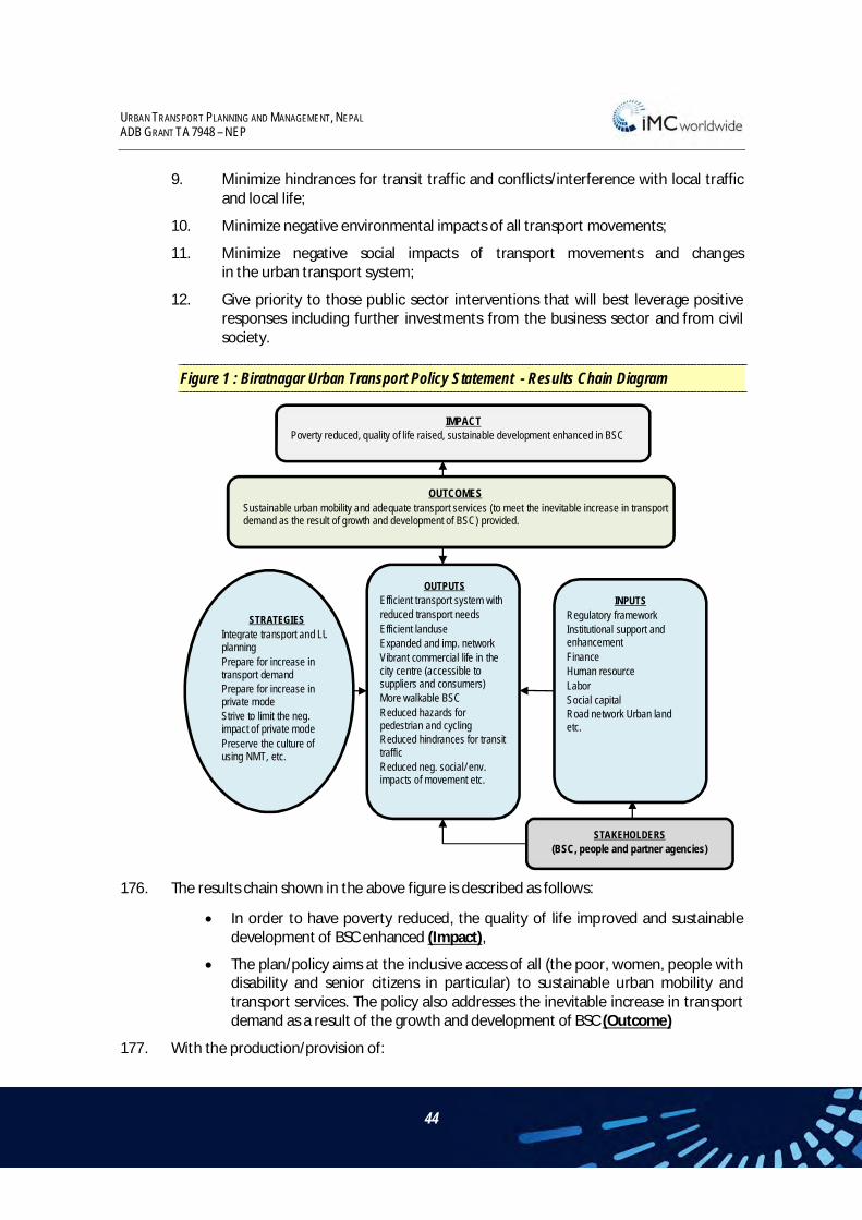
URBAN TRANSPORT PLANNING AND MANAGEMENT, NEPAL ADB GRANT TA 7948 – NEP
44
9. Minimize hindrances for transit traffic and conflicts/interference with local traffic and local life;
10. Minimize negative environmental impacts of all transport movements;
11. Minimize negative social impacts of transport movements and changes in the urban transport system;
12. Give priority to those public sector interventions that will best leverage positive responses including further investments from the business sector and from civil society.
Figure 1 : Biratnagar Urban Transport Policy Statement - Results Chain Diagram
176. The results chain shown in the above figure is described as follows:
In order to have poverty reduced, the quality of life improved and sustainable development of BSC enhanced (Impact),
The plan/policy aims at the inclusive access of all (the poor, women, people with disability and senior citizens in particular) to sustainable urban mobility and transport services. The policy also addresses the inevitable increase in transport demand as a result of the growth and development of BSC (Outcome)
177. With the production/provision of:
IMPACT Poverty reduced, quality of life raised, sustainable development enhanced in BSC
OUTCOMES Sustainable urban mobility and adequate transport services (to meet the inevitable increase in transport demand as the result of growth and development of BSC) provided.
OUTPUTS Efficient transport system with reduced transport needs Efficient landuse Expanded and imp. network Vibrant commercial life in the city centre (accessible to suppliers and consumers) More walkable BSC Reduced hazards for pedestrian and cycling Reduced hindrances for transit traffic Reduced neg. social/ env. impacts of movement etc.
INPUTS Regulatory framework Institutional support and enhancement Finance Human resource Labor Social capital Road network Urban land etc.
STAKEHOLDERS (BSC, people and partner agencies)
STRATEGIES Integrate transport and LU planning Prepare for increase in transport demand Prepare for increase in private mode Strive to limit the neg. impact of private mode Preserve the culture of using NMT, etc.

URBAN TRANSPORT PLANNING AND MANAGEMENT, NEPAL ADB GRANT TA 7948 – NEP
45
Expanded and improved service network of urban public transport including non-motorized modes;
Better walkability and reduced hazards for pedestrians;
Better and less hazardous possibilities for cycling;
Efficient transport system with the possible and desirable reduction of transport needs;
Efficient landuse;
Vibrant commercial life in the city centre (accessible to suppliers and consumers);
Reduced negative environmental impacts of all transport movements;
Reduced negative social impacts of all transport movements and changes in the urban transport system;
Reduced hindrances for transit traffic and conflicts/interference with local traffic and local life; etc. (Outputs)
178. Through the implementation of the following strategies:
Integrate transport planning and landuse planning in order to minimize the increase in transport needs and achieve maximum efficiency;
Prepare for the inevitable increase in transport demand as a result of the city’s growth and development;
Prepare for the inevitable increase in private motorization;
Strive to limit the negative impacts of private motorization and divert much of the demand for motorized transport to public transport;
Preserve the existing culture of using non-motorized transport and attempt to remove any social stigma attached to it;
By mobilizing:
Regulatory framework
Institutional support
Finance
Human resource
Labour
Social capital
Road network
Urban land etc. (Inputs/Resources)
179. Owned by:
BSC, people, partner agencies and other stakeholders. (Stakeholders)

URBAN TRANSPORT PLANNING AND MANAGEMENT, NEPAL ADB GRANT TA 7948 – NEP
46
5.6 PERFORMANCE INDICATORS AND TARGETS
5.6.1 PERFORMANCE INDICATORS FOR LONG TERM VISION The ring road around Biratnagar has been completed.
The length of the urban road network has grown by at least fifteen percentage points faster than the urban population from 2011 to 2031.
The share of blacktop surfaces on the urban road network has increased by at least fifteen percentage points since 2012.
A high-capacity urban bus service operates along the axis Koshi Highway – Rani Sadak Road with at least 45 departures daily in each direction.
At least five other UPT routes are operated in BSC, each with at least 30 departures daily in each direction.
There are at least two pedestrian bridges and three more signal-controlled pedestrian crossings over the Koshi Highway.
5.6.2 PERFORMANCE INDICATORS FOR 10 YEAR GOALS The western part of the ring road has been completed.
The widening of the Koshi Highway within BSC has been completed.
The length of the urban road network has grown by at least ten percentage points faster than the urban population from 2011 to 2021.
The share of blacktop surfaces on the urban road network has increased by at least five percentage points since 2012.
A city bus service operates along the axis Koshi Highway – Rani Sadak Road with at least 30 departures daily in each direction
A new main market building has been completed with (a) loading/unloading facilities for trucks, (b) parking for motorcycles and cars, and (c) a UPT stop.
Tempos and basantis have been phased out as UPT vehicles.
A type of minibuses has been introduced for UPT services.
At least one type of electro-powered UPT vehicle has been introduced on a pilot basis.
A network of streets of at least 800m length in the city centre has been fully pedestrianized, is accessible from the west by pedestrian bridge, and is well connected to parking facilities and UPT stops.
A fairly elaborate network of one-way streets is in place in many areas as part of a thought-out concept for traffic calming and road safety enhancement.
5.6.3 PERFORMANCE INDICATORS FOR 5 YEAR GOALS The expansion of the Koshi Highway is underway.
URBAN TRANSPORT PLANNING AND MANAGEMENT, NEPAL ADB GRANT TA 7948 – NEP
47
A new main market building has been designed with (a) loading/unloading facilities for trucks, (b) parking for motorcycles and cars, and (c) a UPT stop.
A feasible concept for a city bus service to operate along the axis Koshi Highway – Rani Sadak Road has been prepared and adopted.
A plan for the phasing-out of tempos and basantis from UPT has been agreed upon.
The introduction of minibuses for UPT has been agreed upon.
The introduction of at least one type of electro-powered UPT vehicles, at least on a pilot basis, has been agreed upon.
BSC has taken tangible steps towards better regulating the operation of rickshaws.
At least 300m of inner-city streets have been pedestrianized and are accessible from the west via a signal-controlled pedestrian crossing over the Koshi Highway.
Selected streets, especially near the city centre, have been made one-way streets as part of a thought-out concept for traffic calming. Please refer to Chapter 5.9.2 further details.
5.6.4 SPECIFIC PERFORMANCE INDICATORS 180. The following sections propose a series of performance indicators that have been
identified for monitoring overall project management and five specific technical areas – public transport; condition of transport infrastructure; traffic circulation; road safety; and parking management. These indicators – and the proposed standards and methods of measurement – need to be developed and discussed in detail with the BSC and DUDBC during the IEAP phase of the study.
181. The indicators for overall performance are:
Increase in the level of satisfaction with transport, as measured by a reduction in the number of civil complaints
% change in the mode of transport used by the people
Increase in road safety – reduction in accidents
Increase in private sector involvement in road investment
No. of roads managed maintained by communities
% reduction in household transport costs
Increased contribution of roads to the development of other infrastructure and services according to the envisaged land use changes
182. The above will be duly refined and, if required, more indicators will be identified through consultative mechanisms under Institutional Enhancement Activities at the National Level. The chosen indicators will eventually work as an important monitoring tool for DUDBC in the course of MoUD assuming a key role in urban transport in Nepal. For a

URBAN TRANSPORT PLANNING AND MANAGEMENT, NEPAL ADB GRANT TA 7948 – NEP
48
better acceptance and appreciation, BSC needs to be intensely involved in all the consultative processes. The Consultant will facilitate the processes and arrive at realistic indicators to create a monitoring process, recognizing that implementation will be gradually enhanced, as BSC’s competence increases in this field.
183. Proposed performance indicators for public transport services:
No. of households within 10 minutes' walking distance from roads with public transport
No. of wards connected by public transport
Increased road access of all to activities, services, and production
Improvement in access to essential services
Reduction in average time to reach jobs and markets
184. Proposed performance indicators for road condition:
Additional length and surface area of the roads
% of projects completed on time without any cost overruns’
% of road condition in good condition
Change in design for mitigation of risks against flood No. of days roads that roads are not in use due to water logging
Level of satisfaction of stakeholders
185. Proposed performance indicators for traffic pattern:
No of trips per day
Volume of goods transported
Reduction in travel demand
Change in the mode of transport
Proportion activity-based road network
186. Proposed performance indicators for road safety:
% decrease in road accidents
187. Proposed performance indicators for parking management:
No. of incidence of illegal parking
Physical condition in the parking areas
Capacity in terms of number of vehicles in parking areas
Revenue generated from parking charges
188. As indicated above each of these indicators and the proposed evaluation mechanisms need to be developed and discussed with the BSC and national agencies.

URBAN TRANSPORT PLANNING AND MANAGEMENT, NEPAL ADB GRANT TA 7948 – NEP
49
5.7 URBAN TRANSPORT STRATEGY - PRINCIPLES 189. The Urban Transport Strategy should be built on the previously developed Urban
Transport Policy Statement that provides the overall guidance and direction for the production of an integrated Land-Use and Transport Plan for the city. The Strategy provides a framework for the subsequent development of an action plan and project proposals for implementation over the short and medium term.
190. The overall strategy may be sub-divided thus:
General Principles,
Road Network Development Principles,
Urban Public Transport Principles,
Central Area Management Principles,
Traffic Management Principles, and
Environmental Principles.
191. The proposed urban transport strategy is presented in the following list of principles.
General Principles
1. Build on the existing elongated landuse pattern of BSC and the existing transport pattern that shows predominantly north-south movements, and reinforce the linear nature of landuse and transport patterns.
2. Build on the existing habits of using non-motorized transport, and enhance its feasibility through the provision of dedicated facilities, especially cycling routes in north-south direction and pedestrian facilities for east-west oriented movements.
3. Strive to redirect transit traffic away from the city centre as soon as feasible.
4. Explore and use the possibilities for encouraging intensified commercial use of land along major transport corridors and near terminals and stops of urban public transport.
Road Network Development Principles
5. In cooperation with DUDBC, expedite the completion of the ring road, assign priority to the western segment, and redirect north-south transit traffic to it as soon as feasible.
6. Through cooperation and coordination between DoR, DUDBC, and BSC, combine the ICP Connecting Road, the Koshi Highway, and the Ring Road to a bypass road whose alignment, design, and construction standard make it attractive for transit traffic.
7. In coordination with DoR, expand the Koshi Highway section within BSC to such a design that it serves as a transit road for a limited number of years but can then assume the function of an intra-urban spine for intensified landuse, urban public transport, access to the city centre, and improved urban design.

URBAN TRANSPORT PLANNING AND MANAGEMENT, NEPAL ADB GRANT TA 7948 – NEP
50
8. Develop additional north-south axes for intra-urban traffic, to a design that is friendly towards non-motorized traffic and urban public transport, to serve emerging transport demands between the residential areas and the emerging employment opportunities in the extreme south of BSC (Ward 20).
9. Upgrade existing collector roads, complemented with the necessary minimum of new road construction, to provide a connection from the south (Koshi Highway) to the east of BSC (Hatkhola) through Wards 18 and 11.
10. Upgrade existing collector roads, complemented with the necessary minimum of new road construction, to provide a connection from the east (Hatkhola) to the north of BSC (Koshi Highway) through Wards 11, 2, 3, and/or 4.
Urban Public Transport Principles
11. Develop a thought-out network of urban public transport routes including terminals and stops with convenient waiting areas and other facilities at existing and planned centers of commercial activities and administrative services, at existing and emerging centers of employment, and at suitable access points to the city centre.
12. Ensure that all terminals all stops are conveniently and safely accessible for pedestrians, and impose necessary restrictions on vehicle traffic.
13. Develop the existing bus park with a focus on its function as a hub for urban public transport, include in its design all necessary facilities for enhanced inter-connectivity between long and mid-haul bus transport and intra-urban transport including non-motorized transport and walking.
14. Explore and use the possibilities for encouraging or obliging the operators of urban public transport to phase out tempos and basantis in favor of microbuses and/or other vehicles.
15. Explore and use the possibilities for regulating the emerging taxi service industry so that it will not inflict damage on the other types of urban public transport.
16. Explore and use the possibilities for better regulating the rickshaw industry with a view to reducing the number of rickshaws and enhancing the service level.
17. Develop a concept for establishing a range of urban public transport modes and locating each type of urban public transport service optimally within the territory of BSC for maximum mutual complementarity and minimum mutual interference.
Central Area Management Principles
18. Conduct, in suitable phases, traffic calming and gradual pedestrianisation in the city centre and develop suitable points where urban public transport connects to the calmed / pedestrianised city centre; identify suitable ways to allow delivery of goods to the city centre and minimize the conflict with the traffic calming / pedestrianisation efforts.
19. Explore and use the possibilities for encouraging intensified commercial use of land in the city centre.

URBAN TRANSPORT PLANNING AND MANAGEMENT, NEPAL ADB GRANT TA 7948 – NEP
51
20. In allocating on-street vehicle parking space in the city centre, give priority to bicycles and motorcycles, redirect motorcars to off-street pay-parking facilities, and gradually enforce a strict ban on double parking.
Traffic Management Principles
21. Introduce adequate sign-posting (advisory or compulsory in nature, as required) so that transit traffic will be directed to the most suitable routes and motorized traffic will be directed away from the city centre.
22. Provide convenient and safe facilities for pedestrians to cross the Koshi Highway via signal-controlled crossings and at least two pedestrian bridges near the city centre.
23. Provide, and oblige private developers to provide, vehicle parking facilities (preferably pay-parking) in all major new commercial developments.
24. To the extent feasible, oblige schools and factories to provide ample parking for non-motorized vehicles.
25. Where space constraints on urban roads lead to significant friction between pedestrians and vehicles, provide sidewalks even where this restricts the space for vehicles, and create – where necessary – one-way streets to keep the movement of vehicles smooth.
26. Guide and assist ward-level administrations if defining a suitable network of one-way streets where road space is insufficient for bidirectional movement of motorized vehicles and/or where significant conflicts between vehicle traffic and pedestrians emerge.
Environmental Principles
27. Explore and use the possibilities for fitting small vehicles for urban public transport with electrical propulsion, for use especially in the city centre.
28. Explore and use the possibilities for imposing local restrictions on vehicle movements and/or emissions of pollutants and noise.
5.8 ACTION PROGRAM FOR IMPROVING THE URBAN TRANSPORT SYSTEM
5.8.1 GENERAL ASPECTS 192. The following proposed action program has been defined on the basis of the various
surveys undertaken, the transport demand modeling results, and the consultant’s anticipation of the traffic patterns and challenges of the future. Necessary action is described in itemized lists that clearly allocate primary responsibility for action. Where appropriate, items may occur in more than one list.
193. This action program is not primarily geared to addressing road capacity bottlenecks. The transport demand modeling has demonstrated that no significant capacity bottlenecks are expected to appear within the next two decades if all the committed and planned projects, including those identified in the Periodic Plan, are implemented. Instead, this

URBAN TRANSPORT PLANNING AND MANAGEMENT, NEPAL ADB GRANT TA 7948 – NEP
52
action program aims at improving the quality of urban transport infrastructure. This would benefit especially UPT and NMT including pedestrian movements. Motorized transport still constitutes only a small portion of the total urban traffic.
194. Even so, this action program has been designed to be consistent with landuse developments that are likely to emerge with the urban development scenarios and with the strategic outlook to landuse development described above. The focus of the action program is to link the existing and emerging industrial and commercial clusters near the periphery of BSC with the city, to support the development of a corridor of high-intensity landuse along the Koshi Highway, to support the revitalization of the city center and develop it towards a modern CBD, and to gradually divert transit traffic away from the city center to minimize interference. In addition, the upgrading of various collector roads shall facilitate the development of educational institutions in suitable parts of BSC.
5.8.2 DEVELOPMENT OF INFRASTRUCTURE 195. The development of the road infrastructure in BSC will include the western segment of the
envisaged ring road and a number of collector roads within BSC, whereby some of the collector roads combined would form bypasses around the city center. These bypasses are essential to help alleviate traffic congestion and pave the way for traffic calming in the city center. The eastern segment of the envisaged ring road will pass BSC a rather long distance out to the east, and it will therefore have a smaller impact in diverting transit traffic away from the city.
196. The primary responsibility for upgrading the various collector roads as specified below will be with BSC; however, it is acknowledged that BSC alone does not possess the necessary financial resources to complete all these projects within the required short time span and will therefore need to apply for funding assistance.
Proposed Hierarchy of Roads for the BSC Urban Area
197. It is necessary to identify and define a hierarchy of roads by function and purpose, so that the city’s network can be effectively designed and managed. Four categories of roads are proposed within the BSC urban area.
National Highways
198. National Highways are highways that form the most important skeleton of a regional and strategic road network to provide high performance highway connections to other regions and to serve major corridors within the BSC. This includes the Koshi Highway which traverses the city in the north-south direction and connects with the Indian Border. This hierarchy of roads also includes sections of the strategic Ring Road that is currently being constructed by DUDBC, although this is not an element of the officially classified Strategic Road Network (SRN).

URBAN TRANSPORT PLANNING AND MANAGEMENT, NEPAL ADB GRANT TA 7948 – NEP
53
Other Strategic Roads
199. This road category includes major facilities that serve major local travel movements of medium-long travelling distances within BSC. The candidates include: (i) the East-West Postal Road (Hulaki Sadak) and (ii) the Main Road from Roadcess Chowk to Pushpalal. These roads are under the responsibility of the DoR and constitute the local skeleton highway network within BSC.
Secondary / Collector Roads
200. Secondary/collector roads provide access to and link main development areas of the city. They also serve as minor connections to the fringe areas. They will carry moderate traffic volumes of short to medium travelling distances, including public transport services.
Access Roads
201. Local access roads or tracks provide local access to Secondary/Collector roads and in some cases to the Other Strategic Roads. They constitute the first part of travelling routes of the road users and usually are of short distance.
Redevelopment of Koshi Highway
Current Design Concepts on Koshi Highway
202. To accommodate the projected increase in public transport traffic as well as intra-urban traffic, the Department of Roads has developed a plan and completed engineering design documents namely, ‘Upgrading/Widening of Roads to Six Lane Standard Package 4: Rani-Biratnagar–Itahari-Dharan Road’ under Asset Management, Contract Management and Quality Control Project (AQCMP), issued by Department of Roads (DOR). It envisages a four lane carriageway for vehicular traffic in the middle and service lanes on either side.
Revised Design Concept on Koshi Highway
203. The revised concept will provide the necessary additional space for the high demand on the service lanes, improvements to public transport operation, enhancement of mobility on the main carriageway, particularly at junctions on the Koshi Highway. The design: -
Segregates the main stream of vehicle traffic from non-motorized and local traffic;
Provides opportunities for pick-up/set-down of bus passengers and loading/unloading bays for truck vehicle on the service lanes without significantly affecting the movement of the local traffic;
Provides safe and efficient pedestrian links;
Provides better road geometry;
204. The proposed improvement schemes and their associated benefits on the Koshi Highway within the territory of Biratnagar are outlined in the table below.

URBAN TRANSPORT PLANNING AND MANAGEMENT, NEPAL ADB GRANT TA 7948 – NEP
54
Table 4 : Koshi Highway – Improvement Measures
Improvement Options Benefits Single two lanes
carriageway on the central carriageway for
the main stream motorized traffic
Segregation of the main stream traffic from the non-motorized and local traffic; Bus stops located on the main carriageway to enhance convenience of public
transport users; Safer pedestrian crossing facilities and better environment on the Koshi Highway.
Widened service lanes to provide more
opportunities and space to serve the frontage activities on the Koshi
Highway
Provides more parking areas to facilitate the pick-up/set down of passengers; Provides designated loading/unloading bays and overtaking lanes to facilitate the
goods delivery services; Provides more spaces for on-street parking for motorized and non-motorized
traffic; Provides mixed use lanes for non-motorized traffic, parking and local traffic so as to
enhance mobility. Improved design at some
major junctions Proper junction designs to enhance safety and traffic operation.
Development of a Western Bypass
205. DUDBC is in the process of constructing a ring road around BSC. In its western segment, a 100m section has not yet been developed as a result of land acquisition problems. Its eastern segment is still far from completion. To support the development of BSC, the western segment is more important because it has a potential to act as a bypass that could absorb much of the transit traffic that now runs on the Koshi Highway through the city center. The eastern segment, being much longer, hardly has a potential to play that role. The modeling of future transport demand and vehicle flows has shown that ‘hotspots’ of congestion would soon develop along the Koshi Highway in the absence of such a bypass; in fact, their gradual emergence can be seen already.
206. Necessary action would include:
DUDBC to lobby for budget to expedite the completion of the western segment of the ring road;
DUDBC to construct as soon as possible the western segment of the ring road to the intended standard, i.e. a four-lane carriageway in the center and a two-lane service road at either side;
DUDBC and DOR to agree at the earliest whether the new ring road will become part of Nepal’s Strategic Road Network (SRN) and thus come to fall under the jurisdiction of DoR; the agreement should also determine under whose jurisdiction the current Koshi Highway (i.e. the section between the southern and the northern junction with the ring road) will fall;
DUDBC and DOR to agree at the earliest on a plan for the junctions that will connect the existing Koshi Highway to western segment of the ring road and to the ICP access road that is about to be constructed; the plan has to cover design, financing, and implementation arrangements; the junction designs must be such that turning movements are easily possible, even for multi-axle trucks;

URBAN TRANSPORT PLANNING AND MANAGEMENT, NEPAL ADB GRANT TA 7948 – NEP
55
DUDBC, DoR, BSC, and Traffic Police to agree on a concept for signposting the new bypass road; preferably, the use of the bypass road should be made compulsory for northbound and southbound heavy vehicles, multi-axle trucks except for those whose origin or destination is along the Koshi Highway within BSC;
Traffic Police to enforce the ban for transit traffic of heavy vehicles, multi-axle trucks and trailer trucks on the intra-city section of the Koshi Highway after the completion of the ring road.
Redevelopment of Koshi Highway
207. There is fairly universal agreement among all relevant stakeholders that the urban section of the Koshi Highway should be redesigned and reconstructed, taking into account that it’s originally intended function as a bypass road has changed into the function of an urban main road whose current layout is unsuitable for the quantity of traffic and mix of modes. There is general agreement that the new design should feature a main carriageway with side lanes (service lanes) on either side. However, opinions are still divided on the exact layout. Some pertinent considerations and proposals in this regard would include:-
DoR to consult BSC and DUDBC on the optimal design for a short-term function (until the completion of the ring road);
DoR to implement the reconstruction;
BSC to plan, in cooperation with DUDBC an appropriate design for the long-term function as urban spine/thoroughfare (after the completion of the ring road);
Traffic Police to enforce the ban for transit traffic of heavy vehicles, multi-axle trucks and trailer trucks on the intra-city section of the Koshi Highway after the completion of the ring road.
Creation of Bypass Road Connection between South and East
208. Transport demand from the east (Rangeli/Hatkhola Road, including transport demand generated by the future railway terminal) to the south (Koshi Highway, ICP, and cluster of new employment opportunities in Ward 20) and vice versa will slowly but steadily increase in the future, and the habitually preferred road connections through/near the city center will become increasingly inadequate to accommodate this demand. Therefore, the city center should be bypassed at an appropriate distance. The Periodic Plan envisages two connections: (1) an inner one, along Jatuwa Road and Devkota Road, and (2) an outer one further east that is yet to be constructed.

URBAN TRANSPORT PLANNING AND MANAGEMENT, NEPAL ADB GRANT TA 7948 – NEP
56
Map 2 : Proposed Redirection of Traffic Between South and East

URBAN TRANSPORT PLANNING AND MANAGEMENT, NEPAL ADB GRANT TA 7948 – NEP
57
209. Necessary action would include:
DUDBC to lobby for budget to expedite the completion of the eastern segment of the ring road between the Koshi Highway and Devkota Road;
DUDBC to construct as soon as possible the eastern segment of the ring road between the Koshi Highway and Devkota Road, initially only to the reduced standards required for providing a connection between the Koshi Highway and Devkota Road;
BSC and DoR, possibly with involvement of DUDBC, to agree on a plan for upgrading Devkota Road from the junction with the eastern segment of the ring road to Devkota Chowk; the plan should determine whether this new road connection will become part of the SRN (as it connects two existing roads that are both elements of the SRN); the plan should endorse the design standards and determine the financing and the implementation arrangements;
BSC and DoR, possibly with involvement of DUDBC, to agree on a plan for the upgrading of Devkota Chowk and Ram Janaki Path; since these elements are part of the Postal Highway and thus of the SRN, the main responsibility for their upgrading will likely be allocated to DoR;
DUDBC, DoR, BSC, and Traffic Police to agree on a concept for signposting the new road connection; preferably, the use of the new road connection should be made compulsory for eastbound and southbound heavy vehicles except for those whose origin or destination is in the city center;
Traffic Police to enforce the traffic restrictions.
Creation of Bypass Road Connection between North and East
210. Transport demand from the east (Rangeli/Hatkhola Road, including transport demand generated by the future railway terminal) to the north (Koshi Highway) and vice versa will slowly but steadily increase in the future, and the habitually preferred road connections through/near the city center will become increasingly inadequate to accommodate this demand. Therefore, a new connection that bypasses the city center at an appropriate distance has to be developed. The northeastern segment of the envisaged ring road will bypass Biratnagar at a rather large distance, and the connection it provides between north and east will be rather long; therefore it has to be anticipated that much of the transport demand between north and east will seek a shorter connection closer to the city.

URBAN TRANSPORT PLANNING AND MANAGEMENT, NEPAL ADB GRANT TA 7948 – NEP
58
Map 3 : Proposed Redirection of Traffic Between North and East

URBAN TRANSPORT PLANNING AND MANAGEMENT, NEPAL ADB GRANT TA 7948 – NEP
59
211. Necessary action would include:
BSC to consult DoR and DUDBC on the upgrading of several intra-urban collector roads that will establish a link between the eastern section of the Postal Road and the Koshi Highway for northbound traffic and vice versa (more or less as shown in the Periodic Plan) , including the design of junctions between those collector roads and roads under the management of DoR;
BSC to upgrade and widen these collector roads so that they can accommodate the anticipated transport demand;
DUDBC, DoR, BSC, and Traffic Police to agree on a concept for signposting the new road connection; preferably, the use of the new road connection should be made compulsory for eastbound and northbound heavy vehicles except for those whose origin or destination is in the city center;
Traffic Police to enforce to enforce the traffic restrictions.
Creation of Bypass Road Connection between North and West
212. The western parts of BSC are developing fairly rapidly, with expanding residential areas and an increase in motor vehicle ownership. Currently, almost all of the transport demand between those areas and the Koshi Highway is accommodated by Keshaliya Road which leads to congestion of both Keshaliya Road itself and its junction with the Koshi Highway. Transport demand from the west (Keshaliya Road) to the north (Koshi Highway) and vice versa will steadily increase in the future, and the habitually preferred road connection through the increasingly congested junction of Keshaliya Road and Koshi Highway will soon be inadequate to accommodate this demand. Also, the planned redesign of the Koshi Highway envisages that turns from north to west (right-turns) at that junction should no longer be allowed. Therefore, that junction should be bypassed.
213. A short-term solution would be, to redirect traffic through Shreeram Road and Krishi Road In addition, the existing but poorly surfaced road along the irrigation canal should be upgraded and connected to the Koshi Highway south of the airport. This would be an effective medium and long-term solution.
214. Furthermore, the northwestern segment of the envisaged ring road will provide a very convenient connection between the western outskirts of Biratnagar and the Koshi Highway in the long run.

URBAN TRANSPORT PLANNING AND MANAGEMENT, NEPAL ADB GRANT TA 7948 – NEP
60
Map 4 : Proposed Redirection of Traffic Between North and West

URBAN TRANSPORT PLANNING AND MANAGEMENT, NEPAL ADB GRANT TA 7948 – NEP
61
215. Two bypass roads are proposed: an outer one would be provided by upgrading the road on the east bank of the irrigation canal (“Canal Road”), an inner one would be provided by upgrading Shreeram Road and Krishi Road; together, they will divert traffic away from the junction between Keshaliya Road and Koshi Highway.
216. Necessary action would include:
BSC to consult DoR and DUDBC on the upgrading of Shreeram Road and Krishi Road that will establish a link between the western section of the Postal Road and the Koshi Highway for northbound traffic and vice versa, including the design of junctions between those side roads and roads under the management of DoR;
BSC to consult DoR and DUDBC on the upgrading of the Canal Road more or less as shown in the Periodic Plan;
BSC and DoR to decide which party will be in charge of upgrading the Canal Road and implement the project;
BSC and/or DoR to construct a new, short connection from the Canal Road to the Koshi Highway just south of the airport runway;
DUDBC, DoR, BSC, and Traffic Police to agree on a concept for signposting the two new road connections; preferably, their use should be made compulsory for heavy vehicles travelling between west and north; the very eastern section of Keshaliya Road should be made a one-way street;
Traffic Police to enforce the traffic restrictions.
Creation of Bypass Road Connection between South and West
217. Transport demand from the south (Koshi Highway and ICP) to the west (Keshaliya Road) and vice versa will slowly but steadily increase in the future, and the currently preferred road connection through the increasingly congested junction of Keshaliya Road and Koshi Highway will soon be inadequate to accommodate this demand. Also, the planned redesign of the Koshi Highway envisages that the eastern end of Keshaliya Road should be converted into an eastbound one-way street and that turning movements from west to south (right-turns) at that junction no longer be allowed. Therefore, a new connection that bypasses that junction has to be developed.
218. In addition, the existing but poorly surfaced road along the irrigation canal should be upgraded; it connects already to both the Koshi Highway and Keshaliya Road. This would be an effective medium and long-term solution.
219. In the longer run, the southwestern segment of the envisaged ring road will provide a very convenient connection between the western outskirts of Biratnagar and the Koshi Highway.

URBAN TRANSPORT PLANNING AND MANAGEMENT, NEPAL ADB GRANT TA 7948 – NEP
62
Map 5 : Proposed Redirection of Traffic Between South and West

URBAN TRANSPORT PLANNING AND MANAGEMENT, NEPAL ADB GRANT TA 7948 – NEP
63
220. Two bypass roads are proposed: an outer one would be provided by upgrading the road on the east bank of the irrigation canal (“Canal Road”), an inner one would be provided by upgrading Mahendra Road; together, they will divert traffic away from the junction between Keshaliya Road and Koshi Highway.
221. Necessary action would include:
BSC to consult DoR and DUDBC on the upgrading of the Canal Road more or less as shown in the Periodic Plan, possibly with the modification that the Canal Road be connected to the Koshi Highway just south of the airport runway;
BSC and DoR to decide which party will be in charge of upgrading the Canal Road and implement the project;
BSC to consult DoR and DUDBC on the upgrading of Mahendra Road and its connection to Keshaliya Road, including the design of junctions between those side roads and roads under the management of DoR;
BSC to implement the necessary upgrading.
Creation of Bypass Road Connection Between East and West
222. OD surveys conducted under this TA have shown that there is very little transport demand between the eastern and the western outskirts of BSC. The compilation of conceivable urban development scenarios and their analysis through transport demand modeling have shown that this will not change substantially in the foreseeable future.
223. Even so, Biratnagar should possess an east-to-west route that bypasses the city center. Official maps still show the historical east-west connection (the Postal Road) as part of the SRN. In reality, the central part of the historical Postal Road has now become a shopping street within the CBD, and this development may be impossible to reverse.
224. The consultant therefore proposes that an alternative east-to-west route be identified and upgraded to accommodate the (modest) transport demand in these directions. Substantial construction works are unlikely to be required; widening, resurfacing, and traffic management measures will mostly suffice to meet the requirements. Most of the road links shown below are already part of the north-to-east and north-to-west connections described above

URBAN TRANSPORT PLANNING AND MANAGEMENT, NEPAL ADB GRANT TA 7948 – NEP
64
Map 6 : Proposed Redirection of Traffic Between East and West

URBAN TRANSPORT PLANNING AND MANAGEMENT, NEPAL ADB GRANT TA 7948 – NEP
65
Improvement of Access to Central Area
225. Efforts should be made to revive the city center, enhance its commercial life, enhance its attractiveness and appeal which would make the CBD the nucleus for the development of a modern, thriving city. This is in line with the overall urban development vision outlined above. Improving the access to the city center is an indispensable element of these efforts.
226. Necessary action would include:
DoR, in agreement with BSC, to provide several pedestrian crossings over the Koshi Highway; these may be fitted with traffic signals after continuous supply of electrical power has been restored;
BSC, in agreement with DoR, to construct at least one pedestrian bridge over the Koshi Highway within the next five years and possibly another one in the longer run;
BSC to provide about three hubs where UPT vehicles can conveniently stop at the edge of the city center;
BSC to provide convenient pedestrian access from those hubs into the CBD.
Improvement of Access to Newly Emerging Activity Clusters
Access to New Hospital Park
227. The gradual establishment of a cluster of new hospitals in Ward 5 is part of all urban development scenarios. Related to this, other commercial entities (hotels, restaurants) may also want to establish themselves near such a cluster. Increasing transport to/from such a new cluster of economic activities will require the provision of significantly improved access.
228. Necessary action would include:
BSC to establish rules for the provision of access roads, UPT facilities, and/or vehicle parking facilities by the developers of such new hospitals (private sector);
BSC to construct a main access road and provide those facilities not provided by the developers (private sector).
Access to New Public Administration Center
229. The land currently occupied by the stadium has been identified as a suitable location for the establishment of a new center for regional administration / public services. The intensity of its development will depend on political decisions regarding additional administrative functions/offices/services to be located in Biratnagar.
230. Necessary action would include:
BSC to relocate the stadium and knock down the currently existing stands, thus making the current stadium location available for redevelopment;
BSC to upgrade the access roads in the wider perimeter of the location, including improved facilities for pedestrians and NMT;

URBAN TRANSPORT PLANNING AND MANAGEMENT, NEPAL ADB GRANT TA 7948 – NEP
66
BSC to provide attractive UPT facilities right at the new administrative center and vehicle parking facilities within an acceptable distance.
Access to New Employment Cluster in Ward 20
231. A substantial number of additional jobs will be created in Ward 20 in the near and more distant future. The restart of operations of the existing jute mill in the first half of 2013 can be taken for granted. Furthermore, the establishment of a SEZ, in an area to the west of the jute mill, is a realistic prospect. This will result in substantial additional transport demand with pronounced peaks of traffic volume whenever work shifts begin or end. Much of the labor force in that area will be low-wage labor, and this will result in a high percentage of NMT and pedestrians in the total transport demand.
232. Necessary action would include:
BSC to establish rules for the provision of access roads, UPT facilities, and/or vehicle parking facilities by the developers of new commercial/industrial establishments (private sector);
BSC to construct/provide those facilities not provided by the developers (private sector), with special consideration of NMT and pedestrians;
BSC to upgrade Rani Sadak Road to a design standard that considers especially the needs of NMT and pedestrians;
BSC to upgrade selected collector roads in Wards 19-22.
Improvement of Collector Road Network
Existing Collector Road Network
233. The existing collector roads within BSC are often constrained by rather narrow RoW; in addition, their designs and constructions standards do not even make optimum use of the existing RoW. This results in lower transport capacities than could be achievable, and unnecessary impediments especially for NMT, and in deficiencies pertaining to road safety, especially for pedestrians.
234. Necessary action would include:
BSC to upgrade the existing collector roads identified in the Periodic Plan to specifications that take into account the needs of pedestrians and NMT; hereby, a substantial widening of the existing RoW will rarely be possible, and compromises will have to be made with regard to design.
Future Collector Road Network
235. Additional collector roads will have to be constructed within BSC, to accommodate (a) the transport demand caused by continued urban expansion, and (b) the future needs for additional road space caused by the increased use of motor vehicles.
236. Necessary action would include:
BSC to construct the new collector roads envisaged in the Periodic Plan to specifications that take into account the needs of pedestrians and NMT and the

URBAN TRANSPORT PLANNING AND MANAGEMENT, NEPAL ADB GRANT TA 7948 – NEP
67
projected future volumes of traffic (including transport demand caused by the bypass function of several collector roads); therefore, RoW should be provided much more generously than on existing collector road alignments, and designs should be improved.
5.8.3 IMPROVEMENT OF TRAFFIC AND PARKING MANAGEMENT 237. Apart from deficiencies in the physical condition of the roads, urban traffic in Biratnagar is
also impacted by deficiencies in traffic management and enforcement of traffic rules.
Improvement of Central Area
238. Efforts should be made to revive the city center, enhance its commercial life, its attractiveness and appeal. This should include improved traffic management and traffic calming.
239. Necessary action would include:
BSC to convert several streets into NMT-only streets or pedestrian zones; this can initially be done by traffic management interventions, followed by physical reconstruction at a later date; access by motor vehicles should be restricted to suppliers (possibly any specified times) and residents;
BSC to divert transit traffic, especially motorized transit traffic, away from the city center and streets adjacent to it;
BSC to redevelop the current location of Gudri Bazaar (main vegetable market) into a multi-story building with space for the unloading/loading of trucks and the parking of motor vehicles, adequate in size for the long-term needs.
Improvements in Residential Areas
240. Within existing residential areas, there will be little possibility and even little need for major reconstruction or upgrading of roads for many more years. The main interventions required will be, to improve the surfaces to blacktop in a suitable design. However, access lanes within new residential areas should be designed to more generous standards than hitherto used.
241. Necessary action would include:
BSC to arrange for the surfacing of existing residential access lanes with blacktop; the provision of separate sidewalks will mostly not be feasible; speed humps in suitable design shall be incorporated in the lane surface design to protect cyclists, pedestrians, and playing children from fast moving vehicles;
BSC to plan for wider access lanes in future residential areas, with preferable RoW widths of 10-12m, or 8m at the very minimum; this will allow the construction of sidewalks at least on one side of the lane
Enhancement of Road Safety
242. Road accident statistics show only three areas where accidents frequently occur. In each of them, some improvements shall be implemented to reduce the problem.

URBAN TRANSPORT PLANNING AND MANAGEMENT, NEPAL ADB GRANT TA 7948 – NEP
68
243. Necessary action would include:
BSC, Traffic Police, and DUDBC to communicate with DoR on an suitable design for the upgrading of the Koshi Highway, in particular the provision of adequate side lanes that would separate the different classes of road users;
DoR to incorporate adequate crossing facilities for cyclists and pedestrians in the design and implementation of the Koshi Highway;
BSC and/or DoR to make improvements to Ram Janaki Path in front of the Hatkhola bus terminal;
DoR, in agreement with BSC and Traffic Police, to make changes to the junction of Koshi Highway and Abhibadan Road (near the eye hospital) that is one of the worst blackspots. Traffic Police to pay special attention to enforcing compliance with traffic rules in these three locations.
Improvement of Traffic Restrictions and Direction
244. Some proposals for traffic restrictions and traffic direction incl. necessary action are presented in the section on “Redevelopment of Koshi Highway” .
245. Beyond these, traffic management measure will become necessary as the existing urban area with its narrow roads and lanes experiences increasing traffic densities.
246. Necessary action would include:
BSC, to gradually introduce one-way streets to improve traffic flows where it is becoming congested or where accidents occur more frequently; this should, however, be combined with the provision of sidewalks and speed humps to enhance road safety and ensure that the faster vehicle flow on one-way streets will not create new hazards; where feasible, shortcut routes for bicycles and rickshaws can be incorporated in the design of one-way street networks;
Traffic Police, in agreement with BSC, to introduce turning restrictions (especially bans on right-turns) at junctions where congestion impedes traffic flow disproportionately; however, such restrictions have to be thought through and acceptable alternatives to a right turn have to be provided to road users (otherwise compliance with such a regulation may be very difficult to enforce);
Traffic Police, in agreement with BSC, to introduce more restrictions for big or heavy vehicles in narrow streets;
Traffic Police, in accordance with national-level regulations and practices, to gradually introduce “Yield” and/or “Stop” regulations/signs at critical junctions;
BSC or Traffic Police, where necessary in cooperation with DoR, to provide signposting (compulsory or advisory) to direct transit traffic, especially heavy vehicles to suitable road connections, away from the city center and routes that are followed mainly habitually;
Traffic Police to enforce compliance with the abovementioned traffic management measures / restrictions.

URBAN TRANSPORT PLANNING AND MANAGEMENT, NEPAL ADB GRANT TA 7948 – NEP
69
Improved Vehicle Parking Management
247. The parking of motor vehicles should gradually cease to be free of charge along the Koshi Highway, near the city center, and along the principal roads leading to the city center. Bicycles, on the other hand, should be provided with clearly demarcated, reserved parking areas where parking is free of charge. In this way, parking management would be an integral part of transport demand management. One element of transport demand management is, to deliberately NOT provide parking space in certain areas (e. g. the city center) with the intention to discourage the use of private motorized vehicles and encourage instead walking and/or the use of UPT and/or NMT.
On-Street Vehicle Parking
248. Necessary action would include:
BSC, in coordination with DoR, to introduce parking fees for motor vehicles along Koshi Highway (after its expansion/upgrading), along the principal roads leading to the city center, and near the city center;
Traffic Police to gradually tighten the enforcement of compliance with parking restrictions;
BSC, in cooperation with Traffic Police and possibly DoTM, to design ways to enforce payment of parking fees and introduce enforceable penalties for offenders.
Off-Street Vehicle Parking
249. Necessary action would include:
BSC to require the provision of adequate off-street parking as a precondition for issuing building permits for commercial establishments all over the city, beginning with (and with special emphasis on) applications for construction in the city center;
BSC to seek ways to lease vacant plots in a few selected locations and appoint a suitable entity to operate a paid-for motor vehicle parking facility on those plots;
BSC to make the provision of sufficient on-site vehicle parking space a precondition for issuing building permits for all residential buildings, corresponding to size.
5.8.4 ENHANCEMENT OF URBAN PUBLIC TRANSPORT 250. Urban Public Transport should be improved by a structured set of measures. These are
presented below in two clusters: (a) improvement of physical facilities; and (b) improvements to services and quality.
251. The Enhancement Strategy for Urban Passenger Transport is developed on the basis of anticipated strategic requirements of the urban plan and urban transport planning; the stated and assessed requirements emerging from the users, community, operators and agency stakeholders; the diagnostic of the current UPT service and organization; and the application of appropriate national and international experience.
252. Chapter 5 describes the current urban passenger transport in Biratnagar. It provides a diagnostic of the UPT services and organisation; identifies key societal, service and

URBAN TRANSPORT PLANNING AND MANAGEMENT, NEPAL ADB GRANT TA 7948 – NEP
70
organisational points to be considered for future planning; and identifies institutional and capacity issues for Biratnagar Municipality, DoTM and operators.
253. The approach used is the following:-
Develop a guiding set of objectives for the UPT Enhancement Strategy, which reflect and balance the short, medium- and long-term requirements of the users and communities; the agencies and operators; and the urban and urban transport planning. These objectives were presented to the key stakeholders at the 14th October Workshop in Kathmandu for feedback and comment.
Develop an overall multi-modal strategy for UPT, which includes balances and develops both motorised and non-motorised forms of UPT. This strategy needs to consider the gradual migration and increasing scale/complexity from the current situation in Biratnagar through to a larger and more intense city some years hence.
Develop individual modal strategies, with particular attention on primary UPT services operated by buses, minibus and smaller vehicles services, rickshaws services, and long distance bus services to the extent that they interface with the UPT.
Identify requirements for supporting infrastructure, facilities, traffic management measures, and customer services.
Identify opportunities for innovative and clean technologies, including BRT and electric vehicles.
Identify and propose appropriate organisational and capacity development measures that are needed to deliver the enhancement measures, with particular focus on the operator sector on the municipality.
Identify and propose appropriate framework measures that will provide essential enablers and/or remove barriers/constraints. These mostly relate to the national-level framework, which are beyond the authority of the local stakeholders to change. This strand also takes account that Biratnagar is intended to be a ‘wayfinder’ for the second-tier cities of Nepal, so these framework measures will be of benefit to other cities.
254. The methodology recognizes that Biratnagar is a relatively small city that currently has a very under-developed UPT. Even in the maximum growth scenario, Biratnagar will remain a moderate-sized city and will not require a complex urban transportation system. There is no immediate transportation crisis to be solved (unlike Kathmandu), and change will be gradual. The approach does not require complex long-term modeling and network planning for UPT (which would not be reliable anyway with the near-zero UPT base), nor does it require major infrastructure investments for UPT.
255. The approach is to establish the fundamentals of a suitable UPT system, which adequately reflects the needs of the users, and to support this to evolve as the city grows. This means establishing a more systematic and planned set of services, operated by companies or associations of improved capacity, with improved supporting facilities as and when they are required, and within a suitable institutional framework (all of these are developed and proposed within the strategy). Guided by the longer-term planning, such a structure will

URBAN TRANSPORT PLANNING AND MANAGEMENT, NEPAL ADB GRANT TA 7948 – NEP
71
be able to expand and adapt the UPT services as the city requires them. The only interventions required would be a small number of investment projects (identified in the strategy), in particular development of the bus terminals and provision of structured traffic management measures.
Improvement of Physical Facilities
Main Biratnagar Bus Terminal
256. BSC should propose an alternative moderate-cost project if the proposed retail development at the current Biratnagar Bus Terminal does not proceed. This would rehabilitate the entire surface area and address the drainage deficiencies. A more structured layout would designate the passenger boarding areas, bus layover areas, and area for short-term maintenance. The customer facilities would be enhanced, including a greater provision of shelters, seating, rest rooms, and luggage storage. The premises fronting onto the bus terminal would be required to improve. If the retail development does proceed, the layout and circulation needs to be examined carefully and revised.
Hatkhola Bus Terminal
257. BSC, in cooperation with the bus operators’ association, should consider ways to rehabilitate the Hatkhola terminal. This would consist of rehabilitation of the entire surface area, and provision of proper drainage for the site. A more structured layout would designate the passenger boarding areas, bus layover areas, and area for short-term maintenance. The customer facilities would be enhanced, including a greater provision of shelters, seating, rest rooms, and luggage storage. Offices and crew facilities would be rehabilitated. The entrance from the street would be modified to allow easier and safer entry/exit for buses. The planning for such rehabilitation will consider that this terminal is located on private land that has been leased by the bus operators association.
Bus Parking Facility
258. BSC, in cooperation with the bus operators’ association, could develop a separate bus parking and maintenance facility on open land off the Koshi Highway, e. g. south of the current terminal. This is relevant, whether or not the Bus Terminal project proceeds, but is clearly more pressing if the project does proceed. This facility would contain secure parking, fuel and washing facilities, some maintenance facilities, and crew rest facilities.
UPT Stops
259. BSC, in communication/cooperation with the bus and tempo operators’ association as well as DoR (for the strategic roads) should identify designated bus stopping places for specified passenger transport services. At a minimum, these would have a hard-standing waiting area and shelter. Bus lay-bys or demarcated spaces would be established. A small number of stops would be designated as primary interchange points, where the various forms of passenger transport would connect. In some cases, these might be in the form of a set of platforms off the main carriageway. Wherever demand warrants, stands would be

URBAN TRANSPORT PLANNING AND MANAGEMENT, NEPAL ADB GRANT TA 7948 – NEP
72
provided for an appropriate number of rickshaws, located nearby to be convenient for passengers but not to interfere with bus movements.
Access Points to Central Area
260. Emphatic steps should be taken to enhance the mutually supportive role that UPT and pedestrianisation can potentially play especially in/for the city center.
261. Necessary action would include:
DoR, in agreement with BSC and DUDBC, to provide adequate bus stops along the redesigned Koshi Highway, in particular near Gudri Bazaar;
BSC and/or DoR to reconstruct, upgrade, and expand Siddhartha Chowk West to serve as an interchange point between UPT services (incl. rickshaw services) and the pedestrianized / traffic-calmed city center;
BSC, in agreement with Police, to relocate the police station currently situated at Traffic Chowk and subsequently reconstruct, upgrade, and expand Traffic Chowk to serve as an interchange point between UPT services (incl. rickshaw services) and the pedestrianized / traffic-calmed city center.
Access Points to Newly Emerging Activity Clusters
262. Emphatic steps should be taken to meet the transport demand to/from newly emerging activity clusters by UPT to the greatest feasible extent and thus minimize the emergence of a ‘mobility culture’ that rests on private motor vehicles.
263. Necessary action would include:
BSC, in communication/cooperation with the tempo operators’ association, to provide high-standard UPT stops at the hospital cluster in Ward 5, at the jute mill in Ward 20, and at the administrative center in Ward 10;
BSC, in communication/cooperation with the tempo operators’ association, to plan simple UPT stops at clusters of commercial activities (both existing and emerging).
Interchanges between Different Modes
264. BSC, in communication/cooperation with the bus and tempo operators’ association, should improve interchange facilities between different modes. This should be done by a coordinated approach of the above measures. In general, this would not require additional funds, but will require that all design and orientation takes full account of the different modes of the city. Necessary action would include:
The designation of network-level, interchange points. These consists of the major points where the inter-city services connect with the intra-city services; and the points on the intra-city services, where the bus and minibus routes intersect with each other, and where they connect with local distributors;
Provision of passenger facilities at the inter-city connection points;
Attention to the location of stops, walkways, street crossings and rickshaw stands so that interchange is convenient and safe

URBAN TRANSPORT PLANNING AND MANAGEMENT, NEPAL ADB GRANT TA 7948 – NEP
73
Provision of adequate passenger information and signage throughout the system.
Improvement of Vehicle Fleet
265. Necessary action towards improvement of the vehicle fleet would have to be initiated by the regulatory authorities and include:
Provision of large and/or medium-sized buses on routes on the north-south axis of the city; these should be urban buses with higher quality seating and with air-conditioning;
Phasing-out of tempos and replacement by minibuses with 14-20 seats, reasonable ceiling height, individual seats and moderate space for shopping goods;
Upgrading of the buses operating from Hatkhola terminal and on the Jogbani route; this will be achieved by a combination of enforcing appropriate vehicle age, by enforcing roadworthiness, and by a gradual increase in standards.
Improvement of Service Coverage
266. Improvement of service coverage is a core element of the UPT strategy. Necessary action would include three main strands (to be initiated by the regulatory authorities in communication with bus/tempo operators’ associations) and supporting measures (to be initiated by BSC):
Spatial coverage should be increased by extending the number and extent of the routes; this will be achieved through the development of the bus and minibus routes;
Time coverage should also be increased, particularly in the evening times and weekends; this is of particular importance to women, most of whom do not have the range of mobility options that men have (especially motorbikes); this is to be made part of the operating permits, to be monitored, and to be enforced (if necessary by withdrawal of the operating permit);
Connectivity should be improved, by a combination of route planning and improved interchanges;
Improvement of Service Standards
267. UPT service standards should be improved systematically over a period of several years. Apart from the points mentioned above, necessary action (to be initiated by the regulatory authorities in communication with bus/tempo operators’ associations) would include:
Development of a customers’ charter;
Inclusion of service standards within DoTM permits, and an associated penalty regime;
Strict enforcement against unsafe drivers and non-roadworthy vehicles, and removal from the industry of those who refuse to comply;
Elimination of over-crowding by better matching of departures with demand, and penalization of operators who systematically overload vehicles;
Implementation of passenger information and signage throughout the UPT system;

URBAN TRANSPORT PLANNING AND MANAGEMENT, NEPAL ADB GRANT TA 7948 – NEP
74
Capacity-building measures for transport associations/operators, and training for drivers.
5.8.5 FACILITATION OF NON-MOTORIZED TRANSPORT (NMT) 268. In the context of Biratnagar, NMT includes walking, bicycling, and the use of bicycle
rickshaws (both for passengers and for goods).
Improvement of Environment for Walking
269. Walking is the predominant mode of transport in Biratnagar, and efforts should be made to decrease motorized vehicle usage. For the foreseeable future, the need for more affirmative measures will be limited to main roads, collector roads, and the city center.
270. Necessary action would include:
BSC to express explicitly in its development vision that it intends to be a pedestrian friendly city;
BSC to implement the traffic calming and other improvements proposed. DoR, in agreement with DUDBC and BSC, to ensure that sidewalks of sufficient width and appropriate crossing facilities for pedestrians (whether at grade or by bridge) be provided in the context of upgrading the Koshi Highway;
BSC to provide sidewalks along selected existing collector roads, at least on one side of the road;
BSC to incorporate in the design of new collector roads sidewalks of sufficient width on both sides of the road;
BSC (where indicated, in coordination with DoR) to redesign and reconstruct crucial junctions so that they feature both adequate sidewalks and adequate crossing facilities for pedestrians;
Traffic Police to enforce traffic rules (use of sidewalks by pedestrians, compliance with pertinent rules in traffic-calmed areas, compliance with applicable rules at zebra crossings by motorists, ‘no-parking’ of vehicles on sidewalks);
BSC to enforce the ban on misusing sidewalks for commercial purposes.
Improvement of Environment for Bicycling
271. Bicycling is still an important mode of transport in Biratnagar, and efforts should be made to decelerate the shift to using motorized vehicles instead. Bicycling in residential areas and to nearby educational facilities will likely remain popular without much need for supportive action. However, more affirmative measures will be required along main roads and collector roads, and in the city center
272. Necessary action would include:
BSC to express explicitly, in its development vision, that it intends to be a bicycle friendly city;

URBAN TRANSPORT PLANNING AND MANAGEMENT, NEPAL ADB GRANT TA 7948 – NEP
75
BSC, in cooperation with DUDBC, to lobby DoR to ensure that sufficiently wide side lanes will be provided in the context of the redesign and upgrading of the Koshi Highway and that dedicated/reserved areas for bicycle parking will be demarcated;
BSC to gradually provide smoother road surfaces on collector roads and fit such roads with appropriate speed humps that would slow down motorized vehicles without posing an impediment to cyclists;
BSC to replace the existing, inappropriate speed breakers with appropriate speed humps that would slow down motorized vehicles without posing an impediment to cyclists;
BSC to provide adequate, exclusive parking facilities for bicycles within the city center and at major offices of public administration (free of charge and, where necessary, at the expense of parking space for motorized vehicles);
BSC to incorporate the provision of adequate bicycle parking facilities in the requirements for building permits for new educational facilities.
Improvement of Operating Environment for Rickshaws
273. By and large, bicycle rickshaws still find a very conducive operating environment in Biratnagar, and their role in urban transport is not declining. Their possibilities for operating in and near the city center should not be curtailed more than necessary, and they should be given priority over the movement of motorcars. For a longer-term perspective, however, their operation should gradually be shifted into the peripheral areas of Biratnagar and better interlinked with the operations of an increasingly modern UPT system.
274. Necessary action would include:
BSC, in cooperation with DUDBC, to lobby DoR to ensure that sufficiently wide side lanes will be provided in the context of the redesign and upgrading of the Koshi Highway and that dedicated/reserved areas for rickshaw parking/waiting will be demarcated (the latter in cooperation with Traffic Police) especially near bus stops and pedestrian crossings to/from the city center;
BSC to gradually provide smoother road surfaces on collector roads, remove the existing speed breakers, and fit such roads with appropriately designed speed humps that will slow down motorized vehicles without posing an impediment to bicycle rickshaws;
BSC and Traffic Police to identify and demarcate suitable dedicated and reserved areas for the parking/waiting of rickshaws, especially near, or even integrated into, bus terminals and near bus stops along the Koshi Highway, at activity centers, and at clusters of neighborhood shops;
BSC to provide sunshades and/or basic sanitary facilities at selected rickshaw waiting areas;

URBAN TRANSPORT PLANNING AND MANAGEMENT, NEPAL ADB GRANT TA 7948 – NEP
76
5.8.6 POLICY ACTION
General Aspects
275. Required policy action includes:
MPPWTM and MoUD to define, on the basis of an updated national transport policy, an urban transport policy that includes;
MoFALD to assist municipalities in stabilising their organizational and staff structures;
Police to work towards much greater continuity of staff deployment to urban traffic police units.
Planning, Programming, and Resource Provision
276. Required policy action includes:
MPPWTM/DoR to confine itself to the management of the strategic road network and refrain from becoming involved in the management of urban roads;
MoUD/DUDBC to phase out its involvement in physical construction projects and focus on developing the professional capacities of the municipalities with regard to landuse planning, transport planning, and integrating the two;
MoFALD to work towards better integration between the existing transport coordination committees at the district level, the TDCs, and the municipalities;
MoFALD to provide the municipalities with the necessary resources and strengthen their managerial capacity to handle, to an ever increasing degree, all challenges related to being responsible for the urban transport system, including realistic planning and transparent priority-setting, based on modernized and strengthened data management.
Monitoring and Data Management
277. Required policy action includes:
MPPWMT to require DoTM to keep transparent, computerized records on relevant information and provide DoTM with the necessary resources;
DoTM to design feasible incentives for vehicle owners to report the decommissioning of registered vehicles so that accurate information on the actually operating vehicle fleet can be developed;
Traffic Police to be provided with the necessary resources to keep transparent, computerized records on relevant information, especially road accidents and traffic offenses;
Traffic Police and DoTM to either exchange their information in regular, short intervals or establish one single, consolidated database on vehicle registration, licenses issued, and traffic offenses;
MoFALD to provide (selected) municipalities with the resources to establish a GIS;

URBAN TRANSPORT PLANNING AND MANAGEMENT, NEPAL ADB GRANT TA 7948 – NEP
77
MoUD/DUDBC to strengthen the professional capacities of (selected) municipalities in handling GIS;
MoUD/DUDBC to guide municipalities in the application of simple techniques for monitoring and projecting the development of urban traffic and transport demand within their jurisdictions;
Traffic Police to be instructed, enabled and provided with the necessary resources to develop computerized data bases on traffic offenses in such a way that they can be linked to individual persons and commercial entities.
Urban Public Transport
278. Required policy action includes:
MPPWTM to strengthen emphatically the regulatory competence and authority of the DoTM and especially its regional offices;
DoTM to gradually tighten its policies on licensing for UPT routes and include minimum performance standards (spatial coverage, service hours, and vehicle standards) in the licenses;
DoTM to publicize widely these performance standards and encourage the public to report non-compliance by operators;
DoTM to monitor operators’ compliance with the performance standards and make compliance a prerequisite for license renewal;
DoTM to design a system of certification for operators;
Government to design a system of incentives for vehicle fleet rejuvenation.
Environmental Management
279. Required policy action includes:
MoSTE to cooperate with DoTM in designing and introducing feasible ways to test motor vehicles for adherence to emission standards;
MoSTE to cooperate with DoTM in designing and introducing feasible ways to convert motor vehicles, primarily those for urban public transport, to cleaner fuels or to electrical propulsion.
Regulations and Enforcement
280. Required policy action includes:
Traffic Police and/or other relevant institutions to be instructed, enabled and provided with the necessary resources to run comprehensive public awareness campaigns on rules and regulations for road traffic, including road safety aspects;
Traffic Police and/or other relevant institutions to be instructed, enabled and provided with the necessary resources to conduct spot checks on road worthiness and emissions of motor vehicles, and on overloading;

URBAN TRANSPORT PLANNING AND MANAGEMENT, NEPAL ADB GRANT TA 7948 – NEP
78
Traffic Police and/or municipalities to be instructed, enabled and provided with the necessary resources to gradually improve the traffic management within their jurisdictions through traffic signs and road marking;
Relevant units to be instructed enabled and provided with the necessary resources to tighten the requirements for issuing driving licenses and operational licenses; requirements should include adequate knowledge of traffic rules and driving skills.
5.9 SPECIAL CHALLENGES AND PROGRAMS
5.9.1 IMPROVEMENT OF THE KOSHI HIGHWAY’S INTRA-URBAN SECTION 281. The Koshi Highway (National Road No. 8) passes the city center of Biratnagar at a close
distance and has thus become an urban traffic spine where all modes of transport mix in a disorderly fashion. This leads to friction, delays, and increased accident hazards as the two roles of this road (a national transit road on the one hand, an intra-urban main road on the other hand) interfere with one another and create mutual impediment.
282. The DoR has commissioned the preparation of a design proposal. Unfortunately the proposal envisages a design more suitable for a transit road outside the urban area, and it does not sufficiently accommodate the role that the Koshi Highway has come to play, namely the role of an intra-urban thoroughfare. This mismatch will be aggravated when the newly completed ring road begins to attract transit traffic. Nevertheless, the DoR seems determined to launch a reconstruction of the Koshi Highway in the very near future.
283. Therefore, the consultant has undertaken to study more carefully design needs for such a reconstruction of the Koshi Highway.
284. In a nutshell, the service lanes on either side of the main carriageway should be much wider than the current design proposal envisages, and the main carriageway should be trimmed correspondingly, to be in line with the actual mode split observed now and expected for future traffic on this intra-urban spine. The separation of slow-moving and fast-moving vehicles, and the restrictions on turning movements, will help to smooth the flow of traffic which will in turn reduce the emission of air pollutants and also the use of vehicle horns which are now the main source of noise pollution.
285. The big picture of this intervention is, to lay the foundation for the development of the Koshi Highway into an intra-urban thoroughfare that would increasingly less serve the needs of transit traffic but increasingly more the needs of intra-urban traffic, with a focus on NMT and UPT. This will make possible the gradual emergence of a corridor of high-intensity landuse and modern buildings along the Koshi Highway.
5.9.2 IMPROVEMENT PLAN FOR THE CENTRAL AREA 286. The main elements of the improvement plan are:

URBAN TRANSPORT PLANNING AND MANAGEMENT, NEPAL ADB GRANT TA 7948 – NEP
79
traffic calming, and restrictions on vehicle traffic other than NMT, amongst others by the creation of a network of one-way streets that will permit access for delivery purposes but effectively reduce through traffic,
pedestrianisation of main shopping streets,
creation of improved access for pedestrians,
creation of improved access for users of UPT.
287. This will lead to enhanced attractiveness and improved ambience in the city center which in turn would encourage private sector investments and lead to an image improvement for Biratnagar. An image improvement would be an important factor for stimulating further economic growth in Biratnagar, assuming that its economic future will rest less on manufacturing and ever more on higher value tertiary sector enterprises.
5.10 LONG LIST OF CONCEIVABLE PROJECTS 288. The consultant has tentatively identified conceivable projects to improve the urban
transport infrastructure of BSC in the following four categories:
Projects for Road Network Improvement,
Projects for Traffic Management Improvement,
Projects for Central Area Improvement, and
Projects for UPT Improvement.
289. The identification of conceivable projects focused on projects that would fall under the chief responsibility of BSC. Projects under the chief responsibility of a national-level entity were not included because the technical specifications and/or the available budget would be determined principally by national-level agencies to which the consultant has insufficient access.
290. The following tables show the long lists of conceivable projects identified for each of the four groups mentioned above. The agency responsible for project implementation is identified and discussed in the subsequent section that also identifies priorities and scheduling. Social issues – including resettlement – are considered in the prioritisation section below.
291. The total investment amount for the abovementioned projects would thus be approx. NRs 2,207 million or US$25.08 million.
5.11 FISCAL SUSTAINABILITY AND BUDGET CONSTRAINTS
5.11.1 FISCAL SITUATION 292. BSC has adopted the following Policy Statements and Programs relating to Financial
Management and Resource Mobilization:

URBAN TRANSPORT PLANNING AND MANAGEMENT, NEPAL ADB GRANT TA 7948 – NEP
80
Arrangements relating to service fees including tax, fine, land revenue that BSC is entitled to raise as well as services being provided by BSC will be managed through one door system.
Along with the identification and evaluation of houses, land and other property under the ownership of BSC, the factual statement of income and expenditure will be organized in the form of a corporate accounting system.
Internal auditing works will be further organized in order to make the fiscal discipline of BSC reliable and credible.
In order to create a meaningful participatory environment for the citizens in the field of construction and development, city-citizen interactive programs will be organized with a view to making curtailment on unproductive expenses, increasing investments in productive sectors, and earning the confidence of the city residents.
For making BSC self-reliant and competent in a financial way, instead of raising tax rates, tax policy will be formulated through discussions with all the stakeholders after exploring new areas of economic growth available at local level along with possible sources.
In order to make tax collection process simple, efforts will be made to make the participation of ward committee/ neighbourhood development organizations effective.
A list of tax defaulters’ names will be prepared and made public. In addition, works pertaining to the collection of the dues will be made more effective.
Continuity will be given to the policy of availing BSC services to only those who do not have any outstanding tax dues.

URBAN TRANSPORT PLANNING AND MANAGEMENT, NEPAL ADB GRANT TA 7948 – NEP
81
6 ENHANCEMENT OF INSTITUTIONAL CAPACITY FOR TRANSPORT PLANNING AND MANAGEMENT
6.1 OVERALL APPROACH 293. The IEAP should be implemented as a long-term plan to enhance the competence of BSC
and other municipalities of Nepal to implement integrated landuse and transport management strategies. This is important in the context of MoUD assuming the responsibility of urban transport in all the municipalities of Nepal. As much needs to be accomplished in terms of institutional and policy reforms at the national level, this will be finalized only at a later stage. Moreover, mechanisms for making coordination more effective need to be fully developed to ensure that sustainable results and improved urban mobility are achieved in BSC.
294. There is a clear need to strengthen and expand the capabilities of the BSC in regard to overall landuse and transport planning. The previous Sections have identified a substantial programme of improvement works, including many activities that diverge from the main-stream functions of the existing organisation. Specifically there is a need for coordination between the different divisions and sections within BSC, together with the integration of responsibilities with other agencies working in the sector. Landuse and transport planning strategy and policy are cross-cutting issues which require careful management and coordination of all concerned parties.
6.2 THE BEST WAY OF ACHIEVING THIS COORDINATION IS THROUGH THE ESTABLISHMENT OF A DEDICATED LANDUSE & TRANSPORT PLANNING SECTION WITHIN THE OVERALL URBAN DEVELOPMENT AND PLANNING DIVISION, STAFFED APPROPRIATELY AND PROVIDED WITH THE RELEVANT POWERS AND RESPONSIBILITIES. SUCH A UNIT IS DESCRIBED BELOW. LEGAL AND INSTITUTIONAL FRAMEWORK
6.2.1 INTRODUCTION 295. The National Urban Policy of 2007 highlights the historical discrepancies and haphazard
nature of urban development in Nepal. It identifies the urban centers, such as Biratnagar, as catalysts for economic development, linked to the north-south and east-west access corridors. To address this, the Urban Policy proposes building the capacity of Municipalities to plan and manage integrated local development activities, including the preparation of urban master plans, moderated by central and regional authorities. The key legal framework for municipalities comprises of (i) the Local Self Governance Act (1999) (LSGA); (ii) the Local Self Governance Regulation (1999); and (iii) the Local Bodies Financial Administration Regulation (2007). These acts and regulations established the

URBAN TRANSPORT PLANNING AND MANAGEMENT, NEPAL ADB GRANT TA 7948 – NEP
82
municipalities as autonomous, self-governing institutions with a mandated responsibility for urban development.
296. Government Acts relating to the transport sector are the Public Road Act (1975), the Transport Management Act (1992) and Regulations (1998). The related policies are the National Transport Policy (2002) and the Local Infrastructure Development Policy (2012).
297. In Nepal, there is a three-tier governance structure for urban planning and management, i.e. the central government, district governments and local governments. At the central government level, the relevant ministries are the Ministry of Physical Planning, Works and Transport Management (previously the Ministry of Physical Planning and Works [MPPW]) and the Ministry of Federal Affairs and Local Development [MoFALD] (previously the Ministry of Local Development [MLD]). While the responsibility of the MPPW was to formulate plans and policies regarding investment in infrastructure for urban development, it was the responsibility of MLD to oversee local governance. Furthermore, the Department of Urban Development and Building Construction (DUDBC) used to be a part of the MPPW and responsible for facilitating the preparation of urban infrastructure development plans.
298. In April 2012, a new Ministry of Urban Development (MoUD) was formally established. Nepalese media have reported that there have been disagreements between MoUD and MoFALD over their respective authorities. The MoUD has been claiming both governance and development management of the municipalities under it, whilst the MoFALD has maintained that it still holds authority over the governance of municipalities. Currently, the DUDBC and municipalities are the responsible agencies for urban planning, land use planning and land use control.
299. In addition to this, the Town Development Fund (TDF) has been set up as an autonomous body to provide financial and technical support for infrastructure and revenue generating activities in the municipalities. The Town Development Committees, (TDCs) under the MPPWTM, also carry out urban development related activities at the local level.
300. The overall institutional framework is comprised of a multiplicity of organizations at both central and district levels. This organizational set up creates potential for duplication and competition between institutions. Since related agencies are guided by the respective acts and regulations, which overlap in roles and responsibilities, it is necessary to revise the existing acts to avoid confusion and duplication. Furthermore, the financial resources available for centrally based organizations considerably outweigh the financial resources available for municipalities. Also, the level of education of centrally based staff tends to be higher.
6.2.2 INSTITUTIONAL MAPPING
Central Level:
Policy and Regulatory Ministry of Finance

URBAN TRANSPORT PLANNING AND MANAGEMENT, NEPAL ADB GRANT TA 7948 – NEP
83
Ministry of Local Development
Ministry of Physical Planning and Works and Transport Management
Ministry of Urban Development
Ministry of Environment
National Planning Commission
Local Bodies Fiscal Commission
Water Supply Tariff Commission
Service Delivery Department of Urban Development and Building Construction
Department of Roads
Roads Board Nepal
Department of Water Supply and Sanitation
Nepal Water Supply Corporation
Town Development Fund
Solid Waste Management and Resource Mobilization Centre
Support Organizations: Association of District Development Committees
Decentralization Implementation and Monitoring Committee (not functioning)
Local Development Training Academy
Municipal Association of Nepal
National Association of Village Development Committees in Nepal
UDLE – Urban Development through Local Effort (now GIZ)
Federation of Nepalese Chambers of Commerce and Industry
NGO Federation of Nepal
NGOs
International Donors: Asian Development Bank
World Bank
UN Public Private Partnership for Urban Environment
UN Habitat
Other bilateral donors that have provided assistance to local bodies
WaterAid

URBAN TRANSPORT PLANNING AND MANAGEMENT, NEPAL ADB GRANT TA 7948 – NEP
84
Local-level Organizations: Service Delivery Local Offices of Central Government Institutions e. g. DUDBC,
DWSS, NWSC
District Development Committees
Town Development Committees
Village Development Committees
Municipalities
Kathmandu Valley Upatyaka Khanepani Ltd.
Water Users and Sanitation Committees
Private contractors
Local NGOs
Tol (Neighbourhood) Committees
6.2.3 TOWN DEVELOPMENT COMMITTEE (TDC) 301. In the context of population increase and urbanization, the Government formulated the
Town Development Act of 1988 for the expansion, reconstruction and development of existing municipalities or new municipalities to provide services and facilities to the people for better quality of life. The Act also provides for the establishment of Town Development Committees. These committees are legal entities. As a legal person, Biratnagar TDC can operate a revolving fund and carry out any development activities.
302. Under the Town Development Act, the Government has constituted a TDC for greater Biratnagar toward its expansion and planned development. Its area has been delineated by the Ring Road surrounding the city.
303. The National Urban Policy (2007) has stressed the importance of rural-urban linkages and the need for the integration of the rapidly urbanizing surrounding areas through the Municipality and separate institutional mechanisms. The institution in this case has been Biratnagar Town Development Committee.
304. The rivalry between TDC and municipality should be addressed. In case of Biratnagar, EO has given an office space for TDC.EO seems to be comfortable as Biratnagar is sufficiently resilient and will have no problem to collaborate with TDC even if a political appointee heads the TDC.
305. BSC and TDC can work effectively to garner political support in planned land use development in the process of urbanization and its expansion. As a rule, the role of TDCs is to facilitate planned urbanization. They can play a critical role in providing technical and policy support from the national government to the local government. They can promote national/local convergence by harmonizing national goals and objectives with the local needs and requirements. Furthermore, they can feedback the local issues and problems to the national level to facilitate national planning for urban development.
URBAN TRANSPORT PLANNING AND MANAGEMENT, NEPAL ADB GRANT TA 7948 – NEP
85
306. The TDC can prepare urban plans and fix land use zones, prepare bylaws, norms and standards for physical development; and then try to obtain Government approval. Based on population density, it provides services of transport, communication, power and open space facility to promote urban development. It can develop and implement a land development program for planned urban development.
307. The TDC can restrict the division of land and changes in physical structures within the area for a maximum of two years, as per Town Development Act clause 8. As per clause 9, it can restrict and control land use; including constructing or expanding buildings.
6.2.4 NEPAL ROAD BOARD 308. Established under the Road Board Act 1965, the Nepal Road Board is in operation under
the Road Board ACT 2002; and disburses funds to DoR, municipalities and DDCs for the maintenance of roads under their jurisdiction. The Board monitors and evaluates the maintenance of the roads, recommends measures to improve maintenance as per need and develops the methodology to improve management of maintenance. Based on the performance, the Board may increase maintenance funds for the municipalities and DDCs.
6.2.5 STRENGTHENING TOWN DEVELOPMENT FUND 309. The idea of developing TDF into an Infrastructure Development Bank is seriously
questioned on the grounds that the rules and regulations of a bank working under the Rastra Bank (The Central Bank) will make it difficult to meet the financial needs of the municipalities. This clearly indicates that the central government may not establish an Infrastructure Development Bank (IDB) of any form in the near future.
310. The experience of TDF so far shows that due to its limited mandate and scope, it needs to be further developed to be able to meet the growing demand of the increasing number of municipalities as well as smaller towns. It is functioning as a financial intermediary and mainly focuses on the distribution of KfW, ADB and World Bank loans and grants among the demanding and competing towns. It will not be adequate by any standard to fulfill the demand of a regional economic centre or a federal capital.
311. There are several issues related to the concept of developing it into an Infrastructure Development Fund (IDF):
A single IDF covering the entire nation will only widen the work for municipal financing without deepening it. Ideally every city should be able to create a fund such as the Biratnagar Infrastructure Development Fund.
The best approach will be to align it with the federal level. As Nepal goes federal there will be a sharp increase in the infrastructure needs of the federal capitals and only one TDF will not be able to provide the financial services in the best possible way. The present scenario is that there is little fiscal decentralization. When there are federal states, revenue will be more equitably shared among the different regions of the nation.

URBAN TRANSPORT PLANNING AND MANAGEMENT, NEPAL ADB GRANT TA 7948 – NEP
86
The risk factors for servicing a long term loan will make it difficult to channel funds for infrastructure financing raising doubt on the sustainability of IDF.
The idea of IDF is to be linked with the demand for infrastructure in an economic sense, which in turn will depend on the productivity of city on the whole. It is difficult to create sufficient demand at a city level; all that can be done in the present context is to develop some sort of revolving fund that may service the needs of towns in proximity with economic interdependence.
As Nepal goes federal, an IDF may be established at the federal level which will decentralize fiscal aspects from a Kathmandu-centric approach to the level of regional capitals.
One major source is development taxes, which implies the productive use of infrastructure development. It should be realized that money slowly trickling in from property taxes will not be sufficient. It is necessary to raise the ability as well as willingness of people to pay taxes and service charges.
It needs to focus on Commercially Viable Infrastructure Projects as well as rely on the market. The conditions of any borrowing and repayment mechanism will have to be worked out bilaterally in view of the project itself.
It is necessary that TDF work in a business like fashion. They already have a five year Business Plan starting form 2011/12 for five years.
312. Based on the discussions with TDF executive director, the TDF will be in a better position as Nepal goes Federal. Regional cities will be owned by political leaders and TDF can operate more effectively concentrating on the need of regional capital or federal capital. The financial sector has never seriously discussed the risk factors of long-term loans, the likely political processes should increase the flow of capital to cities like Biratnagar.
6.3 FUNCTION/ORGANIZATION OF BSC
6.3.1 GENERAL ISSUES 313. In principle, BSC is functioning and empowered by LSGA, for better service delivery to its
residents and for the growth of the city. It envisages developing Biratnagar as a “child-friendly prosperous Biratnagar”. However, there are many constraints which have hindered in its efficient function and service delivery. The main issues have been very little experience of transport master and land use plans and constant constraints on resources.
314. BSC is the local Government which is entitled to provide all services to its residents, including infrastructure development in coordination with the central government. It is also entitled to charge the residents for the services it renders, as per LSGA and regulation; its role is also to facilitate the creation of an environment conducive to the city’s economic growth, and thereby create jobs.
315. At present, BSC is comprised of six divisions to plan and implement its works within the municipality. These provide services to its residents, including planning, transport, urban development, and providing infrastructure to enable its growth. Among these six divisions,

URBAN TRANSPORT PLANNING AND MANAGEMENT, NEPAL ADB GRANT TA 7948 – NEP
87
the Planning and Urban Development Division and the Environment Division manage infrastructure development, providing services such as operations management, maintenance, and planning.
316. In order for BSC to function efficiently, it employs a total of 444 permanent and contract personnel to deliver its services. Every division has sections/sub-sections including staff, who each have job descriptions and functional roles. Since 2002, there has not been an elected representative for BSC, i.e. no Mayor; therefore, in the absence of an elected Mayor, the Vice Mayor and Ward members Executive Officer (Secretary of BSC) acts as the Chief of BSC as well. There is an informal arrangement of a core group representing different political parties, to facilitate the decision making in BSC Town Council that meets as needed; this process seems to be reasonably functional. In the absence of elected representatives, the LSGA is therefore not in full operation, resulting in resource constraints, weak public sector development (including infrastructure), and poor service delivery.
317. Three divisions (Finance Management, Urban Development; and Environment) are responsible for infrastructure planning, development and management as per the organization of 2012; and landuse in BSC and others divisions are for administration, social development and public health.
318. There is considerable scope for improvement in the staff organisational structure of BSC, which is heavily skewed towards low level employees. Planning processes are carried out to satisfy legislative requirements, rather than to develop useful management tools and local leadership. At the Executive Officer level, loyalties are divided between the MLD, which decides on future careers, and local municipal needs. The EO is a permanent civil servant of the MoFALD and deputed to a municipality for a fixed period.
319. Weak institutional capacity is a major challenge faced by BSC. Different issues related to capacity development are staff motivation, contract staff, and stability within BSC.
320. The main constraint of BSC is the capacity of the personnel in each position. Few technical personnel in infrastructure development, together with weak capacity in planning and implementation limit the municipalities’ effectiveness. In the absence of an elected mayor, some posts are vacant. In most of the divisions, sections are functioning more or less as per the job defined, but sub-sections are, in most cases vacant or only partially filled. BSC is deficient in technical human resources. There are only two graduate engineers, each heading one Division supported by five diploma level technicians, spread over them. The total staff of BSC is 444, with 60 officers, 184 non officers and 200staff members without ranks.
6.3.2 CAPACITY GAPS 321. BSC has limited experience in transport management and related fields. It did have some
experience in constructing small stretches of roads with the participation of the local people. However, such works are mostly implemented through users’ committees. They

URBAN TRANSPORT PLANNING AND MANAGEMENT, NEPAL ADB GRANT TA 7948 – NEP
88
generally do not follow conventional procurement procedures. Maintenance of roads in BSC is mostly carried out in an ad-hoc manner. There is inadequate capacity in the following areas, which would be required to effectively implement this urban transport strategy:
Planning: The level of expertise in planning with respect to the following areas needs to be enhanced: Transport project preparation; Program implementation; Monitoring and supervision; Project proposal making; Capacity development for coordination among related agencies; Management of information system; Making transport projects friendly to children and people with physical disability; Policy analysis and implementation; practical GIS training.
Procurement: A capacity gap exists in terms of updating staff knowledge of transport projects recommended under the urban transport strategy.
Financial resources: Financial resource constraints have been the main obstacle for the improvement and development of road infrastructure in BSC even though resources are increasing by 20 million Rupees every year. The need for infrastructure development in BSC is significantly more than the existing resources available can manage.
Management of public transport: There is a considerable capacity gap in terms of implementing tool kits and guidelines under this TA as existing management is inadequate.
Planned maintenance: Maintenance of roads needs to be carried out based on a comprehensive program for road maintenance. For this, BSC should first make an inventory of its road assets. Since transport problems are in most cases tied up with the poor condition of the road network, the capacity of BSC to carry out the regular and periodic maintenance of roads in an orderly manner should be enhanced.
Financial management: It is necessary to enhance BSC’s competence in financial management not only for generating more revenue but also for making the best use of the resources at hand. While implementing transport-related projects, it should consider their cost-effectiveness and cost-recovery through service charges.
Contract administration and quality assurance: Although BSC is managing small transport projects it has little experience in the execution of complex and big projects.
Monitoring and evaluation: This requires strengthening with the development of results-based performance indicators for transport-related projects.
Skills for raising awareness among users: Awareness among users as well as stakeholders is inadequate. This has made it difficult to design appropriate improvement programs. BSC staff should be able to design awareness programs directed towards alleviating the problems of traffic management and road safety.

URBAN TRANSPORT PLANNING AND MANAGEMENT, NEPAL ADB GRANT TA 7948 – NEP
89
6.3.3 EXISTING MEASURES TO ADDRESS CAPACITY GAPS 322. In addressing the above capacity gaps, different projects and agencies are helping BSC in
different ways. The support of the Nepal Road Board and its guidelines has helped it to plan and procure a contract for the maintenance of the limited amount of paved road network in BSC, as agreed with the Board.
323. For the development of other infrastructure such as the bus park and storm water drainage, the Town Development Fund (TDF) has supported BSC to carry out a feasibility study and procure consultants and contractors. Similarly, for the preparation of a periodic plan and Secondary Towns Integrated Urban Environmental Improvement Project (STIEUIP), DUDBC has supported BSC to hire consultants.
324. In order to ensure a planned implementation of STIEUP, DUDBC has appointed a senior engineer as Project Manager to work with BSC personnel in order to enhance their capacity. BSC personnel are being trained to manage infrastructure projects in BSC. However, the learning through such initiatives has not been adequately internalized within BSC. BSC has not yet, on its own, planned and implemented a sizable infrastructure project.
325. Whilst implementing STIUEP, it is expected that the capacity of the Urban Development and Planning Division will be significantly enhanced.
6.4 PROPOSED INSTITUTIONAL ENHANCEMENT ACTION PROGRAM (IEAP)
6.4.1 PURPOSE 326. The goal of the action program for institutional enhancement is to enhance the capacity of
the municipal officials to implement a comprehensive transport and landuse strategy. The key elements of the strategy are: a) landuse b) transport c) environmental monitoring, control and impact assessment d) project formulation and implementation e) mechanisms for integrating landuse and transport management f) financial mechanisms for ensuring fiscal sustainability.
6.4.2 REORGANIZATION 327. In the context of capacity building of BSC in land use and transport planning, the present
organization has been reviewed. With a small amendment in the present organization, the scope of BSC on land use and transport planning is proposed to be added. The number of divisions in BSC will remain the same but some sections are proposed to be changed and their job descriptions need to be rewritten. The formation of an explicit Land use and Transport Planning Section under the Planning and Urban Development Division is proposed, which would incorporate the Urban Planning Section (which is less active) including the Road Construction Sub-Section. Also, the Monitoring and Approval Committee should be directly under the Mayor. As land use is tied with transport planning, this Section will also be responsible for preparing the Master plan.

URBAN TRANSPORT PLANNING AND MANAGEMENT, NEPAL ADB GRANT TA 7948 – NEP
90
328. There will be no change in job descriptions, including staff assignments, except for the new Land use Planning and Transport Management Section, under the Planning and Urban Development Division.
6.4.3 SCOPE OF WORK FOR LANDUSE PLANNING AND TRANSPORT MANAGEMENT SECTION 329. The draft IEAP was prepared in mid-January 2013. On January 21, 2013, policy, program
and budget estimate of BSC for FY 2013/1 was made public. One of the declared policies is to adopt short term, medium term and long term landuse and transport management strategies in the context of increasing urbanization, haphazard settlements and increasing vehicles in BSC. The organizational structure of BSC has already been modified with a formation of a new section devoted to “Landuse Planning and Transport Management” under the Urban Planning and Implementation Division. This division is the main target of the IEAP Plan.
330. The new section will be the key actor for the implementation of the landuse and transport management strategy prepared under this TA. Two subsections will be under it. They are (a) Implementation and Performance Indicators and (b) Stakeholders’ Mobilization and Monitoring. The TA Team will train the engineer and other staff of the section, as well as the Division Head in the application of toolkits and guidelines. Further details of the staffing, ToRs, etc will be developed along with the progress of IEAP implementation in conjunction with the BSC & DUDBC.
331. BSC has defined the scope of work for the proposed Landuse & Transport Planning Section within the Urban Development and Planning Division as follows:
Support the Division in the preparation of a Master Plan for Greater Biratnagar.
Work as member secretary of Steering Committee in the preparation of a Master Plan.
Process all the requirements for the approval of a Master Plan.
Develop a database of traffic demand.
Based on traffic demand, upgrade and improve road network for public transport operation.
Work as member secretary of a coordination committee for better transport management.
Support and closely work with GIS and building permit sections for updating and following the implementation of the approved land use plan.
Outsource a service for data collection and any other services required.
Develop road side facilities (parking, bus stops, transfer space for transport modes etc.) and install traffic signals as per the decision and direction of a coordination committee.

URBAN TRANSPORT PLANNING AND MANAGEMENT, NEPAL ADB GRANT TA 7948 – NEP
91
6.4.4 LINKAGE WITH POLICY, PROGRAM AND BUDGET ESTIMATE OF BSC FOR FY 2013/14 332. On 21January 2013, the policy, program and budget estimate of BSC for FY 2013/14 was
made public. One of the declared policies is to adopt short term, medium term and long term land use and transport management policy focusing on increasing urbanization, haphazard settlements and an increase in the amount of vehicles in BSC. The proposed section is also endorsed. It will be responsible for the implementation of this policy. Two subsections will be under it. They are (a) Implementation and Performance Indicators and (b) Stakeholders’ Mobilization and Monitoring. The staff under the section will be trained in the application of toolkit and guidelines prepared by the TA for the effective implementation of the policy.
333. The Stakeholders Mobilization and Monitoring Sub-section will help implement another policy statement made public: “Reforms will be made in traffic management through collaborative works with stakeholders.” For this, a coordination committee on UPT is proposed. The section chief will function as the member secretary of the committee.
6.4.5 COORDINATION MECHANISM IN URBAN TRANSPORT IN BSC
Background:
334. The Transport Management Act 1993 mandates a transport management committee in every district presided over by the Chief District Officer (CDO), with representations from DoTM, Traffic Police, Federation of Transport Entrepreneurs and other stakeholders as members of the committee to resolve district/local level transport oriented issues. The committee for Morang District / BSC does not appear to be functioning well. This leads to frequent road obstructions, sub-standard service of public transport and inferior road conditions. Developing a mechanism for effective coordination can help to produce better service through well-coordinated planning and implementation making the best use of available resources. It will encourage different agencies to work together in the area to complement each other. Such a mechanism for dialogue will inspire them to support each other institutionally for delivering better public goods.
335. In BSC, there are many public and private agencies engaged in the transport sector. Although they have direct and indirect influence on the development of BSC, inter linkages are rather weak. In the operation and management and development of transport, BSC, DOR, Traffic Police, DOTM, DUDBC and TDC are the public-sector institutions; and the Association of Transport Entrepreneurs, Union of transport workers, Chamber of Commerce and Industries are the private-sector agencies. There is no system developed to coordinate the implementation of the program of each respective agency; and most of the time the individual agencies work independently. Coordination among the concerned stakeholders can significantly improve the transport service, even within the limited resources available. The consultant’s work shows the need to institutionalize the coordination mechanism at the center to facilitate policy reform and at the district to improve planning, programming and implementation for better service and impact.

URBAN TRANSPORT PLANNING AND MANAGEMENT, NEPAL ADB GRANT TA 7948 – NEP
92
Main Actors:
336. BSC is striving to provide a better service for motorized transport to an increasing population. For this, important road sections have to be improved and a better transport management system has to be introduced together with the improvement of the road side amenities and road safety measures. For this, it needs the cooperation of DOR, DOTM, Traffic Police and Association of Transport Entrepreneurs.
337. DOR is upgrading the Koshi Highway to a six-lane road. Nearly 12 km section of the Highway from Indian border lies in BSC and 3 km from Roadcess to Bargachhi Chowk of the Highway is at the Central Business District of BSC. Some sections of Koshi Highway near the CBD get flooded at the time of rainfall. This has to be addressed in coordination with the ADB-supported STIEUIP Project. DOR has to develop road side amenities as needed by BSC especially around the CBD, to support economic activities and provide adequate road safety.
338. DUDBC is constructing a 42 Km-long Ring Road, of which nearly 20 Km of it lies on BSC. It is also developing Link Road from the proposed Integrated Check Point (ICP) at the border to Koshi Highway. Both the Ring Road and the Link Road will be the arterial roads of BSC and are being planned to be of superior standard. Hence BSC and DUDBC have to work together to plan urban development together considering a hierarchy of roads linking both of these arterial roads with existing urban road network apart from road improvement and development works.
339. Biratnagar Town Development Committee is also established and functioning in Biratnagar. The Chief of DUDBC in Biratnagar is the member-secretary of the committee and the EO of BSC is a member of the committee. It has been formed as per Town Development Act 1988 for planned urban development and expansion of BSC. As the ICP is being constructed outside BSC and a railway terminal is proposed just outside BSC, more than half of the Ring Road lies on different VDCs, TDC has the challenging task of urbanizing the VDCs in a planned way. Haphazard sprawl development should be avoided in these areas.
340. Associations of Transport Entrepreneurs are responsible for providing services to the passengers in BSC. There are different associations of transport associations for different modes of transport under the umbrella of Association of National Transport Entrepreneurs coordinated by a zonal branch in Dharan. In consultation with National Transport Entrepreneurs, Zonal Branch, the association decides an operation schedule and frequency on different routes reducing conflict with other associations. In BSC there are limited routes where motorized vehicles are in operation, mostly based on passenger demand and availability of different modes of vehicles. But in BSC there are more than 20,000 rickshaws registered in BSC and different VDCs of the district plying. They are plying as they wish within BSC.

URBAN TRANSPORT PLANNING AND MANAGEMENT, NEPAL ADB GRANT TA 7948 – NEP
93
Institutional arrangement and process of coordination:
341. Proper coordination among different agencies related to different ministries and the private sector itself is not an easy task. In order to make the mechanism of coordination effective, the BSC level coordination committee should be linked with the district level coordination committee and be supported by a central level coordination and monitoring committee. The central committee may be co-chaired by secretaries of MoUD and MoFALD with members representing MoUD, MoFALD, MPPWTM, Ministry of Environment, National Planning Commission (NPC), Ministry of Finance, DGs of DUDBC, DoR and DoTM, Executive Director of TDF, Head of Traffic Police and EO of BSC. The concerned national-level Government agencies related to transport can support BSC in facilitating the necessary reform process and guide Government Agencies at district level for effective coordination in planning and implementation of transport development projects and management in BSC.
342. A coordination committee proposed by the Consultant has been approved by the Municipal Council meeting in January 2013. The Chief of the Planning and Urban Development Division is assigned to work as the convenor of the committee. Representatives from DOR, DUDBC, DOTM and Traffic Police are the members. The head of the newly created, Land use and Transport Planning and Management Section will function as the member secretary. There is a provision in the committee to invite other relevant stakeholders to the meeting as needed. The objective of the committee is to get acquainted with the policy and programs and implement the transport strategy of this TA for better transport with better impact of transport related interventions (hardware and software) in BSC to facilitate its planned development and recommend reforms needed for better transport service delivery. The committee will work on planning the best use of available resources to improve transport in BSC.
Functions of the Committee:
343. BSC has to play a pivotal role in the development and service delivery within its jurisdiction as mandated by LSGA. It is mandated by the prevailing law and is practical as it has the cooperation of the people. Being accountable to them, it has to be more efficient and more effective in resource utilization In the process of institutional enhancement, it is important that all the concerned actors in BSC come together and plan and implement the program in coordination making them stronger legally.
344. The main function of the committee is to hold meetings to plan and coordinate their activities to complement each other and facilitate transport management for safe, efficient and reliable mobility of people in BSC; and promote planned transport and land use development of BSC.
345. Meetings will be held every month, the date and venue of meeting will be notified one week before the meeting. Minutes of meeting will be maintained by Land use and Transport Planning and Management Section of BSC. The section will ensure the

URBAN TRANSPORT PLANNING AND MANAGEMENT, NEPAL ADB GRANT TA 7948 – NEP
94
implementation of the decisions made by the committee. It will mobilize the support of the concerned stakeholders for better transport in BSC.
346. This committee will be the facilitating mechanism in BSC to support future transport projects. It will advise on the formulation of appropriate transport projects for BSC based on the strategy prepared under this TA. At the same time, this committee will initiate the improvement of procedures and reforms in the transport sector for increasing partnership of users and private sector for the improvement of BSC and increasing opportunities for growth. This committee will also recommend necessary policy reforms to the government in order to improve transport and land use in BSC.
347. The section will function as the secretariat of the committee and help implement its decisions and recommendations by getting the necessary endorsement of BSC or concerned Government agencies based on the nature of reform. The members will facilitate, from their concerned Ministry, to get the endorsement for the reform. The section will disseminate the decisions and recommendations made by the committee among the concerned Divisions and Sections of BSC and facilitate their implementation. It will also report to the committee on the obstacles encountered by BSC in the implementation process and suggest the committee for solution.
6.4.6 ACTION PROGRAM 348. The action program focuses on increasing BSC’s capability in urban and transport planning,
management of transport including traffic safety and public transport, procurement of consultants, contractors and goods, and contract administration (variation, price escalation, adjudication, arbitration, quality assurance, e-bidding, road safety, M&E etc).
6.4.7 LIST OF ACTIONS 349. The following actions have been completed:
The Town Council has endorsed the proposal to constitute a coordination committee consisting of representatives from DOR, Traffic Police, DUDBC, DDC, DOTM and TDC. It will meet regularly to plan activities related to transport, implement them, and review their impact.
A new organization chart with a new TORs for the amended section has been proposed and endorsed by the Town Council with effect from FY 2013/14.
A dedicated section has been created. An engineer is already in charge of the Land Use and Transport Management Section.
Assessment of the current situation has been made.
The draft IEAP Error! Reference source not found. has been approved.1 A consultation workshop has been organized to present and finalize the draft institutional enhancement action program
1 This needs to be revised due to delay in the preparation of toolkits and guidelines. The revised IEAP will be discussed in the next
steering committee meeting. This will then be finalized and incorporated in Report 2.

URBAN TRANSPORT PLANNING AND MANAGEMENT, NEPAL ADB GRANT TA 7948 – NEP
95
A set of guidelines and toolkits for urban transport planning and management is to be prepared
Toolkits: road traffic management, road traffic safety enhancement and vehicle parking management
Guidelines: facilitating NMT; city centre improvement plan; main junction improvement plan; environment monitoring; UPT including service standards, fare policy, subsidy programs; urban transport infrastructure management including procedures for condition assessment, programming, project selection, implementation, budgeting and applying for financing support from the government and the Road Board of Nepal.
350. The following actions shall be accomplished
The TA Team will train the engineer, the staff of the section, and the Division Head in the application of the tools and guidelines, prepared by the TA Team for land use and transport planning.
Revision of IEAP and preparation and approval of final IEAP
The TA Team will explore the opportunities for the engineer and relevant staff of the section for short term training/study tour in urban transport planning in South/South-East Asia.
The TA Team will explore training on procurement, contract administration, quality assurance, adjudication, monitoring and evaluation, financial administration, revenue management, PPP and reporting, in or outside Nepal, based on a needs assessment. Financing from the ADB TA “Strengthening Municipalities” will be considered. The capacity of the core team of BSC will be enhanced in all of the above, so that the team will be able to manage a variety of projects in BSC, by itself, or through outsourcing.
The TA Team will recommend policy reforms for revenue increase, short and long term and for enhancing land use implementation and transport management, short and long term.
The TA Team will recommend BSC to develop awareness among service users about the need for service charges in order to ensure sustainable provision of transport services.
6.4.8 EXPECTED OUTPUTS & OUTCOMES OF IEAP 351. Some of the expected outputs/outcomes of the IEAP are as follows:
New section on landuse and transport management equipped with adequate number of trained staff. The Urban Planning and Implementation Division will have the competence to develop and follow business procedures for the successful completion of transport related projects and sustain its activities technically and financially.

URBAN TRANSPORT PLANNING AND MANAGEMENT, NEPAL ADB GRANT TA 7948 – NEP
96
Concerned BSC staff trained in the application of guidelines and tools for the implementation of the strategy and for working towards integration between LU and TM
BSC equipped with trained staff to implement the strategy and update the TA strategy every three years with some support from DUDBC
Concerned staff of BSC trained in the application of performance indicators and oriented towards the establishment of adequate performance monitoring system with the support of DUDBC.

URBAN TRANSPORT PLANNING AND MANAGEMENT, NEPAL ADB GRANT TA 7948 – NEP
97
7 DESIGN AND MONITORING FRAMEWORK
7.1 ACTIVITIES PERFORMED WITH MILESTONES REACHED BY SEPTEMBER 2014
7.1.1 COMPREHENSIVE URBAN TRANSPORT AND LAND USE STRATEGY 352. This is already prepared and approved by ADB and DUDBC. DUDBC should continue
helping BSC to implement it. In the accomplishment of this, the following activities were duly performed:
The existing urban development plan, relevant policies, regulations, and studies were reviewed and assessed.
Information collection, surveys, and the consultations required for preparing a comprehensive urban transport strategy were carried out.
A draft comprehensive urban transport strategy was prepared and based on the consultations and feedback, a final report on the comprehensive urban transport strategy was submitted.
353. The comprehensive urban transport and land use strategy prepared by the Consultant includes long-term visions, medium-term goals, an action program, and an implementation plan for improving Biratnagar’s urban transport system. The key activities during its formulation included: (i) review of the existing urban development vision, strategy, and periodic plan, the land use plan, and other relevant policies, regulations, and studies; (ii) undertaking surveys in Biratnagar on the urban transport system, land use patterns, and environmental impacts; (iii) assessing the base year land use and urban transport system and future scenarios with transport demand models; (iv) developing long-term visions and medium-term goals for urban transport and land use in line with the urban development plan, the national urban policy, and the findings of the consultations and surveys; (v) preparation of an action program and an implementation plan to achieve the medium-term goals; and (vi) exploring financing mechanisms for the improvement and operation of the urban transport system.
354. The strategy has been thoroughly reviewed by DUDBC and presented to other stakeholders for consideration. MoUD is instituting a new Urban Transport Division which will develop a performance monitoring system to keep track of the implementation process.
7.1.2 INSTITUTIONAL ENHANCEMENT 355. In accordance with the requirements for implementing the comprehensive urban
transport and land use strategy, the Consultant prepared an action program for the institutional enhancement of BSC in urban transport planning and management. The comprehensive training workshop program held In April 2014 (Kathmandu and Dhulikhel See Final Report Vol.II) dealt with different issues linked with its implementation and ensured a lead role of DUDBC in helping BSC and other similar cities to prepare and

URBAN TRANSPORT PLANNING AND MANAGEMENT, NEPAL ADB GRANT TA 7948 – NEP
98
implement such a strategy. The training was focused specifically on the guidelines and toolkits. These were presented and deliberated on through the demonstration of seven models given in Report 2B. The training was directed towards assisting the BSC and other participating municipalities in using the guidelines and toolkits for transport planning and management.
356. The Biratnagar training, which was delayed due to unavoidable circumstances, will focus on this part more specifically and help enable BSC to implement the Plan.
357. The following activities related to institutional enhancement have been duly accomplished:
The capacity of BSC in urban transport planning, management, procurement, and project management was assessed.
Relevant issues relating to the existing capacity of the municipality for implementing the comprehensive urban transport strategy were identified and analysed.
A series of workshops, consultative meetings and discussion programs were held at different stages of the TA tenure for mobilizing different stakeholders of BSC’s urban transport system.
A draft institutional enhancement action program to implement the urban transport strategy based on an assessment of existing institutional arrangements and capacity was prepared and discussed with BSC and a final institutional enhancement action program was submitted and approved by BSC Council along with the endorsement of the new section within the BSC organization for its implementation.
A set of guidelines and toolkits for urban transport planning and management has already been prepared. These were documented as seven modules. Module seven covered integrating land use and transport management. Report 2B, already approved by ADB and DUDBC, has documented these.
358. Thus the activities related to this component covered the preparation of an action program for institutional enhancement of the municipality, focusing on urban transport planning and management; the necessary changes in the structure of MoUD and DUDBC to assume the lead role of facilitating BSC and other urban areas of Nepal by helping them to prepare and implement the action program; preparing guidelines and toolkits on public transport services, urban transport infrastructure management, non-motorized transport, traffic management, parking management, and performance monitoring; conducting workshops1 on the application of the guidelines and toolkits on urban transport management; and organizing a nationwide comprehensive training program (Kathmandu and Dhulikhel) to disseminate the knowledge and experience acquired and appraising DUDBC on the need for arranging for the staff of BSC to participate in training and knowledge exchange in the country and abroad, to make them more competent in the
1 Biratnagar training is going to be held soon.

URBAN TRANSPORT PLANNING AND MANAGEMENT, NEPAL ADB GRANT TA 7948 – NEP
99
implementation of the prepared Strategy. DUDBC recognizes the need to take up this matter as a follow up.
359. The national level comprehensive training succeeded in disseminating good practices and lessons. The training report will be widely circulated by DUDBC and used for capacity development for many years to come. However, BSC needs to be assisted further in implementing the action program. Biratnagar training was delayed due to unavoidable circumstances. It was realized only at a late stage, the need for Institutional Enhancement at the central level for enabling BSC to use the products of this TA. This required the capacity enhancement within the central government structure. The delay in this regard is, thus, also due to the need for organizational changes in MoUD and DUDBC. For this, ToRs for the new units have already been proposed by the Consultant; the Consultant worked closely on the formation of ToRs of the Division and the Section in the context of their relationship with the provision of sustainable transport services in BSC. (Final Report Vol III)
360. The Biratnagar training will also try to resolve this problem which was not well understood or realized during the inception and earlier stages of the TA implementation. The training will be used in strengthening the linkage between DUDBC and BSC in terms of the implementation of the strategy with the application of toolkits and guidelines as well as through a better integration between landuse plan and transport management.
7.2 OUTPUTS 361. The following outputs have been produced:
Comprehensive urban transport strategy
IEAP and ways to update it incrementally as per need and learning
Establishment of a new dedicated section on urban transport (which is also in charge of mobilizing stakeholders through a coordination committee) within BSC as well as a monitoring committee directly under the Mayor
ToRs for Urban Transport Division (MoUD) and Urban Transport Section (DUDBC)
Toolkits and guidelines
Strategies for integrating landuse and transport management (Module Seven of Report 2B)
Training workshops
362. It is necessary to ensure sustained use of these knowledge products and outputs for achieving the envisaged outcomes and impact.
7.3 OUTCOME AND IMPACT 363. The envisaged outcome of the TA is the strengthened capacity of BSC in planning and
management for sustainable urban transport. For this capacity enhancement at the central level was found to be more critical. The outputs of this TA so far should be

URBAN TRANSPORT PLANNING AND MANAGEMENT, NEPAL ADB GRANT TA 7948 – NEP
100
adequate for DUDBC to assume this vital role of enabling the BSC to implement, regularly review, and update the strategy that has been developed under the TA. BSC needs additional support to strengthen its newly created LU & TM section for enhancing its competencies to implement LU and TM Strategy prepared under this TA. The strategy needs to be sustained and enriched with the implementation of transport driven development projects advocated by this TA and documented in Report 1B for sustainable urban development and land use changes. The Biratnagar Training will establish the demonstrative role of BSC in replicating the application of guidelines and toolkits in other similar urban areas.
364. Further, BSC would be effectively implementing and regularly updating its Urban Transport Strategy. It will work closely with DUDBC to achieve this outcome by 2016.
365. The impact of the TA will be improved planning and management for sustainable urban transport in Nepal by 2018. By implementing the TA and disseminating the knowledge and experience obtained in Biratnagar, it is expected that other municipalities, particularly other Regional Economic Centres (RECs), will follow a similar approach to urban transport planning and management. This also became evident from the response and feedback that the Consultant received at the end of the Dhulikhel Training. Furthermore, future investment in urban transport by the government, ADB, and other development partners will be guided by the comprehensive urban transport strategies formulated by the RECs. The expected improvement in urban transport system in Nepal will support the efficient movement of people and goods, and result in reduced congestion, fewer traffic accidents, efficient use of fuel, and better air quality. Ultimately, the impact of the TA will contribute to regionally balanced, economic growth and reduced social inequity, which is in line with the transport sector outcomes that ADB supports in its country partnership strategy, 2010–2012.
366. The discussions at the Dhulikhel Training workshop focused on the long term impact of this TA and dealt with how DUDBC should continue its activities to achieve this impact. It was attended by senior staff of DUDBC as well as Town Development Fund and municipalities including Regional Economic Centres (RECs). Strategies towards the achievement of the envisaged impact were, time and again, discussed with DUDBC and the TA has already delivered the necessary tools and mechanisms for DUDBC to carry out its mission of enabling RECs to take care of their transport services by themselves.
7.4 A WAY FORWARD 367. The comprehensive urban transport strategy is being implemented by BSC with the
support of DUDBC. A new unit dedicated to urban transport planning and management within BSC organization has assumed the responsibility of implementing the Strategy. With strong linkages with UTS of DUDBC and UTD of MoUD, by 2016, BSC would have undertaken regular performance monitoring of the urban transport system. By 2016, the unit for urban transport planning and management would have fully followed the guidelines and toolkits in carrying out its work.
URBAN TRANSPORT PLANNING AND MANAGEMENT, NEPAL ADB GRANT TA 7948 – NEP
101
368. In order to link the products of this TA with the realization of the envisaged impact and outcomes, DUDBC has recognized the need for assuming a key role in urban transport. BSC would implement the strategy; and DUDBC will disseminate the knowledge, lessons and experiences across different municipalities and urban areas.
369. The following activities will be continued with the support of DUDBC1:
Implement IEAP as a long-time plan to enhance the competence of BSC in implementing integrated Landuse and Transport Management strategy.2
Implement Revised Draft IEAP prepared in mid-January 20133 with necessary changes.
Institute coordination mechanism.
Participate in training and other IE programs of DUDBC.
Assess capacity gaps and request MoUD for support in filling up the gaps.
Implement and apply the seven modules (Report 2B) with performance monitoring in place.
Gradually develop performance monitoring as indicated in Report IB; revise performance indicators as required.
Institute relevant business procedures for key activities.
370. The existing capacity of BSC in terms of performance monitoring is minimal. It needs therefore to be improved incrementally in a phase-wise basis. For the first stage the section should select simple indicators based on a discussion program and it should be gradually improved based on its performance. The monitoring committee directly under
1 DUDBC inputs should include: a) Planning support b) Implementation support through its Division office c) Training including training opportunities for BSC staff abroad d) Short term staff deployment for specific purposes. 2 This is important in the context of MoUD assuming the responsibility of urban transport in all the municipalities of Nepal. As much needs to be accomplished in terms of institutional and policy reforms at the national level, this will be reviewed at a later stage once UTD and UTS will be in place. Moreover, mechanisms for making coordination more effective will be developed for ensuring sustainable urban mobility in BSC. 3 On January 21, 2013, policy, program and budget estimate of BSC for FY 2013/1 was made public. One of the declared policies is to adopt short term, medium term and long term landuse and transport management strategies in the context of increasing urbanization, haphazard settlements and increasing vehicles in BSC. The organizational structure of BSC has already been modified with a formation of a new section devoted to “Landuse Planning and Transport Management” under the Urban Planning and Implementation Division. This division is the main target of the IEAP Plan. The new section will be the key actor for the implementation of the LU & TM strategy prepared under this TA. Two subsections will be under it. They are (a) Implementation and Performance Indicators and (b) Stakeholders’ Mobilization and Monitoring. Training Programs held during the TA tenure has already provided BSC an exposure on the Strategy prepared under the TA. DUDBC will further train the engineer and other staff of the section, as well as the Division Head in the application of toolkits and guidelines. Further details of the staffing, ToRs, etc will be developed along with the progress of IEAP implementation in conjunction with the inter-linkages between BSC & DUDBC
URBAN TRANSPORT PLANNING AND MANAGEMENT, NEPAL ADB GRANT TA 7948 – NEP
102
the Mayor, already instituted as the part of BSC’s restructuring, will be responsible for M & E. BSC will be supported by DUDBC in fixing the target. Appropriate surveys and studies will be carried out to create the baseline scenario when not adequately available from the Consultant’s Report.
371. A new section on landuse and transport management, equipped with adequate number of trained staff, under the Urban Planning and Implementation Division will have the competence to develop and follow business procedures for the successful completion of transport related projects and sustain its activities technically and financially.
372. Concerned staff of BSC would have been trained in the application of performance indicators and oriented towards the establishment of adequate performance monitoring system with the support of DUDBC. In this way, BSC would have been equipped with trained staff to implement the strategy and update the TA strategy every three years with some support from DUDBC
373. The TA gave special emphasis on internalizing the TA products within DUDBC and the role of DUDBC was underscored during the implementation of this TA. Accordingly, the TA made an extensive study of the necessary changes in the organizational structure within the government and prepared ToRs for the new Division within MoUD and a new section within DUDBC. Through their proper functioning, the experiences and learning from BSC will be replicated to other RECs. During the comprehensive training workshop held in April 2014, it became evident that other RECs are keen in replicating the experience of Biratnagar. DUDBC will launch training programs in such cities as well. The Consultant recommends DUDBC to take up follow up activities to encourage at least 3 RECs to develop and adopt their own comprehensive urban transport plan. As identified in Report 1B, BSC will start investment projects on integrated urban transport and land use projects.
374. The Consultant is developing an indicative mechanism for performance monitoring in order to realize the expected outcomes by 2016 and impact by 2018, which DUDBC has shown interest to formally adopt just after the Biratnagar Training. This mechanism will hopefully pave the way forward for the institutional changes urged by the experience as well as the findings of the TA for the implementation of the Strategy prepared through this TA and the scaling up of the knowledge products across Nepal’s urban areas.

Consultancy Services for
Urban Transport Planning and Management
Final Report
Volume II: Training on Urban Transport and Management
ADB Grant : TA 7948-NEP
August 2014

URBAN TRANSPORT PLANNING AND MANAGEMENT, NEPAL
ADB GRANT TA 7948 - NEP
(FORMERLY WSPIMC)
i
Imprint
Project OfficerChen Chen TASU, Asian Development Bank, Manila, Philippines
Project DirectorSuraj Rana IMC Worldwide
64-68 London Road, Redhill, Surrey, RH1 1LG, United Kingdom [email protected]
Project team Gottfried Roelcke Urban Transport Planner and Team Leader
[email protected] Madan Maleku Urban Transport Specialist and Deputy Team Leader
Krishna Ram Amatya Urban Environmental SpecialistSubash Dhungel Urban Transport Infrastructure Specialist
Brendan Finn Urban Public Transport SpecialistDavid Green Urban Environmental SpecialistJibgar Joshi Urban Development and Landuse Specialist
Douglas Lucius Urban Transport Demand ModelerAnanda Shrestha Urban Public Transport Specialist
Shreejan Shrestha Urban Environmental SpecialistRodney Stickland Urban Transport Infrastructure Specialist
Roy Wong Urban Street Design EngineerCharlotte Brown, Matteo Mazzoni Assistant Report Editors
This report can be downloaded from the following URL address:
© Asian Development Bank

URBAN TRANSPORT PLANNING AND MANAGEMENT, NEPAL
ADB GRANT TA 7948 - NEP
(FORMERLY WSPIMC)
ii
Table of Contents
1 BACKGROUND ..................................................................................................................... 1
2 TRAINING BRIEF .................................................................................................................. 2 2.1 DAY 1 (MONDAY APRIL 21, 2014) - INTEGRATING LAND USE PLANNING & MANAGEMENT ............ 2
2.1.1 Session 1: Introduction and Overview of Integrating Land Use Planning and Management ..................................................................................................... 2
2.1.2 Session 2: Sustainable Urban Transport.............................................................. 3 2.2 DAY 2- (TUESDAY APRIL 22, 2014) : TRAFFIC ENGINEERING AND MANAGEMENT .......................... 5
2.2.1 Session 1 : Concept of Traffic Engineering .......................................................... 5 2.2.2 Session 2: Traffic Management Plan ................................................................... 5 2.2.3 Session 3: Traffic Surveys - I ............................................................................... 6 2.2.4 Session 4: Traffic Surveys - II .............................................................................. 7
2.3 DAY 3 (WEDNESDAY APRIL 23, 2014) : ROAD SAFETY ............................................................. 7 2.3.1 Session 1: Concept of Road Safety ...................................................................... 7 2.3.2 Session 2: General Approach to Road Safety in the Urban Areas ........................ 8 2.3.3 Session 3: Road Safety Management .................................................................. 8 2.3.4 Session 4: Safer Roads, Safer Road Users and Post-crash Response .................... 9
2.4 DAY 4 (FRIDAY, APRIL 25, 2014) : NON-MOTORIZED AND PEDESTRIANS .................................. 10 2.4.1 Session 1: Concepts of NMT and Pedestrian Movement ................................... 10 2.4.2 Session 2: Facilities for NMT, Underpasses and Overpasses for Pedestrians,
Guidelines/ Designs, Walkability & Cycling ....................................................... 11 2.4.3 Session 3: Concept of Urban Public Transport, Para-Transit, Public Transport
Service, Assessment of Public Transport .......................................................... 11 2.4.4 Session 4: Improvement of Public Transport, Public Transport Infrastructure,
public transportation modes, Developing PT Plan & Concept of BRT ................ 12 2.5 DAY 5 (SUNDAY APRIL 27, 2014) : PARKING MANAGEMENT................................................... 12
2.5.1 Session 1: Parking Definitions; Legislation, Policy and Regulation ..................... 12 2.5.2 Session 2: Parking Inventory Survey; Demand Survey ....................................... 13 2.5.3 Session 3: Parking Planning and Analysis .......................................................... 13 2.5.4 Session 4: Parking Design, Signage and Security ............................................... 14 2.5.5 Session 5: Parking Revenues, Contracts, Public Private Partnership .................. 14
2.6 DAY 6 (MONDAY APRIL 28, 2014) : URBAN TRANSPORT INFRASTRUCTURE MANAGEMENT .......... 15 2.6.1 Session 1: Road Infrastructure, PT Infrastructure, Components in the
management of Urban Transport Infrastructure, Types of Maintenance Works15 2.6.2 Session 2: Road Hierarchy, Asset Management System, Stakeholder collaboration
152.6.3 Session 3: Maintenance Techniques, Regular Maintenance and Budgeting....... 15
2.7 DAY 7 (TUESDAY, APRIL 29, 2014) : TRANSPORT SITUATION IN BIRATNAGAR ............................. 16 2.7.1 Session 1: STATE OF URBAN TRANSPORT INFRASTRUCTURE IN BIRATNAGAR ... 16 2.7.2 Session 2: COMPREHENSIVE URBAN TRANSPORT STRATEGY FOR BIRATNAGAR 16

URBAN TRANSPORT PLANNING AND MANAGEMENT, NEPAL
ADB GRANT TA 7948 - NEP
(FORMERLY WSPIMC)
iii
2.7.3 Session 3 : TOOLKITS ON URBAN TRANSPORT PLANNING AND MANAGEMENT 17 2.7.4 Session 4 & 5 : DISCUSSION ON TERMS OF REFERENCE .................................... 18
2.8 DAY 8 (WEDNESDAY, APRIL 30, 2014) .............................................................................. 18
3 SESSION FEEDBACK ANALYSIS ............................................................................................ 20 3.1.1 Feedback on presentation techniques .............................................................. 20 3.1.2 Feedback on duration ...................................................................................... 21 3.1.3 Feedback on level of understanding of the session ........................................... 22 3.1.4 Feedback on training materials ........................................................................ 22 3.1.5 Feedback on refreshments ............................................................................... 23 3.1.6 Feedback on respondents to apply back to their organizations......................... 23 3.1.7 Feedback on application of learning ................................................................. 24 3.1.8 Overall rating of the training ............................................................................ 24
ANNEXES
Annex - I : Training Schedule
Annex - II : List of Participants
Annex - III : Presentation Materials
Annex - IV : Training Evaluation Form
Annex - V : Photographs

URBAN TRANSPORT PLANNING AND MANAGEMENT, NEPAL
ADB GRANT TA 7948 - NEP
(FORMERLY WSPIMC)
iv
Abbreviations
ADB Asian Development Bank
BSC Biratnagar Sub-Metropolitan City
CBD Central Business District
CBS Central Bureau of Statistics
DoR Department of Roads in the MPPW / MPPWTM
DoTM Department of Transport Management in the MPPW / MPPWTM
DUDBC Department of Urban Development and Building Construction; until April 2012 part of the MPPW, since May 2012 part of the newly formed Ministry of Urban Development (MoUD)
DWSS Department of Water Supply and Sewerage
EO Executive Officer
FGD Focus Group Discussion
FNNTP Federation of Nepal National Transport Entrepreneurs
GIZ German Technical Cooperation (until 2010 named GTZ)
GoN Government of Nepal
GTZ German Technical Cooperation (since 2011 named GIZ)
IAP Integrated Action Plan
ICP Integrated Check Point
IEAP Institutional Enhancement Action Program
KfW German Bank for Reconstruction and Development
LSGA Local Self Governance Act (1999)
MLD Ministry of Local Development; since May 2012 transformed into MoFALD
MoFALD Ministry of Federal Affairs and Local Development (successor organization to the MLD)
MoUD Ministry of Urban Development (newly formed in May 2012)
MPPWTM Ministry of Physical Planning and Works and Transport Management (until April 2012only MPPW)
MuAN Municipal Association of Nepal
NMT Non-motorised transport
NRM Nepal Resident Mission of ADB
PCU Passenger Car Unit
REC Regional Economic Centre
RF Regulatory Framework

URBAN TRANSPORT PLANNING AND MANAGEMENT, NEPAL
ADB GRANT TA 7948 - NEP
(FORMERLY WSPIMC)
v
RoW Right of Way
SC Steering Committee
SEAM-N Strengthening Environmental Administration and Management at the Local Level in Nepal (a bilateral cooperation project with the Government of Finland)
SEZ Special Economic Zone
SRN Strategic Road Network
STIUEIP Secondary Towns Integrated Urban Environmental Improvement Project,an investment project with funding from ADB
TDA Town Development Act
TDC Town Development Committee
TDF Town Development Fund (an autonomous body established under Nepalese law)
TM Transport Management
UDLE Urban Development through Local Efforts, a technical cooperation program withfunding from the Government of Germany and implemented by GTZ
ULD Urban Land Development
UPT Urban Public Transport
VDC Village Development Committee
URBAN TRANSPORT PLANNING AND MANAGEMENT, NEPAL
ADB GRANT TA 7948 - NEP
(FORMERLY WSPIMC)
1
1 BACKGROUND
1. This report on Comprehensive Training on Contract Administration and Management has been prepared as an output to the assignment of Urban Transport Planning and Management (UTPM) under ADB Grant TA 7948 - NEP. The basic objective of the assignment was to prepare comprehensive urban transport and land use plan, including long-term visions, medium term goals, an action program and an implementation plan for improving Biratnagar Sub-Metropolitan City's urban transport system; with a view to address the balanced requirements of different urban transport users in regard to affordability, accessibility, safety and sustainability.
2. An eight days' training program was conducted during April 21-30, 2014 in Kathmandu for the engineers and planners of the municipalities, Department of Urban Development and Building Construction (DUDBC), KVDA and Town Development Fund (TDF); as a part of disseminating information relating to the state of urban transport situation of Biratnagar and its proposed urban transport strategies. The other objectives were to:
impart extensive knowledge on Urban Transport Planning and Management (UTPM)
enable the participants to use the Toolkits and Guidelines on UTPM
build the capacity of DUDBC and the municipalities of Kathmandu Valley in the field of UTPM
discuss ToRs and structures for establishing an Urban Transport Section in DUDBC and Transportation Division in MOUD
3. The training was conducted by the team of experts engaged in the UTPM assignment, along with other eminent professionals in the field of urban transport planning. The training materials were derived from seven stand-alone modules (relating to traffic engineering and management, road safety, managing non-motorized vehicles, public transport, parking management, urban infrastructure management and integrating land use and transport planning)prepared during the UTPM assignment. Various successful examples of urban transport management in Asian and other cities were exhibited in the form of pictures and videos.
4. As requested by DUDBC, the consultants had also prepared Terms of Reference for setting up an Urban Transport Division in the Ministry of Urban Development and an Urban Transport Section in DUDBC. These ToRs were extensively discussed during two days of residential program that was clubbed in the training.
5. A brief description of the contents of the report is presented in chapter 2 and the evaluation of the training is made in Chapter 3. The annex contains the training schedule, list of participants, detail presentation materials and the photographs.

URBAN TRANSPORT PLANNING AND MANAGEMENT, NEPAL
ADB GRANT TA 7948 - NEP
(FORMERLY WSPIMC)
2
2 TRAINING BRIEF
2.1 DAY 1 (MONDAY APRIL 21, 2014) - INTEGRATING LAND USE PLANNING &MANAGEMENT
2.1.1 SESSION 1: INTRODUCTION AND OVERVIEW OF INTEGRATING LAND USE PLANNING AND MANAGEMENT
Concepts, Principles and Problems & Issues
6. This session introduced the general principles and concepts of Integrating Land Use Planning and Transport Management to the trainees and made them understand the need for integration in a compelling way through key questions, responses to problems due to lack of integration with illustrative examples and the consequences due to lack of integration. It highlighted the purpose and significance of integration between land use and transport management in urban development. It also presented the Sustainable Urban Transport (SUT) module.
7. The session started with the organization of the module and explained how to make use of the suggested readings and the international experiences on SUT presented at the end of the module presentations. This session lasted for three hours.
8. During this session, the trainers explained the general principles and key questions and explored different problems and issues with the participation of the trainees.
9. The expected outcomes of the sessions were made clear at the beginning. The trainees were expected to have better understanding of the linkages between land use and transport planning and management and the need for integration. They would realize the consequences of the lack of integration and be able to help facilitate the required changes in the policy domain and the style of implementation of road projects in the realization of land use goals. It would help them explore ways and means of achieving better integration through situation-specific responses to integration related problems.
10. The participants were encouraged to respond to the key questions and there was lively discussion on these, facilitated by the trainers:
What are the factors that impede the process of integration?
What are the consequences due to lack of integration?
Why is integration desirable?
What are the opportunities generated through successes in terms of integration?
11. The trainers explained how they should use Further Readings tied in with the later part of the presentation on international exposure to sustainable urban transport
URBAN TRANSPORT PLANNING AND MANAGEMENT, NEPAL
ADB GRANT TA 7948 - NEP
(FORMERLY WSPIMC)
3
Response Strategies and Actions towards improving Integration
12. After a few minutes break this session started deliberating first on Actions towards Improving Integration and was carried over to the early morning of Day 2 to complete the discussions on SUT. The session focused on Response Strategies with Illustrative Projects and Summary Aspects of Enforcement.
13. The bulk of the session imparted knowledge about various problems that cities face and responses to the problems. Trainees were encouraged to respond to the plausible problems arising due to lack of integration between the two. As they answered, they were shown the plausible solutions incorporated in the module. The discussions were reinforced with illustrative examples from BSC.
14. This session ended with brief summary problems of replicating experiences from the outside and some experiences of BRT as an example of sustainable urban transport, drawing relevant experiences from other countries. In view of the overwhelming responses and interest and the importance of the subject matter, discussions on sustainable urban transport facilitated by trainer were continued in the early hours of the second day of the Training Program.
15. The Trainees acquired the knowledge about the art of integration in a situation-specific way. The trainees were briefed about the significance and the need for integration of land use changes in cities with investments in transport.
16. This session also imparted knowledge about ToD and sustainable urban transport and made the participants understand the need to try to integrate land use with transport even at the project level with learning from combined land use transport projects advocated by the module.
2.1.2 SESSION 2: SUSTAINABLE URBAN TRANSPORT
Introduction to Sustainable Urban Transport
17. The introduction to Sustainable Urban Transport is given with a n Venn diagram which explains that the SUT should be socially equitable, economically viable and environmentally bearable. SUT allows the basic access and development needs of individuals, companies and society in a manner consistent with a sustainable environment and promotes equity within and between successive generations.
18. The trainer explained about the sustainable transport tools that are commonly used in the city to promote sustainability. The tools include, but not limited to, clean fuels and vehicles, collective passenger transport, green transport infrastructure, access restrictions, transport management, integration of pricing strategies, taxation system and promotion of less car intensive lifestyles.

URBAN TRANSPORT PLANNING AND MANAGEMENT, NEPAL
ADB GRANT TA 7948 - NEP
(FORMERLY WSPIMC)
4
19. The four pillars of sustainable urban transport i.e. governance, financing, infrastructure and neighborhoods were explained and their roles on the economy, environment and society were discussed.
20. The potential sources of funding for urban transport were explained and their applicability in the context of Nepal was discussed. The issues relating to the implementation of sustainable urban transport in Nepalese cities were illustrated. A few of which are:-
Absence of a city development strategy
Unsustainable transport policies
Ineffective transport planning
Little implementation
Little data about the success or failure of implementation
Governance problems
21. The trainer also gave the examples of mobility planning and accessibility planning and prescribed the way forward towards development of sustainable urban transport in Nepal. These are :
focus on public transport; the growth of public transport
recognize that traffic restraint is an essential part of the package;
Integrate land-use and transport planning as part of the solution so that land-use planning can both facilitate the provision of public transport and reduce the need to travel; and exploiting soft measures such as telecommuting, teleconferencing,
internet shopping, public transport marketing, and better information as means to influence behaviour.
Urban Transport Planning and Management
22. The approach to urban transport should be guided by the principles of Avoid, Shift and Change. Avoid relates to the reduction of the need for travel by promoting city structures and urban densities. The shift refers to the change of modal choice by promoting lower fuel consumption and low fuel emission vehicles. Improve means the increase of energy efficiency of vehicles and fuels by decreasing travel distance. Question was also raised whether the current Nepalese economy is favorable for mega urban transport infrastructure.
23. The basics about urban transport facilities in relation to urban roads, parking space, buses / cars, terminals and traffic management were explained. The various types of surveys for the planning and evaluation of the transportation system were also discussed. These include traffic studies, OD surveys, land use planning, transport network planning, travel demand forecasting, transport facilities, road traffic safety and cost effectiveness.

URBAN TRANSPORT PLANNING AND MANAGEMENT, NEPAL
ADB GRANT TA 7948 - NEP
(FORMERLY WSPIMC)
5
24. The characteristics of Bus Rapid Transit (BRT) in relation to vehicles, running ways, stations and terminals, systems and service plans were explained. It was made clear to the participants that the BRT is not only the fleet of buses operating on the road but it also includes the integrated system that ensures high speed, reliability, convenience and accessible to all. For cities like Kathmandu, BRT may be started with some basic elements that are doable in the first phase and gradually add features, extend and build new lines with the success and users' support. For this, Lagos and York/ Toronto could be taken as good examples.
2.2 DAY 2- (TUESDAY APRIL 22, 2014) : TRAFFIC ENGINEERING AND MANAGEMENT
2.2.1 SESSION 1 : CONCEPT OF TRAFFIC ENGINEERING
25. This session introduced the trainees to the concept of traffic engineering and its purpose in urban areas. During this session, the trainer explained the shift towards a demand management approach in managing traffic operations and infrastructure sustainably in urban areas. Trainees acquired knowledge about the desirable outcomes that traffic management targets.
26. The trainees were briefed about the various areas of traffic management and the integration of engineering, education and enforcement (3Es) in sustainable urban transport. The trainees were oriented towards the traffic engineering tools available to solve various aspects such as road-space allocation and regulation of different users, parking management,
27. This session also imparted knowledge about traffic congestion and its impacts and elaborated on the various methods available to relieve congestion in general.
2.2.2 SESSION 2: TRAFFIC MANAGEMENT PLAN
28. The bulk of the session imparted knowledge about various measures available for municipalities including challenges while managing urban traffic such as:
Separating different users (NMT lane, sidewalks, pedestrianized zone, etc.)
Optimising the road-space for the predominant user (increase pedestrian paths in the city centre, allocate space for cyclist)
Banning access to certain vehicles in certain facilities or time-based restriction; restricting certain movements at intersections.
Facilitating all users including specific groups such as persons with disabilities (e.g. kerbed ramp crossing, reserved parking spaces at off-street facilities, audio-tactile push-buttons at signalised intersections, NMT waiting areas, etc.)
Speed management such as setting appropriate speed limits for different hierarchy of streets based on scientific approach.

URBAN TRANSPORT PLANNING AND MANAGEMENT, NEPAL
ADB GRANT TA 7948 - NEP
(FORMERLY WSPIMC)
6
Protected crossing facilities for pedestrians and cyclists (e.g. kerbed extension at zebra-crossing, overhead and underpass, refuge islands, raised median cut-through, innovative cycle path across intersection, pelican signalisation at intersection and mid-block, improve phasing prioritising pedestrians at existing signals, etc.)
29. Trainees also acquired knowledge about comprehensive traffic calming and the various options available such as closing access (all/certain vehicles), road humps, chicanes, gateways, build-outs, mini-roundabouts, raised intersection, rumble strips, pedestrianisation, etc.
30. This session ended with a brief summary about the central area traffic improvement recommended for the BSC.
2.2.3 SESSION 3: TRAFFIC SURVEYS - I
31. This session started with a brief explanation of the rationale behind conducting traffic surveys. During this session, the trainer identified the following types of surveys that were most relevant for Nepalese urban areas.
Traffic counts
Origin-destination (OD)
Road inventory
Speed and delay
Vehicle occupancy
UPT surveys
Safety analysis (crashes, traffic rule violation)
Parking surveys
32. The session also briefly explained the basic parameters of interest in traffic analysis such as seasonal/daily variation, annual average daily traffic, peak hour K factor, passenger car unit, etc.
33. The majority of this session was devoted to impart knowledge to the trainees about various types of counts available, methodologies involved, techniques available (manual using paper and pencil, mechanical tallies or electronic boards or automatic count using pneumatic/piezo-electric loop detectors, radars, ultrasound, video image detection, etc.). The trainer demonstrated the video-based counting method adopted in this project and its suitability for counts in the Nepalese urban areas.
34. The trainer demonstrated interactively the process involved during count data analysis, the manner to represent the result and interpret them to assess the existing and future traffic conditions.

URBAN TRANSPORT PLANNING AND MANAGEMENT, NEPAL
ADB GRANT TA 7948 - NEP
(FORMERLY WSPIMC)
7
2.2.4 SESSION 4: TRAFFIC SURVEYS - II
35. This session was dedicated to elaborate on other forms of traffic surveys conducted in urban areas.
36. In this respect, the various methods of OD surveys, their organization, utility and output generated were covered. Consequently, the methodology involved in roadside interviews and registration plate methods were presented to the trainees. This was followed by a demonstration of the analysis of interviews based OD data in an interactive manner.
37. This session also covered road inventory and speed surveys, including the methods available (walk/drive-over inventory; aerial photography inventory; video-based inventory; spot speeds by radar guns, short-based method; travel speeds, etc.). The trainer briefly demonstrated the video-based travel and inventory survey that was conducted in this project. Lastly, the methodology involved in a vehicle occupancy survey was also given in this segment of the training.
2.3 DAY 3 (WEDNESDAY APRIL 23, 2014): ROAD SAFETY
2.3.1 SESSION 1: CONCEPT OF ROAD SAFETY
38. This session started with an elaboration of the justification for improving road safety in Nepal given the increasing crash fatalities rate in the country (second highest in South Asia), significant socio-economic loss (estimated 1.6% of the GDP in 2013) and need for safer mobility for all users.
39. The trainees were oriented towards the 'safe system" approach that has been increasingly advocated in road safety and challenges its application in Nepal. A list of the measures available to improve road safety in municipal areas, incorporating the 'safe system' were identified as follows:-
safer roads for all users with priority to the vulnerable road users (design standard, improved transport infrastructures and operations)
encouraging active, passive safety system in vehicles
enforcing, educating on traffic rules, safety for all users
controlling speeds, enforcing speed limits
improving horizontal coordination between stakeholders
incorporating road safety in the city's overall transport strategy
40. The trainer also highlighted recent developments that have taken place in Nepal such as the introduction of the National Road Safety Action Plan (2013- 2020) in response to the UN's call for the Decade of Action on Road Safety. The trainees were informed that the national action plan above also incorporate the five pillars of safety (road safety

URBAN TRANSPORT PLANNING AND MANAGEMENT, NEPAL
ADB GRANT TA 7948 - NEP
(FORMERLY WSPIMC)
8
management, safer roads, safer vehicles, safer road users and post-crash response), which, is consistent with the 'safe system' philosophy.
2.3.2 SESSION 2: GENERAL APPROACH TO ROAD SAFETY IN URBAN AREAS
41. During this session, trainees were informed why municipalities are the agencies most appropriate to lead road safety in the urban areas of Nepal. In this context, the current low priority to road safety management in Nepal was discussed.
42. The above information was followed by a suitable process of capacity building for municipalities in the area of road safety. These included means to acquire knowledge, improve horizontal coordination amongst stakeholders, institute robust training and monitoring mechanism.
43. The trainees were oriented towards a strategy for municipalities to institutionalize road safety in their jurisdictional areas and included the following actions.
Establishing road safety unit
Prioritising safety in the municipal strategic vision
Networking, close collaborating with the National Road Safety Council (NRSC)
Closely liaising with the other advisory bodies under the Municipal Council
Seeking technical assistance and developing a local road safety strategy
Designing a training programme to acquire training in road safety issues, train in the 'safe system', impart in-house training and develop customised training guidelines.
Starting implementation of road safety interventions
Formalizing mechanism for effective horizontal coordination
Closely monitoring progress in the safety initiatives and refining programmes as experience builds up and evaluation.
Maintaining close coordination with the NRSC for advisory support
2.3.3 SESSION 3: ROAD SAFETY MANAGEMENT
44. At the start of this session, the following strategies were discussed to enhance road safety in the urban areas of Nepal.
Step 1: Start institutionalizing road safety
Step 2: Checking the existing design standards to include safety measures
Step3: Introducing safety inspections, traffic calming, NMT treatments and provision for universal accessibility for all users
Step 4: Collaborating with stakeholders for interventions supporting safe system
Step 5: Collaborating with the police for recording accidents, crash analysis and refining safety planning with experience

URBAN TRANSPORT PLANNING AND MANAGEMENT, NEPAL
ADB GRANT TA 7948 - NEP
(FORMERLY WSPIMC)
9
45. In this respect, the trainers presented various guidelines available to assess design standards, introduced the various types of road safety inspections available (road safety review, community focused road safety plans, road safety audits, etc.) and outlined means to institutionalize road safety assessment in the municipalities.
46. As a very important road assessment tool, a detail discussion on various aspects of a road safety audit such as the audit stage and skill sets required at each stage, the process, design elements to be inspected/ reviewed, reporting format, etc., were given to the trainees.
47. This session also elaborated local area traffic management (LATM), which is traffic calming technique implemented at the local scale. The trainees were educated on various traffic calming devices (road-humps, chicanes, gateways, rumble-strips, etc.), effective means of introducing LATM in Nepalese urban areas.
48. The subsequent portion of the training covered provision for safety provisions for the vulnerable road users (NMTs, cyclists, motorcyclists, pedestrians), safe UPT operations. The following interventions to safeguard the vulnerable road users or VRUs (with emphasis on pedestrians and cyclists) were presented to the trainees.
Pelican signals at intersections, mid-blocks with the coloured crossing
Pedestrian crossing with kerbed extension at intersection
Educating pedestrian for safe behaviour on the streets and UPTs
Phasing options to facilitate pedestrian movements at existing signalised intersections.
Conducive street layout at shopping, commercial areas that prioritise on pedestrian movement.
Integrating pedestrian routes to all the UPT stops and terminals.
Providing facilities that are friendly to persons with disabilities (e.g. kerb-ramps, adequate sidewalks laid with audio-tactile blocks; low-height kerbs; appropriate handrails; signals with audio-tactile push-buttons, etc.).
Providing access to UPT services to persons with disabilities (safe manoeuvres to pick and drop passengers, modification of the platform height or provision of low-floor buses; reserving space for wheelchair users, etc.).
49. In the final part of this session, the trainees were educated on an appropriate strategy to institutionalize crash analysis and implement remedial measure at the municipal scale in Nepal.
2.3.4 SESSION 4: SAFER ROADS, SAFER ROAD USERS AND POST-CRASH RESPONSE
50. In this session, the trainees acquired knowledge about aspects that ensure safer roads; improve user behavior and post-crash response to avoid fatalities and serious injuries.
URBAN TRANSPORT PLANNING AND MANAGEMENT, NEPAL
ADB GRANT TA 7948 - NEP
(FORMERLY WSPIMC)
10
51. In the context of safer roads, the trainer elaborated the following provisions
Introducing urban road design standards that are forgiving and provide safe urban environment for all users including VRUs
Improving the layouts, readability, visibility, general security of the existing streets and roadside elements to be forgiving (safer side-drains; kerbed ramps; landscaping; forgiving road-sections and profiles; better delineation; removing visibility obstruction; converting intersection control as appropriate; upgrading signal time/controller, safety inspections, etc.).
Regulate land development and introducing conducive land-use policy
Improve layout, spatial location of the UPT stops/terminal/interchanges and their operations
52. In terms of safer road users, the trainer again discussed stricter enforcement with heavier penalties to various traffic rules stipulated in the VTMA1 and LSGA2 (vehicle overloading; travelling on rooftop; travelling standing on para-transits; violating the spare driver requirement in long-distance bus routes; UPTs not picking up/dropping off passengers at the designated stops; UPT infringing their code of conduct; sidewalk/roadside encroachment, etc.). In addition, this session also discussed improved driver license system; safety awareness in schools, colleges, UPT stops/terminals.
2.4 DAY 4 (FRIDAY, APRIL 25, 2014): NON-MOTORIZED AND PEDESTRIANS
2.4.1 SESSION 1: CONCEPTS OF NMT AND PEDESTRIAN MOVEMENT
53. This session introduced the trainees to the concept of Non-Motorized Transport and Pedestrians.
54. The trainees were first briefed with what the general objectives of the road designer when designing urban roads. Citing the case of Biratnagar and Bhaktapur, it was explained to trainees how cities have their own uniqueness in travel patterns and behavior. Biratnagar city is dominated with 76% of all vehicles being NMT while Bhaktapur has 77.6%.
55. The trainees were introduced to the common terminology used in designing urban road facilities. The characteristics of NMT and pedestrians were explained in terms of assessing the nature of traffic (case ad degree of traffic dominated by NMT), choice of transport mode and terrain condition. Citing the case of Biratnagar and Kathmandu, the trainees received explanations of the comparative assessment of NMT contribution in an overall traffic composition.
1 Vehicle and Transport Management Act 2049 (1992); GoN 2 Local Self Governance Act 2055 (1999), GoN

URBAN TRANSPORT PLANNING AND MANAGEMENT, NEPAL
ADB GRANT TA 7948 - NEP
(FORMERLY WSPIMC)
11
56. Pedestrian movements were explained by citing the findings of a walkability survey carried out for Kathmandu. Trainees were taught how facilities for pedestrians are planned and developed, how safety aspects related to pedestrians movement are designed and developed as part of urban transport infrastructure.
57. As part of the training, trainees were given exercises on identifying steps for designing facilities for an area to be pedestrianized. The response was encouraging.
2.4.2 SESSION 2: FACILITIES FOR NMT, UNDERPASSES AND OVERPASSES FOR PEDESTRIANS, GUIDELINES/ DESIGNS, WALKABILITY & CYCLING
58. The session was devoted to imparting knowledge on:
Hurdles to NMT;
Building facilities for NMT;
Design considerations for underpass and overpass for pedestrians;
Guidelines for providing pedestrians facilities;
Designing kerb-ramps and installation of audio tactile guiding blocks; and,
Design standards for pedestrian movement facilities maintained by Indian Road Congress.
59. Trainees also acquired knowledge about walkability and bikeability (cycling). The walkability and bikeability index are measured and compared.
2.4.3 SESSION 3: CONCEPT OF URBAN PUBLIC TRANSPORT, PARA-TRANSIT, PUBLIC TRANSPORT SERVICE, ASSESSMENT OF PUBLIC TRANSPORT
60. This session started with an explanation of the concepts of urban public transport. It was further explained in the context of urban mobility citing an example of Kathmandu. They are:
Disorganized Public Transport
Inequitable sharing of road space
Worsening air quality
Demand for capacity
Unrestricted vehicle movement
Chaotic and congested traffic
Private investment in public transport (a city with classic case)
61. The session also briefly explained urban challenges and the cycle of congestion and public transport. Trainees learned about sustainability of urban transport in terms of social, environmental, economic and affordability. The sustainable urban transport strategy was explained to the trainees how best we can avoid, shift and improve the

URBAN TRANSPORT PLANNING AND MANAGEMENT, NEPAL
ADB GRANT TA 7948 - NEP
(FORMERLY WSPIMC)
12
mechanism in order to bring down the fuel consumption in vehicles and cut down greenhouse gas emission.
62. In this session, options for urban transport were listed and discussed in detail. Para-transit facilities were introduced and discussed, including its merits in providing urban mobility.
63. Public transport systems were introduced in this session with detailed discussion on:
Level of service expected
Internal and external environment of a public transport system
Changing the mode of travel
Assessment of public transport
64. A practice session was carried out by forming the participants into 5 groups. Each group was assigned the role and responsibility of a public transport system stakeholder (transport authority, transport entrepreneurs, infrastructure development authority, the staff and the users).
2.4.4 SESSION 4: IMPROVEMENT OF PUBLIC TRANSPORT, PUBLIC TRANSPORT INFRASTRUCTURE, PUBLIC TRANSPORTATION MODES, DEVELOPING PT PLAN & CONCEPT OF BRT
65. This session was dedicated to elaborating on Improvement of Public Transport, Public Transport Infrastructure, public transportation modes, Developing PT Plan & Concept of BRT other forms of traffic surveys conducted in the urban areas.
66. The trainees were taught how to approach the management of public transport . This could be done in 7 steps as defined. Also explained was the data/information required for public transport planning. The key performance indicators to monitor the public transport were discussed and listed out.
67. Last part of the session was devoted on discussing on
Strategy for developing a Bus Rapid Transit System (BRT)
BRT corridor planning
Basis for BRT system and design
2.5 DAY 5 (SUNDAY APRIL 27, 2014): PARKING MANAGEMENT
2.5.1 SESSION 1: PARKING DEFINITIONS; LEGISLATION, POLICY AND REGULATION
68. This session first started with an explanation of various terms in parking management including classification of parking facilities (on/off street). The trainees were informed of the characteristics of on and off street parking facilities; issues concerning private non-

URBAN TRANSPORT PLANNING AND MANAGEMENT, NEPAL
ADB GRANT TA 7948 - NEP
(FORMERLY WSPIMC)
13
residential parking; existing provision for NMT parking in Nepalese urban areas including means to provide for the same users, etc.
69. The next segment of this session followed with discussion on the prevailing provision in LSGA and the Local Self Governance Regulation 2056 (LSGR) with reference to parking. This discussion followed with a brief summary of the existing process to revise parking rates stipulated in LSGR, description of enabling parking policy (on/off street) and parking policy for small cities. In this respect, the trainees learnt about the various considerations required to identify suitable parking policies for a city, application of parking regulation in cities. The last part of this session covered the various methods of collecting parking charges such as manual, labour-based, semi-automated through parking meters at on/ off –street facilities, fully automated off-street parking lots.
2.5.2 SESSION 2: PARKING INVENTORY SURVEY; DEMAND SURVEY
70. In this session, the trainees gained knowledge regarding parking inventory surveys, the various details recorded in it, the methodology involved and organization. In this respect, the means to count parking spaces in both formal and informal parking facilities and data presentation were also discussed.
71. The second segment of this session was devoted to parking demand surveys including description of its objective, parameter definitions, organization and methodology. In this respect, the patrol method was covered in detail.
72. The last segment of this session briefly outlined the use of data from parking inventory and demand surveys for demand- supply analysis for parking management.
2.5.3 SESSION 3: PARKING PLANNING AND ANALYSIS
73. At the first segment of this session, the trainees were introduced to basic parking policies and the process to guide the development of these policies and develop an action plan to implement them. The following steps were identified as an appropriate approach to develop of action plan for parking management in urban areas together with an elaboration of the issues involved in each step.
Step1: Defining policies, objectives for parking locations and modalities
Step 2: Identifying options to mitigate/resolve parking problems or achieve future objectives
Step 3: Evaluate each options in terms of costs, benefits, dis-benefits
Step 4: Create Municipal Action Plan with sufficient information to enable the decision-making process
74. The next segment of this session concentrated on an analysis of parking inventory surveys. In this respect, trainees were educated in representing the data from inventory surveys and the inferences possible following such a compilation.

URBAN TRANSPORT PLANNING AND MANAGEMENT, NEPAL
ADB GRANT TA 7948 - NEP
(FORMERLY WSPIMC)
14
75. In the last portion of this session, the trainees gained insights into demand survey analysis. In this context, the trainer oriented the participants in using a customised MS EXCEL© spreadsheet for parking demand analysis, developed for Kathmandu Metropolitan City under the Institutional Strengthening for Municipalities Project or ISMP (ADB TA 7355). This spreadsheet calculates the various parameters that are of interest in parking management such as parking duration, arrivals, departures, etc., and automatically generates the parking accumulation graph.
76. The alternate method of manually calculating the various parking parameters that are necessary from a demand survey were also demonstrated during the training.
2.5.4 SESSION 4: PARKING DESIGN, SIGNAGE AND SECURITY
77. This session started with discussion on parking generation from various land uses and basis for estimating the parking generated from individual developments. The trainees were thus acquainted with various parking standards developed in other countries (ITE1;Pune Municipal Corporation Shimla, India and Hong Kong).
78. In the next segment of this session, the participants were trained in various aspects of parking design ranging from size of parking spaces to be adopted for Nepalese cities; layouts and space requirement for both on/off street parking facilities for both cars and motorcycles. In addition, the trainees acquired knowledge about how to choose appropriate layouts for on-street parking facilities along one or two-way streets and good examples adopted in other countries. Similarly, the importance of ensuring efficient traffic circulation internally in off-street parking layouts were highlighted during the training.
79. The last segment of this session concentrated on delineation, signage and security aspects for parking facilities.
2.5.5 SESSION 5: PARKING REVENUES, CONTRACTS, PUBLIC PRIVATE PARTNERSHIP
80. Session 5, the trainer enumerated a basic approach adopted to forecast parking revenue to establish the value of monthly contracts with the parking operator as well as parking tariff to be levied. In this respect, various aspects such as the application of annualisation factor, parking cost model and contract modality to adopt, etc., were discussed.
81. The trainees also gained knowledge in the use of the customised EXCEL© spreadsheet to automatically calculate the parking revenues upon entering parking duration data.
82. The last segment of Session 5 briefly touched on public private partnership opportunities in parking.
1 Institute of Transport Engineers, USA

URBAN TRANSPORT PLANNING AND MANAGEMENT, NEPAL
ADB GRANT TA 7948 - NEP
(FORMERLY WSPIMC)
15
2.6 DAY 6 (MONDAY APRIL 28, 2014) : URBAN TRANSPORT INFRASTRUCTURE MANAGEMENT
2.6.1 SESSION 1: ROAD INFRASTRUCTURE, PT INFRASTRUCTURE, COMPONENTS IN THE MANAGEMENT OF URBAN TRANSPORT INFRASTRUCTURE, TYPES OF MAINTENANCE WORKS
83. This session elaborated on road infrastructure, public transportation infrastructure, components of urban transport infrastructure and maintenance works.
84. Trainer during this session explained about the need for road infrastructure; its importance, then moving on to public transportation infrastructure its type and need for safe and efficient transport management.
85. Trainees were further taught about the components in the management of urban transport infrastructure and how effective and efficient results can be achieved in the Nepalese context.
86. Trainees were also instructed on the need for maintenance works, types of maintenance works including the issues in maintenance works. Extensive discussion on prevailing issues of contemporary public transport management and related issues ensued.
2.6.2 SESSION 2: ROAD HIERARCHY, ASSET MANAGEMENT SYSTEM, STAKEHOLDER COLLABORATION
87. This session explained the road hierarchy as well as existing systems in Nepal. The trainees were introduced to the concept of road assets, need of proper asset management, how can asset management system be helpful and its importance. Further, the present practice of asset management in the Department of Roads and the issues as well as challenges, were discussed.
88. The trainer also elaborated on the stakeholders of road system, their importance and the collaboration of stakeholders for enhanced management. The session was made very lively with the participation of senior level officials of DUDBC and the extensive discussion on the contemporary issues in road hierarchy and its management, including the issues and challenges in managing the stakeholders.
2.6.3 SESSION 3: MAINTENANCE TECHNIQUES, REGULAR MAINTENANCE AND BUDGETING
89. Trainees were introduced to maintenance techniques and the current practices in Nepal. The trainer explained about the current regular maintenance practices and how budgeting is being made in Nepal the issues and complication in such process was also discussed in detail during this session.

URBAN TRANSPORT PLANNING AND MANAGEMENT, NEPAL
ADB GRANT TA 7948 - NEP
(FORMERLY WSPIMC)
16
90. A lively discussion was made on the present contemporary issues and challenges in road maintenance practices as well as the changes and innovation requiredfor further enhanced road maintenance practices.
2.7 DAY 7 (TUESDAY, APRIL 29, 2014): TRANSPORT SITUATION IN BIRATNAGAR
2.7.1 SESSION 1: STATE OF URBAN TRANSPORT INFRASTRUCTURE IN BIRATNAGAR
91. This session started with elucidating the importance and role of TA 7498-NEP: Urban Transport Planning & Management while assisting Biratnagar Sub-Metropolitan City (BSC).Various study activities, toolkits and guidelines for the same project were also discussed.
92. Then, the speaker went on to discuss the current situation of BSC with parameters like topography, administrative divisions, population density, population growth, strategic road network, and regional air connections.
93. Post that, the speaker went on to discuss the City’s Vision and various developmental plans for the city. The developmental plans were also compared under various parameters like population, residential area, commercial area/CBD, industrial corridor north of BSC, north east near the city centre, northwest BSC, Ward 20, south of BSC near the new ICP, and new jobs within BSC. The developmental plans are:
a. Development Scenario 1: Slow public and private sector after 2014
b. Development Scenario 2: Rapid public and slow private sector after 2014
c. Development Scenario 3: Slow public and rapid private sector after 2014
d. Development Scenario 4: Rapid public and rapid private sector after 2014
94. The existing land use pattern was also discussed in terms of urban built up, natural vegetation, water bodies, and cultivated land. Also, the main issues in land use strategy were highlighted as increasing resource consumption in the process of urban development, low density urban sprawl at the periphery, and low intensity use of many plots in the city centre.
95. The proposed urban land use policy for Biratnagar was then laid out. It involved developing an improved land use pattern, integrated land use planning and transport planning, expansion of built-up area, planned and orderly expansion of urban infrastructure, and enhanced institutional capacity for enforcement. Landuse classes were also proposed.
2.7.2 SESSION 2: COMPREHENSIVE URBAN TRANSPORT STRATEGY FOR BIRATNAGAR
96. This Session started with a description of the prevailing deficiencies of the Biratnagar road network, traffic management (overall and in the city's central area) and its urban public transport (UPT) infrastructure.

URBAN TRANSPORT PLANNING AND MANAGEMENT, NEPAL
ADB GRANT TA 7948 - NEP
(FORMERLY WSPIMC)
17
97. The session showed the analysis and the results of the traffic surveys done in Biratnagar to assess transport management in the sub-metropolitan city.
98. Results of traffic volumes, preferred mode of travel, travel time, frequency of rickshaw and bus use, share of major vehicles, traffic flows, vehicle flows, gender related mobility, road traffic accidents, travel speed and delays survey, and road inventory were presented.
99. In this session, the trainer presented the long-term prospects that are envisaged within BSC taking into consideration the long-term vision that the municipality has targeted in its plan. In this respect, the following development was envisioned in BSC in the long-term.
Land uses are expected to intensify, most being low-rise residential development;
Some high-rise development in the form of cluster of hospitals, manufacturing is also envisaged;
City centre land use was also expected to intensify and be mostly private sector led and UPT demand in this area likely to increase;
Proposed Katahari rail link is expected to extend nearer to the East-West Highway and both freight and passenger traffic via rail from India is likely to bypass BSC;
The freight for the industrial corridor north of BSC via rail is expected to transship to road freight via Biratnagar Ring Road; and
Koshi Highway is expected to be widened and the Ring Road to be fully developed.
100. In the next segment of this session, the trainees were appraised about the overall vision for urban transport in BSC by 2033. This included the traffic diversion of the north-south transit traffic from Koshi Highway; evolution of the BSC section of Koshi Highway as a high capacity intra-urban thoroughfare; high capacity bus along the Koshi Highway- Roadcess Chowk –Rani Sadak route and lower capacity UPT along the other north-south routes apart from the Koshi Highway. In addition, development of network for NMTs including walking was also expected.
2.7.3 SESSION 3 : TOOLKITS ON URBAN TRANSPORT PLANNING AND MANAGEMENT
101. The main objective of this session was to impart knowledge from the Handbook on Urban Transport Management prepared during the TA aiming to enable municipal engineers to prepare their own city transportation plan. The handbook contains three sets of tools namely analysis tools, action tools and assessment tools to be used during the study phase, implementation phase and monitoring phase of the urban transport planning process. In total 19 tools in the above three phases were developed and explained in detail in the manual.
102. The trainer elaborated each of these tools: what is it, when is it used and how to apply it.

URBAN TRANSPORT PLANNING AND MANAGEMENT, NEPAL
ADB GRANT TA 7948 - NEP
(FORMERLY WSPIMC)
18
2.7.4 SESSION 4 & 5: DISCUSSION ON TERMS OF REFERENCE
103. In the afternoon session of nearly three hours, the work done by the ToRs team was presented in detail highlighting how this emerged and how it is being developed.
104. The need for institutional enhancement at the central level was first explained by the trainers and these were tied with the capacity building at the municipal level through contributions from the participating municipalities. They explained how the local bodies can be supported by the central agencies and what they need from the central agencies in regard to planning and policy input as well as monitoring framework.
2.8 DAY 8 (WEDNESDAY, APRIL 30, 2014)
105. In the morning session of four hours, participants were asked to answer several questions pertinent to institutional arrangements to enhance municipal capacity in urban transport. The participants were asked to answer the following questions at the outset of the session. They used Meta cards to express their opinions and also explained verbally. Discussions centered around the following issues:
What type of planning support your municipality is expecting from DUDBC?
What information do you think your municipality should provide in the formulation of national urban transport policy?
Does your municipality have a transport project that needs to be implemented with the support of DUDBC, If yes, what support will make the project successful?
Which planning and implementation activities can your municipality perform itself without any DUDBC support?
How can the funding mechanisms for desirable transport projects in your municipality be improved?
Do you think it necessary to restructure the organization of your municipality in line with BSC? Explain your answer?
Has any transport project in your municipality been affected due to the lack of national urban policy?
Has your municipality felt the need for capacity enhancement in carrying out transport projects? Please specify.
106. In order to make your municipality capable of preparing and implementing a comprehensive urban transport and landuse strategy by the year 2019, what strategies do you think it should implement?
107. The session should help spur necessary changes in the organizational culture of most of the transport related institutions of Nepal.
108. It raised the issue of territorial jurisdiction and underscored the need for municipal participation while making decisions on supra-urban projects located within the municipal boundary.

URBAN TRANSPORT PLANNING AND MANAGEMENT, NEPAL
ADB GRANT TA 7948 - NEP
(FORMERLY WSPIMC)
19
109. The session provided valuable feedback on the ToR. Some of the participating municipalities will prepare their transport strategy which should be used as the background information in the formulation of national urban transport policy to be prepared by the urban transport division of MoUD. The need for national urban transport policy was highlighted time and again during the session on ToR. And it was predicted that the first thing the new UTD in MoUD will be engaged could be the preparation of the policy. Willingness for hosting short training programs like the one to be held in Biratnagar was expressed by some of the participating municipalities in order to further institutional enhancement at different levels of government through establishing linkages between the national and local level.

URBAN TRANSPORT PLANNING AND MANAGEMENT, NEPAL
ADB GRANT TA 7948 - NEP
(FORMERLY WSPIMC)
20
3 SESSION FEEDBACK ANALYSIS
3.1.1 FEEDBACK ON PRESENTATION TECHNIQUES
110. The above chart shows the feedback of the respondents on the presentation techniques of various presenters of the sessions. In general, it is seen that almost all respondents thought the technique was either Very Good or Good, which shows a positive result on the technique used by the presenters during the presentations. There is a significant majority of respondents who think that the technique used in the session “Integrating Land Use and Management (Session 1) and the session Managing Urban Public Transport were particularly very good. The data also shows that, none of the respondents think that any of the sessions had a poor presentation technique, which again shows a positive aspect of the whole training programme.
9
5
0 0
4
10
0 0
4
8
2
0
7
5
2
0
9
5
0 0
5
7
2
0
87
0 0
7 7
10
7 7
10
6
8
10
11
2 2
00
2
4
6
8
10
12
Very Good Good Fair Poor
No.
ofre
spon
dent
s
Feedback of the respondents
Feedback on Presentation Technique
Integrating Land Use and Management Session 1
Integrating Land Use and Management Session 2Traffic Engineering & Management
Road Safety
Managing Urban Public Transport
Parking Management
Urban Transport Infrastructure ManagementUrban Transport Infrastructure and Outlook to the Future of Biratnagar City
Handbook on Urban Transport and Management
Presentation on the ToR of Urban Transport Division in MOUD
Group Discussion on the ToR of Urban Transport Division in MOUD

URBAN TRANSPORT PLANNING AND MANAGEMENT, NEPAL
ADB GRANT TA 7948 - NEP
(FORMERLY WSPIMC)
21
3.1.2 FEEDBACK ON DURATION
111. The above chart shows the feedback of the respondents on the duration of the session. From the above data, it shows that almost over half of the sessions’ duration were considered to be adequate. This means that the audience did not feel lost or disinterested during the course of the session. Whereas in few sessions majority of respondents feel that the session was longer than they expected. These sessions are Urban Transport Infrastructure, Handbook on Urban Transport and Management, Presentation on ToR of Urban Transport Division in MOUD, and the group discussion on the same topic. This might mean that, the content of the sessions were either too lengthy, or it might also mean that the presenter was not able to continue to grasp the attention of all the respondents.
0
2
4
6
8
10
12
14
No.
ofre
spon
dent
s
Name of the Session
Feedback on duration
Very Long Long Adequate Short Very Short

URBAN TRANSPORT PLANNING AND MANAGEMENT, NEPAL
ADB GRANT TA 7948 - NEP
(FORMERLY WSPIMC)
22
3.1.3 FEEDBACK ON LEVEL OF UNDERSTANDING OF THE SESSION
112. The above data shows the amount of understanding the respondents gained on the topic of the session. The above data shows a very positive result, with majority of respondents saying they understood most of the content the session delivered. Only, a very minimal no of respondents in few sessions said that they were “Not Clear” about the topic even after the session, apart from which every session seemed to be successful in delivering the objectives of the session. A very positive response is shown by the respondents for the sessions “Parking Management” and “Urban Transport Infrastructure”.
3.1.4 FEEDBACK ON TRAINING MATERIALS
02468
1012
No
ofre
spon
dent
s
Name of the session
Feedback on level of understanding of the session
Very Clear Just understood Not Clear Understood Nothing
60%33%
7%
Feedback on Training Materials
Excellent Good Fair

URBAN TRANSPORT PLANNING AND MANAGEMENT, NEPAL
ADB GRANT TA 7948 - NEP
(FORMERLY WSPIMC)
23
113. The above chart shows that majority of respondents were happy with the kind of training materials that were provided to them. 60% of the respondents said that the materials were excellent, 33% of respondents said the materials were good, where as 7% of the respondents said the material was just fair.
3.1.5 FEEDBACK ON REFRESHMENTS
114. The above data shows that all the respondents were fairly satisfied with the kind of refreshments (i.e. lunch and snacks) that were served to them. From the data it is clear that, 53% of respondents felt the refreshments were excellent whereas 47% of respondents felt the refreshments were good.
3.1.6 FEEDBACK ON RESPONDENTS TO APPLY BACK TO THEIR ORGANIZATIONS
12
3
0 2 4 6 8 10 12 14
Very Helpful
Fairly helpful
Understanding of respondents to apply back to their organizations
53%47%
0%
Feedback on refreshments
Excellent Good Fair

URBAN TRANSPORT PLANNING AND MANAGEMENT, NEPAL
ADB GRANT TA 7948 - NEP
(FORMERLY WSPIMC)
24
115. The above chart shows that, 80% of respondents thought that the learning they had in the training would be very helpful for them in their respective organizations and for implementing them in the course of work. This shows a very positive impact the training had on the respondents, and this also shows that the training itself was a success in terms of the amount of take back the delegates had from it.
3.1.7 FEEDBACK ON APPLICATION OF LEARNING
116. 14 out of 15
respondents said that the learning they had as a delegate in the training would be definitely useful for their organizations. This shows that the training was successful in being relevant to all the respondents who attended the programme.
3.1.8 OVERALL RATING OF THE TRAINING
117. All the respondents were finally asked to rate the training programme on a scale of 5 with 5 being the highest score, and after calculating the average of the scores given by the respondents, the training was rated at 4.1 out of 5. This shows that the training programme was taken very positively by the respondents, and they thoroughly enjoyed the learning they had during the course of the training. This also shows that the objectives of the training, to impart useful knowledge to the delegates, was also achieved.
4.15
OVERALL RATING OF THE TRAINING
14
10
5
10
15
Yes Not Sure
Application of learning take back from the sessions

URBAN TRANSPORT PLANNING AND MANAGEMENT, NEPAL
ADB GRANT TA 7948 - NEP
(FORMERLY WSPIMC)
25
ANNEXES

InaguralSession
Module7:IntegratingLU
Planning&Mgmt

Module2:RoadSafety
Module5:ManagingUrbanPublicTransport
Module1:TrafficEngineering&Management

Module3:ParkingManagement
Module6:UrbanTransportInfrastructure
Management
TransportSituationinBiratnagar


Annex - II LIST OF PARTICIPANTS
COMPREHENSIVE TRAINING ON URBAN TRANSPORTATION AND MANAGEMENT April 21 - April 30, 2014
SN Name of Participants Designation Office Contact No
1 Roshan Man Shakya Civil Engineer Kathmandu Metropolitan City
9841390282
2 Shiva Bahadur Aryal Civil Engineer District Technical Office, Lalitpur
9843453416
3 Bijay Ram Koju Civil Engineer Bhaktapur Municipality 9851185177
4 Nil Kumar Bajracharya Civil Engineer Biratnagar Sub-Metropolitan City
9842043134
5 Nawa Raj Bhandari Civil Engineer WELINK Consultants 9841577823
6 Iswari Prasad Dahal Civil Engineer DUDBC, Division Office, Kathmandu
9842032697
7 Sarita Shrestha Maskey Senior Divisional Engineer
DUDBC, Kathmandu 9841586084
8 Niyanta Shrestha Architect/Urban Planner
DUDBC, Kathmandu 9849642099
9 Sanjeev Kumar Shah Civil Engineer DUDBC, Division Office Rupandehi
9841494381
10 Surendra Pandey Civil Engineer Pokhara Sub-Metropolitan CIty
9856035904
11 Narayan Prasad Bhandari
Senior Divisional Engineer
DUDBC, Division office Banke
9841295253
12 Dinesh Lamichhane Civil Engineer Kathmandu Valley Development Authority
9841127137
13 Sajita Gautam Gender Specialist Kathmandu Valley Development Authority
9841462715
14 Rajesh Kumar Chaurasia Civil Engineer Birgunj Sub-Metropolitan City
9855028026
15 Roshan Shrestha Senior Divisional Engineer
DUDBC, Division Office Morang
9851010239
16 Reetu Shrestha Engineer/ Project Appraisal Specialist
Town Development Fund 9841010414
17 Reeju Shrestha Project Development Engineer
Town Development Fund 9841597670

Comprehensive Training on Urban Transport Planning and Management
April 21-30, 2014 Kathmandu
Annex - III
PRESENTATION HANDOUTS

DAY 1 : SESSION 1 (April 21, 2014) 9/2/2014
1
ADB: TA7948-NEP
MODULE 7 INTEGRATING LAND USE PLANNING AND TRANSPORT MANAGEMENT
Dr. Jibgar Joshi
Module 7: Integrating Land Use Planning and Transport Management
IMC Worldwide
Module Organization
GENERAL PRINCIPLES AND KEY QUESTIONS PROBLEMS AND ISSUES ACTIONS TOWARDS IMPROVING INTEGRATION RESPONSE STRATEGIES WITH ILLUSTRATIVE PROJECTS SUMMARY ASPECTS OF ENFORCEMENT FURTHER READINGS
Module 7: Integrating Land Use Planning and Transport Management
IMC Worldwide
Expected Outcomes Better understanding of - The linkages between landuse and transport planning and
management - The need for integration - The consequences of the lack of integration
Help facilitate the required changes in the policy domain and the style of implementation of road projects in the realization of landuse goals. Help spur necessary changes in the organizational culture of most of the transport related institutions of Nepal. Help explore ways and means of achieving better integration through situation-specific response to transport related problems.
Module 7: Integrating Land Use Planning and Transport Management
IMC Worldwide
General Premise and Background
and road accessibility. Road projects during the early stage of its emergence worked like magic unleashing development potentials. This made policy-makers believe that roads and development are synonymous irrespective of the level of development. During the last few years, BSC and other secondary cities have experienced sudden rise in the severity of traffic congestion and accidents together with a rapid deterioration in air quality. Most problems related to lack of integration between LUP and TM.Only more coherent urban transport and landuse planning can solve such problems effectively in the long run.
Module 7: Integrating Land Use Planning and Transport Management
IMC Worldwide
General Principles The driving force for landuse changes is the transport network. With a new extension of road, land value increases, activities tend to form clusters, and more investments are made. Mobility is not an end in itself. It is required for connecting people with goods, activities and people that they need to make exchanges with. Transport network needs to be improved to sustain the envisaged landuse changes, which will urge further improvements in transport system. Need to look at transport products as inputs to other drivers of economic development. Road/transport projects are also required to compete with other projects in terms of their outcomes/impacts and cost-effectiveness. These should largely be financed through the wealth created through urbanization. Projects emerging from planning processes that consider transportation and land use together can respond better to community needs. Integration helps to enhance cost-effectiveness and self-financing in the provision of infrastructure and services necessary for urban development.
Module 7: Integrating Land Use Planning and Transport Management
IMC Worldwide
Key Questions
What are the factors that impede the process of integration? What are the consequences due to lack of integration? Why is integration desirable? What are the opportunities generated through successes in terms of integration?
Module 7: Integrating Land Use Planning and Transport Management
IMC Worldwide

DAY 1 : SESSION 1 (April 21, 2014) 9/2/2014
2
What are the factors that impede integration?
road is constructed and roads and development are synonymous
Changing the prevailing mind-set will take long time to appreciate the importance of integration and look at transport outputs as inputs to other more important drivers of economic development. Still longer time to bring about the necessary changes in the organizational culture of most of the transport related institutions. Integration needs to be effective more at the local/city level. However line agencies are generally controlled by the central departments of the government. This prevailing system works as a disincentive for officials seeking collaborative efforts with other agencies to take advantage of synergy.
Module 7: Integrating Land Use Planning and Transport Management
IMC Worldwide
What are the consequences due to lack of integration?
Haphazard growth of settlements: The conventional practice is to first envision transport grid. Settlements are allowed to develop as a consequence of transport corridors. Changes in landuse with rapid urbanization take place in areas facilitated by road connectivity. Sudden increase in transport needs in urbanized areas due to congestion and crowding. This makes road projects politically significant. Transport projects in the form of road widening, junction improvement and urban upgrading take place gradually. Makes the installation of other infrastructure also problematic with increased costs and underutilization. Several transport related problems clearly visible in the core areas of BSC are largely due to the lack of integration of Koshi Highway with the rapid landuse changes near the City Centre. The potentials of Gudri Bazaar could not be unleashed due to this.
Module 7: Integrating Land Use Planning and Transport Management
IMC Worldwide IMC Worldwide
IMC Worldwide
Why is integration desirable?Optimize land use and costs of development by linking landuse changes with the use of transport infrastructure. Enhance the city productivity with sustainable changes in landuse. Urban transport is a derived demand, closely linked to urban growth policies. Integrated land-use/ transport planning is necessary to minimize transport demand. Some types of landuse patterns increase the use of car, while others are more multi-modal and accessible, reducing the amount of vehicle travel needed to access goods, services and activities. Some transport practices such as maximum roadway capacity and speed, generous parking supply, low road user charges and fuel taxes, poor walking and cycling conditions, inferior public transit service, and high public transit fares, tend to encourage city sprawl. Transit service improvements, more affordable public transit fares, pedestrian and cycling infrastructure improvements, reduced parking supply with parking management, road and parking pricing, traffic calming and traffic speed reductions, tend to encourage compact growth.
Module 7: Integrating Land Use Planning and Transport Management
IMC Worldwide
What are the opportunities generated through integration?
Land use in and around junctions offer potentials in creating a vibrant environment with adequate access to different amenities for the people on travel. Nearby residential areas become accessible to such centres of economic growth. A vast range of opportunities will be created through the building of roads. Land values at road crossings increase overnight as the areas here are supposed to be highly productive with rents increasing at the same time. Many side effects due to the congestion in these areas with pollution, accidents, problems of traffic management and parking problems, problems of loading/unloading, increased crime rates sum up to offset and nullify such opportunities in the case of non-integration.
Module 7: Integrating Land Use Planning and Transport Management
IMC Worldwide
Problems and Issues
Lack of awareness and understanding of the complexities of urban transport; attitude of road users; not aware of the possibilities for improving access to all the facilities they use without increasing traffic. Lack of integration between UT and landuse goals
- Inefficient land use changes - Inefficient transport and inadequate urban services
Lack of coordination and coordinating mechanism with unclear, overlapping and joint roles of different stakeholders and inadequate linkages between spaces, sectors and levels. Good road network in place, but stagnant economy and no fund available for road maintenance. Rapid economic growth being slowed down due to increasing congestion coupled with traffic hazards and parking problems. National transport grid going through the city creates adverse effect on urban economy and landuse. Unplanned rapid growth of junction points and corridors.
Module 7: Integrating Land Use Planning and Transport Management
IMC Worldwide
Problems and Issues Inadequate road access for housing, business and services. Community life and vibrant city environment are being disturbed due to major transport projects especially at junction points and on either side of highways. Transport projects not giving adequate access. Inadequate utilization of transport projects. Road projects hindering healthy changes in landuse pattern. Road investments not sufficiently cost effective in terms of the demand created by the changes. Inadequate capacity of BSC to ensure integration in the implementation of the plan (landuse and transport management strategy). The increase in traffic on the main streets is discouraging pedestrians from using the streets and dividing up neighborhoods.
Module 7: Integrating Land Use Planning and Transport Management
IMC Worldwide

DAY 1 : SESSION 1 (April 21, 2014) 9/2/2014
3
ObjectivesEnsure concerted efforts towards integration between landuse planning and transport management through coordination
Explore ways and means towards integration by developing and applying improved mechanisms for integration particularly in Transit Oriented Developments (TODs). Enable to integrate transport plans with the goals and visions by initiating combined landuse-transport projects. Raise the awareness on the problems associated with the culture of looking at transport sector as an isolated area of development, Strive for balancing the provision of transport services with the concomitant changes in landuse. Enable the users to make transport management more cost-effective and relevant to landuse changes and urban development by projecting transport as a key input to housing, infrastructure and economic activities. Help them monitor the advantages of integration at different levels -policy, planning, and implementation.
Module 7: Integrating Land Use Planning and Transport Management
IMC Worldwide
Outlines of an Action Plan for Integration
Identification and analysis of problems caused mainly by the lack of integration Analysis of causes contributing to the lack of integration Setting the goals and objectives towards integration Listing of actions to be taken by BSC and other stakeholders with performance indicators Strategies on how the actions can be performed Consultative processes towards continuous balancing between the provision of transport services and landuse changes Monitoring framework for gradual improvement of the action plan
Module 7: Integrating Land Use Planning and Transport Management
IMC Worldwide
IMC Worldwide
Some InitiativesStrive for continuous balancing between the transport development and the landuse changes to achieve cost- effectiveness of transport project. Explore the cyclic nature of linkages between the two. Transport related projects and investments in the pipeline for the south of Biratnagar would urge transport changes dramatically there. Such changes will affect the landuse and the concomitant changes in landuse as the result of economic demand, which will urge further changes in the transport system. Engage transport agencies with land use planning processes to enable them to employ methods to better understand interactions between them, and help ensure that land use policies and transport projects work together to meet economic, environmental, and social goals. Make all the stakeholders recognize that transport projects have the greatest impact on landuse changes with persisting inter-linkages. Monitor such changes and respond with suitable interventions on a continuous basis.
Module 7: Integrating Land Use Planning and Transport Management
IMC Worldwide
Problems and Responses
Good road network in place, but stagnant economy and no fund for maintenance.
Introduce incentives such as tax holidays for a predefined period for some selected businesses. Whatever resources are mobilized,
use them promptly to ensure the provision of better transport services. Institute a system of continuous
monitoring for linking transport improvement with landuse changes.
Module 7: Integrating Land Use Planning and Transport Management
IMC Worldwide
Problems and Responses
Rapid economic growth being slowed down due to increasing congestion coupled with traffic and parking problems.
Prepare an urban upgrading program with road improvement plan to produce more usable space for economic and commercial activities. Select areas for unlocking development
potentials through upgrading of transport and other infrastructure (for instance Gudri Bazaar). Analyze the linkages between transport
services and production of additional space made available for commercial activities. Develop financial mechanisms for sustained
upgrading.
Module 7: Integrating Land Use Planning and Transport Management
IMC Worldwide
Illustrative Project: Gudri Bazaar Redevelopment Removal of the existing low-quality single story buildings that
currently characterize Gudri Bazaar. Construction of a multi-story building with ground floor used as loading/unloading bays for trucks and the upper floors used for intensive commercial activities. Construction of a pedestrian bridge across the Koshi Highway from Lekhnath Road (on the west side of the Koshi highway), a facility that would connect directly to the second floor of the said multi-story building, thus providing safe and convenient access. Provision of designs for pedestrians and differently- able people. Provision of facilities for vehicle parking on the same ground. Provision of Urban Public Transport stops close by; the stop on the west side of the Koshi Highway would be connected by the pedestrian bridge. Emphatic traffic calming and associated access restrictions for the streets in the city center.
Module 7: Integrating Land Use Planning and Transport Management
IMC Worldwide
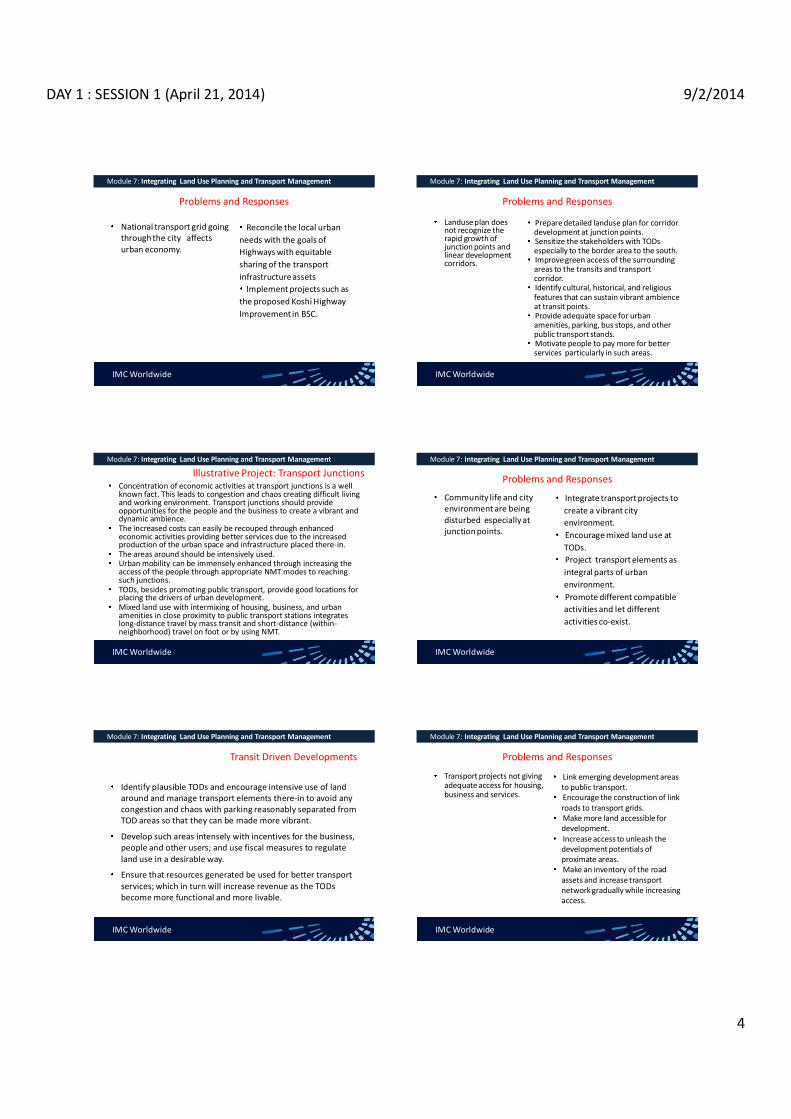
DAY 1 : SESSION 1 (April 21, 2014) 9/2/2014
4
Problems and Responses
National transport grid going through the city affects urban economy.
Reconcile the local urban needs with the goals of Highways with equitable sharing of the transport infrastructure assets Implement projects such as
the proposed Koshi Highway Improvement in BSC.
Module 7: Integrating Land Use Planning and Transport Management
IMC Worldwide
Problems and Responses
Landuse plan does not recognize the rapid growth of junction points and linear development corridors.
Prepare detailed landuse plan for corridor development at junction points. Sensitize the stakeholders with TODs especially to the border area to the south. Improve green access of the surrounding areas to the transits and transport corridor. Identify cultural, historical, and religious features that can sustain vibrant ambience at transit points. Provide adequate space for urban amenities, parking, bus stops, and other public transport stands. Motivate people to pay more for better services particularly in such areas.
Module 7: Integrating Land Use Planning and Transport Management
IMC Worldwide
Illustrative Project: Transport Junctions Concentration of economic activities at transport junctions is a well known fact. This leads to congestion and chaos creating difficult living and working environment. Transport junctions should provide opportunities for the people and the business to create a vibrant and dynamic ambience. The increased costs can easily be recouped through enhanced economic activities providing better services due to the increased production of the urban space and infrastructure placed there-in. The areas around should be intensively used. Urban mobility can be immensely enhanced through increasing the access of the people through appropriate NMT modes to reaching such junctions.TODs, besides promoting public transport, provide good locations for placing the drivers of urban development. Mixed land use with intermixing of housing, business, and urban amenities in close proximity to public transport stations integrates long-distance travel by mass transit and short-distance (within-neighborhood) travel on foot or by using NMT.
Module 7: Integrating Land Use Planning and Transport Management
IMC Worldwide
Problems and Responses
Community life and city environment are being disturbed especially at junction points.
Integrate transport projects to create a vibrant city environment. Encourage mixed land use at TODs. Project transport elements as integral parts of urban environment. Promote different compatible activities and let different activities co-exist.
Module 7: Integrating Land Use Planning and Transport Management
IMC Worldwide
Transit Driven Developments
Identify plausible TODs and encourage intensive use of land around and manage transport elements there-in to avoid any congestion and chaos with parking reasonably separated from TOD areas so that they can be made more vibrant.
Develop such areas intensely with incentives for the business, people and other users; and use fiscal measures to regulate land use in a desirable way.
Ensure that resources generated be used for better transport services; which in turn will increase revenue as the TODs become more functional and more livable.
Module 7: Integrating Land Use Planning and Transport Management
IMC Worldwide
Problems and Responses
Transport projects not giving adequate access for housing, business and services.
Link emerging development areas to public transport. Encourage the construction of link roads to transport grids. Make more land accessible for development. Increase access to unleash the development potentials of proximate areas.Make an inventory of the road assets and increase transport network gradually while increasing access.
Module 7: Integrating Land Use Planning and Transport Management
IMC Worldwide

DAY 1 : SESSION 1 (April 21, 2014) 9/2/2014
5
Problems and Responses
Road investments not cost -effective in terms of the demand created by the changes.
Promote more intensive use of the road infrastructure for enhancing the productivity of the city.Conduct feasibility analysis to optimize the return from road investments and the impact of the road projects on development.
Module 7: Integrating Land Use Planning and Transport Management
IMC Worldwide
Problems and Responses
Inadequate capacity of BSC to ensure integration in the implementation of the plan/LU and TM strategy
Strengthen the new UPID in BSC. Ensure the coordination of land use proposals with the transport plans. Seek help from all the related agencies for integrated action. Coordinate with the traffic police for making the best use of the road network.
Module 7: Integrating Land Use Planning and Transport Management
IMC Worldwide
Problems and Responses
Local communities not aware of the possibilities for improving access to all the facilities they use without increasing traffic.
Develop and implement appropriate communication support program on SUM. Provide information to local communities to help them understand the options available for improving the quality of life without increasing traffic.
Module 7: Integrating Land Use Planning and Transport Management
IMC Worldwide
Not easy to replicate good practices from other cities to the case of Biratnagar. Needs to be tested for Biratnagar before trying to replicate in other cities. Transport professionals to understand the differences across cities before replicating good practices from other cities. Enforcing should depend on the implementation of transport projects with a purpose of making land use changes contribute to more economic growth, equity, and environmental sustainability. Enforcement should primarily rely on the successful implementation of potential projects that enhance integration. - Integrated development of the envisaged centres to the north and the south. - Central area development strategy (Gudri Bazaar Redevelopment). - Transport projects for new development areas (Ring Road) in view of the anticipated density and activities.
Module 7: Integrating Land Use Planning and Transport Management
IMC Worldwide
Summary Aspects of Enforcement
Q & ATHANK YOU
Module 7: Integrating Land Use Planning and Transport Management
IMC Worldwide

DAY 1 : SESSION 2 (April 21, 2014) 9/2/2014
1
Rabi Shah April 21, 2014
SUSTAINABLE URBAN TRANSPORT
sustainable transport sustainable development
Venn diagram
at the confluence of three constituent parts
modes of transport, and systems of transport planning
sustainable transportation system Allows the basic access and development needs of individuals, companies and society to be met safely and in a manner consistent with human and environment, and promotes equity within and between successive generations. Is affordable, operates fairly and efficiently, offers a choice of transport mode, and supports a competitive economy, as well as balanced regional development.
absorb them, uses renewable resources at or below their rates of generation, and uses non-renewable resources at or below the rates of development of renewable substitutes, while minimizing the impact on the use of land and the generation of noise.
Sustainable transport tool
Clean fuels and vehicles Collective passenger transport Green transport infrastructure Access restrictions Transport management Soft measures Travel information Integrated pricing strategies Less car intensive lifestyle Tax on Bad, no tax on good
sustainable transport Environmentally Socially Cities policies and governance Community and grassroots action
The four pillars of sustainable urban transportation (source: C. KENNEDY, ERIC M., AMER S.,H. MACLEAN & JESSE C., Department of Civil Engineering, University of Toronto, Canada
Potential sources of funding for urban transportation systems
Non-vehicle related Non-location-related
General tax base Local transportation levy
Location-related Development fees Transit impact fees Right of way fees Leverage real-estate assets
Vehicle-related Non-location-related
Fuel taxes Vehicle license fees New vehicle or vehicle parts sales taxes Vehicle use fees Emissions fees
Location-related Road tolls Congestion pricing Parking fees Transit user fees

DAY 1 : SESSION 2 (April 21, 2014) 9/2/2014
2
Lesson learned
What went wrong Absence of a city development strategy Unsustainable transport policies Ineffective transport planning Little implementation Little data about the success or failure of implementation Governance problems
Problem of city leaders
Examples of mobility planning and accessibility planning (adapted from Cervero, 2001)
Mobility planning
Road construction and expansion Motorways, freeways, beltways, interchanges, rotaries Arterial expansion ITS, smart highways and smart cars On-board navigational systems Vehicle positioning systems Real-time informational systems Transportation system management One-way streets Rechannelizing intersections Removing curbside parking Ramp metering Large-scale public and private transport Heavy rail transit and commuter rail Regional busways Private tollways
Accessibility planning Land-use management and initiatives Compact development Mixed uses Pedestrian-oriented design Transit villages Telecommunication advances Telecommuting/teleworking Telecommunities Teleshopping Transportation demand management Ridesharing Preferential parking for HOV Parking management and pricing Guaranteed ride home programmes Community-scale public and non-motorized transport Light rail transit and trams Community-based paratransit Bicycle and pedestrian paths
Way Forward
focusing on public transport; the growth of public transport recognizing that traffic restraint is an essential part of the package; Integration of land-use and transport planning as part of the solution so that land-use planning can both facilitate the provision of public transport and reduce the need to travel; and exploiting soft measures such as telecommuting, teleconferencing, internet shopping, public transport marketing, and better information as means to influence behavior
Sustainable transportation policy
approach to urban transport Avoid: reduce the need for travel by promoting city structures and urban densities that do not require large passenger kilometers (km) and freight km of travel; Shift: change modal choice to promote lower fuel consumption per passenger km and/or freight km and manage traffic so as to reduce fuel consumption and air pollutants; and Improve: increase the energy efficiency of vehicles and fuels by decreasing distances travelled and reduce the greenhouse gas footprint per liter of fuel consumed. Investment: mega urban transport infrastructure ???
sustainable transportation mode: BRT
Criteria to be effective Availability of right-of-way Compatibility with existing public transport systems Adeptness in implementation Conditions for sustainability
Potential reduces poverty by providing low-cost transport attracts car and Bike users improves the quality of public transport and environment carries high passenger volumes Operates at high commercial speeds cost effective that of a metro and LRT
BRT System Elements
Running Ways
Stations & Terminals
Systems
Vehicles
Service Plan

DAY 1 : SESSION 2 (April 21, 2014) 9/2/2014
3
BRT: Infinite Possibilities, but with Essential Characteristics:
Integrated, branded system that ensures high speed, reliability, convenience
High frequency all day, week Simple network structure Majority of service on dedicated running way Rapid boarding/alighting
Off-board fare collection Multiple wide door- vehicles Minimal gap, floor to platform
Accessible to all Pervasive, unique brand identity High over-all system quality
Which Route Do I Take??
Service Planning Easier When You Have 4-Lane Transitways
Possibility of Phased Development is Big BRT Advantage
May not have enough understanding, public support or funds for full-featured BRT early; In most developing cities, something needs to be
done ASAP Start with the doable; add features; extend, build
new lines as understanding and success build support for better and more
Lagos, York/Toronto prime examples
March 2008
22Km, 65% segregated 150,000+ daily trips 30% reduction in passenger travel times High initial passenger satisfaction
Thanks to LMATA for Material
Expansion of Coverage Upgraded infrastructure and facilities
Introduction of fully segregated and by-pass lanes
Semi-low-floor, multiple wide door buses Introduction of electronic fare payment Deployment of ITS
bus arrival time adaptive traffic signals at intersections
Phase 2- Management reform

DAY 1 : SESSION 2 (April 21, 2014) 9/2/2014
4
BRT LITE
Phase II
Phase 2 BRT Station Area Phase II Transitway Construction
Ahmedabad

DAY 1 : SESSION 2 (April 21, 2014) 9/2/2014
5
Ridership Growth
Future Park & Ride: Complex Transfer Center
Seoul Development Institute
Cheongnyangni Transportation Center, July. 2005
Complex transfer center
Parking facility near station
Bus transportation center
Seoul Development Institute
Gupabal Station Complex Transfer Center Plan
- Transfer among bicycle, bus, taxi and car - Parking spaces for 400 cars and 470 bicycles
Green parking project
- Solving parking shortage problems in residential areas - Subsidies for the parking construction cost of $6,000 per space per household
Seoul Development Institute
Travel Demand
Management
Public Transportatio
n
Eco-driving
Vehicle Fleet Improvement
Alternative Fuels
Policy Technology
System Efficiency
Structure of Green Transport Strategies
Seoul Development Institute

DAY 1 : SESSION 2 (April 21, 2014) 9/2/2014
6
Seoul
BRT Elements: Range of Recent Applications
BRT Running Ways
More and more colored pavement treatments,
reasons, e.g., easier enforcement
As costs come down, likely to see more automated operation/guidance
Rouen
LV Haifa
Cape Town
Las Vegas
NYC
Stops, Stations and Terminals
General improvement in size and quality everywhere as more and more places try to use BRT as tool to induce and serve sustainable, walkable TOD
York-Toronto
York, Ontario
LimaE. Sandoval
BangkokC. Brader
Haifa

DAY 1 : SESSION 2 (April 21, 2014) 9/2/2014
7
Vehicles: Massive Changes Afoot
Variety of sizes through almost 30 meters
Profusion of ITS applications
More and more hybrids, CNG Emissions, local and global
Noise
All-electric battery vehicles coming
Contemporary BRT Vehicles
38
Wright , Dsl-Elec. Hybrid
Las Vegas
NABI, CNG New Flyer, Guided, Dsl-Elec. Hybrid
LV
LA
Cleveland
Mexico City Volvo Euro 4 27 Meters Long
State of the Art
39
Barcelona Van Hool ExquiCity Hybrid: ~25 meters
Hess-ABB All Electric,
Quick- Charge Battery
Charger
BRT Vehicle Interiors
Van Hool ExquiCity Wright Streetcar
Closing Emphasis Points BRT coming into its own as rapid transit mode with potential (150+ applications Worldwide)
Institutions Communications Service-planning Land-use integration as planning objective
Technological advancements will overcome many issues and constraints, e.g., increasing capacity and safety, lower emissions, noise
Q & A

DAY 1 : SESSION 2 (April 21, 2014) 9/2/2014
8
Rabi Shah April 21, 2014
URBAN TRANSPORT PLANNING AND MANAGEMENT
BASIC UNDERSTANDING URBAN TRANSPORT FACILITIES
URBAN ROADS: FUNCTION, CLSSIFICATION, NORMS & STANDARD, PRESENT SITUATION, INSTITUTIONS, FINANCE ETC PARKING SPACE: CONDITIONS, ISSUES, CLSSIFICATION ETC BUSES/STREET CARS TERMINALS TRAFFIC MANAGEMENT SYSTEM
SURVEY, PLANNING & EVALUATION TRAFFIC STUDIES:VOLUME, SPEED, PARKING FACILITIES ETC OD SURVEY: TYPES, CHARACTERISTICS, SURVEY PROCEDURE ETC LANDUSE PLAN: BASIC &LAND UTILIZATION PROGRAM PROCEDURES: GOALS, OBJECTIVES, TP BY SIZE OF URBAN AREA, NETWORK PLANNING, EVALUATION TD FORECAST: STRUCTURE, TRIP GENERATION, TRIP DISTRIBUTION, MODAL SPLIT, TRAFFIC ASSIGNMENT, FACILITIES: ROAD, EXPRESSWAYS, PARKING MANAGEMENT:DEMAND MANAGEMENT, MEASURES, INSTUTIONAL FRAMEWORK, ROAD TRAFFIC SAFETY EVALUATION; NP WORTH OR DISCOUNTING , BC ANALYSIS, COST EFFECTIVENESS, VALUE ENGG
Traffic Studies
TV characteristics Purpose of Volume studies: data base, accident rate, new facilities, traffic control, evaluation of plan, revenue estime (tool road) Counting: station, method (manual, machine, permanenet), vehicle type/purpose Periods:24/16/12/peak hrs analysis
speed Travel speed: present level of service, planning traffic control schemes and evaluation, link data for traffic assignment, economic evaluation spot speed: present speed distribution, planning of trffic regulation scheme, accidents analysis. Geometric design
volume
Parking studies purpose
Capacity: on 7 off street facilities Usage of present facilities Demand of location & extent for parking facilities Influence to traffic stream (attraction)
Study method
On street: patrol method, questionnaire Off street: input-output
OD survey
types Person trip survey Commodity flow survey Motor vehicle OD survey
process Selection of method of survey Determination of contents of survey Determination of area of survey Zoning Sampling rate: random sampling, stratified sampling, survey
Travel Demand Forecasting
Four Step Models: indirect steps
Generation: nos. of trips of study area Distribution: where will these trips go? Modal Split: which mode of travel will be used? Assignment: which route will these trips take? feedback
Other models General Share Model: direct simultaneous decision modelDisaggregate model: based on sample data on behavior of individual trip maker

DAY 1 : SESSION 2 (April 21, 2014) 9/2/2014
9
Trip Generation Introduction
f(land use pattern & developments in the study are, socio-economic characteristics of trip makers of study area and nature its extent and capabilities of the transportation system of study area) Trip : home to work, home to school, to shop, to home others. Models: Land use Ratio Model and multiple linear regression model.
Factors affecting Trip Generations
Land-use factor Household characteristics Others: age, socio-economic characteristics (white collar worker, factory workers, executives etc), degree of urbanization, quality of tranport facilities, level of accessibility etc)
Trip Distribution and Modal Split Trip Distribution
Links between nos. of zones Not concerned with mode of travel and routes Nos of travel originating in every zone to nos. of travel destinated to other zones of study area Models: growth factor model, gravity Model and opportunity model
Modal Split Proportionate division of total number of person trips between different modes of travel, Expressed in fraction, ratio or % of total nos. of tripsInfluencing factor: characteristics of journey (length, time of day, purpose), characteristica of person making the jpurney (car ownership, income, social status), transportation system (travel time, cost comfort, accessebility)Used model: Trip Interchange modal split model
Traffic assignment
Introduction Selection of min time path over an actual route between zones Categories of Assignment:
Assignment of existing trips to existing network Assignment of estimated future trips to existing network or committed network Assignment of estimated future trips to the future network
All or nothing assignment (least distance), Capacity restraint assignment, Assignment ot Public transport System
Basic Process of Urban Transport Planning
Goals and Objectives
Inventories and Analysis of Existing Conditions
Areawide and zonal Forecast
Development of Alternate Transport System Plans
Test and Analysis of Alternative Plans
Evaluation and selection of Plan
Q & A

Day 2 : Session 1 (April 22, 2014) 02/09/2014
1
TRAINING ON MODULE 1: TRAFFIC ENGINEERING & MANAGEMENT
Session 1: Background, Congestion concepts
Organiser: GoN Dept. of Urban Development & Building Construction
Trainer: Subhash Dhungel, Urban Transport Infrastructure Specialist Urban Transport Planning Management (ADB ta 7948), IMC Worldwide 22 April, 2014
INTRODUCTION Use engineering techniques, legal means for safe, efficient movements (people, goods)
Module 1 : Traffic Engineering & Management Session 1: Background
Focus: Safe, efficient traffic flow
Means: Amend geometry, provide sidewalks, crosswalks, marking, etc. Re-allocate road space to competing users Pedestrians vs motorized; public transport vs cars
Why required? Promote certain modes, create sustainable transport Maximise use of road-space in lieu of supply Reduce expensive constructions.
TRAFFIC MANAGEMENT APPROACH
Traffic supply management Expand the road network Add lanes
Traffic demand management Control traffic demand Patronise public transport
Module 1 : Traffic Engineering & Management Session 1: Background
IMC Worldwide
IMPACT FROM PATRONAGE OF DIFFERENT MODES
Module 1 : Traffic Engineering & Management Session 1:Background
IMC Worldwide
Traffic management
Enhance user safety
Minimize negative environmental impacts
Minimize economic loss from congestion, sub-optimal
use/damage of asset
Module 1 : Traffic Engineering & Management Session 1: Background
IMC Worldwide
OBJECTIVE OF MODULE 1: TRAFFIC ENGINEERING & MANAGEMENT
Introduce concept Guide for traffic engineering tools in city planning adopting traffic engineering tools available to manage, control, influence urban traffic
Module 1 : Traffic Engineering & Management Session 1: Background
IMC Worldwide
Traffic circulation One way streets, ban turns Pedestrianise close street, widen sidewalks, crossing Prioritise bus operation bus lanes, bus-only roads, bus stops/laybys Signalise Change circulation, pre-empt certain vehicles Channelise to regulate traffic, provide pedestrian refuge Restrict certain vehicles (e.g. heavy vehicles)
loading/unloading operations Parking, access controls Improve parking management
Restrict vehicle entry by time of the day Improved planning E.g. network of protected cycle routes
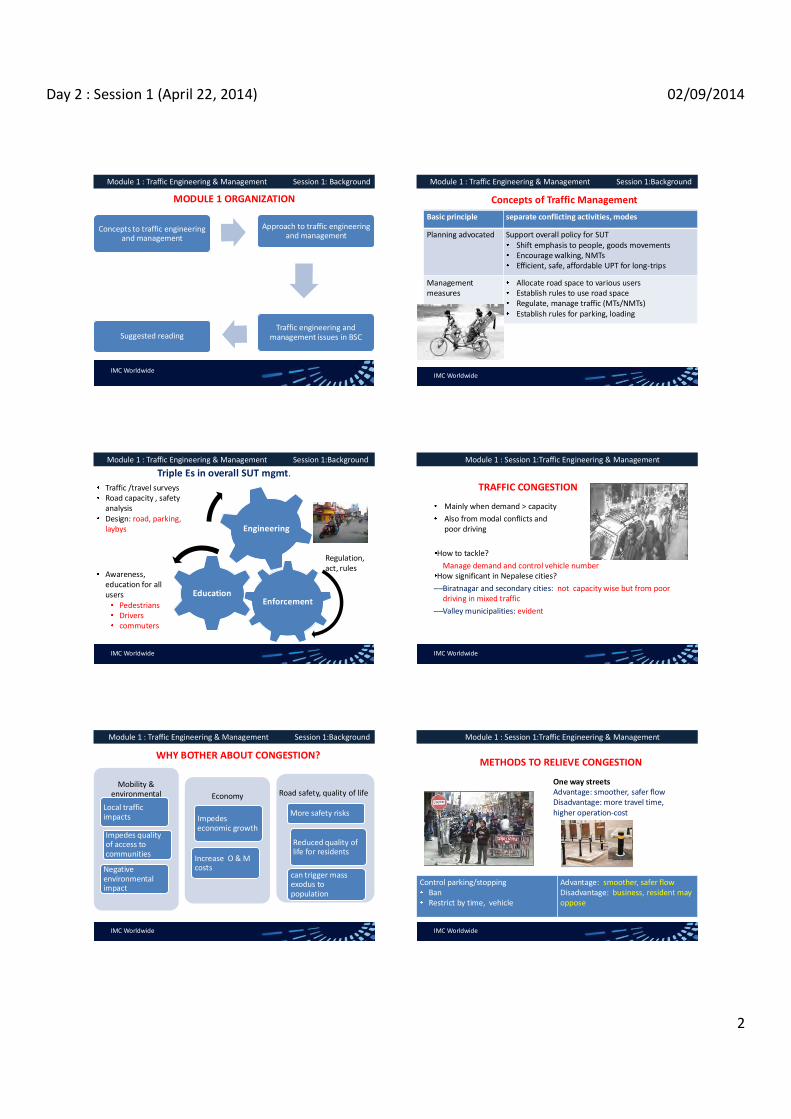
Day 2 : Session 1 (April 22, 2014) 02/09/2014
2
MODULE 1 ORGANIZATION
Concepts to traffic engineering and management
Approach to traffic engineering and management
Traffic engineering and management issues in BSC Suggested reading
Module 1 : Traffic Engineering & Management Session 1: Background
IMC Worldwide
Concepts of Traffic Management
Basic principle separate conflicting activities, modes
Planning advocated Support overall policy for SUT Shift emphasis to people, goods movements Encourage walking, NMTs Efficient, safe, affordable UPT for long-trips
Management measures
Allocate road space to various users Establish rules to use road space Regulate, manage traffic (MTs/NMTs) Establish rules for parking, loading
Module 1 : Traffic Engineering & Management Session 1:Background
IMC Worldwide
Triple Es in overall SUT mgmt.
Enforcement Education
Engineering
Traffic /travel surveys Road capacity , safety analysis Design: road, parking, laybys
Awareness, education for all users
Pedestrians Drivers commuters
Regulation, act, rules
Module 1 : Traffic Engineering & Management Session 1:Background
IMC Worldwide
TRAFFIC CONGESTION
Mainly when demand > capacity Also from modal conflicts and poor driving
How to tackle? Manage demand and control vehicle number
How significant in Nepalese cities? Biratnagar and secondary cities: not capacity wise but from poor driving in mixed traffic Valley municipalities: evident
Module 1 : Session 1:Traffic Engineering & Management
IMC Worldwide
WHY BOTHER ABOUT CONGESTION?
Mobility & environmental
Local traffic impacts
Impedes quality of access to communities
Negative environmental impact
Economy
Impedes economic growth
Increase O & M costs
Road safety, quality of life
More safety risks
Reduced quality of life for residents
can trigger mass exodus to population
Module 1 : Traffic Engineering & Management Session 1:Background
IMC Worldwide
METHODS TO RELIEVE CONGESTION
One way streets Advantage: smoother, safer flowDisadvantage: more travel time, higher operation-cost
Control parking/stopping Ban Restrict by time, vehicle
Advantage: smoother, safer flow Disadvantage: business, resident may oppose
Module 1 : Session 1:Traffic Engineering & Management
IMC Worldwide
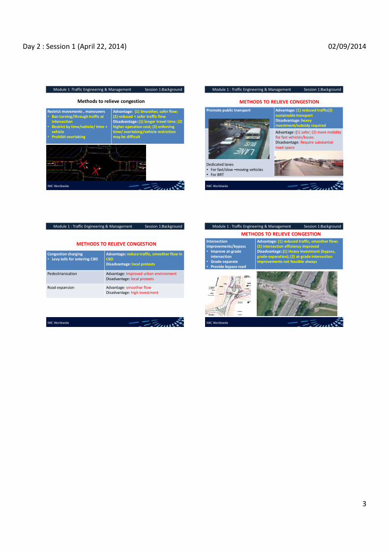
Day 2 : Session 1 (April 22, 2014) 02/09/2014
3
Methods to relieve congestion
Restrict movements , manouvers Ban turning/through traffic at intersection Restrict by time/vehicle/ time + vehicle Prohibit overtaking
Advantage: (1) Smoother, safer flow; (2) reduced + safer traffic flow Disadvantage: (1) longer travel time; (2) higher operation cost; (3) enforcing time/ overtaking/vehicle restriction may be difficult
Module 1 :Traffic Engineering & Management Session 1:Background
IMC Worldwide
METHODS TO RELIEVE CONGESTION Promote public transport Advantage: (1) reduced traffic(2)
sustainable transport Disadvantage: heavy investment/subsidy required
Dedicated lanes For fast/slow moving vehicles For BRT
Advantage: (1) safer; (2) more mobility for fast vehicles/buses. Disadvantage: Require substantial road-space
Module 1 : Traffic Engineering & Management Session 1:Background
IMC Worldwide
METHODS TO RELIEVE CONGESTION
Congestion charging Levy tolls for entering CBD
Advantage: reduce traffic, smoother flow in CBD Disadvantage: local protests
Pedestrianisation Advantage: Improved urban environment Disadvantage: local protests
Road expansion Advantage: smoother flow Disadvantage: high investment
Module 1 : Traffic Engineering & Management Session 1:Background
IMC Worldwide
METHODS TO RELIEVE CONGESTION Intersection improvements/bypass
Improve at-grade intersection Grade-separate Provide bypass road
Advantage: (1) reduced traffic, smoother flow; (2) intersection efficiency improved Disadvantage: (1) Heavy investment (bypass, grade-separation); (2) at-grade intersection improvements not feasible always
Module 1 : Traffic Engineering & Management Session 1:Background
IMC Worldwide

Day 2 Session 2 (April 22, 2014) 02/09/2014
1
TRAINING ON MODULE 1: TRAFFIC ENGINEERING & MANAGEMENT
Session 2:Traffic Management Plan
Organiser: GoN Dept. of Urban Development & Building Construction
Trainer: Subhash Dhungel, Urban Transport Infrastructure Specialist Urban Transport Planning Management (ADB ta 7948), IMC Worldwide 22 April, 2014
PRINCIPLES TO ADOPT FOR TRAFFIC MANAGEMENT Maximise
Safety for all users
Quality of the urban ambience for all
Minimise
Economic losses from congestion, delays
Economic losses from damage to transport infrastructure
Negative environmental impact from traffic
Module 1 : Traffic Engineering & Management Session 2: Traffic Management Plan
IMC Worldwide
ELEMENTS OF TRAFFIC MANAGEMENT
IMC Worldwide
Module 1 : Traffic Engineering & Management Session 2: Traffic Management Plan
1. Separate users ++ + + - ++
2. Impose speed limit ++ - - + -
3. Provide protected crossing ++ - - - +
4. Restrict access to certain users ++ + + + +
5. Comprehensive traffic calming ++ - - + ++
6. Provide dedicated stopping/waiting points/areas
+ - - - +
7. Signalize intersections ++ ++ - + -
ELEMENTS OF TRAFFIC MANAGEMENT Module 1 : Traffic Engineering & Management Session 2: Traffic Management Plan
IMC Worldwide
8. Restrict turning + + + - -
9. Impose one-way streets + + - + +
10. Restrict by vehicle weight/height/width
- - ++ + ++
11. Redirect traffic to suitable routes + ++ ++ ++ ++
12. Restrict/prohibit parking in certain areas
- - + ++
13. Pedestrianise ++ - - + ++
Users attitudes to consider when planning interventions
Issue
Environment A secondary cities in
Nepal
Environment B developed western
societies
Individual userstraffic rules Low High
Individual users acceptance of the disadvantages / inconveniences caused by traffic rules / traffic management
Low High
Users rules / traffic management stipulations Low High
Users -compliant behavior by other users High Low
IMC Worldwide
Module 1 : Traffic Engineering & Management Session 2: Traffic Management Plan
TYPICAL TRAFFIC MANAGEMENT MEASURES Separate different users
SMV laneNMT lane Sidewalks Ped-zone
Enhance safety, smother flow mitigate adverse environmental impact
Module 1 : Traffic Engineering & Management Session 2: Traffic Management Plan
IMC Worldwide

Day 2 Session 2 (April 22, 2014) 02/09/2014
2
TYPICAL TRAFFIC MANAGEMENT MEASURES
Optimise the road space Increase ped- path in the city centre Reallocate space for cycle lane
Ban access to certain vehicles No NMT along expressway No heavy vehicles in city centre
Restrict certain vehicles or time-based
Module 1 : Traffic Engineering & Management Session 2: Traffic Management Plan
IMC Worldwide
TYPICAL TRAFFIC MANAGEMENT MEASURES
Optimise the use of road space Parking for specific vehicle, persons with disabilities
IMC Worldwide
Module 1 : Traffic Engineering & Management Session 2: Traffic Management Plan
TYPICAL TRAFFIC MANAGEMENT MEASURES- CONTD.
Speed limits Reduce limit in residential, inner streets (5~ 30 kph)
Benefits: enhance safety (e.g. Reduce air, noise pollution
Challenges: Enforcing (police, cameras) Enforce with traffic calming
Crash risk double with 5 kph increase in urban street
Module 1 : Traffic Engineering & Management Session 2: Traffic Management Plan
IMC Worldwide
TYPICAL TRAFFIC MANAGEMENT MEASURES- CONTD. Default speed limits for urban road: unsigned
Vehicle VTMR 2054 URS 2068 design speed
DoR TSM 1997
40 kph (urban) Arterial : 80 kph High std 60 kph
LV 80 kph Sub-arterial : 60 kph Peds moderate: 40 kph
3wh/ scooter/PT/ TRACTOR
40 kph Collector: 50 kph heavy peds: 25 kph
MC 50 kph Local: 30 kph
HV 50 kph (hills) 70 kph (terai)
IMC Worldwide
Module 1 : Traffic Engineering & Management Session 2: Traffic Management Plan
TYPICAL TRAFFIC MANAGEMENT MEASURES- CONTD.
Crash historyCurrent operating performance Road, roadside, Geometry Unsealed roads
Scientific criteria to set speed
limit Note: NURS 2068 (draft) recommend some of the above for design speed
Module 1 : Traffic Engineering & Management Session 2: Traffic Management Plan
IMC Worldwide
TYPICAL TRAFFIC MANAGEMENT MEASURES- CONTD.
Over and under pass pedestrian crossing
Curbed extension at crossing
Provide protected crossing facilities for pedestrians
Module 1 : Traffic Engineering & Management Session 2: Traffic Management Plan
IMC Worldwide
Zebra crossing

Day 2 Session 2 (April 22, 2014) 02/09/2014
3
TYPICAL TRAFFIC MANAGEMENT MEASURES- CONTD. Provide protected crossing facilities
Pedestrian refuge island
Module 1 : Traffic Engineering & Management Session 2: Traffic Management Plan
IMC Worldwide
TYPICAL TRAFFIC MANAGEMENT MEASURES- CONTD. Providing protected crossing facilities
Raised median with cut-through
Module 1 : Traffic Engineering & Management Session 2: Traffic Management Plan
IMC Worldwide
TYPICAL TRAFFIC MGMT. MEASURES - CONTD. Providing protected crossing facilities kerb-ramp
Improve as per GoN Accessibility Directive 2069:
Sidewalks -2 m (min) Kerb ht. = 10- 15 cm max Simple kerb-ramp, ramp slope 1:15 Flared kerb-ramp
Flat portion= 0.915 m Ramp Side slope 1:10
IMC Worldwide
Module 1 : Traffic Engineering & Management Session 2: Traffic Management Plan
TYPICAL TRAFFIC MANAGEMENT MEASURES - CONTD.Providing protected crossing facilities for Cycles
Module 1 : Traffic Engineering & Management Session 2: Traffic Management Plan
IMC Worldwide
TYPICAL TRAFFIC MANAGEMENT MEASURES- CONTD. Signalise to improve operation, protected crossing facilities
Provide mid-block pelican signal with conspicuous crossing (source: Dan Burden, Walkable Communities Inc. , US)
Signalise the intersection Not feasible currently in Nepal
Load-shedding Maintenance lackingLack of skilled manpower
IMC Worldwide
Module 1 : Traffic Engineering & Management Session 2: Traffic Management Plan TYPICAL TRAFFIC MANAGEMENT MEASURES- CONTD. Signalised intersection with audio-tactile push-button for persons with disability
Pedestrians time countdown display
Improve phasing at signalised intersections: Adjust walking speed for green phase with LTOR. Introduce a protected RT phase. Introduce a leading pedestrian phase
Module 1 : Traffic Engineering & Management Session 2: Traffic Management Plan
IMC Worldwide

Day 2 Session 2 (April 22, 2014) 02/09/2014
4
TYPICAL TRAFFIC MANAGEMENT MEASURES
Restricting turning at street/intersection
Alternative before signalisation Enforce with sign, marking Can restrict certain vehicles only Advantage: low cost, easy to introduce Disadvantage: enforcing challenging compliance better if users informed of alternative route
Module 1 : Traffic Engineering & Management Session 2: Traffic Management Plan
IMC Worldwide
TYPICAL TRAFFIC MANAGEMENT MEASURES - CONTD. Comprehensive traffic calming
devices to reduce/discourage speeding, access Installed in city centres, residential areas
Traffic calming objective
Reduce speed, crash, severity
Reduce air, noise
pollution
Allocate road space for other activities
Improve urban
ambience
IMC Worldwide
Module 1 : Traffic Engineering & Management Session 2: Traffic Management Plan
Typical traffic management measures - contd. traffic calming measures- close/restrict access
Enforce one-way street with sign, barriers (bollards)
Exempt cycles Construct channel-island to block certain access
Module 1 : Traffic Engineering & Management Session 2: Traffic Management Plan
IMC Worldwide
TYPICAL TRAFFIC MANAGEMENT MEASURES - CONTD. traffic calming measures devices
Road Hump
Gateway -
Create physical obstructions to self-impose lower speed Discourage certain users
Build-outs
Chicanes
Module 1 : Traffic Engineering & Management Session 2: Traffic Management Plan
IMC Worldwide
TYPICAL TRAFFIC MANAGEMENT MEASURES traffic calming measures devices (contd)
Raised intersection
Raising intersection Stone-paved streets
Elevation view of rumble strips and jiggle bars Rumble strips
Mini-roundabout
Module 1 : Traffic Engineering & Management Session 2: Traffic Management Plan
IMC Worldwide
Typical traffic management measures traffic calming measures contd.
Fully pedestrianised streets
Convert street as: Fully/partially pedestrianised Playing/recreation areas
Module 1 : Traffic Engineering & Management Session 2: Traffic Management Plan
IMC Worldwide
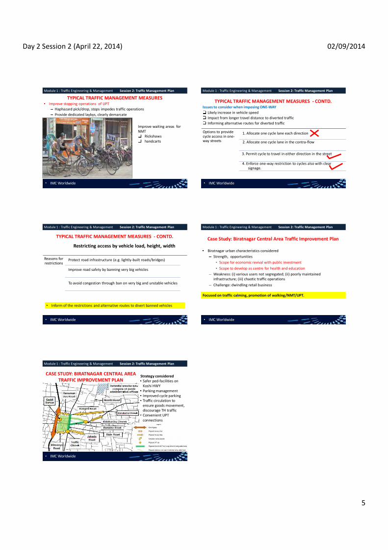
Day 2 Session 2 (April 22, 2014) 02/09/2014
5
TYPICAL TRAFFIC MANAGEMENT MEASURES Improve stopping operations of UPT
Haphazard pick/drop, stops impedes traffic operations Provide dedicated laybys, clearly demarcate
Improve waiting areas for NMT
Rickshaws handcarts
Module 1 : Traffic Engineering & Management Session 2: Traffic Management Plan
IMC Worldwide
TYPICAL TRAFFIC MANAGEMENT MEASURES - CONTD.Issues to consider when imposing ONE-WAY
Likely increase in vehicle speed Impact from longer travel distance to diverted traffic Informing alternative routes for diverted traffic
Options to provide cycle access in one-way streets
1. Allocate one cycle lane each direction
2. Allocate one cycle lane in the contra-flow
3. Permit cycle to travel in either direction in the street
4. Enforce one-way restriction to cycles also with clear signage.
Module 1 : Traffic Engineering & Management Session 2: Traffic Management Plan
IMC Worldwide
TYPICAL TRAFFIC MANAGEMENT MEASURES - CONTD.
Restricting access by vehicle load, height, width
Reasons for restrictions
Protect road infrastructure (e.g. lightly-built roads/bridges)
Improve road safety by banning very big vehicles
To avoid congestion through ban on very big and unstable vehicles
Inform of the restrictions and alternative routes to divert banned vehicles
Module 1 : Traffic Engineering & Management Session 2: Traffic Management Plan
IMC Worldwide
Case Study: Biratnagar Central Area Traffic Improvement Plan
Biratnagar urban characteristics considered Strength, opportunities
Scope for economic revival with public investment Scope to develop as centre for health and education
Weakness: (i) various users not segregated; (ii) poorly maintained infrastructure; (iii) chaotic traffic operations Challenge: dwindling retail business
Focused on traffic calming, promotion of walking/NMT/UPT.
Module 1 : Traffic Engineering & Management Session 2: Traffic Management Plan
IMC Worldwide
CASE STUDY: BIRATNAGAR CENTRAL AREA TRAFFIC IMPROVEMENT PLAN
Strategy considered Safer ped-facilities on Koshi HWYParking managementImproved cycle parking Traffic circulation to ensure goods movement, discourage TH traffic Convenient UPT connections
Module 1 : Traffic Engineering & Management Session 2: Traffic Management Plan
IMC Worldwide

Day 2 Session 3 9/2/2014
1
TRAINING ON MODULE 1: TRAFFIC ENGINEERING & MANAGEMENT
Session 4:Traffic Surveys I
Organiser: GoN Dept. of Urban Development & Building Construction
Trainer: Subhash Dhungel, Urban Transport Infrastructure Specialist Urban Transport Planning Management (ADB ta 7948), IMC Worldwide 22 April, 2014
IMC Worldwide
Module 1 : Traffic Engineering & Management Session 4: Traffic Surveys I
Need for traffic
surveys Get data
To aid in the following aspects of a transport system
Planning Construction Operation Maintenance required Investment required
Optimise road space Evaluate traffic operations Evaluate traffic safety Identify operations improvements Baseline for traffic forecasts Develop/update parameters
K, D factor Traffic growth-rate Average traffic mix
IMC Worldwide
Module 1 : Traffic Engineering & Management Session 4: Traffic Surveys I
TYPES OF TRAFFIC SURVEYSTraffic counts Origination- destination Road inventorySpeed and delayIntersection delay and saturation flow Vehicle Occupancy UPT surveys Safety analysis?
Road crash Traffic rule violation
Parking survey- supply, demand
-Terai areas
IMC Worldwide
Module 1 : Traffic Engineering & Management Session 4: Traffic Surveys I
Types Where conducted
Count duration/frequency
Output
By nature of the count 1. Link count
road link (mid block)
Desirable: 24 hrs - 7 days classified Or, 12/14/16 hrs -1- 3 days Twice yearly (peak & off- peak season)
Traffic flow, mix Traffic variation factor Peak/ Off-peak traffic Peak hour factor AADT
2. Turning movement count
intersection 6 hrs (3 hrs each peak period) at weekday, weekend Min during weekday
Turning movements Traffic variation, mix by approach Peak/ Off-peak hours Peak hour factor
TRAFFIC COUNT SURVEYS IN URBAN AREAS
IMC Worldwide
Module 1 : Traffic Engineering & Management Session 4: Traffic Surveys I
TRAFFIC COUNT SURVEYS IN URBAN AREASTypes Where conducted Count duration Output By purpose 1. Outer cordon count
At the main roads approaching the city
Same as for link count
Same as for link count
2. Inner cordon count
At the intra-urban roads approaching the city centre
3. Pedestrian counts
Crossing: mid-blocks, intersections Mid-blocks: along sidewalks, shoulders Scope: selected streets/broader area
Desirable: 06:00 ~ 19:00 hrs Min: 6 hrs (3 hr each- AM, PM peak
Ped per hr Ped per min Ped per m per hr/min
Module 1 : Traffic Engineering & Management Session 4: Traffic Surveys
IMC Worldwide

Day 2 Session 3 9/2/2014
2
IMC Worldwide
Module 1 : Traffic Engineering & Management Session 4: Traffic Surveys
Vehicle classification adopted for urban counts in Nepal To ease survey, can limit to the
following vehicle groups Cycle and motorcycleLight vehicle Bus and truck Rickshaw (NMT and auto) Hand-cart and tractor
Choose the classification to suit the survey objective Vehicle class to be distinct to the enumerator
Multi-axle trucks Utility vehicle Heavy trucks Motorcycle Light trucks Tempo Standard bus Tractor Minibus Cycle Microbus Rickshaw Car Bull/Horse cart Four wheel drive Handcart
-Terai -Terai
-valley, Terai
IMC Worldwide
Module 1 : Traffic Engineering & Management Session 4: Traffic Surveys I
MANPOWER REQUIRED -PAPER-BASED TRAFFIC SURVEYS Traffic (v)
(vph) Nos. of items each experienced enumerator can record
Twelve300<v Four 600<v Two1200<v One
Estimate the traffic of vehicle class/classes and calculate the enumerators required from above.
One supervisor per 10 enumerators
IMC Worldwide
Module 1 : Traffic Engineering & Management Session 4: Traffic Surveys I
OTHER CONSIDERATION WHEN PLANNING SURVEYS Design survey forms
Simple design, enough space to record data Include the administrative information Written surveying instruction
Pilot to effectively plan the survey Liaise with other agencies Ensure safety of the survey team Data handling
Begin processing and analysis ASAP Error checking
IMC Worldwide
Module 1 : Traffic Engineering & Management Session 4: Traffic Surveys I
TECHNIQUE OF COUNT SURVEYS IN URBAN AREAS
Manual by observing Recording on paper form Recording using hand tally Recording using electronic boards
Single hand tally
Multiple hand tally
Electronic boards
IMC Worldwide
Module 1 : Traffic Engineering & Management Session 4: Traffic Surveys
MANUAL COUNTING ON PAPER FORM
For road-link counts For turning movement counts
Count interval for all types of counts: Link counts: 1 hour Turning movement: 15 min. Turning movement at signal: cycle time
IMC Worldwide
Module 1 : Traffic Engineering & Management Session 4: Traffic Surveys
COUNT SURVEY TECHNIQUE IN URBAN AREAS
Automatic Pneumatic tube Piezo electric, inductive loop Passive infra-red, magnetic Microwave-doppler/radar Ultrasonics and passive acoustic Video image detection
Pneumatic tube
Passive/active infra-red counter

Day 2 Session 3 9/2/2014
3
IMC Worldwide
Module 1 : Traffic Engineering & Management Session 4: Traffic Surveys
SUGGESTED VIDEO BASED COUNTING FOR NEPALESE URBAN AREAS
Courtesy: Welink Consultant, Pvt. Ltd.
CCTV image recorded in the video recorder Counts recorded digitally with a counting software in
Inverter and battery installed during power cuts More accurate than manual counting Require fewer manpower at the sites
IMC Worldwide
Module 1 : Traffic Engineering & Management Session 4: Traffic Surveys I
MANPOWER REQUIRED FOR MANUAL PEDESTRIAN COUNTS Peak Hour Pedestrian volume (v) two way
(pph) Enumerators required
Paper-based Hand tallies/ electronic board
Mid-block counts <2,000 2 1 2,000<v<4,000 4 2 4,000<v<10,000 8 4
pph -one dir. for short period 4 2 Crossing counts for four-way intersection
Light traffic, CWs used alternately 2 1Moderate traffic, CWs used alternately 4 2 Each CW traffic> 2,000 pph (two-way) 16 8
IMC Worldwide
Module 1 : Traffic Engineering & Management Session 4: Traffic Surveys I
MANUAL PEDESTRIAN
COUNT METHOD
Counting interval: Mid-block: 30 min 1 hour Crossing:
15 ~ 30 minutes: partial 30 minutes: continuous
IMC Worldwide
Module 1 : Traffic Engineering & Management Session 4: Traffic Surveys
FUNDAMENTAL OF BASIC TRAFFIC PARAMETERS
IMC Worldwide
Module 1 : Traffic Engineering & Management Session 4: Traffic Surveys
FUNDAMENTAL OF BASIC TRAFFIC PARAMETERS
Vehicle PCU Factor
Vehicle PCU Factor
Vehicle PCU Factor
C, van, 4WD 1.0 Bus 3.0 Pedestrian 0.10 Trucks: Minibus 3.0 Porter 0.40
empty 2.0 Microbus 1.5 Rickshaw 1.0 8 MT 2.5 Tempo 1.0 Bull-cart 8.0
>8 MT 3.5 Motorcycle 0.50 Horse-cart 6.0 Light truck 1.5 Pick-up 1.0 Hand-cart 2.0 PT, tractor 3.0 Bicycle 0.50 Pack animal 2.0
PCU factors prescribed in Nepal Urban Road Standard-2068 (draft)
IMC Worldwide
Module 1 : Traffic Engineering & Management Session 4: Traffic Surveys
DATA ENTRY AND ANALYSIS OF TRAFFIC COUNTS Start Date : 15-Ja n-12Road Link : F00101 Location : A na rma niName of the Road : B irt a mod - C ha nd rag a dhi - M e ch ipu l Surveyed by : SN C La va lin (C a na da ) i n as s oc . wi th SIL T- ER MC JVDOR general seasonal factor for January: 0.93 Enumerator: Lu cky B is hwa ka rma Supervisor: R a me sh wor Gi iri/E ngine e r Overall Supervision: S. Dh ung el / T raffi c Eng ine e r
Non-motorised Vehicles
a b a b a b a b a b a b a b a b a b a b a b a b a b a b a b a b a b a+b15-Ja n-12 06:00:00 2 1 5 4 7 1 1 19 4 2 2 1 3 2 1 25 5 62 23 85
07:00:00 1 3 3 8 6 6 4 - 46 15 1 2 2 2 3 1 5 2 70 28 144 64 208 08:00:00 1 3 2 10 3 12 6 6 - 90 80 2 1 2 3 3 - 2 - 13 10 70 57 213 163 376 09:00:00 1 2 9 5 5 10 15 9 4 3 135 155 10 10 8 1 7 5 3 1 3 3 88 98 289 301 590 10:00:00 1 5 1 9 6 6 3 - 110 105 9 4 1 4 2 2 1 1 80 75 223 202 425 11:00:00 1 2 3 5 6 6 5 12 135 120 6 5 1 3 1 1 3 2 3 100 105 1 1 264 263 527 12:00:00 1 5 3 4 4 3 11 8 5 6 115 135 8 6 5 3 5 2 9 2 89 105 255 279 534 13:00:00 1 1 3 5 4 10 15 2 1 167 177 4 3 2 7 7 5 8 9 120 115 329 337 666 14:00:00 3 1 2 2 2 4 5 8 15 3 6 118 142 5 6 1 11 5 4 5 6 92 84 253 277 530 15:00:00 - - 5 4 4 7 9 13 5 7 102 172 7 3 2 6 4 1 4 16 75 129 218 357 575 16:00:00 - 1 1 2 4 4 10 13 14 8 16 112 102 5 12 5 6 6 13 72 67 228 245 473 17:00:00 1 - 6 8 6 15 5 20 64 152 3 5 5 3 5 5 7 41 103 127 327 454
06:00~18:00 hrs - - 2 15 4 4 33 37 61 71 109 109 43 72 1 , 213 1 , 359 62 59 13 14 - - 52 45 28 9 62 72 922 971 1 1 2 ,605 2 ,838 5 ,443 18:00:00 1 - - 1 1 2 6 1 9 49 73 1 1 2 1 1 4 16 59 73 155 228 19:00:00 2 2 1 3 - 4 2 1 17 4 2 4 3 3 17 3 50 18 68
Four Wheel Drive Power Tiller Rickshaw
Result of Class ified Manual Vehicle Count
Date Start Time
Motorised Vehicles
TotalTruck
Bicycle Bullock CartMulti-axle Truck Heavy Light Big Mini
BusCar/Taxi MC
Utility Vehicles Tractor
Motorised Three
WheelerMicro
1. Enter the each vehicle count per interval by direction as shown.
4. Add each vehicle traffic by direction, total traffic by direction and total traffic for each shift.
2. Sum the total traffic per direction per interval.
3. Sum the total traffic in both directions.

Day 2 Session 3 9/2/2014
4
IMC Worldwide
Module 1 : Traffic Engineering & Management Session 4: Traffic Surveys
DATA ENTRY AND ANALYSIS OF TRAFFIC COUNTS S tar t D a te : 15-Ja n-12R o a d L i nk : F00101 L o ca ti o n : A na rma ni
N a m e o f the R o ad : B irt a mod - C ha nd rag a dhi - M e ch ipu l S ur ve y e d by : SN C La va lin (C a na da ) i n as s oc . wi th SIL T- ER MC JVD O R g e ne r al s ea s o na l fa c tor for J a nua r y : 0.93 En um er a to r : Lu cky B is hwa ka rma S upe r vi s or : R a me sh wor Gi iri/E ngine e r O ve r a ll Su per v is i o n: S. Dh ung el / T raffi c Eng ine e r
N o n-m o tor i s e d V e hi c l e s
a b a b a b a b a b a b a b a b a b a b a b a b a b a b a b a b a b a +b0 6 :0 0 ~1 8 :0 0 hr s - - 2 15 4 4 33 37 61 71 109 109 43 72 1 , 213 1 , 359 62 59 13 14 - - 52 45 28 9 62 72 922 971 1 1 2 ,605 2 ,838 5 ,443
1 8 :0 0 ~ 0 6 :0 0 hr s - - 3 5 3 2 8 3 8 2 12 14 7 9 99 95 8 3 9 12 - - 2 1 - - 5 9 65 80 - - 229 235 464
D a y 1 S ub-tota l - - 5 20 7 6 41 40 69 73 121 123 50 81 1 ,312 1 ,454 70 62 22 26 - - 54 46 28 9 67 81 987 1 ,051 1 1 2 ,834 3 ,073 5 ,907
0 6 :0 0 ~1 8 :0 0 hr s 1 - 12 19 2 4 39 35 68 63 108 92 111 98 890 1 , 017 52 39 22 32 - - 49 50 2 - 111 145 683 724 - - 2 ,150 2 ,318 4 ,468
1 8 :0 0 ~ 0 6 :0 0 hr s 3 1 12 11 6 5 10 17 6 15 19 31 11 22 68 196 12 22 17 24 - - 6 28 - - 3 30 55 88 - - 228 490 718
D a y 2 S ub-tota l 4 1 24 30 8 9 49 52 74 78 127 123 122 120 958 1 ,213 64 61 39 56 - - 55 78 2 - 114 175 738 812 - - 2 ,378 2 ,808 5 ,186
0 6 :0 0 ~1 8 :0 0 hr s - - 14 10 8 10 39 37 79 72 86 111 103 94 784 813 53 84 43 55 - - 64 78 - - 94 127 583 565 1 - 1 ,951 2 ,056 4 ,007
1 8 :0 0 ~ 0 6 :0 0 hr s 2 - 14 13 11 3 16 1 11 4 22 19 15 17 83 83 11 23 21 10 - - 11 7 - - 16 14 80 76 - - 313 270 583
D a y 3 S ub-tota l 2 - 28 23 19 13 55 38 90 76 108 130 118 111 867 896 64 107 64 65 - - 75 85 - - 110 141 663 641 1 - 2 ,264 2 ,326 4 ,590
T ot a l 6 1 57 73 34 28 145 130 233 227 356 376 290 312 3 ,137 3 ,563 198 230 125 147 - - 184 209 30 9 291 397 2 ,388 2 ,504 2 1 7 ,476 8 ,207 15,683 Gran d T o ta l (a +b) 7 130 62 275 460 732 602 6 ,700 428 272 - 393 39 688 4 ,892 3 15,683 A ve ra ge Da ily Tra ffic (A DT ) 5,228 5 ,228 C omp os it io n (% ) 100%T ota l AD T e xc l. NM Vs
C omp os it io n e xcl . NMV (% ) 100%A ve ra ge A nnu al Da i ly T ra ffic (AA DT )A AD T e xc l. NM Vs
No te : D i r e c ti o n a : M ec h ipu l t o B irt a mod A ve ra ge PC U fac tor= 0.8
D i r e c ti o n b: B irt a mod to Me c hipul A ve ra ge PC U Fa c tor (e xc l. NM V)= 0.6
NA 6 759 6 133 252 - 122 36 213 429 284
133 252 - 122 36 NA187
120 29 255 429 284 187 NA
PC U Fa c torsA AD T in PC Us 1,039
1 .00 0.504.00 3.00 1.50 3.00 3.00 1.25
A AD T in PC Us e xcl . NM Vs8 8
120 29 255 1 .00
12 12
213 1 ,517 NA
1 NANA
3.00 0.75 1.00 3.00 1.00 0.50 6.00
187 2 ,077 133 84 - 122 40 19 85 143 227 187 2 ,077 133 84 - 122
31.2% 100%3,367
0 .1% 1.3% 0.6% 2.7% 4.6% 7.2% 6.0% 66.3% 4.2% 2.7% 0.0% 3.9% 0.4% 100. 0%NA NA NA
0.8% 0.4% 1.8% 2.9% 0.0%
15,683
3 ,131 4 ,862
3 ,870 1 ,860
2 43 21 92 153 244 201 2 ,233 143 91 - 131 13 229 1 ,631 1 0 .0% 3.8%
15-Ja n-12
16-Ja n-12
17-Ja n-12
Fo ur W he e l D r i ve P o we r T i l l e r R i c k s ha w
2 40 19 85
42.7% 2.7% 1.7% 0.0% 2.5% 0.2% 4.4%4.7%
2 143 227
D a te S tar t Ti m e
Mo to r is e d V eh ic l e s
T o ta lT r uc k
B i c y c le B u ll o c k C a r tMul ti -a x l e T r uc k He a vy L i g ht B i g Mi ni
B u sC a r / T ax i MC
U ti li ty V e hi c l e s T r ac to r
Mo to r is e d T hr e e
W he e l e rMi c r o
5. Add vehicle traffic all the shifts to get day traffic.
6. Calculate the vehicle traffic for other days depending on count duration (1/3/7 days)
7. Average the daily vehicle traffic of all count days to get vehicle ADT in both directions.
8. Add all the vehicle ADT to get the ADT in both direction.
IMC Worldwide
Module 1 : Traffic Engineering & Management Session 4: Traffic Surveys
DATA ENTRY AND ANALYSIS OF TRAFFIC COUNTS S tar t D a te : 15-Ja n-12R o a d L i nk : F00101 L o ca ti o n : A na rma ni
N a m e o f the R o ad : B irt a mod - C ha nd rag a dhi - M e ch ipu l S ur ve y e d by : SN C La va lin (C a na da ) i n as s oc . wi th SIL T- ER MC JVD O R g e ne r al s ea s o na l fa c tor for J a nua r y : 0.93 En um er a to r : Lu cky B is hwa ka rma S upe r vi s or : R a me sh wor Gi iri/E ngine e r O ve r a ll Su per v is i o n: S. Dh ung el / T raffi c Eng ine e r
N o n-m o tor i s e d V e hi c l e s
a b a b a b a b a b a b a b a b a b a b a b a b a b a b a b a b a b a +b0 6 :0 0 ~1 8 :0 0 hr s - - 2 15 4 4 33 37 61 71 109 109 43 72 1 , 213 1 , 359 62 59 13 14 - - 52 45 28 9 62 72 922 971 1 1 2 ,605 2 ,838 5 ,443
1 8 :0 0 ~ 0 6 :0 0 hr s - - 3 5 3 2 8 3 8 2 12 14 7 9 99 95 8 3 9 12 - - 2 1 - - 5 9 65 80 - - 229 235 464
D a y 1 S ub-tota l - - 5 20 7 6 41 40 69 73 121 123 50 81 1 ,312 1 ,454 70 62 22 26 - - 54 46 28 9 67 81 987 1 ,051 1 1 2 ,834 3 ,073 5 ,907
0 6 :0 0 ~1 8 :0 0 hr s 1 - 12 19 2 4 39 35 68 63 108 92 111 98 890 1 , 017 52 39 22 32 - - 49 50 2 - 111 145 683 724 - - 2 ,150 2 ,318 4 ,468
1 8 :0 0 ~ 0 6 :0 0 hr s 3 1 12 11 6 5 10 17 6 15 19 31 11 22 68 196 12 22 17 24 - - 6 28 - - 3 30 55 88 - - 228 490 718
D a y 2 S ub-tota l 4 1 24 30 8 9 49 52 74 78 127 123 122 120 958 1 ,213 64 61 39 56 - - 55 78 2 - 114 175 738 812 - - 2 ,378 2 ,808 5 ,186
0 6 :0 0 ~1 8 :0 0 hr s - - 14 10 8 10 39 37 79 72 86 111 103 94 784 813 53 84 43 55 - - 64 78 - - 94 127 583 565 1 - 1 ,951 2 ,056 4 ,007
1 8 :0 0 ~ 0 6 :0 0 hr s 2 - 14 13 11 3 16 1 11 4 22 19 15 17 83 83 11 23 21 10 - - 11 7 - - 16 14 80 76 - - 313 270 583
D a y 3 S ub-tota l 2 - 28 23 19 13 55 38 90 76 108 130 118 111 867 896 64 107 64 65 - - 75 85 - - 110 141 663 641 1 - 2 ,264 2 ,326 4 ,590
T ot a l 6 1 57 73 34 28 145 130 233 227 356 376 290 312 3 ,137 3 ,563 198 230 125 147 - - 184 209 30 9 291 397 2 ,388 2 ,504 2 1 7 ,476 8 ,207 15,683 Gran d T o ta l (a +b) 7 130 62 275 460 732 602 6 ,700 428 272 - 393 39 688 4 ,892 3 15,683 A ve ra ge Da ily Tra ffic (A DT ) 5,228 5 ,228 C omp os it io n (% ) 100%T ota l AD T e xc l. NM Vs
C omp os it io n e xcl . NMV (% ) 100%A ve ra ge A nnu al Da i ly T ra ffic (AA DT )A AD T e xc l. NM Vs
No te : D i r e c ti o n a : M ec h ipu l t o B irt a mod A ve ra ge PC U fac tor= 0.8
D i r e c ti o n b: B irt a mod to Me c hipul A ve ra ge PC U Fa c tor (e xc l. NM V)= 0.6
NA 6 759 6 133 252 - 122 36 213 429 284
133 252 - 122 36 NA187
120 29 255 429 284 187 NA
PC U Fa c torsA AD T in PC Us 1,039
1 .00 0.504.00 3.00 1.50 3.00 3.00 1.25
A AD T in PC Us e xcl . NM Vs8 8
120 29 255 1 .00
12 12
213 1 ,517 NA
1 NANA
3.00 0.75 1.00 3.00 1.00 0.50 6.00
187 2 ,077 133 84 - 122 40 19 85 143 227 187 2 ,077 133 84 - 122
31.2% 100%3,367
0 .1% 1.3% 0.6% 2.7% 4.6% 7.2% 6.0% 66.3% 4.2% 2.7% 0.0% 3.9% 0.4% 100. 0%NA NA NA
0.8% 0.4% 1.8% 2.9% 0.0%
15,683
3 ,131 4 ,862
3 ,870 1 ,860
2 43 21 92 153 244 201 2 ,233 143 91 - 131 13 229 1 ,631 1 0 .0% 3.8%
15-Ja n-12
16-Ja n-12
17-Ja n-12
Fo ur W he e l D r i ve P o we r T i l l e r R i c k s ha w
2 40 19 85
42.7% 2.7% 1.7% 0.0% 2.5% 0.2% 4.4%4.7%
2 143 227
D a te S tar t Ti m e
Mo to r is e d V eh ic l e s
T o ta lT r uc k
B i c y c le B u ll o c k C a r tMul ti -a x l e T r uc k He a vy L i g ht B i g Mi ni
B u sC a r / T ax i MC
U ti li ty V e hi c l e s T r ac to r
Mo to r is e d T hr e e
W he e l e rMi c r o9. Multiply ADT with DoR seasonal factor to get vehicle AADT. Ignore if no factor applicable.
10. Add all vehicle AADT to get the AADT in vehicles in both directions.
11. Multiply vehicle AADT with PCU factor to get vehicle AADT in PCUs.
12. Add all vehicle AADT to get the AADT in PCUs.
IMC Worldwide
Module 1 : Traffic Engineering & Management Session 4: Traffic Surveys
Analysis of traffic counts Sta tion: Outer Cordon Koshi HighwayDa te: (24 hrs Vehicle Count)
TimeMulti Axle
TruckHeavy Truck
Light Truck Std Bus
Small Bus Mini Bus
Micro Bus car
Four Wheel Drive
Utility Vechicle
MotorCycle
Three Wheeler Tractor cycle
Ricshaw_goods
Ricshaw_Pax
Animal Drawn
Vehicle
Total Vehicle
Flow00 3 0 0 0 0 0 0 8 7 0 8 0 0 0 0 0 0 2601 4 0 0 0 0 0 0 6 0 0 6 0 0 0 0 0 0 1602 6 2 0 0 0 0 0 4 2 0 2 0 0 0 0 0 0 1603 12 3 0 0 0 0 2 3 3 0 3 0 0 0 0 0 0 2604 15 8 0 1 0 0 2 4 4 1 10 0 0 1 0 0 0 4605 5 18 1 11 10 4 4 11 5 4 69 0 1 188 2 0 0 33306 3 10 2 31 5 11 7 7 10 5 158 0 4 372 7 0 1 63307 6 11 0 29 33 29 12 16 18 20 378 0 7 432 14 5 0 101008 9 30 6 31 33 25 19 30 29 26 500 0 19 433 15 15 0 122009 14 39 9 45 36 40 21 44 47 17 724 1 16 412 28 5 0 1498 AM PK10 6 32 13 25 52 15 23 53 46 14 690 1 36 324 27 12 0 136911 6 45 27 25 52 36 35 65 48 27 712 0 39 300 36 7 0 146012 7 41 12 34 40 47 26 67 36 26 726 1 24 327 32 5 0 145113 11 45 13 38 35 56 29 66 46 24 660 1 20 418 19 11 0 149214 6 41 17 53 42 28 34 58 41 31 633 2 21 335 26 15 1 138415 4 32 13 37 29 48 31 55 50 22 720 0 30 387 25 4 0 148716 21 40 23 52 34 45 42 65 57 26 793 0 29 502 21 4 2 175617 15 58 6 54 15 39 37 81 48 19 961 0 34 805 31 9 1 2213 PM PK18 36 44 9 32 5 12 30 103 52 10 619 0 6 341 2 3 0 130419 15 44 4 17 19 11 12 64 33 8 412 0 7 360 5 1 1 101320 16 42 2 24 35 15 21 44 38 6 402 0 19 322 12 2 0 100021 27 9 0 1 0 0 4 14 13 6 60 0 0 1 0 0 0 13522 10 1 0 2 0 0 4 5 7 0 35 0 0 7 0 0 0 7123 10 1 0 1 0 0 0 2 8 0 6 0 0 2 0 0 0 30
Total (veh/d) 267 596 157 543 475 461 395 875 648 292 9287 6 312 6269 302 98 6 20989K (peak hour factor- AM)= 7%K (peak hour factor- PM)= 11%
10/10/2012
K factors can be used to extrapolate ADT if peak hour traffic counted in the future. E.g. If the AM peak traffic counted =100 vph Estimated daily traffic =100/0.07 =1,429 vpd
IMC Worldwide
Module 1 : Traffic Engineering & Management Session 4: Traffic Surveys
Analysis of traffic counts D1 (Duhabi to Biratnagar Gate)
Time
Multi Axle Truck
Heavy Truck
Light Truck
Std Bus
Small Bus
Mini Bus
Micro Bus car
Four Wheel Drive
Utility Vechicle
MotorCycle
3 Wheeler Tractor cycle
Ricshaw
Ricshaw_Passenger
Animal Drawn
Veh
Total Vehicle
Flow00 2 2 5 7 1601 2 5 702 4 2 603 10 1 1 2 1404 12 1 1 7 2105 4 9 1 1 1 3 1 4 2 38 1 81 14606 2 7 22 4 5 2 7 2 77 1 158 1 28807 5 6 16 15 6 8 6 12 10 211 2 195 5 3 50008 8 20 11 23 12 11 16 20 12 296 10 210 3 10 66209 7 25 1 33 13 6 13 14 35 6 343 12 211 6 4 72910 2 24 1 15 25 21 24 41 3 381 13 167 15 10 74211 4 36 3 16 23 7 24 33 27 8 384 15 145 17 4 74612 3 27 7 15 18 7 19 37 27 9 383 1 15 155 19 2 74413 5 27 3 13 18 7 22 39 36 6 341 13 232 11 5 77814 2 27 8 18 31 10 23 31 26 14 300 1 11 205 19 8 73415 1 17 4 14 15 8 19 27 32 12 329 11 217 10 3 71916 13 20 15 20 15 15 31 27 42 7 431 17 294 15 3 1 96617 11 40 2 30 7 5 27 44 34 8 578 21 445 26 3 128118 25 16 19 3 1 24 37 43 393 1 89 65119 10 27 2 15 19 9 12 33 31 6 317 7 287 2 1 77820 14 24 24 35 12 21 27 37 4 345 19 299 12 2 87521 15 6 2 9 7 6 28 7322 8 1 2 2 3 3 10 2923 7 1 3 3 2 16
Total (veh/d) 176 360 47 285 261 112 285 417 473 113 5209 2 169 3392 160 58 2 11521
Time D1 D200 16 1001 7 902 6 1003 14 1204 21 2505 146 18706 288 34507 500 51008 662 55809 729 76910 742 62711 746 71412 744 70713 778 71414 734 65015 719 76816 966 79017 1281 93218 651 65319 778 23520 875 12521 73 6222 29 4223 16 14
Total 11521 9468
24 hour 55% 45%Morning period 51% 49%Evening period 58% 42%Mid day period 51% 49%
Direction split
Directional split demonstrate travel pattern or function of the street.
IMC Worldwide
Module 1 : Traffic Engineering & Management Session 4: Traffic Surveys
FURTHER INFERENCE FROM TRAFFIC DATA
Details of travel pattern visible from example.
NS1 mostly MT and TH arterial NS2 & EW road mostly NMT
More road-space for NMT?
EW EW
IMC Worldwide
Module 1 : Traffic Engineering & Management Session 4: Traffic Surveys
INFERENCE FROM PEDESTRIAN TRAFFIC DATA
Pedestrian traffic (pph) Sidewalk width
required (m) One dir. Both dir.
2,400 800 2.0 3,600 2,400 2.5 4,800 3,200 3.0 6,000 4,000 4.0 Business, shopping areas
Add 1 m to above
Shopping frontage 3.5 Large shopping frontage
Source: Nepal Urban Road Standard-2068 (draft)
We can check whether existing sidewalks are adequate.
Increase width?Pedestrianizing? Re-allocate road space?

Day 2 Session 3 9/2/2014
5
IMC Worldwide
Module 1 : Traffic Engineering & Management Session 4: Traffic Surveys
USE PARAMETERS FROM COUNT ANALYSIS FOR FUTURE TRANSPORT PLANS
S tar t Date : Road Link : F13501 Location : Parsa Chowk NorthName of the Road : Rampur - Parsa Chowk S urveyed by : SNC Lavalin (Canada) in as soc. with SILT- ERMC JV
Feb. S -factor (avg. DoR fac tor at EW H - B ardhaghat, S H - Butwal ): 0.88 Enumerator: Basudev Lamichane S upervisor: Rameshwar Giri Overall S upervis ion: S. Dhungel/ Traffic EngineerNon-motoris ed V ehic les
a b a b a b a b a b a b a b a b a b a b a b a b a b a b a b a b a b a+b06:00~18:00 hrs 5 2 15 15 11 19 9 20 15 25 - 13 16 23 392 225 8 10 34 58 - - 24 28 - - 8 8 508 373 7 7 1,052 826 1,878 967
18:00~ 06:00 hrs 7 1 12 14 5 9 5 - 4 4 - - 5 2 101 72 4 5 9 14 - - 6 4 - - - - 146 75 - - 304 200 504 283
Day 1 S ub-total 12 3 27 29 16 28 14 20 19 29 - 13 21 25 493 297 12 15 43 72 - - 30 32 - - 8 8 654 448 7 7 1,356 1,026 2,382 1,250
06:00~18:00 hrs 7 - 15 17 5 16 14 7 24 26 - 1 19 8 370 273 12 14 21 35 - 1 34 21 - - 9 11 538 537 7 9 1,075 976 2,051 940
18:00~ 06:00 hrs 2 2 12 19 2 15 3 5 6 6 - 1 1 3 73 155 7 6 10 22 - - 17 6 - - - 1 87 179 - - 220 420 640 373
Day 2 S ub-total 9 2 27 36 7 31 17 12 30 32 - 2 20 11 443 428 19 20 31 57 - 1 51 27 - - 9 12 625 716 7 9 1,295 1,396 2,691 1,313 06:00~18:00 hrs 8 23 16 16 5 21 17 10 27 25 - - 24 17 365 334 10 22 35 46 - - 3 21 - - 7 6 589 361 3 11 1,145 913 2,058 1,081
18:00~ 06:00 hrs - - - - - - - - - - - - - - - - - - - 19 - - 11 3 - - - 1 107 210 - 1 260 480 740 421
Day 3 S ub-total 8 23 16 16 5 21 17 10 27 25 - - 24 17 365 334 10 22 35 65 - - 14 24 - - 7 7 696 571 3 12 1,405 1,393 2,798 1,502
29 28 70 81 28 80 48 42 76 86 - 15 65 53 1,301 1,059 41 57 109 194 - 1 95 83 - - 24 27 1,975 1,735 17 28 4,056 3,815 7,871 4,065 7,871 4,065
1,355
Note : Direc tion a: Ramapur - Pars a Chowk/Kakrahawa Average PCU factor= 0.8
Direc tion b: Kakrahawa/Parsa Chowk - Ramapur Average PCU Factor (excl. NMV)= 1.1
Result of Classified Manual Vehicle Count
Date S tar t Ti me
Motor is ed Ve hicl es
Total
Total MVs onl y
Four Wheel Dr ive
Power Till er Bicyc leBull ock
Cart
Truck Bus
MC Trac torMul ti-axle
Truck Mi croLight
Composition (%) 1% 2% 1% 1% 2%
Average Daily Traffic (ADT) 19 50 36 30 54
Total ADT excl. NMVs 1,214 Composition excl. NMV (%) 2% 4% 3% 2% 4% 0% 3%
Big
Grand Total (a+b) 57 151 108 90 162
Mi niHe avy
12-Feb-12
13-Feb-12
14-Feb-12
Total45 7,871 15 118 2,360 98 303 1
1,237 15 2,624 5 39 787 33 101 0 3,710
59 - 17 178 - 51
47% 1% 100%0% 1% 30% 1% 4% 0% 2% 0% 1%
NA NA NA 100%0% 5% 0%Average Annual Daily Traffic (AADT) 17 44 32 26 47
65% 3% 8%52 - 15 1,082 13 2,172 4 34 688 29 88 0
1.00 3.00 1.00NA NA
3.00 0.751,062 4 34 688 29 88 0 52 - NAAADT excl. NMVs 17 44 32 26 47
1.00 0.50 1.00PCU Factors 4.00 3.00 1.50 3.00 3.00
AADT in PCUs excl. NMVs 68 132 48 78 141 52 - NA NAAADT in PCUs 68 132 48 78 141 5 34 344 29
12-Feb-12
NA 1,195 5 34 344 29 264 - 541 78 1,829 264 - 52 - 15 0.50 6.001.25
1. Other data such as traffic mix, average PCU factor at specific road useful to forecast traffic and planning.
2. In the inset shown, AADT is 2,172 vpd or 1,829 PCUs. Therefore, average PCU factor at this road is 0.8.
Average Annual Daily Traffic (AADT)AADT excl. NMVsPCU Factors
AADT in PCUs excl. NMVsAADT in PCUs
Average PCU factor= 0.8Average PCU Factor (excl. NMV)= 1.1
15 1,082 13 2,172
1.00NA NA 1,062 NA
NA NA NA 1,195 541 78 1,829 15 0.50 6.00
IMC Worldwide
Module 1 : Traffic Engineering & Management Session 4: Traffic Surveys
ANALYSIS OF TURNING MOVEMENT COUNTSStation : T5-Koshi Highway-DSP RoadDate:D1 (Mahendra Chowk to Bargachhi Chowk)
Time
Multi Axle Truck
Heavy Truck
Light Truck Std Bus
Mini Bus
Small Bus
Micro Bus car
Four Wheel Drive
Utility Vechicl
eMotorC
ycle
Three Wheele
r Tractor cycleRicshaw_Goods
Ricshaw_Pax
Animal Drawn
Vehicle
Total Vehicle
Flow8-11A.M
8_9 14 6 2 20 6 22 21 23 23 13 517 19 5 488 10 53 12429_10 15 4 4 12 15 29 24 41 25 7 690 21 8 496 18 86 1495
10_11 18 9 7 6 10 42 17 38 35 10 745 25 15 510 18 116 16214_7 P.M
4_5 4 12 4 33 10 25 24 31 38 6 786 29 12 431 18 110 15735_6 6 9 2 20 9 11 21 38 27 13 911 34 15 776 17 90 19996_7 24 5 2 9 4 3 11 42 18 8 535 1 5 298 63 1028
Total 81 45 21 100 54 132 118 213 166 57 4184 129 60 2999 81 518 0 8958
6-Oct-12
Enter the count data by movement in a worksheet as shown. Determine the AM and PM peak hour traffic. Detailed intersection analysis require specialist input but municipalities can conduct simple analysis for planning.
IMC Worldwide
Module 1 : Traffic Engineering & Management Session 4: Traffic Surveys
GRAPHICAL REPRESENTATION OF TURNING COUNTS 325 432 PCU
322 811 Mobike
HV LV MC Total HV+ LV PCU
37 799 2,312 3,148 836 1,992 244 229 Light
38%
Exit= 1,236 SN 1 19 Heavy
892 1491 Total
Mobike Light Heavy Total PCU
592 181 5 778 329
103 21 0 124 47
Heavy 4 12
HV LV MC Total HV+ LV
Light 21 145 35 416 1,587 2,038 451
86 587
Total 111 744
PCU 43 292
Shova Bhagw ati- Sorrakhuttey 2 x way
Shova Bhagw ati- Dallu 2 x way
Mobike
W ay to C hh etrip ati
W ay to D allu
IMC Worldwide
Module 1 : Traffic Engineering & Management Session 4: Traffic Surveys
TURNING COUNTS CAN QUICKLY INDICATE THE TYPE OF INTERSECTION REQUIRED
Priority intersection appropriate if Junction traffic < 1000 vph
major approach <=5000 vpd & minor approach <=3000 vpd
If primary purpose is for access (e.g. residential streets) If traffic low and space constrained
Note: a priority intersection, minor approach is controlled by STOP sign.
IMC Worldwide
Module 1 : Traffic Engineering & Management Session 4: Traffic Surveys
TURNING COUNTS CAN QUICLY GUIDE THE TYPE OF INTERSECTION REQUIRED
Roundabout appropriate if Intersection traffic = 1000~ 10,000 vph and space is available Right-turns are heavy Approaches more than four
but roundabout with 3 or 4 approaches common.
Other consideration favouring roundabout If reduction of delays at off-peak required If speed reduction required If various entry traffic not significantly diverse
IMC Worldwide
Module 1 : Traffic Engineering & Management Session 4: Traffic Surveys
TURNING COUNTS CAN QUICKLY GUIDE THE TYPE OF INTERSECTION REQUIRED
Signalised intersection appropriate if other intersection failed intersection traffic = 1000~ 10,000 vph and space restricted pedestrian traffic >= 190 pph or >=85 pph when peds are slower at a built-up area
Note: Currently, signalisation in Nepal difficult due to power cuts, lack of skilled manpower, maintenance.

Day 2 Session 3 9/2/2014
6
IMC Worldwide
Module 1 : Traffic Engineering & Management Session 4: Traffic Surveys
ADDITIONAL IMPROVEMENT GUIDE AT SIGNALIZED INTERSECTIONS BASED ON TURNING COUNTS
Right-turn lane and protected phase required if Right-turn traffic > 300 vph Speed at the major approach is high
Left-turn lane required if Intersecting angle >60 & LT traffic high LT traffic very heavy LT traffic heavy and pedestrians at the adjacent crosswalk is heavy
TRAINING ON MODULE 1: TRAFFIC ENGINEERING & MANAGEMENT
Session 5:Traffic Surveys II Organiser: GoN Dept. of Urban Development & Building
Construction
Trainer: Subhash Dhungel, Urban Transport Infrastructure Specialist Urban Transport Planning Management (ADB ta 7948), IMC Worldwide
22 April, 2014
IMC Worldwide
Module 1 : Traffic Engineering & Management Session 5: Traffic Surveys II
Method How conducted
Utility/ duration
Data collected/outputs
Roadside interview
Road cordon Long-term, large areas 12/16 hrs 24 hrs (few)
Trip origin destination Loading (pax/freight) Can seek following
Trip purpose, number Mode, parking details
Household interview
Home/ telephone
Long-term, large areas the previous weekday
Nos. of trips, time traveled Trip purpose, mode used Socio-economic profile
Mailing Blank trip diary mailed for filling
Registration number
Roadside observation at cordon points
Small areas. 12/16 hrs
Between cordon points Through trips Observed (pax/freight)
Additional trip information
ORIGINATION - DESTINATION SURVEYS IN URBAN AREAS
IMC Worldwide
Module 1 : Traffic Engineering & Management Session 5: Traffic Surveys II
Method How conducted Utility/ duration Data collected/outputs
Post-card Blank pre-paid cards distributed at cordon and later collected by mail
When traffic heavy Sometimes combined with roadside interview
Nos. of trips, time Trip purpose, mode Socio-economic profile
Sticker Sticker fixed to vehicle at entry and noted at exit
Small areas 12/16 hrs
Between cordon points Trip pattern Load (pax/freight) observed
ORIGINATION - DESTINATION SURVEYS IN URBAN AREAS
IMC Worldwide
Module 1 : Traffic Engineering & Management Session 5: Traffic Surveys II
SAMPLE ROADSIDE OD SURVEY FORMOrigin & Destination - Cordon Interviews - CARS, JEEPS, MOTOR-CYCLES, CYCLES
Sta ti on : Da y & D ate :
Ro ad Na m e: Dire ctio n :
Place Name / Ward Number
District or VDC Place Name / Ward Number
District or VDC Journey Purpose
Comments
1
2
3
4
5
6
7
8
9
10
11
12
Cycle 1 To/from Work 1Motor Cycle 2 To/from School 2Private Car /Jeep/4WD 3 To/from Shopping 3Pick-up (Passenger) 4 Personal Business 4Taxi 5 Leisure/Recreation 5Other (Specify) 22 Medical Treatment 6
Other (Specify) 7
Vehicle Types Journey Purpose
Origin Des tina tion For Ca r, M/Cycle, etc
GON DUDBCUrban Transport Planning Management
(AD B TA 7948 )
S/N T imeT ype of
Veh icle (see n otes)
Veh icle Reg istrati on
Nu mb er
Ch eck i f In di an Veh icle
Nu mb er o f Passeng ers (i ncl Driver)
CAROrigin & Destination - Cordon Interviews - BUS, MiniBus, T empo, Rickshaws & other Public T ransport
Station: Day & Date:
Road Name: Direction:
Place Name / Ward Number District or VDC Place Name / Ward Number District or VDCType of
Service (see notes)
Number of Seats
Is sig nificant volume of
goods carriedComments
1
2
3
4
5
6
7
8
9
10
11
12
Big Bus >40 seats 6 Regular Public Service 1Medium/Small Bus 7 Express/Long Distance 2Mini -Bus <20 seats 8 School Bus 3Micro-Bus/Van <10 seats 9 Works Bus/Employees 4Tempo 10 Private Hi re/Other 5Basanti 11 Not in Service 6Rickshaw 12
Vehicle Types Type of Bus Operation
Origin Des tination For Buses, Tempos, etc
GON DUDBCUrban Transport Planning Management
(ADB TA 7948)
S/N TimeType of
Vehicle (see notes)
Vehicle Registration
Number
Check if Indian Vehicle
Number of Passengers (incl Driver)
BUSOrigin & Destination - Cordon Interviews - TRUCKS, Tractor/T railer, Power T iller, Carts, etc
Sta ti on : Da y & Date:
Ro ad N am e : Dire cti on :
Place Name / Ward Number
District or VDC Place Name / Ward Number
District or VDC Nu mb er o f Axl es
Ch eck if co nt ain er
T ype o f Go o ds / Mat erials
L oad wei gh t
(kg )
Vo lu me (F u ll/Half /
Part)
Are Goods for import/ export t o
India
1
2
3
4
5
6
7
8
9
10
11
12
Pick-up (Goods) 13 Agricultura l Products 1Mini -truck 14 Timber 22-axle Truck 15 Oil Products 3Multi-Axle Truck 16 Construction Materials4(Farm) Tractor + Trailer 17 Processed Food 5Power Ti ller 18 Steel (sheet, coi l, etc) 6'Goods' Rickshaw 19 Miscellaneous Items 7Bullock Cart 20 Other (Speci fy) 8Hand Cart 21 Empty 9
Vehicle Types Type of Goods/Materials
Origin De stination For TRUCKS only
GON DUDBCUrban T ransport Planning Management
(A DB T A 7948)
S/N T imeVeh icle
T ype (see n ot es)
Veh icle Reg istrat io n
Nu mb er
Ch eck if In d ian Veh icle
Nu mb er o f Passeng ers (i ncl Dri ver)
TRUCK
IMC Worldwide
Module 1 : Traffic Engineering & Management Session 5: Traffic Surveys II
BRIEF METHODOLOGY FOR ROADSIDE OD SURVEYS Origin & Destination - Cordon Interviews - TRUCKS, Tractor/Trailer, Power Tiller, Carts, etc
Sta tion: Day & Dat e:
Roa d Name: Direct ion:
Plac e Name / Wa rd Number Dist ric t or VDC Plac e Name / Wa rd
Number Dist ric t or VDC Numbe r of Axl es
Che ck if cont ainer
Type of Goods / Ma terials
Load weight
(kg)
Volume (Ful l/Half/
Part )
Are Goods for import/ export to
India
1
2
3
4
5
6
7
8
9
10
11
12
Pi ck -up (Goods ) 13 Agr ic ultural Product s 1Mini- truc k 14 Timber 22-axle Truck 15 Oil P roducts 3Multi-Axle Truc k 16 C ons truc tion Materi a ls4(Farm) Trac tor + Trai ler 17 Proces sed Food 5Pow er Ti ller 18 St eel (s heet, co il, e tc )6'Goods ' R ick shaw 19 Mis cellaneous Items 7Bullock C art 20 Other (Spec ify) 8Hand C art 21 Em pt y 9
Vehicle Types Type of Goods/Materials
Origin Destination For TRUCKS only
G O N DU D B CUrban Transport Planning Management
(ADB TA 7948 )
S/N TimeVehicl e Type
(se e notes )
Vehicl e Registrati on
Numbe r
Che ck if Indi an Vehicl e
Numbe r of Passenge rs (i ncl Drive r)
TRUCK
Design data form Estimate enumerators required per direction
Minimum : one, capture all traffic Medium traffic: two, capture 30 -50% Heavy traffic: four, capture 5- 25%
Assign one supervisor per ten enumerators Orient, train supervisers, enumerators Assign enumerators to interview specific vehicles Take count simultaneously to expand data.

Day 2 Session 3 9/2/2014
7
IMC Worldwide
Module 1 : Traffic Engineering & Management Session 5: Traffic Surveys II
ANALYSIS OF ROADSIDE OD SURVEYS TAZ is the unit of landuse information Each TAZ has distinct population, employment attributes. OD analysis by TAZ quite complex, require specialist input. OD analysis by TAZ not required for most Nepalese urban areas.
IMC Worldwide
Module 1 : Traffic Engineering & Management Session 5: Traffic Surveys II
ANALYSIS OF ROADSIDE OD SURVEYS
1. To simplify analysis, establish fewer origins, destinations. 2. Transfer all data into a spreadsheet as shown. 3. Code vehicle type, direction of travel, journey purpose.
Station Road Name Dire ctionADB TA 7948 1 Puspa Lal Chowk 1 Pushpa Lal Road 1 N-SURBAN TRA NSPORT PLANNING & MA NA GEMENT 2 Ke saliya 2 Ke saliya Road 2 S-N
3 Haatkhola 3 Rangeli Road 3 E-W4 Jogbani Che ckpost 4 Malai Road 4 W-E
ORIGIN & DESTINATION : CORDON INTERVIEWS 5 Biratnagar Gate(Dhat) 5 Dharan Road
CARS, JEEPS, MOTORCYCLES, CYCLES 6 Talim Kendra Chow k 6Rani Path(Rani Sikiyaha Road)
Time Category
Place Nam e / Ward Number
District or VDCPlace Nam e /
Ward NumberDistrict or
VDCJourne y Purpose
Comme nts
41 1 3 3 4 10/9/2012 8:00:00 AM 8-9 am 2 KO 5 PA 3313 N 2 NK Haatkhola NK Katahari 41 1 3 3 3 10/9/2012 8:03:00 AM 8-9 am 2 KO 12 PA 2215 N 1 1 Aadarshanagar NK Biratnagar 1
74 1 3 3 4 10/9/2012 8:03:00 AM 8-9 am 2 KO 6 PA 9702 N 2 NK Biratnagar NK Rangeli 240 1 3 3 4 10/9/2012 8:03:00 AM 8-9 am 2 BR 38 9588 Y 1 NK Haatkhola NK Rangeli 5
1 2 3 3 3 10/9/2012 8:04:00 AM 8-9 am 2 KO 2 PA 2285 N 1 6 Naya Bazaar NK Pokhariya 1
Road Name
Dire ction DateS/NOrigin De stination For Car, M/ Cycle, etcPage
No.Time
Type of Ve hicle
Ve hicle Re gis tration
Num ber
Check if Indian
Ve hicle
Num ber of Passe nge rs (incl Driver)
Station
IMC Worldwide
Module 1 : Traffic Engineering & Management Session 5: Traffic Surveys II
ANALYSIS OF ROADSIDE OD SURVEYS
4.EXCEL® sort all data by type of vehicle.
IMC Worldwide
Module 1 : Traffic Engineering & Management Session 5: Traffic Surveys II
ANALYSIS OF ROADSIDE OD SURVEYS
4. Separate data by type of vehicle.
5. Sort each sets of vehicle type data by direction as shown.
IMC Worldwide
Module 1 : Traffic Engineering & Management Session 5: Traffic Surveys II
ANALYSIS OF ROADSIDE OD SURVEYS
5. Code all the trips for data sorted by vehicle and direction. 6.
Trip pairs coded using
destination column.
IMC Worldwide
Module 1 : Traffic Engineering & Management Session 5: Traffic Surveys II
ANALYSIS OF ROADSIDE OD SURVEYS
5. Calculate the distribution of trip purpose by vehicle per direction. 6. Calculate the distribution of trips pair by vehicle per direction

Day 2 Session 3 9/2/2014
8
IMC Worldwide
Module 1 : Traffic Engineering & Management Session 5: Traffic Surveys II
OUTPUT FROM A ROADSIDE OD SURVEYConsolidated SummaryOD STATION: JOGBANI
S- N S/SW - NE SW -N S/SE -NW SE- NN-S
N/NE -SW
NE -SN/NW -
SENW -S
Private LV + Taxi Private LV + TaxiDistribution 41% 2% 6% 30% 22% 100% Distribution 45% 0% 41% 2% 12% 100%Traffic 1,104 44 149 822 588 2,708 Traffic 1,351 - 1,224 46 365 2,986
Trips Trips580 810 73 256
435 1,562 1,328 184
69 338 242 97 - -
Total= 2,726 Total= 3,247
Vehicle
Inbound (NORTHBOUND)
Vehicle
Outbound (SOUTHOUND)
JOURNEY PURPOSE DISTRIBUTION JOURNEY PURPOSE DISTRIBUTIONWORK TRIP 21% WORK TRIP 30%SCHOOL TRIP 3% SCHOOL TRIP 9%SHOPPING TRIP 16% SHOPPING TRIP 57%
OTHERS 0% OTHERS 0%
Total
100% 119%
Total
BUSINESS TRIPS 49% BUSINESS TRIPS 7%RECREATIONAL TRIPS 3% RECREATIONAL TRIPS 12%MEDICAL TREATMENT 9% MEDICAL TREATMENT 4%
Distribution of trip pairs by type of vehicle and direction. Distribution of trip purpose by type of vehicles and direction Distribution of commodity of freight transport by direction. Highlights travel trend inter/intra- travel, mode choice, etc.
IMC Worldwide
Module 1 : Traffic Engineering & Management Session 5: Traffic Surveys II
REGISTRATION PLATE OD SURVEYAssign adequate enumerators at the cordon points after piloting
Minimum two enumerators (one per direction) Hourly capacity of 1 experienced enumerator
300 vehicles if noting only the registration number 150 vehicles if noting the time of observation also 60 vehicles if noting the time of observation and vehicle type also
Sample: last digit/last two digits/three digit/all digits Efficiency at site improves with tape-recorder, hand-held computer Filter out vehicles exiting, entering at the survey start and end Computer processing required to match registration
IMC Worldwide
Module 1 : Traffic Engineering & Management Session 5: Traffic Surveys II
ROAD INVENTORY SURVEY
Pre-requisite for any transportation planning Update the following information annually
Road geometry, type, condition Intersection layout, control devices Pedestrian facilities (sidewalks, shoulders, over/under -crossing) Drainage (side, cross) and bridge Parking facilities, restrictions Road encroachments: hawkers, construction materials, illegal parking
Many inventories initially developed from agency files As-built drawings, construction drawings
IMC Worldwide
Module 1 : Traffic Engineering & Management Session 5: Traffic Surveys II
WALK/DRIVE OVER ROAD INVENTORY METHOD
enumerator record details and reference Reference: odometer/ chainage and offset from centreline. Rate : 0.5 1 kph(simple link) Two enumerators assigned
IMC Worldwide
Module 1 : Traffic Engineering & Management Session 4: Traffic Surveys
OTHER ROAD INVENTORY METHODAerial photography method
Ensure photos current Field check if any changes
Drive-over with CCTV and GPS tracking.
IMC Worldwide
Module 1 : Traffic Engineering & Management Session 5: Traffic Surveys II
VIDEO-BASED ROAD INVENTORY METHOD

Day 2 Session 3 9/2/2014
9
IMC Worldwide
Module 1 : Traffic Engineering & Management Session 5: Traffic Surveys II
MANAGING ROAD INVENTORY Jogbani to Municipality Gate
Location Remarks
Left Right Left Right Left Right X YBitumen 8 2 2 25 Fair Masonry Drain Masonry Drain House House 526647.78 2920321.78 Jogbani ChowkBitumen 8 2 2 25 Fair Masonry Drain Masonry Drain House House 526732.219 2920369.332Custom tax office Patches, RavellingBitumen 8 2 2 25 Fair Masonry Drain Masonry Drain House House 526821.207 2920417.993Chok Patches, Wide CracksBitumen 8 1.5 1.5 25 Fair Masonry Drain Masonry Drain House House 526890.453 2920484.391 PatchesBitumen 8 1.5 1.5 25 Fair Masonry Drain Masonry Drain House House 526922.000 2920532.000ChokBitumen 8 1 1 25 Good Masonry Drain Masonry Drain House House 526930.604 2920576.266Bitumen 8 1 1 25 Good Masonry Drain Masonry Drain Shed Cultivated Area 526959.993 2920677.216Bitumen 8 1 1 25 Fair Masonry Drain Masonry Drain House House 526989.857 2920774.574 PatchesBitumen 8 1 1 25 Good Earthen Drain Earthen Drain Cultivated Area House 527011.455 2920863.644Bitumen 8 1 1 25 Good Earthen Drain Earthen Drain Cultivated Area Cultivated Area 527026.400 2920883.010ChokBitumen 8 1 1 25 Fair Earthen Drain Earthen Drain Cultivated Area Cultivated Area 527036.824 2920955.813 RavellingBitumen 8 1 1 25 Fair Earthen Drain Earthen Drain Cultivated Area Cultivated Area 527063.980 2921052.600 RavellingBitumen 8 1 1 25 Fair Earthen Drain Earthen Drain Cultivated Area Cultivated Area 527096.262 2921152.015 RavellingBitumen 8 1 1 25 Fair Earthen Drain Earthen Drain Cultivated Area Industry 527127.624 2921255.485 RavellingBitumen 8 1 1 25 Fair Earthen Drain Earthen Drain Temple Cultivated Area 527153.499 2921348.900 Ravelling
Road Surface
Condition
Co-ordinatesLand CoverDrain
CWY
ShoulderRight
of wayRoad Surface
Make inventory data accessible Preferably digitize but may be stored in paper form, video archive, photo-logging, etc
IMC Worldwide
Module 1 : Traffic Engineering & Management Session 5: Traffic Surveys II
SPOT SPEED SURVEYS Measured instantaneously and varies continuously Useful to
evaluate if existing speed limits are appropriate establish new speed limits determine suitable design speed provide information for road safety, enforcements guide installation of certain signsmonitor speed trends (before and after study)
Enumerator usually measure by direction from roadside of links
IMC Worldwide
Module 1 : Traffic Engineering & Management Session 5: Traffic Surveys II
SPOT SPEED SURVEYS METHODS Radar speed guns: for low- medium traffic, expensive Short-based method: Automatic measurement (loop/pneumatic tube)
for all traffic levels, inexpensive
Define the selection policy for sample vehicles
All vehicles Platoon leader, single vehicle in busy road Freely flowing vehicles in low traffic
IMC Worldwide
Module 1 : Traffic Engineering & Management Session 5: Traffic Surveys II
TRAVEL SPEED AND DELAY SURVEYS On main corridors, strategically important roads To assess efficiency of road network 2-6 trips conducted depending on the road importance
Peak/off-peak periods: three runs each period
Floating car method: Test vehicle roughly at the average speed of the platoon Enumerators record time, delay, distances between timing pointsEquipment
Watch, vehicle odometer/distance measuring instrumentOr portable electronic/GPS devices
IMC Worldwide
Module 1 : Traffic Engineering & Management Session 5: Traffic Surveys II
VIDEO-BASED FLOATING CAR METHOD LONGX LATY METERS SEC REF SPEED
526558.416 2926281.748 0.00000000 0 3A 0.0526565.502 2926281.706 6.98254578 1 3A 25.1526572.052 2926281.980 13.44245729 2 3A 24.2526579.572 2926282.199 20.85579235 3 3A 25.0526586.466 2926281.945 27.65370340 4 3A 24.9526593.343 2926281.541 34.44221988 5 3A 24.8526600.338 2926281.101 41.34875126 6 3A 24.8526605.588 2926280.054 46.62366653 7 3A 24.0526613.267 2926280.032 54.19056259 8 3A 24.4526620.078 2926279.582 60.91634777 9 3A 24.4526625.520 2926278.396 66.40514616 10 3A 23.9526630.553 2926277.320 71.47622975 11 3A 23.4526635.667 2926276.644 76.55977770 12 3A 23.0526640.371 2926276.784 81.19710172 13 3A 22.5526644.082 2926276.263 84.89016808 14 3A 21.6526647.911 2926275.657 88.70945117 15 3A 20.8526651.497 2926274.774 92.34921629 16 3A 19.8526655.916 2926275.470 96.75706414 17 3A 19.1526661.647 2926276.225 102.45267307 18 3A 18.8
Data presented by link Travel time or speed Can averaged for journey/route
IMC Worldwide
Module 1 : Traffic Engineering & Management Session 5: Traffic Surveys II
VEHICLE OCCUPANCY SURVEY Usually part of OD/axle-load survey Enumerators record occupancy (pax/freight) by observation
Freight assessment only guide for detail investigation
Date: Day: Sheet :.........of.........
Name of Road: Intersection Name: Road Link No:
Station Name: Weather: Dry/Cloudy/Rainy
Direction From: Direction To:
Supervisor Name: Enumerator Name:
Micro Bus (10-15 seats)
fully occupied 3/4 occupied 1/2 occupied 1/4 th occupied empty
PROJECT: KATHMANDU SUSTAINABLE URBAN TRANSPORT (KSUT)TRAFFIC COUNT TALLY SHEET
Count Time Type of occupency

Day 2 Session 3 9/2/2014
10

Day 3 Session 1 April 23 2014 9/2/2014
1
TRAINING ON MODULE 2: ROAD SAFETY
Session 1:Road Safety Concepts
Organiser: GoN Dept. of Urban Development & Building Construction
Trainer: Subhash Dhungel, Urban Transport Infrastructure Specialist Urban Transport Planning Management (ADB ta 7948), IMC Worldwide 23 April, 2014
IMC Worldwide
Module 2 : Road Safety Session 1: Road Safety Concepts
MODULE OBJECTIVES
Mod
ule
obje
ctiv
e as
tool
for
urb
an
tran
spor
t pla
nnin
g an
d m
anag
emen
t
Guide city authorities to safeguard safety for all users
Educate city authorities the importance of road safety for sustainable urban transport infrastructure
Raise city authorities' awareness about their obligation towards global campaign to reduce crashes, casualties
Guide authorities about enabling road safety policies to fulfil their obligation with reference to national and global action plans
IMC Worldwide
Module 2 : Road Safety Session 1: Road Safety Concepts
HOW THE MODULE BEEN DEVELOPED
Confines to cities and in terai
Common safety/operational
issues for motorcycle, NMT repeated
Details for data collection, analysis, etc., not covered but
references cited
Targeted for municipal engineers, designer in Nepal responsible for
transport/traffic operations .
Useful urban road safety reference for safety professionals
IMC Worldwide
Module 2 : Road Safety Session 1: Road Safety Concepts
MODULE ORGANIZATION
Back
grou
nd Concepts on road safety
General approach
in Nepalese
urban areas
Safer roads, safer
vehicles, safer road user, safer
speeds
Specific issues for BSC
Sugg
este
d Re
adin
gs
IMC Worldwide
Module 2 : Road Safety Session 1: Road Safety Concepts
ROAD SAFETY CONCEPTS
Motorcycles, cycles and pedestrians predominant in urban Nepal Operation safety dominant in urban areas
overlaps with operational issues, particularly for NMT, UPT
Poor urban road environment
Crash fatalities, serious injuries
Detrimental to
health and economy
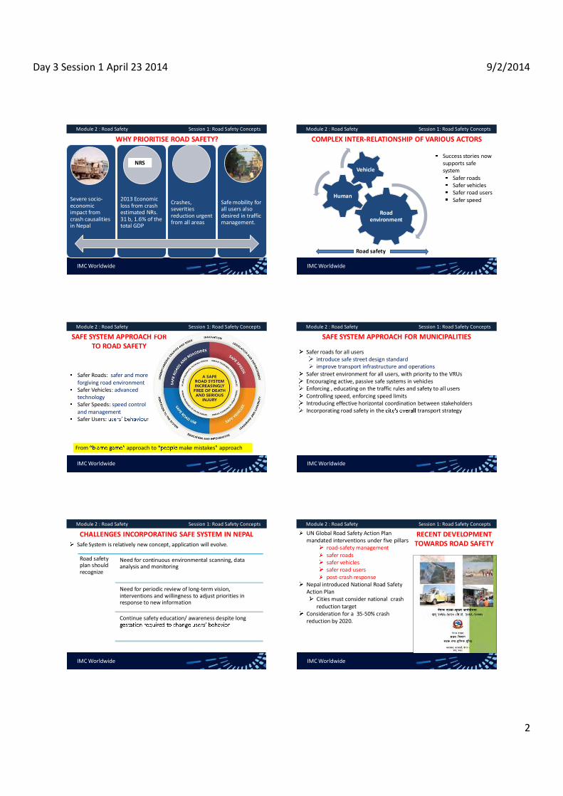
Day 3 Session 1 April 23 2014 9/2/2014
2
IMC Worldwide
Module 2 : Road Safety Session 1: Road Safety Concepts
WHY PRIORITISE ROAD SAFETY?
Severe socio- economic impact from crash causalities in Nepal
2013 Economic loss from crash estimated NRs. 31 b, 1.6% of the total GDP
Crashes, severities reduction urgent from all areas
Safe mobility for all users also desired in traffic management.
NRS
IMC Worldwide
Module 2 : Road Safety Session 1: Road Safety Concepts
COMPLEX INTER-RELATIONSHIP OF VARIOUS ACTORS
Road environment
Human
Vehicle
Road safety
Success stories now supports safe system
Safer roads Safer vehicles Safer road users Safer speed
IMC Worldwide
Module 2 : Road Safety Session 1: Road Safety Concepts
SAFE SYSTEM APPROACH FOR TO ROAD SAFETY
Safer Roads: safer and more forgiving road environment Safer Vehicles: advanced technology Safer Speeds: speed control and management Safer Users:
From approach to make mistakes approach
IMC Worldwide
Module 2 : Road Safety Session 1: Road Safety Concepts
SAFE SYSTEM APPROACH FOR MUNICIPALITIES
Safer roads for all users introduce safe street design standard improve transport infrastructure and operations
Safer street environment for all users, with priority to the VRUs Encouraging active, passive safe systems in vehicles Enforcing , educating on the traffic rules and safety to all users Controlling speed, enforcing speed limits Introducing effective horizontal coordination between stakeholders Incorporating road safety in the transport strategy
IMC Worldwide
Module 2 : Road Safety Session 1: Road Safety Concepts
CHALLENGES INCORPORATING SAFE SYSTEM IN NEPAL Safe System is relatively new concept, application will evolve.
Road safety plan should recognize
Need for continuous environmental scanning, data analysis and monitoring
Need for periodic review of long-term vision, interventions and willingness to adjust priorities in response to new information
Continue safety education/ awareness despite long
IMC Worldwide
Module 2 : Road Safety Session 1: Road Safety Concepts
RECENT DEVELOPMENT TOWARDS ROAD SAFETY
UN Global Road Safety Action Plan mandated interventions under five pillars
road-safety management safer roads safer vehicles safer road users post-crash response
Nepal introduced National Road Safety Action Plan
Cities must consider national crash reduction target
Consideration for a 35-50% crash reduction by 2020.

Day 3 Session 1 April 23 2014 9/2/2014
3
IMC Worldwide
Module 2 : Road Safety Session 1: Road Safety Concepts
DEFINITIONS
Road crash: collision between two or more vehicles or between a vehicle and an object Fatal crash: a crash resulting in at least one fatality. Serious injury crash: a crash resulting in serious injury requiring hospitalisation and / or extensive medical treatment. Minor injury crash: crash where only minor injuries results, not requiring hospitalisation.
IMC Worldwide
Module 2 : Road Safety Session 1: Road Safety Concepts
DEFINITIONS
Vulnerable road users: pedestrians, women, persons with disability, bicyclists, motorcyclists, NMT, etc., most exposed, affected from crashes. Blackspot: a location where crash occurs frequently over a long period. Accident cluster: road section where crashes confine but are not localised. Countermeasure: structure/non-physical measure installed at blackspot to prevent further crash. Forgiving structures: structures designed so as to either prevent or minimize serious crash injuries
IMC Worldwide
Module 2 : Road Safety Session 1: Road Safety Concepts
DEFINITIONS
Road-safety audit: a systematic safety check of a road by a safety expert independent from the road designer Head-on crash: crash between the front of two vehicles travelling in opposite directions. Rear-end crash: crash between the front of the following vehicle against the rear of leading vehicle travelling in the same direction.Side-swipe crash: crash between the side of vehicles when one is overtaking or travelling parallel to the other.
IMC Worldwide
Module 2 : Road Safety Session 1: Road Safety Concepts
DEFINITIONS
90° crash: crash when two vehicles collide at 90° to one another. Pedestrian crash: crash involving pedestrian irrespective of the type of collision with the vehicle Property damage crash: crash only involving damage to vehicles or property Run off the road crash: crash where the vehicle leaves the road (skids) towards the embankment, side-ditches or valley-side. Roll-over crash: crash where the vehicles roll-over.
IMC Worldwide
Module 2 : Road Safety Session 1: Road Safety Concepts
DEFINITIONS
Single site treatments: treatments applied at blackspots.Route-action treatment: common treatment applied over road section/sections Mass-action treatment: common treatment applied over wide road network to mitigate common safety hazards observed.

Day 3 Session 2 (April 23, 2014) 9/2/2014
1
TRAINING ON MODULE 2: ROAD SAFETY
Session 2: General approach to road safety in the urban areas
Organiser: GoN Dept. of Urban Development & Building Construction
Trainer: Subhash Dhungel, Urban Transport Infrastructure Specialist Urban Transport Planning Management (ADB ta 7948), IMC Worldwide 23 April, 2014
IMC Worldwide
Module 2 : Road Safety Session 2: General approach to road safety in urban areas
LEADING ROAD SAFETY IN THE URBAN AREASMunicipality most appropriate to champion road safety in Nepal urban
What approach to take? Municipalities follow the collaborative planning in the Safe System.
What does this imply? Plan interventions for safer roads, safer vehicles, safer road users, safer speed Will also complement, tie in with National Road Safety Action Plan.
IMC Worldwide
Module 2 : Road Safety Session 2: General approach to road safety in urban areas
CURRENT STATUS IN ROAD SAFETY MANAGEMENT
Low priority
general plan nor in their vision
Not supported in acts
Road Safety issues not stipulated in the LSGA 2055, LSGR 2056
No reporting requirement
No municipal reporting for road safety progress currently.
IMC Worldwide
Module 2 : Road Safety Session 2: General approach to road safety in urban areas
OPPORTUNITIES TO ROAD SAFETY IN NEPALESE URBAN
Ample opportunity to institutionalize in the municipal plans through Physical Development Technical Committee Environmental Technical Committee Works and Transport Technical Committee Miscellaneous Technical Committee
Responsibility areas of these committees relate or influence road safety.
IMC Worldwide
Module 2 : Road Safety Session 2: General approach to road safety in urban areas
PROCEDURE TO ENHANCE ROAD SAFETY IN URBAN AREAS
Step 1: Start institutionalizing road safety Step 2: Check the existing design standard to include safety measures Step3: Introduce inspections, LATM, NMT treatments, accessibility Step 4: Collaborate with stakeholders for interventions supporting safe
system Step 5: Collaborate with police for crash analysis. Refine road safety
planning with experience
IMC Worldwide
Module 2 : Road Safety Session 2: General approach to road safety in urban areas
OUTCOME ENVISAGED FOLLOWING STRATEGY Start
institutionalising
Safer road design promoted
Gradual 'Safe System' interventions knowledge
Stakeholder coordination established and full implementation of Safe
System
Crash preventive measures intitiated
Start collaborative crash remedial measures. Continue safety planning with further refinement.

Day 3 Session 2 (April 23, 2014) 9/2/2014
2
IMC Worldwide
Module 2 : Road Safety Session 2: General approach to road safety in urban areas
CAPACITY BUILDING FOR MUNICIPALITIES IN ROAD SAFETY
Continuous Evaluate interventions effectiveness Report, refine
MoU, agreement Data sharing, teamwork Annual reporting
Regular with refresher training Across board Continuous program refinement
Knowledge training Strategic vision Resource to guideline, networking Access to int'l best practices
Acquire Knowledge
Robust Training
Monitoring Effective
Horizontal coord.
IMC Worldwide
Module 2 : Road Safety Session 2: General approach to road safety in urban areas
ADVISE FOR MUNICIPAL ROAD SAFTETY PLANNING
Agencies for advise
Traffic Directorate,
Police
DoTM
NRSC
DoR
Nepal Road Safety Council (NRSC) most important agency to support municipalities
IMC Worldwide
Module 2 : Road Safety Session 2: General approach to road safety in urban areas
WAY FORWARD FOR MUNICIPALITIES
Establish a road safety unit. If above not feasible, delegate to an existing unit
Establish unit Incorporate safety planning in the strategic vision
Prioritize Establish close collaboration with NRSC early.
Networking, seek advise
IMC Worldwide
Module 2 : Road Safety Session 2: General approach to road safety in urban areas
WAY FORWARD FOR MUNICIPALITIES
Closely liaise with the relevant advisory bodies of the Municipal Council
Closely liaise internally
Develop a local road safety strategy with technical assistance from NRSC/expert.
Develop strategy
Design training program (expert lectures, workshops, observation visits, regular interaction
Acquire training
IMC Worldwide
Module 2 : Road Safety Session 2: General approach to road safety in urban areas
WAY FORWARD FOR MUNICIPALITIES
First train the Road Safety Unit/ extended unit in the Safe System
Training in Safe System
Start in-house training to other units - planning, design, environmental, social and community interaction.
In-house training
Develop customized training guidelines, widely circulate
Develop training guideline
IMC Worldwide
Module 2 : Road Safety Session 2: General approach to road safety in urban areas
WAY FORWARD FOR MUNICIPALITIES
Gradually implement the safety interventions municipality is responsible.
Start implement interventions
Enter formal agreement for effective horizontal coordination with the local stakeholders.
Formalize for horizontal coordination
Report progress on the road safety activities, acquire important lessons for future planning.
Monitor progress

Day 3 Session 2 (April 23, 2014) 9/2/2014
3
IMC Worldwide
Module 2 : Road Safety Session 2: General approach to road safety in urban areas
WAY FORWARD FOR MUNICIPALITIES
Evaluate outcomes and refine program continuously for future planning.
Evaluate, Refine programs
Continue close coordination with NRSC for advice, access to resources.
Maintain coordination with NRSC

Day 3 Session 3 (April 23, 2014) 9/2/2014
1
TRAINING ON MODULE 2: ROAD SAFETY
Session 3: Road Safety Management
Organiser: GoN Dept. of Urban Development & Building Construction
Trainer: Subhash Dhungel, Urban Transport Infrastructure Specialist Urban Transport Planning Management (ADB ta 7948), IMC Worldwide
23 April, 2014IMC Worldwide
Module 2 : Road Safety Session 3: Road safety management
STEPS TO ROAD SAFETY MANAGEMENT IN MUNICIPALITIES
Step 1: Start institutionalizing road safety Step 2: Check the existing design standard to include safety measures Step 3: Introduce inspections, LATM, NMT treatments, accessibility Step 4: Collaborate with stakeholders for interventions supporting safe
system Step 5: Collaborate with police for crash analysis. Refine road safety
planning with experience
IMC Worldwide
Module 2 : Road Safety Session 3: Road safety management
STEPS TO ROAD SAFETY MANAGEMENT IN MUNICIPALITIES
Step 1: Start institutionalizing road safety Starts the capacity building process and will continuously evolve, refine with time.
Step 2: Check the existing road design standard and improve Amend the Urban Road Standard to incorporate safe designIntroducing safe design practice will
designs. Literatures available (UK DfT, Austroads, DoR RSN, TRL, ADB, etc.)
IMC Worldwide
Module 2 : Road Safety Session 3: Road safety management
STEPS TO ROAD SAFETY MANAGEMENT IN MUNICIPALITIES
Step 3: Introduce road safety inspections, LATM, Parking Management, NMTs Treatments, Universal Accessibility
Start introducing road safety inspections; LATM; safe provisions for VRUs
reserved parking facilities measures for NMT and persons with disabilities
Above are practices successfully adopted in other countries collaborate with local partners, pilot their installations.
IMC Worldwide
Module 2 : Road Safety Session 3: Road safety management
STEPS TO ROAD SAFETY MANAGEMENT IN MUNICIPALITIES Road safety inspections
Systematic checks to evaluate safety issues (existing/new roads) Timing, scope, expertise required, output, etc., variesAre cost-effective to prevent/minimize crashes and severities
Method/ Application
Scope Output Disadvantage/Advantage
Route-safety review (existing roads)
Scope: analyze crash consult stakeholders assess field data
Parties involved: municipal staff Stakeholders
safety issues along route mass action treatments site-specific treatments
Difficulty: No expertise in crash analysis No research on effectiveness of various countermeasures Advantages:
participation
IMC Worldwide
Module 2 : Road Safety Session 3: Road safety management
STEPS TO ROAD SAFETY MANAGEMENT IN MUNICIPALITIES Types of road-safety inspections- contd.
Method/ Application
Scope Output Disadvantage/Advantage
Community focused road safety plan (existing roads)
Scope: Review current strategies, plans Consult stakeholders
Parties involved: Community steering committee
safety risks on road network local level strategies and actions
Difficulty: Lack of experience in safety Inadequate strategies, plans
Advantages: Minimum difficulty but expertise improves with experience. Community participation.

Day 3 Session 3 (April 23, 2014) 9/2/2014
2
IMC Worldwide
Module 2 : Road Safety Session 3: Road safety management
STEPS TO ROAD SAFETY MANAGEMENT IN MUNICIPALITIESTypes of road-safety inspections- contd.
Method/ Application
Scope Output Disadvantage/Advantage
Road-safety audit (new, existing roads)
Scope: Analyze design Inspect site Audit reco. monitored throughout the project cycle.
Parties involved: Independent safety auditor (2 desired)
safety issues countermeasures: o single site o route-action o mass-action
Difficulty: Require independent expert. Existing road design generally lacking Require more funds and extensive.
Advantages: Outsourced Can take place before municipal capacity enhanced if fund mobilized. IMC Worldwide
Module 2 : Road Safety Session 3: Road safety management
STEPS TO ROAD SAFETY MANAGEMENT IN MUNICIPALITIESTypes of road-safety inspections- contd.
Method/ Application
Scope Output Disadvantage/Advantage
Road-safety check (new, existing roads)
Scope: Low-risk sites Review design Inspect site
Parties involved: A road safety expert
Identify safety risks Identify corrective options
Difficulty: Existing road design generally lacking No road-safety expert in municipality, training required.
Advantages: Can be conducted in-house if expert available
IMC Worldwide
Module 2 : Road Safety Session 3: Road safety management
STAGES OF ROAD SAFETY AUDIT
RSA can also be conducted to assess safety of: 1. Temporary traffic schemes 2. New road, some time after opening
Conducted by an expert team, independent from the design/client.
IMC Worldwide
Module 2 : Road Safety Session 3: Road safety management
MISCONCEPTION OF ROAD SAFETY AUDIT RSA is
Not assessing/rating projects Not ranking for prioritizing projects Not checking compliance with standard Not a substitute for design checks Not a crash investigationNot a project redesign Not applicable only to high-cost projects/project with safety issues Not informal checks, inspection or consultation
IMC Worldwide
Module 2 : Road Safety Session 3: Road safety management
ROAD SAFETY AUDIT PROCESS
IMC Worldwide
Module 2 : Road Safety Session 3: Road safety management
SKILL REQUIRED AT DIFFERENT RSA STAGE
Feasi. Include very experienced road design expert Individual with specific safety skill, if required.
Preli. design
Similar to feasibility but some members can be less experienced.
Detail design
Similar to preliminary design +experts (signage, NMT facilities, etc.)
Pre-opening
Include police, maintenance ER, someone familiar with TCDs Road user behavior experts (bicyclists, pedestrians, buses, etc.)
Temp. traffic works
Include road mgmt expert, ER experienced with TCD, work zone
Existing Road
Similar to pre-opening stage.

Day 3 Session 3 (April 23, 2014) 9/2/2014
3
IMC Worldwide
Module 2 : Road Safety Session 3: Road safety management
PROVIDING THE BACKGROUND INFORMATIONDesigner to provide
format template Drawings: plans, cross-sections, typical drawing, etc. Schedule: safety barriers, signage, passing bays, etc. X-section drawing: bridges, culverts, causeways Classified traffic volume data with NMT volume Previous RSA reports if any, & unresolved issues
IMC Worldwide
Module 2 : Road Safety Session 3: Road safety management
ASSESSING THE DOCUMENTS FOR ROAD SAFETY AUDITS
Assess before, after site inspection. Use the RSA checklists to record first impressions Make notes to guide field inspections Seek clarification from designer for any questions Confine only on safety issues.
IMC Worldwide
Module 2 : Road Safety Session 3: Road safety management
TYPICAL TABLE OF CONTENT OF A RSA REPORT IN NEPAL PREPARED IN NEPAL List of literature reviewed Speed control devices
Review the design plan Intersection layouts
Road c/s, widening at settlements Signs and road-marking Visibility, passing bays Roadside facilities for communities Drainage structures History of road crashes Safety barriers and delineators Hazardous locations Bridges Evaluation of safety risks involved Bus bays/park, interchange facilities Road Safety Audit Statement
For each component, the following is discussed objectively. Description of the element, safety issues, recommendations
IMC Worldwide
Module 2 : Road Safety Session 3: Road safety management
EXCERPT FROM A RSA REPORT IN NEPAL
For each component, the following is discussed objectively. Description of the element, safety issues, recommendations
IMC Worldwide
Module 2 : Road Safety Session 3: Road safety management
RSA CHECKLIST: CROSS-SECTION DoR RSN 4: ROAD SAFETY AUDIT MANUAL, 1997)
IMC Worldwide
Module 2 : Road Safety Session 3: Road safety management
HOW TO INSTITUTIONALIZE ROAD SAFETY ASSESSMENTS IN MUNICIPALITIES?
Step 1: Train personnel at the road safety unit/extended unit
Step 2: Conduct community-focused safety plans for the existing roads
Step 3: Apply for funds from the RBN, NRSC for safety audits.
Step 4: Start auditing the roads, starting with the important ones, gradually cover to others as resource permits.
Step 5: Update on research on countermeasures from DoR, DUDBC, NRSC.
Step 6: Continue each form of safety assessments with enhanced capacity above.

Day 3 Session 3 (April 23, 2014) 9/2/2014
4
IMC Worldwide
Module 2 : Road Safety Session 3: Road safety management
LOCAL AREA TRAFFIC MANAGEMENT (LATM)Traffic calming measures at the local level. Discourage through traffic, reduce traffic and speeds, create conducive urban environment for the residents and NMTs Involves device installations that self-induce vehicles to reduce speedAs new to Nepal, training first required.
Road Hump in Malaysia
Gateway in Europe
Elevation view of rumble-strip and jiggle-bars
IMC Worldwide
Module 2 : Road Safety Session 3: Road safety management
Training guideline at start of LATM introduction should include
(physically/perception-wise)
potential effectiveness of different devices for Nepalese conditions
appropriate design for the various devices in Nepal
IMC Worldwide
Module 2 : Road Safety Session 3: Road safety management
CONDITIONS WHEN LATM LIKELY TO WORK
Streets do not comprise arterials, sub-urban or district access. Neighbouring motorists use the streets as transit to main road to avoid congestion, delays. Street has no regular bus service nor linked to industrial estate. There is no land-use that demands parking provisions
schools, shopping centres, transport/sport facilities, community centres
Traffic increase not resulting from construction traffic
IMC Worldwide
Module 2 : Road Safety Session 3: Road safety management
CONDITIONS WHEN LATM LIKELY TO WORK contd.
Street is not on a hilly terrain/steeply inclined/excessively curved Most vehicles exceed the posted speed limit. Community do not oppose it The safety issues of nature better addressed by other means
E.g. problem due to few reckless drivers resolved better with stricter enforcement to control them
IMC Worldwide
Module 2 : Road Safety Session 3: Road safety management
POTENTIAL IMPACTS TO CONSIDER FROM LATM SCHEME
More noises (freight vehicles entering, vehicles negotiating traffic island).
May prompt excessive horning and aggressive driver behaviour.
Community reservation due to poor aesthetics due to signs installed.
LATM plan reduce traffic and resident frustrated due to inconvenience.
IMC Worldwide
Module 2 : Road Safety Session 3: Road safety management
SIMPLE EXAMPLE OF LATM SCHEME
Case 1: If bypass to divert through-traffic is feasible Downgrade road to be traffic-calmed to a lower hierarchy to discourage through-traffic. Restrict direct access from existing roads to the bypass only via a few service roads. Provide for future land-developments with access via service, access roads only.

Day 3 Session 3 (April 23, 2014) 9/2/2014
5
IMC Worldwide
Module 2 : Road Safety Session 3: Road safety management
SIMPLE EXAMPLE OF LATM SCHEME
Case 2: If bypass road not feasible Alert drivers of the speed reduction zone at the interface with
warning signs and rumble strips/road hump/gateway
Road Hump in Malaysia
Gateway in Europe Elevation view of rumble-
strip and jiggle-bars
Install the following traffic-calming devices at the road interface A series of road-humps, gradually increasing in height 40 mm~ 80 mm where there is a significant pedestrians Chicanes, build-outs to narrow the road. Jiggle-bars, rumble-strips at the section of the road at a very steep downgrade.
IMC Worldwide
Module 2 : Road Safety Session 3: Road safety management
APPROPRIATE DESIGN OF ROAD HUMP WITH DELINEATION
Existing road-humps in Nepal not adequately spanned For a well-designed hump, span should be 3.5 -4 m to be effective, safe In urban streets, hump should
Extend the full carriageway and shoulder, but Have a narrow passage at its ends to maintain surface water drainage
IMC Worldwide
Module 2 : Road Safety Session 3: Road safety management
SAFETY ISSUES RELATING TO PARKING FACILIITIES
Safety issues at parking facilities
If the internal circulation, ingress/egress to/from the facilities of new developments is safe
If the internal circulation, access movements at the off-street parking of the existing developments is safe
If access movements to/from on-street parking, transit laybys and loading bays/docks is safe.
IMC Worldwide
Module 2 : Road Safety Session 3: Road safety management
SAFE PARKING FACILIITIES FOR VULNERABLE ROAD USERS Parking/ waiting areas for rickshaws at strategic locations
E.g. NMT zones, market centers, city centers, etc.
Clearly delineate the parking/waiting areas for the motorcycles, NMTs with necessary safety clearance from CWY
IMC Worldwide
Module 2 : Road Safety Session 3: Road safety management
SAFE PARKING FACILIITIES FOR VULNERABLE ROAD USERS
Enforce motorcycles, NMTs to park at the designated areas with police assistance Collaborate with police to control illegal parking at the designated parking Install barriers (e.g. steel bars, traffic cones, NJ barriers, etc.) to physically block cars from entering above parking, if enforcement difficult. Educate motorcyclists, NMTs how to safely enter, exit from their dedicated parking
IMC Worldwide
Module 2 : Road Safety Session 3: Road safety management
SAFE UPT MANOUVERS Collaborate with police, ZTMO to ensure the following defensive driving at the stops/terminals
pull in and pull out only after carefully looking over and yielding to incoming traffic. Refrain from haphazard stopping, waiting stopping only at the designated bus stops

Day 3 Session 3 (April 23, 2014) 9/2/2014
6
IMC Worldwide
Module 2 : Road Safety Session 3: Road safety management
SAFETY PROVISION FOR NON MOTORIZED TRANSPORT
Change traditional planning or improve the existing streets to ensure safer operations for NMTs
NMT-only streets/alleys adequate NMT parking/waiting facilities innovative intersection layout to accord safe crossing for NMTs.
Designate waiting areas, loading docks for hand/bull carts at the local market areas, inner streets, etc.
IMC Worldwide
Module 2 : Road Safety Session 3: Road safety management
SAFETY PROVISION FOR NON MOTORIZED TRANSPORT
Amend rules to incorporate the following at signalized intersections and educate all the users
Exclusive phase for NMTs Increase the clearance time to enable NMT to cross safely. Extend the STOP-line for NMTs before the general STOP-line Provide a tighter intersection area to reduce the clearance time for NMTs.
IMC Worldwide
Module 2 : Road Safety Session 3: Road safety management
SAFETY PROVISION FOR CYCLISTS Do not provide cycle-lane adjacent to angle-parking Extend cycle-lane marking up to the intersection STOP line/crossing Maintain cycle-only alleys/lanes smooth, pot-free, without unsafe humps Plan continuous cycle alleys following the shortest route to major locations, places of interest Educate motorists to yield to cyclists going through when former in turning left in a shared left/through lane.
Investigate introducing the innovative Dutch intersection layout with necessary rules, education.
IMC Worldwide
Module 2 : Road Safety Session 3: Road safety management
SAFETY FOR PEDESTRIANS Plan safe shortcut routes Conduct awareness campaigns to educate all to avoid dangerous situations depicted in the figure.
IMC Worldwide
Module 2 : Road Safety Session 3: Road safety management
SAFETY PROVISIONS FOR PEDESTRIANS Educate drivers to dully consider pedestrians Encourage pedestrians to emulate good behavior
using the designated crossings not jay-walkingwalking along the sidewalks/roadside wearing bright colored clothing for night visibilityrefrain from dangerously travelling in UPTs refrain from recklessly climbing over the handrails/rails to cross the street
IMC Worldwide
Module 2 : Road Safety Session 3: Road safety management
SAFETY PROVISIONS FOR PEDESTRIANS Direct pedestrians by handrails to safe crossing locations Plant trees only on the sidewalks sufficiently wider required to accommodate ped traffic.
Educate drivers to give priority to pedestrians at:
zebra crossing mid-block pelican signal during the permitted left/through phase curb extensions build-outs pedestrian island/refuge.

Day 3 Session 3 (April 23, 2014) 9/2/2014
7
IMC Worldwide
Module 2 : Road Safety Session 3: Road safety management
SAFETY PROVISIONS FOR PEDESTRIANSIntroduce all red/exclusive ped phase at signalized intersection Provide ped-friendly grade-separated crossing across major intersections, high speed arterials, where practical.Introduce street layouts prioritizing peds in shopping, commercial areas. Provide convenient connection to bus stops, parking and terminals.
IMC Worldwide
Module 2 : Road Safety Session 3: Road safety management
SAFETY FOR PERSONS WITH DISABILITIES Plan constructions, improve existing street infrastructure to conform with the GoN Accessibility Directive, 2069 Sidewalks including unsurfaced shoulders
Minimum width - 2 m (main roads, shopping streets) Curb - 10 15 cm high with non-mountable profile Width to exclude the area over covered drains/sewers.
IMC Worldwide
Module 2 : Road Safety Session 3: Road safety management
SAFETY FOR PERSONS WITH DISABILITIES At restricted area, cover the drain to use part of the sidewalk provided surface flushed with the sidewalk.
surface to be sufficiently even for wheelchairs but with the necessary grip when wet.
Curb-ramp to be provided at all the at-grade crossing Handrails to be 90 cm high , additional rails at 70 cm, side-rail, 5-10 cm high.
IMC Worldwide
Module 2 : Road Safety Session 3: Road safety management
SAFETY FOR PERSONS WITH DISABILITIES For simple curb- For flared curb-ramp, ensure the following specifications.
Ramp- reconstruction Minimum total width: 2.415 m (10 cm curbs), 3.165 m (15 cm curbs)
Slopped sidewalks Slopped at 1:15, each run not exceeding 9 m, followed by a level landing Each landing to be at least 1.524 m long
IMC Worldwide
Module 2 : Road Safety Session 3: Road safety management
SAFETY FOR PERSONS WITH DISABILITIES Crossings and intersections
Install audio tactile blocks along the at-grade crossingProvide suitable ramps to all overhead pedestrian bridges. Install new signals/upgrade the existing with
audio-tactile push-buttons audible pedestrian sound
IMC Worldwide
Module 2 : Road Safety Session 3: Road safety management
SAFE ACCESS TO UPT FOR PERSONS WITH DISABILITIES Educate UPT to stop within a gap of 30 cm from the passenger platform Plan/modify the height of the passenger platform to flush with the UPT door level or provide ramps Modify/Investigate reserving one space for wheelchair users at the front and back of buses. Provide/modify the height of service desks at UPT terminals not exceeding 76.2 cm.

Day 3 Session 3 (April 23, 2014) 9/2/2014
8
IMC Worldwide
Module 2 : Road Safety Session 3: Road safety management
SAFE ACCESS TO UPT FOR PERSONS WITH DISABILITIES
Encourage entrepreneurs to operate universally accessible buses Explore incentive to entrepreneurs to sustain such specialized buses
Reserve a certain parking space (on/ off- street) for persons with disabilities.
reserved motorcycle parking-bay: 1.22 m x 1.52 m reserved car parking-bay: 2.43 m x 4.78 m
IMC Worldwide
Module 2 : Road Safety Session 3: Road safety management
STEPS TO ROAD SAFETY MANAGEMENT IN MUNICIPALITIES
Step 4: Start full-fledged implementing other interventions for safer vehicles, safer road users and safer speeds
Closely coordinate with the local stakeholders to fully implement the interventions pertaining to Disseminate development of the following central-level interventions proposed in the NRSAP
Proposed amendment to VTMA, VTMR, LSGA, LSGR for enabling policies pertaining to five pillars of road safetyMandatory annual reporting from road authorities on road safety.
IMC Worldwide
Module 2 : Road Safety Session 3: Road safety management
STEPS TO ROAD SAFETY MANAGEMENT IN MUNICIPALITIES
Step 4: Start fully implementing interventions for Disseminate development of the following central-level interventions proposed in the NRSAP contd.
Development of road safety audit manuals for urban/rural roads Experience gained in conducting audits for such roads. Guideline on safe road design and sustainable urban transport infrastructure Research on effectiveness of various countermeasures for urban roads
IMC Worldwide
Module 2 : Road Safety Session 3: Road safety management
STEPS TO ROAD SAFETY MANAGEMENT IN MUNICIPALITIES
Step 4: Start fully implementing interventions for Disseminate development of the following central-level interventions proposed in the NRSAP contd.
Development of a pedestrian planning guideline Research on pedestrian safety. Piloting on traffic calming measures. Central directives for universal accessibility to UPTs Introduction of road safety education in the school curriculum.
IMC Worldwide
Module 2 : Road Safety Session 3: Road safety management
STEPS TO ROAD SAFETY MANAGEMENT IN MUNICIPALITIES
Step 4: Start fully implementing interventions for Manage a network of ambulances through partnership with following to improve the post-crash response
hospitals private organizations charities, NGOs/INGOs local Red Cross, etc
Liaise with the Department of Health Services, center for trained paramedics onboard ambulances and doctors in trauma care.
IMC Worldwide
Module 2 : Road Safety Session 3: Road safety management
STEPS TO ROAD SAFETY MANAGEMENT IN MUNICIPALITIES
Step 5: Work with the local traffic police to perform data analysis A permanent agreement for collaboration with the traffic police to share crash data will be established before this step. Municipality need to frequently outsource remedial measures to specialized consultants for complex sites Alternately, municipality can seek assistance from DoR, NRSC, traffic police till the former gains experience.
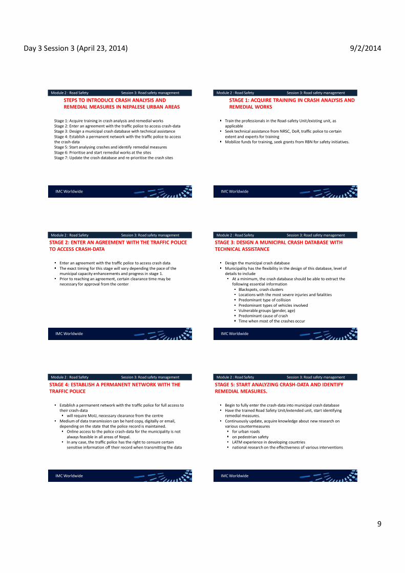
Day 3 Session 3 (April 23, 2014) 9/2/2014
9
IMC Worldwide
Module 2 : Road Safety Session 3: Road safety management
STEPS TO INTRODUCE CRASH ANALYSIS AND REMEDIAL MEASURES IN NEPALESE URBAN AREAS
Stage 1: Acquire training in crash analysis and remedial works Stage 2: Enter an agreement with the traffic police to access crash-data Stage 3: Design a municipal crash database with technical assistance Stage 4: Establish a permanent network with the traffic police to access the crash-data Stage 5: Start analysing crashes and identify remedial measures Stage 6: Prioritise and start remedial works at the sites Stage 7: Update the crash database and re-prioritise the crash sites
IMC Worldwide
Module 2 : Road Safety Session 3: Road safety management
STAGE 1: ACQUIRE TRAINING IN CRASH ANALYSIS AND REMEDIAL WORKS
Train the professionals in the Road-safety Unit/existing unit, as applicable Seek technical assistance from NRSC, DoR, traffic police to certain extent and experts for training Mobilize funds for training, seek grants from RBN for safety initiatives.
IMC Worldwide
Module 2 : Road Safety Session 3: Road safety management
STAGE 2: ENTER AN AGREEMENT WITH THE TRAFFIC POLICE TO ACCESS CRASH-DATA
Enter an agreement with the traffic police to access crash data The exact timing for this stage will vary depending the pace of the municipal capacity enhancements and progress in stage 1. Prior to reaching an agreement, certain clearance time may be necessary for approval from the center
IMC Worldwide
Module 2 : Road Safety Session 3: Road safety management
STAGE 3: DESIGN A MUNICIPAL CRASH DATABASE WITH TECHNICAL ASSISTANCE
Design the municipal crash database Municipality has the flexibility in the design of this database, level of details to include
At a minimum, the crash database should be able to extract the following essential information
Blackspots, crash clusters Locations with the most severe injuries and fatalities Predominant type of collision Predominant types of vehicles involved Vulnerable groups (gender, age) Predominant cause of crash Time when most of the crashes occur
IMC Worldwide
Module 2 : Road Safety Session 3: Road safety management
STAGE 4: ESTABLISH A PERMANENT NETWORK WITH THE TRAFFIC POLICE
Establish a permanent network with the traffic police for full access to their crash-data
will require MoU, necessary clearance from the centre Medium of data transmission can be hard copy, digitally or email, depending on the state that the police record is maintained.
Online access to the police crash-data for the municipality is not always feasible in all areas of Nepal. In any case, the traffic police has the right to censure certain sensitive information off their record when transmitting the data
IMC Worldwide
Module 2 : Road Safety Session 3: Road safety management
STAGE 5: START ANALYZING CRASH-DATA AND IDENTIFY REMEDIAL MEASURES.
Begin to fully enter the crash-data into municipal crash database Have the trained Road Safety Unit/extended unit, start identifying remedial measures. Continuously update, acquire knowledge about new research on various countermeasures
for urban roads on pedestrian safety LATM experience in developing countries national research on the effectiveness of various interventions
Day 3 Session 3 (April 23, 2014) 9/2/2014
10
IMC Worldwide
Module 2 : Road Safety Session 3: Road safety management
STAGE 6: PRIORITIZE AND START REMEDIAL WORKS AT THE SITES
Prioritize the remedial works at blackspots and hazardous There are various method available to prioritize the crash-sites
one of the option is to assign weightage to each crash site based on the crash severity, with highest weight to fatalities
IMC Worldwide
Module 2 : Road Safety Session 3: Road safety management
Stage 7: Update crash database and re-prioritize the crash sites.
Continuously update the municipal crash database annually Re-prioritize the crash sites based on new information.

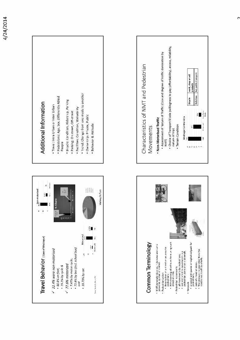


Day 5 Session 1 (April 27, 2014) 9/2/2014
1
TRAINING ON MODULE 3: Parking Management
Session 1: Parking Supply (Definitions and Classification); Legislation and Policy; Regulation and Enforcement
Organiser: GoN Dept. of Urban Development & Building Construction
Trainer: Subhash Dhungel, Urban Transport Infrastructure Specialist Urban Transport Planning Management (ADB ta 7948), IMC Worldwide
27 April, 2014
IMC Worldwide
Module 3 : Parking Management Session 1:Legislation and Policy; Regulation and Enforcement; Parking Supply (definitions and classification)
PARKING DEFINITIONS AND CLASSIFICATIONS On-Street parking : parking facility provided along the kerbside of a street Off-street parking : parking facility provided at a site, adjoining the streets but away from the street Parking space : space required to accommodate one standard vehicle unrestricted, excluding the manoeuvring space
also referred as parking bay for an off-street facility.
IMC Worldwide
Module 3 : Parking Management Session 1:Legislation and Policy; Regulation and Enforcement; Parking Supply (definitions and classification)
PARKING DEFINITIONS AND CLASSIFICATIONSParallel parking : parking configuration where vehicles park parallel to
road-side kerbs on-street; parking aisle -for off-street Right-angle parking : parking configuration where vehicles parked at right angle to the roadside kerb/parking aisle 450 parking : parking configuration where vehicles are parked at 450 to the roadside kerb/parking aisle.
Source : Parking Design Manual, Department of Planning and Land Use, County of San Diego, 2012
IMC Worldwide
Module 3 : Parking Management Session 1:Legislation and Policy; Regulation and Enforcement; Parking Supply (definitions and classification)
PARKING CONFIGURATIONS
Source : Parking Design Manual, Department of Planning and Land Use, County of San Diego, 2012
IMC Worldwide
Module 3 : Parking Management Session 1:Legislation and Policy; Regulation and Enforcement; Parking Supply (definitions and classification)
OFF-STREET PARKING CLASSIFICATIONSAt-grade off-street parking Grade-separated off-street parking
Underground Overhead multi-storey
Underground parking in Dhaka, Bangladesh Source: Paul Barter
IMC Worldwide
Module 3 : Parking Management Session 1:Legislation and Policy; Regulation and Enforcement; Parking Supply (definitions and classification)
OTHER CLASSIFICATION (ON/ OFF- STREET PARKING)
Based on delineation formal parking if the spaces marked and controlled informal parking if the spaces neither delineated nor controlled
Based on ownershipPublic private, open to certain exclusive individuals
Based on durationshort-term (restricted to three hours or less)long-term (for duration at least four hours or more).
At-grade parking based on surface: Surfaced/un-surfaced

Day 5 Session 1 (April 27, 2014) 9/2/2014
2
IMC Worldwide
Module 3 : Parking Management Session 1:Legislation and Policy; Regulation and Enforcement; Parking Supply (definitions and classification)
CHARACTERISTICS OF ON/ OFF- STREET PARKING Items On-street Parking Off-street Parking Construction cost
cheap high
Physical works Painting, signage, parking meters
Secure land; paving; installation fare collection system, other equipment; admin building
Time for Development
Shorter (site selection, painting)
Longer (mobilise financing, construction)
Operational Arrangement
Enforcement required- police/private sector
Enforcement not required, facility operational solely by private sector
Targeted Users Short term (casual users)
Short/long -term (monthly tenants, regular users)
Source : Module 4 Guidelines for Parking Measures : Policy and Options, PADECO, 2008
IMC Worldwide
Module 3 : Parking Management Session 1:Legislation and Policy; Regulation and Enforcement; Definitions and Classification
PRIVATE NON-RESIDENTIAL PARKING Separate rules required
parking at offices, local shops, hospitals, schools Parking demand at these areas generally high
Details to be submitted to municipality for construction/rent renewal approval
parking plan Nos. parking required, provided light vehicles, cycles distance to parking if isolated from its premises Whether bye-laws provisions met setbacks, curbs, walls, circulation, sight distance, pedestrian access
IMC Worldwide
Module 3 : Parking Management Session 1:Legislation and Policy; Regulation and Enforcement; Definitions and Classification
PRIVATE NON-RESIDENTIAL PARKING Separate rules required
parking at offices, local shops, hospitals, schoolsParking demand at these areas generally high
Details to be submitted to municipality for construction permission (new/rent existing facility)
parking plan number of parking spaces required and provided
for utility vehicles, cars, motorcycles, cycles proximity of parking spaces if the are isolated from its premisesWhether bye-laws provisions met setbacks, curbs, walls, circulation, sight distance, pedestrian access
IMC Worldwide
Module 3 : Parking Management Session 1:Legislation and Policy; Regulation and Enforcement; Parking Supply (definitions and classification)
URBAN AREASNMT significant, adequate NMT parking to be considered
Bicycle parking particularly important
Provide on-street bicycle parking At 100 m interval to one another Provide sign, including prohibition to cars and enforce If enforcement is difficult, install physical barriers
Consider shared bicycle/motorcycle parking if no capacity constraint Prioritise parking for bicyclist/prohibit motorcyclists if required
IMC Worldwide
Module 3 : Parking Management Session 1:Legislation and Policy; Regulation and Enforcement; Parking Supply (definitions and classification)
PARKING LEGISLATION Local Self Governance Act 2055
Parking management stipulated as one area of responsibility Sec. 96: Functions, Duties and Power of Municipality
to be arranged for bus parks and parking places of rickshaw (three wheelers), horse carts, trucks etc. within the municipality area" Parking for light vehicles not specifically mentioned
IMC Worldwide
Module 3 : Parking Management Session 1:Legislation and Policy; Regulation and Enforcement; Parking Supply (definitions and classification)
PARKING LEGISLATION Local Self Governance Act 2055
Section 144 Authorised municipality to impose parking charge at areas under municipal management
Sec. 112 that mandates municipality to prepare resource maps Sec. 124 authorises municipalites to apply service charge for repair, maintenance of parking areas Sec. 124: Repair, Maintenance and Management of the Project: (1) The Municipality may collect service charge from the beneficiaries of a project for the repair and maintenance of the project. (2) The repair, maintenance and necessary management of the project shall be done with the amount of the service charge collected pursuant to sub-section (1).

Day 5 Session 1 (April 27, 2014) 9/2/2014
3
IMC Worldwide
Module 3 : Parking Management Session 1:Legislation and Policy; Regulation and Enforcement; Parking Supply (definitions and classification)
PARKING LEGISLATION
Local Self Governance Regulation 2056 Rule 147 refers maximum, minimum parking charge to Annex 19 Annex 19 specifies parking charge within municipal managed areas
Bus, mini bus ,truck, tractor: per duration Rs. 40 max. per use Car: per duration Rs. 20 max per use Other vehicles: per duration Rs 10 max per use
Rates outdated, very low and actually higher rates currently
IMC Worldwide
Module 3 : Parking Management Session 1:Legislation and Policy; Regulation and Enforcement; Parking Supply (definitions and classification)
PARKING LEGISLATION
Local Self Governance Regulation 2056 Council authorised to set charge at municipality built-operated bus parks Sub-rule 1 -Rule 134
Parking facilities not included as item in resource map development Section 277 facilitates revision of the parking charges in Annex 19
Sec. 277: Alteration in Annexes may, by publishing a notification in the Nepal
Gazette, make necessary alteration and changes in the Annexes
IMC Worldwide
Module 3 : Parking Management Session 1:Legislation and Policy; Regulation and Enforcement; Parking Supply (definitions and classification)
LEGISLATIVE ARRANGEMENT TO REVISE PARKING CHARGE
Process to revise LSGR Annex 19 as per Sec. 277 Process through the municipal law division Advise, convince Ministry of Local Development (MLD)of the need for the proposed changes. Minister of Local Development takes the proposals to the Cabinet.A Legislative Committee then discuss the proposals and based on its recommendations rates in Annex 19 is effected
IMC Worldwide
Module 3 : Parking Management Session 1:Legislation and Policy; Regulation and Enforcement; Parking Supply (definitions and classification)
BASIC PARKING POLICY FRAMEWORK IN PRACTICE ON-STREET AND OFF-STREET PARKING POLICIES
On-street parking can be implemented on a street/zone no stopping in busy streets no parking in busy streets resident permit time-based pay parking parking tickets, parking meters
Off-street parking can be provided by government/private sector ground level parking multi storey car parks underground car parks
Efficient enforcement required for effective parking measures
IMC Worldwide
Module 3 : Parking Management Session 1:Legislation and Policy; Regulation and Enforcement; Parking Supply (definitions and classification)
ENABLING PARKING POLICY
On-Street Parking Policy Prohibit parking in core, if feasible free parking only in exceptional cases
Generally, parking fees to be introduced on urban streets Rationale: Discourage long duration parking
At permitted areas, charge by the hourRate gradually updated to reflect land cost, parking privilege
In BSC, trucks stop at every WKDY at Gudri Bazaar/Koshi HWY for long period to supply groceries
IMC Worldwide
Module 3 : Parking Management Session 1:Legislation and Policy; Regulation and Enforcement; Parking Supply (definitions and classification)
ENABLING PARKING POLICY
Off-Street Parking Policy to be demand based off-street demand generally more at activity centres
admin centres, city halls vegetable markets, hospitals shopping malls, bus stations
Motorized/non-motorized parking possible based on the mobility of people and the parking needs.
Rationale behind charging for parking Charges contribute to the success and sustainability of parking control
Essentially, streets built for mobility (people, goods) Scarce street space is not for free parking for private users

Day 5 Session 1 (April 27, 2014) 9/2/2014
4
IMC Worldwide
Module 3 : Parking Management Session 1:Legislation and Policy; Regulation and Enforcement; Parking Supply (definitions and classification)
PARKING POLICY FOR SMALL CITIES
Policy important element of the overall urban transport strategy Parking regulation to ensure adequate space for moving traffic Parking controls used to influence travelers' modal choice, destinations Parking provision, control used as a mechanism to support, strengthen
commercial viability of town centres, individual buildingsmeans to raise revenue (public, private sectors)
Parking restrictions used extensively in major cities, urban areas Restricts private cars in city centres Reduce congestion, encourage UPT use
IMC Worldwide
Module 3 : Parking Management Session 1:Legislation and Policy; Regulation and Enforcement; Parking Supply (definitions and classification)
CONSIDERATIONS TO IDENTIFY SUITABLE PARKING POLICY
Is the on-street parking limited to encourage UPTs, pedestrians? Is the off-street parking increased to balance reduced on-street parking? Is the public off-street located within acceptable walking distances? Are residents and short stay parking prioritised?
IMC Worldwide
Module 3 : Parking Management Session 1:Legislation and Policy; Regulation and Enforcement; Parking Supply (definitions and classification)
IMPOSITION OF PARKING POLICY IN CITIES
Stage - 3
Demand further increases; time-limit introduced to optimize turnover; pricing strategy introduced
Stage - 2
Demand exceeds supply in certain areas Regulations introduced, parking may be prohibited in some areas
Stage - 1
No parking issues, parking space available gradually used up
IMC Worldwide
Module 3 : Parking Management Session 1:Legislation and Policy; Regulation and Enforcement; Parking Supply (definitions and classification)
IMPOSITION OF PARKING POLICY IN CITIES
Stage - 5
Differential parking tariffs introduced: (1) to target different groups (2) To positive discrimination to one group over others
Stage - 4
Parking control becomes tighter, parker overflow to neighboring areas; permit fee issued in resident zone
IMC Worldwide
Module 3 : Parking Management Session 1:Legislation and Policy; Regulation and Enforcement; Parking Supply (definitions and classification)
IMPOSITION OF PARKING POLICY IN CITIES
Stage - 7
Inclusion of parking in transport demand management
Stage - 6
Development of park and ride facilities on edge of town
IMC Worldwide
Module 3 : Parking Management Session 1:Legislation and Policy; Regulation and Enforcement; Parking Supply (definitions and classification)
STAGE OF DEVELOPMENT IN NEPALESE CITIES
Stage - 3
Demand further increases; time-limit introduced to optimize turnover; pricing strategy introduced
Stage - 2
Demand exceeds supply in certain areas Regulations introduced, parking may be prohibited in some areas
Stage - 1
No parking issues, parking space available gradually used up

Day 5 Session 1 (April 27, 2014) 9/2/2014
5
IMC Worldwide
Module 3 : Parking Management Session 1:Legislation and Policy; Regulation and Enforcement; Parking Supply (definitions and classification)
PARKING CHARGE COLLECTION
Collecting method of parking charges in small cities/developing countries
collected manually Tickets issued when parking if entry, exit can be controlled.
IMC Worldwide
Module 3 : Parking Management Session 1:Legislation and Policy; Regulation and Enforcement; Parking Supply (definitions and classification)
PARKING CHARGE COLLECTION
Other collection method Parking meters are also installed at on-street facilities under police surveillance.
Various types of parking machines for fully automated car parks available Latest technology requires payment by credit cards

Day 5 Session 2 (April 27, 2014) 9/2/2014
1
TRAINING ON MODULE 3: Parking Management
Session 2: Parking Inventory Survey; Parking Demand Survey
Organiser: GoN Dept. of Urban Development & Building Construction
Trainer: Subhash Dhungel, Urban Transport Infrastructure Specialist Urban Transport Planning Management (ADB ta 7948), IMC Worldwide 27 April, 2014 IMC Worldwide
Module 3 : Parking Management Session 2: Parking Inventory Survey; Parking Demand Survey
PARKING INVENTORY SURVEY Documents/update the following information based on field inspection:
Location, type of parking and surfacing On/ off-street short-tem including hourly long-tem including weekly, monthly
Number of parking spaces and configuration Parking tariff applicable (by time of day, week) Method of fare collection, equipment installed Parking period and restrictions
Waiting, loading restrictions -private, UPT, freight
IMC Worldwide
Module 3 : Parking Management Session 2: Parking Inventory Survey; Parking Demand Survey
PARKING INVENTORY SURVEY METHODOLOGY Enumerators inspect study area, recording the details in the survey format.
Survey form 1:500/other scale base map/resource maps Incorporated in other inventory maps If none available, sketch map adequate but official maps preferable In Nepal, field details directly filled in inventory database with reference coded.
IMC Worldwide
Module 3 : Parking Management Session 2: Parking Inventory Survey; Parking Demand Survey
PARKING INVENTORY SURVEY METHODOLOGY Enumerators inspect study area, recording the details in the study format.
(on-street):(off-street):
(parallel): (right
angle): ° :
(marking):
(sign):
IMC Worldwide
Module 3 : Parking Management Session 2: Parking Inventory Survey; Parking Demand Survey
INVENTORY SURVEY METHODOLOGY
Identify study area Compile resource maps and divide city into parking zones Determine manpower, mobilize Enumerator inspect, fill information in survey form Collect field data, archive data/digitise into database Make data readily accessible
Date :Day:
Nam e of the Road w here Pa rkin g is locate d:Dista nce from in tersectio n to the pa rking pla ce:
On -stree t Of f-stree t
Fo rm al Inf ormal
Blacktop ped : W ith out Bl acktop
Available Parking Capacity (in nos.): Car: Moto rcycle: Ta xi:
Bus : Micro-bu s:Freig ht
vehi cl e:
Parall el 45
Time when parking service available or prohibited:
Car: Rs. Moto rcycle: Rs Ta xi: Rs
Bus: RsMicro-bu s:
Rs Freig ht vehi cl e:
Rs
Parking Sp aces Marke d (Ro ad-m arking) ? Ye s No
Parking Facili ty Si gne d ? Ye s No
Parking Re ceipt Issu ed? Ye s No
Private Pub lic bus Pub lic Micro-bu s
Freig ht vehi cl e:Vehi cl e fo r w h ich Parking Ava ilab le:
Method of Parking:
Tim e w h en Pa rkin g Prohib ited :Parking Fee (pe r h rs):
Meth od of Parking fee colle cti on:
Parking Surface Available:
Nam e of the Surve yor:Nam e of the Observer:
Parking Inventory Survey Form
IMC Worldwide
Module 3 : Parking Management Session 2: Parking Inventory Survey; Parking Demand Survey
INVENTORY SURVEY METHODOLOGY Manpower required:
Depend on level of detail, survey area Enumerators: At 0.5-1 kph (typically two, one each side of kerb) Lunch/snack break if survey over long duration Supervisors: one per area/two area if study areas small and close by

Day 5 Session 2 (April 27, 2014) 9/2/2014
2
IMC Worldwide
Module 3 : Parking Management Session 2: Parking Inventory Survey; Parking Demand Survey
INVENTORY SURVEY METHODOLOGY Counting parking spaces during field inspection
Formal on-street: locate, count Informal
On-street parking: i. measure parking length, note configuration ii. or inquire with the operator
Informal off-street i. Count actual number of parked vehicles during the peak demand ii. Inquire with the operators
IMC Worldwide
Module 3 : Parking Management Session 2: Parking Inventory Survey; Parking Demand Survey
PARKING INVENTORY MAP IN KMC
10 4
Stadium non tournament period
(120 cars)
UWTC Underground for customers
( 100 cars)
Kathmandu Mall Underground for customers
( 70 cars)
15 cars+40 MCs
16 Taxis
15 cars
20 cars+70 MCs
40 16
10 Taxis
33 33
104
56
29
40 cars only
16 12
10
80
20
10
8
5
Babarmahal access-road: 34
on-streets, 27 off-street
5 5
18
16
40 36
75
44
18 16
30
Motor-cycle pay-parking (on-street)
Car pay-parking (on-streets-paral lel)
Free street parking (general/taxi) Car pay-parking (on street-perpendicular)
Legend New off street parking developments
IMC Worldwide
Module 3 : Parking Management Session 2: Parking Inventory Survey; Parking Demand Survey
SAMPLE PARKING INVENTORY DATA Table 4.2: Inventory On-Street Parking Spaces in the Kathmandu Central Area No. Location Cars Motorcycles
Free Pay Free Pay 1 Approach to Eye Hospita l, T ripureshwor 5 2 Dashrath Marg, T ripureshwor East Approach 5 3 Teku/Saraswati Jn, Teku 8 4 KMC Offi ce 5 5 Sundhara Marg (back of NAC HQ, New Road) 10 6 Dharahara, west of NT Offi ce Sundhara 10 7 Khi chapokhari Road 80 20 8 Pako Sadak (south approach) 75 36 9 Dharmapath (Juddha Roundabout South app) 29 56
10 Shukrapath (Juddha Roundabout north app) 104 11 Shukrapath (north from the Bishal Bazaar parking exit ) 18 44 12 Mahankal Marg (Bi r Hospi tal south access) 12 13 Aspatal Marg (Bir Hospita l north access) 46 14 Jamal Jn. Kamalakchi Approach start (near the National Drama Theatre) 10 15 Tridevi Marg (Thamel) 40 25 16 Uttardhoka Sadak (Lazi mpat/Narayanhiti Jn. East Approach) 8 17 T indhara Sadak (Mahendra Roundabout East approach) 16 18 Durbar Marg (Narayanhit i - Roundabout section) 64 181 19 Pragya Marg (Nepal Academic Council Hall west access) 66 20 Adwait Marg (eastern end) 24 21 Pradarshi ni Marg (Exhibi ti on Road) 40 22 Tanka Prasad Ghumti Sadak (north of Si ngh Durbar) 18 23 Tanka Prasad Ghumti Sadak (south of Singh Durbar) 16 24 Babar Marg (Babarmahal office access-roads) 34 25 Prasuti Marg (by Min istry of Commerce, Department of Revenues) 25 26 Prasuti Marg (back of the Min istry of Commerce) 6
Total 292 373 10 461
IMC Worldwide
Module 3 : Parking Management Session 2: Parking Inventory Survey; Parking Demand Survey
PARKING DEMAND SURVEY
Main objectives are: Estimate parking supply- demand at study area (motorized, NMTs) Plan parking areas to support specific parking management initiatives Estimate parking revenues to better negotiate contracts with operators
IMC Worldwide
Module 3 : Parking Management Session 2: Parking Inventory Survey; Parking Demand Survey
PARAMETERS EXPLORED IN A PARKING DEMAND SURVEY
Accumulation : nos. of vehicles parked in an area at any instant. An accumulation graph compares spaces available with demand
Parking Duration : time one vehicle is parked in one place Parking Load : total parking demand on an area over a period of time, measured in vehicles-hour.
It is the sum of total vehicles parked in each hour over the study period Equals the area of the parking accumulation graph.
IMC Worldwide
Module 3 : Parking Management Session 2: Parking Inventory Survey; Parking Demand Survey
PARKING DEMAND SURVEY
Nature of parking demand
ownership related
usage related
parking at trip origin
Residence Overnight stay
parking at trip destination Nos. of private vehicle trips Affected significantly by :
trip purpose Availability, attractiveness of other transport modes location of parking areas ease of finding a space cost of parking relative to other transport modes

Day 5 Session 2 (April 27, 2014) 9/2/2014
3
IMC Worldwide
Module 3 : Parking Management Session 2: Parking Inventory Survey; Parking Demand Survey
PARKING DEMAND SURVEY PLANNING
Patrol survey most appropriate for Nepal Each enumerator assigned a section of the parking area
IMC Worldwide
Module 3 : Parking Management Session 2: Parking Inventory Survey; Parking Demand Survey
METHODOLOGY FOR PARKING PATROL SURVEY Enumerator patrols his/her section at a certain interval to record
Administrative details Time of observation Type of vehicles parked (coded). Registration nos. of vehicle parked
Nos. only to simplify recording
After covering the section, enumerator returns to beginning of section to record details again at the next patrol interval.
IMC Worldwide
Module 3 : Parking Management Session 2: Parking Inventory Survey; Parking Demand Survey
METHODOLOGY FOR PARKING PATROL SURVEY After covering the section, enumerator returns to beginning of section to record details again at the next patrol interval.
direction of walkinglength of survey beat
First patrol (begins at 0600)
ABC 1234 DEF 5678 GHI 910
Second patrol (begins at 0700)
ABC 1234 DRR 8327 HGS 2257 DSA 1127 GHI 910
Third patrol (begins at 0800)
KOP 989 ABC 1234 DRR 8327 SEE 824 DSA 1127 WIZ 9023
Fourth patrol (begins at 0900)
KOP 989 GFT 2112 DRR 8327 SEE 824 XEX 555 XRA 6565 QWE 7429 WIZ 9023
Vehicle types shown for the purpose of this example:
Motorcycle
Car
IMC Worldwide
Module 3 : Parking Management Session 2: Parking Inventory Survey; Parking Demand Survey
METHODOLOGY FOR PARKING PATROL SURVEY
Selection of the patrol interval Interval decided whether parking study extends short/long periods
low turnover: 45 to 60 minutes High turnover: 15- 20 minutes
In preliminary stage, municipalities can adopt a 60 minutes interval Conduct at shorter interval as appropriate with experience
Include 15 minutes for rest, contigency in a 60 minute patrol
IMC Worldwide
Module 3 : Parking Management Session 2: Parking Inventory Survey; Parking Demand Survey
MANPOWER REQUIRED FOR PARKING PATROL SURVEY
Enumerators required based on the study area, parking configuration Section to cover/patrol
based on enumerator walking speed net of time for rest, contingency
Preliminarily, estimate enumerator based on piloting -inventory survey Supervisor
one area or per two (if areas small and close)
IMC Worldwide
Module 3 : Parking Management Session 2: Parking Inventory Survey; Parking Demand Survey
PARKING PATROL SURVEY PLANNING
Further sub-sections If parking duration, turnover, etc., differs with change in land-use
Sub-divide into sub-sections (typically 20 spaces) and recorded in separate forms E.g. office on-street parking from shops

Day 5 Session 2 (April 27, 2014) 9/2/2014
4
IMC Worldwide
Module 3 : Parking Management Session 2: Parking Inventory Survey; Parking Demand Survey
PARKING DEMAND SURVEY FORM
SAMPLES (on-street): (off-street):
Example Parking Demand and Duration Survey Form as used by surveyor
Survey Section: Bag Bazaar Road from Durbar Marg to Putalisadak
Date: 10 Nov 2010 Surveyor: Subhash
Vehicle Registration and Type for Survey Hour Beginning Time: 0600 Time: 0700 Time: 0800 Time: 0900 ABC 1234 M ABC 1234 M KOP 989 C KOP 989 C DEF 5678 C DRR 8327 C ABC 1234 M GFT 2112 M GHI 910 C HGS 2257 M DRR 8327 C DRR 8327 C DSA 1127 M SEE 824 C SEE 824 C GHI 910 C DSA 1127 M XEX 555 C WIZ 9023 C XRA 6565 M QWE 7429 M WIZ 9023 C
IMC Worldwide
Module 3 : Parking Management Session 2: Parking Inventory Survey; Parking Demand Survey
USES OF DEMAND-SUPPLY ANALYSIS
Parking inventory data compared with accumulation for demand-supply analysis.
Supply- demand analysis used to explore the following
On/off -street parking where demand exceeds supply; On/off -street parking under-utilized; Inappropriate/illegal use of parking
free / disabled / short stay /long stay
IMC Worldwide
Module 3 : Parking Management Session 2: Parking Inventory Survey; Parking Demand Survey
USES OF DEMAND-SUPPLY ANALYSIS -contd.
Roads congested due to legal/illegal parking Parking deficient areas/areas with potential for provision Verify parking problems referred from third parties
Public Traffic police

Day 5 Session 3 (April 27, 2014) 9/2/2014
1
TRAINING ON MODULE 3: Parking Management
Session 3: Parking Planning; Parking Analysis
Organiser: GoN Dept. of Urban Development & Building Construction
Trainer: Subhash Dhungel, Urban Transport Infrastructure Specialist Urban Transport Planning Management (ADB ta 7948), IMC Worldwide 27 April, 2014
IMC Worldwide
Module 3 : Parking Management Session 3:Parking Planning; Parking Analysis
PARKING POLICY TO ADOPT IN NEPALESE CITIES
Policy
discourage private vehicles, encourage
UPTs
remove obstacles in
CWYs to improve mobility, capacity
-term parking in commercial areas.
satisfy parking for
certain special groups
IMC Worldwide
Module 3 : Parking Management Session 3:Parking Planning; Parking Analysis
PARKING MANAGEMENT PLAN PLAN PLANEstablish
mgmt system through planning exercise
ACT ACTImplement, operate the mgmt system
MONITOR MONITORMonitor, review mgmt system
IMPROVE IMPROVEMaintain, improve the mgmt system
IMC Worldwide
Module 3 : Parking Management Session 3:Parking Planning; Parking Analysis
STEPS FOR PARKING POLICIES AND ACTION PLAN
Step - 2
Identify options to mitigate/resolve parking problems identified/to achieve the future objectives
Step - 1
Define policy, objectives for parking locations and modalities
IMC Worldwide
Module 3 : Parking Management Session 3:Parking Planning; Parking Analysis
STEPS FOR PARKING POLICIES AND ACTION PLAN
Step - 4
Create Municipal Action Plan or MAP containing sufficient info to enable the decision-making process
Step - 3
Evaluate options (determine cost, benefits, deficits of each option)
IMC Worldwide
Module 3 : Parking Management Session 3:Parking Planning; Parking Analysis
PARKING PLANNING PROCESS
Step 1: Define parking policy and objectives for parking modality Complement overall transport policy through
Appropriate parking charges Long/ short stay regulation Other relevant measures
Control supply -match demands where required, restrict where not required Use parking areas efficiently and to be financially viable Ensure congestion-free traffic mobility with off-street parking with adequate access/ egress Provide unhindered, safe sidewalk provision for pedestrians

Day 5 Session 3 (April 27, 2014) 9/2/2014
2
IMC Worldwide
Module 3 : Parking Management Session 3:Parking Planning; Parking Analysis
Step 2 Options to mitigate parking problems, achieve objectives
Provide additional on/off -street parking where demand exceeds supply
For under-utilized on/off -street parking, review the following to decide increasing demand or removing them (1)Utility by location, development activity (2) access/egress; (3) parking charges (4) Operators activities (5) any other information
Require adequate parking from developers of commercial, industrial, residential, retail or leisure developments
PARKING PLANNING PROCESS
IMC Worldwide
Module 3 : Parking Management Session 3:Parking Planning; Parking Analysis
STEP 2 OPTIONS TO MITIGATE PARKING PROBLEMS, ACHIEVE OBJECTIVES - contd.
Review existing provision to discourage inappropriate use: (1) free / disabled / short stay (2) long stay parking
Enforce various traffic management measures to alleviate congestion while still providing for parking, loading activities
Enforce urban clearways, where vehicles are not allowed to stop, load/unload or park
PARKING PLANNING PROCESS
IMC Worldwide
Module 3 : Parking Management Session 3:Parking Planning; Parking Analysis
STEP 2OPTIONS TO MITIGATE PARKING PROBLEMS, ACHIEVE OBJECTIVES -contd.
Provide parking for residents, businesses, persons with disability or special vehicles where appropriate
Provide loading/unloading spaces for vehicles where appropriate
PARKING PLANNING PROCESS
IMC Worldwide
Module 3 : Parking Management Session 3:Parking Planning; Parking Analysis
PARKING PLANNING PROCESS
Step 3- Evaluate options For each proposed action, consider the following:
Costs of the proposal (capital, operating and maintenance) Benefits of the proposal (qualitative and quantitative) Proposed schedule, any time constraintsAgency responsible and coordination requirement Additional staffing, contractor or consultancy services required
Contd.
IMC Worldwide
Module 3 : Parking Management Session 3:Parking Planning; Parking Analysis
PARKING PLANNING PROCESS
Step 3- Evaluate options ----------------- -contd. For each proposed action, consider the following:
Requirements technology, associated services, competencies, training Requirements -monitoring and enforcement to ensure proposal success Requirements -changes in legislation/policy Any other information relevant to the success/failure of the proposal
IMC Worldwide
Module 3 : Parking Management Session 3:Parking Planning; Parking Analysis
PARKING PLANNING PROCESS
Step 4- Creation of Action Plan Objective to define actions proposed to tackle issues/objectives identified and to secure budget Plan should provide the following information
A reminder of existing parking policy, objectives A summary review of existing situationA list of identified options and their evaluation A summary of recommendations

Day 5 Session 3 (April 27, 2014) 9/2/2014
3
IMC Worldwide
Module 3 : Parking Management Session 3:Parking Planning; Parking Analysis
PARKING INVENTORY ANALYSIS Enter and store the field data into a database or maps (preferably digitised)
10 4
Stadium non tournament period
(120 cars)
UWTC Underground for customers
( 100 cars)
Kathmandu Mall Underground for customers
( 70 cars)
15 cars+40 MCs
16 Taxis
15 cars
20 cars+70 MCs
40 16
10 Taxis
33 33
104
56
29
40 cars only
16 12
10
80
20
10
8
5
Babarmahal access-road: 34
on-streets, 27 off-street
5 5
18
16
40 36
75
44
18 16
30
Motor-cycle pay-parking (on-street)
Car pay-parking (on-streets-paral lel)
Free street parking (general/taxi) Car pay-parking (on street-perpendicular)
Legend New off street parking developments
IMC Worldwide
Module 3 : Parking Management Session 3:Parking Planning; Parking Analysis
SAMPLE PARKING INVENTORY DATA Table 4.2: Inventory On-Street Parking Spaces in the Kathmandu Central Area No. Location Cars Motorcycles
Free Pay Free Pay 1 Approach to Eye Hospita l, T ripureshwor 5 2 Dashrath Marg, T ripureshwor East Approach 5 3 Teku/Saraswati Jn, Teku 8 4 KMC Offi ce 5 5 Sundhara Marg (back of NAC HQ, New Road) 10 6 Dharahara, west of NT Offi ce Sundhara 10 7 Khi chapokhari Road 80 20 8 Pako Sadak (south approach) 75 36 9 Dharmapath (Juddha Roundabout South app) 29 56
10 Shukrapath (Juddha Roundabout north app) 104 11 Shukrapath (north from the Bishal Bazaar parking exit ) 18 44 12 Mahankal Marg (Bi r Hospi tal south access) 1213 Aspatal Marg (Bir Hospita l north access) 4614 Jamal Jn. Kamalakchi Approach start (near the National Drama Theatre) 10 15 Tridevi Marg (Thamel) 40 2516 Uttardhoka Sadak (Lazi mpat/Narayanhiti Jn. East Approach) 8 17 T indhara Sadak (Mahendra Roundabout East approach) 16 18 Durbar Marg (Narayanhit i - Roundabout section) 64 181 19 Pragya Marg (Nepal Academic Council Hall west access) 66 20 Adwait Marg (eastern end) 2421 Pradarshi ni Marg (Exhibi ti on Road) 40 22 Tanka Prasad Ghumti Sadak (north of Si ngh Durbar) 18 23 Tanka Prasad Ghumti Sadak (south of Singh Durbar) 16 24 Babar Marg (Babarmahal office access-roads) 34 25 Prasuti Marg (by Min istry of Commerce, Department of Revenues) 25 26 Prasuti Marg (back of the Min istry of Commerce) 6
Total 292 373 10 461
IMC Worldwide
Module 3 : Parking Management Session 3:Parking Planning; Parking Analysis
PARKING INVENTORY ANALYSIS
Following analyses are possible from an inventory survey Parking deficient areas or areas with potential to provide parking
E.g. Side-streets with negligible traffic can potentially provide additional on-street parking
Traffic congested areas due to concentration of on-street parking Inventory map can identify the streets where parking controls required (at congested areas)
E.g. Durbar Marg
IMC Worldwide
Module 3 : Parking Management Session 3:Parking Planning; Parking Analysis
PARKING INVENTORY ANALYSIS
Following analyses are possible from an inventory survey Identify locational/design deficiency in parking provision
Can identify parking bottlenecks when comparing location of on-street parking with respect to adjoining properties
Presence of on-street parking very near to an intersectionAbsence of off-street facility near big development
Municipality can instruct the owner to develop/lease an off-street parking
Large off-street potential sites may be potential sites for access improvement or decongestion measures
IMC Worldwide
Module 3 : Parking Management Session 3:Parking Planning; Parking Analysis
USES OF DEMAND-SUPPLY ANALYSIS
Inventory data and accumulation is compared for demand-supply analysis.
Supply- demand analysis used to explore the following On/off -street parking where demand exceeds supply; On/off -street parking under-utilized; Inappropriate/illegal use of parking
free / disabled / short stay /long stay
IMC Worldwide
Module 3 : Parking Management Session 3:Parking Planning; Parking Analysis
USES OF DEMAND-SUPPLY ANALYSIS -contd.
Identify: Roads congested due to legal/illegal parking Parking deficient areas/areas with potential for provision Verify parking problems referred from third parties
Public Traffic police

Day 5 Session 3 (April 27, 2014) 9/2/2014
4
IMC Worldwide
Module 3 : Parking Management Session 3:Parking Planning; Parking Analysis
PARKING DEMAND ANALYSIS
o Main objective o Estimate parking supply and demand in the study area o Plan parking areas to support specific parking management initiatives o Estimate parking revenues to better negotiate contracts with
operators
IMC Worldwide
Module 3 : Parking Management Session 3:Parking Planning; Parking Analysis
PARKING DEMAND ANALYSIS
File management and data-entry o After the field survey, check all forms are filled, compiled correctly o Supervisor should ensure any missing data are also filled in o File Management
o Create new folder to correspond to each parking locations under municipality. o Create a folder
pertaining to this street
IMC Worldwide
Module 3 : Parking Management Session 3:Parking Planning; Parking Analysis
PARKING DEMAND ANALYSIS
File management and data-entry o File Management--------------------------------------------------contd.
o If municipality has assigned particular code to individual parking areas, name the folder accordingly o If Durbar
o Create new folders accordingly to correspond to all parking areas
IMC Worldwide
Module 3 : Parking Management Session 3:Parking Planning; Parking Analysis
PARKING DEMAND ANALYSIS
File management and data-entry o Analysis for low intensity parking areas is feasible manually. o For busy parking areas, EXCEL spreadsheets / SPSS required o ISMP developed EXCEL parking demand analysis is adopted here. o KMC customised EXCEL spreadsheet comprises of:
o Data entry sheeto Accumulation chart sheet o Duration calculation sheet
IMC Worldwide
Module 3 : Parking Management Session 3:Parking Planning; Parking Analysis
PARKING DEMAND ANALYSIS Vehicle arrivals, departures, accumulation manually
Arrivals, departures, accumulation calculated from the survey form
IMC Worldwide
Module 3 : Parking Management Session 3:Parking Planning; Parking Analysis
PARKING DEMAND ANALYSIS

Day 5 Session 3 (April 27, 2014) 9/2/2014
5
IMC Worldwide
Module 3 : Parking Management Session 3:Parking Planning; Parking Analysis
PARKING DEMAND ANALYSIS
Parking duration note time when each reg. nos. first , last observed duration = time of last obs. time of 1st obs.
Or, count nos. of observation of a reg. Duration =Nos. of obs. X patrol interval
IMC Worldwide
Module 3 : Parking Management Session 3:Parking Planning; Parking Analysis
PARKING DEMAND ANALYSIS Data entry sheet for KMC
IMC Worldwide
Module 3 : Parking Management Session 3:Parking Planning; Parking Analysis
PARKING DEMAND ANALYSIS Blank accumulation chart sheet for KMC
IMC Worldwide
Module 3 : Parking Management Session 3:Parking Planning; Parking Analysis
PARKING DEMAND ANALYSIS Duration chart sheet for KMC
IMC Worldwide
Module 3 : Parking Management Session 3:Parking Planning; Parking Analysis
PARKING DEMAND ANALYSIS Data-entry
Open the EXCEL template demand survey template SAVE AS a new file to correspond to section that data-entry pertains to
- including the year of the survey.
demand_Narayanhiti to Lumbini for data pertaining to on-street parking along
Narayanhiti to Lumbini Bank section for survey conducted in 2011.
IMC Worldwide
Module 3 : Parking Management Session 3:Parking Planning; Parking Analysis
PARKING DEMAND ANALYSIS Data-entry
and fill in the administrative details
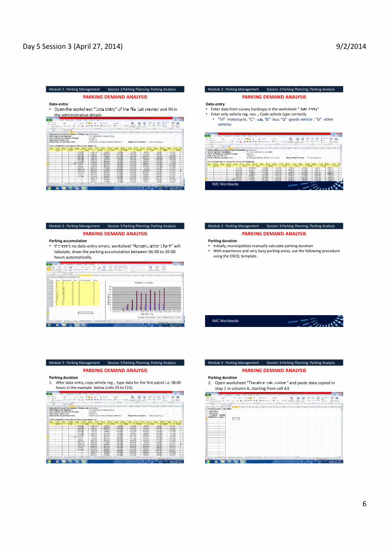
Day 5 Session 3 (April 27, 2014) 9/2/2014
6
IMC Worldwide
Module 3 : Parking Management Session 3:Parking Planning; Parking Analysis
PARKING DEMAND ANALYSIS Data-entry
and fill in the administrative details
IMC Worldwide
Module 3 : Parking Management Session 3:Parking Planning; Parking Analysis
PARKING DEMAND ANALYSIS Data-entry
Enter data from survey hardcopy in the worksheet Enter only vehicle reg. nos. ; Code vehicle type correctly
- motorcycle, - -bus -goods vehicle -other vehicles
IMC Worldwide
Module 3 : Parking Management Session 3:Parking Planning; Parking Analysis
PARKING DEMAND ANALYSIS Parking accumulation
If no data-entry errors, worksheet will tabulate, draw the parking accumulation between 06:00 to 20:00 hours automatically.
IMC Worldwide
Module 3 : Parking Management Session 3:Parking Planning; Parking Analysis
PARKING DEMAND ANALYSIS Parking duration
Initially, municipalities manually calculate parking duration With experience and very busy parking areas, use the following procedure using the EXCEL template.
IMC Worldwide
Module 3 : Parking Management Session 3:Parking Planning; Parking Analysis
PARKING DEMAND ANALYSIS Parking duration 1. After data-entry, copy vehicle reg. , type data for the first patrol i.e. 08:00
hours in the example below (cells E9 to F23).
IMC Worldwide
Module 3 : Parking Management Session 3:Parking Planning; Parking Analysis
PARKING DEMAND ANALYSIS Parking duration 2. Open worksheet and paste data copied in
step 1 in column A, starting from cell A3

Day 5 Session 3 (April 27, 2014) 9/2/2014
7
IMC Worldwide
Module 3 : Parking Management Session 3:Parking Planning; Parking Analysis
PARKING DEMAND ANALYSIS Parking duration 3. Repeat step 1 and 2 to paste the corresponding vehicle reg. , type
to 08:00 hours. 4. Repeat steps 1 and 2 for each succeeding patrols sequentially till
the entire survey data is calculation
After step 4, column
vehicle observed
IMC Worldwide
Module 3 : Parking Management Session 3:Parking Planning; Parking Analysis
PARKING DEMAND ANALYSIS Parking duration 5. Insert a column between reg. and the type data pasted in the
6. Rename header
IMC Worldwide
Module 3 : Parking Management Session 3:Parking Planning; Parking Analysis
PARKING DEMAND ANALYSIS Parking duration 7.
vehicle type and then registration using the DATA SORT function available in MS EXCEL®.
IMC Worldwide
Module 3 : Parking Management Session 3:Parking Planning; Parking Analysis
PARKING DEMAND ANALYSIS Parking duration 8. After sorting, count and enter the number of occurrence each vehicle was
observed in 9. For example, for the car with registration 135 shown below, the number to
enter in column B is 2.
IMC Worldwide
Module 3 : Parking Management Session 3:Parking Planning; Parking Analysis
PARKING DEMAND ANALYSIS Parking duration 10.
and rename as calculation_filtered
11. Delete all the rows of data containing blank cells in
calculation_filtered
IMC Worldwide
Module 3 : Parking Management Session 3:Parking Planning; Parking Analysis
PARKING DEMAND ANALYSIS Parking duration 12. calculation_filtered give
parking duration observed during the survey. 13. Above method cannot distinguish parking duration for vehicles
parked multiple times at the same place during the survey.

Day 5 Session 3 (April 27, 2014) 9/2/2014
8

Day 5 Session 4 (April 27, 2014) 9/2/2014
1
TRAINING ON MODULE 3: Parking Management
Session 4: Parking design; signage; security
Organiser: GoN Dept. of Urban Development & Building Construction
Trainer: Subhash Dhungel, Urban Transport Infrastructure Specialist Urban Transport Planning Management (ADB ta 7948), IMC Worldwide 27 April, 2014
IMC Worldwide
Module 3 : Parking Management Session 4: Parking design; Signage; Security
PARKING DESIGN Parking generation
Parking required is the parking generated by various land developments Parking gen. rates per unit area, occupants, customers, etc., used No parking generation rates available for Nepal
ITE parking generation rates can be roughly taken for new land development
IMC Worldwide
Module 3 : Parking Management Session 4: Parking design; Signage; Security
OTHER PARKING DESIGN STANDARDS
Pune Municipal Corporation, India -2008 Development Control Rule Stipulates parking spaces required Minimum on-street space for cars, motor-cycles, bicycles
Space for cars, motorcycle, bicycles per floor area, nos. of rooms, students, beds, etc.
Spaces differentiated for congested, non-congested areas.
IMC Worldwide
Module 3 : Parking Management Session 4: Parking design; Signage; Security
OTHER PARKING DESIGN STANDARDS
Shimla City Development Plan 2006, India -street parking, multi-level proposed, future demand
No design specific details. Hong Kong Transport Planning & Design Manual
Provides comprehensive design for on/off -street Covers
Dimensions, orientation preferred location, signage, road-marking loading/unloading areas.
IMC Worldwide
Module 3 : Parking Management Session 4: Parking design; Signage; Security
PARKING DESIGN Parking space recommended for Nepalese cities
Motorcycle 1.2m x 2.75 m Car 2.5m x 5.8 m Truck 3.75m x 7.5 m
IMC Worldwide
Module 3 : Parking Management Session 4: Parking design; Signage; Security
ON-STREET PARKING LAYOUTS
Parking configuration based on following
Demand Available road width parking control policy specific users traffic enforcements (e.g. ONE WAY movements). Dedicate some spaces to motor-cycles

Day 5 Session 4 (April 27, 2014) 9/2/2014
2
IMC Worldwide
Module 3 : Parking Management Session 4: Parking design; Signage; Security
ON-STREET PARKING LAYOUTS
Table 8- 1 Dimensions Required for On-street Parking ONE WAY Streets Case 1: Parking allowed only on one side of the street (a ll d imens ions in m eters)
Parking Configuration
Stall Width
Stall Length
Kerb length
per vehicle
Stall Depth Manoeuvre Space
Aisle Width
Roadway Width
a l b c Space d Space e f W 0 2.5 5.8 2.5 2.5 6.2 0 3.7 6.2
30 2.5 5.8 5.0 5.1 8.6 0.85 3.5 8.6 45 2.5 5.8 3.5 5.9 10.2 2.0 4.3 10.2 60 2.5 5.8 2.9 6.3 12.1 2.0 5.8 12.1 90 2.5 5.8 2.5 5.8 13.9 0 8.1 13.9
IMC Worldwide
Module 3 : Parking Management Session 4: Parking design; Signage; Security
ON-STREET PARKING LAYOUTS
Stall Width
Stall Length
Kerb length
per vehicle
Stall Depth Manoeuvre Space
Aisle Width
Roadway Width
A l b c Space d Space e f W 2.5 5.8 5.8 2.5 6.2 0 3.7 8.7 2.5 5.8 5.0 5.1 8.6 0.85 3.5 13.6 2.5 5.8 3.5 5.9 10.2 2.0 4.3 16.0 2.5 5.8 2.9 6.3 12.1 2.0 5.8 18.4 2.5 5.8 2.5 5.8 13.9 0 8.1 19.7
IMC Worldwide
Module 3 : Parking Management Session 4: Parking design; Signage; Security
ON-STREET PARKING LAYOUTS
Stall Width
Stall Length
Kerb length
per vehicle
Stall Depth Manoeuvre Space
Aisle Width
Roadway Width
A l b c Space d Space e f W 2.5 5.8 5.8 2.5 6.2 0 3.7 8.7 2.5 5.8 5.0 5.1 8.6 0.85 3.5 13.6 2.5 5.8 3.5 5.9 10.2 2.0 4.3 16.0 2.5 5.8 2.9 6.3 12.1 2.0 5.8 18.4 2.5 5.8 2.5 5.8 13.9 0 8.1 19.7 IMC Worldwide
Module 3 : Parking Management Session 4: Parking design; Signage; Security
ON-STREET PARKING LAYOUTS
Parking Configuration
Stall Width
Stall Length
Kerb length
per vehicle
Stall Depth Manoeuvre Space
Aisle Width
Roadway Width
a l b c Space d Space e F W 0 2.5 5.8 5.8 2.5 6.2 0 7.2 9.7 30 2.5 5.8 5.0 5.1 8.6 0.85 7.0 12.1 45 2.5 5.8 3.5 5.9 10.2 2.0 7.8 13.7 60 2.5 5.8 2.9 6.3 12.1 2.0 9.3 15.6 90 2.5 5.8 2.5 5.8 13.9 0 11.6 17.4
IMC Worldwide
Module 3 : Parking Management Session 4: Parking design; Signage; Security
AT-GRADE OFF-STREET PARKING LAYOUTS
dimension same as on-streetCan adopt uniform or combine two/more configurations
IMC Worldwide
Module 3 : Parking Management Session 4: Parking design; Signage; Security
AT-GRADE OFF-STREET PARKING LAYOUTS
Parking Configuration
Stall Width
Stall Length
Bay length
per vehicle
Stall Depth Maneuver Space
Aisle Width Turnaround
a l b c Space d Space e f g 0 2.5 5.8 5.8 2.5 6.2 0 7.0 5.6 30 2.5 5.8 5.0 5.1 8.6 0.85 8.0 8.0 45 2.5 5.8 3.5 5.9 10.2 2.0 10.0 7.7 60 2.5 5.8 2.9 6.3 12.1 2.0 11.6 6.8 90 2.5 5.8 2.5 5.8 13.9 0 15.2 6.8
Traffic circulation very critical in dictating the efficiency of this facility

Day 5 Session 4 (April 27, 2014) 9/2/2014
3
IMC Worldwide
Module 3 : Parking Management Session 4: Parking design; Signage; Security
MOTORCYCLE PARKING LAYOUTS Table 8- 1 Dimensions Required for Motor-cycle On-street Parking ONE WAY Streets Case 1: Parking only allowed on one side of the street (all dimensions in meters)
Parking Configuration
Stall Width
Stall Length
Kerb length
per vehicle
Stall Depth Maneuver Space
Aisle Width
Roadway Width
a l b c Space d Space e f W 0 2.5 5.8 2.5 2.5 6.2 0 3.7 6.2
30 2.5 5.8 5.0 5.1 8.6 0.85 3.5 8.6 45 2.5 5.8 3.5 5.9 10.2 2.0 4.3 10.2 60 2.5 5.8 2.9 6.3 12.1 2.0 5.8 12.1 90 2.5 5.8 2.5 5.8 13.9 0 8.1 13.9
IMC Worldwide
Module 3 : Parking Management Session 4: Parking design; Signage; Security
MOTORCYCLE PARKING LAYOUTS
Table 8- 1 Dimensions Required for Motor-cycle On-street Parking ONE WAY Streets Case 2: Parking allowed on both sides of the street (all dimensions in meters)
Parking Configuration
Stall Width
Stall Length
Kerb length
per vehicle
Stall Depth Maneuver Space
Aisle Width
Roadway Width
a l b c Space d Space e f W 0 1.2 2.75 2.75 1.20 2.0 0 2.75 4.0 30 1.2 2.75 2.4 2.41 2.8 0.40 2.75 5.2 45 1.2 2.75 1.7 2.79 3.5 0.90 2.75 6.3 60 1.2 2.75 1.4 2.98 3.9 0.90 2.75 6.8 90 1.2 2.75 1.2 2.75 3.8 0 2.75 6.5
IMC Worldwide
Module 3 : Parking Management Session 4: Parking design; Signage; Security
MOTORCYCLE PARKING LAYOUTS Table 8- 1 Dimensions Required for Motor-cycle On-street Parking TWO-WAY Streets Case 1: Parking only allowed on one side of the street (all dimensions in meters)
Parking Configuration
Stall Width
Stall Length
Kerb length
per vehicle
Stall Depth Maneuver Space
Aisle Width*
Roadway Width
a l b c Space d Space e f W 0 1.2 2.75 2.75 1.20 2.0 0 5.5 6.7 30 1.2 2.75 2.4 2.41 2.8 0.40 5.5 7.9 45 1.2 2.75 1.7 2.79 3.5 0.90 5.5 8.3 60 1.2 2.75 1.4 2.98 3.9 0.90 5.5 8.5 90 1.2 2.75 1.2 2.75 3.8 0 5.5 8.3
IMC Worldwide
Module 3 : Parking Management Session 4: Parking design; Signage; Security
MOTORCYCLE PARKING LAYOUTS Table 8- 1 Dimensions Required for Motor-cycle On-street Parking TWO-WAY Streets Case 2: Parking allowed on both sides of the street (all dimens ions in meters)
Parking Configuration
Stall Width
Stall Length
Kerb length
per vehicle
Stall Depth Maneuver Space
Aisle Width
Roadway Width
a l b c Space d Space e f W 0 1.2 2.75 2.75 1.20 2.0 0 5.5 7.9 30 1.2 2.75 2.4 2.41 2.8 0.40 5.5 10.3 45 1.2 2.75 1.7 2.79 3.5 0.90 5.5 11.1 60 1.2 2.75 1.4 2.98 3.9 0.90 5.5 11.5 90 1.2 2.75 1.2 2.75 3.8 0 5.5 11.0
IMC Worldwide
Module 3 : Parking Management Session 4: Parking design; Signage; Security
MOTORCYCLE PARKING LAYOUTS
IMC Worldwide
Module 3 : Parking Management Session 4: Parking design; Signage; Security
PARKING DELINEATION On/off street should be properly marked DoR TSM 1997
include types, standards for road-marking No marking at parking 100 mm, 150 mm marking prescribed Delineate on/off spaces with 150 mm .
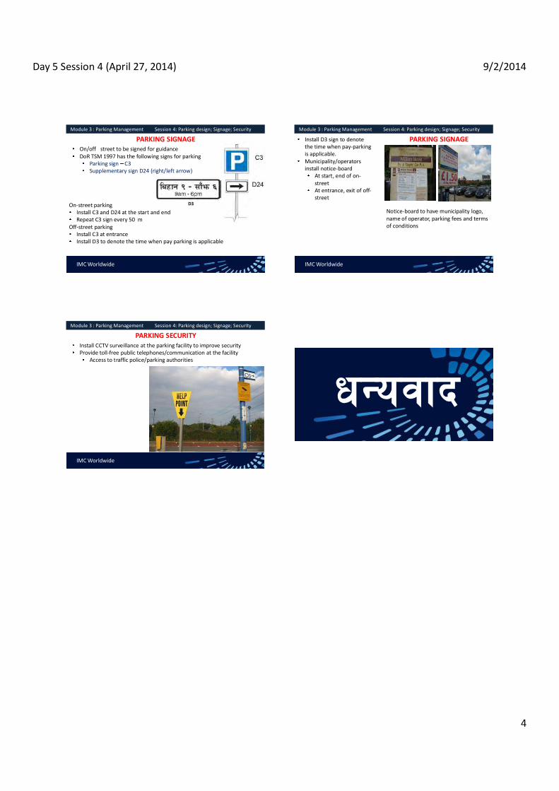
Day 5 Session 4 (April 27, 2014) 9/2/2014
4
IMC Worldwide
Module 3 : Parking Management Session 4: Parking design; Signage; Security
PARKING SIGNAGE On/off street to be signed for guidance DoR TSM 1997 has the following signs for parking
Parking sign C3 Supplementary sign D24 (right/left arrow)
On-street parking Install C3 and D24 at the start and end Repeat C3 sign every 50 m
Off-street parking Install C3 at entrance Install D3 to denote the time when pay parking is applicable
D3
IMC Worldwide
Module 3 : Parking Management Session 4: Parking design; Signage; Security
PARKING SIGNAGE Install D3 sign to denote the time when pay-parking is applicable. Municipality/operators install notice-board
At start, end of on-street At entrance, exit of off-street
Notice-board to have municipality logo, name of operator, parking fees and terms of conditions
IMC Worldwide
Module 3 : Parking Management Session 4: Parking design; Signage; Security
PARKING SECURITY Install CCTV surveillance at the parking facility to improve security Provide toll-free public telephones/communication at the facility
Access to traffic police/parking authorities

Day 5 Session 5 (April 27, 2014) 9/2/2014
1
TRAINING ON MODULE 3: Parking Management
Session 5: Parking revenues; Parking contracts; PPP in parking
Organiser: GoN Dept. of Urban Development & Building Construction
Trainer: Subhash Dhungel, Urban Transport Infrastructure Specialist Urban Transport Planning Management (ADB ta 7948), IMC Worldwide
27 April, 2014
IMC Worldwide
Module 3 : Parking Management Session 5: Parking revenues; Parking conracts; PPP in parking
PARKING REVENUES Using the parking duration data, revenue can be estimated Alternately, the customised for KMC automatically calculates actual, proposed revenues
1.calculation_filtered
2. Copy entire range of data pertaining to vehicle registration and hours viewed for cars.
3.
data from cell AG16 onwards.
4.
IMC Worldwide
Module 3 : Parking Management Session 5: Parking revenues; Parking conracts; PPP in parking
USING THE CUSTOMIZED SPREADSHEET TO CALCULATE PARKING REVENUES
3. Repeat step 1 to 2 to paste the data for other type of vehicles in the
Existing revenues assumes the maximum charges LSGA permitsProposed revenue is based charges based on parking duration based on the current rate. I If the charges, charging system changes, spreadheet should be appropriately modified.
IMC Worldwide
Module 3 : Parking Management Session 5: Parking revenues; Parking conracts; PPP in parking
PARKING REVENUES
Basic -of- to estimate annual parking revenues 1. Multiply total daily revenue by 300 days and subtract estimated annual
costs of operation on-site staffing Materials Administration
2. Divide the resultant figure by 12 months to form the starting point for negotiation for monthly-based contracts with operator
IMC Worldwide
Module 3 : Parking Management Session 5: Parking revenues; Parking conracts; PPP in parking
PARKING REVENUES Adopt annualisation factor from demand surveys, create Parking Cost Model.
Annualisation factor applied to average WKDY survey calculates average annual volumes, revenues derived from surveys of sample sites on all five WKDYs, a Saturday, a Sunday, a public holiday.
Parking Cost Model provide formal, agreed method tostandard rates for staffing, materials
Use these tools to better estimate annual revenues, costs monthly contracts.
IMC Worldwide
Module 3 : Parking Management Session 5: Parking revenues; Parking conracts; PPP in parking
CONTRACTS WITH PARKING OPERATORS Parking revenue collection contracts carried by competitive tender and by negotiation. The bidder quote monthly amount to pay municipality Municipality fix the hourly parking charge per vehicles type as per legislation operator need to collected Negotiation is generally carried out to
renew contract to the existing operator allow community based organizations to manage the parking.

Day 5 Session 5 (April 27, 2014) 9/2/2014
2
IMC Worldwide
Module 3 : Parking Management Session 5: Parking revenues; Parking conracts; PPP in parking
CONTRACTS WITH PARKING OPERATORS The contract should include, but not limited to, the following points :
Contract duration and renewal Contract amount, instalments and rebates Designated areas of operation Parking charges and disciplinary process for excess charging Format of parking tickets to be issued and procedures for use Requirements for parking operator staff, ID badges and clothingRequirements for parking signage Exemption from charges for official vehicles (mention the ownership)
IMC Worldwide
Module 3 : Parking Management Session 5: Parking revenues; Parking conracts; PPP in parking
PPP FOR PARKING MANAGEMENT A PPP could be sought for managing parking Request the proposers to provide the parking management plan with following details :
Details of on-street and off-street parking area and the parking details Annual investment plan and investment sharing Operation and Management Plan Revenue generation and sharing

Day 6 (April 28, 2014) 9/2/2014
1
Saroj Pradhan April 22, 2014
MODULE - 6Urban Transport Infrastructure Management
Urban Transport Infrastructure Management
Road Infrastructure, PT Infrastructure, Components in the management of Urban Transport Infrastructure, Types of Maintenance Works Road Hierarchy, Asset Management System, Stakeholder collaboration, Types of Maintenance Maintenance Techniques, Regular Maintenance and Budgeting
IMC Worldwide
Module 6 : Urban Transport Infrastructure Management
IMC Worldwide
Module 6 : Urban Transport Infrastructure Management
IMC Worldwide
Module 6 : Urban Transport Infrastructure Management
MODULE ORGANIZATION Challenges Facing Urban Transportation
Traffic congestion and parking difficulties. Public transport crowding and off-peak inadequacy. Difficulties for pedestrians. Environmental impacts and energy consumption. Accidents and safety. Land consumption. Freight distribution.

Day 6 (April 28, 2014) 9/2/2014
2
Congestion
New capacity
The Vicious Circle of Congestion
IMC Worldwide
Module 6 : Urban Transport Infrastructure Management
Urban Transport Infrastructure
All elements of the urban road infrastructure comprising the pavement (carriageway), shoulder/hard strips, side drains, cross drains, footpaths, street furniture, lay-bys, etc.
IMC Worldwide
Module 6 : Urban Transport Infrastructure Management
Road Infrastructure : Consists of elements like pavement (carriageway), shoulder/ hard strips, site drains, cross drains, footpath, streetlights, guard rails, street markings, traffic lights, street furniture, bridges, flyovers, tunnels, overheadpedestrian crossing, lay-bys etc. Public Transport Infrastructure : Bus Terminal, Bus Depot/ Park, Bus/ Truck Service Stations, Bus Stops, Tempo/ Rickshaw/ Taxi Parks, Travel Information Centre, Public Conveniences etc.
IMC Worldwide
Module 6 : Urban Transport Infrastructure Management
IMC Worldwide
Module 6 : Urban Transport Infrastructure Management
IMC Worldwide
Module 6 : Urban Transport Infrastructure Management

Day 6 (April 28, 2014) 9/2/2014
3
IMC Worldwide
Module 6 : Urban Transport Infrastructure Management
The urban transport infrastructure is developed and maintained with an aim to enhance the mobility of goods and people to fulfill economic and social needs of the society
Why Urban Transport Infrastructure ?
IMC Worldwide
Module 6 : Urban Transport Infrastructure Management
A set of activities planning and decision making, organizing, leading, and controlling
human, financial, physical, and information
With the aim of achieving organizational goals in an efficient and effective manner.
What is Management?
IMC Worldwide
Module 6 : Urban Transport Infrastructure Management
EFFICIENTLY Using resources wisely and in a cost-effective way EFFICIENTLY Using resources wisely and in a cost-effective way
Basic Purpose of Management
IMC Worldwide
Module 6 : Urban Transport Infrastructure Management
EFFICIENTLY Using resources wisely and in a cost-effective way
EFFICIENTLY Using resources wisely and in a cost-effective way
Basic Purpose of Management
IMC Worldwide
Module 6 : Urban Transport Infrastructure Management
Planning and Decision Making
action from a set of alternatives to achieve them. Organizing
Determining how activities and resources are grouped. Leading
The set of processes used to get organizational members to work together to advance the interests of the organization.
Controlling Monitoring organizational progress towards goals.
The Management Process
IMC Worldwide
Module 6 : Urban Transport Infrastructure Management
Urban transport infrastructure management
The management of urban transport infrastructure refers to the planning , organizing , leading and controlling of all the activities on operation and maintenance, rehabilitation, up gradation of the existing infrastructure and development of new transport infrastructure based on urban development strategy.

Day 6 (April 28, 2014) 9/2/2014
4
IMC Worldwide
Module 6 : Urban Transport Infrastructure Management
Road Hierarchy
(i) Strategic / national highways; (ii) Other strategic roads; (iii) Secondary/collector roads; and (iv) Access roads.
IMC Worldwide
Module 6 : Urban Transport Infrastructure Management
Road Hierarchy
IMC Worldwide
Module 6 : Urban Transport Infrastructure Management
Road Assets
Pavement Base course Sub-base course Road Formation Drain works Retaining Walls Culverts
Causeways Vented causeways Bio-engineering works Slope protection works Bridges Traffic management works Street furniture Street lighting
IMC Worldwide
Module 6 : Urban Transport Infrastructure Management
What is asset management
A systematic process of maintaining, upgrading and operating assets, combining engineering principles with sound business practice and economic rationale, and providing tools to facilitate a more organized and flexible approach to making the decisions
IMC Worldwide
Module 6 : Urban Transport Infrastructure Management
Major Elements of an Asset Management System
IMC Worldwide
Module 6 : Urban Transport Infrastructure Management
Benefits from Asset Management
Communications (both internal and external to the Administration). Asset inventory, condition and level of use. Network level performance Asset management tools. Budget process. Staff development.

Day 6 (April 28, 2014) 9/2/2014
5
IMC Worldwide
Module 6 : Urban Transport Infrastructure Management
COMPONENTS OF AN ASSET MANAGEMENT SYSTEM
Goals and policies of the Administration.
IMC Worldwide
Module 6 : Urban Transport Infrastructure Management
Goals
IMC Worldwide
Module 6 : Urban Transport Infrastructure Management
Policies
-range plans.
IMC Worldwide
Module 6 : Urban Transport Infrastructure Management
Asset data field, laboratory, automated, multi-media.
including map-based reporting. current.
type (pavement, structure, sign, etc.) location, features. types, composition, growth rate.
types, composition, growth rate. current financial and economic value, capitalization
methods.
IMC Worldwide
Module 6 : Urban Transport Infrastructure Management
What is Road Asset Management Physical infrastructure, such as pavements and bridges, road furniture, bus parks, terminals. Human resources (personnel and knowledge). Equipment and materials. Other items of value such as rights-of-way, data, computer systems, methods, technologies, and partners
IMC Worldwide
Module 6 : Urban Transport Infrastructure Management
Asset Management System An asset management system for urban transport infrastructure is a management tool wherein all infrastructures under a road agency is systematically operated, maintained, upgraded and preserved throughout its life-cycle. An urban transport infrastructure is considered as an asset with a defined commercial value calculated on the basis of its whole-life costs and its contribution to the economy. By preserving the urban transport infrastructure with planned maintenance, maximum benefit can accrue from the existing network and thus avoid costly rehabilitation works

Day 6 (April 28, 2014) 9/2/2014
6
IMC Worldwide
Module 6 : Urban Transport Infrastructure Management
Road maintenance one of prerequisite as well as there is a need to have a well-documented inventory of the transport infrastructure to enable monitoring and programming of the road maintenance activities on a network-wide basis.
The inventory and programming exercise; condition assessment of the road network including survey for measuring pavement surface condition such as the International Roughness Index (IRI and Surface Distress Index (SDI). The IRI measures the road roughness using a bump integrator, while the SDI measure is based on a visual assessment of the road.
These parameters are used to categorize the condition of the road as an aid in prioritizing road maintenance activities
IMC Worldwide
Module 6 : Urban Transport Infrastructure Management
Road inventory
Right of way Building properties belonging to the road agency Road and furniture Bridge and cross drainage Vehicles, plants and machinery of public-private partnership schemes or projects Local collaborations with other sectors (water-supply, sewage, electrical, etc.) Road accident records together with analysis and preventive measures Strict axle-load controls including logistics (weighbridges)
IMC Worldwide
Module 6 : Urban Transport Infrastructure Management
Road Register Road link referenceRoad link Name Surface type Carriageway width Pavement width TerrainTraffic volume (AADT)IRISDI Pavement condition based on both IRI and SDI (good, fair or poor) Year of pavement surfacing, if applicable
IMC Worldwide
Module 6 : Urban Transport Infrastructure Management
Why maintenance?
Deterioration Factors: Environmental- Terrain, Climate and Local practices; Traffic-Volume and Axle Load; Construction- Design and Construction Standard and Quality
IMC Worldwide
Module 6 : Urban Transport Infrastructure Management
Rutting Process
IMC Worldwide
Module 6 : Urban Transport Infrastructure Management
Different type of maintenance works required in urban infrastructure management
Routine maintenance Recurrent maintenance Specific or major recurrent maintenance Periodic maintenance Preventative maintenance Emergency maintenance

Day 6 (April 28, 2014) 9/2/2014
7
IMC Worldwide
Module 6 : Urban Transport Infrastructure Management
Routine Maintenance
Maintenance required continually of every road because of environmental degradation, whatever its engineering characteristic or traffic volume.
IMC Worldwide
Module 6 : Urban Transport Infrastructure Management
Routine Maintenance Routine maintenance should be conducted regularly: grass-cutting, repairs and cleaning of drains, shoulders, bridges, culverts and road furniture (signs, guide posts, km post, road marking, etc.).
Roadside drains should be regularly checked at least once a week during the monsoons as part of the routine maintenance.
Minor repairs resulting from spilling of water from household gutters, leakage of water/sewage, removal of debris from the households, etc.,
IMC Worldwide
Module 6 : Urban Transport Infrastructure Management
Routine Maintenance
IMC Worldwide
Module 6 : Urban Transport Infrastructure Management
Recurrent Maintenance Recurrent maintenance is necessary at intermittent intervals (twice yearly for road links or from six-months to two years for bridges). It is needed due to the damage on the road surface is by traffic plying over it over a period. Conducted twice every year Includes repairs of potholes, road edges and shoulders; re-grading; crack-sealing; and repainting road marking and signs.
IMC Worldwide
Module 6 : Urban Transport Infrastructure Management
Recurrent Maintenance
IMC Worldwide
Module 6 : Urban Transport Infrastructure Management
Recurrent Maintenance

Day 6 (April 28, 2014) 9/2/2014
8
IMC Worldwide
Module 6 : Urban Transport Infrastructure Management
Recurrent Maintenance
Objective of Recurrent Maintenance 1. To Give Serviceability to Road User 2. To Reduce the Wear and Tear of Vehicle 3. To Reduce Degree and Extent of Deterioration 4. To Differ the Rehabilitation Period and Cost 5. To Reduce Vehicle Operating Cost
IMC Worldwide
Module 6 : Urban Transport Infrastructure Management
Recurrent Maintenance
Maintenance Items Drain Maintenance Maintenance of Culverts Road Surface Maintenance Shoulder Maintenance Causeway Maintenance Road Furniture Maintenance
IMC Worldwide
Module 6 : Urban Transport Infrastructure Management
Recurrent Maintenance Road Surface Maintenance
IMC Worldwide
Module 6 : Urban Transport Infrastructure Management
Recurrent Maintenance Road Surface Maintenance
IMC Worldwide
Module 6 : Urban Transport Infrastructure Management
Recurrent Maintenance Road Surface Maintenance
IMC Worldwide
Module 6 : Urban Transport Infrastructure Management
Recurrent Maintenance Road Furniture Maintenance

Day 6 (April 28, 2014) 9/2/2014
9
IMC Worldwide
Module 6 : Urban Transport Infrastructure Management
Specific Maintenance
Specific maintenance or major recurrent works involve maintenance at a specific location on a road and include minor rehabilitation, minor reseals, spot improvements, minor structural repairs, etc.
IMC Worldwide
Module 6 : Urban Transport Infrastructure Management
Periodic Maintenance
Periodic maintenance is conducted after intervals of a certain number of years (commonly once every one to ten years depending on the type of work). For roads, this includes surface resealing, re-gravelling works, re-painting of the steelworks, shoulder re-gravelling, etc.
IMC Worldwide
Module 6 : Urban Transport Infrastructure Management
Periodic Maintenance
Periodic on-road maintenance On paved roads, it includes re sealing (after filling the potholes and constructing leveling course where required) using either surface dressing, slurry seal, sand seal or none structural bituminous concrete overlay.
IMC Worldwide
Module 6 : Urban Transport Infrastructure Management
Preventive Maintenance
Preventive maintenance for roads includes mitigation works from slope failures and bank failures due to floods. This will include river-training works at road sections running adjacent to rivers, slope stabilization works including bio-engineering works, etc.
IMC Worldwide
Module 6 : Urban Transport Infrastructure Management
Preventive Maintenance
Activities Required are: Slope Netting Trim Slopes Masonry Wall and Revetments Cascades Gabion Walls Prop Walls Check Dams River Training and Bank Protection Bio-engineering Works
IMC Worldwide
Module 6 : Urban Transport Infrastructure Management
Preventive Maintenance

Day 6 (April 28, 2014) 9/2/2014
10
IMC Worldwide
Module 6 : Urban Transport Infrastructure Management
Preventive Maintenance
IMC Worldwide
Module 6 : Urban Transport Infrastructure Management
Preventive Maintenance
IMC Worldwide
Module 6 : Urban Transport Infrastructure Management
Preventive Maintenance
IMC Worldwide
Module 6 : Urban Transport Infrastructure Management
Preventive Maintenance
IMC Worldwide
Module 6 : Urban Transport Infrastructure Management
Emergency Maintenance Emergency maintenance, needed to deal with emergencies and problems calling for immediate action when a road is threatened or closed
IMC Worldwide
Module 6 : Urban Transport Infrastructure Management
Emergency Maintenance Activities required for on-road maintenance
Communication and information Traffic Management during emergencyRemoval of debris and other obstacles Placement of warning sign Placement of diversion sign Traffic Management after emergency

Day 6 (April 28, 2014) 9/2/2014
11
IMC Worldwide
Module 6 : Urban Transport Infrastructure Management
Emergency Maintenance Emergency maintenance includes work for road opening following road blocks due to landslides or other natural events or when there is a potential hazard to the structural integrity. These works include road diversions following land-slides, mitigation works to relieve traffic blocked due to bridge failures, etc.
IMC Worldwide
Module 6 : Urban Transport Infrastructure Management
Emergency Maintenance
IMC Worldwide
Module 6 : Urban Transport Infrastructure Management
Emergency Maintenance
IMC Worldwide
Module 6 : Urban Transport Infrastructure Management
Emergency Maintenance
IMC Worldwide
Module 6 : Urban Transport Infrastructure Management
Emergency Maintenance
IMC Worldwide
Module 6 : Urban Transport Infrastructure Management
Road Shoulder maintenance
a) providing side support to the road pavement b) providing space to the traffic in case of emergencies c) draining water from the carriageway to the roadside ditch.

Day 6 (April 28, 2014) 9/2/2014
12
IMC Worldwide
Module 6 : Urban Transport Infrastructure Management
Storm Water Drainage
IMC Worldwide
Module 6 : Urban Transport Infrastructure Management
Street Markings Guard Rails and barriers
IMC Worldwide
Module 6 : Urban Transport Infrastructure Management
Traffic Lights
IMC Worldwide
Module 6 : Urban Transport Infrastructure Management
Pavement Maintenance
IMC Worldwide
Module 6 : Urban Transport Infrastructure Management
Asphalt concrete road maintenance
IMC Worldwide
Module 6 : Urban Transport Infrastructure Management
Gravel and Earthen roads Corrective measures

Day 6 (April 28, 2014) 9/2/2014
13
IMC Worldwide
Module 6 : Urban Transport Infrastructure Management
Annual Maintenance Requirements for gravel and earthen roads
IMC Worldwide
Module 6 : Urban Transport Infrastructure Management
Periodic Maintenance Requirement of Gravel and Earthen Roads
IMC Worldwide
Module 6 : Urban Transport Infrastructure Management
Quality Requirements for better level of service Reliability of AccessComfort and SpeedRoad SafetyVehicle Operating CostsEnvironmental Costs
IMC Worldwide
Module 6 : Urban Transport Infrastructure Management
A programming module to help define and prioritize planned maintenance interventions for achieving the agreed level-of-service. Implementation and management module to help with monitoring and managing the implementation of maintenance program.
IMC Worldwide
Module 6 : Urban Transport Infrastructure Management
Stakeholder Collaboration Active participation of the stakeholders in all stages of the management process is required for the meaningful management of the urban transport management process.
Nepal Electricity Authority, Nepal Telecom, Nepal Water Supply Corporation Cable Television Operators Bus companies Street Vendors
IMC Worldwide
Module 6 : Urban Transport Infrastructure Management
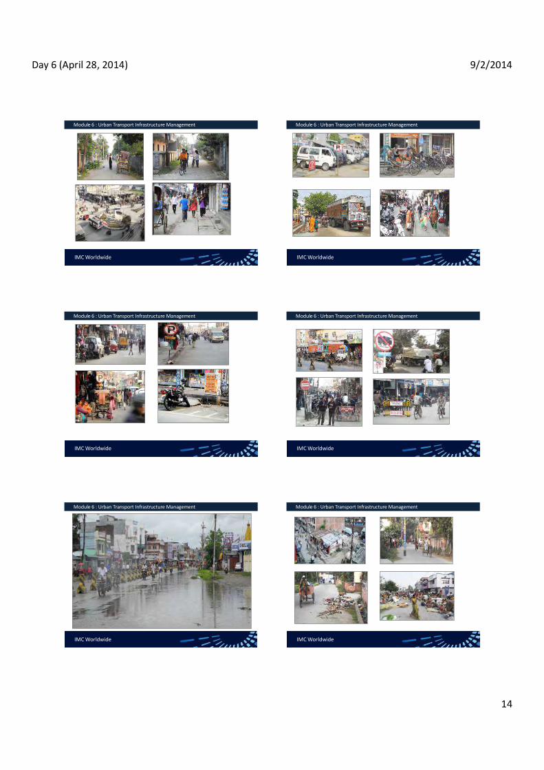
Day 6 (April 28, 2014) 9/2/2014
14
IMC Worldwide
Module 6 : Urban Transport Infrastructure Management
IMC Worldwide
Module 6 : Urban Transport Infrastructure Management
IMC Worldwide
Module 6 : Urban Transport Infrastructure Management
IMC Worldwide
Module 6 : Urban Transport Infrastructure Management
IMC Worldwide
Module 6 : Urban Transport Infrastructure Management
IMC Worldwide
Module 6 : Urban Transport Infrastructure Management

Day 6 (April 28, 2014) 9/2/2014
15
IMC Worldwide
Module 6 : Urban Transport Infrastructure Management
IMC Worldwide
Module 6 : Urban Transport Infrastructure Management
Transport Infrastructure Management Plan
Inventory of the existing transport infrastructure under its jurisdiction and their condition in terms of good, satisfactory, poor and failed The type of maintenance required for each of the infrastructure Major rehabilitation or up gradation works Planned infrastructure development Requirement of financial, material and technical resources and their allocation Mode of development, operation and management Work schedule or action Government funding for management of urban infrastructure
IMC Worldwide
Module 6 : Urban Transport Infrastructure Management
Principles of road infrastructure management
Re-orient and refine the planning and prioritizing interventions based on hierarchy of the roads.
Place strong emphasis on preserving the transport infrastructure based on the principles of road asset management, simplified manner, network expansion.
Proactively collaborate with the stakeholders at all stages of the management process (planning, prioritizing, programming and monitoring).
Enhance capacity to gradually, maintain detailed inventory with specific information on status of various infrastructure elements, secure adequate funds for road maintenance
Q & A

Day 7 Session 2 9/2/2014
1
Comprehensive Urban Transport Strategy for Biratnagar
Session 4: Comprehensive Urban Transport Strategy
for Biratnagar
Organiser: GoN Dept. of Urban Development & Building Construction
Trainer: Subhash Dhungel, Urban Transport Infrastructure Specialist Urban Transport Planning Management (ADB ta 7948), IMC Worldwide 29 April, 2014
IMC Worldwide
Transport Situation in Biratnagar Session 4: Comprehensive Urban
PHYSICAL DEFICIENCIES OF BIRATNAGAR ROAD NETWORK
Insufficient CWY, lack of sidewalks on collector roads No alternatives to divert transit traffic from the city center Poor intersection layout poor CWY surfaces and shoulders
reduce travel speed discourage NMT use dust pollution
IMC Worldwide
Transport Situation in Biratnagar Session 4: Comprehensive Urban
DEFICIENCIES IN TRAFFIC MANAGEMENT obstruction at intersections, roads, causing delays unnecessary weaving of traffic safety hazards for pedestrians and NMT
Deficiencies in the Central Area Congestion, inconvenience, especially for pedestrians, NMTs discouragement for UPT to serve the city center generally unattractive appearance that discourages private sector investment
IMC Worldwide
Transport Situation in Biratnagar Session 4: Comprehensive Urban
DEFICIENCIES IN UPT low demand -lack of facilities for prospective pax poor coverage over space and time, poor service and quality of vehicles, No regulatory framework to encourage private sector to improve
IMC Worldwide
Transport Situation in Biratnagar Session 4: Comprehensive Urban
LONG-TERM VISION
BSC envisaged to significantly progress to become
more modern Vibrant Child friendly city
IMC Worldwide
Transport Situation in Biratnagar Session 4: Comprehensive Urban Transport Strategy for Biratngar
LONG-TERM VISION More vibrant economy
Manufacturing sector revived Industrial corridor revitalised New manufacturing at south (Ward 20) New economic clusters
high-level education, health facilities
SE (Ward 18) NW (Ward 5)
new service sector in the south, just outside BSC, near ICP.
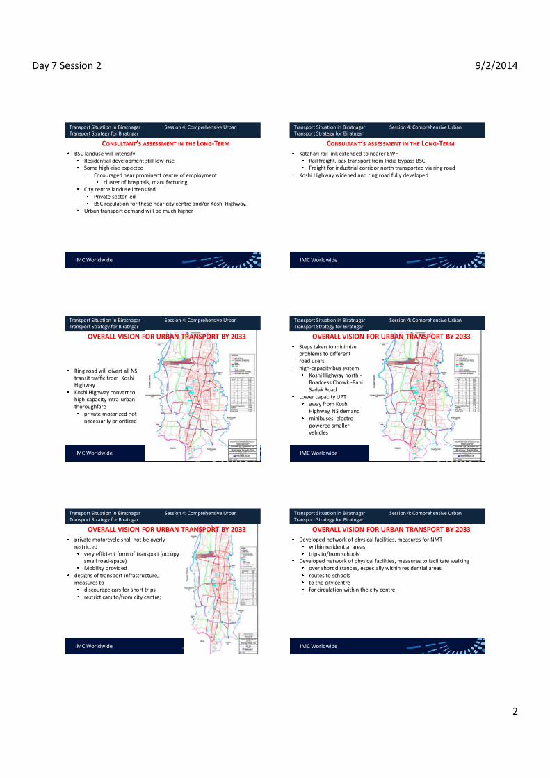
Day 7 Session 2 9/2/2014
2
IMC Worldwide
Transport Situation in Biratnagar Session 4: Comprehensive Urban Transport Strategy for Biratngar
CONSULTANT S ASSESSMENT IN THE LONG-TERM BSC landuse will intensify
Residential development still low-rise Some high-rise expected
Encouraged near prominent centre of employment cluster of hospitals, manufacturing
City centre landuse intensifed Private sector led BSC regulation for these near city centre and/or Koshi Highway.
Urban transport demand will be much higher
IMC Worldwide
Transport Situation in Biratnagar Session 4: Comprehensive Urban Transport Strategy for Biratngar
CONSULTANT S ASSESSMENT IN THE LONG-TERM Katahari rail link extended to nearer EWH
Rail freight, pax transport from India bypass BSC Freight for industrial corridor north transported via ring road
Koshi Highway widened and ring road fully developed
IMC Worldwide
Transport Situation in Biratnagar Session 4: Comprehensive Urban Transport Strategy for Biratngar
Ring road will divert all NS transit traffic from Koshi Highway Koshi Highway convert to high-capacity intra-urban thoroughfare
private motorized not necessarily prioritized
OVERALL VISION FOR URBAN TRANSPORT BY 2033
IMC Worldwide
Transport Situation in Biratnagar Session 4: Comprehensive Urban Transport Strategy for Biratngar
Steps taken to minimize problems to different road users high-capacity bus system
Koshi Highway north - Roadcess Chowk -Rani Sadak Road
Lower capacity UPT away from Koshi Highway, NS demand minibuses, electro-powered smaller vehicles
OVERALL VISION FOR URBAN TRANSPORT BY 2033
IMC Worldwide
Transport Situation in Biratnagar Session 4: Comprehensive Urban Transport Strategy for Biratngar
private motorcycle shall not be overly restricted
very efficient form of transport (occupy small road-space) Mobility provided
designs of transport infrastructure, measures to
discourage cars for short trips restrict cars to/from city centre;
OVERALL VISION FOR URBAN TRANSPORT BY 2033
IMC Worldwide
Transport Situation in Biratnagar Session 4: Comprehensive Urban Transport Strategy for Biratngar
Developed network of physical facilities, measures for NMT within residential areas trips to/from schools
Developed network of physical facilities, measures to facilitate walking over short distances, especially within residential areas routes to schools to the city centre for circulation within the city centre.
OVERALL VISION FOR URBAN TRANSPORT BY 2033

Day 7 Session 2 9/2/2014
3
IMC Worldwide
Transport Situation in Biratnagar Session 4: Comprehensive Urban Transport Strategy for Biratngar
Biratnagar Urban Transport Policy Statement
Gradually develop a modern, efficient transport system for Biratnagar, based on thought-out strategies that meet the current, emerging needs. Transport system should serve the diverse needs of all population groups, help Biratnagar become
child-friendly city support economic dev. with min. negative env., social impacts.
URBAN TRANSPORT STRATEGY FOR BSC
IMC Worldwide
Transport Situation in Biratnagar Session 4: Comprehensive Urban Transport Strategy for Biratngar
Biratnagar Urban Transport Policy Statement Gradually develop a modern, efficient transport system for Biratnagar, based on thought-out strategies that meet the current, emerging needs. Transport system should serve the diverse needs of all population groups, help Biratnagar become
child-friendly city support economic dev. with min. negative env., social impacts.
URBAN TRANSPORT STRATEGY FOR BSC
IMC Worldwide
Transport Situation in Biratnagar Session 4: Comprehensive Urban Transport Strategy for Biratngar
Integrate transport planning , land-use to enhance quality of lifeMinimize increase in transport needs Achieve max accessibility, inter-connectivity, efficiency, sustainability Manage inevitable increase in transport demand Prepare for inevitable increase, share of private vehicles
URBAN TRANSPORT STRATEGY FOR BSC
IMC Worldwide
Transport Situation in Biratnagar Session 4: Comprehensive Urban Transport Strategy for Biratngar
Limit negative impacts of private vehicles, shift majority of demand from vehicles to UPT Better UPT network incl. NMT accessible to all (poor, child, women) Improve walking, cycling accessibility to poor, women, children, elderly, persons with disability Enhance vibrancy, commercial life in city centre with improved traffic management, walkability Minimize hindrances for transit traffic
URBAN TRANSPORT STRATEGY FOR BSC
IMC Worldwide
Transport Situation in Biratnagar Session 4: Comprehensive Urban Transport Strategy for Biratngar
Minimize negative socio-env. impacts of all transport movements Prioritize interventions that will encourage +ve responses including investments from business sector, civil society
URBAN TRANSPORT STRATEGY FOR BSC
Policy statement was endorsed by Steering Committee in December 2012It was also endorsed by the Municipal Council in January 2013.
IMC Worldwide
Transport Situation in Biratnagar Session 4: Comprehensive Urban Transport Strategy for Biratngar
IMPACT OF BSC URBAN TRANSPORT POLICY STATEMENT IMPACT
Poverty reduced, quality of life raised, sustainable development enhanced in BSC
OUTCOMES Sustainable urban mobility, adequate transport
services provided.

Day 7 Session 2 9/2/2014
4
IMC Worldwide
Transport Situation in Biratnagar Session 4: Comprehensive Urban Transport Strategy for Biratngar
IMPACT OF BSC URBAN TRANSPORT POLICY STATEMENT
OUTPUTS Efficient transport system with reduced transport needs Efficient landuse Expanded and imp. networkVibrant commercial life in the city centre (accessible to suppliers and consumers) More walkable BSCReduced hazards for pedestrian and cycling Reduced hindrances for transit trafficReduced neg. social/ env
IMC Worldwide
Transport Situation in Biratnagar Session 4: Comprehensive Urban Transport Strategy for Biratngar
IMPACT OF BSC URBAN TRANSPORT POLICY STATEMENT STRATEGIES
Integrate transport, LU planning Prepare for transport demand increase Prepare for increase in private mode Strive to limit the neg. impact of private mode Preserve the culture of using NMT, etc.
INPUTS Regulatory framework Inst. support and enhancement Finance Human resourceLabor Social capital Road network Urban land etc.
STAKEHOLDERS (BSC, people and partner agencies)
IMC Worldwide
Transport Situation in Biratnagar Session 4: Comprehensive Urban Transport Strategy for Biratngar
URBAN TRANSPORT STRATEGY PRINCIPLES
General Principles
1. Build on the existing elongated landuse pattern of BSC and existing transport pattern (NS), reinforce the linear nature of landuse and transport patterns.
2. Build on existing habits of using NMT, enhance feasibility through: provision of dedicated facilities, especially cycling routes in NS Provision of ped facilities for EW movements.
IMC Worldwide
Transport Situation in Biratnagar Session 4: Comprehensive Urban Transport Strategy for Biratngar
URBAN TRANSPORT STRATEGY PRINCIPLES
General Principles
3. Strive to redirect transit traffic away from the city centre soon as feasible. 4. Explore possibilities to encourage intensified commercial land-use along
major transport corridors, near terminals, stops of urban public transport. Road Network Development Principles
5. In cooperation with DUDBC, expedite completion of ring road assign priority to the western segment redirect north-south transit traffic to it as soon as feasible.
IMC Worldwide
Transport Situation in Biratnagar Session 4: Comprehensive Urban Transport Strategy for Biratngar
URBAN TRANSPORT STRATEGY PRINCIPLES
Road Network Development Principles 6. Through collaboration (DoR, DUDBC, BSC) to standard make it attractive for
transit traffic to a bypass road ICP Connecting Road Koshi Highway Ring Road
7. In coordination with DoR, expand Koshi HWY BSC section to such a design that
serves as transit road for a limited number of years but then acts as intra-urban route for intensified landuse, urban public transport, access to the city centre
IMC Worldwide
Transport Situation in Biratnagar Session 4: Comprehensive Urban Transport Strategy for Biratngar
URBAN TRANSPORT STRATEGY PRINCIPLES
Road Network Development Principles 8. Develop additional NS routes for intra-urban traffic friendly to NMT and
UPT for demands from residences, emerging employment centre at BRT south (Ward 20).
9. Upgrade existing collector roads, complemented with the necessary minimum of new road construction, to provide a connection from the south (Koshi Highway) to the east of BSC (Hatkhola) through Wards 18 and 11.

Day 7 Session 2 9/2/2014
5
IMC Worldwide
Transport Situation in Biratnagar Session 4: Comprehensive Urban Transport Strategy for Biratngar
URBAN TRANSPORT STRATEGY PRINCIPLES
Road Network Development Principles 8. Upgrade existing collector roads, complemented with the necessary
minimum of new road construction, to provide a connection from the east (Hatkhola) to the north of BSC (Koshi Highway) through Wards 11, 2, 3, and/or 4.
Urban Public Transport Principles 9. Develop network of UPT routes including terminals, stops with waiting
areas, other facilities at existing and planned centers of commercial activities, admin services, existing, emerging centers of employment, and at suitable access points to the city centre.
IMC Worldwide
Transport Situation in Biratnagar Session 4: Comprehensive Urban Transport Strategy for Biratngar
URBAN TRANSPORT STRATEGY PRINCIPLES
Urban Public Transport Principles 10. Ensure that all terminals all stops are conveniently and safely accessible for
pedestrians, and impose necessary restrictions on vehicle traffic. 11. Develop the existing bus park with a focus on its function as a hub for urban
public transport, include in its design all necessary facilities for enhanced inter-connectivity between long and mid-haul bus transport and intra-urban transport including non-motorized transport and walking.
12. Explore and use the possibilities for encouraging or obliging the operators of urban public transport to phase out tempos and basantis in favor of microbuses and/or other vehicles.
IMC Worldwide
Transport Situation in Biratnagar Session 4: Comprehensive Urban Transport Strategy for Biratngar
URBAN TRANSPORT STRATEGY PRINCIPLES
Urban Public Transport Principles 13. Explore and use the possibilities for regulating the emerging taxi service
industry so that it will not inflict damage on the other types of urban public transport.
14. Explore and use the possibilities for better regulating the rickshaw industry with a view to reducing the number of rickshaws and enhancing the service level.
15. Develop a concept for establishing a range of urban public transport modes and locating each type of urban public transport service optimally within the territory of BSC for maximum mutual complementarity and minimum mutual interference.
IMC Worldwide
Transport Situation in Biratnagar Session 4: Comprehensive Urban Transport Strategy for Biratngar
URBAN TRANSPORT STRATEGY PRINCIPLES
Urban Public Transport Principles 16. Explore and use the possibilities for better regulating the rickshaw industry
with a view to reducing the number of rickshaws and enhancing the service level.
17. Develop a concept for establishing a range of urban public transport modes and locating each type of urban public transport service optimally within the territory of BSC for maximum mutual complementarity and minimum mutual interference.

Day 7 Session 1 (April 29, 2014) 9/2/2014
1
Saroj Basnet Deputy Team Leader, UTPM - ADB TA 7948
URBAN TRANSPORT INFRATRUCTURE IN BIRATNAGAR
IMC Worldwide - METCON - WELINK
Extensive Training on Urban Transportation & Management
TA 7948-NEP : Urban Transport Planning & Management
Assist Biratnagar Sub-Metropolitan City (BSC) in :
developing a comprehensive urban transport and land use strategy
enhancing institutional capacity for urban transport planning and management
IMC Worldwide - METCON - WELINK
Extensive Training on Urban Transportation & Management
Study Activities
Urban Development : Socio-economic characteristics, Urban Development Vision/ Strategy, Land Use Plan and Policies, preparation of city profile
Transport Planning : Transport network, transport policy, road accidents, vehicle ownership, traffic surveys, characteristics and issues in urban transport system, preparation of long term (20 yrs) and medium-term (5-10 yrs) vision for urban transport system, urban transport and land use strategy, develop projects and programs
IMC Worldwide - METCON - WELINK
Extensive Training on Urban Transportation & Management
Study Activities
Transport Modelling: Analyze and evaluate the land use and urban transport system using the transport demand model, Assess each combination of urban growth and transport network scenarios using the transport demand model
Public Transportation: Assess public transport system, assess alternatives for promoting intra-city and inter-city public transport
IMC Worldwide - METCON - WELINK
Extensive Training on Urban Transportation & Management
Study Activities
Urban Transport Infrastructure: Inventory of urban transportinfrastructure, assess requirement for new urbaninfrastructure
Urban Environment: Baseline surveys for air quality andnoise level, develop model to disaggregate the air pollutionand noise by source, develop guidelines to monitor theenvironmental impacts
IMC Worldwide - METCON - WELINK
Extensive Training on Urban Transportation & Management
Toolkits & Guidelines
Land Use and Urban Transport
Traffic Safety
Traffic Management
Parking Management
Facilitating and regulating non-motorized vehicles
Urban Transport Infrastructure Management
Managing Public Transport Services

Day 7 Session 1 (April 29, 2014) 9/2/2014
2
IMC Worldwide - METCON - WELINK
Extensive Training on Urban Transportation & Management
Biratnagar City - Current Situation and Outlook to the Future Eastern Development Region and the Regional Strategic Road Network
IMC Worldwide - METCON - WELINK
Extensive Training on Urban Transportation & Management
Biratnagar City - Current Situation and Outlook to the Future Biratnagar - a Hub of Regional Air Connections
IMC Worldwide - METCON - WELINK
Extensive Training on Urban Transportation & Management
Biratnagar City - Current Situation and Outlook to the Future
Topographical Map of Biratnagar
IMC Worldwide - METCON - WELINK
Extensive Training on Urban Transportation & Management
Biratnagar City - Current Situation and Outlook to the Future
Administrative Map of Biratnagar
IMC Worldwide - METCON - WELINK
Extensive Training on Urban Transportation & Management
Biratnagar City - Current Situation and Outlook to the Future Population Distribution in Nepal
IMC Worldwide - METCON - WELINK
Extensive Training on Urban Transportation & Management
Biratnagar City - Current Situation and Outlook to the Future
City Population Figures Average Annual Growth
Rates
1971 1981 1991 2001 2011 2001-2011 1991-2011
Kathmandu 150,402 235,160 421,258 671,846 975,453 3.8% 4.3%
Lalitpur 59,049 79,875 115,865 162,991 220,802 3.1% 3.3%
Pokhara 20,611 46,642 95,286 156,321 255,465 5.0% 5.1%
Biratnagar 45,100 93,544 129,388 166,674 201,125 1.9% 2.2%
Birgunj 12,999 43,642 69,005 112,484 135,904 1.9% 3.4%
Janakpur 14,294 34,840 54,710 74,192 97,776 2.8% 2.9%
Hetauda 16,194 34,792 53,836 68,482 84,671 2.1% 2.3%
Nepalganj 23,523 34,015 47,819 57,535 72,503 2.3% 2.1%
Past Population Growth of Major Cities in Nepal

Day 7 Session 1 (April 29, 2014) 9/2/2014
3
IMC Worldwide - METCON - WELINK
Extensive Training on Urban Transportation & Management
Biratnagar City - Current Situation and Outlook to the Future Past Population Growth of Major Cities in Nepal
IMC Worldwide - METCON - WELINK
Extensive Training on Urban Transportation & Management
Biratnagar City - Current Situation and Outlook to the Future
Past Population Growth relative to 1971 levels
City Population Figures in% of the 1971 Figures
1971 1981 1991 2001 2011 Kathmandu 100 156 280 447 649 Lalitpur 100 135 196 276 374 Pokhara 100 226 462 758 1,239 Biratnagar 100 207 287 370 446 Birgunj 100 336 531 865 1,045 Janakpur 100 244 383 519 684 Hetauda 100 215 332 423 523 Nepalganj 100 145 203 245 308
IMC Worldwide - METCON - WELINK
Extensive Training on Urban Transportation & Management
Biratnagar City - Current Situation and Outlook to the Future
Future Population Scenarios
Assumed Future Growth 2011 2021 2031
At 2.4% / year from 2012 to 2031 201,125 254,000 321,000
At 1.9% / year from 2012 to 2021 and 2.2% from 2022 to 2031 201,125 242,000 300,000
At 1.7% / year from 2012 to 2031 201,125 238,000 281,000
IMC Worldwide - METCON - WELINK
Extensive Training on Urban Transportation & Management
Biratnagar City - Current Situation and Outlook to the Future Future Population Scenarios
IMC Worldwide - METCON - WELINK
Extensive Training on Urban Transportation & Management
Biratnagar City - Current Situation and Outlook to the Future City's Vision (Periodic Plan)
A prosperous, developed, and professional city, culturally vibrant and child friendly, is our new
Biratnagar
IMC Worldwide - METCON - WELINK
Extensive Training on Urban Transportation & Management
Biratnagar City - Current Situation and Outlook to the Future Development Scenario - 1 : Slow Public and Private Sector after 2014
only slightly accelerated population growth, with some net migration gains,
only slightly accelerated expansion of the residential areas, interspersed with educational facilities,
only slightly accelerated expansion and minimal quality improvement of the commercial areas incl. the CBD, and
the creation of more new jobs mostly in scattered locations.

Day 7 Session 1 (April 29, 2014) 9/2/2014
4
IMC Worldwide - METCON - WELINK
Extensive Training on Urban Transportation & Management
Biratnagar City - Current Situation and Outlook to the Future Development Scenario - 2 : Rapid Public and Slow Private Sector after 2014
a somewhat accelerated population growth, with some net migration gains, a somewhat accelerated expansion of the residential areas, a somewhat accelerated development of educational facilities, mainly in the south eastern and the south western part of BSC, a somewhat accelerated expansion and slight quality improvement of the commercial areas incl. the CBD, and the somewhat accelerated creation of more new jobs mostly in scattered locations
IMC Worldwide - METCON - WELINK
Extensive Training on Urban Transportation & Management
Biratnagar City - Current Situation and Outlook to the Future
Development Scenario - 1 : Slow Public and Slow Private Sector after 2014
IMC Worldwide - METCON - WELINK
Extensive Training on Urban Transportation & Management
Biratnagar City - Current Situation and Outlook to the Future Development Scenario - 3 : Slow Public and Rapid Sector after 2014
a somewhat accelerated population growth, with some net migration gains, a somewhat accelerated expansion of the residential areas, a somewhat accelerated development of educational facilities, mainly in the south eastern and the south western part of BSC, a somewhat accelerated expansion and slight quality improvement of the commercial areas incl. the CBD, the somewhat accelerated creation of more new jobs mostly in scattered locations.
IMC Worldwide - METCON - WELINK
Extensive Training on Urban Transportation & Management
Biratnagar City - Current Situation and Outlook to the Future
Development Scenario - 3 : Slow Public and Rapid Sector after 2014
IMC Worldwide - METCON - WELINK
Extensive Training on Urban Transportation & Management
Biratnagar City - Current Situation and Outlook to the Future Development Scenario - 3 : Rapid Public and Rapid Sector after 2014
both of low and high-qualification workforce, a significantly accelerated expansion of the residential areas, possibly the development of high-density housing, a significantly accelerated development of educational facilities, mainly in the south eastern and the south western part of BSC,a significantly accelerated expansion and quality improvement of the commercial areas incl. the CBD, the significantly accelerated creation of more new jobs in numerous locations.
IMC Worldwide - METCON - WELINK
Extensive Training on Urban Transportation & Management
Biratnagar City - Current Situation and Outlook to the Future
Development Scenario - 3 : Rapid Public and Rapid Sector after 2014

Day 7 Session 1 (April 29, 2014) 9/2/2014
5
IMC Worldwide - METCON - WELINK
Extensive Training on Urban Transportation & ManagementBiratnagar City - Current Situation and Outlook to the Future Comparison of Scenario
IMC Worldwide - METCON - WELINK
Extensive Training on Urban Transportation & Management Biratnagar City - Current Situation and Outlook to the Future Comparison of Scenario
IMC Worldwide - METCON - WELINK
Extensive Training on Urban Transportation & ManagementBiratnagar City - Current Situation and Outlook to the Future Comparison of Scenario
IMC Worldwide - METCON - WELINK
Extensive Training on Urban Transportation & Management
Biratnagar City - Current Landuse & Land Use Strategy
Existing Land Use Pattern
Landuse types
percentage (past development) Projection and Change
1976 1990 1999 2009 2019 2009-19
Urban built up 4.8 12.3 25.9 38.0 48.2 10.2
Natural vegetation 5.8 1.0 4.6 1.0 0.7 -0.3
Water bodies 11.4 3.8 3.1 5.2 5.3 0.1
Cultivated land 79.0 82.9 66.4 55.8 45.8 -10.0
[1 ] built- is defined as landuse comprising residential, commercial, institutional and cultural complexes, industries, and transportation and communications; including forest,
IMC Worldwide - METCON - WELINK
Extensive Training on Urban Transportation & Management
Biratnagar City - Current Landuse & Land Use Strategy
The City Centre
[1 ] built- is defined as landuse comprising residential, commercial, institutional and cultural complexes, industries, and transportation and communications; including forest,

Day 7 Session 1 (April 29, 2014) 9/2/2014
6
IMC Worldwide - METCON - WELINK
Extensive Training on Urban Transportation & Management
Biratnagar City - Current Landuse & Land Use Strategy Typical Land Use along Koshi Highway
[1 ] built- is defined as landuse comprising residential, commercial, institutional and cultural complexes, industries, and transportation and communications; including forest,
IMC Worldwide - METCON - WELINK
Extensive Training on Urban Transportation & Management
Biratnagar City - Current Landuse & Land Use Strategy Small Commercial Cluster in a Residential Neighborhood
[1 ] built- is defined as landuse comprising residential, commercial, institutional and cultural complexes, industries, and transportation and communications; including forest,
IMC Worldwide - METCON - WELINK
Extensive Training on Urban Transportation & Management
Biratnagar City - Current Landuse & Land Use Strategy Pocket of Extreme Poverty in a Wealthy Residential Area
[1 ] built- is defined as landuse comprising residential, commercial, institutional and cultural complexes, industries, and transportation and communications; including forest,
IMC Worldwide - METCON - WELINK
Extensive Training on Urban Transportation & Management
Biratnagar City - Current Landuse & Land Use Strategy Low-income Neighborhood along DSP Road
[1 ] built- is defined as landuse comprising residential, commercial, institutional and cultural complexes, industries, and transportation and communications; including forest,
IMC Worldwide - METCON - WELINK
Extensive Training on Urban Transportation & Management
Biratnagar City - Current Landuse & Land Use Strategy Main Issues in Land Use Strategy
[1 ] built- is defined as landuse comprising residential, commercial, institutional and cultural complexes, industries, and transportation and communications; including forest,
increasing resource consumption in the process of urban development due to declining viability of agriculture in the peripheral areas (to the west in particular) that raises the issue whether agricultural land should still be preserved or not;
low-density urban sprawl at the periphery, mainly through scattered construction of private residences; and
low-intensity use of many plots in the city centre, i. e. inefficient use of prime land with high commercial potential.
IMC Worldwide - METCON - WELINK
Extensive Training on Urban Transportation & Management
Biratnagar City - Current Landuse & Land Use Strategy Proposed Urban Land Use Policy for Biratnagar
[1 ] built- is defined as landuse comprising residential, commercial, institutional and cultural complexes, industries, and transportation and communications; including forest,
Gradually develop an improved land use pattern in BSC based on strategies that meet the current and emerging needs.
Integrate land use planning and transport planning
Expansion of the built-up area towards minimizing the overall transport and commuting costs while enhancing sustainable urban mobility
Steer urban growth towards planned, orderly and efficient expansion of built-up are and urban infrastructure
Enhance institutional capacity for the enforcement and minimize negative environmental and social impacts

Day 7 Session 1 (April 29, 2014) 9/2/2014
7
IMC Worldwide - METCON - WELINK
Extensive Training on Urban Transportation & Management
Biratnagar City - Current Landuse & Land Use Strategy Proposed Landuse Classes for Biratnagar
[1 ] built- is defined as landuse comprising residential, commercial, institutional and cultural complexes, industries, and transportation and communications; including forest,
IMC Worldwide
Module 1 : Traffic Engineering & Management
FUTURE LAND USE STRATEGY
IMC Worldwide
Module 1 : Traffic Engineering & Management
URBAN TRANSPORT INFRASTRUCTURE IN 2012
Bitumen Gravel Earth Total
Koshi Highway 12.25 km 0 0 12.25 km
Postal Road / Hulaki Sadak
3.33 km 2.00 km 0 5.33 km
Main Road / Rani Sadak*
11.05 km 0 0 11.05 km
Other main roads 21.07 km 10.35 km 4.01 km 35.43 km
Ward Roads 76.97 km 137.42 km 161.38 km 375.76 km
Total 124.67 km 149.77 km 165.39 km 439.82 km
percentage 28% 34% 38% 100%
Road Lengths in BSC
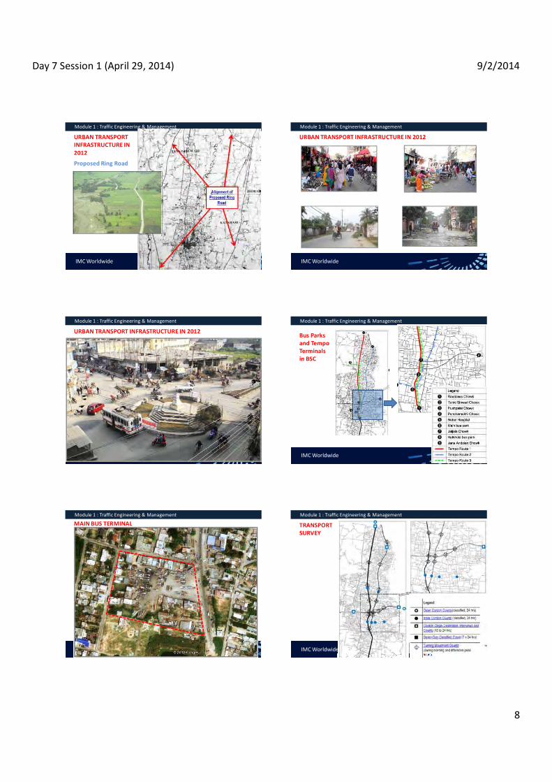
Day 7 Session 1 (April 29, 2014) 9/2/2014
8
IMC Worldwide
Module 1 : Traffic Engineering & Management
URBAN TRANSPORT INFRASTRUCTURE IN 2012
Proposed Ring Road
IMC Worldwide
Module 1 : Traffic Engineering & Management
URBAN TRANSPORT INFRASTRUCTURE IN 2012
IMC Worldwide
Module 1 : Traffic Engineering & Management
URBAN TRANSPORT INFRASTRUCTURE IN 2012
IMC Worldwide
Module 1 : Traffic Engineering & Management
Bus Parks and Tempo Terminals in BSC
IMC Worldwide
Module 1 : Traffic Engineering & Management
MAIN BUS TERMINAL
IMC Worldwide
Module 1 : Traffic Engineering & Management
TRANSPORT SURVEY

Day 7 Session 1 (April 29, 2014) 9/2/2014
9
IMC Worldwide
Module 1 : Traffic Engineering & Management
TYPES OF VEHICLES IN BSC
IMC Worldwide
Module 1 : Traffic Engineering & Management
TYPES OF VEHICLES IN BSC
IMC Worldwide
Module 1 : Traffic Engineering & Management
TYPES OF VEHICLES IN BSC
IMC Worldwide
Module 1 : Traffic Engineering & Management
TRAFFIC VOLUME (PCU EQVT) AT BIRATNAGAR NORTH GATE
IMC Worldwide
Module 1 : Traffic Engineering & Management
24-HOUR TRAFFIC VOLUME (VEHICLES/DAY)
IMC Worldwide
Module 1 : Traffic Engineering & Management
24-HOUR TRAFFIC VOLUME (VEHICLES/DAY)

Day 7 Session 1 (April 29, 2014) 9/2/2014
10
IMC Worldwide
Module 1 : Traffic Engineering & Management
PREFERRED MODE OF TRAVEL BY TRAVEL TIME
IMC Worldwide
Module 1 : Traffic Engineering & Management
FREQUENCY OF RICKSHAW AND BUS USE
IMC Worldwide
Module 1 : Traffic Engineering & Management
SHARE OF MAIN VEHICLES
IMC Worldwide
Module 1 : Traffic Engineering & Management
TRAFFIC FLOWS (VPD : MOTORIZED & NON-MOTORIZED)
IMC Worldwide
Module 1 : Traffic Engineering & Management
VEHICLE FLOW (TO & FROM ) IN CENTRAL AREA
IMC Worldwide
Module 1 : Traffic Engineering & Management
HOURLY VEHICLE FLOW (TO & FROM ) IN CENTRAL AREA

Day 7 Session 1 (April 29, 2014) 9/2/2014
11
IMC Worldwide
Module 1 : Traffic Engineering & Management
DAILY FLOW OF PERSONS ACROSS INNER CORDON
IMC Worldwide
Module 1 : Traffic Engineering & Management
GENDER RELATED MOBILITY
Rickshaw passengers: 35% male, 65% female,
Car/jeep/van passengers: 68% male, 31.9% female,
Tempos: 40% male, 60% female,
School vehicle passengers: 56% male, 43% female,
Mini/Micro Bus passengers: 71% male, 28% female,
Regional bus passengers: 79% male, 20% female.
IMC Worldwide
Module 1 : Traffic Engineering & Management
ROAD TRAFFIC ACCIDENTS (2010-2013)
Year 2010/11 2011/12 2012/13 Reported Accidents 11 9 24 Persons Injured 34 29 44 Fatalities 3 5 6
Number of Vehicles Involved
Bicycles 0 1 2 Motorcycles 6 9 18 Rickshaws 1 0 2 Tempos 1 1 4 Cars 1 1 4 Buses 2 2 2 Trucks 4 3 1
IMC Worldwide
Module 1 : Traffic Engineering & Management
CORRIDORS AND BLACK SPOT OF INCREASED ROAD TRAFFIC ACCIDENT RISK
IMC Worldwide
Module 1 : Traffic Engineering & Management
TRAVEL SPPED AND DELAYS SURVEY
IMC Worldwide
Module 1 : Traffic Engineering & Management
ROAD INVENTORY
Road Length Kilometers % Total Road Length Surveyed 102.7 100% Carriageway Width up to 4.0 m 24.6 24% 4.0 6.0 m 26.4 26% 6.0 8.0 m 47.1 46% more than 8.0 m 4.6 4% Surface Type Bitumen 73.3 72% Gravel 29.3 28% Earth 0.1 <1% Surface Quality Good (smooth surface permitting smooth vehicle movements)
17.9 17%
Fair (surface with some damage / potholes resulting in bumps at places)
78.3 77%
Poor (surface with major damages and potholes) 6.5 6%

Day 7 Session 1 (April 29, 2014) 9/2/2014
12
IMC Worldwide
Module 1 : Traffic Engineering & Management
ROAD INVENTORY
Road Length Kilometers
%
Roadside Drains (total figures for both sides) Earthen Ditch 120.6 59% Brick Masonry 69.0 34% Other Drain 14.5 7% No Drain 1.4 <1% Landuse Along Road (total figures for both sides) Built-up Land 115.3 56% Cultivated Area 86.7 42% Other Landuse 3.5 2%
IMC Worldwide
Module 1 : Traffic Engineering & Management
SHARE OF MAIN VEHICLES
Q & A

Day 7 Session 3 (April 29, 2014) 9/2/2014
1
Saroj Basnet Deputy Team Leader, UTPM - ADB TA 7948
HANDBOOK ON URBAN TRANSPORT MANAGEMENT PLAN
IMC Worldwide - METCON - WELINK
Handbook on Urban Transport Management Plan
Contents of Training Guide
Section 1 : A Handbook on Urban Transport Management Plan
Section 2 : Toolkits & Guidelines for Urban Transport Planning and Management (UTPM)
Module 1 : Traffic Management Plan Module 2 : Road Safety Module 3 : Parking ManagementModule 4 : Facilitating and Regulating Non-Motorized VehiclesModule 5 : Managing Public Transport Services Module 6 : Managing Urban Transport InfrastructureModule 7 : Towards Integrating Transport and Land Use
IMC Worldwide - METCON - WELINK
Handbook on Urban Transport Management Plan
National Transport Policy
The policy aims at ;reducing the use of private vehicles by promoting public transportation means with larger capacity encouraging the use of vehicles that apply the alternative energy sourcesmaking appropriate arrangements so that all municipalities formulate and implement parking policy providing safety to the pedestrians, cyclists and physically disabled people in transport management adopting the policy of imposing pollution tax to the vehicles that generate higher pollution restricting the movement of activities that create higher vehicle pressure in the areas having wider road and public transportation facilities
IMC Worldwide - METCON - WELINK
Handbook on Urban Transport Management Plan
Urban Transport System
a) The Network :
A system of transport lines, junctions and terminals integrated with their interrelations in terms of hierarchy, size, function, typology etc. so that smooth and efficient traffic flow is secured.
b) The Transport Modes :
The motorized or non-motorized vehicles or pedestrians or animals that move from one place to others with or without goods
IMC Worldwide - METCON - WELINK
Handbook on Urban Transport Management Plan
Urban Transport System
c) The Infrastructure :
The physical passages : lines, routes, conduits, tunnels through which conveyance is made
Junctions and connections such as squares, T's or crossing where a number of passages or lines meet
Terminals : service stations, spaces and the accompanying physical infrastructure where moving matter stop to loan and/ or unload, make transit and get services
Traffic signs : the informative, regulatory or mandatory provisions made in the transport system
IMC Worldwide - METCON - WELINK
Handbook on Urban Transport Management Plan
The New Transport Paradigm developed by ADB
1) Transport policy is based on what works: Stakeholders' participation
2) Land-use planning part of the solution
3) Transport demand is managed alongside supply, and projects are centered on traffic restraint and the greater use of public transport.
4) Transport plans and projects reflect a wider city vision or spatial strategy. They are also affordable, adaptable and implementable.
5) Policy effectiveness is demonstrated to a skeptical stakeholder community.
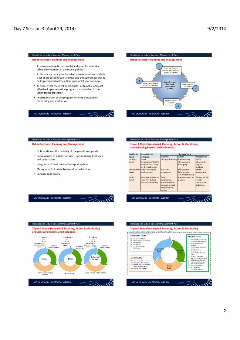
Day 7 Session 3 (April 29, 2014) 9/2/2014
2
IMC Worldwide - METCON - WELINK
Handbook on Urban Transport Management Plan
Urban Transport Planning and Management
To provide a long-term vision(s) and goals for desirable urban development in the municipalities.
To illustrate a basic plan for urban development and include a list of proposed urban land use and transport measures to be implemented within a time span of 20 years or more.
To ensure that the most appropriate, sustainable and cost effective implementation program is undertaken in the urban transport sector
Implementation of the program with the provision of monitoring and evaluation
IMC Worldwide - METCON - WELINK
Handbook on Urban Transport Management Plan
Urban Transport Planning and Management
IMC Worldwide - METCON - WELINK
Handbook on Urban Transport Management Plan
Urban Transport Planning and Management
Optimization of the mobility of the people and goods
Improvement of public transport, non-motorized vehicles and pedestrians
Integration of land use and transport system
Management of urban transport infrastructure
Enhance road safety
IMC Worldwide - METCON - WELINK
Handbook on Urban Transport Management Plan
Triple-A Model (Analysis & Planning, Action & Monitoring and Assessing Results and Evaluation)
Facilitation Level
Results to be achieved
Process Steps Analysis Action Assessment
Strategy Level
Impact (improvement in the mobility and safety of the road users)
Strategic Planning Implementing strategies and managing
Multi Stakeholder impact analysis
Institutional Level
Effect (enhanced performance)
Capacity Assessment
Institutional Enhancement Action Plan (IEAP)
Effect assessment
Project Level
Outcome (enhanced capacity) Output (services delivered)
Traffic, engineering. social economic surveys, project identifications, design
Implementing the projects
Measuring the result of outputs and outcomes
IMC Worldwide - METCON - WELINK
Handbook on Urban Transport Management Plan
Triple-A Model (Analysis & Planning, Action & Monitoring and Assessing Results and Evaluation)
IMC Worldwide - METCON - WELINK
Handbook on Urban Transport Management Plan
Triple-A Model (Analysis & Planning, Action & Monitoring and Assessing Results and Evaluation)
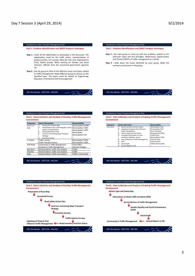
Day 7 Session 3 (April 29, 2014) 9/2/2014
3
IMC Worldwide - METCON - WELINK
Handbook on Urban Transport Management Plan
Tool 1 : Problem Identification and SWOT Analysis Technique
Step 1 : Invite all the stakeholders to participate in the discussion. The stakeholders could be the traffic police, representatives of political parties, civil society, CBOs like Tole Lane Organizations (TLO), Media Groups, NGOs working for Gender and Social Inclusion, officials from the concerned government agencies etc.
Step 2 : Ask the group to think of the different issues and topics related to Traffic Management. Make different groups to discuss on the specified topic. The topics could be related to Engineering, Education, Enforcement and Encouragement
IMC Worldwide - METCON - WELINK
Handbook on Urban Transport Management Plan
Tool 1 : Problem Identification and SWOT Analysis Technique
Step 3 : Ask each group to come up with the problems related to theparticular topics and also Strengths, Weaknesses, Opportunitiesand Threats (SWOT) of traffic management as a whole
Step 4 : Note down the issues identified by each group. Make thesummary and present in the group
IMC Worldwide - METCON - WELINK
Handbook on Urban Transport Management Plan
Tool 2 : Data Collection and Analysis of Existing Traffic Management Environment
Frequency Data/ Information Responsibility Once in 5 -year
Preparation of Base Map Household Survey on demography, travel pattern, trip generation Road Safety Action Plan Land Use and Zoning Map/ Transport Strategy Economic Survey
Municipality/ DUDBC Municipality/ Traffic Municipality/ Traffic Municipality Municipality/ FCCI
2-3 years Traffic Survey Public Transport Survey
Municipality/ Traffic Municipality/ Traffic
Half Yearly Community in Traffic Management Students in Traffic Management
TLOs/ CBOs Schools/ Colleges
Quarterly Road Accidents, traffic rule violation Traffic Monthly Road Accidents, traffic rule violation Traffic Daily Road Accidents, traffic rule violation Traffic / Community
IMC Worldwide - METCON - WELINK
Handbook on Urban Transport Management Plan
Tool 2 : Data Collection and Analysis of Existing Traffic Management Environment
Frequency Data/ Information Responsibility Every Year Road Inventory and their status
Updating of projects that influence traffic management Vehicle Type and Ownership Compiled information on road accidents, fatalities, causes Annual Review of Traffic Management GESI Social Audit Annual Report on IEC
Municipality/ DoR Municipality/ DoR Zonal Transport Management Office Traffic Police Municipality/ Traffic External Team External Team Traffic/ Municipality
IMC Worldwide - METCON - WELINK
Handbook on Urban Transport Management Plan
Tool 2 : Data Collection and Analysis of Existing Traffic Management Environment
Preparation of Base Map
Household Survey
Road Safety Action Plan
Land Use and Zoning Map/ Transport Strategy
Economic Surveys
Traffic Volume Surveys
Road Inventory and their Status Updating of Projects that influence Traffic Management
IMC Worldwide - METCON - WELINK
Handbook on Urban Transport Management Plan
Tool 2 : Data Collection and Analysis of Existing Traffic Management Environment
Vehicle Type and Ownership
Information on Road Traffic Accidents (RTA)
Annual Review of Traffic Management
Gender Equality and Social Inclusiveness (GESI)
Social Audit
Annual Report on IEC Community in Traffic Management

Day 7 Session 3 (April 29, 2014) 9/2/2014
4
IMC Worldwide - METCON - WELINK
Handbook on Urban Transport Management Plan
Tool 3 : Envisioning of Transport Management
Enhancing the public transport network by careful and robust selection of an optimum mass transit system, including bus service improvements, bus rapid transit (BRT), and/or rail-based solutions; and
Developing an integrated public transport system that combines modes and services through interchanges and feeder services, rationalises existing services, and improves passenger dispersal at terminals
Transit Oriented Development
TOD involves implementing or strengthening a mass transit system with development focused on major transport nodes
IMC Worldwide - METCON - WELINK
Handbook on Urban Transport Management Plan
Tool 3 : Envisioning of Transport Management
Implementing a public transport system that adequately caters to the multiple desire lines of the population; and
Creating a Functional Road Hierarchy (FRH), defining roads according to their function, rather than by their design standards or physical characteristics, using traffic management methods
Adaptive Transit
Adaptive transit refers to the development of transport systems that can be adapted to the existing city structure, typically for cities with low density and spread out development patterns
IMC Worldwide - METCON - WELINK
Handbook on Urban Transport Management Plan
Tool 3 : Envisioning of Transport Management Desired Transport Modes by Trip Length
Trip Length (Km)
0-2 2-5 5-10 10-15 >15
Share of trips
25-30 20-25 15-20 10-15 >15
Desired travel modes
Walk, cycle, 2-
wheelers, rickshaw
Cycle, 2-wheelers
, cars, rickshaw
s
Cycle, 2-wheelers,
cars, 3-wheelers,
bus, taxi
Car, bus, taxi,
metro/rail
Car, express
bus, metro/rail. taxi
IMC Worldwide - METCON - WELINK
Handbook on Urban Transport Management Plan
Tool 3 : Envisioning of Transport ManagementThe Transit Oriented Development (TOD) in Nepalese cities may not be feasible due to following reasons :
The development of town is not planned and the urban growth has been sparse
The cities lack strong Central Business District, the small commercial establishments are scattered
The cities lack strong zoning system and the land use planning is either not developed or not monitored effectively
The cities have small urban area with mixed land use zones and the "Home to Work" distance is relatively short.
The non-existence of public transport industry that encourages a more reliable and structured public transport system
IMC Worldwide - METCON - WELINK
Handbook on Urban Transport Management Plan
Tool 4 : Development of Transport Management Plan
Part - I : Existing Situation Introduction
Current Situation and Outlook to the Future
Current Land Use and Land Use Strategy
Urban Transport Infrastructure
Traffic Surveys
IMC Worldwide - METCON - WELINK
Handbook on Urban Transport Management Plan
Tool 4 : Development of Transport Management Plan
Part - II : Development of Urban land Use and Transport Strategy
Development of Vision and Goals
Part - III : Plans and Projects
Urban Transport Planning and Management
Part - IV : Implementation Program

Day 7 Session 3 (April 29, 2014) 9/2/2014
5
IMC Worldwide - METCON - WELINK
Handbook on Urban Transport Management Plan
Tool 5 : Gender Equality and Social Inclusiveness
the needs of the whole community including all vulnerable groups such as children, disable people, elderly, low income households, minority groups etc.
providing equal opportunities, rights and responsibilities to men and women in the field of transport and mobility.
providing equal access to public services, affordability and availability of related mobility issues.
developing an inclusive labor market and facilitate employment through transport related measures.
IMC Worldwide - METCON - WELINK
Handbook on Urban Transport Management Plan
Tool 5 : Gender Equality and Social Inclusiveness Target Groups Social
Inclusion Topics
Description
Children Road Safety Children are particularly vulnerable traffic participants that need to be protected from dangerous traffic conditions
Young People and Students
Social opportunities and autonomy
A strategy taking into consideration their high mobility needs and expectations will facilitate their integration in the society
Elderly Road safety and accessibility
A good accessibility to public transport and a safe transport system will ensure a more active participation of this target group to social activities
IMC Worldwide - METCON - WELINK
Handbook on Urban Transport Management Plan
Tool 5 : Gender Equality and Social Inclusiveness Target Groups Social
Inclusion Topics
Description
People with disabilities
Accessibility Accessibility of all public facilities is a pre-condition for their unlimited participation in social life
People with low incomes and low educational qualifications
Employment and affordability
Poor transport provision can act as barrier to accessing high quality education or adequate health care facilities, and even prevent employment
IMC Worldwide - METCON - WELINK
Handbook on Urban Transport Management Plan
Tool 5 : Gender Equality and Social Inclusiveness Target Groups Social
Inclusion Topics
Description
Minority Groups and immigrants
Availability Higher frequency of public transport in off-peak hours as well as service to remote areas of the urban agglomeration can facilitate mobility of this target groups
Socially marginalized people
Availability Higher frequency of public transport in off-peak hours, service to remote areas of the urban agglomeration can facilitate mobility of this target group
Tourists Availability and information
Efficient timetables and facilities for alternative modes will help tourists to get around the urban agglomeration
IMC Worldwide - METCON - WELINK
Handbook on Urban Transport Management Plan
Tool 6 : Urban Growth Scenarios
IMC Worldwide - METCON - WELINK
Handbook on Urban Transport Management Plan
Modal Split Scenario
Business as usual scenario : It is assumed that private vehicle uses will increase at the current growth rate and a certain proportion of current public transport users will shift to private vehicles in the future.
Moderate Public Transport Improvement Scenario : no more public transport users will shift to private vehicles i.e. the current modal split rate applies.
Significant Public Transport Improvement Scenario : private vehicle users shift to public transport.

Day 7 Session 3 (April 29, 2014) 9/2/2014
6
IMC Worldwide - METCON - WELINK
Handbook on Urban Transport Management Plan
Transport Network Scenarios
IMC Worldwide - METCON - WELINK
Handbook on Urban Transport Management Plan
Procedure for the evaluation of preferred development scenarios
IMC Worldwide - METCON - WELINK
Handbook on Urban Transport Management Plan
Tool 7 : Transport Options
reducing the rate of growth of car trips
supporting public transportation (for passengers and goods), walking and cycling
enhancing healthy conditions for living
IMC Worldwide - METCON - WELINK
Handbook on Urban Transport Management Plan
Tool 7 : Transport Options
Major developments should be located in the areas well-served by public transport
traffic management schemes should be implemented, including parking policies and traffic restrictions
The municipalities, traffic police and developers should ensure safe conditions for pedestrians and cyclists
A public transport strategy should be designed and implemented, which makes transit stops easily accessible.
New development should be located near existing local high capacity transit routes, terminals and interchanges.
IMC Worldwide - METCON - WELINK
Handbook on Urban Transport Management Plan
Service Improvement Plan
Overview of the existing situation Issues and problems Proposed strategyExplanation of proposed strategy in terms of land use patternsSystem Integration with other modes (integrated fare policy) Intermodal facilitiesRecommendations for infrastructure (busways, terminals) Improvement in operations (routes, service level, fare structure, regulatory changes) Costs and benefits
IMC Worldwide - METCON - WELINK
Handbook on Urban Transport Management Plan
Service Improvement Plan MRT Options
City Requirements
BRT Cities with a medium to high density urban area BRT should be one of the first considerations in MRT system development in any city BRT system can be developed as trunk systems as well as feeders to an existing (or planned) MRT system Suitable for cities where an MRT system needs to be developed quickly and incrementally as conditions and funding allow A well developed traffic planning. management capability should be available Existing bus and paratransit operation can be regulate/ restructured Road space is available for BRT development

Day 7 Session 3 (April 29, 2014) 9/2/2014
7
IMC Worldwide - METCON - WELINK
Handbook on Urban Transport Management Plan
Service Improvement Plan MRT Options
City Requirements
LRT Cities with a medium to high density urban area Cities where environmental issues are critical and there is a need to attract car users to use public transport system, however, if the core requirement are operational effectiveness, BRT system should be developed that is more flexible and costs less Appropriate for cities with an existing tram operation, which may be cost-effectively enhanced A well developed traffic planning/ management capability should be available Existing bus and paratransit operations can be regulated/ restructured Road space is available for LRT development or existing tram track can be converted to an LRT route.
IMC Worldwide - METCON - WELINK
Handbook on Urban Transport Management Plan
Service Improvement Plan MRT Options
City Requirements
Metro Preferably a national/ provincial capital city or a major regional commercial centre 10,000-15,000 passengers per hour per direction with more than 15 km trip length City incomes that are not low (typically > USD 1,800 per person) Prospects for sustained economic growth and an expanding centre Existence of a low cost metro alignment Fares policy - a fares policy on metro and bus systems to encourage ridership yet limit the need for financial support A well developed traffic planning. management capability Existing bus and paratransit operations can be regulated/ restructured Strong and largely autonomous management of metropolitan region, with clear objectives
IMC Worldwide - METCON - WELINK
Handbook on Urban Transport Management Plan
Existing situation of urban public transport should be analyzed the study of following :
Total number of operators and fleet size
Organization of operators e.g. private individuals, company
Regulatory framework for the private operators - process for issuing permits
Sharing of routes between different operators
Tariff setting mechanism, structure and discounts if any
Staff facilities i.e. salary, overtime, insurance, allowances and other facilities
IMC Worldwide - METCON - WELINK
Handbook on Urban Transport Management Plan
Existing situation of urban public transport should be analyzed the study of following :
Whether ticketing is available, if yes type of ticketing system followed
Whether subsidies on import or operation are provided
Existing routes, fare, frequency and occupancy
Provisions for students, children, women, elderly and disables
Level of service in terms of reliability, safety, convenience, comfort and affordability; through the opinion survey
Coordination mechanism among operators i.e. associations/ federation
Terminals, bus stop facilities
IMC Worldwide - METCON - WELINK
Handbook on Urban Transport Management Plan
Tool No. 8 : Project Identifications
Traffic Improvement
Separation of different road user groupsimposition on speed limits Provision of protected crossing facilitiesComprehensive traffic calmingProvision of dedicated stopping/ waiting points/ areas Provision of controlled junction signals, traffic signs Identifications of one-way streetsRedirection of traffic to suitable routes Restrictions on vehicle/ weight/ height/ width and vehicle movement timing Improvement of junctions Improvement of roads/ drains/ lanes
IMC Worldwide - METCON - WELINK
Handbook on Urban Transport Management Plan
Tool No. 8 : Project Identifications Road Safety Provision of footpath, pedestrian crossings, overhead foot
bridge and improvement of road infrastructure Development of municipal road safety strategies and accident reduction targets. Regularly conduct road safety awareness campaigns (all users, schools, etc.). Develop a municipal level road safety audit manual and conduct the road safety audit. Incorporate safe design practice during design, construction and operation of roads. Coordinate to relocate utility poles that obstruct mobility. Promote safe and environment friendly vehicles in the city. Assist the traffic police in enforcing traffic rules for all road users. Collaborate with the traffic police to improve speed control.

Day 7 Session 3 (April 29, 2014) 9/2/2014
8
IMC Worldwide - METCON - WELINK
Handbook on Urban Transport Management Plan
Tool No. 8 : Project Identifications
Parking Management
Identification of the available parking facilities Assessment of parking demand; allocation of spaces for on-street and off-street parkingConstruction of off-street parking facilities with PPP approachOperation and sustainable management of the parking area Provision of tow away facilitiesProvision of loading/ unloading ducks in the organized market area
Facilitation to NMVs
Development of rickshaw/ bicycle/ carts/ wheechairtracks on major corridors and school areaDevelopment of designated parking area for rickshaw, bicycles, carts etc. Rickshaw stands are proposed at the critical locations.
IMC Worldwide - METCON - WELINK
Handbook on Urban Transport Management Plan
Tool No. 8 : Project Identifications
Improvement of Urban Public Transport
Identification of the areas of improvement in the bus services and explore ways to resolve them. The areas of improvement could be replacement of old buses with more comfortable and environment friendly buses, abolition of syndicates in public transport, reservation of seats for women, elderly people and disables, routes and timing, lane separation, regulatory/ institutional changes, capacity building, development of urban transport policy, tariff policy, improvement in para transit etc.
IMC Worldwide - METCON - WELINK
Handbook on Urban Transport Management Plan
Tool No. 8 : Project Identifications
Public Transport Infrastructure
Improvement of carriageway, footpath, side drains, cross drains, delineation (sign and road marking), lay-bys, etc., as integral part of the road structure while planning.Re-orient and refine the planning based on hierarchy of the roads.Providing emphasis on preserving the transport infrastructure based on the principles of asset management, albeit in a simplified manner, in-lieu of the planning being only concerned with network expansion. Involvement of stakeholders and local community for the protection of public transport infrastructure Capacity development to gradually maintain a detailed inventory that provides more specific information about the status of various infrastructure elements and thereby secure more funds for road maintenance from the Roads Board Nepal.
IMC Worldwide - METCON - WELINK
Handbook on Urban Transport Management Plan
Tool No. 8 : Project Identifications
Integration of Transport and Land Use Planning
Preparation of land use plan based on the strategic projects and possible urban extension Implementation of land use control instruments Delineation of right of way of the urban roads
IMC Worldwide - METCON - WELINK
Handbook on Urban Transport Management Plan
Tool No. 9 : Project Prioritization SN Criteria Code Score Min Max
1 Project Cost 50 100 Low (<0.25M USD) 1-a 100
Medium (>=0.25M to <1.0M USD) 1-b 75 High (>=1.0M USD) 1-c 50
2 Project Type 60 100 Roads Network Improvement 2-a 100
Traffic Management Improvement 2-b 80 Central Area Improvement 2-c 60
Urban Public Transport Improvement 2-d 70
3 Possibility of Internal Funding 20 50 Yes 3-a 50 No 3-b 20
Maybe 3-c 35
IMC Worldwide - METCON - WELINK
Handbook on Urban Transport Management Plan
Tool No. 9 : Project Prioritization
SN Criteria Code Score Min Max Maybe 3-c 35
4 Beneficiaries 70 100 Ward Level 4-a 70
Municipal Level 4-b 80 Municipal & Adjoining VDCs 4-c 90
Regional/ National Level 4-d 100 5 Willingness of Local People 50 100
Very High 5-a 100 High 5-b 75
Moderate 5-c 50
6 Address to Women, Children and Elderly People 20 50
Yes 6-a 50 No 6-b 20
May Be 6-c 35

Day 7 Session 3 (April 29, 2014) 9/2/2014
9
IMC Worldwide - METCON - WELINK
Handbook on Urban Transport Management Plan
Tool No. 9 : Project Prioritization
SN Criteria Code Score Min Max 5 Willingness of Local People 50 100
Very High 5-a 100 High 5-b 75
Moderate 5-c 50
6 Address to Women, Children and Elderly People 20 50
Yes 6-a 50 No 6-b 20
May Be 6-c 35
7 Displacement of local people/ Resettlement Issues 20 50
No 7-a 50 Minor Displacements 7-b 35
Major Displacements 7-c 20
IMC Worldwide - METCON - WELINK
Handbook on Urban Transport Management Plan
Tool No. 9 : Project Prioritization
SN Criteria Code Score Min Max
8 Enhancement of Rural Urban Linkage 20 50
Yes 8-a 50 No 8-b 20
May Be 8-c 35 9 Availability of Land 20 50
Available Now 9-a 50 Available within 3 years 9-b 20
Available after 3 years 9-c 35 10 Continuation to the Earlier Efforts 50
Yes 10-a 50 No 10-b 0
IMC Worldwide - METCON - WELINK
Handbook on Urban Transport Management Plan
Tool No. 9 : Project Prioritization
SN Criteria Code Score Min Max 11 Commensurate to the Long Term
Vision & Periodic Plan 20 50 Yes 11-a 50
No 11-b 20 12 Enhancement of City Image 20 50
Yes 12-a 50 No 12-b 20
May Be 12-c 35 Total 370 800
IMC Worldwide - METCON - WELINK
Handbook on Urban Transport Management Plan
Tool No. 10 : Monitoring and Evaluation Program
Project Schedule
Whether the schedule of activities were prepared with the assignment of roles and responsibilities of each activities Has the schedule been followed, if no what are the causes that impeded the schedule
Project Cost
Are the activities being carried out as per the cost envisaged ? The cost adjustments (inter-change of cost from one item to another) The cost variations (new items or activities)
Quality of Work
What is the quality of work being performed If not, what are the remedial measures that need to be adopted
IMC Worldwide - METCON - WELINK
Handbook on Urban Transport Management Plan
Tool No. 10 : Monitoring and Evaluation Program
Social issues
Is the community or the neighbourhood is supportive towards the project ? If no, what is the reason How the gender and social inclusion issues have been addressed ?
Environmental Issues
Is there anything that have become detrimental to the environment ? Is there any opposition from the community on the ground of environment ? Has the Environmental Monitoring Action Plan (EMAP) been implemented ?
Institutional Issues
Are the institutions responsible for the project activities actively involved in the project ? If not what are the causes for the lack of coordination ?
IMC Worldwide - METCON - WELINK
Handbook on Urban Transport Management Plan
Tool No. 11 : Stakeholders' Participation
Analysis Tools Specific Objectives Suggested Techniques Problem Identification & SWOT Analysis
Analyse the strengths, weaknesses, opportunities and threats and identify the issues relating to transport/ traffic management
Focus Group Discussions Brainstorming session Workshops
Data Collection and Analysis
Collection of facts and figures relating to the transport/ traffic scenario and analyse the data
Household Surveys with community involvement Community Consultation
Envisioning of Transport Management
Define vision of long term development of transport management
Brainstorming/ Workshops

Day 7 Session 3 (April 29, 2014) 9/2/2014
10
IMC Worldwide - METCON - WELINK
Handbook on Urban Transport Management Plan
Tool No. 12 : Management of Resources
the organization and individual responsible for managing the implementation, including contact information
all stakeholders that should be involved in the implementation
the resources that will be allocated to the improvement measures
the evaluation approach including measurement methods, outcome indicator, targets and trajectories for reporting on progress
the technical description and implementation schedule, including relevant milestones
any implementation risks identified and suggested contingencies
IMC Worldwide - METCON - WELINK
Handbook on Urban Transport Management Plan
Tool No. 13 : Information, Education and Communication (IEC)
Target Groups Stages of Behaviour AdoptionAwareness Decision Instruction Continuation
Policy Makers and Program Managers
I,N,P,R,T,S I,N,P,R,T,S I,P,S I,N,P,R,T,S
Operators and Drivers
I,N,P,T I,P I,P I,P,R,T
Fieldworkers I,P,R,V (N,S,T) F,I,P,R (N,T,S) I,P F,I,P,R (N,T)Clients F,I,P,R (N,T,S) F,I,P,R (N,T,S) I,P,VV F,I,P,R (N,T,S) Key F = Folk Media I = Interpersonal
Communication N = Newspaper P = Print
R = Radio T = Television/ Video
S = Social Media
() = Where media is available
IMC Worldwide - METCON - WELINK
Handbook on Urban Transport Management Plan
Tool No. 14 : Physical Improvement
IMC Worldwide - METCON - WELINK
Handbook on Urban Transport Management Plan
Tool No. 15 : Assessment Tools
IMC Worldwide - METCON - WELINK
Handbook on Urban Transport Management Plan
Tool No. 16 : Environmental Assessment
Roads Ropeway/ Cable Car
Bridges Tunnels
IEE Construction of District Roads, Urban/ Rural Roads, Small Feeder Roads Improvement, upgrading and reconstruction of national highways and feeder roads
Construction of 5 Km long ropeway or cable car
Construction of Major Bridges
Construction of tunnels
EIA Construction of National Highways and main feeder roads
Construction of more than 5 km long ropeway or cable car
IMC Worldwide - METCON - WELINK
Handbook on Urban Transport Management Plan
Tool No. 17: Gender Audit
Main Questions Linking QuestionsCheck the project document. Do the objectives reflect gender sensitivity ?
Are both men and women direct beneficiaries of the project ?
Think carefully : Is the project likely to ave no effect or an adverse effect on women ?
Has a gender disaggregated baseline study been carried out ?
Have both women and men been consulted as decision makers in the planning and implementation ?
Have both women's and men's views been incorporated (and not just consulted) at all levels ? Are gender specialists involved from the start of the project ?
Are there specific strategies to address gender needs and concerns ?
Are project resources enough to provide services to women and other disadvantaged groups ?

Day 7 Session 3 (April 29, 2014) 9/2/2014
11
IMC Worldwide - METCON - WELINK
Handbook on Urban Transport Management Plan
Tool No. 17: Gender Audit
Gender Discriminatory : Does not believe in equality
Gender Blind : Not bothered about equality
Gender Neutral : Believes in equality
Gender Sensitive : Believes in equity and equality
IMC Worldwide - METCON - WELINK
Handbook on Urban Transport Management Plan
Tool No. 18: Social Audit
IMC Worldwide - METCON - WELINK
Handbook on Urban Transport Management Plan
Tool No. 19: 4-E Indicators and Monitoring PrimaryObjectives
Examples of secondary level of objectives
Social Issues To improve access from homes to schools, hospitals, shops and leisure To improve transportation for disabled passengers
Safety To improve safety To reduce conflict between transport and other functions of the city To reduce feelings of threat to personal security To reduce conflict between modes
Environment To preserve of local green belt / heritage/ public access land To reduce the health impacts of transportTo foster greater awareness of transport and env. issues
IMC Worldwide - METCON - WELINK
Handbook on Urban Transport Management Plan
Tool No. 19: 4-E Indicators and Monitoring
Accessibility To improve access to local public transport services To increase choice of destinations by public transport To increase choice of transport options To improve public travel information To improve integration between public transport services To improve service frequency and reliability To improve comfort and cleanliness
IMC Worldwide - METCON - WELINK
Handbook on Urban Transport Management Plan
Tool No. 19: 4-E Indicators and Monitoring
Economy To achieve modal shift from private to collective transport To achieve reduce transport costs through a reduction in journey times To improve economic prosperity via access to opportunity To reduce in time and fuel wasted due to congestion To improve traffic flows by restricting access to key areas to essential services and reducing kerbside activity To ensure integration with inter-urban transport system To reduce the number of unnecessary trips To ensure easy access to urban freight terminals
Q & A

9/2/2014
1
ToR for Urban Transport Division and Urban Transport Section: Key Issues and Concepts
Working Team on ToR ADB TA 7948
Urban Transport Planning and Management
Problems and Issues of urban transport (UT) City structure, vehicle pattern and poor road conditions (road pattern, geometry and surface) Lack of awareness and understanding of the complexities of urban transport; attitude of road users Lack of integration between UT and landuse goals - Inefficient land use changes - Inefficient transport and inadequate urban services Parking problems Traffic hazards with increasing road accidents, congestion and inconvenience Adverse environmental impacts including air pollution Lack of coordination and coordinating mechanism with unclear, overlapping and joint roles of different stakeholders and inadequate linkages between sectors Lack of dedicated and responsible agency at the national level: PMO, DoR, DoLIDAR, NRB, DoTM, MoUD etc.
What are the performance indicators for better UTS
Inclusive development Sustainable urban mobility Utility of TS products to other development sectors Meeting of transport needs of the people, business and government Taxes to minimize adverse environmental impacts. Use taxes for mitigation and adaptation Reduction in road accidents and road safety enhanced Increased use of NMT modes Creation of vibrant and dynamic public spaces in line with transit driven developments Unlocking potentials of urbanizing areas through increased access
What are the linkages of better UTS with urban development and environment?
Enhance productivity of the city by meeting the transport needs of the people and business Facilitate the provision of other utilities and services Improve urban environment by creating vibrant spaces within city (especially junction points and TODs) Improve livability with inclusive access to all Ensure environmental sustainability through climate change mitigation measures and reduction in air pollution Sustainable urban financing through capturing of unearned income
Who benefits from the products of Urban Transport investments?
Transport related products are input to most of the economic drivers of urban development All the city dwellers (people and communities) Business Government agencies
What are the building blocks of UTS
Road assets Traffic management Integration of transport planning and management with land-use (especially at the centre, junctions and TODs) Road safety Transport planning Environmental aspects Parking areas Mass transit such as BRT

9/2/2014
2
Which agencies are in action on UTS?
DoR strategic road network DoTM transport management DoLIDAR rural agricultural roads? MoUD urban roads Nepal Road Board Road Transport Authority (to be created as per National Transport Policy 2001/02)
Which agency should be responsible for coordinating the management of UTS? A global approach to transport management dilutes the critical transport needs of ever growing urban centres. There is a lack of a coordinating agency, which needs to be urban-specific.
Work Division Regulation of the Government of Nepal 2069
MoUD is responsible for urban roads excepting strategic roads. It is responsible for policy, plan and program formulation, as well as implementation, monitoring, regulation and evaluation related to urban development and urban infrastructure. Moreover, it has a potential role in developing mechanisms for making coordination more effective for ensuring sustainable urban mobility in BSC as well as other secondary cities of Nepal. MoFALD is responsible for rural agricultural roads.MPIWTM (DoR) is responsible for strategic road network.
How should the government help municipalities and urban areas in
assuring better UTS? Institutional reforms and policy and planning inputs to
municipalities Coordination and Stakeholder Mobilization for SUT Urban Transport Policy Formulation Training Inputs: Providing opportunities for training and higher education to urban transport professionals Monitoring Framework based on Performance IndicatorsInstitutional Enhancement (inc. legal aspects)Minimizing overlapping responsibilities Launching joint projects Making the stakeholders and line agencies at the urban level support in a concerted manner Channeling financial resources under a results-based framework based on performance monitoring
Why New Division in MoUD?
The Division should be capable of formulating urban transport policy and mobilizing different stakeholders of urban transport to implement the same in a concerted manner in rapidly growing urban areas. Coordinate with other agencies responsible for different categories of roads such as DoR, Municipalities Provide policy inputs to municipalities and urban areas and monitor their progress and recommend for resource allocation and capacity building initiatives
Why New Section in DUDBC?
The proposed section in the Department should help urban areas to prepare their urban transport plans and implement them for providing better transport services in the municipalities and urban areas. Collate information from municipal UPIDs on the existing benchmark condition of urban transport re transport project, resource constraints performanceHelp UPIDs to prepare more relevant and integrated projects on urban transport Help UPIDs to implement joint projects
Urban Transport Division
Policy formulation related to urban transport planning and management Institutional enhancement Funding and resource mobilization Coordinating with agencies related to transport and its components, enabling, facilitating and limited controlling function as regards to municipalities and urban areas Monitoring

9/2/2014
3
Urban Transport Section
Planning inputs Data and information, surveys and studies and development of appropriate transport and landuse models Facilitating municipalities and urban areas Demand driven type of support to municipalities Develop norms and standards of UT infrastructure Research, training and workshop/IEC materials, transfer of knowledge etc.
Inter-linkages national - local
UPID to provide information on the existing benchmark condition of urban transport re transport project, resource constraints performanceUTD to provide policy and monitor their progress and recommend for resource allocation and capacity building initiatives Urban Transport Section to help UPIDs to prepare more relevant and integrated projects on urban transport Launch joint projects Permanent steering committee and working committee
How should municipalities and urban areas receive support from national government?
Ensuring resource allocation by making transport projects competitive Participating in institutional enhancement programs inc. training Forming partnership for knowledge transfer through joint demonstrative projects Implementing national policies and plans For BSC- receiving the support for the implementation of the Strategy prepared though this ADB TA. Transferring knowledge to municipalities and urban areas.
Monitoring and coordination committee
Headed by Minister (or Secretary)with representatives from different stakeholders such as NDB, DoR, Traffic, transport managementUTD Jt. Secretary or DG, DUDBC member-secretary Need for coherent action planning more important Regular meetings directives policy changes Coordination Monitoring Financing strategies Capacity enhancement strategies Unlocking potentials of different stakeholders to build synergy Linkage with urban level coordinating and monitoring committee already in BSC headed by Mayor.
New Section in BSC Formed on Jan. 13, 2013.
Urban Planning & Implementation
Division
Landuse Planning and Transport Management
Section
Implementation &
Performance Indicators
Stakeholders' Mobilization & Monitoring
Physical Construction
Section
zz
Road Construction
Section
Proposed Urban Transport Section in DUDBC
Urban Transport Section Sr. Div. Er./Arch./Plr.
Planning , Design, & Cost Estimation
Training, Research, IEC materials, coordination
Implementation & Performance Monitoring (inc. LU & TM Strategy,
integrated Projects)

9/2/2014
4
Proposed UTD in MoUD
Urban Transport Division
Jt. Secretary Technical
Land use and urban transport planning and
management Sr, Div, Er./Arch./Plr
Coordination and Stakeholder
Mobilization for SUT Er./Arch./Plr.
Urban Transport Policy Formulation,
IE and M & E Er./Arch./Plr.
Which planning and implementation activities are your municipality performing itself ?
Which activities can it perform itself?
What difficulties are you facing in the planning and implementation of transport projects?
Has your municipality felt the need for capacity
enhancement in carrying out transport projects? Please specify.
What type of urban transport planning support your municipality is expecting from Central Government ? Specify.
Has any transport project in your municipality been affected due to lack of national urban Transport policy?
What information do you think your municipality should provide in the formulation of national urban transport policy?

9/2/2014
5
Does your municipality have a transport project that needs to be implemented with the support of Central Government, If yes, what supports will make the project successful?
Do you think it necessary to restructure the organization of your municipality in line with BSC? Explain your answer?
How can the funding mechanisms for desirable transport projects in your municipality be improved?
In order to make your municipality capable of preparing and implementing comprehensive urban transport and land use strategy by the year 2019, what strategies do you think it should implement?
Thank you !!!

Comprehensive Training on Urban Transport and Management Day 8 (April 30, 2014)
Session 1
Discussion Session:
The participants will be asked to fill in the following questionnaire at the outset of the session. They will be allocated 20 minutes for this. Meta card may be used.
a) What type of planning support your municipality is expecting from DUDBC?
b) What information do you think your municipality should provide in the formulation of national urban transport policy?
c) Does your municipality have a transport project that needs to be implemented with the support of DUDBC, If yes, what supports will make the project successful?
d) How can the funding mechanisms for desirable transport projects in your municipality be improved?
e) Do you think it necessary to restructure the organization of your municipality in line with BSC? Explain your answer?
f) Has any transport project in your municipality been affected due to lack of national urban policy?
g) Has your municipality felt the need for capacity enhancement in carrying out transport projects? Please specify.
h) In order to make your municipality capable of preparing and implementing comprehensive urban transport and landuse strategy by the year 2019, what strategies do you think it should implement?


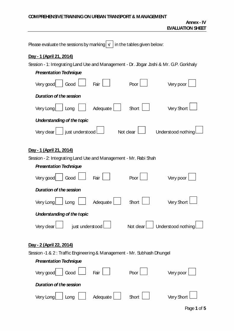
COMPREHENSIVE TRAINING ON URBAN TRANSPORT & MANAGEMENT Annex - IV
EVALUATION SHEET
Page 1 of 5
Please evaluate the sessions by marking in the tables given below:
Day - 1 (April 21, 2014)
Session - 1: Integrating Land Use and Management - Dr. Jibgar Joshi & Mr. G.P. Gorkhaly
Presentation Technique
Duration of the session
Understanding of the topic
Day - 1 (April 21, 2014)
Session - 2: Integrating Land Use and Management - Mr. Rabi Shah
Presentation Technique
Duration of the session
Understanding of the topic
Very clear just understood Not clear Understood nothing
Day - 2 (April 22, 2014)
Session -1 & 2 : Traffic Engineering & Management - Mr. Subhash Dhungel
Presentation Technique
Duration of the session
Very good Good Fair Poor Very poor
Very Long Long Adequate Short Very Short
Very clear just understood Not clear Understood nothing
Very good Good Fair Poor Very poor
Very Long Long Adequate Short Very Short
Very good Good Fair Poor Very poor
Very Long Long Adequate Short Very Short
COMPREHENSIVE TRAINING ON URBAN TRANSPORT & MANAGEMENT Annex - IV
EVALUATION SHEET
Page 2 of 5
Understanding of the topic
Very clear just understood Not clear Understood nothing
Day - 3 (April 23, 2014)
Session -1 & 2 : Road Safety - Mr. Subhash Dhungel
Presentation Technique
Duration of the session
Understanding of the topic
Very clear just understood Not clear Understood nothing
Day - 4 (April 25, 2014)
Session -1 & 2 : Managing Urban Public Transport - Mr. Kamal Raj Pande
Presentation Technique
Duration of the session
Understanding of the topic
Very clear just understood Not clear Understood nothing
Day - 5 (April 27, 2014)
Session -1 & 2 : Parking Management - Mr. Subhash Dhungel
Presentation Technique
Very good Good Fair Poor Very poor
Very Long Long Adequate Short Very Short
Very good Good Fair Poor Very poor
Very Long Long Adequate Short Very Short
Very good Good Fair Poor Very poor
COMPREHENSIVE TRAINING ON URBAN TRANSPORT & MANAGEMENT Annex - IV
EVALUATION SHEET
Page 3 of 5
Duration of the session
Understanding of the topic
Very clear just understood Not clear Understood nothing
Day - 6 (April 28, 2014)
Session -1 & 2 : Urban Transport Infrastructure Management - Mr. Saroj Kumar Pradhan
Presentation Technique
Duration of the session
Understanding of the topic
Very clear just understood Not clear Understood nothing
Day - 7 (April 29, 2014)
Session - 1 : Urban Transport Infrastructure and Outlook to the Future of Biratnagar City - Mr. Saroj Basnet & Mr. Subhash Dhungel
Presentation Technique
Duration of the session
Understanding of the topic
Very clear just understood Not clear Understood nothing
Very Long Long Adequate Short Very Short
Very good Good Fair Poor Very poor
Very Long Long Adequate Short Very Short
Very good Good Fair Poor Very poor
Very Long Long Adequate Short Very Short

COMPREHENSIVE TRAINING ON URBAN TRANSPORT & MANAGEMENT Annex - IV
EVALUATION SHEET
Page 4 of 5
Day - 7 (April 29, 2014)
Session - 2 : Handbook on Urban Transport and Management - Mr. Saroj Basnet
Presentation Technique
Duration of the session
Understanding of the topic
Very clear just understood Not clear Understood nothing
Day - 7 (April 29, 2014)
Session - 3 : Presentation on the ToR of Urban Transport Division in MOUD and Urban Transport Section in DUDBC - Dr. Jibgar Joshi and Mr. G. P Gorkhaly
Presentation Technique
Duration of the session
Understanding of the topic
Very clear just understood Not clear Understood nothing
Day - 8 (April 30, 2014)
Session -1 : Group Discussion on the ToR of Urban Transport Division in MOUD and Urban Transport Section in DUDBC - Dr. Jibgar Joshi and Mr. G. P Gorkhaly
Discussion Technique
Duration of the Discussion
Very good Good Fair Poor Very poor
Very Long Long Adequate Short Very Short
Very good Good Fair Poor Very poor
Very Long Long Adequate Short Very Short
Very good Good Fair Poor Very poor
Very Long Long Adequate Short Very Short

COMPREHENSIVE TRAINING ON URBAN TRANSPORT & MANAGEMENT Annex - IV
EVALUATION SHEET
Page 5 of 5
Other Observations
1) How would you rate the training materials provided?
2) How would you rate the Tiffin/ lunch provided during the training?
3) How would you rate the other logistic support provided during the training?
4) Was the training helpful in understanding the different aspects of transportation planning and management?
5) Do you think that the knowledge gained in the training could be applied in your respective organization?
6) How would you rate the overall training conduction and management? (Give 0 to 5 points: 0 for the poorest and 5 for the excellent)
Any Further Comments or Suggestions:
..................................................................................................................................................
..................................................................................................................................................
..................................................................................................................................................
..................................................................................................................................................
..................................................................................................................................................
..................................................................................................................................................
Excellent Good Fair
Excellent Good Fair
Excellent Good Fair
Very Helpful Fairly Helpful Not Helpful
Yes No Not Sure

COMPREHENSIVE TRAINING ON URBAN TRANSPORT & MANAGEMENT Annex - V
PHOTOGRAPHS

COMPREHENSIVE TRAINING ON URBAN TRANSPORT & MANAGEMENT Annex - V
PHOTOGRAPHS

COMPREHENSIVE TRAINING ON URBAN TRANSPORT & MANAGEMENT Annex - V
PHOTOGRAPHS

COMPREHENSIVE TRAINING ON URBAN TRANSPORT & MANAGEMENT Annex - V
PHOTOGRAPHS
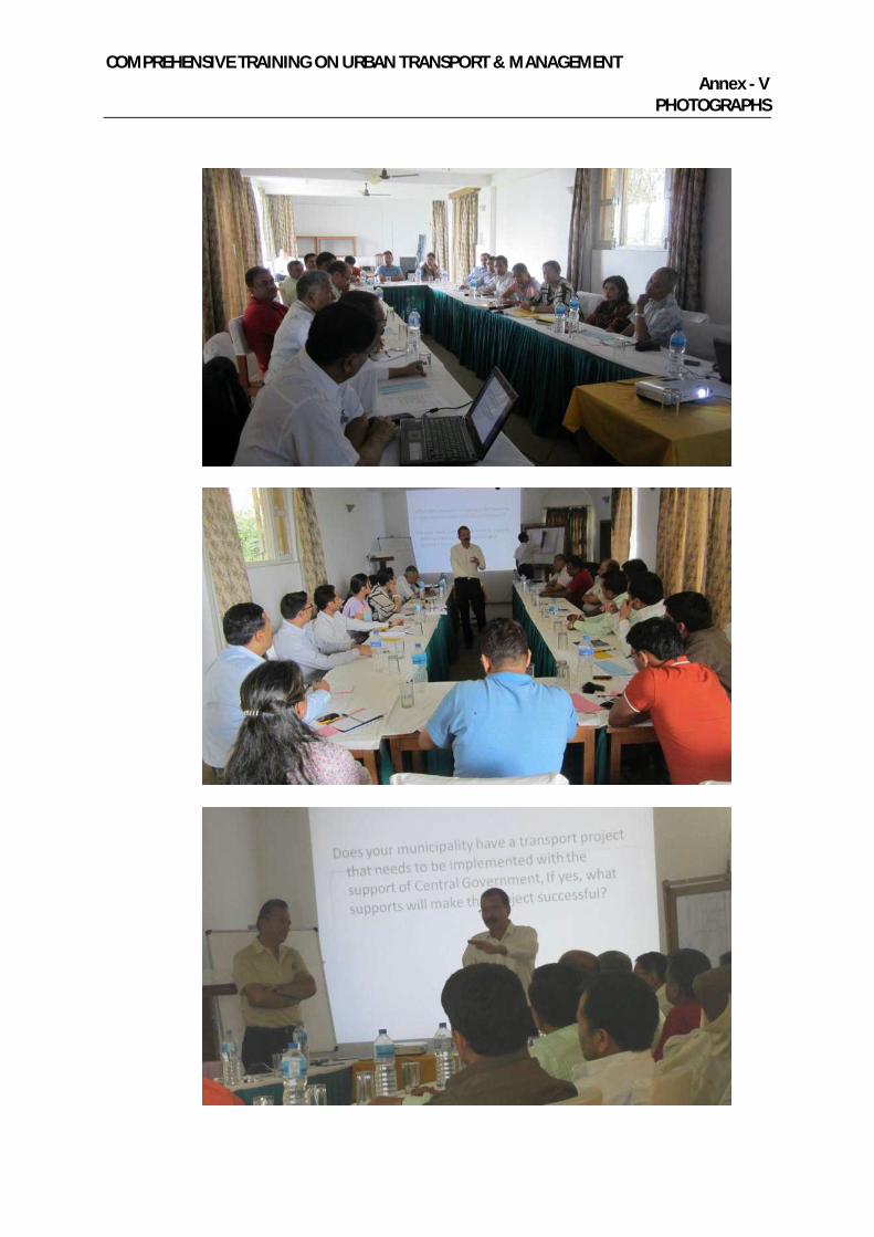
COMPREHENSIVE TRAINING ON URBAN TRANSPORT & MANAGEMENT Annex - V
PHOTOGRAPHS

COMPREHENSIVE TRAINING ON URBAN TRANSPORT & MANAGEMENT Annex - V
PHOTOGRAPHS

COMPREHENSIVE TRAINING ON URBAN TRANSPORT & MANAGEMENT Annex - V
PHOTOGRAPHS

COMPREHENSIVE TRAINING ON URBAN TRANSPORT & MANAGEMENT Annex - V
PHOTOGRAPHS

COMPREHENSIVE TRAINING ON URBAN TRANSPORT & MANAGEMENT Annex - V
PHOTOGRAPHS
Consultancy Services for
Urban Transport Planning and Management
Final Report
Volume III: Terms of Reference
ADB Grant : TA 7948-NEP
September 2014

URBAN TRANSPORT PLANNING AND MANAGEMENT, NEPAL ADB GRANT TA 7948 - NEP
(FORMERLY WSPIMC)
a
Imprint
Project Officer Chen Chen TASU, Asian Development Bank, Manila, Philippines
Project Director Suraj Rana IMC Worldwide
64-68 London Road, Redhill, Surrey, RH1 1LG, United Kingdom [email protected]
Project team Gottfried Roelcke Urban Transport Planner and Team Leader
[email protected] Madan Maleku Urban Transport Specialist and Deputy Team Leader
Krishna Ram Amatya Urban Environmental Specialist Subash Dhungel Urban Transport Infrastructure Specialist
Brendan Finn Urban Public Transport Specialist David Green Urban Environmental Specialist Jibgar Joshi Urban Development and Landuse Specialist
Douglas Lucius Urban Transport Demand Modeler Ananda Shrestha Urban Public Transport Specialist
Shreejan Shrestha Urban Environmental Specialist Rodney Stickland Urban Transport Infrastructure Specialist
Roy Wong Urban Street Design Engineer Charlotte Brown, Matteo Mazzoni Assistant Report Editors
This report can be downloaded from the following URL address: © Asian Development Bank
URBAN TRANSPORT PLANNING AND MANAGEMENT, NEPAL ADB GRANT TA 7948 - NEP
(FORMERLY WSPIMC)
b
Table of Contents
1 REPORT ON TORS FOR AN URBAN TRANSPORT DIVISION IN MOUD AND URBAN TRANSPORT SECTION IN DUDBC ............................................................................................................. 1
1.1 BACKGROUND ................................................................................................................. 1
1.2 INSTITUTIONAL ANALYSIS ................................................................................................... 2
1.3 FACTORS DETERMINING TOR.............................................................................................. 3
1.4 URBAN TRANSPORT DIVISION IN MOUD .............................................................................. 5
1.5 URBAN TRANSPORT SECTION IN DUDBC .............................................................................. 7
ANNEXES
Annex - I : Feedback Received from Interviews
Annex - II : Highlights of the ToR Session and Discussion program Dhulikhel

URBAN TRANSPORT PLANNING AND MANAGEMENT, NEPAL ADB GRANT TA 7948 - NEP
(FORMERLY WSPIMC)
c
Abbreviations
ADB Asian Development Bank
BSC Biratnagar Sub-Metropolitan City
CBD Central Business District
CBS Central Bureau of Statistics
DoR Department of Roads in the MPPW / MPPWTM
DoTM Department of Transport Management in the MPPW / MPPWTM
DUDBC Department of Urban Development and Building Construction; until April 2012 part of the MPPW, since May 2012 part of the newly formed Ministry of Urban Development (MoUD)
DWSS Department of Water Supply and Sewerage
EO Executive Officer
FGD Focus Group Discussion
FNNTP Federation of Nepal National Transport Entrepreneurs
GIZ German Technical Cooperation (until 2010 named GTZ)
GoN Government of Nepal
GTZ German Technical Cooperation (since 2011 named GIZ)
IAP Integrated Action Plan
ICP Integrated Check Point
IEAP Institutional Enhancement Action Program
KfW German Bank for Reconstruction and Development
LSGA Local Self Governance Act (1999)
MLD Ministry of Local Development; since May 2012 transformed into MoFALD
MoFALD Ministry of Federal Affairs and Local Development (successor organization to the MLD)
MoUD Ministry of Urban Development (newly formed in May 2012)
MPPWTM Ministry of Physical Planning and Works and Transport Management (until April 2012 only MPPW)
MuAN Municipal Association of Nepal
NMT Non-motorised transport
NRM Nepal Resident Mission of ADB
PCU Passenger Car Unit
REC Regional Economic Centre
RF Regulatory Framework

URBAN TRANSPORT PLANNING AND MANAGEMENT, NEPAL ADB GRANT TA 7948 - NEP
(FORMERLY WSPIMC)
d
RoW Right of Way
SC Steering Committee
SEAM-N Strengthening Environmental Administration and Management at the Local Level in Nepal (a bilateral cooperation project with the Government of Finland)
SEZ Special Economic Zone
SRN Strategic Road Network
STIUEIP Secondary Towns Integrated Urban Environmental Improvement Project, an investment project with funding from ADB
TDA Town Development Act
TDC Town Development Committee
TDF Town Development Fund (an autonomous body established under Nepalese law)
TM Transport Management
UDLE Urban Development through Local Efforts, a technical cooperation program with funding from the Government of Germany and implemented by GTZ
ULD Urban Land Development
UPT Urban Public Transport
VDC Village Development Committee
URBAN TRANSPORT PLANNING AND MANAGEMENT, NEPAL ADB GRANT TA 7948 - NEP
(FORMERLY WSPIMC)
1
1 REPORT ON TORS FOR URBAN TRANSPORT DIVISION IN MOUD AND URBAN TRANSPORT SECTION IN DUDBC
1.1 BACKGROUND
1. The way that road space is used is fundamental to issues such as congestion, reduced traffic speeds, air and noise pollution and road safety. There is a general degradation in the quality of life, reduction in efficiency and reduced economic potential due to poor management of road assets in cities. Good transport systems not only increase the efficiency of cities, but also increase access to amenities and enhance the quality of life, thereby making cities more livable.
2. The present scene in secondary cities of Nepal is characterized by sprawling housing; limited share of public transport; focus on inputs and outputs rather than on outcomes and impacts; insufficient public investment; neglect of non-motorized transport (NMT)users, including pedestrians, cyclists, rickshaw pullers and increasing congestion, road accidents and pollution. The problems are aggravated by the involvement of a multiplicity of authorities/departments, often with conflicting agendas, as well as a lack of understanding. Most of them work in isolation under the direction of central government. Presently, urban transport is not the responsibility of any one agency. There are hardly any Urban Transport professionals working in municipalities and there is a general lack of planning skills. In order to take up and manage various urban transport projects, it is important that a proper institutional framework is created. Urban transport affects all aspects of city life and the working of nearly all other city agencies. It also affects the safety of people traveling in the city.
3. This report provides ToRs for the proposed Urban Transport Division (UTD) in MoUD and an Urban Transport Section (UTS) in DUDBC. This change in the institutional set-up will eventually pave the way for a new Department of Urban Transport under MoUD within the Government. It has been prepared based on the collection of information about the related ministries and agencies in urban transport, their jurisdictions and other relevant information for enhancing the supportive, facilitating and enabling role of the national government on municipal transport. It is in line with the understanding and detailing of the Work Division Regulation 2069 of the Government of Nepal with respect to urban roads and urban transport.
4. A brief meeting with the Minister on April 6, 2014 and specific interviews with personnel of DUDBC and Kathmandu Metropolis (ANNEX I) have helped to clarify the role that MoUD is planning to assume on urban transport issues. The guiding principle for the ToRs has been the envisaged relationship of the national agency with the formation and strengthening of municipal land use planning and transport management. For the

URBAN TRANSPORT PLANNING AND MANAGEMENT, NEPAL ADB GRANT TA 7948 - NEP
(FORMERLY WSPIMC)
2
finalization of the ToRs, a discussion program under the TA comprehensive training organized at Dhulikhel on April 26, 2014 played an important role.
1.2 INSTITUTIONAL ANALYSIS
5. The available information about the ministries and agencies related to urban transport, their jurisdictions and their role in facilitating local bodies showed that some institutional changes are required in national government to build capacity to help manage urban transport. The existing arrangement is not adequate to address the complexities of urban transport issues, which explains the need for a responsible institution for urban transport at the national level.
6. According to the Work Division Regulation of the Government of Nepal 2069, MoUD is responsible for urban roads except strategic roads. It is responsible also for policy, plan and program formulation, as well as implementation, monitoring, regulation and evaluation related to urban development and urban infrastructure. Moreover, it has a potential role in developing mechanisms for making coordination more effective by ensuring sustainable mobility in urban areas of Nepal. MoFALD is responsible for rural agricultural roads. MPPWTM (DoR) is responsible for the strategic road network.
7. The present governance at central level is not effective as DoR has not assumed responsibility for urban transport as a distinct part of its job. There is, in fact, the lack of any urban-specific coordinating agency. The concept of a transport authority may not solve the problem, as urban transport may not receive the specific attention that it deserves. A national approach to transport management dilutes the critical transport needs of ever growing urban centers. A transport authority, just like DoR, is likely to avoid the complex issues of urban transport.
8. Interim Report 1B has also clearly shown that a lot needs to be accomplished, in terms of institutional and policy reforms, at the national level. Mechanisms for making coordination more effective, needs to be developed, if we are to ensure sustainable urban mobility in BSC.
9. To fill in the gap, MoUD has decided to assume a key role in urban transport in all the municipalities and other urban areas of Nepal. DUDBC is also going to be restructured with a section (UTS) dedicated to urban transport. In the meantime, the TA made us realize that the principal outcome of Institutional Enhancement at the national level should be, a ‘well established’ and ‘well functioning’ urban transport section within DUDBC capable of providing the necessary support to municipalities like BSC in managing transport in a sustainable way. No matter how well we build capacity in BSC, to sustain the capacity, there should be back-up from the national government. The task of drafting the ToRs is thus connected with institutional enhancement at the national level; the proposed UTD and UTS together should be able to fill in the existing gap.
URBAN TRANSPORT PLANNING AND MANAGEMENT, NEPAL ADB GRANT TA 7948 - NEP
(FORMERLY WSPIMC)
3
10. It will be a challenging task for BSC to work as a model city in urban transport unless long term sustainability of appropriate concepts is thought out. This will require long term behavioral changes, a revolution in the institutional culture and change in the mind-set of policy makers. It is thus necessary to design change processes rather meticulously, to be carried out slowly and patiently in response to performance. Otherwise demonstrative effects from other cities might thwart the process as transport management is at the same time a matter of intense political interest. Managing this, it is necessary to bring about behavioral changes at the institutional level. The required institutional environment is likely to be impaired through what is being done in the capital city. Bearing these realities in mind, DUDBC will have to take a leading role in enhancing the technical capacity of BSC. We have observed DUDBC’s interest in taking a lead role in urban transport and it should internalize the products of this TA in order to assume such a role.
1.3 FACTORS DETERMINING THE TORS
11. The guiding principle behind the proposed institutional change is the need for integrating urban transport imperatives into overall urban development goals. Transport will be an important aspect of urban development, which needs to be well integrated into the economics of urban development. National Urban Policy 2007 highlights the intrinsic linkage of transport demand and land use planning and the need to develop an integrated action plan for each city. In this context, creation of urban transport division under MoUD will be a welcome step. The Division should be capable of formulating urban transport policy and mobilizing different stakeholders of urban transport to implement the same, in a concerted manner, in rapidly growing urban areas. Similarly the proposed section in the Department should help urban areas prepare their urban transport plans and implement them to providing better transport services in urban areas.
12. Some of the feedback received from interviews with concerned personnel from MoUD, DUDBC and Kathmandu Metropolis1 have helped to define the ToRs:
Given the gravity and complexities of urban transport issues, the ToRs should be based on the outcome of a high level discussion meeting.
MoUD/DUDBC should prepare urban transport management policy and prepare norms and standards for infrastructure, in close consultation with the Transport Management Department, transport operators, traffic police, line agencies and central government agencies. It should coordinate the different levels of government. It should conduct training carry out research works and produce IEC materials. It should provide technical assistance related to UT to local bodies and mobilize donor agencies.
1 Bimal Rijal, Shiva Hari Sharma, Karna, Amrit Siddhi Bajracharya, D. Shrestha

URBAN TRANSPORT PLANNING AND MANAGEMENT, NEPAL ADB GRANT TA 7948 - NEP
(FORMERLY WSPIMC)
4
MoUD/DUDBC should prepare guidelines on Transport Planning based on best practices. The spatial dimension needs to be considered in order to help integrate transport planning and land-use.
A Rights of Way(RoW) authority should be set-up under a planning framework. Standards and norms should be prepared and revised in a timely fashion.
Make policies on NMT.
A permanent working committee should be formed under the Steering Committee
Planning for urban roads with the preparation of transport plans, design, estimates, norms and standards. Advice to be given on traffic management. It should help Division offices in urban transport services.
Policy coordination should be the responsibility of the Ministry Division. There should be some guarantee of funding.
Inventories of road networks should be prepared
Urban transport management should be carried out under a holistic planning framework, considering related features such as greenery, urban roads, open space and so on
Urban infrastructure planners should be better trained in road construction and road design
13. It has become necessary to enhance the coordination mechanism for sustainable urban transport in rapidly urbanizing municipal areas. This cannot be sufficiently improved unless the line agencies working in municipalities are directed to work on it by their head offices. How the national government is going to support BSC and other similar municipalities should largely influence the implementation of the ToRs. The national government should:
Help municipalities to create new land-use and transport management sections, equipped with an adequate number of trained staff. The Urban Planning and Implementation Division will have the competence to develop and follow business procedures for the successful completion of transport related projects and sustain its activities technically and financially.
Concerned municipal staff trained in the application of guidelines and tools for the implementation of the strategy and for working towards integration between land-use and transport management.
Help Municipalities to be equipped with trained staff to implement the strategy and update the TA strategy every three years
Train staff in the application of performance indicators.
Help establish land-use and transport management sections in urban authorities
Help establish adequate performance monitoring system.

URBAN TRANSPORT PLANNING AND MANAGEMENT, NEPAL ADB GRANT TA 7948 - NEP
(FORMERLY WSPIMC)
5
14. For defining its relationship with cities, MoUD should review the recent change made in BSC with the creation of the new section given in Annex II. The strengthening of this section in BSC needs to be supported by the national government for sustaining and enhancing its proposed function. Its sustainability will depend on the gradual organizational development based on the performance indicators.
1.4 URBAN TRANSPORT DIVISION IN MOUD
15. The proposed Urban Transport Division will aim at making transport projects contribute to land-use goals. It will assume a lead role in institutional development as a long-time plan to enhance the competence of BSC and other municipalities of Nepal in implementing integrated land-use and transport management strategies. This has become a must in the context of MoUD, assuming the responsibility for urban transport in all the municipalities of Nepal. As a starting point for much needed institutional and policy reforms at the national level, this Division will have a key role in managing urban transport in Nepal.
16. Various agencies including Prime Minister's Office have been trying to improve coordination mechanisms and have been monitoring transport projects in urban areas. However the efforts are erratic and it has become necessary to institutionalize the coordination mechanism. Jt. Secretary of the proposed division or DG, DUDBC should work as the member secretary of the monitoring committee to be headed by Hon. Minister for Urban Development with representatives from all the stakeholders of the coordinating and monitoring committee.
17. Fig.1 below presents the organogram for the proposed Division. The Joint Secretary heading the Division will have adequate qualifications and experience in urban transport. There will be two sections directly under him/her. One of these will be headed by a Gaz. Class II officer and the other by a Gaz. Class III officer. Although the Consultant insisted for Gaz. Class II officers for both the sections under the Division, MoUD, gave a clear directive on this aspect saying it would have implications for other divisions of the ministry.
18. The key functional areas of the section “Land use Planning and Urban Transport Management” headed by Gaz. Class II officer, are: (a) Planning inputs to urban areas of Nepal and (b) Coordination and stakeholders’ mobilization for sustainable urban transport. These sections will be initially run with minimum staff, with one Gaz. Class III officer given the role of coordination and stakeholders’ mobilization. The other section, headed by a Class III Gaz. Officer, will assist the Division Chief in Urban Transport Policy Formulation, including legal aspects and M&E. It will also work on training inputs and develop performance indicators with the help of DUDBC.

URBAN TRANSPORT PLANNING AND MANAGEMENT, NEPAL ADB GRANT TA 7948 - NEP
(FORMERLY WSPIMC)
6
Fig. 1: Proposed Division in the Ministry
19. The goal of creating Urban Transport Division (UTD) and Urban Transport Section (UTS) is to enhance the national level competence for helping municipalities and urban areas to manage sustainable urban transport (SUT). The Division will:-
Integrate transport planning and land-use in order to use planning to minimize the increase in transport needs and achieve maximum efficiency;
Prepare for the inevitable increase in transport demand as a result of the city’s growth and development;
Prepare for the inevitable increase in private motorization;
Strive to limit the negative impacts of private motorization and divert as much of the demand for motorized transport as possible to public transport;
Preserve the existing culture of using non-motorized transport and ensure that no social stigma is attached to it; etc.
20. The proposed ToRs for the Division are as follows:-
Create an effective regulatory framework through the development of appropriate coordination mechanisms that will at the same time lead to the best utilization of investment in urban transport;
Urban Transport Division
Jt. Sec. Tech.
LUP and UTM SectionSr. Div. Er./Plr./Arch.
Planning Inputs to Urban Areas for LU &
TM Strategy, Business/Action Plan
Coordination and Stakeholder
Mobilization for SUTEr./Arch./Plr,
Urban Transport Policy Formulation, inc. legal
aspects and M&E Section
Er./Plr/Arc
Training Inputs, Performance Indicators, Monitoring Framework

URBAN TRANSPORT PLANNING AND MANAGEMENT, NEPAL ADB GRANT TA 7948 - NEP
(FORMERLY WSPIMC)
7
Build national competence in urban transport and help engage transport professionals in urban affairs.
Help municipalities improve accessibility and mobility in cities by influencing the proportion of users accessing different modes of transport, the development of transport services and a hierarchical road network in newly urbanizing areas.
Integrate Land Use and Transport Planning processes in shaping streets in developing areas within an urban development planning framework.
Develop strategies for urban upgrading through the improvement of existing street networks, road junctions etc.
Formulate a National Urban Transport Policy (NUTP);
Undertake Human Resource and Capacity Enhancement Planning.
Provide guidelines and policy inputs to DUDBC (UTS) for sustainable transport management in urban areas. It is necessary to clarify at the outset the relationship between urban land development and urban transport services.
1.5 URBAN TRANSPORT SECTION IN DUDBC
21. The section will be headed by Sr. Divisional Engineer with a good background in urban transport. S/he will be assisted by a planner, a civil engineer, and three assistants (sub engineer, auto cad operator, and office assistant). The proposed Organogram is shown in Figure 2. Accordingly, the Section will have two units responsible, basically, for planning and design and implementation respectively. The planning, design and estimation works will be carried out in a demand-driven fashion to help meet the requirements of the urban areas of Nepal. This implies working together with BSC and other similar municipalities and includes assistance to municipalities for outsourcing. The other unit will be engaged in the preparation and formulation of appropriate performance indicators required for the success of the implementation process.
22. The ToRs of the section will be defined as follows:
To assist the Division in MoUD enhance coordination of urban transport in the municipalities among all the stakeholders of urban transport at the national level. This is necessary to enable the national level stakeholders to direct their respective agencies at the local level for an integrated response on municipal transport at the city level.
Help municipalities prepare their city level integrated land-use and transport plans and help implement the same.
Undertake studies for enhancing transport management and traffic safety in municipalities and enhance the return on transport investments.

URBAN TRANSPORT PLANNING AND MANAGEMENT, NEPAL ADB GRANT TA 7948 - NEP
(FORMERLY WSPIMC)
8
Organize training for municipal engineers and urban planners within DUDBC on urban transport issues, on a regular basis.
Develop the service level benchmarks specifying parameters to measure the effectiveness of land-use transport planning.
Help integrate a transport demand management (TDM) program into the urban planning framework.
Fig. 2: Proposed Section in the Department
23. The Key Functions of UTS will include:
To carry out planning, design, cost estimation , construction and maintenance of major roads in urban areas and urbanizing VDCs
To prepare plans, design and cost estimates and to carry out construction and maintenance works of the entire infrastructure covered by the road network. These will include greenery, street lamps, benches, footpaths, cycle tracks, culverts and bridges, road drainage, bus stands, bike and motor bike stands, parking areas etc.
To carry out studies and consultation including origin and destination surveys, traffic counts, road safety improvements, traffic signals, etc. for road network extensions and development
To set design standards for road networks and setbacks as needed.
To provide technical assistance on urban roads as part of the preparation of physical development plans
Urban Transport SectionSr. Div. Er./Arch./Plr.
Planning , Design, & Cost EstimationImplementation & Performance Monitoring
(LU & TM strategy, integrated plans and projects)

URBAN TRANSPORT PLANNING AND MANAGEMENT, NEPAL ADB GRANT TA 7948 - NEP
(FORMERLY WSPIMC)
9
In order to make urban transport services effective, to carry out studies and consultations of other infrastructure related to urban transport
24. In addition to the above, UT Section will have the following auxiliary functions
Budgeting for the necessary activities of the section
To provide policy solutions to the emerging problems on roads in urban areas
To compile and prepare necessary laws and regulations for roads and other related infrastructure.
To prepare and maintain data bases of roads and road users.

URBAN TRANSPORT PLANNING AND MANAGEMENT, NEPAL ADB GRANT TA 7948 - NEP
(FORMERLY WSPIMC)
10
Annex I: Feedback Received from Interviews
SN Name Designation Suggestions
1 Bimal Rijal Chief, Urban Development Division, Kathmandu Metropolitan City
MoUD/DUDBC should prepare UT management and policy and prepare infrastructure norms and standards in close consultation with TMD, operators, line agencies and central government agencies. It should coordinate with different levels of government. Agencies, transport operators traffic police, transport department. It should conduct training and research and produce IEC materials. It should Provide TA to LG related to UT and mobilize donor agencies. It should prepare guidelines on TP based on best practices. Spatial dimension needs to be considered to help integrate TP and land-use.
2 Sunil Karna DDG, DUDBC RoW should be set-up under a planning framework. Standards norms should be prepared and revised in a timely fashion. Make policies on NMT mode. A permanent working committee should be formed under the Steering Committee
A post of urban transport planner should be created for heading the section. Three engineers would be required. The functions of the section should include: Planning for urban roads with the preparation of transport plans, design, estimates, norms and standards.
Advice to be given on traffic management In the ministry the division should be staffed with a
first class engineer with two transport planners and 4 engineers.
Policy coordination, to help division offices in UTS To guarantee funding. Support to be provided to municipalities and
urbanizing VDCs, TDC
3 Raju Manandhar
SDE, DUDBC An Urban Road Division should be established An inventory of road network should be prepared Nodal points, linkages and integration between
strategic highways and urban roads Connect strategic highways with urban roads
through land pooling and urban development initiatives
The proposed section will deal with urban roads of small towns and market centers
PDP related roads

URBAN TRANSPORT PLANNING AND MANAGEMENT, NEPAL ADB GRANT TA 7948 - NEP
(FORMERLY WSPIMC)
11
SN Name Designation Suggestions
Coordinate How to minimize overlapping with small towns re
Biratnagar ring road. Land pooling, trunk roads Storm water drainage not to be left out Periodic plan major towns, corridor, small towns
4 Shivahari Sharma
DDG, DUDBC Works previously done by municipalities later included under budget headings to be transferred to the Section
Policy \implementation support TA as per risk and criticality
Urbanizing and new towns road to be looked after by UTS
Under holistic planning greenery, urban roads, open space
Urban infrastructure planner will be better trained in road construction road design
5 Amrit Bajracharya
DUDBC Educate the staff then get feed back Outer ring road confused due to lack urban
transport planner Comprehensive transport plan for Kathmandu, Section is necessary

URBAN TRANSPORT PLANNING AND MANAGEMENT, NEPAL ADB GRANT TA 7948 - NEP
(FORMERLY WSPIMC)
12
Annex II: Highlights of the ToRs Session and Discussion program Dhulikhel
25. In the afternoon session of nearly three hours, the work done by the ToRs team was presented in detail, highlighting how this emerged and how it is being developed.
26. The need of institutional enhancement at the central level was first explained by the trainers and these were tied with the capacity building at municipal level, through contributions from the participating municipalities. They explained how the local bodies can be supported by central agencies and what they need from central agencies in regard to planning and policy input, as well as a monitoring framework.
27. The organizational structure of BSC has already been modified with the formation of a new section devoted to “Land-use Planning and Transport Management” under the Urban Planning and Implementation Division. This division is the main target of the IEAP Plan. The new section will be the key actor for the implementation of the land-use and transport management strategy prepared under this TA. Two subsections will be under it. They are (a) Implementation and Performance Indicators and (b) Stakeholders’ Mobilization and Monitoring. The principal job of the UTS in DUDBC will be to help establish such sections in the appropriate urban areas of the country. For this, it should be under the guidance of the Ministry, to help enhance competence in the preparation of integrated LU and TM strategies in line with what BSC has got and provide the necessary planning inputs as required by the local bodies. The engineer and other staff of the section, as well as the Division Head should be trained in the application of toolkits and guidelines. Further details of the staffing, should be gradually developed along with the progress of IEAP implementation in conjunction with the BSC & DUDBC. The performance indicators required to be monitored by this section need to be improved incrementally in a phase-wise basis. For the first stage the section should select simple indicators based on a discussion program and it should be gradually improved, based on its performance.

URBAN TRANSPORT PLANNING AND MANAGEMENT, NEPAL ADB GRANT TA 7948 - NEP
(FORMERLY WSPIMC)
13
Fig. 3. Organizational Structure in BSC (see Vol. II Report on Training)
28. In the morning session the next day of four hours, participants were asked to answer several questions pertinent to institutional arrangements to enhance municipal capacity in urban transport. The participants were asked to answer the following questions at the outset of the session. They used Meta cards to express their opinions and also explained verbally. Discussions centered around the following issues:
What type of planning support your municipality is expecting from DUDBC?
What information do you think your municipality should provide in the formulation of national urban transport policy?
Does your municipality have a transport project that needs to be implemented with the support of DUDBC, If yes, what supports will make the project successful?
Which planning and implementation activities can your municipality perform itself without any DUDBC support?
How can the funding mechanisms for desirable transport projects in your municipality be improved?
Do you think it necessary to restructure the organization of your municipality in line with BSC? Explain your answer?
Has any transport project in your municipality been affected due to lack of national urban policy?
Urban Planning and Implementation
Division
Landuse Planning and Transport
Management
Implementation and Performance Indicators
Stakeholders’ Mobilization and
Monitoring
Physical construction section
Road construction subsection

URBAN TRANSPORT PLANNING AND MANAGEMENT, NEPAL ADB GRANT TA 7948 - NEP
(FORMERLY WSPIMC)
14
Has your municipality felt the need for capacity enhancement in carrying out transport projects? Please specify.
29. In order to make your municipality capable of preparing and implementing comprehensive urban transport and land-use strategy by the year 2019, what strategies do you think it should implement?
30. The session helped spur necessary changes in the organizational culture of most of the transport related institutions of Nepal. This should be the major task of MoUD.
31. The session provided valuable feedback on the ToRs. Some of the participating municipalities will prepare a transport strategy which should be used as the background information in the formulation of national urban transport policy, to be prepared by the urban transport division of MoUD. The need for a national urban transport policy was highlighted time and again during the session on the ToRs. And it was predicted that the first thing the new UTD in MoUD will be engaged on, could be the preparation of the policy. Willingness for hosting short training programs like the one to be held in Biratnagar was expressed by some of the participating municipalities, in order to further institutional development at different levels of government by establishing linkages between the national and local level.

Consultancy Services for
Urban Transport Planning and Management
Final Report
Addendum to Volume III: Training on Urban Transport and Management in Biratnagar Sub-Metropolitan City
ADB Grant : TA 7948-NEP
October 2014

URBAN TRANSPORT PLANNING AND MANAGEMENT, NEPAL ADB GRANT TA 7948 - NEP
(FORMERLY WSPIMC)
1
Imprint
Project Officer Chen Chen TASU, Asian Development Bank, Manila, Philippines
Project Director Suraj Rana IMC Worldwide
64-68 London Road, Redhill, Surrey, RH1 1LG, United Kingdom [email protected]
Project team Gottfried Roelcke Urban Transport Planner and Team Leader
[email protected] Madan Maleku Urban Transport Specialist and Deputy Team Leader
Krishna Ram Amatya Urban Environmental Specialist Subash Dhungel Urban Transport Infrastructure Specialist
Brendan Finn Urban Public Transport Specialist David Green Urban Environmental Specialist Jibgar Joshi Urban Development and Landuse Specialist
Douglas Lucius Urban Transport Demand Modeler Ananda Shrestha Urban Public Transport Specialist
Shreejan Shrestha Urban Environmental Specialist Rodney Stickland Urban Transport Infrastructure Specialist
Roy Wong Urban Street Design Engineer Charlotte Brown, Matteo Mazzoni Assistant Report Editors
© Asian Development Bank

URBAN TRANSPORT PLANNING AND MANAGEMENT, NEPAL ADB GRANT TA 7948 - NEP
(FORMERLY WSPIMC)
2
Table of Contents
1 BACKGROUND ..................................................................................................................... 6
2 TRAINING BRIEF .................................................................................................................. 7 2.1 INAUGURAL SESSION (OCTOBER 13, 2014) ................................................................... 7 2.2 DAY 1 (MONDAY OCTOBER 13, 2014) ........................................................................... 7
2.2.1 SESSION 1: STATE OF URBAN TRANSPORT INFRASTRUCTURE IN BIRATNAGAR ... 7 2.2.2 SESSION 2: SURVEYS CONDUCTED IN BIRATNAGAR ............................................ 9 2.2.3 SESSION 3: INTRODUCTION AND OVERVIEW OF INTEGRATING LAND USE PLANNING AND MANAGEMENT ...................................................................................... 10 2.2.4 SESSION 4: SUSTAINABLE URBAN TRANSPORT ................................................. 11 2.2.5 SESSION 5 : CONCEPT OF TRAFFIC ENGINEERING ............................................. 13 2.2.6 SESSION 6 : CONCEPTS OF ROAD SAFETY .......................................................... 14
2.3 DAY 2- (TUESDAY OCTOBER 14, 2014)......................................................................... 17 2.3.1 SESSION 1: ROAD HIERARCHY, ASSET MANAGEMENT SYSTEM, STAKEHOLDER COLLABORATION ............................................................................................................. 17 2.3.2 SESSION 2: MAINTENANCE TECHNIQUES, REGULAR MAINTENANCE AND BUDGETING..................................................................................................................... 17 2.3.3 SESSION 3: CONCEPTS OF NMT AND PEDESTRIAN MOVEMENT ........................ 17 2.3.4 SESSION 4: FACILITIES FOR NMT, UNDERPASSES AND OVERPASSES FOR PEDESTRIANS, GUIDELINES/ DESIGNS, WALKABILITY & CYCLING...................................... 18 2.3.5 SESSION 5: CONCEPT OF URBAN PUBLIC TRANSPORT, PARA-TRANSIT, PUBLIC TRANSPORT SERVICE, ASSESSMENT OF PUBLIC TRANSPORT ............................................ 18 2.3.6 SESSION 6: INTRODUCTION TO URBAN ROADS STANDARDS ............................. 19 2.3.7 SESSION 7: PARKING DEFINITIONS; LEGISLATION, POLICY AND REGULATION ... 19 2.3.8 SESSION 8: PARKING INVENTORY SURVEY; DEMAND SURVEY ........................... 20
2.4 DAY 2- (WEDNESDAY OCTOBER 15, 2014) ................................................................... 20 2.4.1 SESSION 1 & 2: TOOLKITS ON URBAN TRANSPORT PLANNING AND MANAGEMENT 20 2.4.2 SESSION 2 & 3 : DISCUSSION ON TERMS OF REFERENCE ................................... 20
2.5 CONCLUDING SESSION ............................................................................................... 22
3 SESSION FEEDBACK ANALYSIS ............................................................................................ 23 3.1 FEEDBACK ON PRESENTATION TECHNIQUES .............................................................. 23 3.2 FEEDBACK ON DURATION .......................................................................................... 24 3.3 FEEDBACK ON LEVEL OF UNDERSTANDING OF THE SESSION ....................................... 25 3.4 FEEDBACK ON TRAINING MATERIALS ......................................................................... 26 3.5 FEEDBACK ON REFRESHMENTS .................................................................................. 26 3.6 FEEDBACK ON LOGISTICAL SUPPORT .......................................................................... 27 3.7 FEEDBACK ON RESPONDENTS TO APPLY BACK TO THEIR ORGANIZATIONS .................. 28 3.8 FEEDBACK ON APPLICATION OF LEARNING ................................................................. 28 3.9 OVERALL RATING OF THE TRAINING ........................................................................... 29

URBAN TRANSPORT PLANNING AND MANAGEMENT, NEPAL ADB GRANT TA 7948 - NEP
(FORMERLY WSPIMC)
3
ANNEXES
Annex - I : Training Schedule
Annex - II : List of Participants
Annex - III : Presentation Materials
Annex - IV : Training Evaluation Form
Annex - V : Photographs

URBAN TRANSPORT PLANNING AND MANAGEMENT, NEPAL ADB GRANT TA 7948 - NEP
(FORMERLY WSPIMC)
4
Abbreviations
ADB Asian Development Bank
BSC Biratnagar Sub-Metropolitan City
CBD Central Business District
CBS Central Bureau of Statistics
DoR Department of Roads in the MPPW / MPPWTM
DoTM Department of Transport Management in the MPPW / MPPWTM
DUDBC Department of Urban Development and Building Construction; until April 2012 part of the MPPW, since May 2012 part of the newly formed Ministry of Urban Development (MoUD)
DWSS Department of Water Supply and Sewerage
EO Executive Officer
FGD Focus Group Discussion
FNNTP Federation of Nepal National Transport Entrepreneurs
GIZ German Technical Cooperation (until 2010 named GTZ)
GoN Government of Nepal
GTZ German Technical Cooperation (since 2011 named GIZ)
IAP Integrated Action Plan
ICP Integrated Check Point
IEAP Institutional Enhancement Action Program
KfW German Bank for Reconstruction and Development
LSGA Local Self Governance Act (1999)
MLD Ministry of Local Development; since May 2012 transformed into MoFALD
MoFALD Ministry of Federal Affairs and Local Development (successor organization to the MLD)
MoUD Ministry of Urban Development (newly formed in May 2012)
MPPWTM Ministry of Physical Planning and Works and Transport Management (until April 2012 only MPPW)
MuAN Municipal Association of Nepal
NMT Non-motorised transport
NRM Nepal Resident Mission of ADB
PCU Passenger Car Unit
REC Regional Economic Centre
RF Regulatory Framework

URBAN TRANSPORT PLANNING AND MANAGEMENT, NEPAL ADB GRANT TA 7948 - NEP
(FORMERLY WSPIMC)
5
RoW Right of Way
SC Steering Committee
SEAM-N Strengthening Environmental Administration and Management at the Local Level in Nepal (a bilateral cooperation project with the Government of Finland)
SEZ Special Economic Zone
SRN Strategic Road Network
STIUEIP Secondary Towns Integrated Urban Environmental Improvement Project, an investment project with funding from ADB
TDA Town Development Act
TDC Town Development Committee
TDF Town Development Fund (an autonomous body established under Nepalese law)
TM Transport Management
UDLE Urban Development through Local Efforts, a technical cooperation program with funding from the Government of Germany and implemented by GTZ
ULD Urban Land Development
UPT Urban Public Transport
VDC Village Development Committee

URBAN TRANSPORT PLANNING AND MANAGEMENT, NEPAL ADB GRANT TA 7948 - NEP
(FORMERLY WSPIMC)
6
1 BACKGROUND
1. This report on Comprehensive Training on Contract Administration and Management has been prepared as an output to the assignment of Urban Transport Planning and Management (UTPM) under ADB Grant TA 7948 - NEP. The basic objective of the assignment was to prepare comprehensive urban transport and land use, including long-term visions, medium term goals, an action program and an implementation plan for improving Biratnagar Sub-Metropolitan City's urban transport system; with a view to address the balanced requirements of different urban transport users in regard to affordability, accessibility, safety and sustainability.
2. An eight days' training program was conducted during April 21-30, 2014 in Kathmandu to the engineers and planners of the municipalities, DUDBC, KVDA and TDF; as a part of disseminating information relating to the state of urban transport situation of Biratnagar and its proposed urban transport strategies. The other objectives were to:
impart extensive knowledge on Urban Transport Planning and Management
enable the participants using Toolkits and Guidelines on UTPM
build the capacity of DUDBC and the municipalities of Kathmandu Valley in the field of UTPM
discuss ToR and structures for establishing Urban Transport Section in DUDBC and Transportation Division in MOUD
3. The training was conducted by the team of experts engaged in UTPM assignment, along with other eminent professionals in the field of urban transport planning. The training materials were basically derived from seven stand alone modules relating to the traffic engineering and management, road safety, managing non-motorized vehicles & public transport, parking management, urban infrastructure management and integrating land use and transport planning ; prepared during UTPM assignment. Various successful examples of urban transport management in the Asian and other cities were exhibited in the form of pictures and videos.
4. As requested by DUDBC, the consultants had also prepared Terms of Reference for setting up Urban Transport Division in the Ministry of Urban Development and Urban Transport Section in DUDBC. These ToRs were extensively discussed during two days of residential program that was clubbed in the training.
5. The brief of the contents of the report is presented in chapter 2 and the evaluation of the training is made in Chapter 3. The annex contains the training schedule, list of participants, detail presentation materials and the photographs.

URBAN TRANSPORT PLANNING AND MANAGEMENT, NEPAL ADB GRANT TA 7948 - NEP
(FORMERLY WSPIMC)
7
2 TRAINING BRIEF
2.1 INAUGURAL SESSION (OCTOBER 13, 2014)
6. The inaugural session was initiated by Mr. Saroj Basnet by calling Mr. Ramesh Prasad Singh, DDG, DUDBC to chair the session. The other dignitaries present in the dais were Mr. Girija Prasad Gorkhaly, Member Secretary, Singhdurbar Reconstruction Project, Mr. Naresh Pradhan, Transport Specialist and ADB representative and Mr. Rabi Shah, Coordinator UTPM, DUDBC. The participants were welcomed by Mr. Bharat Neupane, Engineer, Planning Section, BSC. Mr. Gorkhaly then briefed about the UTPM project and its achievements so far. He mentioned that some modifications on the previous ToR of UTPM TA were made after the assessment of capacity of BSC. The modifications included curtailment of some on-site capacity development program in BSC and addition of development of ToR for the establishment of Urban Transport Units in MOUD and DUDBC. These modifications were suggested with the view to instigate the Sustainable Urban Transport initiatives in the central level so that the similar programs could be launched in other cities more effectively and responsibly.
7. Mr, Saroj Basnet, Training Coordinator and DTL of UTPM briefed about the objectives of the training and the various sessions to be taken during three days' program. Mr. Naresh Pradhan said that this TA is a first of its kind in Nepal and second initiative of ADB towards the improvement of urban transport in Nepal after Kathmandu Sustainable Urban Transport Project. Both of these projects are considered to be crucial as they would serve as guidance for the further investment of ADB in Urban Transport Sector in Nepal.
8. The training was inaugurated by Mr. Ramesh Prasad Singh by lighting up the auspicious lamp. Speaking on the occasion, Mr. Singh highlighted the role of DUDBC on raising awareness of the municipalities towards sustainable urban transport and helping them to resolve the prevailing engineering and social issues. He also informed that DUDBC had recently published the Urban Roads Standards as an effort to facilitate the municipal engineers in designing and implementing the urban roads. Concluding the inaugural session, he expressed his gratitude to ADB for supporting DUDBC in the urban infrastructure development including the urban transport and hoped the support would continue in the days to come.
2.2 DAY 1 (MONDAY OCTOBER 13, 2014)
2.2.1 SESSION 1: STATE OF URBAN TRANSPORT INFRASTRUCTURE IN BIRATNAGAR
9. This session started with elucidating the importance and role of TA 7498-NEP: Urban Transport Planning & Management while assisting Biratnagar Sub-Metropolitan City (BSC), and various study activities, toolkits and guidelines for the same were also discussed.

URBAN TRANSPORT PLANNING AND MANAGEMENT, NEPAL ADB GRANT TA 7948 - NEP
(FORMERLY WSPIMC)
8
10. Then, the speaker went on to discuss the current situation of BSC with parameters like topography, administrative divisions, population density, population growth, strategic road network, and regional air connections.
11. Post that, the speaker went on to discuss the City’s Vision and various developmental plans for the city. The developmental plans were also compared under various parameters like population, residential area, commercial area/CBD, industrial corridor north of BSC, north east near the city centre, northwest BSC, Ward 20, south of BSC near the new ICP, and new jobs within BSC. The developmental plans are:
a. Development Scenario 1: Slow public and private sector after 2014
b. Development Scenario 2: Rapid public and slow private sector after 2014
c. Development Scenario 3: Slow public and rapid private sector after 2014
d. Development Scenario 4: Rapid public and rapid private sector after 2014
12. The existing land use pattern was also discussed in terms of urban build up, natural vegetation, water bodies, and cultivated land. Also, the main issues in land use strategy were highlighted as increasing resource consumption in the process of urban development, low density urban sprawl at the periphery, and low intensity use of many plot in the city centre.
13. The proposed urban land use policy for Biratnagar was then laid out. It recommended to develop an improved land use pattern, integrate land use planning and transport planning, expand the built-up area, planned and orderly expansion of urban infrastructure, and enhance institutional capacity for this enforcement. Landuse classes were also proposed.
14. In this session, the trainer presented the long-term prospects that are envisaged within BSC taking into consideration the long-term vision the municipality has targeted in its plan. In this respect, the following development was envisioned in BSC in the long-term.
Land use is expected to intensify, most being low-rise residential development;
Some high-rise development in the form of hospitals, manufacturing is also envisaged;
City centre land use was also expected to intensify and be mostly private sector led and UPT demand in this area likely to increase;
Proposed Katahari rail link is expected to extend nearer to the East-West Highway and both freight and passenger traffic via rail from India is likely to bypass BSC;
The freight for the industrial corridor north of BSC via rail is expected to transfer to road freight via Biratnagar Ring Road; and
Koshi Highway is expected to be widened and the Ring Road to be fully developed.
15. In the last segment of this session, the trainees were appraised about the overall vision for urban transport in BSC by 2033. This included the traffic diversion of the north-south transit traffic from Koshi Highway; evolution of the BSC section of Koshi Highway as a high capacity intra-urban thoroughfare; high capacity bus along the Koshi Highway-

URBAN TRANSPORT PLANNING AND MANAGEMENT, NEPAL ADB GRANT TA 7948 - NEP
(FORMERLY WSPIMC)
9
Roadcess Chowk –Rani Sadak route and lower capacity UPT along the other north-south routes apart from the Koshi Highway. In addition, development of network for NMTs including walking was also expected.
2.2.2 SESSION 2: SURVEYS CONDUCTED IN BIRATNAGAR
16. This session started with a brief explanation of the rationale behind the traffic surveys that were conducted in Biratnagar. During this session, the trainer identified the following types of surveys that were most relevant for the Nepalese urban areas:
Traffic counts
Origin-destination (OD)
Road inventory
Speed and delay
Vehicle occupancy
UPT surveys
Safety analysis (crashes, traffic rule violation)
Parking surveys
17. The session also briefly explained the basic parameters of interest in traffic analysis such as seasonal/daily variation, annual average daily traffic, peak hour K factor, passenger car unit, etc.
18. The majority of this session was devoted to impart knowledge to the trainees about various types of counts available, methodologies involved, techniques available (manual using paper and pencil, mechanical tallies or electronic boards or automatic count using pneumatic/piezo-electric loop detectors, radars, ultrasound, video image detection, etc.). The trainer demonstrated the video-based counting method adopted in this project and its suitability for counts in the Nepalese urban areas.
19. The trainer demonstrated interactively the process involved during count data analysis, the manner to represent the result and interpret them to assess the existing and future traffic conditions.
20. In this respect, the various methods of OD surveys, their organization, utility and output generated were covered. Consequently, the methodology involved in roadside interview, registration plate methods were presented to the trainees. This was followed by a demonstration of the analysis of interview based OD data in an interactive manner.
21. This session also covered road inventory and speed surveys including the methods available (walk/drive-over inventory; aerial photography inventory; video-based inventory; spot speeds by radar guns, short-based method; travel speeds, etc.). The trainer briefly demonstrated the video-based travel and inventory survey that was

URBAN TRANSPORT PLANNING AND MANAGEMENT, NEPAL ADB GRANT TA 7948 - NEP
(FORMERLY WSPIMC)
10
conducted in this project. Lastly, the methodology involved in a vehicle occupancy survey was also given in this segment of the training.
2.2.3 SESSION 3: INTRODUCTION AND OVERVIEW OF INTEGRATING LAND USE PLANNING AND MANAGEMENT
Concepts, Principles and Problems & Issues
22. This session introduced the general principles and concepts of Integrating Land Use Planning and Transport Management to the trainees and made them understand the need for integration in a compelling way through key questions, responses to problems due to lack of integration with illustrative examples and the consequences due to lack of integration. It highlighted the purpose and significance of integration between land use and transport management in urban development. It also related the module with Sustainable Urban Transport (SUT).
23. The session started with the organization of the module and explained how to make use of the suggested readings and the international experiences on SUT presented at the end of the module presentations. This session lasted for three hours.
24. During this session, the trainers explained about the General Principles and Key Questions and explored different Problems and Issues with participation of the trainees.
25. The expected outcomes were made clear at the beginning of the sessions. The trainees were expected to have better understanding of the linkages between land use and transport planning and management and the need for integration. They would realize the consequences of the lack of integration and be able to help facilitate the required changes in the policy domain and the style of implementation of road projects in the realization of land use goals. It would help them explore ways and means of achieving better integration through situation-specific responses to integration related problems.
26. The participants were encouraged to respond to the key questions and there was lively discussion on these facilitated by the trainers:
What are the factors that impede the process of integration?
What are the consequences due to lack of integration?
Why is integration desirable?
What are the opportunities generated through successes in terms of integration?
27. The trainers explained how they should use Further Readings tied also with the later part of the presentation on international exposure to sustainable urban transport

URBAN TRANSPORT PLANNING AND MANAGEMENT, NEPAL ADB GRANT TA 7948 - NEP
(FORMERLY WSPIMC)
11
Response Strategies and Actions towards improving Integration
28. After a few minutes break, this session started deliberating first on Actions towards Improving Integration and was carried over to the early morning of Day 2 to complete the discussions on SUT. The session focused on Response Strategies with Illustrative Projects and Summary Aspects of Enforcement.
29. The bulk of the session imparted knowledge about various problems that cities face and responses to the problems. Trainees were encouraged to respond to the plausible problems arising due to lack of integration between the two. As they answered, they were shown the plausible solutions incorporated in the module. The discussions were reinforced with illustrative examples from BSC.
30. This session ended with brief summary problems of replicating experiences from the outside and some experiences on BRT as the means of sustainable urban transport drawing relevant experiences from other countries. In view of the overwhelming responses and interest and the importance of the subject matter, discussions on sustainable urban transport facilitated by trainers were continued in the early hours of the second day of the Training Program.
31. The Trainees acquired the knowledge about the art of integrating in a situation-specific way. The trainees were briefed about the significance of ToD, and the need for integration of land use changes in cities with investments in transport.
32. This session also imparted knowledge about ToD and sustainable urban transport and made the participants understand the need to try to integrate land use with transport even at the project level with learning from combined land use transport projects advocated by the module.
2.2.4 SESSION 4: SUSTAINABLE URBAN TRANSPORT
Introduction to Sustainable Urban Transport
33. The introduction on Sustainable Urban Transport System is given with the explanation of a Venn diagram which explains that the SUT should be sustainable; socially equitable, economically viable and environmentally bearable. SUT allows the basic access and development needs of individuals, companies and society in a manner consistent with human and environment and promotes equity within and between successive generations.
34. The trainer explained about the sustainable transport tools that are commonly used in the city to promote sustainability. The tools include, but are not limited to, clean fuels and vehicles, collective passenger transport, green transport infrastructure, access restrictions, transport management, integration of pricing strategies, taxation system and promotion of a less car intensive lifestyle.
URBAN TRANSPORT PLANNING AND MANAGEMENT, NEPAL ADB GRANT TA 7948 - NEP
(FORMERLY WSPIMC)
12
35. The four pillars of sustainable urban transport i.e. governance, financing, infrastructure and neighborhoods were explained and their roles on the economy, environment and society were discussed.
36. The potential sources of funding for urban transport system were explained and their applicability in the context of Nepal was discussed. The issues relating to the implementation of sustainable urban transport in Nepalese cities were illustrated. Few of which are :
Absence of a city development strategy
Unsustainable transport policies
Ineffective transport planning
Little implementation
Little data about the success or failure of implementation
Governance problems
37. The trainer also gave the examples of mobility planning and accessibility planning and prescribed the way forward towards development of sustainable urban transport in Nepal. These are :
focus on public transport; the growth of public transport
recognize that traffic restraint is an essential part of the package;
Integrate land-use and transport planning as part of the solution so that land-use planning can both facilitate the provision of public transport and reduce the need to travel; and exploiting soft measures such as telecommuting, teleconferencing,
internet shopping, public transport marketing, and better information as means to influence behaviour.
Urban Transport Planning and Management
38. The approach to urban transport should be guided by the principles of Avoid, Shift and Change. Avoid relates to the reduction of the need for travel by promoting city structures and urban densities. Shift refers to the change of modal choice by promoting lower fuel consumption and low fuel emission vehicles. Improve means the increase of energy efficiency of vehicles and fuels by decreasing travel distance. Questions were also raised whether the current Nepalese economy is favorable for mega-urban transport infrastructure.
39. The basic understanding about the urban transport facilities in relation with the urban roads, parking space, buses/ cars, terminals and traffic management system was explained. The various types of surveys for the planning and evaluation of the transportation system were also discussed. These include traffic studies, OD surveys, land use plans, transport network planning, travel demand forecasting, transport facilities, road traffic safety and cost effectiveness.

URBAN TRANSPORT PLANNING AND MANAGEMENT, NEPAL ADB GRANT TA 7948 - NEP
(FORMERLY WSPIMC)
13
40. The characteristics of Bus Rapid Transit (BRT) in relation to the vehicles, running ways, stations and terminals, systems and service plans were explained. It was made clear to the participants that the BRT is not only the fleet of bus operating on the road but it includes the integrated system that ensures high speed, reliability, convenience and accessible to all. For the cities like Kathmandu, BRT may be started with some basic elements that are doable in the first phase and gradually adding features, extending and building new lines with the success and users' support. For this, Lagos, York and Toronto could be taken as good examples.
2.2.5 SESSION 5: CONCEPT OF TRAFFIC ENGINEERING
41. This session introduced the trainees to the concept of traffic engineering and its purpose in the urban areas. During this session, the trainer explained about the shift towards a demand management approach in managing traffic operations and infrastructure sustainably in the urban areas. Trainees acquired knowledge about the desirable outcome that traffic management targets for.
42. The trainees were briefed about the various areas of traffic management and the integration of engineering, education and enforcement (3Es) in sustainable urban transport. The trainees were oriented towards the traffic engineering tools available to solve various aspects such as road-space allocation, regulation of different users and parking management.
43. This session also imparted knowledge about traffic congestion and its impacts and elaborated on the various methods available to relieve congestion in general.
44. The bulk of the session imparted knowledge about various measures available for municipalities including challenges while managing urban traffic such as:
Separating different users (NMT lane, sidewalks, pedestrianized zone, etc.)
Optimising the road-space for the predominant user (increase pedestrian paths in the city centre, allocate space for cyclists)
Banning access to certain vehicles in certain facilities or time-based restriction; restricting certain movements at intersections
Facilitating all users including specific groups such as persons with disabilities (e.g. kerbed ramp crossing, reserved parking spaces at off-street facilities, audio-tactile push-buttons at signalised intersections, NMT waiting areas, etc.)
Speed management such as setting appropriate speed limits for different hierarchy of streets based on scientific approach.
Protected crossing facilities for pedestrians and cyclists (e.g. kerbed extension at zebra-crossing, overhead and underpass, refuge islands, raised median cut-through, innovative cycle path across intersection, pelican signalisation at intersection and mid-block, improve phasing prioritising pedestrians at existing signals, etc.)

URBAN TRANSPORT PLANNING AND MANAGEMENT, NEPAL ADB GRANT TA 7948 - NEP
(FORMERLY WSPIMC)
14
45. Trainees also acquired knowledge about comprehensive traffic calming and the various options available such as closing access (all/certain vehicles), road humps, chicanes, gateways, build-outs, mini-roundabouts, raised intersection, rumble strips, pedestrianisation, etc.
46. This session ended with a brief summary about the central area traffic improvement recommended for the BSC.
2.2.6 SESSION 6: CONCEPTS OF ROAD SAFETY
47. The trainees were oriented towards the 'safe system" approach that has been increasingly advocated in road safety and challenges its application in Nepal entails. A list of measures available to improve road safety in the municipal areas incorporating the 'safe system' were identified as follows:
safer roads for all users with priority to the vulnerable road users (design standard, improved transport infrastructures and operations)
encouraging active, passive safety system in vehicles
enforcing, educating on traffic rules, safety for all users
controlling speeds, enforcing speed limits
improving horizontal coordination between stakeholders
incorporating road safety in the city's overall transport strategy
48. The trainer also highlighted recent development that has taken place in Nepal such as the introduction of the National Road Safety Action Plan (2013- 2020) in response to the UN's call for the Decade of Action on Road Safety. The trainees were informed that the national action plan above also incorporate the five pillars of safety (road safety management, safer roads, safer vehicles, safer road users and post-crash response), which is consistent with the 'safe system' philosophy.
49. During this session, trainees were informed why municipalities are the agencies most appropriate to lead road safety in the urban areas of Nepal. In this context, the current low priority to road safety management in Nepal was discussed.
50. The above information was followed by a suitable process of capacity building for municipalities in the area of road safety. These included means to acquire knowledge, improve horizontal coordination amongst stakeholders, institute robust training and monitoring mechanism.
51. The trainees were oriented towards a strategy for municipalities to institutionalize road safety in their jurisdictional areas and included the following actions:
Establishing road safety unit
Prioritising safety in the municipal strategic vision

URBAN TRANSPORT PLANNING AND MANAGEMENT, NEPAL ADB GRANT TA 7948 - NEP
(FORMERLY WSPIMC)
15
Networking, close collaborating with the National Road Safety Council (NRSC)
Closely liaising with the other advisory bodies under the Municipal Council
Seeking technical assistance and developing a local road safety strategy
Designing training programmes to acquire training in road safety issues, train in the 'safe system', impart in-house training and develop customised training guideline.
Starting implementation of road safety interventions
Formalizing mechanisms for effective horizontal coordination
Closely monitoring progress in the safety initiatives, evaluating and refining programmes as experience builds up
Maintaining close coordination with the NRSC for advisory support.
52. The following strategy was discussed to enhance road safety in the urban areas of Nepal:
Step 1: Start institutionalizing road safety
Step 2: Checking the existing design standard to include safety measures
Step3: Introducing safety inspections, traffic calming, NMT treatments and provision for universal accessibility for all users
Step 4: Collaborating with stakeholders for interventions supporting safe systems
Step 5: Collaborating with the police for crash analysis and refining safety planning
53. In this respect, the trainers presented various guidelines available to assess design standards, introduced the various types of road safety inspections available (road safety review, community focused road safety plan, road safety audits, etc.) and outlined means to institutionalize road safety assessment in the municipalities.
54. As a very important road assessment tool, a detailed discussion on various aspects of a road safety audit such as the audit stage and skill sets required at each stage, the process, design elements to be inspected/ reviewed, reporting format, etc., were given to the trainees.
55. This session also elaborated on local area traffic management (LATM), which is traffic calming implemented at the local scale. The trainees were educated on various traffic calming devices (road-humps, chicanes, gateways, rumble-strips, etc.), and effective means of introducing LATM in Nepalese urban areas.
56. A subsequent portion of the training covered safety provisions for the vulnerable road users (NMTs, cyclists, motorcyclists, pedestrians), safe UPT operations. The following interventions to safeguard the vulnerable road users or VRUs (with emphasis on pedestrians and cyclists) were presented to the trainees.
Pelican signals at intersections, mid-blocks with the coloured crossing

URBAN TRANSPORT PLANNING AND MANAGEMENT, NEPAL ADB GRANT TA 7948 - NEP
(FORMERLY WSPIMC)
16
Pedestrian crossing with kerbed extension at intersection
Educating pedestrian for safe behaviour on the streets and UPTs
Phasing options to facilitate pedestrian movements at existing signalised intersections.
Conducive street layout at shopping, commercial areas that prioritise on pedestrian movement.
Integrating pedestrian routes to all the UPT stops and terminals.
Providing facilities that are friendly to persons with disabilities (e.g. kerb-ramps, adequate sidewalks laid with audio-tactile blocks; low-height kerbs; appropriate handrails; signals with audio-tactile push-buttons, etc.).
Providing access to UPT services to persons with disabilities (safe manoeuvres to pick and drop passengers, modification of the platform height or provision of low-floor buses; reserving space for wheelchair users, etc.).
57. In the context of safer roads, the trainer elaborated on the following provisions:
Introducing urban road design standards that are forgiving and providing safe urban environments for all users including VRUs
Improving the layout, readability, visibility, general security of the existing streets and roadside elements to be forgiving (safer side-drains; kerbed ramps; landscaping; forgiving road-sections and profiles; better delineation; removing visibility obstruction; converting intersection control as appropriate; upgrading signal time/controller, safety inspections, etc.).
Regulating land development and introducing a conducive land-use policy
Improving layout, spatial location of the UPT stops/terminal/interchanges and their operations
58. In terms of safer road users, the trainer again discussed about stricter enforcement with heavier penalties to various traffic rules stipulated in the VTMA1 and LSGA2 (vehicle overloading; travelling on rooftop; travelling standing on para-transits; violating the spare driver requirement in long-distance bus routes; UPTs not picking up/dropping off passengers at the designated stops; UPT infringing their code of conduct; sidewalk/roadside encroachment, etc.). In addition, this session also discussed about improved driver license system; safety awareness in schools, colleges, UPT stops/terminals.
1 Vehicle and Transport Management Act 2049 (1992); GoN 2 Local Self Governance Act 2055 (1999), GoN

URBAN TRANSPORT PLANNING AND MANAGEMENT, NEPAL ADB GRANT TA 7948 - NEP
(FORMERLY WSPIMC)
17
2.3 DAY 2- (TUESDAY OCTOBER 14, 2014)
2.3.1 SESSION 1: ROAD HIERARCHY, ASSET MANAGEMENT SYSTEM, STAKEHOLDER COLLABORATION
59. This session explained about the road hierarchy practices as well as existing systems in Nepal. The trainees were introduced about the road asset, need of proper asset management, how can asset management system be helpful and its importance. Further, the present practice of asset management in Department of Roads and the issues as well as challenges were discussed.
60. The trainer also elaborated on the stakeholders of road system, their importance and collaboration of stakeholders for better enhanced management. The session was made very lively with the participation of senior level officials of DUDBC and the extensive discussion on the contemporary issues in road hierarchy and its management including the issues and challenges in managing the stakeholders.
2.3.2 SESSION 2: MAINTENANCE TECHNIQUES, REGULAR MAINTENANCE AND BUDGETING
61. Trainees were introduced about the maintenance techniques and the current practices in Nepal. Trainer explained about the current regular maintenance practices and how budgeting is being made in Nepal the issues and complication in such process was also discussed in detail during this session.
62. A lively discussion was made on the present contemporary issues and challenges in road maintenance practices as well as the change and innovation requirement for further enhanced road maintenance practices.
2.3.3 SESSION 3: CONCEPTS OF NMT AND PEDESTRIAN MOVEMENT
63. This session introduced the trainees to the concept of Non-Motorized Transport and Pedestrians.
64. The trainees were first briefed with what is the general desire of the road designer while designing urban roads. Citing the case of Biratnagar and Bhaktapur, trainees were explained on how cities have their own uniqueness in representing the travel patterns and behaviors. Biratnagar city is dominated with 76% of NMT while Bhaktapur represents 77.6% of motorized traffic.
65. The trainees were introduced with the common terminology used in designing the urban road facilities. The characteristics of NMT and pedestrians were explained in terms of assessing the nature of traffic (degree of traffic dominated by NMT), choice of transport mode and the terrain condition. Citing the case of Biratnagar and Kathmandu,

URBAN TRANSPORT PLANNING AND MANAGEMENT, NEPAL ADB GRANT TA 7948 - NEP
(FORMERLY WSPIMC)
18
the trainees were explained with the comparative assessment of NMT contribution in an overall traffic composition.
66. Pedestrian movement was explained by citing the findings of walkability surveys carried out for Kathmandu. Trainees were explained on how facilities for pedestrians is planned and developed, how safety aspects related to pedestrians movement is designed and developed as part of the urban transport infrastructure.
67. As part of the training, trainees were given exercise on identifying steps for designing facilities for an area to be pedestrianized. The response was encouraging.
2.3.4 SESSION 4: FACILITIES FOR NMT, UNDERPASSES AND OVERPASSES FOR PEDESTRIANS, GUIDELINES/ DESIGNS, WALKABILITY & CYCLING
68. The session devoted in imparting knowledge on:
Hurdles to NMT;
Building facilities for NMT;
Design considerations for underpass and overpass for pedestrians;
Guidelines for providing pedestrians facilities;
Designing kerb-ramps and installation of audio tactile guiding blocks; and,
Design standards for pedestrian movement facilities maintained by Indian Road Congress.
69. Trainees also acquired knowledge about walkability and ‘bike ability’ (cycling). The walkability and bike ability index were measured and compared.
2.3.5 SESSION 5: CONCEPT OF URBAN PUBLIC TRANSPORT, PARA-TRANSIT, PUBLIC TRANSPORT SERVICE, ASSESSMENT OF PUBLIC TRANSPORT
70. This session started with an explanation on the concept of urban public transport. It was further explained in the context of urban mobility citing an example of Kathmandu city. They are:
Disorganized Public Transport
Inequitable sharing of road space
Worsening air quality
Demand for capacity
Unrestricted vehicle movement
Chaotic and congested traffic
Private investment in public transport (a city with classic case)
71. The session also briefly explained urban challenges and the cycle of congestion and public transport. Trainees learned about sustainability of urban transport in terms of

URBAN TRANSPORT PLANNING AND MANAGEMENT, NEPAL ADB GRANT TA 7948 - NEP
(FORMERLY WSPIMC)
19
social, environmental, economic and affordability. The sustainable urban transport strategy was explained to the trainees how best we can avoid, shift and improve the mechanism in order to bring down the fuel consumption in vehicles and cut down greenhouse gas emissions.
72. In this session, options of urban transport were listed out and discussed in detail. Para-transit facilities were introduced and we discussed its merits in providing the urban mobility.
73. The public transport system was introduced in this session with detailed discussion on the:
Level of service expected
Internal and external environment of a public transport system
Changing the mode of travel
Assessment of public transport
74. A practice session was carried out by forming the participants into 5 groups. Each group was assigned to working out the role and responsibility of each of the stakeholders of the public transport system (transport authority, transport entrepreneurs, infrastructure development authority, the staffs and the users).
2.3.6 SESSION 6: INTRODUCTION TO URBAN ROADS STANDARDS
75. The trainer mentioned about various urban road and rural road standards being practiced in Nepal. Nepal Urban Road Standards aims to achieve consistency in urban road design and construction. Though the focus of this standard is the urban area - the volume and composition of traffic with the requirements for services like drains, electricity, water supply etc - references were drawn from the prevailing road standards from Department of Roads.
76. The contents of the training were: classification of urban roads, elements of design, cross section elements, consistent standards, relaxation of road design standard, urban road network development and typical road sections.
2.3.7 SESSION 7: PARKING DEFINITIONS; LEGISLATION, POLICY AND REGULATION
77. This session first started with explanation of various terms in parking management including classification of parking facilities (on/ off –street). The trainees were informed of the characteristics of on and off –street parking facilities; issues concerning private non-residential parking; existing provision for NMT parking in Nepalese urban areas including means to provide for the same users, etc.
78. The next segment of this session followed with discussion on the prevailing provision in LSGA and the Local Self Governance Regulation 2056 (LSGR) with reference to parking.

URBAN TRANSPORT PLANNING AND MANAGEMENT, NEPAL ADB GRANT TA 7948 - NEP
(FORMERLY WSPIMC)
20
This discussion followed with a brief summary of the existing process to revise parking rates stipulated in LSGR, description of enabling parking policy (on/ off –street) and parking policies for small cities. In this respect, the trainees learnt about the various considerations required to identify suitable parking policies for a city, application of parking regulation in cities. The last part of this session covered the various methods of collecting parking charges such as manual labour-based, semi-automated through parking meters at on/ off –street facilities, fully automated off-street parking lots.
2.3.8 SESSION 8: PARKING INVENTORY SURVEY; DEMAND SURVEY
79. In this session, the trainees first gained knowledge of the parking inventory survey regarding the various details recorded in it, the methodology involved and organization. In this respect, the means to count parking spaces in both formal and informal parking facilities and data representation were also discussed.
80. The second segment of this session was devoted to parking demand survey including description of its objective, parameter definitions, organization and methodology. In this respect, the patrol method was covered in detail.
81. The last segment of this session briefly outlined the use of data from parking inventory and demand surveys for demand- supply analysis for parking management.
2.4 DAY 2- (WEDNESDAY OCTOBER 15, 2014)
2.4.1 SESSION 1 & 2: TOOLKITS ON URBAN TRANSPORT PLANNING AND MANAGEMENT
82. The main objective of this session was to impart knowledge on the Handbook on Urban Transport Management Plan prepared during TA aiming to enable municipal engineers to prepare their own city transportation plan. The handbook contains three set of tools namely analysis tools, action tools and assessment tools to be used during the study phase, implementation phase and monitoring phase of the urban transport planning process. A total of 19 tools under three phases were developed and explained in detail in the manual.
83. The trainer elaborated on each of these tools on what it is, when it is used and how to apply it.
2.4.2 SESSION 2 & 3: DISCUSSION ON THE TERMS OF REFERENCE
84. The need of institutional enhancement at the central level was first explained by the trainers and these were tied with the capacity building at the municipal level through contributions from the participating municipalities. They explained how the local bodies
URBAN TRANSPORT PLANNING AND MANAGEMENT, NEPAL ADB GRANT TA 7948 - NEP
(FORMERLY WSPIMC)
21
can be supported by the central agencies and what they need from the central agencies in regard to planning and policy input as well as the monitoring framework.
85. The participants were asked to answer a few questions pertinent to the UTPM and its significance. The outcomes of the discussion are as follows :
Question 1 : What do you think the project UTPM has achieved? Answer :
Base line information on the traffic and transportation of Biratnagar has been obtained and the transportation strategies for the cities have been defined.
UTPM has recognized the relationship between land use and transportation and traffic management
UTPM has realized the roles and contribution of different stakeholders in transportation planning and management
UTPM has prepared various guidelines in relation to traffic management, parking, road safety and relevant issues that are pertinent in city transport management
Question 2 : What do you think the project UTPM could not achieve? Answer :
The consultants had consulted the stakeholders and BSC staff during the study when they were in Biratnagar. However, during the final stage of reporting, similar involvement of the stakeholders was not made.
The consultants have prepared plans and strategies for improvement, but they are not convincing enough to trigger action
Question 3 : What are the expectations envisaged from central government in order to implement the city transportation plans ? Answer :
Since the local government may not be able to fund the large scale projects from their own resources, funding from central government is envisaged.
Capacity enhancement of BSC staffs in the form of training (on design and implementation of urban roads/ drains/ public transport infrastructure)
The input of the experts (from central government) to refine the policies and planning may be required
Some of the prioritized projects must be initiated as pilot projects in Biratnagar
Discussion and dissemination of the strategies to the stakeholders is to be done at the earliest
86. The session also provided valuable feedback on the ToR. Some of the participating municipalities will prepare their transport strategy which should be used as the background information in the formulation of national urban transport policy to be prepared by the urban transport division of MoUD. The need for national urban transport policy was highlighted time and again during the session on the ToR. It was also predicted that the first thing the new UTD in MoUD could be engaged with would

URBAN TRANSPORT PLANNING AND MANAGEMENT, NEPAL ADB GRANT TA 7948 - NEP
(FORMERLY WSPIMC)
22
be the preparation of the policy. Willingness for hosting short training programs like the ones to be held in Biratnagar was expressed by some of the participating municipalities in order to further institutional enhancement at different levels of government through establishing linkages between the national and local level.
2.5 CONCLUDING SESSION
87. Prior to the concluding session, the participants were provided a set of standard feedback forms and asked to fill them in. Fifteen filled forms were received.
The concluding session was chaired by Mr. Gopal Regmi, Executive Officer of BSC. Mr. Girija Prasad Gorkhaly briefed about the proceedings of three days' training. Giving the remarks from the participants, Mr. Bharat Kumar Neupane, Engineer, BSC said that the training was very useful to the participants as it had covered almost all aspects of traffic and transport management. He specifically mentioned about the urban road standards and the manual to be applicable to start with. Giving his concluding remarks, Mr. Regmi said that the experts had worked hard to give their best despite the municipal staffs not being able to give their full support due to their own engagement in the routine works. Realizing the seriousness of this project, he said that he had sent five of the dedicated engineers of BSC to take part in this training program. He also stressed that the outcome of this TA should not go waste and the BSC looks forward to having subsequent programs to keep this initiative alive.

URBAN TRANSPORT PLANNING AND MANAGEMENT, NEPAL ADB GRANT TA 7948 - NEP
(FORMERLY WSPIMC)
23
3 SESSION FEEDBACK ANALYSIS
3.1 FEEDBACK ON PRESENTATION TECHNIQUES
88. The above chart shows the feedback of the respondents on the presentation techniques of various presenters of the sessions. In general, it is seen that almost all respondents thought the technique was either Very Good or Good, which shows a positive result on the technique used by the presenters during the presentations. There is a significant majority of respondents who think that the technique used in the session “Introduction to Urban Road Standar” was particularly very good. The data also shows that, none of the respondents think that any of the session, except one, had a poor presentation technique, which again shows a positive aspect of the whole training programme.
0.0
10.0
20.0
30.0
40.0
50.0
60.0
70.0
80.0
Presentation Technique
Very Good Good Fair Poor Very Poor

URBAN TRANSPORT PLANNING AND MANAGEMENT, NEPAL ADB GRANT TA 7948 - NEP
(FORMERLY WSPIMC)
24
3.2 FEEDBACK ON DURATION
89. The above chart shows the feedback of the respondents on the duration of the session. From the above data, it shows that the majority of the sessions’ duration were considered to be adequate. This means that the audience did not feel lost or disinterested during the course of the session. Whereas, in few sessions, majority of respondents feel that the session was short, which means that the delegates wanted to discuss more on the topic, and they wanted to gain more knowledge on the same topic. There are very few sessions in which the session was considered to be long, which means that the session was not able hold the attention of the respondents for a stipulated period of time.
0
10
20
30
40
50
60
70
80
90
Duration of the session
Very Long Long Adequate Short Very Short

URBAN TRANSPORT PLANNING AND MANAGEMENT, NEPAL ADB GRANT TA 7948 - NEP
(FORMERLY WSPIMC)
25
3.3 FEEDBACK ON LEVEL OF UNDERSTANDING OF THE SESSION
90. The above data shows the amount of understanding the respondents gained on the topic of the session. The above data shows a very positive result, with majority of respondents saying they understood most of the content the session delivered. In few of the sessions like Land Use and Transport Planning, National Transport Policy, and Types of NMT the respondents said they were not clear about the discussed issue. This might mean either the session was too short, or the presentation technique was not clear enough for the respondents to comprehend the topic.
0.010.020.030.040.050.060.070.080.090.0
Understanding of the Session
Very Clear Just Understood Not Clear Understood Nothing

URBAN TRANSPORT PLANNING AND MANAGEMENT, NEPAL ADB GRANT TA 7948 - NEP
(FORMERLY WSPIMC)
26
3.4 FEEDBACK ON TRAINING MATERIALS
91. The above chart shows that majority of respondents were fairly happy with the kind of training materials that were provided to them. 60% of the respondents said that the materials were excellent, 26.7% of respondents said the materials were good, where as 6.7% of the respondents said the material was just fair.
3.5 FEEDBACK ON REFRESHMENTS
92. The above data shows that all the respondents were fairly satisfied with the kind of refreshments (i.e. lunch and snacks) that were served to them. From the data, it is clear that 6.7% of respondents felt the refreshments were excellent whereas 66.7% of respondents felt the refreshments were good.
[VALUE]
60.0
26.7
Training Materials
Excellent Good Fair
6.7
66.7
20.0
Feedback on Refreshments/Lunch
Excellent
Good
Fair

URBAN TRANSPORT PLANNING AND MANAGEMENT, NEPAL ADB GRANT TA 7948 - NEP
(FORMERLY WSPIMC)
27
3.6 FEEDBACK ON LOGISTICAL SUPPORT
93. The above chart shows the feedback of the respondents regarding the logistical support they received during the training. From the chart it is clear that, the logistical support was just considered to be fair by the respondent which means that there were several complaints and issues regarding the same. This also means that for future trainings of this sort, better logistical support is required so that the trainees can acquire as much knowledge and insight from these trainings as possible.
6.7
33.3
53.3
0.0
10.0
20.0
30.0
40.0
50.0
60.0
Excellent Good Fair
Logistics

URBAN TRANSPORT PLANNING AND MANAGEMENT, NEPAL ADB GRANT TA 7948 - NEP
(FORMERLY WSPIMC)
28
3.7 FEEDBACK ON RESPONDENTS TO APPLY BACK TO THEIR ORGANIZATIONS
94. The above chart shows that, 60% of respondents thought that the learning they had in the training would be very helpful for them to go back to their respective organizations and start implementing them in the course of work. This shows a very positive impact the training had on the respondents, and this also shows that the training itself was a success in terms of the amount of knowledge the delegates acquired from it.
3.8 FEEDBACK ON APPLICATION OF LEARNING
95. The above bar chart shows that 14 out of 15 respondents said that the learnings they had as a delegate in the training would be definitely useful for their organizations. This
60.0
40.0
0.0
0.0 10.0 20.0 30.0 40.0 50.0 60.0 70.0
Very Helpful
Fairly Helpful
Not Helpful
Understanding the overall topic
0.0
10.0
20.0
30.0
40.0
50.0
60.0
70.0
80.0
90.0
100.0
Yes Not Sure No
Application of the knowledge

URBAN TRANSPORT PLANNING AND MANAGEMENT, NEPAL ADB GRANT TA 7948 - NEP
(FORMERLY WSPIMC)
29
shows that the training was successful in being relevant to all the respondents who attended the programme.
3.9 OVERALL RATING OF THE TRAINING
96. All the respondents were finally asked to rate the training programme out of a scale of 5 with 5 being the highest score, and after calculating the average of the scores given by the respondents, the training was rated at 3.65 out of 5. This shows that the training programme was taken very positively by the respondents, and they thoroughly enjoyed the learning they had during the course of the training. However, it also shows that a lot of improvements are still required to successfully and efficiently fulfill the training objectives.
3.655
OVERALL RATING OF THE TRAINING

URBAN TRANSPORT PLANNING AND MANAGEMENT, NEPAL ADB GRANT TA 7948 - NEP
(FORMERLY WSPIMC)
30
ANNEXES

Urban Transport Planning Management (ADB Grant TA - 7948 Nep)
ORIENTATION TRAINING ON SUSTAINABLE URBAN TRANSPORTORGANIZED BY DEPARTMENT OF URBAN DEVELOPMENT & BUILDING CONSTRUCTION
Date October 13-15, 2014
Venue Hotel Xenial, Biratnagar
Participants 21
Ministry of Urban Development 1
DUDBC, Kathmandu 6
Biratnagar Sub-Metropolitan City 4
Division Officer (DoR) 1
Itahari Municipality 1
Kakarbhitta Municipality 1
Dharan Municipality 1
Damak Municipality 1
Inaruwa Municipality 1
Janakpur Municipality 1
IUDP (Janakpur) 1
STIUEIP (Biratnagar) 2Training Objectives 1)
2)3)
4)
Training Schedule :Events By
From To
Day - 1 : Monday October 13, 2014
8:15 AM 9:00 AM : Registration/ Breakfast9:00 AM 9:05 AM : Welcome to the Participants Bharat Neupane, Engineer, BSMC9:05 AM 9:15 AM : Urban Transport Planning and Management in Biratnagar
(Project Brief )Girija Pd. Gorkhaly, MoUD
9:15 AM 9:30 AM : Objectives of the Training Saroj Basnet, DTL, UTPM9:30 AM 9:40 AM : Remarks by Chief Guest Executive Officer, BSMC9:40 AM 10:30 AM : Biratnagar City : Current Situation and Outlook to the
Future, Current Land Use, Landuse StrategySaroj Basnet
10:30 AM 11:30 AM : Surveys Conducted (Traffic counts, O-D Surveys, Travel Speed and Delay Surveys, Road Inventory, Household Survey, PT Survey, Air Noise Pollution Survey
Subhash Dhungel
11:30 AM 11:45 AM : TEA BREAK11:45 AM 12:30 AM : Land Use and Transport Planning (General Principles,
factors/ consequences, need for integration)Jibgar Joshi, Urban Development and Land Use Specialist
12:30 AM 1:15 PM : Sustainable Urban Transport Planning & Management Rabi Shah
1:15 PM 2:00 PM : LUNCH BREAK2:00 PM 3:30 PM : Traffic Engineering & Management Subhash Dhungel3:30 PM 5:00 PM : Concepts of Road Safety, Definitions, General Approach to
Road Safety in Urban AreasSubhash Dhungel
Day - 2 : Tuesday October 14, 2014
8:30 AM 9:00 AM : BREAKFAST9:00 AM 10:00 AM : Road Hierarchy, Asset Management System, Stakeholder
collaboration, Types of Maintenance with focus on urban roads
Saroj Kumar Pradhan
10:00 AM 11:00 AM : Maintenance Techniques, Regular Maintenance and Budgeting (Urban Roads)
Saroj Kumar Pradhan
11:00 AM 11:15 AM : TEA BREAK11:15 AM 12:15 AM : Types of NMT, Definitions and Classification, Charateristics
of NMT and Pedestrian MovementKamal Raj Pande
12:15 AM 1:15 PM : Facilities for NMT, Underpasses and Overpasses for Pedestrians, Guidelines/ Designs, Walkability & Cycling
Kamal Raj Pande
1:15 PM 2:00 PM : LUNCH BREAK2:00 PM 2:45 PM : Concept of Urban Public Transport, Para-Transit, Public
Transport Service, Assessment of Public TransportKamal Raj Pande
2:45 PM 3:30 PM : Introduction to Urban Roads Standards Girija Pd. Gorkhaly, MoUD3:30 PM 4:15 PM : Parking Management (Legislation and Policy, Regulation
and Enforcement, Parking Supply)Subhash Dhungel
4:15 PM 5:00 PM : Parking Inventory Survey, Parking Demand Assessment, Parking Planning
Subhash Dhungel
Day - 3 : Wednesday Oct 15, 2014
8:30 AM 9:00 AM : BREAKFAST9:00 AM 10:00 AM : Urban Transport Planning and Management, Triple - A
Tools, Details on Analysis ToolsSaroj Basnet
10:00 AM 11:00 AM Action Tools and Asssessment Tools Saroj Basnet11:00 AM 11:15 AM : TEA BREAK11:15 AM 12:15 PM : National Transport Policy, Urban Transport System,
Responsible Agencies and their strengthsJibgar Joshi
12:15 PM 1:15 PM Group Discussions on the ToR of Urban Transport Division in MOUD and Urban Transport Section in DUDBC
Jibgar Joshi/ GP Gorkhaly
1:15 PM 2:00 PM : LUNCH BREAK2:00 PM 3:30 PM : Discussion Continues Jibgar Joshi/ GP Gorkhaly3:30 PM 5:00 PM : Training Feedback, Concluding Session, Certificate
DistributionSaroj Basnet
To make the participants aware about the transportation situation in Biratnagar and its planned urban transport strategyTo understand the relationship between land use and urban transport planningTo understand Sustainable Urban Transport for overcoming urban transport challenges and generating positive effects in the environment, society and economy
To guide the participants on how to prepare transport management plan for their cities
Time
IMC Worldwide in association with Metcon and WELINK Consultants 1

Annex - II LIST OF PARTICIPANTS
TRAINING ON URBAN TRANSPORTATION AND MANAGEMENT IN BIRATNAGAR October 13-15, 2014
SN Name of Participants Designation Office Contact No
1 Bidhya Devi Singh Civil Engineer DUDBC, Kathmandu 9841561813
2 Sabin Karmacharya Civil Engineer DUDBC, Kathmandu 9841450863
3 Ranjan Kumar Das Civil Engineer DUDBC, Biratnagar 9841578868
4 Sujan Raj Regmi Civil Engineer DUDBC, Biratnagar 9841469549
5 Desh Kumar Rai Civil Engineer Dharan Municipality 9842055479
6 Nand Kumar Gupta Civil Engineer DoR, Biratnagar 9852027927
7 Binod Singh Senior Divisional Engineer DUDBC, Biratnagar 9852033330
8 Gopal Pokharel Architect/Urban Planner BSMC 9842029221
9 Nil Kumar Bajracharya Civil Engineer BSMC 9842043134
10 Bharat Kumar Neupane Civil Engineer BSMC 9852026369
11 Prakash N. Chaudhary Senior Divisional Engineer BSMC 9852023199
12 Navin Devkota Civil Engineer MoUD, Kathmandu 9851131369
13 Meena Shrestha Gender Specialist DUDBC, Kathmandu 9841828913
14 Parag Kayastha PDD/ SDE STIUEIP, PID, Kathmandu
9851066669
15 Upendra Baral Project Manager STIUEIP, Biratnagar 9852027267
16 Kailash Timsina Engineer/ Project Appraisal Specialist
Itahari Municipality 9842020525
17 Ghanendra Katwal Project Development Engineer
BSMC 9842029437
18 Ganga Pd. Yadav Civil Engineer IUDP, Janakpur 9741043149
19 Rakesh Kr. Yadav Sub-Engineer Janakpur Municipality
9844132440
20 Chandeshwari Yadav Civil Engineer Division Office, DUDBC, Biratnagar
9842033135

Training on Urban Transport Planning and Management October 13-15, 2014
Biratnagar
Annex - III
PRESENTATION HANDOUTS

10/18/2014
1
October 13-15, 2014
Biratnagar
TRAINING ON URBAN TRANSPORTATION & MANAGEMENT
Organized By :
Ministry of Urban Development
Department of Urban Development & Building Construction
Managed By :
ADB TA- 7948
IMC Worldwide & WELINK Consultants
IMC Worldwide - METCON - WELINK
Extensive Training on Urban Transportation & Management
TA 7948-NEP : Urban Transport Planning & Management
Assist Biratnagar Sub-Metropolitan City (BSC) in :
• developing a comprehensive urban transport and land use strategy
• enhancing institutional capacity for urban transport planning and management
IMC Worldwide - METCON - WELINK
Extensive Training on Urban Transportation & Management
Study Activities
• Urban Development : Socio-economic characteristics, Urban Development Vision/ Strategy, Land Use Plan and Policies, preparation of city profile
• Transport Planning : Transport network, transport policy, road accidents, vehicle ownership, traffic surveys, characteristics and issues in urban transport system, preparation of long term (20 yrs) and medium-term (5-10 yrs) vision for urban transport system, urban transport and land use strategy, develop projects and programs
IMC Worldwide - METCON - WELINK
Extensive Training on Urban Transportation & Management
Study Activities
• Transport Modelling: Analyze and evaluate the land use and urban transport system using the transport demand model, Assess each combination of urban growth and transport network scenarios using the transport demand model
• Public Transportation: Assess public transport system, assess alternatives for promoting intra-city and inter-city public transport
IMC Worldwide - METCON - WELINK
Extensive Training on Urban Transportation & Management
Study Activities
• Urban Transport Infrastructure: Inventory of urban transport infrastructure, assess requirement for new urban infrastructure
• Urban Environment: Baseline surveys for air quality and noise level, develop model to disaggregate the air pollution and noise by source, develop guidelines to monitor the environmental impacts
IMC Worldwide - METCON - WELINK
Extensive Training on Urban Transportation & Management
Toolkits & Guidelines
• Land Use and Urban Transport
• Traffic Safety
• Traffic Management
• Parking Management
• Facilitating and regulating non-motorized vehicles
• Urban Transport Infrastructure Management
• Managing Public Transport Services

10/18/2014
2
IMC Worldwide
Module 1 : Traffic Engineering & Management
TRAINING OBJECTIVES
To make the participants aware about the transportation situation in Biratnagar and its planned urban transport strategy
To understand the relationship between land use and urban transport planning
To understand Sustainable Urban Transport for overcoming urban transport challenges and generative positive effects in the environment, society and economy
To guide the participants on how to prepare transport management plan for their cities
IMC Worldwide
Training Schedule - DAY 1
IMC Worldwide
Training Schedule - DAY 2
IMC Worldwide
Training Schedule - DAY 3
Q & A

Day 7 Session 1 (April 29, 2014) 10/18/2014
1
Saroj Basnet
Deputy Team Leader, UTPM - ADB TA 7948
BIRATNAGAR CITY
Current Situation and Outlook to the Future
IMC Worldwide - METCON - WELINK
Current Transportation Situation in Biratnagar and Its Future Outlook
TA 7948-NEP : Urban Transport Planning & Management
Assist Biratnagar Sub-Metropolitan City (BSC) in :
• developing a comprehensive urban transport and land use strategy
• enhancing institutional capacity for urban transport planning and management
IMC Worldwide - METCON - WELINK
Current Transportation Situation in Biratnagar and Its Future Outlook
Study Activities
• Urban Development : Socio-economic characteristics, Urban Development Vision/ Strategy, Land Use Plan and Policies, preparation of city profile
• Transport Planning : Transport network, transport policy, road accidents, vehicle ownership, traffic surveys, characteristics and issues in urban transport system, preparation of long term (20 yrs) and medium-term (5-10 yrs) vision for urban transport system, urban transport and land use strategy, develop projects and programs
IMC Worldwide - METCON - WELINK
Current Transportation Situation in Biratnagar and Its Future Outlook
Study Activities
• Transport Modelling: Analyze and evaluate the land use and urban transport system using the transport demand model, Assess each combination of urban growth and transport network scenarios using the transport demand model
• Public Transportation: Assess public transport system, assess alternatives for promoting intra-city and inter-city public transport
IMC Worldwide - METCON - WELINK
Current Transportation Situation in Biratnagar and Its Future Outlook
Study Activities
• Urban Transport Infrastructure: Inventory of urban transport infrastructure, assess requirement for new urban infrastructure
• Urban Environment: Baseline surveys for air quality and noise level, develop model to disaggregate the air pollution and noise by source, develop guidelines to monitor the environmental impacts
IMC Worldwide - METCON - WELINK
Current Transportation Situation in Biratnagar and Its Future Outlook
Toolkits & Guidelines
• Land Use and Urban Transport
• Traffic Safety
• Traffic Management
• Parking Management
• Facilitating and regulating non-motorized vehicles
• Urban Transport Infrastructure Management
• Managing Public Transport Services

Day 7 Session 1 (April 29, 2014) 10/18/2014
2
IMC Worldwide - METCON - WELINK
Extensive Training on Urban Transportation & Management
Biratnagar City - Current Situation and Outlook to the Future Eastern Development Region and the Regional Strategic Road Network
IMC Worldwide - METCON - WELINK
Current Transportation Situation in Biratnagar and Its Future Outlook
Biratnagar City - Current Situation and Outlook to the Future
Biratnagar - a Hub of Regional Air Connections
IMC Worldwide - METCON - WELINK
Current Transportation Situation in Biratnagar and Its Future Outlook
Biratnagar City - Current Situation and Outlook to the Future
Topographical Map of Biratnagar
IMC Worldwide - METCON - WELINK
Current Transportation Situation in Biratnagar and Its Future Outlook
Biratnagar City - Current Situation and Outlook to the Future
Administrative Map of Biratnagar
IMC Worldwide - METCON - WELINK
Current Transportation Situation in Biratnagar and Its Future Outlook
Biratnagar City - Current Situation and Outlook to the Future
Population Distribution in Nepal
IMC Worldwide - METCON - WELINK
Current Transportation Situation in Biratnagar and Its Future Outlook
Biratnagar City - Current Situation and Outlook to the Future
City Population Figures
Average Annual Growth
Rates
1971 1981 1991 2001 2011 2001-2011 1991-2011
Kathmandu 150,402 235,160 421,258 671,846 975,453 3.8% 4.3%
Lalitpur 59,049 79,875 115,865 162,991 220,802 3.1% 3.3%
Pokhara 20,611 46,642 95,286 156,321 255,465 5.0% 5.1%
Biratnagar 45,100 93,544 129,388 166,674 201,125 1.9% 2.2%
Birgunj 12,999 43,642 69,005 112,484 135,904 1.9% 3.4%
Janakpur 14,294 34,840 54,710 74,192 97,776 2.8% 2.9%
Hetauda 16,194 34,792 53,836 68,482 84,671 2.1% 2.3%
Nepalganj 23,523 34,015 47,819 57,535 72,503 2.3% 2.1%
Past Population Growth of Major Cities in Nepal

Day 7 Session 1 (April 29, 2014) 10/18/2014
3
IMC Worldwide - METCON - WELINK
Current Transportation Situation in Biratnagar and Its Future Outlook
Biratnagar City - Current Situation and Outlook to the Future Past Population Growth of Major Cities in Nepal
IMC Worldwide - METCON - WELINK
Current Transportation Situation in Biratnagar and Its Future Outlook
Biratnagar City - Current Situation and Outlook to the Future
Past Population Growth relative to 1971 levels
City Population Figures in% of the 1971 Figures
1971 1981 1991 2001 2011
Kathmandu 100 156 280 447 649
Lalitpur 100 135 196 276 374
Pokhara 100 226 462 758 1,239
Biratnagar 100 207 287 370 446
Birgunj 100 336 531 865 1,045
Janakpur 100 244 383 519 684
Hetauda 100 215 332 423 523
Nepalganj 100 145 203 245 308
IMC Worldwide - METCON - WELINK
Current Transportation Situation in Biratnagar and Its Future Outlook
Biratnagar City - Current Situation and Outlook to the Future
Future Population Scenarios
Assumed Future Growth 2011 2021 2031
At 2.4% / year from 2012 to 2031 201,125 254,000 321,000
At 1.9% / year from 2012 to 2021
and 2.2% from 2022 to 2031 201,125 242,000 300,000
At 1.7% / year from 2012 to 2031 201,125 238,000 281,000
IMC Worldwide - METCON - WELINK
Current Transportation Situation in Biratnagar and Its Future Outlook
Biratnagar City - Current Situation and Outlook to the Future
Future Population Scenarios
IMC Worldwide - METCON - WELINK
Current Transportation Situation in Biratnagar and Its Future Outlook
Biratnagar City - Current Situation and Outlook to the Future
City's Vision (Periodic Plan)
A prosperous, developed, and professional city, culturally vibrant and child friendly, is our new
Biratnagar
IMC Worldwide - METCON - WELINK
Current Transportation Situation in Biratnagar and Its Future Outlook
Biratnagar City - Current Situation and Outlook to the Future
Development Scenario - 1 : Slow Public and Private Sector after 2014
only slightly accelerated population growth, with some net migration gains,
only slightly accelerated expansion of the residential areas, interspersed with educational facilities,
only slightly accelerated expansion and minimal quality improvement of the commercial areas incl. the CBD, and
the creation of more new jobs mostly in scattered locations.

Day 7 Session 1 (April 29, 2014) 10/18/2014
4
IMC Worldwide - METCON - WELINK
Current Transportation Situation in Biratnagar and Its Future Outlook
Biratnagar City - Current Situation and Outlook to the Future
Development Scenario - 2 : Rapid Public and Slow Private Sector after 2014
a somewhat accelerated population growth, with some net migration gains,
a somewhat accelerated expansion of the residential areas, a somewhat accelerated development of educational facilities,
mainly in the south eastern and the south western part of BSC, a somewhat accelerated expansion and slight quality
improvement of the commercial areas incl. the CBD, and the somewhat accelerated creation of more new jobs mostly in
scattered locations
IMC Worldwide - METCON - WELINK
Current Transportation Situation in Biratnagar and Its Future Outlook
Biratnagar City - Current Situation and Outlook to the Future
Development Scenario - 1 : Slow Public and Slow Private Sector after 2014
IMC Worldwide - METCON - WELINK
Current Transportation Situation in Biratnagar and Its Future Outlook
Biratnagar City - Current Situation and Outlook to the Future
Development Scenario - 3 : Slow Public and Rapid Sector after 2014
a somewhat accelerated population growth, with some net migration gains,
a somewhat accelerated expansion of the residential areas, a somewhat accelerated development of educational facilities,
mainly in the south eastern and the south western part of BSC,
a somewhat accelerated expansion and slight quality improvement of the commercial areas incl. the CBD,
the somewhat accelerated creation of more new jobs mostly in scattered locations.
IMC Worldwide - METCON - WELINK
Current Transportation Situation in Biratnagar and Its Future Outlook
Biratnagar City - Current Situation and Outlook to the Future
Development Scenario - 3 : Slow Public and Rapid Sector after 2014
IMC Worldwide - METCON - WELINK
Current Transportation Situation in Biratnagar and Its Future Outlook
Biratnagar City - Current Situation and Outlook to the Future
Development Scenario - 3 : Rapid Public and Rapid Sector after 2014
both of low and high-qualification workforce, a significantly accelerated expansion of the residential areas, possibly the development of high-density housing, a significantly accelerated development of educational
facilities, mainly in the south eastern and the south western part of BSC,
a significantly accelerated expansion and quality improvement of the commercial areas incl. the CBD,
the significantly accelerated creation of more new jobs in numerous locations.
IMC Worldwide - METCON - WELINK
Current Transportation Situation in Biratnagar and Its Future Outlook
Biratnagar City - Current Situation and Outlook to the Future
Development Scenario - 3 : Rapid Public and Rapid Sector after 2014

Day 7 Session 1 (April 29, 2014) 10/18/2014
5
IMC Worldwide - METCON - WELINK
Current Transportation Situation in Biratnagar and Its Future Outlook
Biratnagar City - Current Situation and Outlook to the Future
Comparison of Scenario
IMC Worldwide - METCON - WELINK
Current Transportation Situation in Biratnagar and Its Future Outlook
Biratnagar City - Current Situation and Outlook to the Future
Comparison of Scenario
IMC Worldwide - METCON - WELINK
Current Transportation Situation in Biratnagar and Its Future Outlook
Biratnagar City - Current Situation and Outlook to the Future
Comparison of Scenario
IMC Worldwide - METCON - WELINK
Current Transportation Situation in Biratnagar and Its Future Outlook
Biratnagar City - Current Landuse & Land Use Strategy
Existing Land Use Pattern
Landuse types
percentage (past development) Projection and
Change
1976 1990 1999 2009 2019 2009-19
Urban built up 4.8 12.3 25.9 38.0 48.2 10.2
Natural vegetation 5.8 1.0 4.6 1.0 0.7 -0.3
Water bodies 11.4 3.8 3.1 5.2 5.3 0.1
Cultivated land 79.0 82.9 66.4 55.8 45.8 -10.0
IMC Worldwide - METCON - WELINK
Current Transportation Situation in Biratnagar and Its Future Outlook
Biratnagar City - Current Landuse & Land Use Strategy
The City Centre
IMC Worldwide - METCON - WELINK
Current Transportation Situation in Biratnagar and Its Future Outlook
Biratnagar City - Current Landuse & Land Use Strategy
The City Centre

Day 7 Session 1 (April 29, 2014) 10/18/2014
6
IMC Worldwide - METCON - WELINK
Current Transportation Situation in Biratnagar and Its Future Outlook
Biratnagar City - Current Landuse & Land Use Strategy
Typical Land Use along Koshi Highway
IMC Worldwide - METCON - WELINK
Current Transportation Situation in Biratnagar and Its Future Outlook
Biratnagar City - Current Landuse & Land Use Strategy
Small Commercial Cluster in a Residential Neighborhood
IMC Worldwide - METCON - WELINK
Current Transportation Situation in Biratnagar and Its Future Outlook
Biratnagar City - Current Landuse & Land Use Strategy
Pocket of Extreme Poverty in a Wealthy Residential Area
IMC Worldwide - METCON - WELINK
Current Transportation Situation in Biratnagar and Its Future Outlook
Biratnagar City - Current Landuse & Land Use Strategy
Low-income Neighborhood along DSP Road
IMC Worldwide - METCON - WELINK
Current Transportation Situation in Biratnagar and Its Future Outlook
Biratnagar City - Current Landuse & Land Use Strategy
Main Issues in Land Use Strategy
• increasing resource consumption in the process of urban development due to declining viability of agriculture in the peripheral areas (to the west in particular) that raises the issue whether agricultural land should still be preserved or not;
• low-density urban sprawl at the periphery, mainly through scattered construction of private residences; and
• low-intensity use of many plots in the city centre, i. e. inefficient use of prime land with high commercial potential.
IMC Worldwide - METCON - WELINK
Current Transportation Situation in Biratnagar and Its Future Outlook
Biratnagar City - Current Landuse & Land Use Strategy
Proposed Urban Land Use Policy for Biratnagar
• Gradually develop an improved land use pattern in BSC based on strategies that meet the current and emerging needs.
• Integrate land use planning and transport planning
• Expansion of the built-up area towards minimizing the overall transport and commuting costs while enhancing sustainable urban mobility
• Steer urban growth towards planned, orderly and efficient expansion of built-up are and urban infrastructure
• Enhance institutional capacity for the enforcement and minimize negative environmental and social impacts

Day 7 Session 1 (April 29, 2014) 10/18/2014
7
IMC Worldwide - METCON - WELINK
Current Transportation Situation in Biratnagar and Its Future Outlook
Biratnagar City - Current Landuse & Land Use Strategy
Proposed Landuse Classes for Biratnagar
IMC Worldwide - METCON - WELINK
Current Transportation Situation in Biratnagar and Its Future Outlook
Biratnagar City - Current Landuse & Land Use Strategy
Proposed Landuse Classes for Biratnagar
IMC Worldwide - METCON - WELINK
Current Transportation Situation in Biratnagar and Its Future Outlook
Biratnagar City - Current Landuse & Land Use Strategy
Proposed Landuse Classes for Biratnagar
IMC Worldwide - METCON - WELINK
Current Transportation Situation in Biratnagar and Its Future Outlook
Biratnagar City - Current Landuse & Land Use Strategy
Proposed Landuse Classes for Biratnagar
IMC Worldwide
Current Transportation Situation in Biratnagar and Its Future Outlook
FUTURE LAND USE STRATEGY
IMC Worldwide
Current Transportation Situation in Biratnagar and Its Future Outlook
URBAN TRANSPORT INFRASTRUCTURE IN 2012
Bitumen Gravel Earth Total
Koshi Highway 12.25 km 0 0 12.25 km
Postal Road / Hulaki
Sadak
3.33 km 2.00 km 0 5.33 km
Main Road / Rani
Sadak*
11.05 km 0 0 11.05 km
Other main roads 21.07 km 10.35 km 4.01 km 35.43 km
Ward Roads 76.97 km 137.42 km 161.38 km 375.76 km
Total 124.67 km 149.77 km 165.39 km 439.82 km
percentage 28% 34% 38% 100%
Road Lengths in BSC
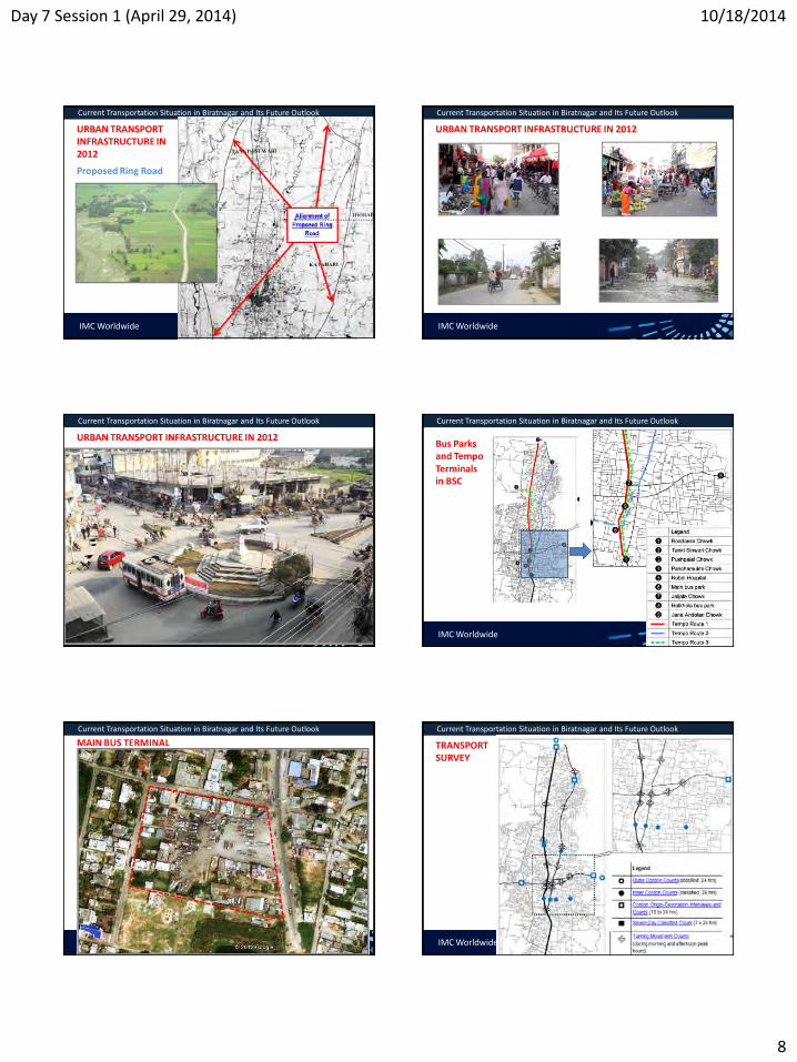
Day 7 Session 1 (April 29, 2014) 10/18/2014
8
IMC Worldwide
Current Transportation Situation in Biratnagar and Its Future Outlook
URBAN TRANSPORT INFRASTRUCTURE IN 2012
Proposed Ring Road
IMC Worldwide
Current Transportation Situation in Biratnagar and Its Future Outlook
URBAN TRANSPORT INFRASTRUCTURE IN 2012
IMC Worldwide
Current Transportation Situation in Biratnagar and Its Future Outlook
URBAN TRANSPORT INFRASTRUCTURE IN 2012
IMC Worldwide
Current Transportation Situation in Biratnagar and Its Future Outlook
Bus Parks and Tempo Terminals in BSC
IMC Worldwide
Current Transportation Situation in Biratnagar and Its Future Outlook
MAIN BUS TERMINAL
IMC Worldwide
Current Transportation Situation in Biratnagar and Its Future Outlook
TRANSPORT SURVEY

Day 7 Session 1 (April 29, 2014) 10/18/2014
9
IMC Worldwide
Current Transportation Situation in Biratnagar and Its Future Outlook
TYPES OF VEHICLES IN BSC
IMC Worldwide
Current Transportation Situation in Biratnagar and Its Future Outlook
TYPES OF VEHICLES IN BSC
IMC Worldwide
Current Transportation Situation in Biratnagar and Its Future Outlook
TYPES OF VEHICLES IN BSC
IMC Worldwide
Current Transportation Situation in Biratnagar and Its Future Outlook
TRAFFIC VOLUME (PCU EQVT) AT BIRATNAGAR NORTH GATE
IMC Worldwide
Current Transportation Situation in Biratnagar and Its Future Outlook
24-HOUR TRAFFIC VOLUME (VEHICLES/DAY)
IMC Worldwide
Current Transportation Situation in Biratnagar and Its Future Outlook
24-HOUR TRAFFIC VOLUME (VEHICLES/DAY)

Day 7 Session 1 (April 29, 2014) 10/18/2014
10
IMC Worldwide
Current Transportation Situation in Biratnagar and Its Future Outlook
PREFERRED MODE OF TRAVEL BY TRAVEL TIME
IMC Worldwide
Current Transportation Situation in Biratnagar and Its Future Outlook
FREQUENCY OF RICKSHAW AND BUS USE
IMC Worldwide
Current Transportation Situation in Biratnagar and Its Future Outlook
SHARE OF MAIN VEHICLES
IMC Worldwide
Current Transportation Situation in Biratnagar and Its Future Outlook
TRAFFIC FLOWS (VPD : MOTORIZED & NON-MOTORIZED)
IMC Worldwide
Current Transportation Situation in Biratnagar and Its Future Outlook
VEHICLE FLOW (TO & FROM ) IN CENTRAL AREA
IMC Worldwide
Current Transportation Situation in Biratnagar and Its Future Outlook
HOURLY VEHICLE FLOW (TO & FROM ) IN CENTRAL AREA

Day 7 Session 1 (April 29, 2014) 10/18/2014
11
IMC Worldwide
Current Transportation Situation in Biratnagar and Its Future Outlook
DAILY FLOW OF PERSONS ACROSS INNER CORDON
IMC Worldwide
Current Transportation Situation in Biratnagar and Its Future Outlook
GENDER RELATED MOBILITY
• Rickshaw passengers: 35% male, 65% female,
• Car/jeep/van passengers: 68% male, 31.9% female,
• Tempos: 40% male, 60% female,
• School vehicle passengers: 56% male, 43% female,
• Mini/Micro Bus passengers: 71% male, 28% female,
• Regional bus passengers: 79% male, 20% female.
IMC Worldwide
Current Transportation Situation in Biratnagar and Its Future Outlook
ROAD TRAFFIC ACCIDENTS (2010-2013)
Year 2010/11 2011/12 2012/13 Reported Accidents 11 9 24 Persons Injured 34 29 44 Fatalities 3 5 6
Number of Vehicles Involved
Bicycles 0 1 2 Motorcycles 6 9 18 Rickshaws 1 0 2 Tempos 1 1 4 Cars 1 1 4 Buses 2 2 2 Trucks 4 3 1
IMC Worldwide
Current Transportation Situation in Biratnagar and Its Future Outlook
CORRIDORS AND BLACK SPOT OF INCREASED ROAD TRAFFIC ACCIDENT RISK
IMC Worldwide
Current Transportation Situation in Biratnagar and Its Future Outlook
TRAVEL SPPED AND DELAYS SURVEY
IMC Worldwide
Current Transportation Situation in Biratnagar and Its Future Outlook
ROAD INVENTORY
Road Length Kilometers %
Total Road Length Surveyed 102.7 100%
Carriageway Width
up to 4.0 m 24.6 24%
4.0 – 6.0 m 26.4 26%
6.0 – 8.0 m 47.1 46%
more than 8.0 m 4.6 4%
Surface Type
Bitumen 73.3 72%
Gravel 29.3 28%
Earth 0.1 <1%
Surface Quality
Good (smooth surface permitting smooth vehicle
movements)
17.9 17%
Fair (surface with some damage / potholes
resulting in bumps at places)
78.3 77%
Poor (surface with major damages and potholes) 6.5 6%

Day 7 Session 1 (April 29, 2014) 10/18/2014
12
IMC Worldwide
Current Transportation Situation in Biratnagar and Its Future Outlook
ROAD INVENTORY
Road Length Kilometer
s
%
Roadside Drains (total figures for both sides)
Earthen Ditch 120.6 59%
Brick Masonry 69.0 34%
Other Drain 14.5 7%
No Drain 1.4 <1%
Landuse Along Road (total figures for both sides)
Built-up Land 115.3 56%
Cultivated Area 86.7 42%
Other Landuse 3.5 2%
IMC Worldwide
Current Transportation Situation in Biratnagar and Its Future Outlook
SHARE OF MAIN VEHICLES
IMC Worldwide
Current Transportation Situation in Biratnagar and Its Future Outlook
PHYSICAL DEFICIENCIES OF BIRATNAGAR ROAD NETWORK
• Insufficient CWY, lack of sidewalks on collector roads • No alternatives to divert transit traffic from the city center • Poor intersection layout • poor CWY surfaces and shoulders
• reduce travel speed • discourage NMT use • dust pollution
IMC Worldwide
Current Transportation Situation in Biratnagar and Its Future Outlook
DEFICIENCIES IN TRAFFIC MANAGEMENT
• obstruction at intersections, roads, causing delays • unnecessary weaving of traffic • safety hazards for pedestrians and NMT
Deficiencies in the Central Area • Congestion, inconvenience, especially for pedestrians, NMTs • discouragement for UPT to serve the city center • generally unattractive appearance that discourages private sector
investment
IMC Worldwide
Current Transportation Situation in Biratnagar and Its Future Outlook
DEFICIENCIES IN UPT
• low demand -lack of facilities for prospective pax • poor coverage over space and time, • poor service and quality of vehicles, • No regulatory framework to encourage private sector to improve
IMC Worldwide
Current Transportation Situation in Biratnagar and Its Future Outlook
LONG-TERM VISION
• BSC envisaged to significantly progress to become • more modern • Vibrant • Child friendly city

Day 7 Session 1 (April 29, 2014) 10/18/2014
13
IMC Worldwide
Current Transportation Situation in Biratnagar and Its Future Outlook
LONG-TERM VISION
More vibrant economy • Manufacturing sector revived • Industrial corridor revitalised • New manufacturing at south
(Ward 20) • New economic clusters
• high-level education, health facilities • SE (Ward 18) • NW (Ward 5)
• new service sector in the south, just outside BSC, near ICP.
IMC Worldwide
Current Transportation Situation in Biratnagar and Its Future Outlook
CONSULTANT’S ASSESSMENT IN THE LONG-TERM
• BSC landuse will intensify • Residential development still low-rise • Some high-rise expected
• Encouraged near prominent centre of employment • cluster of hospitals, manufacturing
• City centre landuse intensifed • Private sector led • BSC regulation for these near city centre and/or Koshi Highway.
• Urban transport demand will be much higher
IMC Worldwide
Current Transportation Situation in Biratnagar and Its Future Outlook
CONSULTANT’S ASSESSMENT IN THE LONG-TERM
• Katahari rail link extended to nearer EWH • Rail freight, pax transport from India bypass BSC • Freight for industrial corridor north transported via ring road
• Koshi Highway widened and ring road fully developed
IMC Worldwide
Current Transportation Situation in Biratnagar and Its Future Outlook
• Ring road will divert all NS transit traffic from Koshi Highway
• Koshi Highway convert to high-capacity intra-urban thoroughfare • private motorized not
necessarily prioritized
OVERALL VISION FOR URBAN TRANSPORT BY 2033
IMC Worldwide
Current Transportation Situation in Biratnagar and Its Future Outlook
• Steps taken to minimize problems to different road users
• high-capacity bus system • Koshi Highway north -
Roadcess Chowk -Rani Sadak Road
• Lower capacity UPT • away from Koshi
Highway, NS demand • minibuses, electro-
powered smaller vehicles
OVERALL VISION FOR URBAN TRANSPORT BY 2033
IMC Worldwide
Current Transportation Situation in Biratnagar and Its Future Outlook
• private motorcycle shall not be overly restricted • very efficient form of transport (occupy
small road-space) • Mobility provided
• designs of transport infrastructure, measures to • discourage cars for short trips • restrict cars to/from city centre;
OVERALL VISION FOR URBAN TRANSPORT BY 2033

Day 7 Session 1 (April 29, 2014) 10/18/2014
14
IMC Worldwide
Current Transportation Situation in Biratnagar and Its Future Outlook
• Developed network of physical facilities, measures for NMT • within residential areas • trips to/from schools
• Developed network of physical facilities, measures to facilitate walking • over short distances, especially within residential areas • routes to schools • to the city centre • for circulation within the city centre.
OVERALL VISION FOR URBAN TRANSPORT BY 2033
IMC Worldwide
Current Transportation Situation in Biratnagar and Its Future Outlook
Biratnagar Urban Transport Policy Statement • Gradually develop a modern, efficient transport system for Biratnagar,
based on thought-out strategies that meet the current, emerging needs. • Transport system should serve the diverse needs of all population groups,
help Biratnagar become • child-friendly city • support economic dev. with min. negative env., social impacts.
URBAN TRANSPORT STRATEGY FOR BSC
IMC Worldwide
Current Transportation Situation in Biratnagar and Its Future Outlook
• Integrate transport planning , land-use to enhance quality of life • Minimize increase in transport needs • Achieve max accessibility, inter-connectivity, efficiency, sustainability • Manage inevitable increase in transport demand • Prepare for inevitable increase, share of private vehicles
URBAN TRANSPORT STRATEGY FOR BSC
IMC Worldwide
Current Transportation Situation in Biratnagar and Its Future Outlook
• Limit negative impacts of private vehicles, shift majority of demand from vehicles to UPT
• Better UPT network incl. NMT accessible to all (poor, child, women) • Improve walking, cycling accessibility to poor, women, children, elderly,
persons with disability • Enhance vibrancy, commercial life in city centre with improved traffic
management, walkability • Minimize hindrances for transit traffic
URBAN TRANSPORT STRATEGY FOR BSC
IMC Worldwide
Current Transportation Situation in Biratnagar and Its Future Outlook
• Minimize negative socio-env. impacts of all transport movements • Prioritize interventions that will encourage +ve responses including
investments from business sector, civil society
URBAN TRANSPORT STRATEGY FOR BSC
Policy statement was endorsed by Steering Committee in December 2012
It was also endorsed by the Municipal Council in January 2013.
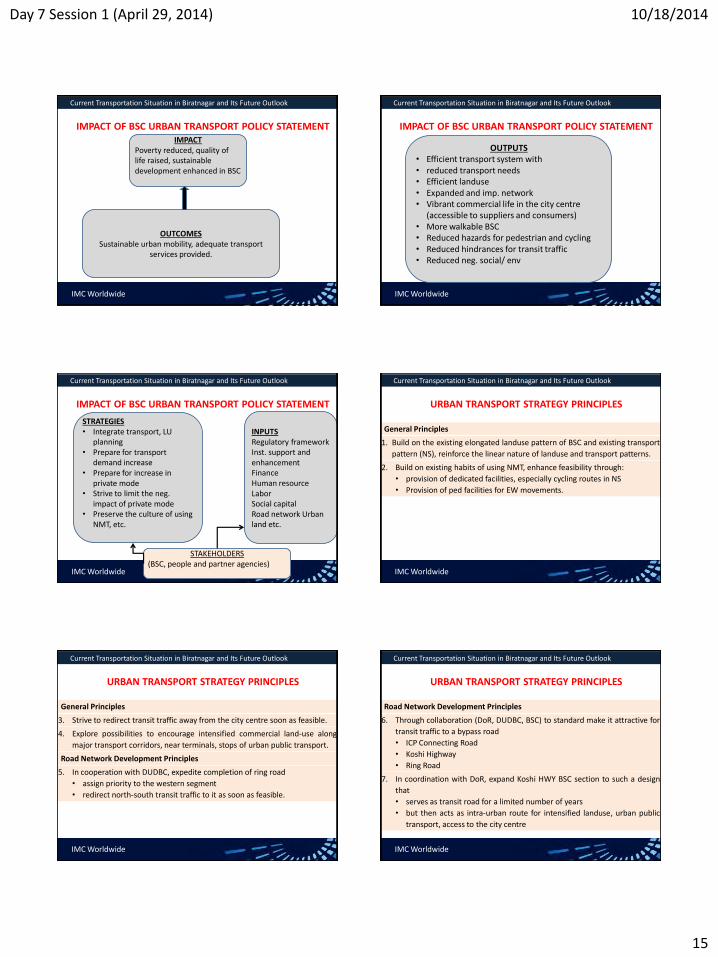
Day 7 Session 1 (April 29, 2014) 10/18/2014
15
IMC Worldwide
Current Transportation Situation in Biratnagar and Its Future Outlook
IMPACT OF BSC URBAN TRANSPORT POLICY STATEMENT IMPACT
Poverty reduced, quality of life raised, sustainable development enhanced in BSC
OUTCOMES Sustainable urban mobility, adequate transport
services provided.
IMC Worldwide
Current Transportation Situation in Biratnagar and Its Future Outlook
IMPACT OF BSC URBAN TRANSPORT POLICY STATEMENT
OUTPUTS • Efficient transport system with • reduced transport needs • Efficient landuse • Expanded and imp. network • Vibrant commercial life in the city centre
(accessible to suppliers and consumers) • More walkable BSC • Reduced hazards for pedestrian and cycling • Reduced hindrances for transit traffic • Reduced neg. social/ env
IMC Worldwide
Current Transportation Situation in Biratnagar and Its Future Outlook
IMPACT OF BSC URBAN TRANSPORT POLICY STATEMENT
STRATEGIES • Integrate transport, LU
planning • Prepare for transport
demand increase • Prepare for increase in
private mode • Strive to limit the neg.
impact of private mode • Preserve the culture of using
NMT, etc.
INPUTS Regulatory framework Inst. support and enhancement Finance Human resource Labor Social capital Road network Urban land etc.
STAKEHOLDERS (BSC, people and partner agencies)
IMC Worldwide
Current Transportation Situation in Biratnagar and Its Future Outlook
URBAN TRANSPORT STRATEGY PRINCIPLES
General Principles
1. Build on the existing elongated landuse pattern of BSC and existing transport
pattern (NS), reinforce the linear nature of landuse and transport patterns.
2. Build on existing habits of using NMT, enhance feasibility through:
• provision of dedicated facilities, especially cycling routes in NS
• Provision of ped facilities for EW movements.
IMC Worldwide
Current Transportation Situation in Biratnagar and Its Future Outlook
URBAN TRANSPORT STRATEGY PRINCIPLES
General Principles
3. Strive to redirect transit traffic away from the city centre soon as feasible.
4. Explore possibilities to encourage intensified commercial land-use along
major transport corridors, near terminals, stops of urban public transport.
Road Network Development Principles
5. In cooperation with DUDBC, expedite completion of ring road
• assign priority to the western segment
• redirect north-south transit traffic to it as soon as feasible.
IMC Worldwide
Current Transportation Situation in Biratnagar and Its Future Outlook
URBAN TRANSPORT STRATEGY PRINCIPLES
Road Network Development Principles
6. Through collaboration (DoR, DUDBC, BSC) to standard make it attractive for
transit traffic to a bypass road
• ICP Connecting Road
• Koshi Highway
• Ring Road
7. In coordination with DoR, expand Koshi HWY BSC section to such a design
that
• serves as transit road for a limited number of years
• but then acts as intra-urban route for intensified landuse, urban public
transport, access to the city centre

Day 7 Session 1 (April 29, 2014) 10/18/2014
16
IMC Worldwide
Current Transportation Situation in Biratnagar and Its Future Outlook
URBAN TRANSPORT STRATEGY PRINCIPLES
Road Network Development Principles
8. Develop additional NS routes for intra-urban traffic friendly to NMT and
UPT for demands from residences, emerging employment centre at BRT
south (Ward 20).
9. Upgrade existing collector roads, complemented with the necessary
minimum of new road construction, to provide a connection from the south
(Koshi Highway) to the east of BSC (Hatkhola) through Wards 18 and 11.
IMC Worldwide
Current Transportation Situation in Biratnagar and Its Future Outlook
URBAN TRANSPORT STRATEGY PRINCIPLES
Road Network Development Principles
8. Upgrade existing collector roads, complemented with the necessary
minimum of new road construction, to provide a connection from the east
(Hatkhola) to the north of BSC (Koshi Highway) through Wards 11, 2, 3,
and/or 4.
Urban Public Transport Principles
9. Develop network of UPT routes including terminals, stops with waiting
areas, other facilities at existing and planned centers of commercial
activities, admin services, existing, emerging centers of employment, and at
suitable access points to the city centre.
IMC Worldwide
Current Transportation Situation in Biratnagar and Its Future Outlook
URBAN TRANSPORT STRATEGY PRINCIPLES
Urban Public Transport Principles
10. Ensure that all terminals all stops are conveniently and safely accessible for
pedestrians, and impose necessary restrictions on vehicle traffic.
11. Develop the existing bus park with a focus on its function as a hub for urban
public transport, include in its design all necessary facilities for enhanced
inter-connectivity between long and mid-haul bus transport and intra-urban
transport including non-motorized transport and walking.
12. Explore and use the possibilities for encouraging or obliging the operators
of urban public transport to phase out tempos and basantis in favor of
microbuses and/or other vehicles.
IMC Worldwide
Current Transportation Situation in Biratnagar and Its Future Outlook
URBAN TRANSPORT STRATEGY PRINCIPLES
Urban Public Transport Principles
13. Explore and use the possibilities for regulating the emerging taxi service
industry so that it will not inflict damage on the other types of urban public
transport.
14. Explore and use the possibilities for better regulating the rickshaw industry
with a view to reducing the number of rickshaws and enhancing the service
level.
15. Develop a concept for establishing a range of urban public transport modes
and locating each type of urban public transport service optimally within
the territory of BSC for maximum mutual complementarity and minimum
mutual interference.
IMC Worldwide
Current Transportation Situation in Biratnagar and Its Future Outlook
URBAN TRANSPORT STRATEGY PRINCIPLES
Urban Public Transport Principles
16. Explore and use the possibilities for better regulating the rickshaw industry
with a view to reducing the number of rickshaws and enhancing the service
level.
17. Develop a concept for establishing a range of urban public transport modes
and locating each type of urban public transport service optimally within
the territory of BSC for maximum mutual complementarity and minimum
mutual interference.
Q & A

10/18/2014
1
TRAINING ON MODULE 1: TRAFFIC ENGINEERING & MANAGEMENT
Session 3: Traffic Surveys & Surveys Conducted
Organiser: GoN Dept. of Urban Development & Building Construction
Trainer: Subhash Dhungel, Urban Transport Infrastructure Specialist Urban Transport Planning Management (ADB ta 7948), IMC Worldwide 13 October, 2014
TRAINING ON MODULE 1: TRAFFIC ENGINEERING & MANAGEMENT
Session 3: Traffic Surveys Conducted
Traffic Counts
IMC Worldwide
Module 1 : Traffic Engineering & Management Session 3: Surveys Conducted
Types Where conducted
Count duration/frequency
Output
By nature of the count
1. Link count
road link (mid block) -conducted in Biratnagar
• Desirable: 24 hrs - 7 days classified
• Or, 12/14/16 hrs -1- 3 days
• Twice yearly (peak & off- peak season)
Traffic flow, mix Traffic variation factor Peak/ Off-peak traffic Peak hour factor AADT
2. Turning movement count
Intersection -conducted in Biratnagar
• 6 hrs (3 hrs each peak period) • Weekday • Weekend • Min at weekday
Turning movements Traffic variation, mix by approach Peak/ Off-peak hours Peak hour factor
URBAN TRAFFIC SURVEYS IN URBAN AREAS
IMC Worldwide
Module 1 : Traffic Engineering & Management Session 3: Surveys Conducted
TRAFFIC COUNT SURVEYS IN URBAN AREAS Types Where conducted Count duration Output
By purpose
1. Outer cordon count – conducted
Main roads approaching city
Same as for link count
Same as for link count
2. Inner cordon count - conducted
Intra-urban roads approaching city centre
3. Pedestrian counts - conducted
• Crossing: mid-blocks, intersections
• Mid-blocks: along sidewalks, shoulders
• Scope: selected streets/broader area
Desirable: 06:00 ~ 19:00 hrs Min: 6 hrs (3 hr each- AM, PM peak
Ped per hr Ped per min Ped per m per hr/min
IMC Worldwide
Module 1 : Traffic Engineering & Management Session 3:Surveys Conducted
VEHICLE CLASSIFICATION ADOPTED FOR URBAN
COUNTS IN NEPAL
To ease survey, can limit to following groups • Cycle and motorcycle • Light vehicle • Bus and truck • Rickshaw (NMT and auto) • Hand-cart and tractor
• Choose the classification to suit the survey objective • Vehicle class to be distinct to the enumerator
Multi-axle
trucks Utility vehicle
Heavy trucks Utility vehicle
Light trucks Motorcycle
Standard bus Tempo
Small bus Tractor
Minibus Cycle - Terai
Microbus Rickshaw - Terai
Car Bull/Horse cart –valley, Terai
Four wheel drive Handcart
IMC Worldwide
Module 1 : Traffic Engineering & Management Session 3:Surveys Conducted
COUNTING TECHNIQUE IN URBAN AREAS
• Manual by observing
Recording on paper form
Recording using hand tally
Recording using electronic boards
Single hand tally
Multiple hand tally
Electronic boards

10/18/2014
2
IMC Worldwide
Module 1 : Traffic Engineering & Management Session 3:Surveys Conducted
PAPER BASED MANUAL COUNTING
For road-link counts
For turning movement counts
• Count interval: • Link counts: 1 hour • Turning movement: 15 min. • Turning movement at signal: cycle time
IMC Worldwide
Module 1 : Traffic Engineering & Management Session 3: Surveys Conducted
MANPOWER REQUIRED -PAPER-BASED MANUAL COUNTS
Traffic (vph) Nos. of items one experienced enumerator can record
≤300 Twelve
300<v≤ 600 Four
600<v≤ 1200 Two
1200<v≤1800 One
v≥1800 Estimate traffic per vehicle class/classes and calculate as per above.
• One supervisor per 10 enumerators
IMC Worldwide
Module 1 : Traffic Engineering & Management Session 3: Surveys Conducted
AUTOMATIC COUNT TECHNIQUE IN URBAN AREAS
Pneumatic tube
Piezo electric, inductive loop
Passive infra-red, magnetic
Microwave-doppler/radar
Ultrasonics, passive acoustic
Video image detection
Pneumatic tube
Passive/active infra-red counter
IMC Worldwide
Module 1 : Traffic Engineering & Management Session 3: Surveys Conducted
VIDEO BASED COUNT ADOPTED IN BIRATNGAR
Courtesy: Welink Consultant, Pvt. Ltd.
• CCTV image recorded in the video recorder • Counting manually with a counting software • Inverter, battery installed of backups • More accurate than manual counting; • Require fewer manpower at the sites
IMC Worldwide
Module 1 : Traffic Engineering & Management Session 3: Survey Conducted
MANPOWER REQUIRED FOR MANUAL PEDESTRIAN COUNTS Peak Hour Pedestrian volume
– two way (pph) Enumerators required
Paper-based
Hand tallies/ electronic board
Mid-block counts
<2,000 2 1
2,000<v<4,000 4 2
4,000<v<10,000 8 4
≈10,000 pph -one dir. for short period 4 2
Crossing counts for four-way intersection
Light traffic, CWs used alternately 2 1
Moderate traffic, CWs used alternately 4 2
Each CW traffic> 2,000 pph (two-way) 16 8
Module 1 : Traffic Engineering & Management Session 3: Surveys Conducted
• IMC Worldwide
At Biratnagar: • 14 link counts • 15 turning counts

10/18/2014
3
Module 1 : Traffic Engineering & Management Session 3: Surveys Conducted
• IMC Worldwide
TRAFFIC VOLUME IN BSC Station Trucks Buses LV+ TRA MC BC O. NMTs Total
OC 1 1,020 1,874 2,133 9,287 6,269 406 20,989
OC 2 77 164 305 1,698 3,844 105 6,193
C 1 1,016 2,009 3,074 10,709 5,536 288 22,632
C 2 16 144 274 2,109 4,261 348 7,152
C 3 573 916 734 4,987 4,948 1,013 13,171
C 4 14 142 171 2,602 11,851 2,871 17,651
C 5 36 89 344 2,544 8,274 1,102 12,389
C 6 154 271 771 3,854 12,551 1,190 18,791
IC 1 64 128 454 4,516 6,006 2,110 13,278
IC 2 517 804 2,138 10,063 8,511 3,839 25,872
IC 3 15 148 358 4,690 10,732 1,935 17,878
IC 4 0 64 177 2,506 3,274 896 6,917
IC 5 11 68 134 1,717 4,338 435 6,703
IC 6 838 1,652 3,285 16,481 9,602 2,166 34,024 Total 3,513 6,821 11,067 61,282 90,395 16,538 189,616
2% 3% 5%
32%
49%
8%
Average Traffic Mix Networkwide in BSC
Trucks Buses LV+ TRA
MC BC Other NMTs IMC Worldwide
Module 1 : Traffic Engineering & Management Session 3: Surveys Conducted
MANUAL PEDESTRIAN
COUNT METHOD
Counting interval: • Mid-block: 30 min – 1 hour • Crossing:
• 15 ~ 30 minutes: partial • 30 minutes: continuous
IMC Worldwide
Module 1 : Traffic Engineering & Management Session 3: Surveys Conducted
PEDESTRIAN COUNTS IN BSC – AM PERIOD
Time
Border
Gate
Main Road
(Buddha Marg)
BRT Bus
Park
Mahendra
Chowk
Traffic
Chowk
P(A) P(B) P11 P12 PB4 P5 PB1 P6 PB2 P10 PB3
8 - 9 409 388 223 333 35 287 83 592 45 405 98
9 - 10 752 535 326 694 120 214 103 478 122 529 186
10 - 11 642 470 181 494 196 260 95 544 98 600 215
IMC Worldwide
Module 1 : Traffic Engineering & Management Session 3: Surveys Conducted
PEDESTRIAN COUNTS IN BSC – PM PERIOD
Time
Border
Gate
Main Road
(Buddha Marg)
BRT Bus
Park
Mahendr
a Chowk
Traffic
Chowk
P(A) P(B) P11 P12 PB4 P5 PB1 P6 PB2 P10 PB3
4 - 5 444 413 883 1,909 325 269 32 697 85 899 196
5 - 6 566 501 1,340 1,349 421 243 55 837 212 1,836 670
6 - 7 217 294 1,061 963 112 128 30 601 132 920 451
IMC Worldwide
Module 1 : Traffic Engineering & Management Session 3: Surveys Conducted
FUNDAMENTAL OF BASIC TRAFFIC PARAMETERS
IMC Worldwide
Module 1 : Traffic Engineering & Management Session 3: Surveys Conducted
FUNDAMENTAL OF BASIC TRAFFIC PARAMETERS
Vehicle PCU Factor
Vehicle PCU Factor
Vehicle PCU Factor
C, van, 4WD 1.0 Bus 3.0 Pedestrian 0.10 Trucks: Minibus 3.0 Porter 0.40
empty 2.0 Microbus 1.5 Rickshaw 1.0
≤8 MT 2.5 Tempo 1.0 Bull-cart 8.0
>8 MT 3.5 Motorcycle 0.50 Horse-cart 6.0
Light truck 1.5 Pick-up 1.0 Hand-cart 2.0
PT, tractor 3.0 Bicycle 0.50 Pack animal 2.0
PCU factors prescribed in Nepal Urban Road Standard-2068 (draft)

10/18/2014
4
IMC Worldwide
Module 1 : Traffic Engineering & Management Session 3: Surveys Conducted
DATA ENTRY AND ANALYSIS OF TRAFFIC COUNTS
Start Date : 15-Jan-12Road Link : F00101 Location : AnarmaniName of the Road : Birtamod - Chandragadhi - Mechipul Surveyed by : SNC Lavalin (Canada) in assoc. with SILT- ERMC JVDOR general seasonal factor for January: 0.93 Enumerator: Lucky Bishwakarma Supervisor: Rameshwor Giiri/Engineer Overall Supervision: S. Dhungel/ Traffic Engineer
Non-motorised Vehicles
a b a b a b a b a b a b a b a b a b a b a b a b a b a b a b a b a b a+b
15-Jan-12 06:00:00 2 1 5 4 7 1 1 19 4 2 2 1 3 2 1 25 5 62 23 85 07:00:00 1 3 3 8 6 6 4 - 46 15 1 2 2 2 3 1 5 2 70 28 144 64 208 08:00:00 1 3 2 10 3 12 6 6 - 90 80 2 1 2 3 3 - 2 - 13 10 70 57 213 163 376 09:00:00 1 2 9 5 5 10 15 9 4 3 135 155 10 10 8 1 7 5 3 1 3 3 88 98 289 301 590 10:00:00 1 5 1 9 6 6 3 - 110 105 9 4 1 4 2 2 1 1 80 75 223 202 425 11:00:00 1 2 3 5 6 6 5 12 135 120 6 5 1 3 1 1 3 2 3 100 105 1 1 264 263 527 12:00:00 1 5 3 4 4 3 11 8 5 6 115 135 8 6 5 3 5 2 9 2 89 105 255 279 534 13:00:00 1 1 3 5 4 10 15 2 1 167 177 4 3 2 7 7 5 8 9 120 115 329 337 666 14:00:00 3 1 2 2 2 4 5 8 15 3 6 118 142 5 6 1 11 5 4 5 6 92 84 253 277 530 15:00:00 - - 5 4 4 7 9 13 5 7 102 172 7 3 2 6 4 1 4 16 75 129 218 357 575 16:00:00 - 1 1 2 4 4 10 13 14 8 16 112 102 5 12 5 6 6 13 72 67 228 245 473 17:00:00 1 - 6 8 6 15 5 20 64 152 3 5 5 3 5 5 7 41 103 127 327 454
06:00~18:00 hrs - - 2 15 4 4 33 37 61 71 109 109 43 72 1,213 1,359 62 59 13 14 - - 52 45 28 9 62 72 922 971 1 1 2,605 2,838 5,443 18:00:00 1 - - 1 1 2 6 1 9 49 73 1 1 2 1 1 4 16 59 73 155 228 19:00:00 2 2 1 3 - 4 2 1 17 4 2 4 3 3 17 3 50 18 68 20:00:00 2 2 1 2 1 2 2 12 4 2 3 2 1 7 31 12 43 21:00:00 1 1 1 1 4 3 2 1 2 4 2 13 9 22 22:00:00 - - - 23:00:00 - - - 00:00:00 - - - 01:00:00 - - - 02:00:00 - - - 03:00:00 2 2 1 2 3 2 3 2 3 3 15 8 23 04:00:00 2 1 1 1 2 2 3 3 2 18 6 28 13 41 05:00:00 3 1 2 3 1 12 6 1 1 1 1 7 19 20 39
18:00~ 06:00 hrs - - 3 5 3 2 8 3 8 2 12 14 7 9 99 95 8 3 9 12 - - 2 1 - - 5 9 65 80 - - 229 235 464 Day 1 Sub-total - - 5 20 7 6 41 40 69 73 121 123 50 81 1,312 1,454 70 62 22 26 - - 54 46 28 9 67 81 987 1,051 1 1 2,834 3,073 5,907 15-Jan-12
Four Wheel
DrivePower Tiller Rickshaw
Result of Classified Manual Vehicle Count
Date Start Time
Motorised Vehicles
TotalTruck
Bicycle Bullock CartMulti-axle
Truck Heavy Light Big Mini
Bus
Car/Taxi MCUtility
VehiclesTractor
Motorised
Three
WheelerMicro
1. Enter the each vehicle count per interval by direction as shown.
4. Add each vehicle traffic by direction, total traffic by direction and total traffic for each shift.
2. Sum the total traffic per direction per interval.
3. Sum the total traffic in both directions.
IMC Worldwide
Module 1 : Traffic Engineering & Management Session 3: Surveys Conducted
DATA ENTRY AND ANALYSIS OF TRAFFIC COUNTS Start Date : 15-Jan-12Road Link : F00101 Location : AnarmaniName of the Road : Birtamod - Chandragadhi - Mechipul Surveyed by : SNC Lavalin (Canada) in assoc. with SILT- ERMC JVDOR general seasonal factor for January: 0.93 Enumerator: Lucky Bishwakarma Supervisor: Rameshwor Giiri/Engineer Overall Supervision: S. Dhungel/ Traffic Engineer
Non-motorised Vehicles
a b a b a b a b a b a b a b a b a b a b a b a b a b a b a b a b a b a+b
06:00~18:00 hrs - - 2 15 4 4 33 37 61 71 109 109 43 72 1,213 1,359 62 59 13 14 - - 52 45 28 9 62 72 922 971 1 1 2,605 2,838 5,443 18:00~ 06:00 hrs - - 3 5 3 2 8 3 8 2 12 14 7 9 99 95 8 3 9 12 - - 2 1 - - 5 9 65 80 - - 229 235 464
Day 1 Sub-total - - 5 20 7 6 41 40 69 73 121 123 50 81 1,312 1,454 70 62 22 26 - - 54 46 28 9 67 81 987 1,051 1 1 2,834 3,073 5,907 06:00~18:00 hrs 1 - 12 19 2 4 39 35 68 63 108 92 111 98 890 1,017 52 39 22 32 - - 49 50 2 - 111 145 683 724 - - 2,150 2,318 4,468 18:00~ 06:00 hrs 3 1 12 11 6 5 10 17 6 15 19 31 11 22 68 196 12 22 17 24 - - 6 28 - - 3 30 55 88 - - 228 490 718
Day 2 Sub-total 4 1 24 30 8 9 49 52 74 78 127 123 122 120 958 1,213 64 61 39 56 - - 55 78 2 - 114 175 738 812 - - 2,378 2,808 5,186 06:00~18:00 hrs - - 14 10 8 10 39 37 79 72 86 111 103 94 784 813 53 84 43 55 - - 64 78 - - 94 127 583 565 1 - 1,951 2,056 4,007 18:00~ 06:00 hrs 2 - 14 13 11 3 16 1 11 4 22 19 15 17 83 83 11 23 21 10 - - 11 7 - - 16 14 80 76 - - 313 270 583
Day 3 Sub-total 2 - 28 23 19 13 55 38 90 76 108 130 118 111 867 896 64 107 64 65 - - 75 85 - - 110 141 663 641 1 - 2,264 2,326 4,590
Total 6 1 57 73 34 28 145 130 233 227 356 376 290 312 3,137 3,563 198 230 125 147 - - 184 209 30 9 291 397 2,388 2,504 2 1 7,476 8,207 15,683 Grand Total (a+b) 7 130 62 275 460 732 602 6,700 428 272 - 393 39 688 4,892 3 15,683 Average Daily Traffic (ADT) 5,228 5,228 Composition (%) 100%Total ADT excl. NMVsComposition excl. NMV (%) 100%Average Annual Daily Traffic (AADT)AADT excl. NMVs
Note : Direction a: Mechipul to Birtamod Average PCU factor= 0.8Direction b: Birtamod to Mechipul Average PCU Factor (excl. NMV)= 0.6
NA 6 759 6 133 252 - 122 36 213 429 284
133 252 - 122 36 NA187
120 29 255 429 284 187 NA
PCU FactorsAADT in PCUs 1,039
1.00 0.504.00 3.00 1.50 3.00 3.00 1.25
AADT in PCUs excl. NMVs8 8
120 29 255 1.00
12 12
213 1,517 NA
1 NANA
3.00 0.75 1.00 3.00 1.00 0.50 6.00
187 2,077 133 84 - 122 40 19 85 143 227 187 2,077 133 84 - 122
31.2% 100%3,367
0.1% 1.3% 0.6% 2.7% 4.6% 7.2% 6.0% 66.3% 4.2% 2.7% 0.0% 3.9% 0.4% 100.0%NA NA NA
0.8% 0.4% 1.8% 2.9% 0.0%
15,683
3,131 4,862
3,870 1,860
2 43 21 92 153 244 201 2,233 143 91 - 131 13 229 1,631 1 0.0% 3.8%
15-Jan-12
16-Jan-12
17-Jan-12
Four Wheel
DrivePower Tiller Rickshaw
2 40 19 85
42.7% 2.7% 1.7% 0.0% 2.5% 0.2% 4.4%4.7%
2 143 227
Date Start Time
Motorised Vehicles
TotalTruck
Bicycle Bullock CartMulti-axle
Truck Heavy Light Big Mini
Bus
Car/Taxi MCUtility
VehiclesTractor
Motorised
Three
WheelerMicro
5. Add vehicle traffic all the shifts to get day traffic.
6. Calculate the vehicle traffic for other days depending on count duration (1/3/7 days)
7. Average the daily vehicle traffic of all count days to get vehicle ADT in both directions.
8. Add all the vehicle ADT to get the ADT in both direction.
IMC Worldwide
Module 1 : Traffic Engineering & Management Session 3: Surveys Conducted
DATA ENTRY AND ANALYSIS OF TRAFFIC COUNTS Start Date : 15-Jan-12Road Link : F00101 Location : AnarmaniName of the Road : Birtamod - Chandragadhi - Mechipul Surveyed by : SNC Lavalin (Canada) in assoc. with SILT- ERMC JVDOR general seasonal factor for January: 0.93 Enumerator: Lucky Bishwakarma Supervisor: Rameshwor Giiri/Engineer Overall Supervision: S. Dhungel/ Traffic Engineer
Non-motorised Vehicles
a b a b a b a b a b a b a b a b a b a b a b a b a b a b a b a b a b a+b
06:00~18:00 hrs - - 2 15 4 4 33 37 61 71 109 109 43 72 1,213 1,359 62 59 13 14 - - 52 45 28 9 62 72 922 971 1 1 2,605 2,838 5,443 18:00~ 06:00 hrs - - 3 5 3 2 8 3 8 2 12 14 7 9 99 95 8 3 9 12 - - 2 1 - - 5 9 65 80 - - 229 235 464
Day 1 Sub-total - - 5 20 7 6 41 40 69 73 121 123 50 81 1,312 1,454 70 62 22 26 - - 54 46 28 9 67 81 987 1,051 1 1 2,834 3,073 5,907 06:00~18:00 hrs 1 - 12 19 2 4 39 35 68 63 108 92 111 98 890 1,017 52 39 22 32 - - 49 50 2 - 111 145 683 724 - - 2,150 2,318 4,468 18:00~ 06:00 hrs 3 1 12 11 6 5 10 17 6 15 19 31 11 22 68 196 12 22 17 24 - - 6 28 - - 3 30 55 88 - - 228 490 718
Day 2 Sub-total 4 1 24 30 8 9 49 52 74 78 127 123 122 120 958 1,213 64 61 39 56 - - 55 78 2 - 114 175 738 812 - - 2,378 2,808 5,186 06:00~18:00 hrs - - 14 10 8 10 39 37 79 72 86 111 103 94 784 813 53 84 43 55 - - 64 78 - - 94 127 583 565 1 - 1,951 2,056 4,007 18:00~ 06:00 hrs 2 - 14 13 11 3 16 1 11 4 22 19 15 17 83 83 11 23 21 10 - - 11 7 - - 16 14 80 76 - - 313 270 583
Day 3 Sub-total 2 - 28 23 19 13 55 38 90 76 108 130 118 111 867 896 64 107 64 65 - - 75 85 - - 110 141 663 641 1 - 2,264 2,326 4,590
Total 6 1 57 73 34 28 145 130 233 227 356 376 290 312 3,137 3,563 198 230 125 147 - - 184 209 30 9 291 397 2,388 2,504 2 1 7,476 8,207 15,683 Grand Total (a+b) 7 130 62 275 460 732 602 6,700 428 272 - 393 39 688 4,892 3 15,683 Average Daily Traffic (ADT) 5,228 5,228 Composition (%) 100%Total ADT excl. NMVsComposition excl. NMV (%) 100%Average Annual Daily Traffic (AADT)AADT excl. NMVs
Note : Direction a: Mechipul to Birtamod Average PCU factor= 0.8Direction b: Birtamod to Mechipul Average PCU Factor (excl. NMV)= 0.6
NA 6 759 6 133 252 - 122 36 213 429 284
133 252 - 122 36 NA187
120 29 255 429 284 187 NA
PCU FactorsAADT in PCUs 1,039
1.00 0.504.00 3.00 1.50 3.00 3.00 1.25
AADT in PCUs excl. NMVs8 8
120 29 255 1.00
12 12
213 1,517 NA
1 NANA
3.00 0.75 1.00 3.00 1.00 0.50 6.00
187 2,077 133 84 - 122 40 19 85 143 227 187 2,077 133 84 - 122
31.2% 100%3,367
0.1% 1.3% 0.6% 2.7% 4.6% 7.2% 6.0% 66.3% 4.2% 2.7% 0.0% 3.9% 0.4% 100.0%NA NA NA
0.8% 0.4% 1.8% 2.9% 0.0%
15,683
3,131 4,862
3,870 1,860
2 43 21 92 153 244 201 2,233 143 91 - 131 13 229 1,631 1 0.0% 3.8%
15-Jan-12
16-Jan-12
17-Jan-12
Four Wheel
DrivePower Tiller Rickshaw
2 40 19 85
42.7% 2.7% 1.7% 0.0% 2.5% 0.2% 4.4%4.7%
2 143 227
Date Start Time
Motorised Vehicles
TotalTruck
Bicycle Bullock CartMulti-axle
Truck Heavy Light Big Mini
Bus
Car/Taxi MCUtility
VehiclesTractor
Motorised
Three
WheelerMicro9. Multiply ADT with DoR seasonal factor to get vehicle AADT. Ignore if no factor applicable.
10. Add all vehicle AADT to get the AADT in vehicles in both directions.
11. Multiply vehicle AADT with PCU factor to get vehicle AADT in PCUs.
12. Add all vehicle AADT to get the AADT in PCUs.
IMC Worldwide
Module 1 : Traffic Engineering & Management Session 3: Surveys Conducted
Analysis of traffic counts Station: Outer Cordon Koshi Highway
Date: (24 hrs Vehicle Count)
Time
Multi Axle
Truck
Heavy
Truck
Light
Truck Std Bus
Small
Bus Mini Bus
Micro
Bus car
Four
Wheel
Drive
Utility
Vechicle
MotorCy
cle
Three
Wheeler Tractor cycle
Ricshaw
_goods
Ricshaw
_Pax
Animal
Drawn
Vehicle
Total
Vehicle
Flow
00 3 0 0 0 0 0 0 8 7 0 8 0 0 0 0 0 0 26
01 4 0 0 0 0 0 0 6 0 0 6 0 0 0 0 0 0 16
02 6 2 0 0 0 0 0 4 2 0 2 0 0 0 0 0 0 16
03 12 3 0 0 0 0 2 3 3 0 3 0 0 0 0 0 0 26
04 15 8 0 1 0 0 2 4 4 1 10 0 0 1 0 0 0 46
05 5 18 1 11 10 4 4 11 5 4 69 0 1 188 2 0 0 333
06 3 10 2 31 5 11 7 7 10 5 158 0 4 372 7 0 1 633
07 6 11 0 29 33 29 12 16 18 20 378 0 7 432 14 5 0 1010
08 9 30 6 31 33 25 19 30 29 26 500 0 19 433 15 15 0 1220
09 14 39 9 45 36 40 21 44 47 17 724 1 16 412 28 5 0 1498 AM PK
10 6 32 13 25 52 15 23 53 46 14 690 1 36 324 27 12 0 1369
11 6 45 27 25 52 36 35 65 48 27 712 0 39 300 36 7 0 1460
12 7 41 12 34 40 47 26 67 36 26 726 1 24 327 32 5 0 1451
13 11 45 13 38 35 56 29 66 46 24 660 1 20 418 19 11 0 1492
14 6 41 17 53 42 28 34 58 41 31 633 2 21 335 26 15 1 1384
15 4 32 13 37 29 48 31 55 50 22 720 0 30 387 25 4 0 1487
16 21 40 23 52 34 45 42 65 57 26 793 0 29 502 21 4 2 1756
17 15 58 6 54 15 39 37 81 48 19 961 0 34 805 31 9 1 2213 PM PK
18 36 44 9 32 5 12 30 103 52 10 619 0 6 341 2 3 0 1304
19 15 44 4 17 19 11 12 64 33 8 412 0 7 360 5 1 1 1013
20 16 42 2 24 35 15 21 44 38 6 402 0 19 322 12 2 0 1000
21 27 9 0 1 0 0 4 14 13 6 60 0 0 1 0 0 0 135
22 10 1 0 2 0 0 4 5 7 0 35 0 0 7 0 0 0 71
23 10 1 0 1 0 0 0 2 8 0 6 0 0 2 0 0 0 30
Total (veh/d) 267 596 157 543 475 461 395 875 648 292 9287 6 312 6269 302 98 6 20989
K (peak hour factor- AM)= 7%
K (peak hour factor- PM)= 11%
10/10/2012
K factors can be used to extrapolate ADT if peak hour traffic counted in the future. E.g. If the AM peak traffic counted =100 vph Estimated daily traffic =100/0.07 =1,429 vpd
IMC Worldwide
Module 1 : Traffic Engineering & Management Session 3: Surveys Conducted
Analysis of traffic counts D1 (Duhabi to Biratnagar Gate)
Time
Multi
Axle
Truck
Heavy
Truck
Light
Truck
Std
Bus
Small
Bus
Mini
Bus
Micro
Bus car
Four
Wheel
Drive
Utility
Vechicle
Motor
Cycle
3
Wheeler Tractor cycle
Ricsha
w
Ricsha
w_Pas
senger
Animal
Drawn
Veh
Total
Vehicle
Flow
00 2 2 5 7 16
01 2 5 7
02 4 2 6
03 10 1 1 2 14
04 12 1 1 7 21
05 4 9 1 1 1 3 1 4 2 38 1 81 146
06 2 7 22 4 5 2 7 2 77 1 158 1 288
07 5 6 16 15 6 8 6 12 10 211 2 195 5 3 500
08 8 20 11 23 12 11 16 20 12 296 10 210 3 10 662
09 7 25 1 33 13 6 13 14 35 6 343 12 211 6 4 729
10 2 24 1 15 25 21 24 41 3 381 13 167 15 10 742
11 4 36 3 16 23 7 24 33 27 8 384 15 145 17 4 746
12 3 27 7 15 18 7 19 37 27 9 383 1 15 155 19 2 744
13 5 27 3 13 18 7 22 39 36 6 341 13 232 11 5 778
14 2 27 8 18 31 10 23 31 26 14 300 1 11 205 19 8 734
15 1 17 4 14 15 8 19 27 32 12 329 11 217 10 3 719
16 13 20 15 20 15 15 31 27 42 7 431 17 294 15 3 1 966
17 11 40 2 30 7 5 27 44 34 8 578 21 445 26 3 1281
18 25 16 19 3 1 24 37 43 393 1 89 651
19 10 27 2 15 19 9 12 33 31 6 317 7 287 2 1 778
20 14 24 24 35 12 21 27 37 4 345 19 299 12 2 875
21 15 6 2 9 7 6 28 73
22 8 1 2 2 3 3 10 29
23 7 1 3 3 2 16
Total (veh/d) 176 360 47 285 261 112 285 417 473 113 5209 2 169 3392 160 58 2 11521
Time D1 D2
00 16 10
01 7 9
02 6 10
03 14 12
04 21 25
05 146 187
06 288 345
07 500 510
08 662 558
09 729 769
10 742 627
11 746 714
12 744 707
13 778 714
14 734 650
15 719 768
16 966 790
17 1281 932
18 651 653
19 778 235
20 875 125
21 73 62
22 29 42
23 16 14
Total 11521 9468
24 hour 55% 45%
Morning period 51% 49%
Evening period 58% 42%
Mid day period 51% 49%
Direction split
Directional split demonstrate travel pattern or function of the street.
IMC Worldwide
Module 1 : Traffic Engineering & Management Session 3: Surveys Conducted
FURTHER INFERENCE FROM TRAFFIC DATA
Details of travel pattern visible from example. NS1 mostly MT and
TH –arterial NS2 & EW road
mostly NMT More road-space
for NMT?
NS1
N
S1
NS2
NS2
EW EW

10/18/2014
5
IMC Worldwide
Module 1 : Traffic Engineering & Management Session 3: Surveys Conducted
INFERENCE FROM PEDESTRIAN TRAFFIC DATA
Pedestrian traffic (pph) Sidewalk width
required (m) One dir. Both dir.
2,400 800 2.0
3,600 2,400 2.5
4,800 3,200 3.0
6,000 4,000 4.0
Business, shopping areas
Add 1 m to above
Shopping frontage 3.5
Large shopping frontage
≥4.5
Source: Nepal Urban Road Standard-2068 (draft)
• We can check whether existing sidewalks are adequate.
• Increase width? • Pedestrianizing? • Re-allocate road space?
IMC Worldwide
Module 1 : Traffic Engineering & Management Session 3: Surveys Conducted
USE PARAMETERS FROM COUNT ANALYSIS FOR FUTURE TRANSPORT PLANS
Start Date :
Road Link : F13501 Location : Parsa Chowk NorthName of the Road : Rampur - Parsa Chowk Surveyed by : SNC Lavalin (Canada) in assoc. with SILT- ERMC JVFeb. S-factor (avg. DoR factor at EWH - Bardhaghat, SH - Butwal): 0.88 Enumerator: Basudev Lamichane Supervisor: Rameshwar Giri Overall Supervision: S. Dhungel/ Traffic Engineer
Non-motorised Vehicles
a b a b a b a b a b a b a b a b a b a b a b a b a b a b a b a b a b a+b
06:00~18:00 hrs 5 2 15 15 11 19 9 20 15 25 - 13 16 23 392 225 8 10 34 58 - - 24 28 - - 8 8 508 373 7 7 1,052 826 1,878 967 18:00~ 06:00 hrs 7 1 12 14 5 9 5 - 4 4 - - 5 2 101 72 4 5 9 14 - - 6 4 - - - - 146 75 - - 304 200 504 283
Day 1 Sub-total 12 3 27 29 16 28 14 20 19 29 - 13 21 25 493 297 12 15 43 72 - - 30 32 - - 8 8 654 448 7 7 1,356 1,026 2,382 1,250 06:00~18:00 hrs 7 - 15 17 5 16 14 7 24 26 - 1 19 8 370 273 12 14 21 35 - 1 34 21 - - 9 11 538 537 7 9 1,075 976 2,051 940 18:00~ 06:00 hrs 2 2 12 19 2 15 3 5 6 6 - 1 1 3 73 155 7 6 10 22 - - 17 6 - - - 1 87 179 - - 220 420 640 373
Day 2 Sub-total 9 2 27 36 7 31 17 12 30 32 - 2 20 11 443 428 19 20 31 57 - 1 51 27 - - 9 12 625 716 7 9 1,295 1,396 2,691 1,313 06:00~18:00 hrs 8 23 16 16 5 21 17 10 27 25 - - 24 17 365 334 10 22 35 46 - - 3 21 - - 7 6 589 361 3 11 1,145 913 2,058 1,081 18:00~ 06:00 hrs - - - - - - - - - - - - - - - - - - - 19 - - 11 3 - - - 1 107 210 - 1 260 480 740 421
Day 3 Sub-total 8 23 16 16 5 21 17 10 27 25 - - 24 17 365 334 10 22 35 65 - - 14 24 - - 7 7 696 571 3 12 1,405 1,393 2,798 1,502
29 28 70 81 28 80 48 42 76 86 - 15 65 53 1,301 1,059 41 57 109 194 - 1 95 83 - - 24 27 1,975 1,735 17 28 4,056 3,815 7,871 4,065 7,871 4,065
1,355
Note : Direction a: Ramapur - Parsa Chowk/Kakrahawa Average PCU factor= 0.8Direction b: Kakrahawa/Parsa Chowk - Ramapur Average PCU Factor (excl. NMV)= 1.1
Result of Classified Manual Vehicle Count
Date Start Time
Motorised Vehicles
Total
Total
MVs
only
Mo
toris
ed
Th
ree
Wh
eele
r
Four
Wheel
Drive
Power Tiller
Ric
ksh
aw
BicycleBullock
Cart
Truck Bus
Ca
r/T
ax
i
MC
Uti
lity
Veh
icle
s
TractorMulti-
axle
Truck MicroLight
Composition (%) 1% 2% 1% 1% 2%Average Daily Traffic (ADT) 19 50 36 30 54
Total ADT excl. NMVs 1,214 Composition excl. NMV (%) 2% 4% 3% 2% 4% 0% 3%
Big
Grand Total (a+b) 57 151 108 90 162
MiniHeavy
12-Feb-12
13-Feb-12
14-Feb-12Total
45 7,871 15 118 2,360 98 303 1 1,237 15 2,624 5 39 787 33 101 0 3,710
59 - 17 178 - 51
47% 1% 100%0% 1% 30% 1% 4% 0% 2% 0% 1%
NA NA NA 100%0% 5% 0%Average Annual Daily Traffic (AADT) 17 44 32 26 47
65% 3% 8%52 - 15 1,082 13 2,172 4 34 688 29 88 0
1.00 3.00 1.00NA NA
3.00 0.751,062 4 34 688 29 88 0 52 - NAAADT excl. NMVs 17 44 32 26 47
1.00 0.50 1.00PCU Factors 4.00 3.00 1.50 3.00 3.00
AADT in PCUs excl. NMVs 68 132 48 78 141 52 - NA NAAADT in PCUs 68 132 48 78 141 5 34 344 29
12-Feb-12
NA 1,195 5 34 344 29 264 - 541 78 1,829 264 - 52 - 15 0.50 6.001.25
1. Other data such as traffic mix, average PCU factor at specific road useful to forecast traffic and planning.
2. In the inset shown, AADT is 2,172 vpd or 1,829 PCUs. Therefore, average PCU factor at this road is 0.8.
Average Annual Daily Traffic (AADT)AADT excl. NMVsPCU Factors
AADT in PCUs excl. NMVsAADT in PCUs
Average PCU factor= 0.8Average PCU Factor (excl. NMV)= 1.1
15 1,082 13 2,172
1.00NA NA 1,062 NA
NA NA NA 1,195 541 78 1,829 15 0.50 6.00
IMC Worldwide
Module 1 : Traffic Engineering & Management Session 3: Surveys Conducted
ANALYSIS OF TURNING MOVEMENT COUNTS Station : T5-Koshi Highway-DSP Road
Date:D1 (Mahendra Chowk to Bargachhi Chowk)
Time
Multi
Axle
Truck
Heavy
Truck
Light
Truck Std Bus
Mini
Bus
Small
Bus
Micro
Bus car
Four
Wheel
Drive
Utility
Vechicl
e
MotorC
ycle
Three
Wheele
r Tractor cycle
Ricshaw
_Goods
Ricshaw
_Pax
Animal
Drawn
Vehicle
Total
Vehicle
Flow
8-11A.M
8_9 14 6 2 20 6 22 21 23 23 13 517 19 5 488 10 53 1242
9_10 15 4 4 12 15 29 24 41 25 7 690 21 8 496 18 86 1495
10_11 18 9 7 6 10 42 17 38 35 10 745 25 15 510 18 116 1621
4_7 P.M
4_5 4 12 4 33 10 25 24 31 38 6 786 29 12 431 18 110 1573
5_6 6 9 2 20 9 11 21 38 27 13 911 34 15 776 17 90 1999
6_7 24 5 2 9 4 3 11 42 18 8 535 1 5 298 63 1028
Total 81 45 21 100 54 132 118 213 166 57 4184 129 60 2999 81 518 0 8958
6-Oct-12
• Enter the count data by movement in a worksheet as shown. • Determine the AM and PM peak hour traffic. • Detailed intersection analysis require specialist input but municipalities
can conduct simple analysis for planning.
IMC Worldwide
Module 1 : Traffic Engineering & Management Session 3: Surveys Conducted
TURNING COUNT STATIONS IN BSC
Total nos. of junctions = 14 • 13 nos. – AM/PM, 3 hrs each • 1 nos. - 24 hrs (Rani/Jogbani
border)
IMC Worldwide
Module 1 : Traffic Engineering & Management Session 3: Surveys Conducted
TURNING MOVEMENT COUNTS IN BSC INTERSECTIONS
Rani/Jogbani border Mahendra
Chowk IMC Worldwide
Module 1 : Traffic Engineering & Management Session 3: Surveys Conducted
TURNING MOVEMENT COUNTS IN BSC INTERSECTIONS

10/18/2014
6
IMC Worldwide
Module 1 : Traffic Engineering & Management Session 3: Surveys Conducted
TURNING MOVEMENT COUNTS IN BSC INTERSECTIONS
IMC Worldwide
Module 1 : Traffic Engineering & Management Session 3: Surveys Conducted
TURNING MOVEMENT COUNTS IN BSC INTERSECTIONS
Pushpalal Chowk
IMC Worldwide
Module 1 : Traffic Engineering & Management Session 3: Surveys Conducted
TURNING MOVEMENT COUNTS IN BSC INTERSECTIONS
Pushpalal Chowk
IMC Worldwide
Module 1 : Traffic Engineering & Management Session 3: Surveys Conducted
TURNING MOVEMENT COUNTS IN BSC INTERSECTIONS
IMC Worldwide
Module 1 : Traffic Engineering & Management Session 3: Surveys Conducted
TURNING MOVEMENT COUNTS IN BSC INTERSECTIONS
IMC Worldwide
Module 1 : Traffic Engineering & Management Session 3: Surveys Conducted
TURNING COUNTS CAN QUICKLY GUIDE TYPE OF INTERSECTION REQUIRED
Priority intersection appropriate if
Junction traffic < 1000 vph
major approach <=5000 vpd
& minor approach <=3000 vpd
If primary purpose is for access (e.g. residential streets)
If traffic low and space constrained
Note: a priority intersection, minor approach is controlled by STOP sign.

10/18/2014
7
IMC Worldwide
Module 1 : Traffic Engineering & Management Session 3: Surveys Conducted
TURNING COUNTS CAN QUICLY GUIDE THE TYPE OF INTERSECTION REQUIRED
Roundabout appropriate if
Intersection traffic = 1000~ 10,000 vph and space is available
Right-turns are heavy
Approaches more than four
but roundabout with 3 or 4 approaches common.
Other consideration favouring roundabout
• If reduction of delays at off-peak required
• If speed reduction required
• If various entry traffic not significantly diverse
IMC Worldwide
Module 1 : Traffic Engineering & Management Session 3: Surveys Conducted
TURNING COUNTS CAN QUICKLY GUIDE THE TYPE OF INTERSECTION REQUIRED
Signalised intersection appropriate if
other intersection failed
intersection traffic = 1000~ 10,000 vph and space restricted
pedestrian traffic >= 190 pph or >=85 pph when peds are slower
at a built-up area
Note: Currently, signalisation in Nepal difficult due to power cuts, lack of skilled manpower, maintenance.
IMC Worldwide
Module 1 : Traffic Engineering & Management Session 3: Surveys Conducted
ADDITIONAL IMPROVEMENT GUIDE AT SIGNALIZED INTERSECTIONS BASED ON TURNING COUNTS
Right-turn lane and protected phase required if
Right-turn traffic > 300 vph
Speed at the major approach is high
Left-turn lane required if
Intersecting angle >60° & LT traffic high
LT traffic very heavy
LT traffic heavy and pedestrians at the adjacent crosswalk is heavy
TRAINING ON MODULE 1: TRAFFIC ENGINEERING & MANAGEMENT
Session 3: Traffic Surveys Conducted
Roadside Origination Destination Survey
IMC Worldwide
Module 1 : Traffic Engineering & Management Session 3: Surveys Conducted
Method How conducted
Utility/ duration
Data collected/outputs
Roadside interview
Road cordon • Long-term, large areas
• 12/16 hrs • 24 hrs (few)
• Trip origin –destination • Loading (pax/freight) • Can seek following
• Trip purpose, number • Mode, parking details
Household interview
Home/ telephone
Long-term, large areas
HH members’ trip details of the previous weekday • Nos. of trips, time traveled • Trip purpose, mode used • Socio-economic profile
Mailing Blank trip diary mailed for filling
Registration number
Roadside observation at cordon points
• Small areas. • 12/16 hrs
• Between cordon points • Through trips • Observed (pax/freight)
• Additional trip information
ORIGINATION - DESTINATION SURVEYS IN URBAN AREAS
IMC Worldwide
Module 1 : Traffic Engineering & Management Session 3: Surveys Conducted
Method How conducted Utility/ duration Data collected/outputs
Post-card Blank pre-paid cards distributed at cordon and later collected by mail
• When traffic heavy • Sometimes
combined with roadside interview
• Nos. of trips, time • Trip purpose, mode • Socio-economic
profile
Sticker Sticker fixed to vehicle at entry and noted at exit
• Small areas • 12/16 hrs
Between cordon points • Trip pattern • Load (pax/freight)
observed
ORIGINATION - DESTINATION SURVEYS IN URBAN AREAS

10/18/2014
8
IMC Worldwide
Module 1 : Traffic Engineering & Management Session 3: Surveys Conducted
SAMPLE ROADSIDE OD SURVEY FORM Origin & Destination - Cordon Interviews - CARS, JEEPS, MOTOR-CYCLES, CYCLES
Station: Day & Date:
Road Name: Direction:
Place Name / Ward
NumberDistrict or VDC
Place Name / Ward
NumberDistrict or VDC
Journey
PurposeComments
1
2
3
4
5
6
7
8
9
10
11
12
Cycle 1 To/from Work 1Motor Cycle 2 To/from School 2Private Car /Jeep/4WD 3 To/from Shopping 3Pick-up (Passenger) 4 Personal Business 4Taxi 5 Leisure/Recreation 5Other (Specify) 22 Medical Treatment 6
Other (Specify) 7
Vehicle Types Journey Purpose
Origin Destination For Car, M/Cycle, etc
GON DUDBC
Urban Transport Planning Management(ADB TA 7948)
S/N Time
Type of
Vehicle (see
notes)
Vehicle
Registration
Number
Check if
Indian
Vehicle
Number of
Passengers
(incl Driver)
CAROrigin & Destination - Cordon Interviews - BUS, MiniBus, Tempo, Rickshaws & other Public Transport
Station: Day & Date:
Road Name: Direction:
Place Name / Ward Number District or VDC Place Name / Ward Number District or VDC
Type of
Service (see
notes)
Number
of Seats
Is significant
volume of
goods carried
Comments
1
2
3
4
5
6
7
8
9
10
11
12
Big Bus >40 seats 6 Regular Public Service 1Medium/Small Bus 7 Express/Long Distance 2Mini-Bus <20 seats 8 School Bus 3Micro-Bus/Van <10 seats 9 Works Bus/Employees 4Tempo 10 Private Hire/Other 5Basanti 11 Not in Service 6Rickshaw 12
Vehicle Types Type of Bus Operation
Origin Destination For Buses, Tempos, etc
GON DUDBC
Urban Transport Planning Management(ADB TA 7948)
S/N Time
Type of
Vehicle (see
notes)
Vehicle
Registration
Number
Check if
Indian
Vehicle
Number of
Passengers
(incl Driver)
BUSOrigin & Destination - Cordon Interviews - TRUCKS, Tractor/Trailer, Power Tiller, Carts, etc
Station: Day & Date:
Road Name: Direction:
Place Name / Ward
NumberDistrict or VDC
Place Name / Ward
NumberDistrict or VDC
Number
of Axles
Check if
container
Type of Goods /
Materials
Load
weight
(kg)
Volume
(Full/Half/
Part)
Are Goods
for import/
export to
India
1
2
3
4
5
6
7
8
9
10
11
12
Pick-up (Goods) 13 Agricultural Products 1Mini-truck 14 Timber 22-axle Truck 15 Oil Products 3Multi-Axle Truck 16 Construction Materials4(Farm) Tractor + Trailer 17 Processed Food 5Power Tiller 18 Steel (sheet, coil, etc) 6'Goods' Rickshaw 19 Miscellaneous Items 7Bullock Cart 20 Other (Specify) 8Hand Cart 21 Empty 9
Vehicle Types Type of Goods/Materials
Origin Destination For TRUCKS only
GON DUDBC
Urban Transport Planning Management(ADB TA 7948)
S/N Time
Vehicle
Type
(see notes)
Vehicle
Registration
Number
Check if
Indian
Vehicle
Number of
Passengers
(incl Driver)
TRUCK
IMC Worldwide
Module 1 : Traffic Engineering & Management Session 3: Surveys Conducted
BRIEF METHODOLOGY FOR ROADSIDE OD SURVEYS Origin & Destination - Cordon Interviews - TRUCKS, Tractor/Trailer, Power Tiller, Carts, etc
Station: Day & Date:
Road Name: Direction:
Place Name / Ward
NumberDistrict or VDC
Place Name / Ward
NumberDistrict or VDC
Number
of Axles
Check if
container
Type of Goods /
Materials
Load
weight
(kg)
Volume
(Full/Half/
Part)
Are Goods
for import/
export to
India
1
2
3
4
5
6
7
8
9
10
11
12
Pick-up (Goods) 13 Agricultural Products 1Mini-truck 14 Timber 22-axle Truck 15 Oil Products 3Multi-Axle Truck 16 Construction Materials4(Farm) Tractor + Trailer 17 Processed Food 5Power Tiller 18 Steel (sheet, coil, etc) 6'Goods' Rickshaw 19 Miscellaneous Items 7Bullock Cart 20 Other (Specify) 8Hand Cart 21 Empty 9
Vehicle Types Type of Goods/Materials
Origin Destination For TRUCKS only
GON DUDBC
Urban Transport Planning Management(ADB TA 7948)
S/N Time
Vehicle
Type
(see notes)
Vehicle
Registration
Number
Check if
Indian
Vehicle
Number of
Passengers
(incl Driver)
TRUCK
• Design form • Estimate enumerators req’d per direction
• Minimum : one, capture all traffic • Medium traffic: two, capture 30 -50% • Heavy traffic: four, capture 5- 25%
• 1 supervisor per every 10 enumerators • Orient, train supervisors, enumerators • Enumerators interview specific vehicles • Count simultaneously to expand data.
IMC Worldwide
Module 1 : Traffic Engineering & Management Session 3: Surveys Conducted
ANALYSIS OF ROADSIDE OD SURVEYS
1. To simplify analysis, establish fewer origins, destinations. 2. Transfer all data into a spreadsheet as shown. 3. Code vehicle type, direction of travel, journey purpose.
Station Road Name Direction
ADB TA 7948 1 Puspa Lal Chowk 1 Pushpa Lal Road 1 N-S
URBAN TRANSPORT PLANNING & MANAGEMENT 2 Kesaliya 2 Kesaliya Road 2 S-N
3 Haatkhola 3 Rangeli Road 3 E-W
4 Jogbani Checkpost 4 Malai Road 4 W-E
ORIGIN & DESTINATION : CORDON INTERVIEWS 5 Biratnagar Gate(Dhat) 5 Dharan Road
CARS, JEEPS, MOTORCYCLES, CYCLES 6 Talim Kendra Chowk 6Rani Path(Rani Sikiyaha Road)
Time
Category
Place Name /
Ward NumberDistrict or VDC
Place Name /
Ward Number
District or
VDC
Journey
PurposeComments
41 1 3 3 4 10/9/2012 8:00:00 AM 8-9 am 2 KO 5 PA 3313 N 2 NK Haatkhola NK Katahari 4
1 1 3 3 3 10/9/2012 8:03:00 AM 8-9 am 2 KO 12 PA 2215 N 1 1 Aadarshanagar NK Biratnagar 1
74 1 3 3 4 10/9/2012 8:03:00 AM 8-9 am 2 KO 6 PA 9702 N 2 NK Biratnagar NK Rangeli 2
40 1 3 3 4 10/9/2012 8:03:00 AM 8-9 am 2 BR 38 9588 Y 1 NK Haatkhola NK Rangeli 5
1 2 3 3 3 10/9/2012 8:04:00 AM 8-9 am 2 KO 2 PA 2285 N 1 6 Naya Bazaar NK Pokhariya 1
Road
NameDirection DateS/N
Origin Destination For Car, M/Cycle, etcPage
No.Time
Type of
Vehicle
Vehicle
Registration
Number
Check if
Indian
Vehicle
Number of
Passengers
(incl Driver)
Station
IMC Worldwide
Module 1 : Traffic Engineering & Management Session 3: Surveys Conducted
ANALYSIS OF ROADSIDE OD SURVEYS
4. Use ‘SORT’ option in MS EXCEL® sort all data by type of vehicle.
IMC Worldwide
Module 1 : Traffic Engineering & Management Session 3: Surveys Conducted
ANALYSIS OF ROADSIDE OD SURVEYS
4. Separate data by type of vehicle.
5. Sort each sets of vehicle type data by direction as shown.
IMC Worldwide
Module 1 : Traffic Engineering & Management Session 3: Surveys Conducted
ANALYSIS OF ROADSIDE OD SURVEYS
5. Code all the trips for data sorted by vehicle and direction. 6. Use “FILTER” option in MS EXCEL® to conveniently code trip pairs.
Trip pairs coded using “FILTER” in origin and destination column.

10/18/2014
9
IMC Worldwide
Module 1 : Traffic Engineering & Management Session 3: Surveys Conducted
ANALYSIS OF ROADSIDE OD SURVEYS
5. Calculate the distribution of trip purpose by vehicle per direction. 6. Calculate the distribution of trips pair by vehicle per direction
IMC Worldwide
Module 1 : Traffic Engineering & Management Session 3: Surveys Conducted
OUTPUT FROM A ROADSIDE OD SURVEY Consolidated SummaryOD STATION: JOGBANI
S- N S/SW - NE SW -N S/SE -NW SE- NN-S
N/NE -
SWNE -S
N/NW -
SENW -S
Private LV + Taxi Private LV + Taxi
Distribution 41% 2% 6% 30% 22% 100% Distribution 45% 0% 41% 2% 12% 100%
Traffic 1,104 44 149 822 588 2,708 Traffic 1,351 - 1,224 46 365 2,986
Trips Trips
580 810
73 256
435 1,562
1,328 184
69 338
242 97
- -
Total= 2,726 Total= 3,247
Vehicle
Inbound (NORTHBOUND)
Vehicle
Outbound (SOUTHOUND)
JOURNEY PURPOSE DISTRIBUTION JOURNEY PURPOSE DISTRIBUTION
WORK TRIP 21% WORK TRIP 30%
SCHOOL TRIP 3% SCHOOL TRIP 9%
SHOPPING TRIP 16% SHOPPING TRIP 57%
OTHERS 0% OTHERS 0%
Total
100% 119%
Total
BUSINESS TRIPS 49% BUSINESS TRIPS 7%
RECREATIONAL TRIPS 3% RECREATIONAL TRIPS 12%
MEDICAL TREATMENT 9% MEDICAL TREATMENT 4%
• Distribution of trip pairs by type of vehicle and direction. • Distribution of trip purpose by type of vehicles and direction • Distribution of commodity of freight transport by direction. • Highlights travel trend – inter/intra- travel, mode choice, etc.
TRAINING ON MODULE 1: TRAFFIC ENGINEERING & MANAGEMENT
Session 3: Traffic Surveys Conducted
Road Inventory Survey
IMC Worldwide
Module 1 : Traffic Engineering & Management Session 3: Surveys Conducted
ROAD INVENTORY SURVEY
Pre-requisite for any transportation planning Annually update the following information
Road geometry, type, condition Intersection layout, control devices Pedestrian facilities (sidewalks, shoulders, over/under -crossing) Drainage (side, cross) and bridge Parking facilities, restrictions Road encroachments: hawkers, construction materials, illegal
parking
• Many inventories initially developed from agency files • As-built drawings, construction drawings
IMC Worldwide
Module 1 : Traffic Engineering & Management Session 3: Surveys Conducted
WALK/DRIVE –OVER ROAD INVENTORY METHOD
enumerator record details by reference
Reference: Odometer/chainage
and offset from centreline.
Rate : 0.5 – 1 kph (link) Two enumerators assigned
IMC Worldwide
Module 1 : Traffic Engineering & Management Session 3: Surveys Conducted
OTHER ROAD INVENTORY METHOD
Aerial photography method
Ensure photos current Field check if any changes
• Drive-over with CCTV, GPS tracking • Drive at speed ≤ 10 kph (adopted)

10/18/2014
10
IMC Worldwide
Module 1 : Traffic Engineering & Management Session 3: Surveys Conducted
ROADS INVENTORISED IN BSC
Road Name/Section Length
(km)
1 Koshi Highway (Jogbani Border Gate to
Biratnagar North Gate)
12.4
2 Main Road (Roadcess Chowk – Pushpalal
Chowk)
6.1
3 Postal Road (Lohendendra Bridge, Naya
Bazaar – Keshaliya Bridge)
12.8
4 Bargachhi Road – Shahid Road – Devkota
Road
9.3
5 Other internal roads (collector + local) 57.4
Total 98.0
IMC Worldwide
Module 1 : Traffic Engineering & Management Session 3: Surveys Conducted
SUMMARY OF THE ROADS INVENTORY SURVEY IN BSC
km %
Total Road Surveyed 102.7 100%
Carriageway Width
up to 4.0 m 24.6 24%
4.0 – 6.0 m 26.4 26%
6.0 – 8.0 m 47.1 46%
> 8.0 m 4.6 4%
Surface Type
• Bitumen 73.3 72%
• Gravel 29.3 28%
• Earth 0.1 <1%
Surface Quality
• Good 17.9 17%
• Fair 78.3 77%
• Poor 6.5 6%
Road Length Kilometers %
Roadside Drains (cumulative both
sides)
Earthen Ditch 120.6 59%
Brick Masonry 69.0 34%
Other Drain 14.5 7%
No Drain 1.4 <1%
Landuse along road (cumulative
both sides)
Built-up Land 115.3 56%
Cultivated Area 86.7 42%
Other Landuse 3.5 2%
IMC Worldwide
Module 1 : Traffic Engineering & Management Session 3: Surveys Conducted
MANAGING ROAD INVENTORY Jogbani to Municipality Gate
Location Remarks
Left Right Left Right Left Right X Y
Bitumen 8 2 2 25 Fair Masonry Drain Masonry Drain House House 526647.78 2920321.78 Jogbani Chowk
Bitumen 8 2 2 25 Fair Masonry Drain Masonry Drain House House 526732.219 2920369.332 Custom tax office Patches, Ravelling
Bitumen 8 2 2 25 Fair Masonry Drain Masonry Drain House House 526821.207 2920417.993 Chok Patches, Wide Cracks
Bitumen 8 1.5 1.5 25 Fair Masonry Drain Masonry Drain House House 526890.453 2920484.391 Patches
Bitumen 8 1.5 1.5 25 Fair Masonry Drain Masonry Drain House House 526922.000 2920532.000 Chok
Bitumen 8 1 1 25 Good Masonry Drain Masonry Drain House House 526930.604 2920576.266
Bitumen 8 1 1 25 Good Masonry Drain Masonry Drain Shed Cultivated Area 526959.993 2920677.216
Bitumen 8 1 1 25 Fair Masonry Drain Masonry Drain House House 526989.857 2920774.574 Patches
Bitumen 8 1 1 25 Good Earthen Drain Earthen Drain Cultivated Area House 527011.455 2920863.644
Bitumen 8 1 1 25 Good Earthen Drain Earthen Drain Cultivated Area Cultivated Area 527026.400 2920883.010 Chok
Bitumen 8 1 1 25 Fair Earthen Drain Earthen Drain Cultivated Area Cultivated Area 527036.824 2920955.813 Ravelling
Bitumen 8 1 1 25 Fair Earthen Drain Earthen Drain Cultivated Area Cultivated Area 527063.980 2921052.600 Ravelling
Bitumen 8 1 1 25 Fair Earthen Drain Earthen Drain Cultivated Area Cultivated Area 527096.262 2921152.015 Ravelling
Bitumen 8 1 1 25 Fair Earthen Drain Earthen Drain Cultivated Area Industry 527127.624 2921255.485 Ravelling
Bitumen 8 1 1 25 Fair Earthen Drain Earthen Drain Temple Cultivated Area 527153.499 2921348.900 Ravelling
Road
Surface
Condition
Co-ordinatesLand CoverDrain
CWY
ShoulderRight
of
wayRoad Surface
Make inventory data accessible Archive digitally, hard--copy, video, photo-logging, etc.
TRAINING ON MODULE 1: TRAFFIC ENGINEERING & MANAGEMENT
Session 3: Traffic Surveys Conducted
Speed & Delay Surveys
IMC Worldwide
Module 1 : Traffic Engineering & Management Session 3: Surveys Conducted
TRAVEL SPEED AND DELAY SURVEYS
• On main corridors, strategically important roads
• Assess efficiency of road network • 2-6 trips conducted based on the
road importance • Peak/off-peak periods: three
runs each
Floating car method – conducted in BSC • Test vehicle travel roughly at the average speed of traffic • Enumerators record time, delay, distances between timing points • Equipment
• Watch, vehicle odometer/distance measuring instrument • Video-based (CCTV) with GPS tracking (adopted in BSC)
IMC Worldwide
Module 1 : Traffic Engineering & Management Session 3: Surveys Conducted
LONGX LATY METERS SEC REF SPEED
526558.416 2926281.748 0.00000000 0 3A 0.0
526565.502 2926281.706 6.98254578 1 3A 25.1
526572.052 2926281.980 13.44245729 2 3A 24.2
526579.572 2926282.199 20.85579235 3 3A 25.0
526586.466 2926281.945 27.65370340 4 3A 24.9
526593.343 2926281.541 34.44221988 5 3A 24.8
526600.338 2926281.101 41.34875126 6 3A 24.8
526605.588 2926280.054 46.62366653 7 3A 24.0
526613.267 2926280.032 54.19056259 8 3A 24.4
526620.078 2926279.582 60.91634777 9 3A 24.4
526625.520 2926278.396 66.40514616 10 3A 23.9
526630.553 2926277.320 71.47622975 11 3A 23.4
526635.667 2926276.644 76.55977770 12 3A 23.0
526640.371 2926276.784 81.19710172 13 3A 22.5
526644.082 2926276.263 84.89016808 14 3A 21.6
526647.911 2926275.657 88.70945117 15 3A 20.8
526651.497 2926274.774 92.34921629 16 3A 19.8
526655.916 2926275.470 96.75706414 17 3A 19.1
526661.647 2926276.225 102.45267307 18 3A 18.8
• 14 car runs: AM, PM peak, off-peak • 4 rickshaw runs: Main Road, Postal HWY & Bargachhi Road
BSC TRAVEL SPEED & DELAY SURVEYS

10/18/2014
11
TRAINING ON MODULE 1: TRAFFIC ENGINEERING & MANAGEMENT
Session 3: Surveys Conducted
Household Interview Survey
IMC Worldwide
Module 1 : Traffic Engineering & Management Session 3: Surveys Conducted
HOUSEHOLD INTERVIEW SURVEYS IN BSC
• Interview HH members to ascertain travel pattern • Questionnaire carefully designed to capture req’d info • Conducted in BSC: 1,404 HHs or 3% of BSC HHs captured • HHs in wards carefully sampled for equitable coverage
TRAINING ON MODULE 1: TRAFFIC ENGINEERING & MANAGEMENT
Session 3: Surveys Conducted
URBAN PUBLIC TRANSPORT
IMC Worldwide
Module 1 : Traffic Engineering & Management Session 3: Surveys Conducted
UPT SURVEYS CONDUCTED IN BSC • HH surveys • FGDs - pax, citizen groups,
operators (UPT Specialist) • In-trip questionnaire surveys • Questionnaire surveys at key
activity points • UPT terminals, stops • Healthcare facilities
• UPT operational surveys

10/18/2014
12
IMC Worldwide
Module 1 : Traffic Engineering & Management Session 3: Surveys Conducted
UPT SURVEYS CONDUCTED IN BSC • In-trip questionnaire surveys
• 660 samples covered • Journey origin, destination, purpose • Trip frequency, mode used • Fare paid, expected journey time, alternatives • Respondent’s gender, age, disability • Respondent’s perception: mode, alternative modes
IMC Worldwide
Module 1 : Traffic Engineering & Management Session 3: Surveys Conducted
UPT SURVEYS CONDUCTED IN BSC • Questionnaire surveys at activity points
• 180 samples collected • Questions similar to in-trip but capture all public • Central markets, main hospitals, Land Revenue Office • District Administration Office, Municipality Office
• Questionnaire surveys at regular activities • Office, schools • Gather users’ travel pattern, mode choice
IMC Worldwide
Module 1 : Traffic Engineering & Management Session 3: Surveys Conducted
UPT SURVEYS CONDUCTED IN BSC
• UPT operational, activity surveys • Supplement traffic surveys • Intra-urban (minibus, tempo, rickshaws) • Long distance (bus, minibus) and rural services • Enumerators observed
• Biratnagar Bus terminal, Hatkhola Terminal • Rani/ Jogbani Terminal, tempo terminal, stops • In-vehicle – travel times, pax loading
IMC Worldwide
Module 1 : Traffic Engineering & Management Session 3: Surveys Conducted
Operational Data at Rani/Jogbani Bus Terminal
• 8 trips (four each direction)
Time period Buses departed
Headway (minutes)
Total pax
Pax per bus Pax left behind?
0835-0900 5 5.0 87 17 No
0900–1000 12 5.0 341 28 No
1000–1100 11 5.5 424 35 Once
1100–1200 11 5.5 455 41 Twice
1400 – 1500 11 5.5 494 45 No
1500 – 1600 12 5.0 426 35 No
1600 – 1700 12 5.0 429 35 No
1700 – 1725 5 5.0 94 19 No
Total 80 2,749 34 3
Trip Time (mins)
Speed (km/hr)
Total passengers
Maximum passengers
Turnover factor *
Biratnagar to Jogbani bus route (6.5 km)
1 19 20.5 48 48 1.0
2 17 22.9 30 30 1.0
3 20 19.5 44 44 1.0
4 25 15.6 57 54 1.0
5 24 16.3 46 44 1.0
6 38 - 55 55 1.0
7 20 19.5 41 41 1.0
8 28 13.9 54 52 1.0
IMC Worldwide
Module 1 : Traffic Engineering & Management Session 3: Surveys Conducted
UPT SURVEYS CONDUCTED IN BSC
Tempo Operational Surveys • In-vehicle at 3 routes • Enumerator recorded
• Location and time of each stop • Nos. of pax boarding/alighting at each stop • Delay
Trip Time
(mins)
Operational Speed
(km/hr)
Total
passengers
Maximum
passengers
Turnover factor *
Route 1: Roadcess to Tanki Sinuwari (8.3 km)
1 27 18.4 18 10 1.8
2 42 11.8 12 8 1.5
3 34 14.6 17 13 1.3
4 28 17.8 7 5 1.4
5 31 16.0 12 - -
Route 2: Roadcess to Nobel Hospital (5.5km)
1 25 13.2 11 8 1.4
2 18 18.3 18 14 1.3
3 25 13.2 12 - -
Trip Time
(mins)
Operational Speed
(km/hr)
Total
passengers
Maximum
passengers
Turnover factor *
Route 3: Pushpalal Chowk to Rangeli Road (4.8 km)
1 24 18.5 20 15 1.33
2 20 22.2 3 3 1.0
3 25 17.8 7 7 1.0
4 30 14.8 8 7 1.1
5 37 12.0 10 - -
IMC Worldwide
Module 1 : Traffic Engineering & Management Session 3: Surveys Conducted
Rickshaw Operational Surveys • Enumerators observed at 16
locations- 582 rickshaws • Registration: • 56% BSC • 20% Baijanthpur • 11% Katahari, • 13% -12 other VDCs
UPT SURVEYS CONDUCTED IN BSC
• Pax gender mix: 54% female, 29% male, 17% both • 10% carrying significant goods • Pax: 33% empty, 30% single, 34% double, 3% ≥three

10/18/2014
13
IMC Worldwide
Module 1 : Traffic Engineering & Management Session 3: Surveys Conducted
• Same 16 locations for rickshaw operational surveys • 7,500 users sampled
• BC (2,952): 90% male drivers • MC (3,581): 97% male drivers, 2% female drivers
• 12% male drivers with female pillon pax • Rickshaws (907): 65% female pax, 35% male pax • Car/Van/Jeep (119): 68% male pax, 32% female pax • Tempos (310): 40% male pax, 60% female pax • School vehicle: 56% male pax, 43% female pax • Mini/micro –bus (108): 71% male pax, 28% female pax • Regional bus (99):79% male pax, 20% female pax
Gender-related Mobility Surveys
IMC Worldwide
Module 1 : Traffic Engineering & Management Session 3: Surveys Conducted
• Enumerators recorded departure, arrival events • Departure: time, pax boarding, vehicle type, opr data • Arrival: time, trip origin, bus size, operator name
Operational Surveys- Biratnagar Bus Terminal
Departure Survey (08:30 -17:00 hrs) Arrival Survey (08:30 -17:00 hrs)
• 90 departures in six hours • Average frequency: 15 min
• 173 arrivals in six hours • Average frequency: 2-3 min
• 77% minibus, 17% microbus, 6% bus
• 16% minibus, 11% microbus, 73% bus
• Boarding pattern: • Terminal –few • Most- Jana Andolan Chowk,
Bargachhi Chowk
• 33% to Dharan, 20% Kakarbhitta • 60% from Dharan and Kakarbhitta
IMC Worldwide
Module 1 : Traffic Engineering & Management Session 3: Surveys Conducted
• In-vehicle survey (4 trips total, two each direction) • Enumerators recorded details during entire trip runs
• Time, location of stops; nos. pax boarding/alighting • Delay, other events
Opcerational Surveys- Biratnagar- Dharan Bus Service
Trip Time
(mins)
Number of stops made
Total
passengers
Maximum
passengers
Turnover factor *
Biratnagar to Dharan bus route (ca. 40 km)
1 108 36 69 41 1.7
2 118 39 105 40 2.6
3 158 38 87 51 1.7
4 97 23 80 50 1.6
IMC Worldwide
Module 1 : Traffic Engineering & Management Session 3: Surveys Conducted
• Enumerators recorded details for 1 day over 8 hours • Time of arrival, vehicle type • Nos. pax boarding/alighting • Obstructions, police intervention
Survey at Informal Stop outside Biratnagar Terminal
Findings: • 146 stops (frequency 3-4 minutes)
• 97 buses, 9 minibuses, 22 microbuses, 18 tempos • Stop duration ≥ 3 min, 6-10 min for many, 20 min for some • Total 1,102 pax (tempo excluded)
• 137 boarding per hour • Only alighting from tempos, only boarding from others • 28 cases of double parking, police intervention in two cases
IMC Worldwide
Module 1 : Traffic Engineering & Management Session 3: Surveys Conducted
• In-vehicle survey, four trips • Enumerator recorded details
Operational Surveys of Regional Bus Service to/from Hatkhola Terminal
Trip Time (mins)
Nos.of stops
Total pax
Maximum pax
Turnover factor
Hatkhola to Ambari bus route, via Rangeli
1 147 16 116 63 1.8
2 109 13 88 61 1.4
Hatkhola to Biratchowk bus route
3 180 22 102 66 1.5
4 90 18 83 39 2.1
IMC Worldwide
Module 1 : Traffic Engineering & Management Session 3: Surveys Conducted
• 1 day survey (08:00 – 17:00 hours) • Recorded: departures, arrivals, destinations, pax, delays,
significant goods • Findings – Ambari /Rangeli & Biratchowk Routes
• 23 departures, 987 pax boardings • Departing frequency 17- 19 min • Bus departures systematically regulated • Significant goods transported
Operational Surveys at Hatkhola Bus Terminal
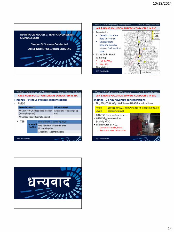
10/18/2014
14
TRAINING ON MODULE 1: TRAFFIC ENGINEERING & MANAGEMENT
Session 3: Surveys Conducted
AIR & NOISE POLLUTION SURVEYS
IMC Worldwide
Module 1 : Traffic Engineering & Management Session 3: Surveys Conducted
• Main tasks • Develop baseline
data (air+noise) • Disaggregate
baseline data by source, fuel, vehicle type
• 5 day, 24 hr HVAS sampling • TSP & PM10 • Nox, SO2
• Five stations
AIR & NOISE POLLUTION SURVEYS CONDUCTED IN BSC
IMC Worldwide
Module 1 : Traffic Engineering & Management Session 3: Surveys Conducted
Findings – 24 hour average concentrations • PM10
AIR & NOISE POLLUTION SURVEYS CONDUCTED IN BSC
Exceeded NAAQS Within NAAQS
At Koshi HWY/College Road junction (3 sampling days)
All stations (one sampling day)
At College Road (2 sampling days)
• TSP Exceeded
NAAQS
Four stations (4 sampling days)
One station in residential area (1 sampling day)
All stations (1 sampling day)
IMC Worldwide
Module 1 : Traffic Engineering & Management Session 3: Surveys Conducted
Findings – 24 hour average concentrations • Nox, SO2, CO & NO2 : Well below NAAQS at all stations
AIR & NOISE POLLUTION SURVEYS CONDUCTED IN BSC
Noise Levels
Exceed NAAQS, WHO standard -all locations, all sampling days)
• 80% TSP from surface source • 64% PM10 from vehicle
(mainly MCs) • Main source of NOx:
• Koshi HWY: trucks, buses • Side roads: cars, motorcycles
wGojfb

10/18/2014
1
ADB: TA7498-NEP
October 13, 2014
INTEGRATING LAND USE PLANNING AND TRANSPORT MANAGEMENT
Overview
• GENERAL PRINCIPLES AND KEY QUESTIONS
• PROBLEMS AND ISSUES
• ACTIONS TOWARDS IMPROVING INTEGRATION
• RESPONSE STRATEGIES WITH ILLUSTRATIVE PROJECTS
• SUMMARY ASPECTS OF ENFORCEMENT
• FURTHER READINGS
Module 7: Integrating Land Use Planning and Transport Management
IMC Worldwide
Expected Outcomes
• Better understanding of - The linkages between landuse and transport planning and
management - The need for integration - The consequences of the lack of integration
• Help facilitate the required changes in the policy domain and the style of implementation of road projects in the realization of landuse goals.
• Help spur necessary changes in the organizational culture of most of the transport related institutions of Nepal.
• Help explore ways and means of achieving better integration through situation-specific response to transport related problems.
Module 7: Integrating Land Use Planning and Transport Management
IMC Worldwide
General Premise and Background
• Nepal’s development constrained by transport connectivity and road accessibility. Road projects during the early stage of its emergence worked like magic unleashing development potentials.
• This made policy-makers believe that roads and development are synonymous irrespective of the level of development.
• During the last few years, BSC and other secondary cities have experienced sudden rise in the severity of traffic congestion and accidents together with a rapid deterioration in air quality.
• Most problems related to lack of integration between LUP and TM.
• Only more coherent urban transport and landuse planning can solve such problems effectively in the long run.
Module 7: Integrating Land Use Planning and Transport Management
IMC Worldwide
General Principles • The driving force for landuse changes is the transport network.
With a new extension of road, land value increases, activities tend to form clusters, and more investments are made.
• Mobility is not an end in itself. It is required for connecting people with goods, activities and people.
• Transport network needs to be improved to sustain the envisaged landuse changes, which will urge further improvements in transport system.
• Need to look at transport products as inputs to other drivers of economic development. Road/transport projects are also required to compete with other projects in terms of their outcomes/impacts and cost-effectiveness. These should largely be financed through the wealth created through urbanization.
• Projects emerging from planning processes that consider transportation and land use together can respond better to community needs.
• Integration helps to enhance cost-effectiveness and self-financing in the provision of infrastructure and services necessary.
Module 7: Integrating Land Use Planning and Transport Management
IMC Worldwide
Key Questions
•What are the factors that impede the process of integration?
•What are the consequences due to lack of integration?
•Why is integration desirable?
•What are the opportunities generated through successes in terms of integration?
Module 7: Integrating Land Use Planning and Transport Management
IMC Worldwide

10/18/2014
2
What are the factors that impede integration?
• Many still believe: “Development will take care of itself once the road is constructed and roads and development are synonymous irrespective of the level of development.”
• Changing the prevailing mind-set will take long time to appreciate the importance of integration and look at transport outputs as inputs to other more important drivers of economic development.
• Still longer time to bring about the necessary changes in the organizational culture of most of the transport related institutions.
• Integration needs to be effective more at the local/city level. However line agencies are generally controlled by the central departments of the government. This prevailing system works as a disincentive for officials seeking collaborative efforts with other agencies to take advantage of synergy.
Module 7: Integrating Land Use Planning and Transport Management
IMC Worldwide
What are the consequences due to lack of integration?
• Haphazard growth of settlements: The conventional practice is to first envision transport grid. Settlements are allowed to develop as a consequence of transport corridors. Changes in landuse with rapid urbanization take place in areas facilitated by road connectivity.
• Sudden increase in transport needs in urbanized areas Transport projects in the form of road widening, junction improvement and urban upgrading take place gradually.
• Makes the installation of other infrastructure also problematic with increased costs and underutilization.
• Several transport related problems clearly visible in the core areas of BSC are largely due to the lack of integration of Koshi Highway with the rapid landuse changes near the City Centre. The potentials of Gudri Bazaar could not be unleashed due to this.
Module 7: Integrating Land Use Planning and Transport Management
IMC Worldwide IMC Worldwide
IMC Worldwide
Why is integration desirable? • Optimize land use and costs of development by linking landuse
changes with the use of transport infrastructure. • Enhance the city productivity with sustainable changes in
landuse. • Urban transport is a derived demand, closely linked to urban
growth policies. Integrated land-use/ transport planning is necessary to minimize transport demand.
• Some types of landuse patterns increase the use of car, while others are more multi-modal and accessible, reducing the amount of vehicle travel needed to access goods, services and activities.
• Some transport practices such tend to encourage city sprawl. • Transit service improvements, more affordable public transit
fares, pedestrian and cycling infrastructure improvements, reduced parking supply with parking management, road and parking pricing, traffic calming and traffic speed reductions, tend to encourage compact growth.
Module 7: Integrating Land Use Planning and Transport Management
IMC Worldwide
What are the opportunities generated through integration?
• Land use in and around junctions offer potentials in creating a vibrant environment with adequate access to different amenities for the people on travel.
• Nearby residential areas become accessible to such centres of economic growth.
• A vast range of opportunities will be created through the building of roads. Land values at road crossings increase overnight as the areas here are supposed to be highly productive with rents increasing at the same time. Many side effects due to the congestion in these areas with pollution, accidents, problems of traffic management and parking problems, problems of loading/unloading, increased crime rates sum up to offset and nullify such opportunities in the case of non-integration.
Module 7: Integrating Land Use Planning and Transport Management
IMC Worldwide
Problems and Issues
• Lack of awareness and understanding of the complexities of urban transport; attitude of road users; not aware of the possibilities for improving access to all the facilities they use without increasing traffic.
• Lack of integration between UT and landuse goals • Good road network in place, but stagnant economy and no
fund available for road maintenance. • Rapid economic growth being slowed down due to increasing
congestion coupled with traffic hazards and parking problems. • National transport grid going through the city creates adverse
effect on urban economy and landuse. • Unplanned rapid growth of junction points and corridors.
Module 7: Integrating Land Use Planning and Transport Management
IMC Worldwide
Problems and Issues
• Inadequate road access for housing, business and services. • Community life and vibrant city environment are being
disturbed due to major transport projects especially at junction points and on either side of highways.
• Transport projects not giving adequate access. • Inadequate utilization of transport projects. • Road projects hindering healthy changes in landuse pattern. • Road investments not sufficiently cost effective in terms of
the demand created by the changes. • The increase in traffic on the main streets is discouraging
pedestrians from using the streets and dividing up neighborhoods.
Module 7: Integrating Land Use Planning and Transport Management
IMC Worldwide

10/18/2014
3
Objectives
• Ensure concerted efforts towards integration between landuse planning and transport management through coordination mechanisms and stakeholders’ mobilization.
• Explore ways and means towards integration by developing and applying improved mechanisms for integration particularly in Transit Oriented Developments (TODs).
• Enable to integrate transport plans with the goals and visions by initiating combined landuse-transport projects.
• Raise the awareness on the problems associated with the culture of looking at transport sector as an isolated area of development,
• Strive for balancing the provision of transport services with the concomitant changes in landuse.
• Enable the users to make transport management more cost-effective and relevant to landuse changes and urban development Help them monitor the advantages of integration
Module 7: Integrating Land Use Planning and Transport Management
IMC Worldwide
Outlines of an Action Plan for Integration
• Identification and analysis of problems caused mainly by the lack of integration
• Analysis of causes contributing to the lack of integration • Setting the goals and objectives towards integration • Listing of actions to be taken by BSC and other stakeholders
with performance indicators • Strategies on how the actions can be performed • Consultative processes towards continuous balancing
between the provision of transport services and landuse changes
• Monitoring framework for gradual improvement of the action plan
Module 7: Integrating Land Use Planning and Transport Management
IMC Worldwide
IMC Worldwide
Some Initiatives • Strive for continuous balancing between the transport
development and the landuse changes to achieve cost- effectiveness of transport project.
• Explore the cyclic nature of linkages between the two. Transport related projects and investments in the pipeline for the south of Biratnagar would urge transport changes dramatically there. Such changes will affect the landuse and the concomitant changes in landuse as the result of economic demand, which will urge further changes in the transport system.
• Engage transport agencies with land use planning processes to enable them to employ methods to better understand interactions between them, and help ensure that land use policies and transport projects work together to meet economic, environmental, and social goals.
• Make all the stakeholders recognize that transport projects have the greatest impact on landuse changes.
• Monitor such changes and respond with suitable interventions
Module 7: Integrating Land Use Planning and Transport Management
IMC Worldwide
Problems and Responses
• Good road network in place, but stagnant economy and no fund for maintenance.
• Introduce incentives such as tax
holidays for a predefined period for
some selected businesses.
• Whatever resources are mobilized,
use them promptly to ensure the
provision of better transport services.
• Institute a system of continuous
monitoring for linking transport
improvement with landuse changes.
Module 7: Integrating Land Use Planning and Transport Management
IMC Worldwide
Problems and Responses
• Rapid economic growth being slowed down due to increasing congestion coupled with traffic and parking problems.
• Prepare an urban upgrading program with road improvement plan to produce more usable space for economic and commercial activities. • Select areas for unlocking development potentials through upgrading of transport and other infrastructure (for instance Gudri Bazaar). • Analyze the linkages between transport services and production of additional space made available for commercial activities. • Develop financial mechanisms for sustained upgrading.
Module 7: Integrating Land Use Planning and Transport Management
IMC Worldwide
Illustrative Project: Gudri Bazaar Redevelopment • Removal of the existing low-quality single story buildings that
currently characterize Gudri Bazaar. • Construction of a multi-story building with ground floor used as
loading/unloading bays for trucks and the upper floors used for intensive commercial activities.
• Construction of a pedestrian bridge across the Koshi Highway from Lekhnath Road (on the west side of the Koshi highway), a facility that would connect directly to the second floor of the said multi-story building, thus providing safe and convenient access.
• Provision of designs for pedestrians and differently- able people. • Provision of facilities for vehicle parking on the same ground. • Provision of Urban Public Transport stops close by; the stop on the
west side of the Koshi Highway would be connected by the pedestrian bridge.
• Traffic calming and associated access restrictions for the streets in the city center.
Module 7: Integrating Land Use Planning and Transport Management
IMC Worldwide

10/18/2014
4
Problems and Responses
• National transport grid going through the city affects urban economy.
• Reconcile the local urban
needs with the goals of
Highways with equitable
sharing of the transport
infrastructure assets
• Implement projects such as
the proposed Koshi Highway
Improvement in BSC.
Module 7: Integrating Land Use Planning and Transport Management
IMC Worldwide
Problems and Responses
• Landuse plan does not recognize the rapid growth of junction points and linear development corridors.
• Prepare detailed landuse plan for corridor development at junction points. • Sensitize the stakeholders with TODs especially to the border area to the south. • Improve green access of the surrounding areas to the transits and transport corridor. • Identify cultural, historical, and religious features that can sustain vibrant ambience at transit points. • Provide adequate space for urban amenities, parking, bus stops, and other public transport stands. • Motivate people to pay more for better services particularly in such areas.
Module 7: Integrating Land Use Planning and Transport Management
IMC Worldwide
Illustrative Project: Transport Junctions
• Concentration of economic activities at transport junctions is a well known fact. This leads to congestion and chaos creating difficult living and working environment. Transport junctions should provide opportunities for the people and the business to create a vibrant and dynamic ambience.
• The increased costs can easily be recouped through enhanced economic activities providing better services due to the increased production of the urban space and infrastructure placed there-in.
• The areas around should be intensively used. • Urban mobility can be immensely enhanced through increasing the
access of the people through appropriate NMT modes to reaching such junctions.
• TODs, besides promoting public transport, provide good locations for placing the drivers of urban development.
• Mixed land use with intermixing of housing, business, and urban amenities in close proximity to public transport stations integrates long-distance travel by mass transit and short-distance (within-neighborhood) travel on foot or by using NMT.
Module 7: Integrating Land Use Planning and Transport Management
IMC Worldwide
Problems and Responses
• Community life and city environment are being disturbed especially at junction points.
• Integrate transport projects to
create a vibrant city
environment.
• Encourage mixed land use at
TODs.
• Project transport elements as
integral parts of urban
environment.
• Promote different compatible
activities and let different
activities co-exist.
Module 7: Integrating Land Use Planning and Transport Management
IMC Worldwide
Transit Driven Developments
• Identify plausible TODs and encourage intensive use of land around and manage transport elements there-in to avoid any congestion and chaos with parking reasonably separated from TOD areas so that they can be made more vibrant.
• Develop such areas intensely with incentives for the business, people and other users; and use fiscal measures to regulate land use in a desirable way.
• Ensure that resources generated be used for better transport services; which in turn will increase revenue as the TODs become more functional and more livable.
Module 7: Integrating Land Use Planning and Transport Management
IMC Worldwide
Problems and Responses
• Transport projects not giving adequate access for housing, business and services.
• Link emerging development areas to public transport. • Encourage the construction of link roads to transport grids. • Make more land accessible for development. • Increase access to unleash the development potentials of proximate areas. • Make an inventory of the road assets and increase transport network gradually while increasing access.
Module 7: Integrating Land Use Planning and Transport Management
IMC Worldwide
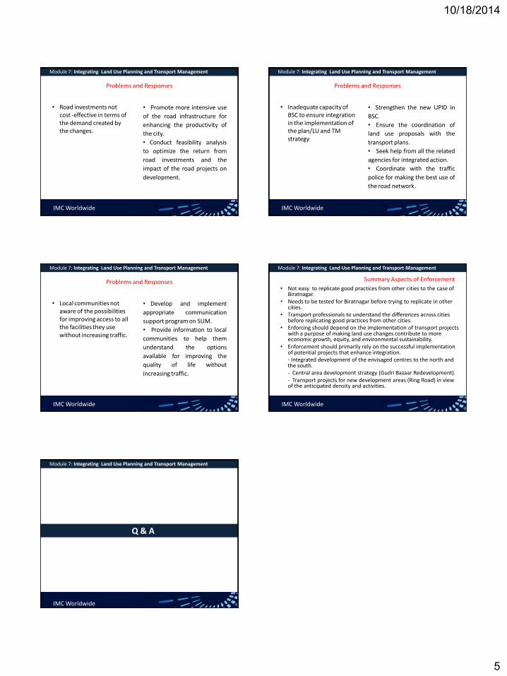
10/18/2014
5
Problems and Responses
• Road investments not cost -effective in terms of the demand created by the changes.
• Promote more intensive use
of the road infrastructure for
enhancing the productivity of
the city.
• Conduct feasibility analysis
to optimize the return from
road investments and the
impact of the road projects on
development.
Module 7: Integrating Land Use Planning and Transport Management
IMC Worldwide
Problems and Responses
• Inadequate capacity of BSC to ensure integration in the implementation of the plan/LU and TM strategy
• Strengthen the new UPID in
BSC.
• Ensure the coordination of
land use proposals with the
transport plans.
• Seek help from all the related
agencies for integrated action.
• Coordinate with the traffic
police for making the best use of
the road network.
Module 7: Integrating Land Use Planning and Transport Management
IMC Worldwide
Problems and Responses
• Local communities not aware of the possibilities for improving access to all the facilities they use without increasing traffic.
• Develop and implement
appropriate communication
support program on SUM.
• Provide information to local
communities to help them
understand the options
available for improving the
quality of life without
increasing traffic.
Module 7: Integrating Land Use Planning and Transport Management
IMC Worldwide
• Not easy to replicate good practices from other cities to the case of Biratnagar.
• Needs to be tested for Biratnagar before trying to replicate in other cities.
• Transport professionals to understand the differences across cities before replicating good practices from other cities.
• Enforcing should depend on the implementation of transport projects with a purpose of making land use changes contribute to more economic growth, equity, and environmental sustainability.
• Enforcement should primarily rely on the successful implementation of potential projects that enhance integration.
- Integrated development of the envisaged centres to the north and the south.
- Central area development strategy (Gudri Bazaar Redevelopment). - Transport projects for new development areas (Ring Road) in view
of the anticipated density and activities.
Module 7: Integrating Land Use Planning and Transport Management
IMC Worldwide
Summary Aspects of Enforcement
Q & A
Module 7: Integrating Land Use Planning and Transport Management
IMC Worldwide

10/18/2014
1
Rabi Shah
Oct 13, 2014
SUSTAINABLE URBAN TRANSPORT PLAANING & MANAGEMENT
sustainable transport sustainable development
Venn diagram
at the confluence of three constituent parts
• modes of transport,
• systems of transport planning,
• mobility
sustainable transportation system
• Allows the basic access and development needs of individuals, companies and society to be met safely and in a manner consistent with human and environment, and promotes equity within and between successive generations.
• Is affordable, comfortable, operates fairly and efficiently, offers a choice of transport mode, and supports a competitive economy, reduced travel time, as well as balanced regional development.
• Limits emissions and waste within the planet’s ability to absorb them, uses renewable resources at or below their rates of generation, and uses non-renewable resources at or below the rates of development of renewable substitutes, while minimizing the impact on the use of land and the generation of noise.
Sustainable transport tool
• Clean fuels and vehicles
• Collective passenger transport
• Green transport infrastructure
• Access restrictions
• Transport management
• Soft measures
• Travel information
• Integrated pricing strategies
• Less car intensive lifestyle
• Tax on Bad, no tax on good
sustainable transport
• Environmentally
• Socially
• Cities
• policies and governance
• Community and grassroots action
The four pillars of sustainable urban transportation (source: C. KENNEDY, ERIC M., AMER S.,H. MACLEAN & JESSE C., Department of Civil Engineering, University of Toronto, Canada
Potential sources of funding for urban transportation systems
Non-vehicle related
Non-location-related
• General tax base
• Local transportation levy
Location-related
• Development fees
• Transit impact fees
• Right of way fees/value capture
• Leverage real-estate assets
Vehicle-related
Non-location-related
• Fuel taxes
• Vehicle license fees
• New vehicle or vehicle parts sales
• taxes
• Vehicle use fees
• Emissions fees
Location-related
• Road tolls
• Congestion pricing
• Parking fees
• Transit user fees

10/18/2014
2
Lesson learned
What went wrong
• Absence of a city development strategy
• Unsustainable transport policies
• Ineffective transport planning
• Little implementation
• Little data about the success or failure of implementation
• Governance problems
Problem of city leaders
• “We feel overwhelmed.”
• “Our cities are spreading further and further.”
• “Problems are growing.”
• “Our citizens are suffering.”
• “Everything we try fails.”
Examples of mobility planning and accessibility planning (adapted from Cervero, 2001)
Mobility planning
• Road construction and expansion • Motorways, freeways, beltways,
interchanges, rotaries • Arterial expansion • ITS, smart highways and smart cars
• On-board navigational systems • Vehicle positioning systems • Real-time informational systems • Transportation system management • One-way streets • Rechannelizing intersections • Removing curbside parking • Ramp metering • Large-scale public and private transport • Heavy rail transit and commuter rail • Regional busways • Private tollways
Accessibility planning • Land-use management and initiatives
• Compact development
• Mixed uses
• Pedestrian-oriented design
• Transit villages
• Telecommunication advances
• Telecommuting/teleworking, Telecommunities
• Teleshopping
• Transportation demand management
• Ridesharing
• Preferential parking for HOV
• Parking management and pricing
• Guaranteed ride home programmes
• Community-scale public and non-motorized transport
• Light rail transit and trams
• Community-based paratransit
• Bicycle and pedestrian paths
Way Forward
• focusing on public transport; the growth of public transport, reliable, comfort, reduced travel time,
• recognizing that traffic restraint is an essential part of the package;
• Integration of land-use and transport planning as part of the solution so that land-use planning can both facilitate the provision of public transport and reduce the need to travel; and exploiting soft measures such as telecommuting, teleconferencing,
• internet shopping, public transport marketing, and better information as means to influence behavior
Sustainable transportation policy
approach to urban transport Avoid: reduce the need for travel by promoting city structures and urban densities that do not require large passenger–kilometers (km) and freight–km of travel; Shift: change modal choice to promote lower fuel consumption per passenger–km and/or freight–km and manage traffic so as to reduce fuel consumption and air pollutants; and Improve: increase the energy efficiency of vehicles and fuels by decreasing distances travelled and reduce the greenhouse gas footprint per liter of fuel consumed. Investment: mega urban transport infrastructure ???
sustainable transportation mode: BRT
Criteria to be effective
• Availability of right-of-way
• Compatibility with existing public transport systems
• Adeptness in implementation
• Conditions for sustainability
Potential
• reduces poverty by providing low-cost transport
• attracts car and Bike users
• improves the quality of public transport and environment
• carries high passenger volumes
• Operates at high commercial speeds
• cost effective that of a metro and LRT
BRT System Elements
Running Ways
Stations & Terminals
Systems
Vehicles
Service Plan

10/18/2014
3
BRT: Infinite Possibilities, but with Essential Characteristics: • Integrated, branded system that ensures high speed,
reliability, convenience – High frequency all day, week
– Simple network structure
– Majority of service on dedicated running way
– Rapid boarding/alighting
• Off-board fare collection
• Multiple wide door- vehicles
• Minimal gap, floor to platform
• Accessible to all
• Pervasive, unique brand identity
• High over-all system quality
Which Route Do I Take??
Service Planning Easier When You Have 4-Lane Transitways
Possibility of Phased Development is Big BRT Advantage
•May not have enough understanding, public support or funds for full-featured BRT early;
•In most developing cities, something needs to be done ASAP
–Start with the doable; add features; extend, build new lines as understanding and success build support for better and more
•Lagos, York/Toronto prime examples
Lagos: BRT ‘LITE’ in Operation: March 2008
• 22Km, 65% segregated
• 150,000+ daily trips
• 30% reduction in passenger travel times
• High initial passenger satisfaction
Thanks to LMATA for Material
Success of “ BRT Lite” Enables Migration to ‘full featured’ BRT,
Expansion of Coverage • Upgraded infrastructure and facilities
• Introduction of fully segregated and by-pass lanes
• Semi-low-floor, multiple wide door buses
• Introduction of electronic fare payment
• Deployment of ITS
• bus arrival time
• adaptive traffic signals at intersections
• Phase 2- BRT ‘extension’ to large suburban city
• Management reform

10/18/2014
4
BRT LITE
Phase II
Phase 2 BRT Station Area Phase II Transitway Construction
Ahmedabad

10/18/2014
5
Ridership Growth
□ Future Park & Ride: Complex Transfer Center
Seoul Development Institute
Cheongnyangni Transportation Center, July. 2005
Complex transfer center
Parking facility near station
Bus transportation center
Seoul Development Institute
□ Gupabal Station Complex Transfer Center Plan
- Transfer among bicycle, bus, taxi and car
- Parking spaces for 400 cars and 470 bicycles
□ Green parking project
- Solving parking shortage problems in residential areas
- Subsidies for the parking construction cost of $6,000 per space per household
Seoul Development Institute
Travel Demand
Management
Public Transportatio
n
Eco-driving
Vehicle Fleet Improvement
Alternative Fuels
Policy Technology
System Efficiency
□ Structure of Green Transport Strategies
Seoul Development Institute

10/18/2014
6
Seoul
BRT Elements: Range of Recent Applications
BRT Running Ways
• More and more colored pavement treatments, separated running “pads” or “tracks” for variety of reasons, e.g., easier enforcement
• As costs come down, likely to see more automated operation/guidance
Rouen
LV Haifa
Cape Town
Las Vegas
NYC
Stops, Stations and Terminals
• General improvement in size and quality everywhere as more and more places try to use BRT as tool to induce and serve sustainable, walkable
York-Toronto
York, Ontario
Lima E. Sandoval
Bangkok C. Brader
Haifa

10/18/2014
7
Vehicles: Massive Changes Afoot
• Variety of sizes through almost 30 meters
• Profusion of ITS applications
• More and more hybrids, CNG
– Emissions, local and global
– Noise
• All-electric battery vehicles coming
Contemporary BRT Vehicles
38
Wright , Dsl-Elec. Hybrid
Las Vegas
NABI, CNG New Flyer,
Guided, Dsl-Elec. Hybrid
LV
LA
Cleveland
Mexico City Volvo Euro 4 27 Meters Long
State of the Art
39
Barcelona
Van Hool ExquiCity
Hybrid: ~25 meters
Hess-ABB
All Electric,
Quick- Charge Battery
Charger
BRT Vehicle Interiors
Van Hool ExquiCity Wright Streetcar
Closing Emphasis Points
• BRT coming into its own as rapid transit mode with potential (150+ applications Worldwide)
• More attention needs to be paid to “soft side” – Institutions
– Communications
– Service-planning
– Land-use integration as planning objective
• Technological advancements will overcome many issues and constraints, e.g., increasing capacity and safety, lower emissions, noise
• Sustainable or ???
Q & A
“Urban transport represents one of the fastest growing sources of greenhouse gas emissions that contribute to global climate change” - UNCRD, 2009
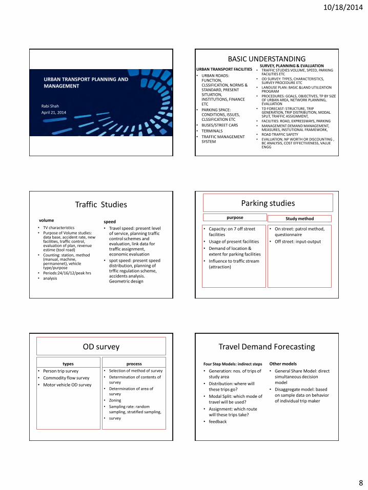
10/18/2014
8
Rabi Shah
April 21, 2014
URBAN TRANSPORT PLANNING AND MANAGEMENT
BASIC UNDERSTANDING URBAN TRANSPORT FACILITIES
• URBAN ROADS: FUNCTION, CLSSIFICATION, NORMS & STANDARD, PRESENT SITUATION, INSTITUTIONS, FINANCE ETC
• PARKING SPACE: CONDITIONS, ISSUES, CLSSIFICATION ETC
• BUSES/STREET CARS
• TERMINALS
• TRAFFIC MANAGEMENT SYSTEM
SURVEY, PLANNING & EVALUATION • TRAFFIC STUDIES:VOLUME, SPEED, PARKING
FACILITIES ETC • OD SURVEY: TYPES, CHARACTERISTICS,
SURVEY PROCEDURE ETC • LANDUSE PLAN: BASIC &LAND UTILIZATION
PROGRAM • PROCEDURES: GOALS, OBJECTIVES, TP BY SIZE
OF URBAN AREA, NETWORK PLANNING, EVALUATION
• TD FORECAST: STRUCTURE, TRIP GENERATION, TRIP DISTRIBUTION, MODAL SPLIT, TRAFFIC ASSIGNMENT,
• FACILITIES: ROAD, EXPRESSWAYS, PARKING • MANAGEMENT:DEMAND MANAGEMENT,
MEASURES, INSTUTIONAL FRAMEWORK, • ROAD TRAFFIC SAFETY • EVALUATION; NP WORTH OR DISCOUNTING ,
BC ANALYSIS, COST EFFECTIVENESS, VALUE ENGG
Traffic Studies
• TV characteristics • Purpose of Volume studies:
data base, accident rate, new facilities, traffic control, evaluation of plan, revenue estime (tool road)
• Counting: station, method (manual, machine, permanenet), vehicle type/purpose
• Periods:24/16/12/peak hrs • analysis
speed
• Travel speed: present level of service, planning traffic control schemes and evaluation, link data for traffic assignment, economic evaluation
• spot speed: present speed distribution, planning of trffic regulation scheme, accidents analysis. Geometric design
volume
Parking studies
purpose
• Capacity: on 7 off street facilities
• Usage of present facilities
• Demand of location & extent for parking facilities
• Influence to traffic stream (attraction)
Study method
• On street: patrol method, questionnaire
• Off street: input-output
OD survey
types
• Person trip survey
• Commodity flow survey
• Motor vehicle OD survey
process
• Selection of method of survey
• Determination of contents of survey
• Determination of area of survey
• Zoning
• Sampling rate: random sampling, stratified sampling,
• survey
Travel Demand Forecasting
Four Step Models: indirect steps
• Generation: nos. of trips of study area
• Distribution: where will these trips go?
• Modal Split: which mode of travel will be used?
• Assignment: which route will these trips take?
• feedback
Other models
• General Share Model: direct simultaneous decision model
• Disaggregate model: based on sample data on behavior of individual trip maker

10/18/2014
9
Trip Generation Introduction • f(land use pattern &
developments in the study are, socio-economic characteristics of trip makers of study area and nature its extent and capabilities of the transportation system of study area)
• Trip : home to work, home to school, to shop, to home others.
• Models: Land use Ratio Model and multiple linear regression model.
Factors affecting Trip Generations
• Land-use factor
• Household characteristics
• Others: age, socio-economic characteristics (white collar worker, factory workers, executives etc), degree of urbanization, quality of tranport facilities, level of accessibility etc)
Trip Distribution and Modal Split
Trip Distribution
• Links between nos. of zones
• Not concerned with mode of travel and routes
• Nos of travel originating in every zone to nos. of travel destinated to other zones of study area
• Models: growth factor model, gravity Model and opportunity model
Modal Split • Proportionate division of total
number of person trips between different modes of travel, Expressed in fraction, ratio or % of total nos. of trips
• Influencing factor: characteristics of journey (length, time of day, purpose), characteristica of person making the jpurney (car ownership, income, social status), transportation system (travel time, cost comfort, accessebility)
• Used model: Trip Interchange modal split model
Traffic assignment
Introduction
• Selection of min time path over an actual route between zones
• Categories of Assignment: – Assignment of existing trips to existing network
– Assignment of estimated future trips to existing network or committed network
– Assignment of estimated future trips to the future network
• All or nothing assignment (least distance), Capacity restraint assignment, Assignment ot Public transport System
Basic Process of Urban Transport Planning
Goals and Objectives
Inventories and Analysis of Existing Conditions
Areawide and zonal Forecast
Development of Alternate Transport System Plans
Test and Analysis of Alternative Plans
Evaluation and selection of Plan
Q & A

18/10/2014
1
TRAINING ON MODULE 1: TRAFFIC ENGINEERING & MANAGEMENT
Session 6: Traffic Engineering & Management
Organiser: GoN Dept. of Urban Development & Building Construction
Trainer: Subhash Dhungel, Urban Transport Infrastructure Specialist Urban Transport Planning Management (ADB ta 7948), IMC Worldwide 13 October, 2014
INTRODUCTION • Use engineering techniques, legal means for safe, efficient
movements (people, goods)
Module 1 : Traffic Engineering & Management Session 6: Introduction
Traf
fic
engi
nee
rin
g a
nd
Man
agem
ent Focus: Safe, efficient traffic flow
Means:
Amend geometry, provide sidewalks, crosswalks, marking, etc.
Re-allocate road space to competing users
Pedestrians vs motorized; public transport vs cars
Why required?
Promote certain modes, create sustainable transport
Maximise use of road-space in lieu of supply
Reduce expensive constructions.
TRAFFIC MANAGEMENT APPROACH
Traffic supply management
• Expand the road network
• Add lanes
Traffic demand management • Control traffic demand • Patronise public transport
Module 1 : Traffic Engineering & Management Session 6: Background
IMC Worldwide
IMPACT FROM PATRONAGE OF DIFFERENT MODES
Module 1 : Traffic Engineering & Management Session 6:Background
IMC Worldwide
Traffic management
Enhance user safety
Minimize negative environmental impacts
Minimize economic loss from congestion, sub-optimal
use/damage of asset
Module 1 : Traffic Engineering & Management Session 6: Background
IMC Worldwide
OBJECTIVE OF MODULE 1: TRAFFIC ENGINEERING & MANAGEMENT • Introduce concept
• Guide for traffic engineering tools in city planning
• adopting traffic engineering tools available to manage, control, influence urban traffic
Module 1 : Traffic Engineering & Management Session 6: Background
IMC Worldwide
Traffic circulation One way streets, ban turns
Pedestrianise close street, widen sidewalks, crossing
Prioritise bus operation bus lanes, bus-only roads, bus stops/laybys
Signalise Change circulation, pre-empt certain vehicles
Channelise to regulate traffic, provide pedestrian refuge
Restrict certain vehicles (e.g. heavy vehicles) loading/unloading operations
Parking, access controls Improve parking management Restrict vehicle entry by time of the day
Improved planning E.g. network of protected cycle routes

18/10/2014
2
Concepts of Traffic Management
Basic principle separate conflicting activities, modes
Planning advocated Support overall policy for SUT • Shift emphasis to people, goods movements • Encourage walking, NMTs • Efficient, safe, affordable UPT for long-trips
Management measures
• Allocate road space to various users • Establish rules to use road space • Regulate, manage traffic (MTs/NMTs) • Establish rules for parking, loading
Module 1 : Traffic Engineering & Management Session 6:Background
IMC Worldwide
Triple Es in overall SUT mgmt.
Enforcement Education
Engineering
• Traffic /travel surveys • Road capacity , safety
analysis • Design: road, parking,
laybys
• Awareness, education for all users
• Pedestrians • Drivers • commuters
Regulation, act, rules
Module 1 : Traffic Engineering & Management Session 6:Background
IMC Worldwide
TRAFFIC CONGESTION
• Mainly when demand > capacity
• Also from modal conflicts and poor driving
•How to tackle?
– Manage demand and control vehicle number •How significant in Nepalese cities?
– Biratnagar and secondary cities: not capacity wise but from poor driving in mixed traffic
– Valley municipalities: evident
Module 1 : Traffic Engineering & Management Session 6: Concepts
IMC Worldwide
WHY BOTHER ABOUT CONGESTION?
Mobility & environmental
Local traffic impacts
Impedes quality of access to communities
Negative environmental impact
Economy
Impedes economic growth
Increase O & M costs
Road safety, quality of life
More safety risks
Reduced quality of life for residents
can trigger mass exodus to population
Module 1 : Traffic Engineering & Management Session 6:Congestion
IMC Worldwide
METHODS TO RELIEVE CONGESTION
One way streets Advantage: smoother, safer flow Disadvantage: more travel time, higher operation-cost
Control parking/stopping • Ban • Restrict by time, vehicle
Advantage: smoother, safer flow Disadvantage: business, resident may oppose
Module 1 : Traffic Engineering & Management Session 6: Congestion
IMC Worldwide
Methods to relieve congestion
Restrict movements , manouvers • Ban turning/through traffic at
intersection • Restrict by time/vehicle/ time +
vehicle • Prohibit overtaking
Advantage: (1) Smoother, safer flow; (2) reduced + safer traffic flow Disadvantage: (1) longer travel time; (2) higher operation cost; (3) enforcing time/ overtaking/vehicle restriction may be difficult
Module 1 :Traffic Engineering & Management Session 6:Congestion
IMC Worldwide

18/10/2014
3
METHODS TO RELIEVE CONGESTION
Promote public transport Advantage: (1) reduced traffic(2) sustainable transport Disadvantage: heavy investment/subsidy required
Dedicated lanes • For fast/slow –moving vehicles • For BRT
Advantage: (1) safer; (2) more mobility for fast vehicles/buses. Disadvantage: Require substantial road-space
Module 1 : Traffic Engineering & Management Session 6:Congestion
IMC Worldwide
METHODS TO RELIEVE CONGESTION
Congestion charging • Levy tolls for entering CBD
Advantage: reduce traffic, smoother flow in CBD Disadvantage: local protests
Pedestrianisation Advantage: Improved urban environment Disadvantage: local protests
Road expansion Advantage: smoother flow Disadvantage: high investment
Module 1 : Traffic Engineering & Management Session 6:Congestion
IMC Worldwide
METHODS TO RELIEVE CONGESTION
Intersection improvements/bypass • Improve at-grade
intersection • Grade-separate • Provide bypass road
Advantage: (1) reduced traffic, smoother flow; (2) intersection efficiency improved Disadvantage: (1) Heavy investment (bypass, grade-separation); (2) at-grade intersection improvements not feasible always
Module 1 : Traffic Engineering & Management Session 6:Congestion
IMC Worldwide
TRAINING ON MODULE 1: TRAFFIC ENGINEERING & MANAGEMENT
Session 6: Traffic Engineering & Management
Traffic Management Plan
PRINCIPLES TO ADOPT FOR TRAFFIC MANAGEMENT
Maximise
Safety for all users
Quality of the urban ambience for all
Minimise
Economic losses from congestion, delays
Economic losses from damage to transport infrastructure
Negative environmental impact from traffic
Module 1 : Traffic Engineering & Management Session 6: Traffic Management Plan
• IMC Worldwide
ELEMENTS OF TRAFFIC MANAGEMENT
IMC Worldwide
Module 1 : Traffic Engineering & Management Session 6: Traffic Management Plan
Max
imis
e
safe
ty
Min
imis
e
de
lay
Min
imis
e
dam
age
s
Min
imis
e
en
viro
nm
en
tal
imp
act
Op
tim
ise
u
rban
am
bie
nce
1. Separate users ++ + + - ++
2. Impose speed limit ++ - - + -
3. Provide protected crossing ++ - - - +
4. Restrict access to certain users ++ + + + +
5. Comprehensive traffic calming ++ - - + ++
6. Provide dedicated stopping/waiting points/areas
+ - - - +
7. Signalize intersections ++ ++ - + -

18/10/2014
4
ELEMENTS OF TRAFFIC MANAGEMENT
Module 1 : Traffic Engineering & Management Session 6: Traffic Management Plan
IMC Worldwide
Max
imis
e
safe
ty
Min
imis
e
de
lay
Min
imis
e
dam
age
s
Min
imis
e
en
viro
nm
en
tal i
mp
act
Op
tim
ise
u
rban
am
bie
nce
8. Restrict turning + + + - -
9. Impose one-way streets + + - + +
10. Restrict by vehicle weight/height/width
- - ++ + ++
11. Redirect traffic to suitable routes + ++ ++ ++ ++
12. Restrict/prohibit parking in certain areas
- - + ++
13. Pedestrianise ++ - - + ++
Users attitudes to consider when planning interventions
Issue
Environment A
secondary cities in Nepal
Environment B
developed western societies
Individual users’ knowledge/awareness of traffic rules
Low High
Individual users’ acceptance of the disadvantages / inconveniences caused by traffic rules / traffic management
Low High
Users’ general compliance with rules / traffic management stipulations
Low High
Users’ general tolerance of non-compliant behavior by other users
High Low
• IMC Worldwide
Module 1 : Traffic Engineering & Management Session 6: Traffic Management Plan
TYPICAL TRAFFIC MANAGEMENT MEASURES Separate different users
• SMV lane
• NMT lane
• Sidewalks
• Ped-zone
• Enhance safety, smother flow
• mitigate adverse environmental impact
Module 1 : Traffic Engineering & Management Session 6: Traffic Management Plan
• IMC Worldwide
TYPICAL TRAFFIC MANAGEMENT MEASURES
Optimise the road space
Increase ped- path in the city centre
Reallocate space for cycle lane
Ban access to certain vehicles No NMT along expressway No heavy vehicles in city centre
Restrict certain vehicles or time-based
Module 1 : Traffic Engineering & Management Session 6: Traffic Management Plan
• IMC Worldwide
TYPICAL TRAFFIC MANAGEMENT MEASURES
Optimise the use of road space • Parking for specific vehicle, persons
with disabilities
• IMC Worldwide
Module 1 : Traffic Engineering & Management Session 6: Traffic Management Plan TYPICAL TRAFFIC MANAGEMENT MEASURES- CONTD.
Speed limits • Reduce limit in residential, inner streets (5~ 30 kph)
Benefits: enhance safety (e.g. Reduce air, noise pollution
Challenges: Enforcing (police, cameras) Enforce with traffic calming
Crash risk double with 5 kph increase in urban street
Module 1 : Traffic Engineering & Management Session 6: Traffic Management Plan
• IMC Worldwide

18/10/2014
5
TYPICAL TRAFFIC MANAGEMENT MEASURES- CONTD.
• Default speed limits for urban road: unsigned
Vehicle VTMR 2054 URS 2068 design speed
DoR TSM 1997
40 kph (urban) Arterial : 80 kph High std – 60 kph
LV 80 kph Sub-arterial : 60 kph Peds moderate: 40 kph
3wh/ scooter/PT/ TRACTOR
40 kph Collector: 50 kph heavy peds: 25 kph
MC 50 kph Local: 30 kph
HV 50 kph (hills) 70 kph (terai)
• IMC Worldwide
Module 1 : Traffic Engineering & Management Session 6: Traffic Management Plan
TYPICAL TRAFFIC MANAGEMENT MEASURES- CONTD.
• Crash history
• Current operating performance
• Road, roadside, Geometry
• Unsealed roads
Scientific criteria to set speed
limit
Note: NURS 2068 (draft) recommend some of the above for design speed
Module 1 : Traffic Engineering & Management Session 6: Traffic Management Plan
• IMC Worldwide
TYPICAL TRAFFIC MANAGEMENT MEASURES- CONTD.
Over and under –pass pedestrian crossing Sources: Kathmandu Post & New Zealand’s Pedestrian Planning & Design Guide 2009
Curbed extension at crossing
Provide protected crossing facilities for pedestrians
Module 1 : Traffic Engineering & Management Session 6: Traffic Management Plan
• IMC Worldwide
Zebra crossing
TYPICAL TRAFFIC MANAGEMENT MEASURES- CONTD. Provide protected crossing facilities
Pedestrian refuge island
Module 1 : Traffic Engineering & Management Session 6: Traffic Management Plan
• IMC Worldwide
TYPICAL TRAFFIC MANAGEMENT MEASURES- CONTD. Providing protected crossing facilities
Raised median with cut-through
Module 1 : Traffic Engineering & Management Session 6: Traffic Management Plan
• IMC Worldwide
TYPICAL TRAFFIC MGMT. MEASURES - CONTD. Providing protected crossing facilities – kerb-ramp
Improve as per GoN Accessibility Directive 2069: • Sidewalks -2 m (min) • Kerb ht. = 10- 15 cm max • Simple kerb-ramp, ramp
slope≤ 1:15 • Flared kerb-ramp
• Flat portion= 0.915 m • Ramp≤ 1:15 • Side slope≤ 1:10
• IMC Worldwide
Module 1 : Traffic Engineering & Management Session 6: Traffic Management Plan

18/10/2014
6
TYPICAL TRAFFIC MANAGEMENT MEASURES - CONTD. Providing protected crossing facilities for Cycles
Module 1 : Traffic Engineering & Management Session 6: Traffic Management Plan
• IMC Worldwide
TYPICAL TRAFFIC MANAGEMENT MEASURES- CONTD. Signalise to improve operation, protected crossing facilities
Provide mid-block pelican signal with conspicuous crossing (source: Dan Burden, Walkable Communities Inc. , US)
Signalise the intersection • Not feasible currently in Nepal
Load-shedding Maintenance lacking Lack of skilled manpower
• IMC Worldwide
Module 1 : Traffic Engineering & Management Session 6: Traffic Management Plan
TYPICAL TRAFFIC MANAGEMENT MEASURES- CONTD. Signalised intersection with audio-tactile push-button for persons with disability
Pedestrians time countdown display
Improve phasing at signalised intersections: • Adjust walking speed for green phase with LTOR. • Introduce a protected RT phase. • Introduce a leading pedestrian phase
Module 1 : Traffic Engineering & Management Session 6: Traffic Management Plan
• IMC Worldwide
TYPICAL TRAFFIC MANAGEMENT MEASURES
Restricting turning at street/intersection
• Alternative before signalisation
• Enforce with sign, marking
• Can restrict certain vehicles only
• Advantage: low cost, easy to introduce
• Disadvantage: enforcing challenging
• compliance better if users informed of alternative route
Module 1 : Traffic Engineering & Management Session 6: Traffic Management Plan
• IMC Worldwide
TYPICAL TRAFFIC MANAGEMENT MEASURES - CONTD. Comprehensive traffic calming
• devices to reduce/discourage speeding, access
• Installed in city centres, residential areas
Traffic calming objective
Reduce speed, crash, severity
Reduce air, noise
pollution
Allocate road space for other activities
Improve urban
ambience
• IMC Worldwide
Module 1 : Traffic Engineering & Management Session 6 Traffic Management Plan
Typical traffic management measures - contd. traffic calming measures- close/restrict access
• Enforce one-way street with sign, barriers (bollards)
– Exempt cycles
• Construct channel-island to block certain access
Module 1 : Traffic Engineering & Management Session 6: Traffic Management Plan
• IMC Worldwide

18/10/2014
7
TYPICAL TRAFFIC MANAGEMENT MEASURES - CONTD. traffic calming measures – devices
Road Hump
Gateway -
• Create physical obstructions to self-impose lower speed • Discourage certain users
Build-outs
Chicanes
Module 1 : Traffic Engineering & Management Session 6: Traffic Management Plan
• IMC Worldwide
TYPICAL TRAFFIC MANAGEMENT MEASURES traffic calming measures – devices (contd)
Raised intersection
• Raising intersection
• Stone-paved streets
Elevation view of rumble strips and jiggle bars Rumble strips
Mini-roundabout
Module 1 : Traffic Engineering & Management Session 6: Traffic Management Plan
• IMC Worldwide
Typical traffic management measures traffic calming measures –contd.
Fully pedestrianised streets
Convert street as: • Fully/partially pedestrianised
• Playing/recreation areas
Module 1 : Traffic Engineering & Management Session 6: Traffic Management Plan
• IMC Worldwide
TYPICAL TRAFFIC MANAGEMENT MEASURES • Improve stopping operations of UPT
– Haphazard pick/drop, stops impedes traffic operations
– Provide dedicated laybys, clearly demarcate
Improve waiting areas for NMT Rickshaws handcarts
Module 1 : Traffic Engineering & Management Session 6: Traffic Management Plan
• IMC Worldwide
TYPICAL TRAFFIC MANAGEMENT MEASURES - CONTD. Issues to consider when imposing ONE-WAY
Likely increase in vehicle speed
Impact from longer travel distance to diverted traffic
Informing alternative routes for diverted traffic
Options to provide cycle access in one-way streets
1. Allocate one cycle lane each direction
2. Allocate one cycle lane in the contra-flow
3. Permit cycle to travel in either direction in the street
4. Enforce one-way restriction to cycles also with clear signage.
Module 1 : Traffic Engineering & Management Session 6: Traffic Management Plan
• IMC Worldwide
TYPICAL TRAFFIC MANAGEMENT MEASURES - CONTD.
Restricting access by vehicle load, height, width
Reasons for
restrictions
Protect road infrastructure (e.g. lightly-built roads/bridges)
Improve road safety by banning very big vehicles
To avoid congestion through ban on very big and unstable vehicles
• Inform of the restrictions and alternative routes to divert banned vehicles
Module 1 : Traffic Engineering & Management Session 6: Traffic Management Plan
• IMC Worldwide

18/10/2014
8
Case Study: Biratnagar Central Area Traffic Improvement Plan
• Biratnagar urban characteristics considered
– Strength, opportunities
• Scope for economic revival with public investment
• Scope to develop as centre for health and education
– Weakness: (i) various users not segregated; (ii) poorly maintained infrastructure; (iii) chaotic traffic operations
– Challenge: dwindling retail business
Focused on traffic calming, promotion of walking/NMT/UPT.
Module 1 : Traffic Engineering & Management Session 6: Traffic Management Plan
• IMC Worldwide
CASE STUDY: BIRATNAGAR CENTRAL AREA TRAFFIC IMPROVEMENT PLAN
Strategy considered • Safer ped-facilities on
Koshi HWY • Parking management • Improved cycle parking • Traffic circulation to
ensure goods movement, discourage TH traffic
• Convenient UPT connections
Module 1 : Traffic Engineering & Management Session 6: Traffic Management Plan
• IMC Worldwide

10/18/2014
1
TRAINING ON MODULE 2: ROAD SAFETY
Session 7:Road Safety Concepts, General Approach
Organiser: GoN Dept. of Urban Development & Building Construction
Trainer: Subhash Dhungel, Urban Transport Infrastructure Specialist Urban Transport Planning Management (ADB ta 7948), IMC Worldwide 13 October, 2014
IMC Worldwide
Module 2 : Road Safety Session 7: Road Safety Concepts
MODULE OBJECTIVES
Mo
du
le o
bje
ctiv
e as
to
ol
for
urb
an
tran
spo
rt p
lan
nin
g an
d m
anag
emen
t
Guide city authorities to safeguard safety for all users
Educate city authorities the importance of road safety for sustainable urban transport infrastructure
Raise city authorities' awareness about their obligation towards global campaign to reduce crashes, casualties
Guide authorities about enabling road safety policies to fulfil their obligation with reference to national and global action plans
IMC Worldwide
Module 2 : Road Safety Session 7: Road Safety Concepts
WHY PRIORITISE ROAD SAFETY?
Severe socio- economic impact from crash causalities in Nepal
2013 Economic loss from crash estimated NRs. 31 b, 1.6% of the total GDP
Crashes, severities reduction urgent from all areas
Safe mobility for all users also desired in traffic management.
NRS
IMC Worldwide
Module 2 : Road Safety Session 7: Road Safety Concepts
COMPLEX INTER-RELATIONSHIP OF VARIOUS ACTORS
Road environment
Human
Vehicle
Road safety
Success stories now supports safe system Safer roads Safer vehicles Safer road users Safer speed
IMC Worldwide
Module 2 : Road Safety Session 7: Road Safety Concepts
SAFE SYSTEM APPROACH FOR MUNICIPALITIES
Safer roads for all users introduce safe street design standard improve transport infrastructure and operations
Safer street environment for all users, with priority to the VRUs Encouraging active, passive safe systems in vehicles Enforcing , educating on the traffic rules and safety to all users Controlling speed, enforcing speed limits Introducing effective horizontal coordination between stakeholders Incorporating road safety in the city’s overall transport strategy
IMC Worldwide
Module 2 : Road Safety Session 7: Road Safety Concepts
CHALLENGES INCORPORATING SAFE SYSTEM IN NEPAL
Safe System is relatively new concept, application will evolve.
Road safety plan should recognize
Need for continuous environmental scanning, data analysis and monitoring
Need for periodic review of long-term vision, interventions and willingness to adjust priorities in response to new information
Continue safety education/ awareness despite long gestation required to change users’ behavior
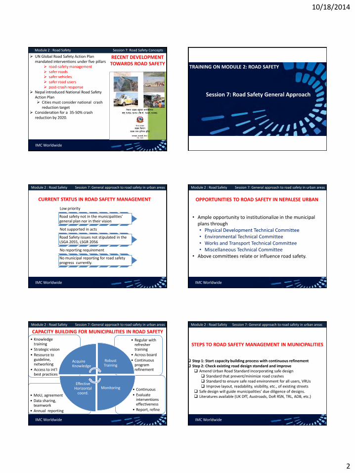
10/18/2014
2
IMC Worldwide
Module 2 : Road Safety Session 7: Road Safety Concepts
RECENT DEVELOPMENT TOWARDS ROAD SAFETY
UN Global Road Safety Action Plan mandated interventions under five pillars
road-safety management safer roads safer vehicles safer road users post-crash response
Nepal introduced National Road Safety Action Plan Cities must consider national crash
reduction target Consideration for a 35-50% crash
reduction by 2020.
TRAINING ON MODULE 2: ROAD SAFETY
Session 7: Road Safety General Approach
IMC Worldwide
Module 2 : Road Safety Session 7: General approach to road safety in urban areas
CURRENT STATUS IN ROAD SAFETY MANAGEMENT
Low priority
Road safety not in the municipalities’ general plan nor in their vision
Not supported in acts
Road Safety issues not stipulated in the LSGA 2055, LSGR 2056
No reporting requirement
No municipal reporting for road safety progress currently.
IMC Worldwide
Module 2 : Road Safety Session 7: General approach to road safety in urban areas
OPPORTUNITIES TO ROAD SAFETY IN NEPALESE URBAN
• Ample opportunity to institutionalize in the municipal plans through • Physical Development Technical Committee • Environmental Technical Committee • Works and Transport Technical Committee • Miscellaneous Technical Committee
• Above committees relate or influence road safety.
IMC Worldwide
Module 2 : Road Safety Session 7: General approach to road safety in urban areas
CAPACITY BUILDING FOR MUNICIPALITIES IN ROAD SAFETY
• Continuous
• Evaluate interventions effectiveness
• Report, refine
• MoU, agreement
• Data sharing, teamwork
• Annual reporting
• Regular with refresher training
• Across board
• Continuous program refinement
• Knowledge training
• Strategic vision
• Resource to guideline, networking
• Access to int'l best practices
Acquire Knowledge
Robust Training
Monitoring Effective
Horizontal coord.
IMC Worldwide
Module 2 : Road Safety Session 7: General approach to road safety in urban areas
STEPS TO ROAD SAFETY MANAGEMENT IN MUNICIPALITIES
Step 1: Start capacity building process with continuous refinement Step 2: Check existing road design standard and improve
Amend Urban Road Standard incorporating safe design Standard that prevent/minimize road crashes Standard to ensure safe road environment for all users, VRUs Improve layout, readability, visibility, etc., of existing streets
Safe design will guide municipalities’ due diligence of designs. Literatures available (UK DfT, Austroads, DoR RSN, TRL, ADB, etc.)
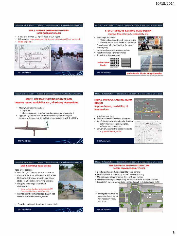
10/18/2014
3
IMC Worldwide
Module 2 : Road Safety Session 7: General approach to road safety in urban areas
STEP 2: IMPROVE EXISTING ROAD DESIGN SAFER ROADSIDE DRAINS
• If possible, provide L/J-type instead of U/V- types • BLT-up areas: cover drains/modify depth to 45 cm max (30 cm preferred) • Inside-slope ≥1:1
IMC Worldwide
Module 2 : Road Safety Session 7: General approach to road safety in urban areas
STEP 2: IMPROVE EXISTING ROAD DESIGN Improve Street layout, readability, etc.
• At strategic locations: • Widen sidewalks with curb-ramp crossing • Provide audio-tactile blocks at curb-ramps
• Providing on, off -street parking for cycles, motorcycles;
• Landscape islands/driveways/medians • Rectify obscured signs/ structures; • Trim obstructing vegetation
audio-tactile blocks along sidewalks
audio-tactile blocks
IMC Worldwide
Module 2 : Road Safety Session 2: General approach to road safety in urban areas
STEP 2: IMPROVE EXISTING ROAD DESIGN Improve layout, readability, etc., of existing intersections
• Modify/upgrade intersections • Signalize • change geometry (e.g. four-way to a staggered intersection)
• Upgrade signal controller to accommodate a pedestrian signal • Increase ped-green time to facilitate elderly/persons with disabilities.
IMC Worldwide
Module 2 : Road Safety Session 2: General approach to road safety in urban areas
STEP 2: IMPROVE EXISTING ROAD DESIGN Improve layout, readability, of intersections
• Install warning signs • Protect constrained roadside structures • Rectify bridge parapet-ends to be forgiving
• splayed away, adequately signed, reflectorized, if possible.
• Convert environment to appeal residents • e.g. pedestrianise, LATM
IMC Worldwide
Module 2 : Road Safety Session 7: General approach to road safety in urban areas
STEP 2: IMPROVE ROAD DESIGN
Road Cross-sections
• Develop c/s standard for different road • Control RoW encroachments at BLT areas • Delineate, introduce smooth transition
(1:15 – 1:20) between varying sections • Mitigate road edge-failure with
delineation: • Same surface standard at shoulder &CWY • Flush shoulder grade with CWY edge
• Maintain embankment slope 1:10 in flat terrain, bottom either flat/round
• Provide parking at Shoulder, if permissible.
IMC Worldwide
Module 2 : Road Safety Session 7: General approach to road safety in urban areas
STEP 2: IMPROVE EXISTING INTERSECTION SAFETY PROVISION FOR CYCLISTS
Don’t provide cycle-lane adjacent to angle-parking Extend cycle-lane marking up to the STOP line/crossing Maintain cycle alleys/lanes pot-free, with safe humps Plan continuous cycle-alleys along the shortest route to major locations Educate left-turning motorists to yield to through cyclists in shared LT/TH
Investigate constructing innovative Dutch layout with necessary rules, education.

10/18/2014
4
IMC Worldwide
Module 2 : Road Safety Session 2: General approach to road safety in urban areas
SAFETY PROVISIONS FOR PEDESTRIANS
Direct pedestrians by handrails to safe crossing locations
Plant trees only when sidewalks wide enough to accommodate pedestrian traffic.
Educate drivers to yield to peds at: zebra crossing mid-block signal during the
permitted phase curb extensions build-outs pedestrian refuge
IMC Worldwide
Module 2 : Road Safety Session 7: General approach to road safety in urban areas
SAFETY FOR PEDESTRIANS
Conduct awareness campaigns to avoid dangerous ped behaviour depicted
IMC Worldwide
Module 2 : Road Safety Session 7: General approach to road safety in urban areas
APPROPRIATE DESIGN OF ROAD HUMP WITH DELINEATION
• Existing design of humps in Nepal inappropriate • For a well-designed hump, span 3.5 - 4 m to be effective, safe • In urban streets, hump should
• Extend the full carriageway and shoulder, and • Have a narrow passage at its ends for surface drainage
IMC Worldwide
Module 2 : Road Safety Session 7: General approach to road safety in urban areas
SAFETY FOR PERSONS WITH DISABILITIES
Plan, improve streets to conform to GoN Accessibility Directive, 2069
Sidewalks +unsurfaced shoulders to be: 2 m min width -main streets Curb - 10–15 cm high non-
mountable Width to exclude area over covered
drains
IMC Worldwide
Module 2 : Road Safety Session 7: General approach to road safety in urban areas
SAFETY FOR PERSONS WITH DISABILITIES
At restricted area, cover the drain to use as sidewalk, surface flushed surface sufficiently even with necessary grip when wet for wheelchairs
Provide curb-ramp at all the at-grade crossing Provide handrails 90 cm high , additional rails 70 cm, side-rail, 5-10 cm high.
IMC Worldwide
Module 2 : Road Safety Session 7: General approach to road safety in urban areas
SAFETY FOR PERSONS WITH DISABILITIES
Install audio tactile at-grade crossing Provide ramps to ped-bridges Install/upgrade existing signal with
audio-tactile push-buttons audible pedestrian sound
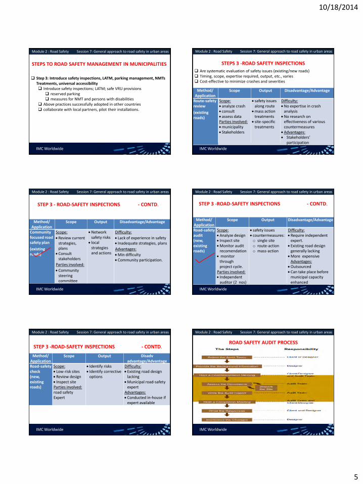
10/18/2014
5
IMC Worldwide
Module 2 : Road Safety Session 7: General approach to road safety in urban areas
STEPS TO ROAD SAFETY MANAGEMENT IN MUNICIPALITIES
Step 3: Introduce safety inspections, LATM, parking management, NMTs Treatments, universal accessibility Introduce safety inspections; LATM; safe VRU provisions
reserved parking measures for NMT and persons with disabilities
Above practices successfully adopted in other countries collaborate with local partners, pilot their installations.
IMC Worldwide
Module 2 : Road Safety Session 7: General approach to road safety in urban areas
STEPS 3 -ROAD SAFETY INSPECTIONS
Are systematic evaluation of safety issues (existing/new roads) Timing, scope, expertise required, output, etc., varies Cost-effective to minimize crashes and severities
Method/ Application
Scope Output Disadvantage/Advantage
Route-safety review
(existing roads)
Scope: analyze crash consult assess data Parties involved: municipality Stakeholders
safety issues along route
mass action treatments
site-specific treatments
Difficulty: No expertise in crash
analysis No research on
effectiveness of various countermeasures
Advantages: Stakeholders’
participation
IMC Worldwide
Module 2 : Road Safety Session 7: General approach to road safety in urban areas
STEP 3 - ROAD-SAFETY INSPECTIONS - CONTD.
Method/ Application
Scope Output Disadvantage/Advantage
Community focused road safety plan
(existing roads)
Scope:
Review current strategies, plans
Consult stakeholders
Parties involved:
Community steering committee
Network safety risks
local strategies and actions
Difficulty:
Lack of experience in safety Inadequate strategies, plans
Advantages:
Min difficulty Community participation.
IMC Worldwide
Module 2 : Road Safety Session 7: General approach to road safety in urban areas
STEP 3 -ROAD-SAFETY INSPECTIONS - CONTD.
Method/ Application
Scope Output Disadvantage/Advantage
Road-safety audit (new, existing roads)
Scope: Analyze design Inspect site Monitor audit
recomendation monitor
through project cycle.
Parties involved: Independent
auditor (2 nos)
safety issues countermeasures: o single site o route-action o mass-action
Difficulty: Require independent
expert. Existing road design
generally lacking More expensive
Advantages: Outsourced Can take place before
municipal capacity enhanced
IMC Worldwide
Module 2 : Road Safety Session 7: General approach to road safety in urban areas
STEP 3 -ROAD-SAFETY INSPECTIONS - CONTD.
Method/ Application
Scope Output Disadv advantage/Advantage
Road-safety check (new, existing roads)
Scope: Low-risk sites Review design Inspect site Parties involved: road safety Expert
Identify risks Identify corrective
options
Difficulty: Existing road design
lacking Municipal road-safety
expert Advantages: Conducted in-house if
expert available
IMC Worldwide
Module 2 : Road Safety Session 7: General approach to road safety in urban areas
ROAD SAFETY AUDIT PROCESS

10/18/2014
6
IMC Worldwide
Module 2 : Road Safety Session 7: General approach to road safety in urban areas
TYPICAL TABLE OF CONTENT OF A RSA REPORT IN NEPAL
List of literature reviewed Speed control devices
Review the design plan Intersection layouts
Road c/s, widening at settlements Signs and road-marking
Visibility, passing bays Roadside facilities for communities
Drainage structures History of road crashes
Safety barriers and delineators Hazardous locations
Bridges Evaluation of safety risks involved
Bus bays/park, interchange facilities Road Safety Audit Statement
For each component, the following discussed objectively. Description, safety issues, recommendations
IMC Worldwide
Module 2 : Road Safety Session 7: General approach to road safety in urban areas
PROVIDING BACKGROUND INFORMATION
Designer to provide
Reports, auditor’s brief, report format template
Drawings: plans, cross-sections, typical drawing, etc.
Schedule: safety barriers, signage, passing bays, etc.
X-section drawing: bridges, culverts, causeways
Classified counts with NMTs
Previous RSA reports, unresolved issues
IMC Worldwide
Module 2 : Road Safety Session 7: General approach to road safety in urban areas
ASSESSING DOCUMENTS FOR AUDITS
• Assess before/after site inspection.
• Use RSA checklists to record first impressions
• Make notes to guide field inspections
• Seek clarification from designer for any questions
• Confine only on safety issues.
IMC Worldwide
Module 2 : Road Safety Session 7: General approach to road safety in urban areas
EXCERPT FROM A RSA REPORT IN NEPAL
For each component, the following is discussed objectively. Description of the element, safety issues, recommendations
IMC Worldwide
Module 2 : Road Safety Session 7: General approach to road safety in urban areas
INSTITUTIONALISING SAFETY ASSESSMENTS IN MUNICIPALITIES?
Stage 1: Train personnel at the road safety unit/extended unit
Stage 2: Conduct community-focused safety plans for the existing roads
Stage 3: Apply for funds from the RBN, NRSC for safety audits.
Stage 4: Start auditing important roads; gradually expand as resource permits.
Stage 5: Update research on countermeasures from DoR, DUDBC, NRSC.
Stage 6: Continue various safety assessments with enhanced capacity
IMC Worldwide
Module 2 : Road Safety Session 7: General approach to road safety in urban areas
STEPS TO ROAD SAFETY MANAGEMENT IN MUNICIPALITIES
Step 4: Start interventions for safer vehicles, safer road users, safer speeds Closely coordinate with stakeholders to fully implement “safe system” Disseminate on the following NRSAP led central interventions
Proposed amendment -VTMA, VTMR, LSGA, LSGR for enabling policies Mandatory annual safety reporting from road authorities Road safety audit manuals for urban/rural roads Experience gained on audits on urban/rural roads. Guideline on safe road design and sustainable urban transport
infrastructure Research on various countermeasures for urban roads

10/18/2014
7
IMC Worldwide
Module 2 : Road Safety Session 7: General approach to road safety in urban areas
STEPS TO ROAD SAFETY MANAGEMENT IN MUNICIPALITIES
Step 4: Start fully implementing interventions for ‘safe system’ Manage a network of ambulances through partnership with following
to improve the post-crash response hospitals private organizations charities, NGOs/INGOs local Red Cross, etc
Liaise with the Department of Health Services, center for trained paramedics onboard ambulances and doctors in trauma care.
IMC Worldwide
Module 2 : Road Safety Session 7: General approach to road safety in urban areas
POLICIES FOR ROAD SAFETY MANAGEMENT IN MUNICIPALITIES
• Incorporate safety elements in land development plans • Mandate TIAs for enabling land-development • Continuously monitor compliance to vehicle load, size
restrictions • Introduce new restrictions in collaboration with local
traffic police
IMC Worldwide
Module 2 : Road Safety Session 7: General approach to road safety in urban areas
SAFER UPT OPERATIONS
• Plan, improve safer layout (operation, pax) at terminals, stops, interchange • Stops outside intersection influence area (30 – 50 m away) • Indented laybys (delineated, visible) with safe pax waiting areas
• Preferably staggered configuration, right first –left second • Safe embarking and disembarking for passengers • Accessible stops, especially persons with disabilities • Safer ingress/egress to the terminals • Safer traffic circulation at off-street terminals • Adequate parking bays, passenger platform, sidewalk • Locate/shift stops along service road adjacent to the major arterial
IMC Worldwide
Module 2 : Road Safety Session 7: General approach to road safety in urban areas
SAFER UPT OPERATIONS
• Integrate stops/interchanges with ped/NMT routes
• Para-transit stops closest to residences
• Direct interchanges -pedestrian route links
• Safer, more convenient rickshaw stands
• Investigate dedicated UPT lanes
• Collaborate (police, ZTMO) for stricter enforcement, education • Using only designated stops • Using only the designated
loading bays/docks • UPTs Code of Conduct • Sidewalk/roadside
encroachment
IMC Worldwide
Module 2 : Road Safety Session 7: General approach to road safety in urban areas
SAFER TRAFFIC OPERATIONS, SAFER ROAD USERS
• Collaborate with police, ZTMO for stricter rule enforcement with heavier penalties • Vehicle overloading including
motorcycles (pax/freight) • UPT/freight terminal • Between stations
• Travelling on rooftops • Standees on para-transit • Spare drivers requirements on long-
distance bus routes • Violation of no-entry
IMC Worldwide
Module 2 : Road Safety Session 7: General approach to road safety in urban areas
SAFER ROAD USERS
• Improve driver license system with • better examination, trial methods • graduated licensing system
• Regularly conduct safety awareness • Schools, colleges • UPT stops/terminals • NMT parking areas
• Mobilize matching funds for campaigns from the center • RBN, NRSC, private sponsors, etc.

10/18/2014
8
IMC Worldwide
Module 2 : Road Safety Session 7: General approach to road safety in urban areas
SAFER TRAFFIC OPERATIONS, ROAD USERS
• Educate UPT drivers for safe pulling in/pulling out at curb stops
• Encourage entrepreneurs for mature drivers
• Raise drivers awareness regarding VRUs safety
• Educate code of conduct • street vendors • Hawkers • pedestrians
IMC Worldwide
Module 2 : Road Safety Session 7: General approach to road safety in urban areas
SAFE PARKING FACILIITIES FOR VRUs
Parking/ waiting areas for rickshaws at strategic locations NMT zones Market centers city centers
Clearly delineate the parking/waiting areas for Motorcycles NMTs Ensure necessary clearance
from CWY
IMC Worldwide
Module 2 : Road Safety Session 7: General approach to road safety in urban areas
SAFE PARKING FACILIITIES FOR VRUs
Collaborate with police to enforce: motorcycles, NMTs at
designated parking only Control illegal parking
Barricade if enforcing illegal parking difficult steel bars traffic cones NJ barriers
Educate motorcyclists, NMTs for safe entry, exit from parking
IMC Worldwide
Module 2 : Road Safety Session 7: General approach to road safety in urban areas
SAFETY PROVISION FOR NON MOTORIZED TRANSPORT
Designate hand/bull –carts waiting areas, loading docks local markets inner streets
Change traditional planning, improve existing streets for safer operations for NMTs NMT-only streets/alleys innovative intersection layouts for safer crossing for NMTs
IMC Worldwide
Module 2 : Road Safety Session 7: General approach to road safety in urban areas
SAFER ROAD USERS
Educate drivers to dully consider pedestrians
Encourage peds for good behavior using designated crossings not jay-walking Using sidewalks/shoulders bright clothes at night Avoid travelling on bus roof Not recklessly jump over
handrails to cross the street
IMC Worldwide
Module 2 : Road Safety Session 7: General approach to road safety in urban areas
SAFETY PROVISIONS FOR PEDESTRIANS
More priority to peds in streets adjoining shopping, commercial areas.
Provide convenient bus stops, parking and terminals
Introduce all red/exclusive ped phase at signalized intersection
Provide ped-friendly grade-separated crossing, if feasible across major intersections across high speed arterials

10/18/2014
9
IMC Worldwide
Module 2 : Road Safety Session 7: General approach to road safety in urban areas
SAFE ACCESS TO UPT FOR PERSONS WITH DISABILITIES
Educate UPTs to stop within a gap of 30 cm from pax platform
Plan/modify platform to flush with UPT door level or provide ramps
Investigate for 1 wheelchair space at the bus front and back
Provide/modify service desks at UPT terminals within 76 cm high
IMC Worldwide
Module 2 : Road Safety Session 7: General approach to road safety in urban areas
SAFE ACCESS TO UPT FOR PERSONS WITH DISABILITIES
Encourage entrepreneurs for universally accessible buses Explore incentive to entrepreneurs to sustain
Reserve parking space (on/ off- street) for persons with disabilities. reserved motorcycle parking-bay: 1.22 m x 1.52 m reserved car parking-bay: 2.43 m x 4.78 m
IMC Worldwide
Module 2 : Road Safety Session 7: General approach to road safety in urban areas
LOCAL AREA TRAFFIC MANAGEMENT (LATM)
Traffic calming at the local level
Discourage through traffic Reduce traffic, speeds Conducive for residents,
NMTs Device installed to self-induce
speed reduction New to Nepal, training first
required.
Road Hump in Malaysia
Gateway in Europe
Elevation view of rumble-strip and
jiggle-bars IMC Worldwide
Module 2 : Road Safety Session 7: General approach to road safety in urban areas
LATM INTRODUCTION IN NEPAL’S URBAN AREAS
Guideline to introduce LATM should include
Means to influence drivers’ behavior (physically/perception-wise)
Potential effectiveness of different devices in Nepal
Appropriate design of various devices in Nepal
IMC Worldwide
Module 2 : Road Safety Session 7: General approach to road safety in urban areas
STEPS TO ROAD SAFETY MANAGEMENT IN MUNICIPALITIES
Step 5: Collaborate with the local traffic police for data analysis Have formal agreement with police for sharing crash data prior to
this step Municipality need to outsource remedial measures to specialized
consultants for complex sites or Municipality can seek assistance from DoR, NRSC, traffic police till
the former gains experience.
IMC Worldwide
Module 2 : Road Safety Session 7: General approach to road safety in urban areas
STEPS TO INTRODUCE CRASH ANALYSIS AND REMEDIAL MEASURES IN NEPALESE URBAN AREAS
Stage 1: Acquire training in crash analysis and remedial works Stage 2: Enter agreement with the traffic police to access crash-data Stage 3: Design municipal crash database with technical assistance Stage 4: Establish permanent network with police to access crash-data Stage 5: Start analysing crashes, identify remedial measures Stage 6: Prioritise, start remedial works at the sites Stage 7: Update crash database and re-prioritise the crash sites

10/18/2014
10
IMC Worldwide
Module 2 : Road Safety Session 7: General approach to road safety in urban areas
OUTCOME ENVISAGED FOLLOWING
STRATEGY
Start institutionalising
Safer road design promoted
Gradual 'Safe System' interventions knowledge
Stakeholder coordination established and full implementation of Safe
System
Crash preventive measures intitiated
Start collaborative crash remedial measures. Continue safety planning with further refinement.
Co
nti
nu
e c
apac
ity
bu
ildin
g
wGojfb

10/18/2014
1
Saroj Pradhan
Oct 14, 2014
MODULE - 6
Urban Transport Infrastructure Management
Urban Transport Infrastructure Management
• Road Infrastructure, PT Infrastructure, Components in the management of Urban Transport Infrastructure, Types of Maintenance Works
• Road Hierarchy, Asset Management System, Stakeholder collaboration, Types of Maintenance
• Maintenance Techniques, Regular Maintenance and Budgeting
IMC Worldwide
Module 6 : Urban Transport Infrastructure Management
IMC Worldwide
Module 6 : Urban Transport Infrastructure Management
IMC Worldwide
Module 6 : Urban Transport Infrastructure Management
MODULE ORGANIZATION Challenges Facing Urban Transportation
• Traffic congestion and parking difficulties.
• Public transport crowding and off-peak inadequacy.
• Difficulties for pedestrians.
• Environmental impacts and energy consumption.
• Accidents and safety.
• Land consumption.
• Freight distribution.

10/18/2014
2
Congestion
New
capacity
The Vicious Circle of Congestion
IMC Worldwide
Module 6 : Urban Transport Infrastructure Management
Urban Transport Infrastructure
All elements of the urban road infrastructure – comprising the pavement (carriageway), shoulder/hard strips, side drains, cross drains, footpaths, street furniture, lay-bys, etc.
IMC Worldwide
Module 6 : Urban Transport Infrastructure Management
Road Infrastructure : Consists of elements like pavement (carriageway), shoulder/ hard strips, site drains, cross drains, footpath, streetlights, guard rails, street markings, traffic lights, street furniture, bridges, flyovers, tunnels, overhead pedestrian crossing, lay-bys etc. Public Transport Infrastructure : Bus Terminal, Bus Depot/ Park, Bus/ Truck Service Stations, Bus Stops, Tempo/ Rickshaw/ Taxi Parks, Travel Information Centre, Public Conveniences etc.
IMC Worldwide
Module 6 : Urban Transport Infrastructure Management
IMC Worldwide
Module 6 : Urban Transport Infrastructure Management
IMC Worldwide
Module 6 : Urban Transport Infrastructure Management

10/18/2014
3
IMC Worldwide
Module 6 : Urban Transport Infrastructure Management
The urban transport infrastructure is developed and maintained with an aim to enhance the mobility of goods and people to fulfill economic and social needs of the society
Why Urban Transport Infrastructure ?
IMC Worldwide
Module 6 : Urban Transport Infrastructure Management
A set of activities planning and decision making, organizing, leading, and controlling
Directed at an organization’s resources human, financial, physical, and information
With the aim of achieving organizational goals in an efficient and effective manner.
What is Management?
IMC Worldwide
Module 6 : Urban Transport Infrastructure Management
EFFICIENTLY Using resources wisely and in a cost-effective way EFFICIENTLY Using resources wisely and in a cost-effective way
Basic Purpose of Management
IMC Worldwide
Module 6 : Urban Transport Infrastructure Management
•Planning and Decision Making Setting an organization’s goals and selecting a course of action from a set of alternatives to achieve them.
•Organizing Determining how activities and resources are grouped.
•Leading The set of processes used to get organizational members to work together to advance the interests of the organization.
•Controlling Monitoring organizational progress towards goals.
The Management Process
IMC Worldwide
Module 6 : Urban Transport Infrastructure Management
Urban transport infrastructure management
The management of urban transport infrastructure refers to the planning , organizing , leading and controlling of all the activities on operation and maintenance, rehabilitation, up gradation of the existing infrastructure and development of new transport infrastructure based on urban development strategy.
IMC Worldwide
Module 6 : Urban Transport Infrastructure Management
Road Hierarchy
(i) Strategic / national highways; (ii) Other strategic roads; (iii) Secondary/collector roads; and (iv) Access roads.

10/18/2014
4
IMC Worldwide
Module 6 : Urban Transport Infrastructure Management
Road Hierarchy
IMC Worldwide
Module 6 : Urban Transport Infrastructure Management
Road Assets
• Pavement • Base course • Sub-base course • Road Formation • Drain works • Retaining Walls • Culverts
• Causeways • Vented causeways • Bio-engineering works • Slope protection works • Bridges • Traffic management works • Street furniture • Street lighting
IMC Worldwide
Module 6 : Urban Transport Infrastructure Management
What is asset management
“A systematic process of maintaining, upgrading and operating assets, combining engineering principles with sound business practice and economic rationale, and providing tools to facilitate a more organized and flexible approach to making the decisions necessary to achieve the public’s expectations”.
IMC Worldwide
Module 6 : Urban Transport Infrastructure Management
Major Elements of an Asset Management System
IMC Worldwide
Module 6 : Urban Transport Infrastructure Management
Benefits from Asset Management
• Communications (both internal and external to the Administration).
• Asset inventory, condition and level of use. • Network level performance • Asset management tools. • Budget process. • Staff development.
IMC Worldwide
Module 6 : Urban Transport Infrastructure Management
COMPONENTS OF AN ASSET MANAGEMENT SYSTEM
• Goals and policies of the Administration. • Data. • Resources and budget details. • Alternative strategies and program development. • Project selection criteria. • Implementation program. • A monitoring and feedback loop.

10/18/2014
5
IMC Worldwide
Module 6 : Urban Transport Infrastructure Management
Goals
• Congestion. • Network improvement. • Pavement condition. • Safety. • Structure condition
IMC Worldwide
Module 6 : Urban Transport Infrastructure Management
Policies
• Access. • Administration standards. • Community benefits/interaction. • Economic development. • Engineering standards. • Environmental. • Heritage management/cultural resources. • Long-range plans. • Organizational structure. • Political issues. • Research. • Stakeholder requirements. • Training.
IMC Worldwide
Module 6 : Urban Transport Infrastructure Management
Asset data
• Collection methods – field, laboratory, automated, multi-media. • Common database and reporting – including map-based reporting. • Condition assessment – current. • Inventory – type (pavement, structure, sign, etc.) location, features. • Population – types, composition, growth rate. • Traffic – types, composition, growth rate. • Valuation – current financial and economic value, capitalization methods.
IMC Worldwide
Module 6 : Urban Transport Infrastructure Management
What is Road Asset Management
• Physical infrastructure, such as pavements and bridges, road furniture, bus parks, terminals.
• Human resources (personnel and knowledge). • Equipment and materials. • Other items of value such as rights-of-way, data, computer
systems, methods, technologies, and partners
IMC Worldwide
Module 6 : Urban Transport Infrastructure Management
Asset Management System
• An asset management system for urban transport infrastructure is a management tool wherein all infrastructures under a road agency is systematically operated, maintained, upgraded and preserved throughout its life-cycle.
• An urban transport infrastructure is considered as an asset with a defined commercial value calculated on the basis of its whole-life costs and its contribution to the economy.
• By preserving the urban transport infrastructure with planned maintenance, maximum benefit can accrue from the existing network and thus avoid costly rehabilitation works
IMC Worldwide
Module 6 : Urban Transport Infrastructure Management
• Road maintenance one of prerequisite as well as there is a need to have a well-documented inventory of the transport infrastructure to enable monitoring and programming of the road maintenance activities on a network-wide basis.
• The inventory and programming exercise; condition assessment
of the road network including survey for measuring pavement surface condition – such as the International Roughness Index (IRI and Surface Distress Index (SDI). The IRI measures the road roughness using a bump integrator, while the SDI measure is based on a visual assessment of the road.
• These parameters are used to categorize the condition of the road as an aid in prioritizing road maintenance activities

10/18/2014
6
IMC Worldwide
Module 6 : Urban Transport Infrastructure Management
Road inventory
• Right of way • Building properties belonging to the road agency • Road and furniture • Bridge and cross drainage • Vehicles, plants and machinery of public-private partnership
schemes or projects • Local collaborations with other sectors (water-supply, sewage, • electrical, etc.) • Road accident records together with analysis and preventive
measures • Strict axle-load controls including logistics (weighbridges)
IMC Worldwide
Module 6 : Urban Transport Infrastructure Management
Road Register
• Road link reference • Road link Name • Surface type • Carriageway width • Pavement width • Terrain • Traffic volume (AADT) • IRI • SDI • Pavement condition based on both IRI and SDI (good, fair or poor) • Year of pavement surfacing, if applicable
IMC Worldwide
Module 6 : Urban Transport Infrastructure Management
Why maintenance?
Deterioration Factors: Environmental- Terrain, Climate and Local practices; Traffic-Volume and Axle Load; Construction- Design and Construction Standard and Quality
IMC Worldwide
Module 6 : Urban Transport Infrastructure Management
Rutting Process
IMC Worldwide
Module 6 : Urban Transport Infrastructure Management
Different type of maintenance works required in urban infrastructure management
• Routine maintenance • Recurrent maintenance • Specific or major recurrent maintenance • Periodic maintenance • Preventative maintenance • Emergency maintenance
IMC Worldwide
Module 6 : Urban Transport Infrastructure Management
Routine Maintenance
Maintenance required continually of every road because of environmental degradation, whatever its engineering characteristic or traffic volume.

10/18/2014
7
IMC Worldwide
Module 6 : Urban Transport Infrastructure Management
Routine Maintenance
Routine maintenance should be conducted regularly: grass-cutting, repairs and cleaning of drains, shoulders, bridges, culverts and road furniture (signs, guide posts, km post, road marking, etc.). Roadside drains should be regularly checked at least once a week during the monsoons as part of the routine maintenance. Minor repairs resulting from spilling of water from household gutters, leakage of water/sewage, removal of debris from the households, etc.,
IMC Worldwide
Module 6 : Urban Transport Infrastructure Management
Routine Maintenance
IMC Worldwide
Module 6 : Urban Transport Infrastructure Management
Recurrent Maintenance
Recurrent maintenance is necessary at intermittent intervals (twice yearly for road links or from six-months to two years for bridges). It is needed due to the damage on the road surface is by traffic plying over it over a period. Conducted twice every year Includes repairs of potholes, road edges and shoulders; re-grading; crack-sealing; and repainting road marking and signs.
IMC Worldwide
Module 6 : Urban Transport Infrastructure Management
Recurrent Maintenance
IMC Worldwide
Module 6 : Urban Transport Infrastructure Management
Recurrent Maintenance
Kff]v/f
%% ls=ld=
Kff]v/f
%% ls=ld=
IMC Worldwide
Module 6 : Urban Transport Infrastructure Management
Recurrent Maintenance
Objective of Recurrent Maintenance 1. To Give Serviceability to Road User 2. To Reduce the Wear and Tear of Vehicle 3. To Reduce Degree and Extent of Deterioration 4. To Differ the Rehabilitation Period and Cost 5. To Reduce Vehicle Operating Cost

10/18/2014
8
IMC Worldwide
Module 6 : Urban Transport Infrastructure Management
Recurrent Maintenance
Maintenance Items
• Drain Maintenance • Maintenance of Culverts • Road Surface Maintenance • Shoulder Maintenance • Causeway Maintenance • Road Furniture Maintenance
IMC Worldwide
Module 6 : Urban Transport Infrastructure Management
Recurrent Maintenance Road Surface Maintenance
IMC Worldwide
Module 6 : Urban Transport Infrastructure Management
Recurrent Maintenance Road Surface Maintenance
IMC Worldwide
Module 6 : Urban Transport Infrastructure Management
Recurrent Maintenance Road Surface Maintenance
IMC Worldwide
Module 6 : Urban Transport Infrastructure Management
Recurrent Maintenance Road Furniture Maintenance
IMC Worldwide
Module 6 : Urban Transport Infrastructure Management
Specific Maintenance
Specific maintenance or major recurrent works involve maintenance at a specific location on a road and include minor rehabilitation, minor reseals, spot improvements, minor structural repairs, etc.

10/18/2014
9
IMC Worldwide
Module 6 : Urban Transport Infrastructure Management
Periodic Maintenance
Periodic maintenance is conducted after intervals of a certain number of years (commonly once every one to ten years depending on the type of work). For roads, this includes surface resealing, re-gravelling works, re-painting of the steelworks, shoulder re-gravelling, etc.
IMC Worldwide
Module 6 : Urban Transport Infrastructure Management
Periodic Maintenance
Periodic on-road maintenance On paved roads, it includes re sealing (after filling the potholes and constructing leveling course where required) using either surface dressing, slurry seal, sand seal or none structural bituminous concrete overlay.
IMC Worldwide
Module 6 : Urban Transport Infrastructure Management
Preventive Maintenance
Preventive maintenance for roads includes mitigation works from slope failures and bank failures due to floods. This will include river-training works at road sections running adjacent to rivers, slope stabilization works including bio-engineering works, etc.
IMC Worldwide
Module 6 : Urban Transport Infrastructure Management
Preventive Maintenance
Activities Required are: • Slope Netting • Trim Slopes • Masonry Wall and Revetments • Cascades • Gabion Walls • Prop Walls • Check Dams • River Training and Bank Protection • Bio-engineering Works
IMC Worldwide
Module 6 : Urban Transport Infrastructure Management
Preventive Maintenance
IMC Worldwide
Module 6 : Urban Transport Infrastructure Management
Preventive Maintenance

10/18/2014
10
IMC Worldwide
Module 6 : Urban Transport Infrastructure Management
Preventive Maintenance
IMC Worldwide
Module 6 : Urban Transport Infrastructure Management
Preventive Maintenance
IMC Worldwide
Module 6 : Urban Transport Infrastructure Management
Preventive Maintenance
IMC Worldwide
Module 6 : Urban Transport Infrastructure Management
Emergency Maintenance
Emergency maintenance, needed to deal with emergencies and problems calling for immediate action when a road is threatened or closed
IMC Worldwide
Module 6 : Urban Transport Infrastructure Management
Emergency Maintenance
Activities required for on-road maintenance • Communication and information • Traffic Management during emergency • Removal of debris and other obstacles • Placement of warning sign • Placement of diversion sign • Traffic Management after emergency
IMC Worldwide
Module 6 : Urban Transport Infrastructure Management
Emergency Maintenance
Emergency maintenance includes work for road opening following road blocks due to landslides or other natural events or when there is a potential hazard to the road’s structural integrity. These works include road diversions following land-slides, mitigation works to relieve traffic blocked due to bridge failures, etc.

10/18/2014
11
IMC Worldwide
Module 6 : Urban Transport Infrastructure Management
Emergency Maintenance
IMC Worldwide
Module 6 : Urban Transport Infrastructure Management
Emergency Maintenance
IMC Worldwide
Module 6 : Urban Transport Infrastructure Management
Emergency Maintenance
IMC Worldwide
Module 6 : Urban Transport Infrastructure Management
Emergency Maintenance
IMC Worldwide
Module 6 : Urban Transport Infrastructure Management
Road Shoulder maintenance
a) providing side support to the road pavement b) providing space to the traffic in case of emergencies c) draining water from the carriageway to the roadside ditch.
IMC Worldwide
Module 6 : Urban Transport Infrastructure Management
Storm Water Drainage

10/18/2014
12
IMC Worldwide
Module 6 : Urban Transport Infrastructure Management
Street Markings Guard Rails and barriers
IMC Worldwide
Module 6 : Urban Transport Infrastructure Management
Traffic Lights
IMC Worldwide
Module 6 : Urban Transport Infrastructure Management
Pavement Maintenance
IMC Worldwide
Module 6 : Urban Transport Infrastructure Management
Asphalt concrete road maintenance
IMC Worldwide
Module 6 : Urban Transport Infrastructure Management
Gravel and Earthen roads Corrective measures
IMC Worldwide
Module 6 : Urban Transport Infrastructure Management
Annual Maintenance Requirements for gravel and earthen roads

10/18/2014
13
IMC Worldwide
Module 6 : Urban Transport Infrastructure Management
Periodic Maintenance Requirement of Gravel and Earthen Roads
IMC Worldwide
Module 6 : Urban Transport Infrastructure Management
Quality Requirements for better level of service
• Reliability of Access • Comfort and Speed • Road Safety • Vehicle Operating Costs • Environmental Costs
IMC Worldwide
Module 6 : Urban Transport Infrastructure Management
• A programming module to help define and prioritize planned maintenance interventions for achieving the agreed level-of-service.
• Implementation and management module to help with monitoring and managing the implementation of maintenance program.
IMC Worldwide
Module 6 : Urban Transport Infrastructure Management
Stakeholder Collaboration
Active participation of the stakeholders in all stages of the management process is required for the meaningful management of the urban transport management process.
• Nepal Electricity Authority, • Nepal Telecom, • Nepal Water Supply Corporation • Cable Television Operators • Bus companies • Street Vendors
IMC Worldwide
Module 6 : Urban Transport Infrastructure Management
IMC Worldwide
Module 6 : Urban Transport Infrastructure Management

10/18/2014
14
IMC Worldwide
Module 6 : Urban Transport Infrastructure Management
IMC Worldwide
Module 6 : Urban Transport Infrastructure Management
IMC Worldwide
Module 6 : Urban Transport Infrastructure Management
IMC Worldwide
Module 6 : Urban Transport Infrastructure Management
IMC Worldwide
Module 6 : Urban Transport Infrastructure Management
IMC Worldwide
Module 6 : Urban Transport Infrastructure Management

10/18/2014
15
IMC Worldwide
Module 6 : Urban Transport Infrastructure Management
Transport Infrastructure Management Plan
• Inventory of the existing transport infrastructure under its jurisdiction and their condition in terms of good, satisfactory, poor and failed
• The type of maintenance required for each of the infrastructure
• Major rehabilitation or up gradation works • Planned infrastructure development • Requirement of financial, material and technical resources and
their allocation • Mode of development, operation and management • Work schedule or action Government funding for management
of urban infrastructure
IMC Worldwide
Module 6 : Urban Transport Infrastructure Management
Principles of road infrastructure management
• Re-orient and refine the planning and prioritizing interventions based on hierarchy of the roads.
• Place strong emphasis on preserving the transport infrastructure based on the principles of road asset management, simplified manner, network expansion.
• Proactively collaborate with the stakeholders at all stages of the management process (planning, prioritizing, programming and monitoring).
• Enhance capacity to gradually, maintain detailed inventory with specific information on status of various infrastructure elements, secure adequate funds for road maintenance
Q & A

10/18/2014
1
Government of Nepal
Ministry of Urban Development
Department of Urban Development and Building Construction
Babarmahal, Kathmandu
Urban Road Standard 2071
2071 Ashad
1. Nepal Road Standard, 2070 and Nepal Rural Road Standards, 2055 (First Revision). 2. Nepal Urban Road Standard, 2071 is for achieving consistency in urban road design and construction. 3. Its focus is the urban area - the volume and composition of traffic with the requirements for services like drains, electricity, water supply etc. 4. references are drawn from the prevailing road standards to this standard.
Contents 1. Classification of Urban Roads 2. Elements of Design 3. Cross Section Elements 4. Consistency of standards 5. Relaxation of road design standard 6. The Urban Road Network Development 7. Typical Road Cross Sections
1. NURS-2071 is for all urban roads within the municipalities of Nepal. 2. This may be relaxed by GoN to meet special circumstances. 3. Road is the major urban infrastructure in terms of financial resources, land consumption and urban land-use planning. 4. Urban growth is mainly guided by the urban road hierarchy and its alignment. 5. Challenge is safe movement of vulnerables mainly pedestrians and non-motorized vehicles -safety and accessibility to all.
1. The standard incorporates major technical as well as planning aspects for urban roads. Scope& Limitations
•This standard does not cover urban expressways, strategic and rural road networks.
Classification of Urban Roads 1. Arterial : principle network for through traffic flow. Spaced at 1.5 to 8 km.
2. Sub-arterials : somewhat lower travel mobility than the arterial streets. Spacing at 0.5 to 5 km.
3. Collector streets : For collecting and distributing the traffic to and from local streets and arterial streets. Normally full access is allowed on these streets from abutting properties.
4. Local streets : For access to residence, business or other abutting property.

10/18/2014
2
General Design Elements:
Factors in designating roads are - travel modes of transportation, the access needs, network pattern, and land-use. Designing in urban areas, type of traffic, environment, and drainage are prime consideration. E.g., mixed slow moving traffic requires consideration of grades, climbing lanes curvature etc. Design also take care of drainage, space for services and for erecting signs, lighting posts, etc.
General Design Principles :
Designed to - provide safe, short and fast thoroughfare and access to all road users - motor vehicles, cyclists and pedestrians; deliver traffic volumes at speeds compatible with function; provide convenient location for
services; provide an opportunity for landscaping; allow for parking, where appropriate; have due regard to environment and heritage of the site;
Sight Distance
The following aspects of sight distance are important while designing alignment: 1.The sight distance needed for stopping 2. The sight distance needed for the passing of overtaken vehicles 3. The sight distance needed for decision at complex locations
Stopping Sight Distance : Distance ahead needed by a driver to bring his vehicle to a complete stop before meeting a stationary object in his path. Decision Sight Distance : Distance travelled by the time driver make decisions - recognize a hazard or its threat potential, select an appropriate speed and path, and initiate and complete the required maneuver safely and efficiently. Headlight Sight Distance : On valley curves
Design Traffic Volume and Capacity
The road width should accommodate the design traffic volume. Past counts and consideration and of future development of urban areas must be kept in view for the of design life of 15-20 years. Traffic Characteristics & Equivalency
Factors
The width should be assessed on the basis of equivalent passenger car units (PCU) using the tentative equivalency factors shown in table below.
Vertical alignment
Vertical alignment in urban areas is governed by need to match building line and entrance line levels and levels of intersection and median openings. Vertical curves are introduced for smooth at grade changes. The vertical curves are –Summit curves or crests curves and Valley or sag curves with convexity downward. The problem in vertical curve is adequate sight distances.

10/18/2014
3
Horizontal Alignment : Horizontal curves should consist of a circular portion flanked by spiral transitions at both ends. Design speed, super elevation and coefficient of side friction affect. Super Elevation : The super elevation is provided to maintain the design traffic speed at a given radius. This assumes the centrifugal force corresponding to three-fourth the design speed is balanced by super elevation and rest counteracted by side friction:
Figure 4.3 Values of Super Elevation
Set-back Distance at Horizontal
Curves
Physical obstructions on the horizontal curves often restrict sight distance. Sight areas on horizontal curves should be such as to provide driver with distance equal to the design stopping distance on curve. Transition Curves
Transition curves are necessary for a vehicle to have smooth entry from a straight section into a circular curve. Spiral curves should be used for this purpose.
Widening of Carriageway on Curves :
It is necessary to widen the carriageway at sharp horizontal curves to provide - (i) mechanical widening to compensate the extra width occupied by a vehicle on the curve due to off-tracking of wheels and (ii) psychological widening to permit easy crossing of the vehicles.
Gradient : Urban roads carry mixed traffic including slow vehicles. intervals. It also has drainage. Besides this, it have intersections at frequent Design Speed : The design speed is the main factor governing the design of various design features. The sight distance, radius of horizontal curve, super elevation, extra widening of pavement, length of transition curve and the length of summit and valley curves all depends on design speed.
Utilities : There is always a need to accommodate utility service along and across the roads. The laying of utilities shall to be done to ease maintenance and operation but keeping in mind it will affect the traffic flow and conflict with other services to the minimum. These include the following : Sewer Line, Storm water drain, Water supply lines, Electricity cables and Poles, Telecommunication cables, Gas pipelines, Cross conduct ducts and others
Street lightning : Street lightning facilitates safety and comfort reducing traffic accident risk and improving personal safety. It is important in conflict points such as intersections, driveway and bus stops. It also helps road users to avoid potholes and missing drain covers. Spacing between lights should be about three times the height of the light. Poles should not be higher than 12m in residential areas to reduce undesirable illumination to private properties.
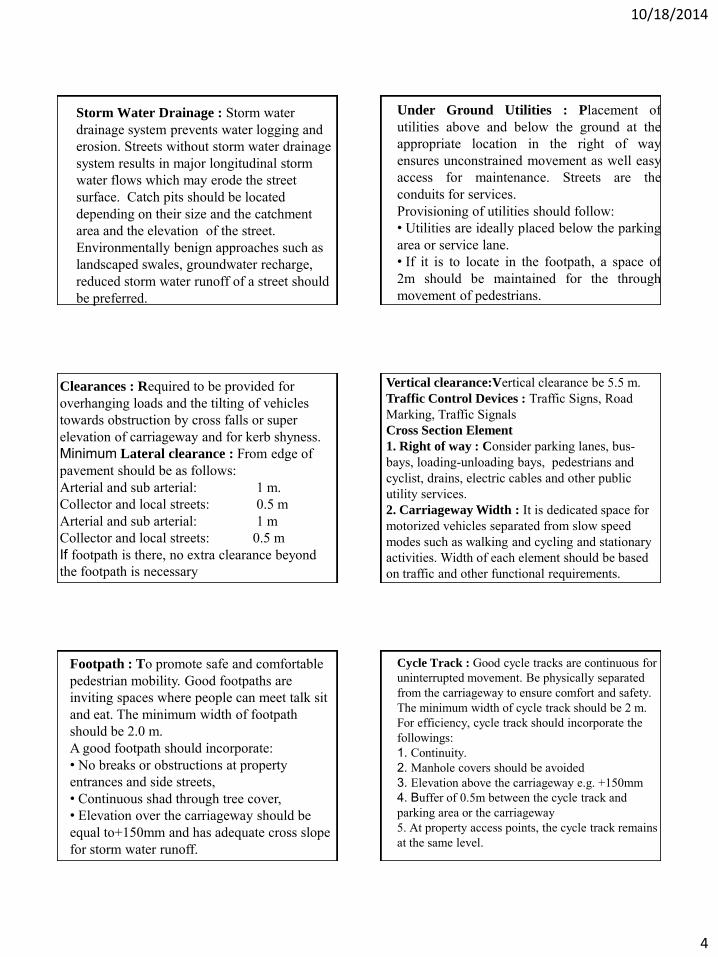
10/18/2014
4
Storm Water Drainage : Storm water drainage system prevents water logging and erosion. Streets without storm water drainage system results in major longitudinal storm water flows which may erode the street surface. Catch pits should be located depending on their size and the catchment area and the elevation of the street. Environmentally benign approaches such as landscaped swales, groundwater recharge, reduced storm water runoff of a street should be preferred.
Under Ground Utilities : Placement of utilities above and below the ground at the appropriate location in the right of way ensures unconstrained movement as well easy access for maintenance. Streets are the conduits for services. Provisioning of utilities should follow: • Utilities are ideally placed below the parking area or service lane. • If it is to locate in the footpath, a space of 2m should be maintained for the through movement of pedestrians.
Clearances : Required to be provided for overhanging loads and the tilting of vehicles towards obstruction by cross falls or super elevation of carriageway and for kerb shyness. Minimum Lateral clearance : From edge of pavement should be as follows: Arterial and sub arterial: 1 m. Collector and local streets: 0.5 m Arterial and sub arterial: 1 m Collector and local streets: 0.5 m If footpath is there, no extra clearance beyond the footpath is necessary
Vertical clearance:Vertical clearance be 5.5 m. Traffic Control Devices : Traffic Signs, Road Marking, Traffic Signals Cross Section Element
1. Right of way : Consider parking lanes, bus-bays, loading-unloading bays, pedestrians and cyclist, drains, electric cables and other public utility services. 2. Carriageway Width : It is dedicated space for motorized vehicles separated from slow speed modes such as walking and cycling and stationary activities. Width of each element should be based on traffic and other functional requirements.
Footpath : To promote safe and comfortable pedestrian mobility. Good footpaths are inviting spaces where people can meet talk sit and eat. The minimum width of footpath should be 2.0 m. A good footpath should incorporate: • No breaks or obstructions at property entrances and side streets, • Continuous shad through tree cover, • Elevation over the carriageway should be equal to+150mm and has adequate cross slope for storm water runoff.
Cycle Track : Good cycle tracks are continuous for uninterrupted movement. Be physically separated from the carriageway to ensure comfort and safety. The minimum width of cycle track should be 2 m. For efficiency, cycle track should incorporate the followings: 1. Continuity. 2. Manhole covers should be avoided 3. Elevation above the carriageway e.g. +150mm 4. Buffer of 0.5m between the cycle track and parking area or the carriageway 5. At property access points, the cycle track remains at the same level.
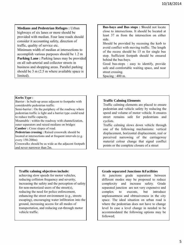
10/18/2014
5
Medians and Pedestrian Refuges : Urban highways of six lanes or more should be provided with median. Four lane roads should consider it accounting safety, direction of traffic, quality of service etc. Minimum width of median at intersections to accomplish various purposes should be 1.2 m Parking Lane : Parking lanes may be provided on all sub-arterial and collector streets in business and shopping areas. Parallel parking should be 3 m (2.5 m where available space is limited).
Bus-bays and Bus stops : Should not locate close to intersections. It should be located at least 37 m from the intersection on either side. Should be provided by recessing the kerb to avoid conflict with moving traffic. The length of the recess should be 15 m for single bus stop. Sufficient footpath should be ensured behind the bus-bays. Good bus-stops : easy to identify, provide safe and comfortable waiting space, and near street crossing. Spacing : 400 m.
Kerbs Type : Barrier : In built-up areas adjacent to footpaths with considerable pedestrian traffic. Semi-barrier : On the periphery of the roadway where pedestrian traffic is light and a barrier type could tend to reduce traffic capacity. Mountable : within the roadway with channelization, outer separators and raised medians on bridges Camber : Cross slopes of road. Pedestrian crossing : Raised crosswalk should be located at intersections and at frequent intervals (e.g. every 150-200m) Crosswalks should be as wide as the adjacent footpath and never narrower than 2m.
Traffic Calming Elements
Traffic calming elements are placed to ensure pedestrian and vehicle safety by reducing the speed and volume of motor vehicle. It ensures street remains safe for pedestrians and cyclists. Traffic calming slows down vehicle through one of the following mechanisms: vertical displacement, horizontal displacement, real or perceived narrowing of the carriageway material colour change that signal conflict points or the complete closure of a street
Traffic calming objectives include: achieving slow speeds for motor vehicles, reducing collision frequency and severity, increasing the safety and the perception of safety for non-motorized users of the street(s), reducing the need for police enforcement, enhancing the street environment (e.g., streets escaping), encouraging water infiltration into the ground, increasing access for all modes of transportation, and reducing cut-through motor vehicle traffic.
Grade separated Junctions &Facilities
At junctions grade separation between different modes may be proposed to reduce complexity and increase safety. Grade separated junction are not very expensive and complex to execute, but introduce unpleasantness and obtrusiveness in the city space. The ideal situation on urban road is where the pedestrian does not have to change level In case a level change in needed to be accommodated the following options may be followed;

10/18/2014
6
Pedestrian subway Half subways The car lanes are raised (+1.5m) using a ramp of 1:30 and the pedestrian paths (cycle tracks, wherever provided) are lowered using ramps of slope 1:20 with landing at appropriate intervals to equally achieve a clear minimum height of 2.75m. (-1.5m). Pedestrian Overhead bridges
Thank You

10/18/2014
1
TRAINING ON MODULE 3: Parking Management
Session 7: Parking Legislation; Policy; Regulation; Enforcement; Parking Supply
Organiser: GoN Dept. of Urban Development & Building Construction
Trainer: Subhash Dhungel, Urban Transport Infrastructure Specialist Urban Transport Planning Management (ADB ta 7948), IMC Worldwide 14 October, 2014
IMC Worldwide
Module 3 : Parking Management Session 7:Legislation; Policy; Regulation; Enforcement
PARKING DEFINITIONS AND CLASSIFICATIONS
• On-Street parking : parking facility provided along street kerb
• Off-street parking : parking facility provided at a site, adjoining the streets but away from the street
• Parking space : space required for one standard vehicle unrestricted, excluding manoeuvring space • also referred as parking bay for off-street facility
IMC Worldwide
Module 3 : Parking Management Session 7:Legislation; Policy; Regulation; Enforcement
PARKING DEFINITIONS AND CLASSIFICATIONS • Parallel parking : configuration where parking is parallel to
• roadside kerbs –on-street; parking aisle -off-street • Right-angle parking : parking at right angle to roadside kerb/parking
aisle • 450 parking : parking 450 to the roadside kerb/parking aisle.
Source : Parking Design Manual, Department of Planning and Land Use, County of San Diego, 2012
IMC Worldwide
Module 3 : Parking Management Session 7:Legislation; Policy; Regulation; Enforcement
PARKING CONFIGURATIONS
Source : Parking Design Manual, Department of Planning and Land Use, County of San Diego, 2012
IMC Worldwide
Module 3 : Parking Management Session 7:Legislation; Policy; Regulation; Enforcement
OFF-STREET PARKING CLASSIFICATIONS
• At-grade • Grade-separated
• Underground • Overhead • multi-storey
Underground parking in Dhaka, Bangladesh Source: Paul Barter
IMC Worldwide
Module 3 : Parking Management Session 7:Legislation; Policy; Regulation; Enforcement
OTHER CLASSIFICATION (ON/ OFF- STREET PARKING)
• Based on delineation • formal parking if marked,
controlled • informal parking if neither
marked nor controlled • Based on ownership
• Public • private, for exclusive individuals
• Based on duration • short-term (restricted three hours or less) • long-term (duration ≥ four hours)
• At-grade parking based on surface: Surfaced/un-surfaced

10/18/2014
2
IMC Worldwide
Module 3 : Parking Management Session 7:Legislation; Policy; Regulation; Enforcement
CHARACTERISTICS OF ON/ OFF- STREET PARKING Items On-street Parking Off-street Parking
Construction cost
cheap high
Physical works
Painting, signage, parking meters
Secure land; paving; installation –fare collection system, other equipment; admin building
Development Time
Shorter • site selection • painting
Longer • mobilise financing • construction
Operational Arrangement
Require enforcement -police/private sector
Enforcement not required
Targeted Users
Short term (casual users)
Short/long -term (monthly tenants, regular users)
Source : Module 4 Guidelines for Parking Measures : Policy and Options, PADECO, 2008 IMC Worldwide
Module 3 : Parking Management Session 7:Legislation; Policy; Regulation; Enforcement
PRIVATE NON-RESIDENTIAL PARKING
• Separate rules required • parking at offices, local shops, hospitals, schools • Parking demand generally high
• Operator submit for construction/contract renewal approval • parking plan • nos. spaces required, provided –light vehicles, cycles • distance to parking facility if isolated from its premises • compliance with bye-laws provisions • setbacks, structures (curbs, walls), traffic circulation, sight
distance, pedestrian link
IMC Worldwide
Module 3 : Parking Management Session 7:Legislation; Policy; Regulation; Enforcement
NMT PARKING IN NEPAL’S URBAN AREAS
NMT significant, adequate NMT parking required Particularly cycle
parking
At 100 m interval Signage incl. restriction to cars and enforcement Barricade if enforcement difficult Consider shared cycle/motorcycle parking if possible
If not, prioritise parking for cycles/prohibit motorcycles
Provide on-street cycle parking
IMC Worldwide
Module 3 : Parking Management Session 7:Legislation; Policy; Regulation; Enforcement
PARKING LEGISLATION
Local Self Governance Act 2055 • Municipality responsible for parking management • Sec. 96: Functions, Duties and Power of Municipality
• to be arranged for bus parks and parking places of rickshaw (three wheelers), horse carts, trucks etc. within the municipality area"
• Parking for light vehicles not specifically mentioned
IMC Worldwide
Module 3 : Parking Management Session 7:Legislation; Policy; Regulation; Enforcement
PARKING LEGISLATION
Local Self Governance Act 2055 • Section 144
• Authorised municipality to impose parking charge • Sec. 112 mandates municipality to prepare resource maps • Sec. 124 authorises municipalites to collect service charge for repair,
maintenance of parking areas Sec. 124: Repair, Maintenance and Management of the Project: 1. Municipality may collect service charge from the beneficiaries of a project for
the repair and maintenance of the project. 2. The repair, maintenance and necessary management of the project shall be
done with the amount of the service charge collected pursuant to sub-sec 1.
IMC Worldwide
Module 3 : Parking Management Session 7:Legislation; Policy; Regulation; Enforcement
PARKING LEGISLATION
Local Self Governance Regulation 2056 • Rule 147 refers to Annex 19 for max, min parking • Annex 19 -parking charges for municipal managed areas
• Bus, mini bus ,truck, tractor: per duration, Rs. 40 max. per use • Car: per duration, Rs. 20 max per use • Other vehicles: per duration Rs 10 max per use • Official rates very low, higher rate actually applied

10/18/2014
3
IMC Worldwide
Module 3 : Parking Management Session 7:Legislation; Policy; Regulation; Enforcement
PARKING LEGISLATION
Local Self Governance Regulation 2056 • Council authorised to set charge at municipality built/operated bus
parks • Sub-rule 134(1): Parking facilities not stipulated when developing
resource maps • Section 277:Alteration in Annexes
• permit revision of the parking charges in Annex 19 • “Government of Nepal may, by publishing a notification in the
Nepal Gazette, make necessary alteration and changes in the Annexes.”
IMC Worldwide
Module 3 : Parking Management Session 7:Legislation; Policy; Regulation; Enforcement
LEGISLATIVE ARRANGEMENT TO REVISE PARKING CHARGE
Process to revise LSGR Annex 19 as per Sec. 277 • Start process through the municipal law division • Justify to MLD the need for fare revision • Minister of Local Development submit proposals at the
Cabinet • Legislative Committee discuss, recommends revised rates • Revised parking charges in Annex 19 effected
IMC Worldwide
Module 3 : Parking Management Session 7:Legislation; Policy; Regulation; Enforcement
BASIC PARKING POLICY FRAMEWORK IN PRACTICE
On-street parking policy options • no stopping in busy streets • no parking in busy streets • Issue resident permit for parking • time-based pay parking –parking tickets, parking meters
• Off-street parking planning options • Surface parking • Multi-story car parks • underground car parks
• Effective enforcement required
IMC Worldwide
Module 3 : Parking Management Session 7:Legislation; Policy; Regulation; Enforcement
ENABLING PARKING POLICY IN URBAN AREAS
On-Street Parking Policy Prohibit parking in core,
if feasible free parking only in
exceptional cases
Hourly parking charges, incrementally applied with duration Rationale: Discourage long duration parking Rate gradually updated to reflect land cost, parking privilege
In BSC, trucks stop at every WKDY at Gudri Bazaar/Koshi HWY for long period to supply groceries
IMC Worldwide
Module 3 : Parking Management Session 7:Legislation; Policy; Regulation; Enforcement
ENABLING PARKING POLICY
Off-Street Parking Policy • Demand-driven • Generally more demand at activity centres • Separate motorized/NMT parking possible based on public
mobility, demand Rationale behind charging for parking • Charges to sustain parking controls • Essentially, streets for mobility (people, goods) • Scarce street space not for free parking by private vehicles
IMC Worldwide
Module 3 : Parking Management Session 7:Legislation; Policy; Regulation; Enforcement
PARKING POLICY FOR SMALL CITIES
Policy to guide overall urban transport strategy Regulation to prioritise road space for moving traffic Controls to: influence travelers' modal choice, destinations support, strengthen
commercial viability of town centres, individual buildings means to raise revenue (public, private sectors)
Restricts private cars in city centres Reduce congestion, encourage UPT use

10/18/2014
4
IMC Worldwide
Module 3 : Parking Management Session 7:Legislation; Policy; Regulation; Enforcement)
IMPOSITION OF PARKING POLICY IN CITIES
Stage - 3
Demand further increases; time-limit & charging introduced to optimize turnover
Stage - 2
Demand exceeds supply in certain areas
Regulations introduced, parking prohibited in some areas
Stage - 1
No parking issues, parking space available gradually used up
IMC Worldwide
Module 3 : Parking Management Session 7:Legislation; Policy; Regulation; Enforcement
IMPOSITION OF PARKING POLICY IN CITIES
Stage - 5
Differential parking tariffs introduced to: (1) target different groups (2) positively discriminate one group over others
Stage - 4
Parking control becomes tighter, parker overflow to neighboring areas;
permit fee issued in resident zone
IMC Worldwide
Module 3 : Parking Management Session 7:Legislation; Policy; Regulation; Enforcement
IMPOSITION OF PARKING POLICY IN CITIES
Stage - 7
Inclusion of parking in transport demand management
Stage - 6
Development of park and ride facilities on edge of town
IMC Worldwide
Module 3 : Parking Management Session 7:Legislation; Policy; Regulation; Enforcement
STAGE OF DEVELOPMENT IN NEPALESE CITIES
Stage - 3
Demand further increases; time-limit introduced to optimize turnover;
pricing strategy introduced
Stage - 2
Demand exceeds supply in certain areas
Regulations introduced, parking may be prohibited in some areas
Stage - 1
No parking issues, parking space available gradually used up
IMC Worldwide
Module 3 : Parking Management Session 7:Legislation; Policy; Regulation; Enforcement
PARKING CHARGE COLLECTION
Collecting method in small cities/developing countries • Manually • Tickets issued if
entry, exit controllable
IMC Worldwide
Module 3 : Parking Management Session 7:Legislation; Policy; Regulation; Enforcement
PARKING CHARGE COLLECTION
Other collection method • Parking meters at on-street facilities
under police surveillance.
• Parking vending machines for automated car parks • Latest technology requires
credit card payment

10/18/2014
5
wGojfb
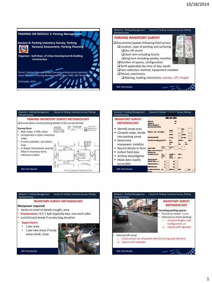
10/18/2014
1
TRAINING ON MODULE 3: Parking Management
Session 8: Parking Inventory Survey; Parking Demand Assessment; Parking Planning
Organiser: GoN Dept. of Urban Development & Building Construction
Trainer: Subhash Dhungel, Urban Transport Infrastructure Specialist Urban Transport Planning Management (ADB ta 7948), IMC Worldwide 14 October, 2014
IMC Worldwide
Module 3 : Parking Management Session 8: Parking Inventory Survey; Parking Demand Survey
PARKING INVENTORY SURVEY
Documents/update following field survey: Location, type of parking and surfacing On/ off-street short-tem including hourly long-tem including weekly, monthly
Number of spaces, configuration Tariff applicable (by time of day, week) Fare collection method, equipment installed Period, restrictions Waiting, loading restrictions -private, UPT, freight
IMC Worldwide
Module 3 : Parking Management Session 8: Parking Inventory Survey; Parking Demand Survey
PARKING INVENTORY SURVEY METHODOLOGY Enumerators record parking details in the survey format
Survey form • Base maps: 1:500, other • Incorporate in other inventory
maps • If none available, use sketch
map • In Nepal, field details directly
filled in inventory form, reference coded.
IMC Worldwide
Module 3 : Parking Management Session 8: Parking Inventory Survey; Parking Demand Survey
INVENTORY SURVEY METHODOLOGY
Identify study area Compile maps, divide
into parking zones Determine
manpower, mobilize Record details in form Collect field data Archive data/digitise Make data readily
accessible
;e]{]Ifssf] gfdM ldltM
;'kl/eI]fssf] gfdM af/M
kfls{Ë :yfg /x]sf] ;8ssf] gfdM
;8ssf] rf]saf6 kfls{Ë :yfgsf] b "/LM
kfls{Ësf] k ||sf/ -s[kof √ lrGx nufpg'xf ];\ _ M;8sl:yt (on-street):
;8sk/ (off-
street):
cf}krfl/sM cgf}krfl/sM
kfls {Ë :yfgs]f ;txsf] lsl;dM lkr ePsf] M lkr gePsf] M
pknJw kfls{Ë Ifdtf -;+Vofsf] cfwf/df pNn ]v ug]{_ M sf/ ≠ df]6/;fO{sn ≠ 6\\ofS;L ≠
;fj{hlgs
a;≠
;fj{hlg
s
dfOqmf ]
cGo
;jf/L ≠
kfls{Ë ug]{ kg]{ tl/sfM;dfgGt/ (parallel):
;d–sf]0f (right
angle): $%° :
kfls{Ë lgif ]w x'g] ;doM
nfUg] kfls {Ë z"Ns -k|lt 306f_M sf/ ≠ ? df]6/;fO{sn ≠ ? 6\\ofS;L ≠ ?;fj{hlgs
a; ?
;fj{hlgs
dfOqmf ] a;M ? 9'jfgLM ?kfls {Ë z"Ns p7fpg] tl/sfM
kfls {Ë :yfgdf /]vf+sg (marking): 5 5}g
kfls{Ë :yfgdf ;s]t lrGx (sign): 5 5}g
kfls{Ësf] /l;bsf] Joj:yfM 5 5}g
s:tf ;jf/Lsf nfuL kfls{Ë pknJwM lghLM ;fj{hlgs a;M ;fj{hlg 9'jfgLM
cGo ljj/0fM
sf7df8f}+ dxfgu/kflnsfsfo{qmd tyf cg'udg zfvf
kfls{Ë nut ;e]{If0f
kfls{Ë ;]jf pknJw jf lgoGq0f x'g] ;doM
IMC Worldwide
Module 3 : Parking Management Session 8: Parking Inventory Survey; Parking Demand Survey
INVENTORY SURVEY METHODOLOGY
Manpower required: • Varies on level of details sought, area • Enumerators: 0.5-1 kph (typically two, one each side) • Lunch/snack break if survey long duration • Supervisors:
• 1 per area • 1 per two areas if study
areas small, close
IMC Worldwide
Module 3 : Parking Management Session 8: Parking Inventory Survey; Parking Demand Survey
INVENTORY SURVEY METHODOLOGY
Counting parking spaces • Formal on-street: count • Informal on-street parking:
i. measure length, note configuration, or
ii. inquire with operator
• Informal off-street i. Count actual nos of parked vehicles during peak demand ii. Inquire with operator

10/18/2014
2
IMC Worldwide
Module 3 : Parking Management Session 8:Parking Planning; Parking Analysis
PARKING INVENTORY DATA
10
4
Stadium – non tournament period
(120 cars) UWTC
Underground for customers
( 100 cars)
Kathmandu Mall Underground for customers
( 70 cars)
15 cars+40 MCs
16 Taxis
15 cars
20 cars+70 MCs
20 cars
40 cars
16
40 taxis
14 cars
8
10 Taxis
64 cars + 181 MCs
33 33
104
56
29
40 cars only
16
12
10
80
20
10
8
5
Babarmahal access-road: 34
on-streets, 27 off-street
5
5
6
25
18
16
40
16
30 cars + 30 MCs
25 cars, off-peak only
36
75
44 18
16
30
Motor-cycle pay-parking (on-street)
Car pay-parking (on-streets-parallel) Free street parking (general/taxi) Car pay-parking (on street-perpendicular)
Legend
New of f street parking dev elopments
IMC Worldwide
Module 3 : Parking Management Session 8:Parking Planning; Parking Analysis
SAMPLE PARKING INVENTORY DATA Table 4.2: Inventory On-Street Parking Spaces in the Kathmandu Central Area
No. Location Cars Motorcycles
Free Pay Free Pay
1 Approach to Eye Hospital, Tripureshwor
5 2 Dashrath Marg, Tripureshwor East Approach
5
3 Teku/Saraswati Jn, Teku 8 4 KMC Office 5 5 Sundhara Marg (back of NAC HQ, New Road)
10
6 Dharahara, west of NT Office Sundhara
10 7 Khichapokhari Road
80
20
8 Pako Sadak (south approach)
75
36 9 Dharmapath (Juddha Roundabout South app)
29
56
10 Shukrapath (Juddha Roundabout north app)
104 11 Shukrapath (north from the Bishal Bazaar parking exit )
18
44
12 Mahankal Marg (Bir Hospital south access)
12 13 Aspatal Marg (Bir Hospital north access)
46
14 Jamal Jn. Kamalakchi Approach start (near the National Drama Theatre) 10 15 Tridevi Marg (Thamel) 40 25
16 Uttardhoka Sadak (Lazimpat/Narayanhiti Jn. East Approach) 8 17 Tindhara Sadak (Mahendra Roundabout East approach) 16 18 Durbar Marg (Narayanhiti - Roundabout section)
64
181
19 Pragya Marg (Nepal Academic Council Hall west access) 66 20 Adwait Marg (eastern end)
24
21 Pradarshini Marg (Exhibition Road) 40 22 Tanka Prasad Ghumti Sadak (north of Singh Durbar) 18 23 Tanka Prasad Ghumti Sadak (south of Singh Durbar) 16 24 Babar Marg (Babarmahal office access-roads) 34 25 Prasuti Marg (by Ministry of Commerce, Department of Revenues) 25 26 Prasuti Marg (back of the Ministry of Commerce) 6
Total 292 373 10 461
Table 4.3: Inventory Off-Street Parking Spaces in the Kathmandu Central Area 1 Stadium off-street
120
2 United World Trade Centre Parking
100 3 Sankata Temple area, New Road
40
4 Ranamukteshwor Marg (Fish Market)
40 5 Mahankalsthan Temple periphery area
16
6 Greenline Parking, Keshar Mahal
14 7 Amrit Marg (Tridevi/Jyatha Jn. North app)
30
30
8 Ram Shah Path (Putali Sadak north approach)
15
40 9 Ram Shah Path (Putali Sadak south approach)
20
10 Bagh Bazaar
20
70 11 Madan Bhandari Path (Babarmahal) 27
12 Adwait Marg (Old Gas Station, west from Tukucha Stream)
15 13 Kathmandu Mall, Sundhara 70
Total 27 500 140
IMC Worldwide
Module 3 : Parking Management Session 8:Parking Planning; Parking Analysis
INFERENCE FROM PARKING INVENTORY
Parking deficiency or potential parking Add on-street at streets with
negligible traffic Bottlenecked on-street parking
adjoining properties On-street parking very near
intersection Congestion due to heavy on-
street parking Identify ‘urban clearways’ Big developments lacking off-street Identify potential off-street for
access improvement, decongestion
Source: Paul Barter
Source: Paul Barter IMC Worldwide
Module 3 : Parking Management Session 8: Parking Inventory Survey; Parking Demand Survey
PARKING DEMAND SURVEY
Main objectives • Estimate demand • For parking management • Estimate parking revenues for
better contract negotiation Terms
Accumulation : nos. vehicles parked at any instant. • accumulation graph gives
supply-demand situation
Parking duration : time each vehicle is parked in one place Parking load : total parking demand over a period (veh-hr)
=total vehicles parked each hour over the study period =area under parking accumulation graph
0
10
20
30
40
50
60
70
80
90
0600 0700 0800 0900 1000 1100 1200 1300 1400 1500 1600 1700 1800 1900 2000
Nu
mb
er
of
Veh
icle
s
Hour Beginning
Parking Accumulation Graph
Cars Motorcycles Bus Goods Vehicles Other
IMC Worldwide
Module 3 : Parking Management Session 8: Parking Inventory Survey; Parking Demand Survey
METHODOLOGY FOR PARKING PATROL SURVEY
Type of parking demand survey Enumerator patrols, records details at a certain interval Administrative details, time of observation Vehicle type parked, registration Only record registration nos. to simplify
Enumerator returns to section beginning Enumerator again repeat recording details at the next
interval
IMC Worldwide
Module 3 : Parking Management Session 8: Parking Inventory Survey; Parking Demand Survey
PARKING DEMAND SURVEY FORM
SAMPLES
;e]{IF0f ul/g] :yfgsf] gFd -;8ssf] gfd_ M ;8ssf] lbzf cyjf 5]p -bfof“ jf jfof“_M
;e]{IF0f ul/g] kfls{Ë :ynsf] k|sf/ M ;8sl:yt (on-street):
;8sk/ (off-street):
ldltM ;e]{Ifssf] gfdM;'kl/e]]Ifssf] gfdM;jf/Lx?sf]] gDa/ Pj+ ;e]{If0F u:tLsf] z'?sf] ;doM;doM ;doM ;doM ;doM
kfls{Ë dfu ;e]{If0f kmf/fd
Example Parking Demand and Duration Survey Form as used by surveyor
Survey Section: Bag Bazaar Road from Durbar Marg to Putalisadak
Date: 10 Nov 2010 Surveyor: Subhash
Vehicle Registration and Type for Survey Hour Beginning Time: 0600 Time: 0700 Time: 0800 Time: 0900 ABC 1234 M ABC 1234 M KOP 989 C KOP 989 C
DEF 5678 C DRR 8327 C ABC 1234 M GFT 2112 M
GHI 910 C HGS 2257 M DRR 8327 C DRR 8327 C
DSA 1127 M SEE 824 C SEE 824 C
GHI 910 C DSA 1127 M XEX 555 C
WIZ 9023 C XRA 6565 M
QWE 7429 M
WIZ 9023 C

10/18/2014
3
IMC Worldwide
Module 3 : Parking Management Session 8: Parking Inventory Survey; Parking Demand Survey
METHODOLOGY FOR PARKING PATROL SURVEY
Selection of the patrol interval low turnover: 45 to 60 minutes High turnover: 15- 20 minutes Preliminarily, can adopt 60 min interval Gradually use shorter interval with experience 15 min for rest+ contingency in a 60 min patrol
IMC Worldwide
Module 3 : Parking Management Session 8: Parking Inventory Survey; Parking Demand Survey
MANPOWER REQUIRED FOR PARKING PATROL SURVEY
Varies based on area, parking configuration
Section covered per patrol based on enumerator
walking speed net of time for rest, contingency
Preliminarily, estimate based on pilot inventory survey
Supervisor one per area or One per two areas if areas small and close
IMC Worldwide
Module 3 : Parking Management Session 8:Parking Planning; Parking Analysis
PARKING POLICY TO ADOPT IN NEPALESE CITIES
Policy
discourage private vehicles, encourage
UPTs
Prioritise CWY space for mobility
prioritise ‘parking turnover‘, not long-term parking in commercial
areas.
satisfy parking for
special groups
IMC Worldwide
Module 3 : Parking Management Session 8:Parking Planning; Parking Analysis
PARKING PLANNING PROCESS
Step 1: Define parking policy • Complement overall transport
through • Appropriate parking charges • Long/ short stay regulation • Other relevant measures
• Control supply where required, restrict where not required • Use parking efficiently and financially viable • Ensure adequate internal circulation at off-street parking • Ensure unhindered, safe sidewalk
IMC Worldwide
Module 3 : Parking Management Session 8:Parking Planning; Parking Analysis
Step 2
Options to mitigate parking problems
Add on/off -street if demand exceeds supply
Assess increasing demand/removing under-utilized parking Utility, development activity
access/egress parking charges Operators activities Other information
Mandate adequate parking at commercial, industrial, residential, retail and leisure developments
PARKING PLANNING PROCESS
IMC Worldwide
Module 3 : Parking Management Session 8:Parking Planning; Parking Analysis
Step 2
Options to mitigate parking problems
Review existing provision to discourage inappropriate use: (1) free / disabled / short stay (2) long stay parking
Enforce measures to alleviate congestion while still providing for parking, loading activities
Enforce urban clearways, where vehicles are not allowed to stop, load/unload or park
PARKING PLANNING PROCESS

10/18/2014
4
IMC Worldwide
Module 3 : Parking Management Session 8:Parking Planning; Parking Analysis
Step 2
Options to mitigate parking problems
Provide parking for residents, businesses, persons with disability as appropriate
Provide loading/unloading spaces where appropriate
PARKING PLANNING PROCESS
IMC Worldwide
Module 3 : Parking Management Session 8:Parking Planning; Parking Analysis
PARKING PLANNING PROCESS
Step 3- For each proposed action, consider cost (capital, operating, maintenance) benefits (qualitative, quantitative) schedule, time constraints Agency responsible, coordination required Staff, contractor, consultants required
IMC Worldwide
Module 3 : Parking Management Session 8:Parking Planning; Parking Analysis
PARKING PLANNING PROCESS
Step 4- Create Action Plan Inform existing parking policy, objectives Summary of existing situation List of identified options, their evaluation Summary of recommendations
IMC Worldwide
Module 3 : Parking Management Session 8:Parking Planning; Parking Analysis
USES OF DEMAND-SUPPLY ANALYSIS
To verify parking problems referred from third parties Public Traffic police
IMC Worldwide
Module 3 : Parking Management Session 8:Parking Planning; Parking Analysis
PARKING DEMAND ANALYSIS
Analysis methods o Manually feasible for low intensity parking o For busy parking areas, EXCEL spreadsheets / SPSS
E.g. KMC customised EXCEL spreadsheet comprises of: o Data entry worksheet o Accumulation chart worksheet o Duration calculation worksheet
IMC Worldwide
Module 3 : Parking Management Session 8:Parking Planning; Parking Analysis
PARKING DEMAND ANALYSIS Manually measuring arrivals, departures • Arrivals, departures, accumulation calculated from the survey form

10/18/2014
5
IMC Worldwide
Module 3 : Parking Management Session 8:Parking Planning; Parking Analysis
MANUAL ANALYSIS FOR PARKING DEMAND
Parking duration • Identify time a registration first and last observed
duration = time of last obs. – time of 1st obs • Or, count nos. of observation of a registration
Duration =Nos. of obs. X patrol interval
IMC Worldwide
Module 3 : Parking Management Session 8:Parking Planning; Parking Analysis
MANUAL ASSESSMENT OF PARKING DEMAND
IMC Worldwide
Module 3 : Parking Management Session 8:Parking Planning; Parking Analysis
PARKING DEMAND ANALYSIS
Using customized EXCEL spreadsheet –e.g. KMC (ISMP) - Sample data entry sheet for KMC
IMC Worldwide
Module 3 : Parking Management Session 8:Parking Planning; Parking Analysis
PARKING DEMAND ANALYSIS
Demonstration using customised EXCEL spreadsheets for KMC • Open worksheet “Data Entry” and SAVEAS new file for site • Fill the administrative details of the survey
IMC Worldwide
Module 3 : Parking Management Session 8:Parking Planning; Parking Analysis
PARKING DEMAND ANALYSIS Data-entry using customised KMC EXCEL spreadsheets • Enter field data in worksheet “Data Entry” • Enter only vehicle reg. nos., code vehicle type
• “M”- motorcycle, “C” - car, “B” -bus; “G” -goods vehicle ; “O” -other vehicles
IMC Worldwide
Module 3 : Parking Management Session 8:Parking Planning; Parking Analysis
PARKING DEMAND ANALYSIS Generating parking accumulation using customised KMC spreadsheets • If no entry errors, worksheet “Accumulation Chart” automatically
plot parking accumulation chart

10/18/2014
6
IMC Worldwide
Module 3 : Parking Management Session 8:Parking Planning; Parking Analysis
PARKING DEMAND ANALYSIS Calculating parking duration using customised KMC spreadsheets 1. After data-entry, copy vehicle reg. , type data for the first patrol (e.g. cells
E9 to F23 for the patrol at 08:00 hours in the example below)
IMC Worldwide
Module 3 : Parking Management Session 8:Parking Planning; Parking Analysis
PARKING DEMAND ANALYSIS
Calculating parking duration using customised KMC spreadsheets 2. Open worksheet “Duration calculation” and paste data copied in
step 1 in column A, starting from cell A3 as shown
IMC Worldwide
Module 3 : Parking Management Session 8:Parking Planning; Parking Analysis
PARKING DEMAND ANALYSIS Calculating parking duration using customised KMC spreadsheets 3. Repeat step 1 and 2 to paste vehicle reg. , type data for the next
patrol (e.g.09:00 hours in the example shown) in worksheet “Duration calculation” below the pasted data for 08:00 hours.
4. Repeat steps 1 and 2 for each succeeding patrols sequentially to cover entire survey data entered in worksheet “Duration calculation.” • After step 4, column A and B in the worksheet “Duration
calculation” will contain the cumulative occurrence of each vehicle observed
IMC Worldwide
Module 3 : Parking Management Session 8:Parking Planning; Parking Analysis
PARKING DEMAND ANALYSIS
Calculating parking duration using customised KMC spreadsheets 5. Insert a column between column “A” and “B” in worksheet “Duration
calculation” 6. Rename this new column as “Hours Viewed” in table header
IMC Worldwide
Module 3 : Parking Management Session 3:Parking Planning; Parking Analysis
PARKING DEMAND ANALYSIS
Calculating parking duration using customised KMC spreadsheets 7. Use DATA SORT function in MS EXCEL® to sort data in the worksheet
“Duration calculation” first in terms of vehicle type and then registration.
IMC Worldwide
Module 3 : Parking Management Session 8:Parking Planning; Parking Analysis
PARKING DEMAND ANALYSIS
Calculating parking duration using customised KMC spreadsheets 8. After sorting, count and enter number of times each registration
observed in column B in worksheet “Duration calculation.” E.g., car with registration 135 below, the number to enter in column B is 2.

10/18/2014
7
IMC Worldwide
Module 3 : Parking Management Session 8:Parking Planning; Parking Analysis
PARKING DEMAND ANALYSIS
Calculating parking duration using customised KMC spreadsheets 10. Copy the entire data in worksheet “Duration calculation” into a new
worksheet and rename it as “Duration calculation_filtered.”
11. Delete all the blank rows in column B in the worksheet “Duration calculation_filtered”
IMC Worldwide
Module 3 : Parking Management Session 8:Parking Planning; Parking Analysis
PARKING DEMAND ANALYSIS
Calculating parking duration using customised KMC spreadsheets 12. Final table in worksheet “Duration calculation_filtered” will give
parking duration for each vehicle during the survey. Above method cannot distinguish parking duration for same vehicle parked multiple times at the same parking area
wGojfb

Day 7 Session 3 (April 29, 2014) 10/18/2014
1
Saroj Basnet
Deputy Team Leader, UTPM - ADB TA 7948
URBAN TRANSPORT IMPROVEMENT PROJECTS IN BIRATNAGAR
October 15, 2014
Biratnagar Sub-Metropolitan City
IMC Worldwide - METCON - WELINK
Urban Transport Improvement Projects in Biratnagar
Project Components and Cost
Detail Project Cost
IMC Worldwide - METCON - WELINK
Urban Transport Improvement Projects in Biratnagar
Tool No. 9 : Project Prioritization SN Criteria Code Score Min Max
1 Project Cost 50 100 Low (<0.25M USD) 1-a 100
Medium (>=0.25M to <1.0M USD) 1-b 75 High (>=1.0M USD) 1-c 50
2 Project Type 60 100 Roads Network Improvement 2-a 100
Traffic Management Improvement 2-b 80 Central Area Improvement 2-c 60
Urban Public Transport Improvement 2-d 70
3 Possibility of Internal Funding 20 50 Yes 3-a 50 No 3-b 20
Maybe 3-c 35
IMC Worldwide - METCON - WELINK
Urban Transport Improvement Projects in Biratnagar
Tool No. 9 : Project Prioritization
SN Criteria Code Score Min Max Maybe 3-c 35
4 Beneficiaries 70 100 Ward Level 4-a 70
Municipal Level 4-b 80 Municipal & Adjoining VDCs 4-c 90
Regional/ National Level 4-d 100 5 Willingness of Local People 50 100
Very High 5-a 100 High 5-b 75
Moderate 5-c 50
6 Address to Women, Children and Elderly People 20 50
Yes 6-a 50 No 6-b 20
May Be 6-c 35
IMC Worldwide - METCON - WELINK
Urban Transport Improvement Projects in Biratnagar
Tool No. 9 : Project Prioritization
SN Criteria Code Score Min Max 5 Willingness of Local People 50 100
Very High 5-a 100 High 5-b 75
Moderate 5-c 50
6 Address to Women, Children and Elderly People 20 50
Yes 6-a 50 No 6-b 20
May Be 6-c 35
7 Displacement of local people/ Resettlement Issues 20 50
No 7-a 50 Minor Displacements 7-b 35
Major Displacements 7-c 20
IMC Worldwide - METCON - WELINK
Urban Transport Improvement Projects in Biratnagar
Tool No. 9 : Project Prioritization
SN Criteria Code Score Min Max
8 Enhancement of Rural Urban Linkage 20 50
Yes 8-a 50 No 8-b 20
May Be 8-c 35 9 Availability of Land 20 50
Available Now 9-a 50 Available within 3 years 9-b 20
Available after 3 years 9-c 35 10 Continuation to the Earlier Efforts 50
Yes 10-a 50 No 10-b 0

Day 7 Session 3 (April 29, 2014) 10/18/2014
2
IMC Worldwide - METCON - WELINK
Urban Transport Improvement Projects in Biratnagar
Tool No. 9 : Project Prioritization
SN Criteria Code Score Min Max 11 Commensurate to the Long Term
Vision & Periodic Plan 20 50 Yes 11-a 50
No 11-b 20 12 Enhancement of City Image 20 50
Yes 12-a 50 No 12-b 20
May Be 12-c 35 Total 370 800
IMC Worldwide - METCON - WELINK
Urban Transport Improvement Projects in Biratnagar
Project Prioritization Matrix
Financial Capability of BSC
Project Implementation Arrangement
Q & A

Day 7 Session 3 (April 29, 2014) 10/18/2014
1
Saroj Basnet
Deputy Team Leader, UTPM - ADB TA 7948
HANDBOOK ON URBAN TRANSPORT MANAGEMENT PLAN
October 15, 2014
Biratnagar Sub-Metropolitan City
IMC Worldwide - METCON - WELINK
Handbook on Urban Transport Management Plan
Contents of Training Guide
Section 1 : A Handbook on Urban Transport Management Plan
Section 2 : Toolkits & Guidelines for Urban Transport Planning and Management (UTPM)
Module 1 : Traffic Management Plan Module 2 : Road Safety Module 3 : Parking Management Module 4 : Facilitating and Regulating Non-Motorized Vehicles Module 5 : Managing Public Transport Services Module 6 : Managing Urban Transport Infrastructure Module 7 : Towards Integrating Transport and Land Use
IMC Worldwide - METCON - WELINK
The Challenging Policy Agenda
IMC Worldwide - METCON - WELINK
Handbook on Urban Transport Management Plan
Urban Transport System
a) The Network :
A system of transport lines, junctions and terminals integrated with their interrelations in terms of hierarchy, size, function, typology etc. so that smooth and efficient traffic flow is secured.
b) The Transport Modes :
The motorized or non-motorized vehicles or pedestrians or animals that move from one place to others with or without goods
IMC Worldwide - METCON - WELINK
Handbook on Urban Transport Management Plan
Urban Transport System
c) The Infrastructure :
The physical passages : lines, routes, conduits, tunnels through which conveyance is made
Junctions and connections such as squares, T's or crossing where a number of passages or lines meet
Terminals : service stations, spaces and the accompanying physical infrastructure where moving matter stop to loan and/ or unload, make transit and get services
Traffic signs : the informative, regulatory or mandatory provisions made in the transport system
IMC Worldwide - METCON - WELINK
Barter's City Typology and Transport Development Paths

Day 7 Session 3 (April 29, 2014) 10/18/2014
2
IMC Worldwide - METCON - WELINK
Handbook on Urban Transport Management Plan
The New Transport Paradigm developed by ADB
1) Transport policy is based on what works: Stakeholders' participation
2) Land-use planning part of the solution
3) Transport demand is managed alongside supply, and projects are centered on traffic restraint and the greater use of public transport.
4) Transport plans and projects reflect a wider city vision or spatial strategy. They are also affordable, adaptable and implementable.
5) Policy effectiveness is demonstrated to a skeptical stakeholder community.
IMC Worldwide - METCON - WELINK
Handbook on Urban Transport Management Plan
Urban Transport Planning and Management
To provide a long-term vision(s) and goals for desirable urban development in the municipalities.
To illustrate a basic plan for urban development and include a list of proposed urban land use and transport measures to be implemented within a time span of 20 years or more.
To ensure that the most appropriate, sustainable and cost effective implementation program is undertaken in the urban transport sector
Implementation of the program with the provision of monitoring and evaluation
IMC Worldwide - METCON - WELINK
Handbook on Urban Transport Management Plan
Urban Transport Planning and Management
IMC Worldwide - METCON - WELINK
Handbook on Urban Transport Management Plan
Economic Activities and Change in Land Use
IMC Worldwide - METCON - WELINK
Handbook on Urban Transport Management Plan
Urban Transport Planning and Management
IMC Worldwide - METCON - WELINK
Handbook on Urban Transport Management Plan
Urban Transport Planning and Management
Optimization of the mobility of the people and goods
Improvement of public transport, non-motorized vehicles and pedestrians
Integration of land use and transport system
Management of urban transport infrastructure
Enhance road safety

Day 7 Session 3 (April 29, 2014) 10/18/2014
3
IMC Worldwide - METCON - WELINK
Handbook on Urban Transport Management Plan
Triple-A Model (Analysis & Planning, Action & Monitoring and Assessing Results and Evaluation)
Facilitation Level
Results to be achieved
Process Steps Analysis Action Assessment
Strategy Level
Impact (improvement in the mobility and safety of the road users)
Strategic Planning Implementing strategies and managing
Multi Stakeholder impact analysis
Institutional Level
Effect (enhanced performance)
Capacity Assessment
Institutional Enhancement Action Plan (IEAP)
Effect assessment
Project Level
Outcome (enhanced capacity) Output (services delivered)
Traffic, engineering. social economic surveys, project identifications, design
Implementing the projects
Measuring the result of outputs and outcomes
IMC Worldwide - METCON - WELINK
Handbook on Urban Transport Management Plan
Triple-A Model (Analysis & Planning, Action & Monitoring and Assessing Results and Evaluation)
IMC Worldwide - METCON - WELINK
Handbook on Urban Transport Management Plan
Triple-A Model (Analysis & Planning, Action & Monitoring and Assessing Results and Evaluation)
IMC Worldwide - METCON - WELINK
Handbook on Urban Transport Management Plan
Tool 1 : Problem Identification and SWOT Analysis Technique
Step 1 : Invite all the stakeholders to participate in the discussion. The stakeholders could be the traffic police, representatives of political parties, civil society, CBOs like Tole Lane Organizations (TLO), Media Groups, NGOs working for Gender and Social Inclusion, officials from the concerned government agencies etc.
Step 2 : Ask the group to think of the different issues and topics related to Traffic Management. Make different groups to discuss on the specified topic. The topics could be related to Engineering, Education, Enforcement and Encouragement
IMC Worldwide - METCON - WELINK
Handbook on Urban Transport Management Plan
Tool 1 : Problem Identification and SWOT Analysis Technique
Step 3 : Ask each group to come up with the problems related to the particular topics and also Strengths, Weaknesses, Opportunities and Threats (SWOT) of traffic management as a whole
Step 4 : Note down the issues identified by each group. Make the summary and present in the group
IMC Worldwide - METCON - WELINK
Handbook on Urban Transport Management Plan
Tool 2 : Data Collection and Analysis of Existing Traffic Management Environment
Frequency Data/ Information Responsibility Once in 5 -year
Preparation of Base Map Household Survey on demography, travel
pattern, trip generation Road Safety Action Plan Land Use and Zoning Map/ Transport
Strategy Economic Survey
Municipality/ DUDBC Municipality/ Traffic Municipality/ Traffic Municipality Municipality/ FCCI
2-3 years Traffic Survey Public Transport Survey
Municipality/ Traffic Municipality/ Traffic
Half Yearly Community in Traffic Management Students in Traffic Management
TLOs/ CBOs Schools/ Colleges
Quarterly Road Accidents, traffic rule violation Traffic Monthly Road Accidents, traffic rule violation Traffic Daily Road Accidents, traffic rule violation Traffic / Community

Day 7 Session 3 (April 29, 2014) 10/18/2014
4
IMC Worldwide - METCON - WELINK
Handbook on Urban Transport Management Plan
Tool 2 : Data Collection and Analysis of Existing Traffic Management Environment
Frequency Data/ Information Responsibility Every Year Road Inventory and their status
Updating of projects that influence traffic management
Vehicle Type and Ownership Compiled information on road
accidents, fatalities, causes Annual Review of Traffic Management GESI Social Audit Annual Report on IEC
Municipality/ DoR Municipality/ DoR Zonal Transport Management Office Traffic Police Municipality/ Traffic External Team External Team Traffic/ Municipality
IMC Worldwide - METCON - WELINK
Handbook on Urban Transport Management Plan
Tool 2 : Data Collection and Analysis of Existing Traffic Management Environment
Preparation of Base Map
Household Survey
Road Safety Action Plan
Land Use and Zoning Map/ Transport Strategy
Economic Surveys
Traffic Volume Surveys
Road Inventory and their Status Updating of Projects that influence Traffic Management
IMC Worldwide - METCON - WELINK
Handbook on Urban Transport Management Plan
Tool 2 : Data Collection and Analysis of Existing Traffic Management Environment
Vehicle Type and Ownership
Information on Road Traffic Accidents (RTA)
Annual Review of Traffic Management
Gender Equality and Social Inclusiveness (GESI)
Social Audit
Annual Report on IEC Community in Traffic Management
IMC Worldwide - METCON - WELINK
Handbook on Urban Transport Management Plan
Tool 3 : Envisioning of Transport Management
• Enhancing the public transport network by careful and robust selection of an optimum mass transit system, including bus service improvements, bus rapid transit (BRT), and/or rail-based solutions; and
• Developing an integrated public transport system that combines modes and services through interchanges and feeder services, rationalises existing services, and improves passenger dispersal at terminals
Transit Oriented Development
TOD involves implementing or strengthening a mass transit system with development focused on major transport nodes
IMC Worldwide - METCON - WELINK
Handbook on Urban Transport Management Plan
Tool 3 : Envisioning of Transport Management
Implementing a public transport system that adequately caters to the multiple desire lines of the population; and
Creating a Functional Road Hierarchy (FRH), defining roads according to their function, rather than by their design standards or physical characteristics, using traffic management methods
Adaptive Transit
Adaptive transit refers to the development of transport systems that can be adapted to the existing city structure, typically for cities with low density and spread out development patterns
IMC Worldwide - METCON - WELINK
Handbook on Urban Transport Management Plan
Tool 3 : Envisioning of Transport Management
Desired Transport Modes by Trip Length
Trip Length (Km)
0-2 2-5 5-10 10-15 >15
Share of trips
25-30 20-25 15-20 10-15 >15
Desired travel modes
Walk, cycle, 2-
wheelers, rickshaw
Cycle, 2-wheelers
, cars, rickshaw
s
Cycle, 2-wheelers,
cars, 3-wheelers,
bus, taxi
Car, bus, taxi,
metro/rail
Car, express
bus, metro/rail. taxi

Day 7 Session 3 (April 29, 2014) 10/18/2014
5
IMC Worldwide - METCON - WELINK
Handbook on Urban Transport Management Plan
Tool 3 : Envisioning of Transport Management
The Transit Oriented Development (TOD) in Nepalese cities may not be feasible due to following reasons :
The development of town is not planned and the urban growth has been sparse
The cities lack strong Central Business District, the small commercial establishments are scattered
The cities lack strong zoning system and the land use planning is either not developed or not monitored effectively
The cities have small urban area with mixed land use zones and the "Home to Work" distance is relatively short.
The non-existence of public transport industry that encourages a more reliable and structured public transport system
IMC Worldwide - METCON - WELINK
Handbook on Urban Transport Management Plan
Tool 4 : Development of Transport Management Plan
Part - I : Existing Situation
Introduction
Current Situation and Outlook to the Future
Current Land Use and Land Use Strategy
Urban Transport Infrastructure
Traffic Surveys
IMC Worldwide - METCON - WELINK
Handbook on Urban Transport Management Plan
Tool 4 : Development of Transport Management Plan
Part - II : Development of Urban land Use and Transport Strategy
Development of Vision and Goals
Part - III : Plans and Projects
Urban Transport Planning and Management
Part - IV : Implementation Program
IMC Worldwide - METCON - WELINK
Handbook on Urban Transport Management Plan
Tool 5 : Gender Equality and Social Inclusiveness
the needs of the whole community including all vulnerable groups such as children, disable people, elderly, low income households, minority groups etc.
providing equal opportunities, rights and responsibilities to men and women in the field of transport and mobility.
providing equal access to public services, affordability and availability of related mobility issues.
developing an inclusive labor market and facilitate employment through transport related measures.
IMC Worldwide - METCON - WELINK
Handbook on Urban Transport Management Plan
Tool 5 : Gender Equality and Social Inclusiveness
Target Groups Social Inclusion Topics
Description
Children Road Safety Children are particularly vulnerable traffic participants that need to be protected from dangerous traffic conditions
Young People and Students
Social opportunities and autonomy
A strategy taking into consideration their high mobility needs and expectations will facilitate their integration in the society
Elderly Road safety and accessibility
A good accessibility to public transport and a safe transport system will ensure a more active participation of this target group to social activities
IMC Worldwide - METCON - WELINK
Handbook on Urban Transport Management Plan
Tool 5 : Gender Equality and Social Inclusiveness
Target Groups Social Inclusion Topics
Description
People with disabilities
Accessibility Accessibility of all public facilities is a pre-condition for their unlimited participation in social life
People with low incomes and low educational qualifications
Employment and affordability
Poor transport provision can act as barrier to accessing high quality education or adequate health care facilities, and even prevent employment

Day 7 Session 3 (April 29, 2014) 10/18/2014
6
IMC Worldwide - METCON - WELINK
Handbook on Urban Transport Management Plan
Tool 5 : Gender Equality and Social Inclusiveness
Target Groups Social Inclusion Topics
Description
Minority Groups and immigrants
Availability Higher frequency of public transport in off-peak hours as well as service to remote areas of the urban agglomeration can facilitate mobility of this target groups
Socially marginalized people
Availability Higher frequency of public transport in off-peak hours, service to remote areas of the urban agglomeration can facilitate mobility of this target group
Tourists Availability and information
Efficient timetables and facilities for alternative modes will help tourists to get around the urban agglomeration
IMC Worldwide - METCON - WELINK
Handbook on Urban Transport Management Plan
Tool 6 : Urban Growth Scenarios
IMC Worldwide - METCON - WELINK
Handbook on Urban Transport Management Plan
Modal Split Scenario
Business as usual scenario : It is assumed that private vehicle uses will increase at the current growth rate and a certain proportion of current public transport users will shift to private vehicles in the future.
Moderate Public Transport Improvement Scenario : no more public transport users will shift to private vehicles i.e. the current modal split rate applies.
Significant Public Transport Improvement Scenario : private vehicle users shift to public transport.
IMC Worldwide - METCON - WELINK
Handbook on Urban Transport Management Plan
Transport Network Scenarios
IMC Worldwide - METCON - WELINK
Handbook on Urban Transport Management Plan
Procedure for the evaluation of preferred development scenarios
IMC Worldwide - METCON - WELINK
Handbook on Urban Transport Management Plan
Tool 7 : Transport Options
reducing the rate of growth of car trips
supporting public transportation (for passengers and goods), walking and cycling
enhancing healthy conditions for living

Day 7 Session 3 (April 29, 2014) 10/18/2014
7
IMC Worldwide - METCON - WELINK
Handbook on Urban Transport Management Plan
Tool 7 : Transport Options
Major developments should be located in the areas well-served by public transport
traffic management schemes should be implemented, including parking policies and traffic restrictions
The municipalities, traffic police and developers should ensure safe conditions for pedestrians and cyclists
A public transport strategy should be designed and implemented, which makes transit stops easily accessible.
New development should be located near existing local high capacity transit routes, terminals and interchanges.
IMC Worldwide - METCON - WELINK
Handbook on Urban Transport Management Plan
Service Improvement Plan
Overview of the existing situation
Issues and problems
Proposed strategy
Explanation of proposed strategy in terms of land use patterns
System Integration with other modes (integrated fare policy)
Intermodal facilities
Recommendations for infrastructure (busways, terminals)
Improvement in operations (routes, service level, fare structure, regulatory changes)
Costs and benefits
IMC Worldwide - METCON - WELINK
Handbook on Urban Transport Management Plan
Service Improvement Plan
MRT Options
City Requirements
BRT Cities with a medium to high density urban area
BRT should be one of the first considerations in MRT system development in any city
BRT system can be developed as trunk systems as well as feeders to an existing (or planned) MRT system
Suitable for cities where an MRT system needs to be developed quickly and incrementally as conditions and funding allow
A well developed traffic planning. management capability should be available
Existing bus and paratransit operation can be regulate/ restructured
Road space is available for BRT development
IMC Worldwide - METCON - WELINK
Handbook on Urban Transport Management Plan
Service Improvement Plan
MRT Options
City Requirements
LRT Cities with a medium to high density urban area
Cities where environmental issues are critical and there is a need to attract car users to use public transport system, however, if the core requirement are operational effectiveness, BRT system should be developed that is more flexible and costs less
Appropriate for cities with an existing tram operation, which may be cost-effectively enhanced
A well developed traffic planning/ management capability should be available
Existing bus and paratransit operations can be regulated/ restructured
Road space is available for LRT development or existing tram track can be converted to an LRT route.
IMC Worldwide - METCON - WELINK
Handbook on Urban Transport Management Plan
Service Improvement Plan
MRT Options
City Requirements
Metro Preferably a national/ provincial capital city or a major regional commercial centre
10,000-15,000 passengers per hour per direction with more than 15 km trip length
City incomes that are not low (typically > USD 1,800 per person) Prospects for sustained economic growth and an expanding centre Existence of a low cost metro alignment Fares policy - a fares policy on metro and bus systems to encourage
ridership yet limit the need for financial support A well developed traffic planning. management capability Existing bus and paratransit operations can be regulated/
restructured Strong and largely autonomous management of metropolitan region,
with clear objectives
IMC Worldwide - METCON - WELINK
Handbook on Urban Transport Management Plan
Existing situation of urban public transport should be analyzed the study of following :
Total number of operators and fleet size
Organization of operators e.g. private individuals, company
Regulatory framework for the private operators - process for issuing permits
Sharing of routes between different operators
Tariff setting mechanism, structure and discounts if any
Staff facilities i.e. salary, overtime, insurance, allowances and other facilities

Day 7 Session 3 (April 29, 2014) 10/18/2014
8
IMC Worldwide - METCON - WELINK
Handbook on Urban Transport Management Plan
Existing situation of urban public transport should be analyzed the study of following :
Whether ticketing is available, if yes type of ticketing system followed
Whether subsidies on import or operation are provided
Existing routes, fare, frequency and occupancy
Provisions for students, children, women, elderly and disables
Level of service in terms of reliability, safety, convenience, comfort and affordability; through the opinion survey
Coordination mechanism among operators i.e. associations/ federation
Terminals, bus stop facilities
IMC Worldwide - METCON - WELINK
Handbook on Urban Transport Management Plan
Tool No. 8 : Project Identifications
Traffic Improvement
Separation of different road user groups imposition on speed limits Provision of protected crossing facilities Comprehensive traffic calming Provision of dedicated stopping/ waiting points/
areas Provision of controlled junction signals, traffic signs Identifications of one-way streets Redirection of traffic to suitable routes Restrictions on vehicle/ weight/ height/ width and
vehicle movement timing Improvement of junctions Improvement of roads/ drains/ lanes
IMC Worldwide - METCON - WELINK
Handbook on Urban Transport Management Plan
Tool No. 8 : Project Identifications
Road Safety Provision of footpath, pedestrian crossings, overhead foot bridge and improvement of road infrastructure
Development of municipal road safety strategies and accident reduction targets.
Regularly conduct road safety awareness campaigns (all users, schools, etc.).
Develop a municipal level road safety audit manual and conduct the road safety audit.
Incorporate safe design practice during design, construction and operation of roads.
Coordinate to relocate utility poles that obstruct mobility. Promote safe and environment friendly vehicles in the
city. Assist the traffic police in enforcing traffic rules for all
road users. Collaborate with the traffic police to improve speed
control.
IMC Worldwide - METCON - WELINK
Handbook on Urban Transport Management Plan
Tool No. 8 : Project Identifications
Parking Management
Identification of the available parking facilities Assessment of parking demand; allocation of spaces for
on-street and off-street parking Construction of off-street parking facilities with PPP
approach Operation and sustainable management of the parking
area Provision of tow away facilities Provision of loading/ unloading ducks in the organized
market area Facilitation to NMVs
Development of rickshaw/ bicycle/ carts/ wheechair tracks on major corridors and school area
Development of designated parking area for rickshaw, bicycles, carts etc. Rickshaw stands are proposed at the critical locations.
IMC Worldwide - METCON - WELINK
Handbook on Urban Transport Management Plan
Tool No. 8 : Project Identifications
Improvement of Urban Public Transport
Identification of the areas of improvement in the bus services and explore ways to resolve them. The areas of improvement could be replacement of old buses with more comfortable and environment friendly buses, abolition of syndicates in public transport, reservation of seats for women, elderly people and disables, routes and timing, lane separation, regulatory/ institutional changes, capacity building, development of urban transport policy, tariff policy, improvement in para transit etc.
IMC Worldwide - METCON - WELINK
Handbook on Urban Transport Management Plan
Tool No. 8 : Project Identifications
Public Transport Infrastructure
Improvement of carriageway, footpath, side drains, cross drains, delineation (sign and road marking), lay-bys, etc., as integral part of the road structure while planning.
Re-orient and refine the planning based on hierarchy of the roads.
Providing emphasis on preserving the transport infrastructure based on the principles of asset management, albeit in a simplified manner, in-lieu of the planning being only concerned with network expansion.
Involvement of stakeholders and local community for the protection of public transport infrastructure
Capacity development to gradually maintain a detailed inventory that provides more specific information about the status of various infrastructure elements and thereby secure more funds for road maintenance from the Roads Board Nepal.

Day 7 Session 3 (April 29, 2014) 10/18/2014
9
IMC Worldwide - METCON - WELINK
Handbook on Urban Transport Management Plan
Tool No. 8 : Project Identifications
Integration of Transport and Land Use Planning
Preparation of land use plan based on the strategic projects and possible urban extension
Implementation of land use control instruments Delineation of right of way of the urban roads
IMC Worldwide - METCON - WELINK
Handbook on Urban Transport Management Plan
Tool No. 9 : Project Prioritization SN Criteria Code Score Min Max
1 Project Cost 50 100 Low (<0.25M USD) 1-a 100
Medium (>=0.25M to <1.0M USD) 1-b 75 High (>=1.0M USD) 1-c 50
2 Project Type 60 100 Roads Network Improvement 2-a 100
Traffic Management Improvement 2-b 80 Central Area Improvement 2-c 60
Urban Public Transport Improvement 2-d 70
3 Possibility of Internal Funding 20 50 Yes 3-a 50 No 3-b 20
Maybe 3-c 35
IMC Worldwide - METCON - WELINK
Handbook on Urban Transport Management Plan
Tool No. 9 : Project Prioritization
SN Criteria Code Score Min Max Maybe 3-c 35
4 Beneficiaries 70 100 Ward Level 4-a 70
Municipal Level 4-b 80 Municipal & Adjoining VDCs 4-c 90
Regional/ National Level 4-d 100 5 Willingness of Local People 50 100
Very High 5-a 100 High 5-b 75
Moderate 5-c 50
6 Address to Women, Children and Elderly People 20 50
Yes 6-a 50 No 6-b 20
May Be 6-c 35
IMC Worldwide - METCON - WELINK
Handbook on Urban Transport Management Plan
Tool No. 9 : Project Prioritization
SN Criteria Code Score Min Max 5 Willingness of Local People 50 100
Very High 5-a 100 High 5-b 75
Moderate 5-c 50
6 Address to Women, Children and Elderly People 20 50
Yes 6-a 50 No 6-b 20
May Be 6-c 35
7 Displacement of local people/ Resettlement Issues 20 50
No 7-a 50 Minor Displacements 7-b 35
Major Displacements 7-c 20
IMC Worldwide - METCON - WELINK
Handbook on Urban Transport Management Plan
Tool No. 9 : Project Prioritization
SN Criteria Code Score Min Max
8 Enhancement of Rural Urban Linkage 20 50
Yes 8-a 50 No 8-b 20
May Be 8-c 35 9 Availability of Land 20 50
Available Now 9-a 50 Available within 3 years 9-b 20
Available after 3 years 9-c 35 10 Continuation to the Earlier Efforts 50
Yes 10-a 50 No 10-b 0
IMC Worldwide - METCON - WELINK
Handbook on Urban Transport Management Plan
Tool No. 9 : Project Prioritization
SN Criteria Code Score Min Max 11 Commensurate to the Long Term
Vision & Periodic Plan 20 50 Yes 11-a 50
No 11-b 20 12 Enhancement of City Image 20 50
Yes 12-a 50 No 12-b 20
May Be 12-c 35 Total 370 800

Day 7 Session 3 (April 29, 2014) 10/18/2014
10
IMC Worldwide - METCON - WELINK
Handbook on Urban Transport Management Plan
Tool No. 10 : Monitoring and Evaluation Program
Project Schedule
Whether the schedule of activities were prepared with the assignment of roles and responsibilities of each activities
Has the schedule been followed, if no what are the causes that impeded the schedule
Project Cost
Are the activities being carried out as per the cost envisaged ?
The cost adjustments (inter-change of cost from one item to another)
The cost variations (new items or activities) Quality of Work
What is the quality of work being performed If not, what are the remedial measures that need to be
adopted
IMC Worldwide - METCON - WELINK
Handbook on Urban Transport Management Plan
Tool No. 10 : Monitoring and Evaluation Program
Social issues
Is the community or the neighbourhood is supportive towards the project ?
If no, what is the reason How the gender and social inclusion issues have been
addressed ?
Environmental Issues
Is there anything that have become detrimental to the environment ?
Is there any opposition from the community on the ground of environment ?
Has the Environmental Monitoring Action Plan (EMAP) been implemented ?
Institutional Issues
Are the institutions responsible for the project activities actively involved in the project ?
If not what are the causes for the lack of coordination ?
IMC Worldwide - METCON - WELINK
Handbook on Urban Transport Management Plan
Tool No. 11 : Stakeholders' Participation
Analysis Tools Specific Objectives Suggested Techniques Problem Identification & SWOT Analysis
Analyse the strengths, weaknesses, opportunities and threats and identify the issues relating to transport/ traffic management
Focus Group Discussions
Brainstorming session
Workshops Data Collection and Analysis
Collection of facts and figures relating to the transport/ traffic scenario and analyse the data
Household Surveys with community involvement
Community Consultation
Envisioning of Transport Management
Define vision of long term development of transport management
Brainstorming/ Workshops
IMC Worldwide - METCON - WELINK
Handbook on Urban Transport Management Plan
Tool No. 12 : Management of Resources
the organization and individual responsible for managing the implementation, including contact information
all stakeholders that should be involved in the implementation
the resources that will be allocated to the improvement measures
the evaluation approach including measurement methods, outcome indicator, targets and trajectories for reporting on progress
the technical description and implementation schedule, including relevant milestones
any implementation risks identified and suggested contingencies
IMC Worldwide - METCON - WELINK
Handbook on Urban Transport Management Plan
Tool No. 13 : Information, Education and Communication (IEC)
Target Groups Stages of Behaviour Adoption Awareness Decision Instruction Continuation
Policy Makers and Program Managers
I,N,P,R,T,S I,N,P,R,T,S I,P,S I,N,P,R,T,S
Operators and Drivers
I,N,P,T I,P I,P I,P,R,T
Fieldworkers I,P,R,V (N,S,T) F,I,P,R (N,T,S) I,P F,I,P,R (N,T) Clients F,I,P,R (N,T,S) F,I,P,R (N,T,S) I,P,VV F,I,P,R (N,T,S) Key F = Folk Media I = Interpersonal
Communication N = Newspaper P = Print
R = Radio T = Television/ Video
S = Social Media
() = Where media is available
IMC Worldwide - METCON - WELINK
Handbook on Urban Transport Management Plan
Tool No. 14 : Physical Improvement

Day 7 Session 3 (April 29, 2014) 10/18/2014
11
IMC Worldwide - METCON - WELINK
Handbook on Urban Transport Management Plan
Tool No. 15 : Assessment Tools
IMC Worldwide - METCON - WELINK
Handbook on Urban Transport Management Plan
Tool No. 16 : Environmental Assessment
Roads Ropeway/ Cable Car
Bridges Tunnels
IEE Construction of District Roads, Urban/ Rural Roads, Small Feeder Roads
Improvement, upgrading and reconstruction of national highways and feeder roads
Construction of 5 Km long ropeway or cable car
Construction of Major Bridges
Construction of tunnels
EIA Construction of National Highways and main feeder roads
Construction of more than 5 km long ropeway or cable car
IMC Worldwide - METCON - WELINK
Handbook on Urban Transport Management Plan
Tool No. 17: Gender Audit
Main Questions Linking Questions Check the project document. Do the objectives reflect gender sensitivity ?
Are both men and women direct beneficiaries of the project ?
Think carefully : Is the project likely to ave no effect or an adverse effect on women ?
Has a gender disaggregated baseline study been carried out ?
Have both women and men been consulted as decision makers in the planning and implementation ?
Have both women's and men's views been incorporated (and not just consulted) at all levels ?
Are gender specialists involved from the start of the project ?
Are there specific strategies to address gender needs and concerns ?
Are project resources enough to provide services to women and other disadvantaged groups ?
IMC Worldwide - METCON - WELINK
Handbook on Urban Transport Management Plan
Tool No. 17: Gender Audit
Gender Discriminatory : Does not believe in equality
Gender Blind : Not bothered about equality
Gender Neutral : Believes in equality
Gender Sensitive : Believes in equity and equality
IMC Worldwide - METCON - WELINK
Handbook on Urban Transport Management Plan
Tool No. 18: Social Audit
IMC Worldwide - METCON - WELINK
Handbook on Urban Transport Management Plan
Tool No. 19: 4-E Indicators and Monitoring
Primary Objectives
Examples of secondary level of objectives
Social Issues To improve access from homes to schools, hospitals, shops and leisure
To improve transportation for disabled passengers Safety To improve safety
To reduce conflict between transport and other functions of the city
To reduce feelings of threat to personal security
To reduce conflict between modes Environment To preserve of local green belt / heritage/ public access
land
To reduce the health impacts of transport
To foster greater awareness of transport and env. issues
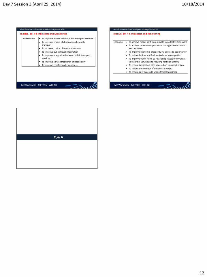
Day 7 Session 3 (April 29, 2014) 10/18/2014
12
IMC Worldwide - METCON - WELINK
Handbook on Urban Transport Management Plan
Tool No. 19: 4-E Indicators and Monitoring
Accessibility To improve access to local public transport services
To increase choice of destinations by public transport
To increase choice of transport options
To improve public travel information
To improve integration between public transport services
To improve service frequency and reliability
To improve comfort and cleanliness
IMC Worldwide - METCON - WELINK
Handbook on Urban Transport Management Plan
Tool No. 19: 4-E Indicators and Monitoring
Economy To achieve modal shift from private to collective transport
To achieve reduce transport costs through a reduction in journey times
To improve economic prosperity via access to opportunity
To reduce in time and fuel wasted due to congestion
To improve traffic flows by restricting access to key areas to essential services and reducing kerbside activity
To ensure integration with inter-urban transport system
To reduce the number of unnecessary trips
To ensure easy access to urban freight terminals
Q & A

GROUP DISCUSSION
Question 1 : What do you think the project UTPM has achieved ?
Answer :
Base line information on the traffic and transportation of Biratnagar obtained and the transportation strategies for the cities have been defined.
The project has recognized the relationship between land use and transportation and traffic management
Realized the roles and contribution of different stakeholders in transportation planning and management
The project has prepared various guidelines in relation to traffic management, parking, road safety and relevant issues that are pertinent in city transport management
Question 2 : What do you think the project UTPM could not achieve ?
Answer :
The consultants had consulted the stakeholders and BSC staffs during the study when they were in Biratnagar. However, during the final stage of reporting, such involvement was not made.
The consultants have prepared plans and strategies. But they are not convincing enough to trigger the action
Question 3 : What are the expectations envisaged from central government in order to
implement the city transportation plans ?
Answer :
Since the local government may not be able to fund the large scale projects from their own resources, the funding from central government is envisaged.
Capacity enhancement of BSC staffs in the form of training (on design and implementation of urban roads/ drains/ public transport infrastructure)
The input of the experts (from central government) to fine tune the policies and planning may be required
Some of the prioritized projects must be initiated as pilot project in Biratnagar
Discussion and dissemination of the strategies to the stakeholders is to be done at the earliest

10/18/2014
1
Introducing ToR for Urban Transport Division and Urban Transport Section
ADB TA 7948 Urban Transport
Planning and Management
Main Causes
• Lack of integration between land-use goals and transport management
• Unclear, overlapping and joint roles of different stakeholders
• Inadequate linkages between sectors and levels of government
• Lack of dedicated and responsible agency at the national level: PMO, DoR, DoLIDAR, NRB, DoTM, MoUD etc.
• Lack of coordinating mechanism
How should the government help municipalities and urban
areas in assuring better UTS?
• Institutional reforms • Policy inputs • Launching joint projects • Making the stakeholders and line agencies at the
urban level support in a concerted manner • Providing opportunities for training and higher
education to urban transport professionals • Channeling financial resources under a results-based
framework based on performance monitoring
• Planning Inputs to Urban Areas for LU & TM Strategy, Business/Action Plan
• Coordination and Stakeholder Mobilization for SUT • Urban Transport Policy Formulation • Training Inputs • Monitoring Framework based on Performance Indicators • Institutional Enhancement (inc. legal aspects) • Minimizing overlapping responsibilities
Why New Division in MoUD?
• The Division should be capable of formulating urban transport policy and mobilizing different stakeholders of urban transport to implement the same in a concerted manner in rapidly growing urban areas.
• Coordinate with other agencies responsible for different categories of roads such as DoR, Municipalities
• Provide policy inputs to municipalities and urban areas and monitor their progress and recommend for resource allocation and capacity building initiatives
Why New Section in DUDBC?
• The proposed section in the Department should help urban areas to prepare their urban transport plans and implement them for providing better transport services in the municipalities and urban areas.
• Collate information from municipal UPIDs on the existing benchmark condition of urban transport re transport project, resource constraints performance
• Help UPIDs to prepare more relevant and integrated projects on urban transport
• Help UPIDs to implement joint projects
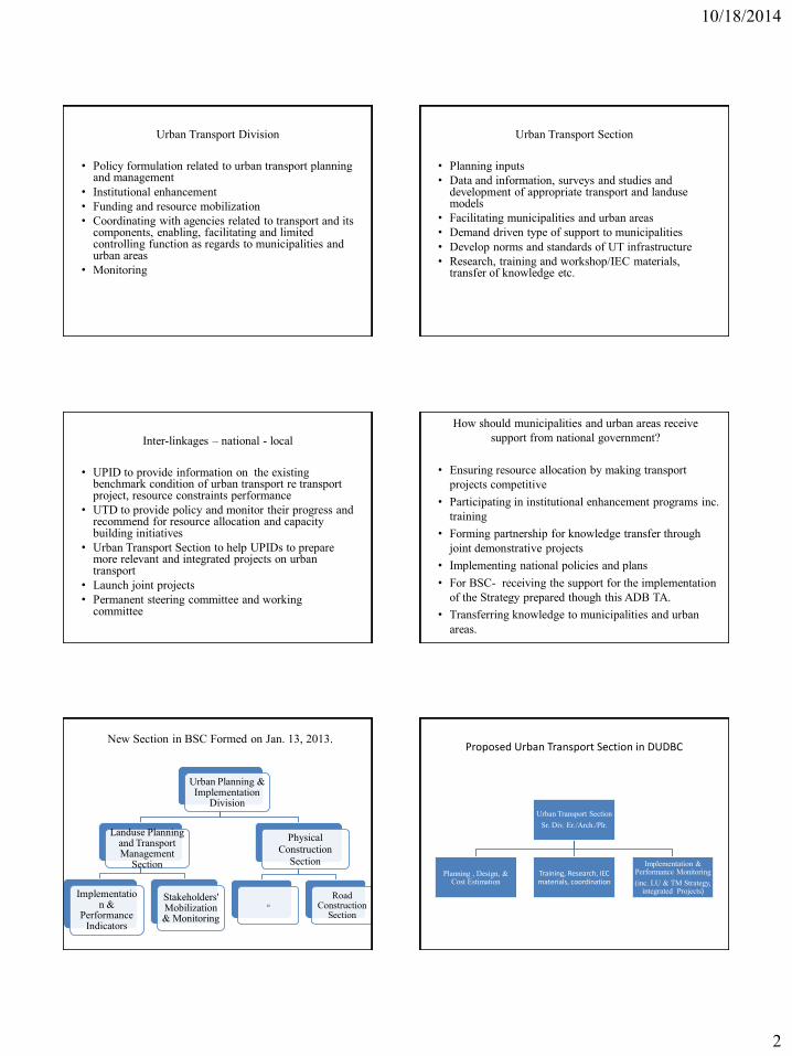
10/18/2014
2
Urban Transport Division
• Policy formulation related to urban transport planning and management
• Institutional enhancement • Funding and resource mobilization • Coordinating with agencies related to transport and its
components, enabling, facilitating and limited controlling function as regards to municipalities and urban areas
• Monitoring
Urban Transport Section
• Planning inputs • Data and information, surveys and studies and
development of appropriate transport and landuse models
• Facilitating municipalities and urban areas • Demand driven type of support to municipalities • Develop norms and standards of UT infrastructure • Research, training and workshop/IEC materials,
transfer of knowledge etc.
Inter-linkages – national - local
• UPID to provide information on the existing benchmark condition of urban transport re transport project, resource constraints performance
• UTD to provide policy and monitor their progress and recommend for resource allocation and capacity building initiatives
• Urban Transport Section to help UPIDs to prepare more relevant and integrated projects on urban transport
• Launch joint projects • Permanent steering committee and working
committee
How should municipalities and urban areas receive support from national government?
• Ensuring resource allocation by making transport
projects competitive • Participating in institutional enhancement programs inc.
training • Forming partnership for knowledge transfer through
joint demonstrative projects • Implementing national policies and plans • For BSC- receiving the support for the implementation
of the Strategy prepared though this ADB TA. • Transferring knowledge to municipalities and urban
areas.
New Section in BSC Formed on Jan. 13, 2013.
Urban Planning & Implementation
Division
Landuse Planning and Transport Management
Section
Implementation &
Performance Indicators
Stakeholders' Mobilization & Monitoring
Physical Construction
Section
zz
Road Construction
Section
Proposed Urban Transport Section in DUDBC
Urban Transport Section Sr. Div. Er./Arch./Plr.
Planning , Design, & Cost Estimation
Training, Research, IEC materials, coordination
Implementation & Performance Monitoring (inc. LU & TM Strategy,
integrated Projects)

10/18/2014
3
Proposed UTD in MoUD
Urban Transport Division
Jt. Sec. Tech.
LUP and UTM Section Sr. Div.
Er./Plr./Arch.
Planning Inputs to Urban Areas for LU &
TM Strategy, Business/Action Plan
Coordination and Stakeholder Mobilization for
SUT
Urban Transport Policy Formulation, IE (inc.
law) and M& E Section
Training Inputs, Performance Indicators, Monitoring Framework
Thank you !!!

Training on Urban Transport and Management Day 3 (October 15, 2014)
Session 1
Discussion Session:
The participants will be asked to fill in the following questionnaire at the outset of the session. They
will be allocated 20 minutes for this. Meta card may be used.
a) What type of planning support your municipality is expecting from DUDBC?
b) What information do you think your municipality should provide in the formulation of national urban transport policy?
c) Does your municipality have a transport project that needs to be implemented with the support of DUDBC, If yes, what supports will make the project successful?
d) How can the funding mechanisms for desirable transport projects in your municipality be improved?
e) Do you think it necessary to restructure the organization of your municipality in line with BSC? Explain your answer?
f) Has any transport project in your municipality been affected due to lack of national urban policy?
g) Has your municipality felt the need for capacity enhancement in carrying out transport projects? Please specify.
h) In order to make your municipality capable of preparing and implementing comprehensive urban transport and landuse strategy by the year 2019, what strategies do you think it should implement?

Comprehensive Training on Urban Transport and Management Day 8 (April 30, 2014)
Session 1
Institutional Enhancement in Urban Transport
Key Activities Functional Performance Monitoringi Capacities Business Staff
areas/ components/
Indicators Baseline 2012
Target 2021
Target 2031
Resp.
Agencies
required procedures (Part time)
Implement IEAP as a long-time plan to enhance the competence of BSC in implementing integrated LU and TM strategy.
ii
Implement Revised Draft IEAP prepared in mid-January 2013
iii with
necessary changes.
Prepare and implement Two Year IEAP (July 2014 to July 2016).
Revise performance Indicators and develop monitoring system
Institute coordination mechanism
Participate in training and other IE programs of DUDBC
Assess capacity gaps and request MoUD for support in filling up the gaps
Urban transport infrastructure
Additional length and surface area of the roads
BSC, DUDBC, DoR
Capacity to maintain record of road assets
Capacity to undertake and manage the construction of transport projects. Capacity to assess the value of road network
Capacity for risk sensitive design
Application of standard procedures of construction management, Survey works, Inventory keeping
Road engineer
Increase in road density
% of projects completed on time without any cost overruns’
Worth of the road network in rupees
% of road condition in good condition
Change in design for mitigation of risks against flood
Level of satisfaction of stakeholders
No. of days roads that roads are not in use due to water logging
Maintenance cost per km. of road
UPT No. of households within 10 minutes' walking distance from roads with PT
BSC, DoTM,
DoR, Traffic Police, DUDBC
Capacity to undertake research and studies with outsourcing
Capacity to mobilize stakeholders of UPT
Assess the quality of PT
Enhance mobility
Use PT for creating vibrant spaces
No. of wards connected by PT
Increased road access of all to activities, services, and production
Amount of reduction in travel costs
Amount of reduction in freights
Improvement in access to essential services

Comprehensive Training on Urban Transport and Management Day 8 (April 30, 2014)
Session 1
Key Activities Functional Performance Monitoringi Capacities Business Staff
areas/ components/
Indicators Baseline 2012
Target 2021
Target 2031
Resp.
Agencies
required procedures (Part time)
Reduction in time to reach jobs and markets
Traffic management
Increase in compliance of traffic rules
BSC, Traffic Police
Capacity to manage traffic
Coordinate with traffic police
Traffic police
Reduction in traffic rule violation
Improved and effective traffic rules
Road Safety
Safer and reliable road in place BSC, Traffic Police, DUDBC
Capacity to mitigate accidents, hazards, risks
Identify measures for enhancing safety
Outsourc-ing of expertise required
% decrease in road accidents
Lower incidence of floods
Level of adequacy of sign posts
Traffic Pattern
No of trips per day BSC Capacity to undertake traffic related studies and determine traffic management
Undertake studies on traffic pattern
Traffic Engineer Volume of goods transported
Reduction in travel demand
Change in the mode of transport
Proportion of activity-based road network
Parking management
No. of incidence of illegal parking BSC, TDC Capacity to assess parking needs and demand
Capacity to manage parking areas with cost recovery
Identify parking areas
Assess their adequacy
Plan for improvements
Parking manage-ment expert
Physical condition in the parking areas
Capacity in terms of number of vehicles in parking areas
Revenue generated from parking charges
Integration of land use and transport
No. of TODs
BSC and stake-
holders of
Capacity to design combined projects
Identify ways of integration
Mobilize stakeholders
Urban planner
Urban Redevelopment of Gudri Bazaar

Comprehensive Training on Urban Transport and Management Day 8 (April 30, 2014)
Session 1
Key Activities Functional Performance Monitoringi Capacities Business Staff
areas/ components/
Indicators Baseline 2012
Target 2021
Target 2031
Resp.
Agencies
required procedures (Part time)
planning
the project Design projects Transport Planner
Kosi highway
Junction improvements
Institutional enhancement DUDBC inputs: a) Planning support b) Implementation support through its Division office c) Training d) Short term staff deployment for specific purposes
Outcomes:
LU & TM section in place with required competencies to implement LU and TM Strategy prepared under this TA
LU & TM Strategy strengthened with a number of transport driven development projects being implemented for sustainable land use changes.
Demonstrative role of BSC in replicating the application of guidelines and toolkits in other similar urban areas established
Outputs:
New section on landuse and transport management equipped with adequate number of trained staff. The Urban Planning and Implementation Division will have the competence to develop and follow business procedures for the successful completion of transport related projects and sustain its activities technically and financially.
Concerned BSC staff trained in the application of guidelines and toolkits for the implementation of the strategy and for working towards integration between LU and TM
BSC equipped with trained staff to implement the strategy and update the TA strategy every three years with some support from DUDBC
Concerned staff of BSC trained in the application of performance indicators and oriented towards the establishment of adequate performance monitoring system with the support of DUDBC.
iThe existing capacity of BSC in terms of performance monitoring is minimal. It needs therefore to be improved incrementally in a phase-wise basis. For the first stage the section should select simple indicators based on a discussion program and it should be gradually improved based on its performance. The monitoring committee directly under the Mayor, already instituted as the part of BSC’s restructuring, will be responsible for M & E. BSC will be supported by DUDBC in fixing the target. Appropriate surveys and studies will be carried out to create the base line scenario, if not already available from the Consultant’s Report.
Comprehensive Training on Urban Transport and Management Day 8 (April 30, 2014)
Session 1
ii This is important in the context of MoUD assuming the responsibility of urban transport in all the municipalities of Nepal. As much needs to be accomplished in terms of
institutional and policy reforms at the national level, this will be reviewed at a later stage once UTD and UTS will be in place. Moreover, mechanisms for making coordination more
effective will be developed for ensuring sustainable urban mobility in BSC.
iii On January 21, 2013, policy, program and budget estimate of BSC for FY 2013/1 was made public. One of the declared policies is to adopt short term, medium term and long term
landuse and transport management strategies in the context of increasing urbanization, haphazard settlements and increasing vehicles in BSC. The organizational structure of BSC
has already been modified with a formation of a new section devoted to “Landuse Planning and Transport Management” under the Urban Planning and Implementation Division.
This division is the main target of the IEAP Plan. The new section will be the key actor for the implementation of the LU & TM strategy prepared under this TA. Two subsections will
be under it. They are (a) Implementation and Performance Indicators and (b) Stakeholders’ Mobilization and Monitoring. Training Programs held during the TA tenure has already
provided BSC an exposure on the Strategy prepared under the TA. DUDBC will further train the engineer and other staff of the section, as well as the Division Head in the application
of toolkits and guidelines. Further details of the staffing, ToRs, etc will be developed along with the progress of IEAP implementation in conjunction with the inter-linkages between
BSC & DUDBC.

TRAINING ON URBAN TRANSPORT & MANAGEMENT Annex - IV
EVALUATION SHEET
Page 1 of 7
Please evaluate the sessions by marking in the tables given below: Day - 1 (October 13, 2014)
Session - 1: Biratnagar City : Current Situation and Outlook to the Future - Saroj Basnet
Presentation Technique
Duration of the session
Understanding of the topic
Day - 1 (October 13, 2014)
Session - 2: Surveys Conducted : Subhash Dhungel
Presentation Technique
Duration of the session
Understanding of the topic Very clear just understood Not clear Understood nothing
Day - 1 (October 13, 2014)
Session - 3 : Land Use and Transport Planning - Dr. Jibgar Joshi
Presentation Technique
Duration of the session
Very good Good Fair Poor Very poor
Very Long Long Adequate Short Very Short
Very clear just understood Not clear Understood nothing
Very good Good Fair Poor Very poor
Very Long Long Adequate Short Very Short
Very good Good Fair Poor Very poor
Very Long Long Adequate Short Very Short

TRAINING ON URBAN TRANSPORT & MANAGEMENT Annex - IV
EVALUATION SHEET
Page 2 of 7
Understanding of the topic Very clear just understood Not clear Understood nothing
Day - 1 (October 13, 2014)
Session - 4 : Traffic Engineering & Management - Mr. Subhash Dhungel
Presentation Technique
Duration of the session
Understanding of the topic Very clear just understood Not clear Understood nothing
Day - 1 (October 13, 2014)
Session -5 : Road Safety - Mr. Subhash Dhungel
Presentation Technique
Duration of the session
Understanding of the topic Very clear just understood Not clear Understood nothing
Day - 2 (October 14, 2014)
Session - 1 : Road Hierarchy, Asset Management System - Mr. Saroj Kumar Pradhan
Presentation Technique
Duration of the session
Very good Good Fair Poor Very poor
Very Long Long Adequate Short Very Short
Very good Good Fair Poor Very poor
Very Long Long Adequate Short Very Short
Very good Good Fair Poor Very poor
Very Long Long Adequate Short Very Short

TRAINING ON URBAN TRANSPORT & MANAGEMENT Annex - IV
EVALUATION SHEET
Page 3 of 7
Understanding of the topic Very clear just understood Not clear Understood nothing
Day - 2 (October 14, 2014)
Session - 2 : Maintenance Techniques, Regular Maintenance and Budgeting - Mr. Saroj Kumar Pradhan
Presentation Technique
Duration of the session
Understanding of the topic Very clear just understood Not clear Understood nothing
Day - 2 (October 14, 2014)
Session - 3: Types of NMT, Definitions/ Classifications - Mr. Kamal Raj Pande
Presentation Technique
Duration of the session
Understanding of the topic Very clear just understood Not clear Understood nothing
Day - 2 (October 14, 2014)
Session - 4: Facilities for NMT, Walkability and Cycling - Mr. Kamal Raj Pande
Presentation Technique
Duration of the session
Very good Good Fair Poor Very poor
Very Long Long Adequate Short Very Short
Very good Good Fair Poor Very poor
Very Long Long Adequate Short Very Short
Very good Good Fair Poor Very poor
Very Long Long Adequate Short Very Short

TRAINING ON URBAN TRANSPORT & MANAGEMENT Annex - IV
EVALUATION SHEET
Page 4 of 7
Understanding of the topic Very clear just understood Not clear Understood nothing
Day - 2 (October 14, 2014)
Session - 5 : Concept of Urban Public Transport - Mr. Kamal Raj Pande
Presentation Technique
Duration of the session
Understanding of the topic Very clear just understood Not clear Understood nothing
Day - 2 (October 14, 2014)
Session - 6 : Introduction to Urban Roads Standards - Mr. Girija Prasad Gorkhaly
Presentation Technique
Duration of the session
Understanding of the topic Very clear just understood Not clear Understood nothing
Day - 2 (October 14, 2014)
Session -1 : Parking Management (Legislation and Policy, Regulation and Enforcement) - Mr. Subhash Dhungel
Presentation Technique
Duration of the session
Very good Good Fair Poor Very poor
Very Long Long Adequate Short Very Short
Very good Good Fair Poor Very poor
Very Long Long Adequate Short Very Short
Very good Good Fair Poor Very poor
Very Long Long Adequate Short Very Short

TRAINING ON URBAN TRANSPORT & MANAGEMENT Annex - IV
EVALUATION SHEET
Page 5 of 7
Understanding of the topic Very clear just understood Not clear Understood nothing
Day - 2 (October 14, 2014)
Session - 2 : Parking Inventory Survey, Parking Demand Assessment, Parking Planning - Mr. Subhash Dhungel
Presentation Technique
Duration of the session
Understanding of the topic Very clear just understood Not clear Understood nothing
Day - 3 (October 15, 2014)
Session - 1 : Urban Transport Planning and Management, Analysis Tools - Mr. Saroj Basnet
Presentation Technique
Duration of the session
Understanding of the topic Very clear just understood Not clear Understood nothing
Day - 3 (October 15, 2014)
Session - 2 : Action and Assessment Tools - Mr. Saroj Basnet
Presentation Technique
Duration of the session
Very good Good Fair Poor Very poor
Very Long Long Adequate Short Very Short
Very good Good Fair Poor Very poor
Very Long Long Adequate Short Very Short
Very good Good Fair Poor Very poor
Very Long Long Adequate Short Very Short

TRAINING ON URBAN TRANSPORT & MANAGEMENT Annex - IV
EVALUATION SHEET
Page 6 of 7
Understanding of the topic Very clear just understood Not clear Understood nothing
Day - 3 (October 15, 2014)
Session - 3 : National Transport Policy/ Urban Transport System - Dr. Jibgar Joshi
Presentation Technique
Duration of the session
Understanding of the topic Very clear just understood Not clear Understood nothing
Day - 3 (October 15, 2014)
Session - 4 : Group Discussion on the ToR of Urban Transport Division in MOUD and Urban Transport Section in DUDBC - Dr. Jibgar Joshi and Mr. G. P Gorkhaly
Discussion Technique
Duration of the Discussion
Other Observations
1) How would you rate the training materials provided?
2) How would you rate the Tiffin/ lunch provided during the training?
3) How would you rate the other logistic support provided during the training?
Very good Good Fair Poor Very poor
Very Long Long Adequate Short Very Short
Very good Good Fair Poor Very poor
Very Long Long Adequate Short Very Short
Excellent Good Fair
Excellent Good Fair
Excellent Good Fair

TRAINING ON URBAN TRANSPORT & MANAGEMENT Annex - IV
EVALUATION SHEET
Page 7 of 7
4) Was the training helpful in understanding the different aspects of transportation planning and management?
5) Do you think that the knowledge gained in the training could be applied in your
respective organization?
6) How would you rate the overall training conduction and management? (Give 0 to 5 points: 0 for the poorest and 5 for the excellent)
Any Further Comments or Suggestions: .................................................................................................................................................. .................................................................................................................................................. .................................................................................................................................................. .................................................................................................................................................. .................................................................................................................................................. .................................................................................................................................................. .................................................................................................................................................. .................................................................................................................................................. ..................................................................................................................................................
Very Helpful Fairly Helpful Not Helpful
Yes No Not Sure

Training on Urban Transport and Management in Biratnagar October 13-15, 2014
ANNEX V : PHTOTOGRAPHS
The Banner
Start of inaugural session
Mr. Girija Gorkhaly briefing about the projects

Training on Urban Transport and Management in Biratnagar October 13-15, 2014
ANNEX V : PHTOTOGRAPHS
Program being inaugurated by Ramesh Prasad Singh, DDG, DUDBC
Mr. Saroj Basnet briefing the training program
Mr. Naresh Pradhan giving his remarks

Training on Urban Transport and Management in Biratnagar October 13-15, 2014
ANNEX V : PHTOTOGRAPHS
Mr. Rabi Shah on Sustainable Urban Transport
Mr. Subhash Dhungel taking his session on Traffic Engineering
Dr. Jibgar Joshi on Land Use and Transport Planning

Training on Urban Transport and Management in Biratnagar October 13-15, 2014
ANNEX V : PHTOTOGRAPHS
Mr. Saroj Kumar Pradhan taking his session on Urban Transport Infrastructure Management
Mr. Kamal Raj Pande taking his session on Non Motorized Transport
Mr. Girija Gorkhaly conducting the discussion session

Training on Urban Transport and Management in Biratnagar October 13-15, 2014
ANNEX V : PHTOTOGRAPHS
Mr. Saroj Basnet taking his session on UTPM Manual
Mr. Girija Gorkhaly conducting discussion session
Dr. Jibgar Joshi elaborating the ToR on proposed Urban Transport Section of MoUD

Training on Urban Transport and Management in Biratnagar October 13-15, 2014
ANNEX V : PHTOTOGRAPHS
Participants during lunch
Feedback of Participants on UTPM TA
Mr. Gopal Regmi, EO of BSC, giving his concluding remarks

Xxxx 2 ERA
IMC Worldwide Ltd 64 – 68 London Road Redhill Surrey RH1 1LG Tel: +44 (0)1737 231400 Fax: +44 (0)1737 771107 www.imcworldwide.co.uk