24th Annual Conference - Park City, Utah
48
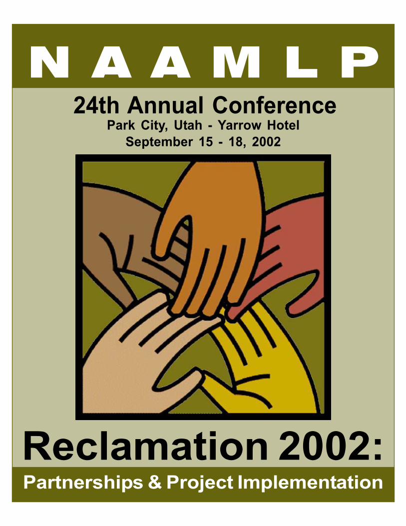
N A A M L P 24th Annual Conference Park City, Utah - Yarrow Hotel September 15 - 18, 2002 Reclamation 2002: Partnerships & Project Implementation
-
Upload
khangminh22 -
Category
Documents
-
view
0 -
download
0
Transcript of 24th Annual Conference - Park City, Utah
N A A M L P24th Annual Conference
Park City, Utah - Yarrow HotelSeptember 15 - 18, 2002
Reclamation 2002:Partnerships & Project Implementation
R E C L A M A T I O N 2 0 0 2 :
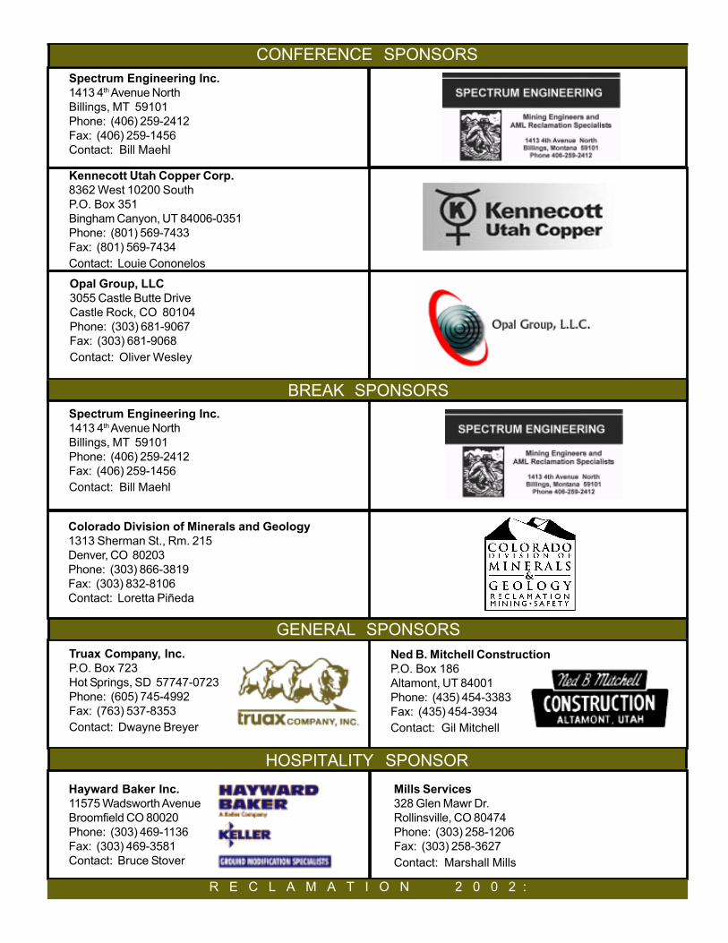
CONFERENCE SPONSORSSpectrum Engineering Inc.1413 4th Avenue NorthBillings, MT 59101Phone: (406) 259-2412Fax: (406) 259-1456Contact: Bill Maehl
Kennecott Utah Copper Corp.8362 West 10200 SouthP.O. Box 351Bingham Canyon, UT 84006-0351Phone: (801) 569-7433Fax: (801) 569-7434Contact: Louie Cononelos
Opal Group, LLC3055 Castle Butte DriveCastle Rock, CO 80104Phone: (303) 681-9067Fax: (303) 681-9068Contact: Oliver Wesley
BREAK SPONSORSSpectrum Engineering Inc.1413 4th Avenue NorthBillings, MT 59101Phone: (406) 259-2412Fax: (406) 259-1456Contact: Bill Maehl
R E C L A M A T I O N 2 0 0 2 :
HOSPITALITY SPONSOR
CONFERENCE SPONSORS
Truax Company, Inc.P.O. Box 723Hot Springs, SD 57747-0723Phone: (605) 745-4992Fax: (763) 537-8353Contact: Dwayne Breyer
Ned B. Mitchell ConstructionP.O. Box 186Altamont, UT 84001Phone: (435) 454-3383Fax: (435) 454-3934Contact: Gil Mitchell
GENERAL SPONSORS
Colorado Division of Minerals and Geology1313 Sherman St., Rm. 215Denver, CO 80203Phone: (303) 866-3819Fax: (303) 832-8106Contact: Loretta Piñeda
Mills Services328 Glen Mawr Dr.Rollinsville, CO 80474Phone: (303) 258-1206Fax: (303) 258-3627Contact: Marshall Mills
Hayward Baker Inc.11575 Wadsworth AvenueBroomfield CO 80020Phone: (303) 469-1136Fax: (303) 469-3581Contact: Bruce Stover
Conference Sponsors.................................................................................................Inside Front Cover
Table of Contents.......................................................................................................1
Acknowledgments.................................................................................................... 2
Welcome Letter from NAAMLP President............................................................. 3
Welcome Letter from Utah AMRP.......................................................................... 4
Conference Information........................................................................................... 5
Park City Information............................................................................................... 6
Conference at a Glance............................................................................................7
Featured Speakers................................................................................................... 8
Conference Schedule............................................................................................. 10
Field Trips and Tours............................................................................................. 12
Workshops............................................................................................................. 13
Technical Papers Schedule.................................................................................. 14
Conference Advertisers....................................................................................... 18
Hotel Map............................................................................................................... 19
Abstracts................................................................................................................. 21
Exhibitors.................................................................................................................45
P A R T N E R S H I P S & P R O J E C T I M P L E M E N T A T I O N
CONTENTSN a t i o n a l A s s o c i a t i o n o f A b a n d o n e d M i n e L a n d P r o g r a m s
RECLAMATION
2 0 0 2 :PARTNERSHIPS & PROJECT IMPLEMENTATION
24th Annual Conference
1

This conference was organized on behalf of the National Association of Abandoned Mine Land Pro-grams by the Utah Abandoned Mine Reclamation Program (AMRP), Division of Oil, Gas and Mining.The Utah AMRP staff - Louis Amodt, Amber Fortner, Tony Gallegos, Connie Jo Garcia, Luci Malin, JanMorse, Chris Rohrer, Paul Sjoblom, Paul Wisniewski, Ken Wyatt and the program administrator, MarkMesch, welcome you to Utah and hope you enjoy the conference as well as the many site seeingopportunities Utah has to offer.
This conference could not have happened without the help and work of many people who gave gener-ously of their time and skills. Thank you very much to the following people:
Paul Ehret, Dave Bucknam, John Burghardt, Loretta Pineda, Dick Rol, Fred Sherfy, Vic Anderson, LenMeier, Chuck Meyers, Ginger Kaldenbach, Mary Ann Wright, and Foster Kirby who all moderatedtechnical paper sessions.
Greg Conrad, George Stone, Terry Snyder, Peter Skidmore, Dick Rol, Bob Welsh, Mike Price, BillJoseph and Kevin Garnett who generously worked to create workshops that added to the level ofexpertise presented at the conference.
Doug Burnett and Dan Smith provided computer technical assistance. Connie Jo Garcia, SheilaMorrison, Angela Nance, and Vickie Southwick provided secretarial support and ran the registrationdesk throughout the conference.
s
Front Cover Art: After “Hands” by Cheryl DeSellier [[email protected]]. In “A Celebration of Collaboration.” Clemson University web site [http://www.clemson.edu/special/contest/].
ACKNOWLEDGMENTS
ABOUT THE ASSOCIATIONTitle IV of the Surface Mining Control and Reclamation Act of 1977 established the national Abandoned Mine LandReclamation Program under the Department of the Interior’s Office of Surface Mining Reclamation andEnforcement. In 1983, states and tribes joined together as the National Association of Abandoned Mine LandPrograms to accomplish the common goals and objectives related to the reclamation of abandoned mine lands.The annual NAAMLP Conference provides a forum for discussion of current issues, common problems and newtechnologies relating to abandoned mine reclamation. The NAAMLP’s 2002 national conference is sponsored bythe Utah Division of Oil, Gas and Mining’s Abandoned Mine Reclamation Program.
2

NATIONAL ASSOCIATION OF
ABANDONED MINE LAND PROGRAMS
ALABAMA
ALASKA
ARIZONA
ARKANSAS
COLORADO
CROW
HOPI
IDAHO
ILLINOIS
INDIANA
IOWA
KANSAS
KENTUCKY
LOUISIANA
MARYLAND
MICHIGAN
MISSOURI
MONTANA
NAVAJO
NEW MEXICO
NORTH DAKOTA
OHIO
OKLAHOMA
PENNSYLVANIA
TENNESSEE
TEXAS
UTAH
VIRGINIA
WEST VIRGINIA
WYOMING
3
Dear Participant:
Thank you for taking part in the 24th Annual Conference of the National Association of AbandonedMine Land Programs in Park City, Utah. And many thanks to our hosts, Mark, Luci and co-workers of the Utah Division of Oil, Gas and Mining for all their efforts in making this one of thefinest ever conferences held by the Association.
On August 3, 2002, we passed a significant milestone. It’s been 25 years since the enactmentof the Surface Mining Control and Reclamation Act, and the Abandoned Mine Land ReclamationProgram has come to be recognized as one of the most successful environmental improvementefforts in our nation’s history. A great deal of measurable progress has been made toward remov-ing safety hazards and other adverse effects of past mining. The twenty-seven (27) states andthree (3) tribes which make up our Association have much to be proud of.
With over $6 billion in Priority 1 and 2 problems yet to be reclaimed in the current nationalinventory, it’s clear that much more needs to be done. Income from reclamation fees and interestaverages $285 million per year, far exceeding annual appropriations, to the extent that the unap-propriated balance of the Fund is approaching $2 billion. Although spending priorities have shiftedin the wake of 9/11/01, we’ve continued to push for full funding of the AML Program, whereby theamount of reclamation fees paid by coal operators into the Fund each year is appropriated, thenallocated to the states and tribes to address problems remaining in the AML inventory.
Meanwhile, fee collections for abandoned mine land reclamation are set to expire September 30,2004. In recent months, several attempts have been made to amend Title IV of SMCRA andreauthorize the AML Program; none have been successful. As time winds down for the 107th
Congress, it appears that any legislative changes will have to wait until January.
I’d like to express my appreciation to Greg Conrad (IMCC) for his invaluable assistance in steer-ing us through the budget and legislative processes, and to Gene Krueger (OSM) for workingclosely with the states and tribes throughout the year.
I’ve been honored to serve the Association as president during the past year, and have enjoyedworking with Murray Balk (KS)-vice president, and Steve Hohmann (KY)-secretary/treasurer, bothof whom stayed atop the issues and gave of themselves toward the betterment of the Associa-tion. Enjoy the conference!
Sincerely,
Bill GuyettePresident - Alabama
RECLAMATION 2002:PARTNERSHIPS AND PROJECT IMPLEMENTATION
The Utah Abandoned Mine Reclamation Program is proud to host the 24th Annual Conference of theNational Association of Abandoned Mine Land Programs in Park City, Utah, September 15 through18, 2002.
The conference site is The Yarrow Resort Hotel and Conference Center. Park City, located in theheart of the Wasatch Mountains, is a historic mining town and was the focal point of the 2002 WinterOlympics. It offers spectacular scenery, exciting recreational opportunities and night life. We hopeyou will be able to see more of Utah than just the Wasatch Mountains during your stay.
The theme of the conference is “Reclamation 2002: Partnerships and Project Implementation.”Partnerships are proving to be the way to stretch scarce dollars and achieve reclamation that ismore comprehensive and of higher quality than it can be when agencies work in isolation. We wantstate and federal agencies, counties and other groups to share their experiences about workingtogether cooperatively on abandoned mine reclamation projects. The conference technical ses-sions will highlight on-the-ground implementation. Over fifty technical papers on will be presentedon these topics: Project Management and Implementation; Partnership Policy; Education andSafety; Biology and Vegetation; Partnershipping Projects; Geographic Information Systems; AcidMine Drainage; Engineering and Design; Watershed Systems; Politics; Cultural Issues andBrownfields.
Eight more focused and interactive workshops will be offered on 1) Stream Restoration (if you areinterested in this, sign up at the Registration Desk), 2) Club Fed - Partnerships with Federal Agen-cies; 3) Clean Water Act Pilot Projects; 4) Cottonwood Wash; 5 & 6 ) Global Positioning Systems,Geographic Information Systems, and CAD - Parts 1 and 2; and 7 & 8) CAD and AutoCad Parts -1 and 2.
Four field trips will occur as part of the conference: 1) Big Cottonwood Canyon, 2) Blackhawk andBoyer, abandoned coal mines in Chalk Creek which were reclaimed several years ago, 3) theCrawford Mountain phosphate mines, where some of the most hazardous abandoned mine causedsubsidence in the country existed before reclamation, and 4) Kennecott Utah Copper, one of thelargest open pit mines in the world. You must stop by the Registration Desk and sign up for the fieldtrips.
We think we have planned a conference that is both fun and intellectually stimulating. We urge youto take advantage of all that Utah has to offer. The Utah Olympic Park is right down the road and isopen from 9:00 to 5:00 daily. A self-guided tour of Park City Olympic sites is included in yourregistration materials. Please do not hesitate to ask any Utah staff member questions about Utah.We are confident that your trip to Utah will be one that you remember fondly for years to come.Enjoy!
The Utah Abandoned Mine Reclamation Program Staff
ALABAMA
ALASKA
ARIZONA
ARKANSAS
COLORADO
CROW
HOPI
IDAHO
ILLINOIS
INDIANA
IOWA
KANSAS
KENTUCKY
LOUISIANA
MARYLAND
MICHIGAN
MISSOURI
MONTANA
NAVAJO
NEW MEXICO
NORTH DAKOTA
OHIO
OKLAHOMA
PENNSYLVANIA
TENNESSEE
TEXAS
UTAH
VIRGINIA
WEST VIRGINIA
WYOMING
NATIONAL ASSOCIATION OF
ABANDONED MINE LAND PROGRAMS
4

24th Annual Conferenc24th Annua Conference
Reclamation 2002:
P a r t n e r s h i p s & P r o j e c t I m p l e m e n t a t i o n
YOUR REGISTRATIONBADGEis your meal ticket! You mustpresent your badge to eat!
Conference registration includes:‘ Continental Breakfasts Monday, Tuesday and Wednesday‘ Monday Luncheon at 12:15‘ Awards Banquet Tuesday evening at 6:30‘ All Breaks‘ Evening Presentation‘ Ice Breaker Reception
Extra luncheon or banquet tickets forspouse/partner or guests may be pur-chased at the registration desk.
Don’t miss the exhibits!
Don’t miss the exhibits!
Don’t miss the exhibits!
Don’t miss the exhibits!
Don’t miss the exhibits!
Ballroom C and hallway
outside meeting rooms
where the Breaks and
Breakfast are!
Monday, Tuesday and
Wednesday
SUNDAYIcebreaker ReceptionHotel Lobby and Exhibit Area
6:30 to 9:00 pm
ASSOCIATION MEETINGSSunday and MondayCommittee Meetings
MembershipFinanceAMLISPublic RelationsReauthorizationTraining
Monday, September 17Delegate’s BreakfastMountain View Room 7:30am to 8:30 am
Wednesday, September 18Business MeetingMountain View Room8:30am to 3:00 pm
CONFERENCE INFORMATION
5
Hospitality SuiteRoom 140
Watch for
RandomDoor Prize
Drawings
Hospitality SuiteRoom 140
R E C L A M A T I O N 2 0 0 2 :
P A R T N E R S H I P S & P R O J E C T I M P L E M E N T A T I O N
BUS SERVICEUse free Park City buses leaving from theYarrow Hotel every 20 minutes from7:30am to 10:30 pm. Buses go to MainStreet, Deer Valley, Park City MountainResort and the Outlet Mall at KimballJunction.
SITES TO SEEPlease see the “This Week In Park City”pamphlet and other materials in your reg-istration packet. Three places not to bemissed are the Kimball Art Center at thebottom of Main Street, the Park City OldTown Museum, 528 Main Street, and theUtah Olympic Park.
RESTAURANTSPark City has many good restaurantsranging from fast food to gourmet.Please see the Menu Guide in yourregistration packet.
SHOPPINGPark City is noted for a wide variety ofshops and galleries on Main Street, aswell as the Outlet Mall at Kimball Junc-tion.
HIKING AND BIKINGHiking and biking opportunities aboundin Park City. The Rails to Trails pathwaystarts on the other side of Albertson’s Su-permarket and is an easy flat walk or ridethat continues for 20 miles to Coalville.Bikes can be rented from a sportinggoods store a block away from The Yar-row. A jogging path circles the golf courseacross the street from the Yarrow. Manyother trails take off up the mountainsides.
R E C L A M A T I O N 2 0 0 2 :
PARK CITY INFORMATION
THE OLYMPIC UTAH PARKOpen daily 9am – 5pm $7 Adults; $5 youthand seniors; $3 for children; children under3 free. Tour of Park, admission to JoeQuinney Sports Center and Alf Engen Mu-seum are included. Tours run every houron the hour. You can watch athletes trainon the aerial high jump and Nordic ski jumpevery day but Monday.
THE ALPINE SLIDE ATPARK CITY RESORTIn the spirit of the Olympic Luge andBobsled, the Alpine Slide rockets you downa fixed track of banked turns and excitingstraight-aways. With 2,800 feet of track and550 feet of vertical decent, this is a bonafide thrill ride for both young and young-at-heart. The specially designed sleds allowyou to maintain complete control over yourspeed and descent. How fast or slow yougo is entirely up to you. Must be 48 inchesin height to drive your own sled. Must be 2years old to accompany an adult. Adults$9.00; Children $3.00.
LOCAL INFORMATIONPark City’s altitude is 6,700 feet above sealevel. Altitude sickness can feel like the flu.You need to drink plenty of water and notoverly exert yourself for the first day or two.Because the atmosphere is thinner, you cansunburn more easily. Use of sunblock andchapstick is highly recommended. Themorning and evenings may be cool to cold,so grab a sweater if you plan to leave thehotel at these times.
WELCOME TO PARK CITYN a t i o n a l A s s o c i a t i o n o f A b a n d o n e d M i n e L a n d P r o g r a m s
6

24th Annual Conferenc24th Annua Conference
Reclamation 2002:
P a r t n e r s h i p s & P r o j e c t I m p l e m e n t a t i o n
N a t i o n a l A s s o c i a t i o n o f A b a n d o n e d M i n e L a n d P r o g r a m s
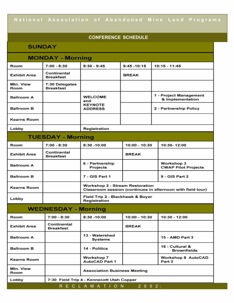
SUNDAY, SEPTEMBER 1510:00 am - 5:00 pm Golf Outing2:00 pm - 9:00 pm Conference Registration
1:00 pm - 5:00pm Vendor Set up6:30 pm - 9:00 pm Welcome Icebreaker
MONDAY, SEPTEMBER 167:00 am - 5:00 pm Exhibits and Vendors7:00 am - 8:30 am Continental Breakfast7:30 am - 8:30 am Delegates Business Breakfast7:30 am - 5:00 pm Registration8:30 am - 9:45 am Welcome and Keynote Address10:00 am - 5:00 pm Guest Tour 1 - Mormon History9:45 am - 10:15 am Break10:15 am - 11:45 am Technical Sessions 1 & 2
12:15 pm - 1:30 pm Lunch ProgramHal ComptonPark City Mining History
1:45 pm - 3:15 pm Technical Session 3 & 8 andWorkshop 1
1:45 pm - 5:00 pm Field Trip 1-Big Cottonwood Canyon
3:15 pm - 3:45 pm Break3:45 pm - 5:15 pm Technical Sessions 4 & 55:30 pm - 6:50 pm Guided bike ride7:30 pm - 8:30 pm Optional Evening Program
Phil NotarianniUtah’s Mining Heritage
TUESDAY, SEPTEMBER 177:00 am - 5:00 pm Exhibits and Vendors7:00 am - 8:30 am Continental Breakfast8:00 am - Noon Registration8:30 am - 10:00 am Technical Sessions 6 & 78:30 am - 5:00 pm Workshop 28:30 am - Noon Field Trip 2 - Blackhawk & Boyer
10:30 am - 3:00 pm Guest Tour 2 - Great Salt Lake10:00 am - 1:00 pm Guest Tour 3 - Utah Olympic
Park10:00 am - 10:30 am Break10:30 am - Noon Technical Session 9
Workshop 3
Noon - 1:45 pm Lunch On-Your-Own
1:30 pm - 5:15 pm Field Trip 3 - Crawford Mts1:45 pm - 3:15 pm Technical Sessions 10 & 11
Workshop 43:15 pm - 3:45 pm Break3:45 pm - 5:15 pm Technical Session 12
Workshops 5 & 66:30 pm - 9:00 pm Awards Banquet
WEDNESDAY, SEPTEMBER 187:00 am - 8:30 am Continental Breakfast7:30 am - 3:00 pm Field Trip 4 & Guest Tour 4
Kennecott Utah Copper8:30 am - 10:00 am Technical Sessions 13 & 14
Workshop 78:30 am - 3:00 pm Business Meeting10:00 am - 10:30 am Break10:30 am - Noon Technical Sessions 15 & 16
Workshop 83:00 pm Adjourn
FRIDAY THROUGH SUNDAY, SEPTEMBER 13 - 15PRE-CONFERENCE TOUR OF SOUTHEASTERN UTAH
CONFERENCE AT A GLANCE
P A R T N E R S H I P S & P R O J E C T I M P L E M E N T A T I O N
7
David D. Lauriski - Keynote Speaker, Monday MorningDavid D. Lauriski is the seventh Assistant Secretary of Labor for Mine Safety and Health. Prior to hisconfirmation as Assistant Secretary, Mr. Lauriski spent 30 years in the Utah coal mining industry, with afocus on safety for much of his career. Since his confirmation by the U.S. Senate on May 9, 2001, he hasbeen dedicated to carrying out the Mine Safety and Health Administration’s mission of protecting thehealth and safety of the miner. At the time of his leaving the mining business in 1999, Mr. Lauriski wasthe General Manager of Energy West Mining Company. Under his leadership, Energy West was recog-nized for its position as one of the largest underground coal producers in the United States and, mostimportantly, as one of the safest companies in the industry. Prior to his confirmation, Mr. Lauriski wasthe President of Lauriski and Associates, and served as Chairman of the Utah Board of Oil, Gas, andMining and as a board member of the Utah Mining Association. He has also served as Chairman of theCoal Mine Safety Committee for the former American Mining Congress and as Chairman of the SafetyCommittee for the Utah Coal Operators.
Jeffrey Jarrett - Awards Banquet Speaker, Tuesday EveningJeffrey D. Jarrett is the 14th Director of the Interior Department’s Office of Surface Mining Reclamationand Enforcement (OSM). Mr. Jarrett served as a Deputy Assistant Director for OSM’s Regional Officein Pittsburgh, Pennsylvania from 1988 to 1994 and most recently as Deputy Secretary for Mineral Re-sources Management of the Pennsylvania Department of Environmental Protection (DEP). As Directorof OSM, Mr. Jarrett directs policy and has executive responsibility for developing and enforcing surfacecoal mining regulations under the Surface Mining Control and Reclamation Act. The agency operateswith an annual budget of $306.5 million and a work force of 636 employees nationwide. As DeputySecretary for the Pennsylvania DEP, Mr. Jarrett was responsible for regulatory programs for surfaceand underground coal and industrial minerals mining, oil and gas exploration, deep mine safety, andabandoned mine lands reclamation. Previously he served as Director of the DEP’s Bureau of DistrictMining Operations where he was responsible for the effective implementation of various environmentallaws as they relate to the surface and underground coal and non-coal mining industries in Pennsylvaniaand for miner health and safety regulations at all surface mining operations. Mr. Jarrett served as anOSM Deputy Assistant Director responsible for overseeing the effective implementation of the SurfaceMining Control and Reclamation Act of 1977 in the eastern states. Also for OSM, he managed a num-ber of state and area offices, administered federal grants to the states for the operation of AbandonedMine Land, insured oversight and management of regulatory programs, and provided technical assis-tance to the states. Mr. Jarrett previously served as director of planning, division manager, and recla-mation director for the Cravat Coal Company and as reclamation supervisor for The Drummond Com-pany. A native of West Virginia, Mr. Jarrett received a B.S. degree in Human Resource Managementfrom Geneva College in Pennsylvania and an A.A.S. degree in Land Stabilization and Reclamation fromBelmont Technical College in St. Clairsville, Ohio.
8R E C L A M A T I O N 2 0 0 2 :
FEATURED SPEAKERSN a t i o n a l A s s o c i a t i o n o f A b a n d o n e d M i n e L a n d P r o g r a m s
Philip Notarianni - Historical Program Speaker, Monday Evening
Hal Compton - Luncheon Speaker, Monday
Tom First Raised - Conference BlessingTom First Raised is a full blood member of the Assiniboine Tribe. He was born in Fort Belknap on the FortBelknap Reservation in Montana on March 5, 1929. He is a U.S. Army veteran of the Korean War. Hecame to Utah from Montana in 1957 to work at the Intermountain Indian School in Brigham City. He movedto Salt Lake City in 1985 where he now resides. He is active in the local Native American communityparticipating in Pow-Wows and other gatherings. He is often called upon as a spiritual leader for theNative American community. He participated in the Opening Ceremonies at the 2002 Winter Olympicswith the NorthWest Band of Shoshone from Northern Utah. He also offered a prayer at the vigil-memorialservices for the recently deceased Utah State Senator Pete Suazo.
9
Hal Compton is the research historian at the Park City Historical Society & Museum. He was born inBrigham City, Utah. He graduated with B.S. Degree in communications from the University of Utah andserved in the United States Army Signal Corps as 2nd Lieutenant in Korea. He worked for two years atCBS Radio and Television in Hollywood. He then worked in public relations for GTE in California for 31years. During that time he gained an interest in mining while exploring the Gold Country of northern Califor-nia. He took early retirement and settled in Park City in 1987. When not hiking in the mountains and visitingmine sites he works in the Park City Museum and Visitor Information Center on Historic Main Street wherehe has given many historic walking tours of Main Street. He served as underground tour guide for the SilverMine Adventure in the Ontario Mine. In 1998, he was selected Museum Volunteer of the Year by the UtahMuseum Association. He was designated Park City’s historian laureate by the Mayor and the City Council.Currently he is a member of the Board of Directors of Park City Historical Society & Museum and Presi-dent of the Glenwood Cemetery Association.
Philip F. Notarianni is currently Acting Associate Director of the Division of State History, where he hasworked for the past twenty-three years. He is an Associate Professor Lecturer in the Ethnic Studies pro-gram at the University of Utah. A resident of Magna, Utah, he received B.S. and M.A. degrees in history atthe University of Utah, an M.A. degree in history at the University of Minnesota, and a Ph.D. at the Univer-sity of Utah in 1980. He teaches the “A Peoples of Utah” class at the University of Utah which analyzes theethnic and cultural diversity of Utah. Dr. Notarianni, a son of Italian immigrants, is married to Maria TeresaMaletta, an immigrant from Calabria, Italy. During the 1987-88 academic year, Dr. Notarianni researchedthe places of origin of Calabresi in Utah under a Fulbright Research Grant. He frequently serves as amember of the temporary faculty in cultural anthropology for the University of Calabria in Cosenza, Italy. Asa staff member of the Utah State Historical Society since 1977, he held positions in the areas of historicpreservation and museum services, working widely with various individuals, groups, and institutions state-wide. Dr. Notarianni has developed exhibits on Utah, mining, and ethnic history, and has assisted otherorganizations in similar efforts. He has written numerous books and articles, primarily about the Italianimmigrant’s experience in Utah.
P A R T N E R S H I P S & P R O J E C T I M P L E M E N T A T I O N
FEATURED SPEAKERSN a t i o n a l A s s o c i a t i o n o f A b a n d o n e d M i n e L a n d P r o g r a m s
TGUCoC
R E C L A M A T I O N 2 0 0 2 :
N a t i o n a l A s s o c i a t i o n o f A b a n d o n e d M i n e L a n d P r o g r a m s
CONFERENCE SCHEDULE

P A R T N E R S H I P S & P R O J E C T I M P L E M E N T A T I O N
CONFERENCE SCHEDULE
N a t i o n a l A s s o c i a t i o n o f A b a n d o n e d M i n e L a n d P r o g r a m s
FIELD TRIPS & TOURSN a t i o n a l A s s o c i a t i o n o f A b a n d o n e d M i n e L a n d P r o g r a m s
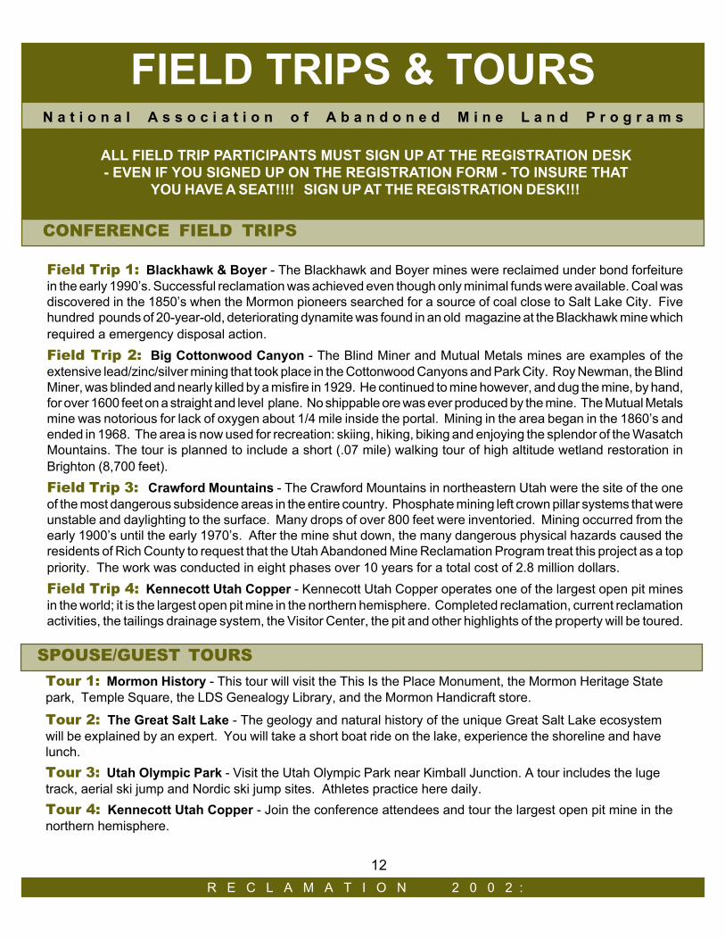
Tour 1: Mormon History - This tour will visit the This Is the Place Monument, the Mormon Heritage Statepark, Temple Square, the LDS Genealogy Library, and the Mormon Handicraft store.
Tour 2: The Great Salt Lake - The geology and natural history of the unique Great Salt Lake ecosystemwill be explained by an expert. You will take a short boat ride on the lake, experience the shoreline and havelunch.Tour 3: Utah Olympic Park - Visit the Utah Olympic Park near Kimball Junction. A tour includes the lugetrack, aerial ski jump and Nordic ski jump sites. Athletes practice here daily.Tour 4: Kennecott Utah Copper - Join the conference attendees and tour the largest open pit mine in thenorthern hemisphere.
SPOUSE/GUEST TOURS
ALL FIELD TRIP PARTICIPANTS MUST SIGN UP AT THE REGISTRATION DESK - EVEN IF YOU SIGNED UP ON THE REGISTRATION FORM - TO INSURE THAT
YOU HAVE A SEAT!!!! SIGN UP AT THE REGISTRATION DESK!!!
CONFERENCE FIELD TRIPS
R E C L A M A T I O N 2 0 0 2 :
Field Trip 1: Blackhawk & Boyer - The Blackhawk and Boyer mines were reclaimed under bond forfeiturein the early 1990’s. Successful reclamation was achieved even though only minimal funds were available. Coal wasdiscovered in the 1850’s when the Mormon pioneers searched for a source of coal close to Salt Lake City. Fivehundred pounds of 20-year-old, deteriorating dynamite was found in an old magazine at the Blackhawk mine whichrequired a emergency disposal action.Field Trip 2: Big Cottonwood Canyon - The Blind Miner and Mutual Metals mines are examples of theextensive lead/zinc/silver mining that took place in the Cottonwood Canyons and Park City. Roy Newman, the BlindMiner, was blinded and nearly killed by a misfire in 1929. He continued to mine however, and dug the mine, by hand,for over 1600 feet on a straight and level plane. No shippable ore was ever produced by the mine. The Mutual Metalsmine was notorious for lack of oxygen about 1/4 mile inside the portal. Mining in the area began in the 1860’s andended in 1968. The area is now used for recreation: skiing, hiking, biking and enjoying the splendor of the WasatchMountains. The tour is planned to include a short (.07 mile) walking tour of high altitude wetland restoration inBrighton (8,700 feet).Field Trip 3: Crawford Mountains - The Crawford Mountains in northeastern Utah were the site of the oneof the most dangerous subsidence areas in the entire country. Phosphate mining left crown pillar systems that wereunstable and daylighting to the surface. Many drops of over 800 feet were inventoried. Mining occurred from theearly 1900’s until the early 1970’s. After the mine shut down, the many dangerous physical hazards caused theresidents of Rich County to request that the Utah Abandoned Mine Reclamation Program treat this project as a toppriority. The work was conducted in eight phases over 10 years for a total cost of 2.8 million dollars.Field Trip 4: Kennecott Utah Copper - Kennecott Utah Copper operates one of the largest open pit minesin the world; it is the largest open pit mine in the northern hemisphere. Completed reclamation, current reclamationactivities, the tailings drainage system, the Visitor Center, the pit and other highlights of the property will be toured.
12
WORKSHOPS
P A R T N E R S H I P S & P R O J E C T I M P L E M E N T A T I O NP A R T N E R S H I P S & P R O J E C T I M P L E M E N T A T I O N
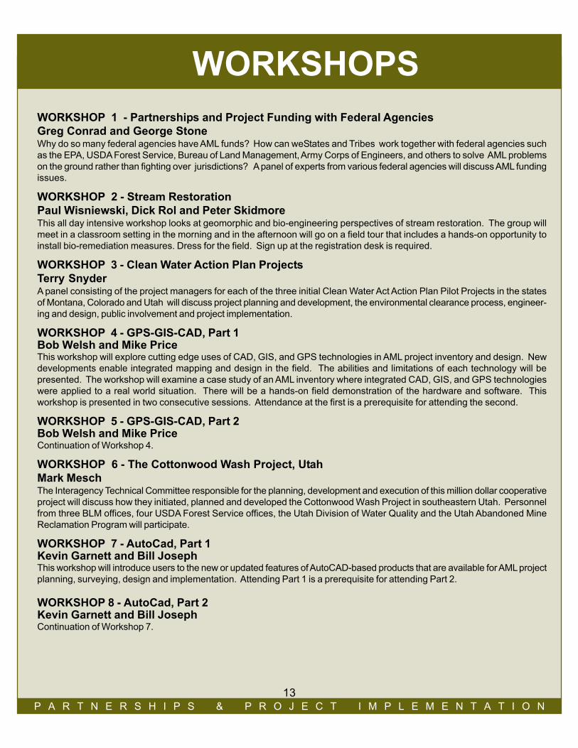
WORKSHOP 1 - Partnerships and Project Funding with Federal AgenciesGreg Conrad and George StoneWhy do so many federal agencies have AML funds? How can weStates and Tribes work together with federal agencies suchas the EPA, USDA Forest Service, Bureau of Land Management, Army Corps of Engineers, and others to solve AML problemson the ground rather than fighting over jurisdictions? A panel of experts from various federal agencies will discuss AML fundingissues.
WORKSHOP 2 - Stream RestorationPaul Wisniewski, Dick Rol and Peter SkidmoreThis all day intensive workshop looks at geomorphic and bio-engineering perspectives of stream restoration. The group willmeet in a classroom setting in the morning and in the afternoon will go on a field tour that includes a hands-on opportunity toinstall bio-remediation measures. Dress for the field. Sign up at the registration desk is required.
WORKSHOP 3 - Clean Water Action Plan ProjectsTerry SnyderA panel consisting of the project managers for each of the three initial Clean Water Act Action Plan Pilot Projects in the statesof Montana, Colorado and Utah will discuss project planning and development, the environmental clearance process, engineer-ing and design, public involvement and project implementation.
WORKSHOP 4 - GPS-GIS-CAD, Part 1Bob Welsh and Mike PriceThis workshop will explore cutting edge uses of CAD, GIS, and GPS technologies in AML project inventory and design. Newdevelopments enable integrated mapping and design in the field. The abilities and limitations of each technology will bepresented. The workshop will examine a case study of an AML inventory where integrated CAD, GIS, and GPS technologieswere applied to a real world situation. There will be a hands-on field demonstration of the hardware and software. Thisworkshop is presented in two consecutive sessions. Attendance at the first is a prerequisite for attending the second.
WORKSHOP 5 - GPS-GIS-CAD, Part 2Bob Welsh and Mike PriceContinuation of Workshop 4.
WORKSHOP 6 - The Cottonwood Wash Project, UtahMark MeschThe Interagency Technical Committee responsible for the planning, development and execution of this million dollar cooperativeproject will discuss how they initiated, planned and developed the Cottonwood Wash Project in southeastern Utah. Personnelfrom three BLM offices, four USDA Forest Service offices, the Utah Division of Water Quality and the Utah Abandoned MineReclamation Program will participate.
WORKSHOP 7 - AutoCad, Part 1Kevin Garnett and Bill JosephThis workshop will introduce users to the new or updated features of AutoCAD-based products that are available for AML projectplanning, surveying, design and implementation. Attending Part 1 is a prerequisite for attending Part 2.
WORKSHOP 8 - AutoCad, Part 2Kevin Garnett and Bill JosephContinuation of Workshop 7.
13

N a t i o n a l A s s o c i a t i o n o f A b a n d o n e d M i n e L a n d P r o g r a m s
TECHNICAL PAPERS
Technical Paper Session 1: Project Management and ImplementationModerator: Paul Ehret, Indiana Bureau of Mine Reclamation
Environmental Planning for Mine Cleanup and Demolition Activities; Buck and ZietlowMine Reclamation Using Dredged Materials and Coal Ash; Voros, Linnan, Sands and GiovannittiApproaches to Mine Subsidence in Four U.S. Communities; MeierSurvey Data Collection Associated with an AML Emergency Program; Schottel and Gibson
Technical Paper Session 2: Partnership/PolicyModerator: Dave Bucknam, Colorado Inactive Mine Program
Federal-State Relations in the Mining Regulatory Arena: Pursuing Productive Partnerships; ConradA Team Approach To Evaluating State Abandoned Mine Reclamation Programs; SassamanEastern PA Partnerships Supported through the EPCAMR Regional Watershed Support Initiative (RWSI); HughesSan Juan County AML Partnerships; Pineda and Bucknam
Technical Paper Session 3: Acid Mine Drainage (AMD): Part 1Moderator: John Burghardt, National Park Service, Denver
Acid Mine Drainage Abatement in the Lower Rock Creek Watershed - McCreary County, Kentucky; CarewThe Tanoma Passive Mine Drainage Treatment Project; Cavazza and BeamThe Role of AMD in the Treatment of Other Problem Waters; AllbrightSpenceville Mine Closure; Wanket, Pujol, Walker and Reynolds
Technical Paper Session 4: Stream RestorationModerator: Dick Rol, Senior Planner, City of San Diego
Natural Channel Design, Construction and Planting on the Middle Fork South Platte River; Windell and AugustNatural Channel Design Process Using RIVERmorph Stream Restoration Software; Belcher and AthanasakesA Categorization of Approaches to Natural Channel Design; SkidmoreAbandoned Mine Land Restoration in a North Idaho Stream: A Geomorphological Perspective; Stevenson, Moore,
Kondolf and Piegay
Technical Paper Session 5: Biology/VegetationModerator: Fred Sherfy, OSM, Harrisburg
Effects of Cadmium on White-tailed Ptarmigan in Colorado; LarisonMonitoring and Evaluating Results of Bat Protection Efforts; Grandison, J. Diamond, G. Diamond and MeschRevegetation of Nine Square Miles of Copper Tailings; Sauer, Williams and DuvallVegetative Community Analysis of Biosolids Test Plots After Five Years of Growth; Black and BordenRooting Characteristics of Vegetation Established on a Refuse Pile; Burton, Baker, White, Postle and Collins
R E C L A M A T I O N 2 0 0 2 :R E C L A M A T I O N 2 0 0 2 :
14
P A R T N E R S H I P S & P R O J E C T I M P L E M E N T A T I O N
TECHNICAL PAPERSN a t i o n a l A s s o c i a t i o n o f A b a n d o n e d M i n e L a n d P r o g r a m s
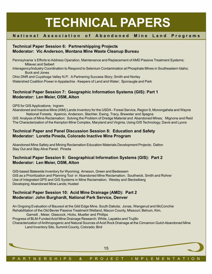
Technical Paper Session 7: Geographic Information Systems (GIS): Part 1Moderator: Len Meier, OSM, Alton
GPS for GIS Applications; IngramAbandoned and Inactive Mine (AIM) Lands Inventory for the USDA - Forest Service, Region 9, Monongahela and Wayne National Forests; Aparicio, Anderson, Stachler, Ewing, Tracy, Brewster and SpagnaGIS Analysis of Mine Reclamation: Solving the Problem of Dredge Material and Abandoned Mines; Mignone and ReidThe Characterization of the Kempton Mine Complex, Maryland and Virginia, Using GIS Technology; Davis and Lyons
Technical Paper and Panel Discussion Session 8: Education and SafetyModerator: Loretta Pineda, Colorado Inactive Mine Program
Abandoned Mine Safety and Mining Reclamation Education Materials Development Projects; DaltonStay Out and Stay Alive Panel; Pineda
Technical Paper Session 9: Geographical Information Systems (GIS): Part 2Moderator: Len Meier, OSM, Alton
GIS-based Statewide Inventory for Wyoming; Arneson, Green and BedessemGIS as a Prioritization and Planning Tool in Abandoned Mine Reclamation; Southwick, Smith and RohrerUse of Integrated GPS and GIS Systems in Mine Reclamation; Wesley and SteckelbergDeveloping Abandoned Mine Lands; Husted
Technical Paper Session 10: Acid Mine Drainage (AMD): Part 2Moderator: John Burghardt, National Park Service, Denver
An Ongoing Evaluation of Bauxsol at the Gild Edge Mine, South Dakota; Jonas, Wangerud and McConchieRehabilitation of the Old Bevier Passive Treatment Wetland, Macon County, Missouri; Behum, Kim, Garnett , Meier, Glascock, Hicks, Mueller and PhillipsProgress of BLM-Funded Acid Mine Drainage Research; White, Lapakko and TrujilloCharacterization of Anthropogenic and Natural Sources of Acid Rock Drainage at the Cinnamon Gulch Abandoned Mine
Land Inventory Site, Summit County, Colorado; Bird
Technical Paper Session 6: Partnershipping ProjectsModerator: Vic Anderson, Montana Mine Waste Cleanup Bureau
Pennsylvania ’s Efforts to Address Operation, Maintenance and Replacement of AMD Passive Treatment Systems;Milavec and Seibert
Interagency/Industry Coordination to Respond to Selenium Contamination at Phosphate Mines in Southeastern Idaho;Buck and Jones
Ohio DNR and Cuyahoga Valley N.P.: A Partnering Success Story; Smith and NorleyWatershed Coalition Power in Appalachia - Keepers of Land and Water; Sponaugle and Park
15

TECHNICAL PAPERSN a t i o n a l A s s o c i a t i o n o f A b a n d o n e d M i n e L a n d P r o g r a m s
Technical Paper Session 11: 2002 National Award WinnersModerator: Chuck Meyers, OSM, Washington, D.C.
Appalachian Region Award WinnerMid-continent Region Award WinnerWestern Region Award Winner
Technical Paper Session 12: Engineering and DesignModerator: Ginger Kaldenbach, OSM, Denver
Manning Canyon Tailings Removal Action; Ford and IngwellDangerous Atmosphere Created by Strip Mine Spoil; EhlerDesigning for 1000 Years; Sanchez and AndersonZortman and Landusky with 20/20 Hindsight; Maehl
Technical Paper Session 13: Watershed SystemsModerator: Dick Rol, Senior Planner, City of San Diego
Abandoned Mine Site Restoration on Pine Creek, Coeur d’Alene Basin, Northern Idaho; Fortier and MooreMercury Contamination of Water, Sediment, and Biota in Watersheds Affected by Historic Hydraulic Gold Mining
in California; Lawler, Clayton, Alpers, Hunerlach, Hothem, May and RytubaHigh Ore Creek Watershed Restoration, Part 1; Browne, Quinones and MadisonHigh Ore Creek Watershed Restoration, Part 2; Browne, Quinones and Madison
Technical Paper Session 14: PoliticsModerator: Mary Ann Wright, Utah Division of Oil, Gas and Mining
The EPA Rocky Mountain Regional Hazardous Substance Research Center; Wildeman, Macalady, Shackelford and WoodsRecent Court Rulings on Takings and the Possible Impact on the Abandoned Mine Land Program; GirolThe Politics of a Mega-Project: Institutional Resistance to Innovative Ideas; Voros
16
R E C L A M A T I O N 2 0 0 2 :
TECHNICAL PAPERSN a t i o n a l A s s o c i a t i o n o f A b a n d o n e d M i n e L a n d P r o g r a m s
R E C L A M A T I O N 2 0 0 2 :
Technical Paper Session 15: Acid Mine Drainage (AMD): Part 3Moderator: John Burghardt, National Park Service, Denver
Integrating Hydrologic and Geologic Controls on Metal Loading to Streams: Mass-loading Analysis of Mineral Creeek, Colorado; Kimball, Runkel, Walton-Day and BoveSulfate Reducing Bioreactor Design and Operating Issues: Is This the Passive Treatment Technology For Your Mine
Drainage? GusekLongevity of Mine Discharges from Above-Drainage Underground Mines; Skousen, Demchak and McDonald
Technical Paper Session 16: Cultural Resources and BrownfieldsModerator: Foster Kirby, OSM, Denver
Cultural:Uranium Mining in Cottonwood Wash: A Quick Look at 50+ Years; BennettAbandoned Mine Reclamation in Culturally Sensitive Areas: An Example from Cottonwood Wash, Utah; Huppe
Brownfields:A Brownfields Redevelopment Opportunity at an Abandoned Mine Lands Site; GendronEconomic and Community Development Opportunities for Mine Scarred Lands; Larosa
P A R T N E R S H I P S & P R O J E C T I M P L E M E N T A T I O N
17
The Utah Abandoned Mine Programinvites you to visit
the Hospitality Suite, Room 140Sunday 9:00 pm to 11:00 pmMonday 5:30 pm to 7:30 pm
9:00 pm to 11:00 pmTuesday 5:00 pm to 6:30 pm
9:30 pm to midnight
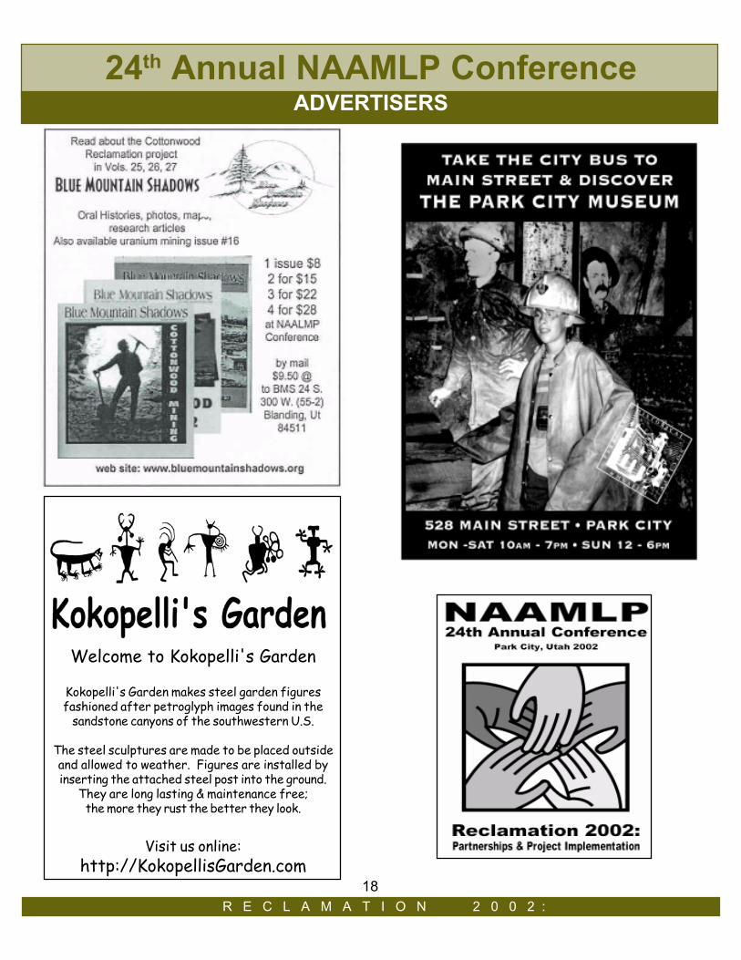
Welcome to Kokopelli's Garden
Kokopelli's Garden makes steel garden figuresfashioned after petroglyph images found in the
sandstone canyons of the southwestern U.S.
The steel sculptures are made to be placed outsideand allowed to weather. Figures are installed byinserting the attached steel post into the ground.
They are long lasting & maintenance free;the more they rust the better they look.
Visit us online:http://KokopellisGarden.com
18R E C L A M A T I O N 2 0 0 2 :
24th Annual NAAMLP ConferenceADVERTISERS
N a t i o n a l A s s o c i a t i o n o f A b a n d o n e d M i n e L a n d P r o g r a m s
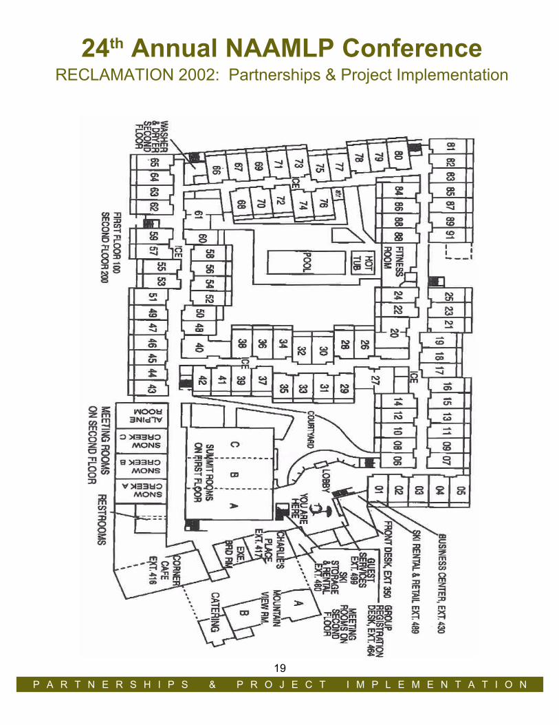
HOTEL MAP
24th Annual NAAMLP ConferenceRECLAMATION 2002: Partnerships & Project Implementation
HOTEL MAPR E C L A M A T I O N 2 0 0 2 :
P A R T N E R S H I P S & P R O J E C T I M P L E M E N T A T I O N19

R E C L A M A T I O N 2 0 0 2 :
NOTES N a t i o n a l A s s o c i a t i o n o f A b a n d o n e d M i n e L a n d P r o g r a m s
20
ASTRACTSTECHNICAL PAPER SESSION 1: Project Management and Implementation
Environmental Planning for Mine Cleanup and Demolition ActivitiesBrian Buck, Vice President, JBR Environmental Consultants, Inc. and Matt Zietlow*, Environmental Manager, HomestakeMining CompanyEnvironmental planning for final cleanup and demolition of mining facilities is a critical step in the overall reclamation of thesesites. Identification and proper handling of a myriad of waste streams is important to complete before demolition of facilitiescommences. Additionally, issues such as utilities, soil and water pollution control, historic concerns, permitting, impact tocommunities, and post-mining considerations must all receive careful consideration prior to demolition contractors mobilizingon-site. These decisions can affect the schedule and cost of the demolition activities because they may control how thedemolition contractor will conduct his activities. Surveys should also be completed to identify special building materials thatmay need to be abated prior to demolition such as asbestos and lead-based paint. Potentially recyclable materials should beidentified and characterized to assess the owner’s liability if these materials are recycled including: scrap steel, processingequipment, brick, and wood. Major demolition waste streams also need to be characterized for disposal in on-site or off-sitelandfills. Finally, all these characterization and environmental planning decisions should be documented in facility records, andwritten guidance on these matters should be prepared for the demolition contractor before he finalizes his bid for the work. Theauthors demonstrate how all this was done to plan for the demolition of the mill and numerous support facilities at the renownedHomestake Mine in Lead, South Dakota.
Mine Reclamation Using Dredged Materials and Coal AshAndrew S. Voros*, Executive Director, NY/NJ Clean Ocean And Shore Trust; Paul Linnan, Pennsylvania DEP, Bureau ofAbandoned Mine Reclamation; Ernest F. Giovannitti, Former Director, PADEP Bureau of Abandoned Mine Reclamation; andSteven C. Sands, President, Consolidated Technologies, Inc.This is the final report of the project begun in 1995 by Pennsylvania DEP’s Bureau of Abandoned Mine Reclamation and a NY/NJ bistate marine resources commission to use dredged materials from New York Harbor, amended with pozzolonic wastes, torestore an abandoned strip mine in west-central Pennsylvania. Since 1998, three quarters of a million tons of amended dredgedmaterials from the Port of NY/NJ were used to return 11,000 feet of a double highwall 120 feet in height to its original contoursof 75 years ago. The material was screened and pre-amended for shipping at port-side, railed to the mine site, further amendedto initiate a pozzolonic reaction, and placed in lifts to recreate the hillside’s original contours, covered with a manufactured soiland planted. Water quality testing from surface runoff and six deep wells below the site over three years showed non-detects forall organics, pesticides, VOCs and semi-VOCs. TCLP testing of the cured material yielded the same results. Over-winteringtrout have returned to Bark Camp run below the site for the first time in decades. The United States moves nearly half a billiontons of dredged materials from its navigational channels annually, while hundreds of individual dredging projects, such as thoseto restore reservoir capacity, can generate additional hundreds of millions of tons each. The US also produces some 130 milliontons of coal fly-ash annually. The discussion will examine the feasibility of this technique to the 560,000 known abandoned minefeatures catalogued thus far in the US. The presentation uses computer animations and GIS analysis along with details of theprocess and its implementation.
Approaches to Mine Subsidence in Four U.S. CommunitiesLen Meier*, Physical Scientist, Office of Surface Mining, Mid Continent Regional Coordinating Center and Robert Gibson,Abandoned Mine Land Emergency Program, Illinois Department of Natural Resources, Southern Illinois UniversityMillions of acres of land in the United States have been mined for coal and other mineral resources. Mine subsidence is awidespread problem in many of these areas. Coal mine subsidence has been documented in 31 states and on lands belongingto six Indian tribes. The authors propound the question — how are communities addressing mine subsidence problems? Aresponse was sought from four communities with long histories of subsidence and significantly different State resources avail-able for abating such problems. It was found that communities are seemingly most willing to accept hazard abatement by theState Abandoned Mine Land (AML) Program as a viable solution in addressing mine related problems. They also appearamenable to subsidence prevention via backfilling of mine voids provided State funds are available. One community encouragesnew construction to be subsidence resistant but does not mandate requirements. Land-use planning that includes zoning,
ABSTRACTS N a t i o n a l A s s o c i a t i o n o f A b a n d o n e d M i n e L a n d P r o g r a m s
P A R T N E R S H I P S & P R O J E C T I M P L E M E N T A T I O N
* Indicates Conference Speaker
21
R E C L A M A T I O N 2 0 0 2 :
FIELD TRIPS & TOURS
enhanced building design, and backfilling select areas are favored by the authors but considered an anathema to city officials.toneAll four communities encourage or require developers to review mine maps prior to designing new construction. It is believedthat, one day, communities will choose a more agressive approach in minimizing the potential impacts associated with mining.When this choice is made, they will need the information we seek as AML Program managers to fully realize the scope of mineproblems and have the tools necessary to take action. We suggest that State AML Programs can contribute significantly tominimizing subsidence impacts by collecting and preserving mine maps and by making them readily available so that the publicand community officials can use them for making wise land use decisions. We present other ideas for State AML Programmanagers that may contribute to the implementation of wise land use practices by local communities.
Survey Data Collection Associated with an AML Emergency ProgramBruce Schottel*, Engineer, Illinois Department of Natural Resources, Abandoned Mined Lands Reclamation Division and Rob-ert Gibson, Illinois Department of Natural Resources, Abandoned Mined Lands Reclamation DivisionUnplanned sag subsidence affects structures of all kinds throughout the coal mining regions of the world. The writers have beeninvolved with investigating and monitoring sag subsidence events in the state of Illinois since 1980 and have found that surveyingcan provide important data yielding insight on the behavior of the subsidence event. Detailed survey information facilitatessubsidence research of ground movements, aids in evaluating structural response and is useful in determining the optimum timefor structural repair. Survey data quality is generally limited by factors such as monument design, monument spacing, frequencyof measurement, quality of survey equipment, and proper survey technique. The main problem encountered in establishingtechniques for the monitoring of a sag subsidence event is the trade-off necessary between physical constraints and timeconstraints. Since IDNR personnel typically become involved early in the development of a subsidence event, we have the uniqueopportunity to investigate early ground movements as well as the ability to continue monitoring the ground movements throughcompletion. This paper is meant to provide an introduction to the survey techniques utilized by the IDNR-AMLRD in thoseinvestigations designed to collect long term ground movement data associated with coal mine subsidence.
TECHNICAL PAPER SESSION 2: Partnership/PolicyFederal-State Relations in the Mining Regulatory Arena: Pursuing Productive PartnershipsGregory E.Conrad*, Executive Director, Interstate Mining Compact CommissionOver the course of the past thirty years since the first celebration of Earth Day and the subsequent passage of sweeping nationalenvironmental laws, the states have taken the lead in fashioning and then implementing effective programs for the regulation ofmining and its impacts on the environment. Significant progress has also been achieved in terms of the working partnershipsbetween the states and the federal government that are critical to the effective implementation of these laws. And yet as we enterthe 21st century, there are still pockets of unproductive friction that linger between the states and the federal government that needto be addressed. In the best of times, the federal/state interaction that occurs on an almost daily basis sometimes leads toduplication and confusion; in the worst of times, the tension that attends the intergovernmental balancing act can be almostdebilitating. This presentation will address several aspects of state-federal relations in the mining regulatory arena includingrecent court decisions on the matter, the new Administration’s position, examples of some recent success stories and the futureof state/federal partnerships. Among the issues to be addressed are multiple use management of natural resources, measuringgovernment performance, renewed emphasis on state sovereignty, and opportunities for states and the federal government towork together to accomplish common goals, objective and strategies related to mining and the environment. Several principlesfor intergovernmental cooperation, coordination and communication will be suggested. In the end, participants should receive aperspective on how and where government can pursue productive partnerships that will allow us to balance the use of ourabundant natural resources with the required environmental protection and preservation, particularly as regards abandoned mineland remediation.
A Team Approach to Evaluating State Abandoned Mine Reclamation ProgramsRonald N. Sassaman*, Environmental Protection Specialist, OSM - Denver Field DivisionThe Surface Mining Control and Reclamation Act of 1977 (SMCRA or the Act; P.L. 95-87) authorizes the Secretary of the Interiorto approve and fund State and Tribal abandoned mine land (AML) reclamation programs through the Office of Surface Mining
ABSTRACTS N a t i o n a l A s s o c i a t i o n o f A b a n d o n e d M i n e L a n d P r o g r a m s
22
Eastern PA Partnerships Supported through the EPCAMR Regional Watershed Support Initiative(RWSI)Robert E. Hughes*, Regional Coordinator, Eastern PA Coalition for Abandoned Mine ReclamationPA has a $15 billion AML problem with over 280,000 acres of AML and 3500 stream miles impacted by AMD. The public haslittle knowledge of reclamation or remediation techniques available to treat AMD and reclaim AML. EPCAMR provides nearly 60watershed \organizations alone, in Eastern PA, continued support, technical assistance, grant writing assistance, equipment,monitoring and education programs, legal assistance, funding for assessments or implementation of pilot-scale AMD treatmentsystems. For the last four years EPCAMR, in partnership with the Western PA Coalition for Abandoned Mine Reclamation(WPCAMR) and funding from the PA DEP-Office of Mineral Resources Management (PA DEP-MRM), to administer a small, but,successful mini-grants program, called the EPCAMR RWSI. The goal of the program is to help new groups organize and assistexperienced groups in their efforts to restore watersheds impacted by AMD/AML, through sustainable community-led water-shed partnerships, and related reclamation/remediation projects. Robert E. Hughes, EPCAMR Regional Coordinator developedthe Eastern PA program, in conjunction with the WPCAMR Regional Coordinator from scratch in 1997, based on the needs oflocal groups working on AMD/AML issues. Examples of the types of watershed improvement projects funded have included:Land Reclamation Projects, Water Monitoring, Organizational Support, Education, Design & Engineering, Implementation ofAbatement Measures, Teacher Workshops, Conferences, and Community Meetings. Grants are awarded up to $5000 each,requiring a 20% local match, contributed either in donated services, other grants, or cash. EPCAMR Regional Coordinator willdiscuss how EPCAMR leveraged $50,000 from the PA DEP-MRM and turned it into $380,000 to complete 11 projects in 2001-2002. Over the last 4 years, EPCAMR has completed 49 projects, through building successful partnerships, with only $200,000from the PA DEP-MRM and turned it into nearly $2 Million in matching funds by “Inviting the Public IN” to work on watershedreclamation/remediation projects.
San Juan County AML PartnershipsLoretta E. Pineda*, Public Information Officer and Dave Bucknam, Director, Abandoned Mine Land Reclamation Program,Colorado Division of Minerals and GeologyTomorrow’s successful abandoned mine reclamation projects will require funding and participation from various levels of govern-ment, industry and the private sector. In Colorado there are several abandoned mine reclamation success stories. Thesestories focus on the components that make up a successful project including, partnerships, creativity, local empowerment,outreach, monitoring, funding and problem solving. This presentation discusses the successful reclamation of abandoned orinactive mines in the San Juan Mining District, where abandoned mine reclamation touches several different interests includinghistoric preservation, economic stability, and environmental clean-up. San Juan County was shown to have an estimated 500hazardous mine openings – and one of the most heavily mineralized and mining impacted watersheds in the state. Seventy-onemiles, a high percentage of all stream miles in San Juan County, are impacted by past mining activity. Heavy metals and acidmine drainage have destroyed the biological integrity of many reaches in the watershed. In addition, the county has significant
(OSM). SMCRA also requires the Secretary, through OSM, to conduct activities necessary to ensure compliance with the Act.OSM’s directive AML-22 describes the policies, procedures, and responsibilities OSM should follow to evaluate how States andIndian tribes administer their approved AML programs to ensure that they meet the requirements of SMCRA and the implement-ing Federal regulations. AML-22 also provides considerable flexibility for structuring and carrying-out those evaluations. OSM’sDenver Field Division (DFD) is responsible for evaluating the Colorado Inactive Mine Reclamation Program and the Utah Aban-doned Mine Reclamation Program. Since 1996, the “Colorado-Utah AML Review Team” (our team) has been conducting thoseevaluations annually on OSM’s behalf. Our members include representatives of the Colorado and Utah programs and DFD. Wedecide what topics to review, conduct the reviews, make findings and recommendations, and complete evaluation reports. Inevaluation year 2001, we evaluated three performance measures for each State program. Those measures evaluated: Whethercompleted reclamation met project goals; if the States’ project ranking and selection processes evolved to meet their programs’changing needs, and if so, how; and, if the States obligate their grant funds in a timely manner. We concluded that bothPrograms’ reclamation met project goals and the States’ obligation rates were satisfactory. We also found that the Programs’changing needs prompted refinements in one ranking and selection process while prompting the need for an AML plan amend-ment to recognize changes in the other.
ABSTRACTS N a t i o n a l A s s o c i a t i o n o f A b a n d o n e d M i n e L a n d P r o g r a m s
P A R T N E R S H I P S & P R O J E C T I M P L E M E N T A T I O N23
R E C L A M A T I O N 2 0 0 2 :
TECHNICAL PAPER SESSION 3: Acid Mine Drainage (AMD): Part 1Acid Mine Drainage Abatement in the Lower Rock Creek Watershed – McCreary County,
KentuckyMark B. Carew*, Registered Geologist, Kentucky Division of Abandoned Mine LandsRock Creek above White Oak Junction is a beautiful boulder strewn stream designated as a Kentucky Wild River and is thepremier mountain trout stream in Kentucky. Below White Oak Junction acid mine drainage (AMD) from over 40 coal mineportals and eight pyrite-rich refuse dumps has decimated aquatic life and rendered the stream virtually lifeless. The Rock CreekTask Force, a group of 12 state and federal agencies and conservation organizations, was formed to find solutions to thedegraded water quality in the lower Rock Creek Watershed. Funding was provided by several of the Task Force partnersincluding an EPA 319 Clean Water Action Plan grant, an Appalachian Clean Streams Initiative grant, a PRIDE grant from NOAA,KYAML’s annual grant, and a USGS cost share agreement. In 1998 a biological and water-monitoring program began in thelower Rock Creek watershed. Acid loading was calculated and in spring of 2000 dosing of selected tributaries with sand-sizedlimestone particles began. Within two months the flow out of Rock Creek into the Big South Fork of the Cumberland Riverchanged from net acidic to net alkaline. After four months similar results were obtained in White Oak Creek, a major source ofAMD to Rock Creek. In the fall of 2000 construction began on a reclamation project targeting several of the worst AMD sites inthe lower Rock Creek watershed. Pyrite-rich refuse was removed from the banks of Rock Creek. Open limestone channelswere installed routing AMD through the limestone before discharging into the stream, and a modified vertical flow wetland wasinstalled at a site with limited distance between the AMD source and the receiving stream. Dosing with limestone sandcontinued monthly with permanent dosing stations being established farther upstream in the impacted tributaries. Water moni-toring results continue to be encouraging with reductions in acidity and dissolved metals in the affected streams. Fish samplinghas revealed that fish populations are already being re-established in once lifeless sections of White Oak Creek and lower RockCreek. Macro-invertebrate sampling indicates that species diversity and numbers are also improving.
The Tonoma Passive Mine Drainage Treatment ProjectEric Cavazza*, Design Section Chief and Richard L. Beam*, P.G., Licensed Professional Geologist, Pennsylvania DEPBureau of Abandoned Mine ReclamationThe upper Crooked Creek watershed in Indiana County, Pennsylvania has been adversely impacted by mine drainage from theformer Clearfield Bituminous Coal Corporation’s underground mines. These mines form an interconnected and partially inun-dated complex, covering 4,500 acres. The primary mine drainage outlet, the ‘Tanoma Borehole’, discharged continuously sincemining ceased in the 1950s, averaging 2,500 gpm (3.6 mgd) and degrading Crooked Creek for several miles. The borehole waslocated directly in the stream channel making treatment at the discharge site unfeasible. Beginning in 1995, studies wereinitiated to evaluate relocating the discharge to a suitable site for passive treatment. Critical to this evaluation was the protectionof an aquifer located above the mine used for domestic water supplies. The relationship of mine discharge volume to in-streamiron concentration was evaluated to determine an effective design sizing criteria. A two-phase approach to relocate and treat thedischarge was selected and implemented. The first phase, undertaken in 1999, included the installation of cased and groutedboreholes to relocate the discharge. The second phase, undertaken in 2000, included the construction of a passive treatment
historical and cultural resources related to mining that are in need of preservation and recordation. The Colorado Inactive MineReclamation Program (IMP) has addressed AML issues - hazards, water quality, and historic preservation - in San Juan Countywith a multitude of partners. In some cases the IMP has taken the lead, in some it has been a major participant, and in stillothers it has been quietly in the background helping facilitate activities. These partnerships, tailored to specific activities, aresynergistic and have helped make the AML efforts in the county accepted and successful. The ability to work together in SanJuan County and leverage assets—human, economic, and civic—has created a unique model that deserves duplicating. TheColorado Inactive Mine Reclamation Program has found unusual partners and new participants to contribute to the state’sabandoned mine reclamation problems. We firmly believe that this is the future of abandoned mine land reclamation. Devel-oping strong connections to the local community and working with a variety of groups to leverage funding has enabled the IMPto establish credibility, respond to local needs, and fulfill the goals of the abandoned mine land reclamation program as estab-lished under the Surface Mining Control and Reclamation Act.
ABSTRACTS N a t i o n a l A s s o c i a t i o n o f A b a n d o n e d M i n e L a n d P r o g r a m s
24

TECHNICAL PAPER SESSION 4: Stream Restoration
Natural Channel Design, Construction and Planting on the Middle Fork South Platte RiverJohn T. Windell*, Professor Emeritus, Biology Department, University of Colorado, Boulder and Eric August, EIT, Aquatic andWetland Company, Consulting DivisionA 0.83-mile reach of the Middle Fork South Platte River received instream, streambank and riparian habitat restoration treat-ments after conducting a habitat suitability analysis that revealed a variety of limiting factors. Historically, the land adjacent tothe river had been heavily grazed and showed all of the negative signs and symptoms of poorly managed riparian habitat.Stabilizing root structure was intermittently absent, eroded slumping and wasting banks were common, channel sinuosity, poolriffle ratio and thalweg channel were decreased. An excessive width depth ratio dominated the reach that resulted in the absenceof high quality pool habitat. Restoring the stream channel involved designing and constructing 23 major habitat units (HU’s)including concave bend pools, vortex rock weirs and shelf pools. A minimum of one 30-foot log was anchored under water ateach pool to provide bank stabilization and trout cover. Minor improvements included implementation of deflector boulders toconcentrate flow patterns, cover logs, pocket water pools and randomly placed boulders to increase riffle roughness, wateraeration and macroinvertebrate food production for trout. Bioengineered bank stabilization treatments were implemented on over1,800 lineal feet of eroding stream bank utilizing willows, transplanted sod, trees, shrubs and anchored cover logs. Riparianhabitat was heavily planted to reverse the effects of long-term grazing. Planting involved a diverse selection of native vegetationto the area, and totaled approximately 140 mountain willow clumps (Salix monticola), 270 bog birches (Betula nana), 140wood’s rose shrubs (Rosa woodsii), 80 aspen trees (Populus tremeuloides), 70 Colorado spruce trees of various sizes, and 200narrow-leaf cottonwood trees (Populus angustifolia). Before and after spring snowmelt runoff monitoring measurements toevaluate successes and failures will be reported.
Natural Channel Design Process Using RIVERMorph Stream Restoration SoftwareBrian Belcher, PE, Senior Project Engineer, Fuller, Mossbarger, Scott and May Engineers, Inc. and George Athanasakes*,Associate, RIVERMorph, LLCThe design of streams using natural channel design methods is a complex process relying heavily on the use of field measure-ments. In order to properly design a stream, the designer must understand and measure geomorphic parameters within theproject reach, have a thorough understanding of the watershed, and must verify that the designed stream will transport sedi-
system and the sealing of the original boreholes. An overflow borehole was left open for monitoring and for mine pool dischargein the event that system capacity was exceeded. Since December of 2000, the system has removed an average of 90.5% of thetotal iron while experiencing flows up to 1,792 gpm. Flows have been lower than expected due to drought conditions inPennsylvania. Since the treatment system went on-line, the in-stream iron concentration has consistently been lower than1 mg/L. This period includes the historically worst months (the summer and fall months) for water quality impacts. Streamsurveys are showing that water quality is rapidly improving and the density and diversity of aquatic life is recovering.
The Role of AMD in the Treatment of Other Problem WatersJan C. Allbright*, President, Arizona Wetlands Research FoundationAcid mine drainage (AMD) may provide a key component to increased efficiency in the treatment of municipal and feed-loteffluent streams. The addition of AMD to these waste-water streams would adjust the pH and Oxidation-Reduction Potential(ORP) of this effluent, resulting in a mixture optimized for an aggressive biological based treatment system. This presentationdescribes a 30,000 gallon Pilot Project of an algae based, “rapid-flow wetlands” system designed to use AMD for this effluentadjustment. The presentation covers the theory, construction, operations, monitoring measurements, and the preliminary find-ings. The Pilot Project was designed to investigate the efficiency increases predicted from; Using algae as an aggressive bio-mass, Adjusting effluent stream pH and ORP, Adjusting effluent stream Carbon:Nitrogen:Phosphate ratios, and Increasinginfluent / algae contact opportunity through rotational re-circulation. The Pilot Project was constructed from off-the-shelf compo-nents that may be found in any well stocked home supply store. The design provides a low cost, small foot-print test environ-ment that may be easily replicated. The Pilot Project occupies an area 60 by 40 feet and was built for less than $20,000,including instrumentation and lab-trailer. Monitoring measurements
ABSTRACTS N a t i o n a l A s s o c i a t i o n o f A b a n d o n e d M i n e L a n d P r o g r a m s
P A R T N E R S H I P S & P R O J E C T I M P L E M E N T A T I O N25
R E C L A M A T I O N 2 0 0 2 :
ment without significant aggredation or downcutting of the existing channel bed. A very popular method for designing naturalstream channels consists of measuring geomorphic parameters from a reference reach and then “sizing” the reference reachparameters to match the design reach through the use of dimensionless ratios. A reference reach is a stable stream channelthat is neither aggrading nor degrading exhibits a stable planform and does not exhibit excessive erosion. To properly use thereference reach method, extensive geomorphic data must be collected and analyzed during the design process. This datacollection and analysis is time consuming and usually requires several iterations to ultimately achieve a design with adequateability to transport sediment. Through the use of computer software programs, the processing of geomorphic data for streamassessment, monitoring and design can be completed much more quickly and thoroughly. The RIVERMorph stream restorationsoftware was developed specifically to analyze store and retrieve geomorphic data through the use of a comprehensive databaseand a state-of-the art graphical user interface (GUI). The program has the ability to process all types of geomorphic datatypically collected on stream restoration projects including biological and channel stability assessments and features a GISinterface to measure plan form geomorphic parameters from aerial photographs and GIS coverages. In this paper, an overviewof the RIVERmorph software program will be provided and the use of the program to design a stream restoration project will beillustrated.
A Categorization of Approaches to Natural Channel DesignPeter Skidmore*, P.G., Hydrologist, Fluvial Geomorphologist, Inter-fluve, Inc.Approaches to natural channel design can be categorized as analog, empirical, or analytical. Methods and limitations of eachapproach and considerations for selection of an appropriate approach are discussed. Analog design replicates historic oradjacent channel characteristics and assumes equilibrium sediment and hydrologic conditions. Empirical design uses equa-tions that relate various channel characteristics derived from regionalized or “universal” data sets, and also assumes equilibriumsediment and hydrologic conditions. Analytical design makes use of the continuity equation, roughness equations, hydraulicmodels, and a variety of sediment transport functions to derive equilibrium channel conditions, and thus is applicable to situa-tions where historic or current channel conditions are not in equilibrium, or where applicable analogs or empirical equations areunavailable. Analog, empirical and analytical approaches each have advantages and limitations. The advantage of the analogand empirical approaches is the intuitive simplicity of replicating desired channel and habitat characteristics from stable sys-tems. Analog and empirical approaches require little or no consideration of sediment transport, as their application assumesequilibrium conditions. Analytical approaches are required when channel equilibrium is in question, and when no analog sites orempirical equations are applicable as a consequence of changing or differing hydrologic character and sediment inputs. Theanalytical approach often requires substantially more data, more time, and more highly trained personnel to apply.
Abandoned Mine Land Restoration in a North Idaho Stream: A Geomorphological PerspectiveMike Stevenson*, Hydrologist, USDI-BLM; Steven W. Moore, Bureau of Land Management, Idaho State Office; G. MathiasKondolf, Department of Landscape Architecture and Environmental Planning University of California, Berkeley; and HervéPiégay, CNRS - UMR 5600Pine Creek (drainage area 77 mi2), a tributary to the South Fork Coeur D’Alene River, was heavily impacted by metals mining inthe 20th century. By 1960, more than 156,000 ft of mine tunnels had been excavated. In excess of 260,000 yd3 of rock wastehad been dumped, much of which made its way into the East Fork of Pine Creek. The increased sediment load destabilized thestream and resulted in more than a 50% widening of the channel of the East Fork of Pine Creek since 1933. Consequenterosion of stream banks of metals-laden tailings in the floodplain contaminated Pine Creek. Following large-scale flooding in1996, the Coeur d’Alene Field Office of the Bureau of Land Management (BLM), Idaho and partners undertook efforts to accel-erate mined-land reclamation and floodplain stabilization on affected public lands, including Pine Creek. Project work, originallyenabled through emergency flood funds, has since been supplemented with funding from the Department of Interior’s CentralHazardous Materials Fund and BLM’s Abandoned Mine Land (AML) program. Using sequential historical aerial photos thatdated from 1933 to present, a reconnaissance-level geomorphic assessment of sediment sources, channel-morphology trends,and riparian vegetation provided a basis for selecting restoration strategies. Additional field investigations were used to developsite-specific recommendations for channel and floodplain restoration, including: stabilization of waste-rock piles, tailings remov-als, bank armoring, floodplain revegetation, and channel realignment. Possible applications at other AML sites are suggested.Substantial coordination with the local county public works department was helpful on a variety of issues. Though the PineCreek Restoration Project is ongoing, approximately 80 percent of the priority waste-rock piles have been stabilized through a
ABSTRACTS N a t i o n a l A s s o c i a t i o n o f A b a n d o n e d M i n e L a n d P r o g r a m s
26

ABSTRACTS N a t i o n a l A s s o c i a t i o n o f A b a n d o n e d M i n e L a n d P r o g r a m s
P A R T N E R S H I P S & P R O J E C T I M P L E M E N T A T I O N 27
Cadmium is known to be toxic to vertebrates when test organisms are exposed to sufficiently high dietary concentrations. Butbecause cadmium occurs as a trace constituent of most ecosystems, it has rarely been observed to have toxic effects onnatural populations of wildlife. This paper summarizes the results of a multi-disciplinary study of the effects of metals on wildlifeliving in the ore-belt region of Colorado. It reports that white-tailed ptarmigan (Lagopus leucurus) in this region are 1) exposed touncharacteristically high levels of cadmium through their diets, 2) accumulate potentially toxic cadmium concentrations in theirkidneys after just 700 days of exposure, and that approximately half of adult ptarmigan in the region 3) experience cadmium-induced nephrosis of kidney tissue and, probably as a result, 4) develop calcium-poor leg bones. Additionally, this papersuggests that ptarmigan may not be the only herbivores in the region to be affected by cadmium but rather, may be indicators ofa broader problem affecting ecosystems generally in central and southwestern Colorado.
Monitoring and Evaluating the Results of Bat Protection EffortsK.W. Grandison*, Associate Professor Biology, Southern Utah University; J.M. Diamond, Southern Utah University; G.F.Diamond, Southern Utah University; and M.R. Mesch, Utah Division of Oil, Gas, and MiningMany States are authorized to close abandoned mines to protect the public from potential hazards. In Utah, abandoned minesare surveyed prior to closure to evaluate their potential as bat habitat. Those mines providing suitable habitat may be sealed withbat-compatible gates that allow bats continued ingress and egress. However, a few studies suggest that for some populationsizes and certain species of bats, bat gates may actually decrease bat use of mine openings; few post-gate monitoring studiesexist to document long-term effects of this technique for conserving bat populations. In two areas we are monitoring andevaluating the effectiveness of gated mines on existing, known bat populations. Objectives include: evaluating and ranking theeffectiveness of techniques [e.g., night vision devices, infrared event counters (Trailmaster 500M), infrared video, ultrasonicdetection equipment (Anabat) and mist nets or harp traps] to monitor bat use; using this information to develop a protocol forusing the most reliable of these techniques; and establishing long-term monitoring sites. Evaluation criteria include purchaseand operating costs, security concerns, equipment reliability and ease of operation, number of personnel necessary to gatherand evaluate the data, the ease of analyzing the data, and type of information needed. Results indicate that a combination ofmonitoring techniques are necessary to meet long-term objectives. Infrared event counters are well suited to record relative batactivity inside mines over long periods of time with minimum observer disturbance and cost, but cannot be used to reliably gatherinformation on bat behavior through gated entrances, or absolute numbers and species identification of bats. Ultrasonic detec-tion equipment and mist net/harp traps are necessary techniques to reliably determine bat species composition. Infrared videocameras provide an accurate, permanent monitoring record of bat numbers and behavior. Protocols specific to each mine maybe necessary to minimize observer and equipment effect on bat behavior. Efficient low cost monitoring can be accomplishedusing minimal equipment and personnel. Preliminary analysis suggests that bat behaviors do differ in gated and un-gated mineopenings.
Revegetation of Nine Square Miles of Copper TailingsHenry Sauer*, Environmental/Soil Scientist, Greystone Environmental Consultants, Inc.; Tom Williams, Golder AssociatesInc. and Elizabeth Duvall, Golder Associates Inc.The permanent closure of 5,500 acres of copper tailings at the White Pine Mine Tailings in the upper peninsula of Michigan wasperformed over a four year period. The most important component of the closure plan in terms of cost and meeting water qualitycriteria was the design and implementation of a revegetation plan that would control wind and water erosion on the tailings byestablishing a low/no maintenance, self-sustaining vegetative cover without the use of imported topsoil. To meet these require-ments the revegetation approach employed included extensive site examination, selection of locally available sources of organicamendments, design and execution of greenhouse trials and on-site revegetation trials, development of reclamation specifica-
TECHNICAL PAPER SESSION 5: Biology/Vegetation
Effects of Cadmium on White-tailed Ptarmigan in ColoradoDr. James R. Larison*, Professor and Avian Ecologist, Dept. of Fisheries and Wildlife, Oregon State University
combination of grading, armoring, or channel realignment. Preliminary results after three field seasons (with average and belowflows) indicate an improving trend in channel and floodplain stability.
R E C L A M A T I O N 2 0 0 2 :
ABSTRACTS N a t i o n a l A s s o c i a t i o n o f A b a n d o n e d M i n e L a n d P r o g r a m s
Vegetative Community Analysis of Biosolids Test Plots After Five Years of GrowthRick Black*, Senior Ecologist and Biological Programs Manager, HDR Engineering, Inc. and Richard K. Borden, KennecottUtah CopperThe application of municipal biosolids during reclamation has been gaining acceptance in recent years. A series of reclamation2001. After five to six years of growth, the biosolids plots generally contained a higher percent cover, about 75% of which wasprovided by volunteer weed species. On average, cheat grass (Bromus tectorum) alone accounted for over half of the total coverat the biosolids plots. The control plots, where biosolids were not applied, generally had less total cover, but weedy speciesaccounted for less than 20% of the cover that was present. On average, the absolute cover provided by non-weedy species atthe control plots was about twice as high as at the biosolids plots. The species diversity of non-weedy species at the controlplots was also higher than at the biosolids plots. Forbs and woody shrubs were most common on the control plots. Thesedifferences between biosolids and control plots were found to be statistically significant at a 0.05 significance level using anANOVA analysis. The application of biosolids at these rates may favor the growth of weedy species and inhibit the establish-ment of favorable species. These study results indicate that biosolids application may not always be beneficial, and thatapplication rates of less than 10 tons/acre may be optimal at many reclamation sites.
Rooting Characteristics of Vegetation Established on a Refuse PilePriscilla W. Burton*, Soils Reclamation Specialist III; Paul Baker, Susan White, Utah Division of Oil, Gas & Mining; BobPostle, OSMBWRCC; and Patrick Collins, honorary member, Mt. Nebo ScientificThe root characteristics of vegetation growing on soil covered coal refuse piles was investigated. Soil cover varied from twoinches to eighteen inches. The refuse had been seeded in 1983. Established vegetation was compared with that growing on thesalvaged and stockpiled subsoil pile (also seeded in 1983). Five pits were excavated with a track hoe in the refuse pile and fivepits in the subsoil pile. Pit locations were based on the presence of three shrubs common to each location. Root sizes andquantities were estimated based on the 1998 NRCS publication, Field Book for Describing and Sampling Soils. Soil texture,coarse fragment content, and structure were noted. Representative samples of field measurements of soil pH and electricalconductivity were taken. Resistance to penetration was measured with a pocket penetrometer. Taproots of all shrubs, exceptEriogonum corymbosum, dramatically turned to grow along the soil/refuse interface before eventually descending gradually, butnot vertically, into the refuse. A mat of fine roots formed at the soil/refuse interface. Medium and coarse roots were limited to thetop two feet of the subsoil-covered refuse. At the subsoil pile, all shrub taproots were quite robust and grew straight downwardsinto the subsoil stockpile as did medium and coarse roots. The subsoil was impenetrable when dry, similar to the refuse.However, when it was moist, resistance to penetration was much lower than the refuse. The difference between the penetrationresistance of the refuse and subsurface subsoil, coupled with the location of the subsoil stockpile in a topographic positionwhere precipitation run-on is likely (enhancing water availability), may well have accounted for the vertical taproot penetrationinto the subsurface subsoil compared to the refuse and the limited growth of medium and coarse roots into the refuse. It is wellknown that compaction restricts rooting depth. Root growth into soil-covered refuse could be enhanced by ripping of the surfaceprior to soil cover placement. The recommended depth of ripping is inversely related to the depth of cover, so that a lesscompacted root zone of four feet is achieved. If the refuse is combustible then the recommended soil cover depth should be fourfeet to allow for a rooting zone, while protecting against combustion. Working the soil cover into the refuse surface to avoid anabrupt boundary layer is also recommended.
28
tions, full-scale implementation, and revegetation performance monitoring. By incorporating a paper mill sludge/wood chipsmixture, balancing inorganic fertilizer additions, identifying effective erosion control techniques and selecting adapted plantspecies a high quality revegetation plan was developed and implemented on site.
TECHNICAL PAPER SESSION 6: Partnership/ProjectsPennsylvania’s Efforts to Address Operation, Maintenance and Replacement of AMD Passive Treat-ment SystemsPamela J. Milavec*, Water Pollution Biologist 3, PA Department of Environmental Protection, Bureau of Abandoned Mine
ABSTRACTS N a t i o n a l A s s o c i a t i o n o f A b a n d o n e d M i n e L a n d P r o g r a m s
P A R T N E R S H I P S & P R O J E C T I M P L E M E N T A T I O N 29
Reclamation and Daniel R. Seibert*, Resource Conservationist, USDA – Natural Resources Conservation ServiceAn increasing number of watershed groups, as well as many Federal, State and local agencies, have become active in watershedrestoration over the past several years. As a result, a large number of restoration projects are being funded and constructed. InPennsylvania, a total of nearly $93 million of public money has been spent on all types of watershed restoration implementationprojects since 1988. A portion of this funding has gone to construct 153 AMD passive treatment systems statewide. Funds havecome from a variety of sources, including the Office of Surface Mining’s Title IV program, the Natural Resources ConservationService’s (NRCS) PL 566 program, Pennsylvania’s Growing Greener program and the Environmental Protection Agency’s 319 Non-Point Source program. Water quality and aquatic habitat improvements are occurring as these projects are implemented. The needfor long-term operation, maintenance and replacement (O, M & R) has been increasingly recognized as a requirement to ensure thesuccess of watershed restoration projects. The failure to maintain the systems being constructed could have detrimental impactsto watersheds that are beginning to support an increasing number of stream uses. As a result of growing concern over this issue,the PA Department of Environmental Protection (DEP) established a workgroup to provide recommendations to address this need.The workgroup consisted of individuals from Federal, State and local governments, as well as private consultants and watershedgroup officials. All had extensive experience in the operation and maintenance of watershed restoration projects, both mining andnon-mining related. Recommendations were finalized by late 2001. The NRCS and DEP have taken a lead role in implementationof these recommendations, including the development of maintenance plans and agreements, working with local watershed groupsto provide routine maintenance and trouble-shooting to solve problems that arise. Their experiences are providing a greater under-standing of the efforts needed to keep systems functioning properly.
Interagency/Industry Coordination to Respond to Selenium Contamination at Phosphate Mines inSoutheastern IdahoBrian Buck, Geological Engineer, JBR Environmental Consultants, Inc. and Jeffrey L. Jones*, Minerals Management Specialist/Geologist, USDA, Forest ServiceSelenium contaminated vegetation and surface water related to phosphate overburden disposal was discovered in southeast Idahoin 1997. Shortly afterward, phosphate mining companies and regulatory agencies joined in response to the potentially widespreadproblem throughout the phosphate mining area. Five companies with a vested interest in southeastern Idaho phosphate reservesorganized as a committee under the Idaho Mining Association. Under this arrangement they commissioned a regional environmentalsampling program to characterize the problem in voluntary collaboration with Federal and State regulatory agencies. In 2000, theagencies in cooperation with tribal authorities agreed to coordinate their regulatory responses under a Memorandum of Understand-ing (MOU), which identified statutory and regulatory authorities and responsibilities; established priorities, and clarified processesfor undertaking area-wide and site-specific investigations. Within the agreement, participating agencies and the Shoshone-Bannocktribes set out frameworks for response actions and regulatory cost recovery. This group of agencies and the Shoshone-BannockTribe has since entered into an enforceable Area-Wide Administrative Order of Consent (AOC) with the mining companies to conductarea wide site investigations and risk assessments intended to lead to the development of remedial action objectives, remediationgoals, and risk-based cleanup levels for selenium and other contaminants of concern. The U.S. Forest Service, Idaho Departmentof Environmental Quality, with support from other State, Federal and tribal authorities are cooperating to plan localized site investi-gations and engineering evaluations/cost analyses at individual mines. Data collected during the course of site-specific and areawide efforts will eventually result in appropriate remediation of the selenium impacts at all previously developed phosphate mines insoutheast Idaho. The authors describe the inter-agency and industry cooperative efforts in response to the selenium issue, high-lighting the complications, successes, and stumbling points encountered along the way.
Ohio DNR and Cuyahoga Valley N. P.: A Partnering Success StoryMark Smith*, Environmental Specialist/ Project Officer, Ohio Division of Mineral Resources Management-AML Section and KimNorley*, Landscape Architect, National Park ServicePartnering between two diverse government agencies has produced the reclamation of three devastated sites that could not havebeen accomplished by either agency acting alone. The Cuyahoga Valley National Park (CVNP) preserves 33,000 acres along theCuyahoga River between Cleveland and Akron, Ohio. Several locations within the Park had been previously disturbed through use asborrow for a ski resort as well as sand and gravel extraction. All of these sites exhibited the same conditions: sparse vegetation andsevere erosive soil loss with resultant downstream sedimentation. In 1992 the CVNP approached the Ohio Department of NaturalResources, Division of Mineral Resources Management (ODNR-MRM), about the feasibility of using monies from the State Industrial
R E C L A M A T I O N 2 0 0 2 :
TECHNICAL PAPER SESSION 7: Geographic Information Systems (GIS):Part 1GPS for GIS ApplicationsCarma Ingram*, GPS/GIS Specialist, Monsen EngineeringThis presentation will include GPS and how it works, GPS for GIS data collection and export, specific applications for GPS inthe oil, gas and mining community. GPS can be used as a valuable tool in collection of inventories of mine shafts, area featuressuch as a slag or overburden area, or line features such as roads and trails. Collecting mapping data over wide spread areas canbe improved using a GPS system with fast data capture techniques. GPS can also be interfaced with digital cameras and hotlinked in your GIS to provide images that are tied to the geographic location. This is very valuable in documenting environmentalissues that face the mining community. A new real-time differential radio signal has just come on-line for our area with a beaconradio DGPS transmitter coming from Ft. Duchesne. Some GPS receivers have the built in capability to receive this signal andothers require a separate radio receiving device. Using GPS as a tool for data capture can improve mapping accuracy andspeed of geographic data implementation into your GIS system.
Abandoned and Inactive Mine (AIM) Lands Inventory for the USDA - Forest Service, Region 9,Monongahela and Wayne National ForestsHugo Aparicio, P.E., Project Manager; Michael E Anderson*, GIS Manager, Fuller, Mossbarger, Scott and May Engineers,Inc.; Pamela M. Stachler, Forest Hydrologist; Rebecca R. Ewing, Forest Biologist, USDA – Forest Service, Wayne NationalForest; Linda L. Tracy, Forest Geologist, USDA – Forest Service, Monongahela National Forest; Steve Brewster, P.G.,
ABSTRACTS N a t i o n a l A s s o c i a t i o n o f A b a n d o n e d M i n e L a n d P r o g r a m s
30
Minerals AML account to reclaim the sites. Several factors militated against the reclamation of these sites. The IM-AMLaccount did not contain enough money to accomplish the work. Federal procurement practices required the use of Davis Baconwage rates, which would place a heavy monetary burden on the State funds. Finally, ODNR had recently undergone personnelcutbacks and lacked the engineering support needed to design the reclamation projects. An agreement was developed betweenCVNP and ODNR. Parks personnel provided design services to complete the construction plans and specifications withoversight performed by an ODNR engineer. The projects were bid out using the lower State prevailing wage rates. A fundingmatch was provided by the NPS. ODNR provided inspection services and funding to reclaim two sites while CVNP used the‘match’ monies to inspect and reclaim a third site. Remaining ‘match’ monies will be used to perform an extensive stream-cleaning program. The successful completion of these projects has made the possibilities for future work in the Park more likely.
Watershed Coalition Power in Appalachia - Keepers of the Land and WaterKelley Sponaugle*, Assistant State Conservationist, USDA – Natural Resources Conservation Service and Patrick C. Park,AML&R Liaison, West Virginia Office of Abandoned Mine Lands & ReclamationThis presentation will discuss success stories in working with local watershed groups for land water reclamation. It will includeexamples such as Decker Creek and Pigeon Creek. Decker Creek is using PL-566 and AML funding. Pigeon Creek will be usinga combination of funding including Rural Abandoned Mine Program, Abandoned Mine Land, private grants, mitigation and others.We will discuss how agencies and local people can combine state and federal programs for land and water reclamation usingexamples PL-566 and AML program for successful planning and implementation of projects. Many Appalachians communitiesand watershed continue to be adversely impacted by unreclaimed minelands that pose public health, safety and welfare con-cerns. These pre-“SMCRA” mineland in West Virginia equal $ 742 million as referenced in the Abandoned Mine InventorySystem (AMLIS). These issues concern local people and they are willing to work with state and federal agencies in co-operation to plan and implement land and water reclamation. They need assistance in organizing, assessing and planning.Including the local Soil and Water Conservation District provides a statutory entity that watershed groups can utilize for longterm operations and maintenance of installed improvements. The combination of programs available to AML agencies andNatural Resources Conservation Service including local Soil and Water Conservation District are a perfect fit to meet theseneeds. Our challenge is to co-operatively utilize agency resources to provide the leadership planning, implementation andfunding to make land water reclamation successes, and assure long-term maintenance.
ABSTRACTS N a t i o n a l A s s o c i a t i o n o f A b a n d o n e d M i n e L a n d P r o g r a m s
P A R T N E R S H I P S & P R O J E C T I M P L E M E N T A T I O N
Project Manager; and Steve Spagna, P.G., Geologist; USACE-Huntington DistrictAccording to the Abandoned Mine Land Inventory System assembled by the Office of Surface Mining (OSM), there are over575,000 acres of abandoned mine land in the eastern United States, some of these abandoned mines are encountered withinNational Forests. As a result of the need to better manage public land, the Forest Service was tasked with identifying featuresassociated with abandoned mines. The inventories developed would enable the Forest Service to better understand and improvewatersheds impacted by acid mine drainage. In addition, inventories would be a useful component for various resource applica-tions. Region 9 of the Forest Service and the United States Army Corps of Engineers (USACE)-Huntington District joined effortsand developed a format and methodology to perform abandoned mine inventories at the Monongahela Forest and WayneNational Forest (WNF). Corps personnel implemented the methodology and completed the abandoned and inactive mine (AIM)land inventory for the Monongahela Forest, the Ironton District of the WNF, and for 3 additional watersheds within the AthensDistrict of the WNF. Fuller, Mossbarger, Scott, and May Engineers (FMSM), Inc. performed inventory work in the Athens Districtthrough the Corps of Engineers’ indefinite delivery contract. Successful partnering between the Forest Service, the Corps ofEngineers, and FMSM has culminated in the completion of a highly versatile inventory with application and value for manyenvironmental stewardship agencies and organizations throughout the region. This highly successful collaborative effort isexpected to continue as the Forest Service plans to extend the inventory into additional basins as funding becomes available.
GIS Analysis of Mine Reclamation: Solving the Problem of Dredge Material and Abandoned MinesErica Mignone* and Matthew Reid*, State University of New York at Purchase College, New York and New Jersey CleanOcean And Shore Trust (COAST)The growing rate of commerce in the United States over the past 100 years has resulted in tremendous need for electricity aswell as the maintenance of accessible navigation channels. These twin needs have produced unique large scale problems thatmay be uniformly approached. Coal and other mining operations have left much of the United States with subterranean andsurface voids resulting in human health and subsidence hazards, and the poisoning of entire watersheds with Acid MineDrainage, while the burning of coal for power generation produces some 130M tons of fly ash annually. Finally, the US annuallyremoves nearly 500 million tons of dredged materials from its navigation channels, reservoirs and dams. Pennsylvania DEP hassuccessfully demonstrated the use of dredged materials from New York Harbor cemented with fly ash to reclaim an abandonedsurface mine, restoring the original contours of a stripped hillside and preventing the formation of AMD. However, Pennsylvaniarepresents a fortuitous location where dredging sites and abandoned mines co-exist in relatively close geographic proximity.The feasibility of similar mine reclamation tactics for the nation’s other 560,000 Abandoned Mine Land features must beexamined to access national applicability. In this project, locations of abandoned mines, dredge sites, power plants (where flyash is produced) and railroad lines are combined in GIS. By using spatial analyses functions, we offer an estimate as to whichareas appear most favorable for reclamation within the contiguous United States. The results show which regions present themost economically feasible abandoned mines to be reclaimed using this method.
The Characterization of the Kempton Mine Complex, Maryland & Virginia, Using GIS TechnologyTamara P. Davis, Natural Resources Planner and GIS Specialist, Research and Development Section, Maryland Departmentof the Environment, Water Management Administration, Mining Program, Bureau of Mines and Constance Lyons*, NaturalResources Planner V, Maryland Department of the Environment, Bureau of MinesAcid mine drainage (AMD), a legacy left by pre-law coal mining (prior to the 1977 Surface Mine Control and Reclamation Act),affects miles of western Maryland waterways, including the headwaters of the Potomac River. Prior to degradation, the NorthBranch of the Potomac River (North Branch) supported one of the largest trout and bass fisheries in the eastern United States.The Kempton Deep Mine Complex (Kempton) is the main source of AMD impairment in the North Branch. Kempton coversmore than 12 square miles, or 7,680 acres, and discharges an average of five million gallons a day of acidic water into LaurelRun, a tributary that enters the Potomac River. Since 1994, the State of Maryland has maintained six lime dosers to neutralizeAMD along more than 32 miles of the mainstream of the North Branch. Trout are stocked annually and populations of native fishand macro-invertebrates have returned to the river. In 1998, the Maryland Bureau of Mines began investigating whether a morepermanent technology than in-stream dosing could solve the AMD problems of Kempton. A comprehensive, in-depth investiga-tion of the Kempton Mine and surrounding area was conducted and developed into an accurate, detailed geologic/topographicmap and technical database. Geographic Information System (GIS) technology was determined to be the best approach tostore, view, and evaluate the large quantities of data and information. The Kempton GIS mapping and database includes
31
R E C L A M A T I O N 2 0 0 2 :
TECHNICAL PAPER SESSION 9: Geographic Information Systems (GIS):Part 2GIS-based Statewide Inventory for WyomingChris Arneson*, GIS Hydrologist, TriHydro Corp.; Evan Green, Wyoming Department of Environmenal Quality, AbandonedMine Lands Division; and Jack Bedssem, TriHydro Corp.The Wyoming Department of Environmental Quality Abandoned Mine Lands Division (WDEQ/AML) required a comprehensivelyupdated statewide database and an efficient method of accessing, querying, and utilizing this information for project manage-ment and decision-making purposes. A customized Geographic Information System (GIS) application was envisioned anddeveloped to serve as a user interface to the MS Access database created as part of the ongoing inventory project. Thisapplication was built in an ArcView GIS software environment, which provides users with an “always up to date” depiction of thestatus of AML sites, a user-friendly query system, a single interface for all digital site data, relevant site background information,and a structure for future data. Spatial coordinates were created from newly acquired GPS coordinates and supplemented withhistoric legal descriptions. These spatial coordinates were used to generate GIS layers which can change daily “on the fly” fromthe current database. Using custom forms and SQL queries, a menuing system was created that allows querying of sitesbased on a variety of information. Additional GIS layers including digital USGS quadrangles (DRGs), roads, elevation, and aerialphotography are scale-dependent and added to the project automatically as a user zooms in. Custom programming has alsobeen added to the project to allow the “linking” of other types of non-GIS data to the individual sites, including GPS files, photos,scanned field notes, CAD construction drawings, and other digital files. WDEQ/AML personnel are able to add new files(photos, GPS, etc.) to the specific site directory and immediately have that information accessible within the GIS. Future plansfor the project call for integrating additional types of data (remediation CAD designs, construction as-builts, etc.) as it becomesavailable. The addition of this supplemental site information will create a true electronic archive and library tool for projectmanagement.
ABSTRACTS N a t i o n a l A s s o c i a t i o n o f A b a n d o n e d M i n e L a n d P r o g r a m s
TECHNICAL PAPER SESSION 8: Education and SafetyAbandoned Mine Safety and Reclamation Education Materials Development ProjectsEdward A. Dalton*, Ed.D., President and CEO, National Energy FoundationThe National Energy Foundation (NEF), as an outgrowth of the Utah Mineral Resources and Mining Education program identifieda need for additional supplementary educational resources that could be used by teachers and students to enhance and enrichclassroom instruction. As a consequence, NEF initiated and is carrying out the development of two instruction posters andprimers dealing with Abandoned Mine Safety and Mining Reclamation. NEF has conducted research, prepared the materials inphases, and is currently distributing the materials in teacher training workshops and directly to teachers in a variety of ways.The reclamation phase was completed first, the abandoned mine safety component is presently under development and will becompleted prior to the NAAMLP Conference. The project has been extremely well received by the education community anddirectly relates to the work of the National Association of Abandoned Mine Land. NEF proposes to describe the materialsdevelopment process including design and methods. We will explain and distribute items that have been made and show howthey are used and explain additional implementation and distribution opportunities. We also intend to share other findings andexperiences that have occurred as a result of this project. This project is one of the family of Out of the Rock EducationProgram activities. Out of the Rock is the nation’s premiere Mineral Resources and Mining Education program.
Moderator: Loretta Pineda, Colorado Division of Minerals and Geology, Inactive Mine ProgramStay Out and Stay Alive Panel Discussion
32
numerous features that affect and impact the Kempton discharges in Maryland. The Kempton GIS has proven to be an invalu-able tool to evaluate alternative AMD remediation technologies and was developed using ESRI Arcview and its extensions,Spatial Analyst and 3D. The GIS includes all data and maps collected in the study in an easily viewed format.
ABSTRACTS N a t i o n a l A s s o c i a t i o n o f A b a n d o n e d M i n e L a n d P r o g r a m s
GIS as a Prioritization and Planning Tool in Abandoned Mine ReclamationMegan Southwick, Reclamation Specialist, Daniel Smith*, GIS Programmer; and Chris Rohrer, Senior Reclamation Spe-cialist, Utah Division of Oil, Gas & MiningThe Utah Abandoned Mine Reclamation Program has developed a new GIS model for selecting reclamation project areas. Theselection process utilizes three main factors that would influence the potential hazard for mining areas. These factors includeknown mining activity or mineral resource occurrence areas, the population density in proximity to the mining areas and thepotential access to the mining areas. Mine closure priorities should be ranked according to the degree to which the public isexposed to the dangers associated with abandoned mines. The first step in ranking mines for reclamation is to know where theyare or where they are likely to be based on potential mineral resource locations. Known mines and the density of those minesreceived a higher ranking in the model than potential mining areas or mineral resources. The data sets used in the miningcomponent include Computerized Resource Inventory Base (CRIB), gilsonite veins, phosphate deposit areas, locatable mineraloccurrences, historic mining district and un-patented mining claims. The second ranking criteria we use to prioritize abandonedmine closures is the mine’s proximity to population centers and the density of the population area. We assumed that mineslocated near densely populated areas receive greater visitation than mines located far from population centers. The populationcomponent of the model uses the census data from 2000. The third major component of the ranking model is access to themining areas. The easier a mine is to get to, the more likely people are to visit it. Thus a mine’s proximity to a high density ofroads significantly contributes to it’s hazard potential. A roads data set was used to determine the potential access to a miningarea. The mining activity, population, and access components were combined to determine which abandoned mines pose thegreatest potential risk to the public. The model is then used to generate a map of all areas above a certain hazard-ratingthreshold. The composite score for each of these areas determines its rank. Thus using GIS, the Utah’s AMRP is able to focusabandoned mine reclamation efforts in those areas which pose the greatest threat to public safety.
Use of Integrated GPS and GIS Systems in Mine ReclamationOliver P. Wesley*, P.E. and Alan G. Steckelberg, Managing Partners, Opal Group, L.L.C.Development of Global Positioning Systems (GPS) and Geographic Information Systems (GIS) has progressed to a point atwhich their sophistication and cost allow them to be effectively integrated in reclamation programs. This paper describes howthese tools are being economically employed to inventory, prepare closure designs and reclaim former mine and mill sites,playing an increasing role in abandoned mine land reclamation. The GPS system can provide state agencies nearly real-timedata regarding the types and locations of abandoned mine sites through uploading of GPS data files onto an agency-accessibleweb site. The GPS data can subsequently be overlaid onto GIS maps to provide precise routes to, and locations of, thosefeatures. The GPS surveying and GIS mapping allows rapid sizing and plotting of mine openings, waste piles and culturalfeatures for accurate drawing and quantity computations during office design of the closures. Tied to state coordinate systems,the maps are accurate with respect to orientation and provide precise information for the preparation of construction documents.The GIS database provides streamlined storage of all pertinent information regarding the mine features including location,access routes, photographs and tabular summaries of dimensions, land ownership and notes regarding each location. Three-dimensional views generated by the GIS system can be used to illustrate the pre- and post reclamation design features. In thefinal construction phase of reclamation, the integrated GPS and GIS systems can similarly be used to locate the site, monitorclosure during construction and provide as-built dimensions and documentation of closure within the database. It is the authors’intent to describe these capabilities and provide examples of their use in recent reclamation activities associated with the StarDistrict, Atlas Mill Tailings and Manning Canyon reclamation projects in Utah.A
P A R T N E R S H I P S & P R O J E C T I M P L E M E N T A T I O N 33
Developing Abandoned Mine LandsJohn Husted*, Ohio AML Program DirectorThe Ohio DMR Management created the “Ask Before You Build Guide,” an educational outreach resource for public and localofficials to assist in evaluating past mining sites for development. This can lead to expensive repairs when settling occurs,landslides develop or other types of problems occur. The “Ask Before You Build Guide” should be used before constructionbegins, so AML concerns can be accommodated as part of the planning process. The AML program does not fund reclamation,water replacement or stabilization projects if the landowner fails to address the AML problems prior to development. Publicmeetings will be conducted to these guides available to County Soil & Water Conservation Districts, local government agenciesand others. The distribution will primarily take place in the coal-bearing region of Southeast Ohio.
R E C L A M A T I O N 2 0 0 2 :
ABSTRACTS N a t i o n a l A s s o c i a t i o n o f A b a n d o n e d M i n e L a n d P r o g r a m s
34
TECHNICAL PAPER SESSION 10: Acid Mine Drainage (AMD): Part 2An Ongoing Evaluation of Bauxsol at the Gilt Edge Mine, South DakotaJim Jonas*, Geochemist, CDM Federal Programs Corporation; Ken Wangerud; and David McConchieA remediation technology, Bauxsol, is currently being evaluated at the Gilt Edge Mine in Lead, South Dakota, to determine itseffectiveness and capacity to treat AMD and AMD sources (i.e. sulfidic wasterock). Bauxsol is created by neutralizing caustic‘red mud’ tailings, an iron-rich residue created during the processing of bauxite, in such a way that the reactive alkalinity isretained or increased slightly. Bauxsol has a high capacity for neutralizing acidic waters and immobilizing metals. The effective-ness of Bauxsol for treating wasterock is being evaluated by using a lined trench containing about 25 cubic yards of sulfidicwasterock mixed with Bauxsol to a final concentration of 10% (vol). The leachate was sampled monthly to determine waterquality and ongoing sampling will assess the neutralizing and immobilization capacity of the Bauxsol added. 55-gallon drumswere also filled with a wasterock/Bauxsol mixture (10%, 5%, and 2%) to determine effectiveness at lower application rates. Apilot passive system for low-flow AMD scenarios was built using a 55-gallon drum, gravel, sand, and Bauxsol and tested in batchmode; both influent and effluent were sampled to determine the effectiveness and ongoing monitoring will establish the capacityof Bauxsol. To simulate treatment of ponded AMD water (i.e., pit lakes), 4,500 gallons were treated in a batch process usingBauxsol and lime; the tank was sampled 6, 9, and 42 days after the last addition. This is the first time that Bauxsol has beenevaluated in the United States, however, it has been used to treat AMD at other sites throughout the world and met applicablewater quality criteria. This is the first step in the evaluation of Bauxsol at the Gilt Edge Mine, and the results collected to dateindicate that Bauxsol may be a viable treatment option.
Rehabilitation of the Old Bevier Passive Treatment Wetland, Macon County, MissouriPaul T. Behum Jr.*, Hydrologist; Kwang “Min” Kim, Hydrologist; Kevin W. Garnett, Mining Engineer; Len Meier, PhysicalScientist, Office of Surface Mining, Mid-Continent Regional Coordinating Center; and Angela Glascock*, Environmental Spe-cialist, Brian Hicks, Hydrologist, Michael Mueller, Reclamation Specialist, and Michael Phillips, P.E., Civil Engineer, Mis-souri Department of Natural Resources, Air and Land Protection DivisionThe Old Bevier Aerobic Wetland in Macon County, Missouri, was constructed between 1990 and 1991 by the Missouri Depart-ment of Natural Resources, Land Reclamation Program for the purpose of treating Acid Mine Drainage (AMD). The principlesource of the AMD is from an underground mine that operated during the 1920’s through 1950’s, which was partially exposedduring surface mining in the 1950’s. Limestone bedding of an AMD collection system provides alkalinity similar to an AnoxicLimestone Drain (ALD). The original aerobic wetland treatment became ineffective when a critical dilution water supply becameunavailable. The total acidity of the AMD overwhelmed the limited neutralization ability of the aerobic wetland causing theaquatic vegetation to deteriorate. The Missouri Land Reclamation Program with the assistance of the Office of Surface Mining,Mid-Continent Regional Coordinating Center rehabilitated the Old Bevier Aerobic Wetland in 2001, incorporating newer technolo-gies to improve the performance. An extended AMD collection pipeline, a 2-stage Successive Alkalinity Producing System(SAPS) and associated oxidation cells and aerobic wetlands were constructed. The improved system is designed to treat a 45GPM AMD discharge with high iron (450 mg/L) and total acidity (760 mg/L), but low aluminum content (<2 mg/L). Initialevaluations of the improved system find that effluent dissolved iron is 4.5 to 56 mg/L, net alkalinity (11 mg/L), and near neutralpH (5.3 to 6.95). Although no specific structures were incorporated in the design for manganese removal, manganese level inthe discharge (7.9 mg/L) is lower than the inlet level (10 mg/L). This initial evaluation was conducted during winter months andprior to the establishment of emergent vegetation. Improvements in metal removal are anticipated in spring upon establishmentaquatic vegetation and increased biologic activity.
Progress of BLM-funded Acid Rock Drainage ResearchWilliam White*, Physical Scientist, Bureau of Land Management, Salt Lake Field Office, Kim A. Lapakko, Principal Engi-neer, Minnesota Dept. of Natural Resources, Lands and Minerals Division; and Edward M. Trujillo, Associate Professor,University of Utah, Chemical and Fuels Engineering Dept.The environmentally sound management of abandoned, existing, and future metal mine wastes on public lands has beenidentified as the most difficult and costly reclamation problem facing federal and state land-managing agencies. Drainage-quality prediction is essential to environmentally sound mine-waste management. The U.S. Bureau of Land Management
ABSTRACTS N a t i o n a l A s s o c i a t i o n o f A b a n d o n e d M i n e L a n d P r o g r a m s
TECHNICAL PAPER SESSION 11: 2002 National Award WinnersAppalachian Region Award Winner
Midcontinent Region Award Winner
Western Region Award Winner
P A R T N E R S H I P S & P R O J E C T I M P L E M E N T A T I O N 35
(BLM), in association with the Minnesota Department of Natural Resources Division of Lands and Minerals (MN DNR) andUniversity of Utah Chemical and Fuels Engineering Department (U of U), continued sponsorship of research on predictivemodeling of contaminated drainage from metal-mine waste after the U.S. Bureau of Mines closed. BLM-sponsored researchshowed that the ASTM humidity-cell protocol produced highly reproducible drainage quality, within and among laboratories, onfour waste-rock lithologies (MN DNR). A simplified humidity-cell method produced results similar to those from the ASTMprotocol with comparable intralaboratory replication. Mine-waste characterization and accelerated-weathering (humidity celltests ranging from 20 to 278 weeks) were conducted on 74 samples from eight different mine-waste lithologies (MN DNR). Acidproduction thresholds were identified based on the sulfur content of two mine-waste lithologies. Drainage pH values less than4.5 were produced by Archean greenstone samples with S > 0.2% and by Duluth Complex samples with S > 0.41%. Pyriticquartz-carbonate lithology exhibited a lag period prior to acid production of 2 to 11 years. The U of U’s laboratory model hasdemonstrated reasonable agreement between modeled output and actual pH, total iron, and sulfate concentrations from weeklyhumidity-cell drainage produced from accelerated weathering of five different waste-rock lithologies. Results from the BLM-sponsored research are published in five peer-reviewed journal papers, 2 M.S. theses, and 17 contract reports.
Characterization of Anthropogenic and Natural Sources of Acid Rock Drainage at the CinnamonGulch Abandoned Mine Land Inventory Site, Summit County, ColoradoDavid Bird*, Geochemist, Colorado Geological SurveyThe Colorado Geological Survey (CGS) has ongoing projects to characterize acid rock drainage (ARD) derived from bothabandoned mines and natural sources in Colorado. In cooperation with the U.S. Forest Service (USFS), CGS conducts waterquality characterizations of abandoned mines on National Forest System lands, findings from which are published as CGSopen-file reports. In a separate project, CGS has produced a Bulletin (in press) that reports on many natural sources of ARDassociated with hydrothermal alteration in the State. The report includes water quality data, rock chemistry data, and mappingto characterize the host rock, hydrothermal alteration, mineralization, and structural setting of the source areas. CinnamonGulch is among the sites recently evaluated for both the USFS abandoned mine inventory and the Natural ARD study, since thesite releases ARD from both natural and anthropogenic sources. The gulch is part of the Snake River watershed, which is adomestic water source for several mountain communities in Colorado’s Summit County. The site lies on the northeastern marginof the Oligocene Montezuma Stock, within an area of hydrothermal alteration and mineralization related to the stock. TheMontezuma Shear zone, an important localizing structure for hydrothermal alteration and mineralization, transects the gulch. Inthe latest water sampling event at Cinnamon Gulch, nearly all of the trace metals analyzed in the 18 samples exceeded Statehardness-related water quality standards for aquatic life. Average dissolved concentrations of selected metals were 5.5 mg/Laluminum, 5.5 mg/L manganese, 2.8 mg/L zinc, 14 mg/L cadmium, 260 mg/L copper, and 82 mg/L lead. The study attempts toquantify the relative contributions and the metals loadings from the natural versus anthropogenic sources, and to characterizethe mineral solubility controls in the surface waters. Geochemical modeling was used to evaluate mineral solubilities and toverify assumptions regarding precipitation of mineral phases.
TECHNICAL PAPER SESSION 12: Engineering and DesignManning Canyon Tailings Removal ActionKarl Ford*, National Remediation Projects Advisor, U.S. Bureau of Land Management and Tim Ingwell, Project Manager,
R E C L A M A T I O N 2 0 0 2 :
ABSTRACTS N a t i o n a l A s s o c i a t i o n o f A b a n d o n e d M i n e L a n d P r o g r a m s
36
Bureau of Land Management, Salt Lake Field OfficeThe Salt Lake Field Office of the Bureau of Land Management proposed a Special Management Recreation Area (SMRA) in anarea referred to as Five Mile Pass. An abandoned mine land inventory was conducted jointly with the Bureau of Land Manage-ment Utah State Office and the State Abandoned Mine Reclamation Program. As a result of this inventory effort, the Utah StateOffice recommended that additional characterization of the Manning Canyon tailings was necessary in order to determine howto appropriately reclaim the tailings on BLM administered lands. The Manning Canyon tailings are located in Manning Canyonnear Fairfield, Utah on property administered by the Bureau of Land Management (BLM) and on land privately owned. Thetailings are associated with the historic Manning Canyon gold mill that operated during the early 1900s. Approximately 720,000cubic yards of arsenic tailings in four historic tailings ponds have migrated over several hundred acres. Nearly half of the tailingsvolume has migrated through dam breaches and have moved down gradient to the town of Fairfield, prompting an EPA emer-gency yard soil removal. Concentrations of arsenic in the tailings range from 2000-10,000 ppm. There is no groundwater within100 feet of ground surface. The site is heavily used for ORV and other recreational purposes. Beginning in 1999, BLM performedCERCLA site characterization studies and in 2001, selected a remedy to consolidate the tailings into an on-site repository. TheBureau of Reclamation prepared the design package featuring a capillary barrier engineered cap for the repository. Funding forthe $8 million cleanup project has been obtained from the Department of Interior’s Central Hazardous Materials Fund. Construc-tion is scheduled to begin this summer.
Dangerous Atmosphere Created by Strip Mine SpoilWilliam C. Ehler*, P.G., Geologist/Project Manager, Office of Surface Mining, Federal Reclamation ProgramsDangerous, low oxygen levels, commonly referred as blackdamp, are often caused by carbon dioxide and methane producedfrom abandoned underground coalmines. The blackdamp atmosphere from adjacent underground mine voids displaces normalair in homes usually by changes in air pressure. Three homes near and on a recently reclaimed strip mine are affected byblackdamp with no obvious association to deep underground mining. During periods of low barometric pressure, atmosphericlevels of 12 to 25 % carbon dioxide (CO2) and near 10% oxygen by volume entered the basements of these homes for periodsexceeding 12 hours. Drilling indicated that CO2 was concentrated throughout the permeable mine spoil beneath one of thehomes. The other two homes were adjacent to the strip mine but not undermined. The source of the CO2 production in the stripmine was initially unknown. However, three potential sources were identified: 1) deep, open mine entries encountered in thesurface mining activities; 2) organic and landfill waste disposed in the mine pits; or 3) the dissolution of carbonate materials fromreactive waters deep in the spoil. The source of the blackdamp needed to be identified to allow AML funding for abatement of theproject. Stable isotopic analysis (13C/12C) of the carbon dioxide identified that the gas was inorganic in origin, specifically, fromdissolved carbonate material in the spoil. The water chemistry also supports a high capacity to dissolve carbonate material. Theoverburden analyses of the mine spoil showed a significant source of carbonate material in a glacial till at the site. The normallyattractive neutralization potential of this glacial till, combined with the waters from the adjacent abandoned mine to produce adetrimental source of CO2..
Designing for 1000 YearsChristopher E. Sanchez*, Senior Project Engineer and Steven D. Anderson*, P.E., President, Anderson Engineering Com-pany, Inc.Under requirements of the US Nuclear Regulatory Commission (NRC), Anderson was involved in the design and construction ofa waste disposal facility that has a functional life similar to that of the great Egyptian Pyramids. Although this analogy seemsextreme, the facility was required to have the design capacity to withstand the elements for a period of 1000 years. In the caseof this uranium tailings facility, it was required to provide control release of radiological hazards for the term. The BluewaterUranium facility was the first non-government Title II site to be approved by the NRC for long-term custody. The accomplishmentprovided a model for others in the uranium industry to follow for final reclamation of uranium processing. The reclamation was acomplex correlation of engineering design, regulatory compliance, environmental clean-up, and radiological health and safety.Although many aspects of this project could be discussed including geotechnical stability, tailings impacted soils, relocation,and radiological source isolation, we focused on the engineering aspect of design and construction of erosion protection tosatisfy the demands of the 1000-year term. This design included critical land shaping, runoff controls, erosion controls andoverall watershed management to address the long-term stabilization of the radioactive wastes. Approximately 3.2 million cubicyards of tailings impacted soils and evaporation pond residues were excavated, placed in repositories, and reclaimed. Around
ABSTRACTS N a t i o n a l A s s o c i a t i o n o f A b a n d o n e d M i n e L a n d P r o g r a m s
P A R T N E R S H I P S & P R O J E C T I M P L E M E N T A T I O N
TECHNICAL PAPER SESSION 13: Watershed SystemsAbandoned Mine Site Restoration in Pine Creek, Coeur d’Alene Basin, Northern IdahoDavid Fortier*, P.E., Environmental Protection Specialist, USDI, Bureau of Land Management, Coeur d’Alene Field Office andSteven W. Moore, Bureau of Land Management, Idaho State OfficeFollowing severe flooding in northern Idaho in 1996, the Bureau of Land Management (BLM) and partners began implementing asystematic restoration of the Pine Creek watershed to reduce the impacts of past mining and milling. This work is continuingto progress as part of the Idaho’s Abandoned Mine Lands (AML) program and the Coeur d’Alene Basin Cleanup activities withthe Environmental Protection Agency and the State of Idaho. This ongoing, multi-year effort includes a variety of sites in amountainous 79-square-mile watershed. Actions to date include stream-side tailings removals, millsite cleanups, stabilizationof waste rock dumps, and stream restoration. This paper will focus on the mine-waste removals and waste rock dumpstabilization aspects of the restoration effort. Contaminants of concern are primarily lead, zinc and cadmium. Site character-ization methods included: site surveys, historic information reviews, field sampling with a portable X-Ray Fluorescence (XRF)unit, transect sampling of soils with XRF and laboratory analysis and periodic water-quality monitoring. Limitations and benefitsof various characterization and sampling methods are briefly discussed and compared. Interpretation of sampling data, specific-site characteristics, and cost/benefit limitations, were all considered in design of projects. Project design plans, contractadministration, on-the-ground implementation, and preliminary results are also presented as examples of factors involved inconducting AML projects.
Mercury Contamination of Water, Sediment, and Biota in Watersheds Affected by Historic Hy-draulic Gold Mining in CaliforniaDavid Lawler*, Abandoned Mine Lands Coordinator, BLM – California State Office; Janine Clayton, U.S. Forest Service,
37
2.0 million cubic yards of radon barrier cap material was placed and compacted over the graded features and over 1 million cubicyards of topsoil was hauled and prepared as seedbed for revegetation. Approximately 1,350 acres of former evaporation pondsand the soil borrow areas were revegetated. Approximately 500 cubic yards of rip rap and erosion protection rock was placed aswell. Erosion protective covers were constructed on the carefully shaped features that consisted of either topsoil with revegeta-tion or rock armored. The entire repository surface was rock armored and large riprap relief spillways were designed and built forwater handling and relief. All outslopes received a filter material and a larger rock size for the protective cap. The entirewatershed was designed for extreme rainfall and runoff.
Zortman and Landusky with 20/20 HindsightBill Maehl*, P.E., Vice-President, Spectrum-Engineering Inc.The Good, The Bad, and The Ugly. Is this the name of an old western or the historical account of the Zortman and Landuskygold mines in north-central Montana? These two mines played an industry-leading role in the development of cyanide heapleach operations of low-grade gold deposits. They have also been in the news for “state-of-the-art” reclamation efforts. TheGood this mine did for a depressed part of Montana is not in question. Where else could 300 people make a good living for 20years on 1200 acres? The Bad is a blotchy past, starting over a hundred years ago with the “white man’s” dealings with the FortBelknap Indian Reservation. The Ugly is a present-day bankrupt gold mining company with a bond shortfall and numerous siteproblems. This paper will provide you with insights into the political climate leading to the development of Pegasus Gold as thegolden employer having several Montana gold mines with the State singing their praises and their subsequent fall from grace.Finally, this paper will delve into the present-day engineering and reclamation design phase, which started in June of 1999 withthe hiring of Spectrum Engineering. This two-year effort led to many changes and modifications of the BLM and Montana DEQpre-selected reclamation plans. This was necessitated, in part, by a reclamation bond shortfall of $15.6 million for Zortman and$26.6 million for Landusky. The resulting reclamation designs have been implemented with the majority of the two minesalready backfilled, regraded, topsoiled, and revegetated. This paper will provide a list of shafts and other pitfalls to be aware ofas part of the reclamation evaluation process. These gold nuggets can be taken home from Park City, refined, and used on aday-to-day basis.
R E C L A M A T I O N 2 0 0 2 :
ABSTRACTS N a t i o n a l A s s o c i a t i o n o f A b a n d o n e d M i n e L a n d P r o g r a m s
Resources Division; Charles N. Alpers, U.S. Geological Survey, Water Resources Division; Michael P. Hunerlach, U.S.Geological Survey, Water Resources Division; Roger L. Hothem, U.S. Geological Survey, Biological Resources Division; andJason T. May, California State University Sacramento Foundation; and James J. Rytuba, U.S. Geological Survey, GeologicDivisionMercury was used extensively at hydraulic gold mining sites in the Sierra Nevada and Trinity-Klamath regions of Californiaduring the late 19th and early 20th centuries and has contaminated water, sediment, and biota on a watershed scale. Hydraulicmining methods drastically modified the geomorphology and hydrology of these regions, causing increased turbidity of thenatural waters, siltation of river beds, and contamination of the bottom sediments of reservoirs downstream of the mines.Thousands of pounds of elemental mercury were used at each of many hydraulic mines to facilitate recovery of placer gold byamalgamation methods within extensive sluice box systems. Visible concentrations of elemental mercury remain in the sedi-ments of some surface sluice and sluice tunnel systems that drain surface waters from the abandoned mine pits. The continuedinteraction between the mercury-laden sediments and flowing water is responsible for ongoing mercury and methylmercurycontamination of surface waters in these California regions. The Bear River and South Yuba River watersheds of the northernSierra Nevada are among the most highly impacted areas in California. During 1999-2000, an interagency team includingscientists from the USGS, BLM, USDA Forest Service, as well as state and local agencies, sampled water, sediment, and biotafrom dozens of abandoned mine land (AML) sites and from downstream lakes in these watersheds. Water, sediment, and biota(invertebrates, amphibians, and fish) mercury concentration data in both regions is being used to assist in prioritization of minesites for remediation. Monitoring of key sites before and after hydraulic mine remediation will allow documentation of the benefitsin terms of reduced mercury bioaccumulation and mercury loading to downstream waterbodies.
High Ore Creek Watershed Restoration - Part 1Mike Browne*, Abandoned Mine Land and Hazardous Materials Program Leader, Bureau of Land Management, Butte FieldOffice; Ben Quinones, Montana Department of Environmental Quality, Mine Waste Cleanup Bureau; and James Madison,Assistant Research Professor, Montana Bureau of Mines and GeologyA cooperative effort by the state of Montana, Bureau of Land Management, twenty private landowners, and several contractorsresulted in the restoration of four miles of stream channel on High Ore Creek and the reclamation of the Comet, Golconda, KingCole, and Silver Hill mines in the High Ore Creek watershed. High Ore Creek, located east of the town of Basin in JeffersonCounty, Montana, flows through the abandoned Comet Mine and Mill site and into the Boulder River. Mill tailings and wasterock, from about 400,000 tons of ore milled at the Comet Mine, filled a large area of the High Ore Creek Valley and were retainedbehind a dam. Failure of the dam allowed mine wastes to erode and be transported downstream to the Boulder River. TheMontana Department of Environmental Quality, Mine Waste Cleanup Bureau (MWCB) completed the first phase of reclamationat the Comet mine site in the 1997 and 1998. Approximately 430,000 cubic yards of mine wastes were excavated and placedinto the pit area. The Bureau of Land Management, in 1999 and 2000, and the MWCB, in 2001, removed streamside tailingsmaterial, a significant source of metal and sediment contamination in the High Ore Creek and Boulder River watersheds.Reclamation included the removal of approximately 62,000 cubic yards of streamside tailings and waste-rock over a 4-milelength of stream channel, stream channel and floodplain reconstruction, and re-vegetation with native plant species. TheMontana Bureau of Mines and Geology (MBMG) has been monitoring water quality in the High Ore Creek and Boulder Riverwatersheds since 1997. The MBMG compared post-reclamation analytical results with pre-reclamation water–quality data todetermine the success of the Comet Mine and High Ore Creek reclamation projects. Analytical results indicate trace-elementconcentrations are substantially lower than pre-reclamation conditions.
High Ore Watershed Reclamation - Part 2Mike Browne, Abandoned Mine Land and Hazardous Materials Program Leader, Bureau of Land Management, Butte FieldOffice; Ben Quinones, Montana Department of Environmental Quality, Mine Waste Cleanup Bureau; and James Madison*,Assistant Research Professor, Montana Bureau of Mines and GeologyA cooperative effort by the state of Montana, Bureau of Land Management, twenty private landowners, and several contractorsresulted in the restoration of four miles of stream channel on High Ore Creek and the reclamation of the Comet, Golconda, KingCole, and Silver Hill mines in the High Ore Creek watershed. High Ore Creek, located east of the town of Basin in JeffersonCounty, Montana, flows through the abandoned Comet Mine and Mill site and into the Boulder River. Mill tailings and wasterock, from about 400,000 tons of ore milled at the Comet Mine, filled a large area of the High Ore Creek Valley and were retained
38
ABSTRACTS N a t i o n a l A s s o c i a t i o n o f A b a n d o n e d M i n e L a n d P r o g r a m s
P A R T N E R S H I P S & P R O J E C T I M P L E M E N T A T I O N
recently been formed. The RMRHSRC is funded by the U. S. Environmental Protection Agency (EPA), represents EPA Region8 states, and consists of a consortium of participants from Colorado State University, Colorado School of Mines, and severalacademic and non-academic participants from other regions of the U. S and Canada. The research goal of the RMRHSRC is todevelop new and improve existing methods or technologies for remediation of mine waste sites that are cost effective and leadto clean ups that are protective of human health and the environment. Also, the activities of the RMRHSRC include training,technology transfer and outreach programs that will focus on the development of new technologies. A number of issues wereconsidered in establishing an action plan and in choosing the research projects to fund. Some of these issues, such as cost,apply to every possible method of treatment. Others such as whether to concentrate on abandoned or active operations aresomewhat mutually exclusive. The issues that were considered, the conclusions that were made, and how these conclusionsaffected the decision of which research projects to fund is the subject of this talk. It was decided to concentrate on abandonedmine lands. We are currently surveying our federal clients and are developing a list of concerns upon which our future researchwill be focused. These concerns will also be presented.
Recent Court Rulings on Takings and the Possible Impact on the AbandonedMine Land ProgramVaughn P. Girol*, Realty Specialist, Office of Surface Mining Reclamation and Enforcement, Appalachian Regional Coordinat-ing CenterHistorically governments from the local to the federal level have used different forms of zoning in addition to eminent domain tocontrol land use. Traditional uses of these powers have been zoning to control the location of industrial, commercial, andresidential areas and the acquisition of land for public development. Recently there have been prohibitions on development ofland in order to protect against environmental degradation. In recent years, with the increased use of environmental restrictions,have come court challenges. These challenges have asserted that such restrictions have drastically reduced the economicpotential and therefore the value of the properties involved. This would constitute a taking without compensation. The purposeof this paper is to review some recent cases, both pending and adjudicated, and to assess possible impacts on the AMLprogram. Potential program activities that could be implemented to lessen the exposure of the AML program to adverse courtactions will be addressed.
The Politics of a Mega-Project: Institutional Resistance to Innovative IdeasAndrew S. Voros*, Executive Director, NY/NJ Clean Ocean And Shore Trust
TECHNICAL PAPER SESSION 14: PoliticsThe EPA Rocky Mountain Regional Hazardous Substance Research CenterThomas Wildeman*, Professor of Chemistry and Geochemistry and D. L. Macalady, Department of Chemistry and Geochem-istry, Colorado School of Mines; C. D. Shackelford and S. L. Woods, Department of Civil Engineering, Colorado StateUniversityThe Rocky Mountain Regional Hazardous Substance Research Center (RMRHSRC) for remediation of mine waste sites has
39
behind a dam. Failure of the dam allowed mine wastes to erode and be transported downstream to the Boulder River. TheMontana Department of Environmental Quality, Mine Waste Cleanup Bureau (MWCB) completed the first phase of reclamationat the Comet mine site in the 1997 and 1998. Approximately 430,000 cubic yards of mine wastes were excavated and placedinto the pit area. The Bureau of Land Management, in 1999 and 2000, and the MWCB, in 2001, removed streamside tailingsmaterial, a significant source of metal and sediment contamination in the High Ore Creek and Boulder River watersheds.Reclamation included the removal of approximately 62,000 cubic yards of streamside tailings and waste-rock over a 4-milelength of stream channel, stream channel and floodplain reconstruction, and re-vegetation with native plant species. TheMontana Bureau of Mines and Geology (MBMG) has been monitoring water quality in the High Ore Creek and Boulder Riverwatersheds since 1997. The MBMG compared post-reclamation analytical results with pre-reclamation water–quality data todetermine the success of the Comet Mine and High Ore Creek reclamation projects. Analytical results indicate trace-elementconcentrations are substantially lower than pre-reclamation conditions.
R E C L A M A T I O N 2 0 0 2 :
ABSTRACTS N a t i o n a l A s s o c i a t i o n o f A b a n d o n e d M i n e L a n d P r o g r a m s
40
The Port of NY/NJ is the largest port on the east coast of the Western Hemisphere. It is the largest handler of containers, carsand petroleum imports into the US, and inputs some $20B annually into the region’s economy. Naturally shallow, the portdepends on the maintenance of its navigational channels, and the removal of between 4 and 7 million tons of mud from themeach year. With the impending ban of ocean disposal of this trace-contaminated material, a dredging crisis was first declared in1993, with no long term, low cost solution to the disposal of this material. In 1995 COAST initiated a demonstration withPennsylvania DEP’s Bureau of Abandoned Mine Reclamation of the use of dredged materials amended with coal ash and otherpozzolonic wastes for the reclamation of an abandoned Pennsylvania surface mine. It attained an appropriation from the NJState Legislature of $20M for the demonstration, and successfully coordinated the agencies of three states and the federalgovernment towards the successful demonstration of a unique concept. The concept is being examined for application in severalstates and in Europe as well. Yet the project was delayed and prolonged by the very bureaucracies that had the most to gainfrom its completion. This discussion provides a case study in the political science of mega-project implementation withinAmerican mega-bureaucracies, and implications for the region and the nation’s future.
Walton-Day, U.S. Geological Survey, Denver; and Dana J. Bove, U.Su. Geological Survey, DenverStakeholders, including land-management agencies, often are faced with choosing cost-effective remediation of abandoned andinactive mines located in environmentally sensitive mountain watersheds. Remediation decisions require knowledge of the mostsignificant sources of metals to surface waters. The significance of a given source not only depends upon the concentrations ofa toxic metal, but also on the total mass, or load of metal added to the stream. To determine loads, we combined tracer-injectionmethods, to provide reliable discharge measurements on a watershed scale, with synoptic sampling, to provide spatiallydetailed concentration data. The resulting load profiles indicate which sources have the greatest effect on streams, whereground-water inflows are located, and where natural attenuation of metal loads occurs. Our approach is illustrated with ananalysis of zinc loading in the Mineral Creek, Colorado. Along the 15-kilometer study reach, 102 kilograms per day of zinc wereadded to Mineral Creek. Over half of this load came from well-defined areas that included both mined and non-mined parts of thewatershed. However, the combined effect of many smaller inflows also contributed a substantial load that could limit theeffectiveness of remediation. Of the total zinc load, 43 kg/day came from stream segments with no visible inflow, indicating theimportance of contributions from dispersed subsurface inflow. The subsurface inflow mostly occurred in areas of acid-sulfatealteration, while surface inflow mostly occurred in areas of developed mines. Our approach provides a detailed watershedevaluation of metal load to support remediation decisions, and quantifies processes affecting metal transport.
Sulfate Reducing Bioreactor Design and Operating Issues: Is This The Passive Treatment Tech-nology For Your Mine Drainage?James J. Gusek*, P.E., Sr. Project Manager, Knight Piesold and Co.There are basically two kinds of passive treatment cells for treating mine drainage. Aerobic Cells containing cattails and otherplants are typically applicable to coal mine drainage where iron and manganese and mild acidity are problematic. AnaerobicCells or Sulfate Reducing Bioreactors (SRB’s) are typically applicable to metal mine drainage with high acidity and a widerange of metals. Most passive treatment systems employ one or both of these cells types. The track record of aerobic cellsin treating coal mine AMD is impressive, especially back in the eastern coalfields. SRB’s have tremendous potential at metalmines but have not seen as wide an application. This paper presents the advantages of SRB cells in treating metal mine ARD,including the ability to: work in cold, high-altitude environments; handle high flow rates of mildly-affected ARD in moderateacreage footprints; treat low-pH ARD with a wide range of metals and anions including uranium, selenium and sulfate; acceptARD containing dissolved aluminum without clogging with hydroxide sludge; have life-cycle costs on the order of $0.50 perthousand gallons; and be integrated into “semi-passive” systems that might be powered by liquid organic wastes. Sulfatereducing bioreactors might not be applicable in every abandoned mine situation. A phased design program of laboratory, benchand pilot scale testing has been shown to increase the likelihood of a successful design.
TECHNICAL PAPER SESSION 15: Acid Mine Drainage (AMD): Part 3Integrating Hydrologic and Geologic Controls on Metal Loading to Streams: Mass-loading Analysisof Mineral Creek, ColoradoBriant A. Kimball*, Research Hydrologist, U.S. Geological Survey, West Valley City; Robert L. Runkel and Katherine
ABSTRACTS N a t i o n a l A s s o c i a t i o n o f A b a n d o n e d M i n e L a n d P r o g r a m s
P A R T N E R S H I P S & P R O J E C T I M P L E M E N T A T I O N
TECHNICAL PAPER SESSION 16: Cultural Resources and BrownfieldsUranium Mining in Cottonwood Wash: A Quick Look at 50+ YearsLee Bennett*, Archaeologist/Manager, Bennett Management Services, LLCSan Juan County produced the majority of Utah’s uranium, and the mines in the South Cottonwood watershed exemplify the roleof the independent miner and the impacts on local economy. Through a combination of geological evaluations, archaeologicalsurveys, historic research, and interviews with surviving miners, the story of the watershed’s development was revealed througha unique partnership among Utah’s Division of Oil, Gas, and Mining, the Bureau of Land Management, Manti-LaSal NationalForest, and the San Juan County Historical Commission. Following the 1931 discovery of carnotite ore by a sheepherder,prospecting accelerated. Within a few years a Hollywood movie mogul financed experiments on vanadium recovery, andunderwrote the first of three vanadium mills that were constructed at Cottonwood Wash. During World War II and under theguise of assessing the extent of vanadium deposits on the Colorado Plateau, geologists drilled, mapped, and clicked their waythrough San Juan County while secretly determining the area’s uranium reserves. Their successful hunt was not shared with theminers, however, so it was 1952 before a couple of local cowboys found uranium ore in the upper portion of the South Cotton-wood watershed. From highways to schools, swimming pools to telephone service, residents of San Juan County experiencedmajor changes in their situation before the boom went bust. But for the people who drilled, mucked, and trucked, the memoriesof the good old days will always be colored yellow.
Abandoned Mine Reclamation in Culturally Sensitive Areas: An Example from Cottonwood Wash,UtahKathy Huppe*, Cultural Resources Coordinator, Cottonwood Wash Abandoned Mine Reclamation Project, Bureau of LandmanagementIn 1997, Cottonwood Wash became the third watershed-based pilot project funded under an expanded Clean Water Act programknown as the Clean Water Action Plan. Other projects had been initiated in CO and MT in 1996. Cottonwood’s uniquechallenges were an arid environment, mining focused on vanadium and uranium extraction, and an uncommon density of culturalresources. Partners included the USDA Forest Service, the Bureau of Land Management, the Utah Division of Oil, Gas and
41
Longevity of Mine Discharges From Above-Drainage Underground MinesJeff Skousen*, Professor of Soils, West Virginia University; Jennifer Demchak; and Louis McDonaldThe duration of acid mine drainage from above-drainage underground mines is important to watershed restoration and aban-doned mine land reclamation projects. Contractors usually employ remediation strategies once (such as regrading, topsoiling,revegetation and the installation of passive treatment systems) with the hope that these methods will adequately improve thesite and treat the water for a long-term period. An understanding of the changing acid water conditions from these portals overtime will help in designing appropriate and long-term treatment methods. Past studies have reported that underground minesdischarge acid water for hundreds of years with little change, while researchers in the U.K. state that poor drainage quality maylast from only 20 to 40 years. Several factors are important in making a prediction of the drainage quality over time, such as coalseam characteristics (primarily sulfur content), time since mine closure, mining method and amount of coal remaining, collapseof roof and other disturbances within the mine, and subsequent nearby surface mining. Over 50 underground mine dischargeswere located and sampled during 1968 in northern West Virginia, and we revisited those sites in 2000 and measured water flow,pH, acidity, alkalinity, Fe, Al, and sulfate. Most of the discharges were from the Pittsburgh and Upper Freeport coal seams,which were mined extensively over the past 70 years in this area. There was no significant difference in flows between yearsfrom these discharges, so we felt that these two sampling years were similar and the water quality data could be compared.Across all sites, significant changes in water quality between 1968 and 2000 were found for all parameters: pH increased from3.1 to 4.0, average acidity declined from 1,140 to 295 mg/L (as CaCO3), Fe decreased from 352 to 61 mg/L, Al decreased from143 to 38 mg/L, and sulfate declined from 2,918 to 1,037 mg/L. Pittsburgh seam discharge water was much worse in 1968 thanUpper Freeport seam water and drainage water from both seams improved from 70 to 80% over 32 years (roughly 1800 and 750mg/L as CaCO3 in 1968 compared to 375 and 250 mg/L as CaCO3 in 2000). This research provides estimates of the time periodswhen active treatment of water would be required and when passive treatment systems might be employed to treat the water.
ASTRACTS N a t i o n a l A s s o c i a t i o n o f A b a n d o n e d M i n e L a n d P r o g r a m s
R E C L A M A T I O N 2 0 0 2 : 42
Economic and Community Development Opportunities for Mine Scarred LandsChristopher M. LaRosa*, Community Revitalization Policy Specialist, Marasco Newton Group Ltd.On January 11, 2002, the Federal Brownfields Revitalization and Environmental Restoration Act of 2001 was enacted. The actcodifies a federal brownfields program and authorizes $250 million annually in grants and loans including $50 million to bedistributed to state and tribal response programs. In addition, the law provides funding for cleanup and assessment activitiesand also clarification of federal liability. Historically, brownfields have been viewed as vacant industrial and commercial proper-ties where perceived or real environmental contamination complicates redevelopment. The new federal brownfields law expandsthis definition to include most property types, including mine-scarred lands. By including mine scarred lands in the definition,abandoned mine lands will benefit from applicable provisions of the brownfields law, and may also be eligible for an array ofcleanup and redevelopment resources provided by agencies such as the U.S. Economic Development Administration and theU.S. Department of Housing and Urban Development. These and other resources provide new opportunities to address minesites that have economic and community development potential. As part of the U.S. EPA’s current activities to implement thenew law, work has begun on issues including defining the term “mine scarred land,” developing related guidance, and identifyingtypes of technical assistance to cleanup and develop mine scarred lands in the brownfields context. The proposed paper andtechnical session to be presented at the 2002 NAAMLP Annual Conference is a key initial step in information exchangebetween the brownfields and mine reclamation communities as they collaborate to implement brownfields programs. The paperand technical session will achieve the following: 1) provide a historical background on the evolution of brownfields policy and itslinkage to mine reclamation: 2) describe the various financial and technical resources that are available for brownfield redevelop-ments: 3) based on case study research, suggest general criteria for using a brownfield redevelopment approach at selectedmine sites: 4) provide a basic explanation of how state and tribal response programs may benefit from the legislation; and 5)request input on a number of technical and policy items from NAAMLP members through a survey.
A Brownfields Redevelopment Opportunity at an Abandoned Mine Lands SiteJoseph Gendron*, Brownfields Coordinator/Trails & Open Space Coordinator, Town of Silver City, New MexicoIn 1999 the Town of Silver City, New Mexico purchased a 500-acre historic mining area known as Boston Hill located immedi-ately southwest of the Town. It was the Town’s first open space acquisition. In 2000, the Town received an EPA BrownfieldsDemonstration Pilot Grant with an extra $50,000 to assess and plan for development of Boston Hill as a greenspace. The Townhas also been approved for a grant to develop a trail system on Boston Hill from the New Mexico Recreation Trails AdvisoryBoard and would like to emphasize the mining heritage represented by the landscape. Even though the New Mexico AbandonedMine Lands Bureau (AMLB) had treated the site in the late 1980’s, their work was incomplete and several shafts remain on theproperty. Efforts to get the AMLB to return to Boston Hill have so far been unsuccessful. The Town has developed a partnershipwith the Bureau of Land Management to pursue mitigation of remaining mine shafts on adjacent public land with the hope thatthere will be a spill over effect onto Town owned land. The Town is under severe budget constraints due to the recent layoffsassociated with the closing of the Phelps Dodge Chino Mine and does not have funding to address the mitigation of the shaftsremaining after the last AMLB project. The Town plans to use a portion of the trail system grant to install educational signageto alert visitors to potential hazards along with low impact and unobtrusive barriers to delineate areas where extra caution isadvised. Visitors to the site, therefore, would be educated about remaining abandoned mine hazards as they entered the siteat trailheads as well as with site-specific or hazard-specific interior signage. The Boston Hill mining area is adjacent to acommunity of 12,000 that is struggling to grow beyond the typical boom-bust economy built around mining. Emphasis of theareas mining heritage is seen as an opportunity to attract tourists while preservation of open space and development of a trailsystem improves the overall quality of life in the community.
Mining, and the Utah Department of Water Quality. Because cultural resources and Native American consultation had beenidentified as major issues, I was hired to coordinate that aspect of the project in September, 1999. As expected, culturalresource inventory identified nearly 200 prehistoric sites in the project area. However, very little thought had been given to theimportance of historic mining resources in the Wash. Needing a way to incorporate a consideration of historic mines and mininginto the larger project framework, we applied two historic preservation concepts – the Programmatic Agreement to allow compli-ance flexibility, and the idea of rural historic landscapes as an evaluation framework. This paper discusses what these conceptsare, how they were applied to the project, what was found and how effective reclamation, which is sensitive to all the culturalresource values in the watershed, is being accomplished.

NOTES N a t i o n a l A s s o c i a t i o n o f A b a n d o n e d M i n e L a n d P r o g r a m s
43P A R T N E R S H I P S & P R O J E C T I M P L E M E N T A T I O N

R E C L A M A T I O N 2 0 0 2 :
NOTES N a t i o n a l A s s o c i a t i o n o f A b a n d o n e d M i n e L a n d P r o g r a m s
44
Rocky Mountain Bio Products, Div. ofBowman Construction Supply Inc.2310 S. Syracuse WayDenver CO 80231Phone: (303) 696-8964Fax: (303) 696-0620Contact: Tom Bowman IIEmail: [email protected]: http://www.biosol.com
Buckley Powder Company42 Inverness Dr EastEnglewood CO 80112Phone: (303) 790-7007Fax: (303) 790-7033Contact: Marvin CourtnageEmail: [email protected]: http://www.buckleypowder.com
ACZ Laboratories, Inc.2773 Downhill DriveSteamboat Springs, CO 80487Phone: (970) 879-6590Fax: (907) 879-2216Contact: Tim VanwyngardenEmail: [email protected]: http://www.acz.com
Applied Biosciences Corp.P O Box 520518Salt Lake City, UT 84152Phone: (801) 485-4988Fax: (801) 485-4987Contact: Brad WahlquistEmail: [email protected]: http://www.bioprocess.com
Colorado Geologic Survey1313 Sherman St.Denver, CO 80203Phone: (303) 894-2169Fax: (303) 894-2174Contact: David BirdEmail: [email protected]: http://geosurvey.state.co.us/
Office of Surface Mining, Reclamation &EnforcementAVS Office2679 Regency Rd.Lexington, KY 40503Phone: (859) 260 8424 X.477Fax: (859) 260-8418Contact: Debbie FeheleyEmail: [email protected]: http://www.avs.osmre.gov
RiverMorph, LLC1901 Nelson Miller ParkwayLouisville, KY 40223Phone: (502) 212-5061Fax: (502) 212-5055Contact: George AthanasakesEmail: [email protected]: http://www.rivermorph.com
North American Green, Inc.14649 Highway 41 NorthEvansville, IN 47725Phone: (800) 772-2040Fax: (812) 867-0247Contact: Lorilee WyattEmail: [email protected]: http://www.nagreen.com
SWCA Environmental Consultants230 South 500 EastSalt Lake City, UT 84101Phone: (801) 322-4307Fax: (801) 322-4308Contact: Spencer MartinEmail: [email protected]: http://www.swca.com
Truax Company, Inc.P.O. Box 723Hot Springs, SD 57747-0723Phone: (605) 745-4992Fax: (763) 537-8353Contact: Dwayne Breyer
Web: http://www.truaxcomp.com
EXHIBITORS N a t i o n a l A s s o c i a t i o n o f A b a n d o n e d M i n e L a n d P r o g r a m s
Wind River Seed, Inc.3075 Lane 51 1/2Manderson, WY 82432Phone: (307) 568-3361Fax: (307) 568-3364Contact: Russ HolzhäuserEmail: [email protected]: http://www.windriverseed.com
Colorado Division of Minerals and Geology1313 Sherman St., Rm. 215Denver, CO 80203Phone: (303) 866-3819Fax: (303) 832-8106Contact: Loretta PiñedaEmail: [email protected]: www.mining.state.co.us
Wildland Scapes, LLC.P.O. Box 672Moab, UT 84532Phone: (435) 259-6670Fax: (435) 259-6670Contact: Kara DohrenwendEmail: [email protected]: http://www.reveg.org
Metals Treatment Technology, LLC.12441 W. 49th Avenue, Suite 3Wheat Ridge, CO 80033Phone: (303) 456-6977Fax: (303) 456-6998Contact: James BarthelEmail: [email protected]: http://www.metalstt.com
Anderson Engineering Co., Inc.977 West 2100 SouthSalt Lake City, UT 84119Phone: (801) 972-6222Fax: (801) 972-9235Contact: Glen LentEmail: [email protected]: http://www.andersoneng.com
Navajo AML ReclamationP.O. Box 1875White Rock, AZ 86515Phone: (303) 581-6348Fax: (303) 581-5440Contact: Harlan CharleyEmail: [email protected]
Utah Engineering Experiment Station1495 East 100 South, Rm. 138Salt Lake City, UT 84112Phone: (801) 581-6348Fax: (801) 581-5440Contact: Terrence ChatwinEmail: [email protected]: http://www.utah.edu/uees/
EMS-I1204 W. Jordan Parkway, Suite BSouth Jordan, UT 84095-4600Phone: (801) 302-1400Fax: (801) 302-1160Contact: Ann CookEmail: [email protected]: http://www.ems-i.com
Bureau of Land Management,Colorado State Office2850 Youngfield StreetDenver, CO 80215Phone: (303) 239-3642Fax: (303) 239-3799Contact: Rob RobinsonEmail: [email protected]: http://www.co.blm.gov
GEI Consultants, Inc.2201 Broadway, Suite 321Oakland, CA 94612Phone: (510) 835-9838Fax: (510) 835-9842Contact: Alberto PujolEmail: [email protected]: http://www.geiconsultants.com
Skyline Reclamation Inc.RR1 Box 275Fairview, UT 84627Phone: (435) 462-9514Contact: Bill LeeEmail: [email protected]: http://www.SkylineReclamation.com
Utah Mining AssociationNational Energy Foundation3676 California AvenueSalt Lake City, UT 84104Phone: (801) 908-5800Fax: (801) 908-5400Contact: Tony HembrockEmail: [email protected]: http://nef1.org
Replenish Products LLC.2550 Lynwood Dr.Salt Lake City, UT 84109Phone: (801) 485-0908Fax: (801) 487-4227Contact: Jim CannonEmail: [email protected]: http://www.ReplenishProducts.com
Hayward Baker Inc.11575 Wadsworth AveBroomfield CO 80020Phone: (303) 469-1136Fax: (303) 469-3581Contact: Bruce Stover
EXHIBITORS N a t i o n a l A s s o c i a t i o n o f A b a n d o n e d M i n e L a n d P r o g r a m s