2021-2022 Engineer`s Report CSA 26 - Keyes - Stanislaus ...
69
-
Upload
khangminh22 -
Category
Documents
-
view
0 -
download
0
Transcript of 2021-2022 Engineer`s Report CSA 26 - Keyes - Stanislaus ...


THE BOARD OF SUPERVISORS OF THE COUNTY OF STANISLAUSAGENDA ITEM
DEPT: Public Works BOARD AGENDA:6.C.3AGENDA DATE: March 2, 2021
CONSENT:
CEO CONCURRENCE: YES 4/5 Vote Required: No
SUBJECT:
Approval to Initiate the Annexation of the Property Located at Norma Way to County Service Area No. 26 – Keyes (Zone 2)
STAFF RECOMMENDATION:
1. Declare that the property proposed for annexation, Assessor Parcel Number (APN) 045-071-006 shall be known as the “Norma Way Annexation” and is described in Exhibits “A” and “B” (Legal Description and Map).
2. Find that the area included in the Legal Description of Norma Way Annexation, Keyes is located in the unincorporated territory of Stanislaus County and that it is not within the boundary of any other County Service Area.
3. Find that the landowner of APN 045-071-006 represents 100% of the total assessed valuation of said property and was required as a Condition of Approval (COA) of Vesting Tentative Subdivision Map (VTSM) Application No. PLN2017-0013 to annex said property into County Service Area No 26 – Keyes (Zone 2), thereafter (CSA 26 – Keyes (Zone 2)), and therefore has provided his written consent to the annexation.
4. Declare that all services being provided by CSA No.26 – Keyes (Zone 2) will be extended fully to the territory included in the proposed annexation; and that said services shall commence after Local Agency Formation Commission (LAFCO) issuance of a Certificate of Completion for the annexation and upon start of the 2021-2022 Fiscal Year.
5. Find that the annexation will not produce a change in the existing assessment methodology for CSA No.26 – Keyes subdivisions Bonita Ranch Estates (Zone 1), Keyes 19 North and Keyes 19 South (Zone 2) and the proposed parcel in Zone 2 shall be subject to that pre-existing methodology.
6. Find that the assessment formula for CSA No.26 is sufficient to adequately assess the annexed parcel in Zone 2 for the cost of services received.
7. Approve the Engineer’s Report for CSA 26 - Keyes and the benefit analysis, assessment methodology, assessment formula, and proposed assessment within the report.
8. Authorize the Director of Public Works to complete an Application for Annexation to LAFCO.

Page 2 of 4
9. Approve the resolution of application to the Stanislaus County Local Agency Formation Commission requesting they take proceedings pursuant to Cortese-Knox-Hertzberg Local Government Reorganization Act of 2000, Division 3 of Title 3 of the California Government Code commencing with section 56000 and sections 56654 and 25217.
10.Order that, subject to LAFCO approval of the annexation, Assessor Parcel Number (APN) 045-071-006 and any subsequent subdivided parcel numbers shall be added to the Fiscal Year 2022-2023 annual assessments.
DISCUSSION:
County Service Area (CSA) 26 Keyes was formed in 2008 by combining older areas within the Keyes Community with the consolidation of CSA 6 Raymond Tract, CSA 13 La Jolla, and CSA 17 Sunray into the new CSA. The CSA’s formation was timed to coincide with the Keyes Storm Drain Infrastructure Project sponsored through efforts of the Stanislaus County Redevelopment Agency and Department of Public Works.
The purpose of forming CSA 26 Keyes was to provide ongoing funding and maintenance for the community’s storm drain system and open space parks. In 2018, CSA 26 Keyes was expanded with the creation of a second zone for the Keyes 19 North and Keyes 19 South annexation. The second zone was necessary to differentiate the new territory from the original CSA formation due to its independent storm drain system and providing additional services in the form of repair and maintenance of sidewalks, chain-link fence and masonry wall.
This proposal seeks to annex a planned residential development into Zone 2 of County Service Area (CSA) 26 – Keyes. The recommended boundary of the area proposed for annexation to Zone 2 of CSA No. 26 Keyes is currently that of Assessor Parcel Number (APN) 045-071-006. The parcel is located west of Washington Road and South of Norma Way in the south-east Keyes area. The approved VTSM and development plan for the Norma Way Subdivision sub-divides APN 045-071-006 site of 9.77± acres into 28 residential parcels ranging in size from 5,100± to 8,500± square feet, a .27± lot A to become a part of an existing in Zone 2 drainage basin, and a 4± acre remainder lot B. The attached map, Exhibit B demonstrates that the property is currently within the Sphere of Influence of the Keyes Community Plan, but the Sphere of Influence of CSA 26 will need approval to expand to coincide with the additional property annexed.
This proposal is being made to meet a Condition of Approval (COA) for Vesting Tentative Subdivision Map (VTSM) Application No. PLN 2017-0013 Gold Star Investments, LLC for the Norma Way Subdivision. The Stanislaus County Board of Supervisors gave their approval to the VTSM on November 6, 2018. The following condition of approval was included in the Board’s action:
“Prior to the final map being recorded, the developer shall form or annex into an existing county service area (CSA) to provide funds to ensure future maintenance of the storm drainage system, block walls and landscaped areas. The developer shall provide all necessary documents and pay all fees associated with the formation or annexation of the CSA. As part of the formation, a formula or method for the calculation of the annual assessment shall be approved.”

Page 3 of 4
Attachments illustrate the proposed boundary and include its legal description.
The landowner of APN 045-071-006 has given written consent to the annexation on theattached consent form; his signature represents 100% of the assessed valuation of the parcel.
The elevation of the subdivision’s development plan is designed to direct storm water runoff towards catch basins that will be tied into the storm drain basin for Zone 2, Keyes 19 South. This design dictates the need to be included in Zone 2 of the CSA. The storm drain basin is located on the parcel adjacent to the east side of the Norma Way Subdivision. Installation of this infrastructure will be at the developer's expense and to County standards. Norma Way Subdivision lots numbered 14 and 15 will be reduced in size if additional storm basin capacity is required.
All services currently provided to Zone 2 of CSA 26 Keyes will be fully extended to the proposed annexation to ensure the overall drainage system is properly maintained. The services are enumerated in detail within the attached 2021-2022 Engineer’s Report and generally include CSA administration, street-sweeping and maintenance of the storm drain system, masonry wall, chain-link fencing, drain basins maintenance, sidewalks, and streetscape. The Stanislaus County Department of Public Works and Department of Parks and Recreation will perform all maintenance and administration activities.
Ongoing financing of the proposed services and maintenance will be provided through parcel assessments using the existing formulas and methodology previously approved in 2018 for the Keyes 19 North and South annexation into Zone 2 of CSA 26 Keyes. A detailed explanation of the benefit analysis, assessment methodology, and assessment formula can be found in the attached 2021-2022 Engineer’s Report. The report calculates that the proposed assessments are sufficient to completely fund the budgeted ongoing annual maintenance and operating costs.
If this annexation is approved, the twenty-eight (28) residential lots, one (1) lot designated to storm water drain basin and a commercial lot will become part of CSA No. 26 Keyes, Zone 2, effective immediately and will be assessed using the existing assessment formula and assessment rate of $571.75 per Equivalent Benefit Unit (EBU) for developed properties.
POLICY ISSUE:
State of California Government Code, section 25212 authorizes the Board of Supervisors to be the governing body for County Service Areas within their county. Organization or reorganization of a County Service Area must proceed according the Cortese-Knox-Hertzberg Government Reorganization Act of 2000 commencing with section 56000 and may be initiated by a Resolution of Application requesting LAFCO to take proceedings.

Page 4 of 4
FISCAL IMPACT:
This project includes development standards that stipulate the developer shall pay all costs associated with the annexation. The development standards were prescribed on November 6, 2018 for VTSM Application No. PLN 2017-0013 for Gold Star Investments, LLC and the Norma Way Subdivision.
Initial annexation costs are estimated at $6,682, including the first year's maintenance cost of $6,182 and State Board of Equalization filing fee of $500. These initial costs will be covered by the developer. Public Works Department costs will be reimbursed through the applicant and already covered with a deposit. Beginning Fiscal Year 2022-2023, the properties will be assessed, and ongoing operation and maintenance costs associated with CSA No. 26 Keyes, Zone 2 will be borne by the CSA.
BOARD OF SUPERVISORS’ PRIORITY:
The requested actions are consistent with the Board's priorities of Delivering Efficient Public Services and Community Infrastructure by ensuring adequate storm drainage services to the area.
STAFFING IMPACT:
Existing Public Works staff will coordinate the proposed annexation with the Local Agency Formation Commission (LAFCO).
CONTACT PERSON:
David A. Leamon, PE, MPA, Public Works Director Telephone: (209) 525-4151
ATTACHMENT(S):
1. Resolution-Norma Way Annexation2. Exhibit A - Legal Description for Norma Way, Keyes3. Exhibit B - Legal Map for Norma Way, Keyes4. Consent Form - Norma Way, Keyes Annexation5. 2021-2022 Engineer`s Report CSA 26 - Keyes


ANNEXATION NO. 2021-
ANNEXATION TO COUNTY SERVICE AREA (CSA) No. 26 (KEYES)
LEGAL DESCRIPTION
ALL that certain real property, being a portion of and situate in the southeast quarter of
the southeast quarter of Section 30, Township 4 South, Range 10 East, Mount Diablo
Meridian, County of Stanislaus, State of California, being more particularly described as
follows:
COMMENCING at the southeast corner of said southeast quarter of Section 30, said
southeast corner being marked with a 1.5" iron pipe in a monument well; thence along
the South line of said southeast quarter North 89°
43'30" West 423.00 feet to the THE
TRUE POINT OF BEGINNING;
Course #1: thence continuing along said South line North 89°43'30" West 326.80 feet
to a point that is 10 feet East measured at right angles from the southerly
extension of the easterly boundary of Subdivision No. 1, "Town of Keyes",
as shown on that certain map filed for record in Book 16 of Maps at Page
45, Stanislaus County Records;
Course #2: thence parallel with said easterly boundary and said southerly extension,
North 00°15'54" East 1287.04 feet to a point on the South right-of-way
line of Norma Way, as described in Road Deed to the County of
Stanislaus, filed for record September 12, 2003 as Document No. 2003-
0154886, Stanislaus County Records;
Thence along said South right-of-way line the following three (3) courses:
Course #3: South 89°
38'49" East 28.26 feet;
Course #4: North 84°22'20" East 86.38 feet;
Course #5: South 89°38'49" East 217 .19 feet to a point on the West line of Parcel 2,
as shown on that certain map filed for record in Book 34 of Parcel Maps,
at Page 76, Stanislaus County Records;
Course #6: thence leaving said South right-of-way line and proceeding along said
West line of Parcel 2 and along the West line of Parcels 1 thru 4, as
Page 1 of 2


COUNTY SERVICE AREA NO. 26
ANNUAL ENGINEER'S REPORT
KEYES
FISCAL YEAR 2021-2022

TABLE OF CONTENTS
ENGINEER'S REPORT AFFIDAVIT
INTRODUCTION
PART I - PLANS AND SPECIFICATIONS
A. Description of the Service Area
B. Description of Improvements and Services
PART II- METHOD OF APPORTIONMENT
A. Benefit Analysis
B. Assessment Methodology
PART Ill - BUDGET ANALYSIS
A. Fund Balance
B. Budget Formula
PART IV - SERVICE AREA BUDGET
PART V - ASSESSMENTS
EXHIBIT A - BOUNDARY MAP
EXHIBIT B - ASSESSOR MAP
EXHIBIT C - CSA MAP
EXHIBIT D - PARCEL LIST
3
4
4
4
4
5
5
6
9
9
9
11
12
2

ENGINEER'S REPORT AFFIDAVIT
County of Stanislaus, State of California
CSA NO. 26- KEYES
This report describes the CSA and all relevant zones therein including the budget(s), parcels and assessments to be levied for the Fiscal Year 2021-2022. Reference is hereby made to the Stanislaus County Assessor's maps for a detailed description of the lines and dimensions of parcels within the County Service Area (CSA).
The undersigned respectfully submits the enclosed report as directed by the Board of Supervisors.
Dated this _ 'l..-,_ ,-----:=----day of ~ , 2021
DAVID A. LEAMON, DIRECTOR, PE, MPA Stanislaus County Department of Public Works
3
INTRODUCTION:
COUNTY SERVICE AREA NO. 26 ANNUAL ENGINEER'S REPORT
FISCAL YEAR 2021-2022
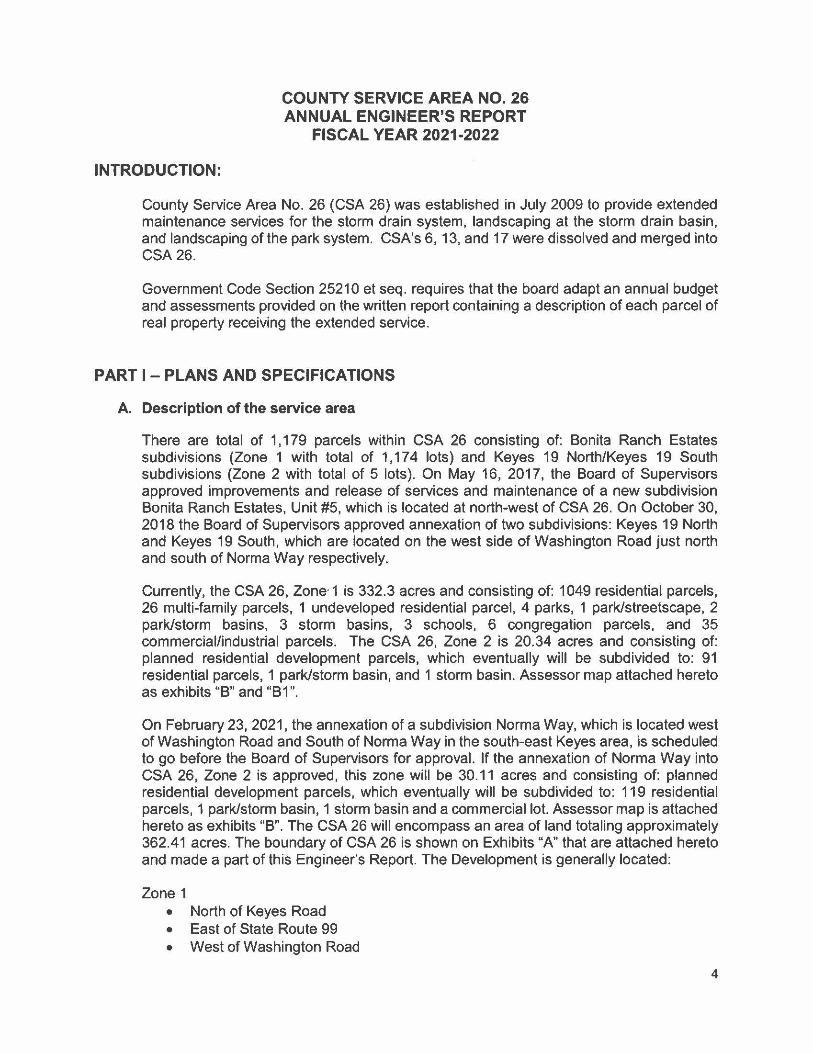
County Service Area No. 26 (CSA 26) was established in July 2009 to provide extended maintenance services for the storm drain system, landscaping at the storm drain basin, and landscaping of the park system. CSA's 6, 13, and 17 were dissolved and merged into CSA 26.
Government Code Section 25210 et seq. requires that the board adapt an annual budget and assessments provided on the written report containing a description of each parcel of real property receiving the extended service.
PART I - PLANS AND SPECIFICATIONS
A. Description of the service area
There are total of 1,179 parcels within CSA 26 consisting of: Bonita Ranch Estates subdivisions (Zone 1 with total of 1,174 lots) and Keyes 19 North/Keyes 19 South subdivisions (Zone 2 with total of 5 lots). On May 16, 2017, the Board of Supervisors approved improvements and release of services and maintenance of a new subdivision Bonita Ranch Estates, Unit #5, which is located at north-west of CSA 26. On October 30, 2018 the Board of Supervisors approved annexation of two subdivisions: Keyes 19 North and Keyes 19 South, which are located on the west side of Washington Road just north and south of Norma Way respectively.
Currently, the CSA 26, Zone· 1 is 332.3 acres and consisting of: 1049 residential parcels, 26 multi-family parcels, 1 undeveloped residential parcel, 4 parks, 1 park/streetscape, 2 park/storm basins, 3 storm basins, 3 schools, 6 congregation parcels, and 35 commercial/industrial parcels. The CSA 26, Zone 2 is 20.34 acres and consisting of: planned residential development parcels, which eventually will be subdivided to: 91 residential parcels, 1 park/storm basin, and 1 storm basin. Assessor map attached hereto as exhibits "B" and "B1 ".
On February 23, 2021, the annexation of a subdivision Norma Way, which is located west of Washington Road and South of Norma Way in the south-east Keyes area, is scheduled to go before the Board of Supervisors for approval. If the annexation of Norma Way into CSA 26, Zone 2 is approved, this zone will be 30.11 acres and consisting of: planned residential development parcels, which eventually will be subdivided to: 119 residential parcels, 1 park/storm basin, 1 storm basin and a commercial lot. Assessor map is attached hereto as exhibits "B". The CSA 26 will encompass an area of land totaling approximately 362.41 acres. The boundary of CSA 26 is shown on Exhibits "A" that are attached hereto and made a part of this Engineer's Report. The Development is generally located:
Zone 1 • North of Keyes Road • East of State Route 99 • West of Washington Road
4

• Southeast of Faith Home Road;
Zone 2 • North of Norma Way • South of Norma Way • West of Washington Road.
B. Description of Improvements and Services
The purpose of this CSA is to insure the ongoing maintenance, operation and servicing of the storm drain system, storm drain basin, and parks. The special benefit assessments to be levied for this CSA are intended to provide a revenue source for all the maintenance, and servicing of the service area's improvements including, but not limited to the materials, equipment, labor, and administrative expenses. However, the assessments are not intended to fund reconstruction or major renovations of the improvements and facilities. The maintenance, operation, and servicing of the storm drain system are funded entirely or partially through the service area assessments and generally described as:
Zone 1
• Periodic cleaning and maintenance (as needed) on 457 linear feet of 12" inch pipe, 7,156 linear feet of 18-inch pipe, 1525 linear feet of 24" pipe 632 linear feet 30" pipe, and 38,940 linear feet of curb and gutter;
• One outfall pump and four lift station pumps;
• Periodic cleaning and maintenance of 68 catch basins and 41 manholes;
• Repair curb and gutter as needed to maintain the storm drain system (38,940 linear feet of curb and gutter);
• Periodic street sweeping to prevent buildup of silt and other damaging materials to the storm drain system. All debris is contained and hauled off site with containment bins;
• Annual repairs and general maintenance to storm drain basin (erosion control, weed spraying, grading/excavation as needed);
• Remove silt build up next to the wall of the separator with the use of the suction truck;
• The Parks and Recreation Department provides continual maintenance of all parks, park/basin public use areas, open lots, and streetscapes within the Service Area (i.e. irrigation, mowing, weed abatement, tree care, and playground equipment maintenance).
Zone 2
• Periodic cleaning and maintenance (as needed) on 379 linear feet of 12" inch pipe, 1,273 linear feet of 18" pipe, 1,096 linear feet of 24" pipe, 1,950 linear feet of 24"
5
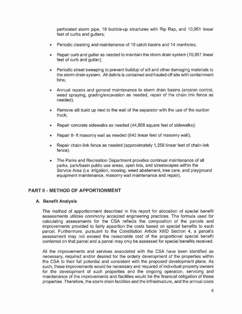
perforated storm pipe, 19 bubble-up structures with Rip Rap, and 10,951 linear feet of curbs and gutters;
• Periodic cleaning and maintenance of 19 catch basins and 14 manholes:
• Repair curb and gutter as needed to maintain the storm drain system (10,951 linear feet of curb and gutter);
• Periodic street sweeping to prevent buildup of silt and other damaging materials to the storm drain system. All debris is contained and hauled off site with containment bins;
• Annual repairs and general maintenance to storm drain basins (erosion control, weed spraying, grading/excavation as needed, repair of the chain link fence as needed);
• Remove silt build up next to the wall of the separator with the use of the suction truck;
• Repair concrete sidewalks as needed (44,868 square feet of sidewalks);
• Repair 8- ft masonry wall as needed (642 linear feet of masonry wall);
• Repair chain-link fence as needed (approximately 1,258 linear feet of chain-link fence).
• The Parks and Recreation Department provides continual maintenance of all parks, park/basin public use areas, open lots, and streetscapes within the Service Area (i.e. irrigation, mowing, weed abatement, tree care, and playground equipment maintenance, masonry wall maintenance and repair).
PART II - METHOD OF APPORTIONMENT
A. Benefit Analysis
The method of apportionment described in this report for allocation of special benefit assessments utilizes commonly accepted engineering practices. The formula used for calculating assessments for the CSA reflects the composition of the parcels and improvements provided to fairly apportion the costs based on special benefits to each parcel. Furthermore, pursuant to the Constitution Article XIIID Section 4, a parcel's assessment may not exceed the reasonable cost of the proportional special benefit conferred on that parcel and a parcel may only be assessed for special benefits received.
All the improvements and services associated with the CSA have been identified as necessary, required and/or desired for the orderly development of the properties within the CSA to their full potential and consistent with the proposed development plans. As such, these improvements would be necessary and required of individual property owners for the development of such properties and the ongoing operation, servicing and maintenance of the improvements and facilities would be the financial obligation of those properties. Therefore, the storm drain facilities and the infrastructure, and the annual costs
6

of ensuring the maintenance and operation of these improvements provide special benefits to the properties within the CSA.
The storm drain basin and the parks are public property and treated as individual parcels. These public properties are being created for the sole purpose of providing benefit (storm drainage control and open space) to the residential lots. Services provided by CSA No. 26 are storm drain system services, park maintenance services for the storm drain basins in the CSA which are also landscaped as parks, maintenance of some community landscaping, and special additional benefit funding to provide landscape and maintenance services for Hatch Park. All of these benefits are special benefits provided to the Keyes area that are over and above those provided to county wide property owners in general.
B. Assessment Methodology
The method of apportionment for the CSA calculates the receipt of special benefits from the respective improvements based on the actual or the proposed land use of the parcels within the CSA. The special benefit received by each lot or parcel is equated to the overall land use of the parcels within the CSA based on the parcel's actual land use or proposed development.
Upon review of the proposed improvements, it has been determined that each of the residential parcel within the CSA receives special benefits from all the improvements to be funded by annual assessments and based on the planned property development a single zone of benefits appropriate for the allocation of the assessments and proportional benefit. The parcels within the CSA may be identified by one of the following land use classifications and is assigned a weighting factor known as Equivalent Benefit Unit (EBU). The EBU calculated for a specific parcel defines the parcel's proportional special benefits from the CSA's improvements, facilities and services.
Equivalent Benefit Units (EBU):
To assess benefits equitably, it is necessary to relate each property's proportional special benefits to the special benefits of all other property in the CSA. The EBU method of apportioning assessments uses the single-family home site as the basic unit of assessment. A single-family home site equals one EBU. All other land uses are converted to EBU's based on an assessment formula that equates the property's specific development status, type of development (land use) and size of property, as compared to a single-family home site.
The EBU method of apportioning special benefits is typically seen as the most appropriate and equitable assessment methodology, as the benefits to each parcel from the improvements are apportioned as a function of land use type, size and development. Not all land use types described in the following are necessarily applicable to the development of properties within the CSA but are presented for comparison purposes to support the proportional special benefit applied to those land use types within the CSA.
EBU Application by Land Use:
Single Family Residential- This land use is defined as a fully subdivided residential home site with or without structure. This land use is assessed 1.00 EBU per parcel or lot. This is the base value that all other properties are compared and weighted against.
7

Multi-family Residential- This land use is defined as a fully subdivided residential parcel that has more than one residential unit developed on the property typically includes apartments, duplexes, triplex etc. (It does not typically include condominiums, townhomes, or mobile home parks). Based on average population densities and the size of the structure as compared to a typical single-family residential unit, multi-family residential parcels shall be proportionally assessed for the parcels total number of residential units utilizing a sliding benefit scale. Although multi-family properties typically receive similar benefits to that of a single family residential, it would not be reasonable to conclude that on a per unit basis, the benefits are equal. Studies have consistently shown that the average multi-family unit impacts infrastructure approximately 75% as much as a singlefamily residence (sample sources: Institute of Transportation Engineers Informational Report Trip Generation, Fifth Edition; Metcalf and Eddy, Wastewater Engineering Treatment, Disposal, Reuse, Third Addition). These various studies indicate the most public improvements and infrastructure are utilized and impacted at reduced levels by multi-family residential units and a similar reduction in proportional benefit is appropriate. Furthermore, it is also reasonable to conclude that as the density (number of units) increases the proportional benefit per unit tends to decline because the unit size and people per unit usually decreases. Based on these considerations and the improvements provided by the CSA, it has been determined that an appropriate allocation of special benefit for multifamily residential properties as compared to a single family residential is best represented by the following special benefit assignment: 0.75 EBU per unit for the first 5 units; 0.50 EBU per unit for units 6 through 50: and 0.25 EBU per unit for all remaining units.
Condominium/Town-Home Units- Condominiums and town-homes tend to share attributes of both a single-family residential and multi-family residential properties and for this reason are identified as a separate land use classification. Like most single-family residential properties, these properties are not usually considered rental property and generally the County assigns each unit a separate APN or assessment number. However, condominiums and town homes often have similarities to multi-family residential properties in that they are generally zoned medium to high density and in some cases may involve multiple units on a single APN. In consideration of these factors, it has been determined that an appropriate allocation of special benefit for condominiums, town-homes and similar residential properties is best represented by an assignment of 0.75 EBU per unit regardless of whether each unit is assigned an individual APN or there are multiple units assigned to the APN. There is not an adjustment factor for parcels with more than five units.
Planned-Residential Development- This land use is defined as any property for which a tentative or final tract map has been filed and approved (a specific number of residential lots and units has been identified) and the property is expected to be subdivided within the fiscal year or is part of the overall improvement and development plan for the CSA. This land use classification often times involves more than a single parcel (e.g. the approved tract map encompasses more than a single APN). Each parcel that is part of the approved tract map shall be assessed proportionally for the proposed or estimated residential type and units to be developed on that parcel as part of the approved tract map. Accordingly, each parcel is assigned an appropriate number of benefit units that reflects the development of that property at build-out. (The EBU assigned to each parcel shall represent the combination of single family, condominium, multi-family units to be developed).
8

Exempt Parcels- This land use identifies properties that are not assessed and are assigned 0.00 EBU. This land use classification may include but is not limited to:
• Lots or parcels identified as public streets and other roadways (typically not assigned an APN by the County);
• Dedicated public easements including open space areas, utility rights-of-way, greenbelts or other publicly owned properties that are part of the CSA improvements or that have little or no improvement value;
• Private properties that cannot be developed independently for an adjacent property, such as common areas, sliver parcels or bifurcated lots or properties with very restrictive development use.
These types of parcels are considered to receive little or no benefit from the improvements and are therefore exempted from assessment.
Special Cases- in many CSA's where multiple land use classifications are involved there are usually one or more properties that the standard land use classifications or usual calculation of benefit will not accurately identify the special benefits received from the improvements. For example, a parcel may be identified as a vacant residential property, however only a small percentage of the parcel's total acreage can actually be developed. In this case, an appropriate calculation would be based on the net acreage that can be utilized rather than the gross acreage of the parcel. The following table provides a summary of land use types, the EBU factors used to calculate each parcel individual EBU as outlined above:
Land use and Equivalent benefit units
Property type EBU Multiplier Sinale Family Residential 1.00 Per unit/lot(parcel)
0.75 Per unit for the first 5 units Multi-Family Residential 0.50 Per unit for units 6 thru 50
0.25 Per units > 50 Condominium/Town- Home Units 0.75 Per Unit
1.00 Per planned Residential lot 0.75 Per Planned Condominium
Planned Residential Development 0.75 Per unit for the first 5 units 0.50 Per unit for units 6-50 0.25 Per unit >50
Vacant/Undeveloped Residential Land 0.00 Per Acre Public Park 0.40 Per Acre
Public Storm Drain Basin 0.40 Per Acre
Public School 2.20 Per Acre
Commercial/Industrial Parcel 3.50 Per Acre
Undeveloped Commercial/industrial 1.00 Per Acre Parcel Rural/ Agricultural 1.00 Per Acre
Exempt Parcels 0.00 Per parcel
9

The following formula is used to calculate each parcel's EBU (proportional benefit):
Parcel Type EBU x Acres or Units= Parcel EBU
The total number of EBU's is the sum of all individual EBU's applied to parcels that receive special benefit from the improvements. An assessment amount per EBU (assessment rate) for the improvements is established by taking the total cost of the improvements and dividing the amount by the total number of EBU's of all benefiting parcels from the improvements. The rate is then applied back to each parcel's individual EBU to determine the parcel's proportionate benefit and assessment obligation for the improvements.
Total Balance to Levy/ Total EBU's = Levy per EBU
Levy per EBU x Parcel EBU = Parcel Levy Amount
PART Ill- BUDGET ANALYSIS
A. Fund Balance
The estimated fund balance for Zone 1 as of June 30, 2021 is $404,817. This includes a capital improvement reserve of $163,132 for eventual replacement of the outfall pump and four lift pumps and $25,000 for park equipment and/or vandalism related capital costs. This fiscal approach is aimed at accumulating a sufficient reserve by the time the pumps are replaced so that no increase in the annual assessment will be necessary to cover these costs.
The estimated fund balance for Zone 2 as of June 30, 2021 is $33,252. A drain basin in the south subdivision is surrounded with the chain link fence that is approximately 1,258 linear feet long (Public Works maintenance). In order to replace the fence at the end of a 30-year life cycle, a capital reserve target of $18,543 has been determined for Public Works. This includes the cost of the material and labor required to complete the installation.
East side of the south subdivision has a masonry wall of approximately 642 linear feet (Park maintenance) that separates residential area from Washington Road and protects residential lots from traffic sound. In order to make a capital repair of the wall, a capital reserve target of $50,400 has been determined for Parks. This includes the cost of the material and the labor required to complete the work.
The threat to stormwater quality comes from the urbanized areas within the County, which the CSA's encompass. The County is mandated by the State Water Resources Control Board, Water Quality Order No. 2013-0001-DWQ to regulate stormwater within these urbanized areas. The CSA's receive additional services above the General Benefit for the following permit areas: Education and Outreach (E. 7), Public Involvement and Participation Program (E.8), Illicit Discharge Detection and Elimination Program (E.9), Post-Construction Stormwater Management Program (E.12), Water Quality Monitoring (E.13), Program Effectiveness Assessment and Improvement (E.14), Total Maximum Daily Loads Compliance Requirements (E.15) and the Annual Reporting Program (E.16).
The fee structure to implement the state requirements has not been determined for Fiscal Year 2021-2022. An estimated annual fee of $5 per parcel is included in this year's
10

budget. Any surplus or shortfall will be adjusted in future calculations.
Fiscal Year's 2021-2022 assessment for Zone 1 is $113.02 per Equivalent Benefit Unit (EBU), which is the same as the previous year's assessment. An amount of $68,905 will be used from available fund balance to offset operations and maintenance costs, thereby keeping the assessment equal to the previous year.
Fiscal Year's 2021-2022 assessment for Zone 2 is and $571.75 per EBU. An amount of $3,235 will be used from available fund balance to offset operations and maintenance costs.
The fiscal year is the 12-month period from July 1 s1 through June 301h of the following year. The annual assessment is received with property taxes collected in December and April. This means that the fiscal year starts on July 1st
• but the first installment of the annual assessment will not be collected until December, creating a 6-month lag in receiving the money necessary to maintain the various services provided. Therefore, a reserve of $104,533 for Zone 1 and $16,626 for Zone 2, one half of the annual operating budget, will be carried forward from available fund balance to cover costs from July 1st to December 31 s1•
B. Budget Formula
Proposition 218, a statewide initiative approved by the voters in November 1996 and which took effect July 1, 1997, requires property owners approve any change in the method of calculating assessment and any increase in the assessment rate through a ballot procedure. An assessment ballot procedure occurred during the formation of CSA 26 in 2008. A majority protest was not filed regarding the formula for calculating the annual assessment and the levy of the annual assessment to pay for the services provided by CSA 26. The property owners cast majority votes supporting the formula and levy of annual assessment to pay for the services provided by CSA 26. Therefore, the formula for calculating the annual assessment has been approved and is in place. The formula that is being used to calculate the assessment is the total cost to operate and maintain the storm drain system, parks, and streetscape within CSA 26.
Parcel Type EBU x Acres or Units = Parcel EBU
Total Balance to Levy/ Total EBU's = Levy per EBU
Levy per EBU x Parcel EBU = Parcel Levy Amount
The annual assessment calculated using the Method is proportional to the special benefit derived by each identified parcel in relationship to the cost of the service being provided by the CSA. Due to variation in the type of parcel use, each parcel benefits differently in the services provided. Therefore, the total cost to operate the CSA is based on the above method to determine the annual assessment for each parcel in the CSA. This method is proposed in order to support an equitable spread of assessments between residential lots, public properties, and developed commercial and industrial properties. The annual assessment is levied without regard to property valuation.
11

Total Equivalent Benefit Units by Property Type - CSA No. 26 (Zone 1)
PROPERTY TYPE (acres/parcels/units x EBU TOTAL EQUIVALENT BENEFIT UNIT
factor) (E.B.U.)
Undeveloped Residential (1 parcel x 0) .00
Undeveloped Commercial .00
Developed Residential (1093 parcels x 1) 1093.15
Multi-Family Residential (69 units x 0.75) 51.75
Multi-Family Residential (20 units x 0.5) 10.00
Multi-Family Residential 0.00
Road Easement (0 x .55) 0.00
Storm Water Basin (0.7 acres x 0.4) .28
Storm Water Basin/ Park .00
Park (16.85 acres x .40) 6.74
Public School ( 10.95 acres x 2.2) 24.09
Streetscape (0.71 acres x 0.4) .28
Developed Commercial (12.51 acres x 3.5) 43.78
Developed Commercial Church (2.56 acres x 3.5) 8.96
Industrial (0 x 3.5) .00
Totals: 1240.15
Total Equivalent Benefit Units by Property Type - CSA No. 26 (Zone 2)
PROPERTY TYPE (acres/parcels/units x EBU TOTAL EQUIVALENT BENEFIT UNIT
factor) (E.B.U.)
Planned Residential Development (6 parcel) 84.63
Totals: 84.63
Assessment Per Equivalent Benefit Unit (E.B.U.). - CSA No. 26 (Zone 1)
DESCRIPTION AMOUNT
Required Funds 140,161.64
Total Equivalent Benefit Units 1,240.15
Calculated Assessment Per Equivalent $113.02
12

Assessment Per Equivalent Benefit Unit (E.B.U.). - CSA No. 26 (Zone 2)
DESCRIPTION AMOUNT
Required Funds $30,016.86
Total Equivalent Benefit Units 52.50
Calculated Assessment Per $571.75
13

PART IV- SERVICE AREA BUDGET
EXPENSE DESCRIPTION TOTAL BUDGET TOTAL BUDGET
Zone 1 Zone 2
94.2% 5.8% ADMINISTRATION County Administration $ 1,080 $ 95 Miscellaneous/Other Admin Fees $ . $ .
Total $ 1,080 $ 95
PARKS & RECREATION Parks Labor $ 58,212 $ 11,268 Parks Vandalism & Graffiti $ 1,640 $ .
Parks Utilities $ 51,353 $ 8,932 Parks Other Supplies $ 5,223 $ 1,786 Parks Maintenance Structure & Grounds $ 5,865 $ . Total $ 122,293 $ 21,986
PUBLIC WORKS SWRCB Permit Requirement $ 5,865 $ 30 Pond Excavation $ . $ . Pump Replacement $ . $ . Cleaning Drainage System $ 14,551 $ 792 Street Sweeping $ 48,621 $ 8,544 Curb & Gutter Repair $ . $ . Weed Spraying $ 3,013 $ 139 Erosion Control $ 5,093 $ 945 Separator Cleaning $ 5,675 $ 617 Sidewalk Repair $ . $ 1,420
Utilities $ 10,355 $ . Total $ 93,173 $ 12,486
Capital Improvement Reserve General Benefit $ {7,480) $ (1,314) Total Administration, Parks & Rec, Public Works Budget $ 209,067 $ 33,252
Fund Balance Information Beginning Fund Balance (Estimated for FY 2021-2022) $ 404,817 $ 33,252 Capital Improvement Reserve-Parks(·) $ (25,000) $ (562) Capital Improvement Reserve-Public Works(·) $ (163,132) $ (294) Available Fund Balance $ 216,685 $ 32,396
Adju:ilffi!ilnt:z 10 Available Fund Balance General Fund (or PW) Loan RepaymenVAdvance (+) $ . Other Revenues/General Fund (Contobutions I.e. Grants)(+) $ . 6 Months Operating Reserve(·) $ (104,533) $ (16,626) Use of Fund Balance for FY2021 -2022 (· ) $ (68,905) $ (3,235) Contingency Reserve (-) Total Adjustments $ (173,438) $ (19,862)
Remaining Ava11able Fund Balance $ 43,247 $ 12,534
Total Administration, Parks & Rec. Public Works Budget $ 209,067 $ 33,252 Use of Fund Balance(-) $ {68,905) $ (3,235) Balance to Levy $ 140,162 $ 30,017
District Statistics Total Parcels 1,174 6 Parcels Levied 1,173 5 Total EBU 1,240.15 52.5 Levv EBU $ 113.02 $ 571.75 Capital Reserve Target-Parks $ 25,000 $ 50,400
Capital Reserve Target•PW $ 163,132 $ 18,543
14

PART V - ASSESSMENTS
2021-2022 Assessment Zone 1 = $140,161.64 / 1,240.149 EBU = $113.02 per EBU
2021-2022 Assessment Zone 2* = $30,016.88 I 52.50 EBU = $571.75
2020-2021 Assessment Zone 1 = $140,161.64 / 1,240.149 EBU = $113.02 per EBU
2020-2021 Assessment Zone 2* = $0
*The assessment of a proposed parcel in Zone 2 will start in Fiscal Year 2022-2023. If the annexation is approved, a deposit from a developer that covers 1st year of O&M will be transferred to CSA 26, Zone 2 fund. Thus, the fund balance of Zone 2 will be sufficient to cover services provided in this zone.
Since a formula or method for calculating the annual assessment has been approved per Proposition 218, no ballot procedure is necessary to approve the change in assessment. Therefore, the Fiscal Year 2021-2022 assessment is in compliance with Proposition 218.
The parcels subject to the assessment are listed on Exhibit "D" that is attached hereto and made a part of this Engineer's Report.
15

EXHIBIT•A•
LEGAL DESCRIPTION
FORMATION OF COUNTY SERVICE AREA N0.26 (KEYES)
All that portion or Section 30 ofTowmbip 4 South, Ranae 10 East Mounl Dilhlo Basi= and Meridian, mcm par1icularly described as follows:
Co,nmeudn11t the SoUibmt Comer of said Section 30, said point beln& the intcncctlaa af lhe c:catedines Ntmu ad Wublqton lloada. tbaa aloaa tlu:: swth lme of aid Section 30 ml the ccnwliDc of said Nuna Road. North.,. 43' 30" Wast 760,10 feel to 1he Tnic Point of.Begh,Dffll af 1bis dmi,Pliaa. llld point. beta& on 1m soulharly mamlon of the cast lint of the Raymond 1i:m:t SubdMslan. (1) Tbau:e c:aadmdns on. said south 1iae of Section 30 ad cadctlinc of'Nuna Road. North U' 43' 30" Wa1, 1582.◄9 ftct to a poJnt oa lbc IUD1bc:ufcrly ript-of:.way of State HJpway 99. (2) Tbcacc Norib 50" 20' 49'1 Wtai, 1os.12 feet along aid lfaht-of-way to a uaJe po1m. (3) 'l'hllnceflftl!tirurin1 •loaa Nici ript-of•WIQ', Nmth -tt• 56' 25" wai_ 1185.01 to a qlopolnt. (4} 1brm:e North 71• 56' 10" Wat. 40.3f feet t.o 1m aglc pabd. (5) Thc:Dcc Nm1b 4t• 57' 49" West. 2635.94 r.t 1o 1111: lnter,eatioD af picl n,sbt-of•way and 1be cmtcdinc ofFaida Home Ram. (6) 1benco North O" 12' 22" East. 950.81 fed aJaag uid coalllrliac 1D dlD bopmiaa of a curve. (7) 'llmDco along lllclcurve r.aacave to11m etll ~Ill a cadralaqle Dftft' 15' 30" m andius of 2000.00 Alt a Jmglb af358.0I fed to 1be ad af aillcl arve. (I) 'I1aco 8outb -r, 32' 03" But, 30,00 fast 10 • poial on 1he easterly riJbt-of-1"111 of aid Faith Home Raad, aid poiatbcin& 1ba bopmina af a DOll•laagcat curve with alldi■l bazma Dl"Soudl 7ga31• Pl" PAlt. (9) 'Iheace aJona ald c:ur1e, couam:: 1o 1he cat. wlfha callm1 qle of 1•.os- 44" ad eradimof 1970fcct, aJansthof37.67fcet to tbe end of auf cum. a1ao haini a 111a)e pm in said ripH{~way. (10) '1lmoe Nortb 89' 56' 00" Eut 95.21 k aloaa lllid 11abt· of.way ad it'• eure.dy ataadaD to a pobat 20,00 aut ofibe Wllll lmeof utdBectiaa 30 IDd Cha northerly CDt1lmlcm oftbe east dpt .. t:-way uf'Matllap Road. (11) Theace South 0- 14' m" Welt, 726.◄0 feet alnna 6e uid uonhedy mrrad"ll ad cut dght-GJ:.way of said Molliapr Raad ta lhc west canansiall of1ho llOlth line ofBloc1c ''A" af1bo Wuda Tracl (12) 'Jhancc Soudl ag- 37• 42 East. 1313.?7feetaJcmasaidnmthl1DD101hc nortbeut comer of lat l of 1114 Block~". belag a paint on 1bo watJigbt-af-way of Sm:mth Street. Aid poillt lho baina tbe aouthVt'at CDrDer of dleltoyes North SuhdMsion ()3) n.. Nadia QI 25' 11" Pat, 314.77 feet lloqthnwat ~ of alclNartb Keyes SalMlivbion to tmJICX1hwest comer of Lot 6 Cbcreo£ (l◄) '!1H:nce Scndh It-29' 12., Eat, 669.92 &at llQD11bDJIOl1h line afllfd lllbdivislon 10 the ll&Jdhaatcomer1>fLot 17 daereo( said pomt also 1sciag1be northwast comer of'Id 13 ot'CboLa Joli& Sobdm■ioo. (15) 1bmll:o conmmina South 19" 29' 12' P.ast, 649,92 r.t along die noilhlblc 1o the northwt comer of Lot 6 of Aid 111bdivillan. llid point also beiQ81beNanhwellComer of Lot Al at1he Boaft&.Ranch Phare I SubcU\IUiou. ( 16) Tblm:e Saulb 89' 29' 20" But. tlll.19 fed. alooJ the uorthliacolsaidLatAI 11Dd th& ltm,1bvterpucal oflllfd
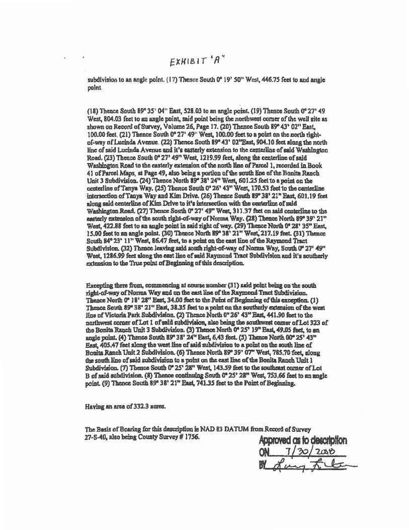
subdivision to an ang)t point. ( 17) Thence South 0- 19' SO" West, 446. 75 fed 1o aad angle point.
(18) Thence South 8~ JS' 04" East. Sll.03 toan angle point. (19) Thence South 0"27' ◄9 West, 804.03 feet to au anale point.. said poinl being the nor1hwnst corner of the well sUe as shown on Record ofSmvey, Volume 26. Page 17. (20) 'llwlce South B!r -43' 02" East, 100.00 feet, (21) Thence South 0-27' 49,, West. 100.00feeUo a point on the.north rishl• of-way of Lucinda Avenue. (22) Tbcncc South B!r 43' Ol"Bul. 904.J O feet alons the north line of said Lucinda Avenue and it's easlerly cxlalsion fo the c:omerlinc of aid Wlllhlngton Road. (23} Thence South 0-27' 49" West.1219.99 rcce, along the centerline of Aid Wasblneton Road to the r.asterly extculon of 1hc north Im of Pan:oJ 1, ,ecordcd ID Book ◄ 1 of Parcel Maps, II PIJC 49, also 'bcin1 • portio11 of 1be south tine oflhe Bonita Rueb Uait 3 Subdiwion. (24) Theacc North 19" 38' 24" West, 601.25 feel to• poi.at on 1hc cc:nterUnc ofTmya Way. (25) Thence South 0-26' 43" West. 1?0.53 feet to the centedine mc:na:don ofTlll)'I Way and JCim Drive. (26) 1'haau Scndb 1!1' 31' 21" P.ut. 6DJ. l9 feet alooa said centerline of Kim Drive to it'• U111:necticm wilh 1bo caa1mUm: of aid Waslua&tan.Raad. (27) Thaace South 0- 27' ◄9" Weat, ~ 11.37 ftet on said ecntcdme io 1he eestmly axtlmlion oftlsc south rJaht-of-way ofNoiml Way. (21) Tbem:e North Sgt lJ' 21" West. 422.88 feet to ID ua)t: point in Aid Jipl of way. (29) neucc Nonb 0- 21' 35" East, 15.00 fa,t to an ana}e pomt. (30) Thence Nmth 8" 38' ll" Wast;217.19 ftzt. (31) 1bmcc South 14•23• ll"West, 86.47 feat. 'to apomtOlltbecutliac of tho Raymond Tract SU'bdlvfslcm. (32) 'lbc:Dcc Jeavmc llkl ,c,mla r:ipt-of-way ot:Nmma Way, Sautb C1' 27' ◄9" West, 1216.99 feet alon11ho cast line of aid Raymond 'In.ct Subdivision ud it'• soudmrly extcmioa to tbo True painl afBeabmina of this dr.scriplioo.
Excepting 1hml from, commcacma at cmnc number (31) said pomt baiq on 1hc SOUlh rigid-of-way ofNonu Way a4 DD tbe a.st line oftheRaymoad Tact SubdivilioD. n.acaNorlh 0- ll' 21" Bllt.~.00 ftict1otbePoimof'BepmiagofthilexcepClcm. (l) 'J1umce Scnstb. l!r 3R' 21" Fast, 38.35 roc1 to a point on the IGUthcrJy mansion of'1be wen line of Victoria Pm SubdMaloa. (2) Tbencc North 0° 26' 43"Elsl, 441.90 fi:ct to 1he no.rthwat comer of Lat 1 of ala subctiYilion. also beiq the ,oudawmt camw of Lot 323 of Ibo Bomta Rmch Uait 3 Subdivision. (3) 'I'blace Nmth 0- 251 l~ Bu, "9.0S fed.1o en aqlc point. (4) Tbenco Soudl ar 31' 24" ~ 6.◄3 fed. (5) 1beace North OD° .25' -43" &st, 405.•7 foet along the west.line of Mid subcUviJiou 1o a pomt Oil 1huoudi line a£ Boalta Ranch Unit 2 Subdivision. (6) Thence North 8!r 39' fY1" West, ?85,?0 feet, along the soathliDo of Aid .-ubdivilion 1o • pobd on dleeut line of the Bonita Ruch Unit l SubdmliOIL (1) Thmc:e South er 2S' 21" We.st, 143.59 &st 1o tbe IOU!heut camer of Lot B of said 111bclivisioa.. (I) ~ coodnm0& $!Mb 0-25' 28" West, 753,66 feet 1o am angle poiDL (9) Thence SoUlh 89' 38' 21" But, 741.35 feet to 1he Point ofBelinniDJ.
H1W11 an area of 332,3 aares.
The Basis of Bearing for this descdption ia NAD 83 DA TUM fi'om .Record of Survq 27-S-◄O, also bchaa County Survey#/ 1756. ~ QI to~
ON 1 / ?xJ/ 1.J:AtJ
BY€(~],:~

. a/4fcl)) Matt Machado P .E. Director Department of Public Works
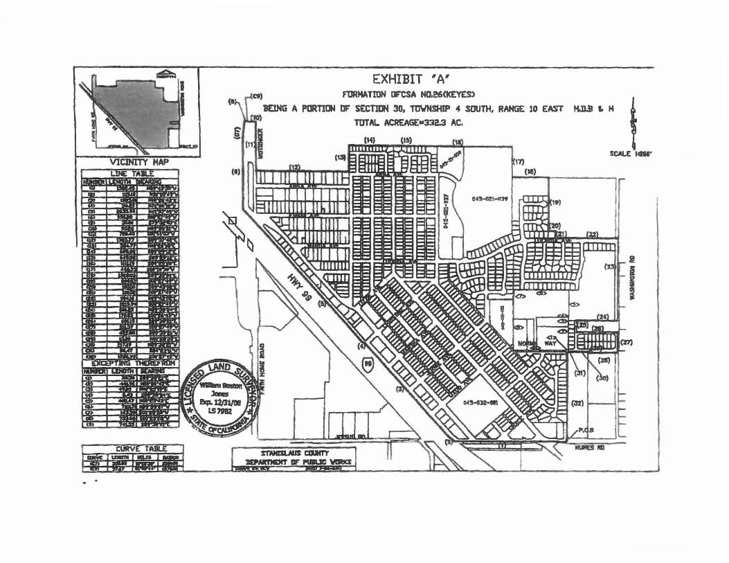
EXHIBIT 'A' [Cl) F'tJRMATIDN DF'CSA N0.26(kEYES>
IEING A PORTltJI OF' SECTIDM 30, TDYNSMIP 4 SOUTH, RANG£ 10 EAST HJJ.I I. M
t
S'T'ANISUIJS-aucr, llEPMTNENT IF PUii.JC "1ltlCS
TOTAL ACREAGE•332.3 AC,
04!Ml2l-o:19
:m (II)
SCALE li808'
I
I

i iii ~
a!
-:8
-ci ca:
a ~
j:
:: -Ii!
ffi %
~ 2
,,..
@)
• "" s·•· ' ~-·
~ ~
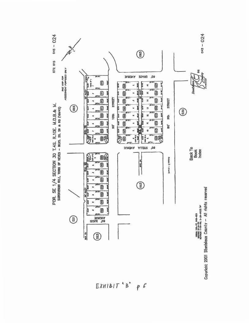
PORTION NW. 1/4- SECTION 30 T.4S. R.10E. M.D.B.& M.
.. :1 @J
--(8 t .. .. • ., ., ... -. ,.. ! -r .,. . @) 1B 8
111~- ..... ·--... ~ ,·
··• •..
WARDA lR, 8UCS. A & 8 (14US7)
e a 1,
_..!,
60' .lNNA ..,.1 -. I
,,.
8 ® s , @ 1 lEl
l
&IL. I ., I -.. - I t.!!..__ k____~ 11
., •I ... I ., •I • I ..._I UI
"l.,,.M.,.-8;1 @· @flEl ·:
I•-- I -_ I• w f ., la
set ESMAIL
~
AV£ •
!I I
Back To Book Index
I
~
!
I• -., ... I' ,w
•A·- I ., ••
AW..
,__, -· ~ 1a-, .. ,._ _., "'- .. .._n IC. ,1-1..,_• l't • ••ir- 11r, _,,-117 a
Coowiahl 200t Slontslaus Countv - NI riQhts reserved
... El
&
),
072 015 oas- 014
1'0t1U,O,, .. ~,~ c,ljlf'
""i. ...... "'" @!)
•r re
•·-luw
ANNi AVE 6
..,; en
"" al•• 'I F=
@) .1 ® I @).I ! . l . 8 1~ - 1~-1 I
II ■ N 0 ID
"I "I •I . s · @fl • l!!l =1ef
• I• ,.. i,a - ~-1
St•~ n,OC,07
,,.,,., 11
~5- 014

rn ">i;" ~ -Ol --; ~
t,:1' ~
~ . '?-
" ~ ~
,,'\..
" ' ''!''\..
---, ...... ~~·•··· ... ........................ __ _.,_..,_,,, ....
.,.,
POR. SW 1/4 SEGl10N !O T.4S. R.IOE. M. QB. a M. POtl. WAftDA Tll • BUt. D, PGll.l..ars 7 Ill
flOll TEXEJIA TR.·IUIS. D a 37
no,s cs-16
<
® Tl 'TR._
TM\$ MAP fORASSl~lff PUll'OSS 0Nt.Y
COIIJlw,l2110I SIINI..,_ Counlf, ,.,..,,bi._,. l LUCINUA AVE.
,18/t &. ®· @'"'• ... , , ... t. r.hoo
< t
'( I
"( ., ....
< I)
"" ,t
>('
1111111
,.: .,
.c ;::
i
'ii
©
~"' ,-:
~ t-\ 1)-(~
" ~ Back To
Book Index
45 -16

a:> }I co - -0 =z: - 0 l
I I , ~ Ill g ©
• 0 0
tr ~ .,, ~
ci ~ ..,
~ s .1Dl1S 'lf!DI ,OIi 'I
1 ~
?c ~
,1 0 I-~•
JDl15 -! g.g ! )IW1:) .ot .gm.e
I I I ~ ® ® ffl b .. i
JDllLS 'lfl& .0,
J.'DHlS -,,ia po
®

0 N C I
~ Cl
~ 0 I
M"I ., a

m '>-. :x: "Or ---\
.. OJ
«
~
U1
e V
2~A z s ~~
@~
11--t-N
,,.. 10-,S. -........ ,.. - t•lJ,•Q ll-U•OJM.,.
POR. S 1/2 SECllC-N JO T.4S. R.1DE. M.D.B.& M. SUIOMSl0tl NO, 1, TDMf OF JCE'ltS - llUCS. 50-!32, 82 6: 83 (IISN4S)
072 015
l r e
s
llll' 911
Back To Book Index
l II l STREET
""'"~""' .l~T~ootr
1111
CoovrtQht 2001 Stanislaus Countv - All ricmls reserved
@1,n1.tf9 rn,n,
045- 022
~ [ !~ :c I
045 - 022
v ~ ('I
/ N
0 0 I I
in ,n ., @ j
• D
\ 0
L II)
6 ,., .. .... Ii Q
~ :t ll'IH3\V 3:JVlm ,OIi ! t
·1 l ~ ...
.. i I ~ @ ~i ® . ii m- I t . -Co • Ill
:::E4 b ~ ~I
.. ~ :f n::: ~s t,-! • 3nNJI\V Yl131S ,OD 0
gs
l ~J'
I ! i a l!s .. ~I
• ~ (
en • =
=ti ® ~~ :1 "-
"g
i .. D. ) f !~
® 31\tB\V :.~ anVl'l JID " I
f@l I e:Jt > 6 ,l -•-. C
jij S I g
l! (i -tn
8 N .. i ~
8
EXHti/T • e," ,, (

n, :x :x: -? -i ~
w .,
71 ..µ
07'2 015 0'5 - 028
~
POR S 1/2. SECTION 30 T.4S. R.10E. M.O.B.& M. ""'- 1IMN a: 1(£\U. Bl.0CICS s - , co .... oe> a
.,. / I l e ~~~'"
·~
[_ IIO' 9th
i I e IIO' 8tk
m I i t
-\~ I f ~
/~~~ ..... ~ _.__., __ ,.,.- ___ .,, -- - M•"•.1-1•,C, 1-1---«"J ..
Coowiaht 2001 Stonislaus County - All ri<lhts rlSef"Yltd
so· 7th
S1'l£ET'
.......
SlREET
snlEET"
rs
...
·,,...; ...
,c 9
iC I
~
To k X
11,07 .,,..~,
11,11•r 045- 028

m "X :r: -f;p --\
:r
't7-l .,
""6"
~
PORTION S. 1/2 SECTION 30 T.4.S. R.1DE. M.0.8.& M. T0¥M Dr l(£'tES - 8lXS. 4.S,U),1' (IMMDII) _____ 9 _______ _, I E)
ao· a,e,- I,. I J
- - - - w - • -(§l(ii)@J@g@)lej(el(el J
~ ~
s 80'
w11I .... , •"I .,•1 -•I .~1 .,,, .-•1
i!! z _, i5 i ~ @J @JlillJSJ!f;;J 1@118 I l!il ~
i 'o m
BO'
--, :::..·---- • 1~ ~ t--n, lln'•lt-U IIC. - • U Ill. .,_J&.N f1I IIL lt•JDoDI DI 9
Coowfaht 2001 Stanl91aus County - An rfahts rDSerVed
9th
15th
7th
r
IMf_,A~tr;,, j ASSQII/OIT ~ Olltf'
ST.
ST.
ST,
Back To Book Index
on 01s o,s - 030
L
' ~ I <
I o I
e ~ :::E
I
TfJ; 'i I " 1115,0",01
,,,,,,,
I 045 - 030

n, ~
:1: -~ --\ ~
OJ' •
""'1l
~
1'11$ ,,_.,, fTIII _.SSC7Plt- l'Uft-.S Ol/£P
PORTION SE 114 SECTION 30 T.4S.R.IOE.M.O.B.BM. TOWN OF KE\1!!- IILKL t. 1' 12, a 13
7Z 02 4!1-32
_J l @ J l ® l_ ao' 9111
l I ftHlr L. .. IIMT
J~ -
8\.IC. ,
-·~ ... -. ..... ~ .J L
@ i 11 ©
l~ , r
ltLlt. ·~ J
I
-ea' m sr.
Copyrfght2001 Stenlsfaus Cou~ Alf rfghts ntaerved '"'T· I ---------Vf'llt«'II •·•·•·
® l i~ r
st.
BL:
~·;1~~ ii( , •
w ® ~ r-It: c:,
~~ b
&a"~ ,a r :I:!.' l ... "-60' lfll ST.
e
O· Back To
Book Index
45-32

::E cO m d ~ iJ 0
it
-=z ! ,.
0
15 Ill Of
L L L0 ~c
:u; 1116
.... ~1C ~le
15 1118
lS IIIL
!~f : '0 f:: ~

~ ~ -~ ---\
:r
v:, II!'
~ --
POR. E 1/2 SECTION 30 T.4S. R.10£. M.D.8.& M.
e
,.., .... _._ !8-J>oDW .......
BCICtTA MMQt UtlT 1, US. 111-121. 133-111 I: I.OT ~UOI)
\__-----~ W IIGS1DIA •v ~ ~
Cop)rlght 2001 Stanislaus County - Ml rights raerved
Sack To 8oolt Index
?:I
on. 011 o•:. - 066 anon 072 024
~-l n41S MAP F'011.AlllltS8lillNT
t::':\ PUIIPOlf!S DM.Y
~ ~-· ...... C-lf M--~ z
1mir'ff81
Pu~ IMS - 066

m '><' :z:: -OJ" --I .,,, W' ..
-c; . f
llff,,__ a A!ISD:JJIO'r/'llllllmr.lllMI' e
POR, E 1/2 SEC110N 30 T.4S. R.10E. M.O.B.& M. @
@)
~
~ <h,,. Ii
I P0R. BONITA RMICM UNIT 1, l.lS. 314 - 310 (41MOll)
BONITA ftMICff UMIT J (43Wt&)
SQ' WASHINGTOH
~ % B I a 0 I -er _ _.., 3 ~-~* ..
b ., e
.:;:1~111' - ._._..-. a-n...-111. •••-.
BackTa Boak Index
Cop)'ighl 2001 Stanlslous County - A11 rights ~
ROAD
@)
0'1 024 04!5 - 068
-ce-' i
e
e
~ 04.05.07
045 - 068

. ::E
~ 'I! Q 2
~-""': II ~i . ., ~, .,.:
L O<
~I ® U)
~ -1,1 ix: 0 Q.
OY'Dal NQIONIH5VM ,DI
~~ i ® '~=-+--ni=-iti
I wa....=---t---1ar.---11
®
®
0
b
8 i ~ J ~
"" 0
j!I
1

CSA 26 - ·~EVES
,, ''·--~11 ''----fl
EXHIBJT"t.•
••5 HA 1,700 F■et --~P- ~~ -.._J~~- - ---t'
1101-000026

EXHIBIT "A"
LEGAL DESCRIPTION OF KEYES 19 NORTH
ANNEXATION TO CSA 26 .. KEYES
Situate in the North half of the Southeast Quarter of Section 30, Township 4 South, Range 10 East, Mount Dlablo Meridian In the County of Stanislaus, Slate of California, said Area 1 also being described as follows:
BEGINNING at the Southwest comer of Parcel 1 as shown on that certain Parcel Map flied for record In Book 34 of Parcel Maps, at Page 76, Stanislaus County Records, being also the Southeast boundary comer of the area described as "Exception• from the Boundary of County Service Area (GSA) No. 26 (Keyes);
thence, along the e>dsllng boundary of said GSA No. 26, being also the South line of that property described in Individual Quit Claim Deed lo Vernon Doyle Christopher recorded February 27, 1986 as Instrument No. 047618, Stanislaus County Records, the following three (3) courses:
1. Along the South line of the Northeast Quarter of the Southeast Quarter of said Section 30, North a9•40'26" West 594.99 feet to the Southeast Sixteenth comer of lhe Southeast Quarter of said Section 30; thence
2. Along the South Hne of the Northwest Quarter of said Southeast Quarter, North 89.41'58" Wesl 185.00 feel to the Southerly extension of the East line of that certain Parcel Map flied for record in Book 32 of Parcel Maps, at Page 27, Stanlslaus County Records; thence
3. Along said Southerly Extension, North ooa27•12• East 30.00 feet to a point which is 30.00 feet distant at right angles from said South line of the Northwest Quarter of the Southeast Quarter; thence leaving said existing GSA No. 26 boundary and continuing along said Christopher property the following four (4) courses:
4. Parallel with said South line of the Northwest Quarter of the Southeast Quarter, South 89°41'58" East 184.93 feet; thence
5. Parallel with said South llne of the Northeast Quarter of the Southeast Quarter, South 59•40'26" East 115.07 feet; thence
6. North 00°27'12" East 435.40 feet;
7. North 89°41'58• West 300.00 feel to a point on the East line of the Remainder Parcel as shown on said Parcel Map flied for record In Book 32 of Parcel Maps, at Page 27, Stanislaus County Records, being also a point on said existing GSA No. 26 boundary; thence along said existing GSA No. 26 boundary the following five (5) courses:

8. Along said east tine of said Remainder Parcel and the Easterly line of that certain map entlUed "Bonita Ranch, Unit No. 1",filed for record in Book 41 of Maps, at Page a, Stanislaus County Records, North 00"27'12" East 431.35 feet to the Southwesterty comer or Parcel B as shown on that certain Parcel Map flied for record In Book 25, al Page 112, Stanislaus County Records; thence
9. Along the Southerly line of said Parcel B, South 89°JB'23• East 765.79 feel; thence
10. Along the Westerly line of said Parcel B, South 00"27'06" West 405.45 feel; thence
11. Continuing along the Westerly line of said Parcel B, North 89°40'26" West 6.21 feet; thence
12. Continuing along lhe Westerly tine of said Parcel Band Parcel A of said Parcel Map filed for record in Book 25 of Parcel Maps, at Page 112, South 00"24'26" West 490.69 feet to the point of beginning.
Containing 13.1 O acres more or less
This legal description as described Is delineated on the accompanying "Plat to Accompany Legal Desctiplion· and made a part hereof for reference purposes.
5-14-18

EXHIBIT II A 111
LEGAL DESCRIPTION OF KEYES 19 SOUTH
ANNEXATION TO CSA 26 • KEYES
Situate In the Southeast Quarter of the Southeast Quarter or Section 30, Township 4 South. Range 10 East, Mount Dlabfo Meridian in the County of Stanislaus, Stale of Caltfomla, said Area 2 also being described as follows:
COMMENCING at the Southeast Comer or said Section 30: thence
1. Along the East line of said Section 30. being also lhe centerline of Washington Road, North 00•27•45• east 535.04 feet to the Intersection with the easlerfy prolongation of the south line of Parcel 2 as shown on that certain Parcel Map filed ror record In Book 34 of Parcel Maps, at Page 76, Stanislaus County Records and TRUE POINT OF BEGINNING of this descriplfon; lhence
2. Along said South line of Parcel 2 and the Easterly prolongation lhereof, North s9•44•os· West 422.95 rest to the Southwest comer of said Parcel 2: lhence
3. Along the West line of said Parcel 2, North 00"28'02" East 745.62 reel to a point on lhe South right or way line of Nonna Way being 30.00 reel distance at right angles from the centerline of Nonna Way as shown on that certain Map entitled Victoria Park, filed for record In Book 41 of Maps, al Page 55, Stanislaus County Records, being also a point on the boundary of the existing County Service Area (CSA) No. 26 (Keyes); thence
4. Along said ellisling CSA No. 26 boundary, parallel with said centerlk\e, being also said South Right of Way llne and its Easterly prolongation thereof to said East Une of Secllon 30, being also said centerline of Washington Road, South 89"38'49" East 422.89 feet; thence
5. leaving said exlsUng CSA No 26 boundary and along said East line of Section 30, being also said centerline of Washington Road, South 00'27'45" West 744.97 feet lo the point or beginning.
Containing 7.24 acres more or less
This legal description as described Is delineated on the accompanying ~Plal to Accompany Legal Description- and made a part hereor for reference purposes.

EXHIBIT HS"
BONffA RANCH BONffA RANCH UNff NO. 2
UNIT NO. 1 42-M-7
41-M-B P.""'~..--------.
PROPOSED CSA I BOUNDARY
I I
I
I I
I
"'"' !6 csf' t<f:ye:s
BONITA RANCH UNff NO. 3 43-M-l6
I
I I
I I I
I - ~ • • __J
L "-.£XISTING cs---,;:;J.,. 26
"J<~s• BOUNDARY ------~
APN • 045-on-oos -1...6 pM-te p~t!
Q ~ 0 Q:
! .,;. c., a: I
- I ~ "-. PROPOSED CSA
BOUNDARY . : "-._ EXISTING CSA NO. 26
•·o---·:,-----'- - --- -~ ~=~~=-:~ I ::-· -· · -I I T
SCALE: r • 300' SHEET 1 OF :J
PLAT TQ ,ACCOMPANY JOB NO: Jt7-2068 LBQAL DBSCRIPrIQN SCALE: ,.-.JOO.
lltgiierit, ~ IJfc. :C~/lafsf"roUJ f:iu"ft:' ,,::','f'C:r. t-DR_llf:_. _NC ____ __ • CM. DGNEDflNC • SfAMWC • ANMC • IICIJNT OWI0 llt1IIJIAN. FIE: 11-a. ca ._., IZO IZtlt stlwl MldaiQ. ~ JSJ5f ...,. - alll
{IOI) $24-JSlS ,,,_,. (20I) !lf-J511 Fa ■TANIIUUII COUll'IY, nAft OIi QWOll■A 041~ M(1J' 14, 2011

0
EXHIBIT "B" - KEYES 19 NORTH
•
I . . I
I
300.00' N89"41'58"W
01
EXJSTTNG CSA NO. 26 •Kf")IES• BOUNDARY
APN 00-021-om
r-~i:-..a..-------:--.L.----1 I I
APK Of5-021-02J
r-~---.,,i ..... ---~---
APN 045-021-024
1:<J!j_T OF 8£,G/NMNiJ
) @ Nss·,10'26-W
6.2(
N00"27'12"£ 30.00'
NtU 1 ·
0 150 I
SCALE,t'-150' 1 SHEU 2 OF 3
~ PLAT ro ACCOMPANY JOB NO: Jt7-2068 LBQAL DBSCRIPTIQl{ sew:· , •• ,$0'
~ ~ . IJIC. OF A fllOR1ICN CF IHt sourw.ur OUARmr OF DR Br: NC -,r•-"'V -• 11nr, SCCnaN JO. 101//NSIIP 4 SWIK twa ro EAST, t---~~-~---1
• a.I. E10N£ERING • .si.ihiiiG • IUIINlltJ • llfUIT OA&O MllDW Fl£; ,,,_,_ - ........ laJ Ufh S'htf .,.._ CA tSH4 1---•-••_t.tos _____ -t
(ffl) Mf--.lV, ,,,_ (2')1) ~J511 ,_ aT.U.LAUI couam, efA1W OP CAUIOIIIIIA lMJE- llay '"· 2Dl6

~~(} 0 (of,,;
~o~ ~,, ~-< '!)~.I
'l,t
~0•4 ~ 4.,-t~
~
EXHIBIT "B" - KEYES 19 SOUTH
I I
~ ARSA a taiAo II') I
~ APN. fM5-07J~005 ! I 0~ I
I
I ~
I
I p~-1P r.J s4-~ 2
I p.Afl T SCAl.E;f•200'
r
l l i--TRUE POINT OF ~----~--4-22.-.s·s~.--_•;~ B~QNN/NG
N89"44'05•w AREA 2
: "-EX/S11NG CSA NO. 26 © •l<EYES" BOUNDARY
. . I! . :1 ;~0 -~ . " l't
L POINT OF COMIIENCEJIENT """\ ! I ARcA 2
30\. --- -- .. - .. -- .. - .. - ~~ ¥ -~9- .. - .. - .
NUNES ROAD 31 . 32
T
SHEET 3 OF J
PLAT ro ACCOMPANY LBOAL DBSCRtmQN
JOB NO: JI 1-2068
st:4L£: t·-.J(J(J'
OF A PORIKJII DI' H StJIJ1HtA$r OUNt'IE1l DF DR ~ NC ~C'TICN ~ 1VIW5'F 4 SOUIJ( RAN« to fAST. 1----------1
• 0'4 DKilltDIINO • ~ • FINtNHJ • IIOJNT DtAlilO ll£1tJDWI. fir: l1•10II ca ___, no 12111 Shtf .,_. CA ,nu (tof) $14-JSZS ,,,_ (ZOI) !24-JSll Fa raNml u,a CCllllffl', ITAll! OF CAUIO.U. Q41I: llay t4, 2011

Exhibit A - Annexation of 4827 Norma Way
ANNEXATION NO. 2019-_
ANNEXATION TO COUNTY SERVICE AREA (CSA) No. 26 (KEYES)
LEGAL DESCRIPTION
ALL that certain real property, being a portion of and situate in the southeast quarter of
the southeast quarter of Section 30, Township 4 South, Range 10 East, Mount Diablo
Meridian, County of Stanislaus, State of California, being more particularly described as
follows:
COMMENCING at the southeast corner of said southeast quarter of Section 30, said
southeast corner being marked with a 1.5" iron pipe in a monument well; thence along
the South line of said southeast quarter North 89°43'30" West 423.00 feet to the THE
TRUE POINT OF BEGINNING;
Course #1: thence continuing along said South line North 89°43'30" West 326.80 feet to a point that is 1 O feet East measured at right angles from the southerly extension of the easterly boundary of Subdivision No. 1, "Town of Keyes", as shown on that certain map filed for record in Book 16 of Maps at Page 45, Stanislaus County Records;
Course #2: thence parallel with said easterly boundary and said southerly extension, North 00°15'54" East 1287.04 feet to a point on the South right-of-way line of Norma Way, as described in Road Deed to the County of Stanislaus, filed for record September 12, 2003 as Document No. 2003-0154886, Stanislaus County Records;
Thence along said South right-of-way line the following three (3) courses:
Course #3: South 89°38'49" East 28.26 feet;
Course #4: North 84°22'20" East 86.38 feet;
Course #5: South 89°38'49" East 217.19 feet to a point on the West line of Parcel 2, as shown on that certain map filed for record in Book 34 of Parcel Maps, at Page 76, Stanislaus County Records;
Course #6: thence leaving said South right-of-way line and proceeding along said West line of Parcel 2 and along the West line of Parcels 1 thru 4, as
Page 1 of2

shown on that certain map filed for record in Book 53 of Parcel Maps, at Page 83, Stanislaus County Records, and its southerly extension thereof, South 00°28'02" West 1295.59 feet to the Point of Beginning.
Gross Area of Annexation Boundary containing 9.77 acres more or less.
Page 2 of2

Parcel name: LAFCO ANNr.XATION
North: 9976.32 East : 24928.99 Line Course: N 89-43-30 w Length: 326.80
North: 9977.89 East : 24602.1 9 Line Course: N 00-15-54 r. Length: 1287.04
North: 11264.92 East 24608.14 Line Course: s 89-38-49 E Length: 28.26
North: 11264.74 East 24636.4 0 Line Course: N 84-22-20 E Length: 86.38
North: 11273.22 East 24722.3 7 Line Course: s 89-38-49 E Length: 217.19
North: 11271.88 East : 24939.5 5 Line Course: s 00-28-02 w Length: 1295.59
North: 9976.33 East : 24928.99
Perimeter: 3241.25 Area: 425,788 SF 9.77 acres
Mapcheck Closure - (Uses listed courses, radii, and deltas) Error Closure: 0.01 Course: N 05-22-19 E
Error North: 0.006 East : 0.001 Precision 1: 324,126.00
\

Exhibit B -Annexation of 4827 Norma Way to County Service Area No. 26- Keyes
CENTERLINd NORM~ WAY/
/
~ CX)
·. F'I 'lln~~._,.;,.;;,._;..;..~~,40- - - - - - - - -
~
1//////, TING CSA 26 "KEY£ NDARY
~ CT/ON LI
1 53- PM- 83
2 53-PM-83
FD. 1.5" IRON PIPE IN MON. WELL AT SE
-COR. SECTION 30, T.4S., R. 10£.- POINT OF COMMENCEMENT
Ns9•43'Jo"w ~ ................. ~""""'~----------~
-----·423.00'(TIE) __ __._ __
NUNES ROAD TRUE POINT OF BEGINNING 0 200 400
SCALE: 1' • 200' COPYR1CIIIT O ,..!!!!.. NOIITltSTAR DIGINmUNQ OllOU,, INC
t l l %~ l B~ GroHp, IJlc. !: • CML ENGINEERfNG • SIJRVf:rlNG • Pl.ANNING •
PLAT TO ACCOMPANY LEGAL DESCRIPTION
JOB: J16-1776 . 13020 · 1 w=20Q' : G
l 620 12th stnNt Mod1sto, C4 95J54 ~ (209) 524-3525 Phone (209) 524-3526 Fax 01 1 STANISLAUS COUNTY CALIFORNIA 01 M '------------..... --------------------or~iiilillrr

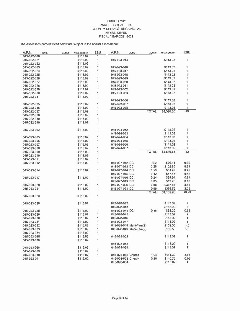
EXHIBIT"D" PARCEL COUNT FOR
COUNTY SERVICE AREA NO. 26 KEYES.KEYES
FISCAL YEAR 2021-2022
The Assessor's parcels listed below are subject to the annual assessment·
A.P.N. ZONE ACRES ASSESSMENT EBU A.P.N. ZONE ACRES ASSESSMENT EBU Zone 1 045-014-001 $113.02 1 045-014-047 $113.02 045-014-002 $113.02 1 045-014-048 $113.02 1 045-014-003 Multi-Fam(4) 0.52 $339.06 3.00 045-014-049 $113.02 1 045-014-004 $113.02 045-014-050 $113.02 1
045-014-051 Multi-Fam(5) $423.83 3.75 045-014-006 $113.02 1 045-014-007 $113.02 045-014-053 $113.02 1
045-014-054 Multi-Fam(4) $339.06 3.00 045-014-013 $113.02 1 045-014-055 Multi-Fam(4) $339.06 3.00 045-014-014 Multi-Fam(6) $480.34 4.25 045-014-056 $113.02 1 045-014-015 $113.02 1 045-014-057 $113.02 1 045-014-016 $113.02 1 045-014-058 $113.02 045-014-017 $113.02 1 045-014-059 $113.02 045-014-018 $113.02 1 045-014-060 $113.02 045-014-019 $113.02 1 045-014-061 $113.02 045-014-020 $113.02 1 045-014-062 $113.02 045-014-021 $113.02 045-014-063 $113.02
045-014-064 $113.02 045-014-028 $113.02 045-014-065 $113.02 1 045-014-029 $113.02 045-014-066 Multi-Fam(4) $339.06 3.00
045-014-06 7 $113.02 1 045-014-031 $113.02 045-014-068 $113.02 1
045-014-069 $113.02 1 045-014-033 $113.02 045-014-070 $113.02 1 045-014-034 $113.02 045-014-071 Multi-Fam(4) $339.06 3 045-014-035 $113.02 045-014-072 Multi-Fam(4} $339.06 3 045-014-036 $113.02 1 TOTAL $9,437.17 83.50 045-014-037 Multi-Fam(2) $169.53 1.50 045-014-038 $113.02 1
045-015-049 $113.02 045-014-040 $113.02 045-014-041 $113.02 045-015-051 $113.02 1 045-014-042 $113.02 045-015-052 $113.02 1 045-014-043 $113.02 045-015-053 $113.02 1
045-015-054 Multi-Fam(4) $339.06 3.00 045-014-045 $113.02 045-015-055 $113.02 1
045-015-001 $113.02
045-015-005 $113.02
045-015-007 $113.02
045-015-010 $113 02 045-015-011 $113 02
Page 1 ol 14

EXHIBIT"D" PARCEL COUNT FOR
COUNTY SERVICE AREA NO. 26 KEYES. KEYES
FISCAL YEAR 2021-2022
The Assessor's parcels listed below are subject to the annual assessment:
A.P .N . ZONE AC~ES ASSESSMENT EBU A.P.N. ZONE AC~ES ASSESSMENT EBU 045-015-012 $113.02 1 045-015-057 $113.02 045-015-013 $113.02 1 045-015-058 $113.02 045-015-014 $113.02 1 045-015-059 $113.02 045-015-015 $113.02 1 045-015-060 $113.02 045-015-016 $113.02 1 045-015-061 $113.02 045-015-017 $113.02 1 045-015-062 $113.02 045-015-018 $113.02 045-015-063 $113.02 1
045-015-064 $113.02 1 045-015-021 $113.02 045-015-065 $113.02 1 045-015-022 $113.02 045-015-066 $113.02 1
045-015-067 $113.02 1 045-015-027 DC 0.17 $67.25 0.595 045-015-068 $113.02 1 045-015-028 $113.02 1 TOTAL $2,260.40 20.00 045-015-029 $113.02 1 045-015-030 Multi•Fam(4) $339.06 3.00
045-016-003 $113.02 045-015-033 $113.02 045•016-004 $113.02 045-015-034 $113.02 045-016-005 $113.02
045-016-006 $113.02 045-015-036 $113.02 045-016-007 $113.02
045-016-008 $113.02 045-015-038 $113.02 045-016-009 $113.02 045-015-039 $113.02 045-016-010 $113.02 045-015-040 $113.02 045-016-011 $113.02 045-015-041 $113.02 045-016-012 $113.02 045-015-042 $113.02 045-016-013 $11 3.02
045-016-014 $113.02 045-015-046 DC 0.52 $205.70 1.82 045-016-015 $113.02 045-015-047 $113.02 1 045-016-016 $113.02 045-015-048 $113.02 1 045-017-014 $11 3.02 045-016-019 $113.02 045-017-015 $113.02 045-016-020 $113.02 045-017•016 $113.02 045-016-021 $113.02 045-017•017 $113.02
045-017-018 $113.02 045-016-025 Mulll-F am(2) $169.53 1.50 045-017-019 $113.02
045-017•020 $113.02 045-016-029 DC 0.34 $134.49 1.19 045-017-021 $113.02
045-017-022 $113.02 045-016-031 $113.02 045-016-032 $113.02 045-017-024 $113.02
045-017-025 $113.02 045-016-034 DC 0.4 $158.23 1.4 045-017-026 $113.02
045-017-027 $113.02 045-016-037 DC 0.46 $181.96 1.61 045-017-028 $113.02 045-016-038 DC 0.25 $98.89 0.875 045-017-029 $113.02 045-016-039 DC 0.25 $98.89 0.875 045-017-030 $113.02 045-016-040 DC 0.25 $98.89 0.875 045-017-031 $113.02 045-016-041 DC 0.25 $98.89 0875 045-017-032 $113.02
045-017-033 $113.02 045-016-043 DC 0.58 $229.43 2.03 045-017-034 $113.02
TOTAL $4,141.62 36.65
Page 2 of 14

EXHIBIT"D" PARCEL COUNT FOR
COUNTY SERVICE AREA NO. 26 KEYES.KEYES
FISCAL YEAR 2021-2022
The Assessor's parcels listed below are subject lo the annual assessment
A.P.N. ZONE ACRES ASSESSMENT EBU A.P.N. ZONE ACRES ASSESSMENT EBU 045-017-036 $113.02 1
045-017-038 $113.02 045•017-001 $113.02 045-017•002 $113.02 045-017-040 $113.02 045-017-003 $113.02 045-017-041 $113.02 045-017-004 $113.02 045-017-042 $113.02 045-017-005 $113.02 045-017-043 $113.02 045-017-006 $113.02 045-017-044 $113.02 045-017-007 $113.02 045-017-045 $113.02 045-017-008 $113.02 045-017-046 $113.02 045-017-009 $113.02 045-017-047 $113.02 1 045-017-010 $113.02 1 TOTAL $5,537.98 49 045-017-011 $113.02 1 045-017-012 $113.02 1 045-017-013 $113.02
045-018-040 $113.02 045-018-001 $113.02 1 045-018-041 $113.02 045-018-002 $113.02 1 045-018-042 $113.02 045-018-003 $113.02 1 045-018-005 $113.02 1 045-018-044 $113.02 045-018-006 $113.02 1 045-018-046 $113.02 045-018-007 $113.02 1 045-018-047 $113.02 045-018-008 $113.02 1 045-018-048 $113.02 045-018-009 $113.02 1 045-018-049 $113.02 045-018-010 $113.02 1 045-018-050 $113.02 045-018-011 $113.02 1 045-018-051 $113.02 045-018-012 $113.02 1 045-018-052 $113.02 045-018-013 $113.02 1 045-018-053 $113.02 045-018-014 $113.02 1 045-018-054 $113.02 045-018-015 $113.02 1 045-018-055 $113.02 045-018-016 $113.02 1 045-018-056 $113.02 045-018-017 $113.02 1 045-01 B-057 $113.02 045-018-018 $113.02 1 045-018-019 $113.02 1 045-018-061 $113.02 045-018-020 $113.02 1 045-01 B-062 $113.02 045-018-021 $113.02 1 045-018-063 $113.02 045-018-022 $113.02 1 045-018-064 $113 02 045-018-023 $113.02 1 045-018-067 $113 02 045-018-024 $113.02 1 045-018-068 $113 02 045-018-025 $113.02 1 045-018-069 $113 02 045-018-026 $113.02 1 045-018-070 $113 02 045-018-027 $113.02 1 045-018-071 $113 02 1
045-018-028 $113.02 045-018-072 $113 02 1 045-018-029 $113.02 045-018-073 $113 02 1 045-018-030 $113.02 045-018-074 $113 02 1 045-018-031 $113.02 TOTAL $8,815 56 78 045-018-032 $113.02 045-018-033 $113.02 045-019-001 $113.02 045-018-034 $113.02 045-019-002 $113.02
045-019-003 $113.02 045-018-036 $113.02 045-019-004 $113.02
045-019-005 $113.02 045-018-038 $113.02 045-019-043 $113.02 045-018-039 $113.02 045-019-044 $113.02
Page 3 ol 14

EXHIBIT"D" PARCEL COUNT FOR
COUNTY SERVICE AREA NO. 26 KEYES. KEYES
FISCAL YEAR 2021-2022
The Assessor's parcels hsted below are subject to the annual assessment:
A.P.N. ZONE ACRES ASSESSMENT EBU A.P.N. ZONE ACRES ASSESSMENT EBU 045-019-006 $113.02 045-019-045 Multi-Fam(2) $169.53 1,5 045-019-007 $113.02 045-019-046 $113.02 1 045-019-008 $113.02 045-019-04 7 $113.02 1 045-019-009 $113.02 045-019-048 $113.02 1 045-019-010 $113.02 045-019-049 $113.02 1 045-019-011 $113.02 045-019-050 $113.02 1 045-019-012 $113.02 045-019-051 $113.02 1 045--019-013 $113.02 045-019-052 $113.02 1 045-019-014 $113.02 045-019-053 $113.02 1 045-019-015 $113.02 045-019-016 $113.02 045--019-056 $113.02 045-019-017 $113.02 045-019-057 $113.02 045-019-018 $113.02 045-019-019 $113.02 045-019-059 $113.02 045-019-020 $113.02 045-019-060 $113.02 045-019-021 $113.02 045-019-022 $113.02 045-019-063 $113.02 045-019-023 $113.02 045-019-064 $113.02 045-019-024 $113.02 045-019-065 $113.02 045-019-025 $113.02 045-019-066 $113.02 045-019-026 $113.02 045-019-067 $113.02 045-019-027 $113.02 045-019-068 $113.02 045-019-028 $113.02 045-019-029 $113.02 045-019-070 $113.02 045-019-030 $113.02 045-019-071 $113.02 045-019-031 $113.02 045-019-072 $113.02 1 045-019-032 $113.02 045-019-073 $113.02 1 045-019-033 $113.02 045-019-07 4 $113.02 1 045-019-034 $113.02 045-019-075 $113.02 1 045-019-035 $113.02 045-019-076 $113.02 1 045-019-036 $113.02 045-019-077 $113.02 1
045-019-078 $113.02 1 045-019-038 $113.02 TOTAL $7,289.79 65 045-019-039 $113.02 045-019-040 $113.02 045-019-041 $113.02 045-020-039 $113.02
045-020-041 $113.02 045-020-001 Church 0.34 $134.49 1.19 045-020-042 $113.02 045-020-002 $113.02 1 045-020-043 $113.02 1 045-020-003 $113.02 1 045-020-044 $113.02 1 045-020-004 $113.02 1 045-020-045 $113.02 1 045-020-005 $113.02 045-020-046 $113.02 1 045-020-006 $113.02 TOTAL $5,192.14 45.94 045-020-007 $113.02 045-020-008 $113.02
Page 4 of 14

EXHIBIT"D" PARCEL COUNT FOR
COUNTY SERVICE AREA NO. 26 KEYES.KEYES
FISCAL YEAR 2021-2022
The Assessor's parcels listed below are subject to the annual assessment:
A.P.N. ZONE ACRES ASSESSMENT EBU A.P.N. ZONE ACRES ASSESSMENT EBU 045-020-009 $113.02 045-021-021 PARK 4.80 $217.00 1 92 045-020-010 $113.02 045-021-022 Storm Basin 0 .14 $6.33 0056 045-020-011 $113.02 045-020-012 $113.02 045-021-033 MM/Fire Oep 0 21 $83.07 0735 045-020-013 $113.02 045-020-014 $113.02 045-021-036 PARK 1.13 $51.09 0 452 045-020-015 $113.02 045-021-037 PARK 6 .82 $308 32 2 728 045-020-016 Mulli-Fam(2) $169.53 1.5 045-021-038 PARK/Drain 3.68 $166.37 1472 045-020-017 $113.02 1 TOTAL $832.17 7 36 045-020-018 $113.02 1 045-020-019 $113.02 045-020-020 $113.02 045-020-021 $113.02 045-020-022 $113.02 045-020-023 $113.02 045-022-041 $113 02 045-020-024 $113.02 045-022-042 $113 02 045-020-025 $113.02 045-022-043 $11302 045-020-026 $113.02 1 045-022-044 $113 02 045-020-027 $113.02 1 045-022-045 $113 02 045-020-028 $113.02 1 045-022-046 $113 02 045-020-029 Multi-Fam(3) $254.30 2.25 045-022-047 $113.02 045-020-030 $113.02 1 045-022-048 $113.02 045-020-031 $113.02 1 045-020-032 $113.02 1 045-022-051 $113.02 045-020-033 $113.02 045-022-052 $113.02 045-020-034 $113.02 045-022-053 $113.02 045-020-035 $113.02 045-022-054 $113.02 045-020-036 $113.02 045-022-055 $113.02 045-020-037 $113.02 045-022-056 $113.02
045-022-057 $113.02 045-022-001 $113.02 045-022-058 $113.02 045-022-002 $113.02 045-022-003 $113.02 045-022-060 $113.02 045-022-004 $113.02 045-022-061 $113.02 045-022-005 $113.02 045-022-062 $113.02
045-022-007 $113.02 045-022-064 $113.02
045-022-066 $113.02 045-022-010 $113.02 045-022-067 $113.02 045-022-011 $113.02 045-022-012 $113.02 045-022-070 COMM/Fire I 0.15 $59.34 0.525 045-022-013 $113.02 045-022-071 $113.02 1 045-022-014 $113.02 045-022-072 $113.02 1 045-022-015 $113.02 045-022-073 $113.02 1 045-022-016 $113.02 TOTAL $6 501 .48 57.53 045-022-017 $113.02
Page 5 of 14
EXHIBIT"D" PARCEL COUNT FOR
COUNTY SERVICE AREA NO 26 KEYES.KEYES
FISCAL YEAR 2021-2022
The Assessor's parcels listed below are subject lo the annual assessment
A.P.N. ZONE ACRES ASSESSMENT EBU A.P.N. ZONE ACRES ASSESSMENT EBU 045-022-020 $113.02 1 045-022-021 $113.02 1 045-023-044 $113 02 045-022-022 $113.02 045-022-023 $113.02 045-023-046 $113 02 045-022-024 $113.02 045-023-04 7 $11302 045-022-025 $113.02 045-023-048 $113 02 045-022-026 $113.02 045-023-049 $113 02 045-022-027 $113.02 045-023-050 $113 02 045-022-028 $113.02 045-023-051 $113 02 045-022-029 $113.02 045-023-052 $113 02 045-022-030 $113.02 045-023-053 $113.02 045-022-031 $113.02
045-023-056 $113.02 1 045-022-035 $113.02 045-023-057 $113.02 1 045-022-036 $113.02 045-023-058 $113.02 1 045-022-037 $113.02 TOTAL $4,520.80 40 045-022-038 $113.02 045-022-039 $113.02 045-022-040 $113.02
045-023-002 $113.02 045-024-052 $113.02 045-024-053 $113.02
045-023-005 $113.02 045-024-054 $113.02 1 045-023-006 $113.02 045-024-055 $113.02 1 045-023-007 $113.02 045-024-056 $113.02 1 045-023-008 $113.02 045-024-057 $113.02 1 045-023-009 $113.02 TOTAL $3,616.64 32 045-023-010 $113.02 045-023-011 $113.02 045-023-012 $113.02 045-027-012 DC 0.2 $79.11 0.70
045-027 -013 DC 0.26 $102.85 0.91 045-023-014 $113.02 045-027-014 DC 0 13 $51 .42 0.46
045-027-015 DC 0 12 $47,47 0.42 045-023-017 $113.02 045-027-016 DC 024 $94,94 0.84
045-027-019 DC 0 05 $19,78 018 045-023-020 $113.02 1 045-027-020 DC 098 $387.66 3.43 045-023-021 $113.02 1 045-027-021 DC 096 $379,75 3.36
TOTAL $1.162.98 10.29 045-023-023 $113.02
045-023-026 $113.02 045-028-042 $113.02 1 045-028-043 $113.02 1
045-023-028 $113.02 1 045-028-044 DC 0 16 $63.29 0.56 045-023-029 $113.02 1 045-028-045 $113.02 1 045-023-030 $113.02 1 045-028-046 $113.02 1 045-023-031 $113.02 1 045-028-047 $113.02 1 045-023-032 $113.02 1 045-028-048 Multi-Fam(2) $169.53 1.5 045-023-033 $113.02 1 045-028-049 Multi-Fam(2) $169.53 1.5 045-023-034 $113.02 1 045-023-035 $113.02 1 045-028-052 $113.02 045-023-036 $113.02 1
045-028-058 $113.02 045-023-038 $113.02 045-028-059 $113.02 045-023-039 $113.02 045-023-040 $113.02 045-028-062 Church 1.04 $411 .39 3.64 045-023-041 $113.02 045-028-063 Church 0.28 $110.76 0.98
045-028-064 $113.02 1
Page 6 of 14

EXHIBIT"D" PARCEL COUNT FOR
COUNTY SERVICE AREA NO. 26 KEYES.KEYES
FISCAL YEAR 2021-2022
The Assessor's parcels listed below are subject to the annual assessment:
A.P.N. ZONE ACRES ASSESSMENT EBU A.P.N. ZONE ACRES ASSESSMENT EBU 045-028-065 $113.02 1
045·024-015 $113.02 045-028-066 DC 035 $138.45 1.225 045·024-016 $113.02 045-028-067 $113.02 1 045-024-017 $113.02 045-028-068 $113.02 1 045-024-018 $113.02 TOTAL $6,438.18 56.97
045-024·021 $113.02 045--024·022 $113.02 045-029-001 Multi-Fam(2) $169.53 1 5
045-029-002 $113.02 1 045-024-024 $113.02 045-029-003 DC 032 $126.58 1.12 045-024-025 $113.02 045-024-026 $113.02 045-029-007 COMM/Fire C 0.22 $87.03 0.77
045-029-008 COMM/Fire C 032 $126.58 1.12 045-024-028 $113.02
045-029-022 DC 0.16 $63.29 0.56 045-024-030 $113 02 045-029-023 DC 0 32 $126.58 1.12
045-029·024 COMM/Fire C 0 24 $94.94 0.84 045-024-032 $113.02
045-029-026 COMM/Fire { 0.48 $189.87 1.68 045-024-034 $113.02 TOTAL $1.097.42 9.71 045-02+035 $113 02
045-030-039 Multi-Fam(2) $169.53 1.5 045-02+037 $113.02 045-030-040 $113.02 1 045-024-038 $113.02 045-030-041 $113.02 1 045-024-039 $113.02 045-030-042 $113.02 045-024-040 $113.02 045-030-043 $113.02 045-024-041 $113.02 045-030-044 $113.02 045-02+042 $113.02 045-030-045 $113.02 045-024-043 $113.02 045-030-046 $113.02
045-030-04 7 $113.02 045-024-045 $113.02 045-030-048 $113.02 1 045-024-046 $113.02 045-030-049 $113.02 1
045-030-050 $113.02 1 045-024-048 $113.02 045-030-051 $113.02 1 045-024-049 $113.02 045-030-052 $113.02 1 045-024-050 $113.02 045-030-053 $113.02 1
045-030-054 $113.02 1 045-030-055 DC 0 .08 $31 .65 0.28 045-030-056 $113.02 1
045-028-001 $113.02 045-030-057 $113 02 1 045-028-002 $113.02 045-030-058 $113.02 1 045-028-003 $113.02 045-030-059 $113 02 1 045-028-004 $113.02 045-030-060 $113 02 1 045-028-005 $113.02 045-030-061 $113.02 1 045-028-006 $113.02 045-030-062 DC 0 .16 $6329 0 56 045-028-007 $113.02 045-028-008 $113.02 045-030-064 $113.02 045-028-009 $113.02 045-030-065 $113.02 1 045-028·010 $113.02 045-030-066 Church 0.48 $189.87 168 045-028·011 $113.02 045-030-067 $113 .. 02 1 045-028-012 $113.02 045-030-068 $113.02 1 045-028-013 $113.02 045-030-069 $113.02 1
TOTAL $7,433.33 65 77
Page 7 ol 14

EXHIBIT "D" PARCEL COUNT FOR
COUNTY SERVICE AREA NO. 26 KEYES.KEYES
FISCAL YEAR 2021-2022
The Assessor's parcels listed below are subject to the annual assessment:
A.P.N. ZONE ACRES ASSESSMENT EBU A.P.N. ZONE ACRES ASSESSMENT EBU 045-028-016 Church 0.16 $63.29 0.56 045-028-017 $113.02 045-028-018 $113.02 045-064-034 $113.02 045-028-019 $113.02 045-064-035 $113.02 045-028-020 $113.02 045-064-036 $113.02 045-028-021 $113.02 045-064-037 $113.02 045-028-022 $113.02 045-064-038 $113.02 045-028-023 $113.02 045-064-039 $113.02 045-028-024 $113.02 045-064-040 $113.02 045-028-025 $113.02 045-064-041 $113.02 045-028-026 $113.02 045-064-042 $113 02 045-028-027 $113.02 045-064-043 $113.02 045-028-028 $113.02 045-064-044 $113.02 045-028-029 $113.02 045-064-045 $11302 045-028-030 $113.02 045-064-046 $113.02 045-026-031 $113.02 045-064-04 7 $113.02 045-028-032 $113.02 045-064-046 $113.02 045-026-033 $113.02 045-064-049 $113.02 1 045-026-034 $113.02 045-064-050 $113.02 1 045-026-035 $113.02 045-064-051 $113.02 1
045-064-052 $113.02 1 045-026-039 $113.02 045-064-053 $113.02 1 045-026-040 $113.02 045-064-054 $113.02 1 045-026-041 $113.02 045-064-055 $113.02 1 045-030-001 $113.02 045-064-056 $113.02 1 045-030-002 $113.02 045-064-057 DR.BASIN 0.14 $6.33 0.056
045-064-058 DR.BASIN 0.14 $6.33 0.056 045-030-004 $113.02 045-064-059 $113 02 045-030-005 $113.02 045-064-060 $113.02 045-030-006 $113.02 045-064-061 $113.02 045-030-007 $113.02 045-064-062 $113.02 045-030-008 $113.02 045-064-063 $113.02 045-030-009 $113.02 045-064-064 $113.02 045-030-010 $113.02 045-064-065 $113.02 045-030-011 $113.02 045-064-066 $113.02 045-030-012 $113.02 045-064-067 $113.02 045-030-013 $113.02 045-064-068 $113.02 045-030-014 $113.02 045-064-069 $113.02 045-030-015 $113.02 045-064-070 $113.02
045-030-018 $113.02 045-030-019 $113.02 045-065-011 $113.02 045-030-020 $113.02 045-065-012 $113.02 045-030-021 $113.02 045-065-013 $113.02 045-030-022 $113.02 045-065-014 $113.02 045-030-023 Multi-Fam(2) $169.53 1.5 045-065-015 $113.02 045-030-024 $113.02 1 045-065-016 $113.02 045-030-025 $113.02 1 045-065-017 $113.02 045-030-026 $113.02 1 045-065-01 B $113.02 045-030-027 $113.02 1 045-065-019 $113.02 045-030-028 $113.02 1 045-065-020 $113.02 045-030-029 $113.02 1 045-065-021 $11 3.02 045-030-030 $113.02 045-065-022 $11 3.02 045-030-031 $113.02 045-065-023 $113.02 045-030-032 $113.02 045-065-024 $113.02 045-030-033 $113.02 1 045-065-025 $113.02 1 045-030-034 $113.02 1 045-065-026 $113.02 1 045-030-035 $113.02 1 045-065-027 $113.02 1 045-030-036 $113.02 1 045-065-028 $113.02 1 045-030-037 Mulli-Fam(3) $254.30 2.25 045-065-029 $113.02 1
Page 8 of 14

EXHIBIT"D" PARCEL COUNT FOR
COUNTY SERVICE AREA NO. 26 KEYES.KEYES
FISCAL YEAR 2021-2022
The Assessor's parcels listed below are subject to the annual assessment:
A.P.N. ZONE ACRES ASSESSMENT EBU A.P.N. ZON[ ACRES ASSESSMENT EBU 045-065-030 $113.02 045-065-031 $113.02
045·031-001 DC 0.32 $126.58 1.12 045•065-032 $113.02 045-065-033 $113.02
045-031·010 DC 0.32 $126.58 1 12 045-065-034 $113.02 045-065-035 $113.02
045-031·012 DC 0.32 $126,58 1.12 045-065-036 $113.02 045-031-013 DC 0.77 $304.59 2.695 045-065·037 $113.02
TOTAL $684.34 """'a'o6" 045-065-038 $113.02 045-065-039 $113.02
045-032-001 SCHOOL 10.22 $2,541.14 22484 045-065-040 $113.02 1 045-065-041 $113.02 1
045-032-004 SCHOOL 0.48 $119,35 1.056 045-065-042 $113.02 1 045-032-005 SCHOOL 0,25 $62, 16 055 045-065-043 $113.02 1 045-032-006 $113,02 1 045-065-044 DRAIN BASI 0.42 $18.99 0.168 045-032-007 $113,02 1 045-065-045 $113.02 1 045-032-008 $113,02 1 045-065-046 $113.02 1 045-032-009 $113.02 1 TOTAL $5,528.71 48.92 045-032-010 $113.02 1 045-032-011 Multi-Fam(2) $169.53 1.5 045-066-038 $113.02 045-032-012 Multi-Fam(2) $169.53 1.5 045-066-039 $113.02 045-032-013 Multi-Fam(2) $169.53 1.5 045-066-040 $113.02 045-032-014 Multi-Fam(2) $169.53 1.5 045-066-041 $113.02
TOTAL $3,965.87 35.09 045-066-042 $113.02 045-066-043 $113.02
045-033-007 DC 1.46 $577,53 5.11 045-066-044 $113.02 TOTAL $577,53 5.11 045-066-045 $113.02
045-066-046 $113.02 045-066-047 $113 02
045-064-002 Resid.w/Exl L 0.65 $256.33 2.27 045-066-048 $113 02 045-066-049 $113.02
045-064-027 $113.02 045-066-050 $113.02 045-064-028 $113.02 045-066-051 $113.02 045-064-029 $113.02 045-066-052 $113.02 045-064-030 $113.02 045-066-053 $113.02 045-064-031 $113.02 045-066-054 $113.02 045-064-032 $113.02 045-066-055 $113.02 045-064-033 $113.02 045-066-056 $113.02 1
045-066-057 $113.02 1 045-064-071 $113.02 045-066-058 $113.02 1 045-064-072 $113.02 045-066-059 STREETSCJ.1 0.71 $32. 10 0.284 045-064-073 $113.02 TOTAL $6,587.26 58.28 045-064-07 4 $113.02 045-064-075 $113.02 045-067-001 $113.02 045-064-076 $113.02 045-067-002 $113.02 045-064-077 $113.02 045-067-003 $113.02 045-064-078 $113.02 045-067-004 $113.02 045-064-079 $113.02 045-067-005 $113.02 045-064-080 $113.02 045-067-006 $113.02 045-064-081 $113.02 045-067-007 $113.02 045-064-082 $113.02 045-067-008 $113.02 045-064-083 $113.02 045-067-009 $113.02 045-064-084 $113.02 045-067-010 $113.02 045-064-085 $113.02 045-067-011 $113.02 045-064-086 $113.02 045-067-012 $113.02 045-064-087 $113.02 045-067-014 $113.02
Page 9 of 14
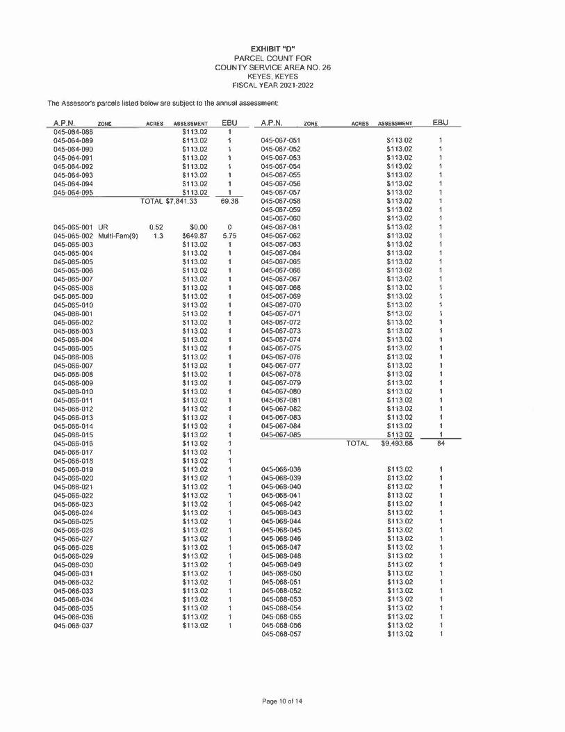
EXHIBIT"D" PARCEL COUNT FOR
COUNTY SERVICE AREA NO. 26 KEYES, KEYES
FISCAL YEAR 2021-2022
The Assessor's parcels listed below are subject to the annual assessment:
A.P.N. ZONE ACRES ASSESSMENT EBU A.P.N. ZONE ACRES ASSESSMENT EBU 045-064-088 $113.02 045-064-089 $113.02 045-067-051 $11302 045-064-090 $113.02 045-067-052 $113.02 045-064-091 $113.02 045-06 7-053 $113.02 045-064-092 $113.02 045-067-054 $113.02 045-064-093 $113.02 045-067-055 $113.02 045-064-094 $113.02 045-067-056 $113.02 045-064-095 $113.02 1 045-067-057 $113.02
TOTAL $7,841.33 69.38 045-067-058 $113.02 045-067-059 $113.02 045-067-060 $113.02
045-065--001 UR 0.52 $0.00 0 045-067-061 $113.02 045-065-002 Multi-Fam(9) 1,3 $649.87 5.75 045-067-062 $113.02 045-065-003 $113.02 1 045-067-063 $113.02 045-065-004 $113.02 045-067 ·064 $113.02 045-065-005 $113.02 045-067-065 $113.02 045-065-006 $113.02 045-067-066 $113.02 045-065-007 $113.02 045-067 ·067 $113.02 045-065-008 $113.02 045-067-068 $113.02 045-065-009 $113.02 045-067-069 $113.02 045-065-010 $113.02 045-067-070 $113.02 045-066-001 $113.02 045-067-071 $113.02 045-066-002 $113.02 045-067-072 $113.02 045-066-003 $113.02 045-067-073 $113.02 045-066-004 $113.02 045-067 -07 4 $113.02 045-066-005 $113.02 045-067-075 $113.02 045-066-006 $113.02 045-067-076 $113.02 045-066-007 $113.02 045-067-077 $113.02 045-066-008 $113.02 045-067-078 $113.02 045-066-009 $113.02 045-067-079 $113.02 045-066-010 $113.02 045-067-060 $113.02 1 045-066-011 $113.02 045-067-081 $113.02 1 045-066-012 $113.02 045-067-082 $113.02 1 045-066-013 $113.02 045-067-083 $113.02 1 045-066-014 $113.02 045-067-084 $113.02 1 045-066-015 $113.02 045-067-085 $113.02 1 045-066-016 $113.02 TOTAL $9,493.68 84 045-066-017 $113.02 1 045-066-018 $113.02 1 045-066-019 $113.02 1 045-068-038 $113.02 045-066-020 $113.02 1 045-068-039 $113.02 045-066-021 $113.02 1 045-068-040 $113.02 045-066-022 $113.02 1 045-068-041 $113.02 045-066-023 $113.02 1 045-068-042 $113.02 045-066-024 $113.02 1 045-068-043 $113.02 045-066-025 $113.02 1 045-068-044 $113.02 045-066-026 $113.02 1 045-068-045 $113.02 045-066-027 $113.02 1 045-068-046 $113.02 045-066-028 $113.02 045-068-047 $113.02 045-066-029 $113.02 045-068-048 $113.02 045-066-030 $113.02 045-068-049 $113.02 045-066-031 $113.02 045-068-050 $113.02 045-066-032 $113.02 045-068-051 $113.02 045-066-033 $113.02 045-068-052 $113.02 045-066-034 $113.02 045-068-053 $113.02 045-066-035 $113.02 045-068-054 $113.02 045-066-036 $113.02 045-068-055 $113.02 045-066-037 $113.02 045-068-056 $113.02
045-068-057 $113.02
Page 10 of 14

EXHIBIT "O" PARCEL COUNT FOR
COUNTY SERVICE AREA NO. 26 KEYES.KEYES
FISCAL YEAR 2021-2022
The Assessor's parcels listed below are subject to the annual assessment:
A.P.N. ZONE ACRES ASSESSMENT EBU A.P.N. ZONE ACRES ASSESSMENT EBU 045-068-058 $113.02
045-067-015 $113.02 045-068-059 $113.02 045-067-016 $113.02 045-068-060 $113.02 045-067-017 $113.02 045-068-061 $113.02 045-067-018 $113.02 1 045-068-062 $113.02 045-067-019 $113.02 1 045-068-063 $113.02 045-067-020 $113.02 1 045-068-064 $113.02 045-067-021 $113.02 1 045-068-065 $113.02 045-067 ·022 $113.02 1 045-068-066 $113.02 045-067 ·023 $113.02 1 045-068-067 $113.02 045·067·024 $113.02 1 045-068-068 $113.02 045-067-025 $113.02 1 045-068-069 $113.02 045-067-026 $113.02 1 045-068-070 $113.02 045-067-027 $113.02 1 045-068-071 $113.02 045-067-028 $113.02 1 045-068-072 $113.02 045-067-029 $113.02 1 045-068-073 $113.02 045-067-030 $113.02 1 045-068-074 $113.02 045-067-031 $113.02 1 045-067-032 $113.02 1 045-069-032 $113.02 045-067-033 $113.02 1 045-069-033 $113.02 045-067-034 $113.02 1 045-069-034 $113.02 045-067-035 $113.02 1 045-069-037 $113.02 045-067 -036 $113.02 1 045-069-038 $113.02 045-067-037 $113.02 1 045-069-039 $113.02 045-067-038 $113.02 1 045-069-040 $113.02 045-067-039 $113.02 1 045-069-041 $113.02 045-067-040 $113.02 1 045-069-042 $113.02 045-067-041 $113.02 1 045-069-043 $113.02 045-067-042 $113.02 1 045-069-044 $113.02 045-067-043 $113.02 1 045-069-045 $113.02 045-067-044 $113.02 1 045-069-046 $113.02 045-067-045 $113.02 1 045-069-047 $113.02 045-067-046 $113.02 1 045-069-048 $113 02 045-067-047 $113.02 1 045-069-049 $113 02 045-067-048 $113.02 1 045-069-050 $113.02 1 045-067-049 $113.02 1 TOTAL $5,311.94 47.00 045-067-050 $113.02 1
Page 11 of 14

EXHIBIT"O" PARCEL COUNT FOR
COUNTY SERVICE AREA NO. 26 KEYES, KEYES
FISCAL YEAR 2021-2022
The Assessor's parcels listed below are subJect to the annual assessment.
A.P.N. ZONE ACRES ASSESSMENT EBU A.P.N. ZONE ACRES ASSESSMENT EBU 045-070•001 $113.02
045-068--001 $113.02 045-070-002 $113.02 045-068--002 $113.02 045-070-003 $113.02 045-068--003 $113.02 045-070-004 $113.02 045-068--004 $113.02 045-070-005 $113.02 045-068--005 $113.02 045-070-006 $113.02 045-068--006 $113.02 045-070-007 $113.02 045-068-007 $113.02 045-070-008 $113.02
045-070-009 $113.02 045-068-009 PARK 0.26 $11.75 0.104 045-070-010 $113.02
045-070-011 $113.02 045-068--011 $113.02 1 045-070-012 $113.02 045-068-012 $113.02 1 045-070-013 $113.02 045-068-013 $113.02 1 045-070-014 $113.02 045-068--014 $113.02 1 045-070-015 $113 02 045-068-015 $113.02 1 045-070-016 $113 02 045-068-016 $113.02 1 045·070-017 $113 02 045-068-017 $113.02 045-070-018 $113 02 045-068-018 $113.02 045-068-01 9 $113.02 045-068--020 $113.02 045-072-031 $113 02 1 045-068--021 $113.02 045-072-032 $113 02 1 045-068-022 $113.02 045-072-033 $113 02 1 045-068--023 $113.02 045-072-034 $113 02 1 045-068--024 $113.02 045-072-035 $113.02 1 045-068-025 $113.02 045-072-036 $113.02 1 045-068--026 $113,02 045-072-037 $113.02 1 045-068--027 $113.02 045-072-038 $113.02 1 045-068-028 $113.02 045-072-039 $113.02 045-068-029 $113.02 045-072-040 $113.02 045-068-030 $113.02 045-072-041 $113.02 045-068-031 $113.02 045-072-042 $113.02 045-068-032 $113.02 045-072-043 $113.02 045-068-033 $113,02 045-072-044 $113.02 045-068-034 $113.02 045-072-045 $113.02 045-068-035 $113.02 045-072-046 $113.02 045-068-036 $113,02 045-072-047 $113.02 045-068-037 $113.02 045-072·048 $113.02
045-072-049 $113.02 045-068-075 $113,02 045·072-050 $113.02 045-068-076 $113.02 045-072-051 $113.02 045-068-077 $113.02 045-072-052 $113.02 045-068-078 $113.02 1 045·072-053 $113.02 045-068-079 $113,02 1 045-072-054 $113.02
TOTAL $8,601 27 7610 045-072-055 $113.02 045-072-056 $113.02
045-069-001 $113,02 1 045-072-057 $113.02 045-069-002 $113.02 1 045-072-058 $113.02 045-069-003 $113.02 1 045-072-059 $113.02 045-069-004 $113,02 1 045-072-060 $113.02 045-069-005 $113,02 1 045-072-061 $113.02 045-069-006 $113.02 1 045-072-062 $113.02 045-069-007 $113,02 045-072-063 $113.02 045-069-008 $113.02 045-072-064 $113.02 045,069-009 $113.02 045-072-065 $113.02 045-069-010 $113.02 045-072-066 $113.02 045-069-011 $113.02 045-072-067 $113.02 045-069-012 $113.02 045-072-068 $113.02
045-072-069 $113.02 045-069-014 $113.02 045-072-070 $113.02 045-069-015 $113.02 045-072-071 $113.02 1 045-069-016 $113.02 TOTAL $8,024.42 71
Page 12 of 14

EXHIBIT"D" PARCEL COUNT FOR
COUNTY SERVICE AREA NO. 26 KEYES.KEYES
FISCAL YEAR 2021-2022
The Assessor's parcels listed below are subject to the annual assessment:
A.P.N. ZONE ACRES ASSESSMENT EBU A.P.N. ZONE ACRES ASSESSMENT EBU 045-069-017 $113.02 045-069-018 $113.02 045-073-001 $113.02 045-069-019 $113.02 045-073-002 $113.02 045-069-020 $113.02 045-073-003 $113.02 045-069-021 $113.02 045-073-004 $113.02 045-069-022 $113.02 045-073-005 $113 02 045-069-023 $113.02 045-073-006 $113.02 045-069-024 $113.02 045-073-007 $113.02 045-069-025 $113.02 045-073-008 $113.02 045-069-026 $113.02 045-073-009 $113.02 045-069-027 $113.02 045-073-010 $113.02 045-069-028 $113.02 045-073-012 $113.02 045-069-029 $113.02 045-073-013 $113.02 045-069-030 $113.02 045-073-014 $113.02 045-069-031 $113.02 045-073-015 $113.02
045-073-016 $113.02 045-073-017 $113.02
045-070-019 $113.02 045-073-018 $113.02 045-070-020 $113.02 1 045-073-019 $113.02 045-070-021 $113.02 1 045-073-020 $113.02 045-070-022 $113.02 1 045-073-021 $113.02 045-070-023 $113.02 1 045-073-022 $113.02 045-070-024 $113.02 1 045-073-023 $113.02 045-070-025 $113.02 1 045-073-024 $113.02 045-070-026 $113.02 1 045-073-025 $113.02 045-070-027 $113.02 1 045-073-026 $113.02
TOTAL $3,051.54 27 045-073-027 $113.02 045-073-028 $113.02
045-072-001 $113.02 045-073-029 $113.02 045-072-002 $113.02 045-073-030 $113.02 045-072-003 $113.02 045-073-031 $113.02 045-072-004 $113.02 045-073-032 $113.02 045-072-005 $113.02 045-073-033 $113.02 045-072-006 $113.02 045-073-034 $113.02 045-072-007 $113.02 045-073-035 $113.02 045-072-008 $113.02 045-073-036 $113.02 045-072-009 $113.02 045-073-037 $113.02 045-072-010 $113.02 045-073-036 $113.02 045-072-011 $113.02 045-073-039 $113.02 045-072-012 $113.02 045-073-040 $113.02 045-072-013 $113.02 045-073-041 $113.02 045-072-014 $113.02 045-073-042 $113.02 045-072-015 $113.02 045-073-043 $113.02 045-072-016 $113.02 045-073-044 $113.02 045-072-017 $113.02 045-073-045 $113.02 045-072-018 $113.02 045-073-046 $113.02 045-072-019 $113.02 045-073-047 $113.02 045-072-020 $113.02 045-073-046 $113.02 045-072-021 $113.02 045-073-049 $113.02 045-072-022 $113.02 045-073-050 $113.02 045-072-023 $113.02 045-073-051 $113.02 045-072-024 $113.02 045-073-052 $113.02 045-072-025 $113.02 045-073-053 $113.02 045-072-026 $113.02 045-073-054 $113.02 045-072-027 $113.02 045-073-055 $113.02 045-072-028 $113.02 045-073-056 $113.02 1
045-072-029 $113.02 TOTAL $6,216.10 55 045-072-030 $113.02
Page 13 or 14

EXHIBIT"D" PARCEL COUNT FOR
COUNTY SERVICE AREA NO. 26 KEYES.KEYES
FISCAL YEAR 2021-2022
The Assessor's parcels listed below are subject to the annual assessment:
A.P.N. ZONE ACRES ASSESSMENT
Zone2 Keyes 19 North 045-021-003 Planned Resi 37 un $11,292.06 045-021-023 Planned Resi 8 un $ 3,430.50 045-021-024 Planned Resi 19 un $ 6,146.31 045-021-008 Planned Resi 1 un $ 428.81
TOTAL $21,297.69
Keyes 19 South 045-071-005 PlannedResi28un $8,719.19
TOTAL $ 8,719.19
4B27 Norma Way 045-071-006 Planned Resi 28 un+I $
ZONE 1
ZONE2
TOTAL$
EBU
19.75 6.00
10.75 0.75
37.25
~ 15.25
32.128 32.128
A.P.N.
1171
6
Page 14 of 14
ZONE ACRES ASSESSMENT
$140,161.64
$30,016.88
EBU
1,240.149
52.50