2011 clear creek board of county commissioners
255
1 2011 CLEAR CREEK BOARD OF COUNTY COMMISSIONERS MEETING MINUTES CLEAR CREEK BOARD OF COUNTY COMMISSIONERS MINUTES - JANUARY 5, 2011 The Clear Creek Board of County Commissioners met in regular session on January 5, 2011 at the Georgetown Community Center. Chairman Kevin O’Malley called the meeting to order. Also in attendance were Commissioners Joan Drury and Tim Mauck, County Attorney Robert Loeffler, County Administrator Tom Breslin, and Deputy Clerk and Recorder Beth Luther. CONSENT AGENDA: 1. CONSIDERATION OF APPROVAL OF WARRANT REGISTER AND RATIFICATION OF DECEMBER 29, 2010, WARRANT REGISTER: 2. CONSIDERATION OF APPROVAL OF RESOLUTION #11-02, RESOLUTION FOR THE DESIGNATION OF DEPOSITORIES FOR CLEAR CREEK COUNTY FOR 2011: 3. CONSIDERATION OF APPROVAL OF RESOLUTION #11-03, RESOLUTION ESTABLISHING THE COUNTY COMMISSIONERS MEETING SCHEDULE FOR 2011: 4. CONSIDERATION OF APPROVAL OF RESOLUTION 11-05, RESOLUTION APPROVING THE 2011 BUDGET OF THE OFFICE OF DISTRICT ATTORNEY, 5 TH JUDICIAL DISTRICT: 5. CONSIDERATION OF APPROVAL OF RESOLUTION #11-07, RESOLUTION OF APPOINTMENT AND ACKNOWLEDGEMENT OF CERTAIN COUNTY POSITIONS: 6. CONSIDERATION OF APPROVAL OF RESOLUTION #11-08, RESOLUTION APPOINTING MEMBERS TO THE CLEAR CREEK TOURISM BUREAU, BOARD OF DIRECTORS: 7. CONSIDERATION OF APPROVAL OF AMENDMENT #3 TO NO MORE WORRIES AGREEMENT WITH TYLER TECHNOLOGIES FOR THE ASSESSOR’S OFFICE: 8. CONSIDERATION OF APPROVAL OF STANDARD FORM OF AGREEMENT BETWEEN CLEAR CREEK COUNTY AND BASELINE ENGINEERING CORPORATION FOR PROFESSIONAL SERVICES: 9. CONSIDERATION OF APPROVAL OF AMENDMENT #1 TO SERVICE AND RENTAL AGREEMENT BY AND BETWEEN ACS STATE AND LOCAL SOLUTIONS INC. AND CLEAR CREEK COUNTY COLORADO: 10. CONSIDERATION OF APPROVAL OF 457 DEFERRED COMPENSATION PLAN – PARTICIPATION AGREEMENT: 11. CONSIDERATION OF APPROVAL OF RESOLUTION #11-09, RESOLUTION SETTING EMERGENCY TELEPHONE CHARGE FOR CALENDAR YEAR 2011: In attendance were Chief Accountant Carl Small, County Assessor Diane Settle, HR Director Cate Camp, Public Works Division Director Tim Allen, and Clear Creek Courant Editor Ian Neligh. Commissioner Drury made the motion to continue item #3 until 2:30 p.m. today, and approve the Consent Agenda with changes to item #2 and item #5. Commissioner Mauck seconded and the motion passed unanimously. OPENING OF SEALED BID FOR LEGAL NEWSPAPER: CONSIDERATION OF APPROVAL OF RESOLUTION #11-06, RESOLUTION TO ACEPT LEGAL NEWSPAPER FOR COUNTY LEGAL NOTICES FOR 2011: Chief Accountant Carl Small and Clear Creek Courant Editor Ian Neligh attended the hearing. Commissioner Drury made the motion to approve Resolution #11-06, resolution to accept the legal newspaper for county legal notices for 2011 from the Clear Creek Courant. Commissioner Mauck seconded. During discussion, Ian Neligh thanked the Board. The motion passed unanimously.
-
Upload
khangminh22 -
Category
Documents
-
view
2 -
download
0
Transcript of 2011 clear creek board of county commissioners

1
2011 CLEAR CREEK BOARD OF COUNTY COMMISSIONERS
MEETING MINUTES
CLEAR CREEK BOARD OF COUNTY COMMISSIONERSMINUTES - JANUARY 5, 2011
The Clear Creek Board of County Commissioners met in regular session on January 5, 2011at the Georgetown Community Center. Chairman Kevin O’Malley called the meeting to order.Also in attendance were Commissioners Joan Drury and Tim Mauck, County Attorney RobertLoeffler, County Administrator Tom Breslin, and Deputy Clerk and Recorder Beth Luther.
CONSENT AGENDA:1. CONSIDERATION OF APPROVAL OF WARRANT REGISTER AND
RATIFICATION OF DECEMBER 29, 2010, WARRANT REGISTER:2. CONSIDERATION OF APPROVAL OF RESOLUTION #11-02, RESOLUTION
FOR THE DESIGNATION OF DEPOSITORIES FOR CLEAR CREEK COUNTY FOR2011:
3. CONSIDERATION OF APPROVAL OF RESOLUTION #11-03, RESOLUTIONESTABLISHING THE COUNTY COMMISSIONERS MEETING SCHEDULE FOR2011:
4. CONSIDERATION OF APPROVAL OF RESOLUTION 11-05, RESOLUTIONAPPROVING THE 2011 BUDGET OF THE OFFICE OF DISTRICT ATTORNEY,5TH JUDICIAL DISTRICT:
5. CONSIDERATION OF APPROVAL OF RESOLUTION #11-07, RESOLUTION OFAPPOINTMENT AND ACKNOWLEDGEMENT OF CERTAIN COUNTYPOSITIONS:
6. CONSIDERATION OF APPROVAL OF RESOLUTION #11-08, RESOLUTIONAPPOINTING MEMBERS TO THE CLEAR CREEK TOURISM BUREAU, BOARDOF DIRECTORS:
7. CONSIDERATION OF APPROVAL OF AMENDMENT #3 TO NO MOREWORRIES AGREEMENT WITH TYLER TECHNOLOGIES FOR THE ASSESSOR’SOFFICE:
8. CONSIDERATION OF APPROVAL OF STANDARD FORM OF AGREEMENTBETWEEN CLEAR CREEK COUNTY AND BASELINE ENGINEERINGCORPORATION FOR PROFESSIONAL SERVICES:
9. CONSIDERATION OF APPROVAL OF AMENDMENT #1 TO SERVICE ANDRENTAL AGREEMENT BY AND BETWEEN ACS STATE AND LOCAL SOLUTIONSINC. AND CLEAR CREEK COUNTY COLORADO:
10. CONSIDERATION OF APPROVAL OF 457 DEFERRED COMPENSATIONPLAN – PARTICIPATION AGREEMENT:
11. CONSIDERATION OF APPROVAL OF RESOLUTION #11-09,RESOLUTION SETTING EMERGENCY TELEPHONE CHARGE FOR CALENDARYEAR 2011: In attendance were Chief Accountant Carl Small, County Assessor DianeSettle, HR Director Cate Camp, Public Works Division Director Tim Allen, and ClearCreek Courant Editor Ian Neligh. Commissioner Drury made the motion to continueitem #3 until 2:30 p.m. today, and approve the Consent Agenda with changes to item#2 and item #5. Commissioner Mauck seconded and the motion passed unanimously.
OPENING OF SEALED BID FOR LEGAL NEWSPAPER:CONSIDERATION OF APPROVAL OF RESOLUTION #11-06, RESOLUTION TO ACEPTLEGAL NEWSPAPER FOR COUNTY LEGAL NOTICES FOR 2011: Chief Accountant CarlSmall and Clear Creek Courant Editor Ian Neligh attended the hearing. Commissioner Drurymade the motion to approve Resolution #11-06, resolution to accept the legal newspaper forcounty legal notices for 2011 from the Clear Creek Courant. Commissioner Mauck seconded.During discussion, Ian Neligh thanked the Board. The motion passed unanimously.

2
NOTICE OF FINAL SETTLEMENT FOR LAWSON BRIDGE REPLACEMENT PROJECTWITH PARAMOUNT CONSTRUCTION INC.: Chief Accountant Carl Small and PublicWorks Division Director Tim Allen attended the hearing. No claims were received on thisproject. Commissioner O'Malley commended Tim Allen, Carl Small, and County AdministratorTom Breslin on the project and bringing it to completion. Commissioner Drury made themotion to approve the final settlement for Lawson Bridge Replacement Project withParamount Construction Inc. Commissioner Mauck seconded and the motion passedunanimously.
CONTINUED ABATEMENT HEARING #10-140: County Assessor Diane Settle presented.There was no representation from the Walhberg group. Diane Settle considered thecomparables the Wahlbergs requested. The Wahlbergs originally sold the property for$325,000 but the buyer defaulted.The new comparable brought the property closer to the market value. The Board requestedthe Assessor’s office use this comparable. Commissioner Drury made the motion to acceptthe Assessor’s recommendation of a downward adjustment in value. Commissioner Mauckseconded and the motion passed unanimously.
CONSIDERATION OF APPROVAL OF RESOLUTION #11-10, RESOLUTION FORRELEASE OF LETTER OF CREDIT FOR PHASE 2B FOR SADDLEBACK MOUNTAINDEVELOPMENT CORPORATION: Site Development Inspector Tim Vogel, PlanningDirector Frederick Rollenhagen, Engineer Glenn Douglas, Land Use Division Director Jo AnnSorensen, Planner II Trent Hyatt, and Greg Fulton attended the hearing. Mr. Loefflerclarified this was not a release of a letter of credit but to authorize a partial release of theletter of credit. Frederick Rollenhagen made the following statements: The Subdivision Improvement Agreement for the Saddleback Mountain Subdivision
divided the activities into four phases, requiring a letter of credit and posted amountequal to 1.1 times the amount set out in Exhibit A of the Subdivision ImprovementAgreement. The letter of credit was filed with the county on August 17, 2007. The1.1 times value of phase 2 totaled $1.274 million.
In 2008, a change and amendment was made to the Subdivision ImprovementAgreement that divided phase 2 into two separate phases, phase 2a and 2b.
The Subdivision Improvement Agreement then allowed the county to issue acertificate of compliance for phase 2a and retain the entire amount of letter of creditfor phase 2b.
Since then, phase 2a was completed and the county issued a compliance certificate inOctober of 2010.
The county still retained the letter of credit and the developers were finishing phase2b. The developers were asking for a partial release of letter of credit.
For phase 2b, two roads were left to be done: Bridle Trail, which was mostly done,cut/fill and grading, culverts/rip rap, stop sign, etc. The remaining work to be donewas road base and revegetation.
Regarding Packsaddle Trail, the road was almost done. The remaining work to becompleted was installation of the culverts and 274-300 ft of road construction aroundthe rock outcropping. Tim Vogel inspected the site and exhibit 5 of the staff reportexplained the work left to be done.
The remaining work included several hundred feet of culvert, application of road baseand revegetation.
The Site Development and Planning Departments supported a release of $550,000 forthe current letter of credit. The remaining $724,000 would be left with the county tocover the remaining work to be done.
The representatives of Saddleback Mountain Development Corporation were here toanswer questions.
Commissioner O'Malley expressed concern about the remaining dollars in the letter of creditbeing enough for the work left to be completed. Tim Vogel stated the remaining dollars onthe letter of credit would cover the work to be done. Tim Vogel stated there were unknownsin the rock outcropping section of the road and what the costs associated with blasting wouldresult. He confirmed there was enough cushion to make the county comfortable. Once the

3
work was completed, Saddleback Mountain Development Corporation could come back andask for another partial release on the letter of credit.
Les Gross stated they were working on the rock outcropping section right now. They werefinished with the blasting. Commissioner O'Malley wanted to ensure the county wasreleasing portions of the letter of credit in a timetable which was appropriate. If SaddlebackMountain Development Corporation needed to come back in a month to release more funds,this was acceptable. Commissioner O'Malley wanted to find the right balance in protectingthe county but not over-protecting. Mr. Loeffler added the county had exercised over timethe care to protect the county yet not burden the developer. Glenn Douglas stated GrossConstruction had proceeded far enough into the project that the current retainer estimatewas high.
Commissioner O'Malley closed public comment. Commissioner Drury made the motion toapprove Resolution #11-10, Resolution for partial release of letter of credit for SaddlebackMountain Development Corporation. Commissioner Mauck seconded and the motion passedunanimously.
CONSIDERATION OF APPROVAL OF RESOLUTION #11-01, RESOLUTION TOREVISE THE TRANSFER STATION FEE SCHEDULE: Transfer Station Manager Tim Vogelpresented. Land Use Division Director Jo Ann Sorensen attended the hearing. Tim Vogelmade the following presentation: He presented the proposed changes to the fee schedule for the Transfer Station. There was an increase for fluorescent bulbs. These bulbs were recycled and had to be
shipped out. The shipping cost was more than they were receiving. There was change in accepting old tires. The tire pricing did not cover the cost to the
Transfer Station for the larger tires. A change was included for these larger tires. Regarding the household hazardous waste program recycling, the Transfer Station
fees were comparable to Jefferson, Summit, and Eagle counties. Regarding paint recycling, they would charge $20 for the first pounds of paint and
then $2/gallon after that. These costs would cover the program. The Transfer Station currently accepted oil and antifreeze for free and they were
reimbursed. For electronics, they charged a fee and received some reimbursement. For computers, a company called WISE destroyed the CPU’s. The rest of the
computer parts like keyboards, mouse, printers, etc went to another company andshipped to California.
He discussed the amount of general household hazardous waste brought in. Tim Vogel clarified there was only one company which took old tires. The Transfer Station started recycling cooking oil and a company from Boulder hauled
it away for reuse. For plastics, there were several classifications for plastics. They tried to recycle as
much as possible. They were limited by location. All of the glass went to Coors Molson and they did receive reimbursement. This Resolution also revised the hours of operation to be Tuesday to Saturday, 8:00
a.m. to 5:00 p.m. There were no changes in fees for household trash or rubble. Regarding the paint fees, Commissioner O'Malley suggested a $2/gallon fee instead of
so many pounds. Tim Vogel replied paints were handled differently whether latex oroils. The charge was per gallon but handled differently.
Regarding Commissioner Drury’s question on metal food containers, Tim Vogel repliedall cans were dumped into metal recycling. He was unsure if they would receive adiscount for removing labels.
Regarding Commissioner Mauck’s question on recycling clothes, Tim Vogel stated theycould use old clothes for rags at the Transfer Station.
Commissioner O'Malley asked Tim Vogel to consider the costs for accepting old paint again.He wanted to do more than examine whether the fees covered costs; he also wanted toknow which services were most beneficial to the community.

4
The Board commended Tim Vogel on his work at the Transfer Station.
Regarding the SEP, Jo Ann Sorensen stated it was carried over from 2010 for the TransferStation household hazardous waste recycling program.
Commissioner Mauck made the motion to approve Resolution #11-01, Resolution to reviseTransfer Station fee schedule with the amendment of $2/gallon of paint and $2/per 10 lbs ofhousehold hazardous waste. Commissioner Drury seconded and the motion passedunanimously.
CONTINUED CONSENT AGENDA ITEM #3: CONSIDERATION OF APPROVAL OFRESOLUTION #11-03, RESOLUTION ESTABLISHING COUNTY COMMISSIONERS’MEETING SCHEDULE FOR 2011: The Board decided to change their meeting day eachweek to Monday, effective the week of January 24, 2011. They asked to cancel the meetingthe week of President’s Day. A Resolution would be brought back for signature.
EXECUTIVE SESSION TO RECEIVE LEGAL ADVICE: Commissioner O'Malley made themotion to adjourn into Executive Session regarding personnel matters as allowed by CRS 24-6-402(4)(f); regarding roads, marijuana, workers compensation and the OversightCommission as allowed by CRS 24-6-402(4)(b). Commissioner Mauck seconded and themotion passed unanimously. Commissioner O'Malley stated no written minutes would bemade of this session.
The meeting adjourned.
________________________ _________________________Deputy Clerk & Recorder Kevin O’Malley, Chairman
CLEAR CREEK BOARD OF COUNTY COMMISSIONERSMINUTES - JANUARY 12, 2011
The Clear Creek Board of County Commissioners met in regular session on January 12, 2011at the Courthouse in Georgetown. Chairman Kevin O’Malley called the meeting to order.Also in attendance were Commissioner Joan Drury, County Attorney Robert Loeffler, CountyAdministrator Tom Breslin, and Deputy Clerk and Recorder Beth Luther.Commissioner Mauck was absent.
CONSENT AGENDA:1. CONSIDERATION OF APPROVAL OF WARRANT REGISTER:2. CONSIDERATION OF APPROVAL OF QUIT CLAIM DEED TO CDOT FOR RIGHT
OF WAY EAST OF EMPIRE:3. CONSIDERATION OF ACCEPTANCE OF QUIT CLAIM DEED FROM CDOT FOR
0.8 ACRES EAST OF EMPIRE:4. CONSIDERATION OF APPROVAL OF DECEMBER 8, 2010 BOARD OF COUNTY
COMMISSIONERS MEETING MINUTES:5. CONSIDERATION OF APPROVAL OF AMENDMENT TO MEDICAL SERVICES
AGREEMENT BETWEEN CLEAR CREEK COUNTY AND DENVER HEALTH ANDHOSPITAL AUTHORITY FOR CLEAR CREEK COUNTY SHERIFF’SDEPARTMENT:
6. CONTINUED CONSIDERATION OF APPROVAL OF RESOLUTION #11-03,RESOLUTION ESTABLISHING THE COUNTY COMMISSIONER’S MEETINGSCHEDULE FOR 2011:
7. CONSIDERATION OF APPROVAL OF LICENSE AGREEMENT BETWEEN CLEARCREEK COUNTY AND THE ST. PAUL’S CATHOLIC CHURCH: In attendance wereCDOT right of way Director Jay Kramer, Special Projects Division Director Lisa Vogel,

5
Chief Accountant Carl Small, and West End Fire Chief Mark Abrahamson. RegardingConsent Agenda item #6, Commissioner O'Malley suggested the Board meet onTuesdays if Monday was a holiday. Commissioner Drury made the motion to approvethe Consent Agenda with the note on #6. Commissioner O'Malley seconded. Duringdiscussion, Commissioner O'Malley thanked CDOT for their long term work on thisproperty in Empire. He was glad to see it finalized. Jay Kramer noted it had beeneight years of work. The vote was unanimous.
CONSIDERATION OF APPROVAL OF PROJECT CHARTER FOR ALVARADO ROADPHASE II PROJECT:CONSIDERATION OF APPROVAL OF CHANGE ORDER FOR SQUAW PASS ROADPROJECT:CONSIDERATION OF APPROVAL OF CAPITAL REQUEST FOR NEW PICKUP FORROAD AND BRIDGE: In attendance were Public Works Division Director Tim Allen, ChiefAccountant Carl Small, and West End Fire Chief Mark Abrahamson.
Regarding the Alvarado Road Phase II project charter, Tim Allen asked the Board to sign offon this. He wanted to start implementing these project charters for each major road project.This project was similar to the Phase 1 Alvarado Road project which included 4-ft bike lanesand 11-ft driving lanes, drainage improvements, easements, etc. Most of the utilities werealready in the road. Any additional culverts would be done by fill and no cutting to minimizethe impacts. Commissioner Drury made the motion to approve the Project Charter for theAlvarado Road Phase II Project. Commissioner O'Malley seconded and the motion passedunanimously.
Regarding the Squaw Pass Road project, Tim Allen stated this was a change order to includethe realignment of the Squaw Pass Road and Little Bear Creek Road intersection. BaselineEngineering recommended moving Squaw Pass Road south to give distance to theintersection area. It also provided site distance for those approaching the intersection. TimAllen spoke with Patti Turcek of the Forest Service who would speak to Smith Environmentalto ensure they reviewed the change order as well. Commissioner O'Malley stated the countywould be borrowing this money for this change order from a regular road project and itwould be backfilled later.
Commissioner Drury made the motion to approve the change order contract with BaselineEngineering for the Squaw Pass Road project. Commissioner O'Malley seconded and themotion passed unanimously.
Regarding the capital request for a new pickup for Road & Bridge, Tim Allen stated this wasplanned in the capital replacement program but it was delayed due to the need forreplacement of plow trucks. This pickup was needed for the Road & Bridge foreman. TimAllen had contacted the Ford dealership and they had a pickup which was consistent with theother Road & Bridge fleet. It was a ¾ ton Ford, gas engine, basic package, etc. A town andsnow plow package would be added on it which was an additional $4900. The total for thetruck and the additional package was $30,750. Commissioner Drury made the motion toapprove the Road & Bridge capital request for a new pickup. Commissioner O'Malleyseconded and the motion passed unanimously.
JAIL INSPECTION: This inspection was canceled.
EXECUTIVE SESSION TO RECEIVE LEGAL ADVICE: Jo Ann Sorensen, Assistant CountyAttorney Martin Plate, and Cindy Neely attended the session. Commissioner O'Malley madethe motion to adjourn into Executive Session to receive legal advice regarding immigration,litigation, and forest receipts as allowed by CRS 24-6-402(4)(b); and regarding I-70 asallowed by CRS 24-6-402(4)(e), determining negotiating strategies and positions andinstructing negotiators. Commissioner Drury seconded and the motion passed unanimously.Commissioner O'Malley stated no written minutes would be made of this session.
The meeting adjourned.

6
________________________ _________________________Deputy Clerk & Recorder Kevin O’Malley, Chairman
CLEAR CREEK BOARD OF COUNTY COMMISSIONERSMINUTES - JANUARY 19, 2011
The Clear Creek Board of County Commissioners met in regular session on January 19, 2011at the Courthouse in Georgetown. Chairman Kevin O’Malley called the meeting to order.Also in attendance were Commissioners Joan Drury and Tim Mauck, County Attorney RobertLoeffler, County Administrator Tom Breslin, and Deputy Clerk and Recorder Beth Luther.
CONSENT AGENDA:1. CONSIDERATION OF APPROVAL OF WARRANT REGISTER:2. CONSIDERATION OF APPROVAL OF CONTRACT FOR SERVICES BETWEEN
WENK & ASSOCIATES AND CLEAR CREEK COUNTY FOR THE OXBOWPLANNING PROCESS:
3. CONSIDERATION OF APPROVAL OF RESOLUTION #11-12, RESOLUTIONAUTHORIZING PAYMENTS TO THE TOWNS OF GEORGETOWN AND SILVERPLUME TO IMPLEMENT THE WASTEWATER SERVICE INTERGOVERNMENTALAGREEMENT BETWEEN THEM:
4. CONSIDERATION OF APPROVAL OF PROFESSIONAL SERVICES AGREEMENTWITH MR CONSTRUCTION FOR PHASE 5 COURTHOUSE REMODEL: ChiefAccountant Carl Small and Public Health Director Aaron Kissler attended the hearing.Mr. Loeffler requested to remove item #4 until 10:25 a.m. Commissioner Drury madethe motion to continue Consent Agenda item #4 to 10:25 a.m. Commissioner Mauckseconded and the motion passed unanimously.
Commissioner Drury made the motion to approve Consent Agenda items #1-3.Commissioner Mauck seconded and the motion passed unanimously.
The Board of County Commissioners then adjourned and reconvened as the Board of Healthto consider the following matter.
BOARD OF HEALTH CONSENT AGENDA:1. CONSIDERAITON OF APPROVAL OF CONTRACT WITH COLORADO
DEPARTMENT OF PUBLIC HEALTH AND ENVIRONMENT FOR IMMUNIZATIONCORE SERVICES FUNDS: Public Health Director Aaron Kissler and Chief AccountantCarl Small attended the hearing. Commissioner Drury made the motion to approvethe Immunization Core Services funds with the Colorado Department of Public Health& Environment. Commissioner Mauck seconded and the motion passed unanimously.
PUBLIC HEARING TO REVIEW THE CSBG GRANT APPLICATION FOR PUBLICHEALTH: Aaron Kissler requested the Board continue this hearing to 10:00 a.m. per thepublic notice. Commissioner Drury made the motion to continue the public hearing to reviewthe CSBG grant application for Public Health. Commissioner Mauck seconded and the motionpassed unanimously.
The Board of Health then adjourned and reconvened as the Board of County Commissionersto consider the following matter.
OPENING OF SEALED BIDS FOR ONE PARCEL OF COUNTY LAND LOCATED INSECTION 25, T3SR73W: Planner II Holland Smith attended the hearing. One bid wasreceived and Commissioner O'Malley read the information inside the bid submittal:
The parcel was #1835-25-2-00-967 near the Franklin Mine.

7
The parcel was zoned M-2. The bid was submitted from Linda and Dale Linninger for $1301. The minimum bid allowed was $1276. The bid did qualify and the check for 10% down was submitted totaling $130.10. The bid was in conformance and the Linninger’s were eligible bidders.
Commissioner Drury made the motion to accept the bid from the Linningers for $1301 forparcel #1835-25-2-00-967. Commissioner Mauck seconded and the motion passedunanimously.
The Board of County Commissioners then adjourned and reconvened as the Board of Healthto consider the following matter.
PUBLIC HEARING TO REVIEW THE CSBG GRANT APPLICATION FOR PUBLICHEALTH: CSBG Department of Local Affairs representative Stephanie Moran attended thehearing. Public Health Director Aaron Kissler and Public Health Secretary Sara Sagepresented the following information:
The public notice requirement was met. This was similar to last year’s grant application. Sara Sage and Jean Barta administered the program for Clear Creek County. Last year, this funding paid for some dental and vision needs in the county. This year, they proposed to fund strictly dental as there was so much demand for
dental services. Sometimes clients qualified for other services like SSI or SSDI but dental was never
covered. They only advertised per a small flyer at the Community Resource Center and they
were overwhelmed with dental assistance requests. The usual amount for this grant was approximately $6134 but there was the possibility
of reducing the funds. Aaron Kissler stated this amount would cover some of the demand but his department
had a waiting list for patients seeking dental assistance. Stephanie Moran stated ClearCreek County needed to serve a minimum of 60 patients between March 1st andending February 28, 2012. Sara Sage noted if they received less money, they wouldnot meet the demand in the county from last year.
Sara Sage and Jean Barta’s time administrating this grant was in-kind donation towardthe program from the county. This grant did not cover administration costs.
The specific dental services covered by this grant included, fillings, extractions, dentalevaluations, and some dentures. Last year, they served 64 people with this funding.
It was unfortunate that the economy was not keeping up with the needs of the peoplein the county.
Some of the dental services were provided by Dr. Douvas in Clear Creek County andsome were provided by specialists outside the county. Once the doctors realized theywere reimbursed for their services quicker than insurance companies, they were eagerto join the program.
There was no public comment. Commissioner O'Malley closed public comment. The Boardsupported the CSBG application.
The Board of Health the adjourned and reconvened as the Board of County Commissioners toconsider the following matter.
CONTINUED CONSIDERATION OF APPROVAL OF PROFESSIONAL SERVICESAGREEMENT WITH MR CONSTRUCTION FOR PHASE 5 COURTHOUSE REMODEL:County Administrator Tom Breslin made the following presentation:
The construction management/general contractor contract was in two sections.This was the professional services agreement and a construction contract would beforthcoming.
The bond would be here tomorrow for phase 5. The bond totaled $450,000.Approximately, $100,000 was put up by the Clear Creek Economic Development

8
Corporation. Tom Breslin was maintaining the Board’s preference to use local contractors for the
courthouse remodel. Mr. Loeffler had done a lot of work to make this possible.
Commissioner Drury made the motion to approve the agreement with the amendments forthe time of performance in the construction contract. Commissioner Mauck seconded andthe motion passed unanimously.
CONSIDERATION OF APPROVAL OF SEMI-ANNUAL TREASURER’S REPORT:CONSIDERATION OF APPROVAL OF QUARTERLY PUBLIC TRUSTEE’S REPORT:Treasurer and Public Trustee Irene Kincade presented the following information:
Regarding the semi-annual Treasurer’s report, public notice was published. The county had $17 million in the report which was more than normal at this time of
year. Tax notices would be distributed this week. They discussed the Clerk & Recorder’s specific ownership fund in the Treasurer’s
report. Carl Small had closed several funds and put them in the General Fund so this would
reflect differently in the Treasurer’s report. It would take some time until these werefully converted over to the General Fund.
Commissioner Drury made the motion to approve the Semi Annual Treasurer’s report.Commissioner Mauck seconded and the motion passed unanimously.
Regarding the quarterly public trustee report, Irene Kincade made the following presentation: The number of foreclosures in Clear Creek County did decrease. The bankruptcies were much higher than the foreclosures. There were 71 active foreclosures at this time. The county had 95 last year. The
foreclosures tended to come in cycles. The deferment program which was offered last year did not provide much help to
those going into foreclosures last year. There were a lot of qualifications to thisprogram.
If folks needed assistance, Irene Kincade recommended they talk to the housingauthority as they were good negotiators with mortgage companies.
Irene Kincade had $18,500 additional funds she was putting into the county funds.
There was no public comment. Commissioner Drury thanked Irene Kincade and her staff fortrying to help those going through foreclosure. Commissioner Drury made the motion toapprove the quarterly Public Trustee’s report. Commissioner Mauck seconded and themotion passed unanimously.
JAIL INSPECTION: This inspection was canceled. It would be rescheduled to a later date.
EXECUTIVE SESSION TO RECEIVE LEGAL ADVICE: This hearing was canceled.
The meeting adjourned.
________________________ _________________________Deputy Clerk & Recorder Kevin O’Malley, Chairman
CLEAR CREEK BOARD OF COUNTY COMMISSIONERSMINUTES - JANUARY 24, 2011
The Clear Creek Board of County Commissioners met in regular session on January 24, 2011
9
at the Courthouse in Georgetown. Chairman Kevin O’Malley called the meeting to order.Also in attendance were Commissioner Tim Mauck, County Attorney Robert Loeffler, CountyAdministrator Tom Breslin, and Deputy Clerk and Recorder Beth Luther. Commissioner Drurywas absent.
CONSENT AGENDA:1. CONSIDERATION OF APPROVAL OF WARRANT REGISTER:2. CONSIDERATION OF APPROVAL OF PERMANENT EASEMENT BETWEEN
CLEAR CREEK COUNTY AND DEPARTMENT OF TRANSPORTATION, STATE OFCOLORADO FOR ROCK FALL MITIGATION:
3. CONSIDERATION OF APPROVAL OF AMENDMENT #2 TO AGREEMENT FORPROFESSIONAL SERVICES FOR SQUAW PASS ROAD ENVIRONMENTALASSESSMENT:
4. CONSIDERATION OF APPROVAL OF CDHS CERTIFICATION OF COMPLIANCECOUNTY MERIT SYSTEM YEAR 2011:
5. CONSIDERATION OF APPROVAL OF GIS SOFTWARE MAINTENANCERENEWAL: Commissioner Mauck made the motion to approve the Consent Agendaas presented. Commissioner O'Malley seconded and the motion passed unanimously.
EXECUTIVE SESSION TO RECEIVE LEGAL ADVICE: This hearing was canceled.
The meeting adjourned.
________________________ _________________________Deputy Clerk & Recorder Kevin O’Malley, Chairman
CLEAR CREEK BOARD OF COUNTY COMMISSIONERSMINUTES - JANUARY 31, 2011
The Clear Creek Board of County Commissioners met in regular session on January 31, 2011at the Courthouse in Georgetown. Vice Chairman Joan Drury called the meeting to order.Also in attendance were Commissioner Tim Mauck, County Attorney Robert Loeffler, CountyAdministrator Tom Breslin, and Deputy Clerk and Recorder Beth Luther. CommissionerO'Malley attended later in the day.
CONSENT AGENDA:1. CONSIDERATION OF APPROVAL OF WARRANT REGISTER:2. CONSIDERATION OF APPROVAL OF RESOLUTION #11-13, RESOLUTION
CONCERNING INITIATION OF AN APPROPRIATIVE RIGHT OFSUBSTITUTION AND EXCHANGE:
3. CONSIDERATION OF APPROVAL OF ACKNOWLEDGEMENT OF PRESENTCONDITION REPORT FOR THE BEAVER BROOK WATERSHED:
4. CONSIDERATION OF APPROVAL OF RESOLUTION #11-15, RESOLUTIONSETTING BOND AMOUNTS FOR COUNTY TREASURER/PUBLIC TRUSTEE ANDRESCINDING RESOLUTION #06-17:
5. CONSIDERATION OF APPROVAL OF OUT OF STATE APA NATIONALCONFERENCE FOR PLANNING STAFF:
6. CONSIDERATION OF APPROVAL OF EMPLOYEE ASSISTANCE PLAN GROUPEAP AGREEMENT BETWEEN CLEAR CREEK COUNTY AND ANTHEM BLUECROSS & BLUE SHIELD: In attendance were Sheriff Krueger, Captain Smith, MajorRick Albers, Sergeant Rick Safe, Special Projects Division Director Lisa Vogel, EngineerCraig Abrahamson, Assistant County Attorney Martin Plate, HR Director Cate Camp,Chief Accountant Carl Small, Accounting Clerk Diane Wickham, Open Space

10
Commission Coordinator Martha Tableman, Planning Director Frederick Rollenhagen,and Land Use Division Director Jo Ann Sorensen.
Cate Camp stated the employee assistance plan was for mental health visits for employeesand their families. It covered the first four visits and then turned the patient over the RockyMountain Health.
Regarding the Beaver Brook Watershed, Martha Tableman stated the county still retainedownership of the portions which included the Chase Subdivision, and areas near SaddlebackMountain. Commissioner Mauck made the motion to approve the Consent Agenda aspresented. Commissioner Drury seconded and the motion passed unanimously.
Commissioner O'Malley attended the meeting.
NOTICE OF FINAL SETTLEMENT FOR THE TRANSFER STATION RETAINING WALLPROJECT WITH NORAA CONCRETE CONSTRUCTION CORP: In attendance werePublic Works Division Director Tim Allen, Chief Accountant Carl Small, Assistant CountyAttorney Martin Plate and Engineer Craig Abrahamson. Mr. Loeffler stated the notice waspublished in the January 12th and January 19th, 2011 editions of the Clear Creek Courant.Craig Abrahamson reported the project was complete except for one change order for$861.25. The project was not completed by the October 31, 2010 expected date but it wasnot the contractor’s fault. The contractor was accommodating the county changes. TimVogel was happy with the outcome of the project. The NORAA quality of work was top shelf.Mr. Loeffler stated there was a penalty if the work was not completed on time and the Boardwould have to decide if they wanted to impose the penalty.
Commissioner Drury made the motion to approve the Notice of Final Settlement for theTransfer Station retaining wall project with NORAA Concrete Construction Corp.Commissioner Mauck seconded and the motion passed unanimously.
Commissioner Drury made the motion to waive the delayed finish penalty. CommissionerMauck seconded and the motion passed unanimously.
CONSIDERATION OF APPROVAL OF BASELINE ENGINEERING PROPOSAL FORALVARADO ROAD CONSTRUCTION PROJECT, PHASE 2: Public Works Division DirectorTim Allen presented. Chief Accountant Carl Small and Assistant County Attorney Martin Plateattended the hearing. Tim Allen made the following presentation: Tim Allen had spoken with Baseline Engineering about doing phase 2 as they already
had the survey control assembled and could tie into phase 1 of the project from lastyear.
Tim Allen stated Baseline had much familiarity of this project. Tim Allen did not put this project to bid as he had been told he didn’t have to go to
bid for engineering work. Mr. Loeffler stated going to bid for larger projects was agood idea even though it wasn’t required. Commissioner Drury understood Tim Allenchoosing Baseline for this project given their experience. Mr. Loeffler explained theBoard should always be sensitive about going to bid for larger projects.
Tim Allen noted if this project was to finish on time, he could not back out at this pointand go to bid. Tom Breslin suggested Tim Allen proceed as planned. A newpurchasing policy was being written which stated which dollar amounts should be putto bid. Commissioner O'Malley agreed and wanted to proceed with the project.
Tim Allen stated there would be multiple oversight folks on this project and it shouldproceed according to plan.
Mr. Loeffler suggested the Board approve the contract subject to modification and authorizeCounty Administrator Tom Breslin to sign it when it was ready. Commissioner Drury madethe motion to approve the engineering proposal from Baseline Engineering for Phase 2 ofAlvarado Road Remediation Project, subject to modification, and authorizing CountyAdministrator Tom Breslin to sign the contract. Commissioner Mauck seconded and themotion passed unanimously.

11
The Board of County Commissioners then adjourned and reconvened as the Liquor LicensingAuthority to consider the following matter.
LIQUOR LICENSING AUTHORITY:CONSIDERATION OF APPROVAL OF SPECIAL EVENTS PERMIT FOR GEORGETOWNCOMMUNITY CENTER LTD: Paralegal Nanette Reimer presented. Bob & Marilynn Paganoand Assistant County Attorney Martin Plate attended the hearing. Nanette Reimer stated thiswas a special events permit for the Georgetown Community Center Ltd. All the informationwas submitted and their packet was complete. The property had been posted for ten days.At the time of the memo, no comments were received from the Sheriff’s office. She hadreceived the Sheriff’s comments on Friday and they had no opposition to the permit.Commissioner Drury made the motion to approve the Special Events Permit for theGeorgetown Community Center Ltd. Commissioner Mauck seconded and the motion passedunanimously.
The Liquor Licensing Authority then adjourned and reconvened as the Board of CountyCommissioners to consider the following matter.
EXECUTIVE SESSION TO RECEIVE LEGAL ADVICE: This hearing was canceled.
The meeting adjourned.
________________________ _________________________Deputy Clerk & Recorder Kevin O’Malley, Chairman
CLEAR CREEK BOARD OF COUNTY COMMISSIONERSMINUTES - FEBRUARY 7, 2011
The Clear Creek Board of County Commissioners met in regular session on February 7, 2011at the Courthouse in Georgetown. Chairman Kevin O’Malley called the meeting to order.Also in attendance were Commissioners Joan Drury and Tim Mauck, County Attorney RobertLoeffler, County Administrator Tom Breslin, and Deputy Clerk and Recorder Beth Luther.
CONSENT AGENDA:1. CONSIDERATION OF APPROVAL OF WARRANT REGISTER:2. CONSIDERATION OF APPROVAL OF MEMORANDUM OF UNDERSTANDING
BETWEEN COLORADO ENVIRONMENTAL COALITION, AS FISCAL AGENTFOR THE SOUTHERN ROCKIES CONSERVATION ALLIANCE, AND CLEARCREEK COUNTY, OFFICE OF EMERGENCY MANAGEMENT FOR COMMUNITYWILDFIRE PROTECTION PLAN IMPLEMENTATION STAFF POSITION:
3. CONSIDERATION OF APPROVAL OF SPECIAL WARRANTY DEED TO HALLFOR ONE PARCEL OF COUNTY LAND LOCATED IN SECTION 25, TOWNSHIP 3SOUTH, RANGER 73 WEST:
Planner II Holland Smith, Health & Human Services Division Director Cindy Dicken, andChief Accountant Carl Small attended the hearing. Regarding the warrant register,Commissioner Drury asked about the payment to Alpine Rescue. Carl Small replied itwas for insurance and pager expenses. The Board asked to hold this invoice until theexpenses could be clarified per the current Memorandum of Understanding with AlpineRescue. Commissioner Drury made the motion to approve the Consent Agenda aspresented excluding the Alpine Rescue invoice. Commissioner Mauck seconded and themotion passed unanimously.
The Board of County Commissioners then adjourned and reconvened as the Board ofSocial Services to consider the following matter.

12
BOARD OF SOCIAL SERVICES CONSENT AGENDA:1. CONSIDERATION OF APPROVAL OF CHILD SUPPORT ENFORCEMENT
CONTRACT BETWEEN CLEAR CREEK COUNTY AND JEFFERSON COUNTY:Health & Human Services Division Director Cindy Dicken presented. Chief AccountantCarl Small and Public Works Division Director Tim Allen attended. Commissioner Drurymade the motion to approve the Board of Social Services Consent Agenda aspresented. Commissioner Mauck seconded and the motion passed unanimously.
The Board of Social Services then adjourned and reconvened as the Board of CountyCommissioners to consider the following matter.
JAIL INSPECTION: This inspection was canceled.
CONSIDERATION OF APPROVAL OF 2010 HUTF REPORT: Public Works DivisionDirector Tim Allen presented the following information: Tim Allen cleaned up a lot of items in the HUTF report. He re-calculated the mileage due to paving and chip sealing which occurred last
summer. The county received more money for paved roads than gravel roads. Once the road was surfaced the county received the same amount of money whether
it was asphalt or chip seal. The county received $700,000 annually from the HUTF fund. The county now had 74 paved miles of road.
Commissioner Mauck made the motion to approve the 2010 HUTF report for Road & Bridge.Commissioner Drury seconded and the motion passed unanimously.
CONSIDERATION OF APPROVAL OF RESOLUTION #11-16, RESOLUTION TOREVISE PLANNING DEPARTMENT FEE SCHEDULE: Planning Director FrederickRollenhagen presented. In attendance were Assistant County Attorney Martin Plate andClear Creek Economic Development Corporation Assistant Gayle Johnson. FrederickRollenhagen made the following presentation:PURPOSE:Attached for your review and consideration is draft resolution #11-016 which amends thePlanning Department Fee Schedule. The purpose of this amendment is to revise fees appliedto subdivision applications.
REVIEW AND RATIONALE:It was brought the Board’s attention in September, 2010 that the fee schedule for processingfull commercial subdivisions appeared to be very expensive, especially when compared toadjacent counties fee schedules. Of primary concern was the $25 per square foot fee that isadded on for commercial subdivisions. Therefore, a commercial subdivision proposal for aproposed (for example) 20,000 square feet of area would cost between $1.5 and $2 millionto process alone (please see below). While this may be a boon for the Planning Departmentbudget, it is not in line with other jurisdictions’ fees, nor does it reflect an accurate amount ofPlanning Staff time estimated for processing such a subdivision.
In reviewing our fee schedule for full subdivisions, and in reviewing other community’s fees,it appears that a more equitable fee would be to assess a $50 charge on each lot or unit thatis proposed (in addition to the existing flat fee), thereby still allowing fees to be assessedbased on subdivision size which is similar to how we assess fees on single-family unitsubdivisions.
Proposed Fee Changes
DIVISION OF LANDS FEES

13
# SubdivisionSketch Plan $1,030 + $50/dwelling unit + $25/sffor commercial structures
+ $50 per lot or unit
Preliminary Plan $1,030 + $50/dwelling unit + $25/sffor commercial structures
+ $50 per lot or unit
Final Plat $830 + $50/dwelling unit + $25/sf forcommercial structures
+ $50 per lot or unit
Coming up with a fee that accurately reflects the Planning Department’s costs of processing acase is difficult, primarily because the County has not processed a full commercial subdivisionwithin the last 15 years, if not longer. However, once the ongoing revisions to various partsof the Zoning and Subdivision Regulations are completed later in 2011, Planning Staff willhave a better idea of what costs may be incurred with them, and again review the feeschedule to propose more accurate fees as appropriate.
These new fees would become effective immediately.
Commissioner O'Malley stated this fee schedule proposal seemed adequate with the squarefootage amounts. Frederick Rollenhagen agreed stating they were watching other countiesto see how they handled their fees. Boulder County charged by the hour for subdivisionsand Frederick Rollenhagen believed this could be good for Clear Creek County as each casewas so different. Frederick Rollenhagen stated the fees did not cover 100% of the time hisstaff spent on a case.
There was no public comment.
Commissioner Drury made the motion to approve Resolution #11-16, resolution to amendthe Planning Department fee schedule. Commissioner Mauck seconded and the motionpassed unanimously.
EXECUTIVE SESSION TO RECEIVE LEGAL ADVICE: This hearing was canceled.
The meeting adjourned.
________________________ _________________________Deputy Clerk & Recorder Kevin O’Malley, Chairman
CLEAR CREEK BOARD OF COUNTY COMMISSIONERSMINUTES - FEBRUARY 14, 2011
The Clear Creek Board of County Commissioners met in regular session on February 14,2011 at the Courthouse in Georgetown. Chairman Kevin O’Malley called the meeting toorder. Also in attendance were Commissioner Tim Mauck, County Attorney RobertLoeffler, County Administrator Tom Breslin, and Deputy Clerk and Recorder Beth Luther.Commissioner Drury was absent.

14
EXECUTIVE SESSION TO RECEIVE LEGAL ADVICE: Commissioner O'Malley madethe motion to adjourn into Executive Session to receive legal advice regarding roads,immigration law, and landmark signs as allowed by CRS 24-6-402(4)(b); and regardingpersonnel matters as allowed by CRS 24-6-402(4)(f). Commissioner Mauck seconded andthe motion passed unanimously. Commissioner O'Malley stated no written minutes wouldbe made of this session.
CONSENT AGENDA:CONSIDERATION OF APPROVAL OF WARRANT REGISTER:CONSIDERATION OF APPROVAL OF DIVISION OF WILDLIFE IMPACTASSISTANCE GRANT FOR THE ASSESSOR’S OFFICE:CONSIDERATION OF APPROVAL OF COMPLIANCE ALLIANCE DRUG ANDALCOHOL COLLECTION AND TESTING AGREEMENT:CONSIDERATION OF APPROVAL OF GAMING GRANT LGGF 10-693AMENDMENT #1 :CONSIDERATION OF APPROVAL OF RESOLUTION #11-30, RESOLUTIONDESIGNATING SIGNATURE AUTHORITY TO THE COUNTY ADMINISTRATOR TOSIGN CONSTRUCTION CONTRACTS FOR THE REMODEL OF STATION 2A:CONSIDERATION OF APPROVAL OF STATE OF COLORADO DEPARTMENT OFNATURAL RESOURCES, DIVISION OF WILDLIFE SUBGRANT AGREEMENT WITHCLEAR CREEK COUNTY:CONSIDERATION OF APPROVAL OF DECEMBER 22ND AND DECEMBER 15TH,2010 BOARD OF COUNTY COMMISSIONER MEETING MINUTES:CONSIDERATION OF APPROVAL OF RESOLUTION #11-31, RESOLUTION TOAPPOINT NEW MEMBER TO THE CLEAR CREEK TOURISM BUREAU:CONSIDERATION OF APPROVAL OF AGREEMENT BETWEEN CLEAR CREEKCOUNTY AND ALPINE RESCUE TEAM INC:CONSIDERATION OF APPROVAL OF CONTRACT FOR ENGINEERING SERVICESFOR CLEAR CREEK ROAD BETWEEN CLEAR CREEK COUNTY AND CLEAR CREEKTECHNICAL SERVICES: Chief Accountant Carl Small, County Assessor Diane Settle,Open Space Commission Coordinator Martha Tableman, Public Works Division DirectorTim Allen, and residents Dan Dalpes and Mr. Parnham. Mr. Loeffler asked the Board toremove item #9 to allow more research. Tom Breslin gave a brief update on the progressmade with station 2a remodel. Tim Allen requested to use Clear Creek Technical Serviceson the Clear Creek Road project as they could be very helpful on future projects.Commissioner Mauck made the motion to approve the Consent Agenda excluding item#9. Commissioner O'Malley seconded and the motion passed unanimously.
ABATEMENT HEARINGS: County Assessor Diane Settle presented. Dan Dalpes and Mr.Parnham attended the hearings.#11-21, Parnham, Warren Gulch: County Assessor Diane Settle presented. Mr.Parnham attended the hearing. Diane Settle recommended adjusting Mr. Parnham’sthree mining claims as residential as he used them that way. Mr. Parnham wanted to doa Boundary Line Adjustment but was worried as the mining claims crossed each other.Mr. Loeffler explained the Combination of Lots Agreement process to Mr. Parnham.Commissioner Mauck made the motion to accept the Assessor’s recommendation toclassify the three mining claims as residential. Commissioner O'Malley seconded and themotion passed unanimously.
#11-22, Dalpes, York Gulch: County Assessor Diane Settle presented. Dan Dalpesattended the hearing. Diane Settle recommended adjusting the value of the mining claimfrom $55,700 to $49,210 based on comparable sales. Dan Dalpes agreed with theadjustment but felt the value was still too high. He has acquired this parcel in the tax liensale and ended up paying for it for three years. Diane Settle stated all the comparablesales were from the York Gulch area. Dan Dalpes did not agree with the comparables.He had also found out the boundaries were inaccurate per a recent survey.Commissioner Mauck made the motion to accept the Assessor’s recommendation of anadjustment from $55,700 to $49,210. Commissioner O'Malley seconded and the motionpassed unanimously.

15
#11-18, Ragsdale, Virginia Canyon: County Assessor Diane Settle presented. Therewas no representation from the Ragsdale group. Diane Settle recommended adjustingthis claim from $19,840 to $10,240 based on comparable sales. This adjustment was for2009 as they had protested in 2010.
For the second claim, Diane Settle recommended adjusting the parcel from $10,960 to$4240 based on comparable sales. Commissioner Mauck made the motion to accept theAssessor’s recommendation for both mining claims. Commissioner O'Malley seconded andthe motion passed unanimously.
#11-19, Anderson, North Spring Gulch: County Assessor Diane Settle presented.There was no representation from the Anderson group. Diane Settle stated this was anerror in her office and this land should be valued as residential for 2009. CommissionerMauck made the motion to accept the Assessor’s recommendation for classifying theparcel as residential. Commissioner O'Malley seconded and the motion passedunanimously.
#11-20, Jensen, Bergen Park Estates: County Assessor Diane Settle presented.There was no representation from the Jensen group. Diane Settle recommendedadjusting the value of the house from $203,280 to $107,490 as the house was only 50%complete. This house was purchased for $74,000 via public trustee deed and it was notfinished at the time. Commissioner Mauck made the motion to accept the Assessor’srecommendation of $107,490. Commissioner O'Malley seconded and the motion passedunanimously.
#11-23, MacDonald, Silver Plume: County Assessor Diane Settle presented. Therewas no representation from the MacDonald group. The abatement was for 2009 and2008 but MacDonald did not own the property during those years. Diane Settle hadphoned him to let him know he could not abate this property. Commissioner Mauck madethe motion to accept the Assessor’s recommendation of denial. Commissioner O'Malleyseconded and the motion passed unanimously.
#11-24, Baldon, Hyland Hills: County Assessor Diane Settle presented. There wasno representation from the Baldon group. Diane Settle stated this was an error in heroffice which had doubled the value of the home. This abatement would fix the error andvalue of the home. Commissioner Mauck made the motion to accept the Assessor’srecommendation to adjust the value for the home. Commissioner O'Malley seconded andthe motion passed unanimously.
NOTICE OF FINAL SETTLEMENT FOR ROAD AND BRIDGE OFFICES-DUMONT,WITH THE FOLLOWING SUBCONTRACTORS: AAA FLOORING, RUGGSBENEDICT, A&D SERVICE CORPORATION, TIMBERLINE ELECTRIC, PAINTCRAFTSMAN INC., INTERIOR DESIGN SYSTEMS, 3RD TIER CONSTRUCTION AND3D CONSTRUCTION; Public Works Division Director Tim Allen presented. AssistantCounty Attorney Martin Plate, Craig Abrahamson, and Chief Accountant Carl Smallattended the hearing. Mr. Loeffler stated the public notice complied with statute. Noclaims were received and there was no public comment. Commissioner Mauck made themotion to approve the final settlement for Road & Bridge offices in Dumont with the listedcontractors. Commissioner O'Malley seconded and the motion passed unanimously.
CONSIDERATION OF APPROVAL OF CLEAR CREEK COUNTY PURCHASINGPOLICY: In attendance were Chief Accountant Carl Small, Assistant County AttorneyMartin Plate, Information Technology Division Director Matt Taylor, and Land Use DivisionDirector Jo Ann Sorensen. Mr. Loeffler and County Administrator Tom Breslin made thefollowing statements: If the Board approved this layout, they would bring back a resolution for approval. This version had been through many revisions. This version was created from other boilerplates.

16
The auditors wanted the county to have this policy in place. This proposal had low limits for purchasing levels. Anything over $50,000 would
have to come to the Board of County Commissioners for approval. It was inconvenient to bring the smaller contracts to the Board. They and the Division Directors would keep the Board apprised of any contracts
they were approving. All contracts were recorded and there would be a central repository of these
contracts. They wanted to digitize all the contracts so they could easily be shared within the
organization. Tom Breslin was working on obtaining a better scanner system.
Commissioner O'Malley hoped this would make the organization more efficient andeffective. While the purchasing policy was a good idea, he wanted several eyes watchingthese contracts to ensure legitimacy. Commissioner O'Malley and Commissioner Mauckagreed with this first draft and asked Mr. Loeffler and Tom Breslin to bring back aresolution of approval. Carl Small would send this draft to the auditors to ensure theiragreement as well.
The meeting adjourned.
________________________ _________________________Deputy Clerk & Recorder Kevin O’Malley, Chairman
CLEAR CREEK BOARD OF COUNTY COMMISSIONERSMINUTES - FEBRUARY 28, 2011
The Clear Creek Board of County Commissioners met in regular session on February 28, 2011at the Courthouse in Georgetown. Chairman Kevin O’Malley called the meeting to order.Also in attendance were Commissioners Joan Drury and Tim Mauck, County Attorney RobertLoeffler, County Administrator Tom Breslin, and Deputy Clerk and Recorder Beth Luther.
EXECUTIVE SESSION TO RECEIVE LEGAL ADVICE: Commissioner O'Malley made themotion to adjourn into Executive Session to receive legal advice regarding real estate mattersas allowed by the purchase, acquisition, lease transfer or sale of any real, personal or otherproperty interest; and regarding immigration, telephones, Commissioner districts, CastleRock, and property taxes as allowed by conference with an attorney for the public body forthe purposes of receiving legal advice on specific legal questions . Commissioner Druryseconded and the motion passed unanimously. Commissioner O'Malley stated no writtenminutes would be made of this session.
CONSENT AGENDA:1. CONSIDERATION OF APPROVAL OF WARRANT REGISTER:2. CONSIDERATION OF APPROVAL OF SPECIAL WARRANTY DEED TO JONES
FOR ONE PARCEL OF COUNTY LAND LOCATED IN SECTION 5, TOWNSHIP 4SOUTH RANGE 73 WEST:
3. CONSIDERATION OF APPROVAL OF ASSISTANCE AMENDMENT, USENVIRONMENTAL PROTECTION AGENCY GRANT V-98806601-D:
4. CONSIDERATION OF APPROVAL OF LAND LEASE IN LAWSON FOR CREEKACCESS AND RAFTING LAUNCH SITE:
5. CONSIDERATION OF APPROVAL OF RATIFICATION OF MEMORANDUM OFUNDERSTANDING BETWEEN CLEAR CREEK COUNTY AND GILPIN COUNTYFOR HUMAN SERVICES:
6. CONSIDERATION OF APPROVAL OF CAPITAL REQUEST OF AN F450 DUMPTRUCK FOR ROAD AND BRIDGE:

17
7. CONSIDERATION OF APPROVAL OF CONTRACT FOR SERVICES WITH THESENIOR RESOURCE CENTER FOR LOCAL TRANSPORTATION:
8. CONSIDERATION OF APPROVAL OF RESOLUTION #11-35, RESOLUTION OFMERITORIOUS SERVICE:
9. CONSIDERATION OF APPROVAL OF CONTRACT TO BUY/SELL REAL ESTATE:Commissioner Drury made the motion to approve the Consent Agenda as presentedexcluding item #7. Commissioner Mauck seconded and the motion passedunanimously.
CONSIDERATION OF APPROVAL OF RESOLUTION #11-14, ROAD VACATION CASE#RD-2010-0002, FOR NEELY, CIRCLE K RANCH:Planning Director Frederick Rollenhagen presented the following information:CASE: Amendment to Road and Easement Vacation Case # RD2010-0002
REQUEST: Request to amend BOCC Resolution #10-105 that vacated the right ofway of Ben’s Road that was dedicated to Clear Creek County by theCircle-K Ranch Homesites subdivision plat
APPLICANT: Marlon and Maurene Neely
LOCATION: Neely residence located at 468 Mary Beth Road
LEGALDESCRIPTION: The right of way proposed for vacation is known as Ben’s Road as
described on the Circle-K Ranch Homesites Subdivision plat, recorded inthe Office of the Clear Creek County Clerk and Recorder
CASE MGR: Frederick Rollenhagen, Planning Director
PROPOSAL
The Neely’s have requested that the BOCC Resolution that was approved on October 20,2010, vacating the Ben’s Road right of way, be amended to allow for a different lotreconfiguration. The Neely’s are requesting that Condition #1 be amended to reflect,accurately, to which lots the Ben’s Road r/w is being dedicated. The Condition currentlystates the following:
“A division of land shall occur that will divide the right of way three ways between Lot29, Lot 28, and Combined Lots 19/28A.”
After the approval of the Road Vacation by the Commissioners, the Neely’s, under therecommendation of Planning Staff, decided to reconfigure the lots in order to obtain lots thatare more developable in the future. Originally, Lot 19 and Lot 28A were going to becombined. In order to make Lot 28 more useable in the future, the applicants are nowplanning to combine Lot 28A with Lot 28 (please see attached site plan).
Additionally, after review of the proposal in conformance with the County’s PlattingRequirements, the names of each lot will be different than what was in the approvalResolution. Therefore, the amended condition is proposed to read as follows:
“A division of land shall occur that will divide the right of way three ways between Lot29A, Lot 19B, and Lot 28B, as shown on the attached site plan.”
REFERRAL RESPONSES

18
Adjacent property owners and referral agencies were sent letters dated February 4, 2011.Notice of the public hearing was published in the Clear Creek Courant on February 9, 2011.
Adjacent Property OwnersOne response was received by Don and Lore Funk with no conflicts.
Public Referral AgenciesNo responses were received as of the preparation of this Staff Report.
Staff RecommendationStaff recommends approval of the request.
There was no public comment. Commissioner Drury made the motion to approve Resolution#11-14, Road Vacation Case #RD-2010-0002, for Neely, Circle K Ranch. CommissionerMauck seconded and the motion passed unanimously.
CONSIDERATION OF APPROVAL OF RESOLUTION #11-29, REPLAT CASE #PA-2011-0001, TO REVISE LOCATION AND EXTENT OF EXISTING BUILDING AREAFOR INGLEE FAMILY ASPEN RANCH LLLP/TRIAD BUILDERS, UPPER BEAR CREEK:Planner I Adam Springer presented the following information:CASE: Case # PA2011-0001
REQUEST: The purpose of this request is to slightly expand the building envelopeon Tract B in order to accommodate a proposed residence on theproperty. In doing this the Base Flood Elevation (BFE) line will need tobe altered so that the building envelope does not encroach into thefloodplain.
LOCATION/LEGALDESCRIPTION: Tract A and B, Bendemeer Tract No. 1/Bendemeer Valley 2010
Amendment, Section 11, Township 5, Range 72, County of Clear Creek,Colorado.
ZONING: Both properties are zoned (MR-1) Mountain Residential-Single-FamilyUnits.
ACREAGE: Tract A = 3.92Tract B = 3.49
APPLICANT/ Triad Builders/ Ingle Aspen Family Ranch LLLPOWNERS:
CASE MGR.: Adam Springer, Planner I
REPLAT PURPOSEAccording to the replat purpose, Section 901 of the Clear Creek County SubdivisionRegulations, “Changes other than corrections to any recorded plat of land or exemptionprocesses which are subject to these Regulations shall be considered a replat and shallcomply with the standards and conditions for approval included in these Regulations.Examples include, but are not limited to, building envelope revisions, driveway re-alignment,revisions to Stipulations and Conditions required on the previously approved plat.”
PROPOSALThe Applicant is requesting a Re-Plat to amend the current building envelope on Tract B ofthe Bendemeer Tract No. 1 / Bendemeer Valley 2010 amendment Land Survey Plat. The

19
applicant would like to expand their building envelope approximately 4,048 sq. foot toprovide additional area to construct a single family residence on the property. The applicantswere approved for a Minor Boundary Line Adjustment on November 4, 2010 Case #AX2010-0001, which created the building envelope that exists currently on the property.
SURROUNDING PROPERTIES AND USE
North: To the North lies:Upper Bear Creek Rd and smaller MR-1 lots mostly under 10,000 sq ft.
West: To the West lies:Upper Bear Creek Rd and slightly larger MR-1 parcels.
South: To the South Lies:A 16 acre MR-1 zoned parcel owned by Eric and Mary Page Smith.
East: To the East Lies:A 9 acre MR-1 zoned parcel owned by the applicants.
ACCESSAccess to both subject properties is served by Upper bear Creek Road, which is a Countymaintained Road. Tract B contains a current driveway permit for the property SDR2010-0017.
WATER SUPPLYTract A and B both have valid well permits (permit #85007-A, and #283732 respectively).
WASTEWATER TREATMENTTract A has an ISDS from 1968; Permit # ENV1968-0109. The applicant plans to hook up tothe Upper Bear Creek Sanitation District to service the proposed single family residence onTract B. The applicant also has plans to discontinue using their ISDS on Tract A and hook upto the Upper Bear Creek Sanitation district for this parcel as well.
FLOODPLAINBy proposing an expansion of the building envelope in Tract B, the applicants will have toadjust the Base Flood Elevation Line in Tract B and a portion of Tract A of the subjectproperties. The applicants included a Flood Study and a supporting Grading and DrainagePlan in their application. Tim Vogel, County Site Development Director has examined theFlood Study and Grading and Drainage Plan and has determined that the proposal isadequate and meets applicable County Standards for his department.
REFERRAL RESPONSESReferral letters were mailed to adjacent property owners and public referral agencies onJanuary 25, 2011. Public notice was published in the Clear Creek Courant on February 9,2011.
Colorado Division of Water ResourcesA response was received on January 31, 2011 from Joanna Williams, Water ResourceEngineer, clarifying the discharge stream location as listed on well permit no. 283732, andstating that they have no conflict with the subject proposal.
Clear Creek County Environmental Health DistrictA response was received on February 3, 2011 from Mitch Brown, County EnvironmentalHealth Specialist, stating that there is an existing letter of intent (dated 4/1/2010), connectedto the current building permit for the proposed residence on the property (Tract B) forintended hook up into the local sanitation district. Mr. Brown further states that theresidence will need to be hooked into the sanitation district prior to Certificate of Occupancy.
Clear Creek County Site Development Department
20
A response was received on February 2, 2011 from Tim Vogel, County Site DevelopmentInspector stating that the application, Flood Study, and Grading and Drainage Plan look fine.
Department of the Army Corps of EngineersA response was received on January 25, 2011 from Timothy T. Carey, stating that Mr. PhilipInglee has been issued a Department of the Army nationwide permit No. 29 for houseconstruction at this site, which authorized the loss of .005 acre of wetland and the relocationof .01 acre of a ditch. Mr. Carey further states that if additional impacts to aquatic sites areproposed to occur on the property, this office should be notified for Department of the Armypermitting.
Staff Note*The nationwide permit #29 the Army Corps is referring to was granted during theBoundary Line Adjustment Case #AX2010-0001, which was recently approved inNovember of 2010. Adam Springer, case manager, was on site with Terry Mckee, fromthe Army Corps of Engineers when the determination of wetlands was made. Thereare no additional wetlands other than the .005 acres under the permit proposed to beimpacted. Furthermore, the ditch located through the property, and referred to in thenationwide permit, is proposed to remain in its relocated position.
Clear Creek County EMSA response was received from Nicolena Johnson, stating no objections, furthermore,recommending that we pass along this request to Evergreen Fire and Rescue.
Bear Creek Watershed AssociationA response was received from Russell N. Clayshulte, noting that it is very important to theAssociation that these properties connect to the sewer system because of high water table atthe site. Mr. Clayshulte also wanted to let the applicant know to take extra care duringconstruction so as not to cause any impairment of Bear Creek or the pond on the property.
Clear Creek County Community DevelopmentA response was received via telephone on February 1, 2011 from Bert Weaver, CountyCommunity Development Director, pointing out inconsistencies in the conditions of wellpermit #283732 regarding the location of return flow. The well permit says that the returnflow from the use of the well must be through a central waste water disposal system(identified as the Evergreen Sanitation District). However, the subject property is located inthe Upper Bear Creek Sanitation District. In a letter from the Colorado Division of WaterResources (included in this packet), they clarify that the discharge from the Upper BearCreek Sanitation District will be to the same stream system as the Evergreen SanitationDistrict (Bear Creek Stream system). Therefore, the Colorado Division of Water Resourceshas no objection to the use of the Upper Bear Creek Sanitation District for central wastewater treatment.
Qwest CorporationA response was received on January 11, 2011 from Charles Place, Right of Way Manager forQwest, with no conflicts or concerns to the proposal.
Evergreen Fire Protection DistrictA response was received on February 8, 2011 from Frank Dearborn, with no concerns orconflicts to the proposal.
Adjacent Property Owners
Eric L. SmithA response was received on February 4, 2011 with no conflicts to the proposal.

21
Judith S RoderickA response was received on January 28, 2011 with no conflicts to the proposal.
Dana BossertA response was received on February 1, 2011 with no conflicts to the proposal.
Doug PettyA response was received via telephone on February 8, 2011 in support of the proposal.
John and Yvette PuttA response was received on February 10, 2011 in support of the proposal.
Marion HughesA response was received on February 7, 2011 with no conflicts to the proposal.
REPLAT CRITERIAAccording to the replat criteria, Section 903 of the Clear Creek County SubdivisionRegulations, “[I]n addition to considering the criteria in the applicable subdivision orsubdivision exemption process, the Planning Department, while reviewing replats, shallconsider the change in the context of how it is changing the subdivision from what wasoriginally approved. Not only does this include consideration of the Design Criteria aspresented in Article 14, but it also includes consideration of any evidence in the subdivisioncase file and/or any evidence in any stipulations or conditions of the subdivision that pertainto the goals and objectives, intent, or purpose of the layout of the subdivision.”
Certain pertaining aspects of the Design Criteria as presented in Article 14 have already beenaddressed in the prior Boundary Line Adjustment case #AX2010-0001, and these include:
1403.01 Protection of the Natural EnvironmentDevelopments shall be designed to minimize the alteration of natural landformsand significant stands of native vegetation, and to preserve, wherever practical,distinctive natural features. Placement of lots and alignment of roads shallrespect the existing contours of the land and the natural environment.
Tract B contains a prominent meadow through the property. The applicant chose a buildingenvelope that is as tucked into the tree line as possible without intruding into the floodplain.The revision of the building envelope actually expands further into the southeast side of theproperty, which is away from the meadow
1403.02 Waterway and Wetland Protection
1403.02.1 Soil disturbance and dwellings are discouraged within twenty-five (25)from the top of the bank of a lake, stream or intermittent stream.Structures or disturbance within twenty-five (25) feet shall require ananalysis demonstrating suitability prepared and stamped by a ColoradoLicensed Professional Engineer.
There is a condition on the plat that states soil disturbance and dwellings shall not bepermitted within twenty-five (25) feet from the top of bank of a lake, stream, or intermittentstream.
1403.02.2 Soil disturbance and structures are prohibited within twenty-five feet of awetland area, as determined by the U.S. Army Corp. of Engineers.
The applicant has been issued a nationwide permit #29 to fill in .005 acre of wetlands andrelocate .01 acre of a ditch.

22
1403.02.3 Soil disturbance and structures are prohibited within the 100-year floodplain.
The existing and proposed building envelope does not encroach into the 100-year flood plain.
STAFF RECOMMENDATIONThe proposed revisions do not compromise the criteria for approval in the Boundary LineAdjustment Exemption process, nor do they substantially change the subdivision layout fromwhat was originally approved.
Therefore, Staff recommends APPROVAL of the requested Re-plat amendment for Case #PA2011-0001 as shown on the attached resolution for approval #R-11-29.
CLEAR CREEKBOARD OF COUNTY COMMISSIONERS
RESOLUTION R-11-29
INGLEE REPLAT CASE NO. PA2011-0001AMENDING THE BUILDING ENVELOPE OF TRACT B OF THE BENDEMEER TRACT
NO. 1 / BENDEMEER VALLEY 2010 AMENDMENT LAND SURVEY PLAT
WHEREAS, CRS 30-28-133 provides that boards of county commissioners may amenda previously approved plat; and
WHEREAS, the Bendemeer Tract No. 1 / Bendemeer Valley 2010 Amendment LandSurvey Plat was approved by the Clear Creek County Planning Director on November 4, 2010,and is recorded in the Clear Creek County Clerk and Recorder’s Office at Reception No.258491; and
WHEREAS, the current owner of Tract B of the Subject Property has submitted anapplication for a Replat to revise the location of the existing platted building envelope; and
WHEREAS, pursuant to Section 903 of the Clear Creek County Subdivision Regulations,the criteria for approval of a Replat is as follows; “[I]n addition to considering the criteria inthe applicable subdivision or subdivision exemption process, the Planning Department, whilereviewing replats, shall consider the change in the context of how it is changing thesubdivision from what was originally approved. Not only does this include consideration ofthe Design Criteria as presented in Article 14, but it also includes consideration of anyevidence in the subdivision case file and/or any evidence in any stipulations or conditions ofthe subdivision that pertain to the goals and objectives, intent, or purpose of the layout ofthe subdivision.” and;
WHEREAS, the Board of County Commissioners, pursuant to public notice publishedFebruary 9, 2011 held a public hearing on February 28, 2011 to consider Replat Case No.PA2011-0001; and
NOW, THEREFORE BE IT RESOLVED, that the Board of County Commissioners herebyAPPROVES Replat Case No. PA2011-0001 to revise the location of the existing buildingenvelope of Tract B of Bendemeer Tract No. 1 /Bendemeer Valley 2010 Amendment LandSurvey Plat pursuant to the following findings of facts, and the final plat recorded in the ClearCreek County Clerk and Recorder’s Office at Reception No.____________:
Findings of Fact
1) Adjacent property owners were notified of the land use request on January 25, 2011 anda response was received from the following with no conflicts to the proposal:a. Eric L. Smithb. Judith S. Roderick

23
c. Dana Bossertd. Doug Pettye. John and Yvette Puttf. Marion Hughes
2) Public Review Agencies were notified of this request on January 25, 2011 and responseswere received from the following:a. Colorado Division of Water Resourcesb. Clear Creek County Environmental Health Districtc. Clear Creek County Site Development Departmentd. Department of the Army Corps of Engineerse. Clear Creek County EMSf. Bear Creek Watershed Associationg. Qwest Corporationh. Clear Creek County Community Developmenti. Evergreen Fire Protection District
3) The requested building envelope revision meets the Replat criteria listed in Section 903 ofthe Clear Creek County Subdivision Regulations, in that:a. The requested building envelope revision does not negatively impact the goals,
objectives, intent, context, or purpose of the layout of the Bendemeer Tract No. 1/Bendemeer Valley 2010 Amendment Land Survey Plat.
b. The requested revision meets/does not negatively impact the Boundary LineAdjustment (exemption) criteria of Section 803 and/or the Design Criteria of Section1403 of the Clear Creek County Subdivision Regulations.
4) The requested revision does not have a negative impact on the general health, safety,and welfare of the present or future inhabitants of Clear Creek County.
ADOPTED this 28th day of February, 2011 at a regular meeting of the Board of CountyCommissioners.
______________________________Kevin J. O’Malley, Chairman
______________________________Joan Drury, Commissioner
______________________________Timothy J. Mauck
Attest: Approved as to form:
___________________________ ______________________________Deputy Clerk and Recorder Robert Loeffler, County Attorney
Commissioner Drury made the motion to approve Resolution #11-29, Replat Case #PA-2011-0001, to revise location and extent of existing building area for Inglee Family Aspen RanchLLLP/Triad Builders, Upper Bear Creek. Commissioner Mauck seconded and the motionpassed unanimously.

24
The Board of County Commissioners then adjourned and reconvened as the Board of Healthto consider the following matter.
BOARD OF HEALTH CONSIDERATION OF APPROVAL OF ASSESSMENT OF CIVILPENALTY ON CERTAIN RESTAURANTS IN CLEAR CREEK COUNTY: Public HealthDirector Aaron Kissler and Environmental Health Department Tech Annette Colle presentedthe following information:They proposed to send the following letter to two establishments in Clear Creek County whohad failed to obtain their retail food establishment licenses:This is a NOTIFICATION OF VIOLATION for FAILURE TO OBTAIN A FOOD SERVICEESTABLISHMENT LICENSE.
On January 19, 2011, the Clear Creek County Public and Environmental Health Departmentinformed through the mail that restaurant name & location, Clear Creek County, Colorado hasnot paid and submitted your Retail Food License renewal for 2011 nor have you contactedthe Clear Creek County Public and Environmental Health Department to inform them of yourintent to submit a renewal. On February 1, 2011, the Clear Creek County Public andEnvironmental Health Department attempted to inform you a second time, via telephone,that you still have not submitted your Retail Food License renewal. On February 7, 2011 youwere again notified through certified mail. Several attempts were made to hand deliver aletter you on February 17-24, 2011. On February 28, 2011, you were required to attend theBoard of Health hearing, which you failed to attend. Yet, you still have not contacted theClear Creek County Public and Environmental Health Department. On March 2, 2011, youwere mailed another certified letter, and either presented with a copy of the letter or onewas posted on your door. It is unlawful to operate without a valid Retail Food EstablishmentLicense and failure to pay any civil penalty imposed.
Pursuant to sections 11-101 and 11-102, of 6 CCR 1010-2 (The State Board of HealthColorado Retail Food Establishment Rules and Regulations), and § 25-4-1610(1)(b), ColoradoRevised Statutes, you are required to obtain a Food Service Establishment License as soon aspossible but no later than March 11, 2011. The applicable regulations and statutes areavailable upon request for your information.
If you have not submitted a complete application for a Retail Food Establishment License,together with a payment of the $255 fee (payable to “Clear Creek County”) by the deadlinespecified above, a hearing by the Clear Creek County Board of Health will be held March 21,2011 at 12:30 P.M. in the Board Hearing Room at the Georgetown Community Center, 613Sixth St, Georgetown, for assessment of a civil penalty of not less than two hundred fiftydollars nor more than one thousand dollars.
Failure to comply with the provision of this NOTIFICATION OF VIOLATION TO OBTAIN AFOOD SERVICE ESTABLISHMENT LICENSE may result in proceedings to abate publicnuisance under section 16-13-305, Colorado Revised Statutes. Abatement of a publicnuisance includes closure of your business.
If we may assist you in complying with this NOTIFICATION OF VIOLATION TO OBTAIN AFOOD SERVICE ESTABLISHMENT LICENSE, or should you have questions related to it, pleasecontact Mitchell Brown at 303-679-2335.
Sincerely,
Mitchell Brown, REHSEnvironmental Health SpecialistClear Creek County Public and Environment

25
The Board of Health recommended the Environmental Health Department post the twoproperties with notice of this letter and the upcoming hearings. The Board recommendedthe Environmental Health Department staff try to reach the restaurant owners in any waypossible, e.g. contacting friends of the owners, etc. The Environmental Health Departmentwanted to impose a fine if the licenses were not obtained. Robert Loeffler suggested theEnvironmental Health Department try to reach the two restaurant owners and if they couldn’treach them and if they did not pay the fees, they could be fined $500. Commissioner Drurymade the motion to approve the sending of these letters, trying to reach the restaurantowner of the one property (New Peking), and posting the two properties. CommissionerMauck seconded and the motion passed unanimously. Commissioner Drury made themotion to continue to work with the second restaurant (Silver Plume Saloon) and continuetheir hearing to March 21, 2011 at 12:30 p.m. Commissioner Mauck seconded and themotion passed unanimously.
The Board of Health then adjourned and reconvened as the Board of County Commissionersto consider the following matter.
CONSIDERATION OF APPROVAL OF FUNDING REQUEST FOR GOCO GRANT MATCHFOR THE CLEAR CREEK METROPOLITAN RECREATION DISTRICT: Clear CreekMetropolitan Recreation District Director Dane Matthew presented. Chief Accountant CarlSmall attended the hearing. Dane Matthew presented the following information:Project Scope – The Idaho Springs Ballfield Complex was originally constructed by the Cityof Idaho Springs in the early 1970s and the ballfield lights and poles were installed on theQuinn Field at that time. In the mid 80’s the Shelley Field lights were donated to the city. Aproject to upgrade the lighting system was started in 2007 and light coverage studies werecompleted by Musco lighting at that time (see attached Lighting Performance Report). Thecurrent irrigation system was installed in 1996 and was modified in 2004 when the fieldswere renovated. With the help of GOCO in 1999, CCMRD made significant improvements tothe complex with the installation of new bleachers, a batting cage, scoreboards and LittleLeague fences. Since that time, the community also rallied to support an “in-house” projectin 2007 to install new sod to provide a grass infield on the Shelley Field.
This project scope consist of three components. 1. Replacing the inadequate irrigationsystem. 2. Replace the 20-30 year old lighting system to bring it up to current Little Leaguestandards and replace the aged wooden poles. 3. Install a picnic pavilion. (see site plan).
Project Components:
A. Irrigation System Revitalization:We plan to completely replace the existing irrigation system on both the “Shelley” and
“Quinn” ballfields. The work will include complete replacement of mains, laterals, heads, andvalves. We plan to re-use the controllers as they have recently been replaced and are ingood working condition. If feasible, the work will also include the installation of groundwater sensors as well as remote controls for the sprinkler timers to conserve water and saveman hours during service and testing. With the addition of water sensors added to thesystem, we will reduce our water consumption and ensure we are not over-watering thefields when they don’t need the water. This project will replace the aged 17 zone/84 headirrigation system which has been modified over the years and no longer provides adequatecoverage, control, or effective application of water to the soil and does not irrigate the sodinfield of the Shelley Field (see attached Irrigation Plan). The new irrigation system willprovide a minimum of 20 zones and sufficient heads to provide complete coverage for bothfields (including the infield on the Shelley Field). This project includes the completion of anew irrigation design, tap upgrade immediately downstream of the existing meter to includea new backflow preventer, stop and waste, drain, quick coupler, and isolation valves to eachof the fields, as well as lines, “Rainbird” heads, and controllers. The system will have a 1-1/2” irrigation tap which will be adequate to water the fields with an application of 1-3/4” ofwater per week by watering six hours per night six days per week.

26
B. Lighting System Replacement:We will replace the existing lighting system to bring it up to current little league safety
standards by removing the aged wooden pools, and replacing them with a new lightingsystem that will provide improved efficiencies in our overall electrical consumption.According to Musco, a new Light-Structure Green System will provide a 50% reduction inoperating costs over the 25-year life cycle of the system; thereby saving the RecreationDistrict $61,222. This project will replace the existing lighting system that only provides anaverage illumination on the Shelley field of 23 footcandles in the infield and 20 footcandles inthe outfield; and on the Quinn Field 33 footcandles in the infield and a very dangerous levelof only 13 footcandles in the outfield. The new system will provide 50.2 footcandles in theinfield and 30.2 footcandles in the outfield (meeting the Little League Standard). Theproposed plan is to use Musco’s Light-Structure Green system engineered from foundation-to-poletop and their control-link system. This new 60’ concrete and steel 6 pole system with26 luminaries will eliminate the existing 8-wooden pole/20 luminary system. Musco willprovide offloading, assembly, and installation of the equipment. Thisis a total turn-key installation that will meet/exceed the Little Leaguesafety standards on both fields.
The safety of the lighting system has been in question since2007 when the base of one of the wooden utility poles rotted andtoppled over during high winds. With the poles being over 30-yearsold, the integrity of the remaining wooden poles is now in questionand many of them are leaning and appear ready to fall over at anymoment. Further, the candlelight provided by the existing system isno longer sufficient to meet current Little League Baseballrequirements, as identified in the 2007 study. With the new systemwe will install metal and concrete poles which will withstand the highwinds we frequently experience through this mountain valley and will reduce the totalnumber of poles. Further, a new system will greatly decrease the light pollution created bythe existing system. According to Musco, the new system will provide 50% less spill lightwith the inclusion of their spill and glare control feature that is a standard part of theirluminaries. Reducing light glare and spill is extremely important for the safety of drivers onInterstate 70 as will as for residents living near the park.
C. Pavilion Construction:A 44’ x 60’ picnic pavilion structure with a built in stage will be constructed to serve
our community with a quality recreational amenity. There is currently no shelter facilitybesides dug-outs for shelter in the event of severe weather and to provide sun protection atthe ballfield complex. With the construction of the pavilion facility our community memberswould have a suitable facility to support youth and adult sports programs as well ascommunity events. This pavilion will double as the community outdoor ice skating park inthe winter months. We have worked cost estimates with Cedar Forest products for a pre-engineered Open Timber Truss pavilion kit package for a “Glu-Lam” Kiln Dried SouthernYellow Pine structure that our community volunteers would assemble. We have also workedestimates with a local construction company for building this pavilion using local Beetle Killwood and including a small stage area for community concerts and events. The constructioncompany will provide the engineering and assist in the community construction effort tomake this facility a unique feature and include environmental information/education signs onthe effects of the Pine Beetle on the Rocky Mountain Region. The construction company weare working with specializes in Green Building processes, so we are also looking to use solarenergy to power the pavilion lighting system. CCMRD owns six picnic tables for the BallfieldComplex and we will use these tables for the picnic pavilion. No additional tables or bencheswill be needed to complement this structure.
Dane Matthew requested support of the project from the county via a letter of support andany cash match approved. The Board approved a letter of support for the Clear CreekMetropolitan Recreation District GOCO grant application at this time.
The meeting adjourned.

27
__________________________ ___________________________Deputy Clerk & Recorder Kevin J. O'Malley, Chairman
CLEAR CREEK BOARD OF COUNTY COMMISSIONERSMINUTES - MARCH 7, 2011
The Clear Creek Board of County Commissioners met in regular session on March 7, 2011 atthe Georgetown Community Center in Georgetown. Chairman Kevin O’Malley called themeeting to order. Also in attendance were Commissioners Joan Drury and Tim Mauck,County Attorney Robert Loeffler, County Administrator Tom Breslin, and Deputy Clerk andRecorder Beth Luther.
EXECUTIVE SESSION TO RECEIVE LEGAL ADVICE: Commissioner O'Malley made themotion to adjourn into Executive Session to receive legal advice regarding CRS 24-6-402(4)(a), the purchase, acquisition, lease, transfer or sale of any real, personal, or otherproperty interest; regarding land use applications as allowed by CRS 24-6-402(4)(b); andregarding personnel matters as allowed by CRS 24-6-402(4)(f). Commissioner Druryseconded. Commissioner O'Malley stated no written minutes would be made of this session.
CONSENT AGENDA:1. CONSIDERATION OF APPROVAL OF WARRANT REGISTER:2. CONSIDERATION OF APPROVAL OF CAPITAL REQUEST FOR ROAD AND
BRIDGE TO PURCHASE A SNOWPLOW REPLACEMENT TRUCK:3. CONSIDERATION OF APPROVAL OF REPAIR QUOTE FOR ROAD AND BRIDGE
STRIPING MACHINE:4. CONSIDERATION OF APPROVAL OF JANUARY 12TH, AND JANUARY 5TH, 2011
BOARD OF COUNTY COMMISSIONERS MEETING MINUTES:5. CONSIDERATION OF APPROVAL OF RATIFYING FOREST RECEIPTS
ALLOCATION AGREEMENT WITH THE CLEAR CREEK SCHOOL DISTRICT RE-1:
6. CONSIDERATION OF APPROVAL OF ENVIRONMENTAL ASSESSMENTCONTRACT FOR SERVICES WITH TLI SOLUTIONS INC FOR THE OPEN SPACECOMMISSION:
7. CONSIDERATION OF APPROVAL OF AMENDED CONTRACTUAL AGREEMENTBETWEEN CLEAR CREEK COUNTY AND THE ROCK HOUSE FOR GAMINGIMPACT FUNDS: In attendance were Open Space Commission Coordinator MarthaTableman, IT Division Director Matt Taylor, Public Works Division Director Tim Allen,Chief Accountant Carl Small, Planner I Adam Springer, and Assistant County AttorneyMartin Plate. Commissioner Drury made the motion to approve the Consent Agendaas presented. Commissioner Mauck seconded and the motion passed unanimously.
CONSIDERATION OF APPROVAL OF RESOLUTION #11-28, RESOLUTION TO NAMEAN UNNAMED ROAD OFF OF WEST CHICAGO CREEK ROAD TO CLEARWATERTRAIL: Land Use Secretary Jan Patterson presented. In attendance were Land Use DivisionDirector Jo Ann Sorensen, resident Mr. Ingram, and Assistant County Attorney Martin Plate.Jan Patterson proposed to name the unnamed road off of West Chicago Creek Road toClearwater Trail as it accessed three Forest Service cabins. The road name was proposed byone of the residents. Mr. Ingram had contacted the Land Use Department expressingconcerns about the road naming.
Mr. Ingram disagreed with the road naming as his cabin had been owned by his family for 55years and he wanted to retain the same address. The mileage along the road matched hisaddress. He had already etched his address number into a rock and didn’t want to change it.He would rather the county spent the money on maintaining the road than naming it. He

28
had spent many hours trying to repair the road himself. Commissioner O'Malley replied thatMr. Ingram was not the first resident to oppose road naming. Due to Emergency Servicesneeding to be able to find homes during emergencies, the road naming process hadprerequisites, e.g., three or more residences along a road, and these roads had to be namedfor this Emergency Services response.
Assistant County Attorney Martin Plate stated as long as people stayed overnight at theseForest Service cabins, even if it was seasonal, the road had to be named. CommissionerDrury added that many residents had thanked the Board for naming their road as it helpedduring an emergency. Many of the ambulance employees were from Denver and were notfamiliar with the Clear Creek County roads and areas. Naming the roads would assist theseemployees in a more efficient response. Commissioner Mauck agreed stating he hadcompleted a ride along the prior weekend with ambulance and the road naming wasnecessary. There were also times when Summit and Gilpin counties provided mutual aid toClear Creek County and they were not familiar with the roads.
Mr. Ingram again asked the Board to look into road maintenance of West Chicago CreekRoad. The Board agreed to look into the status of the road.
Commissioner Drury made the motion to approve Resolution #11-28, resolution to name anunnamed road off of West Chicago Creek Road to Clearwater Trail and to follow up on thestatus of West Chicago Creek Road maintenance. Commissioner Mauck seconded and themotion passed unanimously.
CONSIDERATION OF APPROVAL OF RESOLUTION #11-25, RESOLUTION TO NAMEAN UNNAMED ROAD OFF OF WEST CHICAGO CREEK ROAD TO SCOTT LANE: LandUse Secretary Jan Patterson presented. Land Use Division Director Jo Ann Sorensen andAssistant County Attorney Martin Plate attended the hearing. Jan Patterson stated therewere five suggestions from two owners and the consensus was Scott Lane. Mr. Scott wasthe man who built the first cabins along this road in the 1930’s. Commissioner Drury madethe motion to approve Resolution #11-25, resolution to name an unnamed road off of WestChicago Creek Road to Scott Lane. Commissioner Mauck seconded and the motion passedunanimously.
CONSIDERATION OF APPROVAL OF RESOLUTION #11-26, RESOLUTION TO NAMEAN UNNAMED ROAD OFF OF WEST CHICAGO CREEK ROAD TO WILDWOOD TRAIL:Land Use Secretary Jan Patterson presented. Land Use Division Director Jo Ann Sorensenand Assistant County Attorney Martin Plate attended the hearing. Jan Patterson stated thisroad had five residences. No suggestions were made so the Land Use Department sent themsome ideas. The residents agreed on Wildwood Trail. Commissioner Drury made the motionto approve Resolution #11-26, resolution to name an unnamed road off of West ChicagoCreek Road to Wildwood Trail. Commissioner Mauck seconded and the motion passedunanimously.
CONSIDERATION OF APPROVAL OF RESOLUTION #11-27, RESOLUTION TO NAMEAN UNNAMED ROAD OFF OF CLEAR CREEK ROAD TO WINDRIFT LANE: Land UseSecretary Jan Patterson presented. Land Use Division Director Jo Ann Sorensen andAssistant County Attorney Martin Plate attended the hearing. Jan Patterson stated this roadonly accessed two homes but there were two other buildable properties. Assistant CountyAttorney Martin Plate noted the road was also longer than 1/8 of a mile which required it tobe named as well. Commissioner Drury made the motion to approve Resolution #11-27,resolution to name an unnamed road off of Clear Creek Road to Windrift Lane.Commissioner Mauck seconded and the motion passed unanimously.
The meeting adjourned.
________________________ _________________________Deputy Clerk & Recorder Kevin O’Malley, Chairman

29
CLEAR CREEK BOARD OF COUNTY COMMISSIONERSMINUTES - MARCH 14, 2011
The Clear Creek Board of County Commissioners met in regular session on March 14, 2011 atthe Georgetown Community Center in Georgetown. Chairman Kevin O’Malley called themeeting to order. Also in attendance were Commissioner Tim Mauck, County AttorneyRobert Loeffler, County Administrator Tom Breslin, and Deputy Clerk and Recorder BethLuther. Commissioner Drury attended later in the day.
EXECUTIVE SESSION TO RECEIVE LEGAL ADVICE: Commissioner O'Malley made themotion to adjourn into Executive Session to receive legal advice regarding planning mattersas allowed by CRS 24-6-402(4)(b). Commissioner Mauck seconded and the motion passedunanimously. Commissioner O'Malley stated no written minutes would be made of thissession.
CONSENT AGENDA:1. CONSIDERATION OF APPROVAL OF WARRANT REGISTER:2. CONSIDERATION OF APPROVAL OF INTERGOVERNMENTAL AGREEMENT
FOR ANIMAL SHELTER SERVICES BETWEEN CLEAR CREEK COUNTY ANDCITY OF IDAHO SPRINGS:
3. CONSIDERATION OF APPROVAL OF SPECIAL WARRANTY DEED TOLININGER FOR ONE PARCEL OF COUNTY LAND LOCATED IN SECTION 25,TOWNSHIP 3 SOUTH, RANGE 73 WEST:
4. CONSIDERATION OF APPROVAL OF EMERGENCY MANAGEMENTPERFORMANCE GRANT #11EM09P11 – AGREEMENT BETWEEN THE STATEOF COLORADO DEPARTMENT OF LOCAL AFFAIRS AND CLEAR CREEKCOUNTY FOR THE CLEAR CREEK COUNTY MOBILE EMERGENCYOPERATIONS PROJECT: In attendance were FHWA representatives Jim Kerrigan,Mark Meng and Brent Nagen, Community Development Project Director Bert Weaver,Engineer Craig Abrahamson, Planner II Holland Smith, and Chief Accountant CarlSmall. Carl Small noted the OEM grant had a completion date of March 31, 2011.Kathleen Krebs had assured Carl Small it would be completed. Commissioner Mauckmade the motion to approve the Consent Agenda as presented. CommissionerO'Malley seconded and the motion passed unanimously.
CONSIDERATION OF APPROVAL OF RESOLUTION #11-37, RESOLUTION TOADOPT PURCHASING POLICY GUIDELINES AND DELEGATING THE BOARD OFCOUNTY COMMISSIONERS’ AUTHORITY TO EXECUTE CERTAIN CONTRACTS: Inattendance were FHWA representatives Jim Kerrigan, Mark Meng and Brent Nagen,Community Development Project Director Bert Weaver, Engineer Craig Abrahamson, PlannerII Holland Smith, and Chief Accountant Carl Small. Tom Breslin noted this resolution wasamended. Commissioner O'Malley asked to continue this consideration until later in the day.Commissioner Mauck made the motion to continue this hearing until 3:00 p.m.Commissioner O'Malley seconded and the motion passed unanimously.
Commissioner Drury attended the hearing.
CONTINUED CONSIDERATION OF APPROVAL OF RESOLUTION #11-37,RESOLUTION TO ADOPT PURCHASING POLICY GUIDELINES AND DELEGATINGTHE BOARD OF COUNTY COMMISSIONERS’ AUTHORITY TO EXECUTE CERTAINCONTRACTS: County Administrator Tom Breslin presented. He asked the Board for sometime to clean up the resolution and bring it back for consideration. The draft stated anythingover $50,000 came to the Board of County Commissioners for approval. Any invoicesbetween $25,000-$50,000 were approved by County Administrator Tom Breslin and anyamounts less than $25,000 were to be approved by Division Directors and Elected Officials.

30
Some provisions were added so Road & Bridge could make their larger annual purchases ofroad base on their own. County Administrator Tom Breslin and Mr. Loeffler would bring arevised resolution back to the Board next week.
BOARD OF HEALTH:CONSIDERATION OF APPROVAL OF RESOLUTION #11-42, RESOLUTION TOAPPOINT BOARD MEMBERS TO THE CLEAR CREEK COUNTY CSBG TRI-PARTITEBOARD: In attendance were Sally Buckland, Mike Fink, and Mrs. Marlin. CommissionerDrury noted the Board had limited dollars so the funds would be used for dental work andrepairs. Commissioner Drury made the motion to approve Resolution #11-42, resolution toappoint Board members to the Clear Creek County CSBG Tri-Partite Board. CommissionerMauck seconded and the motion passed unanimously.
The Board of Health adjourned.
The meeting adjourned.
________________________ _________________________Deputy Clerk & Recorder Kevin O’Malley, Chairman
CLEAR CREEK BOARD OF COUNTY COMMISSIONERSMINUTES - MARCH 21, 2011
The Clear Creek Board of County Commissioners met in regular session on March 21, 2011 atthe Georgetown Community Center in Georgetown. Chairman Kevin O’Malley called themeeting to order. Also in attendance were Commissioners Joan Drury and Tim Mauck,County Attorney Robert Loeffler, County Administrator Tom Breslin, and Deputy Clerk andRecorder Beth Luther.
EXECUTIVE SESSION TO RECEIVE LEGAL ADVICE: Commissioner O'Malley made themotion to adjourn into Executive Session to receive legal advice regarding the Forest Service,roads and elected officials as allowed by CRS 24-6-402(4)(b). Commissioner Drury secondedand the motion passed unanimously. Commissioner O'Malley stated no written minuteswould be made of this session.
CONSENT AGENDA:1. CONSIDERATION OF APPROVAL OF WARRANT REGISTER:2. CONSIDERATION OF APPROVAL OF JANUARY 24, 2011 BOARD OF COUNTY
COMMISSIONERS MEETING MINUTES:3. CONSIDERATION OF APPROVAL OF MEMORANDUM OF UNDERSTANDING
BETWEEN ALPINE RESCUE TEAM, CLEAR CREEK COUNTY, COLORADO ANDTHE CLEAR CREEK COUNTY SHERIFF: In attendance were Cindy Neely and ChiefAccountant Carl Small. Commissioner Drury made the motion to approve the ConsentAgenda as presented. Commissioner Mauck seconded and the motion passedunanimously.
CONSIDERATION OF APPROVAL OF FUNDING REQUEST FOR THE OLDGEORGETOWN SCHOOLHOUSE: Cindy Neely made the following presentation:
Cindy Neely requested $15,000 in matching funds toward a grant to restore portionsof the interior of the old Georgetown Schoolhouse.
The rehabilitation of the schoolhouse would have to occur in phases as it was a largeproject.
She would be asking the State for $280,000. This would not finish all the interior butwould be about 70% of it.
She needed to raise $200,000 and would have to grant write for $400,000.

31
This building contributed to economic development in the community by providingmeeting rooms.
Regarding parking at the building, Cindy Neely stated it had parking for 17 cars.
The Board approved support of $15,000 toward the grant match for the old GeorgetownSchoolhouse and directed County Attorney Robert Loeffler to draw up a Services Agreement.
JAIL INSPECTION: The Board of County Commissioners and County Administrator TomBreslin completed the jail inspection with the following findings:
The facility was winding up construction. They had about 2 weeks to one month leftof work.
The kitchen was undergoing reconstruction. The new trustee facility was up and running. The new female pod was up and running. The new offices for staff were operational. The jail was found in satisfactory condition.
CONSIDERATION OF APPROVAL OF RESOLUTION #11-32, NAMING OF UNNAMEDROAD OFF OF OLD SQUAW PASS ROAD TO MOUNTAIN SAGE PATH:CONSIDERATION OF APPROVAL OF RESOLUTION #11-33, NAMING OF UNNAMEDROAD OFF FALL RIVER ROAD TO CUMBERLAND GULCH ROAD:CONSIDERATION OF APPROVAL OF RESOLUTION #11-34, NAMING OF A FORESTSERVICE ROAD OFF FALL RIVER ROAD TO CUMBERLAND GULCH TRAIL: Land UseSecretary Jan Patterson presented. Land Use Division Director Jo Ann Sorensen, resident Mr.Atchison, and Assistant County Attorney Martin Plate attended the hearing.
Regarding resolution #11-34, Jan Patterson stated this road was a Forest Service road andthe Forest Service had approved the naming of it. Mr. Atchison thanked the Board fornaming this road. They had two situations where the road naming was needed. First was arobbery and second was a house fire. Mr. Atchison’s home had been difficult to find by theClear Creek Fire Authority as there was no marking on the road. He had lost his shed and hiscar in the fire. Commissioner Drury made the motion to approve Resolution #11-34, namingof a Forest Service road off Fall River Road to Cumberland Gulch Trail. Commissioner Mauckseconded and thanked Mr. Atchison for coming to the meeting. The motion passedunanimously.
Jan Patterson noted the road namings were sent to MapQuest quarterly and the road nameswould be communicated to 911 dispatch immediately.
Jan Patterson presented Resolution #11-33, resolution to name a road off Fall River Road toCumberland Gulch Road. This road naming would also assist Mr. Atchison. The ForestService also approved this road naming. This naming would name this road up to the countyline. Commissioner Drury made the motion to approve Resolution #11-33, resolution toname a road off Fall River Road to Cumberland Gulch Road. Commissioner Mauck secondedand the motion passed unanimously.
Jan Patterson presented Resolution #11-32, resolution to name a road off Old Squaw PassRoad to Mountain Sage Path. Jan Patterson had unanimous approval of this name from theresidents. Commissioner Drury made the motion to approve Resolution #11-32, resolution toname a road off Old Squaw Pass Road to Mountain Sage Path. Commissioner Mauckseconded and the motion passed unanimously.
The meeting adjourned.
________________________ _________________________Deputy Clerk & Recorder Kevin O’Malley, Chairman

32
CLEAR CREEK BOARD OF COUNTY COMMISSIONERSMINUTES - MARCH 28, 2011
The Clear Creek Board of County Commissioners met in regular session on March 28, 2011at the Courthouse in Georgetown. Chairman Kevin O’Malley called the meeting to order.Also in attendance were Commissioners Joan Drury and Tim Mauck, County Attorney RobertLoeffler, County Administrator Tom Breslin, and Deputy Clerk and Recorder Beth Luther.
EXECUTIVE SESSION TO RECEIVE LEGAL ADVICE: Commissioner O'Malley made themotion to adjourn into Executive Session to receive legal advice regarding real estate mattersas allowed by CRS 24-6-402(4)(a); regarding lodging tax, zoning, representation of electedofficials, Board of County Commissioners districts, and rafting as allowed by CRS 24-6-402(4)(b); and regarding personnel matters as allowed by CRS 24-6-402(4)(f).Commissioner O'Malley stated no written minutes would be made of this session.
CONSENT AGENDA:1. CONSIDERATION OF APPROVAL OF WARRANT REGISTER:2. CONSIDERATION OF APPROVAL OF RESOLUTION #11-44, RESOLUTION TO
APPOINT MEMBERS TO THE CLEAR CREEK COUNTY OPEN SPACECOMMISSION:
3. CONSIDERATION OF APPROVAL OF QUIT CLAIM DEED TO WILLIAMSONFOR THAT PORTION OF THE GIBRALTAR LODE LOCATED IN CLEAR CREEKCOUNTY, SECTION 15, TOWNSHIP 3 SOUTH, RANGE 73 WEST:
4. CONSIDERATION OF APPROVAL OF RESOLUTION #11-43, REOSLUTIONAUTHORIZING THE DISPOSAL OF TWO CLEAR CREEK COUNTY AMBULANCEDEPARTMENT VEHICLES BY SALE:
5. CONSIDERATION OF APPROVAL OF RESOLUTION #11-37, RESOLUTIONADOPTING PURCHASING GUIDELINES AND DELEGATING BOARD’SAUTHORITY TO EXECUTE CERTAIN CONTRACTS:
6. CONSIDERATION OF APPROVAL OF JANUARY 31, 2011 AND JANUARY 19,2011 BOARD OF COUNTY COMMISSIONERS MEETING MINUTES:
7. CONSIDERATION OF APPROVAL OF RESOLUTION #11-45, RESOLUTION TOAMEND COMPENSATION PLAN FOR COUNTY EMPLOYEES EXCLUDINGSHERIFF’S OFFICE EMPLOYEES:
8. CONSIDERATION OF APPROVAL OF TRANSPORTATION SERVICESCONTRACT BETWEEN SENIORS RESOURCE CENTER AND CLEAR CREEKCOUNTY:
9. CONSIDERATION OF APPROVAL OF RESOLUTION #11-46, RESOLUTION TOAPPOINT MEMBERS TO THE CLEAR CREEK COUNTY PLANNINGCOMMISSION: In attendance were Ambulance Director Nicolena Johnson, PublicWorks Division Director Tim Allen, Special Projects Division Director Lisa Leben,Undersheriff Stu Nay, Sheriff Krueger, Planner II Holland Smith, HR Director CateCamp, Open Space Commission Coordinator Martha Tableman, Mile Hi Rafting ownersSuzen Raymond and Dan Stonebreaker, and Land Use Assistant Cyndie Ruschmyer.Tom Breslin asked the Board to approve item #5, the purchasing policy, and make iteffective on May 1, 2011. Mr. Loeffler stated this would require a change in theresolution language. Commissioner O'Malley asked to continue this particular item tonext week. Commissioner Drury made the motion to approve the Consent Agendaexcluding item #5. Commissioner Mauck seconded and the motion passedunanimously.
CONSIDERATION OF APPROVAL OF RESOLUTION #11-41, RESOLUTIONAMENDING RESOLUTION #09-39, LICENSING OF COMMERCIAL RIVEROUTFITTERS: In attendance were Ambulance Director Nicolena Johnson, Special ProjectsDivision Director Lisa Leben, Undersheriff Stu Nay, Sheriff Krueger, Planner II Holland Smith,HR Director Cate Camp, Open Space Commission Coordinator Martha Tableman, Mile HiRafting owners Suzen Raymond and Dan Stonebreaker, and Land Use Assistant CyndieRuschmyer. Lisa Leben and Cyndie Ruschmyer presented the following information:
33
Staff proposed to amend the resolution to have rafting supervisors identify themselvesvia identification tape on their helmets as opposed to wearing an arm band. TheSheriff’s office had requested some type of identification be labeled on the swiftwaterpersonnel so they knew who to rely on in an emergency.
Other changes proposed were to change the term rafters to river outfitters so itincluded kayakers and canoers.
Some of the date errors were corrected. Fifteen licenses were still proposed for 2011 on the river. The licensing program began as an issue for the use of county lands. The licensing
would control the put in/out of the river along county lands. This licensing program would also control the use at the Whitewater Park. The county wanted to work with the river outfitters and they needed identification on
the members outfitting supervisors so they knew who to call in during emergencies onthe river.
The county wanted an identification program between the Sheriff’s office and the riveroutfitter companies.
Sheriff Krueger made the following statements: Most of the time, there was not a problem on the river at all. The river outfitters took
good care of their customers. The Sheriff’s office needed a way to identify the employees versus the customers
when they arrived on an emergent scene. Last year, four rafts dumped and 28 people were scattered. The Sheriff’s office could
not tell who river outfitter staff was and who was a customer. The Sheriff’s office was asking for help from the river outfitter community with this ID
program. They wanted to know who they could call on during an accident scene.They had no desire to push more requirements on the river outfitters but this situationrequired help.
This resolution was just for companies putting in/taking out on county lands. If thecompanies used other ingress/egress sites, they had no control over that.
One river outfitter made the following statements: He understood what Sheriff Krueger was saying. The current license was more for the county’s program. The river outfitters also had a
river license via the State and the Statutes. There was an avenue for what the Countywas proposing and it should be handled via the managing board of river outfitters atthe State, Colorado River Outfitters Association (CROA).
Jud Ward of All American Ventures, stated that the industry had already addressed this issue.The outfitters dressed their customers differently so they could identify them. The riverindustry had been around longer than the county had been studying this issue.
Dave Kossel of Mad Adventures was uncertain the problem the county was trying to address.Many companies came to this river because it had fewer regulations. His clients weredressed one way and the guides were dressed in a different outfit. He agreed with thesheriff on trying to find out who is who when on scene.
Kris Hampton of the Colorado River Outfitters Association understood Sheriff Krueger’sconcern. He was an instructor of swiftwater rescue. Responding to a scene and gaininginformation was imperative. It had to be done in a communicative way. Clients had to bedressed one way and guides dressed another. Making the distinction had to be easy.
Undersheriff Stu Nay made the following comments: As background, two men were charged criminally for interfering with a rescue
operation. He was on scene and he charged these young men. In this situation, StuNay tried to obtain control of the situation and these two young guides wereswimming across the river and leaving the scene.
When responding to a scene the river guides don’t look any different from thecustomers. If there was an ID on the guides that was easily seen, it could avoid a lot

34
of problems. If a guide was pushing their way onto the scene, the Sheriff’s officewanted them identifiable.
The Sheriff’s office was responsible by State Statute for public safety. Sheriff Kruegeradded if the outfitters didn’t want to help, there would be more problems like lastyear’s situation.
John Cantamasu made the following statements: He understood the county’s problem. He was not sure markings on the guides’
helmets would solve the problem. He could think of a couple of scenarios in which the helmet markings would not work. It was one bad situation last year that is causing all this to happen. There were search and rescue teams across the state and they probably had a
universal system for identifying folks. He wanted to see what other rivers were doing. He held licenses on other rivers and didn’t need to identify his guides on those rivers. It was burdensome to have to mark their helmets just for Clear Creek. Also, his staff came from all over the State of Colorado and it would be burdensome
for them to have to know when to wear identification. Whenever there was an accident, all the rafters helped out on the scene. Rather than implement something new on Clear Creek, he recommended the Board do
nothing now and find out what other rivers and swiftwater rescues were doing first. He agreed with Sheriff Krueger that more regulations were not what Clear Creek
needed now. His company used to do 80% of their work on the Arkansas River and now that had
flipped to do 80% of his work on Clear Creek. It was easier to serve his customershere.
He recommended no new regulations.
Nicolena Johnson stated Clear Creek was a unique river and had much visibility as it wasright next to I-70. The county faced unique challenges unlike the Arkansas River which wasfar from view. With the lack of healthcare in the county, if something happened, it triggeredall the way down to Denver. She wanted to work together to find a workable solution.
Commissioner Mauck understood Sheriff Krueger’s position. When they responded in a team,they had to work together. He wanted to see what other rivers did in this situation. ClearCreek was the second most used river in the state and was new to this permitting business.He was also interested in CROA. This resolution didn’t address all users of the river becausemany folks did not use the county ingress/egress to the river. If this situation was taken toCROA, what were the barriers and why was this not implemented in the past.
One outfitter replied that this had not come up at CROA yet because there was always a tripleader on site and they collaborated with the first responders. There was a chain ofcommand on the river. CROA was more involved with overseeing outfitters and how boatswere marked. CROA was a managing agency and every operator had to have a license withthem. Clear Creek fell under CROA because they were not a managing agency. TheArkansas River was in a State Park so they managed the entire corridor. CROA manages theClear Creek corridor and Clear Creek County managed their own ingress/egress.
Sheriff Krueger could share his idea at CROA. They would consider it and vote on whether itwas needed or not. Then, they would include it in statute if needed. Commissioner Mauckreplied it sounded as if this audience was opposed to the helmet ID so he guessed it wouldbe opposed at CROA. Why the opposition? Was it economic? There could be a value inEmergency Services easily identifying the trip leaders.
Commissioner Mauck asked what the opposition was. The outfitter responded that theopposition would claim there was already chain of command on the river. It was too easy towalk up to a scene and ask who the trip leader was. Commissioner Mauck disagreed statingif someone knocked on his door and claimed to be police, he asked for a badge. He wantedto work together and needed a better answer.

35
Dave Kossel made the following statements: He was a part of the task force rewriting the river outfitters licensing program. One idea was to create an advisory board where ideas could be brought and
addressed and then taken to the State board. He was a guide who had participated in legislation. Until this one unfortunate incident last year, the issue of trip leader identity wasn’t an
issue. A trained guide was trained in verbal communication protocol. If someone was in
charge, they identify themselves and ask how to help public safety. The problem occurred when it was his company and there was a rescue and his
guides were trying to rescue all the while Emergency Services and Sheriff deputieswere arriving. Emergency Services and deputies did not have the practical training.The raft guides were better skilled in responding than public safety.
Clear Creek County officers received more swiftwater training than other places. It was impractical for his trip leaders to wear identification on their helmets as they
were constantly changing shifts. Verbal communication was more effective. Hewould suggest trying this for one year.
He understood Stu Nay’s explanation but he wanted to try verbal communicationinstead of identification stickers.
Whatever the county came up with as a solution would do no good for the raftingcompanies not putting in on county lands and not licensed by the county.
He would emphasize with his staff to communicate with public safety when theyarrived on the scene.
John Cantomasu agreed that identification on the helmet or as an arm band may not solvethe problem. There were too many details that needed verbal communication anyway.There were situations where the trip leaders were first aid and CPR certified but a client maybe an ER doctor. He would hope the trip leader would relinquish supervision to this doctor.Commissioner O'Malley noted the ER doctor would also not dive into swiftwater.Commissioner O'Malley disagreed an ER doctor would jump in and save anyone in swiftwater.Commissioner O'Malley believed the conversation was moving toward the irrelevant.
Commissioner Drury understood the Sheriff’s office concerns with the difficulty incommunication. When responding to an accident scene, Commissioner Drury estimated thesituation was chaotic and she wanted a communication solution agreed upon between therafters and the Sheriff’s office. She wanted the fastest rescue on Clear Creek possible.Rafting brought a lot of money to the county and she wanted meaningful regulations.
Commissioner O'Malley understood rafting had been occurring on Clear Creek for some 20years. The length of history was irrelevant when considering how much Clear Creek wateruse had increased in the last three years. It was tremendously greater usage today than 20years ago. The rafters had mentioned they liked Clear Creek because there were fewerregulations. Commissioner O'Malley advised if they wanted to keep fewer regulations, theyneeded to work out a solution for the identification of trip leaders with the Sheriff’s office.What the Sheriff was requesting was not a big deal.
Commissioner O'Malley had been rafting several times on Clear Creek and he had beenthrown from the raft. He knew what it meant and understood the chaos of the situation.Not every guide and rafting company was an expert on the river so he did not want to hearthat the rafting companies present today were perfect and needed no regulation. The Boardof County Commissioners had a responsibility to make the creek safe and having anidentification label on the trip leaders was not a big deal. By statute, the Sheriff’s office wasin charge on these scenes. Commissioner O'Malley asked the rafting companies to work thisout with the Sheriff’s office. Commissioner O'Malley did not want to amend the resolutionwith this language but he did want a solution in place.
Mr. Loeffler suggested amending the resolution by the removal of paragraph four and itwould include the discussion on identification for the trip leaders. Commissioner O'Malleypreferred not to do these types of things through the Commissioners’ regulatory powers.

36
Whether the rafting companies did this through Clear Creek County or through the ROL wereup to them. Commissioner O'Malley stated Clear Creek County loved the rafters and wantedthem in the county. He knew Clear Creek would never be the #1 river due to its narrowcorridor but the county loved having rafting. He asked the rafting company owners to figureout a solution for the identification. Commissioner O'Malley did not want to consider thismatter again and believed the rafting companies would find a less cumbersome way to makethis happen.
Commissioner Mauck made the motion to approve Resolution #11-41, with the amendmentthat paragraph 4 of section 5 be removed. Commissioner Drury seconded and added if thiswas not completed, it would return to this Commissioner’s table. The vote was unanimous.
CONSIDERATION OF APPROVAL OF FUNDING REQUEST FRM THE MOUNTAINRURAL PHILANTHROPY DAYS: Deb Chapman presented. Holly Loff attended viaspeakerphone. In attendance were Land Use Division Director Jo Ann Sorensen, CountyAssessor Diane Settle, and Chief Accountant Carl Small. Clear Creek and Gilpin counties usedto be grouped with the metro area which presented little chance for nonprofit funding in thescheme of competition. This year Clear Creek and Gilpin were given the opportunity to jointhe mountain counties. Each year, it was harder to raise money for the nonprofits. Joiningthe mountain counties would open more doors for Clear Creek nonprofits. They encouragedthe county to become involved with Mountain Rural Philanthropy days as a sponsor andparticipate in the event.
Holly Loff grew up in Clear Creek County. Although she lived in Eagle County, Clear CreekCounty was constantly in her thoughts. Mountain Rural Philanthropy days would be heldfrom June 15-17, 2011 and it would include Clear Creek, Garfield, Eagle, and SummitCounties. The primary goal of this event was to increase the number of grants and the dollaramounts. It also improved the collaboration building for local nonprofits. There wereroundtables between grant funders and grant applicants. The Clear Creek County nonprofitswould soon be invited to this event.
Mr. Loeffler stated the Board could support the event if Clear Creek County receivedmarketing benefits such as a booth, banner, and participation in the event. Holly Loffconfirmed they would. Commissioner Drury made the motion to approve funding of $1000toward the Mountain Rural Philanthropy Days to market Clear Creek County. CommissionerMauck seconded and the motion passed unanimously.
The meeting adjourned.
________________________ _________________________Deputy Clerk & Recorder Kevin O’Malley, Chairman
CLEAR CREEK BOARD OF COUNTY COMMISSIONERSMINUTES - APRIL 4, 2011
The Clear Creek Board of County Commissioners met in regular session on April 4, 2011 atthe Courthouse in Georgetown. Chairman Kevin O’Malley called the meeting to order. Alsoin attendance were Commissioners Joan Drury and Tim Mauck, County Attorney RobertLoeffler, County Administrator Tom Breslin, and Deputy Clerk and Recorder Beth Luther.
EXECUTIVE SESSION TO RECEIVE LEGAL ADVICE: Commissioner O'Malley made themotion to adjourn into Executive Session to receive legal advice regarding the followingmatters: CRS 24-4-402(4)(a); regarding conference with an attorney for the public body forthe purposes of receiving legal advice on specific legal questions regarding attorney conflictsand zoning enforcement; and regarding personnel matters but not regarding commissionersor elected officials or to discussions of personnel policies generally. Commissioner Druryseconded and the motion passed unanimously. Commissioner O'Malley stated no written

37
minutes will be made of this session.
CONSENT AGENDA:1. CONSIDERATION OF APPROVAL OF WARRANT REGISTER:2. CONSIDERATION OF APPROVAL OF RESOLUTION #11-47, RESOLUTION
AUTHORIZING THE DISPOSAL OF CERTAIN COUNTY ROAD AND BRIDGEEQUIPMENT BY AUCTION:
3. CONSIDERATION OF APPROVAL OF RESOLUTION #11-37, RESOLUTIONADOPTING THE PURCHASING GUIDELINES AND DELEGATING BOARD’SAUTHORITY TO EXECUTE CERTAIN CONTRACTS:
4. CONSIDERATION OF APPROVAL OF RESOLUTION #11-48, RESOLUTION TOAPPOINT MEMBER TO THE CLEAR CREEK COUNTY BOARD OF ADJUSTMENT:
5. CONSIDERATION OF APPROVAL OF SERVICES AGREEMENT BETWEENCLEAR CREEK COUNTY AND THE MOUNT EVANS HOME HEALTH & HOSPICE:In attendance were Public Works Division Director Tim Allen, Chief Accountant CarlSmall, Engineer Craig Abrahamson, Assistant County Attorney Martin Plate, andParalegal Nanette Reimer. Regarding item #5, Robert Loeffler suggested the Boardauthorize County Administrator Tom Breslin to sign the agreement once it wascorrected. Commissioner Drury made the motion to approve the Consent Agenda aspresented with the authorization of Tom Breslin’s signature on item #5.Commissioner Mauck seconded and the motion passed unanimously.
The Board of County Commissioners then adjourned and reconvened as the Liquor LicensingAuthority Board to consider the following matter.
LIQUOR LICENSING AUTHORITY CONSENT AGENDA:1. CONSIDERATION OF APPROVAL OF RENEWAL OF TAVERN LICENSE FOR
EMJ SQUAW PASS D.B.A. ECHO MOUNTAIN PARK: Paralegal Nanette Reimerpresented. In attendance were Planner I Adam Springer, and Assistant CountyAttorney Martin Plate. Commissioner Mauck made the motion to approve the renewalof the tavern license for Echo Mountain Park. Commissioner Drury seconded and themotion passed unanimously.
The Liquor Licensing Authority then adjourned and reconvened as the Board of CountyCommissioners to consider the following matter.
CONSIDERATION OF APPROVAL OF RESOLUTION #11-40, BOUNDARY LINEADJUSTMENT CASE #AX-2011-0001, TO DIVIDE COUNTY LAND COMPOSED OFGOVERNMENT SURVEY LOTS 23, 26, 52, 56, 57, IN SECTION 26, T3SR74W:Planner II Holland Smith presented. In attendance were Assistant County Attorney MartinPlate, Planner I Adam Springer and Special Projects Division Director Lisa Leben. HollandSmith made the following presentation:
CASE: Boundary Line Adjustment Exemption Case No. AX2011-0001
RESOLUTION NO. R-11-40
REQUEST: Division of County LandGovernment Survey Lot Nos. 23, 26, 52, 56 and 57, Section
26, T3S, R73W.
LOCATION: Section 26, Township 3 South, Range 74 West. Approximately 0.3mile east of the intersection of Alvarado Road with County Road.
APPLICANT: Clear Creek County Lands Department
NOTICING: Published in the Clear Creek Courant, March 16, 2011.Mailed to adjacent property owners, March 14, 2011.Mailed to public agencies/community organizations, March 14,2011.

38
CASE MGR.: Holland Smith, Senior Planner
ProposalThis adjustment, if approved, will divide five Government Survey Lots, Numbers 23, 26, 52,56 and 57, comprised of 44.64 acres into six parcels of the following acreages:
a 10.41± acres parcela 0.39± acre parcela 4.04± acres parcela 2.25± acres parcela 6.58± acres parcela 20.97± acres parcel
DISCUSSION REGARDING THE PROPOSALDivision is necessitated by the request of a contiguous property owner to purchaseapproximately 10.41 acres of a much larger parcel comprised of eleven government surveylots and two abandoned and void millsites (See attached Supplement Plat). The governmentsurvey lots were “lotted” (creation of individual parcels of land) September 25, 1922 by theU.S. Surveyor General’s Office. The millsites were “lotted” prior to September 25, 1922. Inthat the lots are considered individual parcels, staff is concerned only with those affected bythis specific division. In this case, Government Survey Lots 23, 26, 52, 56, and 57. Staffbegins the division with five survey lots resulting in six parcels of which one is to be soldsubject to combination resulting in five parcels to be retained by the county until futuredisposition is determined.
Regarding the 10.41 acre parcel to be sold, portions of all the five lots to be divided willcomprise the area of the parcel. With this division, this parcel – split zoned MiningTwo/Commercial-Retail/Office- is being concurrently rezoned Commercial-OutdoorRecreation. As a condition of sale, staff will require that the property rezoning is approved,that the parcel is sold, and that the parcel will be combined with private contiguous property.Additionally, Silver Creek Wagon Road bisects the very southerly portion of the parcel andwill be reserved in the deed.
Subject ParcelThe five Government Survey Lots are located in Section 26, T3S, R74W. Access to thenortherly portion of the lots is via Alvarado Road. The southerly portion of the lots areaccessed via Silver Creek Wagon Road.
Proposed UsesIf the division is approved, the 10.41 acres parcel will be sold to contiguous propertyowners subject to combination with their respective property. The remaining five parcels willbe retained by the county for future disposition. No net gain in lots will result.
Proposed Combination:10.41± acres parcel will be combined with a portion of the Paymaster Millsite, M.S.
No.1088 B. Note – the remainder of the Millsite was conveyed to the ColoradoDepartment of Transportation for I-70 right of way.
ZoningThe lots, to be divided, are split zoned Mining Two (M-2) and Commercial – Retail/Office (C-RO). Zoning of the private contiguous properties to the lots is Mining One (M-1).
ZONING DISCUSSIONOnly Government Survey Lot 23 is split zoned M-2 and C-RO. Two portions of the lot arecomprised of C-RO which are portions of the larger White Water Commercial Site (GS Lot 24)to the east and the Bellview Hudson Commercial Site (GS Lots 21 and 59) to the west. Theremainder of GS Lot 23 as well as the remaining GS Lots 26, 52, 56 and 57 are zoned M-2.See attached zoning map.
Site Characteristics

39
SlopeReference information gathered by the Clear Creek County Mapping Department indicatesthat approximately 3% of the lots area contains slopes of 0-8%, approximately 15% of thelots area exhibits slopes of 8-15%, approximately 22% of the lots area contains slopes of 15-30%, with the remaining 60% of the lots area containing slopes in excess of 30%. Parcelaspect is generally northerly with the slope running toward Clear Creek to the north of thelots.
Geologic HazardsReference Information gathered by the Clear Creek County Mapping Department indicatesthat 50% of the lots area is characterized as rockfall areas, 48% is characterized aspotentially unstable slopes, 2% rated as an area of debris fan with the remaining 1% ratedas no hazard
HydrologicGroundwater is characterized as gneiss and schists geomorphology with groundwater only infractured and deeply weathered rocks, up to 300 feet maximum with a yield range from 2 to30 gallons per minute with the average for wells being 3 gallons per minute. A minor portionof the lots area is considered as alluvium containing highly pourous sedimentary rocks withpoorly producing aquifers with an average production of 2 gallons per minute.
WetlandsReference information gathered by the Clear Creek County Mapping Department indicatesthat there are no wetlands in the area.
WildfireOne hundred percent of the lots area is rated as a severe wildfire hazard.
Cultural Resource ConsiderationsReference information gathered by the Clear Creek County Mapping Department indicatesthat there are no existing cultural resource sites on the lots.
VegetationAt elevations ranging from 8170 ft. at the northerly boundary to 9320 ft. at the southerlyboundary, vegetation is typical of the mid montane given the parcel aspect. Trees areprimarily lodge pole pine, rocky mountain juniper, scattered ponderosa pine, and scattereddouglas fir. Ground vegetation includes common juniper, wax currant, mountain mahogany,yarrow, kinnikinnick and wheatgrass. Numerous rock outcrops are located on the propertythat are not supportive of vegetation.
WildlifeReference information gathered by the Clear Creek County Mapping Department indicates:
Black Bear - Overall Habitat RangeMountain Lion - Overall Habitat RangeElk - Summer Range and Overall Habitat RangeMule Deer - Overall Habitat Range and Summer RangeLynx – Overall Habitat Range and Potential Habitat
StructuresNo structures are known to exist on the property
Referral Responses
Adjacent Property OwnersAll property owners within 300 feet of the boundaries were notified of this division of land.
Colorado Easter Seal Society (Owners of the Handicamp) responed that they have noconflicts on March 16, 2011.

40
Clear Creek Metropolitan Recreation District responded they have no conflicts on March 22,2011.Ms. Suzen Raymond as an individual and as owner of Raystones LLC responded March 28,2011 with no conflicts with the division, further noting that the division of the largeproperty will make the remaining divided properties easier to sell.
Public AgenciesCentral Clear Creek Sanitation District
No response as of March 28, 2011Qwest Corporation
No response as of March 28, 2011Xcel Energy
A response was received on March 28, 2011 from Jonnye Worrell, Designer for XcelEnergy, stating that the utilities that run through the property do not have a dedicatedright of way, however, they do have prescriptive rights as they were installed under“rights by invitation.” Ms. Worrell requests that a survey of the as-built facility either as acondition of the division either by means of a survey plat or separate document to PublicService Company. She also notes that if future facilities are requested to serve theproperty, an easement would be required of the property owner at that time.
Dumont/Lawson/Downieville AssociationNo conflicts with the division, March 24, 2011
Clear Creek County Site Development Dept.No response as of March 28, 2011
Clear Creek County Building Dept.No response as of March 28, 2011
Clear Creek County Environmental Health Dept.No conflicts with the division, March 16, 2011
Clear Creek CountyAmbulanceNo conflicts with the division, March 17, 2011
Clear Creek Fire AuthorityNo response as of March 28, 2011
Clear Creek County Road and Bridge Dept.No conflicts with the division, March 23, 2011
Clear Creek County Sheriff’s OfficeNo response as of March 28, 2011
Clear Creek County Community DevelopmentNo response as of March 28, 2011
Clear Creek County Open SpaceNo conflicts with the division, March 28, 2011
Clear Creek County Assessor’s OfficeNo response as of March 28, 2011
Clear Creek County Office of Emergency ManagementNo response as of March 28, 2011
Colorado Division of WildlifeNo response as of March 28, 2011
Colorado Department of Transportation Region 1 – Traffic SectionNo conflicts with the division, March 24, 2011
Clear Creek County Planning DepartmentNo response as of March 28, 2011
Recommendation
Government Survey Lot Nos. 23, 26, 52, 56 and 57 are former BLM property that the countydetermined is appropriate to sell to the private sector. Using county procedure regarding thesale of former BLM lands, subject to combination with contiguous property, one resultantparcel will be sold to contiguous property owners subject to combination with their respectivemining claim. In addition, the parcel to be sold is concurrently being rezoned and as acondition of sale, the rezoning will need to be approved before the sale proceeds. If the saledoes not come to fruition, subject to the terms included in Resolution R-11-40 (attached tothis report) then this division will be without affect. The five remaining parcels will be
41
retained by the county subject to unknown future disposition. Staff recommends the Boardapprove Major Boundary Line Adjustment Case No. AX2011-0001 subject to the condition ofthe resolution.
Commissioner Drury asked about the Silver City Wagon Road. Commissioner Mauck asked ifthe Greenway footprint should be reserved at this time. Holland Smith replied the Silver CityWagon Road was an RS 2477 road and the portion of Alvarado Road with the Greenway wasnot included in this boundary line adjustment.
Tom Breslin asked if the topography was steep. Holland Smith replied it was and it would beused for the rock climbing the owner wanted to provide.
Holland Smith noted if the rezoning request was not approved, this Boundary LineAdjustment was without effect.
Commissioner Drury asked about firearms on county lands. Mr. Loeffler replied the ruleswere complicated and it was a problem in this area because the county lands here wereinterlaced with Forest Service lands. The Forest Service had no restrictions. CommissionerDrury stated the random shooting in this area was a huge concern for the residents in thisarea.
There was no public comment.
Commissioner Drury made the motion to approve Resolution #11-40, Boundary LineAdjustment case #AX-2011-0001, to divide county land composed of Government Survey lots#23, 26, 52, 56, 57, in Section 26, T3SR74W. Commissioner Mauck seconded and themotion passed unanimously.
CONSIDERATION OF APPROVAL OF RESOLUTION #11-38, REZONING CASE #RZ-2010-0003, TO REZONE PROPERTY OF THREE DIFFERENT ZONINGS: M-1, M02,COMMERCIAL-RETAIL/OFFICE, TO ALLOW FACILITATION OF VARIOUSCOMMERCIAL OUTDOOR ADVENTURE ACTIVITIES INCLUDING BUT NOT LIMITEDTO RAFTING, HIKING, CAMPING, FLY-FISHING, MOUNTAIN BIKING, AND ROCKCLIMBING FOR BOOKS, STEPHENS MILLSITE, ALVARADO ROAD: Planner I AdamSpringer presented. In attendance were Special Projects Division Director Lisa Leben,Engineer Craig Abrahamson, Planner II Holland Smith, and Planning Director FrederickRollenhagen. Adam Springer made the following presentation:CASE: Rezoning Case #RZ2010-0003
CASE MANAGER: Adam Springer
REQUEST: The Applicants request to rezone the subject property, whichconsists of three different zoning districts; Mining – One (M-1), Mining –Two (M-2), and Commercial–Retail Office (C-RO), to Commercial –Outdoor Recreation (C-OR) to allow for uses that include the facilitationof various commercial outdoor adventure activities including, but notlimited to, rafting, hiking, camping, fly fishing, mountain biking, and rockclimbing.
LOCATION: The Stephens Millsite #724, a part of the Paymaster Millsite,Survey Lot No. 1088B, and a Tract or Parcel of Land comprising portionsof government lots 23, 26, 56, 52, and 57 within Section 26, Township 3,Range 74, Clear Creek County Colorado.
APPLICANT/

42
OWNER: Greg and Bianca Books - Wide Open Adventure/Clear CreekTechnical Services, Inc. / Clear Creek County Lands Dept.
PARCEL SIZE: Stephens .24Paymaster 2.43County Land 10.41Total 13.08
EXISTING ZONINGDESIGNATION: Stephens Mining One (M-1)
Paymaster Mining One (M-1)County Land Mining Two (M-2) and Commercial Outdoor
Recreation (C-OR)
WATERSUPPLY/ The applicant has a well permit for a commercial exempt well; permit
#284433.
WASTEWATERTREATMENT: The applicant is proposing to utilize an ISDS for their wastewater
treatment needs. Craig Abrahamson, a Colorado Licensed Engineer forClear Creek Technical Services, has provided a stamped ‘sewage systemdisposal report’ relative to the application for the rezoning proposal.Based on assumptions and considerations stated in Mr. Abrahamson’sreport, he states that the property is sufficient to support a properlydesigned and maintained ISDS.
DESCRIPTION OF PROPOSED ACTIVITYWide Open Adventure intends to use the subject property as a base of operations foractivities including:Rafting (off site)Hiking (on site)Semi-Primitive Camping (on site)Fly fishing (off site)Mountain Biking (off site)Rock Climbing (on site)
and other adventure touring activities. The site will serve as a rendezvous point for pre-booked tours. Up to 24 customers and 6 staff will be provided with parking, restroomfacilities, changing areas, food, and retail items. Rafts and other items related to outfittingcustomers will be kept at the site as well.
Semi-primitive camping on the subject property will be offered as a component of multi-daytours the company offers. Customers will be accommodated in tents provided and sited byWOA on the property.
PROPERTY HISTORY/DESCRIPTIONThe subject properties have historically been used as mining areas. The area originallyconsisted of patented mining claims and BLM land.
The subject properties are located adjacent to the Lawson Whitewater park to the southwestand consist of 3 separate parcels; the Paymaster and Stephens mining claims, located on

43
either side of Alvarado road, and a 10.41 acre area of County Land that is south of the formentioned properties. All subject properties are contiguous. The County Lands portion iscurrently part of a larger Tract of land and is planned to go through a Boundary LineAdjustment if the subject rezoning is approved. The combination of the subject propertieswill also be proposed if the subject rezoning is approved.
The Stephens mining claim consist of flat to gently sloping topography, with much of theproperty residing alongside Clear Creek. The Paymaster consists of about 80% or more offlat to gently sloping topography, and the remainder of the property becomes steeper withlarge boulders. The County Lands property shows slopes of generally greater than 30% withheavily wooded areas and large boulders.
SURROUNDING PROPERTIES AND USENorth: C-DOT right-of-way, I-70, and Clear Creek.South: County Lands zoned C-RO (Commercial – Retail Office) and M-2 (Mining-Two), aswell as various private mining claims zoned M-1 (Mining – One).East: County Open Space White Water Park zoned C-OR (Commercial-Outdoor Recreation),Mile Hi Rafting zoned (C-TR) Commercial-Tourism Recreation.West: County Lands zoned C-RO (Commercial – Retail Office).
ACCESSAccess to the property will be provided via an existing physical driveway leading from CR306, which contains two access points; one access point on the west end of the Paymaster,and the other access point on the east end of the Paymaster located where the parking areais shown on the site plan. The applicant will need to obtain a driveway permit before thesedescribed access points can be utilized.
It appears that there is no platted or dedicated right-of-way describing CR 306 (AlvaradoRoad) as it runs through the applicants property. Tim Allen, County Public Works Director, iscurrently working with the applicant on a Right of Way acquisition for that part of Alvaradoroad that runs through the applicants’ property. It appears that the ‘as traveled’ surface ofAlvarado road runs through portions of the Paymaster and Stephens mining claims.
TRAFFIC ANALYSISThe applicants have stated in their application that, at this time, they expect to generate amaximum of 34 vehicle trips per day, based on 12 clients per tour, two tours per day, twoclients per vehicle plus company and employee vehicle trips. Furthermore stating that theoperation currently proposed will account for less than 1% of the overall capacity of theadjacent roadway (CR 306). Due to potential foot traffic across Alvarado Road via Paymasterto Stephens/Clear Creek, Staff has asked the applicant if they plan to provide any kind ofpedestrian crosswalk. The applicant has stated that no pedestrian crosswalk is proposed atthis time; however, the applicant states that this point will be specifically addressed, ifnecessary, during the Design or Development Review Process. Staff notes that it takes 100or more vehicle trips per day to trigger a Design Review.
PARKINGThe applicant states that off street parking will be provided, expressing that “parkingarrangements can not be determined until a site specific development plan is completed,which is a necessary component of the Design or Development Review Application process.”The application along with Staff Site visits affirm that there is an accessible area of land thatis located within the Paymaster portion and adjacent to Alvarado road which could be usedfor parking and or development. This area is described on the site plan as a shaded area.The applicant further breaks down the feasibility of parking on the property as follows:
“The useful buildable land area of Parcel A and B, less road R.O.W. is approximately71,000 square feet. Arbitrarily assuming that the applicant wanted to construct a5,000 square foot single story building as a retail/service facility, the required numberof parking spaces would be 27.5. It is generally accepted that parking a maneuveringarea requires 325 square feet per space. Therefore, the total land area required to

44
provide parking for a 5,000. square foot building is about 9,000 square feet. Added tothe building footprint, this leaves 57,000 square feet of land area for pedestriancirculation, landscaping, and accessory uses.”
SITE CHARACTERISTICS ANALYSIS
Wildfire Hazard Potential:20% A - Low Hazard80% C - Severe Hazard
Wildlife Impact Potential:Bald Eagle WF/WRBlack Bear Overall RangeElk Summer RangeElk Overall RangeMountain Lion Overall RangeMule Deer Winter RangeMule Deer Severe Winter RangeMule Deer Highway CrossingMule Deer Overall Range/Summer Range
Staff would note that while there is no human conflict area with animals shown in this areaaccording to Site Characteristics Analysis data, it should be mentioned that properprecautions should be taken when utilizing this area for proposed outdoor recreational uses.Animal proof trash containers, as well as proper procedure should be taken when camping inareas with Mountain Lion and Bear present.
Slope:20% of area is between 0 to 8% slope20% of area is between 15 to 30% slope60% of area is greater than 30% slope
Aspect:50% North facing slope.
5% North West facing slope.45% North East facing slope.
Geologic Hazard Potential:40% of site contains RF - Potential Rock Fall40% of site contains US – Potentially Unstable Slope20% of site contains df - Debris Fan: areas occasionally inundated by mudflows or
floodwaters.
According to the County’s geologic hazard information, approximately 40% of the property isconsidered to be categorized as a “Potential Rockfall Hazard Area”, 40% of the property isconsidered to be categorized as having “Potentially Unstable Slopes”, and 20% of the sitecontains “Debris Fan”. These hazards are due mainly because of the slope of the land, whichhas been found to generally be in excess of 30% according to the County’s slopeinformation. The applicants are currently working with Kordziel Engineering to develop aGeotechnical Hazards Analysis in correlation with a 1041 permit for ‘Areas of State Interest’to address these natural hazards. A draft copy of this Geological Hazards analysis can befound in your packets, performed by Kordziel Engineering. Preliminary findings from theincluded Geotechnical Hazards Analysis show that Rockfall Hazards do exist on the property.Once the Geotechnical Hazards Analysis is complete, it will be referred to the ColoradoGeologic Survey for review, and will be processed with the applicant’s 1041 permit for“Natural Hazard Areas”.

45
REFERRAL RESPONSESReferral Agencies and Adjacent Property owners were notified on February 8, 2011 and PublicNotice was published in the Clear Creek Courant on Wednesday, March 2, 2011.
Clear Creek County Open Space CommissionA response was received on February 28, 2011 from Martha Tableman stating that the OpenSpace Commission has reviewed the referral letter and does not have any issues with theoverall proposed rezoning. Ms. Tableman, however, does present two concerns as follows:1. Retaining Silver Creek Wagon Road as a Public Road.2. The Open Space Commission would like to request that the applicant grant an easement forthe Stephens Mill Site to continue to be used by the public for viewing the activities in the Creekand the White Water Park.
Staff note: On the issue of Retaining Silver Creek Wagon Road as a public road; it isthe intention of the County Lands Department to reserve a 60 ft dedicated easement forthis road, as it runs through the portion of subject County property, when County Landsconveys the Land to the applicant.
Dumont/Lawson/Downieville AssociationA response was received via telephone from Jim Pals, Treasurer for theDumont/Lawson/Downieville Association, expressing no conflicts or concerns to the proposal.
XcelA response was received on February 9, 2011 from Jonnye Worrell, Designer for Xcel Energy,stating that the utilities that run through the applicant’s property do not have a dedicated rightof way, however, they do have prescriptive rights as they were installed under “rights byinvitation.” Ms. Worrell asked in her letter if the surveyor for the applicant would include an as-built described easement either on the new County plat or by separate document for recording.Ms. Worrell further stated that if a separate document is chosen she should be contacted.
Clear Creek County Road and Bridge DeptA response was received on February 24, 2011 via e-mail from Tim Allen, County Public WorksDirector, asking that the Planning Commission not consider anything regarding the easement orneeds of easement for Alvarado Road (with the subject rezoning proposal). Mr. Allen is still inthe process of determining how much room the County will need for a right of way through thesubject area.
Adjacent Property Owners
Tim BuenzliA response was received from Mr. Buenzli via phone conversation regarding access across hisproperty (Live Englishman claim). Mr. Buenzli was concerned that his property blocked accessbetween the north and south portions of the subject County Land, therefore leaving noalternative but to trespass across the Live Englishman in order reach the southern portion ofCounty Land.
Staff Note: In the referral letter that was sent to Mr. Buenzli there was a site plan anda location map. The location map, due to our GIS inaccuracy, showed the LiveEnglishman dividing the County portion of land in two pieces. This however, is not so.The County mapping department recreated the site plan using the provided legaldescription, done by County Surveyor Greg Markle, and it shows that the LiveEnglishman does not divide the County portion of property into two pieces. Thisinformation and explanation was sent to Mr. Buenzli via fax and telephone conversation.Mr. Buenzli has not commented further.
Mile Hi RaftingA response was received on March 4, 2011 from Suzen Raymond with concerns aboutproposed parking. Ms. Raymond specifically questioned where bus parking will take place,and if busses will even be used.

46
MASTER PLANThe Clear Creek County 2030 Master Plan Map identifies the subject area as Parks, OpenSpace, and Recreation, as well as Public Lands. Furthermore, the subject property is withinone mile of the Empire junction area, which is listed as a significant area which states thefollowing:
Issues and opportunities include:1. Major regional crossroads2. Major trail and greenway intersection. Intersection of the Clear Creek Greenway
and the Western Clear Creek Trail, providing access to the Continental Divideand over Berthoud Pass to Winter Park.
3. Preserve the natural setting of the area4. The area is flat enough to allow for development to meet the count’s goal of
economic diversification5. Provide separation between this area and the Town of Empire, as Empire isconcerned about maintaining their own identity as a small, rural community.
Implementation Strategies1. A Gateway Development Master Plan will be developed to define the mixed use
area. Design guidelines will be part of the Master Plan so that a theme and alevel of quality can be established that is suitable for a major County Gateway.The natural setting, pedestrian scale, and public open space will be majorcomponents of the gateway plan.
2. Since it is within the Empire three-mile influence area, this area should be ajoint planning area with the Town of Empire.
3. The Clear Creek County Open Space Commission should continue their effortsto procure open space within this area. Opportunities include current Countyowned land and privately owned land.4. This area should be planned as an activity node for the County, wherethe Clear Creek Greenway intersects with the rest of the County’stransportation systems and recreational opportunities at Berthoud Pass.5. Development in this area should be at higher densities, allowing otherportions of the area to be left undeveloped as open space.6. Visually, the appearance of this area needs to be controlled. Denserdevelopment should occur in locations that are less visible from the adjacentEaster Seals Camp, Lawson, and Empire.
DISCUSSION/CONSIDERATIONS/ISSUES1. Have there been major Economic, Physical, or Social changes within the
area which were not anticipated when the property was previously zoned?Two properties in the immediate vicinity were rezoned to a Commercial district forrecreational uses in the last decade. The Lawson Whitewater Park, which is adjacentto the subject properties was rezoned to Commercial – Outdoor Recreation (C-OR) in2008, and the Mile Hi Rafting Property, which is adjacent to the Whitewater Park, waszoned Commercial – Tourism/Recreation (C-TR) in 2002.
2. How is the Proposed Zoning District more appropriate than the existingzoning district?Currently the existing zoning of the subject properties contains M-1, M-2, and a smallportion C-RO. Currently mining uses allow for a myriad of uses that could contain agreater impact on the surrounding community. The request to rezone the subjectproperties to C-OR is consistent with the surrounding area. The Lawson WhitewaterPark is zoned C-OR and the Mile High Rafting property is zoned C-TR. All of theseproperties including the proposed will facilitate outdoor recreational activates.Furthermore the County 2030 Master Plan map supports outdoor recreational uses inthis area.

47
PLANNING COMMISSION RECOMMENDATIONDuring their regular meeting on March 16, 2011, the Planning Commission unanimouslyrecommended approval of the Rezoning request as found in their attached resolution forapproval.
STAFF RECOMMENDATIONStaff recommends approval of this rezoning request. Please see Draft Resolution R-11-38.
Commissioner O'Malley asked if the landowner was concerned about liability issues with thearea being used for climbing and hiking. Adam Springer replied at the Planning Commissionhearing, the applicant stated he would have guided tours and meet with his clients at alltimes.
Craig Abrahamson of Clear Creek Technical Services assisted with the preparation of theapplication. The applicant could not attend the hearing so he was here to answer questions.
Commissioner Mauck asked about the portion of the Stephens Millsite to the west. AdamSpringer replied that portion of the millsite was not included in this application and was undera different ownership. Frederick Rollenhagen noted it was also a separate legal description.Commissioner O'Malley asked if a parcel could have different zoning designations. AdamSpringer replied it had been approved in the past.
Commissioner Mauck believed this zoning was appropriate for the area. Mr. Loeffler statedthe exemption conditions were that the parcel be rezoned and the county parcel be rezoned,sold to the applicant and combined with the Paymaster Lode. The condition at present wasthe sale of the county land parcel to the applicant. The resolution of approval was missingthe combination between the applicant’s parcel and the county lands parcel.
Commissioner O'Malley asked if the Board should wait to resolve issues with the Road &Bridge and Open Space Commission departments. Mr. Loeffler replied Road & Bridge wasconcerned about the road and this rezoning was not affecting the road. The Open SpaceCommission concern requesting an easement across this parcel for the Silver Creek Trail wasnot appropriate to be addressed in the rezoning case.
Commissioner O'Malley closed public comment.
Commissioner Drury asked about the comments from Buenzli. Adam Springer responded Mr.Buenzli said he would call back if he had concerns and he had not called back. He wasaware of the Planning Commission and the Board of County Commissioners hearings.
Commissioner O'Malley believed the Board was hearing and responding agreeably with therequest by Tim Allen for the Road & Bridge Department.
Craig Abrahamson asked Mr. Loeffler to clarify the language change in the resolutionregarding the Combination of Lots Agreement. Mr. Loeffler stated to complement theconditions of approval, the resolution for dividing the county lands into lots including the lotproposed as a part of this zoning, that this zoning be conditional on the lot being sold to theapplicant and combined with the Paymaster Lode. Craig Abrahamson asked if the zoning ofthe Paymaster Lode was conditional on the sale of county land. Commissioner O'Malleystated the division of land was approved this morning. Mr. Loeffler stated the conditioncould be expressed that the zoning of the county portion was conditional on the combinationwith the Paymaster Lode. Craig Abrahamson replied this was in the best interest of theapplicant.
Commissioner O'Malley stated no matter what happens, the Paymaster and the Stephenswould be rezoned to Commercial-Outdoor Recreation and if the sale of the county lands

48
portion went through, this proposed zoning would occur. If the county retained the land, itwould maintain the current zoning. Adam Springer replied the county land could not berezoned until it was sold and combined. Mr. Loeffler stated the language would read therezoning of the county land known as parcel C shall be contingent on the sale of the landfrom the county to the applicant and its combination with the Paymaster Lode.Commissioner O'Malley stated the condition did not apply to the rest of the property. CraigAbrahamson agreed.
Commissioner Drury made the motion to approve Resolution #11-38, Rezoning Case #RZ-2010-0003, with the change in language mentioned by County Attorney Robert Loeffleradding condition #1 stating: the rezoning of the county land known as parcel C shall becontingent on the sale of the land from the county to the applicant and its combination withthe Paymaster Lode. Commissioner Mauck seconded and the motion passed unanimously.
The meeting adjourned.
________________________ _________________________Deputy Clerk & Recorder Kevin O’Malley, Chairman
CLEAR CREEK BOARD OF COUNTY COMMISSIONERSMINUTES - APRIL 11, 2011
The Clear Creek Board of County Commissioners met in regular session on April 11, 2011 atthe Courthouse in Georgetown. Chairman Kevin O’Malley called the meeting to order. Alsoin attendance were Commissioners Joan Drury and Tim Mauck, County Attorney RobertLoeffler, County Administrator Tom Breslin, and Deputy Clerk and Recorder Beth Luther.
CONSENT AGENDA:1. CONSIDERATION OF APPROVAL OF WARRANT REGISTER:2. CONSIDERATION OF APPROVAL OF FEBRUARY 14, 2011, BOARD OF
COUNTY COMMISSIONER MEETING MINUTES:3. CONSIDERATION OF APPROVAL OF CONTRACT FOR SERVICES WITH TLI
SOLUTIONS INC FOR FOLLOW-UP ENVIRONMENTAL WORK ON THE HIDDENVALLEY PARCELS:
4. CONSIDERATION OF APPROVAL OF RESOLUTION #11-50, RESOLUTION TOIMPLEMENT FIRE BAN IN CLEAR CREEK COUNTY:
5. CONSIDERATION OF APPROVAL OF EXTENSION OF CDBG CONTRACT #7WITH STATE OF COLORADO FOR CLEAR CREEK ECONOMIC DEVELOPMENTCORPORATION FOR ONE YEAR: In attendance were Sheriff Krueger, Open SpaceCommission Coordinator Martha Tableman, Clear Creek Economic DevelopmentCorporation Director Peggy Stokstad, Land Use Division Director Jo Ann Sorensen, andChief Accountant Carl Small. Mr. Loeffler clarified that item #5 was not an approval ofa CDBG extension but the approval of a letter to the State Office of EconomicDevelopment requesting the extension of the CDBG contract.
Regarding item #4, Mr. Loeffler stated this language paralleled the fire ban for the ForestService. Commissioner Drury made the motion to approve the Consent Agenda with theclarification that item #5 was letter of request and not an actual contract. CommissionerMauck seconded and the motion passed unanimously.
The Board of County Commissioners then adjourned and reconvened as the Liquor LicensingAuthority to consider the following matter.
LIQUOR LICENSING AUTHORITY:CONSIDERATION OF APPROVAL OF RENEWAL OF HOTEL/RESTAURANT LIQUORLICENSE FOR KERMITTS ROADHOUSE INC D.B.A. KERMITTS: Paralegal Nanette

49
Reimer presented. In attendance were Land Use Assistant Cyndie Ruschmyer and Kermitts’owner Mark Simpson. Nanette Reimer made the following presentation:
The property was posted for 10 days and the application was complete. The reviewing departments gave approval. The Fire Chief asked that the hood system be replaced and Mark Simpson was
working on that now. Mark Simpson explained that the recent fire was due to thefireplace getting too hot. It caused mostly smoke damage.
There was no public comment.
Commissioner Mauck made the motion to approve the renewal of the hotel/restaurant liquorlicense for Kermitts Roadhouse Inc. d.b.a. Kermitts. Commissioner Drury seconded and themotion passed unanimously.
The Liquor Licensing Authority then adjourned and reconvened as the Board of CountyCommissioners to consider the following matter.
CONSIDERATION OF APPROVAL OF RESOLUTION #11-17, TOWNSHIP ZONINGCASE #ZP-2010-0001, TOWNSHIP ZONINGS OF 1955 AND 1957: Land UseAssistant Cyndie Ruschmyer presented. In attendance were Cartographer Theresa Kaminski,Planning Director Frederick Rollenhagen, Zoning Specialist Tracy Bennetts, and Land UseDivision Director Jo Ann Sorensen. Cyndie Ruschmyer made the following presentation:HISTORY/PROPOSAL: As part of a County-wide initiative, launched in
February of 1998, these are the final two townships in oureffort to: (1) acknowledge the current zoning of privateand public lands; and (2) zone all public and private landswhich are currently unzoned. (Refer to Exhibit 2)
ACKNOWLEDGMENT OF THE CURRENT ZONING OF PRIVATE AND PUBLIC LANDS
Ownership: There are approximately 2,469 acres of private land that is currently zoned.
Analysis: Planning Department staff has reviewed the County records and has solicitedpublic input from current property owners to verify the existing zoning and has found thatthe current zoning of private and public lands in these townships as depicted on the map(refer to solid colors Exhibit 3).
Planning Staff’s Recommendation: The Planning Department recommends that theexisting zoning designations denoted on the map (refer to solid colors Exhibit 3) be certifiedby the Planning Commission. The draft Resolution to be considered is located at (Exhibit 1).
ZONING OF ALL CURRENTLY UNZONED PUBLIC AND PRIVATE LANDS
Ownership/Acreage: There are approximately 35,131 acres of public land currentlyunzoned in this Township.
Analysis:Criteria for Analysis: Planning Staff conducted an extensive Site CharacteristicsAnalysis for unzoned public lands in this Township based upon available County data.The following data was used for our analysis of all the unzoned public lands in thisTownship:
Slope - avoidance of areas in excess of thirty (30) percent Wildfire Hazard - avoidance of significant wildfire hazard areas without ability to
mitigate impacts Geologic Hazard - avoidance of significant natural hazard areas Wildlife - protection of significant wildlife habitats Cultural Resources - protection of state and national registered historical and
archaeological sites Hydrology - protection of water features (e.g., wetlands and surface water) and

50
areas within the 100-year flood zone
Roads - proximity to existing thoroughfares Mineral Potential - protection of areas of high potential for mineral deposits
County data that was not available included: ecosystems; aspect; and trail systems.This data was evaluated during site visits conducted by staff. During these site visits,Staff also confirmed the site characteristics data outlined above prior to developing thefollowing recommendations.
Staff Recommendations: The below recommendations are based on the County data, sitevisits, and an extensive Site Characteristics Analysis. These recommendations are visuallyprovided on the Zoning Districts for Township 4 South, Range 75 West (Township 1957), &Township 4 South, Range 76 West (Township 1955) Map (refer to Exhibit 3).
1. Natural Resource - Preservation/Conservation (NR-PC): All publicland not otherwise zoned.
The purpose for this zoning district is to provide for the conservation and
preservation of public and private lands to meet recreation, open space, historicpreservation, wildlife protection, scenic protection, and educational needs. Onereason for zoning this land NR-PC is primarily due to the fact that access iseither minimal or non-existent. At this time, even though there may be someland in which adequate access and buildable land exists, to zone them NR-PCwould be more appropriate due to existing wildlife conditions (mountain lion,lynx, bighorn sheep), ridgeline and viewshed protection, and to allow forminimal recreational uses of which much of the area is being used for today.
Other reasons for zoning land NR-PC in this township include preservation ofexisting open space and avoiding extreme geologic conditions such as steepslopes and avalanche hazard
2. Commercial –Outdoor Recreation (C-OR): Area contained in theforest service lease to Loveland not zoned C-TR. Also a 36 acre tract in Section21, Township 4 South, Range 75 West
The purpose for this zoning district is to provide for the
commercial/recreation activities that are directly associated with outdoorrecreation.
Other reasons for zoning land C-OR is the mixed use identified in the 2030Master Plan for the Bakerville area. (refer to Exhibit 4)
3. Commercial –Tourism Recreation (C-TR): The South Half of Section21, the South Half of Section 22 lying south of I-70 Right- of- Way & the Northhalf of Section 28 in Township 4 South, Range 75 West.
The purpose for this zoning district is to provide for the
commercial activities that are aimed at providing the traveling public andresidents with entertainment and recreational facilities.
PUBLIC COMMENT:
Notice was mailed out on Friday, February 4th, 2011 to the public land property ownerswhose lands will be zoned in this effort, private property owners in and adjacent to thisTownship, and review agencies. Below, is a summary of the public comments received:
Public Land Property Owners (Exhibit 5)Unless a response is indicated below next to therespective agency, no response was received by these agencies by the time this Staff Reportwas sent out to the Planning Commission.

51
Clear Creek County, County Lands DeptRequesting C-OR on a 36 acre parcel
U.S. Forest ServiceTown of Silver PlumeColorado State Land Board
“I am opposed to the land being zoned NR-PC, because of my concern as towhat this may imply (that these are public lands), aside from the fact that wemay have other uses for the property.” He is not sure what zoning the propertyshould have, but if he had to choose he would suggest agricultural.
Outside Review Agencies (Exhibit 6) Unless a response is indicated below next to therespective agency, no response was received by these agencies by the time this Staff Reportwas sent out to the Planning Commission.
Clear Creek Economic Development CorporationClear Creek Metropolitan Recreation DistrictClear Creek School DistrictColorado Department of Heath and EnvironmentColorado Department of Transportation
No objectionsColorado Division of Water Resources
No CommentDenver Regional Council of Governments (DRCOG)Emerge
No commentMountain Area Land Trust (MALT)Natural Resources Conservation Service/Jefferson Conservation DistrictSave Open Lands, Vistas and Environment (SOLVE)Xcel EnergyColorado State Forest Service
No CommentQwestUpper Clear Creek Watershed AssociationUS Army Corp of Engineers
Mitigation requirements will be determined at time of permitting.Colorado Geological Survey
No objectionsSummit County PlanningTown of Georgetown
Recommends approval as presented
In-House Review Agencies Unless a response is indicated below next to the respectiveagency, no response was received by these agencies by the time this Staff Report was sentout to the Planning Commission.
Clear Creek County Building Dept.Clear Creek County Environmental Health Dept.Clear Creek County AmbulanceClear Creek County Fire AuthorityClear Creek County Road and Bridge Dept.Clear Creek County Sheriff’s OfficeClear Creek County Community Development Project CoordinatorClear Creek County Site Development Dept.Clear Creek County Open Space
Adjacent Property Owners Response Summary (Exhibit 7)
Staff responded to approximately 14 phone calls.

52
4 written responses were received.
3 letters were returned to sender.
Planning Commission Approved as presented on March 16th, 2011
Frederick Rollenhagen clarified the Commercial-Tourism Recreation zoning was more fortraveling public needs like restaurants, gas stations, and tourist related activities.Commercial-Outdoor Recreation was a scaled down version which was focused on outdoorrecreation as opposed to any use the traveling public may want. The intention was to have azoning district which could be utilized in areas of the county which did not have infrastructureor access. Commissioner O'Malley stated one zone was more appropriate for areas close toarterial roadways and the other was more appropriate for areas far away. Even though someareas were far from roadways and infrastructure, there may still be the desire to docommercial things but nothing like a gas station or large building.
Commissioner O'Malley asked if the Bakerville area zoning would accommodate an RV parkgiven the water and wastewater situation. Frederick Rollenhagen replied the PlanningDepartment had a zoning for this which was RV-P. It was a similar rezoning application tothe Planned Development zoning. There were no currently zoned RV-P parcels in the county.Commissioner O'Malley asked if the Commercial-Tourism/Recreation would accommodate anRV park. Frederick Rollenhagen replied Commercial-Tourism/Recreation would allow forcamping, but was not intended for a developed RV park with all the facilities.
Commissioner Mauck did not find this zoning too restrictive. He would rather be too limitingthan let too much occur and have to rescind it. Regarding the Bakerville area parcels,Frederick Rollenhagen stated the advantage was the county still owned this land and couldrezone it differently later if something warranted a different use. Commissioner O'Malleyexpressed concern about downzoning or limiting the parcel too much. He didn’t see anyonedeveloping a gas station but he could imagine some possibilities in this area withinfrastructure. Having a camping/RV area there would make this location a multi-daydestination. Commissioner Mauck agreed if Loveland Skin Area expanded with summeractivities.
Frederick Rollenhagen stated the Commercial-Tourism/Recreation zoning was developedaround 1998 or 2000. He would find out how many parcels were zoned Commercial-Tourism/Recreation. The Commercial-Outdoor Recreation zoning designation was the onewhich was recently developed by the Land Use Department. These two zonings were usedto replace commercial zonings. Due to the demand of tourism uses along the corridor, thePlanning Department had seen an increase in Commercial-Outdoor Recreation andCommercial-Tourism/Recreation zonings.
Commissioner Mauck stated the Bakerville Neighborhood Plan recommended an overlayzoning for this area. Commissioner O'Malley recommended Lisa Leben and FrederickRollenhagen look at the property in the Bakerville area in terms of what uses would be basedon changes which could occur based on water availability. The county had a lot more waternow than it did when the Bakerville Neighborhood Plan was developed. There were also bigchanges in the wastewater technology. Commissioner O'Malley wanted to see what types ofactivity could occur in this area. Bakerville was one of the few places which had potential.Lisa Leben agreed adding it also had a diamond interchange off I70. The Board asked LisaLeben to “get creative” when looking at the possibilities for this area. They had nopreconceived notions and would consider any ideas brought forth. Clear Creek EconomicDevelopment Corporation would tell you that places to stay were needed in order to bringpeople to the area. Mr. Loeffler noted the Board did not adopt the Bakerville NeighborhoodPlan; it was just referred to in the Clear Creek County Master Plan. Commissioner O'Malleystated the plan was advisory and the county could be criticized for following it or not.Commissioner Mauck stated it was good flexibility to not have adopted the plan.Commissioner Mauck noted the Greenway would bring forth more opportunities as well.

53
Commissioner O'Malley stated no changes would be made without a public process. Theneighbors could weigh in at that time. The Board stated the Commercial-Outdoor Recreationzoning for this area was fine for now.
Regarding the Colorado Land Board, they did not comment much during the county’stownship zoning hearings. They did not express any zoning district they preferred. Theywere concerned mostly about their ability to sell or use the land in the future. FrederickRollenhagen noted wind farms could be installed in the NR-PC zoning. CommissionerO'Malley stated if the Colorado Land Board wanted to change their zoning in the future, theycould come to the county and do that.
There was no public comment.
Commissioner Drury made the motion to approve Resolution #11-17, Township Zoning Case#ZP-2010-0001, township zonings for 1955 and 1957. Commissioner Mauck seconded.During discussion, the Board commended and thanked the staff for all their hard work on thetownship zonings. The vote was unanimous.
EXECUTIVE SESSION TO RECEIVE LEGAL ADVICE: This hearing was canceled.
The meeting adjourned.
________________________ _________________________Deputy Clerk & Recorder Kevin O’Malley, Chairman
CLEAR CREEK BOARD OF COUNTY COMMISSIONERSMINUTES - APRIL 18, 2011
The Clear Creek Board of County Commissioners met in regular session on April 18, 2011 atthe Courthouse in Georgetown. Chairman Kevin O’Malley called the meeting to order. Alsoin attendance were Commissioners Joan Drury and Tim Mauck, County Attorney RobertLoeffler, County Administrator Tom Breslin, and Deputy Clerk and Recorder Beth Luther.
CONSENT AGENDA:1. CONSIDERATION OF APPROVAL OF WARRANT REGISTER:2. CONSIDERATION OF APPROVAL OF 2011 ANNUAL OPERATING PLAN
AMONG THE WILDFIRE PROTECTIONS AGENCIES WITHIN CLEAR CREEKCOUNTY, COLORADO: In attendance were Transfer Station Director Tim Vogel,West End Fire Chief Mark Abrahamson, OEM Assistant Donna Kline, OEM DirectorKathleen Krebs, Sheriff Krueger, Colorado State Forest Service Representative AllenGallamore, Land Use Division Director Jo Ann Sorensen, and Chief Accountant CarlSmall. Mr. Loeffler stated the Annual Operating Plan needed some wordsmithing butit did not affect the substance. He would work with Kathleen Krebs to finalize thelanguage. Commissioner Drury made the motion to approve the Consent Agenda aspresented including the wording changes in item #2 and contingent on Mr. Loefflerapproving the final language. During discussion, Mr. Loeffler noted the change wouldbe in Chapter 5 to acknowledge the Clear Creek Fire Authority was not a statutoryprotection district. They would define what it was and then refer to it in thedocument. Commissioner Mauck seconded and the motion passed unanimously.
The Board of County Commissioners then adjourned and reconvened as the Board of Healthto consider the following matter.
BOARD OF HEALTH CONSENT AGENDA:

54
1. CONSIDERATION OF APPROVAL OF GRANT CONTRACT WITH SUSAN G.KOMEN FOR THE CURE: This hearing was canceled.
The Board of Health then adjourned and reconvened as the Board of County Commissionersto consider the following matter.
CONSIDERATION OF APPROVAL OF HOUSEHOLD HAZARDOUS WASTE PROGRAMAT THE TRANSFER STATION: Transfer Station Director Tim Vogel presented. Inattendance was OEM Director Kathleen Krebs. Tim Vogel made the following presentation:
He submitted a program layout which included practices and procedures which wouldalso be provided to the public.
They would hire a contractor to recycle their household hazardous waste. Mr. Loefflerwas reviewing the contract with this vendor.
Clean Harbors was their vendor and they had partnered with Clear Creek County inthe past two years. They were a specialized company as not many firms did thiswork. Additionally, the SEP granted to Clear Creek County last year from CampSchwayder outlined using Clean Harbors as the vendor.
Once the household hazardous waste program started, it would run until mid-September and would be open for collections Thursday through Saturdays, 8:00 a.m.to 4:00 p.m.
They would not take in material that was not labeled or if it was unknown in an opencontainer. He did not want a safety risk for the Transfer Station staff.
The fee for the program was established in a fee schedule which included $2/gallon ofpaint or $2/pound of other waste.
Several training opportunities were available via Clean Harbors. Staff had taken somehazardous waste classes and Clean Harbors ran a facility in Jefferson County wherestaff could continue to train.
Once the household hazardous waste program began, Clean Harbors would be at thefacility for the first eight Saturdays to train on site. It was important due to the natureof taking these types of materials into a facility and the health risks it could pose.
He was on target for the budget outlined in the SEP and what was previouslydiscussed. The Transfer Station budget had paid for the hazardous waste training forstaff thus far. He would budget for other purchases such as connex containers formaterials and safety equipment.
Per the SEP, there was a public education piece and Clear Creek WatershedFoundation supported $1000 toward the public education as well. Postings would bein the newspaper, signage at the facility, KGOAT, the county website, etc.
The fee schedule was similar to Summit and Jefferson counties. The Transfer Stationwould be compatible with other areas.
They would not take in hazardous materials unless the client was a resident orlandowner of Clear Creek County. They would not take any commercial materials.
When materials were bought in, the Transfer Station became the owner of thatmaterial until it was disposed. Clean Harbors had an incinerator in Nebraska and theywould become the owner of the material. If something happened in transport, CleanHarbors was the owner.
Clean Harbors would pick up the materials as the containers became full. If a pickupwas done before the containers were full, there would be an additional charge.
The contract with Clean Harbors was $14,000 which included material and travel. It was dangerous to pour off materials. Some containers were labeled but that didn’t
mean it was what the labeled stated. Once the staff started mixing containers, itcould be hazardous for staff. However, it did decrease the cost to the TransferStation.
Clean Harbors would stock the connex with containers for the staff to pour productinto. Clean Harbors would not be onsite all the time but the staff understood how theprogram worked.
The household hazardous waste station would be located below the office area at theTransfer Station. The compost area was relocated to another area.
If this program was operated on a regular basis, the county may see it used moreoften. Currently, the Transfer Station was taking in some of this product already and

55
it was sold off to a company in North Dakota. They were collecting batteries, motoroil, antifreeze, electronics, etc. Ending this program in September would allow theTransfer Station time to compile the numbers and budget for it in the coming year.Kathleen Krebs noted the county budgeted $20,000 for a free household hazardouswaste day the first year and over-expended the budget. She found many people usedit when they knew the county had it. Commissioner O'Malley and Commissioner Drurywanted to do a public notice to let folks know about this new program at the TransferStation. Commissioner O'Malley noted folks would quit storing some of thesematerials if they knew they could dispose of it any time in the summer.
Tim Vogel’s biggest concern was the safety of the employees. The general public didnot realize what was incompatible to mix. Some materials were highly reactive withothers and they were just under the kitchen sink.
Regarding explosives, Tim Vogel stated the Sheriff had to take these. The TransferStation and Clean Harbors could not take ammunition and explosives. The Sheriff alsocollected prescription drugs.
Regarding people flushing prescription medications down the toilet, CommissionerDrury wanted to collect info from the wastewater plants showing the danger of doingthis. Commissioner Mauck asked to include info on the county website about thetransporting of these materials. People needed to know the volatility issues. Thesafety of the public was paramount. Commissioner Mauck also suggested Tim Vogelgive the Courant and KGOAT a tour of the facility.
The Board of County Commissioners approved the household hazardous waste program.
OPENING OF SEALED BID FOR ONE PARCEL OF COUNTY LAND PARCEL #1835-33-100-962, LOCATED IN SECTION 27, 33, AND 34, T3SR73W: Planner II Holland Smithpresented the following information:
No bids were received for this parcel. This parcel was located at the entrance of Trail Creek and Stanley Road. The parcel was offered at $900/acre and the bid price would have been worth
$33,000. Some folks expressed interest in one acre of it but not all of it. Many people encroached on this parcel so potential buyers didn’t want it or want to
deal with the encroachments. The parcel became unwanted and would sit until the County Lands Department
considered it again.
The hearing was closed.
EXECUTIVE SESSION TO RECEIVE LEGAL ADVICE: This hearing was canceled.
The meeting adjourned.
________________________ _________________________Deputy Clerk & Recorder Kevin O’Malley, Chairman
CLEAR CREEK BOARD OF COUNTY COMMISSIONERSMINUTES - APRIL 25, 2011
The Clear Creek Board of County Commissioners met in regular session on April 25, 2011 atthe Courthouse in Georgetown. Chairman Kevin O’Malley called the meeting to order. Alsoin attendance were Commissioners Joan Drury and Tim Mauck, County Attorney RobertLoeffler, County Administrator Tom Breslin, and Deputy Clerk and Recorder Beth Luther.
CONSENT AGENDA:

56
1. CONSIDERATION OF APPROVAL OF WARRANT REGISTER:2. CONSIDERATION OF APPROVAL OF FEBRUARY 7, 2011, BOARD OF COUNTY
COMMISSIONERS MEETING MINUTES:3. CONSIDERATION OF APPROVAL OF RESOLUTION #11-51, RESOLUTION
REVISING CLEAR CREEK COUNTY TRANSFER STATION FEE AND POLICES:4. CONSIDERATION OF APPROVAL OF RESOLUTION #11-53, RESOLUTION
CONFIRMING THE COUNTY ADMINISTRATOR AUTHORITY TO DELEGATESIGNATURE AUTHORITY WITH RESPECT TO GAMING GRANT CONTRACTS:
5. CONSIDERATION OF APPROVAL OF INTERGOVERNMENTAL AGREEMENTBETWEEN CITY & COUNTY OF DENVER AND CLEAR CREEK COUNTY SHERIFFFOR CONFINEMENT SERVICES: In attendance were Chief Accountant Carl Small,Land Use Secretary Jan Patterson, Treasurer Irene Kincade, and Assistant CountyAttorney Martin Plate. County Administrator Tom Breslin and Mr. Loeffler wereabsent. Commissioner Drury made the motion to approve the Consent Agenda aspresented. Commissioner Mauck seconded and the motion passed unanimously.
The Board of County Commissioners then adjourned and reconvened as the Board of Healthto consider the following matter.
BOARD OF HEALTH CONSENT AGENDA:1. CONSIDERATION OF APPROVAL OF GRANT CONTRACT WITH SUSAN G.
KOMEN FOR THE CURE: Commissioner Drury made the motion to continue thishearing to May 2, 2011 at 9:00 a.m. Commissioner Mauck seconded and the motionpassed unanimously.
The Board of Health then adjourned and reconvened as the Board of County Commissionersto consider the following matter.
CONSIDERATION OF APPROVAL OF QUARTERLY PUBLIC TRUSTEE REPORT: PublicTrustee Irene Kincade presented the following information:
The county was a little ahead of where it was last year. The county was at 32 foreclosures so far this year. They came in batches so it was
hard to tell what the final number would be. No new foreclosure programs were coming down to the departments at this time. Her office was doing more work electronically. She was seeing an increase in bankruptcies. It was more work to file for a bankruptcy
now. Her office dealt with them as Public Trustee and as Treasurer.Commissioner Drury made the motion to accept the quarterly Public Trustee report.Commissioner Mauck seconded and the motion passed unanimously.
CONSIDERATION OF APPROVAL OF AFTER-PROM FUNDING REQUEST: Inattendance were Assistant County Attorney Martin Plate and Chief Accountant Carl Small.Resident and parent Stephan Andrade presented the following information:
The parents were requesting an after-prom funding request to support an after-promparty. They did this for safety reasons. They did not want their kids carousing thetown.
This was something the Clear Creek School District had supported for some time. This year they proposed the after-prom party at Clear Creek Metropolitan Recreation
Center. The prom was on May 7th this year and it was organized by the parents. The Booster Club did contribute funding but there was a shortfall. The cost for the
event was about $3500 which paid for prizes, entertainment, decorations, food andgames. Commissioner Drury noted this had reduced car accidents in the past.
This event reduced kids from drinking and driving and traveling party to party. Theyalways needed chaperones if the Board wanted to volunteer.
Commissioner Drury made the motion to support the after-prom party at $500 and sheauthorized County Administrator Tom Breslin to sign the letter of approval. Chief AccountantCarl Small stated they did have the funding for this program. Commissioner Mauck secondedand the motion passed unanimously.

57
CONSIDERATION OF APPROVAL OF SPONSORSHIP PURCHASE TO MARKET CLEARCREEK COUNTY AT THE GEORGETOWN TO IDAHO SPRINGS HALF MARATHON: Inattendance were Chief Accountant Carl Small and Health & Human Services Secretary DonnaKline. Race Director Stephan Andrade presented the following information:
This was the 33rd year of the race and they hoped for 4000 runners. Last year theywere just shy of 3500 runners.
All proceeds of the race went to the Clear Creek Middle School and the Clear CreekHigh School. It supported the arts and music programs, and sports to academiaprograms. The race tried to support any programs the kids wanted. It allowed thesestudents to participate at the same level as larger schools.
Clear Creek High School had been losing students in the past years and some of it wasdue to them attending larger schools.
Last year, the race raised $103,000 for the school and most of it went to sportsteams, clubs, after-prom, and other activities.
The race promoted the county on their race website and linked things to do in ClearCreek County. They had a number of requests for hotels in Georgetown and IdahoSprings. They encouraged folks to stay, eat and spend time in Clear Creek County.
The race had an agreement with the Clear Creek Metropolitan Recreation District tooffer racers post-race showers and cleanup at a discount.
The race also attracted lots of spectators to watch and support their family members.He did not know the economic impact to the county but he estimated it wassubstantial.
It was a year process from the promotions to the thank you letters for the race. Regarding Commissioner Mauck’s question about how the funds were distributed,
Stephan Andrade replied the website displayed the budget and programs requestedfunding in the spring of the coming year. They also had dollars for capitalimprovements at the high school like outdoor restrooms, concession stands, and amultipurpose field.
Regarding Commissioner Drury’s question about the makeup of the Booster ClubBoard, Stephan Andrade replied the members were Rhonda Cooke, Judy Simonson,Michelle McNeil and other volunteers.
He offered to send out messages in the race newsletters regarding the county andspecific activities should the Board desire.
Stephan Andrade stated this was the oldest organized race in the State and therewere only five races bigger than this one. If this race wasn’t organized, people wouldstill show up to run it.
The Booster Club was a 501-C3 entity. The race was requesting a sponsorship of $3000 this year and this would enable the
county name on the shirt, a finish line booth, presence on the website, posters, andprinted material. If the county wanted to do an insert in the goodie bag, they coulddo this as well. Last year, they distributed 3200 goodie bags.
The race was the second Saturday in August.
Assistant County Attorney Martin Plate asked for the ten comps for the county employeewellness program again. Donna Kline asked what the cost for a finish line booth would cost.Stephan Andrade replied it would cost $500-750 for a booth, $250 for just the goodie bag,and $400-500 for the website and newsletter.
Commissioner Drury supported the $3000 request and noted it would require a servicesagreement with the Booster Club. Commissioner Mauck noted he was new at thesesponsorships and while he supported their efforts, he was cognizant of where the fundingwas going. He was looking to setup a Greenway Foundation and he could see where theraces could benefit together with the Greenway as they used the same footprint.Commissioner O'Malley stated the booth at the finish line could be for the county Open SpaceCommission to discuss the Greenway. Commissioner Mauck stated his interest was in whothe county supported and how they decided who to support.

58
Stephan Andrade stated the race’s marketing efforts were year round. They started early inthe year to chat with their racers and tell them about Clear Creek County. CommissionerMauck agreed this was a good communication vehicle. Commissioner Drury stated thebusinesses were favorable toward the race and how it impacted them. Commissioner Mauckwas willing to spend political capital to bring more folks to Clear Creek County.Commissioner Drury made the motion to approve the attorneys creating a servicesagreement with the Booster Club for the $3000 sponsorship of the Georgetown to IdahoSprings Half Marathon. Commissioner Mauck seconded and the motion passed unanimously.
EXECUTIVE SESSION TO RECEIVE LEGAL ADVICE: Commissioner O'Malley made themotion to adjourn into Executive Session to receive legal advice regarding real estate mattersas allowed by CRS 24-6-402(4)(a); regarding renewable energy, communications, 911 fees,zoning enforcement, and roads as allowed by CRS 24-6-402(4)(b). Commissioner Druryseconded and the motion passed unanimously. Commissioner O'Malley stated no writtenminutes would be made of this session.
The meeting adjourned.
________________________ _________________________Deputy Clerk & Recorder Kevin O’Malley, Chairman
CLEAR CREEK BOARD OF COUNTY COMMISSIONERSMINUTES - MAY 2, 2011
The Clear Creek Board of County Commissioners met in regular session on May 2, 2011 atthe Courthouse in Georgetown. Chairman Kevin O’Malley called the meeting to order. Alsoin attendance were Commissioners Joan Drury and Tim Mauck, County Attorney RobertLoeffler, County Administrator Tom Breslin, and Deputy Clerk and Recorder Beth Luther.
CONSENT AGENDA:1. CONSIDERATION OF APPROVAL OF WARRANT REGISTER:2. CONSIDERATION OF APPROVAL OF SERVICES AGREEMENT BETWEEN THE
BOARD OF COUNTY COMMISSIONERS OF CLEAR CREEK COUNTY,COLORADO AND THE CLEAR CREEK COUNTY BOOSTER CLUB INC:
3. CONSIDERATION OF APPROVAL OF LEASE OF IMPROVED REAL PROPERTYINCLUDING LICENSE OF REAL PROPERTY BETWEEN CLEAR CREEK COUNTYAND THE CLEAR CREEK FAIRGROUNDS ASSOCIATION:
4. CONSIDERATION OF APPROVAL OF RESOLUTION #11-54, RESOLUTION TOLIFT THE CLEAR CREEK COUNTY FIRE BAN: In attendance were BookkeeperDiane Wickham, Public Health Director Aaron Kissler, Land Use Division Director JoAnn Sorensen, and Special Projects Division Director Lisa Leben. Mr. Loefflerrequested the removal of items #2 and #3 and to continue item #4 for a coupleweeks. Commissioner Drury made the motion to continue item #4 until May 16, 2011at 10:00 a.m. Commissioner Mauck seconded and the motion passed unanimously.
Commissioner Drury made the motion to approve Consent Agenda item #1. CommissionerMauck seconded. Commissioner O'Malley asked Tom Breslin to investigate all the repairs toAmbulance #30 given all the repair bills lately. Tom Breslin agreed. The motion passedunanimously.
The Board of County Commissioners then adjourned and reconvened as the Board of Healthto consider the following matter.
BOARD OF HEALTH CONSENT AGENDA:

59
1. CONSIDERATION OF APPROVAL OF CSBG GRANT AWARD FOR THE PUBLICHEALTH DEPARTMENT:
2. CONSIDERATION OF APPROVAL OF GRANT CONTRACT WITH SUSAN G.KOMEN FOR THE CURE: Public Health Director Aaron Kissler presented. The CSBGgrant was for just over $2000 but it could increase to $6000 during the secondinstallment. Commissioner Mauck made the motion to approve the Board of Healthconsent agenda as presented. Commissioner Drury seconded and the motion passedunanimously.
The Board of Health then adjourned and reconvened as the Board of County Commissionersto consider the following matter.
CONSIDERATION OF APPROVAL OF SPONSORSHIP PURCHASE TO MARKET CLEARCREEK COUNTY AT THE WESTMUTTSTER DOG SHOW: The request was for $600from the Friends of Charlie’s Place to market the county at the WestMuttster Dog Show.Commissioner Drury made the motion to approve a services agreement for $600 for theFriends of Charlie’s Place and the WestMuttster Dog Show. Commissioner Mauck secondedand the motion passed unanimously.
EXECUTIVE SESSION TO RECEIVE LEGAL ADVICE: Commissioner O'Malley made themotion to adjourn into Executive Session to receive legal advice regarding real estate mattersas allowed by CRS 24-6-402(4)(a); and regarding roads and zoning as allowed by CRS 24-6-402(4)(b). Commissioner Drury seconded and the motion passed unanimously.Commissioner O'Malley stated no written minutes would be made of this session.
The meeting adjourned.
________________________ _________________________Deputy Clerk & Recorder Kevin O’Malley, Chairman
CLEAR CREEK BOARD OF COUNTY COMMISSIONERSMINUTES - MAY 9, 2011
The Clear Creek Board of County Commissioners met in regular session on May 9, 2011 atthe Courthouse in Georgetown. Vice Chairman Joan Drury called the meeting to order. Alsoin attendance were Commissioner Tim Mauck, County Attorney Robert Loeffler, CountyAdministrator Tom Breslin, and Deputy Clerk and Recorder Beth Luther. CommissionerO'Malley attended later in the day.
CONSENT AGENDA:1. CONSIDERATION OF APPROVAL OF WARRANT REGISTER:2. CONSIDERATION OF APPROVAL OF RESOLUTION #11-64, RESOLUTION TO
ALLOW DISPOSAL OF ROAD AND BRIDGE EQUIPMENT VIA RITCHIE BROSAUCTION:
3. CONSIDERATION OF APPROVAL OF SERVICES AGREEMENT BETWEEN THEBOARD OF COUNTY COMMISSIONERS OF CLEAR CREEK COUNTY,COLORADO AND THE CLEAR CREEK COUNTY BOOSTER CLUB INC:
4. CONSIDERATION OF APPROVAL OF SERVICES AGREEMENT BETWEENCLEAR CREEK COUNTY AND THE FRIENDS OF CHARLIE’S PLACE:
5. CONSIDERATION OF APPROVAL OF RESOLUTION #11-66, RESOLUTION TOAPPOINT MEMBERS TO THE CLEAR CREEK COUNTY OPEN SPACECOMMISSION:
6. CONSIDERATION OF APPROVAL OF LEASE OF IMPROVED REAL PROPERTYINCLUDING LICENSE OF REAL PROPERTY BETWEEN CLEAR CREEK COUNTYAND THE CLEAR CREEK FAIRGROUND ASSOCIATION:

60
7. CONSIDERATION OF APPROVAL OF CONTRACT AMENDMENT TO THECOMMUNITY DEVELOPMENT BLOCK GRANT CONTRACT #09-036AMENDMENT, BETWEEN CLEAR CREEK COUNTY AND THE COLORADOOFFICE OF ECONOMIC DEVELOPMENT:
8. CONSIDERATION OF APPROVAL OF RESOLUTION #11-68, RESOLUTION TOGRANT SIGNATURE AUTHORITY TO EXECUTE REAL ESTATE DOCUMENTSFOR THE SALE OF COUNTY OWNED LAND:
9. CONSIDERATION OF APPROVAL OF RESOLUTION #11-69, AUTHORIZINGDONATION OF COUNTY FURNITURE TO THE FRIENDS OF CHARLIE’S PLACE:In attendance were County Assessor Diane Settle, Bookkeeper Diane Wickham, PublicWorks Division Director Tim Allen, and Open Space Commission Coordinator MarthaTableman. Mr. Loeffler stated item #7 was for the Revolving Loan Fund.Commissioner Mauck made the motion to approve the Consent Agenda as presented.Commissioner Drury seconded and the motion passed unanimously.
ABATEMENT HEARINGS:#11-55, Houdeshell, Loch Lomond: County Assessor Diane Settle presented. Therewas no representation from the Houdeshell group. Diane Settle recommended anadjustment from $172,000 to $124,000 for 2009 and 2010 due to the quality of construction.Mr. Houdeshell had agreed with this adjustment. Commissioner Mauck made the motion toaccept the Assessor’s recommendation of an adjusted value of $124,000. CommissionerDrury seconded and the motion passed unanimously.
#11-56, Santos, Elk Valley Drive: County Assessor Diane Settle presented. There wasno representation from the Santos group. Diane Settle recommended an adjustment afterreceiving a copy of the home inspection. She recommended an adjustment from $303,580to $261,980 based on the condition of the home. Commissioner Mauck made the motion toaccept the Assessor’s recommended value of $261,980. Commissioner Drury seconded andthe motion passed unanimously.
#11-57, MacDonald, Silver Plume: County Assessor Diane Settle presented. There wasno representation from the MacDonald group. Diane Settle recommended an adjustmentfrom $207,000 to $85,000 given the condition of the home and it was a foreclosure sale for$85,000. Commissioner Mauck made the motion to accept the Assessor’s recommendation of$85,000. Commissioner Drury seconded and the motion passed unanimously.
#11-61, Sexton, Evergreen West: County Assessor Diane Settle presented. Ms. Sextonattended via speakerphone. Ms. Sexton believed the value was too high based ontopography, the current economic recession, the inability to sell the land for $80,000, and noimprovements on the land. It was vacant land, she had never lived there nor had children inthe schools. She asked the Board to give her a break on the value. Mr. Loeffler asked wherethe parcel was located and what the comparable sales were. She asked the Board toconsider valuing land at a lower rate when it was vacant as the owners did not use localservices. The Board understood Ms. Sexton’s request but the Assessor was limited to howlow she could value a property. Commissioner Mauck made the motion to accept theAssessor’s recommendation of denial. Commissioner Drury seconded and the motion passedunanimously.
#11-58, Paragon Financial, Floyd Hill: County Assessor Diane Settle presented. Therewas no representation from the Paragon group. Diane Settle stated this was to adjust theproperty to the same adjustment for 2010 as they had already done for 2009. The value wasgoing from $581,790 to $244,930 based on comparable sales. Commissioner Mauck madethe motion to accept the Assessor’s recommendation of $244,830. Commissioner Druryseconded and the motion passed unanimously.
#11-59, Snook/Scott, South Spring Gulch: County Assessor Diane Settle presented.There was no representation from the Snook/Scott group. Diane Settle recommended anadjustment in value as the owners had completed a TDR land use hearing changing thezoning to M-2. She recommended value adjust from $57,680 to $790 given the downzoning,

61
for 2009 and 2010. Commissioner Mauck made the motion to accept the Assessor’srecommended value of $790. Commissioner Drury seconded and the motion passedunanimously.
#11-60, Bradford, Chicago Creek: County Assessor Diane Settle presented. There wasno representation from the Bradford group. Diane Settle stated this was the old IdahoSprings clinic building. It was purchased by the new owner for $330,000. This abatementwas for 2010 only. The abatement for 2009 was denied because this owner did not own it.She recommended an adjustment for 2010 from $466,240 to $330,000 based on thecondition of the building. Commissioner Mauck made the motion to accept the Assessor’srecommended value of $330,000. Commissioner Drury seconded and the motion passedunanimously.
#11-62, Carter, Georgetown: County Assessor Diane Settle presented. There was norepresentation by the Carter group. Diane Settle recommended adjusting the value from$37,500 to $19,100 based on the sale of the lot next door. Commissioner Mauck made themotion to accept the Assessor’s recommendation of $19,100. Commissioner Drury secondedand the motion passed unanimously.
Commissioner O'Malley attended the meeting.
CONSIDERATION OF APPROVAL OF RESOLUTION #11-52, RESOLUTIONDESIGNATING MAY OF 2011 AS MENTAL HEALTH MONTH: In attendance was thecounty Jefferson Center for Mental Health representative Jo Ann Sorensen. Jefferson Centerfor Mental Health Regional Director Tom Henry presented the following information:
Tom Henry appreciated the Board’s support in helping Jefferson Center for MentalHealth meet the mental health needs in Clear Creek County.
It was a privilege to work and serve the people here. Regarding the Board’s question about gaming addictions, Tom Henry stated gaming
addiction was a specialized field similar to other addictions. Jefferson Center forMental Health did not treat it. The Board asked Mr. Henry to look into what JeffersonCenter for Mental Health could do surrounding gaming addictions.
Regarding Commissioner Mauck’s suggestion of the Mountain Rural Philanthropy Days,Tom Henry stated he would look into how Jefferson Center for Mental Health couldparticipate. Jo Ann Sorensen agreed it could be a good way to work with existingorganizations and expand services.
Commissioner Mauck made the motion to approve Resolution #11-52, resolution designatingMay of 2011 as Mental Health Month in Clear Creek County. Commissioner Drury secondedand the motion passed unanimously.
JAIL INSPECTION: Commissioner Drury completed the jail inspection with the followingfindings:
There were a total of 52 prisoners with 30 of them being US Marshal holds. There were 27 males and 3 females which were US Marshal holds. Of the county prisoners, four were female. The chain gangs were working on projects in Georgetown. The kitchen remodel looked nice. The jail was found in satisfactory condition.
EXECUTIVE SESSION TO RECEIVE LEGAL ADVICE: Commissioner O'Malley made themotion to adjourn into Executive Session to receive legal advice regarding zoningenforcement, Lawson, and the Forest Service as allowed by CRS 24-6-402(4)(b); andregarding real estate matters as allowed by CRS 24-6-402(4)(a). Commissioner Mauckseconded and the motion passed unanimously. Commissioner O'Malley stated no writtenminutes would be made of this session.
The meeting adjourned.

62
________________________ _________________________Deputy Clerk & Recorder Kevin O’Malley, Chairman
CLEAR CREEK BOARD OF COUNTY COMMISSIONERSMINUTES - MAY 16, 2011
The Clear Creek Board of County Commissioners met in regular session on May 16, 2011 atthe Courthouse in Georgetown. Chairman Kevin O’Malley called the meeting to order. Alsoin attendance were Commissioners Joan Drury and Tim Mauck, County Attorney RobertLoeffler, County Administrator Tom Breslin, and Deputy Clerk and Recorder Beth Luther.
CONSENT AGENDA:1. CONSIDERATION OF APPROVAL OF WARRANT REGISTER:2. CONSIDERATION OF APPROVAL OF ROAD AND BRIDGE CAPITAL PURCHASE
OF DUMP TRUCK:3. CONSIDERATION OF APPROVAL OF MARCH 7TH AND MARCH 21ST, 2011,
BOARD OF COUNTY COMMISSIONER MEETING MINUTES:4. CONSIDERATION OF APPROVAL OF AGREEMENT WITH THE CLEAR CREEK
WATERSHED FOUNDATION FOR BRAZIL MILLSITE RECLAMATION: Inattendance were Public Works Division Director Tim Allen, West End Fire Chief MarkAbrahamson, Sheriff Krueger, Clear Creek Watershed Foundation President Ed Rapp,Chief Accountant Carl Small, Undersheriff Stu Nay, and Special Projects DivisionDirector Lisa Leben. Commissioner Drury made the motion to approve the ConsentAgenda as presented. Commissioner Mauck seconded and the motion passedunanimously.
CONTINUED CONSIDERATION OF APPROVAL OF RESOLUTION #11-54,RESOLUTION TO LIFT THE CLEAR CREEK COUNTY FIRE BAN: In attendance werePublic Works Division Director Tim Allen, West End Fire Chief Mark Abrahamson, SheriffKrueger, Chief Accountant Carl Small, Undersheriff Stu Nay, and Special Projects DivisionDirector Lisa Leben. Commissioner O'Malley stated the fire ban was on the agenda a coupleweeks ago and many residents asked the county not to lift the fire ban. The weather hadchanged over the past two weeks and residents were supportive of lifting the fire ban.Sheriff Krueger stated Jefferson County and Park County had lifted their fire bans. TheForest Service had also lifted their ban. Commissioner O'Malley suggested having the Sheriffat the EMERGE meeting to discuss the lifting of the ban. The last couple weeks had beenheavy with moisture.
Commissioner Mauck asked if there was written criteria on how to evaluate whether a fireban was needed. Mr. Loeffler stated the county ordinance for fire bans did not have criteria.The ordinance provided that the Sheriff would consult the Forest Service, the Clear Creek FireAuthority, Evergreen Fire Protection District and others. It was based on people’s decision inthe industry. Undersheriff Nay stated the biggest driving statistic was the fuel moisturemonitoring.
Commissioner Drury made the motion to approve Resolution #11-54, resolution to lift theClear Creek County fire ban. Commissioner Mauck seconded. During discussion, SheriffKrueger stated the fire ban could be reenacted at any time if needed. Commissioner Mauckasked if the county could do partial fire bans for certain areas. Sheriff Krueger replied thiswas difficult to enforce and set boundaries. The motion passed unanimously.
CONSIDERATION OF APPROVAL OF 2011 OPERATIONS/MAINTENANCE PLAN FORGUANELLA PASS ROAD: In attendance was Public Works Division Director Tim Allen.Clear Creek Watershed Foundation President Ed Rapp attended the hearing. Tim Allen madethe following presentation:
63
Tim Allen presented the Guanella Pass Road operations and maintenance plan. Part of the Record of Decision for Guanella Pass was that the county had to provide an
operations and maintenance plan on an annual base. This was the first year they could do a portion of the road as it was not under
construction. The plan was very general and covered everything the Forest Service asked for. The
Forest Service gave Tim Allen an outline to follow. Tim Allen believed the plan wanted to know when Road & Bridge would impact Forest
Service campgrounds or other Forest Service property. He wanted to let the ForestService know when they would be installing culverts etc., so they could notify theircampground concessionaires.
The Board approved the 2011 operations/maintenance plan for Guanella Pass Road.
EXECUTIVE SESSION TO RECEIVE LEGAL ADVICE: Commissioner O'Malley made themotion to adjourn into Executive Session to receive legal advice regarding real estate issuesas allowed by CRS 24-6-402(4)(a); and regarding roads, marijuana, foreclosures, andlitigation as allowed by CRS 24-6-402(f)(b). Commissioner Drury seconded and the motionpassed unanimously. Commissioner O'Malley stated no written minutes would be made ofthis session.
The meeting adjourned.
________________________ _________________________Deputy Clerk & Recorder Kevin O’Malley, Chairman
CLEAR CREEK BOARD OF COUNTY COMMISSIONERSMINUTES - MAY 23, 2011
The Clear Creek Board of County Commissioners met in regular session on May 23, 2011 atthe Courthouse in Georgetown. Chairman Kevin O’Malley called the meeting to order. Alsoin attendance were Commissioners Joan Drury and Tim Mauck, County Attorney RobertLoeffler, County Administrator Tom Breslin, and Deputy Clerk and Recorder Beth Luther.
CONSENT AGENDA:1. CONSIDERATION OF APPROVAL OF WARRANT REGISTER:2. CONSIDERATION OF APPROVAL OF SPECIAL WARRANTY DEED TO BOOKS
FOR ONE PARCEL OF COUNTY LAND LOCATED IN SECTION 26, TOWNSHIP 3SOUTH, RANGE 74 WEST: In attendance were Public Health Director Aaron Kissler,Planner I Adam Springer, residents Joe Hanifan, resident Joe Sysel, Jeffrey Swager,Public Works Engineer Rick Beck, Jess Gries, Tim Stein, Planner II Holland Smith, ChiefAccountant Carl Small, resident Jill Hammerstone, and residents Mike & Janice Moore.Commissioner Drury made the motion to approve the Consent Agenda as presented.Commissioner Mauck seconded and the motion passed unanimously.
The Board of County Commissioners then adjourned and reconvened as the Board of Healthto consider the following matter.
BOARD OF HEALTH CONSENT AGENDA:1. CONSIDERATION OF APPROVAL OF COLORADO PREVENTION CENTER
CONTRACT REVISIONS: In attendance were Public Health Director Aaron Kissler,Planner I Adam Springer, residents Joe Hanifan, resident Joe Sysel, Jeffrey Swager,Public Works Engineer Rick Beck, Jess Gries, Tim Stein, Planner II Holland Smith, ChiefAccountant Carl Small, resident Jill Hammerstone, and residents Mike & Janice Moore.

64
Commissioner Drury made the motion to approve the Board of Health Consent Agendapas presented. Commissioner Mauck seconded and the motion passed unanimously.
The Board of Health then adjourned and reconvened as the Board of County Commissionersto consider the following matter.
CONSIDERATION FO APPROVAL OF RESOLUTION #11-63, SPECIAL USE PERMITCASE #SUP-2011-0002, FOR SYSEL/HANIFAN/SWAGER/GRIES TO ALLOW FORABILITY TO HOLD ART & MUSIC FESTIVALS ON SUBJECT PROPERTY FOR APERIOD OF THREE YEARS OR LESS, ALVARADO ROAD: In attendance were PublicHealth Director Aaron Kissler, Planner I Adam Springer, residents Joe Hanifan, resident JoeSysel, Applicant Jeffrey Swager, Public Works Engineer Rick Beck, Applicant Jess Gries, TimStein, Planner II Holland Smith, resident Jill Hammerstone, and residents Mike & JaniceMoore. Adam Springer made the following presentation:CASE: Temporary Special Use Permit Case No. SUP 2011-0002CASEMANAGER: Adam Springer, Planner IOWNER/APPLICANT: Joe Sysel, James P. Hanifan/Jeffery Swager, Jess Gries.REQUEST: The applicant is requesting a Temporary Special Use Permit to allow for
the ability to hold art and music festivals on the subject property for aperiod of 3 years or less. The festivals may include live musicians,vendors, and camping on the subject property. The maximum number ofallowed persons proposed on the property at any given time would be nogreater than 3500 persons. The maximum number of vehicles to beallowed to park on the subject property at any given time is to be nogreater than 914 vehicles. The applicants are proposing to utilize offsiteparking on certain events if available to allow for the ability to reachcapacity. If offsite parking is unavailable for an event the 914 vehiclespaces will limit the capacity to 2285 persons (914 vehicles x 2.5 personsper vehicle). The applicants are requesting an event frequency of up to3 festivals in 2011, up to 4 festivals in 2012, and up to five festivals in2013.
The applicants are also providing details to the first of these proposedevents (Sonic Bloom), which if the requested use is approved, will beheld from June 24-27 at the subject property. The promoters for thisevent are expecting 1,500 – 2,000 patrons. Festival features includeapproximately 30 bands/DJs, exhibits, live painting, performances bydance troupes and acrobats, arts and craft vendors, multiple workshops,and on-site camping.
The Site Plan that is accompanying this referral will be used as thegeneral layout for future events including the proposed Sonic BloomEvent.
LEGALDESCRIPTION/LOCATION: 1259 Alvarado Road, Parcel A1, Parcel A2, and Parcel B, Shadows Ranch
Division of Land, and that portion of parcel 1 and parcel 2 of the LevineSurvey Plat, Section 33, Township 3, Range 74, Clear Creek CountyColorado.
PARCEL SIZE: 183733303001 – 6.2 acres183733303002 – 2.6 acres183733303003 – 5 acres183733300004 – 21.86 acres183733300005 - 23.55 acresTotal – 59.21 acres
ZONING

65
DESIGNATION& USES: 183733303001 – C-TR (Commercial – Tourism Recreation)
183733303002 – C-TR (Commercial – Tourism Recreation)183733303003 – C-TR (Commercial – Tourism Recreation)183733300004 – AG (Agriculture)183733300005 – PD (Planned Development) Alpine Meadows RV Park.The Planned Development Parcel was approved in 2005 to allow for aRecreational Vehicle Park, cabins, tent sites, a caretaker’s residence andother accessory uses as described on the Official Development Plan.Please see the resolution and official development plan that is attachedwith this packet.
SURROUNDING PROPERTIES AND USESWest: C-Dot property zoned NR-PC (Natural Recourses- Preservation Conservation), BufferLand owned by C-DOT, and an MR-1 (Mountain Single Family Residential) parcel that is justunder an acre and contains a residence.North: I-70 and Buffer land owned by Joe Sysel.East: County Open Space Land zoned NR-PC (Natural Recourses- PreservationConservation), and an Agricultural zoned property containing a residence.South: County Open Space Land zoned NR-PC (Natural Recourses- PreservationConservation), and a Planned Development zoned parcel owned by Alisha Singleton and MaryPenrose.
AccessAccess to and from the property will take place via 1-70, through the Town of Georgetownand will continue north on Alvarado Road to Shadows Ranch property. Once at the propertythe patrons will be met by parking attendants and parked on one of 2 lots owned by theapplicant on the south side of Alvarado Road.
Traffic and Parking:Parking is proposed to take place on the Agricultural and Planned Development zoned parcelson the south side of Alvarado road. The application designates 12 acres to accommodateparking. The parking site plan shows 1307 parking lots available to use, however, this doesnot account for areas throughout the lot that are infeasible to park vehicles due to variableterrain such as rocky areas and trees. The applicant has addressed this by taking out 30%of the parking area to account for these infeasible parking spots and is setting the parking lotcapacity for this area at 914 vehicles (1,307 x .7). The applicants’ traffic control plan will callfor law enforcement to be stationed at the intersection of 15th Street and Argentine road inGeorgetown to direct traffic coming off the interstate during peak hours of attendee arrival.The applicant is also proposing to keep 2 acres open to queue vehicles in an effort toalleviate congestion on Alvarado Road. Once parked, patrons will be funneled to adesignated area to cross Alvarado road where safety staff will be present.
Trash Removal/Recycling Plan:The applicants will have a professional company handling trash for events. For the upcomingproposed Sonic Bloom event the applicants will have one 30 yard dumpster dedicated forwaste and one 15 yard dumpster dedicated to recycling (another 15 yard dumpster isreserved if needed). 60 containers throughout the grounds for waste, recycling and compostwill also be available for Sonic Bloom. ‘Zero Hero’ will be providing all waste, recycling andcompost handling for Sonic Bloom.
Food and Beverage Vending Plan:Food and drinks including alcohol are proposed to be sold on site. The applicants arecurrently preparing a detailed food plan for the Specific Sonic Bloom event. A modification ofthe applicants Liquor license is currently in process to allow for the sale of alcohol asproposed in the request.

66
Dry Goods and other Merchandise:Approved vendors will be allowed to sell items hard goods items such as arts and crafts.
Security Plan:Security is planned to be handled for each event by a professional security company.Locations of Security posts are marked with an “S” on the site plan.
The applicants also will be prohibiting the following for each event:
Camping Area:-Pets-Weapons-fireworks-illegal substances-kegs-Unauthorized fire rings-Glass bottles of containers of any kind
Concert Area:-Pets-Outside alcohol-Framed backpacks-Fireworks-Weapons-Large beach umbrellas-Professional photography equipment-Unauthorized vending on the Ranch-Illegal substances
Emergency Services:For Sonic Bloom all minor injuries will be handled by an onsite EMT and first aid trained staffin at least 1 First Aid tents as shown on the site Plan. Anything beyond first aid treatmentand CPR will be provided by Clear Creek Emergency Medical Services. Festival personnel willrespond only to a fire at the incipient stage. The festival will rely on Clear Creek FireAuthority to respond to fires beyond the incipient stage (that which can be normallyextinguished with a hand held fire extinguisher). For future events after Sonic Bloom,Emergency Services requirements will be dependent upon the proposed event.
Evacuation Plan:The applicants have provided an evacuation or management plan for situations includingsevere weather, fire, power utility loss response, rescue situations, and hazardouschemical/substance release response (please see the applicant’s application provided withthis packet for further details).
Evacuation phases are as follows:-ERT will determine when an incident progresses to a point when an evacuation may beimminent.-The ERT will notify the incident Command Center advising them of the Staff PreparationPhase status. The Incident Command Center will notify all necessary parties.-Incident Command Center will communicate via radio and/or telephone to the Operations,Security and all deployed supervisors and personnel of the need to evacuate.-Operations, Security and all deployed supervisors and personnel.-Ensure that Event Staff is aware of the potential need to evacuate.-Ensure that all evacuation routes are clear and that all gates and means of egress are open.-Pay particular attention to the requirements/needs of evacuation persons with disabilities.-If/When the order to evacuate is made, Event Security will ensure that the exit routes andgates remain unobstructed, instructing people of the need to keep moving.

67
-When all persons have been evacuated Event Security and other designated personnel willperform a sweep of the property.-When the property is found to have been evacuated all gates will be closed and locked.
Determination to evacuate can be made by the Clear Creek County Fire Authority or Sheriff’sDepartment at any time they deem necessary with the Security Director Festival Promotersand Partners complying fully.
Water Impact Mitigation:A ‘catch fence’ is proposed in key areas to mitigate any potential for wind-blown trash findingits way into Clear Creek.
REFERRAL RESPONSESReferral agencies were notified of the request on April 25, 2011, and notice was published inthe Clear Creek Courant on May 4, 2011.
Clear Creek County Building Dept.A response was received on May 10, 2011 from Deb Kirkham, Building Inspector, stating thebuilding department is in the process of reviewing a pedestrian bridge permit (for the eastside of the property.) Mrs. Kirkham further states that the applicants should check with StateElectrical Board regarding any requirements they may have for the requested TemporaryUse.
Clear Creek Watershed FoundationA response was received on April 27, 2011 from Edward G. Rapp, President of thefoundation, strongly supporting the application to hold art and music festivals on the subjectproperty. Mr. Rapp further states that such festivals support the local economy and providesocial benefits without negatively impacting the environment.
Clear Creek County Open Space CommissionA response was received on May 2, 2011 from Martha Tableman, expressing 2 points asfollows:
1. Minimize fire hazard potential on the parcel currently designated for parking.2. Ensure that trash is not dumped or blows onto Open Space parcel (adjacent).
U.S. Army Corps of EngineersA response was received from Terry McKee on April 26, 2011, stating that it appears that aDepartment of the Army permit will not be required for the art and music festivals. Mr.McKee further states that “if any work associated with the art and music festival requires thedischarge of dredged or fill material, and any excavation associated with a dredged or fillproject, either temporary or permanent, in an aquatic site, which may include ephemeral andperennial streams, wetlands, lakes, ponds, drainage ditches and irrigation ditches, this officeshould be notified by a proponent of the project for Department of the Army permits,changes in permit requirements or jurisdictional determinations pursuant to Section 404 ofthe Clean Water Act.”
Colorado Geological SurveyA response was received on May 4, 2011 from TC Wait, Engineering Geologist. CGSperformed a technical review concerning geologic hazards for the subject property. CGSfeels the temporary use of the subject site is appropriate; however, the applicant should beaware of the potential geologic hazards present, and should include the potential forflooding, debris flows, or other geologic hazards in their emergency plans.
Colorado Division of Water ResourcesA response was received on May 4, 2011 from Joanna Williams, Water Resource Engineer.Ms. Williams states that well permit no. 66330-F is located on parcel no. 183733303001 andmay be used for commercial purposes, which would include restroom facilities for art, staff

68
and special guests as part of the proposed festivals. The remaining wells on the subjectproperties are permitted for various domestic-type uses and may not be used in support of acommercial endeavor such as the proposed art and music festivals in any way.
Ms. Williams further states that her office has no conflicts with the subject proposal as longas the existing wells are used in accordance with their permitted conditions.
Clear Creek County EMSA response was received on May 9, 2011 from Nicolena Johnson, stating the following:
For the event occurring in June 2011: I have attempted to contact the Sonic Bloom event coordinator (Jess?) without
a call back. EMS requests an additional First Aid station near the stage on the interstate
side of the river during all of the events staffed with at least one CPR/1st Aidtrained staff member. It is Sonic Bloom’s discretion if they want to staff it atnight.
EMS requests that Sonic Bloom utilizes Clear Creek EMS’ MCI plan (seeattached) and that their plan reflects that the Sonic Bloom medical staffmembers will make contact with the Fire/EMS incident command to relay whatinformation they know. After that, Incident Command will make the decision asto what role the staff will play in the duration of the incident.
At this time, I do not feel that I can sign off on three years’ worth of events to occurat Shadow’s Mountain Ranch (or at any event or at any location). In terms of SpecialEvents planning and permitting, the demands that are placed on EMS and the overallhealthcare (of the visitors and residents) of Clear Creek County can vary dramaticallyfrom event to event. This is true for the same event year to year as leadership,number of participants; weather, etc can change the event from year to year.
I would gladly work with the Land Use Department to continue to work on the landuse special event process to stream line the process and better define the parameters(in regards to EMS) to give property owners and event coordinators clearer guidelinesto work with.
Clear Creek County Environmental Health Dept.A response was received on May 10, 2011 from Mitchell Brown, Environmental HealthDirector, stating the following:
At this time, Clear Creek County Public and Environmental Health cannot approve athree year special event permit. Public and Environmental Health feels there are toomany variables to be considered that can occur between events and Public andEnvironmental Health cannot foresee all major public and environmental healthconcerns prior to the event. Therefore, a standard template permit cannot apply.Public and Environmental Health would prefer to review each event on an individualbasis. For example, one of the concerns of Public and Environmental Health is thesize of each event is different. While there are some guidelines that pertain to thevolume of people, it is the activity of the volume of people that concerns Public andEnvironmental Health. When 2,500 people attend a multi-day concert only, it has alesser impact than 2,500 people camping and attending the concert (essentially living)on the same site. However, Public and Environmental Health has determined someminimum regulations and guidelines to be applied to Sonic Bloom and subsequentevents to provide some consistency and guidelines. Following Sonic Bloom, Public andEnvironmental Health may change its decision on whether or not to allow the three-year permit to be approved.
Due to the numerous activities for this event, Public and Environmental Healthreferred to the Colorado Department of Health and Environment Consumer ProtectionRegulations Sections 6 CCR 1010-2, Retail Food Establishment Rules and Regulations;

69
6 CCR 1010-9, Standards and Regulations for Campgrounds and Recreation Areas;and 6 CCR 1010-10, Group Gathering Areas.
(Please see the attached Clear Creek County Environmental Health referral response for moredetail on the above state regulations for camping and group gathering areas).
Clear Creek County Site Development Dept.A response was received on May 10, 2011 from Trent Hyatt, stating the following:
1. It is our understanding that the applicant proposes to limit site disturbance in theproposed parking area by not clearing and grading. This may result in increased firedanger if weather conditions at the time of the event are windy and dry. If so, carshave the potential to ignite a grass fire. The applicant should develop a plan tomitigate this potential fire hazard.
2. The parking site plan indicates that 1252 spaces are provided. This area containsvaried terrain and may not actually accommodate the number of spaces indicted.Parking spaces shall be 9 feet x 19 feet. Aisle widths shall be a minimum of 14 feetwide for one-way traffic and 22 feet for two-way traffic. Ingress/egress points to theparking area shall be a minimum of 24 feet in width and shall meet Alvarado Road at a90 degree angle. A scaled site plan was not provided with the referral, therefore,proposed dimensions cannot be verified.
3. The applicant has recently applied for excavation, driveway, and floodplain permitswith the Site Development Department. Said permits and applicant improvementsshould be finalized prior to the proposed event.
4. Limiting the disturbance in the parking area is encouraged by the Site DevelopmentDepartment. Utilizing the area long-term for parking may create a drainage issue ifvegetation is permanently removed/disturbed by continued use. It may be necessaryto implement drainage and sedimentation/erosion control features prior to futureevents.
Clear Creek County Road and BridgeA response was received on May 10, 2011 from Richard Beck, P.E., Road and BridgeEngineer, Stating the following:
1. A traffic control plan should be provided to show how traffic will be managed foreach event and to address the following comments. The traffic control plan shouldalso include appropriate signage in accordance with the Manual for Uniform TrafficControl Devices (MUTCD).
2. Additional information needs to be provided with regard to the effects of traffic onAlvarado Road. More details need to be provided particularly on the proposal to keep2-acres open for queuing traffic and reducing congestion on Alvarado Road.
3. Will traffic exiting/entering I-70 at the Georgetown exit be impacted by this eventparticularly during the peak event traffic hours? Estimates of the peak number ofvehicles per hour and queuing lengths also need to be provided.
4. The CDOT response to the referral should be reviewed for this permit since trafficexiting and entering I-70 could impact traffic flow on this highway and traffic in theimmediate Georgetown area.
5. Provisions should be made to ensure that emergency equipment is not delayed onAlvarado Road at all times and that traffic queuing does not interfere with normalthrough traffic as well.

70
6. It is unclear how pedestrians from the parking area will cross Alvarado Road to theevent site and how traffic versus pedestrians will interact.
7. Construction of the additional access drive into to the parking area will need toensure that roadside drainage is provided under the access with installation of aproperly sized culvert. A County permit will be required for the additional access.
A response was also received on May 12, 2011 from Tim Allen, County Public Works Director,with additional concerns. Mr. Allen believes that the applicants need to acquire a StormWater Management Permit (SWMP) from the Colorado Division of Water Quality to mitigateerosion on the proposed parking area. Mr. Allen expressed that the Road and BridgeDepartment currently has an open SWMP permit for the work that was done through thisarea on Alvarado Road, and he is concerned with any impact that the requested use mayhave to his permit.
Town of GeorgetownA response was received on May 12, 2011 from Merinel Williams, Town Clerk, stating that “atits May 10, 2011 meeting the Georgetown Board of Selectmen voted unanimously tocomment that it is enthusiastically in support of Temporary Special Use Permit applicationNo. SUP2011-0002. The Georgetown Planning Commission’s recommendation to the Boardof Selectmen was also in support of the application.”
Clear Creek County Fire AuthorityA response was received on May 11, 2011 from Kelly Babeon, Fire Chief, stating twoconcerns:
1. A solid pre-plan with Ambulance, Fire and Law Enforcement for medical responseinto the camping area. This area is remote and has potential for responder safetyissues. This issue can be addressed with a pre-planning meeting.
2. Parking is a critical issue in regards to wildfire danger. As of this response I haveyet to establish an effective mitigation that will not harm the site and accomplish aneffective fire prevention plan. I am still researching to gather info from otheragencies.
Furthermore, Mr. Babeon requests that the use be limited to a onetime event to determine ifthe site is appropriate for further events of this request.
Adjacent Property OwnersAdjacent Property Owners were notified of the request on April 26, 2011, and the followingresponses were received:
Jill HammerstoneA response was received on May 10, 2011. Ms. Hammerstone stated that her house wasbroken into 4 years ago and she fears that something similar could happen with this event.Furthermore Ms. Hammerstone is concerned about trespass issues, drug use, and the loudmusic.
REFERRAL AND ADJACENT PROPERTY OWNER REBUTTALThe applicants have submitted a response to address the above concerns from ReferralAgencies and Adjacent Property Owners. This response is in your packet.SPECIAL USE PERMIT CRITERIA FOR APPROVALTemporary Special Use PermitSpecial Use Permits will be allowed only if the proposed use meets the following criteria forapproval.

71
1. Except as otherwise noted the proposed use will comply with the zoningrequirements of the district in which the use is to be established and willalso comply with all applicable requirements.If approved by the Special Use Permit, the requested uses will be in compliance withthe zoning requirements of the district in which the use is established in.
2. The use is in harmony with the character of the neighborhood andcompatible with the surrounding area.Staff feels that the requested Special Use is in harmony with the character of theneighborhood and compatible with the surrounding area for the following reasons:
The Shadows Ranch property, in which the bulk of the event is taking place, wasrezoned to Commercial –Tourism Recreation (C-TR) in 2000. C-TR allows forpermitted uses that include fair grounds, and amusement parks, and an outdoorconcert are permitted as a Special Use. Surrounding property includes mixed zoningwith two residences located in the vicinity. The applicants have also proposed parkingon the two larger parcels south of Alvarado Road, with the agricultural piececontaining camping for staff and artists, as well as a group of portable toilets, lightingand ticket sales. Both the Clear Creek County Agricultural and Planned Developmentzoning district allow a Special Use Permit for uses that are consistent with otherallowed uses in that district, either permitted, accessory, or special use. Theapplicants are making the argument that a Guest/Dude Ranch, and Bed and Breakfastestablishments are similar uses to what is proposed on the AG parcel. Staff notes thatour definition for Guest/dude Ranch is as follows:
Dude Ranch/Guest Ranch: “A centrally managed facility which provides fullservice lodging, dining, or cooking facilities, and onsite recreational activities forovernight guests or members. A dude ranch shall include an organizedprogram of activities such as hunting, fishing, nature study, arts and crafts,Nordic skiing, snowmobiling, boating, rafting, horseback riding, hiking and packtrips. A dude ranch may also include conference facilities. Activities shall beprovided onsite to the extent possible. If adjacent public lands and waterwaysare to be used to supplement onsite activities when permitted, they shall not bethe point of origin or primary location for such activities. Motels and hotels arenot considered dude ranches. Guest lodging within a resort or dude ranch shallnot be used for long term residency beyond three (3) months.
The applicants have also made the argument that the use of temporary parking on thePlanned Development parcel is compatible with the uses allowed in the particularPlanned Development parcel. In this case the PD parcel was approved to allow arecreational vehicle park, cabins, tent sites, a caretaker’s residence and otheraccessory uses as described on the Official Development Plan. Staff would note thatthe specific use of parking is not an identified use in our zoning regulations.
3. The use will not have an undue burden on available infrastructure.No undue burden on available infrastructure is anticipated with this request. Theapplicant will use portable water and portable toilets to provide sanitation to thepatrons. Sanitation facilities will be met or exceeded for each event as per a conditionthat will refer to the Clear Creek County Special Event Permit Application formregarding Environmental Health. Water Stations will be provided, with availability andstorage capacity that will meet the Department of Public Health and Environment‘Standards and Regulations for Campgrounds and Recreation Areas’.
4. The use will not result in undue traffic congestion or traffic hazards.To alleviate traffic congestion the applicants are proposing a traffic control plan thatwill call for law enforcement to be stationed at the intersection of 15th Street andArgentine/Alvarado in Georgetown to direct traffic coming off the interstate throughthe intersection. The applicants are also planning on utilizing 2 acres of parking area

72
to queue vehicles to prevent congestion on Alvarado Road. Furthermore, all parkingand traffic controls will be directed by Security and Parking staff. Once parked,patrons will be funneled to a designated area to cross Alvarado Road (where safetypersonnel will be present on each side of the road to assist in the crossing). It appearsthat the proposed use may result in undue traffic congestion or traffic hazards.
5. The use will not cause significant air, odor, water, noise, or light pollution.Significant air, odor, water, noise, or light pollution is not expected with this use.Air: The applicant and the Clear Creek County Fire Authority have agreed to limitcampfires in the campground to 12 fire circles not to exceed 48” in diameter. Therings will be situated so that there is a 20’ buffer between the ring and trees. Afireman will be hired to patrol the campground.Odor: significant odor issues do not appear to be expected.Water: Clear Creek runs through the subject property and in certain locations issubjectively vulnerable to debris blowing into the Creek. The applicants are mitigatingthis issue by proposing a catch fence in key areas to mitigate any potential for wind-blown trash finding its way into Clear Creek.Noise: The applicants are proposing to keep noise pollution within the guidelines ofthe Colorado Noise Statute C.R.S. 25-12-103. This would require that sound levelsradiating from a property line at a distance of twenty-five feet or more shall be nomore than 60 db(A) from 7:00 a.m. to 7:00 p.m., and no more than 55 db(A) from7:p.m to 7:00 a.m. Furthermore, the applicants plan to measure sound at the start ofthe performance and two hour intervals until the conclusion of the performance. Atthe discretion of the event manager an effort shall be made to schedulemeasurements at the start of any scheduled sound check. Staff has found that theclosest residence is approximately 1500 ft from the location of the main stage on theproperty. According to a standard decibel comparison chart, a rock concert isapproximately 115 decibels. The sound intensity degrades over a distance of 1500 ftto a level of approximately 51 decibels in a controlled vacuum environment. Thesupporting sound information does not take into account multiple variables that mayinfluence sound intensity, such as humidity, altitude, and the geography of the land(Please see attached sound chart for further information).Light: The applicants are proposing professional lighting to illuminate the performersand provide ambient light on the crowd. Additionally, four light towers will be used toilluminate walkways and the parking area during the hours of darkness. Theapplicants have stated that the illumination will be focused onto the relevant areas ina manner that will prevent unreasonable reflection beyond the boundaries of theproperty.
6. All sanitation requirements will be met.The applicant is proposing portable toilets and hand wash stations that will meet orexceed the guidelines set forth in the Special Events Permit Application Form for theEnvironmental Health Department. For the Sonic Bloom event in particular theapplicant is proposing over 40 portable toilets with an accessible unit at each of themain restroom clusters. Shadows Ranch has additional indoor facilities that will beutilized by artists, staff and VIP’s (capacity for 154 guests). Therefore, it appears thatall sanitation requirements will be met.
7. Parking is adequately provided.The parking site plan shows 1307 parking lots available to use, however, this does notaccount for areas throughout the lot that are infeasible to park vehicles. The applicanthas addressed this by taking out 30% of the parking area to account for theseinfeasible parking spots and is setting the parking lot capacity for this area at 914vehicles (1,307 x7). The applicants are also proposing to mow the grass in the parkingarea no more than one week prior to the start of an event to mitigate any dry grassesreaching heat sources like catalytic converters or exhaust pipes. The applicants willhave a water truck in the parking lot to add moisture to the lot prior to cars beingparked in a given area. The truck is also proposed to wet the perimeter of the lot tocreate a firebreak between the lot and the rest of the parcel. Planning Staff has

73
determined that parking space appears to be adequately provided as per site visits tothe property and dimensional verification of the site plan.
8. Adequate buffering and screening is provided, when appropriate.The Shadow’s Ranch Property will be adequately screened by existing naturalvegetation. Parking, however will not be screened, and will be visible primarily alongthat stretch of I-70 and Alvarado Road. Due to the temporary nature of the requesteduse, it would seem impractical to apply screening to the property for its intended use.It appears that all visual screening is adequate when applicable.
9. The use shall demonstrate compliance with the County’s Best ManagementPractices (BMP’s)Clear Creek County Site Development Department has responded in their referralletter to Staff stating that limiting the disturbance in the parking area is encourage,and utilizing the area long-term for parking may create a drainage issue if vegetationis permanently removed/disturbed by continued use. It may be necessary toimplement drainage and sedimentation/erosion control features prior to future events.If it is the intention of the Board of County Commissioners to approve the requesteduse for a three year period, the site will need to be monitored and may requirementioned mitigation to possible erosion/drainage on the site. Therefore, Staff feelsthat the requested use will comply with the County’s Best Management Practices atthis time, however, further mitigation measures may need to be taken for futureevents as determined by the Clear Creek County Site Development Department.
10. The use will not otherwise be detrimental to the health, safety, or welfare ofthe present or future inhabitants of Clear Creek County, nor inconsistentwith Section 1 – Title, Authority, and Interpretation, Subsection E.Clear Creek County EMS, Clear Creek County Fire Authority, and Clear Creek CountyEnvironmental Health have stated that they do not feel comfortable signing off on a 3year permit to hold multiple special events on the property due to unforeseenvariables concerning each individual event. However, these departments haveexpressed that they are comfortable with the one-time Sonic Bloom event if conditionsare met as outlined in their individual referral responses. While Planning Staffidentifies with the concerns of the above agencies, Staff feels that these unforeseenvariables in each event for the 3 year requested period can be addressed by requiringthe applicant to obtain a ‘Special Events Permit’ for each future event proceeding theSonic Bloom event. Staff feels that the applicant is essentially requesting the ability tohold Special Events on private property, therefore, it seems appropriate that we utilizethe Special Event permitting process for each future event on the property. TheSpecial Use Permit would then provide the applicant the ability to hold art and musicfestivals on the property, and as a condition of the permit, the applicant would berequired to obtain a Special Events Permit for each future proposed art and musicevent. In doing this the Referral Agencies would have the ability to review andestablish conditions on each proposed future event in an administrative process. Thereferral agencies would also have the ability to approve or deny a request based onSpecial Event Criteria. (Please see the attached Special Event Permit process guideand resolution attached to your packets for more information.) Therefore, it appearsthat the use will not otherwise be detrimental to the health, safety, or welfare of thepresent of future inhabitants of Clear Creek County.
DISCUSSION/ CONSIDERATIONS/ISSUES
Site Characteristics Analysis
Bald Eagle Winter forage (bewf) Winter range (bewr)

74
Bighorn Sheep Overall range (bsov) Severe winter range (bsswr) Summer range (bssr)
Black Bear Overall range (bbov)
Boreal Toad Overall range (btov)
Elk Overall range (ekov) Summer range (eksr)
Greenback Cutthroat Trout Overall range (gcov)
Lynx Overall range (lxov) Potential habitat (lxph)
Moose Overall range (moov)
Mountain Lion Overall range (mlov)
Mule Deer Overall range (mdov) Summer range (mdsr) Winter range (mdwr)
Snow Goose Production area (sgpa)
Geologic Hazard Potential(See attached geologic hazard map.)40 % of site contains RS - Potential Rock Slide5% of site contains df - Debris FanAreas occasionally inundated by mudflows or floodwaters.40% of site contains fp - FloodplainArea periodically inundated by floodwater and/or mudflows.
15% Unknown
Wildfire Hazard Potential70% A - Low Hazard20% B - Medium Hazard10% C - Severe Hazard
Wetlands IdentificationWetlands impact is evident from remote sensing data. Please see attached wetland areamap.
NFIP (National Floodplains Insurance Program) Identification20% Zone A - Areas of 100-year flood.80% Zone C - Areas of minimal flooding.

75
Slope60% of area is between 0 to 8% slope15% of area is between 8 to 15% slope15% of area is between 15 to 30% slope10% of area is greater than 30% slope
Aspect5% East facing slope.15% North facing slope.
10% North East facing slope.60% North West facing slope.
10% South East facing slope.
Performance GuaranteeA condition of any special use permit is a financial guarantee to insure removal of the specialuse. The applicants are proposing a separate Performance Guarantee for each event. UponStaff request the applicants have provided 3 quotes from companies providing services toclean-up and return the Shadow’s Mountain Ranch property to its pre-event form after theSonic Bloom event. The applicants have proposed an average of the three quotes that wereprovided. Based on the quotes provided, Staff finds the applicants proposal totaling$910.00 for a Performance Guarantee to be satisfactory. (Ref quotes are located in thispacket).Staff RecommendationUpon review of the subject application Staff recommends approval of Special Use Permit#SUP2011-0002, to allow for the ability to hold art and music festivals for a period of 3 yearsor less with the following conditions as stated in resolution #R-11-63 (Draft 1).Staff has also provided 2 other resolutions for your review:1. A Resolution approving only the Sonic Bloom Event #R-11-63 (Draft 2).2. A Resolution denying the applicants request #R-11-63 (Draft 3).
Commissioner O'Malley expressed concern for traffic building up on the east side of theproperty coming from Denver. He wanted personnel available to do what was needed tokeep traffic on Alvarado Road flowing. The personnel could be county or from theproduction company but he wanted someone available to deal with it. The applicant agreed.
Tom Breslin asked how folks would buy tickets. Jess Gries responded patrons wouldpurchase tickets for the three day event. They would come, park and be onsite except whenthey took the shuttle into Town to go shopping, or ride the train. The music would begin lateFriday afternoon. The big bump in traffic would be around 4:00 p.m. There would beanother bump in traffic later Friday night.
Mr. Loeffler asked if this event had been held in another location. Jess Gries replied this wasthe seventh or eighth year of this event and it had been held in places such as Winter Parkand Poudre Canyon. Mr. Loeffler asked if most attendees bought the 3 day ticket. Jess Griesreplied they did. Commissioner Drury asked if the attendees left at the same time. JessGries replied they trickled out at different times. Some left Sunday night and some leftMonday morning. There was not a mass exodus.The applicants had built the queuing system for 600 cars and they did not expect any morethan 120 cars at any one time. The idea was to keep Alvarado Road open at all times. RickBeck asked about the opening to the parking lot. Adam Springer replied it would be 25-ftwide. Jess Gries stated there would be some slowing of drivers in order to make the turninto the parking lot. It was a slow pull off and then there were multiple queuing lanes not onAlvarado Road to host the cars until they came to their parking spaces. The entrance waslarge enough for two lanes to enter the queuing area. Jess Gries did not expect sitting andwaiting on Alvarado Road. He offered a turn lane if that would comfort the Public WorksDepartment.
Commissioner Mauck asked about this special events permit. Adam Springer replied theLand Use staff would handle this permit. Larimer County had hosted Sonic Bloom in the past

76
and they had the applicant complete the special events permit as well. The timing was 90days prior to the event. They would have to supply the same information as the Special UsePermit and it gave the referral agencies time to respond. The Special Use Permit was $600and the special events permit was $200.
Jess Gries stated they would do a debrief meeting and review with staff what worked andwhat didn’t’ so it could be changed for future events. This had been an involved process andthey did not mind the special events permit being an administrative process. It saved time ifthey did the same permitting process each time.
Commissioner O'Malley noted when he first heard of three events occurring on the sameweekend, it was frightening. However, the county had the ability to make adjustments ifthings were not working correctly. This permitting process allowed for that. He did not wantapplicants to jump through the same hoops they had already jumped. If a situation aroseand everyone was working together, the permit guaranteed the follow through.
Commissioner Drury asked how the promotion company monitored what people brought intothe concert. Jess Gries replied the people would park in the parking area and then follow thewalkway to the event. They have to pick up passes and credentials and would bring theirthings on site. If they had coolers, security would check them. Everything would besearched as there was only one cross of Alvarado Road and one entrance.
Commissioner Drury asked how the campground area would be monitored for drugs andalcohol. Jess Gries replied they had roving security officers in the campground but it wasnext to impossible to catch everything unless in a police state.
Commissioner O'Malley opened public comment.
Suzen Raymond, Mile Hi RaftingSuzen Raymond made the following comments:
This event would be great for the county. Joe Sysel had done a great job of thinking through all the details. She asked if the Sonic Bloom website had the restrictions listed on it. Jess Gries
replied they did and these rules were used consistently.
Tom Wilson, Chateau ChamonixTom Wilson made the following statements:
This was a good thing to try out for the community. The approach of the county should be to give applicants a chance to succeed---and a
chance to remediate any problems. If the applicant proves they cannot do a good job, then have backups to allow the
county to take control of the event. The first approach should be to allow applicants a chance to succeed as long as there
were safeguards in place.
Commissioner O'Malley closed public comment.
Commissioner Mauck was supportive of the first draft resolution allowing for a three yearpermit. The county had been working on a marketing and economic development plan andone thing listed was to bring events to the county. He was excited about the music festivaland this permit could allow certain amounts of events throughout the year. CommissionerMauck asked about other events under this permit. Jess Gries stated this was the only eventthey had planned for under the permit. Joe Sysel had mentioned some other events underthis permit like a bluegrass concert but nothing formalized on the calendar. The plan wasstill evolving.
Commissioner O'Malley asked if Jess Gries had an interest in bringing more events to thislocation or just this one Sonic Bloom event. Jess Gries replied he did have an interest inbringing more events to the area. Finding locations like this one were a challenge. They had

77
sought out this site as Sonic Bloom had outgrown its last location. The fact there was aspace for 2000 people was appealing; and it was not far from the Front Range. The WesternSlope was too far away from Denver International Airport to attract them to the area.Shadows Ranch was a great site, close by, and had the river and the lake. Georgetown wasclose by for the campers which helped a lot.
Commissioner O'Malley asked if the special use permit process had been difficult for them tocomplete. Jess Gries replied it was not. Adam Springer had helped immensely and the ideaof having an administrative approach for future events under this permit was very appealing.Jess Gries worked for the Sonic Bloom manager and if this worked well, he would have noproblem completing this process once a year for several events. He liked to think this couldbe streamlined even further.
Joe Sysel had wanted to do these types of events for some time. No one had been as wellstaffed and professional as Jess Gries and Jeffrey Swager. They were happy to work withthem at this level. There were other events watching and waiting to see how this oneworked. If this went well, others wanted to come to Shadows Ranch. Jess Gries clarifiedthat Shadows Ranch owned this special use permit.
Commissioner Drury was supportive with resolution draft #1. Her experience was that JoeSysel did things well at the ranch and as Tom Wilson pointed out, this was good for thecounty and people had wanted to try this. Any lessons the county learned would be notedby Adam Springer.
Commissioner O'Malley had several initial questions but he wanted to thank Staff and theapplicants as all his questions were answered in the packet. He was in support of movingforward with this application.
Commissioner Mauck thanked Joe Sysel and Jim Hanifan for bringing this application forward.This was a step in the right direction for the county.
Mr. Loeffler noted a couple corrections in the resolution. They needed to identify this eventin the resolution as Sonic Bloom and add the “ability to hold art/music festivals.” Theyshould also add the dates for Sonic Bloom to be June 25-28, 2011.
Mr. Loeffler suggested changes to the stipulations and conditions. The language should readthat “all special events requirements apply .” The special events permit requirements wouldapply to art and music festivals conducted pursuant to this temporary special use permitexcept the Sonic Bloom event. This would adopt the regulations of the special event permitas if they did apply here. Commissioner O'Malley summarized Mr. Loeffler’s point to be thatthe special events permitting did not apply to private land but this applicant was agreeing tothat with their special events. Joe Sysel agreed and stated he had a good experience withthe staff. Commissioner Mauck made the motion o approve Resolution #11-63, Special UsePermit Case #SUP-2011-0002, with the language amendments mentioned by Mr. Loeffler,and resolution draft #1. Commissioner Drury seconded and the motion passed unanimously.
CONSIDERATION OF APPROVAL OF RESOLUTION #11-65, ROAD AN EASEMENTVACATION CASE #RD-2011-0001, FOR BERG, WEST CLEAR CREEK DRIVE, REDMOUNTAIN SUBDIVISION:CONSIDERATION OF APPROVAL OF COMBINATION OF LOTS AGREEMENT CASE#CLA-2011-0005, FOR BERG, RED MOUNTAIN SUBDIVISION: In attendance werePlanning Director Frederick Rollenhagen, Public Health Assistant Linda Trenbeath, SurveyorGreg Markle, Ben Markle, Noxious Weed Supervisor Ted Brown, and applicants Mr. & Mrs.Berg. Frederick Rollenhagen presented the following information:CASE: Road and Easement Vacation Case # RD2011-0001
REQUEST: Application to vacate the right of way of West Clear Creek Drive that wasdedicated to Clear Creek County by the Red Mountain Subdivision plat,

78
and application to request to combine Lots 9 through 20 into threeparcels of land, all within the Red Mountain Subdivision
APPLICANT: Doug Berg and Khushru Dastoor
LOCATION/LEGAL DESCRIPTION: West Clear Creek Drive as described on the Red Mountain
Subdivision plat, recorded in the Office of the Clear Creek CountyClerk and Recorder, Reception #19152, located along U.S.Highway 40, approximately 5.5 miles west of the Town of Empire.The lots proposed to be combined are in the same subdivision.
CASE MGR: Frederick Rollenhagen, Planning Director
PROPOSAL:Doug Berg, potential buyer of Lots 13 – 20, and Khushru Dastoor, owner of Lots 9 – 12, all ofthe Red Mountain Subdivision, have requested to vacate the West Clear Creek Drive right-of-way and to combine the land with the above described lots that would result in 3reconfigured and combined parcels of land. The right-of-way has not yet been constructedas a road. The resulting parcels of land that would be established are the following:#1: Combined Lots 9 and 10#2: combined Lots 11 and 12, and that portion of West Clear Creek Drive r/w adjacent to
Lots 11 and 12#3: Combined Lots 13 – 20 and that portion of West Clear Creek Drive r/w adjacent to
Lots 13 – 20
In addition to this request, the proposal would also effectively vacate an existing 20’ wideaccess and utility easement intended for providing access to Lot 9. Since Lot 9 is beingcombined with Lot 10, such an access easement will no longer be required because Lot 10has direct access on U.S. Hwy. 40. The existing 5-foot utility easements along each of the lotlines proposed to be vacated will also be vacated with this action (see attached site plan).
As per Section 1101 of the Clear Creek County Subdivision Regulations, the intent of a roadand easement vacation is “…to transfer a roadway, or a portion thereof, to the abuttingparcel owners and/or to vacate easements that cannot be vacated through the LotCombination process or vacated/realigned through the Boundary Line Adjustment process.”
According to Section 1104 Clear Creek County Subdivision Regulations, a road and easementvacation application must meet the following criteria:
“1104.01 Vacation of a roadway shall be in compliance with Part 3 of Article 2 ofTitle 43 C.R.S., as amended and will not result in any adjoining land without anestablished public road or private access easement connecting said land withanother established public road.
1104.02 Vacation of an easement shall be demonstrated to be in the generalinterest of the public’s health, safety and welfare.
1104.03 In granting a vacation, the County may reserve easements for theinstallation or maintenance of utilities, ditches, ingress/egress ways and othersimilar improvements.”
SURROUNDING ZONING AND LAND USE:All of the lots in the Red Mountain Subdivision are zoned Mountain Residential – SingleFamily (MR-1). Lots 1 – 8 are located along U.S. Hwy. 40 to the west of the subjectproperty. There are 4 existing residences on the other Lots in the subdivision. Land to theeast and southwest of the property is USFS land zoned Natural Resources –

79
Preservation/Conservation (NR-PC). There are also four (4) mining claims directly south ofthe subdivision; two zoned Mining One (M-1), and two zoned Mining Two (M-2).
The Berthoud Falls Townsite is located approximately ¼ mile west of the site, and the formerConestoga Wagon Stop is located approximately ½ mile east of the site.
REFERRAL RESPONSESAdjacent property owners and referral agencies were sent letters dated April 28, 2011.Notice of the public hearing was published in the Clear Creek Courant on May 4, 2011.
Public Referral AgenciesColorado Department of Transportation (CDOT): Response received May 6, 2011 with noobjections, but that at such time that the properties develop, State highway Access Permitswill be required for any direct access onto the properties from Hwy. 40.
Site Development Department: Response received May 3, 2011 with no conflicts as long asany remaining lots still have legal access.
Xcel Energy: Initial response received May 9, 2011 from George Webb explaining that he willmeet with other staff shortly to confirm there are or are not facilities within the area thatmay require easements.
Adjacent Property OwnersResponse received from Jeffery and MaryBeth Piercy (owners of Lots 4 – 7) dated May 6,2011 indicating they have no conflicts with the proposal and that it would be nice to seesomeone with vision to develop this property and that it would be a good thing for allinvolved.
DISCUSSION
Road and Easement Vacation CriteriaAccording to Section 1104 Clear Creek County Subdivision Regulations, a road and easementvacation application must meet the following criteria: (Specific language taken from theregulations is listed in bold):
1104.01 Vacation of a roadway shall be in compliance with Part 3 of Article 2 ofTitle 43 C.R.S., as amended and will not result in any adjoining land without anestablished public road or private access easement connecting said land withanother established public road.
As proposed, all adjoining lots will have direct access to U.S. Hwy. 40 and no new accesseasements will be required.
1104.02 Vacation of an easement shall be demonstrated to be in the generalinterest of the public’s health, safety and welfare.
Impacts have not been identified that would affect the general public. This right of way isnot used by the public, nor is it maintained by any public agency. Currently, it does notappear to serve any use (recall that a road has not even been constructed over the r/w atthis time).
1104.03 In granting a vacation, the County may reserve easements for theinstallation or maintenance of utilities, ditches, ingress/egress ways and othersimilar improvements.
At this time, Staff is unaware of exiting utilities that may need an easement, and no utilityagency has indicated so. Staff expects, however, that a confirmation from Xcel Energyrepresentative George Webb will be sent prior to a final BOCC decision as to whether or notthere it will be necessary to reserve a utility easement for existing utilities that might exist.

80
Staff RecommendationAlthough it is in the County’s interest to retain its rights of way wherever possible, thereappear to be more reasons to vacate Clear Creek Drive than to retain it:1. The Road and Bridge Department does not maintain the West Clear Creek Drive r/w and aroad is not planned to be constructed on it.2. If the application is approved as written, all three of the proposed combined lots will havedirect access to U.S. Hwy. 40 and no access easements will need to be established.4. To construct a road on the r/w of West Clear Creek Drive and develop the lots around itwould amount to a substandard development when compared to today’s regulations. All ofthe lots that access West Clear Creek Drive are approximately 1/3 acre in size, therefore,they do not meet the current minimum lot size standards for the MR-1 zoning district or ISDSRegulations.5. If it is the policy for the County Commissioners to discourage development onsubstandard lots and to encourage combination of substandard lots in order to bring parcelsof land into conformance with current standards for development, it appears vacating WestClear Creek Drive would further these policies.Therefore, Staff recommends approval of the road vacation and lot combination requestswith the following Conditions of Approval;
1. A Land Survey Plat shall be prepared and recorded in conformance with ColoradoRevised Statutes 38-50-101, and in conformance with Article 16 of the Clear CreekCounty Subdivision Regulations; General Surveyor Requirements
2. Utility easements shall be established for any applicable utilities that exist crossingsubject property.
3. The West Clear Creek Drive right-of-way shall be split two ways: between combinedLots 11/12 and combined Lots 13 – 20.
Mr. Loeffler did not believe it was appropriate to have a resolution approve both a road andeasement vacation. One resolution would approve the land survey plat showing theCombination of Lots Agreement.
Commissioner O'Malley asked about the current rules and regulations allowing the Bergs todevelop these parcels. Frederick Rollenhagen stated they would have the ability to requestan exempt in –house use only well because the Combination of Lots Agreement was beingapproved through exemption by subdivision. The Colorado Division of Water Resourceswould see this as exempt and able to apply for well permits. They would conform to theseptic regulations but they would still have to meet the 100-foot distance requirementsbetween well and septic. They would be exempt from the five-acre minimum as this was aplatted subdivision. When lots were combined, the county understood that sometimes thenewly formed parcel would still not conform to the minimum lot size but realize it’s betterthan before. Being that the Combination of Lots Agreement was an exemption fromsubdivision; the Colorado Division of Water Resources would see that too.
Commissioner Mauck asked if Xcel Energy had easements now. Frederick Rollenhagen wasnot sure if they were occupied or not. His guess is they were not occupied. The easementfor Red Mountain Subdivision reserved a 6-ft wide easement along all rear and side sightlines. Mr. Loeffler stated Lot 9 and 10 already had rear and side easements. He added thatMarkle had added a 6 foot wide easement for utilities between lots 11 and 12. Effectively,Xcel had been shuffling easements around. At the bottom of lot 9, Xcel had asked for a 10-fteasement.
Mr. Berg had a question for Xcel Energy. Why was Xcel wanting to expand from a 6-ft to a10-ft easement around the properties. He understood this sized easement along Hwy 40 butwith the Combination of Lots Agreement why would Xcel need an easement along thesouthern boundary if they already had them along Hwy 40. They were surrounded by ForestService lands. Mr. Loeffler asked if the topography limited the location of easements.Frederick Rollenhagen replied this portion of the land was fairly flat. Greg Markle stated Xcel

81
normally had 6-ft easements along common lot lines and now they were asking for 10-fteasements. Commissioner O'Malley estimated the reasoning was for the equipment to laythe utility would be 10-ft wide. It ended up being a temporary use to install the lines. Mr.Loeffler stated normally these easements were done so each lot had access to utilities. Ifthis was the Combination of Lots Agreement area, the landowner would have utilityeasement along Hwy 40. He was not sure why they needed utility easements between lotsthat were being combined. Commissioner O'Malley agreed. Mr. Berg noted the last powerpole was on lot 8 which had a residence. Commissioner O'Malley asked if Xcel wasrequesting or requiring an easement. Mr. Loeffler replied they were requesting.Commissioner O'Malley asked if Xcel had an easement with CDOT. Mr. Loeffler suggested foralong Hwy 40, allow a 20-ft easement for the three lots so they had enough space for a pole,a guideline, and their equipment to install it. Then, if power had to continue, it could. Thiswas the best they could do for Xcel. Commissioner O'Malley suggested a 10-ft easement andif Xcel wanted to expand beyond, they could make that request later. Hwy 40 was CDOT’sroad and this would allow Xcel to work with them. Commissioner Mauck asked to remove allthe utility access easements except for the ones along Hwy 40. Frederick Rollenhagenreplied the power came from Berthoud Falls and ended at lot 8. When other lots wanted todevelop, they could extend that. There was no private land behind lots 1-9; it was all ForestService lands. Mr. Bert reported the natural gas line ran down Hwy 40 and lots 1-8 had nonatural gas service. There were no main lines, only feeders. Frederick Rollenhagensuggested the Board continue this hearing till later and allow him time to collect moreinformation from Xcel. Mr. Loeffler stated it would be helpful to know why Xcel was makingthis request.
Commissioner O'Malley stated they had two choices. The Board could grant the easementrequest or not grant it. If Xcel had a good reason for this size easement, the Board couldconsider it. Or, the Board could just say no and grant a different easement. Mr. Berg statedMarkle represented the landowners doing the Combination of Lots Agreement. If Markledidn’t have opposition to the easements for Xcel, then he would have no problems with that.The cost of getting power from Xcel was expensive. If the easement was granted along thewestern boarder and southern borders, it could work out for bringing down the cost. Itmaybe shorter distance to do overhead utilities. Commissioner O'Malley added they couldsay no to Xcel and see what they bring up as their best interest.
Greg Markle stated the 10-ft easement along the property line probably wouldn’t affect hisclient. The Xcel line was 100-ft from the edge of the road and 40-55 ft from the propertyline. There was plenty of room to do work on that side. He did not think the 10-ft easementwould be a problem for his client. Commissioner O'Malley asked what the results would be ifthe county did grant the easements and then the landowner found out Xcel didn’t needthem. Frederick Rollenhagen replied it would then be a process between the landowner andXcel. Mr. Loeffler thought the easements would be established by the recorded plat.Frederick Rollenhagen stated Xcel used a standard form of easements. Mr. Loefflerdisagreed stating it was easier to administer easements via a plat. Frederick Rollenhagenoffered this to the representative at Xcel but they stated they only used their standardeasement document. Commissioner O'Malley asked how a landowner would remove a utilityeasement. Mr. Loeffler replied it would have to be done by plat. Commissioner O'Malleystated before the county changed the plat, they should figure what all the landowners wantfirst. He wanted to know the landowner preference before the plat was recorded.
Mr. Berg asked the county not to wait on their decision as they had a contingency topurchase this property. They were trying to close on this property by Thursday.Commissioner O'Malley agreed to take a chance on this and hopefully it would be fine. If theother landowners had an issue, the county could help deal with it. Mr. Loeffler stated theBoard could approve this case with the contingency that the plat would not be recorded forsix months. Mr. Berg stated the conditions for his purchase was that West Clear Creek Drivewould be vacated and the Combination of Lots Agreement for lots 13-20 would be approved.Mr. Loeffler understood stating the title policy would give him the east half of West ClearCreek Drive and the line between the lots 11 and 12 and 17 and 18. Mr. Berg stated theywould not record until after the closing so the original owners would have their insurance.
82
The original owners wanted to make sure the Bergs bought first. Mr. Loeffler stated the platmust be changed to fix the easements. The county could fix the language as fast as Marklecould change the plat. Commissioner O'Malley asked Mr. Loeffler to give the Board somelanguage to move this case forward.
Mr. Loeffler stated the Board could approve the resolution subject to Frederick Rollenhagenadjusting the plat and resolution language. Greg Markle noted he had not finished thesurvey for one of the landowners. There could be changes to the bearings, distances andacreage. Commissioner O'Malley stated this was another reason not to record the plat orsign it prior to everyone doing their homework.
Mr. Loeffler suggested the Board approve this case subject to Frederick Rollenhagenreturning with a revised resolution and plat. Frederick Rollenhagen stated he could do thistoday. Commissioner Drury made the motion to approve Resolution #11-65, Road &Easement Vacation Case #RD-2011-0001, for Berg, West Clear Creek Drive, Red MountainSubdivision and Combination of Lots Agreement Case #CLA-2011-0005, Red MountainSubdivision for the adjacent property owner, with the changes coming back to the Board at3:00 p.m. today. Commissioner Mauck seconded and the motion passed unanimously.
CONSIDERATION OF APPROVAL OF RESOLUTION #11-67, RESOLUTIONRECOGNIZING THE SUICIDE PREVENTION TASK FORCE: In attendance were PublicHealth Educator Linda Trenbeath, Health & Human Services Division Director Cindy Dicken,Public Health Director Aaron Kissler, Public Works Division Director Tim Allen, and PublicWorks Engineer Rick Beck. Commissioner Mauck made the motion to continue this hearingto 11:15 a.m. today. Commissioner Drury seconded and the motion passed unanimously.
CONSIDERATION OF APPROVAL OF AWARD OF CONTRACT FOR 2011 ASPHALTRESURFACING PROJECTS: Public Works Division Director Tim Allen and Public WorksEngineer Rick Beck presented the following information:
They had a successful bid and presented their bid tabulation. This was part ofevaluation of bids they did for each bidding process.
The lowest bid scored a 4 and the highest bid scored a 4.8. The highest score was from Asphalt Specialties. They were the most responsive
bidder and were $15,600 higher. The construction estimate was $406,000 and thisbid was below that number.
There would be savings on this project. The spurs of Greystone Road would be doneas a separate project. They would be a separate bid. The money savings would bespent in the same area.
Following these overlays, Road & Bridge would do the projects at Clear Creek Road,Soda Creek Road and some chip seal projects. Commissioner Mauck asked about apaving extension on Soda Creek Road. This could also include the paving at theentrance to the Transfer Station.
Regarding Assistant County Attorney Martin Plate’s question on following up withLaFarge Construction about their bid, Tim Allen replied he had not met with them yet.
Commissioner Drury made the motion to award the contract to Asphalt Specialties for the2011 asphalt resurfacing projects. Commissioner Mauck seconded and the motion passedunanimously.
CONTINUED CONSIDERATION OF APPROVAL OF RESOLUTION #11-67,RESOLUTION RECOGNIZING THE SUICIDE PREVENTION TASK FORCE: AssistantCounty Attorney Martin Plate suggested that Linda Trenbeath work with the County Attorneyon this resolution and bring it back to the Board.
CONTINUED CONSIDERATION OF APPROVAL OF RESOLUTION #11-65, ROAD ANDEASEMENT VACATION CASE #RD-2011-0001, FOR BERG, WEST CLEAR CREEKDRIVE, RED MOUNTAIN SUBDIVISION:

83
CONTINUED CONSIDERATION OF APPROVAL OF COMBINATION OF LOTSAGREEMENT CASE #CLA-2011-0005, FOR BERG, RED MOUNTAIN SUBDIVISION:Planning Director Frederick Rollenhagen presented the following information:
One easement which was 10-ft on both sides of the lot border were established byvacating the road. The applicant was in agreement with this.
This approval would also approve the Combination of Lots Agreement. If any of the affected landowners had a problem, the county would participate in the
discussion. This resolution would not be affective until the plat was recorded. There would be
time for the landowners to cancel it by not signing the plat.
EXECUTIVE SESSION TO RECEIVE LEGAL ADVICE: Commissioner O'Malley made themotion to adjourn into Executive Session to receive legal advice regarding real estate mattersas allowed by CRS 24-6-402(4)(a); regarding grants as allowed by CRS 24-6-402(4)(b); andregarding personnel matters as allowed by CRS 24-6-402(4)(f). Commissioner Druryseconded and the motion passed unanimously. Commissioner O'Malley stated no writtenminutes would be made of this session.
The meeting adjourned.
________________________ _________________________Deputy Clerk & Recorder Kevin O’Malley, Chairman
CLEAR CREEK BOARD OF COUNTY COMMISSIONERSMINUTES - JUNE 6, 2011
The Clear Creek Board of County Commissioners met in regular session on June 6, 2011 atthe Courthouse in Georgetown. Vice Chairman Joan Drury called the meeting to order. Alsoin attendance were Commissioner Tim Mauck, County Attorney Robert Loeffler, CountyAdministrator Tom Breslin, and Deputy Clerk and Recorder Beth Luther. CommissionerO'Malley attended later in the day.
CONSENT AGENDA:1. CONSIDERATION OF APPROVAL OF WARRANT REGISTER:2. CONSIDERATION OF APPROVAL OF EXHIBIT A, COOPERATIVE LAW
ENFORCEMENT ANNUAL OPERATION PLAN AND FINANCIAL PLAN BETWEENCLEAR CREEK COUNTY SHERIFF’S OFFICE, THE USD, FOREST SERVICE,ARAPAHO & ROOSEVELT NATIONAL FORESTS AND PAWNEE NATIONALGRASSLANDS:
3. CONSIDERATION OF APPROVAL OF ADDENDUM TO IVANTAGESUBSCRIPTION SERVICES AGREEMENT:
4. CONSIDERATION OF APPROVAL OF SERVICES AGREEMENT AND LICENSEWITH GEORGETOWN TRUST FOR CONSERVATION AND PRESERVATION FORINTERIOR REHABILITATION OF GEORGETOWN SCHOOLHOUSE:
5. CONSIDERATION OF APPROVAL OF CHANGE ORDER CONTRACT #3 WITHSMITH ENVIRONMENTAL FOR THE ENVIRONMENTAL ASSESSMENT ONSQUAW PASS ROAD:
6. CONSIDERATION OF APPROVAL OF CHANGE ORDER CONTRACT WITHBASELINE ENGINEERING CORP FOR THE ENVIRONMENTAL ASSESSMENTSQUAW PASS ROAD:
7. CONSIDERATION OF APPROVAL OF RATIFYING SETTLEMENT AGREEMENTIN ZONING/BUILDING ENFORCEMENT CASE: In attendance were Clear CreekCourant Editor Ian Neligh, Chief Accountant Carl Small, Planning Director FrederickRollenhagen, Sheriff Krueger, resident Joe Sysel, Engineer Craig Abrahamson, andPublic Works Division Director Tim Allen. Mr. Loeffler asked the Board to remove the
84
Consent Agenda item #3. Commissioner Mauck made the motion to approve theConsent Agenda excluding item #3. Commissioner Drury seconded and the motionpassed unanimously.
CONSIDERATION OF APPROVAL OF RESOLUTION #11-49, REZONING CASE #RZ-2011-0001 TO REZONE PHILADELPHIA MILLSITE FROM M-1 TO C-OR, FOR THEOPEN SPACE COMMISSION: Planning Director Frederick Rollenhagen presented. Inattendance were Open Space Commission Coordinator Martha Tableman, Engineer CraigAbrahamson, and resident Joe Sysel. Frederick Rollenhagen made the followingpresentation:CASE: Rezoning Case #RZ2011-0001
REQUEST: Rezone property from Mining One (M-1) to Commercial – OutdoorRecreation (C-OR) for purposes of facilitating construction of fishing andpicnic facilities linked to the development of the Clear Creek Greenway
LOCATION: Property north of the corner of Stanley and North Spring GulchRoads
LEGALDESCRIPTION: Being the Philadelphia Millsite, U.S. Mineral Survey No. 305B, and as
described in Book 644, page 510 in the Office of the Clear Creek countyClerk and Recorder
APPLICANT/OWNER: Open Space Commission, Martha Tableman, Coordinator/Clear CreekCounty
PARCEL NUMBER:1835-29-1-00-902
CASE MANAGER: Frederick Rollenhagen, Planning Director
SUBJECT PROPERTY DESCRIPTIONThe Philadelphia MS is a ±2.34 acre property that has been split into four quarters: halved bythe North Spring Gulch Road/I-70 right-of-way on the north/south axis, and halved again byClear Creek on the east/west axis. There is an additional smaller piece farther to the west thatis no longer contiguous to the main portion. Stanley Road fronts the property along thesouthern border.
The property is very flat and much of it is located within the 100-year FEMA flood elevation level.The old railroad grade runs along the far southern edge of the property adjacent to StanleyRoad. There is an existing building foundation that OSC will plan to fill in preparation of its newproject.
PROPERTY HISTORY AND PROPOSALThe Clear Creek County Open Space Commission is planning to use the property for open spacepurposes, specifically, the portion north of the Creek and east of North spring Gulch Road isplanned to be developed in coordination with the “Fishing is Fun” project funded by theColorado Division of Wildlife. According to the COW website, the program’s intent is to enhanceColorado’s angling resources by bringing together local communities, the DOW and federalSport Fish Restoration Program funds in support of projects to open up new waters to fishing orto enhance existing ones. The OSC’s intention is to utilize these funds to provide easy fishingaccess to the Creek for those people with disabilities, therefore, the site plan calls forconstruction of fishing platforms, picnic shelter, restrooms, parking and accessible pathways.
SURROUNDING PROPERTIES AND USENorth: I-70. North of I-70 is county-owned land known as the “Sheep Keep”
West: Vacant private property (Schoolfield Placer) zoned M-1

85
South: Stanley Road. Beyond Stanley Road is vacant private property (Third National MS)zoned M-1
East: Vacant private property (General Herkimer Millsite) zoned M-1
REFERRAL RESPONSESReferral Agencies and adjacent property owners were notified by email on April 5, 2011, andPublic Notice was published in the Clear Creek Courant on Wed., April 27, 2011. The followingcomments were received:
Colorado Department of TransportationResponse received dated April 7, 2011 indicating that they would like to see some sort offencing or other physical barrier placed along their right of way line in order to prevent theirright of way being utilized for non-transportation purposes. This was requested because thereis apparently no fencing or barrier that currently exists between the Philadelphia MS propertyand their right of way.
Clear Creek County Road and Bridge DepartmentResponse received dated April 12, 2011 advising that the County should make the existing gatewider to accommodate 2 vehicles, and that the County should improve the vertical alignment ofthe approach to North Spring Gulch Road for sight distance improvement, apply road base, andslope for drainage.
Environmental Health DepartmentResponse received with no comment or concerns.
Site Development DepartmentResponse received dated April 13, 2011 explaining that all issues can be addressed through theSite Development permitting process such as driveway improvement, and possible floodplainmitigation if development is going to occur within the 100-year flood elevation.
Upper Clear Creek Watershed AssociationResponse received dated April 26, 2011 recommending that BMP’s be employed duringdevelopment of the property and that construction plans should include contingencies to controlstormwater runoff. It also advises that the General Herkimer Millsite; private property to theeast of the Philadelphia, should not be disturbed because of existing contamination onsite frommill tailings. It also commends the plan to install Eloos rather than a septic system.
Ambulance/EMS DepartmentResponse received with no comment or concerns.
Kathleen Kay JohnstonResponse received with no comment or concerns.
ACCESS/TRAFFIC IMPACTSAn initial rough traffic analysis was provided by Open Space and planning Staff and is part ofthe application. The property is fronted by Stanley Road and North Spring Gulch Road.Existing access and future access to the fishing site will be directly from north Spring GulchRoad after it crosses the bridge going over Clear Creek (see site plan). Although North SpringGulch Road is mostly a gravel and dirt Secondary #2 road receiving second day wintermaintenance ‘at best’, the portion of the road that will be used by the fishing facilities crossesover the existing concrete bridge and has very little slope. Currently, this portion of NorthSpring Gulch Road from Stanley Road to I-70 lies in the middle of a 100 foot-wide State right-of-way (50 feet on each side) that is connected with the I-70 right of way. However, the Statedoes not maintain it, rather, the County currently maintains North Spring Gulch Road.
The County does not have data on anticipated usage numbers for the proposed facilities,however, the Open Space Commission does anticipate users will access the property by vehicles

86
using Stanley Road, bikes and pedestrians using the Greenway, and rafters and kayakers usingthe Creek.
Vehicles capacity onsite will include a minimum of 10 parking spaces and additional room for upto 2 buses if necessary.
At this intersection, Stanley Road has an approximate 70-foot right of way with a paved andstriped surface.
The Road and Bridge Department and Site Development Department has not indicated anyconcern of adverse traffic impacts to either road with this rezoning proposal.
SITE CHARACTERISTICS ANALYSIS1. Sewage Treatment
Although the property has enough flat area for placement of an onsite sewage disposalsystem, the proposed sewage treatment for this particular use will be the Elootechnology that is utilized at the Whitewater Park in Lawson. An Eloo system up to 60estimated uses per day and does not use water, nor does it require chemicals. It isodorless due to continuous positive ventilation and no power is required.
2. Water SupplyAlthough the property would be eligible for an in-house use Well Permit from the Divisionof Water Resources, the Open Space Commission does not plan to drill a well and it doesnot intend to provide potable water at the fishing facilities.
3. Other Utilities AvailableElectricity and phone can be made available onsite should future development needthem, however, neither will be needed for the fishing facilities.
4. Hydrogeologic ConsiderationsAccording to the 1974 Krason Report, the property lies over the alluvial deposits of ClearCreek. Therefore, should a well be proposed for future development, it would beexpected that obtaining water will not be difficult.
5. WatershedProperty is located in the Clear Creek Watershed
6. Geologic Hazard PotentialThere does not appear to be geologic hazards on the property according to theCounty’s Geologic Hazard Maps. However, there appear to be rockfall areas to thenorth of I-70, and debris fan areas to the south of Stanley Road.
7. Wildfire Hazard PotentialThe County’s Wildfire hazard maps indicate the property as being in a low wildfirehazard area.
8. Soil FactorsThe County’s Soil maps indicate the property contains Lone Rock-Breece, gravellysandy loams, with slopes being approximately 2 to 9 percent.
9. Wetlands IdentificationThe County’s wetlands information indicate Clear Creek as being in a linear wetlandarea
10. Floodplain IdentificationSome of the property, being adjacent to Clear Creek, is located within the 100-yearflood elevation. Therefore, development will be required to conform to the County’sFloodplain Regulations for development.
11. Wildlife Impact Potential

87
Bald Eagle Winter RangeBighorn Sheep Overall Range, Summer Range, and Winter RangeBlack Bear Overall RangeElk Summer Range, Overall RangeMountain Lion Overall RangeMule Deer Overall Range, Summer Range, and Winter Range
12. Slope0 – 15% slopes
13. AspectThe property generally orients to the southwest which is down-river.
14. Cultural Resource ConsiderationsAlthough there is an existing building foundation on the site, no documentation hasbeen found on it. The County’s Cultural Resources map does not identify any items onthis property. Additionally, the Cultural Resources Management Plan (CRMP) did notidentify any sites on this property.
TAXESAs the property is owned by the County, it is tax-exempt and would not produce property taxrevenue.
CLEAR CREEK COUNTY MASTER PLAN 2030The 11 Goals that are laid out in the Master Plan 2030 identify the need to balance culturaland environmental values with economic vitality values With this in mind, the Master Planencourages urban development to be directed to municipalities and designated mixed useareas, provide for regional and connected open space, parks, trails, and facilities,encouraging adequate housing, prepare for balanced inter-modal and multi-modaltransportation systems, improve the community’s appearance, preserve mineral resources,and provide community service in a cost-effective manner.
This property is not located in an area where developed water and sewer infrastructure isavailable, nor is it located within a mixed use area. The Master Plan 2030 land use mapshows this area as being in the Parks, Open Space, and Recreation (OSR) land use area.Specific open space concepts encourage the southern part of North Spring Gulch, includingthe Philadelphia MS, to be used for recreation, wildlife habitat, visual ridgeline corridor, andas a buffer area between built communities.
OTHER MASTER/COMPREHENSIVE PLANSThe Greenway Master Plan explains, in summary, the following: “the development of agreenway for Clear Creek County’s residents and visitors has become a priority of the ClearCreek County Open Space Program, and a focal point of its 2003 Open Space Plan. Runningalongside Clear Creek between Jefferson county and the Continental divide, a greenway isenvisioned to serve as the backbone of the county. It will tie together communities with astring of parks, recreational facilities, open space and commercial recreationalopportunities…….”The Greenway Plan for the segment of the Creek between Idaho Springs and Dumontenvisions opportunities for creek side open space, parks and campgrounds. Fishing accesswill be provided at several key locations with steps from the roadside trail down to the creek.Trail connections across Clear Creek under I-70 to Fall River and North Spring Gulch Roadsare also envisioned by the Greenway plan.
Specifically, the Greenway Master Plan map shows the area around the corner of StanleyRoad and North Spring Gulch Road to be used for potential trailhead, parking, campground,and/or park with restroom facilities (see attached).
DISCUSSION/CONSIDERATIONS/ISSUES2. Have there been major Economic, Physical, or Social changes within the
88
area which were not anticipated when the property was previously zoned?Over many decades, and perhaps especially over the last three decades since theCounty’s mining claims and mining areas were zoned M-1, one can see the effects ofthe Clear Creek corridor changing from mining land uses to land uses focused ontourism, a bedroom community for the Denver metro area, and as an east-westtransportation corridor segment for the Rocky Mountain west. Tourism andtransportation are the activities that are causing major economic, physical, and socialchange for nearly all properties within the Clear Creek corridor since 1976 frommining-oriented land uses to residential, tourism, recreation, and transportation-oriented land uses.This major economic, physical and social change is further acknowledged by thePlanning Commission in the adoption of three Master Plans between 1990 and 2005that foresee a multi-modal transportation corridor and greenway that would supportthe Creek corridor as a tourism/recreation destination, and transportation corridor forthe County, state and nation. With this status comes related land uses that wouldsupport the transportation, tourism, and recreation aspects of the corridor. Thetransportation corridor’s direct link to the Denver metro area also reinforces its statusas an outdoor destination for many users.
3. How is the Proposed Zoning District more appropriate than the existingzoning district?At this time, the Planning Commission could consider the C-OR zoning district moreappropriate than the M-1 district because C-OR zoning will allow outdoor recreationand tourism activities related to the purposes of the Clear Creek corridor’s role as aGreenway and as a multi-modal transportation corridor.
PLANNING COMMISSION RECOMMENDATIONOn May 18, 2011, the Planning Commission held a public hearing at their regularly-scheduledmeeting for this rezoning request. There was no public comment. The Planning Commissionunanimously recommended approval of the rezoning request to the County Commissioners.
STAFF RECOMMENDATIONStaff recommends approval of the proposal as described in the attached draft Resolution.
Commissioner O'Malley attended the hearing.
Martha Tableman reviewed the Fishing is Fun grant application which would tie this parcelinto the Greenway plan. No camping was proposed at this site. She was working onobtaining access to this land via CDOT right of way. The Open Space Commission hadreceived funding from the Division of Wildlife to improve angler access. The plan was torevegetate the site to help the creek, provide a picnic shelter, provide a trail to the creek,and provide three fishing platforms, restrooms and handicapped parking. A historicalanalysis was performed but nothing of historical significance was found. Most of the workwould be done on the north side of the creek and steps would be installed down to the waterfrom North Spring Gulch Road. Parking would be provided on the left side for folks to fish. Aparking area would be installed with ADA trails to the water and the fishing platforms.
Martha Tableman presented photos of the site, the old railroad grade and the picnic shelterrenderings.
Frederick Rollenhagen noted the adjacent private land was zoned M-1.
Commissioner Drury asked how the Open Space Commission would enforce against peoplecamping on the site. The Sheriff’s office would patrol the area. Joe Sysel asked how theOpen Space Commission would control the massive amounts of people fishing the site.Where would all the fish come from? Martha Tableman replied the fish would come fromupstream and from the Division of Wildlife stocking. Commissioner Drury asked howfishermen would know which lands were the Open Space Commission’s and which lands wereprivate lands. Mr. Loeffler stated people fished there all the time now. Commissioner

89
O'Malley added it would become a publicized site. Commissioner O'Malley statedCommissioner Mauck would fish the site on occasion and he could recommend anyadjustments which were needed. He suggested the area be well signed. CommissionerMauck suggested a fish count as a baseline and then do a later count. He added the Divisionof Wildlife had signage which read public fishing on one side and private fishing on the otherto mark the area.
Commissioner Drury made the motion to approve Resolution #11-49, Rezoning Case #RZ-2011-0001, to rezone the Philadelphia Millsite from M-1 to C-OR, with the correction toExhibit A. Commissioner Mauck seconded and the motion passed unanimously.
The Board of County Commissioners then adjourned and reconvened as the Liquor LicensingAuthority to consider the following matter.
CONSIDERATION OF APPROVAL OF PERMIT APPLICATION AND REPORT OFCHANGES TO MODIFY LICENSED PREMISES FOR SHADOWS RANCH: ParalegalNanette Reimer presented. Applicant Joe Sysel and Planner I Adam Springer attended thehearing. Nanette Reimer made the following presentation:
The dates for modification were June 24-26, 2011. They wanted to do modifications for the entire summer but the State advised them to
do specific weekends only. Alcohol would be served from 2:00 p.m. to 2:00 a.m. only, which was the same as he
currently did. Under State regulations, to consider a modification, Shadows Ranch did meet the
requirements by the need to add several bars to outside areas for art/music festivals. Factors to consider for the modification were reasonable requirements of the
neighborhood, licensee of the land, compliance with regulations of the county, andcompliance with distance from any schools or colleges.
Kegs would not be allowed in the camping areas. If licensed, no outside alcohol would be allowed inside. A security plan and fencing were planned for the area to control where the alcohol
would be.
Commissioner Mauck confirmed this modification was for this weekend only and any otherfestivals would have to make this same request or expand the permit. Nanette Reimerconfirmed. Mr. Loeffler stated in order to do this permanently, Sysel would need security.He currently held a Tavern License. Nanette Reimer explained the State recommended thismodification so Sysel would not have to have full time security. She was trying to make thisas simple as possible for Sysel and these events. Commissioner O'Malley agreed stating hedidn’t want to violate any statutes but he wanted to make this simple.
There was no public comment.
Commissioner Drury made the motion to approve the permit application and report ofchanges to modify the liquor license as presented for Shadows Ranch for the dates June 24-26, 2011. Commissioner Mauck seconded and the motion passed unanimously.
The Liquor License Authority then adjourned and reconvened as the Board of CountyCommissioners to consider the following matters.
2011 GAMING IMPACT GRANT APPLICATION PRESENTATIONS: In attendance wereAdministrative Assistant Donna Gee, District Attorney Mark Hurlbert, Sheriff Krueger, IdahoSprings City Administrator Cindy Condon, Mount Evans Hospice Board member Bob Poirot,and Chief Accountant Carl Small. Commissioner O'Malley stated it would be an interestingyear as the gaming impact funding was $2 million less than prior years. The total amountwas $4.8 million. The county had grant applications from the Sheriff’s office, the DistrictAttorney, the City of Idaho Springs and the nonprofits. Commissioner O'Malley encouragedall the applicants to work with the Department of Local Affairs representative Clay Brown on

90
their applications. The Department of Local Affairs comments were specific in givingdirection on what to say.
Sheriff’s Office – Confinement & Admin/Patrol: Sheriff Krueger was requesting $210,000 andthe Admin/Patrol request was for $237,000. Commissioner O'Malley stated the county wouldhave to prioritize the grant applications on who they believed would need the most help intheir grant applications. Commissioner Mauck stated it was physically more difficult for thecounty to support the nonprofits than it was their own departments. Commissioner O'Malleyagreed stating the county option to support the nonprofits was very limited.
Mount Evans Hospice: Kathy Engel, Bob Poirot, and Nancy Hiester presented. CommissionerO'Malley recommended they follow Department of Local Affairs’ advice and the county wouldlobby for them as strongly as possible. Tom Breslin recommended the hospice compare theirapplication to the Rock House application as they made a good connection with hardnumbers on their gaming impact. Nancy Hiester stated they were more detailed in the paston their gaming impact. Their request totaled $46,237. Commissioner Drury asked thehospice group to detail their Gilpin County impact too. Nancy Hiester didn’t focus on Gilpinas they donated money to the hospice. Bob Poirot stated all the counties which the hospiceserved were gaming impacted counties. Commissioner O'Malley suggested the hospice makeit clear in their presentation that they did work in all gaming related counties and there wereimpacts. They should mention examples in each of the counties to solidify their application.Bob Poirot asked the Board of County Commissioners to rank the nonprofit applicationshigher than the other applications given their chances of being funded. Kathy Engel notedthis was a new application for the hospice and they asked the Board to review the narrative.
District Attorney: Mark Hurlbert presented. He stated their application was the same asprior years. They did not have the higher salary position any longer. They now had 1.6attorneys. They had a gaming calculation on their files so they could document their gamingimpact.
Clear Creek Advocates: Joni Hargitt presented. They had revised their application and wereasking for less dollars this year due to reporting changes. They made their budget morespecific than just general operating expenditures. Commissioner O'Malley believed thegaming committee would understand that. Joni Hargitt stated the Advocates did more thanjust domestic violence. They also responded to sex assaults, deaths, and suicides. Theytracked every intake. Their caseload was down at the beginning of the year but had sinceincreased. The violent nature crimes had increased.
City of Idaho Springs: Cindy Condon presented. This was the same application as the prioryear requesting dollars for personnel for the police department. Their impact was 22%. Lastyear, they had requested $120,000 but only received $57,000. She had been working withDepartment of Local Affairs on their application. They had a Crimestar program whichdocumented their impacts. Operations grants were always the hardest to fund.
Rock House: Cheryl Holmberg presented. She had made some amendments after meetingwith Department of Local Affairs. She became more specific and provided moredocumentation. She did make changes to the benefits and personnel as she neededassistance. She continued to search ways to support the Rock House through charitablecontributions.
The Board of County Commissioners agreed with the prioritization of the gaming grants:1. Mount Evans Hospice2. Rock House3. Clear Creek Advocates4. City of Idaho Springs5. Clear Creek County Sheriff – Admin/Patrol6. Clear Creek County Sheriff – Confinement7. District Attorney

91
CONSIDERATION OF APPROVAL OF SPONSORSHIP PURCHASE TO MARKET CLEARCREEK COUNTY VIA THE CLEAR CREEK BLUEGRASS FESTIVAL, THE CLEAR CREEKMAGAZINE, AND THE MUSIC IN THE PARK PROGRAM: Resident Dawn Dashpresented. Chief Accountant Carl Small attended the hearing. Dawn Dash made thefollowing requests:
She requested dollars for the Clear Creek High School homecoming parade of $100.This funding was for the prizes for the best floats in the parade.
She requested dollars for the Great Outdoor Fitness Challenge. This program had 21people signed up and was doing workouts across the county in various parks. Theprogram would start on June 13th. If any profits were made, proceeds would go toScraps to Soil or local scholarships.
She requested dollars for the Taste of the Divide event to be held at the Hamill Houseon August 14, 2011. Henderson Mine was considering a donation. The event wouldraise money for history and journalism majors. The cost of the event was $7800. Anydonation would be appreciated.
She requested dollars for the Rapid Grass bluegrass festival in Idaho Springs on July 2,2011. She requested $1000 from the county for this event. This was a nonprofitevent and all funds went to music students at Clear Creek High School.
She requested dollars for the Idaho Springs Chamber group for concerts in the parkeach Saturday at Courtney Riley Cooper Park beginning June 4, 2011. She requested$500 for this event.
She requested dollars for Clear Creek Magazine. The total project would cost $14,000.Clear Creek Tourism Bureau denied the total request but would donate some dollars.Any donation for this program would be appreciated.
She requested dollars to provide for an event each weekend in Clear Creek County tomake the county a destination location. They wanted to reestablish Gold Rush Days in2012 and asked for the Board to support this effort financially. Proceeds wouldsupport the Idaho Springs Chamber.
She suggested a Fall Festival in either Empire or Idaho Springs. The train did a FallFestival in the Georgetown area.
Commissioner O'Malley asked how many of these items were nonprofit and how many werenot. Dawn Dash replied half of them were nonprofit and half were not. CommissionerO'Malley did not want to insert the county into these events until the marketing effort wasrealized for which they had already invested.
Dawn Dash reported they were short $1800 on the Taste of the Divide, and $500 on theGreat Outdoors Fitness Challenge. Mr. Loeffler stated some of these requests were outsideof the general marketing requests. He suggested Dawn Dash ask the Public HealthDepartment for funding for the fitness challenge. Mr. Loeffler recommended the countygetting involved in a more global concept as opposed to a myriad of events. CommissionerO'Malley agreed stating the county had a limited authority for assisting nonprofits or theprivate sector with financial contributions. The county had donated to causes in the pastyears but been criticized by some for doing so.
Commissioner Mauck suggested DRCOG for funding some of the transportation costs togetting folks to events on the weekends. Commissioner O'Malley stated they could assistwith the homecoming parade but that was all for now. Commissioner Mauck asked DawnDash to keep the Board posted on the other events. Dawn Dash agreed.
The meeting adjourned.
________________________ _________________________Deputy Clerk & Recorder Kevin O’Malley, Chairman

92
CLEAR CREEK BOARD OF COUNTY COMMISSIONERSMINUTES - JUNE 13, 2011
The Clear Creek Board of County Commissioners met in regular session on June 13, 2011 atthe Courthouse in Georgetown. Vice Chairman Joan Drury called the meeting to order. Alsoin attendance were Commissioner Tim Mauck, County Attorney Robert Loeffler, CountyAdministrator Tom Breslin, and Deputy Clerk and Recorder Beth Luther. CommissionerO'Malley was absent.
CONSENT AGENDA:1. CONSIDERATION OF APPROVAL OF WARRANT REGISTER:2. CONSIDERATION OF APPROVAL OF OUT OF STATE CONFERENCE BY
PLANNING DEPARTMENT STAFF:3. CONSIDERATION OF APPROVAL OF INTERGOVERNMENTAL AGREEMENT
FOR NOXIOUS WEED MANAGEMENT BETWEEN CLEAR CREEK COUNTY ANDGILPIN COUNTY: In attendance were Health & Human Services Division DirectorCindy Dicken, Chief Accountant Carl Small and Planning Director FrederickRollenhagen. Commissioner Mauck made the motion to approve the Consent Agendaas presented. Commissioner Drury seconded and the motion passed unanimously.
The Board of County Commissioners then adjourned and reconvened as the Board of SocialServices to consider the following matter.
BOARD OF SOCIAL SERVICES CONSENT AGENDA:1. CONSIDERATION OF APPROVAL OF CHAFEE FOSTER CARE INDEPENDENCE
ANNUAL PROGRAM PLAN FY 2010-2011 FOR JEFFERSON, CLEAR CREEKAND GILPIN COUNTIES: Health & Human Services Division Director Cindy Dickenpresented. Chief Accountant Carl Small attended the hearing. Cindy Dicken statedthis agreement was part of Core Services. Chaffee County provided permanency forkids aging out of the foster care system by providing life skills support. CommissionerMauck made the motion to approve the Board of Social Services Consent Agenda aspresented. Commissioner Drury seconded and the motion passed unanimously.
The Board of Social Services then adjourned and reconvened as the Board of CountyCommissioners to consider the following matter.
CONSIDERATION OF APPROVAL OF RESOLUTION #11-70, RESOLUTION TORECOGNIZE JUNE OF 2011 AS COLORADO BIKE MONTH AND JUNE 22, 2011 ASBIKE TO WORK DAY: Commissioner Mauck made the motion to approve Resolution #11-70, Resolution to recognize June of 2011 as Colorado Bike Month and June 22, 2011 as Biketo Work Day. Commissioner Drury seconded and the motion passed unanimously.
CONSIDERATION OF APPROVAL OF RESOLUTION #11-71, RESOLUTION TO NAMEAN UNNAMED ROAD OFF OF TWO BROTHERS ROAD TO MILL LANE: Land UseSecretary Jan Patterson presented the following information:
The proposed road name was Mill Lane. It was access for Venture Resources Milling Operation. The road was over 1/8 a mile in length so Fire Chief Kelly Babeon asked us to name it.
Robert Loeffler asked the Board to continue this hearing as he was not prepared to statewhether the road was public or private at this time. Commissioner Mauck made the motionto continue this hearing to July 11, 2011 at 9:00 a.m. Commissioner Drury seconded and themotion passed unanimously.
CONSIDERATION OF APPROVAL OF RESOLUTION #11-73, RESOLUTION TORENAME GOLD DIGGER TRAIL: Land Use Secretary Jan Patterson recommended theBoard rename Gold Digger Trail to Goat Trail. The sign had been stolen several times due to

93
the name and the Land Use Department recommended changing the name. CommissionerMauck made the motion to approve Resolution #11-73, Resolution to rename Gold DiggerTrail to Goat Trail. Commissioner Drury seconded and the motion passed unanimously.
JAIL INSPECTION: This inspection was canceled.
EXECUTIVE SESSION TO RECEIVE LEGAL ADVICE: Commissioner Drury made themotion to adjourn into Executive Session to receive legal advice regarding the followingmatters: the purchase, acquisition, lease transfer or sale of any real, personal or otherproperty interest; regarding CRS 24-6-402(4)(f); and regarding litigation, roads, planning,and reservoirs as allowed by conference with an attorney for the public body for thepurposes of receiving legal advice on specific legal questions. Commissioner Mauckseconded and the motion passed unanimously. Commissioner Drury stated no writtenminutes would be made of this session.
The meeting adjourned.
________________________ _________________________Deputy Clerk & Recorder Kevin O’Malley, Chairman
CLEAR CREEK BOARD OF COUNTY COMMISSIONERSMINUTES - JUNE 20, 2011
The Clear Creek Board of County Commissioners met in regular session on June 20, 2011 atthe Courthouse in Georgetown. Chairman Kevin O’Malley called the meeting to order. Alsoin attendance were Commissioner Joan Drury, County Attorney Robert Loeffler, CountyAdministrator Tom Breslin, and Deputy Clerk and Recorder Beth Luther. CommissionerMauck was absent.
CONSENT AGENDA:1. CONSIDERATION OF APPROVAL OF WARRANT REGISTER:2. CONSIDERATION OF APPROVAL OF SPECIAL WARRANTY DEED TO BREAKER
INVESTMENTS FOR ONE PARCEL OF COUNTY LAND LOCATED IN SECTION31, TOWNSHIP 3 SOUTH, RANGE 73 WEST:
3. CONSIDERATION OF APPROVAL OF CONTRACT EXECUTION FOR THE 2011ASPHALT RESURFACING PROGRAM WITH ASPHALT SPECIALTIES:
4. CONSIDERATION OF APPROVAL OF CAPITAL REQUEST FOR THE SHERIFF’SOFFICE: In attendance were Sheriff Krueger, Public Works Division Director TimAllen, Engineer Craig Abrahamson, Assistant County Attorney Martin Plate, and ChiefAccountant Carl Small. Regarding Consent Agenda item #3, Robert Loefflerrecommended making the completion date to be September 30, 2011. CommissionerO'Malley asked how Sheriff Krueger knew which dealer to purchase the Sheriffvehicles from. Sheriff Krueger replied there were only a couple of companies whichcould do the equipment add-on work to the vehicles. Commissioner O'Malley askedSheriff Krueger to do more of a competitive bidding process for the vehiclesthemselves. There would be criticism from the constituents if the county did not go tobid for these vehicles. Commissioner Drury made the motion to approve the ConsentAgenda as presented with the completion date for #3 as September 30, 2011.Commissioner O'Malley seconded and the motion passed unanimously.
NOTICE OF FINAL SETTLEMENT FOR PHASE 5 OF THE COURTHOUSE REMODELWITH MR CONSTRUCTION, ALLMAN DRYWALL, TIMBERLINE ELECTRIC, GWMASONRY, DAHLENBURG ROOFING, BMG DOOR AND HARDWARE, ALPINEOVERHEAD DOORS, LOGISTICS PLUMBING, EAST SLOPE EXCAVATING, CLEARYCONCRETE, AND SIMPLEX GRINELL: In attendance were Chief Accountant Carl Small,

94
Engineer Craig Abrahamson, and Public Works Division Director Tim Allen. CommissionerO'Malley asked about the drainage and landscaping outside the courthouse. CraigAbrahamson stated this would be done in a separate phase so they could evaluate thedrainage issues and the parking lots. There was no public comment and no claims werereceived. Commissioner Drury made the motion to approve the Final Settlement for Phase 5of the courthouse remodel with the various contractors. Commissioner O'Malley secondedand the motion passed unanimously.
NOTICE OF FINAL SETTLEMENT FOR AMBULANCE STATION 2A WITH ALLMANDRYWALL, TIMBERLINE ELECTRIC, BMG DOOR AND HARDWARE, ALTITUDEGARAGE DOORS, 3D CONSTRUCTION, LOGISTICS PLUMBING, EAST SLOPEEXCAVATING, STEVE CLEARY CONCRETE, SP CONSTRUCTION, A&D SERVICECORPORATION, CONCRETE CORING COMPANY, PAINT CRAFTSMAN ANDWHEELOCK CONSTRUCTION: In attendance were Chief Accountant Carl Small, EngineerCraig Abrahamson, and Public Works Division Director Tim Allen. Robert Loeffler stated therewas a mistake in the posting so the final settlement would have to be posted again and thishearing continued to July 11, 2011. Craig Abrahamson stated the delayed dollar amounttotaled $10,000. Commissioner O'Malley stated if there was extreme disappointment in thisdelay, to let the Board know. Carl Small agreed to have the checks ready to issue on theJuly 11th date. The Board approved the continuance.
EXECUTIVE SESSION TO RECEIVE LEGAL ADVICE: Commissioner O'Malley made themotion to adjourn into Executive Session to receive legal advice regarding the purchase,acquisition, lease transfer or sale of any real, personal or other property interest; andregarding personnel matters but not regarding commissioners or elected officials or todiscussions of personnel policies generally. Commissioner Drury seconded and the motionpassed unanimously. Commissioner O'Malley stated no written minutes would be made ofthis session.
The meeting adjourned.
________________________ _________________________Deputy Clerk & Recorder Kevin O’Malley, Chairman
CLEAR CREEK BOARD OF COUNTY COMMISSIONERSMINUTES - JUNE 27, 2011
The Clear Creek Board of County Commissioners met in regular session on June 27, 2011 atthe Courthouse in Georgetown. Chairman Kevin O’Malley called the meeting to order. Alsoin attendance were Commissioners Joan Drury and Tim Mauck, County Attorney RobertLoeffler, County Administrator Tom Breslin, and Deputy Clerk and Recorder Beth Luther.
CONSENT AGENDA:1. CONSIDERATION OF APPROVAL OF WARRANT REGISTER:2. CONSIDERATION OF APPROVAL OF EXTENSION AGREEMENT TO
MEMORANDUM OF UNDERSTANDING BETWEEN THE STATE OF COLORADODEPARTMENT OF HUMAN SERVICES AND THE BOARD OF COUNTYCOMMISSIONERS OF CLEAR CREEK COUNTY, COLORADO:
3. CONSIDERATION OF APPROVAL OF RESOLUTION #11-78, RESOLUTION OFMERITORIOUS SERVICE:
4. CONSIDERATION OF APPROVAL OF RESOLUTION #11-79, RESOLUTION OFMERITORIOUS SERVICE:
5. COMPENSATION PLAN FOR COUNTY EMPLOYEES (EXCLUDING SHERIFF’SOFFICE EMPLOYEES):
6. CONSIDERATION OF APPROVAL OF RESOLUTION #11-76, RESOLUTION TOAMEND THE SHERIFF’S OFFICE COMPENSATION PLAN:

95
7. CONSIDERATION OF ACCEPTANCE OF GRANT OF EASEMENT FROMCHRISTOPHER D. JOHNSON AND GAYLE L. JOHNSON: In attendance wereLand Use Secretary Cyndie Ruschmyer, Health & Human Services Office ManagerCandy Morehouse, Planning Director Frederick Rollenhagen, Chief Accountant CarlSmall, Zoning Specialist Tracy Bennetts, Land Use Division Director Jo Ann Sorensen,applicant Sheri Fillingham and Red Rocks Childcare Licensing representatives KathleenCarothers and Pat Bolton. Commissioner Mauck made the motion to approve theConsent Agenda items as presented. Commissioner Drury seconded and the motionpassed unanimously.
CONSIDERATION OF APPROVAL OF RESOLUTION #11-72, SPECIAL USE PERMITCASE #SUP-2011-0001, FOR DAY CARE CENTER/PRESCHOOL IN LAWSON, FORFILLINGHAM, 2061 COUNTY ROAD #308: Land Use Secretary Cyndie Ruschmyerpresented. Applicant Sheri Fillingham and Red Rocks Childcare Licensing representativesKathleen Carothers and Pat Bolton attended. Cyndie Ruschmyer made the followingpresentation:CASE: Special Use Permit Case SUP2011-0001
REQUEST: A Family Child Care Home (FCCH)
LOCATION: 2061 County Road 308, Lawson, Colorado 80436.
LEGAL DESCRIPTION: Lawson Block 2, Part of Lots 1 &2.
APPLICANT: Sheri Fillingham,
OWNER: Carey Fillingham
CASE MGR.: Cyndie Ruschmyer, Planning, Planning Assistant
PROPOSALThe applicant is currently operating a daycare for four (4) or less children that is allowed byzoning. The applicant has requested a Special Use Permit to operate a Family Child CareHome (FCCH) on the subject property. The FCCH will serve as a preschool licensed by theColorado Department of Human Services for up to twelve (12) youth and two (2) staffmembers.
FAMILY CHILD CARE HOME (FCCH’s)Colorado Revised Statutes C.R.S. 26-6-102(8) defines a Family child care home as “a familychild care home licensed and approved pursuant to article 6 of title 26, C.R.S. If such facilityis located in another state, it shall be designated by the department of human services uponcertification that no appropriate available space exists in a facility in this state and shall belicensed or approved as required by law in that state.”
The Colorado Department of Human Services, Program Area 7, Family Child Care Homes is asfollows:“All Family Child Care Homes licenses, except infant/toddler, are issued with an age range forchildren from birth to eighteen (18) years of age. This allows for the care of older childrenwith special needs. Each individual provider will determine the age range that he/she willenroll in the provider’s child care home.” In section 7.707.22E states that “A large child carehome is a family child care home that provides care for seven (7) to twelve (12) children.”
The applicant applied as a provider for three (3) to six (6) year olds however the currentlicense was issued for zero (0) to thirteen (13).
SURROUNDING PROPERTIES(See Attachment 1 for Zoning Map)
North of the subject property is unzoned Colorado Department of Transportation Right-of

96
Way.East and South there are trailer parks zoned Mobile Home (MH).Approximately Eleven (25) other single-family residences exist on parcels of land zonedMountain Residential-Single-Family Units (MR-1).One (1) single-family residence exists on Multi-Family Units (R-3).West is a Planned Development for residential uses, workshop for manufacturing and generaloffice uses.South west is a Mining- One zoned parcel of land with a residence.
REFERRAL AGENCY RESPONSESReferral Agencies were notified by mail on April 25, 2011 and Public Notice was published inthe Clear Creek Courant on June 1, 2011. (See Attachment 2 for agency responses)
Colorado Department of Transportation (CDOT)A response was received on June 10, 2011 from Nicholas Dickens, who stated that he hadreviewed the proposal and have “no objections as it should have negligible impact on I-70 inthe area.QwestA response was received on June 1, 2011 from Daniel Haley, who stated that he hadreviewed the proposal and have no conflicts.Colorado Division of Water ResourcesA response was received on June 6, 2011 from Joanna Williams, who stated that this well ispermitted for use in drinking and sanitary facilities in a commercial business, which wouldinclude a home-based child care facility/preschool. Water from this well may not be used forany other purpose, such as lawn or landscape irrigation.Colorado Division of WildlifeNo response was received.Clear Creek Economic Development CorporationNo response was received.Clear Creek SanitationNo response was received.Upper Clear Creek Watershed AssociationNo response was received.Clear Creek County Site Development DepartmentA response was received on May 27, 2011 from Trent Hyatt, who stated that ample parkingshould be provided so that there is no parking on the county roadway.Clear Creek County Building DepartmentNo response was received.Clear Creek County Environmental Health DepartmentA response was received on June 1, 2011 from Mitchell Brown, who stated that the wellwater should be tested prior to opening the childcare. A well monitoring company needs tobe hired to ensure water quality and comply with Chapter 4 of the Child Care FacilityRegulations, 6 CCR 1010-7. The facility will need a plan review. (see attached response)Clear Creek County Fire AuthorityA response was received on June 11, 2011 from Kelly Babeon, who stated that he hadreviewed the proposal and the building/property will be subject to inspection for Fire CodeCompliance for day care occupancy.Clear Creek County Sheriff’s OfficeA response was received on May 26, 2011 from Don Krueger, Sheriff, who stated that he hadreviewed the proposal and have no conflicts.Clear Creek County AmbulanceA response was received on May 25, 2011 from Nicolena, Director, who stated that she hadreviewed the proposal and have no conflicts.Clear Creek County Community DevelopmentNo response was received.Clear Creek County Open Space CommissionNo response was received.Clear Creek County Human ServicesNo response was received.

97
ADJACENT PROPERTY OWNER RESPONSES (See Attachment 3 for APO responses)
DLD Homeowners AssociationNo response was receivedJohn PopenhagenA response was received on June 1, 2011 that he had concerns with traffic on 308 andprotection for the kids.
DISCUSSIONIn accordance with the Clear Creek County Zoning Regulations, Special Use Permits will beallowed only if the proposed use meets the following criteria for approval: (See Attachment 4for applicant narrative)
1. Except as otherwise noted, the proposed use will comply with the zoningrequirements of the district in which the use is to be established, and will also complywith all other applicable requirements.Day Care Center or a Non-Public School is allowed through a Special UsePermit approved by the Board of County Commissioners, the proposed usewill comply with the zoning requirements of this District.
2. All sanitation requirements will be met.Residence is currently connected to the Clear Creek Sanitation District. Aletter was received on April 6, 2011 from Bruce McCreary, OperationsManager stating “there would be no significant impact on this system bythe use of a day care at your location.
3. Parking is adequately provided.There are Five (5) parking spaces on the north side of the property. As perSection 14(A)(5)(c), Off-Street Parking Requirements, of the Clear CreekCounty Zoning Regulations, there would be a minimum of three (3) spacesrequired for the single family residence and for the day care there wouldneed to be one and one half (1.5) spaces provided for each employee. Carspaces are to be nine (9) feet wide and nineteen (19) feet deep, and one(1) Handicapped van space must be provided, that is clearly marked.Applicant could make additional parking available on the south side withgrading of the area
4. The use will not have an undue burden on available infrastructure.The subject property is served by a exempt commercial well and ClearCreek Sanitation A minimal increase in traffic will occur, as a result of thiscenter, according to the applicant at a maximum an additional 12 adts.
5. Adequate buffering and screening is provided when appropriate.The existing structure is setback from County Road 308. The applicant hasidentified the trees and a fence on the property for buffering.
6. The use shall demonstrate compliance with the County’s Best Management Practices(BMP’s).
No new structures are proposed to warrant compliance with the (BMP’s)
7. The use will not result in undue traffic congestion or traffic hazards.Additionally, 12 ADT’s (Average Daily Trips) maximum. Applicant statedthat this would be intermittent and that not all children arrive at the sametime.
8. The use will not otherwise be detrimental to the health, safety, or welfare of thepresent or future inhabitants of Clear Creek County, nor inconsistent with Section1 -Title, Authority, and Interpretation, Subsection E. Purposes, of these Regulations.The proposed use does not appear to be detrimental to the health, safety,

98
or welfare of the present or future inhabitants of Clear Creek County.
The proposed use does not appear to be inconsistent with Section 1-Title,Authority, and Interpretation, Subsection E. Purposes, of the Clear CreekCounty Zoning Regulations.
4. The use will not cause significant air, odor, water, noise, or lightpollution.The proposed use does not appear to potentially cause air, odor, water,
noise, or lightpollution.
5. The use is in harmony with the character of the neighborhood andcompatible with the surrounding area.The surrounding area is characterized by private residential dwellings onrelatively similar size lots of land, proposed use is for a family child carehome on a .3 acre lot of land, which would allow twelve (12) youth and two (2) staff members In addition to residential uses, the program wouldinclude preschool activities for the youth. The request appears to be inharmony with the character of the neighborhood and compatible with thesurrounding area.
Planning Commission recommended approval of draft PC-11-05. (See Attachment 5)
STAFF RECOMMENDATIONPlanning Staff believes this request appears to comply with the required criteria for a SpecialUse Permit. Therefore, Planning Staff recommends approval of draft R-11-72 (SeeAttachment 6) with the following Stipulations and Conditions and Conditions:
Stipulations and Conditions1.) The holder of this Permit shall maintain full compliance with the stipulations andconditions herein and all other applicable zoning regulations at all times during the Permitterm.
2.) This Special Use Permit (APermit@) is approved only for a state licensed AFamily Child CareHome@ (AFCCH@ or AHome@) licensed by the licensing authority provided by Colorado Law(AState Licensing Authority@) for not more than twelve (12) youth and two (2) staff membersnot residents of the home. Any change in the FCCH classification of the home under the statelicense shall cause this Permit to terminate. Continued operation of the AHome@ under anychange as noted herein may require an application and approval of a new Special Use Permitby the County.
3.) The holder of this Permit, shall maintain a current FCCH License at all times from thestate for the use, as described herein. A current copy of the FCCH license shall be submittedto the Planning Department, prior to this Permit taking effect. A copy of the State LicensingAuthority=s current license shall be submitted immediately upon receipt by the Permit Holderto the Planning Department, on an annual basis, beginning one year from the approval dateand continuing during the term of this Permit. The Permit Holder shall notify the PlanningDepartment immediately, if it has been notified of any negative licensing action or theimposition of a fine relating to its FCCH License, or if its FCCH License is terminated,suspended, placed on probation or revoked. This Special Use Permit shall terminate uponrevocation, suspension, or termination of the Permit Holder=s FCCH License or, if it isdetermined that the Permit Holder has furnished or made, or furnishes or makes in thefuture, any misleading or false statements or reports to the County upon which the Countyhas relied in approving this Permit, or which are required hereunder.
4.) The Planning Department shall be notified, immediately, of any change in the ownershipof the property and/or the operator of the home. If the ownership changes and/or theoperator of the home changes while this permit is in effect and the new owner and/or

99
operator believes it is able to comply and operate within the confines of this permit, ahearing shall be held before the BOCC , with at least ten (10) days written notice of thehearing to the new property owner and/or operator, to determine if the new property ownerand/or operator fully complies with this permit. The Planning Department shall publish apublic notice in the County=s legal newspaper, for any said hearings, a minimum of fourteen(14) days, prior to said public hearing.
5.) This Special Use Permit may be terminated at the written request of the property owner.
Commissioner O'Malley asked if the space was adequate for the State requirements.Kathleen Carothers replied the kitchen space and the bedroom space could be used. She didperform a site visit and measured the site. It did qualify for 14 youth. There was a drivewayalong the side of the house which led to a large parking area.
Mr. Loeffler asked if the home was permitted or was the operator permitted. Pat Boltonreplied the State licensed the actual facility. If Ms. Fillingham moved, she was no longerlicensed. The new resident would have to meet personnel requirements. Whoever moved inbehind Fillingham would have to make their own application. Fillingham was licensed forthree days a week from 7:30 a.m. to 4:00 p.m. If the provider wanted to keep children overnight, it would require a special license.
Candy Morehouse stated that Health & Human Services Division Director Cindy Dicken’sconcerns had been addressed.
There was no public comment.
Mr. Loeffler stated the conditions identified the special use permit holder. The special usepermit ran with the land. The language in this resolution needed to be clarified. The Boardof County Commissioners had the ability to limit the special use permit and this permit didn’thave a limitation in terms of years. Commissioner O'Malley stated the permit wasconditioned on appropriate licensing from the State. Pat Bolton stated they had a permanentlicense with continuations annually. As long as Fillingham complied and operated, she wascontinued to be licensed. Cyndie Ruschmyer stated that the termination of the license wasaddressed in stipulation #3. Stipulation #4 discussed notifying the Planning Department ifanything changed in the home.
Commissioner O'Malley stated childcare facilities were much needed in the county and hewas happy to have her here. Not only was the State concerned about how these facilitiesoperated but the county was as well. Commissioner Mauck made the motion to approveResolution #11-72, Special Use Permit Case #SUP-2011-0001, for a day care center inLawson for Fillingham with the amendments in the stipulations. Commissioner Druryseconded and the motion passed unanimously.
CONSIDERATION OF APPROVAL OF FUNDING REQUEST FROM THE JOHN TOMAYMEMORIAL LIBRARY: Librarian John Ewers presented the following information:
The library was trying to raise money for their solarium project. The project would be $40,000 total. The library had raised $32,480. Commissioner
Mauck stated there was funding from the Department of Agriculture for these types ofprojects. He would pass on the information to John Ewers. He suggested they alsocheck with GOCO as they had a great match amount.
John Ewers reported they would break ground in the fall when the dollars weresecured. Commissioner Drury looked favorably on this project as it was dedicated inmemory of Linda Rizzardi.
This project was funded by the Friends of the Library which was a nonprofit. Thelibrary itself did receive funding from a mill levy.
The district library could not fund the project as they were funding a large buildingrenovation at the Idaho Springs Library.
John Ewers stated they would find the remaining $8000 for this project.

100
Mr. Loeffler stated the county would not want to entertain funding this library project per therestrictions of donating government to government. John Ewers stated the county diddonate to the library park successfully. Commissioner Mauck asked John Ewers to keep thecounty updated on the needs of the library and he would continue to try and find funding forthem.
EXECUTIVE SESSION TO RECEIVE LEGAL ADVICE: This hearing was canceled.
The meeting adjourned.
________________________ _________________________Deputy Clerk & Recorder Kevin O’Malley, Chairman
CLEAR CREEK BOARD OF COUNTY COMMISSIONERSMINUTES - JULY 11, 2011
The Clear Creek Board of County Commissioners met in regular session on July 11, 2011 atthe Courthouse in Georgetown. Chairman Kevin O’Malley called the meeting to order. Alsoin attendance were Commissioners Joan Drury and Tim Mauck, County Attorney RobertLoeffler, County Administrator Tom Breslin, and Deputy Clerk and Recorder Beth Luther.
CONSENT AGENDA:1. CONSIDERATION OF APPROVAL OF WARRANT REGISTER AND
RATIFICATION OF JULY 4, 2011 WARRANT REGISTER:2. CONSIDERATION OF APPROVAL OF AMENDMENT TO AGREEMENT
REGARDING PROVISION OF PROFESSIONAL SERVICES FOR OXBOWPARCEL SITE PLAN: In attendance were Land Use Secretary Jan Patterson, NursingSecretary Sarah Sage, Senior Accountant Lisa Scibelli, Assistant County AttorneyMartin Plate, and Special Projects Division Director Lisa Leben. Commissioner Drurymade the motion to approve the Consent Agenda items as presented. CommissionerMauck seconded and the motion passed unanimously.
The Board of County Commissioners then adjourned and reconvened as the Board of Healthto consider the following matters.BOARD OF HEALTH CONSENT AGENDA:
1. CONSIDERATION OF APPROVAL OF WIC CONTRACT BETWEEN CLEARCREEK COUNTY AND COLORADO DEPARTMENT OF PUBLIC HEALTH ANDENVIRONMENT:
2. CONSIDERATION OF APPROVAL OF 2011,12, HEALTHY COMMUNITIESPROGRAM FUNDS AWARD LETTER BETWEEN THE CITY AND COUNTY OFBROOMFIELD AND CLEAR CREEK COUNTY: In attendance were Land UseSecretary Jan Patterson, Nursing Secretary Sarah Sage, Senior Accountant LisaScibelli, Assistant County Attorney Martin Plate, and Special Projects Division DirectorLisa Leben. Commissioner Drury noted this was a lot of paperwork for such littlefunding. Commissioner Mauck made the motion to approve the Board of HealthConsent Agenda items as presented. Commissioner Drury seconded and the motionpassed unanimously.
The Board of Health then adjourned and reconvened as the Board of County Commissionersto consider the following matters.
CONTINUED CONSIDERATION OF APPROVAL OF RESOLUTION #11-71,RESOLUTION TO NAME AN UNNAMED ROAD OFF OF TWO BROTHERS LANE TOMILL LANE: Land Use Secretary Jan Patterson presented. Assistant County Attorney MartinPlate attended the hearing. Jan Patterson made the following statements:

101
She had deleted the reference to the road being a private road. Mr. Loeffler statedthe county did not know for sure if the road was private or public so he did not wantthe county doing a resolution which stated it was private.
There was no reference to the road in any county documents from the Road & Bridgedepartment over the years.
A small segment of it appeared in the 1951 aerial survey and the road as it standsnow shows up in the 1957 photography.
The only residence or structure on the road was the Venture Resources Mill. This road was over one mile in length.
There was no public comment. Commissioner Drury made the motion to approve Resolution#11-71 to name an unnamed road off of Two Brothers Road to Mill Lane. CommissionerMauck seconded and the motion passed unanimously.
CONSIDERATION OF APPROVAL OF RESOLUTION #11-77, RESOLUTION TOREVISE THE CLEAR CREEK COUNTY ZONING REGULATIONS: Planning DirectorFrederick Rollenhagen presented. In attendance were residents Omer Humble, Jim Whiteand Marion Anderson. Frederick Rollenhagen made the following presentation:PURPOSE: The Board of County Commissioners requested that Staff and the PlanningCommission review the Zoning Regulations in regards to process and how a land useapplication is reviewed in order to provide for more clarity, or transparency, to the process,and to assure there are no discrepancies or existence of duplication of submittal informationthat would make the land use review process too extensive.
After a review of the Zoning Regulations, in August, 2010, Planning Staff recommended tothe County Commissioners a number of opportunities to make the regulations moretransparent and understandable, thereby also making the Regulations more predictable.
BACKGROUND:On May 5, 2010, the Board of County Commissioners received information about aperception of a lack of clarity, existence of internal discrepancies, and existence ofduplication of submittal documentation in the County’s Planned Development (PD)rezoning process. Furthermore, information was submitted asserting that the “extensiveprocess” identified in the County’s Development Review section could potentially increasethe cost of the development application process, at least as it is comparable to the closestcompeting jurisdiction. Because of these things, the County’s Planned Developmentrezoning process puts the County at a significant competitive disadvantage relative to theclosest competitive jurisdiction. At the end of this presentation, the CountyCommissioners asked Planning Staff to investigate these assertions in order to assesswhether or not revisions to the County’s regulations are necessary.On August 25, 2010, after investigation, Staff recommended that the Zoning Regulationsbe revised in a number of ways to provide more clarity and transparency to the process.Irrespective of the participants in any land use case, the process should beunderstandable, fair, and transparent for applicants, stakeholders, citizens, and Countyofficials who use the Zoning Regulations.
DRAFT REVISIONS:The revisions that Planning Staff is recommending is intended to; 1) Create Transparencyin the Process, 2) Make the Process More Predictable, and 3) Reduce Ambiguities in theProcess.
This Staff Report describes Staff’s findings and basis for bringing forward revisions to theZoning Regulations based on these objectives, summarizes public and referral commentsthat have been received, and explains the Planning Commission action andrecommendation it took at its public hearing on April 20, 2011.
Staff reviewed the County’s process for rezoning land, Development Review, andSubdivision Regulations. At this time, although Staff feels they should also be revised

102
accordingly, Staff is not recommending revisions to the Subdivision Regulations untilrevisions to the Zoning Regulations are complete.
In order to move towards achieving the three objectives stated above, Staff identified thefollowing revisions to the Zoning Regulations:
A. Codify the rezoning process in the Zoning Regulations (currently it is not).B. Implement a 2-step rezoning process by which rezoning proposals may be
reviewed.C. Establish one Section in the Zoning Regulations dedicated solely to the
County’s specific standards for development for easy reference and revision inthe future. Additionally, this revision is intended to provide more transparentexplanation as to how specific development standards are applied.
D. Create a more ‘whole’ rezoning process by allowing, or perhaps requiring, thata site-specific development plan accompany rezoning requests (a site-specificdevelopment plan includes a Development Review Site Plan, Subdivision plat,or Subdivision Exemption) (please note; the Planning Commission did notrecommend that a site-specific development plan accompany a rezoningapplication).
E. Remove the Design Review process from the Development Review regulationsin Section 20 to allow those proposals that would otherwise trigger DesignReview to be reviewed administratively in conformance with the new DesignGuidelines section.
This is not to say that there are other alternatives to achieve the above-stated objectives.This is not to say that there are additional alternatives to further achieve the above-statedobjectives. Rather, these are draft revisions that Planning Staff identified that it believeswill help achieve the objectives stated above. If there are other suggestions that arisethrough this public review process, the County should consider them.
A. Codify the Rezoning Process that the County currently uses in the ZoningRegulations
The Zoning Regulations currently do not identify the process by which a rezoning isaccomplished. Rather, the county uses the authority granted to it from Colorado RevisedStatues to rezone land. With this authority, a Process Guide has been developed andused to guide us through a rezoning application. However, there is currently not anadopted process that explains how a rezoning is initiated, what the process is to conducta rezoning request, or standards by which a rezoning request should be reviewed. Itappears to staff that ambiguity can be removed by adopting a Rezoning process in theZoning Regulations that contains the process by which a rezoning should be processedand which identifies standards by which a rezoning request should be reviewed. Thiswould increase the transparency of the Regulations, and even make the process morepredictable by establishing certain standards on which the county will review a rezoningrequest. A new section, Section 19, is proposed to do this which would includeinstructions for how a rezoning is initiated, the process by which it must go through, thesubmittal requirements a rezoning application must contain, and a set of standards thatthe County would use to review a rezoning request. The County has not had specificreview standards for rezoning land. In general, when rezoning property, the standardsby which a request is reviewed are not intended to be specific, rather, they are intendedto be somewhat general in their form to help the County guide its decision-making.Ultimately, the County Commissioners, have the authority to zone and rezone land, and itis within their authority to make that decision. The following standards arerecommended for rezoning requests in order to help the County make its decision onrequests:
1. Is the proposal consistent with the Clear Creek County Master Plan?2. Is the proposal compatible with surrounding land uses?3. Is there a public benefit by changing the zoning?4. Was there a change of circumstances that was not anticipated that has
substantially altered the basic character of the area that warrants a rezoning?

103
5. Is the property serviced by adequate infrastructure for the uses proposed?
B. Implement a 2-step Rezoning Process by which Rezoning Proposals can beReviewed
The County’s Planned Development (PD) section allows an applicant to request to rezoneland and develop a tract of land under a specific rezoning plan not otherwise provided forwithin other zoning districts. Therefore a PD request is expected to contain at least oneof two things; 1) a mix of uses allowed in different zoning districts, or 2) uses that do notfit in any zoning district in the County.Most of the County’s PD rezoning requests have been for the latter and have usually beenfor one-parcel development, including one or perhaps two uses that may not fit inanother zoning district. On rare occasions are there requests for a mix of uses. Duringreview of such requests, consideration of general compatibility of the requested use(s)coincides with evaluation of site specifics and their conformance with specific criteria forapproval of the application. In other words, the County considers compatibility issuesrelated to basic rezoning concepts for development, conformance with the purpose andintent of Zoning Regulations, compatibility with surrounding land uses, and appropriaterange, types, and dimensions of units/development areas along with; review of details,engineering, and mitigation proposals of the proposal, and conformance with specificzoning criteria and development standards.While this one-stop process may be an efficient way to move smaller PD proposalsthrough the process where land use compatibility issues are either negligible or can easilybe mitigated, it may not be a very efficient or practical way to review large-scaledevelopment proposals that consist of multiple properties and/or proposing numeroususes in which relatively large investment and up-front costs are necessary. The same istrue for applications that request a rezoning to a straight rezoning district and then applyfor a Development Review for a large development; there is no real way to allow reviewof high-level considerations before review of site specifics, engineering, and details of asite-specific project.Many counties in Colorado, especially those along the I-70 corridor where large-scaleresort development has occurred, use a two or even three-step rezoning process wherethe rezoning review is broken down in such a way that is similar to Clear Creek County’sreview of a full subdivision. This way, an applicant of a large-scale development is ableto come in to the County with a ‘sketch’ development proposal that consists of basicconcepts, discussion of compliance with purpose and intent of regulations andcomprehensive plans, compatibility with surrounding land uses, discussion of densities,general alignments for access, and sources of water/sewer, in order to understandwhether approval of the zoning request is even feasible before having to spend additionalmoney for site specific site plans, elevation models, engineering, and/or specificmitigation strategies. Therefore, the submittal requirements in the sketch plan aredrafted in such a way as to minimize the cost to the applicant as much as possible whilestill providing relevant information. The intent of the sketch plan is not to provide anykind of approval or entitlement. Rather, the outcome of a sketch plan is intended to bean identification of issues, both general and specific, that the County would identify asnecessary for an applicant to address if the project is ultimately to receive final approvalof a final plan which would be considered at a subsequent stage. If Clear Creek Countyhad such a review process, it could address the concern that an applicant must “look intothe future” to provide a completed site plan prior to any determinations made by theCounty regarding allowances for uses, allowable density, or any other factors thatcurrently must be decided prior to any kind of PD rezoning approval or developmentreview approval.Staff does not recommend that the two-step process be mandatory for all applications,rather, it is intended to be voluntary for those applicants who wish to take advantage ofits opportunity. Staff believes this opportunity would be most beneficial for larger multi-lot and multi-use developments where there are a larger number of unknowns. Staffdoes not see the two-step process as being very useful for smaller developments whereimpact is minimal, such as a rezoning of one property for one use like a “mom & pop”business. In these cases, it will probably make more sense for the applicant to bypass

104
the sketch plan and just apply for a final plan review where considerations of all therelevant issues would be made. Ultimately, this decision would be made by the applicant.This two-step process is identified in each of the applicable draft Sections including,Section 9 for Planned Development, Section 19 for Rezoning, and Section 20 forDevelopment Review.C. Establish one Section in the Zoning Regulations dedicated to the County’sDevelopment Standards
The standards by which the county reviews development proposals are scatteredthroughout the regulations, depending on which standard you are looking for.Additionally, depending on which process is applies for, different standards apply. Stafffound that this creates confusion because the development standards by which anydevelopment is reviewed changes depending on the process the development must gothrough. Irrespective of what the process is, it appears to Staff that developmentstandards should be consistent across the board, and the same standard should apply toany development regardless of what process it must go through.
Additionally, the intent of this section is to describe the process by which standards areevaluated by the County. For example, it is one thing to make a statement that geologichazards must be mitigated or avoided. However, it is much more enlightening if theRegulations explain how a proposed development is evaluated by that particular standardand what it means to mitigate or avoid geologic hazards. Again, the intent is to createmore transparency in how land use requests are evaluated. It makes sense to describeto the public, in the Regulations, how standards are evaluated and what composes thatevaluation.Putting the development standards in one place also will help create a framework foreasier reference, review, and future revision when necessary.
D. Encourage or Require that a Site-Specific Development Plan accompanyRezoning Requests
In order for the County to be able to effectively make informed decisions as to whether toapprove a rezoning request, it would be helpful for more information to be providedabout the site specific development that is being conceived by the applicant during arezoning request. In some mountain counties in Colorado, a rezoning request isaccompanied by a site specific development plan that identifies types of uses anddensities proposed for the site, and site specifics that help the County understand theproposal’s effect on the long-term health of a community, the long-term environmentalimpacts of the specific development, and the fiscal impacts of the request on thecommunity. If a rezoning request is approved, the site specific development plan isapproved with it, and in some counties, is made a condition of the rezoning. If one is notprovided, it makes it more difficult for a community to understand the feasibility of therezoning request, as Clear Creek County has realized in previous rezoning requests thatdo not include a site specific development plan.Evaluating a rezoning request and site-specific development plan at the same time alsoenables the two-step rezoning process, as proposed above, to effectively perform itsintended function; it provides a way for an applicant to submit a sketch rezoning proposalthat consists of basic concepts such as requested zoning, discussion of compliance withpurpose and intent of regulations and plans, compatibility with surrounding land uses,discussion of densities, range, types and dimensions of units, areas to remainundeveloped, general alignments for access, and sources of water and sewer, in order tounderstand whether approval of the rezoning request is even feasible before needing tospend additional money for site specific site plans. Reviewing a rezoning request inconjunction with a site-specific development plan through a two-step process will alsohelp the County be able to make better informed zoning decisions with more sufficientand information relevant to what is being proposed.In the Planning Commission’s recommendation to the BOCC, the PC did not want torequire that a rezoning be accompanied by a site-specific development plan. Although itis not in their Resolution, they commented in their deliberations that they felt it was
105
appropriate and necessary for an applicant to have the opportunity to request a rezoningof property without necessarily knowing or disclosing their final plans for the property.E. Remove the Design Review process from the Development Reviewregulations in Section 20 to allow those proposals that would otherwisetrigger Design Review to be reviewed administratively in conformance withthe new Development Standards section.
In reviewing other counties’ regulations, it became apparent that many jurisdictions,especially those smaller rural mountain communities like our own, do not have aDevelopment Review process that involves public hearings. In lieu of a DevelopmentReview process, these jurisdictions have land use regulations with performancedevelopment standards specified that all development must conform to and which are theguidelines for which development proposals are evaluated.When considering rezonings, subdivisions, and master plans, a County is looking at thelong-term health of a community, the long-term environmental impacts of different typesof development, and the fiscal impacts of a development on the community. High-leveldecisions such as consideration of types of uses, sizes of lots, and where developmentshould and should not occur are considered at these stages of review. It makes sense,and is necessary, for the public to be involved in these decisions through a process thatengages public input and participation. However, the purpose of processes likeDevelopment Review, and Building Permit review usually is to assure that such site-specific plans conform with specific regulations that the County has adopted in its zoningcode and other applicable regulations (like the roadway design guidelines, defensiblespace requirements, or building code). If such development conforms to thesestandards, it should be approved. If it does not conform, it should not. It is not generallyappropriate for the public to be involved in reviewing site development plans and buildingplans since the public already was involved in the planning, zoning, and subdivision of thearea.When the public hearing process is used to evaluate a development review application,the predictability of the outcome diminishes. Politics have the potential to influence whatshould be a professional site-specific plan review to assure conformance with specifiedcriteria for approval. Therefore, when reviewing development proposals, there is a needto promote effectiveness, efficiency, and fairness in the County’s review.Due to the way Clear Creek County’s zoning has evolved over the years, someDevelopment Review applications would be considering issues that should have been, butwere not, considered during a master plan review, rezoning, or subdivision, of reviewsuch as consideration of the long-term health of the community, long-term environmentalimpacts of a proposed type of development, or types of uses and densities. In theseinstances, it may be necessary to maintain a public review process, in order for theseissues to be considered. Therefore, Staff would like the County Commissioners toremove the Design Review process from Section 20 which would allow those proposalsthat would otherwise require Design Review to be reviewed administratively, and inconformance with the new Development Standards (Section 10), but to keep the existingpublic review process for development proposals that would be triggered by DevelopmentReview as described in Section 20 (Development Review).It is important to note that, although many communities do not have a public reviewprocess for reviewing site-specific development plans, a number of communities do havea public review process. The reason Staff has brought this issue to the attention of thePlanning Commission and BOCC now is because it appears to help accomplish the goalsthat we are trying to reach in this effort. The Planning Commission, by consensus,recommended that Design Review be removed.One idea that has not been considered by Staff or the Planning Commission yet has beenthe idea of an appeal process for people who feel that Staff’s decision to approve or denya development plan was incorrect. Such an appeal process could go to the BOCC wherea final decision would be made based on whether or not the Board believed that Staff’sdecision to approve or deny a development proposal was arbitrary or that Staff incorrectlyinterpreted the Regulations. I would encourage the BOCC to think about thisconcept and I recommend that discussion occur during the public hearing asto whether an appeal process would be useful.
106
DISCUSSION WITH REFERRAL AGENCIES, HOMEOWNERS ASSOCIATIONSAND INTERESTED STAKEHOLDERSOn February 16, 2011, Staff handed out the proposed regulations revisions to thePlanning Commission at their regularly-scheduled meeting. On February 17, 2011, Staffnotified referral agencies, homeowners’ associations, and interested stakeholders of thedraft revisions. The Planning Commission held public hearings on the draft Regulationson March 16th, made a decision to approve the revisions on April 20th, and adopted theirResolution on June 15th. On June 22, 2011, public notice for the BOCC public hearingwas advertised in the Clear Creek Courant. The draft revisions have been posted on theCounty’s website, and made available at the County Annex for review since February 17th.Referral Agencies and Homeowners’ Associations were notified of the public hearing onJune 20, 2011. The following responses have been received.
Save Open Lands, Vistas, and Environment (SOLVE)SOLVE submitted a response to the Planning Commission which is more detailed, andwhich is in this packet for the BOCC’s review, however, this summary is referring toSOLVE’s comments submitted directly to the BOCC. It was received on June 29,2011.(please see attached). SOLVE makes the following recommendations:
1. Add a Fiscal Impact Assessment specifically to the criteria for approvingeither a rezoning application, or a design (development) review. Details ofthis assessment could be worked out in either the regulations, or inadministrative procedures supporting the regulations.
2. Combine the information from a design (development) review with theinformation for a rezoning application. This could be done either byrequiring them to be submitted together, or by making the rezoningconditional on approval of a design that would benefit the County, or someother way to make the information available as needed for the decision.
3. Consolidating wording from other similar regulations, such as the 1041Regulations, to achieve an even greater degree of consistency.
Fall River Homeowners AssociationThe Fall River Homeowners Association submitted comments dated July 1, 2011 (seeattached) as summed up below:
1. Economic Impact Assessment for the County: require a cost-benefitevaluation for the County for all zoning and development approvalprocesses, to be inserted into new Sections 9, 10, and 20.
2. All rezoning proposals should be considered in combination with adevelopment/design review application. Rezonings should be dependentupon development approval before it becomes effective 9to be inserted inthe new Section 19).
3. Consistency in language and requirements should occur throughout theregulations. No specific suggestions were offered, but FRHOA offered towork with the Planning Department to offer suggestions.
4. Staff Reports should not include a recommendation by Staff. Objectivity islost when a recommendation is made and Staff must defend its position,removing its impartiality. Rather, the Staff Report should include whetheror not the applicant has complied with the requirements as outlined in theRegulations and/or any additional requirements by the County.
Jan Ziman, Property OwnerResponse was received on June 22, 2011 with a number of recommendations (please seeattached) as listed generally here:
1. Recommends that the Administrative Review for development projects (ie;removal of the Design Review process and allow such requests to be reviewedadministratively in conformance with the new Development Standards) shouldcontinue to have a public comment opportunity.
2. An “analysis of burden of services” should be incorporated in the review ofdevelopment applications such as rezoning, development Review, and theadministrative review of development projects.

107
3. Recommends overlay maps that identify wetlands, wildlife habitats, recreationopportunities, soil and water conservation, natural area ridgelines, floodplains,riparian areas. Also recommends “flushing distances” in deciding exact locationsof structures in a development proposal in relation to wildlife areas.
4. Incorporation of a “dark skies” initiative5. Incorporation of a ‘good neighbor policy” between mixed uses, residential and
wilderness areas, and buffer zones.6. Incorporation of a noise standard7. Enforce fencing height standards8. Consider other issues in rezoning proposals such as nuisances, property values,
move traffic safely and rapidly, and to provide for uniform regulations throughouteach district which supports predictability from standpoint of demands on publicservices and facilities, and stabilize/maintain character of neighborhoods.
9. Review impact from increased traffic resulting from the most intensive permittedprincipal use(s), and to regulate competition.
DISCUSSION OF COSTSOne of the things that the proposed revisions as described above do not yet discuss arethe costs of the changes that are being proposed. In large part, there would not be asubstantial increase of costs by these regulations, except that, unlike the existing process,the proposed process provides for more encouragement for an applicant to provideprofessional reports for a variety of environmental impacts. Depending on the scale ofdevelopment proposed, these costs could add up. The Development Standards asproposed would require the following reports that the current regulations do notspecifically require:
1. Geologic Hazards Analysis (Staff usually requires this now if we identify aproposal to be in or near a geologic hazard area)
2. Wildfire Management Plan3. Wildlife Analysis
4. Survey Costs:The proposed regulations are also requiring that a land survey plat be prepared for allproperties that are a part of a rezoning application; something that the County does notcurrently require. Surveys can be costly and can easily exceed the $1330 application feeof a rezoning request. Staff feels very strongly about the need for surveys whenconsidering land use applications. In many cases, Staff believes land survey plats shouldbe used even when building permits are being issued. The county’s topography, Countyroad status, old property descriptions, and overlapping mining claims, all contribute toongoing problems of locating improvements on properties when the location of propertylines are not clearly known. Staff understands that this is a touchy subject because ofthe high cost of surveys. Staff understands that surveys can exponentially add to thecosts of improving a piece of land in this County.
It is also important to note that a Fiscal Impact Assessment, as recommended by SOLVEand FRHOA, if prepared by a professional, will also increase the costs born by theapplicant.
OTHER DISCUSSION ITEMSRegarding some of the comments received from the Planning Commission hearings:1. The comments that were received by the Planning Commission indicated the needfor an Economic Impact Assessment, or analysis of burden on County services, whilereviewing a development application. Currently, the County’s evaluation of economic andfiscal assessment involves referring applications out to governing agencies including Roadand Bridge, Sheriff, other emergency services offices, applicable water and sanitationdistricts, applicable County departments, the school district, nearby municipalities, andthe Clear Creek Economic Development Corporation (CCEDC) for their ability to provide

108
the County comments on whether or not they speculate there might be an impact ontheir respective agency. Agencies can then comment and even make recommendationsto the County as to how any identified impact might be mitigated. The county alsoassesses a road impact fee at the building permit stage of development that is intendedto offset the impacts a development imposes on the County road system when it is beingconstructed. Other than these methods, the County does not have specific criteria that aproposed development must meet when it comes to mitigation or avoidance of negativefiscal or economic impact, nor is there a submittal requirement that would reveal moreabout fiscal/economic impact than the applicant’s fiscal impact report.
The County does, however, have access to an Economic Model, which is a computermodel currently housed in the Clear Creek Economic Development Corporation offices,that provides fiscal and economic impact information about a specific developmentproposal when information about the proposal is put into it. This model can be veryhelpful to the County in order to understand what kind of fiscal and economic impact aparticular development proposal might have on the County.
The County Commissioners, during this particular round of revisions to the regulations,did not direct Staff to consider fiscal/economic impact in its proposed revisions, and soStaff has not done so. If the County Commissioners want to consider fiscal and economicimpact as suggested by the enclosed comments, the Commissioners might want to firstget a “refresher” on how the Economic Model, housed at CCEDC, might address theseissues. If the Commissioners are still interested in amending the regulations to get moreinformation on fiscal/economic impacts from land use proposals, Staff can facilitate aworking session process to find out other options for addressing issues relating tofiscal/economic impacts of development.
2. Both SOLVE and FRHOA recommended that language in the County’s regulationsshould be more consistent than it is now and offered the 1041 Regulations as an exampleof regulations that the Zoning Regulations should become more consistent with. Staff didnot evaluate the consistency of the Zoning Regulations with the 1041 Regulations, ornecessarily any other regulations, under this particular effort. If the CountyCommissioners are interested in doing so, Staff would recommend that we first evaluatewhat kind of benefit the County would achieve by making the Zoning Regulations’language more consistent with the 1041 Regulations. The Commissioners should keep inmind that the County’s 1041 powers are under a different authority granted to it by thestate than it’s zoning powers, and each are intended to regulate different things fordifferent purposes. For sure, each power is regulating something different and each setof regulations contains different criteria for approval. This could answer the question asto why the language of the 1041 Regulations and Zoning Regulations are different.
3. There were other recommendations from Jan Ziman to consider revision oradoption of specific development standards such as evaluation of standards for wetlands,wildlife, recreational opportunities, soil/water conservation, lighting, and fencing. TheCounty Commissioners, at this time, did not ask Staff to evaluate any particular standardor criterion, rather they asked to review the process by which standards are evaluated. Ifthere are any particular development considerations, standards, or criteria that theCommissioners want to review, it should communicate those thoughts to Staff, and Staffwould be happy to re-evaluate those particular criteria.
4. The FRHOA also recommended that Staff Reports should not include arecommendation by Staff. Rather, they believe that objectivity is lost when arecommendation is made and Staff must defend its position, thereby removing itsimpartiality. Instead the Staff Report should include whether or not the applicant hascomplied with the requirements as outlined in the Regulations and/or any additionalrequirements by the County.

109
It has been the policy of the County Commissioners to ask for Staff’s recommendation onall land use requests, cases, and a variety of other land use matters, and it would be upto the Commissioners to change that policy if they wish.
When Staff provides a Staff Report to the Commissioners, it recommends approval, denialor conditional approval of the land use request proposed, and that recommendation isbased on evaluating the application against the criteria in the regulations. SomeRegulations may leave room for judgment, but by and large, they do not afford PlanningStaff a large amount of subjective evaluation. Nevertheless, as professional planners,Planning Staff has a duty to advise its employer and provide professionalrecommendations on whether or not we feel a particular proposal meets or does notmeet the County’s regulations, criteria for approval, and/or is consistent with the County’sland use policies, master plans, and goals and objectives.
STAFF RECOMMENDATIONThere are a number of issues for the Commissioners to think and talk about in thisrevision. Staff encourages the Commissioners to take public comment and thendeliberate on these particular issues before making a final decision. Staff did notrecommend approval of the draft as recommended by the Planning Commission. Staffinitially recommended to the Planning Commission that there be a requirement of arezoning application to be accompanied by a site specific development plan. Our reasonsfor recommending such a requirement are expressed on page 5, Part D and we wouldencourage the Commissioners to review the benefits and detriments of such arequirement.
Commissioner O'Malley stated the user of terms may be considered burdensome but othersmay find the wording correct. Clarity was something he wanted to strive for in revising theregulations.
Commissioner Drury asked if Frederick Rollenhagen had consulted other counties in theseregulation revisions. Frederick Rollenhagen replied that each county was different but as astatewide trend, one did see the elimination of red tape in the regulations. The goal was tohave the regulations address exactly what the county wanted them to. Commissioner Drurystated the Governor’s current push was to streamline these processes and not make themonerous. Frederick Rollenhagen agreed stating it came about due to the recession in 2008.Commissioner Drury had heard from many local people that the reason the county had nodevelopment was because the process was too strict and expensive. Commissioner Mauckstated other counties had the same complaints. Frederick Rollenhagen replied theregulations were what they were and unique to each government. The circumstances weredifferent in each community, e.g. topography, social complexities, etc. it was the Board ofCounty Commissioners opinion as to what would happen.
Jo Ann Sorensen attended the hearing.
Regarding section 19, Commissioner O'Malley stated an applicant had to review 18 othersections before they got this one important section which should be number one. FrederickRollenhagen stated the online process guide told people how to do certain processes. Peoplecould go direction to this process guide and find out what it took to rezone their land.
Regarding the two step rezoning process, Commissioner O'Malley explained if an applicantdid a one step rezoning process, it meant they didn’t find the process to burdensome or theirrezoning was small enough to do in one step. Frederick Rollenhagen agreed. CommissionerMauck asked if the existing process called for a site plan. Frederick Rollenhagen replied itdoes and it was detailed. Frederick Rollenhagen stated the two step process had theapplicant submit more info about their site specific development plan than what the rezoningprocess may require now. The rezoning process asked the applicant for a site plan and theapplicant provided the info they wanted to provide.

110
Commissioner O'Malley was unsure what the Planning Commission discussed with regards tothe rezoning but the rezoning process only limited the development based on which zoningwas applied for. This was the reason for the different commercial zonings – so there wouldbe one commercial zoning near municipalities and a commercial zoning for rural areas. Mr.Loeffler stated the two step rezoning process allowed the applicant to go through twoprocesses, show a site specific development plan, and discuss what they were contemplatingup front. It allowed the county to have high level discussions about it and give the applicantfeedback. Frederick Rollenhagen added the outcome would be the county making a decisionon the site specific development plan for the applicant. Commissioner O'Malley continued thesecond step would encompass the Development Review Case.
Commissioner Mauck asked how to make a change to a zoning where the area had changedand retail or residential was more appropriate than mining. Frederick Rollenhagen repliedthat Eagle County used a process which at the end of the rezoning process, the countyindicated in their regulations that a site specific development plan would be conditional onthe approval of the rezoning. The zoning was binding and restrictive to what was approvedin the site specific development plan.
Regarding Commissioner O'Malley’s question on doing a different use, Frederick Rollenhagenstated the first request would be to life the condition restricting the use and then considerwhatever new development was proposed through its own process. One site specificdevelopment plan would be replaced with another one.
Commissioner O'Malley did not want unintended consequences in this process but there wasno way to anticipate everything. This was why zoning districts allowed certain uses.
Regarding option B, Commissioner O'Malley thought the Planning Commission didn’trecommend the use of this option. Commissioner Mauck asked why an applicant wouldn’tchoose option B every time where the front part of the process was easier. Why invest inthe entire process and spend all that money. Option B did not work for the small developerat all. Frederick Rollenhagen replied he did not hear that sentiment from the developmentcommunity. He heard from the development community, support for a two step process. Ifthey were proposing something big across multiple properties, it was more cost effective todo a sketch plan first before making a full submittal. Frederick Rollenhagen stated this waswhy the Planning Commission asked to leave option B in for the applicant’s choice.
Commissioner O'Malley understood why an applicant would want to speed up their processby just doing a one step process. Commissioner Mauck didn’t understand or appreciate thediscrepancy between the timelines. If it was a small development and easy to do-- it wasfool’s errand not to take advantage of the two step process. There would still be the sameamount of material. Commissioner O'Malley stated from the time standpoint, was thePlanning Commission’s agenda and their timeline, and then the Board of CountyCommissioners’. Depending on how busy each Board was, it would be three weeks to amonth before a decision was made.
Regarding Commissioner Mauck’s question about whether recommending a one or two stepprocess, Frederick Rollenhagen stated the Planning Commission did not make the site specificdevelopment plan required with a rezoning. Option B was recommended by the PlanningCommission.
Commissioner O'Malley opened public comment.
Omer Humble, Fall River Homeowners AssociationOmer Humble made the following statements:
It was interesting to hear this deliberation. Those who had read the proposed changes by staff appreciated and supported what
staff was doing. These were real improvements in these regulations.

111
He had some suggestions to take these amendments even further. Jim White agreedwith Omer Humble’s statements.
Commissioner Drury made the motion to continue this hearing to August 8, 2011 at 2:00p.m. Commissioner Mauck seconded and the motion passed unanimously.
CONTINUED NOTICE OF FINAL SETTLEMENT FOR AMBULANCE STATION 2A WITHALLMAN DRYWALL, TIMBERLINE ELECTRIC, BMG DOOR AND HARDWARE,ALTITUDE GARAGE DOORS, 3D CONSTRUCTION, LOGISTICS PLUMBING, EASTSLOPE EXCAVATING, STEVE CLEARY CONCRETE, SP CONSTRUCTION, A&DSERVICE CORPORATION, CONCRETE CORING COMPANY, PAINT CRAFTSMAN,AND WHEELOCK CONSTRUCTION: No claims had been received and there was no publiccomment. Commissioner Drury made the motion to approve the Final Settlement with thevarious contractors for Ambulance Station 2A remodel. Commissioner Mauck seconded andthe motion passed unanimously.
JAIL INSPECTION: Commissioner Mauck completed the jail inspection with the followingfindings:
Everything was in place and operating satisfactorily. The prisoners had been transported out of the jail to other facilities during the
Georgetown water break. There were 33 local prisoners and 23 US Marshal holds. There were 50 males and 6 females. The jail was found in satisfactory condition.
EXECUTIVE SESSION TO RECEIVE LEGAL ADVICE: Commissioner O'Malley made themotion to adjourn into Executive Session to receive legal advice regarding mining accessacross federal lands, zoning, water leases, and legislation as allowed by CRS 24-6-402(4)(b);and regarding real estate issues as allowed by CRS 24-6-402(4)(a). Commissioner Druryseconded and the motion passed unanimously. Commissioner O'Malley stated no writtenminutes would be made of this session.
The meeting adjourned.
________________________ _________________________Deputy Clerk & Recorder Kevin O’Malley, Chairman
CLEAR CREEK BOARD OF COUNTY COMMISSIONERSMINUTES - JULY 18, 2011
The Clear Creek Board of County Commissioners met in regular session on July 18, 2011 atthe Courthouse in Georgetown. Chairman Kevin O’Malley called the meeting to order. Alsoin attendance were Commissioner Joan Drury, County Attorney Robert Loeffler, CountyAdministrator Tom Breslin, and Deputy Clerk and Recorder Beth Luther. CommissionerMauck attended later in the day.
CONSIDERATION OF APPROVAL OF QUARTERLY PUBLIC TRUSTEE REPORT:CONSIDERATION OF APPROVAL OF SEMI ANNUAL TREASURER’S REPORT: Inattendance were Health & Human Services Division Director Cindy Dicken, Public HealthDirector Aaron Kissler, and Treasurer/Public Trustee Irene Kincade. Regarding the PublicTrustee report, Irene Kincade noted a decrease in foreclosures. She learned at conferencethat this could be due to the delays due to incorrect paperwork and they could have morethan anticipated. Commissioner Drury made the motion to approve the Quarterly PublicTrustee Report. Commissioner O'Malley seconded and the motion passed unanimously.
Regarding the Semi Annual Treasurer’s report, Irene Kincade stated the report looked good

112
and tax collections were at 97%. Her office would have the tax lien sale in November anddelinquent notices had been mailed. There was no public comment. Commissioner Drurymade the motion to approve the Semi Annual Treasurer’s report. Commissioner O'Malleyseconded and the motion passed unanimously.
Commissioner Mauck attended the meeting.
CONSIDERATION OF APPROVAL OF FUNDING REQUEST FROM THE CLEAR CREEKWATERSHED FOUNDATION: Clear Creek Watershed Foundation representative ChrisCrouse presented. Chief Accountant Carl Small and Sheriff Krueger attended the hearing.Chris Crouse made the following presentation:
They hoped to increase the participation at the event this year. The first year they had500 attendees and 800 in the second year.
The Open Space Commission and the Land Use departments had booths at the event.Other booth holders were Henderson Mine, Trout Unlimited, the Forest Service andrenewable energy groups.
The cost to host the festival was about $30,000. They tried to keep all the festivalvendors local.
The primary audience was families, kids and educators. Chris Crouse requested the same amount toward the festival as last year, $3000.
Commissioner Drury made the motion to approve $3000 in a services agreement documenttoward the Clear Creek Watershed Festival. Commissioner Mauck seconded and the motionpassed unanimously.
CONSENT AGENDA:1. CONSIDERATION OF APPROVAL OF WARRANT REGISTER:2. CONSIDERATION OF APPROVAL OF MEMORANDUM OF UNDERSTANDING
BETWEEN THE COLORADO ENVIRONMENTAL COALITION, AS FISCAL AGENTFOR THE SOUTHERN ROCKIES CONSERVATION ALLIANCE, AND CLEARCREEK COUNTY OFFICE OF EMERGENCY MANAGEMENT FOR CWPPIMPLEMENTATION STAFF POSITION:
3. CONSIDERATION OF APPROVAL OF RECOMMENDATION OF CONTRACTORFOR THE CLEAR CREEK ROAD PAVING PROJECT:
4. CONSIDERATION OF APPROVAL OF LETTER TO THE BUREAU OF LANDMANAGEMENT REGARDING OWNERSHIP AND RELINQUISHMENT OF THEUNPATENTED BRAZIL MILLSITE CLAIM:
5. CONSIDERATION OF APPROVAL OF RESOLUTION #11-92, RATIFICATIONOF IMPLEMENTATION OF THE CLEAR CREEK COUNTY FIRE BAN: SheriffKrueger, Chief Accountant Carl Small, Special Projects Division Director Lisa Leben,Senior Planner Holland Smith, Public Health Director Aaron Kissler, and Chris Crouseattended the meeting. Regarding item #5, Sheriff Krueger recommended the Boardkeep the fire ban in place. Robert Loeffler requested the Board remove item #3.Commissioner Drury made the motion to approve the Consent Agenda as presentedexcluding item #3. Commissioner Mauck seconded and the motion passedunanimously.
The Board of County Commissioners then adjourned and reconvened as the Board of Healthto consider the following matter.
BOARD OF HEALTH CONSENT AGENDA:1. CONSIDERATION OF APPROVAL OF AMENDMENT 35 IMMUNIZATION
FUNDS: Chief Accountant Carl Small, Special Projects Division Director Lisa Leben,Senior Planner Holland Smith, Public Health Director Aaron Kissler, and Chris Crouseattended the meeting. Commissioner Mauck made the motion to approve the Boardof Health Consent Agenda as presented. Commissioner Drury seconded and themotion passed unanimously.
The Board of Health then adjourned and reconvened as the Board of County Commissioners

113
to consider the following matter.
CONSIDERATION OF APPROVAL OF RESOLUTION #11-74, BOUNDARY LINEADJUSTMENT CASE #AX-2011-0002, TO DIVIDE COUNTY LAND LOCATED INSECTION 31, T3SR73W: Senior Planner Holland Smith presented. In attendance wereSpecial Projects Division Director Lisa Leben and Chief Accountant Carl Small. Holland Smithmade the following presentation:
CASE: Boundary Line Adjustment Exemption Case No. AX2011-0002
RESOLUTION NO. R-11-74
REQUEST: Division of County Land Parcel No. 1835-31-4-00-974
LOCATION: Southeast Quarter Section 31, Township 3 South, Range 73 West.
APPLICANT: Clear Creek County Lands Department
NOTICING: Published in the Clear Creek Courant, June 29, 2011.Mailed to adjacent property owners, June 27, 2011.Mailed to public agencies/community organizations, June 27,2011.
CASE MGR.: Holland Smith, Senior Planner
ProposalThis adjustment, if approved, will divide County Land Parcel No. 1835-31-4-00-974 into fourparcels of the following acreages:
a 1.66± acres parcela 1.05± acre parcela 1.87± acres parcela 1.08± acres parcel
DISCUSSION REGARDING THE PROPOSALUsing approved county lands procedures regarding the disposition of former BLM lands, Twocontiguous property owners agreed to division and purchase of the property. Division willresult in four parcels that will be combined with respective contiguous properties. No newlots will be created.
Subject ParcelCounty Land Parcel No. 1835-31-4-00-974 is located in the southeast quarter of Section 31,T3S, R73W is accessed via South Spring Gulch road, to the east, by a four wheel drive road
Proposed UsesIf the division is approved, the four parcels will be sold to contiguous property ownerssubject to combination with their respective property.
ZoningThe lots, to be divided, are split zoned Mining Two (M-2) and Mining One (M-1)). Zoning ofthe private contiguous properties to the lots is Mining One (M-1) and Mining Two (M-2).
Site Characteristics
SlopeReference information gathered by the Clear Creek County Mapping Department indicatesthat approximately 30% of the lots area contains slopes of 0-8%, and approximately 70% ofthe lots area exhibits slopes of 8-15%.
Geologic Hazards

114
Reference Information gathered by the Clear Creek County Mapping Department indicatesthat 17% is characterized as potentially unstable slopes with the remaining 83%characterized as no hazard.
HydrologicGroundwater is characterized as gneiss and schists geomorphology with groundwater only infractured and deeply weathered rocks, up to 300 feet maximum with a yield range from 2 to30 gallons per minute with the average for wells being 3 gallons per minute.
WetlandsReference information gathered by the Clear Creek County Mapping Department indicatesthat there are no wetlands in the area.
WildfireOne hundred percent of the lots area is rated as a low wildfire hazard.
Cultural Resource ConsiderationsReference information gathered by the Clear Creek County Mapping Department indicatesthat there are no existing cultural resource sites on the lots.
VegetationAt elevations ranging from 9670 ft. at the southeasterly boundary to 9780 ft. at thenorthwesterly boundary, vegetation is typical of the mid montane given the parcel aspect.Trees are primarily lodge pole pine, rocky mountain juniper, scattered ponderosa pine, andscattered douglas fir. Ground vegetation includes common juniper, wax currant, mountainmahogany, yarrow, kinnikinnick and wheatgrass.
WildlifeReference information gathered by the Clear Creek County Mapping Department indicates:
Black Bear - Overall Habitat RangeMountain Lion - Overall Habitat RangeElk - Summer Range and Overall Habitat RangeMule Deer - Overall Habitat Range and Summer RangeLynx – Overall Habitat Range and Potential Habitat
StructuresNo structures are known to exist on the property
Referral Responses
Adjacent Property OwnersAll property owners within 300 feet of the boundaries were notified of this division of land onJune 27, 2011. Richard and Virginia Breaker, buyers of two of the properties, reported noconflicts with the proposal on June 28, 2011.
Public AgenciesClear Creek Fire Authority
No response as of July 12, 2011Clear Creek County Road and Bridge Dept.
No conflicts with the division, June 28, 2011Colorado Division of Wildlife
No response as of July 12, 2011Clear Creek County Planning Department
No response as of July 12, 2011
Recommendation
County Land Parcel No. 1835-31-4-00-974 is former BLM property that the countydetermined is appropriate to sell to the private sector. Using county procedure regarding the

115
sale of former BLM lands, subject to combination with contiguous property, the parcel will bedivided into four parcels and sold to private contiguous property owners subject tocombination with their respective contiguous property. Staff recommends the Board approveMajor Boundary Line Adjustment Case No. AX2011-0002 subject to the conditions of theresolution.
Commissioner Drury made the motion to approve Resolution #11-74, Boundary LineAdjustment Case #AX-2011-0002 to divide county land in Section 31. Commissioner Mauckseconded and the motion passed unanimously.
The Board of County Commissioners then adjourned and reconvened as the Board ofEqualization to consider property value protests. These minutes are kept separate from theBoard of County Commissioners minutes.
The Board of Equalization then adjourned and reconvened as the Board of Health to considerthe following matters.
BOARD OF HEALTH CONSIDERATION OF APPROVAL OF RESOLUTION #11-91,RESOLUTION TO APPROVE POOL INSPECTION PROGRAM POLICIES ANDPROCEDURES: Environmental Health Department Specialist Mitch Brown and Public HealthDirector Aaron Kissler presented. Health & Human Services Division Director Cindy Dickenattended the hearing. Aaron Kissler and Mitch Brown made the following presentation:
They held meetings with Robert Loeffler to review what was needed to start thisprogram.
The held meetings with pool/hot tub operators to notify them of this program. This program would be inspection of 11 facilities. Some had pools and some had hot
tubs. They proposed to present the facilities with an inspection report so they could post it if
they wanted. Personal pools or hot tubs would not receive inspections unless there was a nuisance
complaint. The verbiage in the program mentioning private pools was more related to apartment
complex pools. Commissioner Mauck and Commissioner O'Malley asked thatapartment pools be specified and not listed as private pools.
If folks filed a nuisance complaint, the Public Health Department would educate thepool owner on how to clean up their facility. If the complainant took the matter tocourt, this would be on their own. Sometimes the pool owners liked to have theinspection reports from the Public Health Department in case they were being sued.Commissioner Mauck preferred the county not be involved in a matter between twoneighbors over a pool complaint.
If a complaint was received on a public facility, the Public Health Department would doan inspection and test the water. The year inspections would be done twice a yearanyway. Pools could be closed for violations. The pools had to meet drinking waterstandards.
The reporting process could be a complaint to the state or the county. It could besomeone who visits one of the pool locations or its an illness not related to the pool.If a continuing outbreak occurs, then the pool would be closed until the threat wasgone. Doctors did have to report certain diseases to the state.
Inspections were twice a year for pools and once a year for hot tubs. Inspectionswere unannounced. Robert Loeffler noted the Resolution for this program required thedepartment to display their results each year. The Board of Health requires aprogress report.
There was no public comment.
Commissioner Drury made the motion to approve Resolution #11-91, Board of HealthResolution to approve pool inspection program policies and procedures. CommissionerMauck seconded and the motion passed unanimously.

116
The Board of Health then adjourned and reconvened as the Board of County Commissionersto consider County matters.
EXECUTIVE SESSION TO RECEIVE LEGAL ADVICE: This hearing was canceled.
The meeting adjourned.
________________________ _________________________Deputy Clerk & Recorder Kevin O’Malley, Chairman
CLEAR CREEK BOARD OF COUNTY COMMISSIONERSMINUTES - JULY 25, 2011
The Clear Creek Board of County Commissioners met in regular session on July 25, 2011 atthe Courthouse in Georgetown. Chairman Kevin O’Malley called the meeting to order. Alsoin attendance were Commissioners Joan Drury and Tim Mauck, County Attorney RobertLoeffler, County Administrator Tom Breslin, and Deputy Clerk and Recorder Beth Luther.
CONSENT AGENDA:1. CONSIDERATION OF APPROVAL OF WARRANT REGISTER:2. CONSIDERATION OF APPROVAL OF MARCH 14TH AND MARCH 28TH, 2011
BOARD OF COUNTY COMMISSIONER MEETING MINUTES:3. CONSIDERATION OF APPROVAL OF MEMORANDUM OF UNDERSTANDING
BETWEEN CLEAR CREEK COUNTY, CLEAR CREEK COUNTY SHERIFF’S OFFICEAND THE FRIENDS OF CHARLIE’S PLACE:
4. CONSIDERATION OF APPROVAL OF AWARD FOR CLEAR CREEK ROADPAVING PROJECT:
5. CONSIDERATION OF APPROVAL OF AGREEMENT TO TERMINATE JOINTCONSTRUCTION AND MANAGEMENT AGREEMENT:
6. CONSIDERATION OF APPROVAL OF RESOLUTION #11-36, RESOLUTION OFMERITORIOUS SERVICE:
7. CONSIDERATION OF APPROVAL OF 2011 EMERGENCY MANAGEMENTPERFORMANCE GRANT/LOCAL EMERGENCY MANAGEMENT SUPPORTEMPG/LEMS AWARD: In attendance were Chief Accountant Carl Small, PublicHealth Director Aaron Kissler, County Assessor Diane Settle, Engineer Rick Beck, andPublic Health Educator Linda Trenbeath. Commissioner Mauck made the motion toapprove the Consent Agenda items as presented. Commissioner Drury seconded andthe motion passed unanimously.
The Board of County Commissioners then adjourned and reconvened as the Board of Healthto consider the following matter.
BOARD OF HEALTH CONSENT AGENDA:1. CONSIDERATION OF APPROVAL OF COLORADO DEPARTMENT OF PUBLICHEALTH AND ENVIRONMENT EMERGENCY PREPAREDNESS CONTRACT: Inattendance were Chief Accountant Carl Small, Public Health Director Aaron Kissler, CountyAssessor Diane Settle, Engineer Rick Beck, and Public Health Educator Linda Trenbeath.Aaron Kissler noted a letter of commitment was needed for this contract. He asked theBoard to continue this hearing to a later date. Commissioner Mauck made the motion tocontinue this hearing to August 1, 2011 at 9:00 a.m. Commissioner Drury seconded and themotion passed unanimously.
The Board of Health then adjourned and reconvened as the Board of County Commissionersto consider the following matter.

117
ABATEMENT HEARINGS:#11-88, Dan, Echo Hills: County Assessor Diane Settle presented. James Dan attendedvia speakerphone. Diane Settle had the property valued at $441,610 for 2010. Mr. Danbelieved his value was too high based on comparable sales, unbuildable acreage, steeptopography, and the valuing of the land versus the house. The Board discussed adjustmentsbased on the topography. Commissioner O'Malley suggested accepting the purchase price toadjust the value of the land. Commissioner Drury made the motion to approve an adjustedvalue of $411,000. Commissioner Mauck seconded and the motion passed unanimously.
#11-83, Joosten, Trail Creek: County Assessor Diane Settle presented. There was norepresentation from the Joosten group. Diane Settle stated this abatement was to correctthe value for no road maintenance. This was just for 2010 as 2009 had been adjusted. Sherecommended an adjustment from $46,950 to $34,050. Commissioner Drury made themotion to accept the Assessor’s recommendation of $34,050. Commissioner Mauck secondedand the motion passed unanimously.
#11-84, Cunningham, Brook Forest Estates: County Assessor Diane Settle presented.There was no representation from the Cunningham group. After a site visit to the home,Diane Settle recommended an adjustment from $267,370 to $178,910 based on thecondition of the home, for the years 2009 and 2010. Mr. Cunningham had agreed with thisvalue via telephone. Commissioner Drury made the motion to accept the Assessor’srecommendation of $178,910. Commissioner Mauck seconded and the motion passedunanimously.
#11-85, Murphy, Barbour Heights: County Assessor Diane Settle presented. There wasno representation from the Murphy group. Diane Settle stated this abatement was for threelots. Regarding parcel R016159, Diane Settle stated this was 2.38 acres of vacant level land.She had it valued at $45,860 and recommended denial based on comparable sales.Commissioner Drury made the motion to accept the Assessor’s recommendation of $45,860as the value for R016159. Commissioner Mauck seconded and the motion passedunanimously.
Regarding parcel R16154, Diane Settle had it valued at $48,070. It was 1.35 acres and itwas level topography. This property had different comparable sales due to the topography.Commissioner Mauck believed the same comparable sales should be used for this parcel as itwas adjacent to the one prior. Commissioner Drury made the motion to adjust the value ofthis parcel to $26,010. Commissioner Mauck seconded and the motion passed unanimously.
Regarding parcel R16161, Diane Settle recommended a value of $24,660 using the samecomparable sales as the first parcel. Commissioner Drury made the motion to accept theAssessor’s recommendation of $24,660. Commissioner Mauck seconded and the motionpassed unanimously.
#11-86, Gallagher, Brook Forest Estates: County Assessor Diane Settle presented.There was no representation from the Gallagher group. Diane Settle recommended anadjustment for this property given the cabin was not livable. The adjustment would go from$326,010 to $272,860. The cabin was 448 sq. ft. and had no foundation or plumbing. Therewas also only a one car garage instead of two. The main house approximately 1400 sq. ft.Commissioner Drury made the motion to accept the Assessor’s recommendation of $272,860.Commissioner Mauck seconded and the motion passed unanimously.
#11-87, Mucklow, Saddleback Ridge Estates: County Assessor Diane Settle presented.There was no representation from the Mucklow group. Diane Settle stated the Mucklowswanted to withdraw their abatement as they approved of the 2011 value. Diane Settlerecommended denial to close out the abatement. Commissioner Drury made the motion toaccept the Assessor’s recommendation of denial. Commissioner Mauck seconded and themotion passed unanimously.

118
#11-89, Anderson, Circle K Subdivision: County Assessor Diane Settle presented.There was no representation from the Anderson group. Diane Settle recommended anadjustment from $606,000 to $478,000 based on the purchase price in December. DianeSettle confirmed Ms. Anderson was agreeable to this amount via telephone. CommissionerDrury made the motion to accept the Assessor’s recommendation of $478,000.Commissioner Mauck seconded and the motion passed unanimously.
#11-90, Thurmes, Brook Forest Estates: County Assessor Diane Settle presented.There was no representation from the Thurmes group. Diane Settle confirmed the cabin onthe property was in terrible shape and condemned. She recommended adjusting the value tothe price paid for the property which was $48,000. Commissioner Drury made the motion toaccept the Assessor’s recommendation of $48,000. Commissioner Mauck seconded and themotion passed unanimously.
The Board of County Commissioners then adjourned and reconvened as the Board ofEqualization to consider property value protests. The Board of Equalization minutes are keptseparate from the Board of County Commissioners minutes.
The Board of Equalization then adjourned and reconvened as the Board of CountyCommissioners to consider the following matter.
CONSIDERATION OF APPROVAL OF RESOLUTION #11-80, RESOLUTIONAMENDING RESOLUTION #11-65, REGARDING ROAD VACATION CASE #RD-2011-0001 FOR BERG, RED MOUNTAIN SUBDIVISION:CONSIDERATION OF APPROVAL OF RESOLUTION #11-81, BOUNDARY LINEADJUSTMENT CASE #AX-2011-0003 FOR BERG, RED MOUNTAIN SUBDIVISION:Planning Director Frederick Rollenhagen presented. In attendance was Clear CreekSurveying owner Greg Markle. Frederick Rollenhagen made the following presentation:CASE: Amendment to Road and Easement Vacation Case # RD2011-0001 &
Boundary Line Adjustment Case #AX2011-0003
REQUEST: Request to amend the BOCC approval of Road and Easement VacationCase #RD2011-0001 by revising the approved utility easements, andrequest to adjust the boundary line between Combined Lots 9/10 and11/12 of the Red Mountain Subdivision
APPLICANTS: Doug Berg and Khushru Dastoor
LOCATION/LEGAL DESCRIPTION: West Clear Creek Drive as described on the Red Mountain
Subdivision plat, recorded in the Office of the Clear Creek CountyClerk and Recorder, Reception #19152, located along U.S.Highway 40, approximately 5.5 miles west of the Town of Empire.The lots proposed to be adjusted are Lots 9/10 and 11/12 locatedin the same subdivision.
CASE MGR: Frederick Rollenhagen, Planning Director
PROPOSAL:Amend BOCC Approval of Road and Easement Vacation Case #RD2011-0001On May 23, 2011, the County Commissioners approved Resolution #11-065, approval ofRoad and Easement Vacation Case #RD2011-0001 which vacated the West Clear Creek Driveright-of-way, and Lot Combination Case #CLA2011-0005 which combined Lots 9 and 10, Lots11 and 12, and Lots 13 through 20 together with pieces of the West Clear Creek Drive rightof way into three parcels of land as described below:
#1: Combined Lots 9 and 10

119
#2: Combined Lots 11 and 12, and that portion of West Clear Creek Drive r/w adjacent toLots 11 and 12
#3: Combined Lots 13 – 20 and that portion of West Clear Creek Drive r/w adjacent toLots 13 – 20
The Resolution also vacated an existing 20’ wide access and utility easement intended forproviding access to Lot 9. Since Lot 9 was combined with Lot 10, the access easement is nolonger required because Lot 10 has direct access on U.S. Hwy. 40. Additionally, the existing6-foot utility easements along each of the lot lines that were vacated were also vacated withthis action.
Additionally, the Resolution established 10-foot utility easements, as requested by XcelEnergy, on the northern, western and southern boundaries of combined Lots 9/10, on thenorthern, eastern and southern boundaries of combined Lots 11/12, and on the westernboundary of combined Lots 13 – 20; from the U.S. Hwy 40 r/w to the southeast corner of thecombined Lot 11/12.
Upon approval, the property owners felt that the establishment of 10’ utility easements onthe said land was inappropriate and did not perform any intended function. Therefore, thepurpose of this request is to amend the BOCC adopted Resolution by rescinding therequirement of establishing 10’ utility easements across all lots except for along the westernboundary of combined Lots 13 – 20 where utilities are desired. The existing 6’ easementswould remain by virtue of the Platting Condition on the original Red Mountain Subdivisionplat that establishes 6’ easements on all rear and side lot lines.
Request for Approval of Boundary Line Adjustment Case #AX2011-0003The other request is to adjust the common property boundary between the newly combinedLots 9/10 and 11/12 in order to establish more developable sites by increasing the lot size ofLot 9/10 to 1.01 acres. As a result, Lot 11/12 will be decreased to 1.01 acres in size whichremains above the minimum 1 acre required to build.
SURROUNDING ZONING AND LAND USE:All of the lots in the Red Mountain Subdivision are zoned Mountain Residential – SingleFamily (MR-1). Lots 1 – 8 are located along U.S. Hwy. 40 to the west of the subjectproperty. There are 4 existing residences on the other Lots in the subdivision. Land to theeast and southwest of the property is USFS land zoned Natural Resources –Preservation/Conservation (NR-PC). There are also four (4) mining claims directly south ofthe subdivision; two zoned Mining One (M-1), and two zoned Mining Two (M-2).
The Berthoud Falls Townsite is located approximately ¼ mile west of the site, and the formerConestoga Wagon Stop is located approximately ½ mile east of the site.
REFERRAL RESPONSESAdjacent property owners and referral agencies were sent letters dated July 8, 2011. Noticeof the public hearing was published in the Clear Creek Courant on July 6, 2011.
Public Referral AgenciesXcel Energy: Response received from George Webb dated July 5, 2011 approving theamendment of utility easements as proposed.
Adjacent Property OwnersNo responses as of the date of the preparation of this Staff Report
CRITERIA FOR MAJOR BOUNDARY LINE ADJUSTMENTSAn application for any Major BLA must meet, at a minimum, all of the following criteria.
1. Resulting parcels comply with the adopted standard platting conditions,

120
County adopted Best Management Practices, and any other conditionsdetermined applicable by the Planning Department.It is expected that the resulting parcels will comply with all platting conditions, BMP’s andother conditions imposed by the County Commissioners.
2. Resulting parcels comply with all applicable zoning, building, fire, and healthcodes, rules and regulations.The purpose of this BLA is to bring the acreage of combined Lot 9/10 over 1 acre inorder for it to comply with the County minimum lot size standards to build. CombinedLot 11/12 will not fall under 1 acre as a result. Considering the topography of the twolots, both will be able to comply with applicable zoning, building, fire, and health codes.
3. All resulting parcels can meet minimum acreage requirements for newlycreated lots.
Both lots will be over the minimum 1 acre acreage requirement.
15. Will not increase the total number of parcels.ORResulting parcels were previously divided by a currently paved, Countymaintained road or a state or federal highway and proposed division isconsistent with that physical division.This application does not increase the total number of parcels.
5. Parcels zoned Mountain Residential - Single-Family Units (MR-1) or MiningOne (M-1) are able to meet area requirements as follows:
a. Lots less than two (2) acres in size which were legally created prior to 2 April1979, shall not be decreased to less than one (1) acre.
b. All lots created after 2 April 1979, are required to be a minimum of two (2)acres.
c. Legally created parcels less than one (1) acre shall not be decreased in sizeunless a Variance from this requirement has been granted by the Board ofAdjustment
Both parcels are zoned MR-1. Both were established by virtue of the Red MountainSubdivision plat which was recorded in 1962, and both parcels will be over 1 acre insize.
6. Resulting Parcels will all have legal access and all proposed driveways canmeet adopted driveway standards.
a. Any new roadway proposed to serve five or more residences must meetadopted roadway design standards.
Both parcels have direct road frontage on the U.S. Hwy. 40 right of way and would beeligible for a CDOT Access Permit and County Driveway Permit.
DESIGN CRITERIAA Boundary Line Adjustment is subject to Article 14 - Design Criteria as described below.
1. Protection of the Natural EnvironmentIn general, developments shall be designed to minimize the alteration of naturallandforms and significant stands of native vegetation and to preserve distinctive

121
natural features. Combining the parcels allow for greater protection of the existingnatural features that exist on the lots, including the North Fork of Clear Creek.
2. Waterway and Wetland ProtectionStructures are prohibited within the 100-year flood elevation level, and dwellings arediscouraged within 25 feet from the top of the bank of the North Fork of Clear Creek.
2. Ridgeline ProtectionConstruction on prominent ridgelines are discouraged. The lots in question are notlocated on prominent ridgelines.
3. Slope StabilityThe lots in question are located along the Creek and are not located on slopes ofgreater than 30%.
4. Protection of wildlifeDevelopments shall be designed to avoid or mitigate impact to significant wildlifehabitats including breeding grounds, nesting areas, migration routes, and winteringareas. Development shall also take appropriate measures to preserve and improvesuch wildlife habitats. No significant habitats were found, however, the ZoningRegulations for residential development have height limits, perimeter limits, andmaterial restrictions on fencing, and animal-proof trash containers are required forgarbage stored outside prior to removal, in order to mitigate for wildlife.
5. Areas Subject to Environmental HazardLots proposed for development shall not be located in areas subject to avalanches,landslides, rockfalls, mudflows, unstable slopes, or soil unless hazards are eliminatedor mitigated. The subject lots are located on land with slopes of less than 30% whichminimize such geologic hazards.
6. Protection of Historical and Archaeological SitesDevelopment shall be designed to avoid or mitigate impact to historical andarchaeological sites on the state and national register of historic places. These lotsare not on the state or national register of historic places.
7. Solar OrientationIt is the County’s policy to encourage the design of development such that solaraccess is maximized for each building site and on adjacent properties. The entirety ofthe Red Mountain Subdivision is located on a north-facing slope, and although the lotsare located on land that is flat, sunlight will be very limited during the wintertime.Although the lots do not maximize solar access due to the location of the subdivisionitself, it should be reassuring that many of the lots in the subdivision are beingeliminated by combining 11 lots into 3. This Boundary Line Adjustment would not beconsidered an improvement nor a detriment to the solar access that currently exists tothe remaining 3 lots.
8. Subdivision Improvements
a. In each new development, the Board shall determine the type, location, andextent of necessary public improvement depending upon the characteristics ofthe proposed development and its relationship to surrounding area. Proposedimprovements shall conform to the objectives of County master plans and allother applicable regulations pertaining to the development of the landincluding, but not limited to the County=s road standards and Best ManagementPractices
b. Underground placement of utility lines shall be required in all subdivisions;unless the public utility determines that physical constraints make undergroundplacement infeasible or exempted by the Board.

122
Staff has not identified the need for any subdivision improvements for this BLA.
10. Roads
k. All roads and rights-of-way shall be constructed in conformance with theCounty road standards and other applicable County regulations, unless adeviation of standards is granted by the Board.
b. The subdivider may be required to make improvements to the existing accessroad(s) to the proposed subdivision to safely accommodate anticipated increasein traffic volume generated by the proposed development.
c. These improvements may be imposed in lieu of, or offset by, County adoptedimpact fees.
d. Multiple access points to a subdivision is highly encouraged and may berequired based on emergency services recommendations or requirements, andto safely accommodate total anticipated traffic volume of the proposeddevelopment on new and/or existing access.
Staff has not identified the need for any specific improvements to the existing accessto the lots. Both lots have direct access onto U.S. Highway 40 and would be eligibleto apply for a CDOT Access Permit.
11. Erosion and Sediment ControlErosion and sediment control shall be designed and constructed inaccordance with County Best Management Practices, County road designstandards, Uniform Building Code, and other applicable County regulations.
All earth disturbance will comply with the County BMP’s, driveway design standards,and building code.
12. DrainageDrainage improvements shall be designed and constructed in accordancewith County road design standards, Uniform Building Code, and otherapplicable County regulations. In addition, the following designrequirements shall be met:
a. Individual lot drainage shall be coordinated with the general storm drainagepattern for the area.
b. Lots shall be laid out to provide positive drainage away from all buildingenvelopes.
c. Drainage shall be designed so that any concentration of storm drainage fromany lot to an adjacent lot will be mitigated.
d. Appropriate off-site and on-site drainage easements shall be obtained.
Drainage improvements will be designed and constructed in accordance with theCounty’s BMP’s and road design standards.

123
13. Soil Suitability
a. The layout of subdivisions shall create lots having soil conditions which aresuitable for the intended use.
b. Areas subject to geologic hazards shall not be platted for any use which mightendanger health and safety, life or property unless the hazards are mitigated ina manner acceptable to the County.
There does not appear to be unsuitable soils for residential development.
14. Fiscal Impacts to Existing Services
a. Emergency Services - Measures shall be provided to sufficiently address theneeds of the Clear Creek Fire Authority, Evergreen Fire Protection District, andall other applicable emergency services providers.
b. School District - Measures shall be provided to sufficiently address the needs ofthe school district.
c. County, State, and Federal Roads - Measures shall be provided to sufficientlyaddress the needs of the County Road and Bridge Department and theColorado Division of Transportation.
At this time, there have not been any measures requested and there has not beenidentified any needs for these agencies.
STAFF RECOMMENDATIONStaff recommends approval of both the Road and Easement Vacation amendment, and theBoundary Line Adjustment request.
Commissioner O'Malley recalled reviewing this case in May of this year but waiting onconfirmation from what Xcel or Qwest needed. Frederick Rollenhagen replied the county wassure of what Xcel Energy wanted but they were unsure of a landowner and why Xcel wantedwhat they wanted. The county had approved the road vacation and the establishment of the10-ft easements which Xcel Energy requested. Afterwards, one adjacent property owner wasnot happy with the easements. The Planning Department assembled all the stakeholders andcame to a consensus on what was needed. Xcel agreed to not asking for 10-ft easementson a lot of the lot lines they originally requested. Xcel would be able to extend the linesalong Hwy 40 rather than across private lands. So, Xcel needed a 10-ft easement along thenew property line along West Clear Creek Drive and up to the Berg’s home. The adjacentproperty owner agreed to this as well as the Bergs.
Additionally, the Bergs were also doing a Boundary Line Adjustment between the adjacentproperty owner and moving a lot line east 20 feet in order to make both lots move over anacre.
Frederick Rollenhagen presented two resolutions: 1) amending the road vacation Resolutionand 2) the Boundary Line Adjustment. There was also a Combination of Lots Agreementwith this case but nothing changed with that document.
There was no public comment.
Commissioner Drury made the motion to approve Resolution #11-80, Resolution to amendResolution #11-65, regarding Road Vacation case #RD-2011-0001, for Berg, Red MountainSubdivision. Commissioner Mauck seconded and the motion passed unanimously.
Commissioner Drury made the motion to approve Resolution #11-81, Boundary LineAdjustment Case #AX-2011-0003, with the change in the name of the applicant to Khushru

124
Dastoor. Commissioner Mauck seconded and the motion passed unanimously.
EXECUTIVE SESSION TO RECEIVE LEGAL ADVICE: Commissioner O'Malley made themotion to adjourn into Executive Session to receive legal advice regarding the purchase,acquisition, lease transfer or sale of any real, personal or other property interest; andregarding county official term limits, liquor licenses, and zoning enforcement as allowed byconference with an attorney for the public body for the purposes of receiving legal advice onspecific legal questions. Commissioner Drury seconded and the motion passed unanimously.Commissioner O'Malley stated no written minutes would be made of this session.
The meeting adjourned.
________________________ _________________________Deputy Clerk & Recorder Kevin O’Malley, Chairman
CLEAR CREEK BOARD OF COUNTY COMMISSIONERSMINUTES - AUGUST 1, 2011
The Clear Creek Board of County Commissioners met in regular session on August 1, 2011 atthe Courthouse in Georgetown. Chairman Kevin O’Malley called the meeting to order. Alsoin attendance were Commissioners Joan Drury and Tim Mauck, County Attorney RobertLoeffler, County Administrator Tom Breslin, and Deputy Clerk and Recorder Beth Luther.
The Board of County Commissioners then adjourned and reconvened as the Board of Healthto consider the following matter.
BOARD OF HEALTH CONSENT AGENDA:1. CONSIDERATION OF APPROVAL OF APPROVED TASK ORDER CONTRACT –
WAIVER #154 BETWEEN STATE OF COLORADO FOR THE USE AND BENEFITOF THE DEPARTMENT OF PUBLIC HEALTH AND ENVIRONMENTALEMERGENCY PREPAREDNESS AND RESPONSE DIVISION AND THE BOARDOF COUNTY COMMISSIONERS OF CLEAR CREEK COUNTY: In attendance wereChief Accountant Carl Small, residents Mr. & Mrs. Franks, Clear Creek Courant EditorIan Neligh, resident Allan Phillips, Public Health Director Aaron Kissler, and residentMr. Plissey. Commissioner Drury made the motion to approve the Board of HealthConsent Agenda as presented. Commissioner Mauck seconded and the motion passedunanimously.
The Board of Health then adjourned and reconvened as the Board of County Commissionersto consider the following matter.
CONSENT AGENDA:1. CONSIDERATION OF APPROVAL OF WARRANT REGISTER:2. CONSIDERATION OF APPROVAL OF MEMORANDUM OF UNDERSTANDING
REGARDING TWIN TUNNELS AREA PROPERTY ACQUISITION:3. CONSIDERATION OF APPROVAL OF SERVICES AGREEMENT BETWEEN
CLEAR CREEK COUNTY AND CLEAR CREEK WATERSHED FOUNDATION:4. CONSIDERATION OF APPROVAL OF RESOLUTION #11-94, DESIGNATING
REVISED PRECINCT BOUNDARIES: In attendance were Chief Accountant CarlSmall, residents Mr. & Mrs. Franks, Clear Creek Courant Editor Ian Neligh, residentAllan Phillips, Public Health Director Aaron Kissler, and resident Mr. Plissey. RobertLoeffler asked the Board to remove item #4 to allow more time for research. IanNeligh asked about item #2. Commissioner O'Malley explained there was a certainway to acquire lands within the CDOT right of way. As the Twin Tunnels projectmoved forward, there could be specific lands which would be needed to complete theproject. In order to follow the guidelines correctly, the county would follow the CDOT

125
guidelines to acquire the land so it could be done correctly for federal funding. If theacquisition process did not follow the CDOT/FHWA rules, the land would bedisqualified from federal funding. The greenway was 33-34 miles of area along thecreek. Eventually the county wanted to have a non-motorized recreation trail fromone end to the other. It would join together the trail systems in the county withSummit County and Winter Park. Commissioner Mauck noted a majority of thegreenway fell into the CDOT right of way and they were interested in assisting thecounty. Commissioner O'Malley stated if this partnership worked it would be anongoing partnership between Clear Creek County, CDOT and GOCO. CommissionerDrury made the motion to approve the Consent Agenda as presented. CommissionerMauck seconded and the motion passed unanimously.
The Board of County Commissioners then adjourned and reconvened as the Board ofEqualization to consider property value protests. The Board of Equalization minutes are keptseparate from the Board of County Commissioners minutes.
The Board of Equalization then adjourned and reconvened as the Board of Directors of theSlacker Races to consider the following matter.
SLACKER RACES BOARD OF DIRECTORS MEETING: Slacker Races CFO Deb Chapmanand Slacker Races Director Beth Luther attended. Robert Loeffler stated the reason for themeeting was to consider setting a regular or firm schedule for the future of the Slacker Racesin June of each year. It was known the Slacker Races were held on the fourth Saturday ofeach June for the past 10 years. It would be helpful if the county would adopt a fixedschedule to avoid conflicts and help in marketing purposes. The Slacker race committee wasasking the Board of County Commissioners to consider a resolution of approval to hold it thefourth Saturday in June of every year. Commissioner Drury made the motion to recommendthe Board of County Commissioners do a Resolution noting the Slacker Races on the fourthSaturday of every June. Commissioner Mauck seconded and the motion passedunanimously.
The Slacker Races Board of Directors then adjourned and reconvened as the Board of CountyCommissioners to consider the following matters.
EXECUTIVE SESSION TO RECEIVE LEGAL ADVICE: This hearing was canceled.
The meeting adjourned.
________________________ _________________________Deputy Clerk & Recorder Kevin O’Malley, Chairman
CLEAR CREEK BOARD OF COUNTY COMMISSIONERSMINUTES - AUGUST 8, 2011
The Clear Creek Board of County Commissioners met in regular session on August 8, 2011 atthe Courthouse in Georgetown. Chairman Kevin O’Malley called the meeting to order. Alsoin attendance were Commissioners Joan Drury and Tim Mauck, County Attorney RobertLoeffler, County Administrator Tom Breslin, and Deputy Clerk and Recorder Beth Luther.
CONSENT AGENDA:1. CONSIDERATION OF APPROVAL OF WARRANT REGISTER:2. CONSIDERATION OF APPROVAL OF RESOLUTION #11-95, RESOLUTION OF
THE BOARD OF COUNTY COMMISSIONERS OF THE COUNTY OF CLEARCREEK, Colorado, AUTHORIZING THE USE OF A MAIL BALLOT FOR THENOVEMBER 2011 ELECTION:
3. CONSIDERATION OF APPROVAL OF RESOLUTION #11-93, RESOLUTION
126
SPECIFYING A UNIFORM SCHEDULE FOR THE ANNUAL SLACKER HALFMARATHON:
4. CONSIDERATION OF APPROVAL OF MAY 9, 2011 BOARD OF COUNTYCOMMISSIONERS MEETING MINUTES:
5. CONSIDERATION OF APPROVAL OF ASSISTANCE AMENDMENT, US EPA,GRANT V-98806601-E:
6. CONSIDERATION OF APPROVAL OF RESOLUTION #11-98, APPOINTMENTOF MEMBER OF THE CLEAR CREEK COUNTY BOARD OF ADJUSTMENT:
7. CONSIDERATION OF APPROVAL OF CONTRACT FOR SERVICES WITHASPHALT SPECIALTIES FOR THE CLEAR CREEK ROAD PAVING PROJECT:Chief Accountant Carl Small, resident Tom Bennhoff, and Information TechnologyDivision Director Matt Taylor attended the hearing. Commissioner Mauck made themotion to approve the Consent Agenda as presented. Commissioner O’Malleyseconded and the motion passed unanimously.
PUBLIC HEARING TO DISCUSS COMMISSIONER REDISTRICTING: InformationTechnology Division Director Matt Taylor presented. Clerk & Recorder Pam Phipps attendedthe hearing. Robert Loeffler noted for the record, this hearing was advertised in the ClearCreek Courant on July 20th, July 27th, and August 3rd, 2011.
Matt Taylor made the following presentation: The county had been researching re-drawing the commissioner district boundaries
given the 2010 census numbers. The current Board of County Commissioners district boundaries were designated in
2001. It was very difficult to balance the districts via population with these existingboundaries.
The Board and staff had reviewed several revisions and had narrowed the districtsdown to two options.
Option #1 was very similar to the current boundaries. District 3 remained the sameas the 2001 boundary except to match the new census block boundaries and followingthe ridgelines.
The primary changes in option #1 were the boundary between districts 1 and 2. Themajor difference was the Floyd Hill area. The new census blocks dissolved the twoblock groups and made them into one large population area. It now had a populationof 359 people. Trying to figure how to split up that population was very difficult.
In option #1, Hyland Hills and Saddleback Mountain Subdivision would end up splitbetween District 1 and District 2.
The second option was titled option #3a. This option attempted to groupneighborhoods of interest together. Anyone accessing Floyd Hill from I-70 would beall in the same district, District 1.
In option #3a, Blue Valley Acres would all be contained in the same district, District 2. To keep the areas as close as possible with their neighborhoods, staff used the
ridgeline between Georgetown and West Chicago Creek area. In option 1, there wasno change in this area. In option #3a, some of this area was merged with District 3.
Option #1 had a population difference of about .3% and option ##3a had apopulation difference of 6%.
Matt Taylor had received comments from the public and he presented those to theBoard. Marion Anderson wanted to modify the boundary between Districts 1 and 3 inthe lower Fall River area. She preferred to keep this neighborhood all containedwithin one district.
Omer Humble submitted a similar comment. He also presented some good insight onthe legal boundaries which Matt Taylor noted. He would work on making theserevisions to the narrative descriptions.
Another comment was from Linda Feidler. A final comment was from Jan Ziman which requested the Fall River area be contained
in the same district instead of divided. The current boundary through this area was from I-70 and up Fall River to York Gulch.
The residents preferred the boundary follow Fall River Road and not just the river. Allthe residents along Fall River were in the same district except those five homes on the

127
east side of the river.
Commissioner Drury saw nothing wrong with the way the current boundary following FallRiver traveled. There was equal representation from the Fall River area. She did not look atwhere people were from in terms of representing them.
Commissioner Mauck stated the communities of interest was not as strict here as theCommissioners were not elected from the individual districts but at large. Robert Loefflerstated the community of interest was raised by someone that came to a work session inJanuary. This person had been involved with the State process of redistricting. Thecommunity of interest concept did not appear in the law but what did appear in the law wasequal population and compactness. This could be because everyone voted forCommissioners at large which was not true for legislative districts.
Commissioner Drury stated Ziman’s email noted there could be two Commissioners electedfrom the Fall River area. Commissioner Drury believed this was unlikely to happen. Thesentiment in prior years across the county, was not to have two Commissioners from onearea.
Pam Phipps explained when the redistricting was done in 2001, everyone assumed theboundary was Fall River Road. Only after reading the legal description did they find out theboundary was Fall River. Matt Taylor agreed that in 2001, everyone thought it was the roaduntil they read the legals.
Commissioner O'Malley noted no one at the table was here in 2001 when these boundarieswere drawn except for Robert Loeffler and Beth Luther. Commissioner O'Malley had nointerest in this fight. Given the political ramifications, anything this Board did to amend thisboundary would be perceived as trying to either help or hinder someone. The currentboundary has worked for the past five elections and they would continue to work.Commissioner O'Malley was in favor of leaving this boundary between Districts 3 and 1 as itwas along Fall River. Commissioner Drury and Commissioner Mauck agreed.
Matt Taylor explained in option #3a, all of Floyd Hill was in one district and all of Blue ValleyAcres was in one district. There was a change in the West Chicago Creek and Georgetownareas. In option #3a, this placed 24 people in the District 3 instead of District 1.Commissioner O'Malley noted by keeping Floyd Hill together, it changed other boundaries inthe county. Commissioner O'Malley stated that 20 years ago the populations between IdahoSprings and Evergreen were even. Now, it was probably 40% Evergreen. Pam Phippsagreed stating the east end had the highest number of voters. Commissioner O'Malley’spoint was to keep a population balance and not split up the Evergreen area was impossible.To keep Floyd Hill as one district, it would make District 1 500 people larger than otherdistricts.
Commissioner Mauck stated the difference would be between compactness and equalnumbers. Option #3a was more compact and more obvious in boundaries than option #1.Option #1 winds in and out and heads toward Denver Mountain Parks. Robert Loefflerstated either option would meet the legal responsibilities. Option #1 was developed solelyon equal populations. Option #3a looked at compactness elements. It was a goodcombination and it easily followed statute.
Matt Taylor noted option #1 was based solely on census. Option #3a had modifiedpopulation block areas. Commissioner O'Malley stated the population grew in the countygrew between 1960 and 2000 by 6.5%. Commissioner O'Malley believed most of this growthoccurred in the Evergreen area. The expectation of population growth from 2000 to 2040was only 1.5% growth rate. He estimated the growth throughout the county would besimilar going forward. Pam Phipps stated precincts 7-9 were all Evergreen. Precincts 7 and9 were the largest in the county. Commissioner O'Malley compared the compactness to thepotential growth of the west end of the county. Pam Phipps had no advice on which optionto choose but she mentioned it was confusing to explain to folks why two commissioners
128
could be from Floyd Hill.
Commissioner Mauck leaned toward the compactness of option #3a. when folks asked himwhat district they were in, it was hard to respond to them with Floyd Hill being split by twodistricts.Commissioner Drury noted the Commissioners responded regardless. Issues were notpassed off to an affected commissioner. Commissioner O'Malley stated the Commissionersmay defer by topic by not by geography. Commissioner O'Malley was in agreement withoption #3a. Commissioner Drury agreed stating it kept Floyd Hill together.
Mr. Bennhoff was new to the discussion but he liked option #3a. Commissioner Mauckstated if the Board agreed that communities of interest didn’t matter as they were notelected by district, then maybe the Board could make Pam Phipps’ job easier.
Robert Loeffler reminded the Board they needed to make a decision by September 30, 2011.They would also have to hold a public hearing 30 days prior to September 30th, which wasthis present hearing. Staff would come back in a month with a Resolution to approve theboundaries.
Regarding population shifts, Mr. Bennhoff asked if, legally, did the districts have to consider ashift in population for say the next 10 years? Commissioner O'Malley didn’t know arequirement but trying to anticipate that, the Clear Creek County population had declined.Since 1960, the first two decades were minimal growth. In the 1990’s there was apopulation boom in the eastern end of the county. With the 1.5% anticipated growthbetween now and 2040, that meant the county would increase by 2500 households. Wherethat growth would occur, he did not know.
Commissioner O'Malley recommended considering option #3a and incorporating OmerHumbles narrative revisions.
Commissioner O'Malley closed public comment.
The Board of County Commissioners then adjourned and reconvened as the Liquor LicensingAuthority to consider the following matter.
CONSIDERATION OF APPROVAL OF RENEWAL OF HOTEL/RESTAURANT LIQUORLICENSE FOR ECHO LAKE LODGE CONCESSIONS LLC D.B.A. ECHO LAKE LODGE:Paralegal Nanette Reimer presented. Echo Lake Lodge owner Barb Day attended thehearing. Nanette Reimer made the following presentation:
The applicant submitted a complete application. All departments had responded except the Building Department. The Building
Inspector usually followed the lead of the Fire Department. The Clear Creek Fire Authority expected no issues and the annual inspection occurred
later in the year. This was a renewal of a hotel/restaurant liquor license.
Barb Day reported she had 25 employees and there were more Clear Creek County folks thanshe used to have. They were very careful serving alcohol due to their high elevation. Therewas no public comment.
Commissioner Drury made the motion to approve the renewal of the hotel/restaurant liquorlicense for Echo Lake Lodge Concessions d.b.a. as Echo Lake Lodge. Commissioner Mauckseconded and the motion passed unanimously.
The Liquor Licensing Authority then adjourned and reconvened as the Board of CountyCommissioners to consider the following matter.
JAIL INSPECTION: Commissioner O'Malley performed the jail inspection with the followingfindings:

129
Everything was operating well. The inmate work crews were not very busy outside of the immediate complex. The jail population report was 45 total prisoners and 19 were US Marshals. Capt. Jeff
Smith reported that Marshal holds were down everywhere. The reduction was anationwide trend.
The jail was found in satisfactory condition.
EXECUTIVE SESSION TO RECEIVE LEGAL ADVICE: Commissioner O'Malley made themotion to adjourn into Executive Session to receive legal advice regarding the purchase,acquisition, lease transfer or sale of any real, personal or other property interest; andregarding risk management as allowed by conference with an attorney for the public body forthe purposes of receiving legal advice on specific legal questions. Commissioner Druryseconded and the motion passed unanimously. Commissioner O'Malley stated that nowritten minutes would be made of this session.
CONTINUED CONSIDERATION OF APPROVAL OF RESOLUTION #11-77,RESOLUTION TO REVISE THE CLEAR CREEK COUNTY ZONING REGULATIONS:Planning Director Frederick Rollenhagen presented. Residents Omer Humble and Jim Whiteand Planner I Adam Springer attended the hearing. Frederick Rollenhagen made thefollowing presentation:They were reconvening this hearing today to complete the presentation and continue thediscussion. This hearing was initially started in July.Frederick Rollenhagen and Robert Loeffler had found a section to better clarify the standardsfor the Planned Development zoning.Frederick Rollenhagen distributed a new document regarding the standards for approving arezoning.Frederick Rollenhagen also recommended the Board take public comment today given theattendees.In the last hearing, the Board had discussed objectives of the land use process, revisionswhich staff had identified, codifying the rezoning process, and standards of review for arezoning.They had also discussed the standards with rezoning process regarding the consistency withthe master plan, compatibility, benefits to rezoning, unanticipated circumstances and if theproperty was serviced by adequate infrastructure.The proposed change Frederick Rollenhagen recommended were to suggest language whichdiscussed if the amendment didn’t conform to the county master plan or other adopted planor did the amendment address or respond to a chance of economic, physical or social natureof a neighborhood. The courts had given the Board of County Commissioners flexibility indefining a “neighborhood.” If staff did find there had been a change in the circumstances ofa neighborhood, that neighborhood had to be defined.Another change was if there was an error in the zoning and the purpose of the rezoning wasto correct it, statute would allow you to do that.The second reason for these amendments was to consider a 2-step rezoning process. Thetwo step process would be a sketch plan and a final plan. This was recommended by thePlanning Commission. The Planning Commission did recommend the Board require a sitespecific development plan be submitted with a zoning application. The purpose of dividingan application into a sketch and final plan was to develop a basic and high level concept.The second step would be submitting detailed engineer and mitigation information. The twostep process would be optional. The applicant could opt for the one step process if theydesired.
Commissioner Mauck asked what the role of staff was in recommending one step or two toan applicant. It seemed staff would recommend the two-step process because if they did aone step and spent all the money and ended up broke, they could come back and claim stafftold them what to do. Frederick Rollenhagen replied that staff told applicants it was arequest and it was up to the applicant to choose which request worked best for them.Robert Loeffler agreed stating the applicant had to choose and staff provided the flexibility ofone or two step processes. The splitting up of an application into a two-step processbenefitted the larger development. If it was a rezoning for a smaller parcel and there

130
appeared no red flags, it would make sense to do a one step process.
The third main revision was to establish a section in the zoning regulations for specificdevelopment standards. It would make the process more user friendly to have all thestandards in one place for easy reference and review.
The fourth revision was create a more whole rezoning process by allowing/requiring a sitespecific development plan to accompany rezoning requests. The two-step process workedbest when combining it with this site specific development plan. The site specificdevelopment plan put the rezoning request into context. It didn’t work all the time though.With certain zonings like NR-PC, Buffer, M-2, etc the permitted uses were very limited. Thiswould limit upzoning for property value enhancement purposes. It was important to note,the Planning Commission did not recommend this as a requirement but only as an option.The Planning Commission felt it was appropriate and necessary for applicants to have theability to rezone land without providing to the county specific plans for the property. Therehad been policies in other jurisdictions where they did not want to see a rezoning applicationspecifically for property value enhancement.
If the site specific development plan was triggered by the development review process, thenthat would trigger public review. If the application did not pass the development reviewprocess, then the development would not happen. The zoning would remain in place unlessthe Board of County Commissioners had put some sort of condition on the zoning of the land.
The general idea of the site specific development plan with a rezoning request was basicallyto show the county the plan and give the county the ability to approve both in conjunction.It would give the county the ability to impose more conditions on how the property would beused. The property could have a conditional zoning based on the site specific developmentplan. If the rezoning approval was not conditional on the site specific development plan,then another person could submit a subsequent site specific development plan. If it met thestandards of section 10, it could operate under that property. By staff reviewing the sitespecific development plan and the rezoning at the same time, it gave the Board of CountyCommissioners the ability of making the rezoning conditional on the site specific developmentplan and also give the Board of County Commissioners the ability to rezone the land andapprove the site specific development plan without any specific conditions tying the twotogether. There had been public comment in the county about Planned Development zonedlands being difficult to develop. Currently, the official development plan had to be amendedto use the land. Amending the official development plan would give the applicant moreflexibility.
The fifth amendment was to eliminate the design review process in the development reviewsection of the regulations and allow such development proposals to otherwise be reviewedadministratively against development standards. The purpose of the development reviewprocess was to assure the site specific development plan conformed with applicableregulations. If the proposal conformed, it should be approved. If the proposal did notconform, it should not be approved.
There were usually some applications which could be reviewed administratively. FrederickRollenhagen was not proposing to get rid of the development review process entirely. Therewere certain large proposals that needed to be heard in a public hearing. The proposal herewas that the county keep the development review process and have the larger developmentscontinued to be required to go to public hearing. If an application fell under the trigger ofthe development review process, the applicant would have to submit a site specificdevelopment plan and staff could review that plan against the development standards tocheck for conformity.
Regarding Commissioner Drury’s question about if this was used in other counties, FrederickRollenhagen replied it was in different variations. Each county had a different process.There were some counties that would not review a site specific development plan of a certainscale. If the property was zoned appropriately, these counties would have the applicant

131
submit a site specific development plan and if it conformed, they approved it. Othercommunities required a comprehensive review.
Frederick Rollenhagen did identify some additional costs which could be borne by theapplicants. They included geologic hazard analysis, wildlife management plan, wildfireanalysis, survey plan requirements, and fiscal impact assessments as suggested by SOLVE.
In Section 19, staff was recommending a survey be prepared for the subject property.Sometimes it was difficult to know where the property was. Staff understood this was asensitive issue as surveys could be in the thousands of dollars. Commissioner Mauckexpressed concern with this as some parcel lines were inaccurate which meant their adjacentproperty lines were inaccurate as well. Frederick Rollenhagen wanted to require the surveyfor two reasons: 1) unless the county knew where the property was on the ground, theywouldn’t know what the geologic hazards were or the lay of the land and whether to evenreview the proposal for a rezoning; 2) the survey provided legal descriptions. Othercommunities did require a survey before rezoning. Gilpin County required a full land surveyplat if someone wanted to build a home on a mining claim.
Frederick Rollenhagen stated SOLVE had submitted information about requiring a fiscalimpact assessment. This would have costs associated with it.
The Planning Commission recommended approval of the revisions as proposed with theexception of requiring that a site specific development plan accompany rezoning applications.The Planning Commission felt it was appropriate and necessary for an applicant to have theability to request a rezoning of land without being required to provide a site specificdevelopment plan. Commissioner Mauck asked how the Planning Commission felt aboutrequiring a survey for a rezoning application. Frederick Rollenhagen replied there were nodiscussions on surveys. He recalled them saying surveys did cost a lot of money butprovided much needed information.
Frederick Rollenhagen and his staff consulted Eagle, Summit, Garfield, Gilpin, Grand, andJefferson counties in their review of these regulations.
Regarding suggestions from the public comment, Commissioner Mauck asked about staff’sresponse. Frederick Rollenhagen replied public comments were received by the PlanningCommission on the fiscal impact assessment. Currently, staff’s evaluation of economic andfiscal assessment involved sending applications out to referral agencies. Whether theseagencies speculated an impact on their agency, was up to them. These agencies couldinform staff if there was an impact and how it could be mitigated. Staff assessed a roadimpact fee. Other than this one, staff did not have specific criteria that a proposeddevelopment must meet. The county did have an economic model. The county put in athird of the cost for this economic model which was housed by Clear Creek EconomicDevelopment Corporation. This provided a fiscal and economic impact of an application onthe county. Frederick Rollenhagen’s response to SOLVE’s recommendation was that if therewas a desire for more fiscal or economic impact on a development, then maybe the countyshould refresh on what the Clear Creek Economic Development Corporation model providedus. If this model didn’t give the county what it wanted, then the county should seek anothermodel.
Frederick Rollenhagen stated that SOLVE and Fall River homeowners associationrecommended language in the county regulations to be more consistent than it wascurrently. They offered the 1041 regulations and the zoning regulations should be moreconsistent. Staff did not evaluate the consistency of the 1041 regulations with any otherregulations. Staff could do this at the request of the Board of County Commissioners.Frederick Rollenhagen reminded the Board that the 1041 powers were under a differentauthority and were intended to look at different things than the zoning regulations. It couldbe very possible that the 1041 regulations language would be different than the zoningregulations or the subdivision regulations. If the Board wanted some of the 1041 regulationsreviewed during a zoning application, staff could research this. Recommendations were
132
submitted by resident Jan Ziman to consider revisions of site specific development planstandards such as evaluation of wetlands, recreation opportunities, soil and waterconservation, etc. At this time, the Commissioners did not ask staff to evaluate any otherstandard. The intent today was to evaluate the process. Staff could review the standards ifthe Board wanted to revisit them. Commissioner Mauck asked how often staff reviewed thestandards. Frederick Rollenhagen replied there was not a formal process to do so. Theywere reviewed on a regular basis on how well or poorly they achieved the goals andobjectives of an application. If any deficiencies were noted, they were brought up at thePlanning Commission roundtable annually.
The Fall River homeowners association also recommended a staff recommendation not berecommended by staff. They believed objectivity was lost by the staff recommending theirpartiality. It would be up to the Board of County Commissioners to change this policy. Whenstaff gave a staff report to the Board of County Commissioners, the intent was to recommendapproval, denial or other against the criteria and regulations. Some regulations left room forjudgment. By and large, the regulations didn’t afford staff a huge amount of subjectiveevaluation. The policy has always been to give the Board of County Commissioners arecommendation. There were some counties that did not want to see a recommendation bystaff but this depended on the community and the Commissioners.
Frederick Rollenhagen regretted that even if the Board wanted to approve this draftResolution as written, he would ask the Board to continue this hearing to allow him moretime to work on the Planned Development section. He did not realize that standards forapproval for rezoning a Planned Development parcel were not well connected he wanted toresearch more findings and criteria for the Planned Development section.
Commissioner Drury opened public comment.
Jim White, SOLVEJim White made the following statements:
SOLVE was in support of some of the things presented by staff. Staff had done some good research and had come up with some innovative ideas—
especially the ones dealing with design review and rezoning. Jim White expressed concern that a property may be zoned for certain uses and then
the land sells. The new owner will then want to do a less popular use. In a practicalsense it was difficult to deny a permitted use. The idea of tying the permitted use tothe rezoning was a good idea as it brought in information which was relevant to thecounty and to the public at the time of the rezoning. This was not in the currentprocess. SOLVE liked the idea that this was required at some level in some way.
The idea of getting this information before the county and the neighbors helped therezoning process a lot. SOLVE hoped the Board took this idea seriously and wouldhave Frederick Rollenhagen and his staff look into it.
The economic and fiscal impact statement followed this same thought. SOLVEthought it was an important piece of information to have more clearly than we havetoday. Traditionally, it was thought that upzoning a parcel to commercial would addto the tax base and was good for the county budget. This wasn’t always the case.Average commercial development costs the county $2 for every $1 invested. Hewanted to find exceptions. He did not want to start with not doing a rezoning. Thefiscal impact statement was a way of adding to the base of information. Somecommunities did this and some did not. There were many resources out there andpeople writing these fiscal impact statements.
The other important point which arose at the Planning Commission was that it wasimportant to adjust the size of the assessment with the size of the rezoned parcel. Fora huge application, the county should have a formal outside consultant. For thesmaller assessment, it should be readily doable. Fiscal information should be knownso we knew the effect on the county.
SOLVE recommended the county consider adding a fiscal assessment to therequirements. Tom Breslin noted the information presented to the county last year onfiscal assessments was very negative. No one would do another development if they

133
had to endure that fiscal assessment process. Jim White replied it was a counter thatall development benefited the county. The basic message was that not alldevelopment was good for the county budget. SOLVE was trying to be more positivetoday. There were some good proposals out there and the county would want to findthem.
Jim White added that the recommendations from Frederick Rollenhagen wereexcellent. These changes moved toward a more understandable process.
SOLVE wanted to tie the design review to the rezoning process and consider the fiscalimpacts.
Omer Humble, Fall River homeowners associationOmer Humble made the following statements:
He wanted to offer some specific language from the Fall River homeownersassociation.
At the last hearing, they had supported strongly what staff was proposing. FrederickRollenhagen had made some fabulous improvements.
They supported entirely the tying of the rezoning to the development review process. If a rezoning occurred by itself, there was no knowledge of what the final product
would be. This would expose the county to speculation which the county did notintend.
So, the two processes could be tied together or make the rezoning conditional upon adevelopment review process.
The Fall River homeowners association did support the idea of including aneconomic/fiscal assessment.
He understood the process to be if an applicant was willing to spend money in thecounty, they did so at their own risk. He only agreed with half this equation.
The second half had been ignored and this was what the fiscal impact would do wasassess the impact on the residents. The Commissioners had a responsibility torepresent the residents. If a fiscal impact analysis was required, it would cover thatbase. It should not be one of the inflexible variables. It should be flexible with eachapplication.
His second point was regarding commonality of language. Frederick Rollenhagen hadmade observations on certain regulations under different authorities. Omer Humblehad suggestions to cover four sections of the regulations.
Under Section 9, mitigation provisions for natural hazards, wildlife, and wetlands, heproposed adding flood plains, riparian areas and water quality. These did not add tothe burden but did cover areas not specifically listed. This suggested language camefrom the 1041 regulations. He wasn’t trying to impose the 1041 regulations but useits consistent language.
Under Section 13, requirements for performance guarantee to insure completion ofcertain improvements, he suggested this should be for all improvements.
Regarding Section 9, environmental impact, he suggested adding the same languagefrom the 1041 regulations section 3-9 e and f which included the language on theflood plains, riparian areas and water quality.
Regarding Section 9.10, he suggested the 1041 regulations added a provision for theburden of proof to be on the developer. If there was a question, the county shouldhave a burden of proof. He suggested using the language from the 1041 regulationssection 11.4.
Regarding Section 10, if the county accepted the economic/fiscal assessmentrequirement, it should be added in this section in the provisions.
Regarding Section 19, the Fall River homeowners association recommendation andsuggestion was that staff not make a recommendation in the development reviewprocess. When a plan of development was proposed, the staff looked at it objectivelyand reviewed how it coincided with the regulations and completed the requirements.This was all done objectively. If a recommendation was made, and this wascustomary, then the recommendation was made before any public input whatsoever.He had not experienced a time when a recommendation was not ever changed.Therefore the recommendation, without a lot of knowledge, was developed in thepublic hearings. This lost the objectivity. It ignored public input.

134
Staff should answer any questions people have at the Planning Commission or Boardof County Commissioners meetings. But, they should not take a position at thebeginning of a process. If the Board approved this recommendation, the regulationswould need to be changed under pages 2 and 8. Commissioner Mauck asked about arecommendation after public input. Omer Humble replied this was too far into theprocess by then. Tom Breslin noted the Eclipse Snow Park went the opposite of thestaff recommendation. Robert Loeffler agreed stating he had seen the PlanningCommission decide in a different way than the staff recommendation. Omer Humblestated that if a report instead of a recommendation were provided, the process wouldbe improved.
Regarding Section 19(f), he suggested adding costs pursuant to section 1, paragraphM, which stated the applicant pay the filing fee and if there were other costs by thecounty associated with analysis of the application, the applicant would pay those feestoo. An example of this would be a traffic study.
Regarding Section 19, page 5, one alternative discussed was handling the zoning anddevelopment review process approval at the same time. Language could be addedstating any zoning change should be conditional upon final approval of an officialdevelopment plan.
Regarding Section 20, he suggested language stating “during this period there was amoratorium on activity” similar to the language in the 1041 regulations. His point wasno activity could be done before any approval was given. Eclipse Snow Park did a lotof work before they were considered for approval. With regard to dirt removal,Frederick Rollenhagen stated applicants could remove dirt on their land up to a certainamount without a permit. In terms of tree removal, there was no requirement for apermit to take down trees. When Eclipse Snow Park removed trees, the county didnot stop them. Commissioner Drury asked if tree removal affected drainage.Frederick Rollenhagen replied, not always. If an applicant wanted to clear cut theirland, they could do that. Omer Humble understood and held sacred private propertyrights. Cutting trees and applying for development were two separate things.Commissioner Mauck was not sure the county should be making assumptions thatwork done on a property were for development. Robert Loeffler stated it would beimpossible to enforce something like that because the premise was they had the rightto do this thing. He stated Omer Humble’s point was an applicant waived their rightwhen they made application. Robert Loeffler did not believe that sounded promising.Omer Humble stated it was part of the approved 1041 regulations. It was notsomething new. Robert Loeffler appreciated that but the county had far moresweeping power under the 1041 regulations than the regular zoning regulations.
Regarding Section 20, page 4, under environmental impacts, Omer Humble suggestedadding the 1041 language regarding flood plains, riparian areas and water quality.
Omer Humble suggested adding between items #5 and #6, adding theeconomic/fiscal impact assessment.
Commissioner Mauck made the motion to continue this hearing to August 29, 2011 at 9:00a.m. Commissioner Drury seconded and the motion passed unanimously.
The meeting adjourned.
________________________ _________________________Deputy Clerk & Recorder Kevin O’Malley, Chairman
CLEAR CREEK BOARD OF COUNTY COMMISSIONERSMINUTES - AUGUST 15, 2011
The Clear Creek Board of County Commissioners met in regular session on August 15, 2011at the Courthouse in Georgetown. Chairman Kevin O’Malley called the meeting to order.

135
Also in attendance were Commissioner Joan Drury, County Attorney Robert Loeffler, CountyAdministrator Tom Breslin, and Deputy Clerk and Recorder Beth Luther. CommissionerMauck was absent.
CONSENT AGENDA:1. CONSIDERATION OF APPROVAL OF WARRANT REGISTER:2. CONSIDERATION OF APPROVAL OF INTERGOVERNMENTAL AGREEMENT
FOR COORDINATED ELECTION WITH CITY OF IDAHO SPRINGS:3. CONSIDERATION OF APPROVAL OF INTERGOVERNMENTAL AGREEMENT
FOR COORDINATED ELECTION WITH CLEAR CREEK SCHOOL DISTRICT:4. CONSIDERATION OF APPROVAL OF RESOLUTION #11-94, RESOLUTION
DESIGNATING REVISED PRECINCT BOUNDARIES:5. CONSIDERATION OF APPROVAL OF BOARD OF COUNTY COMMISSIONERS
ADOPTING A LIMITED ENGLISH PROFICIENCY POLICY: In attendance wereChief Accountant Carl Small, and Clerk & Recorder Pam Phipps. CommissionerO'Malley expressed concern about Allen Technology billing for the Sheriff’s office.Commissioner Drury stated Allen Technology was not under contract so the bills wereon an as needed basis. Commissioner O'Malley asked for an update on the paymentsto Allen Technology. Commissioner Drury made the motion to approve the ConsentAgenda as presented. Commissioner O'Malley seconded and the motion passedunanimously.
ABATEMENT HEARING FOR HIRAOKA: County Assessor Diane Settle presented. Therewas no representation from the Hiraoka group. Diane Settle stated this was three prime lotson Mill Creek Road. Diane Settle had been to the Board of Assessment Appeals with theformer owner of these lands. This family had inherited these lands from the former ownerand they wanted a residential designation. It was a mobile home on vacant land. DianeSettle now recommended a residential classification. They were connected to Central ClearCreek Sanitation District. This abatement was for 2009 and 2010. Commissioner Drurymade the motion to accept the Assessor’s recommendation of a residential classification.Commissioner O'Malley seconded and the motion passed unanimously.
NOTICE OF FINAL SETTLEMENT FOR FCI CONSTRUCTORS FOR CLEAR CREEKCOUNTY JAIL RENOVATION: Engineer Craig Abrahamson and Chief Accountant CarlSmall attended the hearing. Robert Loeffler stated the notice was published from August 3rd
to August 10th, 2011. No claims had been received and there was no public comment. CraigAbrahamson stated the project was complete and looked good. Tom Breslin stated theproject was $30,000 under budget but $10,000 of this was appropriated to outdoorlandscaping and Captain Smith needed the remaining $20,000 for furniture-fixtures-equipment. Craig Abrahamson and Tom Breslin agreed FCI was a good company to workwith and they were accurate on their invoices. The renovation included two new cell blocks,renovations to the back area for a library, small meeting room, new air handler, kitchenremodel, HVAC system, relocated transformer, electrical work, sprinkler system, and elevatorfor three floors. The equipment was warrantied and the workmanship had some warranty aswell.
Commissioner Drury made the motion to approve the final settlement with FCI Constructorsfor the jail renovation. Commissioner O'Malley seconded and the motion passedunanimously.
EXECUTIVE SESSION TO RECEIVE LEGAL ADVICE: This hearing was canceled.
The meeting adjourned.
________________________ _________________________Deputy Clerk & Recorder Kevin O’Malley, Chairman

136
CLEAR CREEK BOARD OF COUNTY COMMISSIONERSMINUTES - AUGUST 22, 2011
The Clear Creek Board of County Commissioners met in regular session on August 22, 2011at the Courthouse in Georgetown. Chairman Kevin O’Malley called the meeting to order.Also in attendance were Commissioner Tim Mauck, County Attorney Robert Loeffler, andDeputy Clerk and Recorder Beth Luther. County Administrator Tom Breslin was absent.Commissioner Drury attended later in the day.
CONSENT AGENDA:1. CONSIDERATION OF APPROVAL OF WARRANT REGISTER:2. CONSIDERATION OF APPROVAL OF AN EASEMENT TO PUBLIC SERVICE
COMPANY TO RELOCATE POWER LINES ON COUNTY LAND ADJACENTALVARADO ROAD:
3. CONSIDERATION OF APPROVAL OF AWARD OF PROJECT FOR THEALVARADO ROAD REMEDIATION PROJECT:
4. CONSIDERATION OF APPROVAL OF AWARD OF PROJECT FOR THE SODACREEK ROAD PAVING PROJECT:
5. CONSIDERATION OF APPROVAL OF ABSTRACT OF ASSESSMENT FOR CLEARCREEK COUNTY:
6. CONSIDERATION OF APPROVAL OF MAY 16TH, MAY 9TH, MAY 2ND, APRIL25TH, APRIL 18TH, APRIL 11TH, AND APRIL 4TH, 2011 BOARD OF COUNTYCOMMISSIONER MEETING MINUTES:
7. CONSIDERATION OF APPROVAL OF RESOLUTION #11-102, RESOLUTIONSUPPORTING THE GRANT APPLICATION FOR A LOCAL PARKS ANDOUTDOOR RECREATION PLANNING GRANT FROM THE STATE BOARD OFTHE GREAT OUTDOORS COLORADO FOR THE CLEAR CREEK GREENWAYPROJECT (CLEAR CREEK CANYON TO TWIN TUNNELS): In attendance werePublic Health Director Aaron Kissler, Public Works Division Director Tim Allen, PublicWorks Engineer Rick Beck, Special Projects Division Director Lisa Leben, SeniorPlanner Holland Smith, Chief Accountant Carl Small, and County Assessor Diane Settle.Robert Loeffler suggested Consent Agenda items #3 and #4 were to be consideredseparate from the Consent Agenda. Regarding item #5, Diane Settle stated thecounty value was $561,755,570. This was an increase from the current year’s valueof $540,000,000+. This increase was mostly due to Henderson Mine and the Frei &Son Sand Quarry. Commissioner Mauck made the motion to approve the ConsentAgenda excluding items #3 and #4. Commissioner O'Malley seconded and the motionpassed unanimously.
The Board of County Commissioners then adjourned and reconvened as the Board of Healthto consider the following matter.
BOARD OF HEALTH CONSENT AGENDA:1. CONSIDERATION OF APPROVAL OF WIC CONTRACT WITH COLORADO
DEPARTMENT OF PUBLIC HEALTH AND ENVIRONMENT:2. CONSIDERATION OF APPROVAL OF CSBG GRANT INCREASES: In attendance
were Public Health Director Aaron Kissler, Public Works Division Director Tim Allen,Public Works Engineer Rick Beck, Special Projects Division Director Lisa Leben, SeniorPlanner Holland Smith, Chief Accountant Carl Small, and County Assessor Diane Settle.Robert Loeffler noted a conflict in the grant award amount. Aaron Kissler stated thiswas probably a typo and he would confirm the award amount. Commissioner Mauckmade the motion to approve the Board of Health consent agenda as presented.Commissioner O'Malley seconded and the motion passed unanimously.
The Board of Health then adjourned and reconvened as the Board of County Commissionersto consider the following matters.
CONTINUATION OF CONSIDERATION OF APPROVAL OF AWARD OF PROJECT FOR

137
THE ALVARADO ROAD REMEDIATION PROJECT:CONTINUATION OF CONSIDERATION OF APPROVAL OF AWARD OF PROJECT FORTHE SODA CREEK ROAD PAVING PROJECT: In attendance were Public Works DivisionDirector Tim Allen, Public Works Engineer Rick Beck, and Chief Accountant Carl Small.
Regarding Alvarado Road, Tim Allen stated Baseline Engineering did all the bid work andevaluation. Three companies bid the project: SEMA, ESCO and Asphalt Specialties. ESCOdid not provide all the required information so they did not score as high. Asphalt Specialtiesand SEMA scored the same. SEMA was $120,000 more in their bid but they were still underbudget. Tim Allen recommended SEMA for this project because Asphalt Specialties had wonthe remaining county awards and were struggling to complete these projects. Tim Allen didnot want to put all the Road & Bridge projects into one basket. SEMA was a largeconstruction company and a better fit as the general contractor as opposed to a pavingcompany being the general contractor and subcontracting out 85% of the job. Rick Beckagreed stating Asphalt Specialties had only been working on the county projects on theweekends and had experienced delays. For a project as large as Alvarado Road, it wascritical this project finish on time.
Regarding Commissioner O'Malley’s question about whether Tim Allen thought SEMA couldcomplete the project this season, Commissioner Mauck believed SEMA would be successful.SEMA agreed to be finished by October 31, 2011. Tim Allen noted that Asphalt Specialtieshad a little more than half of one project to complete and another project on Clear CreekRoad would not start until September.
The Alvarado Road project required the moving of only one Xcel Energy pole. This would notdelay SEMA. The pavement would be a little wider in some areas except in front of RockyMountain Village. The average width would be 15-ft, or 11-ft lanes and 4-ft bike lanes.There was a more narrow section adjacent the Whitewater Park. Rick Beck was debating acrosswalk there. Commissioner O'Malley suggested flashing lights instead. Rick Beck agreedstating there could be a button to press to flash the lights and hold traffic for pedestrians.Commissioner O'Malley and Commissioner Mauck suggested effective lights or signage as thiswas a heavily used recreational area with many pedestrians and cyclists. They would expecta change order on this contract to accommodate that. Commissioner Mauck made themotion to approve the award of project to SEMA Construction for the Alvarado RoadRemediation Project Phase 2. Commissioner O'Malley seconded and the motion passedunanimously.
Regarding the Soda Creek Road paving project, Tim Allen reported four bids were submitted.The companies were Lafarge, Aggregate Industries, Asphalt Paving Company, and AsphaltSpecialties. Asphalt Paving Company came in $100,000 more than the other bidders. Theyreviewed the bids based on cost, bid documents, etc. Lafarge came in as the lowest bidder,then Asphalt Specialties and then Aggregate Industries. The difference between AggregateIndustries and Lafarge was $16,000. Clear Creek County had been working with Lafarge forthree years now and they still had not submitted the required bid documents. They wouldcomplain to the Board about not receiving the bid award and having to submit too manydocuments. Tim Allen did not believe the submittal requirements were burdensome. TimAllen stated the county required the bid form, some legal documents e.g. non collusiondocuments with a corporate seal, etc. The other bidders submitted these documents. TimAllen had called the general manager and informed her of the situation. She was unawarethe bids were not complete. She wanted to set up a meeting between Tim Allen, the bidpreparer and the estimator but no one had called Tim Allen yet. Rick Beck noted Lafarge didnot attend the pre-bid meeting either. Robert Loeffler clarified the request for proposalspecified the requirements and Lafarge did not do it. Some of it could be found nitpicky butit was best practice to ask for things reasonably required.
Tim Allen recommended Aggregate Industries for the Soda Creek Road paving project. Theyhad good references and could start on time. Commissioner Mauck made the motion toapprove the award of the Soda Creek Road paving project to Aggregate Industries.Commissioner O'Malley seconded and the motion passed unanimously.

138
CONSIDERATION OF APPROVAL OF RESOLUTION #11-96, BOUNDARY LINEADJUSTMENT CASE #AX-2011-0004, TO DIVIDE COUNTY LAND IN SECTION 19,T3SR73W: Planner II Holland Smith presented. Resident Legion Wilson and SpecialProjects Division Director Lisa Leben attended the hearing. Holland Smith made thefollowing presentation:
CASE: Boundary Line Adjustment Exemption Case No. AX2011-0004
RESOLUTION NO. R-11-96
REQUEST: Division of County Land Parcel No. 1835-19-4-00-956
LOCATION: Southeast Quarter Section 19, Township 3 South, Range 73 West.
APPLICANT: Clear Creek County Lands Department
NOTICING: Published in the Clear Creek Courant, August 3, 2011.Mailed to adjacent property owners, July 28, 2011.Mailed to public agencies/community organizations, July 28, 2011.
CASE MGR.: Holland Smith, Senior Planner
ProposalThis adjustment, if approved, will divide County Land Parcel No. 1835-19-4-00-956,approximately 4.24 acres parcels, into four parcels of the following acreages:
a 0.68± acres parcela 0.17± acre parcela 1.83± acres parcela 1.56± acres parcel
DISCUSSION REGARDING THE PROPOSALUsing approved county lands procedures regarding the disposition of former BLM lands,Three contiguous property owners agreed to division and purchase of the property. Divisionwill result in four parcels that will be combined with respective contiguous properties. No newlots will be created.
Subject ParcelCounty Land Parcel No. 1835-19-4-00-956 is located in the southeast quarter of Section 19,T3S, R73W. Access is by Wild Wagoner Trail.
Proposed UsesIf the division is approved, the four parcels, as depicted on the attached division map, will besold to contiguous property owners subject to combination with their respective property.
Parcels A and B will be combined with the Kaverne Mill Site, M.S. No. 17640B, aspreviously combined with former BLM Land.
Parcel C will be combined with Lot 2, Fox Gulch Division of Land.Parcel D will be combined with Lot 4, Fox Gulch Division of Land.
ZoningThe lots, to be divided, are zoned Mining Two (M-2). Zoning of the private contiguousproperties to the lots is Mining One (M-1).
Site Characteristics
SlopeReference information gathered by the Clear Creek County Mapping Department indicatesthat approximately 81% of the area contains slopes of 15-30%, and approximately 19% ofthe area exhibits slopes of 8-15%.
139
Geologic HazardsThe area has not yet been assessed for geologic characteristics
HydrologicGroundwater is characterized as gneiss and schists geomorphology with groundwater only infractured and deeply weathered rocks, up to 300 feet maximum with a yield range from 2 to30 gallons per minute with the average for wells being 3 gallons per minute.
WetlandsReference information gathered by the Clear Creek County Mapping Department indicatesthat there are no wetlands in the area.
Wildfire15% (westerly portion) is rated as a low hazard, 16% (northerly most tip) is rated as amedium hazard, 69% (easterly 2/3) is rated as a severe hazard, and less than 1% is rated asa severe hazard for brush.
Cultural Resource ConsiderationsReference information gathered by the Clear Creek County Mapping Department indicatesthat there are no existing cultural resource sites on the lots.
VegetationAt elevations ranging from 8250 ft. to 8600 ft., vegetation is typical of the mid montanegiven the parcel aspect. Trees are primarily lodge pole pine, rocky mountain juniper, andscattered ponderosa pine. Ground vegetation includes common juniper, wax currant,mountain mahogany, yarrow, kinnikinnick and wheatgrass.
WildlifeReference information gathered by the Clear Creek County Mapping Department indicates:
Black Bear - Overall Range/Summer Concentration Area/Human Conflict AreaElk - Summer Range/ Overall RangeMountain Lion - Overall RangeMule Deer - Concentrated Winter Range/Overall Range/Severe Winter Range/Summer
Range/Winter Concentration Area/Winter RangeBig Horn Sheep - Overall Range/Summer RangeWild Turkey - Overall Range (Very northerly most portion of the parcel)
StructuresNo structures are known to exist on the property
Referral Responses
Adjacent Property OwnersAll property owners within 300 feet of the boundaries were notified of this division of land onJuly 28, 2011.
Penny P. O’Neill, buyer of one of the proposed parcels reported no conflict with theproposed division, July 29, 2011.
Erica and Frank Riley, buyers of one of the proposed parcels reported no conflict with theproposed division, July 31, 2011.
Frederick and Donna Darrow, buyers of two of the proposed parcels reported no conflictswith the proposed division of land, July 31, 2011
Public AgenciesPublic Agencies were notified of this division of land on July 18, 2011.
Clear Creek Fire AuthorityNo conflict with the proposed division, August 3, 2011
Clear Creek County Road and Bridge Dept.No conflicts with the division, June 28, 2011
Clear Creek County Planning Department

140
No response as of August 15, 2011Clear Creek County Open Space Commission
No response as of August 15, 2011Colorado Division of Wildlife
No response as of August 15, 2011Dumont/Lawson/Downieville Association
No response as of August 15, 2011Central Clear Creek Sanitation District
No response as of August 15, 2011
Recommendation
County Land Parcel No. 1835-19-4-00-956 is former BLM property that the countydetermined is appropriate to sell to the private sector. Using county procedure regarding thesale of former BLM lands, subject to combination with contiguous property, the parcel will bedivided into four parcels and sold to private contiguous property owners subject tocombination with their respective contiguous property. Staff recommends the Board approveMajor Boundary Line Adjustment Case No. AX2011-0004 subject to the conditions of theresolution.
Legion Wilson asked if the rules of the land had changed since Fox Gulch no longer ownedthe lands. Robert Loeffler replied the county could not comment on that. CommissionerO'Malley stated if there were conditions for example in a subdivision, those conditions wouldremain with the land. The plat would most likely show these conditions. Legion Wilsonstated there were some rules which went with the land. Holland Smith stated the subjectproperty was former BLM land and it was located behind the Fox Gulch lands. CommissionerO'Malley stated the federal lands would not have been a part of the private landownersubdivision. Robert Loeffler stated the conditions of the land would be found in the Clerk &Recorder’s office as a title report, schedule B exceptions.
Commissioner O'Malley stated if there was an agreement between the county and Fox Gulch,that agreement would still hold even if the developer lost the land to the bank. If there wereother agreements not involving the county, the county would not know about these.
Lisa Leben gave Holland Smith credit as this parcel had three people bidding against eachother and Holland Smith got them to bid together instead of against each other.Commissioner O'Malley agreed and was impressed with Holland Smith’s work. CommissionerO'Malley closed public comment.
Commissioner Mauck made the motion to approve Resolution #11-96, Boundary LineAdjustment Case #AX-2011-0004, to divide county land in Section 19, T3SR73W.Commissioner O'Malley seconded and the motion passed unanimously.
The Board of County Commissioners then adjourned and reconvened as the Liquor LicensingAuthority to consider the following matter.
CONSIDERATION OF APPROVAL OF MODIFICATION OF JOE D. SYSEL’S D.B.A.SHADOWS RANCH, LIQUOR LICENSE FOR OUTDOOR CONCERT: Paralegal NanetteReimer presented. Joe Sysel attended the hearing. Nanette Reimer made the followingpresentation:
This application was a modification for premises per a special use permit ShadowsRanch had for outdoor music festivals.
Sysel wanted to modify the premises to add points of sale during the Labor DayWeekend for the next music festival dated September 1st through the 6th, 2011.
The way the license was set up now, it required a modification each time. Inconsidering how to make this easier for Sysel, one method was to approve all theevents for the summer at one time. Alternative, the license could be reclassified tohave an optional premise license. Sysel had spoken with the State Liquor Board office

141
and they had recommended the optional premise license. Nanette Reimer stated for now, they could do this modification to allow the license for
the Labor Day music festival. Nanette Reimer presented a map showing the points of sale on the property. Sysel
explained he only wanted four points of sale, mostly for security reasons. Nanette Reimer reported the appropriate departments were notified and they were
either in support or had no concerns.
Robert Loeffler asked if there were security measures in place to keep liquor in certain areas.Sysel replied there were.
There was no public comment.
Commissioner Mauck made the motion to approve the modification of liquor license for JoeSysel d.b.a. as Shadows Ranch for the Labor Day weekend music festival dated September1st-6th, 2011, and the application to include the west end of the lake and four distributionsites, excluding a fifth site on the east end. Commissioner O'Malley seconded and the motionpassed unanimously.
The Liquor Licensing Authority then adjourned and reconvened as the Board of CountyCommissioners to consider the following matter.
Commissioner Drury attended the meeting.
EXECUTIVE SESSION TO RECEIVE LEGAL ADVICE: Commissioner O'Malley made themotion to adjourn into Executive Session to receive legal advice regarding the purchase,acquisition, lease transfer or sale of any real, personal or other property interest; andregarding determining negotiating strategies and positions and instructing negotiators; andregarding conference with an attorney for the public body for the purposes of receiving legaladvice on specific legal questions, regarding the Veteran’s Service Officer and contracts.Commissioner Drury seconded and the motion passed unanimously. Commissioner O'Malleystated no written minutes would be made of this session.
The meeting adjourned.
________________________ _________________________Deputy Clerk & Recorder Kevin O’Malley, Chairman
CLEAR CREEK BOARD OF COUNTY COMMISSIONERSMINUTES - AUGUST 29, 2011
The Clear Creek Board of County Commissioners met in regular session on August 29, 2011at the Courthouse in Georgetown. Chairman Kevin O’Malley called the meeting to order.Also in attendance were Commissioners Joan Drury and Tim Mauck, County Attorney RobertLoeffler, County Administrator Tom Breslin, and Deputy Clerk and Recorder Beth Luther.
CONSENT AGENDA:1. CONSIDERATION OF APPROVAL OF WARRANT REGISTER:2. CONSIDERATION OF APPROVAL OF ELECTRONIC TRANSFERS TRADING
PARTNER AGREEMENT BETWEEN DIRECT SUBMITTER AND WELLPOINTINC.:
3. CONSIDERATION OF APPROVAL OF RESOLUTION #11-105, RESOLUTIONPROVIDING FOR THE SUBMISSION TO THE REGISTERED QUALIFIEDELECTORS OF CLEAR CREEK COUNTY, COLORADO, OF A BALLOT QUESTIONWHICH WOULD EXTEND TERM LIMITATIONS FOR THE OFFICE OF DISTRICT

142
ATTORNEY IMPOSED IN ACCORDANCE WITH ARTICLE XVIII, SECTION 11OF THE CONSTITUTION OF THE STATE OF COLORADO; SAID BALLOTQUESTION TO BE SUBMITTED AT THE COORDINATED ELECTION TO BEHELD NOVEMBER 1, 2011; PRESCRIBING THE FORM OF BALLOT QUESTIONFOR SUBMISSION AT SAID ELECTION; PROVIDING FOR CERTIFICATION OFTHE ELECTION QUESTION TO THE COUNTY CLERK AND RECORDER; ANDOTHERWISE PROVIDING FOR THE CONDUCT THEREOF:
4. CONSIDERATION OF APPROVAL OF RESOLUTION #11-106, RESCINDINGOF THE CLEAR CREEK COUNTY FIRE BAN:
5. CONSIDERATION OF APPROVAL OF EXECUTION OF CONTRACT WITH SEMACONSTRUCTION FOR PHASE II OF ALVARADO ROAD:
6. CONSIDERATION OF APPROVAL OF FIRST AMENDMENT TO PROFESSIONALSERVICES AGREEMENT WITH CYNTHIA C. NEELY, LLC:
7. CONSIDERATION OF APPROVAL OF INTERGOVERNMENTAL AGREEMENTWITH NOXIOUS WEED MANAGEMENT BETWEEN CLEAR CREEK COUNTY,AND BLACK HAWK, COLORADO: In attendance were resident Omer Humble,Planning Director Frederick Rollenhagen, Land Use Division Director JoAnn Sorensen,Chief Accountant Carl Small, Public Works Division Director Tim Allen, HR DirectorCate Camp. Commissioner Drury made the motion to approve the Consent Agenda aspresented. Commissioner Mauck seconded and the motion passed unanimously.
CONTINUED CONSIDERATION OF APPROVAL OF RESOLUTION #11-77,RESOLUTION TO REVISE THE CLEAR CREEK COUNTY ZONING REGULATIONS:Resident Omer Humble, Planning Director Frederick Rollenhagen, and Land Use DivisionDirector JoAnn Sorensen attended the hearing. Frederick Rollenhagen made the followingpresentation:
Frederick Rollenhagen handed out two revised chapters, Section 19 – zoningamendments to the official zone district map and Section 9, Planned Development.
Frederick Rollenhagen had recommended this hearing be continued from the lastmeeting to allow time for these changes.
Some revisions were made under Section 19.05, zoning amendment and Section Fwas removed.
One important thing that State statute allowed the Board of County Commissioners todo was rezone land even if the proposed amendment would be in conflict with theMaster Plan. State statute allowed the county to rezone land if the amendmentresponded to economic or physical changes to the neighborhood.
Regarding Section 9, Planned Development, Frederick Rollenhagen wanted to clarifythe standards of approval. Before the document stated the zoning amendment mustconfirm to provisions in Section 10 and 19 which were the standards for granting azoning amendment. This was not what he meant. The purpose of rezoning thePlanned Development was to give the county flexibility in approving something thatmight not otherwise conform to all standards. Planned Development was a proposalthe county wanted. Frederick Rollenhagen proposed more flexible standards thatallowed the county to review an application. If there was something in the PlannedDevelopment that didn’t conform to standard, it would allow the county to be okaywith that if it gave them something they wanted.
Frederick Rollenhagen wanted to maintain flexibility as they had with the PlannedDevelopment section of the regulations. Commissioner Mauck asked if this flexibilitywas consistent with Section 19 on whether a proposal was conforming with the MasterPlan. Frederick Rollenhagen replied the purpose of the Planned Development sectionwas to give flexibility to grant something that may not conform with standards butwould meet the standards of the Master Plan. Commissioner Mauck asked ifeconomic, physical or social nature changes from the Master Plan would beaccommodated by the Planned Development. Commissioner O'Malley agreed it madesense to include a change of circumstance as a reason to grant a PlannedDevelopment. Commissioner O'Malley explained the Master Plan, over the past 7years, was broad and vague enough to find something to support a point of view. Hebelieved a future Board could live with this language. By adding language stating that

143
things change, it notes that circumstances change sometimes faster than the MasterPlan was updated. Commissioner Mauck agreed stating the Board laid thegroundwork for when the general nature has changed in an area. CommissionerO'Malley asked Frederick Rollenhagen to work with Robert Loeffler on some languageto include verbiage about a change in circumstances. Robert Loeffler noted that thePlanned Development zoning was peculiar and difficult to follow in a consistent waybecause it was supposed to be different. Robert Loeffler recommended the languagestay as it was as statute allowed a rezoning even if it didn’t comply with the MasterPlan.
Regarding Commissioner Mauck’s question about the Planned Development zoningused for projects that didn’t meet the Master Plan, Frederick Rollenhagen replied thePlanned Development was used more for projects that did not conform to the zoningregulations or development standards but would further the goals of the Master Plan.Commissioner O'Malley agreed with the proposed language and suggested it be usedin both areas of the regulations. Robert Loeffler explained the Planned Developmentzoning was a novel way of escaping zoning. It was adopted independent of countyzoning powers. It was supposed to give the Board of County Commissioners theopportunity to do something they could not normally do. This language comes fromthe statutes. The Board could add or not add the language on “economic, physical, orsocial change” of an area. Robert Loeffler stated the counties were obliged to reviewthe Master Plan every ten years.
Frederick Rollenhagen stated changes were proposed for section 908.13. He askedthe Board to continue this hearing to allow more work on this section. FrederickRollenhagen was unsure if the Board wanted to discuss fiscal impact analysis orrecommendations. Commissioner O'Malley had questions about who was credible todo such an analysis. The Clear Creek Economic Development Corporation had amodel for applicants to use. Then there was the potential of an applicant hiring anexpert or an opponent hiring an expert. How would the Board make a judgment onthe validity of these models? His concern was depending on a person’s point of view,the results could support either side. He didn’t see how requiring a fiscal analysiswould help. Commissioner Drury stated the Clear Creek Economic DevelopmentCorporation performed this study with their model for the county. The county paid fora portion of that model cost. It was updated regularly according to the economy.Frederick Rollenhagen stated this model allowed someone to enter the data and itresponded to the economic conditions with a result. Commissioner O'Malley statedthis model was based on assumptions. It allowed an applicant to put in the data andwhat they expected the economic growth to be. However, there could bediscrepancies. For example, there had been high population growth in the past 50years but the State Demographer now predicted those numbers to be much lowerthan the past. Commissioner Drury agreed stating the results could be made to lookgood for an investor in a project but on the other hand, it may not look good for theopposition.
Frederick Rollenhagen suggested clarifying the difference between an economicanalysis a developer may want and the fiscal analysis the public may want. ThePlanning Department asked referral agencies for the impacts a development may haveon them fiscally. It was their choice to respond to this request or not. FrederickRollenhagen was unsure if the referral agencies were capable of providing suchinformation. Planning staff gave these agencies all the application information theyhad. Commissioner Mauck stated their response was a professional judgment andthere was importance to it. Commissioner O'Malley stated the county alreadyrequested info from referral agencies requesting potential impacts. Robert Loeffleragreed stating the county does request these agencies to address the impacts. Aunified fiscal impact analysis was not required by the county but the impact onservices or infrastructure was a routine part of what these agencies monitored andthey should have the ability to answer the question or ask for more information.Commissioner O'Malley added if there were issues, the community would bring themup. If a project was being imposed, the county would ask about it first and then thepublic would ask about it. If an applicant has to develop an analysis to answer thequestions of the county and the public, then this was not all bad. JoAnn Sorensen

144
stated a fiscal analysis would have to be a fair framework and a thorough analysis. Ithad to be applied equally. An example of this was the Road & Bridge impact feesassessed to developments. Commissioner O'Malley expected the division directors anddepartment heads at the county to know if a development would affect theirdepartment and to what extent. It was a part of their job. Robert Loefflerrecommended adopting the regulations as written and not include anything about thefiscal analysis. It was too undeveloped and too speculative to do anything at thistime. Commissioner O'Malley agreed stating they could not determine the answer tothe question on fiscal impacts. Proposals needed to be evaluated by the variousdepartments and how it would affect their budget. Commissioner Mauck suggested adocument in the staff report which totaled each agencies fiscal impact. This should becombined with the Assessor’s office predictions of tax revenue per proposal.
Regarding another request brought up at the prior hearings by the Fall Riverhomeowners association, Frederick Rollenhagen asked about the elimination of thestaff recommendation. Frederick Rollenhagen stated the homeowners associationasked that a specific recommendation to approve or disapprove not be made butrather have staff go through the application and express how it may or may notconform with applicable standards.
Omer Humble, Fall River homeowners associationOmer Humble made the following statements:
The suggestion of removing the staff recommendation from the staff report was madeby the Fall River homeowners association and SOLVE after careful and thoughtfuldiscussion. They were hoping to improve the system.
The groups suggested the staff stating whether the application met the standards ornot and not make a recommendation. Frederick Rollenhagen stated the staffrecommendations were explained about why staff recommended approval or denial ofa case. As it was Board policy to have these recommendations, it was up to the Boardto remove them if they so desired. Some regulations left room for judgment in arecommendation but most of the time they did not afford staff a subjective evaluation.As professionals, the staff felt it was their duty to advise the Board of theirprofessional recommendation, whether an application met county regulations, andwhether it was consistent with Land Use policies. Commissioner Mauck saw this issueas one of semantics. If it was called a review, he would still want to know if itconformed to the regulations. Commissioner O'Malley stated there were alwaysproposals which were open to interpretation or deviation of some sort. He statedalmost every proposal decision had conditions of approval attached. The standardswere constantly evolving and it required staff and the Board to constantly review theirown regulations. The recommendation was important. Commissioner O'Malley statedit would be the first thing he asked staff if he didn’t have a recommendation.Commissioner Mauck agreed stating it was the reason the county had professionalstaff. Commissioner Drury agreed and stated she reviewed the Planning Commissiondecision, the public comment, the staff recommendation and report and then madeher decision. The expertise in the room was the Planners and whether conditionswere met. Her vote was not based solely on what staff said, or what the PlanningCommission decided, but an appreciation of all the information. CommissionerO'Malley added the least biased thoughts on a case they received was the from thestaff. In spite of what some believed, there was no pressure put on any staff to sayone thing or another.
Assistant County Attorney Martin Plate suggested some clerical changes to the languagewhich included changes in section 908.7 and section 10 (1004).
Frederick Rollenhagen noted a new change for public comment under the Standards forApproval under the Planned Development section. The public did not have a chance tocomment on those before today. Omer Humble had not read these but brought up an earlierissue with tying the development review process with the rezoning process. Omer Humblehad no comment on the Planned Development standards. Frederick Rollenhagen statedthere was discussion about tying the rezoning proposal with a development review process or

145
with a site specific development plan. The Planning Commission had discussed making it arequirement and then did not make that recommendation. They indicated that someoneshould be able to rezone without telling the county what they wanted to do with their land.Hence, the Planning Commission recommendation was not to tie these processes together.
Commissioner O'Malley asked Robert Loeffler if a landowner had been approved for arezoning and development review process and then sold the land to a buyer with a differentdevelopment idea, what would happen. Robert Loeffler replied the new owner would have todo their own development review process for the changed uses. The only way for a newowner to avoid the development review process was if they proposed a use that was smallerand only triggered design review.
Commissioner O'Malley stated it appeared the county was taking a one step process andmaking it two. If the processes were tied together, then there was no need to changeanything because it was still a one-step process. A potential applicant would have to go allthe way through the process before they knew if they had approval. This would cost thestaff time, Planning Commission time, and the time and money from the developer. RobertLoeffler replied the regulations allowed an applicant to do the processes separately ortogether. An applicant could do the distance if they wanted to or they could do this one stepat a time.
Commissioner Drury made the motion to approve Resolution #11-77, Resolution to revise theClear Creek County zoning regulations as amending sections 908.7 and 908.13.Commissioner Mauck seconded. During discussion, Commissioner Mauck thanked FrederickRollenhagen and Omer Humble for their work and time investment in this process. OmerHumble thanked the Board for their consideration. The motion passed unanimously.
CONSIDERATION OF ACCEPTANCE OF SPECIAL WARRANTY DEED FROMPARTNERS FOR ACCESS TO THE WOODS: Robert Loeffler stated the action needed bythe Board was to accept the deed for the property from PAW because the county did notwant the land if this entire project was not agreeable. The county did own the land theaccess permit was for and it was time to do this deed for the PAW parcel. There would bevolunteers working on the property on September 24th and this deed needed to becompleted. This was land that was former BLM land and it was deeded to PAW back in the1990’s. The Board would be contemplating construction of a trail on this land, constructionof a parking lot, and when complete, conveyance to the Clear Creek Metropolitan RecreationDistrict. Commissioner Drury made the motion to accept the special warranty deed fromPAW as presented. Commissioner Mauck seconded and the motion passed unanimously.
EXECUTIVE SESSION TO RECEIVE LEGAL ADVICE: Commissioner O'Malley made themotion to adjourn into Executive Session to receive legal advice regarding code enforcementas allowed by conference with an attorney for the public body for the purposes of receivinglegal advice on specific legal questions. Commissioner Mauck seconded and the motionpassed unanimously. Commissioner O'Malley stated no written minutes would be made ofthis session.
The meeting adjourned.
________________________ _________________________Deputy Clerk & Recorder Kevin O’Malley, Chairman
CLEAR CREEK BOARD OF COUNTY COMMISSIONERSMINUTES - SEPTEMBER 12, 2011
The Clear Creek Board of County Commissioners met in regular session on September 12,

146
2011 at the Courthouse in Georgetown. Chairman Kevin O’Malley called the meeting toorder. Also in attendance were Commissioner Joan Drury, County Attorney Robert Loeffler,County Administrator Tom Breslin, and Deputy Clerk and Recorder Beth Luther.Commissioner Mauck was absent.
CONSENT AGENDA:1. CONSIDERATION OF APPROVAL OF WARRANT REGISTER:2. CONSIDERATION OF APPROVAL OF SPECIAL WARRANTY DEED TO THE
SCOTT PARTY FOR ONE PARCEL OF COUNTY LAND LOCATED IN SECTION 4,TOWNSHIP 4 SOUTH, RANGE 73 WEST:
3. CONSIDERATION OF APPROVAL OF RESOLUTION #11-107, RESOLUTIONAUTHORIZING DISPOSAL OF ONE CLEAR CREEK COUNTY AMBULANCEDEPARTMENT VEHICLE BY SALE:
4. CONSIDERATION OF APPROVAL OF SERVICES AGREEMENT WITH MOUNTEVANS HOSPICE FOR THE YEAR 2011:
5. CONSIDERATION OF APPROVAL OF AMENDMENT TO AGREEMENT BETWEENCLEAR CREEK COUNTY AND CLEAR CREEK ECONOMIC DEVELOPMENTCORPORATION INC.:
6. CONSIDERATION OF APPROVAL OF UNIFIED FORM CONSTRUCTIONCONTRACT FOR COURTHOUSE LANDSCAPING AND DRAINAGEIMPROVEMENTS: Commissioner Drury made the motion to approve the ConsentAgenda as presented. Commissioner O'Malley seconded and the motion passedunanimously.
The Board of County Commissioners then adjourned and reconvened as the Board of Healthto consider the following matter.
BOARD OF HEALTH CONSENT AGENDA:1. CONSIDERATION OF APPROVAL OF HEALTH CARE PROGRAM FOR
CHILDREN WITH SPECIAL NEEDS CARE COORDINATION AND LOCALSYSTEMS DEVELOPMENT:
2. CONSIDERATION OF APPROVAL OF COLORADO DEPARTMENT OF PUBLICHEALTH AND ENVIRONMENT PSD-WIC CONTRACT AMENDMENT FOR TASKORDER #5: Commissioner Drury made the motion to approve the Board of HealthConsent Agenda as presented. Commissioner O'Malley seconded and the motionpassed unanimously.
The Board of Health then adjourned and reconvened as the Board of County Commissionersto consider the following matter.
CONSIDERATION OF APPROVAL OF REQUEST BY SHERIFF KRUEGER TO ASSISTALPINE RESCUE WITH INSURANCE BILL: Sheriff Krueger explained Alpine Rescue hadtaken an increase in their insurance expenses for liability, auto, and dental. He wanted toassist them financially with this expense in exchange for all the rescues they volunteered tocover in Clear Creek County. Mr. Loeffler stated Clear Creek County had already contributed$6000 in workers’ comp insurance. He asked what the other counties were contributing.Sheriff Krueger replied Gilpin County had contributed $2200, Clear Creek County --$6000 andJefferson County had contributed $10,000. If Sheriff Krueger figured additional insurance forsearch and rescue and fuel expenses, it would be much higher. The average rescue for thisinsurance assistance was $277 per rescue and Sheriff Krueger could not put staff in the fieldfor that cost.
Sheriff Krueger explained Clear Creek County had 80 rescues by Alpine Rescue. In 2010,Clear Creek County had 160 rescues. Some years were just higher than others and therewas no common location. The Board agreed to assist Alpine Rescue with the insurance bill.

147
CONSIDERATION OF APPROVAL OF RESOLUTION #11-100, RESOLUTIONAMENDING AND ADOPTING COMMISSIONERS’ DISTRICT BOUNDARIES:Information Technology Division Director Matt Taylor made the following presentation:
The county had gone through the entire process of reviewing data, analyzing it,redrawing boundaries, meeting with the public, and per the Board’s recommendation,he presented new boundaries, a resolution and map to approve it.
The results were draft 3a was the preferred alternative. Draft 3a included all of the Floyd Hill area in one district and it moved all of Blue Valley
Acres into one district as well. Nothing was changed for District 3 boundaries. These were the same as they were. Some minor changes occurred in the census blocks in Districts 1 and 3.
Commissioner Drury made the motion to approve Resolution #11-100, resolution amendingand adopting Commissioner District boundaries. Commissioner O'Malley asked for publiccomment. Upon hearing none, he seconded the motion and the motion passed unanimously.
The Board of County Commissioners then adjourned and reconvened as the Liquor LicensingAuthority to consider the following matter.
CONSIDERATION OF APPROVAL OF OPTIONAL PREMISE LIQUOR LICENSE FORCLEAR CREEK SKIING CORPORATION D.B.A. LOVELAND SKI AREA:CONSIDERATION OF APPROVAL OF MODIFICATION OF LICENSE PREMISES FORCLEAR CREEK SKIING CORPORATION D.B.A. LOVELAND SKI AREA: Nanette Reimerpresented. Loveland Ski Area General Manager Rob Goodell attended the hearing. NanetteReimer reported the property had been posted, the application was satisfactorily completedand no public comment had been received. Commissioner Drury made the motion toapprove the renewal of optional premise liquor license for Clear Creek Skiing Corporationd.b.a. Loveland Ski Area.
Nanette Reimer presented request for modification of license premises. This modificationallowed Loveland Ski Area to setup portable bars on these locations on the attached map.Rob Goodell reported these were outdoor decks at the Loveland Valley and the LovelandBasin. Loveland was also considering adding the cabins on the mountain, Ptarmigan and E-tow, to this license. There was no public comment. Commissioner Drury made the motionto approve the application for the modification of license premises for Clear Creek SkiingCorporation d.b.a. Loveland Ski Area. Commissioner O'Malley seconded and the motionpassed unanimously.
The Liquor Licensing Authority then adjourned and reconvened as the Board of CountyCommissioners to consider the following matter.
JAIL INSPECTION: The jail inspection was canceled.
EXECUTIVE SESSION TO RECEIVE LEGAL ADVICE: Tracy Bennetts attended thehearing. Commissioner O'Malley made the motion to adjourn into Executive Session toreceive legal advice regarding zoning enforcement as allowed by CRS 24-6-402(4)(b).Commissioner Drury seconded and the motion passed unanimously. Commissioner O'Malleystated no written minutes would be made of this session.
The meeting adjourned.
________________________ _________________________Deputy Clerk & Recorder Kevin O’Malley, Chairman

148
CLEAR CREEK BOARD OF COUNTY COMMISSIONERSMINUTES - SEPTEMBER 19, 2011
The Clear Creek Board of County Commissioners met in regular session on September 19,2011 at the Courthouse in Georgetown. Chairman Kevin O’Malley called the meeting toorder. Also in attendance were Commissioners Joan Drury and Tim Mauck, County AttorneyRobert Loeffler, County Administrator Tom Breslin, and Deputy Clerk and Recorder BethLuther.
CONSENT AGENDA:1. CONSIDERATION OF APPROVAL OF WARRANT REGISTER:2. CONSIDERATION OF APPROVAL OF SPECIAL WARRANTY DEED TO BOOKS
FOR TWO PARCELS OF COUNTY LAND LOCATED IN SECTION 26, TOWNSHIP3 SOUTH, RANGE 74 WEST:
3. CONSIDERATION OF APPROVAL OF QUIT CLAIM DEED TO AR FAMILY, LTD,FOR THE BIG CHIEF LODE LOCATED IN SECTION 2, TOWNSHIP 4 SOUTH,RANGE 74 WEST:
4. CONSIDERATION OF APPROVAL OF INTERGOVERNMENTAL AGREEMENTFOR NOXIOUS WEED MANAGEMENT BETWEEN CLEAR CREEK COUNTY ANDCENTRAL CITY, CO:
5. CONSIDERATION OF APPROVAL OF CHANGE ORDER #1 FOR THEALVARADO ROAD REMEDIATION PROJECT, PHASE 2:
6. CONSIDERATION OF APPROVAL OF RESOLUTION #11-117, RESOLUTION INAPPRECIATION OF MERITORIOUS SERVICE: Public Works Division Director TimAllen, Chief Accountant Carl Small and Planner II Holland Smith attended the hearing.Commissioner Drury made the motion to approve the Consent Agenda as presented.Commissioner Mauck seconded and the emotion passed unanimously.
CONSIDERATION OF APPROVAL OF RESOLUTION #11-101, REPLAT CASE #PA-2011-0003, TO EXPAND THE BUILDING ENVELOPE ON LOT A17 TO ALLOW FOR ADECK ADDITION AND DELETE ENVELOPE ON LOT A18 (BOTH COMBINED IN2000), FOR DUNSTONE, PINE VALLEY HEIGHTS: Planner 1 Adam Springer presented.Mr. & Mrs. Dunstone attended the hearing. Adam Springer made the following presentation:CASE: Case # PA2011-0003
REQUEST: The request is to expand the building envelope on Lot A17-A to allow fora deck addition, and delete the building envelope on Lot A18-A; becauseboth lots A17-A and A18-A were combined in 2000.
LEGALDESCRIPTION: Lot A17-A and Lot A18-A, Pine Valley Heights Amendment 1, Section 23,
Township 4, Range 72, Clear Creek County, Colorado.
LOCATION: 112 Crow Ridge Rd, Clear Creek County, Colorado.
ZONING: Both properties are zoned (MR-1) Mountain Residential-Single-FamilyUnits.
ACREAGE: 2.03
OWNERS/APPLICANTS: Adam and Jennifer Dunstone
CASE MGR.: Adam Springer, Planner I

149
REPLAT PURPOSEAccording to the replat purpose, Section 901 of the Clear Creek County SubdivisionRegulations, “Changes other than corrections to any recorded plat of land or exemptionprocesses which are subject to these Regulations shall be considered a replat and shallcomply with the standards and conditions for approval included in these Regulations.Examples include, but are not limited to, building envelope revisions, driveway re-alignment,revisions to Stipulations and Conditions required on the previously approved plat.”
PROPOSALThe Applicant is requesting a Re-Plat to amend the current building envelope on Lot A17-Aand delete the building envelope on Lot A18-A of the Pine Valley Heights SubdivisionAmendment 1. The applicant would like to expand the building envelope for Lot A17-A toprovide additional area to construct a deck addition on the property. Furthermore, theapplicants would like to delete the building envelope of Lot A18-A, because both Lots A-17-Aand A18-A were combined in 2000, so there is no need for 2 building envelopes on theproperty.
SURROUNDING PROPERTIES AND USEThe Subject property is surrounded by residential lots of the same type and size, zoned MR-1.
ACCESSAccess to the subject property is served by Crow Ridge Road, which is a County SecondaryIV Road.
WATER SUPPLYA domestic well exists for the subject property with irrigation for an area up to 1 acre (Permit# 125441-A).
WASTEWATER TREATMENTThe applicant has an existing septic system on the property with no identified permit.However, this septic system has been recently reviewed by the County Environmental HealthDepartment and approved in conjunction with a recent building permit proposal.
REFERRAL RESPONSESReferral letters were mailed to adjacent property owners and public referral agencies onAugust 12, 2011. Public notice was published in the Clear Creek Courant on August 24,2011.
The following Agencies responded with no comment or concern to the proposal:Clear Creek County Open Space CommissionClear Creek County Site Development Dept.Qwest CommunicationsClear Creek County EMS
Clear Creek County Building DepartmentA response was received on August 17, 2011 from Lynette Kelsey, Building Plans Examiner,stating that a Building Permit (BLD2009-0157) was issued in 2009 to build a deck and aBuilding Envelope Compliance form was required but has not been received. The framinghas been inspected and approved.
Adjacent Property Owners
William and Katherine BondA response was received on August 19, 2011 with no comment or concern to the proposal.
REPLAT CRITERIA

150
According to the replat criteria, Section 903 of the Clear Creek County SubdivisionRegulations, “[I]n addition to considering the criteria in the applicable subdivision orsubdivision exemption process, the Planning Department, while reviewing replats, shallconsider the change in the context of how it is changing the subdivision from what wasoriginally approved. Not only does this include consideration of the Design Criteria aspresented in Article 14, but it also includes consideration of any evidence in the subdivisioncase file and/or any evidence in any stipulations or conditions of the subdivision that pertainto the goals and objectives, intent, or purpose of the layout of the subdivision.”
STAFF RECOMMENDATIONThe proposed replat request does adhere to the Design Criteria as presented in Article 14 ofthe County Subdivision Regulation, and does not change the intent, or purpose of the layoutof the original subdivision as amended. Therefore, Staff recommends APPROVAL of therequested Re-plat amendment for Case # PA2011-0003 as shown on the attached resolutionfor approval #R-11-101.
Regarding Commissioner O'Malley’s note of the odd lot configuration, Adam Springer statedthe subdivision was created and the house was already in existence so they bent thesubdivision line to go around the house.
Commissioner Drury made the motion to approve Resolution #11-101, Replat Case #PA-2011-0003, to expand building envelope for Dunstone. Commissioner Mauck seconded.During discussion, the Board discussed the cost to the Dunstones for this procedure. TheDunstones had paid $600 for this permit, $200 for the original permit, and $500 for thesurveyor, to expand their deck. Commissioner O'Malley asked about waiving fees forapplicants. Mr. Loeffler replied the Board did not have the authority to waive fees for anyapplicants except for reciprocating governments. Mr. Loeffler stated there was anadministrative process for minor revisions to plats but it didn’t speak to building envelopes.Commissioner Mauck was disappointed that people bought properties here, cleaned them up,and then got stuck with a large permit fee and appear before the Board of CountyCommissioners. Commissioner O'Malley agreed and desired to see applicants be able towork this type of thing out with the Planning Department and not have to come to the Board.Mr. Loeffler stated it was worth exploring in the form of an administrative approval level.The Board apologized to the Dunstones for the amount of this fee. The motion passedunanimously.
CONSIDERATION OF APPROVAL OF PROPOSALS TO MARKET AND SELL COUNTYLAND ADJACENT TO EMPIRE: Special Projects Division Director Lisa Leben presented.County Assessor Diane Settle and Assistant County Attorney Martin Plate attended thehearing. Lisa Leben presented the following information:
Lisa Leben sent a request for proposal to twelve local realtors. Two responses werereceived.
The two submittals were from KW Commercial and Alliance Realty Group. The request was for two parcels of county land adjacent to the Town of Empire. One
parcel was on the north side of town adjacent Tomato Liquors, was 5.6 acres andzoned M-1.
They were struggling with a good market price as there were not many goodcomparable sales. Both realtors said it would be difficult to find comparable sales.The price would vary greatly among the comparables.
When the appraisal was completed, Lisa Leben requested a re-visitation on themarketing exposure.
The experience of both realtors was very similar. Similar marketing plans werereceived. The one difference Lisa Leben noticed was in the paper marketing. KWwould do this at their own expense but Alliance would charge the county for papermarketing.
With the compensation, there was also a difference. One company was 8% if therewas a cooperating broker and 6% if they handled both sides of the transaction. The

151
other company was 9% with a cooperating broker and 5% if they handled both sidesof the transaction. This resulted in about a $3000 difference upon sale.
The next issue was whether to rezone the property before or after the property wassold. If the county rezoned the parcel, they could sell it for more and vice versa.
There was also the question of whether to annex into the Town of Empire. Theseparcels were very close to the water/sewer lines. The sewer line did travel throughparcel B but parcel A would have to be an extension from Tomato Liquors.
The county did an evaluation and found out that the uses on these parcels would fitinto the current sewer plant capacity. The county had hired John Enochs to do thisevaluation and he had also done an evaluation for the Town as well.
A lot depended on the proposals the buyers wanted to make and whether theywanted to follow county or Town processes for development; and whether they wouldannex into Empire.
Lisa Leben believed the Town would allow annexation of parcel B as it was close andthere was not much need for infrastructure or fill development.
The county had not formally dedicated an easement for sewer and the road to thisparcel B. this would be part of the annexation.
Per Commissioner Mauck’s question on a Greenway easement through this area, LisaLeben’s knowledge was this trail was below the parcel. Mr. Loeffler wanted to knowwhat easements the county wanted before the county marketed this for sale.Commissioner Mauck preferred the easement along the road. Lisa Leben stated thecounty had a 40-ft easement. The county had discussed this with the Town of Empireas the easement for the road and the bike path. At the time of this discussion, Empirehad been in favor of that agreement.
The access to parcel B was easier from Mountain Avenue. Lisa Leben reported the revised appraisals for parcel A went from $295,000 to
$236,000 and for parcel B it went from $415,000 to $332,000. Lisa Leben reported that the Tomato Liquors was encroaching on the county land
parcel A and did not have an easement. Commissioner O'Malley asked if there was away to make this parcel into two parcels to work it out. Lisa Leben replied there wasnot as there was only 1-1.5 acres of useable ground. The county would want everybit of it for this sale.
Commissioner O'Malley believed these compensation rates were reasonable for commerciallands. Commissioner O'Malley believed the revised appraisals were closer to reasonableamounts. Commissioner Mauck asked if Staff had a recommendation. Mr. Loeffler repliedthey would come back with a recommendation on the consent agenda. The Board agreed.
EXECUTIVE SESSION TO RECEIVE LEGAL ADVICE: Commissioner O'Malley made themotion to adjourn into Executive Session to receive legal advice regarding zoning authorityand legal conflicts as allowed by CRS 24-6-402(4)(b); and regarding real estate matters asallowed by CRS 24-6-402(4)(a). Commissioner Mauck seconded and the motion passedunanimously. Commissioner O'Malley stated no written minutes would be made of thissession.
CONSIDERATION OF APPROVAL OF RESOLUTION #11-97, REZONING CASE #RZ-2011-0002, TO REZONE 1.54 ACRES FROM MR-1 TO COMMERCIAL-RETAIL/OFFICE, FOR ESRI PROPERTIES, FLOYD HILL: Senior Planner Trent Hyattpresented. In attendance were applicants were David Elmgreen and Wayne Snowbarger,Jodie Snowbarger, Dawn McEwen, Drew McCater, Chip Rich, John Dobel, Karen Dobel, CliffPeterson, Jeff Spadafora, Fred Schubert, Tom McEwen, Bob Poirot, Land Use DivisionDirector Jo Ann Sorensen, Linda Browning, Tom Wilson, Omer Humble, Sally Buckland, CraigAbrahamson, Planning Director Frederick Rollenhagen, Kay Axtell, and Steve Axtell. TrentHyatt made the following presentation:CASE: ESRE Rezoning Case No. RZ2011-0002

152
REQUEST: Rezone an approximately 1.54 acre portion of a largerapproximately 49.57 acre parcel from Mountain Residential – SingleFamily Units (MR-1) to Commercial – Retail/Office (C-RO).
LOCATION: The subject property is located along the Clear Creek/JeffersonCounty boundary just south of the Interstate 70 right-of-way. The site islocated between Interstate 70 exits 247 and 248.
LEGALDESCRIPTION: Being a portion of Parcel 2 of the Elmgreen Division of Land, located in
West Half of Section 12, Township 4 South, Range 72 West of the 6th
PM, County of Clear Creek, State of Colorado.
APPLICANT/OWNER: ESRE Properties II, Inc.
PARCEL NUMBER:1963-12-2-00-402
CASE MANAGER: Trent L. Hyatt, Senior Planner
PROPOSAL
The County is in receipt of an application from ESRE Properties II, Inc. to rezone anapproximately 1.54 acre portion of a larger 49.57 acre parcel from Mountain Residential –Single Family Units (MR-1) to Commercial – Retail/Office (C-RO) to facilitate the constructionof a 2,400 square foot office building. A copy of the site plan, showing the location of thearea proposed for rezoning is attached as item A. Pictures of the site are attached as item B.Pictures resembling the design of the proposed office building are attached as item C.Rezoning applications are subject to review and recommendation by the PlanningCommission and approval by the Board of County Commissioners (BOCC).
SURROUNDING ZONING AND LAND USE
As indicated above, the subject property is zoned MR-1. Surrounding parcels to the north,across the I-70 right-of-way, are zoned MR-1 or Planned Development (PD) and containsingle family homes or commercial businesses (to include the Clear Creek Tech Park). To thewest, parcels are zoned Commercial One (C-1), PD, and MR-1 and are either vacant orcontain recreational uses and telecommunications uses. Clear Creek High School is adjacentto the south and is zoned MR-1. To the east, adjacent Jefferson County parcels are zonedAgricultural Two (A-2) or PD. These parcels are vacant and contain an animal clinicrespectively.
Of the 16 parcels located directly adjacent to the parcel that contains the area proposed forrezoning, nine parcels are zoned MR-1 (five of which are associated with the high school),five are zoned PD, one is zoned C-1, and one is zoned Jefferson County A-2. A map,attached as item D, displays the location and zoning of the proposed project site andsurrounding properties.
REFERRAL RESPONSES
State and local referral agencies were notified of the proposal on June 3, 2011. Adjacentproperty owners and other applicable agencies were notified of the proposal on July 27, 2011and August 29, 2011. Notice of the public hearing was published in the Clear Creek Couranton August 3, 2011 and August 31, 2011. Following are details of the responses received bythe Planning Department. Such responses are attached as item E.
Adjacent Property Owners
153
Diane Golden, 81 Elmgreen Lane: A response was received which indicates that no buildingshould occur in the area and that additional traffic on Elmgreen is a problem.
Jeff Spadafoda, 210 Elmgreen Lane: A response was received on August 1, 2011 whichindicates no conflicts with the proposal.
Clear Creek Fire Authority: A response was received on August 3, 2011 from Kelly Babeonwhich indicates no conflicts with the proposal.
Clear Creek School District RE-1: A response was received on June 7, 2011 and on August 30,2011 from Jeff Miller which indicates no conflicts with the proposal.
Raymond J. DeBroekert, 31 Cougar Way: A response was received on August 8, 2011 whichrecommends approval of the application and states that the “mountain home” appearance of thestructure fits in well with the community and that the rezoning will extend the County’s tax base.
David Manobla, 77 Elmgreen Lane: A response was received on August 12, 2011 whichrecommends denial of the application because the property owner has not cleaned up theproperty as promised.
Adrian Games, 87 Elmgreen Lane: A response was received on August 17, 20ll whichrecommends approval of the application because it will benefit the local economy and improvethe quality of life in the area.
Public Referral Agencies and other ResponsesBarbara Wingate: A response was received which recommends approval of the applicationbecause it encourages small business in a location visible from I-70.
Beaver Brook Property Owners: A response was received from Kay Axtell on August 5, 2011which recommends denial of the proposal for reasons such as there is no emergency evacuationroute for this area, the rezoning is out of character with the area, the commercial rezoning doesnot enhance the County as a recreational destination, water availability is limited, slowcommercial market, would be a financial burden to the County.
Bob Poirot: A response was received on August 26, 2011 which recommends that the area ofrezoning, when divided from the larger parcel, be a minimum of 5 acres in order to limit impactsto groundwater and meet ISDS regulations.
Clear Creek County Environmental Health: A response was received from Mitch Brown whichindicates that the number of employees and the size of the lot must be addressed in the septicpermit application.
Clear Creek County Open Space: A response was received from Marion Jennings on June 14,2011 which outlines the following: the proposal is a split zoning of the one parcel, the proposalonly includes a small portion of the larger parcel and is not a detailed development plan, andPreble’s jumping mouse may inhabit the property.
Clear Creek County Site Development: A response was received from Tim Vogel which indicatesthat road construction must meet the commercial design standards.
Colorado Department of Transportation: A response was received from Nick Dickens on June 10,2011 which indicates that direct access to I-70 will not be considered, signage must be locatedon premise, and the drainage plan must be reviewed by CDOT.
Colorado Division of Wildlife: A response was received from Lance Carpenter on July 28, 2011which indicates that construction within 300 feet of riparian habitat is of concern to potentiallyimpact Preble’s jumping mouse. He recommends that mitigation measures be incorporated intothe construction of the access road unless it is determined they are not located on the property.

154
Clear Creek EMS: A response was received from Nicolena Johnson which indicates no conflictswith the proposal.
Department of the Army, Corps of Engineers: A response was received from Timothy Carey onJune 8, 2011 which indicates that the Corp should be contacted prior to any disturbance of anaquatic site.
Evergreen Fire Protection District: A response was received from Frank Dearborn on June 20,2011 which indicates that the access road should meet the County standards (either Jefferson orClear Creek) which require the widest travel width.
Jack Heruska: A response was received on August 16, 2011 which recommends approval of theapplication because it is an ideal, visible location.
Jefferson County Planning and Zoning Division: A response was received from Aaron McLean onJuly 13, 2011 which indicates that an access permit for the driveway access from Elmgreen Laneis required.
Marion and Clyde Anderson: A response was received on August 29, 2011 which outlines thelimited scope of the proposal in regards to the larger parcel, impacts to the residents and Countyimage, and the financial impact to the County.
Mountain Area Land Trust: A response was received on August 11, 2001 which outlines concernswith the proposal such as impacts to deer, elk, and to the view shed/open meadow.
Saddleback Homeowners’ Association: A response was received from Linda Seavey on August 4,2011 which opposes the proposal because it is inconsistent with the Floyd Hill Sub-RegionalMaster Plan, the weak market for commercial properties, and it is inconsistent with tourism.
Save Our Open Lands, Vistas and the Environment: A response was received from James Whiteon August 4, 2011 which recommends denial of the proposal for the following reasons: theproposal is not in character with the rural mountain character of the area, it is inconsistent withthe Floyd Hill Sub-Regional Master Plan, there is no need for the rezoning, there is no market forcommercial property in the area, the proposed use is not marketing tourism, is not in line withpast County decisions regarding the use of wells, that it is split zoning of a parcel, there is nosecondary emergency egress for this area of Floyd Hill, other uses are permitted by the zoningdistrict, the proposed development would be a financial burden to the County, and the locationof the proposed rezoning is unusual.
An additional response was received on August 29, 2011 which recommends denial for thefollowing reasons: the proposal is a split zoning of a parcel which conflicts with ISDS regulations,should include an accompanying subdivision application, exceeds development permitted byFloyd Hill master plan, is a commercial development on a well, no guarantee that the structureproposed will be built, and the fiscal impacts to the County.
Upper Clear Creek Watershed Association: A response was received from Holly Huyck on July14, 2011 which recommends the use of appropriate best management practices for erosion andsedimentation control during the construction of any project on the site due to it proximity toBeaver Brook.
Xcel: A response was received from Jonnye Worrell on June 6, 2011 which indicates no conflictswith the proposal.
United States Fish and Wildlife Service: A response was received from Peter Plage was receivedon July 28, 2011 which indicates that construction within 300 feet of riparian habitat is ofconcern to potentially impact Preble’s meadow jumping mouse. He recommends that mitigationmeasures be incorporated into the construction of the access road unless it is determined theyare not located on the property.

155
PLAN REVIEW/DISCUSSION/CONSIDERSATION OF ISSUES
Commercial-Retail/Office Zoning Classification DistrictThe setback requirements for the C-R/O are as follows: Front 20’, Side 10’, and Rear 15’.There is no minimum area requirement for the C-R/O district but other density standardsapply. For example, “[T]he total square footage for all existing and proposed structures orbuildings shall not exceed fifty percent (50%) of the total square footage of the parcel.” Inaddition, “[T]he total square footage of the footprints for all existing and proposed structuresand buildings shall not exceed twenty percent (20%) coverage of the parcel. The PlanningDepartment would calculate this density on the area of the rezoned district not the largerparcel on which the rezoning is proposed. According to these standards, a 33,500 squarefoot structure could potentially be constructed on the subject area property proposed forrezoning.
As detailed above, the applicant proposes to utilize the property, if rezoned, to construct a2,400 square foot office building. However, the C-R/O zoning classification district allowsother uses in addition to office uses, many of which are more intensive uses in terms oftraffic generation, water use, sanitation needs etc. (i.e. retail trade, restaurant, and/orpersonal services/bank). For example, a 33,500 square foot bank would generateapproximately 2,630 ADT. However, it is important to understand that if the property isrezoned, its use is still subject to the Development Review standards of Section 20 of theZoning Regulations. Therefore, if certain development thresholds are exceeded by theapplicant or by a future owner of the property (square footage greater than 5,000, trafficgeneration greater than 100 ADT, or site disturbance of one acre or more), the County wouldstill have the opportunity to review the associated impacts.
Access/Traffic ImpactsThe applicant proposes to utilize Elmgreen Lane, a Jefferson County road having a 60 foot wideright-of-way, to the access the area proposed for rezoning to C-R/O. As indicated above, anaccess permit from Jefferson County is required. No other comments have been received fromJefferson County regarding the proposal.
From Elmgreen Lane, the applicant proposes to construct a “low volume road” to access the1.54 acres and the larger parcel. According to Table 12 of the Clear Creek County RoadwayDesign and Construction Manual (RDCM), this road classification incorporates the followingdesign features: 50 foot wide right-of-way, two 10 foot wide lanes, 2 foot wide shoulders, eightpercent maximum grade, 500 average daily traffic (ADT). In addition, the cross-section of theproposed road will be widened so that the access road has a minimum width of 22 feet in orderto meet the commercial design standards. A copy of the preliminary roadway design is attachedhereto as item F.
Table 2 of the RDCM indicates that office uses generate 12.3 ADT per 1000 feet. Therefore,the proposed 2,400 square foot office building is expected to generate 29.52 ADT. The Trafficand Access Impact Study submitted with the application indicates that the rezoning and use ofthe remainder of the property as four single family home sites (to be proposed at a later date)would generate approximately 50 ADT. For the same use of the property the RDCM estimatesapproximately 70 ADT. Nonetheless, the design of the proposed access road is more thanadequate to accommodate the currently proposed use of the property.
TaxesThe property is currently assessed as an agricultural use and generates approximately $27 peryear in tax revenue. According to Diane Settle, County Assessor, the 1.54 acre property and2,400 square foot office building together would generate approximately $4,030 per year in taxrevenue for the County.
Split ZoningThe split zoning of a parcel of land is generally viewed negatively due to the difficultiesassociated with managing such properties. Applying setback requirements can also be difficultsince they are usually measured from property boundaries. Assessing split zoned parcels for

156
tax purposes can also be difficult if the exact boundaries of the zoning districts are not known.Some jurisdictions have regulations which prohibit such actions. Others utilize split zoning todistinguish the developable areas of properties from those not appropriate for development.Clear Creek County’s Zoning Regulations do not prevent the split zoning of parcels, although itis discouraged for the above stated reasons.
Water/SanitationThe applicant proposes to construct a well to serve the office structure. An exempt well permithas been issued for the property, No. 285825, which allows the use of groundwater “for fireprotection, ordinary household purposes inside not more than three (3) single family dwellings,the watering of poultry, domestic animal and livestock on a farm or ranch and the irrigation ofnot more than one (1) acre of home gardens and lawns.”
In order to use this permit for the proposed office building, it must be revised to an exemptcommercial well permit by the Colorado Division of Water Resources. Commercial exempt wellpermits are reserved for activities with lower water needs like offices and are usually limited toa 1/3 of an acre foot of water use per year.
An individual sewage disposal system is proposed to serve the office building. As outlinedabove, the number of employees and the size of the lot will determine the size and exactlocation of the system.
Preble’s Meadow Jumping MousePreble’s meadow jumping mouse (PM) is an endangered species generally found in riparianareas below certain elevations in Colorado. During a Colorado Department of Transportationculvert replacement project north of the subject property along Beaver Brook, the species wasfound by a trapping study. Following discussions with US Fish and Wildlife and the ColoradoDivision of Wildlife, without conducting trapping studies, it is assumed that PM inhabits areaswithin 300 feet of Beaver Brook. No portion of the subject property proposed for rezoning islocated in this area. However, the proposed access road is located approximately 160 feet fromBeaver Brook at its closet point. In order to mitigate potential impact to this endangeredspecies, US Fish and Game and CDOW recommend constructing the access road during theanimal’s hibernation, or winter months. Otherwise, the applicant should conduct a trappingstudy to determine if the species is actually exists in the area.
Master Plan 2030Clear Creek County Master Plan 2030 (Master Plan) Map 4.6 identifies the subject andsurrounding property as “Mixed Use” and “Gateway.” Page 4-28 of the Master Plan identifies“Mixed use” areas as those where development should maximize the efficiency of land,traditional transportation and alternate transportation modes. A “Gateway,” or transportationnode, is identified as a mixed use area where development can accommodate buses, fixedguide way transportation, and park-n-ride lots.
The Master Plan also identifies Floyd Hill as a “Significant Area” which is “strategic to the overallCounty-wide Master Plan vision.” Page 6-2 outlines specific issues and opportunities andimplementation strategies for the area as outlined below:
“Issues and Opportunities1. Improve access by providing a full interchange at Exit 247 and provide a second access
point to this sub-area.2. Promote development of approximately 40-acres of commercially zoned property on I-70
at Exit 247 as potential economic development for Clear Creek County.3. Preserve the natural setting of the area.4. Recognize that this area is the eastern gateway to Clear Creek County for westbound I-70
traffic.5. Support additional residential development in the area as long as infrastructure is
improved to accommodate growth and the natural setting is preserved.
Implementation Strategies

157
1. Work with the Colorado Department of Transportation as a part of the I-70 improvementsand the future developer of the commercially zoned property to add the two missing rampsto the Exit 247 interchange.
2. The commercially zoned property should be developed as mixed-use, containing a varietyof residential, commercial, industrial and public uses.
3. A Gateway Development Master Plan should be developed to define the mixed-use area.Design guidelines would be part of the master plan so that a theme and a level of quality canbe established suitable for a major County gateway. The natural setting, pedestrian scale,and public open space would be major components of the gateway plan.
4. The Clear Creek County Open Space Commission should continue their efforts to procureopen space within this area. Opportunities include current County owned land and privatelyowned land.
5. Develop conservation easements in conjunction with proposed large lot residentialdevelopment on Saddleback Mountain.
6. Provide a secondary access point to the Floyd Hill area with a roadway connection to StateHighway 65 in Jefferson County.
7. Build on the public open space that already exists with the Clear Creek County High School.8. Provide vehicular access from Floyd Hill to I-70 frontage road at Idaho Springs.”
Floyd Hill Gateway Sub-Regional Master PlanAs detailed above, the County Master Plan identifies Floyd Hill as a “Significant Area” andrecommended the development of a gateway master plan. The Floyd Hill Gateway Sub-Regional Master Plan (FHMP) was certified by the County Planning Commission in 2009 to serveas that document. Site design guidelines were developed with the FHMP in order to evaluatefuture development. Those guidelines are outlined below.
“A. Condense Development AreasCommunity centers that consolidate development into specific areas that are more intenselydeveloped promote less land consumption; efficient connectivity; more compact building andimpervious surface coverage; opportunity for consolidated open space; and efficiency inutility design and construction.B. Vehicular CirculationA clear, well connected vehicular circulation network can reduce traffic congestion, promoteease of travel, and provide safe access for residents in every-day and emergency situations.C. Non-Vehicular CirculationCirculation for pedestrians and bicyclists should be integrated with the vehicular circulationand site design. Non-vehicular circulation routes can provide access from developed areas toopen space, recreation and park destinations. Encourage porous paving and the use ofnatural materials. Such design principles are well suited to the Floyd Hill mountain settingand they maintain the natural hydrologic cycle and emulate the area’s pre-developmenthydrology.D. EnergyDevelopment projects should consider alternative energy sources in lieu of continued usageof nonrenewable energy resources. Through proper site design techniques, such as solarorientation, development can minimize energy consumption.E. Fencing & ScreeningWhile fencing and screening can provide important functions within developments, if notdone properly, they can visually break up a site and detract from the natural beauty of thelandscape. Currently at Floyd Hill minimal fencing is located within the study area.F. EntrancesEntrances establish community and development project identity. Attractive vehicular andnon-vehicular entry ways enhance the arrival experience and can contribute to thearchitectural and visual quality of an area.G. ParkingParking areas are a necessary component of development projects, and should belandscaped and integrated into the site design. Parking lots should be minimized wherepossible and located behind buildings. Uses should be integrated into development projectsthat can share parking areas.H. Public Facilities, Services, & Utilities

158
Currently, there are existing overhead powerlines in the Floyd Hill area which are visuallydisruptive to the natural scenery of the community. For additional utility and public facilitiesthat may be needed for future development, siting techniques should be utilized that reducethe negative visual impacts.I. Light PollutionTo protect the night sky from artificial nighttime lighting, guidelines should be put in placethat protect dark skies, reduce unnecessary energy costs and carbon dioxide emmissions.J. Vistas, View Corridors, and Scenic AreasViews into Clear Creek County from major roadways, such as I-70, can be used to establishthe visual identity of the county and leave a positive impression on visitors. The quality ofviews, vistas, and scenic areas are very important to preserve and enhance where feasible.The natural landscape of the County can be preserved and balanced with developmentthrough appropriate site planning techniques.K. Wildlife & VegetationThere is high wildlife activity potential in the Floyd Hill study area, and new developmentshould respect and protect the relationship between the built environment, open space andwildlife corridors.L. Stormwater Management, Drainage and RunoffStormwater management should occur in an aesthetic and environmentally responsiblemanner. Development plans should adapt to the natural topographic constraints of the site,maintain site hydrologic functions, and create aesthetically pleasing stormwater managementcontrols, such as detention ponds and bio-swales. Low Impact Development (LID) strategiesshould be incorporated into development plans in combination with the County’s BestManagement Practices (BMP).LID is a design approach that utilizes decentralized small-scale source control structuraland/or non-structural stormwater practices to meet certain technical requirements of federal,state and local government stormwater management regulations, and provides naturalresource protection and restoration goals. The goal of LID is to replicate and maintain thepre-development hydrologic regime through the use of design techniques to create afunctionally equivalent hydrologic site design.M. Grading & Erosion ControlGrading and erosion control are critical when considering impacts to the hydrologic system ofa site. Inappropriate grading and erosion can cause a variety of issues including alteration ofdrainage patterns, loss of vegetation and top soil, stream sedimentation, flood hazards, andvisual degradation. Steep slopes and grading can create erosive areas that should bemitigated at the source rather than the perimeter.N. Impervious Surface ReductionWater quality and stormwater management are incredibly important to Floyd Hillstakeholders and the future water supply in the area. Through the reduction of paved areas,building coverage and utilization of alternative hardscape surfaces the amount of impervioussurface can be reduced. Pervious paving also has the ability to reduce heat generation andthe heat island effect.O. SignageAlthough it is important for retail, commercial, and office users to have signage andidentification for their businesses, signage should be designed to complement and fit in withthe surrounding area and should be consolidated if possible. As the County’s gateway,signage standards are extremely important in the Floyd Hill image.”106Rezoning ConsiderationsIs the proposed rezoning in compliance with adopted master plans?
It appears that the proposed rezoning is in compliance with the following issues andopportunities or implementation strategies outlined in the County Master Plan:
Issues and Opportunities1. Improve access by providing a full interchange at Exit 247 and provide a second accesspoint to this sub-area.

159
The rezoning proposal will create a new road which provides access to Jefferson CountyHighway 65 via Elmgreen Lane. In addition, the applicants indicate they are willing to grantthe County a 20 foot wide emergency access easement to connect the new access road tothe school property which ultimately connects to Beaver Brook Canyon Road.
3. Preserve the natural setting of the area.
The current proposal only includes a small portion (1.54 acres) of the larger parcel (49.57acres). Therefore, the vast majority of the property will not be impacted by the currentproposal.
Implementation Strategies6. Provide a secondary access point to the Floyd Hill area with a roadway connection to StateHighway 65 in Jefferson County.
The rezoning proposal will create a new road which provides access to Jefferson CountyHighway 65 via Elmgreen Lane. In addition, the applicants indicate they are willing to grantthe County a 20 foot wide emergency access easement to connect the new access road tothe school property which ultimately connects to Beaver Brook Canyon Road.
It appears that the proposed rezoning is in compliance with the following site designguidelines outlined in the FHMP:
A.Condense Development AreasCommunity centers that consolidate development into specific areas that are more intenselydeveloped promote less land consumption; efficient connectivity; more compact building andimpervious surface coverage; opportunity for consolidated open space; and efficiency inutility design and construction.
The rezoning proposal will create a new road which provides access to Jefferson CountyHighway 65 via Elmgreen Lane. In addition, the applicants indicate they are willing to grantthe County a 20 foot wide emergency access easement to connect the new access road tothe school property which ultimately connects to Beaver Brook Canyon Road.
B. Vehicular CirculationA clear, well connected vehicular circulation network can reduce traffic congestion, promoteease of travel, and provide safe access for residents in every-day and emergency situations.
The rezoning proposal will create a new road which provides access to Jefferson CountyHighway 65 via Elmgreen Lane. In addition, the applicants indicate they are willing to grantthe County a 20 foot wide emergency access easement to connect the new access road tothe school property which ultimately connects to Beaver Brook Canyon Road.
K. Wildlife & VegetationThere is high wildlife activity potential in the Floyd Hill study area, and new developmentshould respect and protect the relationship between the built environment, open space andwildlife corridors.
The current proposal only includes a small portion (1.54 acres) of the larger parcel (49.57acres). Therefore, the vast majority of the property will not be impacted by the currentproposal.
In addition to the site design guidelines outlined above the new access road is indicated as atransportation/emergency access recommendation in the Action Plan section of the FHMP.
Have there been major Economic, Physical, or Social changes within the areawhich were not anticipated when the property was previously zoned?

160
Many changes have occurred in the Floyd Hill area since the County was originally zoned in1964, and when this parcel was zoned MR-1. More recently within the past 15 years, newcommercial activities have been developed in the area including, but not limited to, thepartial development of the Clear Creek Technological Park, the Ski Country AntiquesDistribution Building, the development of the Clear Creek High School, the Evergreen FireProtection District facilities in Jefferson County, the Clear Creek Fire Authority facilities inClear Creek County, and various commercial mini-storage facilities off of Beaver BrookCanyon Road and U.S. Hwy. 40.
Planning Commission RecommendationOn August 17, 2011, the Planning Commission voted 5-2 to recommend approval of theapplication to the Board of County Commissioners. Some of the specific issues addressed bythe Planning Commission include the following: 5 acre minimum for development on ISDS,the exact location of the Clear Creek/Jefferson County line, location of the proposed accessroad, potential impacts to Preble’s mouse, regulating the use of the area for office/retail only,and the location of the proposed access easement. A copy of the draft resolution approvedby the Planning Commission is attached for you review as item G.
Staff RecommendationFor these reasons, Staff recommends approval of the proposal as described in the draftresolution R-11-72 attached as item H. A draft resolution for denial is attached as item I.
ESRE Properties II, Inc.ESRE Properties II, Inc.RezoningRezoning
Case No. RZ2011Case No. RZ2011--00020002Board of County CommissionersBoard of County CommissionersSeptember 19, 2011September 19, 2011Trent L. HyattTrent L. Hyatt
(In Microsoft Word, right click this slide to view the slide show; click on“presentation object” and then “show.”In PDF, entire slideshow appears at end of the minutes.)
Commissioner Mauck noted the staff report stated split zoning was normally discouraged andin some jurisdictions even prohibited. What were the guidelines in terms of encouraging ordiscouraging split zoning. Trent Hyatt replied that split zoned parcels could be difficult tomanage especially when the boundary was not known of the split zoning. Understandingwhere the boundary was could be difficult. It was not as difficult for this parcel because thecounty knew the boundaries and had a survey. Other issue with split zoning could be theproperty assessment for taxes. The County Assessor did not comment on this case but DianeSettle also did not see an issue.
Commissioner Mauck asked if the county had used split zoning in the past. FrederickRollenhagen replied there were a couple times when the Board of County Commissioners hadapproved rezoning when a property was split zoned. There had been rezoning decisions inthe past that had created split zoned parcels. One was done in 2003 in Russell Gulch for aresidential development. It was allowed so a homeowner could build on a portion of his

161
parcel which did not allow residential. The County Commissioners had not taken a formalposition on split zoning.
Commissioner Mauck asked if an applicant could request split zoning or why not do a PlannedDevelopment? Frederick Rollenhagen replied they did not receive split zoning requests often.Mr. Loeffler stated the statutes were silent on split zoning. The Commissioners had thepower to zone but they had not addressed the question of implementing split zoning.Regarding the County Assessor, Mr. Loeffler stated it was quite common to have multiple taxclassifications on parcels.
Commissioner Mauck asked if the split zoning was finally realized or could an applicant comeback and rezone a portion of their parcel to a different zoning. He asked for clarification onwhat was being rezoned. Mr. Loeffler replied 1.54 acres of the 49 acres. CommissionerMauck expressed concern the applicant would come back for a split zoning on another 1.5acres etc. Trent Hyatt stated this was discussed with the applicant and the rest of the parcelwould be able to have an additional principal use on it until a future application furtherdivided the parcel. Commissioner O'Malley understood stating a parcel undivided would havea single use. The only way to gain additional uses was to subdivide again. Regarding ISDS,the parcel would have to be a minimum of 5 acres. A division would have to follow whateverregulations were in place at the time. Trent Hyatt confirmed for this parcel that the ISDSdid not have to be on the 1.54 acre parcel but would be on the larger parcel for properseparation from the well.
Commissioner Mauck was concerned the split zoning was discouraged in the staff report andhe needed reassurances that it was appropriate for this case when there were 49 acres leftover. With the ISDS in place, was this putting the “cart before the horse.” Trent Hyattstated this was a concurrent application. Split zoning wasn’t discouraged in this applicationbut it was discouraged in planning theory.
David Elmgreen and Wayne Snowbarger, applicants, ESREDavid Elmgreen made the following presentation:
He introduced Wayne Snowbarger as president of ESRE. He introduced Nate Peterson as the proposed tenant. ESRE was a privately owned Colorado Corporation incorporated in May of 2003. It was a real estate investment company owned by two family trusts. It was managed
by a three-person Board of Directors. Both family trusts had been involved in this land since the early 1900’s. David Elmgreen was the Vice President and his brother Dale was the
Secretary/Treasurer. The corporation real estate assets included lands in Clear Creek County and in
Jefferson County. The corporate objectives required a realistic approach by the Directors for
management of the real estate assets based on current economic demand. Theywould not do anything with the land unless they had a valid marketable product topursue.
The current zoning allowed for a single family home on five acres with a well and ISDSwhich would translate into seven homes or 24 housing units if appropriate watersupply was found and a wastewater treatment plan.
Under today’s regulations, they could build this house on this acreage. The problemwas it would require them to use the land residentially instead of what the clientswanted it for which was a corporate sales office.
Regarding the existing Floyd Hill zoning, the high school occupied a majority of thesouthern boundary line. The ESRE holdings were the only property for a mile to thewest not in commercial zoning. Their position was not that it was not in characterwith the community but the community had changed since 1964. Another big impactsince 1964 was I-70. They saw the areas as I-70 frontage and commercial zonesaround it. I-70 had 40,000 cars a day within 500-ft of the subject location.
This proposed office building would be a model home and have an office. The 1.54acres paid 70 cents a year in taxes and $27 for the 50 acres. The water supply they

162
had allowed them to divert 1.35 acre feet which was roughly 1200 gallons per day.Their projected use was less than 100 gallons a day.
They had designed the road to meet the vehicle circulation requirements in the FloydHill master plan.
They had adjusted the access for the Emergency Services and designed the road withminimal grading or cuts.
The projections based on the ITE trip generation documents estimated 11 trips perday.
They presented a chart of development impacts based on the county servicessupplied: Road & Bridge, public health, general services, law enforcement, ClearCreek School District, Emergency Services, and the Library District. From theanalysis they did, they found no impacts to Road & Bridge, Public Health, GeneralServices, Law Enforcement, Clear Creek School District, Emergency Services, or theLibrary District.
Regarding the Clear Creek County Bottom Up Economic Plan, there were five areas ofemphasis for Clear Creek County. Those items were a marketing plan,recreation/tourism, renewable energy/ natural resources, I-70 mitigation, andworkforce support. These five were presented to the State of Colorado. PeggyStokstad pointed out that none of these areas were intended to come at the expenseof other areas. The marketing plan itself was not an advertising plan but was also notlimited to recreation and tourism.
ESRE reviewed this plan and found two areas which this proposal fit within. Theywere the marketing plan with the emphasis that Clear Creek County was a great placeto work, do business, and increase commercial uses for new businesses andrelocations and for workforce support.
The ESRE proposal encouraged jobs leading to a strong employment base andstimulated workforce housing. This proposal fit well into this Bottom Up EconomicPlan. It could change the housing assets the community had available.
The issue at hand was visibility. He showed photos standing on the site and lookingeast on I-70. The far corner was 1.5 miles from the site. They had visibility of 1.5miles from the exit and visibility of westbound traffic.
Lastly, David Elmgreen pointed out what Floyd Hill was today. He presented photos ofthe site as the view when traveling westbound. One could see the school, manyhomes, and 40,000 cars traveled past this location daily. ESRE did not see thisproposal as inconsistent with the environment.
REZONING CASE NO. RZ2011REZONING CASE NO. RZ2011--00020002
ESRE PROPERTIES II, INCESRE PROPERTIES II, INC
A COLORADO CORPORATIONA COLORADO CORPORATION
(In Microsoft Word, right click this slide to view the slide show; click on“presentation object” and then “show.”In PDF, entire slideshow appears at end of the minutes.)
Nate Peterson, potential tenant to ESRE

163
Nate Peterson made the following presentation: He was under contract for the 1.5 acres with ESRE. He lived in Grand County. He had an engineering degree from the Colorado School of Mines. He had worked for
Ingersoll Rand, then completed his MBA, then started his own homebuilding businesson the side. In 2007, he left the corporate industry and ran his own homebuildingcompany.
The housing market was relevant to what he wanted to do in Colorado. He had built around 7,000-10,000 homes in the last five years in Colorado. The last
time a housing boom occurred like this it was in the 1950’s. He started buildinghomes in 2005. He didn’t know the market was about to decrease so dramatically.Even with the economic downturn, he continued to make it and do well buildinghomes. There was an 85% drop in homebuilding in the mountains but his companycontinued to do well.
He specialized in high quality, upscale modular homes. He offered a turn-key construction. He was known in Colorado as one of the best modular homebuilders. They added
many things to their homes like decks, garages, porches, etc. He wanted his productto look like the stick-build homes. He had overcome the stigma with the modularhome. He had completed some multi-family developments near Denver University.He had also completed a home in Summit County this past winter.
His company was at the forefront of modular construction and design in Colorado. His company sent 10-20,000 postcards a year, catalogs, etc. Anyone who owned
vacant land received these cards. He had a website which received 1500-3000 hits per year. Even though the market
was slow, he had a high interest in his product. In the past five years, his companyhad a $300-400,000 revenue and were now at $2 million in revenue.
They did 5-8 homes a year. With this proposal, over the next five years, his planswere to have home production to 20 homes a year and sales revenues of $5 million.
Regarding his business cycle, they had a good image. They knew who they were andwhere their niche was in the market. They marketed via print and advertising. Theyhad grown production over the past few years.
Their challenge was customers asked how to meet and see them. Currently, he wascalling past homeowners he had built homes for and asked them to show their homes.A year ago, he began seeking a physical location to locate a model home and salesoffice.
When seeking a location, they had four criteria. Those were professional upscaleenvironment, they did not want to be located next to fast food or a gas station, theywanted to control the environment around the house, they wanted good access andclose proximity to the front range. They wanted to open up to the Front Rangemarket. They wanted to display their model home/office in a natural environment andto look like the building belonged.
He had been driving I-70 all the time and calling on available properties. He drove bythis property and stopped in at the adjacent veterinarian and asked who owned theland. He met with ESRE and asked for a minimum of one acre and to be located in acorner for the location of the model home/office. In the next four months, theyworked on a contract and submitted this rezoning application.
This property was a blank slate to create an atmosphere around the property, havesome pre-exit visibility, and have a close proximity to the Front Range.
He did have the choice to be located in either Jefferson County or in Clear CreekCounty and he chose Clear Creek County as he was from a smaller area in contrast toa city environment. Clear Creek County was his choice and not directed by ESRE.
His plans for this land were a 2400 square foot modular sales office with a mountainrustic design. It would serve as the CMH headquarters. It would be high quality andwould serve as a nice model.
He presented before and after photos of what the site would look like. The property was built on a hill so there was nothing much visible from above. He would discuss much about zoning technicalities and codes but there was someone
standing behind this project. This was important to him and important to his family.
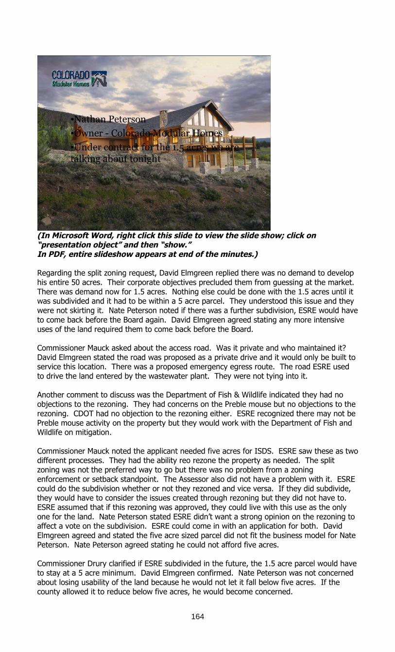
164
•Nathan Peterson
•Owner - Colorado Modular Homes
•Under contract for the 1.5 acres we aretalking about tonight
(In Microsoft Word, right click this slide to view the slide show; click on“presentation object” and then “show.”In PDF, entire slideshow appears at end of the minutes.)
Regarding the split zoning request, David Elmgreen replied there was no demand to develophis entire 50 acres. Their corporate objectives precluded them from guessing at the market.There was demand now for 1.5 acres. Nothing else could be done with the 1.5 acres until itwas subdivided and it had to be within a 5 acre parcel. They understood this issue and theywere not skirting it. Nate Peterson noted if there was a further subdivision, ESRE would haveto come back before the Board again. David Elmgreen agreed stating any more intensiveuses of the land required them to come back before the Board.
Commissioner Mauck asked about the access road. Was it private and who maintained it?David Elmgreen stated the road was proposed as a private drive and it would only be built toservice this location. There was a proposed emergency egress route. The road ESRE usedto drive the land entered by the wastewater plant. They were not tying into it.
Another comment to discuss was the Department of Fish & Wildlife indicated they had noobjections to the rezoning. They had concerns on the Preble mouse but no objections to therezoning. CDOT had no objection to the rezoning either. ESRE recognized there may not bePreble mouse activity on the property but they would work with the Department of Fish andWildlife on mitigation.
Commissioner Mauck noted the applicant needed five acres for ISDS. ESRE saw these as twodifferent processes. They had the ability reo rezone the property as needed. The splitzoning was not the preferred way to go but there was no problem from a zoningenforcement or setback standpoint. The Assessor also did not have a problem with it. ESREcould do the subdivision whether or not they rezoned and vice versa. If they did subdivide,they would have to consider the issues created through rezoning but they did not have to.ESRE assumed that if this rezoning was approved, they could live with this use as the onlyone for the land. Nate Peterson stated ESRE didn’t want a strong opinion on the rezoning toaffect a vote on the subdivision. ESRE could come in with an application for both. DavidElmgreen agreed and stated the five acre sized parcel did not fit the business model for NatePeterson. Nate Peterson agreed stating he could not afford five acres.
Commissioner Drury clarified if ESRE subdivided in the future, the 1.5 acre parcel would haveto stay at a 5 acre minimum. David Elmgreen confirmed. Nate Peterson was not concernedabout losing usability of the land because he would not let it fall below five acres. If thecounty allowed it to reduce below five acres, he would become concerned.

165
Mr. Loeffler confirmed the exhibits to the hearing: Exhibit A would be the staff report. Exhibit B would be the additional comment. Exhibit C would be the proposed revision to the draft resolution and the offer from the
application of the easement shown on the map for emergency access easement. Exhibit D would be the staff PowerPoint presentation. Exhibit 1 would be the applicant’s PowerPoint presentation. Exhibit 2 would be the Peterson PowerPoint presentation. The Board received all the
exhibits into the record.
Fred Schubert, Floyd Hill residentFred Schubert made the following statements:
He entered into this discussion about two months ago. He was a new neighbor to thearea.
He met David Elmgreen when he happened to be trespassing on Elmgreen’s property. He moved here like others to have less intrusion and a nice place to live. His first suggestion was a special permit instead of a rezoning. Most of the commercial land in this area was empty and only the school was there.
He understood Peterson’s need to have this piece of land. Schubert didn’t have issue with what Peterson wanted to do or the design; he didn’t
understand the commercial zoning at all. He was unsure why it was necessary. He saw the footprint as becoming larger if they allowed a commercial zoning. He did
not see the need for the split zoning here. There would be nothing to stop thedeveloper if they had the commercial zoning approved.
His house was close to this site. If this was viable the thought of a special permit wasa good opportunity, especially if it turned into a five acre parcel anyway.
This had been a long expensive road for ESRE. He was a business owner too andknew what one had to go through to accomplish things.
He owned commercial land as well and it wasn’t easy. He had spent hundreds of thousands of dollars to get projects done. He didn’t have a problem with what Peterson wanted to do, just the zoning. He did have an issue with wildlife on this parcel. He didn’t want to dwell on it but let
others comment on it. There was a migratory patter here on this property. It was huge and happening now
with the elk and deer. Who was to say one could not build a home, but it had to bedone sensibly.
He had a small issue that would become a big issue and that was with the water. Hisin-laws turned down a Floyd Hill property 40 years ago because of water.
Regarding access, the proposed road off the cul-de-sac of Elmgreen Lane, there wasno visibility of that access. He believed everyone would turn left. If Elmgreen Lanewas expanded, he would prefer a small gate and some nice signage. There wereprivate road signs but folks still drove down the road all the time.
He recommended the Board postpone this decision and just do a special permit.
Jeff Spedafora, Floyd Hill residentJeff Spedafora made the following statements:
He had been a Clear Creek County and Floyd Hill resident for 18 years. He had lived at the top of the hill for 12 years and spent the last six years on
Elmgreen Lane. He wrote a letter stating he approved of the rezoning but now he had a
misunderstanding of what a commercial real estate office meant. It sounded like what Peterson proposed was great for business but did it create a
zoning which could allow a 33,000 sq. ft. restaurant or other business that fit in thatclassification.
When he first heard about this proposal, he thought it was only 1.54 acres. What herealized was that if Peterson’s proposal didn’t work, then it could be a 33,000 sq. ftbuilding. He was discouraged to hear that the 49 acres could be further separatedinto MR-1 zoned lands. He was concerned with future subdivision of the land.

166
He had signed a letter in favor of approval but now he had second guesses because ofthe zoning.
He concurred with fro to allow Peterson to do his plan but he was not in favor of theCommercial-Retail Office zoning. He suggested doing an agreement instead thatkeeps the building to 2400 sq. ft so that it didn’t grow over time. He did not want asupersize restaurant there. Commissioner O'Malley stated that would cause anotherprocess before the Board. Just because the property was zoned did not ensurecertain uses were guaranteed. One reason the county had so many zoning categorieswas to limit the types of things that could be allowed in certain locations.
Jeff Spedafora’s understanding was this could be a 33,000 sq. ft building and be usedfor a wide range of retail office space.
He wanted to be on the record that he supported Peterson’s proposal but with adifferent zoning classification.
Pete Helseth, Floyd Hill residentPete Helseth made the following statements:
He had been a resident in this area since 1983. His preference for the land was to reserve it for open space. He understood there were different opinions about the property. His problem this evening was the split zoning, the applicant’s protestation
notwithstanding. This proposal was about getting a toe hold in the center of the land. He understood
the visibility piece but he wouldn’t see that as a business a mile away without a hugesign. By the time people recognize what this building was, they would have passedthe exit.
Despite the location, the part that bothered him was that this proposal was in themiddle of the land and didn’t tell the public what ESRE envisioned for the rest of theproperty.
A couple of years ago, ESRE told him to come and look at a plan for the land so whywasn’t the public seeing that plan now.
He recalled the gravel pit proposal claimed it would not be visible from the highwaybut here they were a few years later and it could be seen from the road. The meritsof that proposal could be argued because it had revenues but everyone knew it wasan eyesore.
The citizens had to know what was happening up front and tonight they were onlyhearing one little piece.
Cutting a 1.5 acre parcel out of 50 acres was not right. The process of doing a split zoning instead of talking about the entire parcel plan was
an end rider. The county could do better than that. This reminded him of Eclipse Snow Park when the applicant claimed they were only
doing a base lodge and the public didn’t know the entire impact of the entiredevelopment would be. He could not judge what was being talked about here.Commissioner O'Malley noted anything the applicant wanted to do in addition wouldrequire another process.
Pete Helseth understood but the reality was that by the time they had one business inthe center of the land, from a land preservation standpoint, they had established andtrashed the land. If his business was built, he wished him success. If it was notsuccessful and it sat there vacant like half of the Tech Park development of half of theSki Country Antiques project, it would be another testament to the short sightednessat the gateway to the county.
In the Master Plan 2030, this property was addressed as mixed use and identified as aviewshed. That was the only way the citizens agreed to that Master Plan was to havethe visions that both sides saw.
Tom Wilson, Georgetown residentTom Wilson made the following statements:
He was a resident of Clear Creek County and Georgetown. Life was about changing as everyone knew.
167
Economics changed and it would continue to change. Hoping that things were lockedinto the future was a nice dream but we had to go where our future took us. Todaymay not be possible tomorrow.
This was a change but not a big change. It was a residential house used for acommercial purpose.
There was diversity as folks entered Georgetown. At the stop sign, there were eightbuildings in a mixed use area. Four were for homes and four were businesses. Therewas a sales office for an outfitter, an attorney’s office, a bed and breakfast, arestaurant, etc. Nearby there was a large home which was one of the county’sbiggest historical properties, the Hamill House.
All of these fit in a residential area without being adversely affected or impacted bythe others. This was a dense population and the lot sizes were small.
This proposal was a great project and had a good possibility for the county entrance. He hoped the Board would approve it.
Sally Buckland, County residentSally Buckland made the following statements:
She was a lifetime resident of Clear Creek County and the owner of the GuanellaRanch.
It had been here since 1860. She hoped the Board would approve the Peterson proposal. The Elmgreen’s had owned that land for many years. Everyone should be conscious
of the landowners having a say in what happens on their lands. Often people wouldcome in and say they loved the view and she understood that, but if someone wantedto protect the view, they needed to buy the land. They needed to own the land anddirect what was done with it.
ESRE and Peterson had put a lot of thought into this project. She believed it would be an asset and a nice looking building. It would produce $4000 in taxes versus the 70 cents it earns now. She, too, had agricultural land and knew it was reasonable to use when one had
animals but the county also needed to have as much on the tax rolls as they could. She knew how much land in Clear Creek County was federal land. There were limited
resources for commercial. This proposal was an asset and she hoped the Board would approve it.
Omer Humble, Clear Creek County residentOmer Humble made the following statements:
He was a resident of Fall River Road. He was not taking a pro or con position on this proposal. He wanted to make two reasonable requests as the Board considered this application. He asked they have an economic assessment done so they would have on record the
impact of this proposal and could share it with the residents. It could be positive ornegative and should be done with the county and the applicant. It was prudentgovernment to have this analysis done.
Two things had been pointed out, one was the plan purpose and the other was therewas vulnerability once the property was zoned. The presentation made tonight wasnot restrictive. If this property was rezoned Commercial-Retail Office then irrespectiveof what had been presented as current proposed thinking, there was vulnerabilitythere. He suggested removing the zoning and if the application was approved thenapprove it at final design.
Bob Poirot, Clear Creek County residentBob Poirot made the following statements:
This was a good proposal. The county needed to work on the 5 acre idea because one they approved it at the
1.5 acres, then it was approved. It would automatically be given a well permit for the 1.5 acres.

168
The State Water Engineer would give them a permit for that and they could come inwith a new subdivision.
He suggested, and wasn’t sure if it was possible, that the applicant provide awater/sewer easement of five acres. The applicant could draw it as they wanted.This would allow them to carve out the 3.5 acres needed to meet the five acreminimum.
He understood Peterson could not afford five acres up front; however, ESRE couldlease it to him for the same amount. The county could establish an easement on the3.5 acres for the water/sewer. This would more closely meet the water requirementfor this type of building.
It could be done by deed restriction.
Steve Axtell, Saddleback residentSteve Axtell made the following statements:
He lived at 37 Pat Creek Road. There were two advantages to the county for approving this. One was increased tax
revenue and one was the Emergency Services access on Floyd Hill. He agreed with Poirot that it was good to consider this as a five acre parcel and taxing
it that way. As for Emergency Services access, there were four ways to get out of Floyd Hill. One
was over the I-70 overpass; one was through Pat Creek jeep trail; one was overSaddleback; and the other was by foot. People could drive or walk down to I-70.
He asked what the value of this project was to the county and was this something thatwould help the county.
Kay Axtell, Saddleback residentKay Axtell made the following statements:
She lived at 37 Pat Creek Road. She had lived in Clear Creek County for 42 years. She loved the county, the land and the people. This was why she came to speak to
the Board. She had a lot of questions. How would the rezoning of this 1.5 acre parcel help the citizens of this county or help
the county? It did not make sense to her. She did not understand zonings. She did not understand a 1.5 acre parcel for anything. If this was a sales office, would there be a bathroom and ISDS? She did not under5stand why it was appropriate to do this as opposed to doing a
design review process. The public did not know what would happen if this passed the way it was. It could go
in different directions. That happened in this county a lot. She had seen it happenmany times.
For the Board of County Commissioners, why wouldn’t this property benefit to be openspace? She understood that opportunity came across the table many times and hadnot been considered. They had done a lot of study about how the infrastructurewasn’t there and how costly infrastructure was. Open space would meet the needs ofeveryone in terms of who lived there.
She had fought long and hard for the Beaver Brook Watershed and it was zoned fordevelopment. Today, by the grace of God, it was open space.
Santa Fe Mountain development was pushed through with no regulation. The citizensfought long and hard for that. She believed this was via a special permit. It was nowmansions in bankruptcy. There was a property purchase for apartments andcommercial and it was supposed to help the county. The citizens resisted and it wasapproved but now it was in foreclosure.
The biggest disappointment had been the school. There was a major problem in thecounty now because the new sewer treatment plant was built and Clear Creek SchoolDistrict was stuck with it.

169
She asked the Board to please keep careful thought to their decision this evening. Dothe best thing for the county and the landowners too.
Linda Browning, Clear Creek County residentLinda Browning made the following statements:
She reiterated what Pete Helseth said. She hoped the Board would take more time with this proposal. The landowner claims to be a corporation and they were in it to make money and
develop. She had been on Floyd Hill for 16 years and she knew about the history of wanting to
develop. She asked the Planning Commission to ask the applicant what the future of the land
was. She had yet to hear what that future was. She asked the Board to look at this proposal more clearly and delay their decision.
John Doble, Floyd Hill residentJohn Doble made the following statements:
With regard to impacts to county services, the applicant claimed no impact. If the county considered the costs and benefits, he suggested the county not count
the Emergency Services benefit. There were impacts on county services even though this was on the edge of the
county and the access road when through Jefferson County. Commissioner O'Malleyasked about law enforcement, ambulance and fire. Would they have to add anythingto their services? John Doble understood that but on the average when allocating thecosts, he received his portion and it was almost never justified.
There would be incremental possible impacts in those areas if the applicant called thesheriff for a break-in. it may not be added police cars but it would be an addedimpact. With increased impact, there would be increased personnel.
Commissioner O'Malley closed public comment.
David Elmgreen made the following responses: ESRE wanted to clarify it did not have a crystal ball. They were not in the business of
speculating. They understood there were comments about what was the big picture. There was no
whole picture. There was an existing demand and they were before the Board to actualize that. As far as water, sewer, and ISDS, in looking forward, they did not have a crystal ball. He asked the Board to consider the wastewater treatment plant on the adjacent
property. What would the impact on the proposal be if the property were tied up withwater/sewer easements which were forever? In twenty years, there could be densityin the community and that would create utilization of that asset.
What good was an easement which would restrict future development?
Mr. Loeffler asked if Planning Director Frederick Rollenhagen or Senior Planner Trent Hyatthad comments. Regarding the suggestion of a special permit, Mr. Loeffler replied acommercial office could not be done by special permit in a residential area. FrederickRollenhagen confirmed this was correct. A commercial use as a primary use was not allowedin a residential zoning district by special use or otherwise. The intention of that was toprotect the residential district from commercial development. If someone wanted to begin acommercial business they would have to be in a commercial zoned district. CommissionerO'Malley stated that part of the reason that was established, which preceded this Board, wasbecause a rezoning was a more exhaustive process than a special use permit. It wouldmake a commercial use in residential areas more difficult and it would make sure if it wasallowed, it had to go through a process.

170
One change this Board had made was the installation of multiple commercial zoning districtsto limit the commercial uses. The commercial zoning uses used to be very broad. Now therewere six commercial districts and each one was more restrictive than the other, so certainuses could be limited in certain places. It was not perfect but better than if parcels werezoned C-1. Frederick Rollenhagen stated some commercial districts did allow residential usesas an accessory use to the commercial use. A business owner could live on their land butresidential use could not be the primary use. If Peterson was approved for his business here,he could live there but he would have to prove he had enough water.
Commissioner Mauck asked how a zoning was suggested to an applicant. Could a zoning befound as opposed to a special permit? What about Planned Development zoning? FrederickRollenhagen replied the intention of the Planned Development zoning was to proposesomething that was out of the ordinary which was a mix of uses not allowed in other zoningdistricts. If an applicant requested Planned Development for this use but their use was anoffice and it was allowed in Commercial-Retail Office, it was possible staff would recommenddenial of a Planned Development zoning because the use fit into another zoning category.
Commissioner Drury was not clear on split zoning. She had listened to the comments andconcerns of the public. She knew the history in Clear Creek County and the foreclosures.The economy had not been kind to the Saddleback development nor the Williams property.There were others in the county. From her view, this was such a small development and avery limited use that she did not see it as an intrusion on anyone’s land – even the adjacentproperty owners. There was a process in place where the public could weigh in on whatshould happen. Elmgreen spoke to the fact that he did not have a final plan yet. Shebelieved that due to the economy, it was hard to have a plan in these uncertain times. Shedid not believe he was withholding information but being smart about it. She would vote toapprove this.
Commissioner Mauck appreciated all that ESRE did in the county. He did no believe they hada plan. He believed they were developing responsibly in these times. He believed theapplicant had the best interest of the county in mind. He also liked that ESRE thoughtoutside the box and brought new ideas. He was not sure the county was ready or preparedfor the challenges of split zoning. This was his concern. This proposal wasn’t that bad byitself. It was only 1.5 acres. Commissioner Mauck had difficulty on how to separate thisfrom a subdivision. He was not sure the county had completely worked this proposal outespecially when split zoning was discouraged in other areas. Commissioner Mauck was notconvinced this was the way to start the stone rolling for an area that held so much potentialfor the community in many respects. His concerns were with the split zoning and for thatreason, he was not compelled by the county’s understanding of how it affected the future.Commissioner Mauck was interested in knowing how split zoning helped the county. Thiscould be a Planned Development special use concept. When there was an idea theneighbors liked, was there a way to utilize that? Because he was not comfortable with thesplit zoning, he would vote in opposition.
Commissioner O'Malley wanted to address some of the public comment. Regarding the openspace question and belief the meadow should be preserved. The only way one couldguarantee a piece of property was preserved was to own it. Three years ago, the OpenSpace Commission approached the Board of County Commissioners and asked about theWilliams property which was now owned by the bank due to foreclosure. The Open SpaceCommission wanted to purchase it. Because a majority of the Board did not agree that it wathe best use of the land, they said they would not approve a purchase by the Open SpaceCommission. However, they did not have a monopoly on what was right or wrong. For thepast three years, the Open Space Commission had an open invitation to put on the ballot theissue asking the people of Clear Creek County if they could purchase one or both of theseproperties and they had not done so. The foreclosed property and the ESRE property hadboth been for sale. The bank had made at least one written offer to the Open SpaceCommission but no one had taken them up on the issue. He was beginning to resent thatthis land should be open space when Open Space Commission was not willing to make it

171
that. Elk Meadow and Noble Meadow were preserved because there was a vote of thepopulation of Evergreen to pay for part of it and partner with other groups. If the publicwanted the county purchase this land, it did not meet criteria for strategic value that was inthe open space charter. One would have to go to the people and convince them to spendtheir tax money to preserve it. Otherwise, it was a non-issue and it was private land. Asmuch as some people may not want the land to be subdivided, this was America and thelandowners could make proposals for what they wanted to do. AS long as the applicant metthe regulations may get to do their proposal. Regarding costs to the county, Elmgreen wasright. This proposal would add no cost to the county. The county would not be maintainingthe roads because it was Jefferson County access. The road was private. The county wouldnot be spending money to add personnel to fire, police or Emergency Services. If Petersonand his family moved here, the county may pick up some children in Clear Creek SchoolDistrict which was a benefit.
When it came to zoning, the county had to live within the laws written by the State on whatthey could or could not do. They could not require someone to tell them what might happenon a piece of land zoned MR-1. The county did not have the right. If the applicant wantedto subdivide then they had the right. There were certain rules and there was no guaranteethat something would be approved.
This proposal helped the county. This business would be helpful and would bring 5-6 jobspotentially. It would increase tax revenue and it was a net positive. Regarding Mr. Loeffler’sclarification of a special permit, it was almost too bad for this particular situation, that aspecial permit was not allowed. Most people thought this was a good idea and if the countycould do a special permit, then they could limit it. There was definitely a benefit to that butthe county did not get to change the rules in midstream.
Commissioner O'Malley was unsure of his thought about split zoning. In this case it seemedto work. Most people either discouraged it or didn’t’ allow it. Again, Clear Creek Countyallowed it. They had no restrictions against it. Again, the county could not change the rulesmidstream. He would support a motion to approve this request.
Mr. Loeffler pointed out if the Board approved this proposal, Exhibit C would be the condition#1 in the draft resolution. Commissioner Drury made the motion to approve Resolution #11-97, Rezoning Case #RZ-2011-0002, for ESRE Properties, Floyd Hill, with condition #1including Exhibit C, in lieu of condition #1 as it appeared in the draft resolution, which wasalso Exhibit H to the staff report. Trent Hyatt also recommended that the Board change theresolution number to be Resolution #11-97 and add the names of the additional commentsreceived; and, to revise the resolution in its findings of fact to add reference to the publiccomments presented this evening on paper as they are identified as Exhibit B; and to refer tothose persons and their comments in paragraph 2 of the findings of fact of the resolution;and to change the number of the resolution to be Resolution #11-97. CommissionerO'Malley seconded. During discussion, Commissioner Drury thanked Nate Peterson for hisproposal and appreciated the design. Commissioner Drury and Commissioner O'Malley votedin favor. Commissioner Mauck voted in opposition. The motion passed 2-1.
The meeting adjourned.
________________________ _________________________Deputy Clerk & Recorder Kevin O’Malley, Chairman
Staff PowerPoint Presentation
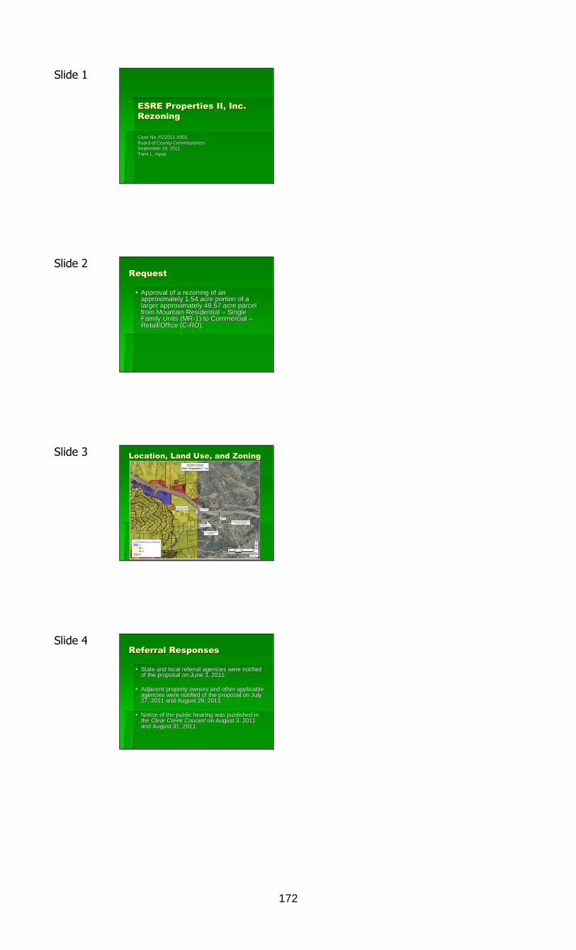
172
Slide 1
ESRE Properties II, Inc.ESRE Properties II, Inc.RezoningRezoning
Case No. RZ2011Case No. RZ2011--00020002Board of County CommissionersBoard of County CommissionersSeptember 19, 2011September 19, 2011Trent L. HyattTrent L. Hyatt
Slide 2RequestRequest
Approval of a rezoning of anApproval of a rezoning of anapproximately 1.54 acre portion of aapproximately 1.54 acre portion of alarger approximately 49.57 acre parcellarger approximately 49.57 acre parcelfrom Mountain Residentialfrom Mountain Residential –– SingleSingleFamily Units (MRFamily Units (MR--1) to Commercial1) to Commercial ––Retail/Office (CRetail/Office (C--RO).RO).
Slide 3 Location, Land Use, and ZoningLocation, Land Use, and Zoning
Slide 4Referral ResponsesReferral Responses
State and local referral agencies were notifiedState and local referral agencies were notifiedof the proposal on June 3, 2011.of the proposal on June 3, 2011.
Adjacent property owners and other applicableAdjacent property owners and other applicableagencies were notified of the proposal on Julyagencies were notified of the proposal on July27, 2011 and August 29, 2011.27, 2011 and August 29, 2011.
Notice of the public hearing was published inNotice of the public hearing was published inthethe Clear Creek CourantClear Creek Courant on August 3, 2011on August 3, 2011and August 31, 2011.and August 31, 2011.

173
Slide 5 CommercialCommercial--Retail/OfficeRetail/OfficeZoning Classification DistrictZoning Classification District
Setback requirements for the CSetback requirements for the C--R/O: Front 20R/O: Front 20’’, Side 10, Side 10’’, and Rear 15, and Rear 15’’..
No minimum area requirement for CNo minimum area requirement for C--R/O but density requirementsR/O but density requirements include:include: Building(sBuilding(s) square footage shall not exceed 50% of the lot square footage) square footage shall not exceed 50% of the lot square footage
Building(sBuilding(s) footprints not exceed 20% of the size of the) footprints not exceed 20% of the size of the Allowing a 33,500 square foot structure with a 13,000 square fooAllowing a 33,500 square foot structure with a 13,000 square foo t footprintt footprint
CC--R/O zoning classification district allows other more intensive uR/O zoning classification district allows other more intensive uses in addition toses in addition tooffice uses (i.e. retail trade, restaurant, and/or personal servoffice uses (i.e. retail trade, restaurant, and/or personal serv ices/bank).ices/bank).
However, it is important to understand that if the property is rHowever, it is important to understand that if the property is r ezoned, its use is stillezoned, its use is stillsubject to the Development Review standards of Section 20 of thesubject to the Development Review standards of Section 20 of the ZoningZoningRegulations (square footage greater than 5,000, traffic generatiRegulations (square footage greater than 5,000, traffic generati on greater than 100on greater than 100ADT, or site disturbance of one acre or more), the County wouldADT, or site disturbance of one acre or more), the County would still have thestill have theopportunity to review the associated impacts.opportunity to review the associated impacts.
Slide 6Access/Traffic ImpactsAccess/Traffic Impacts
Access via Elmgreen Lane (60 foot wide rightAccess via Elmgreen Lane (60 foot wide right --ofof--way)way)
Construct aConstruct a ““low volume roadlow volume road”” (50 foot wide right(50 foot wide right--ofof--way, two 10 foot wideway, two 10 foot widelanes, 2 foot wide shoulders, eight percent maximum grade, 500 alanes, 2 foot wide shoulders, eight percent maximum grade, 500 averageveragedaily traffic (ADT)).daily traffic (ADT)).
Table 2 of the RDCM estimates the use will generate 29.52 ADT (aTable 2 of the RDCM estimates the use will generate 29.52 ADT (a t 12.3t 12.3ADT per 1000 square feet).ADT per 1000 square feet).
Traffic and Access Impact Study estimates 50 ADT with four additTraffic and Access Impact Study estimates 50 ADT with four addit ionalionalsingle family homes (RDCM estimates approximately 70 ADT).single family homes (RDCM estimates approximately 70 ADT).
The design of the proposed access road is more than adequate toThe design of the proposed access road is more than adequate toaccommodate the office use currently proposed.accommodate the office use currently proposed.
Slide 7TaxesTaxes
Generates approx. $27 annually as an agricultural use.Generates approx. $27 annually as an agricultural use.
Rezoned with a 2,400 square foot office buildingRezoned with a 2,400 square foot office buildinggenerate approx. $4,030 annually (Diane Settle,generate approx. $4,030 annually (Diane Settle,
County AssessorCounty Assessor))
Slide 8Split ZoningSplit Zoning
Generally viewed negatively due to the difficultiesGenerally viewed negatively due to the difficultiesassociated with managing such properties.associated with managing such properties. Applying setback requirements can difficult since usuallyApplying setback requirements can difficult since usually
measured from property boundaries.measured from property boundaries.
Assessing split zoned parcels for tax purposes can be difficultAssessing split zoned parcels for tax purposes can be difficultif the exact boundaries of the zoning districts are not known.if the exact boundaries of the zoning districts are not known.
Some jurisdictions prohibit. Others utilize split zoningSome jurisdictions prohibit. Others utilize split zoningto distinguish the developable areas of properties fromto distinguish the developable areas of properties fromthose not appropriate for development.those not appropriate for development.
Zoning Regulations do not prevent the split zoning ofZoning Regulations do not prevent the split zoning ofparcels.parcels.

174
Slide 9Water/SanitationWater/Sanitation
Well proposed to serve the office.Well proposed to serve the office. Exempt well permit issued (No. 285825) for the following useExempt well permit issued (No. 285825) for the following use
of groundwater: fire protection, inof groundwater: fire protection, in--house use for three singlehouse use for three singlefamily dwellings, watering of poultry, domestic animal andfamily dwellings, watering of poultry, domestic animal andlivestock ,and the irrigation of one acre.livestock ,and the irrigation of one acre.
Must be revised to an exempt commercial well permit by theMust be revised to an exempt commercial well permit by theColorado Division of Water Resources.Colorado Division of Water Resources.
Individual sewage disposal system proposed to serveIndividual sewage disposal system proposed to servethe office. Area of rezoning less is than 5 acres butthe office. Area of rezoning less is than 5 acres butremaining lot will still be approx. 40 acres.remaining lot will still be approx. 40 acres.
Slide 10 PreblePreble’’ss Meadow JumpingMeadow JumpingMouseMouse
Found in riparian areas below certain elevations in Colorado.Found in riparian areas below certain elevations in Colorado.
Located during CDOT culvert replacement project north of the subLocated during CDOT culvert replacement project north of the sub jectjectproperty along Beaver Brook.property along Beaver Brook.
According to US Fish and Wildlife/Colorado Division of WildlifeAccording to US Fish and Wildlife/Colorado Division of Wildlife Assumed they are located within 300 feet of Beaver Brook withoutAssumed they are located within 300 feet of Beaver Brook without conductingconducting
trapping studies.trapping studies.
Access road located approximately 160 feet from Beaver Brook atAccess road located approximately 160 feet from Beaver Brook at oneonepoint.point.
To mitigate potential impact, US Fish and Game and CDOW recommenTo mitigate potential impact, US Fish and Game and CDOW recommen dsdsconstructing the access road during the animalconstructing the access road during the animal ’’s hibernation/winters hibernation/wintermonths or conduct a trapping study to determine their presence.months or conduct a trapping study to determine their presence.
Slide 11Master Plan 2030Master Plan 2030
Map 4.6 identifies property asMap 4.6 identifies property as ““Mixed UseMixed Use”” andand ““Gateway.Gateway.”” Page 4Page 4--28 identifies28 identifies ““Mixed useMixed use”” areas as those where developmentareas as those where development
should maximize the efficiency of land, traditional transportatishould maximize the efficiency of land, traditional transportati on andon andalternate transportation modes.alternate transportation modes.
AA ““Gateway,Gateway,”” or transportation node, is identified as a mixed useor transportation node, is identified as a mixed usearea where development can accommodate buses, fixed guidearea where development can accommodate buses, fixed guideway transportation, and parkway transportation, and park--nn--ride lots.ride lots.
Identifies Floyd Hill as aIdentifies Floyd Hill as a ““Significant AreaSignificant Area”” which iswhich is ““strategic tostrategic tothe overall Countythe overall County--wide Master Plan vision.wide Master Plan vision.””
Page 6Page 6--2, Specific issues and opportunities and implementation2, Specific issues and opportunities and implementationstrategies for the area.strategies for the area.
Slide 12 Floyd Hill Gateway SubFloyd Hill Gateway Sub--Regional Master PlanRegional Master Plan
Recommended by Master Plan 2030. Certified by theRecommended by Master Plan 2030. Certified by theCounty Planning Commission in 2009.County Planning Commission in 2009.
Subject property identified as an activity center.Subject property identified as an activity center.
Site design guidelines developed to evaluate futureSite design guidelines developed to evaluate futuredevelopment.development.
Provides an Action PlanProvides an Action Plan

175
Slide 13Rezoning ConsiderationsRezoning Considerations
Is the proposed rezoning in compliance withIs the proposed rezoning in compliance withadopted master plans?adopted master plans? Master Plan 2030 Significant AreasMaster Plan 2030 Significant Areas Issues and OpportunitiesIssues and Opportunities
1. Improve access by providing a full interchange at Exit1. Improve access by providing a full interchange at Exit247 and247 and provide a second access point to this subprovide a second access point to this sub--areaarea.. Applicants propose granting the County a 20 foot wideApplicants propose granting the County a 20 foot wide
emergency access easement to connect the new accessemergency access easement to connect the new accessroad to the high school property.road to the high school property.
3. Preserve the natural setting of the area.3. Preserve the natural setting of the area. Proposal only includes 1.54 acres of the larger parcel (49.57Proposal only includes 1.54 acres of the larger parcel (49.57
acres).acres).
Slide 14Rezoning ConsiderationsRezoning Considerations
Master Plan 2030 Significant AreasMaster Plan 2030 Significant Areas Implementation StrategiesImplementation Strategies
6. Provide a secondary access point to the Floyd Hill area6. Provide a secondary access point to the Floyd Hill areawith a roadway connection to State Highway 65 inwith a roadway connection to State Highway 65 inJefferson County.Jefferson County.
Applicants propose granting the County a 20 foot wideApplicants propose granting the County a 20 foot wideemergency access easement to connect the new accessemergency access easement to connect the new accessroad to the high school property.road to the high school property.
Slide 15Rezoning ConsiderationsRezoning Considerations
Is the proposed rezoning in compliance with adoptedIs the proposed rezoning in compliance with adoptedmaster plans?master plans? FHMP Site Design GuidelinesFHMP Site Design Guidelines
A. Condense Development AreasA. Condense Development Areas
Community centers that consolidate development into specificCommunity centers that consolidate development into specificareas that are more intensely developed promote less landareas that are more intensely developed promote less landconsumption;consumption; efficient connectivityefficient connectivity; more compact building and; more compact building andimpervious surface coverage; opportunity for consolidatedimpervious surface coverage; opportunity for consolidatedopen space; and efficiency in utility design and construction.open space; and efficiency in utility design and construction.
Applicants propose granting the County a 20 foot wide emergencyApplicants propose granting the County a 20 foot wide emergencyaccess easement to connect the new access road to the highaccess easement to connect the new access road to the highschool property.school property.
Slide 16Rezoning ConsiderationsRezoning Considerations
Is the proposed rezoning in compliance with adoptedIs the proposed rezoning in compliance with adoptedmaster plans?master plans? FHMP Site Design GuidelinesFHMP Site Design Guidelines
B. Vehicular CirculationB. Vehicular Circulation
A clear, well connected vehicular circulation network canA clear, well connected vehicular circulation network canreduce traffic congestion, promote ease of travel, and providereduce traffic congestion, promote ease of travel, and providesafe access for residents in everysafe access for residents in every --day and emergencyday and emergencysituations.situations.
Applicants propose granting the County a 20 foot wide emergencyApplicants propose granting the County a 20 foot wide emergencyaccess easement to connect the new access road to the highaccess easement to connect the new access road to the highschool property.school property.
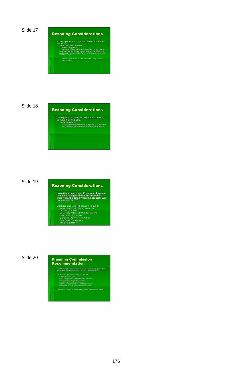
176
Slide 17Rezoning ConsiderationsRezoning Considerations
Is the proposed rezoning in compliance with adoptedIs the proposed rezoning in compliance with adoptedmaster plans?master plans? FHMP Site Design GuidelinesFHMP Site Design Guidelines
K. Wildlife & VegetationK. Wildlife & Vegetation
There is high wildlife activity potential in the Floyd Hill studThere is high wildlife activity potential in the Floyd Hill stud yyarea, and new development should respect and protect thearea, and new development should respect and protect therelationship between the built environment, open space andrelationship between the built environment, open space andwildlife corridors.wildlife corridors.
Proposal only includes 1.54 acres of the larger parcelProposal only includes 1.54 acres of the larger parcel(49.57 acres).(49.57 acres).
Slide 18Rezoning ConsiderationsRezoning Considerations
Is the proposed rezoning in compliance withIs the proposed rezoning in compliance withadopted master plans?adopted master plans? FHMP Action PlanFHMP Action Plan
A new access road connecting to Highway 65 is indicatedA new access road connecting to Highway 65 is indicatedas a transportation/emergency access recommendation.as a transportation/emergency access recommendation.
Slide 19Rezoning ConsiderationsRezoning Considerations
Have there been major Economic, Physical,Have there been major Economic, Physical,or Social changes within the area whichor Social changes within the area whichwere not anticipated when the property waswere not anticipated when the property waspreviously zoned?previously zoned?
Changes on Floyd Hill area since 1964:Changes on Floyd Hill area since 1964: Partial development of the Clear CreekPartial development of the Clear Creek
Technological ParkTechnological Park Ski Country Antiques Distribution BuildingSki Country Antiques Distribution Building Clear Creek High SchoolClear Creek High School Evergreen Fire Protection DistrictEvergreen Fire Protection District Clear Creek Fire AuthorityClear Creek Fire Authority MiniMini--storage facilitiesstorage facilities
Slide 20 Planning CommissionPlanning CommissionRecommendationRecommendation
The Planning Commission voted 5The Planning Commission voted 5--2 to recommend approval of2 to recommend approval ofthe application to the Board of County Commissioners.the application to the Board of County Commissioners.
Major issues discussed by the PC include:Major issues discussed by the PC include: 5 acre ISDS minimum5 acre ISDS minimum location of the Clear Creek/Jefferson County linelocation of the Clear Creek/Jefferson County line location of the proposed access roadlocation of the proposed access road potential impacts topotential impacts to PreblePreble’’ss mousemouse regulating the use of the area for office/retail onlyregulating the use of the area for office/retail only the location of the proposed access easement.the location of the proposed access easement.
Copy of the resolution approved by the PC attached as item G.Copy of the resolution approved by the PC attached as item G.
177
Slide 21Staff RecommendationStaff Recommendation
Staff recommends approval of theStaff recommends approval of the
proposal as described in the draftproposal as described in the draft
resolution Rresolution R--1111--97 attached as item H. A97 attached as item H. A
draft resolution for denial is attached asdraft resolution for denial is attached asitem I.item I.
Elmgreen PowerPoint Presentation:
Slide 1REZONING CASE NO. RZ2011REZONING CASE NO. RZ2011--00020002
ESRE PROPERTIES II, INCESRE PROPERTIES II, INC
A COLORADO CORPORATIONA COLORADO CORPORATION
Slide 2ESRE PROPERTIES II, INC
Ownership Structure
- Privately owned Colorado Corporation
- Incorporated in May 2003
- Real Estate Investment
- Owned by 2 Family Trusts
- Managed by a 3-person Board of Directors

178
Slide 3ESRE PROPERTIES II, INC
• Real estate assets include properties in ClearCreek and Jefferson Counties generallylocated south of I-70 and west of JeffersonCounty Road 65
• Corporate Objectives require a realisticapproach by the directors for themanagement of the real estate assets basedon current economic demand
Slide 4
– Single Family Detached Housing on 5-acre minimum withdomestic well and Individual Sewage Treatment System (7Housing units)
– Single Family Detached Housing on 2-acre sites withapproved water supply and connection to existing SewageTreatment Plant (24 Housing Units)
REZONING CASE NO.RZ2011-0002
Current ZoningMountain Residential 1 (MR-1)
Slide 5REZONING Case No. RZ2011-0002
Slide 6 Existing Floyd Hill Zoning
REZONING CASE NO.RZ2011-0002

179
Slide 7• I-70 Delivers over 40,000 Vehicles per Day within 500 feet of
Project Location
• The proposed project is 1.54 acres rezoned to Commercial-Retail/Office (C-RO) with a 2,400 SF office building to serve asBuilder’s Model Home and Back Office
• The rezoned parcel is projected to increase the property taxesfrom approximately $0.70 per year to approximately $4,050
• Water Supply – Existing well permit No. 285825 allows up to1.35 acre-feet (439,898 Gallons) per year, No conversion toCommercial Exempt Well Required (GWS 57)- 1,200 gallons per day
- Project estimated to use less than 100 gallons/day
• Sewer System - Individual Sewage Disposal System
REZONING CASE NO.RZ2011-0002
Project Details
Slide 8 Vehicular Circulation
• Utilizes Turnaround areas adequate for localemergency vehicles
• Roadway designed with topography to minimizegrading and road cuts
• Building sited near circulation route
• Designed with winter road maintenance and snowstorage in mind
• Project estimated ADT of 11 with an AM Peak of 6trips and a PM Peak of 5 Trips.
REZONING CASE NO.RZ2011-0002
Slide 9Development Impacts
• County General Services– Road and Bridge
– Public Health
– General Services
– Law Enforcement
• Clear Creek RE-1 SchoolDistrict
• Emergency Services
• Clear Creek LibraryDistrict
• County General Services– No Impact
– No Impact
– No Impact
– No Impact
• No Impact Clear CreekRE-1 School District
• No Impact
• No Impact
Slide 10Positive Development Impacts
• Road and Bridge; Access provided by PrivateDrive. Site access either Jefferson County orState Highways
• Clear Creek RE-1 School District; IncreasedRevenue
• Emergency Services; Improved Accessibility
REZONING CASE NO.RZ2011-0002

180
Slide 11
• There are 5 identified Areas of Emphasis in the ClearCreek County Bottom Up Economic Plan– Marketing Plan
– Recreation/Tourism
– Renewable Energy/Natural Resources
– I-70 Mitigation Plan
– Workforce Support
• These areas are not intended to come at the expenseof other opportunities nor are they intended torestrict or eliminate each other
• Marketing Plan is not limited to Recreation/TourismActivities
Clear Creek County Bottom UpEconomic Plan
REZONING CASE NO.RZ2011-0002
Slide 12 Clear Creek County Bottom UpEconomic Plan
• Marketing Plan
– Focus on Clear Creek County as a great place to work/dobusiness.
– Increase in commercial activity
– New business start-ups/relocations
• Workforce Support
– Jobs
– Leading to a strong employment base
– Stimulate workforce housing
– Broader housing assets to meet needsREZONING CASE NO.
RZ2011-0002
Slide 13I-70 Sight-Lines East From Project Location
1.5 Miles fromProject Location
Slide 14 This is the First Image of
Floyd Hill the Typical West-Bound
I-70 Traveler Sees

181
Slide 15
Slide 16
Slide 17
Slide 18

182
Slide 19
Slide 20Rebuttal Slides
Slide 21Floyd Hill Gateway Development Plan
Does Not Contain Development Restrictions
“The Floyd Hill Master Plan … is unlike other masterplans, in that there is no specific land use map and
associated recommended density”
“This master plan does not include a traditional landuse plan with a recommended amount of
development or density.”
Floyd Hill Master Plan, Executive Summary, Page A, Lines 1 and 2
Floyd Hill Master Plan, Conceptual Alternatives, Page 79
REZONING CASE NO.RZ2011-0002
Floyd Hill Master Plan, Executive Summary, Page D, Line 1
Slide 22Floyd Hill Gateway
Development Master PlanConceptual Alternatives
Land Use Planning
“The Hierarchy Plan, in combination withdesign guidelines, provide the County with
a framework for future development inzoning, as well as other important land use
planning elements…”Floyd Hill Master Plan, Page 85
REZONING CASE NO.RZ2011-0002

183
Slide 23Rezoning Case No. RZ2011-0002
REZONING CASE NO.RZ2011-0002
X
Project Location
Slide 24 Recommended Uses withinActivity Center
• Residential– Single Family Attached Townhome/Duplex/Condo
– Student Housing or Live/Work Building
• Accommodations– Bed and Breakfast, Hotel/Motel
• Commercial/Retail– Convenience, Theater, Hardware, Garden, Florist, Art Gallery, Mail Order, Barber Shop,
Coffee Shop, Household Furnishings, Outdoor Sports, Tire Store, Mid-Sized Retail, LargeRetail
• Public Institutions– Museums, Welcome/Visitor Center, Police Sub-Station, Government Facilities
• Office, Medical and Financial– Banks, Real Estate Office, Insurance Office, Computer Services, Accounting Office, Massage
Therapy, Corporate Training, Conference Center, Corporate Office, Medical Office,Recreation Center
Floyd Hill Gateway Development Master Plan,Design Guidelines, Desired Land Use Mix,Pgs 95-96 REZONING CASE NO.
RZ2011-0002
Slide 25 Rezoning Brings Property closer toMaster Plan
• Current MR-1 zoning of single-family dwellingunits is “Not Recommended” within theActivity Center Uses listed in the Floyd HillGateway Sub-Regional Master Plan
• Commercial-Retail/Office (C-RO) Zoning bestfits the proposed use for Corporate SalesOffice and is a “Recommended” Land Usewithin the Activity Center
REZONING CASE NO.RZ2011-0002
Slide 26I-70 Sight-Lines East From Project Location
1.5 Miles fromProject Location

184
Slide 27 Referral Governmental OversightProject Recap
ReferralAgency
Favorable Negative CommentsESRE
Response
CCC PlanningCommission
Approved
PlanningDepartment
RecomendedApprove
Fire Authority No ConflictsEvergreenMetro Fire
District
CC SchoolDistrict RE-1
No Conflicts
CCCEnvironmental
Health
# ofEmployees/LotSize addressed
in ISDS App
Acknowledged
Slide 28 ReferralAgency
Favorable Negative CommentsESRE
Response
CCC OpenSpace
Split ZoningSplit ZoningAddressed
Preble’s MouseMitigation as
per USFW
CCC SiteDevelopment
Road Mustmeet
CommercialReg’s
CDOTNo
ObjectionsNo Direct I-70
AccessNot Intended
Signage On Site AcknowledgedCDOT Reviewof Drainage
PlanAcknowledged
Colo. DOW Preble’s MouseMitigation as
per USFW
CC EMS No Conflict
Slide 29 ReferralAgency
Favorable Negative CommentsESRE
Response
Army CorpContact Prior todisturbance of
any aquatic site
Wetlands notto be
disrupted
Evergreen FireProtection
RezoningApproved
Road shouldmeet County
StandardsAcknowledged
Jefferson CtyPlanning and
Zoning
FutureReferrals Not
Required
Access PermitReq’d
UCCWA No Comment Use BMP’s Acknowledged
Xcel No Conflict
USFW
Rezoning andConstruction
“not ofconcern”
Preble’s MouseMitigation
Mitigation asper USFW
Slide 30Referral Agency Summary
• 16 Government Agency/Utility Provider Responses
– 4 Out Right “Approve” Including Planning Commission,Planning and Zoning Department
– 7 “No Conflict”/”No Objections”/“No Comment”
– 5 Responses Neither Recommending Approval nor Denialcontaining various items be Addressed
• 4 Regulatory Comments
• 2 Preble’s Mouse Mitigation
• No Government Agency ResponsesRecommending Denial

185
Slide 31SOLVE Board of Directors
• 5 of the 7 Board Members of SOLVE areFloyd Hill Residents
• Jim White – Chair
• Larry Lancaster – Vice Chair
• Mike Cheverria – Sec
• Kay Axtell – At Large
• Julie Westland – At Large
Slide 32
Nate Peterson PowerPoint Presentation
Slide 1
•Nathan Peterson
•Owner - Colorado Modular Homes
•Under contract for the 1.5 acres we aretalking about tonight

186
Slide 2
•Nathan Peterson “Nate”
•33, Married, 2 kids
•Live in Grand County
• Specifically we live in Granby
Slide 3
•Colorado School of Mines (2000)
• Mechanical Engineering
•Regis University - MBA (2005)
• Finance and Accounting
•Ingersoll-Rand (2000- 2007)
•Started CMH in 2005
•Left Corporate in 2007 to focus onhome building company.
Professional Back Ground
Slide 4
Mines 2000Started CMH
85%Drop
Left Corporate
Still Here
Slide 5
• Specialize in High quality, Up-ScaleModular Homes
• We offer Turn key Cons’t
• Are known in Colorado as one ofbest modular home builders.
Our Value Proposition
187
Slide 6
Slide 7
Slide 8
Slide 9

188
Slide 10
Slide 11
• Post Cards
• Catalogs
Current Marketing Efforts (Print Media)
Slide 12Marketing Efforts - Internet
Slide 13
Sales = 1.8 MM
Homes = 8
Sales = >5MM
Homes = 20
Sales Revenues and Home Production

189
Slide 14
ProductImage
MarketedProduct
RevenueGrowth
HomeProductionGrowth
PhysicalLocation(land)
Business Cycle
Slide 15
1. Ability to create professional/Upscale environment
2. Hwy exit availability “See property – still can exit”
3. Proximity to Front range – Legitimate presence
4. Display home in natural environment
I-70 Lot Characteristics “Must haves”
Slide 16
• Driving I-70 Looking, calling on lots of properties
• Driving by this property always saying “that cornerwould be perfect”
• Stop in the Animal Hospital who put me in contactwith David and Wayne.
Property Search History
Slide 17
1. Asked for 1.0 acres minimum
2. Located with pre-exit visibility
3. Able to move in in next 1.5 years
Property Search History
• Developed contract over next 4 months
• Submitted rezoning application

190
Slide 18Search Criteria #1
“Ability to create a professional / upscale Environment”
Slide 19
Search Criteria #2 (Pre-exit visibility)
Slide 20Search Criteria # 3 (Proximity to Front Range)
Slide 21Why Clear Creek County
Why Clear Creek?

191
Slide 22Planned Improvements
• 2400 square foot Modular Sales Office
• Mountain Rustic in Design
• Will serve as CMH headquarters
Slide 23
Before
Aesthetic Impact
Slide 24Aesthetic Impact
After
Slide 25Aesthetic Impact
Before

192
Slide 26Aesthetic Impact
After
Slide 27
Before
Slide 28
After
Slide 29

193
CLEAR CREEK BOARD OF COUNTY COMMISSIONERSMINUTES - SEPTEMBER 26, 2011
The Clear Creek Board of County Commissioners met in regular session on September 26,2011 at the Courthouse in Georgetown. Chairman Kevin O’Malley called the meeting toorder. Also in attendance were Commissioner Joan Drury, County Attorney Robert Loeffler,County Administrator Tom Breslin, and Deputy Clerk and Recorder Beth Luther.Commissioner Mauck attended later in the day.
CONSIDERATION OF RECOMMENDATION OF AWARD OF CONTRACT FOR THEGREYSTONE SIDE-ROAD PAVING PROJECT (ELK DRIVE, GRANITE WAY,CONIFER/COLUMBINE LANE): Public Works Division Director Tim Allen and Public WorksEngineer Rick Beck presented. Tim Allen recommended Asphalt Specialties as therecommended contractor for this project and they were the low bidder. Commissioner Drurymade the motion to approve the recommendation of Asphalt Specialties for the Greystoneside roads paving project. Commissioner O'Malley seconded. There was no public comment.The motion passed unanimously.
CONSENT AGENDA:1. CONSIDERATION OF APPROVAL OF WARRANT REGISTER:2. CONSIDERATION OF APPROVAL OF CONTRACT EXECUTION & NOTICE TO
PROCEED FOR SODA CREEK ROAD PAVING PROJECT WITH AGGREGATEINDUSTRIES:
3. CONSIDERATION OF APPROVAL OF SPECIAL WARRANTY DEED TO THEBREAKER PARTY FOR 1.05 ACRE PARCEL OF COUNTY LAND LOCATED INSECTION 31, T3SR73W:
4. CONSIDERATION OF APPROVAL OF SPECIAL WARRANTY DEED TO THEBREAKER PARTY FOR 1.87 ACRE PARCEL OF COUNTY LAND LOCATED INSECTION 31, T3SR73W:
5. CONSIDERATION OF APPROVAL OF JUNE 13, 2011 BOARD OF COUNTYCOMMISSIONERS MEETING MINUTES:
6. CONSIDERATION OF APPROVAL OF RESOLUTION #11-39, RESOLUTION INAPPRECIATION OF MERITORIOUS SERVICE:
7. CONSIDERATION OF APPROVAL OF CORRECTION DEED TO HALLMONTHOMES INC. FOR ONE PARCEL OF COUNTY LAND LOCATED IN SECTION 34,T3SR72W AND SECTION 3, T4S472W:
8. CONSIDERATION OF APPROVAL OF CONSENT FOR SITE ACCESS ANDMANAGEMENT FOR THE EAST EMPIRE/HWY 40 BERTHOUD PASS WAGONROAD RESEARCH TRAIL:
9. CONSIDERATION OF APPROVAL OF FIRST AMENDMENT TO MEMORANDUMOF UNDERSTANDING BETWEEN ALPINE RESCUE TEAM AND CLEAR CREEKCOUNTY, COLORADO AND THE CLEAR CREEK COUNTY SHERIFF: PublicWorks Division Director Tim Allen, Public Works Engineer Rick Beck, Chief AccountantCarl Small, Special Projects Division Director Lisa Leben, County Assessor Diane Settle,and Planner II Holland Smith attended the hearing. Robert Loeffler noted the Boardhad a revised copy of Consent Agenda item #8 and it was revised as west Empire andnot east Empire. Commissioner Drury made the motion to approve the ConsentAgenda as presented with the changes mentioned by County Attorney Robert Loeffler.Commissioner O'Malley seconded and the motion passed unanimously.
NOTICE OF FINAL SETTLEMENT WITH BAM ENTERPRISES FOR PHASE 5COURTHOUSE REMODEL: No claims were received with regard to this settlement andthere was no public comment. Commissioner Drury made the motion to approve the finalsettlement with BAM Enterprises for Phase 5 courthouse remodel. Commissioner O'Malleyseconded and the motion passed unanimously.
ABATEMENT HEARINGS: County Assessor Diane Settle presented.

194
#11-111, Blair, Idaho Springs: County Assessor Diane Settle presented. There was norepresentation from the Blair group. Diane Settle stated this was a Bighorn condominium.Diane Settle recommended adjusting the value to be the purchase price of $151,000 for 2009and 2010. Commissioner Drury made the motion to accept the Assessor’s recommendationof $151,000. Commissioner O'Malley seconded and the motion passed unanimously.
#11-112, Lyons, Echo Hills Subdivision: County Assessor Diane Settle presented.There was no representation from the Lyons group. Diane Settle recommended adjustingthe value from $384,070 to $348,000 for 2009 and 2010 based on comparable sales.Commissioner Drury made the motion to accept the Assessor’s recommendation of $348,000.Commissioner O'Malley seconded and the motion passed unanimously.
#11-113, Massey, Diamond Park: County Assessor Diane Settle presented. There wasno representation from the Massey group. Diane Settle stated this was one of the Fiorinoforeclosures. Diane Settle recommended adjusting the value based on condition of the homefrom $155,000 to $93,780 for 2009 and 2010. Commissioner Drury made the motion toaccept the Assessor’s recommendation of $93,780. Commissioner O'Malley seconded.During discussion, Commissioner O'Malley asked if this person owned the land during bothyears. Diane Settle replied they did purchase in 2009. The motion passed unanimously.
#11-114, CIT Technology, Personal Property in Idaho Springs: County AssessorDiane Settle presented. There was no representation from the CIT Technology group. DianeSettle recommended an adjustment as it was erroneously not removed from the tax rolls for2010. It should have been removed. Commissioner Drury made the motion to accept theAssessor’s recommendation on removing this personal property from the tax rolls of 2010 forCIT Technology. Commissioner O'Malley seconded and the motion passed unanimously.
#11-115, Young, Gilson Gulch: County Assessor Diane Settle presented. There was norepresentation from the Young group. Diane Settle recommended an adjustment from$19,100 to $350 or $200/acre as there was no access. Commissioner Drury made themotion to accept the Assessor’s recommendation of a $350 value for no access.Commissioner O'Malley seconded and the motion passed unanimously.
#11-116, Weber, North Spring Gulch: County Assessor Diane Settle presented. Therewas no representation from the Weber group. Diane Settle recommended an adjustmentfrom $26,810 to $18,370 based on comparable sales. It was just a cabin and should bevalued as a minor structure. Commissioner Drury made the motion to accept the Assessor’srecommendation of $18,370. Commissioner O'Malley seconded and the motion passedunanimously.
CONSIDERATION OF APPROVAL OF RESOLUTION #11-110, RESOLUTIONDECLARING OCTOBER 2011 AS CONFLICT RESOLUTION MONTH IN CLEAR CREEKCOUNTY, COLORADO: Billy Harris, Rita Hyland, Chief Court Clerk Kim Hill, Court ClerkTammy Lewis, Fire Chief Kelly Babeon, and Land Use Division Director JoAnn Sorensenattended. Rita Hyland thanked the Board on behalf of the County Judge and District Judgesas well as the Court Clerk staff. A joint Resolution was passed in the House and the Senatethis year. Many cities and counties had issued proclamations similar to this Resolution.Alternative dispute Resolution was an alternative means for resolving disputes, savedthousands of dollars, kept many cases from the court system which was very busy, and wasbeneficial to the uses of restorative justice. Rita Hyland presented a book to the Board ofCounty Commissioners on conflict resolution. Billy Harris thanked the staff for making thisdeclaration happen. Commissioner Drury made the motion to approve Resolution #11-110,Resolution declaring October 2011 as Conflict Resolution Month in Clear Creek CountyColorado. Commissioner O'Malley seconded and the motion passed unanimously.
The Board of County Commissioners then adjourned and reconvened as the Slacker RacesBoard of Directors to consider the following matter.
SLACKER RACES BOARD OF DIRECTORS: CFO Deb Chapman presented. Resident Tom

195
Bennhoff, Chief Accountant Carl Small, and Fire Chief Kelly Babeon attended the hearing.Deb Chapman presented the following information:
A new account was needed to deposit a portion of the Slacker proceeds into theSpay/Neuter Fund. The funds would go into this Animal Shelter budget and then theline item would reimburse Friends of Charlie's Place for the spaying/neutering. RobertLoeffler noted a Resolution would be written to create this fund. Carl Small noted theBoard of County Commissioners would approve any expenditures from this line item.The funding could only be used for spay/neuter procedures.
Deb Chapman explained 1/3 of the proceeds would go to a scholarship fund withinClear Creek Metropolitan Recreation District. Commissioner O'Malley stated anagreement was needed between Clear Creek County and Clear Creek MetropolitanRecreation District for this distribution. Deb Chapman agreed and stated Clear CreekMetropolitan Recreation District would provide an accounting of how many youth wereserved in what sports, etc.
Deb Chapman presented the financial statements from the 2011 Slacker Race. The price of the race was increased by $5 and race costs increased as well. There were 1869 runners which was 100 more than last year. Project Support received $700 from the donations from the beer and Pepsi tents. Deb Chapman requested approval of disbursement of the proceeds to the three
charities.
Commissioner Drury made the motion to disburse the proceeds from the 2011 Slacker Race,to create the spay/neuter fund, and to create an agreement with Clear Creek MetropolitanRecreation District for the scholarship fund; and, the remainder 1/3 would go to Mount EvansHospice. Commissioner O'Malley seconded and the motion passed unanimously.
Commissioner Mauck attended the hearing.
EXECUTIVE SESSION TO RECEIVE LEGAL ADVICE: Commissioner O'Malley made themotion to adjourn into Executive Session to receive legal advice regarding litigation asallowed by conference with an attorney for the public body for the purposes of receivinglegal advice on specific legal questions. Commissioner Drury seconded and the motionpassed unanimously. Commissioner O'Malley stated no written minutes of this session wouldbe made.
The meeting adjourned.
________________________ _________________________Deputy Clerk & Recorder Kevin O’Malley, Chairman
CLEAR CREEK BOARD OF COUNTY COMMISSIONERSMINUTES - OCTOBER 3, 2011
The Clear Creek Board of County Commissioners met in regular session on October 3, 2011at the Courthouse in Georgetown. Vice Chairman Joan Drury called the meeting to order.Also in attendance were Commissioner Tim Mauck, County Attorney Robert Loeffler, CountyAdministrator Tom Breslin, and Deputy Clerk and Recorder Beth Luther. CommissionerO'Malley attended later in the day.
CONSENT AGENDA:1. CONSIDERATION OF APPROVAL OF WARRANT REGISTER:2. CONSIDERATION OF APPROVAL OF JUNE 20, 2011 BOARD OF COUNTY
COMMISSIONER MEETING MINUTES:

196
3. CONSIDERATION OF APPROVAL OF CERTIFICATION OF INDIRECT COSTS,CLEAR CREEK COUNTY COST ALLOCATION PLAN, DECEMBER 31, 2010:
4. CONSIDERATION OF ACCEPTANCE OF GUANELLA PASS ROAD FROM FHWA:Special Projects Division Director Lisa Leben, Paralegal Nanette Reimer, HendersonMine Environmental Manager Bryce Romig, Senior Accountant Lisa Scibelli, PlanningDirector Frederick Rollenhagen, and Georgetown Administrator Tom Hale. Tom Haleasked if the Board would discuss the acceptance of Guanella Pass Road. The Townhad issues with the road which were not inside Town limits. Their issues included aguardrail on one drop-off corner turn, and the re-planting of trees in the FHWAstaging area which FHWA promised to do when they finished the road. CommissionerDrury asked when the deadline to approve the acceptance was. Mr. Loeffler replied itneeded to be signed by last week. The Board could consider it at 10:30 a.m. today.Tom Breslin stated the guardrail on the drop off corner was never in the engineeringplan. Mr. Loeffler stated nothing could be done about this. Tom Breslin stated itcould be fixed with a load of boulders along the turn.
Tom Hale stated there was also a private agreement with a landowner in Town limits whichhad yet to be fulfilled.
Commissioner O'Malley attended the hearing. Commissioner O'Malley asked if a punchlistshould be created. Tom Breslin replied one was already created but there was not much onit. Commissioner Drury asked if there was any benefit to delaying signature on thisdocument and assisting Georgetown. Mr. Loeffler was unsure if the county’s action orinaction helped Georgetown. Georgetown’s issues were not the county’s issues. as for theprivate easement, this was between the Town, the landowner and FHWA. Lisa Leben statedthe easement was between the Town and the landowner and the county had negotiated thisdeal. Commissioner O'Malley suggested considering this matter at a later time.Commissioner Mauck made the motion to continue this discussion to 12:00 p.m. today.Commissioner Drury seconded and the motion passed unanimously.
Commissioner Mauck made the motion to approve the Consent Agenda items #1-3.Commissioner Drury seconded and the motion passed unanimously.
The Board of County Commissioners then adjourned and reconvened as the Liquor LicensingAuthority to consider the following matter.
CONSIDERATION OF APPROVAL OF SPECIAL EVENTS LIQUOR LICENSE PERMITFOR CLEAR CREEK ADVOCATES: The Board approved the special events liquor licensepermit for the Clear Creek Advocates administratively. No public comment had beenreceived.
CONSIDERATION OF APPROVAL OF RESOLUTION #11-118, RESOLUTION TORELEASE LETTER OF CREDIT FOR SB MOUNTAIN LLC: Planning Director FrederickRollenhagen presented. Engineer Glen Douglass and Planner II Trent Hyatt attended thehearing. Frederick Rollenhagen made the following statements:
The request was to provide for full release of the letter of credit for phase 2b of theSaddleback Mountain Subdivision.
The Subdivision Improvement Agreement provided for four phases of the SaddlebackMountain Subdivision.
The letter of credit to be posted had to equal the amount of phase in progress times1.1.
The original letter of credit totaled $1.274 million from the Legacy Bank on August 17,2011.
In 2008, the county realized there were insufficient funds for the second phase sophase 2 was split into phases, 2a and 2b. This would allow them to receive acertificate of compliance and beginning selling lots in phase 2a, thereby generatingrevenues to finish phase 2b. The applicant also amended the compensatorymitigation and wildlife plan. The plan was developed collaboratively between thedeveloper, the Division of Wildlife and the Colorado State Forest Service. Clear Creek

197
County participated via Site Development Inspector Tim Vogel. This amendment doesnot require Board of County Commissioners action but Frederick Rollenhagen wantedthe Board to know it was completed. Some of the mitigation changed locations due totopography issues. The Division of Wildlife and Colorado State Forest Service were inagreement with this amendment.
Glenn Douglas was requesting the release of the letter of credit and staff hadprepared a resolution for the approval of such.
Commissioner Drury made the motion to approve Resolution #11-118, release of letter ofcredit for Saddleback Mountain LLC. Commissioner Mauck seconded. During discussion,Frederick Rollenhagen noted this was not the end of the subdivision work. For the lots inphase 2b to be sold, the developer had to request a certificate of compliance from thecounty. This should be coming to the county shortly. There was no public comment. Themotion passed unanimously.
CONSIDERATION OF APPROVAL OF NOTICE OF AWARD OF CONTRACT TO MRCONSTRUCTION FOR THE COURTHOUSE LOBBY REMODEL: Tom Breslin presentedthe following information:
This proposal required a budget and fixed management fee. The management feewas the way of keeping local people on the jobs without exceeding the bond amount.
Craig Abrahamson does the paperwork and prepares the contracts. Mr. Loefflerapproved the form and Tom Breslin signed them.
Four bids were received for the courthouse remodel project : MR Construction,Wheelock Construction, MW Golden and Ron Dyle Construction.
The bids were as follows: $127,000 from Ron Dyle; $137,000 from MW Golden; $138,000 from Wheelock Construction; $124,000 from MR Construction. Tom Breslin and Craig Abrahamson reviewed the bids and recommended the lowest
responsible bidder and management fee which was MR Construction with amanagement fee of $6,500.
MR Construction agreed to have the lobby remodel completed before Christmas.
Commissioner Drury made the emotion to approve the notice of award for the courthouselobby remodel to MR Construction with a management fee of $6500. Commissioner Mauckseconded. There was no public comment. The motion passed unanimously.
EXECUTIVE SESSION TO RECEIVE LEGAL ADVICE: Commissioner O'Malley made themotion to adjourn into Executive Session to receive legal advice regarding lease purchaseagreement with Meadows Family Clinic as allowed by CRS 24-6-402(4)(b). CommissionerMauck seconded and the motion passed unanimously. Commissioner O'Malley stated nowritten minutes would be made of this session.
The meeting adjourned.
________________________ _________________________Deputy Clerk & Recorder Kevin O’Malley, Chairman
CLEAR CREEK BOARD OF COUNTY COMMISSIONERSMINUTES - OCTOBER 10, 2011
The Clear Creek Board of County Commissioners met in regular session on October 10, 2011at the Courthouse in Georgetown. Chairman Kevin O’Malley called the meeting to order.Also in attendance were Commissioners Joan Drury and Tim Mauck, County Attorney Robert

198
Loeffler, County Administrator Tom Breslin, and Deputy Clerk and Recorder Beth Luther.
CONSENT AGENDA:1. CONSIDERATION OF APPROVAL OF WARRANT REGISTER:2. CONSIDERATION OF APPROVAL OF CONTRACT FOR SERVICES BETWEEN
CLEAR CREEK COUNTY AND MR CONSTRUCTION FOR THE COURTHOUSELOBBY REMODEL:
3. CONSIDERATION OF APPROVAL OF RESOLUTION #11-119, RESOLUTIONAUTHORIZING THE DISPOSAL OF ONE CLEAR CREEK COUNTY AMBULANCEDEPARTMENT VEHICLE BY SALE: In attendance were Chief Accountant Carl Smalland Assistant County Attorney Martin Plate. Commissioner Drury made the motion toapprove the Consent Agenda as presented. Commissioner Mauck seconded and themotion passed unanimously.
JAIL INSPECTION: Commissioner Mauck completed the jail inspection with the followingfindings:
Everything was in good condition except for the plumbing. Several toilets needed tobe replaced.
There were 44 inmates of which 17 were US Marshal holds and three more would bearriving today.
Of the inmates there were 5 females and 39 males. A discussion of the decreased amount of the Marshal holds was had. Jefferson County
was experiencing the same decrease. The chain gangs were not currently in use. The jail was found in satisfactory condition.
EXECUTIVE SESSION TO RECEIVE LEGAL ADVICE: This hearing was canceled.
The meeting adjourned.
________________________ _________________________Deputy Clerk & Recorder Kevin O’Malley, Chairman
CLEAR CREEK BOARD OF COUNTY COMMISSIONERSMINUTES - OCTOBER 17, 2011
The Clear Creek Board of County Commissioners met in regular session on October 17, 2011at the Courthouse in Georgetown. Chairman Kevin O’Malley called the meeting to order.Also in attendance were Commissioners Joan Drury and Tim Mauck, County Attorney RobertLoeffler, County Administrator Tom Breslin, and Deputy Clerk and Recorder Beth Luther.
The Board of County Commissioners adjourned and reconvened as the Board of Health toconsider the following matter.
BOARD OF HEALTH CONSIDERATION OF APPROVAL OF RESOLUTION #11-104,RESOLUTION FOR ISDS VARIANCE ON WELL AND SEPTIC SEPARATION FORBRANDT/SWANKE, EVERGREEN WEST: Environmental Health Department Tech AnnetteColle presented. In attendance were Ron Barta and Mr. Brandt. Annette Colle made thefollowing presentation:ISSUE: The new onsite wastewater system is proposed to be installed within the same areaas the existing onsite wastewater system with replacing the existing tank with a larger tankand the field proposed to be enlarged to accommodate a sufficient soil treatment area for theproposed increased in daily load due to an additional bedroom.

199
OPTIONS: The Clear Creek County Board of Health may either approve or not approve theapplicant’s request for a variance from the Individual Sewage Disposal System Regulations.Disapproval would require the installation of secondary treatment onto the existing onsitewastewater system.
ANALYSIS: Based on a site review conducted on September 30, 2011, the distances fromthe proposed leach field to adjacent wells are 115’ and 100’. An 8’ deep profile hole was dugnear the existing field and in the area of the proposed field. The soils in the profile hole werethat of plains soils, finer soils with little gravel composed mainly of sand and loam. Theproposed leach field meets all other setback distance requirements. In addition, the existingtank is 1,000 gallons; in order to accommodate the bedroom increase, a 2,000 gallon tankwill be installed. Engineering for the ISDS system was provided by Barta and Associates, Inc,Job Number 11-351. The previous field does not appear to be failing.
RECOMMENDATION: The Public and Environmental Health Department recommendsconsideration of approval of the requested variance with the following conditions:
1. That no adjacent property owner objects to this request for a variance. The Publicand Environmental Health Department did receive a few phone calls of inquiry, butnone seemed to object.
2. The soils demonstrated in the profile hole were that of plains soils, finer soils with littlegravel composed mainly of sand and loam. This soil is to be of good filter quality.
3. The proposed area consists mainly of the existing area, and the field does not exhibitsigns of failure.
4. That all disturbed areas be revegetated as per Clear Creek County’s Site DevelopmentRegulations.
5. In the event of any suspicion of Individual Sewage Disposal System failure on theabove referenced property, Clear Creek County is authorized by the applicant (by theirreliance on this variance) and any successor owner of the described property, toinvestigate any source of contamination at the owner’s expense.
6. An Individual Sewage Disposal System permit has been obtained.
The applicant was doing an addition to the home and they needed to increase the sizeof the ISDS location so they could add the extra bedroom.
The increase in the tank size was 1000 to 2000 gallons. One adjacent property owner was 115 ft away and another was 100 ft away. The adjacent property owner did not disagree with the proposal. The owners of Lot 76 called and had no objections. If a well needed to be grouted, it would belong to adjacent property owner, Trapp. The Environmental Health Department was recommending approval per the Kordziel
engineering report.
Robert Loeffler asked about the dosing siphon. Annette Colle stated the 2000 gallon tankwas recommended. The dosing siphon was recommended due to the distance to the nearbywells. Ron Barta stated they were installing a new field were the old field was located.When a field was failing, it was dug up and replaced with new dirt. Mr. Brandt wasconsidering adding a garage and putting a bedroom upstairs. Upon investigation, he learnedthe current system was under specification for the current code both in size, capacity anddistance to the neighboring wells. The thought was to put in a new system that addressedall these concerns.
Robert Loeffler asked if the current system was failing. Annette Colle believed it was notfailing. Mr. Brandt had not seen evidence of failure. His motivation to upgrade the systemwas the proposed remodel. Ron Barta stated there was some surface moisture that was notnatural. The Brandts had some trouble pumping in the past. Commissioner O'Malley statedthe system was being replaced so that would solve any possible problems. Aaron Kisslerstated depending on conditions, the current system could have displayed signs of failure oneday and not the next. Mr. Brandt stated the original system was built in 1971.
There was no public comment.

200
Commissioner Drury made the motion to approve Resolution #11-104, Resolution for ISDSvariance on well and septic separation for Brandt/Swanke, Evergreen West. Duringdiscussion, Robert Loeffler recommended some clerical changes to the Resolution in the “nowtherefore be it resolved” section for an “exception to general technical requirements section4.b.5, on well and ISDS separation, the system would include a dosing system and otherwisecomplied with the applicable ISDS regulations.” The Resolution referenced the site plan asExhibit A. Commissioner Drury amended her motion to include the verbiage changesproposed by Robert Loeffler and to add Exhibit A to the Resolution. Commissioner Mauckseconded and the motion passed unanimously.
The Board of Health then adjourned and reconvened as the Board of County Commissionersto consider the following matter.
CONSENT AGENDA:1. CONSIDERATION OF APPROVAL OF WARRANT REGISTER:2. CONSIDERATION OF APPROVAL OF DENVER REGIONAL NATURAL HAZARD
MITIGATION PLAN 2010 UPDATE:3. CONSIDERATION OF APPROVAL OF ADDENDUM TO THE GROUP SERVICE
AGREEMENT FOR THE ROCKY MOUNTAIN HEALTH AND WELLNESS COREPROGRAM: Commissioner Drury made the motion to approve the Consent Agendaas presented. Commissioner Mauck seconded and the motion passed unanimously.
CONSIDERATION OF APPROVAL OF 2012 INTERGOVERNMENTAL AGREEMENTREQUEST WITH CLEAR CREEK RADIO: Clear Creek Radio representative Greg Marklepresented. Per the Intergovernmental Agreement to participate annually with supportingClear Creek Radio operations, Greg Markle requested $7500 for the 2012 year.Commissioner Drury made the motion to approve the $7500 commitment toward theIntergovernmental Agreement with Clear Creek Radio. Commissioner Mauck seconded andthe motion passed unanimously.
EXECUTIVE SESSION TO RECEIVE LEGAL ADVICE: Commissioner O'Malley made themotion to adjourn into Executive Session to receive legal advice regarding personnel mattersas allowed by CRS 24-6-402(4)(f) - personnel matters but not regarding commissioners orelected officials or to discussions of personnel policies generally. Commissioner Druryseconded and the motion passed unanimously. Commissioner O'Malley stated no writtenminutes would be made of this session.
The meeting adjourned.
________________________ _________________________Deputy Clerk & Recorder Kevin O’Malley, Chairman
CLEAR CREEK BOARD OF COUNTY COMMISSIONERSMINUTES - OCTOBER 24, 2011
The Clear Creek Board of County Commissioners met in regular session on October 24, 2011at the Courthouse in Georgetown. Chairman Kevin O’Malley called the meeting to order.Also in attendance were Commissioners Joan Drury and Tim Mauck, County Attorney RobertLoeffler, County Administrator Tom Breslin, and Deputy Clerk and Recorder Beth Luther.
CONSENT AGENDA:1. CONSIDERATION OF APPROVAL OF WARRANT REGISTER:2. CONSIDERATION OF APPROVAL OF RESOLUTION #11-127, RESOLUTION
IN APPRECIATION OF MERITORIOUS SERVICE:
201
3. CONSIDERATION OF APPROVAL OF SERVICES AGREEMENT WITH CLEARCREEK RADIO, INC.:
4. CONSIDERATION OF APPROVAL OF RESOLUTION #11-126, RESOLUTION INAPPRECIATION OF MERITORIOUS SERVICE: Commissioner Drury made themotion to approve the Consent Agenda as presented. Commissioner Mauck secondedand the motion passed unanimously.
CONSIDERATION OF ACCEPTANCE OF PUBLIC TRUSTEE QUARTERLY REPORT:Public Trustee Irene Kincade presented the following information:
Foreclosures had decreased a bit. Gilpin County did have more foreclosures than Clear Creek County. This was unusual. Irene Kincade had heard the paperwork part of the foreclosure process had slowed
some foreclosures down. Irene Kincade had heard some mortgage companies were difficult to work with. The normal number of foreclosures per year was around 30-40.
Commissioner Mauck made the motion to accept the Public Trustee Quarterly Report.Commissioner Drury seconded nd the motion passed unanimously.
ABATEMENT HEARINGS:#11-122, NELSON, MINER’S CANDLE: County Assessor Diane Settle presented. Mr.Nelson attended the hearing. MR Nelson believed his value was too high based on purchaseprice and access. Diane Settle recommended adjusting the value of the five mining claims asfollows:
For R003059, she adjusted from $19980 to $16,000 for 2009 and 2010. For R003057, she adjusted from $20980 to $16,000 for 2009 and 2010. For R003063, she adjusted from $20050 to $16,000 for 2009 and 2010. For R003017, she adjusted from $19880 to $16,000 for 2009 and 2010. For R003068, she adjusted from $37,630 to $25,000 for 2010 only. The year 2009
was denied as Mr. Nelson did not own it.
Mr. Nelson stated the access was very difficult to the area. He presented photos of the landand the shack on the land. He made some improvements to keep the wind and rain out. Hehad the land surveyed and his acreage differed from that of Diane Settle. She presented herupdated total of 20.67 acres for the five mining claims. Mr. Nelson presented his survey andit did confirm the 20.67 acres.
Commissioner Drury made the motion to accept the Assessor’s recommendation on R003059.Commissioner Mauck seconded and the motion passed unanimously.
Commissioner Drury made the motion to accept the Assessor’s recommendation on R003057.Commissioner Mauck seconded and the motion passed unanimously.
Commissioner Drury made the motion to accept the Assessor’s recommendation on R003017.Commissioner Mauck seconded and the motion passed unanimously.
Commissioner Drury made the motion to accept the Assessor’s recommendation on R003063.Commissioner Mauck seconded and the motion passed unanimously.
Commissioner Drury made the motion to accept the Assessor’s recommendation on R003068.Commissioner Mauck seconded and the emotion passed unanimously.
#11-121, Ridgeway, York Gulch: County Assessor Diane Settle presented. Mrs.Ridgeway attended the hearing. Mrs. Ridgeway was concerned about the amount of taxes asher husband was battling cancer and she did not have the dollars to pay this tax amount.Diane Settle recommended an adjustment to the property value and taxes as it turned outthat 8.46 of the 8.95 acres was zoned M-2. This would adjust the parcel from $72,020 to$8470 for 2009. For 2010, it was already adjusted to $8470 so 2010 was denied.

202
Mrs. Ridgeway asked if she could abate for 2008. Diane Settle replied it was too late per thestatues. Commissioner O'Malley stated this adjustment reduced the taxes due by $1292.74.The taxes now due were $162.82.
Commissioner Drury made the motion to accept the Assessor’s recommendation #11-121 forRidgeway. Commissioner Mauck seconded and the motion passed unanimously.
#11-120, Swing it Up Enterprises, Idaho Springs: County Assessor Diane Settlepresented. There was no representation from the Swing it Up Enterprises. Diane Settlestated this was a building in Idaho Springs and the condition was deteriorating. The ownerspaid $340,000 and it was currently valued at $309,750. Diane Settle recommended anadjustment to $175,110 based on the condition of the building. Commissioner Drury madethe motion to accept the Assessor’s recommendation of $175,110. Commissioner Mauckseconded and the motion passed unanimously.
#11-123, Suski, Hyland Hills: County Assessor Diane Settle presented. There was norepresentation from the Suski group. Diane Settle stated this protest was for2010 and 2011.Based on comparable sales, Diane Settle recommended denial of this abatement. For 2010,she had it valued for $277,780 and for 2011 she had it valued at $259,920. The Suskisclaimed they had an appraisal but never presented it. Commissioner Drury made the motionto accept the Assessor’s recommendation of denial. Commissioner Mauck seconded and themotion passed unanimously.
#11-124, Burns, Georgetown: County Assessor Diane Settle presented. There was norepresentation from the Burns group. This abatement was for 2009, 2010 and 2011. Basedon comparable sales, Diane Settle recommended a value of $154,490 for 2009 and 2010.She recommended a value of $144,490 for 2011. Commissioner Drury made the motion toaccept the Assessor’s recommendation for #11-124 for Burns. Commissioner Mauckseconded and the motion passed unanimously.
#11-125, Empress LLC by Robert Hoffman, Georgetown: County Assessor DianeSettle presented. There was no representation from the Hoffman group. Based on thecondition of the personal property, Diane Settle recommended an adjustment from $20,570to $6760 for 2010. Commissioner Drury made the motion to accept the Assessor’srecommendation of $6760 for the personal property. Commissioner Mauck seconded and themotion passed unanimously.
CONSIDERATION OF APPROVAL OF COLORADO STATE TRAILS GRANTAPPLICATION FOR PARTNERS FOR ACCESS TO THE WOODS AND CLEAR CREEKCOUNTY: PAW representative Carol Hunter presented. Special Projects Division DirectorLisa Leben and Public Works Engineer Rick Beck attended the hearing. Carol Hunter madethe following presentation:
She submitted a draft application to the Colorado State Trails group with somequestions.
There was no difference between the county and PAW applying for the grant. The grant could be as much as $200,000. She had presented two different options of the grant request, A and B versions. Carol Hunter asked if she should complete the application or let the county complete it
via Lisa Leben. Robert Loeffler replied the county would not oversee this project.Commissioner Mauck asked that PAW submit the grant. Robert Loeffler stated thecounty would contract with PAW to complete this project.
Commissioner Mauck asked what the $130,000 cost was for. Rick Beck responded that 700yards of fill, asphalt, curb/gutter and drainage control was being installed. A small retainingwall was also being proposed.
Commissioner Drury made the motion to support a grant application on behalf of PAW andthe county with PAW as he recipient, based on the grant application A version andauthorizing either the Commissioner O'Malley or County Administrator Tom Breslin to sign the

203
grant application and submit it. Commissioner Mauck seconded and the motion passedunanimously.
The meeting adjourned.
________________________ _________________________Deputy Clerk & Recorder Kevin O’Malley, Chairman
CLEAR CREEK BOARD OF COUNTY COMMISSIONERSMINUTES - OCTOBER 31, 2011
The Clear Creek Board of County Commissioners met in regular session on October 31, 2011at the Courthouse in Georgetown. Chairman Kevin O’Malley called the meeting to order.Also in attendance were Commissioners Joan Drury and Tim Mauck, County Attorney RobertLoeffler, County Administrator Tom Breslin, and Deputy Clerk and Recorder Beth Luther.
CONSENT AGENDA:1. CONSIDERATION OF APPROVAL OF WARRANT REGISTER:2. CONSIDERATION OF APPROVAL OF JOINT FUNDING AGREEMENT (JFA)
BETWEEN CLEAR CREEK COUNTY AND THE US GEOLOGICAL SURVEY FORTHE PERIOD JANUARY 1, 2012 TO DECEMBER 31, 2012; SEASONALOPERATION AND MAINTENANCE OF ONE STAFF GAGE ON THE WEST CLEARCREEK NEAR BERTHOUD:
3. CONSIDERATION OF APPROVAL OF JOINT FUNDING AGREEMENT (JFA)BETWEEN CLEAR CREEK COUNTY AND THE US GEOLOGICAL SURVEY FORTHE PERIOD JANUARY 1, 2012 TO DECEMBER 31, 2012; SEASONALOPERATION AND MAINTENANCE OF THE GAUGING STATION ONLEAVENWORTH CREEK:
4. CONSIDERATION OF APPROVAL OF AGREEMENT TO TERMINATE LEASEWITH OPTION TO PURCHASE AGREEMENT:
5. CONSIDERATION OF APPROVAL OF QUITCLAIM DEED POST LEASE –TERMINATION:
6. CONSIDERATION OF APPROVAL OF INTERGOVERNMENTAL AGREEMENTBETWEEN CITY AND COUNTY OF BROOMFIELD AND CLEAR CREEK COUNTYEXTENSION: Senior Planner Trent Hyatt and Chief Accountant Carl Small attendedthe hearing. Robert Loeffler asked the Board to exclude Consent Agenda items #4,#5, and #6. Commissioner Drury made the motion to approve the Consent Agendaexcluding items #4, #5, and #6. Commissioner Mauck seconded an the motionpassed unanimously.
NOTICE OF FINAL SETTLEMENT FOR THE 2011 ROADWAY RESURFACINGPROGRAM WITH ASPHALT SPECIALTIES: Robert Loeffler stated there was an error inpublishing and this hearing would have to be advertised again. Commissioner O'Malley wasdisappointed this settlement could not occur due to a clerical error in the public notice.
The Board of County Commissioners then adjourned and reconvened as the EmergencyServices District Board of Directors to consider the following matter.
CONSIDERATION OF APPROVAL OF AMENDMENT TO THE CLEAR CREEK FIREAUTHORITY INTERGOVERNMENTAL AGREEMENT: Fire Chief Kelly Babeon presentedthe following information:
This Intergovernmental Agreement amendment needed signature by all participants. If anyone wanted to opt out of the Intergovernmental Agreement, there was an
exhibit A which reflected the vehicles and real estate and exhibit B reflected theparts/pieces.
204
This amendment cleaned up the inventory and its ownership. Georgetown had signed the amendment and Empire and Silver Plume had approved
the signing of the document. Idaho Springs was having their attorney review the document.
Commissioner Mauck asked if the Clear Creek Fire Authority expected full funding in 2012.Kelly Babeon replied they did except Silver Plume did not have the funding for their share.Kelly Babeon was working with them to set up a mutual aid situation where the fire houseproperty usage was their contribution. Silver Plume was 1% of the Clear Creek Fire Authoritybudget. This resulted in about $10,000 participation annually. Clear Creek Fire Authorityresponded 4-5 times a year to Silver Plume for medical assistance.
Empire would like to consider a new fire station. Georgetown historically, was happy withthe service they received. Idaho Springs would have comments. Idaho Springs calls werehalf the Clear Creek Fire Authority budget. The total Clear Creek Fire Authority calls for 2011were 150 calls and this was a small increase. The averaged approximately a 10% increaseeach year and 65% of them were medical or rescue related. There were luckily, not manyfires.
Regarding the truck purchases by the Authority, the Clear Creek Fire Authority Board hadapproved the purchase of nine off-road tankers with 1000 gallon water tanks and a structuralcapacity of 1250/gmp. There would be one in each station and they would dispose of 13 oldantique trucks. This would make the Clear Creek Fire Authority trainings more uniform andeasier. Staff would be rotated to allow training on the trucks. These trucks could spread outover a 20-year life span. The Authority was considering a 10-year lease purchase at a 2.36%interest. The trucks totaled $2.2 million and they wanted to purchase now while they hadthe Henderson dollars.
Robert Loeffler stated the Clear Creek Fire Authority would submit a budgetary report bySeptember 1st of each year. Kelly Babeon stated it was ready and he would schedule a worksession to present it.
Kelly Babeon discussed a possible fire station in Idaho Springs at the middle school property.The Clear Creek School District had tasked him with bids for commercial property and anappraisal. He was seeking partnerships with other agencies to look at uses of the land.Commissioner O'Malley stated the county was interested in better access behind the schoolarea. The county and Clear Creek Fire Authority should continue conversations about thisarea. Commissioner O'Malley wanted to make sure the Clear Creek School District could stilluse or replace their buildings on their property in case they needed it in the future.
Commissioner Mauck made the motion to approve the Clear Creek Fire AuthorityIntergovernmental Agreement amendment. Commissioner Drury seconded and the motionpassed unanimously.
The Emergency Services District Board of Directors then adjourned and reconvened as theBoard of County Commissioners to consider the following matter.
EXECUTIVE SESSION TO RECEIVE LEGAL ADVICE: Commissioner O'Malley made themotion to adjourn into Executive Session to receive legal advice regarding the purchase,acquisition, lease transfer or sale of any real, personal or other property interest; andregarding determining negotiating strategies and positions and instructing negotiators.Commissioner Drury seconded and the motion passed unanimously. Commissioner O'Malleystated no written minutes would be made of this session.
The meeting adjourned.
________________________ _________________________Deputy Clerk & Recorder Kevin O’Malley, Chairman
205
CLEAR CREEK BOARD OF COUNTY COMMISSIONERSMINUTES - NOVEMBER 7, 2011
The Clear Creek Board of County Commissioners met in regular session on November 7, 2011at the Courthouse in Georgetown. Chairman Kevin O’Malley called the meeting to order.Also in attendance were Commissioners Joan Drury and Tim Mauck, County Attorney RobertLoeffler, County Administrator Tom Breslin, and Deputy Clerk and Recorder Beth Luther.
CONSENT AGENDA:1. CONSIDERATION OF APPROVAL OF WARRANT REGISTER:2. CONSIDERATION OF APPROVAL OF SPECIAL WARRANTY DEED TO RILEY
FOR ONE PARCEL OF COUNTY LAND LOCATED IN SECTION 19, TOWNSHIP 3SOUTH, RANGE 73 WEST:
3. CONSIDERATION OF APPROVAL OF JULY 18TH, AUGUST 8TH, JULY 25TH,AUGUST 15TH, AUGUST 22ND, AUGUST 1ST, 2011 BOARD OF COUNTYCOMMISSIONER MEETING MINUTES:
4. CONSIDERATION OF APPROVAL OF AGREEMENT TO TERMINATE LEASEWITH OPTION TO PURCHASE AGREEMENT:
5. CONSIDERATION OF APPROVAL OF QUITCLAIM DEED POST LEASE –TERMINATION:
6. CONSIDERATION OF APPROVAL OF CONTRACT TO BUY AND SELL REALESTATE (LAND) RELATING TO OPEN SPACE (RECREATION) PROPERTY:
7. CONSIDERATION OF APPROVAL OF CONTRACT TO BUY AND SELL REALESTATE (LAND) RELATING TO FORMER-BLM LANDS:
8. CONSIDERATION OF APPROVAL OF RESOLUTION #11-132, RESOLUTIONTO DISPOSE OF COUNTY VEHICLE:
9. CONSIDERATION OF APPROVAL OF AGREEMENT FOR ELK DRIVE/GRANITEWAY/CONIFER DRIVE-COLUMBINE LANE PAVING PROJECT: In attendancewere Public Works Division Director Tim Allen, Public Health Director Aaron Kissler,Open Space Commissioner Frank Young, Chief Accountant Carl Small, AmbulanceDirector Nicolena Johnson, and Planner II Holland Smith. Robert Loeffler requested achange in language occur for Consent Agenda item #7 and then authorize CountyAttorney Robert Loeffler to sign the contract when complete. Robert Loefflerrequested the Board exclude items #4 and #5 until the following week. Holland Smithconfirmed items #6 and #7 were with the Frei family. Commissioner Mauck thankedLisa Leben, Holland Smith, Bert Weaver, and Frank Young for all their work with theFrei family. Commissioner Drury made the motion to approve the Consent Agendaexcluding items #4 and #5 and with the amendment to #7, and authorizing CountyAttorney Robert Loeffler to sign #7 when complete. Commissioner Mauck secondedand the motion passed unanimously.
The Board of County Commissioners then adjourned and convened as the Board ofEqualization to consider the following matter.
BOARD OF EQUALIZATION CONSENT AGENDA:1. CONSIDERATION OF APPROVAL OF JULY 18TH, JULY 25TH, AND AUGUST 1ST,2011 BOARD OF EQUALIZATION MEETING MINUTES:In attendance were Public Works Division Director Tim Allen, Public Health Director AaronKissler, Open Space Commissioner Frank Young, Chief Accountant Carl Small, AmbulanceDirector Nicolena Johnson, and Planner II Holland Smith. Commissioner Drury made themotion to approve the Board of Equalization Consent Agenda as presented. CommissionerMauck seconded and the motion passed unanimously.
The Board of Equalization then adjourned and convened as the Board of Health to consider

206
the following matter.
BOARD OF HEALTH CONSENT AGENDA:1. CONSIDERATION OF APPROVAL OF SUBCONTRACT BETWEEN Colorado
PREVENTION CENTER (CPC) AND CLEAR CREEK COUNTY PUBLIC ANDENVIRONMENTAL HEALTH FOR COLORADO HEART HEALTHY SOLUTIONS(CHHS) AMENDMENT #5 (FOR FISCAL YEAR 2011-12): In attendance werePublic Works Division Director Tim Allen, Public Health Director Aaron Kissler, OpenSpace Commissioner Frank Young, Chief Accountant Carl Small, Ambulance DirectorNicolena Johnson, and Planner II Holland Smith. Aaron Kissler confirmed this was thecontract to fund Caroline Kennedy’s position. Commissioner Drury made the motionto approve the Board of Health Consent Agenda as presented. Commissioner Mauckseconded and the motion passed unanimously.
The Board of Health then adjourned and convened as the Board of County Commissioners toconsider the following matter.
CONSIDERATION OF APPROVAL OF RENEWAL OF AMBULANCE LICENSE FORCLEAR CREEK COUNTY EMERGENCY SERVICES: In attendance were Public HealthDirector Aaron Kissler, Chief Accountant Carl Small, Assistant County Attorney Martin Plate,and Ambulance Director Nicolena Johnson. Nicolena Johnson stated she and Robert Loefflerhad been working on this process for the past year and they wanted to have more clearguidelines. A Resolution would be brought forth to amend this process for next year.Commissioner Drury made the motion to approve the renewal of the ambulance license forClear Creek County Emergency Services. Commissioner Mauck seconded and the motionpassed unanimously.
CONSIDERATION OF APPROVAL OF RENEWAL OF AMBULANCE LICENSE FOREVERGREEN FIRE PROTECTION DISTRICT: Commissioner Drury made the motion toapprove the renewal of the ambulance license for the Evergreen Fire Protection District.Commissioner Mauck seconded and the motion passed unanimously.
NOTICE OF FINAL SETTLEMENT WITH ASPHALT SPECIALTIES: In attendance werePublic Works Division Director Tim Allen and Assistant County Attorney Martin Plate. Noclaims were received and no public comment was received. Commissioner Drury made themotion to approve the final settlement with Asphalt specialties for the Elk Valley pavingproject. Commissioner Mauck seconded and the motion passed unanimously.
CONSIDERATION OF APPROVAL OF RESOLUTION #11-109, ZONE PLAN CASE#RZ-2011-0004, TO ZONE A PARCEL OF COUNTY OWNED LAND TO COMMERCIAL-NEIGHBORHOOD, LOCATED ON THE SOUTH SIDE OF US HWY 40, EAST ANDADJACENT TO THE TOWN OF EMPIRE, CLEAR CREEK COUNTY:CONSIDERATION OF APPROVAL OF NOTICE OF MERGER OF TWO PARCELS OFREAL PROPERTY: OWNER(S): CLEAR CREEK COUNTY: PARCELS TO BE MERGED:PARCEL 1-X, SECTION 28, TOWNSHIP 3 SOUTH, RANGE 74 WEST, CLEAR CREEKCOUNTY, COLORADO, WITH PARCEL 1-A, SECTION 28, TOWNSHIP 3 SOUTH,RANGE 74 WEST, CLEAR CREEK COUNTY, COLORADO: Planner I Adam Springerpresented. In attendance were Planning Director Frederick Rollenhagen, Assistant CountyAttorney Martin Plate and Planner II Holland Smith. Adam Springer made the followingpresentation:REQUEST: Request for a Zone Plan to zone the subject property Commercial-
Neighborhood (C-N) to match adjacent/surrounding zoning.
LOCATION: Parcel 1-X, Section 28, Township 3 South, Range 74 West, Clear CreekCounty Colorado, just east of the Empire Town boundary, and describedmore specifically on a land survey plat recorded at reception #258517 inthe office of the Clear Creek County Clerk and Recorder.

207
APPLICANT/OWNER: Clear Creek County
PARCEL SIZE: .788
PROPERTY HISTORY/DESCRIPTIONThe subject property was transferred to the County from the BLM in 1995. Historically, BLMissued CDOT a ROW grant for a material site for the construction of Hwy 40. Clear CreekCounty and CDOT had a difference in opinion as to the status of the ROW after Hwy 40 wasconstructed. The County’s position since 2001 has been that the original ROW grant fromBLM expired after the road was built. CDOT has now recognized the County’s opinion andhas quitclaimed the subject parcel over to the County. Unfortunately, the parcel was shownas ROW when the Township Zone Plan was approved and zoned the adjacent LandCommercial Neighborhood (C-N), so the subject parcel was not zoned at that time.
SURROUNDING PROPERTIES AND USENorth: Properties zoned Mining 1 (M-1).South: Properties zoned Commercial Neighborhood (C-N), and Mining 1 (M-1).East: Properties zoned Commercial Neighborhood (C-N), and Mining 1 (M-1).West: The Town of Empire; including residential uses and commercial uses along Hwy 40.
ACCESSThe property has physical access through the town of Empire off of Hwy 40 to South AveryStreet, to East Mountain Ave. However, it does appear that access may be obtained directlyoff of Hwy 40 with proper permitting through CDOT.
SITE CHARACTERISTICS ANALYSISWildfire Hazard Potential:100% A - Low Hazard
Wetlands Identification:No wetlands impact is evident from remote sensing data.
Wildlife Impact Potential
Bighorn Sheep Overall range (bsov) Summer range (bssr)
Black Bear Human conflict area (bbhca) Overall range (bbov) Summer concentration area (bbsca)
Boreal Toad Overall range (btov)
Elk Overall range (ekov) Summer range (eksr) Winter range (ekwr)

208
Greenback Cutthroat Trout Overall range (gcov)
Mountain Lion Overall range (mlov)
Mule Deer Overall range (mdov) Summer range (mdsr) Winter range (mdwr)
Slope:100% of area is between 0 to 8% slope
Aspect:10% East facing slope.30% South60% South East facing slope.
REFERRAL RESPONSESReferral Agencies and Adjacent Property owners were notified on September 9, 2011 and PublicNotice was published in the Clear Creek Courant on Wednesday, September 21, 2011.
The following agencies responded with no comment or concern to the proposal:Clear Creek County Site Development Dept.Clear Creek County Environmental Health Dept.Clear Creek County Open Space CommissionClear Creek County Fire Authority
The following adjacent property owners responded with no comment or concern to theproposal:Jeff Miller, Clear Creek School District
MASTER PLAN
The Clear Creek County 2030 Master Plan Map identifies the subject area as a Mixed Use areacontaining a variety of residential, commercial, industrial and public uses.
DISCUSSION/CONSIDERATIONS/ISSUES
Commercial - Neighborhood (C-N) District:This District is established for the purpose of providing for a limited range of commercial usesneeded to meet the service needs of residents in the adjacent neighborhoods. Businessesare to be oriented to the neighborhood and compatible with the surrounding residential usesand have minimal off site impacts. (See attached Commercial – Neighborhood (C-N)regulations for more detailed information).
PLANNING COMMISSION RECOMMENDATIONDuring their regular meeting on October 19, 2011, the Planning Commission unanimouslyrecommended approval and certified the Zone Plan request as found in their attachedresolution for approval.
STAFF RECOMMENDATIONStaff feels that the proposed zoning of the subject parcel is appropriate based on thefollowing:

209
1. Location of the subject property: The subject property is located adjacent to the Town ofempire along Hwy 40. Commercial Uses make up the majority of uses throughout the lengthof Hwy 40 as it travels through the Town of Empire.2. Zoning/uses of surrounding properties: The subject property is located adjacent toproperty zoned Commercial- Neighborhood (C-N), and in the vicinity to other commercialuses located in the Town of Empire. A combination of lots application (Notice of Merger) iscurrently being processed with the conditional approval of this proposed zone plan to theneighboring C-N property (also owned by the County).3. Master Plan: The Clear Creek County Master Plan 2030 identifies this area as Mixed Use.
Therefore, Planning Staff recommends approval of this Zone Plan to zone the subjectproperty Commercial – Neighborhood (C-N), as described in resolution R-11-109.
Notice of Merger of Two Parcels of Real Property(pursuant to §30-28-139(3)(b), C.R.S.)
(also constituting a Combination of Lots Agreement under Section 1503 of theClear Creek County Subdivision Regulations)
Name of Record Owner(s): Clear Creek County, Colorado405 Argentine St. P.O. Box 2000, Georgetown, CO 80444
Parcels to be merged: Parcel 1-X, Section 28, Township 3 South, Range 74 West, ClearCreek County Colorado, and described more specifically in ExhibitA of this document
With,
Parcel 1-A, Section 28, Township 3 South, Range 74 West, ClearCreek County Colorado, and described more specifically in ExhibitA of this document
The Clear Creek County Planning Director has approved the combination of these parcels intoa single legal parcel in accordance with Clear Creek County Subdivision Regulations Section1503 and recommends this notice be approved in accordance with §30-28-139(3)(b), CRS.
Upon the recording of a copy of this Notice of Merger in the Clear Creek County Clerk andRecorder’s Office, the subject parcels identified above shall be deemed to be merged, andany attempted conveyance or encumbrance of any of the parcels separately shall be voidunless prior approval for a division of land is obtained from the Clear Creek County Board ofCounty Commissioners.
Adam Springer distributed additional items to the Board of County Commissionerswhich included the copy of the Resolution approved by the Planning Commissionduring their hearing and a copy of the Commercial-Neighborhood/Retail zoningregulations.
Commissioner O'Malley asked if the Commercial-Neighborhood zoning was somewhatrestrictive. Frederick Rollenhagen replied this zoning designation was suggested as theadjacent property was already Commercial-Neighborhood. If the Board wanted a differentzoning, they should rezone the entire parcel as a whole. Commercial-Neighborhood wasmore compatible with the neighboring residential uses. Commissioner O'Malley agreed thatthe Commercial-Neighborhood zoning was geared to be adjacent residential areas; however,it was likely that the commercial use of this land would be more geared toward the traffic onUS Hwy 40 which could be in conflict with the Commercial-Neighborhood zoning.
Commissioner Mauck asked if a different zoning would affect the sale. Holland Smith did not

210
believe it would affect the price. It was staff’s assumption that whomever bought thisproperty would annex into the Town of Empire and that would make this parcel a differentcommercial zoning. Empire could offer water, wastewater, electric, and CDOT access on USHwy 40. Frederick Rollenhagen noted Commissioner O'Malley’s point, which was if thecounty developed this parcel on their own, the Commercial-Tourism/Recreation zoning wouldbe better for selling it.
Adam Springer noted the Town of Empire did not comment on this case.
Holland Smith was working with the Town of Empire on a trail easement across this propertyto connect with the county Greenway.
Assistant County Attorney Martin Plate asked the Board to approve the Resolution subject toa correction in the legal description in the Resolution. Commissioner Drury made the motionto approve Resolution #11-109, Zone Plan Case #ZP-2011-0004 subject to a correction inthe legal description in the Resolution. Commissioner Mauck seconded. There was no publiccomment. The motion passed unanimously.
CONSIDERATION OF APPROVAL OF RESOLUTION #11-131, ROAD AND EASEMENTVACATION CASE #RD-2011-0002 FOR A PORTION OF HIDEAWAY CIRCLE, MILANSEFCIK: Planning Director Frederick Rollenhagen presented. In attendance were MarthaMcPherson, Milan Sefcik, Nancy and David Watkins, Don and Mary Jane Seibold, Ray andJudy Maathuis, and Todd Benjamin. Frederick Rollenhagen made the following presentation:Frederick Rollenhagen handed out some recently submitted public comments from Chris andGeorgette Brandt who had no conflicts with the proposal and another from Nancy Anderson-Watkins who was opposed to the proposal.REQUEST: Application to vacate a portion of Hideaway Circle, as platted and
dedicated to Clear Creek County by the Subdivision plat for HomesteadHideaway recorded at Reception #78120 Series 1, and to combine saidright of way with four (4) surrounding parcels of land owned by EttaSatter (1 parcel), Milan Sefcik (1), and Carol Klassens (2 parcels). Therequest also includes application to adjust the boundary line between theland owned by Etta Satter and Milan Sefcik.
LOCATION: At the upper portion of Homestead Hideaway adjacent to propertylocated at 418 Hideaway Circle.
LEGALDESCRIPTION: Land located in Blocks 8, 14, 15, 21, 22, and 28 of the Subdivision for
Homestead Hideaway, located on Hideaway Circle.
PARCEL NUMBERS: 1963-14-1-03-013, 1963-14-1-00-001, 1963-14-1-03-022, and 1963-14-1-03-016
APPLICANTS/OWNERS: Milan Sefcik, Etta Satter, and Carol Klassens
CASE MANAGER: Frederick Rollenhagen, Planning Director
APPLICABILITYA “roadway” is defined as a platted or designated public street, alley, lane, parkway, avenue,road, or other public way, whether or not it has been used as such.
An “easement” is defined as an interest in land for a specific limited use which has been laid out,described and dedicated on a plat and, after July 1, 1972, the plat was accepted by the County.
SUBJECT PROPERTYThe right of way that is proposed to be vacated is commonly known to be part of HideawayCircle. Physically, however, it appears to be more or less a spur off the maintained portion ofHideaway Circle. The original 1939 plat of Homestead Hideaway did not name the roads or
211
rights of way. The subject r/w is approximately 20’ wide, enters Mr. Sefcik and Ms. Satter’sproperty going from east to west, and curves back to the east entering Ms. Klassens’ twoproperties where it abruptly ends. It is currently used as the driveway for 418 Hideaway Circlewhich is Mr. Sefcik’s property.
It appears that, perhaps, the purpose of the right of way was to ‘begin’ legal access to the backlots and blocks of the subdivision that currently do not have direct frontage on the main loop ofHideaway Circle. Some of these lots are currently combined with adjacent lots that do haveaccess to the main loop of Hideaway Circle, but there are still many lots and blocks that do nothave direct frontage onto any right of way within the subdivision whatsoever.
ZONINGAll lots surrounding this right of way are zoned MR-1.
PROPERTY HISTORY AND PROPOSALThe cabin that is located at 418 Hideaway Circle was constructed in 1949, prior to building orzoning requirements. As the r/w going through this property is not being used as a road, anddoes not appear to ever have been constructed as such, the property owners are requesting tovacate the r/w in order to make better use of the property over which it crosses as theyremodel the existing cabin in order to live in it.
Additionally, the r/w continues onto adjacent property and abruptly ends, therefore, theadjacent property owner, Carol Klassens, is a co-applicant in this request in order to vacate theentire portion of this spur.
SURROUNDING PROPERTIES AND USENorthHideaway Circle winds downslope towards Beaver Brook Canyon Road. The majority of existingresidences in the subdivision are located north of 418.
WestBeaver Brook Watershed, owned by the County and managed by the Open Space Commission.The portion of the watershed property within the subdivision is zoned MR-1. The portion of thewatershed outside of the subdivision is zoned PD. The lower reservoir for the LookoutMountain Water and Sanitation District is located at the bottom of the ravine approximately 500feet from 418.
SouthAdditional subdivision lots exist upslope zoned MR-1. All are vacant. Those lots that havefrontage on the r/w proposed to be vacated are owned by Ms. Klassens. Other lots that do nothave frontage at all are owned by other landowners.
EastAdditional subdivision lots zoned MR-1 with approximately 4 to 7 existing residences within thesubdivision accessing Hideaway Circle. Hideaway Circle traverses the mountain for about 500feet before it turns north back down the mountain side.
REFERRAL RESPONSESReferral Agencies and adjacent property owners were notified dated October 12, 2011.
Referral AgenciesRoad and BridgeResponse received from Judi Wilson dated 10/18 with no conflicts.
AmbulanceResponse received from Nicolena Johnson dated 10/13 with no conflicts.
Environmental Health

212
Response received from Mitch Brown dated 10/13 with no conflicts.
Open Space CommissionResponse received from Martha Tableman dated 10/17 with no conflicts.
Adjacent Property Owners210 Beaver Brook Canyon RoadResponse received from Kathryn Bohn dated 10/16 with no conflicts.
463 Hideaway CircleResponse received from Brad Christopher dated 10/16 with no conflicts.
1195 Beaver Brook Canyon RoadResponse received from Chad Branham dated 10/19 with no conflicts.
1264 Beaver Brook Canyon RoadResponse received from Julie Westland dated 10/24 with no conflicts.
Block 35, Homestead HideawayResponse received from Judy Maathuis dated 10/25 indicating they will observe how the caseprogresses and see how this could or will affect their property.
Block 29, Homestead HideawayResponse received from Nancy Watkins (Anderson) dated 10/30 with concerns over the roadvacation. She if afraid that vacating the road will cause her land to loose its developmentpotential because the existing 4-wheel drive road that exists would not be accessible tofire/emergency vehicles or construction vehicles.
Block 30 & 36, Homestead HideawayResponse received from Fred Hartz in opposition to the proposal because he believes thisplatted right of way provides the only workable access to his property farther up the hill. Hebelieves the vacation would land-lock and devalue his properties. He believes the existing 4-wheel drive road is too steep and would not qualify for current fire department and buildingcode regulations. He recommends that the right of way remain and that it could be extendedby easements to provide better access to his properties.
Blocks 37, 31, portions of 24 and portions of 23Response received from Todd Benjamin in opposition to the proposal. He believes that vacatingthe r/w will cause substantial and irreparable harm to other property owners in the subdivisionthat are uphill from the proposed road vacation.
Lookout Mountain Water DistrictResponse received dated 10/30 with no conflicts.
CRITERIA FOR ROAD AND EASEMENT VACATIONSAn application must meet the following applicable criteria.
1. Vacation of a roadway shall be in compliance with Part 3 of Article 2 of Title43 C.R.S., as amended and will not result in any adjoining land without anestablished public road or private access easement connecting said landwith another established public road.
There are a number of lots that have frontage on this spur. However, all of them arecurrently combined with adjacent lots that have frontage on another existing road asexplained here:
a. All of the subdivision lots directly to the west of 418 are owned by Clear CreekCounty and managed by the Open Space Commission as the Beaver BrookWatershed Open Space. Martha Tableman indicated that OSC did not need aneasement across Mr. Sefcik’s property to access the land. Currently, access to OSC

213
land exists north of this lot at another spur off the main stem of Hideaway Circle.The spur is used as a trail into the open space.
b. The end of this spur right of way provides access to Lots 2 and 3 of Block 28. Bothof these lots are owned by Carol Klassens and are combined with Lots 5 and 6,Block 22, respectively. Lots 5 and 6 currently have frontage on the main stem ofHideaway Circle.
It should be noted that if any of these lots described above were not combined with lots thathave frontage on an existing road, the request would not comply with this criteria and therequest would have to be denied.
The property owners who are opposed to this request have blocks and lots uphill of this r/wthat currently don’t have any frontage on any dedicated right of way within the subdivision.The only means of access is over the existing 4-wheel drive road that does not use a plattedr/w , rather it simply crosses over private property. Parts of the road are covered by deededeasements, and some parts are not.
Even though the r/w proposed to be vacated does not give these lots legal access (because itdoes not continue to their properties), the property owners believe this r/w is their onlyopportunity to eventually obtain legal access on an alignment that might meet currentstandards. However, it is not clear whether a road could be built within the current right ofway that would meet County standards. A site visit revealed that the existing grade over theupper portion of the r/w might be as steep as 20 – 30%. Coincidentally, the existing roadhas a grade of approximately 20 – 30%.
Because this r/w stops at ms. Klassens’ property and doe not continue to the other uphilllots, vacating it does not appear to result in leaving these lots without an established publicroad or private access easement because they did not have an established access to beginwith.
Staff would, however, strongly recommend that Ms. Klassens dedicate an access easementover the existing 4-wheel drive road as it crosses her property as it does appear this road isthe only current access for the lots uphill of this area.
2. Vacation of an easement shall be demonstrated to be in the general interestof the public’s health, safety and welfare.
Vacation of this r/w would not be a detriment to the general public’s health, safety,and welfare because;
1) The r/w is not being used by anyone except for the property owners’ use at418 Hideaway Circle2) The r/w has not been improved as a public road3) The r/w does not provide general access for the public to anything
3. In granting a vacation, the County may reserve easements for theinstallation or maintenance of utilities, ditches, ingress/egress ways andother similar improvements.
There is an opportunity to retain an easement for access to OSC land to the west of 418,however, the Open Space Commission did not request an easement. Currently, access toOSC land exists north of the site at the location of another spur off Hideaway Circle.
Again, as stated above, Staff would recommend that Ms. Klassens dedicate an accesseasement over and across the existing 4-wheel drive road as it crosses her property toassure legal access to the lots above her.
DISCUSSION
Clear Creek County Master Plan 2030

214
The Clear Creek County Master plan 2030 encourages adequate housing for all segments ofthe population as a goal (Goal 2-4) and encourages development of housing that reflectscommunity character. Under the Housing section in Chapter 4, there describes a need todiversify the County’s housing supply and to find ways to rehabilitate both rental, and owner-occupied housing.
The application indicates that if this r/w could be removed, redevelopment of the propertyand improvements to the existing cabin can be made. Currently, the cabin is not being livedin and it does not have an adequate water supply or sewage treatment. Vacating the r/wwould allow the property owners to more easily make improvements and make the cabin intoa livable home.
Access to lots Uphill of this requestStaff understands why the owners of the lots uphill of this request are concerned about theiraccess being diminished by vacating this r/w. However, Staff does not understand how theythink physical access could be achieved via this r/w. The r/w stops as Ms. Klassens property.In order for them to be able to use it, a new road or driveway would need to be constructedthat meets current County standards. With an approximate grade of 20 – 30%, there wouldhave to be a significant amount of excavation to construct a road/driveway to Countystandards. Furthermore, they would have to obtain an easement from Ms. Klassens tocontinue a road/driveway over her land. It is unknown at this time as to whether she wouldbe willing to grant an easement.
If an easement were to be obtained over and across Ms. Klassens property for access on theexisting 4-wheel drive road, at least the uphill property owners would have legal access,which they do not currently have at all (unless they can assert prescriptive rights).
STAFF RECOMMENDATIONStaff recommends approval of the request with the condition that an access easement bededicated over the existing 4-wheel drive road as it crosses Ms. Klassens property in order toassure legal access to the uphill land owners. At this time, Staff cannot tell if physical accessvia a new road over the r/w requested to be vacated would be meet County standards anybetter than the existing 4-wheel drive road. Additionally, there does not appear to beassurance that uphill property owners could obtain an easement from Ms. Klassens to extendthe right of way to their properties.
Commissioner O'Malley asked how the uphill properties were categorized by the Assessor, asto whether they were valued as having access or not and how they had been taxed over theyears.
Milan Sefcik, applicantMilan Sefcik made the following presentation:
Frederick Rollenhagen had presented the case covering everything; he just wanted toreiterate the purpose of the petition.
He wanted to clear the right of way for the non-existing road which was platted in1939 but never developed.
He wanted to gain the unencumbered space for expansion of his cabin. It would bedifficult to expand without encroaching on setbacks.
The minor Boundary Line Adjustment was to provide space for the septic field andproperty distances from the well.
He presented a drawing of the land survey plat. He presented an aerial view of the area, his access, where the houses were located,
the Beaver Brook Watershed access and an aerial view of the mine road. Milan Sefcik collected the opinion of his neighbors excluding the landowners who
opposed this proposal. Everyone who lived on Hideaway Circle supported theproposal otherwise.
His cabin had been on this site since 1949. The county did not maintain this portionof the road but the neighbors did. He had improved one section of his road so the

215
well drillers could access his property. Milan Sefcik maintained that this portion of Hideaway Circle was non-existent and had
never been used since it was platted in 1939. He believed the vacation would notaffect anyone.
A current road, the “mine” road, existed on the aerial view. Most of the land beyondhis property could be accessed from this “mine” road. The inclines and slopes of the“mine” road were the same as Hideaway Circle.
Regarding the Boundary Line Adjustment, Sefcik and his neighbor, Etta Satter, hadagreed on the adjustment and it had been surveyed.
Sefcik had met with another neighbor Carol Klassens to discuss the possibility of hergranting easement along the “mine” road to the properties further up the hill. This“mine” road was also the access to Klassens’ cabins on her properties.
Presented by: Milan Sefcik
Co-Petitioners: Carol Klassens & Etta Satter
Clear Creek County Commissioners’ Meeting
Monday, November 7, 2011
Road easement vacation application, Case # rd2011-0002
and boundary line adjustment, Case # ax2011-0006
(Right click this slide to view the slide show; click on “presentation object” andthen “show”)(For .pdf files, see the end of this date for a full printout of the PowerPointpresentation)
Carol Klassens attended via speakerphone. She made the following statements: He had been visiting her property there for some 40 years. One of her cabins was built in 1964 and the other in 1954. Milan Sefcik had done a great job fixing the road she could not use. She used this road to access her cabins 8-10 times a year. She didn’t want to see any changes that wouldn’t be useful for everyone up there. This road that was platted in 1939 would encroach on her red cabin. That would not
benefit her. The people uphill from her needed access to their land and she was willing to create a
right of way or easement for them to gain this access on the “mine” road which wasalready being used.
If the 1939 road was put in place or changed, who would pay these costs? What if itencroached on her cabin? Who would pay those damages? Commissioner O'Malleyreplied most likely, the people that wanted to use the road would pay for theimprovements to the road.
Carol Klassens asked why the “mine” road could not be used instead as it was alreadyin place. Commissioner O'Malley replied this was the crux of the issue. It was aquestion of legal access versus physical access. The legal access was the portion theapplicant was asking to vacate. It existed as legal access to those lots which wereplatted. The physical access coming from the “mine” road was a possibility to meeteveryone’s rights. The road proposed to be vacated was platted in 1939 when therewere less details. It was 2011 and things were more detailed and people hadexpectations. Carol Klassens had used the “mine” road for the past 40 years.
216
Commissioner O'Malley stated no one appeared to be claiming that road did not exist.
Milan Sefcik concluded that when he began this road vacation process, it never occurred tohim that others would be affected. As it stands, the legal right of the road ends on Klassens’property and there was no legal right to continue. It was Klassens’ prerogative to end theroad there. Klassens was considering granting right of way so the “mine” road was legalaccess for the properties uphill from her. The “mine” road was reasonable access until itreached the parking area and then it became steep. Sefcik believed this parking area was onthe Hartz’s property. Commissioner O'Malley stated the Hartz group submitted a letter inopposition to this proposal.
Todd Benjamin, adjacent property ownerTodd Benjamin made the following statements:
In addition to the lands mentioned by Frederick Rollenhagen, he also owned anotherparcel at the top of the “mine” road which was six acres.
He had spoken to Watkins and Hartz and they were in agreement that their primaryinterest was maintaining legal and physical access to their lands. He did not know theanswer to question on his tax assessment.
The first he heard of this proposal was when the county notified him the applicationwas pending they didn’t have much time to respond in a structured way in terms ofalternative surveys, etc.
Regarding the people that were in acceptance of the Sefcik proposal, they were alldownhill and this affected them very little.
Although the “mine” road was clearly there, no one argued it was not there. If a legalanalysis were performed, it would probably reveal some adverse easement which wascreated over time but nothing was recorded and nothing granted the uphilllandowners access to their lands from the “mine” road or through the portion of thelegal access proposed to be vacated.
A private condemnation process could be gone through if the only way to get to thoselands was to use the existing legal access but that was nothing anyone wanted to do.However, there was a process for it. Hence, it was not Klassens’ prerogative.
He, Watkins, and Hartz were reasonable and were looking for no more than they hadnow. He was confused by the application and if Klassens could grant easement overthe “mine” road, then why wasn’t this done to begin with and avert this process.
Some of his land was very rough and unpredictable. Looking at the map, one couldnot tell whether the grade was steep or not.
Per the map, one of his parcels was on the road and could presumably gain accessacross it but this wasn’t confirmed until it was surveyed and topography considered.
To summarize his position, and he would not speak for his neighbors, he opposed thisapplication and the vacation specifically unless or until some legal recorded access wasprovided. It was premature to vacate existing access and then claim one coulddiscuss an easement with another neighbor. It was not equitable or legal to vacateone access without having another one already in place.
Frederick Rollenhagen returned after speaking with the County Assessor who confirmed thelots uphill claiming no access were taxed as having no access.Commissioner O'Malley stated it had no bearing on the questions addressed in this hearing.He was just curious. Todd Benjamin understood and stated his four, 1-acre lots closest tothe right of way were valued much less than the two other lots uphill that he owned. He hadnot received the same tax assessment as his neighbors. Commissioner O'Malleyrecommended he speak with the County Assessor.
Carol Klassens was still concerned about the financial impact if her cabin had to be moved inorder to use the platted road. She believed her cabin/land was grandfathered in.Commissioner O'Malley stated there was no legal question if the road which was plattedcould be used as an access road. Carol Klassens questioned the road platted in 1939 andhow it could be put on paper but not on the ground. There was another road, the “mine”road which had been used since then. Commissioner O'Malley replied who platted it was

217
immaterial. The point was that whoever wants to build the road, they pay. He could notimagine the county would pay to build a road. There was no way to require this road bebuilt unless the adjacent landowners or an homeowners association created an localimprovement district or a public improvement district which would require the adjacentproperty owners to pay for the road.
Commissioner O'Malley noted the question before the Board was how to make sure all thelots had legal access. Carol Klassens was willing to grant right of way. CommissionerO'Malley stated Todd Benjamin could be correct in that a prescriptive easement could existfor the “mine” road. Carol Klassens felt threatened by the folks who had just bought in thearea as recently as year 2000. Commissioner O'Malley stated they had the same rights asthe owners before them.
Commissioner O'Malley opened public comment.
David Watkins, adjacent property ownerDavid Watkins made the following statements:
He and his wife did not have a lot of objection to the vacation of the road with someexceptions.
They had several drawings but not one of them accurately depicted the stuff on theground. They were not clear on what was a benefit or a loss to this proposal.
If the proposed road was vacated, then the “mine” road was the only access. Theywanted some guarantee they would have access if this proposed road vacation wasapproved. This also didn’t resolve whether there was access to the uphill lots.
Klassens, Fred Hartz, and Todd Benjamin had a lot of control to the access below butwhat about the uphill lots?
Lot 35 was owned by Judi Maathuis and she was concerned about access. There had to be a decision which granted access to all parties involved.
Milan Sefcik stated the road crossed the Atkins land, then to the clearing/parking area whichwas owned by Hartz, then to the Benjamin property and then uphill. Commissioner O'Malleyasked if the lot not served by the “mine” road was the lot owned by Maathuis. DavidWatkins was concerned the “mine” road either went too low through his land or right throughthe middle. Once the proposed road vacation was approved, then the “mine” road was theonly access to any of the lots uphill. Easements would have to be given by Klassens, himself,Hartz and Benjamin. No matter which road they used, either the proposed road for vacationor the “mine” road, it will be up to the expense of those lot owners to put in the road.Klassens was concerned because the vacated proposal would take out her cabin. A solutionhad to be found to go around her cabin or compensate her. If the vacation was granted, thecounty had to figure a way to make the “mine” road work to everyone’s satisfaction. Beforehe agreed to this proposal, he wanted to see how the road fit on his land and not just anestimate. It may require branches off the “mine” road to access the uphill lots. Once thevacation was granted, the road was gone for good. David Watkins wanted to know exactlythe location of the road and where everyone’s property boundary was before this portion ofHideaway Circle was vacated. Many of the drawings of this area were inaccurate.
Commissioner O'Malley asked Robert Loeffler for advisement on what could be done in thissituation. Commissioner Mauck asked if the landowners had existing legal access for utilizingwhat was already platted. Robert Loeffler replied the landowners did have a right to theplatted public road. There did not appear to be a public platted road which went to theirlands. Someone had referred to the fact that landowners could condemn in a privatecondemnation to gain access. The law in Colorado would allow them to choose the route. Itmay be that the preferred route due to topography would be to join the road that wasproposed to be vacated. It was the landlocked owner who chose the route. If it madesense, one would imagine they would want to join the platted road that didn’t physicallyexist. All they had to do was condemn to reach it and then they would have legal access.The courts would have to approve this. The problem with relying on the “mine” road wasthat apparently no one had any understanding of what the status was and who had rights init, if any. To make matters worse, this Board did not get to decide that. This would have to

218
be decided by private agreement by everyone affected or decided by the courts. To theextent the Board of County Commissioners made a decision here based on the speculation ofthe “mine” road, was just speculation until a private agreement was reached or someonewent to court. The fact remained that the people who were landlocked would always havethe right to condemn to get to a public road.
Should the vacation be approved, Commissioner O'Malley asked if a landlocked owner couldcondemn the land necessary to gain access? The landowner could go back to this same routethe county vacated and recreate it? Robert Loeffler replied they could. The law favored thelandlocked condemner. It was a reflection of the fact that they were the ones would bearthe cost of the building the road and the condemnation. If the county were to vacate thisportion of Hideaway Circle, there would be more effort on the condemner to condemn thatroute. Commissioner O'Malley was unsure if someone would choose that route or not. Theywould have to go through the condemnation process to undo what the county just vacatedand pay the cost of doing it.
Martha McPherson stated the cost of using the vacated route was more expensive. It wouldbe cheaper for someone to use the “mine” road. Commissioner O'Malley stated thereappeared to be a solution and an agreement that could be reached by all landowners whichwould satisfy almost everyone’s concerns. There was one lot at the back which may not beserved which was Maathuis. They would need either an easement from Anderson or Hartzthat would allow them access from the “mine” road. He was hopeful this could be workedout. The folks who supported the vacation, it made sense to them because it made theSefcik land more useable and gave Klassen a more definitive knowledge about her land andwhether someone would be likely to use this platted access. It would clarify a lot of things.Commissioner O'Malley could not vote to approve this vacation now until the issues aboutaccess for the other landowners was clarified. He hoped the landowners could work this out.Boundaries needed to be clarified and easements needed to be determined. If thelandowners reached agreement it was his hope they would establish it legally.
Carol Klassens asked about the county providing surveying and who would pay for surveys.Commissioner O'Malley replied the county could provide whatever they had but any newsurveys would be paid for by the landowners. Commissioner O'Malley asked that instead ofdivided neighbors, the group become a single group, determine the costs, how do to theeasement agreements, and share in the work. The situation could be left as it was but thatdidn’t serve the purpose or others who didn’t have access or Sefcik’s purpose. Some of theselandowners did not have identified legal access.
Carol Klassens stated these things had to be done as the county only recognized what wason paper. Robert Loeffler stated it had to be done because the maps everyone had were notreliable nor were the lot lines. It would take some survey work to find the corners of theseproperties based on a plat relative to where the road was. Carol Klassens suggestedeveryone survey their own land at their own cost. Robert Loeffler stated the county couldnot tell the landowners what to do. The group could try to find their own corners and figurewhere they were relative to the “mine” road. The landowners would have to figure this out.
Commissioner Mauck saw this differently. The landowner expressed a desire and willingnessto improve this portion of the road. In the county in general, there were few people thatunderstood the stewardship of the roads. He appreciated what Sefcik had done. There wereso many other factors involved with other people and their property and the boundaries.This would require a significant amount of time and money from the adjacent propertyowners to come to some type of agreement and work this out. Here was a landowner thathad a plan and the county vacating the road at this point did not significantly alter any rightsor accesses that existed today to the surrounding properties. Commissioner Mauck would bewilling to approve this or to continue it but he had doubts this would be resolved soon.
Robert Loeffler noted a criteria of a road vacation was that it be in the public safety, healthand welfare. There was an issue whether there was public interest here at all. There was aprivate interest. He was unsure if this criterion was satisfied. Regarding Commissioner

219
O'Malley’s question on time limit to continue a hearing, Robert Loeffler said there were notime limits on continuation of a road vacation case.
Todd Benjamin stated as one of four people that would be involved in coming to some kindof a private agreement, he saw no opposition to doing that. This was not as complicated asit was made out to be. The uphill landowners were bought up to this idea after the road wasimproved. He didn’t think anyone wanted to hold anyone hostage. They just wanted anequitable solution. He thought everyone saw a physical solution. It appeared everythingwas in the control of the collective landowners in the subdivision. They would not have to goto court and get prescriptive easements if everyone collectively owned rights. If this was alegally recorded access then the road would have to be surveyed and the homeowners wouldhave to split the cost. If the “mine” road was the best approach, then it would have to besurveyed and they would have to split the cost. The landowners would have to do somework and see what easements were required. Benefits and bearing costs could be discussedbut no one was saying they wouldn’t or couldn’t do it.
Commissioner O'Malley stated with willing participants, it appeared they could reach anagreement or hire a surveyor, etc. David Watkins believed they could reach positiveagreement in 30 days and finish it in less than 90 days. There was some concern on the“mine” road at some of the radii. This was a good opportunity to work together and share inthe costs to come to a solution.
Commissioner O'Malley asked about a 60 day continuation. Milan Sefcik had already begunthe ISDS process and it was not affected by the road. He stated anyone who wanted todevelop the platted road would be crazy as it was not practical. It was very steep. TheMaathuis land was the one unknown. The opinions here could be sorted out. The bestaccess was still the “mine” road across the Hartz property. He understood Klassens’ pointand access needed to be made legal. As for switchbacks, the east approach was moredifficult and it was four switchbacks.
Commissioner O'Malley believed the landowners could work this out. Everyone would bebetter off if they did and the costs would be much lower. If the county was not involved,they would be better off. If it was agreeable, Commissioner O'Malley suggested continuingthe hearing for 60 days. After consulting with his father in law, David Watkins suggested 90days given the weather constraints. Commissioner O'Malley suggested 60 days and if theyran out of time, the Board could open and immediately continue the hearing for another 30days. He wanted to keep this process moving.
In 60 days, Commissioner O'Malley wanted to see an access agreement. If this moved in theright direction, the county would back out of the conversation.
Commissioner Mauck reluctantly supported a motion only because he thought if thelandowners were able to work something out amongst each other, it made a better situationfor the neighborhood. He was reluctant because it was holding up Sefcik’s process--withouthaving clear guidelines or definitions on who should be getting access off that property andwhat was being lost. Commissioner Mauck made the motion to continue the hearing toJanuary 9, 2012 at 9:00 a.m. Commissioner Drury seconded and asked that the neighborswork this out. The government served a purpose but the landowners knew their land andcoming to a reasonable conclusion was a desirable outcome. The motion passedunanimously.
EXECUTIVE SESSION TO RECEIVE LEGAL ADVICE: Commissioner O'Malley made themotion to adjourn into Executive Session to receive legal advice regarding I-70 as allowed byconference with an attorney for the public body for the purposes of receiving legal advice onspecific legal questions. Commissioner Mauck seconded and the motion passed unanimously.Commissioner O'Malley stated no written minutes would be made of this session.
The Executive Session adjourned and the Board of County Commissioners reconvened toconsider the following matter.

220
CONSIDERATION OF APPROVAL OF RESOLUTION #11-134, RESOLUTION TORECOGNIZE THE 150TH ANNIVERSARY OF THE ESTABLISHMENT OF THETERRITORY OF COLORADO (FEBRUARY 1861) AND THE CREATION OF THECOUNTIES: Archivist Christine Bradley, Land Use Division Director JoAnn Sorensen, ChiefAccountant Carl Small, Special Projects Division Director Lisa Leben, Clerk & Recorder PamPhipps, Treasurer Irene Kincade, County Assessor Diane Settle, and Assistant CountyAttorney Martin Plate attended the hearing. Commissioner O'Malley read the Resolution intothe record. Commissioner Drury made the motion to approve Resolution #11-134,Resolution to recognize the 150th anniversary of the establishment of the Territory ofColorado (February 1861) and the creation of the counties. Commissioner Mauck secondedand the motion passed unanimously.
PUBLIC HEARING TO REVIEW THE 2012 CLEAR CREEK COUNTY BUDGET: ChiefAccountant Carl Small made the following presentation:
The public hearing was published in the prior two issues of the Clear Creek Courant. The county budget was presented to the Board of County Commissioners by the
statutory date of October 15, 2011. Since that time there had been several work session to review the proposed budget. Opportunities were taken to make adjustments to the budget. The budget was scheduled for adoption during the second week of December. Until
that time, work sessions and public comment were allowed. Carl Small pointed out the contingency line item in the budget. The contingency line
item was budgeted in the 2011 budget and it was used for capital projects such as thecourthouse remodel. Commissioner Drury asked about the wildfire contingency of$40,000. Carl Small was waiting for Sheriff Krueger to make final changes before hechanged the final budget.
The county had met statutory requirements regarding county budgets. The budget was prepared to contend with budgetary law. The Board had the
discretion and policy to establish expenditures as they desired. The graphics in the budget were categories arranged for financial presentation for the
audit. They were fairly consistent and descriptive. The fund balance was the source of funds for the budget year. The ending fund
balance was the use of the resources available. Carl Small confirmed the money which was appropriated but not spent could be found
in contingencies and emergency reserves. Carl Small stated the carry-over for emergency reserve was $1 million. It would not
be spent. Carl Small clarified the Open Space Fund was a separate fund from the General Fund.
Funds such as sales tax, emergency reserve, special projects, public lands, grants, andambulance were now in the General Fund.
Of the $8.2 million, some was committed sales tax for capital and one time specialprojects. Some funds were restricted such as public lands. This was proceeds inexcess of expenses from former BLM land sales.
There were some small amounts for gaming impact distributed to the county whichthey would use for identified gaming impact.
There were title 3 forest reserves funding which was used for special forest projectslike planning and fire planning on Forest Service lands. The balance of this fund was$60,000.
The undesignated rainy day fund totaled $3.9 million at the end of 2011. The Boardexpressed a strong desire to keep track of this rainy day fund and ensure its growthover time. This fund could be carried forward. If expenses were cut, it could increasethe rainy day fund balance. If there was a disaster, this funding could be used in anemergency. Otherwise, it was untouchable.
To date, the county had been using sales tax funding for capital projects. No changes had been submitted to Finance on behalf of the Sheriff’s budget. Carl Small identified a new parking lot for the annex building as a potential capital
expenditure. Commissioner Mauck requested a line item for unmaintained countyroad base projects. The county had set aside $20,000 for 2011.

221
Carl Small noted any increase to the mill levy required half of the proceeds to go tothe municipalities.
No public comment had been received regarding the proposed 2012 Clear CreekCounty budget.
Commissioner Drury made the motion to continue the hearing to 6:30 p.m. today.Commissioner Mauck seconded and the motion passed unanimously.
The Board of County Commissioners then adjourned and reconvened as the EmergencyServices District Board of Directors to consider the following matter.
PUBLIC HEARING TO REVIEW THE 2012 CLEAR CREEK COUNTY EMERGENCYSERVICES GENERAL IMPROVEMENT DISTRICT BUDGET: Chief Accountant Carl Smallpresented the following information:
The draft budget was presented to the Emergency Services District Board by thestatutory date of October 15, 2011.
This budget would be considered for adoption the second week in December. Work sessions were conducted and the mill levy remained the same at 4.569. The primary expenditures were Clear Creek Fire Authority contract for payments to
fund the Clear Creek Fire Authority. This account was increasing in growth a little as well. The balance at the end of the year should be $228,000. It had a contingency of $185,000 due to the increase in revenue due to the assessed
valuation. No public comment had been received on the Emergency Services District budget for
2012.
Commissioner Drury made the motion to continue this hearing to 6:30 p.m. today.Commissioner Mauck seconded and the motion passed unanimously.
The Emergency Services District Board of Directors then adjourned and reconvened as theBoard of County Commissioners to consider the following matter.
CONTINUED PUBLIC HEARING TO REVIEW THE 2012 CLEAR CREEK COUNTYBUDGET: Craig Abrahamson attended the hearing. Chief Accountant Carl Small made thefollowing presentation:
The public hearing was published in the prior two issues of the Clear Creek Courant. The county budget was presented to the Board of County Commissioners by the
statutory date of October 15, 2011. Since that time there had been several work session to review the proposed budget. Opportunities were taken to make adjustments to the budget. The budget was scheduled for adoption during the second week of December.
No public comment was made. Commissioner Mauck made the motion to close the meetingof the 2012 Clear Creek County proposed budget. Commissioner Drury seconded and themotion passed unanimously.
The Board of County Commissioners then adjourned and reconvened as the EmergencyServices District Board of Directors to consider the following matter.
PUBLIC HEARING TO REVIEW THE 2012 CLEAR CREEK COUNTY EMERGENCYSERVICES GENERAL IMPROVEMENT DISTRICT BUDGET: Craig Abrahamson attendedthe hearing. Chief Accountant Carl Small presented the following information:
The draft budget was presented to the Emergency Services District Board by thestatutory date of October 15, 2011.
This budget would be considered for adoption the second week in December. Work sessions were conducted and the mill levy remained the same at 4.569. The primary expenditures were Clear Creek Fire Authority contract for payments to
fund the Clear Creek Fire Authority.

222
This account was increasing in growth a little as well. The balance at the end of the year should be $228,000. It had a contingency of $185,000 due to the increase in revenue due to the assessed
valuation. No public comment had been received on the Emergency Services District budget for
2012.
Commissioner Drury made the motion to close the meeting for the 2012 Emergency ServicesDistrict proposed budget. Commissioner Mauck seconded and the motion passedunanimously.
The meeting adjourned.
________________________ _________________________Deputy Clerk & Recorder Kevin O’Malley, Chairman
Slide 1
Presented by: Milan Sefcik
Co-Petitioners: Carol Klassens & Etta Satter
Clear Creek County Commissioners’ Meeting
Monday, November 7, 2011
Road easement vacation application, Case # rd2011-0002
and boundary line adjustment, Case # ax2011-0006
Slide 2Purpose of this petition
② To clear a road right-of-way for a non-existing road,which was platted in 1939, but never developed
② To gain more unencumbered space for expansion of asmall cabin, which is too close to the current right-of-way
② To provide space for a leaching field for our property inorder to comply with necessary distance requirementsbetween water well and engineered septic system.
Slide 3LandSurvey
Minor BoundaryLine Adjustment
Road Easement VacationMilan Sefcik
Road Easement VacationCarol Klassens
CurrentHideaway Circle Road

223
Slide 4Properties’Layout
Platted access toBeaver Brook 2
Reservoir
Slide 5 Aerial View
Slide 6 Aerial View close-up
Etta’s home
Milan & Martha’s cabin
Existing road(but not platted)
Carol’s cabins
Access path to
Beaver Brook 2Reservoir
andOpen SpaceWatershed
Slide 7 Neighbor support

224
Slide 8 Road improvements
Before AfterBefore After
Slide 9 Cabin pictures
Slide 10 Summary
Road Vacation:
This is a Right of Way for a nonexistent road – never used since 1939
Not affecting anyone but the three petitioners’ properties
Current road exists to provide access to neighboring properties
This existing access road is compatible to the rest of Hideaway Circle road in
its width, incline, and other characteristics
Minor Boundary Line Adjustment:
Agreed on and accepted by affected parties
Properly surveyed
Provides room for an engineered septic system and required
well-to-septic distance
Neighbor Support:
All residents currently living on Hideaway Circle road support this petition
CLEAR CREEK BOARD OF COUNTY COMMISSIONERSMINUTES - NOVEMBER 14, 2011
The Clear Creek Board of County Commissioners met in regular session on November 14,2011 at the Courthouse in Georgetown. Chairman Kevin O’Malley called the meeting toorder. Also in attendance were Commissioners Joan Drury and Tim Mauck, County AttorneyRobert Loeffler, County Administrator Tom Breslin, and Deputy Clerk and Recorder BethLuther.
CONSENT AGENDA:1. CONSIDERATION OF APPROVAL OF WARRANT REGISTER:2. CONSIDERATION OF APPROVAL OF RESOLUTION #11-133, RESOLUTION

225
TO DESIGNATE THE CLEAR CREEK COUNTY OFFICES’ HOLIDAY SCHEDULEFOR 2012:
3. CONSIDERATION OF APPROVAL OF RESOLUTION #11-145, RESOLUTIONTO APPOINT DR. JAMES HUTCHERSON AS THE MEDICAL ADVISOR FOR THEPUBLIC HEALTH DEPARTMENT OF CLEAR CREEK COUNTY:
4. CONSIDERATION OF APPROVAL OF AGREEMENT TO TERMINATE LEASEWITH OPTION TO PURCHASE AGREEMENT:
5. CONSIDERATION OF APPROVAL OF QUITCLAIM DEED POST LEASE –TERMINATION:
6. CONSIDERATION OF APPROVAL OF RESOLUTION #11-146, RESOLUTIONADOPTING COUNTY RECORD RETENTION SCHEDULE FOR GRANTDOCUMENTS: In attendance were Chief Accountant Carl Small, Health & HumanServices Division Director Cindy Dicken, Public Health Director Aaron Kissler, andAssistant County Attorney Martin Plate. Commissioner Drury made the motion toapprove the Consent Agenda as presented. Commissioner Mauck seconded and themotion passed unanimously.
EXECUTIVE SESSION TO RECEIVE LEGAL ADVICE: Commissioner O'Malley made themotion to adjourn into Executive Session to receive legal advice regarding the purchase,acquisition, lease transfer or sale of any real, personal or other property interest; regardinglitigation, traffic signs, zoning, legislation and the Emergency Services District as allowed byconference with an attorney for the public body for the purposes of receiving legal advice onspecific legal questions. Commissioner Drury seconded and the motion passed unanimously.Commissioner O'Malley stated no written minutes would be made of this session.
The meeting adjourned.
________________________ _________________________Deputy Clerk & Recorder Kevin O’Malley, Chairman
CLEAR CREEK BOARD OF COUNTY COMMISSIONERSMINUTES - NOVEMBER 21, 2011
The Clear Creek Board of County Commissioners met in regular session on November 21,2011 at the Courthouse in Georgetown. Chairman Kevin O’Malley called the meeting toorder. Also in attendance were Commissioner Joan Drury, County Attorney Robert Loeffler,County Administrator Tom Breslin, and Deputy Clerk and Recorder Beth Luther.Commissioner Mauck attended later in the day.
CONSENT AGENDA:1. CONSIDERATION OF APPROVAL OF WARRANT REGISTER:2. CONSIDERATION OF APPROVAL OF SPECIAL WARRANTY DEED TO O’NEILL
FOR ONE PARCEL OF COUNTY LAND LOCATED IN SECTION 19, T0WNSHIP 3SOUTH, RANGE 73 WEST:
3. CONSIDERATION OF APPROVAL OF SPECIAL WARRANTY DEED TO DARROWPARTY FOR TWO PARCELS OF COUNTY LAND LOCATED IN SECTION 19,TOWNSHIP 3 SOUTH, RANGE 73 WEST:
4. CONSIDERATION OF APPROVAL OF PURCHASE OF SERVICES CONTRACTBETWEEN CLEAR CREEK COUNTY AND JEFFERSON CENTER FOR MENTALHEALTH: In attendance were Planner II Holland Smith, Chief Accountant Carl Small,Fire Chief Kelly Babeon, and Health & Human Services Division Director Cindy Dicken.Commissioner Drury asked Carl Small about the Denver Health invoice in the warrantregister. Carl Small would follow up with her. Commissioner Drury made the motionto approve the Consent Agenda as presented. Commissioner O'Malley seconded andthe motion passed unanimously.

226
CONSIDERATION OF APPROVAL OF CONTRACT FOR SERVICES WITH LORIS ANDASSOCIATES FOR GREENWAY SCHEMATIC DESIGN: Open Space CommissionCoordinator Martha Tableman presented. In attendance were Open Space CommissionPresident Marion Jennings, Chief Accountant Carl Small, County Assessor Diane Settle, andEngineer Craig Abrahamson. Martha Tableman stated the following:
The Open Space Commission received eight responses for this project. The Open Space Commission had a small committee to review the bids and the
committee unanimously recommended Loris and Associates given their creativity,scoping and estimated costs. They had good experience in the canyon terrain. Theyhad worked on steep slopes and boardwalks.
The bids ranged from $88,000 to $155,000 and the Loris bid was $107,000.
Commissioner Mauck attended the hearing.
There was no public comment.
Commissioner Drury made the motion to approve Loris and Associates for the Greenwayschematic design subject to negotiating an agreement with them and obtaining the grantaward from GOCO which was intended to finance this project. Commissioner Mauckseconded and the motion passed unanimously.
ABATEMENT HEARINGS:#11-136, Delahunty, Hwy 103: County Assessor Diane Settle presented. Mr. Delahuntyattended the hearing. Diane Settle recommended an adjustment due to topography from$75,940 to $42,740. Mr. Delahunty agreed stating the property had several issues likeaccess, boundary line confusion, avalanche potential etc. Commissioner Drury made themotion to accept the Assessor’s recommendation of $42,740. Commissioner Mauck secondedand the motion passed unanimously.
#11-137, Anderson, Idaho Springs: County Assessor Diane Settle presented. MarilynAnderson attended the hearing. Diane Settle stated this abatement was for 2010 and 2011and this was to correct the personal property value on the property. Diane Settlerecommended adjusting her from $26,000 to zero as there was no more personal propertyon site. Marilyn Anderson agreed. Commissioner Drury made the motion to accept theAssessor’s recommendation of zero for 2010 and removing it from the personal property taxrolls for 2011. Commissioner Mauck seconded and the motion passed unanimously.
#11-138 and #11-139, Schmalz, Georgetown: County Assessor Diane Settlepresented. There was no representation from the Schmalz group. Diane Settlerecommended an adjustment based on condition of the home from $318,030 to $269,230 for2009 and 2010. She also recommended an adjustment for 2011 from $357,040 to $268,640.Commissioner Drury made the motion to accept the Assessor’s recommendation of $269,230for 2009 and 2010 and $268,640 for 2011. Commissioner Mauck seconded and the motionpassed unanimously.
#11-140, Mountain Medicinals, Idaho Springs: County Assessor Diane Settlepresented. There was no representation from the Mountain Medicinals group. Diane Settlerecommended an adjustment based on value of the new business to zero as it fell below thepersonal property threshold of $4500. They expected the value to increase in the comingyears. Commissioner Drury made the motion to accept the Assessor’s recommendation of avalue of zero until the business grew more. Commissioner Mauck seconded and the motionpassed unanimously.
#11-141, Torres, Virginia Canyon: County Assessor Diane Settle presented. There wasno representation from the Torres group. Diane Settle recommended an adjustment for2010 from $37,970 to $29,910 based on comparable sales and recommended denial for 2011as it was valued at $30,850. Commissioner Drury made the motion to accept the Assessor’srecommendation of $29,910 for 2010 and denial for 2011. Commissioner Mauck seconded

227
and the motion passed unanimously.
#11-142, Buckley, Blue Valley Acres: County Assessor Diane Settle presented. Therewas no representation from the Buckley group. Diane Settle stated an adjustment was doneduring Board of Equalization. This abatement was for 2010 taking the property from$215,900 to $60,000 which matched the Board of Equalization decision. Diane Settlerecommended denial of 2009 as the land was part of the larger tract adjacent at that time.Commissioner Drury made the motion to accept the Assessor’s recommendation of $60,000for 2010 and denial of 2009. Commissioner Mauck seconded and the motion passedunanimously.
#11-143, Jackson, Blue Valley Acres: County Assessor Diane Settle presented. Therewas no representation from the Jackson group. Diane Settle recommended denial for 2008as it was too late to file. Diane Settle recommended the following for the three lots:
For R12766, Diane Settle recommended an adjustment from $67,280 to $23,220based on topography.
For R12768, Diane Settle recommended denial as comparable sales supported thevalue.
For R12769, Diane Settle recommended denial as comparable sales supported thevalue.
Commissioner Drury made the motion to accept the Assessor’s recommendations foradjustment on R12766 and denial on R12768 and R12769. Commissioner Mauck secondedand the motion passed unanimously.
#11-144, Vohoska, Hwy 103: County Assessor Diane Settle presented. There was norepresentation from the Vohoska group. Diane Settle recommended an adjustment from$195,000 to $175,000 based on location. Commissioner Drury made the motion to acceptthe Assessor’s recommendation of $175,000. Commissioner Mauck seconded and the motionpassed unanimously.
Commissioner Drury left the meeting.
EXECUTIVE SESSION TO RECEIVE LEGAL ADVICE: Commissioner O'Malley made themotion to adjourn into Executive Session to receive legal advice as allowed by the purchase,acquisition, lease transfer or sale of any real, personal or other property interest.Commissioner Mauck seconded and the motion passed unanimously. Commissioner O'Malleystated no written minutes would be made of this session.
The meeting adjourned.
________________________ _________________________Deputy Clerk & Recorder Kevin O’Malley, Chairman
CLEAR CREEK BOARD OF COUNTY COMMISSIONERSMINUTES - NOVEMBER 28, 2011
The Clear Creek Board of County Commissioners met in regular session on November 28,2011 at the Courthouse in Georgetown. Chairman Kevin O’Malley called the meeting toorder. Also in attendance were Commissioners Joan Drury and Tim Mauck, County AttorneyRobert Loeffler, County Administrator Tom Breslin, and Deputy Clerk and Recorder BethLuther.
CONSENT AGENDA:1. CONSIDERATION OF APPROVAL OF WARRANT REGISTER:
228
2. CONSIDERATION OF APPROVAL OF RESOLUTION #11-152, RESOLUTIONTO RELEASE PLEDGE & SECURITY AGREEMENT FOR HANSEN, ECHO LAKEROAD:
3. CONSIDERATION OF APPROVAL OF GAMING IMPACT GRANT AWARDS ANDCONTRACTUAL AGREEMENTS WITH NONPROFITS FOR 2012:
4. CONSIDERATION OF APPROVAL OF RESOLUTION #11-154, RESOLUTIONAPPOINTING MEMBERS TO THE CLEAR CREEK COUNTY BOARD OFADJUSTMENT/BOARD OF REVIEW:
5. CONSIDERATION OF APPROVAL OF RESOLUTION #11-108, RESOLUTIONASSIGNING MANAGEMENT OF CERTAIN PROPERTY TO THE OPEN SPACECOMMISSION:
6. CONSIDERATION OF APPROVAL OF MAY 23RD, JUNE 6TH, OCTOBER 10TH,OCTOBER 3RD, JULY 11TH, AND JUNE 27TH, BOARD OF COUNTYCOMMISSIONERS MEETING MINUTES: Chief Accountant Carl Small, Captain JeffSmith, Captain Randy Long, and Sheriff Krueger attended. Commissioner Drury madethe motion to approve the Consent Agenda excluding item #3. Commissioner Mauckseconded and the motion passed unanimously.
EXECUTIVE SESSION TO RECEIVE LEGAL ADVICE: Commissioner O'Malley made themotion to adjourn into Executive Session to receive legal advice regarding the purchase,acquisition, lease transfer or sale of any real, personal or other property interest.Commissioner Drury seconded and the motion passed unanimously. Commissioner O'Malleystated no written minutes would be made of this session.
The meeting adjourned.
________________________ _________________________Deputy Clerk & Recorder Kevin O’Malley, Chairman
CLEAR CREEK BOARD OF COUNTY COMMISSIONERSMINUTES - DECEMBER 5, 2011
The Clear Creek Board of County Commissioners met in regular session on December 5, 2011at the Courthouse in Georgetown. Vice Chairman Joan Drury called the meeting to order.Also in attendance were Commissioner Tim Mauck, County Attorney Robert Loeffler, CountyAdministrator Tom Breslin, and Deputy Clerk and Recorder Beth Luther. CommissionerO'Malley attended later in the day.
CONSENT AGENDA:1. CONSIDERATION OF APPROVAL OF WARRANT REGISTER:2. CONSIDERATION OF APPROVAL OF RESOLUTION #11-153, RESOLUTION TOAPPOINT MEMBERS TO THE CLEAR CREEK COUNTY PLANNING COMMISSION:CONSIDERATION OF APPROVAL OF GAMING IMPACT GRANT AWARDS ANDCONTRACTUAL AGREEMENTS WITH NONPROFITS FOR 2012:CONSIDERATION OF APPROVAL OF PROFESSIONAL SERVICES CONTRACTBETWEEN CLEAR CREEK COUNTY AND LORIS AND ASSOCIATES FOR GREENWAYPLAN – PART 1:CONSIDERATION OF APPROVAL OF MEMORANDUM OF UNDERSTANDING I-70RIGHT OF WAY AT NORTH SPRING GULCH ROAD BETWEEN CLEAR CREEKCOUNTY AND CDOT: In attendance were Planner I Adam Springer, Planning DirectorFrederick Rollenhagen, resident Larry Romine, Engineer Craig Abrahamson, Open SpaceCommission Coordinator Martha Tableman, Special Projects Division Director Lisa Leben andLand Use Division Director Jo Ann Sorensen. Mr. Loeffler asked the Board to continueConsent Agenda item #2.

229
Regarding Commissioner Mauck’s question of whether the CDOT access agreement includedportions of the creek, Mr. Loeffler replied it did not. People could access the creek but therewould be barriers to keep people from parking there. Commissioner Mauck asked forsignage along this area so folks knew they could access the creek for fishing. Mr. Loefflersaid the Memorandum of Understanding stated the county would create a barrier to parkingon the west side of North Spring Gulch Road and a fence along the right of way.
Commissioner O'Malley attended the hearing.
Commissioner Mauck made the motion to approve the Consent Agenda as presentedexcluding item #2. Commissioner Drury seconds and the motion passed unanimously.
CONSIDERATION OF APPROVAL OF RESOLUTION #11-129, MAJOR BOUNDARYLINE ADJUSTMENT CASE #AX-2011-0005, FOR ROMINE/BENSON/BLADO-LIQUIDDESCENT, STANLEY ROAD:CONSIDERATION OF APPROVAL OF RESOLUTION #11-130, REZONING CASE #RZ-2011-0005, TO REZONE FROM M-1 TO COMMERCIAL-OUTDOOR RECREATION FORVARIOUS COMMERCIAL OUTDOOR ADVENTURE ACTIVITIES INCLUDING BUT NOTLIMITED TO RAFTING, HIKING, CAMPING, FLY-FISHING, MOUNTAIN BIKING,AND ROCK CLIMBING, FOR ROMINE/BENSON/BLADO-LIQUID DESCENT,STANLEY ROAD: In attendance were Planner I Adam Springer, Planning Director FrederickRollenhagen, resident Larry Romine, Engineer Craig Abrahamson, Open Space CommissionCoordinator Martha Tableman, Special Projects Division Director Lisa Leben and Land UseDivision Director Jo Ann Sorensen. Planner I Adam Springer made the followingpresentation:CASE: Rezoning Case #RZ2011-0005
Boundary Line Adjustment Case #AX2011-0005
CASE MANAGER: Adam Springer
REQUEST: The applicant requests a Boundary Line Adjustment to reconfigurethe Schoolfield Placer and recognize a physical division of the Placer thattook place when Stanley Road was constructed in this area. Effectively,this would split the Schoolfield Placer into 2 separate parcels (1 parcelnorth of Stanley Road, and 1 parcel south of Stanley Road).Furthermore the applicant requests to rezone the Ninth National Millsiteand all portions of the Schoolfield Placer that are north of Stanley Road(proposed lot 1 of requested boundary line adjustment), from Mining –One (M-1) to Commercial – Outdoor Recreation (C-OR), to allow for thefacilitation of various commercial outdoor adventure activities including,but not limited to, rafting, hiking, camping, fly fishing, mountain biking,and rock climbing.
LOCATION: The Schoolfield Placer #186, and Ninth National #1249B, Section28 and 29, Township 3, Range 73, Clear Creek County, Colorado.
APPLICANT/OWNER: Larry and Laura Romine and Dale and Karen Benson / Alan Blado,
Liquid Descent
PARCEL SIZE: -Schoolfield Placer = 11 acres-Lot 1 of the proposed Romine-Benson Division of Land (allportions of the Schoolfield Placer North of Stanley Road) = 4.46-Lot 2 of the proposed Romine-Benson Division of Land (allportions of the Schoolfield Placer South of Stanley Road) = 6.09
-Ninth National = 1.61 acres-Total acreage proposed to be rezoned (proposed Lot 1 and Ninth
National) = 6.07-Total acreage = 12.61

230
EXISTING ZONINGDESIGNATION: Mining – One (M-1)
WATERSUPPLY/ The applicant has applied for a Commercial Exempt well with the
Colorado Division of Water Resources.
WASTEWATERTREATMENT: Craig Abrahamson, a Colorado Licensed Engineer for Clear Creek
Technical Services has provided a stamped ‘sewage system disposalreport’ relative to the application for the rezoning proposal. Based onassumptions and considerations stated in Mr. Abrahamson’s report, hestates that the property is sufficient to support a properly designed andmaintained ISDS.
ACCESS: Access to the parcel can be served by Stanley Road, which is a Countyowned and maintained Road. For future development the applicant willneed to obtain proper driveway/access permitting from the County SiteDevelopment Department.
PROPERTYSTRUCTURES: Subject properties are currently listed as vacant.
FLOODPLAIN: It does appear that a majority of the property proposed to be rezonedresides below the Base Flood Elevation line as shown on the attachedsite plan. The applicant has acknowledged this and is aware that theywill need to provide a floodplain study of the area upon review of anydevelopment that requires a permit. Furthermore, the applicant explainsthat the Base Flood Elevation line provided on the site plan is taken fromthe Flood Insurance Rate Map (FIRM) for the area and does not includedelineation of specific flood elevation. The applicant believes that whena floodplain study is done on the subject property it will reflect a similaroutcome to the study that was done on the adjacent PhiladelphiaMillsite; which shows the Base Flood Elevation line remaining largelywithin the main creek channel. Staff confirms that the PhiladelphiaMillsite property does show a reduced Base Flood Elevation line thatremains mainly within Clear Creek's channels, and notes that alldevelopment will be required to conform to the County’s FloodplainRegulations.
DESCRIPTION OF PROPOSED ACTIVITYLiquid Descent intends to use the subject property as a base of operations for activitiesincluding:RaftingHiking (off site)Semi-Primitive Camping (on site)Fly fishing (on site)Mountain Biking (off site)Rock Climbing (off site)
and other adventure touring activities. The site will serve as a rendezvous point for pre-booked tours. Up to 100 customers and staff will be provided with parking, restroomfacilities, changing areas, food, and retail items. Rafts and other item related to outfittingcustomers will be kept at the site as well.

231
Semi-primitive camping on the subject property may be offered as a component of multi-daytours the company offers. Customers will be accommodated in tents provided and sited byLiquid Descent on the property.
PROPERTY HISTORY/DESCRIPTIONThe subject properties have historically been used as mining areas. The area originallyconsisted of patented mining claims and BLM land.
The subject properties are located adjacent to the Philadelphia Millsite Open Space Park tothe northwest and consist of 2 separate parcels; the Schoolfield Placer and the NinthNational. The Schoolfiled Placer was physically separated by Stanley Road, however wasnever legally divided into separate parcels. Therefore, the applicants are requesting aboundary line adjustment to divide the Schoolfield into two parcels reflecting the physicalseparation made by Stanley Road.
The portion of Schoolfield placer north of Stanley Road mainly consists of flat to gentlysloping terrain with open meadows to medium dense vegetation. Clear Creek runs through agood portion of the Ninth National with gentle terrain and moderate vegetation. The portionof the Schoolfield Placer South of Stanley Road consists of mild to more aggressive typeslopes of up to 30% with more densely packed areas of vegetation.
SURROUNDING PROPERTIES AND USENorth: C-DOT right-of-way, I-70, and Clear Creek.South: Former BLM Lands owned by Clear Creek County Lands and zoned M-2 (Mining –Two)East: County Philadelphia Open Space Park zoned C-OR (Commercial-Outdoor Recreation).West: Privately owned M-1 property and the Hiawatha Placer which is zoned PlannedDevelopment (PD) and contains the County Ambulance Barn, Some County Road and Bridgefacilities, and the Gun Club.
TRAFFIC ANALYSISThe applicant has stated in their application that, at this time, they expect to generate amaximum of 50 vehicle trips per day, based on 2 clients or employees per vehicle.Furthermore, stating that the operation currently proposed will account for less than 1% ofthe overall capacity of the adjacent roadway (Stanley Road). Staff would add that theCounty classifies Stanley Road as a Primary Road which is consistent with the definition of aCollector Road, which has the design capacity of 3,500 Average Daily Trips (ADT). TheApplicant is currently proposing that their initial development will bring 50 ADT to theproperty, which would take up a small percentage (approximately 1.5%) of the totaldesigned capacity of Stanley Road.
PARKINGThe subject parcels contain suitable areas that can be used as parking. Parking will beevaluated in detail with a proposed development review or a building permit.
SITE CHARACTERISTICS ANALYSIS
Geologic Hazard Potential:45% of site contains NGH - No Geologic Hazards15% of site contains US - Potentially Unstable Slopes40% of site contains df - Debris Fan
Wildfire Hazard Potential:100% A - Low Hazard
NFIP (National Floodplains Insurance Program) Identification:60% Zone A - Areas of 100-year flood.40% Zone C - Areas of minimal flooding.

232
Zone A was listed as undetermined.
Wildlife Impact Potential:
Bald Eagle Winter forage (bewf) Winter range (bewr)
Bighorn Sheep Overall range (bsov) Summer range (bssr) Winter range (bswr)
Black Bear Overall range (bbov)
Elk Overall range (ekov) Summer range (eksr)
Greenback Cutthroat Trout Overall range (gcov)
Lynx Overall range (lxov) Potential habitat (lxph)
Mountain Lion Overall range (mlov)
Mule Deer Overall range (mdov) Summer range (mdsr) Winter range (mdwr)
Slope:45% of area is between 0 to 8% slope45% of area is between 8 to 15% slope10% of area is between 15 to 30% slope
REFERRAL RESPONSESReferral Agencies and Adjacent Property owners were notified on October 5, 2011 and PublicNotice was published in the Clear Creek Courant on Wednesday, October 19, 2011.
Clear Creek County EMSA response was received on October 11, 2011 from Nicolena Johnson stating that she has noreason to oppose the subject applications. Ms. Johnson, however, would like to remind theapplicant that Stanley Road continues to have a high level of multiple purpose use and that anyexit or entrance to the property should be constructed to allow maximum visualization of theroad and the bike lanes to attempt to avoid collisions.
Clear Creek County Open SpaceA response was received on October 17, 2011 from Martha Tableman, Open Space Coordinatorwith comments as follows:
1. Both proposed applications are appropriate as they are recreation-based and take advantageof the Creek.

233
2. The Clear Creek County Open Space would welcome the opportunity to meet with theapplicant to clarify boundaries and discuss both parties’ plans in developing the area.3. To avoid user conflicts between the fishing piers proposed on the Philadelphia millsite, raftswill need to stay on the south side, and the Open Space Commission hopes that this can bedone easily.4. Open Space encourages the applicant to protect and preserve the historic railroad gradethat goes along the south side of the Creek.
SOLVE (Save Open Lands Vistas and Environment)A response was received on October 24, 2011 from Jim White, stating the following:
“SOLVE has favorably reviewed the proposal for recreational use on the propertyadjacent (both sides) to the Open Space property on Stanley Road.We would recommend that Liquid Descent work with the Open Space Commissionconcerning their project at the Philadelphia Mill Site. It is important that all activities arecompatible and that launch sites so do not deteriorate that creek banks or impact thefishing project.”
UCCWA (Upper Clear Creek Watershed Association)A response was received on October 13, 2011 from Phyllis Adams, stating that UCCWA has nocomment regarding the boundary line adjustment or rezoning of the property, however, wouldstrongly recommend that appropriate BMP’s be employed during the construction process toavoid putting any debris into the waterway. UCCWA also stated that any future constructionplans should also include contingencies to control stormwater runoff, particularly while the areais freshly disturbed.
Colorado Division of Water ResourcesA response was received on October 11, 2011 from Joanna Williams, P.E. Water ResourceEngineer stating the following:
“This office has no objection to the proposal. Well permit applications will be evaluatedat the time they are received in this office. Commercial exempt wells are limited to apumping rate of 15 gallons per minute, an annual diversion of 1/3 acre-foot, and use fordrinking and sanitary facilities only inside an individual commercial business. No uses ofwater are permitted outside of the building (such as washing equipment or irrigations).”
Xcel EnergyA response was received on October 5, 2011 from Jonnye Worrell, Designer stating thefollowing:
“As typical in these older areas, many of our facilities are protected by Prescriptive Rightsas they were installed under ‘Right of invitation’.
I would ask that the surveyor include an as-built described easement either on the newcounty plat or by separate document for recording. If a separate document is chosen,please contact me. Should the facilities be in conflict of any new development and shouldthe facilities need to be relocated, it would be at the requestor’s expense.”
Clear Creek Watershed Foundation (CCWF)A response was received from Edward Rapp, P.E. and CCWF president, relaying that CCWFbelieves that the request is an appropriate use of land for commercial purposes along themainstream of Clear Creek. Furthermore, Mr. Rapp states that CCWF sees the request as anecological, social, and economic positive and therefore recommend approval of the request.
Adjacent Property Owners
D.F. “Bart” Bartholomew, Jr. and M-Pierre BartholomewA response was received on October 26, 2011 stating opposition to both requests due to thefollowing:

234
1. The request would unjustly enrich both the current and potential future owners.2. The request would create considerable traffic in the area.3. The request would likely impact access to ours and others properties off of North SpringGulch Road.4. Recreational uses from the proposed could carry over onto private property.5. Believes that the traffic description is flawed, and 200 trips per day sounds more accuratethan 506. Believes that more people will access Spring Gulch Road because it is in the immediatevicinity.
The Bartholomew’s also asked to obtain further details regarding this case in order to make amore educated and detailed response.
*Staff provided further requested information to Mr. Bartholomew with additionalcorrespondence taking place via phone conversations through the latter part of November2011. Staff has addressed Mr. Bartholomew’s question as follows:
1. The request would unjustly enrich both the current and potential future owners.Yes, by granting approval to this request it may enrich both the current and potential futureowners. An explanation for why this possible enrichment would be unjust was not made by Mr.Bartholomew. Staff would want to understand why Mr. Bartholomew would see an approval ofthe request as unjust.2. The request would create considerable traffic in the area.The applicants are proposing 50 average daily trips to the property. Yes, these extra 50 trips aday will increase the current traffic to this area, which at this time is vacant, however theproperty is currently zoned M-1, which allows for various mining/residential uses which in turncould generate various degrees of increased traffic. Furthermore, upon developing the parcelthe applicant will either need to go through an administrative commercial building permitreview, or a development review. Both processes will review the development for conformancewith the applicable Clear Creek County regulations.3. The request would likely impact access to ours and others properties off of NorthSpring Gulch Road.Again, this application is not a review of a specific development, however, in reviewing arezoning request Staff does want to understand if the permitted uses in the requested zoningdistrict are compatible with the property and surrounding area. The property that is beingproposed to be rezoned has significant frontage along Stanley Road where a number of accesspoints could be utilized.4. Recreational uses from the proposed could carry over onto private property.The possible approval of this request would not promote or imply trespassing acts.5. Believes that the traffic description is flawed, and 200 trips per day sounds moreaccurate than 50.The 50 average daily trips per day calculation was provided by the applicant. The trafficanalysis will be reviewed in more depth and detail during a commercial or development reviewprocess. Currently no development has been proposed or is being reviewed at this time relatedto this request.6. Believes that more people will access Spring Gulch Road because it is in theimmediate vicinity.This could be true, however a number of permitted M-1 uses on the surrounding propertiescould create a similar/greater impact.
It is Staff’s understanding that after further correspondence with Mr. Bartholomew, he wassatisfied with how his initial concerns had been addressed. However, Mr. Bartholomew still hasconcern that the proposed Rafting operation would utilize portions of the Philadelphia Millsite(County owned property) to access the Creek. Staff asserted that the applicant has access tothe creek via the Ninth National, and that any approval of the applicant’s request does not grantaccess through neighboring properties.
CRITERIA FOR BOUNDARY LINE ADJUSTMENTS

235
An application for any BLA must meet, at a minimum, all of the following criteria.1. Resulting parcels comply with the adopted standard platting conditions, County adopted
Best Management Practices, and any other conditions determined applicable by thePlanning Department.All parcels either comply or have the ability to comply with the adoptedstandard platting conditions and BMP’s.
2. Resulting parcels comply with all applicable zoning, building, fire, and health codes, rulesand regulations.If the proposed Boundary Line Adjustment is approved, all applicable zoning,building, fire, and health code, rules and regulations will be in compliance.
3. Must comply with one of the following:A. Will not increase the total number of parcels.B. Resulting parcels were previously divided by a currently paved, County maintained
road or a state or federal highway and proposed division is consistent with thatphysical division.
C. Resulting parcels are publicly owned land proposed for the transfer into privateownership and at least some of which are then combined with existing adjacentprivate lands. If the proposal meets this criteria, it may be exempt from 803.5
Resulting parcels were previously divided by a currently paved, Countymaintained road or a state or federal highway and proposed division isconsistent with that physical division (B).
4. Parcels zoned Mountain Residential - Single-Family Units (MR-1) or Mining One (M-1)are able to meet area requirements as follows:A. Lots less than two (2) acres in size which were legally created prior to 2 April 1979,
shall not be decreased to less than one (1) acre.B. All lots created after 2 April 1979, are required to be a minimum of two (2) acres.C. Legally created parcels less than one (1) acre shall not be decreased in size unless a
Variance from this requirement has been granted by the Board of AdjustmentAll parcels shall meet the above criteria. All resulting parcels are greater than
2 acres.
6. Resulting Parcels will all have legal access and all proposed driveways can meet adopteddriveway standards.
A. Any new roadway proposed to serve five or more residences must meet adoptedroadway design standards.
Both parcels will have legal access from Stanley Road, and can meet Countyadopted driveway standards.
DESIGN CRITERIAA Boundary Line Adjustment is subject to Article 14 – Design Criteria. Staff notes that itappears the request meets or has the ability to meet the following criteria as describedbelow.
1. Protection of the Natural EnvironmentThe proposal appears to meet this criteria. The proposed conceptual developmentshown on the site plan locates the development on a level area of the property thathas close access to Stanley Road.
2. Waterway and Wetland ProtectionA portion of the property for proposed lot 1 of the Romine-Benson Division of Landappears to be within the 100 year floodplain. As stated above the 100 year flood plainline as shown on the site plan is a general location of where this line exists. A floodplain study will need to be provided to the County when development takes place onthe property. Staff notes that all development will be required to conform to theCounty’s Floodplain Regulations.

236
3. Ridgeline ProtectionNo portion of the property is located on a ridgeline
4. Slope StabilitySite Analysis data shows that the entire property is located on land with slopesbetween 0-30%, with the majority of the slopes being from 0-15%.
5. Protection of wildlifeThe proposal appears to meet this criteria. Clear Creek County remote sensing datadoes not indicate any major impacts to wildlife.
6. Areas Subject to Environmental HazardThe remote sensing data lists about 90% of the property as NH-No Hazard. Whileabout 10% of the property is shown to conation DF – Debris Fan.
7. Protection of Historical and Archaeological SitesThe proposal appears to meet this criteria. No known historical and archaeologicalsites on the ‘state and national register of historic places’ appear to exist on theproperty. However, it was noted by the Clear Creek County Open Space Commissionthat an old railroad grade that goes along the south side of the Creek does exist onthe property; located along the boundary with the Philadelphia Mill Site. The ClearCreek County Open Space Commission has asked for the future owner to protect andpreserve this old railroad grade.
8. Solar OrientationThe portion of the Schoolfield that is proposed Lot 1 of the Romine-Benson Division ofLand (north of Stanley Road) is primarily flat, and is subject to favorable solarexposure. However, the portion of the Schoolfiled that is proposed Lot 2 (south ofStanley Road) contains mostly northeast to north facing slopes with more limited solarexposure. Staff would note that this objective is stated as more of an encouragement,as is listed as of lesser importance to the above criteria.
1905. STANDARDS FOR ZONING AMENDMENT.No change in zoning shall be allowed unless in the sole discretion of the Board ofCounty Commissioners, the change is justified in that the advantages of the userequested substantially outweigh the disadvantages to the County and neighboringlands. In making such a determination, the Planning Commission and the Board ofCounty Commissioners shall consider the application submittal requirements and thefollowing standards:
1905.1 Consistency with the Clear Creek County Master Plan.
The Clear Creek County 2030 Master Plan Map identifies the subject areaNorth of Stanley Road as Parks, Open Space, and Recreation, while areassouth of Stanley Road are identified as Mixed Use areas.
Furthermore, the Master Plan in Chapter 4 (Capacities, Capabilities, andConcepts for the future) Section D. (Recreation, Open Space, and VisitorUse) states the following:
“In 2002, a subcommittee was formed to develop the Recreation, OpenSpace, and Visitor Use element of the Master Plan. It includedrepresentatives from the Recreation District, the Tourism Board, the OpenSpace Commission, the US Forest Service, recreation providers, citizens,county staff and municipalities. The major concept presented is to linkrecreational facilities to open space, parks, and commercial recreationfacilities such as bike shops, rafting companies, lodging, and restaurants.These increased services and recreation opportunities would benefitexisting businesses, as well as attract new related businesses.”

237
“Developing the Greenway as a major recreational attraction would notonly provide recreation, but could result in economic developmentopportunities for Clear Creek County and the municipalities.”
1905.2 Compatible with Surrounding Uses.
Currently the surrounding zoning includes a hodge-podge of mixedzonings including; M-1, M-2, Buffer, PD, and C-OR. The PhiladelphiaMillsite, which is adjacent to the proposed property is zoned C-OR andmanaged by Clear Creek County Open Space dept., with plans todevelop the area into a picnic and fishing spot with fishing piers alongClear Creek. Further west lies 2 parcels of land zoned PlannedDevelopment; with the Gun Club and Rodeo Grounds on one parcel, andthe County Ambulance Barn on the other parcel. The remainingadjacent M-1, M-2, and Buffer properties are currently vacant. It doesappear that the rezoning request and its intended/permitted uses will becompatible with the surrounding mixed use area, most notably theadjacent County Open Space Park.
1905.3 Public Benefit.
The proposed uses as well as permitted uses in the C-OR zoning districtcontain a variety of public recreational opportunities to the local andtraveling public.
1905.4 Adequate Infrastructure.
Access:The County classifies Stanley Road as a Primary Road which is consistentwith the definition of a Collector Road, which has the design capacity of3,500 Average Daily Trips (ADT). The Applicant is currently proposing50 ADT, which will take up a small percentage (approximately 1.5%) ofthe total designed capacity of Stanley Road.Sewer:The applicant has included in their application a ‘sewage system disposalreport’ by a licensed Colorado State Engineer stating with assumptionsand considerations as stated in the report, they believe that the propertyis sufficient to support a properly designed and maintained ISDS.Water:The applicant has applied for a Commercial Exempt well for Lot 1 of theproposed Romine-Benson Division of Land. If granted, a commercialexempt well is limited to a pumping rate of 15 gallons per minute, anannual diversion of 1/3 acre-foot, and use for drinking and sanitaryfacilities only inside an individual commercial business. No uses of waterwould be permitted outside of the building (such as washing equipmentor irrigation).
*Staff does note that when looking at the subject properties as a wholethe request appears to meet the standard for ‘adequate Infrastructure’.However, the Ninth National (which is requested to remain a separateparcel), consists mostly of the creek, banks, and transitional areas thatmay pose a greater degree of difficulty to provide proper infrastructureto the property. However, this would assume that traditionaldevelopment would take place on the property, and this kind ofdevelopment appears to be limited as well by naturally occurringtopographic features as described above. Furthermore, permitted usesallowed in the proposed C-OR zoning district include uses which may notnecessitate traditional development.

238
1905.5 Change in Circumstances.
The Philadelphia Millsite (which is an adjacent property) has recentlybeen rezoned from Mining – One (M-1) to Commercial – OutdoorRecreation (C-OR) to support a County Open Space Park which willinclude picnic areas and fishing posts. The nearby Hiawatha Placer wasrezoned to Planned Development to incorporate the County Ambulancebarn, various County Road and Bridge uses, and a Rodeo Grounds andGun Club on the property.
Furthermore, the subject property is located within the County Greenwayarea, which according to the County Master plan is “the back bone ofClear Creek County.” It is recommended in the Master Plan that theCounty Greenway should link the communities together with a string ofopen spaces, parks, recreational facilities and commercial recreationfacilities along the creek. Rezoning the subject property from M-1, whichcurrently allows various mining uses or residential uses, to C-OR wouldallow for various Outdoor Recreational uses supported by the ClearCreek County Master Plan.
PLANNING COMMISSION RECOMMENDATIONDuring their regular meeting on November 16, 2011, the Planning Commission unanimouslyrecommended approval of the Rezoning request as found in their attached resolution forapproval PC-11-07.
STAFF RECOMMENDATIONStaff recommends approval of this boundary line adjustment and rezoning request. Pleasesee draft Resolution #11-129 for the boundary line adjustment request, and draft Resolution#11-130 for the rezoning request.
Commissioner O'Malley asked about the land south of Stanley Road. Adam Springer repliedthis land was zoned M-1 and would remain that way. Craig Abrahamson explained theapplicants owned additional lands in this area. Liquid Descent only wanted these subjectlands for their use which was why they only wanted to rezone these parcels.
Commissioner Drury stated this proposal met with the Mill Creek Valley Historical Groupvision of using this area for recreation. Commissioner Mauck thanked Romine for allowingpublic access for fishing along the creek. He asked Romine to work with the Open SpaceCommission to sign this area for public fishing. Also, Commissioner Mauck asked Romine,should he be interested, to work with the Open Space Commission on the Greenway footprintwhich traveled through this area. Craig Abrahamson stated the applicants had discussed thisand would meet with the Open Space Commission during the Development Review Case.This was a stretch of one mile of creek front. Larry Romine stated that it had always beenhis thought to work with the county on the Greenway.
Commissioner O'Malley opened public comment. Craig Abrahamson thanked Adam Springerfor his work on this case.
Frederick Rollenhagen clarified two things regarding this case:The rezoning portion of this case was for two parcels based on the approval of a BoundaryLine Adjustment.Regarding the old railroad footprint, there was nothing in the resolution which actuallyprotected the railroad footprint. If the railroad had historical status then it would come upduring the design criteria process. Frederick Rollenhagen stated nothing was found for the

239
railroad as having historical status. Commissioner Drury agreed stating the railroad did nothave national historic status. Commissioner O'Malley asked if the county regulations requiredthe Board to do anything to recognize the railroad. Adam Springer replied the DevelopmentReview Case gave the Board certain authorities. Craig Abrahamson believed this applicationwould meet the Development Review Case criteria. He explained the most notable parts ofthe railroad were in the county right of way.
Commissioner O'Malley asked if it was within the Board’s powers to recognize the railroadfootprint and protect it. Frederick Rollenhagen replied the Boundary Line Adjustment hearingrequires applicants to avoid things on the state or national registers. If the item was not onthese lists, then the county did not have the power to protect it. Commissioner Druryunderstood it was not on the list but the railroad traveled through this area and it wasimportant. She asked for some recognition that this area was the railroad grade. Mr.Loeffler stated the Board could request the applicant give the existence of the historicrailroad grade some recognition. The county had no jurisdiction to prevent the applicantfrom building on it.
Commissioner O'Malley asked there be in writing somewhere in this approval that from thisBoard’s point of view, the importance to try and maintain the railroad grade so peopleunderstood it was put on the table at some point in the future. A future Board could make adifferent decision but he wanted to point out the cultural resources to see if future Boardswanted to deem what was appropriate at that time. Commissioner Drury stated it wasimportant to point out the train didn’t just appear at the Loop but came up from Denver. Mr.Loeffler stated there was a process to undertake historic recognition. The county hadconsidered it in the past.
Craig Abrahamson was unsure a legal description of the old railroad footprint existed. Hepreferred vague language in the narrative description to allow flexibility to the applicant.Craig Abrahamson stated it was not the applicant’s responsibility to define the railroadfootprint. Commissioner O'Malley agreed stating it should be up to the people that wanted topreserve it. Craig Abrahamson asked if the county underwent the same recognition on thePhiladelphia Millsite when they conveyed it to the Open Space Commission. CommissionerO'Malley wanted to see the railroad footprint recognized as a blanket item. CommissionerDrury asked again to not lose the history of the railroad footprint.
Craig Abrahamson suggested a way for applicants to provide an interpretive opportunity toshare the history of the railroad through this area. Mr. Loeffler suggested language statingthe Board requested that in using and developing the land, the historic grade was recognizedand reasonable effort was made to acknowledge or preserve it. Craig Abrahamson agreedwith this softer language. Commissioner Drury made the motion to approve Resolution #11-129, Boundary Line Adjustment Case #AX-2011-0005, with the language suggested by Mr.Loeffler. Commissioner Mauck seconded and the motion passed unanimously.
Commissioner Drury made the motion to approve Resolution #11-130, Rezoning Case #RZ-2011-0005 subject to the editing corrections. Commissioner Mauck seconded and theemotion passed unanimously.
NOTICE OF FINAL SETTLEMENT WITH ASPHALT SPECIALTIES FOR 2011ROADWAY RESURFACING PROGRAM: Planning Director Frederick Rollenhagen andRoad & Bridge Assistant Judi Wilson attended. No claims were received and the work wascomplete. There was no public comment. Commissioner Drury made the motion to approvethe notice of final settlement with Asphalt Specialties for 2011 road way resurfacing program.Commissioner Mauck seconded and the motion passed unanimously.
CONSIDERATION OF APPROVAL OF RESOLUTION #11-135, REPLAT CASE #PA-2011-0004, FOR YOUNGBLOOD DIVISION OF LAND, TO REMOVE PLATTINGCONDITIONS 20 AND 21, FOR LMWS PROPERTIES LLC, SNYDER GULCH: Inattendance were Senior Planner Trent Hyatt, Planning Director Frederick Rollenhagen, LMWS

240
representatives Mike Brown and Wayne Smeel. Trent Hyatt made the following presentation:CASE:Youngblood Division of Land Replat Case No. PA2011-0004
REQUEST: To revise the location of the access easement and remove platting conditionnos. 20 and 21.
LOCATION/ADDRESS: The subject properties are located in the eastern portion of the County
along the north side of Squaw Pass Road, east of its intersection with OldSquaw Pass Road and west of the Clear Creek/Jefferson County line.
LEGALDESCRIPTION: Being the Youngblood Division of Land, located in Section 24, Township
4 South, Range 72 West of the 6th PM, County of Clear Creek, State ofColorado.
ZONING: (MR-1) Mountain Residential-Single-Family Units
ACREAGE: 41.32± acres
APPLICANT/OWNERS: LMWS Properties, LLC/David and Darla Youngblood
CASE MGR.: Trent L. Hyatt, Senior Planner
REPLAT PURPOSE
According to the replat purpose, Section 901 of the Clear Creek County SubdivisionRegulations (Subdivision Regulations), “[C]hanges other than corrections to any recordedplat of land or exemption processes which are subject to these Regulations shall beconsidered a replat and shall comply with the standards and conditions for approval includedin these Regulations. Examples include, but are not limited to, building envelope revisions,driveway re-alignment, revisions to Stipulations and Conditions required on thepreviously approved plat.”
PROPOSAL
The applicants request to revise the location of the access easement and remove plattingcondition nos. 20 and 21 established by the Youngblood Division of Land exemption plat,Minor Subdivision Exemption case no. 05-BX-01 approved by the Board of CountyCommissioners (BOCC) on June 29, 2005 and recorded in the Office of the Clear CreekCounty Clerk and Recorder at reception no. 233799. The attached reduced copy of the siteplan (attachment item A) depicts the proposed alignment of the revised access easement. Areduced copy of the original Youngblood Division of Land exemption plat is attached as itemB. Pictures of the site are attached as item C.
SURROUNDING ZONING AND LAND USE
The subject property is zoned (MR-1) Mountain Residential-Single-Family Units. Adjacentparcels to the north, west, and south are also zoned MR-1 and contain single-family homes.Adjacent property to the southwest is zoned NR-PC Natural Resource–Preservation/Conservation and is managed by Denver Mountain Parks. A parcel to the east iszoned PD Planned Development and contains a vacant single-family home. Further east,parcels are zoned Jefferson County SR-5 Suburban Residential–Five and contain single-familyhomes. An attached location and zoning map, item D, depicts the location of the subject andsurrounding parcels.
REFERRAL RESPONSES

241
Adjacent property owners and public referral agencies were notified of the replat applicationon November 8, 2011. Public notice was published in the Clear Creek Courant on November23, 2011. The following responses were received by the Planning Department and areattached as item E.
Adjacent Property OwnersPhillip Holmes: On November 11, 2011, a response was received which outlines traffic safetyconcerns in regards to the proposed driveway location in relation to the intersection of OldSquaw and Squaw Pass Roads.
Alan Rowe: On November 20, 2011, a response was received which states that the locationof the new access road in regards to Squaw Pass Road is not clear, should be clarified, andshould have sufficient visibility to travelers from all directions.
Katherine and Laurits Christensen: On November 27, 2011, a response was received whichoutlines opposition to allowing the additional lot without first adhering to the previouslyapproved platting conditions, specifically the requirement for a water augmentation plan.
LMWS Properties, LLC: On November 28, 2011, a response was received which outlines noconflicts with the proposal.
Amy and Mike Browne: On November 28, 2011, a response was received which outlines noconflicts with the proposal.
Public Referral AgenciesClear Creek County Environmental Health Department: On November 11, 2011, Mitch Brownresponded with concerns as to the location of an onsite wastewater treatment system for theLot 3.
Clear Creek County Sheriff’s Office: On November 9, 2011, Sheriff Don Kruger respondedthat he has no conflicts with the proposal.
Colorado Division of Water Resources: On November 10, 2011, Joanna Williams respondedthat her office would not object to the fourth lot being served by an exempt household useonly well permit since the parcel was approved by an exempt subdivision process and doesnot require a water augmentation plan.
Evergreen Fire Protection District: On November 18, 2011, Frank Dearborn responded thathe has no conflicts with the proposal.
Jefferson County Planning and Zoning: On November 28, 2011, Sean Madden respondedthat he has no conflicts with the proposal.
Lookout Mountain Water District: On November 18, 2011, Rich Cassens responded that he noconflicts with the proposal.
As of November 28, 2011, a response had not been received from the following notifiedagencies: Beaver Brook Water and Sanitation District, Clear Creek County Assessor’s Office,Clear Creek County Attorney’s Office, Clear Creek County Building Department, Clear CreekAmbulance, Clear Creek Fire Authority, Clear Creek County Lands Department, Clear CreekCounty Community Development, Clear Creek County Open Space, Clear Creek County Roadand Bridge Department, and/or Clear Creek County Office of Emergency Management.
REPLAT CRITERIA
According to the replat criteria, Section 903 of the Subdivision Regulations, “[I]n addition toconsidering the criteria in the applicable subdivision or subdivision exemption process, thePlanning Department, while reviewing replats, shall consider the change in the context ofhow it is changing the subdivision from what was originally approved. Not only does this

242
include consideration of the Design Criteria as presented in Article 14, but it also includesconsideration of any evidence in the subdivision case file and/or any evidence in anystipulations or conditions of the subdivision that pertain to the goals and objectives, intent, orpurpose of the layout of the subdivision.”
Access Easement RelocationOne of the criteria for a minor subdivision exemption, specifically Section 703.05, states:“[R]esulting parcels are accessed, at a minimum, by a public right-of-way orrecorded easement which meet, or with improvements can meet, County RoadDesign Standards.” Additionally Section 4.7.3.F.3 of the Roadway Design and ConstructionManual (RDCM) states: “[D]riveways shall be designed and located to provide aminimum sight distance clear of all obstructions, natural or man-made, for atleast 200 feet in either direction on local access roads and 400 feet on collectorroads or as outlined in Table 4 whichever is greater.” Squaw Pass Road is a primaryCounty maintained road which receives first day snow removal by the Road and BridgeDepartment. According to traffic counts conducted by the Road and Bridge Department inlate September/early October of this year, the average daily traffic on Squaw Pass Road justwest of the Clear Creek/Jefferson line is approximately 2100 which would classify the road asa “collector” and require a minimum sight distance of 400 feet. The proposed location of theaccess easement only allows for an approximately 200 foot sight distance to the west due toa curve to the south along Squaw Pass Road (see attached pictures). Therefore, in order toallow for the access easement relocation to Squaw Pass Road as proposed, the applicantmust receive a deviation from the BOCC from this standard of the RDCM.
Platting Condition No. 20 Snyder Gulch RoadThe 2005 Youngblood Division of Land requires the paving of Snyder Gulch Road (a gravelroad) from Squaw Pass Road to the previously approval access easement location, MountainEstates Drive, prior to the issuance of a building permit for any of the lots. The paving wasrecommended by Jefferson County Planning and Zoning, and subsequently required by theBOCC, to address Colorado air quality/dust suppression regulations. Relocating the accesseasement to Squaw Pass Road eliminates the use of Snyder Gulch Road for direct access tothe subject properties. The need to pave Snyder Gulch Road is eliminated by relocating theaccess easement location to Squaw Pass Road. Jefferson County Planning and Zoning hasreviewed the current application and has no conflicts regarding the proposal to remove thepaving requirement.
Platting Condition No. 21 Land Survey Plat RequirementsAccording to the submittal requirements for a minor subdivision exemption application(Section 705.14 of the Subdivision Regulations), the following is required: “[W]ater SupplyReport - evidence that a legal water supply sufficient in terms of quality andquantity is available as follows: For a division of land where individual wells areproposed, evidence that a legal water supply is available to serve the proposedproperties.” In 2005 when the Youngblood Division was approved, it was the policy of theCounty to require proof of a legal supply for all proposed lots at the time a minor subdivisionexemption application was being submitted. Many times, an applicant requesting the divisionof a parcel 35 acres or greater in size would submit a domestic well permit which allows forthe in house use of water for three single-family homes as proof of a legal water supply forthree lots. Upon relinquishing the domestic well permit, the Colorado Division of WaterResources would then issue each newly created, exempted lot an individual exempt in houseuse only well permit. However, the minor subdivision exemption process allows for thedivision of property into four lots. So, if an applicant desired four lots, they would need toprovide a legal water supply for the fourth lot. As a result, this required the approval of awater augmentation plan for the fourth lot.
This was the case with the Youngblood Division of Land as only three lots were officiallyapproved in 2005 (lot 1, combined lot 2 and 3, and lot 4) because a water augmentation planwas not provided for the fourth lot. Four lots were reviewed; however, only three wereapproved by the BOCC. Combined lot 2 and 3 includes the fourth lot and its correspondingbuilding envelope which is clearly identified in the case file and on sheets 2 and 3 of the land

243
survey plat (attachment item B). Platting condition no. 21 explains that the fourth can bedivided/created upon the approval of a water augmentation plan by the state engineer andthe filing of a replat application.
At this time, the applicants request that platting condition no. 21 be removed in order toallow the platting of combined lots 2 and 3 into separate, individual lot 2 and lot 3. Thiswould be consistent with the 2009 change in water supply policy which allows for anapplicant to meet the legal water supply submittal requirement by way of the fact thatapproval of a minor subdivision exemption by the BOCC will result in the Colorado Division ofWater Resources issuing an in house use only exempt well permit for any lot exempted bythe BOCC. This policy is also consistent with the attached referral received from Division ofWater Resources regarding this replat application.
STAFF RECOMMENDATION
Planning Staff has reviewed the proposal in regards to the minor subdivision (exemption)criteria of Article 7 and the design criteria of Article 14. As outlined as above, it does notappear that the proposed access easement location meets the minimum sight distancerequirement of the RDCM of 400 feet. Therefore, the application is not in compliance withSection 703.05 of the minor subdivision exemption criteria.
Otherwise, we believe that the proposed revisions are not in conflict with the said criteria. Inaddition, the requested revision does not appear to negatively impact the goals andobjectives, intent, context, or purpose of the layout of the Youngblood Division of Landexemption plat. Therefore, Planning Staff recommends approval of draft Resolution R-11-135 (attached as item F) which includes the condition that the applicants obtain a deviationfrom the BOCC for the minimum sight distance requirement of 400 feet in order to revise thelocation of the access easement and remove platting condition no. 20 regarding the paving ofSnyder Gulch Road. A resolution for denial is attached as item G.
A possible option for the BOCC includes the postponement/continuance of the decision onthe current replat application to a later date to allow consideration of a deviation fromSection 4.7.3.F.3 (minimum sight distance) of the RDCM. This would allow the BOCC to firstconsider the minimum sight distance requirement prior to making a final decision on thereplat application.
Trent Hyatt presented additional comments for this case which were received after the staffreport was sent out.
Mr. Loeffler believed a deviation from the roadway design manual should have been donebefore this replat case. Trent Hyatt agreed this could be possible which was why hesuggested continuing or postponing this case until the deviation was approved.
Mike Brown, LMWS, applicantMike Brown made the following statements:
They were asking for these plat changes because they owned lot 8b and the roadcurrently dissected it in half. This resulted in a negative response on trying to sell thelot. This change request was purely from an economic issue to try and sell the land.
With the combined lots of 2 and 3 and the lower part of lot 2 not being saleable, it putthe seller in a tough spot. With the lot not selling, it could also have an impact on theproperty values in the area.
They were told that after they bought the home, they could correct the driveway. He confirmed the layout of the lots being lot 8b, lot 1, and lots 2 and 3 combined. They had large building envelopes on each lot and they could accommodate ISDS. They wanted to abandon the old road and use it for an access to one lot. The
easement would be abandoned as a public road. They would install another roadunder a different name. They didn’t want these homes addressed off Squaw PassRoad.

244
They planned to go through the request for a road deviation to obtain this new accessbecause they could not meet the site distance standard.
The removal of platting condition #21 would remove the water issue and would createa separate lot when lots 2 and 3 were separated. Commissioner O'Malley noted since2005, the county had participated in several water studies. One done by ColoradoGeologic Survey revealed the idea that these lots were sufficient for ISDS and for awell. This didn’t account for all the public lands which didn’t have wells or ISDS, andthe county could effectively borrow from. He didn’t want to approve the realignmentof the road until they considered the deviation. Mr. Loeffler suggested the Boardcontinue the hearing so the applicant didn’t have to apply for a second replat case.Mr. Loeffler confirmed the Board could not approve one condition and not the otherwithout having the applicant do a second application.
Commissioner Mauck supported removing the condition on the water and hearing the roaddeviation discussion. Commissioner Drury agreed.
Wayne Smeel asked what the continuance date would be to postpone a decision on this case.Commissioner O'Malley asked Trent Hyatt for a timeframe. Mike Brown stated they wereunder pressure by the bank to sell the property. Wayne Smeel could take care of the bankbased on the discussion today. Commissioner O'Malley recommended they look to see whatright of way they could use to improve their site distance for this deviation. Mike Brownstated they were open to removing trees if needed.
Commissioner Mauck made the motion to continue the hearing to January 9, 2012 at 10:30a.m. Commissioner Drury seconded and the motion passed unanimously.
Commissioner O'Malley would reopen public comment on January 9th. Commissioner Mauckamended his motion to continue this replat case hearing to 11:00 a.m. and the roaddeviation consideration to 10:30 a.m. Commissioner Drury seconded and the motion passedunanimously.
CONSIDERATION OF APPROVAL OF PROFESSIONAL SERVICES CONTRACTBETWEEN ACS AND CLEAR CREEK COUNTY:CONSIDERATION OF APPROVAL OF UNCOLLECTIBLE PROPERTY ASSESSMENTSWITH COUNTY TREASURER: Treasurer Irene Kincade presented the followinginformation:
Regarding the ACS contract, Irene Kincade stated the conversion would not occur intonext year. The transition would take up to a month or two to run the programs sideby side.
Their contract would be around $10,000 for the first year. It was a six year contractand it would not change. Normally, ACS did a 4% increase each year.
This had been a hard decision for Irene Kincade but it was best for the county. Many other counties had converted over to ACS for their Treasurer software and
hardware. Commissioner O'Malley asked that ACS be on a schedule to make sure theysetup on time.
Irene Kincade was concerned about the ACS customer support.
Commissioner Drury made the motion to approve the professional services contract betweenClear Creek County and ACS with the amendments by County Attorney Robert Loeffler. Thiswas just a one year extension to the current ACS contract. Commissioner Mauck secondedand the motion passed unanimously.
Irene Kincade presented the following information regarding the uncollectible propertyassessments:
This was a process they did periodically. Most of these were personal property accounts Irene Kincade deemed uncollectible.
The prior owners were gone and nowhere to be found. One of the accounts was a mobile home. One was a possessory interest.

245
Three were properties held by the county in 2003 and had leftover taxes. They weretax liens.
Each of these cost more money to administer and maintain than to write off asuncollectible.
Commissioner Drury made the motion to cancel the taxes on the uncollectible propertyassessment as listed by County Treasurer Irene Kincade. Commissioner Mauck seconded andthe motion passed unanimously.
CONTINUED CONSIDERATION OF APPROVAL OF RESOLUTION #11-153,RESOLUTION TO APPOINT MEMBERS TO THE CLEAR CREEK COUNTY PLANNINGCOMMISSION: Planning Director Frederick Rollenhagen attended. Commissioner Mauckstated the Board should have a policy of all Planning Commission members attending 51% ofall Planning Commission meetings. Frederick Rollenhagen used the Planning Commissionalternates quite often to make a quorum. He had checked the Planning Commission bylawsand there were no clauses on attendance. Commissioner O'Malley suggested the PlanningCommission members attend 70% of the meetings and 50% for the Associate members.Commissioner O'Malley asked Frederick Rollenhagen to communicate this to the PlanningCommission members before the Board of County Commissioners reappointed the members.Commissioner Mauck wanted to apply this attendance policy to all boards and commissions.Mr. Loeffler recommended a blanket policy so no one was targeted. The Board agreed toconsider this resolution on December 12, 2011.
EXECUTIVE SESSION TO RECEIVE LEGAL ADVICE: Commissioner O'Malley made themotion to adjourn into Executive Session to receive legal advice regarding real estate mattersas allowed by CRS 24-6-402(4)(a); regarding intergovernmental relations, I-70, Beaver Brookwater, Idaho Springs Historical Society, fracking, and litigation as allowed by CRS 24-6-402(4)(b). Commissioner Drury seconded and the motion passed unanimously.Commissioner O'Malley stated no written minutes would be made of this session.
The meeting adjourned.
________________________ _________________________Deputy Clerk & Recorder Kevin O’Malley, Chairman
CLEAR CREEK BOARD OF COUNTY COMMISSIONERSMINUTES - DECEMBER 12, 2011
The Clear Creek Board of County Commissioners met in regular session on December 12,2011 at the Courthouse in Georgetown. Chairman Kevin O’Malley called the meeting toorder. Also in attendance were Commissioner Joan Drury, County Attorney Robert Loeffler,County Administrator Tom Breslin, and Deputy Clerk and Recorder Beth Luther.Commissioner Mauck attended later in the day.
CONSENT AGENDA:1. CONSIDERATION OF APPROVAL OF WARRANTY REGISTER:2. CONSIDERATION OF APPROVAL OF SERVICES AGREEMENT BETWEEN
CLEAR CREEK COUNTY AND PROJECT SUPPORT:3. CONSIDERATION OF APPROVAL OF RESOLUTION #11-153, RESOLUTION
TO APPOINT MEMBERS TO THE CLEAR CREEK COUNTY PLANNINGCOMMISSION:
4. CONSIDERATION OF APPROVAL OF FRETAC COUNTY EMS FUNDINGREQUEST:

246
5. CONSIDERATION OF APPROVAL OF RESOLUTION #11-162, RESOLUTIONGRANTING SIGNATURE AUTHORITY TO EXECUTE REAL ESTATEDOCUMENTS FOR THE PURCHASE AND SALE OF REAL PROPERTY: Inattendance were Public Works Division Director Tim Allen, Chief Accountant CarlSmall, and Ambulance Director Nicolena Johnson. Robert Loeffler asked the Board toamend Consent Agenda item #2 to be $10,000 and to remove item #3.Commissioner Drury made the motion to approve the Consent Agenda as presentedwith the amendment to #2 being $10,000, removing item #3, and amending theretainage on the Allman Drywall contract. Commissioner O'Malley seconded and themotion passed unanimously.
CONSIDERATION OF APPROVAL OF TRANSFER OF FUNDS FROM THE CAPITALIMPROVEMENT TRUST FUND TO THE ROAD AND BRIDGE FUND: Public WorksDivision Director Tim Allen presented. Chief Accountant Carl Small attended the hearing.Tim Allen made the following presentation:
Road & Bridge had completed all their capital projects except for the paving on SodaCreek Road.
They still had to pay Asphalt Specialties for their work on Granite, Elk and ColumbineRoads. These were not included in the $1.165 million for the projects in 2011.
Road & Bridge was requesting 25% from the Capital Improvement Trust Fund whichwould total $291,387.84 to be transferred.
Carl Small stated there was not that much funding in the Capital Improvement Trust Fund.There was only around $161,000. The Board could transfer in what was needed. Tim Allenhad budgeted Carl Small’s estimate of what was left. Robert Loeffler believed there wassome funding brought back into the Capital Improvement Trust Fund from an old buildingpermit.
Commissioner O'Malley proposed the county transfer $150,000 from the CapitalImprovement Trust Fund to the Road & Bridge fund and leave some dollars in the CapitalImprovement Trust Fund depending on what happened with the old building permit. TomBreslin stated there were funds they could make up the rest for Road & Bridge. Carl Smallclarified the Road & Bridge mill levy did not need to be adjusted. Commissioner Drury madethe motion to approve the transfer of funds from the Capital Improvement Trust Fund to theRoad & Bridge fund in the amount of $150,000. Commissioner O'Malley seconded and themotion passed unanimously.
ABATEMENT HEARINGS:#11-156, Armstrong, Diamond Park: County Assessor Diane Settle presented. RogerArmstrong attended the hearing. Roger Armstrong believed the value of his property wastoo high based on condition of the property and his desire to correct or move boundary linesto adjust parcel sizes. Roger Armstrong discussed with the Board his desire to build adetached garage on the property by adjusting boundary lines. Diane Settle stated theabatement was not about the legal description. Diane Settle recommended adjusting theparcel with the two houses from $243,070 to $148,160. This did not include the vacant land.She recommended reclassifying the vacant land/backyard from vacant to residential as it wasused as the backyard. Both of these abatements were for 2009 and 2010. CommissionerO'Malley noted the Armstrongs bought the land for $100,000. Diane Settle stated thatpurchase price would come into play with the value during the next assessment period. Thevalues they were dealing with now were related to the useable values from 2009 and 2010.Diane Settle clarified the values as $148,160 for the lot with two houses and residentialclassification for the vacant lot. Commissioner Drury made the motion to accept theAssessor’s recommendation for the Armstrong’s property for 2009 and 2010. CommissionerO'Malley seconded and the motion passed unanimously.
#11-155, Cummins, Jefferson County Road #65/Elk Run Development: CountyAssessor Diane Settle presented. There was no representation from the Cummins group.Diane Settle stated this was a tract of land near Jefferson County Road #65 with a portion inJefferson County. Clear Creek County collaborated with Jefferson County on values so she

247
had the value at $135,140 for 6.97 acres in Clear Creek County. The Cummins group wanteda value of $35,000. Commissioner O'Malley made the motion to accept the Assessor’srecommendation of denial. Commissioner Drury seconded and the motion passedunanimously.
#11-157, Koppisch, Brook Forest Estates: County Assessor Diane Settle presented.There was no representation from the Koppisch group. Diane Settle stated this abatementwas fro 2010 and 2011 for two lots. She had the first lot valued at $65,700 and comparablesales supported the value. She had the second lot valued at $54,800 and comparable salessupported the value. She recommended denial on both parcels. Commissioner Drury madethe motion to accept the Assessor’s recommendation of denial on both parcels.Commissioner O'Malley seconded and the motion passed unanimously.
#11-158, Bivens, Downieville: County Assessor Diane Settle presented. There was norepresentation from the Bivens group. Diane Settle explained this was a parcel where themobile homes had been removed and the land was now assessed as vacant land. The ownerwas also being charged for connections to the Central Clear Creek Sanitation District andthere were no homes on the land. The county had no control over these charges. Therewas an additional lot off the back of this subject property and it was zoned buffer so DianeSettle recommended an adjustment in value for this portion from $51,850 to $21,810. DianeSettle recommended denial of the first parcel which was now vacant and the adjustment forthe adjacent parcel zoned buffer. Commissioner Drury made the motion to accept theAssessor’s recommendation of denial of the vacant parcel and an adjustment from $51,850to $21,810 for the adjacent parcel zoned buffer. Commissioner O'Malley seconded and themotion passed unanimously.
#11-159, Hogan, Evergreen West: County Assessor Diane Settle presented. There wasno representation from the Hogan group. Diane Settle recommended an adjustment basedon condition of the home and an inspection report from the owners from $814,870 to$595,630 for 2011. Commissioner Drury made the motion to accept the Assessor’srecommendation of a value of $595,630 for 2011. Commissioner O'Malley seconded and themotion passed unanimously.
#11-160, #11-161, Schmidgall, Georgetown: County Assessor Diane Settle presented.Nate Schmidgall attended via speakerphone and Georgetown Administrator Tom Haleattended the meeting. Diane Settle explained these were two lots in the meadows and theabatement had to do with an easement the town had for drainage off the back of theproperty. Diane Settle recommended denial as the county did not deduct for easements onproperty assessments. Nate Schmidgall did not understand this ruling as the drainage ditchitself was not physically where the easement was. If the ditch were in the easement, hecould use his land accordingly but as it was now, he could not. The ditch was currentlyfurther west of the platted easement and the ditch came into his land some 30 feet. Therewas no easement for the physical ditch. Tom Hale stated the easement was on the plat forthe subdivision but as it approached the intersection of 15th and Main Streets it ended up onthe hillside and this culvert and drainage ditch had been in this same location for 20+ yearswithout an easement. One of the maps noted this ditch as a prescriptive easement. DianeSettle stated the land survey plat which Greg Markle did for the Town was not recorded.Nate Schmidgall stated the prescriptive right must be granted by a judge and this was notdone yet. He was afraid to do anything on this land for fear the Town would come after himso he could not use this land. He was going through other venues to protest this easementbut if couldn’t use the land then he didn’t want to be taxed on it. The cause of this drainagewash was not natural. Commissioner O'Malley stated this issue appeared to be between theTown and Schmidgall and outside the county purview. The rules which were set forth inassessing property did not allow the county to adjust property value based on drainageditches or easements.
Nate Schmidgall asked if the land was worth less because it was unusable due to a municipalparty missing the legal description of the easement and encroaching on his land that hecould be using. Robert Loeffler replied the land was not worth less because it had a drainage

248
running through it where it did. Nate Schmidgall stated he could not use the land for his kidsto play on, or to garden upon, or anything. Diane Settle stated the drainage ditch was onthe land when he bought the property in 2008. Commissioner O'Malley noted this point thatDiane Settle valued land based on how water flowed over the land and assumed it wasentered in the market valuation when the land was bought and sold. Commissioner O'Malleywould not be surprised if the land was worth more had the ditch not been on the property.Commissioner O'Malley stated if the value of the land was established with the drainage ditchin place, then it would not have any effect on the value of the land. The drainage wasalready taken into account when the value of the land was established through pastpurchases and sales of similar properties in town. Commissioner O'Malley clarified he wasnot saying that Schmidgall should not have reason to have a discussion with the town on thisissue.
Nate Schmidgall recalled a conversation he had when he bought the land and assumed theditch was the town’s land. Then, it came to light that it was not. He was told there was aneasement but it was not physically where the legal description described it. Therefore, heassumed his land would be worth less. Commissioner O'Malley stated the land was worthwhat was established in the market place. This ditch did not affect the value from anassessment standpoint. The current value was established including the ditch.Commissioner Drury made the motion to accept the Assessor’s recommendation of denial forResolution #11-160 for Schmidgall in Georgetown. Commissioner O'Malley seconded and themotion passed unanimously.
Commissioner Drury made the motion to accept the Assessor’s recommendation of denial forResolution #11-161 for Schmidgall in Georgetown. Commissioner O'Malley seconded and themotion passed unanimously.
JAIL INSPECTION: Commissioner Drury performed the jail inspection with the followingfindings:
There were 38 prisoners with seven female and 16 US Marshal holds. The jail was found in satisfactory condition.
Commissioner Mauck attended the meetings.
CONSIDERATION OF APPROVAL OF MEMORANDUM OF UNDERSTANDINGBETWEEN CLEAR CREEK COUNTY AND CSU EXTENSION PROGRAM: Special ProjectsDivision Director Lisa Leben presented. Chief Accountant Carl Small, CSU representativeJoAnn Powell, and HR Director Cate Camp attended the hearing. Lisa Leben made thefollowing statements:
Carl Small approved the language within the Memorandum of Understanding. The formula was the county would pay CSU and they would pay the rest of the
position salary and benefits. Part of the Memorandum of Understanding was the county was to hire a half time
assistant for this CSU position and this part time employee would be a Clear CreekCounty employee.
There was enough dollars in the proposed budget to cover these program expenses. CSU would develop the job vacancy bulletin and publish it. The county would work
with them to ensure the programs developed were the skill set the county wanted. The public comment response came back high for a desire in high altitude gardening,
energy and natural resource programs and watershed education. Two to threeprograms were the limit for this position. JoAnn Powell stated the county could tellCSU what programs they were interested in and they would put it in the jobdescription. This gave applicants a flavor what they were applying.
Commissioner O'Malley hoped this program would reach out to the Clear Creek MetropolitanRecreation District and the towns to set up a coordinated plan. Commissioner Drury couldforesee articles in the newspaper and public education programs. Commissioner Mauckstated it was identified the CSU employee would come in and see the landscape of ClearCreek County and then develop a plan. JoAnn Powell stated the position announcement

249
would get them started and the first six months would be traveling the county and meetingpeople. This would determine where partnerships could be built. CSU expected this personto build an advisory group to work with in addition to working with Lisa Leben closely. Anyadvice or suggestions the Board could provide this position would be greatly appreciated andwould help this person get started in the right direction. CSU was setting up a searchcommittee at this time and was looking for someone with the right personality.Commissioner Drury made the motion to approve the Memorandum of Understanding withCSU for the CSU Extension program and position at Clear Creek County contingent onreceiving signed copies of the Memorandum of Understanding from CSU. CommissionerMauck seconded and the motion passed unanimously.
CONSIDERATION OF APPROVAL OF RESOLUTION #11-147, A RESOLUTION TOADOPT BUDGET SUMMARIZING EXPENDITURES AND REVENUES FOR EACH FUNDAND ADOPTING A BUDGET FOR CLEAR CREEK COUNTY, COLORADO, FOR THECALENDAR YEAR BEGINNING ON THE FIRST DAY OF JANUARY AND ENDING ONTHE LAST DAY OF DECEMBER 2012:Assistant County Attorney Martin Plate attended the hearing. Chief Accountant Carl Smallpresented the following information:
The Resolution to adopt the budget showed estimated expenditures for each fund. The total budget for the county was $41,742,252. The proposed budget was presented in October and the Board had made some
changes. Revenues were identified as revenues and other sources. Other sources could include
transfers in from funds, fund balance reserves and some capital in the General Fund. The county was not spending money it did not have. Statutory law stated the county
could not spend or have a negative balance at the end of the year. Some of the road projects were not able to be completed this year so they were
scheduled expenditures for 2012. Carl Small confirmed the fund for doing various projects in 2012 totaled $7.2 million.
No public comment was received. Commissioner Drury made the motion to approveResolution #11-147, Resolution to adopt the 2012 Clear Creek County budget.Commissioner Mauck seconded and the motion passed unanimously.
CONSIDERATION OF APPROVAL OF RESOLUTION #11-148, RESOLUTIONAPPROPRIATING SUMS OF MONEY TO THE VARIOUS FUNDS AND SPENDINGAGENCIES, IN THE AMOUNTS AND FOR THE PURPOSE AS SET FORTH BELOW,FOR CLEAR CREEK COUNTY, COLORADO FOR THE 2012 BUDGET YEAR:Assistant County Attorney Martin Plate attended the hearing. Carl Small made the followingpresentation:
This Resolution would break out the total budget by fund in accordance with certaincategories and spending agencies.
The public safety line item included the Sheriff’s operating costs, emergency medicalcosts, OEM, etc.
The Clear Creek Fire Authority funding was included in the Emergency Services Districtbudget.
With regard to the Open Space Commission budget, the acquisition funds wereseparated out of the operating budget.
Carl Small confirmed the General Fund, the Road & Bridge fund, the Capitalimprovement trust fund, conservation trust fund and the Health & Human Servicesfund were determined by the mil levy. This board had the ability in those funds tomove things around to make sure everything was funded appropriately. The otherfunds like Open Space Commission and the road projects fund were set by voterapproved mill levies.
Commissioner Drury made the motion to approve Resolution #11-148, Resolution toappropriate sums of money to the various funds and spending agencies. CommissionerMauck seconded and the motion passed unanimously.

250
CONSIDERATION OF APPROVAL OF RESOLUTION #11-149, A RESOLUTIONLEVYING GENERAL PROPERTY TAXES FOR THE YEAR 2011, TO HELP DEFRAY THECOSTS OF GOVERNMENTS FOR CLEAR CREEK COUNTY, COLORADO, FOR THE 2012BUDGET YEAR: Assistant County Attorney Martin Plate attended the hearing. Carl Smallmade the following presentation:
The property taxes and mill levy were set by spending levels the county wanted. The mil levy for 2012 was the same net mill levy as it was for 2011. There was a temporary mill credit of 3 mills that was identified as a reduction of the
total mill levy. The mill levies had been reallocated from the General Fund, the Road & Bridge fund,
and the Health & Human Services fund to meet the needs of those programs. The assessed valuation of the county had been set and certified by the County
Assessor. The mill levies were applied against that to arrive at the property tax levelset in this Resolution.
The Road & Bridge mill levy was 5.75 and Health & Human Services was .89 mills.The county’s statutory limit would be 41.056.
No public comment was received. Commissioner Drury made the motion to approveResolution #11-149, Resolution to levy general property tax for the year 2012.Commissioner Mauck seconded. During discussion, Commissioner Drury asked if theHomestead Exemption Act was approved by the State or not. Staff would research this. Themotion passed unanimously.
The Board of County Commissioners then adjourned and reconvened as the EmergencyServices District Board of Directors to consider the following matters.
CONSIDERATION OF APPROVAL OF EMERGENCY SERVICES DISTRICTRESOLUTION #11-01, A RESOLUTION TO ADOPT BUDGET SUMMARIZINGEXPENDITURES AND REVENUES FOR EACH FUND AND ADOPTING A BUDGET FORCLEAR CREEK COUNTY EMERGENCY SERVICES GENERAL IMPROVEMENTDISTRICT, CLEAR CREEK COUNTY, COLORADO, FOR THE CALENDAR YEARBEGINNING ON THE FIRST DAY OF JANUARY AND ENDING ON THE LAST DAY OFDECEMBER, 2012: Assistant County Attorney Martin Plate attended the hearing. CarlSmall made the following presentation:
This Resolution was to adopt the Emergency Services District 2012 budget. The total expenditures identified were $2.2 million of which the expenditures go to the
Clear Creek Fire Authority for funding. The county would retain 3% for emergencyreserves.
The revenues were provided by property tax and specific ownership taxes related toincome revenue. These totaled $2,134,301. The difference was an increase in thefund balance.
The Clear Creek Fire Authority held onto 3% of their expenditures as reserves.
Commissioner Drury made the motion to approve the Emergency Services District Resolution#11-01, a Resolution to adopt the 2012 budget. Commissioner Mauck seconded and themotion passed unanimously.
CONSIDERATION OF APPROVAL OF EMERGENCY SERVICES DISTRICTRESOLUTION #11-02, A RESOLUTION APPROPRIATING SUMS OF MONEY TO THEVARIOUS FUNDS AND SPENDING AGENCIES, IN THE AMOUNTS AND FOR THEPURPOSE AS SET FORTH BELOW, FOR CLEAR CREEK COUNTY EMERGENCYSERVICES GENERAL IMPROVEMENT DISTRICT, CLEAR CREEK COUNTY, ColoradoFOR THE YEAR 2012 BUDGET: Assistant County Attorney Martin Plate attended thehearing. Carl Small made the following presentation:
Carl Small presented the Resolution to appropriate sums of money to certain funds. There was an emergency reserve of $61,950 incorporated in the total appropriation of
the Emergency Services District. Carl Small confirmed the Emergency Services District operated under an
Intergovernmental Agreement between the county, and the four municipalities to

251
consolidate the fire departments in the county. This was how the fire department wasrun in the western part of Clear Creek County. The eastern part of Clear Creek Countywas under the Evergreen Fire Protection District.
The Emergency Services District was formed by petition in 1988 to setup a district fortaxing purposes. The mill levy was still applied and by the IntergovernmentalAgreement the taxes and other revenues generated created funding for the ClearCreek Fire Authority.
There were statutes which required counties to have a Road & Bridge fund and aHealth & Human Services fund. The Open Space Commission fund was created byballot issue. The road projects fund was created by ballot issue. State statutegoverns how certain funds could be spent.
Commissioner Drury made the motion to approve Emergency Services District Resolution#11-02, Resolution to appropriate sums of money. Commissioner Mauck seconded and themotion passed unanimously.
CONSIDERATION OF APPROVAL OF EMERGENCY SERVICES DISTRICTRESOLUTION #11-03, A RESOLUTION LEVYING GENERAL PROPERTY TAXES FORTHE YEAR 2011, TO HELP DEFRAY THE COSTS OF GOVERNMENT FOR CLEARCREEK COUNTY EMERGENCY SERVICES GENERAL IMPROVEMENT DISTRICT,CLEAR CREEK COUNTY, COLORADO FOR THE 2012 BUDGET YEAR: Assistant CountyAttorney Martin Plate attended the hearing. Carl Small made the following presentation:
Carl Small presented the Resolution to levy general property tax for the year 2011. This was the money which made the district work. The mill levy was the same and the Assessor had certified the value of the properties
in the district. The mill levy would apply to the property taxes identified in this Resolution.
No public comment was received. Commissioner Drury made the motion to approve theEmergency Services District Resolution #11-03, Resolution to levy general property taxes forthe year 2011. Commissioner Mauck seconded and the motion passed unanimously.
The Emergency Services District Board of Directors then adjourned and reconvened as theBoard of County Commissioners to consider the following matters.
EXECUTIVE SESSION TO RECEIVE LEGAL ADVICE: Commissioner O'Malley made themotion to adjourn into Executive Session to receive legal advice regarding the purchase,acquisition, lease transfer or sale of any real, personal or other property interest; andregarding determining negotiating strategies and positions and instructing negotiators.Commissioner Drury seconded and the motion passed unanimously. Commissioner O'Malleystated no written minutes would be made of this session.
The meeting adjourned.
________________________ _________________________Deputy Clerk & Recorder Kevin O’Malley, Chairman
CLEAR CREEK BOARD OF COUNTY COMMISSIONERSMINUTES - DECEMBER 19, 2011
The Clear Creek Board of County Commissioners met in regular session on December 19,2011 at the Courthouse in Georgetown. Chairman Kevin O’Malley called the meeting toorder. Also in attendance were Commissioners Joan Drury and Tim Mauck, County Attorney

252
Robert Loeffler, County Administrator Tom Breslin, and Deputy Clerk and Recorder BethLuther.
CONSENT AGENDA:1. CONSIDERATION OF APPROVAL OF WARRANT REGISTER:2. CONSIDERATION OF APPROVAL OF GOCO GRANT AWARD TO THE OPEN
SPACE COMMISSION FOR CLEAR CREEK GREENWAY PLAN PHASE 1: TRAILPLAN SCHEMATIC DESIGN FOR TWIN TUNNELS THROUGH CLEAR CREEKCANYON:
3. CONSIDERATION OF APPROVAL OF PROFESSIONAL SERVICES CONTRACTBETWEEN CLEAR CREEK COUNTY AND LORIS AND ASSOCIATES FORGREENWAY PLAN – PART 2:
4. CONTINUED CONSIDERATION OF APPROVAL OF RESOLUTION #11-153,RESOLUTION TO APPOINT MEMBERS TO THE CLEAR CREEK COUNTYPLANNING COMMISSION:
5. CONSIDERATION OF APPROVAL OF RESOLUTION #11-163, RESOLUTIONTO APPOINT MEMBER TO THE CSBG BOARD:
6. CONSIDERATION OF APPROVAL OF RESOLUTION #11-164, RESOLUTIONTO CREATE POLICIES AND PROCEDURES FOR THE CSBG GRANT:
7. CONSIDERATION OF APPROVAL OF RESOLUTION #11-166, A RESOLUTIONSUPPORTING THE AGREEMENT BETWEEN CLEAR CREEK COUNTY AND THESTATE BOARD OF THE GREAT OUTDOORS Colorado TRUST FUNDREGARDING THE CLEAR CREEK GREENWAY PLAN PHASE 1 (CLEAR CREEKCANYON TO TWIN TUNNELS):
8. CONSIDERATION OF APPROVAL OF GOCO LOCAL GOVERNMENTREIMBURSEMENT OPTIONS FOR THE CLEAR CREEK COUNTY OPEN SPACECOMMISSION GREENWAY PLAN PHASE 1: In attendance were Chief AccountantCarl Small, Clear Creek Courant Editor Ian Neligh, Public Health Director Aaron Kissler,Open Space Commission Coordinator Martha Tableman, and Planning DirectorFrederick Rollenhagen. Robert Loeffler asked about the check for the Clear CreekTourism Bureau in the warrant register. Carl Small replied this was the additionalfunding from the lodging tax. Commissioner O'Malley asked to hold this check untilthe end of the day and the Board would give final direction then. Regarding consentagenda item #8, Martha Tableman stated this project was on the fast track andshould be done by March 1, 2012.
Commissioner Mauck asked about consent agenda item #4, and Frederick Rollenhagenstated the members were agreeable to the attendance policy for the Planning Commissionmembers. Commissioner Drury made the motion to approve the Consent Agenda aspresented. Commissioner Mauck seconded and the motion passed unanimously.
CONSIDERATION OF APPROVAL OF RESOLUTION #11-165, RESOLUTION TO LEVYA 10 MILL PROPERTY TAX ON ALL TAXABLE PROPERTY WITH IN THESADDLEBACK METROPOLITAN DISTRICT TO PAY A JUDGMENT AGAINST THEDISTRICT: In attendance were Katy Walker of the SB Mountain LLC. Her company was thejudgment holder in the district and there was $135,000 owed to them less the money owedlast year. This money was to recoup the money they were out against the developer.Robert Loeffler stated the 10 mills would equal about $17,609 which was down from theprior year of $28,519. The balance was $123,000. Commissioner O'Malley asked if this wasa court order payment. Katy Walker replied it was a judgment against the developer forfailure to perform. Robert Loeffler stated the judgment was against the district and theydidn’t have the money appropriated to pay in 2011 or 2012. Robert Loeffler explained if alocal government had a judgment against it and it didn’t have the budget to pay, the Boardof County Commissioners would be presented with evidence supporting a petition to imposea special mill levy within that governmental jurisdiction. The maximum to be applied was 10mills. Robert Loeffler estimated it would be another 10 years before this debt was paid off.Commissioner Mauck made the motion to approve Resolution #11-165, Resolution to levy a10 mill property tax on all taxable property within the Saddleback Metropolitan District to paya judgment against the district. Commissioner Drury seconded and the motion passed

253
unanimously.
PUBLIC HEARING TO CONSIDER APPROVAL OF RESOLUTION #11-150, ARESOLUTION FOR SUPPLEMENTAL BUDGET APPROPRIATE TO THE 2011 COUNTYFUNDS:CONSIDERATION OF APPROVAL OF RESOLUTION #11-151, RESOLUTION BY THEBOARD OF COUNTY COMMISSIONERS TO CERTIFY TAX LEVIES OF ALL TAXINGENTITIES WITHIN CLEAR CREEK COUNTY: Clear Creek Courant Editor Ian Nelighattended the hearing. Chief Accountant Carl Small stated this hearing was publicly noticed inthe Clear Creek Courant. Carl Small presented the supplemental budget appropriate to the2011 county funds. Commissioner Drury made the motion to approve Resolution #11-150, aResolution for the supplemental budget appropriate to the 2011 county funds. CommissionerMauck seconded and the motion passed unanimously.
Commissioner Drury made the motion to approve Resolution #11-151, Resolution by theBoard of County Commissioners to certify tax levies of all taxing entities with Clear CreekCounty. Commissioner Mauck seconded. During discussion, Robert Loeffler asked about theSaddleback Metropolitan District levy. Carl Small stated this was included at a total of 20mills. Commissioner Mauck asked if potential property buyers knew about this mill levybefore buying land in Saddleback. Commissioner O'Malley replied it was in the public record.There was no public comment. The motion passed unanimously.
CONSIDERATION OF APPROVAL OF AMENDMENT #4 TO THE NO MORE WORRIESAGREEMENT BETWEEN CLEAR CREEK COUNTY AND TYLER TECHNOLOGIES INCFOR THE TREASURER’S OFFICE: In attendance were Chief Accountant Carl Small, ClearCreek Courant Editor Ian Neligh, residents Tom Hayden, Mary Jane Loevlie, and BobBowland. Treasurer Irene Kincade presented the following information:
Irene Kincade hoped to start the transition to this new software system in Novemberof 2012.
They would run the new and old program side by side for a couple months to makesure everything transferred.
They would live with the new software system in 2013. Irene Kincade had it budgeted to run both systems side by side for a couple months.
Commissioner Drury made the motion to approve Amendment #4 to the No More WorriesAgreement between Clear Creek County and Tyler Technologies Inc for the Treasurer’soffice. Commissioner Mauck seconded and the motion passed unanimously.
CONSIDERATION OF APPROVAL OF FUNDING REQUEST FROM THE IDAHOSPRINGS HISTORICAL SOCIETY: Chief Accountant Carl Small, resident Tom Hayden andClear Creek Courant Editor Ian Neligh attended the hearing. Mary Jane Loevlie and BobBowland presented the following information:
The funding request was actually from several groups: the Idaho Springs HistoricalSociety, and the City of Idaho Springs Parking Committee.
The Parking Committee had been working with CDOT on the parking lots adjacent I-70 to redesign the parking lots to result in more parking spaces.
CDOT had approved the redesign of the parking lots. It would also provide potential bus parking. Many senior citizen groups took daily bus
trips and this would bring more groups to the downtown Idaho Springs area.Commissioner Mauck asked what the buses were doing now. Bob Bowland stated thebuses avoided Idaho Springs because too difficult to maneuver the downtown area.
The parking lot redesign project totaled $21,000 and Clear Creek EconomicDevelopment Corporation had pledged $8000. The businesses downtown had pledged$4000 and the City had pledged $2800.
The Parking Committee was requesting $5000 from the county for this project. Many volunteers hours had been donated including surveying from Greg Markle.
Regarding the downtown area, Mary Jane Loevlie and Bob Bowland presented thefollowing information:

254
They were working on the Downtown Colorado Inc program. They would assess from the east end of the City to the downtown, to the parking, to
the flows of traffic, etc. This project could be done prior to the parking project this spring. This project cost was $10,000. Clay Brown from Department of Local Affairs had suggested they go for this process
first and then apply for a Department of Local Affairs grant for $100,000. This Downtown Colorado program provided actual implementable recommendations.
It included conceptual ideas about circulation between the east and west ends oftown.
They were requesting $5000 from either private folks or Clear Creek EconomicDevelopment Corporation and another $5000 was still needed.
Regarding the signage project, Mary Jane Loevlie and Bob Bowland presented the followinginformation:
The Historical Society of Idaho Springs had 28 years left on the 30 year lease for theHeritage Center. This was City property. Commissioner Mauck asked if they were stillleasing space on the second floor of the Heritage Center. Bob Bowland replied theClear Creek Watershed Foundation was still leasing space there. Mary Jane Loevliestated this was still the location of the Historical Society too. The upstairs meetingspace was being converted into museum space. It would continue to be used as apolling center. The City did reimburse the Historical Society up to $11,000 a year asthey operated at a deficit.
The Historical Society was completing a $120,000 grant with partners including theForest Service and the Denver Mountain Parks. It included restrooms at Summit Lakeand mining exhibits and handrails at the visitor center.
Coors had offered a stamp mill they owned below St. Mary’s Lake. The Historical Society used a CDOT Scenic Byway Grant to restore the stamp mill and
use it as an exterior exhibit at the visitor center. The signage cost was $4000 and they were asking the county for half of this. Also, as part of the signage request, they requested assistance with lighting up the
town. They wanted to provide LED lights to outline the buildings. It was low wattage and
85% less energy. They wanted to light up the buildings for the first three months of the year.
Robert Loeffler needed time to study whether the county could assist with these projects. Itdid present some problems as the county could not make grants. The request on signageappeared the most likely doable via a service agreement. Commissioner O'Malley agreedstating the Board had been educated on their limited spending authority for special projects.Mary Jane Loevlie asked about the sales tax fund. Robert Loeffler replied this was under thesame restrictions. Bob Bowland suggested the county pay for signage on the parkingredesign as their contribution as signage appeared most likely. Commissioner O'Malleyunderstood the importance of the request. The Board directed Robert Loeffler to look intothese requests.
EXECUTIVE SESSION TO RECEIVE LEGAL ADVICE: Commissioner O'Malley made themotion to adjourn into Executive Session to receive legal advice regarding code enforcement,claims, forest receipts, lodging tax, grants, and litigation as allowed by conference with anattorney for the public body for the purposes of receiving legal advice on specific legalquestions; regarding real estate issues as allowed by the purchase, acquisition, lease transferor sale of any real, personal or other property interest; regarding negotiating strategies asallowed by determining negotiating strategies and positions and instructing negotiators; andregarding personnel matters as allowed by personnel matters but not regardingcommissioners or elected officials or to discussions of personnel policies generally.Commissioner Drury seconded and the motion passed unanimously. Commissioner O'Malleystated no written minutes would be made of this session.
The meeting adjourned.

255
________________________ _________________________Deputy Clerk & Recorder Kevin O’Malley, Chairman