


Bahasa
Halaman
Hukum

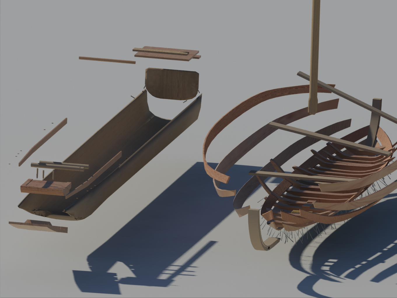
THINGS MUST CHANGEBoat-building traditions in Iron Age north-western Europe
Rodrigo Pacheco Ruiz [email protected]
@Twiiter:rpachecoruizsea
The Centre for Maritime Archaeology
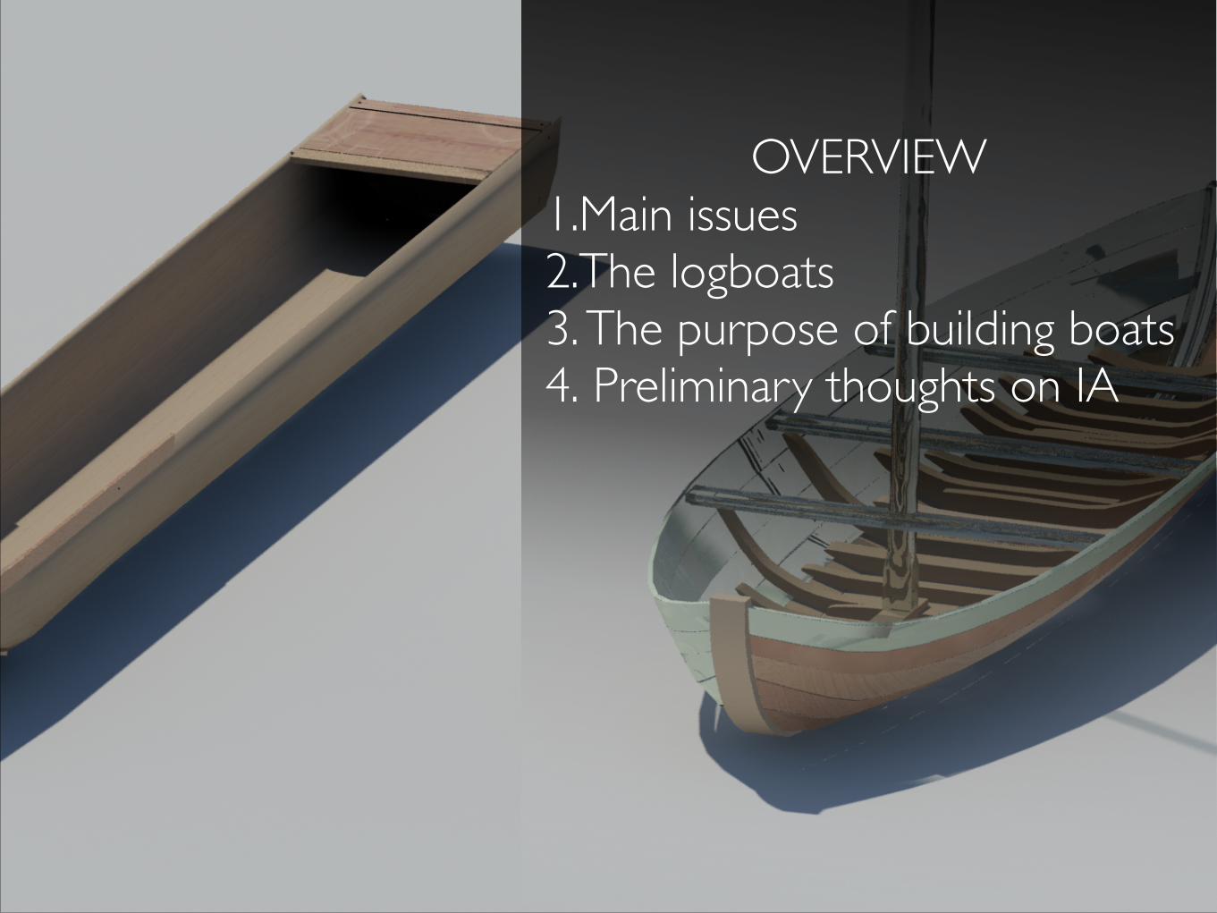
OVERVIEW 1.Main issues 2.The logboats 3. The purpose of building boats 4. Preliminary thoughts on IA
N o r t hN o r t h
A t l a n t i cA t l a n t i c
O c e a nO c e a n
E n g l i s h C h a n n e l
C e l t i cC e l t i c
S e aS e a
T h eT h e
M e d i t e r r a n e a nM e d i t e r r a n e a n
B a y o fB a y o f
B i s c a yB i s c a y
T h eT h e
N o r t hN o r t h
S e aS e a
10°0'0"E
10°0'0"E
5°0'0"E
5°0'0"E
0°0'0"
0°0'0"
5°0'0"W
5°0'0"W
10°0'0"W
10°0'0"W
15°0'0"W
15°0'0"W
60°0
'0"N
60°0
'0"N
55°0
'0"N
55°0
'0"N
50°0
'0"N
50°0
'0"N
45°0
'0"N
45°0
'0"N
40°0
'0"N
40°0
'0"N
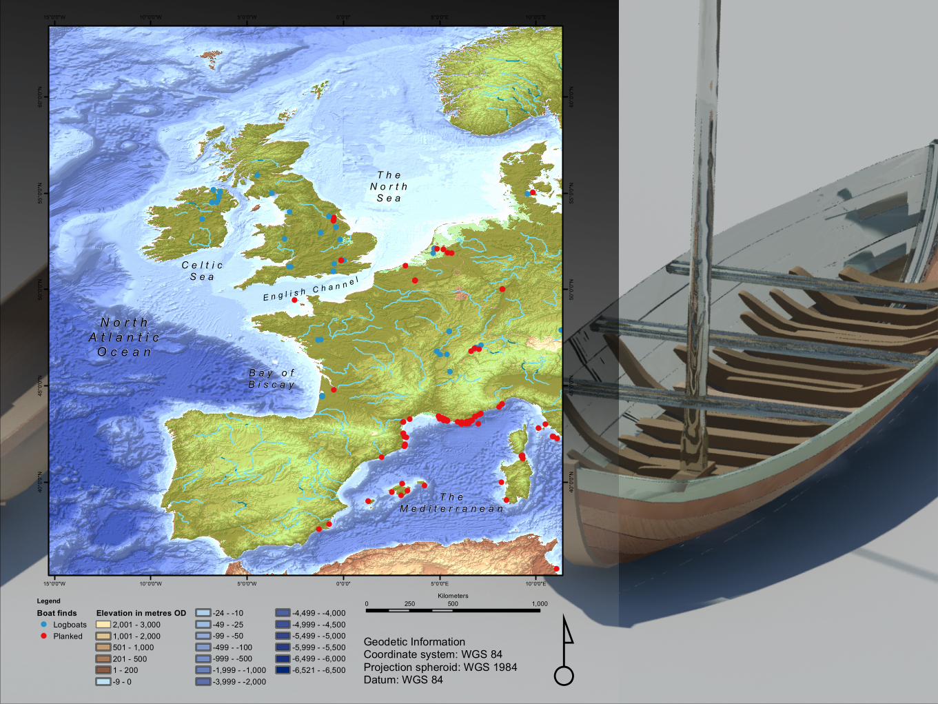
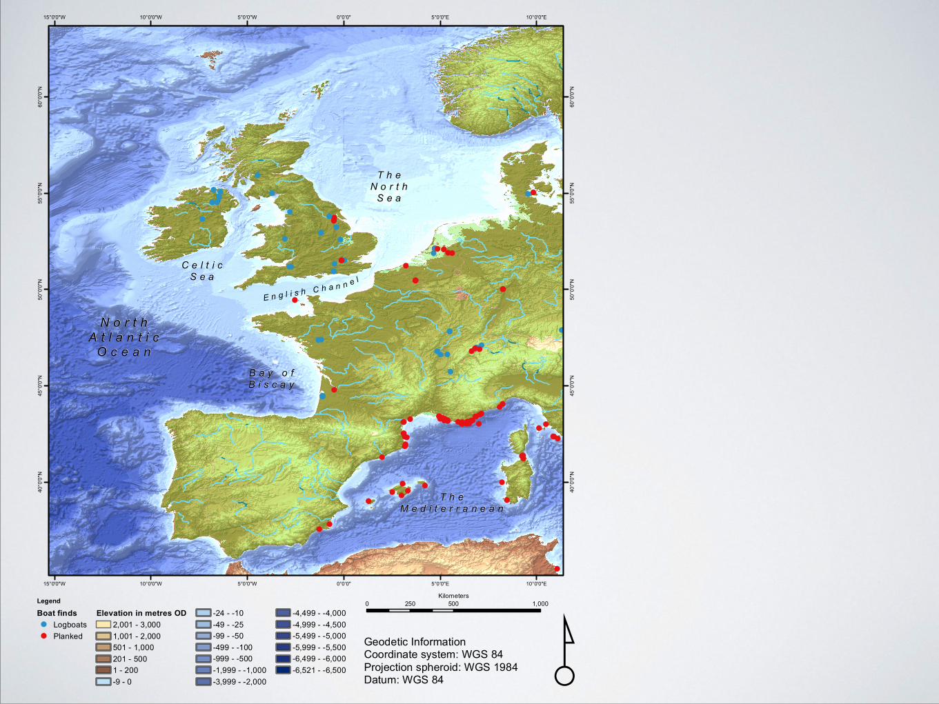
Legend
Boat finds
LogboatsPlanked
Elevation in metres OD
2,001 - 3,0001,001 - 2,000501 - 1,000201 - 5001 - 200-9 - 0
-24 - -10-49 - -25-99 - -50-499 - -100-999 - -500-1,999 - -1,000-3,999 - -2,000
-4,499 - -4,000-4,999 - -4,500-5,499 - -5,000-5,999 - -5,500-6,499 - -6,000-6,521 - -6,500 ¸Geodetic Information
Coordinate system: WGS 84Projection spheroid: WGS 1984Datum: WGS 84
0 500 1,000250Kilometers
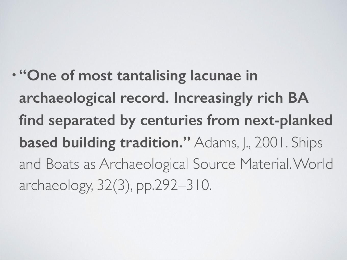
•“One of most tantalising lacunae in archaeological record. Increasingly rich BA find separated by centuries from next-planked based building tradition.” Adams, J., 2001. Ships and Boats as Archaeological Source Material. World archaeology, 32(3), pp.292–310.
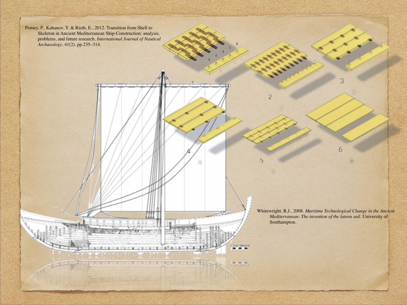
Whitewright, R.J., 2008. Maritime Technological Change in the Ancient Mediterranean : The invention of the lateen sail. University of Southampton.
Pomey, P., Kahanov, Y. & Rieth, E., 2012. Transition from Shell to Skeleton in Ancient Mediterranean Ship-Construction: analysis, problems, and future research. International Journal of Nautical Archaeology, 41(2), pp.235–314.
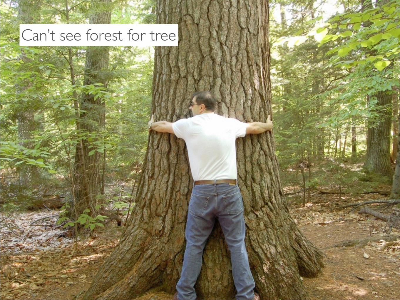
Can’t see forest for tree

5°0'0"E
5°0'0"E
0°0'0"
0°0'0"
5°0'0"W
5°0'0"W55
°0'0
"N
55°0
'0"N
50°0
'0"N
50°0
'0"N
45°0
'0"N
45°0
'0"N
40°0
'0"N
40°0
'0"N
5°0'0"E
5°0'0"E
0°0'0"
0°0'0"
5°0'0"W
5°0'0"W
55°0
'0"N
55°0
'0"N
50°0
'0"N
50°0
'0"N
45°0
'0"N
45°0
'0"N
40°0
'0"N
40°0
'0"N
5°0'0"E
5°0'0"E
0°0'0"
0°0'0"
5°0'0"W
5°0'0"W
55°0
'0"N
55°0
'0"N
50°0
'0"N
50°0
'0"N
45°0
'0"N
45°0
'0"N
40°0
'0"N
40°0
'0"N
5°0'0"E
5°0'0"E
0°0'0"
0°0'0"
5°0'0"W
5°0'0"W
55°0
'0"N
55°0
'0"N
50°0
'0"N
50°0
'0"N
45°0
'0"N
45°0
'0"N
40°0
'0"N
40°0
'0"N
5°0'0"E
5°0'0"E
0°0'0"
0°0'0"
5°0'0"W
5°0'0"W
55°0
'0"N
55°0
'0"N
50°0
'0"N
50°0
'0"N
45°0
'0"N
45°0
'0"N
40°0
'0"N
40°0
'0"N
2000 - 1500 BC 1500 - 1000 BC 1000 - 500 BC
500 BC - 0 0 - 500 AD
¸Geodetic InformationCoordinate system: WGS 84Projection spheroid: WGS 1984Datum: WGS 84
0 500 1,000 1,500250Kilometers
Legend
LP European vessels
dugoutplanked
Elevation in metres OD
2,001 - 3,0001,001 - 2,000501 - 1,000201 - 5001 - 200-9 - 0-24 - -10-49 - -25
-99 - -50-499 - -100-999 - -500-1,999 - -1,000-3,999 - -2,000-4,499 - -4,000-4,999 - -4,500-5,499 - -5,000-5,999 - -5,500-6,499 - -6,000-6,521 - -6,500

N o r t hN o r t h
A t l a n t i cA t l a n t i c
O c e a nO c e a n
E n g l i s h C h a n n e l
C e l t i cC e l t i c
S e aS e a
T h eT h e
M e d i t e r r a n e a nM e d i t e r r a n e a n
B a y o fB a y o f
B i s c a yB i s c a y
T h eT h e
N o r t hN o r t h
S e aS e a
10°0'0"E
10°0'0"E
5°0'0"E
5°0'0"E
0°0'0"
0°0'0"
5°0'0"W
5°0'0"W
10°0'0"W
10°0'0"W
15°0'0"W
15°0'0"W
60°0
'0"N
60°0
'0"N
55°0
'0"N
55°0
'0"N
50°0
'0"N
50°0
'0"N
45°0
'0"N
45°0
'0"N
40°0
'0"N
40°0
'0"N
Legend
Boat finds
LogboatsPlanked
Elevation in metres OD
2,001 - 3,0001,001 - 2,000501 - 1,000201 - 5001 - 200-9 - 0
-24 - -10-49 - -25-99 - -50-499 - -100-999 - -500-1,999 - -1,000-3,999 - -2,000
-4,499 - -4,000-4,999 - -4,500-5,499 - -5,000-5,999 - -5,500-6,499 - -6,000-6,521 - -6,500 ¸Geodetic Information
Coordinate system: WGS 84Projection spheroid: WGS 1984Datum: WGS 84
0 500 1,000250Kilometers
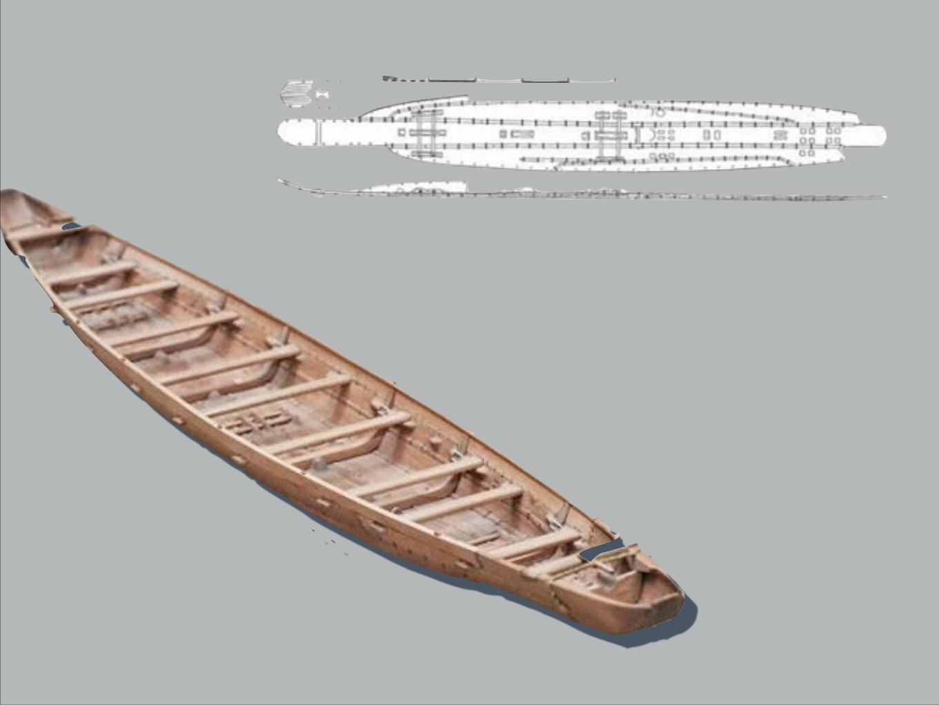
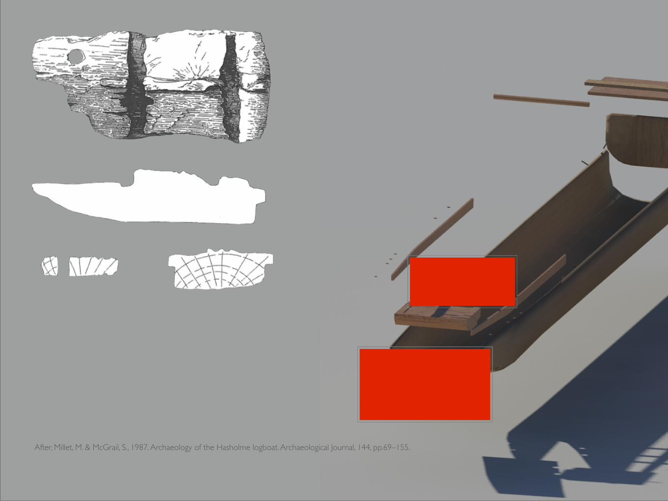
After, Millet, M. & McGrail, S., 1987. Archaeology of the Hasholme logboat. Archaeological Journal, 144, pp.69–155.
5°0'0"E
5°0'0"E
0°0'0"
0°0'0"
5°0'0"W
5°0'0"W55
°0'0
"N
55°0
'0"N
50°0
'0"N
50°0
'0"N
45°0
'0"N
45°0
'0"N
40°0
'0"N
40°0
'0"N
5°0'0"E
5°0'0"E
0°0'0"
0°0'0"
5°0'0"W
5°0'0"W
55°0
'0"N
55°0
'0"N
50°0
'0"N
50°0
'0"N
45°0
'0"N
45°0
'0"N
40°0
'0"N
40°0
'0"N
5°0'0"E
5°0'0"E
0°0'0"
0°0'0"
5°0'0"W
5°0'0"W
55°0
'0"N
55°0
'0"N
50°0
'0"N
50°0
'0"N
45°0
'0"N
45°0
'0"N
40°0
'0"N
40°0
'0"N
5°0'0"E
5°0'0"E
0°0'0"
0°0'0"
5°0'0"W
5°0'0"W
55°0
'0"N
55°0
'0"N
50°0
'0"N
50°0
'0"N
45°0
'0"N
45°0
'0"N
40°0
'0"N
40°0
'0"N
5°0'0"E
5°0'0"E
0°0'0"
0°0'0"
5°0'0"W
5°0'0"W
55°0
'0"N
55°0
'0"N
50°0
'0"N
50°0
'0"N
45°0
'0"N
45°0
'0"N
40°0
'0"N
40°0
'0"N
2000 - 1500 BC 1500 - 1000 BC 1000 - 500 BC
500 BC - 0 0 - 500 AD
¸Geodetic InformationCoordinate system: WGS 84Projection spheroid: WGS 1984Datum: WGS 84
0 500 1,000 1,500250Kilometers
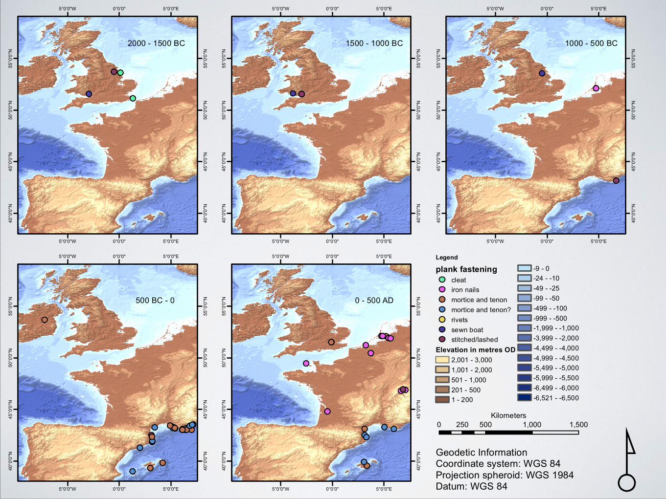
Legend
plank fastening
cleatiron nailsmortice and tenonmortice and tenon?rivetssewn boatstitched/lashed
Elevation in metres OD
2,001 - 3,0001,001 - 2,000501 - 1,000201 - 5001 - 200
-9 - 0-24 - -10-49 - -25-99 - -50-499 - -100-999 - -500-1,999 - -1,000-3,999 - -2,000-4,499 - -4,000-4,999 - -4,500-5,499 - -5,000-5,999 - -5,500-6,499 - -6,000-6,521 - -6,500
Thanks to Fraser Sturt , Julian Whitewright, Jesse Ransley, Beat
Arnold, Panagiota Markoulaki, Lucy Blue, Peter Campbell, Carmen Obied, Oscar Encuentra Bardina,
Mari Carmen Escobar, Darina Tully, Michael-Ann Benivino and Kieran Westley
Copyright © 2022 FDOKUMEN

