The I-69 Power-Play: Power Relationships in the Political Landscape of a Rural Road Project
14
The I-69 Power-Play: Power Relationships in the Political Landscape of a Rural Road Project Dan Johnston ABSTRACT: The production of physical landscape is primarily controlled by those with more sociopolitical power than others within that society. Dominance of the visual landscape helps shape and maintain that sociopolitical power. Similarly, they exert their dominance over the non-physical, political landscape with the same goal. The I-69 Extension in Indiana has become a flashpoint in the underlying conflict between those in power under the existing structures and the rural residents of southwestern Indiana that oppose the construction of this new-terrain Interstate Highway as an overreaching of the federal and state governments into their land rights and the rural landscape. This paper examines the theories of power influences on the production of space. It goes on to show how opponents to this 21st Century NAFTA Superhighway have attempted to remain visible in both the physical and political landscapes, and how, in turn, those in power have limited or removed entirely their opponents’ presence. Introduction Road construction today hardly seems remarkable. Yet constructing a completely new-terrain Interstate Highway in the 21 st Century is relatively unheard of. Roads, at the time of many ancient civilizations, were amazing triumphs of engineering and technology. Even the Eisenhower Interstate Highway System, America’s flagship transportation network, has been largely touted as the greatest public-works project in history. But most people today generally don’t question the existence of a road, nor its origin. The only questioning of roads that occurs normally comes when deciding which one to take through the endlessly interweaving maze of roads that we move through on a daily basis. In fact, roads are so much a part of our lives that we have to institutionalize non-connected ‘open space” to limit the reach of modern connectedness. If we look ‘beneath the hood’ of a road, there are many moving pieces to what appears before us as a static stretch of nothing. Thinking specifically of the construction of a road, we can investigate, among many things, its engineering, its economics, or its movements; (both those happening to accomplish its creation and those anticipated upon its completion). There is another piece of machinery driving a road’s construction which I will discuss in this paper. How do power relationships influence the planning and building of roads? And what role do those power-plays take in creating a road’s sociopolitical character? The road project I will use to examine these power relationships is the Interstate 69 Extension set to connect Evansville, IN through southwestern Indiana to Indianapolis and the existing northern portion of that freeway. To answer these questions I will first situate the project in relation to road-building in general and the role that it plays
Transcript of The I-69 Power-Play: Power Relationships in the Political Landscape of a Rural Road Project
The I-69 Power-Play: Power Relationships in the Political Landscape of a Rural Road Project
Dan Johnston
ABSTRACT: The production of physical landscape is primarily controlled by those with more sociopolitical power than others within that society. Dominance of the visual landscape helps shape and maintain that sociopolitical power. Similarly, they exert their dominance over the non-physical, political landscape with the same goal. The I-69 Extension in Indiana has become a flashpoint in the underlying conflict between those in power under the existing structures and the rural residents of southwestern Indiana that oppose the construction of this new-terrain Interstate Highway as an overreaching of the federal and state governments into their land rights and the rural landscape. This paper examines the theories of power influences on the production of space. It goes on to show how opponents to this 21st Century NAFTA Superhighway have attempted to remain visible in both the physical and political landscapes, and how, in turn, those in power have limited or removed entirely their opponents’ presence.
Introduction
Road construction today hardly seems remarkable. Yet constructing a completely new-terrain Interstate Highway in the 21st Century is relatively unheard of. Roads, at the time of many ancient civilizations, were amazing triumphs of engineering and technology. Even the Eisenhower Interstate Highway System, America’s flagship transportation network, has been largely touted as the greatest public-works project in history. But most people today generally don’t question the existence of a road, nor its origin. The only questioning of roads that occurs normally comes when deciding which one to take through the endlessly interweaving maze of roads that we move through on a daily basis. In fact, roads are so much a part of our lives that we have to institutionalize non-connected ‘open space” to limit the reach of modern connectedness.
If we look ‘beneath the hood’ of a road, there are many moving pieces to what appears before us as a static stretch of nothing. Thinking specifically of the construction of a road, we can investigate, among many things, its engineering, its economics, or its movements; (both those happening to accomplish its creation and those anticipated upon its completion). There is another piece of machinery driving a road’s construction which I will discuss in this paper. How do power relationships influence the planning and building of roads? And what role do those power-plays take in creating a road’s sociopolitical character? The road project I will use to examine these power relationships is the Interstate 69 Extension set to connect Evansville, IN through southwestern Indiana to Indianapolis and the existing northern portion of that freeway. To answer these questions I will first situate the project in relation to road-building in general and the role that it plays
Johnston 2
in the production of landscape. I will then examine generally social and political relationships of power and how they contribute to the production of space, and then return to how these ideas apply to the current situation regarding I-69.
A Brief History of Interstate 69
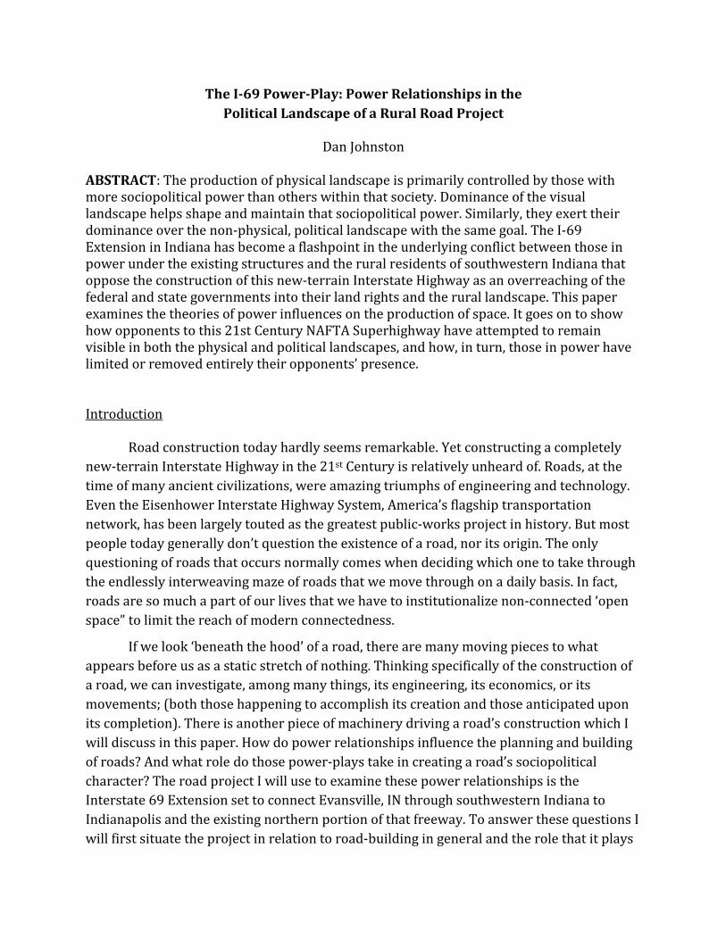
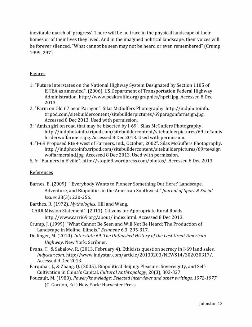
For over a decade, Indiana has been actively engaged in the advancement of the I-69 project. Currently, approximately half of the extended branch of the freeway in southwestern Indiana is open to traffic with construction on the northern portion projected to be finished in 2015. Previous to the current push to build I-69, the only completed portion ran north from Indianapolis through Port Huron, Michigan on the Canadian border. This portion was completed by the 1980s. South of the Kentucky border the road lies in various stages of development, with completed portions of the road officially designated as I-69 only existing in unconnected pieces in Kentucky, Tennessee, Mississippi, Arkansas, Louisiana, and Texas. Thus, the Indiana I-69 Extension project is only a small piece within a larger national plan to complete the entire corridor through to the Lower Rio Grande Valley on the eastern Texas-Mexico border (Figure 1).
Road-building has been part of the American government’s economic development project since the early 19th Century (Longfellow 2013). The Eisenhower Interstate Highway system was almost entirely planned and built in the three decades following the Federal Highway Act of 1956. Part of the act created the Highway Trust Fund, which provided general Treasury tax funds exclusively for building the nation’s highways. Construction projects continued to be funded through the Federal-Aid Highway program of 1973, which was a renewal of the 1956 Act (Weingroff 2013). But because of a changing funding structure, less need, and focus on transportation besides highways, projects progressed at a much slower pace. Also, as more highway infrastructure was established, the need for new construction fell.
Coinciding with the continued move in the United States to more neoliberal economic structuring within the government, the Intermodal Surface Transportation Act of 1991 (ISTEA) nominally supported the allocation of federal transportation dollars to public
Figure 1 Congressional High Priority Corridors Future Interstates designated by ISTEA in 1991. Corridor 18, shown in red, is now the I-69 corridor.
Johnston 3
transit systems. Mostly, it established a new system for states to obtain funding for its transportation needs without relying as much on federal aid (Weingroff 2001). It also established goals for improving the national transportation system, including establishing high priority corridors, one of which would later be designated as Interstate 69. One of the primary issues with this program and its implementation on the ground was that it made demands of the states to complete the portions of the goals that pertained to their territory without providing an explicit way to pay for it. Actions taken by those states (in this case Indiana) to organize the ability to pay for these projects have been one of the primary sources of contention among the opposition movement (Dellinger 2010).
Roads in the Landscape
I have made this my focus of study because I was shocked at how highly contested this road was. Not only was I shocked at the controversy, but I was also shocked at myself for never having considered the construction of a new
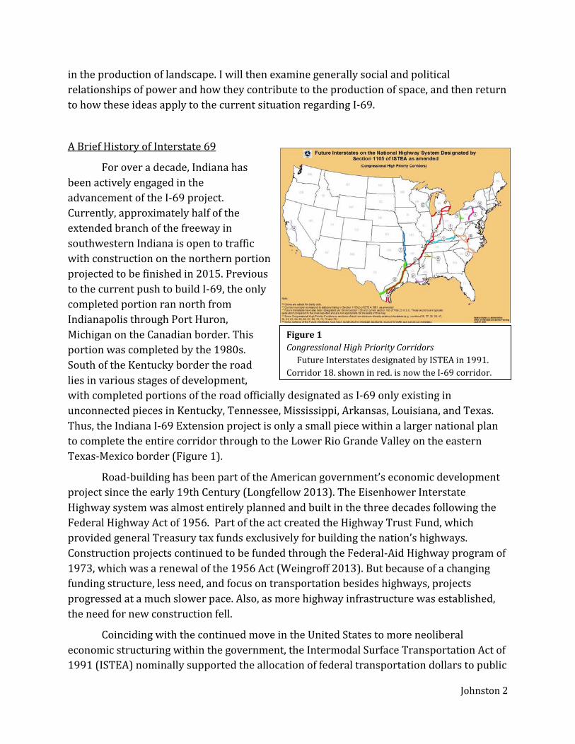
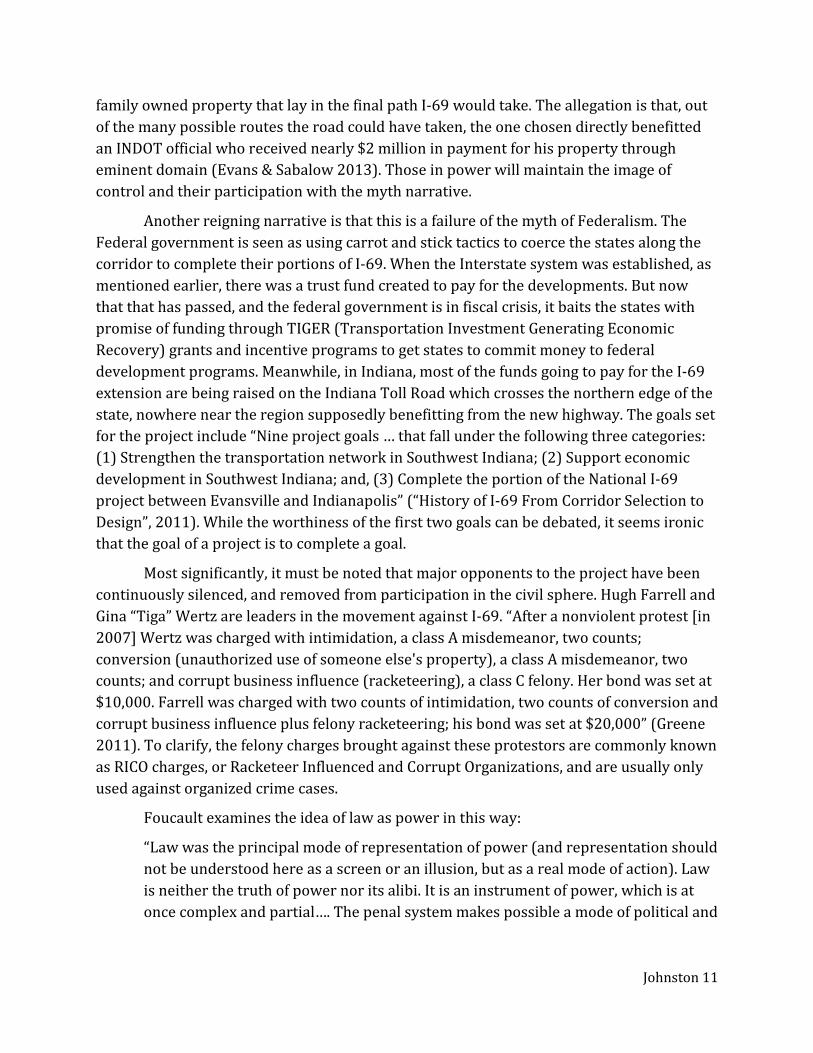
freeway as anything but an inevitable step toward future progress. I only became aware of it recently when investigating the characteristics of Bloomington, IN upon my intention of moving there from the West. One source (now forgotten, as it did not appear at the time to carry anything of consequence or controversy) noted that Bloomington was not located on an Interstate freeway, but would be in the proximate years. I became aware of the road’s contested, and politically divisive, nature only when I saw a yard sign similar to that shown in Figure 2. I am familiar with the road as something more than simply a route from A to B as I have logged annually over the last 10 years an average of 5,000 miles driven over long distance in the United States, Europe and Latin America. Being on the road for more than a daily commute makes one think about roads on a different level.
Figure 2 Farm on Old 67 near Paragon, IN Signs like this produced by CARR and other organizations are a visible mark on the landscape of the underlying political debates raging over the construction of the Interstate 69 Extension.

Johnston 4
Roads are not often the subject of landscape study. When they are, it is mostly in the context of their relationship with the urban environment (McHarg 1992; Weber 2004), or perhaps as a sign of an invasion of the urban into the bucolic, pristine rural environment (Jackson 1984; Marx 2004). But as such an integral element of our everyday life, it is worthy of study within the framework of landscape. Because roads are primarily designed for utility, the aesthetics of a landscape according to Western ideals would abhor the presence of a multilane highway. Observations of recent construction projects reveal that more effort is being made to make roads more appealing by the use of greenery, public art, and simple design features. This is consistent with a mindset that roads should be disguised from view so that the ‘real landscape’ or cityscape can be seen.
Travel, the American automobile culture, and roads have frequently been subjects of cultural geography research, though not the landscape elements of the road. Joe Weber (2004) challenged the prevailing mindset among cultural geographers and proposed that the road itself could be the focus of our attentions to cultural study. He briefly looks at one particular type of road, the American Interstate, as a unique, vivid place with dynamic character, and not just a bland, featureless, homogenous stretch of concrete. Weber does not concern himself with the production of roads, but more with a traveler’s experience of them. He acknowledges that the Interstates are corridors “[traversing] the countryside but are apart from it by virtue of their design and limited access” (2004, 4), and therefore they take on a life of their own. Elements of this particular type of roadway promote a specific sense of place unique to the Interstate. Weber further nods to the construction stage of the Interstate system, but only insofar as the ever-present construction zones are a ‘cultural place’ characteristic of the highway system, and not that there is any underlying sociopolitical pressures driving that construction (Weber, 2004, 16).
Interstate projects have been opposed in the past, some successfully, but according to the examples Weber provides, the contested roads appear only to have been within an urban area. These projects are usually the state’s response to an expanding urban population, which requires the creation of new beltways, bypasses and spurs being added to existing highway infrastructure to accommodate that population and commuters’ access to the city. They are contested mainly by the people whose homes lie in the path of destruction necessary for the increased expansion. Weber (2004) acknowledges some themes of urban landscape study by mentioning the acting out of an annual commemorative picnic meant to reenact the community that was lost under an interstate. Without further analysis of the implications of these contested American roadways, Weber ends this short section, stating that “while the destruction of urban communities to make way for freeways that connect distant cities is an obvious symbol of government power, those locations where battles were fought to stop freeways are also important” (2004, 17). The enacting of this government power through eminent domain seizures (and destruction) of property is exactly what should be analyzed.
Johnston 5
Contested roads can be discussed through the medium of landscape study, as Ian McHarg (1992) has done in his book on landscape architecture, although his focus is also exclusive to the urban landscape. Road projects are primarily economic in nature; there is always a cost to counter the benefits. When deciding the route a new road should take, deciding to go through populated areas creates a problem by driving up costs, but the evaluation of the routes during the planning stages won’t necessarily consider the social impact (McHarg 1992). This obviously leads to disenfranchising the people with a result of contested roads. McHarg’s proposed solution is to place value on social elements, e.g. historical places, scenery, community, health, etc., so that they can be weighed alongside the economic factors. This would supposedly establish a corridor with the greatest social good, or at least the lowest social cost (McHarg 1992). What he fails to consider is that there are certain non-economic factors that have been undervalued because of the power relationships already inherent in the process. This problematic valuation is especially apparent when considering a road project in a rural area, as the property values and character values are considerably different than the same figures in an urban setting.
The Rural-Urban Divide
When we broaden the scale to where we consider both rural and urban landscapes and where both systems (i.e. social structures, community values, etc.) are present, the power relationships involved are very different. The problem with building an Interstate is that the stakeholders in favor of the road are usually trying to connect two or more urban centers, and the actors from the city (the “locus of power and politics” (Marx 2004, 22)) will inevitably undervalue the rural actors. Indeed, one of the main opponents fighting the I-69 Extension has been an organization explicitly advocating for ‘rural rights’. Their mission statement declares:
“Citizens for Appropriate Rural Roads, Inc. (CARR) is a grassroots organization dedicated to educating Hoosiers [i.e. Indiana residents] about the benefits of financially responsible and environmentally sound transportation policies. CARR is committed to the principle that sensible policies, targeted toward reinvestment in existing infrastructure, will satisfy Hoosier transportation needs while preserving the integrity of Indiana's farmlands, natural resources, and rural communities.” (“CARR Mission Statement” 2011) Aside from the economic reasons behind the road’s opposition, among the people
directly affected by the project has been the anticipated rupture of their country way of life (Dellinger 2010). As previously stated, road development is economic in nature. In an example of a different rural area’s development, Barnes (2009) explains that for locals, “although the new roads brought jobs and made communication and transportation easier for local residents, they [the roads] were sometimes regarded as a double-edged sword because they also enabled entry for ‘outsiders’ who began to make changes” (Barnes 2009,
Johnston 6
233). A “vulnerable border” exists between the invading urban power and the country, and the residents of the rural community literally retreat to the relative safety of the idyllic pastoral landscape (Marx 2004, 22). But as the source of power penetrates the rural from the urban center, the uneven relationship becomes clearer.
The clearest contention, in this situation, is the difference in the valuation of the landscape: one side valuing the land itself, the other the character of the place. The sentiments of this marginalized population about their valuation of the rural are best expressed by Silas McGuffers, a resident of rural Indiana. His remarks given at the I-69 New-Terrain Remonstrance Hearing in Indianapolis the summer of 2000 (early in the planning stages of the I-69 Extension project), and later published online as an open letter to the Indiana Governor and INDOT:
“The interior of Southwest Indiana, being perhaps the most representative part of Southern Indiana in general, is in need of being preserved as intact as possible for its intrinsic value, both landscape-wise and as a "cultural refuge" -- a touchstone -- as it is still closest to the concept of "traditional Indiana"…. Most of Southern Indiana that remains undeveloped needs to stay that way…. These parts of the state, through a type of serendipitous benign neglect, have become a preserve-of-sorts of the way Indiana used to be: more rural, less-developed; having a slower, more authentic way of life and look about it…. The areas being discussed are the Soul of Indiana and grow smaller each year already….”
McGuffers frames his argument within the language of commodities and value used by politicians and the planners, and at one point refers to the quality of the land as a tourism resource. He offers, as McHarg did, an alternative definition of value. He finishes his statement, speaking directly to the Governor:
“Why not be true to your roots and help to spare Southwest and Southern Indiana of despoilment, at least for our grandchildren's future enjoyment and cultural needs if not for our own. They will thank us that we put our feet down … and saved what's left of the Real Indiana for them….” (McGuffers 2001, emphasis original)
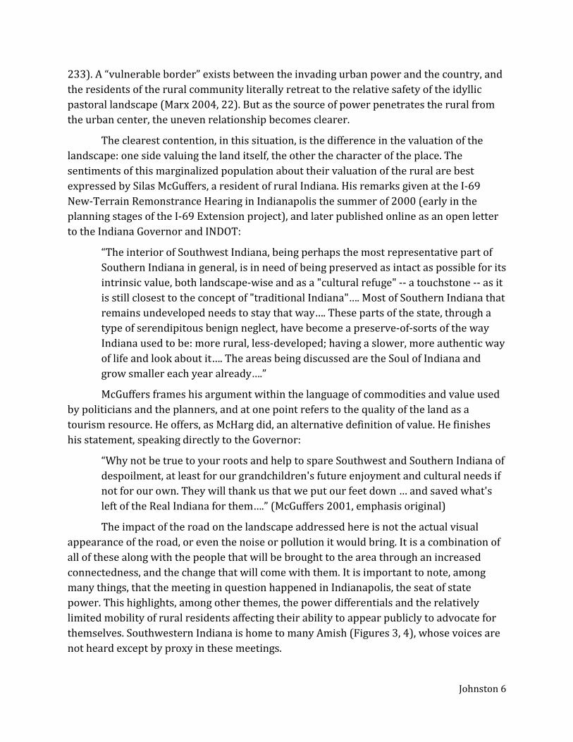
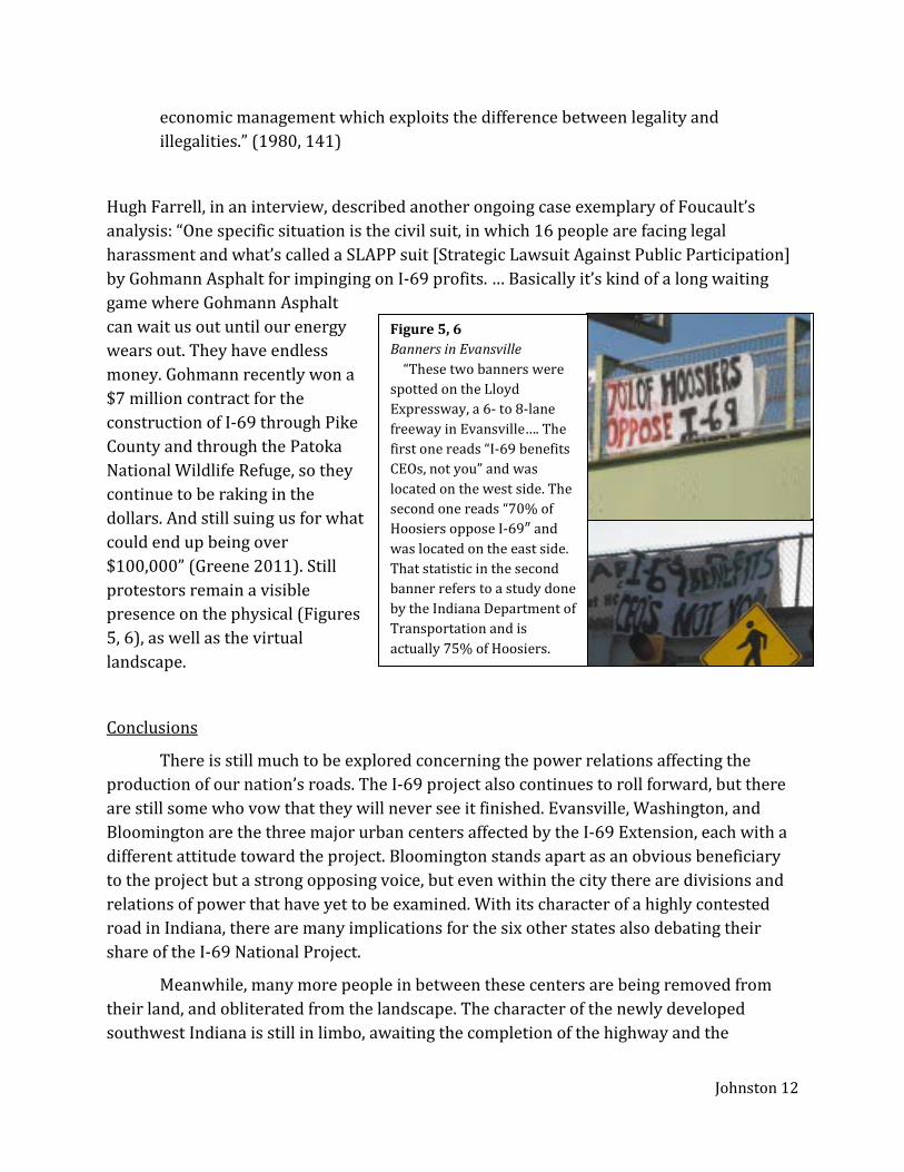
The impact of the road on the landscape addressed here is not the actual visual appearance of the road, or even the noise or pollution it would bring. It is a combination of all of these along with the people that will be brought to the area through an increased connectedness, and the change that will come with them. It is important to note, among many things, that the meeting in question happened in Indianapolis, the seat of state power. This highlights, among other themes, the power differentials and the relatively limited mobility of rural residents affecting their ability to appear publicly to advocate for themselves. Southwestern Indiana is home to many Amish (Figures 3, 4), whose voices are not heard except by proxy in these meetings.
Johnston 7
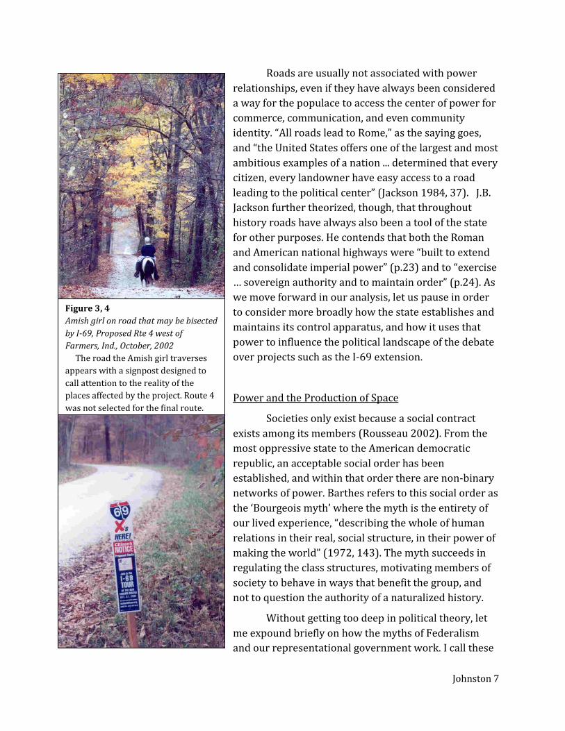
Roads are usually not associated with power relationships, even if they have always been considered a way for the populace to access the center of power for commerce, communication, and even community identity. “All roads lead to Rome,” as the saying goes, and “the United States offers one of the largest and most ambitious examples of a nation ... determined that every citizen, every landowner have easy access to a road leading to the political center” (Jackson 1984, 37). J.B. Jackson further theorized, though, that throughout history roads have always also been a tool of the state for other purposes. He contends that both the Roman and American national highways were “built to extend and consolidate imperial power” (p.23) and to “exercise … sovereign authority and to maintain order” (p.24). As we move forward in our analysis, let us pause in order to consider more broadly how the state establishes and maintains its control apparatus, and how it uses that power to influence the political landscape of the debate over projects such as the I-69 extension.
Power and the Production of Space
Societies only exist because a social contract exists among its members (Rousseau 2002). From the most oppressive state to the American democratic republic, an acceptable social order has been established, and within that order there are non-binary networks of power. Barthes refers to this social order as the ‘Bourgeois myth’ where the myth is the entirety of our lived experience, “describing the whole of human relations in their real, social structure, in their power of making the world” (1972, 143). The myth succeeds in regulating the class structures, motivating members of society to behave in ways that benefit the group, and not to question the authority of a naturalized history.
Without getting too deep in political theory, let me expound briefly on how the myths of Federalism and our representational government work. I call these
Figure 3, 4 Amish girl on road that may be bisected by I-69, Proposed Rte 4 west of Farmers, Ind., October, 2002 The road the Amish girl traverses appears with a signpost designed to call attention to the reality of the places affected by the project. Route 4 was not selected for the final route.
Johnston 8
myths because they function as narratives to which we are all “myth consumers” (Barthes 1972, 156). The idea behind Federalism is that there are checks and balances between the Federal and State governments so that neither gains too much control to have undue influence over the other; the National government is independent of any one state’s influence, and each state has some degree of autonomy. Beneath these institutions, or, according to the Constitution, above them, lie the People. The social contract is such that the government does the bidding of the people, that each involved citizen will have his/her voice heard, and that positive change will result. The belief in, and the enacting of this myth is the keystone of the construction of public political space in our country. But “myth hides nothing and flaunts nothing: it distorts” reality (Barthes 1972, 129). It is how those in power maintain their power.
Foucault, in regards to the “mechanisms of power” in a society, understands that it is at “the point where power reaches into the very grain of individuals, touches their bodies and inserts itself into their actions and attitudes, their discourses, learning processes and everyday lives” (1980, 39) that it has its influence such that “relations of power … necessarily extend beyond the limits of the state…” (1980 122). This does not automatically disregard the influence of the state. “His understanding of power … includes both the ‘regulatory’ power of states over populations … and the ‘capillary’ and disciplinary power that produces ‘docile bodies’ in the everyday life of institutions” (Farquhar & Zhang 2005, 304). A state will use the established myth-narrative that will maintain order.
One means for a state to guard its power is the production of knowledge. While a monopoly on truth is not exclusively under the state’s purview, it can manipulate the many power relations it holds in order to influence the perception of truth.
“In societies like ours, the ‘political economy’ of truth is characterized by five important traits. ‘Truth’ is centered on the form of scientific discourse and the institutions which produce it; it is subject to constant economic and political incitement (the demand for truth, as much for economic production as for political power; it is the object, under diverse forms, of immense diffusion and consumption (circulating through apparatuses of education and information whose extent is relatively broad in the social body, not withstanding certain strict limitations); it is produced and transmitted under the control, dominant if not exclusive, of a few great political and economic apparatuses (university, army, writing, media); lastly it is the issue of a whole political debate and social confrontation (‘ideological’ struggles).” (Foucault 1980, 131-2)
To briefly root this idea in the focus of the paper, consider the planning and process of building I-69. One state agency, the Environmental Protection Agency, requires another state agency, the Department of Transportation, to produce an environmental impact study. The experts are called in, data is collected, models are analyzed, and reports are
Johnston 9
made. In the case of I-69, there was a two-tiered process where the approval of the first (United States Department of Transportation [USDOT] 2004), made way for a second study. Each draft of each document is well over 1000 pages long, and even a single section of the Second Tier report (USDOT 2011) is multiple times greater in length. Some dedicated stakeholders (e.g. CARR) have had some ability to review the data, but few other citizens. In the end, the decision was issued based on the rule of experts. Finally, Foucault goes on,
“The problem is not changing people’s consciousnesses - or what’s in their heads - but the political, economic, institutional regime of the production of truth. It’s not a matter of emancipating truth from every system of power … but of detaching the power of truth from the forms of hegemony, social, economic and cultural, within which it operates at the present time.” (1980, 133)
Essential to maintaining the myth is the production of both physical and metaphorical spaces. Alison Mountz describes how “states [will] manipulate geography to prevent and hide asylum seekers” (2001, 385). If an immigrant body is literally out of sight, they are kept out of the public mind. In turn though, those marooned bodies will “[use] technology … to navigate the political space of possibility” (Mountz 2001, 394) of changing their status and to preserve a virtual sense of community. Henri Lefebvre’s work can give us insight into these imagined community spaces.
All “power relations ... occur in space” (Lefebvre 1991, 33). Space, specifically ‘social space’, according to Lefebvre, can be both absolute (physical), and abstract (representational). It is in this abstraction of space where the dominant power “[endeavors] to mould the spaces it dominates” and pursues “often by violent means, to reduce the obstacles and resistance it encounters there” (Lefebvre 1991, 49). It is this approach that links theory of power, protest, and social order to the observed state control over absolute space (the construction zone, the town hall) and abstract space (mass media/press, policy documentation).
It is important to remember the motivations behind a state’s production of space in this way. It perpetuates the myth so that the status remains undisturbed. In fact, “the legitimacy of liberal and neoliberal governments is established as limitations are placed on the regulatory reach of the state and market and individual freedoms are privileged” (Barnes 2009, 233). What does this mean in the context of a massive public works project? It means branding the project with a tone of economic development, where the goals of the state align with the goals of producers and consumers driving the economy. It means that individuals are validated through public meetings where their voices are heard while the project continues to roll forward. The impact the individuals see may be simply a change from one inevitability to another, but the presence of change as a result of their efforts further establishes the myth and gives legitimacy to the power systems established.
Johnston 10
The physical landscape is an obvious stage where “the economic and political power exerted by the private interests that dominate public–private partnerships takes a concrete, material form” (Crump 1999, 299). A close reading of the physical landscape will display the power-play at work when it was formed. Lefebvre tells us that “ideologies do not produce space: rather, they are in space, and of it. It is the forces of production and the relations of production that produce social space” (1991, 210). This social space, or more specifically in the case of the I-69 debate, political space, has been formed within the established power structures for the purpose of staging a debate without the possibility of an undecided outcome. Crump tells us that
“Landscapes are intentionally created out of the social processes of struggle and compromise. Significantly, he [Mitchell] recognizes that even though landscapes appear to be extremely solid and stable, they are really only temporary manifestations of the social relations that produce them. The very solidity represented by a landscape helps to naturalize the social relations that produces it, and landscapes are often used to limit, if not eliminate, social conflict as those with the political and economic power stamp their vision into the landscape. Once the dominant class succeeds in producing a particular landscape in which to embed its version of social relations, that materialization becomes a reality to be transcended by any opposing forces.” (1999, 299)
The imagined political spaces are as alive as the physical spaces they represent. Sometimes, though, once the production of the space has ‘solidified’ the visually perceived landscape, access to the imagined space is cut off, and it is only possible for those “cognizant of this history … to disinter the mysteries that lie entombed there and thereby rescue that rich experience” (Harvey 1979, 381, emphasis mine; see also Hines 1982) behind the production of the landscape.
I-69: Contested Road
Through the lens of this one event we may see the many powers at play displayed through their actions, reactions, policies, and their eventual impact on the landscape. According to one narrative of the road’s history (Dellinger 2010), the idea for a completed I-69 started nearly 30 years ago with one man in Washington, IN who had the connections and the will, and started things rolling. The key to getting the state to fund a road project was to connect a local project into larger narratives. Other like-minded people, those who would benefit from road construction contracts or a direct route to a big city, spread the word to people from other states. These ‘entrepreneurs’ lobbied Congress to get the I-69 corridor included as an ISTEA high-priority corridor. Personal connections with the governor lubricated the path, and that was only the beginning of the charges of corruption. In one case, the chief of staff at the Indiana Department of Transportation (INDOT) and his
Johnston 11
family owned property that lay in the final path I-69 would take. The allegation is that, out of the many possible routes the road could have taken, the one chosen directly benefitted an INDOT official who received nearly $2 million in payment for his property through eminent domain (Evans & Sabalow 2013). Those in power will maintain the image of control and their participation with the myth narrative.
Another reigning narrative is that this is a failure of the myth of Federalism. The Federal government is seen as using carrot and stick tactics to coerce the states along the corridor to complete their portions of I-69. When the Interstate system was established, as mentioned earlier, there was a trust fund created to pay for the developments. But now that that has passed, and the federal government is in fiscal crisis, it baits the states with promise of funding through TIGER (Transportation Investment Generating Economic Recovery) grants and incentive programs to get states to commit money to federal development programs. Meanwhile, in Indiana, most of the funds going to pay for the I-69 extension are being raised on the Indiana Toll Road which crosses the northern edge of the state, nowhere near the region supposedly benefitting from the new highway. The goals set for the project include “Nine project goals … that fall under the following three categories: (1) Strengthen the transportation network in Southwest Indiana; (2) Support economic development in Southwest Indiana; and, (3) Complete the portion of the National I-69 project between Evansville and Indianapolis” (“History of I-69 From Corridor Selection to Design”, 2011). While the worthiness of the first two goals can be debated, it seems ironic that the goal of a project is to complete a goal.
Most significantly, it must be noted that major opponents to the project have been continuously silenced, and removed from participation in the civil sphere. Hugh Farrell and Gina “Tiga” Wertz are leaders in the movement against I-69. “After a nonviolent protest [in 2007] Wertz was charged with intimidation, a class A misdemeanor, two counts; conversion (unauthorized use of someone else's property), a class A misdemeanor, two counts; and corrupt business influence (racketeering), a class C felony. Her bond was set at $10,000. Farrell was charged with two counts of intimidation, two counts of conversion and corrupt business influence plus felony racketeering; his bond was set at $20,000” (Greene 2011). To clarify, the felony charges brought against these protestors are commonly known as RICO charges, or Racketeer Influenced and Corrupt Organizations, and are usually only used against organized crime cases.
Foucault examines the idea of law as power in this way:
“Law was the principal mode of representation of power (and representation should not be understood here as a screen or an illusion, but as a real mode of action). Law is neither the truth of power nor its alibi. It is an instrument of power, which is at once complex and partial…. The penal system makes possible a mode of political and
Johnston 12
economic management which exploits the difference between legality and illegalities.” (1980, 141)
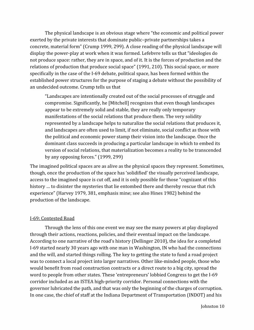
Hugh Farrell, in an interview, described another ongoing case exemplary of Foucault’s analysis: “One specific situation is the civil suit, in which 16 people are facing legal harassment and what’s called a SLAPP suit [Strategic Lawsuit Against Public Participation] by Gohmann Asphalt for impinging on I-69 profits. … Basically it’s kind of a long waiting game where Gohmann Asphalt can wait us out until our energy wears out. They have endless money. Gohmann recently won a $7 million contract for the construction of I-69 through Pike County and through the Patoka National Wildlife Refuge, so they continue to be raking in the dollars. And still suing us for what could end up being over $100,000” (Greene 2011). Still protestors remain a visible presence on the physical (Figures 5, 6), as well as the virtual landscape.
Conclusions
There is still much to be explored concerning the power relations affecting the production of our nation’s roads. The I-69 project also continues to roll forward, but there are still some who vow that they will never see it finished. Evansville, Washington, and Bloomington are the three major urban centers affected by the I-69 Extension, each with a different attitude toward the project. Bloomington stands apart as an obvious beneficiary to the project but a strong opposing voice, but even within the city there are divisions and relations of power that have yet to be examined. With its character of a highly contested road in Indiana, there are many implications for the six other states also debating their share of the I-69 National Project.
Meanwhile, many more people in between these centers are being removed from their land, and obliterated from the landscape. The character of the newly developed southwest Indiana is still in limbo, awaiting the completion of the highway and the
Figure 5, 6 Banners in Evansville “These two banners were spotted on the Lloyd Expressway, a 6- to 8-lane freeway in Evansville…. The first one reads “I-69 benefits CEOs, not you” and was located on the west side. The second one reads “70% of Hoosiers oppose I-69″ and was located on the east side. That statistic in the second banner refers to a study done by the Indiana Department of Transportation and is actually 75% of Hoosiers.
Johnston 13
inevitable march of ‘progress’. There will be no trace in the physical landscape of their homes or of their lives they lived. And in the imagined political landscape, their voices will be forever silenced. “What cannot be seen may not be heard or even remembered” (Crump 1999, 297).
Figures
1: “Future Interstates on the National Highway System Designated by Section 1105 of ISTEA as amended”. (2006). US Department of Transportation Federal Highway Administration. http://www.peaktraffic.org/graphics/hpcfi.jpg. Accessed 8 Dec 2013.
2: “Farm on Old 67 near Paragon”. Silas McGuffers Photography. http://indphotoinfo. tripod.com/sitebuildercontent/sitebuilderpictures/69paragonfarmsign.jpg. Accessed 8 Dec 2013. Used with permission.
3: “Amish girl on road that may be bisected by I-69”. Silas McGuffers Photography . http://indphotoinfo.tripod.com/sitebuildercontent/sitebuilderpictures/69rte4amishriderwoffarmers.jpg. Accessed 8 Dec 2013. Used with permission.
4: “I-69 Proposed Rte 4 west of Farmers, Ind., October, 2002”. Silas McGuffers Photography. http://indphotoinfo.tripod.com/sitebuildercontent/sitebuilderpictures/69rte4signwoffarmersind.jpg. Accessed 8 Dec 2013. Used with permission.
5, 6: “Banners in E’ville”. http://stopi69.wordpress.com/photos/. Accessed 8 Dec 2013. References
Barnes, B. (2009). “’Everybody Wants to Pioneer Something Out Here:’ Landscape, Adventure, and Biopolitics in the American Southwest.” Journal of Sport & Social Issues 33(3): 230-256.
Barthes, R. (1972). Mythologies. Hill and Wang. “CARR Mission Statement”. (2011). Citizens for Appropriate Rural Roads.
http://www.carri69.org/about/ index.html. Accessed 8 Dec 2013. Crump, J. (1999). “What Cannot Be Seen and Will Not Be Heard: The Production of
Landscape in Moline, Illinois.” Ecumene 6.3: 295-317. Dellinger, M. (2010). Interstate 69, The Unfinished History of the Last Great American
Highway. New York: Scribner. Evans, T., & Sabalow, R. (2013, February 4). Ethicists question secrecy in I-69 land sales.
Indystar.com. http://www.indystar.com/article/20130203/NEWS14/302030317/. Accessed 9 Dec 2013.
Farquhar, J., & Zhang, Q. (2005). Biopolitical Beijing: Pleasure, Sovereignty, and Self-Cultivation in China's Capital. Cultural Anthropology, 20(3), 303-327.
Foucault, M. (1980). Power/knowledge: Selected interviews and other writings, 1972-1977. (C. Gordon, Ed.) New York: Harvester Press.
Johnston 14
Greene, Linda. (2011). “INTERVIEW: Activists Hugh Farrell and Mary Sackley”. The Bloomington Alternative. http://www.bloomingtonalternative.com/articles/ 2011/02/05/10653. Accessed 23 Nov 2013.
Harvey, D. (1979). “Monument and Myth. Annals of the Association of American Geographers 79(3) 362-381.
Hines, T. S. (1982). Housing, Baseball, and Creeping Socialism: The Battle of Chavez Ravine, Los Angeles, 1949-1959. Journal of Urban History, 8(2), 123-143.
“History of I-69 From Corridor Selection to Design”. (2011). Indiana Department of Transportation. http://www.i69indyevn.org/i-69-tier-2-overview/. Accessed 8 Oct 2013.
Jackson, J.B. (1984) “A Pair of Ideal Landscapes” in Discovering the Vernacular Landscape. New Haven: Yale University Press, (pp. 11-55).
Lefebvre, H. (1991). The Production of Space. (D. Nicholson-Smith, Trans.). Malden, MA: Blackwell Publishing.
Longfellow, R. (2013). “Back in Time: The National Road” in Highway History. United States Department of Transportation Federal Highway Administration. http://www.fhwa.dot.gov/infrastructure/back0103.cfm. Accessed 9 Dec 2013.
Marx, L. (2004). The Machine in the Garden: Technology and the Pastoral Ideal in America. Oxford and New York: Oxford University Press, Twenty-fifth Anniversary Edition, pp. 1-33.
McGuffers, S. (2001). “An Open Letter to SouthernIN.com, Governor O’Bannon, Bill Kelley and INDOT”. http://www.southernin.com/Pages/archives/march_01/ 69_responses.html. Accessed 9 Dec 2013.
McHarg, I. (1992). Design with Nature. New York: Wiley and Sons. Mountz, A. (2011). Where asylum-seekers wait: feminist counter-topographies of sites
between states. Gender, Place & Culture, 18(3), 381-399. Rousseau, J. J. (2002). The Social Contract: And, The First and Second Discourses. Yale
University Press. United States Department of Transportation Federal Highway Administration. (2004). Tier
1 Record of Decision: I-69 Evansville to Indianapolis. http://deis.i69indyevn.org/ ROD/index.html. Accessed 10 Oct 2013.
United States Department of Transportation Federal Highway Administration. (2011). I-69 Evansville to Indianapolis, Indiana Tier 2 Record of Decision Section 4: Crane NSWC to Bloomington. http://www.i69indyevn.org/section-4/. Accessed 10 Oct 2013.
Weber, J. (2004). Everyday Places on the American Freeway System. Journal of Cultural Geography, 21(2), 1–26.
Weingroff, R. (2013). Busting the Trust. Public Roads, 77(1), 16-25.