The Government of the Union of Myanmar Ministry of Education
20
ournal The Government of the Union of Myanmar Ministry of Education Department of Higher Education (Lower Myanmar) and Department of Higher Education (Upper Myanmar) Universities Research Vol. 1, No.2 December, 2008.
-
Upload
khangminh22 -
Category
Documents
-
view
3 -
download
0
Transcript of The Government of the Union of Myanmar Ministry of Education

ournal
The Government of the Union of MyanmarMinistry of Education
Department of Higher Education (Lower Myanmar)and
Department of Higher Education (Upper Myanmar)
Universities
Research
Vol. 1, No.2 December, 2008.

Universities Research Journal 2008, V(11. 1, No.2
Universities Research Journal 2008Vol. 1, No.2
Editorial Board
Editors in ChiefProf. Dr. Win Naing, Head of the Department of Geology, University ofYangonProf. U Khin Aung Than, Head of the Department of Geology, Universityof East Yangon .U Ali Akaba Khan (a) U Tin Maung Htwe, Department of Geology,University of MandalayProf. Dr. Zaw Win, Head of the Department of Mathematic; University ofYangonDr. Soe Soe Hlaing, Head of Mathematics Department, Yangon Institute ofEconomicsProf. Dr. Khin Aye Aye, Head of the Department of Mathematics,University ofMandalay
EditorsProf. Dr. Aye Ko Aung, Head of the Departmerit of Geology, University ofDagonDr. Chit Sein, Head of the Department ofGeology, University ofHinthadaProf. Ohn Myint, Head of the Department of Geology, University ofMaubinProf. Dr. Than Than Nu, Head of the Department of Geology, University ofMandalayDr. Nyan Win, Head ofGeology Department, University of LoikawU Hla Myint, Head of Department of Geology, Shwebo Degree CollegeAssis Leet. Dr Khin Khin Lin. Head of the Department of Geology,University of Bhamo
Universities Research Journal 2008, Vol. 1,No.2
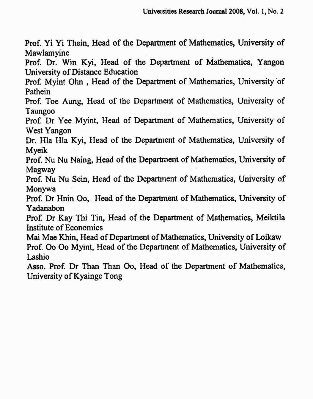
Prof. Yi Yi Thein, Head of the Department of Mathematics, University ofMawlamyineProf. Dr. Win Kyi, Head of the Department of Mathematics, YangonUniversity ofDistance EducationProf. Myint Ohn , Head of the Department of Mathematics, University ofPatheinProf. Toe Aung, Head of the Department of Mathematics, University ofTaungooProf. Dr Vee Myint, Head of Department of Mathematics, University ofWest YangonDr. Hla Hla Kyi, Head of the Department of Mathematics, University ofMyeikProf. Nu Nu Naing, Head of the Department of Mathematics, University ofMagwayProf. Nu Nu Sein, Head of the Department of Mathematics, University ofMonywaProf. Dr Hnin 00, . Head of the Department of Mathematics, University ofYadanabonProf. Dr Kay Thi Tin, Head of the Department of Mathematics, MeiktilaInstitute ofEconomicsMai Mae Khin, Head of Department ofMathematics, University of LoikawProf. 00 00 Myint, Head of the Department of Mathematics, University ofLashioAsso. Prof. Dr Than Than 00, Head of the Department of Mathematics,University ofKyainge Tong

Universities Research Joumal2008, Vol. 1, No.2
Contents
Page
The Geology ofPhongum Razi Ranges Putao District, K.achin State 1JRa Htay andAungKhin Soe
Preliminary report on the study ofthe rock units exposed along the 11Mongla- Kengtung- Tarchileik road section, Eastern Shan StateKhin Khin Lin
Revision ofthe Stratigraphy and Age ofthe Early Devonian 31Zebingyi Formation, MyanmarAye KoAung
NewMaterials of Stegolophodon (proboscidea, Mammalia) from 49the Irrawaddy Formation, MyanmarChitSein and Tin Thein
NewMaterials of Tetraconodon malensis (Mammalia, Artiodactyla, 6SSuidae) from the Middle Miocene of Central MyanmarThaung Htike, Zin Maung Maung Thein and Hnin Hnin Htay
Palaeoecological and Palaeogeographical Significance of the 77Rugose Corals from the Middle Devonian "Maymyo Formation" inPyinoolwin TownshipKhalng Khaing San
The Study of Folding in Calc-silicate Rocks ofPinle-in Area, 89Mandalay DivisionSaw Ngwe Khaing
,
A Study of Clay Minerals in the Maubin Area 103Olm Myint. Thura Aung, Swe Zin Tham, Nay Soe, HtetHtetAung, ZizawQl' WinNaing, Myo Min andHtin Lynn Aung
Tin-tungsten Mineralization ofZingyaik-Kadaik Area, Paung 119Township, Mon StateThan Htoo Aung

Universities Research Journal 2008, Vol. 1, No.2
Page
An Appraisal for the Mineral Assemblages to define Mineral 133Isograds on Paragneiss from Latha-Phayargnokto Area, PatheingyiTownship, Mandalay Division, MyanmarZaw Win Ko and Win Min Soe
Petrology ofDevonian Strata in Naungcho Area, Naungcho 147TownshipThein Htike Swe, Yan Naing Htun andNyan Win
Microbialites in the Thitsipin Limestone, Linwe-Kyauktaw Area, 163Yengan Township, Southern Shan StateKhin Khin Lin
Stability of Two-Level Difference Method for PDE 173Soe Soe Hlaing
Finite Difference Method for Elliptic Partial Differential Equation 193Win WinEi
Numerical Approximations for Burgers Equation 203SuSuAung
Use ofFinite Element Methods for Dirichlet Boundary Value 213ProblemKhin Htay Kyi
Numerical Method for A Mathematical Model ofA Suspension 231BridgeSoe Soe Aye
Propagation Property for Nonlinear Double-Degenerate Parabolic 239Equation in Multi-DimensionKhin Than Sint
A Study on Steady State Drift-Diffusion Model for Semiconductors 241Khin Thi
Numerical Schemes for the Euler Equations 261Win WinNwe

Universities Research Journal 2008, Vol. 1, No.2
Page
Numerical Approximations ofOne-Dimensional Stationary Drift- 271Diffusion Model for SemiconductorCho Sandar
Characterizing the Degree Sequences of Signed Cycles and Signed 285StarsHla H/a Myint
Applications ofEulerian Path and Tour 295Sandar Mytnt, Win Win Mar and Yi Myint
Spanning Trees with at most k Leaves in a K1,4-free graph 307AUllg Kyaw
Arc-Disjoint Path Pair (APP) Problem 323Nang Kham Maing
Characterization ofa Bipartite Graph and Its Hamiltonicity 337Shwin Seinn
A Study on Optimal Control ofRice Production in Taungoo Area 349Aye Ko, Thin Thin Myatand Mi Mi Than
Proximal Method for Equilibrium Problems 367HlaHlaKyi
The Weighted Locally Convex Spaces ofMeasurable Functions on 373Np Family And Continutous Functions on Nachbin FamilySaw MarlarAung and Kyi Htin Paw

Universities Research Journal 2008, Vol. I, No.2
Preliminary report on the study of the rock units exposedalong the Mongla - Kengtung - Tarchileik road section,
Eastern Shan State
Khin Khin Lin
Abstract
The study area lies in and Kengtung andTarchileik Townships, in theeasternmost part of the Shan State. This study mainly deals with thelithostratigraphy and petrography of the rock units exposed along theKengtung-Tarchileik-Mongla car road. The lithostratigraphic unitsexposed in the study area are clastic sedimentary rocks, granitoid rocksand metamorphic rocks.
The distinctive sedimentary rock units are Loi Mwe red sandstones. Theyare pinkish to reddish, medium-grained ferruginous sandstone and quartzarenite. These red sandstones are unconformably overlained by theyellowish brown sandstone. According to the tectonostratigraphic studyofthe northwestern Thailand and southwestern China, the study area fallsin the Chainging Belt. These sandstone beds can be regarded as theJurassic-Cretaceous age and can be correlated with the Kalaw Red Bed.
Large bodies of granitic rocks exposed in the study area might belong tothe so- called Eastern Granitoid Belt of Myanmar. These igneous rocksare intruded into the sedimentary sequences. The granites are usuallycoarse-grained and mineralogically very similar throughout the entireregion. They are two-mica granites containing abundant orthoclase (±microcline), plagioclase, biotite, muscovite and minor hornblende.Accessory minerals are rarely present. The age of these granites asdetermined by UlPb dating method of Laser ICP-MS yields 216 ± 6 and224±4 m.y.
Low-grade meta-sedimentary rocks such as chlorite schist, phyllite, slateand metagreywacke are sporadically exposed and are found to beintruded by granites.
Introduction
The present study area lies in Kengtung and Tarchileik Townshipsin the easternmost part of the Shan State close to the borders with China,Thailand and Laos (Fig. I). Despite the fact that the area is accessible by airfrom Mandalay to Kengtung and Tarchileik, and the car road connectingMongla, Kengtung .md Tarchileik can be used throughout the year, .the
Assistant Lecturer, Dr, Department ofGeology, University of Bhamo

Universities Research Journal 2008, Vol. I, Nd. 2
geology of this part of the Shan State has been little known due tocircumstances.
Fifty per cent of the area is occupied by rugged mountainous areawhile the rest by rolling hills and alluvial plains. The mountain ranges aredeeply dissected resulting in many peaks, some of which exceed 5000 feetin height. All of the ridges and valleys are running generally in N-Sdirection and the rocks are dipping to the east and west. Wunkwe Taung(3933 ft), Loi Mwe Taung (5552 ft) and Loi Honwe Taung (5450 ft)arc situated in the northwestern part and Nan Kham Taung (2800 ft)in the middle part of the study area. The southeastern part of the Tarchileikis generally a low rolling terrain. A thick terra rossa soil cover supportscrop cultivation. The common drainage pattern is mainly dendritic, and theareas with igneous rocks often show radial drainage pattern.
This study mainly deals with the lithostratigraphy and petrographyof the rock units exposed along the Mongla-Kengtung-Tachileik car roadwhich is about 104 miles long. Geological traverses were made in April2005 and collected geologic data and representative rock samples. Thinsections of the samples collected were then studied under the microscope inthe laboratory. Some samples were sent to Freiberg University, Germanyfor radio chronological analysis using the Laser ICP-MS Method.
Regional Geotectonic Setting
This region is geotectonically situated in the eastern part of theEastern Highland (Shan-Tenasserim Block). Western boundary of thissection of continental crust is marked by the N-S striking Shan BoundaryFault, which accompanies the Shan Escarpment in the West and ispresumed to continue to the south in the Gulf of Martaban. Also it form partof the land mass of the Indo-Chinese Peninsula (Yunan, Thailand andMalaysia), which extends to the south in Sundaland (Hutchison, 1973).

Universities Research Journal 2008, Vol. 1, No.2 19
•
...
[J
"......
•••__0:;"-.'-..~..•\
-
" .....~'l-I
[J
mr .... .,.~,---...........•
''''
.. /
2'
YX'
LC1\~nd
Cily
Townl Villall"
Airpul1
Rhcr
101""'''"00,,1 border
w '
oo
+
--_ ..
IOU"
Scale
1 inch= 42 miles
Fig. 1. Location Map of the study area

20 Universities Research Journal 2008, Vol. I, No.2
I'of..
0 ... I.-It'
". ,.1~ . '."..¥
• . VlF:TNA'4. ...I ' \
it.•l'.
LAOS •.•.
CHINAAle YJ
.. ." ....".....MYANMAR
•.
'0_
'...
Fig. 2. Map showing tectono- geographic units in southwest China andNorth Thailand. CBe: Changning-Menglian Belt; CG: ChingMai Geosuture; SuB: Sukhothai Block; ShB : Shan Block;Qinglai Feng et al. (2005)
The easternmost part of this study area is approximately bordered bythe Mekong River and the middle course of which is largely controlled bythe regional position of granitic intrusions and metamorphic rocks mostlysituated on the right bank of the river and regionally trending NE to NSstriking bands. They are regionally presumably interrupted by intercalationsof marine rocks which are due to the episodic inundations (Wolfrat, 1985).
According to Bunopas (1994), the Shan-Thai Block is situated to thewest of the Ailaoshan and Nan-Uttaradit sutures and to the east of theLujiang and Pan Laung Fault. Together with southwestern Yunan it alsocovers eastern Myanmar (including the present study area), most of thewestern and peninsular Thailand and western peninsular Malaysia (Fig.2)(Quinglai Feng, 2005).

Universities Research Joumal2008, Vol. I, No.2 21
Lithostratigraphic Units
The lithostratigraphic units exposed in the study area are clasticsedimentary rocks, granitoid rocks and metamorphic rocks. Large bodies ofgranitic rocks, probably belong to the so-called Eastern Granitoid Belt(Khin Zaw, 1987) are frequently found along the road. Igneous rocks withsedimentary rock intercalations of folded Paleozoic and mostly continentalrocks of Mesozoic age continue from the Menglian in China to the (Minela- Kengtung - Tachileik) road section of Myanmar (Jin Xiaochi et al 2001)just as in the Chinese part (Yunnan) and the eastern boundary of the ShanMassif. The sedimentary successions of this study are defined as the LoiMwe red bed unit, Tertiary sandstones unit and gravels. Sample locations ofthe rock units are shown in Fig. 3.
Loi Mwe red beds
They are found along the Kengtung-Tachileik car road, near WunKwe -Loi Mwe Taung and Nan Kham Taung in Tar Lae area.
The rock succession comprises numerous interbeds ofconglomerate-sandstone and mudstone, both of which are distinctly in redcolor. The sandstones are medium- to thick-bedded, pinkish or reddishcolor, coarse-grained. The lower part of this sequence is mostly friablepebbly sandstone, quartz, quartzite and chert pebble conglomerate band. Inthe upper part, sandstones are more abundant and in some places, they areintercalated with shale and clay. Clay units are reddish brown to grey andsome are intercalated with coal measures. A conglomerate-sandstone unitforms an upward fining sequence, a few to several feet thick, or a compositeof such sequences.
A typical succession of each sequence, in ascending order, shows(1) an erosive base, (2) pebble conglomerate or pebbly sandstone to finesandstone with large- scale tabular and trough cross beddings, (3) a fine tovery fine sandstone with small-scale cross bedding or laminations, and (4)very fine sandstone to mudstone with parallel and lor ripple laminations inmany places (Fig. 4 & 5).

22 Universities Research Journal 2008, Vol. I, No.2
Leaend
Loimwo redbeds ~
Ip:ousrocb +Metamorphic rocks +
TbaUand
,..Chlu
LaOi
100'
Fig. 3. Sample locations of the rock units exposed along KentungMinela-Tarchileik car road.

Universities Research Journal 200li, Vol. 1, NO. 2
Petrographically, these sandstones are ferruginous and consist of 7075% quartz grains, 1-2% feldspar, 2% mica, up to about 4% of matrix, 68% detrital rock fragments, iron minerals and 10-15% cement. Sand grainsare usually coated with hematite or iron pigment. Cements can be observedon grain boundaries. Hence the red color of sandstone appears to be underthe control of degree of iron pigment coating on sand grains (Fig. 6 A & B)
Quartz grains are subrounded to subangular, medium to coarsegrained and mostly are polycrystalline. Irregular forms of fluid inclusionsare found in the quartz grains (Fig. 7 A & B). They usually show sharpextinction but wavy extinction is not uncommon. Grain boundaries aresharp and distinct Feldspar grains are detrital and clear but most grains arecompletely clouded with alteration products
The study area lies in the eastern part of the Changning-MenglianBelt and can be correlated in stratigraphy with those of southwestern Yunanand northern Thailand (Quinglai Feng, 2005). Based on the lithologicsimilarity, Loi-Mwe red beds can also be correlated with the Kalaw RedBed unit, whose age is assigned to be Jurassic-Cretaceous
Fig. 4. Pebble conglomerate or pebbly sandstone to fine sandstone inLoi-Mwe red bed.

2.+ Univcrsiucs Research Journal 200X. Vol. I. No."
Fig :; Outcrop showing sequence of the Loi-Mwe sandstone red bed
Fig 6 B (PPL)
Fig 6 A & B Photomicrographs showing subrounded to subangular quartzgrains cemented by hematite and igneous rock fragments

Universities Research Journal 2008, Vol. I, No.2
Fig. 7 A (XN)
25
Fig. 7 B (PPL)
Fig. 7 A & B. Photomicrographs showing quartz grains with numerousInclusions
Tertiary Sandstone Unit
Around Kengtung, Hokho and Nan Lat, the Tertiary sandstone unitsare widely distributed. They are yellowish brown, buff- and grey-colored .fine-grained, thick-bedded to massi ve sandstone interbedded with shalesand clays. Sometimes coal measures are found . They are unconformablyunderlain by Loi Mwe red bed. The upper part of this unit is typified bygravel beds.
Igneous Rocks
Large bodies of granitic rocks and diori tes are exposed along the carroad. The granite is usually coarse- to medium- grained, whitish to

26 Universities Research Journal 2008, Vol. 1, No.2
brownish and greenish when fresh and grayish to pinkish when weathered.Some are characterized by very light color and few scattered biotite grains(Fig.8 & 9).
Most of the igneous rocks are biotite granite. They are coarsegrained, equigranular rocks showing hypidiomorphic granular texture.Mineralogically, the granites are very similar throughout the entire region,comprising quartz (25% - 30%), orthoclase± microcline (35% - 40%),plagioclase (10% - 15%), biotite and muscovite (10% - 15%) and accessoryminerals. Hornblende is rarely present. Quartz is coarse-grained, subhedralto anhedral and characterized by clear surface and wavy extension.Orthoclase with Carlsbad twin is coarse-grained and dirty in general.Sometimes it shows numerous mineral inclusion and alterations (Fig.10).Plagioclase is commonly altered to sericite, and patchy alteration isdistinctive (Fig. II). Biotites are medium- to coarse-grained, characterizedby its brownish to red colour. Most of the biotite flakes are bent. (Fig. 12 &13).
Diorite is the second most abundant igneous roc in the study area .Lithologically it is a dark-grey, medium- to coarse-grained rock composedmainly offeldspar and hornblende. Quartz, biotite and magnetite are presentin minor amounts. Quartz is subhedral to anhedral and hypidiomorphicgranular textured . Among feldspars, plagioclase is the most abundant,consisting up to 50%., Plagioclase is tabular or prismatic, anhedral tosubhedral and coarse-grained. The plagioclase sometimes shows acombination of Carlsbad (simple twin) and Albite (multiple twin).Orthoclase is rare . Hornblende shows long prismatic form , bright colourunder cross Nicols and brown colour under PPL.
Fig.S Fig. 9Fig. S & 9. Photographs of coarse-grained biotite granite (Zircon age- 224+.
4 Ma).
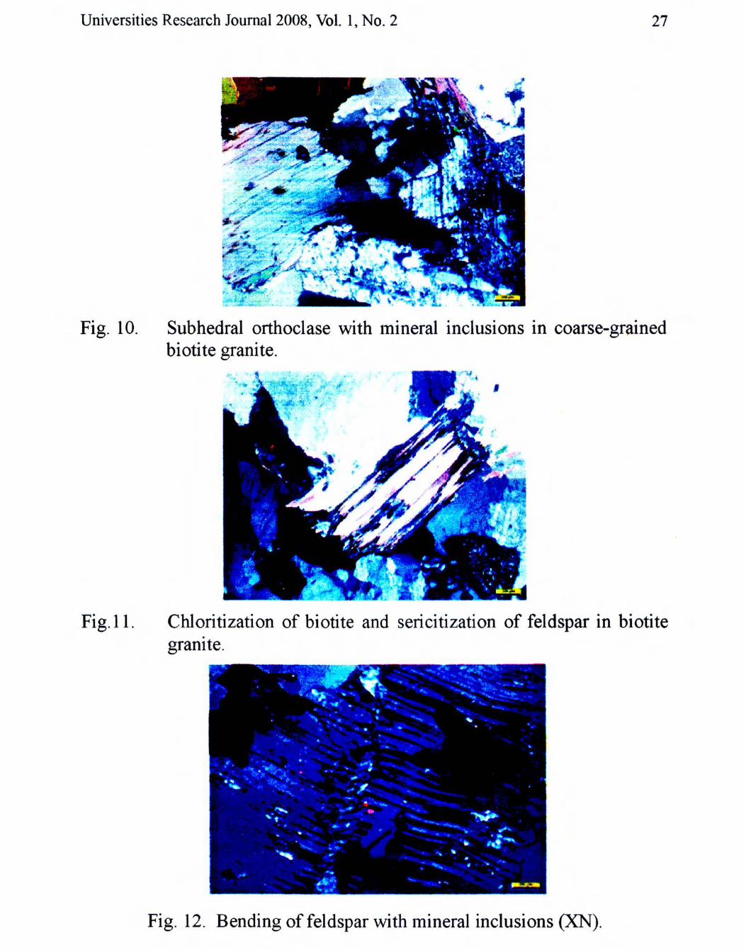
Universities Research Journal 2008, Vol. I, NO.2 27
Fig. 10.
Fig.II.
Subhedral orthoclase with mineral inclusions in coarse-grainedbiotite granite.
Chloritization of biotite and sericitization of feldspar in biotitegranite.
Fig . 12. Bending offeldspar with mineral inclusions (XN).

28 Universities Research Journal 2008, Vol. I, NO.2
Fig. 13. Quartz, orthoclase, plagioclase (showing polysynthetic twining)and altered biotite (XN).
The granite occurrences in the Tenasserim region extends into theThailand and traced to the north, the determination of age dating (Rb/Sr andK /Ar) revealed an Upper Triassic (210-205 m.y.) . The granite of MaeSariang (N-S running intrusion between 18? and 19? N at the western borderof Thailand) are Upper Triassic-Lower Triassic age (210-205 m.y.) and toSouth of it, in a small isolated intrusion, an Upper Cretaceous age (70-80m.y.). These can be correlated with the granites East of Fang in NorthThailand to which a Lower Triassic age is assigned (Von Braun et al.,1976).
The granite belt in the east of Chiang Mai is Lower Triassic age(232±31 my, 235± 5 m.y., 236±14 m.y.). The granites of Kengtung areprobably the northern continuation of the Triassic granites of Thailand (VonBraun et al., 1976). Very recently, this was also approved by U/Pb ages ofLaser ICPMS, (216±6 and 224±4 my) of Kengtung area (Myo Min, writtencommunication, 2006). These run from north Thailand to the south intoTenasserim area, Kengtong area, and northwestern part of China. It is likelythat the chains of acid granite intrusion phase occurred at that time.
Granite from Mongla-Kengtung-Tachileik has a close petrologicaland chronological affinities with the Chiang Rai Batholith of Thailand.Chiang Rai Batholith is a part of the Eastern Marginal Granite Belt ofThailand which lies near to the junction of the North Thai Province with theEastern Province, and forms a mountain chain partially flanked by Tertiarysedimentary basins to the east and west (Cobbing et al., 1992). Thisbatholith is emplaced into a volcanosedimentary sequence that ranges fromSilurian to Middle Triassic in age (Braun and Hahn, 1976) and

Universities Research Journal 2008, Vol. I, No.2 29
unconformably overlain by Mesozoic continental deposits of probableJurassic age (Cobbing et al, 1992).
Metamorphic rocks
The metamorphic rocks are generally trending NW-SE, and lowgrade meta-sedimentary rocks such as chlorite schist, actinolite schist(Fig .14), phyllite, quartzitic graphite schist and metagreywacke. They aremostly found, near Wanyan village, Wan Tapin (Kaymarwara Bridge),Mongla, near Mong Hpyak and Tarkyauk village. Quartzitic graphiteschists are well exposed near Tachileik air port. These rocks areunconformably overlain by the Loi Mwe red sandstones. Igneous rocks areintruded into the metamorphic rocks .
Fig. 14. Photograph showing close up view of actinolite schist.
Conclusion
This is merely a preliminary investigation carried out on a shortfield trip to give information about the presence of red beds which are verysimilar in lithology with the Kalaw red beds (Jurassic - Cretaceous) ofsouthern Shan State and the overlying Tertiary sandstone units . Ageassignments for Loi Mwe red bed and overlying sandstones are tentative,and need to be checked by further field investigation. However, the UlPbdating of the granites in the study area can reveal that the granites in theeasternmost part of Shan Massif are definitely the northern extension of theWestern Granitoid Belt of Thailand which were intruded mainly in Triassictime.

30 Universities Research Joumal2008, Vol. 1, No.2
Acknowledgement
I wish to express my sincere gratitude to Dr Khin Maung Myint, Head of theGeology Department, Mandala~ University, for his encouragement to carry out thisresearch. Special thanks go to U Myo Min for his kind help throughout the field works andfor making possible to gain the radiometric dating results from Freiberg University,Germany.
References
Bender, F. (1983)~ Geology ofBunna;Gebroiider Bomtraeger, Berlin-Stuttgart.
Braun, V., ,E and L., Hahn (1976): Geological map of northern Thailand. Sheet'2, Chiang. Rai.> (Hannover: Federal Institute for Geosciences and Natural
Resourses.)
Braun, V., E and R. Jordan (1976): The stratigraphy and paleontology of the Mesozoicsequences in the Mae Sot Area in West Thailand. Geol. Jb. B 21.Hannover.
Cobbing, E. J., Pitfield, P. E. J., Darbyshire, D. P. F., and Mallick, D. I. J., (1992): Thegranites of the South-East Asian Tin Belt. Overseas Memoir 10. BritishGeological Survey, London, p. 369.
Hutchison, C.S. (1973): Tectonic evolution of Sundaland: A Phanerozoic synthesis. Geol.Soc. Malaysia, Bull. 6: p. 61-86.
Khin zaw (1990): Geological, petrological and geochemical characteristics of granitoidrocks in Burma: with special reference to the associated W-Snmineralization and their tectonic setting. Jour. SE Asian Earth Sciences4 (4), p. 293-335
Quinglai Feng, Chongpan Chonglakmani and Detrich Helmcke (2005): Correlation ofTriassic stratigraphy between the Simao and Lampang-Phrae Basins:implications for the tectonopaleography of Southeast Asia. Jow. AsianEarth andSciences, V.24, p. 777-785
Wolfrat, R. et al. (1984): Stratigraphy of the western Shan Massif, Burma, Geol. Jp; Rei/teB, Heft.57.92.
liD 'Cilochi et al. (200I): Some Stratigraphic and Sedimentologic Constraints on thefeatures of the Changning-MenaIian Tethys. Yunan, China. GondwanaResean:h, V.4, No.1, p. 55-60