Summary of imagery analyses for non-natural objects in ...
51
Record 2017/13 | eCat 111041 Summary of imagery analyses for non-natural objects in support of the search for Flight MH370 Results from the analysis of imagery from the PLEIADES 1A satellite undertaken by Geoscience Australia S. Minchin, N. Mueller, A. Lewis, G. Byrne, M. Tran APPLYING GEOSCIENCE TO AUSTRALIA’S MOST IMPORTANT CHALLENGES www.ga.gov.au
-
Upload
khangminh22 -
Category
Documents
-
view
1 -
download
0
Transcript of Summary of imagery analyses for non-natural objects in ...

Record 2017/13 | eCat 111041
Summary of imagery analyses for non-natural objects in support of the search for Flight MH370Results from the analysis of imagery from the PLEIADES 1A satellite undertaken by Geoscience Australia
S. Minchin, N. Mueller, A. Lewis, G. Byrne, M. Tran
APPLYING GEOSCIENCE TO AUSTRALIA’S MOST IMPORTANT CHALLENGES www.ga.gov.au

Summary of imagery analyses for non-natural objects in support of the search for Flight MH370 Results from the analysis of imagery from the PLEIADES 1A satellite undertaken by Geoscience Australia
GEOSCIENCE AUSTRALIA RECORD 2017/13
S. Minchin, N. Mueller, A. Lewis, G. Byrne, M. Tran

Department of Industry, Innovation and Science Deputy Prime Minister, Minister for Resources and Northern Australia: The Hon Barnaby Joyce MP Assistant Minister for Industry, Innovation and Science: The Hon Craig Laundy MP Secretary: Ms Glenys Beauchamp PSM
Geoscience Australia Chief Executive Officer: Dr James Johnson This paper is published with the permission of the CEO, Geoscience Australia
© Commonwealth of Australia (Geoscience Australia) 2017
With the exception of the Commonwealth Coat of Arms, and the images marked © CNES, and where otherwise noted, this product is provided under a Creative Commons Attribution 4.0 International Licence. (http://creativecommons.org/licenses/by/4.0/legalcode)
Geoscience Australia has tried to make the information in this product as accurate as possible. However, it does not guarantee that the information is totally accurate or complete. Therefore, you should not solely rely on this information when making a commercial decision.
Geoscience Australia is committed to providing web accessible content wherever possible. If you are having difficulties with accessing this document please email [email protected].
ISSN 2201-702X (PDF) ISBN 978-1-925297-52-2 (PDF) eCat 111041
Bibliographic reference: Minchin, S., Mueller, N., Lewis, A., Byrne, G., Tran, M., 2017. Summary of imagery analyses for non-natural objects in support of the search for Flight MH370: Results from the analysis of imagery from the PLEIADES 1A satellite undertaken by Geoscience Australia. Record 2017/13. Geoscience Australia, Canberra. http://dx.doi.org/10.11636/Record.2017.013
Version: 1701
2

Acknowledgements
The authors would like to thank:
We would like to thank the French military intelligence service, and the Centre National D’études spatiales (CNES) for the provision of imagery. We would also like to thank Drs Stephen Sagar and David Hudson from Geoscience Australia for reviewing this record. We honour the memory of those who have lost their lives and acknowledge the enormous loss felt by their loved ones.
3

Contents
1 Introduction ........................................................................................................................................... 5 1.1 Executive Summary ........................................................................................................................ 5 1.2 Overview ......................................................................................................................................... 6 1.3 Findings ........................................................................................................................................... 6
2 Methods ................................................................................................................................................ 8 2.1 Data ................................................................................................................................................. 8 2.2 Analysis ........................................................................................................................................... 8
3 Results .................................................................................................................................................. 9 3.1 Visual Assessment .......................................................................................................................... 9 3.2 Image Overviews .......................................................................................................................... 12
3.2.1 PLEIADES PHR_1 image ....................................................................................................... 13 3.2.2 PLEIADES PHR_2 image ....................................................................................................... 14 3.2.3 PLEIADES PHR_3 image ....................................................................................................... 16 3.2.4 PLEIADES PHR_4 image ....................................................................................................... 17 3.2.5 Examples of probable man-made objects ............................................................................... 19
4 Conclusion .......................................................................................................................................... 24
5 Appendix ............................................................................................................................................. 25 5.1.1 Objects detected in PHR_1 ..................................................................................................... 25 5.1.2 Objects detected in PHR_2 ..................................................................................................... 29 5.1.3 Objects detected in PHR_3 ..................................................................................................... 34 5.1.4 Objects detected in PHR_4 ..................................................................................................... 38
4

1 Introduction
1.1 Executive Summary On 8 March 2014, the Boeing 777-200ER aircraft registered as Malaysia Airlines 9M-MRO and operating as flight MH370 (MH370) disappeared from air traffic control radar after taking off from Kuala Lumpur, Malaysia on a scheduled passenger service to Beijing, China with 227 passengers and 12 crew on board.
After analysis of satellite data it was discovered that MH370 continued to fly for over six hours after contact was lost. All available data indicate that the aircraft entered the sea close to a long but narrow arc in the southern Indian Ocean.
On 31 March 2014, following an extensive sea and air search, the Malaysian Government accepted the Australian Government’s offer to take the lead in the search and recovery operation in the southern Indian Ocean in support of the Malaysian accident investigation.
On behalf of Australia, the Australian Transport Safety Bureau (ATSB) coordinated and led the search operations for MH370 in the southern Indian Ocean. Geoscience Australia (GA) provided advice, expertise and support to the ATSB in sea floor mapping (bathymetric survey) and the underwater search. In March 2017 GA was subsequently asked to provide advice and scientific expertise in the analysis of satellite imagery (PLEIADES 1A) (©CNES) for the detection of possible floating objects.
5
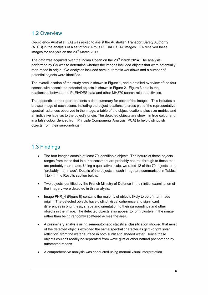
1.2 Overview Geoscience Australia (GA) was asked to assist the Australian Transport Safety Authority (ATSB) in the analysis of a set of four Airbus PLEIADES 1A images. GA received these images for analysis on the 23rd March 2017.
The data was acquired over the Indian Ocean on the 23rd March 2014. The analysis performed by GA was to determine whether the images included objects that were potentially man-made in origin. GA analyses included semi-automatic workflows and a number of potential objects were identified.
The overall location of the study area is shown in Figure 1, and a detailed overview of the four scenes with associated detected objects is shown in Figure 2. Figure 3 details the relationship between the PLEIADES data and other MH370 search-related activities.
The appendix to the report presents a data summary for each of the images. This includes a browse image of each scene, including the object locations, a cross plot of the representative spectral radiances observed in the image, a table of the object locations plus size metrics and an indicative label as to the object’s origin. The detected objects are shown in true colour and in a false colour derived from Principle Components Analysis (PCA) to help distinguish objects from their surroundings.
1.3 Findings • The four images contain at least 70 identifiable objects. The nature of these objects
ranges from those that in our assessment are probably natural, through to those that are probably man-made. Using a qualitative scale, we rated 12 of the 70 objects to be “probably man made”. Details of the objects in each image are summarised in Tables 1 to 4 in the Results section below.
• Two objects identified by the French Ministry of Defence in their initial examination of the imagery were detected in this analysis.
• Image PHR_4 (Figure 8) contains the majority of objects likely to be of man-made origin. The detected objects have distinct visual coherence and significant differences in brightness, shape and orientation to their surroundings and other objects in the image. The detected objects also appear to form clusters in the image rather than being randomly scattered across the area.
• A preliminary analysis using semi-automatic statistical classification showed that most of the detected objects exhibited the same spectral character as glint (bright solar reflection) from the water surface in both sunlit and shaded water. Hence these objects couldn’t readily be separated from wave glint or other natural phenomena by automated means.
• A comprehensive analysis was conducted using manual visual interpretation.
6

• The confidence with which we are able to state that the objects observed in the images are unnatural could be increased if we were able to also study other images (from the same instrument and satellite in a similar sea-state) where debris is not expected to be found. For this reason, examination of further images is likely to be of value.
7
2 Methods
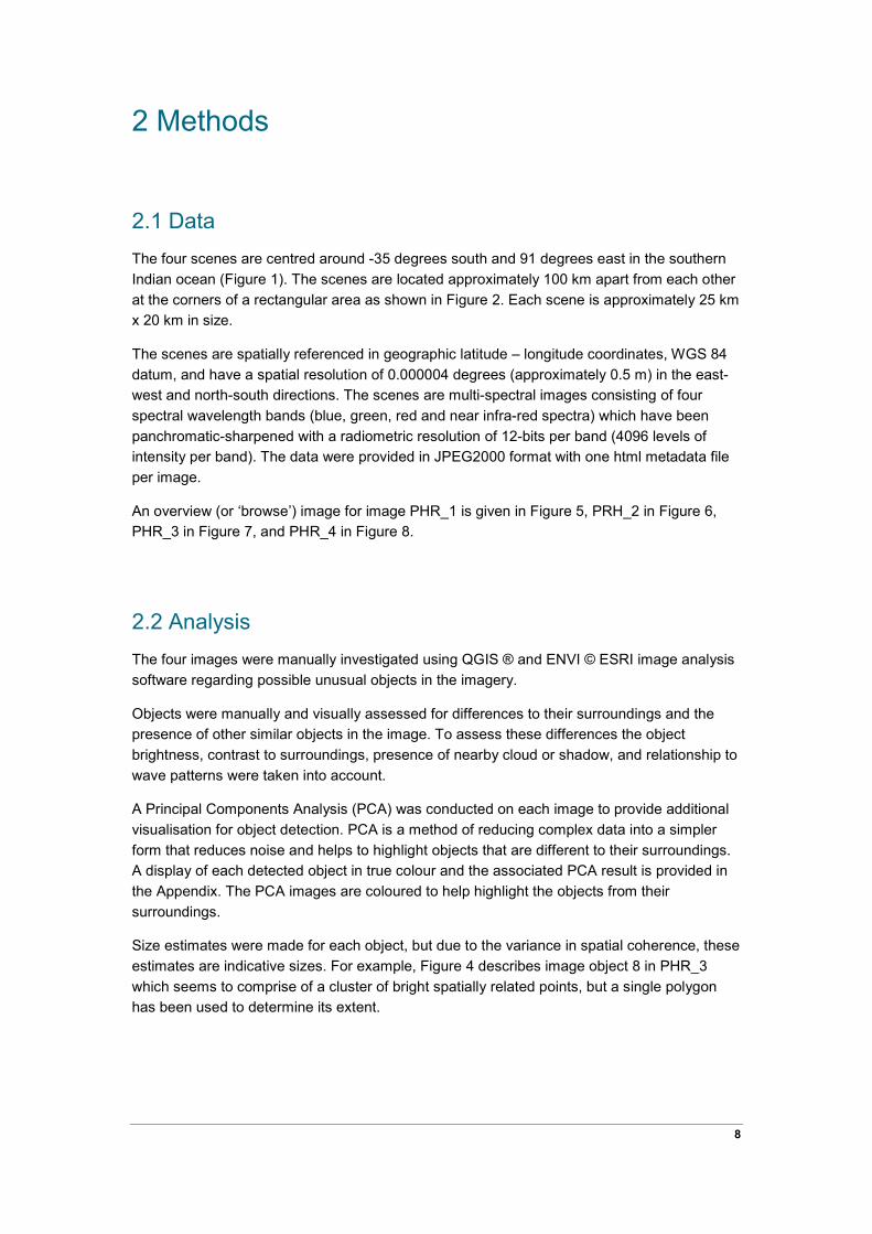
2.1 Data The four scenes are centred around -35 degrees south and 91 degrees east in the southern Indian ocean (Figure 1). The scenes are located approximately 100 km apart from each other at the corners of a rectangular area as shown in Figure 2. Each scene is approximately 25 km x 20 km in size.
The scenes are spatially referenced in geographic latitude – longitude coordinates, WGS 84 datum, and have a spatial resolution of 0.000004 degrees (approximately 0.5 m) in the east-west and north-south directions. The scenes are multi-spectral images consisting of four spectral wavelength bands (blue, green, red and near infra-red spectra) which have been panchromatic-sharpened with a radiometric resolution of 12-bits per band (4096 levels of intensity per band). The data were provided in JPEG2000 format with one html metadata file per image.
An overview (or ‘browse’) image for image PHR_1 is given in Figure 5, PRH_2 in Figure 6, PHR_3 in Figure 7, and PHR_4 in Figure 8.
2.2 Analysis The four images were manually investigated using QGIS ® and ENVI © ESRI image analysis software regarding possible unusual objects in the imagery.
Objects were manually and visually assessed for differences to their surroundings and the presence of other similar objects in the image. To assess these differences the object brightness, contrast to surroundings, presence of nearby cloud or shadow, and relationship to wave patterns were taken into account.
A Principal Components Analysis (PCA) was conducted on each image to provide additional visualisation for object detection. PCA is a method of reducing complex data into a simpler form that reduces noise and helps to highlight objects that are different to their surroundings. A display of each detected object in true colour and the associated PCA result is provided in the Appendix. The PCA images are coloured to help highlight the objects from their surroundings.
Size estimates were made for each object, but due to the variance in spatial coherence, these estimates are indicative sizes. For example, Figure 4 describes image object 8 in PHR_3 which seems to comprise of a cluster of bright spatially related points, but a single polygon has been used to determine its extent.
8

3 Results
3.1 Visual Assessment The four PLEIADES 1A scenes are all significantly cloud and glint affected.
There are six primary surfaces (spectral groups) found in these data; water, surface glint, cloud (of varying coherence and thickness), cloud shadows, shaded water and shaded glint (See Figure 21, Figure 33, Figure 46,and Figure 58).
An exploratory supervised/unsupervised classification based on the six end members suggested that most objects were grouped into the ‘Glint’ and ‘Shaded Glint’ classes. Because these spectral classes occupy a significant fraction of the image area, automated classification techniques perform poorly.
The small number of images, and lack of repeat observations over the area resulted in insufficient data to support a data-driven or computer learning approach. Hence, a comprehensive, manual, visual survey of each scene was undertaken. In support of displaying colour composites of the raw data, a Principle Components Analysis (PCA) was undertaken to reduce the band to band correlation and help highlight objects that differed from their surroundings. Using search windows based on a 500 x 500 grid, over 6,500 grid cells were systematically examined in each image. While all care was taken using the grid cells as a guide, it is conceivable that some objects were missed given the manual nature of the scrolling process.
While the purpose of this assessment was to nominate man-made or ‘non-natural’ objects, there is sufficient ambiguity in the exact properties of many of the visible objects that many that could be natural in origin are still listed (for example, Figure 29, Figure 34 and Figure 37).
To address this limitation, each object has been allocated a label based on its overall appearance, shape and size. A rating schema ranging from 1 to 5 has been used in which:
1 = ‘probably natural’ and 5 = ‘probably not natural’, (that is, probably man-made).
Objects are labelled 1 when, despite displaying an obvious structure and being visible in both the colour composite image and the PCA images, and being distinct from surrounding wave and water patterns, they lack a spatial coherence or the shape is indeterminate.
In contrast, bright objects with a strong rectilinear coherence, and seeming to displace the water around them (especially when in close proximity to similar objects), have been labelled 5. See Table 1, Table 2, Table 3 and Table 4.
9

Figure 1: Centre point of PLEIADES data (Source: French Military Intelligence Service © CNES)
Figure 2: Overview map of all 4 supplied PLEIADES 1A (Source: French Military Intelligence Service © CNES) images over the Indian Ocean
10

Figure 3: Close overview map of all 4 supplied PLEIADES 1A (Source: French Military Intelligence Service © CNES) images over the Indian Ocean in context of the bathymetry and underwater data
acquired during the search for MH370.
Figure 4 : Defining object extent by forming a polygon around what appears to be an irregular object: PHR_3 object 8 (Source: French Military Intelligence Service © CNES)
11

3.2 Image Overviews Sections 3.2.1 to 3.2.4 display browse images of each PLEIADES 1A scene and tables of the detected objects in each. The tables provide detail on object location, size and assigned category of likely origin. Section 3.2.5 displays three of the objects detected in the PLEIADES images, to provide examples of objects that appear to be possibly man-made in origin. A complete set of images of each object is provided in the Appendix.
The objects detected in each image were:
• PHR_1 (south westerly image) - 11 objects in a clustered formation of which 1 object was classified “probably man-made”.
• PHR_2 (south easterly image) - 12 objects were found randomly scattered across the image of which 0 objects were classified “probably man-made”.
• PHR_3 (north westerly image) - 11 objects in a general east-west pattern of which 2 objects were classified “probably man-made”.
• PHR_4 (north easterly image) – 36 objects in scattered clusters across the image of which 9 objects were classified “probably man-made”.
An overall summary of the spatial distribution and density of the objects results is given in Figure 2 above.
12

3.2.1 PLEIADES PHR_1 image
Figure 5: PHR_1 (Source: French Military Intelligence Service © CNES) browse image and surface image objects
Table 1 : PHR_1 Object locations
Point Latitude Longitude # pixels Area (m2) Origin *
1 -35.20532 90.457967 154 39 5
2 -35.22998 90.454815 199 51 3
3 -35.21468 90.458646 179 46 4
4 -35.21476 90.463189 98 25 4
5 -35.1714 90.476377 193 49 3
6 -35.20611 90.482402 337 86 2
7 -35.22455 90.505404 254 65 2
13
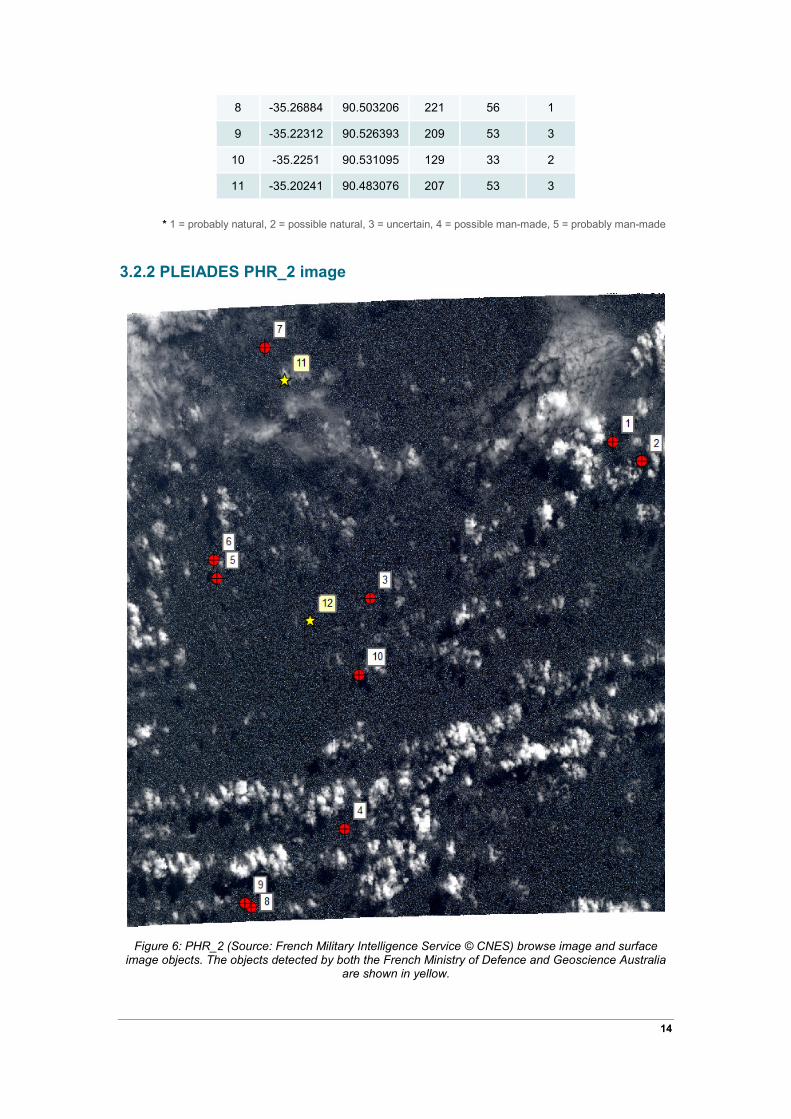
8 -35.26884 90.503206 221 56 1
9 -35.22312 90.526393 209 53 3
10 -35.2251 90.531095 129 33 2
11 -35.20241 90.483076 207 53 3
* 1 = probably natural, 2 = possible natural, 3 = uncertain, 4 = possible man-made, 5 = probably man-made
3.2.2 PLEIADES PHR_2 image
Figure 6: PHR_2 (Source: French Military Intelligence Service © CNES) browse image and surface image objects. The objects detected by both the French Ministry of Defence and Geoscience Australia
are shown in yellow.
14
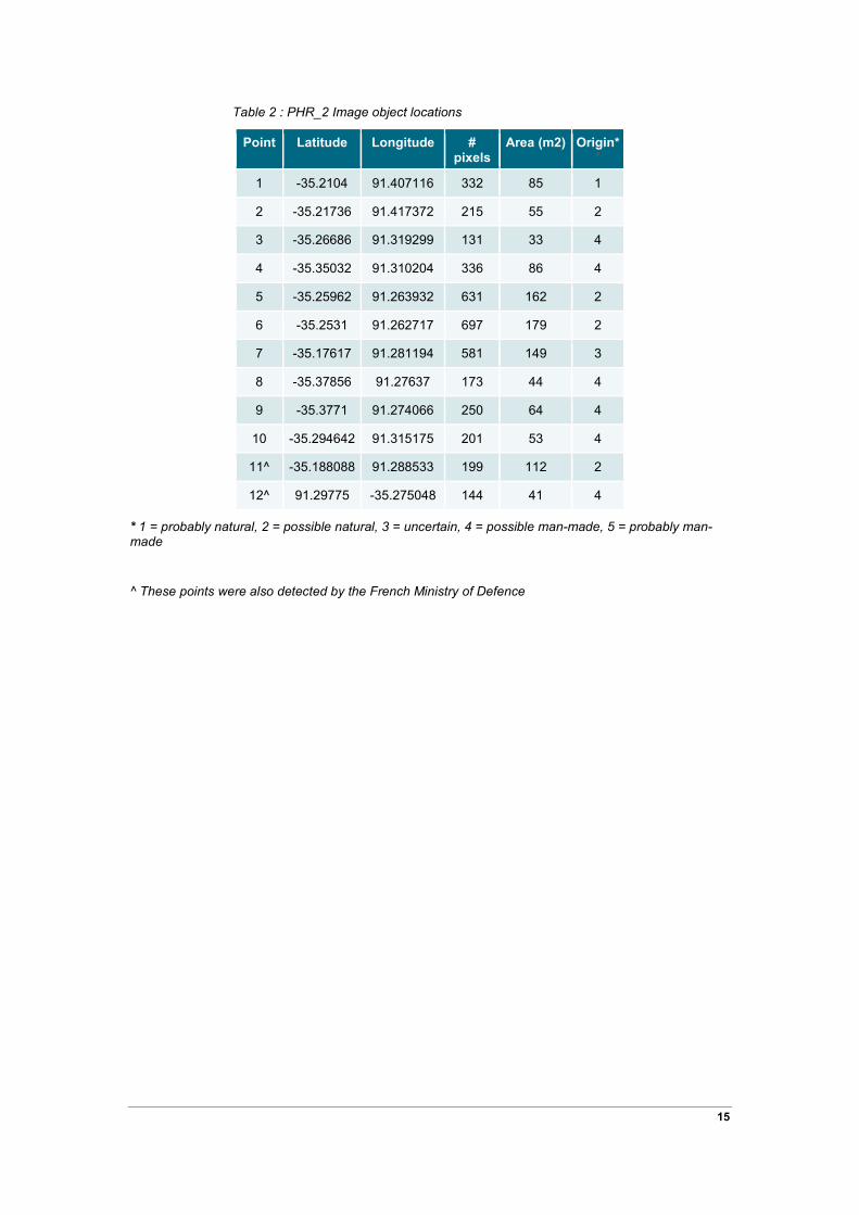
Table 2 : PHR_2 Image object locations
Point Latitude Longitude # pixels
Area (m2) Origin* *
1 -35.2104 91.407116 332 85 1
2 -35.21736 91.417372 215 55 2
3 -35.26686 91.319299 131 33 4
4 -35.35032 91.310204 336 86 4
5 -35.25962 91.263932 631 162 2
6 -35.2531 91.262717 697 179 2
7 -35.17617 91.281194 581 149 3
8 -35.37856 91.27637 173 44 4
9 -35.3771 91.274066 250 64 4
10 -35.294642 91.315175 201 53 4
11^ -35.188088 91.288533 199 112 2
12^ 91.29775 -35.275048 144 41 4
* 1 = probably natural, 2 = possible natural, 3 = uncertain, 4 = possible man-made, 5 = probably man-made
^ These points were also detected by the French Ministry of Defence
15

3.2.3 PLEIADES PHR_3 image
Figure 7: PHR_3 (Source: French Military Intelligence Service © CNES) browse image and surface image objects
Table 3 : PHR_3 Image object locations
Point Latitude Longitude # pixels Area (m2) Origin *
1 -34.41926 90.495984 605 153 2
2 -34.43602 90.413125 94 23 3
3 -34.48748 90.52378 181 45 2
4 -34.48684 90.531088 263 66 3
5 -34.43162 90.516533 655 165 2
16

6 -34.51801 90.519439 320 80 3
7 -34.55709 90.456295 241 60 5
8 -34.54434 90.55135 544 137 3
9 -34.57965 90.532203 336 85 4
10 -34.59384 90.493447 111 28 5
11 -34.59737 90.488347 178 45 3
* 1 = probably natural, 2 = possible natural, 3 = uncertain, 4 = possible man-made, 5 = probably man-made
3.2.4 PLEIADES PHR_4 image
Figure 8: PHR_4 (Source: French Military Intelligence Service © CNES) browse image and surface image objects
17
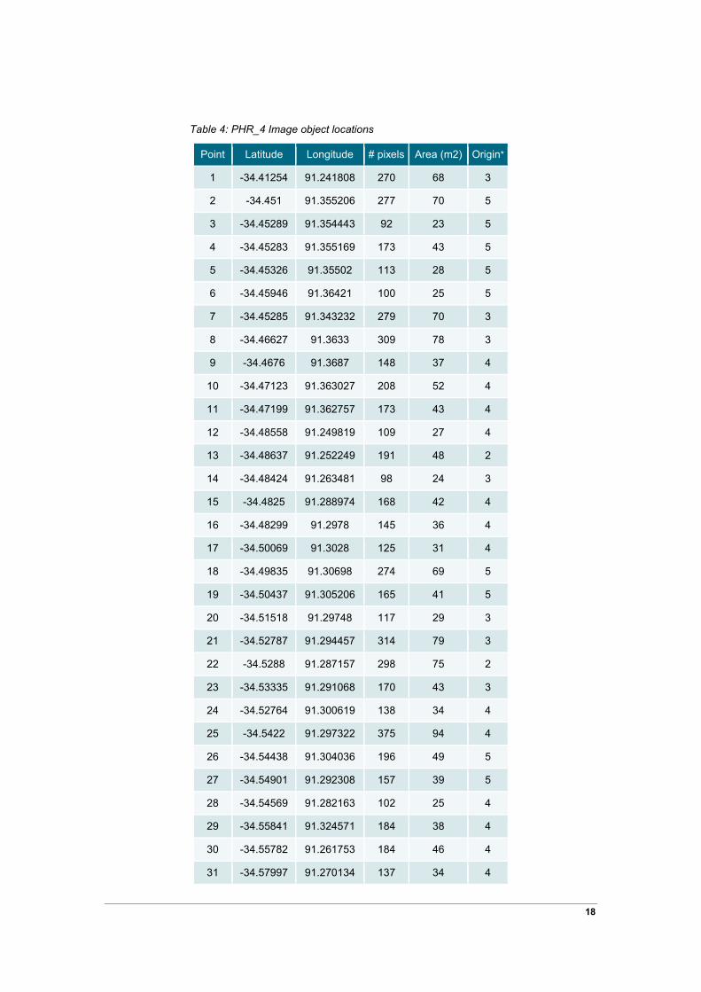
Table 4: PHR_4 Image object locations
Point Latitude Longitude # pixels Area (m2) Origin*
1 -34.41254 91.241808 270 68 3
2 -34.451 91.355206 277 70 5
3 -34.45289 91.354443 92 23 5
4 -34.45283 91.355169 173 43 5
5 -34.45326 91.35502 113 28 5
6 -34.45946 91.36421 100 25 5
7 -34.45285 91.343232 279 70 3
8 -34.46627 91.3633 309 78 3
9 -34.4676 91.3687 148 37 4
10 -34.47123 91.363027 208 52 4
11 -34.47199 91.362757 173 43 4
12 -34.48558 91.249819 109 27 4
13 -34.48637 91.252249 191 48 2
14 -34.48424 91.263481 98 24 3
15 -34.4825 91.288974 168 42 4
16 -34.48299 91.2978 145 36 4
17 -34.50069 91.3028 125 31 4
18 -34.49835 91.30698 274 69 5
19 -34.50437 91.305206 165 41 5
20 -34.51518 91.29748 117 29 3
21 -34.52787 91.294457 314 79 3
22 -34.5288 91.287157 298 75 2
23 -34.53335 91.291068 170 43 3
24 -34.52764 91.300619 138 34 4
25 -34.5422 91.297322 375 94 4
26 -34.54438 91.304036 196 49 5
27 -34.54901 91.292308 157 39 5
28 -34.54569 91.282163 102 25 4
29 -34.55841 91.324571 184 38 4
30 -34.55782 91.261753 184 46 4
31 -34.57997 91.270134 137 34 4
18
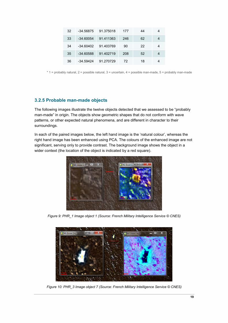
32 -34.56875 91.375018 177 44 4
33 -34.60054 91.411363 246 62 4
34 -34.60402 91.403769 90 22 4
35 -34.60588 91.402719 208 52 4
36 -34.59424 91.270729 72 18 4
* 1 = probably natural, 2 = possible natural, 3 = uncertain, 4 = possible man-made, 5 = probably man-made
3.2.5 Probable man-made objects
The following images illustrate the twelve objects detected that we assessed to be “probably man-made” in origin. The objects show geometric shapes that do not conform with wave patterns, or other expected natural phenomena, and are different in character to their surroundings.
In each of the paired images below, the left hand image is the ‘natural colour’, whereas the right hand image has been enhanced using PCA. The colours of the enhanced image are not significant, serving only to provide contrast. The background image shows the object in a wider context (the location of the object is indicated by a red square).
Figure 9: PHR_1 Image object 1 (Source: French Military Intelligence Service © CNES)
Figure 10: PHR_3 Image object 7 (Source: French Military Intelligence Service © CNES)
19
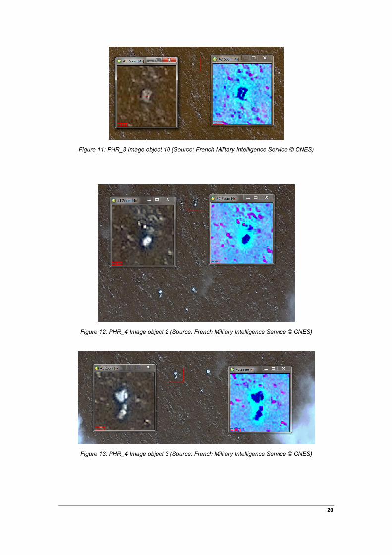
Figure 11: PHR_3 Image object 10 (Source: French Military Intelligence Service © CNES)
Figure 12: PHR_4 Image object 2 (Source: French Military Intelligence Service © CNES)
Figure 13: PHR_4 Image object 3 (Source: French Military Intelligence Service © CNES)
20
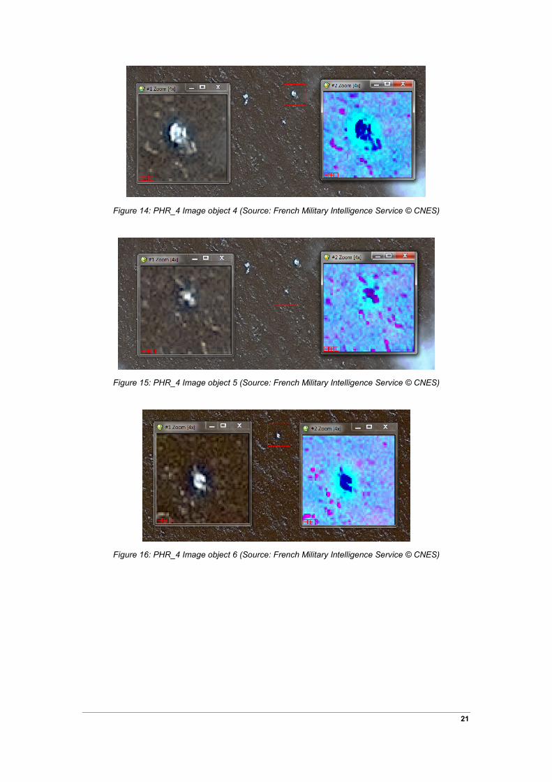
Figure 14: PHR_4 Image object 4 (Source: French Military Intelligence Service © CNES)
Figure 15: PHR_4 Image object 5 (Source: French Military Intelligence Service © CNES)
Figure 16: PHR_4 Image object 6 (Source: French Military Intelligence Service © CNES)
21
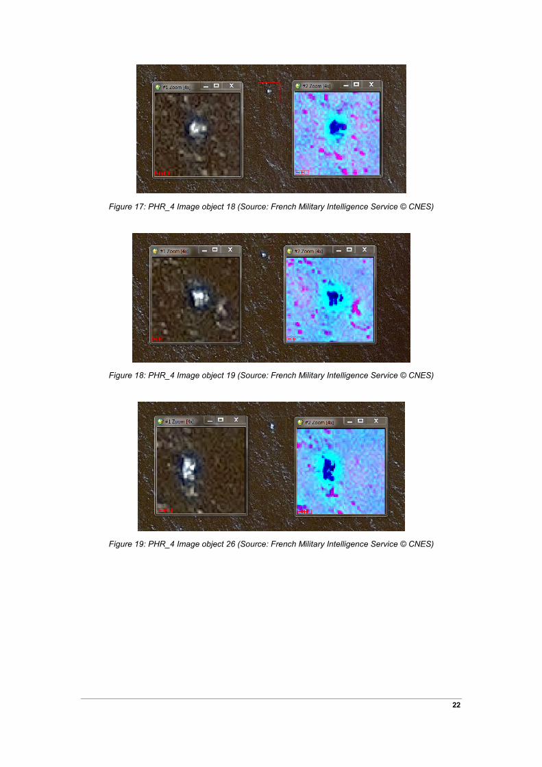
Figure 17: PHR_4 Image object 18 (Source: French Military Intelligence Service © CNES)
Figure 18: PHR_4 Image object 19 (Source: French Military Intelligence Service © CNES)
Figure 19: PHR_4 Image object 26 (Source: French Military Intelligence Service © CNES)
22

Figure 20: PHR_4 Image object 27 (Source: French Military Intelligence Service © CNES)
23

4 Conclusion
The GA analysis of the four PLEIADES 1A images supplied by ATSB was conducted using visual interpretation aided by a Principal Components Analysis to help highlight objects against the surrounding areas.
The analysis classified 12 objects as “probably man-made”, from a total of 70 detected objects. Each object was categorised in one of five classes of likelihood of being man-made in origin.
The majority (36 of 70) of all detected objects were found in the north-easterly image (PHR_4). PHR_4 also contained 9 of the 12 objects classified as “probably man made”.
This analysis indicates a probable cluster of man-made objects in the north-easterly image (PHR_4) on March 23 2014 but cannot determine whether they are aircraft debris.
24

5 Appendix
This appendix provides images of each detected object in true colour plus the associated PCA image. It also provides representative spectra found in each PLEIADES 1A image.
5.1.1 Objects detected in PHR_1
Figure 21: PHR_1 Representative Spectra
Figure 22: PHR_1 Image object 1 (Source: French Military Intelligence Service © CNES)
25

Figure 23: PHR_1 Image object 2 (Source: French Military Intelligence Service © CNES)
Figure 24: PHR_1 Image object 3 (Source: French Military Intelligence Service © CNES)
Figure 25: PHR_1 Image object 4 (Source: French Military Intelligence Service © CNES)
26
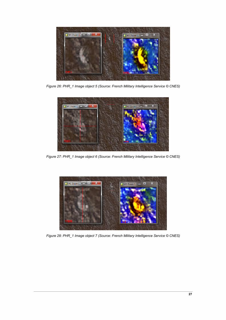
Figure 26: PHR_1 Image object 5 (Source: French Military Intelligence Service © CNES)
Figure 27: PHR_1 Image object 6 (Source: French Military Intelligence Service © CNES)
Figure 28: PHR_1 Image object 7 (Source: French Military Intelligence Service © CNES)
27
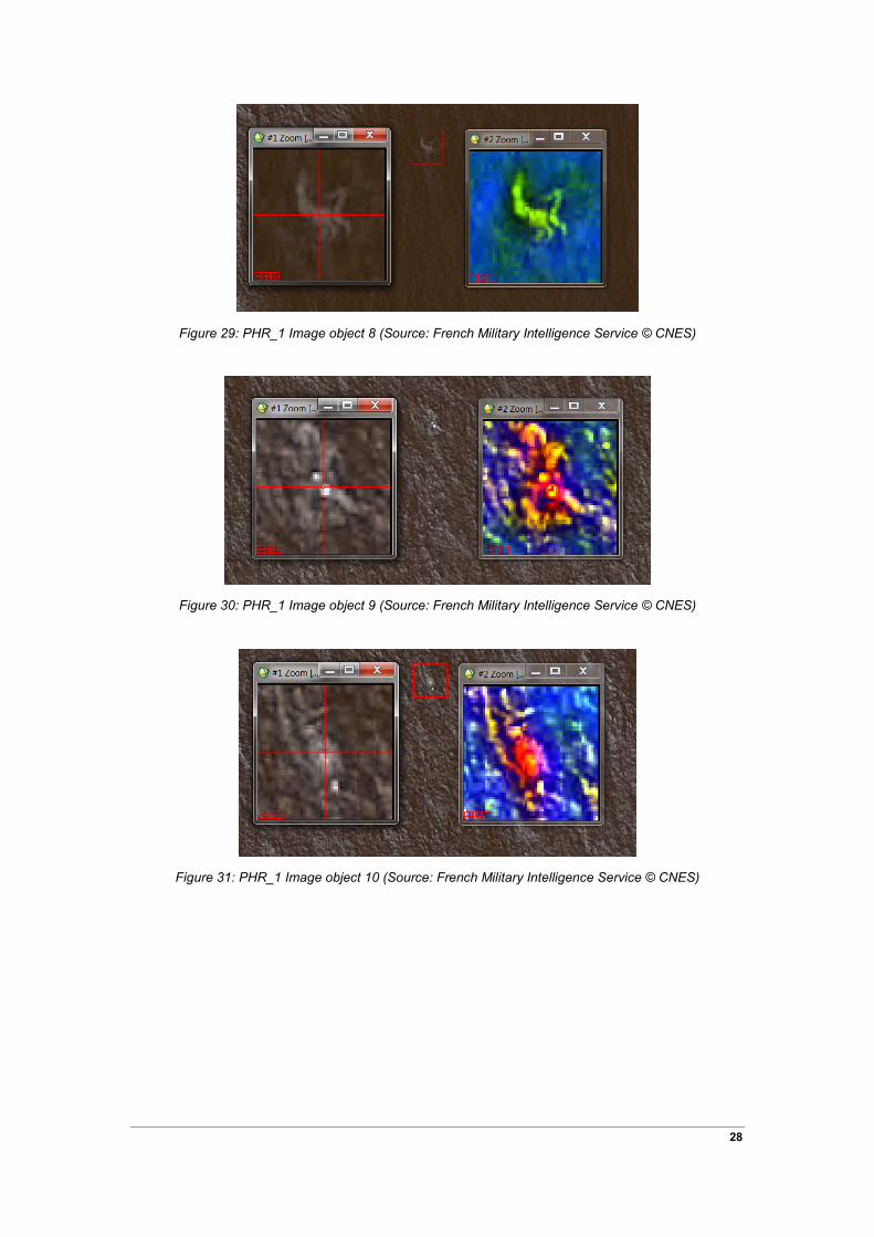
Figure 29: PHR_1 Image object 8 (Source: French Military Intelligence Service © CNES)
Figure 30: PHR_1 Image object 9 (Source: French Military Intelligence Service © CNES)
Figure 31: PHR_1 Image object 10 (Source: French Military Intelligence Service © CNES)
28

Figure 32: PHR_1 Image object 11 (Source: French Military Intelligence Service © CNES)
5.1.2 Objects detected in PHR_2
Figure 33: PHR_2 Representative spectra
29

Figure 34: PHR_2 Image object 1 (Source: French Military Intelligence Service © CNES)
Figure 35: PHR_2 Image object 2 (Source: French Military Intelligence Service © CNES)
Figure 36: PHR_2 Image object 3 (Source: French Military Intelligence Service © CNES)
30
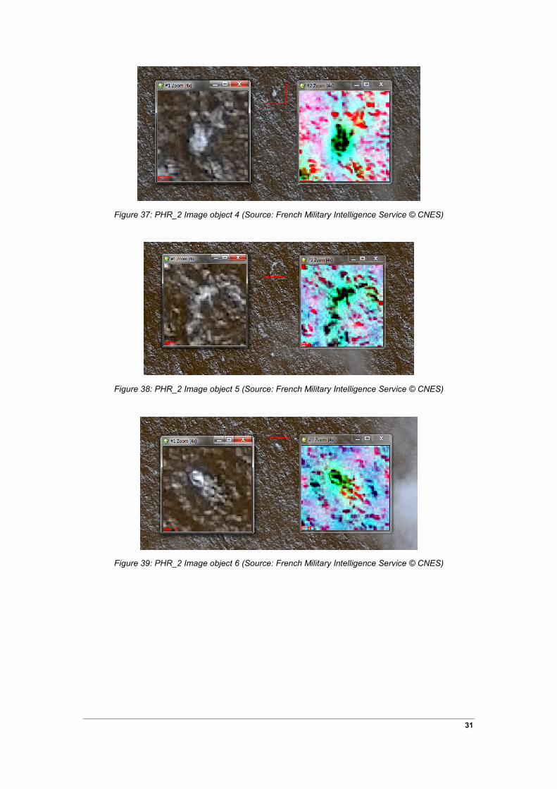
Figure 37: PHR_2 Image object 4 (Source: French Military Intelligence Service © CNES)
Figure 38: PHR_2 Image object 5 (Source: French Military Intelligence Service © CNES)
Figure 39: PHR_2 Image object 6 (Source: French Military Intelligence Service © CNES)
31
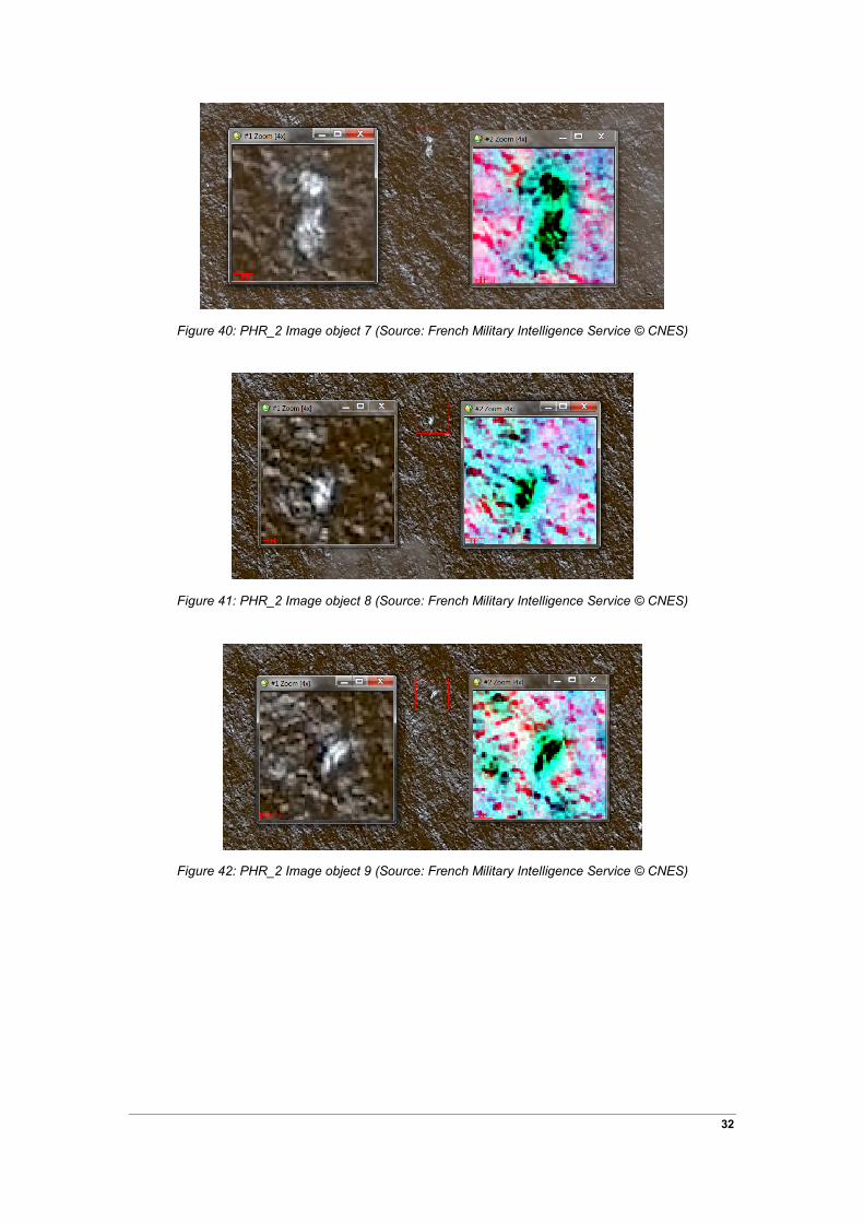
Figure 40: PHR_2 Image object 7 (Source: French Military Intelligence Service © CNES)
Figure 41: PHR_2 Image object 8 (Source: French Military Intelligence Service © CNES)
Figure 42: PHR_2 Image object 9 (Source: French Military Intelligence Service © CNES)
32
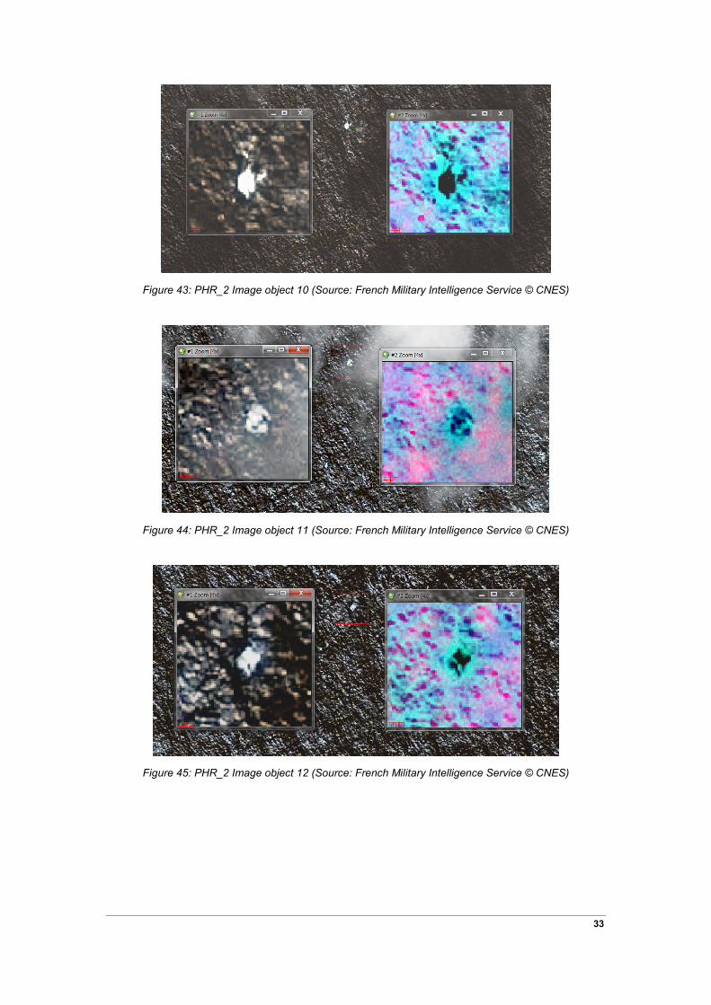
Figure 43: PHR_2 Image object 10 (Source: French Military Intelligence Service © CNES)
Figure 44: PHR_2 Image object 11 (Source: French Military Intelligence Service © CNES)
Figure 45: PHR_2 Image object 12 (Source: French Military Intelligence Service © CNES)
33

5.1.3 Objects detected in PHR_3
Figure 46: PHR_3 Representative spectra
Figure 47: PHR_3 Image object 1 (Source: French Military Intelligence Service © CNES)
34
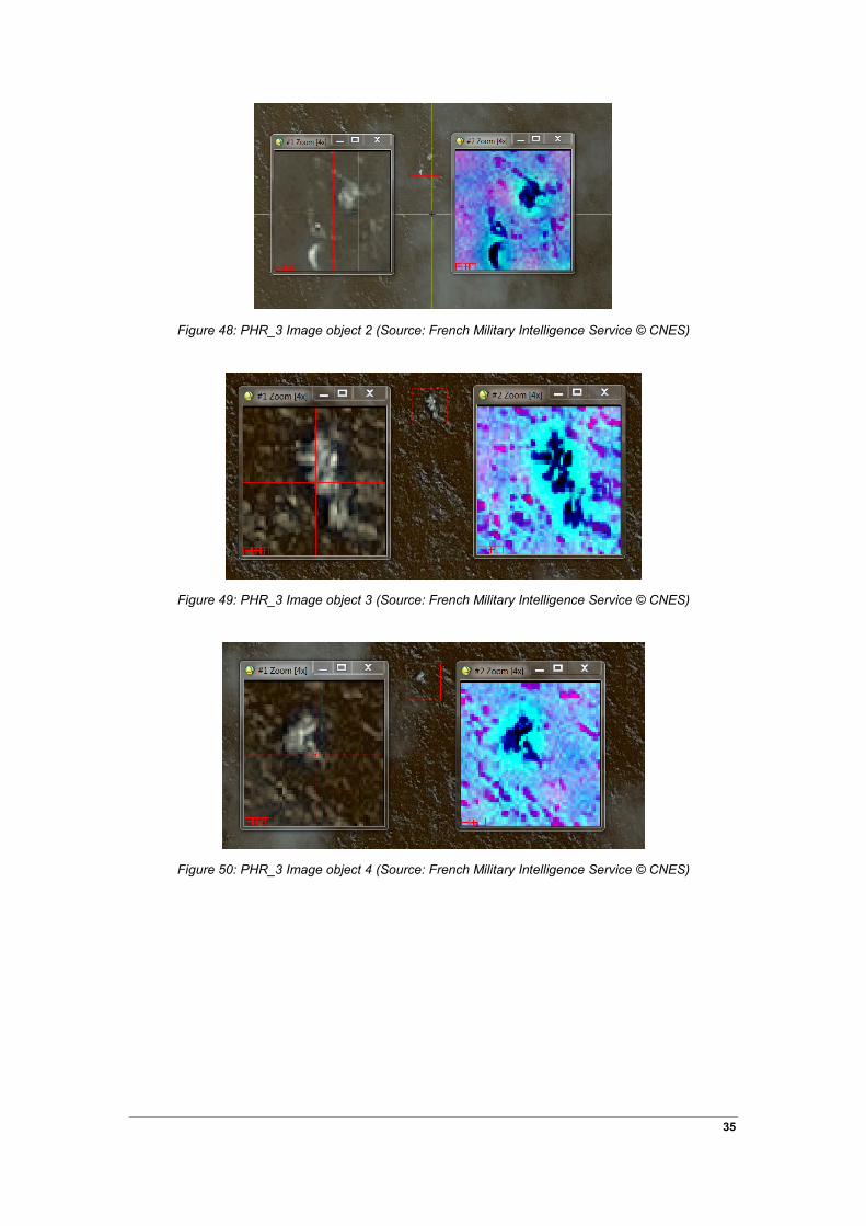
Figure 48: PHR_3 Image object 2 (Source: French Military Intelligence Service © CNES)
Figure 49: PHR_3 Image object 3 (Source: French Military Intelligence Service © CNES)
Figure 50: PHR_3 Image object 4 (Source: French Military Intelligence Service © CNES)
35

Figure 51: PHR_3 Image object 5 (Source: French Military Intelligence Service © CNES)
Figure 52: PHR_3 Image object 6 (Source: French Military Intelligence Service © CNES)
Figure 53: PHR_3 object 7 (Source: French Military Intelligence Service © CNES)
36
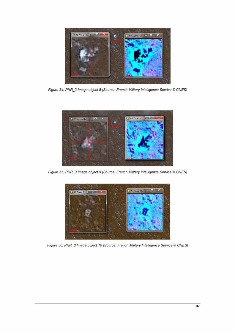
Figure 54: PHR_3 Image object 8 (Source: French Military Intelligence Service © CNES)
Figure 55: PHR_3 Image object 9 (Source: French Military Intelligence Service © CNES)
Figure 56: PHR_3 Image object 10 (Source: French Military Intelligence Service © CNES)
37

Figure 57: PHR_3 Image object 11 (Source: French Military Intelligence Service © CNES)
5.1.4 Objects detected in PHR_4
Figure 58: PHR_4 Representative Spectra
38

Figure 59: PHR_4 Image object 1 (Source: French Military Intelligence Service © CNES)
Figure 60: PHR_4 Image object 2 (Source: French Military Intelligence Service © CNES)
Figure 61: PHR_4 Image object 3 (Source: French Military Intelligence Service © CNES)
39

Figure 62: PHR_4 Image object 4 (Source: French Military Intelligence Service © CNES)
Figure 63: PHR_4 Image object 5 (Source: French Military Intelligence Service © CNES)
Figure 64: PHR_4 Image object 6 (Source: French Military Intelligence Service © CNES)
40

Figure 65: PHR_4 Image object 7 (Source: French Military Intelligence Service © CNES)
Figure 66: PHR_4 Image object 8 (Source: French Military Intelligence Service © CNES)
Figure 67: PHR_4 Image object 9 (Source: French Military Intelligence Service © CNES)
41
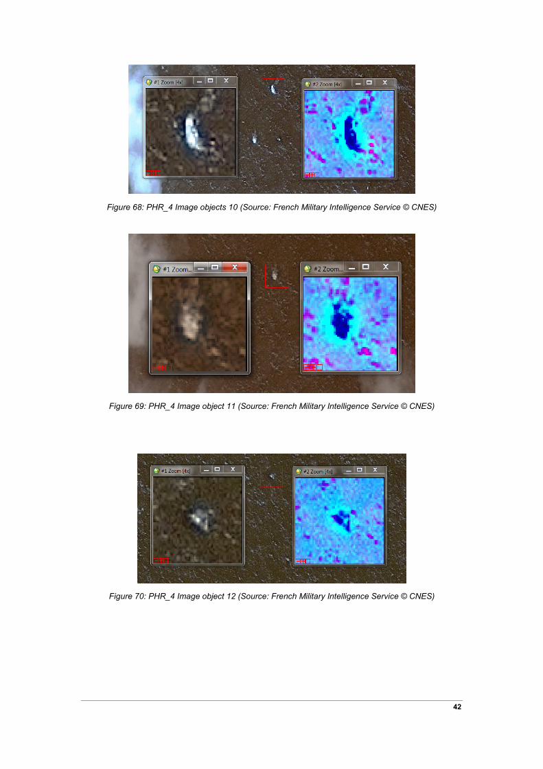
Figure 68: PHR_4 Image objects 10 (Source: French Military Intelligence Service © CNES)
Figure 69: PHR_4 Image object 11 (Source: French Military Intelligence Service © CNES)
Figure 70: PHR_4 Image object 12 (Source: French Military Intelligence Service © CNES)
42

Figure 71: PHR_4 Image object 13 (Source: French Military Intelligence Service © CNES)
Figure 72: PHR_4 Image object 14 (Source: French Military Intelligence Service © CNES)
Figure 73: PHR_4 Image object 15 (Source: French Military Intelligence Service © CNES)
43

Figure 74: PHR_4 Image object 16 (Source: French Military Intelligence Service © CNES)
Figure 75: PHR_4 Image object 17 (Source: French Military Intelligence Service © CNES)
Figure 76: PHR_4 Image object 18 (Source: French Military Intelligence Service © CNES)
44

Figure 77: PHR_4 Image object 19 (Source: French Military Intelligence Service © CNES)
Figure 78: PHR_4 Image object 20 (Source: French Military Intelligence Service © CNES)
.
Figure 79: PHR_4 Image object 21 (Source: French Military Intelligence Service © CNES)
45

Figure 80: PHR_4 Image object 22 (Source: French Military Intelligence Service © CNES)
Figure 81: PHR_4 Image object 23 (Source: French Military Intelligence Service © CNES)
Figure 82: PHR_4 Image object 24 (Source: French Military Intelligence Service © CNES)
46

Figure 83: PHR_4 Image object 25 (Source: French Military Intelligence Service © CNES)
Figure 84: PHR_4 Image object 26 (Source: French Military Intelligence Service © CNES)
Figure 85: PHR_4 Image object 27 (Source: French Military Intelligence Service © CNES)
47
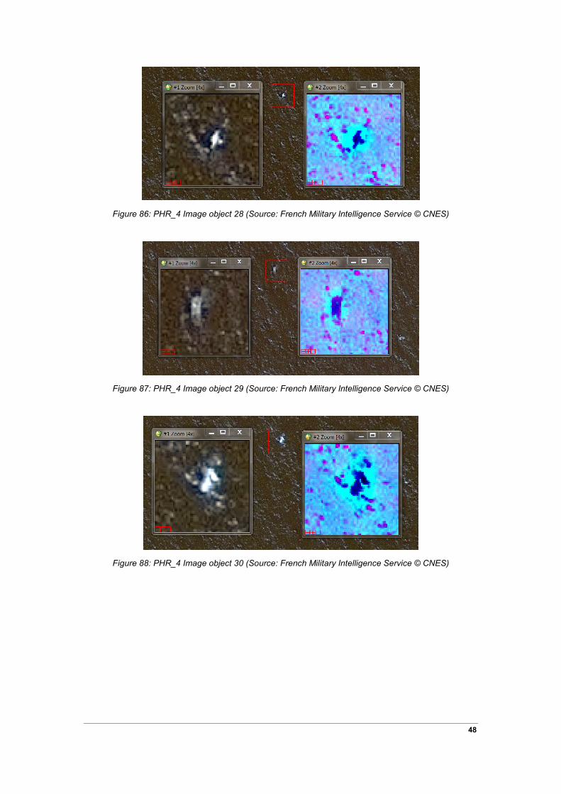
Figure 86: PHR_4 Image object 28 (Source: French Military Intelligence Service © CNES)
Figure 87: PHR_4 Image object 29 (Source: French Military Intelligence Service © CNES)
Figure 88: PHR_4 Image object 30 (Source: French Military Intelligence Service © CNES)
48
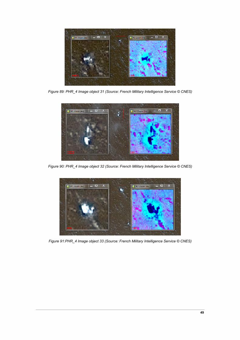
Figure 89: PHR_4 Image object 31 (Source: French Military Intelligence Service © CNES)
Figure 90: PHR_4 Image object 32 (Source: French Military Intelligence Service © CNES)
Figure 91:PHR_4 Image object 33 (Source: French Military Intelligence Service © CNES)
49

Figure 92: PHR_4 Image object 34 (Source: French Military Intelligence Service © CNES)
Figure 93:PHR_4 Image object 35 (Source: French Military Intelligence Service © CNES)
Figure 94: PHR_4 Image object 36 (Source: French Military Intelligence Service © CNES)
50