Roman or Medieval? Historical Roads in the Pilis Forest
9
The research on different features, such as castles, villages or cemeteries, is linked to the mapping of our past. In addition it has become the task of archaeology to follow the changes in the areas that surround these features. Among the several features of these areas (e.g. fishponds, mines), roads that connect the different locations of human activity seem to have been the most important. Several factors influenced their creation, the timeframe of their usage and changes in their path or role. There is no doubt that present- day scholars can reveal only a small portion of these changes, however, if one attempts to research a broad chronological period there are still some reference points. The traditionally well-known Roman road network, which was planned by professionals, is such a phenomenon. The efficient construction of these roads in terms of their route and structure represented the highest standard for contemporary engineers, and therefore they were prominent even (many centuries) after the fall of the Roman Empire. An important question is: What was the scale of the actual usage of Roman Period roads that lay behind the traditions that are known from medieval written sources? What kind of factors played a role in some roads being used continuously while others were abandoned? What kind of effect did the roads have on medieval life? The present summary reveals the relationships of the Roman and medieval roads in the Carpathian Basin, and through the example of the Pilis-Visegrád Hills, provides an overview of the approach to research on roads both in the past and future. KEEPING UP WITH TIME – ON THE SURVIVAL OF ROMAN PERIOD ROADS IN THE MIDDLE AGES Based on the earliest research, several general observations took root in Hungarian historical road research. These were recently summarized and re-evaluated with the integration of new data by Magdolna Szilágyi. 1 Until recently it seemed that the earliest features of the road network in the Kingdom of Hungary were related to the Roman Period roads of Pannonia. 2 Even the chieftains of the Conquest period 3 organized their centers on the basis of Roman fortresses that were accessible by Roman roads. 4 (Fig. 1.) According to the research, as a result of this process the establishment of the secular and ecclesial centers, such as the Archbishopric of Esztergom, the Bishoprics of Pécs and Győr, or the comitatus of Visegrád and Sop- ron, was on the basis of Roman cities or military camps in the territory of the former Roman province of Pannonia. Based on all this, there seemed to be proof that in addition to using the remains of Roman 1 Szilágyi, Magdolna: On the Road: The History and Archaeology of Communication Networks in East-Central Europe (Budapest: Archaeolingua, 2014). 2 It must have been the same for those roads that were used by the Germanic or Avar people, although the degree and scale of their use are unknown. The works of Gyula László, Károly Szendy, Ilona L. Kovrig, László Gerevich, and recently Réka Virágos are authoritative on this issue, see Ibid., 79–81. 3 On the archaeology of this period, see the essays by Mária Wolf, István Fodor, Károly Mesterházy and László Révész in Visy, Zsolt (ed.): Hungarian Archaeology at the Turn of the Millennium (Budapest: Ministry of National Cultural Heritage. Teleki László Foundation, 2003), 319–343. Read online: www.telekialapitvany.hu/joomla/images/docs/kiadvanyok/hungarian_ archeology.pdf 4 Many coins and treasure hoards show the Roman roads were used in the Middle Ages, e.g. 32 silver coins (denarius) were found at Bögöt (Vas County) that were produced during the reign of St. Stephen I (1000–1038) and King Andrew I (1047–1060). These prove the eleventh-century usage of the Roman road between Arrabona and Savaria. Szilágyi, Magdolna: On the Road: The History and Archaeology of Communication Networks in East-Central Europe (Budapest: Archaeolingua, 2014), 79–80. ROMAN OR MEDIEVAL? HISTORICAL ROADS IN THE PILIS FOREST E-JOURNAL • 2014 AUTUMN HUNGARIAN ARCHAEOLOGY www.hungarianarchaeology.hu ZsuZsa EsZtEr PEtő
Transcript of Roman or Medieval? Historical Roads in the Pilis Forest

The research on different features, such as castles, villages or cemeteries, is linked to the mapping of our past. In addition it has become the task of archaeology to follow the changes in the areas that surround these features. Among the several features of these areas (e.g. fishponds, mines), roads that connect the different locations of human activity seem to have been the most important. Several factors influenced their creation, the timeframe of their usage and changes in their path or role. There is no doubt that present-day scholars can reveal only a small portion of these changes, however, if one attempts to research a broad chronological period there are still some reference points. The traditionally well-known Roman road network, which was planned by professionals, is such a phenomenon. The efficient construction of these roads in terms of their route and structure represented the highest standard for contemporary engineers, and therefore they were prominent even (many centuries) after the fall of the Roman Empire. An important question is: What was the scale of the actual usage of Roman Period roads that lay behind the traditions that are known from medieval written sources? What kind of factors played a role in some roads being used continuously while others were abandoned? What kind of effect did the roads have on medieval life? The present summary reveals the relationships of the Roman and medieval roads in the Carpathian Basin, and through the example of the Pilis-Visegrád Hills, provides an overview of the approach to research on roads both in the past and future.
Keeping up with time – On the Survival Of rOman periOd rOadS in the middle ageS
Based on the earliest research, several general observations took root in Hungarian historical road research. These were recently summarized and re-evaluated with the integration of new data by Magdolna Szilágyi.1 Until recently it seemed that the earliest features of the road network in the Kingdom of Hungary were related to the Roman Period roads of Pannonia.2 Even the chieftains of the Conquest period3 organized their centers on the basis of Roman fortresses that were accessible by Roman roads.4 (Fig. 1.) According to the research, as a result of this process the establishment of the secular and ecclesial centers, such as the Archbishopric of Esztergom, the Bishoprics of Pécs and Győr, or the comitatus of Visegrád and Sop-ron, was on the basis of Roman cities or military camps in the territory of the former Roman province of Pannonia. Based on all this, there seemed to be proof that in addition to using the remains of Roman
1 Szilágyi, Magdolna: On the Road: The History and Archaeology of Communication Networks in East-Central Europe (Budapest: Archaeolingua, 2014).
2 It must have been the same for those roads that were used by the Germanic or Avar people, although the degree and scale of their use are unknown. The works of Gyula László, Károly Szendy, Ilona L. Kovrig, László Gerevich, and recently Réka Virágos are authoritative on this issue, see Ibid., 79–81.
3 On the archaeology of this period, see the essays by Mária Wolf, István Fodor, Károly Mesterházy and László Révész in Visy, Zsolt (ed.): Hungarian Archaeology at the Turn of the Millennium (Budapest: Ministry of National Cultural Heritage. Teleki László Foundation, 2003), 319–343. Read online: www.telekialapitvany.hu/joomla/images/docs/kiadvanyok/hungarian_archeology.pdf
4 Many coins and treasure hoards show the Roman roads were used in the Middle Ages, e.g. 32 silver coins (denarius) were found at Bögöt (Vas County) that were produced during the reign of St. Stephen I (1000–1038) and King Andrew I (1047–1060). These prove the eleventh-century usage of the Roman road between Arrabona and Savaria. Szilágyi, Magdolna: On the Road: The History and Archaeology of Communication Networks in East-Central Europe (Budapest: Archaeolingua, 2014), 79–80.
rOman Or medieval? hiStOrical rOadS in the piliS fOreSt
E-JOURNAL • 2014 AUTUMNHUNGARIAN ARCHAEOLOGY
www.hungarianarchaeology.hu
ZsuZsa EsZtEr PEtő
Zsuzsa Eszter Pető • Roman or Medieval? Historical Roads in the Pilis Forest2HUNGARIAN ARCHAEOLOGY E-JOURNAL • 2014 AUTUMN
buildings, the roads that connected them were also in active use during the period of the foundation of the Kingdom of Hungary (ca. at the turn of the eleventh century) and continued to be used later. It was thought that a major change arrived only in the middle of the thirteenth century in connection with structural changes in the Kingdom, when along with the reorganization of administration, trading zones, and the settlement network, the primary role of the roads of Roman origin came to an end. By this time the new medieval centers and their roads had been developed in accordance with the geographical (and certain political-historical) conditions.5
Contrary to these general tendencies of the research, it has now been revealed that many other features affected the evolution and reorganization of the medieval road network.6 Basic differences can be shown between the Roman and medieval roads: the Roman period roads were designed by engineers, who had to consider not only environmental factors, but also the strategic considerations and regulations of the Roman Empire. They focused on developing straight roads with only slight inclines – even if they had to move a great deal of earth – that were more efficient from political, economic and military points of view, and they maintained them regularly.7 Based on all of this, the roads became defining features of the landscape in the Roman Period and later.8
The medieval roads, which were being developed in addition to the Roman roads, show a much broader variety than was observed previously regarding both their form and development:9 usually they were adapted to the given geographic and weather conditions, not built by precise designs and techniques, instead following the shortest and the most efficient path. Therefore, their paths could be altered and their designations and legal regulations were diverse and changed from time to time. The roads of the Kingdom of Hungary – in contrast with the centralized administration of Rome – were developed mostly according to local political, military, and economic considerations. It seems that the regulation of roads was fundamentally linked to
5 Ibid., 81.6 Ibid., 81–83, 198–200.7 In addition to this summary, see Tóth, Endre: Római utak Pannóniában [Roman Roads in Pannonia]. Ókor 3 (2004)/1, 47;
Muir, Richard: The new reading the landscape. Fieldwork in landscape history (Exeter: University of Exeter Press, 2000), 99.8 It became clear even in the 1930s that the Roman roads that were used or at least visible in the Middle Ages appeared in the
medieval written sources and in many cases they can be precisely identified. Of the terms öttevényút, kövesút [paved road], királyuta [king’s road], via levata, and via murata, only öttevény seems definitely to refer to a Roman road. Other terms, such as the commonly used paved road could refer to a Roman road or a medieval road as well. For more on this see: Szilágyi, Magdolna: On the Road: The History and Archaeology of Communication Networks in East-Central Europe (Budapest: Archaeolingua, 2014), 55.
9 On the types of medieval roads and the research possibilities on them, see the essay by Magdolna Szilágyi in the previous issue of Hungarian Archaeology.
Fig. 1: The mains roads of medieval Transdanubia. 1. Before the Mongol Invasion (1242) 2. After the Mongol Invasion
3. Roads that were used in both periods. Source: Glaser, Lajos: Dunántúl középkori úthálózata [The Medieval Road Network of
Transdanubia]. Századok 63–64 (1929–1930), 153.

Zsuzsa Eszter Pető • Roman or Medieval? Historical Roads in the Pilis Forest3HUNGARIAN ARCHAEOLOGY E-JOURNAL • 2014 AUTUMN
the ownership of the land, which means that – just like every other kind of property – they were controlled by the king in the first phase of the Árpád Period (until about the turn of the thirteenth century). This situation changed only when major estates began to be granted, when private roads owned by the nobility emerged. These were mainly local, internal roads within their estates – the large (regional and long-distance) roads going through several counties were still in the hands of the king and could be used by essentially anyone.10 In the end, a multifunctional, continuously changing road network going beyond the Roman roads was interlaced through the medieval world of our region.
This multi-level process can be clearly examined in the Pilis region, where in addition to the Roman roads (Fig. 2.), several other important factors can be identified as indicators of the medieval road network. The 400 km2 forested area of the Pilis-Visegrádi Hills represented the provincial border of Pannonia, and moreover, of the Roman Empire itself. This frontier role changed in the Middle Ages: Pilis became a central region, since it was in the heart of the Kingdom of Hungary (Medium Regni11). It was surrounded by royal and ecclesiastic centers (Esztergom, Óbuda/Buda, Visegrád, Dömös) and was a royal forest and hunting area at that time. In addition to all these factors, the strong presence of royal power is shown by the existence of royal manor houses/hunting lodges and the monasteries that were established from them.12
The important settlements and centers located around the Pilis region, as well as the Virgin Mary Cistercian Abbey at Pilis and the Pauline monasteries of the Holy Cross (at present-day Kesztölc-Klastrompuszta), the Holy Spirit (at Pilisszentlélek), and St. Ladislaus (Pilisszentlászló) played a key role in the medieval road
10 We find the continued interests of the king present indirectly, primarily through tolls, but this is only documented starting from the fifteenth century.
11 This is a medieval term used for the central area of the medieval Kingdom of Hungary. For more on this, see: Altmann, Júlia et al. (eds.): Medium Regni. Medieval Hungarian Royal Seats (Budapest: Nap Kiadó, 1999).
12 In the case of the Cistercian Abbey in Pilisszentkereszt and supposedly the Pauline monasteries at Pilisszentlélek and Kesztölc-Klastrompuszta it was shown archaeologically and historically (through written sources) that the orders took over previously royal buildings.
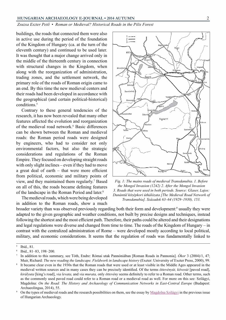
Fig. 2: A paved road in the Pilis region. Photograph by Máté Szabó. Source: http://sirasok.blog.
hu/2010/04/13/osi_utak_a_pilisben)
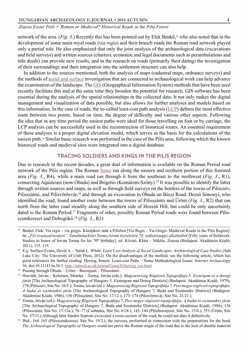
Fig. 3: Roman and medieval roads in the Pilis region, adjusted according to the First Ordnance Survey
Zsuzsa Eszter Pető • Roman or Medieval? Historical Roads in the Pilis Forest4HUNGARIAN ARCHAEOLOGY E-JOURNAL • 2014 AUTUMN
network of the area. (Fig. 3.) Recently this has been pointed out by Elek Benkő,13 who also noted that in the development of some main royal roads (via regia) and their branch roads the Roman road network played only a partial role. He also emphasized that only the joint analysis of the archaeological data (excavations and field surveys) and written sources (charters, economic and legal documents such as perambulations and title deeds) can provide new results, and in the research on roads (primarily their dating) the investigation of their surroundings and their integration into the settlement structure can also help.
In addition to the sources mentioned, both the analysis of maps (cadastral maps, ordnance surveys) and the methods of aerial and surface investigation that are connected to archaeological work can help advance the examination of the landscape. The GIS (Geographical Information System) methods that have been used recently facilitate this and at the same time they broaden the potential for research. GIS software has been essential during the analysis of the spatial relationships in the collected data. It not only makes the digital management and visualization of data possible, but also allows for further analyses and models based on this information. In the case of roads, the so-called least-cost path analysis (LCP) defines the most effective route between two points, based on time, the degree of difficulty and various other aspects. Following the idea that in any time period the easiest paths were ideal for those travelling on foot or by carriage, the LCP analysis can be successfully used in the reconstruction of historical routes. An essential requirement of these analyses is a proper digital elevation model, which serves as the basis for the calculations of the easiest path.14 Similar basic research was performed in the case of the Pilis area, following which the known historical roads and medieval sites were integrated into a digital database.
tracing SOldierS and KingS in the piliS regiOnDue to research in the recent decades, a great deal of information is available on the Roman Period road network of the Pilis region. The Roman limes ran along the eastern and northern portion of this forested area (Fig. 3., R4), while a main road ran through it from the southeast to the northwest (Fig. 3., R1), connecting Aquincum (now Óbuda) and Brigetio (Komárom-Szőny).15 It was possible to identify the latter through written sources and maps, as well as through field surveys on the borders of the towns of Piliscsév, Pilisszántó, and Pilisvörösvár,16 and through an excavation in Óbuda on Bécsi Road. Dezső Simonyi, who identified the road, found another route between the towns of Pilisszántó and Üröm (Fig. 3., R2) that ran north from the latter road steadily along the southern side of Hosszú Hill, but could be only uncertainly dated to the Roman Period.17 Fragments of other, possibly Roman Period roads were found between Pilis-szentkereszt and Dobogókő.18 (Fig. 3., R3)
13 Benkő, Elek: Via regis – via gregis. Középkori utak a Pilisben [Via Regis – Via Gregis. Medieval Roads in the Pilis Region]. In: „Fél évszázad terepen”. Tanulmánykötet Torma István tiszteletére 70. születésnapja alkalmából [Fifty years of fieldwork. Studies in honor of István Torma for his 70th birthday], ed. Kővári, Klára – Miklós, Zsuzsa (Budapest: Akadémiai Kiadó, 2011), 115–119.
14 E.g. Surface-Evans, Devin A. – Sarah L. White: Least Cost Analysis of Social Landscapes. Archaeological Case Studies (Salt Lake City: The University of Utah Press, 2012). On the disadvantages of the method, see the following article, which has good references for further reading: Herzog, Irmela: Least-cost Paths – Some Methodological Issues. Internet Archaeology 36, doi:10.11141/ia.36.5. http://intarch.ac.uk/journal/issue36/herzog_toc.html
15 Passing through Óbuda – Üröm – Borosjenő – Pilisszántó. 16 Horváth, István – Kelemen, Mónika – Torma, István (eds.): Magyarország Régészeti Topográfiája 5. Esztergom és a dorogi
járás [The Archaeological Topography of Hungary 5. Esztergom and Dorog Districts] (Budapest: Akadémiai Kiadó, 1979), 278 (Piliscsév, Site No. 16/5.); Torma, István (ed.): Magyarország Régészeti Topográfiája 7. Pest megye régészeti topográfiája: A budai és szentendrei járás [The Archaeological Topography of Hungary 7. Buda and Szentendre Districts] (Budapest: Akadémiai Kiadó, 1986), 156 (Pilisszántó, Site No. 17/12.); 173–174 (Pilisvörösvár, Site No. 21/21.).
17 Torma, István (ed.): Magyarország Régészeti Topográfiája 7. Pest megye régészeti topográfiája: A budai és szentendrei járás [The Archaeological Topography of Hungary 7. Buda and Szentendre Districts] (Budapest: Akadémiai Kiadó, 1986), 156 (Pilisszántó, Site No. 17/12a.); 76–77 (Csobánka, Site No. 6/28.); 143–144 (Pilisborosjenő, Site No. 15/8.); 353 (Üröm, Site No. 37/11.) Although later Sándor Soproni excavated a cross-section of the road, he could not date it definitively.
18 Ibid., 164–165 (Pilisszentkereszt, Site No. 19/2.); the surveys, performed in connection with the preparations for the book The Archaeological Topography of Hungary could not prove the Roman origin of the road due to the lack of datable material

Zsuzsa Eszter Pető • Roman or Medieval? Historical Roads in the Pilis Forest5HUNGARIAN ARCHAEOLOGY E-JOURNAL • 2014 AUTUMN
Recently Elek Benkő identified the road at present-day Hosszú Hill (R2) and the one leading to Dobogókő (R3) as medieval. He referred to the earlier, uncertain dating and the important medieval role of the route: it ran past monastic centers (the Paulines at Pilisszentlélek and the Cistercians at Pilisszentkereszt) and medieval settlements (Szántó, Boron), and also connected important royal centers (Esztergom, Óbuda). Based on all these facts, Benkő argued the existence of a medieval royal road (via regia) determined the internal structure of the Pilis region.
In relation to this road, another possibility also arose: through the re-evaluation of the historical maps (ordnance surveys and cadastral maps) and the information from old and recent field surveys it seems that the royal road that began at Üröm (Fig. 3., R2) and ran along the southern side of Hosszú Hill, for practical reasons might have followed this path on the north side, passing through the village of Boron and on to Pilisszentkereszt. (Fig. 3., VR) This does not mean that the southern route was not in use in the Middle Ages, but the more level terrain on the northern side (thereby avoiding the Szántó pass) and the path that can be seen on the First Ordnance Survey of Hungary19 support this alternative route.20
Last but not least, it is undoubted that the so-called “great road” (via magna, Hungarian “nagyút” Fig. 3., VM) between Buda and Esztergom via Csaba existed.21 It was regarded as the main road and also was listed frequently amongst the features during the perambulations. In addition to the via magna that is mentioned in the perambulation of the village of Boron, the document mentions a paved road that may refer to the Roman road between Brigetio and Aquincum (Fig. 3., R1), which was definitely still used in the Middle Ages.22
and the unsolved problem of the watchtower that was located on the top of the hill. For more on this, see the research of Máté Szabó: http://sirasok.blog.hu/2010/04/13/osi_utak_a_pilisben (in Hungarian)
19 For the digitized maps online, see: http://mapire.eu/en/ 20 The existence of the royal road agrees with the ideas of József Laszlovszky and László Ferenczi, who argue that the
medieval glass workshop and grange that has been excavated at the Pomáz-Nagykovácsi site, which was owned by the Cistercians of Pilis, was reached via a branch road off the road that ran along the north side of Hosszú Hill. For the recent summary of the field surveys, see: Ferenczi, László – Deák, Márton – Kohán, Balázs – Látos, Tamás: Történeti útvonalak kutatása a Pilisben: tájrégészeti-tájtörténeti vizsgálatok térinformatikai háttérrel [The research of historical roads in the Pilis: landscape archaeological – land history investigations with GIS background]. In: Az elmélet és a gyakorlat találkozása a térinformatikában V. [Theory meets practice in GIS, Vol. 5.], ed. Lóki, József (Debrecen: Debrecen University Press, 2014), 121–128. http://geogis.detek.unideb.hu/TKonferencia/2014/Konferenciakotet_2014.pdf
21 Magnam viam per quam itur de Strigonio Budam; it was mentioned first in the thirteenth century then a charter reports in 1411 that the road led through Csaba (DL 1798), Györffy György: Az Árpád-kori Magyarország történeti földrajza 4 [A Historical Geography of Hungary in the Árpád Period Vol. 4.] (Budapest: Akadémiai Kiadó, 1998), 591.
22 As was proved by archaeological investigations, the road was in use between the second and the sixteenth centuries. See the excavation at Aquincum – Civil Town (Budapest, Bécsi út 314.) For a summary on the research results of Orsolya Láng, see Szilágyi, Magdolna: On the Road: The History and Archaeology of Communication Networks in East-Central Europe (Budapest: Archaeolingua, 2014), 78. This road is marked on the map of Pilis County, see S 12 Div XI. No. 89 (Hungarian National Archive, Map Collection), cited by Benkő, Elek: Via regis – via gregis. Középkori utak a Pilisben [Via Regis – Via Gregis. Medieval Roads in the Pilis Region]. In: „Fél évszázad terepen”. Tanulmánykötet Torma István tiszteletére 70. születésnapja alkalmából [Fifty years of fieldwork. Studies in honor of István Torma for his 70th birthday], ed. Kővári, Klára – Miklós, Zsuzsa (Budapest: Akadémiai Kiadó, 2011), 116.
Fig. 4: LCP (1) between Óbuda and Esztergom

Zsuzsa Eszter Pető • Roman or Medieval? Historical Roads in the Pilis Forest6HUNGARIAN ARCHAEOLOGY E-JOURNAL • 2014 AUTUMN
leaSt-cOSt path in the piliS regiOn
The LCP method was used to perform trials on the aforementioned data.23 The route that was generated between Esztergom and Óbuda (Fig. 4., LCP1) was telling: on the one hand the southeastern part showed similarities with the Aquincum-Brigetio road (R1) and on the other hand the road ran past a Roman Period watchtower at Szántó, which was still inhabited in the Middle Ages.24 At the point where the road (R1) turns sharply toward Brigetio the LCP1 led northwest to Esztergom, linking the medieval sites that lead southeast to Kesztölc.25 The model essentially proved that the Brigetio-Aquincum road (R1) required less energy for travelers, and it reinforced everything that had already been summarized by Elek Benkő, namely the Roman roads played an important role in the medieval structure of the Pilis region. However, the degree of this influence can only be revealed by research into written sources on the area around Esztergom.
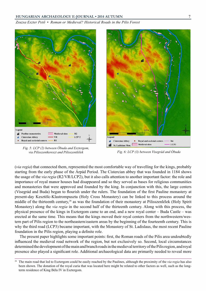
A question can be raised concerning the royal road (VR): What is the most efficient path if the Cistercian abbey at Pilisszentkereszt and the Pauline monastery at Pilisszentlélek are also taken into consideration? The result of the least cost analysis (Fig. 5., LCP2) shows a route that conforms to the Roman road in the southern portion, then running along the southern side of Hosszú Hill, and continuing through the pass at Szántó to the Abbey. Further on it follows – more or less – the path of the via regia that has been reconstructed through the First Ordnance Survey of Hungary. All this supports the concept of the royal route, and that some roads indicated on the First Ordnance Survey follow an archaic path, which might have been altered due to the medieval circumstances.
Only one medieval feature is missing from those previously listed: the Pauline Monastery of St. Ladislaus, which is halfway between Óbuda/Buda and Visegrád. The shortest route between the two points runs near the presumed location of the Pauline monastery (Fig. 6., LCP3), which – also taking into account historical events – is telling, and it can be presumably regarded as a royal road.26 The present monastery was the place where Cardinal Gentile, the deputy of King Charles Robert, and Matthew Csák had political negotiations in 1308. Based on the route generated, it seems that practical issues might have affected the selection of the location. There is a piece of historical data that most likely relates to the classification of this road: in 1322 a paved road is mentioned that leads from the area of Pomáz (from the settlement of Derzsüle) to Visegrád.27
Another important result can be concluded on the basis of the reconstruction of the road network: it became clear that the via magna (VM and LCP1) and the via regia (VR/LCP2) covered the south and southwestern area of the Pilis region, while the road between Visegrád and (Ó)Buda (LCP3) represented the northern and eastern passage through the Pilis region. Therefore, the monasteries and centers are not only important markers of the roads, but in connection with this they also reveal the dynamics of the change in the local and regional settlement pattern. All these issues require more investigation but it has become clear that the usage of certain roads and the foundation of monasteries in the Pilis region were closely related to the changing importance of the royal centers.
The development and existence of the southwestern great road (VM/R1 and LCP1) was related to the early primary role of Esztergom as a royal and ecclesiastical center that was regularly visited by the itinerant royal court. There is no doubt that the royal manor houses in the Pilis region, or more precisely the road 23 The present study is based on the open-source ASTER GDEM2.24 Horváth, István – Kelemen, Mónika – Torma, István (eds.): Magyarország Régészeti Topográfiája 5. Esztergom és a dorogi
járás [The Archaeological Topography of Hungary 5. Esztergom and Dorog Districts] (Budapest: Akadémiai Kiadó, 1979), 277–278. (Piliscsév, Site No. 16/1.)
25 Main roads leading to Esztergom, Buda, and Dorog and an old road (via antiqua) are mentioned on the border of the medieval village of Nyír, next to Kesztölc. Ibid., 194–195. Based on this it is possible that a Roman route led towards Esztergom, maybe even along the path generated by the LCP analysis, and this had an effect on the medieval settlement patterns.
26 The location of medieval sites running to the north and northeast in the vicinity of Szentendre suggest another road that led along the valley to Kékes (present-day Pilisszentlászló) and then to Visegrád – it can be presumed that not only the road along the Danube bank (present-day Route 11) was in use during the Middle Ages for travelers to Visegrád and Dömös.
27 Györffy, György: Az Árpád-kori Magyarország történeti földrajza 4 [A Historical Geography of Hungary in the Árpád Period Vol. 4.] (Budapest: Akadémiai Kiadó, 1998), 595.
Zsuzsa Eszter Pető • Roman or Medieval? Historical Roads in the Pilis Forest7HUNGARIAN ARCHAEOLOGY E-JOURNAL • 2014 AUTUMN
(via regia) that connected them, represented the most comfortable way of travelling for the kings, probably starting from the early phase of the Árpád Period. The Cistercian abbey that was founded in 1184 shows the usage of the via regia (R2/VR/LCP2), but it also calls attention to another important factor: the role and importance of royal manor houses had disappeared and so they served as bases for religious communities and monasteries that were approved and founded by the king. In conjunction with this, the large centers (Visegrád and Buda) began to flourish under the rulers. The foundation of the first Pauline monastery at present-day Kesztölc-Klastrompuszta (Holy Cross Monastery) can be linked to this process around the middle of the thirteenth century,28 as was the foundation of their monastery at Pilisszenlélek (Holy Spirit Monastery) along the via regia in the second half of the thirteenth century. Along with this process, the physical presence of the kings in Esztergom came to an end, and a new royal center – Buda Castle – was erected at the same time. This means that the kings moved their royal centers from the northwestern/wes-tern part of Pilis region to the northeastern/eastern areas by the beginning of the fourteenth century. This is why the third road (LCP3) became important, with the Monastery of St. Ladislaus, the most recent Pauline foundation in the Pilis region, playing a definite role.
The present paper highlights some important points: first, the Roman roads of the Pilis area undoubtedly influenced the medieval road network of the region, but not exclusively so. Second, local circumstances determined the development of the main and branch roads in the medieval territory of the Pilis region, and royal presence also played a significant role. Additional archaeological data are primarily needed to reveal more
28 The main road that led to Esztergom could be easily reached by the Paulines, although the proximity of the via regia has also been shown. The donation of the royal curia that was located here might be related to other factors as well, such as the long-term residence of King Béla IV in Esztergom.
Fig. 5: LCP (2) between Óbuda and Esztergom, via Pilisszentkereszt and Pilisszentlélek Fig. 6: LCP (3) between Visegrád and Óbuda

Zsuzsa Eszter Pető • Roman or Medieval? Historical Roads in the Pilis Forest8HUNGARIAN ARCHAEOLOGY E-JOURNAL • 2014 AUTUMN
precisely the changes due to this process and the hierarchy of roads. Furthermore, it is time to prepare as accurate a study as possible on the regional settlement topography. Beyond these needs, it has become clear that the Pilis region represents an ideal subject from both a historical and geographical perspective for the study of Roman and medieval roads.
Definitions
GIS (Geographical Information System): A digital platform for the collection, storage, management, analysis, and visualization of collected historical and geographical information. Based on the integrated data, further spatial models (such as LCP) can be made.
Least cost path anaLysis: LCP is based on the rule of minimum effort and maximum effect. It can reveal the shortest and easiest path between two points through only the numeric values of digital elevation models. Archaeological applications of the method can be divided into two groups: analyses that seek to replicate known routes and ones that attempt to predict unknown routes. There are several drawbacks, e.g. further research is needed to identify and note the differences between the modern and historical landscape; and unknown, but important past cultural factors, such as certain trails, boundaries, settlements and graveyards are not taken into account, and therefore unrealistic models are produced. All these misleading factors can be minimized by further research.
aeriaL anD surface Detection methoDs: Aerial photography (from military or civilian aircraft, or using remote piloted vehicles) is among the most common aerial detection methods. It primarily identifies archaeological phenomena and their connections through indications in the terrain and soil. In addition to photography, extraordinarily precise terrain and surface models can be made using ALS (Airborne Laser Scanning) and so-called LiDAR (Light Detection And Ranging) technology. Of the surface methods, geophysical surveying can provide a precise profile of underground phenomena.
For more on this see the previous editions of Hungarian Archaeology (Szabó, Máté: Non-invasive Methods in the Research of Pannonian Villas; Mesterházy, Gábor – Stibrányi, Máté: Non-Destructive Archaeological Investigations in the Sárvíz Valley; Balogh, András – Szabó, Máté: RPAS – Robot Planes in the Service of Archaeology; Balogh, András – Kiss, Kinga: Photogrammetric Processing of Aerial Photographs Acquired by UAVs)
Limes: This represents a Roman road and a border. It originally referred to the military roads leading to the border, but later signified the entire land border of the empire through an expansion in its meaning. http://www.ripapannonica.hu/
paveD roaDs: We have only found data in the Eastern Transdanubian region on paved roads (via lapidea, via lapidosa, via saxosa, etc.), although they appear frequently in medieval documents. The reason for this is primarily found in the various Roman road construction traditions, or the differing geographical/geological conditions that influenced these. The issue of paved roads is more complex, since in addition to Roman Period remains, the term can also refer to roads of medieval origin that lead over mountains or rocky terrain or that are made of gravel.

Zsuzsa Eszter Pető • Roman or Medieval? Historical Roads in the Pilis Forest9HUNGARIAN ARCHAEOLOGY E-JOURNAL • 2014 AUTUMN
recommenDeD Literature
aston, mick
Interpreting the Landscape: Landscape Archaeology and Social Studies. London: Batsford, 1985.
Benkő, elek
Via regis – via gregis. Középkori utak a Pilisben [Via Regis – Via Gregis. Medieval Roads in the Pilis Region]. In: „Fél évszázad terepen”. Tanulmánykötet Torma István tiszteletére 70. születésnapja alkalmából [Fifty years of fieldwork. Studies in honor of István Torma for his 70th birthday], ed. Kővári, Klára – Miklós, Zsuzsa, 115–119. Budapest: Akadémiai Kiadó, 2011.
conoLLy, James – mark Lake Geographical Information Systems in Archaeology. Cambridge University Press: 2006.
surface-evans, Devin a. – sarah L. White
Least Cost Analysis of Social Landscapes. Archaeological Case Studies. Salt Lake City: The University ofUtah Press, 2012.
sziLágyi, magDoLna
On the Road: The History and Archaeology of Communication Networks in East-Central Europe. Budapest: Archaeolingua, 2014. WheatLey, DaviD – mark giLLings
Spatial Technology and Archaeology: the archaeological applications of GIS. London: Taylor & Francis, 2002.