
Ramcat Run Coldwater Conservation Plan
26
Ramcat Run Coldwater Conservation Plan Fayette County Conservation District i Table of Contents Introduction ................................................................................................................... 1 Why Study Ramcat Run? ............................................................................................. 1 When Did Work Begin on Ramcat Run & Who Was Involved? .................................... 1 Goals & Objectives of Project Partners: ....................................................................... 2 Background ................................................................................................................... 2 Impacts on Ramcat Run............................................................................................... 2 Description of the Watershed ....................................................................................... 2 Topographic.............................................................................................................. 2 Biologic ..................................................................................................................... 3 Geologic ................................................................................................................... 5 Soils .......................................................................................................................... 9 Previous Studies & Analysis of Watershed .............................................................. 10 Previous Studies ........................................................................................................ 10 Analysis of Watershed ............................................................................................... 11 Water Quality/Bioassessment Data ........................................................................ 11 Areas of Concern & Potential Conflicts ...................................................................... 16 Impacts ................................................................................................................... 16 Recommendations & Next Steps ............................................................................... 17 Limestone Sand Dosing ............................................................................................. 18 Site 1 ...................................................................................................................... 19 Site 2 ...................................................................................................................... 20 Site 3 ...................................................................................................................... 20 Site 4 ...................................................................................................................... 20 Site 5 ...................................................................................................................... 21 Additional Options ...................................................................................................... 21 Cost & Funding .......................................................................................................... 22 Summary/Conclusions ............................................................................................... 23
-
Upload
khangminh22 -
Category
Documents
-
view
0 -
download
0
Transcript of Ramcat Run Coldwater Conservation Plan

Ramcat Run Coldwater Conservation Plan
Fayette County Conservation District
i
Table of Contents
Introduction ................................................................................................................... 1
Why Study Ramcat Run?............................................................................................. 1
When Did Work Begin on Ramcat Run & Who Was Involved?.................................... 1
Goals & Objectives of Project Partners: ....................................................................... 2
Background ................................................................................................................... 2
Impacts on Ramcat Run............................................................................................... 2
Description of the Watershed....................................................................................... 2
Topographic.............................................................................................................. 2
Biologic ..................................................................................................................... 3
Geologic ................................................................................................................... 5
Soils.......................................................................................................................... 9
Previous Studies & Analysis of Watershed .............................................................. 10
Previous Studies ........................................................................................................ 10
Analysis of Watershed ............................................................................................... 11
Water Quality/Bioassessment Data ........................................................................ 11
Areas of Concern & Potential Conflicts ...................................................................... 16
Impacts ................................................................................................................... 16
Recommendations & Next Steps ............................................................................... 17
Limestone Sand Dosing ............................................................................................. 18
Site 1 ...................................................................................................................... 19
Site 2 ...................................................................................................................... 20
Site 3 ...................................................................................................................... 20
Site 4 ...................................................................................................................... 20
Site 5 ...................................................................................................................... 21
Additional Options...................................................................................................... 21
Cost & Funding .......................................................................................................... 22
Summary/Conclusions ............................................................................................... 23
Ramcat Run Coldwater Conservation Plan
Fayette County Conservation District
1
Introduction
The Ramcat Run Coldwater Conservation Plan is the result of a cooperative effort betweenmany organizations, agencies and individuals and was made possible by a grant award from theColdwater Heritage Partnership (CHP) to the Fayette County Conservation District (FCCD).
Why Study Ramcat Run?
Ramcat Run is a scenic, high gradient, small freestone stream located just southeast ofOhiopyle, PA (please reference Attachment A – Watershed/Topographic Map). The watershedis largely comprised of wooded areas with some field and meadow areas included. It supports ahuman population of both year round and seasonal residents who utilize the watershed pre-dominately for recreation.
With all of the recreational interest in the region including the Great Allegheny Passagehike/bike trail, the Youghiogheny River, Ohiopyle State Park and plenty of public game lands,there is interest from a variety of sources in ensuring that streams are reaching their maximumpotential for not only recreational purposes but also for the good of the environment.
That being said, Ramcat Run is listed in the Chestnut Ridge Trout Unlimited (CRTU) MiddleYoughiogheny River Conservation Plan (RCP) as a high priority watershed and several mem-bers of CRTU indicated to FCCD that this was a stream they were interested in learning moreabout.
Early visual evidence suggested that the stream, which once held a large population of nativeBrook Trout, was being impacted by abandoned mine drainage (AMD). So, FCCD approachedthe Pennsylvania Department of Environmental Protection (PADEP) Bureau of Mining & Recla-mation about possibly conducting a base survey of the watershed. PADEP agreed to work withFCCD to complete a basic bioassessment and water quality study in 2006.
During the 2006 survey, native Brook Trout were discovered near the mouth and in the headwa-ters of Ramcat Run but nothing could be found in the central portion of the watershed. Whitestaining on the rocks in the central portion of the watershed combined with a pond near themouth that was apparently impacted by AMD indicated that further study was necessary.
The FCCD believed that by completing a Coldwater Conservation Plan on Ramcat Run aclearer picture of the threats to this watershed would appear and that an appropriate conserva-tion and protection plan could be developed; including the definition of any additional detailedstudies that might be necessary.
When Did Work Begin on Ramcat Run & Who Was Involved?
The first samples on Ramcat Run were collected in 2006 with additional samples taken in 2007.PADEP was assisted at various points during the survey by multiple FCCD staff as well as rep-resentatives of PADEP Greensburg District Mining Office, PADEP California District Mining Of-fice, PADEP Southwest Regional Office, PADEP Ebensburg Mining Office and others fromPADEP Bureau of Mining & Reclamation as well as representatives from Western PennsylvaniaConservancy (WPC). This core group of individuals formed the beginning of the Ramcat RunTechnical Advisory Committee and upon receiving the CHP grant, the committee was expandedto include representatives from CRTU, Pennsylvania Department of Conservation & Natural Re-sources (PADCNR), Pennsylvania Fish & Boat Commission (PFBC) and private individuals in-

Ramcat Run Coldwater Conservation Plan
Fayette County Conservation District
2
Above: Field team members Chris Saber, Scott Alex-ander & Geoff Lincoln, from PADEP, in front of water-fall on Ramcat Run.
terested in the watershed. For a complete list of committee members, please reference At-tachment B.
Goals & Objectives of Project Partners:
All project partners expressed a vested interest infiguring out what is negatively impacting RamcatRun and discussing options to improve the healthof the stream and restore a more complete fishery.
Additionally, the committee agreed that publicsupport and involvement is important and thattrying to keep areas of the watershed open topublic access for fishing is a priority.
Background
Impacts on Ramcat Run
Upon review of the baseline information gatheredin 2006, all project partners agreed that there werenegative impacts to Ramcat Run.
These impacts were originally suspected to bemining related but, after a closer look, now appearto primarily be a combination of acid precipitationinteracting with local geology. While mining im-
pacts are indeed present in the lower portion of thewatershed, it does not appear that mining iscausing the problems witnessed in the central por-tion of the watershed.
Before discussing the data collection and analysis completed through this grant, a thorough de-scription of the Ramcat Run watershed is provided.
Description of the Watershed
Topographic
Ramcat Run is an approximately 2,584-acre (4 square miles) watershed located in Henry ClayTownship, Fayette County, Pennsylvania (please reference Attachment A – Water-shed/Topographic Map). This second order stream is approximately 4.7 miles in length andempties into the Youghiogheny River approximately 2.2 miles downstream of the YoughioghenyDam outlet. According to the Henry Clay Township Subdivision and Land Development Ordi-nance and the Fayette County Comprehensive Land Use Plan, 1,984 people live in the 34,240-acre (53.5 square miles) area of Henry Clay Township. The Ramcat Run watershed representsroughly 7.5% of the total township area and, based on this information, the population of the wa-tershed can be estimated to be less than 150 people, many of whom are seasonal residents.This watershed is found on the Ohiopyle United States Geological Survey 7.5 minute quadran-gle (please reference Attachment A – Watershed/Topographic Map).

Ramcat Run Coldwater Conservation Plan
Fayette County Conservation District
3
The Ramcat Run watershed is characterized by several different land uses. Of the 2,584 totalacres, 2,254 acres or 87% of the watershed is forested. These forested areas are large con-tiguous areas separated by small fields. Field represents a much smaller portion of the water-shed, approximately 297 acres or 12% of the total watershed area while residential land usecomprises the smallest portion of the watershed at approximately 33 acres or 1%. No smallcommunities are located within the watershed. In addition, approximately 457 acres of landowned by the Commonwealth of Pennsylvania is within the watershed and includes a portion ofthe Great Allegheny Passage Rails-to-Trails hike/bike trail (~2.4 acres) as well as the RamcatRun boat launch (~1.2 acres) (please reference Attachment C – Commonwealth of PennsylvaniaProperty Map). Review of topographic maps also shows evidence of past mining activitieswithin portions of the watershed.
The multiple land uses of this watershed encompass activities that impact the watershed suchas mining (past), logging and minor residential development. After review of available back-ground information as well as field visits to the watershed, the FCCD and its project partnershave determined that these land uses combine to contribute varying amounts of acidic water,heavy metals, sediment, nutrients and household waste to the stream.
Biologic
Ramcat Run lies within a mesic forest dominated by numerous species including: Tuilptree(Liriodendron tulipifera), Red Oak (Quercus rubra), Red Maple (Acer rubrum), Black Cherry(Prunus serotina), Scarlet Oak (Quercus coccinea), Chestnut Oak (Quercus prinus), YellowBirch (Betula alleghaniensis) and Slippery Elm (Ulmus rubra). Other canopy species includeAmerican Basswood (Tilia americana) and Eastern Hemlock (Tsuga canadensis). Commonunderstory species include Striped Maple (Acer pennsylvanica), Rosebay Rhododendron (Rho-dodendron maximum), Witch-Hazel (Hamamelis virginiana), Sassafras (Sassafras albidum) andWild Hydrangea (Hydrangea arborescens). Herbs present in the watershed may include Vir-ginia Waterleaf (Hydrophyllum virginianum), Jewelweed (Impatiens spp.), Marginal Shield Fern(Dryopteris marginalis), Hay-Scented Fern (Dennstaedtia punctilobula), Indian Cucumber Root(Medeola virginiana), Round Leaf Violet (Viola rotundifolia) and Virginia creeper (Parthenocis-sus quinquefolia).
In addition to the many plant species found within the watershed, there are also numerous spe-cies of mammals indigenous to Pennsylvania present. Some of the more common speciesfound in the Ramcat Run watershed include white-tailed deer (Odocoileus virginianus), raccoon(Procyon lotor), several squirrel species (Sciurus spp.), opossum (Didelphis virginiana), skunk(Mephitis mephitis), chipmunk (Tamias striatus) and cottontails (Sylvilagus spp.). Other specieswhich have a high likelihood of being within the watershed include black bears (Ursus ameri-canus), bobcat (Lynx rufus), mink (Mustela vison), fisher (Martes pennanti), red fox (Vulpesvulpes), gray fox (Urocyon cinereoargenteus) and coyote (Canis latrans). There are also nu-merous species of birds, small mammals, reptiles and amphibians that can be found in the wa-tershed including Eastern Timber Rattlesnake (Crotalus horridus), as seen by field team, andCopperhead (Agkistrodon contortrix), as seen by local logging crews.
An initial Pennsylvania Natural Diversity Index (PNDI) search was completed on the RamcatRun watershed and resulted in fifteen potential threatened and/or endangered species (floraand/or fauna) hits including one potential mammal and fourteen potential plants (please refer-ence Attachment D – PNDI Search Results).

Ramcat Run Coldwater Conservation Plan
Fayette County Conservation District
4
The Pennsylvania Game Commission indicated that “Allegheny Woodrats (Neotoma magister),a state listed threatened species, are known to inhabit the steep rocky slopes along theYoughiogheny River in the adjacent Ohiopyle State Park and on State Game Lands #111, northof the Ramcat Run Watershed Boundary” (please reference Attachment D – PNDI Search Re-sults). Therefore, “potential woodrat habitat may exist on the steep slopes along Ramcat Runfrom the confluence with the Youghiogheny River upstream for about one mile.” The PA De-partment of Conservation & Natural Resources indicated that Stiff Cowbane (Oxypolis rigidior) isknown to be found in the watershed while ten additional species are known to be found withinone mile of the watershed and may be found in the Ramcat Run Watershed. These additionalspecies include: Blue Monkshood (Aconitum uncinatum), Mountain Bugbane (Cimicifuga ameri-cana), Soapwort Gentian (Gentiana saponaria), Creeping Bluets (Houstonia serpyllifolia), Large-Flowered Marshallia (Marshallia grandiflora), Purple-Fringeless Orchid (Platantheraperamoena), Buffalo-Nut (Pyrularia pubera), Carolina Tassel-Rue (Trautvetteria caroliniensis),New England Grape (Vitis novae-angliae) and Sand Grape (Vitis rupestris).
The Fayette County Natural Heritage Inventory, completed by the Western Pennsylvania Con-servancy (WPC) (2000), identifies two significant natural places within the Ramcat Run water-shed; the Youghiogheny River Biological Diversity Area and the Youghiogheny River LandscapeConservation Area (please reference Attachment E – Biological Diversity Areas Map).
The significant natural places are listed in the inventory as Biological Diversity Areas (BDA) andLandscape Conservation Areas (LCA). A BDA includes “one or more occurrences of plants,animals or natural communities recognized as a state or federal species of special concern” and“high quality examples of natural communities of areas supporting exceptional native diversity.”An LCA is described as “a large contiguous area, important because of its size, open space,habitats and/or inclusion of one or more Biological Diversity Areas.” Although an LCA “includesa variety of land uses, it typically has not been heavily disturbed and thus retains much of itsnatural character.”
According to the Fayette County Natural Heritage Inventory (Western Pennsylvania Conser-vancy. 2000.), the Youghiogheny River BDA is the largest as well as the top ranked BDA in Fay-ette County, is of exceptional significance and has importance on both regional and nationallevels. The Youghiogheny River BDA is a complex and diverse community extending fromwhere the river exits Chestnut Ridge upstream to the town of Confluence. Along the way, theBDA encompasses a varied array of habitats and harbors many species of special concern.
The lower portion of the Ramcat Run watershed is located in the upper section of theYoughiogheny River BDA; upstream of the Borough of Ohiopyle and downstream of the town ofConfluence. This segment of the BDA is characterized by the Fayette County Natural HeritageInventory (Western Pennsylvania Conservancy. 2000.) as having more gentle gradients thanthe remainder of the BDA displaying cobbly shores and narrower ice-scour zones. Emergentvegetation takes root easily in the cobble areas resulting in Water-Willow (Justicia americana)mats. Directly adjacent to the river and the stream are forests consisting of Sycamore (Platanusoccidentalis) and Box Elder (Acer negundo) while further in, the BDA woodlands exhibit Maple(Acer sp.) and Oak (Quercus sp.) communities with a common understory represented bySpicebush (Lindera benzoin), Striped Maple (Acer pennsylvanica) and Witch-Hazel (Hamamelisvirginiana).

Ramcat Run Coldwater Conservation Plan
Fayette County Conservation District
5
The lower portion of the Ramcat Run watershed is also located in the Youghiogheny River LCA.This area is listed by the Fayette County Natural Heritage Inventory (Western PennsylvaniaConservancy. 2000.) as being a “biologically diverse, minimally fragmented, forested corridor ofstriking beauty and great importance to the natural heritage of the county, Pennsylvania and theeastern United States.” The Youghiogheny River LCA contains the Youghiogheny River BDAand it is thought that due to “the ruggedness and remoteness of many sections of this water-shed, undoubtedly more is yet to be known and documented about the plants, animals andnatural communities present.” The Natural Heritage Inventory also notes that this significantLCA provides “important habitats and opportunities for the host of more common species thatlive and migrate through the Allegheny Mountains.”
Invasive species represent a significant threat to the diversity of plant life within the Youghiog-heny River BDA and LCA as well as the surrounding landscape. Species like Japanese Knot-weed (Polygonum cuspidatum), Purple Loosestrife (Lythrum salicaria), Multiflora Rose (Rosamultiflora), Reed Canary Grass (Phalaris arundinacea), Garlic Mustard (Alliaria petiolata) andJapanese Stiltgrass (Microstegium vimineum) thrive in disturbed areas and once gain a foot-hold, spread rapidly. Invasive species often out-compete native species, especially some of therare species, for light, space and nutrients (Alliance for the Chesapeake Bay. 2004). This de-crease in native biodiversity and increase in invasive species results in additional environmentaland economic problems. For example: Japanese Knotweed, a common river and stream bankinvader, shades out nearly all other vegetation, decreasing stream stability and contributing toerosion problems. Kaufman and Kaufman (2007), citing a July 2003 speech by then U.S. ForestChief Dale Bosworth to the Izaak Walton League, state that “all invasives combined cost Ameri-cans about $138 billion per year in total economic damages and associated control costs” and“have contributed to the decline of almost half of all imperiled species.”
Geologic
When referencing Geology and Mineral Resources of Fayette County, Pennsylvania (Hickok IV,W.O. and F.T. Moyer. 1973) Ramcat Run is located in the Allegheny Mountain Section of theAppalachian Plateau Province (please reference Attachment F – Geologic Map with CoalSeams & Extent of Known Mining). This section lies between the Allegheny Front and the west-ern flank of Chestnut Ridge. This is a plateau of strong relief where open folding of rocks anddifferential erosion has produced linear anticlinal ridges along with intervening synclinal valleys.Devonian, Mississippian and Pennsylvanian strata underlay the surface of the plateau. Theolder rocks are exposed along the anticlinal ridges and consist predominantly of the Pottsville,Mauch Chunk, Pocono and Upper Devonian strata. The valleys are floored with Allegheny,Conemaugh and in very few places Monongahela strata. There are three major anticlines in thesection and they all extend northeast to southwest and run parallel to the Allegheny Front. Thethree anticlines are named, from east to west, Negro Mountain, Laurel Hill/Ridge and ChestnutRidge. Ramcat Run flows from the eastern slopes of Laurel Hill/Ridge into the Johnstown Syn-cline (please reference Attachment F – Geologic Map with Coal Seams & Extent of Known Min-ing).
Ramcat Run flows though several different rock strata (please refer to Attachment F – GeologicMap with Coal Seams & Extent of Known Mining) including rock from the Mississippian, Penn-sylvanian and Recent ages.

Ramcat Run Coldwater Conservation Plan
Fayette County Conservation District
6
Mississippian Age:
From the Mississippian age, there is one stratum within the watershed. This stratum is rockfrom the Mauch Chunk Formation.
Mauch Chunk Formation
Composed of mostly grayish-red sequences of shale, siltstone, and some conglomerate, theMauch Chunk Formation includes the fossiliferous Wymps Gap Limestone, the Deer ValleyLimestone and the highly crossbedded gray, siliceous Loyalhanna Limestone, which is at thebase of the formation. The formation is 400 feet thick in southern Fayette County, thinning to270 feet at the northern border of the county.
Pennsylvanian Age:
Strata from the Pennsylvanian age within the watershed include the Pottsville Group, AlleghenyGroup and the Glenshaw Formation of the Conemaugh Group.
Pottsville Group
The Pottsville Group is described as gray to light-gray crossbedded sandstone, quartz-pebbleconglomerate, and siltstone, dark-gray, carbonaceous clay shale and clay stone; and thin non-persistent coal. Massive beds of sandstone, up to 100 feet thick, are not uncommon. Thegroup contains the Homewood Sandstone, Mercer Coal and Connoquenessing Sandstone. Theformation is thickest in the southern part of the county at 200 feet and decreases to 180 feet inthe north.
Allegheny Group
The Allegheny Group is olive to dark-gray, nodular clay stone; light-gray, thin- to massively bed-ded, fine- to coarse-grained sandstone containing stylolites; gray siltstone; nodules of limestoneand siderite; local gray conglomerate; coal and clay. The group is divided into three formations:the Freeport Formation, which has its base at the top of the Upper Kittanning coal; the Kittan-ning Formation, which has its base at the bottom of the Lower Kittanning coal; and the ClarionFormation, which has its base at the bottom of the Brookville-Clarion coal. The total thicknessof the group ranges from 280 to 300 feet. Coals incorporated in the Allegheny Group includethe Upper Freeport, Lower Freeport, Upper Kittanning, Middle Kittanning, Lower Kittanning andBrookville-Clarion.
Glenshaw Formation
The Glenshaw Formation is the lower formation of the Conemaugh Group. It is olive- to dark-gray, thin-bedded, fossiliferous, marine limestone and clay shale; red clay stone; locally mas-sive, fine- to coarse-grained sandstone; minor amounts of freshwater limestone; and thin, butgenerally persistent, coal. It is common to find plant fossils in this formation, which has its baseat the top of the Upper Freeport coal. The Glenshaw Formation is 340 to 360 feet thick.
Recent Age:
Deposits from the Recent age within the watershed include Alluvium; a mix of sand, gravel andsilt located at the confluence of Ramcat Run with the Youghiogheny River.

Ramcat Run Coldwater Conservation Plan
Fayette County Conservation District
7
Water-Bearing Properties:
The water-bearing properties of the underlying strata may be more important when it comes towell drilling within a certain rock but these properties may also give some insight into naturalstream water conditions that can occur when the presence of abandoned mine drainage (AMD)and/or acid deposition is removed.
Basic aquifer evaluations for the strata that occur within Ramcat Run watershed follows. Ac-cording to Groundwater Resources of Fayette County, Pennsylvania (McElroy, Thomas A.1988.), the Mauch Chunk Formation usually yields water of the alkaline calcium type. The wa-ter, however, is of good quality in amounts adequate for domestic use. The outcrop occurs insteep and rugged terrain and it is unlikely that this aquifer would be used to a great extent. ThePottsville Group produces groundwater that is generally of the alkaline calcium type. The groupshould yield adequate amounts of water for domestic use but will probably have to be treated foriron and manganese. The Allegheny Group produces water of the calcium alkaline type but is apoor aquifer. The yields from this group are low and would require treatment to meet Pennsyl-vania’s water quality standards. The Glenshaw Formation generally yields water of the alkalinecalcium magnesium type and provides inadequate amounts of water for domestic use unlessstorage is provided. The water quality tends to be poor, with dissolved metals like aluminumand lead of particular concern. Alluvium tends to produce water of the calcium sulfate type andwhile the yields may be larger, quality may be an issue.
Coal Seams:
Coal seams in the mountains (eastern half) of Fayette County are much less defined and con-sistent than the seam in the western lowland half of the county. Within the Ramcat Run water-shed, there are a few mineable coal seams including Brookville-Clarion, Upper Kittanning andLower Kittanning.
Brookville-Clarion Coal
Brookville-Clarion coal has a persistent occurrence along its line of outcrop and is generally ofmineable thickness. The coals are usually considered two separate coal seams but in FayetteCounty they are usually separated by only a short interval of intervening strata and sufficientinformation to differentiate the two beds is commonly lacking. The interval between the twobeds averages approximately 6 feet along the outcrop and in many places it is only severalinches of clay or shale. Due to this thin separation, the two beds are considered one unit andare called Brookville-Clarion coal. The coal seam varies in thickness throughout the countyfrom 3 inches to 9 feet but is only mineable when the depth is 40 inches or greater.
Upper Kittanning Coal
Upper Kittanning coal has a fairly persistent occurrence in Fayette County where the Alleghenyformation reaches its normal thickness. It has mineable proportions in the gorges of JacobsCreek and the Youghiogheny River through Brush Ridge, where the bed is from 20 to 32 inchesthick. In the Ligonier Valley the seam is locally mineable and ranges in thickness from 10 to 108inches and is composed of two or three benches separated by 3 to 6 inches of shale or clay.According to mapping, it appears that Upper Kittanning coal has been mined in the Ramcat Runwatershed (please refer to Attachment F – Geologic Map with Coal Seams & Extent of KnownMining).

Ramcat Run Coldwater Conservation Plan
Fayette County Conservation District
8
Lower Kittanning Coal
The Lower Kittanning coal is the last seam found in the watershed and has a persistent, mine-able occurrence in Fayette County ranging in thickness from 18 to 60 inches (Coal Resources ofFayette County, Pennsylvania: Part 1. Crop Lines, Mined-Out Areas, and Structure Contours).In the southeast corner of the county, along Laurel Ridge/Hill, thicknesses range between 18and 55 inches. While generally considered a “clean” coal seam, this seam does have a layer ofbony or “dirty” coal ranging between 0 and 12 inches thick at its top. This “dirty” coal tends tobe high in sulphur and ash and must be separated from the “clean” coal during mining opera-tions.
Post-Mining Water Qualities:
The different coal seams within the Ramcat Run Watershed produce various types of post-mining water qualities. The mineralogy of the rocks in the overburden, particularly the presenceof carbonates and pyrite, ultimately influences post-mining water quality. In the case of under-ground mines, the post-mining water quality is also influenced by whether the mine is com-pletely flooded or only partially flooded. Completely flooded underground mines generally pro-duce better post-mining water quality. This is due to the reduction of oxygen entering the mineand the mine pool water contacting calcareous material higher in the overburden material.These discharges are generally net alkaline with high iron concentrations and low concentra-tions of aluminum and manganese. Partially flooded underground mines usually produce poorpost-mining water quality. This is due to the presence of oxygen in the mine and the resultingoxidation of the exposed pyretic material. These discharges are generally low pH, net acidic,with high concentrations of iron, aluminum and manganese (Pennsylvania Department of Envi-ronmental Protection. 1998.).
The coal seams of the Allegheny Group are divided between the Upper Allegheny Group andthe Lower Allegheny Group. The Upper Allegheny Group consists of the Upper Freeport, LowerFreeport and the Upper Kittanning Coal seams. The Lower Allegheny Group consists of theMiddle Kittanning, Lower Kittanning and Brookville-Clarion Coal seams. The Upper AlleghenyGroup coal seams typically produce post-mining discharges with relatively high alkalinity andlow metal concentrations. The high alkalinities are due to the presence of the three freshwaterlimestones (Johnstown Limestone, Upper Freeport Limestone and Lower Freeport Limestone)and calcareous shales associated with the Upper Allegheny Group. This is evident at the UpperKittanning deep mine discharge located along the north side of Ramcat Run, in the lower sec-tion of the watershed. Results from a February 23, 2007 discharge (40 gpm) sample are: pH7.1, total alkalinity 20.2 mg/L, total acidity -10.4 mg/L, total iron 0.3 mg/L, total aluminum 1.5mg/L, total manganese <0.05 mg/L and total sulfates 68.1 mg/L. In some situations, particularlyin the Upper Kittanning coal, this group of coal seams can produce high acidity, high metal con-centration post-mining discharges. This is found in areas where the typically calcareous over-burden strata are replaced by thick channel sandstones lacking carbonate materials.
The Lower Allegheny Group lacks the freshwater limestones and associated calcareous shalewhich are characteristic of the Upper Allegheny Group. Thus, the post-mining water quality ofthe Lower Allegheny Group is often more acidic. The Lower Kittanning coal overburden con-tains no true limestones. The Lower Kittanning overburden strata in this section of FayetteCounty is principally comprised of thick channel sandstones. This often produces post-miningdischarges with high acidity and high metal concentrations. The Brookville-Clarion coal and theoverlying shales are typically high in total sulfur content. This produces discharges that are

Ramcat Run Coldwater Conservation Plan
Fayette County Conservation District
9
highly acidic with high metal concentrations. The highest acidity concentrations are foundwhere the black brackish shales and thick marine shales predominate in the overburden.
Soils
Soils within the Ramcat Run watershed fall into four main soil associations (please referenceAttachment G – Soils Map). A soil association is a landscape that has a distinctive proportionalpattern of soils. The association usually consists of one or more major soils and at least oneminor soil and is named for the major soils. There is the possibility of the soils in one associa-tion occurring in another but in a different pattern (United State Department of Agriculture).
Gilpin-Wharton-Ernest Association:
The first soil association within the Ramcat Run watershed is the Gilpin-Wharton-Ernest asso-ciation, which makes up approximately 869 acres or 33.62% of the watershed. This associationis described as moderately deep and very deep, well drained and moderately well drained, me-dium-textured, nearly level to very steep soils underlain by acid shale and some sandstone bed-rock; on uplands. The Gilpin-Wharton-Ernest association occupies a wide V-shaped area thatextends from Point Marion to Perryopolis and from Point Marion to Laurelville. This associationmakes up around 37% of the soil in the entire county. Of the Gilpin-Wharton-Ernest associationabout 43% is Gilpin soils, 17% is Wharton soils, 17% is Ernest soils and the remaining 23% isminor soils. Gilpin soils are on the upper, smooth slopes and are well drained and moderatelydeep. The Wharton soils formed on ridge tops and benches and are moderately well drained.The soils are also deep and have fine textured and moderately fine textured subsoils. TheErnest soils are usually on the lower slopes and have formed in colluvium and have a fragipan.The minor soils consist of Atkins, Brinkerton, Cavode, Lobdell, Philo and Shelocta series. Thereare areas of mine spoils also within the watershed. The Gilpin-Wharton-Ernest association hassome of the best farming soils in the county. The soils in this association have moderate to se-vere limitations to use as building sites. Springs and wells normally supply enough water forlivestock and household use.
Hazleton-Laidig-Buchanan Association:
The second soil association within the Ramcat Run watershed is the Hazleton-Laidig-Buchananassociation which makes up approximately 1,647 acres or 63.73% of the watershed. The asso-ciation is described by the Soil Survey for Fayette County (United States Department of Agricul-ture) as “moderately deep and very deep, moderately well drained to well drained, nearly levelto very steep soils.” The Hazleton-Laidig-Buchanan soils occupy the middle to upper slopes ofmountains as well as the tops; where very steep land predominates but mountaintops are “un-dulating to hilly” and are frequently divided by small streams with narrow floodplains. The asso-ciation is comprised of “upland soils formed in colluvial and residual materials weathered fromsandstone, siltstone and shale.” Minor soils in the association are Clymer, Craigsville, Cook-port, Dekalb, Macove, Nolo and Rayne. The Hazleton-Laidig-Buchanan association is predomi-nately used for woodland as the soils tend to be too stony and steep for cultivated crops and/orpasture. Many areas of this association are also utilized for recreational purposed such ascamping, fishing and hunting. While “proper woodland management techniques can increaseyields and production,” there are limits for equipment use and access since erosion will be highdue to the steepness of slope. Additional limiting factors of this soil association are a seasonallyhigh water table coupled with slow permeability and depth to bedrock which when added to thestony, steep slopes makes the soils unfit for most septic tank absorption fields.

Ramcat Run Coldwater Conservation Plan
Fayette County Conservation District
10
Meckesville-Leck Kill Association:
The third soil association within the Ramcat Run watershed is the Meckesville-Leck Kill associa-tion which makes up approximately 64 acres 2.48% of the watershed. The association is said tobe “deep and very deep, well drained, nearly level to very steep soils on the upper part of themountainsides and ridges” according to the Soil Survey of Fayette County (United States De-partment of Agriculture). These soils can be found on the saddle positions and side slopes ofmountains with streams crossing the steep slopes and maintaining narrow floodplains. Like theHazleton-Laidig-Buchanan association, the Meckesville-Leck Kill association consists of “uplandsoils formed in colluvial and residual materials weathered from red shale, siltstone and sand-stone.” This association is roughly made up of 49% Meckesville soils and 20% Leck Kill soilswith the remaining 31% comprised of minor soils including Buchanan, Hazleton, Laidig and Ma-cove. The Meckesville-Leck Kill association (considered to be very deep and well drained withmedium to moderately fine textured subsoils) is “underlain by residuum from acid, red siltstone,sandstone and shale.” This association has a primary use as woodland with some small areasplaced in farmland or valued for recreational uses (camping, fishing, hunting, etc.). Again, thesesoils are not well suited to septic tank absorption fields due to the steepness of slope while pro-ductivity of timber and pulpwood is considered to be moderate to moderately high.
Monongahela-Weinbach Association:
The fourth association within the Ramcat Run watershed is the Monongahela-Weinbach asso-ciation, which makes up approximately 4.4 acres or only 0.17% of the watershed. This associa-tion is described by the Soil Survey of Fayette County (United States Department of Agriculture)as “very deep, moderately well drained, nearly level to moderately steep soils on terraces andfloodplains.” According to the Soil Survey, the soils in this association were upland soils formedfrom materials “weathered dominantly in alluvium from stream and river deposits.” Found pre-dominately on. This association is comprised of approximately 51% Monongahela soils, 9%weinbach soils and 40% made up of minor soils including Ernest, Ginat, Guernsey, Lindside andLobdell. The uses for this soil association include cropping, hay and pasture and on the steeperslopes, woodland. The main crops for this soils association are “corn, small grain and hay.”Well suited to cultivated crops, the “major management concerns are slope, water table anderosion” (United States Department of Agriculture). These soils can also produce moderatelyhigh amounts of wood but are poorly suited to building development due to limitations in “watertable, slow permeability, sinkholes, cracks in the bedrock and slope” (United States Departmentof Agriculture).
An overview of the parent material and chemical properties for the soils in the Ramcat Run wa-tershed shows that there is a heavy tendency towards acidity. Parent materials are largelyweathered from acid and soil pHs ranging from 3.5 to 6.5 are quite common. This natural ten-dency toward acid would be easily exacerbated by addition of acid deposition, especially duringspring run-off.
Previous Studies & Analysis of Watershed
Previous Studies
Until this CHP, the Ramcat Run watershed has had few previous studies and/or analysis com-pleted.

Ramcat Run Coldwater Conservation Plan
Fayette County Conservation District
11
The stream and watershed have been referenced in several larger studies already mentioned inthis report including the CRTU Middle Youghiogheny River Corridor Conservation Plan and theWPC Fayette County Natural Heritage Inventory both completed in summer of 2000.
The most recently completed study was an in-stream comprehensive evaluation (ICE) con-ducted by PADEP Southwest Regional Office in November 2006. Please reference AttachmentH - Previous Studies for a copy of the ICE data forms. Prior to the PADEP ICE evaluation,PADEP completed an unassessed waters field survey of Ramcat Run in July 1998 (AttachmentH - Previous Studies). Both studies looked at only one site located near the mouth of RamcatRun; the same sampling location is utilized for this CHP and noted as RC01 (please referenceFigure: 1 on page 12). Each PADEP study lists the sampled site as having good water qualityand habitat; however, neither study fully evaluated the entire length of the stream and thereforedid not note the extirpation of fish and reduced macroinvertebrate diversity within the centralportion of the watershed.
Analysis of Watershed
Water Quality/Bioassessment Data
In 2006, FCCD partnered with PADEP Bureau of Mining and Reclamation and others to conducta baseline study of Ramcat Run. Preliminary electrofishing of the stream revealed the presenceof Native Brook Trout (Salvelinus fontinalis) about 100 yards upstream of the confluence ofRamcat Run and the Youghiogheny River as well as in the very headwaters of the stream lo-cated in Ohiopyle State Park. In addition, Mottled Sculpin (Cottus bairdi), Blacknose Dace(Rhinichthys atratulus) and Creek Chub (Semotilus atromaculatus) were found at the down-stream site. No fishes were found in the middle sections of the watershed even though thisstretch appeared to have the best habitat for supporting reproducing fish populations includingoptimal in-stream cover, epifaunal substrate, frequency of riffles, etc. (please refer to Attach-ment I - Qualitative Bioassessment & Water Quality Results).
Due to the award of the CHP grant and the dedicated participation of PADEP and technical ad-visory committee members, Ramcat Run sampling continued through 2007 and 2008 culminat-ing with our last round of sampling in August 2008.
Six rounds of sampling data spanning 13 sampling sites were collected. Dates of samplingwere 08/11/06, 02/23/07, 11/20/07, 01/08/08, 06/19/08 and 8/21/08.
Sampling Sites:
The 13 sampling sites were selected by members of the technical advisory committee and wereadded and/or removed for certain sampling rounds at the discretion of the field team based onpast review of water quality, access issues, etc. (please refer to Figure: 1 – Ramcat Run Sam-pling Sites). For a full page view of the Ramcat Run Sampling Sites Map, please reference At-tachment J.

Ramcat Run Coldwater Conservation Plan
Fayette County Conservation District
12
Figure 1: Ramcat Run Sampling Sites
Water Quality Data:
Water quality data was collected on all six sampling dates to help determine the overall health ofRamcat Run as well as to help identify any possible pollution sources.
Sampling sites RC02 & RC04 were sampled during all 6 rounds.
Sampling sites RC01, RCDIS and RCTR were sampled during 5 rounds.
Sampling sites RC1.5 and RC2.5 were sampled during 3 rounds.
SPR1, RC03, SPR2, SPR3, SPR4 and RC3.5 were sampled during only 1 round.
Parameters tested at all locations and on each sampling date included:
pH
alkalinity
hot acidity
total dissolved manganese (Mn)
total dissolved aluminum (Al)
total dissolved iron (Fe)
total sulfates

Ramcat Run Coldwater Conservation Plan
Fayette County Conservation District
13
Total dissolved calcium (Ca) and total dissolved magnesium (Mg) were included at the followingsites on the dates indicated:
RC01 11/20/07, 06/19/08& 08/21/08
RCDIS 11/20/07, 06/19/08& 08/21/08
RC1.5 06/19/08 & 08/21/08
RCTR 11/20/07, 06/19/08& 08/21/08
RC02 11/20/07, 06/19/08& 08/21/08
RC2.5 11/20/07, 06/19/08
SPR1 01/08/08
SPR2 01/08/08
SPR3 01/08/08
SPR4 01/08/08
RC3.5 06/19/08
RC04 11/20/07, 01/08/08,06/19/08 & 08/21/08
& 08/21/08
Total suspended solids were recorded for all sites during each sampling round with the excep-tion of those sites sampled on 08/21/08.
Please refer to Table 1: Water Quality for a brief data summary. For a complete review of waterquality results, please refer to Attachment I - Qualitative Bioassessment & Water Quality Re-sults.
Table 1: Water Quality - Averaged
Sample Site Lab pH Alkalinity (mg/l)Hot Acidity(mg/l)
Total Sulfates(mg/l)
Total Dissolved Aluminum(mg/l)
Total Dissolved Iron(mg/l)
Total Dissolved Manganese(mg/l)
Total Suspended Solids(mg/l)
Flow(GPM)
RC01 6.90 13.72 -1.08 18.94 0.37 0.23 0.04 4.25 2353
RCDIS 6.70 21.48 -6.92 91.18 2.16 0.46 0.09 6.50 22
RC1.5 7.10 7.10 0.60 16.66 0.25 0.14 0.04 7.50 935
R C T R 7.29 30.20 -16.68 18.50 0.39 0.37 0.05 10.25 229
R C 0 2 5.25 7.56 4.56 18.33 0.43 0.19 0.09 5.00 1670
RC2.5 4.86 6.86 6.46 16.66 0.53 0.15 0.12 6.50 753
S P R 1 4.70 6.20 -15.00 <20.00 0.53 <0.30 0.13 2.00 ~
R C 0 3 4.90 7.20 4.40 <20.00 <0.50 <0.30 <0.05 <3.00 ~
S P R 2 4.60 6.20 8.40 <20.00 0.65 <0.30 0.13 8.00 ~
S P R 3 4.50 5.60 8.60 <20.00 1.02 0.32 0.99 8.00 ~
S P R 4 4.50 5.80 5.20 <20.00 0.85 0.03 1.01 4.00 ~
RC3.5 5.10 7.40 7.60 <15.00 0.38 0.06 1.49 <5.00 ~
R C 0 4 6.36 9.90 0.60 27.13 0.28 0.14 2.09 4.60 286
~=Not Sampled

Ramcat Run Coldwater Conservation Plan
Fayette County Conservation District
14
Electrofishing:
Electrofishing was conducted to establish the presence of any fish populations as well as to aidin the determination of the overall health of Ramcat Run. Electrofishing was conducted at thefollowing sites on 8/11/06 & 10/31/07: RC01, RC1.5, RCTR, RC02, RC2.5, RC03, RC3.5 &RC04. Please refer to Table 2: Electrofishing Results for data summary.
Table 2: Electrofishing Results
SpeciesMouth
(RC01, RC1.5)
Central(RC02, RC2.5,RCTR, RC03,
RC3.5)
Headwaters(RC04)
Mottled Sculpin(Cottus bairdi)
23 0 0
Blacknose Dace(Rhinichthys atratulus)
10 0 0
Creek Chub(Semotilus atromaculatus)
3 0 0
Brown Trout Hatchery(Salmo trutta)
1 0 0
Tiger Trout(Salmo trutta)
1 0 0
Brook Trout(Salvelinus fontinalis)
32 0 16
Macroinvertebrates:
Macroinvertebrate sampling was conducted to establish the presence of any macroinvertebratecolonies as well as to aid in the determination of the overall health of Ramcat Run. Macroinver-tebrates were collected from 6 total locations between 10/30/07 & 10/31/07.
Macroinvertebrates were collected at the following sites on 10/30/07: RC01, RC1.5, RCTR andRC02.
Macroinvertebrates were collected at the following sites on 10/31/07: RC2.5 and RC04.
Please refer to Table 3: Macroinvertebrates for a data summary.

Ramcat Run Coldwater Conservation Plan
Fayette County Conservation District
15
Table 3: Macroinvertebrates
SpeciesRC01
RCDIS
RC1.5
RCTR
RC02
RC2.5
SPR1
RC03
SPR2
SPR3
SPR4
RC3.5
RC04
Diving Beetle(Dytiscidae)
~ ~ ~ ~ ~ ~ R
Crayfish(Cambarus)
P P P P ~ ~ ~ ~ ~ ~
Snipe Fly(Athericidae)
R ~ ~ ~ ~ ~ ~ R
Biting Midge(Ceratopogonidae)
R R ~ ~ ~ ~ ~ ~
Midge(Chironomidae)
P P ~ ~ ~ ~ ~ ~
Cranefly(Tipula)
R P ~ ~ ~ ~ ~ ~ P
Small Minnow Mayfly(Baetis)
R C R ~ ~ ~ ~ ~ ~ P
Spiny Crawler Mayfly(Ephemerella)
R R ~ ~ ~ ~ ~ ~
Flat Headed Mayfly(Stenoma)
R R R ~ ~ ~ ~ ~ ~ P
Sow Bug(Asellidae)
R P P P A ~ ~ ~ ~ ~ ~ A
Dobsonfly/Alderfly(Nigronia)
R P P ~ ~ ~ ~ ~ ~
Dragonfly(Aeshnidae)
~ ~ ~ ~ ~ ~ R
Aquatic Earthworm(Oligochaeta)
R R R ~ ~ ~ ~ ~ ~
Winter Stonefly(Capnia)
R R ~ ~ ~ ~ ~ ~
Green Stonefly(Chloroperlidae)
R P R ~ ~ ~ ~ ~ ~ P
Rolled-Winged Stonefly(Leuctra)
R R R ~ ~ ~ ~ ~ ~
Roach-Like Stonefly(Peltoperla)
R A A ~ ~ ~ ~ ~ ~ C
Common Stonefly(Acroneuria)
R R C P R ~ ~ ~ ~ ~ ~ R
Perlodid Stonefly(Isoperla)
C P ~ ~ ~ ~ ~ ~ P
Giant Stonefly(Pteronarcys)
C ~ ~ ~ ~ ~ ~
Common Net-Spinner Caddisfly(Hydropsyche)
C C P C C ~ ~ ~ ~ ~ ~ C
Northern Casemaker Caddisfly(Limnephilidae)
R ~ ~ ~ ~ ~ ~ R
Fingernet Caddisfly(Wormaldia)
P R P P ~ ~ ~ ~ ~ ~ C
Free-Living Caddisfly(Rhyacophila)
P R P ~ ~ ~ ~ ~ ~
A=Abundant, C=Common, P=Present, R=Rare, ~=Not Sampled
Flow Measurements:
Flow measurements were taken to help determine the ability of Ramcat Run to sustain a healthypopulation of in-stream life as well as to gauge water quality parameters that may be altered byseasonal fluctuations. Flow measurements are also critical in determining pollutant loadings aswell as in the monitoring of long-term trending such as water quantity losses. Flow measure-ments were conducted at 7 total sites between 2/23/07, 11/20/07 & 08/21/08.

Ramcat Run Coldwater Conservation Plan
Fayette County Conservation District
16
Flow was measured on all 3 dates at the following sampling sites: RC01, RCDIS, RCTR, RC02and RC04.
Flow was measured 2 times at RC1.5 and RC2.5 on 11/20/07 & 08/21/08.
Flow measurements were not taken at sites SPR1, RC03, SPR2, SPR3, SPR4 and RC3.5.
Please refer to Table 4: Flow Measurements for a data summary.
Table 4: Flow Measurements
Flow(GPM)
08/11/06 11/20/07 02/23/07 01/08/08 06/19/08 08/21/08
RC01 ~ 2020 4646 ~ ~ 394
RCDIS ~ 15 40 ~ ~ 13
RC1.5 ~ 1489 ~ ~ ~ 381
RCTR ~ 249 396 ~ ~ 44
RC02 ~ 1256 3419 ~ ~ 337
RC2.5 ~ 1256 ~ ~ ~ 250
SPR1 ~ ~ ~ ~ ~ ~
RC03 ~ ~ ~ ~ ~ ~
SPR2 ~ ~ ~ ~ ~ ~
SPR3 ~ ~ ~ ~ ~ ~
SPR4 ~ ~ ~ ~ ~ ~
RC3.5 ~ ~ ~ ~ ~ ~
RC04 ~ 285 482 ~ ~ 91
~=Not Sampled
Areas of Concern & Potential Conflicts
Impacts
Upon initial visual inspection and based on reports from individuals, field investigators consid-ered the possible presence of AMD within several areas of Ramcat Run including RCDIS andthe area near RC02 (please refer to Figure: 1 – Ramcat Run Sampling Sites or Attachment J).RCDIS is located low in the watershed and empties directly into a small pond which showedvisible signs of AMD including water discoloration from the presence of Fe and Al while the areanear RC02 exhibited white staining indicating the possible presence of Al.

Ramcat Run Coldwater Conservation Plan
Fayette County Conservation District
17
Water quality results did indeed show the presence of AMD at RCDIS. However, RCDIS emp-ties into a small pond that holds the water and allows the bulk of pollution to settle out ratherthan enter Ramcat Run (please reference Attachment K - Photographs).
Additionally, the presence of the white staining near RC02 spurred field investigators to surveythe watershed searching for any additional AMD discharges, no such discharges were found.However, 4 springs entering Ramcat Run were discovered each of which have a lower pH (midto upper 4s) than the main stem and when combined with the naturally occurring acid geology ofthe area (Pottsville Group) and acid precipitation (generally pH of 5.1) create a low pH environ-ment. When the low pH water mixes with RCTR (please refer to Figure: 1 – Ramcat Run Sam-pling Sites or Attachment J), the boost of more neutral pH water with higher alkalinity allows Alto dropout of suspension and deposit on the streambed likely causing the staining.
The presence of sediment in the stream was also noted and is likely emanating from RamcatRoad (dirt road) and nearby logging activities.
Electrofishing results revealed the presence of fish populations near the mouth of Ramcat Runas well as in the headwaters. It’s likely that some of the fish population present near the mouthof Ramcat Run has migrated up from the Youghiogheny River. Both populations of Brook Troutappear to be naturally reproducing in Ramcat Run. Physical barriers exist in the tributary toRamcat Run (RCTR) that would inhibit the presence of fish populations along this stretch. Addi-tionally, while there are a few barriers to fish migration within the central portion of the water-shed we would expect that this section of stream could support a naturally reproducing popula-tion as anecdotal evidence supports (local angler knowledge including from technical advisorycommittee member). It is suspected that the presence of Al within the stream is the result not ofAMD but of local geology mixing with acid precipitation to create a toxic environment. Referenc-ing Organisms and Heavy Metal Tolerance (Lehigh University), “a combination of pH less than5.5 and dissolved aluminum concentration greater than 0.5 mg/L will generally eliminate all fishand many macroinvertebrates.” Therefore, the likely culprit to fish extirpation in this area ofRamcat Run is a combination of not only dissolved AL but also suppressed pH from acidic geo-logic formations and acid precipitation which fluctuates seasonally.
In general, more macroinvertebrates were found above the AMD discharge (RCDIS) than belowand more acid tolerant species were present throughout the stream. It was determined that thisdecrease in diversity below RCDIS is more likely attributable to the nature of a high gradientstream (fluctuations in flow and scouring near mouth) than the actual in-stream presence ofAMD.
Recommendations & Next Steps
With the findings above in mind, the committee entered into a discussion of project goals andthe potential treatment options that might help us to achieve them.
Overall, the committee decided that the overarching goal of the project is to restore a morecomplete Brook Trout fishery to Ramcat Run. This goal will ideally be served by implementingwork to slightly increase the pH of the middle section of Ramcat Run so that it may reach andmaintain a level that can better support Brook Trout.
Inherent in the process is limited continual stream monitoring through water sampling and bio-assessment work as well as work to reach out to local landowners to support public access forfishing.

Ramcat Run Coldwater Conservation Plan
Fayette County Conservation District
18
Treatment options discussed at selected sites included limestone sand dosing, construction ofan anoxic limestone drain (ALD), construction of open limestone channels and the developmentof treatment barrels containing soda ash briquettes.
Limestone Sand Dosing
Limestone sand dosing is a relatively cost effective and efficient means of creating the neces-sary pH increase in acid streams to allow for the re-population of aquatic life (Sharpe and Swis-tock, 2005.). Dosing streams with calcium carbonate (CaCO3) limestone sand has been prac-ticed in several Appalachian states in order to counteract the negative effects of acidic atmos-pheric deposition (acid precipitation) and AMD; the first successful limestone sand dosingtreatment conducted in Pennsylvania can be found in Fayette County in the Glade Run water-shed. This method of treatment places limestone sand in and/or along the stream to be carrieddownstream during high flow events. As the sand dissolves, it neutralizes stream acidity by thereaction: (CaCO3 + H+ = Ca+2 + HCO3
-). This simple technique is often the most cost-effectiveway to add alkalinity to a stream since most of the CaCO3 dissolves directly into the stream andbecause dosing eliminates the expense of constructing either an active or passive treatmentsystem. Furthermore, limestone sand is an inexpensive by-product of limestone quarries and isreadily available.
While limestone sand dosing is not appropriate for all streams affected by acid impacts, it canbe used to great success and with limited resources under the right conditions. Ramcat Run issuch a stream due to its relatively small size and high gradient.
Five potential limestone sand dosing locations for Ramcat Run were discussed and include:
Site 1 Headwaters site in Ohiopyle State Park on Western side of Sugar Loaf Road
Site 2 Headwaters site in Ohiopyle State Park on Eastern side of Sugar Loaf Road
Site 3 Headwaters site on Private Property below Site 2 and above RC3.5
Site 4 Headwaters site on Adah Gun Club Property near RC04
Site 5 Mid-Watershed site on Private Property near RC2.5
For a full page view of the proposed limestone dosing locations, please reference Attachment L.

Ramcat Run Coldwater Conservation Plan
Fayette County Conservation District
19
Figure 2: Ramcat Run Potential Limestone Sand Dosing Sites
Site 1
Site 1 is a headwaters location within the boundaries of Ohiopyle State Park on the western sideof Sugar Loaf Road.
This site is relatively flat and easily accessible and could accommodate a turn around for trucksdelivering sand.
The primary concern with this site is that the topography feeding Ramcat Run downstream ofSite 1 and before Site 2 is relatively flat. Questions arise as to whether the stream would haveenough flow and gradient to carry the sand downstream and dispersing it properly within thestream bed. An additional concern with this site is sand laying in the streambed and possiblyharming macroinvertebrate life and negatively impacting the Brook Trout population. Somecommittee members suggested that during high flow events volunteers could gather to helppush the limestone sand into the stream to facilitate it moving successfully downstream.

Ramcat Run Coldwater Conservation Plan
Fayette County Conservation District
20
Site 2
Site 2 is also a headwaters location within the boundaries of Ohiopyle State Park but located onthe eastern side of Sugar Loaf Road. This site is more desirable to Site 1 since it is also aheadwaters location and the stream immediately begins to get steeper downstream.
The site is available for immediate use because it is easily accessible from Sugar Loaf Road.Limestone sand could be placed directly on the ground surface and no trees or shrubs wouldneed to be removed.
A concern with this site would be sand laying in the streambed and harming macroinvertebratelife and possibly negatively impacting the Brook Trout population. Discussion regarding thisconcern centered on an initial negative impact to macroinvertebrate populations. However, gen-eral thinking suggests that they would likely recover enough in time and the Brook Trout popula-tions above the sand dosing site would not be negatively impacted. While the initial loss ofsome macroinvertebrate populations would be both unfortunate and unavoidable, the potentialfor improvement in much larger sections of the stream combined with an eventual rebound ofmacroinvertebrate populations would be of more benefit to stream health than any initial macro-invertebrate losses.
There is also the presence of some debris in this portion of the stream that raised concernsabout sand getting clogged up/backed up. The use of volunteers to clear some of the problemareas of debris and distribute the sand during high flow events was discussed. Some commit-tee members feel that there is enough gradient to carry the sand effectively.
Site 3
Site 3, also a headwaters site, is located on private property below Site 2 and above samplinglocation RC3.5. This location was looked at since there are remnants of what may have beenan old logging road and there is a small waterfall in this section of stream.
The waterfall and subsequent steeper gradient downstream would allow the sand to be carriedvery effectively without getting hung up anywhere.
The primary concern with this site is access. The remnant logging road was barely visible andwould need considerably more work to clear and stabilize enough for large trucks deliveringsand. Also, the access road would need to be considerably long and may cross multiple tracksof land potentially adding considerable expense as well as extensive negotiations.
Site 4
Site 4 is a headwaters site located primarily on property likely owned by the Adah Gun Club andnear sampling location RC04. This site is of interest since it allows access to Ramcat Run justabove the portion of stream we’d like to see a pH boost in. The stream contains significant gra-dient within this section, which would maximize sand distribution downstream and also has theremnants of roads that could be cleared and upgraded up for trucks delivering sand.
Additionally, this site, once cleared near the stream, could easily accommodate a turn aroundfor trucks and would allow trucks to deposit sand in a variety of spots that could easily enter thestream as well as some ephemeral tributaries.
Ramcat Run Coldwater Conservation Plan
Fayette County Conservation District
21
Concerns over this site include the length of road that would be required. This is by far thelongest road among the sites considered. Multiple landowner agreements would likely be nec-essary and determining whether the gun club owns all of the property or if the boundary closestto the stream belongs to another party could add considerable expense, negotiations and time.
In addition, the necessary access road would need to have drainage pipes installed along wetspots for proper stabilization. Some committee members felt that the road could be done withlocal machine operators for a reasonable price if the right person could be found. Donationsand/or discounts on rock for the road, etc. would need to be secured in order to complete theproject within a reasonable budget.
Site 5
Site 5 is located mid-watershed on private property and near sampling location RC2.5. This lo-cation was primarily looked at for the idea of dosing the stream at more than one location. Mul-tiple locations in the headwaters joined by this location lower in the watershed would creategreater distribution of sand throughout the stream length and might help alleviate concerns ofplacing too much sand in one location.
Since limestone sand dosing success depends on properly “priming” the stream, initial dosingwill require 2 to 3 times the amount of sand for subsequent treatments/doses. Concerns ofplacing that quantity of sand in one location were discussed and Site 5 was discussed as a wayto help distribute this.
Site 5 is located on private property near a hunting camp. There is an access road that eventu-ally leads directly to Ramcat Run. However, the road will also require considerable upgrading tohandle large trucks.
Concerns over this site included landowner agreement as well as whether or not this site is toolow in the watershed to result in enough of a benefit. Arguments include the fact that Site 5 islocated below all of the springs (SPR1- SPR4). Since the springs have a lower pH due to thenatural geology and enhanced by acid precipitation, placing some sand below them would givean added pH boost to benefit the stream. Some committee members also suggested that treat-ment above was the only treatment really necessary and that the sand carrying downstreamwould be sufficient enough for the necessary pH boost.
Additional Options
Based on the discussion of all 5 potential limestone sand dosing sites, the committee also con-sidered additional treatments options. These options were considered to supplement limestonesand dosing as well as to replace sand dosing.
One option discussed was located at Site 3. This site had an area where a tributary to thestream went underground then bubbled back up further downstream and remained a free flow-ing stream aboveground. The committee discussed possibly digging out around where thetributary emerged and creating an anoxic limestone drain (ALD). This could be in addition tolimestone dosing or in place of sand dosing. Concern over this option would be the difficult ac-cess as discussed earlier for sand dosing.
Another option discussed was targeting the 4 springs (SPR1-SPR4) with ALDs or possibly justdiverting each spring into a limestone channel then having it re-enter the stream after the lime-

Ramcat Run Coldwater Conservation Plan
Fayette County Conservation District
22
stone channel. Again, this idea could be in addition to sand dosing at other sites or in place ofsand dosing. This idea was deemed not likely since access to the springs is extremely difficult.
Finally, we discussed the use of a 55 gallon barrel containing soda ash briquettes. The barrelcould be constructed, filled with briquettes and water could flow through for treatment. Con-cerns here were with cost of briquettes as well as with clogging from debris, which would elimi-nate all treatment, since the watershed is primarily wooded. This idea would require regularmaintenance but opinion was that we could find enough staff between the FCCD and OhiopyleState Park as well as through volunteers from CRTU, local sportsman clubs and Friends ofOhiopyle (FOO) to maintain the barrels. Placement of barrels was considered on Site 1, Site 2and possibly at SPR1. This idea would be easier to install but much higher on maintenance.
Chemical treatment options were largely excluded from detailed consideration due to associatedexpenses.
Cost & Funding
Cost for complete limestone sand dosing of Ramcat Run is estimated to range from $5,000 -$10,000 for the first year at a current estimated rate of $21 per ton of sand delivered from aquarry in Cranesville, West Virginia. The total project cost will increase in varying amounts withthe addition of any necessary site clearing and preparation including creation of any requiredaccess roads.
When developing a dosing schedule, the amount of limestone sand needed is calculated usingthe size of the watershed combined with estimated flow rates. This calculated amount is gener-ally increased for the first year of treatment to be roughly 2-3 times of the required amount sothat the stream can be “primed” to adequately raise the and maintain levels to the desired pH.Second year treatment would see a reduction in the amount of limestone sand required and inthe third year, typically amounts can be reduced again to reach the “base” amount initially calcu-lated. Each year after the third can generally be maintained at this base level so long as a regu-lar dosing schedule is maintained.
Therefore, initial dosing costs are highest during the first year and decrease annually until thethird year. A certain amount of limestone sand will remain active in the stream allowing for thepotential of only semi-annual sand purchases and additions to maintain appropriate pH for sus-taining aquatic life. This can be determined through regular monitoring of the stream.As a cost comparison, an anoxic limestone drain was installed along Shingle Run, in SomersetCounty, at a cost of $34,586. However, the system only treats a small portion of the streamflow and downstream pH remained in the 4.5-5.0 range. In contrast, limestone sand dosing cantreat the entire stream flow; cost ~$1,000 per year and will raise pH above 6.0 and alkalinityabove 10-mg/l.
For further comparison, it costs roughly $100 per ton of acidity neutralized using chemicaltreatment options. Using a rough estimate of about 50 tons per year of acidity at RC 02, it wouldmean $5,000 in chemical costs alone to neutralize acidity on Ramcat Run. Additionally, if a oneton Aquafix unit was used to disperse chemicals into the stream, the treatment cost would growto include approximately $20,000. Based on the 50 tons per year estimate, it would mean fillingthe unit roughly every week with a ton of material (50 bags, 40lbs per bag) and adding in sub-stantial expenses for labor, hauling, etc. Otherwise, a large silo that holds 35 tons could be in-stalled for approximately $100,000 and would require just a couple of loads per year of chemi-

Ramcat Run Coldwater Conservation Plan
Fayette County Conservation District
23
cal. When these costs are compared to roughly 3 trucks of sand (66 tons) a year, once thestream is primed, limestone sand dosing offers substantial cost savings.
Summary/Conclusions
Ramcat Run is a scenic, high gradient, small freestone stream found in the Southern LaurelHighlands. This watershed is largely comprised of wooded areas and supports a human popu-lation of both year round and seasonal residents who utilize the watershed predominately forrecreation.
With a wide range of nearby outdoor amenities including the Youghiogheny River, OhiopyleState Park, thousands of acres of public game lands not to mention the Great Allegheny Pas-sage hike/bike trail, there is interest from many sources in ensuring that local streams arereaching their maximum potential for not only recreational purposes but also for the good of theenvironment.
Ramcat Run shows both visual and physical evidence of abandoned mine drainage. However,after completing this coldwater conservation plan, it appears that the primary impairment ischronic acidification stemming from mixing of acid deposition with naturally acidic springs ema-nating from acidic geologic formations and soils located within the central portion of the water-shed. Due to the poor water quality conditions, aquatic life is severely limited in the central por-tion of Ramcat Run.
Electrofishing of the stream revealed the presence of Salvelinus fontinalis (Native BrookTrout) about 100 yards upstream of the confluence of Ramcat Run and the Youghiogheny Riveras well as in the very headwaters of the stream located in Ohiopyle State Park. No fishes werefound in the middle sections of the watershed even though this stretch appears to have the besthabitat for supporting reproducing fish populations.
Completion of this coldwater conservation plan allowed the Ramcat Run technical advisorycommittee to work collaboratively to gather data (current and past) and analyze that informationto create a clearer picture of the threats to this watershed as well as to work on a potential res-toration plan.
As a result, the FCCD applied for and was awarded a Pennsylvania Association of ConservationDistricts (PACD) mini-grant to conduct a demonstration project with the hopes of improving wa-ter quality and aquatic life in the central portion of Ramcat Run. The demonstration project isattempting to elevate pH levels in the stream through the addition of alkaline limestone sand.With an improvement to water quality conditions, we hope to eventually reconnect the isolatedbrook trout population in the headwaters with the fish in the lower watershed to develop ahealthy, naturally reproducing brook trout population throughout the entire watershed, therebyestablishing a well functioning stream ecosystem and another recreational fishery.
Inherent in both the coldwater conservation grant and the PACD mini-grant is a desire to reachout to the public and involve them in the on-going efforts to improve Ramcat Run as well as toeducate them on the lasting value and benefits of coldwater ecosystems. This important aspectwas achieved through public meetings, surveys and, in the near future, a field day showcasingthe limestone sand demonstration project.

Ramcat Run Coldwater Conservation Plan
Fayette County Conservation District
24
References
Alliance for the Chesapeake Bay. 2004. Pennsylvania Field Guide: Common Invasive Plants inRiparian Areas.
Falcone, Abbey and Annette Paluh. 1998. Unassessed Waters Field Survey– Ramcat Run.Pennsylvania Department of Environmental Protection.
Fayette County. 2000. Fayette County Comprehensive Land Use Plan. Completed by Herbert,Rowland & Grubic, Inc.
Fayette County. 2010. Fayette County Mountain Area Multi-Municipal Comprehensive Plan.Completed by Mackin Engineering, Inc.
Fergus, Charles. 2000. Wildlife of Pennsylvania & The Northeast.
Henry Clay Township. 1997. Henry Clay Township Subdivision and Land Development Ordi-nance. Completed by Mackin Engineering, Inc.
Hickok IV, W.O. and F.T. Moyer. 1973. Geology & Mineral Resources of Fayette County, Penn-sylvania. Commonwealth of Pennsylvania Department of Environmental Resources, Bureau ofTopographic and Geologic Survey, County Report 26.
Kaufman, Sylvan Ramsey and Wallace Kaufman. 2007. Invasive Plants: Guide to Identificationand the Impacts and Control of Common North American Species.
Kenderes, Gary. 2006. In-stream Comprehensive Evaluation – Ramcat Run. PennsylvaniaDepartment of Environmental Protection.
Lehigh University. Organisms and Heavy Metal Tolerance. Available online:http://www.leo.lehigh.edu/envirosci/enviroissue/amd/links/wildlife4.html.
McElroy, Thomas A. 1988. Groundwater Resources of Fayette County, Pennsylvania. Com-monwealth of Pennsylvania Department of Environmental Resources, Office of resources Man-agement, Bureau of Topographic and Geologic Survey, Water Resource Report 60.
Pennsylvania Department of Environmental Protection. 1998. Coal Mine Drainage Predictionand Pollution Prevention in Pennsylvania.
Sharpe, William E. and Bryan R. Swistock. 2005. Limestone Sand: Pros and Cons WatershedRestoration Notes #2. School of Forest Resources and Center for Watershed Stewardship,Pennsylvania State University, College of Agricultural Sciences, Cooperative Extension.
Shaulis, James R. 1985. Coal Resources of Fayette County, Pennsylvania Part 1. Coal CropLines, Mined-out Areas, And Structure Contours. Commonwealth of Pennsylvania Departmentof Environmental Resources, Office of Resources Management, Bureau of Topographic andGeologic Survey, Mineral Resource Report 91, Part 1.
United States Department of Agriculture. Soil Survey of Fayette County. Available online:http://websoilsurvey.nrcs.usda.gov/app/HomePage.htm.
Western Pennsylvania Conservancy. 2000. Fayette County Natural Heritage Inventory.
Ramcat Run Coldwater Conservation Plan
Fayette County Conservation District
25
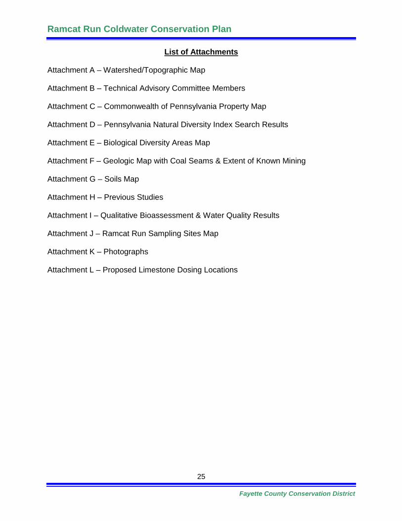
List of Attachments
Attachment A – Watershed/Topographic Map
Attachment B – Technical Advisory Committee Members
Attachment C – Commonwealth of Pennsylvania Property Map
Attachment D – Pennsylvania Natural Diversity Index Search Results
Attachment E – Biological Diversity Areas Map
Attachment F – Geologic Map with Coal Seams & Extent of Known Mining
Attachment G – Soils Map
Attachment H – Previous Studies
Attachment I – Qualitative Bioassessment & Water Quality Results
Attachment J – Ramcat Run Sampling Sites Map
Attachment K – Photographs
Attachment L – Proposed Limestone Dosing Locations