Prospecting Mine Sites Features and Methods, updated 2013 MJ Roseveare, Senior Geophysicist MSc...
18
Prospecting Mine Sites Features and Methods, updated 2013 MJ Roseveare, Senior Geophysicist MSc BSc(Hons) MEAGE FGS MIfA ArchaeoPhysica Ltd Kitchener’s, Home Farm, Harewood End, Hereford HR2 8JS UK Tel. +44 (0) 1989 730 564 Web site: www.archaeophysica.co.uk Mapping Our Heritage
-
Upload
independent -
Category
Documents
-
view
6 -
download
0
Transcript of Prospecting Mine Sites Features and Methods, updated 2013 MJ Roseveare, Senior Geophysicist MSc...
Prospecting Mine Sites
Features and Methods, updated 2013
MJ Roseveare, Senior Geophysicist MSc BSc(Hons) MEAGE FGS MIfA
ArchaeoPhysica Ltd
Kitchener’s, Home Farm, Harewood End, Hereford HR2 8JS UK
Tel. +44 (0) 1989 730 564 Web site: www.archaeophysica.co.uk
Mapping Our Heritage

Who we are ArchaeoPhysica was founded in 1998 by Anne and Martin Roseveare to provide quality geophysical survey coupled with high levels of service and innovation. Since then it has developed
into one of the most capable providers in the UK with thousands of hectares of experience across sites, geologies, terrains and technologies. Achievements include:
•••• the introduction of the caesium magnetometer to UK archaeology in 1999 and continuous
use since
•••• GNSS (GPS) tracked electromagnetic survey in Ireland and UK from 2003
•••• the first magnetometer cart in UK archaeology, from summer 2003
•••• development of advanced geophysical processing techniques for total field data
•••• development in 2010 of an intelligent multi-sensor acquisition system
•••• the use of ATV-towed sledges and carts
What we do We undertake a large amount of commercial survey (e.g 1000 ha in 18 months) and have
undertaken visual survey of about 100 sq. km of upland Wales on 30m transects including over 50 sq. km within the highest parts of Snowdonia.
In recent years we have been developing hardware, firmware and software for geophysical systems integration and rapid quad-based survey systems. These have had widespread deployment across the UK. We also explore novel prospecting technologies and automated means of data collection, fusion and interpretation.
For a number of years we have taught a large number of Birkbeck College (London) undergraduate and post-graduate archaeology students field geophysics with intensive theoretical
tuition through lectures and tutorials.
What we can offer We take up opportunities to participate and collaborate across Europe and our expertise means we are particularly able to assist with the following:
•••• any aspect of geophysical systems integration, firmware and software production
•••• large and very large (landscape) scale geophysical and topographical surveys
•••• technical research of soil geophysical properties, anomaly formation and geophysical
texture
•••• teaching of students, placements, field schools, writing course materials

Prospecting Mine Sites Features and Methods
Page i
AP Prospecting Mine Sites (updated 2013).doc
Copyright ArchaeoPhysica Ltd. 15/04/13
Table of Contents
1 Preamble............................................................................................................... 1 The problem.......................................................................................................................1 Why use geophysics?...........................................................................................................2 Summary of method............................................................................................................2
2 Abandoned mines ................................................................................................. 3 Environment and context .....................................................................................................3 Features.............................................................................................................................4 Shafts and outcrop workings ................................................................................................4 Buildings and similar structures.............................................................................................6 Engine bases ......................................................................................................................7 Wheel pits ..........................................................................................................................7 Flues and culverts ...............................................................................................................8 Horse whims, gins and capstan pits.......................................................................................8 Ponds, buddle pits and settling tanks.....................................................................................8 Roads, tramways and plateways ...........................................................................................9 Other structures..................................................................................................................9
3 Methods .............................................................................................................. 10 Desktop ...........................................................................................................................10 Geophysical survey............................................................................................................10 Magnetic techniques..........................................................................................................11 Electrical resistance ...........................................................................................................12 Electrical conductivity ........................................................................................................12 Ground probing radar ........................................................................................................13 Deployment hierarchy........................................................................................................13
4 Appendices.......................................................................................................... 15 Acknowledgements............................................................................................................15 Useful documents..............................................................................................................15
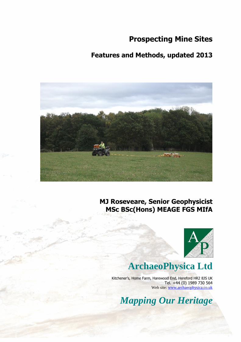
Cover photograph:
Combined magnetic and electromagnetic survey in progress over an area of former coal mining

Prospecting Mine Sites Features and Methods
Page 1
AP Prospecting Mine Sites (updated 2013).doc
Copyright ArchaeoPhysica Ltd. 15/04/13
1 Preamble The problem
1.1 The UK has a long history of metal mining extending back into prehistory and in some areas deep mining had reached an advanced stage by the mid 1700s, indeed, in Cornwall mining in the modern sense was underway in the 1500s. An increasing need for metals and coal led to a
proliferation of mines throughout the 1700s, a trend that continued into the mid 1900s resulting in many thousands of hectares of surface disturbance.
1.2 The documentation relating to mine sites can be varied depending on the age of the workings, the nature of the mining operation, and the duration of the operating company. In
most cases, reliance might be placed on other sources of information, for example Ordnance Survey maps that record the surface layout of the mine at the time of the survey, or aerial photographs, to identify shafts, adits and buildings plus any infrastructure, e.g. leats, railways,
spoil tips, etc, or even associated smelting operations.
1.3 Documentation that does exist may not be reliable, as mine sites by their nature undergo changes. Expanding spoil tips may cover previous structures, for example. Mine plans may only show workings at the time the plan was constructed and ignore earlier features. The British coal
industry has an extensive collection of mine plans and also records the locations of known coal shafts, but unrecorded shafts and other surface structures are still being discovered, accidentally or through survey. Abandonment plans in particular reflect what was known at the time.
1.4 Much has vanished beneath later industrial development, residential areas and farmland and the last category is of greatest interest and is associated with the greatest risk. Informal reclamation, landscaping and loss of local knowledge all contribute to a poor understanding of
what was there. In the long term such a site may prove to be hazardous.
1.5 Where a mine site is affected by a proposal for change of use the lack of documentation can present a major problem, whether during preparation of an Environmental Impact Statement or similar document or during construction design.
1.6 Depending upon the area in which these mines existed, their sites can contain evidence of extraction and related processes extending back many hundreds of years, sometimes just below the surface or within the workings themselves. The fast paced nature of metal mines in particular
meant that mines were often worked out and abandoned within a relatively short amount of time, only to be re-opened later to reach greater depths or to facilitate new mines nearby. Usually little of this work is documented and normally very little is known about what happened to the mine afterwards.
1.7 Coal mines in Britain, certainly since the formation of the National Coal Board in 1947, have been subject to compulsory reclamation measures and therefore many shafts have been systematically filled and / or capped. Prior to this date not all sites were recorded and the
mapping is generally unreliable. Early coal mines, e.g. in the Somerset and Bristol coalfields, predate systematic record keeping and reclamation as normal practice and can lurk unseen below later development and fields. Where retrospective recording has been attempted it is often of variable quality with mis-identified structures. ArchaeoPhysica has seen a case where an apparently redundant concrete floor slab next to a house was in fact a cap over the engine shaft of a former coalmine.
1.8 ArchaeoPhysica has also mapped shafts recorded in the wrong fields or not at all. In the
metal mining regions of Wales and southwest England the situation is particularly acute with sparse records combined with intensive reworking resulting in dense concentrations of shafts, buildings and other remains. In Cornwall an estimated 11,500 shafts have been mapped but it is
thought that this could be less than 60% of the likely total (Sharpe, pers. comm.). Several examples have been located by ArchaeoPhysica in the past few months in areas not previously known to host extensive surface workings.

Prospecting Mine Sites Features and Methods
Page 2
AP Prospecting Mine Sites (updated 2013).doc
Copyright ArchaeoPhysica Ltd. 15/04/13
1.9 To understand these sites in advance of possible development it is essential that as many
aspects of their function are detected and as early in the process as possible. In addition, given that most work is driven by the needs of development, the location of shafts and similar structures is doubly important so as to inform foundation design and to support safe working
practices.
1.10 For the purposes of this document a mine is a complex based around shaft, bell pit or outcrop working; it does not include drift mines, clay pits, quarries or ochre works.
Why use geophysics?
1.11 A major advantage of geophysical survey is that it is non-invasive and non-destructive and
can be used to accurately locate features like lost mine shafts without impacting directly upon them. There is no better suite of techniques for researching ground stability issues, potential sources of contamination, location of made ground while remaining non-invasive and affordable.
It is therefore a valuable exploratory technique pre-determination within a development planning context and equally valuable later when there may be a need to locate and map archaeological features, design foundations etc.
1.12 The non-invasive aspect is also valuable for detecting shafts and workings; companies that
attempt to do this by excavation can increase the risk of subsequent subsidence and collapse by disturbing ground around weak structures they may not have seen. Damage to services, farmland and crops can also be avoided through the use of geophysics. Exploration can be undertaken at
higher resolutions and over greater area than possible by excavating while remaining cost effective.
Summary of method
1.13 There is no single survey method that will allow these sites to be properly understood within the framework of archaeological importance, subsurface stability and safety. However, it is
possible to deploy an increasingly focused progression of methods, starting at the landscape scale and ending with the detailed mapping of individual structures. The strength of this approach lies in the combination of methods and their ability to mutually reinforce interpretation of the site.
1.14 The logical approach for any mine is to seek out the individual workings where they come to surface, everything else tending to be grouped about these. For both coal and metal mines this means detecting shafts and pits in whatever state they happen to be in, understanding their
distribution and likely function (e.g. ventilation, winding, pumping and / or access) and then using this information to explore the region around each to build up an impression of the subsurface.
1.15 After a desktop study, magnetic and electromagnetic techniques are normally used for rapid first appraisal to locate and identify debris clusters, larger voids and large scale disturbances
associated with buried rubble. This is frequently sufficient for identification of individual workings and surface foci assuming the local environmental (e.g. geological) conditions permit this.
1.16 Electrical resistance or radar techniques can then be deployed to locate and map discrete
structures within debris fields and around the tops of workings. Some versions of these technologies can also be used to locate shallow workings directly by seeking air or water-filled structures. Topographic information should also be integrated to help identify discrete features within the site.

Prospecting Mine Sites Features and Methods
Page 3
AP Prospecting Mine Sites (updated 2013).doc
Copyright ArchaeoPhysica Ltd. 15/04/13
Figure 1: A former coal pit (above the 50m scale) surviving amongst filled open cast workings in Derbyshire
2 Abandoned mines Environment and context
2.1 Many mines simply vanish from the landscape and the initial problem is one of location. There
are many stories of people ‘filling-in’ shafts, usually by levelling spoil heaps and dumping refuse, topping up any holes that appear with rubbish and debris, sometimes for years afterwards. Generally speaking, many shafts treated in this way become choked, the fill merely forming a self-
sustaining arch part way down the shaft, or perched on earlier debris. On occasion the fill rests upon a capping structure introduced by miners upon abandonment and often this is nothing more than a few timbers laid across the void.
2.2 In many cases farmers simply bulldozed spoil heaps into the nearest hole, obliterating surface
evidence and hiding potentially lethal voids in the process. These rarely remain stable and there are numerous instances of subsequent collapses decades later with huge holes opening up in apparently normal fields.
2.3 For the majority of metal mines, reclamation was fairly ad hoc, ranging from levelling out or removing spoil dumps and filling any holes that appeared to piecemeal quarrying of spoil and the use of open workings as rubbish dumps. Consequently it is not always certain how the modern
ground level relates to one contemporary with mining activity. Shaft collars and other structures can become buried under a layer of made ground formed from spoil, debris, rubbish and rubble from buildings or remain open to the air. Shafts not visible during reclamation can become lost, only to re-appear later as capping timbers rot or collars collapse inwards. Unfortunately it is these
lost shafts that are the most numerous and frequently the least well documented features of mine sites and minor collapses are a fairly common occurrence.
2.4 For National Coal Board administered mines reclamation was often carried out upon
abandonment with known shafts usually given a concrete plug or cap before becoming buried in the ensuing landscaping which usually involved demolition of buildings and other surface structures. Many such mines are now just large quantities of rubble spread supporting farmland, housing or other development, e.g. the example in figure 2, below.
2.5 Large items of metal were often removed from mine sites during WWII to support the war effort e.g. waterwheels, but smaller parts can often lie buried. In remote areas or for earlier sites

Prospecting Mine Sites Features and Methods
Page 4
AP Prospecting Mine Sites (updated 2013).doc
Copyright ArchaeoPhysica Ltd. 15/04/13
discarded equipment was simply buried under later spoil. In some cases, shafts and other
underground workings have been re-used as dumps for wartime munitions or during wartime as explosive stores. In other circumstances the workings can be a source of pollution as shafts have in the past been used for chemical and slurry disposal and by farmers as a means of disposing of
animal carcasses.
Figure 2: Misplaced mine shaft marked by massively magnetic debris and probable brick collar
in the former Bristol coalfield 2.6 The depth of burial of some structures, occasional re-use and uncertain amounts or reclamation, often combined with large amounts of ferrous and other metallic debris can make these sites difficult to prospect using geophysical techniques. However, certain combinations of
structures and techniques combined with some specialist knowledge will often allow their sites to be successfully mapped.
2.7 The following paragraphs describe some of the distinctive and diagnostic structures that can
be expected.
Features
Shafts and outcrop workings
2.8 These occur in a wide variety of shapes, sizes and functions and survive in a variety of conditions. Some are tiny, no more than a metre or so across and intended to ventilate workings or as remote means of access. Others, and especially ‘engine shafts’ of which most post-medieval mines have at least one, can be huge structures (collars 5m across are not uncommon although there is considerable regional and temporal variation). Despite their size they can disappear from
the landscape surprisingly easy if they have been capped or choked.
2.9 The majority are smaller, perhaps 2 or 3m across and oval or rectangular depending on local preference and tend to disappear more easily, sometimes just lost in undergrowth. Their
construction varies; some have masonry collars, or a brick or stone lining in the upper regions which may later collapse into the void although again there is considerable regional variation. There may also be metal incorporated into the collar to support services within the shaft. Shafts of this size were small enough to have been capped with timber upon disuse, either at the
surface, at the rock head or a little way down the shaft depending upon local preference. The

Prospecting Mine Sites Features and Methods
Page 5
AP Prospecting Mine Sites (updated 2013).doc
Copyright ArchaeoPhysica Ltd. 15/04/13
existence of a fill at the surface is therefore no guarantee of stability and regardless of whether
and to what depth a shaft has been filled, voids within former workings may survive close to the surface.
2.10 Shafts (and similar structures) present a range of different geophysical targets depending
upon their construction, means of capping or filling and subsequent landscaping. Voids within the upper few metres of ground can present a marked electrical conductivity anomaly, though the same structure full of water may appear quite different. There may be sufficient mass difference to produce a micro-gravity anomaly although a sizable air-filled void is normally necessary for
detection. A brick lining may be magnetic and this has been used to locate some shafts on coal mines. Materials dumped into a shaft may present provide a magnetic marker (e.g. figure 3) and might include bricks, scrap metal, corrugated iron and occasionally munitions. Buried metals and
big electrical conductivity changes can be detected using electromagnetic techniques; magnetometers are best for finding brick or ferrous debris.
Figure 3: One known (top, visible as a depression) and one unknown (bottom right, invisible in the field) shaft or small bell pit in Derbyshire
2.11 Shafts that are capped and buried or choked to a shallow depth can alter the surface drainage, either creating slightly drier areas above them or sometimes ponding water above a cap and both cases are good geophysical targets for electrical conductivity and resistance methods. In
similar fashion a buried level or adit portal may be discharging water and therefore be detectable by the increased electrical conductivity of the ground outside.
2.12 Shafts associated with pumping activities often have balance bob (counterbalance) pits
alongside them, designed to hold a rocking counterweight at it lowest point of travel. These can be of substantial size and normally exist where steam engines or water wheels were used for motive power. They are sometimes found adjacent to isolated shafts where pumping has been
driven from a remote source by flat-rods ranging across the landscape. All this equipment would have contained a significant steel component, e.g. strapping and bolts for the balance bob box, mounting bolts for bearings, or dolly wheels and bolts for the flat rod supports and all can potentially be detected by a magnetic survey although normally as debris rather than in situ objects.

Prospecting Mine Sites Features and Methods
Page 6
AP Prospecting Mine Sites (updated 2013).doc
Copyright ArchaeoPhysica Ltd. 15/04/13
Figure 4: A run of early prospecting structures, air-filled shafts and related infrastructure invisible at the surface of an arable field in Cornwall but mapped, in this case, magnetically
Buildings and similar structures
2.13 Generally speaking, buildings buried beneath later mine spoil are not detectable but if they
are buried only by their own debris or by soil, electrical resistance techniques will normally reveal their outline, however, radar may be needed for greater detail. Buildings, or their foundations, buried beneath soil are a classic archaeological target and relatively easy to detect and map.
2.14 Buildings made of brick will often present a strong magnetic anomaly and can be detected and to some degree mapped using magnetometers, however, the presence of brick debris within them may mean only their outline or broad location is visible. Boiler houses in a stone region, for
example, may be identified where refractory brick has been used to support the boilers.
2.15 Outlying buildings can sometimes be identified as magazines (e.g. are double-walled or partly subterranean or small and thick walled) where explosives were stored and identification of these can be important for revealing what was considered remote from the main operation at that
date.
2.16 It can be possible to suggest the likely function of a building by its size, shape and location within the mine, hence the importance of achieving a detailed mapping of the site. Engine houses
(steam or electric pumps and winders) are perhaps the most important to identify because they indicate the heart of the mine and will invariably be close to the most important (and frequently the largest) shafts.
2.17 Buildings often become buried, either in their own rubble or by spoil dumped later and
some spectacular examples exist in Mid Wales where whole buildings have become entombed. Later reclamation of materials can also lead to the loss of structure, especially if built from worked stone. Brick buildings, often associated with coal mining areas, tend to be demolished and their
materials spread during landscaping.

Prospecting Mine Sites Features and Methods
Page 7
AP Prospecting Mine Sites (updated 2013).doc
Copyright ArchaeoPhysica Ltd. 15/04/13
Figure 5: A range of features including shaft collars, a horse whim (above 20m scale) and
other structures, all concealed below pasture in North Wales Engine bases
2.18 Sometimes mines have engine or machinery bases of concrete, brick or stone without
enclosing buildings and these can be detected using a variety of techniques and especially using electrical resistance or radar. The presence or brick and / or steel debris can aid their detection using a magnetometer but mapping them using this technique rarely works.
2.19 Identification of these structures is important to understanding the operation of a mine, for
example, the orientation of a winding drum or perhaps the base of a horizontal steam engine driving it can sometimes reveal which shafts were used for winding, however, in Cornwall an engine might quite often wind from multiple shafts. Temporary engines were sometimes erected
to dewater a mine before re-use and their location can reveal the presence of lost shafts. The remains of timber and corrugated iron structures occasionally used to house temporary engines can produce a scatter of magnetic anomalies, however, detection of these can be limited by larger
anomalies in the vicinity.
Wheel pits
2.20 Sometimes waterwheels with diameters of up to 15m provided motive power on mine sites.
They were especially common on the metal and slate mines of Wales and Cumbria and probably also on the earliest mines in Cornwall although later reworking has removed many traces. They were normally partly sunk into the ground within large pits, often in isolation from the main shafts if used for pumping, the power transmitted by flat-rods pivoting on stone or concrete bases which
can be detected using geophysics, but alongside buildings if used in processing operations
2.21 Provided they have not become too deeply buried beneath later spoil the wheel pits can be detected by mapping the lining which, given their location, is often of stone. Their shape and
topographical context is usually enough to reveal their identity which, as the power source, can be fundamental for understanding how the mine was worked at the surface. Radar and electrical resistance techniques are normally best for mapping these structures while magnetic survey may detect regularly spaced anomalies from steel hold-down bolts and wheel components that have
fallen into the pit upon disuse.
2.22 Locating associated leats and ponds is also an important aspect of identifying and understanding wheel pits and assisting with interpretation of geophysical anomalies associated
with them.

Prospecting Mine Sites Features and Methods
Page 8
AP Prospecting Mine Sites (updated 2013).doc
Copyright ArchaeoPhysica Ltd. 15/04/13
Figure 6: Above ground part of the structure once supporting a water wheel at a mine in northwest Wales
Flues and culverts
2.23 Mine sites often have buried culverts for drainage and in some cases slightly larger but similar structures giving access into shafts (distinguished here from drainage adits, which tend to
be deeper). Occasionally flues from steam engines and arsenic calciners were run beneath the surface to a remote chimney and can be easily located in the same way as culverts. For simple location purposes electrical resistance or conductivity survey is normally sufficient, however, radar
can be used to obtain cross sections and accurate dimensions. Magnetic survey is only likely to detect these structures if they incorporate brick or if the void within is quite deep.
Horse whims, gins and capstan pits
2.24 Some mines have used horses for motive power and although limited to the shallowest workings all shafts have been shallow at some stage. The shaft, normally adjacent to and outside the outer circumference of the whim, was used for winding and sometimes for driving rag and chain or bucket pumps. In the case of the horse gin the shaft was located within the
circumference. The example visible in figure 5 is a whim surviving amidst the later dumps and structures of a deep lead mine in Wales and winding from shafts up to 40m away.
2.25 They are not normally detectable except by electrical resistance survey or by radar. Their
survival is rare and this makes them an important structure to identify as their presence indicates a nearby shaft which may not have been detected by other means and in the case of short lived mines this may be the only indicator of mine workings. Horse whims usually have a central pivot
stone that may contain traces of the iron bearing and therefore be potentially detectable in magnetic survey data.
2.26 Capstans were often located in shallow circular pits, adjacent to engine shafts. The capstan was usually worked by a team of men and was used for lowering or raising heavy pieces of
equipment. Temporary capstans were sometimes used during construction of the Cornish style steam pumping engines to raise heavy engine parts.
Ponds, buddle pits and settling tanks
2.27 Mines frequently had ponds, sometimes to support ore washing processes, sometimes for motive power or to provide clean water and sometimes fed by leats. Welsh metal mines were often water powered and a network of channels and pools provided and stored water for
waterwheels. Steam engines needed clean water for their boilers (mine water in metal areas

Prospecting Mine Sites Features and Methods
Page 9
AP Prospecting Mine Sites (updated 2013).doc
Copyright ArchaeoPhysica Ltd. 15/04/13
frequently being too corrosive to use) and engine ponds would be created and fed from a local
stream or spring.
2.28 Similarly, ore dressing processes were water-based and required a system of channels in the dressing floors. Buddles for example, were shallow, usually circular pits used in the final
stages of ore processing. This operation separated fine lighter waste material from the heavier ores. On Welsh lead mine sites the residues from the buddling stage flowed into settling tanks, usually rectangular, and represented the last phase of the ore dressing process. Due to the large amount of fine debris from the buddling process it is not unusual for these pits to become
backfilled over time.
2.29 These structures are usually lined and can detected using either their lining as a marker (magnetic, electrical or radar techniques) or through detecting anomalously damp accumulated
soil within them using electrical conductivity. Ponds later filled with mine spoil or sealed beneath large depths of landscaping or reclamation material are unlikely to be detected. Leats used to fill pools and supply water to processing plant can often be traced across the landscape for some distance and can be detected using electrical resistance survey. Magnetic survey can detect iron
pipes where these were used instead.
Roads, tramways and plateways
2.30 Large mines often had internal networks of tramways and roads, the latter usually well built to accommodate the huge weight of engine parts hauled along them during engine construction. These are normally detected by electrical resistance survey, potentially also by radar although it would not necessarily be the first choice of method. These roads are normally found to connect
with the cylinder door of a Cornish style engine house, highlighting their original function.
2.31 Tramways may also be apparent, usually connecting winding shafts with spoil tips and processing works. The rails have frequently been removed, however, lengths of rail are a
common feature of abandoned mines (and the surrounding area) and in situ lengths of tramline can be found buried. Magnetic survey will usually reveal the presence of rails, however, their close spacing when in situ usually means that their magnetic anomalies combine, appearing as one and hence recognition can be problematic. Where rails have been removed, electrical
resistance or radar survey, if conducted at a high resolution, is likely to detect the track bed, masonry sleepers or individual blocks to which rails were spiked.
Other structures
2.32 Sometimes mines had housing, miners’ barracks, allotments or small holdings (the latter especially in the late 1700s and early 1800s) and other non-industrial structures located alongside them. Finding these can add a human element to understanding the site from an archaeological
perspective. They are usually discovered during the landscape scale prospection stage of a project, e.g. using magnetic techniques across an area larger than just the mine itself.
2.33 Larger mines may also have ore processing facilities which can be extensive and complex,
ranging from simple spalling (manual rock-breaking) floors to fully mechanised crushing, grinding and washing facilities spread in some cases over a few hectares. These often become at least partly buried by their own waste and soil and their identification and mapping can contribute substantially to understanding the processes carried out at the site. Complexes can contain
engine houses and bases, ponds, floors and channels and in some locations form the largest surviving elements of a mine.

Prospecting Mine Sites Features and Methods
Page 10
AP Prospecting Mine Sites (updated 2013).doc
Copyright ArchaeoPhysica Ltd. 15/04/13
3 Methods Desktop
3.1 Every site should be assessed using documentary sources prior to survey to ensure as much as possible is known about environmental conditions, likely targets, etc. As a minimum, the following information would normally be collected:
Superficial 1:50000 BGS Most important as this governs the background texture of non-gradiometric magnetic data, background magnetic susceptibility and background electrical conductivity. It will also assist in determining whether a clay soil is present which could prevent radar from being deployed
Bedrock 1:50000 BGS Important if the superficial cover above this is less than 2 – 3m thick and also for highlighting areas of ground where shafts and near surface workings are unlikely to be found
Soil character As with the superficial cover, this governs geophysical texture. The relationship between soils and their eroded parent beneath governs magnetic susceptibility magnitude and enhancement processes. The soil type also impacts upon electrical and radar methods
Topography Affects how the survey is undertaken, hydrology and therefore soil chemistry including iron redox processes and also drainage
Hydrology See above. It also affects the load bearing capability of some soils and the potential for useful electrical conductivity data
Current Land Use Methodological factor and also an indicator of magnetic response, e.g. whether or not magnetic soils have been brought to the surface by ploughing, whether substantial reclamation is likely to have occurred
Vegetation Cover Methodological factor. The type and height of vegetation will dictate which methods can be used and whether mechanised systems or foot-based survey are appropriate.
Sources of Interference Nearby cables, gas mains, traffic, fencing, plant movements etc. can affect the quality of magnetic and electromagnetic data
3.2 Examination of old maps, a record office search and study of aerial photographs should form a key element of desktop work for mine sites. Within development driven archaeological contexts this should be undertaken as normal element of the process, however, it is likely a specialist will
need to be engaged for mining related elements.
3.3 Field inspection is not enough; it is rare that a mine long hidden beneath agricultural reclamation will have any visible surface traces although soil and crop marks visible from the air are likely to provide useful though incomplete information. Even old Ordnance Survey maps are
not reliable indicators because many smaller mines came and went between editions. The Tithe Map of the 1840s can be useful in southwest England in the hands of someone familiar with the development of the local landscape; for example, fields were rarely enclosed around former
workings, boundaries instead being laid out to incorporate them.
Geophysical survey
3.4 The ground associated with mine sites is normally a complicated mixture of natural soil and made ground with the latter frequently including magnetic materials like brick and strongly magnetic and conductive metallic debris. Where there are substantial depths of made ground, it is
unlikely anything but the most substantial structures could be imaged through it, although radar can be an exception in these circumstances. The clearest results will always be where a site is represented by a spread of structures and debris beneath arable or pasture fields, or beneath fine
waste material like process tailings. Where these materials exist their electrical conductivity and magnetic susceptibility need to be assessed as part of the survey design because these will impact upon the methodology.
3.5 This is particularly the case where survey is required for archaeological purposes and where the emphasis needs to be upon the detection, mapping and recognition of individual structures.

Prospecting Mine Sites Features and Methods
Page 11
AP Prospecting Mine Sites (updated 2013).doc
Copyright ArchaeoPhysica Ltd. 15/04/13
Where the emphasis is more upon locating concealed shafts and near surface workings the nature
and depth of the overburden, although still an inevitable constraint, can be less of a problem.
3.6 In some cases, e.g. where wholesale reclamation of the site has occurred, the surface topography can bear little relation to buried structures and the former layout of the mine. In
addition the landscaping can spread large quantities of rubble which, if brick based, can magnetically obscure anything beneath it. Ferrous waste from forges can also become distributed through this material, creating an environment too complex for magnetic prospecting.
3.7 Given the problems of overburden at mine sites, geophysical techniques applied normally to
archaeology need to be modified or at least accompanied by others more suited to deeper investigation. It is also important that the surveys are designed and implemented by a specialist with knowledge of mining and geophysics.
3.8 Another factor that must be taken into account is the geophysical properties of the local geology and soils. Not surprisingly, there are substantial areas of former coal mining within the Coal Measures of the English midlands and this material does not always support strong useful magnetic enhancement. In parts of Cornwall and Wales the presence of strongly magnetic meta-
sedimentary rock can produce naturally strong magnetic anomalies that obscure the often weaker ones from former structures. In areas with clay rich soil, radar rarely produces good results if the clay overlays the structures of interest, however, it can be used successfully for detecting near-
surface voids in bedrock and masonry structures below fairly deep overburden. Likewise drainage in Coal Measures is often variable and its impact upon electrical and electromagnetic survey should be assessed.
3.9 Each site must therefore be considered and fieldwork planned on an individual basis and an appropriate methodology, normally staged, developed that will have a realistic chance of succeeding.
3.10 It is important to consider the post-industrial treatment of the ground. Sites in the middle
of fields without subsequent shaft capping operations or significant landscaping, could be detected by almost any method, although not necessarily providing data adequate for diagnostic purposes and provided the spatial measurement resolution is good enough. Where workings and
structures are buried beneath later spoil or perhaps deliberately hidden by landscaping (as can be the case for former coal mines), the chances of detection reduce considerably. Locating individual structures may not be reliably possible in these circumstances, although having found them, penetrating techniques such as radar and electrical tomography may still contribute useful
information.
Magnetic techniques
3.11 In general, magnetic techniques have only minimal application for mapping the detail of
mine sites due to the likely presence of magnetic debris but can exploit the presence or absence of this material to detect discrete structures with a landscape. This can include isolated shafts where they are brick lined, capped with reinforced concrete or have steel debris within them.
Sometimes, even if a shaft or building is not magnetically visible, a scatter of debris around it will be sufficient to allow detection of the structure.
3.12 The relatively fast nature of magnetic survey lends itself well to prospecting for structures
in open ground, e.g. below farmland, and modern deployment techniques mean many hectares can be covered at a high resolution each day. It therefore makes sense to use the technique during initial reconnaissance and especially if prospecting for non-mining remains at the same time.
3.13 Survey lines should be separated by no more than 1m with measurements at no greater interval than about 0.3m along each. The only exception to this would be for the detection of debris scatters (not structures) in otherwise non-magnetic ground but the case for increasing the
line separation or measurement interval needs justification site by site.

Prospecting Mine Sites Features and Methods
Page 12
AP Prospecting Mine Sites (updated 2013).doc
Copyright ArchaeoPhysica Ltd. 15/04/13
3.14 It is best to use non-gradiometric magnetometers for this application because
gradiometers, e.g. fluxgate instruments, will tend to saturate and not resolve detail within the mass of magnetic material commonly found. However, if only seeking to locate rather than map a mine within an otherwise normally magnetic environment, a gradiometric instrument can be
sufficient.
Figure 7: The site of a coal mine, now a mass of magnetic debris (towards the bottom) sealed
beneath an arable field. It is thought likely that a shaft may be buried below this material but it would be invisible to magnetic survey in this instance
Electrical resistance
3.15 This is used within archaeology to produce plan views of structures based upon their electrical contrast against the soil. It can also be used to generate cross sections through the
ground to significant depths although as with most geophysical techniques resolution decreases with depth. For mining related features of normal sizes perhaps 10m penetration might be the maximum for which useful data can be expected.
3.16 Current implementations mean the technique is relatively slow and at normal archaeological survey resolutions less than one hectare a day should be expected. However, it can reveal a large amount of detail about masonry and soil-filled structures and especially where these are close beneath the surface. Where this is the case it should always be a preferred method for mapping
the detail of mine sites. It is therefore a good second-pass technique, used to explore small areas in detail once targets have been located by other means. That said, survey areas must be large enough to ensure structures are adequately discriminated from natural ‘background’ variation.
3.17 Survey is normally conducted with a line separation of 1m and samples at 0.5m or 1m along each, however, the best results are achieved for data collected at a finer resolution, e.g. 0.5m in both directions. The twin probe array is the normal configuration for this work, however, there is virtue in alternative configurations given adequate justification.
Electrical conductivity (electromagnetic survey)
3.18 This is similar to electrical resistance but is measured using electromagnetic techniques that require no contact with the ground. Survey speed is therefore increased, although at the expense
of horizontal resolution due to instrument design. Its biggest virtue is its ability to image fairly deep regions of the ground, 4 – 6m being achievable with certain instruments, and it is therefore invaluable for imaging through uniform overburden. It is especially useful for mapping

Prospecting Mine Sites Features and Methods
Page 13
AP Prospecting Mine Sites (updated 2013).doc
Copyright ArchaeoPhysica Ltd. 15/04/13
conductivity variations associated with deeply buried fills or voids and is thus an essential tool for
locating structures like shafts, bell pits and outcrop workings along lodes.
3.19 Modern techniques of deployment mean that it can be used simultaneously alongside certain magnetometers and the combination offers considerable benefits for productivity and
interpretation. This configuration is a recommended first pass approach for most sites where mining remains are expected. The front cover photograph is one such combined survey in progress.
3.20 In common with most electrical techniques the anomaly produced by a buried structure is
normally larger than the structure itself due to it influencing moisture drainage in the surrounding ground. Even a fairly course line separation, e.g. 4m, is therefore capable of detecting where the structure is, even if the structure itself is not directly detected.
Ground probing radar
3.21 Radar can be used in a variety of ways and is useful for imaging through surface structures including spread spoil and floors. It is the only routine high resolution technique (apart from some
forms of lower frequency electromagnetic survey) capable of imaging through concrete (non-reinforced) and tarmac surfaces and can therefore be used to prospect for structures beneath later development. In addition it supports the construction of approximate 3D images of the
subsurface and can therefore potentially distinguish between superimposed structures.
3.22 However, it will not work well through clay or waterlogged soil and cannot normally image through concrete reinforced with steel mesh. Its depth of penetration is inversely proportional to the vertical resolution so a survey conducted at a very low frequency (e.g. 50 MHz) to image
shallow workings in rock will not detect the more ephemeral remains of buildings. To do this, a higher frequency (e.g. 270 – 400 MHz) needs to be used, at the expense of depth of penetration.
3.23 At mine sites the technique has two primary functions, to image buried structures beneath
floors or rubble and to detect and form cross sections through shallow underground structures like adits and the tops of shafts. It can also be used as a primary prospecting technique at the landscape scale because it is fairly rapid, however, other technologies, e.g. electromagnetic, can be more effective depending upon conditions and expected targets.
Deployment hierarchy
3.24 A common methodology is to deploy simultaneous magnetic and electromagnetic survey as a first stage of work which satisfies the normal archaeological objective through use of magnetic
survey at a high resolution. This, combined with the electromagnetic data, is often sufficient to identify individual shafts and other buried structures and to identify where spreads of debris and deep fills may be hiding other structures. This approach was recently successfully used to map
the extent of a former open cast coal mine in advance of re-opening while simultaneously identifying prehistoric settlement remains surviving amongst previous reclamation works.
3.25 This approach has the additional benefit of speed with over 10 ha per day being easily
achievable and hence it is ideal for getting an initial impression of the nature and extent of mining and other buried remains.

Prospecting Mine Sites Features and Methods
Page 14
AP Prospecting Mine Sites (updated 2013).doc
Copyright ArchaeoPhysica Ltd. 15/04/13
Figure 8: Reclamation era drains and surface scarring left by opencast coal mining while to the right of the 20m scale is debris within the fill of a former opencast mine
3.26 For some projects this may be sufficient and especially if there is a presumption for subsequent development to avoid buried structures. However, it can be necessary to deploy a secondary and higher resolution technique to collect diagnostic information about particular structures. This is especially important where a magnetic survey may indicate spreads of debris
but where no actual structure is visible and in these cases targeted areas of electrical resistance survey are the norm. Radar can also be used for this, but may represent overkill or be limited in effectiveness by site-specific constraints. It is, however, the only method capable of providing
accurate depth information so would be recommended where, for example, it is necessary to determine the depth of burial of a shaft cap.
3.27 In some cases, radar might be deployed as a third pass technique in order to answer specific questions, driven perhaps by the requirements of foundation design or to ascertain the
depth of burial of a capping structure.

Prospecting Mine Sites Features and Methods
Page 15
AP Prospecting Mine Sites (updated 2013).doc
Copyright ArchaeoPhysica Ltd. 15/04/13
4 Appendices Acknowledgements
4.1 The author would like to thank Rob Vernon (mining historian) and Adam Sharpe (Cornwall Council Historic Environment Service) for reviewing and commenting upon this document. Any errors or omissions remain the responsibility of the author.
Useful documents
David et al, 2008, “Geophysical Survey in Archaeological Field Evaluation”, English Heritage Vernon, R.,McDonnell, J.G. & Schmidt, A., 2005, “The role of traditional geophysical methods in evaluating mine sites in England and Wales.”, Abstracts of the Sixth International Conference on Archaeological Prospection, Rome Vernon, R., 2006, “The role of traditional geophysical methods in evaluating mine sites in England and Wales”. Mining in the Landscape, NAMHO 2006 Conference Proceedings, Llangollen, Wales Vernon, R. & Barnatt, J., 2007, “Geophysical Survey at Magpie Mine, near Sheldon to identify the position of the 1840 Winding House and its Boiler House”. Mining History: Bulletin of the Peak District Mines Historical Society. 16:5 Vernon, R., 2012, “Geophysical Surveys on South Gloucestershire Mine Sites.”, Newsletter of the South Gloucestershire Mines Research Group. 30. pp 11 – 15