PARKVIEW AREA STRUCTURE PLAN - City of Medicine Hat
35
PARK VIE W AREA STRUCTURE PLAN PARKVIEW AREA STRUCTURE PLAN, SEPTEMBER 1982 PREPARED BY LOMBARD NORTH GROUP UPDATED AND REPRINTED BY STAFF OF THE S.E.A.R.P.C. SEPTEMBER 1987
-
Upload
khangminh22 -
Category
Documents
-
view
4 -
download
0
Transcript of PARKVIEW AREA STRUCTURE PLAN - City of Medicine Hat

PARK VIE WAREA STRUCTURE PLAN
PARKVIEW AREA STRUCTURE PLAN, SEPTEMBER 1982
PREPARED BY LOMBARD NORTH GROUP
UPDATED AND REPRINTED BY STAFF OF THE S.E.A.R.P.C.SEPTEMBER 1987
PARKVIEW AREA STRUCTURE PLAN
Parkview Area Structure Plan, September 1982
prepared by Lombard North Group
Updated and Reprinted by the ~
September 1987

BY—LAW NO: 2543
BEING A BY—LAWOF THE CITY OF MEDICINE HAT to amend By-Law No. 1989
being the City of Medicine Hat Land Use By—Law; and to adopt the
Parkview Area Structure Plan.
WHEREAS Section 64 of the Planning Act R.S.A. 1980, c.P—9, as amended,
empowers a municipal council to pass by-laws adopting area structure
plans to provide a framework for the subsequent development and
subdivision of lands within areas of a municipality;
AND WHEREASthe General Municipal Plan By—Law No. 1942 of the City of
Medicine Hat designates the Parkview lands as an area suitable for an
area structure plan;
AND WHEREASit is considered appropriate to advance the development of
the Parkview lands under the staging program of the General Municipal
Plan;
AND WHEREASit is deemed desirable to establish servicing requirements
of the Parkview lands and co—ordinate these requirements with the
adjacent lands, developed and undeveloped, in the area;
AND WHEREASit is deemed necessary to amend By-Law No. 1989 being the
City of Medicine Hat Land Use By—Law, by reclassifying the Parkview
lands from agricultural to such classifications as are indicated in the
Parkview Area Structure Plan;
NOWTHEREFORETHE MUNICIPAL CORPORATIONOF THE CITY OF MEDICINE HAT IN
COUNCIL ASSEMBLEDENACTS AS FOLLOWS:
1. This By-Law may be cited as the Parkview Area Structure Plan
By-Law.

2. The document attached to and forming part of this By-Law, entitled
the Parkview Area Structure Plan, is hereby adopted as an area
structure plan pursuant to Section 64 of the Planning Act R.S.A.
1980, c. P—9, as amended.
3. By—Law No. 1942 is hereby amended by including the Parkview Area
Structure Plan lands in those various classifications as shown in
Figure 6 on page 15 of the Plan.
4. By-Law No. 1942 is hereby amended to change the staging program of
the General Municipal Plan by redesignating the Parkview lands from
Stage II to Stage I.
5. By—Law No. 1989 is hereby amended by including the Parkview Area
Structure Plan lands in those various classifications as are listed
in Figure 12 on page 28 of the Plan.
6. This By—Law shall take effect as of the date of the final reading
hereof.
READ A FIRST TIME IN OPEN COUNCIL this~/ day of~ePTEna~. A.D., 1987
CITY ~ GODIN
2 day of A/,v~mJ~ A.D., 1987
CITY C~ERK- L.P. GODIN
READ A SECOND TIME IN OPEN COUNCIL this
OPEN COUNCIL this ~- day
CITY£L~
CEERK - L.P. GODIN
READ A THIRD TIME ANDof ~ A.D.,
IN
f~ f~be a t,~ ~ r. ~law No. ~ ~ the
~t CCouncil on the ~ d.~y~N
Crry cz~~

TABLE OF CONTENTS
1.0 INTRODUCTION 1
1 . 1 Plan Area Boundaries 1
1.2 Purpose 2
2,0 SITE ANALYSIS 2
2.1 Topography & Soils 2
2.2 River Erosion and Bank Stability
2,3 Vegetation and Wildlife 5
2.4 Visual Analysis 6
2.5 Land Use 8
3.0 DEVELOPMENT PLAN CONSIDERATIONS 9
3.1 Growth Strategy 9
3.2 Land Use Constraints 9
3.3 Extension of Services 10
(a) Access and Circulation 10
(b) Power 11
Cc) Gas 12Cd) Storm Sewer 12
(e) Sanitary Sewer 12
(f) Water 13
4.0 DEVELOPMENT CONCEPT 13
4. 1 Subdivision Design 1414.2 Staging 20
4.3 Development Guidelines 22
5.0 IMPLEMENTATION 27
5.1 Adoption Procedure 27
5.2 The Development of Parkview 27

LIST OF TABLES
Pa~e
Figure 1
Figure 2
Figure 3
Figure 4
Figure 5
Figure 6
Figure 7
Figure 8
Figure 9
Figure 10
Figure 11
Figure 12
LIST OF FIGURES
3
5
7
13
15
17
18
21
23
26
28
Table 1 Statistical Summary of Land Uses 19
Table 2 Land Use By Stage 22
Location of Subject Land
Topography
Vegetation
Visual Analysis
Concept Plan
Subdivision Design
Sanitary-Storm Sewers and Water Lines
Electric and Gas Distribution Systems
Staging of Development
Development Guidelines
Irrigation Plan
Land Use By-law Amendments
II

1.0 INTRODUCTION
In 1981, the City of Medicine Hat commissioned Lombard North Group to
prepare an area structure plan for the Parkview area. In this regard, a
draft area structure plan was completed in September of 1982 but no action
was taken by the City towards its adoption. Recently, the City considered
it appropriate to adopt an area structure plan for the Parkview area and
requested the staff of the Southeast Alberta Regional Planning Commission
to revise and update the original Lombard North Group document. The
revisions of the original plan reflect changes since 1982 in respect of
the extension of utility services, the timing for development of adjacent
land, and current development trends in the City. Also, comments on the
1982 plan, arising from the City’s area structure plan review process,
were taken into consideration. The 1982 plan serves as background infor-
mation to this area structure plan.
1.1 Plan Area Boundaries
The subject land is located in the northeast part of the City and lies
between Parkview Drive on the west, the South Saskatchewan River on the
east, the Medicine Hat Golf Course to the south, and the S & T Ranch tothe north (Figure 1). The plan area covers 48.8 hectares (120.6 acres) of
which a small portion lies within the Medicine Hat Golf Course.
F~GURE1 LOCA11ON OF SUBJECT LAND

1.2 Purpose
The purpose of this area structure plan is to provide a detailed develop-
ment concept for Parkview in accordance with the policies established by
City Council in the Medicine Hat General Municipal Plan and other relevant
information. Service alignments, staging and threshold capacities are
identified for utilities and circulation systems proposed in the develop-
ment concept. The organization of land uses, sequence of development andassociated statistics on population generation and density are included in
this document. Also, the key features of the area have been identified
and incorporated into the following objectives to serve as guidelines in
the preparation of the Plan:
1. To ensure that the pattern of land use reflects any development
opportunities afforded through the area’s proximity to the Medicine
Hat Golf Course, Police Point Park and the South Saskatchewan River.
2. To ensure that the placement and design of roads in the area maintains
a suitable transportation corridor into Police Point Park.
3. To ensure that the river banks are integrated with future development
of the area as well as with the parks system and protected with
appropriate development setbacks.
2.0 SITE_ANALYSIS
2.1 Top~~i~phy& Soils
The study area is composed of three general topographic units as shown in
Figure 2:
(a) transitional slope which follows the valley wall parallel to existing
Parkview Drive;
(b) terrace surface which comprises the majority of the site;
(c) river bank slope and minor coulee approximately nine metres deep.
2

The sandstones and shale of the Foremost Formation are overlain by post-
glacial alluvial and aeolian material. The nature of deposition (water
and wind), the sandy texture of the material and the degree of stratifi-
cation contribute to the flatness of the terrace. No buried soil horizons
or previous stable ground surfaces were recognized during subsurface
testing for archaeological sites. The moderately coarse texture of the
material facilitates comparatively rapid and uniform infiltration. The
geotechnical tests and subsoil investigations of the archaeologists
indicates the cohesionless sands and gravels are extremely dry with
moisture contents typically less than 10 percent.
The transitional slope grades within the site vary from 10 percent to
15 percent in the northwest to an average 6 percent near the boundary of
the terrace surface unit (Figure 2). The average grade and absence of
erosional features indicates the general stability of the area.
FIGURE 2 TOPOGRAPHY
0-5 SLOPE I6-10 SLOPE _____
11-15 SLOPE ______
16-20 SLOPE ______
+21 SLOPE ______
Note: slopes are represented in percentages
PROPOSED S&T SUBDIVISION
GOLF COURSE
POLICE POINT PARK
50m 0 SOm thOrn
W~caIe
3

The terrace surface slopes gently (0—5 percent slope) with minor shallowdepressions and knolls. The topographic and soil features of this area
are conducive to residential development. The soils are well drained and
semi—arid conditions prevail.
2.2 River Erosion and Bank Stab!jlt
The river bank is well defined, rising over nine metres to the terrace
surface. Slopes exceed 20 percent. Three test holes were drilled, and an
analysis of bank stability undertaken by Pennell Geotechnical Ltd. The
report observes:
“The subsoil conditions along the 800 metre long river escarpment are
relatively uniform. The cohesionless sands and gravels exist at slope
inclinations of approximately 1.5 horizontal to 1.’) vertical which is
near their angle of repose. The slopes are presently stable and it is
not anticipated that major internal slide actuating forces will result
subsequent to development”.
The geotechnical study further advises that, based on bank stability
considerations alone, “a setback distance of 20 metres is recommended
from the filled coulee”. While fill from excavations and other sources
has been dumped into the coulee in the past, the practice should be dis-
continued. The Pennell Geotechnical Study advises that fill should also
not be placed between the “setback” line and the top of the river bank.
Potential river regression was discussed with Northwest Hydraulics Ltd.
which has conducted river engineering studies in the vicinity. Based on
their general knowledge of area river hydrology, and a cursory examination
of historical air photos, river regression in the past thirty years does
not appear to have exceeded two or three metres. On that basis, a twenty
metre setback from top—of—bank should suffice which is consistent with the
Pennell report recommendation.
The walls of the small coulee are exposed to the wind and some slope wash
and gullying has occurred. Also, all portions of the site are above the
1: 130 year flood line as defined by Alberta Environment in 1976.
4

2.3 Vegetation and Wildlife
As a result of the level of disturbance experienced, the terrace surface
does not contain native short grass communities. The short grasses that
do exist include Blue Grama and Spear Grass while Crested Wheat Grass,
an introduced species, is prevalent throughout (Figure 3).
FIGURE 3 VEGETATION
OPEN GRASSLAND/BARE PATCHES
TALL SHRUBS/GRASS
TALL SAGE/SHRUBS
DISTURBED/BARE GROUND
PREVIOUSLY CULTIVATED, GRADED OR PLANTED
PROPOSED S&T SUBDIVISIONI.
//
/
50m 0 50m thOrn
W W~aIe
GOLF COURSE
POLICE POINT PARK
llhII~EU~1111111! 1111111
5

Sage is regarded as representative of disturbed sites where moisture is
minimal and surface soils subject to displacement. A band of sage occurs
along the park access road, and the sewer and water line easements.
Areas exhibiting slightly moister soil conditions, at the base of the
transitional slope and in access road ditches, support some low shrubs
including Buckbrush and Wild Rose. ‘(arrow, Moss Phlox, Sweet Clover
and Russian Thistle are also present in this area.
The small coulee and isolated depressions along the river bank slope
support some taller shrubs including Buffaloberry, Silverberry and
Chokecherry. Individual Cottonwood trees are found at one point along
the park access road and in the centre of the site near an abandoned golf
green. As a result of the degree of disturbance experienced within the
site, no zones of locally significant or unique vegetation were noted.
Wildlife activity is minimal. Prairie hare and deer have been sighted
on the property. White—tailed deer utilize Police Point to a moderate
degree especially during the winter. Fodchuck 1977 noted that deer
utilize the lower slopes of the river bank as a travel corridor. No
critical habitats or nesting sites have been identified within the study
area. The potential impact to wildlife, associated with the proposed
development is considered negligible.
2.4 Visual Analysis
The observations of the planners of the S & T Structure Plan apply equally
to this site:
“The east river excarpment because of its dominant land form, is the
primary landscape feature visible from all areas of the site. The
finest, panoramic views are from the upper mid—slopes, since all of
the river valley is accessible to the eye”.
A variety of views exist from the northwest corner of the site, with
major distant views to the southeast (Figure 4). Careful grading in the
vicinity of the new Parkview Drive arterial and 20th Street intersectioncan preserve these excellent distant views.
6

FIGURE 4 VISUAL ANALYSIS
PROPOSED S&T SUBDIVISION
GOLF COURSE
60m RIVER VALLEY PARK BUFFER _____
RIVER ESCARPMENT POLICE POINT PARK
VALLEY WALL _____
VIEWS 10THE SITE
MAJOR INTERNAL VIEWS ,, ~ ~ 150.,
- - MAJOR DISTANT VIEWS FROM SITE n~apsrnle
UNOBSTRUCTED VIEWS TO CITY CENTRE
The present park access road alignment affords a variety of views of the
distant east escarpment and the river valley edge, as well as providing a
sense of arrival to Police Point Park.
Towards the southeast corner of the site there are good views through
the golf course to the city centre. Given the prairie landscape and
topographic character, open views of the terrace plain and housing along
Parkview Drive are evident from the river edge.
Sight lines can be preserved in the plan area, as well as for adjacent
development by the judicious placement of open space, road location and
orientation as well as housing form. Views of the east valley wall, the
river edge and golf course are key site features, and give the area a
unique character. These features will be incorporated in the plan
concept.
7
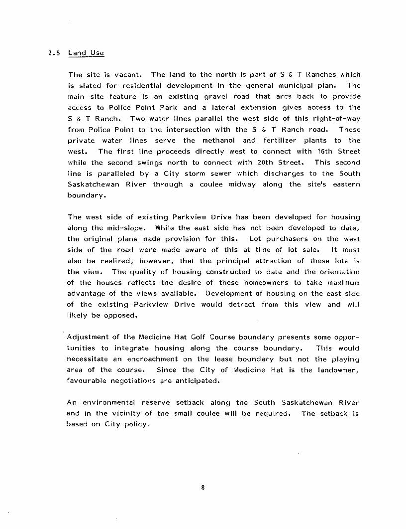
2.5 Land Use
The site is vacant. The land to the north is part of S & T Ranches which
is slated for residential development in the general municipal plan. The
main site feature is an existing gravel road that arcs back to provide
access to Police Point Park and a lateral extension gives access to the
S & I Ranch. Two water lines parallel the west side of this right—of—way
from Police Point to the intersection with the S & T Ranch road. These
private water lines serve the methanol and fertilizer plants to the
west. The first line proceeds directly west to connect with 16th Street
while the second swings north to connect with 20th Street. This second
line is paralleled by a City storm sewer which discharges to the South
Saskatchewan River through a coulee midway along the site’s eastern
boundary.
The west side of existing Parkview Drive has been developed for housing
along the mid—slope. While the east side has not been developed to date,
the original plans mnade provision for this. Lot purchasers on the west
side of the road were made aware of this at time of lot sale. It must
also be realized, however, that the principal attraction of these lots is
the view. The quality of housing constructed to date and the orientationof the houses reflects the desire of these homeowners to take maximum
advantage of the views available. Development of housing on the east side
of the existing Parkview Drive would detract fromn this view and will
likely be opposed.
Adjustment of the Medicine Hat Golf Course boundary presents some oppor-
tunities to integrate housing along the course boundary. This would
necessitate an encroachment on the lease boundary but not the playing
area of the course. Since the City of Medicine Hat is the landowner,
favourable negotiations are anticipated.
An environmental reserve setback along the South Saskatchewan River
and in the vicinity of the small coulee will be required. The setback isbased on City policy.
8

3.0 DEVELOPMENT PLAN_CONSIDERATIONS
3.1 ç~~_~~tegy
The General Municipal Plan incorporates a growth strategy for the City as
a whole with Parkview being shown in Stage II which begins at a threshold
population of 47,205. The City, however, intends to move Parkview into
Stage I in order to permit immediate development of the area.
The projected population of the Parkview area is too small to be con-
sidered an independent neighbourhood. It is necessary, therefore,
that important linkages with respect to social services and physical
infrastructure be established with adjoining areas in Northeast Crescent
Heights or S & I Ranches. Since development in Parkview will occur prior
to the development of S & T Ranches, initial linkages should he made to
Northeast Crescent Heights.
The growth strategy in the General Municipal Plan did not address the
potential utilization of surplus golf course lands in the projection
of land available for development and subsequent population generation
statistics. Consideration of this opportunity has added an additional 5.3
hectares (13.2 acres) of useable land to the Parkview area.
Police Point Park has recently been developed as a regional natural envir-
onment park. Access to the park is provided by an existing gravel road
through the plan area. The roadway needs upgrading to provide adequate
access to the park. It is essential that subdivision planning of the
Parkview area and the upgrading of the roadway take place concurrently.
The presence of this major facility further enhances the attractiveness of
Parkview for residential development.
3.2 Land Use Constraints
Development of Parkview as a residential area is constrained by a number
of natural and man—made features which ultimately limit site development
opportunities. The Area Structure Plan boundary is fixed on the east by
the river, the north by the S & I Subdivision proposal, and on the west
by existing Parkview Drive. Against these constraints, the opportunity to
utilize a portion of the golf course lease has been identified.
9

Decisions have been made concerning development parallel to Parkview
Drive, alignment of a new Parkview arterial and on access to Police Point
Park. The location of the major water lines serving the petrochemical
industries to the west are also a given, and thus have a strong influence
on the final plan.
The site is not large enough to be developed as a neighbourhood unit.
It is not expected therefore to contain the variety of land uses or
heterogenity of a typical neighbourhood.
3.3 Extension of Services
(a) Access and Circulation
Primary access to this area will be provided by the Maple Avenue
Bridge and Parkview Drive. Secondary access from the west is pro-
vided by 12th and 20th Streets, with 12th Street presently being the
preferred route, providing the most direct access to Brier Industrial
Park.
In the proposed S & T Ranches Area Structure Plan, Parkview Drive
would become an arterial road providing primary access to the lands
below the escarpment. It is also likely that some portion of the
residents of the first development phase above the top-of—bank will
use 20th Street and Parkview Drive for downtown access.
It has been assumed that the City Council decision to construct a
second road parallel to Parkview Drive will he maintained. Since this
road will have an arterial function, it has been planned with limited
access as far as 20th Street.
Based on engineering considerations including maximum safety, it is
considered appropriate to have 12th and 20th Streets intersect the new
arterial at “tee” intersections. The existing Parkview Drive should
be closed at 12th and 20th Street with access to the new arterial at
an intersection with the golf course access road. Fire access to
Parkview Drive would be maintained at 12th and 20th Street by the
creation of unobtrusive fire lanes with knock down bollards.
10

To minimize the boulevard between the existing and new Parkview roads,
the rights—of—way have been aligned to run as close together as
possible. The golf course access road is to be realigned. Instead
of intersecting with the new arterial road it will he tied into theproposed access for the subdivision thereby reducing the number of
intersections on the new arterial road.
The subdivision plan recognizes the external road servicing needs of
Police Point Park, therefore, an alignment following the existing park
access road is favoured. Functionally, the new road would intersect
with the new arterial at a “tee” intersection allowing a direct and
scenic approach to the park with minimal impact on the new subdivi—
sion. The existing water and sewer lines can be incorporated into the
right—of—way and the available land utilized to develop an attractive
parkway entrance.
Internal roads are oriented towards amenity features such as the golf
course, river valley, and park. In addition to providing direct
pedestrian access, this arrangement reinforces resident awareness of
these features.
(h) Power
The plan makes provision for the relocation of existing power lines
on the site. The existing 13.8 kv overhead line along Parkview Drive
and a 13.8 kv overhead line to Police Point should be installed
underground when the subdivision is developed.
An existing 13.8 kv line strung below a major 69 kv line, which
extends along the north boundary of the site, will serve the Parkview
area, In the subdivision design, this line has been accommodated inan easement along a rear lane running from 20th Street east, in a
direct line to the river. The line crosses the river at this point
and follows the east bank to reduce its visual impact when viewed from
the Police Point Park access road.
The size of the 69 kv power line dictates that there be a 10.5 metre
(35 foot) building setback from the property line and at least one
11

metre between the pole and property lines. This requirement can be
met by ensuring adequate lot depth and reducing front yard setbacks to
the minimum.
(c) Gas
The Area Structure Plan has incorporated an easement for two gas wells
near the river in locations which will not conflict with adjacent
residential development. The area will be serviced by an extension
from an existing medium pressure line along Parkview Drive.
(d) Storm Sewer
An existing 30” (750 mm) storm sewer passes through the site to an
outfall near the centre of the east boundary. This line presently
serves the Northeast Crescent Heights area. For Parkview, stormwater
can be readily drained by gravity within the subdivision to the south-
east corner near the park where stormwater would be discharged to the
river.
(e) Sanitary Sewer
To service the City land in Northeast Crescent Heights and portions
of the S & T subdivision on the upper bench, a new sewer line would be
required. This line would also have sufficient capacity to serve
Parkview.
In the short term, however, Parkview sewage can be pumped from a
temporary lift station near the entrance to Police Point Park to the
existing Crescent Heights sewage line at 20th Street and Parkview
Drive.
When a cross-river syphon becomes economical, the pump station and
force main would be abandoned and sewage from Parkview would flow by
gravity to the syphon. At this point, provision has also been made
to tie—in to the existing sewer at 12th Street and divert sewage from
Crescent Heights. This in turn will increase the capacity of the
existing line to service new development further west.
12

(f) Water
Parkview will be served from an existing 300 mm (12”) water line on
Parkview Drive. The tie—in will require a pressure reducing valve and
internal service loops can be developed as required. No service is
required to Police Point Park.
4.0 DEVELOPMENT CONCEPT
The Concept Plan illustrates the design intent that has evolved from the
plan objectives (Figure 5). Since access to Police Point Park is criti-
cal, the plan proposes to extend the parkway entrance through the subdivi-
sion as a central spine. Internal residential roads serve to connect the
subdivision with the park access road and to development to the north-
RIVER BANK & ______
OPEN SPACE
PARKWAY INTEGRATION POLICE POINT PARK
PARK ______ ACCESS ‘~‘
VIEWS ~c~T~-SOm 0 5Om 151Dm
~aIe
FIGURE
CRESCENTHEIGHTS
GOLF COURSE
PEDESTRIAN LINKAGE ~
13

A balance is provided between public access and private exposure to amen-
ity features. Since the golf course is essentially private open space,
casual public access is discouraged. However, by allowing lots to back
onto the course, residents can take advantage of their proximity to this
feature. In contrast, Police Point Park and the river bank are important
public open spaces. This is recognized by providing direct access through
the subdivision to a top—of—bank road separating private and public lands.
The top—of-bank roadway increases exposure and encourages public use,
while still providing the private homes across the road with good views.
The advantage of this solution is that the open space is perceived as
being both more accessible and safe, as the housing, naturally orientated
towards the view, provides informal supervision of the river bank area.
By extending the park access road directly through the subdivision, short—
cutting will be discouraged. The road also provides a strong link betweenthe park and the City as a whole, strengthening the perception of the park
as a City and regional facility.
4. 1 Subdivision Design
Given the site’s proximity to three key open space amenities, the “park—
view” theme for the subdivision design is very appropriate (Figure 6).
The golf course, river edge and Police Point Park are obvious attractions,
while the excellent views in a variety of directions and convenient
downtown access contribute to site desirability.
Since access and exposure are key design considerations, the parkviewtheme can be identified by bringing the open space into the subdivision,
protecting the views and emphasizing the proximity of the houses to open
space. By landscaping the Police Point access road to create a parkway
appearance, the subdivision theme can be portrayed in the physical plan
and the parkview identity reinforced.
The land use mix is limited to single unit residential development and a
single mnulti—family site. The multi—family site which is located adjacent
to the park access road and the new arterial road is suitable for terraceddevelopment or apartments provided that buildings are made subject toheight restrictions. Such restrictions will preserve views for existing
development located west of the plan area.
14

PARKS AND fl~IBUFFER AREA L_.~_~•
UTILITY LOT
POLICE POINTACCESS ROADSOm 0 SOm iSOm
FIGURE 6 SUBDIVISION DESIGN
S&T RANCHES TOT LOT (.18 ha)
GOLF COURSEACCESS ROAD
GOLF COURSE
CROSS SECTION A—A
POLICE POINT PARK ACCESS
15

The subdivision plan does not make extensive use of lanes which are common
in Medicine Hat. The intent is to reduce maintenance costs and increase
the amount of developable land. Lanes have been retained where required
to facilitate site servicing or support the parkway concept.
All proposed lots which lie directly adjacent to the golf course should
have a minimum frontage of 18.3 metres (60 feet) excluding pie—shaped
lots.
The plan allows for the integration of Parkview with the S & T subdivision
to the north by projecting road extensions northward so the physical
design does not create a border between the two developments.
The alignment of the park access road is dictated in part by the location
of the existing road and utility easements and the importance of providing
direct access to Police Point Park. As shown on a schematic cross-section
of the Police Point access road on Figure 6, the “parkway” image of the
road is reinforced in the landscape treatment of the road right—of—way.
Existing and proposed utility rights-of—way are combined with the road
allowance to create a unique streetscape.
Although there is extensive open space abutting the subdivision when the
golf course, river bank setback and Police Point Park are considered,there is a need for active play areas. Two totlots are located at con-
venient decentralized spots with a major park area located near the
centre. This larger park would accommodate a range of activities.
The river bank would be developed in a manner consistent with the river
valley policy. Disturbed areas would be restored with native vegetation
and development restricted to a bicycle/pedestrian path and potential
viewpoint. Passive recreational use would be compatible with the manage-
ment objectives for Police Point Park. The subdivision’s parks and open
spaces are linked by paths, lanes and sidewalks. The landscape treatment
of boulevards and the park access road is addressed in the development
guide I i nes.
The site by its shape and orientation is readily adaptable to a plan
layout that provides the opportunity to take advantage of available
solar energy. The idea is to provide the opportunity through the lot
16

orientation and street pattern, and leave implementation the choice of the
builder and/or future homeowner.
With respect to proposed utility systems, Figures 7 and 8 outline the
alignment of such services in accordance with considerations reviewed in
Section 3.3.
FIGURE 7 SANITARY~STORMSEWERSAND WATER LINES
SANITARY SEWER ISTORM SEWER I
WATER LINE J I(1~ 50m 0 SOm I5Om
le
S & T RANCHES
Co0C
I
C/)Cl)
C,I
2:
:0
GOLF COURSE
POLICE POINT PARK
17

FIGURE 8 ELECTRIC AND GASDISTRIBUTION SYSTEM
S&T RANCHES
CD0C
I
Cl)
CD
0I-
z
GOLF COURSE
ELECTRICAL LINE ______ POLICE POINT PARK
GAS LINE ~-
18

The statistical summary of land uses is based on the subdivision design
which may he subject to minor variation in lot size, or layout at the
actual subdivision stage. Land within the top—of—bank setback from
the South Saskatchewan River is considered environtnental reserve and
“undevelopable”. The municipal reserve dedication exceeds the 10 percent
minimum requirement of the Planning Act. Portions of this municipal
reserve dedication, however, are used as a buffer and in some instances
subsurface utility easements which restrict its useability for traditional
park purposes. It should also be noted that the mnunicipal reserve dedi-
cation makes no provision for a school site since one is not required
in this subdivision. The amount of public utility easements reflects the
presence of existing utility lines. Where possible, existing and proposed
utility lines have been accommodated within road and lane rights-of-way.A summary of the subdivision statistics is outlined in Table 1.
Table 1
Statistical Surnrnar~of Land Uses
Percent ofLand Use ______ Net Area
Gross Site Area 148.8*(120.6)
Less Environmental Reserve 3.5( 8.7)
NET SITE AREA 45.3 (111.9) 100.0
25.5 ( 63.0) 56.3
1.3 ( 3.2) 2.9
12.9 ( 31.9) 28.5
5.6 ( 13.8) 12.3
* Gross area includes 5.2 ha. of land currently under golf course lease.
AreaHectares (Acres)
Single Family Residential (R.1)
Multi—family Residential (R.3)
Roads & Utility Lots
Municipal Reserve
19

The projected residential population of Parkview has been calculated as
follows:
(a) Low Density Residential (Single Family Detached)
369 dwelling units x 3 persons per dwelling unit = 1, 107 persons
(h) Medium Density Residential (Townhouses or Low-Rise Apartments)
1.3 (ha.) at 50 dwelling units/ha.
65 dwelling units x 2.0 persons/d.u.
= 65 units
= 130 persons
Total Subdivision Population — 1,107 + 130 = 1,237
Persons Per Gross Hectare 25.3 (10.3 per gross ac.)
Persons Per Net Hectare 27.4 (11.1 per net ac.)
School enrollment projections are based on the following assumptions:
- Each dwelling unit generates 0.6 students.
— Seventy—five percent of all students use the public school system.
Total Dwelling Units x School Generation Factors = Total
Student Population (434 x 0.6 = 260 students)
Proportionate School System Share
Public School System (75 percent) 195
Catholic School System (25 percent) 65
It is anticipated that the subdivision’s students can be accommodated in
existing schools. When S & T lands are developed, Parkview’s public
school students could be serviced from that area.
4.2 Stagjj~
The staging program incorporated in this plan permits the subdivision todevelop according to market conditions. Also, the staging reflects a
20

logical extension of major utilities into the area and, by using the park
access road and internal residential roads as boundaries, the site can be
developed as outlined in Figure 9.
FIGURE 9 STAGING OF DEVELOPMENT
Stage I covers 17.3 hectares and is bounded by the new arterial road, the
Police Point access road, and the golf course. This area of development
is comprised of 127 single family lots with a projected population of
381 people. Stage II covers 17.0 hectares in the east portion of theplan area and will complete the development of land south of the Police
Point access road adjacent to the golf course. In this stage, 158 single
family lots would be developed with a projected population of 474 people.
Stage III covers 11 hectares north of the Police Point access road and
south of S & T Ranches. This area, which is comprised of 84 single family
lots and one multi-family lot, has a projected population of 382 people.
Table 2 presents a statistical summary by stage of development for all
land uses in the plan area.
S & I RANCHES
GOLF COURSE
21

-~V c~r-~~ 0 ~ H2. ~. -~E~ ~. c~.~ > ~. (1)
-~ rm ~m~D IC~— ‘UI
— ~30) Q<0) CD
C m3 ~~ <0>— — -< rn~,
r~cD-< rn
zCD
‘.4. —UI >
UI
~CD
IICD
Ui 11.01 1.0It • $. 0) I
o r’.~ — I’..’ ~>— “-I .r~ IIII (1~ rn
• . j. It .CO luil ui >‘- ~ L I UI
CD0 -.4
0)
IIlCD
o •~ k~l~’~~I. l~‘CO _. CD-. I _
._ ~ fr~ I~ Ui (1)-~ ~ ~0 ‘0 rn
• . . IIo —
— — I— I”CD(I)
IIH
— ~ I~l—~—~
Co ~ oI lCD U)Uirn
.~ Co I’~I’~ I~Ui CO I03k~o1 ~— — N—I’-’— I—
j— It.~$ ~ ~ ID~ ~ ~ I-. vi ~‘
k J~o ~ Ui ~ 1~H I— ~ I—s k l~CI~I —I— k ~a~l1..) — Co 0
. . . . .Ioo L0 Ir..I~o l~~I-.ia~ I>N— I’— I— I’— — N-- I— —

4.3 Development Guidelines
The purpose of this section is to provide a coordinated approach to
the design and implementation of development within the Parkview Area
Structure Plan (Figure 10).
FIGURE 10 DEVELOPMENT GU~DEUNES
S&T RANCHES
C/)0C-4I
CD
0
GOLF COURSE
ENTRYTREATMENT
BOULEVARD TREATMENT
REVEGETATE DISTURBED AREASIN NATIVE GRASSES
COMMONFENCING
PARK SITE FENCING
PARK SITES
I
.
EJfit .a.mnmmm
POLICE POINT PARK
SUm 0 SOm 151Dm
Ie
23

(a) Entry Treatment
At the main entrance to the subdivision and golf course at the south-
ern most intersection on the new Parkview Drive, the subdivision plan
provides a tapered set back to permit a higher level of landscape
treatment. In this area an identification sign for the subdivision
and golf course should be erected in order to achieve a sense of
arrival and a good first impression of the development.
(b) Park Sites
Park site design and development should occur simultaneously with
subdivision construction. The neighbourhood park and two totlots
should be irrigated, lighted and have a standard boundary fence.
(c) Boulevard_Treatment
Major roadway boulevards (new Parkview Drive arterial, Police Point
Access Road) should be treated with a high level of planting and/or
berming/fencing to achieve a buffer between the roadway and adjoining
housing. The landscape treatment is intended to provide both a vis-
ual, and to the extent possible, an acoustical screen. Where utility
easements lie in boulevards, City departments should cooperatively
determine appropriate treatment of such areas.
(d) River Bank Setback
From the edge of the road to the top—of—bank and river bank slope, the
objective is to minimize maintenance and promote the natural vegeta-
tion. Disturbed areas should be restored and replanted to maintain
the natural short grass prairie.
(e) Goff_Course Boundary
Appropriate landscaping should be provided on the golf course property
adjacent to the proposed residential development to minimize stray
shots into the subdivision. Development standards for fencing alongthe golf course should be established at the time of land sales.
24

(f) c9J~i~!c1
As one of the most visible, dominant and continuous elements in the
landscape, the common fencing should reflect one high quality, low
maintenance style. Common fencing is required along boulevards where
lots hack on to a major road, around park sites and on connecting
walkways and at subdivision entry points.
(g) Public_Walkways&Bikeway
Monolithic curb and sidewalk would be used on internal streets while
the sidewalk and/or bikeway along the park access road and newParkview arterial would be constructed in the boulevard setback. This
highlights the importance of these elements on these roads while
offering a safer and more pleasant user experience.
(h) Street Tree Planting
As a means of buffering the subdivision and creating a stronger iden-
tity, the City should consider initiating a tree planting program
along major roadways.
(i) lrri~jation
The Irrigation Plan (Figure 11) illustrates the areas to be irrigated
by the City, and those where irrigation is not required. Supplemental
deep root watering, from a water truck, may be required on the non—
irrigated boulevard trees, until established.
25

FIGURE 11 IRRIGATION PLAN
ul.a.uu
S&T RANCHES
HEIGHTS
CD00-4I
IRRIGATED
PARK/PLANTING
GOLF COURSE
I IBOULEVARDS
NON-I RRIGATED
NATIVE RIVER BANK
BOULEVARDS
SUm 0 50m 150m
~aie
26

5.0 IMPLEMENTATION
5. 1 Adq~tion Procedure
The area structure plan must be adopted in accordance with the provisions
of the Planning Act. When the plan is adopted, amendments to the land use
by—law will be required as shown in Figure 12.
5.2 The Devel~p~p~of_Parkview
In the growth strategy outlined in the General Municipal Plan, Parkview
is scheduled for development as part of Stage II which begins with a
City threshold population of 147,205. Since the City intends to proceed
with this development at the present time, appropriate amendments to the
General Municipal Plan will have to be included in the by—law adopting
this area structure plan.
27

FIGURE 12 LAND USE BY-LAWAMENDMENTS
SINGLE FAMILY RESIDENTIAL DISTRICT [ R 1 jMEDIUM DENSITY RESIDENTIAL DISTRICT R-3 ]PUBLIC PARK AND OPEN SPACE DISTRICT [ ~-i ]
TRANSPORTATION AND UTILITIES DISTRICT TU ]
~rnap scaleSOm 0 SOm 150m
S&T RANCHES
GOLF COURSE
28