North Carolina Department of Cultural Resources - NC.gov
247
James B. Hunt Jr., Governor Betty Ray McCain, Secretary North Carolina Department of Cultural Resources State Historic Preservation Office David L. S. Brook, Administrator Division of Archives and History Jeffrey J. Crow, Director October 5, 1999 MEMORANDUM TO: William D. Gilmore, P.E., Manager Project Development and Environmental Analysis Branch Division of Highways Department of Tr tion FROM: David Brook Deputy State Hist ric reservation Officer RE: US 17 Widening, TIP No. R-2514, Onslow and Jones Counties, ER 00-7445 Thank you for your letter of August 25, 1999, transmitting the survey report by Mattson, Alexander & Associates, concerning the above project. For purposes of compliance with Section 106 of the National Historic Preservation Act, we concur that the following properties are eligible for the National Register of Historic Places under the criterion cited: Gas Station/Store (Property No. 13) - This property is eligible for listing in the National Register under Criterion A for commerce as it illustrates the type of commercial building erected in great numbers throughout rural America after World War I. This property is also eligible for listing in the National Register under Criterion C for architecture as a well preserved example of a rural crossroads store and gas station; an increasingly rare property type. J. Nathan Foscue Farm - The J. Nathan Foscue Farm is eligible for listing in the National Register under Criterion A for agriculture as a rare remaining example of the large, agricultural operations that persisted after the Civil War in Jones County. The J. Nathan Foscue Farm is also eligible for listing in the National Register under Criterion C for architecture as a well preserved example of post-Civil War rural domestic architecture in Jones County. Henderson-Provost House (ON-595) - For purposes of listing in the National Register we would prefer that this property be referred to as the Henderson-Provost House/Store. 109 East Jones Street • Raleigh, North Carolina 27601-2807
-
Upload
khangminh22 -
Category
Documents
-
view
0 -
download
0
Transcript of North Carolina Department of Cultural Resources - NC.gov
James B. Hunt Jr., Governor Betty Ray McCain, Secretary
North Carolina Department of Cultural Resources State Historic Preservation Office
David L. S. Brook, Administrator Division of Archives and History
Jeffrey J. Crow, Director
October 5, 1999
MEMORANDUM
TO: William D. Gilmore, P.E., Manager Project Development and Environmental Analysis Branch Division of Highways Department of Tr tion
FROM: David Brook Deputy State Hist ric reservation Officer
RE: US 17 Widening, TIP No. R-2514, Onslow and Jones Counties, ER 00-7445
Thank you for your letter of August 25, 1999, transmitting the survey report by Mattson, Alexander & Associates, concerning the above project.
For purposes of compliance with Section 106 of the National Historic Preservation Act, we concur that the following properties are eligible for the National Register of Historic Places under the criterion cited:
Gas Station/Store (Property No. 13) - This property is eligible for listing in the National Register under Criterion A for commerce as it illustrates the type of commercial building erected in great numbers throughout rural America after World War I.
This property is also eligible for listing in the National Register under Criterion C for architecture as a well preserved example of a rural crossroads store and gas station; an increasingly rare property type.
J. Nathan Foscue Farm - The J. Nathan Foscue Farm is eligible for listing in the National Register under Criterion A for agriculture as a rare remaining example of the large, agricultural operations that persisted after the Civil War in Jones County.
The J. Nathan Foscue Farm is also eligible for listing in the National Register under Criterion C for architecture as a well preserved example of post-Civil War rural domestic architecture in Jones County.
Henderson-Provost House (ON-595) - For purposes of listing in the National Register we would prefer that this property be referred to as the Henderson-Provost House/Store.
109 East Jones Street • Raleigh, North Carolina 27601-2807
This property is eligible for listing in the National register under Criterion A for commerce as it represents a rare building type, combining residence and store, in Onslow County. This property is also eligible for listing in the National Register under Criterion C for architecture as a well preserved example of substantial houses that appeared in the late nineteenth and early twentieth centuries in Onslow County.
Hoffmann Fores/Deppe Lookout Tower - This property is eligible for the National Register under Criterion A for education, industry and conservation. The Hoffman Forest, the largest university research forest in the world, reflects the expansion of scientific research in forestry and forest management in the early to mid-twentieth century.
This property is also eligible for listing in the National Register under Criterion B for its associations with Professor J.V. Hoffman who established the forestry program at North Carolina State University in 1929 and later created several research forests to support the scientific research of the university.
The following property was determined not eligible for listing in the National Register of Historic Places:
Lee's Chapel United Methodist Church
Until additional information for the properties listed below is provided, we are unable to make a determination of their eligibility for the National Register:
Nelson Deppe House (ON 115)
In addition, the Amos L. Simmons, Jr. House should be listed on page 37 of the report as Properties Listed in the National Register due to the fact that the property is already listed in the Register as part of the Foscue and Simmons Plantations nomination which was accepted by the keeper of the Register on October 7, 1998.
The above comments are made pursuant to Section 106 of the National Historic Preservation Act and the Advisory Council on Historic Preservation's Regulations for Compliance with Section 106 codified at 36 CFR Part 800.
Thank you for your cooperation and consideration. If you have questions concerning the above comment, please contact Renee Gledhill-Earley, environmental review coordinator, at 919/733-4763.
DB:Idb
cc: B. Church
be: Brown/Alperin county rf
PHASE H (INTENSIVE LEVEL) ARCHITECTURAL SURVEY AND EVALUATIONS OF ELIGIBILITY
FOR
U.S. 17 WIDENING ONSLOW AND JONES COUNTIES
NORTH CAROLINA DEPARTMENT OF TRANSPORTATION T.I.P. No. 2514
Prepared by:
Mattson, Alexander and Associates, Inc. 2228 Winter Street
Charlotte, North Carolina 28205 (704) 569-8130 (704) 376-0985
Prepared for:
Wilbur Smith Associates, Inc. 333 Fayetteville Street Mall
Suite 1450 Raleigh, North Carolina 27601-1742
3 May 1999
PHASE II INTENSIVE LEVEL ARCHITECTURAL SURVEY AND EVALUATIONS OF ELIGIBILITY
FOR U.S. 17 WIDENING
ON SLOW AND JONES COUNTIES NORTH CAROLINA DEPARTMENT OF TRANSPORTATION
T.I.P. NO. R-2514
Prepared by:
Mattson, Alexander and Associates, Inc. 2228 Winter Street
Charlotte, North Carolina 28205 (704) 569-8130 (704) 376-0985
Prepared for:
Wilbur Smith Associates, Inc. 333 Fayetteville Street Mall
Suite 1450 Raleigh, North Carolina 27601-1742
3 May 1999
Ac..RO,N, ALEXANDER AND ASSOCIATES, INC.
Frances P. A exander, M.A. Date
Richard L. Mattson, Ph.D.
a Project Manag
Date
5-10" Date
N.C.D.O.T. Historic Architectural Resources Section Date
U.S. 17 Widening, Onslow and Jones Counties
MANAGEMENT SUMMARY
This North Carolina Department of Transportation project is entitled US. 17 Widening,
Onslow and Jones Counties, and the T.I.P. Number is R-2514. As part of the project, an environmental assessment (E.A.) was prepared for this proposed widening of U.S. 17 from north of Jacksonville in Onslow County to south of New Bern in Jones County. This highway widening also includes bypass alternatives of Pollocksville, Maysville, and Belgrade. The environmental assessment was prepared in 1996, but in 1997, two additional alternatives were proposed for study. These new alternative routes are both located north of Pollocksville and extend east and west of existing U.S. 17. The following report is the original environmental assessment prepared from the initial architectural survey conducted between March and September 1996 while the environmental assessment for the new alternatives is found in an addendum to this report.
The project encompasses the widening of U.S. 17 from two lanes to four in Onslow and Jones counties. The approximately 21 mile route will begin in Onslow County in the crossroads community of Kellum, located at the junction of U.S. 17 and S.R. 1327, and will extend north along existing U.S. 17 to roughly 0.8 mile north of the junction with S.R. 1439. At this location, south of the community of Belgrade near the Jones County border, a bypass alternative swings west of the current alignment to avoid Belgrade and the town of Maysville. The area of potential effects (A.P.E.) in this portion of the project follows the existing alignment closely because view sheds and areas of effects are limited by modern construction fronting on U.S. 17 and vast expanses of forests which flank U.S. 17. Only in the area around the junction of S.R. 1436 does the A.P.E. boundary extend east and west of the highway to incorporate open views of agricultural fields. South of the junction with S.R. 1331, an eastern bypass alternative of Belgrade and Maysville diverges from the existing alignment. Located within the routes of these two proposed outer bypasses are three other alternative routes, one of which follows current U.S. 17 through the town of Maysville. The bypasses reconnect with existing U.S. 17 on the north side of Maysville. In this section of the project, the A.P.E. includes all the areas between the eastern and western bypass alternatives, extending east and west to the limits of view sheds. Modern construction and dense woodland in swamps and along the White Oak River and its tributaries define the A.P.E in the area around Belgrade and Maysville. North of Maysville, the A.P.E. again closely flanks U.S. 17 as the highway cuts through the Croatan National Forest. The proposed route continues north along existing U.S. 17 to approximately 0.4 mile south of the junction of S.R. 1114 where a western bypass alternative of the town of Pollocksville diverges from the existing alignment. At a point roughly 0.25 mile north of the junction with S.R. 1112, a proposed eastern bypass of Pollocksville begins its course. On the south side of Pollocksville, the A.P.E. is limited primarily by woodland and modern construction but extends east and west of the bypass alternatives to incorporate vistas across open fields. The alternative which follows the current U.S. 17 alignment through Pollocksville has been eliminated from consideration. As a result, an area on the south and west sides of town, beginning near the junction of existing U.S. 17 and N.C. 58 and extending north to near the junction with S.R. 1121, has been excluded from the A.P.E. The eastern bypass has an outer segment, and both these
1
U.S. 17 Widening, Onslow and Jones Counties
eastern alternatives reconnect with U.S. 17 on the north side of Pollocksville. The inner bypass reconverges approximately 400 feet south of S.R. 1336 while the outer segment merges with existing U.S. 17 north of the junction with S.R. 1121. The western bypass alternative of Pollocksville continues on the west side of U.S. 17 until after the proposed route has crossed S.R. 1121 and reconverges with U.S. 17 approximately 0.25 mile north of S.R. 1335. From this point, the proposed route will follow existing U.S. 17 to its termination at the border between Jones and Craven counties. The A.P.E., north of Pollocksville to the end of the project, incorporates construction fronting on the highway and open farmland, but is limited by woodland along the Trent River and its tributaries.
This architectural survey was conducted and the report prepared in order to identify historic architectural resources located within the area of potential effects (A.P.E.) as part of the environmental studies conducted by N.C.D.O.T. and documented by an environmental assessment (E.A.). This report and addendum are prepared as a technical addendum to the E.A. which is on file at the Department of Transportation, Raleigh, North Carolina. The technical addendum is part of the documentation undertaken to comply with the National Environmental Policy Act (N.E.P.A.) and the National Historic Preservation Act of 1966, as amended. Federal regulations require federal agencies to take into account the effect of their undertakings on properties included in, or eligible for inclusion in, the National Register of Historic Places and to afford the Advisory Council on Historic Preservation a reasonable opportunity to comment on such undertakings.
The report meets the guidelines for architectural surveys established by N.C.D.O.T. (15 June 1994). These guidelines set forth the following goals for architectural surveys: (1) to determine the A.P.E. for the project; (2) to locate and identify all resources 50 years of age or older within the A.P.E.; and (3) to determine the potential eligibility of these resources for listing in the National Register of Historic Places. In addition, this report conforms to the expanded requirements for architectural survey reports developed by N.C.D.O.T. and the North Carolina Department of Cultural Resources (February 1996).
The methodology for the survey consisted of background research into the historical and architectural development of the area and a field survey of the A.P.E. The field survey was conducted by automobile as well as on foot to delineate the A.P.E. of the proposed highway widening and bypass alternatives and to identify all properties within this area which were built prior to 1946. Every property at least 50 years of age was photographed, mapped, and evaluated, and those considered worthy of further analysis were intensively surveyed and evaluated for National Register eligibility. For those resources considered to be eligible for the National Register, site plans were drawn and National Register boundaries determined.
The boundaries of the A.P.E. are shown on U.S. Geological Survey (U.S.G.S.) topographical maps (see Figure 25 in Appendix A and Figure 2a in the addendum). The A.P.E. includes areas which may face increased development pressures because of the widening as well as those areas which may be directly affected. The A.P.E. is defined by
2
ES. 17 Widening, Onslow and Jones Counties
modern construction, topographical features, and sight lines. One hundred percent of the A.P.E. was surveyed.
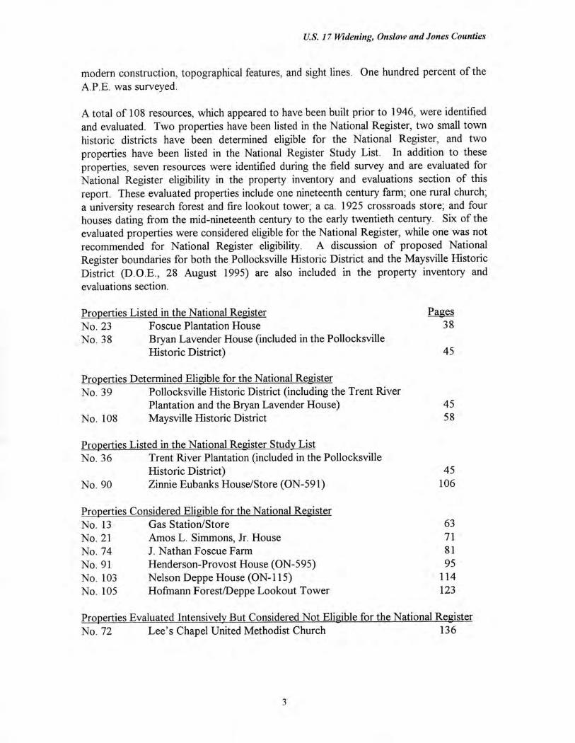
A total of 108 resources, which appeared to have been built prior to 1946, were identified and evaluated. Two properties have been listed in the National Register, two small town historic districts have been determined eligible for the National Register, and two properties have been listed in the National Register Study List. In addition to these properties, seven resources were identified during the field survey and are evaluated for National Register eligibility in the property inventory and evaluations section of this report. These evaluated properties include one nineteenth century farm; one rural church; a university research forest and fire lookout tower; a ca. 1925 crossroads store; and four houses dating from the mid-nineteenth century to the early twentieth century. Six of the evaluated properties were considered eligible for the National Register, while one was not recommended for National Register eligibility. A discussion of proposed National Register boundaries for both the Pollocksville Historic District and the Maysville Historic District (D.O.E., 28 August 1995) are also included in the property inventory and evaluations section.
Properties Listed in the National Register Pages No. 23 Foscue Plantation House 38 No. 38 Bryan Lavender House (included in the Pollocksville
Historic District) 45
Properties Determined Eligible for the National Register No. 39 Pollocksville Historic District (including the Trent River
Plantation and the Bryan Lavender House)
45 No. 108 Maysville Historic District
58
Properties Listed in the National Register Study List No. 36 Trent River Plantation (included in the Pollocksville
Historic District) 45 No. 90 Zinnie Eubanks House/Store (ON-591) 106
Properties Considered Eligible for the National Register No. 13 Gas Station/Store 63 No. 21 Amos L. Simmons, Jr. House 71 No. 74 J. Nathan Foscue Farm 81 No. 91 Henderson-Provost House (ON-595) 95 No. 103 Nelson Deppe House (ON-115) 114 No. 105 Hofmann Forest/Deppe Lookout Tower 123
Properties Evaluated Intensively But Considered Not Eligible for the National Register No. 72 Lee's Chapel United Methodist Church 136
3
U.S. 17 Widening, Onslow and Jones Counties
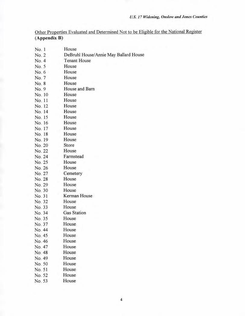
Other Properties Evaluated and Determined Not to be Eligible for the National Register (Appendix B)
No I House No. 2 DeBruhl House/Annie May Ballard House No. 4 Tenant House No. 5 House No. 6 House No. 7 House No. 8 House No. 9 House and Barn No. 10 House No. 11 House No. 12 House No. 14 House No. 15 House No. 16 House No. 17 House No. 18 House No. 19 House No. 20 Store No. 22 House No. 24 Farmstead No. 25 House No. 26 House No. 27 Cemetery No. 28 House No. 29 House No. 30 House No. 31 Kerman House No. 32 House No. 33 House No. 34 Gas Station No. 35 House No. 37 House No. 44 House No. 45 House No. 46 House No. 47 House No. 48 House No. 49 House No. 50 House No. 51 House No. 52 House No. 53 House
4
U.S. 17 Widening, Onslow and Jones Counties
No. 54 House No. 55 House No. 56 House No. 57 House No. 58 Church No. 59 House No. 60 House No. 61 House No. 62 House No. 63 House No. 64 House No. 65 House No. 66 House No. 67 House No. 68 House No. 69 Tenant House No. 70 House No. 71 House No. 73 House No. 75 House No. 76 House No. 77 House No. 78 House No. 79 House No. 80 Store No. 81 House No. 82 House No. 83 Cemetery No. 84 Tobacco Barn and Barn No. 85 House No. 86 House No. 87 House No. 88 House No. 89 House No. 92 House No. 93 House No. 94 House No. 95 Belgrade United Methodist Church No. 96 Dolph Henderson Store No. 101 House No. 102 Eubanks House No. 104 House No. 106 House
5
U.S. 17 Widening, Onslow and Jones Counties
TABLE OF CONTENTS
Page No.
I. List of Figures and Plates 7
Introduction 14
Physical Environment 17
Methodology 18
Background Historical Essay and Historic Contexts 20
W. Property Inventory and Evaluations 37
National Register Properties or Properties Determined Eligible for the National Register 38
List of Properties Considered Eligible for the National Register 63
List of Properties Considered Not Eligible for the National Register 136
Bibliography 141
Appendix A: Area of Potential Effects Map
Appendix B: Photographic Inventory/Evaluations
X. Appendix C: Historic Context: Rural Commercial Buildings, 1875-1940, Jones County, North Carolina (N.C.D.O.T.)
Xl. Appendix D: Professional Qualifications
Addendum
Introduction 1
Methodology 4
Survey Results 6
Bibliography 12
6
U.S. 17 Widening, Onslow and Jones Counties
LIST OF FIGURES AND PLATES
Figures Page No.
Project Location Map 15
Aerial View of Hofmann Forest Headquarters, ca. 1970 33
3 Foscue Plantation House - Site Plan 40
4. Foscue and Simmons Plantations - National Register Boundaries 41
5. Pollocksville Historic District -Proposed National Register Boundaries 49
6. Maysville Historic District - Proposed National Register Boundaries 60
7. Gas Station/Store - Site Plan 66
8. Gas Station/Store - Proposed National Register Boundaries 67
9. Amos L. Simmons, Jr. House - Site Plan 74
10. Foscue and Simmons Plantations - National Register Boundaries 75
11. J. Nathan Foscue Farm - Site Plan 85
12. J. Nathan Foscue Farm - Proposed National Register Boundaries 86
13. J. Nathan Foscue Farm - Right-of-Way Map 87
14. Henderson-Provost House - Site Plan 98
15. Henderson-Provost House - Proposed National Register Boundaries 99
16. Zinnie Eubanks House/Store - Site Plan 108
17. Zinnie Eubanks House/Store - Proposed National Register Boundaries 109
18. Nelson Deppe House - Site Plan 116
19. Nelson Deppe House - Proposed National Register Boundaries 117
7
U.S. 17 Widening, Onslow and Jones Counties
Hofmann Forest/Deppe Lookout Tower - Site Plan 128
Hofmann Forest, Nere Elexus Day Pond Pine Natural Area - Location Map 129
Hofmann Forest, Cypress Natural Area - Location Map 130
Hofmann Forest/Deppe Lookout Tower - Proposed National Register Boundaries 131
Lee's Chapel United Methodist Church - Site Plan 138
Area of Potential Effects Map
Field Survey Map
Addendum
la. Project Location Map 2
2a. Area of Potential Effects Map 3
3a. Field Survey Map 5
8
Plates
U.S. 17 Widening, Onslow and Jones Counties
Page No. 1. Foscue Plantation House, Facade 42
2. Foscue Plantation House, Facade and South Elevation 42
3. Foscue Plantation House, South Elevation and Field 43
4. Foscue Plantation House, Fence and U.S. 17 Right-of-Way 43
5. Foscue Plantation House, U.S. 17 Right-of-Way 44
6. Foscue Plantation House, Family Cemetery 44
7. Pollocksville Historic District, Trent River Plantation, Facade 50
8. Pollocksville Historic District, Trent River and U.S. 17 (Main Street) 50
9. Pollocksville Historic District, Bryan Lavender House, Facade and South Elevation 51
10. Pollocksville Historic District, House, West Side of Main Street 51
11. Pollocksville Historic District, West Side of Main Street 52
12. Pollocksville Historic District, Commercial Buildings, East Side of Main Street 52
13. Pollocksville Historic District, Commercial Buildings, West Side of Main Street 53
14. Pollocksville Historic District, House, West Side of Main Street 53
15. Pollocksville Historic District, Houses and Noncontributing Commercial Building, East Side of Main Street 54
16. Pollocksville Historic District, House and Pollocksville United Methodist Church, East Side of Main Street 54
17. Pollocksville Historic District, Houses, South Side of Pollock Street 55
18. Pollocksville Historic District, Houses, North Side of Barrus Street 55
19. Pollocksville Historic District, Hudson Street 56
20. Pollocksville Historic District, Houses, East Side of Hudson Street 56
9
U.S. 17 Widening, Onslow and Jones Counties
21. Pollocksville Historic District, Houses, South Side of Bell Street 57
22. Pollocksville Historic District, House and Gas Station, Corner of Main Street and Trent Street 57
23. Maysville Historic District, Commercial Buildings, West Side of U. S . 17 61
24. Maysville Historic District, Jenkins Street 61
25. Maysville Historic District, Tenth Street 62
26. Maysville Historic District, House on Foy Street 62
27. Gas Station/Store, Junction of U.S. 17 and SR. 1002 68
28. Gas Station/Store, Facade 68
29. Gas Station/Store, S.R. 1002 Right-of-Way 69
30. Gas Station/Store, Rear and East Elevations 69
31. Gas Station/Store, Door and Window Detail 70
32. Gas Station/Store, Storage Shed 70
33. Amos L. Simmons, Jr. House and Setting 76
34. Amos L. Simmons, Jr. House, Facade 76
35. Amos L. Simmons, Jr. House, Facade 77
36. Amos L. Simmons, Jr. House, Facade Details 77
37. Amos L. Simmons, Jr. House, South Elevation 78
38. Amos L. Simmons, Jr. House, Rear Ell, North Elevation 78
39. Amos L. Simmons, Jr. House, Rear Ell, South Elevation 79
40. Amos L. Simmons, Jr. House, Interior, Mantel 79
41. Amos L. Simmons, Jr. House, U.S. 17 Right-of-Way 80
10
U.S. 17 Widening, Onslow and Jones Counties
42. J. Nathan Foscue Farm, Looking East Along Farm Lane From U.S. 17 88
43. J. Nathan Foscue Farm, House and Chicken Coop 88
44. J. Nathan Foscue Farm, House, Front Porch 89
45. J. Nathan Foscue Farm, House, South Elevation 89
46. J. Nathan Foscue Farm, House, South and Rear Elevations 90
47 J. Nathan Foscue Farm, Ruinous Tenant House 90
48. J. Nathan Foscue Farm, Pack House and Harness Shed 91
49. J. Nathan Foscue Farm, Equipment Shed and Grain Bins 91
50. J. Nathan Foscue Farm, Cemetery and Pack House 92
51. J. Nathan Foscue Farm, Tobacco Barns 92
52. J. Nathan Foscue Farm, Grape Arbor 93
53 J. Nathan Foscue Farm, Cultivated Fields and Woodland 93
54. J. Nathan Foscue Farm, U.S. 17 Right-of-Way 94
55 J. Nathan Foscue Farm, U.S. 17 Right-of-Way 94
56. Henderson-Provost House and Zinnie Eubanks House, Looking East on S.R. 1331 100
57 Henderson-Provost House, Facade 100
58 Henderson-Provost House, Facade and East Elevation 101
59. Henderson-Provost House, West Elevation and Rear Ell 101
60. Henderson-Provost House, East Elevation, Looking From S.R. 1434 102
61. Henderson-Provost House, Interior, Living Room, Staircase and Door 102
62. Henderson-Provost House, Interior, Living Room, Front Door and Staircase 103
11
U.S. 17 Widening, Onslow and Jones Counties
63. Henderson-Provost House, Interior, Living Room Mantel 103
64. Henderson-Provost House, Interior, Parlor Mantel 104
65. Henderson-Provost House, Interior, Enclosed Rear Ell Porch 104
66. Henderson-Provost House, Interior, Rear Ell, Door to Store 105
67. Zinnie Eubanks House/Store and Setting, Looking East 110
68. Zinnie Eubanks House/Store, Facade 110
69. Zinnie Eubanks House/Store, South Elevation 111
70. Zinnie Eubanks House/Store, South Gable 111
71. Zinnie Eubanks House/Store, Rear Ell 112
72. Zinnie Eubanks House/Store, Back Yard 112
73. Zinnie Eubanks House/Store, Pack House 113
74. Zinnie Eubanks House/Store, Garage 113
75. Nelson Deppe House and Former Railroad Bed 118
76. Nelson Deppe House, Facade 118
77. Nelson Deppe House and Yard 119
78. Nelson Deppe House and Yard 119
79. Nelson Deppe House, South Elevation 120
80. Nelson Deppe House, Rear Ell 120
81. Nelson Deppe House, ca. 1909 Outbuilding 121
82. Nelson Deppe House, Interior, Parlor Mantel 121
83. Nelson Deppe House, Interior, Stairway 122
84. Hofmann Forest/Deppe Lookout Tower and Equipment Headquarters, Drainage Canal Along U.S. 17 132
12
U.S. 17 Widening, Onslow and Jones Counties
Hofmann Forest/Deppe Lookout Tower and Equipment Headquarters, Equipment Sheds
132
Hofmann Forest/Deppe Lookout Tower and Equipment Headquarters, Equipment and Storage Sheds
133
Hofmann Forest/Deppe Lookout Tower and Equipment Headquarters, Houses and N.C. Forestry Foundation Office
133
Hofmann Forest/Deppe Lookout Tower and Equipment Headquarters, House, Looking West
134
Hofmann Forest/Deppe Lookout Tower and Equipment Headquarters, Houses and Fire Tower, Looking North 134
Hofmann Forest/Deppe Lookout Tower and Equipment Headquarters, House and Fire Tower, Looking Northwest 135
Lee's Chapel United Methodist Church, Looking South 139
Lee's Chapel United Methodist Church, East and North Elevations 139
Lee's Chapel United Methodist Church, Rear Addition 140
Lee's Chapel United Methodist Church, Door Detail 140
Addendum la. House (No. 1) 9
2a. House (No. 2) 9
3a. House (No. 3) 10
4a. House (No. 4) 10
5a. House (No. 5) 11
13
U.S. 17 Widening, Onslow and Jones Counties
H. INTRODUCTION
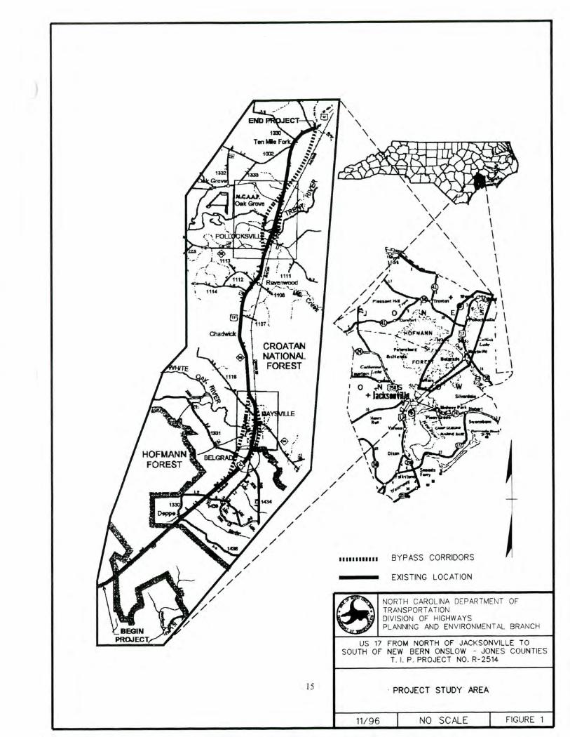
This Phase II intensive level architectural survey was undertaken in conjunction with the widening of U.S. 17 from north of Jacksonville in Onslow County to south of New Bern in Jones County, North Carolina. The T.I.P. Number for this highway widening is R-2514. The project was conducted for Wilbur Smith Associates, Inc. of Raleigh, North Carolina by Mattson, Alexander and Associates, Inc. of Charlotte, North Carolina. Frances P. Alexander and Richard L. Mattson served as the principal investigators, and the project was undertaken between March and September 1996.
The proposed federal undertaking is the widening of a two lane highway, U.S. 17, in Onslow and Jones counties. Located in the Coastal Plain of eastern North Carolina, these two adjoining counties are bounded by Craven, Lenoir, Duplin, and Pender counties, North Carolina. Onslow County also borders the Atlantic Ocean.
The project encompasses a route roughly 21 miles long which begins in Onslow County at the crossroads community of Kellum, located at the junction of U.S. 17 and S.R. 1327, and extends north along existing U.S. 17 to roughly 0.8 mile north of the junction with S.R. 1439. At this location, south of the community of Belgrade near the Jones County border, a bypass alternative swings west of the current alignment to avoid Belgrade and the town of Maysville. South of the junction with S.R. 1331, an eastern bypass alternative of Belgrade and Maysville diverges from the existing alignment. Located within the routes of these two proposed outer bypasses are three other alternative routes, one of which follows current U.S. 17 through the town of Maysville. The bypasses reconnect with existing U.S. 17 on the north side of Maysville. The proposed route continues north along existing U.S. 17 to approximately 0.4 mile south of the junction of S.R. 1114 where a western bypass alternative of the town of Pollocksville diverges from the existing alignment. At a point roughly 0.25 mile north of the junction with S.R. 1112, a proposed eastern bypass of Pollocksville begins its course east of U.S. 17. The alternative which follows the current U.S. 17 alignment through Pollocksville has been eliminated from consideration. The eastern bypass has an outer segment, and both these eastern alternatives reconnect with U.S. 17 on the north side of Pollocksville. The inner bypass reconverges approximately 400 feet south of S.R. 1336 while the outer segment merges with existing U.S. 17 north of the junction with S.R. 1121. The western bypass alternative of Pollocksville continues on the west side of U.S. 17 until after the proposed route has crossed S.R. 1121 and reconverges with U.S. 17 approximately 0.25 mile north of S.R. 1335. From this point, the proposed route will follow existing U.S. 17 to its termination at the border between Jones and Craven counties. The project location is depicted in Figure 1.
This architectural survey was undertaken in accordance with the Department of Transportation Act of 1966, Section 106 of the National Historic Preservation Act of 1966, as amended (36 C.F.R. 800), and the F.H.W.A. Technical Advisory T 6640.8A
14
ligimim911 lifer \ _.0.141.16111311171114%144 marktO°a 440116 • -
\ \/
/
J 0
t., Salmis row-,
•
BYPASS CORRIDORS
EXISTING LOCATION
NORTH CAROLINA DEPARTMENT OF TRANSPORTATION DIVISION OF HIGHWAYS PLANNING AND ENVIRONMENTAL BRANCH
US 17 FROM NORTH OF JACKSONVILLE TO SOUTH OF NEW BERN ONSLOW - JONES COUNTIES
T. I. P. PROJECT NO. R-2514
15 PROJECT STUDY AREA
11/96 NO SCALE FIGURE 1
U.S. 17 Widening, Onslow and Jones Counties
(Guidance for Preparing and Processing Environmental and Section 4(f) Documents). Section 106 requires the identification of all properties eligible or potentially eligible for listing in the National Register of Historic Places according to criteria defined in 36 C.F.R. 60. In order to comply with these federal regulations, this survey followed guidelines set forth in Phase II Survey Procedures for Historic Architectural Resources (N.C.D.O.T., 15 June 1994) and expanded requirements for architectural survey reports developed by N.C.D.O.T. and the North Carolina Department of Cultural Resources (February 1996).
Federal regulations requires that the area of potential effects (A.P.E.) for the undertaking must be determined. The A.P.E. is defined as the geographical area, or areas, within which an undertaking may cause changes to the character or use of historic properties, if such potentially eligible properties exist. The A.P.E. is depicted on U.S. Geological Survey topographical maps found in Appendix A.
The A.P.E. was based upon the location of the proposed construction in relationship to natural and physical boundaries. The area of potential effects parallels the project corridor and bypass alternatives, but extends east and west to incorporate all view sheds from the project corridor. The A.P.E. also includes any secondary road or highway which may face increased development pressures because of the U.S. 17 widening. The boundaries of the A.P.E. are defined by swamp, waterways, road terminations, dense woodland, and secondary roadways which buffer the small communities and farmsteads in these rapidly developing counties. The A.P.E. includes the towns of Pollocksville, Maysville, and Belgrade and extends into unincorporated areas of the two counties.
16
U.S. 17 Widening, Onslow and Jones Counties
HI. PHYSICAL ENVIRONMENT
The project will occur in Jones and Onslow counties, both of which are located in the Coastal Plain of eastern North Carolina. Onslow County is bounded on the east by the Atlantic Ocean, roughly 30 miles north of Wilmington, while Jones County, sited north of Onslow County, has no ocean outlet. These two eastern North Carolina counties generally have the flat topography characteristic of the Coastal Plain, a landscape broken by vast expanses of pine forests, meandering streams and rivers, swamps, and flood plains. The principal rivers in the vicinity are the Trent, the White Oak, and the New.
The current alignment of U.S. 17 roughly follows an eighteenth and nineteenth century post road known as the King's Highway which ran between New England and Charleston, South Carolina. Consequently, the study area has historically attracted farm and rural settlements. The vast stands of pine forests were exploited from the earliest period for turpentine and naval stores, and the area was dotted with turpentine plantations. Pollocksville, on the Trent River, developed as an early river port, south of New Bern, while Maysville took shape as a crossroads settlement. Forests are still a defining feature of this region, which includes both the Croatan National Forest, part of which lies within Jones County, and the Hofmann Research Forest, which occupies vast areas in both Jones and Onslow counties. Outside the towns and crossroads communities, much of the study area is still agrarian, but both pre-World War II and modern commercial, industrial, and residential properties now compete with farmland for highway frontage. Much of the new development, particularly residential, stems from nearby military bases and retirement communities.
In conclusion, the environmental setting is a mix of historically agrarian (farmland and woodland), small town, and post-World War II suburban land uses. Although residential construction has been extensive since World War II, many of the unincorporated areas of the A.P.E. still retain much of their rural character, and the small towns and crossroads communities maintain the ambience and character of small, river and rail, market towns.
17

U.S. 17 Widening, Onslow and Jones Counties
IV. METHODOLOGY
This Phase II architectural survey was conducted as part of the planning for the widening of U.S. 17 in Jones and Onslow counties, North Carolina. The architectural survey for this federally funded project was undertaken in accordance with the Department of Transportation Act of 1966, Section 106 of the National Historic Preservation Act of 1966, as amended (36 C.F.R. 800), and the F.H.W.A. Technical Advisory T 6640.8A (Guidance for Preparing and Processing Environmental and Section 4(f) Documents). The survey followed guidelines set forth in Phase II Survey Procedures for Historic Architectural Resources (N. C . D . O. T., 15 June 1994).
The Phase II architectural survey had three objectives: 1) to determine the area of potential effects; 2) to identify all resources within the A.P.E. which may be potentially eligible for listing in the National Register of Historic Places; and 3) to evaluate these potential resources according to National Register criteria. The N.C.D.O.T. Phase II survey guidelines set forth the following procedures: 1) identify and map the area of potential effects; 2) photograph and indicate on a U.S.G.S. map all properties older than 50 years of age; 3) conduct historical research; 4) prepare a summary of findings; 5) conduct an intensive field survey; 6) prepare a final presentation of findings; and 7) prepare North Carolina survey forms for each property evaluated intensively in the Property Inventory and Evaluations Section of the survey report.
The survey consisted of field investigations and historical research. The fieldwork began with a windshield survey of the general project area in order to determine the A.P.E. All properties 50 years of age or older were photographed and indicated on a U.S.G.S. quadrangle map. Properties were evaluated as either individually eligible for the National Register or as contributing elements to a National Register historic district. Once these potentially eligible properties were identified, the boundary of the A.P.E. was finalized and is illustrated in Appendix A.
Research was conducted to trace the historical and architectural development of the project area. During the Phase I study, the survey files of the North Carolina Division of Archives and History (N.C.S.H.P.O.) were examined to identify those properties listed in the National Register and the National Register Study List. This review identified two National Register properties within the A.P.E.: the Foscue Plantation House (1971) and the Bryan Lavender House (1985), both located within the Pollocksville vicinity. Also near Pollocksville is the Trent River Plantation, listed in the National Register Study List. Near the community of Belgrade is a second National Register Study List property, the Zinnie Eubanks House/Store. Since the completion of the Phase I survey, determinations of eligibility were made for both the Pollocksville Historic District (encompassing the Bryan Lavender House and the Trent River Plantation) and the Maysville Historic District (August 1995).
Historical research, using both primary and secondary sources, was conducted at local and regional repositories. This research included a review of previous surveys and
18
U.S. 17 Widening, Onslow and Jones Counties
environmental impact statements. In 1989, an architectural survey of Onslow County was undertaken by Daniel Pezzoni for the North Carolina Department of Cultural Resources which provided valuable historical information on the development of the county and identified properties within the study area for this project. There has been no survey of Jones County. Although located well outside the study area for this project, an environmental impact statement was prepared by Longleaf Historic Resources (1991, revised 1993) for the U.S. 258 widening within Jones County.
Richard Lonsdale's Atlas of North Carolina was a useful reference for this county where the physical geography has played such a determining role in its development. Levi Branson's business directories (1869-1897) were useful for understanding the changing economic composition of the two counties. The North Carolina State Forestry Service, the Natural Heritage Program of the North Carolina Department of Environment, Health, and Natural Resources, and the U.S. Forest Service at Pisgah Forest provided invaluable information on the history of forestry education in the state. The U.S. Department of Agriculture, Soil Conservation Service, provided general information on forests in the region. Larry Meadows, the county manager of Jones County, Martha Meetre, a member of Lee's Chapel United Methodist Church, Pollocksville residents, Ernest Bender and Robert Farnham, and members of the Foscue family were of great assistance.
Following the research and the preliminary field survey, a preliminary presentation of findings was prepared. In this report, the properties identified during the initial field survey were grouped into three sections: 1) those resources considered not eligible for the National Register; 2) those properties listed in the National Register with a statement of their current integrity; and 3) those properties which warranted further evaluation.
After consultation with N.C.D.O.T., an intensive level field survey was undertaken for those resources considered worthy of further evaluation. The exterior and interior (where permitted) of each resource was examined. The fieldwork was conducted between 25-28 March 1996 and between 3-5 September 1996. One hundred percent of the A.P.E. was examined. Properties considered potentially eligible for the National Register were evaluated and the following information provided for each resource: physical description; photographs; site plan; historical data; and potential National Register boundaries, which were depicted on county tax maps. Computerized North Carolina survey forms were also prepared, or updated, for each of the properties evaluated in the Property Inventory and Evaluations Section of the survey report.
19
U.S. 17 Widening, Onslow and Jones Counties
V. BACKGROUND HISTORICAL ESSAY AND
HISTORIC CONTEXTS
White Settlement Before the Civil War
White settlers began migrating into the areas that became Jones and Onslow counties during the early decades of the eighteenth century. These newcomers were mainly of English origin, but also included a mix of other cultural groups. For example, a small group of Germans acquired land northeast of Richlands, an area referred to in the nineteenth century as "New Germany" (Pezzoni 1989: E.3). In present-day Onslow County, which borders the Atlantic coast, settlement proceeded first along the sounds and rivers and then the major creeks. In Jones County, early settlement primarily followed the Trent River inland from its confluence with the Neuse River at New Bern. These waterways were the principal avenues of transportation and trade until the arrival of railroads in the late nineteenth century (Watson 1995: 1-3).
By the end of the colonial period both counties were also served by a network of crude roads linking local towns as well as spurring overland trade with the port cities of New Bern to the north and Wilmington to the south. Principal among these routes was the King's Highway (roughly following sections of U.S. 17 through the project area). This highway was part of the major colonial post route that stretched from Virginia along the North Carolina coast into South Carolina. Locally, the road connected New Bern on the Neuse River with Wilmington on the Cape Fear, crossing the New River at a ferry site in Onslow County. In 1734, the permanent white population was of sufficient size to warrant the creation of Onslow County from New Hanover County (Watson 1995: 1-3; 14-16).
The development of the interior region north of Onslow County (which became Jones County) occurred at a slower pace, and Jones was eventually formed out of Craven County in 1779. Jones County was oriented to New Bern (in Craven County) socially and economically, and many New Bern residents owned sizable tracts of land in Jones County. The county remained sparsely settled throughout the antebellum period (N.C. Division of Archives and History 1976: 1-3; Black and Black 1989).
From the early decades of settlement to the Civil War, the major commodities for export in both counties were forest products. The abundant, virgin stands of longleaf pines yielded great profits from the production of lumber and naval stores (i.e., tar, pitch, and turpentine). These industries encouraged the formation of large plantations that used slave labor to clear and work huge tracts of land (Merrens 1964: 85-92). In Jones County, vast estates like the Bryan-Bell Farm (National Register 1989) arose along the Trent River, shipping shingles, staves, and naval stores, as well as cotton, rice, corn, and other crop surpluses down river to the port at New Bern (Black and Black 1989). In Onslow County, the proximity to the coast and the network of waterways, including the
20
U.S. 17 Widening, Onslow and Jones Counties
New and White Oak rivers, enhanced the potential of naval stores production. The wealthiest landowners took special advantage of the river access by operating their own coastal scows and ocean-going vessels, as well as running their own turpentine distilleries. These plantations shipped turpentine and other naval stores directly to markets in the northeastern United States, England, and the West Indies (Cathey 1966: 3, 10-11; Pezzoni 1989: E.7-10; Watson 1995: 13, 49-50; Perry 1983: 11, 26).
By the late antebellum period both Jones and Onslow counties had significant planter classes and commensurate slave populations. In Jones, a collection of families amassed sizable tracts of land along the Trent River in the north and White Oak Swamp in the south (Black and Black 1989; N.C. Division of Archives and History 1976: 1-3). According to the 1850 agricultural census for Jones County, the 10 largest and most valuable plantations ranged in size from 1,000 acres to 14,000 acres (U.S. Census 1850). For example, James Bryan's Oakview Plantation contained 1,344 acres and 75 slaves in 1850 (Black and Black 1989). Onslow County in that year boasted 13 residents worth at least $10,000. Among these were planters John Averitt, master of Rich Lands turpentine plantation, a 22,500-acre estate on the New River, and Edward B. Dudley, owner of several plantations in the Half Moon District near the New River north of Jacksonville. By the eve of the Civil War, Onslow County included 45 landowners who possessed 20 slaves or more (the historical designation for planter status) and five who held title to over 100 slaves (Watson 1995: 38). The number of slaves in the county rose steadily during much of the early nineteenth century, constituting 40 percent of the population by 1860. Meanwhile, the average slave holding climbed from 6 in 1790 to 11 by 1860 (Watson 1995: 37).
In sharp contrast to the planter class, which controlled enormous amounts of acreage and major work forces, were middling farmers, possessing a few or no slaves, and a large population of tenants and laborers. For example, 46 percent of the families in Onslow County in 1850 were landless. Some of the smaller landowners were successful turpentine producers as well as subsistence farmers, while tenants and field hands usually found work on the plantations, raising foodstuffs for personal consumption in exchange for their labor (Johnson 1982; Watson 1995: 34, 38).
Although agricultural production was hampered by the predominant naval stores industry as well as the extensive swamplands in both counties, farming played an increasingly important role by the mid-nineteenth century. As throughout the region, larger landowners raised swine and cattle for sale, herding the livestock to markets in Wilmington, New Bern, and Fayetteville. Corn and truck crops were consumed largely on the plantations and farms, but cotton as well as rice increased as market crops. In Onslow County, for example, the number of ginned cotton bales jumped from 53 in 1850 to 336 in 1860. The principal cotton producer was David W. Sanders' Palo Alto Plantation on the White Oak River, which devoted extensive amounts of its 9,500 acres to the crop (Cross 1971; Pezzoni 1989: E.20-21; Watson 1995: 47-49).
21
U.S. 17 Widening, Onslow and Jones Counties
The self-sufficient character of the plantation economy plus the perilous coastline limited the development of a major port or other large towns in the two counties. In Onslow County, the coastal town of Swansboro, although the largest community before the Civil War, remained small, containing 801 residents in 1850, which included 228 slaves. Swansboro shipped annually crops and naval stores worth $100,000 during the antebellum era, and the town contained several turpentine distilleries and ship-building enterprises. The county seat of Jacksonville evolved along the King's Highway at the site of the New River ferry landing. Originally known as Wantland's Ferry, and later renamed Onslow Court House, the town was finally incorporated as Jacksonville in 1842. Jacksonville experienced little growth before the Civil War, containing a few houses, a store, and a tavern clustered around the small courthouse. Richlands was also merely a tiny rural settlement in 1860, comprising a store, a cluster of frame houses, and a small academy (Watson 1995: 32-33, 50-51; Pezzoni 1989: E.4).
In Jones County, Trenton and Pollocksville developed as small river towns, with cotton warehouses, turpentine distilleries, and loading docks for naval stores along the Trent River. Steamboats plied the Trent, carrying cotton, lumber, and naval stores from these towns and the riverside plantations, which not only stimulated the economy but also sparked inland communication and cultural life. Formed as the county seat in 1784, Trenton by 1860 included the Trenton Academy, Presbyterian, Methodist, and Baptist churches, a stave factory and turpentine processing plant, three hotels, a steam-powered sawmill and gristmill, three water-powered mills, and an assortment of lawyers, physicians, and general merchants located in brick and frame buildings around the courthouse (U.S. Census 1860; Harriett 1987: 35-37; Sharpe 1965: 1927-1928).
Within the A.P.E., Pollocksville, situated where the colonial post road (present U.S. 17) crossed the Trent River, was home to the earliest sessions of the county court. Originally known as Trent Bridge, the settlement was incorporated as Pollocksville in 1849. By the onset of the Civil War, the town included an academy, a Methodist church, two general merchandise stores, a water-powered sawmill and gristmill, and a turpentine plant (U.S. Census 1860; Harriett 1987: 30-31; Sharpe 1965: 1929).
South of Pollocksville within the A.P.E., the town of Maysville began as a crossroads settlement in the mid-nineteenth century. Sited along U.S. 17, at the junction of an east-west road linking Trenton to Stella (a small landing on the White Oak River), Maysville was originally known as Young's Cross Roads. A crossroads hamlet before the Civil War, Maysville would develop primarily during the late nineteenth and early twentieth centuries with the introduction of railroad service (Harriett 1987: 29; Sharpe 1965: 1928-1929).
Post-Civil War to World War II
In the aftermath of the Civil War, the abolition of slavery and lack of available capital for naval stores and agricultural production stalled the economy of the region and transformed the antebellum social and economic structures (Pezzoni 1989: E.13). A 1976 historical and architectural study of Onslow County asserted that the county's "plantation economy
22
U.S. 17 Widening, Onslow and Jones Counties
was wrecked by the Civil War and was replaced by one of the most extensive tenant farming systems in North Carolina" (N.C. Division of Archives and History 1976: 2). Thus during the late nineteenth and early twentieth centuries, the number of large land holdings declined while the number of small farms--many of which were now operated by tenants and sharecroppers--rose sharply. In 1870, Onslow County contained 551 farms, with an average size of 350 acres. By 1920, the county held over 2,000 farms, and the average size was only 90 acres. Forty-one percent of the farms in that year were operated by tenants (Pezzoni 1989: E.22-23). The figures for Jones County reveal a similar trend. Here the number of farms soared from 182 in 1870 to 1,226 in 1900, while the average farm size in this period dropped from nearly 500 acres to just 125 acres (Black and Black 1989: 8.9).
Bolstered by the coming of railroads, the area's lumber industry rose in prominence during the postwar decades. Although more than a century of naval stores production had severely depleted the stands of longleaf pines in the two counties, the commercial timbering of loblolly pines and hardwoods rose to replace turpentine distilling as the preeminent industry. The lumber boom began in 1893 with the completion of the Wilmington, New Bern, and East Carolina Railroad (later part of the Atlantic Coast Line Railroad), and peaked in the early twentieth century. The rail line cut north-south through both counties to connect Jacksonville, Maysville, and Pollocksville with the cities of Wilmington and New Bern. Rapidly, small railroad stops such as Belgrade, Deppe, and Kellum emerged, each containing a cluster of sawmills, stores, churches, and houses near the railroad tracks (Branson 1890; Watson 1995: 98; Pezzoni 1989: E.16-17).
The leasing and cutting of forest lands was accomplished at an astonishing pace by such firms as the Onslow Lumber Company (later Parmele Eccleston Lumber Company of New Jersey), the Roper Lumber Company of Virginia, and the Goldsboro Lumber Company based in Dover, North Carolina. Jacksonville, in particular, grew with the lumber industry, attracting several large-scale mills and hundreds of laborers. Between 1890 and 1910, the town's population climbed from 170 to over 500 (Pezzoni 1989: E.16-17; Branson 1890, 1910; Watson 1995: 115-116). In northern Onslow and western Jones counties, the cutting of forests was mainly the work of the Goldsboro Lumber Company. By 1910, the company had constructed the Dover and Southbound Railroad from Craven County through Trenton to Richlands, marking the beginning of its full-scale operations in the area. Within the A.P.E., the Roper Lumber Company built a rail line from its base in New Bern into forests near the Trent River in upper Jones County (Pezzoni 1989: 18; North Carolina Year Book 1910; Black and Black 1989: 8.8).
Although Pollocksville and Maysville did not experience dramatic growth, each steadily developed as farming communities and processing centers for the region's wood and agricultural products. By 1910, Pollocksville had a population of 200, residing primarily along Main Street (U.S. 17) and the adjoining streets south of the Trent River. The town's small commercial area along the highway consisted of a bank, a drugstore, eight general stores, a hotel, and two physicians' offices. Five cotton gins, two gristmills, and a sawmill were located near the river and the railroad tracks, which skirted the east side of
23
U.S. 17 Widening, Onslow and Jones Counties
the community. A public school was sited on the southwest side of town (Harriett 1989: 30-32; Branson 1910). Maysville, the larger of the two communities, contained 350 residents by 1910. A bank, a drugstore, a hotel, and seven general stores lined the main commercial street (present U.S. 17), while a cooperage, a veneer mill, a pickle plant, a sawmill, and a cotton gin were located along the rail corridor on the eastern edge of town (Harriett 1989: 29-30; Branson 1910).
Although the presence of cotton gins reflected the commercial importance of that crop into the 1900s, by the early twentieth century bright-leaf tobacco was rapidly becoming the leading cash staple in both counties. In Jones County, the number of acres planted in tobacco jumped from 1,304 in 1909 to 7,370 by 1929. In Onslow County, statistics for tobacco production showed a similar expansion. Between 1900 and 1920, production rose from 500,000 pounds to over two million. This emergence of tobacco cultivation, which was labor intensive, expanded sharecropping in the two counties and stimulated the proliferation of small farms (North Carolina Industrial Statistics 1920: 320-321; Harriett 1987: 13-14; Pezzoni 1989: E.22).
Farmers also raised a diversity of grains as well as cattle, swine, and poultry for both domestic use and sale. In addition to corn, traditionally the leading crop in terms of acreage, rice cultivation persisted in both counties into the late nineteenth century, but had virtually disappeared by 1900. Farms in both counties began growing peanuts for hog feed in the last decades of the nineteenth century, and in 1890, Onslow County ranked third in the state in peanut production (Pezzoni 1989: E.22).
By the 1920s, improvements in roads and the growing use of motor vehicles began to alter patterns of growth and communication throughout this region. Shortly after the passage of the U.S. Highway Act of 1921, which effectively launched the Good Roads Movement in North Carolina, work began on improving present U.S. 17. The existing two-lane paved highway was completed in 1925 as one stretch of the Ocean Highway, which paralleled the eastern coast. This highway, notes historian Alan D. Watson, "proved an inestimable boon to farmers for marketing their crops and to [the residents of Jones and Onslow counties] generally who wanted better access to the state and nation beyond" (Watson 1995: 121). By the end of the 1920s, east-west Highway 12 (present N.C. 58) was completed in Jones County, linking Pollocksville with the county seat, and extending westward to Kinston in Lenoir County. In 1934, Highway 24, was built through Onslow County, stretching from Swansboro to Jacksonville, and in 1949, Highway 24 was built from Jacksonville to Burgaw in Pender County (Watson 1995: 120-121).
The most direct effect of this highway construction was the emergence of residential and commercial activities oriented to the new or improved roadways. Within the A.P.E., scores of modest, wooden houses arose along rural stretches of U.S. 17 between the late 1920s and World War II. Many were built as rental dwellings for farm laborers and tenants, but others were non-farm residences erected for homeowners who commuted by automobile to new jobs in New Bern and Jacksonville. Concurrently, auto-related businesses began appearing along U.S. 17, including small, canopied filling stations.
24
U.S. 17 Widening, Onslow and Jones Counties
Within the towns of Maysville and Pollocksville, new houses and businesses were also built along U.S. 17, including service stations and automobile dealerships (Harriett 1987: 31).
Post World War II to the Present
The construction of relatively modest houses and stores facing U.S. 17 has continued to the present day. In Maysville and Pollocksville, in particular, modern roadside establishments have appeared in the traditional commercial districts. In the rural areas, modern, single-family dwellings face the highway or are oriented to intersecting secondary roads. In many cases, these houses have replaced earlier farmhouses which have either been razed or now stand abandoned.
Particularly at the south end of the A.P.E., in Onslow County, the pace of modern construction has been affected by the rapid growth of Jacksonville and Camp Lejeune. Established in 1941 and 1942, Camp Lejeune, a U.S. Marine Corps training installation, occupies approximately 85,000 square acres in the south-central part of the county (roughly one-fifth the county's total land area). Camp Lejeune ignited a population explosion in Onslow County. Between 1940 and 1960 the county's population rose from 17,939 to 83,494, and by 1990, the population reached 149,838, making Onslow the ninth most populous county in North Carolina (Watson 1995: 105). Jacksonville and its environs became the focus of residential and commercial growth associated with the military base. Within the last three decades the city's population has climbed from 13,491 to 30,013, far outnumbering the other towns in either Onslow or Jones counties. At present, U.S. 17 leading north out of Jacksonville (south of the A.P.E.) is lined with modern commercial strip activities, while retail centers and residential subdivisions consume farmland to the east and west of the highway (Pezzoni 1989: E.28-30).
Jones County, meanwhile, has experienced little population growth in the twentieth century. Its current population stands at roughly 10,000, compared to 8,700 in 1910. The largest town is Maysville, containing 900 residents, while both Pollocksville and Trenton have approximately 400 inhabitants. The demise of tenancy and lack of a strong local manufacturing base has led to a significant out-migration since World War II (Sharpe 1965: 1932; Harriett 1987: 7). However, in recent decades, the county has also witnessed the construction of vacation houses, spurring new construction along the scenic Trent River near Pollocksville.
In both Jones and Onslow counties, large areas still remain agrarian (Watson 1995: 119; Harriett 1987: 7). Tobacco continues to be the leading cash crop in both counties, but there is also growing diversification. The average farm size has increased in recent decades, reflecting farm mechanization and the rise of livestock farming. Farmers also grow corn and soybeans for the marketplace, and cotton is making a strong resurgence. In Onslow County, for example, farmers raised 4,000 acres of cotton in 1991 (Watson 1995: 113).
25
U.S. 17 Widening, Onslow and Jones Counties
ARCHITECTURAL AND HISTORIC CONTEXTS
Agriculture Context: Diversified Commercial Farming in Jones County in the Late Nineteenth and Early Twentieth Centuries
The late nineteenth and early twentieth centuries witnessed the rise of commercial agriculture in Jones County. Cotton remained dominant throughout the late nineteenth century and into the early twentieth, but as the new century progressed bright leaf tobacco emerged as the leading commercial staple. Stimulated by the arrival of the railroad in 1893, and a growing demand for the bright leaf in cigarette manufacturing, the number of county acres in tobacco increased from 1,304 in 1909 to 6,700 in 1920, and surpassed 7,300 by 1929 (Black and Black 1989: 8.7). Cotton farming, meanwhile, began to decline because of both sharply falling crop prices after World War I and the devastation of the boll weevil. By the end of the Great Depression, cotton production had virtually ceased in Jones County. Agricultural statistics for the county in 1940 recorded tobacco as the leading source of farm income, followed by corn and livestock production (North
Carolina Data Book 1946).
While small farms devoted mainly to cotton and tobacco proliferated into the early twentieth century, Jones County also contained a host of larger, diversified agricultural operations. If 60 percent of farms in Jones County were under 50 acres in 1910, and 65 percent were operated by tenants, nearly 30 percent were greater than 100 acres, and 74 farms exceeded 500 acres. Twenty farms were over 1,000 acres, ranking Jones near the top of all counties in the state in that category, and reflecting the number of large plantations that had existed in the county before the Civil War (U.S. Department of Commerce 1916: 653). The more substantial farms, typically operated by landowners or farm managers, not only raised cotton and tobacco but also corn in quantity, as well as livestock (cattle, swine, horses, and sheep), poultry, sweet potatoes, wheat, rye, and oats (Branson 1884: 410; North Carolina Labor Statistics 1901: 92-93, 124-125; Black and Black 1989: 8.9).
Although owners of the major tracts exploited the remaining stands of long-leaf pine for naval stores into the 1900s, naval stores production dwindled with commercial timbering taking its place (Black and Black 1989: 8.8). Rail transportation spurred this transition, and large lumber concerns extended private, narrow gauge rails through Jones County, especially into the vast, wooded areas near the Trent River and its tributaries. The rail line built by the Roper Lumber Company cut through the Bryan-Bell Farm near Pollocksville, and just west of the sizable J. Nathan Foscue estate.
Both of these family farms were among the more substantial land holdings in the county after the Civil War. The huge Bryan-Bell Farm consisted of 895 acres in 1872 worth $7,000, and held more than 2,000 acres by 1939, as the family continued to acquire woodlands and fields during the early twentieth century. At various times the owners of the farm used wage labor, sharecroppers, and land rental for the cultivation of fields, but
26
US. 17 Widening, Onslow and Jones Counties
the land holding remained intact (Black and Black 1989: 8.1-8.6). Within the APE., the J. Nathan Foscue Farm contained 520 acres in 1880 valued at $3,950 (including livestock) (U.S. Census 1880). Typical of the larger, diversified operations in the county in 1940, neither of these farms raised cotton, but rather produced tobacco, corn, and wheat, as well as large numbers of swine, cattle, and chickens (U.S. Census 1880; Black and Black 1989: 8.1-8.6).
Guidelines for Evaluating the Eligibility of Commercial Farms in Jones County during the Late Nineteenth and Early Twentieth Centuries
To be recommended as eligible for the National Register, cash-crop farms of this period in Jones County must contain an array of architectural resources illustrating both domestic and agricultural activities. Although these resources may have modern alterations, they should have sufficient integrity of design and setting to illustrate clearly the property's agricultural significance. The resources must include the principal farmhouse in addition to a variety of other contributing elements, i.e., all-purpose barns, tobacco barns, pack houses, chicken houses, storage sheds, tenant houses, smokehouse, privy, and corncribs. The farm should also retain integrity of fields, woodlands, and waterways, including field patterns and geographical relationships that represent important agricultural themes during the period of significance.
27
U.S. 17 Widening, Onslow and Jones Counties
Architecture Context: Churches of Jones County in the Late Nineteenth and Early Twentieth Centuries
Churches built in Jones County, and throughout the region, during the late nineteenth and early twentieth centuries usually conformed to a small number of common designs. Congregations tended to select simple, frame, gable front buildings with restrained classical or Gothic Revival elements. The most ambitious designs were found in the towns, especially the county seat of Trenton, and displayed the greatest decorative treatment. By the late nineteenth century, larger churches were often enhanced by prominent entry towers, decorative carpentry, or pointed arch windows as expressions of the Gothic Revival style. A number of churches, dating to the period and built for both white and African-American congregations, survive in Jones County.
The county seat of Trenton, located outside the area of potential effects, contains a collection of notable churches. One of the most stylish, nineteenth century churches in Jones County is Grace Episcopal Church (National Register) built in 1885 for the Episcopal congregation of Trenton. This outstanding example of Gothic Revival has board and batten siding, scalloped bargeboards, window hoods, and a boxy, entrance tower. Also within Trenton are the (Former) Trenton Disciples of Christ Church (ca. 1898), Trenton Baptist Church (1905), King's Chapel Free Will Baptist Church (1919), and the Trenton United Methodist Church (ca. 1887), all of which are substantially intact, frame, gable front buildings with some Gothic Revival treatment (Harriett 1987: 80-82, 94-97). The Trenton United Methodist Church features a unique, center entry tower capped by a conical roof with four miniature towers defining the corners. Both the Baptist and former Disciples of Christ churches have restrained designs with entry towers, steeply pitched roofs, and slender, pointed arch windows and doorways. North of Trenton, the Friendship Free Will Baptist Church (ca. 1906) characterizes simpler, rural churches of the period. The frame building has a rectangular plan, gable front orientation, belfry, and pointed arch windows and doors. The front gable, entry porch and rear wing are later modifications. Near the community of Comfort is the 1914 Academy Green Free Will Baptist Church with a similar Gothic Revival design, featuring a belfry as well as gable returns on the one bay facade. Pleasant Hill Christian Church (ca. 1905) has a modest classical design with rectangular nave plan, gable returns, flat arch, double hung windows, and a double leaf, central entrance. Oak Grove Methodist Church (1919) is a distinctive concrete block edifice with a corner entry tower and pointed arch, Gothic windows. The tree-shaded church grounds include an original canopied well and a concrete horse trough (Harriett 1987: 78, 80-82, 87-89).
Within the A.P.E., both the historic districts in Maysville and Pollocksville retain well-preserved churches that date to the early twentieth century. In Maysville, Holy Innocents Catholic Church (ca. 1910) is a handsome, one bay, frame building with a steep, front gable roof and the matching, bracketed canopy over the center doorway. The entry is capped by a pointed arch transom while the side elevations are broken by Gothic windows (Harriett 1987: 77). In Pollocksville, the brick Pollocksville United Methodist Church (1918) is a stylish Gothic Revival building with buttresses, concrete trim, pointed arch
28
U.S. 17 Widening, Onslow and Jones Counties
windows and doorways, and a rear, corner, entry tower with castellation (Harriett 1987: 91-92). Within the APE., but outside the towns, is the ca. 1895 Lee's Chapel United Methodist Church (No. 72), located along U.S. 17 between Pollocksville and Maysville. With its decorative restraint, the simple, frame church is typical of the rural churches of the period. The church has gable returns, a rectangular nave plan, flat arch windows, and a front gable orientation. However, the church has been altered with the addition of a steeple, a rear educational building, and interior remodelling.
Guidelines for Evaluating the Eligibility of Late Nineteenth to Early Twentieth Century Churches in Jones County
Late nineteenth and early twentieth century churches in Jones County must survive substantially intact in order to be recommended as eligible for the National Register. Eligible churches must have sufficient integrity to illustrate clearly the forms, styles, materials, and interior plans of the original design. Specifically, siding materials and interior elements, including woodwork, pews, pulpit, and light fixtures, should be largely original or greater than 50 years of age. Eligible churches may have rear classroom additions, which are commonplace, but these additions must be smaller than the main block so as not to overwhelm the original design. The immediate setting of the church may contribute to its significance, containing, for example, mature vegetation, original open space, and contributing outbuildings and cemeteries.
29
U.S. 17 Widening, Onslow and Jones Counties
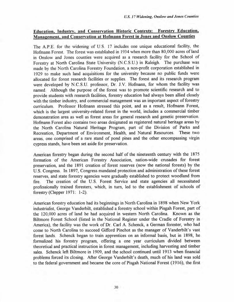
Education, Industry, and Conservation Historic Contexts: Forestry Education, Management, and Conservation at Hofmann Forest in Jones and Onslow Counties
The A.P.E. for the widening of U.S. 17 includes one unique educational facility, the Hofmann Forest. The forest was established in 1934 when more than 80,000 acres of land in Onslow and Jones counties were acquired as a research facility for the School of Forestry at North Carolina State University (N.C.S.U.) in Raleigh. The purchase was made by the North Carolina Forestry Foundation, a non-profit corporation established in 1929 to make such land acquisitions for the university because no public funds were allocated for forest research facilities or supplies. The forest and its research program were developed by N.C.S.U. professor, Dr. J.V. Hofmann, for whom the facility was named. Although the purpose of the forest was to promote scientific research and to provide students with research facilities, forestry education had always been allied closely with the timber industry, and commercial management was an important aspect of forestry curriculum. Professor Hofmann stressed this point, and as a result, Hofmann Forest, which is the largest university-related forest in the world, includes a commercial timber demonstration area as well as forest areas for general research and genetic preservation. Hofmann Forest also contains two areas designated as registered natural heritage areas by the North Carolina Natural Heritage Program, part of the Division of Parks and Recreation, Department of Environment, Health, and Natural Resources. These two areas, one comprised of a rare stand of pond pines and the other encompassing virgin cypress stands, have been set aside for preservation.
American forestry began during the second half of the nineteenth century with the 1875 formation of the American Forestry Association, nation-wide crusades for forest preservation, and the 1891 creation of forest reserves (now the national forests) by the U.S. Congress. In 1897, Congress mandated protection and administration of these forest reserves, and state forestry agencies were gradually established to protect woodland from fire. The creation of the U.S. Forest Service and state agencies all necessitated professionally trained foresters, which, in turn, led to the establishment of schools of forestry (Clepper 1971: 1-2).
American forestry education had its beginnings in North Carolina in 1898 when New York industrialist, George Vanderbilt, established a forestry school within Pisgah Forest, part of the 120,000 acres of land he had acquired in western North Carolina. Known as the Biltmore Forest School (listed in the National Register under the Cradle of Forestry in America), the facility was the work of Dr. Carl A. Schenck, a German forester, who had come to North Carolina to succeed Gifford Pinchot as the manager of Vanderbilt's vast forest lands. Schenck began to train apprentices on an informal basis, but in 1898, he formalized his forestry program, offering a one year curriculum divided between theoretical and practical instruction in forest management, including harvesting and timber sales. Schenck left Biltmore in 1909, and the school continued until 1913 when financial problems forced its closing. After George Vanderbilt's death, much of his land was sold to the federal government and became the core of Pisgah National Forest (1916), the first
30
U.S. 17 Widening, Onslow and Jones Counties
national forest in the eastern United States. The Biltmore Forest School was reopened as a museum in 1961 (Thompson, 1993: E.29; Cradle of Forestry Informational Material).
As the Biltmore Forest School was beginning operation, a number of colleges and universities were also creating forestry departments. In 1886, only twelve years before Biltmore was opened, Bernhard E. Fernow, later head of the Division of Forestry of the Department of Agriculture, had noted that there were no schools of forestry in the United States; forestry instruction was minimal and usually given only as a component of courses in farm economics or horticulture. However, by 1890, Cornell College in New York, the agricultural colleges of Iowa, Massachusetts, Michigan, Missouri, and New Hampshire, and the universities of North Carolina and Pennsylvania all offered some curriculum in forestry. In 1898, the same year Biltmore was established, Cornell initiated the first school of forestry, with Yale University following in 1900. By 1903, a number of other universities had followed suit, including the University of Michigan, Michigan State • College, University of Maine, Univeristy of Minnesota, and the Pennsylvania State Forest Academy at Mount Alto. By 1910, there were seventeen institutions which offered college curricula in forestry (Clepper 1971: 123-125).
Forestry education was given a boost both by the passage of the Weeks Act in 1911, which designated funds for the state forest services to fight forest fires, and the creation of the National Park Service in 1916. These two federal mandates created career opportunities within the U.S. Forest Service, state agencies, or the National Park Service, which, in turn, spurred the development of forestry departments at universities and colleges. The demand for foresters continued to grow throughout the early twentieth century, and unlike most sectors of the economy, forestry was in great demand during the Depression when the need for such positions rose sharply as foresters were required to supervise the newly created Civilian Conservation Corps (C.C.C.).
Although courses in forestry had long been offered at North Carolina State University, a degree program in forestry was not established at N.C.S.U. until 1929 when Dr. J.V. Hofmann became the director of the new Department of Forestry in the School of Agriculture. Hofmann had served for fourteen years in the U.S. Forest Service in western states and participated in the establishment of the Priest River Experiment Station in Idaho and the Wind River Experiment Station in Oregon, Washington, and Alaska. From 1924 to 1929, he served as the assistant director of the Forest School at Mount Alto, Pennsylvania. Hofrnann left his position in Pennsylvania to found the North Carolina State College, School of Forestry, where he was director for nineteen years, making the N.C.S.U. program one of the largest forestry schools in the country (Miller 1971: 5). Hofmann determined that the most urgent need was the acquisition of school forests for scientific experiments and timber management training. Because there were no public allocations for research facilities, Hofmann soon organized the North Carolina Forestry Foundation as a non-profit corporation to purchase or lease land for the forestry department. The first project of the new foundation was the purchase of a 75 acre tract of native shortleaf pine and loblolly pine stands in Wake County, known as Poole Woods. In 1930, Hill Forest (378.3 acres) was deeded to N.C.S.U. by George Watts Hill for use as a
31
U.S. 17 Widening, Onslow and Jones Counties
school forest. Further acquisitions later enlarged the forest to 1,500 acres. In 1934, the foundation and N.C.S.U. began its largest project when 83,000 acres of land in the White Oak Pocosin of Jones and Onslow counties were acquired as a school forest (Miller 1971: 11). Hofmann's goal in purchasing the White Oak land was to develop a pocosin forest as commercially productive woodland. The White Oak site offered the school a typical southern forest in its locality, species, and soil conditions, making research applicable throughout much of the coastal South (Miller 1971: 20).
At the time of the purchase, much of the White Oak land had been burned or cut, and many of the swampy areas and the higher pocosins were inaccessible with only three routes running through the area. One of the first tasks was the division of the forest into ten blocks, each containing 25 square miles. The block system allowed for systematic recording of forest features, timber growth, and stands (Miller 1971: 60). A headquarters was also established to administer the massive campaign of preparing soils and beds, building roads, drainage canals, or trails, and planting the vast tree stands. This complex of buildings, which still serves as the headquarters for Hofmann Forest, was originally built at Camp Butner near Durham. The buildings were dismantled and moved to the forest during the Depression by the Civilian Conservation Corps, in cooperation with military personnel from Camp Butner. During the 1930s, the C.C.C. built much of the forest infrastructure, constructing drainage canals and roads for both access and fire control; clearing, draining, and planting 400 acres of plantations; and in conjunction with school crews conducting, what are known as, timber cruises to determine the amounts of timber within the forest. The creation of this massive experimental research forest has been ongoing, and during World War II, German prisoners of war were sent to supply labor for projects (Miller 1971: 75).
Within the A.P.E., one of the principal trails through the forest is the Deppe Trail, created in 1936 and extending northwest from the forest headquarters at U.S. 17. The C.C.C. built the Deppe Trail and rebuilt the Quaker Bridge Road. Additional road and canal campaigns were begun in 1949 in order to reach stands ready for harvest, and by 1970, 500 miles of roads and an equal number of canals had been constructed (Miller 1971: x-xii).
Within Block 10 are the headquarters of Hofmann Forest, which is the centerpiece of a 400 acre plantation of loblolly and slash pines trees planted along U.S. 17 in 1936 by the C.C.C. (Figure 2). Known as the Deppe Plantation, the area was one of the wettest in the forest. However, construction of the drainage canal along the highway and the Deppe Trail ditch, both dug in 1934, have gradually improved the drainage, and the Deppe Plantation has been used as an experiment in the effects of drainage on the water table and plant growth. Simultaneously, a set of 22 one acre plots were created along U.S. 17 as experiments in plant spacings, and the aligned trees were measured periodically for growth rates.
Fire control was a central feature of both forestry education and the state and federal forest services, and a system of lookout towers were built throughout Hofmann Forest.
32
1.41t.70:4Asfr 7
ty, . •
-17
_ 'A
.--c ;
LAirvz 11.4: 170,,,ekr • n • *
Figure 2 Hofmann Forest/Deppe Lookout Tower. Aerial View, ca. 1970, Looking West.
Source: Miller, The Hofmann Forest, 1970.
33
U.S. 17 Widening, Onslow and Jones Counties
Within the headquarters complex is a fire lookout tower, operated by a ranger from the North Carolina Forest Service (Miller 1971: 61). There have been other additions to the educational facilities at Hofmann Forest. In 1944, one of the most complete weather stations in the state was built at the forest headquarters to measure climatic conditions for forest ecology and fire prevention. The equipment and small building are enclosed by a fence at the north end of the complex (Miller 1971: 79).
Because Hofmann Forest has been operated on a self-supporting basis, most of the woodland was leased to timber companies with timber sales underwriting much of the administration, maintenance, and research of the forest. In 1945, the forest foundation entered into a 99 year contract with the Halifax Paper Company of Roanoke Rapids, North Carolina. While this timber contract ensured that the forest was self-supporting, students were guaranteed access to all areas of the forest. The paper company was leased Blocks 1-9, but Block 10, through which U.S. 17 passes, was excluded from the lease and reserved for purely academic research (Miller 1971: 48). In 1986, the forest reverted to N.C.S.U. control, and a new management plan, which includes much reforestation, has been developed. Currently, of the more than 78,000 acres of forest, 46,606 acres are logging zones, and 40 per cent (or 32,321 acres) are genetic reserves, areas exempt from logging (New Bern Sun Journal 1991).
The creation of this extensive forestry training program at Hofmann Forest reflects the importance of timber to the North Carolina economy and to the South, which produces more timber products than any other region of the country (Clepper 1971: 231). At the same time, the mature timber industry of the twentieth century has become dependent upon the scientific forest management techniques and research developed at universities. With Washington and Oregon, North Carolina has the largest timber industry in the United States, and the state, two-thirds of which is forested, has a greater variety of commercial grade trees than any other state (North Carolina Forestry Foundation, Informational Pamphlet).
The establishment of forestry programs at colleges and universities underscored the need for both a greater scientific understanding of silviculture and better management of forests for timber production. Before the early twentieth century, most lumber companies sought virgin woodland which would be clear cut and then sold or abandoned. Few timber companies had a need to cultivate and perpetuate forests for long-term timber production. However, by the twentieth century, much of the original virgin woodland in the United States, particularly those stands with the greatest commercial potential, had been cut, and the lower quality, second growth forests required more management in order to be both sustainable and profitable. By the interwar period, scientific research and demonstration forests were undertaken at universities to support this form of industrial production. (Much of this abandoned clear-cut land was acquired by the federal government as part of the national forest system.)
Onslow and Jones counties were selected as the site of this research forest, in part, because of the extensive pine forests, which were typical in type and soil conditions to many throughout the South. In addition, timber had long been a mainstay of the coastal
34
U.S. 17 Widening, Onslow and Jones Counties
economy of North Carolina, first with the production of naval stores and later with timber harvesting. Although highly profitable, tar, turpentine, and later lumber production claimed most of the virgin longleaf pine stands of the region, and Onslow County, as with many mature timber regions, was ripe for scientific forest management (Pezzoni 1989: E.8-9). Currently, approximately 70 percent (or 341,875 acres) of Onslow County is covered in commercial forests with Hofmann Forest accounting for 54,000 acres (or 10 percent of the county) (Soil Survey of Onslow County, North Carolina 1992: 2, 50).
The lumber industry became important to the North Carolina economy after the Civil War when a statewide system of railroads were completed, and remote areas of the mountains as well as isolated reaches of the Coastal Plain were opened to national lumber markets. In Onslow and Jones counties, rail service was introduced in the early 1890s when New York financier, Thomas A. McIntyre, and other investors acquired the Wilmington, New Bern, and Norfolk Railroad. McIntyre, a sportsmen, had bought 1,600 acres of game land in the region, and his new rail venture was called the Wilmington, Onslow, and East Carolina Railroad. The line from Wilmington to New Bern opened the forests of Jones and Onslow counties to exploitation. As interstate and local lumber companies established operations in the region, other smaller rail lines were constructed, making virtually all of Onslow County accessible to timber harvests (Pezzoni 1989: E.15). Lumber production peaked during World War I, and the pine forests, which were once thought to be inexhaustible, were largely depleted by the 1920s. Through extensive educational campaigns about the importance of forest management, professional foresters and timber company executives have gradually made industrial forestry, and paper production in particular, a major part of the southern economy (Clepper 1971: 245-246).
Hofmann Forest occupies much of the White Oak Pocosin, which at the time of purchase was traversed by only four routes: Quaker Bridge Road, Roper Lumber Company's logging railroad, U.S. 17, and the former Atlantic Coast Line Railroad route paralleling the east side of U.S. 17. Three of the four corridors paralleled each other on a northeast to southwest course, at roughly four to six mile intervals. (The Atlantic Coast Line corridor runs only approximately 150 feet east of U.S. 17.) The vast pocosin is characterized by flat, poorly drained land with historically inaccessible forests, subject to frequent fires. The stands of pond pine made the area worthy of timbering in spite of the fire threats, and there were also stands of loblolly pine, cypress, and swamp black gum trees. The forest is located within the watersheds of the White Oak, Trent, and New rivers, with the White Oak River bisecting the forest. A land company had acquired the entire pocosin tract in 1914, and conducted an engineering study of the area to assess drainage potential. The property was conveyed to a timber company in 1924, but the company went bankrupt in 1929, and N.C.S.U. bought the property in a foreclosure sale in 1934 (Miller 1971: 9-10).
Pond pines, because of their ability to withstand hot fires, formed the predominant species of the forest with cypress occurring in the north end, near the head of Cypress Creek, and in the western portion of the forest. Soon after the property was acquired, Hofmann removed a 27 acre tract from logging as a preserve of virgin cypress (Miller 1971: 81). A
35

U.S. 17 Widening, Onslow and Jones Counties
reservation of pond pines, believed to be the oldest in the state, is located within Block 10. Both of these sites are now protected as registered natural heritage areas (see Hofmann Forest in Chapter VI. Property Inventory and Evaluations).
36
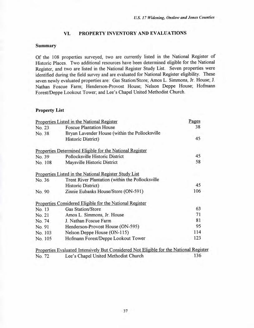
U.S. 17 Widening, Onslow and Jones Counties
VI. PROPERTY INVENTORY AND EVALUATIONS
Summary
Of the 108 properties surveyed, two are currently listed in the National Register of Historic Places. Two additional resources have been determined eligible for the National Register, and two are listed in the National Register Study List. Seven properties were identified during the field survey and are evaluated for National Register eligibility. These seven newly evaluated properties are: Gas Station/Store; Amos L. Simmons, Jr. House; J. Nathan Foscue Farm; Henderson-Provost House; Nelson Deppe House; Hofmann Forest/Deppe Lookout Tower; and Lee's Chapel United Methodist Church.
Property List
Properties Listed in the National Register Pages No. 23 Foscue Plantation House 38
No 38 Bryan Lavender House (within the Pollocksville Historic District) 45
Properties Determined Eligible for the National Register No. 39 Pollocksville Historic District
45
No. 108 Maysville Historic District
58
Properties Listed in the National Register Study List No. 36 Trent River Plantation (within the Pollocksville
Historic District) 45 No. 90 Zinnie Eubanks House/Store (ON-591) 106
Properties Considered Eligible for the National Register No. 13 Gas Station/Store 63 No. 21 Amos L. Simmons, Jr. House 71 No. 74 J. Nathan Foscue Farm 81 No. 91 Henderson-Provost House (ON-595) 95
No. 103 Nelson Deppe House (ON-115) 114
No. 105 Hofmann Forest/Deppe Lookout Tower 123
Properties Evaluated Intensively But Considered Not Eligible for the National Register No. 72 Lee's Chapel United Methodist Church 136
37
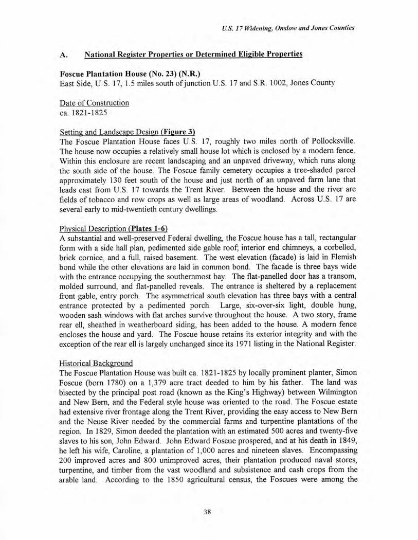
U.S. 17 Widening, Otis/ow and Jones Counties
A. National Register Properties or Determined Eligible Properties
Foscue Plantation House (No. 23) (N.R.) East Side, U.S. 17, 1.5 miles south of junction U.S. 17 and S.R. 1002, Jones County
Date of Construction ca. 1821-1825
Setting and Landscape Design (Figure 3) The Foscue Plantation House faces U.S. 17, roughly two miles north of Pollocksville. The house now occupies a relatively small house lot which is enclosed by a modern fence. Within this enclosure are recent landscaping and an unpaved driveway, which runs along the south side of the house. The Foscue family cemetery occupies a tree-shaded parcel approximately 130 feet south of the house and just north of an unpaved farm lane that leads east from U.S. 17 towards the Trent River. Between the house and the river are fields of tobacco and row crops as well as large areas of woodland. Across U.S. 17 are several early to mid-twentieth century dwellings.
Physical Description (Plates 1-6) A substantial and well-preserved Federal dwelling, the Foscue house has a tall, rectangular form with a side hall plan, pedimented side gable roof; interior end chimneys, a corbelled, brick cornice, and a full, raised basement. The west elevation (facade) is laid in Flemish bond while the other elevations are laid in common bond. The facade is three bays wide with the entrance occupying the southernmost bay. The flat-panelled door has a transom, molded surround, and flat-panelled reveals. The entrance is sheltered by a replacement front gable, entry porch. The asymmetrical south elevation has three bays with a central entrance protected by a pedimented porch. Large, six-over-six light, double hung, wooden sash windows with flat arches survive throughout the house. A two story, frame rear ell, sheathed in weatherboard siding, has been added to the house. A modern fence encloses the house and yard. The Foscue house retains its exterior integrity and with the exception of the rear ell is largely unchanged since its 1971 listing in the National Register.
Historical Background The Foscue Plantation House was built ca. 1821-1825 by locally prominent planter, Simon Foscue (born 1780) on a 1,379 acre tract deeded to him by his father. The land was bisected by the principal post road (known as the King's Highway) between Wilmington and New Bern, and the Federal style house was oriented to the road. The Foscue estate had extensive river frontage along the Trent River, providing the easy access to New Bern and the Neuse River needed by the commercial farms and turpentine plantations of the region. In 1829, Simon deeded the plantation with an estimated 500 acres and twenty-five slaves to his son, John Edward. John Edward Foscue prospered, and at his death in 1849, he left his wife, Caroline, a plantation of 1,000 acres and nineteen slaves. Encompassing 200 improved acres and 800 unimproved acres, their plantation produced naval stores, turpentine, and timber from the vast woodland and subsistence and cash crops from the arable land. According to the 1850 agricultural census, the Foscues were among the
38
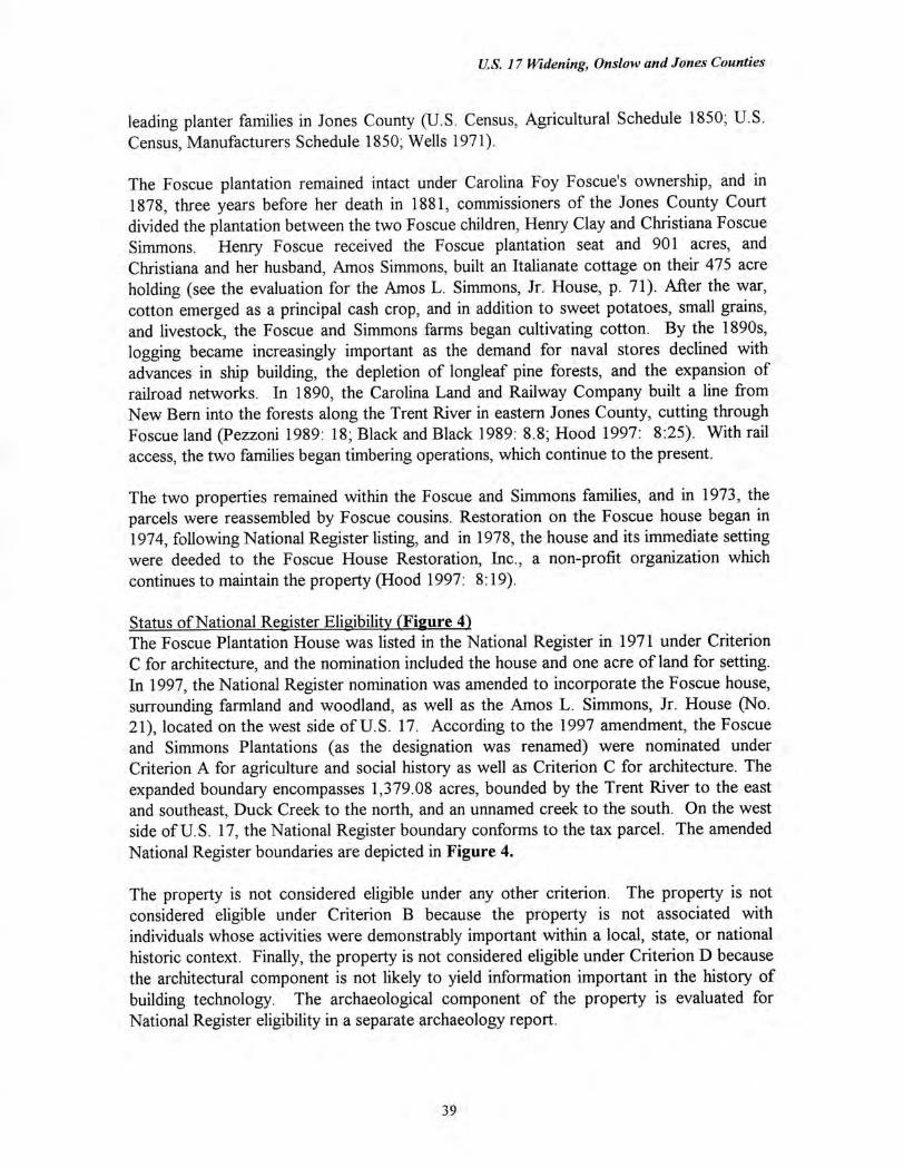
U.S. 17 Widening, Onslow and Jones Counties
leading planter families in Jones County (U.S. Census, Agricultural Schedule 1850; U.S. Census, Manufacturers Schedule 1850; Wells 1971).
The Foscue plantation remained intact under Carolina Foy Foscue's ownership, and in 1878, three years before her death in 1881, commissioners of the Jones County Court divided the plantation between the two Foscue children, Henry Clay and Christiana Foscue Simmons. Henry Foscue received the Foscue plantation seat and 901 acres, and Christiana and her husband, Amos Simmons, built an Italianate cottage on their 475 acre holding (see the evaluation for the Amos L. Simmons, Jr. House, p. 71). After the war, cotton emerged as a principal cash crop, and in addition to sweet potatoes, small grains, and livestock, the Foscue and Simmons farms began cultivating cotton. By the 1890s, logging became increasingly important as the demand for naval stores declined with advances in ship building, the depletion of longleaf pine forests, and the expansion of railroad networks. In 1890, the Carolina Land and Railway Company built a line from New Bern into the forests along the Trent River in eastern Jones County, cutting through Foscue land (Pezzoni 1989: 18; Black and Black 1989: 8.8; Hood 1997: 8:25). With rail access, the two families began timbering operations, which continue to the present.
The two properties remained within the Foscue and Simmons families, and in 1973, the parcels were reassembled by Foscue cousins. Restoration on the Foscue house began in 1974, following National Register listing, and in 1978, the house and its immediate setting were deeded to the Foscue House Restoration, Inc., a non-profit organization which continues to maintain the property (Hood 1997: 8:19).
Status of National Register Eligibility (Figure 4) The Foscue Plantation House was listed in the National Register in 1971 under Criterion C for architecture, and the nomination included the house and one acre of land for setting. In 1997, the National Register nomination was amended to incorporate the Foscue house, surrounding farmland and woodland, as well as the Amos L. Simmons, Jr. House (No. 21), located on the west side of U.S. 17. According to the 1997 amendment, the Foscue and Simmons Plantations (as the designation was renamed) were nominated under Criterion A for agriculture and social history as well as Criterion C for architecture. The expanded boundary encompasses 1,379.08 acres, bounded by the Trent River to the east and southeast, Duck Creek to the north, and an unnamed creek to the south. On the west side of U.S. 17, the National Register boundary conforms to the tax parcel. The amended National Register boundaries are depicted in Figure 4.
The property is not considered eligible under any other criterion. The property is not considered eligible under Criterion B because the property is not associated with individuals whose activities were demonstrably important within a local, state, or national historic context. Finally, the property is not considered eligible under Criterion D because the architectural component is not likely to yield information important in the history of building technology. The archaeological component of the property is evaluated for National Register eligibility in a separate archaeology report.
39
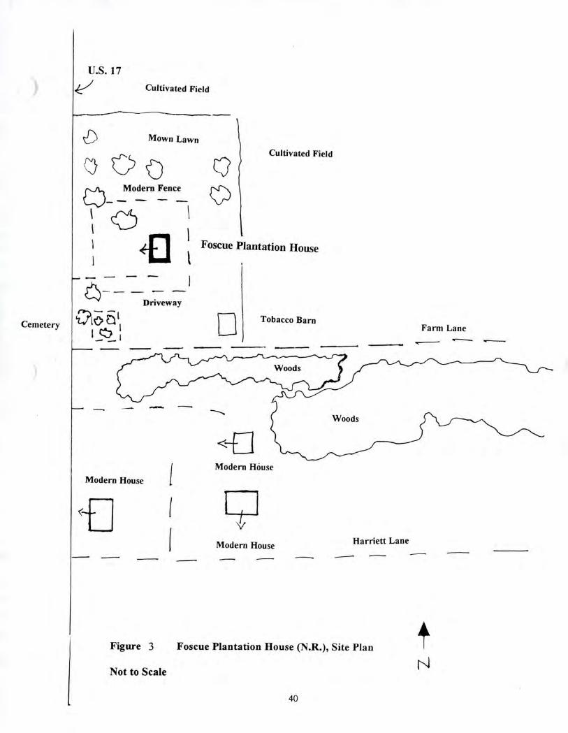
U.S. 17
Cultivated Field
II Mown Lawn
Cultivated Field
Q).
Modern Fence
Cemetery
••••-•--
Driveway
‘a-6 611
Foscue Plantation House
Tobacco Barn Farm Lane
Woods
*El
Modern House Modern House
C;1 Modern House Harriett Lane
Figure 3 Foscue Plantation House (N.R.), Site Plan
Not to Scale
40
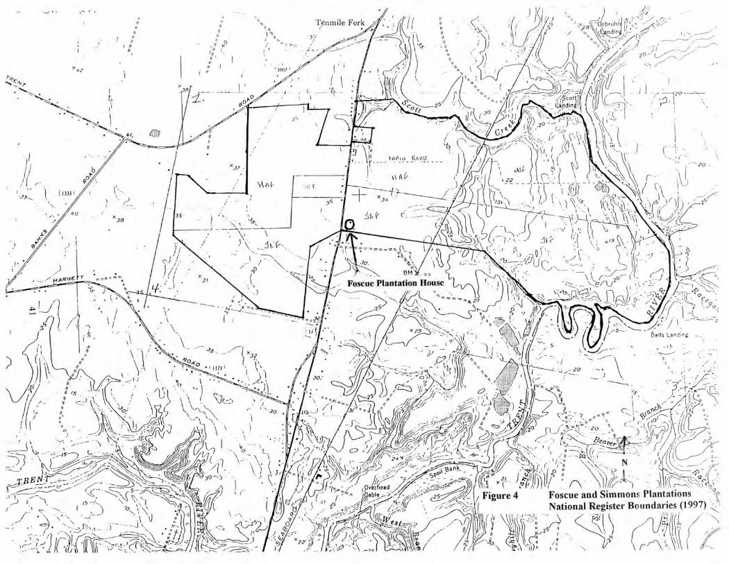
•
Tpnmile Fork
3
r •
1
, IOW
ebruhl ndin
11 "‘ ft
• •
ft
21
0
x„
1 z r
1
Jf 30
)4."i -__101td‘in
3
(•\
x„ 35
0 ,•\
Foscue Plantation House
I
/ (
.1i
..7-\\I-:,
."-•\ ,- ) 1,ii 1 — ,c x 9 4.)
, I
(' T-1 1‘3 1111
— ' -- ', ,_
\ r---'20 t (.3 ,....-- ... orti s•-;,,, )o.) .-,
-'''\ r.:.•.;.;-'s•\ • '': • .:;--P , ,r4 -._ .....— V : ..,,,
X 23
• 0
\s\'A
OvIf e(nead
j,abole • . 0 of
41-•
, ) —.-2- ,
/c, )./z•,,,--=,.- . --""/ .'/- k
m
--•.45.---- ---,..--:•--P tilt ..
.., 59°‘-
....,. --•---- ,.."/ -:.5.---5) ,....)
• s \••
••.—
- 6
bells Landirn
I5
0
1
,_ .,*
--)( ,,.
-1 ._._ * (-- r:•
i.)
\ • •
— ( _,,,.::, ..„:•, ;,,. "11,P' ,„: • , e
01,1))11 : iv • 10 2.1
Figure 4 Foscue and Simmons Plantations National Register Boundaries (1997)
( s ,..," l (ii ibl.:)1 5 11 1 ,f'flCk
* 43
\\-'—',10. (....:.4 C \ z. -'il i , II
/n
, t.. if • 25
27
\\'' • I •
a, 1,(1-Np.
AM I. I
" . ,•,,
-7
U.S. 17 Widening, Onslow and Jones Counties
Plate 1. Foscue Plantation House, Facade.
Plate 2. Foscue Plantation House, Facade and South Elevation.
42
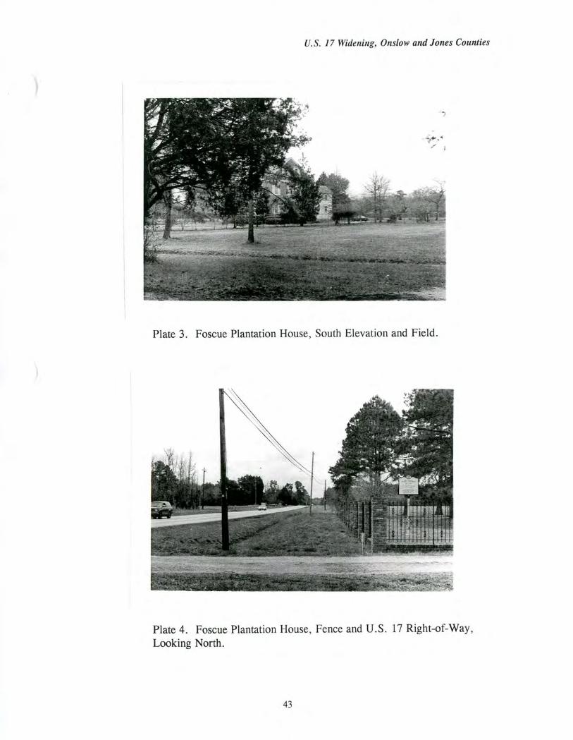
U.S. 17 Widening, Onslow and Jones Counties
Plate 3. Foscue Plantation House, South Elevation and Field.
Plate 4. Foscue Plantation House, Fence and U.S. 17 Right-of-Way, Looking North.
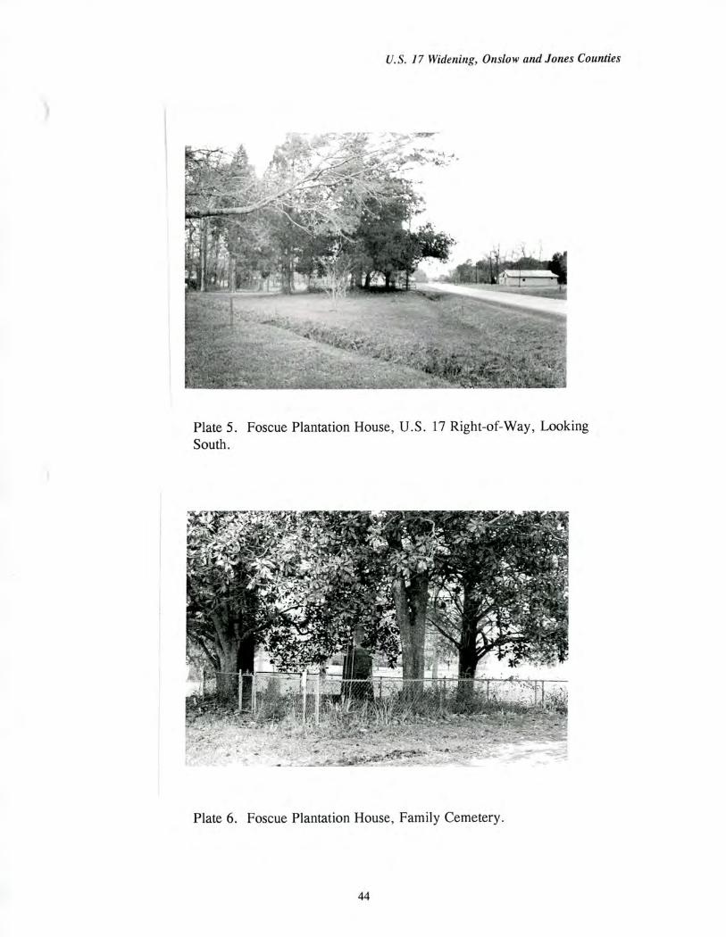
U.S. 17 Widening, Onslow and Jones Counties
Plate 5. Foscue Plantation House, U.S. 17 Right-of-Way, Looking South.
Plate 6. Foscue Plantation House, Family Cemetery.
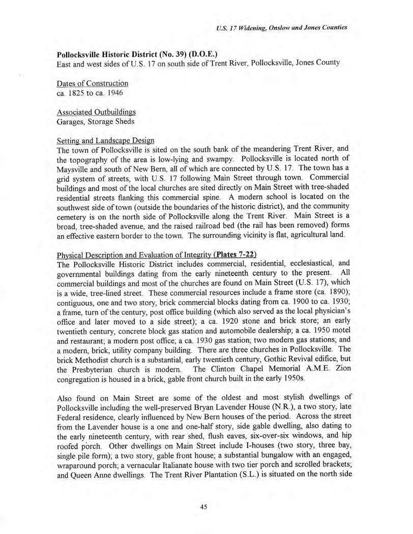
U.S. 17 Widening, Onslow and Jones Counties
Pollocksville Historic District (No. 39) (D.O.E.) East and west sides of U.S. 17 on south side of Trent River, Pollocksville, Jones County
Dates of Construction ca. 1825 to ca. 1946
Associated Outbuildings Garages, Storage Sheds
Setting and Landscape Design The town of Pollocksville is sited on the south bank of the meandering Trent River, and the topography of the area is low-lying and swampy. Pollocksville is located north of Maysville and south of New Bern, all of which are connected by U.S. 17. The town has a grid system of streets, with U.S. 17 following Main Street through town. Commercial buildings and most of the local churches are sited directly on Main Street with tree-shaded residential streets flanking this commercial spine. A modern school is located on the southwest side of town (outside the boundaries of the historic district), and the community cemetery is on the north side of Pollocksville along the Trent River. Main Street is a broad, tree-shaded avenue, and the raised railroad bed (the rail has been removed) forms an effective eastern border to the town. The surrounding vicinity is flat, agricultural land.
Physical Description and Evaluation of Integrity (Plates 7-22) The Pollocksville Historic District includes commercial, residential, ecclesiastical, and governmental buildings dating from the early nineteenth century to the present. All commercial buildings and most of the churches are found on Main Street (U.S. 17), which is a wide, tree-lined street. These commercial resources include a frame store (ca. 1890); contiguous, one and two story, brick commercial blocks dating from ca. 1900 to ca. 1930; a frame, turn of the century, post office building (which also served as the local physician's office and later moved to a side street); a ca. 1920 stone and brick store; an early twentieth century, concrete block gas station and automobile dealership; a ca. 1950 motel and restaurant; a modern post office; a ca. 1930 gas station; two modern gas stations; and a modern, brick, utility company building. There are three churches in Pollocksville. The brick Methodist church is a substantial, early twentieth century, Gothic Revival edifice, but the Presbyterian church is modern. The Clinton Chapel Memorial A.M.E. Zion congregation is housed in a brick, gable front church built in the early 1950s.
Also found on Main Street are some of the oldest and most stylish dwellings of Pollocksville including the well-preserved Bryan Lavender House (N.R.), a two story, late Federal residence, clearly influenced by New Bern houses of the period. Across the street from the Lavender house is a one and one-half story, side gable dwelling, also dating to the early nineteenth century, with rear shed, flush eaves, six-over-six windows, and hip roofed pOrch. Other dwellings on Main Street include I-houses (two story, three bay, single pile form); a two story, gable front house; a substantial bungalow with an engaged, wraparound porch; a vernacular Italianate house with two tier porch and scrolled brackets; and Queen Anne dwellings. The Trent River Plantation (S.L.) is situated on the north side
45
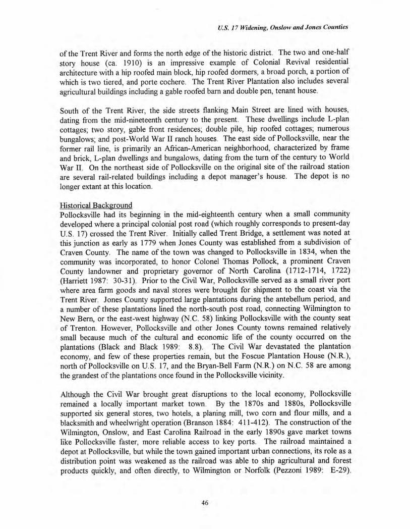
U.S. 17 Widening, Onslow and Jones Counties
of the Trent River and forms the north edge of the historic district. The two and one-half story house (ca. 1910) is an impressive example of Colonial Revival residential architecture with a hip roofed main block, hip roofed dormers, a broad porch, a portion of which is two tiered, and porte cochere. The Trent River Plantation also includes several agricultural buildings including a gable roofed barn and double pen, tenant house.
South of the Trent River, the side streets flanking Main Street are lined with houses, dating from the mid-nineteenth century to the present. These dwellings include L-plan cottages; two story, gable front residences; double pile, hip roofed cottages; numerous bungalows; and post-World War II ranch houses. The east side of Pollocksville, near the former rail line, is primarily an African-American neighborhood, characterized by frame and brick, L-plan dwellings and bungalows, dating from the turn of the century to World War II. On the northeast side of Pollocksville on the original site of the railroad station are several rail-related buildings including a depot manager's house. The depot is no longer extant at this location.
Historical Background Pollocksville had its beginning in the mid-eighteenth century when a small community developed where a principal colonial post road (which roughly corresponds to present-day U.S. 17) crossed the Trent River. Initially called Trent Bridge, a settlement was noted at this junction as early as 1779 when Jones County was established from a subdivision of Craven County. The name of the town was changed to Pollocksville in 1834, when the community was incorporated, to honor Colonel Thomas Pollock, a prominent Craven County landowner and proprietary governor of North Carolina (1712-1714, 1722) (Harriett 1987: 30-31). Prior to the Civil War, Pollocksville served as a small river port where area farm goods and naval stores were brought for shipment to the coast via the Trent River. Jones County supported large plantations during the antebellum period, and a number of these plantations lined the north-south post road, connecting Wilmington to New Bern, or the east-west highway (N.C. 58) linking Pollocksville with the county seat of Trenton. However, Pollocksville and other Jones County towns remained relatively small because much of the cultural and economic life of the county occurred on the plantations (Black and Black 1989: 8.8). The Civil War devastated the plantation economy, and few of these properties remain, but the Foscue Plantation House (N.R.), north of Pollocksville on U.S. 17, and the Bryan-Bell Farm (N.R.) on N.C. 58 are among the grandest of the plantations once found in the Pollocksville vicinity.
Although the Civil War brought great disruptions to the local economy, Pollocksville remained a locally important market town. By the 1870s and 1880s, Pollocksville supported six general stores, two hotels, a planing mill, two corn and flour mills, and a blacksmith and wheelwright operation (Branson 1884: 411-412). The construction of the Wilmington, Onslow, and East Carolina Railroad in the early 1890s gave market towns like Pollocksville faster, more reliable access to key ports. The railroad maintained a depot at Pollocksville, but while the town gained important urban connections, its role as a distribution point was weakened as the railroad was able to ship agricultural and forest products quickly, and often directly, to Wilmington or Norfolk (Pezzoni 1989: E-29).
46
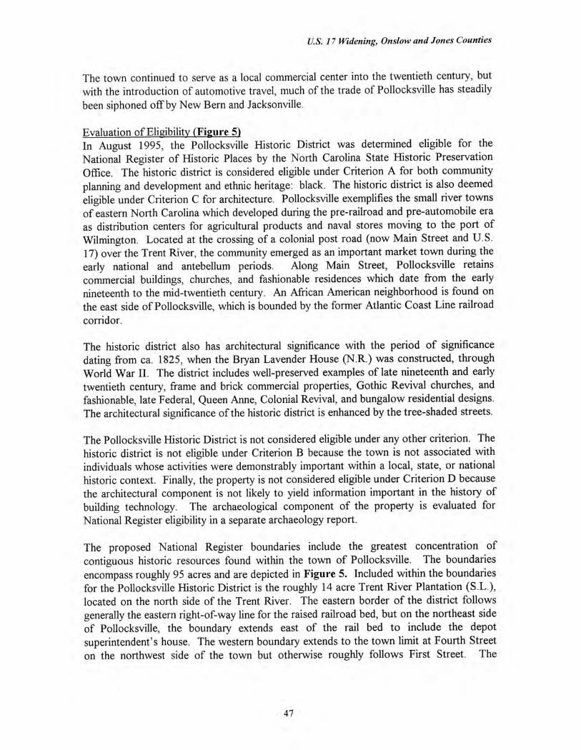
U.S. 17 Widening, Onslow and Jones Counties
The town continued to serve as a local commercial center into the twentieth century, but with the introduction of automotive travel, much of the trade of Pollocksville has steadily been siphoned off by New Bern and Jacksonville.
Evaluation of Eligibility (Figure 5) In August 1995, the Pollocksville Historic District was determined eligible for the National Register of Historic Places by the North Carolina State Historic Preservation Office. The historic district is considered eligible under Criterion A for both community planning and development and ethnic heritage: black. The historic district is also deemed eligible under Criterion C for architecture. Pollocksville exemplifies the small river towns of eastern North Carolina which developed during the pre-railroad and pre-automobile era as distribution centers for agricultural products and naval stores moving to the port of Wilmington. Located at the crossing of a colonial post road (now Main Street and U.S. 17) over the Trent River, the community emerged as an important market town during the early national and antebellum periods. Along Main Street, Pollocksville retains commercial buildings, churches, and fashionable residences which date from the early nineteenth to the mid-twentieth century. An African American neighborhood is found on the east side of Pollocksville, which is bounded by the former Atlantic Coast Line railroad corridor.
The historic district also has architectural significance with the period of significance dating from ca. 1825, when the Bryan Lavender House (N.R.) was constructed, through World War II. The district includes well-preserved examples of late nineteenth and early twentieth century, frame and brick commercial properties, Gothic Revival churches, and fashionable, late Federal, Queen Anne, Colonial Revival, and bungalow residential designs. The architectural significance of the historic district is enhanced by the tree-shaded streets.
The Pollocksville Historic District is not considered eligible under any other criterion. The historic district is not eligible under Criterion B because the town is not associated with individuals whose activities were demonstrably important within a local, state, or national historic context. Finally, the property is not considered eligible under Criterion D because the architectural component is not likely to yield information important in the history of building technology. The archaeological component of the property is evaluated for National Register eligibility in a separate archaeology report.
The proposed National Register boundaries include the greatest concentration of contiguous historic resources found within the town of Pollocksville. The boundaries encompass roughly 95 acres and are depicted in Figure 5. Included within the boundaries for the Pollocksville Historic District is the roughly 14 acre Trent River Plantation (S.L.), located on the north side of the Trent River. The eastern border of the district follows generally the eastern right-of-way line for the raised railroad bed, but on the northeast side of Pollocksville, the boundary extends east of the rail bed to include the depot superintendent's house. The western boundary extends to the town limit at Fourth Street on the northwest side of the town but otherwise roughly follows First Street. The
47

U.S. 17 Widening, Onslow and Jones Counties
southern boundary follows the rear lot lines of the properties facing Green Hill Street and Trent Street.
48
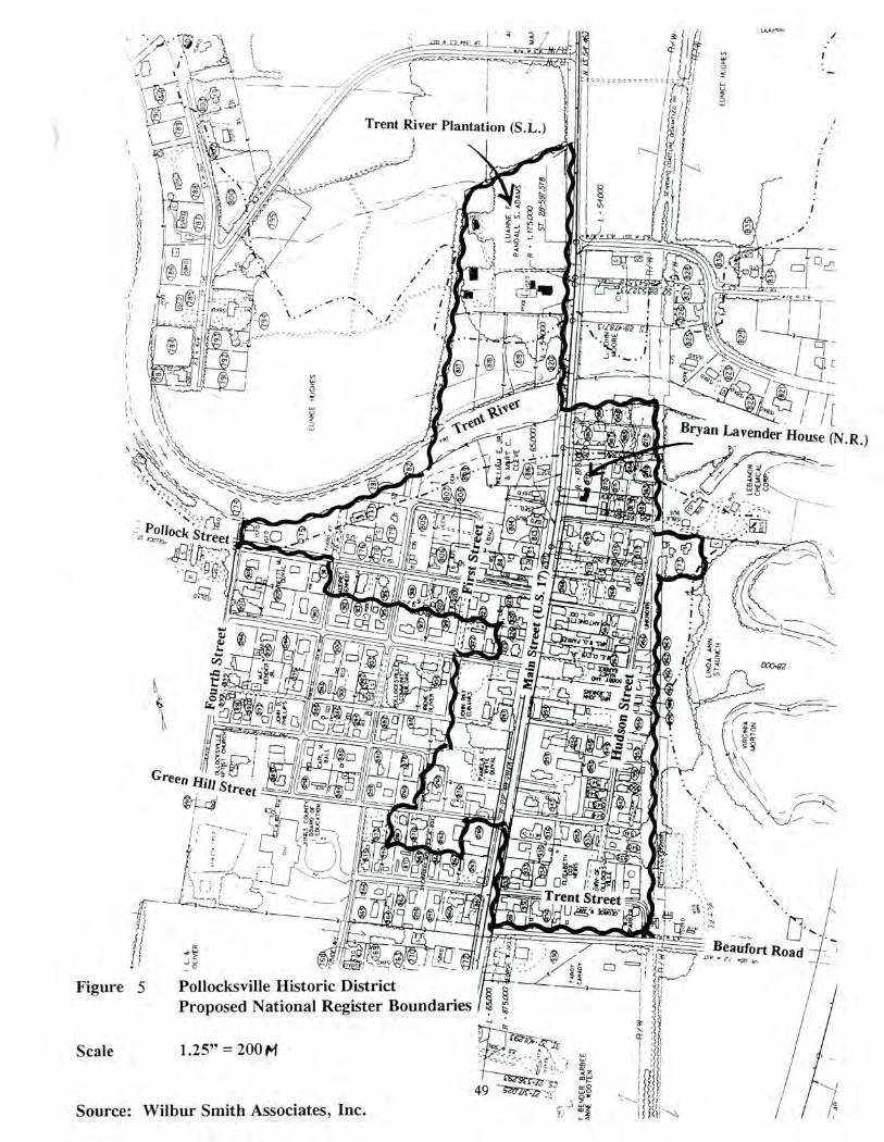
e_2 \\,;\ S.
Trent River Plantation (S.L.) /
EU
MC
E /1
. 1C
HE
S
=I
w I
1-7
I c
/ Bryan Lavender House (N.B.)
oiy.c3j
Road
Figure 5 Pollocksville Historic District Proposed National Register Boundaries
Scale 1.25" = 200 f/1
Source: Wilbur Smith Associates, Inc.
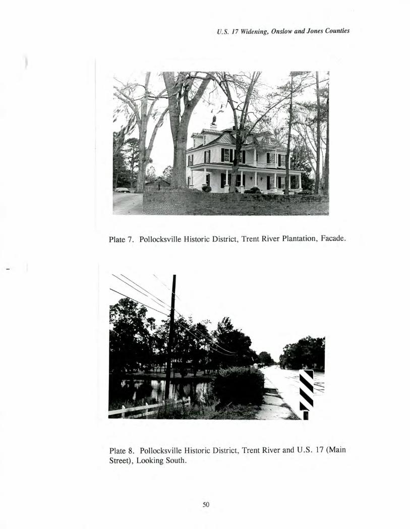
U.S. 17 Widening, Onslow and Jones Counties
Plate 7. Pollocksville Historic District, Trent River Plantation, Facade.
Plate 8. Pollocksville Historic District, Trent River and U.S. 17 (Main Street), Looking South.
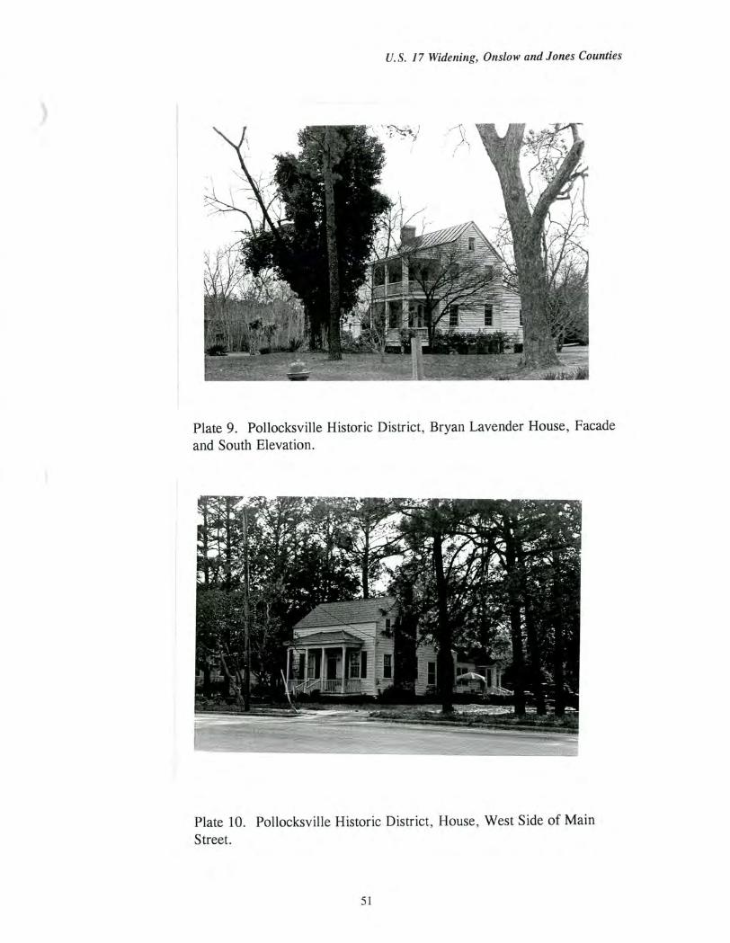
U.S. 17 Widening, Onslow and Jones Counties
Plate 9. Pollocksville Historic District, Bryan Lavender House, Facade and South Elevation.
Plate 10. Pollocksville Historic District, House, West Side of Main Street.
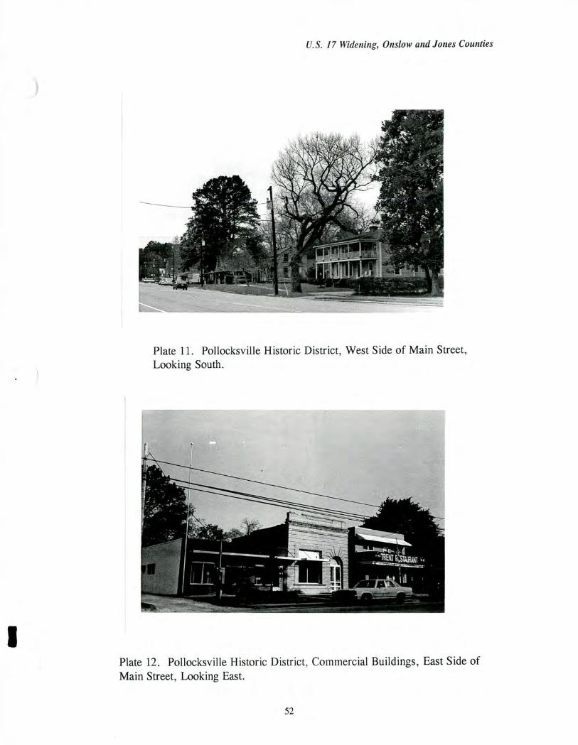
U.S. 17 Widening, Onslow and Jones Counties
Plate 11. Pollocksville Historic District, West Side of Main Street, Looking South.
Plate 12. Pollocicsville Historic District, Commercial Buildings, East Side of Main Street, Looking East.
52
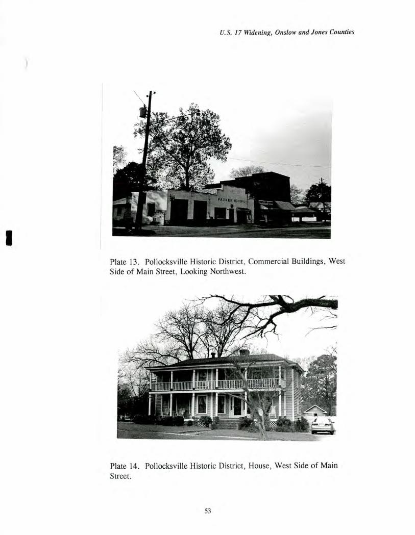
- kr' I ig atif
vi....1,7Nosoirts2otia
U.S. 17 Widening, Onslow and Jones Counties
Plate 13. Pollocksville Historic District, Commercial Buildings, West Side of Main Street, Looking Northwest.
Plate 14. Pollocksville Historic District, House, West Side of Main Street.
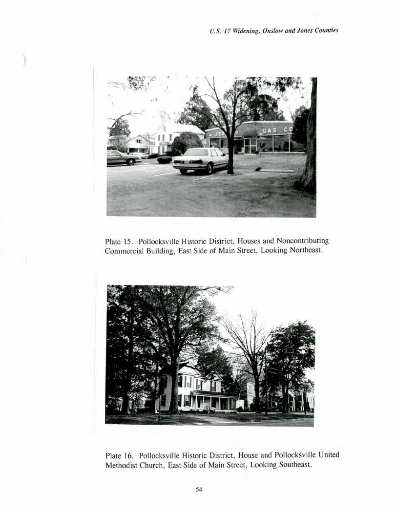
U.S. 17 Widening, Onslow and Jones Counties
Plate 15. Pollocksville Historic District, Houses and Noncontributing Commercial Building, East Side of Main Street, Looking Northeast.
Plate 16. Pollocksville Historic District, House and Pollocksville United Methodist Church, East Side of Main Street, Looking Southeast.
54
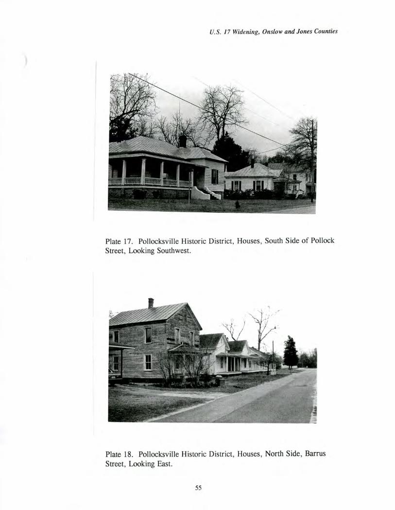
'iffilfiffP ffffflifft
U.S. 17 Widening, Onslow and Jones Counties
Plate 17. Pollocksville Historic District, Houses, South Side of Pollock Street, Looking Southwest.
Plate 18. Pollocksville Historic District, Houses, North Side, Barrus Street, Looking East.
55
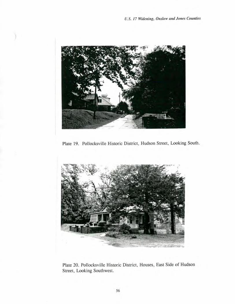
U.S. 17 Widening, Onslow and Jones Counties
Plate 19. Pollocksville Historic District, Hudson Street, Looking South.
Plate 20. Pollocksville Historic District, Houses, East Side of Hudson Street, Looking Southwest.
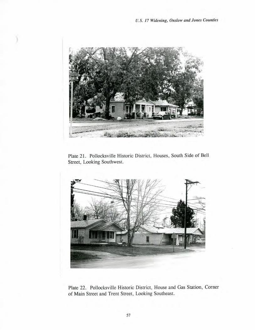
U.S. 17 Widening, Onslow and Jones Counties
Plate 21. Pollocksville Historic District, Houses, South Side of Bell Street, Looking Southwest.
Plate 22. Pollocksville Historic District, House and Gas Station, Corner of Main Street and Trent Street, Looking Southeast.
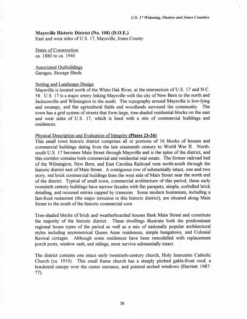
U.S. 17 Widening, Onslow and Jones Counties
Maysville Historic District (No. 108) (D.O.E.) East and west sides of U.S 17, Maysville, Jones County
Dates of Construction ca. 1880 to ca. 1946
Associated Outbuildings Garages, Storage Sheds
Setting and Landscape Design Maysville is located north of the White Oak River, at the intersection of U.S. 17 and N.C. 58. U.S. 17 is a major artery linking Maysville with the city of New Bern to the north and Jacksonville and Wilmington to the south. The topography around Maysville is low-lying and swampy, and flat agricultural fields and woodlands surround the community. The town has a grid system of streets that form large, tree-shaded residential blocks on the east and west sides of U.S. 17, which is lined with a mix of commercial buildings and residences.
Physical Description and Evaluation of Integrity (Plates 23-26) This small town historic district comprises all or portions of 16 blocks of houses and commercial buildings dating from the late nineteenth century to World War II. North-south U.S. 17 becomes Main Street through Maysville and is the spine of the district, and this corridor contains both commercial and residential real estate. The former railroad bed of the Wilmington, New Bern, and East Carolina Railroad runs north-south through the historic district east of Main Street. A contiguous row of substantially intact, one and two story, red brick commercial buildings lines the west side of Main Street near the north end of the district. Typical of small town, commercial architecture of this period, these early twentieth century buildings have narrow facades with flat parapets, simple, corbelled brick detailing, and recessed entries capped by transoms. Some modern businesses, including a fast-food restaurant (the major intrusion in this historic district), are situated along Main Street to the south of the historic commercial core.
Tree-shaded blocks of brick and weatherboarded houses flank Main Street and constitute the majority of the historic district. These dwellings illustrate both the predominant regional house types of the period as well as a mix of nationally popular architectural styles including asymmetrical Queen Anne residences, simple bungalows, and Colonial Revival cottages. Although some residences have been remodelled with replacement porch posts, window sash, and sidings, most survive substantially intact.
The district contains one intact early twentieth-century church, Holy Innocents Catholic Church (ca. 1910). This small frame church has a steeply pitched gable-front roof, a bracketed canopy over the center entrance, and pointed arched windows (Harriett 1987: 77).
58
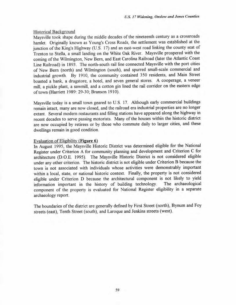
U.S. 17 Widening, Onslow and Jones Counties
Historical Background Maysville took shape during the middle decades of the nineteenth century as a crossroads hamlet. Originally known as Young's Cross Roads, the settlement was established at the junction of the King's Highway (U.S. 17) and an east-west road linking the county seat of Trenton to Stella, a small landing on the White Oak River. Maysville prospered with the coming of the Wilmington, New Bern, and East Carolina Railroad (later the Atlantic Coast Line Railroad) in 1893. The north-south rail line connected Maysville with the port cities of New Bern (north) and Wilmington (south), and spurred small-scale commercial and industrial growth. By 1910, the community contained 350 residents, and Main Street boasted a bank, a drugstore, a hotel, and seven general stores. A cooperage, a veneer mill, a pickle plant, a sawmill, and a cotton gin lined the rail corridor on the eastern edge of town (Harriett 1989: 29-30; Branson 1910).
Maysville today is a small town geared to U.S. 17. Although early commercial buildings remain intact, many are now closed, and the railroad era industrial properties are no longer extant. Several modern restaurants and filling stations have appeared along the highway in recent decades to serve passing motorists. Many of the houses within the historic district are now occupied by retirees or by those who commute daily to larger cities, and these dwellings remain in good condition.
Evaluation of Eligibility (Figure 6) In August 1995, the Maysville Historic District was determined eligible for the National Register under Criterion A for community planning and development and Criterion C for architecture (D.O.E. 1995). The Maysville Historic District is not considered eligible under any other criterion. The historic district is not eligible under Criterion B because the town is not associated with individuals whose activities were demonstrably important within a local, state, or national historic context. Finally, the property is not considered eligible under Criterion D because the architectural component is not likely to yield information important in the history of building technology. The archaeological component of the property is evaluated for National Register eligibility in a separate archaeology report.
The boundaries of the district are generally defined by First Street (north), Bynum and Foy streets (east), Tenth Street (south), and Laroque and Jenkins streets (west).
59
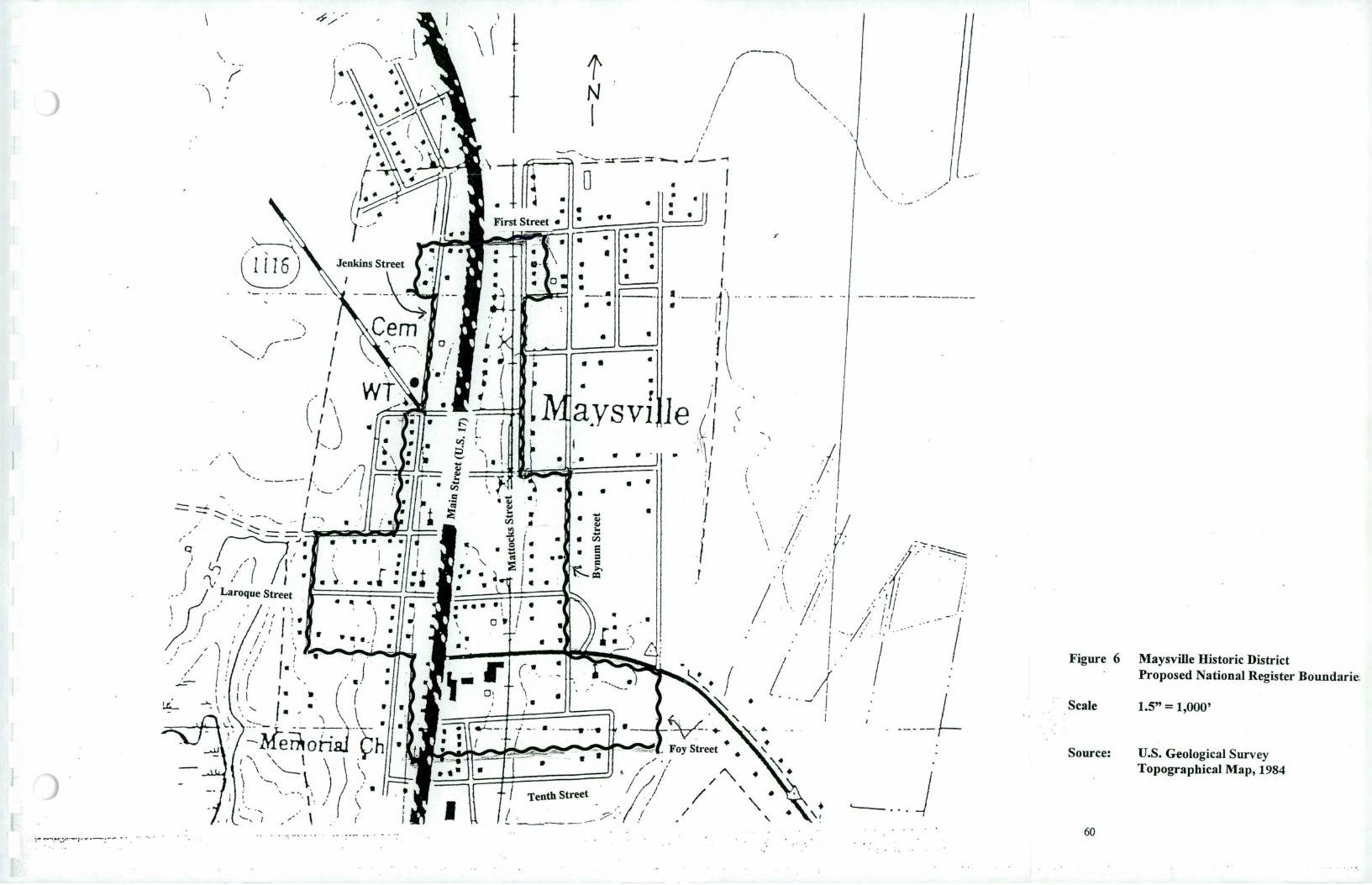
5/
a
- •
• •
•
•
a a
•
•
a is
is • •
a •
a
•
/
•-
_
-.
11
__ a •
, ii
_ ,5
`,.._
1/
i
a ' -
r-, 'N
//: •
,-
i,
,
,;., g
/ ,..
. u,
1 /,'
1 ,_
, .
i r,
_.
.
_ L I I
,. ,
. .
. .
_ .
,
-'--'S--
-...,.....
_,,-----
' •
: $1.1
•
• •
•
••••••
••••••
••
••••••
•••
•
CD
\ •
•
• •
s- •
• •,
• '
• co
d
sr—
sr
as-4-
UI
Mai
n St
reet
(U.S
. 17)
/
a
Matt
_oc_
Its, St
reet
4
a 4
,)
•
•
a a.
•
71—
I
a •
a
Bynu
m st
reet
•
•
II • •
cA
co
0
D3
g
g
PC
. c
o
C'
co
0
to
ON
• •
w g
.
t., ,D
CM
r+
n
, D
I 1/4 .o
cm
.- •
oo
I -4
- .1
tiV
0
0
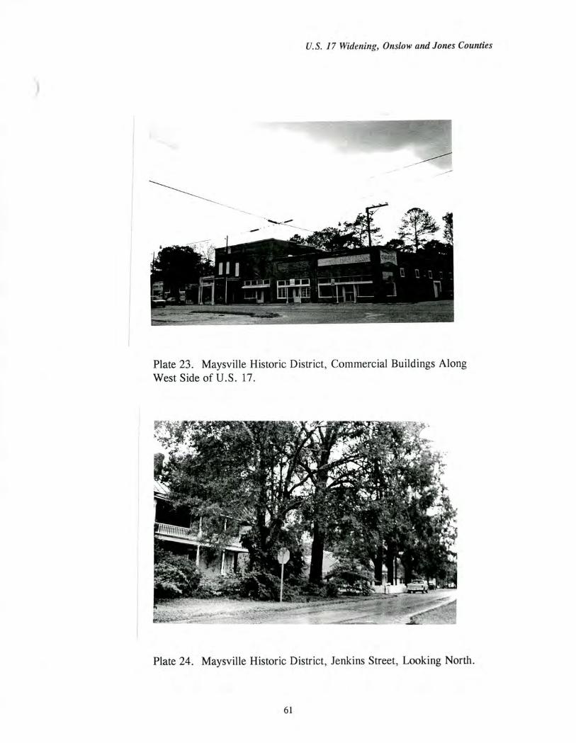
U.S. 17 Widening, Onslow and Jones Counties
Plate 23. Maysville Historic District, Commercial Buildings Along West Side of U.S. 17.
Plate 24. Maysville Historic District, Jenkins Street, Looking North.
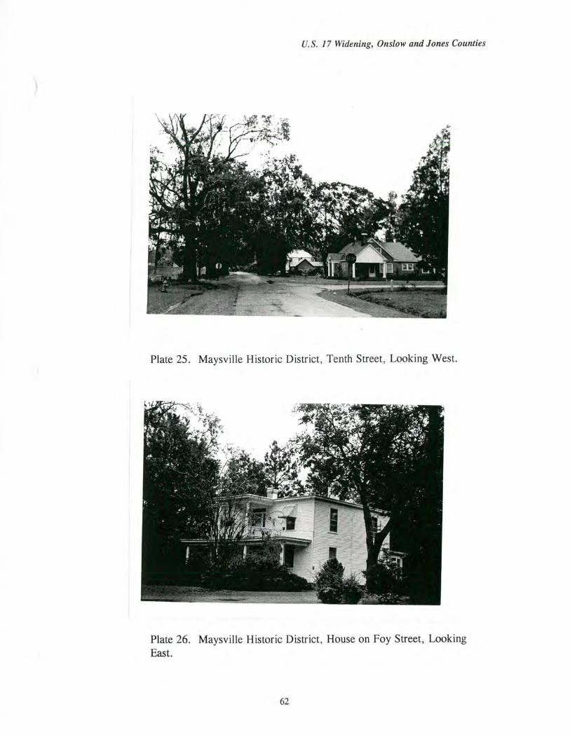
U.S. 17 Widening, Onslow and Jones Counties
Plate 25. Maysville Historic District, Tenth Street, Looking West.
Plate 26. Maysville Historic District, House on Foy Street, Looking East.
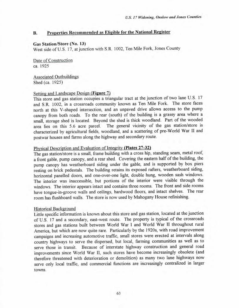
US. 17 Widening, Onslow and Jones Counties
B. Properties Recommended as Eligible for the National Register
Gas Station/Store (No. 13) West side of U.S. 17, at junction with S.R. 1002, Ten Mile Fork, Jones County
Date of Construction ca. 1925
Associated Outbuildings Shed (ca. 1925)
Setting and Landscape Design (Figure 7) This store and gas station occupies a triangular tract at the junction of two lane U.S. 17 and S.R. 1002, in a crossroads community known as Ten Mile Fork. The store faces north at this V-shaped intersection, and an unpaved drive allows access to the pump canopy from both roads. To the rear (south) of the building is a grassy area where a small, storage shed is located. Beyond the shed is thick woodland. Part of the wooded area lies on this 5.6 acre parcel. The general vicinity of the gas station/store is characterized by agricultural fields, woodland, and a scattering of pre-World War II and postwar houses and farms along the highway and secondary route.
Physical Description and Evaluation of Integrity (Plates 27-32) The gas station/store is a small, frame building with a cross hip, standing seam, metal roof, a front gable, pump canopy, and a rear shed. Covering the eastern half of the building, the pump canopy has weatherboard siding under the gable, and is supported by box piers resting on brick pedestals. The building retains its exposed rafters, weatherboard siding, horizontal panelled doors, and one-over-one light, double hung, wooden sash windows. The interior was inaccessible, but portions of the interior were visible through the windows. The interior appears intact and contains three rooms. The front and side rooms have tongue-in-groove walls and ceilings, hardwood floors, and intact shelves. The rear room has flushboard walls. The store is now used by Mahogany House refinishing.
Historical Background Little specific information is known about this store and gas station, located at the junction of U.S. 17 and a secondary, east-west route. The property is typical of the crossroads stores and gas stations built between World War I and World War II throughout rural America, but which are now quite rare. Particularly by the 1920s, with road improvement campaigns and increasing automotive traffic, small stores were erected at intervals along country highways to serve the dispersed, but local, farming communities as well as to serve those in transit. Because of interstate highway construction and general road improvements since World War II, such stores have become increasingly obsolete (and therefore threatened with deterioration or demolition) as many two lane highways now serve only local traffic, and commercial functions are increasingly centralized in larger towns.
63
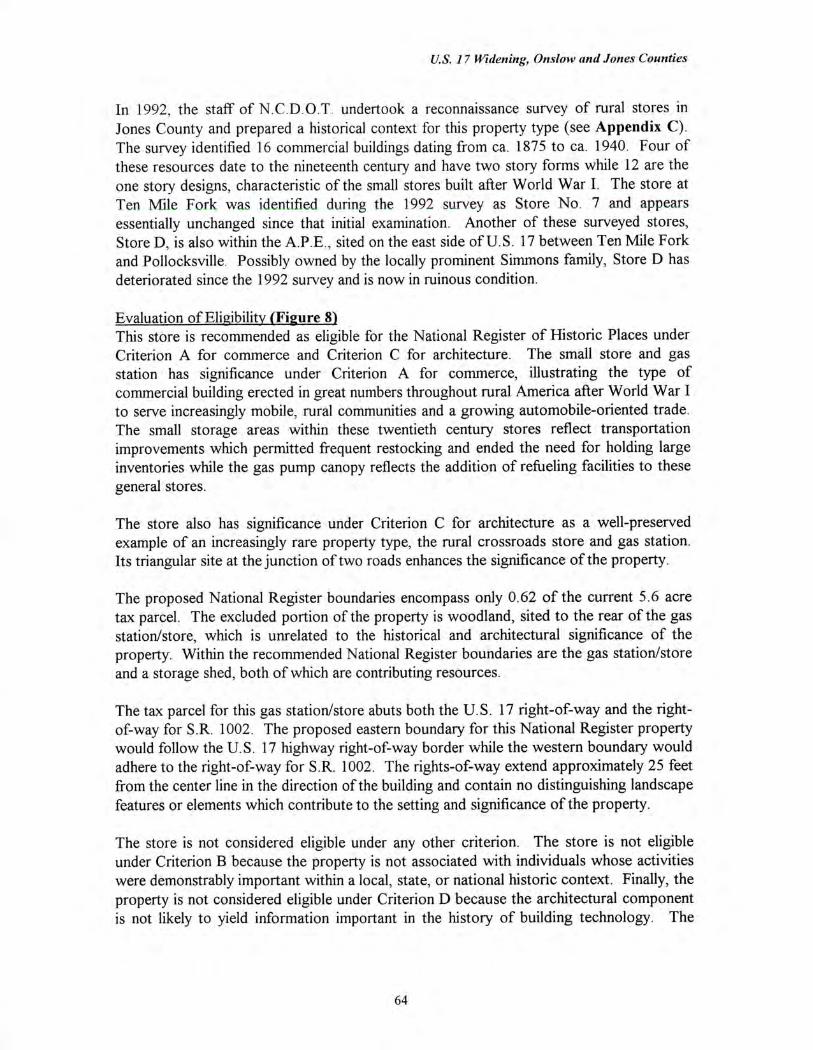
U.S. 17 Widening, Onslow and Jones Counties
In 1992, the staff of N.C.D.O.T. undertook a reconnaissance survey of rural stores in Jones County and prepared a historical context for this property type (see Appendix C). The survey identified 16 commercial buildings dating from ca. 1875 to ca. 1940. Four of these resources date to the nineteenth century and have two story forms while 12 are the one story designs, characteristic of the small stores built after World War I. The store at Ten Mile Fork was identified during the 1992 survey as Store No. 7 and appears essentially unchanged since that initial examination. Another of these surveyed stores, Store D, is also within the A.P.E., sited on the east side of U.S. 17 between Ten Mile Fork and Pollocksville. Possibly owned by the locally prominent Simmons family, Store D has deteriorated since the 1992 survey and is now in ruinous condition.
Evaluation of Eligibility (Figure 8) This store is recommended as eligible for the National Register of Historic Places under Criterion A for commerce and Criterion C for architecture. The small store and gas station has significance under Criterion A for commerce, illustrating the type of commercial building erected in great numbers throughout rural America after World War I to serve increasingly mobile, rural communities and a growing automobile-oriented trade. The small storage areas within these twentieth century stores reflect transportation improvements which permitted frequent restocking and ended the need for holding large inventories while the gas pump canopy reflects the addition of refueling facilities to these general stores.
The store also has significance under Criterion C for architecture as a well-preserved example of an increasingly rare property type, the rural crossroads store and gas station. Its triangular site at the junction of two roads enhances the significance of the property.
The proposed National Register boundaries encompass only 0.62 of the current 5.6 acre tax parcel. The excluded portion of the property is woodland, sited to the rear of the gas station/store, which is unrelated to the historical and architectural significance of the property. Within the recommended National Register boundaries are the gas station/store and a storage shed, both of which are contributing resources.
The tax parcel for this gas station/store abuts both the U.S. 17 right-of-way and the right-of-way for S.R. 1002. The proposed eastern boundary for this National Register property would follow the U.S. 17 highway right-of-way border while the western boundary would adhere to the right-of-way for S.R. 1002. The rights-of-way extend approximately 25 feet from the center line in the direction of the building and contain no distinguishing landscape features or elements which contribute to the setting and significance of the property.
The store is not considered eligible under any other criterion. The store is not eligible under Criterion B because the property is not associated with individuals whose activities were demonstrably important within a local, state, or national historic context. Finally, the property is not considered eligible under Criterion D because the architectural component is not likely to yield information important in the history of building technology. The
64

U.S. 17 Widening, Onslow and Jones Counties
archaeological component of the property is evaluated for National Register eligibility in a separate archaeology report.
65
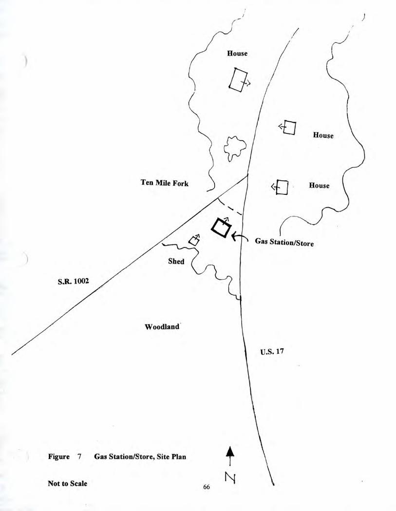
House
House
Ten Mile Fork <I] House
Gas Station/Store
S.R. 1002
Woodland'
U.S. 17
Figure 7 Gas Station/Store, Site Plan
Not to Scale N 66
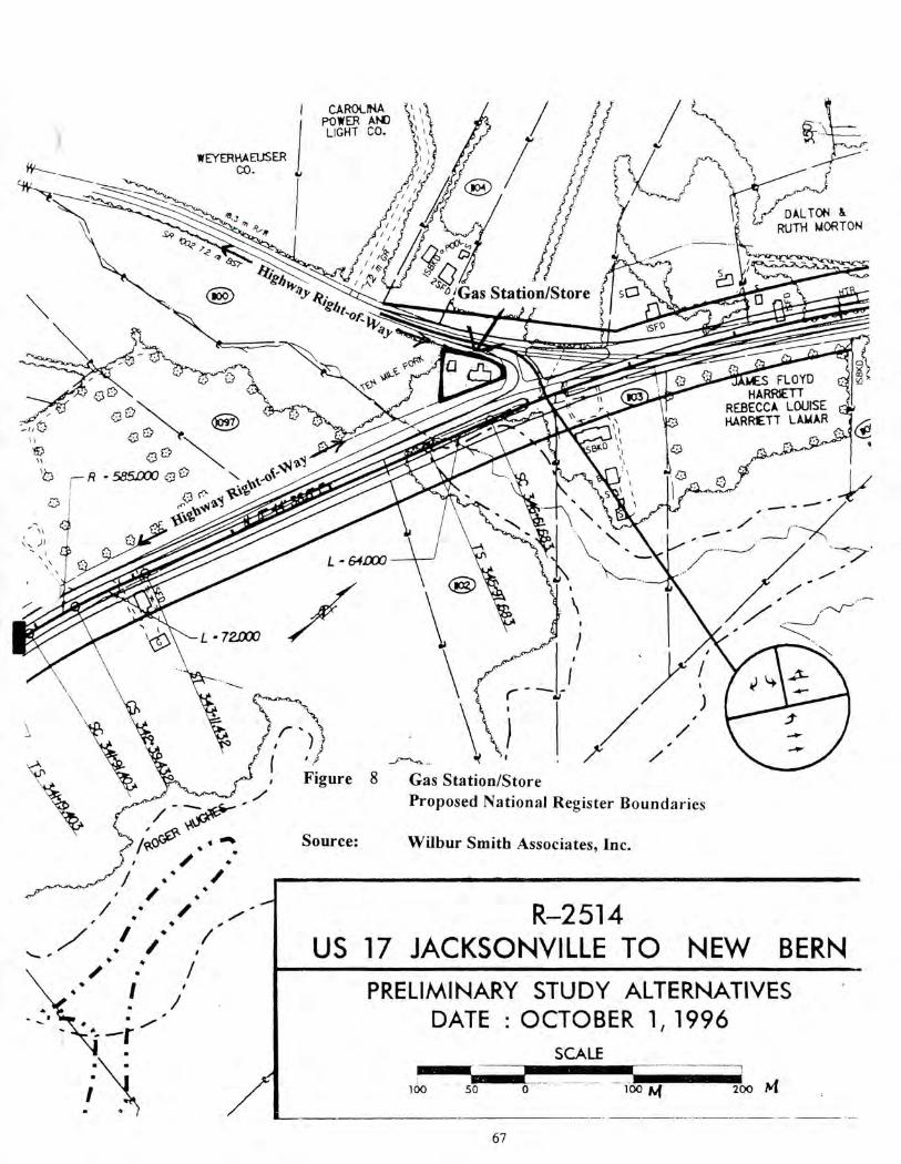
'Gas Station/Store
L - 64.0X
L - 72E00
/ _
/ 4 ,/
I WEYERHAEUSER CO.
CARO(RA POWER AM) LIGHT CO.
DALTON & RUTH MORTON
op o
(&) El)'
- 585.CCV
'C3 ‘‘2,4.1614
Figure 8 Gas Station/Store Proposed National Register Boundaries
R-2514 US 17 JACKSONVILLE TO NEW BERN
PRELIMINARY STUDY ALTERNATIVES DATE : OCTOBER 1, 1996
SCALE
100 50
Source: Wilbur Smith Associates, Inc. i'ikec'T . I Ill' I
I , I .4
/44 I
200 hi
67
U.S. 17 Widening, Onslow and Jones Counties
Plate 27. Gas Station/Store, Junction of U.S. 17 and S.R. 1002, Looking South.
Plate 28. Gas Station/Store, Facade.
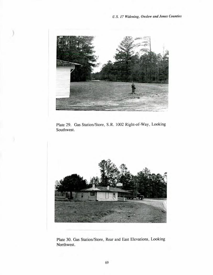
U.S. 17 Widening, Onslow and Jones Counties
Plate 29. Gas Station/Store, S.R. 1002 Right-of-Way, Looking Southwest.
Plate 30. Gas Station/Store, Rear and East Elevations, Looking Northwest.
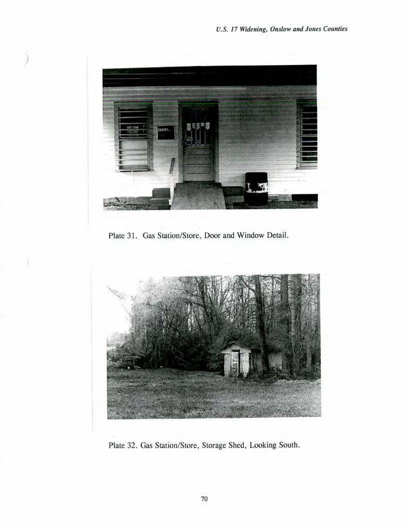
U.S. 17 Widening, Onslow and Jones Counties
Plate 31. Gas Station/Store, Door and Window Detail.
Plate 32. Gas Station/Store, Storage Shed, Looking South.
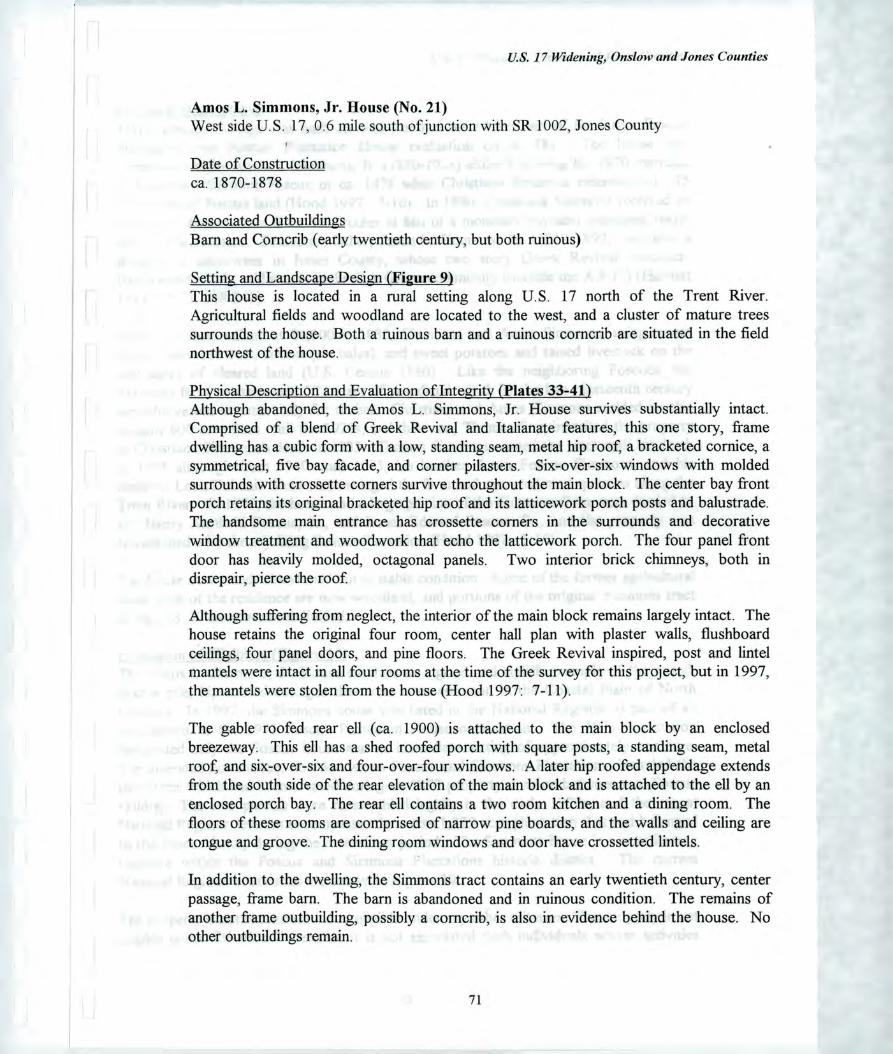
U.S. 17 Widening, Onslow and Jones Counties
Amos L. Simmons, Jr. House (No. 21) West side U.S. 17, 0.6 mile south of junction with SR 1002, Jones County
Date of Construction ca. 1870-1878
Associated Outbuildings Barn and Corncrib (early twentieth century, but both ruinous)
Setting and Landscape Design (Figure 9) This house is located in a rural setting along U.S. 17 north of the Trent River. Agricultural fields and woodland are located to the west, and a cluster of mature trees surrounds the house. Both a ruinous barn and a ruinous corncrib are situated in the field northwest of the house.
Physical Description and Evaluation of Integrity (Plates 33-41) Although abandoned, the Amos L. Simmons, Jr. House survives substantially intact. Comprised of a blend of Greek Revival and Italianate features, this one story, frame dwelling has a cubic form with a low, standing seam, metal hip roof, a bracketed cornice, a symmetrical, five bay facade, and corner pilasters. Six-over-six windows with molded surrounds with crossette corners survive throughout the main block. The center bay front porch retains its original bracketed hip roof and its latticework porch posts and balustrade. The handsome main entrance has crossette corners in the surrounds and decorative window treatment and woodwork that echo the latticework porch. The four panel front door has heavily molded, octagonal panels. Two interior brick chimneys, both in disrepair, pierce the roof
Although suffering from neglect, the interior of the main block remains largely intact. The house retains the original four room, center hall plan with plaster walls, flushboard ceilings, four panel doors, and pine floors. The Greek Revival inspired, post and lintel mantels were intact in all four rooms at the time of the survey for this project, but in 1997, the mantels were stolen from the house (Hood 1997: 7-11).
The gable roofed rear ell (ca. 1900) is attached to the main block by an enclosed breezeway. This ell has a shed roofed porch with square posts, a standing seam, metal roof, and six-over-six and four-over-four windows. A later hip roofed appendage extends from the south side of the rear elevation of the main block and is attached to the ell by an enclosed porch bay. The rear ell contains a two room kitchen and a dining room. The floors of these rooms are comprised of narrow pine boards, and the walls and ceiling are tongue and groove. The dining room windows and door have crossetted lintels.
In addition to the dwelling, the Simmons tract contains an early twentieth century, center passage, frame barn. The barn is abandoned and in ruinous condition. The remains of another frame outbuilding, possibly a corncrib, is also in evidence behind the house. No other outbuildings remain.
71
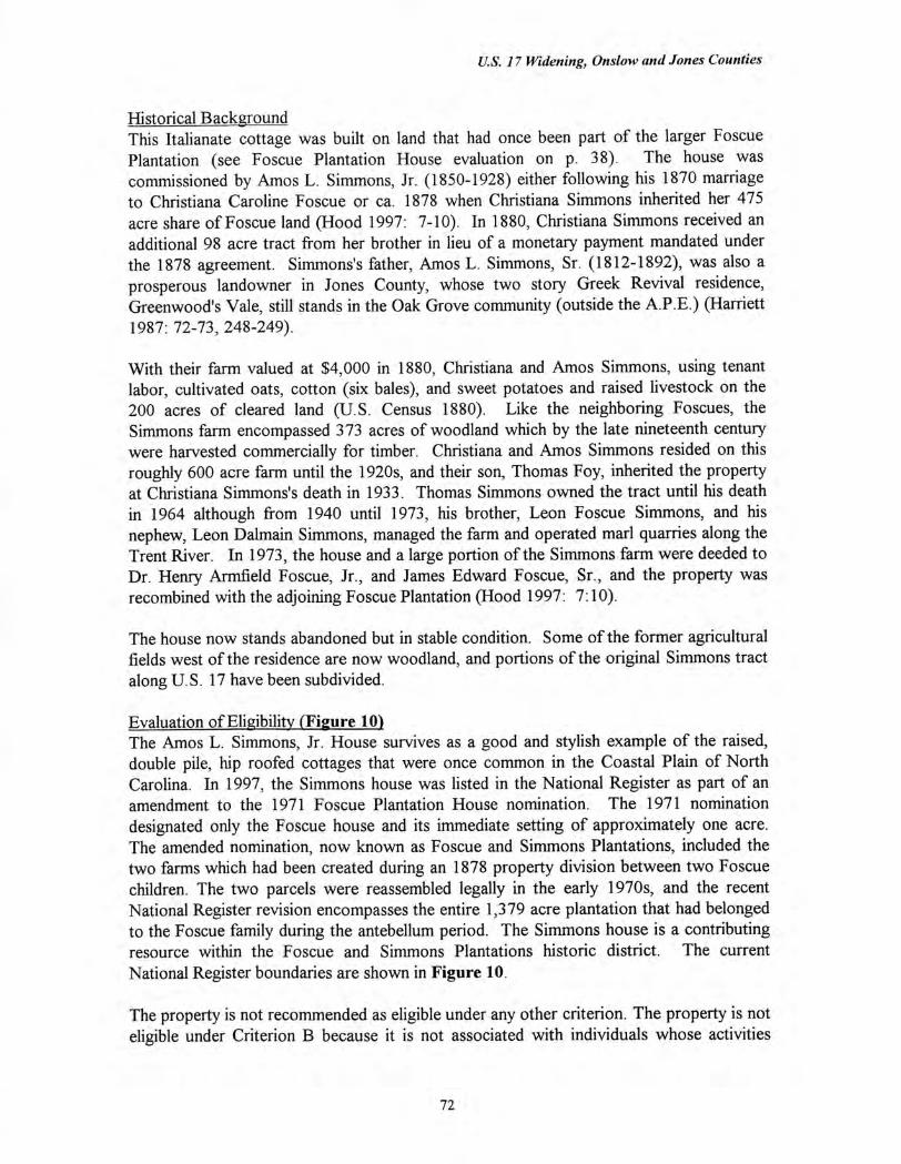
U.S. 17 Widening, Onslow and Jones Counties
Historical Background This Italianate cottage was built on land that had once been part of the larger Foscue Plantation (see Foscue Plantation House evaluation on p. 38). The house was commissioned by Amos L. Simmons, Jr. (1850-1928) either following his 1870 marriage to Christiana Caroline Foscue or ca. 1878 when Christiana Simmons inherited her 475 acre share of Foscue land (Hood 1997: 7-10). In 1880, Christiana Simmons received an additional 98 acre tract from her brother in lieu of a monetary payment mandated under the 1878 agreement. Simmons's father, Amos L. Simmons, Sr. (1812-1892), was also a prosperous landowner in Jones County, whose two story Greek Revival residence, Greenwood's Vale, still stands in the Oak Grove community (outside the A.P.E.) (Harriett 1987: 72-73, 248-249).
With their farm valued at $4,000 in 1880, Christiana and Amos Simmons, using tenant labor, cultivated oats, cotton (six bales), and sweet potatoes and raised livestock on the 200 acres of cleared land (U.S. Census 1880). Like the neighboring Foscues, the Simmons farm encompassed 373 acres of woodland which by the late nineteenth century were harvested commercially for timber. Christiana and Amos Simmons resided on this roughly 600 acre farm until the 1920s, and their son, Thomas Foy, inherited the property at Christiana Simmons's death in 1933. Thomas Simmons owned the tract until his death in 1964 although from 1940 until 1973, his brother, Leon Foscue Simmons, and his nephew, Leon Dalmain Simmons, managed the farm and operated marl quarries along the Trent River. In 1973, the house and a large portion of the Simmons farm were deeded to Dr. Henry Armfield Foscue, Jr., and James Edward Foscue, Sr., and the property was recombined with the adjoining Foscue Plantation (Hood 1997: 7:10).
The house now stands abandoned but in stable condition. Some of the former agricultural fields west of the residence are now woodland, and portions of the original Simmons tract along U.S. 17 have been subdivided.
Evaluation of Eligibility (Figure 10) The Amos L. Simmons, Jr. House survives as a good and stylish example of the raised, double pile, hip roofed cottages that were once common in the Coastal Plain of North Carolina. In 1997, the Simmons house was listed in the National Register as part of an amendment to the 1971 Foscue Plantation House nomination. The 1971 nomination designated only the Foscue house and its immediate setting of approximately one acre. The amended nomination, now known as Foscue and Simmons Plantations, included the two farms which had been created during an 1878 property division between two Foscue children. The two parcels were reassembled legally in the early 1970s, and the recent National Register revision encompasses the entire 1,379 acre plantation that had belonged to the Foscue family during the antebellum period. The Simmons house is a contributing resource within the Foscue and Simmons Plantations historic district. The current National Register boundaries are shown in Figure 10.
The property is not recommended as eligible under any other criterion. The property is not eligible under Criterion B because it is not associated with individuals whose activities
72
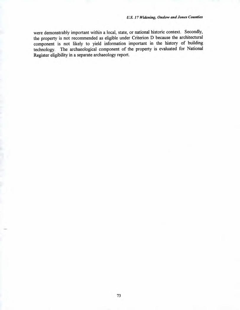
U.S. 17 Widening, Onslow and Jones Counties
were demonstrably important within a local, state, or national historic context. Secondly, the property is not recommended as eligible under Criterion D because the architectural component is not likely to yield information important in the history of building technology. The archaeological component of the property is evaluated for National Register eligibility in a separate archaeology report.
73
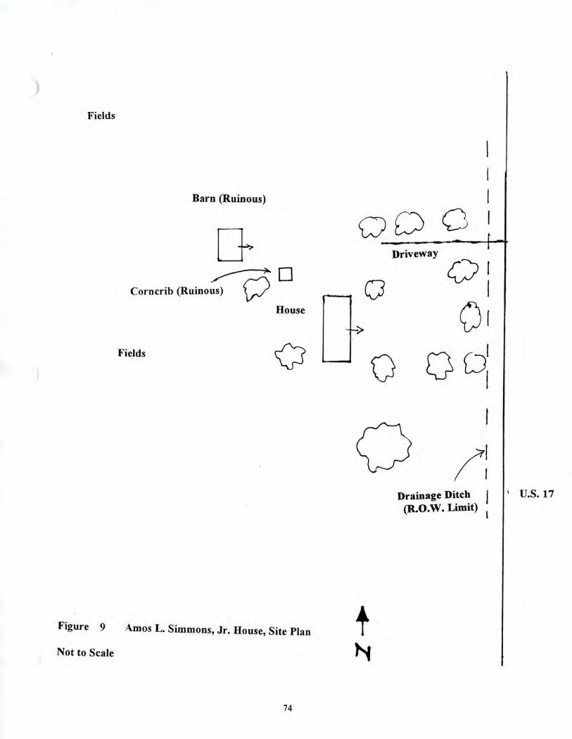
Driveway
a
Fields
Barn (Ruinous)
0
Corncrib (Ruinous)
House
Fields CC-2
Drainage Ditch 1 (R.O.W. Limit)
Figure 9 Amos L. Simmons, Jr. House, Site Plan
Not to Scale
U.S. 17
74
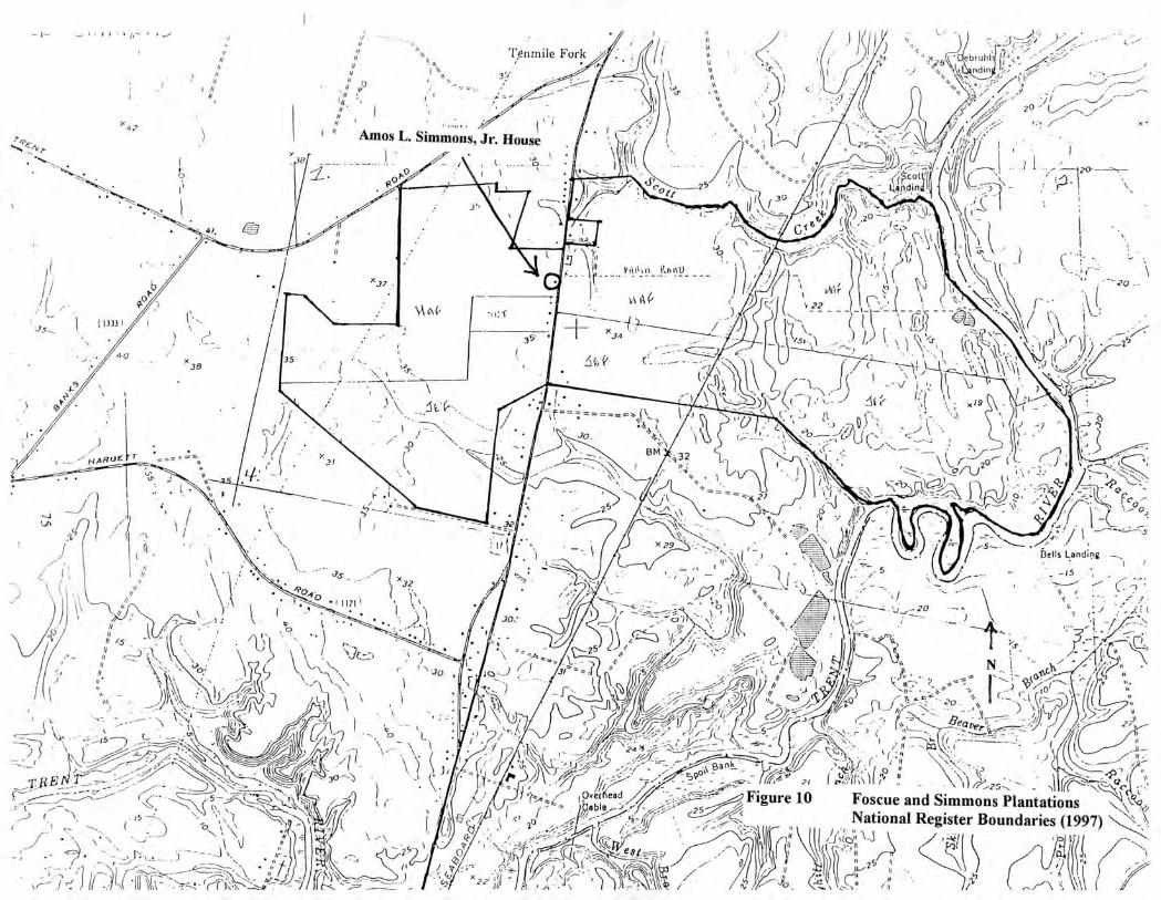
"4( ebrud ndin
;
x,
'I:
38
\\\
bells Landng ;
a • - ; / •
'
•• • -0.--
—
I, I
31
x*2 7,,
1 • 11 1 b.•• • •
4-
csJ
• 35 •
\
N. 7' •
_ --
1 • N.,
Tenmile Forl.c /I
• I, •
" Amos L. Simmons, Jr. House
' .1.. '
\(-
3 5
:„..... \_or;--.1. j2o'-' ( (1.1
1
, - --
•
-- ----
. 4 • 1 i• a .„_ r.r..= ._ • k; •
1 f 3' •• CS"b)0C:;?.-i." ...\ ...' : • .‘ •::::7-14i 1
- ,•••• 4 27 .1,
i at X29
)...- -. • . . . =_.„.
. ii 7 ' — ,A. , I I I ,,,,..
'''. 1 ,x,... 2,, ,,,,,....4_______..; ':\ ‘•
0. \ •••••.-,-. . - - . _ .. •• (o ; . • ‘ 9 A
\-- • .- 1;
a.
..432 x• • V.
.7i,. i('/1, ,.,<„,,,.
...... ....„,
,..1 A \ il\( , \\, ,
1; 22
\ A g_Ti
-) 1, . . • ,.).. , ,r‘ cci, _ A -- . '--13'\:.— ---72—,41...i. ' '...".1 % • ' \v‘V.'
7 ' ----Al- -,-•:_ v \ \ \A‘ 7'.-1...\t • , t I \.., ,
(\ r,--1,, i.:._ - .6i;, 1•:;i: lk
J_ jci, D,S-11... . c jC ..)
(_.1
,
`•,.. ------ ! ̂
,
- _-=_ • -7 _t1.4.p.asir.yt k--77
\ A
.20
, HAR0E
i h • ,l ,,
* ** \ — • 4,0 s?3,....---1.„ •
) */ \: (' ."' • ks \ i
.i.
1,1- . •.'9 t • •
, "tr$1 '.. \\ .• ) ,,,
II • -\, . 1
I AI, . •
. , .- • • -
i..
— 4,. - _,,••4/ j'' \ \. •
1
•• ••----,
"..)_1) . _1‘ \k, - 'i< '-'t'. i 1 \''''' \ 1 • . ...-. \ • \ ‘ J:
) \ -..30.---, • ' I (
?,.- - -.......--,...... 4.- . .
_I 11
1 , ) ,_. •:-.... (
- 15 ---!...... \ % N.•;.,) -.„\,..\____7.....-•:1,.
- ; • ' • .. ••• 1-.2.i.'''1._!. __ , \ s, • , .4)
-
_ .9.
.••• ; 4 s,./. ,---:, \ --- \ ..J ' \ . '•,. -'-. .; .,) .-.1 ki
---.1. 1.,..,...--„. ...._
i I -11.-1.--;\0:. ,/fr- , ...7) r
0 .
V VI/ x co ).0
—,.• • - )1 •••• Tgnmile Fork
:
II I"
" Amos L. Simmons, Jr. House
3r/
_-•••••
,„ - -)!
Ott P. 1
,<„
NAM, V 22
35. ' • x38 35 -
2 1 )
;si a / \
HAF7 ,76 ;432
\\‘.
A I f tx, 27
•• \
, , s, • ,
Jt x- 19 _ • \ I It .
_774k ,•• c ••• -• • ••••,
..ocu <12.)
4),
• Belts Landing ,
'‘ I 5, 3 1121 1
1̀ . )
-..-1-'•''.‘• -
,,- (I. , \•a ' 'I')
i h a- 1 % , -r
to L
\
k
, e j• _
2 r '" .1003_
Ovet ead
•
(
T 's 1 • N i '
Sc -
r
:_ .. - at,
2° ? ci-j„-- -'•̀? -1..,t, ) \,i) '... \--.......c..... ,..; ( :.°,.•,-;:-..-.
' /is' -774*6 ((' I-
Figure 10 I "FoCsi:ule:and Simmons Plantations
;4/ n
25
.'
•
'25
. , x ).e) s \
National Register Boundaries (1997)
e-•/-/ \\ I
.5 t,‘
‘s̀ \ \ 4 \ \
k
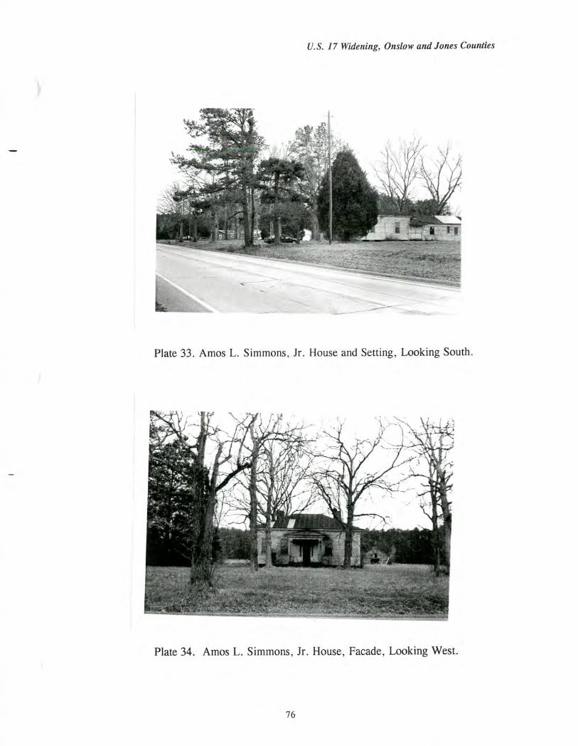
U.S. 17 Widening, Onslow and Jones Counties
Plate 33. Amos L. Simmons, Jr. House and Setting, Looking South.
Plate 34. Amos L. Simmons, Jr. House, Facade, Looking West.
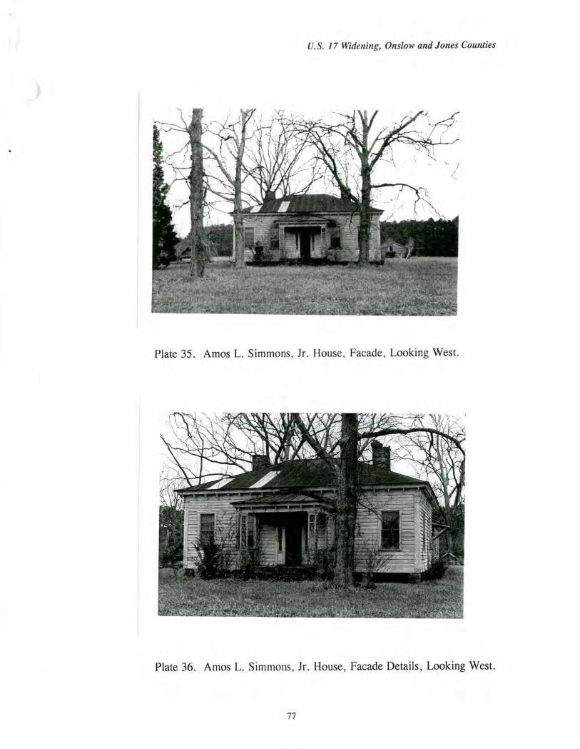
U.S. 17 Widening, Onslow and Jones Counties
Plate 35. Amos L. Simmons, Jr. House, Facade, Looking West.
Plate 36. Amos L. Simmons, Jr. House, Facade Details, Looking West.
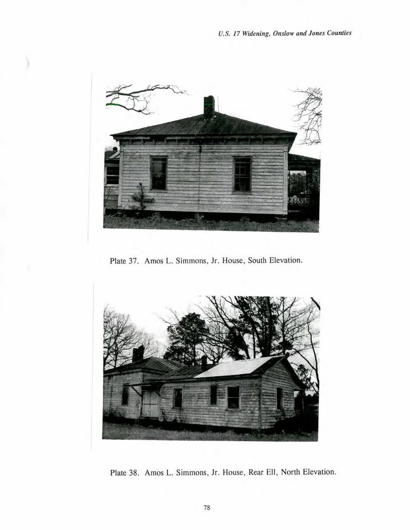
U.S. 17 Widening, Onslow and Jones Counties
Plate 37. Amos L. Simmons, Jr. House, South Elevation.
Plate 38. Amos L. Simmons, Jr. House, Rear Ell, North Elevation.
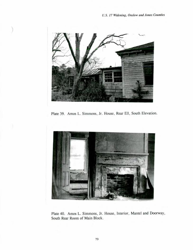
U.S. 17 Widening, Onslow and Jones Counties
Plate 39. Amos L. Simmons, Jr. House, Rear Ell, South Elevation.
Plate 40. Amos L. Simmons, Jr. House, Interior, Mantel and Doorway, South Rear Room of Main Block.
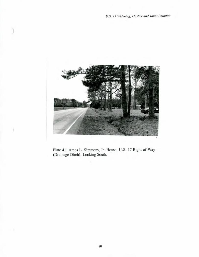
U.S. 17 Widening, Onslow and Jones Counties
Plate 41. Amos L. Simmons, Jr. House, U.S. 17 Right-of-Way (Drainage Ditch), Looking South.
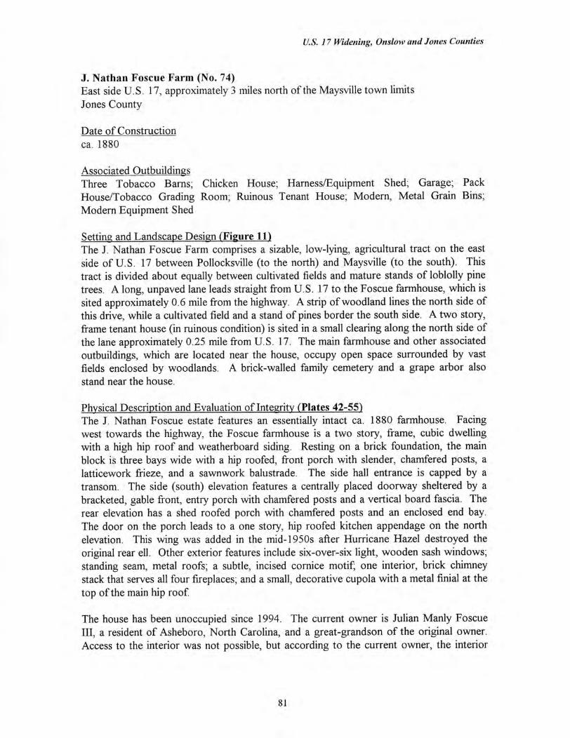
U.S. 17 Widening, Onslow and Jones Counties
J. Nathan Foscue Farm (No. 74) East side U.S. 17, approximately 3 miles north of the Maysville town limits Jones County
Date of Construction ca. 1880
Associated Outbuildings Three Tobacco Barns; Chicken House, Harness/Equipment Shed, Garage, Pack House/Tobacco Grading Room; Ruinous Tenant House; Modern, Metal Grain Bins; Modern Equipment Shed
Setting and Landscape Design (Figure 11) The J. Nathan Foscue Farm comprises a sizable, low-lying, agricultural tract on the east side of U.S. 17 between Pollocksville (to the north) and Maysville (to the south). This tract is divided about equally between cultivated fields and mature stands of loblolly pine trees. A long, unpaved lane leads straight from U.S. 17 to the Foscue farmhouse, which is sited approximately 0.6 mile from the highway. A strip of woodland lines the north side of this drive, while a cultivated field and a stand of pines border the south side. A two story, frame tenant house (in ruinous condition) is sited in a small clearing along the north side of the lane approximately 0.25 mile from U.S. 17. The main farmhouse and other associated outbuildings, which are located near the house, occupy open space surrounded by vast fields enclosed by woodlands. A brick-walled family cemetery and a grape arbor also stand near the house.
Physical Description and Evaluation of Integrity (Plates 42-55) The J. Nathan Foscue estate features an essentially intact ca. 1880 farmhouse. Facing west towards the highway, the Foscue farmhouse is a two story, frame, cubic dwelling with a high hip roof and weatherboard siding. Resting on a brick foundation, the main block is three bays wide with a hip roofed, front porch with slender, chamfered posts, a latticework frieze, and a sawnwork balustrade. The side hall entrance is capped by a transom. The side (south) elevation features a centrally placed doorway sheltered by a bracketed, gable front, entry porch with chamfered posts and a vertical board fascia. The rear elevation has a shed roofed porch with chamfered posts and an enclosed end bay. The door on the porch leads to a one story, hip roofed kitchen appendage on the north elevation. This wing was added in the mid-1950s after Hurricane Hazel destroyed the original rear ell. Other exterior features include six-over-six light, wooden sash windows; standing seam, metal roofs; a subtle, incised cornice motif; one interior, brick chimney stack that serves all four fireplaces; and a small, decorative cupola with a metal finial at the top of the main hip roof
The house has been unoccupied since 1994. The current owner is Julian Manly Foscue III, a resident of Asheboro, North Carolina, and a great-grandson of the original owner. Access to the interior was not possible, but according to the current owner, the interior
81
U.S. 17 Widening, Onslow and Jones Counties
survives essentially intact and contains the original mantels, four panel doors, staircase in the side hall, and other original woodwork (Foscue Interview 1996).
Several outbuildings were recently destroyed by Hurricane Bertha (1996), including the smokehouse, a pack house, and a barn. Two of the original three tenant houses are also no longer extant, and the third tenant house is in ruinous condition. However, a host of early twentieth century outbuildings survive intact. These include an asbestos-sided chicken coop, three tobacco barns, a harness shed, a pack house/grading room, and a shed-roofed garage. In addition, the handsome, brick-walled Foscue family cemetery stands behind the house while a small grape arbor is sited south of the dwelling. A group of modern, metal corncribs and a modern, frame equipment shed complete the farm complex.
The configuration of cultivated fields and woodlands also survives largely intact, reflecting a continuity of land use since at least the early twentieth century (Foscue Interview 1996). The principal change has been the subdivision of woodland into a string of narrow house lots along U. S. 17 south of the farm lane.
Historical Background Josephus Nathan Foscue (1847-1914) inherited the current 520 acre tract from his father, Nathan Foscue (1791-1858). J. Nathan Foscue and his wife, Sarah E. Smith, probably began operation of this farm about 1870 and had the house constructed a decade later (Harriett 1985: 133-134; Foscue Interview 1996). They reared six children here including son Julian Manly Foscue, Sr., who assumed ownership of the property in the early twentieth century. According to the 1880 agricultural schedule, the tract was valued at $3,950 (including livestock) and produced primarily cotton, corn, wheat, and swine (U.S. Census 1880). By the turn of the century, the farm included three tenant houses occupied by families of tenants who worked for the Foscues into the post-World War II decades, either as sharecroppers or as hired field hands (Foscue Interview 1996).
Julian Manly Foscue, Sr. and his family operated the farm between 1914 to 1938. Foscue also established a successful livery business in nearby Maysville, which he later converted to an automobile dealership. After 1938, the property was owned by Julian Manly Foscue, Jr., who farmed this tract until his death in 1994. Typical of the agricultural holdings of this region in the twentieth century, bright-leaf tobacco and cotton were the major market staples with tobacco emerging as the principal cash crop after World War I. As a result of plummeting cotton prices and the infestation of the boll weevil in the 1920s and 1930s, cotton production sharply declined on the Foscue farm and throughout the region (Foscue Interview 1996). During the twentieth century, the Foscue farm has also raised quantities of corn, soybeans, wheat, fescue, and hogs, and timber has been cut for sale. The farmland is currently rented for cultivation (Foscue Interview 1996).
82
U.S. 17 Widening, Onslow and Jones Counties
Evaluation of Eligibility (Figure 12) The J. Nathan Foscue Farm is considered eligible under Criterion A for agriculture and Criterion C for architecture. Together with the great Bryan-Bell Farm (N.R. 1989), which survives to the west of the Foscue estate, the Foscue farm is a rare remaining example of the large, agricultural operations that persisted after the Civil War in Jones County (see Agriculture Context, p. 26). Like other such farmsteads, the Foscue farm grew cotton as the principal cash staple during the late nineteenth and early twentieth century when tobacco emerged as the key money crop. Also in typical fashion, the farm produced corn, other grains, and livestock for both profit and domestic consumption. Also in common with other sizable farms of the county, the large tracts of pines, which are still in evidence on the property, were harvested at various periods. Farm work was accomplished, in part, by hired labor and sharecroppers.
The size of the tract remains largely unchanged since the tenure of J. Nathan Foscue, while field patterns and arrangements of woodlands have existed virtually unaltered since at least the early twentieth century (Foscue Interview 1996). This tract continues to be defined by wooded Mill Creek to the north and east, and by U.S. 17 (the historic King's Highway) to the west. Although some outbuildings have been recently destroyed, the farm retains a sufficient assortment of barns and sheds to illustrate important agricultural activities during the period of significance (ca. 1880 to 1946).
Under Criterion C, the ca. 1880 farmhouse is a striking and remarkably well-preserved example of post-Civil War, rural domestic architecture in Jones County. The side hall plan, the double pile form, and the principal entries on both the front (west) and side (south) elevations echo the ca. 1800 Foscue Plantation (N.R.), located several miles north, and may have been inspired by this prominent plantation seat. However, the application of decorative latticework and jigsaw carpentry clearly illustrate late nineteenth century architectural trends in Jones County.
The J. Nathan Foscue Farm is not recommended as eligible under any other criterion. The property is also not eligible under Criterion B because it is not associated with individuals whose activities were demonstrably important within a local, state, or national historic context. The property is also not recommended as eligible under Criterion D because the architectural component is not likely to yield information important in the history of building technology. The archaeological component of the property is evaluated for National Register eligibility in a separate archaeology report.
The proposed National Register boundaries encompass the existing 520 acre Foscue tract. Along the west side, facing U.S. 17, the proposed boundary follows the property line, which is located east of the highway right-of-way and the drainage ditch (Figure 13). This boundary preserves both the association of the house and farm with the historic roadway and the dramatically long farm lane extending from U.S. 17 to the house.
The contributing resources include the ca. 1880 Foscue residence, the brick-walled family cemetery, the grape arbor, the three tobacco barns, the chicken coop, the tobacco pack
83

U.S. 17 Widening, Onslow and Jones Counties
house/grading room, the harness shed, and the garage, all of which date from the early twentieth century (Foscue Interview 1996). The surrounding landscape of fields and woodlands is also considered a contributing resource. The ruinous tenant house, the modern equipment shed, and the modern grain bins are noncontributing elements.
84
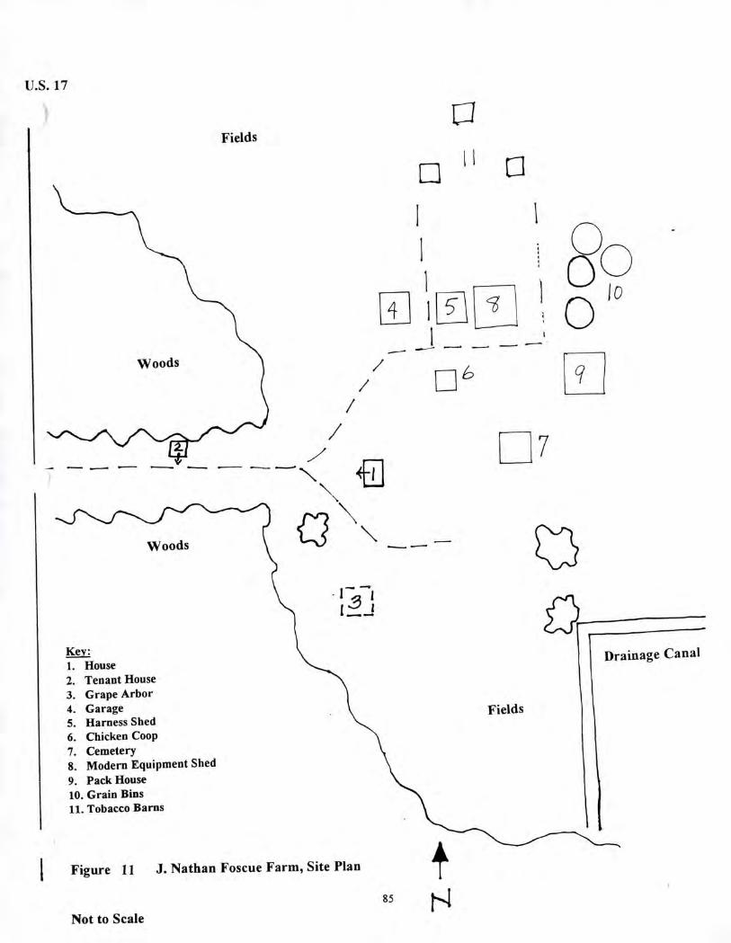
Woods
I 1:1
1
1 4 I
6
U.S. 17
Fields
Drainage Canal House Tenant House Grape Arbor Garage Harness Shed Chicken Coop Cemetery Modern Equipment Shed Pack House Grain Bins Tobacco Barns
Fields
I Figure 11 J. Nathan Foscue Farm, Site Plan
85
Not to Scale
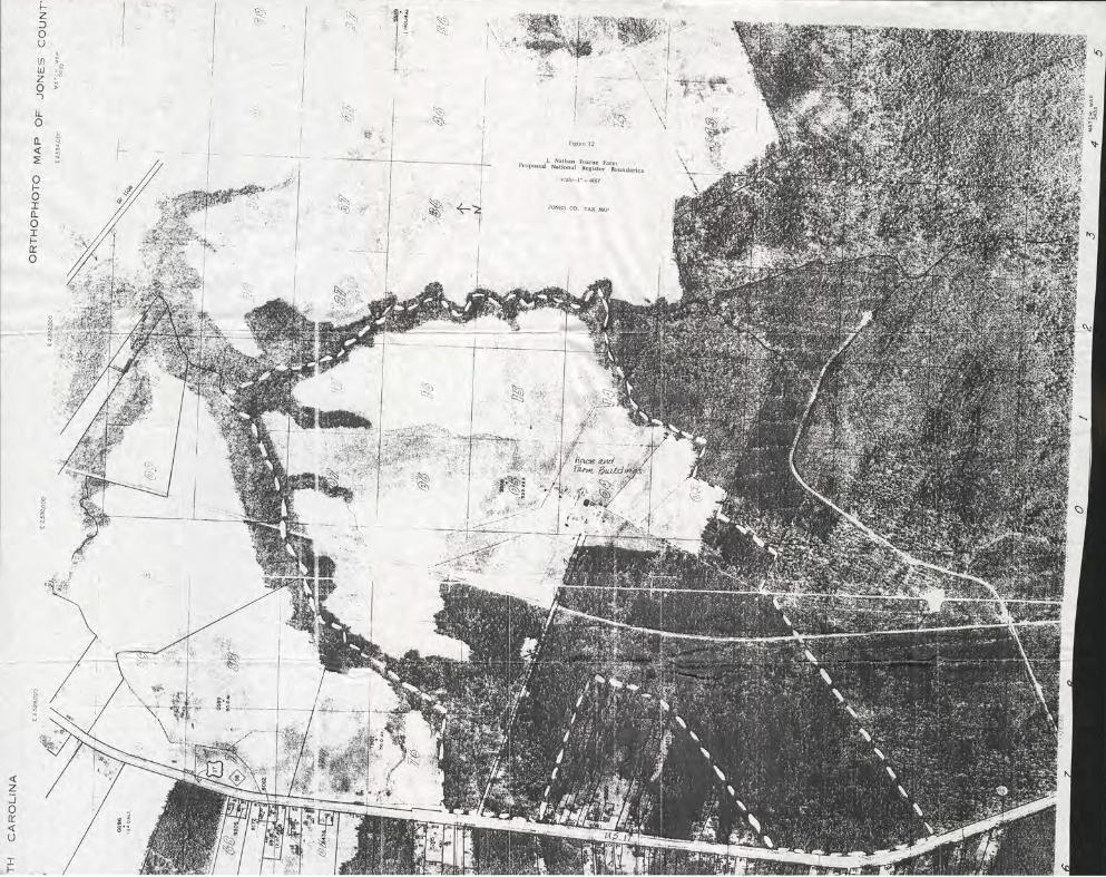
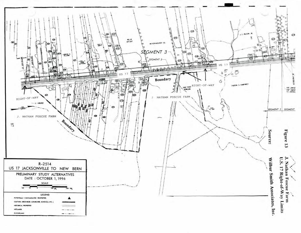
<3 o
C. ses-0014
'ILL* B.FrYANT
rEYERHOWSER CO.
ri
\.42'
11111111M§4.
US 17 IFVOLOrinitiallEU4 AVIZ
-
Boundary ,
RIGHT-OF-WAY suL Foso
'..8011-14G
0. st.sellRE'Y POr Zola
Par 2,11413 rs
RIGHT-OF-WAY
I. • 65003
I NATHAN FOSCUE FARM
/SEGMENT 3 SEGMENT
J. NATHAN FOSCUE FARM
// (
MI
CIQ =
CA 0 .//
N •
R-2514 US 17 JACKSONVILLE TO NEW BERN
PRELIMINARY STUDY ALTERNATIVES DATE : OCTOBER 1, 1996
SCALE
100 100 200 Jut
LEGEND POTENTIALLY CONTAMINATED rocroones A
IMOLIROES MIIJO.0.115, 301001S. ITC.
HISTOIKAL PIK/PERM
WRI.ANC6
REVAEO01111111ENE
PLOOOPLA.LS
v\\
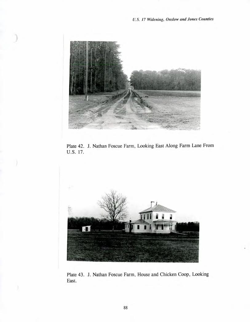
U.S. 17 Widening, Onslow and Jones Counties
Plate 42. J. Nathan Foscue Farm, Looking East Along Farm Lane From U.S. 17.
Plate 43. J. Nathan Foscue Farm, House and Chicken Coop, Looking East.
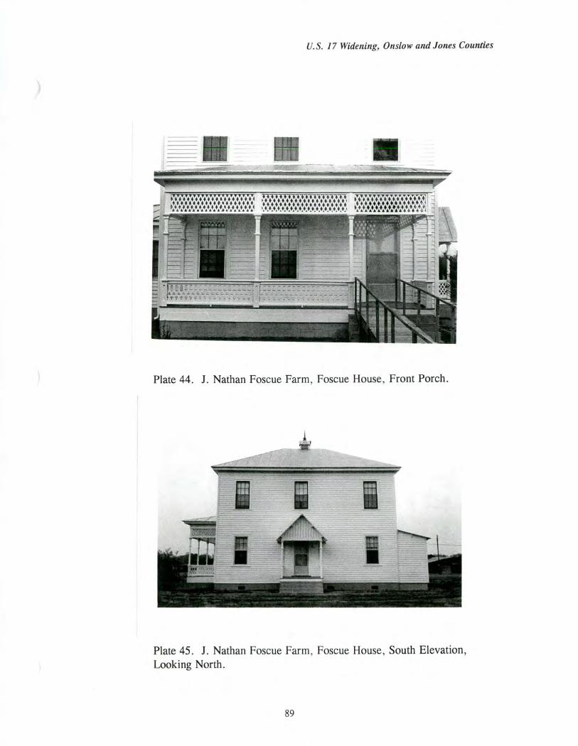
U.S. 17 Widening, Onslow and Jones Counties
Plate 44. J. Nathan Foscue Farm, Foscue House, Front Porch.
Plate 45. J. Nathan Foscue Farm, Foscue House, South Elevation, Looking North.
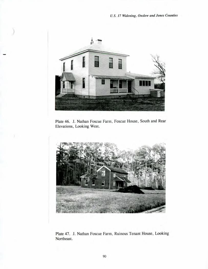
U.S. 17 Widening, Onslow and Jones Counties
Plate 46. J. Nathan Foscue Farm, Foscue House, South and Rear Elevations, Looking West.
Plate 47. J. Nathan Foscue Farm, Ruinous Tenant House, Looking Northeast.
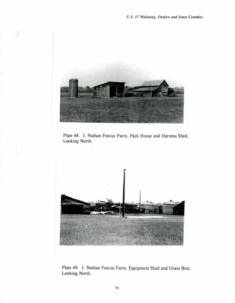
U.S. 17 Widening, Onslow and Jones Counties
Plate 48. J. Nathan Foscue Farm, Pack House and Harness Shed, Looking North.
Plate 49. J. Nathan Foscue Farm, Equipment Shed and Grain Bins, Looking North.
91
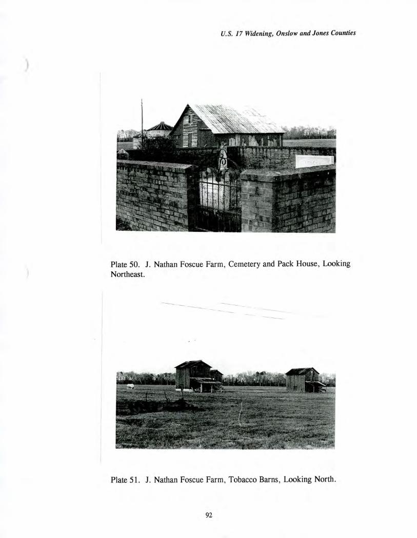
U.S. 17 Widening, Onslow and Jones Counties
Plate 50. J. Nathan Foscue Farm, Cemetery and Pack House, Looking Northeast.
Plate 51. J. Nathan Foscue Farm, Tobacco Barns, Looking North.
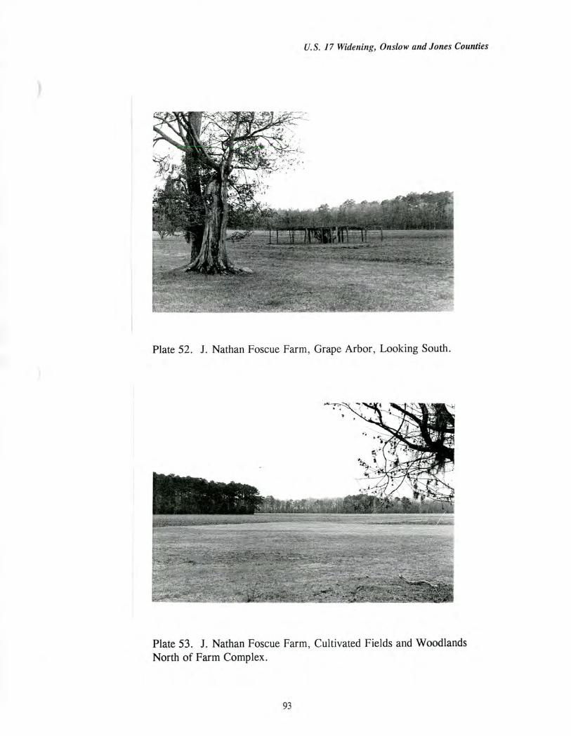
U.S. 17 Widening, Onslow and Jones Counties
Plate 52. J. Nathan Foscue Farm, Grape Arbor, Looking South.
Plate 53. J. Nathan Foscue Farm, Cultivated Fields and Woodlands North of Farm Complex.

U.S. 17 Widening, Onslow and Jones Counties
Plate 54. J. Nathan Foscue Farm, U.S. 17 Right-of-Way, Looking North.
Plate 55. J. Nathan Foscue Farm, U.S. 17 Right-of-Way, Looking South.
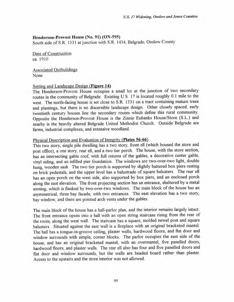
U.S. 17 Widening, Onslow and Jones Counties
Henderson-Provost House (No. 91) (ON-595) South side of S.R. 1331 at junction with S.R. 1434, Belgrade, Onslow County
Date of Construction ca. 1910
Associated Outbuildings None
Setting and Landscape Design (Figure 14) The Henderson-Provost House occupies a small lot at the junction of two secondary routes in the community of Belgrade. Existing U.S. 17 is located roughly 0.1 mile to the west. The north-facing house is set close to S.R. 1331 on a tract containing mature trees and plantings, but there is no discernible landscape design. Other closely spaced, early twentieth century houses line the secondary routes which define this rural community. Opposite the Henderson-Provost House is the Zinnie Eubanks House/Store (S.L.) and nearby is the heavily altered Belgrade United Methodist Church. Outside Belgrade are farms, industrial complexes, and extensive woodland.
Physical Description and Evaluation of Integrity (Plates 56-66) This two story, single pile dwelling has a two story, front ell (which housed the store and post office), a one story, rear ell, and a two tier porch. The house, with the store section, has an intersecting gable roof, with frill returns of the gables, a decorative center gable, vinyl siding, and an infilled pier foundation. The windows are two-over-two light, double hung, wooden sash. The two tier porch is supported by slightly battered box piers resting on brick pedestals, and the upper level has a balustrade of square balusters. The rear ell has an open porch on the west side, also supported by box piers, and an enclosed porch along the east elevation. The front projecting section has an entrance, sheltered by a metal awning, which is flanked by two-over-two windows. The main block of the house has an asymmetrical, three bay facade, with two entrances. The east elevation has a two story, bay window, and there are pointed arch vents under the gables.
The main block of the house has a hall-parlor plan, and the interior remains largely intact. The front entrance opens into a hall with an open string staircase rising from the rear of the room, along the west wall. The staircase has a square, molded newel post and square balusters. Situated against the east wall is a fireplace with an original bracketed mantel. The hall has a tongue-in-groove ceiling, plaster walls, hardwood floors, and flat door and window surrounds with simple, corner blocks. The parlor occupies the east side of the house, and has an original bracketed mantel, with an overmantel, five panelled doors, hardwood floors, and plaster walls. The rear ell also has four and five panelled doors and flat door and window surrounds, but the walls are beaded board rather than plaster. Access to the upstairs and the store interior was not allowed.
95
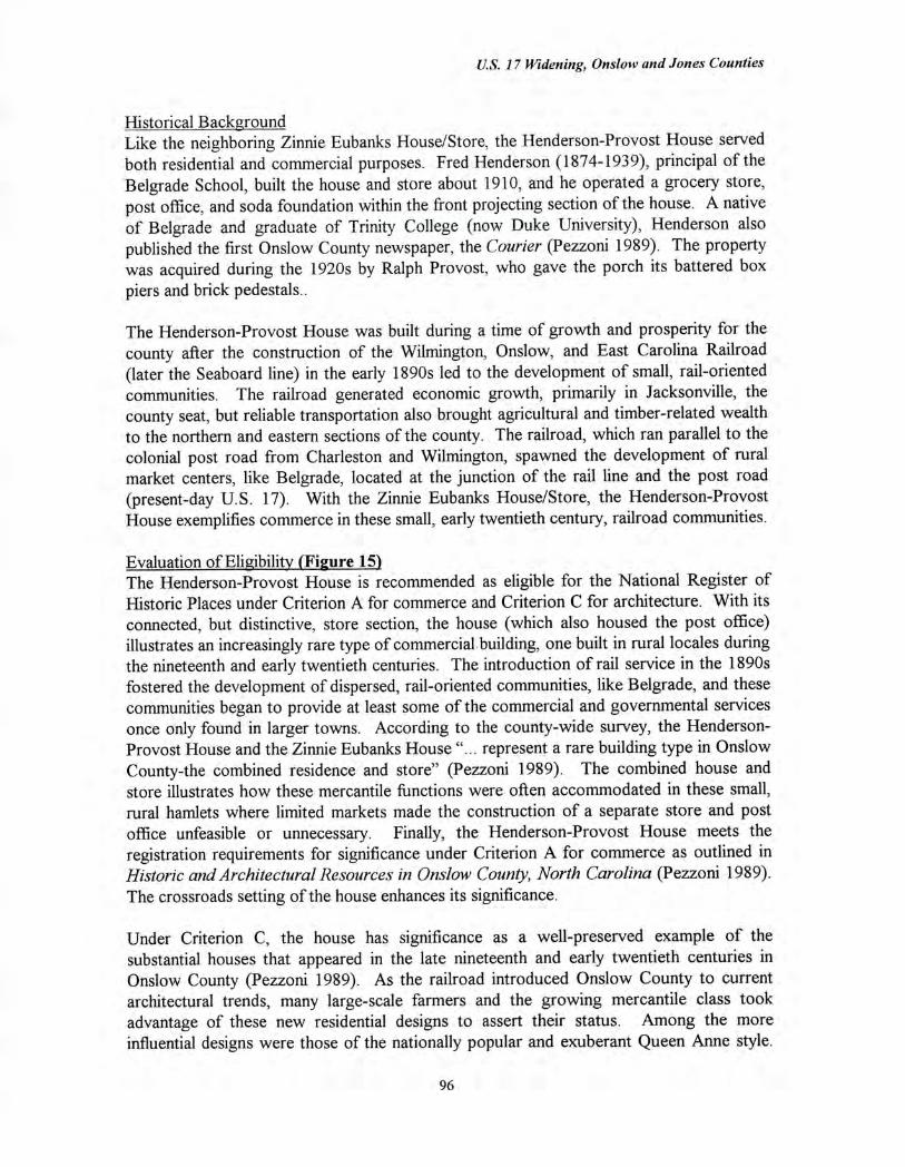
U.S. 17 Widening, Onslow and Jones Counties
Historical Background Like the neighboring Zinnie Eubanks House/Store, the Henderson-Provost House served both residential and commercial purposes. Fred Henderson (1874-1939), principal of the Belgrade School, built the house and store about 1910, and he operated a grocery store, post office, and soda foundation within the front projecting section of the house. A native of Belgrade and graduate of Trinity College (now Duke University), Henderson also published the first Onslow County newspaper, the Courier (Pezzoni 1989). The property was acquired during the 1920s by Ralph Provost, who gave the porch its battered box piers and brick pedestals..
The Henderson-Provost House was built during a time of growth and prosperity for the county after the construction of the Wilmington, Onslow, and East Carolina Railroad (later the Seaboard line) in the early 1890s led to the development of small, rail-oriented communities. The railroad generated economic growth, primarily in Jacksonville, the county seat, but reliable transportation also brought agricultural and timber-related wealth to the northern and eastern sections of the county. The railroad, which ran parallel to the colonial post road from Charleston and Wilmington, spawned the development of rural market centers, like Belgrade, located at the junction of the rail line and the post road (present-day U.S. 17). With the Zinnie Eubanks House/Store, the Henderson-Provost House exemplifies commerce in these small, early twentieth century, railroad communities.
Evaluation of Eligibility (Figure 15) The Henderson-Provost House is recommended as eligible for the National Register of Historic Places under Criterion A for commerce and Criterion C for architecture. With its connected, but distinctive, store section, the house (which also housed the post office) illustrates an increasingly rare type of commercial building, one built in rural locales during the nineteenth and early twentieth centuries. The introduction of rail service in the 1890s fostered the development of dispersed, rail-oriented communities, like Belgrade, and these communities began to provide at least some of the commercial and governmental services once only found in larger towns. According to the county-wide survey, the Henderson-Provost House and the Zinnie Eubanks House "... represent a rare building type in Onslow County-the combined residence and store" (Pezzoni 1989). The combined house and store illustrates how these mercantile functions were often accommodated in these small, rural hamlets where limited markets made the construction of a separate store and post office unfeasible or unnecessary. Finally, the Henderson-Provost House meets the registration requirements for significance under Criterion A for commerce as outlined in Historic and Architectural Resources in Onslow County, North Carolina (Pezzoni 1989). The crossroads setting of the house enhances its significance.
Under Criterion C, the house has significance as a well-preserved example of the substantial houses that appeared in the late nineteenth and early twentieth centuries in Onslow County (Pezzoni 1989). As the railroad introduced Onslow County to current architectural trends, many large-scale farmers and the growing mercantile class took advantage of these new residential designs to assert their status. Among the more influential designs were those of the nationally popular and exuberant Queen Anne style.
96
U.S. 17 Widening, Onslow and Jones Counties
With its L-shaped plan and modest ornamentation, the Henderson-Provost House represents a restrained interpretation of the Queen Anne.
The proposed National Register boundaries include only the 0.74 acre tract on which the house sits. The recommended National Register boundaries include only the house and its tree-shaded setting.
The Henderson-Provost House is not considered eligible under any other criterion. The house is not eligible under Criterion B because the property is not associated with individuals whose activities were demonstrably important within a local, state, or national historic context. Finally, the property is not considered eligible under Criterion D because the architectural component is not likely to yield information important in the history of building technology. The archaeological component of the property is evaluated for National Register eligibility in a separate archaeology report.
97
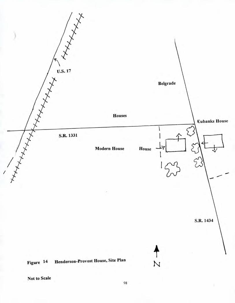
Cubanks House
Modern House House
Figure 14 Henderson-Provost House, Site Plan
Not to Scale 98
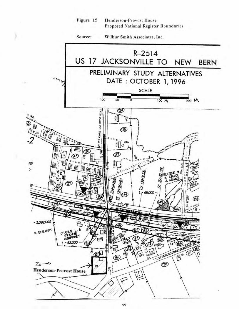
100 L_
100 —50 200 14 \
1E.Ft 3.
- 3.092.000
c. EA3B CORL1Evitat 511.141
- 62000
Henderson-Provost House
fr>\ 99
R-2514 US 17 JACKSONVILLE TO NEW BERN
PRELIMINARY STUDY ALTERNATIVES DATE : OCTOBER 1, 1996
SCALE
Figure 15 Henderson-Provost House Proposed National Register Boundaries
Source:
Wilbur Smith Associates, Inc.
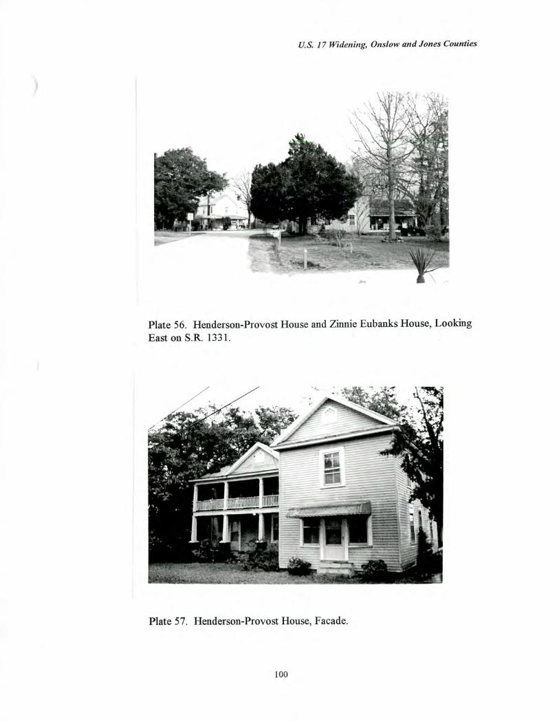
U.S. 17 Widening, Onslow and Jones Counties
Plate 56. Henderson-Provost House and Zinnie Eubanks House, Looking East on S.R. 1331.
Plate 57. Henderson-Provost House, Facade.
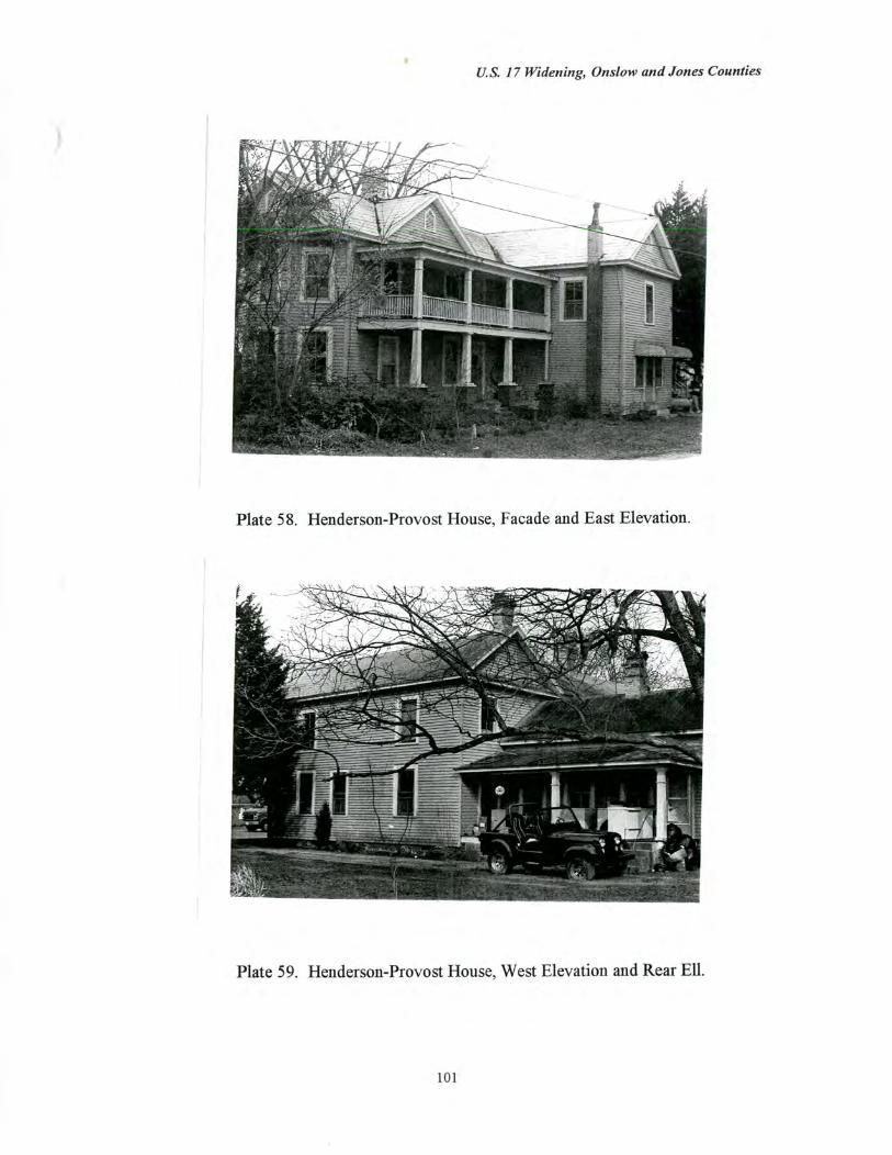
411AilillIPPIIJ
U.S. 17 Widening, Onslow and Jones Counties
Plate 58. Henderson-Provost House, Facade and East Elevation.
Plate 59. Henderson-Provost House, West Elevation and Rear Ell.
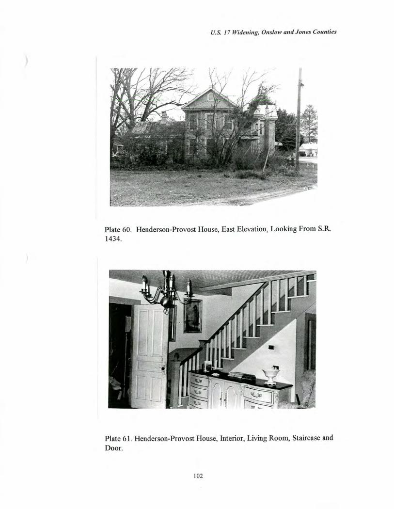
U.S. 17 Widening, Onslow and Jones Counties
Plate 60. Henderson-Provost House, East Elevation, Looking From S.R. 1434.
Plate 61. Henderson-Provost House, Interior, Living Room, Staircase and Door.
102
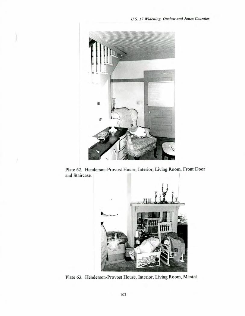
U.S. 17 Widening, Onslow and Jones Counties
Plate 62. Henderson-Provost House, Interior, Living Room, Front Door and Staircase.
Plate 63. Henderson-Provost House, Interior, Living Room, Mantel.
103
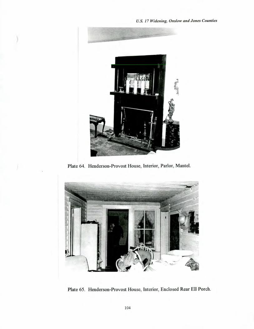
US 17 Widening, Onslow and Jones Counties
Plate 64. Henderson-Provost House, Interior, Parlor, Mantel.
Plate 65. Henderson-Provost House, Interior, Enclosed Rear Ell Porch.
104
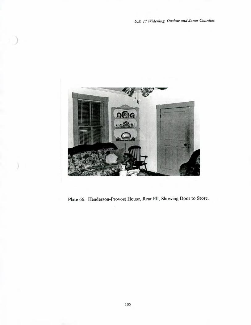
U.S. 17 Widening, Onslow and Jones Counties
Plate 66. Henderson-Provost House, Rear Ell, Showing Door to Store.
U.S. 17 Widening, Onslow and Jones Counties
Zinnie Eubanks House/Store (No. 90) (ON-591) East side of S.R. 1434 at junction with S.R. 1331, Belgrade, Onslow County
Date of Construction 1912
Associated Outbuildings Modern Shed and Playhouse; Pack House (ca. 1912), Garage (1920s)
Setting and Landscape Design (Figure 16) This house/store is located at the eastern edge of the crossroads community of Belgrade, east of U.S. 17. The building is shaded by mature trees, and the back yard holds a modern playhouse and a modern shed, while an early twentieth century pack house and garage stand on the south side of the tract. Cultivated fields extend to the east and south, away from the crossroads. A cluster of residences are located to the west, across S.R. 1434, including the Henderson-Provost House, which also served as a residence and store in the early twentieth century.
Physical Description and Evaluation of Integrity (Plates 67-74) The 1912 Zinnie Eubanks House/Store survives largely intact. This substantial, two story, frame, L-shaped building retains its original weatherboarding, standing seam metal roof, and two-over-two light, wooden sash windows. Other original exterior elements include the common bond brick chimneys with corbelled caps, frieze board returns, simple caps on corner boards, a decorative vent and a pendant arrow ornament on the front-facing gable, and a section of remaining saw-tooth bargeboard along the south gable end. The one story, wraparound porch with tapered, wooden posts resting on brick pedestals was probably added in the 1920s or 1930s. The porch addition suggests that the front room was no longer used as a store by that time (Pezzoni 1989). The one story rear ell has a decorative center gable with a pendant arrow ornament and an enclosed porch. According to Pezzoni (1989), the interior is essentially intact including the original mantels and staircase. The current owner confirmed this, but denied access (Jenkins 1996).
The current half-acre parcel consists of the house/store, a modern playhouse and shed located in the back yard, a ca. 1912 tobacco pack house, and a 1920s automobile garage. A frame barn and frame tobacco barns that once stood behind the house/store were razed by the current owners (Jenkins 1996)
Historical Background Although little historical information is currently available about the Eubanks property, the house/store is said to have been built in 1912 for Zinnie Eubanks, a farmer and merchant (Pezzoni 1989; Jenkins Interview 1996). The property was subsequently owned by his son, Graham Eubanks, who continued to operate a grocery store in the first floor of the forward projecting wing. In the early 1970s, this property was acquired for purely residential use by Frankie J. and Clara Jenkins, who still own and occupy the dwelling.
106
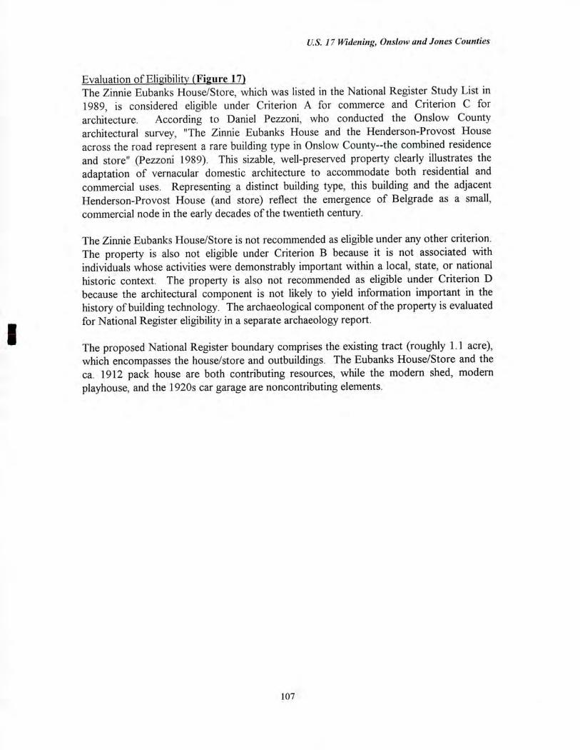
U.S. 17 Widening, Onslow and Jones Counties
Evaluation of Eligibility (Figure 17) The Zinnie Eubanks House/Store, which was listed in the National Register Study List in 1989, is considered eligible under Criterion A for commerce and Criterion C for architecture. According to Daniel Pezzoni, who conducted the Onslow County architectural survey, "The Zinnie Eubanks House and the Henderson-Provost House across the road represent a rare building type in Onslow County--the combined residence and store" (Pezzoni 1989). This sizable, well-preserved property clearly illustrates the adaptation of vernacular domestic architecture to accommodate both residential and commercial uses. Representing a distinct building type, this building and the adjacent Henderson-Provost House (and store) reflect the emergence of Belgrade as a small, commercial node in the early decades of the twentieth century.
The Zinnie Eubanks House/Store is not recommended as eligible under any other criterion. The property is also not eligible under Criterion B because it is not associated with individuals whose activities were demonstrably important within a local, state, or national historic context. The property is also not recommended as eligible under Criterion D because the architectural component is not likely to yield information important in the history of building technology. The archaeological component of the property is evaluated for National Register eligibility in a separate archaeology report.
The proposed National Register boundary comprises the existing tract (roughly 1.1 acre), which encompasses the house/store and outbuildings. The Eubanks House/Store and the ca. 1912 pack house are both contributing resources, while the modern shed, modern playhouse, and the 1920s car garage are noncontributing elements.
107
Belgrade
Community Shed
Fields
0 Children's Playhouse
House
S.R. 1331
EJ Pack House Henderson-Provost House
Garage Fields
S.R. 1434
Figure 16 Zinnie Eubanks House/Store, Site Plan
Not to Scale
108
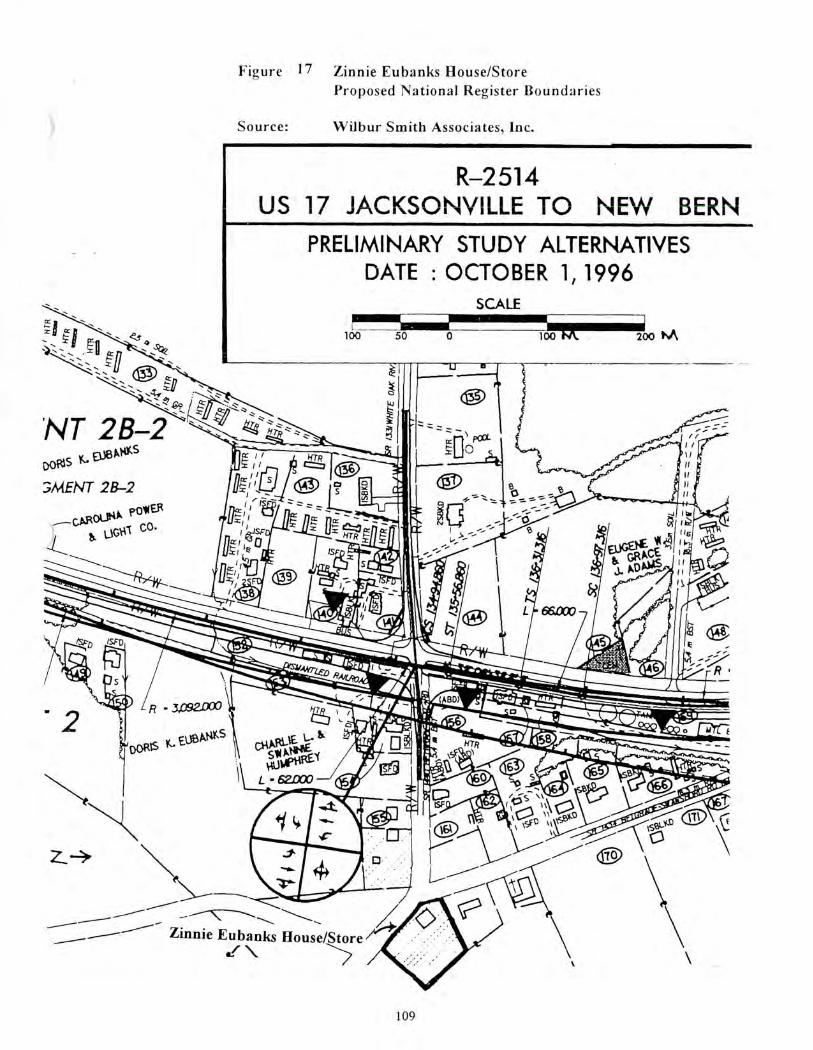
Figure 17 Zinnie Eubanks House/Store Proposed National Register Boundaries
Source: Wilbur Smith Associates, Inc.
R-2514 US 17 JACKSONVILLE TO NEW BERN
PRELIMINARY STUDY ALTERNATIVES DATE : OCTOBER 1, 1996
SCALE
50 0 100 100
4--
NT 2B-2 Do,,, 01310,5
MENT 28-2
—c.004-1t4 P1311E5 co.
irvfii
3 4:141:4131;4"" .1114"1"1""P"."
7811111111111111.1111"."%-7"
virifigiLX I "
DORIS Ica EtjW°S
.092-"
P • k
41)
NA•
Zinnie Eubanks House/Store \
\ .:1104A
(C)
109
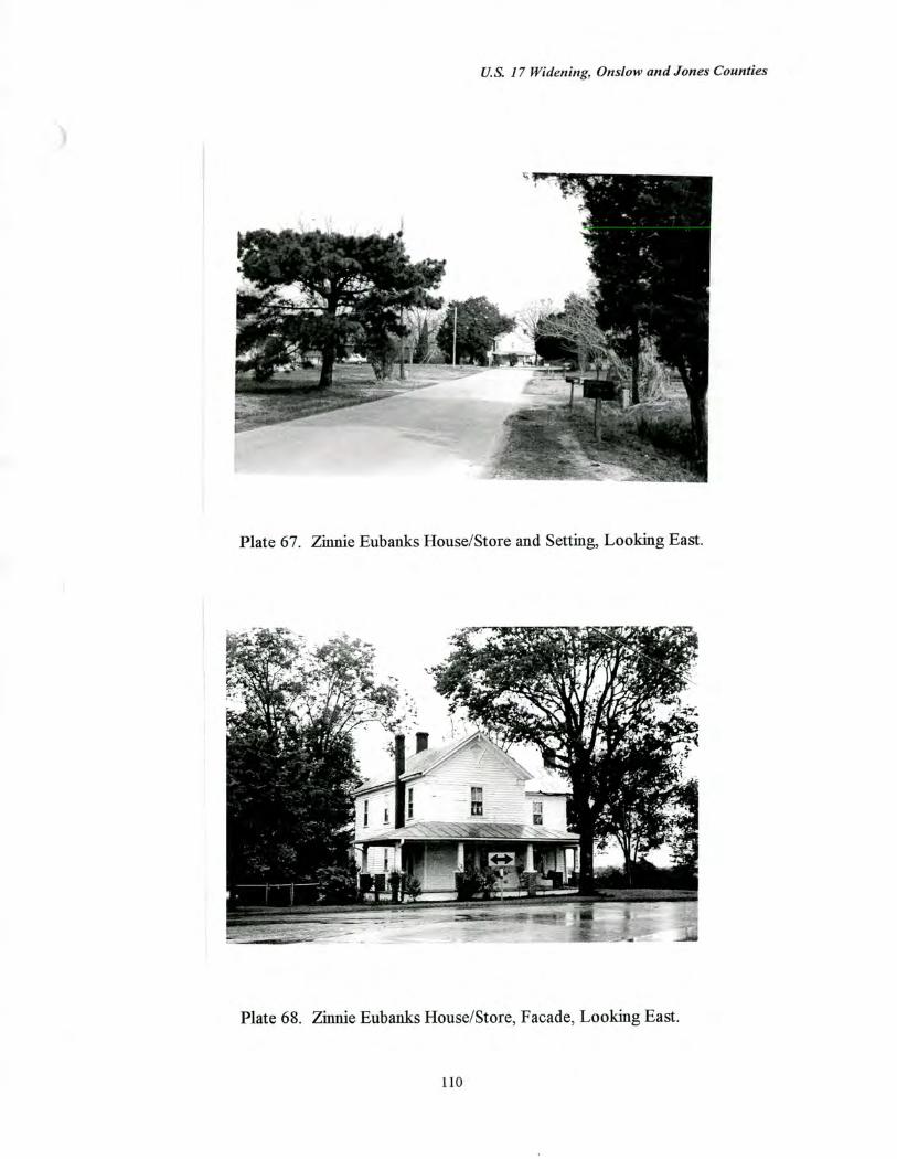
U.S. 17 Widening, Onslow and Jones Counties
Plate 67 Zinnie Eubanks House/Store and Setting, Looking East.
Plate 68. Zinnie Eubanks House/Store, Facade, Looking East.
110
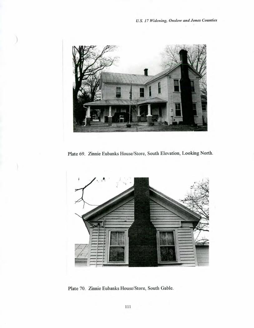
U.S. 17 Widening, Onslow and Jones Counties
Plate 69 Zinnie Eubanks House/Store, South Elevation, Looking North.
Plate 70 Zinnie Eubanks House/Store, South Gable.
111
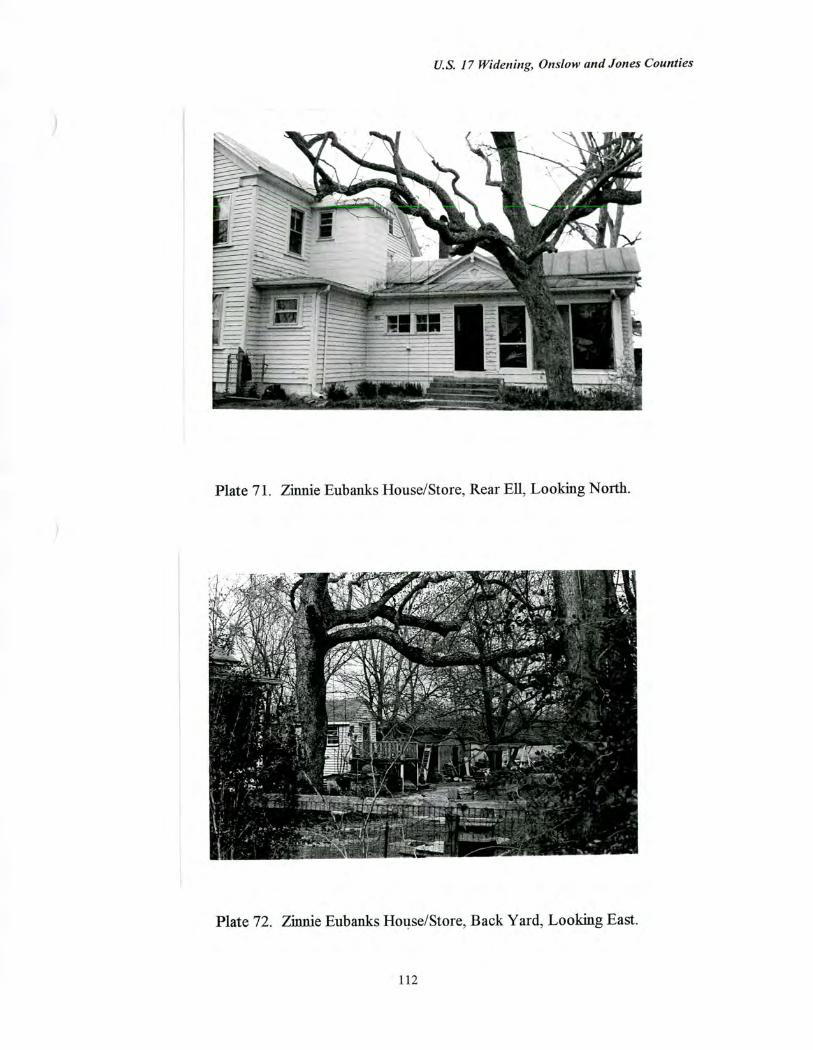
U.S. 17 Widening, Onslow and Jones Counties
Plate 71. Zinnie Eubanks House/Store, Rear Ell, Looking North.
Plate 72. Zinnie Eubanks House/Store, Back Yard, Looking East.
112
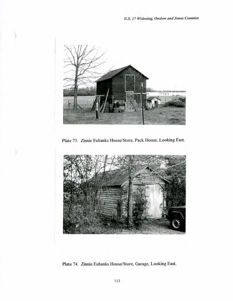
U.S. 17 Widening, Onslow and Jones Counties
Plate 73. Zinnie Eubanks House/Store, Pack House, Looking East.
Plate 74. Zinnie Eubanks House/Store, Garage, Looking East.
113
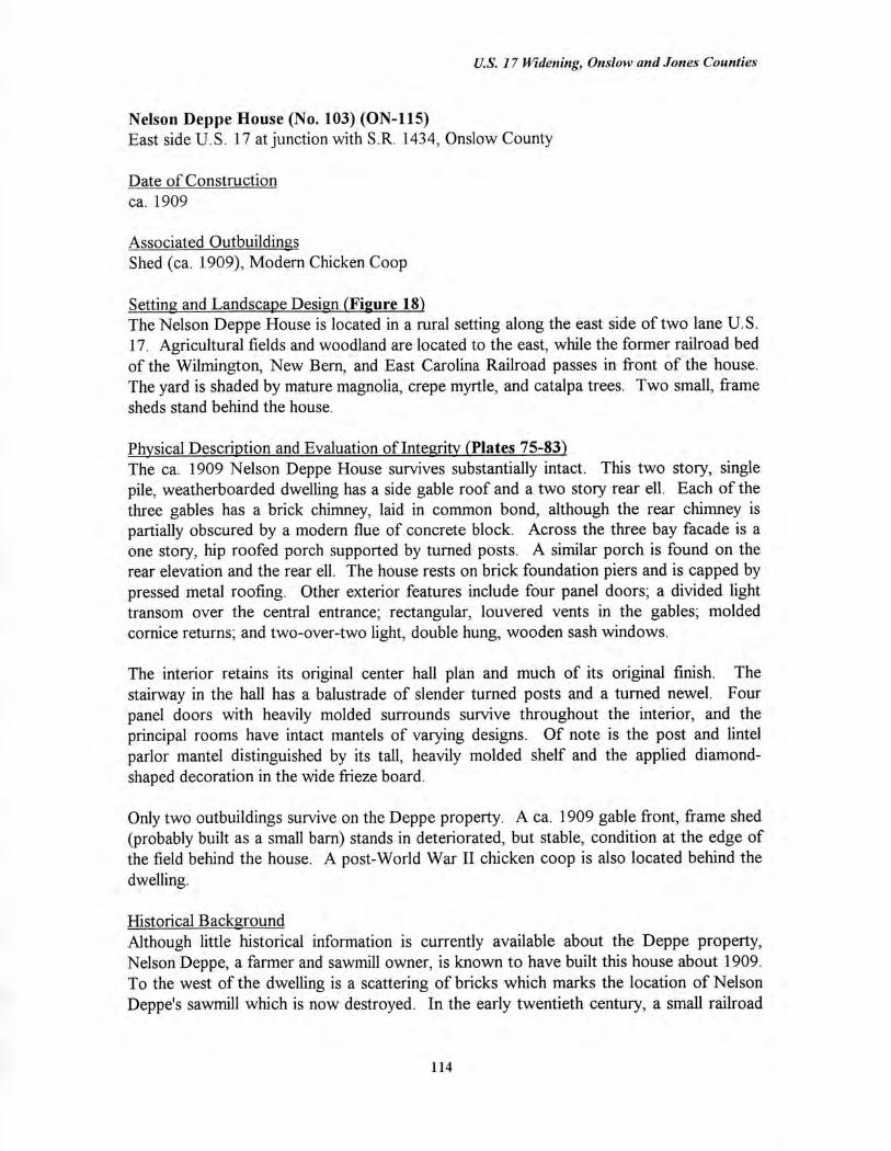
U.S. 17 Widening, Onslow and Jones Counties
Nelson Deppe House (No. 103) (ON-115) East side U.S. 17 at junction with S.R. 1434, Onslow County
Date of Construction ca. 1909
Associated Outbuildings Shed (ca. 1909), Modern Chicken Coop
Setting and Landscape Design (Figure 18) The Nelson Deppe House is located in a rural setting along the east side of two lane U.S. 17. Agricultural fields and woodland are located to the east, while the former railroad bed of the Wilmington, New Bern, and East Carolina Railroad passes in front of the house. The yard is shaded by mature magnolia, crepe myrtle, and catalpa trees. Two small, frame sheds stand behind the house.
Physical Description and Evaluation of Integrity (Plates 75-83) The ca. 1909 Nelson Deppe House survives substantially intact. This two story, single pile, weatherboarded dwelling has a side gable roof and a two story rear ell. Each of the three gables has a brick chimney, laid in common bond, although the rear chimney is partially obscured by a modern flue of concrete block. Across the three bay facade is a one story, hip roofed porch supported by turned posts. A similar porch is found on the rear elevation and the rear ell. The house rests on brick foundation piers and is capped by pressed metal roofing. Other exterior features include four panel doors; a divided light transom over the central entrance; rectangular, louvered vents in the gables; molded cornice returns; and two-over-two light, double hung, wooden sash windows.
The interior retains its original center hall plan and much of its original finish. The stairway in the hall has a balustrade of slender turned posts and a turned newel. Four panel doors with heavily molded surrounds survive throughout the interior, and the principal rooms have intact mantels of varying designs. Of note is the post and lintel parlor mantel distinguished by its tall, heavily molded shelf and the applied diamond-shaped decoration in the wide frieze board.
Only two outbuildings survive on the Deppe property. A ca. 1909 gable front, frame shed (probably built as a small barn) stands in deteriorated, but stable, condition at the edge of the field behind the house. A post-World War II chicken coop is also located behind the dwelling.
Historical Background Although little historical information is currently available about the Deppe property, Nelson Deppe, a farmer and sawmill owner, is known to have built this house about 1909. To the west of the dwelling is a scattering of bricks which marks the location of Nelson Deppe's sawmill which is now destroyed. In the early twentieth century, a small railroad
114
U.S. 17 Widening, Onslow and Jones Counties
siding here was named "Deppe" (Pezzoni 1989). The house remains owned and occupied by Deppe descendants.
Evaluation of Eligibility (Figure 191 The Nelson Deppe House is considered eligible for the National Register under Criterion C for architecture. The house is essentially intact and ranks among the finer surviving farmhouses of the early twentieth century in Onslow County. Such two story, one room deep houses (the traditional I-house type) were built throughout Onslow County and the region into the 1910s, and the Deppe House stands out as a particularly well-preserved example of the type.
The Deppe House is not recommended as eligible under any other criterion. The property is not eligible under Criterion A because it is not associated with events that have made a significant contribution to the broad patterns of our history. The property is also not eligible under Criterion B because it is not associated with individuals whose activities were demonstrably important within a local, state, or national historic context. Finally, the property is not recommended as eligible under Criterion D because the architectural component is not likely to yield information important in the history of building technology. The archaeological component of the property is evaluated for National Register eligibility in a separate archaeology report.
The proposed National Register boundaries conform to the borders of the existing three acre tax parcel. Along the west side, this property line is defined by the former railroad right-of-way in front of the Deppe House. This boundary lies to the east of the highway right-of-way, which extends roughly 25 feet from the center of U.S. 17 in the direction of the dwelling. The three acre Deppe tract includes the tree-shaded house and yard, the two frame outbuildings, and a small, cultivated field. The house and the early twentieth-century farm outbuilding are contributing resources, while the field contributes to the historical character of the setting. The later chicken coop is noncontributing.
115
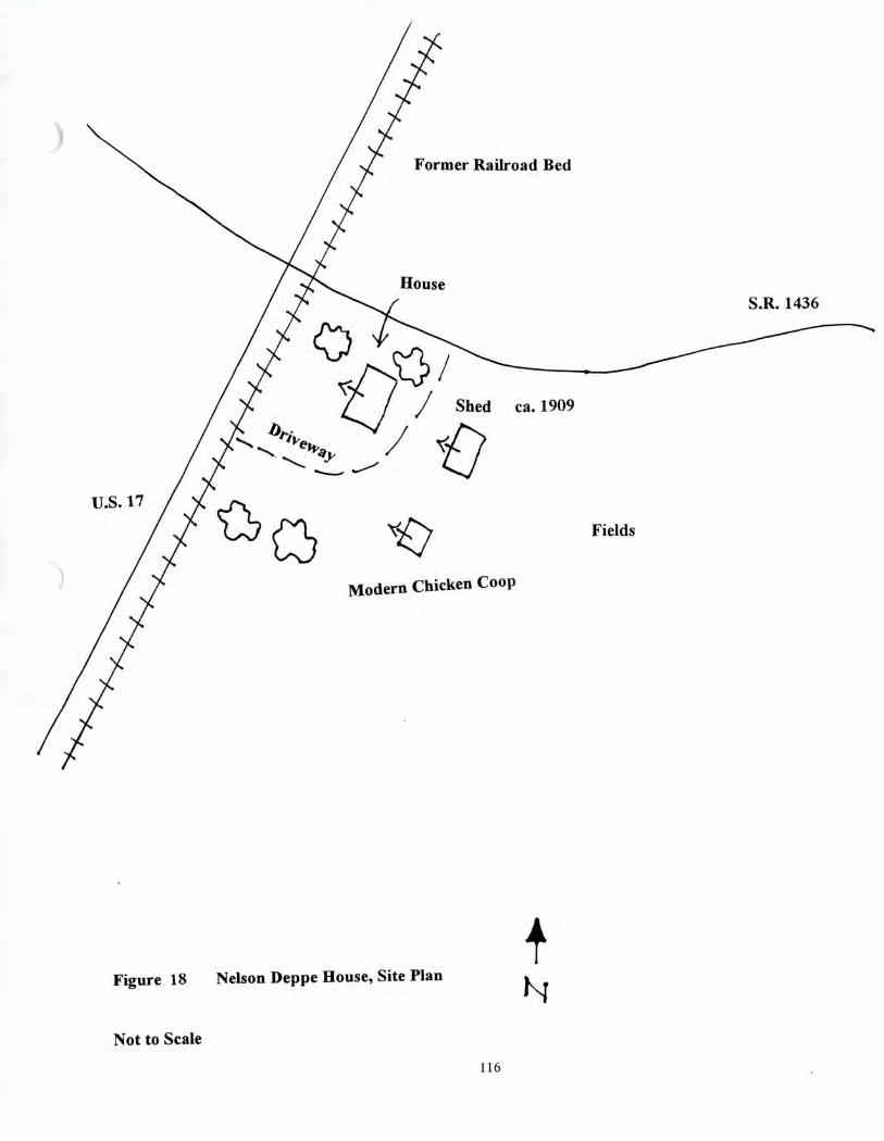
/ Shed ca. 1909
U.S. 17
Former Railroad Bed
House S.R. 1436
Modern Chicken Coop
Figure 18 Nelson Deppe House, Site Plan
Not to Scale
Fields
116
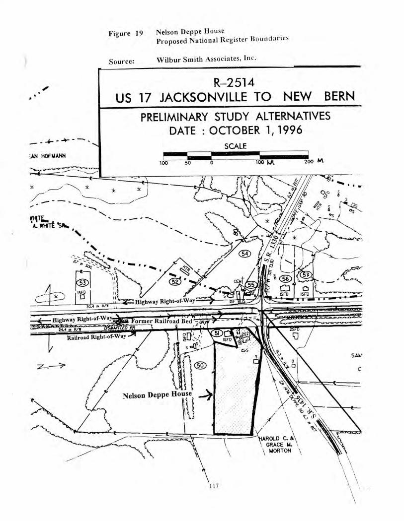
50 100 100 ljt 200 AA
Highway Right-of-W
Highway Right-of-Way
rft W.-7r ormer Railroad Bed ir II 4.0******--- •
2em
tzr* SAW
117
Railroad Right-of-VVay
7-- -
'•..
Figure 19 Nelson Deppe House Proposed National Register Boundaries
Source: Wilbur Smith Associates, Inc.
R-2514 US 17 JACKSONVILLE TO NEW BERN
PRELIMINARY STUDY ALTERNATIVES DATE : OCTOBER 1, 1996
SCALE -
:AN NOR4 ANN
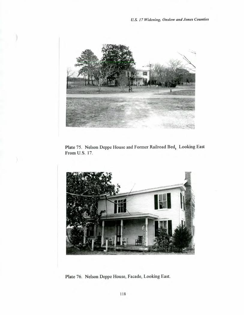
U.S. 17 Widening, Onslow and Jones Counties
Plate 75. Nelson Deppe House and Former Railroad Bed, Looking East From U.S. 17.
Plate 76. Nelson Deppe House, Facade, Looking East.
118
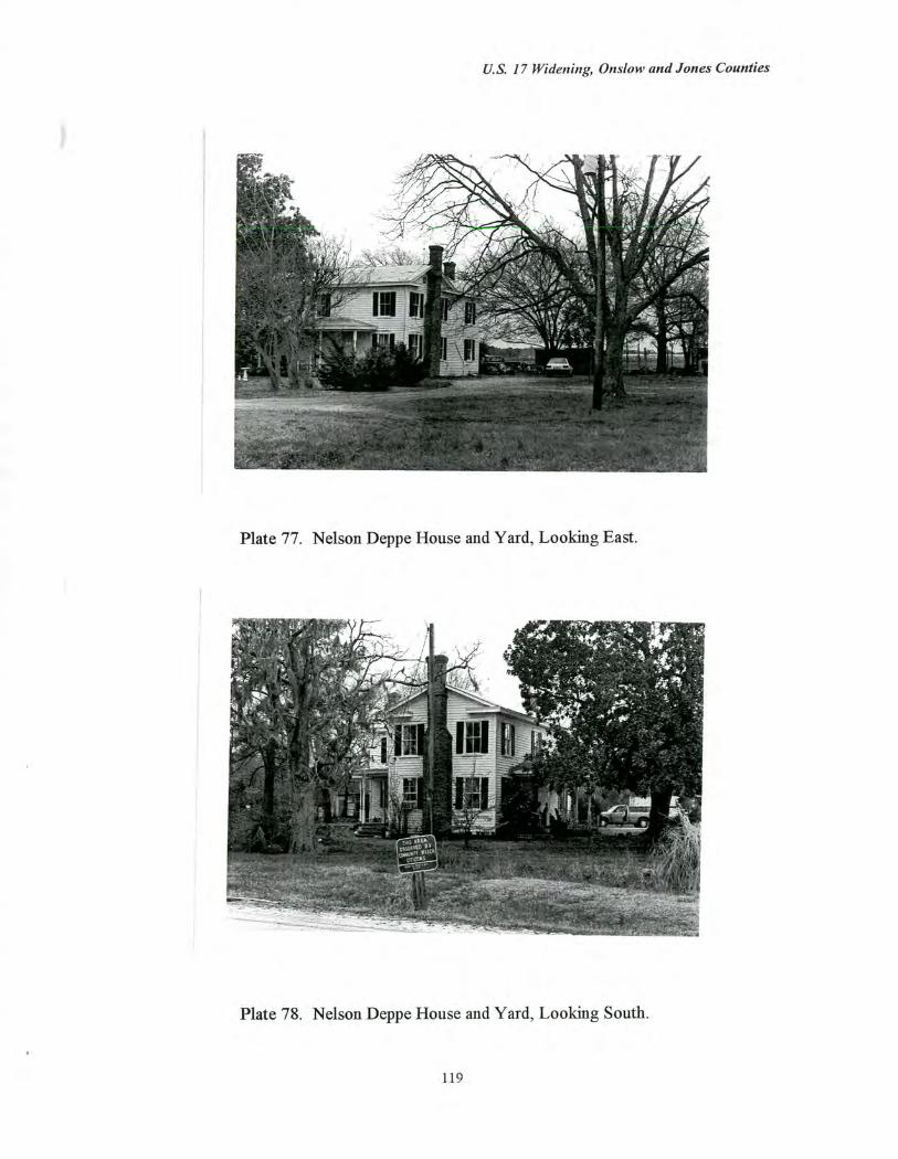
U.S. 17 Widening, Onslow and Jones Counties
Plate 77. Nelson Deppe House and Yard, Looking East.
Plate 78. Nelson Deppe House and Yard, Looking South.
119
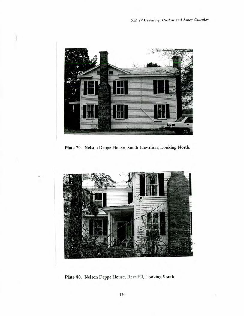
U.S. 17 Widening, Onslow and Jones Counties
Plate 79. Nelson Deppe House, South Elevation, Looking North.
Plate 80. Nelson Deppe House, Rear Ell, Looking South.
120
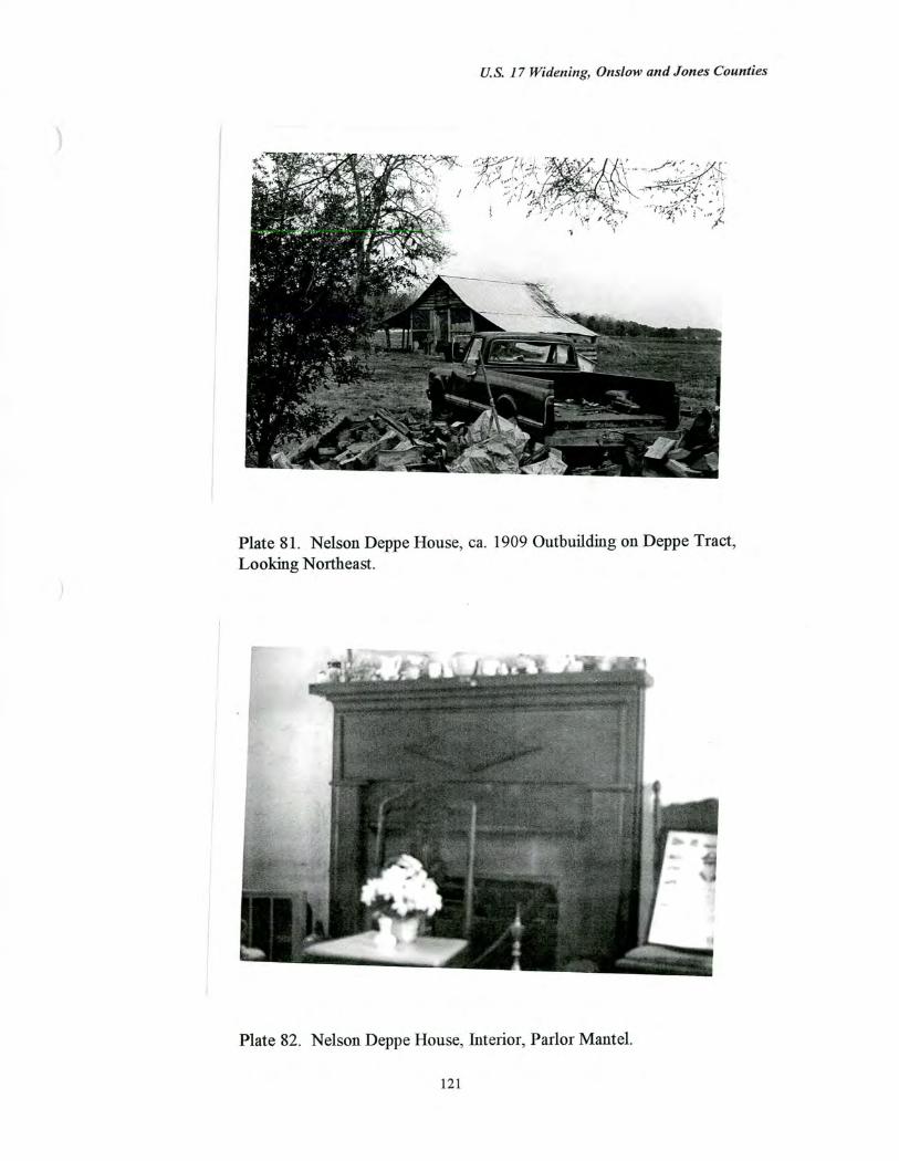
U.S. 17 Widening, Onslou, and Jones Counties
Plate 81. Nelson Deppe House, ca. 1909 Outbuilding on Deppe Tract, Looking Northeast.
Plate 82. Nelson Deppe House, Interior, Parlor Mantel.
121
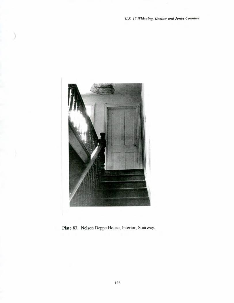
U.S. 17 Widening, Onslow and Jones Counties
Plate 83. Nelson Deppe House, Interior, Stairway.
U.S. 17 Widening, Onslow and Jones Counties
Hofmann Forest/Deppe Lookout Tower and Equipment Headquarters (No. 105) West side of U.S. 17, 1.4 miles south of the junction with S.R. 1436, Onslow County
Date of Construction 1934; ca. 1950; ca. 1960
Associated Outbuildings Garage (ca. 1950)
Setting and Landscape Design (Figure 20) The Hofmann Forest/Deppe Lookout Tower and Equipment Headquarters complex occupies a clearing which fronts on U.S. 17, 1.4 miles south of the junction with S.R. 1436. The complex is surrounded by forests, which line both the east and west sides of U.S. 17. The complex stands at a slightly lower elevation than the highway and has a roughly H-shaped system of unpaved drives along which the buildings are found. One of the unpaved roads parallels U.S. 17, but is separated from the highway by a broad drainage ditch and a slope. The Deppe Trail runs tangential to U.S. 17 on the north side of the headquarters complex. The general vicinity of the complex is characterized by forests.
Physical Description and Evaluation of Integrity (Plates 84-90) This complex of 17 buildings and an enclosed weather station occupy a tree-shaded clearing within Block 10 of the research forest. The complex is located on the west side of U.S. 17 which bisects the forest. On the south side of the clearing are seven (7) frame buildings lining an unpaved road which runs tangential to U.S. 17. Three of these seven buildings are one story, frame equipment sheds with German siding, standing seam tin, gable roofs, and concrete block foundations. Two of the buildings are storage buildings, also with gable roofs, German siding, and six-over-six windows. Also on the south side of the complex are one modern Butler building (ca. 1970) and a one story, frame dwelling. The roughly T-shaped house has a cross gable roof, six-over-six windows, and German siding. All but the Butler building were built during the 1930s by the Civilian Conservation Corps (C.C.C.).
Five buildings line the road which runs parallel to U.S. 17. The southernmost building appears to be an office, and like most of the other Depression-era buildings, has a metal clad, gable roof, German siding, and six-over-six windows. Next to this office is a one story, side gable dwelling (ca. 1910) with German siding, shed roofed porch, and rear ell. The porch is supported by turned posts. The middle building is occupied by the North Carolina Forestry Foundation. The foundation building is a modern, one story, brick veneered office (ca. 1960) with side gable roof and metal sash windows. A second, frame, side gable dwelling lies north of the forestry foundation building. This (ca. 1910) house also has a shed roofed porch, but no rear ell. The northernmost building in this row is a one story, frame, gable roofed office building (1930s). Next to this office is a small weather station, comprised of one small, frame building, used for storage or recording data, and a number of weather instruments. The station is enclosed by a chain link fence.
123
U.S. 17 Widening, Onslow and Jones Counties
Deppe Trail is the third unpaved drive within the clearing, leading west from U.S. 17 past the metal framed, lookout tower. Along this road is a small, one story, frame, side gable dwelling (ca. 1950) with shed roofed porch and six-over-six windows. To the rear of the house is a garage, an open equipment shed, a second shed, and the fire tower.
The 17 building complex and weather station includes six (6) buildings which appear to have been built since 1946, but the newer buildings are similar in materials and scale. The setting is largely unaltered.
Historical Background
The Hofmann Forest was formed in 1934 when more than 80,000 acres (revised to 78,000 acres after the settlement of boundary disputes) of forest land in Onslow and Jones counties were acquired as a research forest for the School of Forestry at North Carolina State University in Raleigh (see Education Context, p. 30). The forest was bought by the North Carolina Forestry Foundation, a non-profit corporation established in 1929 as an arm of the North Carolina State University departmental program. The forest was developed by Dr. J.V. Hofmann, who had started the forestry department at N.C.S.U. and who made the university program one of the larger, more comprehensive departments in the country. Hofmann Forest, the largest university-related forest in the world, was designed to include a commercial timber demonstration program in addition to providing areas purely for research and educational opportunities. The dual purpose of Hofmann Forest, commercial forest management and scientific research, reflected the importance of timber to the North Carolina economy. With Washington and Oregon, North Carolina has the largest timber industry in the United States, and the state, two-thirds of which is forested, has a greater variety of commercial grade trees than any other state (North Carolina Forestry Foundation, Informational Pamphlet).
The establishment of forestry programs at colleges and universities during the early twentieth century underscored the need for both a greater scientific understanding of silviculture and better management of forests for timber production. Before the early twentieth century, most lumber companies sought virgin woodland which would be clear cut and then sold or abandoned. Consequently, few timber companies had a need to cultivate and perpetuate forests for long-term timber production. However, by the twentieth century, much of the original virgin woodland in the United States, particularly those stands with the greatest commercial potential, had been cut, and timber companies recognized the need for better management techniques. (Much of the abandoned clear-cut land was acquired by the federal government and became part of the national forest system.) In particular, second growth forests were generally lower in quality and required more management in order to be both sustainable and profitable, and by the interwar period, scientific research and demonstration forests were undertaken at universities to support this form of industrial production.
At the time of its purchase, the land which became Hofmann Forest had been cut or burned, and much of the area was inaccessible. One of the first tasks was to divide the
124
U.S. 17 Widening, Onslow and Jones Counties
forest into ten blocks (each 25 square miles) which allowed for systematic management and documentation. A headquarters was quickly established to administer the massive campaign of soil preparation, road trail construction, and planting. The complex of buildings, which serves as the headquarters for the Hofmann Forest, was originally built at Camp Butner near Durham. The buildings were dismantled and moved to Hofmann Forest during the Depression by the Civilian Conservation Corps, in cooperation with military personnel from Camp Butner. In addition to rebuilding the forest headquarters, the C.C.C. and the military assisted with site preparation, the planting of pine plantations, and road and trail construction to provide access to the various woodland plantations. The creation of this massive experimental research forest has been ongoing, and during World War II, German prisoners were sent to supply labor for projects (Miller 1971: 75).
Within the A.P.E., the Deppe Trail is one of the principal trails through the forest, created in 1936 and extending west from the forest headquarters at U.S. 17. Trail, road, and canal construction has been an ongoing process, and by 1970, 500 miles of roads and an equal number of canals had been constructed (Miller 1971: x-xii).
The headquarters of Hofmann Forest are located within a 400 acre plantation of loblolly and slash pine trees planted along U.S. 17 in 1936 by the C.C.C. Known as the Deppe Plantation, the area was one of the wettest in the forest, but the construction of the drainage canal along the highway and the Deppe Trail ditch, both dug in 1934, gradually improved the drainage. The Deppe Plantation was used for experimentation in the effects of drainage on the water table and plant growth. Simultaneously, a set of 22 one acre plots were created along U.S. 17 as experiments in plant spacings, and the aligned trees were measured periodically for growth rates.
Halifax Paper Company leased much of the forest, within Blocks 1-9, until 1986, and timber sales have sustained many of the university research programs. The forest was divided into ten blocks, and Block 10, through which U.S. 17 passes, has always been reserved for N.C. State University academic use only. In 1986, the forest reverted to N.C.S.U. control, and a new management plan, which includes much reforestation, has been developed. Currently, of the more than 78,000 acres of forest, 46,606 acres are logging zones, and 40 percent (or 32,321 acres) are genetic reserves, areas exempt from logging (New Bern Sun Journal 1991).
Dr. J.V. Hofmann (1882-1965), for whom the forest is named, was born in Janesville, Minnesota and in 1914, was awarded the first Ph.D. degree in forestry granted in the U.S. Hofmann served for fourteen years in the U.S. Forest Service in western states and participated in the establishment of the Priest River Experiment Station in Idaho and the Wind River Experiment Station in Oregon, Washington, and Alaska. From 1924 to 1929, he served as the assistant director of the Forest School at Mount Alto, Pennsylvania. Hofmann left his position in Pennsylvania to found the North Carolina State University, School of Forestry, where he served as director for nineteen years. The establishment of Hofmann Forest was considered a remarkable achievement as it required clearing numerous, conflicting titles, the passage of a bond referendum, the establishment of the
125
U.S. 17 Widening, Otis/ow and Jones Counties
North Carolina Forestry Foundation to administer the forest, and the development of this enormous tract (Miller 1971: 5-6).
The Hofmann Forest also contains two areas designated as registered natural heritage areas by the North Carolina Natural Heritage Program, Division of Parks and Recreation, Department of Environment, Health, and Natural Resources. The Nere Elexus Day-Hofmann Forest Pond Pine Natural Area encompasses 25 acres and is one of two sites designated as Society of American Foresters natural areas and set aside for preservation (Figure 21). Located southwest of the Hofmann Forest headquarters complex, roughly 2,000 feet back from the existing U.S. 17 alignment, the area is considered a premier example of pond pine communities. Believed to be the oldest pond pine stand remaining in the state, the Nere Elexus Day-Hofmann Forest Pond Pine Natural Area includes trees estimated to be over 175 years old. A trail circumscribes the area which is otherwise unmarked.
The Hofmann Forest Cypress Natural Area covers approximately 28 acres, but the rectangular site has no readily visible demarcation from the rest of the forest except for surveyed boundary lines (Figure 22). Designated as a natural area by the Society of American Foresters, the area is significant as a premiere example of a cypress and bay swamp forest located on a stream head. The stand includes stands of virgin bald cypress trees which are estimated to be as much as 1,000 years old.
Evaluation of Eligibility (Figure 23) The Hofmann Forest is considered eligible for the National Register under Criterion A for education, industry, and conservation. Hofmann Forest is the largest university research forest in the world, and its creation in the 1930s reflects the expansion of scientific research in forestry and forest management during the early to mid-twentieth century. In addition, the establishment of a university forestry program at North Carolina State University, and the formation of allied research forests, underscored the importance of the timber industry to North Carolina, which with Washington and Oregon was the leading lumber producer in the United States. Finally, the forest has significance under Criterion A for conservation because two sites within Hofmann Forest have been designated by the North Carolina Natural Heritage Program as registered natural heritage areas.
Hofmann Forest/Deppe Lookout Tower is also considered eligible under Criterion B for its associations with Professor J.V. Hofmann. Hofmann established the forestry program at North Carolina State University in 1929 and soon after created several research forests to support the scientific research of the university. Hofmann Forest was Hofmann's master work and an important element of the N.C.S.U. program which Hofmann made one of the largest forestry departments in the United States.
The forest is not considered eligible under any other criterion. The forest is not eligible under Criterion C because the buildings associated with the forest headquarters are typical designs which are still common throughout the state. Finally, the property is not considered eligible under Criterion D because the architectural component is not likely to
126
U.S. 17 Widening, Onsli»v and Jones Counties
yield information important in the history of building technology. The archaeological component of the property is evaluated for National Register eligibility in a separate archaeology report.
The proposed National Register boundaries follows the borders of Block 10, the university research reserve where the forest headquarters and Deppe plantation and trail are located. Bisected by U.S. 17, Block 10 is comprised of 25 square miles, and the proposed National Register boundaries include the 17 buildings, weather station, and fire lookout tower, as well as the surrounding forest plantations, trails, and drainage canals of Block 10. Six of the 17 buildings are noncontributing resources: the Butler building; the North Carolina Forestry Foundation office building; the house near the lookout tower; the garage associated with this dwelling; and two sheds also located near the fire tower.
127
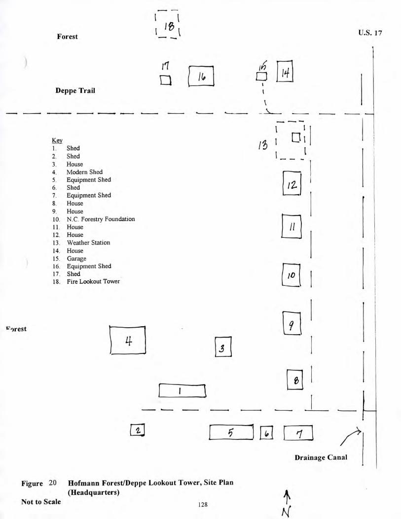
6
Forest
It i 'go
U.S. 17 •••••••
ii
Deppe Trail
•• ••••
Shed Shed House Modern Shed Equipment Shed Shed Equipment Shed House House N.C. Forestry Foundation House House Weather Station House Garage Equipment Shed Shed Fire Lookout Tower
11
'")rest
Drainage Canal
Figure 20 Hofmann Forest/Deppe Lookout Tower, Site Plan (Headquarters)
Not to Scale 128
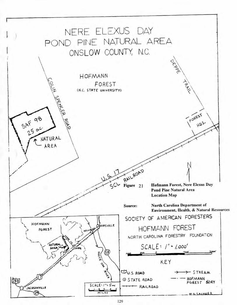
it NATURAL \ AREA
• ,/ <
efo•
z NORTH CAROLINA FORESTRY FOUNDATION
SCALE', /"- /000' 0 ,00o
KEY
NATURA.,, AR4A74. rpt
r 1• "•
(-/.1 ?-•
. • k ,_.
Jr'
1 SCALE 0,- 5"...4 .011-- 4.4 nA IL E5
CiU.S. ROAD
0 STATE WAD
-4—fr"--fr— RAILROAD
S TRE AAA
— • — HOFMANN , FOR.EST 60 RY
tt&
JACIKoWitt.Le
NEE_ ELE-X,S DAY POND PINE NATURAL AREA
ONSLOW COUNTY: N.C.
HOFMANN FOREST
(N.c. STATE uNiVERSITY)
\l‘ Hofmann Forest, Nere Elexus Day Pond Pine Natural Area Location Map
Source: North Carolina Department of
Environment, Health, & Natural Resources
SOCIETY OF AMERICAN FORESTERS
HOFMANN FOREST H OFMANN
.1) FOREST
129
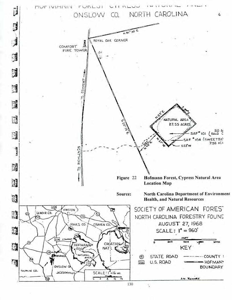
.6 • Ir.... • riur L— s.J I I 1 I \ ̀.--)
ONSLOW CO. NORTH CAROLINA 4
COMFORT I FIRE TOWER
NATURAL AREA 7.55 ACRE$.
sAar" to' (eel") 11)4 (SWEET'
7.5=, nr_ sew
•••••
Figure 22 Hofmann Forest, Cypress Natural Area Location Map
ci
••••••
a SCALE! I -.1C,
-
Source: North Carolina Department of EnvironmenI Health, and Natural Resources
SOCIETY OF AMERICAN FORES- NORTH CAROLINA FORESTRY FOUNIC
AUGUST 27,1968
SCALE:. r = 9601 FILET
0
400 $00 0 Jr° 40 0 0
KEY
e STATE ROAD — -.COUNTY I
U.S. ROAD BOUNDARY
J. Ihe welo
130
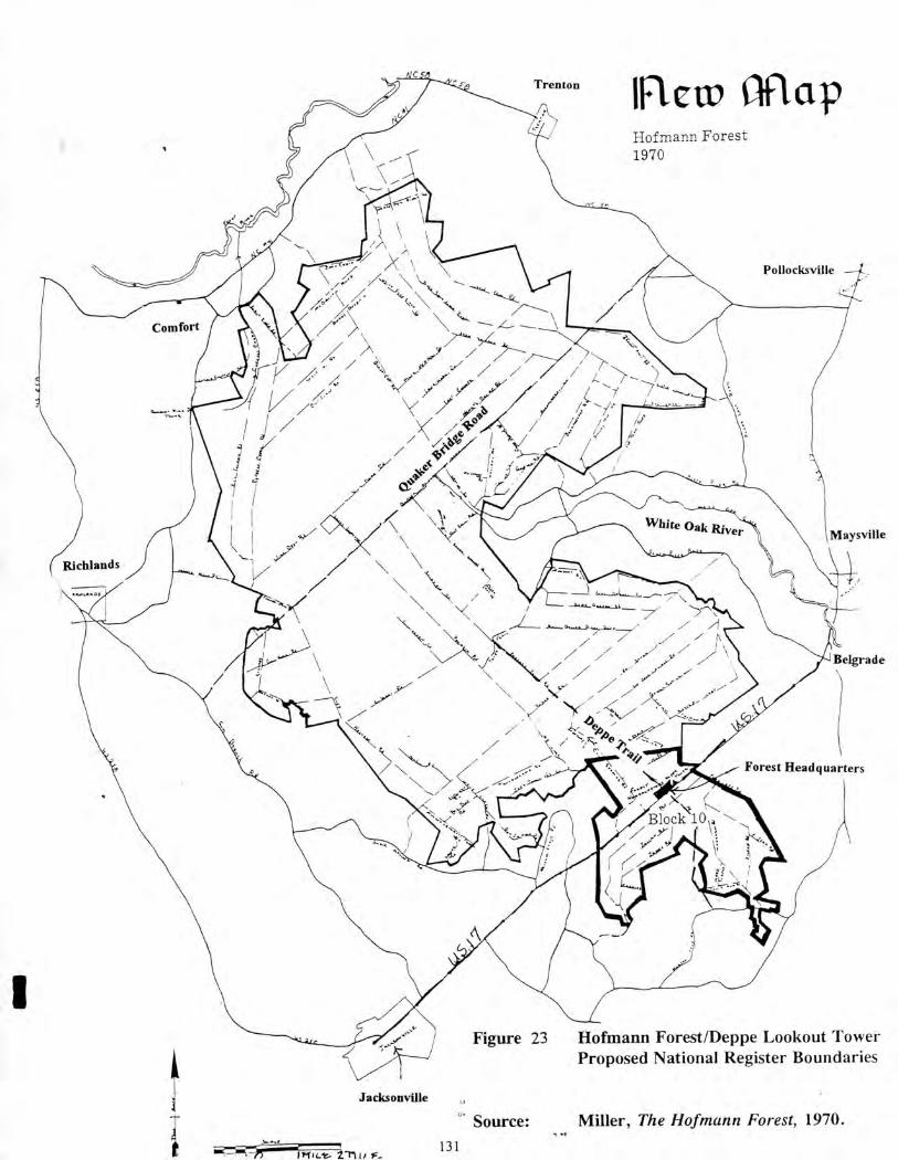
Trenton new map Hofmann Forest 1970
()\ \ - Ar \\\.
//< /‹. ‘.\\S ./ •C4. ' \ 4'1?(--/-----.
// \
\ •.,.. ____ z.....
J / \ 4. '4
K ••• / i /-. s' / ; / /7 >' ,. , ,- / / / ----
\ / 4 /1 /.; i
. — )--- i
)Richlands
-a.-- 0...A.a.-A...,_2.• • —: --7' V )1
V V ...// V I \
/ / •'-, V )
V / ,,,.. Y. ,./ .1" v
/.. \ V 7 .4" 9 " . ".. „.,/
\ ?" y'4• x , 4,7 Ns.A...
/
> 1 s
/
./.. ... a r
N /
,
Pollocksville
Maysville
Belgrade
Forest Headquarters
/ ty/
5/
Figure 23 Hofmann Forest/Deppe Lookout Tower Proposed National Register Boundaries
Jacksonville
Source: Miller, The Hofmann Forest, 1970.
131 lvfiLe., VT*1
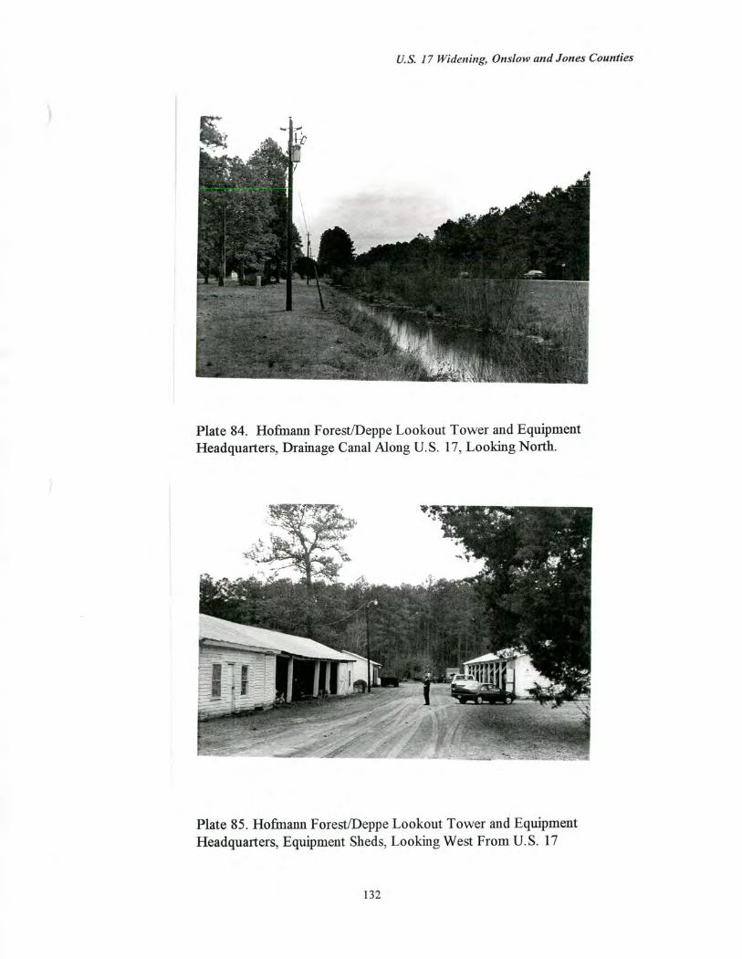
US. 17 Widening, Onslow and Jones Counties
Plate 84. Hofmann Forest/Deppe Lookout Tower and Equipment Headquarters, Drainage Canal Along U.S. 17, Looking North.
Plate 85. Hofmann Forest/Deppe Lookout Tower and Equipment Headquarters, Equipment Sheds, Looking West From U.S. 17
132
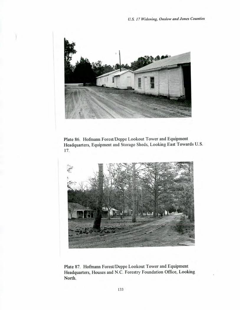
U.S. 17 Widening, Onslow and Jones Counties
Plate 86. Hofmann Forest/Deppe Lookout Tower and Equipment Headquarters, Equipment and Storage Sheds, Looking East Towards U.S. 17.
Plate 87. Hofmann Forest/Deppe Lookout Tower and Equipment Headquarters, Houses and N.C. Forestry Foundation Office, Looking North.
133
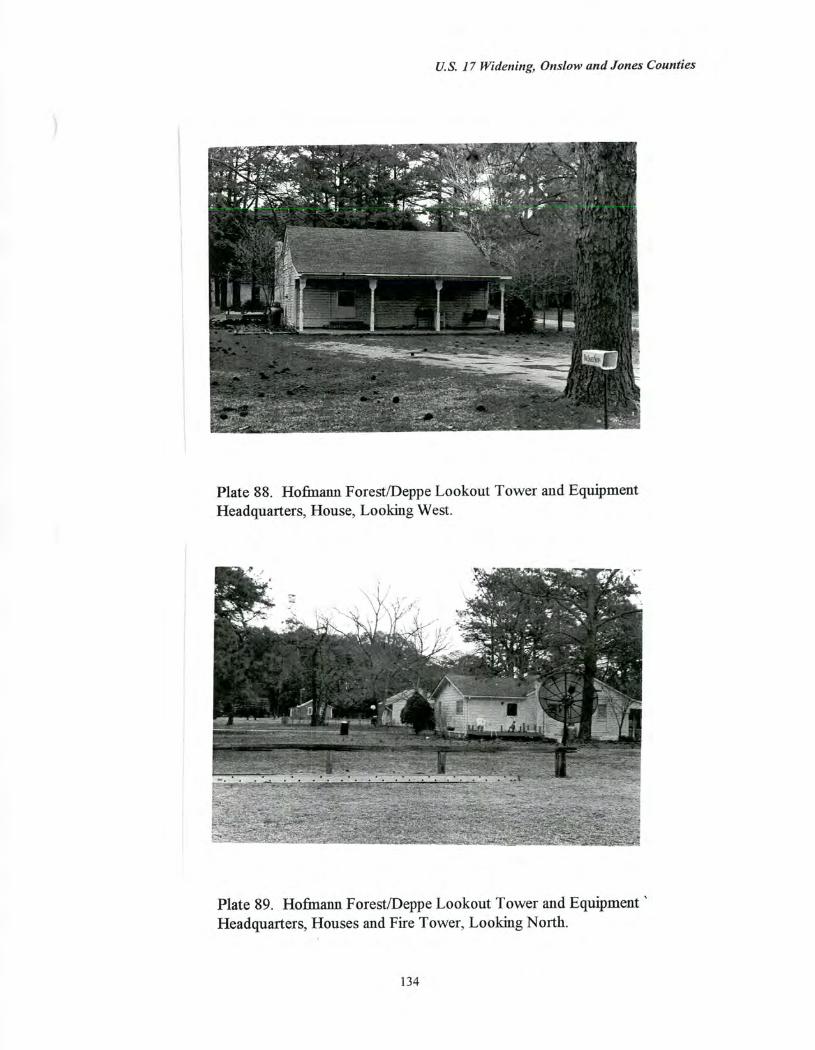
US. 17 Widening, Onslow and Jones Counties
Plate 88. Hofmann Forest/Deppe Lookout Tower and Equipment Headquarters, House, Looking West.
Plate 89. Hofmann Forest/Deppe Lookout Tower and Equipment Headquarters, Houses and Fire Tower, Looking North.
134
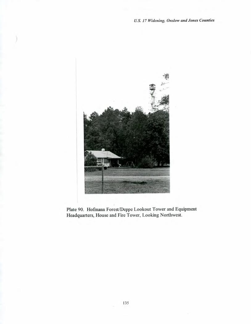
U.S. 17 Widening, Onslow and Jones Counties
Plate 90. Hofmann Forest/Deppe Lookout Tower and Equipment Headquarters, House and Fire Tower, Looking Northwest.
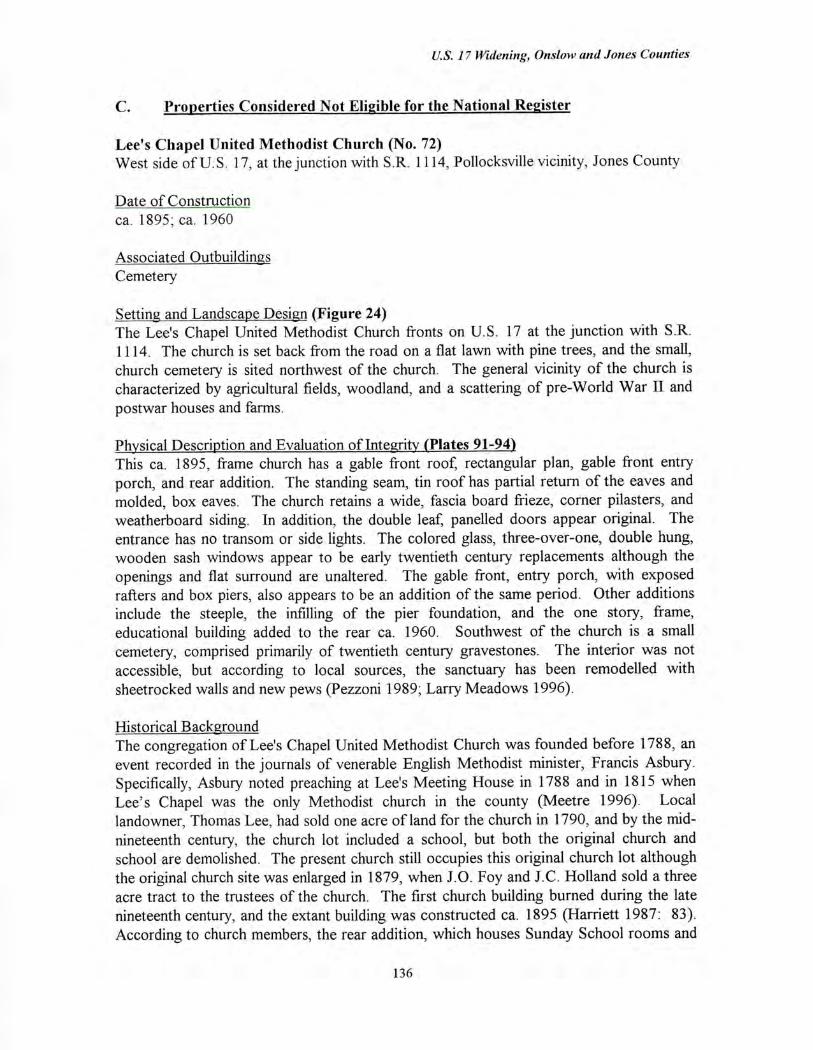
U.S. 17 Widening, Onslow and Jones Counties
C. Properties Considered Not Eligible for the National Register
Lee's Chapel United Methodist Church (No. 72) West side of U.S. 17, at the junction with S.R. 1114, Pollocksville vicinity, Jones County
Date of Construction ca. 1895; ca. 1960
Associated Outbuildings Cemetery
Setting and Landscape Design (Figure 24) The Lee's Chapel United Methodist Church fronts on U.S. 17 at the junction with S.R. 1114. The church is set back from the road on a flat lawn with pine trees, and the small, church cemetery is sited northwest of the church. The general vicinity of the church is characterized by agricultural fields, woodland, and a scattering of pre-World War II and
postwar houses and farms.
Physical Description and Evaluation of Integrity (Plates 91-94) This ca. 1895, frame church has a gable front roof, rectangular plan, gable front entry porch, and rear addition. The standing seam, tin roof has partial return of the eaves and molded, box eaves. The church retains a wide, fascia board frieze, corner pilasters, and weatherboard siding. In addition, the double leaf, panelled doors appear original. The entrance has no transom or side lights. The colored glass, three-over-one, double hung, wooden sash windows appear to be early twentieth century replacements although the openings and flat surround are unaltered. The gable front, entry porch, with exposed rafters and box piers, also appears to be an addition of the same period. Other additions include the steeple, the infilling of the pier foundation, and the one story, frame, educational building added to the rear ca. 1960. Southwest of the church is a small cemetery, comprised primarily of twentieth century gravestones. The interior was not accessible, but according to local sources, the sanctuary has been remodelled with sheetrocked walls and new pews (Pezzoni 1989; Larry Meadows 1996).
Historical Background The congregation of Lee's Chapel United Methodist Church was founded before 1788, an event recorded in the journals of venerable English Methodist minister, Francis Asbury. Specifically, Asbury noted preaching at Lee's Meeting House in 1788 and in 1815 when Lee's Chapel was the only Methodist church in the county (Meetre 1996). Local landowner, Thomas Lee, had sold one acre of land for the church in 1790, and by the mid-nineteenth century, the church lot included a school, but both the original church and school are demolished. The present church still occupies this original church lot although the original church site was enlarged in 1879, when J.0. Foy and J.C. Holland sold a three acre tract to the trustees of the church. The first church building burned during the late nineteenth century, and the extant building was constructed ca. 1895 (Harriett 1987: 83). According to church members, the rear addition, which houses Sunday School rooms and
136
U.S. 17 Widening, Onslow and Jones Counties
a kitchen was built ca. 1960, and the sanctuary interior has been completely remodelled with new sheetrock walls and replacement pews (Meadows and Meetre 1996; Harriett 1987: 83).
Evaluation of Eligibility The Lee's Chapel United Methodist Church is not considered eligible for the National Register of Historic Places under Criteria Consideration A: Religious Properties. Although the church is a designated county historic site and among the few nineteenth century, rural churches surviving in Jones County (see Architecture Context, p. 28), the building has undergone both alterations and additions and no longer retains sufficient integrity to meet National Register criteria. The simple, frame building has altered windows and a porch addition, both of which date to the early to mid-twentieth century, a substantial, post-World War II rear addition, an added steeple, and an interior which has reputedly undergone a complete and recent remodelling. Furthermore, the church cemetery contains twentieth century gravestones primarily, and the church setting contains landscaping and plantings of recent vintage.
The Lee's Chapel United Methodist Church property is not considered eligible under any other criterion. The church is not eligible under Criterion B because the property is not associated with individuals whose activities were demonstrably important within a local, state, or national historic context. Finally, the property is not considered eligible under Criterion D because the architectural component is not likely to yield information important in the history of building technology. The archaeological component of the property is evaluated for National Register eligibility in a separate archaeology report.
137

i / /-. _ /
Cemetery
,.... / ....
/ 0 lc)
0 Church
0
Fields
Fields
U.S. 17
Figure 24 Lee's Chapel United Methodist Church, Site Plan
N
Not to Scale 138
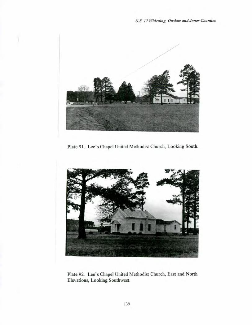
U.S. 17 Widening, Onslow and Jones Counties
Plate 91. Lee's Chapel United Methodist Church, Looking South.
Plate 92. Lee's Chapel United Methodist Church, East and North Elevations, Looking Southwest.
139
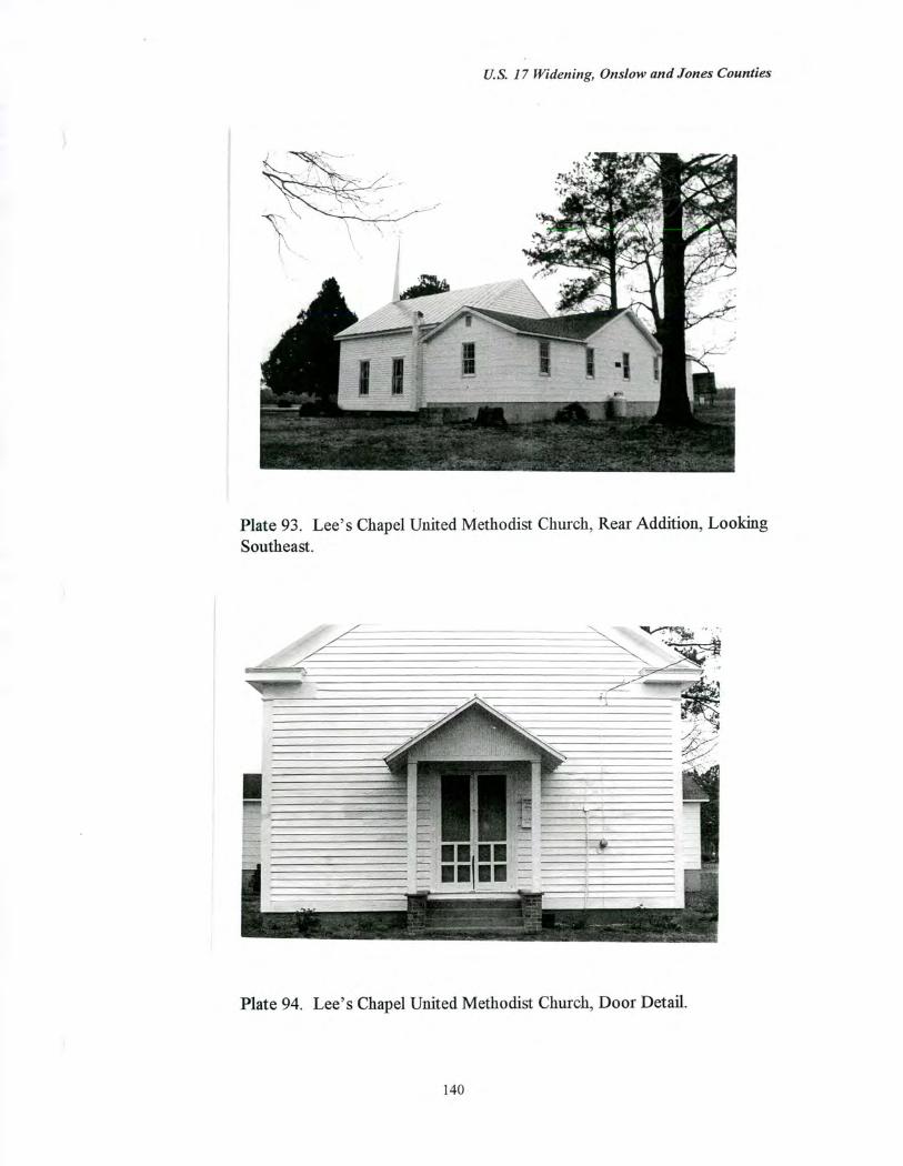
U.S. 17 Widening, Onslo-w and Jones Counties
Plate 93. Lee's Chapel United Methodist Church, Rear Addition, Looking Southeast.
Plate 94. Lee's Chapel United Methodist Church, Door Detail.
140
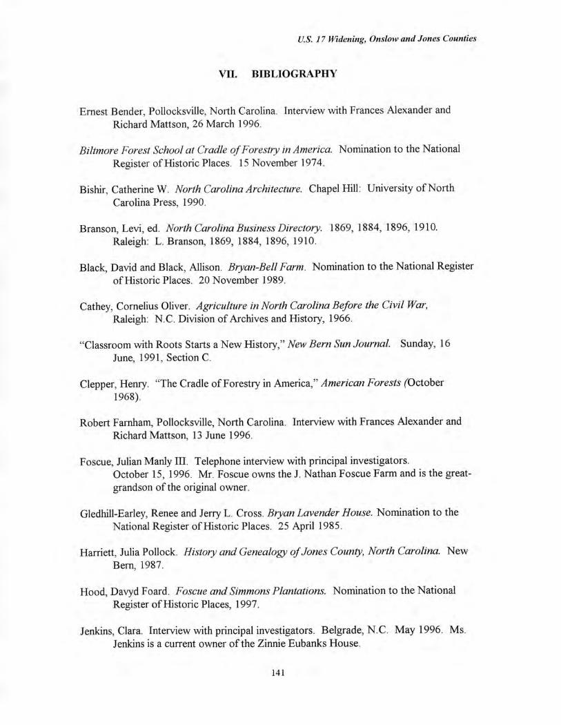
U.S. 17 Widening, Onslow and Jones Counties
VU. BIBLIOGRAPHY
Ernest Bender, Pollocksville, North Carolina. Interview with Frances Alexander and Richard Mattson, 26 March 1996.
Bilt-more Forest School at Cradle of Forestry in America. Nomination to the National Register of Historic Places. 15 November 1974.
Bishir, Catherine W. North Carolina Architecture. Chapel Hill: University of North Carolina Press, 1990.
Branson, Levi, ed. North Carolina Business Directory. 1869, 1884, 1896, 1910. Raleigh: L. Branson, 1869, 1884, 1896, 1910.
Black, David and Black, Allison. Bryan-Bell Farm. Nomination to the National Register of Historic Places. 20 November 1989.
Cathey, Cornelius Oliver. Agriculture in North Carolina Before the Civil War, Raleigh: N.C. Division of Archives and History, 1966.
"Classroom with Roots Starts a New History," New Bern Sun Journal. Sunday, 16 June, 1991, Section C.
Clepper, Henry. "The Cradle of Forestry in America," American Forests (October 1968).
Robert Farnham, Pollocksville, North Carolina. Interview with Frances Alexander and Richard Mattson, 13 June 1996.
Foscue, Julian Manly III. Telephone interview with principal investigators. October 15, 1996. Mr. Foscue owns the J. Nathan Foscue Farm and is the great-grandson of the original owner.
Gledhill-Earley, Renee and Jerry L. Cross. Bryan Lavender House. Nomination to the National Register of Historic Places. 25 April 1985.
Harriett, Julia Pollock. History and Genealogy of Jones County, North Carolina. New Bern, 1987.
Hood, Davyd Foard. Foscue and Simmons Plantations. Nomination to the National Register of Historic Places, 1997.
Jenkins, Clara. Interview with principal investigators. Belgrade, N.C. May 1996. Ms. Jenkins is a current owner of the Zinnie Eubanks House.
141
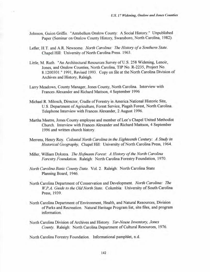
U.S. 17 Widening, Onslow and Jones Counties
Johnson, Guion Griffis. "Antebellum Onslow County: A Social History." Unpublished Paper (Seminar on Onslow County History, Swansboro, North Carolina, 1982).
Lefler, H.T. and A.R. Newsome. North Carolina: The History of a Southern State. Chapel Hill: University of North Carolina Press. 1963.
Little, M. Ruth. "An Architectural Resources Survey of U.S. 258 Widening, Lenoir, Jones, and Onslow Counties, North Carolina, TIP No. R-2235, Project No. 8.1200301." 1991, Revised 1993. Copy on file at the North Carolina Division of Archives and History, Raleigh.
Larry Meadows, County Manager, Jones County, North Carolina. Interview with Frances Alexander and Richard Mattson, 4 September 1996
Michael R. Milosch, Director, Cradle of Forestry in America National Historic Site, U.S. Department of Agriculture, Forest Service, Pisgah Forest, North Carolina. Telephone Interview with Frances Alexander, 2 August 1996.
Martha Meetre, Jones County employee and member of Lee's Chapel United Methodist Church. Interview with Frances Alexander and Richard Mattson, 4 September 1996 and written church history.
Merrens, Henry Roy. Colonial North Carolina in the Eighteenth Century: A Study in Historical Geography, Chapel Hill: University of North Carolina Press, 1964.
Miller, William Dykstra. The Hofmann Forest: A History of the North Carolina Forestry Foundation. Raleigh: North Carolina Forestry Foundation, 1970.
North Carolina Basic County Data. Vol. 2. Raleigh: North Carolina State Planning Board, 1946.
North Carolina Department of Conservation and Development. North Carolina: The W.P.A. Guide to the Old North State. Columbia: University of South Carolina Press, 1939.
North Carolina Department of Environment, Health, and Natural Resources, Division of Parks and Recreation. Natural Heritage Program list, site files, and program information.
North Carolina Division of Archives and History. Tar-Neuse Inventory, Jones County. Raleigh: North Carolina Department of Cultural Resources, 1976.
North Carolina Forestry Foundation. Informational pamphlet, n.d.
142
U.S. 17 Widening, Onslow and Tones Counties
North Carolina Industrial Statistics. Reports of the Department of Labor and Printing, State of North Carolina., 1901-1924. Raleigh: Mitchell Printing Company.
The North Carolina Year Book and Business Directory. 1901-1930. Raleigh:
Edwards and Broughton, 1930.
Linda Pearsall, Staff, Natural Heritage Program, North Carolina Department of Environment, Health, and Natural Resources, Raleigh, North Carolina. Telephone Interview with Frances Alexander, 5 August 1996.
Pezzoni, Daniel. Historic and Architectural Resources of Onslow County, North Carolina. National Register of Historic Places, Multiple Property Documentation Form. 25 September 1989.
Sharpe, Bill. A New Geography of North Carolina. V ols. I and III. Raleigh: Sharpe
Publishing Company, 1954.
Southern, Michael. "The I-House as a Carrier of Style in Three Counties of the North Carolina Piedmont," in Carolina Dwelling. Doug Swaim, ed., 70-83. Student Publication of the School of Design, vol. 26. Raleigh: North Carolina State University, 1978.
Thompson, Deborah. Historic and Architectural Resources of Transylvania County, North Carolina. National Register of Historic Places, Multiple Property Documentation Form. 1993.
U. S. Bureau of the Census. Agricultural and Population Schedules. Jones County.
U. S. Bureau of the Census. Agricultural and Population Schedules. Onslow County.
U.S. Department of Agriculture. Soil Conservation Service. Aerial Photograph Collection, Jones County, 1938. North Carolina State Archives, Raleigh.
U.S. Department of Agriculture, Soil Conservation Service. Soil Survey of Jones
County, North Carolina. 1981.
U.S. Department of Agriculture, Soil Conservation Service. Soil Survey of Onslow
County, North Carolina. July 1992.
U. S. Department of Commerce. Statistics for North Carolina. Washington, D. C.:
Government Printing Office, 1916.
Watson, Alan D. Onslow County: A Brief History Raleigh: North Carolina
Department of Cultural Resources, 1995.
143
U.S. 17 Widening, Onslow and Jones Counties
Wells, John B. Foscue Plantation House. Nomination to the National Register of Historic
Places. 19 November 1971.
144
US 17 Widening, Onslow and Jones Counties
APPENDIX A:
AREA OF POTENTIAL El IIECTS MAP
".?
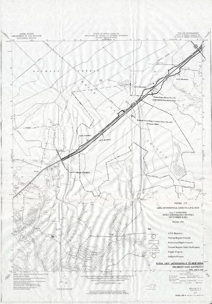
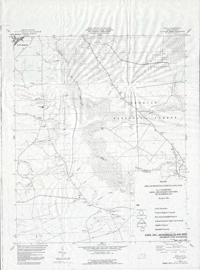
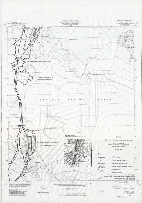
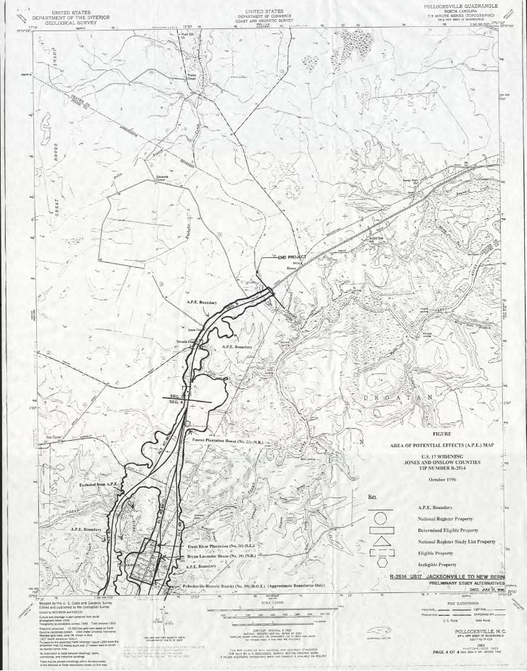
U.S. 17 Widening, Onslow and Jones Counties
APPENDIX B:
PHOTOGRAPHIC INVENTORY AND EVALUATIONS
AND
CONCURRENCE FORM
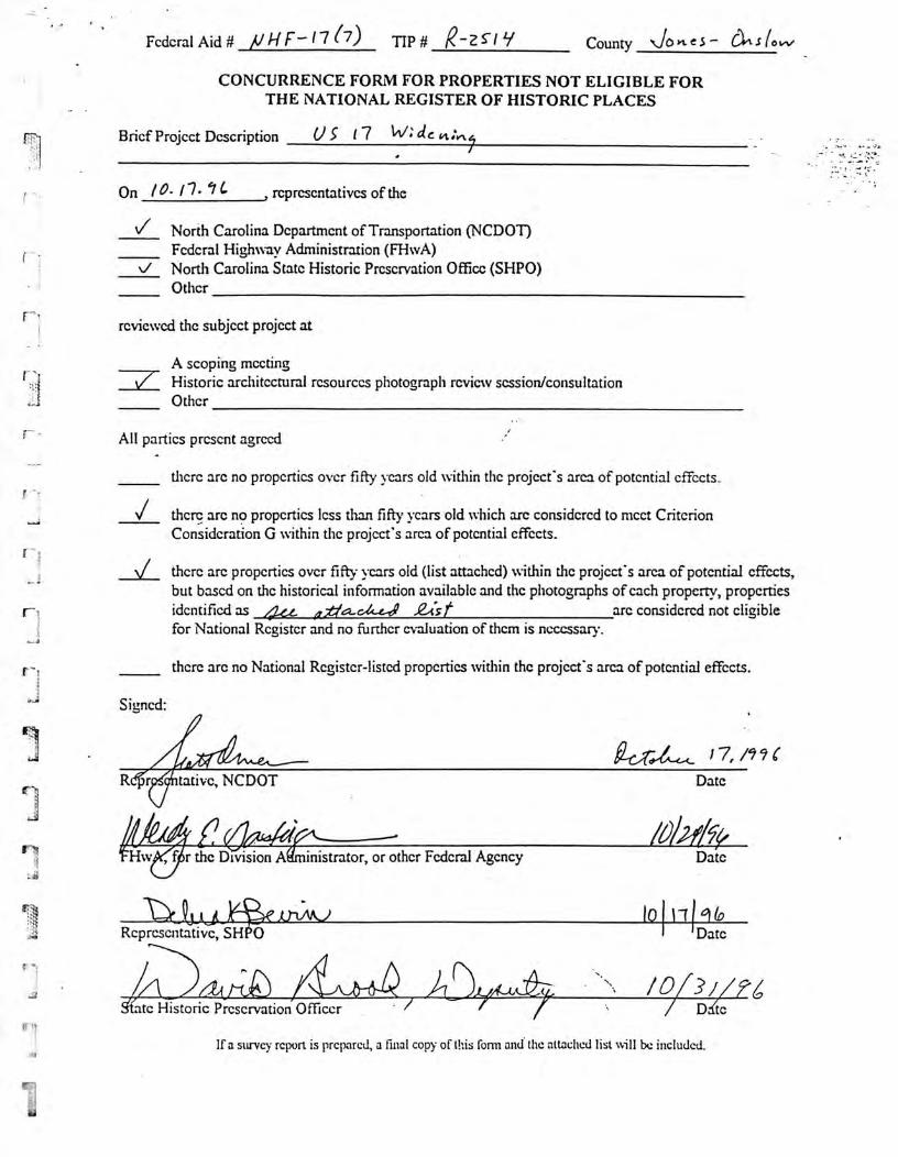
Signed:
1 7, /9" C
tative, NCDOT Date
Federal Aid # F- 1 7 (7) Tip # R-2 County \JO e — CIA S 0 vV
CONCURRENCE FORM FOR PROPERTIES NOT ELIGIBLE FOR THE NATIONAL REGISTER OF HISTORIC PLACES
Brief Project Description 5 17 W:
On 10- 17- IC ,representatives of the
V North Carolina Department of Transportation (NCDOT) Federal Highway Administration (FHwA) North Carolina State Historic Preservation Office (SHPO)
Other
reviewed the subject project at
A seoping meeting / Historic architectural resources photograph rcvicw session/consultation
Other
All parties present agreed
there arc no properties over fifty years old within the project's area of potential effects.
there are no properties less than fifty years old which arc considered to meet Criterion Consideration G within the project's area of potential effects.
there are properties over fifty ycars old (list attached) within the project's area of potential effects, but based on the historical information available and the photographs of each property, properties identified as 464 0,7.1a-att.-r, 24.st arc considered not eligible for National Register and no further evaluation of them is necessary.
there arc no National Register-listed properties within the project's area of potential effects.
'Hw4ar the Division A4 inistrator, or other Federal Agency Date
101 111 6110 Date Representative, SH 0
4,-A444 / ate Historic Preservation Officer
/ / Ddte
Ti
If a survey report is prepared, a final copy of this form and the attached list will be included.
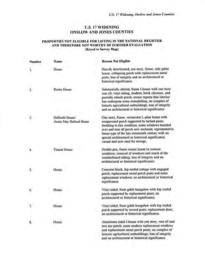
U.S. 17 Widening, Onslow and Jones Counties
U.S. 17 WIDENING ONSLOW AND JONES COUNTIES
PROPERTIES NOT ELIGIBLE FOR LISTING IN THE NATIONAL REGISTER AND THEREFORE NOT WORTHY OF FURTHER EVALUATION
(Keyed to Survey Map)
Number Name Reason Not Eligible
House Heavily deteriorated, one story, frame, side gable house; collapsing porch with replacement metal posts; loss of integrity and no architectural or historical significance.
Banks House Substantially altered, frame I-house with one story rear ell; vinyl siding, modern, brick chimney, and partially rebuilt porch; owner reports that interior has undergone some remodelling; no complex of historic agricultural outbuildings; loss of integrity and no architectural or historical significance.
DeBruhl House/ One story, frame, vernacular L-plan house with Annie May Ballard House wraparound porch supported by turned posts;
dwelling in fair condition; some windows boarded over and rear ell porch now enclosed; representative house type of the late nineteenth century with no special architectural or historical significance; vacant and now used for storage.
Tenant House Double pen, frame tenant house in ruinous condition; removal of windows and much of the weatherboard siding; loss of integrity and no architectural or historical significance.
House Concrete block, hip roofed cottage with engaged porch; replacement metal porch posts and some replacement windows; no architectural or historical significance.
House Vinyl sided, front gable bungalow with hip roofed porch supported by replacement piers; no architectural or historical significance.
House Vinyl sided, front gable bungalow with hip roofed porch supported by turned posts; replacement door, no architectural or historical significance.
House Aluminum sided I-house with one story, rear ell and two tier porch; some modern replacement windows and replacement metal porch posts; no complex of historic agricultural outbuildings; loss of integrity and no architectural or historical significance.
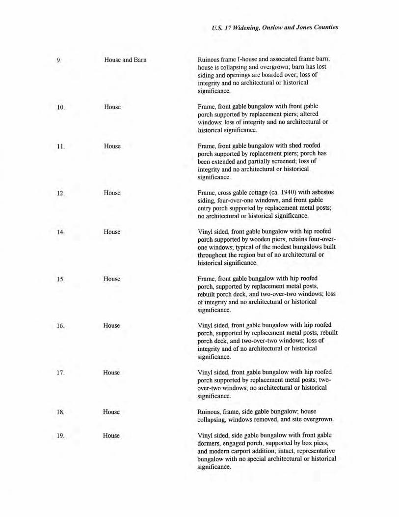
U.S. 17 Widening, Onslow and Jones Counties
House and Barn Ruinous frame I-house and associated frame barn; house is collapsing and overgrown; barn has lost siding and openings are boarded over; loss of integrity and no architectural or historical significance.
House Frame, front gable bungalow with front gable porch supported by replacement piers; altered windows; loss of integrity and no architectural or historical significance.
House Frame, front gable bungalow with shed roofed porch supported by replacement piers; porch has been extended and partially screened; loss of integrity and no architectural or historical significance.
House Frame, cross gable cottage (ca. 1940) with asbestos siding, four-over-one windows, and front gable entry porch supported by replacement metal posts; no architectural or historical significance.
House Vinyl sided, front gable bungalow with hip roofed porch supported by wooden piers; retains four-over-one windows; typical of the modest bungalows built throughout the region but of no architectural or historical significance.
House Frame, front gable bungalow with hip roofed porch, supported by replacement metal posts, rebuilt porch deck, and two-over-two windows; loss of integrity and no architectural or historical significance.
House Vinyl sided, front gable bungalow with hip roofed porch, supported by replacement metal posts, rebuilt porch deck, and two-over-two windows; loss of integrity and of no architectural or historical significance.
House Vinyl sided, front gable bungalow with hip roofed porch supported by replacement metal posts; two-over-two windows; no architectural or historical significance.
House Ruinous, frame, side gable bungalow; house collapsing, windows removed, and site overgrown.
House Vinyl sided, side gable bungalow with front gable dormers, engaged porch, supported by box piers, and modem carport addition; intact, representative bungalow with no special architectural or historical significance.
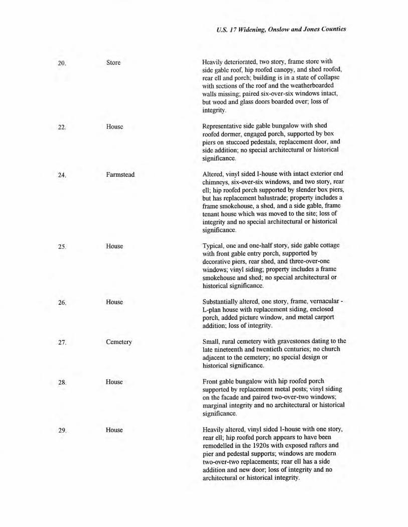
U.S. 17 Widening, Onslow and Jones Counties
20. Store Heavily deteriorated, two story, frame store with side gable roof, hip roofed canopy, and shed roofed, rear ell and porch; building is in a state of collapse with sections of the roof and the weatherboarded walls missing; paired six-over-six windows intact, but wood and glass doors boarded over; loss of integrity.
22. House Representative side gable bungalow with shed roofed dormer, engaged porch, supported by box piers on stuccoed pedestals, replacement door, and side addition; no special architectural or historical significance.
Farmstead Altered, vinyl sided I-house with intact exterior end chimneys, six-over-six windows, and two story, rear ell; hip roofed porch supported by slender box piers, but has replacement balustrade; property includes a frame smokehouse, a shed, and a side gable, frame tenant house which was moved to the site; loss of integrity and no special architectural or historical significance.
House Typical, one and one-half story, side gable cottage with front gable entry porch, supported by decorative piers, rear shed, and three-over-one windows; vinyl siding; property includes a frame smokehouse and shed; no special architectural or historical significance.
House Substantially altered, one story, frame, vernacular - L-plan house with replacement siding, enclosed porch, added picture window, and metal carport addition; loss of integrity.
Cemetery Small, rural cemetery with gravestones dating to the late nineteenth and twentieth centuries; no church adjacent to the cemetery; no special design or historical significance.
House Front gable bungalow with hip roofed porch supported by replacement metal posts; vinyl siding on the facade and paired two-over-two windows; marginal integrity and no architectural or historical significance.
House Heavily altered, vinyl sided I-house with one story, rear ell; hip roofed porch appears to have been remodelled in the 1920s with exposed rafters and pier and pedestal supports; windows are modern two-over-two replacements; rear ell has a side addition and new door; loss of integrity and no architectural or historical integrity.
U.S. 17 Widening, Onslow and Jones Counties
House Vinyl sided, side gable bungalow with shed roofed dormer, engaged porch, supported by replacement metal posts; loss of integrity and no special architectural or historical significance.
Kerman House Typical, frame, front gable bungalow with hip roofed porch supported by wooden piers; symmetrical, three bay facade with paired windows; no special architectural or historical significance.
House Vinyl sided, side gable bungalow with shed roofed dormer, engaged porch, supported by replacement metal posts; loss of integrity and no special architectural or historical significance.
House Typical, frame, front gable bungalow with hip roofed, screened porch; two-over-two windows; no special architectural or historical significance.
Gas Station Heavily deteriorated, early twentieth century gas station and store; roof is collapsing, canopy supported by replacement metal posts, missing weatherboard siding, and boarded over windows; loss of integrity and no architectural or historical significance.
House Typical, front gable bungalow with front gable porch, supported by wooden piers on brick pedestals, and six-over-six windows; replacement siding and modern door; no special architectural and historical significance.
37. House Heavily altered, two story, frame, vernacular picturesque house with two tier porch, three sided bay, and two-over-two windows; two story, L-shaped addition with brick veneer doubles the size of the original house; loss of integrity.
House Deteriorated, frame Four Square house with hip roofed porch with rebuilt porch and replacement piers; two-over-two windows, some of which are boarded over or in poor condition; loss of integrity; however, will be examined for eligibility as a contributing element to a Pollocksville historic district.
House Deteriorated, front gable bungalow with front gable porch, supported by wooden piers, and six-over-six windows; replacement siding; marginal integrity; however, will be examined for eligibility as a contributing element to a Pollocksville historic district.
U.S. 17 Widening, Onslow and Jones Counties
House Deteriorated, one story, frame, side gable dwelling with altered, shed roofed porch and six-over-six windows; porch has replacement wooden piers; represents a common house type but has only marginal integrity; however, will be examined for eligibility as a contributing element to a Pollocksville historic district.
House Heavily deteriorated, one story, frame, side gable dwelling with asphalt siding, shed roofed porch, and six-over-six windows; marginal integrity; however, will be examined for eligibility as a contributing element to a Pollocksville historic district.
48 House Typical, front gable bungalow with front gable, porch, supported by wooden piers, and two-over-two windows; vinyl siding; marginal integrity; however, will be examined for eligibility as a contributing element to a Pollocksville historic district.
House Asbestos sided, front gable bungalow with hip roofed porch, supported by battered piers on brick pedestals, and four-over-one windows; marginal integrity; however, will be examined for eligibility as a contributing element to a Pollocksville historic district.
House Heavily altered, side gable bungalow with shed roofed dormer, new brick veneer, replacement two-over-two windows, and engaged porch supported by replacement wooden piers; loss of integrity; however, will be examined for eligibility as a contributing element to a Pollocksville historic district.
House Altered and deteriorated, frame, vernacular L-plan house with replacement siding, shed roofed porch with replacement posts, and some boarded over windows; loss of integrity; however, will be examined for eligibility as a contributing element to a Pollocksville historic district.
House Heavily altered, asbestos sided, side gable bungalow with shed roofed porch; porch has replacement metal posts; loss of integrity; however, will be examined for eligibility as a contributing element to a Pollocksville historic district.
House Typical, side gable bungalow with hip roofed porch; porch supported by battered piers on brick pedestals; porch partially screened; no special architectural or historical significance; however,
U.S. 17 Widening, Onslow and Jones Counties
will be examined for eligibility as a contributing element to a Pollocksville historic district..
House Heavily altered and deteriorated, two story, front gable house with asphalt siding, some replacement one-over-one windows, and partially enclosed, front gable porch; loss of integrity; however, will be examined for eligibility as a contributing element to a Pollocksville historic district.
House Typical, front gable bungalow with hip roofed porch, supported by battered piers on brick pedestals, and four-over-one windows; asbestos siding and carport addition; marginal integrity; however, will be examined for eligibility as a contributing element to a Pollocksville historic district.
House Heavily altered, asbestos sided I-house with a variety of replacement windows, and an added ca. 1920 bungalow porch which now has replacement metal posts; loss of integrity and no special architectural or historical significance.
Church Altered, brick veneered, vernacular Gothic Revival church (ca. 1940); new central entrance with metal porch canopy; original end bay entrances infilled; concrete block, rear addition; loss of integrity and no special architectural or historical significance.
House Typical, front gable bungalow with front gable porch supported by unusual, decorative, battered piers on brick pedestals; single and paired, two-over-two windows, and replacement door; no special architectural or historical significance.
House Typical, front gable bungalow with hip roofed porch supported by battered piers on brick pedestals; single and paired windows, and added carport; no special architectural or historical significance.
House Typical, front gable bungalow with hip roofed porch supported by battered piers on brick pedestals; two-over-two windows; no special architectural or historical significance.
House Vinyl sided, front gable bungalow with front gable entry porch, supported by replacement piers; no special architectural and historical significance.
House Asphalt sided, front gable bungalow with hip roofed porch, supported by new wooden piers; loss of integrity and no special architectural and historical significance.

U.S. 17 Widening, Onslow and Jones Counties
House Frame, front gable bungalow with hip roofed porch supported by replacement piers; paired two-over-two windows; no special architectural and historical significance.
House Frame, front gable bungalow with hip roofed porch supported by paired piers on brick pedestals; paired four-over-one windows; no special architectural and historical significance.
House Asbestos sided, front gable bungalow with hip roofed porch, supported by new wooden piers, and two-over-two windows; marginal integrity and no special architectural and historical significance.
House Heavily deteriorated, weatheiboarded I-house with shed roofed porch, rear shed, and rear ell; porch roof and deck are collapsing, and the piers are replacements; six-over-six windows, Eastlake door, and exposed face, interior end chimney; some windows have broken sash, and the rear ell porch has missing piers and deteriorated deck; property includes two modern, frame outbuildings; loss of integrity.
House Asbestos sided, front gable bungalow with hip roofed porch, supported by new wooden piers, and some replacement two-over-two windows; marginal integrity and no special architectural and historical significance.
69 Tenant House Ruinous, side gable tenant house; building is overgrown, and the porch and rear ell have collapsed.
House Vinyl sided I-house with rear shed and shed roofed porch with replacement piers and deck; six-over-six windows; property includes a modern, concrete block garage; loss of integrity and no special architectural or historical significance.
House Altered, one story, vernacular L-plan house with replacement siding and hip roofed, wraparound porch with replacement posts and balustrade; loss of integrity and no special historical or architectural significance.
73. House Ruinous, late Federal/Greek Revival I-house with engaged, two tier porch and rear ell; house has been destroyed by fire with only the shell of the main block standing.
u.S. / 7 Widening, Onsimi, and Jones Counties
House Typical, Triple A cottage with hip roofed porch, turned posts, two-over-two windows, and weatherboard siding; house moved to the site and therefore has lost its integrity of setting.
House Typical, front gable bungalow with German siding, hip roofed porch, supported by new wooden piers, and six-over-six windows; marginal integrity and no special architectural or historical significance.
House Typical, front gable bungalow with shed roofed screened porch and replacement siding; marginal integrity and no special architectural or historical significance.
House Representative, front gable bungalow with L-plan, shed roofed porch, supported by battered piers on brick pedestals, and four-over-one windows; intact but no special architectural or historical significance.
House Typical, clipped front gable bungalow with hip roofed porch, supported by box piers on pedestals, weatherboard siding, and six-over-six windows; no special architectural or historical significance.
Store Heavily altered, two story, frame store with Four Square form and hip roofed, bungalow canopy; now used as a house, the store has replacement siding and altered or infilled windows; main entrance has been boarded over; loss of integrity and no special architectural or historical significance.
House Typical, ca. 1940, Colonial Revival cottage with side gable roof, front gable dormers, front gable porch, and screened side porch; represents a common, mid-twentieth century, house type; no special architectural or historical significance.
House Aluminum sided, front gable bungalow with hip roofed, screened porch supported by battered piers on brick pedestals, and a carport addition; marginal integrity and no special architectural or historical significance.
Cemetery Small, rural cemetery with gravestones dating to the early twentieth century; no church adjacent to the cemetery; no special design or historical significance.
Tobacco Barn and Barn Typical, frame tobacco barn and a representative, frame, central passage barn, both in marginal condition; loss of integrity and no special architectural or historical significance.
US. 17 Widening, Onslow and Jones Counties
House Typical, front gable bungalow with hip roofed, porch supported by wooden piers, weatherboard siding, and two-over-two windows; no special architectural or historical significance.
House Typical, front gable bungalow with engaged porch, supported by replacement metal posts on brick pedestals, replacement siding, knee brackets, and six-over-six windows; no special architectural or historical significance.
House Heavily altered, L-plan cottage with enclosed, wraparound porch, altered windows, and replacement siding; property includes only a modern garage; loss of integrity and no special architectural or historical significance.
House Heavily altered, typical, frame I-house now used as a club; house retains its weatherboard siding and exterior end chimneys, but an access ramp and fire escape have been added, windows are boarded over or altered, and the entrance has been modified; loss of integrity and no special architectural or historical significance.
House Heavily altered, two story, frame Colonial Revival dwelling with hip roof, vinyl siding, replacement windows, and a rebuilt, hip roofed porch; loss of integrity and no special architectural or historical significance.
House Frame, front gable bungalow with hip roofed porch supported by battered piers on brick pedestals; single and paired six-over-one windows; no special architectural or historical significance.
House Frame, front gable bungalow with hip roofed porch supported by battered piers on brick pedestals; single and paired windows and asbestos siding; no special architectural or historical significance.
House Frame, front gable bungalow with screened, front gable porch supported by battered piers on brick pedestals; single and paired windows; no special architectural or historical significance.
U.S. 17 Widening, Onslow and Jones Counties
Belgrade United Altered, vernacular Gothic Revival church building Methodist Church with modernized interior; front gable main block,
projecting entrance tower with steeple, and pointed arch windows; church has vinyl siding, a rear addition, porch addition, and a new door; loss of integrity and no special architectural or historical significance.
Dolph Henderson Store Altered, front gable store with rebuilt, shed roofed porch with new porch posts, some infilled windows, and remodelled interior; store may date from late 1930s to the early 1950s; loss of integrity and no special architectural or historical significance.
House Altered, frame, L-plan cottage with shed roofed porch supported by replacement piers; loss of integrity and no special architectural or historical significance.
Eubanks House Ruinous, frame I-house with one story, rear al, hip roofed porch, and a few remaining six-over-six windows; house is overgrown, and the property includes no agricultural outbuildings; loss of integrity and no special architectural or historical significance.
104. House Frame, front gable, bungalow with hip roofed porch supported by wooden piers and two-over-two windows; no special architectural or historical significance.
106. House Typical, one story, frame, side gable dwelling with German siding and six-over-six windows; house moved to the site and now used as a hunting club; loss of integrity and no special architectural or historical integrity.
\\\,\\\\\\\M\q
t 1.11IlLIAL
-
,n•
ffs'AY
J P-
1)
tzk- \
0
-Th
61.1.
—
C:
erw
m%
!Weft
r-r4a offm
, c_
c3N
tr—i m
it r---1 m
;45 '"""•-",71'.1
f,741
" 6771
7-1
L'- 1
-1 ryr
poi
FE
:21 EM
I 7 2
r. 1=1
BEA
= =
11
1
ION
MIN
-
L
iEgm
c:3
• Cm
=a E
N
L...A
LZ
A M
OM
"
LIL
-1
Brz,
woo
woo•"
,
LT
£T
i
L r-
411"14 r"--2
:172
t, 3 P
ail
111111ffil C
A-)
- r7
-771 ri•
1
csc) c.c.‘
trL1.1,, . .;
0
C:=
:=1
err'?
c
L‹.
6 r .1
c-- r7-7.1
frn
:7_71
4/
L.
Li: _T1 1:771
r,L.01 CL.71
r.7
1
ern
L.
ruzi 2
aid
-r97=r L
ill
L.,1 L:4,41 IN
III SIM
I
1
-
C?\
L
- '
-1
' fra
N
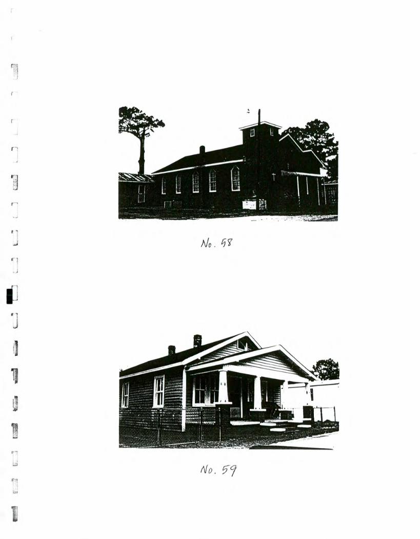
f"--- rIv
ri --
sT211 I
pain
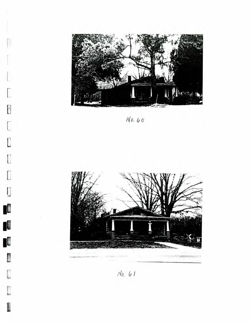
L C
al L
ad
i =
I III MN
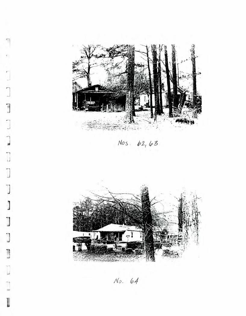
TT] r7.7_7711
1"" •
1;
:
•• .1 "
"" " .111'
I
4
f•e..,"..
I1'
. "4
1
304,4
'
•
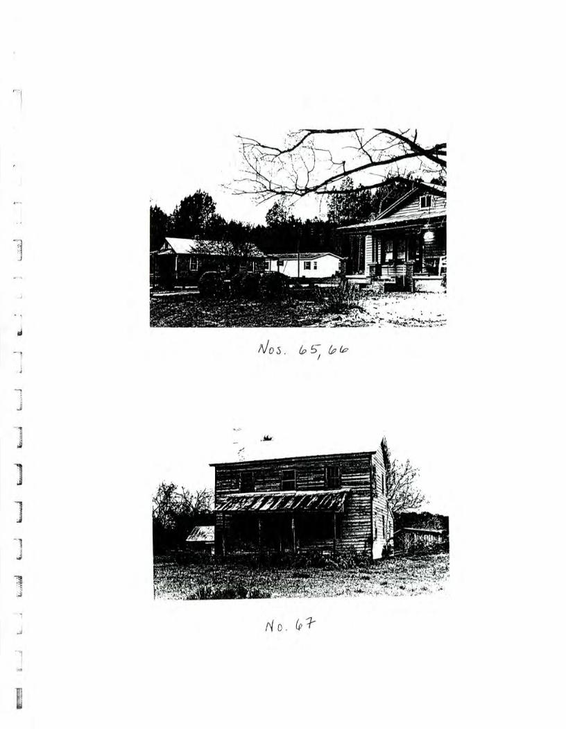
Fersam
i r"."."1

r77.71
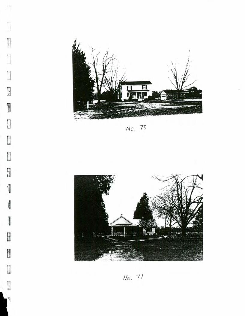
r__-_11 -
F7-73̀ p
m I,
FT
- p
erm
. r o.:m
ill
I!!°°,,,m
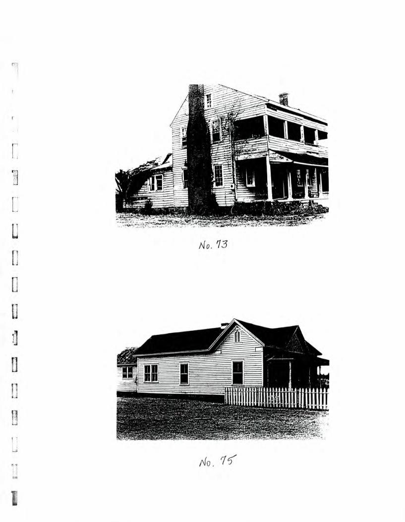
, 1
7.:
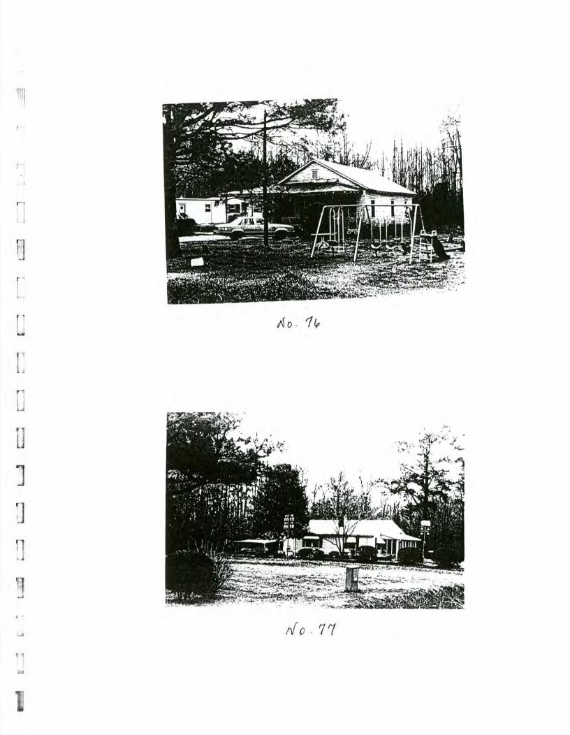
- ,2
1
A
Will
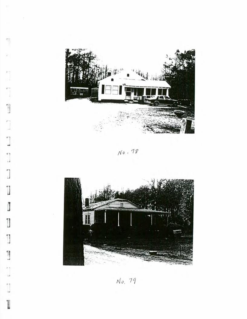
‘.<
LT7-1
L
frn
er• 17=1
, p
ain
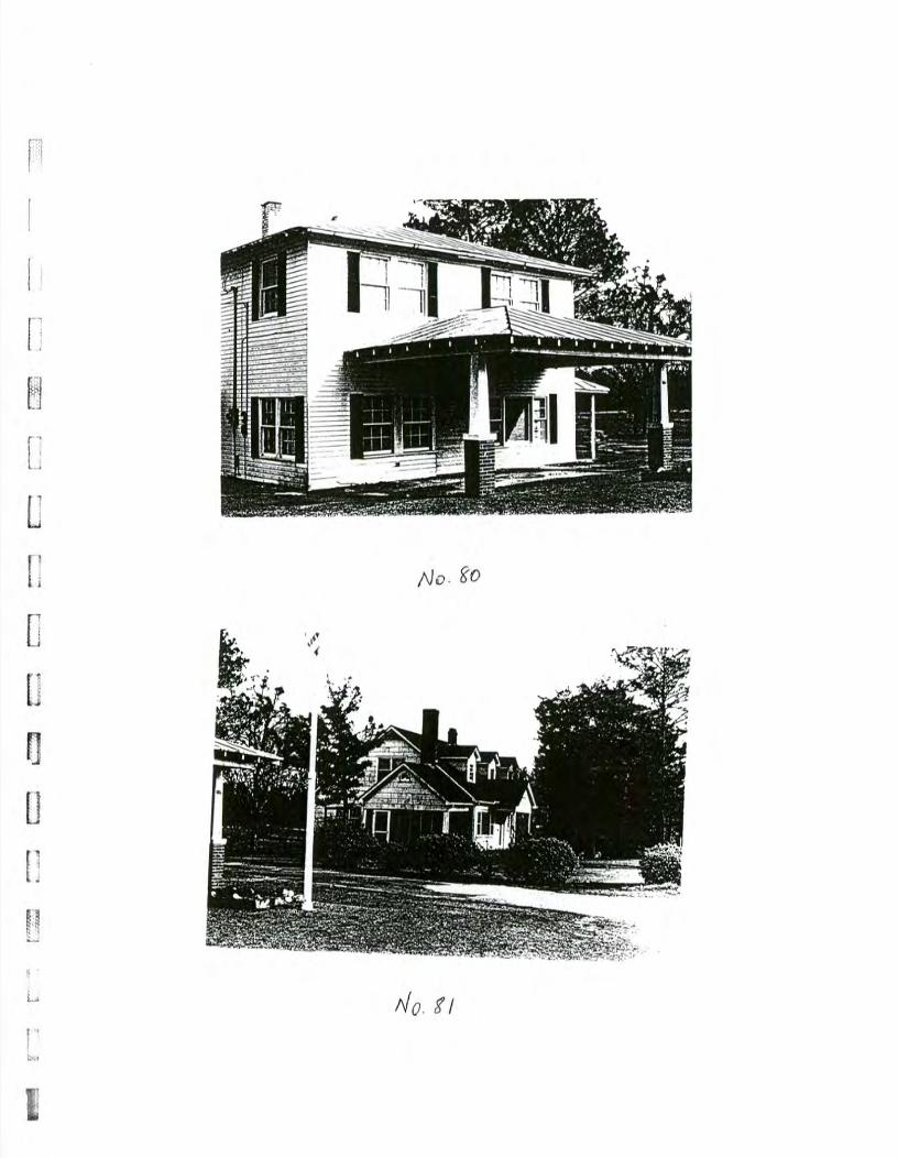
q ,
Ef1
Ji
-'111111111:ramt IM
EM
BIN
IMIn
n,
gr:':',"Irrrnrgr°677
ct.c)
£1
CL:= =
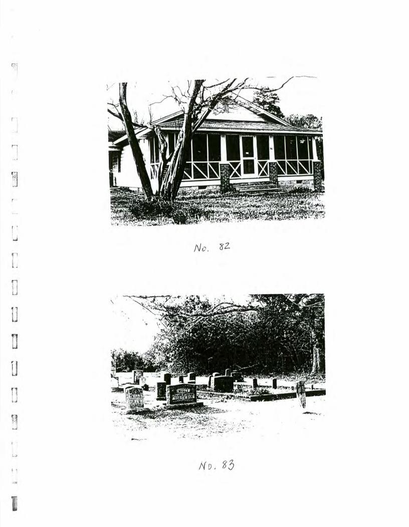
, :7=
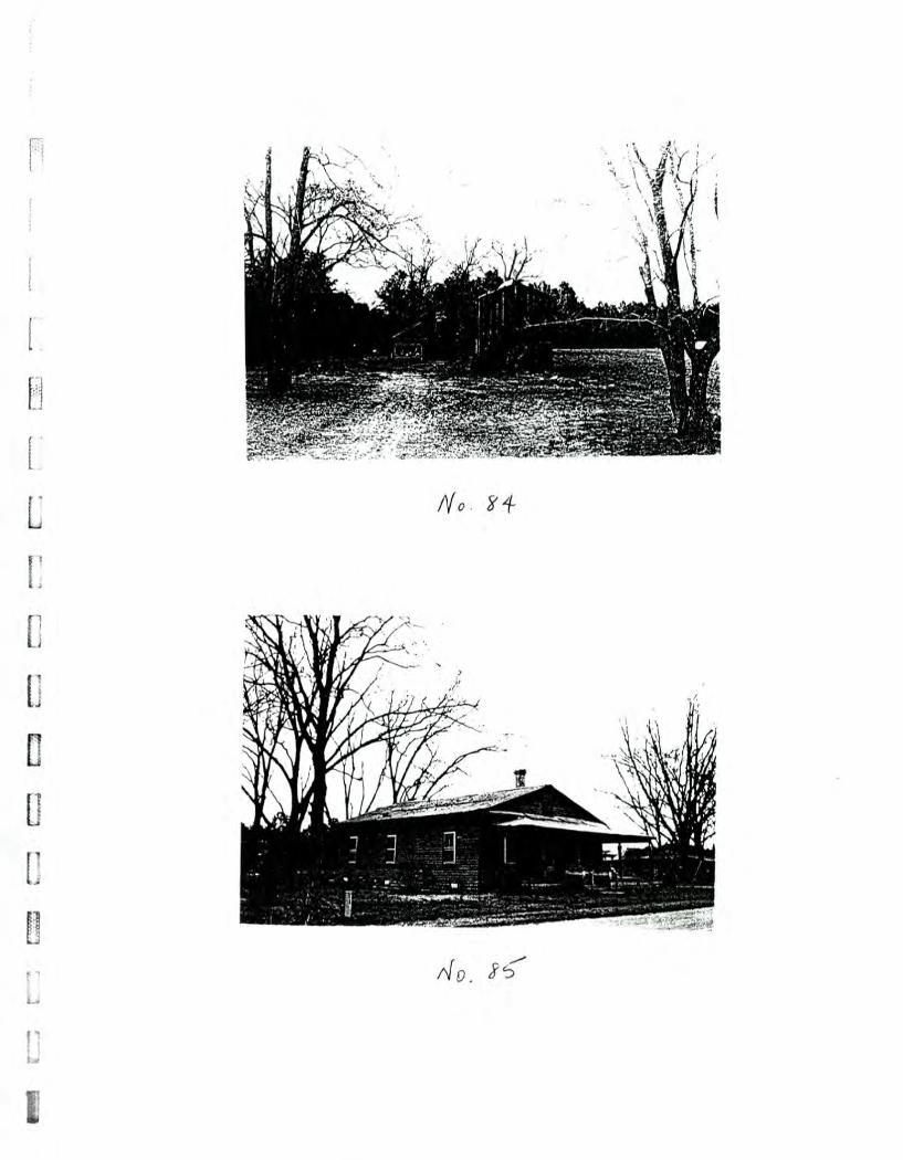
L:Z
r.3
WM
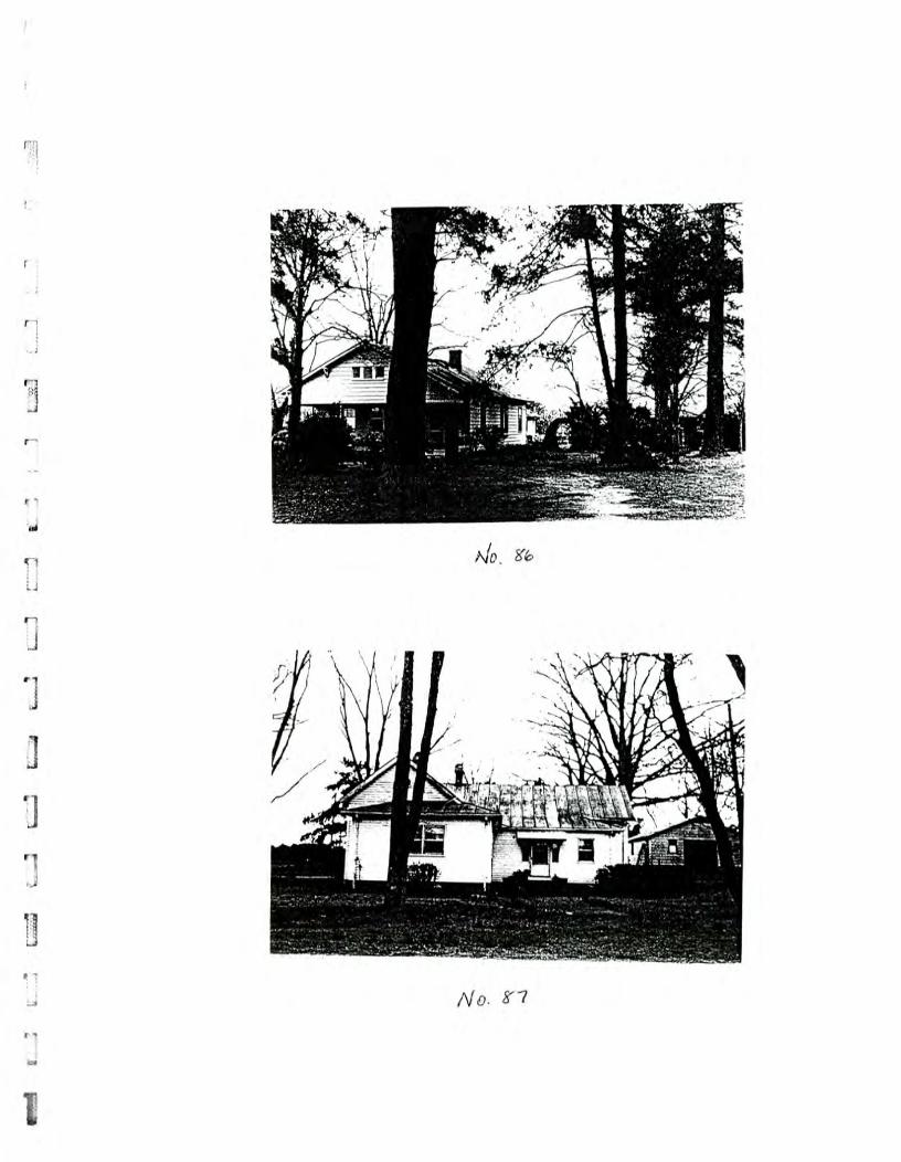
L.
17"1
[
777-1 L
-72 ce-71
r7.7A. =
.1
-71 r---1
p
ee
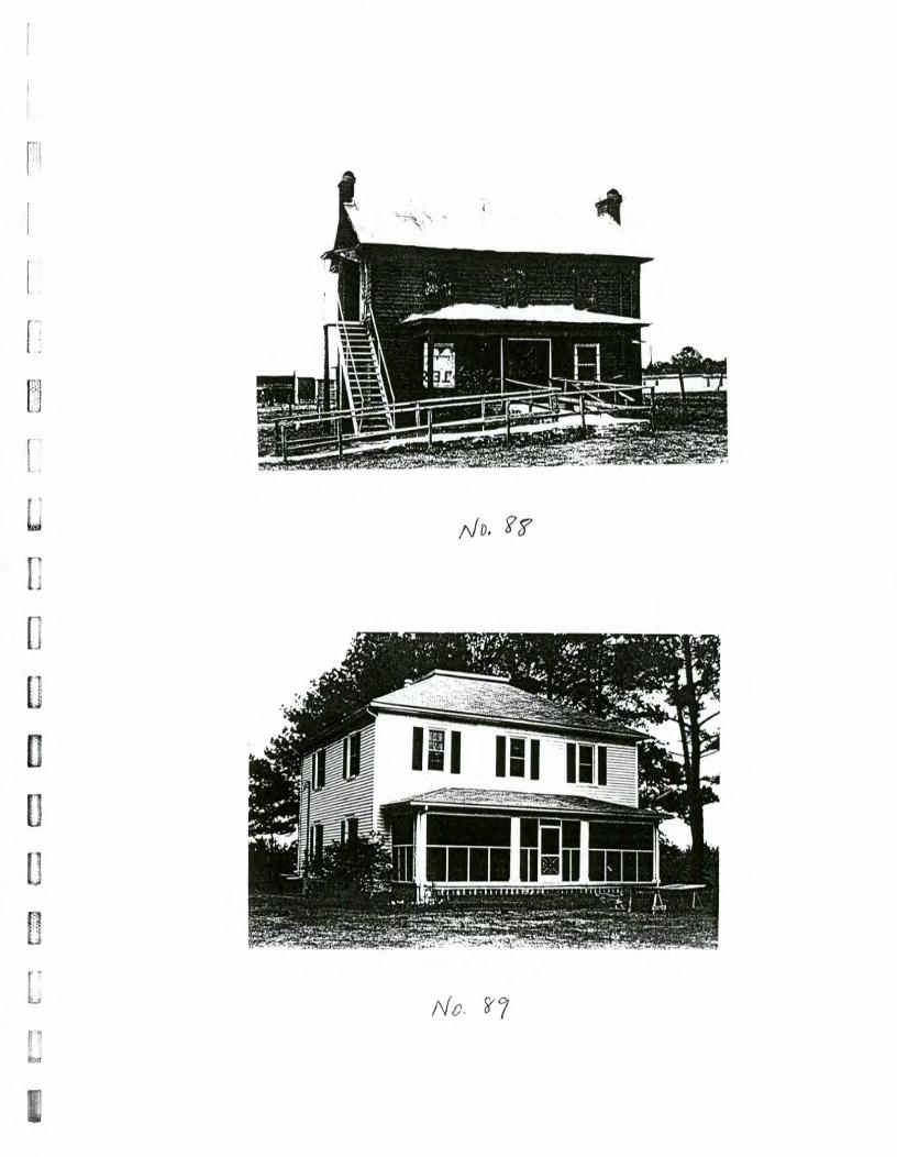
puir
tt.
\ -- •
.; .....
, A AV,--.1uum
niumw
.Et.,,.. .
"•: - A
t ,
L=
=
LTA
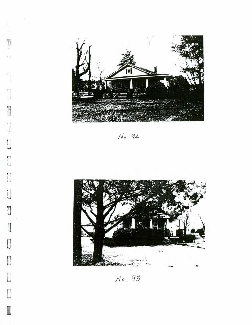
:-,=1
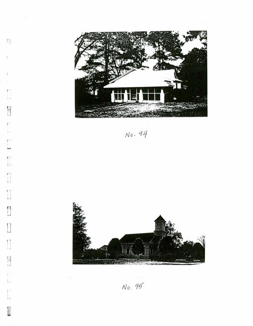
r ,
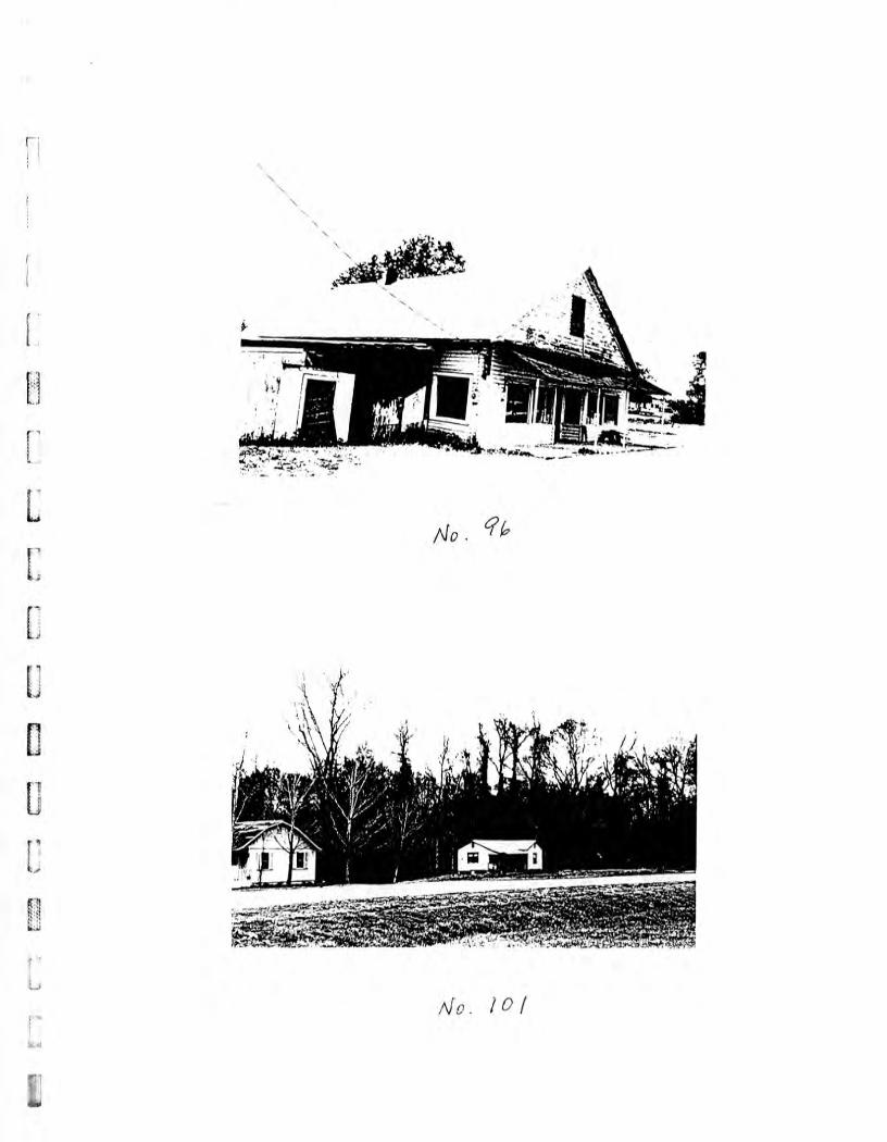
4.f
•
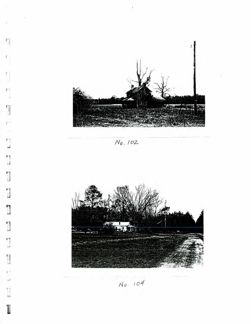
lbw
1
-
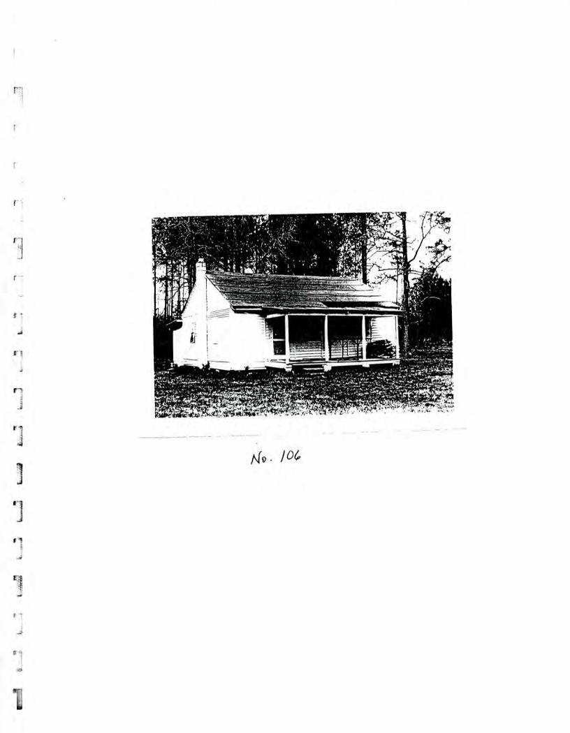
- rff M
T"
a.
-kg-- 3
F6
11
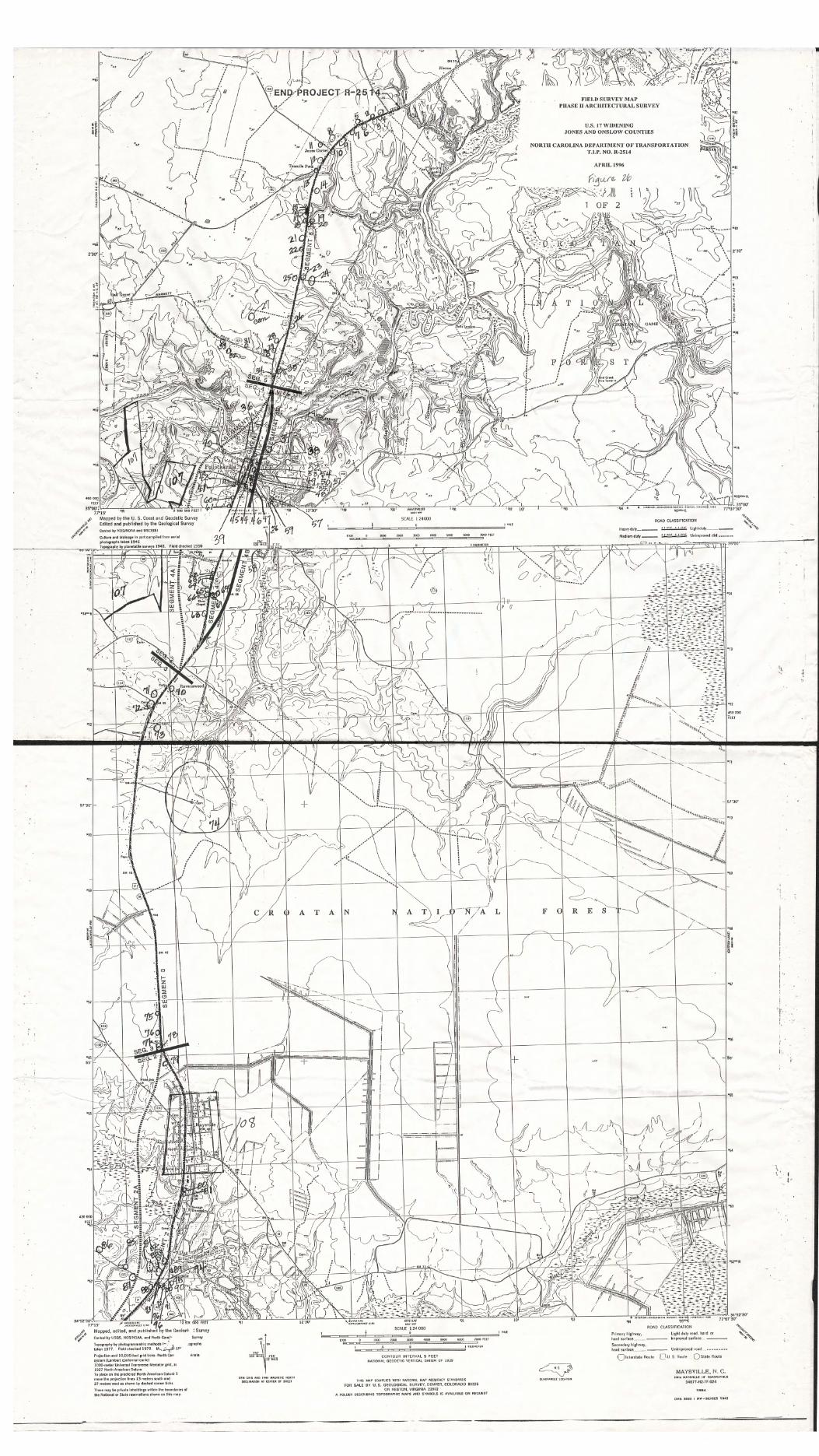
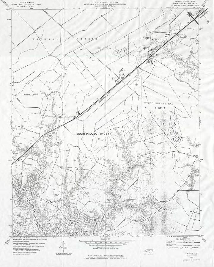
U.S. 17 Widening, Onslow and Jones Counties
APPENDIX C:
HISTORIC CONTEXT: RURAL COMMERCIAL BUILDINGS, 1875-1940 JONES COUNTY, NORTH CAROLINA
PREPARED BY:
EDWARD T. DAVIS FOR THE
NORTH CAROLINA DEPARTMENT OF TRANSPORTATION
CONTEXT: Rural Commercial Buildings, 1875-1940 Jones County, North Carolina
TIP # R-2235
Since its formation in 1779, Jones County has remained a predominantly rural and sparsely populated county on North Carolina's coastal plain. The flat to undulating terrain is
1: marked by large swampy areas and covered expansively with timber. Agricultural production and a substantial timber industry have provided the county's economic base throughout its history.
1.1 The few incorporated towns in Jones County have remained small. Large plantations served as political and social centers in the antebellum period. In the postbellum period, the small number of large plantations were replaced by an increasing number of smaller farms. The shift away from the plantation as a cultural center in the period between 1875 and 1940 created a number of small communities more evenly dispersed throughout the county. These localized,
[.
unincorporated communities usually centered around crossroads or intersections along the transportation routes, where the essential commercial functions were carried out.
Although colonial and antebellum plantations were largely self-sufficient, general, or country, stores appeared periodically in the landscape with the purpose of serving travellers or several plantations in an area. In the absence of other secular, public buildings for these small communities, the country store served as a public place of gathering. In the North Carolina piedmont, mills served a similar public function in non-courthouse towns and communities (Bishir, pp. 60-63).
Dating from the postbellum period until the second World War, two subtypes of the country store are identifiable in Jones County. The first of these is generally defined as an oblong two-story frame structure dating from 1875-1900 typically with a gable-front roof. The store area is located on the first story with an apartment above for the store owner and/or shopkeeper. The upper level is accessed by an either interior or exterior staircase. The store area is an unobstructed space but may include built-in shelving, bins, display counters, and posts supporting the floor above. The second level apartment would be partitioned into domestic-scale rooms or subdivided for storage. The size of these earlier country stores was dictated by the infrequent stock deliveries and the general merchandise needs of the local farmers. The main block of the store typically received several later additions including side or rear shed-roof additions, piazzas, or a porte-cochere, an addition to accommodate the automobile.
The second subtype of country store found in Jones County is a square or rectangular, one-story structure with a dominating gable-front or hip roof extending forward to form a porte-cochere. These structures date from after 1915 and are oriented specifically to automobile traffic. The size of the later stores is notably smaller due to the frequency stock deliveries and the nature of the purchases. These stores are the precursors of modern convenience stores and replaced the older "general" stores.
NCDOT staff architectural historians undertook a survey of rural commercial structures in Jones County and located sixteen surviving examples. Four of these were older two-story buildings and twelve were later one-story structures. By comparing the examples of each subtype, an evaluation can be made concerning their integrity within the parameters suggested by the existing structures.
7
1
R-2235, Jones County The Search for the Country Store
PLEASANT HILL 1 story frame porte cochere with hip roof
porch supports: ornamental detail at top roof: central ridge line with protruding central chimney 1 front door with vertical panels 1 front window, 1 3/3 window on left side shed addition on rear Owner--E.D. Robinson 527-3490
TAYLOR'S CORNER 1 story frame with asbestos siding 2 front doors with vertical panels 2 flanking front windows, 4/4 panes interior beaded sheathing on all but one wall which had flush
sheathing 1 rear side door porte cochere with gas pump concrete block pier foundation 1 stack chimney Owner--Frank Howard 324-5162 (His father used to own it)
FIRST MOORE'S STORE--COMFORT 1 story frame porte cochere with hip roof central ridge line with central chimney ;4eatherboard siding 1 rear door 2 front doors each with two panels surmounted by glass 2 flanking windows of 9 panes horizontal wood siding interior shelving Owner--Henry Moore 324-4042 (Owns and lives above the new
Moore's grocery 1/2 mile down road)
OLD STORE--COMFORT two story frame with front gable on right half
left side addition: two stories with flat roof weatherboard siding 2 story porch across front exterior stair on left side original part: central front door with flanking windows
one upstairs door brick pier foundation Possible Owner: Charles Jones, Jr (Owns Ford Dealership in
Trenton 448-2161; owns tract of land behind store) Knowledgeable about store: Marvin Philyaw (lives in Comfort)
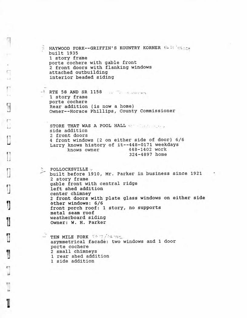
HAYWOOD FORK--GRIFFIN'S KOUNTRY KORNER !;:, built 1935 1 story frame porte cochere with gable front 2 front doors with flanking windows attached outbuilding interior beaded siding
RTE 58 AND SR 1158 1 story frame porte cochere Rear addition (is now a home) Owner--Horace Phillips, County Commissioner
STORE THAT WAS A POOL HALL side addition 2 front doors 4 front windows (2 on either side of door) 6/6 Larry knows history of it--448-0171 weekdays
knows owner 448-1402 work 324-4897 home
POLLOCKSVILLE built before 1910, Mr. Parker in business since 1921 2 story frame gable front with central ridge left shed addition center chimney 2 front doors with plate glass windows on either side ether windows: 6/6 front porch roof: 1 story, no supports metal seam roof weatherboard siding Owner: W. H. Parker
TEN MILE FORK asymmetrical facade: two windows and 1 door porte cochere 2 small chimneys 1 rear shed addition 1 side addition
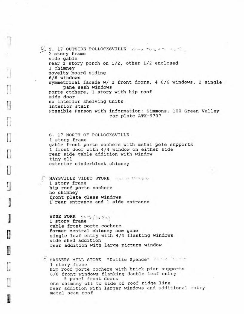
S. 17 OUTSIDE POLLOCKSVILLE 2 story frame side gable rear 2 story porch on 1/2, other 1/2 enclosed 1 chimney novelty board siding 6/6 windows symmetrical facade w/ 2 front doors, 4 6/6 windows, 2 single
pane sash windows porte cochere, 1 story with hip roof side door no interior shelving units interior stair Possible Person with information: Simmons, 100 Green Valley
car plate ATX-9737
S. 17 NORTH OF POLLOCKSVILLE 1 story frame gable front porte cochere with metal pole supports 1 front door with 4/4 window on either side rear side gable addition with window tiny ell exterior cinderblock chimney
MAYSVILLE VIDEO STORE 1 story frame hip roof porte cochere no chimney tront plate glass windows 1 rear entrance and 1 side entrance
WYSE FORK 1 story frame gable front porte cochere former central chimney now gone single leaf entry with 4/4 flanking windows side shed addition rear addition with large picture window
SASSERS MILL STORE "Dollie Spence" 1 story frame hip roof porte cochere with brick pier supports 6/6 front windows flanking double leaf entry
5 panel front doors one chimney off to side of roof ridge line rear addition with larger windows and additional entry metal seam roof
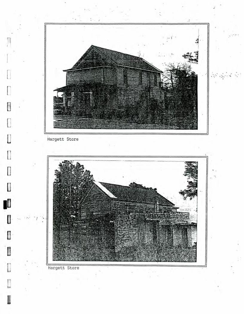
E=
3
= =
C
.=
=
2 M
A
INN
ar •ett, tora
:7--
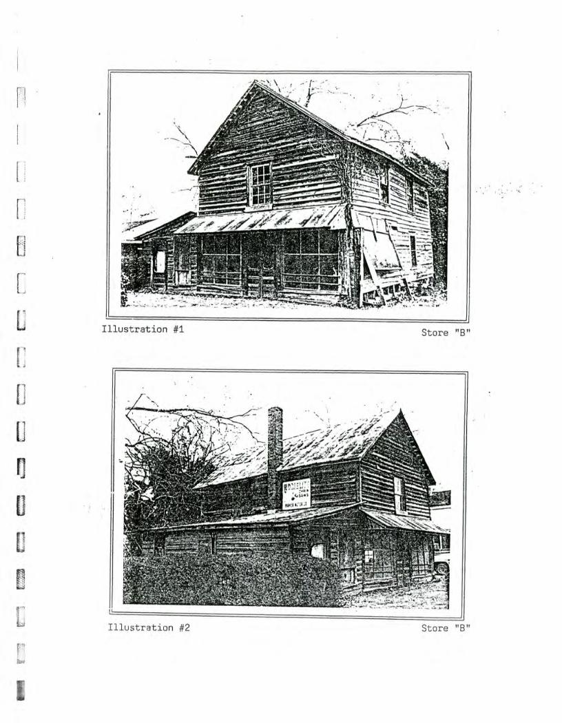
a re :'
i. ore ":' illillIMATIMITIEW
lustration : .
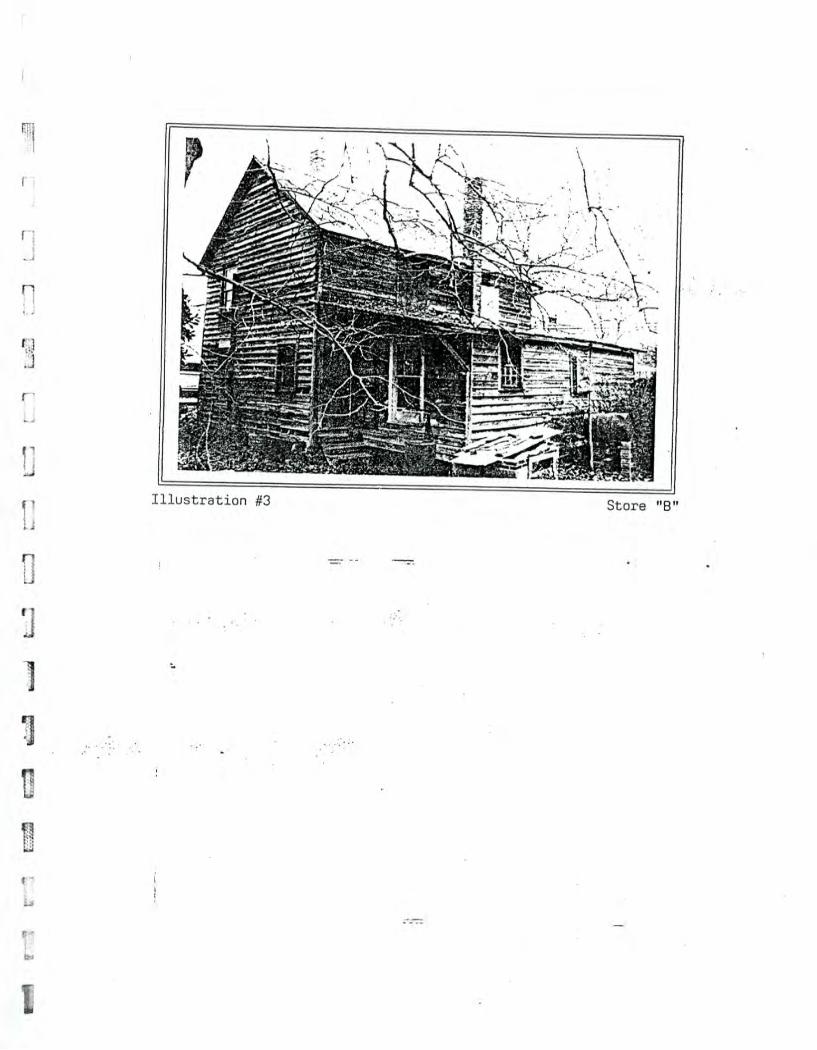
I.
e#
uoT4eaqsnITI
0
CD
CO
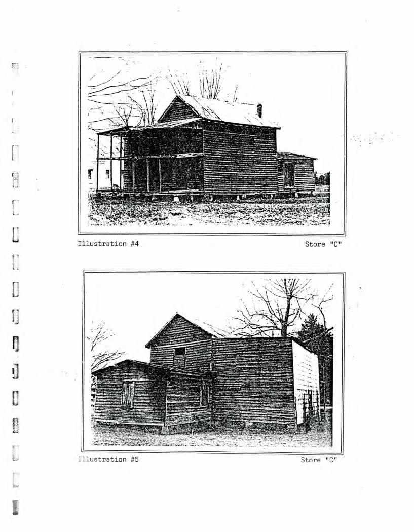
Illustration #4 Store "C"
, Illustration #5 Store "C"
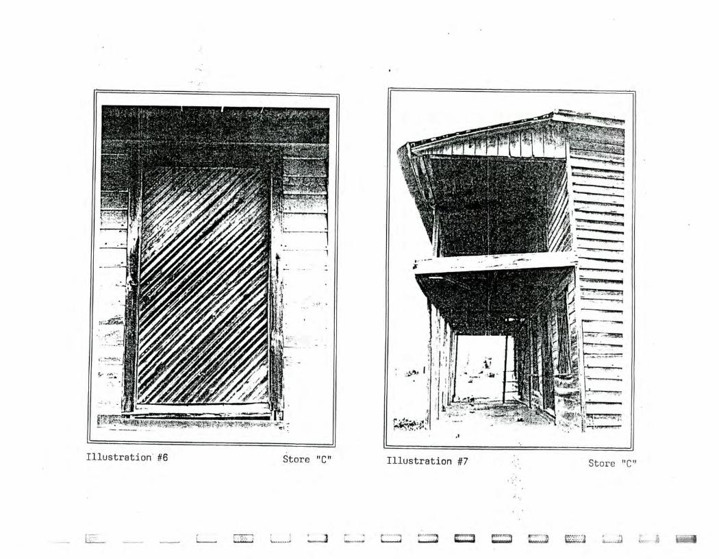
PF,1 r.= r--. ..,4111RO,
LJiI 0,104S L# uo-peaqsnTii ii311 aloIS 9# uopeaqsnm
;'
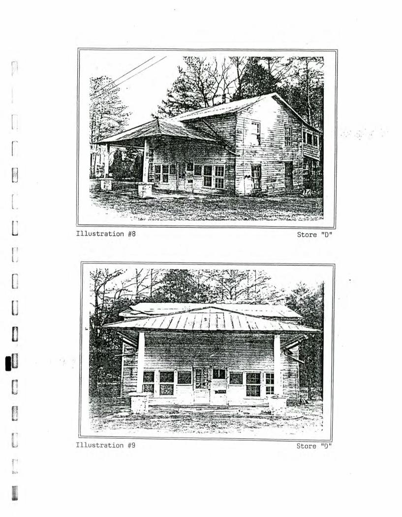
=I C
a =
1
irall
Illustration #8 Store "D"
Illustration #9 0
0
4-) C
l)
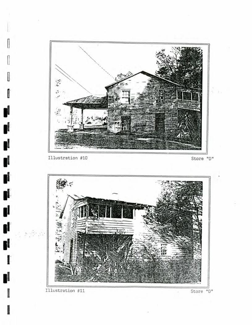
tore illiinNWSUTWW1
1111111C4WMTAMWEE
las w
iling lo
llies m
ow
m
oo
mu
m m
in
Ell II=
— N
MI M
il NM
I I= IM
O IM
O
IMO
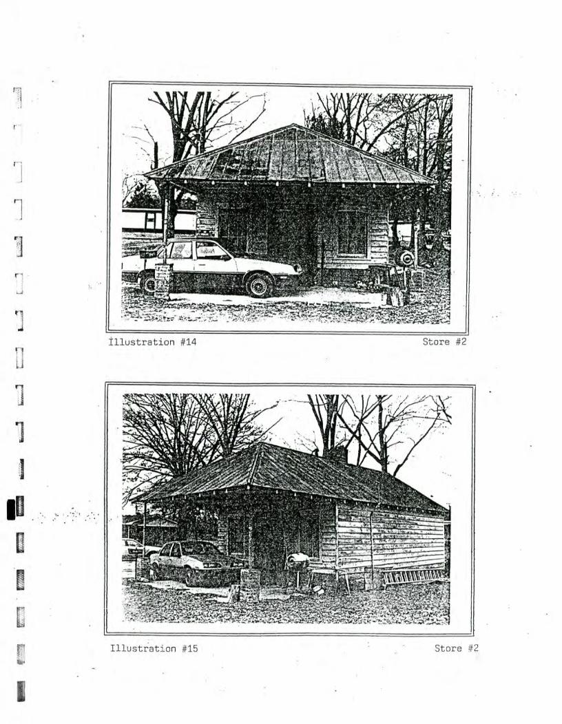
L 1
67-1
r"--1 ""'" =
.L
L.h
OM
B [77
' •v
-
4t C
J
a) 0
4-) C
f) I llustration ,14
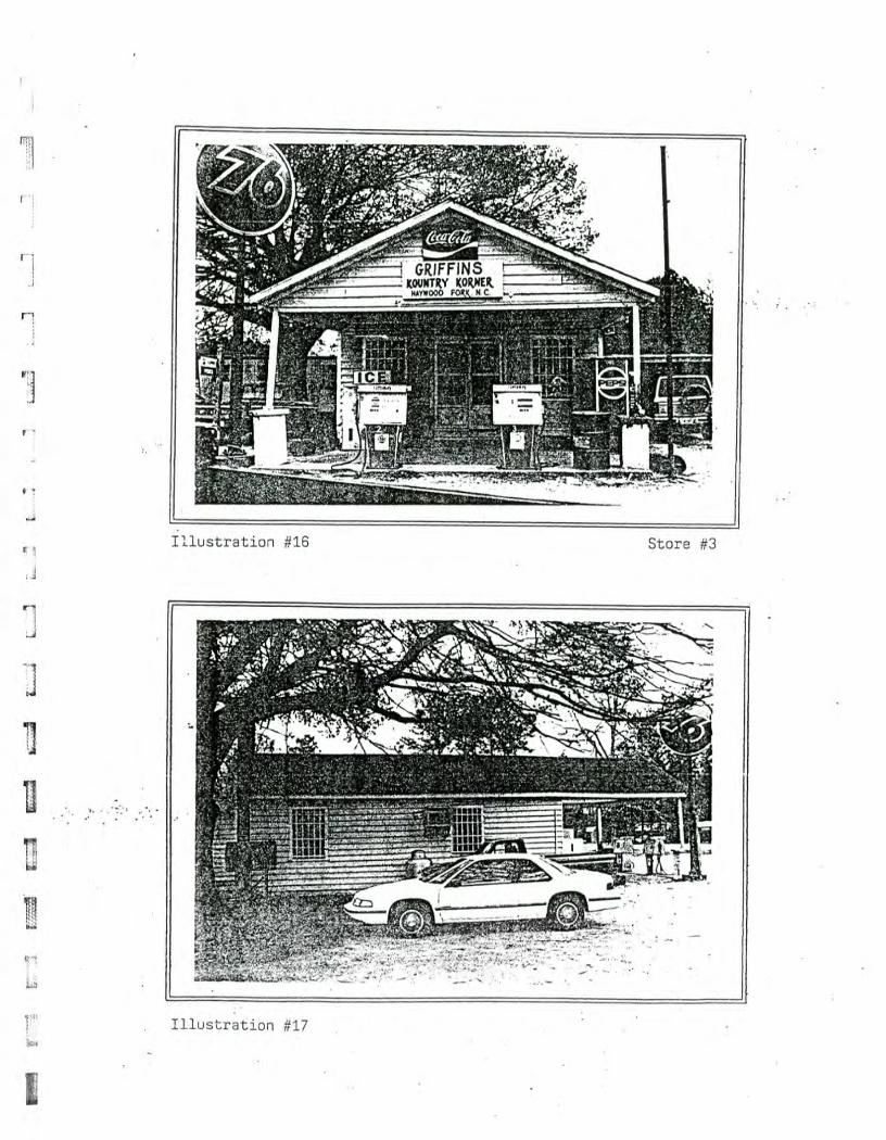
llustration ;1:
r-rrr,-t r:=2
WW
I
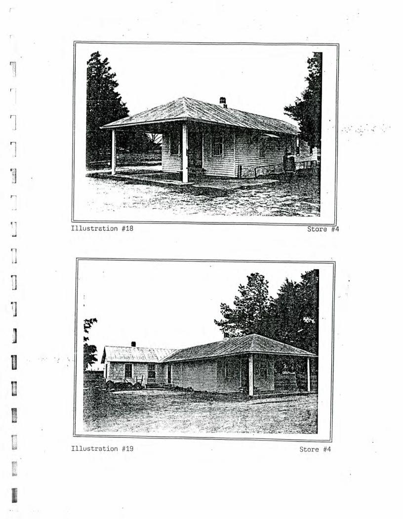
0) I ustra tio
L 1
LT- "1 :7
-71 fr'—'1
:=21 L
I 1 W
M L
.:1121
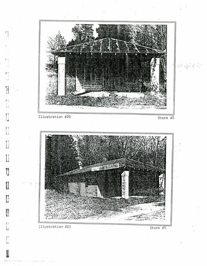
mmammrmw
isuinwFtmnwx,. . ; •
a)
0
4-)
L -
1:=2 ViL
l
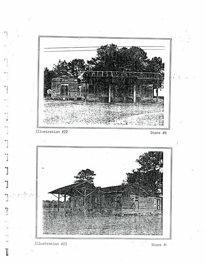
Illustration #22 Store #6
Illustration #23 Store
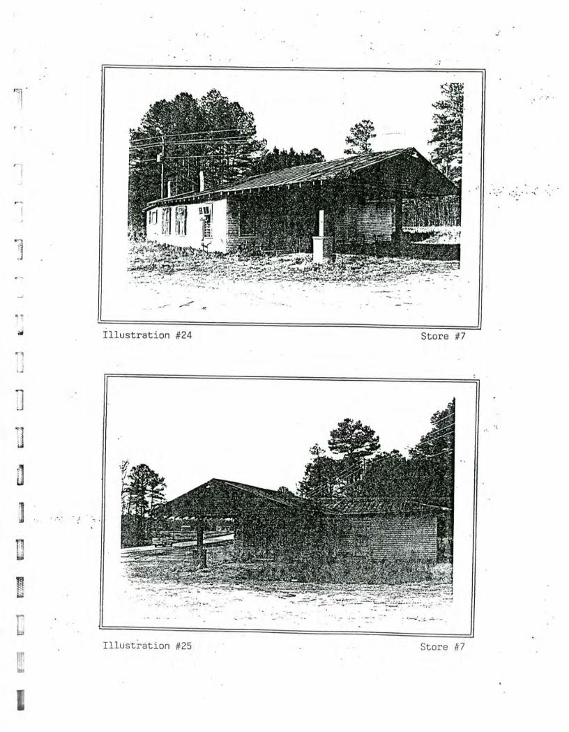
/ r
A-1
r r
91L
13
NE
„1
1
I llustration aa
I llustration -'=2
N-
03
0
CT)
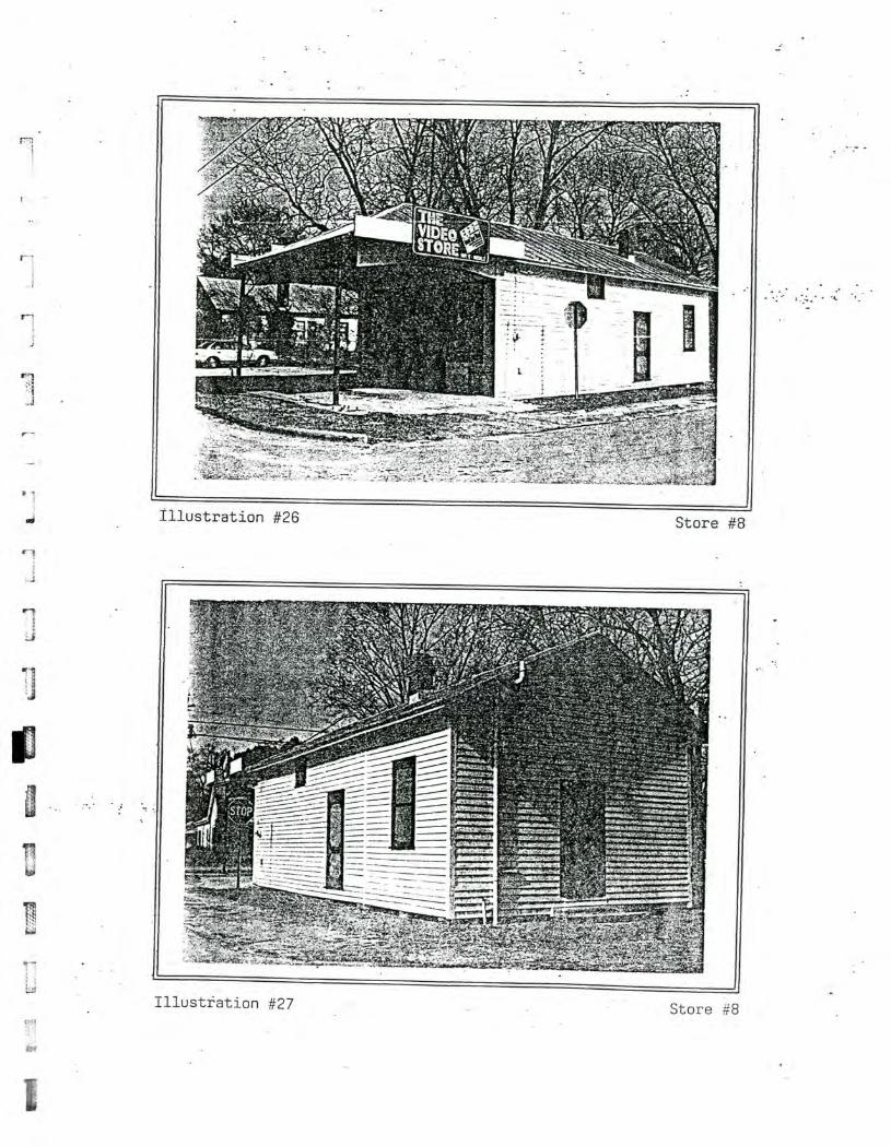
Illustration #26 Store #8
Illustration #27 Store #8
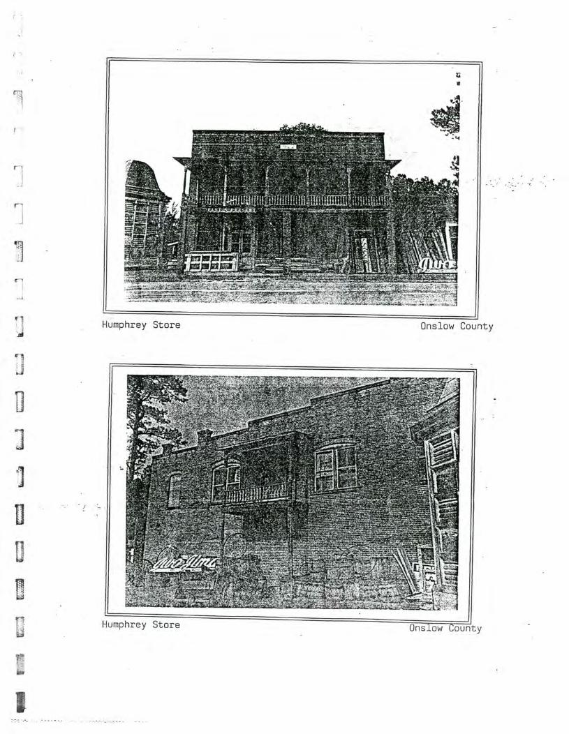
Humphrey Store
Onslow County
Humphrey Store Onslow County
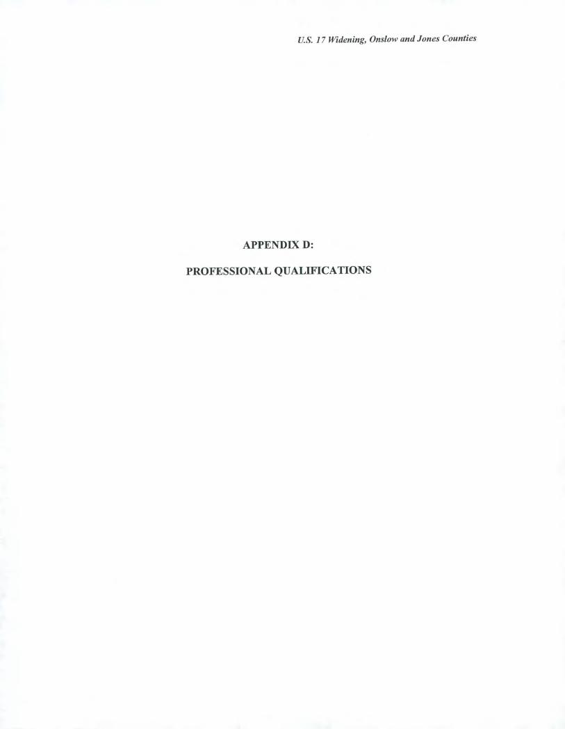
U.S. 17 Widening, Onslow and Jones Counties
APPENDIX D:
PROFESSIONAL QUALIFICATIONS
U.S. 17 Widening, Onslow and Jones Counties
Richard L. Mattson, Ph.D. Historical Geographer
Education 1988 Ph.D. Geography
University of Illinois, Urbana, Illinois
1980 M.A. Geography University of Illinois, Urbana, Illinois
1976 B.A. History, Phi Beta Kappa University of Illinois, Urbana, Illinois
Relevant Work Experience 1991-date Historical Geographer, Mattson, Alexander and Associates, Inc.
Charlotte, North Carolina
1991 Visiting Professor, History Department, Queens College, Charlotte, North Carolina
Developed and taught course on the architectural history of the North Carolina Piedmont, focusing on African-American architecture, textile-mill housing, and other types of vernacular landscapes.
1989-1991 Mattson and Associates, Historic Preservation Consulting Charlotte, North Carolina
1988 Visiting Professor, Department of Urban and Regional Planning, University of Illinois, Urbana, Illinois
Taught historic preservation planning workshop, developed and taught course on the history of African-American neighborhoods. The latter course was cross-listed in African-American Studies.
1984-1989 Private Historic Preservation Consultant, Raleigh, North Carolina
1981-1984 Academic Advisor, College of Liberal Arts and Sciences, University of Illinois, Urbana, Illinois
1981 Instructor, Department of Geography, University of Illinois, Urbana, Illinois
1978-1980 Private Historic Preservation Consultant, Champaign, Illinois
U.S. 17 Widening, Onslow and Jones Counties
Frances P. Alexander Architectural Historian
Education 1991 M.A. American Civilization-Architectural History
George Washington University Washington, D.C.
1981 B.A. History with High Honors Guilford College Greensboro, North Carolina
Relevant Work Experience 1991-date Architectural Historian, Mattson, Alexander and Associates, Inc.
Charlotte, North Carolina
1988-1991 Department Head, Architectural History Department Engineering-Science, Inc., Washington, D.C.
Directed all architectural history projects for the Cultural Resource Division. Supervised a staff of three architectural historians, one photographer, and graphics staff Responsibilities included project management, technical direction, research design and implementation, scheduling, budget management, client and subcontractor liaison, and regulatory compliance with both state and federal agencies. Responsibilities also included marketing, proposal writing, and public presentations.
Types of projects included: Section 106 compliance, surveys, evaluations of eligibility, evaluations of effect, design review, and mitigation; environmental impact statements; Section 4(f) compliance; H.A.B.S./H.A.E.R. documentation; state survey grants; National Register nominations; oral history; and environmental, historical, and land use research for Superfund sites.
1987-1988 Architectural Historian, Historic American Buildings Survey/Historic American Engineering Record, National Park Service, Washington, D.C.
Planned and conducted architectural, engineering, and landscape documentation projects. Responsibilities included research designs and methodologies; development of computerized data bases for recording survey data; preparation of overview histories; editing project data; preparation of documentation for publication; and assisting in hiring and supervising personnel.
U.S. 17 Widening, Onslow and Jones Counties
1986-1987 Historian, National Register of Historic Places, National Park Service, Washington, D.C .
Acted as liaison with public and federal agencies to provide preservation information, publications, and National Register nominations.
1986 Historian, Historic American Engineering Record, National Park Service, Chicago, Illinois
Conducted inventory of historic industrial and engineering resources along the Illinois and Michigan Canal in Chicago, Illinois. Responsibilities included identifying potential historic sites; preparing architectural, engineering, and technological descriptions; conducting historical research; and preparing an overview history tracing industrial and transportation development patterns.
U.S. 17 Widening, Onslow and Jones Counties
E = 4 „., i. = .,t
U.S. 17 Widening, Onslow and Jones Counties
ADDENDUM
Introduction
This addendum is part of the North Carolina Department of Transportation project
entitled U.S. /7 Widening, Onslow and Jones Counties, and the T.I.P. number is R-2514.
Two new alternatives have been proposed for this highway widening project since the original environmental assessment was prepared in 1996, and this addendum provides the results of an environmental assessment (E.A.) undertaken for the new proposed routes. These new alternatives are all located north of Pollocksville in Jones County, and the proposed alignments are found east and west of existing U.S. 17 (Figure la). Despite the
addition of these new routes, the general limits of the project remain the same, extending from north of Jacksonville in Onslow County to south of New Bern in Jones County. The environmental assessment for the original alternatives remains unaltered and is presented in the main body of the report while the assessment of these new segments is found within this addendum.
The area of potential effects (A.P.E.) for this project is modified from the original A.P.E.
(depicted in Appendix A) only in the area north of Pollocksville (Figure 2a). Between
Pollocksville and the southern terminus of the project area, the A.P.E. is unchanged. One of the new alternatives is an extension of an eastern bypass alternative of Pollocksville. The new route follows the former Seaboard rail corridor, beginning on the north side of the Trent River just east of U.S. 17. Just before the original bypass route, Alternative 4B-Modified, converges with existing U.S. 17, the new route turns northeast along the rail line, following the line on its northeasterly course. Roughly 0.75 mile north of S.R. 1121, the new alternative diverges from the rail corridor by turning north to merge with Alternative 4C.
The other new route, part of Alternative 4C, begins on the west side of U.S. 17, north of Pollocksville and the Trent River. This proposed route starts as a northerly extension of the original western bypass of Pollocksville. The original bypass alternative begins to reconverge with U.S. 17 by following a northeasterly path in the area between the Trent River and S.R. 1121. However, instead of turning northeast, the new route continues north, crossing S.R. 1121, before turning sharply east to cross U.S. 17 at the same point of reconvergence as the original bypass. After crossing U.S. 17, the new route continues along a northeasterly path before turning due north to cross Scott Creek and terminating at the junction of existing U.S. 17 and S.R. 1330. On the west side of U.S. 17, the A.P.E. extends west of the original area of potential effects to incorporate all views of open agricultural fields and areas which may be affected by the proposed construction. The A.P.E. is limited, however, by modern construction and dense woodland which lines the creeks feeding the Trent River. On the east side of U.S. 17, the new route is located between existing U.S. 17 and Alternative 4B, the easternmost bypass of Pollocksville, and therefore, portions of the A.P.E. for this new route are unchanged from the original A.P.E. Just south of S.R. 1121, where the new route turns northeast and Alternative 4B begins to reconverge with U.S. 17, the A.P.E. is enlarged from the initial study to
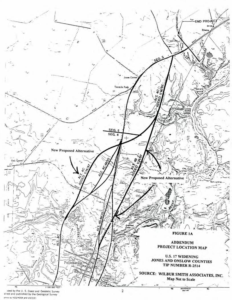
• ........ .. ... ••:f:
132
.,••• '
,)
0
35
,32
.•-••
•••
• "5:: •
-35-:
END PROJ 01430
Rherns
-`;
• Jooes Coro
.c • • - •
tS ...... Tenmile Fork
s. • 38
SEG. 5 SE G. 4 •
...
.71 . •••
New Proposed Alternative
.3,
fil ..' Vt. - z•(---) --. \
),•,--‘!,) 1
k \ ao—
; r-7-• f •k -, 5. *A ye 1,t'7,; -̀c..1 ,
/ • - : 'A 1,t' \ft\ -: '.. \‘ ill .. - ‘.,...•;-:1,
,..--
‘ , *-
-- ,... . . . . • , .1.--.., Z..: 7 ,•:.•'''
i • Z :\3 0 -
• ,,/9 S.,, )1 . -,•,. . \ 4
, .:_ ,,,--,..........3 \ ,.../. •
.701/n-le CI -... ,'NL--.; .1 •,c_-_-...L .,
A `Q•-- =,\• iTh•_-, C.'"'"c.---- '... k"---1/'
New Proposed Alternative 'I.\ -• 1.4 r-N\:'---::Z/ `? . -:'"'-' -././• • Fs :- --S . .." /'.0 , r 1 , UmIrina —
// / - .. ,
- •A''. ' ' c % I ,
1 ' ''' .. \/.
..
•• \ I ke ....." — --.
. . )7/••• ' -..
. \5. ,
4-1.•?,..- --. ,. — - ,:' • ,5% - \ --.-'::----, \ z %I...,
11,P', __,...., i: .- ..--. /4, . tr7 -...••••• i., 7 .1
r )
....p.‘ ..... - .- ...
. - . .----. I.
—
se•
FIGURE 1A
ADDENDUM PROJECT LOCATION MAP
• 11; 7
, 2 -1,, • ,,n„:r
••
:
•
"„
SOURCE: WILBUR SMITH ASSOCIATES, INC. , Map Not to Scale
•
U.S. 17 WIDENING JONES AND ONSLOW COUNTIES
TIP NUMBER R-2514
15 2 530 000 FEET'
med by the U. S. Coast and Geodetic Survey dited and published by the Geological Survey orit,01 by N S/NOAA and USCE(E)
.\\ 1Thf.
- 3.3
500mlAvSbLE1
A
. •,..--..7.2-*•••,"?'.
2
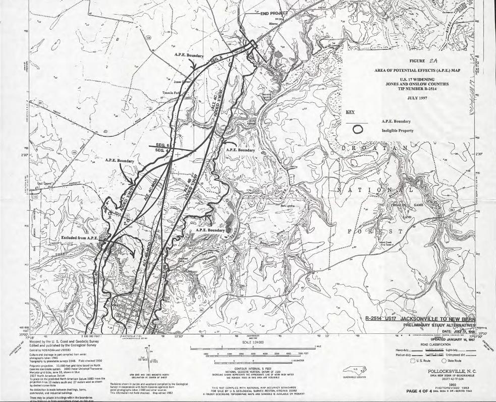
U.S. 17 Widening, Onslow and Jones Counties
incorporate all view sheds from the rail corridor. However, the A.P.E. is limited here as well by the dense woodland and swampy topography found along the Trent River.
Methodology
This architectural investigation was undertaken in accordance with the Department of Transportation Act of 1966, Section 106 of the National Historic Preservation Act of 1966, as amended (36 C.F.R. 800), and the F.H.W.A. Technical Advisory T 6640.8A (Guidance for Preparing and Processing Environmental and Section 4(f) Documents). The survey followed guidelines set forth in Phase II Survey Procedures for Historic Architectural Resources (N. C.D. 0. T., 15 June 1994).
The survey consisted of field investigations and supplementary historical research. The fieldwork began with a windshield survey of the project area for the new alternatives in order to determine the A.P.E. All properties 50 years of age or older were photographed and indicated on a U.S.G.S. quadrangle map. Properties were then evaluated for National Register eligibility as individually eligible for the National Register, as contributing elements to a proposed National Register historic district, or as ineligible for listing in the National Register. The fieldwork was conducted in July 1997, and one hundred percent of the A.P.E. was examined. The locations of the surveyed properties are depicted on the field survey map, Figure 3a. Physical descriptions and evaluations of eligibility are found in the survey results section which follows.
4
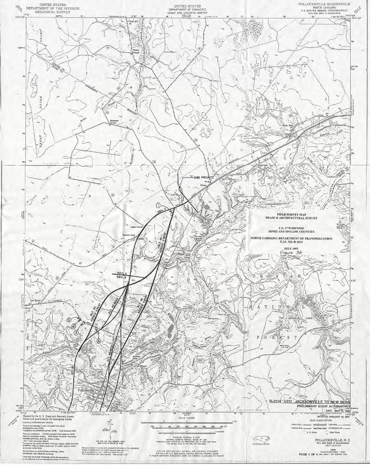
U.S. 17 Widening, Onslow and Jones Counties
Survey Results
Within the A.P.E. for the new alternatives, there were five properties which appeared to be 50 years of age or older, and these resources were surveyed in July 1997 for this addendum. Of these five properties, none is currently listed in the National Register of Historic Places, and none is recommended as eligible for the National Register. Property List Page
Properties Evaluated But Considered Not Eligible for the National Register No. 1 House 7
No. 2 House 7
No. 3 House 7
No. 4 House 7
No. 5 House 7
6
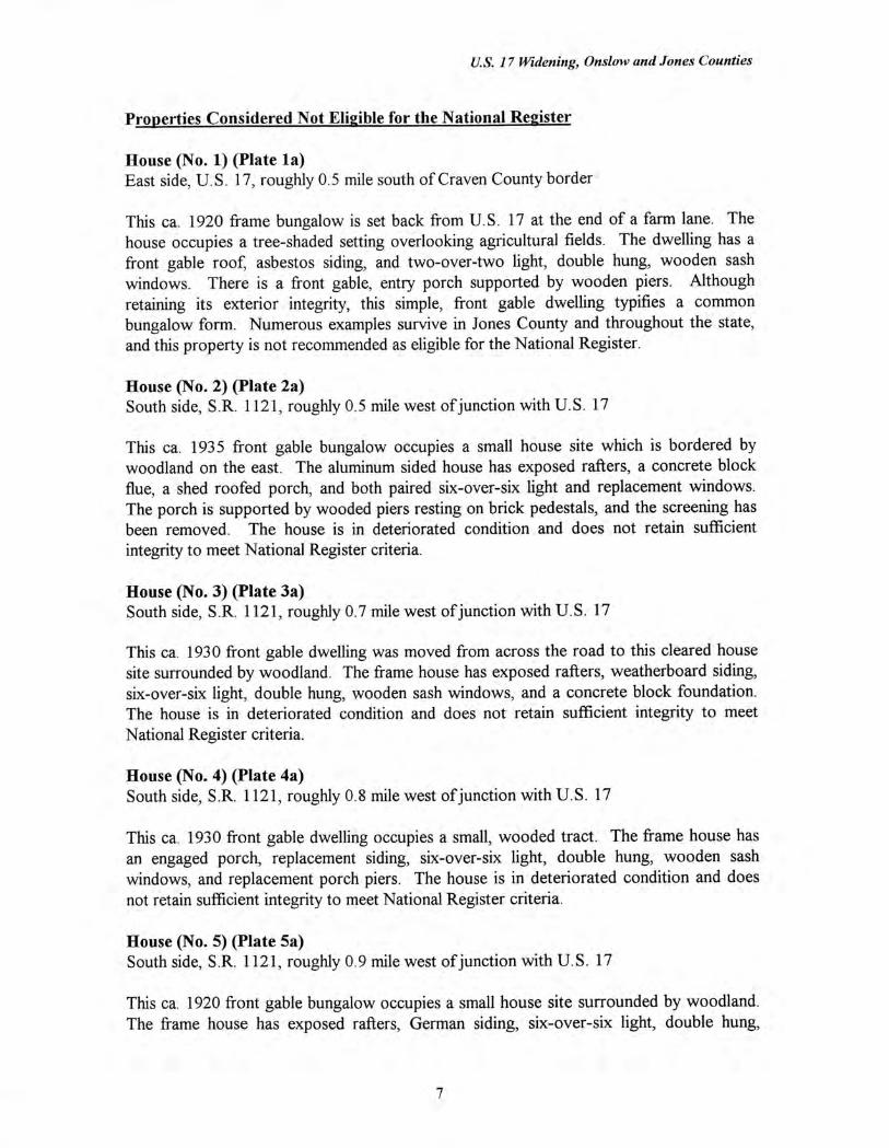
U.S. 17 Widening, Onslow and Jones Counties
Properties Considered Not Eligible for the National Register
House (No. 1) (Plate la) East side, U.S. 17, roughly 0.5 mile south of Craven County border
This ca. 1920 frame bungalow is set back from U.S. 17 at the end of a farm lane. The house occupies a tree-shaded setting overlooking agricultural fields. The dwelling has a front gable roof, asbestos siding, and two-over-two light, double hung, wooden sash windows. There is a front gable, entry porch supported by wooden piers. Although retaining its exterior integrity, this simple, front gable dwelling typifies a common bungalow form. Numerous examples survive in Jones County and throughout the state, and this property is not recommended as eligible for the National Register.
House (No. 2) (Plate 2a) South side, S.R. 1121, roughly 0.5 mile west of junction with U.S. 17
This ca. 1935 front gable bungalow occupies a small house site which is bordered by woodland on the east. The aluminum sided house has exposed rafters, a concrete block flue, a shed roofed porch, and both paired six-over-six light and replacement windows. The porch is supported by wooded piers resting on brick pedestals, and the screening has been removed. The house is in deteriorated condition and does not retain sufficient integrity to meet National Register criteria.
House (No. 3) (Plate 3a) South side, S.R. 1121, roughly 0.7 mile west of junction with U.S. 17
This ca. 1930 front gable dwelling was moved from across the road to this cleared house site surrounded by woodland. The frame house has exposed rafters, weatherboard siding, six-over-six light, double hung, wooden sash windows, and a concrete block foundation. The house is in deteriorated condition and does not retain sufficient integrity to meet National Register criteria.
House (No. 4) (Plate 4a) South side, S.R. 1121, roughly 0.8 mile west of junction with U.S. 17
This ca. 1930 front gable dwelling occupies a small, wooded tract. The frame house has an engaged porch, replacement siding, six-over-six light, double hung, wooden sash windows, and replacement porch piers. The house is in deteriorated condition and does not retain sufficient integrity to meet National Register criteria.
House (No. 5) (Plate 5a) South side, S.R. 1121, roughly 0.9 mile west of junction with U.S. 17
This ca. 1920 front gable bungalow occupies a small house site surrounded by woodland. The frame house has exposed rafters, German siding, six-over-six light, double hung,
7

U.S. 17 Widening, Onslow and Jones Counties
wooden sash windows, and a hip roofed porch supported by replacement piers. The house is in poor condition and does not retain sufficient integrity or significance to meet National Register criteria.
8
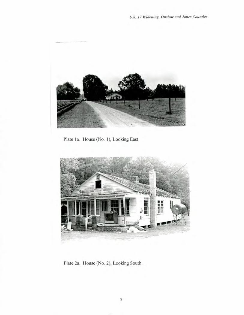
U.S. 17 Widening, Onslow and Jones Counties
Plate la. House (No. 1), Looking East.
Plate 2a. House (No. 2), Looking South.
9
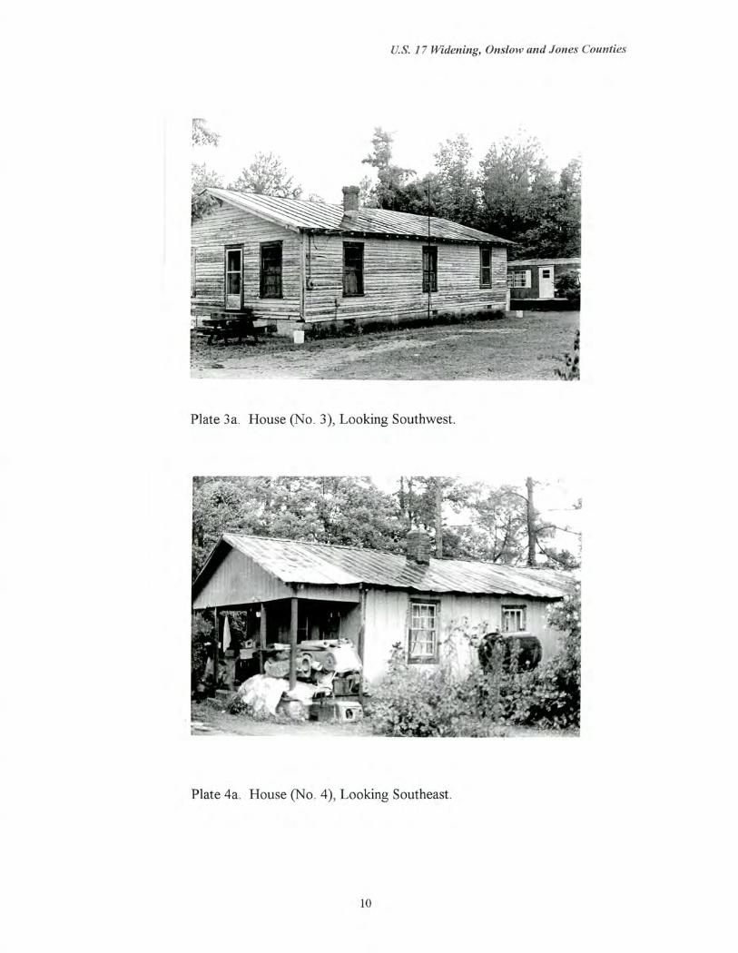
U.S. 17 Widening, Onslow and Jones Counties
Plate 3a. House (No. 3), Looking Southwest.
Plate 4a. House (No. 4), Looking Southeast.
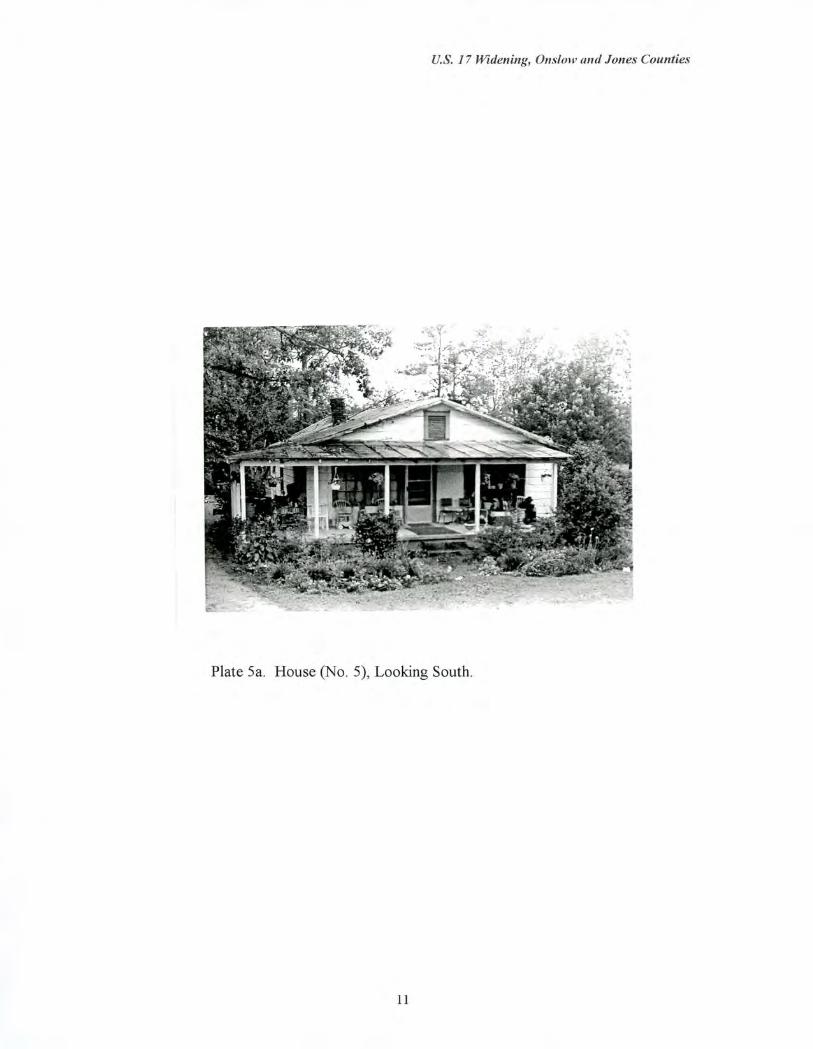
U.S. 17 Widening, On.slow and Jones Counties
Plate 5a. House (No. 5), Looking South.
11
U.S. 17 Widening, Onslow and Jones Counties
Bibliography
Bache, A.D. , superintendent. US. Coast Survey Map, 1865.
Branson, Levi, ed. North Carolina Business Directory for 1867-1868. Raleigh:
Branson and Jones, 1869.
. North Carolina Business Directory for 1884. Raleigh: L. Branson, 1884.
. North Carolina Business Directory for 1896. Raleigh: L. Branson, 1896.
Jones County. Tax Records and Deeds. Trenton, North Carolina.
Interview with Tina Moon, Jones County historian. 9 July 1997.
Lewis, Samuel. Map of North Carolina, 1795
MacRae, John and Robert H.B. Brazier. A New Map of the State of North Carolina, 1833.
Mitchell, Samuel A. A New Map of North Carolina. Philadelphia: Thomas Cowperthwait and Company, 1851. From Mitchell's New Universal Atlas, 1851.
North Carolina State Board of Agriculture. Map of North Carolina, 1882.
Price, Jonathan and John Strother. Map of North Carolina, 1808.
U.S. Department of Agriculture, Soil Conservation Service. Aerial Maps of Jones County, 1938. North Caroline State Archives.
U.S. Bureau of the Census. Agricultural Schedules, 1850, 1870 1880
U.S. Bureau of the Census. Manufacturers Schedules, 1850, 1870, 1880.
12