New Urban Hybrids - Aaltodoc
194
This publication collects the results of the international YTK/IFHP Urban Planning and Design Summer School 2014. The theme, New Urban Hybrids – Re-setting Borders, Combining Scales, is explored through the students work. Students and young professionals of urban and spatial planning from all over the world participated in the course and worked on real town planning projects in the cities of Rauma and Seinäjoki. These projects as well as the student’s individual conceptions of successful urban hybrids in their home countries are presented in this report. Edited by Johanna Lilius New Urban Hybrids – Re-setting Borders, Combining Scales New Urban Hybrids Re-setting Borders, Combining Scales Aalto-C 1/2015 9HSTFMG*agaigg+ ISBN 978-952-60-6086-6 (printed) ISBN 978-952-60-6087-3 (pdf) ISSN-L 1799-4977 ISSN 1799-4977 (printed) ISSN 1799-4985 (pdf) Aalto University School of Engineering Land Use Planning and Urban Studies Group www.aalto.fi BUSINESS + ECONOMY ART + DESIGN + ARCHITECTURE SCIENCE + TECHNOLOGY CROSSOVER DOCTORAL DISSERTATIONS
-
Upload
khangminh22 -
Category
Documents
-
view
4 -
download
0
Transcript of New Urban Hybrids - Aaltodoc

This publication collects the results of the international
YTK/IFHP Urban Planning and Design Summer School
2014. The theme, New Urban Hybrids – Re-setting
Borders, Combining Scales, is explored through the
students work. Students and young professionals of
urban and spatial planning from all over the world
participated in the course and worked on real town
planning projects in the cities of Rauma and Seinäjoki.
These projects as well as the student’s individual
conceptions of successful urban hybrids in their home
countries are presented in this report.
Edited by Jo
hanna Lilius New
Urb
an Hyb
rids – R
e-setting Borders, C
ombining Scales
New Urban HybridsRe-setting Borders, Combining Scales
�����
����������
����������������
������ ������������������������������ ������������ ��������������� ����� ������� ����� ��������������� ���������������������������������������� ��������������������������������������������������������������
����� ����� ��������� ���� �������� ��� �� ����� �� ��� ����������� ����� ������ ������� ������


New Urban Hybrids – Re-setting Borders, Combining Scales
Aalto University School of Engineering Land Use Planning and Urban Studies Group
http://ytk.aalto.fi/en/
Aalto University publication series CROSSOVER 1/2015
Edited by: Johanna Lilius
Graphic design: Anssi Kokkonen
ISBN 978-952-60-6086-6 (printed) ISBN 978-952-60-6087-3 (pdf) ISSN-L 1799-4977 ISSN 1799-4977 (printed) ISSN 1799-4985 (pdf)
Yliopistopaino Oy
Helsinki 2015
ContentsIntroduction 5
Urban Hybrids 9
Land Changes in Al-Khobar Area 10
Bottom-Up Urbanism: ‘The Eldonian Village’ Liverpool, United Kingdom 12
The Krupp Belt in Essen, Germany 16
Tøyen - a city district in the wake of a horse trade 20
Cattle Depot Artist Village - A unique cultural cluster in Hong Kong 22
Oran - Ankara, Turkey 25
Copenhagen – Contemporary use on the Carlsberg brewery site 28
Livorno Porta Al Mare 30
The Wanniek gallery, Brno, Czech Republic 32
The Văcărești Lake, Bucharest -the delta in the city center 35
Redtory Introduction 37
Dadri-Noida-Ghaziabad Investment Region (DNGIR): A Modern Urban Microcosm 38
Minsk Urban District Vostok 41
Exploration of Urban Hybrid Space: Francisco Ferry Building Marketplace 43
Urban transformation through culture 46
Neighborhood: Gowanus, Brooklyn, NY 51
The Coexistance of Malls 53
Urban Design in Tokyo for Tokyo Olympic 2020 55
N o r r a Ä l v s t r a n d e n – Kvillebäcken 56
Foshan Lingnan Tiandi 59
Manufaktura - revitalisation of former factory of Israel Poznański in łódź 61
Space to culture - young architects competition’s winner project (2014) - BXL architects 63
22@Barcelona 66
Urban Hybrid: Le Albere district 69
The urban hybrid area along Aalborg Harbor Front 72
Kassel-Marbachshöhe – from a military facility to a multifunctional quarter 75
Millennium Park 77
From slum to suburb: The success story of Bathore, Albania 78
Green growth in Malmö towards affordability perspective 82
Street in Moskow 85
Conversion of the German Armed Forces site in Hamm 86
Gentrification in Shanghai Case Study: Taipingqiao 88
Trieste; waterfront 91
The Regeneration of Cardiff Bay, Wales 93
Karlsplatz 96
Rauma 100
A.E.M. Group 102
Kappelinsalmi, Rauma 108
Incubator group 114
Kappelinsalmi: Rauma’s Transition Area 120
Strauma 126
Seinäjoki 132
Form and movement: Seinäjoki station area 134
Seinäjoki station area: live. Work. Play. 140
New vision for Seinäjoki 146
Smart Station- connecting Seinäjoki on all levels 152
Appendices 158


Introduction 5
The YTK/IFHP Urban and design Summer School has in twenty years become something of an institution with more than 600 students and young professionals successfully completing the course. Every year over 100 ambitious students from all over the world apply to the two weeks-course in Helsinki and two other Finnish cities. The Summer School is a great opportunity to learn about Finnish planning and to work together in multidisciplinary and international groups on real life planning problems. For the cities involved, the summer school provides new ideas and a breeze of internationality.
***
The story of the Summer School begins in 1995. The President of the International Federation of Housing and Planning (IFHP), then a visiting Professor in Helsinki, Professor Ranko Radovic wanted to bring together students and young professionals from different countries with different
Introduction

6
educational backgrounds to work together. Radovics vision was to offer them the chance to absorb influences from other cultures and to explore new ways of understanding planning problems. An important aim was also to bring students and professional planners together to work on real town planning tasks, and to provide them with a unique opportunity to work without bureaucratic constraints and limitation planners often face in their everyday work. Radovic wanted to encourage students to see beyond restrictions set by technical aspects of planning. It is in line with these ideals that the Summer School has continued for twenty years.
When Ranko Radovic suddenly passed away in 2005, his former student Professor Ksenija Hiel continued as a director of the Summer School. After Hiel. Professor Panu Lehtovuori has been the director of Summer School since 2010. The coordination of the programme was for long the responsibility of architect Hans Stenius. After his retirement, lecturer Tuomas Ilmavirta continued as the coordinator and tutor of the Summer School. Architect, researcher Mikko Mälkki has contributed as a devoted tutor for many years. MSc. Johanna Lilius has coordinated the Summer School since 2013. The long term partner of the Summer School in Helsinki is architect Douglas Gordon at the City Planning Department. He has guided the participants through the planning in Helsinki in theory and practice.
The Summer School team would like to thank all the numerous people who have been involved in organising the Summer School during the past twenty years.
***
Over the years, the Summer School has been arranged in Porvoo, Turku, Vantaa, Rauma, Jyväskylä and Seinäjoki. Every year, the work has concentrated on a theme that ties the workshop tasks together. In 2014, summer school concentrated on finding ”New urban hybrids”. The key questions of the Summer School were: How can urban planning support the development of urban hybrids? How can new hybrids of urban functions be facilitated? How can production, work, housing as well as consumption be combined in an
New Urban Hybrids

Introduction 7
innovative way? How can flexibility for the new hybrids to adapt and succeed in constantly changing societal circumstances be created?
Altogether 38 students from all over the world – Austria, Russia, the United States, Saudi Arabia, Italy and Belarus, to name a few countries – participated in the 20th Summer School. Lecturer Tuomas Ilmavirta tutored students in Rauma and architect, researcher Mikko Mälkki in Seinäjoki. To celebrate the first two decades of the YTK/IFHP Summer School, a one day seminar was organized at the end of the course. The programme included a key note lecture by Johannes Tovatt, and an academic panel discussion on the future of planning education with professors Roger Caves, Kimmo Lapintie, Marketta Kyttä and Juho Rajaniemi. In addition, planners from Lahti, Tampere, Tallinn and Turku presented current planning innovations in their towns.
***
This publication compiles the results of the YTK/IFHP Summer School 2015. Before coming to Finland the students made an analysis of interesting hybrid urban areas in their home countries. The first half of the publication is dedicated to these pre-task papers. The second part of the publication comprises the work participants produced in the workshops.
We wish to thank everyone who has been involved in the summer school during the past 20 years – especially all the students, who, year after year, continue to inspire us with their energy, insight and ambition. We are looking forward to carrying on the tradition in 2015!
Espoo 17.12.2014
Panu LehtovuoriTuomas IlmavirtaJohanna Lilius


Urban Hybrids

New Urban Hybrids
Land Changes in Al-Khobar AreaAbdulaziz Al-Dossary, Saudi Arabia
Al Khobar is a large city located in the Eastern Province of the Kingdom of Saudi Arabia on the Arabian Gulf. It has a population of 480,000 (2009 census) and forms part of the greater Dammam metropolitan area along with Dhahran.
Many of Khobar’s residents work for Saudi Aramco, the world’s largest oil company. Traditionally, Khobar has also been a city of shopkeepers and merchants, and the city today has many modern malls and boulevards with shops run by international franchises, and restaurants in the Central Business District (CBD). Together, Khobar, Dhahran and Dammam are often known as “The Triplet Cities”. Khobar today is a bustling economic centre with many skyscrapers under construction. The nearby city of Dammam has the second-largest port in Saudi Arabia.
Khobar’s ideal location along the Arabian Sea has made it increasingly popular amongst people traveling from cities within the Kingdom (such as the capital Riyadh which lies approximately 400 km west).

Urban Hybrids 11
In Khobar, the land-use is mixed. There is a residential-commercial land use, but the parking is not enough, it’s just a side park along the commercial road, so there is not enough parking lots for the residents nor the customers.
There is a high rate of cars and trucks as well are accessing the district and causing a lot of problems.According to a questioner I made, the level of awareness about what happens in the area is not very good
in the neighborhood. In other parts of the city people are fully aware about everything even the tiny things such as the parks, lamps and road enhancement, so to emphasize the types of segregation. First, segregation with foreigners and it´s caused by the difference ethnically and the habits as well. Second, segregation with the local people and it is caused by the economy level between people (wealth and Poor).
(More Wealth = More Segregation) (More Poor = More Integrated)
Another issue that I need to discuss is the vacant land in the area most of the responses agreed that its private owned, but the main question that asks it’s self is “why they are still remain vacant?”
Well, that question mostly leads to one main reason, since they’ve been owned by a private ownership, and that reason is to maximize their profit from the land itself.
Alternatives to be developed1. Minimize the pedestrian’s side walk in order to expand the road width to make the flow much easier. 2. Provide parking lot in a multi-Stories type of parking to have maximize the capacity of cars and
serves the surrounding buildings as well and minimizing the consumption of lands and space.3. Provide a public transportation service that serves the commercial areas, such as King Khalid’s
street or King Fahad’s Street.4. Dedicate a pedestrian’s road and provide a Cable Car Trains to transport the visitors and the local
residence along the street.
Government anticipation to control the vacant land1. Taxing the private owner for each year by an increasing rate to encourage him to develop his own land.2. Neighborhood activities (festivals, parks or parking lots)3. Replacing the land owner with another land and start the Land Acquisition to vanish the vacant land.

New Urban Hybrids
Bottom-Up Urbanism: ‘The Eldonian Village’ Liverpool, United KingdomHarry Berks, United Kingdom
In 1980s the local authority for Liverpool - ‘Liverpool City Council’ begun the process of regeneration and the change of use of its port and docklands, but in the case of the Vauxhall - a region of the Liverpool docklands, the plans were met by a significant bottom-up planning movement which culminated in creating one of Liverpool’s most thriving housing estates. The city’s docklands and port were essential to the city’s existence and growth from a fishing settlement on the Irish sea, to become ‘the second city of the British Empire’ (Haggerty et al. 2008). The city was the main port for British imports and exports to and from the Americas, Caribbean and Ireland, however, since the 1900s Liverpool’s port and docklands had declined and became increasingly less used and most starkly after World War Two. Roberts (2008:117) said “Liverpool, together with the other urban centres of Merseyside, were products of global, as much as local or national processes of evolution. As a consequence, when the traditional economy of the region collapsed, the very rationale of the city itself was threatened”. So to breathe new life in to the city, Liverpool City Council began

Urban Hybrids 13
the process of demolishing and regenerating the city’s docklands and the surrounding residential areas, the location where many ex-port workers lived.
Batty and Marshall (2009) feel that bottom-up planning can be more effective than top-down planning if executed correctly, as it enables people to plan their own surroundings to meet their exact needs, not what developers think the needs of the residents or the people may be. This was reiterated by the fact that no one plan should be transferred from one place to another, each location should be evaluated on individual merit due to their sheer diversity in and between today’s modern cities as recognised by Jane Jacobs (1969).
Vauxhall was just one of the areas Liverpool City Council tried to regenerate in the 1980s, its located 1 kilometre north of the city centre and 1 kilometre east from the city’s docklands. The council and its developers were met back stark objections from residents of Vauxhall in 1981 who did not want to leave the area despite the lack of local employment. These objections became more pertinent when more port related industries began to close, no longer just making the dockers and the sailors unemployed but also the factory workers (Roberts 2008). There were two large factories in the area that also suffered closure due to the closure of the port, they were the Tate and Lyle sugar refinery and the British American Tobacco factory. During the decline in the Liverpool docklands the local physical environment also declined through disuse and disrepair (The Eldonian Based Housing Association Limited 2008). But the local community wanted to stay put in Vauxhall.
The community knew they were going to be rehoused to new towns outside of Liverpool’s city limits, if they did not object. There also were not any plans in the relocation process to keep the members of the community together; fracturing friendship and mutual historical ties particularly among the less mobile and the vulnerable members of the community (Leeming 2005 cited in. Roberts 2008). The community that were objecting to Liverpool City Council’s plans came to be known as the Eldonian village. In 1983 the community formally created the Eldonian Committee, which was originally assembled from 145 families who were residents of Vauxhall who all were members of the local church congregation at the ‘Our Lady of Eldon Street’ church. It was through this church that gave the community of a common identity and resilience to fend off Liverpool City Council. The Committee told Liverpool City Council that they wanted to collectively own every property on the housing estate in Vauxhall, to create their own housing association (Roberts 2008). Despite the then social, economic and physical problems in the Vauxhall area of Liverpool, the residents succeeded in negotiating with the Liverpool City Council to allow them to stay, giving them opportunity to achieve their purpose of satisfying the large local demand for social housing. The committee said they would “build their own houses on an adjacent site. Through their efforts to support themselves, they formed a number of other legal structures, a business enterprise and a community trust.” (Shirley-Smith 1989:16). However the local authority did force the temporary rehousing of a small portion of the residents whilst they demolished one tenement block on Portland Street now in the Eldonian village. When rebuilt the council gave control of the management of the replacement properties directly to the Eldonian village Committee (Roberts 2008).
The overall goal of the Eldonian village was “to regenerate the area by attracting finance from the public and private sectors to create commercial ventures and provide badly needed local employment.” (Turner 1988:894). This was aimed to be achieved through three objectives that came in stages, they are as follows: provide social housing for all residents of Vauxhall that require it, develop the local facilities and grow the local populations skill base through training and employment and finally to spread the development beyond the boundaries of the Eldonian village (The World Habitat Award 2004).To achieve growing the skill base of the Eldonian village, the most vulnerable residents cultivated vegetables through working on their own allotments too, on the estate (Shirley-Smith 1989). As well as the allotment initiative the Committee also

New Urban Hybrids
set-up the Eldonian Garden Market where all residents were able to buy and sell plants and flowers that they had grown, with people from the community and outside of it, in an attempt to improve the appearance of the immediate local environment (Turner 1988), thus spreading the developments of inside the Eldonian village beyond its boundaries.
Today there Eldonian village has 400 homes (Shirley-Smith 1989). As of 2004 it has housed over 1200 individuals since its creation in 1983, to which 800 of those individuals have since moved on and out of the Eldonian village and into private sector housing thanks to the support of the Eldonian Committee and its various programs according to The World Habitat Award (2004). The housing provided in the Eldonian village comes in various forms, from semi-detached family homes overlooking canals which travel through the estate, to apartments in tower blocks for smaller families and individuals. As well as the social housing the Eldonian Committee has provided the Eldonian village with the estate also contains a village hall and pub, a nursery for 50 children, a sports centre with leisure facilities and a care home for the elderly (Roberts 2008).
The Eldonian village in February 2009: The canal built in the 1800s travels through the Eldonian village today, it was originally used to bring goods from inland regions of England to be exported from Liverpool’s Stanley Dock – the home of the world’s largest brick building.
But to truly understand whether this case of bottom-up urbanism was a success or not, we must understand fully what the Eldonian village does and how it functions to meet the needs of the local residents. Since 1983 when the Eldonian Committee was created, they have organised the building of “… high-quality housing with gardens for people who have been neighbours for generations” (Turner 1988:894). Today the Eldonian Committee has provided employment for 90 people are across 8 different enterprises creating an annual turnover of £2 million (2.4EUR million) and provided 400 homes to the Vauxhall neighbourhood creating assets of £50 million (62EUR million) (Roberts 2008). Along with the growth in the economic value of the Eldonian village the Committee has transformed Vauxhall’s physical environment so much so that the area was nominated for the World Habitat Award in 2004 (World Habitat Award 2004).
Despite the obvious success of the Eldonian village and it being an example of well executed bottom-up planning, it should not entirely escape criticism particularly when some academics ideas are applied to the village. Jane Jacobs (1969) recognised that the larger the urban settlement the more diverse its economy became, and this fosters development and growth as more people and organisations were able to profit, and this is why settlements grow from town to city. By taking this idea into account there could be an argument to suggest that if the Eldonian village wanted to see rapid growth in the 1980s it should have not cut itself of from being involved in the local authorities’ activities, and that way it would not have taken so long for its success to come to fruition. Another criticism similar to Jacobs probable argument, would be that no part of a city or a settlement should grow independently of its surrounding areas but grow together and simultaneously to maintain a consistency, which can only be achieved through top-down planning. Batty and Marshall said (2009:553) that “Top-down plans were designed to stop city growth and canalise it elsewhere, rather than accommodate it”. When we consider that cities are comparable to organisms and are able to ‘evolve’, according to Patrick Geddes it means cities are likely to grow and are all internally interconnected through flows of energy. Taking this into account there is an argument to say if one part of the city, such as the Eldonian village in this case is allowed to be independent it may want to grow and develop in a different way to the rest of the city (or organism). This could make for inconsistent and unbalanced development.

Urban Hybrids 15
Considering this it may have been wise for the Eldonian Committee to accept more support from the local authority, Liverpool City Council that did take. This inconsistency is visible in the Eldonian village and the surrounding neighbourhoods in the Vauxhall district of Liverpool, where the standard of living and wages are higher in the Eldonian village than outside (The Eldonian Based Housing Association Limited 2008), potentially proving the need for consistent plans across all neighbouring districts of a city.
Irrespective of the apparent criticisms, there are some important lessons that can be learnt from the withstanding successes of the Eldonian village and the Eldonian Committee for other future bottom-up urbanism projects. Such as the Committee having a simple hierarchy and easy accountability meant there were high levels of trust and that the Eldonian village was going to be delivered for the right purposes and not for hidden agendas which can sometimes occur in large development companies. This avoidance of being reliant on external organisations and people to the community was fostered through training and empowering existing members of the Eldonian communities, who of course all had a shared goal and willingness to succeed as they were going to be the people who had to live in the community in the future so they wanted it to be right (Roberts 2008). Also the celebration of a shared identity and shared goals helped give the community a sense of purpose and proved to developers that they were desperate to stay in Vauxhall (Roberts 2008). These circumstances should be replicated in elsewhere, that developers closely listen to the occupants of the sites they are looking to develop as given the right backing some communities can become very successful without outside intervention such as the Eldonian Village. Perhaps reaffirming the importance of planners, surveyors and architects to really get to know the sites they want to develop, something that town planner Patrick Geddes always encouraged (Batty and Marshall 2009).
Through some interweaving and cooperation of various processes instigated by the local authority and the Eldonian Committee, a residential area that had long running historical and social ties to the area, enabled 145 families not to be rehoused and separated across Liverpool, and the surrounding area dismantling the shared history of the people of Vauxhall. This proves the importance to bottom-up planning and why local authorities as well as private sector developers should respect the views of the residents and the stakeholders involved. As the Eldonian Village in Vauxhall, Liverpool has stood testament for the past thirty years of how bottom-up planning and how a non-state owned housing association can be very successful, not just spatially but also economically and socially.
ReferencesBatty, M & S. Marshall (2009).The evolution of cities: Geddes, Abercrombie and the new physicalism. Town Planning Review 80 (6), pp. 551-574
Diacon, D. 2004. The World Habitat Awards: Building and Social Housing Foundation. Building and Social Housing Foundation: Coalville.
Haggerty, S. Webster, A. and White, N. 2008. The Empire in one city: Liverpool’s inconvenient imperial past. Manchester University Press: Manchester.
Jacobs, Jane (1969). The Economy of Cities. (New York: Random House).
Roberts, P. 2008. Social Innovation, Spatial Transformation and Sustainable Communities: Liverpool and the ‘Eldonians’. In: Drewe, P. Klien, J-L. and Hulsbergen, E (eds.) 2008. The Challenge of Social Innovation in Urban Revitalisation. Techne Press: Netherlands. Ch.7. 117-134pp.
Shirley-Smith, C. (1989) A patchwork view of action involving community groups on ten derelict land sites in Europe. Landscape Research. Vol 14(2)
Turner, J. 1988. Healthy Cities. Health & Place. Vol. 301 (8590).
The World Habitat Award. 2004. Winners: The Eldonian Village, Liverpool. [online]. Available at: http://www.worldhabitatawards.org/winners-and-finalists/project-details.cfm?lang=00&theProjectID=158. [Accessed 30/06/2014].

New Urban Hybrids
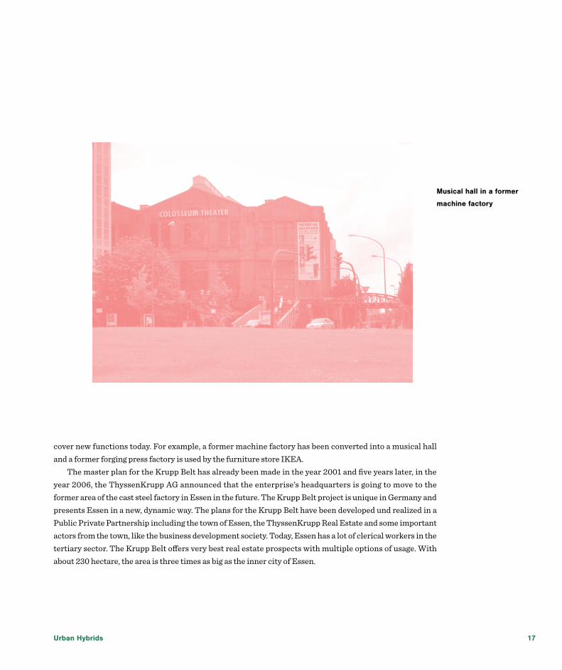
The Krupp Belt is a current urban development project in Essen, Germany. It is The New Face of Essen and contains living and working elements. Essen is a town in the Ruhr district, Germany’s largest agglomeration. The remaining coal mines, blast furnaces and steel works that had been built during the industrialization in the 19th century, still emboss the region. The Krupp enterprise was founded in the year 1811 in Essen and still exists. Today it is doing business under the name ThyssenKrupp. Krupp is a family enterprise that became famous because of its cast steel production. In the year 1818, Krupp built a cast steel factory in the center of Essen that had the size of about one third of the whole inner city area in the year 1973. First Krupp produced tools for tanners, then diesel engines, and after being an armaments industry during world war one, they began to produce railway locomotives, trucks, agricultural machines and diggers. During world war two, one third of the 230 hectare big area of the cast steel factory in Essen was fully destroyed, another third was destroyed partly. A lot of the left buildings were then dismantled, so that there was just 30 % of the factory buildings left in the year 1950. Since world war two the bigger part of the area lied idle, just a few new companies settled there. Some buildings of the former cast steel production factory had been conserved and
The Krupp Belt in Essen, GermanyEsther Bradel, Germany
Urban Hybrids 17
cover new functions today. For example, a former machine factory has been converted into a musical hall and a former forging press factory is used by the furniture store IKEA.
The master plan for the Krupp Belt has already been made in the year 2001 and five years later, in the year 2006, the ThyssenKrupp AG announced that the enterprise’s headquarters is going to move to the former area of the cast steel factory in Essen in the future. The Krupp Belt project is unique in Germany and presents Essen in a new, dynamic way. The plans for the Krupp Belt have been developed und realized in a Public Private Partnership including the town of Essen, the ThyssenKrupp Real Estate and some important actors from the town, like the business development society. Today, Essen has a lot of clerical workers in the tertiary sector. The Krupp Belt offers very best real estate prospects with multiple options of usage. With about 230 hectare, the area is three times as big as the inner city of Essen.
Musical hall in a former
machine factory

New Urban Hybrids
The Krupp Belt’s heart is the ThyssenKrupp Quarter, which has already been built. It is a very representative quarter with amazing architecture like the Group headquarters of ThyssenKrupp. It especially contains office usages and plans to build more administrative departments and hotels in this part of the Krupp Belt exist. The northern development area will contain various usages like high-quality commercial, office, recreation, gastronomy, and residential areas.
The Krupp Park sets the Krupp Belt apart from all other places. It is still in the development process and when it will be completed, it will have a size of about 23 hectare. There is a 9 hectare big lake situated in the heart of the park. The whole Krupp Park is a perfect location for recreation and leisure activities. It contains vast meadows, offers space for doing sports like jogging and walking paths, has an outdoor fitness area and four play areas. It is also planned to build a sports ground there. The Krupp Belt is directly linked to the inner city of Essen and the boulevard between the ThyssenKrupp Quarter and the Krupp Park is part of the outer ring around the city.
The Krupp Belt is an interesting example of urban development. It contains a lot of history and I like the fact that historical elements are involved in the area. For example, the former head office of the Krupp family still exists and is involved in the Krupp Belt as a cultural and historical element. The mix of the functions in the Krupp Belt is amazing. Business is connected with recreation and leisure activities. The whole area is an innovative, new impulse for the whole town. It is linked with the inner city and with the surrounding urban quarters. The potential of the historical elements is used to create a new, innovative urban quarter with various functions that represents Essen and is not only attractive for business people, but also for citizens and tourists.
ThyssenKrupp’s headquarters in Essen
Krupp Park; background: ThyssenKrupp Quarter

Urban Hybrids 19
The project shows that historical elements can be involved in new, modern urban development projects. Historical elements are potentials that should be used. The whole Krupp Belt is very innovative and it is also a very sustainable project. For example, the ThyssenKrupp Quarter has very high energy standards. Energy consumption is minimized, renewable resources are used and the damages of the ecosystem are minimized. The large open spaces bring new qualities to Essen. Altogether, the Krupp Belt is an innovative urban development project that will set new impulses for the whole Ruhr district.
Krupp Park; background: ThyssenKrupp Quarter
Former Krupp head office
New Urban Hybrids
In the early 2000s, the municipality of Oslo decided to rebrand the city as “The Fjord City”, through a project called Fjordbyen. A strategic plan called Fjordbyplanen aiming to “free the areas by the sea, and develop housing, recreation and business in a way that opens the city towards the fjord” was developed (Oslo kommune, 2008). Since the launch of the plan in 2008, major development projects has, and still is, transforming the capital’s coastline, turning former industrial docks to livable areas.
While the goal of the project is noble and seemingly beneficial for Oslo’s population as a whole, Fjordbyen has received massive critique from both citizens and distinguished architects (Ellefsen, 2011; Aspen, 2013). Critics remark that the majority of inhabitants are excluded from the waterfront through real estate developers’ one sided focus on high end housing and lack of public space. At the same time, the city’s major cultural institutions are relocated from other parts of the city to the waterfront. This creates a new cultural hub for the upper social class, excludes the rest of the population from the fjord and drains the city districts for cultural institutions.
In this paper, I will present the inner city district Tøyen, which in 2013 was offered an extensive support
Tøyen - a city district in the wake of a horse tradeMaria Eugenie Gjelseth Buene, Norway
Urban Hybrids 21
programme by a political fraction in the city council. In exchange for the relocation of the Munch Museum from Tøyen to Bjørvika by the waterfront.
Tøyen is located in the inner eastern part of Oslo. Although the Norwgian society is more egalitarian than that of other European nations, Oslo has a distinct east/west division with the eastern part being generally poorer. With around 40 000 inhabitants, Tøyen is among the most densely populated areas in the city. Most dwellings are townhouses and apartment buildings, located around large green public spaces, like the Botanic Garden and the Tøyen Park (Tøyenparken). The community is multicultural with people from various social and economic classes. The mix of welfare housing residents, immigrants, young people with higher education and families with young children creates a highly complex social situation. Tøyen has a reputation for being the toughest area in the city to grow up in, causing Norwegian families to move when their children reach elemetary school age. Of 250 pupils at the local primary school last year, (Tøyen skole) only 2 were ethnic Norwegians. The area faces multiple threats from crime, drugs and gang related activities. Throughout the years, several citizen initiatives have cried out for the municipality to take action. They especially point to Tøyen’s unproportioned share of welfare housing compared to the western part of the city. This time it seems the municipality has listened to its citizens. With the new support programme, things might change at Tøyen. But is phasing out welfare housing and a couple of additional perks at the expense of losing a museum the appropriate remedy for this area?
The support programme spans five years starting in January 2014, and consists of 22 measures. Among these are a new Science Centre, a new waterpark, a redesign of the tube station, upgrading of the Tøyen Centre, an extension of activities at the local primary school, establishment of a music and cultural school and an outdoor scene in Tøyen Park. The municipality is also examining the possibilities of reassigning welfare housing to student housing, moving its inhabitants to other parts of the city, and transforming empty municipality owned flats to art studios (Avtale om Munchmuseet og utvikling av Tøyen, 2013). We are yet to see the effects of the programme, as only a few of the measures have been executed at the time of writing. The results of the programme will unfold in the next couple of years. Will the exchange of the Munch Museum for new functions prove to be a blessing or a curse? Even if the Munch Museum attracts many visitors, its value in the community is limited. Gentrification might be the next step if the plan to raise the quality of this area and change its composition of inhabitants proves succesful. Although the pre-story leading up to the programme may be considered unfortunate, it might still lead Tøyen to a prosperous future.
ReferencesAspen, J. 2013. ‘Oslo – The Triumph of Zombie Urbanism’. In R. El-Khoury, E. Robbins (eds) Shaping the City: Studies in History, Theory and Urban Design
Høyre, Venstre, Sosialistisk Venstreparti, Kristelig Folkeparti. 2013. Avtale om Munchmuseet og utvikling av Tøyen
Ellefsen K. O., 2007. 10 feil om Fjordbyen. Aftenposten, 1. Oct.
Oslo kommune, 2008. Fjordbyplanen. Plan- og bygningsetaten, Avdeling for byutvikling

New Urban Hybrids
The Cattle Depot Artist Village is an art village located in an old residential area of Hong Kong. The site was formerly used as a slaughterhouse for more than 90 years. After it was closed in 1999, the ownership of the site was returned to the government. The government property agency has since leased the units to various artist groups and the site has been slowly evolving to what it is now as a growing cultural scene in the community.
The Ex-Animal Quarantine Depot (Cattle Depot) was constructed in 1908. It served as a slaughterhouse and quarantine base for cattle. Throughout the years, development was seen in almost all urban areas of Hong Kong, and the district where the Cattle Depot is located has become an industrial cum residential area since the 1960s and 70s. The surrounding area of the site is mainly low to mid rise (7-15 storeys) industrial or residential buildings. It has good transport connection and sits next to a 3-lane road where traffic is busy. Opposite to the site is an array of 83 tenement buildings situated on 11 parallel streets (13 Streets Area), and a utility company with gas plant also sits next to the site. As urban renewal and mass transit is taking place in the area, new high rise residential buildings also appear. Together these distinctive typology and functions interweave an interesting cityscape for the area.
Cattle Depot Artist Village - A unique cultural cluster in Hong KongYat-nang Choi, China

Urban Hybrids 23
The Cattle Depot could once accommodate 120 cattles, 200 sheeps and 400 swine, and was later only used as slaughterhouse for cattle. The Cattle Depot is composed of 5 building blocks including slaughter house, sheds, and store and office quarters. The design of the compound is reminiscent of the Arts and Crafts style and the choice of materials also shows a respect to the local traditions. In 1994, the Cattle Depot was graded as a Grade III historic building. As increased concerns were expressed by the residents about hygiene problems, the depot was finally closed down in 1999. At a similar time, another artist village which artist groups had rented on short term basis, was resumed by the government as the land owner. Many of the artist groups have since relocated their office to the Cattle Depot.
At first there were quite some disputes over the management of the Cattle Depot Art Village. As the art village is owned by the government and operated by a government property agency, the art village is treated as an ordinary government property leasing out units to tenants. Visitors were generally not welcomed and required registration prior to entry. The many complicated safety and fire regulations have also hindered the artist groups from organizing public events. The site has generally created an inhospitable image to the nearby neighbourhoods and visitors. In addition, there was generally a lack of vision towards the future of the Grade III historic site, as the units of the Cattle Depot were still leased out in short term. Indeed, the name “Cattle Depot Artist Village” was first seen outside the wall of one of the artist tenant, and being appropriated as the name of an exhibition venue in one art event.
In recent years, people of Hong Kong have shown greater concerns about cultural heritage, and aspired to take a more visionary and comprehensive approach to heritage conservation. In around 2005, the Hong

New Urban Hybrids
Kong Government began to undertake a territorial-wide assessment of over 1,000 buildings of their heritage value, and the Cattle Depot was upgraded as a Grade II historic building in 2009. The ownership of the Cattle Depot was later shifted from the government property agency to a policy bureau, under which the overall heritage policy directive was made. The property management of the Cattle Depot has also improved to become more pleasant and inviting.
The spatial layout of the site also brings unique characters to the Art Village. Each of the building blocks varies in size and shape but share a similar identity, and there are spacious circulations or “public space” between the buildings. It makes the artist tenants naturally share a sense of community. Its situation on ground floor and close proximity to residential area also makes it easily accessible by visitors. Local residents also shows interest to the site as the once slaughter use for so long has turned into a (pseudo) public space having remarkably different activities and uses from before. There is seen an organic interaction between the Cattle Depot Artist Village and the neighbourhood, as well as the larger public, which make the Cattle Depot Artist Village a unique cultural cluster and become a recognizable local feature in the community.
In light of accelerating urban renewal programme in the district, the urban scene of the district may change gradually. There is also seen a general lack of vision or support outside the traditional high culture arena. In such a context the future development of the Cattle Depot Art Village is still a work in the making, and the potential of the site could be further unleashed for deepened and dimensional discussion and interaction among members of the society would be carried out on topics such as heritage conservation, urban regeneration, art policy, and community capacity building.

Urban Hybrids 25
In this paper, I would like to reflect upon a neighbourhood called Oran (or once it was called OR-AN) in Ankara, Turkey. Although I intend to present an overall observation on the neighbourhood, the focus area is the area that falls into a circle of 1 km-radius around Panora, a shopping mall. Throughout this paper, brief information on Oran, for what intentions the neighbourhood was founded but what it turned into, which kind of processes caused the current state of Oran and the learning point of this hybrid urban place shall be presented.
To begin with, Oran is situated in the south of the center of Ankara, the capital of Turkey, on one of the highest hills of the city. Before the 1970s, there were only slums in the area as it is quite far away from the city center, Kızılay, -almost 30 minutes by car, in normal traffic- and there was no public transportation.
In the beginning of 1970s, the neighbourhood was chosen to be the place where the first suburb of
YTK/IFHP Urban Planning and Design Summer SchoolOya Merve Duman, Turkey

New Urban Hybrids
Turkey to be established. A construction firm called OR-AN (short for Orta Anadolu, Middle Anatolia) built the first housing development and the name of the company became the name of the neighbourhood. The main projection for Oran back then was to provide an elite neighbourhood for Ankara, but it did not happen due to infrastructure and transportation problems. In the 1980s, the government bought a piece of land and built another housing development only for congressmen, under the shadow of a lot of speculations. But the congressmen never occupied the new development due to a political move and those houses remained unoccupied more than 20 years. But still some politicians including one of the prime ministers of the period moved to Oran. In the meanwhile, both slums and legal housing developments for the public kept being built due to the fact that Ankara was growing very fast and people had to find a place to live.
During the first decade of the millennium, the new government sold the land to a construction company and it was the beginning of the hybridisation of Oran. In 2004, a shopping mall called Panora was built and then in 2010, Park Oran, a housing project composed of luxurious high-storey apartments, was built. Although both the upper scale development plans and the building laws and bylaws were not allowing for such construction, all of them were changed in the blink of an eye because as the city grew, the distance between Oran and the city center got shorter and Oran became profitable. In a period of less than 10 years, the area surrounding Panora became the house of the people with a high income.
In the meanwhile, after 2010, although it was not included in the city development plans, again, some

Urban Hybrids 27
embassies were moved to Oran. These newly emerged embassies were located right in front of Panora despite of the fact there is no related governmental building nearby.
While all of this happening, interestingly only congressmen houses vanished and new developments were inserted at an empty spot. Slums remained exactly where they were, the first suburban developments were added, then the congressmen houses were added, then they got demolished, but politicians living in the neighbourhood remained where they were, then the shopping mall and houses for high income families were added and finally the embassies were added. This means that in a very small area, you have slums, new high-storey apartments, old small houses, a huge shopping mall and embassies. In the end, if you take a 15 minute walk starting from Panora, you can see people begging for money in the street while very expensive cars passing by or neatly dressed elderly people who have lived in the neighborhood for the last 30 years and some foreigners who are trying to communicate with them with body language only because there is no common spoken language.
As this hybrid formation gradually happened in time, it became something very normal. People coming from different social classes and even from different countries go to the same mall as it is the only socialising place of the neighbourhood, which makes Panora the center of this hybrid environment. The only difference is apparent in the inside the of the mall: The poor just wanders around while the rich and the old, middle class residents actually buy something and the foreigners do both. Every single actor created their own way of using the same urban space.
What makes all of this quite interesting is that how the first suburb of Turkey became the home of a chronologically formed up hybridisation. New irrelevant functions and actors were piled up on top of each other, creating an environment where inhabitants did not choose anything, just what is done is done and they found a way to accommodate such a hybridisation. If we follow the idea of Kostof, the idea of a city having its own will (Kostof, 1992), Oran would make a great contribution for those who try to understand the will of a city as it is the exact opposite of what that idea refers to.
To conclude, I believe that Oran stands as a very appropriate example to show how constantly changing city development plans, building laws and bylaws as well was political actions can create an unintended hybridisation for people and how easy people can adapt to their environment, finding a way to use it in their own terms even though it is used by several others.
New Urban Hybrids
The urban development of the old Carlsberg site in Copenhagen, which for more than 150 years had been the main production site for Denmark’s largest and most renowned beer producer, has taken off significantly since the company’s relocation in 2008. Spending years as a hermetically sealed industrial site, the old brewery area is now open to the public following a competition held to prepare a master plan for the area. The winning design included benefits across the board like new housing, a place for small businesses to operate and distinctive urban spaces.
I chose to highlight the planning strategy for this particular area in Copenhagen because it offers a unique approach to urban development and the role of planning. A distinguishing element in the strategy for Carlsberg is, for instance, the very recognized but nonetheless often forgotten idea that the city is constantly changing. The development of new neighbourhoods in a city should thus not be understood as a process aiming towards a final end result, but rather as an ongoing process that has no end date.
For the very same reason, the aim of urban planning in any given area should not be to create a completely finished physical framework but to instead support an active use of that area. With this approach, the planning
Copenhagen – Contemporary us on the Carlsberg brewery siteViktor Forchhammer Mortensen, Denmark

Urban Hybrids 29
strategy for Carlsberg also marked a break with past decades’ approach to urban development in which the aim had often solely been to ensure the realization of a full-fledged master plan based on the expectation that residents and urban life would quickly move in once a physical frame was in place. The winning team behind Carlsberg’s master plan successfully argued that the urban life in Carlsberg had to be nurtured before the cranes moved onto the site. This idea was then executed through a series of contemporary initiatives which brought Copenhageners to the area and made them familiar with the city’s newest district.
As an old industrial site with empty buildings and vacant spaces, the Carlsberg area was ideal for this particular strategy. Various organisations, public institutions and small businesses were allowed to use the buildings at inexpensive rent rates, while the landlord, in this case the Carlsberg company, was able to increase the attractiveness of the site and give it a new identity through these temporary activities. Furthermore, the fact that the Carlsberg grounds are located in the middle of Copenhagen and surrounded by dense residential areas made this initiative even more effective.
In a complex with multiple artist studios and architecture firms, many of the old industrial buildings and spaces were reinterpreted and reused in new and surprising ways. Some of the more imaginative reinterpretations of the site include an obstacle course floating in the treetops and the transformation of a parking facility into a jungle comprised of ropes. More traditional contemporary uses, like in the form of pop-up music venues and art galleries, were also introduced. Taken together, the initiatives helped create a reason for Copenhageners to visit the Carlsberg site, talk about the area, and use its urban spaces.
Through the increasing use of the area, the hope is that Carlsberg will slowly become a completely integrated part of Copenhagen in line with any of the city’s other districts. The use of the area will also work as a guideline for any physical changes on the site and make it possible to customize the physical framework to the users and the urban life already existing. In an era of increasing pressure regarding cities’ scarce resources, this planning strategy has the advantage of offering quick and effective solutions to problems like vacancy or dereliction, while allotting time and space for long-term physical solutions. All things considered, the Carlsberg strategy helps shed light on the city as a dynamic space that responds better to evolving circumstances.

New Urban Hybrids
The ContextWHERE: Livorno, Tuscany, Italy WHEN: 2009-2014PLANNER: ISOLARCHITETTICLIENT: Porta A Mare Spa
Livorno is a city on the Tirrenian Sea on the western coast of Tuscany and its port is one of the most important of the Mediterranean Sea. Livorno was founded in 1017 as one of the small coastal fortresses protecting Pisa. It belonged to the city of Pisa for several hundred years. Between 1404 and 1421, Livorno belonged to Genoa and then it was sold to Florence.
Livorno was designed as an “Ideal town” during the Italian Renaissance, when it was ruled by the Grand Duke of the Medici family.
Major additions were designed by the architect Bernardo Buontalenti at the end of the 16th century. The Medici port was overlooked and defended by towers and fortresses leading to the town centre.
Livorno suffered extensive damage during the Second World War. Many historic sites and buildings were destroyed by bombs of the Allies preceding their invasion, including the cathedral and the synagogue. Livorno’s loss of influence as a port led to economic decline into the 21st century. After a few years of crisis, the port of Livorno is currently one of the most important in the Mediterranean Sea.
The project of “porta a mare”The design of the new sea port of Livorno aims to mend the breach between the historic city and its major areas overlooking the sea reusing disused infrastructure. The area of intervention concerns in particular the reuse of the former shipyard Orlando, relevant place of production of military ships until after World War II
Livorno Porta Al MareMarco Giambersi, Italy

Urban Hybrids 31
and the redevelopment of the turistic port.To evoke the grandeur of the past and to recover areas that were once used for the construction of large
ships, has been designed a new waterfront for the city, called “Porta a Mare”. The greatest task of modern time is not to erase the past, but to reshape it in a new life using it as a diving board for jumping in new dimensions. This is why the glance of Porta a Mare on the future starts from the wharf constructed by the Medici family, as a testimony of greatness and at the same time using its architectural function to create a great meeting point. Porta a Mare creates a new mean of interaction between travellers, residents, tourists, infrastructures, services and entertainment: a new mix between cultures which unites history and future.
In the area which separates the ancient centre of Livorno from the sea, a new meeting point is developed. Encounters between people coming from the great tourist port and those who work to provide products and services, encounters between people who have chosen to live in the green area created between sea and city, and those who arrive from the city in search of amusement, shopping and leisure. Hotels, bars, restaurants, pubs, shopping areas, wellness centres and lots more for those who in Porta a Mare live, work or arrive as tourists. Porta a Mare will be the new pulsing heart of the Region.
Porta a Mare represents the development of an urban conception thought to improve the quality of life of those who live its spaces. Over 70.000 m2 designated to houses of different sizes make possible the idea of living in a green area remaining just steps away from the city and the sea. Great spaces for commercial use offer the possibility of working in an area of assured development and great prestige remaining close to home and to all essential services.
The compound will provide large spaces dedicated to offices, hotels, stores, residences, wellness centres, leisure activities, boat spaces and related commercial activities, various type of homes, underground parking lots and traffic related issues.
The concept of waterfront drew up new horizons for the seaside town. No more revolts back to the coast but open to it, in a process of development spaces that conquer back their vitality with urban redevelopment. The result is the creation of real poles of attraction that host cultural and tourist events, in perfect harmony with the urban context. No longer perceived as a place of boundary, or only union between land and sea, but as an element of continuity that creates synergies between solid surfaces urban and marine rarefied atmosphere: a place in which to live, work and play in harmony with the historic center and its traditions.
This is the philosophy of a residential housing that combines the most advanced trends of modern living with a renewed enthusiasm for contact with nature and the discovery of unspoilt areas. The energy independence of the houses designed according to the most rigorous and advanced performance class A joins central heating systems in individual management, using as a source of geothermal energy from the sea.
The functions provided are distributed through a typological scheme that evokes in a contemporary key the old fortifications. On the ground floor a succession of large volumes, containing the trade and service sectors, defines the urban scale, the nature and morphology of the public space, realizing, with the ancient Medicean walls, a system of continuous scenes walls. The flat roof of these volumes has a great rooftop garden intended to residences and for tourist accommodation.
The external finishes used for these functions (wood, glass and steel) are opposed by lightness to the materiality of the underlying volumes emphasizing the size of most private and intimate. The basement below the space for retail use is reserved to accommodate garages.
New Urban Hybrids
The Wanniek gallery is a former industrial area located in Brno, the second largest city of the Czech Republic. There are several buildings in the area that used to serve as a factory, storage and an administrative building for various owners. The buildings originally from 19th century are situated right behind the central train station from the north and facing the bus station on the south. The area was abandoned in the seventies and what used to be a factory building at the edge of the city when built, was now an empty brownfield right in the city center. The whole area was said to be a cultural heritage under the city protection and was reconstructed in 2005 to create cultural and leisure area.
The Administrative buildingThis building is facing a busy road connecting Brno with the capital, Prague. The facade is made from bricks in a very atypical for Czechs North Europe- an neo gothic style. Although having a very decorated facade, the building interior was designed as a truly simple and functional office space with no further decorations. The reconstruction cleaned the facades and tried to modernize the interior spaces in the way and the purpose the building was built for.
The building now serves as an administrative part of a new established gallery with some small commercial spaces on the ground floor.
The Wanniek gallery, Brno, Czech Republic Eva Horakova, Czech Republic

Urban Hybrids 33
The Machinery buildingThis building facade was also made of plain bricks, inspired by factory buildings in Germany. It contains of one larger space and a workshop. This building wasn’t in a good condition, with not really nice built up spaces and damaged facades. These were reconstructed, in respect to the 19 century industrial style, the same for the interiors, which still evoke the atmosphere of the former purpose. This object is now used as an universal gallery space.
Te storage buildingOn the site of the former factory storages was build a new building of one of the biggest shopping malls in the city center of Brno. The building provides a passage be- tween the railway and the bus station, using also a new pedestrian bridge above the road. The inside space is actually formed like a roofed city shopping street, with a passage and shops, cafes and a main space used as a rest area, or for various culture events. The facade is made in the style of bricks to fit with the old buildings
I took this project first of all because whoever come to the city by bus and want to go to the city center need to go through the building so I pass it every week when commuting to the school. Second, I found it
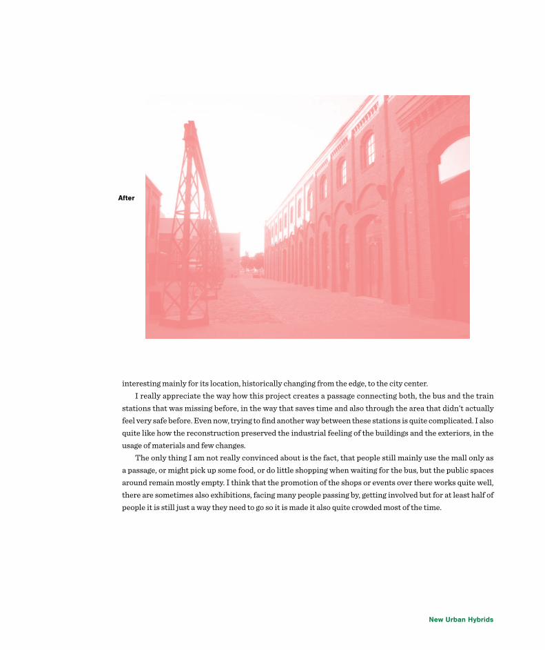
Before
New Urban Hybrids
interesting mainly for its location, historically changing from the edge, to the city center.I really appreciate the way how this project creates a passage connecting both, the bus and the train
stations that was missing before, in the way that saves time and also through the area that didn’t actually feel very safe before. Even now, trying to find another way between these stations is quite complicated. I also quite like how the reconstruction preserved the industrial feeling of the buildings and the exteriors, in the usage of materials and few changes.
The only thing I am not really convinced about is the fact, that people still mainly use the mall only as a passage, or might pick up some food, or do little shopping when waiting for the bus, but the public spaces around remain mostly empty. I think that the promotion of the shops or events over there works quite well, there are sometimes also exhibitions, facing many people passing by, getting involved but for at least half of people it is still just a way they need to go so it is made it also quite crowded most of the time.
After

Urban Hybrids 35
Bucharest is the biggest city in Romania and the capital of the country. It is a complex and a colorful city, with a very rich history and a prolific multicultural urban environment. In terms of recent urban planning, there have been some major changes in the urban fabric during the Communist Era (the demolition of the old rural structure and the massive construction of socialist collective housing and urban equipment).
One of these major communist projects was the Văcărești Lake, which was first planned to function as part of the complex planning of the hydrologic defense system against floods on Dambovița River, the main river of the city. The construction site started in 1986, when the old Văcărești Monastery was demolished, but the works ended abruptly after the 1989 Revolution. Nowadays the lake remains one of the biggest communist unfinished projects.
The concrete formwork of the artificial lake has been degrading in time, and the underground waters infiltrated through the cracks, resulting into an enormous swamp. Over time, nature followed its course: rare species of animals and plants found their home here, giving birth to a unique ecosystem in the middle of the city, which is quite similar to the one in the Natural Reservation of the Danube Delta.
Due to the existing urban planning chaos since the revolution and the lack of urban regulations, not only this area of wild nature is not protected by law, but inside the area there have been built a few deluxe residential complexes, a hotel, a mall, a supermarket complex, which were added over the former communist built layer. From this last one, there are some built areas left, such as collective housing buildings, a power
The Văcărești Lake, Bucharest -the delta in the city centerLavinia Isan, Romania

New Urban Hybrids
plant and a green houses site.All these individual and isolated initiatives contributed to the emergence of a very complex and fascinating urban hybrid area: the urban built environment, which is extremely heterogeneous, lives together with this wild natural area in a kind of relationship which is very promising in terms of bringing the nature inside the city.
Some important initiatives appeared in order to transform the area into a suitable natural site which could be able to bring Bucharest closer to a European appearance: while some non-governmental organizations are pleading for turning the area into a Natural Protected Reservation (for example the architecture office Save or Cancel , who realized a landscape project designed to highlight the beauty of this wild natural site, or some organizations who managed to keep evidence of the rare species of animals which live here).
On the other hand, there are some conflicts of interests between the ones who plead for the natural reservation, the real estate developers and the people who owned the land of the Văcărești Lake before the communist state took everything and who are pleading to take their land back.
In conclusion, the enormous potential of the area consists in this apparently chaotic heterogeneity, which, with the proper connecting elements, can be returned to the inhabitants of the city as one of the most fascinating urban areas of Bucharest, a proper living area, both in the city and the nature, and a recreation site where people can escape the city in the middle of the city.
Different built layers shape the heterogeneous urban image of this strange area

Urban Hybrids 37
Redtory IntroductionPeixin Jia
Redtory Park is located in the east of the CBD of Guangzhouțnext to the Pearl River. The transportation is very Convenient. Its predecessor is the largest cannery of China, called ”Yingjinqian” cannery, which is established in 1956. In 2009, the cannery began to be transformed into Redtory Park by transforming abandoned workshop into attic which is stylish, and can give people creative inspiration.
The Redtory Park covers an area of 160,000 square meters, the area still retains dozens of Soviet-style buildings. The park is axial symmetric.
The streets in Redtory Park reserve original name of cannery, such as Thawing Street, Canning Street and Finished Street.
The sculpture in the park consist old machines or parts of machines, which were as parts of the production line of cans, recording hundreds of years history of the factory. The machine sculpture are both the carrier of culture and an art performance of recycling.
Now, Redtory park is mainly used for art exhibitions, and of course there are some interesting restaurants in the park, such as an interesting restaurant be transformed from a train.

New Urban Hybrids
Context The present paper outlines salient features of a green-field macro-industrial city planned in the western edge of India in the state of Uttar Pradesh. The proposed growth hub is developed as a part of Indo-Japan co-operation to build high end modern cities on lines with similar such enclaves such as Shenzhen (China), Incheon (South Korea), to name a few. The hubs are built in the western edge along a freight corridor which acts as a transport link connecting it to different parts of the country. The development is envisaged as largest urban planning and design programmes in the independent India. The development timeline extends till
Dadri-Noida-Ghaziabad Investment Region (DNGIR): A Modern Urban MicrocosmPurushottam Kesar, India
Urban Hybrids 39
2030 and currently is in the planning stage. The vision of such a development, entails it to be a microcosm of industrial activity, world class built
environment for dwelling and recreation as a well as other land uses. The development program is known as Dadri Noida Ghaziabad Investment Region (DNGIR), with first three letters representing the place where it’s situated. The blue print of development and broad planning principles are guided by the larger flagship urban development programme of Government of India titled “Delhi Mumbai Industrial Corridor (DMIC)”. The development involves an active co-operation amongst key stakeholders such as the central, state and various infrastructure/environment ministries as well as people (mainly farmers) of the region represented through various civil society groups and elected representatives.
Location The Dadri-Noida-Ghaziabad Investment Region (DNGIR) located in western India, at the tip of Uttar Pradesh state, and is a linear corridor, 35 kilometres (km) long and 3.5-5 km wide, abutting various highways, forest areas, drainage channels, settlements and host of other site features. The delineated site lies in proximity to several developed urban concentrations within the National Capital Region (NCR) of India. The site is well connected to its surroundings. The National Highway (NH)-91 passes through the site while the western boundary abuts the proposed railway feeder link connecting the eastern and western Dedicated Freight Corridors (DFC) for movement of people and manufactured goods respectively.
Vision and Development PrinciplesAs per the concept and objectives of DMIC Project, under which the present node/hub is developed, “is to create a city structure with strong economic base centred on manufacturing industries and provision of globally competitive environment with state-of-the art infrastructure for domestic and export production”. Dadri-Noida-Ghaziabad Investment Region is conceived as an industrial region spread over approximately 217 sq.km of area and core vision of the development of the project is ;“To make it an infrastructure led integrated industrial city which is clean-green, well connected and having state-of-the-art support industrial and social infrastructure”
Development Strategies and PrinciplesThe concept master plan for investment region i.e. DNGIR is structured around 5 unique development goals which address the site conditions, accommodates industrial land use demand, preserves existing system of canals and greens as well as offers efficient transport connectivity. The key development strategies and principles adhered while developing the master plan includes:
Firstly, developing integrated industrial city of future i.e. Polycentric and thematic nodes are developed within the investment region so as to give a plural character. The land use disposition is done so that each physical entity develops as nucleus with the entire Investment Region being a self-sustaining multi nuclei development.
Secondly, a transit oriented development i.e. High intensity land uses are proposed to be developed along major transit nodes
New Urban Hybrids
Thirdly, strict protection of natural areas and other geographic features: The delineated Investment Region has an extensive network of drainage channels and man-made canal network. Protecting these major and sensitive environmental zones is important in structuring the Investment Region.
Fourthly, minimum hindrance to village settlements and finally an urban form of the Investment Region, which is envisaged as two-layer system. On one hand, hierarchical nature of intense nodes is conceived to provide the physical and visual experience of a modern city. At the same time, creation of a balanced mix between green and built areas is conceived as a second layer and as an alternative experience of urban form and living.
The above principles are clearly reflected in the concept master and infrastructure scheme of the Investment region
Land Use Plan and Concept Master PlanThe proposed development which would in the near future set a benchmark for the urban development in the country, as inspiration to host of similar such projects, is currently in the master planning and land use disposition stage. A few highlights of it are summarized below:
• In terms of the land use disposition, the overall structure of the Investment Region is a conglomerate of Industrial and residential land uses which are complimenting and interdependent in nature.
• Distinct areas have been allocated for support functions like commercial, institutional, recreational and transportation, in order to formulate a strong foundation for an integrated urban settlement.
Key takeaways The planning framework explained above has major implications in redefining the urban planning/ design benchmarks, never attempted before in the country. A few unique features of it are;
1. Due credence to the existing drainage and irrigation network and making it a part of the overall urban landscape.
2. The forests and green areas are uniquely developed as urban recreation regions by developing hierarchical patterns or green-ways i.e. city greens, canal green corridors, highway buffers and linear green corridors
3. Site driven and context driven industrial land use typology is developed so as to make it a win-win case for both industry and green enthusiasts
4. Urban design principles such as disposition of built up areas, green punctuations to name a few, give a new dimension and energy to the usual stale industrial manufacturing environment.
ReferencesManu Mahajan, 2013, Dadri Noida Ghaziabad Investment Region, Concept Master Plan, © CH2MHILL India.
Urban Hybrids 41
Located at the far east of Minsk, urban district Vostok had raised on a previously unoccupied land in the late 60s of the previous century when Belarus was part of USSR. Since then, it became home to more than 37.000 people. It was a huge project with architects all around the country wanting to take part in it, a project of creativity, limited by political norms, and it was placed right at the end of the highway from Moscow (main capital of USSR at that time) and meant to be symbolic welcoming gates of the city.
Soviet ideology was followed in architecture and planning just as in everything else, and at the time when Vostok was under construction certain strategies were manadatory: mass production – tall and long “boxes” of standardized flats built from pre-manufactured panels, infrastructure for realization of common social needs, “one family – one flat” approach, prepossessions to excessive décor, etc. Though, the government expected the least fussy design, they appreciated the need for each new district to be unique and recognizable.
The complex was produced with a thought of a “city within a city” approach – housing was integrated with infrastructure, which was placed to be easily accessible, parks, yards and parking spaces. Most of the facilities still exist and their number only increases: there are 2 banks, post office, pharmacy, petrol station, 7 food shops, 2 supermarkets, hospital, 4 state schools, 8 kindergartens, sport stadium, etc. The majority of the facilities, as it can be seen from the map, are placed within a central car-free part of the community that also has a boulevard that was intended to contribute to communication between soviet people. An artificial channel bisecting Vostok was created to add naturalistic effect that is a common feature of the city.
Minsk Urban District VostokSofiya Koval, Belarus

New Urban Hybrids
This huge multifunctional complex consists of everything people of soviet times needed for “building communism” and living a complete life, but modern people face a number of weaknesses. There is one parking space per three flats provided and due to an ever-growing number of car users in Minsk people adopt to those conditions by parking on pavements and grass. Children playgrounds which can be found in most of the yards are basic and old.
In 1986 the underground station “Vostok” was opened next to the district and improved its accessibility dramatically. Another transportation benefit appeared with the opening of Moscowskaya Bus Station that is used for both national and international services.
After the crush of USSR one of the grocery shops in Vostok became privately owned. Together with the expanding of the food sector, facilities for small businesses were added, allowing small shops to open, where people from the community work.
Recently Vostok’s existence was framed by the construction of National Library of Belarus across the road: government sponsored renovation of exterior parts of buildings facing the road, but those in the other parts of the district were neglected. Improved buildings are white and neglected once are still dull and grey, as they were 50 years ago. Boulevard with fountains facing the road was also completely renovated and the fountains started working after long time standing idle.
At the end, Vostok is one of the major examples of soviet mass development in Minsk of the times when the dwelling was treated as a machine for living in and the focus was put much more on developing places for common use rather than for personal.

Urban Hybrids 43
The Ferry Building Marketplace in San Francisco, California is located along the waterfront near Embarcadero, at the foot of Market Street. It is the center of a commercial and transit hub that connects all of San Francisco’s neighborhoods with the surrounding bay communities. The Ferry Building is accessible by train, subway, ferryboat, and the historic trolley cars (Line F Market).
The Ferry Building was originally designed by A. Page Brown, and opened in 1898. Shortly after it opened it became the second busiest transit terminal in the world. From the Gold Rush until the 1930’s, arrival by
Exploration of Urban Hybrid Space:San Francisco Ferry Building Marketplace Colleen Kutter, United States
New Urban Hybrids
ferry boat became the only way travelers and commuters- expect those coming from the Peninsula- could reach the city. The opening of the Bay Bridge in 1936 and the Golden Gate Bridge in 1937, along with the mass use of the automobile, drastically decreased the daily commute by ferryboat. By the 1950’s, the Ferry Building was nearly obsolete. With the increase in automobile use, the double-deck Embarcadero Freeway was built across the face of the Ferry Building in 1957 and remained for 35 years making the once prominent structure feel disconnected from the heart of the city. By the 1970’s, automobile traffic congested city roads and ferry service once again resumed as an alternative transportation route. However, the Ferry Building and central waterfront did not become a central hub again until 1991, two years after the Loma Prieta Earthquake caused extensive damage to the Embarcadero Freeway initiating the city to tear it down and replace it with the current boulevard.
In 1998, following a public competition, the Port of San Francisco selected a design team to redevelop the Ferry Building Marketplace. The team’s proposal was founded on two key ideas, one architectural and the other programmatic. They found creative ways to meet the requirements of contemporary building codes, preserve historic features, as well as meet ambitious sustainability goals. Phase I restoration was completed in 2003 and included renewal of the form and function of the historic 1898 Beaux Arts building. The urban space was revitalized into a waterfront destination, regained civic pride, and earned a spot on the National Register’s list of Historic Places and a registered landmark in the City of San Francisco. The restoration resulted in the preservation of architectural features and the creation of a new urban space that anchors the San Francisco waterfront to public/private partnerships, transit, and tourism. Phase II restoration includes three new docks at the Ferry Building, along with better access to ferries by land, and the regional expansion of water-based transportation on San Francisco Bay. Significant land improvements include new waiting and queuing areas and a plaza along Embarcadero from the Ferry Building south to the Agriculture Building at Mission Street. Phase II project construction is scheduled to begin in 2015.
Today the Ferry Building Marketplace is a notable example of a hybrid urban space. A place where public and private enterprises, transit, local food, and tourism all co-exist within the same space. By repurposing the urban fabric to include the renewal of ferry infrastructure and adapting to the changing community, new goods and services were established, the economy was expanded, and the space became a social destination for residents and visitors alike. This transition over the past decade appeared unified as the new goods and services did not take away from the old, and as a whole the space interweaved multiple functions and uses in a cohesive manner. The ferry terminal currently serves more than 11,000 daily ferry commuters, and the Ferry Building encompasses 175,000 square foot of office space, 65,000 square feet of retail market space, open-air cafes and restaurants, and is home to the popular Ferry Plaza Farmers Market. Over time the building has endured many transitions of differing office space uses and transit, but the 2003 redevelopment was the first time a public food market and retail had been introduced at the property. Each week nearly

Urban Hybrids 45
25,000 shoppers visit the farmers market and interact with the local and regional farmers, ranchers, and the nonprofit Center for Urban Education about Sustainable Agriculture (CUESA).
The renovations and urban renewal brought new life to the city’s waterfront transit. The challenge was greater than restoring and rebuilding the physical fabric of city and its heritage. It needed to provide a new local economic base to enhance the historic one without losing ferry transit all together. Renovation highlighted successful public-private collaboration, historic preservation, and innovative solutions to the changing urban environment. San Francisco’s Ferry Building Marketplace demonstrated as urban needs change, it doesn’t mean the original function has to be completely eliminated. In this case study, the design did not eliminate ferry transit all together but found a way to complete a comprehensive analysis of the existing conditions and future needs and encouraged public participation to determine innovative solutions and improvements that enhanced the urban space. Secondly, it showed hybrids can alter space while preserving historic features. Perhaps the grandest gesture was cutting away a quarter of the building’s rentable space to unveil an 880-foot long grand sky lit hall. By not being afraid to alter the building, the transit space evolved to include more open space concepts and highlighted arched clerestory windows, marble terrazzo floors, and other hidden second floor features. Finally, this project combined old and new functions and uses. For instance, it kept the ferry infrastructure for future use, but added the 30-foot-wide promenade between the building and water that wasn’t practical for its historic uses.
Overall, planning and design focuses on interweaving different scales and functions on the urban site. The Ferry Building Marketplace offers a multi-functional space that has the flexibility to grow and succeed in a constantly changing city. The site presents a set of shared values for current and future uses. It addresses the social, cultural, and environmental infrastructure, creates the need for more community amenities that are accessible, encourages thriving local and regional transit, expands business and economy, all while preserving iconic historic features in the city.
Report ReferencesEnvironmental Impact Report Downtown San Francisco Ferry Terminal Expansion Project,
June 2013; Downtown San Francisco Ferry Terminal Expansion Plan, March 2012; http://www.
ferrybuildingmarketplace.com; http://watertransit.org/CurrentProjects/DFTX/Environmental.aspx

New Urban Hybrids
Urban transformation through culture.Regenerating the old electricity production facility of Suvilahti in HelsinkiAino Kuusimäki, Finland

Urban Hybrids 47
This essay talks about the energy production facility Suvilahti, located in Helsinki, at the eastern edge of the downtown area. The area has gone through a transformation with the means of culture and what is often referred to as interim use. Suvilahti is nowadays known as a heart for urban culture: it is the venue for the electric music festival Flow, home to a circus actors and frequented by graffiti writers and skaters.
The former powerplant rests at the transportational nook of the “east vain” that connects eastern and central Helsinki and the shore high-speed road that leads commuters deeper onto the peninsula of Helsinki. On the southern side of the area lies the newer energy production site of Helsinki energy, the windowless red brick complex reaching its slender pipe arms in the air. The two gasometers that inhabit the grounds
Suvilahti during a techno rave
on a summer night.

New Urban Hybrids
of Suvilahti like relics from the almost forgotten industrial capital cannot be overseen from the orange metro right before it plunges underground to Kallio, a densely populated urban district especially beloved by young professionals. These industrial dinosaurs guard the premises of a heavily gentrified former working class district that was recently chosen one of the most “hipster neighbourhoods of the world” (Skyscanner) beside eg. Williamsburg, Södermalm and Kreuzberg. Indeed, what used to be an industrial site, an energy production facility next to a harbour, has become appendix-like to the Kallio district, a playground for new urban culture. The change has been consciously undertaken by the city and Kiinteistö Oy Kaapeli, transforming the area into a lively urban site with an electrically beating heart.
Urban generator // history and regenerationThe electrical power plant in Suvilahti was inaugurated in 1909 and the gas production facilities were opened later in 1910. Additional buildings were set up from the 1930’s to the 1950’s. The facilities produced electricity for the inhabitants of Helsinki up until 1976, when the power plant was closed and in the 1880’s the buildings were transformed into sports facilities and storage spaces for Helsingin Energia. The gas production facilities were closed in 1994 (Suvilahti, historiaa).
Suvilahti gained its first cultural actors already in the 1880’s when the KOM theatre company temporarily used the facilities. In the early 2000 some companies and photography studios also laid foot on the area, but it wasn’t until 2007 when the City Council of Helsinki agreed reserving the area for cultural means. Suvilahti was to become the second significant culture cluster set up in an industrial complex in Helsinki. The decision to develop Suvilahti in this way was found by city officials in a working group that was appointed by the Mayor of Helsinki. The task was to decide the future of Suvilahti (Suvilahti, historiaa).
The premises are now owned by the City of Helsinki and administered by Kiinteistö Oy Kaapelitalo, as called by the working group (Suvilahti; Suvilahti, historiaa). Kaapelitehdas, the old cable factory in Ruoholahti, Helsinki, had undergone a similar transformation as Suvilahti, which led the developing company Kiinteistö Oy Kaapelitalo into administering also the premises in Suvilahti. Both of these former industrial complexes also belong to the Trans Europe Halles network that seeks to “advocate and promote independent culture” on former industrial sites funded by the European Commission (Trans Europe Halles).
The 2,5-hectare-area planned by Selim A. Lindqvist holds nine separate buildings and the two gasometers that have been declared to be of architectural significance by the City Museum of Helsinki. The area is being rented, renovated and developed by Kiinteistö Oy Kaapeli. The policy is, that the area is being held as a cultural cluster and developed piece by piece, little by little. There has not been and will not be an opening ceremony for Suvilahti - the area is in a constant swirl of change and development. The main cultural themes in the area are the many music events that take place on the yard and circus (Suvilahti, tietoa).
One of the most well-known users of Suvilahti are the big festivals that are being organised on the yard in the summer time. There is Tuska, the festival for metal lovers, and Flow festival, that focuses on contemporary electrical music. Suvilahti has also bedome known for its graffiti walls: the wall in Suvilahti was the first authorised graffiti wall in Helsinki. It acknowledged graffiti as culture that should be allowed and endorsed and maybe even more importantly, it marked the end of the decade of zero tolerance policy against these ”smudges” (Helin 2013, 64). The area has also become known for its skate park, that was planned and executed by its users.

Urban Hybrids 49

New Urban Hybrids
Culture factory suvilahti // future and legacyAs a result of moving shipping away from the peninsula of Helsinki and nearby areas to Vuosaari, a lot of brown land was “left over”. Several smaller harbours including the ones on the eastern and northeastern sides of Suvilahti were closed and the cargo traffic that ten years back still characterised the area was taken farther to the East. These former harbour areas are now taken into new use and built for mixed uses, but mainly living. Kalasatama, the area right on the eastern side of Suvilahti, is one of the first harbour areas to be developed. Mixed living for some 20 000 inhabitants will be built as well as 8 000 new jobs placed in the new Kalasatama by 2030 (Kalasatama, perustietoa). It remains to be seen, what will become of late night events, festivals and financially unprofitable uses that are now taking space, giving an expression to the yards and facades and shaping the character of the old giant. Could it be, that the area will be cleansed of the street culture that now is putting its stamp on Suvilahti as something urban, unfinished and playful?
However, as Maros Krivy argues in his doctoral thesis on Suvilahti’s development, culture was used as a planning instrument to create something thought of as obsolete and abandoned into something that was very much alive, a place of everyday living, hobbies and contemporary culture, into a culture factory (Krivy 2012, 25). Suvilahti was integrated into the used city by turning it into something marginal into something central. This is a way of regenerating industrial spaces that should be looked into on steady basis: how industrial spaces can become appendices, maybe even centres of urban life and reused instead of entirely redeveloped.
SourcesHelin, Mika (2013). Legal graffiti in Helsinki. Helsinki Quarterly 3/2013, 64—75.
Kalasatama, perustietoa. <http://www.uuttahelsinkia.fi/fi/kalasatama/perustietoa> Read on August 3rd 2014.
Krivy, Maros (2012). From factory to culture factory: Transformation of obsolete industrial space as a social and spatial process. Unigrafia, Helsinki.
Skyscanner. The 20 most hipster neighbourhoods of the world. <http://www.skyscanner.net/news/20-most-hipster-neighbourhoods-world> Read on August 30th 2014.
Suvilahti. <http://www.suvilahti.fi/> Read on August 2nd 2014.
Suvilahti, historiaa. <http://www.suvilahti.fi/tietoa/historiaa> Read on August 1st 2014.
Suvilahti, tietoa. <http://www.suvilahti.fi/tietoa> Read on August 3rd 2014.
Trans Europe Halles. <http://www.teh.net/> Read on August 3rd 2014.
Urban Hybrids 51
Gowanus is a mixed industrial/commercial/residential neighborhood in Brooklyn. It is bordered by two of Brooklyn’s most desirable neighborhoods, Carroll Gardens/Cobble Hill on the North/West and Park Slope uphill to the East.
The neighborhood gets its name from the Gowanus Canal, which was once an important shipping lane but is now recognized as one of the most polluted bodies of water in the United States of America. Factories, warehouses, tanneries, chemical plants and gas refineries combined with sewage/stormwater run-off from adjacent neighborhoods, along with poor engineering design, all contributed to the current conditions of the canal and neighborhood. Changes in shipping technology led to a huge decline in the canal’s role as a shipping lane, but the area is still quite active.
Today Gowanus is made up of a number of interesting entities: manufacturing still remains a dominant feature in the landscape, but it has plenty of residences, including iconic brownstones, many trendy bars, the best pie in Brooklyn (Four & Twenty Blackbirds), a Homebrew shop, used furniture and salvage/reuse shops, artists’ studios, art organizations, a very visible subway train viaduct, start-up companies, and the Gowanus expressway. The Gowanus Canal Community Development Corporation helps maintain various green-street projects that have been implemented over the years. Lavender Lake, a popular bar, close to the water gets its name from the canal as well.
I find the area to be special because it contains so many different uses within such a dense amount of space, and while it also is laid out in a grid, the canal and the surrounding infrastructure, combined with the unusual building typologies, break up the area into many different visuals. The different typology of
Neighborhood: Gowanus, Brooklyn, NYMax Miller, United States

New Urban Hybrids
buildings allows for a variety businesses that can service the area in ways uncommon to the rest of New York city: my homebrew store is located right next to the pie shop, which is across from a giant beverage distributer, several truck garages, and warehouses. With so many small cramped commercial spaces in New York, Gowanus affords relatively quite a lot of space for concert venues, bars, and design studios that also double as the occasional warehouse party place. The confluence of several subway lines in the area makes it much more accessible to pedestrians than other areas that are given to industrial activity, so there is also a degree of exposure that is less familiar to the casual urban wanderer. It is less hip and more family oriented than Williamsburg or Bushwick, to be sure, but I think it is all the more interesting. Brownstone residential homes remain on its outskirts, which help the area blend rather well into the two residential neighborhoods of Carroll Gardens and Park Slope
Recently a Whole Foods supermarket moved into the corner of Third Avenue and Third Street with a brand new state of the art complex including a rooftop farm, redesigned canal side esplanade, and a ground-level parking lot with solar-panel coverings. The eastern boundary on 4th avenue has also been rezoned for high-density residential and commercial uses. 4th avenue is a two way six lane avenue that is considerably wider than other parallel avenues in the area, thus it seems like it can accommodate higher buildings. Dinosaur BBQ, a well regarded chain in New York State opened its latest location there, and a shuffleboard hall has opened recently as well. Still, there are many concerns among current residents and fans of the area that it will be developed to the point of being too expensive for the artists and small shops that help make the area interesting. Or if development in the area, paired with the recent introduction of the Barclays Center by Atlantic Terminal further north might overload the surrounding neighborhoods with traffic; some people wonder if the arrival of the Whole Foods will cause trouble for nearby Park Slope’s famous Food Co-op. This all remains to be seen, but the area is continuing to grow and shape itself in new ways.
Urban Hybrids 53
Boosting the highest concentration of up-scale fashion retail in the United States, South Coast Plaza (in Orange County, California) is a retail success story. Originally a lima bean field, the site for South Coast Plaza was converted from an agricultural to commercial designation in 1967 by the Segerstrom family. As the population in southern California grew, the mall became a destination for new and old alike. It is now a distinctive symbol of American consumerism within the region.
South Coast Plaza has even gained enough prominence to overpower the concept of a city as a fashion hub. With about two billion dollars in annual sales, the mall’s luxury brand stores advertise South Coast Plaza alongside important fashion destinations such as London, Tokyo and New York City. And, like these famous cities, South Coast Plaza has become an attraction for about 24 million visitors per year.
In 1993, within only a mile, the anti-mall was created as a reaction from the local community. A breath of fresh air in a planned region, the anti-mall establishes connections with local artists and provides what some would call a non-mainstream built environment in southern California. This anti-mall was and still is today a lively, arts-focused indoor-outdoor retail and restaurant venue that is tucked away for only locals. The LAB Antimall describes itself as:
The LAB, recycled from a night vision goggle factory, began its journey to combat retail monotony almost 20 years ago. In the midst of Orange County’s suburbia and perfectly planted palm trees, we recognized a need for a homey, indoor-outdoor hang out with shops and restaurants geared for the young at heart, and not offered in every mall on every corner. The “LAB” stands for “Little American Business” and that’s what we
The Coexistance of MallsMarjaneh Mottagi, United States

New Urban Hybrids
are, and what we continue to support. Inside the LAB Antimall there is The ARTery which is a series of steel shipping containers transformed
into a walkthrough community art exhibition space. There is also a den (see picture below) that is open to the elements but offers couch-like seating. Further into the anti-mall, a half intact cement wall and fully transparent glass space houses an eclectic hair salon, Crew Salon. And, the best space, the Gypsy Den, offers a living room of sorts as a community gathering area where visitors linger, listen to live music and play games. Thus, as South Coast Plaza’s promotes shopping, eating and leaving, the LAB Antimall embraces its visitors for extended periods, promotes connections and establishes community.
When comparing the two retail sites, the good thing is that there is no need to choose between the two options. Both may be experienced in one day since they are only within five minutes away. They do not have to be seen as antagonistic or as an alternatives to one another, they are merely two sides of the same southern California region.

Urban Hybrids 55
Urban Design in Tokyo for Tokyo Olympic 2020Yuka Murakami, Japan
As you know, Tokyo Olympic will be held in 2020. It is very big project, and manyareas will be changed. Today I would like to close up two famous areas. First is the national stadium at Yoyogi. This stadium was built because Tokyo Olympic 1964. Swimming game and Basketball game were played. An architect who designed this stadium is Kenzo Tange. He is the famous Japanese Architect. He is a leader of Metabolism. You may know he is pupil of Le Corbusier.
Now new stadium will replace. Zaha Hadid designs new national stadium. She is really famous young architect from Iraq. She won the competition at Japan which wanted new good design of an Olympic stadium. She is pupil of Rem Koolhaas.
I think there are few buildings that used spline on their design in Japan. This is epoch-making challenge. Yoyogi is rural urban area, what is called “Ruban Area”, inJapan. Japanese townscape is not so matched with organic designs. However somesymbolic buildings are needed to make cities and to do good urban design, so I think it should be evaluated. I do.
Second are Athletes’ dormitories for Tokyo Olympic 2020. This is Harumi Area,which is located in a bay zone and a heritage zone. From the first there was the Reclaimed ground and developed areas in Tokyo. Some of you may know Rainbowbridge in Harumi area.
This concept is “Athletes can enjoy comfortable daily life in Japan at Japanese style SECOND house”. One hundred and seventy millions people can be settled. Tokyo Prefecture said that they would like to make this area complex town by using Olympic effect. I’m really looking forward to go Tokyo Olympic 2020! Please come to JAPAN

New Urban Hybrids
The northern riverside is situated on the island Hisingen (the fourth largest island in Sweden) and is most, unfortunately, known as “the other side of the river” and is surrounded by suburbs where most of the population live in suburbs-residential housing properties. Most of the apartments were built in the 1960’s and was a part of the Sweden’s One Million Program, where one million new residents were built. About 21% of the population in the metropolitan Gothenburg is of non- Swedish background and the whole area behind the northern riverside is a clearly segregated city (URBED 2008).
The whole riverside was previously an old industrial area and here were three big shipyards situated (that lasted until the 70´s when the big shipyard crisis hit Gothenburg). During the last 30 years, the whole riverside has gone through a huge transformation that has result in new housing areas, universities, offices and hotels. The sub-district Kvillebäcken (marked on the map further down) is situated close to the riverside and Göta river. This area has been called in the local news as the “Gaza Strip” and has been talked about as the “lawless land in the centre of Gothenburg” (Forsemalm 2007). Even though this district is close to the city centre in Gothenburg, it has been a district with a declining economy and where the criminality became an increasing problem.
The district Kvillebäcken was originally an old industrial area and agricultural area. Later on, due to the low rentals, this area became a car repair area together with other local business (second hands, oriental markets etc.). Even though the area didn’t have any residents or bigger dwellings, more than local business in barracks, it was described as a ghetto-like environment, unsafe to be both in daytime and during the nights.
To get rid of the problems and “dirtiness” in Kvillebäcken, the municipality decided demolition and
N o r r a Ä lvs t randen – KvillebäckenSofie Norrgård, Sweden
Urban Hybrids 57
planned for a new neighbourhood connected to the other side of the river and create a more city-like area with mixed–use ideal. The corporation Älvstranden Utveckling or the “Riverside Development” became a major actor in the project. The corporation Älvstranden Utveckling consists of a collaborative project focusing on environmental and sustainable development in Gothenburg.
The new district has been relied on eight different property developers and constructors in order to create variety and secure deployment. Each construction company will make its mark on Kvillebäcken with different materials, construction techniques, especially architecture. It will also be a mixture of low and high buildings. The new area will consist of 2000 residential units, of which a quarter is rental units, and the rest of the housing are cooperative apartments. The ground floors are open in character with entrances and storefronts to create hustle and bustle in the area. The new housing area is interspersed with meeting-points, pocket parks, plazas and squares, wide avenues mixed with cosy and narrow streets, restaurants, schools, offices, green stretches for recreation together with trade and small businesses. All these function will create a neighbourhood with variety, urbanity and greenery and the vision is to create a lively neighbourhood from the start. The project also involves existing infrastructure, thereby contributing to good resource management.
The reformation of Norra Älvstranden/the Northern Riverside is well communicated with the citizens where all the citizens have the possibility to have an opinion through social medias, open consultations, lectures and debates. There is also a whole building dedicated to the development at the riverside where people can go inside and see the steps of the development but also leave their thoughts and opinions.
The basis for Kvillebäckens’s environmental work is Kvillebäcken Agreement, which was signed in 2010 by the companies based in the area, and is about Kvillebäcken to be a socially, ecologically and economically sustainable neighbourhood.
To create ecological sustainability, all buildings in Kvillebäcken have been constructed through environmental requirement and new environmental standards to create energy efficiency. Materials are chosen with great consideration for the environment and human health. Great emphasis is also placed on creating conditions to natural cycles and ecological processes to operate in the area.
To reduce the car use, environmentally friendly transports are available, such as good access to public transportation, good bicycle paths mixed up together with safe pedestrian streets. All accommodations in Kvillebäcken will have bicycle stands indoors, in bicycle rooms or in special bike wardrobes. There will also be a car pool available in the neighbourhood.
Kvillebäcken’s block farming is a green meeting place for culture and collaboration for interested people in Gothenburg. Anyone can rent a small farming spot at cost price. There is also a restaurant in the neighbourhood that are using the district’s own ingredients from their garden and plantation.
To create social sustainability, the streets in Kvillebäcken are well connected to surrounding areas and neighbourhoods to create good communication.
The mix between cooperative apartments and rented apartments in different sizes and prices/rents will bring a mix of people from different social backgrounds, an effort to avoid segregation and gentrification. All the newly moved in, are also invited to get a historical tour to get to know their surroundings.
A total of 24,000 square meters, i.e. about 15% of Kvillebäcken consist of business premises. The quest is to get a mix of grocery stores, coffee shops among other actors to establish in the area where they should support Kvillebäcken’s sustainability profile. The following points are considerate by the selection of tenants:

New Urban Hybrids
• Activities that support a sustainable district must active be sought out.• Tenants whose activities contribute to variation and the district’s sustainability profile, socially
and environmentally should be rewarded.• The businesses operate from a mind that cares about people and the environment.• The property owner should encourage tenants to conduct businesses in an ecologically and
environmentally way.
Even though the area is planned with business premises, the rents are higher than before, because of the higher mark prices, and can therefor cause that the businesses that were situated before the demolition and the reformation can´t pay their new and higher rents. One attempt to help some of the businesses (food related) stay in the area is that they have been offered a spot in the newly built market hall. The market hall will bring new visitors and citizens to explore the whole area. The market hall will also consist of businesses that represent the whole district and fit the people that are living in the area, even outside the newly built neighbourhood, for examples oriental stores and restaurants together with ecological stores.
Although much effort has been made to create a sustainable neighbourhood, some criticism has been pointed towards this project. One major opinion is that it is difficult to build an ecological sustainable neighbourhood without creating expensive apartments due to the production costs, especially the rented apartments. Much of the countries in Europe have something called social housing, where the rental housings are owned by the state or a non-profit organization and where the rents are below market levels, which make the possibility to create a diversity of social classes in an area. But this is not the situation in Sweden, and therefore it is difficult for the constructors to keep the rents low. The following risk is that the neighbourhood only will contain one type of social class, although the vision was to create the opposite.
ReferencesKvillebacken.se / Alstranden.com / Arkitektur.se
Forsemalm, Joakim (2007) Bodies, Bricks and Black Boxes. Power Practices in City Conversation
URBED (Urban Economic Development) (2008) REGENERATION IN EUROPEAN CITYS: Making connections, A case study of Norra Älvstranden, Gothenburg, (Sweden)

Urban Hybrids 59
Foshan locates in the southern part of China, and it is the third biggest city in Guangdong Province. With population of 7.2 billion, Foshan is attracting more and more people all over the world by its rich culture and booming economy. Foshan Lingnan Tiandi stands in the center of the Foshan city, and it is a regeneration project developed by the Shui On Group.
The site of Foshan Lingnan Tiandi used to be a busy block, having 30,000 inhabitants, dated from the Qing Dynasty about 300 years ago. As the center of the city, the block was an ideal habitation for officials and businessmen. They built the typical Lingnan style houses and luxurious villas, and traditional shops were scattered in the streets. There is the Foshan Ancestral Temple, which was constructed for the first time from 1078 to 1085, still standing on the west point of the Foshan Lingnan Tiandi. The block was flourishing with prosperous commerce at that time and it was the place where the noble families and reputable people gathered.
After the World Warț and the Cultural Revolution (1966-1976) in China, the wealthy owners left and the poor people from around became the new inhabitants. For lacking of maintenance, the block was destroyed rapidly. The living environments there were becoming deteriorated while the Foshan Ancestral Temple was thriving by the support of government. The Temple was appealing to lots of tourists every year but the houses in the adjacent block which had fallen into disrepair couldn’t tell the travellers more about the culture of Foshan.
Foshan Lingnan TiandiHuibing Ou, China
New Urban Hybrids
To develop the local tourism and economy, the local government decided to introduce the investment of the private enterprises. And Shui On Group, which is famous for the regeneration project of Xintiandi in Shanghai, is ambitious to make a better job in the revival of Foshan Lingnan Tiandi. After the commercial district of the second developing stage came into service, the project turned out to be successful. I attribute its success to the following reasons:
The first of all, the block is generally repaired as its original appearance. Most of the houses, which are not higher than two storeys, are rebuilt on the basis of the old ones on site, using the bricks from the parts which had been pulled down. The appearances of the houses are repaired as what they looked like before, but the constructions are reinforced by the concrete pillars or steel beams. With new drainage system, the old drainpipes are useless but reserved. Even the streets, which burying a central air-conditioning system and lots of pipes beneath, are covered with the strip stones as the old style. By researching the texture of the block before designing, the developers, planers and architects had consensus that the space experience of the block is surely to be remained and the architectures must be resaved to the most degree. Some construal technics had been lost, but the designers and builders were trying their best to pattern the old constructions by modern technologies.
The second, the old buildings have new functions. In the master plan, the whole block which is adjacent to the Ancestral Temple is converted to be commercial district and historic preservation zone, and the new high-rise residential buildings will stand around. It means the old houses are no longer private but public to all the citizens. In the renewed houses, there are restaurants and shops selling Cantonese specialties .Even the international chain shops, Starbucks, Costa etc. have the Lingnan style interior. A villa and some great houses, which are having a long history, are the 22 historic preservations repaired for visiting. Scenes and fountains are added in the relatively wide streets, forming leisure squares for the public.
Finally, the old living phenomenon reappears in the new era. After 30 years’ absence, the owners of the shops in the block were invited by the developers, and the reputable shops could serve the neighborhood again. ”It is important to reserve the life here as well as architectures.” the developers said. A Chinese medicine shop and a Wing Chun gallery help the senior citizens to reflect the old times in the center of the city .And the exhibition of the local art , such as Cantonese opera, paper-cut and wood carving, also supply vivid examples for the youth to imagine the life of their previous generations. As many as 100 old trees are even standing where they were, reminding the original inhabitants that the renewed place is exactly where they lived.
With integrated functions of commerce, tourism and culture, Foshan Lingnan Tiandi is becoming the most popular place in Foshan. Owning to the documentary of “The Revival” produced by the local TV Station, the process of regeneration is shown to the Foshan citizens. After watching the difficulties when the designers regenerated the historic block, the Foshan people are being increasingly proud of their culture and know more to cherish the heritage the ancestors left.

Urban Hybrids 61
Manufaktura - currently, the biggest centre in Poland, combining numerous features such as culture, art, trade and entertainment, but no further as 20 years ago, the place was witnessing the downturn of its textile past.
The site is situated in Łódź, the third largest city in Poland and the former textile capital of the country. The urban history of Łódź is inseparably connected to XIX century industrialization. Next to the old urban unit of medieval origin, the XIX century street - core of the city is being situated. Those two different in origins urban units are adjoined from the west by former factory of Israel Poznański. This exceptional
Manufaktura - revitalisation of former factory of Israel Poznański in łódźMarta Pastuszka, Poland

New Urban Hybrids
variety of historical factors and urban values make this part of the city so precious. The history of complex had started in the second half of XIX century, when one of the biggest industrialist
of German origins started to develop his masterpiece - the biggest cotton factory of the region. Prosperity had been whimsical but the production had been still continuing during the WWII. After the war, in 1945, the nationalized complex had started the last chapter of its existence in the city as a factory. Unfortunately, after the transformation1, the importance of this area dropped dramatically. The demand for fabric which previously was covered mostly by Soviet Union and its satellites, dropped, bringing almost all factories of Łódź to the verge of bankruptcy. The last production line of former Poznański factory has been closed down in 1997, creating almost 29-hectare2 of unused land in the heart of Łódź.
Manufaktura was typical for Łódź industrial sites of XIX century. It contained several types of building - palace of the owner, industrial area with buildings of different functions (including internal power plant and fire department), familisters for workers and internal railroad. All of the valuable buildings of the factory have been preserved during the revitalization process as the area has been under the heritage protection. Only one building (of department store has been added).
The investment has started in 2003 and was lead by a private company of French origins. The city of Łódź was responsible for making the land development plan to create frames for the investors. As a result of the process, in 2006 Manufaktura reopened again, not as a factory, but as a multifunctional complex.
Manufaktura became a huge success. In terms of business it was a creation previously non-existent in the area. The investment concentrated within itself services and capital in an unknown scale for the city in crisis. However the variety of functions is its strenght. The huge area of 27 hectares had to be filled with much more than just one or two functions to fully revive it. Moreover, Manufaktura stands also for a revival of this part of the city, as it gave a great example how to reorganize former industrial areas that Łódź is brimming with. The investment created the flow of people who also became the “consumers” of surrounding areas. Also promotion of Łódź within the country and abroad can be considered as added value of revitalization of Manufaktura. On the other hand, critics of the project outline lack of visual and compositional connections with the urban structure of surrounding areas and also cutting familisters and cantine, which were integral parts of the factory complex off. Also it has been blamed of intercepting trade functions of Piotrkowska Street - the core of the city. As well as quasi-public internal market of Manufaktura - not achievable for everyone.
Despite of some controversies surrounding Manufaktura, it is undoubtedly a place of great value for the city and a good example of revitalization of a site of great historical value.
1 The transformation that started in 1989 was covering political, social, economic factors during changing communistic system into a capitalistic one.
2 The total area of the coplex was almost 29 hectares but the revitalized part contained 27 hectares.

Urban Hybrids 63
PREMESIS. The progressive digitalization of social and economical relationships is transforming lots of huge factories, that for years have served an economic system by this time unsustainable, into useless empty boxes waiting for re-functionalization and new purpose. BXL-architects succeeded in rethinking a valuable disused, 15.000 m2, industrial area aiming at transforming it in a lively space for culture, art and public relationships where wide and versatile open spaces are meant to provide local citizens and tourists a modern cultural/leisure time activities centre. One interesting feature of this project is that it focuses on temporality and spatial custom-tailoring while turning the industrial parck into a urban hybrid area. As a matter of fact nowadays modern technology is capable of boosting communication and information and this feature shall lead designers to propose flexible system made of dynamic / modular / equipped spaces able to
Space to culture - young architects competition’s winner project (2014) - BXL architectsCamilla Pezzica, Italy

New Urban Hybrids
attract the highest number of stakeholders.
Hystory and hurban context. The complex is located in Bologna (Italy), more exactly in Quarto Inferiore quarter in a really strategic position with a great catchment area (13,7 milion people) since it is 16 minutes distant from Bologna city center by car, one hour from Milan ,two hours from Rome and 30 minutes from Florence, by train. Furthermore it is the actual center of the neighborhood that is essentially residential and rural and developed around the factory since Pier Luigi Cervellati designed it in 1971.
Thanks to the great sensibility of the ownersand the illuminated professionalityof the architect the structure guaranteedwellness and confort with its greatextension of glass surfaces, exceedingthe standards of that time. That factorywas a center of Italian haute couture, infact here, the stylist Olga Cantelli Masotti,designed all the la perla swimsuits andunderwear valuable collections
The project is the result of three different design level: the interventions on the existing building, the permanent project and the reversible project. I find this way to simplify such a complex work in simple steps, very effective and flexible.
1 Interventions on the existing building.The project starts from a critical review of the building. The interventions on the existing building come from a double need: create a space free and flexible as much as possible and recreate a new physical/ visual connection between the new internal activities and the external spaces (without distorting the original building, but at the same time strong enough to denounce the functional change). So the project provides for the elimination of all the non-structural partitions, the substitution of the mirror glass facades and the creation of several double heights to facilitate the perception of the new environments. For economical reasons all the existing vertical cores (staircase and elevators) and the services blocks (toilets and technical spaces) are maintained, and their location become the first suggestion to lay out the new functions
2 Permanent project.Inside the wide free space that is created, permanent elements are introduced. They have a double meaning: functional and communicative. They become the entrances and re-display the new functions contained by the building (adding new vertical/horizontal connections combined with the existing one). Due to the fact that
Urban Hybrids 65
we are talking about the transformation of an existing building, the theme of the entrance/ access/ gateway become very important and needs to pop out; it represents and redefines the transition between the inside and the outside, between public, semi-public and private spaces. So the permanent projects are characterized by a material and a bright color deliberately selected in contrast to the existing building and they are shaped in order to be evident and attractive for the potential users. The grafted blocks become accesses, vertical connections and public services related to the new functions provided inside the industrial buildings.
3 Reversible project.On the inside the space layout is re-designed through prefabricated modules that allow easy and quick assembly /disassembly process, and that leave a fluid and continuous space in between them, the relationship-wise space. They facilitate maximum scope depending on specific needs: thus the reversible project is configured as partitions, either small living units or wide polifunctional rooms, all made by the same module. The versatility of the design allows the creation of flexible spaces according to the requirements and the infinite possible solutions achieved with the prefabricated modules, provide to the project a significant economic sustainability.
To sum up. I find the site interesting because of its history and because of its huge potential offered by the position in term of possible number of visitors, and by its extension and its quality in architectural terms. Moreover I see in the way this operation has been carried out a convincing economic proposal that could be able to bring this glorious site to new life according to local planning and in accordance to the most modern tendencies.

New Urban Hybrids
AbstractThe aim of this paper is to present and show an example of an urban regeneration that it has also been a bottom-up urbanism in Barcelona.
It is the case of 22@, a project that had the goal of renovate and ancient industrial area, in the northwest of Barcelona, in a modern one, with an innovation objective and a way to strengthen this area of the city. The project combines a conservation of old factories and new buildings for innovative business to gain international investment.
IntroductionBarcelona is frequently used as an example of a successful city-region in the international sphere: the ability to transform the city into a desirable place for its quality of life and the capacity to renovate and adapt the local economy to the new global requirements, among others, are key issues for success. Thus, the emergence of the present Barcelona is the consequence of both land and urban regeneration together with creativity, knowledge and innovation as the main targets for the local economy. The ability of the city to cope with global challenges in the local arena responds to a deliberate policy strategy which started long before the celebration of the Olympics. A particular case study, the 22@, shows this example of all-embracing regeneration in a specific location. (Pareja-Eastaway, 2011) The 22@ is located in the area of “Poblenou” which is in the northwest of the centre of Barcelona, in the district of “Sant Martí”. From the XVIII century “Poblenou” had concentrated an among number of factories, a process that soared during the XIX century, being known as the “Catalan Manchester”.
During the 70th the factories of the area had been decreased, and it started a renovation of the district. The transformation of this district known as 22@, the name is fitting from the 22A the nomenclature of the
22@BarcelonaLaia Pi Ferrer, Spain
Urban Hybrids 67
industrial area. In 1986 Barcelona is designated to host the 1992 Olympics, which involves the transformation of the industrial zone. It is built the Olympic Village, the recovery of beaches and the waterfront and the park of “Poblenou”.In the 90s the Auditorium, the National Theatre of Catalonia, Pompeu Fabra University, and the Glories shopping centre is built. The opening of the Diagonal has a great impact and promotes extensive redevelopment of former industrial areas. In the 80 artists were installed in the neighbourhood for the features and prices of the space that the old industrial buildings provided them.
22@ ProjectThe idea for the 22@ District was realized in early 2000, when government initiative sought to transform the neglected neighbourhood of Sant Marti into an innovation district centred around research and technology. This plan was realized when a modification to the Metropolitan Plan was passed in early 2000. San Marti is an urban neighbourhood located in the “Poblenou” district. It covers about 200 hectares of privately owned land. (22@ Barcelona) The urban design goal of the district was to transform the historic fabric of the “Poblenou” into a cutting edge technology district based on a mixed-use sustainable urban model. The underlying framework is meant to meld new and old ideals for future development. (Pairolero, 2013)
This project is part of the renovation strategy east of Barcelona, where the most important operations are: Sant Andreu- Sagrera, urban improving of Glòries; and the infrastructure associated with the renovation of the seafront Besòs: project Diagonal Mar Forum. “This project mixes economic activities (companies and offices) with training (university campuses) and residential areas (re- urbanizing streets and building housing). An initiative that has been christened a compact city and aims to be a benchmark for the Barcelona of the future. Thus, the 22@Barcelona district is committed to a high quality, compact, mixed and sustainable urban model, making the resulting city more balanced, more hybrid, more eco-efficient, economically stronger and more cohesive.” (Molas, 2011)
The first part of the transformation has been developing during the boom of the construction, and the increase of the Spanish economy, those years have been involved with some problem originate of this first part of the regeneration: the previous economy, society, culture and urbanism. It is why after this first part of a quickly transformation, the neighbours claim to save some parts of the ancient district, like some important industries, that are considered industrial heritage. Thanks to neighbours for demanding a non-destruction of some industries, the power of the citizen participation increase. It aims for a dense urban space and complex (more efficient land use); 22@ bet on a compact, diverse and sustainable urban model, which generates a model more cohesive and balanced, environmental and efficient city. The new urban classification 22 @ supports the coexistence of technological use, offices, houses, hotels, commercial uses, community facilities and equipment to support the productive system. Barcelona wants to position as a leading platform for innovation and knowledge in an international economy.
ConclusionsIn the last decade the city council of Barcelona works to let the city participate actively in the new technological revolution and choose for it the compact city model. The government is aware that only through this way is possible to gain productivity and new jobs, providing high quality services for citizens. The district 22@ is the most concrete result of this economic philosophy; it is a large area that is regaining

New Urban Hybrids
its former role of economic and industrial driving force of Barcelona through various urban planning and economic instruments.
Barcelona has evolved tremendously over the past forty years. The city has taken advantage of many great opportunities, such as the 1992 Olympics and the 2004 Forum of Cultures, to realize massive metropolitan urban design proposals. As a result, Barcelona has succeeded remarkably in utilizing these events to restructure its landscape on an economic, political, and social level.
At the district scale, the city has successfully implemented a gracious amount of public space while preserving its historic fabric. Beginning with the Cerda plan, it has been a principal concept to successfully overlay the historic fabric with new urban proposals.
The 22@ project represents an important urban transformation in the last few years, in extension as well as the strategic consideration, because it is good located as a productive area having in consideration the new technological industries that have been getting the attention in this renewed area.
The dynamic model of territorial occupation “Poblenou” 22 @ BCN shows the effort the local authorities have done to create innovative companies such as Barcelona motor development has resulted in the emergence of highly dynamic urban cores urban knowledge hubs (Pallares- Barbera, 2006)
Bibliography Pairolero, J. Barcelona, The New Districts: 1991 Olympics, 2004 Forum of Cultures &[email protected]: University of Oregon, 2013.
Charnock G, Ribera-Fumaz R, 2011, “A new space for knowledge and people? Henri Lefebvre, representations of space, and the production of 22@Barcelona” Environment and Planning D: Society and Space 29(4) 613 – 632
Pareja-Eastaway, M. Urban regeneration and the creative knowledge economy: The case of 22@ in Barcelona. (Online). Henry Stewart publications, 2011.
Mascarilla, O. Spatial Agglomeration of Firms: Theory and Application for Industrial District 22@ of Barcelona. 45th Congress of the European Regional Science Association, Amsterdam, 23-27 August 2005
Dot, E. El 22@Barcelona o el liderazgo del espacio urbano. La economia del conocimento en la Barcelona del siglo XXI. Barcelona: Universidad Autónoma de Barcelona, 2009
Paül, D. De Manchester català a districte de la innovació. Els canvis simbòlics del barri del Poblenou de Barcelona (Online). Geocrítica, 2014
Molas, O., & i Sabata, M. P. (2011). 22@: 10 anys de transformació econòmica. Revista econòmica de Catalunya, (64), 13-21.
AAVV. El Pla 22@Barcelona Un programa de transformació urbana, econòmica i social. Barcelona: Ajuntament de Barcelona, 2012

Urban Hybrids 69
The project.Le Albere is an urban expansion project of Trento, a city in the North-East of Italy, which has been designed by the Italian architect Renzo Piano who coordinates the construction through the Renzo Piano Building Workshop. It is one of the most ambitious plan in the Italian architectural landscape, spanning approximately 116,000sq m of land 75,000 of which will be a public property.
The aim of this project is to regenerate and connect to the city center to the old Michelin industrial area, abandoned since many years. It is an interesting example of transformation of brownfield in greenfield: the cemented soil goes back to being green, contrary to what usually happens in most of cities.
Renzo Piano decided to use trees and the Adige River as connection elements: along the banks of the river he has created a tree-lined path which converges in the large park within the district. In this way, he got a twofold result: he has joined Le Albere to the rest of the town and he has restored the link of Trento with its river, which was virtually interrupted in the middle of XIX century when the course of Adige was modified in order to make way for a railway track.
Execution of such project has been possible thanks to a collaboration between public and private partners.
Urban Hybrid: Le Albere districtIrene Puncello, Italy

New Urban Hybrids
The functions.In total more than 300,000 cubic meters contribute to create a new part of the city, using the most innovative eco-sustainable technologies.
The area includes apartments, offices, shops, cultural spaces, congress and social areas and about 5 hectares dedicated to become a wide green park. ‘Le Albere’ contains a combination of urban functions:
• 45% of the total construction area will be devoted to residential buildings (about 44,000 square meters);
• 30% to offices;• 15% to public functions (the science museum – MUSE – and a multipurpose Centre, which stand on
either side of the complex); • 10% to retail businesses.
The buildings are interspersed with green areas and waterways and the residences have open courtyards that can be seen from outside.
Except for the museum and the multipurpose Centre, the buildings are four to five floors high. Their zinc roof have great relevance because they allow reaching the goal of ensuring uniformity of style to the entire area. In fact, even if the buildings share common geometries, they are different from each other: for instance, offices are straight, while residential ones have several different concave or convex shapes.

Urban Hybrids 71
Observations.I have visited this site during last January and I found it really interesting: the complex isn’t finished yet, but in my opinion is possible to perceive a harmonious integration with both the natural landscape and the city center. The functional mix will make it alive all day long.
It’s important to mention also the great attention given to the fundamental question of the environmental impact. I appreciated very much the idea of creating an “underground city” made by two levels including more than 2,000 parking spaces available to residents and visitors. In this way, the outer surface is free from cars while cycle paths, sidewalks, squares and green areas exalt its liveability.
I like the particular attention put on issues of sustainability and energy saving. In fact according to Renzo Piano “All the project is designed and built to save energy and be sustainable in terms of its management: using wood is per se a smart task because it is a noble material, ancient, coming from forests, so in fact it is renewable energy as well as fully recyclable.”
Furthermore installation of a system of photovoltaic panels, use of insulating materials, partial recovery of rainwater, presence of a trigeneration plant which provides energy for heating / cooling, with autonomous management of consumption contribute to energy saving.
I have read some critics too about this project and I have found one of them particularly worthy: the commercial units are too small to be attractive to large retail chains. I think that this must be considered an issue in this period so difficult for the Real Estate Market (most of the buildings that have been finished are not been sold yet).
Overall I believe that this is a really successful project, modern but not extraneous to the old town and the natural landscape giving the right priority to the welfare of residents and visitors.
Common spaces
between buildings
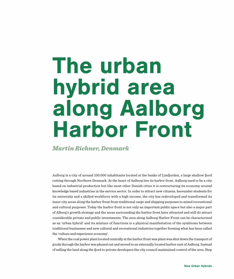
New Urban Hybrids
Aalborg is a city of around 100.000 inhabitants located at the banks of Limfjorden, a large shallow fjord cutting through Northern Denmark. At the heart of Aalborg lies its harbor front. Aalborg used to be a city based on industrial production but like most other Danish cities it is restructuring its economy around knowledge based industries in the service sector. In order to attract new citizens, hereunder students for its university and a skilled workforce with a high income, the city has redeveloped and transformed its inner city areas along the harbor front from traditional cargo and shipping purposes to mixed recreational and cultural purposes. Today the harbor front is not only an important public space but also a major part of Alborg’s growth strategy and the areas surrounding the harbor front have attracted and still do attract considerable private and public investments. The area along Aalborg Harbor Front can be characterized as an ‘urban hybrid’ and its mixture of functions is a physical manifestation of the symbiosis between traditional businesses and new cultural and recreational industries together forming what has been called the ‘culture and experience economy’.
When the coal power plant located centrally at the harbor front was plant was shut down the transport of goods through the harbor was phased out and moved to an externally located harbor east of Aalborg. Instead of selling the land along the fjord to private developers the city council maintained control of the area. Step
The urban hybrid area along Aalborg Harbor FrontMartin Richner, Denmark
Urban Hybrids 73
by step areas were developed in line with a long term strategy. Some lots the municipality developed itself while others became subject to strict local planning regulations and then sold to private developers. More peripheral areas have been developed into residential housing and office buildings. Upon visiting these areas it is somewhat clear which areas that were developed first. The architectural and esthetic qualities are lower than the newest developments; the amount of active facades is limited, building blocks cut of inner areas from access to the fjord, parking spaces are located along the harbor front and semi privatized spaces are to be found. More central areas have been occupied by the hospitality industry and public institutions. These areas are subject to stricter building regulations. In other parts of these more central areas a public museum designed by the renowned Danish architect Utzon can be found and of 2014 a concert hall designed by the Austrian architects Coop Himmb(l)au has opened its doors. (musikkenshus.dk, 2014) In-between these buildings there are green spaces which serve as parks but also as flood protection as well as public squares used for temporary events, e.g. when cruise ships dock. Finally, almost as a symbol of the city’s transformation from industrial city to knowledge city, the former coal power plant has been transformed into a centre for culture and sports. Today it houses sports facilities, a cinema, university facilities, restaurants, a tourist information centre and series of start-up businesses. (bygningskultur2015.dk, 2014) Similar plans exist for a former distillery-facility in the area. (Junker, 2014)
Aalborg harbor front is used by citizens as a public space for recreation. Its parks, playgrounds, squares, benches and sports facilities mean that it is inclusive for all age groups. Each year around 800.000 people visit Jomfra Ane Parken, the most centrally located park at the harbor front making it one of Aalborg most visited park. (urbandanmark.dk, 2014) Young people come to the harbor front to see other people and to be seen while workers and businessmen use it during their lunch break. During the summer many special events are held. Impressive sailing and cruise ships dock and the Danish queen arrives by boat. The municipality uses the harbor front as a way to brand the city and attract new citizens, businesses and investments to an otherwise somewhat remote part of Denmark. It wishes to portray the city towards potential citizens as dynamic, hip and rich on culture. On some of the city’s most expensive land there is being built social housing to accommodate the many students moving to Aalborg. At the same time the harbor front shows potential investors that the city is experiencing growth, that the municipality is determent to facilitate this growth and that Aalborg therefore is a good place to invest.
When looking back at the planning process and today’s results it is evident that a following a long term strategy when developing large centrally located areas is necessary. The harbor front has been developed as part of a strategy. Event so, smaller details are important and by incorporating former harbor buildings in local plans and regulations the cultural heritage has been reused. This has created an interesting atmosphere and by mixing functions life and activity has been ensured around the day. People from different age groups and different groups in society have been attracted to the hybrid area. History shows that while Aalborg Municipality could have made large profits by selling lots of land to private developers it served the city better as a whole to act differently. Instead of ending up with homogenized area with a series of high rise residential and office buildings Aalborg now has a unique and dynamic urban hybrid area along the harbor front. The development of mixed functions along the harbor front in line with a long term strategy has meant that Aalborg has experienced not only economic growth but also is capable of offering long term urban qualities to its citizens.

New Urban Hybrids
Referencesbygningskultur2015.dk. (2014). bygningskultur2015.dk. 02. 08 2014 http://bygningskultur2015.dk/industriarv/potentialer/gode_eksempler/strategisk_udvikling/identitetsudvikling_og_branding/nordkraft_i_aalborg/
Junker, F. (14. 03 2014). nordjyske.dk. 02. 08 2014 http://www.nordjyske.dk/nyheder/spritfabrikken-lukker---produktionen-flytter-til-norge/9c187da4-ec1b-4bf2-b990-b241950ad56e/112/1513
musikkenshus.dk. (08. 02 2014). musikkenshus.dk. 02. 08 2014 http://www.musikkenshus.dk/
urbandanmark.dk. (10. 03 2014). urbandanmark.dk. 02. 08 2014 http://urbandanmark.dk/byggeri-konstruktion-nordjylland/1883-c-f-moller-vinder-pris-for-aalborg-havnefront

Urban Hybrids 75
IntroductionThe quarter Marbachshöhe is part of the city of Kassel which is situated in the center of Germany in the federal state of Hesse. It lies about 4 kilometers west of the city center and is the outcome of the conversion of a former military facility. It combines housing, working, local supply and green spaces. In the early 1990s, as a result of the German reunification, the German army underwent reorganization and there was no longer a need for the area of the present-day quarter. There were more than 45 military buildings in the area: barracks, garages, gas stations, gymnasiums and even bunkers. In 1993, the city of Kassel decided to reuse the area and the city parliament agreed to launch urban development measures.
After the German army has left the facility in 1994, the development of a master plan started. The plan was developed between 1994 and 1995. In June 1995, the city parliament approved the plan and in September 1996, the German state, the federal state of Hesse and the city of Kassel signed a contract for the conversion
Kassel-Marbachshöhe – from a military facility to a multifunctional quarterClemens Rode, Germany

New Urban Hybrids
of the area. Shortly after that, the construction work started. The first project which was completed was the construction of the public space including green spaces. Until 2006, the major part of the construction work like the construction of new buildings and the conversion of the military buildings was brought to an end.
StatisticsThe quarter consists of two parts which are divided by a major street. The western part combines, as stated before, housing, working and local supply while the eastern part is only used commercially.
The quarter covers an area of 0.68 square kilometers. According to a survey of 2008 the quarter has 1993 inhabitants who live in 848 households. That is 0.6 per cent of the area of the city of Kassel and 1.1 per cent of its inhabitants. The population is younger compared to the average of the city. There are more children under the age of 14 and more grown-ups under the age of 60. In addition there are more households with 3 or more persons. That means that there are more families compared to the average of the city. Due to the space for business, the quarter offers more than 1000 jobs.
The components of the quarterThe housing is situated in newly constructed buildings. Some of the former barracks buildings were converted into social housing.
The newly built houses provide living space for families as well for singles. Moreover, the housing offers accommodation for different income groups. The new buildings vary from single family houses to different apartment buildings.
The commercial functions are placed mostly in the old military buildings. The companies in the quarter provide predominantly various services. For the supply of the quarter, a grocery store was settled near the quarter´s entrance. Round this grocery store is the quarter´s center.
Furthermore, the quarter offers some social services. There is a leisure facility for children and teenagers. And there is a retirement home next to the center of the quarter. The quarter is connected to the other parts of the city on the one hand by roads and bike paths plus on the other hand by a tramway. The tramway leads directly to the center of Kassel.
Referenceshttp://www.marbachshoehe.net (only in German)
http://www.fidt.de (only in German)

Urban Hybrids 77
Millennium ParkAustin Sears, United States
In recent years, Millennium Park has become one of Chicago’s top tourist destinations. Its central location to other parks, the Loop neighborhood, shopping museums, and one of the defining features of Chicago’s landscape, Lake Michigan, makes it a unique and important space for city dwellers and visitors alike. Each year, the park is home to hundreds of small and large-scale events, including a free concert series in the summer, and attracts approximately 5 million visitors yearly. Millennium Park celebrated its 10th anniversary in June of this year.
Millennium Park is home to a number of different elements and structures, including “Cloudgate,” a famous mirrored sculpture commonly referred to as “the Bean,” the Jay Pritzker Pavilion, the Crown Fountain, the Lurie Garden and the BP Pedestrian Bridge, among other art installations, monuments, and attractions. The park connects to the larger Grant Park and its southern edge borders the Art Institute of Chicago.
While the park is definitely an important use of public space, its creation dramatically altered the landscape of the city’s downtown area. Prior to the park’s existence, the land was used as a massive parking lot that sat above Illinois Central Railway tracks. In short, the area was an eyesore. Even Daniel Burnham, who drafted the 1909 Plan of Chicago, avoiding any attempt at developing the area inhabited by the railroad due to its dominance in and importance to Chicago’s railroad-centric economy. He instead focused on the land south of what would eventually Millennium Park, and instead focused his efforts on the design of the massive Grant Park.
Construction on the park began in 1998 and the park was finished in 2004, a full four years later than its initial finishing goal. The delay was a result of rushed construction efforts, poor structural planning that resulted in necessary repairs and reconstruction of structural elements to support the weight of building the park above the railroad, and cronyism, among other things.
Despite its problems and setbacks, Millennium Park has not only created a new accessible public space, but has also driven up values of real estate in the surrounding areas, specifically properties with views of the park. This also assisted in the increase of the number of residential units in this area of the city. Millennium Park’s addition of trees, shrubbery and other flora assists in removing a sizeable amount of pollutants from the air each year and also utilizes photovoltaic technology to generate electricity, which is utilized by the city.
To conclude, Millennium Park’s construction transformed a dirty and inefficient use of expensive real estate into a multi-use urban green space, which has had a large impact on the City of Chicago. This is just one example of an urban space that has been completely beautified and transformed to fit the practical and aesthetic needs of the city in which it exists. While this same approach is likely not to be replicated, certain elements, including the layered used of the land at ground level and below, can serve as springboards for new technological and design innovation in future planning endeavors.

New Urban Hybrids
From slum to suburb: The success story of Bathore, Albania
Planning between Institutional Vacuum & Energy of PeopleIva Tavanxhiu, Albania
Urbanization in Albania has gone through three distinct phases since the fall of communism (1991). The first phase was dominated by the informal sector. The second phase saw the consolidation of the informal sector and the emergence of a formal sector. The third phase, the current one in 2006, consists in the consolidation of the formal sector and the regularization of the informal sector. The first phase of urbanization, between 1991 and 1997, was dominated by massive internal migrations from the Eastern rural areas of the country toward the Western urban areas.
The migrants from rural areas settled quickly around major cities in the western parts of the country. The uncertainty of land tenure and the legal framework vacuum created by the collapse of the communist regime made it easier to claim a lot on vacant land in the immediate periphery of cities. Indeed, in the absence of laws and regulations, the only way to develop land and build houses was to do it informally. The

Urban Hybrids 79
new migrants brought with them few skills usable in urban areas except for the skill of building sturdy and spacious houses with whatever materials they could find locally.
Within the cities themselves, drastic land use changes were already taking place to accommodate the new market economy. Large areas of new floor space had to be built to accommodate the new commerce and services which were necessary to create new jobs. In addition, a number of urban households living in exiguous apartments in state owned public housing were looking for new more spacious private apartments or houses built with more modern standards. A new flow of remittances were fuelling this building boom. Land development and construction during this first development phase was practically entirely informal.
Municipalities did not have time, staff or resources to develop appropriate regulations and institutions to provide the required infrastructure and legal framework to urbanization.
This first phase in the urbanization of Albania in the post communist period is not to be deplored. It contributed to subdivide and distribute state land in small parcels and it created a large urban housing stock of sturdy houses which could be subsequently traded, creating the first embryo of a real estate market.
Study Case: Bathore The first neighborhood to develop informally was Bathore, located in the northern part of Tirana. From this fact, the term ‘Bathorization’ came to refer to the appearance of unauthorized construction sites in Albania. Unauthorized construction skyrocketed for two reasons: first, there was pent-up demand for housing stock, and many Albanians were aspiring for better living conditions; second, public authorities proved to be incapable of providing legal and affordable alternatives. Bathore included only agricultural land prior to 1990 and no residential development. Its name suggests that the land was primarily used to grow beans. Prior to 1945, there were a few private owners of land in the area but most of it was unclaimed. Bathore now: a town with 30,000 inhabitants, 7 neighborhoods and 8,000 buildings covering 300 ha.
Informal settlement upgrading efforts, NGO involvementCoPlan is an Albania NGO created in 1997 and working in development and is the first organization involved in Bathore. Its activities involved capacity building within the community- A pioneer concept in Albania. CoPlan created a community organization, which included the most active community members. CoPlan brought Bathore into the focus of the international organizations working in Albania.
Networked services A pilot project was implemented in Bathore and CoPlan financed the construction of the sewer system in one of Bathore’s neighborhoods. After the successful completion of the pilot project, the World Bank co-financed the construction of the water and sewer system and the cleaning of the road right-of-way in the
New Urban Hybrids
rest of Bathore.
Health services A neighborhood clinic was built with donations of French citizens. In one month $30,000 were raised in a French city, prompted by its Mayor, who had visited Bathore.
An NGO, Women for Global Action, received a grant from Partners- Albania to establish a Community Center in Bathore.
Economic circumstances of Bathore residents:The unemployment rate is 50% but as high as 80% in some parts of Bathore. Some residents earn money by illegal means. Some children can be seen in Tirana peddling cigarettes in the sidewalk cafes.
Waste management pilot project Prior to implementation:
• An old tractor was used to collect solid waste• This service covered only the city center area• In the rest of the city, citizens self-managed waste collection
Duration of project: 2004- 2006Areas covered: Bathore neighborhood no.1Implemented with the support of CoPlan.Financially Supported by the European Commission. 11 garbage cans were placed in pilot area of Bathore distributed among 9 waste collection points.
Environmental conditions nowPolluted river, garbage piles, and open sewers.Challenges: Poor organizational structure of the waste collection enterprise; Inefficient cleaning fees and lack of penalties in case of non-payment; Lack of civic education. A 2010 random survey of 150 inhabitant

Urban Hybrids 81
of Bathore found that:- About 2/3 of respondents were aware of, and concerned about, environmental damage in the area- Only half of the respondents believed that change can come from with their community while the other half still expected the government to take charge of the situation.Current planning issues- Legalization progess: Today, half of Bathore’s land is still in public ownership (neighborhoods 1, 2, 3, and 4)- There are still migrant fluxes but not as much as before. When the legalization process started many more people started coming and more people built illegally.Now is very difficult to build an entire house without a permit although floor additions and reconstructions /renovations without a permit continue.- Bathore’s residents have started to pay taxes and fees but there are many other taxes, such as: Tax for cleaning & maintenance of green areas– a service now provided by the public sector but which will be privatized or utility payments (for water).
ConclusionBathore’s case was successful because:- The local residents were involved in decision-making- The local government was collaborative during the upgrading process- The central government was interested and willing to legalize squatter housing - The settlement was large enough to have political power- There was good leadership from a committed local NGO that secured much of the financing from international financial organizations- Although squatters were cash-poor, they built substantial houses- Most squatters had some income from remittances to make ends meet- The squatter population was homogeneous
ReferencesPojani, D. From slum to suburb: The success story of Bathore, Albania.
Available at: https://www.academia.edu/2098798/From_slum_to_suburb_The_success_story_of_Bathore_Albania
Aliaj, B. Planning between Institutional Vacuum & Energy of People. The Case of Co-PLAN, Institute for Habitat development.
Available at: http://tiranaworkshop09.pbworks.com/f/L1_Besnik_Aliaj.pdf
Bertaud, A. (2006). Urban development in Albania: the success story of the informal sector.
Available at: http://alainbertaud.com/wp-content/uploads/2013/06/AB_Albania-Urban-informal-Sector-paper.pdf

New Urban Hybrids
The Swedish construction industry covers almost 8% of the country’s GPD including 11% of employees of the whole employees. These numbers are quite significant which has led to a variation in types of buildings by 6 year period. It can be seen that the Swedish construction industry has not been affected by the economic crises in Sweden.
There is a rapid growth in the number of multi-dwelling buildings, reaching a peak in 2006, followed by one or two-dwelling buildings construction and office building construction respectively.
Between the years of 2000 and 2006, more than 2000 units of student housing was to be renew, but dipped to very low levels in 2009-2011. Swedish government has fostered the construction industry by tax allowances for letting private houses(Tiknuss, 2012).
It should be also addressed that energy performance certification is provided by Boverket, The National Board of Housing Building and Planning and the energy performance certification (EPC) law is required since 2006 in Sweden. Residential buildings also must have a valid energy performance certificate that is not
Green growth in Malmö towards affordability perspectiveSuhela turk, Turkey

Urban Hybrids 83
older than 10 years while new buildings must be certified within 2 years after being taken into use(Tiknuss, 2012).
Sweden’s private rented flats comprise for 21% of its housing stock. 60% of occupants are the owners of their dwelling, which is a high level in Europe. Social housing is not common in Sweden in the traditional sense: after the real estate and banking crisis, municipality owned housing was transferred to private ownership in 1990, hence there are housing companies with municipal origins and private sector developers who build rental apartments. Support for housing costs is organised via wage tax credits or benefits. Also, rent regulation is very strict, and can only increase marginally each year, as set by the municipality and agreed on during negotiations with tenant unions. Some companies like ByggVesta focuses on affordable and highly energy efficient housing(Tiknuss, 2012).
The description of affordability for municipality of MalmöThere is no clear definition about affordable housing in neither law of state government or local government (municipality). Also, there is no different regulation or implementation for affordable housing in municipal development plans. The only decision about the housing is increasing the number or percentage of rental apartments rather than selling them. Malmö municipality develops plans whether it is private land or land owned by the municipality. The communication regarding plans is always between developer and municipality for people. Malmo is a municipality that owns a lot of land, bought in the 60s and 70s, and thus has more power isbuilt housing (Jeppsson, 2010).
The implementations of green housing by municipality of MalmöThe Swedish Housing Supply Act does specify, though, that each municipality is responsible for housing at a local level, and must enable for everybody to live in good-quality housing. Municipalities also approve development plans in line with the Swedish Planning and Building Act. Typically municipalities run affordable housing via a municipality owned company that balances commercial and social goals(Tiknuss, 2012).
Green Affordable Housing Projects in Malmö in a Brief Look
1. Sustainable Rosengård in Malmö: The Sustainable Rosengård project is part of the City of Malmö’s attempt to reduce the functional segregation of the million-homes programme and allow vibrant and sustainable mixed use urban areas to flourish. The aim is to create a world-leading demonstration model focusing on climate and green technology that can be a prototype for further urban regeneration projects in Sweden and abroad. Many of the measures are climate-related, but they will also help to increase social and economic integration (Hallbarastader, 2011).
2. Augustenborg in Malmö: Augustenborg, a city that prospered in the early 1950s. At the time it was one of Malmö’s first public housing areas and energy-independent from the rest of the city, supported by its own coal-fired district heating. The district featured an overall layout designed to ensure optimal conditions for sunlight and apartments were spacious by a 1950s standard.

New Urban Hybrids
Despite original enthusiasm, by the 1980s it was a very different city district: numerous residents had moved out to more modern flats leaving unoccupied apartments, and the area suffered from unemployment and environmental problems, particularly seasonal flooding (UNhabitat, 2010)
3. Hyllie: A sustainable city district district between Malmö and Copenhagen, with fantastic communications links. The ambition of the City of Malmö is for the next phase of the Hyllie development to become a new benchmark in climate neutral development. An energy system aiming for the development to be 100 % powered by renewables by 2020 is under development. Smart grid applications will be implemented in the area. The smart grid applications will create opportunities for the tenants to monitor and manage their energy consumption, and to create environmental benefits from small scale renewable energy sources. There will also be opportunities to store electricity in the area.
4. Sustainable Hilda: “Sustainable Hilda” is an investment initiative for ecological and social sustainable renovation of residential area Rosengård in Malmö. Being a part of an overarching project “Sustainable Rosengård”, it focuses on energy efficiency, renewable energy, water consumption, transportation and lifestyle improvement in the area with 16 residential buildings built under Swedish Million Homes Programme and owned by the second biggest housing cooperative in Malmö – “HSB BRF Hilda”. “Sustainable Hilda” project is co-funded by Delegation for Sustainable Cities, EU Life Programme within the project “Climate Living In Cities Concept” and by Energy Agency’s Client Group for Energy Efficient Apartment Buildings (BEBO) that grants money for project evaluation (Borodiņecs & Gabriel, 2013).
REFERENCESBorodiņecs, A., & Gabriel, A. R. (2013). Handbook on Buildings Renovation on Buildings Renovation in
Central Baltic Region. Riga: Riga Technical University.
Hallbarastader, D. F. (2011). Sustainable urban development projects: Projects that have received financial
support from the Delegation for Sustainable Cities.
Jeppsson, L. (2010). En rättvis bostadsförsörjning Fallet Malmö stad Genomför Malmö stad en rättvis
boendeplanering och bo-stadsförsörjning utifrån Fainsteins kriterier för en rättvis stad och utifrån
bostadsförsörjningslagens regler? Lund: Lunds Universitet.
Tiknuss, M. (2012). Market Intelligence, Sector-Based Fact Sheet The Construction Industry in Sweden,
Project Result Report. Riga: Gateway Baltic.
UNhabitat. (2010). Application for Habitat Scroll of Honour Award. Malmö.
Urban Hybrids 85
Street in MoskowIrina Voinova, Russia
My description will be about a small street in Moscow. I choose the street, because I took part in a design of pedestrian zone on the street instead of traffic road. And in the description I’ll try to explain why pedestrian usage is better here.
The street is situated in the center of Moscow near the main Church of the city and near a lot museums and historical places. There is also a historical heritage church is situated. The street is very small and short and the same time it is quiet and relaxing. So it is a picturesque place with beautiful buildings, good for visit and walking here.
Describing transport situation here we have to say that the nearest underground station is not far away and located in about 7 minutes walking. The street is quite narrow and now it contain two pedestrian ways on both sides (about 1,5 m wide) and a traffic road. People often park there their cars and sometimes they use even a pedestrian zone for parking. Recently the transport situation was analyzed and the research show very low percent of changing traffic in the near roads if the street will be closed for cars.
Then we should to look on the building on the street and trier functions. We can see on the right side of the street a church. On the other site of the street there is a small Sunday school for religious people and a guest house, where student and people working in the church are live. So the area used very active by people who visit the church furthermore, they always need to cross the street. Now it is not comfortable for them and even dangerous sometimes.
Also in the nearest house people live in their own apartments and they are not satisfied with the places for rest here. So, people who use the area are:
• People working in the church • People studied here (plurality of them children)• People living there• People who visit the church • Tourists• Walking people
All of them need a comfortable and safety place on the street. It is important to provide them with it and make ecology and livable features of the area better.
Pic. 4 Buildings, sizes, transport and green zone
New Urban Hybrids
The hybrid urban regeneration project, which is analysed here, is located in the city of Hamm in Germany. Hamm is the most eastern city of the Ruhr region, where the number of inhabitants grew rapidly in the 19th century due to increasing industrialisation. Hamm grew from about 4,600 inhabitants in 1819 to 37,700 in 1914 and 176,400 in 2012. With the establishment of steel industry, ironworks and four coal minescoalmines within the urban area of Hamm, industrial developments had a major influence on the shape of thecity. In 2010, this era of the city ended when the last mine closure took place.
Additionally to these structural changes, which influenced the whole region, Hamm also lost its German Armed Forces base in 2004 and the hospital, which belonged to this base in 2007. The conversion of these two areas, which are only separated by a street, is the project being analyse here.
The site is located two kilometres east of the city centre and was first developed as barracks in 1935. After World War II, the area was used for schooling before it returned to its original function for the German Armed Forces again from 1960. The decision of a relocation of the Forces in 2004 left the site unused.
The property owner, a body for „development, acquisition and business“ of the German Confederation, designed a development concept in cooperation with the city of Hamm, which was concluded in 2006. From 2009 onwards, the old crew buildings were used by the newly founded Hamm-Lippstadt University of Applied. In 2012, the construction of a new building complex on the site of the former German Armed Forces
Conversion of the German Armed Forces site in HammCarolin Vorwerk, Germany

Urban Hybrids 87
Hospital south of these buildings started. The new building is in use since early 2014. Across the street, the development on the German Armed Forces site started in late 2013. The demolition
of the buildings, which are not re-used, has been completed and a new supermarket was built and opened in early 2014.
The surrounding city district mainly consists of habitation buildings with no local supply close by. Therefore, the development of a new location of supply also fits the needs of the neighbourhood. The side is separated from the surrounding by old tree populations in the north and east, which are kept. Additional public open space is created in the centre of the area.
Apart from the supermarket, which is already in use, a mixture of different functions is planned for the area. In the north, habitation will be provided in detached single-family homes, further to the south there will be apartment buildings with owner-occupied flats.
Some of the old buildings in the west of the area will be re-used for businesses related to the university next door, new student housing is supposed to also build close connections between the different functions. This area is advertised as the „Science Quarter Hamm“, which should generate synergetic effects, combining studying and living with a centre of technical innovations as well as space for calm recreation. With these developments the city of Hamm tries to support a future-proofed new development after the decline of the formerly important industrial sector.
As Hamm is my hometown and my parents live close to the side, which was never publicly available, the development of the area and similar other new developments in Hamm are of interest to me. I left Hamm six years ago and it is fascinating to see how the image and appearance of the city evolves. With the settling of the Hamm-Lippstadt University of Applied Sciences and a second private university, the public slowly changes. When I left Hamm to go to university, most students left after finishing school and only a few people in their twenties stayed in Hamm. With the development of a new location for the university, which is integrated in and interconnected to the built environment around, a close connection is developed. Apart from the students who now have the chance to stay after school, an attractive surrounding like this also attracts new citizens. Here, a positive development for the town as well as for the economy is projected. As the development is located close to the centre on a re-used area, the connection is possible without any extra-costs.
As the development is not yet completed, one may not state whether the planned conversion is successful in all its details in the end but the concept of an integrated new development seems to have the potential to be a good path breaking example for other cities with structural deficiencies in the midst of structural conversion.

New Urban Hybrids
Gentrification in Shanghai Case Study: TaipingqiaoTracy Wang, China
Since Chairman Xiaoping Deng adopted the reform and opening policy in 1978, Shanghai has been striving to develop into a global city. After years of investment and reconstruction, Shanghai is now the most developed and modern city in China. Since the 1990s, the state government set a new ambitious goal for Shanghai – to become a leading global city. With China entering World Trade Organization (WTO) and Shanghai bidding to host the 2010 World Exposition, the government has accelerated the redevelopment of Shanghai. Along with other global cities around the world, Shanghai undergoes waves of gentrification, which was described by Wang and Lau (2009) as “the process by which residents from the higher social strata displace the original, yet poorer, inhabitants of the city” (p. 57). Old neighborhoods have been torn down, redesigned and reconstructed. This paper studies the case of Taipingqiao to reveal the unique characteristics of the gentrification in Shanghai. Unlike the gentrification in other global cities such as New York City or London, the gentrification in Shanghai is state-controlled, professional middle-class oriented, and it reflects Shanghai citizens’ desire for modern and fashionable life styles.
The Taipingqiao Redevelopment Project was a typical example of gentrification in the inner city of Shanghai. According to official introduction on the developer’s website, the project is an “urban revitalization project” (“SOL”, n.d.) comprising 52 hectares of land in central Shanghai. The project consists of three parts: Shanghai Xintiandi (New Heaven and Earth), the world-renowned retail and entertainment development; Lakeville, a premium residential zone; and Corporate Avenue, which comprises office towers, hotels and other commercial facilities (“SOL”, n.d.). The project aimed to blend the architecture and charm of “Old Shanghai” with modern features and facilities to create an integrated community.
Shanghai’s gentrification takes place because of distinctive political and cultural causes. Politically, the government played a major role in the gentrification in Shanghai, as China is a Communist country. According to He (2007): “First, the state stimulates and accommodates the consumption demands of gentrifiers. Second, to create optimal conditions for capital circulation, the state makes policy interventions

Urban Hybrids 89
and invests heavily in environment beautification and infrastructure construction. Third, the state mobilizes the most important resources to tackle the problem of fragmented property rights and to facilitate gentrification.” (p. 171).
Above are the three steps of the state-sponsored gentrification in Shanghai. In order to accelerate the economic and urban growth, the government started the gentrification, while in advanced market economies, gentrification is most likely to be motivated spontaneously and individually (He, 2007, p. 193). Then the government encourages investment in the gentrified area to meet the needs of the gentrifiers. Finally, the government targets the problems of residential displacement. In advanced market economies, the government intervenes and oversees the gentrification after it has naturally taken place when gentrifiers start moving; but in Shanghai, the government initiates the process and endeavors to facilitate it because Shanghai is still under post-reform market transition.
In the case of Taipingqiao Redevelopment Project, the government selected Taipingqiao as the development site and replanned the whole region. According to He and Wu (2005), in 1996, the district government of Luwan (one of the busiest and oldest inner city districts of Shanghai) was looking for a chance to extend the old alleys redevelopment. A quarter of the old alleys in the Luwan district are concentrated in the Taipingqiao area, which thus became a focus of redevelopment (p. 8). The government selected this site because of its historic meanings, which after reconstruction is successfully transformed into an “Old Shanghai” charm.
Culturally, Shanghai’s gentrification is different from other cities because it is centered on residential redevelopment of professional middle-class and it reflects Chinese peoples’ pursuits of trendy and modern lifestyles. The hippies’ culture, which synchronized a first wave of gentrification in America, does not apply to the Chinese social setting. As Wang and Lau (2009) described the first wave gentrification: “Early gentrifiers, mainly artists, moved into inner-city neighborhoods for the proximity to information, training and market for their work” (p. 57). Artists did participate in Shanghai’s gentrification, but they were not decisive at the beginning of the process; instead, the so-called “professional middle-class” flooded into the gentrifying regions. Professional middle-class refers to “the group within the economy that encompasses managers and supervisors, professionals, and technical workers, all of whom have access to higher returns acquired from their professional qualifications” (Abercrombie and Urry, 1983; Burris, 1986). Having accumulated an ample amount of wealth, they decide to move to central Shanghai to establish their newly formed higher social status. The professional middle-class also led the gentrification because they longed for more urban fashionable options of leisure and entertainment. Living in the center of the city enables them to enjoy night-outs and to interact more with foreign visitors, which corresponds with Shanghai peoples’ desire to become global.
In the case of Taipingqiao Redevelopment Project, two major components of the new region, Shanghai Xintiandi and Lakeville, revealed the cultural causes of gentrification in Shanghai discussed above. Professional middle-class people move to Lakeville, which is a premium residential zone to establish their new social status. In their leisure time, they pay visits to Shanghai Xintiandi, where there are “restaurants specializing in French, American, German, British, Brazilian, Italian, Japanese, Taiwanese and Hong Kong cuisine” (“Shanghai Xintiandi”, n.d.) in an old Shanghai alley setting. At Xintiandi, they can feel connected to their global citizen identity, and they seem to enjoy the city’s legacy in a fashionable way.
In conclusion, the gentrification in Shanghai is different from that in other global cities because of the leading role that the government plays in the process and the unique Chinese cultural setting and

New Urban Hybrids
understanding. Since the city is still under post-reform market transition, the government tries to accelerate the city’s transformation into a global city by implementing gentrification, and the professional middle-class’ moving into the inner city reveals their desire for a respectable modern lifestyle. A question for further research would be: what happens to the working class who used to live in the gentrified regions? How does the government tackle the problems around displacement?
References Abercrombie, N and Urry, J (1983) Capital, Labour and the Middle Class. Allen & Unwin, London.
Burris, V (1986) The discovery of new middle class. Theory and Society 15, 344–345.
He, S. (2007). State-sponsored gentrification under market transition the case of Shanghai. Urban Affairs Review, 43(2), 171-198. doi: 10.1177/1078087407305175
He, S., & Wu, F. (2005). Property-led redevelopment in post-reform China: A case study of Xintiandi Redevelopment Project in Shanghai. Journal of Urban Affairs, 27(1), 1-23. doi: 10.1111/j.0735-2166.2005.00222.x
Shanghai Xintiandi. (n.d.). Untitled Document. Retrieved from http://www.shuion.com/eng/SOL/PptDev/xin.asp
SOL - Taipingqiao Redevelopment Project. (n.d.). Untitled Document. Retrieved from http://www.shuion.com/eng/sol/pptdev/Taipingqiao.asp
Wang, J., & Lau, S. Y. (2009). Gentrification and Shanghai’s new middle-class: Another reflection on the cultural consumption thesis. Cities, 26(2), 57-66. doi: 10.1016/j.cities.2009.01.004

Urban Hybrids 91
Context and processes and actors which have framed existence of the areaTrieste is a seaport city, located in the northeastern Italy at the head of the Gulf of Trieste. The city is famous for its coffee production and for being in its past an important center for literature and music. It is also a great shipping centre and the last eastern Italian city. It has been a meeting point for various cultures. A fundamental element of the city’s urban tissue is the Trieste’s waterfront.
The waterfront has a long history. Harbor function is the one that put foundations to the very existence of the city, therefore it has always shaped its character greatly. City evolved from the Roman settlement, to the medieval core, to the neoclassical town, to the contemporary city, where Canal Grande is the first landing of the modern city of Trieste. In the present days, Trieste’s waterfront is a focus area of the regeneration plans.
Functions and usageThe city’s important points are in majority situated in close proximity to the waterside (including main train station). Leisure and urban activities are hosted by a part of the waterfront accessible to general public, which is located in the historical city part. We can find there theatres, aquarium, museums, conference halls, churches, government buildings and retail. Some of those functions are integrated in the residential buildings as well as neighboring port facilities such as cruise terminal or sail marinas and other industrial parts of the coast.
Streets in the old centre are mainly pedestrian-only. But the direct waterside area is divided from the other functions in the city by a significant road. Recent interventions have improved the mobility between the train station and industrial part of the waterfront. Parallel, other infrastructure initiatives are being taken into account, one of them being an underground parking.
Trieste; waterfrontIlona Wieska, Poland

New Urban Hybrids
New planning policy’s intention is to improve and strengthen commercial infrastructures, add recreational and cultural places in port areas. In the abandoned and deprived areas, old buildings with heritage value are being renovated and given new functions, others being torn down and rebuilt without any change in usage. Part of the waterfront, the Old Port, which was not fully taken care of or exploited over the years, is currently changing fundamentally. For example- a museum complex has been opened in the Old Port and is based in the Water Power Plant and the Electrical Substation, which still contain power generating, not fully functional, but intact.
What makes the site interesting? The variety of functions woven together provides new and exciting experiences. One can continue to stroll along the coastline and experience various characters of the city.
The vast amount of buildings with heritage value binds the city to its roots and is challenging the revitalization of the post industrial fragments. Sculpted coastline makes the site anything but monotonous.
What can be learned through this example?The city of Trieste and it’s shore shows that industry and leisure can coexist, woven onto the same coastline. For the city like this, it is important to balance out the access to water for both industrial and leisure/tourism functions, especially, since Trieste lost some of its productive activities. One of the important aspects is also the reduction of parking places and car traffic on the waterfront.
The city has huge capabilities. Provided the city authorities flawlessly execute their revitalization plans, the city will develop and adjust to new circumstances and use all of its potential.
Referenceshttp://www.promotrieste.it/
http://www.triestfreeport.org/
http://www.planetware.com/
The Preferences of Trieste Inhabitants for the Re-use of the Old Port: A Conjoint Choice Experiment, Jérôme Massiani and Paolo Rosato
Local action plan city of Trieste 2011

Urban Hybrids 93
The Regeneration of Cardiff Bay, Wales Tom Wilson, United Kingdom
Location Cardiff Bay is located in South Cardiff, in the area between the city centre and the Bristol Channel.
Industrial Development and Decline The industrial revolution, starting in the 1790s, saw the iron and coal industries in Wales thrive. Between the 1830s and the early 1900s, docks were constructed in Cardiff Bay to transport iron and coal by ship. By the 1880s the port was handling more coal than any other port in the world. The area had been transformed as a result of the docks, a mix of nationalities settled in the area and a new community was created. Following the Second World War, demand for coal slumped and the 1960s saw coal exports cease from Cardiff Bay. By the 1980s the docks were derelict and the area was characterised by above average unemployment.
Regeneration In 1986 the Cardiff Bay Development Corporation (CBDC) was established as part of the government ‘Urban Development Programme’. CBDC was responsible for the regeneration of 1093 hectares through use of compulsory purchase powers, a large capital fund for infrastructure, development incentives and subsidies for significant projects. Cardiff Council, another key actor in the development of Cardiff Bay, controlled by Labour at the time, lobbied for this body. Cardiff Council retained development control powers for the

New Urban Hybrids
Cardiff Bay area and sat on the CBDC board. In 2000 the CBDC was disbanded. In addition, the Bay was granted Objective 2 (Assisted Area) status enabling use of European Regional
Development Fund money to assist new and expanding companies.
Key InterventionsKey interventions contributing to Cardiff Bay regeneration:
• CBDC master-planning of area • Use of compulsory purchase powers by CBDC enabled assembly of sites for development • Use of the European Regional Development Fund to deliver the first office developments • Delivery of a barrage and creation of a freshwater lake in the bay • Delivery of a distributor road, including a tunnelled section, providing an east-west link across the
bay • Delivery of Lloyd George Avenue, a boulevard type road linking the city centre to the bay • Use of an in house design and architecture review panel to aid in achieving good design
Analysis There was significant opposition to the creation of a barrage and freshwater lake, which cost approximately £200 million to build and costs approximately £20 million a year to maintain (The Guardian 2005). CBDC argued the barrage and lake were key to the regeneration of the bay due to perceived attractiveness of the lake and perceived unattractiveness of the mudflats present prior to the barrage scheme. Opposition to the barrage scheme was mainly due to high scheme costs, questionable regenerative benefits and the destruction of an important environmentally unique habitat. Environmental issues should be given a greater weight when considering projects such as this. It is not clear how development in Cardiff Bay would have differed if the barrage scheme did not go ahead, however, the range of other interventions should have ensured some regeneration of the area and additional interventions may have been possible if some of the barrage funding was made available for other projects.
CBDC used master-planning to shape the built environment and public realm in Cardiff Bay. Considering the public realm in the area as current, some areas, for example the walkway bounded by the freshwater lake and the Mermaid Quay commercial development, work well, attracting many people when the weather is pleasant. Other areas of the bay, particularly outside of the prime areas fronting the lake, are characterised by poor public realm and poor pedestrian links, for example gated developments back onto, and physically block, the less affluent areas from the waterfront, effectively dividing existing and new communities. Master-planning has not been effective in creating attractive urban realm and pedestrian links throughout Cardiff Bay. Significant improvements could be made in some areas, however, in other areas now that development has been delivered it would be difficult to improve the urban realm and pedestrian routes.
The use of a design and architecture review panel by CBDC demonstrates good practice and a commitment to achieving good design. Although architectural quality can be considered subjective, arguably a number of developments in Cardiff Bay are of low architectural quality. The CBDC design and architecture review panel likely had limited influence considering the CBDC priority to ensure timely delivery of developments. Landmark buildings, such as the Wales Millennium Centre arguably of high architectural quality, provide

Urban Hybrids 95
needed focal points within the bay and a distraction from some of the visually monotonous new build developments.
Public transport provision between Cardiff Bay and Cardiff city centre is poor. Cardiff Bay railway station does not link to Cardiff Central, the main city centre railway station with direct trains to the important economic centres of Bristol and London, and instead links to Queen Street railway station, a minor station on the outskirts of the city centre. Cardiff Bus offers some services to Cardiff Bay but these are not frequent, fast or direct, and do not provide a clear link. Improving public transport links to the city centre was a consideration of CBDC, however, no solution was delivered. In particular, a tram between the city centre and Cardiff Bay was considered, this would have been an excellent solution which could provide a fast, frequent, direct and clear link. The public transport links between Cardiff Bay and Cardiff city centre, including links to Cardiff Central railway station, should be improved to encourage use of public transport and continued development in Cardiff Bay.
Effective main road links through Cardiff Bay are key to the continued delivery of developments. The A4232 provides a key east-west link across the bay. Tunnelling a section of this main road through the commercial hub of the bay, the Mermaid Quay area, ensured this important road link does not detract from or segregate this part of the bay. Lloyd George Avenue, a boulevard type road, links the city centre to the bay. For vehicles Lloyd George Avenue works well, however, for pedestrians the route is not attractive due to a lack of enclosure from buildings and a lack of active building frontages.
The continued delivery of significant residential and commercial developments is a key achievement and success for a number of stakeholders including Cardiff Council and CBDC. Notable recent developments include the 5,800 square metre British Broadcasting Corporation (BBC) Roath Lock Studios (BBC 2012).
Conclusions Regeneration has been achieved in Cardiff Bay - a significant number of residential and commercial developments have been delivered, transforming a large area of derelict docks. Lessons can be learnt from this large-scale regeneration project including the need for delivery of public transport links, the need for good urban design (in particular walking routes) and better consideration of high cost interventions such as the Cardiff Bay barrage.
References BBC. 2012. BBC Roath Lock studios open to ticket-holding visitors [Online]. Available at: http://www.bbc.com/news/uk-wales-17322502. Accessed: 01 August 2014.
Hooper, A. et al. 2006. Capital Cardiff 1975-2020 Regeneration, Competitiveness and the Urban Environment. Wales: University of Wales Press.
The Guardian. 2005. Dam nuisance [Online]. Available at:
http://www.theguardian.com/society/2005/jan/05/environment.welshassembly. Accessed: 01 August 2014.
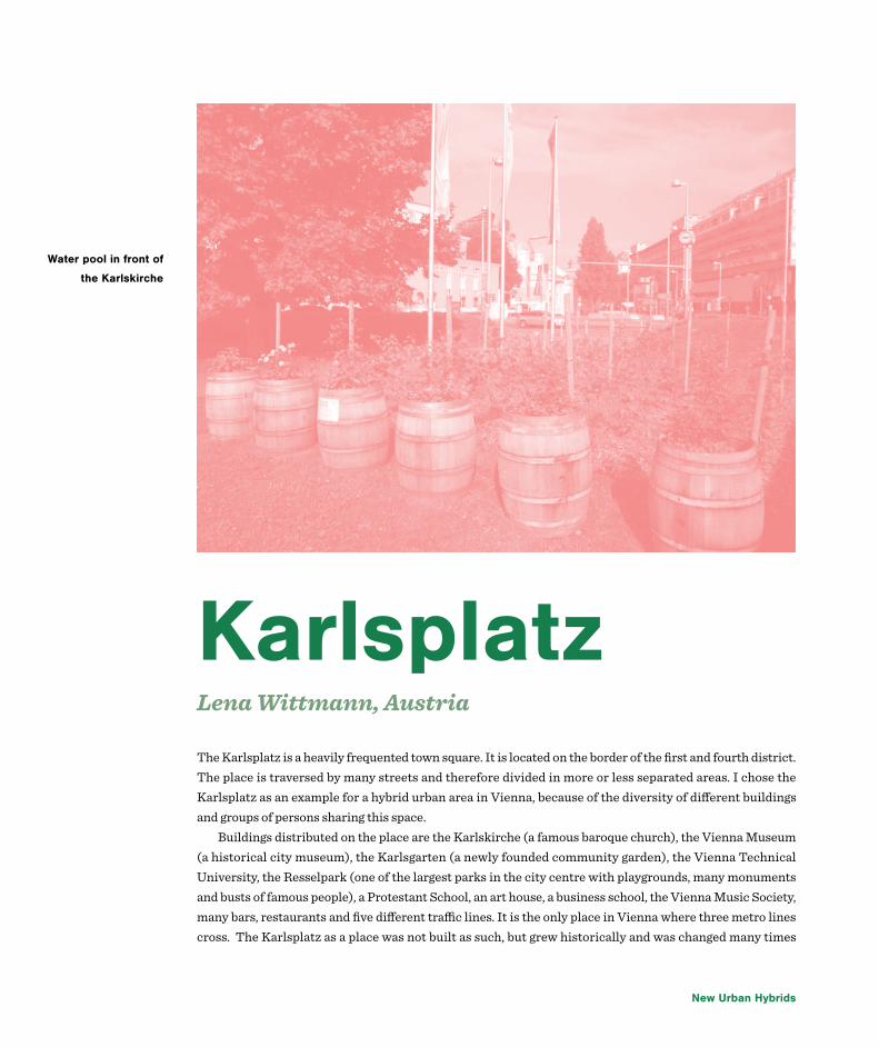
New Urban Hybrids
KarlsplatzLena Wittmann, Austria
The Karlsplatz is a heavily frequented town square. It is located on the border of the first and fourth district. The place is traversed by many streets and therefore divided in more or less separated areas. I chose the Karlsplatz as an example for a hybrid urban area in Vienna, because of the diversity of different buildings and groups of persons sharing this space.
Buildings distributed on the place are the Karlskirche (a famous baroque church), the Vienna Museum (a historical city museum), the Karlsgarten (a newly founded community garden), the Vienna Technical University, the Resselpark (one of the largest parks in the city centre with playgrounds, many monuments and busts of famous people), a Protestant School, an art house, a business school, the Vienna Music Society, many bars, restaurants and five different traffic lines. It is the only place in Vienna where three metro lines cross. The Karlsplatz as a place was not built as such, but grew historically and was changed many times
Water pool in front of
the Karlskirche

Urban Hybrids 97
One part of the
Karlsgarten
by architectural competitions. In 1978 after the building of the metro station and some reconstruction was finished, newspapers called the Karlsplatz ‘misplanned forever’ and a ‘chaotic space’. However, nowadays the Karlsplatz enjoys great popularity among the general public.
Probably due to the great transportation hub and the large Resselpark nearby, the Karlsplatz was formerly well known for its drug scene. Thus in the last years the metro station has been reconstructed and brightened by glass walls, and more street lamps have been installed in the Resselpark. Additionally a police monitored protection zone was established. Due to this restructuring the drug scene has shifted to other places.
The Karlsgarten is a free accessible garden for the purpose of research. It was brought to life by the BOKU students (University of Natural Resources and Applied Life Sciences), and it’s goal is to analyze which cultivation methods are best for gardens in exposed urban areas. Besides about 50 fruit and vegetable species there is also a beehive and a living space for snails and insects. The Karlsgarten also offers workshops for school classes. Despite the video surveillance in the garden some plants have been destroyed and stolen in the last weeks. This is unfortunately one of the cons of such a free accessible garden.
On the place in front of the Karlskirche a large water pool is located. On sunny days you can see many

New Urban Hybrids
people sitting around this pool. The place is often used for summer events, for example the ‘Popfest’, a free music festival with regional bands or the ‘Kino unter Sternen’, an open air cinema. In winter there is a Christmas market, and there’s a little children’s zoo with sheep and pigs in the now empty area of the pool.
In the Resselpark there’s also a “mobile city lab”, built from old shipment containers by the students from the Technical University. It offers space for lectures, workshops, exhibitions and parties. Because it is a mobile city lab it is only temporarily on the Karlsplatz and is going to be rebuilt in another part of the city after some time.
Because of the close-by Technical University, the many free events and the location near the fourth district (known as a ‘hip’ and young district) the Karlsplatz is often a meeting place for students and young people. But it is also a gathering place for tourists because of the many museums, the Karlskirche and the location near the first district. There are also some homeless people, often sleeping in the Resselpark or the Karlsgarten. And of course there are many children and their families on the playground.
I think the Karlsplatz is a special place because of the diverse functions it fulfills and because it brings different people together. Despite the many streets that cross the place, the Karlsplatz could preserve it’s status as a enjoyable meeting place and has green spaces where one can relax. I think it’s also very important to have public space in which one does not have to consume or buy anything. This idea is also resembled in the free events which take place on the Karlsplatz.
Mobile City Lab

Urban Hybrids 99

Rauma

Rauma
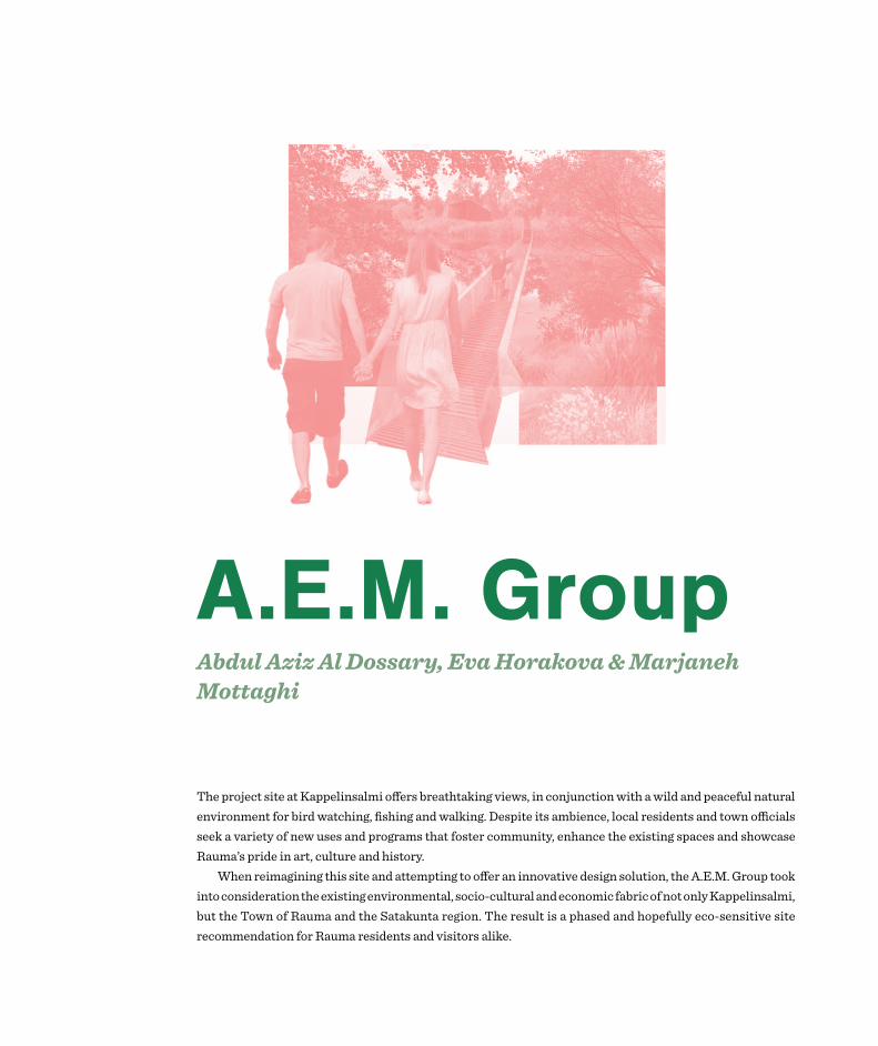
A.E.M. Group Abdul Aziz Al Dossary, Eva Horakova & Marjaneh Mottaghi
The project site at Kappelinsalmi offers breathtaking views, in conjunction with a wild and peaceful natural environment for bird watching, fishing and walking. Despite its ambience, local residents and town officials seek a variety of new uses and programs that foster community, enhance the existing spaces and showcase Rauma’s pride in art, culture and history.
When reimagining this site and attempting to offer an innovative design solution, the A.E.M. Group took into consideration the existing environmental, socio-cultural and economic fabric of not only Kappelinsalmi, but the Town of Rauma and the Satakunta region. The result is a phased and hopefully eco-sensitive site recommendation for Rauma residents and visitors alike.

Rauma 103
AnalysisAs a student group from Asia, Europe and North America, A.E.M. took a macro approach, gaining perspectives on planning in Finland and linking the project site to larger regional trends in an effort to breathe new life into current municipal efforts. During the project’s data gathering stage, A.E.M. informally spoke with town planning and tourism specialists while gaining input from local residents and designers about Kappelinsalmi.
Economic DevelopmentFinland is struggling with economic recession that will continue to plague government spending in the coming years. The European Union’s stance on the conflict in Ukraine may debilitate and reduce trade with Russia, a major trade partner with Finland. The consequences of this conflict may further propel Finland’s recession. On a municipal level, starting 2015, in three consecutive years, The Town of Rauma may receive 5.4 million Euros less from Government tax proceeds than before, thus economic development is a crucial consideration for any municipal proposal. Tourism, as an economic development tool, may act as a main instrument in regional development.
Tourism has a proven track record throughout Europe. It fosters new economic activity and is multi-faceted in nature. If done correctly, tourism diversifies the economy while presenting a positive impact on the balance of payments, on employment, on gross income and production.

New Urban Hybrids
Tourism in RaumaRauma has an existing tourism base dependent on its natural environment and historical-cultural heritage. In 2006, 38 million Euros were gained from travel to Rauma, while in 2010, 44.5 million Euros were acquired, and more importantly 86 percent of this was attributed to domestic tourism. In 2013, about 73,000 domestic tourists sought overnight accommodations in The Town, while 90,000 domestic visitors populated the Rauma Region. The Region is attractive to domestic tourists (77%) more than international visitors (23%), as a result A.E.M.’s recommendations targets domestic tourists. It must be noted that domestic tourism is not seen as antagonistic or an alternative to international tourism within this proposal.
International visitors to the Rauma Region are often lone business travelers that stay for a few nights to commute and work at the nuclear power station in Eurajoki. They do not frequent and invest in the Town of Rauma as often as domestic tourists. Compared to international tourists, domestic tourists have more recurring visits, and lengthier stays, notably with family. Accordingly, the spending of domestic tourists in The Region exceeds that of international tourists. The regional employment impact of domestic travel especially within the transportation sector is also notable. Domestic tourists often use land transportation and reside about 150 to 200 kilometers away from Rauma. They come to Rauma to access the sea and archipelago.
Domestic tourism is prevalent during summer months, and this pattern has continued for four successive years, that is why A.E.M.’s main programming is set for peak travel times to The Region, however winter plans are also available.
Southern Finland and the archipelago attract the most tourists (55% of total overnights stays in 2013). Rauma sets itself apart from other southern cities by offering two UNESCO World Heritage sites, access to about 300 islands and plenty of hotel accommodations (967 hotel beds plus 140 caravan camping sites). Unfortunately, in the past year, there was a six percent decline in overnight stays in Satakunta, thus A.E.M.’s proposal does not rely on creating new lodging spaces as an initial development strategy. The proposal’s suggested accommodations are stand-alone, small in scale and transitional. In the future, they may be changed to other uses based on demand. Yet, if the region sees an influx of tourism and accommodations are lacking, there are also opportunities to add new lodging structures (please see phased development map).
According to University of Turku’s Business and Innovation Development recent report, tourist consumption of restaurant, shopping and transportation services are higher than other demands. Consequently, A.E.M.’s site proposal incorporates spaces for shopping and food. In addition, tourists may encounter local residents in the proposal’s central attraction, a community hub for existing residents in neighborhoods to the north and south of the project area.
The A.E.M. Group envisions sustainable development practices. The built environment is proposed to be wooden and locally sourced, based on Rauma’s rich history of wooden structures and agroforestry. Wood may be combined with salvaged shipping containers which are easily available from the Port of Rauma and again take into account local material knowledge, mainly from the metal industry. Lastly, the project’s design concept borrows from the idea of gossip mirrors. These mirrors (see Conceptual Idea above) are sprinkled around Old Rauma for what Jane Jacob’s, a 20th century urban scholar, might have called, “eyes on the street.”

Rauma 105
Proposal Overview The focus of this proposal is tourism based and offers an optimistic lens to view domestic tourism efforts, however A.E.M. realizes that tourism may result in negative effects, particularly for the environment and adjacent residential community. For this reason, the level of concentration and integration of businesses, accommodations, and studios has been phased. In addition, the building scale and footprints are in such a way that much of the current landscape may remain untouched. Artificial landscaping and use of cement are also minimal. The hope is that once exact building plans are in place, builders will make use of permeable material for pathways, eco-friendly building supplies as well as energy efficient systems.
The purpose of this plan is to provide general ideas and areas for development, and the actual building designs may be determined either by the community or future investors or The Town. For now, A.E.M. is suggesting to start small, within a three-phased structure whereby the inclusion of the commercial sector is slowly included. This way the project will gain community feedback after each phase, not burden the green and social environments with sudden changes, and instill enough time to attract regional and possibly foreign investment. The phased plan will ensure a dynamic relationship between tourism activities and technological innovation too. By offering free spaces to start ups, the Town of Rauma is fostering not only the promotion of new ideas, but providing a chance to learn from and engage with a diverse set of international and domestic tourists. This may help in launching the site to a new group of tourists, what A.E.M. imagines will be “tech-tourists.”

New Urban Hybrids
PROJECT PROPOSAL
Proposal ThemesThere are three main themes which set this project apart from other tourist attractions in Rauma. The first theme is concentrated on health tourism whereby traditional Finnish sauna culture is incorporated into a modern spa system situated on a quaint island. Spa users may seek accommodations on-site across from the island. During the day, tourists may benefit from leisure and sport activities or merely stroll through awe-inspiring, elevated and winding pedestrian trails.
A conference center, community space and dance studio link the spa to the heart of the proposed development where activity spaces for all age groups are available. These spaces may bring locals and tourists together for celebrations, festivals and receptions. Their multipurpose rooms may act as a night entertainment hubs as well. A.E.M. is confident that such spaces will be well utilized since night and gathering spots for indoor winter community activities are rare in Kappelinsalmi. The clustering of uses in such a way may link disparate neighborhoods on each side of the site. The bridges across the islands and waterways are both literal and symbolic, demonstrating future community connections via the built environment.
Two themes of health tourism alongside night and day entertainment will be realized immediately and are hoped to offer short-term economic gains for the other phase of the project. The last theme has a long term trajectory whereby temporary and creative innovative spaces for artists and entrepreneurs are rented for free, on a monthly basis, in exchange for on-site programming throughout the year. So the expectation is that a local artist will be allowed to utilize a studio, while sharing their space with visitors to view the artistic process. Visitors will later take part in unique artistic activities on the proposed site a few times a year.

Rauma 107
Startups as Long-term Economic Drivers The startup spaces will be used in the same manner as artistic spaces. Entrepreneurs will come together, and engage with abutting industries, such as those in the technology park. The startup spaces may allow visitors, especially students from the Satakunta University of Applied Sciences (to the south of the proposal site), to learn about production processes and product development. This startup model comes from years of research about the influence of startups and incubators. During recessionary years, job creation at startups remain stable, as net job losses at existing firms demonstrate sensitivity to business cycles. By clustering startups on-site, Kappelinsalmi may survive future recessions, as Rauma planners create a better town – one project, one policy, one development at a time.

New Urban Hybrids
Kappelinsalmi, RaumaHarry Berks, Maria Eugenie Gjelsteh Buene, Yuka Murakami, Viktoria Rackova
Despite Kappelinsalmi looking largely unspectacular, forgettable and lifeless we had a vision. On the long journey from being introduced to the site, to analysing and learning about it, as well as the wider Rauma regions many idiosyncrasies, we have produced a final proposal that increases the amount of diversity in Rauma. We believe that this proposal embodies all the various pieces of infrastructure that will lay the foundations to give Rauma the potential to be the most diverse and thriving city on the Gulf of Bothnia and

Rauma 109
one of the most thriving cities on the Baltic Sea. Through careful and thorough analysis, deliberation and discussion we decided upon three main themes in which to base our development of the Kappelinsalmi site on with the long term goal of expanding these themes through the city of Rauma and the remaining region. We chose to focus on improving transportation, increasing the amount of business and commercial properties as well as improving living and residential properties.
Currently Kappelinsalmi is a green field site possessing a attribute that is considered very desirable in Rauma, public space that has direct access to open water! Despite the city of Rauma obviously being a port city and having a rich traditions and relations with trading a seafaring the city today significantly lacks urban land on the shore of the Gulf of Bothnia that is not privatised in one form or another. Rauma’s shoreline is predominantly consumed by the STX Europe ship yard, which takes up roughly three fifths of the cities exposure to the sea and incidentally there are plans to extend it further. On the remaining urban shoreline in Rauma there are various topographies, notably the Fafanga campsite and recreational gardens that despite being green and very pleasant only holiday makers are able to enjoy the beaches and shoreline there. So as a result of this observation we began to think of ideas of how we can have more public space in Rauma that has views of the sea and direct access to water, whilst still maintaining our ambitions of achieving our three main goals of improving local transport, business and residential spaces.
Kappelinsalmi does not have any direct access to the open sea and shoreline except for one side walk on the western side of Syvaraumakatu. So a key part of our vision is to close the short 30 metre stretch of Syvaraumakatu that travels north-south along the western side of Kappelinsalmi. The road or the bridge as it were would be closed to allow for a new public space, which only cyclists and pedestrians may travel through, all motor vehicles that choose to ordinarily use this stretch of road would have to take the short
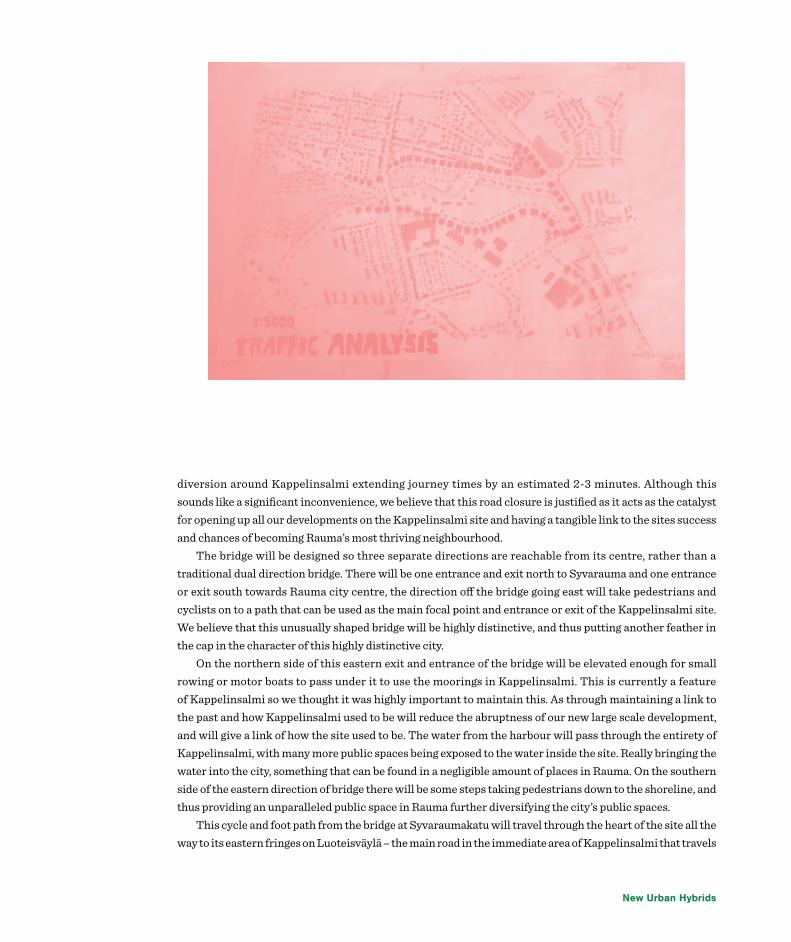
New Urban Hybrids
diversion around Kappelinsalmi extending journey times by an estimated 2-3 minutes. Although this sounds like a significant inconvenience, we believe that this road closure is justified as it acts as the catalyst for opening up all our developments on the Kappelinsalmi site and having a tangible link to the sites success and chances of becoming Rauma’s most thriving neighbourhood.
The bridge will be designed so three separate directions are reachable from its centre, rather than a traditional dual direction bridge. There will be one entrance and exit north to Syvarauma and one entrance or exit south towards Rauma city centre, the direction off the bridge going east will take pedestrians and cyclists on to a path that can be used as the main focal point and entrance or exit of the Kappelinsalmi site. We believe that this unusually shaped bridge will be highly distinctive, and thus putting another feather in the cap in the character of this highly distinctive city.
On the northern side of this eastern exit and entrance of the bridge will be elevated enough for small rowing or motor boats to pass under it to use the moorings in Kappelinsalmi. This is currently a feature of Kappelinsalmi so we thought it was highly important to maintain this. As through maintaining a link to the past and how Kappelinsalmi used to be will reduce the abruptness of our new large scale development, and will give a link of how the site used to be. The water from the harbour will pass through the entirety of Kappelinsalmi, with many more public spaces being exposed to the water inside the site. Really bringing the water into the city, something that can be found in a negligible amount of places in Rauma. On the southern side of the eastern direction of bridge there will be some steps taking pedestrians down to the shoreline, and thus providing an unparalleled public space in Rauma further diversifying the city’s public spaces.
This cycle and foot path from the bridge at Syvaraumakatu will travel through the heart of the site all the way to its eastern fringes on Luoteisväylä – the main road in the immediate area of Kappelinsalmi that travels

Rauma 111
south to Rauma city centre and to the main road out of Rauma and to the north through Kappelinluhta and in the direction of the sparse settlements near Otanmaa-Haapasaari. From the path that travels east to west through Kappelinsalmi there will be numerous directions cyclists and pedestrians can take, including paths travelling from the residential area on Kappelinluhdankatu through Kappelinsalmi directly leading into the commercial area on Papinhaankatu. This will shorten the walking time for many residents in Syvarauma making them more inclined to use their bicycles or choosing to walk through the pleasant environment that we plan to create in Kappelinsalmi.
Moreover this path will travel straight through the ‘commercial core’ of Kappelinsalmi, where many shops, services and businesses will have the potential to locate their premises on this wide pedestrianized public space. The location of the commercial shops on Papinhaankatu is going to increase the amount of footfall passed these new commercial premises which is likely to increase their amount of customers, thus making a business having premises in the commercial core of Kappelinsalmi a legitimate idea. The demand required to make these new businesses will be even more feasible with the later introduction to Kappelinsalmi of higher density housing, therefore giving this shops the customers they require.
As well as the north to south path from to Papinhaankatu from Kappelinluhdankatu, there will be an additional cycle path and footpath leading from the main east to west path within Kappelinsalmi going south past the eastern side of the Lonnstrom model home and to Sinkokatu - the southern boundary of the Kappelinsalmi. The location of this path is important as it will link the vocational school and the small scale industrial premises on Sinkokatu directly to the ‘cultural core’ public space in Kappelinsalmi. This short path will also travel past one of the main features to the Kappelinsalmi site which is the design laboratory building, where many innovative businesses can locate and use the excellent infrastructure provided. We

New Urban Hybrids
have designed Kappelinsalmi to be so accessible so none of the residents of the surrounding neighbourhoods are alienated by the development, as we want the development to sit in this community of northern Rauma as cohesively as possible.
We feel that the design laboratory’s location is particularly valid as it will be located in a small cluster of similar businesses and services, which will be very inclined to communicate and work together, creating growth through competitiveness, sharing services and creating innovations, a well-known geographical process in academia. This will provide great for potential for these semi industrial businesses to expand, diversifying the economy of Rauma by making the city less dependent than its current 32% of inhabitants working in shipping or heavy industrial related employment sectors, reducing the vulnerability of the city’s economy.
The northern boundary of the site that we are developing is Kappelinsalmentie, this will operate as a part of the main diversion when the short stretch of Syvaraumakatu bridge is shut to motor traffic, for residents of Syvarauma heading towards Rauma town centre. Along Kappelinsalmentie there will be various residential typologies and an expansion of the green space that emanates from Fafanga to the south west of Kappelinsalmi. This extension of the vegetation will also again further reduce the abruptness of the new developments of Kappelinsalmi. Many of the new residential areas have been located and designed in such a way to maximise sea views out of Kappelinsalmi, over the boat harbour and out into the far reaching gulf of Bothnia, again diversifying the ways of living and lifestyles in already Rauma. These will be mostly be four or five storey apartment blocks furnished and designed to various standards, providing something for everyone but also increasing the amount of high end apartments there are in Rauma of which there is currently a limited supply. Around these apartment buildings there will be significant amount of green space, some with
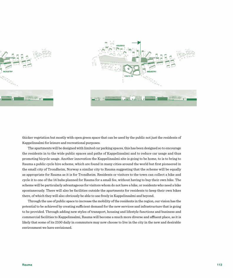
Rauma 113
thicker vegetation but mostly with open green space that can be used by the public not just the residents of Kappelinsalmi for leisure and recreational purposes.
The apartments will be designed with limited car parking spaces, this has been designed so to encourage the residents in to the wide public spaces and paths of Kappelinsalmi and to reduce car usage and thus promoting bicycle usage. Another innovation the Kappelinsalmi site is going to be home, to is to bring to Rauma a public cycle hire scheme, which are found in many cities around the world but first pioneered in the small city of Trondheim, Norway a similar city to Rauma suggesting that the scheme will be equally as appropriate for Rauma as it is for Trondheim. Residents or visitors to the town can collect a bike and cycle it to one of the 14 hubs planned for Rauma for a small fee, without having to buy their own bike. The scheme will be particularly advantageous for visitors whom do not have a bike, or residents who need a bike spontaneously. There will also be facilities outside the apartments for residents to keep their own bikes there, of which they will also obviously be able to use freely in Kappelinsalmi and beyond.
Through the use of public space to increase the mobility of the residents in the region, our vision has the potential to be achieved by creating sufficient demand for the new services and infrastructure that is going to be provided. Through adding new styles of transport, housing and lifestyle functions and business and commercial facilities to Kappelinsalmi, Rauma will become a much more diverse and affluent place, as it is likely that some of its 2100 daily in commuters may now choose to live in the city in the new and desirable environment we have envisioned.

New Urban Hybrids
Incubator groupAino Kuusimäki, Camilla Pezzica, George Choi, Martin Richner
1.0 IntroductionAfter World War II Rauma became an industrial city with shipbuilding, paper and pulp mills as the main industries. Wood and metal are among the two most significant raw materials and are widely used in heavy industry located in and around Rauma. Some new industries, such as logistics, laboratory research and environmental testing are also present in Rauma and contribute to the city’s economy.
The cultural industry accounts for an increasing proportion of the total gross value added (GVA) in Finland. The development of employment in cultural occupations, particularly in art, graphics, and craft

Rauma 115
design, has increased by 35 % from 2005-2012. Moreover, the Ministry of Employment and the Economy, has developed a program aimed at supporting business and entrepreneurship in cultural industries. Taking into account the traditional industry using wood and metal as the materials, and the surfacing technology-based new industries, Kappelinsalmi could be an appropriate location to capitalize the already existing skills and knowledge. Providing the right urban environment could therefore allow Rauma to tap into the blooming cultural design industry.
2.0 Proposed themeThe development proposal for the Kappelinsalmi planning site, titled ‘I.D. incubator’, stands for both the nurturing of ‘industrial design’ and ‘identity’ of Rauma. On one hand the site would be developed as a space which fosters entrepreneurship in industrial design of Finnish designers in collaboration with workers and technologists. In conjuncture, a new community would be built to facilitate the development of such incubator culture and identity by utilizing traditional materials of wood and metal as well community building activities such as urban gardening. The general public in Rauma would be able to enjoy the site as active or passive recreational activities would be dispersed in the area.
3.0 Goals and objectivesA series of ‘layers’ have been applied in order to set the following goals and objectives for the proposed development: (1) to create a business incubator which supports entrepreneurship in the area of industrial design; (2) to capitalize the existing traditions of wood and metal as well as emerging new technology in applied science, so as to nurture spin-off industries and specialize in high value added design products; (3) to develop a dynamic yet ambient environment where culture and leisure is integrated with work and living in order to promote knowledge exchange between designers, workers, and technologists; (4) to build a socially inclusive community that provides cheap accommodation, catering, leisure, and communal activities for residents and all types of workers; (5) to revitalize the identity of Rauma in art and craftsmanship; (6) to form a green and blue corridor connecting the city with the sea and (7) to develop a socially, economically environmentally and culturally sustainable urban hybrid area
4.0 Proposed concept plan and master planIn the following, the proposed concept plan and master plan for the planning site are presented. The internal linkages between the planning site’s components, i.e. its sub areas and individual functions, as well as the external linkages with the site’s surrounding areas, actors and stakeholders as well as Rauma as a city are introduced – firstly, on a conceptual level and secondly, on a functional level.
Figure 1 shows the proposed concept plan for the planning site. The westernmost part of the site is dominated by green and blue elements which together form an area mainly for recreational and leisure purposes. Significant changes to the landscape are suggested. Most noteworthy is the deepening of the strait along the northwestern most areas and the land infill south of the existing ‘island’ thereby changing the morphological character of the landscape from an island surrounded by low-depth and over grown swamp to a ‘peninsula’ in a free flowing stream (Rauma: Streaming strait) This westernmost part of the site is planned

New Urban Hybrids
as a gather point for residents from nearby residential neighborhoods as well as for residents and workers of the business incubator area. Moving east, the site gradually changes character from leisure and recreation to a more urban area of mixed use consisting of both work and living. While recreational elements still are present, the location of such elements in this area aims to connect the area with the western most area of the planning site, thereby linking existing and new functions and actors. The main fabric of this urban hybrid area are a clusters of cubic building units with functions that together drive the design process of business’ value chain. This area of the planning site is located in close proximity to the educational institute and technology centre south of the planning site. Moving further east, the site will change from primarily design to production. The change will be subtle in order to support the internal connectivity. Jointly, the planning site’s areas and the surrounding areas form a hybrid area with a complete set of functions forming an industrial design and production value chain.
Figure 2 shows the proposed master plan for the planning site. The master plan builds on the concept plan but differs in that is represents a greater level of detail. The master plan therefore represents one possible outcome and a somewhat different spatial layout in line with the concept plan and the overall industrial design business incubator concept may be more suitable as the area is developed and conditions change over time.
It is proposed that the western most area of the planning site is made more inviting to visitors supportive for new leisure and recreational functions. As part of the proposal, a multi functional green house inspired by the Helsinki Winter Gardens is planned as a central element in the area. The Winther Gardens in Helsinki function as public spaces both during summer and wither time and offer an environment without a strict
Figure 1

Rauma 117
code of conduct. This green house will function as a hub for community building activities, both in regards of neighboring residents to the planning site, residents and workers inside the planning site as well as citizens in Rauma in general. North of the strait and the stream, the east-west going road will be removed. Instead an area of low-density accommodation and recreational functions will be established. East of the green house in the recreational area, functions of the design process of the incubator area can be found. In this area the urban fabric consists of complexes of flexible living and working spaces designed as cubes. These cubes will be constructed of reusable and local materials. The design will have a clear wooden and metallic character, somewhat in style with the designs of Spanish RCR Arquitectes, thereby reflecting the unifying theme of the incubator area. Temporary and permanent accommodation units in style with Italian architect Luigi Cervellati’s Space to Culture will be located in between and in extension of office spaces. The transformation of space by using temporality and spatial custom-tailoring in order to create a flexible modular system of spaces for the customer has served as inspiration for the proposed development of cubic working-living units. These units will be placed in between semi-private urban gardens inspired by the Prinzessingarten in Berlin, Germany, spaces for exhibitions and possibly smaller retail units offering industrial design products from local businesses for sale. The business support office will be located centrally in this design process area and will contribute to its vibrant character. A unit designed as a communal canteen will be open for the public. These functions will together attack a flow of people from both inside the area, i.e. from residents
Figure 2

New Urban Hybrids
and businesses, and outside the area, e.g. students and workers from the nearby educational institution and technology centre.
The easternmost area of the planning site is characterized by industrial production processes and larger building units with functions supporting this part of the value chain. Some workshop office spaces will be present in this area, but mainly the area will consist of workshop spaces for handcraft production. An outside exhibition area for handcraft produced in the area, such as a sculpture park, will be located in between this easternmost area and the central area in order to make the land use change more gradual and subtle.
5.0 Proposed plan in relation to actors and stakeholdersRauma Municipality is the main driver of change and the most significant actor during the initial development process. However, a good planning process is characterized by public participation. It can be argued that the development of the Kappelinsalmi planning site into an area of mixed use requires a larger focus on public participation and a larger amount of resources spent on the involvement of a wider and more diverse range of actors and stakeholders than a more homogenous development. The following is an overview of relevant actors and stakeholders in relation to the proposed development plan.
Resident from nearby neighborhoods are using the planning site for recreational purposes. As a result, it must be expected that local citizens have opinions, knowledge and ideas regarding future development. Upon inspecting these areas, a lack public spaces and gather points for local residents is evident. The development proposal therefore includes the creation of new public spaces and aims to improve the conditions for local community groups. The Fåfanga area is known for its leisure and recreational qualities. The development of Kappelinsalmi should not compete with the businesses in Fåfanga but develop in synergy with the already established hospitality industry and future developments in this area. The memorial house museum is
Rauma 119
located south west of the area and holds great cultural value. The museum’s premises are semi-private in nature and affect the internal and external connectivity of the site negatively. A cooperative effort with relevant actors should be made in order to investigate the possibilities for removing the barriers encircling the museum area and the vocational high school located vis-à-vis of the museum. The aim for businesses part of the incubator program is to become feasible. The development of new products, business ideas etc. could benefit from synergies between the nearby educational institution, technology centre and light industry. When businesses from the incubator program anchored in Kappelinsalmi become feasible they might want to move their physical location to the technology centre, thereby still remaining close to the network they have built up during their time in Kappelinsalmi. There role of the harbor should likewise be considered when developing Kappelinsalmi. While the planning site is not suited for the placement of traditional harbor activities it might be relevant for the placement of accommodation of the many temporary workers. It is suggested that this relationship between new start-up businesses in industrial design and conventional industries is integrated in the planning process from an early stage and is part of the public participation process. Such linkages could also facilitate the commercialization of products from the companies’ part of the business incubator area. It should be investigated whether end-products could be put on display or put up for sale in Old Rauma thereby supporting local retail in the industrial design sector and creating a stronger cultural linkage between the two otherwise unlike areas.
6.0 Sustainability assessment
Social Economical Environmental Cultural
Create job opportunities for
entrepreneurs, industrial
workers, and technologists
Tap into the blooming Finnish
design industry
Make existing natural
landscape more available to
public
Maintain strong cultural
identity for citizens in Rauma
Provide cheap accommoda-
tion for all types of workers
Promote business
competence for cultural
industry start-up
Improve existing flooding
condition in the planning site
Rejuvenate traditional industry
culture of wood and metal
Create a place for communal
gathering
Promote diverse and high
value added industries
Provide healthy food grown
on site premises
Brand Rauma with a unique
economic position in Finland

New Urban Hybrids
Kappelinsalmi: Rauma’s Transition AreaAustin Sears, Marco Giambersi, Marta Pastuszka, Süheyla Türk
The Kappelinsalmi planning site is located in Rauma, Finland. The city of Rauma is home to roughly 40,000 people and is located in the Satakunta region of Western Finland. Rauma is a maritime town home to a large industrial port as well as Old Rauma, a UNESCO World Heritage site that is the largest unified historical wooden town in the Nordic countries (“The Town of Rauma,” 2009).
The area of Kappelinsalmi is currently occupied by partially maintained green space and a small boat harbor and is situated between residential areas to the north and a small industrial area to the south. The west and east borders are roads that lead to the center of the city and elsewhere in the region. The site is also close in proximity to Fåfänga, a green coastal area that features beaches, green space, a historic pool, a harbor area and a sporting area.

Rauma 121
The goal of this project is to produce a design and plan for the Kappelinsalmi site to function as an “urban hybrid;” that is, a design for the site that allows for a number of different actors to engage in new and interesting ways. When brainstorming ways to approach the task, we thought of three main areas to focus on when designing and planning this site: multifunctionality, polycentricity, and sustainability. Multifunctionality is important to bridge social capital (Svendsen, 2010, p. 47) and also to encourage yearlong use by the people of Rauma. Polycentricity is another focal point, which allows for development to transition from one use to another without placing importance on any one function more than another. Finally, sustainability is an overarching theme in both design and planning elements alike. Previous research details the changing and morphing use of sustainability in planning and highlights its importance in future developments (AlQahtany, et al, 2013). We hope that these foci will result in an “urban hybrid” that both addresses the needs of the City of Rauma, but also introduces some innovative and forward-thinking ideas that will continue to positively impact the area in the future.

New Urban Hybrids
In our primary analysis of the site, we compared a number of socio-demographic and economic factors on global, regional and local levels to better understand the challenges and opportunities that may exist when developing this site. We also studied the terrain and surrounding architecture of the area to place it in the context of the city of Rauma.
From a global perspective, our site may be directly or indirectly influenced by European Union policies or international trade agreements. The increasing dependency on technology and technological innovation in industrial production both influenced how we approached the proposed business-centric area of our site. On a regional level, Kappelinsalmi is quite small, but has the potential to become an area saturated with technologic and business innovation. Finland has lost ground in the global market due to industrial restructuring (Ministry of Finance Department, Economic division, 2014, p. 9) but is currently moving toward increasing its knowledge-based industries focused on cleantech and the environment sector (Ministry of Finance Department, Economic division, 2014, p. 29).
For our proposed plan, our goal is to incorporate housing areas, a multifunctional area and an innovation/business area into the space, while also maintaining and developing some of the existing green space.

Rauma 123
The development would ideally create no borders between neighboring areas or between uses but rather serve as a “transition area” and also feature smaller “transition areas” throughout the development. The Kappelinsalmi site functions as a transition area that bridges the residential areas to the north and east, the business area to the south and the Fåfänga green area and harbor to the west through a networked series of paths and functions. The smaller transition areas in our plan exist and function as seamless connections between functions. Both of these uses differ from Ernest Burgess’s “zone of transition” in his concentric ring model of urban planning, where the zone of transition functions as a bridge between the “factory zone” and “working class zone” (Roqrigue 2014).
The paths in our site also connect the different uses that we propose for the site with the city center and the historic Old Rauma site. For the housing area, we hope to create affordable housing for students and families in Rauma that is also close to services like supermarkets, cafes and public spaces. We aim to keep the existing tree line intact along the south and eastern borders of the site to separate the area from the street traffic to control noise and also maintain a sense of privacy. The multifunctional area provides usable space for the community, for conferences and university development. This area features a series of smaller buildings situated around a larger, main building with interior areas that can be easily modified to fit the needs of the user. We hope that a branch of a vocational college or a specialized satellite program of another university will occupy some of the space and provide a connection with the businesses in the area for traineeships and practical job experience.
The innovation/business area provides an extension of the existing business park to the south, but is designed in a way to encourage public use after the working day has finished. A strategic clustered approach to filling the space is recommended in hopes that similar businesses or businesses with similar goals can collaborate and create innovative solutions to current and future challenges. This area would likely be home to clean tech companies and other innovative technology companies with a focus on the environmental sector, similar to the Teknologiatalo Sytytin development to the south. As technological innovation in production techniques often results in a reduced need for industrial jobs, our goal is to create spaces

New Urban Hybrids
with uses that can change and adapt with the labor market. This area will also feature additional uses for employees and community members alike, likely along the lines of a gym, printing and other business-oriented services, restaurants and cafes.
The development of the green space will maintain the current cycling and walking paths on the north and west sides of the site, but also create a network of paths that connect the different uses of the site. We will also renovate the current small boat harbor to provide a broader area to walk along the water. The island will be reshaped, the water around it will be dug deeper and the viaduct that opens to the main harbor will be enlarged, all to create better water circulation and eliminate the murky, stagnant water that is currently seen at the site. The island will feature small hills that will make for nice picnic spots in the summer and opportunities for winter activities, and also a building for a café and sauna. The sauna will incorporate winter swimming in the cold months.
Throughout the development, features like photovoltaic-powered street lighting and pervious/permeable paving options will help reduce the environmental footprint of the development, in addition to intentional, innovative architectural design and green building materials and strategies. We propose a parking cooperation with the development to the south to minimize the need for parking, though we have included parking with the pervious parking technology in our plan. Encouraged recruitment of green and clean tech companies to occupy the new development will allow for new innovations on the site and in the area.
In order to fully gauge the needs of the area and region, we suggest that the City of Rauma engage with both the public and private actors in the area to determine the best appropriate uses for development. Ideally a pre- and post-development questionnaire would be sent to residents, while meetings with representatives from private companies and investors would also be helpful. Town hall-style meetings that bring the private and public actors together to encourage discourse would then synthesize the two types of participation.
Kappelinsalmi is a site with many opportunities for future development that can help propel the city of Rauma and the Satakunta region into the future. Careful, strategic planning and development are required to transform this space into a functioning site for technological innovation and social interaction.

Rauma 125
Reference ListAlQahtany, A., Rezgui, Y., & Haijiang, L. (2013). A proposed model for sustainable urban planning
development for environmentally friendly communities. Architectural Engineering & Design
Management, 9(3), 176-194.
Ministry of Finance, Economics Department. (2014). Europe 2020 Strategy – Finlands National
Programme, Spring 2014. Ministry of Finance publications 16c, 2014.
Rodrigue, J. (2014). The Burgess Urban Land Use Model. Retrieved August 19, 2014, from http://people.
hofstra.edu/geotrans/eng/ch6en/conc6en/burgess.html.
Svendsen, G. (2010). Socio-spatial Planning in the Creation of Bridging Social Capital: The Importance of
Multifunctional Centers for Intergroup Networks and Integration. International Journal Of Social Inquiry,
3(2), 45-73.
The town of Rauma. (2009). Retrieved August 15, 2014, from http://www.rauma.fi/English/immigrants/
statistics.htm.

New Urban Hybrids
StraumaIva Tavanxhiu, Clemens Rode, Huibing Ou, Lena Wittmann
Kappelinsalmi, Strait of the Chapel: 2 The planning site is about 0,26 km sized area. Located in the north-west side of Rauma in Kappelin-salmi about 2 km away from the city center. Area is by the sea next to the marina for small boats and it is surrounded by different types of residential areas and small industrial areas. The area itself is mostly in recreational use and some parts are unbuilt industrial areas. There are small water ponds and partly tended green space. Some pathways are crossing through the plan-ning zone, the importance and usefulness of them should be examined. The north-east part is used as boat storage during the winter time. The land is owned by the city. There are two important roads outlining the east and the west sides of the planning zone. On the east side there is Luoteisväylä, which was built in the 1980’s and on the

Rauma 127
west side there is much older road Syvärau-mankatu.We noticed that the planning site is good connected to the adjacent areas and the city centre, but through
the area itself exist no such con-nection. Except for the storage of some small boats in the large pond nearby the bridge the planning side was not really used by people.
Planning area is charactarized by public ownership. The only areas that are in the surrounding parts can be classify as private. Greenery is a very special and dominant element of the area. There ex-cists different kind of greenery, but the major part is occupied by the low one.
There is a lack of connection of the planning site with the other parts of the city. There is a very little number of services and activities that surround the area and there is no so much interest for people ore tourists to pass through this site. Making Kappelinsalmi the living system if the city.
Horizontal connections: harbour other parts of the city Vertical connection: the relationship of the residential area with services area and then beynd the
borders of the planning site.Our idea is to widen the water canal and connect it with the already existing water canal in the south.
Tourists and citizens will be able to drive on the canal with small boats, starting from the marina, pass by Old Rauma and go back to the sea again. That way they can experience the city in a completely different way.
The pedestrians and cyclists can follow the stream on the adjacent streets as well and are guided through the area by the water.
We want to use the water in other ways as well. We were thinking of a fishing area with the possibility of renting fishing rods nearby. Another at-traction could be a competition with little boats for children. If the water is frozen in the winter, people can use the canal for curling or ice skating.
Added functions:
Information point• information about what the area is now, what it should become• screens / information about events, activities
Business area• work place is needed (power plant)• cheap work place for start up companies (for example ship-ping containers for the short term
solution -> good isolation for heat and cold)• attract the city to immigrants• opportunity to start a business for the well-educated people in Rauma
Creativity• people in Rauma are well educated, like to make things by themselves, need some space to show
their talent
New Urban Hybrids
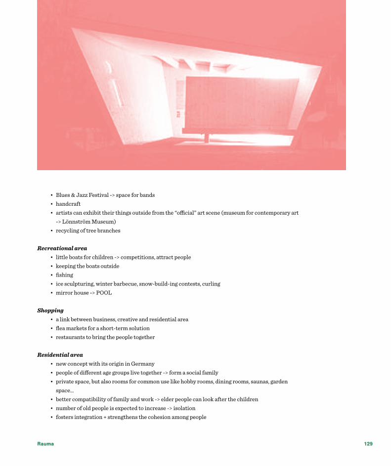
Rauma 129
• Blues & Jazz Festival -> space for bands• handcraft• artists can exhibit their things outside from the “official” art scene (museum for contemporary art
-> Lönnström Museum)• recycling of tree branches
Recreational area• little boats for children -> competitions, attract people • keeping the boats outside• fishing• ice sculpturing, winter barbecue, snow-build-ing contests, curling• mirror house -> POOL
Shopping• a link between business, creative and residential area• flea markets for a short-term solution• restaurants to bring the people together
Residential area• new concept with its origin in Germany• people of different age groups live together -> form a social family• private space, but also rooms for common use like hobby rooms, dining rooms, saunas, garden
space…• better compatibility of family and work -> elder people can look after the children• number of old people is expected to increase -> isolation• fosters integration + strengthens the cohesion among people
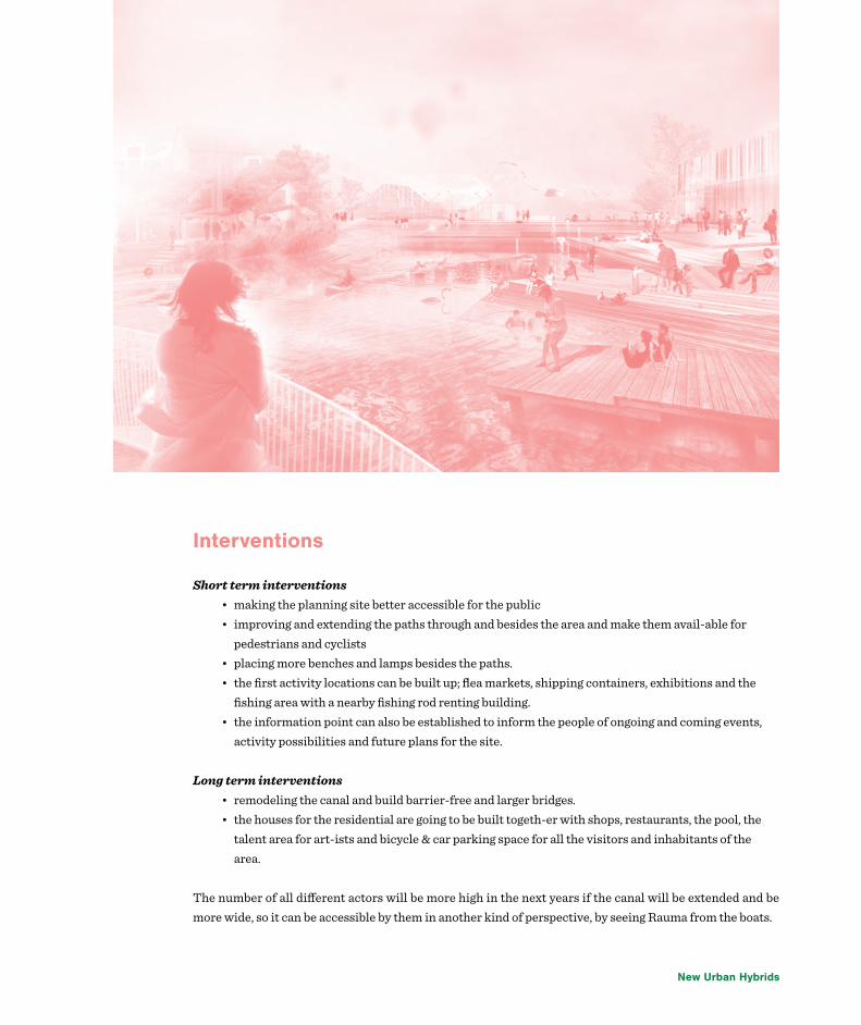
New Urban Hybrids
Interventions
Short term interventions• making the planning site better accessible for the public• improving and extending the paths through and besides the area and make them avail-able for
pedestrians and cyclists• placing more benches and lamps besides the paths. • the first activity locations can be built up; flea markets, shipping containers, exhibitions and the
fishing area with a nearby fishing rod renting building. • the information point can also be established to inform the people of ongoing and coming events,
activity possibilities and future plans for the site.
Long term interventions• remodeling the canal and build barrier-free and larger bridges. • the houses for the residential are going to be built togeth-er with shops, restaurants, the pool, the
talent area for art-ists and bicycle & car parking space for all the visitors and inhabitants of the area.
The number of all different actors will be more high in the next years if the canal will be extended and be more wide, so it can be accessible by them in another kind of perspective, by seeing Rauma from the boats.

Rauma 131

Seinäjoki

Seinäjoki
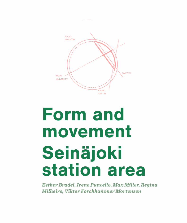
Form and movementSeinäjoki station areaEsther Bradel, Irene Puncello, Max Miller, Regina Milheiro, Viktor Forchhammer Mortensen

Seinäjoki 135
The aim of this project is to create a master plan for the Seinäjoki station area that changes the character of the site from a dividing wedge to a new unifying element that connects the different parts of the city. The connections are created through an elegant blending of nature and urban space and through a creation of harmony in the structure of the city. A defining feature in the approach has been to consider this project as a continuation of the significant development taking place in Seinäjoki and the surrounding region these years. This idea of building on to existing development plans as well as capitalising on current regional growth, is introduced alongside with a principal of embracing the heritage of the site and planning the design of an area that works within and strengthens the identity of the city.
The vision is to restore the position of the railway station and the area surrounding it as the natural heart of the city. This is achieved through the support of a series of movements through the site which position the station area as the main link between the downtown Seinäjoki and the more suburban Pohja district. In addition to strengthening the link between the two parts of the city, the project also establishes a strong connection from the area to the city’s foremost institutions including the Aalto Centre, Frami Science Centre and the food production — placing the area in the centre of a new dense web of regional nodes.
A vital element in the preparation of a concrete master plan would therefore be to confront the current separation of Pohja from the City Centre created by the railway’s tracks. Despite its central location in the middle of the city the railway area ends up being something that defines the ending of the two districts rather than being the heart of Seinäjoki. In addition the current urban structures of the two districts turn their back on the station area which further emphasizes the remote feeling of the area. Repositioning the station area as the heart of the city would therefore demand an extension of this structure towards the area connecting with both parts of the city. Filling in the void between the City Centre and the station area is especially important if the area should feel like a continuation of the city’s urban structure. In order to make the urban connection seem natural the fill in is done in accordance to the very dominant grid structure of the City Centre. Shifting the fill in a little compared to the rest of the grid further creates a visual ending on the long avenues as well as clear focal points for people to navigate towards. Instead of a void between the station area and the City Centre the fill in would now unify the two as well as adding a sense of place to the site.
The envisioned connections in the city – especially the link between Pohja and the City Centre – would be supported by creating three pedestrian and cyclist friendly tunnels, and by letting new building sites enforce particular movement through the space. In this sense movement from the new connections would mold the form of the fill in. In the following we zoom in on individual areas in the master plan, describing the specific application of the overall concept in more detail as well as depicting the envisioned spaces – starting

New Urban Hybrids
from the northern part of the site and going down.The north-west of the planning site will contain mixed use buildings which will have ground-level
commercial activities with offices and apartments on top. This will help to bring more activity and density to the area and make it seem less empty and more attractive. Densifying the area as well as nurturing its street-level activity also reflects the more general strategy of integrating the entire western part of the site as an extension of the City Centre.
Facing the other direction a pedestrian tunnel under the railway lines connects the area with the north-eastern part of the planning site. Adjacent to suburban Pohja, this area creates a triangular wedge between the railway and a dense system of single-family houses. The area contains a large amount of open space as well as several historical buildings. These and the five inactive tracks that also run through the area create a certain aesthetic unique for the rail infrastructure that will be embraced and utilized in the project. Through the incorporation of the old rail infrastructure a historical and aesthetic richness is maintained that will provide future urban spaces a vital credibility, in a way modern architecture and new buildings simply cannot do it.
The cargo building will be preserved and transformed into a daily food market with prepared food stalls and cafe seating. The open space will be used for occasional events and also to support sport activities. In order to further show off the importance of food in Seinäjoki, another smaller building can be used to demonstrate the latest in food technology to visitors and shoppers alike. As part of this strategy some of the other historic buildings can be transformed into greenhouses for urban farming opportunities for the surrounding population. The construction of new housing with ground level commercial functions will further help increase the density and activity of the area. Underground parking will help to prevent that cars which are coming from the highway dominate the landscape.
The southern tip of the triangle will provide access to the central tunnel, which leads to Seinäjoki central station. Seinäjoki station and the area around it in the western section of the site will be transformed from one that is mono-functional and uninviting to one that promotes multiple activities, ties the city together, and injects energy into the City Centre. Presently, a sense of clear destination is absent from the approaches toward the station. In the future, prominent buildings will be used to direct the traveler’s gaze and give them a sense of arrival as they navigate towards the most important parts of the city. This will facilitate movement

Seinäjoki 137

New Urban Hybrids
between the station, the City Centre, and the Aalto Centre, for example. These prominent buildings will be placed along Valtionkatu at the end of the City Centre’s grid in order to give meaning to the end of the streets. The station building itself will be designed such that when a person exits the station their path is directed towards the axis of the City Centre on the pedestrian friendly Kalevankatu, thus facilitating a natural flow.
The station should contain the main services for passengers, such as an information kiosk and a ticket area. Two hotels will also lay adjacent north and south of the station, providing both lodging and restaurant services. A central plaza will lay adjacent to the station building, providing both a waiting and meeting area, while a bus station and taxi queue will be located across the plaza to facilitate transfers. Underground parking will be placed north and south of the station at a distance that will prevent the flow of cars from interfering with pedestrian movement and bus flow. The plaza also contains access to the central tunnel that links Pohja to the station and thus the City Centre. This will align movement from Pohja’s Pultrantie and Louhenkatu with the City Centre’s grid, particularly Kalevankatu. The central tunnel will have access for both pedestrians and cyclists and allows them to access the train platforms. Local art will be displayed on one of the walls, which will curve in order to break up the monotony of the passage.
On the eastern site of the railway the tunnel will have direct access to Pohja and the northern part of the planning site, but also to the Greenrail, that will be established on the eastern edge of the railyard. In this area there are five obsolete tracks that will be converted into a pedestrian and cyclist way that will blend elements of nature with the historic rail infrastructure, creating a greenway that makes its way southward and connects to the River Passage in the southern part of the planning site.
The River Passage alongside the Kyronjoki River will provide another important connection for the southern part of Pohja to the City Centre and to the Aalto Centre. A pedestrian walkway will follow the river across the southern site as it travels underground and at the surface, thus allowing the traveler to remain connected with nature. This southern part of the planning site contains a number of significant features. The two semi-circular rail buildings will be preserved and repurposed in order to provide more attractions and activity in the area. The smaller, northern circular building will be used to showcase Seinäjoki’s rail and urban development history, with the train-car turntable used for exhibitions. The larger building to the south will used as a gallery space and as a cafe.
The whole planning of the railway site in Seinäjoki leads to natural movement between the City Centre
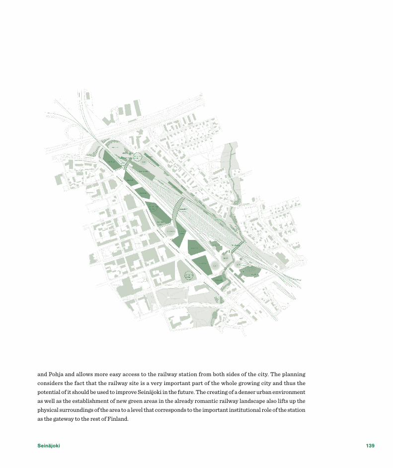
Seinäjoki 139
and Pohja and allows more easy access to the railway station from both sides of the city. The planning considers the fact that the railway site is a very important part of the whole growing city and thus the potential of it should be used to improve Seinäjoki in the future. The creating of a denser urban environment as well as the establishment of new green areas in the already romantic railway landscape also lifts up the physical surroundings of the area to a level that corresponds to the important institutional role of the station as the gateway to the rest of Finland.
New Urban Hybrids
Seinäjoki today
BackgroundSeinäjoki has experienced rapid growth since 1960 when it became a town. The railway has played, and will continue to play, a significant role in the town. It has aided in attracting new businesses and institutions. The population of Seinäjoki is approximately 60 000 and the region has a population of 210 000.
As a result of the rapid growth, the town-centre today is spread over a wide area without clear functions and nodes. The population, businesses and organisations in Seinäjoki wish for a vibrant town centre, well connected to its environment. The railway station area, with its central position, functions as a gateway. Redevelopment of this underused site would enhance the vitality of Seinäjoki, providing a warm welcome to residents and visitors.
The railway divides Seinäjoki, segregating communities, making walking and cycling difficult between key areas. Solving the issue of segregation caused by the railway would enable a better connected, better integrated and improved environment.
Seinäjoki station area: live. Work. Play.Oya Merve Duman, Pei Xin Jia, Purushottam Kesar, Sofie Norrgård, Tom Wilson

Seinäjoki 141
Site AnalysisThrough analysis of the site and local area, seven key points emerged.
• Segregation The railway divides Seinäjoki. The Pohja neighbourhood is segregated from key areas west of the railway such as the central business district and the Aalto centre. The car dominated street of Valtionkatu also segregates the station site from key areas west of the railway.
• Connections Seinäjoki is a physically segregated town due to the town structure. There are several distinguishable nodes in and around the town; Aalto centre, Frami, Rytmi-korjaamo, Itikanmäki, two arenas as well as the Pohja neighbourhood. These places surround the railway station, and there is demand for better and more distinct links and connections between these nodes. Some key connecting routes exist in Seinäjoki. There is an opportunity to provide new and improved connections to improve the area for walking and cycling through the station area redevelopment. There is also a need for connection between the three development land parcels to enable development.

New Urban Hybrids
• Poor legibility The site and surrounding area are characterised by poor legibility. When entering the town through the railway station, key entrances and directions into the centre, as well as the surrounding area, are not clear. There is an opportunity to address legibility issues through urban design and way-finding signage.
• Station as a potential gateway Seinäjoki Station, located centrally within Seinäjoki, is a gateway to other towns and cities. There is an opportunity to enhance this gateway function and provide a welcoming first impression.
• Architectural interests/values Local people are proud of the iconic Aalto buildings which are of international significance and the new library building, all for public use. There is an opportunity for architecture of value and interest in the project area to make local people proud. In addition, some buildings of architectural value within the project site should be retained.
• Land parcels The station area site is comprised of three main land parcels, segregated by railway. There is an opportunity to connect these land parcels to enable development.
• Culture Culture is flourishing in Seinäjoki, demonstrated by art galleries, museums, the Aalto centre, festivals and music events. This is not clear when someone enters the town from the railway station. There is an opportunity to add cultural functions within the site, linking to the sites gateway function.

Seinäjoki 143
Seinäjoki tomorrow
ConceptThe key concept is for the development of a hybrid, mixed-use scheme, comprising of three areas, each with a key theme. These areas are linked by an iconic bridge, with three arms, connecting the three areas and the surrounding area.
• Living Room The Living room, situated on the eastern land parcel, will be an extension and a continuation of the Pohja neighbourhood, where people can both live and work. The housing typology will be similar to that already in the neighbourhood to integrate the new development. An existing building of architectural value will be retained and redeveloped into an innovation centre providing space for start-up businesses. A new wellness centre, with gym and other indoor activities will attract people to the area. Next to the wellness centre a hospital development is planned which will serve citizens of Seinäjoki and the surrounding regions. Green routes for pedestrians and cyclists will follow the disused railways tracks and connect the site with the surrounding areas.
• Playroom The Playroom is an island of culture and play! The area will consists of an arts centre, concert hall

New Urban Hybrids
and flexible areas for temporary uses, both inside and outside. These flexible areas can be used during festivals, for markets and for other temporary uses. Space for education will be provided and can be used for university activities, exhibitions or lectures. To make this cultural island into a lively area, during the whole day as well as the whole year, an artist village will be built from shipping containers, to create an interesting mix of architecture and an exciting place. The housing element will make the area into a safe and living part of Seinäjoki.
• Front Door The Front Door is the gateway to Seinäjoki! When arriving from the bridge, the railway station or the town centre, this area will function as a gateway and focal point. The public realm, including a new public square, will complement the gateway function of the area. Changes to Valtionkatu street including introduction of moveable planters to reduce traffic capacity and increased pedestrian crossings, will better link the site with the central business district. From the square, the linking bridge can be accessed, offering clear views of Seinäjoki and providing a vital connection across the railway. The station will be an integrated transit hub with a bus station, taxis, and underground parking, making it easy to transfer from different modes of transport. North of the transit hub, office and residential uses will ensure activity in the area at all times.
• Bridge The pedestrian and cycle bridge is vital to the successful redevelopment of the site and to enhance the vitality of Seinäjoki. The bridge will be an iconic structure, with three arms, connecting the three site areas and the surrounding area. In the centre of the bridge will be an intimate public space offering views of Seinäjoki. The bridge will be accessed by sloping ramps, but will also have lift and stair access at three points (one on each land parcel) to cater for all users. Creative lighting solutions will ensure the bridge is an exciting link in the day and at night. Railway track lighting could potentially provide a unique artwork, viewable from the bridge. A great view, a great talking point, a great meeting place.

Seinäjoki 145

New Urban Hybrids
IntroductionSeinäjoki as a centre of South Ostrobothnian region has grown the most with the establishment of trans-national railway networks that connected Tampere and Vaasa as well as Helsinki and Oulu. Another impact on the development of the urban area of Seinäjoki was its significant role as one of the main food producer, feeding whole Finland and beyond. These together with favourable conditions to start business, high-level educational centres and one of lowest unemployment rate in the country became the premises of constant enlargement of the region and gradual increase of population.
On the way to becoming a city Seinäjoki faces some difficulties in changing its urban character and becoming a more compact urbanized area. One of the starting points in delivering a quality urban space throughout the whole town is the change of its very heart, something that almost gave birth to the city – area
New vision for SeinäjokiMarco di Russo, Sofiya Koval, Laia Pi Ferrer, Irina Voinova

Seinäjoki 147
around the railway station. Not only it bisects the town into business district on the west and housing on the east, but also occupies the very central location that unfortunately doesn’t offer desired functions to both inhabitants and visitors of the town.
AnalysisAfter a detailed analysis of the area and its surroundings and following the provided urban strategy our group of 4 decided to create a truly diverse dynamic urban district that preserves features of small-scale shapes but at the same time brings to the area a lot of new functions, people and activities. As our main objectives for the proposal we’ve agreed to ensure good connections within the central area and from there to other parts of the town, promote Seinäjoki as a place for hosting events and as a valuable food producer, create multifunctional and “all seasons” places for all age groups and strengthen public participation and the sense of community.
Some parts of the area were decided to be preserved or improved, others – to be developed on both previously unoccupied lands and those requiring cleaning from unused buildings/constructions. We suggest to preserve the new residential area on the south-west, the building of the station, the used railway lines as well as two old railway buildings that could be considered to be part of historical heritage of the town and also two structures that were used to turn coaches in front of them.
Strategy As an outcome of the analysis, we came up with a strategy and key objectives for our proposal of developing the area of the railway. We determined two essential directions for the strategy that intend to create a city centre as at the moment the city doesn’t has one as well as to brand whole Seinäjoki. Concerning the creation of the city centre we are proposing to establish areas with different functions which we chose on the analysis stage having in consideration facilities of surroundings and the demands of the growing population (picture of strategy). As the city is already known as a hoster of various events and an important food producer in Finland we believe that further emphasis through branding of its strengths will bring even more attention to the city from the potential residents, tourists and investors.
The key objectives chosen for our project are intended to guide the development of a successful central area.
Those include:
• Creation of vibrant and dynamic centre• Establishing good connections within the central area and from there to other parts of the town• Meeting the demands of the growing population of urban area of Seinäjoki• Promoting the town as a place for hosting various events and as an important national food
producer• Creating multifunctional, “all seasons”, but at the same time compact spaces• Introducing new cultural activities for all age groups• Strengthening public participation and the sense of community• Providing good conditions both for local community and visitors

New Urban Hybrids
The area could be beneficially developed both for the local community and the temporary visitors by creating attractive facilities and coherent nature-friendly urban landscape – new facade for Seinäjoki. Apartments and hostels, semi-detached houses and camping facilities are essential for providing dynamic movements throughout the year in the city centre.
Accessibility Discovered poor accessibility between CBD and Pohja is proposed to be improved by creating a pedestrian bridge linking railway station and a public square on the west with the cultural area in between the railway lines and the housing district of Pohja on the east. Concerning the vehicle traffic we are suggesting extending the road on the border of the railway station and Pohja and connecting it with Kalervonsola, Untamonsola and Kuortaneentie roads. In stead of the current parking areas on both sides of the railway station area we are proposing building a single underground parking next to the bus station that might have its ground floor used for commercial purposes.
Functions and Concept The functions that we are proposing for the area are based on those presented in the surrounding neighborhoods and in order to create a coherent area we are bringing retail and business functions from
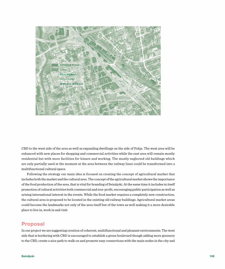
Seinäjoki 149
CBD to the west side of the area as well as expanding dwellings on the side of Pohja. The west area will be enhanced with new places for shopping and commercial activities while the east area will remain mostly residential but with more facilities for leisure and working. The mostly neglected old buildings which are only partially used at the moment at the area between the railway lines could be transformed into a multifunctional cultural space.
Following the strategy our main idea is focused on creating the concept of agricultural market that includes both the market and the cultural area. The concept of the agricultural market shows the importance of the food production of the area, that is vital for branding of Seinäjoki. At the same time it includes in itself promotion of cultural activities both commercial and non-profit, encouraging public participation as well as arising international interest in the events. While the food market requires a completely new construction, the cultural area is proposed to be located in the existing old railway buildings. Agricultural market areas could become the landmarks not only of the area itself but of the town as well making it a more desirable place to live in, work in and visit.
Proposal In our project we are suggesting creation of coherent, multifunctional and pleasant environments. The west side that is bordering with CBD is encouraged to establish a green boulevard though adding more greenery to the CBD, create a nice path to walk on and promote easy connections with the main nodes in the city and

New Urban Hybrids
also with the new ones like the market area, that is located on this street to continue the chain of retails spaces. The green path could be extended further into the city to create the green belt connecting the new boulevard with the park near the river as well as with the green area near Aalto centre to emphasise the importance of the presence of nature for Finnish people. Continuing with the public spaces that we consider to be important for the good living conditions, we propose an open public square located next to the station to be a good meeting point in the city. This connection is provided by a cover bridge that has exits on three of the areas: on the west - on the station and the public square, in the middle - on the cultural area, on the east - in Pohja. (picture – masterplan)
The neighbourhood of Pohja dictated us the importance of continuation of the housing area to amplify the choice of living facilities for the locals in the familiar for them area. The choice is represented by possibility of living either in apartments, semi-detached houses or in social housing. We felt the importance of providing leisure places both for all age groups, but especially those to attract families with children to the area, having a park between different types of housing that could provide urban activities such as outdoor gym or community gardens. (picture – urban activities) The leisure park in between housing areas might contain heels to create a nice relief, be used as an informal sitting area during summer and as a “small mountain resort” in winter for children to ski and sled. The offices on the Pohja side are expected to be integrated efficiently with apartment blocks to avoid creation of urban desert, with a possibility of having ground floors for the commercial uses.
The cultural area, located in between the railways has spaces that could be modified for different purposes: art exhibitions, street performances and events in general, as well as becoming a meeting point for younger generation with some cafes. The structures that were used for turning coaches could be modified as performance stages having amphitheatres from both sides from the stage.

Seinäjoki 151
Concerned about the safety in the area we are suggesting building up a wall to deal with noise pollution, and be the place created by locals through citizen participation through a competition of proposals (pictures, paintings, etc.). In between two walls there could be a reused railway line turned into boulevard suggesting the path from the bridge to the cultural area and back. Those together with preserving old railway buildings would be a good memory signifying vitality of the railway in the development of the city.
One of the hotel areas that we propose is an extension of the existing Alma hotel that is represented by both traditional and modern Finnish architecture buildings. Considering the importance of the events we suggest to create a campsite near the cultural area as well to make the stay of the visitors more enjoyable. Another hotel is also located near the landmark – market - and the station as well, to highlight the importance of the area.
Our proposal is intended to deliver high-quality environment to the citizens as well as to brand and promote Seinäjoki as a world-class place for hosting events and a successful producer and seller of food.

New Urban Hybrids
Smart Station- connecting Seinäjoki on all levelsLavinia Isan, Carolin Vorwerk, Tianyang Wang, Ilona Wieska
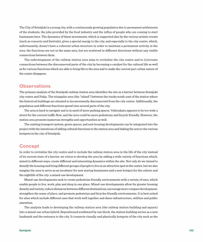
Seinäjoki 153
The City of Seinäjoki is a young city, with a continuously growing population due to permanent settlements of the students, the jobs provided by the food industry and the influx of people who are coming to start businesses here. The dynamics of these movements, which is supported also by the various artistic events (such as concerts and festivals), gives a special energy to the city, and especially to the city centre, which, unfortunately, doesn’t have a coherent urban structure in order to maintain a permanent activity in the area: the functions are not in the same area, but are scattered in different directions without any visible connections between them.
The redevelopment of the railway station area aims to revitalize the city centre and to (re)create connections between the disconnected parts of the city by becoming a catalyst for the cultural life as well as for various functions which are able to bring life to the area and to make the current peri-urban nature of the centre disappear.
ObservationsThe primary analysis of the Seinäjoki railway station area identifies the site as a barrier between Seinäjoki city centre and Pohja. The triangular area (the “island”) between the tracks south-east of the station where the historical buildings are situated is inconveniently disconnected from the city centre. Additionally, the population and different functions sprawl into several parts of the city.
The area is hard to navigate and is in need of more parking spaces. Valtionkatu appears to be too wide a street for the current traffic flow, and the area could be more pedestrian and bicycle friendly. However, the station area presents numerous strengths and opportunities as well.
The existing transport system, green spaces, and new housing developments can be integrated into the project with the intentions of adding cultural functions to the station area and linking the area to the various hotspots in the city of Seinäjoki.
ConceptIn order to revitalize the city centre and to include the railway station area in the life of the city instead of its current state of a barrier, we vision to develop the area by adding a wide variety of functions which, mixed in different ways, create different and interesting dynamics within the site. Not only do we intend to densify the housing and bring different groups of people to live in an attractive spot in the centre, but we also imagine the area to serve as an incubator for new startup businesses and a new hotspot for the culture and the nightlife of the city: a mixed-use development.
Mixed-use developments seek to create pedestrian friendly environments with a variety of uses, which enable people to live, work, play and shop in one place. Mixed-use developments allow for greater housing density and variety, reduce distances between different destinations, encourage more compact development, strengthen the sense of place, and promote pedestrian and bicycles friendly environments. It is best suited for sites which include different uses that work well together and share infrastructure, utilities and public amenities.
The analysis leads to developing the railway station area (the railway station building and square) into a mixed-use urban hybrid, Repositioned southward by one block, the station building serves as a new landmark and the entrance to the city. It connects visually and physically hotspots of the city such as the

New Urban Hybrids
Aalto Centre and Frami, and provides new access to the “island” and Pohja by the newly proposed bridge over the rail tracks.
The new station will become the focal point of the area by connecting all the major pedestrian and vehicle flows: Keskustori (the new city square), the newly proposed market square across the street, the Aalto center and Pohja. The new market square will support the important part of the new railway station as by completing the new urban square on the other side of the road. Also, the new Culture Island will become part of the life of the city center by being connected with the station and part of the green structure by the development of the riverbanks.
Function placement and expected traffic flowIn our proposal, the station area is designed to showcase the major functions in Seinäjoki. Each major function of the city finds its expression in the design of the area, making visible the city identity, both for the locals and the new comers. The most important aspect we had in mind is placing the functions in the way
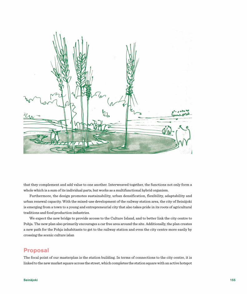
Seinäjoki 155
that they complement and add value to one another. Interweaved together, the functions not only form a whole which is a sum of its individual parts, but works as a multifunctional hybrid organism.
Furthermore, the design promotes sustainability, urban densification, flexibility, adaptability and urban renewal capacity. With the mixed-use development of the railway station area, the city of Seinäjoki is emerging from a town to a young and entrepreneurial city that also takes pride in its roots of agricultural traditions and food production industries.
We expect the new bridge to provide access to the Culture Island, and to better link the city centre to Pohja. The new plan also primarily encourages a car free area around the site. Additionally, the plan creates a new path for the Pohja inhabitants to get to the railway station and even the city centre more easily by crossing the scenic culture islan
ProposalThe focal point of our masterplan is the station building. In terms of connections to the city centre, it is linked to the new market square across the street, which completes the station square with an active hotspot

New Urban Hybrids
within the city. It also completes the visual and physical connection with the Aalto centre and Keskustori-the new city square (both imagined in already existing projects).
The connection to Pohja is materialized in a pedestrian and bicycle friendly bridge, which starts in the new station building and ends across the tracks in a currently empty area which we propose to be developed as a park/square. The bridge also provides an important access to the Culture Island: the old protected buildings will function as a venues for cultural events, exhibitions, festivals, concerts and night life in the city centre.
Densifying the housing in the city centre is an important aspect of revitalizing the area, therefore the remaining areas will incorporate an important part of housing and mixed use functions such as small private practices and start-ups, education (studios and class rooms for adult courses and trainings), hotel and conferences facilities, affordable student housing.
Hybrid railway station as a multimodal connecting pointThe new railway station area will not only function as a station, but at the same time, we envision it to be a multimodal transport hub and an umbrella for different businesses, services and event functions in order to become an attractive hot spot for the city. The station building gives newcomers a glimpse of the various aspects and charms of Seinäjoki by its interior design and multifunctionality. For example, we want to apply high-tech gadgets to provide more user friendly infrastructure services and display the innovative spirit of the Seinäjoki people. Furtehrmore, it will be a multimodal node (with parking spaces, bus station and bicycle parking facilities), and it will accommodate numerous useful functions, such as restaurants, shopping facilities and post office. The station square can also accommodate different temporary events, such as concerts and pop-up artist studios. Having noticed the increasing need for medical services at the station, we intend to introduce a range of medical services in the building that can be easily accessed by the locals and regional inhabitants.
The bridge is a covered structure suitable for year-round all-weather uses. It can be accessed via stairs and elevators from all entrances and also ramps on both ends: the city centre and Pohja. The bridge will also be able to incorporate various temporary and permanent functions, such as exhibitions, city panorama for tourists, retail shops, and on top of all, an artistic atmosphere.
Development in timeIn order to manage the changes in time, the development of the proposal will take place in stages. The development of the site will take place in four phases. In order to attract inhabitants to the site, the river bank is developed, and temporary uses and pop-up functions are established in the area as the first step, such as pop-up market and different artistic events. In the second stage, the new station building and the bridge are built to physically connect the city centre to Pohja and the “island”. Also, we envision the new market place, the underground parking and Valtionkatu development to take place in this phase. In later phases, the

Seinäjoki 157
sites without need for demolition are developed, such as building of the hotel and conferences facility and the new mixed use area, followed by the adjustment of the areas which are still occupied by tracks.
DesignOne of our aims is to use urban design in order to improve the quality of the urban space and to make the identity of the city of Seinäjoki more visible. For example, the well-known landscape of the Seinäjoki region with the flooded fields can be expressed in some oversized installations made of water and tall rye plants, while various design objects related to the food industry in the city can make the urban spaces places where people want to stay, not only to pass by.
ConclusionBy moving the station building, proposing a bridge and a new market square, revitalizing the Culture Island and (re)establishing the connections among all the hotspots in Seinäjoki, we envision a brand new multifunctional railway station area, which serves as a gateway into the city and bring together different aspects of Seinäjoki. We look forward to a young, lively city of Seinäjoki that is well connected on all levels: visually, physically, and conceptually.

Appendices


Tas
k in
form
atio
n - R
aum
a
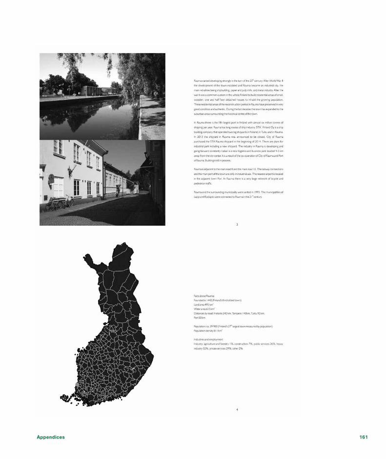
Appendices 161

New Urban Hybrids

Appendices 163
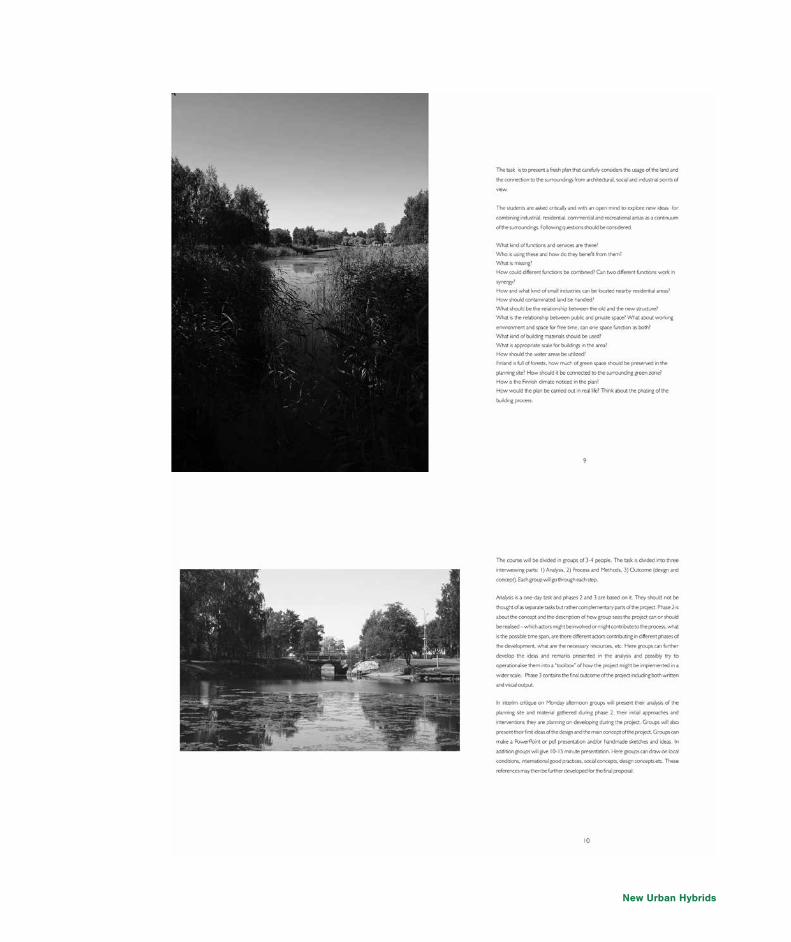
New Urban Hybrids
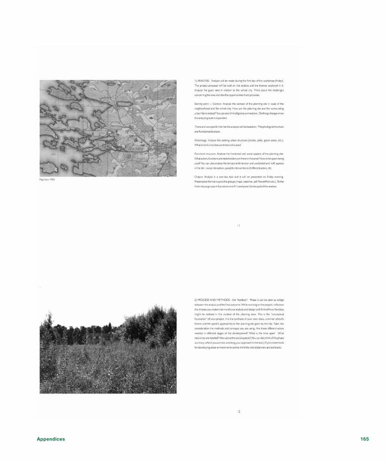
Appendices 165

New Urban Hybrids

Appendices 167

New Urban Hybrids

Appendices 169

New Urban Hybrids
Tas
k in
form
atio
n - S
einä
joki

Appendices 171

New Urban Hybrids

Appendices 173

New Urban Hybrids

Appendices 175

New Urban Hybrids

Appendices 177

New Urban Hybrids

Appendices 179

New Urban Hybrids

Appendices 181

New Urban Hybrids

Appendices 183

New Urban Hybrids

Appendices 185

New Urban Hybrids

Appendices 187

New Urban Hybrids

Appendices 189

New Urban Hybrids
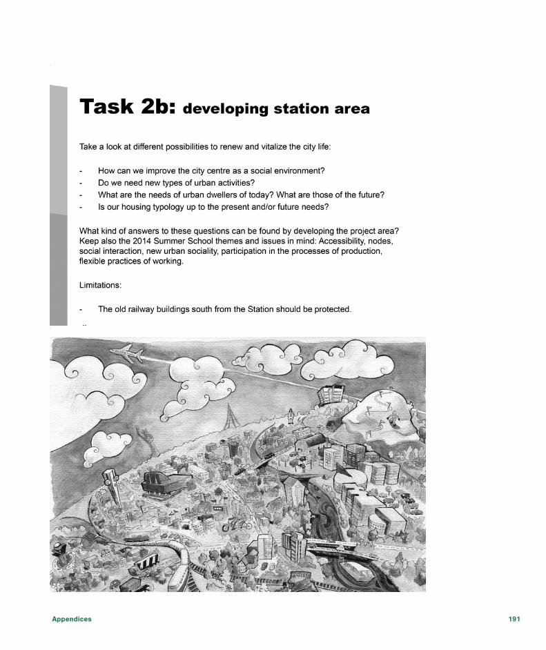
Appendices 191

New Urban Hybrids
2014Abdulaziz Al DosaryHarry BerksEsther BradelMaria BueneYat Nang ChoiOya Merve DumanViktor Forchhammer MortensenMarco GiambersiEva HorakovaLavinia IsanPei Xin JiaPurushottam KesarSofiya KovalColleen KutterAino KuusimäkiRegina MilheiroMax MillerMarjaneh MottaghiYuka MurakamiSofie NorrgårdHuibing OuMarta PastuszkaCamilla PezzicaLaia Pi FerrerIrene PuncelloViktória RačkováMartin RichnerClemens RodeMarco di RussoAustin SearsIva TavanxhiuSüheyla TürkIlona WięskaTom WilsonLena WittmannCarolin VorwerkIrina VoinovaTianyang WangPa
rtic
ipan
ts