Mount Pleasant School HBR, Coseley, Dudley MBC
45
Project No. 1451 June 2006 Mount Pleasant School, Coseley, Dudley Desk-Based Assessment and Historic Building Recording 2006 By Shane Kelleher For Dudley Metropolitan Borough Council For further information please contact: Alex Jones (Director) Birmingham Archaeology The University of Birmingham Edgbaston Birmingham B15 2TT Tel: 0121 414 5513 Fax: 0121 414 5516 E-Mail: [email protected] Web Address: http://www barch.bham.ac.uk/bufau
Transcript of Mount Pleasant School HBR, Coseley, Dudley MBC

Project No. 1451
June 2006
Mount Pleasant School, Coseley, Dudley
Desk-Based Assessment and Historic Building Recording 2006
By
Shane Kelleher
For
Dudley Metropolitan Borough Council
For further information please contact: Alex Jones (Director)
Birmingham Archaeology The University of Birmingham
Edgbaston Birmingham B15 2TT Tel: 0121 414 5513 Fax: 0121 414 5516
E-Mail: [email protected] Web Address: http://www barch.bham.ac.uk/bufau
Mount Pleasant School, Coseley
Birmingham Archaeology 2
MOUNT PLEASANT SCHOOL, COSELEY
CONTENTS
1 INTRODUCTION................................................................................................... 5
2 LOCATION AND GEOLOGY.................................................................................... 5
3 AIMS AND OBJECTIVES........................................................................................ 6
4 METHODOLOGY.................................................................................................... 6
5 ARCHAEOLOGICAL AND HISTORICAL CONTEXT ................................................... 6
5.1 PREHISTORIC..........................................................................................................6 5.2 ROMAN.................................................................................................................7 5.3 ANGLO-SAXON........................................................................................................7 5.4 MEDIEVAL .............................................................................................................7 5.5 POST-MEDIEVAL ......................................................................................................8
6 HISTORICAL DEVELOPMENT OF THE STUDY AREA ............................................... 9
7 BUILDING DESCRIPTION................................................................................... 10
8 CONCLUSIONS AND RECOMMENDATIONS.......................................................... 16
9 ACKNOWLEDGEMENTS....................................................................................... 18
10 SOURCES ........................................................................................................... 19
Mount Pleasant School, Coseley
Birmingham Archaeology 3
SUMMARY In May 2006, Birmingham Archaeology undertook a programme of archaeological desk based assessment and archaeological building recording at Mount Pleasant School, Coseley, Dudley (NGR SO 937 938). The work was commissioned by Dudley Metropolitan Borough Council in advance of proposed development. A desk based assessment of all readily available published and unpublished documentary sources was carried out. The recording work was carried out to a degree equivalent to the Royal Commission of Historical Monuments of England’s Level 2 (RCHME 1996/English Heritage 2006). The building was erected on a former coal pit bank for the Sedgley School Board in 1879 to the eclectic design of architect Archibald P. Brevitt, who combined elements of classical, neo-gothic, and vernacular styles. Major additions in the Queen Anne Style were made to the building in 1913 by the Coseley Urban District Council. Further minor additions were erected in the mid to late 20th-century. The modified ‘H’ plan of the original school still remains largely intact. However, its appearance is compromised by the later additions and alterations. The 1913 additions have a number of appealing features, including the extant boy’s and girl’s entrance and scroll pediment curved gables help form an interesting composite with the earlier phase.

Mount Pleasant School, Coseley
Birmingham Archaeology 4
Figures
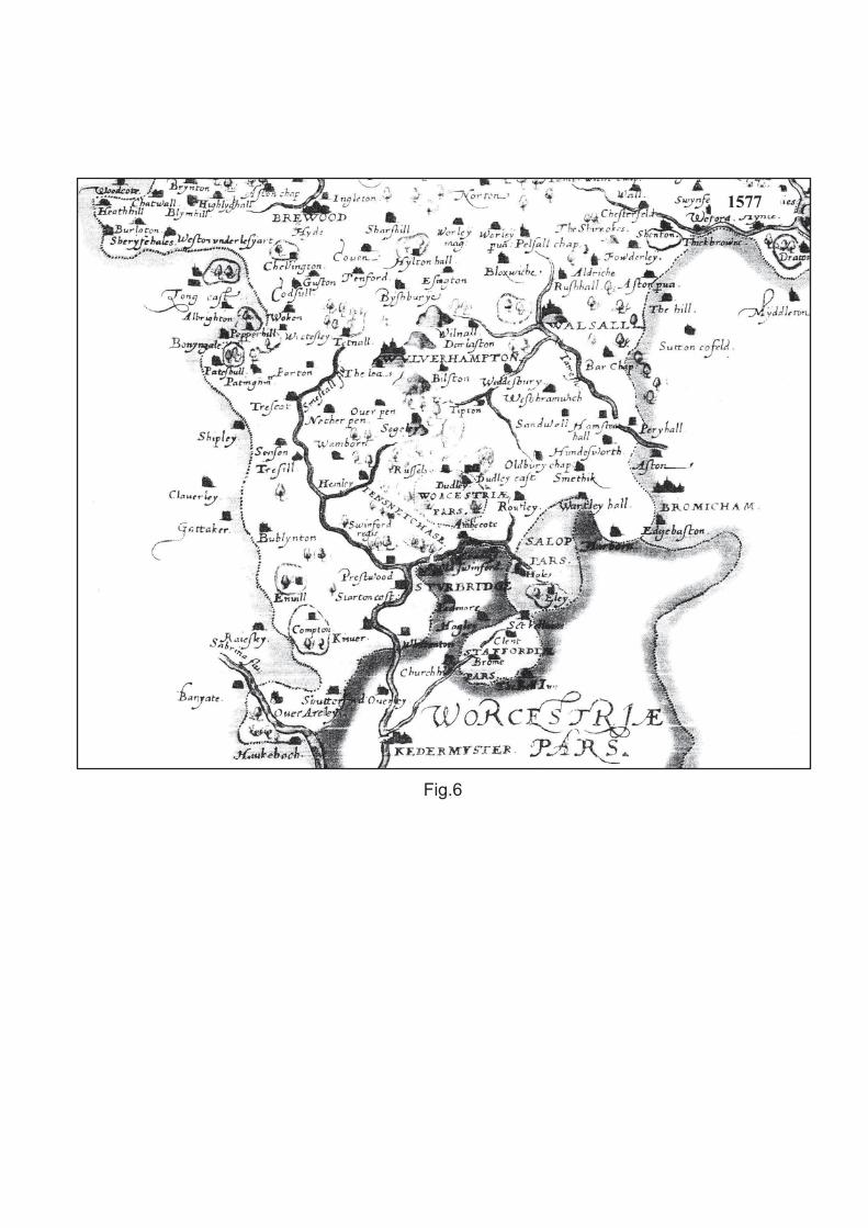
1. Location Map. 2. O.S. map first edition (1886). 3. O.S. map second edition (1903). 4. O.S. map third edition (1919). 5. SMR location map. 6. William Saxton’s Map of Staffordshire, 1577. 7. Dr. Plot’s Map of Staffordshire, 1686. 8. William Yates’s Map of the County of Staffordshire, 1769. 9. Deed plan of sale of land by Mr Benjamin Whitehouse to Sedgley School Board, 1877. 10. Deed plan of sale of land by Mr. Benjamin Whitehouse to Sedgley School Board, 1901. 11. 1954 photograph of infant school classroom. 12. British Coal Board map,1980. 13. Ground Floor plan (1:200). 14. Phased plan (1:200).
Plates 1. South facing elevation. 2. West facing elevation (1) 3. West facing elevation (2). 4. North facing elevation (1) 5. North facing elevation (2). 6. East facing elevation (1). 7. East facing elevation (2). 8. East facing elevation (3). 9. Boys’ entrance (east elevation). 10. Girls’ entrance (east elevation). 11. Coseley Schools name plaque and basket weave detail. 12. Mount Pleasant School name plaque and basket weave detail. 13. Curved gable from north. 14. Decorative wall tie. 15. Interior partitioning/roof (G7 and G8). 16. North entrance doorway of hall (G8). 17. Glazed brick, half round terracotta dado, and decorative tile frieze. 18. Hammer beam style roof (G12). 19. Room G3 from south. 20. Neo-gothic style window. 21. Former Woodwork building.

Mount Pleasant School, Coseley
Birmingham Archaeology 5
MOUNT PLEASANT SCHOOL, COSELEY ARCHAEOLOGICAL DESK-BASED ASSESSMENT AND BUILDING RECORDING, 2006
1 INTRODUCTION In May 2006, Birmingham Archaeology carried out archaeological desk-based assessment and building recording at Mount Pleasant School, Coseley (hereafter referred to as the study area). The work was commissioned by Dudley Metropolitan Borough Council in relation to a proposed pre-application discussion regarding the demolition of the existing buildings and the redevelopment of the site This report outlines the results of the assessment, which was carried out between the 30th of May and the 16th of June 2006, and which was prepared in accordance with the Institute of Field Archaeologists Standard and Guidance for Archaeological Desk-Based Assessment (IFA 1999). The assessment conformed to a brief produced by Dudley Metropolitan Borough Council (Appendix 1), and a Written Scheme of Investigation (Birmingham Archaeology 2006), which was approved by the Local Planning Authority prior to implementation, in accordance with guidelines laid down in Planning Policy Guidance Note 16 (DoE 1990).
2 LOCATION AND GEOLOGY The site is located at Mount Pleasant Street, Roseville, Coseley, West Midlands, WV14 9JR. It is approximately two miles east of Sedgley, three miles north of Dudley, and three miles south-east of Wolverhampton. It is centred on NGR SO 937 938 (Fig. 1). The underlying geology is carboniferous middle coal measures, which consist of grey shales, clays and fireclays, with sandstones, coal seams, ironstones, and marine bands (Geological Survey Solid and Drift map of Staffordshire, 1:50000, 2004). The soil has been described historically as being ‘stiff loam, subsoil clay and gravel’ (Kelly’s Directory 1904, 135).
The present character of the site is hardstanding; the building is surrounded by a tarmac car-park which formerly may have served as the school’s playground. To the south is a modern (late 1980s/early 1990s) residential development, which stands on the site of the former Mount Pleasant Girl’s School and cookery centre, which were demolished in advance of this residential development. To the south of this is Ivyhouse lane. To the east of the study area on Mount Pleasant Street are Hartshill Cottages, a late Victorian terrace development built in 1893. To the north of the main school building is the former woodwork centre whose north wall also forms the garden/party wall to an earlier (pre 1903, post 1886) residential dwelling. To the north east of this on Ebeneezer Street is the Ebeneezer Baptist Chapel, which was built in 1858. The north elevation of this chapel faces onto the Birmingham New Road which was opened in 1939. To the west of the study area is a mid/late 20th-century residential area. To the north west of the study area is the late Victorian red brick residence ‘Hollydene’ on Hayward Street.

Mount Pleasant School, Coseley
Birmingham Archaeology 6
3 AIMS AND OBJECTIVES The principle aim of the project was to assess the survival and potential significance of any archaeology within the study area by collating existing archaeological and historical information for the site and its immediate environs and placing it in its local, regional and national context.
More specific aims were to:
• To gather information to establish the presence/absence and likely nature of any archaeological resource within the study site.
• To provide a summary photographic record of existing buildings linked to suitably annotated plans.
• To provide an interpretative assessment of the significance of the buildings to the historic environment in national, regional and local terms.
• To consider the school buildings in their wider townscape context. • To assess the impact of the demolition proposed, in relation to the significance of the
buildings themselves and of the effect their removal would have on the existing character of the site, the wider area and its townscape and local distinctiveness.
4 METHODOLOGY A search of all relevant and readily available published and non-published documentary sources, including historic maps and photographs, was carried out at Dudley Archives and Local History Centre, Birmingham Central Library, and the Library of the University of Birmingham. The Dudley Metropolitan Borough Council Sites and Monuments Record, the main source of archaeological information for the borough was also consulted. Material provided by the ‘Friends of Coseley Archives’ was also appraised. In addition, a walkover of the study area was undertaken in order to assess the topography and any above-ground archaeology, including standing buildings. The Building Recording was carried out to Level 2 as defined by the Royal Commission on the Historical Monuments of England (RCHME 1996)/ English Heritage (2006), according to the advice set by the Institute of Field Archaeologists (IFA 2001b). A scaled plan was produced through hand measurement. An extensive visual analysis of both interior and exterior was carried out; written notes were compiled on pro forma records sheets as a basis for compiling the written description. A photographic record was produced utilising a Nikon 35mm F75 camera using black and white film, supplemented by digital coverage using a Nikon D50 single lens reflex camera, and included suitable scales. All photographs were recorded on an index sheet giving details of both location and orientation. 5 ARCHAEOLOGICAL AND HISTORICAL CONTEXT 5.1 Prehistoric There is no evidence for prehistoric presence/activity in this area.
Mount Pleasant School, Coseley
Birmingham Archaeology 7
5.2 Roman There is no evidence for a Roman presence/activity in this area. However, there is anecdotal evidence regarding the discovery of Roman coins ‘in the wooded wilds where Coseley was later to rise’ (Chandler and Hannah 1949, 12), however, this has not been substantiated upon, nor is a source proffered. 5.3 Anglo-Saxon An understanding of Anglo-Saxon activity/presence in this area can be derived from the placename evidence. W.H. Duignan, the authority on Staffordshire place names, traces the development of the name Coseley to being Cole’s lea, Cole being an Anglo Saxon personal name, and lea being a common Anglo Saxon term for ‘open untilled land used as pasture’ (1902, 44). Cockin (2000, 159) proposes an alternative provenance; the Anglo Saxon colore leah, meaning the charcoal burners glade. Both of these onomastic interpretations would suggest that Coseley and its immediate environs would have had minimal, if any, settlement at this time. Coseley is reputed to have been mentioned in Lady Wulfruna’s charter of 994, (Cockin 2000, 159), however, this evidence is unsubstantiated. Lady Wulfruna, who set up a landed estate centred on Wolverhampton c.985, is also associated with a spring, identified at Coseley (location now forgotten) by a 16th-century writer (Cockin 2000, 159). 5.4 Medieval Evidence from the Domesday Book (1086) suggests that the area in which Coseley now stands, was governed by Algar, the Earl of Mercia (Roper 1952, 1). After the Norman Conquest this area was subsumed into the Earl of Dudley’s Manor of Sedgley. The first documented usage of Coseley as a placename can be seen in the 1292 Calendar of Inquisitions before W. de Bereford Dudeleigh, where John Adam of Colseleye is mentioned regarding the sale of woodland (Roper 1954, 15). Whilst the area remained largely agricultural in manner, the vigorous industry centred on the coal and iron mines, which, was to characterise this area in the post-medieval period, was at an embryonic stage in the late 13th-century (Roper 1954, 14). The coal and iron mines in the area, based on 16th-century manorial court rolls, refer ‘almost without exception to Coseley’ (Roper 1954, 14). The 16th-century manorial court rolls also suggest that Coseley had become by this time a ‘separate and well defined district…within the manor of Sedgley’ (Roper 1954, 1). The medieval period saw the emergence of Coseley as a distinct district within the manor of Sedgley. Whilst retaining its agricultural function, its mineral wealth was acknowledged and was beginning to be exploited in an organized way towards the end of the period. This understanding of the Coseley area at this time delineates that the study area had an agricultural function. However, it may have been acquiring a proto-industrial role.

Mount Pleasant School, Coseley
Birmingham Archaeology 8
5.5 Post-medieval Historic cartographic evidence: Saxton (1577) (Fig.6), Speed (1610), Plot (1686) (Fig.7), suggests that there is no firm evidence for a village settlement in Coseley prior to the early 18th-century. However, Cockin notes that there was a ‘fragmented’ medieval village of Coseley, comprised of many hamlets, many of which were built on manorial wasteland’ (2000,159). Yates’s map of 1769 (Fig. 8) indicates a linear settlement developed along a road to the east and south of Ettingshall, where Coseley now stands. The Parish Map of Sedgley 1826 reveals that a distinct nucleated settlement, i.e. Coseley Village, was emerging to the north-east of the study area. This is centred on the current Ebeneezer St. on the north side of the present Birmingham New Road. (SMR 5823 and 1826 Parish Map of Sedgley) (Fig.5). In 1834, The History, Gazetteer, and Directory of Staffordshire describes Coseley as a ‘populous but straggling village and district’ (1834, 28/280) Whilst the area escaped largely unscathed from the Civil War, the Sedgley Registers document a skirmish, which took place between the Royalists and the Parliamentarian forces, in the old park area of Woodsetton, to the south-east of Coseley (Roper 1954, 53). The post-medieval period in this area was to be characterised by increasingly extensive move towards industrialisation. In 1613 the first documented licence for coal mining in Coseley was granted to William Persehouse de Colsley (Roper 1954, 27). The extent and quality of the coal resource from the area has been widely commented on. Dr Plot in ‘The Natural History of Staffordshire’ (1686) was impressed with the ‘fat, shining coal’ mined in the area (q. Roper 1954, 63). Greenslade and Jenkins note that ‘in no other area of Great Britain has so great a volume of coal been available at so shallow a depth’ (1967, 69). Coal was not the only mineral resource being exploited at Coseley, the great ironstone seams were also being worked, and a number of small furnaces were being set up. Coseley became an important centre of the nail trade. In fact, nail-making was becoming ‘one of the most widespread and important of the home industries’ (Dudley 1972, 119) with ‘several hundred hands … employed at their own homes in making nails and fire irons’ (History, Gazetteer, and Directory of Staffordshire 1834, 279). The Post Office Directory of Birmingham, Staffordshire, and Worcestershire 1850 notes that the ironstone, and coal mines in Coseley ‘seem to afford inexhaustible supplies’ (1850, 240). The mining industries stimulated secondary industries such as those involved in the manufacture of brick, tiles, and sanitary ware. The development of these industries was further augmented by developments in transportation. The expansion of the canal system into the region from the late 18th-century, and later the railways from the mid 19th-century, saw an increased sphere of demand for, and consequently a greater output of, the industrial product from the area. By the mid 19th-century Coseley was assuming an increased administrative role over its own affairs. In the early 17th-century Sedgley Parish had replaced the manor in its role of local authority over the area. In 1867 the boundaries were reorganised and the four historic manorial divisions of Coseley, Woodsetton, Brierley, and Ettingshall came under one distinct area known as Coseley. The Sedgley School Board was set up in 1873 in response to the 1870 Education Act. The first school built by the Board was at Daisy Bank, Sedgley in 1876. The Coseley Urban District, ‘then the second largest urban district in the country’ was established in 1902 (Cockin 2000, 159). Under the 1902 Education Act, Coseley Urban District Council replaced the School Board in its responsibilities for the provision of elementary education.

Mount Pleasant School, Coseley
Birmingham Archaeology 9
Coseley became a separate civil parish in 1903. This was abolished in 1966 and split up between the County of Dudley, Walsall, Wolverhampton, and West Bromwich. 6 HISTORICAL DEVELOPMENT OF THE STUDY AREA The study area forms the western part of Roseville, which is the western suburb of Coseley. By 1886 there was a hamlet named Roseville, centred on Jevon, Ebeneezer, and Jane streets (Fig. 2). Cockin (2000, 481) notes that its name may derive from Roseville House, which was erected prior to 1861 at the south side of Avenue Road at the junction with Bayer Street. The initial Roseville settlement was situated around Avenue Road, Bayer Street, part of Castle Street, and Tunnel Street. Roseville expanded onto previous agricultural land at Castle Street to become a ‘Victorian New Town Centre for Coseley’ (Friends of Coseley Archives 11/01/2006). The construction of numerous mid to late 20th-century residential developments, and the loss of much of its Victorian built and industrial heritage (Council House, Roseville House etc), has seen Roseville lose some of its Victorian character. However, the western portion of Roseville that contains the study area has faired better, and retains some indications of its Victorian/Edwardian origins. To the north of the study area is the Ebeneezer Baptist Chapel (SMR 7137) (Fig.5), which is of red brick and render, with a three–bay pedimented and pilastered front dating to 1857. To the north west of the study area is the red brick residence ‘Hollydene’ on Hayward Street (SMR 7965) (Fig.5) which was first recorded on the 1886 Ordnance Survey map (Fig.2). 63 Ivyhouse Lane to the west of the study area is a locally listed cottage (SMR 7514). Further east outside 28 Ivyhouse Lane is a Victorian cast iron hitching post (SMR 7167). The study area itself is an example of a post 1870 Education Act board school (SMR 12439). There are also examples of Victorian terraces and semi-detached residences on either side of Mount Pleasant Street adjacent to the school. There remain a number of reminders of the area’s industrial past with numerous mine shafts and colliery sites still extant (SMR 12132,12138,12134, 12201, 12129,12159, 12200) (Fig.5). According to the deeds (1/4/1966) the piece of land on which the 1st phase of Mount Pleasant School was built, was purchased by the School Board for the Parish of Sedgley, from Benjamin Whitehouse of Priorfield, Sedgley in October 1877 (Fig. 9). The School Board took out a mortgage of £5870, to be paid over fifty years, £4480 of which was for the purchase of 4000 sq yards of land. The remainder was to be spent on the construction of the school by architect A.P. Brevitt, a cost that would later rise to £3600 due to the fact that the school was to be built on a pit bank (Midland Counties Express 25/10/1879). A British Coal Board map (1980) (Fig.12) shows a former coal mine shaft under the playground to the west of the school. This sale also included an agreement by Mr. Whitehouse to construct Mount Pleasant Street as a suitable thoroughfare to the school. In July 1890 the School Board purchased a parcel of land of 210 sq yards adjacent to the school from a Mr Charles Bates for £32 3s. In March 1900 the School Board, under the ‘powers invested in them by the 1870 Education Act’, purchased a parcel of land of 1185 sq yards to the south of the building from a Mrs Jeavons for £207 6d. The study area, as it was prior to the closure of the school in 1986, was completed with two separate purchases of land from Mr Benjamin Whitehouse in July 1901 (5035 sq yards) (Fig.11) and in March 1903 (110 sq yards). These purchases were undoubtedly in order to accommodate the construction of the girl’s school and cookery centre at this time. When the girl’s school opened in 1904 the original
Mount Pleasant School, Coseley
Birmingham Archaeology 10
school building became the boys’ school. On June 1st 1908 the school became co-educational. The girls’ school became the infants’ school, and the original school building became the co-educational senior school. Duties on Land Values delineate that the site totalled 10430 sq yards in 1909. Major additions to the school building were probably carried out in 1913 by Charles Horton, surveyor for Coseley Urban District Council. Further extensions were completed in the mid/late 20th-century. Following the 1944 Education act, which organised public education into three progressive stages, the senior school became a secondary school. In the late 1960s the newly built Coseley Secondary School replaced Mount Pleasant Secondary School. Consequently the main school building and its outbuildings were utilised by the adjacent primary school to ease its overflow problems. The school closed in 1986. The girl’s school and cookery centre to the south, and the metalwork centre to the northwest, were demolished in advance of residential development by McLean in the Inner Cities Ltd. The school’s land reverted to its pre 1901 boundaries. The Dudley Archives and Local History centre have been accommodated in the old school building since 1993. The old woodwork centre to the north is utilised as a storeroom for archaeological objects for Dudley Metropolitan Council. An examination of historic ordnance survey maps provides further evidence for the evolution of the study area. The 1886 ordnance survey map (Fig.2) clearly shows the outline of the first phase of the school. The school has a modified ‘H’ shape plan and is as yet the only significant structure facing onto Mount Pleasant Street. The plan of the school has not been altered prior to the 1903 Ordnance Survey map (Fig.3). This map does show increased development to the north of the school, and on the east side of Mount Pleasant Street. The 1919 ordnance survey map (Fig.4) shows the girls’ school, cookery centre, woodwork centre, and metalwork centre built in 1904; it also delineates the new plan of the main school building, and shows the extent of the additions constructed in 1913. There does not appear to have been much subsequent development in the area prior to the 1938 Ordnance Survey map. A search for the original plans by A.P. Brevitt proved futile. Searches of Dudley Archives and Local History Centre, the Staffordshire Public Record Office, the Wolverhampton Archive and Local Studies centre, and local libraries failed to obtain these documents. It is likely that these plans were destroyed with much of the Sedgley Parish records in the early 20th-century (Roper 1954, 66). Historic photographs of the school stored at the Dudley Archives and Local History centre are chiefly of the infants’ school (Fig.11) and of the playground area. There does not appear to have been any previous archaeological work carried out at the study area. 7 BUILDING DESCRIPTION The standing buildings (Fig.13) in the study area were built in four distinct phases (Fig.14). The first phase was designed by architect A.P. Brevitt and built by Mr. John Guest of Brettel Lane in 1879 (Midlands Counties Express, 25/10/1879) for the School Board for the Parish of Sedgley, to accommodate 474 children. The next phase, the woodwork centre was built in conjunction with the girl’s school, cookery centre, and metalwork room in 1904. Phase 3 consists of additions and alterations carried out in 1913 by Coseley Urban District Council

Mount Pleasant School, Coseley
Birmingham Archaeology 11
surveyor Charles Horton in 1913. The final phase consists of mid/late 20th-century additions, possibly relating to the change in use in the late 1960s. Phase 1 The initial phase of Mount Pleasant School dates from 1879. It was built to an eclectic design combining a montage of neo-gothic, classical, and vernacular elements. It is a single storey building with a basement under room G3. The original plan was a modified H-shape with a lengthened initial down-stroke of the ‘H’. At each terminus of the ‘H’ there is a gable end of varying decoration. The principal range is oriented southwest to northeast. The arms of the ‘H’ run parallel to each other from east to west. This phase is of reddish brown brick in Flemish bond (8¾ x 3 x 4¼). The plinth begins eight courses from ground level and is capped by two courses of splayed blue brick. A few of these blue splayed bricks are stamped externally ‘Tibbington Tipton’. There are two bands of three courses of blue brick at intervals on each elevation. Three types of original windows survive. The first are neo-gothic in style, they have roll moulded brick aprons, with ornamental nailhead brick terminals (plate 20). The sills and jambs are of splayed brick. The pointed arch head is executed in gauged brickwork. This arch has a decorative hood-moulding which is terminated in nailhead brick. These original windows survive as pairs, with the area in between giving the appearance of a splayed mullion. The second type of window is segmentally arched with splayed sill and jambs. Decorative oeil-de-boeuf windows are also a feature of this original phase. The eaves are finished with three courses of oversail brickwork, and one course of dentilated brickwork. This phase is also characterised by the use of decorative cast iron wall-ties at eaves level (plate 14). The original pitched slate roof has been replaced with cement tiles. The principal elevation faces east onto Mount Pleasant Street (plates 6,7,8). The most southerly section of this elevation (4C) forms the east elevation of the southern arm of the ‘H’. This is a three bay gabled elevation bearing the sandstone nameplate ‘COSELEY COUNCIL SCHOOLS’ (plate 11). Above this the gable is shaped into a pediment by strings of projecting and dentilated brickwork. The gable is raised on corbelling at each corner. The internal area of the pediment is infilled with basket weave brickwork. The original scheme of fenestration has been replaced; however, the decorative roll moulded apron with nailhead terminals remains. The north facing elevation of this southern arm of the ‘H’ was divided into three distinct sections. The most easterly of which (4D) contains two examples of the original gothic style windows. To the west of this is a three bay gabled elevation (4E), which projects out by a stretcher’s length. The original windows have been replaced. The gable also has a pediment, with basket-weave infill. The most easterly section (4F) is set back by a stretchers length. This has three bays, the windows in the two most easterly of these have been replaced whilst the third is partially obscured by a later addition, the upper part of this western bay contains an oeil-de-boeuf window. The south elevation (plate 1) of this south arm is largely obscured by later additions. The western end (1A) has an example of the neo-gothic style window; to the west of this is a later inserted multi-pane sash window. At basement level there is a pointed window of gauged brickwork with spayed jambs and chamfer stops. To the east of this is a segmental arched doorway with gauged brick voussoirs. Two later inserted windows can be seen to the east of the later additions on this elevation. The east facing elevation (plates 6,7,8) of the cross of the ‘H’ has been largely obscured by subsequent additions. It is possible to gain an understanding of its original appearance by visually examining the surviving original fabric in conjunction with the evidence from the interior. This appears to delineate that there was a central gable in this section of the

Mount Pleasant School, Coseley
Birmingham Archaeology 12
elevation. At the southern end of this elevation there are three bays visible above subsequent additions. The two most southerly windows appear original; they are segmentally arched with splayed brick jambs. The third has been altered with a later insert. To the north of this obscured central area three more bays are visible from the exterior. The most southerly of these windows has been altered by a subsequent insert. The remaining windows are segmentally arched with splayed jambs. It is at this point where the north arm of the ‘H’ meets this elevation. The southern face of this arm has an oeil-de-boeuf window. The eastern terminus of this north arm (4S) is a replica of the eastern terminus of the south arm. However, the name plate here reads MOUNT PLEASANT SCHOOLS (plate 12). The north facing elevation (plate 4) has six bays, the two most easterly windows are in the gothic style (3A), the bay to the west of these has been infilled. The three bays to the west of this infill have later inserted windows. The apron is of roll moulding with nailhead brick terminals. The western terminal of the north arm (2A) is largely obscured by later additions. Again it is gable ended with pediment; however, there is no decorative infill as seen in those corresponding gables on the eastern elevation. The south elevation of this north arm projects beyond the central western elevation. This is largely obscured by later additions; however, it would appear that segmentally arched window (now replaced) was situated here. The western side of the cross of the ‘H’ has nine bays (2B) (plates 2 and 3). The most northerly one is now obscured by a later addition. However it does contain an oeil-de-boeuf window. The remaining windows are all segmentally arched with splayed jambs terminating in chamfer stops, windows one (from north), three, five, and eight have moulded blue brick sills, the remaining windows have splayed blue brick sills. This pattern is replicated in the interior by varying sill heights. There is a roll moulded brick apron with nailhead terminals. To the east of window eight is a circular infill patch of brickwork which contained an oeil de boeuf window. There does not appear to be any evidence of fenestration on the north face of the west projection of the south arm. The west terminal of the south arm (2C) is gable ended with two gothic style windows which are now partially obscured. The gable rises on corbels and forms a pediment; this resembles the corresponding north gable by not having a decorative infill. The interior of this phase is characterised by the use of fourteen courses of glazed brick with a half round projecting terracotta dado (plate 17). The principal range (G7 and G8) served as the assembly hall and teaching room. This had a wooden floor, which is now covered with carpet. The hall was entered to the north and south through large segmental arched gauged brick openings with a central doorway and glazed side panels (plate 16). A wooden partition (plate 15) currently divides the room in half; the lower section of this partition is studwork, which may be a later addition. However, the upper multi-pane glazed section appears to be original. The upper reaches of this rest on a large east/west beam, which are identical to those central to this large room. The provision of light appears to have been one of the principal design characteristics of this large room, with eight evenly spaced tall segmental arched windows on the west wall. There is an interesting variation in the way some of these windows are addressed, the first, and third from the south stop at the dado level and have stopped jambs at the base, the others have their sills two courses above the dado level and have no stops. This pattern is mirrored on the north side of the partition. The

Mount Pleasant School, Coseley
Birmingham Archaeology 13
east wall has been much altered by the later additions. Here there are a number of blocked up openings. There are three large segmental arched gauged brick openings on either side of the dividing partition. There are also three windows at a higher level to these on either side of the divide; some of these are formed into dormers. There is a corridor (G28 and G30) between this hall and the rooms in the north wing of the school. The walls have 14 courses of glazed brick and also have a half round terracotta projecting string. Rooms G16 and G17 are accessed from this corridor. Room G16 may have served as an additional classroom or due to its smaller size it may have had some form of administrative function. The room is entered through a large segmental arch doorway from G28. To the east of the doorway is a central segmental arched window. To the east and above this window is a blocked oeil-de-bouef window. The north wall has two tall neo-gothic arch windows. The east wall has three large rectangular windows; these are later inserts that appear to be in the position of earlier windows. G17 is entered through a doorway set in a large segmental arch with a glazed section to the east. To the west of the entrance is a segmental arch window. The north wall has three later large rectangular windows, which have been set in the position of an earlier fenestration scheme. The south arm of this phase consisted of four rooms. The most easterly room, G23 and G22, was a large classroom with a wooden floor and roof similar to G7 and G8 where a large truss supports vertical timber planking. This room was entered from the exterior through a doorway in the south wall. Above this is a segmental arch window. This room was lit by two neo-gothic style windows in the north wall of G22, and by three later inserted windows in the east wall. There are five large later inserted windows in the north wall of G22; all of which appear to have been inserted into earlier window positions. To the west of this room was a smaller room, which was entered through a segmental arch opening from G1. This room is now made up of room G19 and G20 and is much altered. The room to the west of this (G3) is largely intact (plate 19). It is entered from G2 through a segmental arch doorway, the upper part of which is filled with an eight-pane rectangular overlight. To the east of this is a segmental arch window, filled with a multi-light wooden framed window. The east wall has a central projecting chimney-breast, this does not appear to have had a fireplace, and is related to the fireplace at basement level. The room is lit by two evenly spread windows with chamfered and stopped jambs. The window to the west is a dormer window. The purlins, collars, and principals of the roof are chamfered and stopped. To the west of this is G6, which was entered through G4, was lit by two large neo-gothic style windows in the west wall. The basement room is of painted red brick. Its east wall has a centrally projecting fireplace. To the west of the pointed arched window in the south wall are two coal chutes. The eastern one of which has a chamfered lintel and jambs; the western chute may have been inserted at a later date. The concrete ceiling is supported by I beams. Phase 2 The woodwork centre (plate 21) to the north-east of the main school building appears to have been built in 1904 with the girl’s school, cookery centre, and metalwork room. This one-storey building is rectangular in plan. It is of reddish brown brick in Flemish bond (8⅞ x 3 x 4¼). Each window on the south (four) and west elevation (two) is set between a brick pilaster; the quoins of each being of smoother red brick. The sills of each window are two courses of splayed blue brick. There are two separate courses of decorative string moulding on the most easterly pilaster of the south wall. These string-courses continue around to the east elevation,
Mount Pleasant School, Coseley
Birmingham Archaeology 14
which has two bays, the southern bay contains a large doorway with moulded jambs and chamfer stops with a soldier brick head. To the north of this is a window, with chamfer-stopped jambs and a concrete sill. The north wall has the dual role of being the adjacent property’s garden wall, and being a party wall to this neighbouring dwelling. There does not appear to be any fenestration scheme on this wall. The slate roof is half hipped with projecting wood eaves. There are red slates hanging from the vertical sections of the roof. The interior consists of one large room, with a partitioned off supervisors room in the northwest corner. There is a central projecting chimney-breast on the north wall with a gauged brick fireplace with chamfered stopped sides. There are heating vents on each of the other walls. The entrance to the supervisor’s room has a gauged brick segmental arch doorway with chamfered jambs, which are stopped at the top. Four evenly spread brick piers on the north and south walls support the hipped roof. There also appears to be an early example of a wooden studwork suspended ceiling, which has been supported on the trusses. Phase 3 The original plan of the building was altered and added to in 1913. These additions, in effect, doubled the floor space available to the school. They were constructed in a late example of the Queen Anne Style, which is characterised by its use of red brick, white painted sash and casement windows, curly-shaped and Dutch gables, steep roofs, dormer windows, delicate brick panels, brick arches, and terracotta embellishments (Girouard 1977). Most of these elements of this style are present in this phase. These extensions are of red brick in English bond (8½x2⅞x4) they have a thick band of creamy-grey mortar close to the ground level. The roofs are, apart from one example, hipped or half-hipped. The use of sandstone dressings is also notable here. The use of decorative cast iron rainwater goods is also a feature of this phase. Much of the original fenestration scheme was remodelled at this time; these were replaced with large flat-headed sash windows including some with dormer. The most striking characteristic of this phase is the fact that the east face of the cross of the ‘H’ was almost completely obscured by a large new school hall (G12), and new cloakroom (G14). This hall is orientated north/south, and has distinctive curved gables on its north and south facades. There is a projection from its eastern elevation to accommodate a stage area. The north and south gables are identical. These have large gauged header segmental arch windows with decorative terracotta hood-mouldings with label stops. The curved gable has a scrolled/swan neck pediment with kneelers and cut sandstone coping (plate 13). There is a half-hipped slate roof with two east-facing hipped dormers with segmental arched windows. These overlook the stage area (G12a), which has two large windows with cement sills and lintels, and a flat roof with cement coping. Separate entrances were added for boys and girls at this time. The girls’ entrance (plate 10) can be seen at the east side of the corridor G21 which was also added at this time. This has a moulded string-course on either side of the door, which is on a sandstone step. The doorway has moulded jambs with a chamfer stop, the head is a sandstone tripartite shouldered arch. Above the head is the name plaque GIRLS in relief in sandstone. A decorative ramped/curved sandstone coping completes this entranceway. There are three separate entrances for boys at the east end of corridor G1 (plate 9), at the east end of corridor G30, and another, now obscured, at the west end of the corridor G28. These doorways have jambs of moulded brick with chamfer stops at top and bottom. The doorways have tripartite sandstone shouldered arches with BOYS inscribed in the lintel. These also have decorative ramped/curved sandstone copings. The latter of these, for which the corridor was extended, may have been added at a later date on examination of its relationship with the large room (G18) added at this time. However, this relationship may have been intentional. This addition to the west terminal of the

Mount Pleasant School, Coseley
Birmingham Archaeology 15
north arm is gable ended, with the gables facing south and north. The south facing gable has two large flat arch gauged brick windows, The western gable is set slightly lower than the other which is positioned at the centre of the wall. The gable rises on sandstone kneelers, while the gable is capped with sandstone. Towards apex of the gable is a rectangular opening for ventilation. The gable edge is shorter on the east side in order to align with the earlier structure. The eastern gable has a large flat-headed gauged brick window, which is flanked on either side by smaller windows. There is a splayed blue brick plinth, which is similar to the original scheme of decoration. The apron is addressed in a simple projecting brick design, while the sills are of cut sandstone. The gable rises on sandstone kneelers, and has a cut sandstone coping. There is a sandstone lozenge near the apex of the gable which, is also of sandstone. The west elevation of this addition also has a splayed blue brick plinth. There are no openings on this elevation. An extension was also added to the south of the girls’ corridor at this time. The east and west walls of this have been obscured by later additions, however the south elevation remains. This has four bays. A decorative moulded terracotta string/apron runs under the windows, of which the two central windows have soldier arch heads, while the others have header arch heads. The sills that remain are terracotta. The eaves are of a darker, smoother brick, and consist of three courses of oversail brick. The roof is hipped with modern cement roof tiles. Another interesting addition at this time was the construction of a bay window (plate 7) and office room overlooking the boy’s entrance to corridor G1. The office room has a flat roof with a decorative ramped/curved sandstone coping. The interior of this phase is characterised by the obvious attention to the provision of light, and the introduction of a ceramic decorative frieze at dado level, which also covered fourteen courses of glazed brick. This dado has a floriated Vitruvian scroll motif (plate 17). Many of the original windows, such as at 1A, 3A, 4C, and 4E, have been replaced by large flat-headed windows. Many of the windows and doors on the original east face of the principal range have been blocked in order to facilitate the addition of the new hall and cloakroom at G12 and G14. The juxtaposition of both phases of dado is apparent in areas where this phase is added to and interrupts the original phase. The main element of this phase is the new school hall (G12). This has a parquet floor with large heating grilles along its west side. The west wall had four evenly spaced segmental arch openings, which led through to G7 and G8; these are now blocked with breeze-block. The south wall has a segmental arched opening, which leads into G9 and the office area. At the upper level the large segmental arch window seen on the curved gabled exterior has been blocked. This room was entered from G14 through a segmental arch central doorway (now blocked with breeze-block) in the north wall. The large segmental arch window at the upper level is also blocked. The east wall has a large segmental arch central opening leading to the stage area G12a. This is flanked by tall segmental arch windows. The window to the south has been adapted as a doorway to G13 in phase 4. This room has a four-bay pseudo-hammer beam roof (plate 18). The stage area G12a had a wooden stage approximately 0.85m above floor level. A doorway has been cut through the north wall to give access to the later G15. The east wall has two large evenly spaced windows with concrete sills. There is a small window with concrete sill in the south wall. G14 served as the cloakroom this was entered through a door in the north wall of G12. The south wall has been extended by modern breeze-block. To the east of this are two blocked windows with chamfered and stopped jambs. The west wall contains an earlier blocked window. Part of corridor G29 was also added at this time. This gave access to G18 and the western boy’s entrance. G18 has a quarter circle moulded terracotta plinth at its base, this is topped by half round moulded string-course with painted brick above. There is a large central window in the north wall; this is flanked by two smaller windows. These

Mount Pleasant School, Coseley
Birmingham Archaeology 16
have all been boarded over. The room is entered from G29 through a large opening filled by a doorway and a large glazed panel to the west. The corridor G21 has a blocked doorway at its east end. The south wall has three blocked chamfered and stopped windows at its east end. The central part of this wall projects southwards and contains a toilet block (G24 and part of G25) which was extended and refitted in subsequent alterations. The remainder of the south wall of G21 contains 2 large (blocked) segmental arch openings. These have chamfered jambs and lintels. Phase 4 The current plan of the building was completed with further additions in the mid to late 20th-century. These low flat roofed additions are of red brick in stretcher bond (8½ x 2⅝ x 4⅛). There is a thick band of grey mortar c.5cm thick in their lower courses. The windows on these additions are metal framed and soldier headed or have no discernable head at all. The sills, where still present, are of concrete. A kitchen (G13) was added to the east range, while further flat roofed additions were erected at G5, G6, G25, G26, G27, G15, G29, and a porch was added in the south facing elevation of the north arm. A further addition to the east elevation cut into the bay window constructed in phase 3. The attic room over G3 and G6 was probably added at this time. A supporting buttress was added to the northeast corner in the late 20th-century. Many of the windows were reversibly blocked up in the late 20th-century; this was probably as preparation for the buildings’ use as an historic archive.
8 CONCLUSIONS AND RECOMMENDATIONS
The above assessment delineates that the study area was sited on a former coal pit bank in an area with a profusion of coal industry sites. Prior to industrialisation the area appears to have been a waste ground or pastureland for the Manor of Sedgley. Mount Pleasant School was built for the Sedgley School Board, by A.P. Brevitt in 1879, as part of the expanding Victorian western suburb of Roseville. The present streetscape was also laid down at this time. The initial school had a modified ‘H’ shape plan, built in an eclectic style. The construction of the school was a response to the 1870 Education Act, which sought to set up school boards to provide schooling in those areas where education was deemed deficient. Of the girls’ school, cookery centre, metalwork and woodworking rooms, which were built adjacent to the school in 1904, only the woodwork room now remains. Coseley Urban District Council constructed major additions in the Queen Anne Style to the school in 1913. Of these, the most significant were the large school hall, cloakroom, and kitchens, which were added to the principal east elevation. These served to double the previous floor space. Much of the original fenestration was altered at this time in order to provide the adequate lighting befitting a school. The school’s size was further augmented in the mid/late 20th-century. The building ceased in its educational function in 1986, and was converted for use as a public archive in the early 1990s.
The main school building is a composite of three distinct phases. The form of the original school building, whilst still readable, has been obscured and altered by subsequent additions. The 1913 additions are a late example of the Queen Anne or Board School style, which was particularly en vogue in school construction from 1870 to the early 1900s. These later additions make good use of light and space, and have contributed aesthetically to the study

Mount Pleasant School, Coseley
Birmingham Archaeology 17
area. The mid/late 20th-century additions, the re-covering of the roof with cement tiles, and the alterations made in order to house the archives have further altered the plan and other original features.
Karl Otto wrote that ‘schools are not only institutions for instruction, but at the same time visible symbols of educational conceptions of their time’ (q. Seaborne and Lowe 1977, i). Mount Pleasant School is a good example of this type of institutional architecture, however it is not exceptional. The later additions and alterations detract from the architectural quality of the original school building, and have altered original features. There are numerous schools dating from this Board School period that retain their original plan form and architectural quality. In this context, it must be said, that, while the buildings form an interesting composite of this type of building, they are not sufficiently intact nor have sufficient architectural distinction to be considered nationally important. PPG15 (1994) sets out strict criteria for deciding which buildings merit inclusion on the statutory lists: -
-architectural interest: the lists are meant to include all buildings which are of importance to the nation for the interest of their architectural design, decoration and craftsmanship; also important examples of particular building types and techniques (e.g. buildings displaying technological innovation or virtuosity) and significant plan forms;
-historic interest: this includes buildings which illustrate important aspects of the nation’s social, economic, cultural or military history;
-close historical associations with nationally important people or events;
-group value, especially where buildings comprise an important architectural or historic unity or a fine example of planning (e.g. squares, terraces or model villages).
Not all these criteria will be relevant to every case, but a particular building may qualify under more than one of them.
If assessed under these criteria, it is clear that Mount Pleasant School should not be considered nationally important.
There are however, a number of factors why Mount Pleasant School should be considered for local listing. The built heritage of the Roseville area, and indeed Coseley as a whole, has been greatly denuded since the 1960s. However, the western area of Roseville, in which Mount Pleasant School stands, retains some of its Victorian heritage, such as Hartshill Cottages, the Ebeneezer Baptist Chapel, 63 Ivyhouse lane, and ‘Hollydene’ on Hayward St. This immediate area around the school could be described as a Victorian enclave amidst ever encroaching modern development. As in 1879, Mount Pleasant School forms an important part of this Victorian landscape. Historic map regression displays that Mount Pleasant School, and the street specially laid for it, were two of the most significant factors in the development of this area in the late 19th-century. The school became the focal point of this development, with much of the subsequent development radiating from it.
A.P. Brevitt, the architect for the first phase of Mount Pleasant School, does not appear to have had a national profile. He was however, well regarded locally in the south Staffordshire area. Hailing from Wolverhampton he gained commissions for a number of churches in the Walsall
Mount Pleasant School, Coseley
Birmingham Archaeology 18
area in the early 1870s (St. Lawrence Parish Church, Church St. in 1871, and Darlaston in 1874) (Pevsner 1974, 282). He was also commissioned for a number of industrial buildings including Wolverhampton’s first power station ‘The Municipal Electric Lighting Works’ on Commercial Street, in 1894-(http://www.localhistory.scit.wlv.ac.uk/genealogy/Parker/PowerStation.htm). It is not beyond the bounds of possibility that Brevitt was commissioned by the Sedgley School Board to construct one or more of its seven other Board Schools. The ‘Friends of Coseley Archives’ propose that he was responsible for the school at Daisy Bank, however, documentary evidence to substantiate this has not as yet been located.
The 1913 additions by Coseley Urban District Council are an early surviving example of Urban District Council civic architecture in this area. Broad Lanes School, 1925 and The Manor School, 1933, were also built for Coseley UDC. The ‘Friends of Coseley Archives’ have proposed that this phase is an example of a distinct ‘local civic vernacular style’ of architecture, which also include Daisy Bank School, 1877 and 1896, Charles Shackleton’s former Coseley Urban District Council House, 1895, and George Wenyon’s Tipton Library, 1905/06.
A number of original features remain, including original neo-gothic windows, glazed brick, terracotta dados, internal classroom fenestration, cast iron wall ties, and the sandstone name plaques. The boys’ and girls’ entrances are evocative of a time when architecture was illustratively used to control movement and ensure the segregation of the sexes and age groups. The 1913 additions are a late example of the progression from the religious ‘gothic’ style to the non-sectarian ‘board school’ style heralded by E.R. Robson, architect to the London School Board, in 1870 (Robson 1972). By the turn of the century, school architects were favouring ‘large rectangular windows, reminiscent of domestic architecture, rather than the lancet windows…which had been popular as recently as the 1870s and 1880s’ (Seaborne and Lowe 1977, 2). The composite of these styles contributes to an attractive and interesting edifice.
These factors, combined with the obvious local sentiment for this building, demonstrate a local significance.
The final decision for further archaeological mitigation lies with the Borough Planning Archaeologist.
9 ACKNOWLEDGEMENTS
The project was commissioned by Dudley Metropolitan Borough Council. Thanks are due to Pete Boland and John Hemingway for their co-operation and assistance throughout the project. Thanks are also due to Diane Matthews and Keith Ovenden of Dudley Archive and Local History Centre, and Linda Cliff of Dudley Metropolitan Borough Council. Thanks must also go to John Wilkes of the ‘Friends of Coseley Archives’ for providing access to his personal research and analysis. Thanks also go to Pete Boland [the Borough Archaeologist], for monitoring the project on behalf of Dudley Metropolitan Borough Council. The assessment was undertaken by Shane Kelleher. The building recording and photography was carried out by Shane Kelleher and Michael Lobb, who also produced the ground plan. Shane Kelleher produced the written report,
Mount Pleasant School, Coseley
Birmingham Archaeology 19
which was illustrated by Nigel Dodds and edited by Malcolm Hislop who also monitored the project for Birmingham Archaeology. 10 SOURCES
10.1 Primary Sources
Deeds relating to Mount Pleasant County Primary Schools, Mount Pleasant Street, Roseville,
Coseley, transferred by Staffordshire County Council to Dudley Corporation (1/4/1966).
History, Gazetteer, and Directory of Staffordshire, 1834. Kelly’s Directory of Staffordshire, 1904. Midland Counties Express, 1879 Sedgley School Board (September 25th). Midland Counties Express, 1879 Opening of Board Schools at Mount Pleasant, Coseley (October 25th). Post Office Directory of Birmingham, Staffordshire, and Worcestershire, 1850.
Plot, R 1686 The Natural History of Staffordshire, Oxford, Theatre Press.
10.2 Secondary Sources
Birmingham Archaeology 2006 Written Scheme of Investigation for Archaeological Desktop Study including Buildings Assessment. Former Mount Pleasant School, Mount Pleasant Street, Coseley, Dudley, West Midlands. Chandler, G. and Hannah, I.C. 1949 Dudley as it was and as it is Today, London, BT Batsford Ltd. Cockin, T. 2000 The Staffordshire Encyclopaedia, Stoke-on-Trent, T Malthouse Press.
Department of the Environment (DoE) 1990 Planning Policy Guidance Note 16: Archaeology and Planning

Mount Pleasant School, Coseley
Birmingham Archaeology 20
DMBC 2006 Brief for Archaeological Desktop Study Including Standing Buildings Assessment Dudley 1972 County borough of Dudley. Official Guide, Dudley, Dudley Borough Council.
Duignam, W.H. 1902 Staffordshire Place Names, London, Oxford University Press. English Heritage 2006 Understanding Historic Buildings: A Guide to Good Recording Practice. Friends of Coseley Archives 2006 Research Material on Mount Pleasant School, Coseley, by John Wilkes. Girouard, M. 1977 Sweetness and Light: The ‘Queen Anne’ Movement 1860-1900, Oxford, Clarendon Press. Greenslade, M. W. and Jenkins, J.G. 1967 A History of the County of Stafford Vol 2, London, Oxford University Press for the Institute of Historical Research. Institute of Field Archaeologists (IFA) 1999 Standard and Guidance for Archaeological Desk-Based Assessment, rev. edn. IFA 2001a Standard and Guidance for Archaeological Desk-Based Assessment IFA 2001b Standard and Guidance for the Archaeological Investigation and Recording of Standing Buildings or Structures. Pevsner, P 1974 Staffordshire, Harmondsworth, Penguin. PPG15 (1994) Planning Policy Guidance 15: Planning and the Historic Environment. Department of the Environment. Robson, E.R. 1972 School Architecture, Leicester, Leicester University Press. Roper, J.S. 1952 History of Coseley, Coseley, Urban District Council of Coseley. RCHME 1996, Recording Historic Buildings: A Descriptive Specification, 3rd edn.
10.3 Cartographic Sources
1577 William Saxton’s Map of Staffordshire. 1610 John Speed’s Staffordshire.

Mount Pleasant School, Coseley
Birmingham Archaeology 21
1686 Dr. Plot’s Map of Staffordshire, from The Natural History of Staffordshire. 1769 William Yates’s Map of the County of Staffordshire. 1826 Parish Map of Sedgley. 1886 Ordnance Survey 1:2500, Staffordshire Sheet LXVII.7. 1903 Ordnance Survey Map 1:2500 Staffordshire Sheet. 1919 Ordnance Survey 1:2500, Staffordshire sheet LXVII.7.
1938 Ordnance Survey 25”, Worcestershire sheet 1…7.
1980 British Coal Board map.
2004 Geological Survey 1:50000 Solid and Drift Map of Staffordshire.
10.4 Internet Sources
http://www.localhistory.scit.wlv.ac.uk/genealogy/Parker/PowerStation.htm.Consulted
15/06/06 at 15.25.

Fig.1
Site
Reproduced from the 1998 OrdnanceSurvey 1:50,000 map with thepermission of the Controller of HerMajesty's Stationary Office,c Crown Copyright
Licensee : Field Archaeology Unit University of Birmingham Edgbaston BIRMINGHAM B15 2TT
Licence No. AL 51303A

1886
Fig.
2

1903
Fig.
3

1919
Fig.
4

A
7
33
1
12
B i r m i n g h a m N
e w R o a d
M o
u n
t P
l e
a s
a n
t S
t r e
e t
I v y
h o u s e L
a n e
W a
r d
S t
r e e
t
E b
e n
e z
e r
S t r
e e
t E
b e
n e
z e
r S
t r e
e t
J e v
o n
S t
r e e
t B
an
kS
tre
et
E v e r
g r e
e n
C l o s
e
B r e e
n R y
d d i n
g D
r i v
e
12129
12159
12200
7167
7514
12199
12439
7965
12132
12134
12198
7137
5823
12439
377
e t
E b
e n
e z
e r
S t r
e e
t
J e v
o n
S 5823
Fig.
5
1577
Fig.6

1686
Fig.7

1769
Fig.
8

Fig.
9
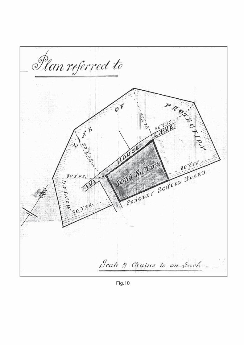
Fig.10

Fig.
11

Fig.12
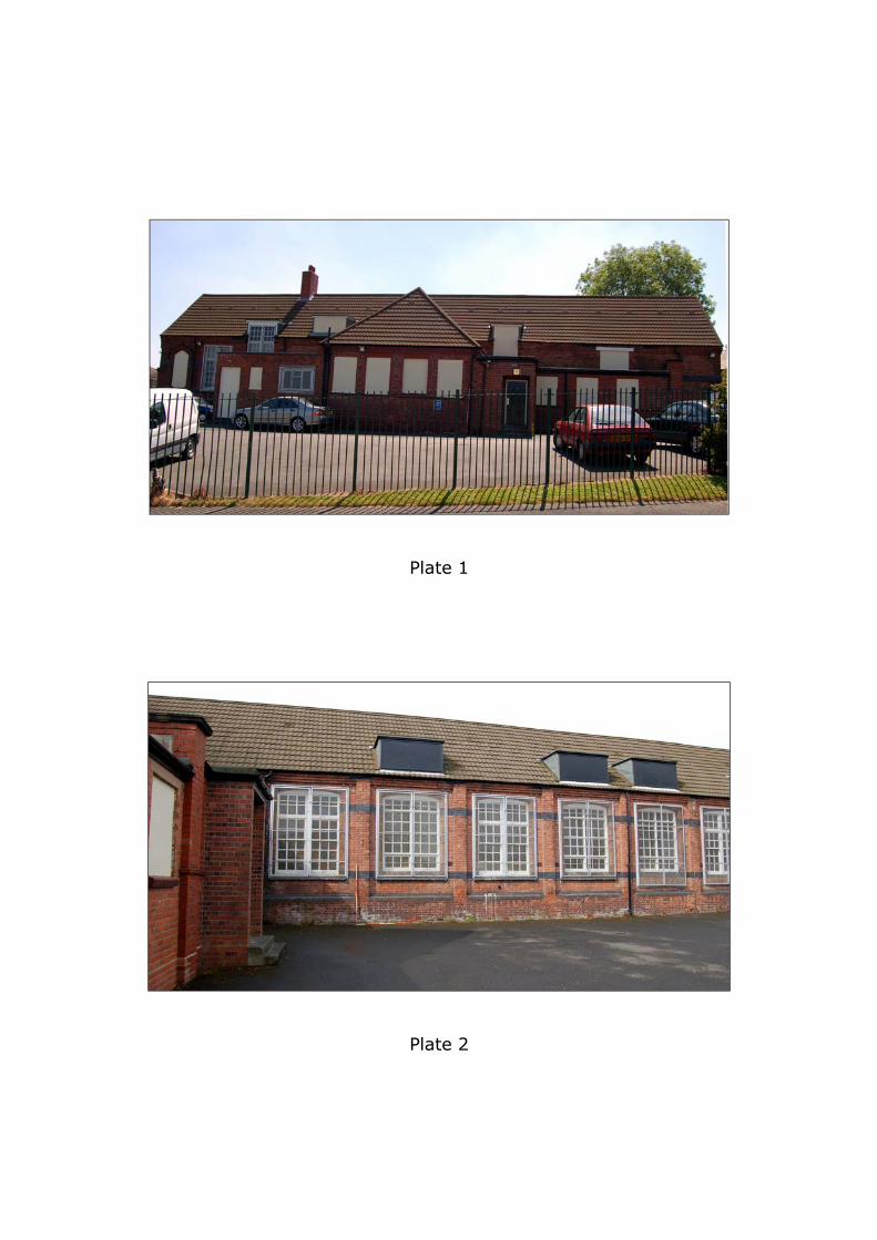
Plate 1
Plate 2
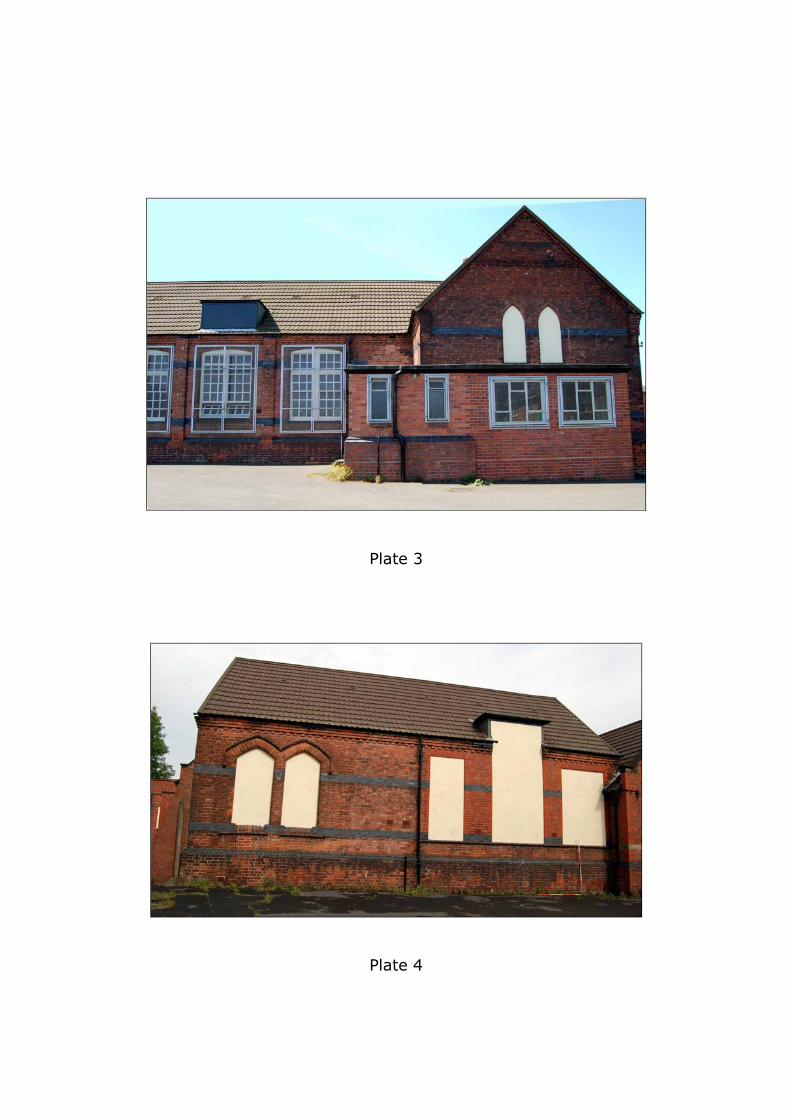
Plate 3
Plate 4

Plate 5
Plate 6

Plate 7
Plate 8

Plate 9
Plate 10

Plate 11
Plate 12

Plate 13
Plate 14

Plate 15
Plate 16

Plate 17
Plate 18

Plate 19
Plate 20

Plate 21