M arCAt I 0200 - Hampton, NH
15
Vice-Chair ciet 4 Board of Selectman Representative TOWN OF HAMPTON MASTER PLAN MARCH 2003 REVISIONS TO THE FOLLOWING CHAPTERS: CHAPTER 2, SECTION 2.1 — EXISTING LAND USE CHAPTER 3 — TRANSPORTATION SYSTEMS CHAPTER 6, SECTION 6.2 — SOILS AND CONSTRUCTION MATERIALS CERTIFICATE OF ADOPTION The Town of Hampton's Master Plan was amended by the adoption of the listed chapters and sections on March 19, 2003 by a majority vote of the Hampton Planning Board, in accordance with NH RSA 675:6, following a public hearing held on March 19, 2003. Certified by the Hampton Planning Board: Date: M arCAt I 0 2 00 HAMPTON PLANNING BOARD MEMBERS: Tracy Emerick / C LE RK Thomas J. Gillick, Jr. CHA-16441A-N) Thomas Higgins Jack Lessard Keith Lessard Robert Viviano, VI CE CH - A . 101) 0 0Q William "Skip" Sullivan, BoS member Edward "Sandy" Buck, alternate Daniel Trahan, alternate
-
Upload
khangminh22 -
Category
Documents
-
view
6 -
download
0
Transcript of M arCAt I 0200 - Hampton, NH
Vice-Chair
ciet
4
Board of Selectman Representative
TOWN OF HAMPTON MASTER PLAN
MARCH 2003 REVISIONS TO THE FOLLOWING CHAPTERS:
CHAPTER 2, SECTION 2.1 — EXISTING LAND USE CHAPTER 3 — TRANSPORTATION SYSTEMS
CHAPTER 6, SECTION 6.2 — SOILS AND CONSTRUCTION MATERIALS
CERTIFICATE OF ADOPTION
The Town of Hampton's Master Plan was amended by the adoption of the listed chapters and sections on March 19, 2003 by a majority vote of the Hampton Planning Board, in accordance with NH RSA 675:6, following a public hearing held on March 19, 2003.
Certified by the Hampton Planning Board:
Date: M arCAt I 0200
HAMPTON PLANNING BOARD MEMBERS:
Tracy Emerick / C LE RK Thomas J. Gillick, Jr. CHA-16441A-N) Thomas Higgins Jack Lessard Keith Lessard
Robert Viviano, VI CE CH- A.101)00Q William "Skip" Sullivan, BoS member Edward "Sandy" Buck, alternate Daniel Trahan, alternate
HAMPTON MASTER PLAN - MARCH 2003
CHAPTER 6 - NATURAL RESOURCES
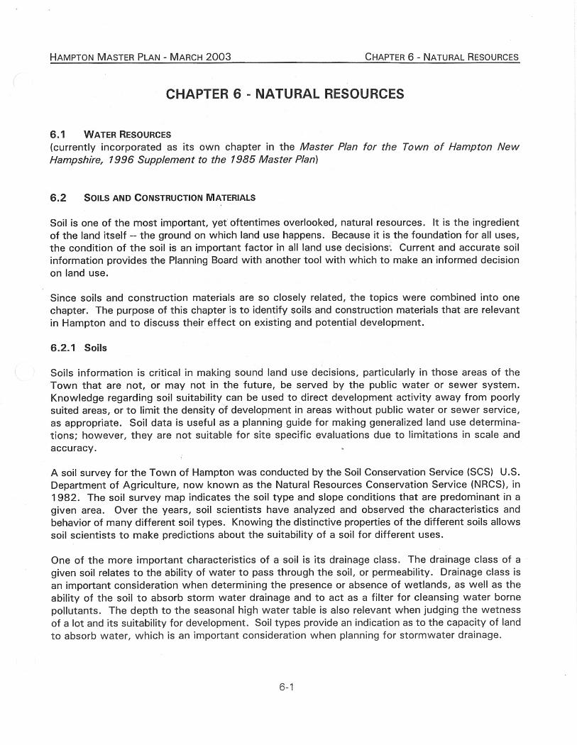
CHAPTER 6 - NATURAL RESOURCES
6.1 WATER RESOURCES
(currently incorporated as its own chapter in the Master Plan for the Town of Hampton New Hampshire, 1996 Supplement to the 1985 Master Plan)
6.2 SOILS AND CONSTRUCTION MATERIALS
Soil is one of the most important, yet oftentimes overlooked, natural resources. It is the ingredient of the land itself -- the ground on which land use happens. Because it is the foundation for all uses, the condition of the soil is an important factor in all land use decisions. Current and accurate soil information provides the Planning Board with another tool with which to make an informed decision on land use.
Since soils and construction materials are so closely related, the topics were combined into one chapter. The purpose of this chapter is to identify soils and construction materials that are relevant in Hampton and to discuss their effect on existing and potential development.
6.2.1 Soils
Soils information is critical in making sound land use decisions, particularly in those areas of the Town that are not, or may not in the future, be served by the public water or sewer system. Knowledge regarding soil suitability can be used to direct development activity away from poorly suited areas, or to limit the density of development in areas without public water or sewer service, as appropriate. Soil data is useful as a planning guide for making generalized land use determina-tions; however, they are not suitable for site specific evaluations due to limitations in scale and accuracy.
A soil survey for the Town of Hampton was conducted by the Soil Conservation Service (SCS) U.S. Department of Agriculture, now known as the Natural Resources Conservation Service (NRCS), in 1982. The soil survey map indicates the soil type and slope conditions that are predominant in a given area. Over the years, soil scientists have analyzed and observed the characteristics and behavior of many different soil types. Knowing the distinctive properties of the different soils allows soil scientists to make predictions about the suitability of a soil for different uses.
One of the more important characteristics of a soil is its drainage class. The drainage class of a given soil relates to the ability of water to pass through the soil, or permeability. Drainage class is an important consideration when determining the presence or absence of wetlands, as well as the ability of the soil to absorb storm water drainage and to act as a filter for cleansing water borne pollutants. The depth to the seasonal high water table is also relevant when judging the wetness of a lot and its suitability for development. Soil types provide an indication as to the capacity of land to absorb water, which is an important consideration when planning for stormwater drainage.
6-1
HAMPTON MASTER PLAN - MARCH 2003 CHAPTER 6 - NATURAL RESOURCES
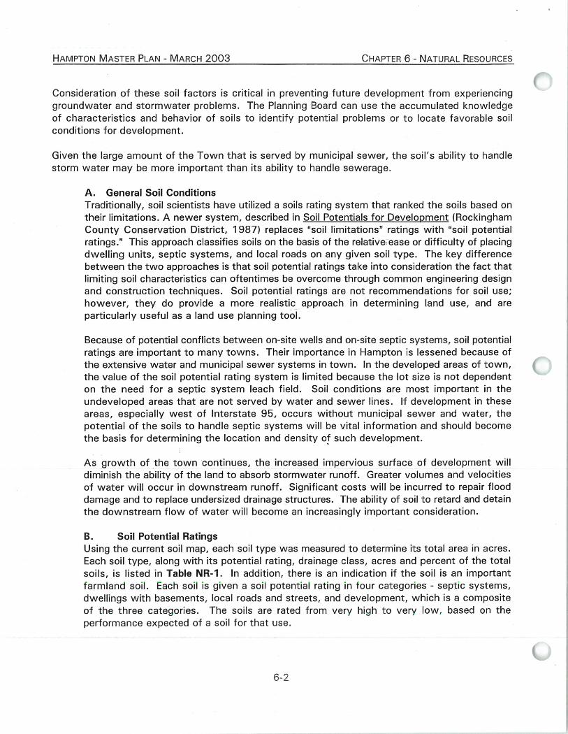
Consideration of these soil factors is critical in preventing future development from experiencing groundwater and stormwater problems. The Planning Board can use the accumulated knowledge of characteristics and behavior of soils to identify potential problems or to locate favorable soil conditions for development.
Given the large amount of the Town that is served by municipal sewer, the soil's ability to handle storm water may be more important than its ability to handle sewerage.
A. General Soil Conditions Traditionally, soil scientists have utilized a soils rating system that ranked the soils based on their limitations. A newer system, described in Soil Potentials for Development (Rockingham County Conservation District, 1987) replaces "soil limitations" ratings with "soil potential ratings." This approach classifies soils on the basis of the relative: ease or difficulty of placing dwelling units, septic systems, and local roads on any given soil type. The key difference between the two approaches is that soil potential ratings take into consideration the fact that limiting soil characteristics can oftentimes be overcome through common engineering design and construction techniques. Soil potential ratings are not recommendations for soil use; however, they do provide a more realistic approach in determining land use, and are particularly useful as a land use planning tool.
Because of potential conflicts between on-site wells and on-site septic systems, soil potential ratings are important to many towns. Their importance in Hampton is lessened because of the extensive water and municipal sewer systems in town. In the developed areas of town, the value of the soil potential rating system is limited because the lot size is not dependent on the need for a septic system leach field. Soil conditions are most important in the undeveloped areas that are not served by water and sewer lines. If development in these areas, especially west of Interstate 95, occurs without municipal sewer and water, the potential of the soils to handle septic systems will be vital information and should become the basis for determining the location and density of such development.
As growth of the town continues, the increased impervious surface of development will diminish the ability of the land to absorb stormwater runoff. Greater volumes and velocities of water will occur in downstream runoff. Significant costs will be incurred to repair flood damage and to replace undersized drainage structures. The ability of soil to retard and detain the downstream flow of water will become an increasingly important consideration.
B. Soil Potential Ratings Using the current soil map, each soil type was measured to determine its total area in acres. Each soil type, along with its potential rating, drainage class, acres and percent of the total soils, is listed in Table NR-1. In addition, there is an indication if the soil is an important farmland soil. Each soil is given a soil potential rating in four categories - septic systems, dwellings with basements, local roads and streets, and development, which is a composite of the three cateaories. The soils are rated from very high to very low, based on the performance expected of a soil for that use.
R-'7

TABLE NR-1: HAMPTON SOILS TYPES AND CONDITIONS
KEY:
Slope Class Soil Potential
Rating Drainage Class
'ek = 0-3%
il = 3-8%
= 8-15%
b = 15-25% i. .5 = 25% +
1 = Very high
2 = High
3 = Medium
4 = Low
5 = Very low
EWD: Excessively well drained
WD: Well drained
MWD: Moderately well drained
PD: Poorly drained
VPD: Very poorly drained
TVP: Very poorly drained I tidal
NR: Not rated / too variable Soil Potential Ratings
Important Septic Dwellings Local Roads Drainage Farmland Percent of
Symbol Soil Name Systems w/Basements and Streets Development Class Soils Total Soils Acres
26A Windsor Loamy Sand 2 1 1 x—
co co
co C
O I C)
CO
CO
A-
CV
CV
CN
CO
CO
CN
C
V C
O CO
C
O
0 0 0 0 0 0 0 0
0 0
0 0 0 0 0 0 0 0 0 0 0 0
0.3% 21 26B Windsor Loamy Sand 2 1 1 0.1% 11
29A Woodbridge Fine Sandy Loam 3 2 1 Yes 0.0% 2 29B Woodbridge Fine Sandy Loam 3 2 1 Yes 0.2% 18
32A Boxford Silt Loam 4 2 2 Yes 1.1% 89 32B Boxford Silt Loam 4 2 2 Yes 0.6% 50
33A Scitico Silt Loam 5 5 3 5.6% 459
38A Eldridge Fine Sandy Loam 3 2 1 Yes 2.0% 162
38B Eldridge Fine Sandy Loam 3 2 1 Yes 1.2% 103
42B Canton Gravelly Fine Sandy Loam 1 1 1 Yes 2.5% 208
43B Canton Gravelly Fine Sandy Loam, Very Stony 1 2 1 2.0% 167
43C Canton Gravelly Fine Sandy Loam, Very Stony 2 3 2 0.1% 7
44B Montauk Fine Sandy Loam 3 2 1 Yes 0.6% 49
45B Montauk Fine Sandy Loam, Very Stony 3 2 1 0.2% 16
45C Montauk Fine Sandy Loam, Very Stony 3 3 2 0.1% 7
45D Montauk Fine Sandy Loam, Very Stony 3 2 2 0.1% 7
62B Charlton Fine Sandy Loam 1 1 1 Yes 0.7% 55
62C Charlton Fine Sandy Loam 2 2 2 Yes 0.0% 4
63B Charlton Fine Sandy Loam, Very Stony 1 2 1 0.1% 5
63C Charlton Fine Sandy Loam, Very Stony 2 3 2 0.1% 9
66B Paxton Fine Sandy Loam 3 2 1 Yes 0.4% 37
67B Paxton Fine Sandy Loam, Very Stony 3 2 1 0.6% 49
67C Paxton Fine Sandy Loam, Very Stony 3 3 2 0.1% 9
soilschart01
6-3

TABLE NR-1: HAMPTON SOILS TYPES AND CONDITIONS
Soil Potential Ratings
Important Septic Dwellings Local Roads Drainage Farmland Percent of
Symbol Soil Name Systems w/Basements and Streets Development Class Soils Total Soils Acres
97 Greenwood and Ossipee Soils, Ponded 5 5 5 5 VPD 0.0% 2
115 Scarboro Muck 5 5 5 5 VPD 0.5% 38
125 Scarboro Muck, very stony 5 5 5 5 VPD 0.1% 11
129B Woodbridge Fine Sandy Loam, Very Stony 3 2 2 3 MWD 1.0% 81
134 Maybid Sil+A71t Loam 5 5 5 5 VPD 0.8% 66
140B Chatfield-Hollis-Canton Complex, Very Stony 3 4 3 3 WD 11.8% 972
140C Chatfield-Hollis-Canton Complex, Very Stony 4 4 3 4 WD 2.5% 202
295 Greenwood Mucky Peat 5 5 5 5 VPD 2.9% 237
298 Pits, Sand and Gravel nr nr nr nr NR 1.1% 93
299 Udorthents, Smoothed nr nr nr nr NR 4.5% 373
305 Lim-Pootatuck Complex 5 5 4 5 PD 0.4% 30
313A Deerfield Fine Sandy Loam 3 2 1 3 MWD 1.8% 147
313B Deerfield Fine Sandy Loam 3 2 1 3 MWD 1.0% 81
314A Pipestone Sand 5 5 3 5 PD 2.2% 180
395 Chocorua Mucky Peat ' 5 5 5 5 VPD 0.3% 53
397 Ipswich Mucky Peat 5 5 5 5 TVPD 16.0% 1318
446A Scituate-Newfields Complex 3 2 1 2 MWD Yes 0.2% 15
447A Scituate-Newfields Complex, Very Stony 3 2 1 3 MWD 1.7% 137
447B Scituate-Newfields Complex, Very Stony 3 2 2 3 MWD 0.9% 72
495 Ossipee Mucky Peat 5 5 5 5 VPD 2.3% 192
497 Pawcatuck Mucky Peat 5 5 5 5 TVPD 1.3% 104
510A Hoosic Gravelly Fine Sandy Loam 3 1 1 2 EWD Yes 6.5% 534
510B Hoosic Gravelly Fine Sandy Loam 3 1 1 2 EWD Yes 5.9% 489
510C Hoosic Gravelly Fine Sandy Loam 3 2 2 3 EWD Yes 0.6% 49 510D Hoosic Gravelly Fine Sandy Loam 4 4 4 4 EWD 0.4% 33
538A Squamscott Fine Sandy Loam 5 5 3 5 PD 2.5% 208
547A Walpole Very Find Sandy Loam, Very Stony 5 5 3 5 PD 0.9% 73
547B Walpole Very Find Sandy Loam, Very Stony 5 5 3 5 PD 0.7% 57
597 Westbrook Mucky Peat 5 5 5 5 TVPD 0.1% 12
599 Urban Land-Hoosic Complex nr nr nr nr NR 4.9% 403
657B Ridgebury Very Fine Sandy Loam, Very Stony 5 5 3 3 PD 0.4% 30
699 Urban Land nr nr nr nr NR 1.4% 112
799 Urban Land-Canton Complex nr nr nr nr NR 2.6% 214
997 Ipswich Mucky Peat, Low Salt 5 5 5 5 TVPD 1.5% 120
TOTAL ACRES 100.0% 8,282
so i lsc 6-4

Figure NR-1
Soil Potential Ratings, Hampton
Not
Very High classified
and High 14%
19%
Very Lo 39%
edium 25%
Low 3%
HAMPTON MASTER PLAN - MARCH 2003 CHAPTER 6 - NATURAL RESOURCES
Soil potential ratings are displayed in Figure NR-1. Based on the rating system, 1,590 acres (19%) of Hampton's land area are considered to have a very high or high potential for development. (Of that total, 467 acres are considered to have a very high potential for development and 1,123 acres are classified as having high potential for development.) A high or very high rating means that the soil's performance is at or above local standards because of favorable soil conditions. The costs associated with overcoming limitations (i.e. with installing septic systems) are low or very low due to favorable conditions and few limitations.
Approximately 2,102 acres (25%) have a medium potential, meaning that soil limitations add significantly to the cost of develop-ment. Only 235 acres (3%) of land are ranked as having a low potential. In those areas, overcoming soil limitations is very costly.
The soil potential for development is considered to be very low for almost 3,160 acres (39%) of the Town's land area. In these areas, wet soils or se-vere slopes cause development to be economically unfeasible. A large por-tion of this area is the Hampton salt marshes.
The remaining 1,195 acres (14%) of Hampton's land area is considered to be nonclassifiable due to alterations of natural soil conditions. This land includes gravel pits, areas of urban land, road construction and the landfill. On-site inspections would be necessary to determine actual soil potential.
C. Future Soil Use The most desirable land and soil is most always developed first, so that as the years go by, the best land is used up, leaving only the moderate and lesser quality land available. In Hampton's case, the proximity to the ocean also influenced the development of the land near the beach. Hampton is at that stage in its development where pressure to develop on the poorer soils is likely to increase.
As the remaining land in the sewered areas is developed, the land in the nonsewered areas will come under development pressure. In the areas of Hampton that are not served by the municipal sewer system, the ability of the soil to handle septic systems is an important consideration. In order to analyze the nonsewered areas Map NR-1, entitled "Soil Potential Ratings for Development," was prepared using the RPC's geographic information system and the county soils data. Map NR-1 serves as a general indicator of development suitability in the Town of Hampton. The map provides a "first cut" indication of the areas where additional development can be best accommodated, assuming reliance on on-site septic systems.
6-5

HAMPTON MASTER PLAN - MARCH 2003 CHAPTER 6 - NATURAL RESOURCES
INSERT MAP NR-1: SOIL POTENTIAL RATINGS FOR DEVELOPMENT
P r'

0 0.25 0.5 1 Miles
8-8 3:/d-hamptonkt-mapsiHamptVISPRtlx17.nixd
O O
Map NR-1 Soil Potential Ratings
For Development Hampton, New Hampshire
February 12, 2003 a
LEGEND
Soil Potential Rating for Development
Very High
High
Medium
Low
Very Low
No Rating
milmimilimited Access Highway '®Highway
Public Road, municipally maintained sommePublic Road, not maintained Private Road
MAP DATA SOURCES
Base Features (transportation, political and hydrographic) were automated from the USGS Digital Line Graph data, 1:24,000, as archived in the GRANIT database at Complex Systems Research Center, Institute for the study of Earth, Oceans and Space, University of New Hampshire, Durham, NH; 1992-1999. The roads within the Rockingham Planning Region have been updated by Rockingham Planning Commission and by NH Department of Transportation through ongoing efforts.
SOIL POTENTIAL RATINGS FOR LOW DENSITY DEVELOPMENT
Soil ratings indicate the relative quality of a soil for development when compared to other soils in the same county survey. Suitability of a soil as it pertains to septic tank absorption fields, dwellings with basements, and local roads and streets were used as the basis for determining the potential of a soil for development. A composite rating was given to each soil type combining the rating for each of the three uses stated above. The ratings are given as one of the following: Very High, High, Medium, Low and Very Low. Some soil ratings were NA (Not Available) or were Not Rated, and were not used in this product. For further information regarding Soil Potential Ratings for Low Density Development, contact your County Conservation District.
This information was produced by the Rockingham County Conservation District and was distributed in the publication; ‘il Potential Ratings for Low Density Development, Rockingham County, New Hampshire, published in May 1987.
Soil boundaries are from SCS county soil surveys, published at varying scales. All other features are from USGS 1:24,000 scale Digital Line Graphs. All features distributed by Complex Systems Research Center, Durham, NH. Soil unit boundaries that coincide with water body boundaries in the field will not always coincide on this map, due to their differing data sources.
stream intermittent stream marsh or swamp outline Bodies of Water
Railroads
• Town Boundary
MAP DATA SOURCES
Base Features
Base features (transportation, poltical and hydrographic) were automated Porn the USGS Digital Use Graph date. 1:24,000. as arcNved In the GRAN IT database at Complex Systems Research Center, Institute for the study of Earth. Oceans and Space, University of New Hampsrire, Durham, NH; 1992-1999. The roads within the Roctdnghem Planning Region have been updated by Rockingham Plenring Commission and by NH Department of Transportation through ongoing efforts.
This map was funded bye greet from the New Hampshire Coastal Program pissuant to the National Oceanic end Atmospheric Admirdstration Award (NA170Z1129) June 2002, New Hampshire Office of State Plaming, Rocidngham Planning Commission
(.0
Rockingham Planning Commission
t .
a
-% —,/ ••••••••••• ' ---..k. '7' ; "-----
-.•<:.. .
111.6.
inia./NE
•
ore
T71"--.47-17:1
S rotated 10 degrees West
SCALE 1:31,000
I I 1 I l 1

HAMPTON MASTER PLAN - MARCH 2003
CHAPTER 6 - NATURAL RESOURCES
The map shows that the areas west of Interstate 95 and along Drakeside Road are a mixture of all soil ratings for development, but predominantly medium, low and very low. There are large wetland areas associated with Old River and Line Swamp, Ash Brook, Drakes River, and Taylor River that make portions of the area unsuitable for development.
As more poor quality land in unsewered areas of Town is used as part of building lots, the problems of wet soils and flooding could increase. Hampton's land use regulations may need to be updated to address this concern. With a higher incidence of poorer soils, emphasis could be given to site specific planning in the unsewered areas. Soil-based lot sizing is one tool which accommodates inherent differences in soil characteristics on a parcel, by tying minimum lot sizes to a soil's ability to accommodate a septic system. Allowance for open space development is another tool, in which higher quality soils can be utilized for more intense uses and sensitive lands (poor soils, wetlands, farmland) can be protected through their dedication as open space.
6.2.2 Construction Materials
A. General Description of Types and Locations This section identifies which construction materials are relevant and depicts the general location of these deposits using the Soil Survey of Rockingham County, New Hampshire (1994) prepared by the SCS, now called the NRCS. Other sources of information are also used as appropriate. The soil survey identifies deposits of roadfill, sand, gravel, and topsoil as construction materials. Each soil type listed on the soil survey has a name and is denoted as a number followed, in most cases, by a letter from A to E. The number indicates the composition of the soil and the letter represents the slope. The letter A is a 0-3% slope, B is a 3-8% slope, C is a 8-15% slope, D is a 15-25% slope, and E is greater than 25% slope.
The NRCS rated the performance of each soil type based on its physical characteristics and test data conducted during the survey. For each intended use of the soil, the SCS gave the soil a ranking. The ratings of "good", "moderate", "fair", and "poor" are used for roadfill and topsoil. For sand and gravel, the soils are rated as "probable" or "improbable" as to the possibility of sand or gravel being present.
It should be noted that the soil maps are intended for general townwide land use planning. Due to the mapping techniques used, there may be different soil types within a mapped area of another soil type. The smallest soil land areas mapped are usually in the two to three acre range. Because of these limitations, the soil maps should not be used for site specific land use planning. More detailed on-site soil identification is recommended for parcel level work. The construction materials identified in this chapter are based on these SCS maps. The information is not designed or intended to be used for definitive identification of construction materials.
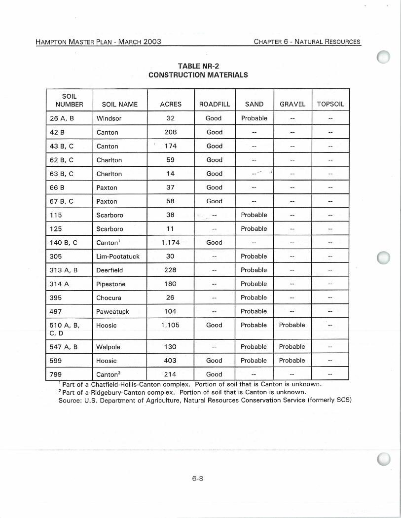
The soil types found in Hampton that are likely to contain any of the four construction materials are listed in Table NR-2. Each soil number and name is provided, as well as the number of acres of that type of soil found in Hampton. The source for the soil information
6-7
HAMPTON MASTER PLAN - MARCH 2003
CHAPTER 6 - NATURAL RESOURCES
TABLE NR-2 CONSTRUCTION MATERIALS
SOIL NUMBER SOIL NAME ACRES ROADFILL SAND GRAVEL TOPSOIL
26 A, B Windsor 32 Good Probable -- --
42 B Canton 208 Good --
43 B, C Canton 174 Good -- -- --
62 B, C Charlton 59 Good -- -- --
63 B, C Charlton 14 Good -- -- --
66 B Paxton 37 Good --
67 B, C Paxton 58 Good -- --
115 Scarboro 38 -- Probable -- --
125 Scarboro 11 -- Probable -- --
140 B, C Canton' 1,174 Good -- -- --
305 Lim-Pootatuck 30 -- Probable --
313 A, B Deerfield 228 Probable -- --
314 A Pipestone 180 -- Probable -- --
395 Chocura 26 Probable -- --
497 Pawcatuck 104 -- Probable --
510 A, B, C, D
Hoosic 1,105 Good Probable Probable --
547 A, B Walpole 130 -- Probable Probable --
599 Hoosic 403 Good Probable Probable --
799 Canton2 214 Good -- -- --
'Part of a Chatfield-Hollis-Canton complex. Portion of so'l that is Canton is unknown.
2 Part of a Ridgebury-Canton complex. Portion of soil that is Canton is unknown. Source: U.S. Department of Agriculture, Natural Resources Conservation Service (formerly SCS)

HAMPTON MASTER PLAN - MARCH 2003
CHAPTER 6 - NATURAL RESOURCES
is the NRCS soil map as digitized by Complex Systems of the University of New Hampshire and provided to the Rockingham Planning Commission in digital format. Calculations of the number of acres for each soil type are based on this digital information. Each of the four types of construction materials are listed in Table NR-2. Only the soils that had a "Good" or "Probable" rating in any category were included in Table NR-2.
Roadf ill Table NR-2 shows that eleven soils in Hampton are rated as "good" for use as roadfill. These eleven soils total up to 3,478 acres, but because two of the soils are part of soil complexes, the exact total is less than that. The two largest soil types that are classified as "good" for roadfill are the 140 B & C, Canton and the 510 A-D, Hoosic, which have, respectively, 1,174 and 1,105 acres in Hampton.
Sand Sand is a very valuable material used in many kinds of construction. There are eleven soil types in Hampton that the SCS has given a "probable" rating for the presence of sand. The total size of the potential sand producing soils is 2,255 acres. The 510 A-D, Hoosic, is the largest single soil type in this category, making up almost half of the total.
Gravel Gravel is a sought after construction material for many types of industries. Due to the geology of Hampton and much of the coastal region, gravel deposits are not very plentiful. In Hampton, there are only three soil types where finding gravel is rated as "probable". This area covers a total of 1,638 acres. Over 67% of the probable gravel soils are from one soil type - the 510 A-D, Hoosic.
Topsoil Topsoil is used to cover an area so that vegetation can be established and maintained. The upper 40 inches of a soil is evaluated for use as topsoil. Also evaluated is the reclamation potential of a borrow area.
Topsoil deposits are the smallest of the four construction materials found in Hampton. None of the soils were rated "good" for topsoil and only nine were rated as "fair". Approximately 314 acres of "fair" topsoil are found in Hampton.
A review of Table NR-2 reveals that only two soils, 510 A-D, Hoosic, and 599, Hoosic-Urban Land, are rated for each construction material except for topsoil.
Map NR-2 illustrates the suitability of construction materials in the Town of Hampton, along with the boundary of the stratified drift aquifer. A comparison of Maps NR-2 and Map ELU-1 (Chapter 2 - Land Use) shows that nearly all of the areas most suitable for construction materials ("Suitable for 3 of 4 types" on Map NR-2) have already been developed or are in beach areas; only a few small pockets of suitable construction material areas are located in undeveloped areas.
6-9

HAMPTON MASTER PLAN - MARCH 2003 CHAPTER 6 - NATURAL RESOURCES
MAP NR-2 - CONSTRUCTION MATERIALS

,,cole rata
rotated 10 degrees West
LEGEND
Rankings for Construction Materials: Roadfill, Sand, Gravel, & Topsoil
-I Suitable for 3 of 4 types
Suitable for 2 of 4 types
Suitable for 1 of 4 types
'Pc, Pit for one or more type (Inactive)
Stratified-Drift Aquifer
/ Interstate Highways amieState Primary System
State Secondary System Public Road, municipally maintained Public Road, not maintained
Ramp / Other
—Private Road
Stream Intermittent Stream
- Marsh or Swamp Outline
Bodies of Water
Railroads
------------ Town Boundary
This map was funded by a grant from the New Hampshire Coastal Program pursuant to the National Oceanic and Atmospheric Administration Award (NA17021129) June 2002, New Hampshire Office of State Planning, Rockingham Planning Commission
Rockingham Planning Commission
o-10
Map NR-2 Construction Materials Stratified-Drift Aquifers
Hampton, New Hampshire February 12, 2003
06AV MONDE EST
. - NORTH HAMPro -
_.•Jr • .0.— • • cz,
.L.MPMY P. • /•
• "1/4 /... /
1/4,
1 - Evergreen Rd. 24 2 - Oakdale Ave. 25 3 - Pineknoll Rd. 26 4 - Cedarview Ln. 2/ 5 - Sweetbriar Ln. 28 6 - Coffin Dr. 29 7 - Wingate 30 8 - Driftwood Rd. 31 9 - Depot Square 32 10 - Hackett Ln. 33 11 - Moore Ave. 34 12 - Newman St. 35
- Viking St. - Sapphire Ave. - ?earl St. - Victor Rd. - Greene St. - Lancaster St. - Moccasin Ln. - Wild Rose Ln. - Boars Head Ter. - Anchor Ct. - Sunsurf Ave. - Cliff Ave.
13 - Higgin Ln. 36 - Charles St. 14 - Middle Rd. 37 - Williams Ave. 15 - Beatrice Rd. 38 - Chase St. 16 - Swain Ct. 39 - Bittersweet LB. 17 - Morningside Dr. 40 - Diane Ln. 18 - Eastmor Ln. 41 - Keefe Ln. 19 - Hurd Ave. 42 - Auburn Ave. Ext. 20 - Spruce St. 43 - Dow Ave. 21 - Ash St. • 44 - Duaton Ave. 22 - Overlook St. 45 - Thornton St. 23 - Crest St. 46 - Portsmouth Ave.
47 - Dupuis Cir.
'ATA SOURCES
Features
Base features (transportation, political and hydrographic) were automated from the USGS Digital Line Graph data, 1:24,000, as archived in the GRANIT database at Complex Systems Research Center, Institute for the study of Earth, Oceans and Space, University of New Hampshire, Durham, NH; 1992-1999. The roads within the Rockingham Planning Region have been updated by Rockingham Planning Commission and by NH Department of Transportation through ongoing efforts.
Construction Materials
Construction materials are based on the soil characterization and mapping completed by the Natural Resources Conservation Service, in the Soil Survey of Rockingham County, New Hampshire, published in October, 1994. Mapping scale was 1:20,000.
Construction materials classification is taken from the Soil Survey of Rockingham County, Part 2, Table 12. Each soil unit is characterized for its suitability to yield construction materials of four types: roadfill; sand; gravel; topsoil.
Rankings were developed by Rockingham Planning Commission for the generalized display of soil unit areas that may favorably yield one or more of the construction material types. Each soil unit was ranked (0-4) according to how many construction material types it may favorably yield out of the possible four types. The following table summarizes the values given by Table 12, from the Soil Survey of Rockingham County, Part 2., and how they were used for map display purposes. Rankings shown on the map were derived from the sum of the RPC Ranking Values for all Construction Material Types per soil unit.
Construction Material Type Natural Resources Conservation Service Ratings
RPC Ranking Value
Roadfill Good Fair
1
Poor (null)
0
Sand Probable 1 Improbable (null)
0
Gravel Probable 1 Improbable (null)
0
Topsoil Fair Moderate
1
Poor (null)
0
ff
3 me ‘4--
acavc"4",
Tied-Drift Aquifer data was automated by Complex Systems Research Center, UNH and is archived GRANIT Database. The aquifer data was automated from maps generated as part of a larger study of
groundwater resources in New Hampshire. The Study was conducted under a cooperative agreement between the US Geological Survey and the NH Department of Environmental Services, Water Resources Division. It included an assessment of the aquifers within stratified sand and gravel deposits.
The specific report covering the Town of Hampton: US Geological Survey Water-Resources Investigations Report 91-4025, "Geohydrology and Water Quality of Stratified-Drift Aquifers in the Lower Merrimack and Coastal River Basins, Southeastern New Hampshire." This study was prepared in cooperation with the NH Department of Environmental Services. Water Resources Division and was completed in 1992.
SCALE 1:31,000
0 0.25 0.5
1 Miles
1:A,V,MCP4,1'109r%-arntfte•nCs2r1r=tenk4atal

HAMPTON MASTER PLAN - MARCH 2003 CHAPTER 6 - NATURAL RESOURCES
B. Identification of Stratified Drift Aquifers The Hampton Water Resource Chapter of the Master Plan contains information on the stratified drift aquifer located in Hampton. In 1993, the U.S.G.S. completed the most thorough and accurate study of the region's groundwater resources to date. The report is entitled, Geohydrology and Water Quality of Stratified Drift Aquifers in the Lower Merrimack and Coastal River Basins, Southeastern NH. One large stratified drift aquifer, located in the center of Hampton, is identified in the report and shown on the Groundwater Resources Map in the Water Resource Chapter.
As identified, the aquifer matches up fairly closely with the sand and gravel soils from the NRCS soils map, and thus with the probable locations of construction materials in Hampton (Map NR-2). Aquifers are formed where sand and gravel deposits are saturated with water. There are, however, many instances where glaciers deposited sand and gravel on the top of hills or on hillsides; these are referred to as eskers or drumlins. These areas would not contain large amounts of groundwater and would not show up on the U.S.G.S. maps. Aquifers will always contain good sand and gravel, but sand and gravel deposits are not always good aquifers.
In 1989, the Town created an Aquifer Protection District which regulates the type and intensity of development over the aquifer. This overlay District is designed to protect, preserve and maintain potential groundwater supplies and related groundwater recharge areas associated with Hampton's known aquifer.
Excavation and other mining is allowed in the Aquifer Protection District by Conditional Use Permit granted by the Planning Board, subsequent to granting of a Special Exception from the Zoning Board of Adjustment (ZBA). Activity cannot be carried out within eight vertical feet of the seasonal high water table, and all activities must be conducted in compliance with RSA 155-E. Excavation proposals must also receive site plan approval from the Planning Board.
C. Existing Excavations and Regulations According to Town officials, there are currently no active excavations in Hampton; Map NR-2 identifies former excavation sites in Town.
Article 3.32 of the Zoning Ordinance permits, by special exception of the Zoning Board of Adjustment (ZBA), a quarry, gravel pit, sand pit, loam removal, or any similar use in all zoning districts in Town. Proposals are also subject to site plan review and approval by the Planning Board. While the Town's Aquifer Protection District ordinance contains a listing of conditions that must be met in order for the Planning Board to grant a Conditional Use Permit for excavation or mining activity, the Zoning Ordinance does not present the specific conditions that must be met in order for the ZBA to grant a Special Exception for excavation activities in all other districts in Town. The Town's ordinance should set out the require-ments for a special exception so that the ZBA can ensure that allowing the use will not adversely affect the public interest. Consistent criteria should be developed, consistent with those for a Conditional Use Permit, and incorporated into the Zoning Ordinance.
6-1 1

HAMPTON MASTER PLAN - MARCH 2003 CHAPTER 6 - NATURAL RESOURCES
RSA 155-E, the State law on excavations, applies to any excavations in Hampton. Given the scarcity of large amounts of construction materials available in Hampton, the State's regulations are felt to be more than adequate protection to regulate any future excavations.
6.2.3 Recommendations
1. The Planning Board should continue to review and carefully consider resource information pertaining to soil, slope and other natural resource information as part of its planning and development review.
2. The Town should develop and adopt specific criteria for the Zoning Board of Adjustment to follow in deciding whether to grant a Special Exception for excavation activities within the Town. Criteria should be consistent with those used by the Planning Board in deciding whether to grant a Conditional Use Permit for excavation activity in the Aquifer Protection District.
3. The Planning Board should review the need for, and feasibility of, soil-based lot sizing and allowance for open space development in order to better accommodate inherent differences in soil characteristics on parcels being proposed for development.
4. The Planning Board should monitor any updates to RSA 155-E and assess the need for updates to the Town's Zoning Ordinance, or for local excavation regulations.
6.3 OPEN SPACE AND CONSERVATION
(currently incorporated as its own chapter in the Master Plan for the Town of Hampton New Hampshire, 1996 Supplement to the 1985 Master Plan)
Notes:
6-1 2