Landscape Ideologies, Indigenous Governance, and Land Use Change in the Ecuadorian Amazon,...
19
Landscape Ideologies, Indigenous Governance, and Land Use Change in the Ecuadorian Amazon, 1960–1992 Juliet S. Erazo Published online: 17 May 2011 # Springer Science+Business Media, LLC 2011 Abstract In recent years, states have ceded governance over large territories to indigenous organizations. This article examines the history of an early case of territorial governance (dating from the 1970s) to probe the social, political, and environmental processes that occur when an indigenous social movement becomes a governing body. It argues that indigenous organizations can quickly learn to “see like states” (Scott 1998) without adopting the particular visions promoted by the state that facilitated their new role. In the case explored here, indigenous leaders created landscape improvement schemes that went beyond those promoted by the state and others in terms of changing the legibility of land use and tenure categories. Further- more, their schemes had significant impacts on forest cover as evidenced by remotely sensed images. These processes challenge theories that position the state as the primary arbitrator of human-environmental relations as well as theories that dichotomize between states and indigenous organizations. Keywords Indigenous social movements . Indigenous-state relations . Commons . Governance . Forest cover . Ecuadorian Amazon Introduction On April 11, 1992, 2000 Indians began a 13-day, 180-mile- long march from the Ecuadorian Amazon up into the Andes, to the national capital of Quito where they camped out in a chilly, urban park for 2 weeks while leaders carried out intense negotiations with Ecuadorian President Borja. Participants sought permanent territorial rights to over 1.7 million hectares as well as increased ability to practice self- determination. After a month of substantial negotiation with not only the rain forest marchers but a multitude of groups that opposed their land claims, Borja delivered titles to over a million hectares, less than what was demanded but substantial nonetheless. 1 The marchers’ actions were indicative of a rapid transformation in indigenous notions of land ownership. While historically, territories were claimed and defended by extended kinship groups, under the newer definition of “territory,” formal indigenous organizations administer much larger areas with thousands of unrelated residents. Within just three decades of the formation of the first state- recognized Amazonian indigenous organizations, most indigenous residents belonged to such organizations. Indigenous leaders prefer to bypass the lengthy, expen- sive, and risky process of having each family apply for private land titles. International and national attention to indigenous rights issues has provided them an opening for gaining political ground as they battle to protect access to land. However, the state’s willingness to cede governance of large land areas to indigenous organizations moves these organizations from being social movements to governing bodies. Their territories are much larger than most commonly-held lands such as the Mexican ejidos or community-managed forests in India (e.g., Agrawal 2005a, b; Bray 1995; Ostrom 1990; Perez-Verdin et al. 2009; Wade 1988). Yet the organizations placed in charge do not wield the economic or monitoring resources of states 1 For more on the march see Whitten et al. 1997. J. S. Erazo (*) Department of Global and Sociocultural Studies, SIPA 320, Florida International University, 11200 SW 8th Street, Miami 33199, USA e-mail: [email protected] Hum Ecol (2011) 39:421–439 DOI 10.1007/s10745-011-9408-9
Transcript of Landscape Ideologies, Indigenous Governance, and Land Use Change in the Ecuadorian Amazon,...

Landscape Ideologies, Indigenous Governance, and LandUse Change in the Ecuadorian Amazon, 1960–1992
Juliet S. Erazo
Published online: 17 May 2011# Springer Science+Business Media, LLC 2011
Abstract In recent years, states have ceded governanceover large territories to indigenous organizations. Thisarticle examines the history of an early case of territorialgovernance (dating from the 1970s) to probe the social,political, and environmental processes that occur when anindigenous social movement becomes a governing body. Itargues that indigenous organizations can quickly learn to“see like states” (Scott 1998) without adopting theparticular visions promoted by the state that facilitatedtheir new role. In the case explored here, indigenous leaderscreated landscape improvement schemes that went beyondthose promoted by the state and others in terms of changingthe legibility of land use and tenure categories. Further-more, their schemes had significant impacts on forest coveras evidenced by remotely sensed images. These processeschallenge theories that position the state as the primaryarbitrator of human-environmental relations as well astheories that dichotomize between states and indigenousorganizations.
Keywords Indigenous social movements . Indigenous-staterelations . Commons . Governance . Forest cover .
Ecuadorian Amazon
Introduction
On April 11, 1992, 2000 Indians began a 13-day, 180-mile-long march from the Ecuadorian Amazon up into the
Andes, to the national capital of Quito where they campedout in a chilly, urban park for 2 weeks while leaders carriedout intense negotiations with Ecuadorian President Borja.Participants sought permanent territorial rights to over 1.7million hectares as well as increased ability to practice self-determination. After a month of substantial negotiation withnot only the rain forest marchers but a multitude of groupsthat opposed their land claims, Borja delivered titles to overa million hectares, less than what was demanded butsubstantial nonetheless.1
The marchers’ actions were indicative of a rapidtransformation in indigenous notions of land ownership.While historically, territories were claimed and defended byextended kinship groups, under the newer definition of“territory,” formal indigenous organizations administermuch larger areas with thousands of unrelated residents.Within just three decades of the formation of the first state-recognized Amazonian indigenous organizations, mostindigenous residents belonged to such organizations.
Indigenous leaders prefer to bypass the lengthy, expen-sive, and risky process of having each family apply forprivate land titles. International and national attention toindigenous rights issues has provided them an opening forgaining political ground as they battle to protect access toland. However, the state’s willingness to cede governanceof large land areas to indigenous organizations moves theseorganizations from being social movements to governingbodies. Their territories are much larger than mostcommonly-held lands such as the Mexican ejidos orcommunity-managed forests in India (e.g., Agrawal2005a, b; Bray 1995; Ostrom 1990; Perez-Verdin et al.2009; Wade 1988). Yet the organizations placed in chargedo not wield the economic or monitoring resources of states
1 For more on the march see Whitten et al. 1997.
J. S. Erazo (*)Department of Global and Sociocultural Studies, SIPA 320,Florida International University,11200 SW 8th Street,Miami 33199, USAe-mail: [email protected]
Hum Ecol (2011) 39:421–439DOI 10.1007/s10745-011-9408-9

or even municipalities. They may propose state-like utopianschemes one year, but struggle the next year to maintain aminimal control over land use. Understanding the politicaldynamics within these territorial governing entities and theroles that government programs and international organ-izations have played in influencing them can providesignificant insight into land use change and deforestationin some of the most biologically diverse regions of theworld.
Beyond Dichotomies of the State and Local
Scholars of the state often postulate that the modern statehas a fundamentally different way of understanding space,property, and land than do the people who live in aparticular area. James Scott’s Seeing Like a State (1998),for example, argues that modernist state planners have away of “seeing” which standardizes complex landscapes.Planners view land in the abstract, simplifying andgeneralizing both land use and land tenure regimes andthereby facilitating the pursuit of ideologically-drivenimprovement schemes. In contrast, the people who live inareas targeted by state planners do not see their homelandsabstractly; rather, they engage in locally specific socialpractices associated with their unique histories and com-munity dynamics. They have a contextualized and locallysituated knowledge developed over time which can beuniquely appropriate to those places.
On the other hand, many scholars studying indigenousgroups’ perspectives on space, property, and land tend tofall in two camps. Some view indigenous peoples as havingunique perceptions of space and nature but give littleattention to the effects of interactions with the state ormarkets (e.g., Basso 1996; Gow 1995). Others emphasizerather than discount the role of interactions with “theoutside world,” and tend to assume that more traditionalways will fade away with the emergence of individualismand the transformation of social structures through capitalistdevelopment. This argument has been made by moderniza-tion theorists and neo-Marxists alike (Warren 1998: 71–72).Of particular importance are those who have examinedextended collaborations between the state and indigenousland management organizations (e.g., Agrawal 2005a, b;Nadasdy 2003) and have concluded that the latter internal-ize the state’s perspective and effectively become exten-sions of the state in their governing activities.
Historical analysis of particular cases, such as this one,will allow us to move beyond these simple dichotomies(see for example Li 2005: 384; Sivaramakrishnan 1999:4).The first indigenous organizations in the EcuadorianAmazon rapidly moved through “an assemblage of objec-tives, knowledges, techniques, and practices of diverse
provenance” (Li 2005: 386; see also Rose 1999: 276). Theindividuals who took leadership positions in these organ-izations learned quickly to “see like states,” withoutnecessarily adopting the particular visions promoted bythe state or concerned development groups. They thereforebecame state-like without becoming extensions of the state.In the Upper Amazon, indigenous leaders envisioned theirlandscape in terms of tenure and categories of land use thatwent far beyond those promoted by the state and otherorganizations. Research here confirms the importance of thestate in reordering Amazonian human environmentalrelations, while also demonstrating that local managershave their own histories, priorities and factions and are notsimply state creations (see also Shoreman and Haenn 2009:102). At the same time, even the most fortunate ofindigenous organizations lacks the resources and coercivepower of modern states. They must therefore creativelyembrace and rework the projects pursued by states,international non-governmental organizations (NGOs), andother outsiders.
The creation of an indigenous land management organi-zation by communist-inspired indigenous leaders in theearly 1970s led to a notable spatial concentration of landuse activities. This in turn led to heavy deforestation ofsome regions, separated by large areas of little deforesta-tion, creating a mosaic of land use. Later, disillusioned withthe results of this policy, people changed their practicesagain with more dispersed forest clearings accompanied byre-growth of forest in many of the areas that had beencleared in the modernist projects of the 1970s.
My analysis focuses on spatial patterns of deforestationrather than number of hectares cleared because of thedifficulties inherent in comparing deforestation across datasets (aerial photographs and satellite images of varyingpixel size), and the complexities of factoring in a high levelof population growth over the period studied.2 Patterns ofdeforestation are important in their own right for biodiver-sity. The animal species that many international conserva-tion organizations tend to emphasize in their campaigns inthe Upper Amazon basin, such as the spectacled bear andthe jaguar, survive better in large areas of minimallydisturbed habitat. Many ecologists also prefer to conservelarge areas of contiguous forest rather than multiple smallareas (e.g., Terborgh and Soulé 1999). Others, however,
2 During the period covered in the analysis, the population of the landmanagement organization in question likely doubled in size, fromabout 200 heads of household to about 400 (households averagedabout 10 people). This was due to marriages with people who did notpreviously live in the cooperative as well as additions of new membersfrom outside the organization (leaders were eager to bring inadditional indigenous people who were committed to the collectiveideal, and outsiders were attracted to the organization’s relatively largeland holdings). The birthrate also likely outpaced the death rate.
422 Hum Ecol (2011) 39:421–439

argue against the emphasis on large conservation areas,advocating instead for what they call “mosaic landscapes,”in which low-intensity agriculture is combined with small- tomid-sized areas of forest cover. They note that some species,including migratory birds and some other vertebrates, maysurvive better in these mixed landscapes—particularly whenthey cover large regions—and that many other species surviveat rates comparable to what occurs in less disturbed foresthabitats (e.g., Perfecto et al. 1996). Seemingly marginalpeople, not just states and elites, can pursue ideologically-driven improvement schemes, and these schemes can have adramatic impact on the landscape. These projects are neitherthe flawed implementations of state directives, nor pristineplans that emerge from cultures outside of history. Like allimprovement schemes, indigenous projects are influenced byintermittent allies and fleeting opportunities, cultural cross-ings and historical particularities.
Methods
My analysis draws from two types of archives. First, I usethe internal meeting notes and associated archives from oneof the largest and oldest indigenous-run collective landmanagement organizations in Ecuador (41,888.5 hectares insize, legally recognized in 1974). These archives, referredto as Actas, describe controversies within the organizationsbut are written largely from leaders’ perspective on thesecontroversies. Second, I have analyzed remotely-sensedimages of the organizations’ land holdings, including aerialphotographs and satellite images from 1973, 1977, 1982,and 1992. These images can show where members werepracticing agriculture at different points in time. I amtherefore able to compare farmers’ practices with thedesires of their indigenous leaders and the state in changingeconomic conditions. Research included 13 months ofparticipant-observation in the region, dozens of oral historyinterviews carried out with members, and two months ofhiking through the organization’s holdings with a globalpositioning system (GPS) unit to better understand the dataprovided by remotely sensed images.3
The indigenous organization I describe, known as“Rukullakta,” is located in what is commonly referred toas Ecuador’s Upper Napo region.4 Ecologically, the regionis part of a transition zone between the Andes and theAmazon. The wide range of topographies, elevations,climate regimes, and micro-ecosystems of the UpperAmazon Basin have contributed to it being one of theearth’s richest areas of floral and faunal diversity (Little2001: 39). In the year 2000, Rukullakta’s holdings and thesurrounding region were declared a United Nations Bio-sphere Reserve (Fig. 1) in recognition of high levels ofdiversity and species endemism.
Brief Settlement and Indigenous History of the UpperNapo Region, 1560–1964
Unlike the more intense colonial experience of Andeanpeoples, the relationship between Upper Napo indigenouspeoples and colonial and state power was remarkablyintermittent until the second half of the twentieth century.Various boom periods for the region’s natural resources,including gold, cinchona bark, and rubber, occurredbeginning in the sixteenth century with the first Spanishexplorers. During these boom periods, the political center’sinterest in controlling the region spiked. Between them, theregion returned to marginality, and indigenous residentsenjoyed a relatively high level of autonomy (Taylor 1994).
The mission center of Archidona is located within a fewkilometers of the southwestern border of Rukullakta’s landtitle and was established by the Spanish in 1559. However,indigenous rebellions and other difficulties kept the whitepopulation low until the twentieth century. Missionariesregularly attempted to establish large, sedentary missiontowns based on agriculture but the indigenous peoplerefused to settle permanently in these towns. Missionariesdid manage to spread the use of the (highland) Kichwalanguage among the multiple ethnic groups that had hadtheir populations decimated by epidemics, contributing tocultural simplification of these groups and the “ethno-genesis” of a new ethnic group—the Amazonian Kichwa(Muratorio 1991: chapter 2; Whitten 1976: 281–285).
Despite the suffering caused by epidemics and economicboom periods, the native people never accepted dominationby civil authorities and Jesuit missionaries. Rather, mostengaged with them intermittently to facilitate access togoods such as matches, salt, and cloth. As late as the mid-twentieth century, most of the region’s native population
3 I analyzed the Cooperative’s archives, especially the Actas de laCooperativa Agropecuaria “San Pedro de Rucu Llacta,” which arehandwritten meeting notes totaling over 2000 pages for the period1970–2001. Aerial photographs were obtained from the EcuadorianMilitary Geographical Institute. To create Figures 2, 7 and 8, I geo-referenced the photographs using topographical maps and ErdasImagine 8.5, and digitized polygons around different land uses usingArcInfo and ArcMap. The first satellite image, from 12 August 1977is a Landsat Multi-Spectral Satellite (MSS) image, bands 1–4(100 m×100 m pixels). The second satellite image, from 14 July1992, is a Landsat Thematic Mapper (TM) image and includes bands1–5 and 7 (30 m×30 m pixels) I analyzed the satellite images usingsemi-supervised classification in Erdas Imagine 8.5.
4 The spelling changed from Rucu Lllacta to “Rucullacta,” then morerecently to “Rukullakta” due to linguistic standardization campaignswithin the Ecuadorian indigenous movement (according to the samerevised spelling rules, “Quichua” is now “Kichwa”).
Hum Ecol (2011) 39:421–439 423

alternated between at least two residences: one locatedrelatively near the mission center and a second located in theforest, where hunting was better. The region’s inaccessibilityand hostility were critical to the relative freedom enjoyed bythe Upper Napo Kichwa. Moreover, the fact that the mainproducts of interest to missionaries, civil authorities, andmerchants were located in the forest (gold and agave fiber),meant that those seeking to exploit the indigenous population
had to allow them time in their distant forest homes to obtainthese products (Muratorio 1991:72–76).
The rubber boom had a significant impact on the region,although it was less severe than in other Amazonian regionsbecause rubber trees were relatively rare (Little 2001: 48–50;Muratorio 1991: 106–109). After the 1920s collapse of theAmazonian rubber market, cattle ranching gained some forceas an economic alternative, although the number of ranches
Fig. 1 Location of theRukullakta Cooperative inrelation to the SumacoBiosphere Reserve and otherconservation areas
424 Hum Ecol (2011) 39:421–439

remained relatively low due to the difficulties in accessingthe region. Competition among groups for indigenous laborallowed the latter a certain amount of power in determiningtheir work conditions (Muratorio 1991: 146–149).
The pattern of maintaining two or more homes andalternating periods living in each continued into thetwentieth century. After some months of working forprivate ranches, civil authorities, or the Josephine Mission(which took over the abandoned Jesuit complex in 1922),Kichwa families would return to their forest home, wherethey would engage for months at a time in hunting, fishing,and horticulture (Macdonald 1979, 1999).
In this part of the Upper Napo region, it was common forseveral nuclear families from the same patriline to shareresidences and hunting territories. For example, twobrothers and their wives might live together with theirsons, daughters-in-law, and grandchildren. However, ten-sions would eventually arise, sparked by offensive remarksor disputes over destruction to gardens caused by livestock,dogs, or children, and some members would break off toform a new household. Contagious illness might also causefamilies to scatter, and a death in the family often led toabandonment of an old structure. Thus, while the Kichwawere not nomadic, both moving within the patrilineally-claimed territory and claiming new areas of territory wereimportant cultural practices.
The dual residence pattern can still be seen in land coverpatterns as of the early 1970s, as interpreted from aerialphotographs taken of the region in 1973, a year after theroad from Quito to Archidona was completed (Fig. 2).Areas west of the Hollín River are used relativelyintensively, and homes are located a short walking distanceapart from one another. Clearings east of the Hollín River(where second homes were located), are separated by largeareas of forest cover, which were used for hunting andfishing.5 Even though Kichwa families left these gardensand hunting territories unattended for months at a time, theyhad clear methods for demonstrating claims and defendedthem from unpermitted use or takeover. Before huntingalong another’s relatively unused or poorly maintainedhunting trails, hunters generally requested permission(MacDonald 1999: 15). However, if someone left an areaunused for too long, another family would eventually claimit. When disputes arose over property boundaries, shamanswere consulted to resolve them (Macdonald 1979: 35–53;Oberem 1980: 30; COICA/Oxfam 1996: 68).
Improvement Schemes in the Upper Napo, 1960s–1970s
The late 1960s and early 1970s represented a period inwhich many actors worked to change the Upper NapoRegion, particularly the Ecuadorian State. The 1964Agrarian Reform and Colonization Law was passed underthe auspices of John F. Kennedy’s Alliance for Progressprogram, pursued after the Cuban Revolution as a meanstoward creating more equality in land distribution in LatinAmerica and thereby muting Marxist movements (Becker2008: 137). State programs included encouraging high-landers to colonize the less densely populated Amazonianlowland region. In 1972, the military regime that ousted thedemocratically elected president continued to pursue landtenure reform, seeing it as the best path toward integratingpeasants into national development (Pallares 2002: 45–6;Whitten 1976: 265–8).
Individual families could apply to have their claimslegally recognized, but they had to pay to have top-ographers come out and measure the extent of theirproperty. This cost was often insurmountable for indige-nous people, particularly since their holdings were irregu-larly shaped and dispersed across the landscape, severalhours’ walk from any road. The state colonization agencyencouraged indigenous people to form farmers’ organiza-tions and to apply for collective titles, a less expensiveprocess. It promoted cooperative formation in particular,hoping that these institutions would facilitate the modern-ization of agriculture. Another option available to indige-nous people was forming a legally-recognized community(a “comuna”). While farmer cooperatives had greater accessto state-sponsored development loans and agriculturalextension than the less-intensively-monitored comunas,the strict accounting rules and prohibitions against outsidework associated with cooperatives often made membersfeel as though they were working for someone else. Even incomunas, members had to elect representatives and assignsome land to communal use, just as cooperatives did(Pallares 2002: 42–7). Both requirements were sharpdepartures from previous understandings of the householdas a relatively autonomous political unit that activelyclaimed and defended access to particular territories.
Thus, the state played a critical role in both the constructionof the first formal indigenous organizations in the Amazonianregion, and the creation of the category of “communal lands”ostensibly managed by those organizations. The incentivesthe state provided also allowed a new type of leader to emerge,one who was not respected for his shamanic powers but ratherfor his abilities to communicate with state officials andunderstand bureaucratic processes.
Not all Kichwa wanted to participate in the state’s plansto title lands and increase participation in farmers’organizations. They were happy to sell their partially
5 While forest cover does not preclude gardening, as some trees areplanted for their fruits and some crops can be planted under trees, thelocal staple food, manioc, is not grown under forest cover and is verycommonly planted in gardens adjacent to houses.
Hum Ecol (2011) 39:421–439 425

cultivated lands near the new roads to highland migrants inexchange for cattle, which they then took to their second,more distant homes to raise and breed. The 1973 landscapedepicted in Fig. 2 already shows early signs of this process,as some of the clearings east of the Hollín River arerelatively large, indicating small-scale cattle ranching ratherthan horticulture. This increase in medium-sized, spaced-out clearings east of the Hollín River would likely havecontinued had the Rukullakta Cooperative not been formed.
With the increased colonization of the region by peoplefrom the Ecuadorian highlands, some Kichwa becameincreasingly nervous about land availability, particularly thosewho had spent some time on banana plantations on theEcuadorian coast. There, they had been exposed to therhetoric of communist organizers who rallied against foreign
ownership of Ecuadorian lands and in favor of peasant-ownedcooperatives. These Kichwa saw a need to form collectiveorganizations to educate their people about the potentialconsequences of selling so much land to outsiders. A few tookadvantage of an opportunity provided by the JosephineMission, which had begun to worry about the displacementof the local population. The mission sent a few of itsindigenous catechists to attend courses sponsored by the labororganization CEDOC.6 Participants learned how to form andlead an organization, manage cooperative work projects,
Fig. 2 Land cover in thesouthwestern area of thecooperative, September 13,1973. The analysis is based onthe author’s classification of1:32,000 aerial photographs
6 CEDOC has maintained the same acronym despite various changesin name. Between 1965 and 1972, it was the Ecuadorian Confeder-ation of Christian Labor Union Organizations (Confederación Ecua-toriana de Organizaciones Sindicales Cristianas).
426 Hum Ecol (2011) 39:421–439

basic accounting, and other related skills. They also learnedabout the experiences of the Shuar, an indigenous group inthe southern Ecuadorian Amazon that had formed afederation to assist affiliated centros (a political unit ofscattered households) to obtain legal land title and loans forcattle (interview with Jorge Aguinda, March 1, 2000).7 Someattendees from these courses came together in 1969 to forma group called FEPOCAN (The Provincial Federation ofPeasant Organizations of Napo). The first president ofFEPOCAN was sent by the International Solidarity Institute,part of the Konrad Adenauer Foundation of the GermanChristian Democrat Party (which supported farmer organ-izations throughout Latin America) to participate in aworkshop on agricultural cooperatives and rural develop-ment (Perreault 2000: 143). Participants in these organizingactivities did not form part of clear elite within the Kichwapopulation, for they were not shamans and their landholdings were not large compared to their neighbors.However, many (but not all) had attended formal schoolingand were therefore fluent in Spanish and literate.
After identifying land sales and Kichwa migration asproblems, these men took advantage of an emerging opportu-nity to secure access to a large area of land by forming acooperative. This opportunity emerged through an assemblageof the objectives, knowledges, and techniques of a diverse setof state agencies, international organizations, and localindividuals. The Josephine Mission’s participation in sendinglocal people to cooperative formation classes was part of itsattempts to further integrate the Kichwa into the nationaleconomy, to protect their rights to land against colonisttakeover and purchase, and to extend its missionary influence(Perreault 2000: 140). The German Christian Democrat Partyand US Alliance for Progress were interested primarily inpromoting agricultural cooperatives and rural development toensure peace and prevent communist revolutions. TheEcuadorian State was interested in modernizing its rural areasto reduce dependency on imports and to increase popularsupport for the military coup.
The Kichwa leaders were pursuing their own political ends,namely preventing their neighbors from selling their lands tooutsiders and exerting some control over the rapid economicchanges that were taking place in their region. In aretrospective document written in about 1989, a historianfrom the Federation of Indigenous Organizations of Napo(previously FEPOCAN) attributes the organization’s focus oncollective titling to the following: “[w]hen land is legalizedindividually, many compañeros are deceived by the colonistsinto selling their lots, but when legalization is done at thecommunity level, the lots that each family has cannot be
sold” (FOIN 1989: 6).8 The tone of this statement and use ofthe term “base communities” (comunidades de base) in otherparts of the document also indicate the influence ofcommunist organizers. Furthermore, the resources andeducational programs provided by the state and internationalorganizations influenced the way indigenous leaders’ pur-sued collective titling. Their emerging commitment to themodernization of agriculture and the equalization of accessto land will become clear in the following section.
The Saint Peter of Rukullakta Cooperative
The internal organizational archives of what later becamethe Cooperative Agropecuaria San Pedro de Rukullakta,Ltda. (1970–1992, 1972–1976) (Saint Peter of RukullaktaAgricultural Cooperative) reveal the contested nature ofcollective titling within the Kichwa population. At the firstmeetings where the idea of a cooperative was presented,held in late 1970 and early 1971, some of the Kichwa menwho had attended the cooperative-formation courses andparticipated in the formation of FEPOCAN put forth avision for an alternative future. They spoke not only aboutapplying for collective land title to defend the land fromcolonists, but also about a situation in which some familieshad more land than others. Retrospective accounts of theperiod confirm that land ownership within the Kichwapopulation was highly uneven, with some patrilinealdescent groups claiming large areas (particularly thoseheaded by a powerful shaman) while others held very little.Those calling for change pushed for a dramatic type of landreform with more equitable distribution of land comparedto what existed at the time. Additionally, they envisionedlarge areas of land set aside for collective commercialendeavors such as cattle ranching. While those memberswho contributed their labor to collectivist agriculturalprojects would be paid a wage for each day worked, theprofits from the endeavor would go to the organization forsocial programs, particularly educational programs.
The scheme would require pooling together the mem-bers’ individual land claims into one legally collectively-held parcel of land. Leaders’ push for more collectiveownership and equitable distribution went against commonKichwa understandings, in which the extent of landholdings was a reflection of personal power. Their plantherefore required a considerable amount of promotion andthe use of vague terminology to get broad support. Forexample, during the third meeting, held on January 2, 1971,
7 For more on the formation of the Shuar Federation, see Salazar1981.
8 In 1973, FEPOCAN changed its name to the Federation ofIndigenous Organizations of Napo (FOIN) in acknowledgment ofthe all-indigenous membership. The organization later changed itsacronym to FENAKIN, for the Federation of the Kichwa Nationalityof Napo.
Hum Ecol (2011) 39:421–439 427

leaders and other attendees spoke more specifically aboutthe “land problem:”
… it is impossible to request individual delineation ofland holdings, since the majority of people do nothave enough land to live amply, because everything isin small parcels. The assembly, with all in agreement,decided to solicit IERAC for topographical equipmentfor a global delineation, and that this area would becalled a traditional land-holding, as in for theeducation of the children…The ends that a cooperative has include completingworks for the social benefit.... One person alone cannoteasily succeed, but if we work collectively we will havemore work andmore [agricultural] credit. Thereafter, wewill try to obtain bank loans to buy cattle and also toobtain collective land title, because in that way we willhave fewer problems in paying for the [property]delineation. For those who do not have enough land,we will provide it in another place, but only if he is amember of this organization (Actas, January 2, 1971;translated by the author; underlining in original).
Those who led the meetings needed to convince asignificant number of people who held contiguous parcels
of land to join their organization for the plan to work. Inthis meeting, owners of larger areas of land are placatedthrough the decision to call the collective land title a“traditional land holding,” leading them to believe that theywould maintain claim to their lands once the cooperativewas legally approved and the land title granted. However,the clause is followed by “as in for the education of thechildren,” indicating that the organization would play a rolein redistributing the organizations’ assets. Speeches givenby meeting organizers strongly indicate that they did notintend for larger landholders to maintain their dispropor-tionately large claims. They repeatedly insist that thepriority must be “working for the social benefit” andpromise additional lands to those who did not have enough,without actually specifying where these parcels would belocated.
Later in the meeting, leaders began to describe some ofthe specifics of their ideas for what life would be like in acooperative to the approximately 90 male attendees andtheir family members. They envisioned that all of themembers of the new organization would live in a“populated center” (centro poblado) or what they some-times refer to as a “commune” (comuna). This center wouldinclude a few public and administrative buildings and smalllots where each of the members would build a house and
Fig. 3 Transformations of theideal scheme for a cooperativeand the existing landscape
428 Hum Ecol (2011) 39:421–439

have a small amount of space for a garden. Juan Shiguango,the Vice President, offered his land for the construction ofthe populated center. While attendees appeared to agreeduring the meeting, soon afterwards, protests by those whodid not want to all settle in one place created a compromiseposition (Fig. 3). There were already five mission dayschools spread around the area just northeast of Archidona,and there seemed to be little incentive for the large numberof interested families to live clustered together on Shiguan-go’s lands. Instead, it was decided to create regional “sub-centers” surrounding five recently-constructed mission dayschools and to elect leaders from each sub-center in anested structure of representation (Actas, January 2, 1971).Representatives from each sub-center would meet withelected cooperative leaders to discuss governance issuesand attempt to reach consensus on those issues.
The resistance of attendees to living in a large,concentrated settlement was at least partially based inlong-standing ideas about other people and the dangers ofliving too close to one another. For most Kichwa, diseasesin people, animals, and plants were caused by the ill-will orjealousy of others, particularly those who were not part ofthe patrilineal household. Thus, it was best not to live tooclose to too many people for extended periods of time,since frequent contact could incite envy and malicious acts.Other problems associated with living in concentratedspaces included overused soils and reduced populations ofwild game in the area surrounding the settlement. Thus,meeting participants modified the rather drastic planproposed by early leaders of having all households in thesame area to a plan that aligned more closely to their ownlandscape ideology. In particular, the new scheme followedtheir preference for having more space between householdsor at least between hamlets.
In a connected aspect of their broader improvementschemes, both the state and local leaders promoted thecreation of more recognizable and multi-functioning com-munity centers. The state wanted to see community centerswith school buildings, health clinics, and other publicspaces. Planned colonization schemes sponsored by thegovernment in other areas of the Amazon during this timeincluded a service center around which colonists’ homeswere constructed (Uquillas 1984: 274). Shuar centros alsoincluded a community center with a school, a first aid post,a chapel, and a few houses, although most Shuar familiescontinued their dispersed residence patterns even after theformation of the centros (Salazar 1981: 595). Rukullakta’sleaders believed that creation of bigger and better publicspaces would be an enticement to members to live andgarden close to one another. Figure 4 shows an early stageof what cooperative leaders called “urbanization,” taken ofone of the five populated centers in 1973. It includes a fewhomes (with their separate buildings for cooking behind
them), a sports field, and a school. Figure 5 shows theadministrative hub of the cooperative 9 years later, with alarger number of households, pilot projects, public recrea-tional areas, and administrative buildings. The latterlandscape illustrates that early leaders had succeeded bothin convincing numerous families to construct homes inclose proximity to one another, and to create public spacesthat supported the aims of the cooperative.
Leaders also hoped to turn all of the land east of theHollín River into collectively owned and managed land,calling it latifundio (large property), earnings from whichwould be used to fund social programs. These wereoriginally household-claimed hunting and fishing territo-ries. Putting over half the land in the collectively managedcategory went well beyond state expectations, and showshow leaders were creatively reworking the opportunitiesprovided by the state, allowing their own values toinfluence the landscape. The Ministerial Accord thatlegally established the cooperative, dated November 1,1974, states simply that “the land for agricultural produc-
Fig. 4 Purutuyaku subcenter, September 13, 1973
Fig. 5 Rukullakta subcenter, July 5, 1982
Hum Ecol (2011) 39:421–439 429

tion will be divided: into family agricultural plots, and intocommunal lands for collective exploitation by members,the latter of which cannot be divided up into parcels byany concept.” These words afforded legitimacy to thearguments of those who preferred collectivist engagementin the economy.
Lectures given by leaders in the early meetings also showthat they had quickly moved into the role of land useplanners, promoting that land be divided into zones based onsuch practical concerns as placing the “civic center” withinreasonable proximity to the mission town, planned roads, andgovernment offices; and the appropriateness of the easternlands for a large cattle ranch in terms of topography andhydrology. Leaders’ took on state-like responsibilities informing the organization, keeping track of over 200interested members, collecting contributions to help withapplication costs, and establishing a work regime for thecattle ranching. Prospective members were also forced toconsider what life might be like if they adopted the changesin residence and work patterns proposed by leaders.
Under the new scheme, members scheduled to work atthe ranch would live temporarily at the Lupinu ranch andcoordinate work efforts with other members. This was adramatic shift from previous residence and work habitsbased on the patrilineal household. However, the plan didfit within a larger, social and spatial ideology to whichleaders were committed. Specifically, they prioritizedbringing people into more regular contact with one anotherwith the hope of increasing unity among them. Leaderswere confident that the shared earnings of the newcollective enterprise and the social programs sponsored bythe cooperative would improve relations among members,rather than increase the incidence of envious acts.
Most people interviewed agree that it was a difficult taskto convince meeting attendees of the grander vision ofcollective work and landscapes put forth by early leaders.Despite these concerns, 202 heads-of-household (which onaverage included about ten people) committed to becomefounding members of the organization. The laboriousclearing of forest along the boundaries of the 41,888.5hectares was completed in 1973. Concurrently, memberswere already creating a sizeable collective ranch in theLupinu sector, east of the Hollín River.
Early Experimentation with Collectivism and the NewLandscape Ideology
Figure 6 shows land cover and sub-center locations in theCooperative in August 1977. It illustrates how early leaderswere successful in pursuing their goal of having people liveand spend time in proximity to one another. Despite thissuccess, there were early signs of resistance. Within just a
few weeks after the legalization of the Cooperative onNovember 1, 1974, the sub-centers began to split, doublingfrom five to ten between late 1974 and mid-1975. Memberswere not accustomed to being locked into a particular groupover the long term. Just as kinship groups sharing ahousehold would periodically divide in the past, sub-centersbegan to divide as soon as the title legalization was complete.
In general, new sub-centers were established relativelyclose to old ones, with the exception of Istandi (#10 on themap). This further confirms that sub-centers did not split updue to lack of arable land, but rather because tensionsamong members made collaboration difficult. Despite thesplits, residences and associated gardening were still largelycontained within the area leaders had designated for thosepurposes.
The size of the Lupinu ranch indicates that leaders werealso successful in promoting collective ranching butfluctuations in both the number of people who journeyedto the collective pasture, and the number of days that theystayed there, reveal how difficult it was to implement thenew work regime. Furthermore, while leaders were able toestablish a certain amount of authority where memberswere worried about losing access to land, this legitimacydid not extend seamlessly into organizing people’s laborafter the title was obtained. Table 1 documents the amountof time that was invested both before any cattle arrived, andonce they did, starting in March 1974.
Between November of 1974 (when the Cooperative waslegally recognized) and May of 1975, for example,5 months passed with no one working on the fields,mending fences, or moving cattle to better areas of pasture.Ideally, elected presidents from each region of the Coop-erative were expected to attend executive meetings, divideup responsibility for the collective ranch (with each sub-center responsible for a 2-week or 1-month period), thenconvince their relatives and neighbors to make the trip outto the ranch and work. However, sub-center presidents andmembers were inconsistent in their compliance.
Cooperative leaders did not have funds to pay those whoworked on the ranch although they promised to payworkers once profits were realized. There was a sense thateveryone should help the cattle project become successfuland that all should contribute equally. This expectationobscured the fact that members had different demands ontheir time (some worked in salaried positions, for example);different family structures (a teenage son could be sent inone’s place); and different stakes in the success or failure ofthe entire cooperative project. It also presumed that all 2-week periods were equal despite variations during the yeardue to the school, agricultural, and religous calendars. AsScott (1998: 82) argues, both states and large organizationsare motivated to standardize their populations and the socialspaces where they work and live.
430 Hum Ecol (2011) 39:421–439

Members resisted these attempts at standardization andthe increasing presence of state agents, who monitoredmembers’ activities and managed the spending of statedollars on infrastructure and agricultural extension projects.Despite this resistance, no one could deny the tangiblebenefits that had come since the cooperative’s formation.The resources provided by the state and various interna-tional development organizations were important in boost-ing the legitimacy of the collectivist project and the leaderswho advocated it. One state-funded project providedmaterials and technical assistance for the construction ofschools, a small electrical plant, school gardens, roads, andhanging bridges over both the Hollín and the Jondachirivers, greatly facilitating access to the more distant areas of
the cooperative. It also financed two administrative build-ings, capacity-building courses on accounting and leadershipskills, and technical assistance on the various cattle projects.Finally, the extension agents involved in the project helpedcooperative leaders to sign agreements with the provincialgovernor to obtain materials and machinery for variousprojects, to get latrines for each house; and with the state-owned electric utility to have electrical lines installed in theadministrative center. As in the cattle projects, membersprovided the labor (although with no pretense of futuremonetary compensation). In contrast to the cattle projects,they could see the fruits of their labor almost immediately asa continuous stream of inauguration ceremonies marked theopenings of new buildings, schools, and bridges.
Fig. 6 Land cover in thecooperative, August 12, 1977,with the locations of the Lupinuranch and ten subcenters. Themap is based on a semi-supervised analysis of aMulti-Spectral Scanner satelliteimage and aerial photographsfrom 1973 and 1982
Hum Ecol (2011) 39:421–439 431

In sum, the social ideology of early leaders includedan emphasis on collectivist labor and living patterns aswell as more equal distribution of work and benefits. Italso included a commitment to some of the aspects ofmodernization promoted by the state, including bothinvolvement in cattle ranching and other market-orientedactivities as well as efforts to “urbanize” sub-centers withpublic buildings and infrastructural conveniences. The
leaders’ ideology was not simply the product ofcommunist and state influences as they had their ownnotions of improvement. For example, their idea ofcollective cattle ranching was that members could engagein caring for cattle on a part-time basis (approximately2 weeks every 3 to 4 months) allowing them to engagein other social and productive activities outside thecooperative.
There was also a strong ethnic component to theRukullakta cooperative movement even though both thestate and communist organizers attempted to downplay theimportance of ethnicity. Early indigenous organizations inthe Upper Napo had names that identified their members as“peasants” (campesinos) rather than by their ethnicity(Pallares 2002: 46). In contrast, internal archives includestatements such as: “let us form a Cooperative or a Pre-Cooperative, with the goal of searching for lands, whereIERAC can intervene and grant them to all the natives,especially us, since we are the owners of the land, but wehave the right to make that known” (Actas, December 14,1970.) Meetings were held in the Kichwa language andmembership was limited to Kichwa people. Members spenta great deal of time either at the collective cattle ranch or inthe western third of the cooperative (attending meetings,constructing new meeting halls and schools, and participat-ing in other development bank-funded projects, includingthe cultivation of some cash crops and fish farming) and thepartial success of leaders in pursuing their vision of landuse change can be seen in aerial photographs of the regiontaken in 1982 (Fig. 7).
Land use near all but one of the sub-centers becamemore intensive after 1973 as people spent more timethere, working on infrastructure construction, sendingtheir children to newly constructed schools, and partic-ipating in the many organizational meetings. Two newsub-centers were established in the northwestern region,taking advantage of the Archidona-Quito road (althoughthe border of the cooperative was still 3–4 km from it).Thus, there was an expansion outward from the south-western quadrant as people spent more time in the sub-centers, rather than in the more distant regions wheresecond homes and additional gardens used to be. Timespent in the western half of the cooperative was time thatotherwise could have been spent further to the east,hunting, fishing, and clearing dispersed areas of land forpersonal cattle corrals or gardens.
The map in Fig. 8 illustrates tree cover change between1973 and 1982. Reductions in tree cover are depicted inred, pink, and purple. Increases in tree cover are indicatedin shades of green. Conversion of dense forest stands intosun gardens, portrayed in red, is relatively uncommon.Rather, as population increased and people spent more timein the southwestern quadrant and in the area to the north of
Table 1 Summary table of work records for the collective ranches.Compiled from the cooperative’s Cuaderno de Trabajos (WorkRecord Book)
Month Number ofMembers WhoWorked
Avg. daysworked
Total Person-Days Worked
September 1972 31 8.45 262
October–November 1972 0 0 0
December 1972 67 7.58 508
January 1973 76 5.80 441
February–March 1973 0 0 0
April 1973 23 11.39 262
May–September 1973 0 0 0
October 1973 57 10.82 617
November 1973 67 9.01 603.5
December 1973 25 6.62 165.5
January 1974 55 8.37 460.5
February 1974 0 0 0
March 1974 (First CattleArrived)
17 8.00 136
April 1974 34 3.93 133.5
May 1974 8 3.38 27
June 1974 0 0 0
July 1974 9 3.00 27
August 1974 24 6.38 153
September 1974 0 0 0
October 1974 63 4.63 292
November 1974 16 9.13 146
December 1974–April1975
0 0 0
May 1975 57 8.22 468.5
June 1975 72 10.34 744.5
July 1975 5 5.80 29
August 1975 41 10.94 448.5
September 1975 0 0 0
October 1975 20 13.30 266
November 1975 32 4.06 130
December 1975–February1976
0 0 0
March 1976 7 6.86 48
April 1976 26 5.81 151
May–June 1976 0 0 0
July 1976 41 11.83 485
432 Hum Ecol (2011) 39:421–439

it, areas that were previously moderately forested (indicat-ing fallow or multi-storied gardens) were converted intomore sun-thirsty crops, such as manioc. Further away fromthe southwestern quadrant and the Archidona-Quito road,densely forested areas were converted into multi-storygardens.
Nearly all new deforestation still occurred in the westernhalf of the cooperative and in the Lupinu area, just as earlyleaders had hoped. Wildlife living in other areas enjoyed alower risk of being hunted or caught than in the mid-twentieth century, when there was more time for extendedhunting trips.
A Modernist Scheme Fails, Mostly
Financial issues caused strong tensions between leaders andmembers beginning in 1977 and continuing through the1980s. Part of the financial troubles stemmed from the
unrealistic projects and decisions made by leaders duringthe early years. By deciding to take care of cattle in thedistant site of Lupinu, leaders subjected the animals togreater risk of snakebites and falls during the long trekbetween the ranch and the nearest road (roughly 10 km),and effectively eliminated access to veterinary care. Whilethe Actas record various training courses held for leaders,particularly in accounting and management, there is almostno mention of training in ranching or the identification ofcommon bovine ailments, particularly for specially-bredvariety that the National Development Bank providedstarting in 1976. Ranchers’ lack of familiarity withrecommended vaccines and available treatments led toincreased incidence of premature death and stillborn calves.Pasture grasses were also vulnerable to disease and blight(Actas May 5, 1978). It is unclear whether ranching couldhave produced profits even if Rukullakta’s members weremore familiar with the industry. There was a slaughterhouseand farmer’s market in nearby Archidona and it appears
Fig. 7 Land cover in the coop-erative, July 5, 1982
Hum Ecol (2011) 39:421–439 433

that there was sufficient local demand for beef, but a cattleproject in neighboring Mondayacu also failed after a briefperiod of success, despite its greater proximity to a majorroad (Bebbington et al. 1992: 91–93). While Shuar ranchersoperating to the south of Rukullakta enjoyed substantialprofits in the 1960s and 1970s prior to widespread problemswith overused soils (Bebbington et al. 1992: 87; Salazar1981: 603), mestizos and whites engaged in state-directedranching projects to the north did not (Hiraoka andYamamoto 1980: 436; Uquillas 1984: 276).
Early leaders also incurred large expenses in workingtoward their particular goals. For example, the collectiveland title received by the cooperative was pockmarked by a
few areas of private holdings owned by non-members.These were lands that had been purchased by colonistsbefore the social movement to form the cooperativecongealed. Leaders used money earned from selling cattleto purchase at least four of these parcels, one of whichtotaled 340 hectares (Actas February 7, 1976; March 18,1976; February 25, 1978; January 12, 1979). The priorityplaced on territorial consolidation provides further proofthat leaders were “seeing like states,” wanting a morecomplete, “legible” territory to govern.
Financial tensions began in the cooperative once loanpayments were due and the organization did not havesufficient funds. Accusations were made against members
Fig. 8 Detailed analysis of landcover change in thesouthwestern third of thecooperative, 1973–1982
434 Hum Ecol (2011) 39:421–439
who had sold collectively-owned cattle for their ownprivate gain and at leaders for taking out loans from theorganization and failing to repay them (Actas October 25,1975; October 6, 1978; July 7, 1979; March 10, 1980).These tensions were later heightened by changes at thenational and international levels. In 1979, Ecuador helddemocratic elections, ending the military dictatorship thathad prioritized the Amazon in its modernizing program.Shortly thereafter, a generalized debt crisis in LatinAmerica, spurred partially by monetary policies in theUnited States and England, abruptly ended a period of highgovernmental borrowing and greatly reduced the fundsavailable for public spending (Sheahan 1987: 120–4).Economic adjustment policies began in 1982 and 4 yearslater became what sociologist Leon Zamosc has called“draconian,” as government measures sought to reducepublic spending, abolish protection and subsidies, anddevalue the currency, among other measures (1994: 51).The political and economic shifts had profound effects onthe organization’s access to development funds. Leaderswho favored collectivist agriculture and a strong organiza-tion were unable to employ the same types of resources asin previous years.
Participation in cooperative-level meetings and activitiesseemed pointless to the majority of residents by the mid-1980s. Furthermore, optimism regarding one’s own abilitiesto earn returns on investments clearly outpaced confidencein the cooperative’s ability to provide benefits. On April 25,1984, a special assembly meeting was called to address thedebt issue, and members declared that they wanted a certainnumber of cattle per person, rather than per sub-center orfor the cooperative as a whole, indicating that they wereprimarily interested in taking care of the cattle and the loanson an individual basis. They were even willing to risk thecollective land title to obtain mortgage-backed loans. Thefrustrations they faced in taking care of the cattle were notenough to scare them away from future cattle ranching,only from future collective cattle ranching.
The neoliberal turn of the government and internationalbanks resonated with long-existing ideas of private propertyand individual initiative among many members of theKichwa population. Those who continued to feel thatcollective endeavors were the best path were left with fewresources and even fewer allies. Most members looked formarket oriented ways of obtaining the income they felt theyneeded in order to send their children to school, meet socialobligations, and to purchase meat to replace what theypreviously had obtained by hunting. Leaders managed topay off the loans they had received from the NationalDevelopment Bank using a number of sources: cattle sales,member contributions, and by selling cattle provided by theInter American Foundation in a development project carriedout between 1980 and 1989.
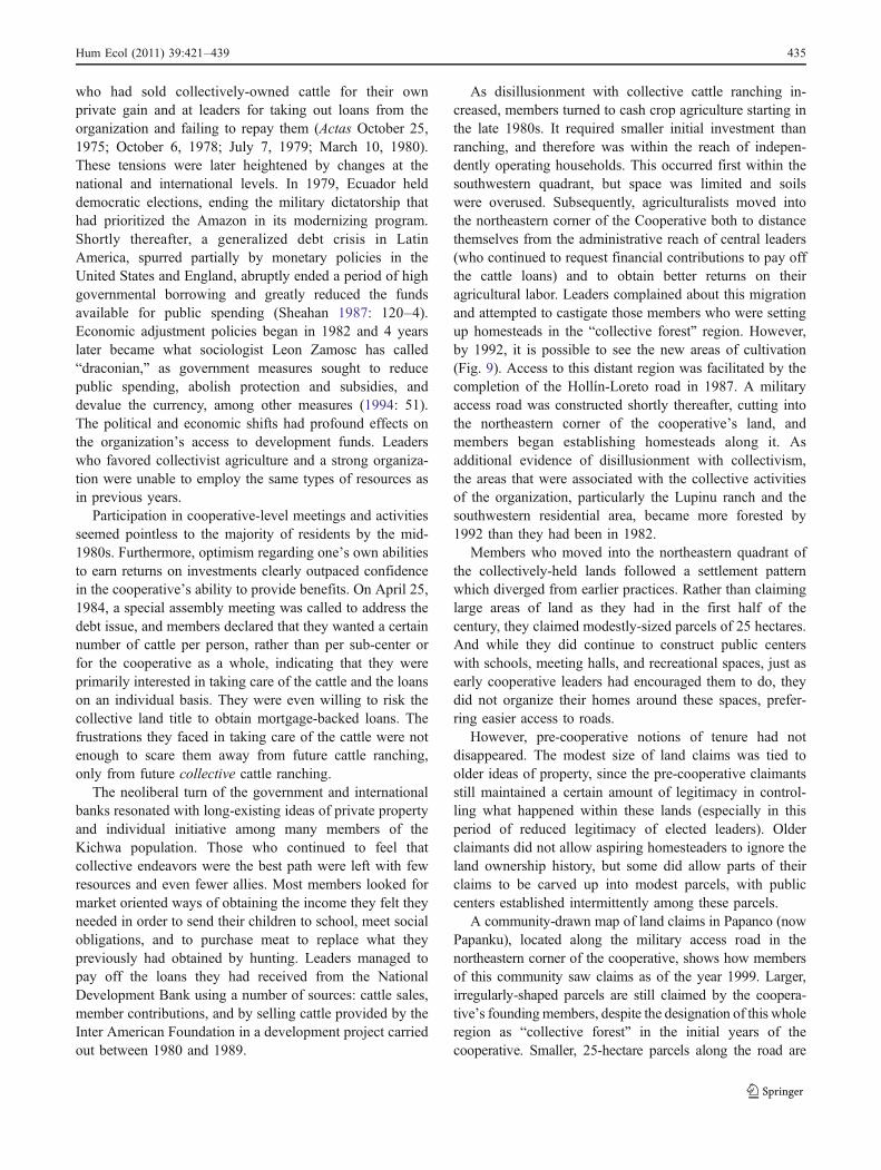
As disillusionment with collective cattle ranching in-creased, members turned to cash crop agriculture starting inthe late 1980s. It required smaller initial investment thanranching, and therefore was within the reach of indepen-dently operating households. This occurred first within thesouthwestern quadrant, but space was limited and soilswere overused. Subsequently, agriculturalists moved intothe northeastern corner of the Cooperative both to distancethemselves from the administrative reach of central leaders(who continued to request financial contributions to pay offthe cattle loans) and to obtain better returns on theiragricultural labor. Leaders complained about this migrationand attempted to castigate those members who were settingup homesteads in the “collective forest” region. However,by 1992, it is possible to see the new areas of cultivation(Fig. 9). Access to this distant region was facilitated by thecompletion of the Hollín-Loreto road in 1987. A militaryaccess road was constructed shortly thereafter, cutting intothe northeastern corner of the cooperative’s land, andmembers began establishing homesteads along it. Asadditional evidence of disillusionment with collectivism,the areas that were associated with the collective activitiesof the organization, particularly the Lupinu ranch and thesouthwestern residential area, became more forested by1992 than they had been in 1982.
Members who moved into the northeastern quadrant ofthe collectively-held lands followed a settlement patternwhich diverged from earlier practices. Rather than claiminglarge areas of land as they had in the first half of thecentury, they claimed modestly-sized parcels of 25 hectares.And while they did continue to construct public centerswith schools, meeting halls, and recreational spaces, just asearly cooperative leaders had encouraged them to do, theydid not organize their homes around these spaces, prefer-ring easier access to roads.
However, pre-cooperative notions of tenure had notdisappeared. The modest size of land claims was tied toolder ideas of property, since the pre-cooperative claimantsstill maintained a certain amount of legitimacy in control-ling what happened within these lands (especially in thisperiod of reduced legitimacy of elected leaders). Olderclaimants did not allow aspiring homesteaders to ignore theland ownership history, but some did allow parts of theirclaims to be carved up into modest parcels, with publiccenters established intermittently among these parcels.
A community-drawn map of land claims in Papanco (nowPapanku), located along the military access road in thenortheastern corner of the cooperative, shows how membersof this community saw claims as of the year 1999. Larger,irregularly-shaped parcels are still claimed by the coopera-tive’s foundingmembers, despite the designation of this wholeregion as “collective forest” in the initial years of thecooperative. Smaller, 25-hectare parcels along the road are
Hum Ecol (2011) 39:421–439 435

held by a variety of cooperative members (Fig. 10).While the division of land continues to be debated, there isan emerging consensus that people who reached adulthoodafter the cooperative was formed can only claim 25hectares. Thus, early leaders’ vision of more equaldistribution of land is slowly but surely taking place.Figure 10 also illustrates another key aspect of currenttenure regimes: no land beyond the small public centers isdevoted to collective ownership. There are some excep-tions to this due to the efforts of a few members who arepassionate about the potential of community-based eco-tourism, but most see private ownership as preferable tocollective ownership.
The resulting landscape is an ecological mosaic, asgardens and homesteads are interspersed with relativelylittle disturbed forest and fields in varied stages of fallow. Itmay appear to also represent a social mosaic of state spaces,capitalist spaces, and indigenous spaces. However, thisanalogy breaks down upon closer examination. For exam-ple, one of the most lasting vestiges of the 1970s modernistexperiment on the landscape is the public, “urbanized”center with its school, sports field, assembly hall, and othergathering spaces. These are the spaces that many outsidersassume to be the quintessential indigenous spaces, sincethey are a landscape representation of the community spiritthat all indigenous groups are thought to have. While the
Fig. 9 Classification of landcover in the cooperative, July14, 1992 (semi-supervisedclassification of a LandsatThematic Mapper image,30 m×30 m pixels)
436 Hum Ecol (2011) 39:421–439

construction of homes in a circle surrounding collectivespace is common in many Amazonian traditions, in theUpper Napo, it is very much a recent product of the perioddescribed here. That history included an assemblage ofdifferently-motivated improvement schemes, includingthose of state agents, indigenous leaders, and the membersof the cooperative. Closely related to this landscape changeis the change in social relations, specifically the inclusion ofalmost all the region’s indigenous people in land manage-ment organizations, with elected leaders who attempt togovern land use and tenure.
State and international development organizations haveplayed and continue to play an important role in theconstruction of formalized community organizations andcommunity centers, providing the bulldozers to flatten landfor a soccer field; the cement blocks for schools andassembly halls; the school teachers and traveling doctors toadminister vaccinations. However, since the mid-1970s ithas been indigenous people who decide to form a new sub-
center or commune, elect leaders, and appeal to governmentagents for materials to build public buildings. Members ofthe Rukullakta organization identify strongly with their sub-centers and continue to organize collective labor projects atthe sub-center level. The ideology of early leaders whichprioritized collective activity has had a lasting impact onlocal landscapes and social organization.
Another important legacy of the cooperative movementwas to keep a substantial area of land in indigenous hands,thereby reducing the number of colonists moving into theregion. Extensive household surveys of the surroundingarea’s colonists reveal that they have “a strong drive forcattle ownership, and overexploitation of land throughcontinuous incorporation of new areas, with little regardfor the long-term preservation of the natural resource base”(Pichón 1997: 710). If Rukullakta’s lands had been dividedinto 50 hectare parcels and distributed to highlandcolonists, the landscape would be very different than it istoday.
Fig. 10 Community-drawn mapof Papanco properties. Thepublic center, which includes afew houses, a school, a store, acommunity meeting hall, and abulldozed open space for sportsis located within the block thatsurrounds the black star
Hum Ecol (2011) 39:421–439 437

Conclusion
As I have shown in this paper, the Amazonian landscapewas remade through an indigenous ideology that com-bined leaders’ desires with the modernist aspirations ofthe 1960s Ecuadorian State. In particular, leaders prior-itized strengthening indigenous organizations, preservingindigenous control over land, and allowing for continuedflexibility in members’ market-oriented labor. Someaspects of their grand plan proved to be too extremeand inspired a backlash against collective cattle ranchingand collectively held property. In particular, attempts toextend notions of reciprocity within the household to alarge, cooperative system of labor and shared economicrisk elicited strong resistance over time (see also Smithet al. 1996: 71, 294–5). Other aspects of the originalvision have continued to shape the way land is used,property is negotiated, and people relate to one another inthe Rukullakta territory.
The ability of indigenous leaders to quickly assume therole of planners and enact dramatic changes to land tenure,land distribution, resource use practices, and social rela-tions, contradict any simplistic dichotomy between statesand indigenous people. In this case, indigenous people co-opted state planning and resources in forming their ownlocal organization. They therefore did not become anextension of the state through their engagement with stateagencies and state-like responsibilities.
In recent years, the Ecuadorian government has titledmillions of hectares to indigenous organizations withoutrequiring adherence to the cooperative model, to collec-tive engagement in market-oriented activities moregenerally, or to particular agricultural pursuits. It canthus be said that the collective ranching experiment inRukullakta provided groundwork for more culturally andenvironmentally appropriate forms of titling starting inthe 1990s.
Acknowledgments I am grateful to Michael Hathway, Laura Ogden,Roderick Neumann, and two anonymous reviewers for particularlyinsightful comments on earlier drafts of this article. My deepestappreciation goes to the people of Rukullakta for their generousmentorship and friendship. Major funding for research and writingwas provided by the University of Michigan’s Rackham GraduateSchool, an S.V. Ciriacy-Wantrup postdoctoral fellowship, and FloridaInternational University. Any factual errors or misinterpretations,however, are my own.”
References
Agrawal, A. (2005a). Environmentality: Community, Intimate Gov-ernment, and the Making of Environmental Subjects in Kumaon,India. Current Anthropology 46(2): 161–190.
Agrawal, A. (2005b). Environmentality: Technologies of Governmentand the Making of Subjects. Duke University Press, Durham.
Basso, K. H. (1996). Wisdom Sits in Places: Language and Landscapeamong the Western Apache. University of New Mexico Press,Albuquerque.
Bebbington, A., Ramon, G., Carrasco, H., Torres, V. H., Peralvo, L.,and Trujillo, J. (1992). Actores de una Decada Ganada: Tribus,Comunidades y Campesinos en la Modernidad. COMUNIDECand Abya Yala, Quito, Ecuador.
Becker, M. (2008). Indians and Leftists in the Making of Ecuador’sModern Indigenous Movements. Duke University Press,Durham.
Bray, D. B. (1995). Peasant Organization and ‘The Permanent Recon-struction of Nature:’ Grassroots Sustainable Development in RuralMexico. Journal of Environment and Development 4(2): 185–202.
Cooperative Agropecuaria San Pedro de Rukullakta, Ltda. (1992).Actas. (1970–1992). Unpublished archival material, Rukullakta,Archidona Canton, Napo Province, Ecuador.
Cooperative Agropecuaria San Pedro de Rukullakta, Ltda. (1972–1976). Cuaderno de Trabajos. Unpublished archival material,Rukullakta, Archidona Canton, Napo Province, Ecuador.
FOIN (1989) La Lucha de los Napo Runas. Unpublished MS,FENAKIN Office, Tena, Ecuador.
Gow, P. (1995). Land, People, and Paper in Western Amazonia. InHirsch, E., and O’Hanlon, M. (eds.), The Anthrhopology ofLandscape: Perspectives on Place and Space. Oxford UniversityPress, Oxford, pp. 43–62.
Hiraoka, M., and Yamamoto, S. (1980). Agricultural Development inthe Upper Amazon of Ecuador. Geographical Review 70(4):423–445.
Li, T. (2005). Beyond ‘the State’ and Failed Schemes. AmericanAnthropologist 107(3): 383–394.
Little, P. E. (2001). Amazonia: Territorial Struggles on PerennialFrontiers. Johns Hopkins University Press, Baltimore.
Macdonald, T. Jr. (1979). Processes of Change in AmazonianEcuador: Quijos Quichua Indians become Cattlemen. Ph.D.dissertation, Department of Anthropology, University of Illinois.
Macdonald Jr., T. (1999). Ethnicity and Culture amidst New“Neighbors”: The Runa of Ecuador’s Amazon Region. Allynand Bacon, Boston.
Muratorio, B. (1991). The Life and Times of Grandfather Alonso:Culture and History in the Upper Amazon. Rutgers UniversityPress, New Brunswick.
Nadasdy, P. (2003). Hunters and Bureaucrats: Power, Knowledge, andAboriginal-State Relations in the Southwest Yukon. UBC Press,Vancouver.
Oberem, U. (1980). Los Quijos. Historia de la Transculturación de unGrupo Indígena en el Oriente Ecuatoriano. Instituto Otavaleño deAntropología, Otavalo, Ecuador.
Ostrom, E. (1990). Governing the Commons: The Evolution ofInstitutions for Collective Action. Cambridge University Press,Cambridge.
Pallares, A. (2002). From Peasant Struggles to Indian Resistance: TheEcuadorian Andes in the Late Twentieth Century. University ofOklahoma Press, Norman.
Perez-Verdin, G., Kim, Yeon-Su, Hospodarsky, D., and Tecle, A.(2009). Factors Driving Deforestation in Common-Pool Resour-ces in Northern Mexico. Journal of Environmental Management90(1): 331–340.
Perfecto, I., Rice, R. A., Greenberg, R., and Van der Voort, M. E.(1996). Shade Coffee: A Disappearing Refuge for Biodiversity.Bioscience 46(8): 598–608.
Perreault, T. A. (2000). Shifting Ground: Agrarian Change, PoliticalMobilization, and Identity Construction among Quichua of theAlto Napo, Ecuadorian Amazon. Ph.D. dissertation, Departmentof Geography, University of Colorado.
438 Hum Ecol (2011) 39:421–439

Pichón, F. (1997). Colonists Land-Allocation Decisions, Land Use,and Deforestation in the Ecuadorian Amazon Frontier. EconomicDevelopment and Cultural Change 45(3): 707–744.
Rose, N. (1999). Powers of Freedom: Reframing Political Thought.Cambridge University Press, Cambridge.
Salazar, E. (1981). The Federación Shuar and the ColonizationFrontier. In Whitten Jr., N. E. (ed.), Cultural Transformationsand Ethnicity in Modern Ecuador. University of Illinois Press,Urbana.
Scott, J. C. (1998). Seeing Like a State: How Certain Schemes toImprove the Human Condition Have Failed. Yale UniversityPress, New Haven.
Sheahan, J. (1987). Patterns of Development in Latin America:Poverty, Repression, and Economic Strategy. Princeton Univer-sity Press, Princeton.
Shoreman, E. E., and Haenn, N. (2009). Regulation, Conservation,and Collaboration: Ecological Anthropology in the MississippiDelta. Human Ecology 37: 95–107.
Sivaramakrishnan, K. (1999). Transition zones: Changing Landscapesand Local Authority in South-west Bengal, 1990s–1920s. IndianEconomic and Social History Review 36(1): 1–34.
Smith, R. C., Tapuy, C. C., and Wray N. (1996). Amazonía: EconomíaIndígena y Mercado (Los Desafíos del Desarrollo Autónomo).COICA and Oxfam America, Quito.
Taylor, A. C. (1994). El Oriente Ecuatoriano en el Siglo XIX: ‘El OtroLitoral’. In Maiguashca, J. (ed.), Historia y Región en el Ecuador:1830–1930. Corporación Editora Nacional/FLACSO-Sede Ecua-dor/CERLAC, Quito, Ecuador, pp. 17–67.
Terborgh, J., and Soulé, M. E. (1999). Why We Need Mega-Reserves–and How to Design Them. In Soulé, M. E., and Terborgh, J. (eds.),Continental Conservation: Scientific Foundations of RegionalReserve Networks. Island Press, Washington, pp. 199–209.
Uquillas, J. (1984). Colonization and Spontaneous Settlement in theEcuadoran Amazon. In Schmink, M., and Wood, C. H. (eds.),Frontier Expansion in Amazonia. University of Florida Press,Gainesville, pp. 261–284.
Wade, R. (1988). Village Republics: Economic Conditions for CollectiveAction in South India. Cambridge University Press, New York.
Warren, K. B. (1998). Indigenous Movements and Their Critics: Pan-Maya Activism in Guatamala. Princeton University Press, Princeton.
Whitten, N. (1976). Sacha Runa: Ethnicity and Adaptation ofEcuadorian Jungle Quichua. University of Illinois Press, Urbana.
Whitten Jr., N. E., Whitten, D. S., and Chango, A. (1997). Return ofthe Yumbo: The Indigenous Caminata from Amazonia to AndeanQuito. American Ethnologist 24(2): 355–391.
Zamosc, L. (1994). Agrarian Protest and the Indian Movement in theEcuadorian Highlands. Latin American Research Review 29(3):37–68.
Hum Ecol (2011) 39:421–439 439