Final Report Initial Site Assessment for Five Economic Zone ...
325
Initial Site Assessment for five economic zones Final PwC 1 Final Report Initial Site Assessment for Five Economic Zone Sites Narayanganj, Panchagarh, Anowara-II, Sabrang Tourism EZ and Dhaka IT EZ Submitted to Bangladesh Economic Zones Authority September 2015 Bangladesh Economic Zones Authority (BEZA)
-
Upload
khangminh22 -
Category
Documents
-
view
1 -
download
0
Transcript of Final Report Initial Site Assessment for Five Economic Zone ...
Initial Site Assessment for five economic zones Final
PwC 1
Final Report
Initial Site Assessmentfor Five Economic ZoneSitesNarayanganj, Panchagarh, Anowara-II, Sabrang Tourism EZand Dhaka IT EZ
Submitted to BangladeshEconomic Zones AuthoritySeptember 2015
Bangladesh Economic Zones Authority
(BEZA)
Initial Site Assessment for five economic zones Final
PwC 2
DisclaimerThe report has been prepared by PricewaterhouseCoopers Pvt Ltd (PwC) for Bangladesh Economic Zones
Authority (BEZA). This is pursuant to the Scope of Work under the contract document "Initial Site Assessment
for Five Sites" issued by BEZA. PricewaterhouseCoopers Pvt Ltd (PwC) has been appointed to undertake an
initial site assessment for five selected economic zones in Bangladesh. Any third party should obtain prior
consent of PwC before copying or reproducing, in whole or in part, the contents of this report. PwC disclaims
any responsibility for any loss or damage suffered by any third party by taking reliance of this report.
Furthermore, PwC will not be bound to discuss, explain or reply to queries raised by any agency other than the
intended recipients of this report. All information in the report is intellectual property of the BEZA.
PwC does not accept any liability or responsibility for the accuracy, reasonableness or completeness of, or for
any errors, omissions or misstatements, negligent or otherwise and does not make any representation or
warranty, express or implied, with respect to the information contained in this document. The information
contained in this document is selective and is subject to updating, expansion, revision and amendment. It does
not, and does not purport to, contain all the information that a recipient may require. Further this is not an
audit report and no reliance should be based on this report for the purposes of audit.
Initial Site Assessment for five economic zones Final
PwC 3
Important message to any person not authorized to have access to this report
Any person who is not an Addressee of this report or who has not signed and returned to
PricewaterhouseCoopers Pvt Ltd a Release Letter is not authorized to have access to this report.
Should any Unauthorized Person obtain access to and read this report, by reading this report such person
accepts and agrees to the following terms:
1. The reader of this report understands that the work performed by PricewaterhouseCoopers Pvt Ltd.
was performed in accordance with instructions provided by our Addressee Client and was performed
exclusively for our Addressee Client’s sole benefit and use.
2. The reader of this report acknowledges that this report was prepared at the direction of our Addressee
Client and may not include all procedures deemed necessary for the purposes of the reader.
3. The Reader agrees that PricewaterhouseCoopers Pvt Ltd., its Partners, Principals, Employees and
Agents neither owe nor accept any duty or responsibility to it, whether in contract or in tort (including
without limitation, negligence and breach of statutory duty), and shall not be liable in respect of any
loss, damage or expense of whatsoever nature which is caused by any use the reader may choose to
make of this report, or which is otherwise consequent upon the gaining of access to the report by the
reader. Further, the reader agrees that this report is not to be referred to or quoted, in whole or in part,
in any prospectus, registration statement, offering circular, public filing, loan, other agreement or
document and not to distribute the report without prior written consent of PricewaterhouseCoopers Pvt
Ltd., the World Bank and BEZA.
Initial Site Assessment for five economic zones Final
PwC 4
Table of ContentsList of Figures 10
List of Tables 13
1. Executive Summary 17
1.1. Introduction 17
1.2. Key Objectives of Initial Site Assessment 17
1.3. Approach & Methodology 18
1.4. Salient Features of the five sites 19
1.5. Infrastructure Linkages of the five sites (Connectivity) 21
1.6. Utility Connections 28
1.7. Environmental and Social / Resettlement Issues-Constraints and Mitigations 32
1.8. High level assessment of industrial development potential 35
1.9. Ranking of the sites 37
2. Project Background 50
2.1. Background of the Engagement 50
2.2. Introduction of the Engagement 52
2.3. Earmarking of the Consultant Team 53
2.4. Scope of Work for Initial Site Assessment 53
2.5. Our Approach and Action Plan 56
3. Snapshot of Infrastructure Linkages in Bangladesh 62
3.1. Road Connectivity 62
3.2. Rail Connectivity 65
3.3. Airport Connectivity 67
3.4. Ports and harbours Connectivity 69
3.4.1. Sea Ports 69
3.4.2. River Ports 72
3.4.3. Inland Waterways 73
3.4.4. Land Ports 74
3.5. Infrastructure Linkages- Intermodal Cargo Transfer 74
3.6. Utility connection- Gas 74
3.7. Utility connection- Power 76
3.8. Utility connection- IT/ Telecom 78
4. Multi-Product Economic Zone 81
Initial Site Assessment for five economic zones Final
PwC 5
4.1 About Multi-Product Economic Zone 81
4.1.1. Concept 81
4.1.2. Major Infrastructure facilities required to develop a Multi-Product EZ 81
5. Narayanganj Economic Zone 85
5.1. Location Details and Salient Features 85
5.1.1. General Profile of the District 85
5.1.2. Reconfirmation of the proposed EZ 88
5.2. Environment section 96
5.2.1. Air quality 96
5.2.2. Floods and Water Logging 96
5.2.3. Noise 96
5.2.4. Land filling 96
5.3. Infrastructure Linkages to the Proposed Site 97
5.3.1. Physical Infrastructure- Availability of Utility Connection 97
5.3.2. Social Infrastructure 99
5.3.3. Connectivity 101
5.4. Resettlement issues 105
5.4.1. Social impacts 105
5.4.2. Constraints and its mitigation 107
5.4.3. Block Cost Estimation for development of Offsite Infrastructure 108
5.5. Voice on the Ground 110
5.5.1. Stakeholder consultation 110
5.5.2. Consultation with Private Sector 110
5.6. Overall Adequacy of the EZ Site in Narayanganj 113
1. Panchagarh EZ 118
6. Panchagarh Economic Zone 119
6.1. Location Details and Salient Features 119
6.1.1. General Profile of the District 119
6.1.2. Reconfirmation of the proposed EZ 121
6.2. Environment 129
6.2.1. Air quality 129
6.2.2. Floods and Water Logging 129
6.2.3. Noise 129
Initial Site Assessment for five economic zones Final
PwC 6
6.2.4. Land filling 129
6.3. Infrastructure Linkages of the Proposed Site 130
6.3.1. Physical Infrastructure- Availability of Utility Connections 130
6.3.2. Social Infrastructure 132
6.3.3. Connectivity 133
6.4. Resettlement issues 140
6.4.1. Social impacts 140
6.4.2. Constraints and its mitigation 142
6.4.3. Block Cost Estimation for development of Offsite Infrastructure 142
6.5. Voice on the Ground 144
6.5.1. Stakeholder consultation 144
6.5.2. Consultation with Private Sector 144
6.6. Overall Adequacy of the EZ Site in Panchagarh 147
2. Annexures 151
7. Anowara-2 Multi-Product Economic Zone 153
7.1. Location Details and Salient Features 153
7.1.1. General Profile of the District 153
7.2. Chittagong, the “Commercial Capital” of Bangladesh 156
7.2.1. Bangladesh Vision 2021- Role of Chittagong 157
7.2.2. Major projects undertaken by Government of Bangladesh 158
7.2.3. Export Processing Zones in Chittagong 159
7.2.4. Economic Importance of Chittagong Port 159
7.3. Reconfirmation of the proposed EZ 161
7.4. Environment section 170
7.4.1. Air quality 170
7.4.2. Floods and Water Logging 170
7.4.3. Noise 170
7.4.4. Land filling 170
7.5. Infrastructure Linkages for the Proposed Site 170
7.5.1. Physical Infrastructure- Availability of Utility Connections 170
7.5.2. Social Infrastructure 172
7.5.3. Connectivity 174
7.6. Resettlement issues 179
7.6.1. Social impacts 179
Initial Site Assessment for five economic zones Final
PwC 7
7.6.2. Constraints and its mitigation 180
7.6.3. Block Cost Estimation for development of Offsite Infrastructure 181
7.7. Voice on the Ground 183
7.7.1. Stakeholder consultation 183
7.7.2. Consultation with Private Sector 183
7.8. Overall Adequacy of the EZ Site in Anowara-2 185
8. Market Assessment of Multi-Product Economic Zones 192
8.1. Global economic review 192
8.1.1. Trade scenario 192
8.1.2. FDI Trends 193
8.1.3. Mergers and Acquisitions (M&A) 194
8.2. Parametric analysis of Bangladesh’s key industrial sectors 195
8.2.1. Change in Industrial Landscape of Bangladesh 195
8.2.2. Employment and Productivity aspect in Industrial Sectors of Bangladesh 197
8.3. Supply side analysis of the Industrial sectors in Bangladesh 198
8.3.1. Agriculture Resources 198
8.3.2. Mineral Resources 198
8.3.3. Summary of sectors exhibiting growth potential in Bangladesh 199
8.4. Description of regional economic and industrial landscape for the three proposed proposedEZs 201
8.4.1. Narayanganj 201
8.4.2. Panchagarh 202
8.4.3. Anowara-2 203
8.5. Conclusion 206
8.5.1. Narayanganj 206
8.5.2. Panchagarh 206
8.5.3. Anowara-2 207
8.5.4. Summary 207
9. Sabrang Economic Zone 209
9.1. About Tourism Economic Zone 209
9.1.1. Concept 209
9.1.2. Components 209
9.1.3. Benefits of Tourism Economic Zone 209
9.1.4. Case – Tourism Economic Zones in Philippines 210
Initial Site Assessment for five economic zones Final
PwC 8
9.1.5. Case – Tourism Economic Zones in Thailand 210
9.2. Market Assessment 211
9.2.1. Tourism industry in Bangladesh 211
9.3. Location Details and Salient Features 213
9.3.1. General Profile of the District Cox’s Bazaar 213
9.3.2. Reconfirmation of the proposed EZ 217
9.4. Climate and Environmental Data 230
9.4.1. Air Quality 230
9.4.2. Floods and water logging 230
9.4.3. Noise 230
9.4.4. Land filling 231
9.5. Infrastructure Linkages of the Proposed Site 231
9.5.1. Physical Infrastructure- Availability of Utility Connections 231
9.5.2. Social Infrastructure 233
9.5.3. Connectivity 233
9.6. Resettlement issues 237
9.6.1. Social Impacts 237
9.6.2. Constraints and Mitigations 239
9.6.3. Block Cost Estimation for development of Offsite Infrastructure 239
9.7. Voice on the ground 241
9.8. Overall adequacy of the site to be developed as a Tourism EZ 243
10. Dhaka IT Economic Zone 250
10.1. About IT Economic Zone 250
10.1.1. Concept 250
10.1.2. Major Infrastructure Components in IT EZ 250
10.1.3. IT/ ITES Industry in Bangladesh 250
10.2. Location Details and Salient Features of the Proposed Site 256
10.2.1. General Profile of Dhaka District 256
10.2.2. Details of Keraniganj Upzilla and Reconfirmation of the Location of EZ Site 257
10.3. Environment Section 267
10.3.1. Air quality 267
10.3.2. Floods and Water Logging 267
10.3.3. Noise 267
10.3.4. Land filling 267
Initial Site Assessment for five economic zones Final
PwC 9
10.4. Infrastructure Linkages of the Proposed Site 268
10.4.1. Physical Infrastructure- Availability of Utility Connections 268
10.4.2. Social Infrastructure 269
10.4.3. Connectivity 270
10.5. Resettlement issues 272
10.5.1. Social impacts 272
10.5.2. Constraints and its mitigation 274
10.5.3. Block Cost Estimation for development of Offsite Infrastructure 275
10.6. Voice on the Ground 277
10.6.1. Stakeholder consultation 277
10.6.2. Consultation with Private Sector 277
10.7. Overall Adequacy of the proposed EZ to Develop as IT Economic Zone 279
11. Ranking of the sites 285
11.1. Relative scoring and their rationale 285
11.2. Summary of the relative rankings 295
Annexure A. - Questionnaire 298
Annexure B. – Success story of Adani Ports and Special Economic Zones 311
Annexure C. - Physiography map of Bangladesh 315
Annexure D. - Geological map of Bangladesh 316
Annexure E. - Seismic Zoning map of Bangladesh 317
Annexure F. - Basic Wind speed map of Bangladesh 318
Annexure G. - Cyclone affected areas Bangladesh 319
Annexure H. - Disaster prone areas in Bangladesh 320
Annexure I. - Bangladesh Gas Transmission pipeline system 321
Annexure J. - Ground Water Zoning Map in Bangladesh 322
Initial Site Assessment for five economic zones Final
PwC 10
List of Figures
Figure 1-1: Principal objectives of Initial Site Assessment........................................................................................17
Figure 1-2: Stages of the Initial Site assessment........................................................................................................18
Figure 1-3: Five proposed economic zones along with the locations of the EPZs....................................................19
Figure 1-4: Connectivity of five proposed EZ.............................................................................................................21
Figure 1-5: Different type of Industries fit for the respective Multiproduct EZs.................................................... 36
Figure 1-6: Industries fit for Sabrang and Dhaka proposed EZs ............................................................................. 36
Figure 2-1: Principal Objectives of the Engagement ................................................................................................ 52
Figure 2-2: Team Composition for the Engagement ................................................................................................ 53
Figure 2-3: Broad Approach for the proposed Engagement.....................................................................................57
Figure 3-1: Development activities undertaken from 2009 to 2013 in road sector................................................ 62
Figure 3-2: The road network (RHD) of Bangladesh ............................................................................................... 63
Figure 3-3: Rail network of Bangladesh.................................................................................................................... 65
Figure 3-4: Airport connectivity of Bangladesh........................................................................................................ 68
Figure 3-5: Chittagong Port facilities ........................................................................................................................ 69
Figure 3-6: Mongla Port facilities ...............................................................................................................................71
Figure 3-7: Bangladesh Sea Ports .............................................................................................................................. 72
Figure 3-8: Bangladesh Inland water transport network ........................................................................................ 73
Figure 3-9: Titas Gas franchise area...........................................................................................................................75
Figure 3-10: Major power plants in Bangladesh........................................................................................................77
Figure 3-11: Companies involved in power production in Bangladesh ....................................................................77
Figure 3-12: Power grid network of Bangladesh....................................................................................................... 78
Figure 3-13: Optical Fiber Network (June’ 2014) of BTCL ..................................................................................... 79
Figure 5-1: Irrigation Status (2010-11)...................................................................................................................... 87
Figure 5-2: Mouza Map of proposed Narayanganj EZ ........................................................................................... 89
Figure 5-3: Mouza map superimposed on google map (Bandar-Narayanganj) ..................................................... 90
Figure 5-4: Location of the proposed proposed EZ ...................................................................................................91
Figure 5-5: Existing land use pattern for 10 km radius (Bandar-Narayanganj) ................................................. 92
Figure 5-6: Contour map of the proposed EZ for 5 km radius (Bandar-Narayanganj).......................................... 93
Figure 5-7: Contour map of the proposed EZ for 10 km radius (Bandar-Narayanganj) ........................................ 94
Figure 5-8: Major cyclones that had hit Bangladesh................................................................................................ 96
Figure 5-9: Location of power plants in the vicinity of proposed EZ ...................................................................... 97
Figure 5-10: Sources of drinking water in Bandar and Sonargaon upzila .............................................................. 98
Figure 5-11: Utility Map for proposed Narayanganj EZ ........................................................................................... 99
Figure 5-12: Road Network for 10 km radius (Bandar-Narayanganj)................................................................... 102
Figure 5-13: Connectivity of the proposed Economic Zones via Road, Rail and Airport ..................................... 103
Figure 5-14: Land Ownership and Usage pattern................................................................................................... 106
Figure 6-1: Irrigation Status (2010-11), Panchagarh District ................................................................................ 120
Figure 6-2: Mouza Map of the proposed Panchagarh EZ site.................................................................................122
Figure 6-3: Location of the proposed Panchagarh EZ proposed EZ ......................................................................123
Figure 6-4: Mouza map superimposed on google map (Panchagarh) ...................................................................124
Figure 6-5: Existing land use pattern for 10 km radius (Panchagarh)...................................................................125
Figure 6-6: Contour map of the proposed EZ for 5 km radius (Panchagarh)........................................................126
Figure 6-7: Contour map of the proposed EZ for 10 km radius (Panchagarh) ......................................................127
Figure 6-8: Utility Map for proposed Panchagarh EZ............................................................................................. 131
Figure 6-9: Road Network for 10 km radius (Panchagarh) ....................................................................................134
Figure 6-10: Trade through Banglabandha LCS (metric tons) ...............................................................................135
Figure 6-11: Banglabandha LCS and Asian Highway 2 ...........................................................................................136
Initial Site Assessment for five economic zones Final
PwC 11
Figure 6-12: Layout of Banglabandha Port ..............................................................................................................137
Figure 6-13: Layout of Banglabandha Port ..............................................................................................................138
Figure 6-14: Burimari Land port google image .......................................................................................................139
Figure 6-15: Road, Rail and Airport connectivity of proposed EZ..........................................................................139
Figure 6-16: Land Usage and Land Ownership Pattern .......................................................................................... 141
Figure 7-1: Irrigation Status (2010-11) .....................................................................................................................155
Figure 7-2: Revenue Income & Expenditure of Chittagong Port (in Million USD) .............................................. 160
Figure 7-3: Mouza Map of Anowara-2 EZ................................................................................................................162
Figure 7-4: Mouza map superimposed on google map (Anowara-2) .....................................................................163
Figure 7-5: Location of the proposed Anowara-2 EZ site .......................................................................................164
Figure 7-6: Existing land use pattern for 10 km radius (Anowara-2) ....................................................................165
Figure 7-7: Contour map of the proposed EZ for 5 km radius (Anowara-2)..........................................................166
Figure 7-8: Contour map of the proposed EZ for 10 km radius (Anowara-2) .......................................................167
Figure 7-9: Tracks of major cyclones crossed Bangladeshi coast during the period 1960 – 2007 with information
on landfall date and maximum wind speed .............................................................................................................169
Figure 7-10: sources of drinking water in Anowara upzila ..................................................................................... 171
Figure 7-11: Utility Map of proposed Anowara-2 EZ...............................................................................................172
Figure 7-12: Road Network for 10 km radius (Anowara-2) ....................................................................................175
Figure 7-13: connectivity of the proposed EZ via Road, Rail and Airport.............................................................. 177
Figure 7-14: Land Usage pattern (Anowara-2) ........................................................................................................179
Figure 8-1: Sector-wise export trend 2013, USD Bn ...............................................................................................193
Figure 8-2: CAGR (2003 - 2013) and 2013 Global export share ............................................................................193
Figure 8-3: Sectorial shares in Greenfield FDI projects globally............................................................................194
Figure 8-4: Top 10 economies with highest FDI rate of returns (%) 2011 .............................................................194
Figure 8-5: Sectoral contribution to GDP in Bangladesh (in percentage) .............................................................195
Figure 8-6: Changing Composition of the Industrial Sector in terms of GDP Share ............................................196
Figure 8-7: GVA & Output (in million Tk.) and Employment by industry type in 2012 .......................................196
Figure 8-8: Employment Indices of Industrial Workers in Select Industries in Bangladesh...............................197
Figure 8-9: Productivity Indices of Industrial Labor in Select Industries in Bangladesh.....................................197
Figure 8-10: Agricultural landscape of Bangladesh ............................................................................................... 198
Figure 8-11: Mineral landscape of Bangladesh ........................................................................................................199
Figure 8-12: Economic advantage of proposed Anowara-2 EZ .............................................................................204
Figure 8-13: Proximity of Anowara to Chittagong port.......................................................................................... 205
Figure 8-14: Industrial landscape of Bangladesh ................................................................................................... 205
Figure 9-1: Special Economic Zones in Thailand..................................................................................................... 211
Figure 9-2: Direct contribution of travel and tourism to GDP (Constant 2013 Bangladeshi Taka).....................212
Figure 9-3: International Tourist traffic (thousands) .............................................................................................212
Figure 9-4: Total contribution of travel and tourism to GDP (billion BDT)..........................................................213
Figure 9-5: Cox's Bazaar district...............................................................................................................................213
Figure 9-6: Land use pattern (2008) .......................................................................................................................215
Figure 9-7: Irrigation status as on 2010-11 ..............................................................................................................215
Figure 9-8 – Cox Bazaar’s tourist projections (Domestic +Foreign)......................................................................217
Figure 9-9: Mouza map (Sabrang EZ)......................................................................................................................219
Figure 9-10: Mouza map superimposed on google map (Sabrang EZ)...............................................................220
Figure 9-11: Location of proposed Sabrang EZ and Saint Martin Island .............................................................. 222
Figure 9-12: Location of proposed Sabrang EZ, Saint Martin Island and its vicinity .......................................... 223
Figure 9-13: Land ownership ................................................................................................................................... 224
Figure 9-14: Existing land use pattern for 10 km radius (Sabrang EZ) ............................................................. 225
Figure 9-15: Contour map of the proposed EZ for 5 km radius (Sabrang EZ) ................................................... 226
Figure 9-16: Contour map of the proposed EZ for 10 km radius (Sabrang EZ).................................................. 227
Initial Site Assessment for five economic zones Final
PwC 12
Figure 9-17: Tracks of major cyclones crossed Bangladeshi coast during the period 1960 – 2007 with
information on landfall date and maximum wind speed ....................................................................................... 229
Figure 9-18: Utility Map for proposed Sabrang EZ ................................................................................................ 232
Figure 9-19: Healthcare facilities In Teknaf Upazilla............................................................................................. 233
Figure 9-20: Road Network for 10 km radius (Sabrang EZ) ............................................................................... 235
Figure 9-21: Proposed Sabrang EZ and its vicinity ................................................................................................ 236
Figure 9-22: Connectivity of proposed Sabrang EZ ............................................................................................... 237
Figure 9-23: Land usage and ownership pattern.................................................................................................... 238
Figure 10-1: Growth of Call Centers ........................................................................................................................ 253
Figure 10-2: Average salary cost of IT resources at entry level and 5 year experience, All values in ‘000 USD 254
Figure 10-3: Average office rental cost in CBD; all values in USD/sq. ft. per annum .......................................... 254
Figure 10-4: Mouza Map .......................................................................................................................................... 259
Figure 10-5: Mouza map superimposed on google map (Dhaka IT EZ)..............................................................260
Figure 10-6: Existing land use pattern for 10 km radius (Dhaka IT EZ)............................................................. 263
Figure 10-7: Contour map of the proposed EZ for 5 km radius (Dhaka IT EZ) ................................................ 264
Figure 10-8: Contour map of the proposed EZ for 10 km radius (Dhaka IT EZ) ................................................ 265
Figure 10-9: Tracks of major cyclones crossed Bangladeshi coast during the period 1960- 2007 with information
on landfall date and maximum wind speed ............................................................................................................ 266
Figure 10-10: Utility Map for proposed Dhaka IT EZ ............................................................................................ 269
Figure 10-11: Connectivity of proposed Dhaka IT EZ via Road, Rail and Air ....................................................... 272
Figure 10-12: Land usage and ownership pattern (proposed Dhaka EZ) ............................................................. 273
Initial Site Assessment for five economic zones Final
PwC 13
List of Tables
Table 1-1: Location details and type of respective land parcels available ............................................................... 20
Table 1-2: Connectivity of proposed Narayanganj EZ.............................................................................................. 22
Table 1-3: Connectivity of proposed PanchagarhEZ ............................................................................................... 23
Table 1-4: Connectivity of proposed Anowara-2 EZ................................................................................................. 24
Table 1-5: Connectivity of proposed Sabrang EZ...................................................................................................... 25
Table 1-6: Connectivity of proposed Dhaka IT EZ.................................................................................................... 26
Table 1-7: Assessment of Intermodal Cargo Transfer for Three Multiproduct EZs ............................................... 26
Table 1-8: Utility connections of proposed Narayanganj EZ ................................................................................... 28
Table 1-9: Utility connections of proposed Panchagarh EZ..................................................................................... 29
Table 1-10: Utility connections of proposed Anowara-2 EZ .................................................................................... 30
Table 1-11: Utility connections of proposed Sabrang EZ.......................................................................................... 30
Table 1-12: Utility connections of proposed Dhaka IT EZ ........................................................................................31
Table 1-13: Environmental and Resettlement Issues-Constraints and Mitigations of proposed Narayanganj EZ
..................................................................................................................................................................................... 32
Table 1-14: Environmental and Resettlement Issues -Constraints and Mitigations of proposed Panchagarh EZ33
Table 1-15: Environmental and Resettlement Issues -Constraints and Mitigations of proposed Anowara-2 EZ 34
Table 1-16: Environmental and Resettlement Issues -Constraints and Mitigations of proposed Sabrang EZ ..... 34
Table 1-17: Environmental and Resettlement Issues -Constraints and Mitigations of proposed Dhaka IT EZ ... 35
Table 1-18: Summary of the comparisons of multi product EZs based on different parameters used for
determining relative scoring ...................................................................................................................................... 37
Table 1-19: Summary of the relative rankings and weighted scores for the three proposed multi-product EZs.. 48
Table 2-1: Field visit to the 5 proposed EZs .............................................................................................................. 53
Table 3-1: Details of Road network and Bridges/ Culverts in Bangladesh ............................................................. 62
Table 3-2: Details of access roads to each of the proposed EZs............................................................................... 64
Table 3-3: Bangladesh Railway Routes Network in kilometer ................................................................................ 66
Table 3-4: Bangladesh Railways- Number of trains ................................................................................................. 66
Table 3-5: Details of Rail connectivity of Proposed EZs .......................................................................................... 66
Table 3-6: Airport connectivity of the proposed EZs ............................................................................................... 69
Table 3-7: Open space available for general bulk cargoes........................................................................................ 70
Table 3-8: Storage space available outside protected area for general bulk cargoes ............................................. 70
Table 3-9: Storage space available for Containers at general cargo berth area ...................................................... 70
Table 3-10: Storage space available for Containers at container terminal.............................................................. 70
Table 3-11: KGDCL gas supply for 2012-13 and 2013-14 (million cubic meters) ................................................... 76
Table 5-1: Upzila wise population details of Narayanganj District.......................................................................... 85
Table 5-2: Distribution of Industries of Narayanganj district ................................................................................. 87
Table 5-3: Reconfirmation of site details ..................................................................................................................88
Table 5-4: Healthcare Facilities ............................................................................................................................... 100
Table 5-5: Passenger train service from Narayanganj to Dhaka.............................................................................101
Table 5-6: Major Constraints and Mitigation measures .........................................................................................107
Table 5-7: Block Cost estimate for proposed Narayanganj EZ .............................................................................. 109
Table 5-8: Stakeholders consulted ...........................................................................................................................110
Table 5-9: Summary of the results of the Private Sector consultation...................................................................110
Table 5-10: Overall Adequacy of the Narayanganj EZ Site ..................................................................................... 113
Table 6-1: Upzila wise population details of Panchagarh district........................................................................... 119
Table 6-2: Reconfirmation of site details .................................................................................................................122
Table 6-3: healthcare facilities in Debiganj Upzila..................................................................................................132
Table 6-4: Railway lines in Panchagargh and Nilphamari district.........................................................................136
Initial Site Assessment for five economic zones Final
PwC 14
Table 6-5: constraints and its mitigation measures ................................................................................................142
Table 6-6: Block Cost estimate for proposed Panchagarh EZ.................................................................................143
Table 6-7: Stakeholders consulted............................................................................................................................144
Table 6-8: Summary of the results of the Private Sector consultation...................................................................145
Table 6-9: Overall Adequacy of the EZ Site in Panchagarh ................................................................................... 148
Table 7-1: Upzila wise population details of Chittagong District............................................................................154
Table 7-2: Industrial landscape of Chittagong district ............................................................................................156
Table 7-3: Economic importance of Chittagong at a glance....................................................................................156
Table 7-4: Export Processing Zones of Chittagong..................................................................................................159
Table 7-5: Reconfirmation of site details of Anowara-2 EZ .................................................................................... 161
Table 7-6: Major cyclones occurrences in Bangladesh............................................................................................169
Table 7-7: Educational Institutions in Chaittagong district....................................................................................172
Table 7-8: Healthcare facilities In Anowara ............................................................................................................174
Table 7-9: Railway lines of Chittagong District .......................................................................................................176
Table 7-10: Dhaka Chittagong line capacity and train details ................................................................................176
Table 7-11: Connectivity from Chittagong to other parts of Bangladesh (apart from Dhaka) .............................. 177
Table 7-12: Constraints and Mitigation (Anowara-2) ............................................................................................ 180
Table 7-13: Block Cost estimate for proposed Anowara-2 EZ................................................................................ 182
Table 7-14: Stakeholders Consulted .........................................................................................................................183
Table 7-15: summary of the results of the Private Sector consultation ..................................................................183
Table 7-16: Overall Adequacy of the Anowara-2 EZ Site........................................................................................ 186
Table 8-1: Top sectors based on global industrial analysis .....................................................................................199
Table 8-2: Top sectors based on Bangladesh industrial analysis ..........................................................................200
Table 8-3: Knitwear export growth of Bangladesh................................................................................................. 201
Table 8-4: Key crops produced in Panchagarh.......................................................................................................202
Table 8-5: Feasible Industries in the three sites..................................................................................................... 207
Table 9-1: Upzila wise population details.................................................................................................................214
Table 9-2: Distribution of other industries across upazilas ....................................................................................216
Table 9-3: Reconfirmation of site details of Sabrang EZ ....................................................................................... 218
Table 9-4: Proximity of the site to various nearby tourist destinations .................................................................221
Table 9-5: Major Cyclone occurrence in Bangladesh ............................................................................................. 229
Table 9-6: Temperature, Rainfall and Humidity during the year 2008-2011 ......................................................230
Table 9-7: Road Connectivity details....................................................................................................................... 234
Table 9-8: constraints and mitigations (proposed Sabrang EZ) ........................................................................... 239
Table 9-9: Block Cost estimate for proposed Sabrang EZ......................................................................................240
Table 9-10: Summary of the results of Private Sector consultations......................................................................241
Table 9-11: Overall Adequacy of the site ................................................................................................................. 244
Table 10-1: Bangladesh IT Industry at a Glance ......................................................................................................251
Table 10-2: Export Trends in IT industry ................................................................................................................251
Table 10-3: Major IT/ ITES players currently operational in Bangladesh............................................................ 253
Table 10-4: Key Performance Indicators for Dhaka IT SEZ .................................................................................. 255
Table 10-5: Upzilla wise population details of Dhaka District............................................................................... 257
Table 10-6: Reconfirmation of the site details ........................................................................................................ 258
Table 10-7: Salient features of the proposed Dhaka IT SEZ ...................................................................................261
Table 10-8: Healthcare facilities in Keraniganj upzila ........................................................................................... 269
Table 10-9: Length of existing railway line in Dhaka district ................................................................................ 270
Table 10-10: Details of Trains running from Dhaka district...................................................................................271
Table 10-11: Approximate travel time to major locations from Dhaka station ......................................................271
Table 10-12: Constraints and mitigation................................................................................................................. 274
Table 10-13: Block Cost estimate for proposed Dhaka IT EZ................................................................................. 276
Table 10-14: List of stakeholder details....................................................................................................................277
Initial Site Assessment for five economic zones Final
PwC 15
Table 10-15: Summary of results of Private Sector consultation ........................................................................... 278
Table 10-16: Overall adequacy of the proposed Dhaka IT EZ................................................................................280
Table 11-1: Summary of the comparisons of multi product EZs based on different parameters used for
determining relative scoring .................................................................................................................................... 285
Table 11-2: Summary of the relative rankings and weighted scores for the three proposed multi-product EZs 296

Initial Site Assessment for five economic zones Final
PwC 16
Executive Summary
Initial Site Assessment for five economic zones Final
PwC 17
1. Executive Summary
1.1. Introduction
The Government of Bangladesh has launched an effort to develop a new Economic Zone (EZ) paradigm for the
country, with the objective of inclusive economic growth and job creation through development of industries.
As part of the Private Sector Development Support Project (PSDSP), supported by the World Bank,
PricewaterhouseCoopers Private Limited (PwC) was appointed by Bangladesh Economic Zones Authority
(BEZA) to carry out the initial site assessment for the five Economic Zone sites as outlined below to
comprehend the overall adequacy for these sites to evolve as an economic zone site.
1.2. Key Objectives of Initial Site Assessment
The objective of the engagement is to educate BEZA & the World Bank on the preliminary assessment of the five
identified EZs and to assist BEZA and World Bank in selection of suitable land parcels to be considered for
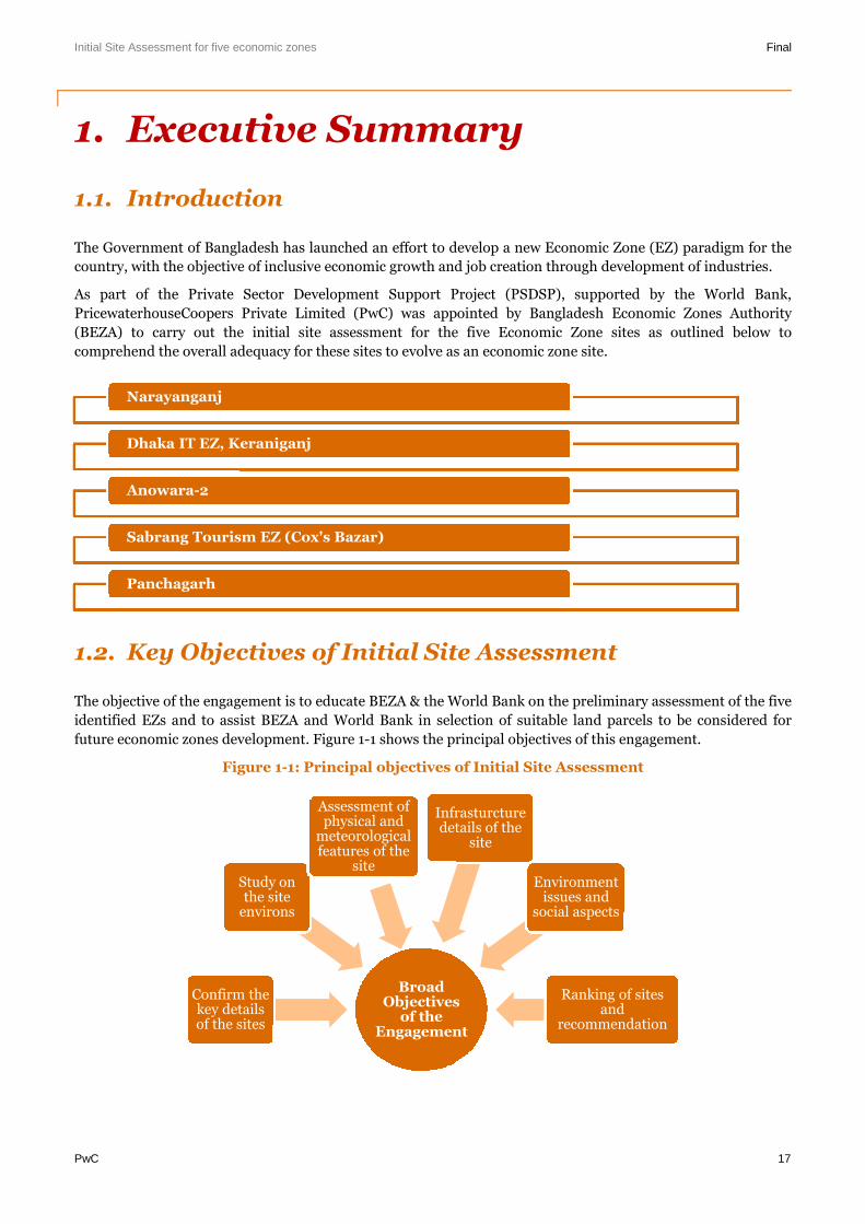
future economic zones development. Figure 1-1 shows the principal objectives of this engagement.
Figure 1-1: Principal objectives of Initial Site Assessment
Narayanganj
Dhaka IT EZ, Keraniganj
Anowara-2
Sabrang Tourism EZ (Cox's Bazar)
Panchagarh
BroadObjectives
of theEngagement
Confirm thekey detailsof the sites
Study onthe site
environs
Assessment ofphysical and
meteorologicalfeatures of the
site
Infrasturcturedetails of the
site
Environmentissues and
social aspects
Ranking of sitesand
recommendation
Initial Site Assessment for five economic zones Final
PwC 18
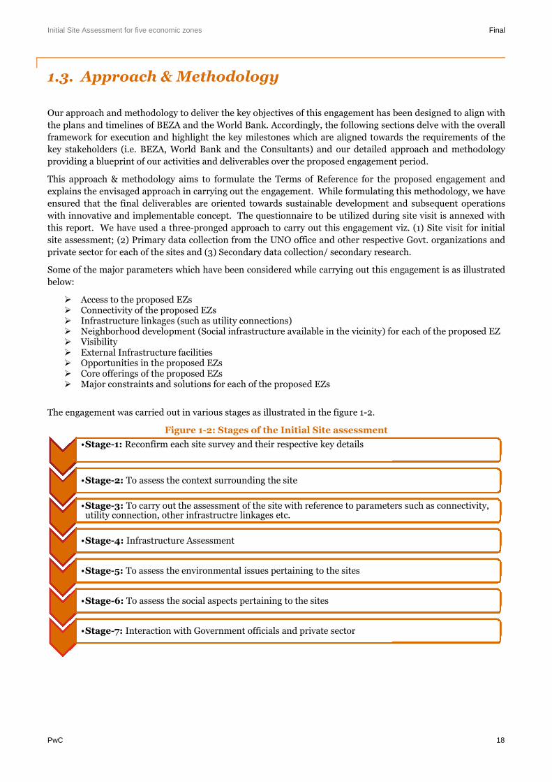
1.3. Approach & Methodology
Our approach and methodology to deliver the key objectives of this engagement has been designed to align with
the plans and timelines of BEZA and the World Bank. Accordingly, the following sections delve with the overall
framework for execution and highlight the key milestones which are aligned towards the requirements of the
key stakeholders (i.e. BEZA, World Bank and the Consultants) and our detailed approach and methodology
providing a blueprint of our activities and deliverables over the proposed engagement period.
This approach & methodology aims to formulate the Terms of Reference for the proposed engagement and
explains the envisaged approach in carrying out the engagement. While formulating this methodology, we have
ensured that the final deliverables are oriented towards sustainable development and subsequent operations
with innovative and implementable concept. The questionnaire to be utilized during site visit is annexed with
this report. We have used a three-pronged approach to carry out this engagement viz. (1) Site visit for initial
site assessment; (2) Primary data collection from the UNO office and other respective Govt. organizations and
private sector for each of the sites and (3) Secondary data collection/ secondary research.
Some of the major parameters which have been considered while carrying out this engagement is as illustrated
below:
Access to the proposed EZs Connectivity of the proposed EZs Infrastructure linkages (such as utility connections) Neighborhood development (Social infrastructure available in the vicinity) for each of the proposed EZ Visibility External Infrastructure facilities Opportunities in the proposed EZs Core offerings of the proposed EZs Major constraints and solutions for each of the proposed EZs
The engagement was carried out in various stages as illustrated in the figure 1-2.
Figure 1-2: Stages of the Initial Site assessment
•Stage-1: Reconfirm each site survey and their respective key details
•Stage-2: To assess the context surrounding the site
•Stage-3: To carry out the assessment of the site with reference to parameters such as connectivity,utility connection, other infrastructre linkages etc.
•Stage-4: Infrastructure Assessment
•Stage-5: To assess the environmental issues pertaining to the sites
•Stage-6: To assess the social aspects pertaining to the sites
•Stage-7: Interaction with Government officials and private sector
Initial Site Assessment for five economic zones Final
PwC 19
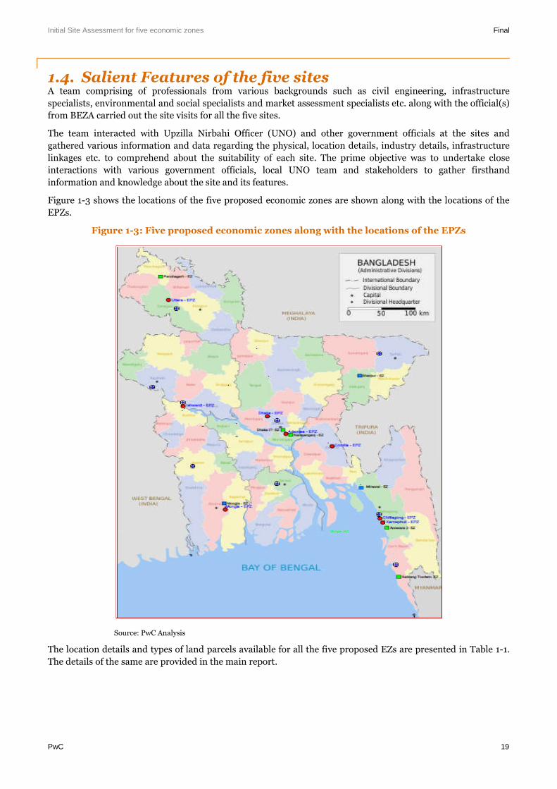
1.4. Salient Features of the five sitesA team comprising of professionals from various backgrounds such as civil engineering, infrastructure
specialists, environmental and social specialists and market assessment specialists etc. along with the official(s)
from BEZA carried out the site visits for all the five sites.
The team interacted with Upzilla Nirbahi Officer (UNO) and other government officials at the sites and
gathered various information and data regarding the physical, location details, industry details, infrastructure
linkages etc. to comprehend about the suitability of each site. The prime objective was to undertake close
interactions with various government officials, local UNO team and stakeholders to gather firsthand
information and knowledge about the site and its features.
Figure 1-3 shows the locations of the five proposed economic zones are shown along with the locations of the
EPZs.
Figure 1-3: Five proposed economic zones along with the locations of the EPZs
Source: PwC Analysis
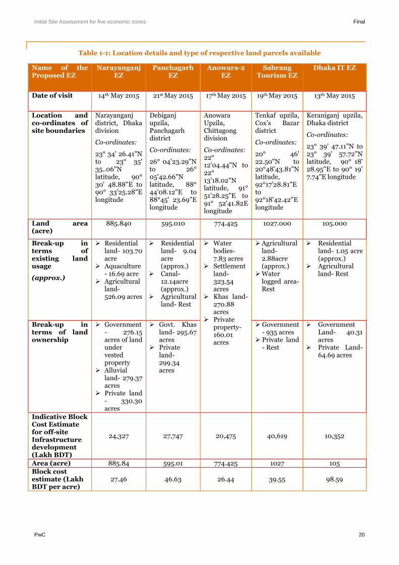
The location details and types of land parcels available for all the five proposed EZs are presented in Table 1-1.
The details of the same are provided in the main report.
Initial Site Assessment for five economic zones Final
PwC 20
Table 1-1: Location details and type of respective land parcels available
Name of theProposed EZ
NarayanganjEZ
PanchagarhEZ
Anowara-2EZ
SabrangTourism EZ
Dhaka IT EZ
Date of visit 14th May 2015 21st May 2015 17th May 2015 19th May 2015 13th May 2015
Location andco-ordinates ofsite boundaries
Narayanganjdistrict, Dhakadivision
Co-ordinates:
23° 34' 26.41"Nto 23° 35'35..06"Nlatitude, 90°30' 48.88"E to90° 33'25.28"Elongitude
Debiganjupzila,Panchagarhdistrict
Co-ordinates:
26° 04'23.29"Nto 26°05'42.66"Nlatitude, 88°44'08.12"E to88°45' 23.69"Elongitude
AnowaraUpzila,Chittagongdivision
Co-ordinates:22°12'04.44"N to22°13'18.02"Nlatitude, 91°51'28.25"E to91° 52'41.82Elongitude
Tenkaf upzila,Cox’s Bazardistrict
Co-ordinates:
20° 46'22.50"N to20°48'43.81"Nlatitude,92°17'28.81"Eto92°18'42.42"Elongitude
Keraniganj upzila,Dhaka district
Co-ordinates:
23° 39' 47.11"N to23° 39' 57.72"Nlatitude, 90° 18'28.95"E to 90° 19'7.74"E longitude
Land area(acre)
885.840 595.010 774.425 1027.000 105.000
Break-up interms ofexisting landusage
(approx.)
Residentialland- 103.70acre
Aquaculture- 16.69 acre
Agriculturalland-526.09 acres
Residentialland- 9.04acre(approx.)
Canal-12.14acre(approx.)
Agriculturalland- Rest
Waterbodies-7.83 acres
Settlementland-323.54acres
Khas land-270.88acres
Privateproperty-160.01acres
Agriculturalland-2.88acre(approx.)
Waterlogged area-Rest
Residentialland- 1.05 acre(approx.)
Agriculturalland- Rest
Break-up interms of landownership
Government- 276.15acres of landundervestedproperty
Alluvialland- 279.37acres
Private land- 330.30acres
Govt. Khasland- 295.67acres
Privateland-299.34acres
Government- 935 acres
Private land- Rest
GovernmentLand- 40.31acres
Private Land-64.69 acres
Indicative BlockCost Estimatefor off-siteInfrastructuredevelopment(Lakh BDT)
24,327 27,747 20,475 40,619 10,352
Area (acre) 885.84 595.01 774.425 1027 105Block costestimate (LakhBDT per acre)
27.46 46.63 26.44 39.55 98.59
Initial Site Assessment for five economic zones Final
PwC 21
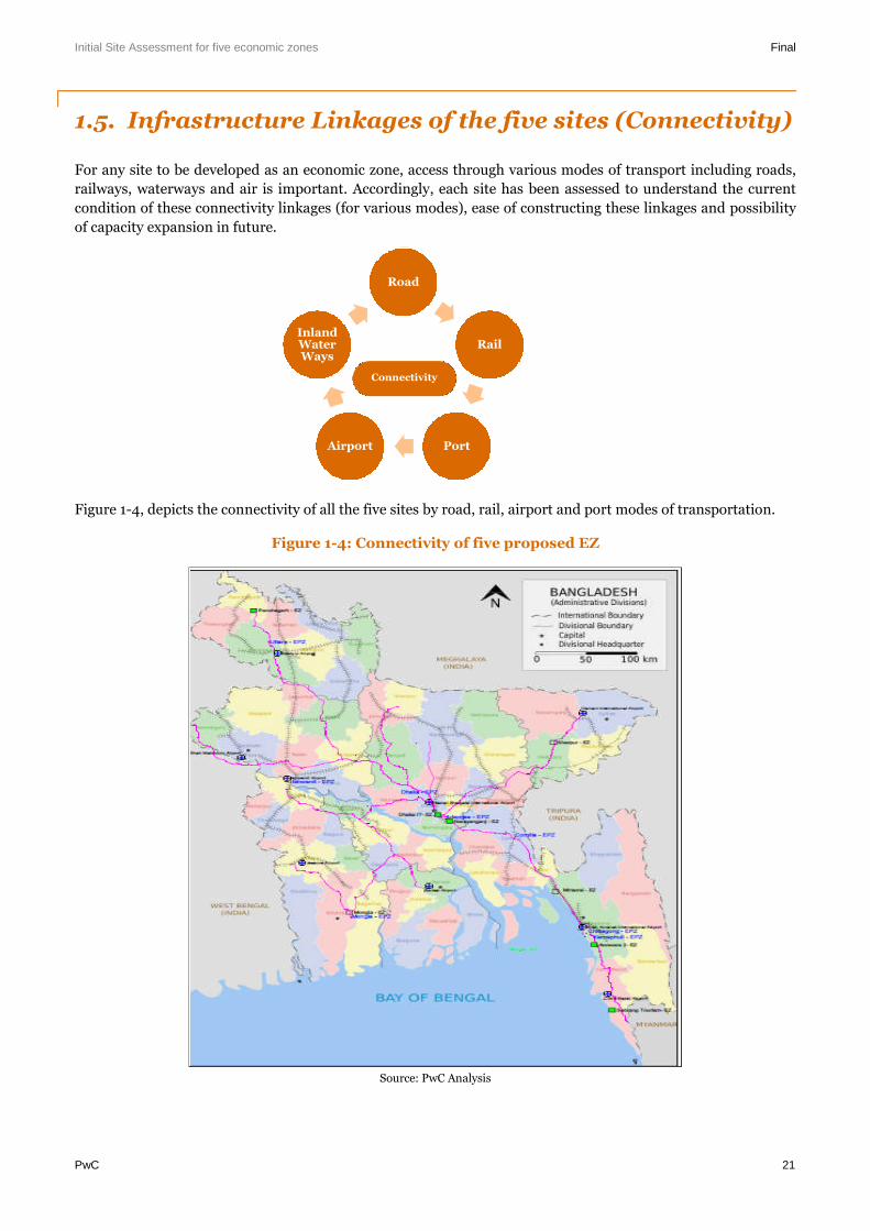
1.5. Infrastructure Linkages of the five sites (Connectivity)
For any site to be developed as an economic zone, access through various modes of transport including roads,
railways, waterways and air is important. Accordingly, each site has been assessed to understand the current
condition of these connectivity linkages (for various modes), ease of constructing these linkages and possibility
of capacity expansion in future.
Figure 1-4, depicts the connectivity of all the five sites by road, rail, airport and port modes of transportation.
Figure 1-4: Connectivity of five proposed EZ
Source: PwC Analysis
Road
Rail
PortAirport
InlandWaterWays
Connectivity
Initial Site Assessment for five economic zones Final
PwC 22
Narayanganj EZ
The connectivity aspect of proposed Narayanganj EZ is illustrated in Table 1-2.
Table 1-2: Connectivity of proposed Narayanganj EZ
Mode oftransportation
Details of connectivity of the proposed EZ
Road (Trunkconnectivity)
Narayanganj is 32 km (approx.) away from Dhaka city. There are three majorroads which connect Narayanganj to the rest of the country. These roads are:(1) Narayanganj-Munsiganj Highway (R812);(2) Bandor-Madonpur Highway (R113); and(3) Dhaka-Narayanganj Link Road (R111).
Naryanganj is easily accessible from Dhaka city by bus service (frequent busservice available by Ashian, Bandhan, Utsav, Ananda, Setu and BRTC etc.).Preliminary assessment suggests that some stretches of access road could berenovated for smooth passage of heavy vehicles along: (i) Madanpur-Madanganj-Syedpur road, originating from Dhaka Chittagong highway and (ii) Bridge acrossthe Sitalakhya river. At present, these stretches witness heavy traffic congestionand road condition is poor.
Approach Road (lastmile connectivity to /from the site)
The existing approach road is adjacent to Bashundhara cement plant. It is a single-lane road and heavy commerical vehicles face difficulty to move through this road.Widening of the approach road would result in significant resettlement issuesowing to Basundhara cement plant (located on one side of the road) andresidential units (located on the other side).
Sitalakhya Bridge is proposed across the Sitalakhya River, which will link thecapital with Sylhet and Chittagong highway through Demra and Narayanganj.Once functional, it shall connect Madanpur-Madanganj-Sayedpur Road (R113) andFatullah (Panchaboti)-Munshiganj (Muktarpur) Lohajang-Mawa Road (R812).
This bridge would provide direct access to the Northwest parcel of the proposedEZ. Access to the other land parcel (of the proposed EZ) located on the south eastside of the Bashundhara cement plant is restricted owing to the presence of berthfacility of Bashundhara cement plant on the river.
A high level initial assessment suggests that providing new access road along theriver bund from Dhaka-Chittagong highway (N1) for a length of 10 km (approx.) tothe proposed EZ may be explored. This new access road may have minimumresettlement requirement as compared to the widening of present access road viaBashundhara cement plant and summit power plant.
Rail There are two major railway stations in Narayanganj district viz. Narayanganj andChashara.Narayanganj railway station is located at a distance of 7 km from the proposed EZ.
Bangabandhu Sarak connects the proposed EZ to the railway station and trafficcongestion is minimal throughout this stretch.
Port Proposed EZ is located at a distance of about 254 km from Chittagong port & about304 km Mongla Port.
The proposed EZ lies on the bank of inland water way connecting from Chittagongport to Mongla port. Narayangunj river port, one of the oldest in Bangladesh isabout 3.5 km through Water way and 28 Km through Road way from the proposedEZ.
Various types of cargos are transported through Narayanganj Port. But there is noregular cargo service for carrying commodities. Commodities are generally carried
Initial Site Assessment for five economic zones Final
PwC 23
by private arrangements and berthing facilities provided by the BIWTA are usedfor loading and unloading purposes. Many local business houses or industries useprivate berthing facilities.
Airport Narayanganj EZ is located about 48 km from Hazrat Shah Jalal InternationalAirport at Dhaka. The travel time by road to Dhaka International Airport is 2.5-3hours (approx.).
Govt. of Bangladesh intends to construct a new international airport(Bangabandhu Sheikh Mujib International Airport) with a view to create a hubairport in close proximity to Dhaka and to meet the demand of future growth inaviation sector. The Civil Aviation and Tourism Ministry is in the process tofinalise the location of the proposed international airport. Some of the locationswhich are being considered as prospective locations for the development of newairport are: (1) Char Janajat under Shibchar Upazila in Madaripur district, (2)Keyain and Latobdi under Shirajdikhan Upazila in Munshiganj district and (3)Char Bilashpur under Dohar Upazila of Dhaka district. All these locations arelocated within 50 km radius of the proposed EZ.1
Inland waterways Proposed EZ is well connected with the major ports of Bangladesh by inland waterways.
Panchagarh EZ
The connectivity aspect of proposed Panchagarh EZ is illustrated in Table 1-3.
Table 1-3: Connectivity of proposed PanchagarhEZ
Mode oftransportation
Details of connectivity of the proposed EZ
Road (TrunkConnectivity)
The distance between Debiganj town and the proposed EZ is 5 km (approx.).
The site is abutting the Asian highway (AH2, which connects Dhaka toBanglabandha in a stretch of 512 km).
Boda – Domar via Debiganj Upazilla Road (Z5003) connects the site with Asianhighway (AH2).
Approach Road (lastmile connectivity to /from the site)
The site is connected to the Boda – Domar via Debiganj Upazilla Road (Z5003) bya Katcha Road of stretch ~ 300 m, and Z5003 in turn further connects the site toAH2.
Z5003 is a single lane road. It runs for ~ 2km from AH2 to the Katcha Roadconnecting the site to it.On either side of the road, there are private lands, howeveras such no houses or any permanent structures adjacent to the road were observedand hence there is a scope of wideningPreliminary assessment suggests that on either side of the stretch of the KatchaRoad there are no permanent structures and there is a scope for widening thestretch
Rail The Domar railway station (in Nilphamari district) is located about 9 km fromproposed EZ.
The railway station is connected to the proposed EZ by Debiganj road. In thevicinity of the rail station, some traffic congestion is observed during normal time.The frequency of passenger trains from this area to Dhaka is not good (approx 2-4daily trains).
1 http://www.dhakatribune.com/business/2015/jun/19/construction-bangabandhu-airport-again-cards#sthash.6QEaRDCi.dpuf
Initial Site Assessment for five economic zones Final
PwC 24
Port Banglabandha Land Port is located at the tip of north-western Bangladesh andneighbouring countries (such as India, Nepal and Bhutan) are accessible by theland port. Proposed Panchagarh EZ is located at a distance of 98 km (approx.)from Banglabandha land port.Burimari Land Port is located near Chengrabanda Border in India. Panchagarh EZis located about 95 km from this landport.
Airport Proposed Panchagargh EZ is located 45 km (approx.) south west of SaidpurAirport. It is a domestic airport and Saidpur Airport is well connected with Dhaka,Capital city of Bangladesh for passengers.
No major international airport exists in vicinity to the proposed EZ.
Cross-border tradefacilitation by LCS, MVAand Asian Highway-2
The Banglabandh road (Bangladesh) leading to the LCS provides an importanttrade link with Bhutan, Nepal and India.On 15th June 2015, the BBIN group of countries (Bangladesh, Bhutan, India andNepal), signed a sub-regional Motor Vehicles Agreement (MVA) with the objectiveof enabling a seamless movement of cargo across their borders. The MVA wouldprovide access for local products to neighbouring markets (India, Bhutan andNepal). The presence of well-functioning LCS could further facilitate the tradeamongst these countries.The Asian highway 2 runs through Panchagarh connecting Dhaka to Banglabandhaat India border via Panchangarh. The stretch through Panchagarh is yet to bedeveloped. Once developed, it will improve the connectivity of Panchagarh withneighbouring countries and enable seamless movement of goods from Panchagarhto major local markets and markets in neighbouring countries (India, Bhutan andNepal).
Anowara-2 EZ
The connectivity aspect of proposed Anowara-2 EZ is illustrated in Table 1-4.
Table 1-4: Connectivity of proposed Anowara-2 EZ
Mode oftransportation
Details of connectivity of the proposed EZ
Road (TrunkConnectivity)
The proposed EZ is located at a distance of 15 km (approx.) from the Chittagongtown. Proposed EZ is abutting the Chittagong - Anowara- Banshkhali highway(R170) which is the main access road to the proposed EZ. Bangladeshi nationalhighway (N1) connects the country capital Dhaka and Chittagong. N1 is located at adistance of 10 km (approx.) from the proposed EZ. Proposed EZ is connected to N1through Chittagong - Anowara- Banshkhali highway (R170).
Mutilane Road tunnel is proposed under the River Karnaphuli. The proposedTunnel will connect the Chittagong Port City directly with the other side of theKarnaphuli River & indirectly with other parts of the country through Dhaka-Chittagong-Cox’s Bazar Highway. The feasibility study for the same is in progress.Once functional, the multilane road tunnel shall reduce the travel time anddistance from Chittagong to the proposed EZ.2
Approach Road (lastmile connectivity to /from the site)
Proposed EZ is connected to N1 through Chittagong - Anowara- Banshkhalihighway (R170). A 200 m Katcha Roadstretch connects the site to a blacktop single lane road. The black top single laneroad in turn connects the Katcha Road to R170, through a stretch of ~ 500 m. Boththe Katcha Road and the blacktop road are ~ 3 m. Preliminary assessment suggeststhat on either side of these roads there are private lands, however there are nohouses or any permanent strucutres and hence there is a scope for widening these
2 http://www.bba.gov.bd/construction-of-multi-lane-tunnel-under-the-river-karnaphuli-at-chittagong-city/
Initial Site Assessment for five economic zones Final
PwC 25
roads for a better approach
Rail Chittagong railway station is located at a distance of 17 km (approx.) from theproposed EZ.
Port The Port of Chittagong is the principal Port of Bangladesh. Proposed Anowara-2,EZ is located at a distance of 18 km (approx.) from Chittagong Port.
Airport Proposed EZ is located at a distance of 30 km (approx.) from Shah AmanatInternational Airport, Chittagong. It takes about an hour to reach the airport fromthe proposed EZ.
Sabrang- Tourism EZ
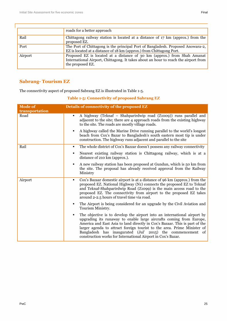
The connectivity aspect of proposed Sabrang EZ is illustrated in Table 1-5.
Table 1-5: Connectivity of proposed Sabrang EZ
Mode oftransportation
Details of connectivity of the proposed EZ
Road A highway (Teknaf – Shahparirdwip road (Z1009)) runs parallel andadjacent to the site; there are 4 approach roads from the existing highwayto the site. The roads are mostly village roads.
A highway called the Marine Drive running parallel to the world’s longestbeach from Cox’s Bazar to Bangladesh’s south eastern most tip is underconstruction. The highway runs adjacent and parallel to the site
Rail The whole district of Cox’s Bazzar doesn’t possess any railway connectivity
Nearest existing railway station is Chittagong railway, which is at adistance of 210 km (approx.).
A new railway station has been proposed at Gundun, which is 50 km fromthe site. The proposal has already received approval from the RailwayMinistry
Airport Cox’s Bazaar domestic airport is at a distance of 96 km (approx.) from theproposed EZ. National Highway (N1) connects the proposed EZ to Teknafand Teknaf-Shahparirdwip Road (Z1099) is the main access road to theproposed EZ. The connectivity from airport to the proposed EZ takesaround 2-2.5 hours of travel time via road.
The Airport is being considered for an upgrade by the Civil Aviation andTourism Ministry.
The objective is to develop the airport into an international airport byupgrading its runaway to enable large aircrafts coming from Europe,America and East Asia to land directly in Cox’s Bazaar. This is part of thelarger agenda to attract foreign tourist to the area. Prime Minister ofBangladesh has inaugurated (Jul’ 2015) the commencement ofconstruction works for International Airport in Cox’s Bazar.
Initial Site Assessment for five economic zones Final
PwC 26
Dhaka IT EZ
The connectivity aspect of proposed Dhaka IT EZ is illustrated in Table 1-6.
Table 1-6: Connectivity of proposed Dhaka IT EZ
Mode oftransportation
Details of connectivity of the proposed EZ
Road Proposed Dhaka IT EZ is located in Keraniganj upzila, which is located 18 km awayfrom the zero-point of Dhaka city. The road distance between the centre ofKeraniganj upzilla and the proposed EZ is about 2 kms. Proposed EZ is located inbetween Zinzira-Keraniganj-Nawabganj-Dohar-Srinagar Road (R820) and DhakaMawa highway (N8).
Rail Dhaka is connected with the rail network to other parts of the country. The Dhakarailway station is located at a distance of 20km (approx.) from proposed EZ. Atpresent around 329 trains per day stops at Dhaka railway station for transportingpassengers to Chittagong and Kolkata.
Airport The proposed Dhaka IT EZ is located about 30 km North East of Hazrat ShahjalalInternational Airport in Dhaka. Dhaka Airport is the largest airport in the country.The travelling time from the proposed site to Dhaka Airport is 2 to 2.5 hours(approx.).
Govt. of Bangladesh intends to construct a new international airport(Bangabandhu Sheikh Mujib International Airport) with a view to create a hubairport in close proximity to Dhaka and to meet the demand of future growth inaviation sector. Not only the air traffic in Bangladesh has increased, but also thecargo traffic has escalated and none of the airports in the country are currentlyequipped to handle the massive flow of trade and passengers. The location of thisproposed airport is not yet finalized; however the new proposed airport shall belocated in Dhaka division (within 50-70 km radius of the proposed EZ).
Approach Road Zinzira-Keraniganj-Nawabganj-Dohar-Srinagar Road (R820) passes adjacent tothe proposed EZ. Connecting road for a length of 750 m from R820 need to bewidened and strengthened.
Dhaka Mawa highway (N8) is accessible from the proposed EZ via Dhamsur-sonakanda road at a length of 5 km. Preliminary assessment highligts thatwidening of this road could attract more resettlement issues as there are severalmarket place(s), educational institution(s), religious places and residential areaslocated on both the sides of the road.
Assessment of Intermodal Cargo Transfer
A broad level assessment of intermodal cargo transfer is undertaken in table 1-7, where each of the proposed
multiproduct economic zones has been assessed to understand how the integration of various modes of
transportation could take place. However, this assessment is indicative in nature and any decision on the same
should be taken upon completion of detailed feasibility report for each of the proposed multiproduct Ezs.
Table 1-7: Assessment of Intermodal Cargo Transfer for Three Multiproduct EZs
Parameters Narayanganj Panchgarh Anowara-2
Nearest Rail Narayanganj rail station islocated at a distance of 7km (approx.) from theproposed EZ. BangabandhuSarak connects theproposed EZ to the railway
Domar railway station (inNilphamari district) islocated 9 km (approx.) fromthe proposed EZ. Debiganjroad connects the proposedEZ to the railway station and
Chittagong railway station islocated at a distance of 17 km(approx.) from the proposedEZ. Station Road connectsthe proposed EZ to therailway station and the traffic
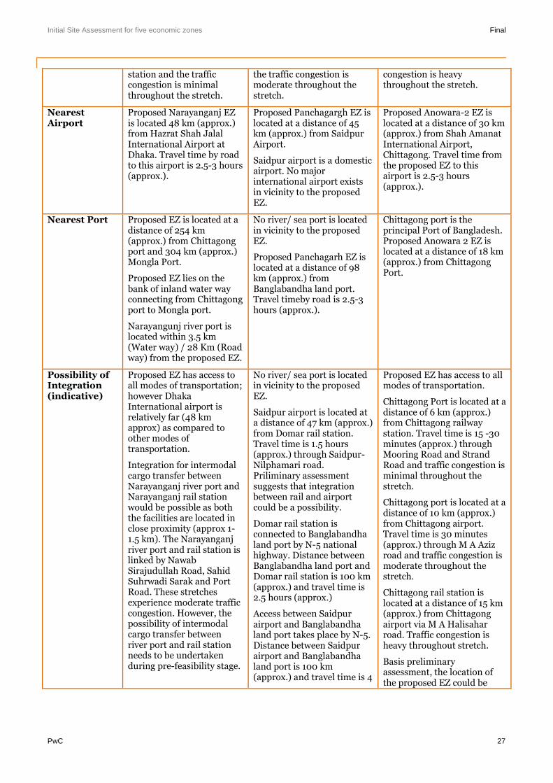
Initial Site Assessment for five economic zones Final
PwC 27
station and the trafficcongestion is minimalthroughout the stretch.
the traffic congestion ismoderate throughout thestretch.
congestion is heavythroughout the stretch.
NearestAirport
Proposed Narayanganj EZis located 48 km (approx.)from Hazrat Shah JalalInternational Airport atDhaka. Travel time by roadto this airport is 2.5-3 hours(approx.).
Proposed Panchagargh EZ islocated at a distance of 45km (approx.) from SaidpurAirport.
Saidpur airport is a domesticairport. No majorinternational airport existsin vicinity to the proposedEZ.
Proposed Anowara-2 EZ islocated at a distance of 30 km(approx.) from Shah AmanatInternational Airport,Chittagong. Travel time fromthe proposed EZ to thisairport is 2.5-3 hours(approx.).
Nearest Port Proposed EZ is located at adistance of 254 km(approx.) from Chittagongport and 304 km (approx.)Mongla Port.
Proposed EZ lies on thebank of inland water wayconnecting from Chittagongport to Mongla port.
Narayangunj river port islocated within 3.5 km(Water way) / 28 Km (Roadway) from the proposed EZ.
No river/ sea port is locatedin vicinity to the proposedEZ.
Proposed Panchagarh EZ islocated at a distance of 98km (approx.) fromBanglabandha land port.Travel timeby road is 2.5-3hours (approx.).
Chittagong port is theprincipal Port of Bangladesh.Proposed Anowara 2 EZ islocated at a distance of 18 km(approx.) from ChittagongPort.
Possibility ofIntegration(indicative)
Proposed EZ has access toall modes of transportation;however DhakaInternational airport isrelatively far (48 kmapprox) as compared toother modes oftransportation.
Integration for intermodalcargo transfer betweenNarayanganj river port andNarayanganj rail stationwould be possible as boththe facilities are located inclose proximity (approx 1-1.5 km). The Narayanganjriver port and rail station islinked by NawabSirajudullah Road, SahidSuhrwadi Sarak and PortRoad. These stretchesexperience moderate trafficcongestion. However, thepossibility of intermodalcargo transfer betweenriver port and rail stationneeds to be undertakenduring pre-feasibility stage.
No river/ sea port is locatedin vicinity to the proposedEZ.
Saidpur airport is located ata distance of 47 km (approx.)from Domar rail station.Travel time is 1.5 hours(approx.) through Saidpur-Nilphamari road.Priliminary assessmentsuggests that integrationbetween rail and airportcould be a possibility.
Domar rail station isconnected to Banglabandhaland port by N-5 nationalhighway. Distance betweenBanglabandha land port andDomar rail station is 100 km(approx.) and travel time is2.5 hours (approx.)
Access between Saidpurairport and Banglabandhaland port takes place by N-5.Distance between Saidpurairport and Banglabandhaland port is 100 km(approx.) and travel time is 4
Proposed EZ has access to allmodes of transportation.
Chittagong Port is located at adistance of 6 km (approx.)from Chittagong railwaystation. Travel time is 15 -30minutes (approx.) throughMooring Road and StrandRoad and traffic congestion isminimal throughout thestretch.
Chittagong port is located at adistance of 10 km (approx.)from Chittagong airport.Travel time is 30 minutes(approx.) through M A Azizroad and traffic congestion ismoderate throughout thestretch.
Chittagong rail station islocated at a distance of 15 km(approx.) from Chittagongairport via M A Halisaharroad. Traffic congestion isheavy throughout stretch.
Basis preliminaryassessment, the location ofthe proposed EZ could be
Initial Site Assessment for five economic zones Final
PwC 28
hours (approx.)
Integration of differentmodes of transportationseems possible, but the unitcost associated towardscargo transfer could berelatively higher ascompared to proposedNarayanganj EZ.
strategic for intermodal cargotransport.
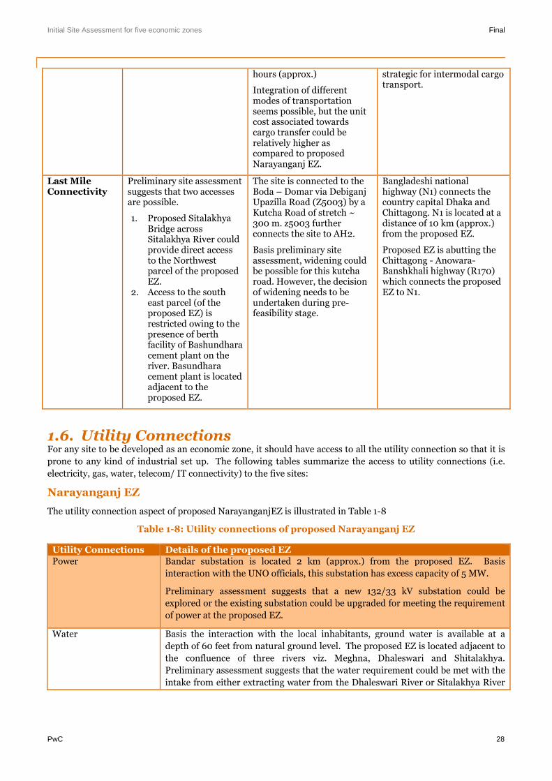
Last MileConnectivity
Preliminary site assessmentsuggests that two accessesare possible.
1. Proposed SitalakhyaBridge acrossSitalakhya River couldprovide direct accessto the Northwestparcel of the proposedEZ.
2. Access to the southeast parcel (of theproposed EZ) isrestricted owing to thepresence of berthfacility of Bashundharacement plant on theriver. Basundharacement plant is locatedadjacent to theproposed EZ.
The site is connected to theBoda – Domar via DebiganjUpazilla Road (Z5003) by aKutcha Road of stretch ~300 m. z5003 furtherconnects the site to AH2.
Basis preliminary siteassessment, widening couldbe possible for this kutcharoad. However, the decisionof widening needs to beundertaken during pre-feasibility stage.
Bangladeshi nationalhighway (N1) connects thecountry capital Dhaka andChittagong. N1 is located at adistance of 10 km (approx.)from the proposed EZ.
Proposed EZ is abutting theChittagong - Anowara-Banshkhali highway (R170)which connects the proposedEZ to N1.
1.6. Utility ConnectionsFor any site to be developed as an economic zone, it should have access to all the utility connection so that it is
prone to any kind of industrial set up. The following tables summarize the access to utility connections (i.e.
electricity, gas, water, telecom/ IT connectivity) to the five sites:
Narayanganj EZ
The utility connection aspect of proposed NarayanganjEZ is illustrated in Table 1-8
Table 1-8: Utility connections of proposed Narayanganj EZ
Utility Connections Details of the proposed EZPower Bandar substation is located 2 km (approx.) from the proposed EZ. Basis
interaction with the UNO officials, this substation has excess capacity of 5 MW.
Preliminary assessment suggests that a new 132/33 kV substation could be
explored or the existing substation could be upgraded for meeting the requirement
of power at the proposed EZ.
Water Basis the interaction with the local inhabitants, ground water is available at a
depth of 60 feet from natural ground level. The proposed EZ is located adjacent to
the confluence of three rivers viz. Meghna, Dhaleswari and Shitalakhya.
Preliminary assessment suggests that the water requirement could be met with the
intake from either extracting water from the Dhaleswari River or Sitalakhya River
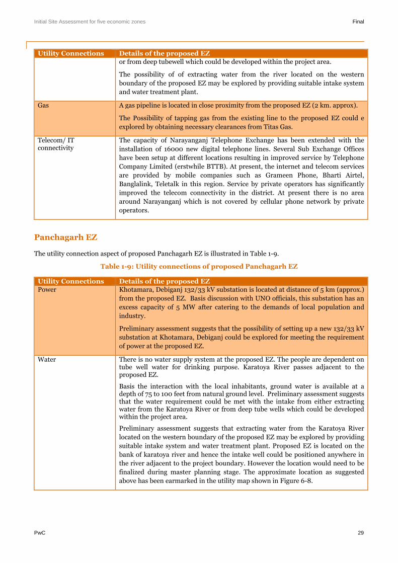
Initial Site Assessment for five economic zones Final
PwC 29
Utility Connections Details of the proposed EZor from deep tubewell which could be developed within the project area.
The possibility of of extracting water from the river located on the western
boundary of the proposed EZ may be explored by providing suitable intake system
and water treatment plant.
Gas A gas pipeline is located in close proximity from the proposed EZ (2 km. approx).
The Possibility of tapping gas from the existing line to the proposed EZ could e
explored by obtaining necessary clearances from Titas Gas.
Telecom/ ITconnectivity
The capacity of Narayanganj Telephone Exchange has been extended with the
installation of 16000 new digital telephone lines. Several Sub Exchange Offices
have been setup at different locations resulting in improved service by Telephone
Company Limited (erstwhile BTTB). At present, the internet and telecom services
are provided by mobile companies such as Grameen Phone, Bharti Airtel,
Banglalink, Teletalk in this region. Service by private operators has significantly
improved the telecom connectivity in the district. At present there is no area
around Narayanganj which is not covered by cellular phone network by private
operators.
Panchagarh EZ
The utility connection aspect of proposed Panchagarh EZ is illustrated in Table 1-9.
Table 1-9: Utility connections of proposed Panchagarh EZ
Utility Connections Details of the proposed EZPower Khotamara, Debiganj 132/33 kV substation is located at distance of 5 km (approx.)
from the proposed EZ. Basis discussion with UNO officials, this substation has an
excess capacity of 5 MW after catering to the demands of local population and
industry.
Preliminary assessment suggests that the possibility of setting up a new 132/33 kV
substation at Khotamara, Debiganj could be explored for meeting the requirement
of power at the proposed EZ.
Water There is no water supply system at the proposed EZ. The people are dependent ontube well water for drinking purpose. Karatoya River passes adjacent to theproposed EZ.
Basis the interaction with the local inhabitants, ground water is available at adepth of 75 to 100 feet from natural ground level. Preliminary assessment suggeststhat the water requirement could be met with the intake from either extractingwater from the Karatoya River or from deep tube wells which could be developedwithin the project area.
Preliminary assessment suggests that extracting water from the Karatoya River
located on the western boundary of the proposed EZ may be explored by providing
suitable intake system and water treatment plant. Proposed EZ is located on the
bank of karatoya river and hence the intake well could be positioned anywhere in
the river adjacent to the project boundary. However the location would need to be
finalized during master planning stage. The approximate location as suggested
above has been earmarked in the utility map shown in Figure 6-8.
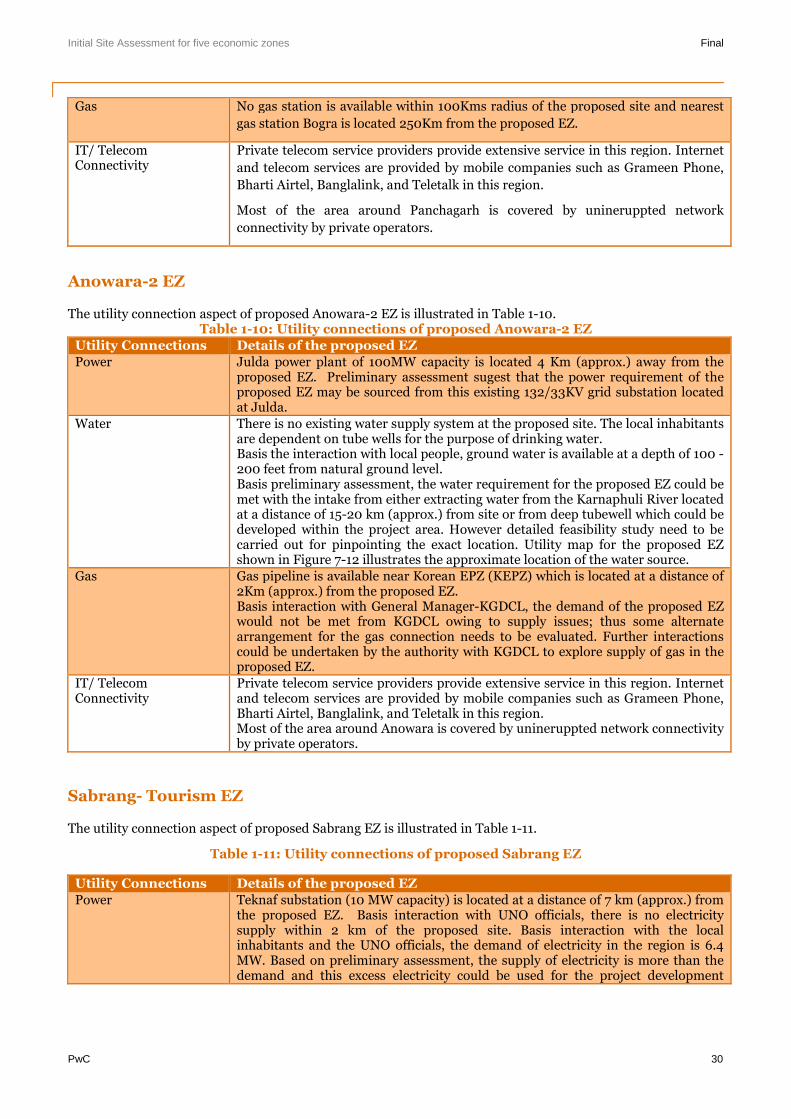
Initial Site Assessment for five economic zones Final
PwC 30
Gas No gas station is available within 100Kms radius of the proposed site and nearest
gas station Bogra is located 250Km from the proposed EZ.
IT/ TelecomConnectivity
Private telecom service providers provide extensive service in this region. Internet
and telecom services are provided by mobile companies such as Grameen Phone,
Bharti Airtel, Banglalink, and Teletalk in this region.
Most of the area around Panchagarh is covered by unineruppted network
connectivity by private operators.
Anowara-2 EZ
The utility connection aspect of proposed Anowara-2 EZ is illustrated in Table 1-10.Table 1-10: Utility connections of proposed Anowara-2 EZ
Utility Connections Details of the proposed EZPower Julda power plant of 100MW capacity is located 4 Km (approx.) away from the
proposed EZ. Preliminary assessment sugest that the power requirement of theproposed EZ may be sourced from this existing 132/33KV grid substation locatedat Julda.
Water There is no existing water supply system at the proposed site. The local inhabitantsare dependent on tube wells for the purpose of drinking water.Basis the interaction with local people, ground water is available at a depth of 100 -200 feet from natural ground level.Basis preliminary assessment, the water requirement for the proposed EZ could bemet with the intake from either extracting water from the Karnaphuli River locatedat a distance of 15-20 km (approx.) from site or from deep tubewell which could bedeveloped within the project area. However detailed feasibility study need to becarried out for pinpointing the exact location. Utility map for the proposed EZshown in Figure 7-12 illustrates the approximate location of the water source.
Gas Gas pipeline is available near Korean EPZ (KEPZ) which is located at a distance of2Km (approx.) from the proposed EZ.Basis interaction with General Manager-KGDCL, the demand of the proposed EZwould not be met from KGDCL owing to supply issues; thus some alternatearrangement for the gas connection needs to be evaluated. Further interactionscould be undertaken by the authority with KGDCL to explore supply of gas in theproposed EZ.
IT/ TelecomConnectivity
Private telecom service providers provide extensive service in this region. Internetand telecom services are provided by mobile companies such as Grameen Phone,Bharti Airtel, Banglalink, and Teletalk in this region.Most of the area around Anowara is covered by unineruppted network connectivityby private operators.
Sabrang- Tourism EZ
The utility connection aspect of proposed Sabrang EZ is illustrated in Table 1-11.
Table 1-11: Utility connections of proposed Sabrang EZ
Utility Connections Details of the proposed EZPower Teknaf substation (10 MW capacity) is located at a distance of 7 km (approx.) from
the proposed EZ. Basis interaction with UNO officials, there is no electricitysupply within 2 km of the proposed site. Basis interaction with the localinhabitants and the UNO officials, the demand of electricity in the region is 6.4MW. Based on preliminary assessment, the supply of electricity is more than thedemand and this excess electricity could be used for the project development
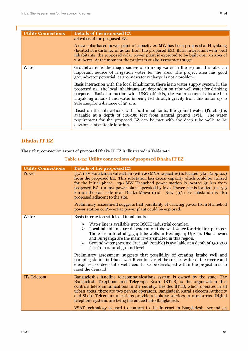
Initial Site Assessment for five economic zones Final
PwC 31
Utility Connections Details of the proposed EZactivities of the proposed EZ.
A new solar based power plant of capacity 20 MW has been proposed at Huyakong(located at a distance of 20km from the proposed EZ). Basis interaction with localinhabitants, the proposed solar power plant is expected to be built over an area of700 Acres. At the moment the project is at site assessment stage.
Water Groundwater is the major source of drinking water in the region. It is also animportant source of irrigation water for the area. The project area has goodgroundwater potential, as groundwater recharge is not a problem.
Basis interaction with the local inhabitants, there is no water supply system in theproposed EZ. The local inhabitants are dependent on tube well water for drinkingpurpose. Basis interaction with UNO officials, the water source is located inHuyakong union- I and water is being fed through gravity from this union up toSabraang for a distance of 35 Km.
Based on the interactions with local inhabitants, the ground water (Potable) isavailable at a depth of 120-150 feet from natural ground level. The waterrequirement for the proposed EZ can be met with the deep tube wells to bedeveloped at suitable location.
Dhaka IT EZ
The utility connection aspect of proposed Dhaka IT EZ is illustrated in Table 1-12.
Table 1-12: Utility connections of proposed Dhaka IT EZ
Utility Connections Details of the proposed EZPower 33/11 kV Sonakanda substation (with 20 MVA capacities) is located 3 km (approx.)
from the proposed EZ. This substation has excess capacity which could be utilizedfor the initial phase. 150 MW Hasnebod power station is located 30 km fromproposed EZ. 100mw power plant operated by M/s. Power pac is located just 3.5km on the east side near Dhaka Mawa road. New 33/11 kv substation is alsoproposed adjacent to the site.
Preliminary assessment suggests that possibility of drawing power from Hasnebodpower station or PowerPac power plant could be explored.
Water Basis interaction with local inhabitants
Water line is available upto BSCIC industrial complex. Local inhabitants are dependent on tube well water for drinking purpose.
There are a total of 5,574 tube wells in Keraniganj Upzilla. Dhaleshwariand Buriganga are the main rivers situated in this region.
Ground water (Arsenic Free and Potable) is available at a depth of 150-200feet from natural ground level.
Preliminary assessment suggests that possibility of creating intake well andpumping station in Dhaleswari River to extract the surface water of the river coulde explored or deep tube wells could also be developed within the project area tomeet the demand.
IT/ Telecom Bangladesh's landline telecommunications system is owned by the state. TheBangladesh Telephone and Telegraph Board (BTTB) is the organization thatcontrols telecommunications in the country. Besides BTTB, which operates in allurban areas, there are two private operators. Bangladesh Rural Telecom Authorityand Sheba Telecommunications provide telephone services to rural areas. Digitaltelephone systems are being introduced into Bangladesh.
VSAT technology is used to connect to the Internet in Bangladesh. Around 54
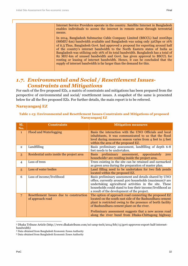
Initial Site Assessment for five economic zones Final
PwC 32
Internet Service Providers operate in the country. Satellite Internet in Bangladeshenables individuals to access the internet in remote areas through terrestrialmeans.
In 2014, Bangladesh Submarine Cable Company Limited (BSCCL) had 200Gbps(88MIU-km) bandwidth available and Bangladesh was using only 32Gbps or 16%
of it.3 Thus, Bangladesh Govt. had approved a proposal for exporting around halfof the country’s internet bandwidth to the North Eastern states of India asBangladesh was utilizing only 16% of its total bandwidth. Bangladesh has a total of82 MIU-km of unused bandwidth and Govt. has given approval to BSCCL forrenting or leasing of internet bandwidth. Hence, it can be concluded that thesupply of internet bandwidth is far larger than the demand for this.
1.7. Environmental and Social / Resettlement Issues-Constraints and Mitigations
For each of the five proposed EZs, a matrix of constraints and mitigations has been prepared from the
perspective of environmental and social/ resettlement issues. A snapshot of the same is presented
below for all the five proposed EZs. For further details, the main report is to be referred.
Narayanganj EZ
Table 1-13: Environmental and Resettlement Issues-Constraints and Mitigations of proposedNarayanganj EZ
Sl.No.
Constraints Mitigation measures
1 Flood and Waterlogging Basis the interaction with the UNO Officials and localinhabitants, it was communicated to us that the floodlevel during monsoon season varies from 4 feet to 5 feetwithin the area of the proposed EZ.
2 Landfilling Basis preliminary assessment, landfilling of depth 6-8feet needs to be undertaken.
3 Residential units inside the project area Basis preliminary assessment, appoximately 200households4 are residing inside the project area.
4 Loss of trees Trees existing in the site can be retained and earmarkedas green area during the preparation of master plan.
5 Loss of water bodies Land filling need to be undertaken for two fish pondslocated within the proposed EZ.
6 Loss of income/livelihood Basis preliminary assessment and details shared by UNOoffice, currently around 400 households (maximum)5 areundertaking agricultural activities in the site. Thesehouseholds could stand to lose their income/livelihood asa result of the development of the project.
7 Resettlement Issues due to constructionof approach road
The option of approach road connecting the proposed EZlocated on the south east side of the Bashundhara cementplant is restricted owing to the presence of berth facilityof Bashundhara cement plant on the river.
Preliminary assessment suggests that a new access roadalong the river bund from Dhaka-Chittagong highway
3 Dhaka Tribune Article (http://www.dhakatribune.com/sci-amp-tech/2014/feb/15/govt-approves-export-half-internet-bandwidth)4 Data obtained from Bangladesh Economic Zones Authority5 Data obtained from Bangladesh Economic Zones Authority
Initial Site Assessment for five economic zones Final
PwC 33
(N1) for a length of 10 km (approx.) to the proposed EZcould be constructed. This new approach road shall haveminimum resettlement with respect to the former option.
8 Air Pollution During the field visit, it was observed that the ambient airquality in regard to the Suspended Particulate Matters(SPM) of the area is very dusty. This may be due to thefact that several cement plants and other industrial unitsare located in close proximity to the area around theproposed EZ.
Also, in the area adjacent to the Shitalakhya River noisewas observed as many cement plants are located in closeproximity.
Panchagarh EZ
Table 1-14: Environmental and Resettlement Issues -Constraints and Mitigations of proposedPanchagarh EZ
Sl.
No.
Constraints Mitigation measures
1 Flood and Waterlogging Basis the interaction with the UNO officials andlocal inhabitants, flood level during monsoonseason varies from 5 feet to 6 feet depth inside theproposed EZ area.
2 Landfilling Basis preliminary assessment, landfilling of depth
8-10 feet needs to be undertaken.
3 River protection and existing canal Bund could be constructed to avoid the water
inflow from river. The existing canal could be
rerouted along the boundary of the proposed EZ to
maximize the available land area.
4 Loss of trees Trees exist adjacent to a pathway within theproposed EZ which could be retained duringpreparation of master plan.
5 Loss of income/livelihood Basis preliminary assessment and details shared by
UNO office, currently around 150 households6 are
undertaking agricultural activities in the site. These
households could stand to lose their
income/livelihood as a result of the development of
the project.
6 Residential units inside project area Basis preliminary assessment, appoximately 50
households7 are residing inside the project area.
6 Data obtained from Bangladesh Economic Zones Authority7 Data obtained from Bangladesh Economic Zones Authority
Initial Site Assessment for five economic zones Final
PwC 34
Anowara-2 EZ
Table 1-15: Environmental and Resettlement Issues -Constraints and Mitigations of proposedAnowara-2 EZ
Sl.
No.
Constraints Mitigation measures
1 Flood and Waterlogging Basis the interaction with the UNO officials and local
inhabitants, the proposed EZ area is free from
flooding.
2 Unduly land Basis preliminary assessment, necessary platforms
could be created for accessing the site by cutting and
filling for about 2 m to 3 m.
3 Loss of income/livelihood Basis preliminary assessment and details shared by
UNO office, currently around 100-115 households8
are undertaking agricultural activities in the site.
These households could stand to lose their
income/livelihood as a result of the development of
the project.
4 Residential units inside project area Basis preliminary assessment, appoximately 50
households9 are residing inside the project area.
Sabrang EZ
Table 1-16: Environmental and Resettlement Issues -Constraints and Mitigations of proposedSabrang EZ
Sl.No.
Constraints Mitigation measures
1 Flood and Waterlogging Basis the interaction with the UNO Officials andlocal inhabitants, it was communicated to us that theflood level during monsoon season varies from 4 feetto 5 feet within the area of the proposed EZ.
2 Landfilling Land Filling needs to be undertaken for a depth of 6to 8 feet.
2 Protection from sea and backwater From preliminary assessment, necessary protectionto avoid the erosion by sea front may be undertaken.
3 Existing backwater canal From preliminary assessment, Necessarystrengthening and bund protection may be carriedout for avoiding flooding.
4 Loss of income/livelihood Basis preliminary assessment and details shared byUNO office, currently around 50-100 households10
are undertaking agricultural activities in the site.These households could stand to lose theirincome/livelihood as a result of the development ofthe project.
8 Data obtained from Bangladesh Economic Zones Authority9 Data obtained from Bangladesh Economic Zones Authority10 Data obtained from Bangladesh Economic Zones Authority
Initial Site Assessment for five economic zones Final
PwC 35
Dhaka IT EZ
Table 1-17: Environmental and Resettlement Issues -Constraints and Mitigations of proposedDhaka IT EZ
Sl.
No.
Constraints Mitigation measures
1 Flood and Waterlogging Basis the interaction with the UNO Officials and
local inhabitants, it was communicated to us that
the flood level during monsoon season varies from
5 feet to 6 feet within the area of the proposed EZ.
2 Landfilling From preliminary assessment, landfilling of depth
6-10 feet needs to be undertaken
3 Existing storm water drain To be diverted along the boundary
4 Residential units Basis preliminary assessment, 3-5 kutcha
structures may be relocated
5 Factory building Basis preliminary assessment, the factory building
may be excluded from the proposed EZ area during
preparation of master plan
6 Loss of Trees Trees existing along the kutcha road in the site
may be retained during the preparation of master
plan
7 Loss of income/livelihood Basis preliminary assessment and details shared
by UNO office, currently around 70-130
households are undertaking agricultural activities
in the site. These households could stand to lose
their income/livelihood as a result of the
development of the project.
8 Resettlement issues pertaining to
approach road construction
From preliminary assessment, construction ofapproach road via Dhaka-Mawa Highway (N8)shall attract significant resettlement.
The other option of construction of approach roadvia Zinzira-Keraniganj-Nawabganj-Dohar-SrinagarRoad (R820) may not have similar resettlementissues.
1.8. High level assessment of industrial developmentpotential
To analyze the industrial segments which may be considered fit to develop in the proposed multi-product
economic zones under discussion; a high level assessment for industrial development potential is carried out.
This study doesn’t take into consideration the viability aspect of the industrial segments for the economic zones.
Further, this analysis is carried out at a very macro level to understand whether there is certain industrial
activity in the region and also the propensity of industrial segments which could be better suited for the
respective regions. The list appended in the sections below is not conclusive and is subject to the detailed
feasibility analysis for each of the proposed proposed EZs.
The industrial scenario in the vicinity of the project area has been thoroughly analyzed based on the availability
of natural resources, industrial development and connectivity aspects etc. Now, based on the global scenario,
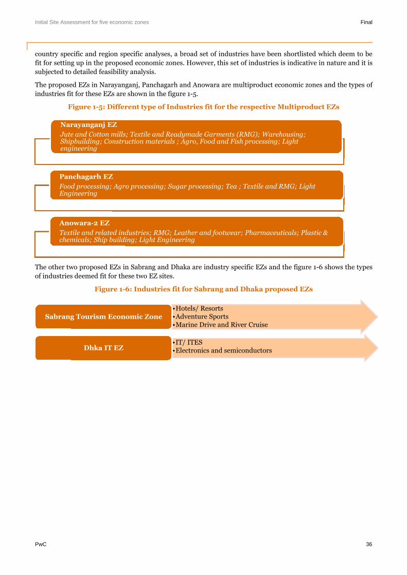
Initial Site Assessment for five economic zones Final
PwC 36
country specific and region specific analyses, a broad set of industries have been shortlisted which deem to be
fit for setting up in the proposed economic zones. However, this set of industries is indicative in nature and it is
subjected to detailed feasibility analysis.
The proposed EZs in Narayanganj, Panchagarh and Anowara are multiproduct economic zones and the types of
industries fit for these EZs are shown in the figure 1-5.
Figure 1-5: Different type of Industries fit for the respective Multiproduct EZs
The other two proposed EZs in Sabrang and Dhaka are industry specific EZs and the figure 1-6 shows the types
of industries deemed fit for these two EZ sites.
Figure 1-6: Industries fit for Sabrang and Dhaka proposed EZs
Narayanganj EZ
Jute and Cotton mills; Textile and Readymade Garments (RMG); Warehousing;Shipbuilding; Construction materials ; Agro, Food and Fish processing; Lightengineering
Panchagarh EZ
Food processing; Agro processing; Sugar processing; Tea ; Textile and RMG; LightEngineering
Anowara-2 EZ
Textile and related industries; RMG; Leather and footwear; Pharmaceuticals; Plastic &chemicals; Ship building; Light Engineering
•Hotels/ Resorts•Adventure Sports•Marine Drive and River Cruise
Sabrang Tourism Economic Zone
•IT/ ITES•Electronics and semiconductorsDhka IT EZ
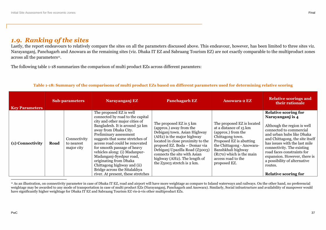
Initial Site Assessment for five economic zones Final
PwC 37
1.9. Ranking of the sitesLastly, the report endeavours to relatively compare the sites on all the parameters discussed above. This endeavour, however, has been limited to three sites viz.
Narayanganj, Panchagarh and Anowara as the remaining sites (viz. Dhaka IT EZ and Sabraang Tourism EZ) are not exactly comparable to the multiproduct zones
across all the parameters11.
The following table 1-18 summarizes the comparison of multi product EZs across different paramters:
Table 1-18: Summary of the comparisons of multi product EZs based on different parameters used for determining relative scoring
Key Parameters
Sub-parameters Narayanganj EZ Panchagarh EZ Anowara-2 EZRelative scorings and
their rationale
(1) Connectivity RoadConnectivityto nearestmajor city
The proposed EZ is wellconnected by road to the capitalcity and other major cities ofBangladesh. It is around 32 kmaway from Dhaka City.Preliminary assessmentsuggests that some stretches ofaccess road could be renovatedfor smooth passage of heavyvehicles along: (i) Madanpur-Madanganj-Syedpur road,originating from DhakaChittagong highway and (ii)Bridge across the Sitalakhyariver. At present, these stretches
The proposed EZ is 5 km(approx.) away from theDebiganj town. Asian Highway(AH2) is the major highwaylocated in close proximity to thepropoed EZ. Boda – Domar viaDebiganj Upazilla Road (Z5003)connects the site with Asianhighway (AH2). The length ofthe Z5003 stretch is 2 km.
The proposed EZ is locatedat a distance of 15 km(approx.) from theChittagong town.Proposed EZ is abuttingthe Chittagong - Anowara-Banshkhali highway(R170) which is the mainaccess road to theproposed EZ.
Relative scoring forNarayanganj is 4
Although the region is wellconnected to commercialand urban hubs like Dhakaand Chittagong, the site itselfhas issues with the last mileconnectivity. The existingroad faces constraints forexpansion. However, there isa possibility of alternativeroutes.
Relative scoring for
11 As an illustration, on connectivity parameter in case of Dhaka IT EZ, road and airport will have more weightage as compare to Inland waterways and railways. On the other hand, no preferencialweightage may be awarded to any mode of transportation in case of multi product EZs (Narayanganj, Panchagarh and Anowara). Similarly, Social infrastructure and availability of manpower wouldhave significantly higher weightage for Dhaka IT EZ and Sabraang Tourism EZ vis-à-vis other multiproduct EZs.
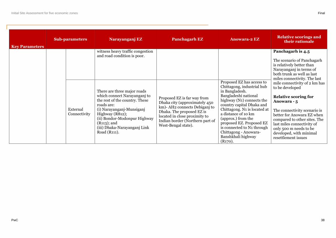
Initial Site Assessment for five economic zones Final
PwC 38
Key Parameters
Sub-parameters Narayanganj EZ Panchagarh EZ Anowara-2 EZRelative scorings and
their rationale
witness heavy traffic congestionand road condition is poor.
Panchagarh is 4.5
The scenario of Panchagarhis relatively better thanNarayanganj in terms ofboth trunk as well as lastmiles connectivity. The lastmile connectivity of 2 km hasto be developed
Relative scoring forAnowara - 5
The connectivity scenario isbetter for Anowara EZ whencompared to other sites. Thelast miles connectivity ofonly 500 m needs to bedeveloped, with minimalresettlement issues
ExternalConnectivity
There are three major roadswhich connect Narayanganj tothe rest of the country. Theseroads are:(i) Narayanganj-MunsiganjHighway (R812);(ii) Bondor-Modonpur Highway(R113); and(iii) Dhaka-Narayanganj LinkRoad (R111).
Proposed EZ is far way fromDhaka city (approximately 450km)- AH2 connects Debiganj toDhaka. The proposed EZ islocated in close proximity toIndian border (Northern part ofWest-Bengal state).
Proposed EZ has access toChittagong, industrial hubin Bangladesh.Bangladeshi nationalhighway (N1) connects thecountry capital Dhaka andChittagong. N1 is located ata distance of 10 km(approx.) from theproposed EZ. Proposed EZis connected to N1 throughChittagong - Anowara-Banshkhali highway(R170).

Initial Site Assessment for five economic zones Final
PwC 39
Key Parameters
Sub-parameters Narayanganj EZ Panchagarh EZ Anowara-2 EZRelative scorings and
their rationale
Last MileConnectivity
The existing approach road isadjacent to Bashundharacement plant. It is a single-laneroad and heavy commericalvehicles face difficulty to movethrough this road. Widening ofthe approach road would resultin significant resettlementissues owing to Basundharacement plant (located on oneside of the road) and residentialunits (located on the other side).
The Sitalakhya Bridge isproposed to be developed inclose proximity to the site, oncefunctional shall provide accessto the proposed EZ.
The site is connected to theBoda – Domar via DebiganjUpazilla Road (Z5003) by aKatcha Road of stretch ~ 300 m,and z5003 in turn furtherconnects the site to AH2.
z5003 is a single lane road. Itruns for ~ 2km from AH2 to theKatcha Road connecting the siteto it.On either side of the road,there are private lands, howeveras such no houses or anypermanent structures adjacentto the road were observed andhence there is a scope ofwideningPreliminary assessmentsuggests that on either side ofthe stretch of the Katcha Roadthere are no permanentstructures and there is a scopefor widening the stretch
Proposed EZ is connectedto N1 through Chittagong -Anowara- Banshkhalihighway (R170).A 200 m Katcha Roadstretch connects the site toa blacktop single lane road.The black top single laneroad in turn connects theKatcha Road to R170,through a stretch of ~ 500m. Both the Katcha Roadand the blacktop road are~ 3 m. Preliminaryassessment suggests thaton either side of theseroads there are privatelands, however there areno houses or anypermanent strucutres andhence there is a scope forwidening these roads for abetter approach
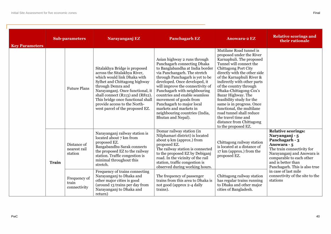
Initial Site Assessment for five economic zones Final
PwC 40
Key Parameters
Sub-parameters Narayanganj EZ Panchagarh EZ Anowara-2 EZRelative scorings and
their rationale
Future Plans
Sitalakhya Bridge is proposedacross the Sitalakhya River,which would link Dhaka withSylhet and Chittagong highwaythrough Demra andNarayanganj. Once functional, itshall connect (R113) and (R812).This bridge once functional shallprovide access to the North-west parcel of the proposed EZ.
Asian highway 2 runs throughPanchagarh connecting Dhakato Banglabandha at India bordervia Panchangarh. The stretchthrough Panchagarh is yet to bedeveloped. Once developed, itwill improve the connectivity ofPanchagarh with neighbouringcountries and enable seamlessmovement of goods fromPanchagarh to major localmarkets and markets inneighbouring countries (India,Bhutan and Nepal).
Mutilane Road tunnel isproposed under the RiverKarnaphuli. The proposedTunnel will connect theChittagong Port Citydirectly with the other sideof the Karnaphuli River &indirectly with other partsof the country throughDhaka-Chittagong-Cox’sBazar Highway. Thefeasibility study for thesame is in progress. Oncefunctional, the multilaneroad tunnel shall reducethe travel time anddistance from Chittagongto the proposed EZ.
Train
Distance ofnearest railstation
Narayanganj railway station islocated about 7 km fromproposed EZ.Bangabandhu Sarak connectsthe proposed EZ to the railwaystation. Traffic congestion isminimal throughout thisstretch.
Domar railway station (inNilphamari district) is locatedabout 9 km (approx.) fromproposed EZ.The railway station is connectedto the proposed EZ by Debiganjroad. In the vicinity of the railstation, traffic congestion isobserved during working hours.
Chittagong railway stationis located at a distance of17 km (approx.) from theproposed EZ.
Relative scorings:Naryanganj - 5Panchagarh - 3Anowara - 5The train connectivity forNarayanganj and Anowara iscomparable to each otherand is better thanPanchagarh. This is also truein case of last mileconnectivity of the site to thestations
Frequency oftrainconnectivity
Frequency of trains connectingNarayanganj to Dhaka andother major cities is good(around 13 trains per day fromNarayanganj to Dhaka andreturn)
The frequency of passengertrains from this area to Dhaka isnot good (approx 2-4 dailytrains).
Chittagong railway stationhas regular trains runningto Dhaka and other majorcities of Bangladesh.
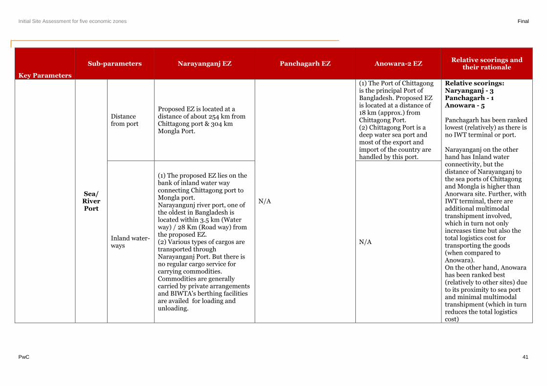
Initial Site Assessment for five economic zones Final
PwC 41
Key Parameters
Sub-parameters Narayanganj EZ Panchagarh EZ Anowara-2 EZRelative scorings and
their rationale
Sea/RiverPort
Distancefrom port
Proposed EZ is located at adistance of about 254 km fromChittagong port & 304 kmMongla Port.
N/A
(1) The Port of Chittagongis the principal Port ofBangladesh. Proposed EZis located at a distance of18 km (approx.) fromChittagong Port.(2) Chittagong Port is adeep water sea port andmost of the export andimport of the country arehandled by this port.
Relative scorings:Naryanganj - 3Panchagarh - 1Anowara - 5
Panchagarh has been rankedlowest (relatively) as there isno IWT terminal or port.
Narayanganj on the otherhand has Inland waterconnectivity, but thedistance of Narayanganj tothe sea ports of Chittagongand Mongla is higher thanAnorwara site. Further, withIWT terminal, there areadditional multimodaltranshipment involved,which in turn not onlyincreases time but also thetotal logistics cost fortransporting the goods(when compared toAnowara).On the other hand, Anowarahas been ranked best(relatively to other sites) dueto its proximity to sea portand minimal multimodaltranshipment (which in turnreduces the total logisticscost)
Inland water-ways
(1) The proposed EZ lies on thebank of inland water wayconnecting Chittagong port toMongla port.Narayangunj river port, one ofthe oldest in Bangladesh islocated within 3.5 km (Waterway) / 28 Km (Road way) fromthe proposed EZ.(2) Various types of cargos aretransported throughNarayanganj Port. But there isno regular cargo service forcarrying commodities.Commodities are generallycarried by private arrangementsand BIWTA's berthing facilitiesare availed for loading andunloading.
N/A
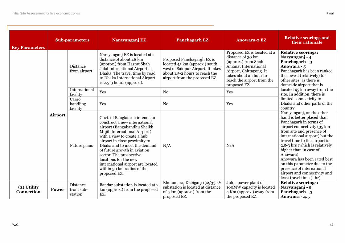
Initial Site Assessment for five economic zones Final
PwC 42
Key Parameters
Sub-parameters Narayanganj EZ Panchagarh EZ Anowara-2 EZRelative scorings and
their rationale
Airport
Distancefrom airport
Narayanganj EZ is located at adistance of about 48 km(approx.) from Hazrat ShahJalal International Airport atDhaka. The travel time by roadto Dhaka International Airportis 2.5-3 hours (approx.).
Proposed Panchagargh EZ islocated 45 km (approx.) southwest of Saidpur Airport. It takesabout 1.5-2 hours to reach theairport from the proposed EZ.
Proposed EZ is located at adistance of 30 km(approx.) from ShahAmanat InternationalAirport, Chittagong. Ittakes about an hour toreach the airport from theproposed EZ.
Relative scorings:Naryanganj - 4Panchagarh - 3Anowara - 5Panchagarh has been rankedthe lowest (relatively) toother sites, as there isdomestic airport that islocated 45 km away from thesite. In addition, there islimited connectivity toDhaka and other parts of thecountry.Narayanganj, on the otherhand is better placed thanPanchagarh in terms ofairport connectivity (35 kmfrom site and presence ofinternational airport) but thetravel time to the airport is2.5-3 hrs (which is relativelyhigher than in case ofAnowara)Anowara has been rated beston this parameter due to thepresence of internationalairport and connectivity andleast travel time (1 hr).
Internationalfacility
Yes No Yes
Cargohandlingfacility
Yes No Yes
Future plans
Govt. of Bangladesh intends toconstruct a new internationalairport (Bangabandhu SheikhMujib International Airport)with a view to create a hubairport in close proximity toDhaka and to meet the demandof future growth in aviationsector. The prospectivelocations for the newinternational airport are locatedwithin 50 km radius of theproposed EZ.
N/A N/A
(2) UtilityConnection
PowerDistancefrom sub-station
Bandar substation is located at 2km (approx.) from the proposedEZ.
Khotamara, Debiganj 132/33 kVsubstation is located at distanceof 5 km (approx.) from theproposed EZ.
Julda power plant of100MW capacity is located4 Km (approx.) away fromthe proposed EZ.
Relative scorings:Naryanganj - 5Panchagarh - 5Anowara - 4.5
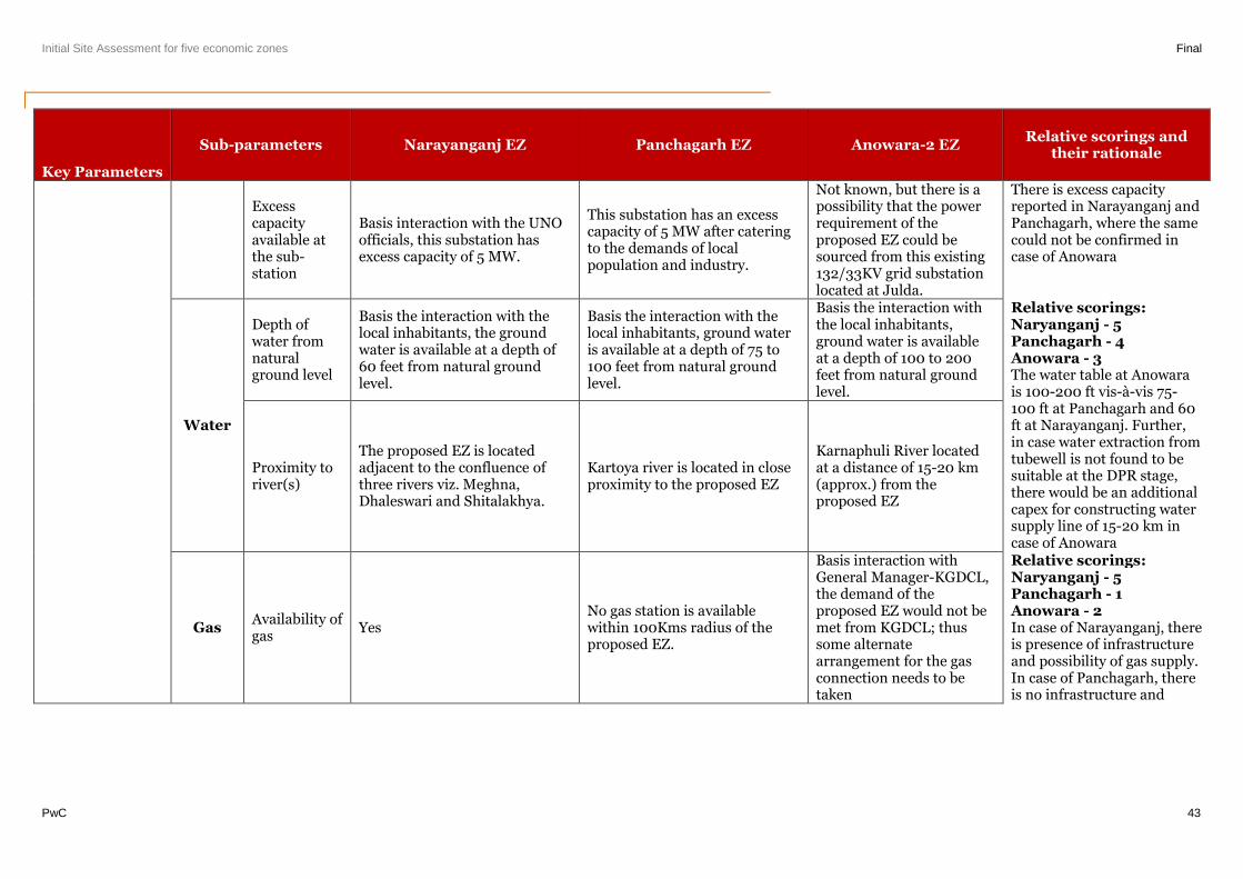
Initial Site Assessment for five economic zones Final
PwC 43
Key Parameters
Sub-parameters Narayanganj EZ Panchagarh EZ Anowara-2 EZRelative scorings and
their rationale
Excesscapacityavailable atthe sub-station
Basis interaction with the UNOofficials, this substation hasexcess capacity of 5 MW.
This substation has an excesscapacity of 5 MW after cateringto the demands of localpopulation and industry.
Not known, but there is apossibility that the powerrequirement of theproposed EZ could besourced from this existing132/33KV grid substationlocated at Julda.
There is excess capacityreported in Narayanganj andPanchagarh, where the samecould not be confirmed incase of Anowara
Water
Depth ofwater fromnaturalground level
Basis the interaction with thelocal inhabitants, the groundwater is available at a depth of60 feet from natural groundlevel.
Basis the interaction with thelocal inhabitants, ground wateris available at a depth of 75 to100 feet from natural groundlevel.
Basis the interaction withthe local inhabitants,ground water is availableat a depth of 100 to 200feet from natural groundlevel.
Relative scorings:Naryanganj - 5Panchagarh - 4Anowara - 3The water table at Anowarais 100-200 ft vis-à-vis 75-100 ft at Panchagarh and 60ft at Narayanganj. Further,in case water extraction fromtubewell is not found to besuitable at the DPR stage,there would be an additionalcapex for constructing watersupply line of 15-20 km incase of Anowara
Proximity toriver(s)
The proposed EZ is locatedadjacent to the confluence ofthree rivers viz. Meghna,Dhaleswari and Shitalakhya.
Kartoya river is located in closeproximity to the proposed EZ
Karnaphuli River locatedat a distance of 15-20 km(approx.) from theproposed EZ
GasAvailability ofgas
YesNo gas station is availablewithin 100Kms radius of theproposed EZ.
Basis interaction withGeneral Manager-KGDCL,the demand of theproposed EZ would not bemet from KGDCL; thussome alternatearrangement for the gasconnection needs to betaken
Relative scorings:Naryanganj - 5Panchagarh - 1Anowara - 2In case of Narayanganj, thereis presence of infrastructureand possibility of gas supply.In case of Panchagarh, thereis no infrastructure and
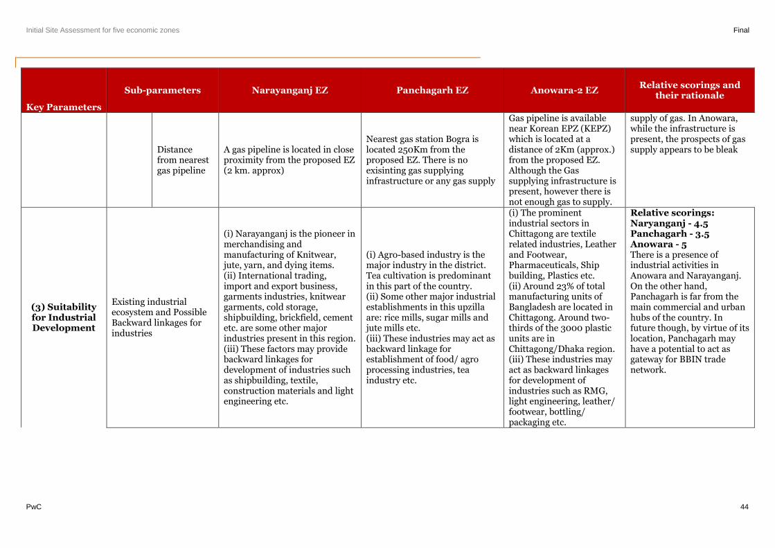
Initial Site Assessment for five economic zones Final
PwC 44
Key Parameters
Sub-parameters Narayanganj EZ Panchagarh EZ Anowara-2 EZRelative scorings and
their rationale
Distancefrom nearestgas pipeline
A gas pipeline is located in closeproximity from the proposed EZ(2 km. approx)
Nearest gas station Bogra islocated 250Km from theproposed EZ. There is noexisinting gas supplyinginfrastructure or any gas supply
Gas pipeline is availablenear Korean EPZ (KEPZ)which is located at adistance of 2Km (approx.)from the proposed EZ.Although the Gassupplying infrastructure ispresent, however there isnot enough gas to supply.
supply of gas. In Anowara,while the infrastructure ispresent, the prospects of gassupply appears to be bleak
(3) Suitabilityfor IndustrialDevelopment
Existing industrialecosystem and PossibleBackward linkages forindustries
(i) Narayanganj is the pioneer inmerchandising andmanufacturing of Knitwear,jute, yarn, and dying items.(ii) International trading,import and export business,garments industries, knitweargarments, cold storage,shipbuilding, brickfield, cementetc. are some other majorindustries present in this region.(iii) These factors may providebackward linkages fordevelopment of industries suchas shipbuilding, textile,construction materials and lightengineering etc.
(i) Agro-based industry is themajor industry in the district.Tea cultivation is predominantin this part of the country.(ii) Some other major industrialestablishments in this upzillaare: rice mills, sugar mills andjute mills etc.(iii) These industries may act asbackward linkage forestablishment of food/ agroprocessing industries, teaindustry etc.
(i) The prominentindustrial sectors inChittagong are textilerelated industries, Leatherand Footwear,Pharmaceuticals, Shipbuilding, Plastics etc.(ii) Around 23% of totalmanufacturing units ofBangladesh are located inChittagong. Around two-thirds of the 3000 plasticunits are inChittagong/Dhaka region.(iii) These industries mayact as backward linkagesfor development ofindustries such as RMG,light engineering, leather/footwear, bottling/packaging etc.
Relative scorings:Naryanganj - 4.5Panchagarh - 3.5Anowara - 5There is a presence ofindustrial activities inAnowara and Narayanganj.On the other hand,Panchagarh is far from themain commercial and urbanhubs of the country. Infuture though, by virtue of itslocation, Panchagarh mayhave a potential to act asgateway for BBIN tradenetwork.
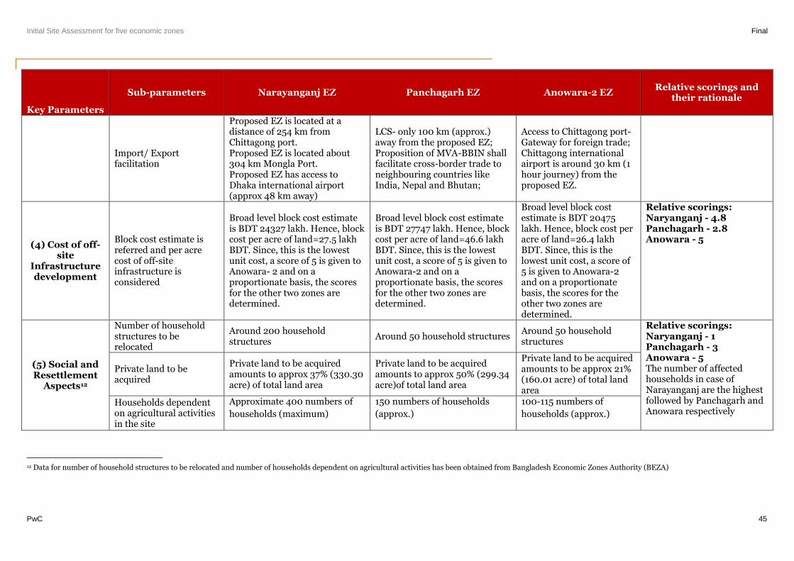
Initial Site Assessment for five economic zones Final
PwC 45
Key Parameters
Sub-parameters Narayanganj EZ Panchagarh EZ Anowara-2 EZRelative scorings and
their rationale
Import/ Exportfacilitation
Proposed EZ is located at adistance of 254 km fromChittagong port.Proposed EZ is located about304 km Mongla Port.Proposed EZ has access toDhaka international airport(approx 48 km away)
LCS- only 100 km (approx.)away from the proposed EZ;Proposition of MVA-BBIN shallfacilitate cross-border trade toneighbouring countries likeIndia, Nepal and Bhutan;
Access to Chittagong port-Gateway for foreign trade;Chittagong internationalairport is around 30 km (1hour journey) from theproposed EZ.
(4) Cost of off-site
Infrastructuredevelopment
Block cost estimate isreferred and per acrecost of off-siteinfrastructure isconsidered
Broad level block cost estimateis BDT 24327 lakh. Hence, blockcost per acre of land=27.5 lakhBDT. Since, this is the lowestunit cost, a score of 5 is given toAnowara- 2 and on aproportionate basis, the scoresfor the other two zones aredetermined.
Broad level block cost estimateis BDT 27747 lakh. Hence, blockcost per acre of land=46.6 lakhBDT. Since, this is the lowestunit cost, a score of 5 is given toAnowara-2 and on aproportionate basis, the scoresfor the other two zones aredetermined.
Broad level block costestimate is BDT 20475lakh. Hence, block cost peracre of land=26.4 lakhBDT. Since, this is thelowest unit cost, a score of5 is given to Anowara-2and on a proportionatebasis, the scores for theother two zones aredetermined.
Relative scorings:Naryanganj - 4.8Panchagarh - 2.8Anowara - 5
(5) Social andResettlement
Aspects12
Number of householdstructures to berelocated
Around 200 householdstructures
Around 50 household structuresAround 50 householdstructures
Relative scorings:Naryanganj - 1Panchagarh - 3Anowara - 5The number of affectedhouseholds in case ofNarayanganj are the highestfollowed by Panchagarh andAnowara respectively
Private land to beacquired
Private land to be acquiredamounts to approx 37% (330.30acre) of total land area
Private land to be acquiredamounts to approx 50% (299.34acre)of total land area
Private land to be acquiredamounts to be approx 21%(160.01 acre) of total landarea
Households dependenton agricultural activitiesin the site
Approximate 400 numbers of
households (maximum)
150 numbers of households
(approx.)
100-115 numbers of
households (approx.)
12 Data for number of household structures to be relocated and number of households dependent on agricultural activities has been obtained from Bangladesh Economic Zones Authority (BEZA)
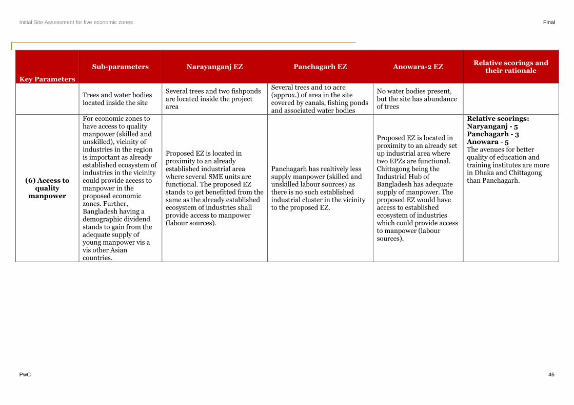
Initial Site Assessment for five economic zones Final
PwC 46
Key Parameters
Sub-parameters Narayanganj EZ Panchagarh EZ Anowara-2 EZRelative scorings and
their rationale
Trees and water bodieslocated inside the site
Several trees and two fishpondsare located inside the projectarea
Several trees and 10 acre(approx.) of area in the sitecovered by canals, fishing pondsand associated water bodies
No water bodies present,but the site has abundanceof trees
(6) Access toquality
manpower
For economic zones tohave access to qualitymanpower (skilled andunskilled), vicinity ofindustries in the regionis important as alreadyestablished ecosystem ofindustries in the vicinitycould provide access tomanpower in theproposed economiczones. Further,Bangladesh having ademographic dividendstands to gain from theadequate supply ofyoung manpower vis avis other Asiancountries.
Proposed EZ is located inproximity to an alreadyestablished industrial areawhere several SME units arefunctional. The proposed EZstands to get benefitted from thesame as the already establishedecosystem of industries shallprovide access to manpower(labour sources).
Panchagarh has realtively lesssupply manpower (skilled andunskilled labour sources) asthere is no such establishedindustrial cluster in the vicinityto the proposed EZ.
Proposed EZ is located inproximity to an already setup industrial area wheretwo EPZs are functional.Chittagong being theIndustrial Hub ofBangladesh has adequatesupply of manpower. Theproposed EZ would haveaccess to establishedecosystem of industrieswhich could provide accessto manpower (laboursources).
Relative scorings:Naryanganj - 5Panchagarh - 3Anowara - 5The avenues for betterquality of education andtraining institutes are morein Dhaka and Chittagongthan Panchagarh.
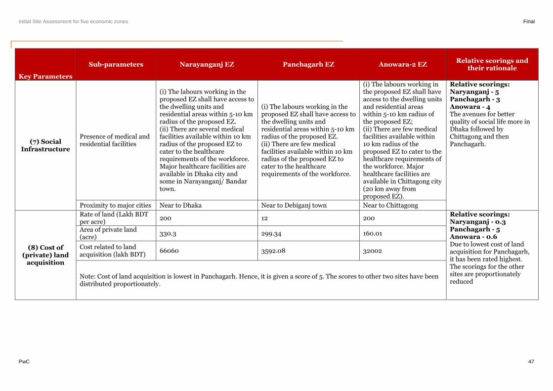
Initial Site Assessment for five economic zones Final
PwC 47
Key Parameters
Sub-parameters Narayanganj EZ Panchagarh EZ Anowara-2 EZRelative scorings and
their rationale
(7) SocialInfrastructure
Presence of medical andresidential facilities
(i) The labours working in theproposed EZ shall have access tothe dwelling units andresidential areas within 5-10 kmradius of the proposed EZ.(ii) There are several medicalfacilities available within 10 kmradius of the proposed EZ tocater to the healthcarerequirements of the workforce.Major healthcare facilities areavailable in Dhaka city andsome in Narayanganj/ Bandartown.
(i) The labours working in theproposed EZ shall have access tothe dwelling units andresidential areas within 5-10 kmradius of the proposed EZ.(ii) There are few medicalfacilities available within 10 kmradius of the proposed EZ tocater to the healthcarerequirements of the workforce.
(i) The labours working inthe proposed EZ shall haveaccess to the dwelling unitsand residential areaswithin 5-10 km radius ofthe proposed EZ;(ii) There are few medicalfacilities available within10 km radius of theproposed EZ to cater to thehealthcare requirements ofthe workforce. Majorhealthcare facilities areavailable in Chittagong city(20 km away fromproposed EZ).
Relative scorings:Naryanganj - 5Panchagarh - 3Anowara - 4The avenues for betterquality of social life more inDhaka followed byChittagong and thenPanchagarh.
Proximity to major cities Near to Dhaka Near to Debiganj town Near to Chittagong
(8) Cost of(private) land
acquisition
Rate of land (Lakh BDTper acre)
200 12 200Relative scorings:Naryanganj - 0.3Panchagarh - 5Anowara - 0.6Due to lowest cost of landacquisition for Panchagarh,it has been rated highest.The scorings for the othersites are proportionatelyreduced
Area of private land(acre)
330.3 299.34 160.01
Cost related to landacquisition (lakh BDT)
66060 3592.08 32002
Note: Cost of land acquisition is lowest in Panchagarh. Hence, it is given a score of 5. The scores to other two sites have beendistributed proportionately.
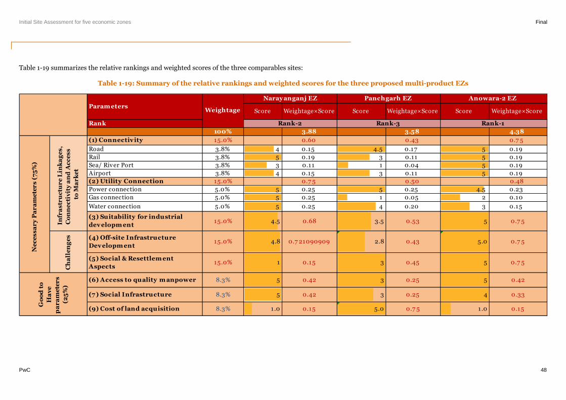
Initial Site Assessment for five economic zones Final
PwC 48
Table 1-19 summarizes the relative rankings and weighted scores of the three comparables sites:
Table 1-19: Summary of the relative rankings and weighted scores for the three proposed multi-product EZs
Score Weightage×Score Score Weightage×Score Score Weightage×Score
Rank
100% 3.88 3.58 4.38
(1) Connectivity 15.0% 0.60 0.43 0.7 5
Road 3.8% 4 0.15 4.5 0.17 5 0.19
Rail 3.8% 5 0.19 3 0.11 5 0.19
Sea/ River Port 3.8% 3 0.11 1 0.04 5 0.19
Airport 3.8% 4 0.15 3 0.11 5 0.19
(2) Utility Connection 15.0% 0.7 5 0.50 0.48
Power connection 5.0% 5 0.25 5 0.25 4.5 0.23
Gas connection 5.0% 5 0.25 1 0.05 2 0.10
Water connection 5.0% 5 0.25 4 0.20 3 0.15
(3) Suitability for industrial
developm ent15.0% 4.5 0.68 3.5 0.53 5 0.7 5
(4) Off-site Infrastructure
Developm ent15.0% 4.8 0.7 21090909 2.8 0.43 5.0 0.7 5
(5) Social & Resettlem ent
Aspects15.0% 1 0.15 3 0.45 5 0.7 5
(6) Access to quality m anpower 8.3% 5 0.42 3 0.25 5 0.42
(7 ) Social Infrastructure 8.3% 5 0.42 3 0.25 4 0.33
(9) Cost of land acquisition 8.3% 1.0 0.15 5.0 0.7 5 1.0 0.15
Rank-2 Rank-3 Rank-1
Weightage
Narayanganj EZ Panchgarh EZ Anowara-2 EZ
Ch
all
en
ge
s
Ne
ce
ss
ar
yP
ar
am
ete
rs
(75
%)
Go
od
to
Ha
ve
pa
ra
me
ter
s
(25
%)
Infr
as
tru
ctu
re
Lin
ka
ge
s,
Co
nn
ec
tiv
ity
an
dA
cc
es
s
toM
ar
ke
t
Param eters

Initial Site Assessment for five economic zones Final
PwC 49
Project Background
Initial Site Assessment for five economic zones Final
PwC 50
2. Project Background
2.1. Background of the Engagement
Bangladesh has been growing at a sustained annual GDP growth of over 6 percent since FY 2010. Growth was
underpinned by stable macroeconomic and prudent monetary policies, rising industry, services output and
continued high levels of remittances. Going forward, Government of Bangladesh’s objective is to develop a
growth trajectory that will support an overall increase in real GDP growth to 8 percent per annum and reduce
poverty from 40 percent to 15 percent by 2021.
The sustained growth in Bangladesh’s labor force of nearly 2 million a year is an asset that nevertheless
increases the country’s vulnerability. Creating productive employment will largely depend on creating an
environment conducive to private sector investment, particularly for labor-intensive manufacturing and
services sector.
The Government of Bangladesh has successfully provided tailored infrastructure services and business
environment conditions through Export Processing Zones (EPZs). EPZs were used as a strategic instrument for
attracting FDI and dealing with the shortcomings of the overall investment climate, business registration,
licensing, etc. The Bangladesh Export Processing Zone Authority (BEPZA) was established in 1980, with the
first EPZ built in Chittagong in 1983. The EPZ program was the first systematic initiative to provide fully-
serviced land and a better business environment for investors, targeting large scale, export-oriented
manufacturing. EPZs have triggered impressive growth in exports, mainly in the RMG sector, at an average
annual rate of 23 percent since 1993, reaching nearly US$2.9 billion by FY2010, and employing almost 28,000
people.
Bangladesh’s current EPZ model has its limits both in terms of cumulative impact and in terms of spillover to
the domestic economy. As an exporting enclave, EPZs have provided little in the way of linkages with the
domestic economy, up-stream or down-stream, resulting in low technology and efficiency spillover which
accompany foreign investment. Investments in other sectors beyond the low capital investment RMG segment
have also not materialized.
The Government’s objective is therefore to maximize the potential direct and indirect impacts through a more
modern, generalized regime for Economic Zones (EZs). The Government has launched an effort to develop a
new EZ paradigm for Bangladesh, drawing from numerous successful examples from around the world as well
as Bangladesh’s own positive experience with the EPZ model. The expectation is that more spillover will be
harnessed by local firms from foreign direct investment, additional investments will be encouraged within value
chains, more local produce will be procured and better linkages established between firms and educational
institutions. A faster adaption to international environmental and social practices in the private sector should
also be encouraged through the new EZ policy.
The new EZ regime provides for a new approach both in management and investment. The policy allows the
Government to develop and pilot an approach that is less reliant on Government fiscal subsidies, while
leveraging comparative advantages and private sector capability where possible.
The Economic Zone Act was passed in the Bangladesh Parliament in August 2010, providing the overall
framework for establishing EZs throughout Bangladesh. Under this Act, the Bangladesh Economic Zone
Authority is established under the Prime Minister’s Office (PMO) and governed by a Board chaired by the Prime
Minister. The law provides the legal coverage for attracting and leveraging private investment in the
development of zones as zone developers or operators, and in the provision of tailored infrastructure services,
such as private provision of power, effluent treatment, etc.
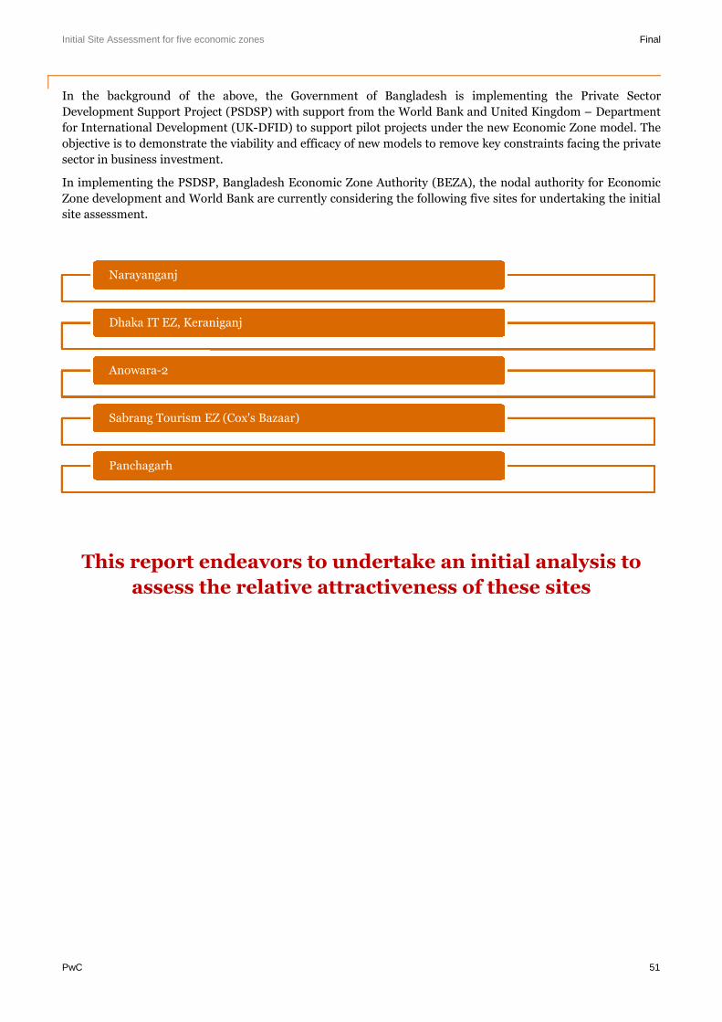
Initial Site Assessment for five economic zones Final
PwC 51
In the background of the above, the Government of Bangladesh is implementing the Private Sector
Development Support Project (PSDSP) with support from the World Bank and United Kingdom – Department
for International Development (UK-DFID) to support pilot projects under the new Economic Zone model. The
objective is to demonstrate the viability and efficacy of new models to remove key constraints facing the private
sector in business investment.
In implementing the PSDSP, Bangladesh Economic Zone Authority (BEZA), the nodal authority for Economic
Zone development and World Bank are currently considering the following five sites for undertaking the initial
site assessment.
This report endeavors to undertake an initial analysis to
assess the relative attractiveness of these sites
Narayanganj
Dhaka IT EZ, Keraniganj
Anowara-2
Sabrang Tourism EZ (Cox's Bazaar)
Panchagarh
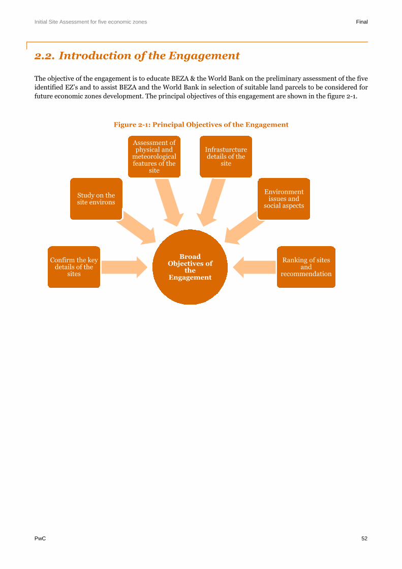
Initial Site Assessment for five economic zones Final
PwC 52
2.2. Introduction of the Engagement
The objective of the engagement is to educate BEZA & the World Bank on the preliminary assessment of the five
identified EZ’s and to assist BEZA and the World Bank in selection of suitable land parcels to be considered for
future economic zones development. The principal objectives of this engagement are shown in the figure 2-1.
Figure 2-1: Principal Objectives of the Engagement
BroadObjectives of
theEngagement
Confirm the keydetails of the
sites
Study on thesite environs
Assessment ofphysical and
meteorologicalfeatures of the
site
Infrasturcturedetails of the
site
Environmentissues and
social aspects
Ranking of sitesand
recommendation
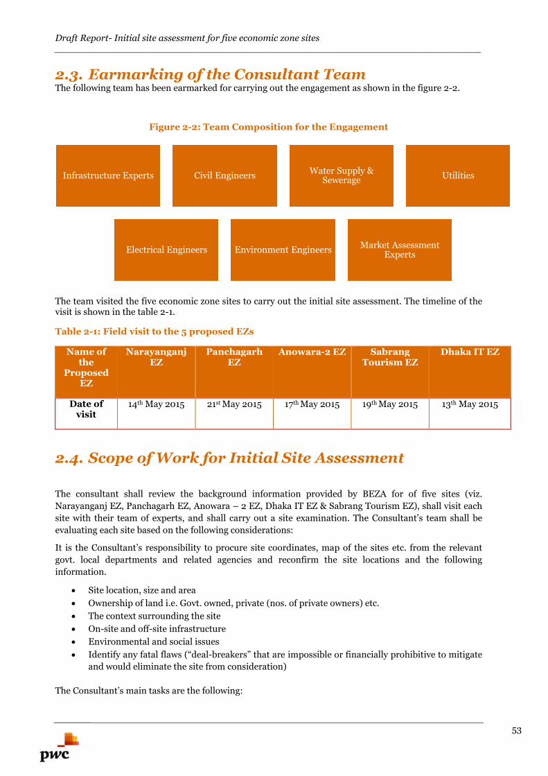
Draft Report- Initial site assessment for five economic zone sites________________________________________________________________________
53
2.3. Earmarking of the Consultant TeamThe following team has been earmarked for carrying out the engagement as shown in the figure 2-2.
Figure 2-2: Team Composition for the Engagement
The team visited the five economic zone sites to carry out the initial site assessment. The timeline of thevisit is shown in the table 2-1.
Table 2-1: Field visit to the 5 proposed EZs
Name ofthe
ProposedEZ
NarayanganjEZ
PanchagarhEZ
Anowara-2 EZ SabrangTourism EZ
Dhaka IT EZ
Date ofvisit
14th May 2015 21st May 2015 17th May 2015 19th May 2015 13th May 2015
2.4. Scope of Work for Initial Site Assessment
The consultant shall review the background information provided by BEZA for of five sites (viz.
Narayanganj EZ, Panchagarh EZ, Anowara – 2 EZ, Dhaka IT EZ & Sabrang Tourism EZ), shall visit each
site with their team of experts, and shall carry out a site examination. The Consultant’s team shall be
evaluating each site based on the following considerations:
It is the Consultant’s responsibility to procure site coordinates, map of the sites etc. from the relevant
govt. local departments and related agencies and reconfirm the site locations and the following
information.
Site location, size and area
Ownership of land i.e. Govt. owned, private (nos. of private owners) etc.
The context surrounding the site
On-site and off-site infrastructure
Environmental and social issues
Identify any fatal flaws (“deal-breakers” that are impossible or financially prohibitive to mitigate
and would eliminate the site from consideration)
The Consultant’s main tasks are the following:
Infrastructure Experts Civil EngineersWater Supply &
SewerageUtilities
Electrical Engineers Environment EngineersMarket Assessment
Experts
Draft Report- Initial site assessment for five economic zone sites________________________________________________________________________
54
Task 1: Conduct each site survey
Reconfirm the site locations and the following information:
Reconfirm location (mouza, upzila, district, division)
Reconfirm coordinates of sites
Reconfirm the boundaries of the sites
Reconfirm size of sites (acre and m2)
Reconfirm ownership of land i.e. whether it is Govt. owned, Govt. agency, private etc. (nos. of
private owners, holding size and other pertinent details)
Reconfirm the land use and conversion constraints, if any
Task 2: The context surrounding each site
Assess the areas (neighbourhood) around the sites, and identify any issues deemed important to
the outcome of the evaluation. In addition, the following must be undertaken:
Describe the area surrounding the sites
List nearest urban and rural communities and their distances from the sites (km from the site)
List the nearest hospitals and schools and their distances from the sites
List distance in km to key regional infrastructure (airport, rail, seaport, river port, inland
waterways, national highways etc.) and the operational condition of the identified infrastructure
Identify any land uses (residential, commercial etc.) in close proximity to the sites that would be
negatively affected by a large scale economic zone
Identify the possibility of forward and backward linkages to the economy
Identify if there are any environmental or social problems surrounding the sites that would
negatively affect the development of the site
Identify any fatal flaws in the surrounding areas around the sites
Task 3: Assess each site
The consultant will assess the individual sites. This will include, but not be limited to:
The landscape (rolling hills, flood plain, water bodies, trees, rivers etc.)
Type of soil (no soil testing)
Is it in an earthquake zone
Type of climate (rain, monsoon etc.)
Type and density of vegetation on sites (trees, crops etc.)
Types of land uses on the sites (commercial, residential, parks, industrial, agricultural etc.)
Identify if there are any industrial activities on the sites
Are crops grown on the sites. If so, how often and what kinds
Identify if any, infrastructure (bridges, dams, retaining walls etc.) or building on sites (houses,
mosques, historical structures, graveyards etc.) which currently exists
Identify any illegal settlements
Identify any fatal flaws
Task 4: Assess the on-site and off-site infrastructure for each site
Assess the infrastructure both onsite and offsite. This will include, but not be limited to:
Identify the location, size and type of roads closest or entering into the sites
Identify the location of off-site key infrastructure and its connections for power, water, gas, water
treatment, sewage, telecommunications etc.
Identify existing quantity and quality of off-site infrastructure (i.e. power voltage existing and
can the power be brought to the boundary of the sites etc.)
Draft Report- Initial site assessment for five economic zone sites________________________________________________________________________
55
List proposed new infrastructure developments around the site which may have an impact on the
site
Identify the location size and type of roads inside the sites
Identify the location of on-site key infrastructure, if any, and its direct connection i.e. power
voltage existing and location of existing connection
Identify any fatal flaws
The location of all on-site and off-site connections should be identified by physical site survey
Task 5: Identify the environmental issues for each site
Assess the site’s environment and identify any issues or concerns. The following is a brief checklist of
issues to be assessed. The issues are:
Does the site have frequent erosion or flooding
Are earthquakes frequent; if so what is the magnitudes
Rivers and lakes-whether they are on-site and where. If so, then what are the implications and
impact of that
What impact will rivers around the areas have on the site (high and low tides)
Whether raising the level of land (land filling) is required, if so then how high and estimate of the
cost
Whether there are wetlands or any protected areas within the site and/or within 10 km radius.
This may include mangrove or other specific areas that is specific to the locality 4 of 5
Source and type of existing pollution (if any) and the nature of the pollution
Whether there is clean water available on the site or in the area, and from where and in what
quantity? What are the alternative sources
Is the site contaminated
Are the lands around the site contaminated
Can the contamination be mitigated
Is there wastewater discharge or treatment in the area
Is there a solid waste disposal in close proximity to the site
Is it a forest land or will it involve tree cutting
Identify any fatal flaws
The consultant is welcome to add any other issues that might be relevant or emerge in the course
of performing this exercise.
Task 6: Assess the social aspects of each site and its surrounding area
Assessment of the social issues of the site will also be necessary for the evaluation. The following will
need to be looked into:
Size of urban and rural populations
Type of housing on site, if any (wood, brick, corrugated iron etc.)
Whether women and their livelihood will be affected because of the economic zone
Available community facilities (schools, hospitals, shops, mosques etc.) and services
List the main livelihood of the inhabitants – fishing, farming, grazing cattle, small business etc.
Is resettlement required. If so, for approximately how many people, families etc.
Identify any fatal flaws
Task 7: Meet with government officials
After evaluating the sites, the consultant should meet with government agencies and officials to gather
the missing technical information required to undertake the final component of the site prioritization.
Draft Report- Initial site assessment for five economic zone sites________________________________________________________________________
56
Land use maps, location and capacity of power, water, gas, telecom etc. will be required to finalize this
work.
Task 8: Interaction with private sector
After evaluating the sites, the consultant should meet/discuss over telecom/video conference with
private players (at least 3 domestic and 7 international – primarily Japanese, Chinese, Korean etc.) zones
developers to gauge their primary interest on the preferred location for the site, attractiveness of the site
in terms of marketability as a single product EZ or a multi-product EZ etc.
Task 9: Ranking of sites
The sites must be ranked:
Against each other to determine the priority sites across the country
A brief report must be prepared assessing all sites individually with a chapter discussing the
ranking process and its outcome
Arrange a presentation one day session on the draft report potentially attended by BEZA, World
Bank, ERD, PMO key officials and selected private sector players, and participate in discussion,
take feedback and reflect in the Final Report
2.5. Our Approach and Action PlanOur approach and methodology to deliver the key objectives of this engagement has been designed to
align with the plans and timelines of BEZA and the World Bank. Accordingly, the following sections
delves with the overall framework for execution and highlights the key milestones that needs to be
achieved understanding and alignment of scope and deliverables between all the key stakeholders (i.e.
BEZA, World Bank and the Consultants) and our detailed approach and methodology providing a
blueprint of our activities and deliverables over the proposed engagement period.
This approach methodology aims to formulate the Terms of Reference for the proposed engagement and
explains the envisaged approach in carrying out the engagement. While formulating this methodology,
we have ensured that the final deliverables are oriented towards sustainable development and
subsequent operations with innovative and implementable concept. The questionnaire to be utilized
during site visit is annexed with this report. The broad approach proposed to be adopted is shown in the
figure 2-3.
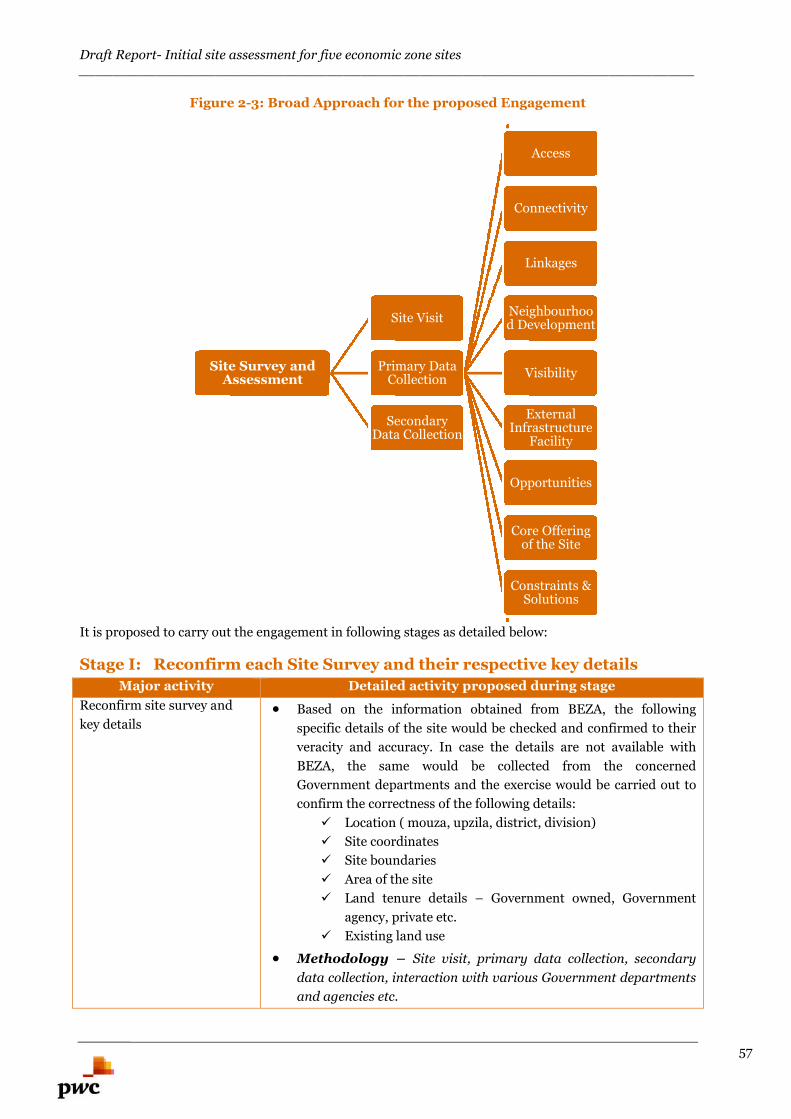
Draft Report- Initial site assessment for five economic zone sites________________________________________________________________________
57
Figure 2-3: Broad Approach for the proposed Engagement
It is proposed to carry out the engagement in following stages as detailed below:
Stage I: Reconfirm each Site Survey and their respective key details
Major activity Detailed activity proposed during stage
Reconfirm site survey and
key details Based on the information obtained from BEZA, the following
specific details of the site would be checked and confirmed to their
veracity and accuracy. In case the details are not available with
BEZA, the same would be collected from the concerned
Government departments and the exercise would be carried out to
confirm the correctness of the following details:
Location ( mouza, upzila, district, division)
Site coordinates
Site boundaries
Area of the site
Land tenure details – Government owned, Government
agency, private etc.
Existing land use
Methodology – Site visit, primary data collection, secondary
data collection, interaction with various Government departments
and agencies etc.
Site Survey andAssessment
Site Visit
Primary DataCollection
Access
Connectivity
Linkages
Neighbourhood Development
Visibility
ExternalInfrastructure
Facility
Opportunities
Core Offeringof the Site
Constraints &Solutions
SecondaryData Collection
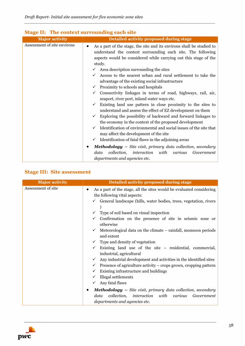
Draft Report- Initial site assessment for five economic zone sites________________________________________________________________________
58
Stage II: The context surrounding each site
Major activity Detailed activity proposed during stage
Assessment of site environs As a part of the stage, the site and its environs shall be studied to
understand the context surrounding each site. The following
aspects would be considered while carrying out this stage of the
study.
Area description surrounding the sites
Access to the nearest urban and rural settlement to take the
advantage of the existing social infrastructure
Proximity to schools and hospitals
Connectivity linkages in terms of road, highways, rail, air,
seaport, river port, inland water ways etc.
Existing land use pattern in close proximity to the sites to
understand and assess the effect of EZ development on them
Exploring the possibility of backward and forward linkages to
the economy in the context of the proposed development
Identification of environmental and social issues of the site that
may affect the development of the site
Identification of fatal flaws in the adjoining areas
Methodology – Site visit, primary data collection, secondary
data collection, interaction with various Government
departments and agencies etc.
Stage III: Site assessment
Major activity Detailed activity proposed during stage
Assessment of site As a part of the stage, all the sites would be evaluated considering
the following vital aspects:
General landscape (hills, water bodies, trees, vegetation, rivers
)
Type of soil based on visual inspection
Confirmation on the presence of site in seismic zone or
otherwise
Meteorological data on the climate – rainfall, monsoon periods
and extent
Type and density of vegetation
Existing land use of the site – residential, commercial,
industrial, agricultural
Any industrial development and activities in the identified sites
Presence of agriculture activity – crops grown, cropping pattern
Existing infrastructure and buildings
Illegal settlements
Any fatal flaws
Methodology – Site visit, primary data collection, secondary
data collection, interaction with various Government
departments and agencies etc.
Draft Report- Initial site assessment for five economic zone sites________________________________________________________________________
59
Stage IV: Infrastructure assessment
Major activity Detailed activity proposed during stage
Assessment of offsite and
onsite infrastructure for the
site
As a part of the stage, all the sites would be evaluated considering
the following vital aspects:
Location, size and type of roads leading to the sites, within the
sites and in close proximity to the sites
Location of offsite infrastructure including power source, water
source, gas source, water treatment facility, sewage disposal
mechanism, telecommunications etc.
Assessment of the existing offsite infrastructure in terms of
surplus quantity available and the quantity that can be
committed for the proposed development so as to look for
alternate sources to supplement the requirement
New infrastructure development around the sites that may
have impact on the site
Requirement of Land filling
Identification of any on site infrastructure in the site
Any fatal flaws
Methodology – Site visit, primary data collection, secondary
data collection, interaction with various Government
departments and agencies etc.
Stage V: Environmental issues
Major activity Detailed activity proposed during stage
Environmental issues for the
sites As a part of the stage, all the sites would be evaluated on
environmental considerations considering the following vital
aspects:
Possibilities and occurrence of soil erosion and flooding
Occurrence and frequency of earth quakes and their magnitude
Presence of rivers, lakes, waterbodies on the site and the
impact of tides on the development
Requirement of site grading – level raising or filling – cost
implication of the activity
Presence of environmentally sensitive areas such as wetlands,
protected areas, mangroves within the site or within 10 km
radius
Type of exiting pollution, nature and sources of pollution
Availability of clean water within the site – Alternative sources
for clean water
To check whether the site and areas surrounding the site are
contaminated and possible mitigation measures
Availability of waste water discharge and treatment in the area
Availability of solid waste disposal in proximity
To ascertain whether the site is a forest land or the
development would involve tree cutting exercise
Any fatal flaws
Draft Report- Initial site assessment for five economic zone sites________________________________________________________________________
60
Methodology – Site visit, primary data collection, secondary
data collection, interaction with various Government
departments and agencies etc.
Stage VI: Social aspects
Major activity Detailed activity proposed during stage
Social aspects of the sites As a part of the stage, all the sites would be evaluated on social
aspects considering the following vital aspects:
Size and distribution of urban and rural population
Presence of residential units on the site – wooden structures,
brick structures, corrugated metal structures
Participation of women in the family earning process and the
impact of the development on their livelihood
Availability of community facilities – schools, hospitals, shops,
mosque
Livelihood nature of the inhabitants
Identification of project affected persons and project affected
families – resettlement requirements – quantification on the
number of people and families for the resettlement
Any fatal flaws
Methodology – Site visit, primary data collection, secondary
data collection, interaction with communities, NGOs, various
Government departments and agencies etc.
Stage VII: Interaction with Government officials and private sector
Major activity Detailed activity proposed during stage
Interaction with Government
officials and private sector As a part of the stage, the following activities would be carried out.
On completion of the site evaluation, a meeting would be held
with Government officials and agencies to discuss the possible
outcomes of the study
Pursuant to the discussion, missing links (if any) or
information identified would be gathered and incorporated in
the study
Interaction with private players would be undertaken to gauge
their interest on the preferred locations and willingness to
participate in the development of these EZ’s
Methodology – Interaction with various Government
departments and agencies, leading private sector players etc.
Draft Report- Initial site assessment for five economic zone sites________________________________________________________________________
61
Snapshots of InfrastructureLinkages in Bangladesh
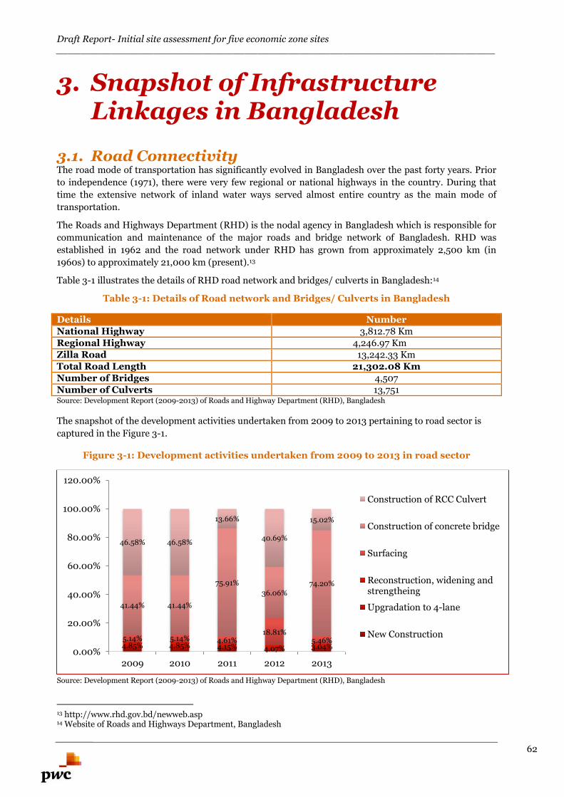
Draft Report- Initial site assessment for five economic zone sites________________________________________________________________________
62
3. Snapshot of InfrastructureLinkages in Bangladesh
3.1. Road ConnectivityThe road mode of transportation has significantly evolved in Bangladesh over the past forty years. Prior
to independence (1971), there were very few regional or national highways in the country. During that
time the extensive network of inland water ways served almost entire country as the main mode of
transportation.
The Roads and Highways Department (RHD) is the nodal agency in Bangladesh which is responsible for
communication and maintenance of the major roads and bridge network of Bangladesh. RHD was
established in 1962 and the road network under RHD has grown from approximately 2,500 km (in
1960s) to approximately 21,000 km (present).13
Table 3-1 illustrates the details of RHD road network and bridges/ culverts in Bangladesh:14
Table 3-1: Details of Road network and Bridges/ Culverts in Bangladesh
Details NumberNational Highway 3,812.78 KmRegional Highway 4,246.97 KmZilla Road 13,242.33 KmTotal Road Length 21,302.08 KmNumber of Bridges 4,507Number of Culverts 13,751Source: Development Report (2009-2013) of Roads and Highway Department (RHD), Bangladesh
The snapshot of the development activities undertaken from 2009 to 2013 pertaining to road sector is
captured in the Figure 3-1.
Figure 3-1: Development activities undertaken from 2009 to 2013 in road sector
Source: Development Report (2009-2013) of Roads and Highway Department (RHD), Bangladesh
13 http://www.rhd.gov.bd/newweb.asp14 Website of Roads and Highways Department, Bangladesh
4.85% 4.85% 4.15% 4.07% 3.04%5.14% 5.14% 4.61%
18.81%5.46%
41.44% 41.44%
75.91%
36.06%74.20%
46.58% 46.58%
13.66%
40.69%
15.02%
0.00%
20.00%
40.00%
60.00%
80.00%
100.00%
120.00%
2009 2010 2011 2012 2013
Construction of RCC Culvert
Construction of concrete bridge
Surfacing
Reconstruction, widening andstrengtheing
Upgradation to 4-lane
New Construction
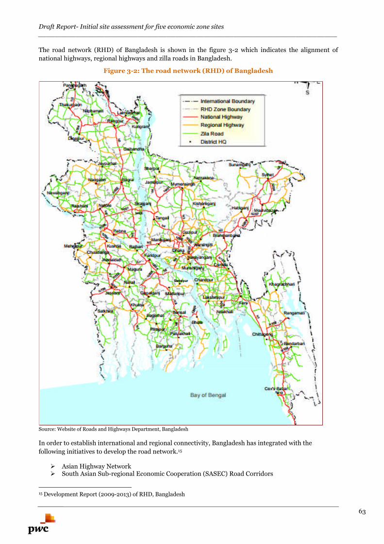
Draft Report- Initial site assessment for five economic zone sites________________________________________________________________________
63
The road network (RHD) of Bangladesh is shown in the figure 3-2 which indicates the alignment of
national highways, regional highways and zilla roads in Bangladesh.
Figure 3-2: The road network (RHD) of Bangladesh
Source: Website of Roads and Highways Department, Bangladesh
In order to establish international and regional connectivity, Bangladesh has integrated with the
following initiatives to develop the road network.15
Asian Highway Network South Asian Sub-regional Economic Cooperation (SASEC) Road Corridors
15 Development Report (2009-2013) of RHD, Bangladesh
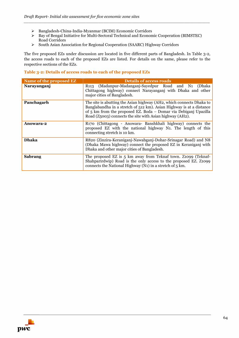
Draft Report- Initial site assessment for five economic zone sites________________________________________________________________________
64
Bangladesh-China-India-Myanmar (BCIM) Economic Corridors Bay of Bengal Initiative for Multi-Sectoral Technical and Economic Cooperation (BIMSTEC)
Road Corridors South Asian Association for Regional Cooperation (SAARC) Highway Corridors
The five proposed EZs under discussion are located in five different parts of Bangladesh. In Table 3-2,
the access roads to each of the proposed EZs are listed. For details on the same, please refer to the
respective sections of the EZs.
Table 3-2: Details of access roads to each of the proposed EZs
Name of the proposed EZ Details of access roadsNarayanganj R113 (Madanpur-Madanganj-Sayedpur Road and N1 (Dhaka
Chittagong highway) connect Narayanganj with Dhaka and othermajor cities of Bangladesh.
Panchagarh The site is abutting the Asian highway (AH2, which connects Dhaka toBanglabandha in a stretch of 512 km). Asian Highway is at a distanceof 5 km from the proposed EZ. Boda – Domar via Debiganj UpazillaRoad (Z5003) connects the site with Asian highway (AH2).
Anowara-2 R170 (Chittagong - Anowara- Banshkhali highway) connects theproposed EZ with the national highway N1. The length of thisconnecting stretch is 10 km.
Dhaka R820 (Zinzira-Keraniganj-Nawabganj-Dohar-Srinagar Road) and N8(Dhaka Mawa highway) connect the proposed EZ in Keraniganj withDhaka and other major cities of Bangladesh.
Sabrang The proposed EZ is 5 km away from Teknaf town. Z1099 (Teknaf-Shahparirdwip) Road is the only access to the proposed EZ. Z1099connects the National Highway (N1) in a stretch of 5 km.
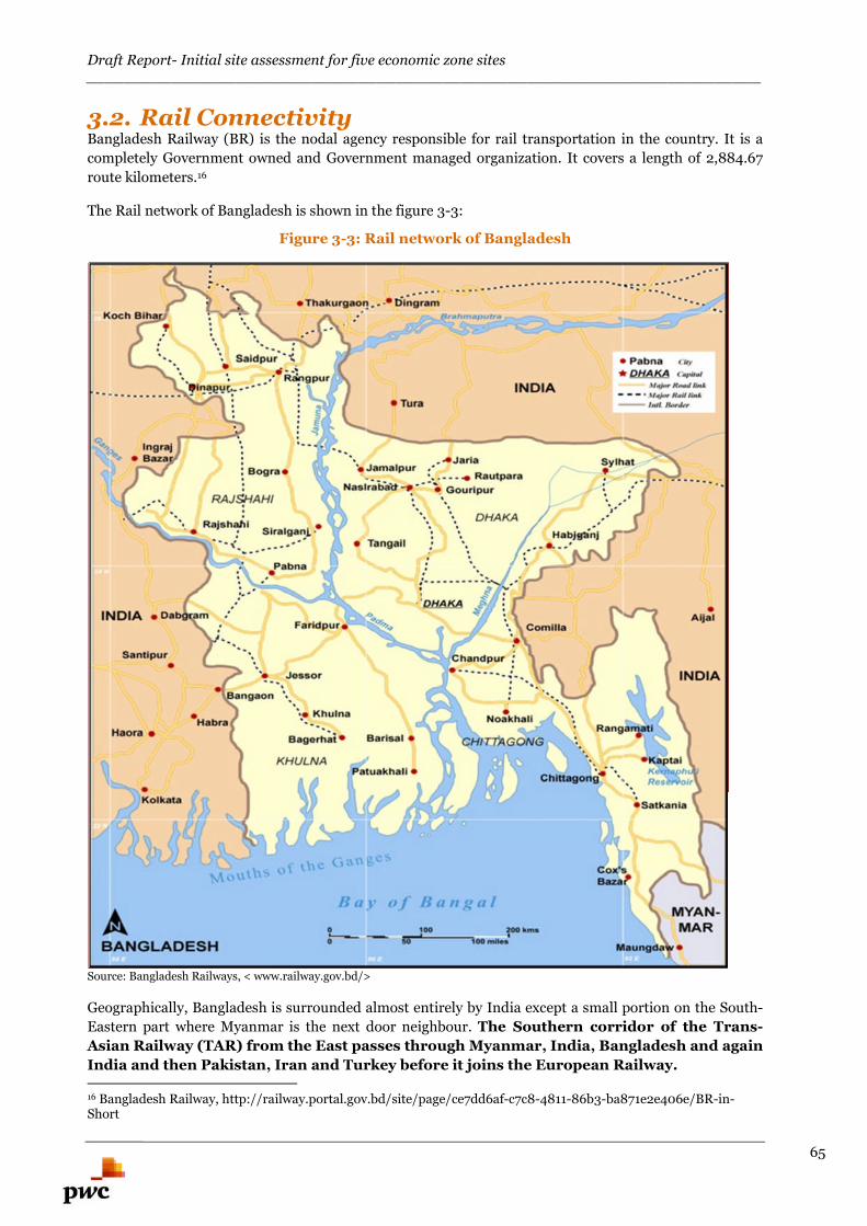
Draft Report- Initial site assessment for five economic zone sites________________________________________________________________________
65
3.2. Rail ConnectivityBangladesh Railway (BR) is the nodal agency responsible for rail transportation in the country. It is a
completely Government owned and Government managed organization. It covers a length of 2,884.67
route kilometers.16
The Rail network of Bangladesh is shown in the figure 3-3:
Figure 3-3: Rail network of Bangladesh
Source: Bangladesh Railways, < www.railway.gov.bd/>
Geographically, Bangladesh is surrounded almost entirely by India except a small portion on the South-
Eastern part where Myanmar is the next door neighbour. The Southern corridor of the Trans-
Asian Railway (TAR) from the East passes through Myanmar, India, Bangladesh and again
India and then Pakistan, Iran and Turkey before it joins the European Railway.
16 Bangladesh Railway, http://railway.portal.gov.bd/site/page/ce7dd6af-c7c8-4811-86b3-ba871e2e406e/BR-in-Short
Draft Report- Initial site assessment for five economic zone sites________________________________________________________________________
66
Bangladesh Railway is bifurcated into two zones, East & West, under the administrative control of two
general managers, who are accountable to the Director General of Bangladesh Railway. The total route
length under East Zone is 1390.78 km. Out of total East Zone network, only 119.45 km railway line of
Dhaka-Chittagong route is double track, 124.80 km is being doubled, and BR has recently extended Dual
Gauge system from Joydevpur to Dhaka. It is to be observed that the East Zone is more dominated by
Meter Gauge line.17
The details of railway route networks of Bangladesh Railway are shown in Tables 3-3 and 3-4.
Table 3-3: Bangladesh Railway Routes Network in kilometer
Item Meter Gauge Broad Gauge Dual Gauge TotalRoute underoperation
1784.68 507.10 364.15 2,655.93
Closure ofroute
53.65 175.09 0 228.74
Total route 1,838.33 682.19 364.15 2,884.67Source: BR Working Time Table No. 39, GIS Database, TSMR, TSC Wing, Planning Commission
Table 3-4: Bangladesh Railways- Number of trains
Train Level East Zone West Zone TotalIntercity 42 44 86Express mail 32 20 52Demu / commuter 42 22 64Shuttle / Local 85 50 135Inter-country train 2Total 201 136 337Source: BR, http://railway.portal.gov.bd/site/page/e35cebe7-3b39-46be-ae6b-f267d4d1375f/Passenger-Train
Railway developments in Bangladesh:
The expansion of BR has been blocked since 1947. Only 80km rail line has been constructed over last 50
years. Whereas more than 1,200km rail lines are under the risk of operation that has resulted due to
negligence, privation of maintenances and insufficient fund allocation. One of the major problems is
shortage of locomotive routes; the trains need to suffer an excess of traffic caused by the lack of routes.18
This results in major delays frequent cancelations and most direly innumerous accidents at the rail
crossing point in the busy street areas. The major projects under implementation include 50 short,
medium and long term projects worth 18,310 crore BDT. For implementing these projects quickly,
government has prepared a draft working plan.19
The five proposed EZs under discussion are located in five different parts of Bangladesh. In table 3-5, the
nearest railway station to each of the proposed EZs is listed. For details on the same, please refer to the
respective sections of the EZs.
Table 3-5: Details of Rail connectivity of Proposed EZs
Name of the proposed EZ Details of Rail connectivityNarayanganj Narayanganj and Chashara are the two major railway stations in the
17Ministry of Railways, Bangladesh,<http://mor.portal.gov.bd/sites/default/files/files/mor.portal.gov.bd/page/9a1ba160_209b_4d94_9077_3befdc9e2ef3/2.%20Assessment%20%20of%20Current%20%20Situation.pdf>18 Md. Rakibul Hasan. (2009, August 10). “Problems and Prospects of a railway: A case study inBangladesh Railway”. Journal of Service Marketing. Volume-4, pp. 124-13619 [Online] Available: http://www.albd.org/index.php/en/resources/special-reports/939-five-yearworking-plan-of-al-government-for-developing-the-railway-sector
Draft Report- Initial site assessment for five economic zone sites________________________________________________________________________
67
proximity. The Narayanganj railway station is located about 7 kmfrom proposed EZ.
Panchagarh Domar, the nearest railway station (in Nilphamari district) is locatedabout 9 km from proposed EZ.
Anowara-2 The Chittagong railway station is located about 17 km from proposedEZ.
Dhaka Dhaka, the nearest railway station is located about 20km fromproposed EZ.
Sabrang The proposed EZ doesn’t possess any railway connectivity; nearestexisting railway station is Chittagong railway, located at a distance of210 km (approx.) away. A new railway station has been approved fromthe Railway Ministry at Gundun, which is 50 km from the site.
3.3. Airport Connectivity
During the liberation war in 1971, the entire aviation infrastructure of the country was severely damaged.
The Department of Civil Aviation (DCA) and the Airports Development Agency (ADA) together
reconstructed and repaired the airports at Tejgaon (Dhaka), Chittagong, Sylhet, Jessore, Ishurdi, and
Cox’s Bazar within amazingly short period of time that facilitated post liberation relief operations.20
There are three International Airports in the country. All three international airports have direct
connections to a number of destinations in the Middle East while Dhaka International Airport has
services to the wider Asian region and Europe. The major international airports in the country are:
1. Hazrat Shahjalal International Airport, Dhaka
This is the largest and the principal international airport of the country. It is situated at the capital city
Dhaka. Almost all international passengers embark at and disembark from HSIA. More than 90% of
aeronautical functions of Civil Aviation Authority, Bangladesh (CAAB) are carried out from it.
2. Shah Amanat International Airport, Chittagong
This airport is situated in the port city of Chittagong. It is the second largest airport and the alternate
airport to HSIA.
3. Osmani International Airport, Sylhet
It is situated at the city of Sylhet, a district at the North-East corner of the country. It has been upgraded
to an international one in order to facilitate the people of the district which is famous for a large number
of residents of United Kingdom.
There are five operational Domestic Airports in the country
1. Cox's Bazar Airport
2. Shah Makhdum Airport, Rajshahi,
3. Jessore Airport
4. Saidpur Airport
5. Barisal Airport
Figure 3-4 shows the location of the 3 International and 5 Operational Domestic airports of Bangladesh.
20 Civil Aviation Authority, Bangladesh (CAAB); < http://www.caab.gov.bd/adinfo/airports.html>
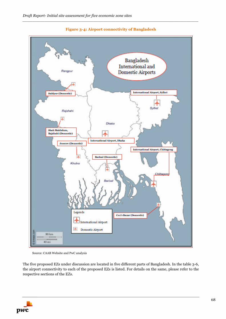
Draft Report- Initial site assessment for five economic zone sites________________________________________________________________________
68
Figure 3-4: Airport connectivity of Bangladesh
Source: CAAB Website and PwC analysis
The five proposed EZs under discussion are located in five different parts of Bangladesh. In the table 3-6,
the airport connectivity to each of the proposed EZs is listed. For details on the same, please refer to the
respective sections of the EZs.
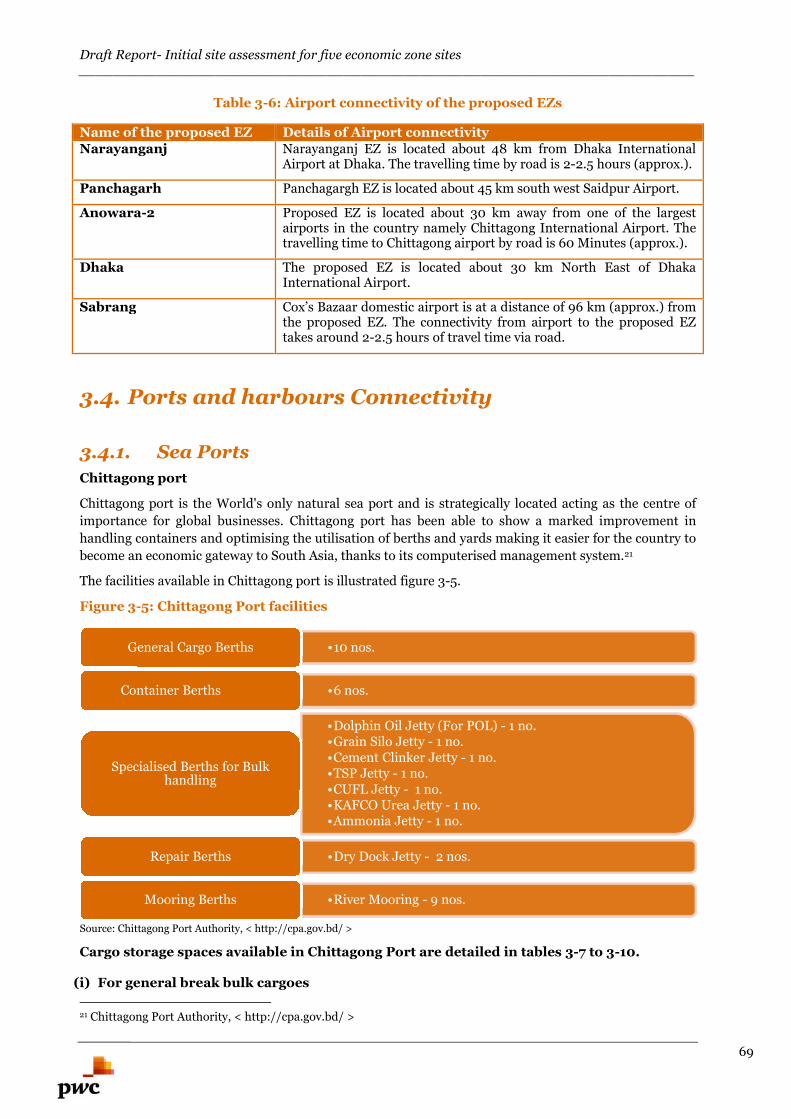
Draft Report- Initial site assessment for five economic zone sites________________________________________________________________________
69
Table 3-6: Airport connectivity of the proposed EZs
Name of the proposed EZ Details of Airport connectivityNarayanganj Narayanganj EZ is located about 48 km from Dhaka International
Airport at Dhaka. The travelling time by road is 2-2.5 hours (approx.).
Panchagarh Panchagargh EZ is located about 45 km south west Saidpur Airport.
Anowara-2 Proposed EZ is located about 30 km away from one of the largestairports in the country namely Chittagong International Airport. Thetravelling time to Chittagong airport by road is 60 Minutes (approx.).
Dhaka The proposed EZ is located about 30 km North East of DhakaInternational Airport.
Sabrang Cox’s Bazaar domestic airport is at a distance of 96 km (approx.) fromthe proposed EZ. The connectivity from airport to the proposed EZtakes around 2-2.5 hours of travel time via road.
3.4. Ports and harbours Connectivity
3.4.1. Sea Ports
Chittagong port
Chittagong port is the World's only natural sea port and is strategically located acting as the centre of
importance for global businesses. Chittagong port has been able to show a marked improvement in
handling containers and optimising the utilisation of berths and yards making it easier for the country to
become an economic gateway to South Asia, thanks to its computerised management system.21
The facilities available in Chittagong port is illustrated figure 3-5.
Figure 3-5: Chittagong Port facilities
Source: Chittagong Port Authority, < http://cpa.gov.bd/ >
Cargo storage spaces available in Chittagong Port are detailed in tables 3-7 to 3-10.
(i) For general break bulk cargoes
21 Chittagong Port Authority, < http://cpa.gov.bd/ >
•10 nos.General Cargo Berths
•6 nos.Container Berths
•Dolphin Oil Jetty (For POL) - 1 no.•Grain Silo Jetty - 1 no.•Cement Clinker Jetty - 1 no.•TSP Jetty - 1 no.•CUFL Jetty - 1 no.•KAFCO Urea Jetty - 1 no.•Ammonia Jetty - 1 no.
Specialised Berths for Bulkhandling
•Dry Dock Jetty - 2 nos.Repair Berths
•River Mooring - 9 nos.Mooring Berths
Draft Report- Initial site assessment for five economic zone sites________________________________________________________________________
70
Table 3-7: Open space available for general bulk cargoes
Open space for storage
R.C.C pavement 173,763 sq. m
Brick pavement 5,639 sq. m
Total 179,402 sq. mSource: Chittagong Port Authority, < http://cpa.gov.bd/ >
Table 3-8: Storage space available outside protected area for general bulk cargoes
Outside protected area
Ware houses (16nos) 35,839 sq. m
Open dump 200,000 sq. m
Source: Chittagong Port Authority, < http://cpa.gov.bd/ >
(ii) For containers
Table 3-9: Storage space available for Containers at general cargo berth area
At general cargo berth areaHolding-capacity 4885 TEUs*Open yard 110,443 sq. m
C.F.S. (Transit shed 6 nos. & ware house& nos.)
70,234 sq. m
Railway container terminal 123 meter.Reefer points 90 (440 volts)
18 (220 volts)
*TEUs: Twenty-foot equivalent unitSource: Chittagong Port Authority, < http://cpa.gov.bd/ >
Table 3-10: Storage space available for Containers at container terminal
At container terminal (MPB)
Container storage yard 150,000 sq. m
C.F.S 12,732 sq. m
Railway container siding 550 meter
Reefer plugs 210 (415volts)
Container holding capacity 4,062 TEUs
Stand by Generator 2 nos
Water reservoir 140,000 gallons
Fire brigade 1 unitSource: Chittagong Port Authority, < http://cpa.gov.bd/ >
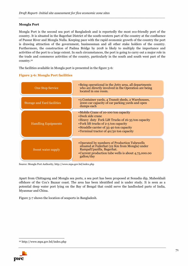
Draft Report- Initial site assessment for five economic zone sites________________________________________________________________________
71
Mongla Port
Mongla Port is the second sea port of Bangladesh and is reportedly the most eco-friendly port of the
country. It is situated in the Bagerhat District of the south-western part of the country at the confluence
of Pussur River and Mongla Nulla. Keeping pace with the rapid economic growth of the country the port
is drawing attraction of the government, businessman and all other stake holders of the country.
Furthermore, the construction of Padma Bridge by 2018 is likely to multiply the importance and
activities of the port to a large extent. In such circumstances, the port is going to carry out a major role in
the trade and commerce activities of the country, particularly in the south and south west part of the
country.22
The facilities available in Mongla port is presented in the figure 3-6:
Figure 3-6: Mongla Port facilities
Source: Mongla Port Authority, http://www.mpa.gov.bd/index.php
Apart from Chittagong and Mongla sea ports, a sea port has been proposed at Sonadia dip, Maheskhali
offshore of the Cox’s Bazaar coast. The area has been identified and is under study. It is seen as a
potential deep water port lying on the Bay of Bengal that could serve the landlocked parts of India,
Myanmar and China.
Figure 3-7 shows the location of seaports in Bangladesh.
22 http://www.mpa.gov.bd/index.php
•Being operational in the Jetty area, all departmentswho are directly involved in the Operation are beinglocated in one room.
One Stop Service
•3 Container yards, 4 Transit sheds, 2 Warehouses,2000 car capacity of car parking yards and opendumps each
Storage and Yard facilities
•Mobile Crane of 10-100 ton capacity•Dock side crane•Heavy duty Fork Lift Trucks of 16-35 ton capacity•Fork lift trucks of 2-5 ton capacity•Straddle carrier of 35-40 ton capacity•Terminal tractor of 40/50 ton capacity
Handling Equipments
•Operated by numbers of Production Tubewellssituated at Failerhat (22 Km from Mongla) underRampalUpazilla, Bagerhat.
•Current production tube wells is about 4,75,000.00gallon/day
Sweet water supply
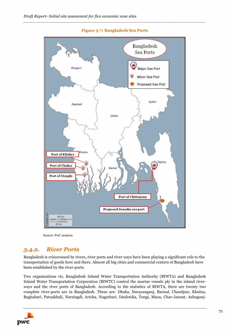
Draft Report- Initial site assessment for five economic zone sites________________________________________________________________________
72
Figure 3-7: Bangladesh Sea Ports
Source: PwC analysis
3.4.2. River Ports
Bangladesh is crisscrossed by rivers, river ports and river ways have been playing a significant role to the
transportation of goods here and there. Almost all big cities and commercial centers of Bangladesh have
been established by the river-ports.
Two organizations viz. Bangladesh Inland Water Transportation Authority (BIWTA) and Bangladesh
Inland Water Transportation Corporation (BIWTC) control the marine vessels ply in the inland river-
ways and the river ports of Bangladesh. According to the statistics of BIWTA, there are twenty two
complete river-ports are in Bangladesh. These are: Dhaka, Narayanganj, Barisal, Chandpur, Khulna,
Baghabari, Patuakhali, Narsingdi, Aricha, Nagarbari, Daulotdia, Tongi, Maoa, Char-Jannat, Ashugonj-
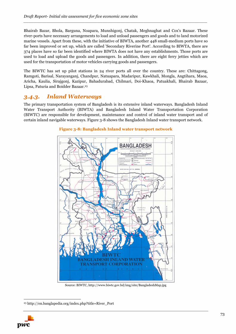
Draft Report- Initial site assessment for five economic zone sites________________________________________________________________________
73
Bhairab Bazar, Bhola, Barguna, Noapara, Munshigonj, Chatak, Meghnaghat and Cox's Bazaar. These
river-ports have necessary arrangements to load and unload passengers and goods and to land motorized
marine vessels. Apart from these, with the initiative of BIWTA, another 448 small-medium ports have so
far been improved or set up, which are called 'Secondary Riverine Port'. According to BIWTA, there are
374 places have so far been identified where BIWTA does not have any establishments. Those ports are
used to load and upload the goods and passengers. In addition, there are eight ferry jetties which are
used for the transportation of motor vehicles carrying goods and passengers.
The BIWTC has set up pilot stations in 24 river ports all over the country. These are: Chittagong,
Ramgoti, Barisal, Narayanganj, Chandpur, Natuapara, Madaripur, Kawkhali, Mongla, Angtihara, Maoa,
Aricha, Kaulia, Sirajgonj, Kazipur, Bahadurabad, Chilmari, Doi-Khaoa, Patuakhali, Bhairab Bazaar,
Lipsa, Paturia and Boidder Bazaar.23
3.4.3. Inland Waterways
The primary transportation system of Bangladesh is its extensive inland waterways. Bangladesh Inland
Water Transport Authority (BIWTA) and Bangladesh Inland Water Transportation Corporation
(BIWTC) are responsible for development, maintenance and control of inland water transport and of
certain inland navigable waterways. Figure 3-8 shows the Bangladesh Inland water transport network.
Figure 3-8: Bangladesh Inland water transport network
Source: BIWTC, http://www.biwtc.gov.bd/img/site/BangladeshMap.jpg
23 http://en.banglapedia.org/index.php?title=River_Port
Draft Report- Initial site assessment for five economic zone sites________________________________________________________________________
74
3.4.4. Land Ports
According to Bangladesh Land Port Authority, initially 12 land custom stations were declared as land
ports in 2002. Since 2009 more eight new land ports have been declared. Presently the number of land
ports is 20 of which 5 ports are in operation under BOT excepting Birol. On the other hand, Benapole,
Burimari, Akhaura and Bhomra land ports are being operated under Bangladesh land port Authority
directly. Considering 2007-2008 as base year, import-export through land routes has been increased by
55% & 67% respectively in 2012-13.24
3.5. Infrastructure Linkages- Intermodal CargoTransfer
Intermodal cargo transfer involves transportation of cargo in an intermodal container using multiple
modes of transportation (such as rail, road, port and airport etc.) with efficient transfer of cargo from one
mode of transportation to another. This method reduces cargo handling, improves security, reduces
damage or loss and allows faster transportation of cargo. This is the most efficient way of connecting to
markets through multiple modes of transportation.
Broadly two major aspects are to be considered in order to facilitate effective intermodal cargo transfer:
Possibility of integration of multiple modes of transportation
Last mile connectivity to the proposed EZ
In the report, for each of the multiproduct economic zones, connectivity aspects pertaining to road, rail,
port and airport etc. are considered separately and major challenges are accordingly highlighted. A two
pronged approach has been undertaken where Bangladesh country scenario is taken into consideration
and then the respective EZ specific analysis has been carried out. Both the existing and future potential
of the same has been considered to assess connectivity potential of each of the proposed EZ.
3.6. Utility connection- Gas
Gas connection is the prerequisite to any manufacturing based industry. In 2014, Bangladesh produced
4,800 Barrels per day of petroleum and other liquids. The production figure is very less as compared to
India (978,000 Barrels per day) and also with respect to USA (13,973,000 Barrels per day). 25
Petrobangla is the nodal company for energy in Bangladesh. Its subsidiary company Bangladesh
Petroleum Exploration Company (BAPEX) is responsible for gas exploration activities. There are some
gas distributions companies in Bangladesh such as Titas Gas Transmission and Distribution Company
Ltd., Karnaphuli Gas Distribution Company limited (KGDCL) etc. which are responsible for gas
distribution catering to the industrial and domestic demand depending on the location of the unit inside
the country.
TITAS GAS is the premier gas distribution company of Bangladesh. It is responsible for transmission and
distribution of natural gas from the gas fields to different areas. Titas Gas is the franchisee holder for
transmission and distribution of gas to areas such as Greater Dhaka & Mymenshingh districts and
Brahmanbaria district. It caters to the requirement of several industries such as power, fertilizer,
industrial, captive power, commercial etc.
Titas gas transmits and distributes around 74% of country’s total consumption. Presently, it procures gas
from Titas, Habiganj, Narsingdi & Bakhrabad Gas Fields under Bangladesh Gas Fields Co. Ltd. and from
Rashidpur, Kailashtila, Beanibazar Gas Fields under Sylhet Gas Fields Co. Ltd. and Jalalabad Gas Field
of Oxydental/Unicol. Figure 3-9 shows the franchisee area of Titas Gas.
24 http://www.bsbk.gov.bd/index.php?option=com_content&task=view&id=242&Itemid=125 http://www.eia.gov/beta/international/rankings/#?prodact=53-1&cy=2014
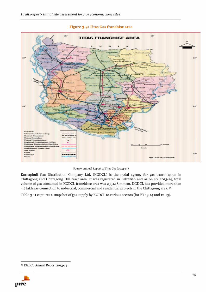
Draft Report- Initial site assessment for five economic zone sites________________________________________________________________________
75
Figure 3-9: Titas Gas franchise area
Source: Annual Report of Titas Gas (2013-14)
Karnaphuli Gas Distribution Company Ltd. (KGDCL) is the nodal agency for gas transmission in
Chittagong and Chittagong Hill tract area. It was registered in Feb’2010 and as on FY 2013-14, total
volume of gas consumed in KGDCL franchisee area was 2331.18 mmcm. KGDCL has provided more than
4.7 lakh gas connection to industrial, commercial and residential projects in the Chittagong area. 26
Table 3-11 captures a snapshot of gas supply by KGDCL to various sectors (for FY 13-14 and 12-13).
26 KGDCL Annual Report 2013-14
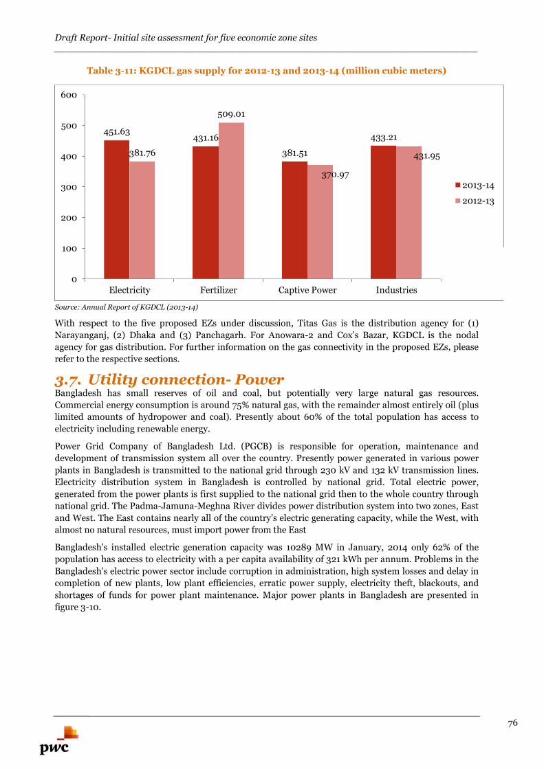
Draft Report- Initial site assessment for five economic zone sites________________________________________________________________________
76
Table 3-11: KGDCL gas supply for 2012-13 and 2013-14 (million cubic meters)
Source: Annual Report of KGDCL (2013-14)
With respect to the five proposed EZs under discussion, Titas Gas is the distribution agency for (1)
Narayanganj, (2) Dhaka and (3) Panchagarh. For Anowara-2 and Cox’s Bazar, KGDCL is the nodal
agency for gas distribution. For further information on the gas connectivity in the proposed EZs, please
refer to the respective sections.
3.7. Utility connection- PowerBangladesh has small reserves of oil and coal, but potentially very large natural gas resources.
Commercial energy consumption is around 75% natural gas, with the remainder almost entirely oil (plus
limited amounts of hydropower and coal). Presently about 60% of the total population has access to
electricity including renewable energy.
Power Grid Company of Bangladesh Ltd. (PGCB) is responsible for operation, maintenance and
development of transmission system all over the country. Presently power generated in various power
plants in Bangladesh is transmitted to the national grid through 230 kV and 132 kV transmission lines.
Electricity distribution system in Bangladesh is controlled by national grid. Total electric power,
generated from the power plants is first supplied to the national grid then to the whole country through
national grid. The Padma-Jamuna-Meghna River divides power distribution system into two zones, East
and West. The East contains nearly all of the country’s electric generating capacity, while the West, with
almost no natural resources, must import power from the East
Bangladesh's installed electric generation capacity was 10289 MW in January, 2014 only 62% of the
population has access to electricity with a per capita availability of 321 kWh per annum. Problems in the
Bangladesh's electric power sector include corruption in administration, high system losses and delay in
completion of new plants, low plant efficiencies, erratic power supply, electricity theft, blackouts, and
shortages of funds for power plant maintenance. Major power plants in Bangladesh are presented in
figure 3-10.
451.63431.16
381.51
433.21
381.76
509.01
370.97
431.95
0
100
200
300
400
500
600
Electricity Fertilizer Captive Power Industries
2013-14
2012-13
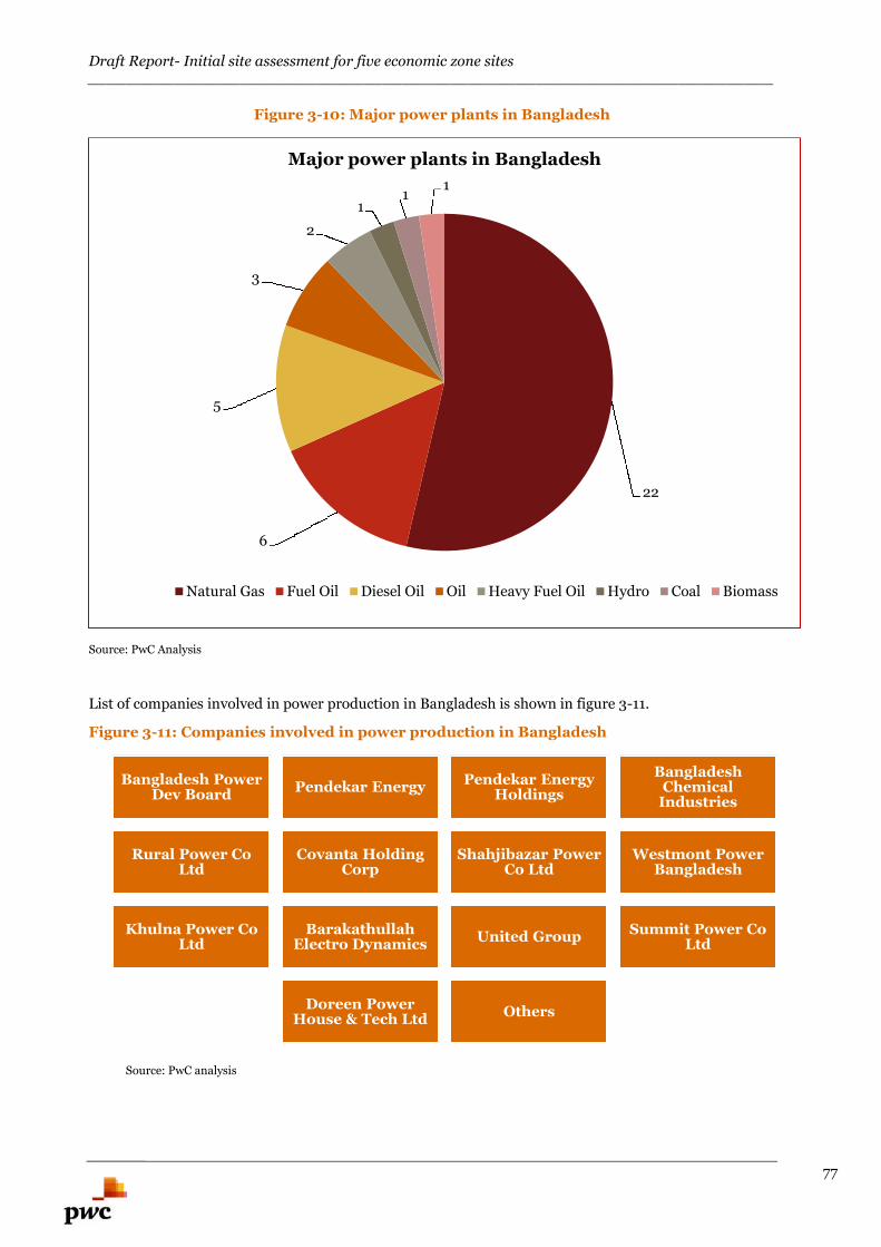
Draft Report- Initial site assessment for five economic zone sites________________________________________________________________________
77
Figure 3-10: Major power plants in Bangladesh
Source: PwC Analysis
List of companies involved in power production in Bangladesh is shown in figure 3-11.
Figure 3-11: Companies involved in power production in Bangladesh
Source: PwC analysis
22
6
5
3
2
11
1
Major power plants in Bangladesh
Natural Gas Fuel Oil Diesel Oil Oil Heavy Fuel Oil Hydro Coal Biomass
Bangladesh PowerDev Board
Pendekar EnergyPendekar Energy
Holdings
BangladeshChemical
Industries
Rural Power CoLtd
Covanta HoldingCorp
Shahjibazar PowerCo Ltd
Westmont PowerBangladesh
Khulna Power CoLtd
BarakathullahElectro Dynamics
United GroupSummit Power Co
Ltd
Doreen PowerHouse & Tech Ltd
Others
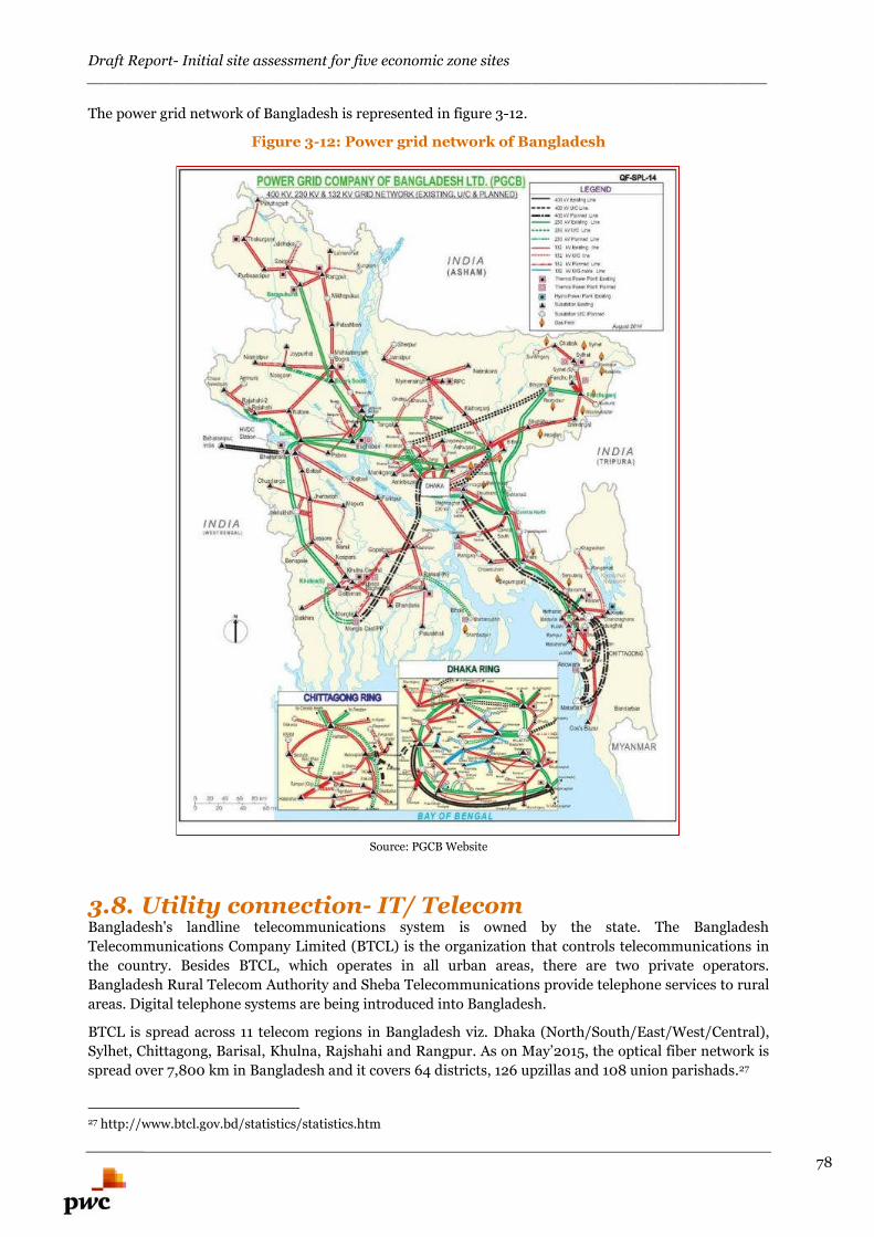
Draft Report- Initial site assessment for five economic zone sites________________________________________________________________________
78
The power grid network of Bangladesh is represented in figure 3-12.
Figure 3-12: Power grid network of Bangladesh
Source: PGCB Website
3.8. Utility connection- IT/ TelecomBangladesh's landline telecommunications system is owned by the state. The Bangladesh
Telecommunications Company Limited (BTCL) is the organization that controls telecommunications in
the country. Besides BTCL, which operates in all urban areas, there are two private operators.
Bangladesh Rural Telecom Authority and Sheba Telecommunications provide telephone services to rural
areas. Digital telephone systems are being introduced into Bangladesh.
BTCL is spread across 11 telecom regions in Bangladesh viz. Dhaka (North/South/East/West/Central),
Sylhet, Chittagong, Barisal, Khulna, Rajshahi and Rangpur. As on May’2015, the optical fiber network is
spread over 7,800 km in Bangladesh and it covers 64 districts, 126 upzillas and 108 union parishads.27
27 http://www.btcl.gov.bd/statistics/statistics.htm
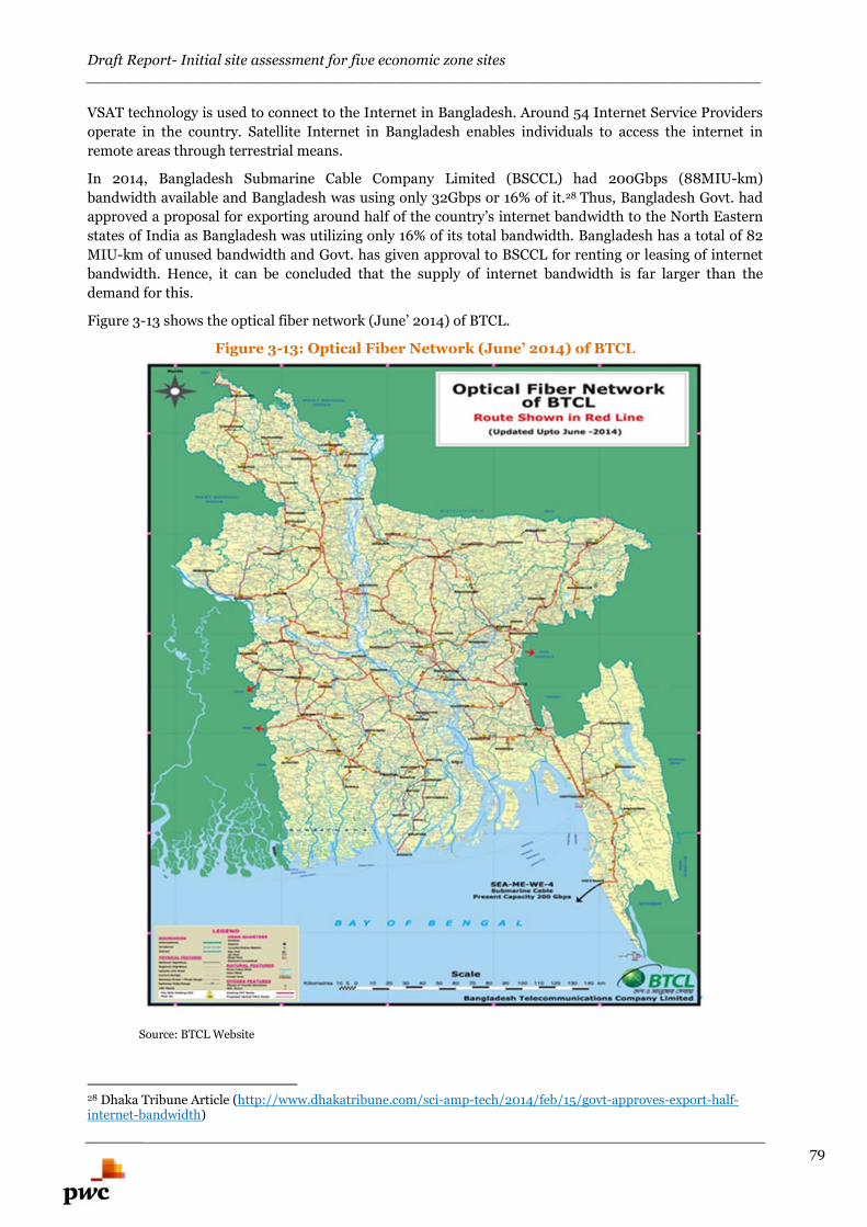
Draft Report- Initial site assessment for five economic zone sites________________________________________________________________________
79
VSAT technology is used to connect to the Internet in Bangladesh. Around 54 Internet Service Providers
operate in the country. Satellite Internet in Bangladesh enables individuals to access the internet in
remote areas through terrestrial means.
In 2014, Bangladesh Submarine Cable Company Limited (BSCCL) had 200Gbps (88MIU-km)
bandwidth available and Bangladesh was using only 32Gbps or 16% of it.28 Thus, Bangladesh Govt. had
approved a proposal for exporting around half of the country’s internet bandwidth to the North Eastern
states of India as Bangladesh was utilizing only 16% of its total bandwidth. Bangladesh has a total of 82
MIU-km of unused bandwidth and Govt. has given approval to BSCCL for renting or leasing of internet
bandwidth. Hence, it can be concluded that the supply of internet bandwidth is far larger than the
demand for this.
Figure 3-13 shows the optical fiber network (June’ 2014) of BTCL.
Figure 3-13: Optical Fiber Network (June’ 2014) of BTCL
Source: BTCL Website
28 Dhaka Tribune Article (http://www.dhakatribune.com/sci-amp-tech/2014/feb/15/govt-approves-export-half-internet-bandwidth)
Draft Report- Initial site assessment for five economic zone sites________________________________________________________________________
80
Multi-Product EconomicZones
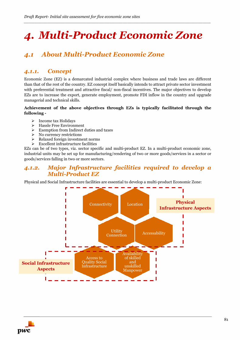
Draft Report- Initial site assessment for five economic zone sites________________________________________________________________________
81
4. Multi-Product Economic Zone
4.1 About Multi-Product Economic Zone
4.1.1. Concept
Economic Zone (EZ) is a demarcated industrial complex where business and trade laws are different
than that of the rest of the country. EZ concept itself basically intends to attract private sector investment
with preferential treatment and attractive fiscal/ non-fiscal incentives. The major objectives to develop
EZs are to increase the export, generate employment, promote FDI inflow in the country and upgrade
managerial and technical skills.
Achievement of the above objectives through EZs is typically facilitated through the
following -
Income tax Holidays Hassle Free Environment Exemption from Indirect duties and taxes No currency restrictions Relaxed foreign investment norms Excellent infrastructure facilities
EZs can be of two types, viz. sector specific and multi-product EZ. In a multi-product economic zone,
industrial units may be set up for manufacturing/rendering of two or more goods/services in a sector or
goods/services falling in two or more sectors.
4.1.2. Major Infrastructure facilities required to develop aMulti-Product EZ
Physical and Social Infrastructure facilities are essential to develop a multi-product Economic Zone:
LocationConnectivity
UtilityConnection
Accessability
Availabilityof skilled
andunskilled
Manpower
Access toQuality SocialInfrastructure
Physical
Infrastructure Aspects
Social Infrastructure
Aspects
Draft Report- Initial site assessment for five economic zone sites________________________________________________________________________
82
4.1.2.1. Connectivity and transportation linkages
External connectivity for EZs is extremely critical to the success of the EZ. Governments should evolve a
development plan and create adequate external infrastructure for the EZs on a time bound basis.
To develop smooth logistics network and to sustain the supply chain, access to efficient transportation
network is vital for any EZ. This may be undertaken via road, rail, water and air mode of transportation.
Ideally, any economic zone should not only have better transportation linkages, but also, if these linkages
are via different modes of transport it helps in optimizing the logistics cost. As an illustration, rail and
water modes are preferred for longer distance movement of bulk commodities at lower transportation
cost. On the other hand, road is preferred means of transport for relatively shorter distances (less than
500 km).
When the goods to be transported are perishable in nature &/or timeliness of delivery is the most
important aspect over the point-to-point delivery, air cargo mode of transportation is used. Air
transportation is also the most expensive option.
In a multi-product economic zone, there shall be various end products and for that different modes of
transportation to be utilized. Accordingly, any industrial or economic zone with access to as many modes
of transport improves the viability of the project.
4.1.2.2. Strategic Location-Proximity to the major city
Key aspects to be kept in mind with respect to strategic location of the EZ include:
Close proximity to major city Close proximity to highway, expressway, sea port, airport and railway Easy access to strategic markets Easy access to cargo and logistics warehousing facilities
4.1.2.3. Accessibility
In addition to transportation linkages, the location’s accessibility (internal as well as external) is of
paramount interest. This include last mile connectivity from the trunk route (rail as well as road
network), access to port / jetty/wharf, smooth connection with airport etc. In addition to the external
connectivity, frequency of public transport facilities (bus, train and ferry service) should be adequate to
cater to the requirements of the workforce employed in the EZ.
Further, the site should not be affected by flood and should have adequate embankments for protection.
4.1.2.4. Utility Connection
The following utility connections are essential to develop a multi-product economic zone:
Availability of uninterrupted 24×7 power supply Constant availability of potable and good quality water Adequacy to set-up water and waste water treatment facilities Availability of gas at adequate pressure essential to set up relevant industries Internet/ Telecom connectivity
For manufacturing based industries, utility connection is the most important parameter.
4.1.2.5. Quality Social Infrastructure
Access to quality social infrastructure is equally important for the success of any EZ. The following
aspects are to be considered while considering a location proposed for economic zone.
Access to quality healthcare facilities near to the proposed EZ Access to quality education facilities in the vicinity of the proposed EZ Good quality residential facilities in the vicinity of the EZ
Draft Report- Initial site assessment for five economic zone sites________________________________________________________________________
83
Source of entertainment and quality lifestyle in the nearby localityIn acquiring the land for the proposed economic zone and in constructing the approach road to the
proposed EZ, the impact due to resettlement should be minimal so that the project inception activities
are smooth. Also the master plan shall be prepared such that there is very less impact on the existing
habitation and livelihood and natural resources in and around the proposed EZ of any EZ.
4.1.2.6. Availability of Quality Manpower
Availability of Quality manpower is a key impediment for any EZ. The developer may be responsible for
setting up technical education facilities on need basis in the non-processing area which could include
Polytechnics, courses for higher education as well as facilities for evening classes for the nearby areas of
each Zone to provide qualified manpower in the units coming up in the Zone.
Annexure B illustrates success story of Adani Ports and Special Economic Zones located in
India.
Next sections endeavours to assess the attractiveness of each ofthe sites on these critical parameters

Draft Report- Initial site assessment for five economic zone sites________________________________________________________________________
84
Narayanganj EZ
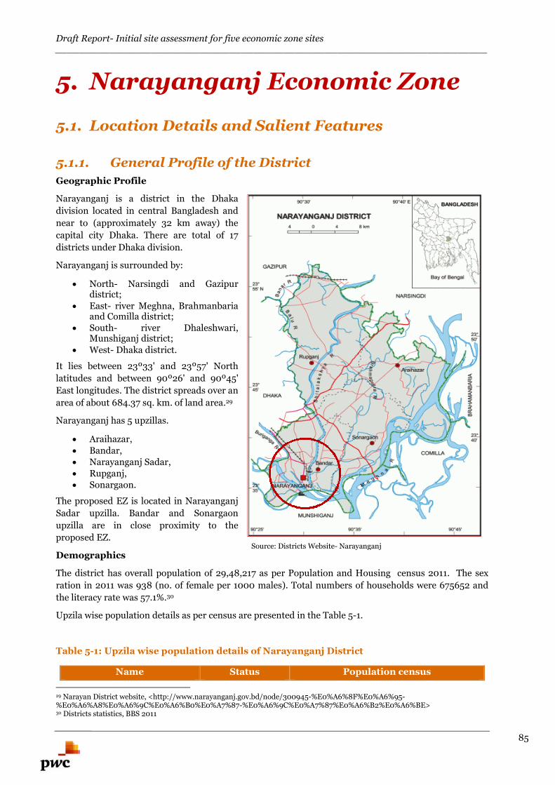
Draft Report- Initial site assessment for five economic zone sites________________________________________________________________________
85
5. Narayanganj Economic Zone
5.1. Location Details and Salient Features
5.1.1. General Profile of the District
Geographic Profile
Narayanganj is a district in the Dhaka
division located in central Bangladesh and
near to (approximately 32 km away) the
capital city Dhaka. There are total of 17
districts under Dhaka division.
Narayanganj is surrounded by:
North- Narsingdi and Gazipurdistrict;
East- river Meghna, Brahmanbariaand Comilla district;
South- river Dhaleshwari,Munshiganj district;
West- Dhaka district.
It lies between 23º33' and 23º57' North
latitudes and between 90º26' and 90º45'
East longitudes. The district spreads over an
area of about 684.37 sq. km. of land area.29
Narayanganj has 5 upzillas.
Araihazar, Bandar, Narayanganj Sadar, Rupganj, Sonargaon.
The proposed EZ is located in Narayanganj
Sadar upzilla. Bandar and Sonargaon
upzilla are in close proximity to the
proposed EZ.
Demographics
The district has overall population of 29,48,217 as per Population and Housing census 2011. The sex
ration in 2011 was 938 (no. of female per 1000 males). Total numbers of households were 675652 and
the literacy rate was 57.1%.30
Upzila wise population details as per census are presented in the Table 5-1.
Table 5-1: Upzila wise population details of Narayanganj District
Name Status Population census
29 Narayan District website, <http://www.narayanganj.gov.bd/node/300945-%E0%A6%8F%E0%A6%95-%E0%A6%A8%E0%A6%9C%E0%A6%B0%E0%A7%87-%E0%A6%9C%E0%A7%87%E0%A6%B2%E0%A6%BE>30 Districts statistics, BBS 2011
Source: Districts Website- Narayanganj
Draft Report- Initial site assessment for five economic zone sites________________________________________________________________________
86
2001 2011 Growth
Narayanganj District (Zila) 21,73,948 29,48,217 35.6%Araihazar
Upzila (Upazila)
3,31,566 3,76,550 13.6%Bandar 2,50,220 3,12,841 25%
Narayanganj Sadar 8,82,971 13,23,600 49.9%
Rupganj 4,03,629 5,34,868 32.5%
Sonargaon 3,05,562 4,00,358 31%
Source: Districts statistics, BBS 2011
Climate Condition
The annual average temperature of the Narayanganj district varies from maximum 36°C to minimum
12.7°C and the average annual rain fall is 2376 mm. 31
Agriculture
Total agiculture land in Narayanganj district is 467.74 sq. km., which amounts to 67% (approx.) of the
total area of the district.32
Major agriculture crops cultivated in the district are paddy, wheat, jute, cotton, tobacco, sugarcane,
pulses, oil seeds, potato, vegetables and other seasonal crops.
Major horticulture crops in this district are Mango, jackfruit, coconut, guava, lemon, and other fruits.
Irrigation
The Narayanganj district is covered under irrigation scheme for growing crops. Irrigated area
classifications fall into two categories:
Surface water irrigation with main water sources being rivers, canals, ponds, and other water
bodies;
Underground water irrigation with water lifted by shallow tube-wells, deep tube wells, and
country traditional devices.
Currently, 81.04% of total area is under irrigation in this district. The percentage of total area under
irrigation in Bandar and Sonargaon upzilas are 86.19% and 85.09% respectively. Upzila wise the method
of irrigation during the year 2010-11 is presented in the Figure 5-1.
31 Districts statistics, BBS 201132 Narayan District website, <http://www.narayanganj.gov.bd/node/300945-%E0%A6%8F%E0%A6%95-%E0%A6%A8%E0%A6%9C%E0%A6%B0%E0%A7%87-%E0%A6%9C%E0%A7%87%E0%A6%B2%E0%A6%BE>
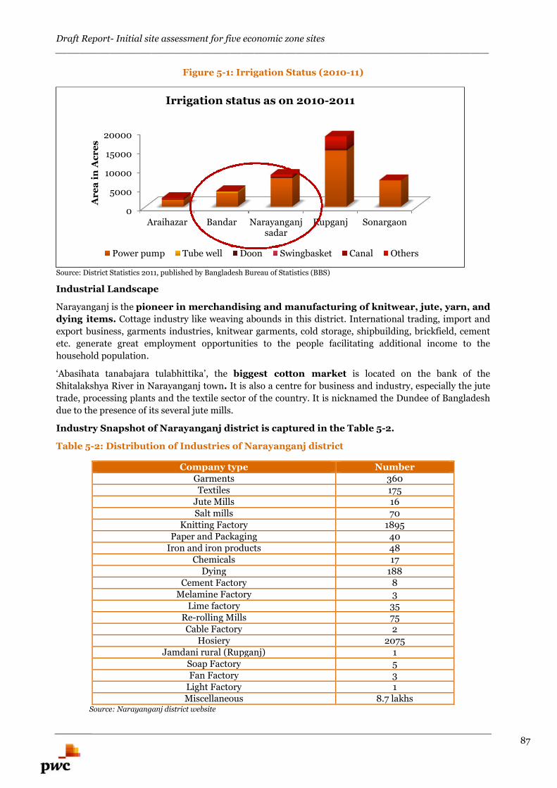
Draft Report- Initial site assessment for five economic zone sites________________________________________________________________________
87
Figure 5-1: Irrigation Status (2010-11)
Source: District Statistics 2011, published by Bangladesh Bureau of Statistics (BBS)
Industrial Landscape
Narayanganj is the pioneer in merchandising and manufacturing of knitwear, jute, yarn, and
dying items. Cottage industry like weaving abounds in this district. International trading, import and
export business, garments industries, knitwear garments, cold storage, shipbuilding, brickfield, cement
etc. generate great employment opportunities to the people facilitating additional income to the
household population.
‘Abasihata tanabajara tulabhittika’, the biggest cotton market is located on the bank of the
Shitalakshya River in Narayanganj town. It is also a centre for business and industry, especially the jute
trade, processing plants and the textile sector of the country. It is nicknamed the Dundee of Bangladesh
due to the presence of its several jute mills.
Industry Snapshot of Narayanganj district is captured in the Table 5-2.
Table 5-2: Distribution of Industries of Narayanganj district
Company type NumberGarments 360Textiles 175
Jute Mills 16Salt mills 70
Knitting Factory 1895Paper and Packaging 40
Iron and iron products 48Chemicals 17
Dying 188Cement Factory 8
Melamine Factory 3Lime factory 35
Re-rolling Mills 75Cable Factory 2
Hosiery 2075Jamdani rural (Rupganj) 1
Soap Factory 5Fan Factory 3
Light Factory 1Miscellaneous 8.7 lakhs
Source: Narayanganj district website
0
5000
10000
15000
20000
Araihazar Bandar Narayanganjsadar
Rupganj Sonargaon
Ar
ea
inA
cr
es
Irrigation status as on 2010-2011
Power pump Tube well Doon Swingbasket Canal Others
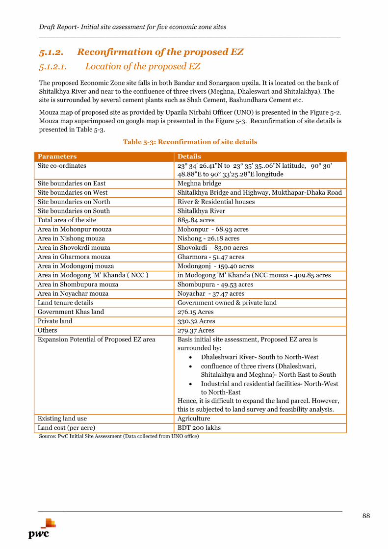
Draft Report- Initial site assessment for five economic zone sites________________________________________________________________________
88
5.1.2. Reconfirmation of the proposed EZ
5.1.2.1. Location of the proposed EZ
The proposed Economic Zone site falls in both Bandar and Sonargaon upzila. It is located on the bank of
Shitalkhya River and near to the confluence of three rivers (Meghna, Dhaleswari and Shitalakhya). The
site is surrounded by several cement plants such as Shah Cement, Bashundhara Cement etc.
Mouza map of proposed site as provided by Upazila Nirbahi Officer (UNO) is presented in the Figure 5-2.
Mouza map superimposed on google map is presented in the Figure 5-3. Reconfirmation of site details is
presented in Table 5-3.
Table 5-3: Reconfirmation of site details
Parameters Details
Site co-ordinates 23° 34' 26.41"N to 23° 35' 35..06"N latitude, 90° 30'
48.88"E to 90° 33'25.28"E longitude
Site boundaries on East Meghna bridge
Site boundaries on West Shitalkhya Bridge and Highway, Mukthapar-Dhaka Road
Site boundaries on North River & Residential houses
Site boundaries on South Shitalkhya River
Total area of the site 885.84 acres
Area in Mohonpur mouza Mohonpur - 68.93 acres
Area in Nishong mouza Nishong - 26.18 acres
Area in Shovokrdi mouza Shovokrdi - 83.00 acres
Area in Gharmora mouza Gharmora - 51.47 acres
Area in Modongonj mouza Modongonj - 159.40 acres
Area in Modogong 'M' Khanda ( NCC ) in Modogong 'M' Khanda (NCC mouza - 409.85 acres
Area in Shombupura mouza Shombupura - 49.53 acres
Area in Noyachar mouza Noyachar - 37.47 acres
Land tenure details Government owned & private land
Government Khas land 276.15 Acres
Private land 330.32 Acres
Others 279.37 Acres
Expansion Potential of Proposed EZ area Basis initial site assessment, Proposed EZ area is
surrounded by:
Dhaleshwari River- South to North-West
confluence of three rivers (Dhaleshwari,
Shitalakhya and Meghna)- North East to South
Industrial and residential facilities- North-West
to North-East
Hence, it is difficult to expand the land parcel. However,
this is subjected to land survey and feasibility analysis.
Existing land use Agriculture
Land cost (per acre) BDT 200 lakhsSource: PwC Initial Site Assessment (Data collected from UNO office)
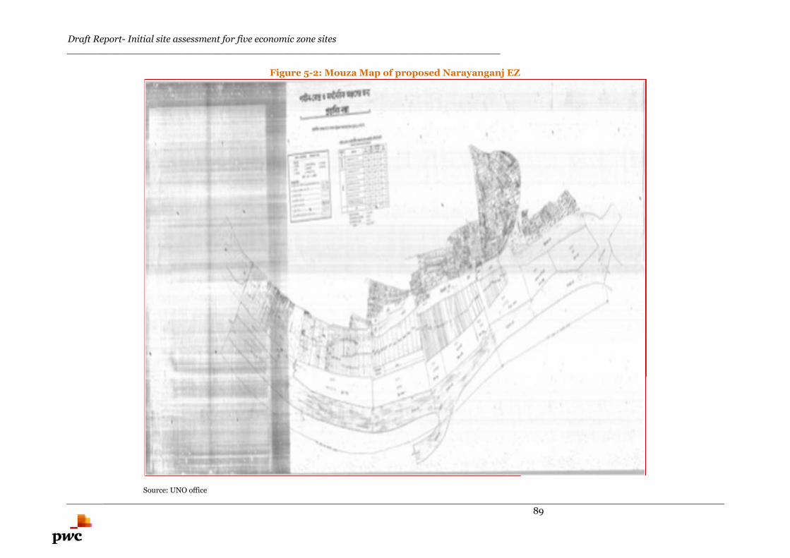
Draft Report- Initial site assessment for five economic zone sites________________________________________________________________________
89
Figure 5-2: Mouza Map of proposed Narayanganj EZ
Source: UNO office
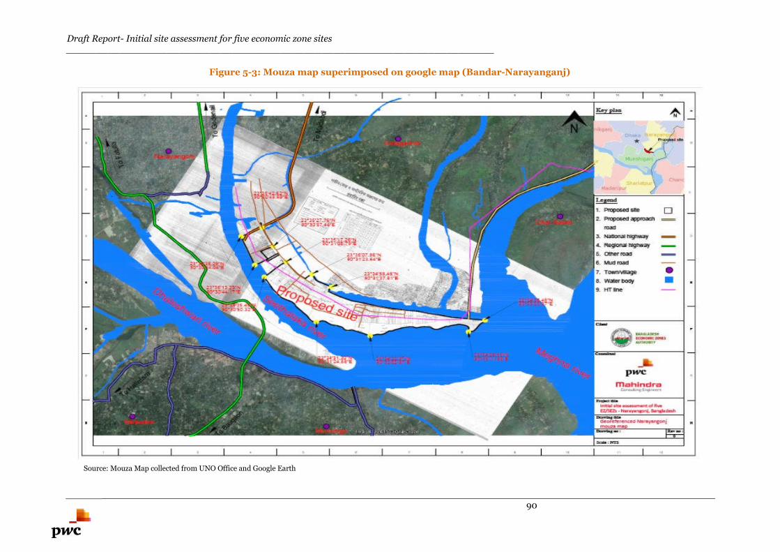
Draft Report- Initial site assessment for five economic zone sites________________________________________________________________________
90
Figure 5-3: Mouza map superimposed on google map (Bandar-Narayanganj)
Source: Mouza Map collected from UNO Office and Google Earth
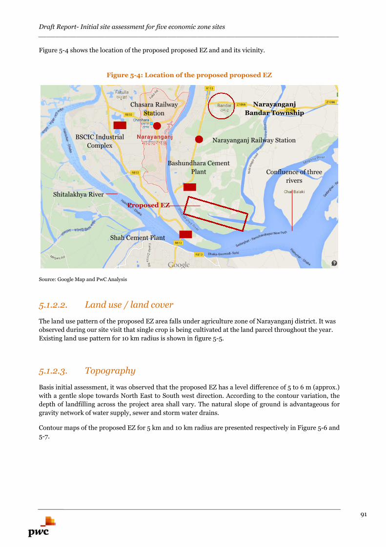
Draft Report- Initial site assessment for five economic zone sites________________________________________________________________________
91
Figure 5-4 shows the location of the proposed proposed EZ and and its vicinity.
Figure 5-4: Location of the proposed proposed EZ
Source: Google Map and PwC Analysis
5.1.2.2. Land use / land cover
The land use pattern of the proposed EZ area falls under agriculture zone of Narayanganj district. It was
observed during our site visit that single crop is being cultivated at the land parcel throughout the year.
Existing land use pattern for 10 km radius is shown in figure 5-5.
5.1.2.3. Topography
Basis initial assessment, it was observed that the proposed EZ has a level difference of 5 to 6 m (approx.)
with a gentle slope towards North East to South west direction. According to the contour variation, the
depth of landfilling across the project area shall vary. The natural slope of ground is advantageous for
gravity network of water supply, sewer and storm water drains.
Contour maps of the proposed EZ for 5 km and 10 km radius are presented respectively in Figure 5-6 and
5-7.
Proposed EZ
Shitalakhya River
Confluence of three
rivers
Narayanganj
Bandar Township
Chasara Railway
Station
Narayanganj Railway StationBSCIC Industrial
Complex
Bashundhara Cement
Plant
Shah Cement Plant
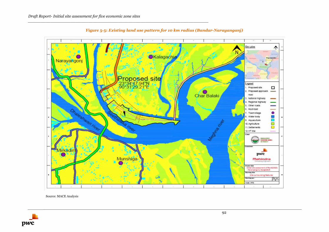
Draft Report- Initial site assessment for five economic zone sites________________________________________________________________________
92
Figure 5-5: Existing land use pattern for 10 km radius (Bandar-Narayanganj)
Source: MACE Analysis
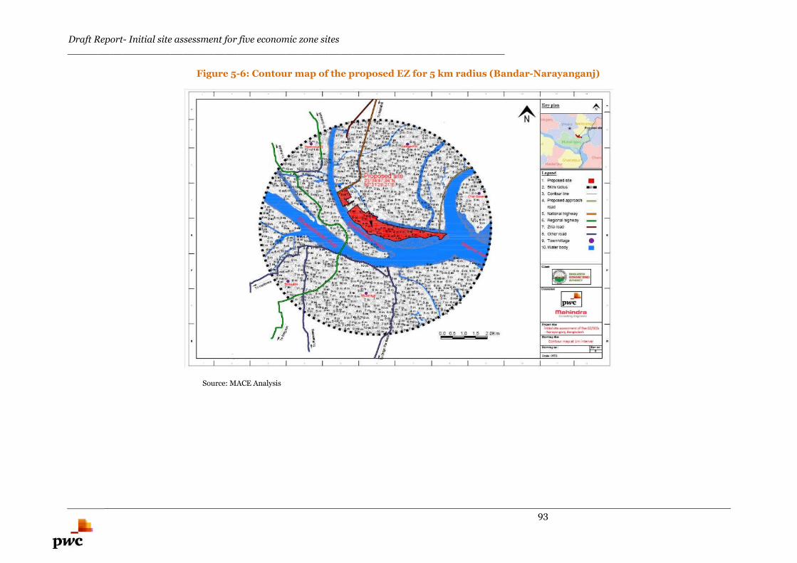
Draft Report- Initial site assessment for five economic zone sites________________________________________________________________________
93
Figure 5-6: Contour map of the proposed EZ for 5 km radius (Bandar-Narayanganj)
Source: MACE Analysis
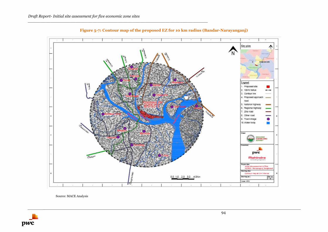
Draft Report- Initial site assessment for five economic zone sites________________________________________________________________________
94
Figure 5-7: Contour map of the proposed EZ for 10 km radius (Bandar-Narayanganj)
Source: MACE Analysis
Draft Report- Initial site assessment for five economic zone sites________________________________________________________________________
95
5.1.2.4. Physiography
The physiography of the region surrounding the proposed EZ falls in Old Brahmaputra floodplain which
exhibits a gentle morphology composed of broad ridges and depressions. This floodplain is usually
flooded to a depth of more than one metre, whereas the ridges are subject to shallow flooding only in the
monsoon season.
The Bangladesh physiography map is presented in Annexure C.
According to the history of physiography of this region, the area around the proposed EZ is prone to high
flood (depth of waterlogging is generally more than one metre) during the monsoon season.
5.1.2.5. Soil
Basis site visit, the top soil layer was found to be black cotton soil which needs to be replaced for road
construction. This soil is not suitable for laying foundation for any structure. The dominant soil texture is
sandy loam. The soil layer is acidic in character and the pH ranges from 5.5 to 6.8. The soil layer is
naturally fertile and is recharged every year by fresh deposition by the floodwater.
5.1.2.6. Geology
Proposed EZ is located in the Brahmaputra Flood Plain. The geological map of Bangladesh is shown in
Annexure D.
The type of soil strata in this type of geological area is Brahmaputra Alluvium and the soil strata is not
suitable for laying the foundation for structures. Detailed soil investigation needs to be carried out during
the structural design stage.
5.1.2.7. Earthquake data
Dhaka area falls in the Seismic Zone 2 and the earthquake coefficient is 0.15 for this zone. The area
under the proposed EZ falls under the medium seismic range zone; this factor needs to be taken into
account while designing the structure of the proposed EZ.
Seismic zoning map of Bangladesh is presented in Annexure E.
5.1.2.8. Wind speed
During winter, the northern and central areas in Bangladesh witness gentle winds blowing at relatively
low speeds of 1-3 Km/hr. from the north & northwest. The detailed wind speeds need to be obtained for
designing the high rise structures in the proposed EZ. The wind speed map for Bangladesh is presented
in Annexure F.
5.1.2.9. Cyclones and storms
Narayanganj has not witnessed any significant cyclone or storms as a result of which no river erosion has
been observed in this region. Basis interaction with the local inhabitants, during monsoon the proposed
EZ witnesses flooding of depth of 4-5 feet.The tracks of few major cyclones that hit Bangladesh are
presented in figure 5-8.
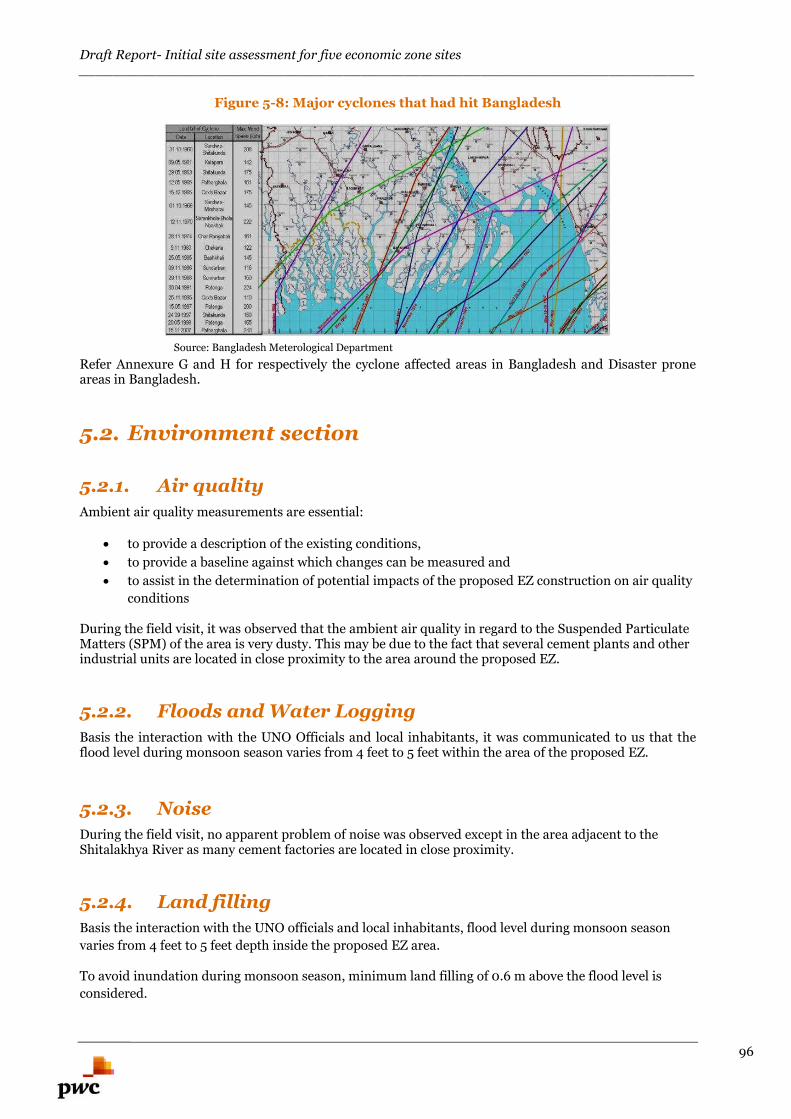
Draft Report- Initial site assessment for five economic zone sites________________________________________________________________________
96
Figure 5-8: Major cyclones that had hit Bangladesh
Source: Bangladesh Meterological Department
Refer Annexure G and H for respectively the cyclone affected areas in Bangladesh and Disaster proneareas in Bangladesh.
5.2. Environment section
5.2.1. Air quality
Ambient air quality measurements are essential:
to provide a description of the existing conditions,
to provide a baseline against which changes can be measured and
to assist in the determination of potential impacts of the proposed EZ construction on air quality
conditions
During the field visit, it was observed that the ambient air quality in regard to the Suspended ParticulateMatters (SPM) of the area is very dusty. This may be due to the fact that several cement plants and otherindustrial units are located in close proximity to the area around the proposed EZ.
5.2.2. Floods and Water Logging
Basis the interaction with the UNO Officials and local inhabitants, it was communicated to us that theflood level during monsoon season varies from 4 feet to 5 feet within the area of the proposed EZ.
5.2.3. Noise
During the field visit, no apparent problem of noise was observed except in the area adjacent to theShitalakhya River as many cement factories are located in close proximity.
5.2.4. Land filling
Basis the interaction with the UNO officials and local inhabitants, flood level during monsoon season
varies from 4 feet to 5 feet depth inside the proposed EZ area.
To avoid inundation during monsoon season, minimum land filling of 0.6 m above the flood level is
considered.
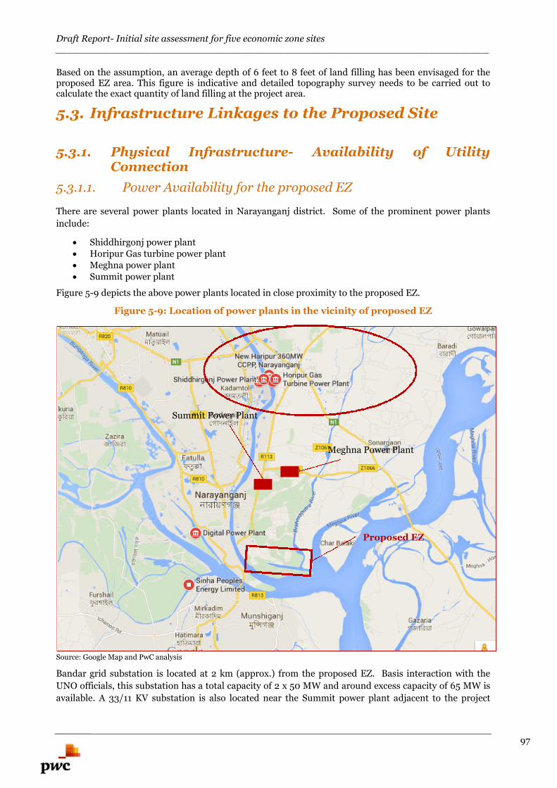
Draft Report- Initial site assessment for five economic zone sites________________________________________________________________________
97
Based on the assumption, an average depth of 6 feet to 8 feet of land filling has been envisaged for theproposed EZ area. This figure is indicative and detailed topography survey needs to be carried out tocalculate the exact quantity of land filling at the project area.
5.3. Infrastructure Linkages to the Proposed Site
5.3.1. Physical Infrastructure- Availability of UtilityConnection
5.3.1.1. Power Availability for the proposed EZ
There are several power plants located in Narayanganj district. Some of the prominent power plants
include:
Shiddhirgonj power plant Horipur Gas turbine power plant Meghna power plant Summit power plant
Figure 5-9 depicts the above power plants located in close proximity to the proposed EZ.
Figure 5-9: Location of power plants in the vicinity of proposed EZ
Source: Google Map and PwC analysis
Bandar grid substation is located at 2 km (approx.) from the proposed EZ. Basis interaction with the
UNO officials, this substation has a total capacity of 2 x 50 MW and around excess capacity of 65 MW is
available. A 33/11 KV substation is also located near the Summit power plant adjacent to the project
Proposed EZ
Summit Power Plant
Meghna Power Plant
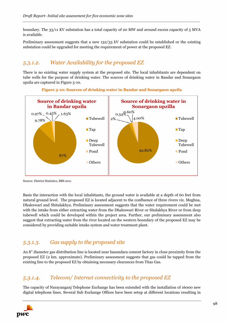
Draft Report- Initial site assessment for five economic zone sites________________________________________________________________________
98
boundary. The 33/11 KV substation has a total capacity of 20 MW and around excess capacity of 5 MVA
is available.
Preliminary assessment suggests that a new 132/33 kV substation could be established or the existing
substation could be upgraded for meeting the requirement of power at the proposed EZ.
5.3.1.2. Water Availability for the proposed EZ
There is no existing water supply system at the proposed site. The local inhabitants are dependent on
tube wells for the purpose of drinking water. The sources of drinking water in Bandar and Sonargaon
upzila are captured in Figure 5-10.
Figure 5-10: Sources of drinking water in Bandar and Sonargaon upzila
Source: District Statistics, BBS 2011
Basis the interaction with the local inhabitants, the ground water is available at a depth of 60 feet from
natural ground level. The proposed EZ is located adjacent to the confluence of three rivers viz. Meghna,
Dhaleswari and Shitalakhya. Preliminary assessment suggests that the water requirement could be met
with the intake from either extracting water from the Dhaleswari River or Sitalakhya River or from deep
tubewell which could be developed within the project area. Further, our preliminary assessment also
suggest that extracting water from the river located on the western boundary of the proposed EZ may be
considered by providing suitable intake system and water treatment plant.
5.3.1.3. Gas supply to the proposed site
An 8” diameter gas distribution line is located near basundara cement factory in close proximity from the
proposed EZ (2 km. approximate). Preliminary assessment suggests that gas could be tapped from the
existing line to the proposed EZ by obtaining necessary clearances from Titas Gas.
5.3.1.4. Telecom/ Internet connectivity to the proposed EZ
The capacity of Narayanganj Telephone Exchange has been extended with the installation of 16000 new
digital telephone lines. Several Sub Exchange Offices have been setup at different locations resulting in
87%
9.78%
0.97% 0.45% 1.63%
Source of drinking waterin Bandar upzila
Tubewell
Tap
DeepTubewell
Pond
Others
92.82%
2%0.54%
0.60%
4.00%
Source of drinking water inSonargaon upzilla
Tubewell
Tap
DeepTubewell
Pond
Others
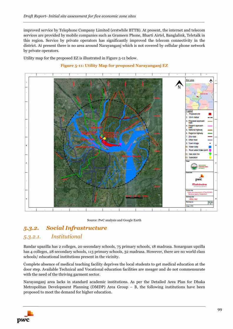
Draft Report- Initial site assessment for five economic zone sites________________________________________________________________________
99
improved service by Telephone Company Limited (erstwhile BTTB). At present, the internet and telecom
services are provided by mobile companies such as Grameen Phone, Bharti Airtel, Banglalink, Teletalk in
this region. Service by private operators has significantly improved the telecom connectivity in the
district. At present there is no area around Narayanganj which is not covered by cellular phone network
by private operators.
Utility map for the proposed EZ is illustrated in Figure 5-11 below.
Figure 5-11: Utility Map for proposed Narayanganj EZ
Source: PwC analysis and Google Earth
5.3.2. Social Infrastructure
5.3.2.1. Institutional
Bandar upazilla has 2 colleges, 20 secondary schools, 75 primary schools, 18 madrasa. Sonargoan upzilla
has 4 colleges, 28 secondary schools, 113 primary schools, 32 madrasa. However, there are no world class
schools/ educational institutions present in the vicinity.
Complete absence of medical teaching facility deprives the local students to get medical education at the
door step. Available Technical and Vocational education facilities are meager and do not commensurate
with the need of the thriving garment sector.
Narayanganj area lacks in standard academic institutions. As per the Detailed Area Plan for Dhaka
Metropolitan Development Planning (DMDP) Area Group – B, the following institutions have been
proposed to meet the demand for higher education.
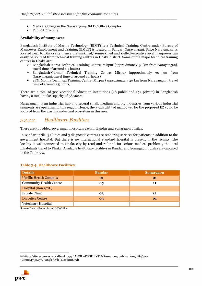
Draft Report- Initial site assessment for five economic zone sites________________________________________________________________________
100
Medical College in the Narayanganj Old DC Office Complex Public University
Availability of manpower
Bangladesh Institute of Marine Technology (BIMT) is a Technical Training Centre under Bureau ofManpower Employment and Training (BMET) is located in Bandar, Narayanganj. Since Narayanganj islocated near to Dhaka city, hence the unskilled/ semi-skilled and skilled/executive level manpower caneasily be sourced from technical training centres in Dhaka district. Some of the major technical trainingcentres in Dhaka are:
Bangladesh-Korea Technical Training Centre, Mirpur (approximately 30 km from Narayanganj,travel time of around 1.5 hours)
Bangladesh-German Technical Training Centre, Mirpur (approximately 30 km fromNarayanganj, travel time of around 1.5 hours)
SFM Mohila Technical Training Centre, Mirpur (approximately 30 km from Narayanganj, traveltime of around 1.5 hours)
There are a total of 300 vocational education institutions (48 public and 252 private) in Bangladeshhaving a total intake capacity of 58,562.33
Narayanganj is an industrial hub and several small, medium and big industries from various industrialsegments are operating in this region. Hence, the availability of manpower for the proposed EZ could besourced from the existing industrial ecosystem in this area.
5.3.2.2. Healthcare Facilities
There are 31 bedded government hospitals each in Bandar and Sonargaon upzilas.
In Bandar upzila, 3 Clinics and 3 diagnostic centres are rendering services for patients in addition to the
government hospital. But there is no international standard hospital is present in the vicinity. The
locality is well-connected to Dhaka city by road and rail and for serious medical problems, the local
inhabitants travel to Dhaka. Available healthcare facilities in Bandar and Sonargaon upzilas are captured
in the Table 5-4.
Table 5-4: Healthcare Facilities
Details Bandar Sonargaon
Upzilla Health Complex 01 01
Community Health Centre 05 11
Hospital (non govt.)
Private Clinic 03 12
Diabetics Centre 03 01
Veterinary Hospital
Source:Data collected from UNO Office
33 http://siteresources.worldbank.org/BANGLADESHEXTN/Resources/publications/384630-1209074736457/Bangladesh_Nov2006.pdf
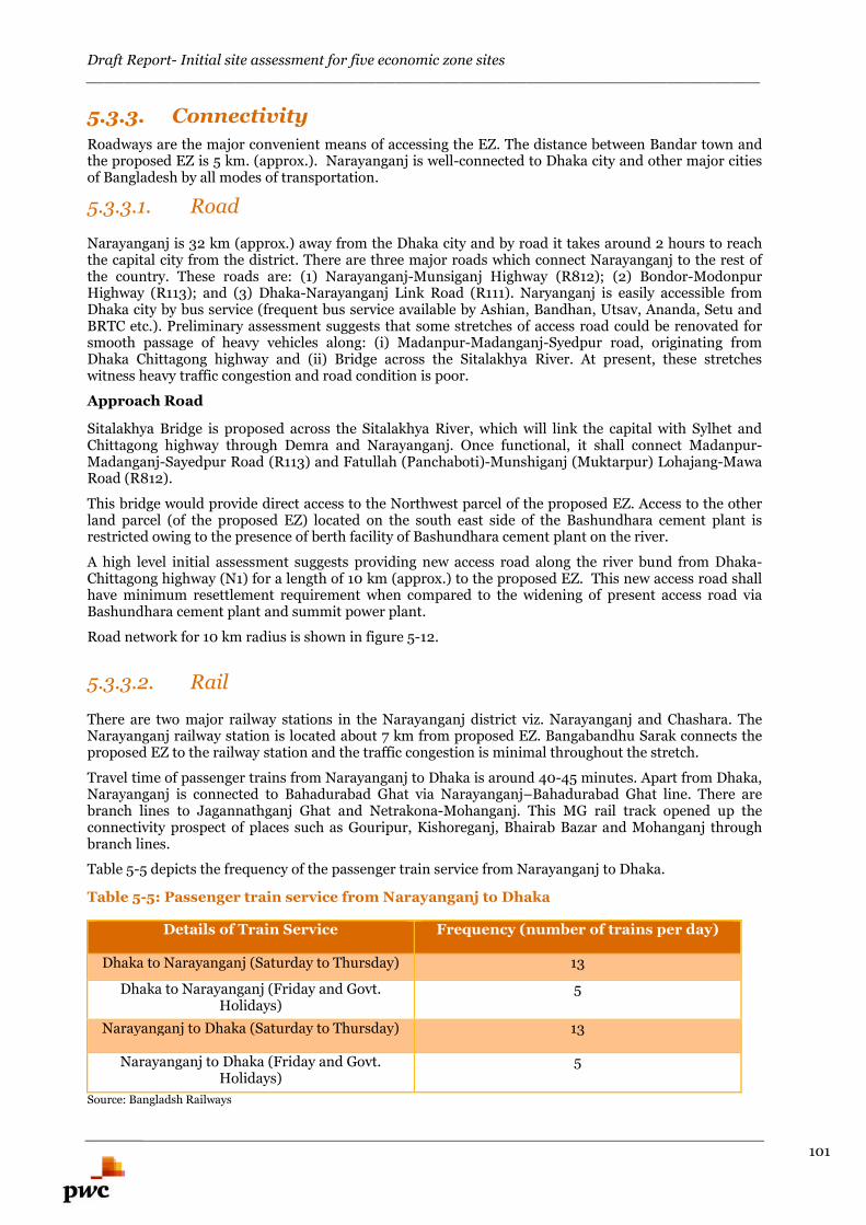
Draft Report- Initial site assessment for five economic zone sites________________________________________________________________________
101
5.3.3. Connectivity
Roadways are the major convenient means of accessing the EZ. The distance between Bandar town andthe proposed EZ is 5 km. (approx.). Narayanganj is well-connected to Dhaka city and other major citiesof Bangladesh by all modes of transportation.
5.3.3.1. Road
Narayanganj is 32 km (approx.) away from the Dhaka city and by road it takes around 2 hours to reachthe capital city from the district. There are three major roads which connect Narayanganj to the rest ofthe country. These roads are: (1) Narayanganj-Munsiganj Highway (R812); (2) Bondor-ModonpurHighway (R113); and (3) Dhaka-Narayanganj Link Road (R111). Naryanganj is easily accessible fromDhaka city by bus service (frequent bus service available by Ashian, Bandhan, Utsav, Ananda, Setu andBRTC etc.). Preliminary assessment suggests that some stretches of access road could be renovated forsmooth passage of heavy vehicles along: (i) Madanpur-Madanganj-Syedpur road, originating fromDhaka Chittagong highway and (ii) Bridge across the Sitalakhya River. At present, these stretcheswitness heavy traffic congestion and road condition is poor.
Approach Road
Sitalakhya Bridge is proposed across the Sitalakhya River, which will link the capital with Sylhet andChittagong highway through Demra and Narayanganj. Once functional, it shall connect Madanpur-Madanganj-Sayedpur Road (R113) and Fatullah (Panchaboti)-Munshiganj (Muktarpur) Lohajang-MawaRoad (R812).
This bridge would provide direct access to the Northwest parcel of the proposed EZ. Access to the otherland parcel (of the proposed EZ) located on the south east side of the Bashundhara cement plant isrestricted owing to the presence of berth facility of Bashundhara cement plant on the river.
A high level initial assessment suggests providing new access road along the river bund from Dhaka-Chittagong highway (N1) for a length of 10 km (approx.) to the proposed EZ. This new access road shallhave minimum resettlement requirement when compared to the widening of present access road viaBashundhara cement plant and summit power plant.
Road network for 10 km radius is shown in figure 5-12.
5.3.3.2. Rail
There are two major railway stations in the Narayanganj district viz. Narayanganj and Chashara. TheNarayanganj railway station is located about 7 km from proposed EZ. Bangabandhu Sarak connects theproposed EZ to the railway station and the traffic congestion is minimal throughout the stretch.
Travel time of passenger trains from Narayanganj to Dhaka is around 40-45 minutes. Apart from Dhaka,Narayanganj is connected to Bahadurabad Ghat via Narayanganj–Bahadurabad Ghat line. There arebranch lines to Jagannathganj Ghat and Netrakona-Mohanganj. This MG rail track opened up theconnectivity prospect of places such as Gouripur, Kishoreganj, Bhairab Bazar and Mohanganj throughbranch lines.
Table 5-5 depicts the frequency of the passenger train service from Narayanganj to Dhaka.
Table 5-5: Passenger train service from Narayanganj to Dhaka
Details of Train Service Frequency (number of trains per day)
Dhaka to Narayanganj (Saturday to Thursday) 13
Dhaka to Narayanganj (Friday and Govt.Holidays)
5
Narayanganj to Dhaka (Saturday to Thursday) 13
Narayanganj to Dhaka (Friday and Govt.Holidays)
5
Source: Bangladsh Railways
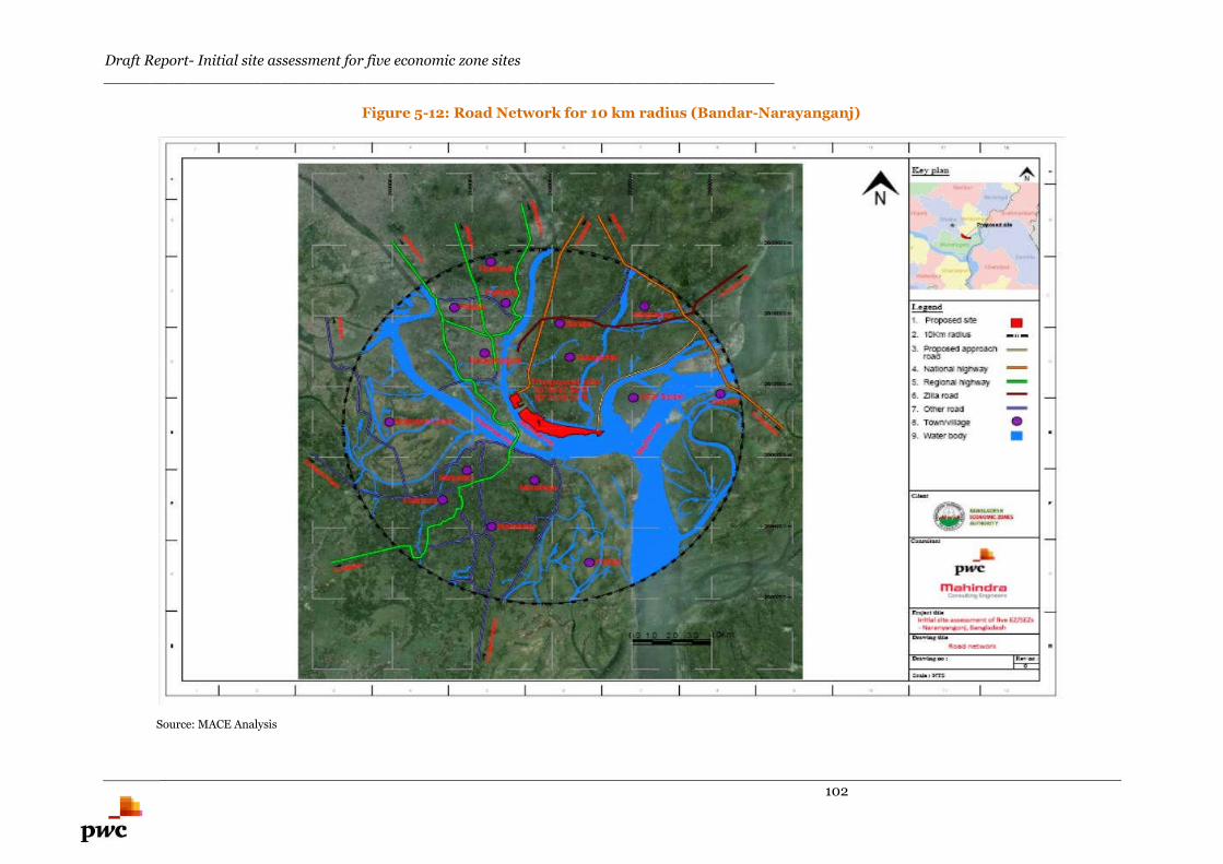
Draft Report- Initial site assessment for five economic zone sites________________________________________________________________________
102
Figure 5-12: Road Network for 10 km radius (Bandar-Narayanganj)
Source: MACE Analysis
Draft Report- Initial site assessment for five economic zone sites________________________________________________________________________
103
5.3.3.3. Airport
Narayanganj EZ is located about 48 km from Hazrat Shah Jalal International Airport at Dhaka. The
travel time by road to Dhaka International Airport is 2.5-3 hours (approx.).
Govt. of Bangladesh intends to construct a new international airport (Bangabandhu Sheikh Mujib
International Airport) with a view to create a hub airport in close proximity to Dhaka and to meet the
demand of future growth in aviation sector. The Civil Aviation and Tourism Ministry is in the process to
finalise the location of the proposed international airport. Some of the locations which are being
considered as prospective locations for the development of new airport are: (1) Char Janajat under
Shibchar Upazila in Madaripur district, (2) Keyain and Latobdi under Shirajdikhan Upazila in
Munshiganj district and (3) Char Bilashpur under Dohar Upazila of Dhaka district. All these locations are
located within 50 km radius of the proposed EZ.34
Figure 5-13 illustrates the connectivity of the proposed Economic Zones via Road, Rail and Airport mode
of transportation.
Figure 5-13: Connectivity of the proposed Economic Zones via Road, Rail and Airport
Source: Google Earth and PwC Analysis
34 http://www.dhakatribune.com/business/2015/jun/19/construction-bangabandhu-airport-again-cards#sthash.6QEaRDCi.dpuf
Draft Report- Initial site assessment for five economic zone sites________________________________________________________________________
104
5.3.3.4. Port
Chittagong port
Proposed EZ is located at a distance of 254 km from Chittagong port. The facilities available in
Chittagong port are illustrated in section-3.4.1.
Mongla port
Proposed EZ is located about 304 km Mongla Port. The facilities available in Mongla port are illustrated
in section-3.4.1.
Narayanganj river port
The proposed EZ lies on the bank of inland water way connecting from Chittagong port to Mongla port.
Narayangunj river port, one of the oldest in Bangladesh is located within 3.5 km (Water way) / 28 Km
(Road way) from the proposed EZ.
Narayanganj river port is situated on the banks of the Shitalakhya River and has four warehouses of 700
square metres each in addition to open storage area. Presently the river port consists of 5 berths and 8
anchorages. Most of the bulk cargos handled in this port consist of sand, stone, cement clinker and fly
ash whereas food grains are handled in bagged form. In addition an inland container terminal is being
planned at this location.
Various types of cargos are transported through Narayanganj Port. But there is no regular cargocservice
for carrying commodities. Commodities are generally carried by private arrangements and berthing
facilities provided by the BIWTA are used for loading and unloading purposes. Many business houses or
industries use private berthing facilities. Regular cargo service is operated between Kolkata and
Narayanganj under Protocol arrangement. Vessels traveling to Chattack from Kolkata also call at
Narayanganj.
A substantial amount of cargos are transported through Engine Boats popularly known as Trawller or
Cargo or Bulkhead. A huge number of such boats ply in the Sitalakhya River and carries construction
materials, mostly, fill materials. There is no account of the number of such boats as there is no rule for
registration of engine boats with less than 16 horse power engine. Country boats with sail, at present, are
rarely found.
5.3.3.5. Water ways
Much of the importance of Narayanganj is owing to its excellent performance as river port. In the past,
owing to its efficiency and amount of export cargo, Narayanganj was declared a port under Sea Customs
Act. At present, Narayanganj port has lost its position as prime river port of the country mostly due to
decline of jute sector. The facilities installed in the port are presently underutilized. Proposed EZ site is
well connected with the major ports of Bangladesh by inland water ways.
All the passenger services are operated by private operator.
Launch Service from Narayanganj-
Narayanganj-Chandpur
Narayanganj-Matlab
Narayanganj-Ramchandrapur
Narayanganj-Taltala
Narayanganj-Serajdighi khan
Narayanganj-Sureshwar
Narayanganj-Munshiganj
Draft Report- Initial site assessment for five economic zone sites________________________________________________________________________
105
5.3.3.6. Assessment of Intermodal Cargo Transport
Access to major modes of transportation from the proposed EZ is outlined in the following:
Narayanganj rail station is located at a distance of 7 km (approx) from the proposed EZ.Bangabandhu Sarak connects the proposed EZ to the railway station and the traffic congestion isminimal throughout the stretch. Narayanganj EZ is located about 48 km from Hazrat Shah JalalInternational Airport at Dhaka. Travel time by road to Dhaka International Airport is 2.5-3hours (approx.).
Proposed Narayanganj EZ is located 48 km (approx) from Hazrat Shah Jalal InternationalAirport at Dhaka. Travel time by road to this airport is 2.5-3 hours (approx).
Proposed EZ is located at a distance of 254 km (approx) from Chittagong port and 304 km(approx) Mongla Port. Proposed EZ lies on the bank of inland water way connecting fromChittagong port to Mongla port. Narayangunj river port is located within 3.5 km (Water way) /28 Km (Road way) from the proposed EZ.
Proposed EZ has access to all modes of transportation; however Dhaka International airport is relativelyfar (48 km approx) as compared to other modes of transportation.
Integration for intermodal cargo transfer between Narayanganj river port and Narayanganj rail stationwould be possible as both the facilities are located in close proximity (approx 1-1.5 km). The Narayanganjriver port and rail station is linked by Nawab Sirajudullah Road, Sahid Suhrwadi Sarak and Port Road.These stretches experience moderate traffic congestion. However, the possibility of intermodal cargotransfer between river port and rail station needs to be undertaken during pre-feasibility stage.
Preliminary site assessment suggests that two accesses are possible.
1. Proposed Sitalakhya Bridge across Sitalakhya River could provide direct access to theNorthwest parcel of the proposed EZ.
2. Access to the south east parcel (of the proposed EZ) is restricted owing to the presenceof berth facility of Bashundhara cement plant on the river. Basundhara cement plant islocated adjacent to the proposed EZ..
5.4. Resettlement issues
5.4.1. Social impacts
The impacts have been assessed on the following parameters:
(i) Loss of land (for existing land owners),
(ii) Loss of homes/structures,
(iii) Loss of Trees
(iv) Loss of livelihood systems/ income opportunity
(v) Loss of water bodies.
(vi) Resettlement issue pertaining to approach road
The expected types of losses are described in the following sub-sections.
5.4.1.1. Loss of land
To establish the Narayanganj EZ project, a total of 885.84 acres of land has been demarcated by the
authority. As per FMB superimposed on google map the total area works out to approximately 646.46
acres. The land usage pattern for this area is as under:
Residential land- 103.70 acre (approx.) Aquaculture- 16.69 acre (approx.)
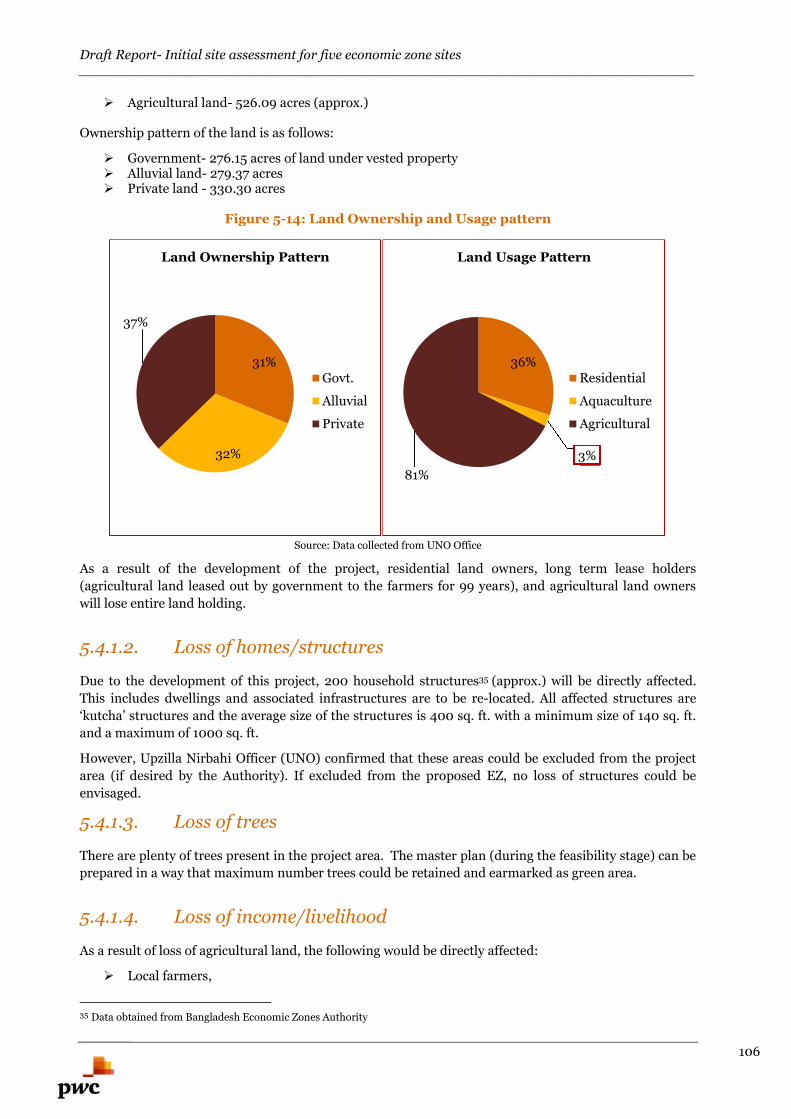
Draft Report- Initial site assessment for five economic zone sites________________________________________________________________________
106
Agricultural land- 526.09 acres (approx.)
Ownership pattern of the land is as follows:
Government- 276.15 acres of land under vested property Alluvial land- 279.37 acres Private land - 330.30 acres
Figure 5-14: Land Ownership and Usage pattern
Source: Data collected from UNO Office
As a result of the development of the project, residential land owners, long term lease holders
(agricultural land leased out by government to the farmers for 99 years), and agricultural land owners
will lose entire land holding.
5.4.1.2. Loss of homes/structures
Due to the development of this project, 200 household structures35 (approx.) will be directly affected.
This includes dwellings and associated infrastructures are to be re-located. All affected structures are
‘kutcha’ structures and the average size of the structures is 400 sq. ft. with a minimum size of 140 sq. ft.
and a maximum of 1000 sq. ft.
However, Upzilla Nirbahi Officer (UNO) confirmed that these areas could be excluded from the project
area (if desired by the Authority). If excluded from the proposed EZ, no loss of structures could be
envisaged.
5.4.1.3. Loss of trees
There are plenty of trees present in the project area. The master plan (during the feasibility stage) can be
prepared in a way that maximum number trees could be retained and earmarked as green area.
5.4.1.4. Loss of income/livelihood
As a result of loss of agricultural land, the following would be directly affected:
Local farmers,
35 Data obtained from Bangladesh Economic Zones Authority
31%
32%
37%
Land Ownership Pattern
Govt.
Alluvial
Private
36%
3%
81%
Land Usage Pattern
Residential
Aquaculture
Agricultural
Draft Report- Initial site assessment for five economic zone sites________________________________________________________________________
107
Sharecroppers,
Yearly lease holders (agricultural land)
Owners of agricultural assets (deep tube-wells and shallow tube-wells etc.)
Indirectly, seasonal agriculture labours and crop traders will be affected. Basis preliminary assessment
and details shared by UNO office, Resettlement Action Plan (RAP) would need to be formulated for 400
numbers of households (approx.)36. These households could stand to lose their income/livelihood as a
result of the development of the project.
5.4.1.5. Loss of water bodies
There are two major fishponds located within the proposed EZ. The surroundings of the EZ have been
observed as a rich fishing ground. Project interventions i.e. land filling of the existing water bodies and
discharge of waste water along the river might affect the fish spawning & nursing ground and
subsequently income source from cage culture & pen culture (katha fishing). Therefore, significant
environmental and social impacts are anticipated.
5.4.1.6. Resettlement Issue due to the construction of approach road
As discussed in Section-5.3.3.1, the option of approach road connecting the proposed EZ located on the
south east side of the Bashundhara cement plant is restricted owing to the presence of berth facility of
Bashundhara cement plant on the river.
Preliminary assessment suggests that a new access road along the river bund from Dhaka-Chittagong
highway (N1) for a length of 10 km (approx.) to the proposed EZ could be constructed. This new
approach road shall have minimum resettlement with respect to the former option.
5.4.2. Constraints and its mitigation
The major constraints and its mitigation are presented in Table 5-6.
Table 5-6: Major Constraints and Mitigation measures
Sl.No.
Constraints Mitigation measures
1 Low lying land Basis preliminary assessment, landfilling of depth6-8 feet needs to be undertaken.
2 Residential units 200 such units (approx.) need to be rehabilitated tothe adjacent area if that area is included within theproject area.37
3 Loss of trees Trees existing in the site can be retained andearmarked as green area during the preparation ofmaster plan.
4 Loss of water bodies Land filling need to be undertaken for two fishponds located within the proposed EZ.
5 Loss of income/livelihood Basis preliminary assessment and details shared byUNO office, Resettlement Action Plan (RAP) wouldneed to be formulated for approximate 400numbers of households (maximum). Thesehouseholds could stand to lose theirincome/livelihood as a result of the development ofthe project.
36Data obtained from Bangladesh Economic Zones Authority37 Data obtained from Bangladesh Economic Zones Authority
Draft Report- Initial site assessment for five economic zone sites________________________________________________________________________
108
6 Resettlement Issues due to constructionof approach road
The option of approach road connecting theproposed EZ located on the south east side of theBashundhara cement plant is restricted owing tothe presence of berth facility of Bashundharacement plant on the river.
Preliminary assessment suggests that a new accessroad along the river bund from Dhaka-Chittagonghighway (N1) for a length of 10 km (approx.) to theproposed EZ could be constructed. This newapproach road shall have minimum resettlementwith respect to the former option.
5.4.3. Block Cost Estimation for development of OffsiteInfrastructure
Based on preliminary assessment and available information (the schedule of rates published by the
competent public authorities, prevailing market prices, in-house data bank and experience gained over
similar / comparable development), the Block Cost estimate for the proposed offsite infrastructure
components required for developing EZ has been calculated.
Wherever applicable, we have considered all the possible options to arrive at the cost of development and
the option of maximum development cost is considered to arrive at the total cost of the proposed offsite
infrastructure development. This exercise has been carried out to indicate the approximate cost to be
incurred for the development of EZ and it may vary to any extent during implementation stage
depending upon the detailed technical information and new developments which may affect / contribute
to this EZ. The techno-commercial viability of these options needs to be explored during feasibility stage.
Table 5-7 depicts the broad level Block Cost estimates for development of Offsite infrastructure for
Narayanganj EZ. The figures provided are indicative and may vary depending on the master planning,
feasibility analysis and the timeline of development activities. The broad Block Cost estimate for off-site
infrastructure development for proposed Narayanganj EZ is calculated as BDT 24,327 Lakh (approx.)
Draft Report- Initial site assessment for five economic zone sites________________________________________________________________________
109
Table 5-7: Block Cost estimate for proposed Narayanganj EZ
Narayanganj - EZ
Option -1 Option -2 Considered cost option
(Maximum of the two options has beenconsidered)
S.No Description Qty Unit Amountin LakhBDT
Qty Unit Amount in LakhBDT
Qty Unit Amount in Lakh BDT
1 Site filling LS 6057 LS 6057 LS 6057
2 Compound wall 13332 Mtr 1267 13332 Mtr 1267 13332 Mtr 1267
3 Diaphragm wall 9800 Mtr 3920 9800 Mtr 3920 9800 Mtr 3920
4 Approach Road (10.50 mtrCarriage way )
10 Km 7210 10 Km 7210 10 Km 7210
5 RCC Bridge 180 Mtr 2241 180 Mtr 2241 180 Mtr 2241
6 Electrical (Externalconnectivity-2Km with MRSS)
44.83 MVA 1752 44.83 MVA 1752 44.83 MVA 1752
7 Water supply (Water Intakefrom River - 4Km )
5.16 MLD 1880 5.16 MLD 1880
8 Water supply (Water from Borewell Pipe linelength 5Km &Bore well 3 Nos )
5.16 MLD 530
Total 24327 22976 24327
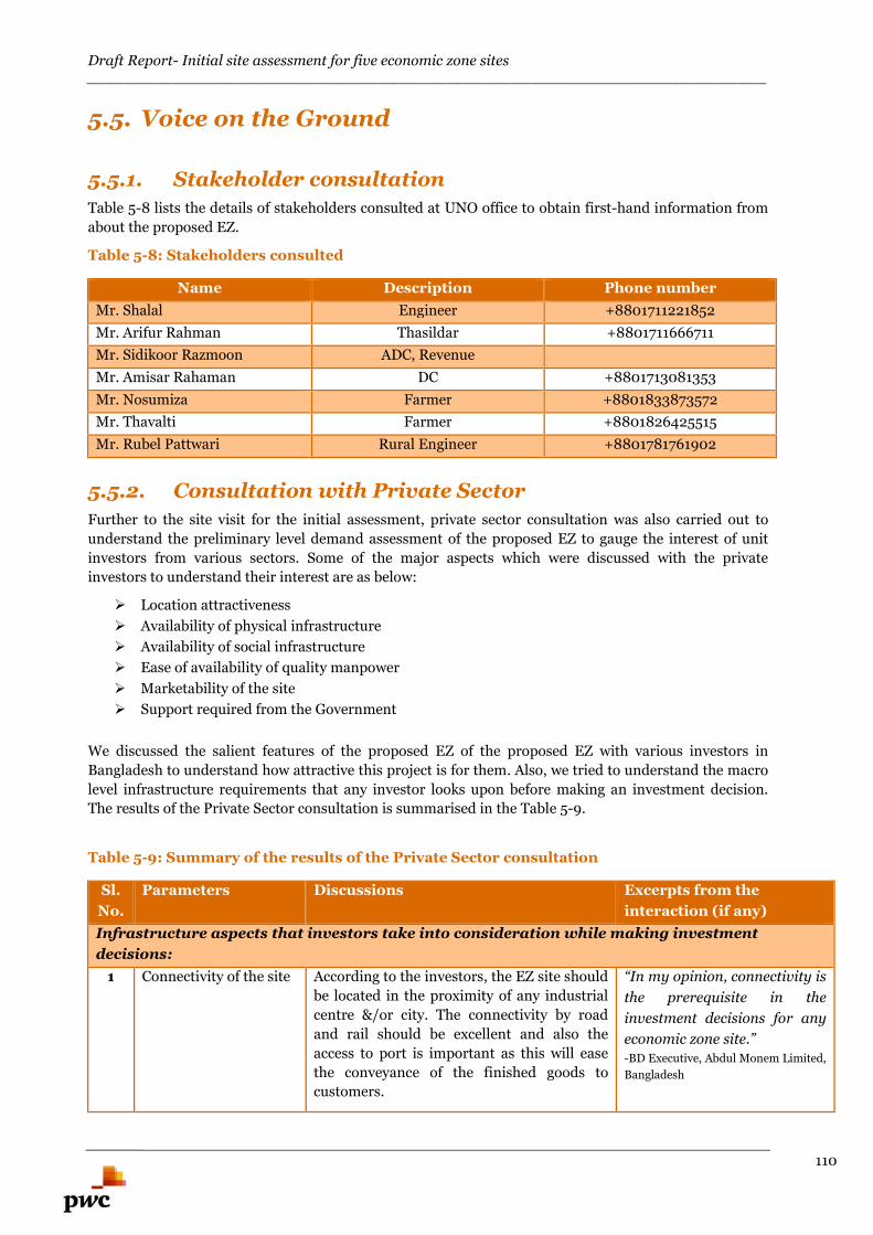
Draft Report- Initial site assessment for five economic zone sites________________________________________________________________________
110
5.5. Voice on the Ground
5.5.1. Stakeholder consultation
Table 5-8 lists the details of stakeholders consulted at UNO office to obtain first-hand information from
about the proposed EZ.
Table 5-8: Stakeholders consulted
Name Description Phone number
Mr. Shalal Engineer +8801711221852
Mr. Arifur Rahman Thasildar +8801711666711
Mr. Sidikoor Razmoon ADC, Revenue
Mr. Amisar Rahaman DC +8801713081353
Mr. Nosumiza Farmer +8801833873572
Mr. Thavalti Farmer +8801826425515
Mr. Rubel Pattwari Rural Engineer +8801781761902
5.5.2. Consultation with Private Sector
Further to the site visit for the initial assessment, private sector consultation was also carried out to
understand the preliminary level demand assessment of the proposed EZ to gauge the interest of unit
investors from various sectors. Some of the major aspects which were discussed with the private
investors to understand their interest are as below:
Location attractiveness
Availability of physical infrastructure
Availability of social infrastructure
Ease of availability of quality manpower
Marketability of the site
Support required from the Government
We discussed the salient features of the proposed EZ of the proposed EZ with various investors in
Bangladesh to understand how attractive this project is for them. Also, we tried to understand the macro
level infrastructure requirements that any investor looks upon before making an investment decision.
The results of the Private Sector consultation is summarised in the Table 5-9.
Table 5-9: Summary of the results of the Private Sector consultation
Sl.
No.
Parameters Discussions Excerpts from the
interaction (if any)
Infrastructure aspects that investors take into consideration while making investment
decisions:
1 Connectivity of the site According to the investors, the EZ site should
be located in the proximity of any industrial
centre &/or city. The connectivity by road
and rail should be excellent and also the
access to port is important as this will ease
the conveyance of the finished goods to
customers.
“In my opinion, connectivity is
the prerequisite in the
investment decisions for any
economic zone site.”
-BD Executive, Abdul Monem Limited,
Bangladesh
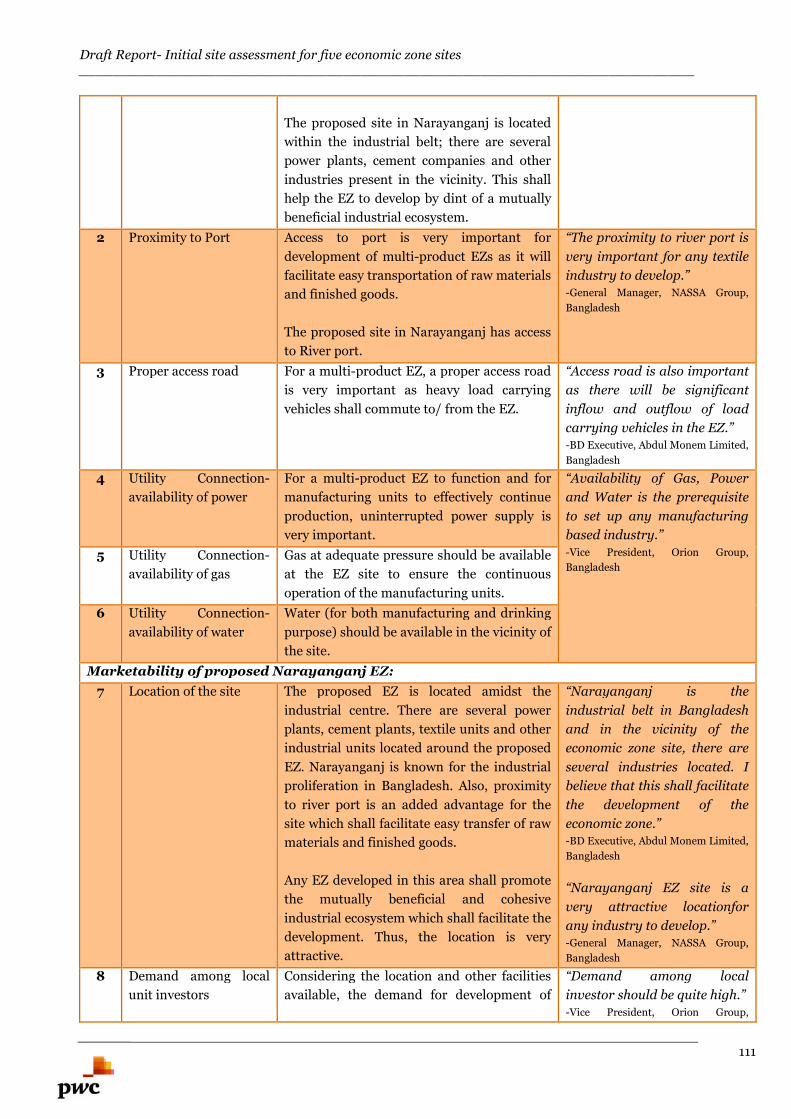
Draft Report- Initial site assessment for five economic zone sites________________________________________________________________________
111
The proposed site in Narayanganj is located
within the industrial belt; there are several
power plants, cement companies and other
industries present in the vicinity. This shall
help the EZ to develop by dint of a mutually
beneficial industrial ecosystem.
2 Proximity to Port Access to port is very important for
development of multi-product EZs as it will
facilitate easy transportation of raw materials
and finished goods.
The proposed site in Narayanganj has access
to River port.
“The proximity to river port is
very important for any textile
industry to develop.”-General Manager, NASSA Group,
Bangladesh
3 Proper access road For a multi-product EZ, a proper access road
is very important as heavy load carrying
vehicles shall commute to/ from the EZ.
“Access road is also important
as there will be significant
inflow and outflow of load
carrying vehicles in the EZ.”-BD Executive, Abdul Monem Limited,
Bangladesh
4 Utility Connection-
availability of power
For a multi-product EZ to function and for
manufacturing units to effectively continue
production, uninterrupted power supply is
very important.
“Availability of Gas, Power
and Water is the prerequisite
to set up any manufacturing
based industry.”
-Vice President, Orion Group,
Bangladesh5 Utility Connection-
availability of gas
Gas at adequate pressure should be available
at the EZ site to ensure the continuous
operation of the manufacturing units.
6 Utility Connection-
availability of water
Water (for both manufacturing and drinking
purpose) should be available in the vicinity of
the site.
Marketability of proposed Narayanganj EZ:
7 Location of the site The proposed EZ is located amidst the
industrial centre. There are several power
plants, cement plants, textile units and other
industrial units located around the proposed
EZ. Narayanganj is known for the industrial
proliferation in Bangladesh. Also, proximity
to river port is an added advantage for the
site which shall facilitate easy transfer of raw
materials and finished goods.
Any EZ developed in this area shall promote
the mutually beneficial and cohesive
industrial ecosystem which shall facilitate the
development. Thus, the location is very
attractive.
“Narayanganj is the
industrial belt in Bangladesh
and in the vicinity of the
economic zone site, there are
several industries located. I
believe that this shall facilitate
the development of the
economic zone.”-BD Executive, Abdul Monem Limited,
Bangladesh
“Narayanganj EZ site is a
very attractive locationfor
any industry to develop.”-General Manager, NASSA Group,
Bangladesh
8 Demand among local
unit investors
Considering the location and other facilities
available, the demand for development of
“Demand among local
investor should be quite high.”
-Vice President, Orion Group,
Draft Report- Initial site assessment for five economic zone sites________________________________________________________________________
112
units in the proposed EZ in Narayanganj
should be quite high.
Bangladesh
“The location is very
attractive and investors from
textile industry shall be quite
interested.”-General Manager, NASSA Group,
Bangladesh
Support required from Government:
9 Assistance in obtaining
clearances from govt.
organizations
According to investors, obtaining clearances
from the govt. agencies in Bangladesh is a
difficult task and hence BEZA must
implement the one-stop-service in order to
facilitate the investors.
Also, the process and forms for
environmental clearance is not customized
for economic zone; hence BEZA should
intervene in the same.
“Current forms for
environmental clearance are
not customized for economic
zone developers. Also,
obtaining environmental
clearance is a difficult task.
BEZA should actively pursue
one-stop-service at the
earliest.”
-BD Executive, Abdul Monem Limited,
Bangladesh
10 Support in investment
promotion (domestic)
According to the investors, BEZA should be
proactive in investment promotion activities
for domestic investors.
“BEZA is proactive for
investment promotion
activities for foreign investors.
We want them to also focus on
the investment promotion
activities for domestic
investors as well.”-BD Executive, Abdul Monem Limited,
Bangladesh
Draft Report- Initial site assessment for five economic zone sites________________________________________________________________________
113
5.6. Overall Adequacy of the EZ Site in Narayanganj
Evaluation of the proposed EZs with respect to key parameters required to establish multi product economic zones are presented in Table 5-10.
Table 5-10: Overall Adequacy of the Narayanganj EZ Site
Sl.No.
Parameters Illustration of the facilities present at the site Remarks/ Analysis
1(A) Connectivity
By Road to Bandar town,Dhaka city and other majorcities of Bangladesh
The proposed EZ is well connected by road to thecapital city and other major cities of Bangladesh. It isaround 32 km away from Dhaka City.
The road distance between the centre of the townBandar and proposed EZ is about 5 km.
There are three major roads which connectNarayanganj to the rest of the country. These roadsare: (1) Narayanganj-Munsiganj Highway (R812); (2)Bondor-Modonpur Highway (R113); and (3) Dhaka-Narayanganj Link Road (R111).
Naryanganj is easily accessible from Dhaka city bybus service (frequent bus service available by Ashian,Bandhan, Utsav, Ananda, Setu and BRTC etc.). Theroad condition is also favourable for passage of goodscarrying trucks and vehicular movement is smooth.
For any Multiproduct EZ to develop thesite must be near to the main city andthe connectivity via road should beexcellent.
The proposed EZ in Narayanganj hasgood road network to Dhaka and othermajor cities of Bangladesh.
1(B) Connectivity
By Rail to Dhaka city andother major cities ofBangladesh
There are two major railway stations in theNarayanganj district viz. Narayanganj and Chashara.
Narayanganj railway station is located about 7 kmfrom proposed EZ. Bangabandhu Sarak connects theproposed EZ to the railway station and trafficcongestion is minimal throughout in the stretch.
Proposed EZ is only 7 km from theNarayanganj railway station therebymaking it easily accessible to other partsof Bangladesh.
1(C) Connectivity
Close proximity to Port
Proposed EZ is located at a distance of about 254 kmfrom Chittagong port & 304 km Mongla Port.The EZ lies on the bank of inland water wayconnecting from Chittagong port to Mongla port.Narayangunj river port, one of the oldest inBangladesh is located within 3.5 km (Water way) / 28
For multiproduct EZ, the raw materialand finished goods need to betransported to/ from local markets aswell as outside the country.
Waterway is the cheapest mode oftransportation for movement of goods
Draft Report- Initial site assessment for five economic zone sites________________________________________________________________________
114
Km (Road way) from the proposed EZ.
Various types of cargos are transported throughNarayanganj Port. But there is no regular cargoservice for carrying commodities. Commodities aregenerally carried by private arrangements andberthing facilities provided by the BIWTA are usedfor loading and unloading purposes. Many localbusiness houses or industries use private berthingfacilities.
as compared to other modes (road, rail,air). Hence, proximity to port isessential.
Narayanganj river port is wellconnected with other major ports of thecountry.
1(D) Connectivity
International Airport inthe proximity
Narayanganj EZ is located about 48 km from HazratShah Jalal International Airport at Dhaka. The traveltime by road to Dhaka International Airport is 2.5-3hours (approx.).
Govt. of Bangladesh intends to construct a newinternational airport (Bangabandhu Sheikh MujibInternational Airport) with a view to create a hubairport in close proximity to Dhaka and to meet thedemand of future growth in aviation sector. The CivilAviation and Tourism Ministry is in the process tofinalise the location of the proposed internationalairport. Some of the locations which are beingconsidered as prospective locations for thedevelopment of new airport are: (1) Char Janajatunder Shibchar Upazila in Madaripur district, (2)Keyain and Latobdi under Shirajdikhan Upazila inMunshiganj district and (3) Char Bilashpur underDohar Upazila of Dhaka district. All these locationsare located within 50 km radius of the proposed EZ.
For movement of goods by air cargo,proximity to airport is essential.
Dhaka airport is accessible from theproposed EZ.
2 Approach Road Sitalakhya Bridge is proposed across the SitalakhyaRiver, which will link the capital with Sylhet andChittagong highway through Demra andNarayanganj. Once functional, it shall connectMadanpur-Madanganj-Sayedpur Road (R113) andFatullah (Panchaboti)-Munshiganj (Muktarpur)Lohajang-Mawa Road (R812).This bridge would provide direct access to theNorthwest parcel of the proposed EZ. Access to theother land parcel (of the proposed EZ) located on the
The alignment for an approach road isessential for developing a multiproductEZ as it shall enable the access for themanpower and heavy commercialvehicles to national highways andexpressways.
Draft Report- Initial site assessment for five economic zone sites________________________________________________________________________
115
south east side of the Bashundhara cement plant isrestricted owing to the presence of berth facility ofBashundhara cement plant on the river.A high level initial assessment suggests providingnew access road along the river bund from Dhaka-Chittagong highway (N1) for a length of 10 km(approx.) to the proposed EZ. This new access roadshall have minimum resettlement requirement whencompared to the widening of present access road viaBashundhara cement plant and summit power plant.
3 Resettlement Issues38 Due to the development of this project, 200(aaprox) household structures could be directlyaffected. All affected structures are ‘kutcha’structures and the average size of the structuresis 400 sq. ft. with a minimum size of 140 sq. ft.and a maximum of 1000 sq. ft. However, thesehouseholds can be excluded during the masterplan stage.
There are plenty of trees in the project area. Themaster plan (during the feasibility stage) can beprepared in a way that maximum number treescould be retained and earmarked as green area.
Landfilling of two major fish ponds is to beundertaken while developing the proposedproject.
Basis preliminary assessment and details sharedby UNO office, Resettlement Action Plan (RAP)would need to be formulated for 400 numbers ofhouseholds (approx.). These households couldstand to lose their income/livelihood as a resultof the development of the project.
The proposed EZ has resettlementissues and necessary measures are to betaken into consideration.
Private land constitutes to around330.30 acre of land area in theproposed EZ. Acquiring land fromprivate land owners could be achallenge.
4 Availability of goodquality potable water
Basis the interaction with the local inhabitants, theground water is available at a depth of 60 feet fromnatural ground level. The proposed EZ is locatedadjacent to the confluence of three rivers viz.Meghna, Dhaleswari and Shitalakhya. Preliminaryassessment suggests that the water requirement
It is very important to have adequateand sustainable source of potable waterfor the development of multiproduct EZso that the labours don’t face anyscarcity of drinking water.
38 Data for number of household structures to be relocated and number of households dependent on agricultural activities has been obtained from Bangladesh Economic Zones Authority (BEZA)
Draft Report- Initial site assessment for five economic zone sites________________________________________________________________________
116
could be met with the intake from either extractingwater from the Dhaleswari River or Sitalakhya Riveror from deep tubewell which could be developedwithin the project area. Further, our preliminaryassessment also suggest that extracting water fromthe river located on the western boundary of theproposed EZ may be considered by providing suitableintake system and water treatment plant.
The industrial units need uninterruptedsupply of good quality water forindustrial consumption.
5 Availability ofuninterrupted powersupply
Bandar substation is located at 2 km (approx.) fromthe proposed EZ. Basis interaction with the UNOofficials, this substation has excess capacity of 5 MW.
Preliminary assessment suggests that a new 132/33kV substation could be established or the existingsubstation could be upgraded for meeting therequirement of power at the proposed EZ.
24×7 uninterrupted electricity supply isa prerequisite for development of anymanufacturing facility.
24×7 uninterrupted electricity supplycould be a possibility when either theexisting substation is upgraded to alarger capacity or a new substation isestablished at the proposed EZ.
6 Availability of Gas supply A gas pipeline is located in close proximity from theproposed EZ (2 km. approximate). Preliminaryassessment suggests that gas could be tapped fromthe existing line to the proposed EZ by obtainingnecessary clearances from Titas Gas.
Gas supply is a prerequisite fordevelopment of any manufacturingfacility.
Though gas is available in the vicinity,the issue of extending the supply to theproposed EZ needs to be furtherdiscussed with the concerned gasdistribution agency (Titas Gas).
7 Availability of goodresidential facility in thenearby areas
The proposed EZ located near Narayanganj town, hasno international standard residential facility in thenearby areas. However such facilities are availablenear to Dhaka city (within 20 km radius of proposedEZ).
Since this region is an industrial centre, there areseveral dwelling units and residential facilityavailable for labours in the area.
The labours working in the proposed EZshall have access to the dwelling unitsand residential areas within 5-10 kmradius of the proposed EZ.
8 Medical facilitiesavailable in the nearbyareas
Narayanganj upzilla has 2 govt. hospital, 4 upzillahealth complex, 12 union health centre, 101community clinics and 60 private clinics.
There are several medical facilitiesavailable within 10 km radius of theproposed EZ to cater to the healthcarerequirements of the workforce.
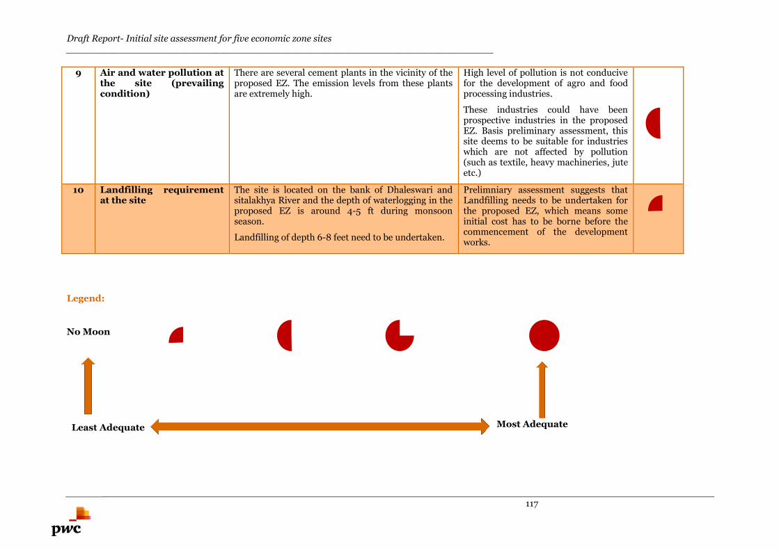
Draft Report- Initial site assessment for five economic zone sites________________________________________________________________________
117
9 Air and water pollution atthe site (prevailingcondition)
There are several cement plants in the vicinity of theproposed EZ. The emission levels from these plantsare extremely high.
High level of pollution is not conducivefor the development of agro and foodprocessing industries.
These industries could have beenprospective industries in the proposedEZ. Basis preliminary assessment, thissite deems to be suitable for industrieswhich are not affected by pollution(such as textile, heavy machineries, juteetc.)
10 Landfilling requirementat the site
The site is located on the bank of Dhaleswari andsitalakhya River and the depth of waterlogging in theproposed EZ is around 4-5 ft during monsoonseason.
Landfilling of depth 6-8 feet need to be undertaken.
Prelimniary assessment suggests thatLandfilling needs to be undertaken forthe proposed EZ, which means someinitial cost has to be borne before thecommencement of the developmentworks.
Legend:
No Moon
Least Adequate Most Adequate

Draft Report- Initial site assessment for five economic zone sites________________________________________________________________________
118
Panchagarh EZ
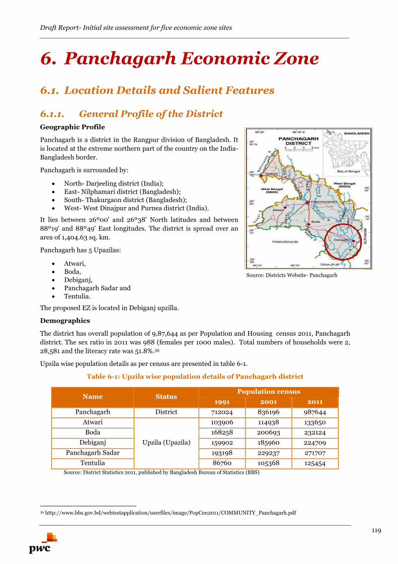
Draft Report- Initial site assessment for five economic zone sites________________________________________________________________________
119
6. Panchagarh Economic Zone
6.1. Location Details and Salient Features
6.1.1. General Profile of the District
Geographic Profile
Panchagarh is a district in the Rangpur division of Bangladesh. It
is located at the extreme northern part of the country on the India-
Bangladesh border.
Panchagarh is surrounded by:
North- Darjeeling district (India); East- Nilphamari district (Bangladesh); South- Thakurgaon district (Bangladesh); West- West Dinajpur and Purnea district (India).
It lies between 26º00' and 26º38' North latitudes and between
88º19' and 88º49' East longitudes. The district is spread over an
area of 1,404.63 sq. km.
Panchagarh has 5 Upazilas:
Atwari, Boda, Debiganj, Panchagarh Sadar and Tentulia.
The proposed EZ is located in Debiganj upzilla.
Demographics
The district has overall population of 9,87,644 as per Population and Housing census 2011, Panchagarh
district. The sex ratio in 2011 was 988 (females per 1000 males). Total numbers of households were 2,
28,581 and the literacy rate was 51.8%.39
Upzila wise population details as per census are presented in table 6-1.
Table 6-1: Upzila wise population details of Panchagarh district
Name StatusPopulation census
1991 2001 2011
Panchagarh District 712024 836196 987644
Atwari
Upzila (Upazila)
103906 114938 133650
Boda 168258 200693 232124
Debiganj 159902 185960 224709
Panchagarh Sadar 193198 229237 271707
Tentulia 86760 105368 125454
Source: District Statistics 2011, published by Bangladesh Bureau of Statistics (BBS)
39 http://www.bbs.gov.bd/webtestapplication/userfiles/image/PopCen2011/COMMUNITY_Panchagarh.pdf
Source: Districts Website- Panchagarh
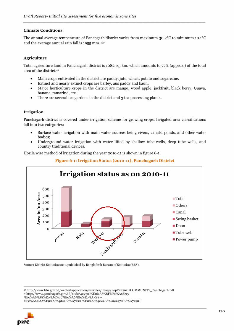
Draft Report- Initial site assessment for five economic zone sites________________________________________________________________________
120
Climate Conditions
The annual average temperature of Pancngarh district varies from maximum 30.2°C to minimum 10.1°C
and the average annual rain fall is 1955 mm. 40
Agriculture
Total agriculture land in Panchagarh district is 1082 sq. km. which amounts to 77% (approx.) of the total
area of the district.41
Main crops cultivated in the district are paddy, jute, wheat, potato and sugarcane. Extinct and nearly extinct crops are barley, aus paddy and kaun. Major horticulture crops in the district are mango, wood apple, jackfruit, black berry, Guava,
banana, tamarind, etc. There are several tea gardens in the district and 3 tea processing plants.
Irrigation
Panchagarh district is covered under irrigation scheme for growing crops. Irrigated area classifications
fall into two categories:
Surface water irrigation with main water sources being rivers, canals, ponds, and other waterbodies;
Underground water irrigation with water lifted by shallow tube-wells, deep tube wells, andcountry traditional devices.
Upzila wise method of irrigation during the year 2010-11 is shown in figure 6-1.
Figure 6-1: Irrigation Status (2010-11), Panchagarh District
Source: District Statistics 2011, published by Bangladesh Bureau of Statistics (BBS)
40 http://www.bbs.gov.bd/webtestapplication/userfiles/image/PopCen2011/COMMUNITY_Panchagarh.pdf41 http://www.panchagarh.gov.bd/node/42930-%E0%A6%8F%E0%A6%95-%E0%A6%A8%E0%A6%9C%E0%A6%B0%E0%A7%87-%E0%A6%AA%E0%A6%9E%E0%A7%8D%E0%A6%9A%E0%A6%97%E0%A7%9C
0
100
200
300
400
500
600
Ar
ea
in'0
0A
cr
e
Irrigation status as on 2010-11
Total
Others
Canal
Swing basket
Doon
Tube well
Power pump
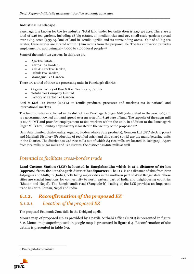
Draft Report- Initial site assessment for five economic zone sites________________________________________________________________________
121
Industrial Landscape
Panchagarh is known for the tea industry. Total land under tea cultivation is 2255.54 acre. There are a
total of 246 tea gardens, including 18 big estates, 13 medium-size and 215 small-scale gardens spread
over 1,815 acres (7.35 sq. km) of land in Tetulia upzilla and its surrounding areas. Out of 18 big tea
estates, three estates are located within 15 km radius from the proposed EZ. The tea cultivation provides
employment to approximately 3,000 to 4,000 local people.42
Some of the major tea gardens in this area are:
Aga Tea Estate, Kartoa Tea Garden, Kazi & Kazi Tea Garden, Dahuk Tea Garden, Mainaguri Tea Garden
There are a total of three tea processing units in Panchagrh district:
Organic factory of Kazi & Kazi Tea Estate, Tetulia Tetulia Tea Company Limited Factory of Kartoa Tea Garden
Kazi & Kazi Tea Estate (KKTE) at Tetulia produces, processes and marketis tea in national and
international markets.
The first industry established in the district was Panchagarh Sugar Mill (established in the year 1969). It
is a government owned unit and spread over an area of 198.46 acre of land. The capacity of the sugar mill
is 10,160 MT and provides employement to 810 workers within the unit. In addition to the Panchagarh
Sugar Mills Ltd, Bombay chips factory is located in the vicinity of the proposed EZ.
Gem Jute Limited (high-quality, organic, biodegradable Jute products), Gemcon Ltd (SPC electric poles)
and Marshall Distillery (Production of rectified spirit and dine chard spirit) are the manufacturing units
in the District. The district has 248 rice mills out of which 84 rice mills are located in Debiganj. Apart
from rice mills, sugar mills and Tea Estates, the district has Jute mills as well.
Potential to facilitate cross-border trade
Land Custom Station (LCS) is located in Banglabandha which is at a distance of 63 km
(approx.) from the Panchagarh district headquarters. The LCS is at a distance of 7km from New
Jalpaiguri and Shillguri (India), both being major cities in the northern part of West Bengal state. These
cities are crucial junctions for connectivity to north eastern part of India and neighbouring countries
(Bhutan and Nepal). The Banglabandh road (Bangladesh) leading to the LCS provides an important
trade link with Bhutan, Nepal and India.
6.1.2. Reconfirmation of the proposed EZ
6.1.2.1. Location of the proposed EZ
The proposed Economic Zone falls in the Debiganj upzila.
Mouza map of proposed EZ as provided by Upazila Nirbahi Office (UNO) is presented in figure
6-2. Mouza map superimposed on google map is presented in figure 6-4. Reconfirmation of site
details is presented in table 6-2.
42 Panchagarh district website
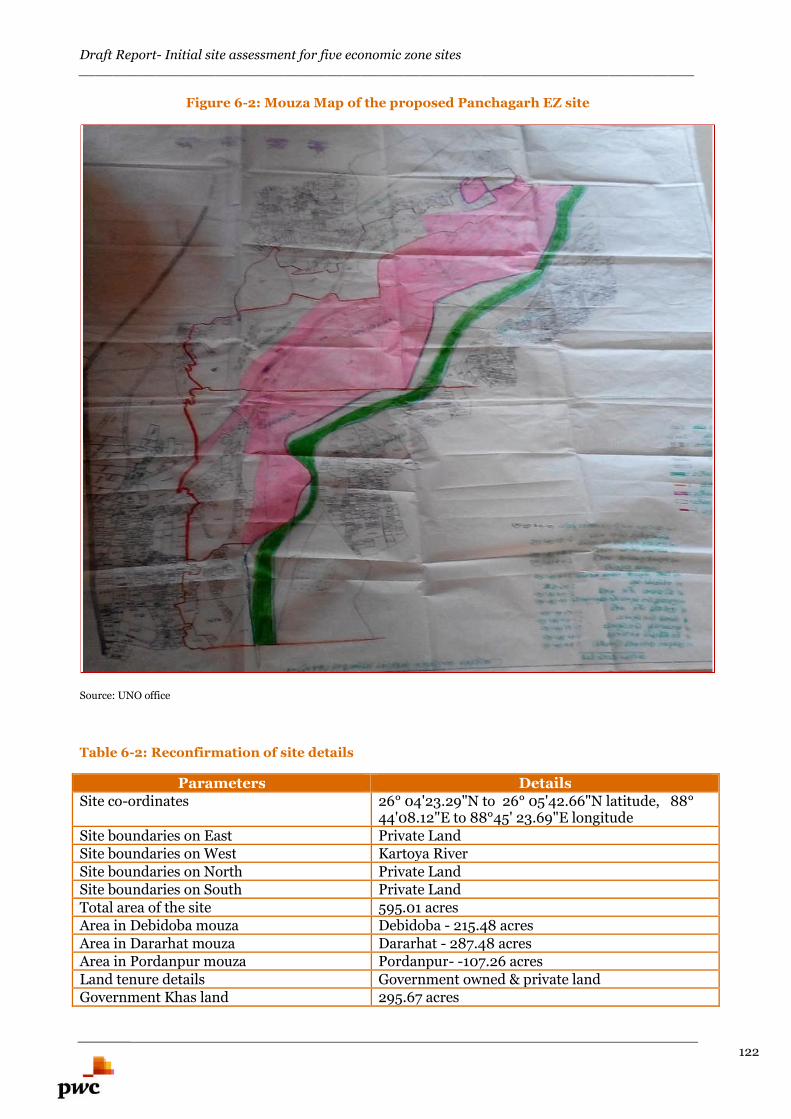
Draft Report- Initial site assessment for five economic zone sites________________________________________________________________________
122
Figure 6-2: Mouza Map of the proposed Panchagarh EZ site
Source: UNO office
Table 6-2: Reconfirmation of site details
Parameters DetailsSite co-ordinates 26° 04'23.29"N to 26° 05'42.66"N latitude, 88°
44'08.12"E to 88°45' 23.69"E longitudeSite boundaries on East Private LandSite boundaries on West Kartoya RiverSite boundaries on North Private LandSite boundaries on South Private LandTotal area of the site 595.01 acresArea in Debidoba mouza Debidoba - 215.48 acresArea in Dararhat mouza Dararhat - 287.48 acresArea in Pordanpur mouza Pordanpur- -107.26 acresLand tenure details Government owned & private landGovernment Khas land 295.67 acres
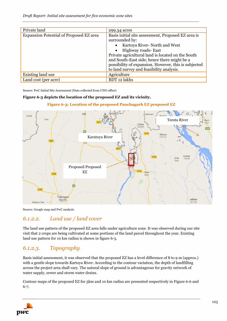
Draft Report- Initial site assessment for five economic zone sites________________________________________________________________________
123
Private land 299.34 acresExpansion Potential of Proposed EZ area Basis initial site assessment, Proposed EZ area is
surrounded by: Kartoya River- North and West Highway roads- East
Private agricultural land is located on the Southand South-East side; hence there might be apossibility of expansion. However, this is subjectedto land survey and feasibility analysis.
Existing land use AgricultureLand cost (per acre) BDT 12 lakhs
Source: PwC Initial Site Assessment (Data collected from UNO office)
Figure 6-3 depicts the location of the proposed EZ and its vicinity.
Figure 6-3: Location of the proposed Panchagarh EZ proposed EZ
Source: Google map and PwC analysis
6.1.2.2. Land use / land cover
The land use pattern of the proposed EZ area falls under agriculture zone. It was observed during our site
visit that 2 crops are being cultivated at some portions of the land parcel throughout the year. Existing
land use pattern for 10 km radius is shown in figure 6-5.
6.1.2.3. Topography
Basis initial assessment, it was observed that the proposed EZ has a level difference of 8 to 9 m (approx.)
with a gentle slope towards Kartoya River. According to the contour variation, the depth of landfilling
across the project area shall vary. The natural slope of ground is advantageous for gravity network of
water supply, sewer and storm water drains.
Contour maps of the proposed EZ for 5km and 10 km radius are presented respectively in Figure 6-6 and
6-7.
Proposed Proposed
EZ
Karatoya River
Teesta River
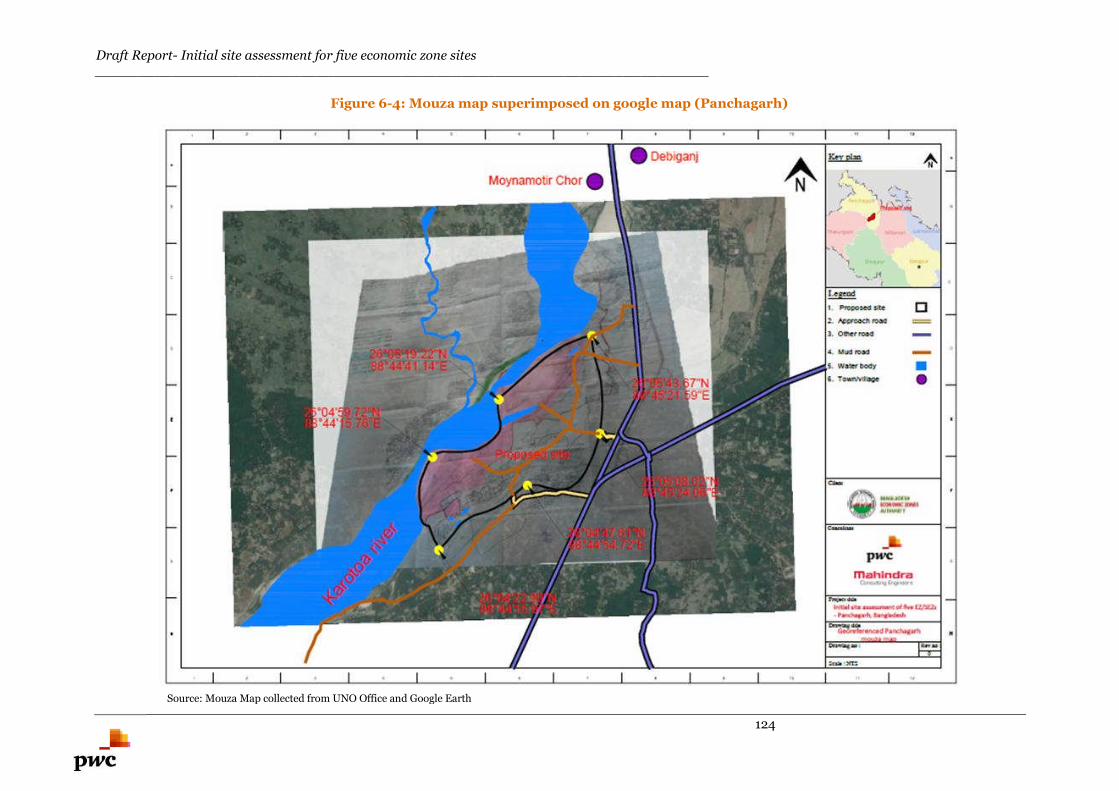
Draft Report- Initial site assessment for five economic zone sites________________________________________________________________________
124
Figure 6-4: Mouza map superimposed on google map (Panchagarh)
Source: Mouza Map collected from UNO Office and Google Earth
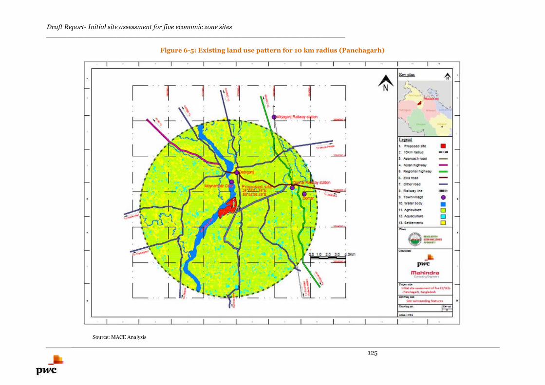
Draft Report- Initial site assessment for five economic zone sites________________________________________________________________________
125
Figure 6-5: Existing land use pattern for 10 km radius (Panchagarh)
Source: MACE Analysis
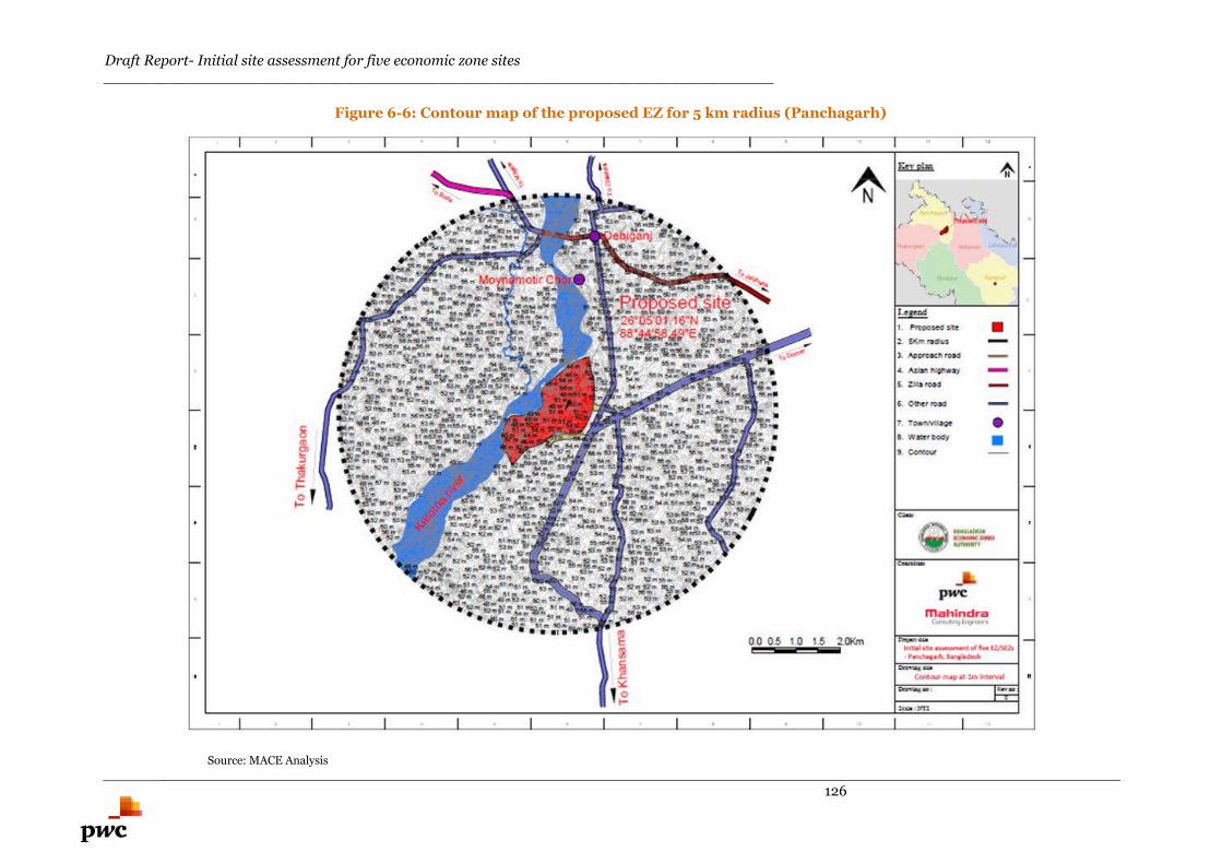
Draft Report- Initial site assessment for five economic zone sites________________________________________________________________________
126
Figure 6-6: Contour map of the proposed EZ for 5 km radius (Panchagarh)
Source: MACE Analysis
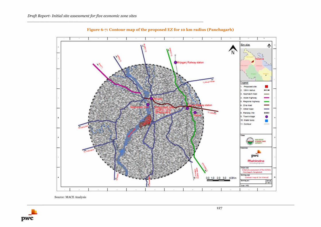
Draft Report- Initial site assessment for five economic zone sites________________________________________________________________________
127
Figure 6-7: Contour map of the proposed EZ for 10 km radius (Panchagarh)
Source: MACE Analysis
Draft Report- Initial site assessment for five economic zone sites________________________________________________________________________
128
6.1.2.4. Physiography
The physiography of the region surrounding the proposed EZ falls in Tista floodplain. Most of the land
falling in this floodplain undergoes low flood during monsoon season.
The Bangladesh physiography map is presented in Annexure C.
According to the history of physiography of this region, the area around the proposed EZ is prone to low
flood during the monsoon season.
6.1.2.5. Soil
Basis site visit, the top soil layer was found to be black cotton soil which needs to be replaced for road
construction. This soil is not suitable for laying foundation for any structure. The dominant soil texture is
sandy loam. The soil layer is acidic in character and the pH ranges from 5.5 to 6.5. The soil layer is
naturally fertile and rich in potassium and phosphorus.
6.1.2.6. Geology
Proposed EZ is located in the Tista Plain (located in former districts of Rangpur, Dinajpur, Bogra and
Pabna). Tista Plain covers an area of 16,000 sq. km. (approx.). The geological map of Bangladesh is
shown in Annexure D.
The type of soil strata in this type of geological area is Tista silt and the soil strata is not suitable for
laying the foundation for structures. Detailed soil investigation needs to be carried out during the
structural design stage.
6.1.2.7. Earthquake data
Debiganj area falls in the Seismic Zone 2 and the earthquake coefficient is 0.15 for this zone. The area
under the proposed EZ falls under the medium seismic range zone; this factor needs to be taken into
account while designing the structure of the proposed EZ.
Seismic zoning map of Bangladesh is presented in Annexure E.
6.1.2.8. Wind speed
During winter, the northern and central areas in Bangladesh witness gentle winds blowing at relatively
low speeds of 1-3 Km/hr. from the north & northwest. The detailed wind speeds need to be obtained for
designing the high rise structures in the proposed EZ. The wind speed map for Bangladesh is presented
in Annexure F.
6.1.2.9. Cyclones and storms
Panchagarh has not witnessed any significant cyclone or storms as a result of which no river erosion has
been observed in this region.
Draft Report- Initial site assessment for five economic zone sites________________________________________________________________________
129
6.2. Environment
6.2.1. Air quality
Ambient air quality measurements are essential:
to provide a description of the existing conditions,
to provide a baseline against which changes can be measured and
to assist in the determination of potential impacts of the proposed EZ construction on air quality
conditions
During the field visit, no apparent problem with the ambient air quality was observed. This may be due
to the fact that the area around the proposed EZ is located in a rural area with very few industries in close
proximity to the proposed EZ and relatively less traffic concentration.
6.2.2. Floods and Water Logging
Basis the interaction with the UNO Officials and local inhabitants, it was communicated to us that the
flood level during monsoon season varies from 5 feet to 6 feet within the area of the proposed EZ.
6.2.3. Noise
During the field visit, no apparent problem of noise was observed. This may be due to the fact that the
area around the proposed EZ is located in a rural area with very few industries in close proximity to the
proposed EZ.
6.2.4. Land filling
Basis the interaction with the UNO officials and local inhabitants, flood level during monsoon season
varies from 5 feet to 6 feet depth inside the proposed EZ area.
To avoid inundation during monsoon season, minimum land filling of 0.6 m above the flood level is
considered.
Based on the assumption, an average depth of 8 feet to 10 feet of land filling has been envisaged for the
proposed EZ area. This figure is indicative and detailed topography survey needs to be carried out to
calculate the exact quantity of land filling at the project area.
Draft Report- Initial site assessment for five economic zone sites________________________________________________________________________
130
6.3. Infrastructure Linkages of the Proposed Site
6.3.1. Physical Infrastructure- Availability of UtilityConnections
6.3.1.1. Power Availability for the proposed EZ
Khotamara, Debiganj 132/33 kV substation is located at distance of 5 km (approx.) from the proposed
EZ. Basis discussion with UNO officials, this substation has an excess capacity of 5 MW after catering to
the demands of local population and industry.
Preliminary assessment suggests that the possibility of setting up a new 132/33 kV substation at
Khotamara, Debiganj could be explored for meeting the requirement of power at the proposed EZ.
6.3.1.2. Water Availability for the proposed EZ
There is no water supply system at the proposed EZ. The people are dependent on tube well water for
drinking purpose. Karatoya River passes adjacent to the proposed EZ.
Basis the interaction with the local inhabitants, ground water is available at a depth of 75 to 100 feet
from natural ground level. Preliminary assessment suggests that the water requirement could be met
with the intake from either extracting water from the Karatoya River or from deep tube wells which could
be developed within the project area.
Further, our preliminary assessment also suggests that extracting water from the Karatoya River located
on the western boundary of the proposed EZ may be explored by providing suitable intake system and
water treatment plant. Proposed EZ is located on the bank of karatoya river and hence the intake well
could be positioned anywhere in the river adjacent to the project boundary. However the location would
need to be finalized during master planning stage. The approximate location as suggested above has been
earmarked in the utility map shown in Figure 6-8.
6.3.1.3. Gas supply to the proposed EZ
No gas station is available within 100Kms radius of the proposed site and nearest gas station Bogra is
located 250Km from the proposed EZ.
6.3.1.4. Telecom/ Internet connectivity to the proposed EZ
Private telecom service providers provide extensive service in this region. Internet and telecom services
are provided by mobile companies such as Grameen Phone, Bharti Airtel, Banglalink, and Teletalk in this
region.
Most of the area around Panchagarh is covered by unineruppted network connectivity by private
operators.
Utility map for the proposed EZ is illustrated in Figure 6-8 below.

Draft Report- Initial site assessment for five economic zone sites________________________________________________________________________
131
Figure 6-8: Utility Map for proposed Panchagarh EZ
Source: PwC analysis and Google Earth
Draft Report- Initial site assessment for five economic zone sites________________________________________________________________________
132
6.3.2. Social Infrastructure
6.3.2.1. Institutional
Debiganj upazilla has 7 colleges, 56 secondary schools, 133 primary schools, 29 madrasa, 18 KG schools,
18 NGO schools and 3 Technical institutes. Some of the major colleges in this area are enlisted below:
Jagdal University
Dhardhara University
Balarampur Model University
Some of the major technical oriented institutions in this area are as listed below:
Panchagarh Technical and Business Management College
Panchagarh Technical School & College
Availability of manpower
Apart from the colleges mentioned above, some of the technical training centres under Bureau of
Manpower Employment and Training (BMET) which are located within 100 km radius of the proposed
EZ43; hence the unskilled/ semi-skilled and skilled/executive level manpower can easily be sourced from
those technical training centres:
Dinajpur Technical Training Centre (approximately 80 km from Panchgarh, travel time of
around 2 hours)
Rangpur Technical Training Centre, Dharmadesh, Rangpur (approximately 98 km from
Panchgarh, travel time of around 2.5 hours)
There are a total of 300 vocational education institutions (48 public and 252 private) in Bangladesh
having a total intake capacity of 58,562.44
Saidpur and Nilphamari are located at a distance of approximately 75 km from the proposed EZ in
Panchgarh. Bangladesh’s biggest railway workshop is located in Saidpur and as a result of this, skilled
and semi-skilled labours could be available in this region. Once the proposed EZ is developed, migration
of skilled labours could take place of Saidpur. Hence, the availability of manpower for the proposed EZ
could be sourced from the existing industrial ecosystem in this area.
6.3.2.2. Healthcare Facilities
There are two government hospitals in Debiganj upzilla.
There is a 31 bedded government hospital and a private hospital in the Pourashava. Available healthcare
facilities in Debiganj are captured in table 6-3.
Table 6-3: healthcare facilities in Debiganj Upzila
Details Number
Upzilla Health Complex 01
Community Health Centre 09
Hospital (non govt.) 01
Private Clinic 01
Family Planning Centre 01
43 http://www.ovijogbmet.org/english/TTC.php44 http://siteresources.worldbank.org/BANGLADESHEXTN/Resources/publications/384630-1209074736457/Bangladesh_Nov2006.pdf
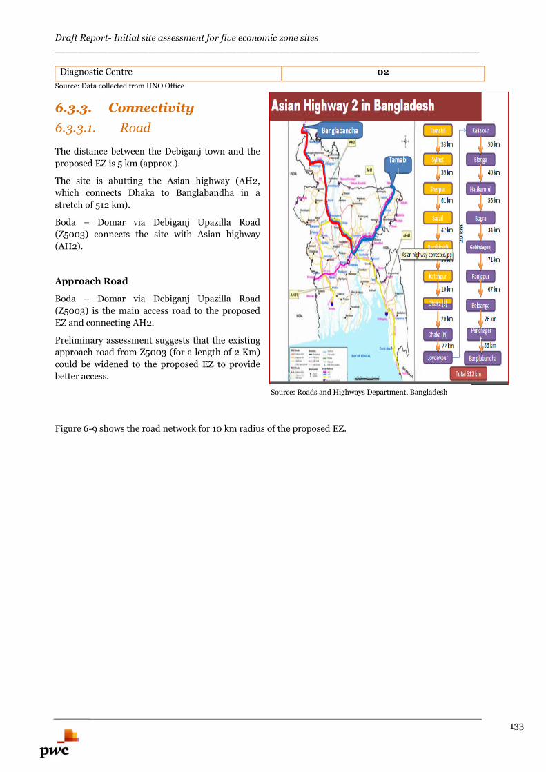
Draft Report- Initial site assessment for five economic zone sites________________________________________________________________________
133
Diagnostic Centre 02
Source: Data collected from UNO Office
6.3.3. Connectivity
6.3.3.1. Road
The distance between the Debiganj town and the
proposed EZ is 5 km (approx.).
The site is abutting the Asian highway (AH2,
which connects Dhaka to Banglabandha in a
stretch of 512 km).
Boda – Domar via Debiganj Upazilla Road
(Z5003) connects the site with Asian highway
(AH2).
Approach Road
Boda – Domar via Debiganj Upazilla Road
(Z5003) is the main access road to the proposed
EZ and connecting AH2.
Preliminary assessment suggests that the existing
approach road from Z5003 (for a length of 2 Km)
could be widened to the proposed EZ to provide
better access.
Figure 6-9 shows the road network for 10 km radius of the proposed EZ.
Source: Roads and Highways Department, Bangladesh
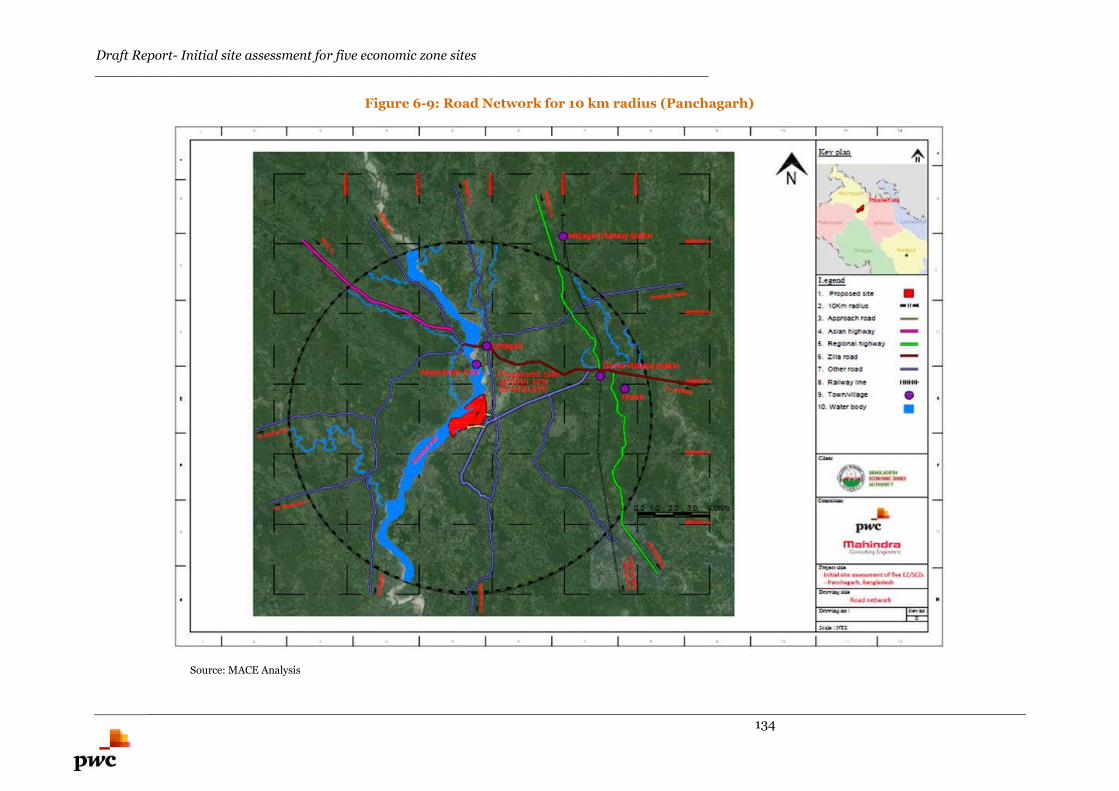
Draft Report- Initial site assessment for five economic zone sites________________________________________________________________________
134
Figure 6-9: Road Network for 10 km radius (Panchagarh)
Source: MACE Analysis
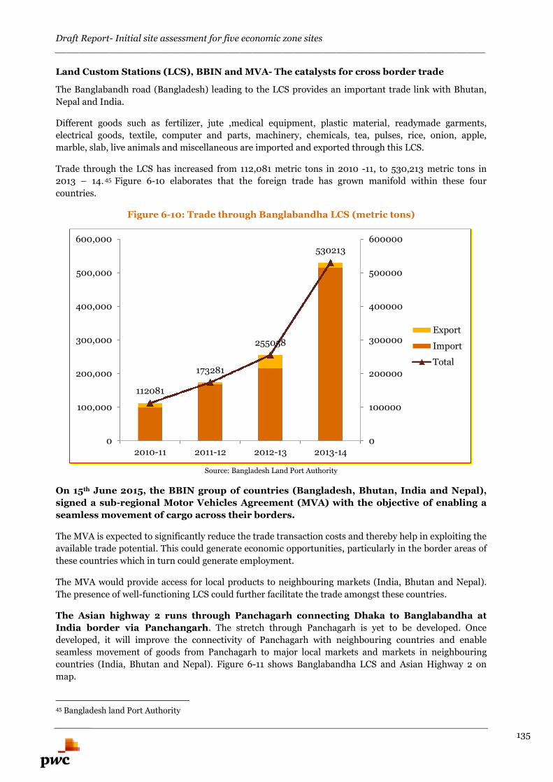
Draft Report- Initial site assessment for five economic zone sites________________________________________________________________________
135
Land Custom Stations (LCS), BBIN and MVA- The catalysts for cross border trade
The Banglabandh road (Bangladesh) leading to the LCS provides an important trade link with Bhutan,
Nepal and India.
Different goods such as fertilizer, jute ,medical equipment, plastic material, readymade garments,
electrical goods, textile, computer and parts, machinery, chemicals, tea, pulses, rice, onion, apple,
marble, slab, live animals and miscellaneous are imported and exported through this LCS.
Trade through the LCS has increased from 112,081 metric tons in 2010 -11, to 530,213 metric tons in
2013 – 14. 45 Figure 6-10 elaborates that the foreign trade has grown manifold within these four
countries.
Figure 6-10: Trade through Banglabandha LCS (metric tons)
Source: Bangladesh Land Port Authority
On 15th June 2015, the BBIN group of countries (Bangladesh, Bhutan, India and Nepal),
signed a sub-regional Motor Vehicles Agreement (MVA) with the objective of enabling a
seamless movement of cargo across their borders.
The MVA is expected to significantly reduce the trade transaction costs and thereby help in exploiting the
available trade potential. This could generate economic opportunities, particularly in the border areas of
these countries which in turn could generate employment.
The MVA would provide access for local products to neighbouring markets (India, Bhutan and Nepal).
The presence of well-functioning LCS could further facilitate the trade amongst these countries.
The Asian highway 2 runs through Panchagarh connecting Dhaka to Banglabandha at
India border via Panchangarh. The stretch through Panchagarh is yet to be developed. Once
developed, it will improve the connectivity of Panchagarh with neighbouring countries and enable
seamless movement of goods from Panchagarh to major local markets and markets in neighbouring
countries (India, Bhutan and Nepal). Figure 6-11 shows Banglabandha LCS and Asian Highway 2 on
map.
45 Bangladesh land Port Authority
112081
173281
255058
530213
0
100000
200000
300000
400000
500000
600000
0
100,000
200,000
300,000
400,000
500,000
600,000
2010-11 2011-12 2012-13 2013-14
Export
Import
Total
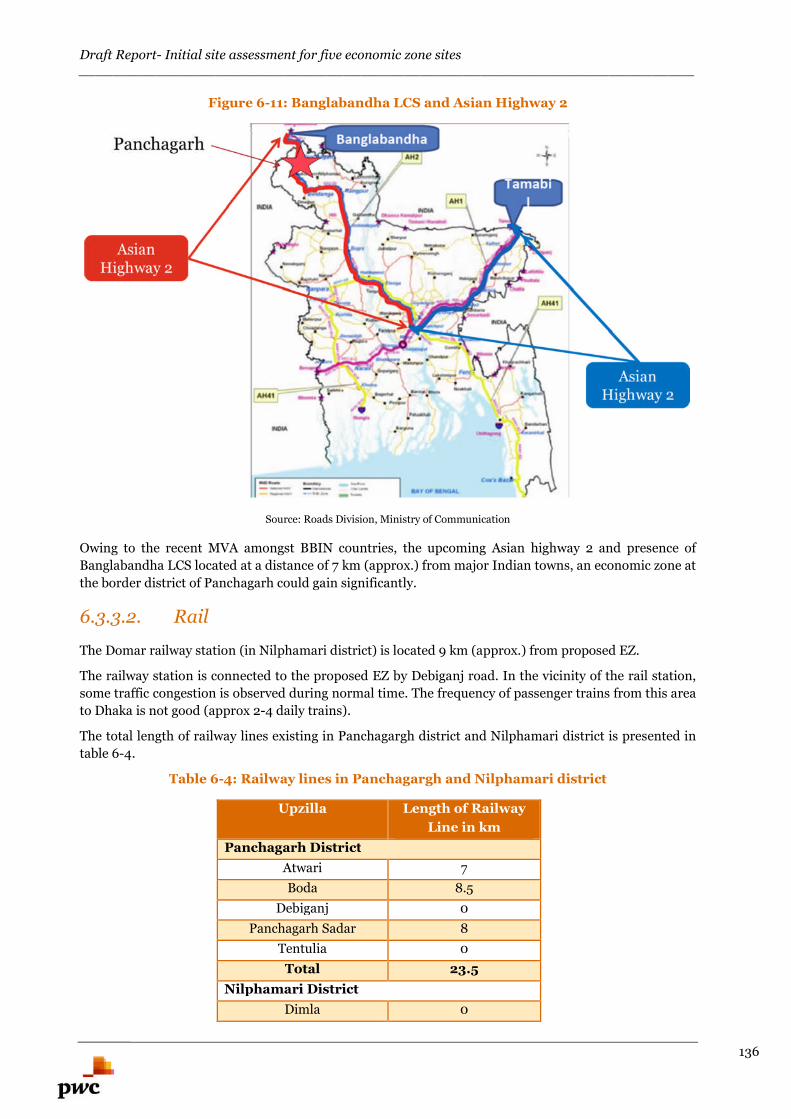
Draft Report- Initial site assessment for five economic zone sites________________________________________________________________________
136
Figure 6-11: Banglabandha LCS and Asian Highway 2
Source: Roads Division, Ministry of Communication
Owing to the recent MVA amongst BBIN countries, the upcoming Asian highway 2 and presence of
Banglabandha LCS located at a distance of 7 km (approx.) from major Indian towns, an economic zone at
the border district of Panchagarh could gain significantly.
6.3.3.2. Rail
The Domar railway station (in Nilphamari district) is located 9 km (approx.) from proposed EZ.
The railway station is connected to the proposed EZ by Debiganj road. In the vicinity of the rail station,
some traffic congestion is observed during normal time. The frequency of passenger trains from this area
to Dhaka is not good (approx 2-4 daily trains).
The total length of railway lines existing in Panchagargh district and Nilphamari district is presented in
table 6-4.
Table 6-4: Railway lines in Panchagargh and Nilphamari district
Upzilla Length of Railway
Line in km
Panchagarh District
Atwari 7
Boda 8.5
Debiganj 0
Panchagarh Sadar 8
Tentulia 0
Total 23.5
Nilphamari District
Dimla 0
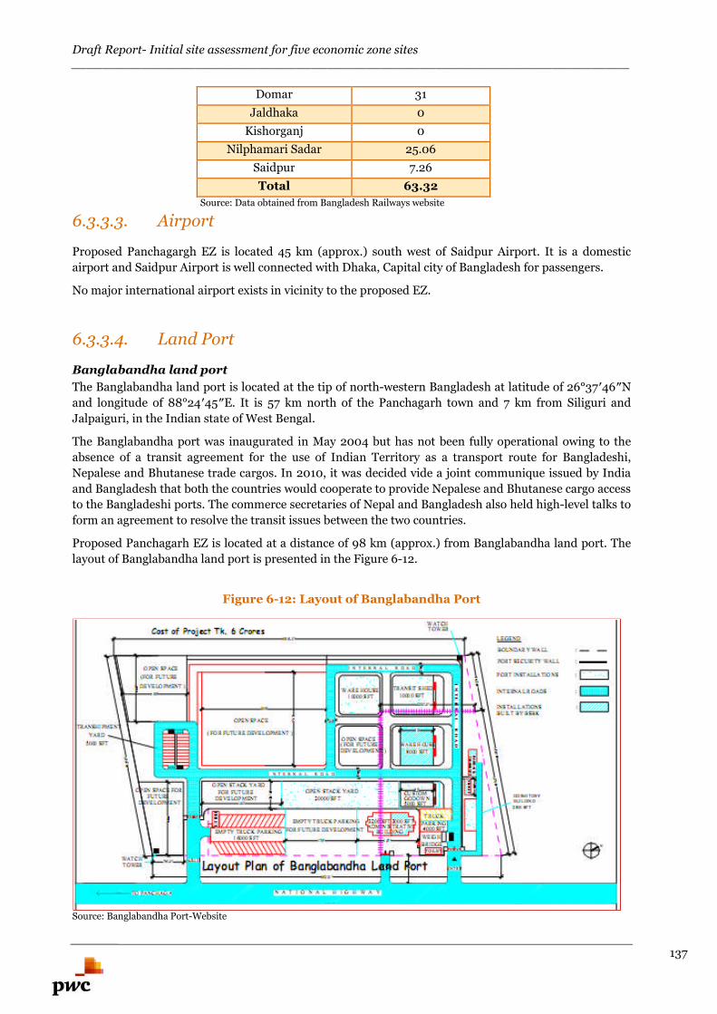
Draft Report- Initial site assessment for five economic zone sites________________________________________________________________________
137
Domar 31
Jaldhaka 0
Kishorganj 0
Nilphamari Sadar 25.06
Saidpur 7.26
Total 63.32
Source: Data obtained from Bangladesh Railways website
6.3.3.3. Airport
Proposed Panchagargh EZ is located 45 km (approx.) south west of Saidpur Airport. It is a domestic
airport and Saidpur Airport is well connected with Dhaka, Capital city of Bangladesh for passengers.
No major international airport exists in vicinity to the proposed EZ.
6.3.3.4. Land Port
Banglabandha land port
The Banglabandha land port is located at the tip of north-western Bangladesh at latitude of 26°37′46″N
and longitude of 88°24′45″E. It is 57 km north of the Panchagarh town and 7 km from Siliguri and
Jalpaiguri, in the Indian state of West Bengal.
The Banglabandha port was inaugurated in May 2004 but has not been fully operational owing to the
absence of a transit agreement for the use of Indian Territory as a transport route for Bangladeshi,
Nepalese and Bhutanese trade cargos. In 2010, it was decided vide a joint communique issued by India
and Bangladesh that both the countries would cooperate to provide Nepalese and Bhutanese cargo access
to the Bangladeshi ports. The commerce secretaries of Nepal and Bangladesh also held high-level talks to
form an agreement to resolve the transit issues between the two countries.
Proposed Panchagarh EZ is located at a distance of 98 km (approx.) from Banglabandha land port. The
layout of Banglabandha land port is presented in the Figure 6-12.
Figure 6-12: Layout of Banglabandha Port
Source: Banglabandha Port-Website
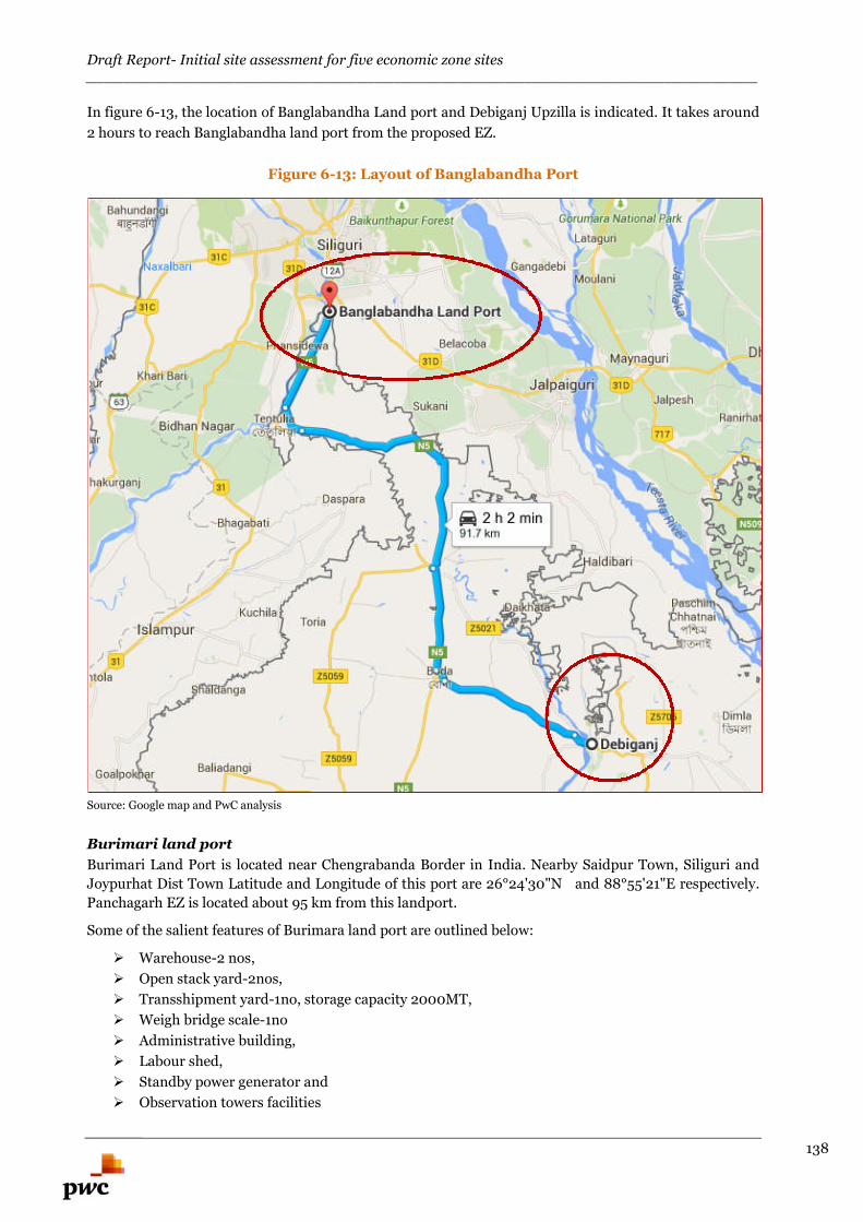
Draft Report- Initial site assessment for five economic zone sites________________________________________________________________________
138
In figure 6-13, the location of Banglabandha Land port and Debiganj Upzilla is indicated. It takes around
2 hours to reach Banglabandha land port from the proposed EZ.
Figure 6-13: Layout of Banglabandha Port
Source: Google map and PwC analysis
Burimari land port
Burimari Land Port is located near Chengrabanda Border in India. Nearby Saidpur Town, Siliguri and
Joypurhat Dist Town Latitude and Longitude of this port are 26°24'30"N and 88°55'21"E respectively.
Panchagarh EZ is located about 95 km from this landport.
Some of the salient features of Burimara land port are outlined below:
Warehouse-2 nos,
Open stack yard-2nos,
Transshipment yard-1no, storage capacity 2000MT,
Weigh bridge scale-1no
Administrative building,
Labour shed,
Standby power generator and
Observation towers facilities
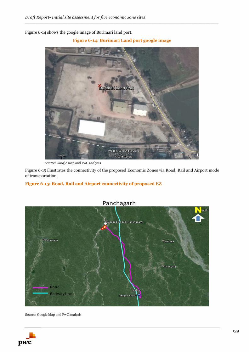
Draft Report- Initial site assessment for five economic zone sites________________________________________________________________________
139
Figure 6-14 shows the google image of Burimari land port.
Figure 6-14: Burimari Land port google image
Source: Google map and PwC analysis
Figure 6-15 illustrates the connectivity of the proposed Economic Zones via Road, Rail and Airport mode
of transportation.
Figure 6-15: Road, Rail and Airport connectivity of proposed EZ
Source: Google Map and PwC analysis
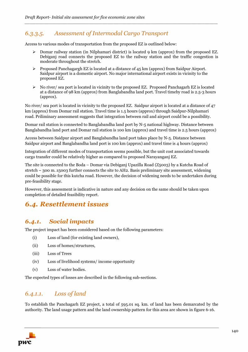
Draft Report- Initial site assessment for five economic zone sites________________________________________________________________________
140
6.3.3.5. Assessment of Intermodal Cargo Transport
Access to various modes of transportation from the proposed EZ is outlined below:
Domar railway station (in Nilphamari district) is located 9 km (approx) from the proposed EZ.Debiganj road connects the proposed EZ to the railway station and the traffic congestion ismoderate throughout the stretch.
Proposed Panchagargh EZ is located at a distance of 45 km (approx) from Saidpur Airport.Saidpur airport is a domestic airport. No major international airport exists in vicinity to theproposed EZ.
No river/ sea port is located in vicinity to the proposed EZ. Proposed Panchagarh EZ is locatedat a distance of 98 km (approx) from Banglabandha land port. Travel timeby road is 2.5-3 hours(approx).
No river/ sea port is located in vicinity to the proposed EZ. Saidpur airport is located at a distance of 47
km (approx) from Domar rail station. Travel time is 1.5 hours (approx) through Saidpur-Nilphamari
road. Priliminary assessment suggests that integration between rail and airport could be a possibility.
Domar rail station is connected to Banglabandha land port by N-5 national highway. Distance between
Banglabandha land port and Domar rail station is 100 km (approx) and travel time is 2.5 hours (approx)
Access between Saidpur airport and Banglabandha land port takes place by N-5. Distance between
Saidpur airport and Banglabandha land port is 100 km (approx) and travel time is 4 hours (approx)
Integration of different modes of transportation seems possible, but the unit cost associated towards
cargo transfer could be relatively higher as compared to proposed Narayanganj EZ.
The site is connected to the Boda – Domar via Debiganj Upazilla Road (Z5003) by a Kutcha Road of
stretch ~ 300 m. z5003 further connects the site to AH2. Basis preliminary site assessment, widening
could be possible for this kutcha road. However, the decision of widening needs to be undertaken during
pre-feasibility stage.
However, this assessment is indicative in nature and any decision on the same should be taken upon
completion of detailed feasibility report.
6.4. Resettlement issues
6.4.1. Social impacts
The project impact has been considered based on the following parameters:
(i) Loss of land (for existing land owners),
(ii) Loss of homes/structures,
(iii) Loss of Trees
(iv) Loss of livelihood systems/ income opportunity
(v) Loss of water bodies.
The expected types of losses are described in the following sub-sections.
6.4.1.1. Loss of land
To establish the Panchagarh EZ project, a total of 595.01 sq. km. of land has been demarcated by the
authority. The land usage pattern and the land ownership pattern for this area are shown in figure 6-16.
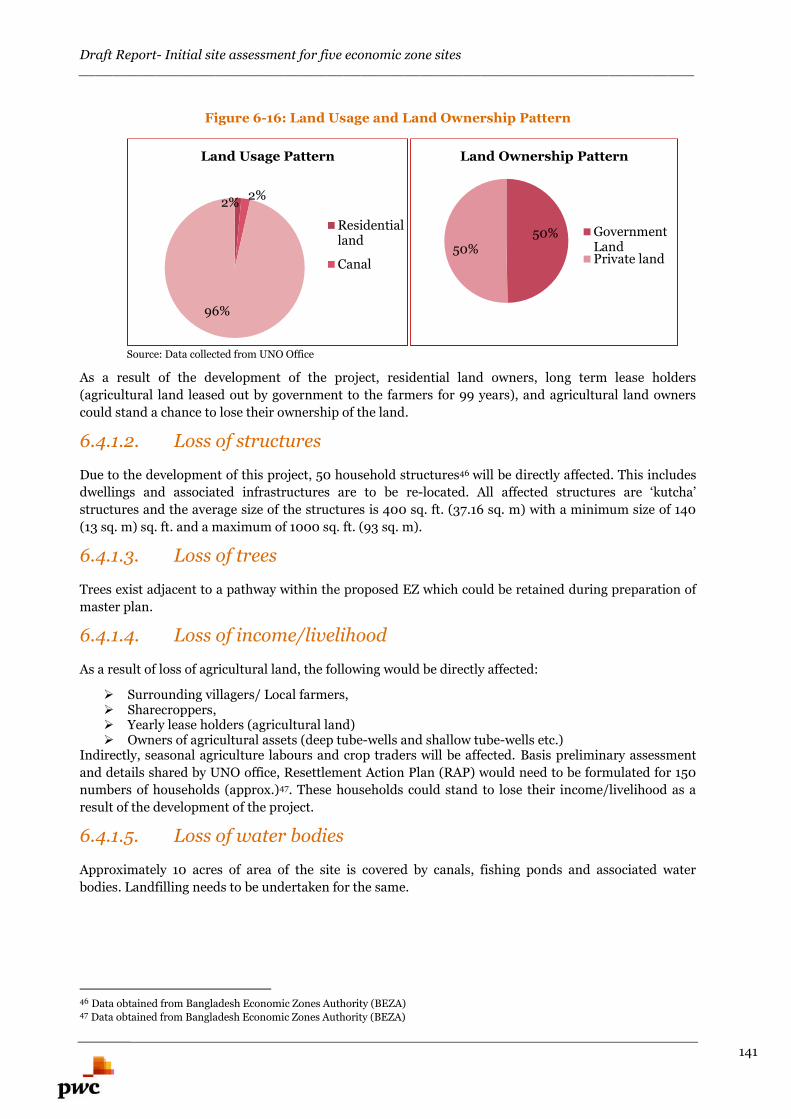
Draft Report- Initial site assessment for five economic zone sites________________________________________________________________________
141
Figure 6-16: Land Usage and Land Ownership Pattern
Source: Data collected from UNO Office
As a result of the development of the project, residential land owners, long term lease holders
(agricultural land leased out by government to the farmers for 99 years), and agricultural land owners
could stand a chance to lose their ownership of the land.
6.4.1.2. Loss of structures
Due to the development of this project, 50 household structures46 will be directly affected. This includes
dwellings and associated infrastructures are to be re-located. All affected structures are ‘kutcha’
structures and the average size of the structures is 400 sq. ft. (37.16 sq. m) with a minimum size of 140
(13 sq. m) sq. ft. and a maximum of 1000 sq. ft. (93 sq. m).
6.4.1.3. Loss of trees
Trees exist adjacent to a pathway within the proposed EZ which could be retained during preparation of
master plan.
6.4.1.4. Loss of income/livelihood
As a result of loss of agricultural land, the following would be directly affected:
Surrounding villagers/ Local farmers, Sharecroppers, Yearly lease holders (agricultural land) Owners of agricultural assets (deep tube-wells and shallow tube-wells etc.)
Indirectly, seasonal agriculture labours and crop traders will be affected. Basis preliminary assessment
and details shared by UNO office, Resettlement Action Plan (RAP) would need to be formulated for 150
numbers of households (approx.)47. These households could stand to lose their income/livelihood as a
result of the development of the project.
6.4.1.5. Loss of water bodies
Approximately 10 acres of area of the site is covered by canals, fishing ponds and associated water
bodies. Landfilling needs to be undertaken for the same.
46 Data obtained from Bangladesh Economic Zones Authority (BEZA)47 Data obtained from Bangladesh Economic Zones Authority (BEZA)
2%2%
96%
Land Usage Pattern
Residentialland
Canal
50%50%
Land Ownership Pattern
GovernmentLandPrivate land
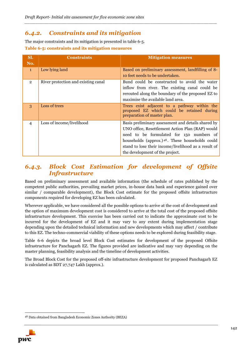
Draft Report- Initial site assessment for five economic zone sites________________________________________________________________________
142
6.4.2. Constraints and its mitigation
The major constraints and its mitigation is presented in table 6-5.0
Table 6-5: constraints and its mitigation measures
Sl.
No.
Constraints Mitigation measures
1 Low lying land Based on preliminary assessment, landfilling of 8-
10 feet needs to be undertaken.
2 River protection and existing canal Bund could be constructed to avoid the water
inflow from river. The existing canal could be
rerouted along the boundary of the proposed EZ to
maximise the available land area.
3 Loss of trees Trees exist adjacent to a pathway within theproposed EZ which could be retained duringpreparation of master plan.
4 Loss of income/livelihood Basis preliminary assessment and details shared by
UNO office, Resettlement Action Plan (RAP) would
need to be formulated for 150 numbers of
households (approx.) 48 . These households could
stand to lose their income/livelihood as a result of
the development of the project.
6.4.3. Block Cost Estimation for development of OffsiteInfrastructure
Based on preliminary assessment and available information (the schedule of rates published by the
competent public authorities, prevailing market prices, in-house data bank and experience gained over
similar / comparable development), the Block Cost estimate for the proposed offsite infrastructure
components required for developing EZ has been calculated.
Wherever applicable, we have considered all the possible options to arrive at the cost of development and
the option of maximum development cost is considered to arrive at the total cost of the proposed offsite
infrastructure development. This exercise has been carried out to indicate the approximate cost to be
incurred for the development of EZ and it may vary to any extent during implementation stage
depending upon the detailed technical information and new developments which may affect / contribute
to this EZ. The techno-commercial viability of these options needs to be explored during feasibility stage.
Table 6-6 depicts the broad level Block Cost estimates for development of the proposed Offsite
infrastructure for Panchagarh EZ. The figures provided are indicative and may vary depending on the
master planning, feasibility analysis and the timeline of development activities.
The Broad Block Cost for the proposed off-site infrastructure development for proposed Panchagarh EZ
is calculated as BDT 27,747 Lakh (approx.).
48 Data obtained from Bangladesh Economic Zones Authority (BEZA)

Draft Report- Initial site assessment for five economic zone sites________________________________________________________________________
143
Table 6-6: Block Cost estimate for proposed Panchagarh EZ
Panchagarh - EZ
Option -1 Option -2 Considered cost option(Maximum of the two options has been considered)
S.No Description Qty Unit Amountin Lakh
BDT
Qty Unit Amountin Lakh
BDT
Qty Unit Amount in Lakh BDT
1 Site filling LS 18804 LS 18804 LS 18804
2 Compound wall 7405 Mtr 703 7405 Mtr 703 7405 Mtr 703
3 Diaphragm wall 3500 Mtr 1400 3500 Mtr 1400 3500 Mtr 1400
4 Approach Road (10.50 mtrCarriage way )
1.281 Km 924 1.281 Km 924 1.281 Km 924
5 Electrical (Externalconnectivity-5Km with MRSS)
108.4 MVA 4246 108.4 MVA 4246 108.4 MVA 4246
6 Water supply (Water Intakefrom River Pipeline length - 1KM)
12.50 MLD 1670 12.50 MLD 1670
7 Water supply (Water from Borewell Pipe linelength 5Km &Bore well 7 Nos )
12.50 MLD 636
Total 27747 26713 27747
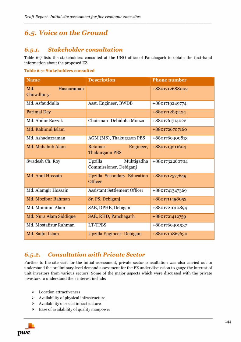
Draft Report- Initial site assessment for five economic zone sites________________________________________________________________________
144
6.5. Voice on the Ground
6.5.1. Stakeholder consultation
Table 6-7 lists the stakeholders consulted at the UNO office of Panchagarh to obtain the first-hand
information about the proposed EZ.
Table 6-7: Stakeholders consulted
Name Description Phone number
Md. Hasnaraman
Chowdhury
+8801712688002
Md. Asfauddulla Asst. Engineer, BWDB +8801719249774
Parimal Dey +8801712831124
Md. Abdur Razzak Chairman- Debidoba Mouza +8801761714022
Md. Rahimul Islam +8801726707160
Md. Ashaduzzaman AGM (MS), Thakurgaon PBS +8801769400813
Md. Mahabub Alam Retainer Engineer,
Thakurgaon PBS
+8801713211604
Swadesh Ch. Roy Upzilla Muktigadha
Commissioner, Debiganj
+8801732260704
Md. Abul Hossain Upzilla Secondary Education
Officer
+8801712577649
Md. Alamgir Hossain Assistant Settlement Officer +8801741347369
Md. Mozibur Rahman Sr. PS, Debiganj +8801711458052
Md. Mominul Alam SAE, DPHE, Debiganj +8801721010894
Md. Nura Alam Siddique SAE, RHD, Panchagarh +8801721412759
Md. Mostafizur Rahman LT-TPBS +8801769401937
Md. Saiful Islam Upzilla Engineer- Debiganj +8801710867630
6.5.2. Consultation with Private Sector
Further to the site visit for the initial assessment, private sector consultation was also carried out to
understand the preliminary level demand assessment for the EZ under discussion to gauge the interest of
unit investors from various sectors. Some of the major aspects which were discussed with the private
investors to understand their interest include:
Location attractiveness
Availability of physical infrastructure
Availability of social infrastructure
Ease of availability of quality manpower
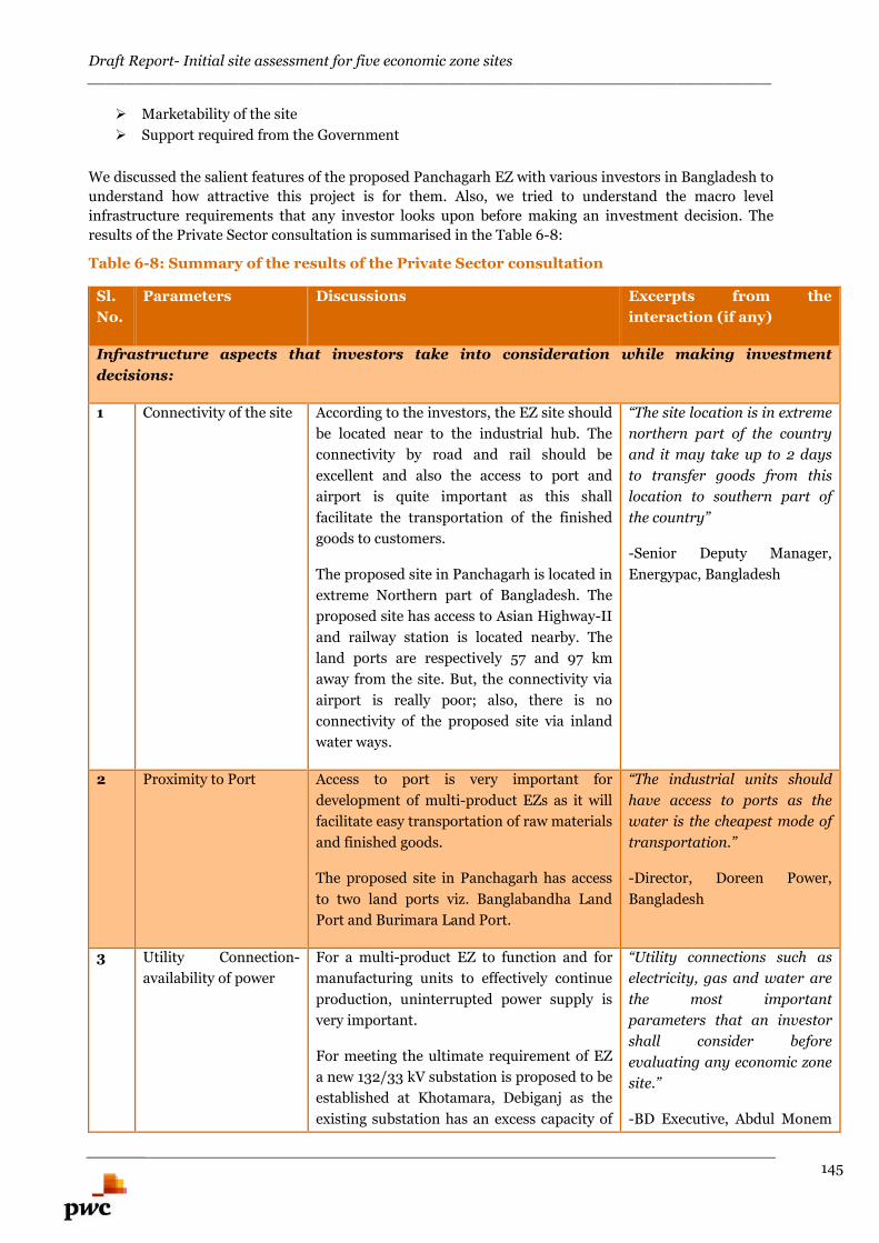
Draft Report- Initial site assessment for five economic zone sites________________________________________________________________________
145
Marketability of the site
Support required from the Government
We discussed the salient features of the proposed Panchagarh EZ with various investors in Bangladesh to
understand how attractive this project is for them. Also, we tried to understand the macro level
infrastructure requirements that any investor looks upon before making an investment decision. The
results of the Private Sector consultation is summarised in the Table 6-8:
Table 6-8: Summary of the results of the Private Sector consultation
Sl.
No.
Parameters Discussions Excerpts from the
interaction (if any)
Infrastructure aspects that investors take into consideration while making investment
decisions:
1 Connectivity of the site According to the investors, the EZ site should
be located near to the industrial hub. The
connectivity by road and rail should be
excellent and also the access to port and
airport is quite important as this shall
facilitate the transportation of the finished
goods to customers.
The proposed site in Panchagarh is located in
extreme Northern part of Bangladesh. The
proposed site has access to Asian Highway-II
and railway station is located nearby. The
land ports are respectively 57 and 97 km
away from the site. But, the connectivity via
airport is really poor; also, there is no
connectivity of the proposed site via inland
water ways.
“The site location is in extreme
northern part of the country
and it may take up to 2 days
to transfer goods from this
location to southern part of
the country”
-Senior Deputy Manager,
Energypac, Bangladesh
2 Proximity to Port Access to port is very important for
development of multi-product EZs as it will
facilitate easy transportation of raw materials
and finished goods.
The proposed site in Panchagarh has access
to two land ports viz. Banglabandha Land
Port and Burimara Land Port.
“The industrial units should
have access to ports as the
water is the cheapest mode of
transportation.”
-Director, Doreen Power,
Bangladesh
3 Utility Connection-
availability of power
For a multi-product EZ to function and for
manufacturing units to effectively continue
production, uninterrupted power supply is
very important.
For meeting the ultimate requirement of EZ
a new 132/33 kV substation is proposed to be
established at Khotamara, Debiganj as the
existing substation has an excess capacity of
“Utility connections such as
electricity, gas and water are
the most important
parameters that an investor
shall consider before
evaluating any economic zone
site.”
-BD Executive, Abdul Monem
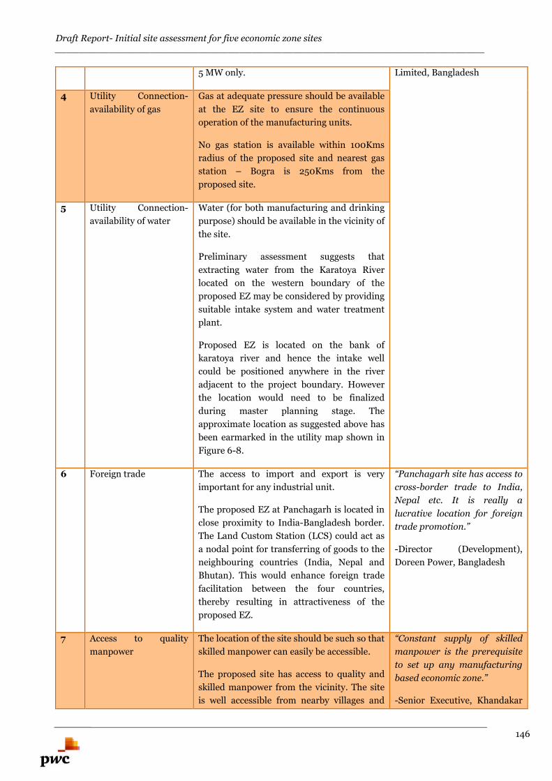
Draft Report- Initial site assessment for five economic zone sites________________________________________________________________________
146
5 MW only. Limited, Bangladesh
4 Utility Connection-
availability of gas
Gas at adequate pressure should be available
at the EZ site to ensure the continuous
operation of the manufacturing units.
No gas station is available within 100Kms
radius of the proposed site and nearest gas
station – Bogra is 250Kms from the
proposed site.
5 Utility Connection-
availability of water
Water (for both manufacturing and drinking
purpose) should be available in the vicinity of
the site.
Preliminary assessment suggests that
extracting water from the Karatoya River
located on the western boundary of the
proposed EZ may be considered by providing
suitable intake system and water treatment
plant.
Proposed EZ is located on the bank of
karatoya river and hence the intake well
could be positioned anywhere in the river
adjacent to the project boundary. However
the location would need to be finalized
during master planning stage. The
approximate location as suggested above has
been earmarked in the utility map shown in
Figure 6-8.
6 Foreign trade The access to import and export is very
important for any industrial unit.
The proposed EZ at Panchagarh is located in
close proximity to India-Bangladesh border.
The Land Custom Station (LCS) could act as
a nodal point for transferring of goods to the
neighbouring countries (India, Nepal and
Bhutan). This would enhance foreign trade
facilitation between the four countries,
thereby resulting in attractiveness of the
proposed EZ.
“Panchagarh site has access to
cross-border trade to India,
Nepal etc. It is really a
lucrative location for foreign
trade promotion.”
-Director (Development),
Doreen Power, Bangladesh
7 Access to quality
manpower
The location of the site should be such so that
skilled manpower can easily be accessible.
The proposed site has access to quality and
skilled manpower from the vicinity. The site
is well accessible from nearby villages and
“Constant supply of skilled
manpower is the prerequisite
to set up any manufacturing
based economic zone.”
-Senior Executive, Khandakar
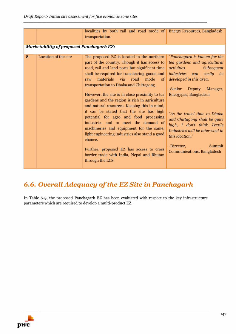
Draft Report- Initial site assessment for five economic zone sites________________________________________________________________________
147
localities by both rail and road mode of
transportation.
Energy Resources, Bangladesh
Marketability of proposed Panchagarh EZ:
8 Location of the site The proposed EZ is located in the northern
part of the country. Though it has access to
road, rail and land ports but significant time
shall be required for transferring goods and
raw materials via road mode of
transportation to Dhaka and Chittagong.
However, the site is in close proximity to tea
gardens and the region is rich in agriculture
and natural resources. Keeping this in mind,
it can be stated that the site has high
potential for agro and food processing
industries and to meet the demand of
machineries and equipment for the same,
light engineering industries also stand a good
chance.
Further, proposed EZ has access to cross
border trade with India, Nepal and Bhutan
through the LCS.
“Panchagarh is known for the
tea gardens and agricultural
activities. Subsequent
industries can easily be
developed in this area.
-Senior Deputy Manager,
Energypac, Bangladesh
“As the travel time to Dhaka
and Chittagong shall be quite
high, I don’t think Textile
Industries will be interested in
this location.”
-Director, Summit
Communications, Bangladesh
6.6. Overall Adequacy of the EZ Site in Panchagarh
In Table 6-9, the proposed Panchagarh EZ has been evaluated with respect to the key infrastructure
parameters which are required to develop a multi-product EZ.
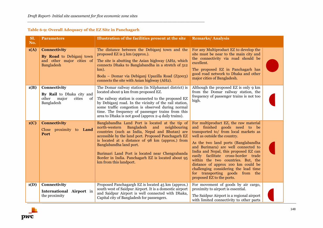
Draft Report- Initial site assessment for five economic zone sites________________________________________________________________________
148
Table 6-9: Overall Adequacy of the EZ Site in Panchagarh
Sl.No.
Parameters Illustration of the facilities present at the site Remarks/ Analysis
1(A) Connectivity
By Road to Debiganj townand other major cities ofBangladesh
The distance between the Debiganj town and theproposed EZ is 5 km (approx.).
The site is abutting the Asian highway (AH2, whichconnects Dhaka to Banglabandha in a stretch of 512km).
Boda – Domar via Debiganj Upazilla Road (Z5003)connects the site with Asian highway (AH2).
For any Multiproduct EZ to develop thesite must be near to the main city andthe connectivity via road should beexcellent.
The proposed EZ in Panchagarh hasgood road network to Dhaka and othermajor cities of Bangladesh.
1(B) Connectivity
By Rail to Dhaka city andother major cities ofBangladesh
The Domar railway station (in Nilphamari district) islocated about 9 km from proposed EZ.
The railway station is connected to the proposed EZby Debiganj road. In the vicinity of the rail station,some traffic congestion is observed during normaltime. The frequency of passenger trains from thisarea to Dhaka is not good (approx 2-4 daily trains).
Although the proposed EZ is only 9 kmfrom the Domar railway station, thefrequency of passenger trains is not toohigh.
1(C) Connectivity
Close proximity to LandPort
Banglabandha Land Port is located at the tip ofnorth-western Bangladesh and neighbouringcountries (such as India, Nepal and Bhutan) areaccessible by the land port. Proposed Panchagarh EZis located at a distance of 98 km (approx.) fromBanglabandha land port.
Burimari Land Port is located near ChengrabandaBorder in India. Panchagarh EZ is located about 95km from this landport.
For multiproduct EZ, the raw materialand finished goods need to betransported to/ from local markets aswell as outside the country.
As the two land ports (Banglabandhaand Burimara) are well connected toIndia and Nepal, this proposed EZ caneasily facilitate cross-border tradewithin the two countries. But, thedistance of approx 100 km could bechallenging considering the lead timefor transporting goods from theproposed EZ to the ports.
1(D) Connectivity
International Airport inthe proximity
Proposed Panchagargh EZ is located 45 km (approx.)south west of Saidpur Airport. It is a domestic airportand Saidpur Airport is well connected with Dhaka,Capital city of Bangladesh for passengers.
For movement of goods by air cargo,proximity to airport is essential.
The Saidpur Airport is a regional airportwith limited connectivity to other parts
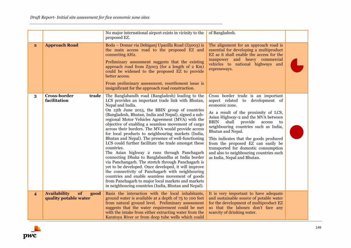
Draft Report- Initial site assessment for five economic zone sites________________________________________________________________________
149
No major international airport exists in vicinity to theproposed EZ.
of Bangladesh.
2 Approach Road Boda – Domar via Debiganj Upazilla Road (Z5003) isthe main access road to the proposed EZ andconnecting AH2.
Preliminary assessment suggests that the existingapproach road from Z5003 (for a length of 2 Km)could be widened to the proposed EZ to providebetter access.
From preliminary assessment, resettlement issue isinsignificant for the approach road construction.
The alignment for an approach road isessential for developing a multiproductEZ as it shall enable the access for themanpower and heavy commercialvehicles to national highways andexpressways.
3 Cross-border tradefacilitation
The Banglabandh road (Bangladesh) leading to theLCS provides an important trade link with Bhutan,Nepal and India.On 15th June 2015, the BBIN group of countries(Bangladesh, Bhutan, India and Nepal), signed a sub-regional Motor Vehicles Agreement (MVA) with theobjective of enabling a seamless movement of cargoacross their borders. The MVA would provide accessfor local products to neighbouring markets (India,Bhutan and Nepal). The presence of well-functioningLCS could further facilitate the trade amongst thesecountries.The Asian highway 2 runs through Panchagarhconnecting Dhaka to Banglabandha at India bordervia Panchangarh. The stretch through Panchagarh isyet to be developed. Once developed, it will improvethe connectivity of Panchagarh with neighbouringcountries and enable seamless movement of goodsfrom Panchagarh to major local markets and marketsin neighbouring countries (India, Bhutan and Nepal).
Cross border trade is an importantaspect related to development ofeconomic zone.
As a result of the proximity of LCS,Asian Highway-2 and the MVA betweenBBIN shall provide access toneighbouring countries such as India,Bhutan and Nepal.
This indicates that the goods producedfrom the proposed EZ can easily betransported for domestic consumptionand also to neighbouring countries suchas India, Nepal and Bhutan.
4 Availability of goodquality potable water
Basis the interaction with the local inhabitants,ground water is available at a depth of 75 to 100 feetfrom natural ground level. Preliminary assessmentsuggests that the water requirement could be metwith the intake from either extracting water from theKaratoya River or from deep tube wells which could
It is very important to have adequateand sustainable source of potable waterfor the development of multiproduct EZso that the labours don’t face anyscarcity of drinking water.
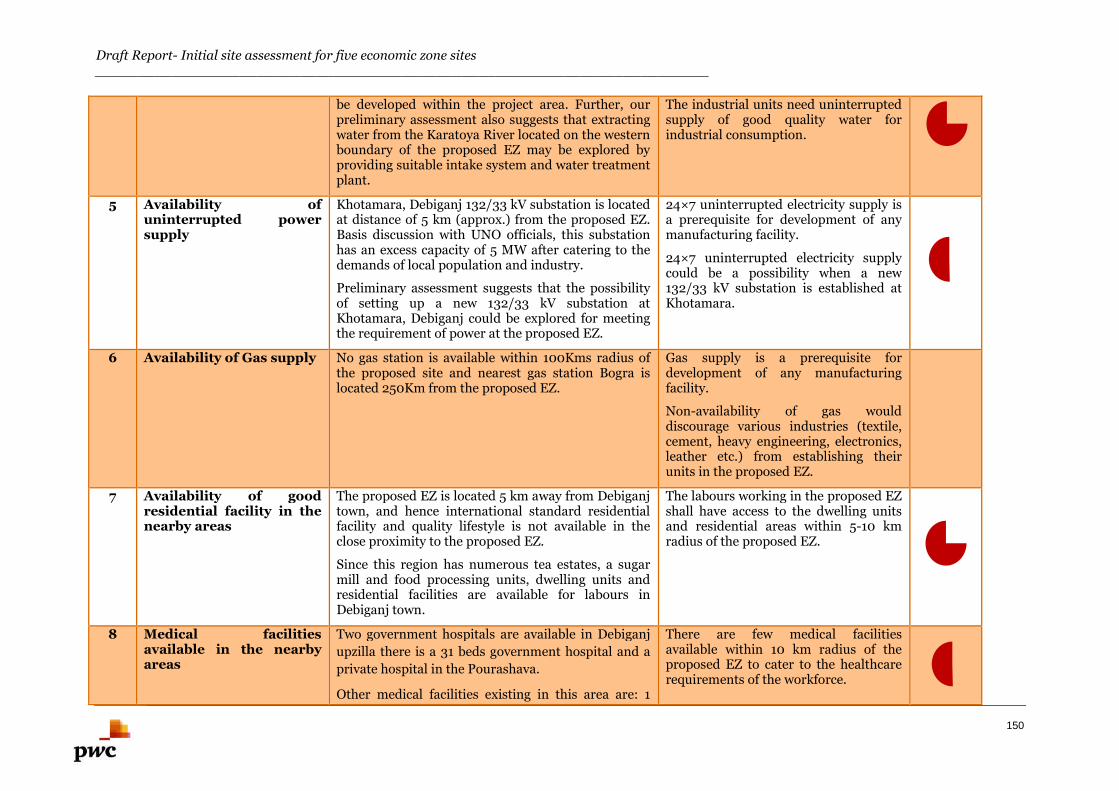
Draft Report- Initial site assessment for five economic zone sites________________________________________________________________________
150
be developed within the project area. Further, ourpreliminary assessment also suggests that extractingwater from the Karatoya River located on the westernboundary of the proposed EZ may be explored byproviding suitable intake system and water treatmentplant.
The industrial units need uninterruptedsupply of good quality water forindustrial consumption.
5 Availability ofuninterrupted powersupply
Khotamara, Debiganj 132/33 kV substation is locatedat distance of 5 km (approx.) from the proposed EZ.Basis discussion with UNO officials, this substationhas an excess capacity of 5 MW after catering to thedemands of local population and industry.
Preliminary assessment suggests that the possibilityof setting up a new 132/33 kV substation atKhotamara, Debiganj could be explored for meetingthe requirement of power at the proposed EZ.
24×7 uninterrupted electricity supply isa prerequisite for development of anymanufacturing facility.
24×7 uninterrupted electricity supplycould be a possibility when a new132/33 kV substation is established atKhotamara.
6 Availability of Gas supply No gas station is available within 100Kms radius ofthe proposed site and nearest gas station Bogra islocated 250Km from the proposed EZ.
Gas supply is a prerequisite fordevelopment of any manufacturingfacility.
Non-availability of gas woulddiscourage various industries (textile,cement, heavy engineering, electronics,leather etc.) from establishing theirunits in the proposed EZ.
7 Availability of goodresidential facility in thenearby areas
The proposed EZ is located 5 km away from Debiganjtown, and hence international standard residentialfacility and quality lifestyle is not available in theclose proximity to the proposed EZ.
Since this region has numerous tea estates, a sugarmill and food processing units, dwelling units andresidential facilities are available for labours inDebiganj town.
The labours working in the proposed EZshall have access to the dwelling unitsand residential areas within 5-10 kmradius of the proposed EZ.
8 Medical facilitiesavailable in the nearbyareas
Two government hospitals are available in Debiganj
upzilla there is a 31 beds government hospital and a
private hospital in the Pourashava.
Other medical facilities existing in this area are: 1
There are few medical facilitiesavailable within 10 km radius of theproposed EZ to cater to the healthcarerequirements of the workforce.

Draft Report- Initial site assessment for five economic zone sites________________________________________________________________________
151
upzilla health complex, 9 community health centres,
1 private clinic and 2 diagnostic centres.
9 Air and water pollution atthe site (prevailingcondition)
The site is free from air and water pollution. No
significant noise was observed during the initial site
visit.
The incidence of water and air pollution in the site is
insignificant. Also, the incidence of water borne
diseases wasn’t recorded in the locality.
The location of any multi product EZshould ideally be free from air andwater pollution. Pollution would lead tohealth hazards and non-conduciveworking environment for the workforce.
From the initial site assessment, itappears that the site is free from allsuch pollution problems.
10 Landfilling requirementat the site
Since the site is located on the bank of Koratya River,
the depth of waterlogging in the site is around 5-6 ft.
during monsoon season.
Landfilling of depth 8-10 feet needs to be
undertaken.
Preliminary assessment suggests thatLandfilling needs to be undertaken forthe proposed EZ, which means someinitial cost has to be borne before thecommencement of the developmentworks.

Draft Report- Initial site assessment for five economic zone sites________________________________________________________________________
152
Anowara-2 EZ
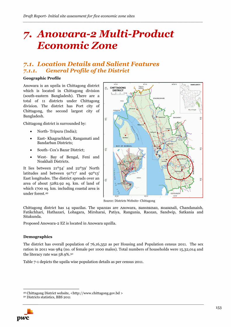
Draft Report- Initial site assessment for five economic zone sites________________________________________________________________________
153
7. Anowara-2 Multi-ProductEconomic Zone
7.1. Location Details and Salient Features7.1.1. General Profile of the District
Geographic Profile
Anowara is an upzila in Chittagong district
which is located in Chittagong division
(south-eastern Bangladesh). There are a
total of 11 districts under Chittagong
division. The district has Port city of
Chittagong, the second largest city of
Bangladesh.
Chittagong district is surrounded by:
North- Tripura (India);
East- Khagrachhari, Rangamati andBandarban Districts;
South- Cox’s Bazar District;
West- Bay of Bengal, Feni andNoakhali Districts.
It lies between 21º54' and 22º59' North
latitudes and between 91º17' and 92º13'
East longitudes. The district spreads over an
area of about 5282.92 sq. km. of land of
which 1700 sq. km. including coastal area is
under forest.49
Chittagong district has 14 upazilas. The upazilas are Anowara, Banshkhali, Boalkhali, Chandanaish,Fatikchhari, Hathazari, Lohagara, Mirsharai, Patiya, Rangunia, Raozan, Sandwip, Satkania andSitakunda.
Proposed Anowara-2 EZ is located in Anowara upzilla.
Demographics
The district has overall population of 76,16,352 as per Housing and Population census 2011. The sex
ration in 2011 was 984 (no. of female per 1000 males). Total numbers of households were 15,32,014 and
the literacy rate was 58.9%.50
Table 7-1 depicts the upzila wise population details as per census 2011.
49 Chittagong District website, <http://www.chittagong.gov.bd >50 Districts statistics, BBS 2011
Source: Districts Website- Chittagong
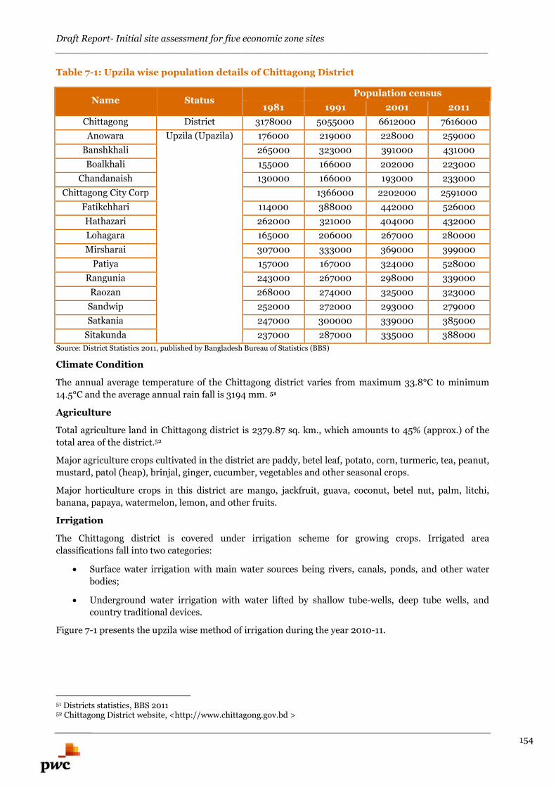
Draft Report- Initial site assessment for five economic zone sites________________________________________________________________________
154
Table 7-1: Upzila wise population details of Chittagong District
Name StatusPopulation census
1981 1991 2001 2011
Chittagong District 3178000 5055000 6612000 7616000
Anowara Upzila (Upazila) 176000 219000 228000 259000
Banshkhali 265000 323000 391000 431000
Boalkhali 155000 166000 202000 223000
Chandanaish 130000 166000 193000 233000
Chittagong City Corp 1366000 2202000 2591000
Fatikchhari 114000 388000 442000 526000
Hathazari 262000 321000 404000 432000
Lohagara 165000 206000 267000 280000
Mirsharai 307000 333000 369000 399000
Patiya 157000 167000 324000 528000
Rangunia 243000 267000 298000 339000
Raozan 268000 274000 325000 323000
Sandwip 252000 272000 293000 279000
Satkania 247000 300000 339000 385000
Sitakunda 237000 287000 335000 388000
Source: District Statistics 2011, published by Bangladesh Bureau of Statistics (BBS)
Climate Condition
The annual average temperature of the Chittagong district varies from maximum 33.8°C to minimum
14.5°C and the average annual rain fall is 3194 mm. 51
Agriculture
Total agriculture land in Chittagong district is 2379.87 sq. km., which amounts to 45% (approx.) of the
total area of the district.52
Major agriculture crops cultivated in the district are paddy, betel leaf, potato, corn, turmeric, tea, peanut,
mustard, patol (heap), brinjal, ginger, cucumber, vegetables and other seasonal crops.
Major horticulture crops in this district are mango, jackfruit, guava, coconut, betel nut, palm, litchi,
banana, papaya, watermelon, lemon, and other fruits.
Irrigation
The Chittagong district is covered under irrigation scheme for growing crops. Irrigated area
classifications fall into two categories:
Surface water irrigation with main water sources being rivers, canals, ponds, and other water
bodies;
Underground water irrigation with water lifted by shallow tube-wells, deep tube wells, and
country traditional devices.
Figure 7-1 presents the upzila wise method of irrigation during the year 2010-11.
51 Districts statistics, BBS 201152 Chittagong District website, <http://www.chittagong.gov.bd >
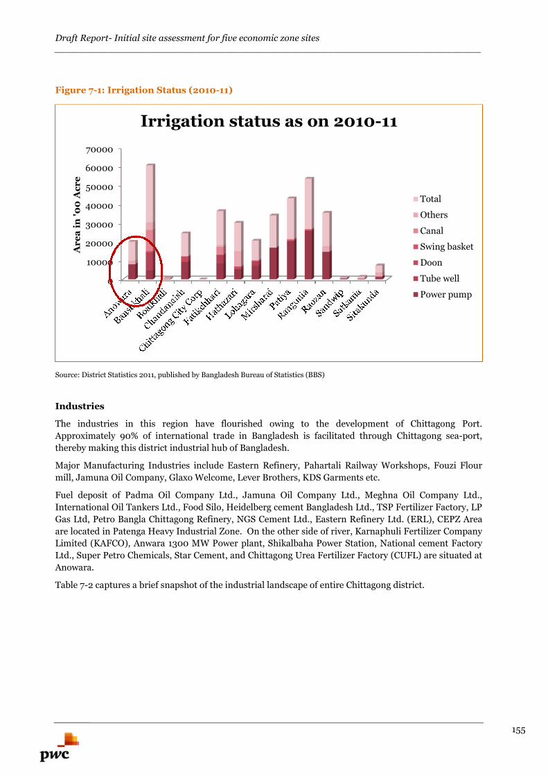
Draft Report- Initial site assessment for five economic zone sites________________________________________________________________________
155
Figure 7-1: Irrigation Status (2010-11)
Source: District Statistics 2011, published by Bangladesh Bureau of Statistics (BBS)
Industries
The industries in this region have flourished owing to the development of Chittagong Port.
Approximately 90% of international trade in Bangladesh is facilitated through Chittagong sea-port,
thereby making this district industrial hub of Bangladesh.
Major Manufacturing Industries include Eastern Refinery, Pahartali Railway Workshops, Fouzi Flour
mill, Jamuna Oil Company, Glaxo Welcome, Lever Brothers, KDS Garments etc.
Fuel deposit of Padma Oil Company Ltd., Jamuna Oil Company Ltd., Meghna Oil Company Ltd.,
International Oil Tankers Ltd., Food Silo, Heidelberg cement Bangladesh Ltd., TSP Fertilizer Factory, LP
Gas Ltd, Petro Bangla Chittagong Refinery, NGS Cement Ltd., Eastern Refinery Ltd. (ERL), CEPZ Area
are located in Patenga Heavy Industrial Zone. On the other side of river, Karnaphuli Fertilizer Company
Limited (KAFCO), Anwara 1300 MW Power plant, Shikalbaha Power Station, National cement Factory
Ltd., Super Petro Chemicals, Star Cement, and Chittagong Urea Fertilizer Factory (CUFL) are situated at
Anowara.
Table 7-2 captures a brief snapshot of the industrial landscape of entire Chittagong district.
0
10000
20000
30000
40000
50000
60000
70000
Ar
ea
in'0
0A
cr
e
Irrigation status as on 2010-11
Total
Others
Canal
Swing basket
Doon
Tube well
Power pump
Draft Report- Initial site assessment for five economic zone sites________________________________________________________________________
156
Table 7-2: Industrial landscape of Chittagong district
Type NumberHeavy Industries 328Small Industries 4323Major Industrial Units Shipping industry in Shitakunda, Eastern Refinery,
KAFCO, CUFL, THP Complex, Pahartali RailwayWorkshop, Yamuna Oil, PHP Float Glass, Unilever,
Glaxo etc.Jute Mill 24
Government Textile mill 5Cement Factory 10Garments and Textile Factory 647EPZ 3 (Govt.-1; Private-2)Oil Refinery 1Rubber Garden 8Fertilizer Industries 3Tea Gardens 23Leather Industries 19Shipping related industries 110Multinational Companies 12International Companies (Office in Chittagong) 628
Source: Chittagong District website, <www.chittagong.gov.bd/>
7.2. Chittagong, the “Commercial Capital” ofBangladesh
Chittagong, the second largest city of Bangladesh is also the “Commercial Capital” of Bangladesh. It has
earned a significant status of the second important City in the country owing to the location of
Chittagong Port, diversified economic and industrial activities and strategic geographical location.53
Chittagong is the major contributor to the country’s export and import trade. Table 7-3 captures the
economic importance of the Chittagong district.
Table 7-3: Economic importance of Chittagong at a glance
Economic importance of Chittagong at a glanceExport through Chittagong 75 % of the country's total export
tradeImport through Chittagong 80 % of the country's total import
tradeRevenue growth More than 60 % of total revenue
GDP contribution 12% ($25.5 billion)Sea port 1 Nos.
International Airport 1 Nos.EPZ 3 Nos.
Source: Chittagong District website, <www.chittagong.gov.bd/>
53 Hashemi, Kazi Mobassher Ahmed. "City report of Chittagong." Asian Urban Information centre of Kobe (AUICK)First workshop, japan. 2006.
Draft Report- Initial site assessment for five economic zone sites________________________________________________________________________
157
7.2.1. Bangladesh Vision 2021- Role of Chittagong
To achieve its goal of becoming a poverty-free middle-income country and a globally integrated regional
economic and commercial hub, the Bangladesh Vision 202154 proposes the following milestones with
respect to Chittagong.
Development of competitive investment climate
To facilitate investment and movement of goods, the options of constructing a second Dhaka-Chittagong
Highway and/or establishment of a modernised rail link between the two cities is proposed. In all these
areas new and modernising investments is proposed to be backed up by a transformation in the quality
of governance to ensure a globally competitive standard of services.
Development of a mega port along Chittagong coastline
To establish Bangladesh as a regional trade hub, a mega port along the Chittagong coastline serving
countries such as Bangladesh, Nepal, Bhutan, Eastern India, Myanmar, and South-Western China
assessed to be operational by 2021 with an internationally competitive vessel turnaround time (e.g. the
one-day standard of more efficient ports), lower handling charges than those in the region (such as
Bangkok and Sri Lanka) and fast customs clearance (within 3 days or less, instead of the current 11.7
days).
Development of a super highway connecting the mega port with neighbouring countries
It is proposed to develop a highway network to connect the SAARC countries, and to offer to construct
highways connecting Nepal, Bhutan, Eastern India with Bangladesh and onwards to Myanmar, South
Western China and Thailand, through the Asian Highway and Railway networks. Such highway and
railway networks could serve the purpose by making the use of the mega port even more attractive.
Further, it also proposes to extend the highway network southwards to Cox’s Bazaar, so that it could be
further connected with Myanmar, Thailand, and China through a southern route.
Promote the deepening and broadening of capital markets
To develop into a regional trading hub, the Vision 2021 aspires the government to provide support to the
trading companies with a wide range of financial and capital market instruments. Smaller trading
companies commonly experience difficulties in securing traditional bank financing due to their weak
business asset structure. Easy access to sources of capital (e.g. debt and equity capital) to help them
develop their companies and anchor them in Bangladesh sould also be provided.
A deepened and broadened capital market (the Dhaka and Chittagong Stock Exchanges) and a relatively
larger size of capital (i.e. if Bangladesh becomes a middle-income country) would help make Bangladesh
the preferred location to raise funds by these trading companies for business development.
Chittagong is poised to become the Industrial
Powerhouse of Bangladesh
54 Bangladesh Vision 2021, Centre for Policy Dialogue, http://cpd.org.bd/index.php/bangladesh-vision-2021/
Draft Report- Initial site assessment for five economic zone sites________________________________________________________________________
158
7.2.2. Major projects undertaken by Government ofBangladesh
Keeping in view the Vision 2021, some of the projects undertaken by Government of Bangladesh55
include:
1) World Trade Centre (WTC), ChittagongRecognizing the growing importance and burgeoning prospects and potentials of Chittagong as to
become a transnational trade and investment hub as well as to cater to the increasing needs of the
entrepreneurs and investors of home and abroad in the context of current globalized trade regime,
Chittagong Chamber of Commerce & Industry has undertaken an ambitious project of constructing
a most modern world Trade Centre in Chittagong, first of its kind in Bangladesh. The WTC is
expected to accommodate all the modern and sophisticated trade and investment fostering
facilities. It is also expected that with the implementation of this WTC project, Chittagong could
evolve as a rendezvous for the global entrepreneurs and investors.
2) Construction of Tourism Complex in Foy's LakeFoy's Lake is located in the heart of the city. It’s featured with tranquil blue water, steep hill, green
landscape, deep forest and wild animal. Recognizing the potential for becoming a beautiful tourist
spot for the nature loving people, the Government has undertaken a plan of building a
comprehensive international tourist complex here in Foy's Lake. Keeping in view the scenic beauty
of the area, it is expected that if the construction of comprehensive tourist complex is completed,
the project could attract huge number of foreign tourist in Chittagong every year.
3) Marine Drive Road along with the coastal area from Feni to Chittagong PortA four lane road along with the coastal area from Feni (100 km. from Chittagong city) to the
Chittagong port is undertaken to be constructed by the government. Completion of this marine
drive could help attract more foreign tourists in the country and particularly in Chittagong.
4) Upgrading Dhaka-Chittagong highway to four lanes & doubling of railway linesDhaka-Chittagong Highway is being upgraded to 4 lanes to ensure fast and smooth conveyance of
goods and passengers between Dhaka and Chittagong. It is also planned to make the railway line
double tracked between Dhaka and Chittagong.
5) 3rd Karnaphuli BridgeGovernment is also actively contemplating the construction of a 3rd Karnaphuli Bridge over the
river Karnaphuli to promote investment on the other side of the river.
6) Karnaphuli Tunnel projectMost of country’s export and import activities are being carried out through Chittagong Port
situated in the mouth of the Karnaphuli River. The proposed Tunnel will connect the Chittagong
Port City directly with other side of the Karnaphuli River & indirectly with other parts of the country
through Dhaka-Chittagong-Cox’s Bazar Highway.The width of the river at the site of the proposed
Tunnel is 700 meters and the water depth is 9-11 meters. The indicative length of the proposed
Tunnel is 2000 meters.56 The proposed project is in feasibility stage and is expected to complete by
2017 as per its feasibility study report.57
55 Source: Chittagong Chamber of Commerce & Industry, http://www.chittagongchamber.com/elc.php56 http://www.bba.gov.bd/construction-of-multi-lane-tunnel-under-the-river-karnaphuli-at-chittagong-city/57 http://bba-beta.dayspringltd.com/wp-content/uploads/2015/01/Karnaphuli_tunnel_Feasibility-study-report.pdf
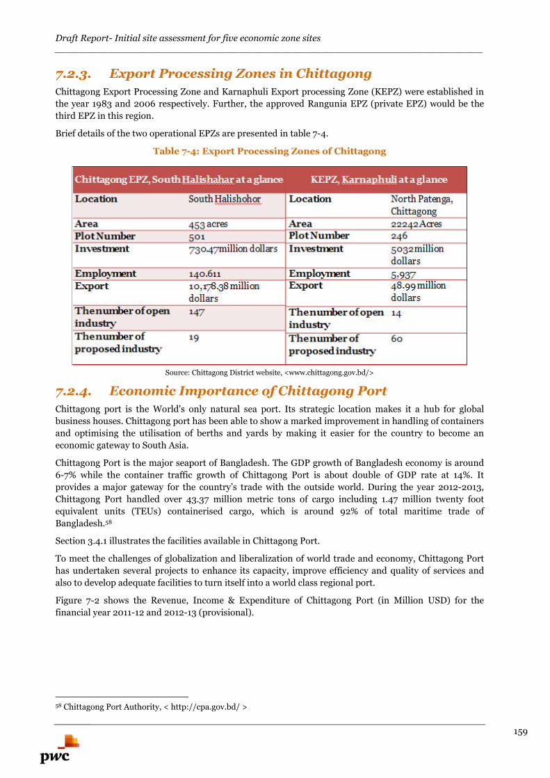
Draft Report- Initial site assessment for five economic zone sites________________________________________________________________________
159
7.2.3. Export Processing Zones in Chittagong
Chittagong Export Processing Zone and Karnaphuli Export processing Zone (KEPZ) were established in
the year 1983 and 2006 respectively. Further, the approved Rangunia EPZ (private EPZ) would be the
third EPZ in this region.
Brief details of the two operational EPZs are presented in table 7-4.
Table 7-4: Export Processing Zones of Chittagong
Source: Chittagong District website, <www.chittagong.gov.bd/>
7.2.4. Economic Importance of Chittagong Port
Chittagong port is the World's only natural sea port. Its strategic location makes it a hub for global
business houses. Chittagong port has been able to show a marked improvement in handling of containers
and optimising the utilisation of berths and yards by making it easier for the country to become an
economic gateway to South Asia.
Chittagong Port is the major seaport of Bangladesh. The GDP growth of Bangladesh economy is around
6-7% while the container traffic growth of Chittagong Port is about double of GDP rate at 14%. It
provides a major gateway for the country’s trade with the outside world. During the year 2012-2013,
Chittagong Port handled over 43.37 million metric tons of cargo including 1.47 million twenty foot
equivalent units (TEUs) containerised cargo, which is around 92% of total maritime trade of
Bangladesh.58
Section 3.4.1 illustrates the facilities available in Chittagong Port.
To meet the challenges of globalization and liberalization of world trade and economy, Chittagong Port
has undertaken several projects to enhance its capacity, improve efficiency and quality of services and
also to develop adequate facilities to turn itself into a world class regional port.
Figure 7-2 shows the Revenue, Income & Expenditure of Chittagong Port (in Million USD) for the
financial year 2011-12 and 2012-13 (provisional).
58 Chittagong Port Authority, < http://cpa.gov.bd/ >
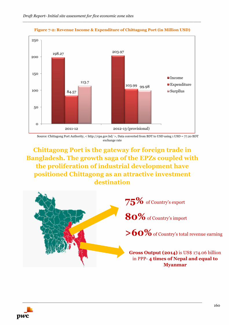
Draft Report- Initial site assessment for five economic zone sites________________________________________________________________________
160
Figure 7-2: Revenue Income & Expenditure of Chittagong Port (in Million USD)
Source: Chittagong Port Authority, < http://cpa.gov.bd/ >, Data converted from BDT to USD using 1 USD = 77.20 BDT
exchange rate
Chittagong Port is the gateway for foreign trade in
Bangladesh. The growth saga of the EPZs coupled with
the proliferation of industrial development have
positioned Chittagong as an attractive investment
destination
198.27203.97
84.57
103.99113.7
99.98
0
50
100
150
200
250
2011-12 2012-13 (provisional)
Income
Expenditure
Surpllus
75% of Country’s export
80% of Country’s import
>60% of Country’s total revenue earning
Gross Output (2014) is US$ 174.06 billion
in PPP- 4 times of Nepal and equal to
Myanmar
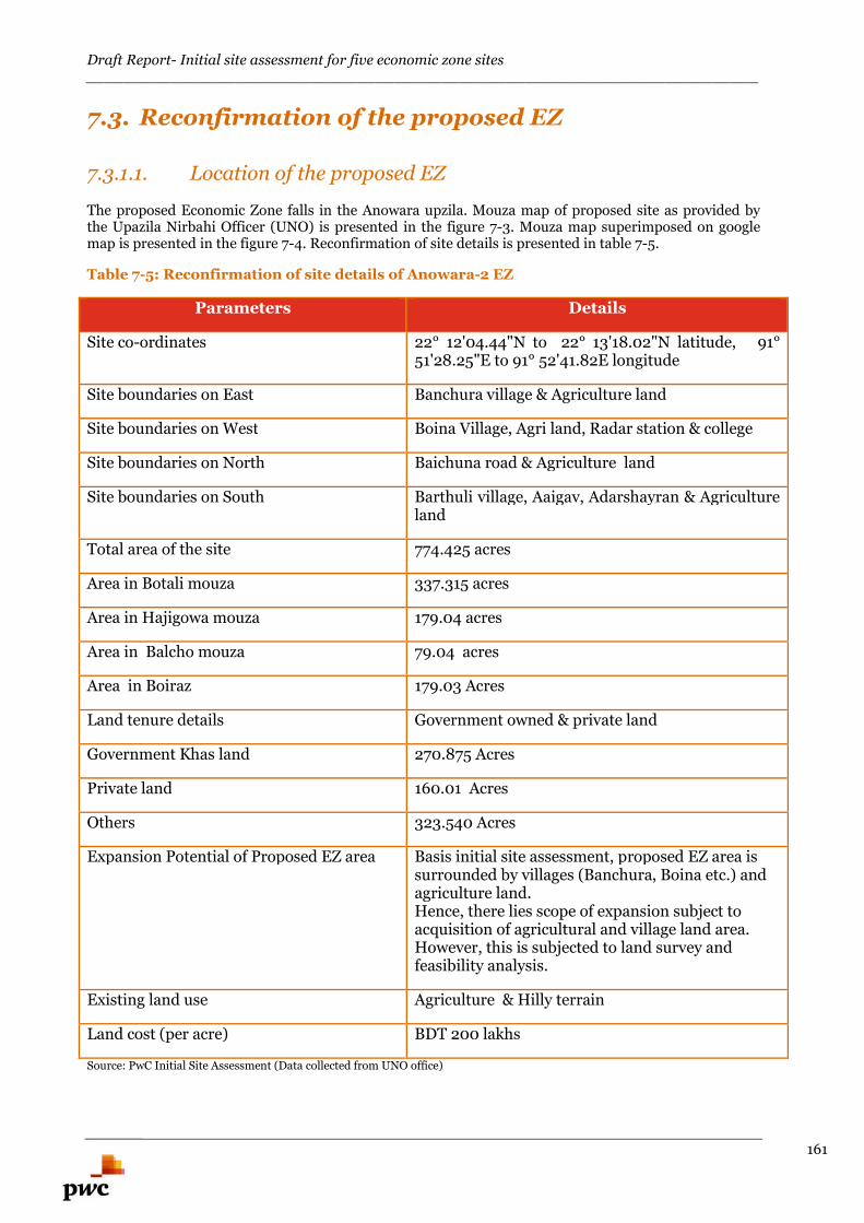
Draft Report- Initial site assessment for five economic zone sites________________________________________________________________________
161
7.3. Reconfirmation of the proposed EZ
7.3.1.1. Location of the proposed EZ
The proposed Economic Zone falls in the Anowara upzila. Mouza map of proposed site as provided bythe Upazila Nirbahi Officer (UNO) is presented in the figure 7-3. Mouza map superimposed on googlemap is presented in the figure 7-4. Reconfirmation of site details is presented in table 7-5.
Table 7-5: Reconfirmation of site details of Anowara-2 EZ
Parameters Details
Site co-ordinates 22° 12'04.44"N to 22° 13'18.02"N latitude, 91°51'28.25"E to 91° 52'41.82E longitude
Site boundaries on East Banchura village & Agriculture land
Site boundaries on West Boina Village, Agri land, Radar station & college
Site boundaries on North Baichuna road & Agriculture land
Site boundaries on South Barthuli village, Aaigav, Adarshayran & Agricultureland
Total area of the site 774.425 acres
Area in Botali mouza 337.315 acres
Area in Hajigowa mouza 179.04 acres
Area in Balcho mouza 79.04 acres
Area in Boiraz 179.03 Acres
Land tenure details Government owned & private land
Government Khas land 270.875 Acres
Private land 160.01 Acres
Others 323.540 Acres
Expansion Potential of Proposed EZ area Basis initial site assessment, proposed EZ area issurrounded by villages (Banchura, Boina etc.) andagriculture land.Hence, there lies scope of expansion subject toacquisition of agricultural and village land area.However, this is subjected to land survey andfeasibility analysis.
Existing land use Agriculture & Hilly terrain
Land cost (per acre) BDT 200 lakhs
Source: PwC Initial Site Assessment (Data collected from UNO office)
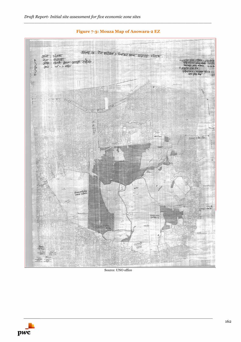
Draft Report- Initial site assessment for five economic zone sites________________________________________________________________________
162
Figure 7-3: Mouza Map of Anowara-2 EZ
Source: UNO office

Draft Report- Initial site assessment for five economic zone sites________________________________________________________________________
163
Figure 7-4: Mouza map superimposed on google map (Anowara-2)
Source: MACE Analysi
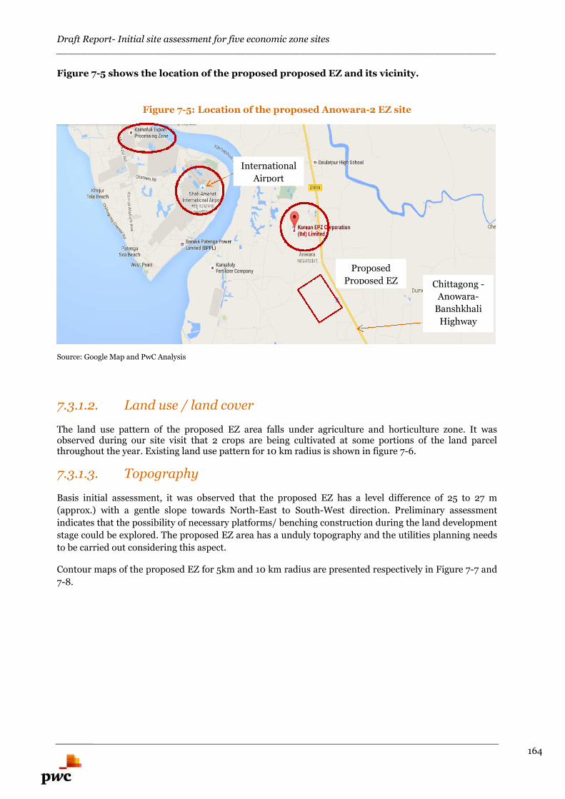
Draft Report- Initial site assessment for five economic zone sites________________________________________________________________________
164
Figure 7-5 shows the location of the proposed proposed EZ and its vicinity.
Figure 7-5: Location of the proposed Anowara-2 EZ site
Source: Google Map and PwC Analysis
7.3.1.2. Land use / land cover
The land use pattern of the proposed EZ area falls under agriculture and horticulture zone. It wasobserved during our site visit that 2 crops are being cultivated at some portions of the land parcelthroughout the year. Existing land use pattern for 10 km radius is shown in figure 7-6.
7.3.1.3. Topography
Basis initial assessment, it was observed that the proposed EZ has a level difference of 25 to 27 m
(approx.) with a gentle slope towards North-East to South-West direction. Preliminary assessment
indicates that the possibility of necessary platforms/ benching construction during the land development
stage could be explored. The proposed EZ area has a unduly topography and the utilities planning needs
to be carried out considering this aspect.
Contour maps of the proposed EZ for 5km and 10 km radius are presented respectively in Figure 7-7 and
7-8.
Proposed
Proposed EZ Chittagong -
Anowara-
Banshkhali
Highway
International
Airport
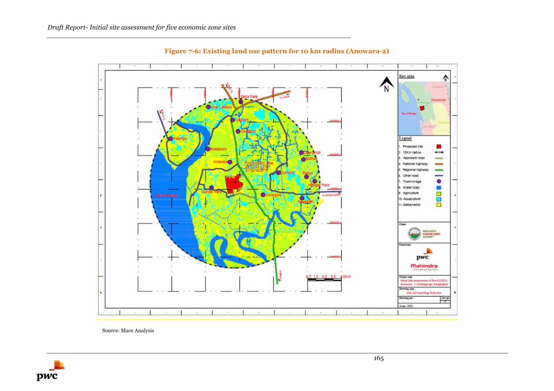
Draft Report- Initial site assessment for five economic zone sites________________________________________________________________________
165
Figure 7-6: Existing land use pattern for 10 km radius (Anowara-2)
Source: Mace Analysis
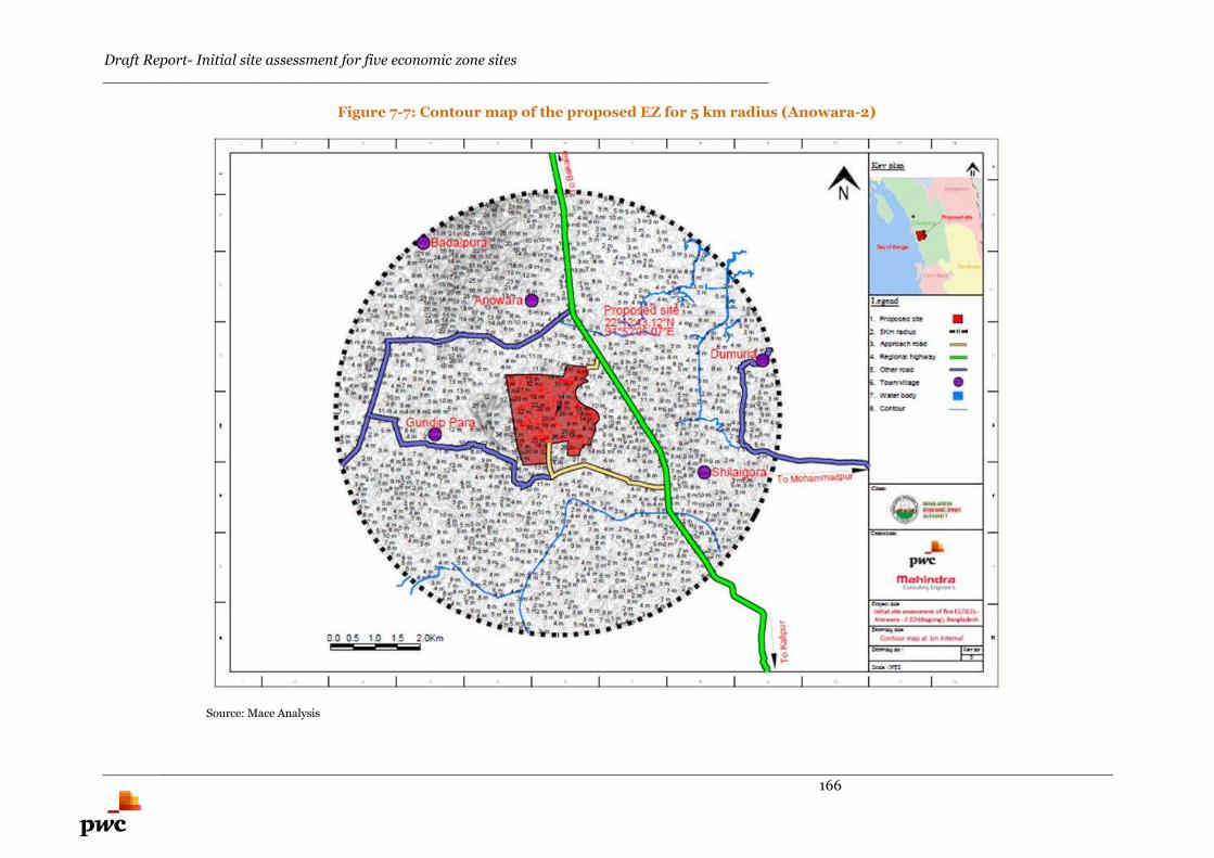
Draft Report- Initial site assessment for five economic zone sites________________________________________________________________________
166
Figure 7-7: Contour map of the proposed EZ for 5 km radius (Anowara-2)
Source: Mace Analysis
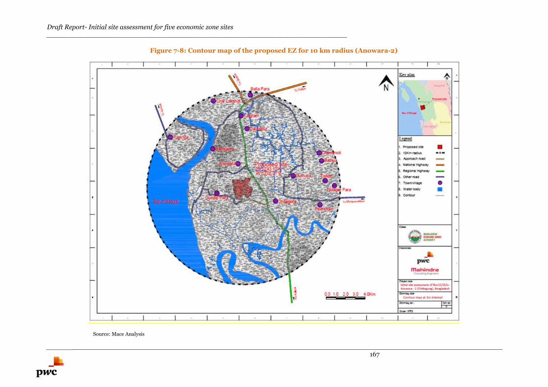
Draft Report- Initial site assessment for five economic zone sites________________________________________________________________________
167
Figure 7-8: Contour map of the proposed EZ for 10 km radius (Anowara-2)
Source: Mace Analysis
Draft Report- Initial site assessment for five economic zone sites________________________________________________________________________
168
7.3.1.4. Physiography
The physiography of the region surrounding the proposed EZ falls in Chittagong coastal plain. Sediments
near the hills are mainly silty, locally sandy, with clays more extensive in the coastal plain basin. The
whole of the mainland area is subjected to flash floods.
The Bangladesh physiography map is presented in Annexure C.
According to the history of physiography of this region, the area around the proposed EZ falls in the
ridges and it is free from flooding.
7.3.1.5. Soil
Basis site visit, the top soil layer was found to be mostly Red Soil and partly clayey soil which need to be
replaced for road construction. This soil is not suitable for laying foundation for any structure. The soil
layer is acidic in character and the pH ranges from 5.5 to 6.8. The soil layer is naturally fertile and is
recharged every year by fresh deposition by the floodwater.
7.3.1.6. Geology
Proposed EZ is located in the Chittagong Coastal Plain. Chittagong city has a unique topography and it is
well known for the panoramic view of its hilly landscape. It is the only mega city of Bangladesh having
wide variety of morphological features, spectacular undulating hill topography on one side and the low
lying coastal mud flats on the other side. Chittagong’s morphology has transformed into its present shape
by natural process. The geological map of Bangladesh is shown in Annexure D.
The type of soil strata in this type of geological area is red and clayey in nature and the soil strata is not
suitable for laying the foundation for structures. Detailed soil investigation needs to be carried out during
the structural design stage.
7.3.1.7. Earthquake data
Anowara area falls in the Seismic Zone 2 and the earthquake coefficient is 0.15 for this zone. The area
under the proposed EZ falls under the medium seismic range zone; this factor needs to be taken into
account while designing the structure of the proposed EZ.
Seismic zoning map of Bangladesh is presented in Annexure E.
7.3.1.8. Wind speed
The coastal areas in Bangladesh witness gentle winds blowing at relatively low speeds of 3-6 Km/hr.
From March to May, violent thunderstorms, called northwesters, are observed. The detailed wind speeds
need to be obtained for designing the high rise structures in the proposed EZ. The wind speed map for
Bangladesh is presented in Annexure F.
7.3.1.9. Cyclones and storms
Preliminary assessments suggest that during the pre-monsoon period, squally winds of up to 130 km/h
or occasionally more, often accompanied by thunderstorms may damage assets and crops. Cyclonic
storms occurring in the Bay of Bengal in April-May and October-November rarely penetrate as far as
Comilla, but may cause serious damage to crops, livestock, assets, and people if so happens. Monsoon
rains are generally not stormy, but downpours of 50-75 mm per day are not uncommon and rainfall with
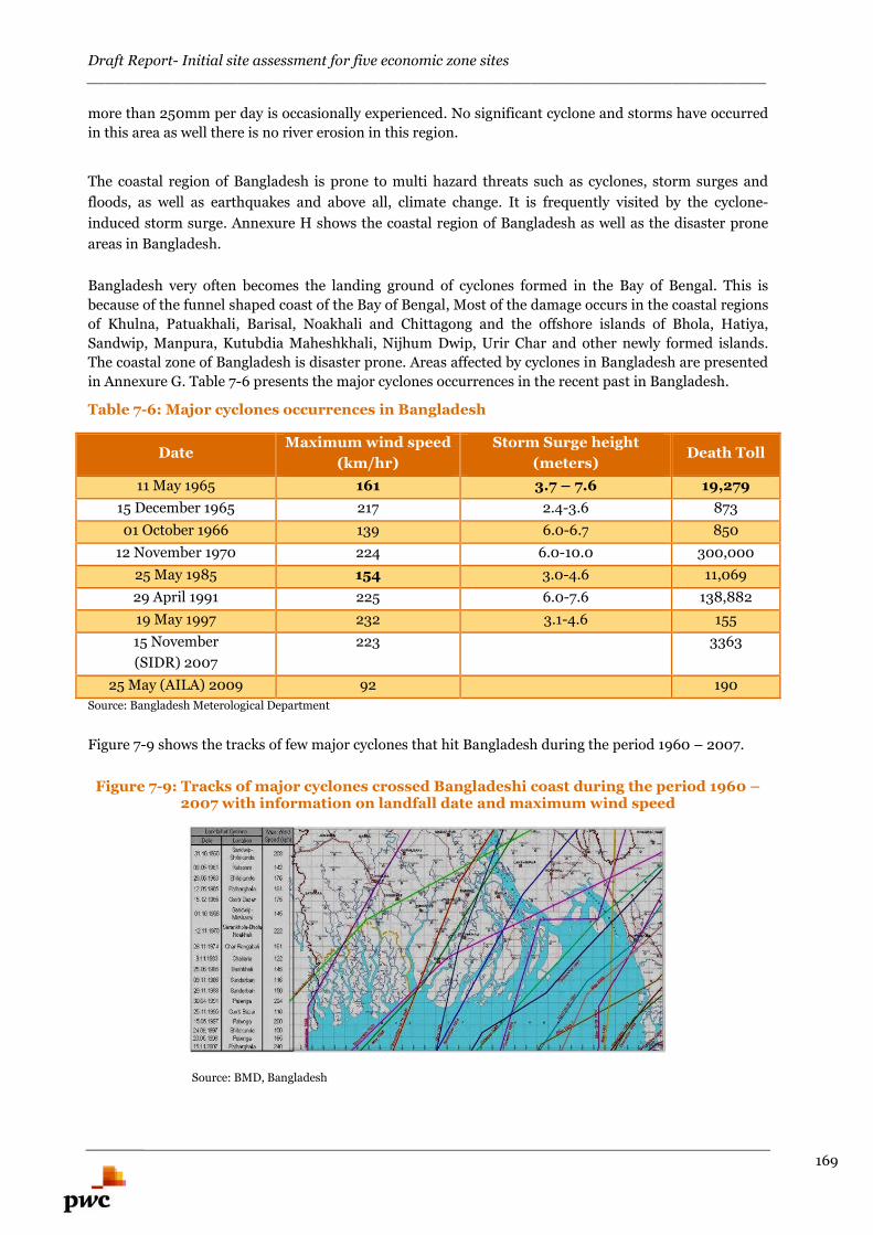
Draft Report- Initial site assessment for five economic zone sites________________________________________________________________________
169
more than 250mm per day is occasionally experienced. No significant cyclone and storms have occurred
in this area as well there is no river erosion in this region.
The coastal region of Bangladesh is prone to multi hazard threats such as cyclones, storm surges and
floods, as well as earthquakes and above all, climate change. It is frequently visited by the cyclone-
induced storm surge. Annexure H shows the coastal region of Bangladesh as well as the disaster prone
areas in Bangladesh.
Bangladesh very often becomes the landing ground of cyclones formed in the Bay of Bengal. This is
because of the funnel shaped coast of the Bay of Bengal, Most of the damage occurs in the coastal regions
of Khulna, Patuakhali, Barisal, Noakhali and Chittagong and the offshore islands of Bhola, Hatiya,
Sandwip, Manpura, Kutubdia Maheshkhali, Nijhum Dwip, Urir Char and other newly formed islands.
The coastal zone of Bangladesh is disaster prone. Areas affected by cyclones in Bangladesh are presented
in Annexure G. Table 7-6 presents the major cyclones occurrences in the recent past in Bangladesh.
Table 7-6: Major cyclones occurrences in Bangladesh
DateMaximum wind speed
(km/hr)
Storm Surge height
(meters)Death Toll
11 May 1965 161 3.7 – 7.6 19,279
15 December 1965 217 2.4-3.6 873
01 October 1966 139 6.0-6.7 850
12 November 1970 224 6.0-10.0 300,000
25 May 1985 154 3.0-4.6 11,069
29 April 1991 225 6.0-7.6 138,882
19 May 1997 232 3.1-4.6 155
15 November
(SIDR) 2007
223 3363
25 May (AILA) 2009 92 190
Source: Bangladesh Meterological Department
Figure 7-9 shows the tracks of few major cyclones that hit Bangladesh during the period 1960 – 2007.
Figure 7-9: Tracks of major cyclones crossed Bangladeshi coast during the period 1960 –2007 with information on landfall date and maximum wind speed
Source: BMD, Bangladesh
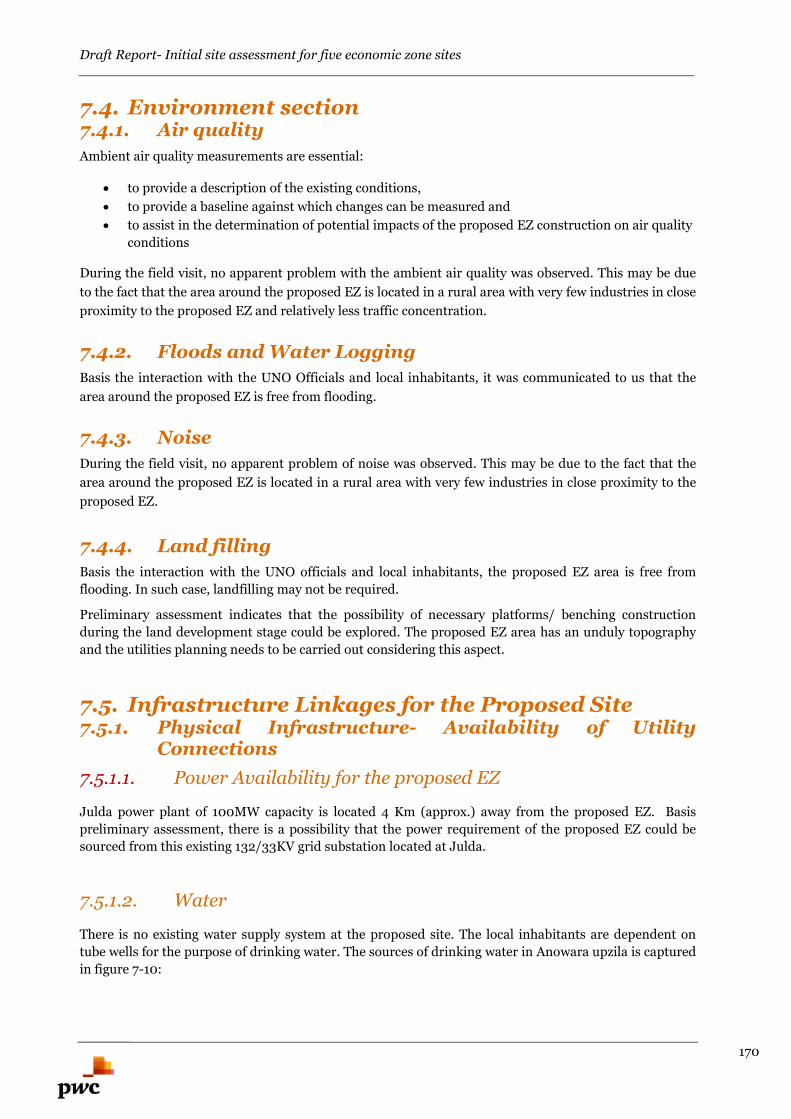
Draft Report- Initial site assessment for five economic zone sites________________________________________________________________________
170
7.4. Environment section7.4.1. Air quality
Ambient air quality measurements are essential:
to provide a description of the existing conditions,
to provide a baseline against which changes can be measured and
to assist in the determination of potential impacts of the proposed EZ construction on air quality
conditions
During the field visit, no apparent problem with the ambient air quality was observed. This may be due
to the fact that the area around the proposed EZ is located in a rural area with very few industries in close
proximity to the proposed EZ and relatively less traffic concentration.
7.4.2. Floods and Water Logging
Basis the interaction with the UNO Officials and local inhabitants, it was communicated to us that the
area around the proposed EZ is free from flooding.
7.4.3. Noise
During the field visit, no apparent problem of noise was observed. This may be due to the fact that the
area around the proposed EZ is located in a rural area with very few industries in close proximity to the
proposed EZ.
7.4.4. Land filling
Basis the interaction with the UNO officials and local inhabitants, the proposed EZ area is free from
flooding. In such case, landfilling may not be required.
Preliminary assessment indicates that the possibility of necessary platforms/ benching construction
during the land development stage could be explored. The proposed EZ area has an unduly topography
and the utilities planning needs to be carried out considering this aspect.
7.5. Infrastructure Linkages for the Proposed Site7.5.1. Physical Infrastructure- Availability of Utility
Connections
7.5.1.1. Power Availability for the proposed EZ
Julda power plant of 100MW capacity is located 4 Km (approx.) away from the proposed EZ. Basis
preliminary assessment, there is a possibility that the power requirement of the proposed EZ could be
sourced from this existing 132/33KV grid substation located at Julda.
7.5.1.2. Water
There is no existing water supply system at the proposed site. The local inhabitants are dependent on
tube wells for the purpose of drinking water. The sources of drinking water in Anowara upzila is captured
in figure 7-10:
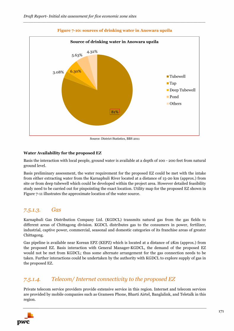
Draft Report- Initial site assessment for five economic zone sites________________________________________________________________________
171
Figure 7-10: sources of drinking water in Anowara upzila
Source: District Statistics, BBS 2011
Water Availability for the proposed EZ
Basis the interaction with local people, ground water is available at a depth of 100 - 200 feet from natural
ground level.
Basis preliminary assessment, the water requirement for the proposed EZ could be met with the intake
from either extracting water from the Karnaphuli River located at a distance of 15-20 km (approx.) from
site or from deep tubewell which could be developed within the project area. However detailed feasibility
study need to be carried out for pinpointing the exact location. Utility map for the proposed EZ shown in
Figure 7-11 illustrates the approximate location of the water source.
7.5.1.3. Gas
Karnaphuli Gas Distribution Company Ltd. (KGDCL) transmits natural gas from the gas fields to
different areas of Chittagong division. KGDCL distributes gas to the consumers in power, fertilizer,
industrial, captive power, commercial, seasonal and domestic categories of its franchise areas of greater
Chittagong.
Gas pipeline is available near Korean EPZ (KEPZ) which is located at a distance of 2Km (approx.) from
the proposed EZ. Basis interaction with General Manager-KGDCL, the demand of the proposed EZ
would not be met from KGDCL; thus some alternate arrangement for the gas connection needs to be
taken. Further interactions could be undertaken by the authority with KGDCL to explore supply of gas in
the proposed EZ.
7.5.1.4. Telecom/ Internet connectivity to the proposed EZ
Private telecom service providers provide extensive service in this region. Internet and telecom services
are provided by mobile companies such as Grameen Phone, Bharti Airtel, Banglalink, and Teletalk in this
region.
81%
3.08% 6.30%
5.63%4.32%
Source of drinking water in Anowara upzila
Tubewell
Tap
Deep Tubewell
Pond
Others
Draft Report- Initial site assessment for five economic zone sites________________________________________________________________________
172
Most of the area around Anowara is covered by unineruppted network connectivity by private operators.
Utility map for the proposed EZ is illustrated in Figure 7-11 below.
Figure 7-11: Utility Map of proposed Anowara-2 EZ
Source: PwC analysis and Google Earth
7.5.2. Social Infrastructure
7.5.2.1. Institutions
Chittagong and its districts are known as excellent centres for learning and knowledge. Table 7-7 outlines
the numbers of different types of educational institutions present in Chittagong district.
Table 7-7: Educational Institutions in Chaittagong district
Type of Institutions No. of Institutions
Universities 3
Medical colleges 2
Bangladesh institute of technology 1
Govt. colleges 14
Non-govt. colleges 121
College of physical education 1
Teachers training college 1
Regional public administration institute 1
Draft Report- Initial site assessment for five economic zone sites________________________________________________________________________
173
Polytechnic institute 1
Homeopathy colleges 2
Nursing institute 1
Forest research institute 1
Veterinary college 1
Home economics college 1
Bangladesh military academy 1
Vocational institute 1
Law colleges 2
Art college 1
Marine academy 1
Marine fisheries academy 1
Cadet college 1
Madrasa 395
Govt. secondary schools 12
Non-govt. secondary schools 698
Govt. primary schools 1665
Registered primary schools 512
Private (non-registered) primary schools 208
Kindergarten schools 1011
Source: Chittagong District, www.chittagong.gov.bd
Anowara upazilla has 2 private colleges, 23 private secondary schools, 118 primary schools, 14 madrasa, 7
kinder garden and 4 technical institutes.
Availability of manpower
In Anowara upzilla, several educational institutions are located which would cater to the requirements of
semi-skilled labour and administrative personnel of the proposed Anowara-2 EZ. Apart from the colleges
mentioned above, one technical training centre under Bureau of Manpower Employment and Training
(BMET) is located in Chittagong (within 20 km radius of the proposed EZ)59; hence the unskilled/ semi-
skilled and skilled/executive level manpower could also be sourced from the same:
Chittagong Technical Training Centre, Nasirabad, Chittagong (approximately 20 km from
Anowara, travel time of around 1 hours)
There are a total of 300 vocational education institutions (48 public and 252 private) in Bangladesh
having a total intake capacity of 58,562.60
Chittagong is the industrial powerhouse of Bangladesh and proliferation of industrial development in
this area could enable adequate supply of skilled manpower for the proposed EZ. Hence, the availability
of manpower for the proposed EZ could be sourced from the existing industrial ecosystem in this area.
59 http://www.ovijogbmet.org/english/TTC.php60 http://siteresources.worldbank.org/BANGLADESHEXTN/Resources/publications/384630-1209074736457/Bangladesh_Nov2006.pdf
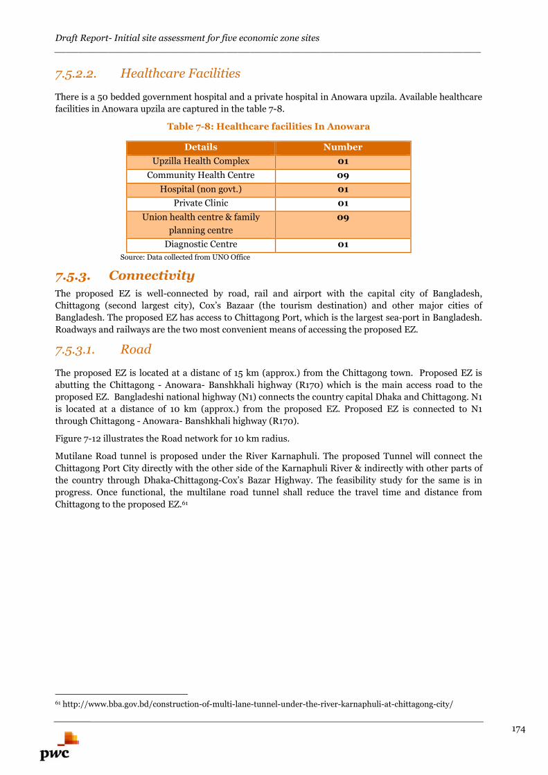
Draft Report- Initial site assessment for five economic zone sites________________________________________________________________________
174
7.5.2.2. Healthcare Facilities
There is a 50 bedded government hospital and a private hospital in Anowara upzila. Available healthcare
facilities in Anowara upzila are captured in the table 7-8.
Table 7-8: Healthcare facilities In Anowara
Details Number
Upzilla Health Complex 01
Community Health Centre 09
Hospital (non govt.) 01
Private Clinic 01
Union health centre & family
planning centre
09
Diagnostic Centre 01
Source: Data collected from UNO Office
7.5.3. Connectivity
The proposed EZ is well-connected by road, rail and airport with the capital city of Bangladesh,
Chittagong (second largest city), Cox’s Bazaar (the tourism destination) and other major cities of
Bangladesh. The proposed EZ has access to Chittagong Port, which is the largest sea-port in Bangladesh.
Roadways and railways are the two most convenient means of accessing the proposed EZ.
7.5.3.1. Road
The proposed EZ is located at a distanc of 15 km (approx.) from the Chittagong town. Proposed EZ is
abutting the Chittagong - Anowara- Banshkhali highway (R170) which is the main access road to the
proposed EZ. Bangladeshi national highway (N1) connects the country capital Dhaka and Chittagong. N1
is located at a distance of 10 km (approx.) from the proposed EZ. Proposed EZ is connected to N1
through Chittagong - Anowara- Banshkhali highway (R170).
Figure 7-12 illustrates the Road network for 10 km radius.
Mutilane Road tunnel is proposed under the River Karnaphuli. The proposed Tunnel will connect the
Chittagong Port City directly with the other side of the Karnaphuli River & indirectly with other parts of
the country through Dhaka-Chittagong-Cox’s Bazar Highway. The feasibility study for the same is in
progress. Once functional, the multilane road tunnel shall reduce the travel time and distance from
Chittagong to the proposed EZ.61
61 http://www.bba.gov.bd/construction-of-multi-lane-tunnel-under-the-river-karnaphuli-at-chittagong-city/
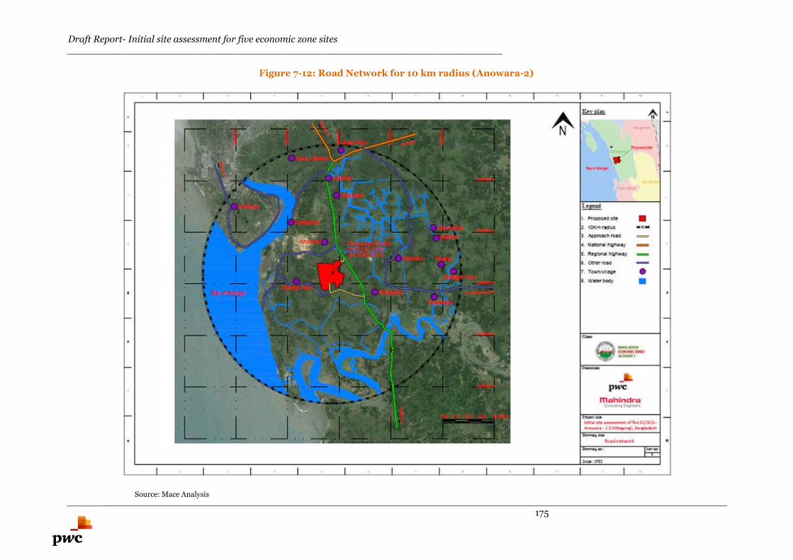
Draft Report- Initial site assessment for five economic zone sites________________________________________________________________________
175
Figure 7-12: Road Network for 10 km radius (Anowara-2)
Source: Mace Analysis
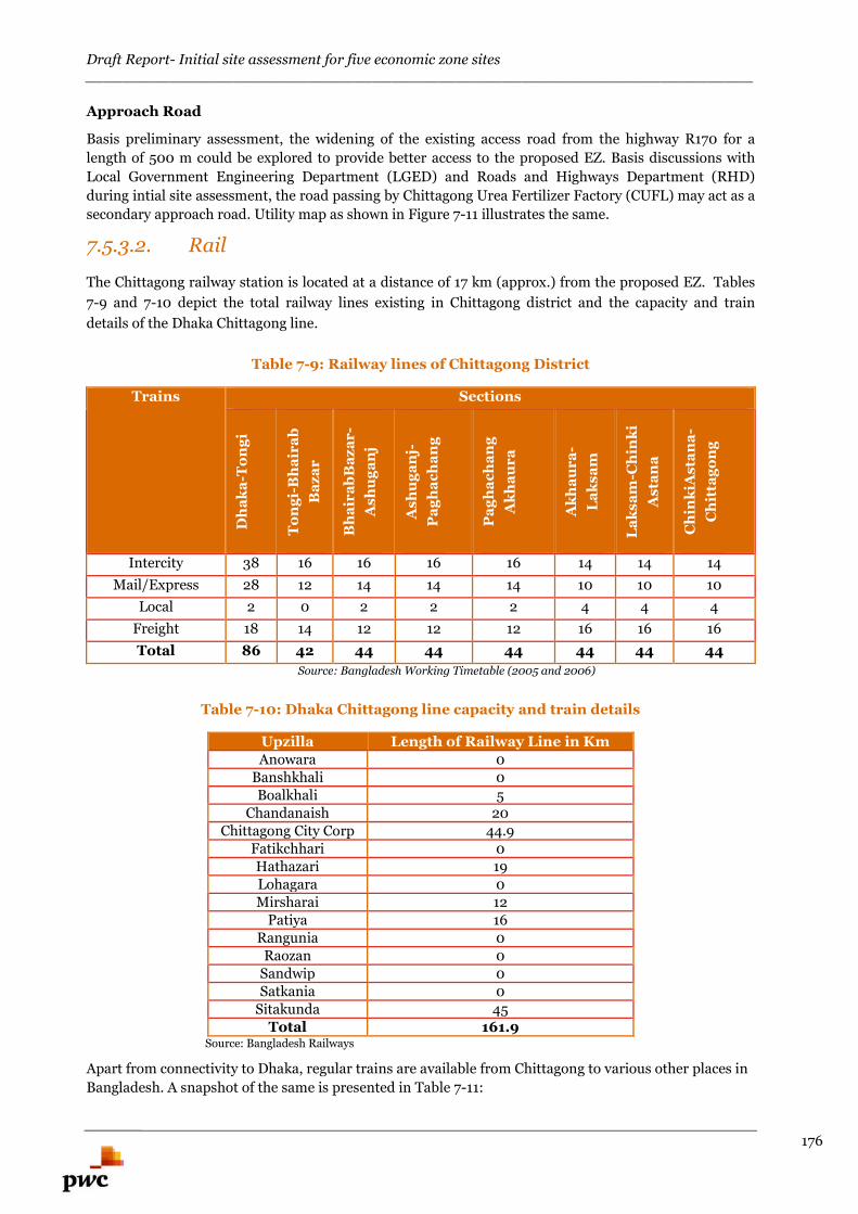
Draft Report- Initial site assessment for five economic zone sites________________________________________________________________________
176
Approach Road
Basis preliminary assessment, the widening of the existing access road from the highway R170 for a
length of 500 m could be explored to provide better access to the proposed EZ. Basis discussions with
Local Government Engineering Department (LGED) and Roads and Highways Department (RHD)
during intial site assessment, the road passing by Chittagong Urea Fertilizer Factory (CUFL) may act as a
secondary approach road. Utility map as shown in Figure 7-11 illustrates the same.
7.5.3.2. Rail
The Chittagong railway station is located at a distance of 17 km (approx.) from the proposed EZ. Tables
7-9 and 7-10 depict the total railway lines existing in Chittagong district and the capacity and train
details of the Dhaka Chittagong line.
Table 7-9: Railway lines of Chittagong District
Trains Sections
Dh
ak
a-T
on
gi
To
ng
i-B
ha
ira
b
Ba
za
r
Bh
air
ab
Ba
za
r-
As
hu
ga
nj
As
hu
ga
nj-
Pa
gh
ac
ha
ng
Pa
gh
ac
ha
ng
Ak
ha
ur
a
Ak
ha
ur
a-
La
ks
am
La
ks
am
-Ch
ink
i
As
tan
a
Ch
ink
iAs
tan
a-
Ch
itta
go
ng
Intercity 38 16 16 16 16 14 14 14
Mail/Express 28 12 14 14 14 10 10 10
Local 2 0 2 2 2 4 4 4
Freight 18 14 12 12 12 16 16 16
Total 86 42 44 44 44 44 44 44
Source: Bangladesh Working Timetable (2005 and 2006)
Table 7-10: Dhaka Chittagong line capacity and train details
Upzilla Length of Railway Line in KmAnowara 0
Banshkhali 0Boalkhali 5
Chandanaish 20Chittagong City Corp 44.9
Fatikchhari 0Hathazari 19Lohagara 0Mirsharai 12
Patiya 16Rangunia 0
Raozan 0Sandwip 0Satkania 0
Sitakunda 45Total 161.9
Source: Bangladesh Railways
Apart from connectivity to Dhaka, regular trains are available from Chittagong to various other places in
Bangladesh. A snapshot of the same is presented in Table 7-11:
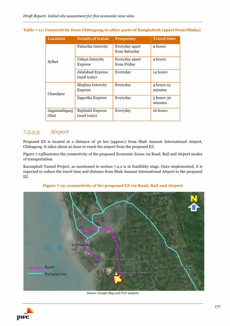
Draft Report- Initial site assessment for five economic zone sites________________________________________________________________________
177
Table 7-11: Connectivity from Chittagong to other parts of Bangladesh (apart from Dhaka)
Location Details of trains Frequency Travel time
Sylhet
Paharika Intercity Everyday apart
from Saturday
9 hours
Udayn Intercity
Express
Everyday apart
from Friday
9 hours
Jalalabad Express
(mail train)
Everyday 14 hours
Chandpur
Meghna Intercity
Express
Everyday 4 hours 15
minutes
Sagorika Express Everyday 5 hours 30
minutes
Jagannathganj
Ghat
Rajshahi Express
(mail train)
Everyday 16 hours
7.5.3.3. Airport
Proposed EZ is located at a distance of 30 km (approx.) from Shah Amanat International Airport,
Chittagong. It takes about an hour to reach the airport from the proposed EZ.
Figure 7-13illustrates the connectivity of the proposed Economic Zones via Road, Rail and Airport modes
of transportation.
Karnaphuli Tunnel Project, as mentioned in section 7.2.2 is in feasibility stage. Once implemented, it is
expected to reduce the travel time and distance from Shah Amanat International Airport to the proposed
EZ.
Figure 7-13: connectivity of the proposed EZ via Road, Rail and Airport
Source: Google Map and PwC analysis
Draft Report- Initial site assessment for five economic zone sites________________________________________________________________________
178
7.5.3.4. Port
Chittagong Port
The Port of Chittagong is the principal Port of Bangladesh. Proposed Anowara-2, EZ is located at a
distance of 18 km (approx.) from Chittagong Port. The facilities available in Chittagong port are
mentioned under section 3.4.1.
Karnaphuli Tunnel Project, as mentioned in section 7.2.2 is in feasibility stage. Once implemented, it
would also reduce the travel time and distance from Chittagong port to the proposed EZ apart from
reducing the distance from Chittagong Airport as mentioned in the previous section.
7.5.3.5. Assessment of Intermodal Cargo Transport
Access to various modes of transportation from the proposed EZ is outlined below:
Chittagong railway station is located at a distance of 17 km (approx) from the proposed EZ.Station Road connects the proposed EZ to the railway station and the traffic congestion is heavythroughout the stretch.
Proposed Anowara-2 EZ is located at a distance of 30 km (approx) from Shah AmanatInternational Airport, Chittagong. Travel time from the proposed EZ to this airport is 2.5-3hours (approx).
Chittagong port is the principal Port of Bangladesh. Proposed Anowara 2 EZ is located at adistance of 18 km (approx) from Chittagong Port.
Proposed EZ has access to all modes of transportation.
Chittagong Port is located at a distance of 6 km (approx.) from Chittagong railway station. Traveltime is 15 -30 minutes (approx.) through Mooring Road and Strand Road and traffic congestionis minimal throughout the stretch.
Chittagong port is located at a distance of 10 km (approx.) from Chittagong airport. Travel timeis 30 minutes (approx.) through M A Aziz road and traffic congestion is moderate throughout thestretch.
Chittagong rail station is located at a distance of 15 km (approx.) from Chittagong airport via MA Halisahar road. Traffic congestion is heavy throughout stretch.
Basis preliminary assessment, the location of the proposed EZ could be strategic for intermodal cargo
transport. Bangladeshi national highway (N1) connects the country capital Dhaka and Chittagong. N1 is
located at a distance of 10 km (approx) from the proposed EZ. Proposed EZ is abutting the Chittagong -
Anowara- Banshkhali highway (R170) which connects the proposed EZ to N1.
However, this assessment is indicative in nature and any decision on the same should be taken upon
completion of detailed feasibility report.
Draft Report- Initial site assessment for five economic zone sites________________________________________________________________________
179
7.6. Resettlement issues7.6.1. Social impacts
The project impacts were assessed on the following parameters:
(i) Loss of land (for existing land owners),
(ii) Loss of homes/structures,
(iii) Loss of Trees
(iv) Loss of livelihood systems/ income opportunity
(v) Loss of water bodies.
The expected types of losses are described in the following sub-sections.
7.6.1.1. Loss of land
To establish the Anowara EZ project, a total of 774.525 acres of land has been demarcated by the
authority. The land usage pattern for this area is shown in Figure 7-14.
Water bodies- 7.83 acres Settlement land- 323.54 acres Khas land- 270.88 acres Private property- 160.01 acres
Figure 7-14: Land Usage pattern (Anowara-2)
Source: Data collected from UNO Office
Residential land owners, long term lease holders (agricultural land leased out by government to thefarmers for 99 years), and agricultural land owners will lose entire land holding.
7.6.1.2. Loss of structures
There are 50 household structures62 (approx.) existing within the identified site boundary. However
more verification needs to be done after fixing the boundaries at the site prior to feasibility study.
7.6.1.3. Loss of trees
The site has abundance of trees and some of the trees need to be cut for the development of the proposed
EZ.
62 Data obtained from Bangladesh Economic Zones Authority (BEZA)
1%
42%
36%
21%
Land Usage Pattern for Anowara-2
water bodies
Settlement land
Khas Land
Private Property

Draft Report- Initial site assessment for five economic zone sites________________________________________________________________________
180
7.6.1.4. Loss of income/livelihood
As a result of loss of agricultural land, the following would be directly affected:
Surrounding villagers/ Local farmers,
Sharecroppers,
Yearly lease holders (agricultural land)
Owners of agricultural assets (deep tube-wells and shallow tube-wells etc.)
Indirectly, seasonal agriculture labours and crop traders will be affected. Basis preliminary assessment
and details shared by UNO office, Resettlement Action Plan (RAP) would need to be formulated for 100-
115 numbers of households (approx.)63. These households could stand to lose their income/livelihood as
a result of the development of the project.
7.6.1.5. Loss of water bodies
There is no water body located within the project area.
7.6.2. Constraints and its mitigation
The major constraints and its mitigation is presented in table 7-12.
Table 7-12: Constraints and Mitigation (Anowara-2)
Sl.
No.
Constraints Mitigation measures
1 Unduly land Basis preliminary assessment, necessary platforms
could be created for accessing the site by cutting and
filling for about 2 m to 3 m.
2 Loss of income/livelihood Basis preliminary assessment and details shared by
UNO office, Resettlement Action Plan (RAP) would
need to be formulated for 100-115 numbers of
households (approx.) 64 . These households could
stand to lose their income/livelihood as a result of
the development of the project.
63 Data obtained from Bangladesh Economic Zones Authority (BEZA)64 Data obtained from Bangladesh Economic Zones Authority (BEZA)
Draft Report- Initial site assessment for five economic zone sites________________________________________________________________________
181
7.6.3. Block Cost Estimation for development of OffsiteInfrastructure
Based on preliminary assessment and available information (the schedule of rates published by the
competent public authorities, prevailing market prices, in-house data bank and experience gained over
similar / comparable development), the Block Cost estimate for the proposed offsite infrastructure
components required for developing EZ has been calculated.
Wherever applicable, we have considered all the possible options to arrive at the cost of development and
the option of maximum development cost is considered to arrive at the total cost of the proposed offsite
infrastructure development. This exercise has been carried out to indicate the approximate cost to be
incurred for the development of EZ and it may vary to any extent during implementation stage
depending upon the detailed technical information and new developments which may affect / contribute
to this EZ. The techno-commercial viability of these options needs to be explored during feasibility stage.
Table 7-13 depicts the broad level Block Cost estimates for development of the proposed Offsite
infrastructure for Anowara-2 EZ. The figures provided are indicative and may vary depending on the
master planning, feasibility analysis and the timeline of development activities.
The Broad Block Cost for off-site infrastructure development for proposed Anowara-2 EZ is calculated
as BDT 20,475 Lakh (approx.).
Draft Report- Initial site assessment for five economic zone sites________________________________________________________________________
182
Table 7-13: Block Cost estimate for proposed Anowara-2 EZ
Anowara-2 EZ
Option -1 Option -2 Considered cost option(Maximum of the two options has been considered)
S.No Description Qty Unit Amountin Lakh
BDT
Qty Unit Amountin Lakh
BDT
Qty Unit Amount in Lakh BDT
1 Site filling LS 8933 LS 8933 LS 8933
2 Site area cutting LS 1724 LS 1724 LS 1724
3 Compound wall 8890 Mtr 845 8890 Mtr 845 8890 Mtr 845
4 Approach Road (10.50 mtrCarriage way )
0.5 Km 361 0.5 Km 361 0.5 Km 361
5 Electrical (Externalconnectivity-8Km with MRSS)
141.01 MVA 5613 141.01 MVA 5613 44.83 MVA 5613
6 Water supply (Water Intakefrom River )
16.25 MLD 3000 16.25 MLD 3000
7 Water supply (Water from Borewell Pipe linelength 5Km &Bore well 9 Nos )
16.25 MLD 689
Total 20475 18164 20475
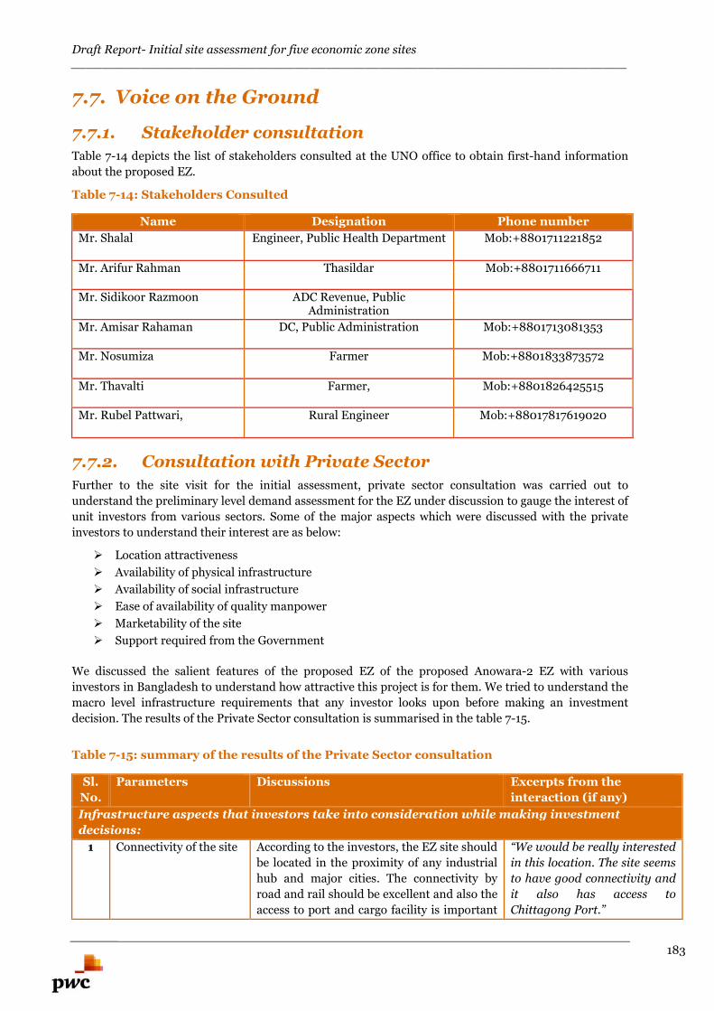
Draft Report- Initial site assessment for five economic zone sites________________________________________________________________________
183
7.7. Voice on the Ground
7.7.1. Stakeholder consultation
Table 7-14 depicts the list of stakeholders consulted at the UNO office to obtain first-hand information
about the proposed EZ.
Table 7-14: Stakeholders Consulted
Name Designation Phone number
Mr. Shalal Engineer, Public Health Department Mob:+8801711221852
Mr. Arifur Rahman Thasildar Mob:+8801711666711
Mr. Sidikoor Razmoon ADC Revenue, PublicAdministration
Mr. Amisar Rahaman DC, Public Administration Mob:+8801713081353
Mr. Nosumiza Farmer Mob:+8801833873572
Mr. Thavalti Farmer, Mob:+8801826425515
Mr. Rubel Pattwari, Rural Engineer Mob:+88017817619020
7.7.2. Consultation with Private Sector
Further to the site visit for the initial assessment, private sector consultation was carried out to
understand the preliminary level demand assessment for the EZ under discussion to gauge the interest of
unit investors from various sectors. Some of the major aspects which were discussed with the private
investors to understand their interest are as below:
Location attractiveness
Availability of physical infrastructure
Availability of social infrastructure
Ease of availability of quality manpower
Marketability of the site
Support required from the Government
We discussed the salient features of the proposed EZ of the proposed Anowara-2 EZ with various
investors in Bangladesh to understand how attractive this project is for them. We tried to understand the
macro level infrastructure requirements that any investor looks upon before making an investment
decision. The results of the Private Sector consultation is summarised in the table 7-15.
Table 7-15: summary of the results of the Private Sector consultation
Sl.
No.
Parameters Discussions Excerpts from the
interaction (if any)
Infrastructure aspects that investors take into consideration while making investment
decisions:
1 Connectivity of the site According to the investors, the EZ site should
be located in the proximity of any industrial
hub and major cities. The connectivity by
road and rail should be excellent and also the
access to port and cargo facility is important
“We would be really interested
in this location. The site seems
to have good connectivity and
it also has access to
Chittagong Port.”
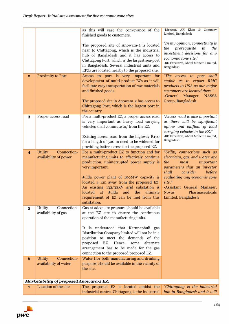
Draft Report- Initial site assessment for five economic zone sites________________________________________________________________________
184
as this will ease the conveyance of the
finished goods to customers.
The proposed site of Anowara-2 is located
near to Chittagong, which is the industrial
hub of Bangladesh and it has access to
Chittagong Port, which is the largest sea-port
in Bangladesh. Several industrial units and
EPZs are located nearby to the proposed site.
-Director, AK Khan & Company
Limited, Bangladesh
“In my opinion, connectivity is
the prerequisite in the
investment decisions for any
economic zone site.”-BD Executive, Abdul Monem Limited,
Bangladesh
2 Proximity to Port Access to port is very important for
development of multi-product EZs as it will
facilitate easy transportation of raw materials
and finished goods.
The proposed site in Anowara-2 has access to
Chittagong Port, which is the largest port in
the country.
“The access to port shall
enable us to export RMG
products to USA as our major
customers are located there.”
-General Manager, NASSA
Group, Bangladesh
3 Proper access road For a multi-product EZ, a proper access road
is very important as heavy load carrying
vehicles shall commute to/ from the EZ.
Existing access road from the highway R170
for a length of 500 m need to be widened for
providing better access for the proposed EZ.
“Access road is also important
as there will be significant
inflow and outflow of load
carrying vehicles in the EZ.”-BD Executive, Abdul Monem Limited,
Bangladesh
4 Utility Connection-
availability of power
For a multi-product EZ to function and for
manufacturing units to effectively continue
production, uninterrupted power supply is
very important.
Julda power plant of 100MW capacity is
located 4 Km away from the proposed EZ.
An existing 132/33KV grid substation is
located at Julda and the ultimate
requirement of EZ can be met from this
substation.
“Utility connections such as
electricity, gas and water are
the most important
parameters that an investor
shall consider before
evaluating any economic zone
site.”
-Assistant General Manager,
Novus Pharmaceuticals
Limited, Bangladesh
5 Utility Connection-
availability of gas
Gas at adequate pressure should be available
at the EZ site to ensure the continuous
operation of the manufacturing units.
It is understood that Karunaphuli gas
Distribution Company limited will not be in a
position to meet the demands of the
proposed EZ. Hence, some alternate
arrangement has to be made for the gas
connection to the proposed proposed EZ.
6 Utility Connection-
availability of water
Water (for both manufacturing and drinking
purpose) should be available in the vicinity of
the site.
Marketability of proposed Anowara-2 EZ:
7 Location of the site The proposed EZ is located amidst the
industrial centre. Chittagong is the industrial
“Chittagong is the industrial
hub in Bangladesh and it will
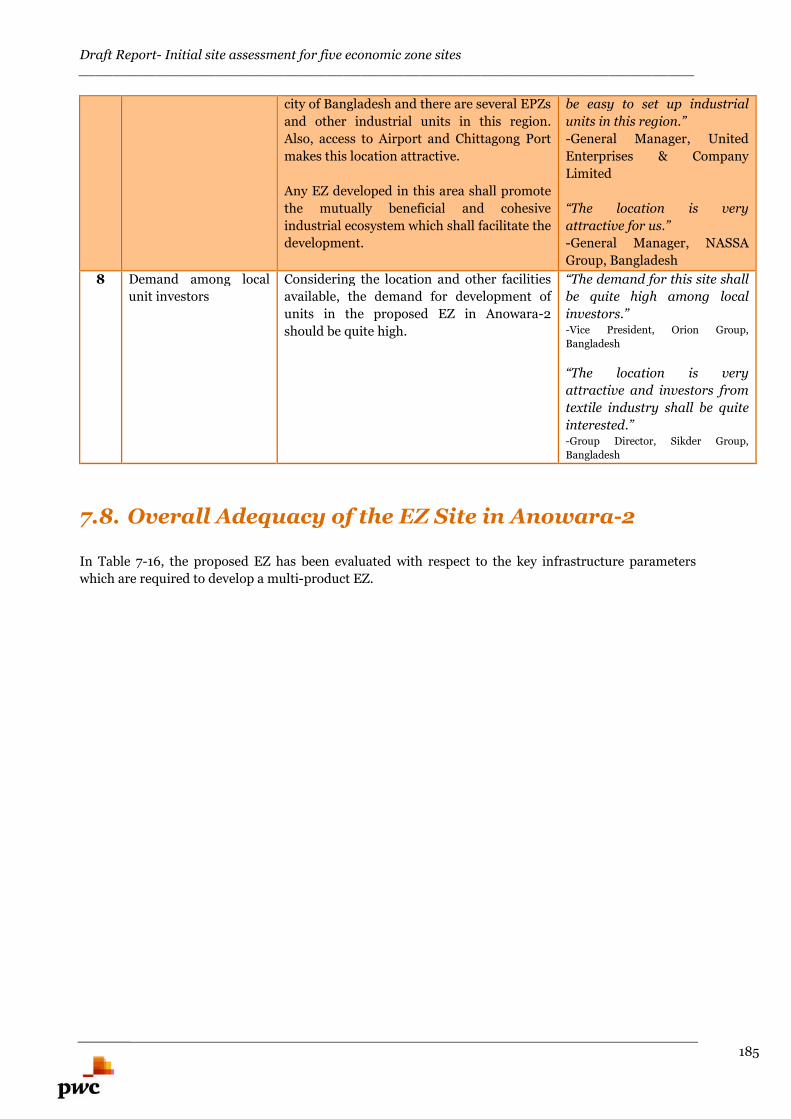
Draft Report- Initial site assessment for five economic zone sites________________________________________________________________________
185
city of Bangladesh and there are several EPZs
and other industrial units in this region.
Also, access to Airport and Chittagong Port
makes this location attractive.
Any EZ developed in this area shall promote
the mutually beneficial and cohesive
industrial ecosystem which shall facilitate the
development.
be easy to set up industrial
units in this region.”
-General Manager, United
Enterprises & Company
Limited
“The location is very
attractive for us.”
-General Manager, NASSA
Group, Bangladesh
8 Demand among local
unit investors
Considering the location and other facilities
available, the demand for development of
units in the proposed EZ in Anowara-2
should be quite high.
“The demand for this site shall
be quite high among local
investors.”-Vice President, Orion Group,
Bangladesh
“The location is very
attractive and investors from
textile industry shall be quite
interested.”-Group Director, Sikder Group,
Bangladesh
7.8. Overall Adequacy of the EZ Site in Anowara-2
In Table 7-16, the proposed EZ has been evaluated with respect to the key infrastructure parameters
which are required to develop a multi-product EZ.
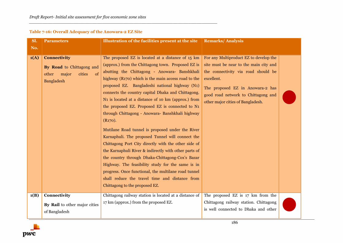
Draft Report- Initial site assessment for five economic zone sites________________________________________________________________________
186
Table 7-16: Overall Adequacy of the Anowara-2 EZ Site
Sl.
No.
Parameters Illustration of the facilities present at the site Remarks/ Analysis
1(A) Connectivity
By Road to Chittagong and
other major cities of
Bangladesh
The proposed EZ is located at a distance of 15 km
(approx.) from the Chittagong town. Proposed EZ is
abutting the Chittagong - Anowara- Banshkhali
highway (R170) which is the main access road to the
proposed EZ. Bangladeshi national highway (N1)
connects the country capital Dhaka and Chittagong.
N1 is located at a distance of 10 km (approx.) from
the proposed EZ. Proposed EZ is connected to N1
through Chittagong - Anowara- Banshkhali highway
(R170).
Mutilane Road tunnel is proposed under the River
Karnaphuli. The proposed Tunnel will connect the
Chittagong Port City directly with the other side of
the Karnaphuli River & indirectly with other parts of
the country through Dhaka-Chittagong-Cox’s Bazar
Highway. The feasibility study for the same is in
progress. Once functional, the multilane road tunnel
shall reduce the travel time and distance from
Chittagong to the proposed EZ.
For any Multiproduct EZ to develop the
site must be near to the main city and
the connectivity via road should be
excellent.
The proposed EZ in Anowara-2 has
good road network to Chittagong and
other major cities of Bangladesh.
1(B) Connectivity
By Rail to other major cities
of Bangladesh
Chittagong railway station is located at a distance of
17 km (approx.) from the proposed EZ.
The proposed EZ is 17 km from the
Chittagong railway station. Chittagong
is well connected to Dhaka and other
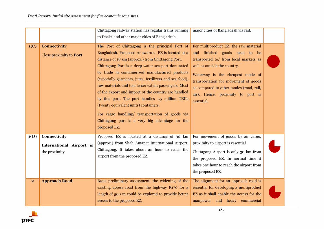
Draft Report- Initial site assessment for five economic zone sites________________________________________________________________________
187
Chittagong railway station has regular trains running
to Dhaka and other major cities of Bangladesh.
major cities of Bangladesh via rail.
1(C) Connectivity
Close proximity to Port
The Port of Chittagong is the principal Port of
Bangladesh. Proposed Anowara-2, EZ is located at a
distance of 18 km (approx.) from Chittagong Port.
Chittagong Port is a deep water sea port dominated
by trade in containerized manufactured products
(especially garments, jutes, fertilizers and sea food),
raw materials and to a lesser extent passengers. Most
of the export and import of the country are handled
by this port. The port handles 1.5 million TEUs
(twenty equivalent units) containers.
For cargo handling/ transportation of goods via
Chittagong port is a very big advantage for the
proposed EZ.
For multiproduct EZ, the raw material
and finished goods need to be
transported to/ from local markets as
well as outside the country.
Waterway is the cheapest mode of
transportation for movement of goods
as compared to other modes (road, rail,
air). Hence, proximity to port is
essential.
1(D) Connectivity
International Airport in
the proximity
Proposed EZ is located at a distance of 30 km
(approx.) from Shah Amanat International Airport,
Chittagong. It takes about an hour to reach the
airport from the proposed EZ.
For movement of goods by air cargo,
proximity to airport is essential.
Chittagong Airport is only 30 km from
the proposed EZ. In normal time it
takes one hour to reach the airport from
the proposed EZ.
2 Approach Road Basis preliminary assessment, the widening of the
existing access road from the highway R170 for a
length of 500 m could be explored to provide better
access to the proposed EZ.
The alignment for an approach road is
essential for developing a multiproduct
EZ as it shall enable the access for the
manpower and heavy commercial
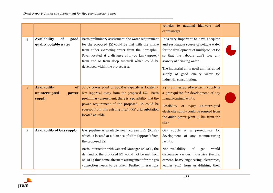
Draft Report- Initial site assessment for five economic zone sites________________________________________________________________________
188
vehicles to national highways and
expressways.
3 Availability of good
quality potable water
Basis preliminary assessment, the water requirement
for the proposed EZ could be met with the intake
from either extracting water from the Karnaphuli
River located at a distance of 15-20 km (approx.)
from site or from deep tubewell which could be
developed within the project area.
It is very important to have adequate
and sustainable source of potable water
for the development of multiproduct EZ
so that the labours don’t face any
scarcity of drinking water.
The industrial units need uninterrupted
supply of good quality water for
industrial consumption.
4 Availability of
uninterrupted power
supply
Julda power plant of 100MW capacity is located 4
Km (approx.) away from the proposed EZ. Basis
preliminary assessment, there is a possibility that the
power requirement of the proposed EZ could be
sourced from this existing 132/33KV grid substation
located at Julda.
24×7 uninterrupted electricity supply is
a prerequisite for development of any
manufacturing facility.
Possibility of 24×7 uninterrupted
electricity supply could be sourced from
the Julda power plant (4 km from the
site).
5 Availability of Gas supply Gas pipeline is available near Korean EPZ (KEPZ)
which is located at a distance of 2Km (approx.) from
the proposed EZ.
Basis interaction with General Manager-KGDCL, the
demand of the proposed EZ would not be met from
KGDCL; thus some alternate arrangement for the gas
connection needs to be taken. Further interactions
Gas supply is a prerequisite for
development of any manufacturing
facility.
Non-availability of gas would
discourage various industries (textile,
cement, heavy engineering, electronics,
leather etc.) from establishing their
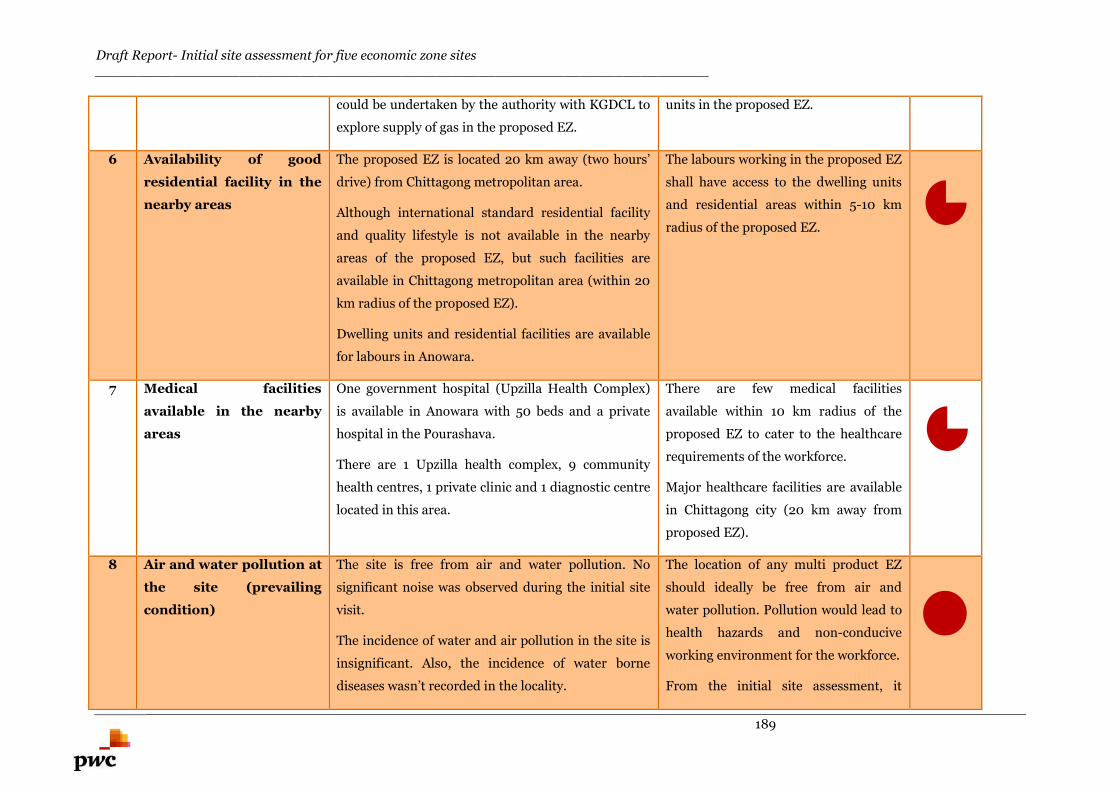
Draft Report- Initial site assessment for five economic zone sites________________________________________________________________________
189
could be undertaken by the authority with KGDCL to
explore supply of gas in the proposed EZ.
units in the proposed EZ.
6 Availability of good
residential facility in the
nearby areas
The proposed EZ is located 20 km away (two hours’
drive) from Chittagong metropolitan area.
Although international standard residential facility
and quality lifestyle is not available in the nearby
areas of the proposed EZ, but such facilities are
available in Chittagong metropolitan area (within 20
km radius of the proposed EZ).
Dwelling units and residential facilities are available
for labours in Anowara.
The labours working in the proposed EZ
shall have access to the dwelling units
and residential areas within 5-10 km
radius of the proposed EZ.
7 Medical facilities
available in the nearby
areas
One government hospital (Upzilla Health Complex)
is available in Anowara with 50 beds and a private
hospital in the Pourashava.
There are 1 Upzilla health complex, 9 community
health centres, 1 private clinic and 1 diagnostic centre
located in this area.
There are few medical facilities
available within 10 km radius of the
proposed EZ to cater to the healthcare
requirements of the workforce.
Major healthcare facilities are available
in Chittagong city (20 km away from
proposed EZ).
8 Air and water pollution at
the site (prevailing
condition)
The site is free from air and water pollution. No
significant noise was observed during the initial site
visit.
The incidence of water and air pollution in the site is
insignificant. Also, the incidence of water borne
diseases wasn’t recorded in the locality.
The location of any multi product EZ
should ideally be free from air and
water pollution. Pollution would lead to
health hazards and non-conducive
working environment for the workforce.
From the initial site assessment, it
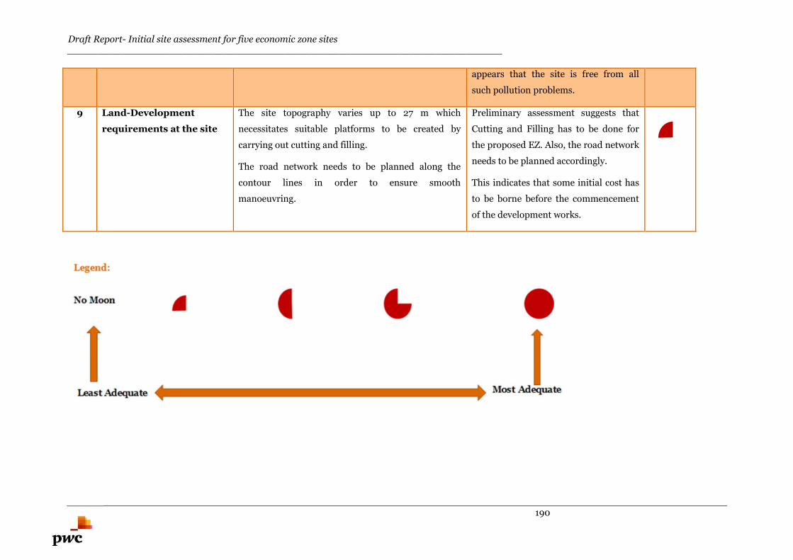
Draft Report- Initial site assessment for five economic zone sites________________________________________________________________________
190
appears that the site is free from all
such pollution problems.
9 Land-Development
requirements at the site
The site topography varies up to 27 m which
necessitates suitable platforms to be created by
carrying out cutting and filling.
The road network needs to be planned along the
contour lines in order to ensure smooth
manoeuvring.
Preliminary assessment suggests that
Cutting and Filling has to be done for
the proposed EZ. Also, the road network
needs to be planned accordingly.
This indicates that some initial cost has
to be borne before the commencement
of the development works.
Draft Report- Initial site assessment for five economic zone sites________________________________________________________________________
191
Market Assessment of Multi-Product Economic Zones
Draft Report- Initial site assessment for five economic zone sites________________________________________________________________________
192
8. Market Assessment of Multi-Product Economic Zones
To analyze the industrial segments which may be considered fit to develop in the proposed multi-product
economic zones under discussion; a high level market assessment study is carried out. This study doesn’t take
into consideration the viability aspect of the industrial segments and the economic zones from technical, social,
environmental and resettlement parameters. Also, this analysis is carried out at a very macro level to
understand the propensity and feasibility of industrial segments which could be suited for the respective
regions. The list appended in the sections below is not conclusive and is subject to detailed feasibility analysis
for each of the proposed proposed EZs. Preliminary market assessment has been carried out to understand the
major industrial segments that may be shortlisted for the three proposed multi-product economic zones.
The identification of industrial segments for exploration at the proposed multi-product Economic Zones
requires a multipronged top to bottom approach that relies on three aspects.
An assessment based on global economic review has been developed to understand the global trend of
industrial development. It covers aspects such as FDI, export and M&A scenario across the industrial segments.
After this the macro-economic parameters are evaluated to assess the potential of industrial development at the
country level. This encompasses the economic growth of Bangladesh and the change in the industrial landscape
of the country. This section presents an analysis of industries globally to identify those expected to experience
strong future performance and then uses it along with the understanding of the economic landscape and major
industrial sectors of Bangladesh.
In the second part, a supply side analysis has been developed where the potential of Bangladesh has been
evaluated on the basis of natural resources, agricultural resources, strength in logistics and labor pool. This
analysis has been carried out to understand the set of industries which can be developed in the country based
on the availability of raw materials, agricultural and mineral resources.
At the final stage, the industrial scenario in the vicinity of the project area has been boradly analyzed based on
the availability of natural resources, industrial development and connectivity aspects etc. Now, based on the
global scenario, country specific and region specific analyses, a broad set of industries have been shortlisted
which deem to be fit for setting up in the proposed economic zones. However, this set of industries is not the
final and it is subjected to the detailed feasibility analysis.
8.1. Global economic reviewThe industrial strategy for the proposed multi-product economic zones would need to focus on leveraging the
region’s existing strengths and should be aligned to global and country level trends in industrial development,
thereby serving to boost the contribution of the economic zone to country’s economic growth.
Three key parameters – trade scenario, FDI trends and M&A trends have been evaluated to develop
perspectives around which industries are proressing globally and which industries Bangladesh as an emerging
economy would benefit from.
8.1.1. Trade scenario
In terms of sector wise share of trade within merchandise, Fuels & mining products, Machinery and
Auto & Auto equipment formed 50% of total exports in 2013 globally. In addition, other predominant
sectors based on their export share in 2013 were Textiles, Food Processing, Pharma, Agricultural products and
Chemicals.
Basis the performance in industrial trade, the best performing industrial segments has been segregated as
shown in the figures 8-1 and 8-2.
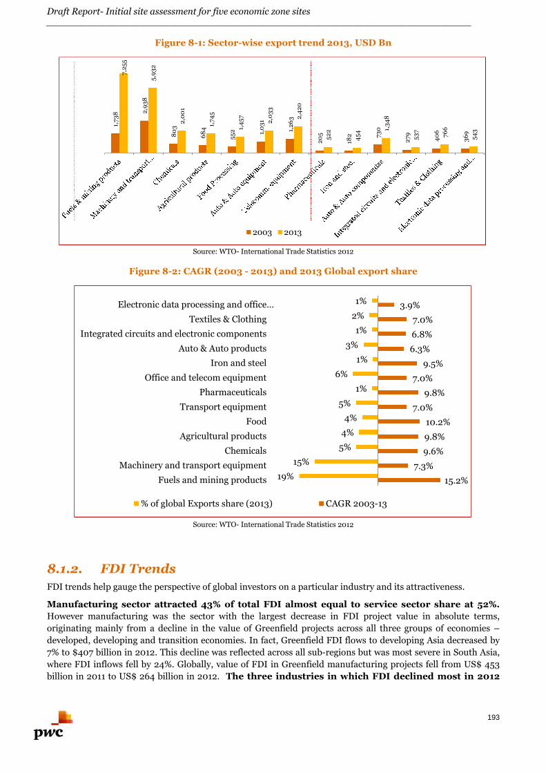
Draft Report- Initial site assessment for five economic zone sites________________________________________________________________________
193
Figure 8-1: Sector-wise export trend 2013, USD Bn
Source: WTO- International Trade Statistics 2012
Figure 8-2: CAGR (2003 - 2013) and 2013 Global export share
Source: WTO- International Trade Statistics 2012
8.1.2. FDI Trends
FDI trends help gauge the perspective of global investors on a particular industry and its attractiveness.
Manufacturing sector attracted 43% of total FDI almost equal to service sector share at 52%.
However manufacturing was the sector with the largest decrease in FDI project value in absolute terms,
originating mainly from a decline in the value of Greenfield projects across all three groups of economies –
developed, developing and transition economies. In fact, Greenfield FDI flows to developing Asia decreased by
7% to $407 billion in 2012. This decline was reflected across all sub-regions but was most severe in South Asia,
where FDI inflows fell by 24%. Globally, value of FDI in Greenfield manufacturing projects fell from US$ 453
billion in 2011 to US$ 264 billion in 2012. The three industries in which FDI declined most in 2012
1,73
8 2,9
38
80
3
68
4
55
2 1,0
31
1,2
63
20
5
182 73
0
27
9
40
6
36
9
7,2
55
5,9
32
2,0
01
1,74
5
1,4
57
2,0
33
2,4
20
52
2
45
4 1,3
48
53
7
766
54
3
2003 2013
15.2%
7.3%
9.6%
9.8%
10.2%
7.0%
9.8%
7.0%
9.5%
6.3%
6.8%
7.0%
3.9%
-19%
-15%
-5%
-4%
-4%
-5%
-1%
-6%
-1%
-3%
-1%
-2%
-1%
Fuels and mining products
Machinery and transport equipment
Chemicals
Agricultural products
Food
Transport equipment
Pharmaceuticals
Office and telecom equipment
Iron and steel
Auto & Auto products
Integrated circuits and electronic components
Textiles & Clothing
Electronic data processing and office…
% of global Exports share (2013) CAGR 2003-13
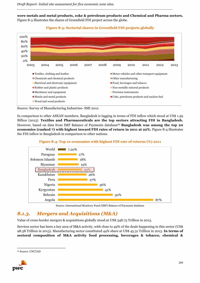
Draft Report- Initial site assessment for five economic zone sites________________________________________________________________________
194
were metals and metal products, coke & petroleum products and Chemical and Pharma sectors.
Figure 8-3 illustrates the shares of Greenfield FDI project across the globe.
Figure 8-3: Sectorial shares in Greenfield FDI projects globally
Source: Survey of Manufacturing Industries- SMI 2012
In comparison to other ASEAN members, Bangladesh is lagging in terms of FDI inflow which stood at US$ 1.59
Billion (2013). Textiles and Pharmaceuticals are the top sectors attracting FDI in Bangladesh.
However, based on data from IMF Balance of Payments database65 Bangladesh was among the top 20
economies (ranked 7) with highest inward FDI rates of return in 2011 at 22%. Figure 8-4 illustrates
the FDI inflow in Bangladesh in comparison to other nations.
Figure 8-4: Top 10 economies with highest FDI rate of returns (%) 2011
Source: International Monitory Fund (IMF) Balance of Payments database
8.1.3. Mergers and Acquisitions (M&A)
Value of cross-border mergers & acquisitions globally stood at US$ 348.75 Trillion in 2013.
Services sector has been a key area of M&A activity, with close to 49% of the deals happening in this sector (US$
98.38 Trillion in 2013). Manufacturing sector constituted 44% share at US$ 45.31 Trillion in 2013. In terms of
sectoral composition of M&A activity food processing, beverages & tobacco, chemical &
65 Source: UNCTAD
0%
20%
40%
60%
80%
100%
2003 2004 2005 2006 2007 2008 2009 2010 2011 2012 2013
Textiles, clothing and leather Motor vehicles and other transport equipment
Chemicals and chemical products Other manufacturing
Electrical and electronic equipment Food, beverages and tobacco
Rubber and plastic products Non-metallic mineral products
Machinery and equipment Precision instruments
Metals and metal products Coke, petroleum products and nuclear fuel
Wood and wood products
87%
50%
41%
36%
27%
26%
22%
19%
18%
17%
7.20%
Angola
Behrain
Kyrgyzstan
Nigeria
Peru
Kazakhstan
Bangladesh
Myanmar
Solomon Islands
Paraguay
World
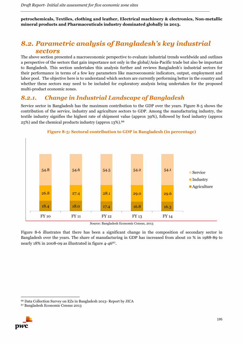
Draft Report- Initial site assessment for five economic zone sites________________________________________________________________________
195
petrochemicals, Textiles, clothing and leather, Electrical machinery & electronics, Non-metallic
mineral products and Pharmaceuticals industry dominated globally in 2013.
8.2. Parametric analysis of Bangladesh’s key industrialsectors
The above section presented a macroeconomic perspective to evaluate industrial trends worldwide and outlines
a perspective of the sectors that gain importance not only in the global/Asia-Pacific trade but also be important
to Bangladesh. This section undertakes this analysis further and reviews Bangladesh’s industrial sectors for
their performance in terms of a few key parameters like macroeconomic indicators, output, employment and
labor pool. The objective here is to understand which sectors are currently performing better in the country and
whether these sectors may need to be included for exploratory analysis being undertaken for the proposed
multi-product economic zones.
8.2.1. Change in Industrial Landscape of Bangladesh
Service sector in Bangladesh has the maximum contribution to the GDP over the years. Figure 8-5 shows the
contribution of the service, industry and agriculture sectors to GDP. Among the manufacturing industry, the
textile industry signifies the highest rate of shipment value (approx 39%), followed by food industry (approx
25%) and the chemical products industry (approx 13%).66
Figure 8-5: Sectoral contribution to GDP in Bangladesh (in percentage)
Source: Bangladesh Economic Census, 2013
Figure 8-6 illustrates that there has been a significant change in the composition of secondary sector in
Bangladesh over the years. The share of manufacturing in GDP has increased from about 10 % in 1988-89 to
nearly 18% in 2008-09 as illustrated in figure 4-4667.
66 Data Collection Survey on EZs in Bangladesh 2013- Report by JICA67 Bangladesh Economic Census 2013
18.4 18.0 17.4 16.8 16.3
26.8 27.4 28.1 29.0 29.6
54.8 54.6 54.5 54.2 54.1
FY 10 FY 11 FY 12 FY 13 FY 14
Service
Industry
Agriculture
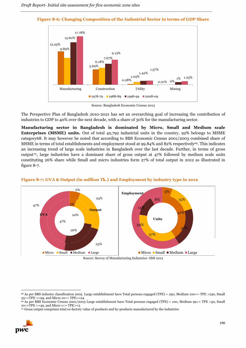
Draft Report- Initial site assessment for five economic zone sites________________________________________________________________________
196
Figure 8-6: Changing Composition of the Industrial Sector in terms of GDP Share
Source: Bangladesh Economic Census 2013
The Perspective Plan of Bangladesh 2010-2021 has set an overarching goal of increasing the contribution of
industries to GDP to 40% over the next decade, with a share of 30% for the manufacturing sector.
Manufacturing sector in Bangladesh is dominated by Micro, Small and Medium scale
Enterprises (MSME) units. Out of total 42,792 industrial units in the country, 92% belongs to MSME
category68. It may however be noted that according to BBS Economic Census 2001/2003 combined share of
MSME in terms of total establishments and employment stood at 99.84% and 82% respectively69. This indicates
an increasing trend of large scale industries in Bangladesh over the last decade. Further, in terms of gross
output70, large industries have a dominant share of gross output at 47% followed by medium scale units
constituting 26% share while Small and micro industries form 27% of total output in 2012 as illustrated in
figure 8-7.
Figure 8-7: GVA & Output (in million Tk.) and Employment by industry type in 2012
Source: Survey of Manufacturing Industries- SMI 2012
68 As per BBS industry classification 2005 Large establishment have Total persons engaged (TPE) > 250, Medium 100<= TPE >250, Small25<=TPE >=99, and Micro 10<= TPE>=2469 As per BBS Economic Census 2001/2003 Large establishment have Total persons engaged (TPE) > 100, Medium 99<= TPE >50, Small10<=TPE >=49, and Micro 1<= TPE>=370 Gross output comprises total ex-factory value of products and by-products manufactured by the industries
12.25%
5.69%
0.28%0.01%
9.89%
6.18%
1.03%
0%
15.60%
7.67%
1.42%
1%
17.78%
9.13%
1.57%
1.25%
Manufacturing Construction Utility Mining
1978-79 1988-89 1998-99 2008-09
41%
37%
14%
8%
5%
15%
21%59%
Micro Small Medium Large
Units
Employment
5%
22%
26%
47%
6%
24%
23%
47%
Micro Small Medium Large
Output
GVA
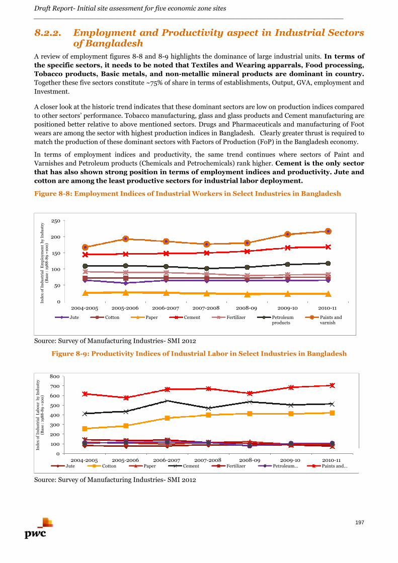
Draft Report- Initial site assessment for five economic zone sites________________________________________________________________________
197
8.2.2. Employment and Productivity aspect in Industrial Sectorsof Bangladesh
A review of employment figures 8-8 and 8-9 highlights the dominance of large industrial units. In terms of
the specific sectors, it needs to be noted that Textiles and Wearing apparrals, Food processing,
Tobacco products, Basic metals, and non-metallic mineral products are dominant in country.
Together these five sectors constitute ~75% of share in terms of establishments, Output, GVA, employment and
Investment.
A closer look at the historic trend indicates that these dominant sectors are low on production indices compared
to other sectors’ performance. Tobacco manufacturing, glass and glass products and Cement manufacturing are
positioned better relative to above mentioned sectors. Drugs and Pharmaceuticals and manufacturing of Foot
wears are among the sector with highest production indices in Bangladesh. Clearly greater thrust is required to
match the production of these dominant sectors with Factors of Production (FoP) in the Bangladesh economy.
In terms of employment indices and productivity, the same trend continues where sectors of Paint and
Varnishes and Petroleum products (Chemicals and Petrochemicals) rank higher. Cement is the only sector
that has also shown strong position in terms of employment indices and productivity. Jute and
cotton are among the least productive sectors for industrial labor deployment.
Figure 8-8: Employment Indices of Industrial Workers in Select Industries in Bangladesh
Source: Survey of Manufacturing Industries- SMI 2012
Figure 8-9: Productivity Indices of Industrial Labor in Select Industries in Bangladesh
Source: Survey of Manufacturing Industries- SMI 2012
0
50
100
150
200
250
2004-2005 2005-2006 2006-2007 2007-2008 2008-09 2009-10 2010-11
Ind
exo
fIn
du
stri
alE
mp
loym
ent
by
Ind
ust
ry(B
ase
:19
88
-89
=10
0)
Jute Cotton Paper Cement Fertilizer Petroleumproducts
Paints andvarnish
0
100
200
300
400
500
600
700
800
2004-2005 2005-2006 2006-2007 2007-2008 2008-09 2009-10 2010-11
Ind
exo
fIn
du
stri
alL
abo
ur
by
Ind
ust
ry(B
ase
:19
88
-89
=10
0)
Jute Cotton Paper Cement Fertilizer Petroleum… Paints and…
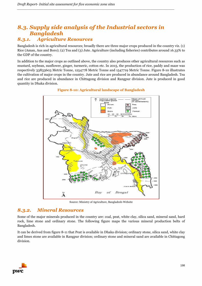
Draft Report- Initial site assessment for five economic zone sites________________________________________________________________________
198
8.3. Supply side analysis of the Industrial sectors inBangladesh
8.3.1. Agriculture Resources
Bangladesh is rich in agricultural resources; broadly there are three major crops produced in the country viz. (1)
Rice (Aman, Aus and Boro); (2) Tea and (3) Jute. Agriculture (including fisheries) contributes around 16.33% to
the GDP of the country.
In addition to the major crops as outlined above, the country also produces other agricultural resources such as
mustard, soybean, sunflower, ginger, turmeric, cotton etc. In 2015, the production of rice, paddy and maze was
respectively 33833603 Metric Tonne, 1254778 Metric Tonne and 1547719 Metric Tonne. Figure 8-10 illustrates
the cultivation of major crops in the country. Jute and rice are produced in abundance around Bangladesh. Tea
and rice are produced in abundance in Chittagong division and Rangpur division. Jute is produced in good
quantity in Dhaka division.
Figure 8-10: Agricultural landscape of Bangladesh
Source: Ministry of Agriculture, Bangladesh-Website
8.3.2. Mineral Resources
Some of the major minerals produced in the country are: coal, peat, white clay, silica sand, mineral sand, hard
rock, lime stone and ordinary stone. The following figure maps the various mineral production belts of
Bangladesh.
It can be derived from figure 8-11 that Peat is available in Dhaka division; ordinary stone, silica sand, white clay
and limes stone are available in Rangpur division; ordinary stone and mineral sand are available in Chittagong
division.
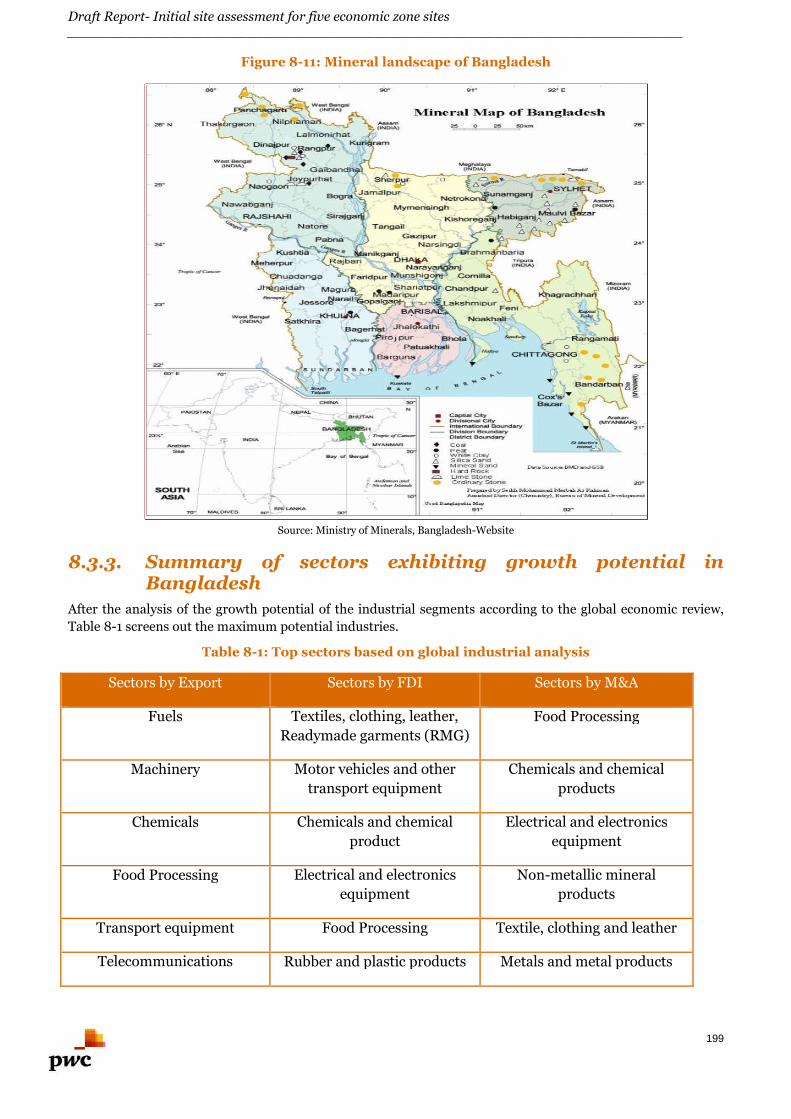
Draft Report- Initial site assessment for five economic zone sites________________________________________________________________________
199
Figure 8-11: Mineral landscape of Bangladesh
Source: Ministry of Minerals, Bangladesh-Website
8.3.3. Summary of sectors exhibiting growth potential inBangladesh
After the analysis of the growth potential of the industrial segments according to the global economic review,
Table 8-1 screens out the maximum potential industries.
Table 8-1: Top sectors based on global industrial analysis
Sectors by Export Sectors by FDI Sectors by M&A
Fuels Textiles, clothing, leather,
Readymade garments (RMG)
Food Processing
Machinery Motor vehicles and other
transport equipment
Chemicals and chemical
products
Chemicals Chemicals and chemical
product
Electrical and electronics
equipment
Food Processing Electrical and electronics
equipment
Non-metallic mineral
products
Transport equipment Food Processing Textile, clothing and leather
Telecommunications Rubber and plastic products Metals and metal products
Draft Report- Initial site assessment for five economic zone sites________________________________________________________________________
200
equipment
Pharmaceuticals Non-metallic mineral
products
Pharmaceuticals
Manufacturers Machinery Machinery
Source: Global Economic Review
Further, Bangladesh country assessment based on key parameters and its vision plan is summarized in Table 8-
2.
Table 8-2: Top sectors based on Bangladesh industrial analysis
Output Employment Investment
Textiles, Clothing Coke & refined petroleum
products
Textiles
Food Processing Motor vehicles and other
transport equipment
RMG
Non-metallic mineral
products
Machinery Leather & related products
Electrical and electronics
equipment
Electrical and electronic
equipment
Light Engineering
Chemicals and chemical
products
Food Processing Auto parts
Pharmaceuticals Rubber and plastic products Electronics
Leather & related products Non-metallic mineral
products
Agro-Processing
Metals & metal products Toys
Source: Global Economic Review
From the analysis on the supply side i.e. the availability of raw materials (agricultural and mineral) and natural
resources all over Bangladesh, the following list has been prepared which captures the potential industries that
can be set up in Bangladesh.
Food Processing Agro Processing Construction materials (such as cement, brick kiln etc.) Coke products Textile Jute products Readymade garments Machinery Light Engineering Ship-building
The objective of this analysis was to get a bucket list of sectors showing prominence at global, Asia Pacific and
Bangladesh level. The next section delves into the regional /site assessment to understand which sectors may
Draft Report- Initial site assessment for five economic zone sites________________________________________________________________________
201
get aligned to the proposed EZ at Narayanganj, Anowara-2 and Panchagarh based on regional characteristics,
economic assessment, infrastructure availability and site constraints.
8.4. Description of regional economic and industriallandscape for the three proposed proposed EZs
8.4.1. Narayanganj
Proposed EZ at Narayanganj falls in Dhaka division. This area is well connected to Dhaka and other major cities
of Bangladesh by road and rail mode of transportation. It also has access to the airport facility in Dhaka.
Narayanganj Bandar is one of the oldest and the most important river port in the country.
The major requirement to set up manufacturing industry is availability of utilities (such as power and gas).
Bangladesh Power development Board (BPDB) is the nodal agency responsible for power production in this
region and the proposed EZ has access to power supply. Narayanganj has access to gas supply. Bangladesh’s
26th gas field was discovered in Roopganj (27 km away from Narayanganj). In the Purbachal area (44 km away
from Narayanganj), a gas field of capacity 50 billion cubic feet (bcf) was discovered by Bangladesh Petroleum
Exploration and Production Company Limited (BAPEX). But, the distribution is yet to commence from this gas
field. According to BAPEX, 40 bcf gas can be explored from this field. This indicates that the infrastructure
linkages (utility connections) are positive and also conducive for future development.
Narayanganj district has large amount of jute being produced in the region. In the region spreading
over 11 districts such as Narayangaj, Narsingdi, Faridpur, Gopalganj, Gazipur, Manikganj, Jamalpur etc. total
jute production was 32% (approx.) of the total jute production of Bangladesh (2013-14 figures). Some of the
major and renowned jute mills in this area are: Adamjee Jute Mill, New Dhaka Jute Industries Limited, Uttara
Jute and Fiber Mills Limited, Sarwar Jute Mills Limited etc. Also, in the Madaripur locality (in Dhaka division)
coal is produced. Madaripur is 53 km (approx.) away from Narayanganj.
Knitwear firms in Bangladesh are mainly located in Narayanganj district. Bangladesh now holds
second position in the world in terms of knitwear export and is bandied about as the next possible champion in
exporting knitwear products as China is gradually backing out of apparel business. Knitwear sector’s
contribution in Bangladesh GDP was about 6.92% in FY 2013-14.71 Table 8-3 illustrates the knitwear export
growth of Bangladesh.
Table 8-3: Knitwear export growth of Bangladesh
Fiscal Year Value (in MillionUSD)
Growth Rate (in %)
2003-04 2148.02 29.88
2004-05 2819.47 31.26
2005-06 3816.98 35.38
2006-07 4553.60 19.30
2007-08 5532.52 21.50
2008-09 6429.00 16.20
2009-10 6483.29 0.84
2010-11 9482.06 46.25
2011-12 9486.39 0.05
2012-13 10475.87 10.43
2013-14 12049.81 15.02
Source: BKMEA, http://www.bkmea.com/bangladesh_knitwear.html
There are several industries existing in this region. Sonargaon is renowned for the Moslin (a very thin fabric)
saree production. Narayanganj is the hub for hosiery production in Bangladesh. Since the early decades of last
century, several cotton mills, units of readymade garments, jute mills etc. were developed in Narayanganj.
71 Bangladesh Knitwear Manufacturers & Exporters Association, http://www.bkmea.com/bangladesh_knitwear.html
Draft Report- Initial site assessment for five economic zone sites________________________________________________________________________
202
Narayanganj district has plenty of Small and Medium Scale industries like Textile mills, sugar
mill, packaged drinking water, garment factories, Rice mills, Steel& Engineering, shipbuilding,
cold storage, Aluminum industries besides having plenty of jute and sugar mills.
Bashundhara cement factory, Ultra tech, Eastern cements are located in close proximity to the proposed EZ;
several power plants are established in the district such as Meghna power plant (1000MW capacity), Summit
group Power Plants (102 MW & a proposed plant of 55 MW capacity). This power plant (102 MW) is located
adjacent to the Bashundhara cement factory.
The proposed EZ could attract Small and Medium scale manufacturing industries subject to
improvement in the existing physical and social infrastructure around the region. The
proximity to river port shall enable the industrial units to easily transport goods to other parts
of Bangladesh. This region has several industrial units from textile, jute, shipbuilding/
shipbreaking, cement and chemicals industry segments. Pertinent downstream and upstream
industries (such as steel, RMG, jute etc.) may also be proposed for the Narayanganj EZ.
8.4.2. Panchagarh
Initial site assessment has revealed that at present agro-based industry is the major industry in the
district. Tea cultivation is predominant in this part of the country. Currently total land under tea
cultivation in Panchagarh is 2255.54 acre. There are a total of 246 tea gardens, including 18 big
estates, 13 medium-size and 215 small-scale gardens set up on over 1,815 acres (7.35 sq. km) of
land in Tetulia and its surrounding areas. The tea cultivation provides employment to 3,000 to 4,000
local people (approx.). Some of the major tea gardens in this area are: Aga Tea Estate, Kartoa Tea Garden, Kazi
& Kazi Tea Garden, Dahuk Tea Garden, Mainaguri Tea Garden etc. Currently there are a total of three tea
processing units in this district viz. (1) Organic factory of Kazi & Kazi Tea Estate, Tetulia; (2) Tetulia Tea
Company Limited and (3) Factory of Kartoa Tea Garden. Kazi & Kazi Tea Estate (KKTE) at Tetulia has earned
reputation in both national and international markets by producing, processing and marketing the famous and
most popular Kazi & Kazi Organic Tea. Also, Panchagarh has one potato based food processing company
Bombay Sweets Company Ltd. (BSCL).
The first industry that was established in this district was Panchagarh Sugar Mill (established in the year 1969).
It is a complete government owned unit and spread over an area of 198.46 acre of land. The capacity of the
sugar mill is 10,160 MT and a total of 810 workers are employed in the unit. In addition to the Panchagarh
Sugar Mills Ltd, Bombay chips factory is located in the vicinity of the proposed EZ.
Gem Jute Limited (high-quality, organic, biodegradable Jute products), Gemcon Ltd (SPC electric poles) and
Marshall Distillery (Production of rectified spirit and dine chard spirit) are the manufacturing units that exist in
this District. The district has 248 rice mills in which 84 rice mills are located in Debiganj. Apart from rice
mills, sugar mills and Tea Estates, the district has Jute mills as well.
Some of the key crops produced in the region are listed in the Table 8-4. It can be observed that Potato and
Sugarcane are produce in the district with high productivity in terms of land utilization.
Table 8-4: Key crops produced in Panchagarh
Crops Production (Metric ton) Production Area (Acres)
Rice 393,505 234,541
Potato 95,593 19,674
Sugarcane 77,120 11,779
Wheat 45,696 42,642
Jute 29,715 22,265
Maize 13,578 5,976
Tea 1421 3,500Source: District Website, Panchagarh
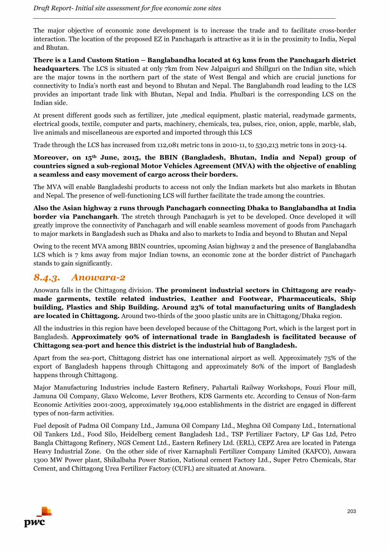
Draft Report- Initial site assessment for five economic zone sites________________________________________________________________________
203
The major objective of economic zone development is to increase the trade and to facilitate cross-border
interaction. The location of the proposed EZ in Panchagarh is attractive as it is in the proximity to India, Nepal
and Bhutan.
There is a Land Custom Station – Banglabandha located at 63 kms from the Panchagarh district
headquarters. The LCS is situated at only 7km from New Jalpaiguri and Shillguri on the Indian site, which
are the major towns in the northern part of the state of West Bengal and which are crucial junctions for
connectivity to India’s north east and beyond to Bhutan and Nepal. The Banglabandh road leading to the LCS
provides an important trade link with Bhutan, Nepal and India. Phulbari is the corresponding LCS on the
Indian side.
At present different goods such as fertilizer, jute ,medical equipment, plastic material, readymade garments,
electrical goods, textile, computer and parts, machinery, chemicals, tea, pulses, rice, onion, apple, marble, slab,
live animals and miscellaneous are exported and imported through this LCS
Trade through the LCS has increased from 112,081 metric tons in 2010-11, to 530,213 metric tons in 2013-14.
Moreover, on 15th June, 2015, the BBIN (Bangladesh, Bhutan, India and Nepal) group of
countries signed a sub-regional Motor Vehicles Agreement (MVA) with the objective of enabling
a seamless and easy movement of cargo across their borders.
The MVA will enable Bangladeshi products to access not only the Indian markets but also markets in Bhutan
and Nepal. The presence of well-functioning LCS will further facilitate the trade among the countries.
Also the Asian highway 2 runs through Panchagarh connecting Dhaka to Banglabandha at India
border via Panchangarh. The stretch through Panchagarh is yet to be developed. Once developed it will
greatly improve the connectivity of Panchagarh and will enable seamless movement of goods from Panchagarh
to major markets in Bangladesh such as Dhaka and also to markets to India and beyond to Bhutan and Nepal
Owing to the recent MVA among BBIN countries, upcoming Asian highway 2 and the presence of Banglabandha
LCS which is 7 kms away from major Indian towns, an economic zone at the border district of Panchagarh
stands to gain significantly.
8.4.3. Anowara-2
Anowara falls in the Chittagong division. The prominent industrial sectors in Chittagong are ready-
made garments, textile related industries, Leather and Footwear, Pharmaceuticals, Ship
building, Plastics and Ship Building. Around 23% of total manufacturing units of Bangladesh
are located in Chittagong. Around two-thirds of the 3000 plastic units are in Chittagong/Dhaka region.
All the industries in this region have been developed because of the Chittagong Port, which is the largest port in
Bangladesh. Approximately 90% of international trade in Bangladesh is facilitated because of
Chittagong sea-port and hence this district is the industrial hub of Bangladesh.
Apart from the sea-port, Chittagong district has one international airport as well. Approximately 75% of the
export of Bangladesh happens through Chittagong and approximately 80% of the import of Bangladesh
happens through Chittagong.
Major Manufacturing Industries include Eastern Refinery, Pahartali Railway Workshops, Fouzi Flour mill,
Jamuna Oil Company, Glaxo Welcome, Lever Brothers, KDS Garments etc. According to Census of Non-farm
Economic Activities 2001-2003, approximately 194,000 establishments in the district are engaged in different
types of non-farm activities.
Fuel deposit of Padma Oil Company Ltd., Jamuna Oil Company Ltd., Meghna Oil Company Ltd., International
Oil Tankers Ltd., Food Silo, Heidelberg cement Bangladesh Ltd., TSP Fertilizer Factory, LP Gas Ltd, Petro
Bangla Chittagong Refinery, NGS Cement Ltd., Eastern Refinery Ltd. (ERL), CEPZ Area are located in Patenga
Heavy Industrial Zone. On the other side of river Karnaphuli Fertilizer Company Limited (KAFCO), Anwara
1300 MW Power plant, Shikalbaha Power Station, National cement Factory Ltd., Super Petro Chemicals, Star
Cement, and Chittagong Urea Fertilizer Factory (CUFL) are situated at Anowara.
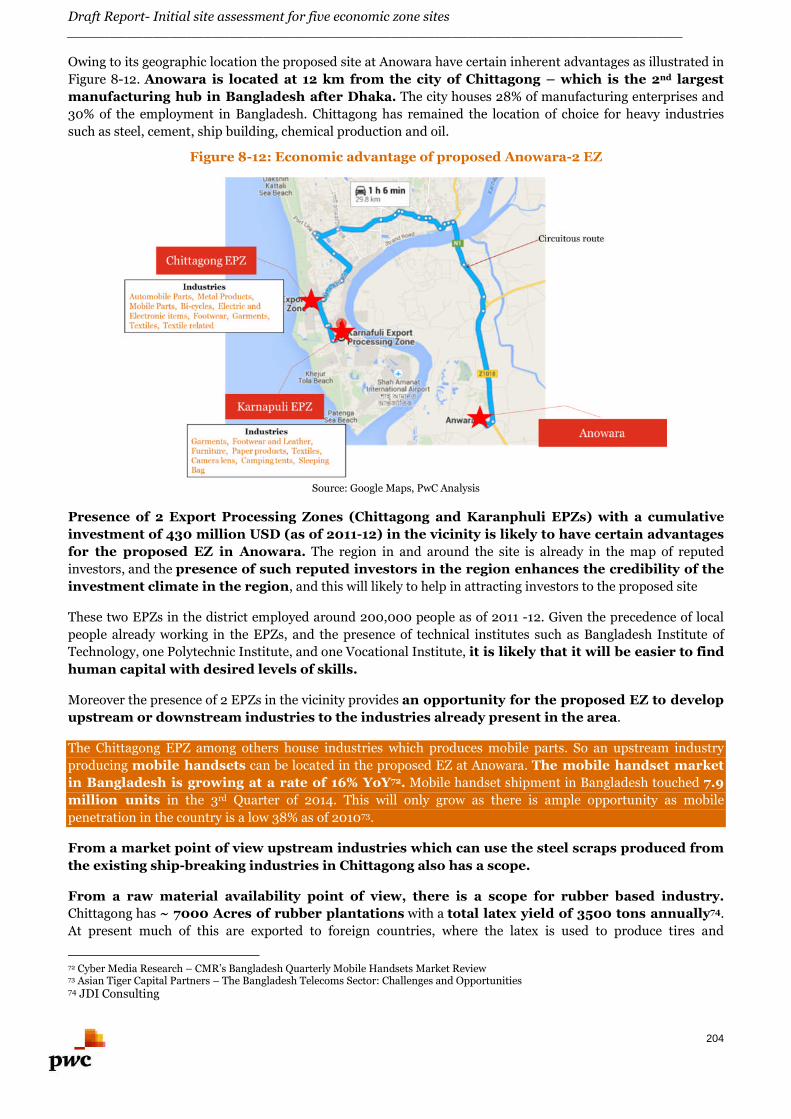
Draft Report- Initial site assessment for five economic zone sites________________________________________________________________________
204
Owing to its geographic location the proposed site at Anowara have certain inherent advantages as illustrated in
Figure 8-12. Anowara is located at 12 km from the city of Chittagong – which is the 2nd largest
manufacturing hub in Bangladesh after Dhaka. The city houses 28% of manufacturing enterprises and
30% of the employment in Bangladesh. Chittagong has remained the location of choice for heavy industries
such as steel, cement, ship building, chemical production and oil.
Figure 8-12: Economic advantage of proposed Anowara-2 EZ
Source: Google Maps, PwC Analysis
Presence of 2 Export Processing Zones (Chittagong and Karanphuli EPZs) with a cumulative
investment of 430 million USD (as of 2011-12) in the vicinity is likely to have certain advantages
for the proposed EZ in Anowara. The region in and around the site is already in the map of reputed
investors, and the presence of such reputed investors in the region enhances the credibility of the
investment climate in the region, and this will likely to help in attracting investors to the proposed site
These two EPZs in the district employed around 200,000 people as of 2011 -12. Given the precedence of local
people already working in the EPZs, and the presence of technical institutes such as Bangladesh Institute of
Technology, one Polytechnic Institute, and one Vocational Institute, it is likely that it will be easier to find
human capital with desired levels of skills.
Moreover the presence of 2 EPZs in the vicinity provides an opportunity for the proposed EZ to develop
upstream or downstream industries to the industries already present in the area.
The Chittagong EPZ among others house industries which produces mobile parts. So an upstream industry
producing mobile handsets can be located in the proposed EZ at Anowara. The mobile handset market
in Bangladesh is growing at a rate of 16% YoY72. Mobile handset shipment in Bangladesh touched 7.9
million units in the 3rd Quarter of 2014. This will only grow as there is ample opportunity as mobile
penetration in the country is a low 38% as of 201073.
From a market point of view upstream industries which can use the steel scraps produced from
the existing ship-breaking industries in Chittagong also has a scope.
From a raw material availability point of view, there is a scope for rubber based industry.
Chittagong has ~ 7000 Acres of rubber plantations with a total latex yield of 3500 tons annually74.
At present much of this are exported to foreign countries, where the latex is used to produce tires and
72 Cyber Media Research – CMR’s Bangladesh Quarterly Mobile Handsets Market Review73 Asian Tiger Capital Partners – The Bangladesh Telecoms Sector: Challenges and Opportunities74 JDI Consulting
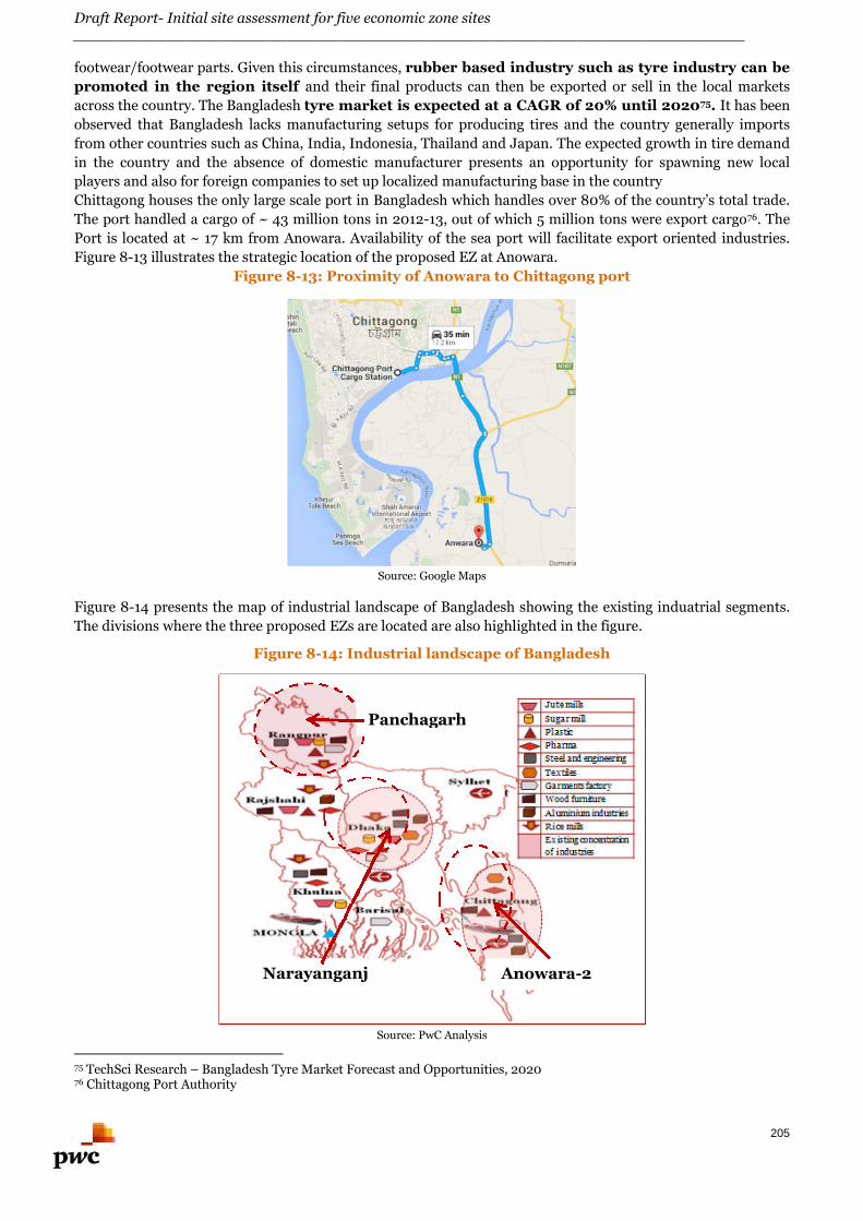
Draft Report- Initial site assessment for five economic zone sites________________________________________________________________________
205
footwear/footwear parts. Given this circumstances, rubber based industry such as tyre industry can be
promoted in the region itself and their final products can then be exported or sell in the local markets
across the country. The Bangladesh tyre market is expected at a CAGR of 20% until 202075. It has been
observed that Bangladesh lacks manufacturing setups for producing tires and the country generally imports
from other countries such as China, India, Indonesia, Thailand and Japan. The expected growth in tire demand
in the country and the absence of domestic manufacturer presents an opportunity for spawning new local
players and also for foreign companies to set up localized manufacturing base in the country
Chittagong houses the only large scale port in Bangladesh which handles over 80% of the country’s total trade.
The port handled a cargo of ~ 43 million tons in 2012-13, out of which 5 million tons were export cargo76. The
Port is located at ~ 17 km from Anowara. Availability of the sea port will facilitate export oriented industries.
Figure 8-13 illustrates the strategic location of the proposed EZ at Anowara.
Figure 8-13: Proximity of Anowara to Chittagong port
Source: Google Maps
Figure 8-14 presents the map of industrial landscape of Bangladesh showing the existing induatrial segments.
The divisions where the three proposed EZs are located are also highlighted in the figure.
Figure 8-14: Industrial landscape of Bangladesh
Source: PwC Analysis
75 TechSci Research – Bangladesh Tyre Market Forecast and Opportunities, 202076 Chittagong Port Authority
Panchagarh
Narayanganj Anowara-2
Draft Report- Initial site assessment for five economic zone sites________________________________________________________________________
206
8.5. Conclusion
Basis our preliminary analyses carried out in the former sections, a set of industrial segments have been
shortlisted based on the analyses derived from global economic review, industrial landscape in Bangladesh and
region specific economic and industrial assessment. This bucket list of industries is being selected based on the
prominence of the industries as obtained in the three-tier analysis.
8.5.1. Narayanganj
Since this region is the hub of jute, cotton and textile industrial segments in Bangladesh, hence development of
industries based on jute, cotton and textile is an obvious conclusion. The region is one of the largest producers
of jute and there are several small and medium units in this region which produce jute based products, hosiery
items, Moslin sarees and readymade garments. Knitwear firms in Bangladesh are mainly located in
Narayanganj district. Knitwear sector’s contribution in GDP was about 6.92% in FY 2013-14. Needless to say,
Bangladesh is world leader in the production and export of textile and RMG.
Narayanganj region is strategically located in the central part of Bangladesh and it has the proximity of a river
port. Also, this region is in the vicinity of Dhaka. Through the river port and the road connectivity, all major
cities of Bangladesh are easily accessible from this region. Thus, there is an untapped potential for
development of warehousing facilities in this location.
In addition to the above, development of shipbuilding industries is also prospective in this location due
to the proximity of river port. The proliferation of shipbuilding activities around the site of the proposed
economic zone indicates that the economic environment and physical infrastructure is suitable for the same.
Several cement plants are located in the vicinity of the proposed proposed EZ. Limestone is the most important
raw material for cement production and by means of the river port facility; limestone can be transported to the
site from the northern part of Bangladesh (Sylhet division). Similarly other raw materials essential for
development of industries producing construction materials can also be developed in this area. Hence,
industries based on construction materials and cement is also possible in the location.
The rural economy of Narayanganj is dependent on agriculture. Out of the total 532,415 holdings of the district
22.44 % holdings are farms that produce HYV paddy, vegetables, spices, cash crops, pulses and others. Various
fruits like banana, guava are grown and fish of different varieties abound in this district. Varieties of fishes are
caught from rivers, channels, creeks and from paddy fields during rainy season. Hence, industries based on
agro-processing, fish products and food processing is also possible in the location.
Further, to cater to the requirements of machineries and equipment for the operation and process of agro and
food processing, shipbuilding, construction materials etc. light engineering industry can also be conceived.
The access to transportation network shall also cater to the logistics’ requirements for the functioning of the
industries.
8.5.2. Panchagarh
From the above discussion,n Food processing industry has emerged as one of the key industries to be focused
on, based on parameters such as – Global trade trends, Global FDI trends, Global M&A trends, Productivity
indices, and Employment indices. Given the fact, that there is already a precedence of successful
agro-based industry in the district, food processing industry around crops such as potato, tea
and sugarcane, among other industries can be consider, as necessary skills required and raw
materials are available locally
Domestic tea consumption in Bangladesh has been increasing at an annual rate of 13 %77
signaling a strong domestic market for tea. As for sugar, the domestic annual sugar consumption as of
77 Food Processing Industries in Bangladesh, GAIN Report
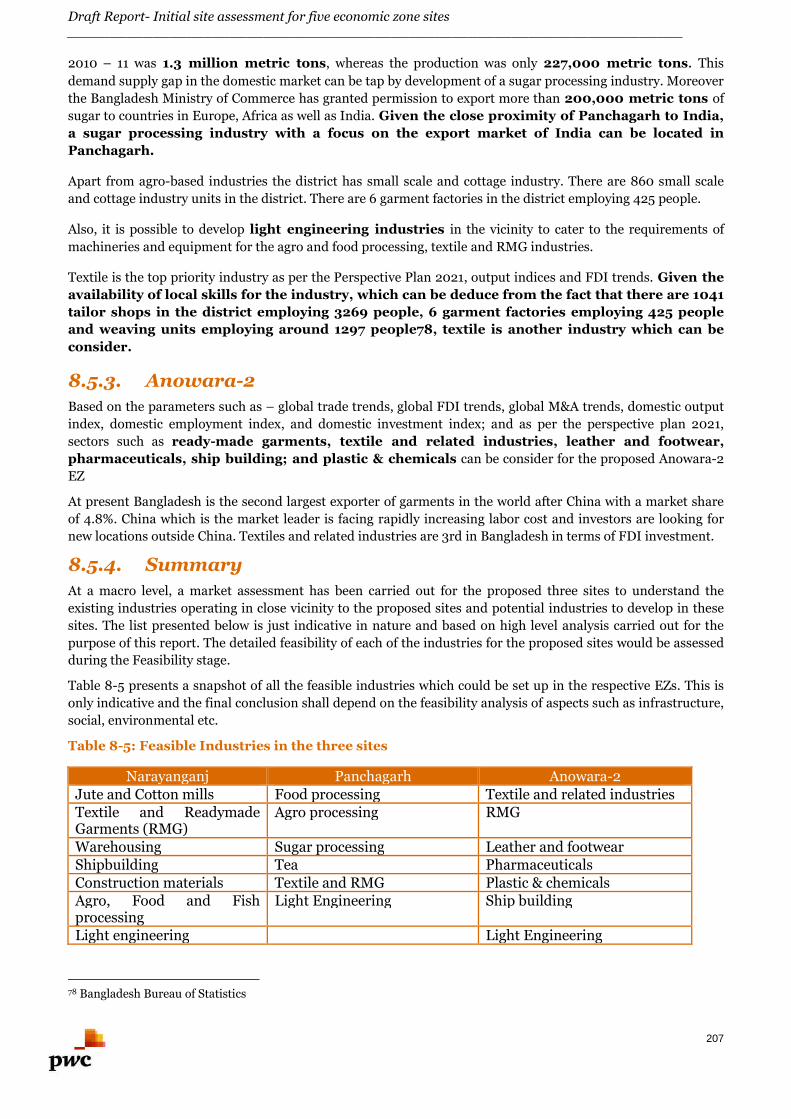
Draft Report- Initial site assessment for five economic zone sites________________________________________________________________________
207
2010 – 11 was 1.3 million metric tons, whereas the production was only 227,000 metric tons. This
demand supply gap in the domestic market can be tap by development of a sugar processing industry. Moreover
the Bangladesh Ministry of Commerce has granted permission to export more than 200,000 metric tons of
sugar to countries in Europe, Africa as well as India. Given the close proximity of Panchagarh to India,
a sugar processing industry with a focus on the export market of India can be located in
Panchagarh.
Apart from agro-based industries the district has small scale and cottage industry. There are 860 small scale
and cottage industry units in the district. There are 6 garment factories in the district employing 425 people.
Also, it is possible to develop light engineering industries in the vicinity to cater to the requirements of
machineries and equipment for the agro and food processing, textile and RMG industries.
Textile is the top priority industry as per the Perspective Plan 2021, output indices and FDI trends. Given the
availability of local skills for the industry, which can be deduce from the fact that there are 1041
tailor shops in the district employing 3269 people, 6 garment factories employing 425 people
and weaving units employing around 1297 people78, textile is another industry which can be
consider.
8.5.3. Anowara-2
Based on the parameters such as – global trade trends, global FDI trends, global M&A trends, domestic output
index, domestic employment index, and domestic investment index; and as per the perspective plan 2021,
sectors such as ready-made garments, textile and related industries, leather and footwear,
pharmaceuticals, ship building; and plastic & chemicals can be consider for the proposed Anowara-2
EZ
At present Bangladesh is the second largest exporter of garments in the world after China with a market share
of 4.8%. China which is the market leader is facing rapidly increasing labor cost and investors are looking for
new locations outside China. Textiles and related industries are 3rd in Bangladesh in terms of FDI investment.
8.5.4. Summary
At a macro level, a market assessment has been carried out for the proposed three sites to understand the
existing industries operating in close vicinity to the proposed sites and potential industries to develop in these
sites. The list presented below is just indicative in nature and based on high level analysis carried out for the
purpose of this report. The detailed feasibility of each of the industries for the proposed sites would be assessed
during the Feasibility stage.
Table 8-5 presents a snapshot of all the feasible industries which could be set up in the respective EZs. This is
only indicative and the final conclusion shall depend on the feasibility analysis of aspects such as infrastructure,
social, environmental etc.
Table 8-5: Feasible Industries in the three sites
Narayanganj Panchagarh Anowara-2Jute and Cotton mills Food processing Textile and related industriesTextile and ReadymadeGarments (RMG)
Agro processing RMG
Warehousing Sugar processing Leather and footwearShipbuilding Tea PharmaceuticalsConstruction materials Textile and RMG Plastic & chemicalsAgro, Food and Fishprocessing
Light Engineering Ship building
Light engineering Light Engineering
78 Bangladesh Bureau of Statistics

Draft Report- Initial site assessment for five economic zone sites________________________________________________________________________
208
Sabrang EZ
Draft Report- Initial site assessment for five economic zone sites________________________________________________________________________
209
9. Sabrang Economic Zone
9.1. About Tourism Economic Zone
9.1.1. Concept
The primary objective of Tourism Economic Zones is to take advantage of the natural tourism potential of a
selected region by providing facilities and convenience to explore the same and thereby enhance tourism in the
area and hence develop the tourism industry of the nation as an engine of socio-economic growth.
From the examples available, Tourism Economic Zones can be generally described as an area with adequate
facilities and infrastructure, located within convenient distances from and connected by adequate public
transport to the tourist attractions of a region, offering alternate avenues of amusement and entertainment
apart from the attractions the region offers; which provides all the means and facilitates tourists to explore the
region and make the most of their stay.
Formation of such tourism enclaves enables Government to form special regulations exclusively for the zone
which are more tourism friendly thereby negating the effects of any domestic regulations which might have
negative implications on the tourism of the region.
Moreover such zones boost the tourism sector by facilitating in springing up of various tourisms related
enterprises with the help of private sector investments and generate employment.
9.1.2. Components
Tourism economic zones generally consist of all the facilities a tourist requires and alternate avenues of
amusement and entertainments. Some of the facilities which a typical Tourism Economic Zone has are as
follows
Integrated resort complex for accommodation
Sports and recreation centres
Convention and cultural facilities
Theme parks
Other special interest with foreign tourists as primary targets
Travel and Tour Services
Restaurants
Specialty shops
Theatres and other amusement centres
Apart from the facilities and services it has to offer, the Tourism Economic Zones generally also consists of
necessary infrastructures to support the delivery of desired services to the tourists. Some of the necessary
infrastructures are
Internal and external connectivity
Utilities such as – power supply, water supply, sewerage and sanitation, solid waste management
Social infrastructure such as hospitals, police stations, etc.
Adequate security
9.1.3. Benefits of Tourism Economic Zone
Tourism economic zones help in growing and sustaining the tourism industry of the region where they are
located. It improves the attractiveness of the location by offering high standard facilities which in turn enables
the tourists to enjoy the natural attractions the region has to offer, provide for alternate avenues for amusement
Draft Report- Initial site assessment for five economic zone sites________________________________________________________________________
210
and entertainment. The tourism economic zones provides tourist friendly regulations thereby improving the
overall experience of the tourists.
Development of a tourism economic zone has many advantages for the local communities including:
Improvement in the local infrastructure
Increased investments in the region
Increasing avenues for employment
Overall improvement in socio-economic condition of the region
There have been global precedents of the advantage the tourism economic zones have to offer to the region as
well as economy, as highlighted in the following case-study:
9.1.4. Case – Tourism Economic Zones in Philippines
Tourism is a key element of the Philippine’s economy. Tourism contributes ~ 4.2% directly to the country’s
GDP and contributes directly and indirectly together ~ 8.5% to the country’s GDP79 . Although the country was
blessed with abundant natural resources, one of factors identified as a deterrent to the growth in tourism was
“Lack of secondary attractions around primary destinations”.
Around 2005, major destinations such as Boracay, Palawan and Camiguin did not had much to offer other than
the natural beauties, and were lacking in facilities such as accommodation, transports, restaurants, multi-
payment avenues, etc. Moreover rapid and unorganized development of hotels were spoiling the natural beauty
and polluting the environment.
The Department of Tourism, Government of Philippines after recognizing the competitive disadvantage of its
major tourist destinations, devised a strategy which included identification of priority destinations and
developing the same through establishment of Tourism Economic Zones. Within those Tourism Zones – hotels,
restaurants, resorts, other tourism related products and alternate avenues of amusement were been developed
and requisite supporting infrastructure was put in place to run the Tourism Economic Zones. As of May 31,
2015 – Philippines has now has 19 Tourism Economic Zones, 20 development clusters covering 78 Tourism
Development Areas. With such collective efforts, the tourism has been forecasted to increase by 5.6% CAGR in
the next 10 years (as compared to historical ~4% CAGR)80.
9.1.5. Case – Tourism Economic Zones in Thailand
Tourism is a major economic factor in Thailand kingdom, featuring Buddhist temples, exotic wildlife, and
spectacular islands. The direct contribution of Travel & Tourism to GDP was 9.0% of total GDP and the total
contribution of Travel & Tourism to GDP was 20.2% of GDP in 2013. In 2013, the total contribution of Travel &
Tourism to employment, including jobs indirectly supported by the industry, was 15.4% of total employment. 81
Thailand Government in 2014 launched a pilot project to set up six special economic zones in five provinces,
namely Tak, Mukdahan, Sa Kaeo, Songkhla, and Trat. In the second phase, which is expected to begin in 2016,
seven special economic zones would be established in another five provinces – Chiang Rai, Kanchanaburi, Nong
Khai, Nakhon Phanom, and Narathiwat. Apart from serving as centers for agricultural production, these zones
could be further developed into investment, business, and tourism centers, as well. With infrastructure
linking all regions of the country, the special economic zones are expected to serve as a mechanism to distribute
wealth and add value to Thai products. 82
All these proposed special economic zones have high potential in tourism sector. As per the Office of the
National Economic and Social Development Board (NESDB), Government of Thailand is targeting Tourism
79 World Travel and Tourism Council.80 Source: ADB and UNWTO.ORG (http://asiapacific.unwto.org/sites/all/files/pdf/philippines_5.pdf)81 http://www.wttc.org/-/media/files/reports/economic%20impact%20research/country%20reports/thailand2014.pdf82 http://www.thaigov.go.th/index.php?option=com_k2&view=item&id=92580:92580&Itemid=417&lang=en
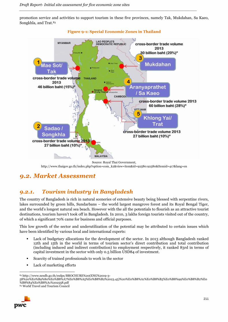
Draft Report- Initial site assessment for five economic zone sites________________________________________________________________________
211
promotion service and activities to support tourism in these five provinces, namely Tak, Mukdahan, Sa Kaeo,
Songkhla, and Trat.83
Figure 9-1: Special Economic Zones in Thailand
Source: Royal Thai Government,
http://www.thaigov.go.th/index.php?option=com_k2&view=item&id=92580:92580&Itemid=417&lang=en
9.2. Market Assessment
9.2.1. Tourism industry in Bangladesh
The country of Bangladesh is rich in natural sceneries of extensive beauty being blessed with serpentine rivers,
lakes surrounded by green hills, Sundarbans – the world largest mangrove forest and its Royal Bengal Tiger,
and the world’s longest natural sea beach. However with the all the potentials to flourish as an attractive tourist
destinations, tourism haven’t took off in Bangladesh. In 2010, 3 lakhs foreign tourists visited out of the country,
of which a significant 70% came for business and official purposes.
This low growth of the sector and underutilization of the potential may be attributed to certain issues which
have been identified by various local and international experts:
Lack of budgetary allocations for the development of the sector. In 2013 although Bangladesh ranked12th and 15th in the world in terms of tourism sector’s direct contribution and total contribution(including induced and indirect contribution) to employment respectively, it ranked 83rd in terms ofcapital investment in the sector with only 0.5 billion USD84 of investment.
Scarcity of trained professionals to work in the sector
Lack of marketing efforts
83 http://www.nesdb.go.th/esdps/BROCHURE%20(ENG%2019-3-58%20%E0%B9%80%E0%B8%A7%E0%B8%A5%E0%B8%B2%2023.45)%20%E0%B8%A1%E0%B8%B5%E0%B8%99%E0%B8%B2%E0%B8%84%E0%B8%A1%202558.pdf84 World Travel and Tourism Council
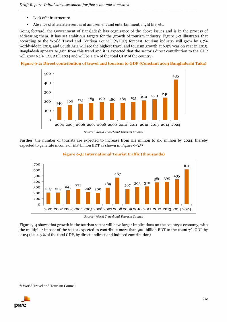
Draft Report- Initial site assessment for five economic zone sites________________________________________________________________________
212
Lack of infrastructure
Absence of alternate avenues of amusement and entertainment, night life, etc.
Going forward, the Government of Bangladesh has cognizance of the above issues and is in the process of
addressing them. It has set ambitious targets for the growth of tourism industry. Figure 9-2 illustrates that
according to the World Travel and Tourism Council (WTTC) forecast, tourism industry will grow by 3.7%
worldwide in 2015, and South Asia will see the highest travel and tourism growth at 6.9% year on year in 2015.
Bangladesh appears to gain from this trend and it is expected that the sector’s direct contribution to the GDP
will grow 6.1% CAGR till 2024 and will be 2.2% of the total GDP of the country.
Figure 9-2: Direct contribution of travel and tourism to GDP (Constant 2013 Bangladeshi Taka)
Source: World Travel and Tourism Council
Further, the number of tourists are expected to increase from 0.4 million to 0.6 million by 2024, thereby
expected to generate income of 15.5 billion BDT as shown in Figure 9-3.85
Figure 9-3: International Tourist traffic (thousands)
Source: World Travel and Tourism Council
Figure 9-4 shows that growth in the tourism sector will have larger implications on the country’s economy, with
the multiplier impact of the sector expected to contribute more than 900 billion BDT to the country’s GDP by
2024 (i.e. 4.5 % of the total GDP, by direct, indirect and induced contribution)
85 World Travel and Tourism Council
140 160 175 185 190 180 185 195 210 220 240
435
0
100
200
300
400
500
2004 2005 2006 2007 2008 2009 2010 2011 2012 2013 2014 2024
207 207245 271
208 200
289
467
267303 310
380 390435
611
0
100
200
300
400
500
600
700
2001 2002 2003 2004 2005 2006 2007 2008 2009 2010 2011 2012 2013 2014 2024
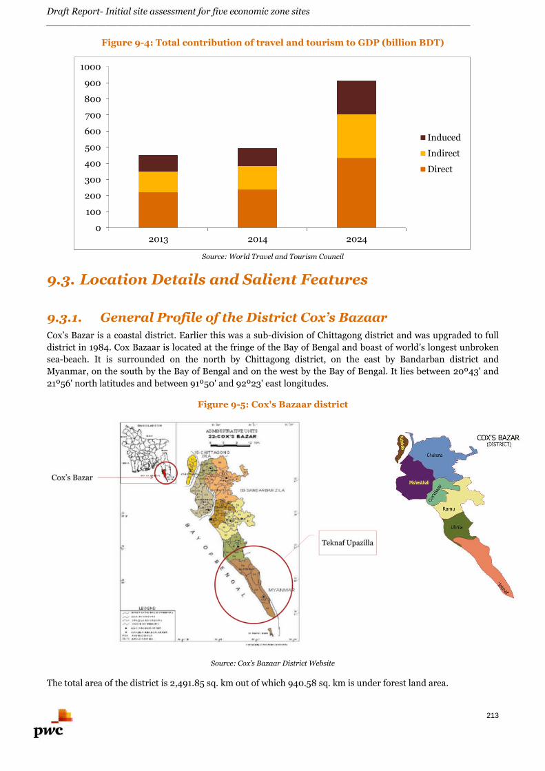
Draft Report- Initial site assessment for five economic zone sites________________________________________________________________________
213
Figure 9-4: Total contribution of travel and tourism to GDP (billion BDT)
Source: World Travel and Tourism Council
9.3. Location Details and Salient Features
9.3.1. General Profile of the District Cox’s Bazaar
Cox’s Bazar is a coastal district. Earlier this was a sub-division of Chittagong district and was upgraded to full
district in 1984. Cox Bazaar is located at the fringe of the Bay of Bengal and boast of world’s longest unbroken
sea-beach. It is surrounded on the north by Chittagong district, on the east by Bandarban district and
Myanmar, on the south by the Bay of Bengal and on the west by the Bay of Bengal. It lies between 20º43' and
21º56' north latitudes and between 91º50' and 92º23' east longitudes.
Figure 9-5: Cox's Bazaar district
Source: Cox’s Bazaar District Website
The total area of the district is 2,491.85 sq. km out of which 940.58 sq. km is under forest land area.
0
100
200
300
400
500
600
700
800
900
1000
2013 2014 2024
Induced
Indirect
Direct
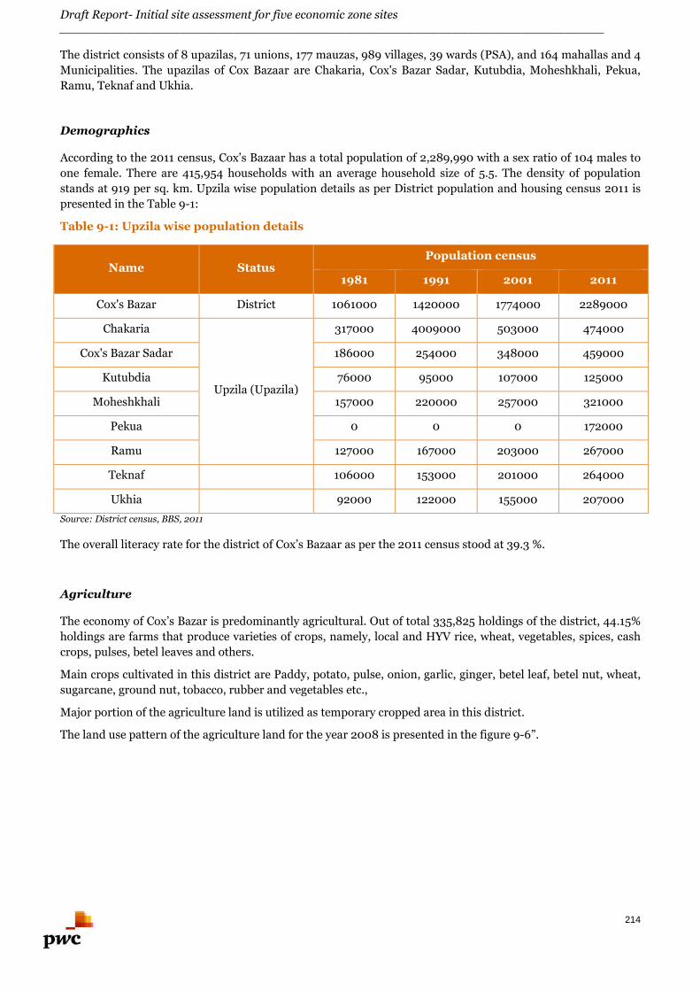
Draft Report- Initial site assessment for five economic zone sites________________________________________________________________________
214
The district consists of 8 upazilas, 71 unions, 177 mauzas, 989 villages, 39 wards (PSA), and 164 mahallas and 4
Municipalities. The upazilas of Cox Bazaar are Chakaria, Cox's Bazar Sadar, Kutubdia, Moheshkhali, Pekua,
Ramu, Teknaf and Ukhia.
Demographics
According to the 2011 census, Cox’s Bazaar has a total population of 2,289,990 with a sex ratio of 104 males to
one female. There are 415,954 households with an average household size of 5.5. The density of population
stands at 919 per sq. km. Upzila wise population details as per District population and housing census 2011 is
presented in the Table 9-1:
Table 9-1: Upzila wise population details
Name StatusPopulation census
1981 1991 2001 2011
Cox's Bazar District 1061000 1420000 1774000 2289000
Chakaria
Upzila (Upazila)
317000 4009000 503000 474000
Cox's Bazar Sadar 186000 254000 348000 459000
Kutubdia 76000 95000 107000 125000
Moheshkhali 157000 220000 257000 321000
Pekua 0 0 0 172000
Ramu 127000 167000 203000 267000
Teknaf 106000 153000 201000 264000
Ukhia 92000 122000 155000 207000
Source: District census, BBS, 2011
The overall literacy rate for the district of Cox’s Bazaar as per the 2011 census stood at 39.3 %.
Agriculture
The economy of Cox’s Bazar is predominantly agricultural. Out of total 335,825 holdings of the district, 44.15%
holdings are farms that produce varieties of crops, namely, local and HYV rice, wheat, vegetables, spices, cash
crops, pulses, betel leaves and others.
Main crops cultivated in this district are Paddy, potato, pulse, onion, garlic, ginger, betel leaf, betel nut, wheat,
sugarcane, ground nut, tobacco, rubber and vegetables etc.,
Major portion of the agriculture land is utilized as temporary cropped area in this district.
The land use pattern of the agriculture land for the year 2008 is presented in the figure 9-6”.
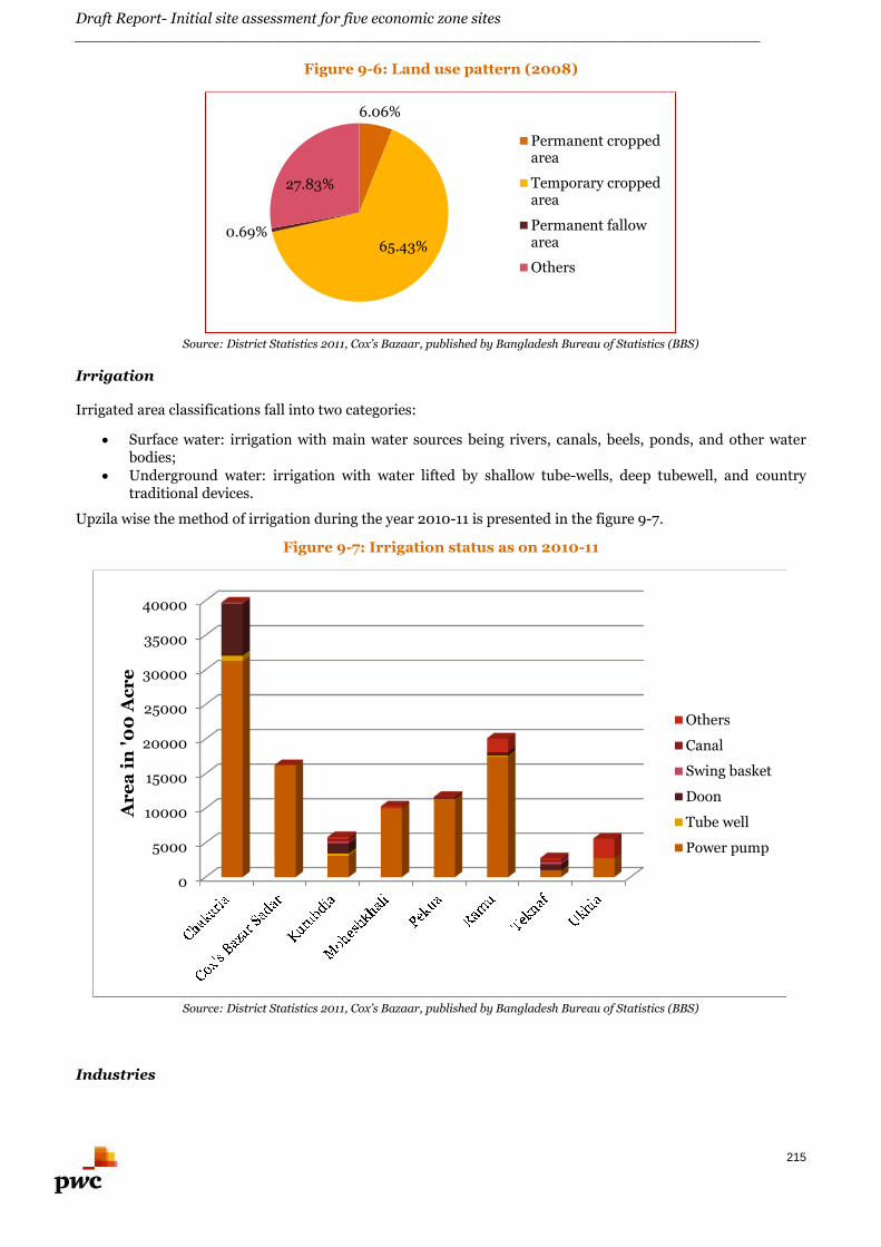
Draft Report- Initial site assessment for five economic zone sites________________________________________________________________________
215
Figure 9-6: Land use pattern (2008)
Source: District Statistics 2011, Cox’s Bazaar, published by Bangladesh Bureau of Statistics (BBS)
Irrigation
Irrigated area classifications fall into two categories:
Surface water: irrigation with main water sources being rivers, canals, beels, ponds, and other waterbodies;
Underground water: irrigation with water lifted by shallow tube-wells, deep tubewell, and countrytraditional devices.
Upzila wise the method of irrigation during the year 2010-11 is presented in the figure 9-7.
Figure 9-7: Irrigation status as on 2010-11
Source: District Statistics 2011, Cox’s Bazaar, published by Bangladesh Bureau of Statistics (BBS)
Industries
6.06%
65.43%0.69%
27.83%
Permanent croppedarea
Temporary croppedarea
Permanent fallowarea
Others
0
5000
10000
15000
20000
25000
30000
35000
40000
Ar
ea
in'0
0A
cr
e
Others
Canal
Swing basket
Doon
Tube well
Power pump
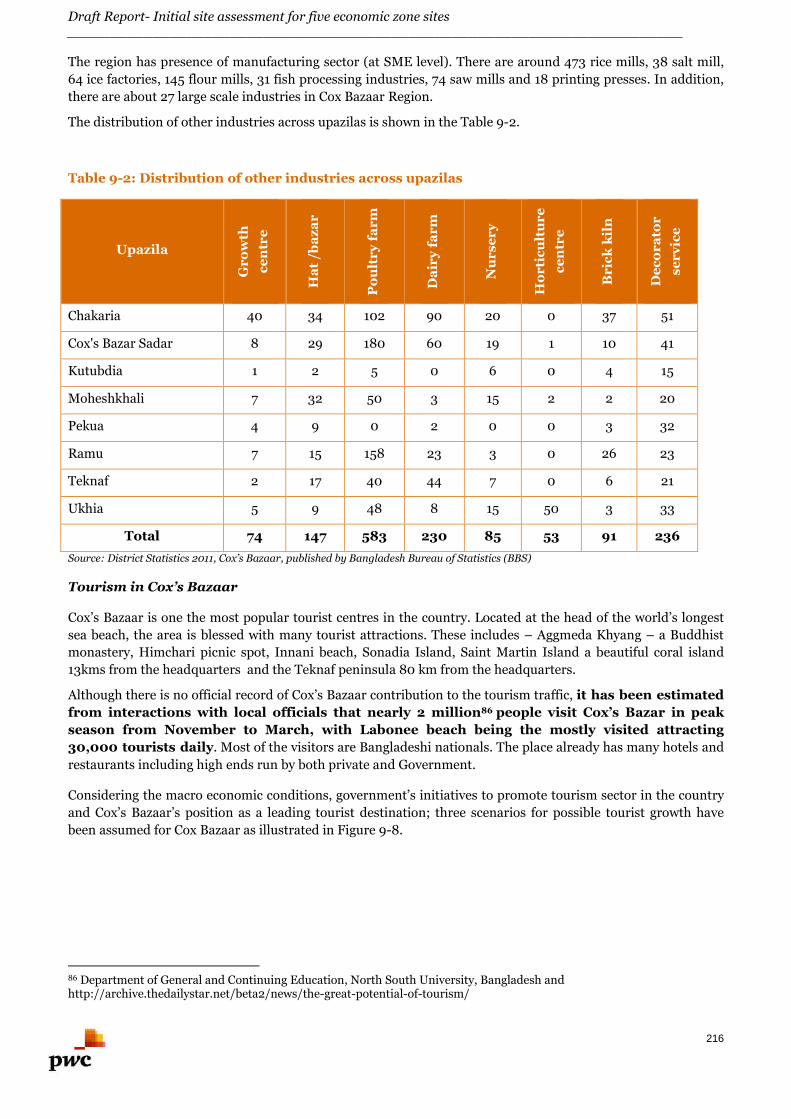
Draft Report- Initial site assessment for five economic zone sites________________________________________________________________________
216
The region has presence of manufacturing sector (at SME level). There are around 473 rice mills, 38 salt mill,
64 ice factories, 145 flour mills, 31 fish processing industries, 74 saw mills and 18 printing presses. In addition,
there are about 27 large scale industries in Cox Bazaar Region.
The distribution of other industries across upazilas is shown in the Table 9-2.
Table 9-2: Distribution of other industries across upazilas
UpazilaG
ro
wth
ce
ntr
e
Ha
t/b
az
ar
Po
ult
ry
far
m
Da
iry
far
m
Nu
rs
er
y
Ho
rti
cu
ltu
re
ce
ntr
e
Br
ick
kil
n
De
co
ra
tor
se
rv
ice
Chakaria 40 34 102 90 20 0 37 51
Cox's Bazar Sadar 8 29 180 60 19 1 10 41
Kutubdia 1 2 5 0 6 0 4 15
Moheshkhali 7 32 50 3 15 2 2 20
Pekua 4 9 0 2 0 0 3 32
Ramu 7 15 158 23 3 0 26 23
Teknaf 2 17 40 44 7 0 6 21
Ukhia 5 9 48 8 15 50 3 33
Total 74 147 583 230 85 53 91 236
Source: District Statistics 2011, Cox’s Bazaar, published by Bangladesh Bureau of Statistics (BBS)
Tourism in Cox’s Bazaar
Cox’s Bazaar is one the most popular tourist centres in the country. Located at the head of the world’s longest
sea beach, the area is blessed with many tourist attractions. These includes – Aggmeda Khyang – a Buddhist
monastery, Himchari picnic spot, Innani beach, Sonadia Island, Saint Martin Island a beautiful coral island
13kms from the headquarters and the Teknaf peninsula 80 km from the headquarters.
Although there is no official record of Cox’s Bazaar contribution to the tourism traffic, it has been estimated
from interactions with local officials that nearly 2 million86 people visit Cox’s Bazar in peak
season from November to March, with Labonee beach being the mostly visited attracting
30,000 tourists daily. Most of the visitors are Bangladeshi nationals. The place already has many hotels and
restaurants including high ends run by both private and Government.
Considering the macro economic conditions, government’s initiatives to promote tourism sector in the country
and Cox’s Bazaar’s position as a leading tourist destination; three scenarios for possible tourist growth have
been assumed for Cox Bazaar as illustrated in Figure 9-8.
86 Department of General and Continuing Education, North South University, Bangladesh andhttp://archive.thedailystar.net/beta2/news/the-great-potential-of-tourism/
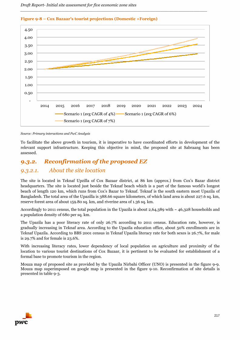
Draft Report- Initial site assessment for five economic zone sites________________________________________________________________________
217
Figure 9-8 – Cox Bazaar’s tourist projections (Domestic +Foreign)
Source: Primary interactions and PwC Analysis
To facilitate the above growth in tourism, it is imperative to have coordinated efforts in development of the
relevant support infrastructure. Keeping this objective in mind, the proposed site at Sabraang has been
assessed.
9.3.2. Reconfirmation of the proposed EZ
9.3.2.1. About the site location
The site is located in Teknaf Upzilla of Cox Bazaar district, at 86 km (approx.) from Cox’s Bazar district
headquarters. The site is located just beside the Teknaf beach which is a part of the famous world’s longest
beach of length 120 km, which runs from Cox’s Bazar to Teknaf. Teknaf is the south eastern most Upazila of
Bangladesh. The total area of the Upazilla is 388.66 square kilometers, of which land area is about 227.6 sq. km,
reserve forest area of about 159.80 sq. km, and riverine area of 1.36 sq. km.
Accordingly to 2011 census, the total population in the Upazila is about 2,64,389 with ~ 46,328 households and
a population density of 680 per sq. km.
The Upazila has a poor literacy rate of only 26.7% according to 2011 census. Education rate, however, is
gradually increasing in Teknaf area. According to the Upazila education office, about 50% enrollments are in
Teknaf Upazila. According to BBS 2001 census in Teknaf Upazila literacy rate for both sexes is 26.7%, for male
is 29.7% and for female is 23.6%.
With increasing literacy rates, lower dependency of local population on agriculture and proximity of the
location to various tourist destinations of Cox Bazaar, it is pertinent to be evaluated for establishment of a
formal base to promote tourism in the region.
Mouza map of proposed site as provided by the Upazila Nirbahi Officer (UNO) is presented in the figure 9-9.Mouza map superimposed on google map is presented in the figure 9-10. Reconfirmation of site details ispresented in table 9-3.
-
0.50
1.00
1.50
2.00
2.50
3.00
3.50
4.00
4.50
2014 2015 2016 2017 2018 2019 2020 2021 2022 2023 2024
Scenario 1 (avg CAGR of 4%) Scenario 1 (avg CAGR of 6%)
Scenario 1 (avg CAGR of 7%)
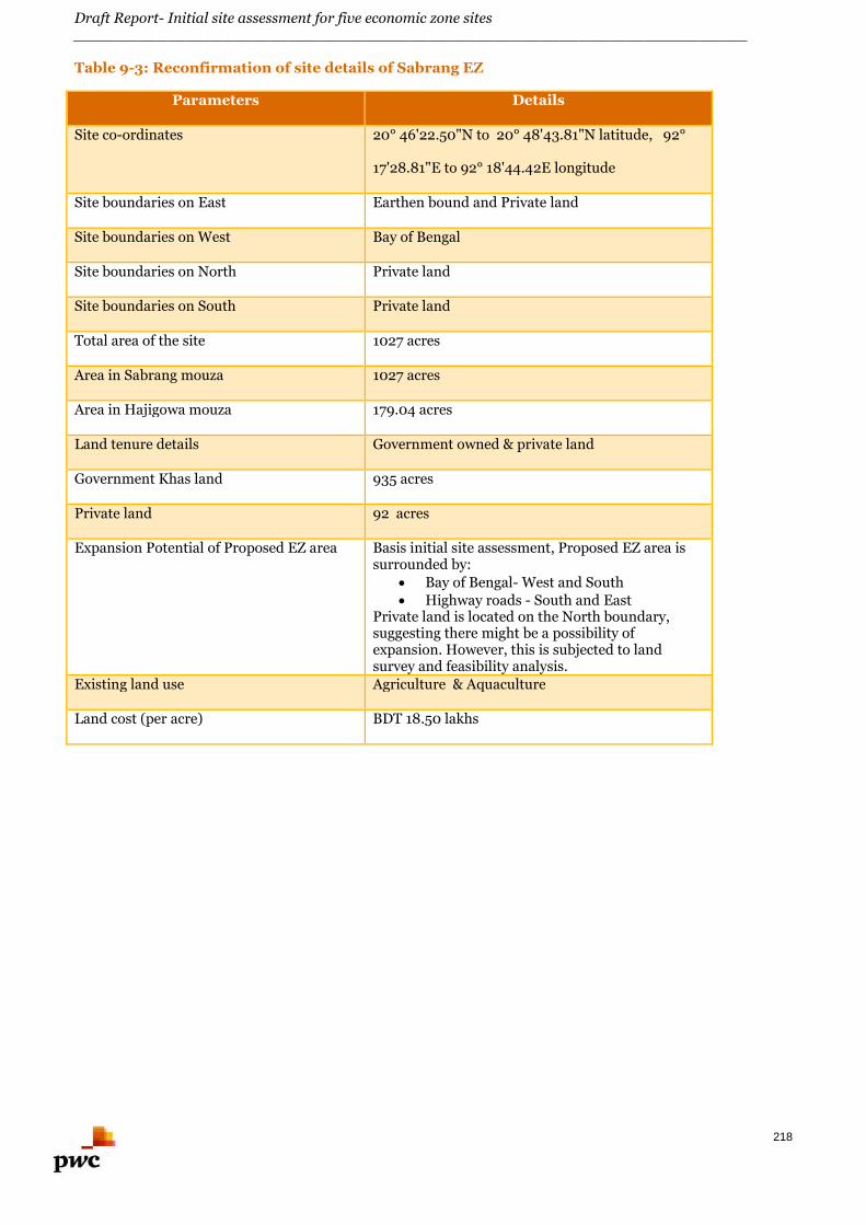
Draft Report- Initial site assessment for five economic zone sites________________________________________________________________________
218
Table 9-3: Reconfirmation of site details of Sabrang EZ
Parameters Details
Site co-ordinates 20° 46'22.50"N to 20° 48'43.81"N latitude, 92°
17'28.81"E to 92° 18'44.42E longitude
Site boundaries on East Earthen bound and Private land
Site boundaries on West Bay of Bengal
Site boundaries on North Private land
Site boundaries on South Private land
Total area of the site 1027 acres
Area in Sabrang mouza 1027 acres
Area in Hajigowa mouza 179.04 acres
Land tenure details Government owned & private land
Government Khas land 935 acres
Private land 92 acres
Expansion Potential of Proposed EZ area Basis initial site assessment, Proposed EZ area issurrounded by:
Bay of Bengal- West and South Highway roads - South and East
Private land is located on the North boundary,suggesting there might be a possibility ofexpansion. However, this is subjected to landsurvey and feasibility analysis.
Existing land use Agriculture & Aquaculture
Land cost (per acre) BDT 18.50 lakhs
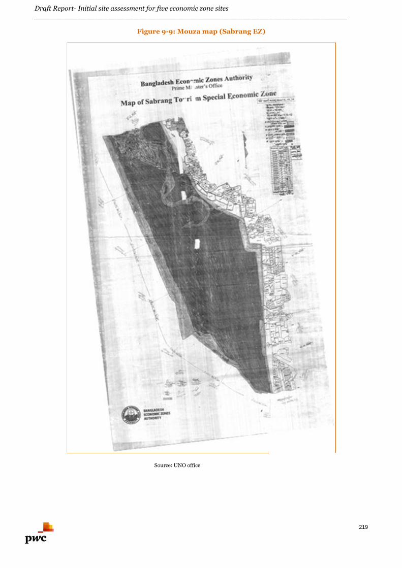
Draft Report- Initial site assessment for five economic zone sites________________________________________________________________________
219
Figure 9-9: Mouza map (Sabrang EZ)
Source: UNO office
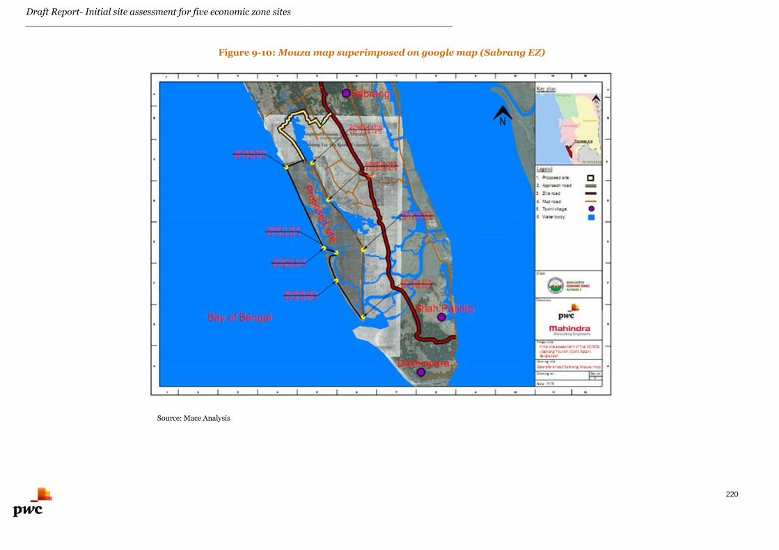
Draft Report- Initial site assessment for five economic zone sites________________________________________________________________________
220
Figure 9-10: Mouza map superimposed on google map (Sabrang EZ)
Source: Mace Analysis
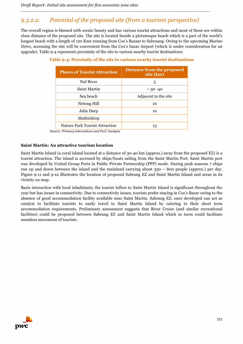
Draft Report- Initial site assessment for five economic zone sites________________________________________________________________________
221
9.3.2.2. Potential of the proposed site (from a tourism perspective)
The overall region is blessed with scenic beauty and has various tourist attractions and most of these are within
close distance of the proposed site. The site is located beside a picturesque beach which is a part of the world’s
longest beach with a length of 120 Kms running from Cox’s Bazaar to Sabraang. Owing to the upcoming Marine
Drive, accessing the site will be convenient from the Cox’s bazar Airport (which is under consideration for an
upgrade). Table 9-4 represents proximity of the site to various nearby tourist destinations:
Table 9-4: Proximity of the site to various nearby tourist destinations
Places of Tourist AttractionDistance from the proposed
site (km)
Naf River 5
Saint Martin ~ 30 -40
Sea beach Adjacent to the site
Netong Hill 10
Jalia Deep 10
Mathinktop
Nature Park Tourist Attraction 13
Source: Primary interactions and PwC Analysis
Saint Martin: An attractive tourism location
Saint Martin Island (a coral island located at a distance of 30-40 km (approx.) away from the proposed EZ) is a
tourist attraction. The island is accessed by ships/boats sailing from the Saint Martin Port. Saint Martin port
was developed by United Group Ports in Public Private Partnership (PPP) mode. During peak seasons 7 ships
run up and down between the island and the mainland carrying about 350 – 800 people (approx.) per day.
Figure 9-11 and 9-12 illustrates the location of proposed Sabrang EZ and Saint Martin Island and areas in its
vicinity on map.
Basis interaction with local inhabitants, the tourist inflow to Saint Martin Island is significant throughout the
year but has issues in connectivity. Due to connectivity issues, tourists prefer staying in Cox’s Bazar owing to the
absence of good accommodation facility available near Saint Martin. Sabrang EZ, once developed can act as
catalyst to facilitate tourists to easily travel to Saint Martin Island by catering to their short term
accommodation requirements. Preliminary assessment suggests that River Cruise (and similar recreational
facilities) could be proposed between Sabrang EZ and Saint Martin Island which in turm could facilitate
seamless movement of tourists.
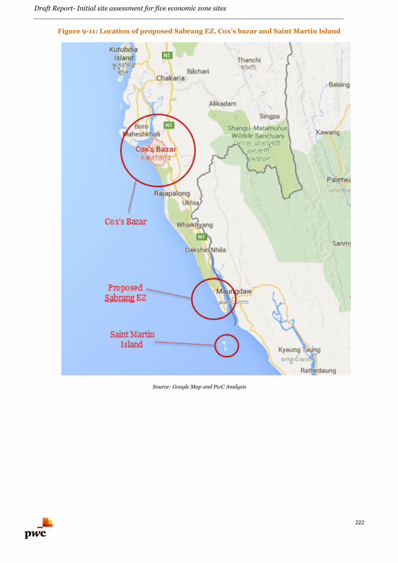
Draft Report- Initial site assessment for five economic zone sites________________________________________________________________________
222
Figure 9-11: Location of proposed Sabrang EZ, Cox’s bazar and Saint Martin Island
Source: Google Map and PwC Analysis
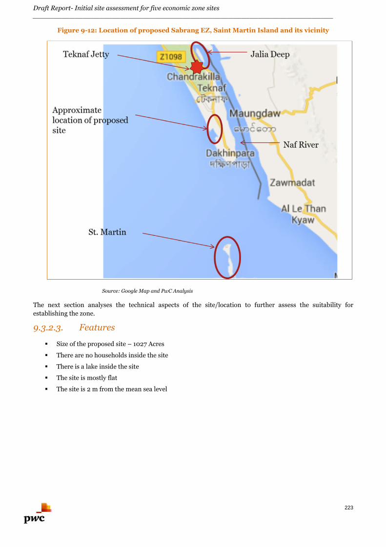
Draft Report- Initial site assessment for five economic zone sites________________________________________________________________________
223
Figure 9-12: Location of proposed Sabrang EZ, Saint Martin Island and its vicinity
Source: Google Map and PwC Analysis
The next section analyses the technical aspects of the site/location to further assess the suitability for
establishing the zone.
9.3.2.3. Features
Size of the proposed site – 1027 Acres
There are no households inside the site
There is a lake inside the site
The site is mostly flat
The site is 2 m from the mean sea level
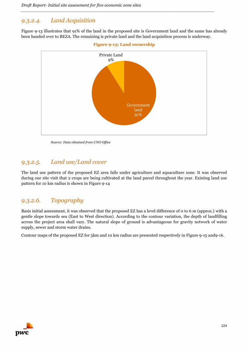
Draft Report- Initial site assessment for five economic zone sites________________________________________________________________________
224
9.3.2.4. Land Acquisition
Figure 9-13 illustrates that 91% of the land in the proposed site is Government land and the same has already
been handed over to BEZA. The remaining is private land and the land acquisition process is underway.
Figure 9-13: Land ownership
Source: Data obtained from UNO Office
9.3.2.5. Land use/Land cover
The land use pattern of the proposed EZ area falls under agriculture and aquaculture zone. It was observed
during our site visit that 2 crops are being cultivated at the land parcel throughout the year. Existing land use
pattern for 10 km radius is shown in Figure 9-14
9.3.2.6. Topography
Basis initial assessment, it was observed that the proposed EZ has a level difference of 0 to 6 m (approx.) with a
gentle slope towards sea (East to West direction). According to the contour variation, the depth of landfilling
across the project area shall vary. The natural slope of ground is advantageous for gravity network of water
supply, sewer and storm water drains.
Contour maps of the proposed EZ for 5km and 10 km radius are presented respectively in Figure 9-15 and9-16.
Governmentland91%
Private Land9%
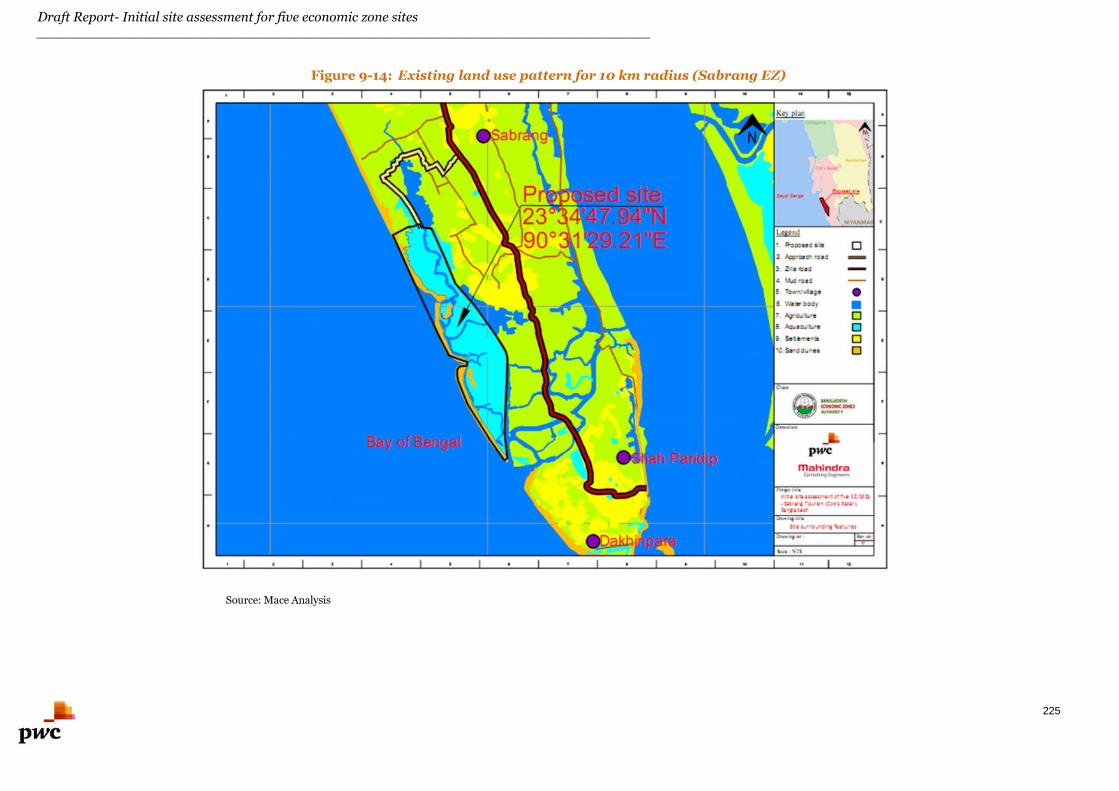
Draft Report- Initial site assessment for five economic zone sites________________________________________________________________________
225
Figure 9-14: Existing land use pattern for 10 km radius (Sabrang EZ)
Source: Mace Analysis
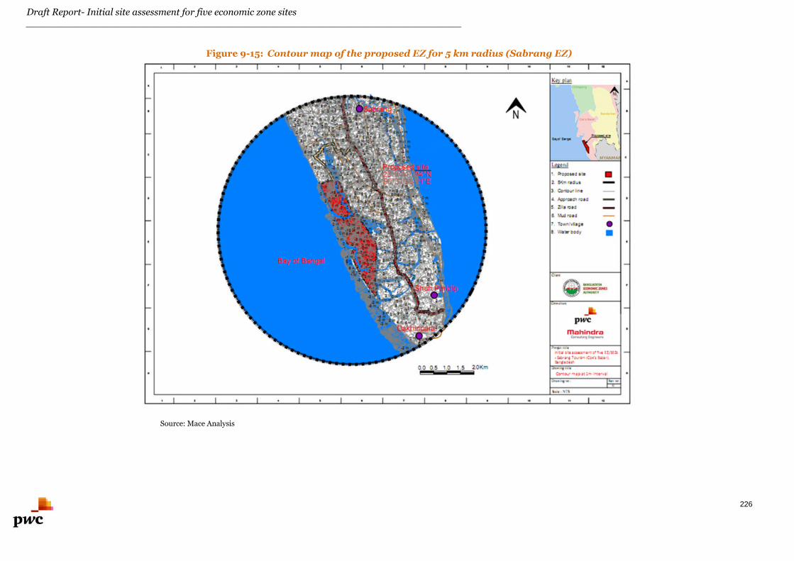
Draft Report- Initial site assessment for five economic zone sites________________________________________________________________________
226
Figure 9-15: Contour map of the proposed EZ for 5 km radius (Sabrang EZ)
Source: Mace Analysis
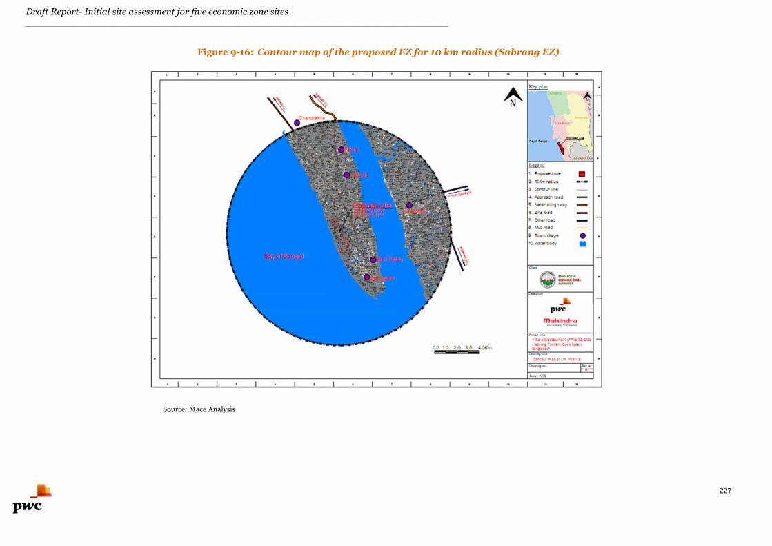
Draft Report- Initial site assessment for five economic zone sites________________________________________________________________________
227
Figure 9-16: Contour map of the proposed EZ for 10 km radius (Sabrang EZ)
Source: Mace Analysis

Draft Report- Initial site assessment for five economic zone sites________________________________________________________________________
228
9.3.2.7. Physiography
The physiography of the region surrounding the proposed EZ falls in Chittagong coastal plain. Sediments near
the hills are mainly silty, locally sandy, with clays more extensive in the coastal plain basin. The whole of the
mainland area is subjected to flash floods.
The Bangladesh physiography map is presented in Annexure C.
According to the history of physiography of this region, the area around the proposed EZ falls in the low hill
range and in the river valley. The area around proposed EZ is prone to high flood during the monsoon season
and tidal influence affects the area around the proposed EZ.
9.3.2.8. Soil
Basis site visit, the top soil layer was found to be black cotton soil which needs to be replaced for road
construction. This soil is not suitable for laying foundation for any structure. The dominant soil texture is sandy
loam. The soil layer is moderate to strong acidic in character. The soil layer is highly leached and has a low
natural fertility. Hills are under natural and plantation forests.
9.3.2.9. Geology
Proposed Sabraang EZ is situated in the hill tracts. Hill Tracts comprises Chittagong Hill Tracts and the Garo
Hills of the former greater Mymensingh district which cover an area of around 15,000 sq km. The soil consists
of hard red clay with a mixture of fine sand of the same color and nodules containing a large percentage of
sesquioxides.
The geological map of Bangladesh is shown in Annexure D.
9.3.2.10. Earthquake data
Sabrang area falls in the Seismic Zone 2 and the earthquake coefficient is 0.15 for this zone. The area under the
proposed EZ falls under the medium seismic range zone; this factor needs to be taken into account while
designing the structure of the proposed EZ.
Seismic zoning map of Bangladesh is presented in Annexure E.
9.3.2.11. Wind speed
The coastal areas in Bangladesh witness gentle winds blowing at relatively low speeds of 3-6 Km/hr. From
March to May, violent thunderstorms, called northwesters, are observed. The detailed wind speeds need to be
obtained for designing the high rise structures in the proposed EZ. The wind speed map for Bangladesh is
presented in Annexure F.
9.3.2.12. Cyclones and storms
During the pre-monsoon period, squally winds of up to 130 km/h or occasionally more, often accompanied by
thunderstorms may damage assets and crops. Cyclonic storms occurring in the Bay of Bengal in April-May and
October-November rarely penetrate as far as Comilla, but may cause serious damage to crops, livestock, assets,
and people when they do so. Monsoon rains are generally not stormy, but downpours of 50-75 mm per day are
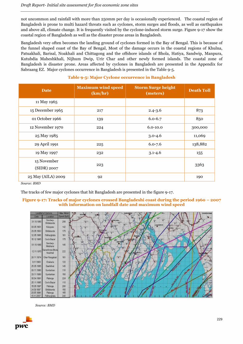
Draft Report- Initial site assessment for five economic zone sites________________________________________________________________________
229
not uncommon and rainfall with more than 250mm per day is occasionally experienced. The coastal region of
Bangladesh is prone to multi hazard threats such as cyclones, storm surges and floods, as well as earthquakes
and above all, climate change. It is frequently visited by the cyclone-induced storm surge. Figure 9-17 show the
coastal region of Bangladesh as well as the disaster prone areas in Bangladesh.
Bangladesh very often becomes the landing ground of cyclones formed in the Bay of Bengal. This is because of
the funnel shaped coast of the Bay of Bengal, Most of the damage occurs in the coastal regions of Khulna,
Patuakhali, Barisal, Noakhali and Chittagong and the offshore islands of Bhola, Hatiya, Sandwip, Manpura,
Kutubdia Maheshkhali, Nijhum Dwip, Urir Char and other newly formed islands. The coastal zone of
Bangladesh is disaster prone. Areas affected by cyclones in Bangladesh are presented in the Appendix for
Sabraang EZ. Major cyclones occurrence in Bangladesh is presented in the Table 9-5.
Table 9-5: Major Cyclone occurrence in Bangladesh
DateMaximum wind speed
(km/hr)
Storm Surge height
(meters)Death Toll
11 May 1965 161 3.7 – 7.6 19,279
15 December 1965 217 2.4-3.6 873
01 October 1966 139 6.0-6.7 850
12 November 1970 224 6.0-10.0 300,000
25 May 1985 154 3.0-4.6 11,069
29 April 1991 225 6.0-7.6 138,882
19 May 1997 232 3.1-4.6 155
15 November
(SIDR) 2007223 3363
25 May (AILA) 2009 92 190
Source: BMD
The tracks of few major cyclones that hit Bangladesh are presented in the figure 9-17.
Figure 9-17: Tracks of major cyclones crossed Bangladeshi coast during the period 1960 – 2007with information on landfall date and maximum wind speed
Source: BMD
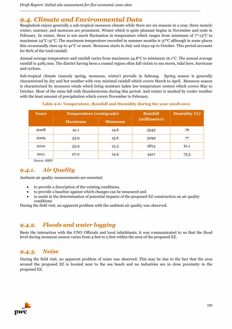
Draft Report- Initial site assessment for five economic zone sites________________________________________________________________________
230
9.4. Climate and Environmental DataBangladesh enjoys generally a sub-tropical monsoon climate while there are six seasons in a year, three namely
winter, summer, and monsoon are prominent. Winter which is quite pleasant begins in November and ends in
February. In winter, there is not much fluctuation in temperature which ranges from minimum of 7°-13°C to
maximum 24°C-31°C. The maximum temperature recorded in summer months is 37°C although in some places
this occasionally rises up to 41°C or more. Monsoon starts in July and stays up to October. This period accounts
for 80% of the total rainfall.
Annual average temperature and rainfall varies from maximum 34.8°C to minimum 16.1°C. The annual average
rainfall is 4285 mm. The district having been a coastal region often fall victim to sea storm, tidal bore, hurricane
and cyclone.
Sub-tropical climate (namely spring, monsoon, winter) prevails in Sabrang. Spring season is generally
characterized by dry and hot weather with very minimal rainfall which covers March to April. Monsoon season
is characterized by monsoon winds which bring moisture laden law temperature centers which covers May to
October. Most of the rains fall with thunderstorms during this period. And winter is marked by cooler weather
with the least amount of precipitation which covers November to February.
Table 9-6: Temperature, Rainfall and Humidity during the year 2008-2011
Years Temperature (centigrade) Rainfall
(millimeter)
Humidity (%)
Maximum Minimum
2008 41.1 14.6 3543 76
2009 33.9 15.6 3299 77
2010 33.9 15.3 2813 61.1
2011 27.0 14.9 4411 75.5
Source: BMD
9.4.1. Air Quality
Ambient air quality measurements are essential:
to provide a description of the existing conditions, to provide a baseline against which changes can be measured and to assist in the determination of potential impacts of the proposed EZ construction on air quality
conditionsDuring the field visit, no apparent problem with the ambient air quality was observed.
9.4.2. Floods and water logging
Basis the interaction with the UNO Officials and local inhabitants, it was communicated to us that the floodlevel during monsoon season varies from 4 feet to 5 feet within the area of the proposed EZ.
9.4.3. Noise
During the field visit, no apparent problem of noise was observed. This may be due to the fact that the area
around the proposed EZ is located near to the sea beach and no industries are in close proximity to the
proposed EZ.
Draft Report- Initial site assessment for five economic zone sites________________________________________________________________________
231
9.4.4. Land filling
Basis the interaction with the UNO officials and local inhabitants, flood level during monsoon season varies
from 4 feet to 5 feet depth inside the proposed EZ area.
To avoid inundation during monsoon season, minimum land filling of 0.6 m above the flood level is considered.
Based on the assumption, an average depth of 6 feet to 8 feet of land filling has been envisaged for the proposed
EZ area. This figure is indicative and detailed topography survey needs to be carried out to calculate the exact
quantity of land filling at the project area.
9.5. Infrastructure Linkages of the Proposed Site
9.5.1. Physical Infrastructure- Availability of Utility Connections
9.5.1.1. Power Availability for the proposed EZ
Teknaf substation (10 MW capacity) is located at a distance of 7 km (approx.) from the proposed EZ. Basis
interaction with UNO officials, there is no electricity supply within 2 km of the proposed site. Basis interaction
with the local inhabitants and the UNO officials, the demand of electricity in the region is 6.4 MW. Based on
preliminary assessment, the supply of electricity is more than the demand and this excess electricity could be
used for the project development activities of the proposed EZ.
A new solar based power plant of capacity 20 MW has been proposed at Huyakong (located at a distance of
20km from the proposed EZ). Basis interaction with local inhabitants, the proposed solar power plant is
expected to be built over an area of 700 Acres. At the moment the project is at site assessment stage.
9.5.1.2. Water Source
Groundwater is the major source of drinking water in the region. It is also an important source of irrigation
water for the area. The project area has good groundwater potential, as groundwater recharge is not a problem.
Basis interaction with the local inhabitants, there is no water supply system in the proposed EZ. The local
inhabitants are dependent on tube well water for drinking purpose. Basis interaction with UNO officials, the
water source is located in Huyakong union- I and water is being fed through gravity from this union up to
Sabraang for a distance of 35 Km.
Based on the interactions with local inhabitants, the ground water (Potable) is available at a depth of 120-150
feet from natural ground level. The water requirement for the proposed EZ can be met with the deep tube wells
to be developed at suitable location.
9.5.1.3. Telecom
There are telecommunications lines present adjacent to the site area. At present, the internet services are
provided by mobile companies such as Grameen, Banglalink and Robi in this region.
Teknaf BTCL provides telecom and internet services in this region at Teknaf, which is at a distance of 7km from
the proposed EZ.
9.5.1.4. Gas
At present there is no gas transmission / distribution network is available in this region.
Utility map for the proposed EZ is illustrated in Figure 9-18 below.
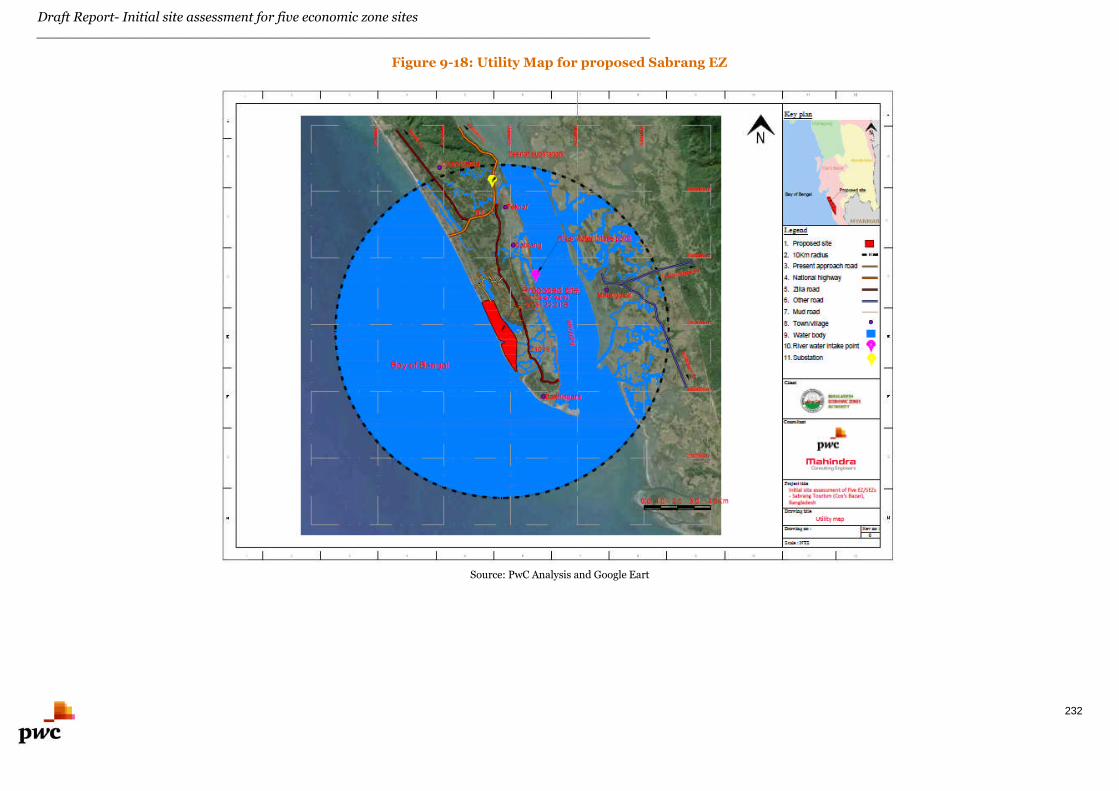
Draft Report- Initial site assessment for five economic zone sites________________________________________________________________________
232
Figure 9-18: Utility Map for proposed Sabrang EZ
Source: PwC Analysis and Google Eart
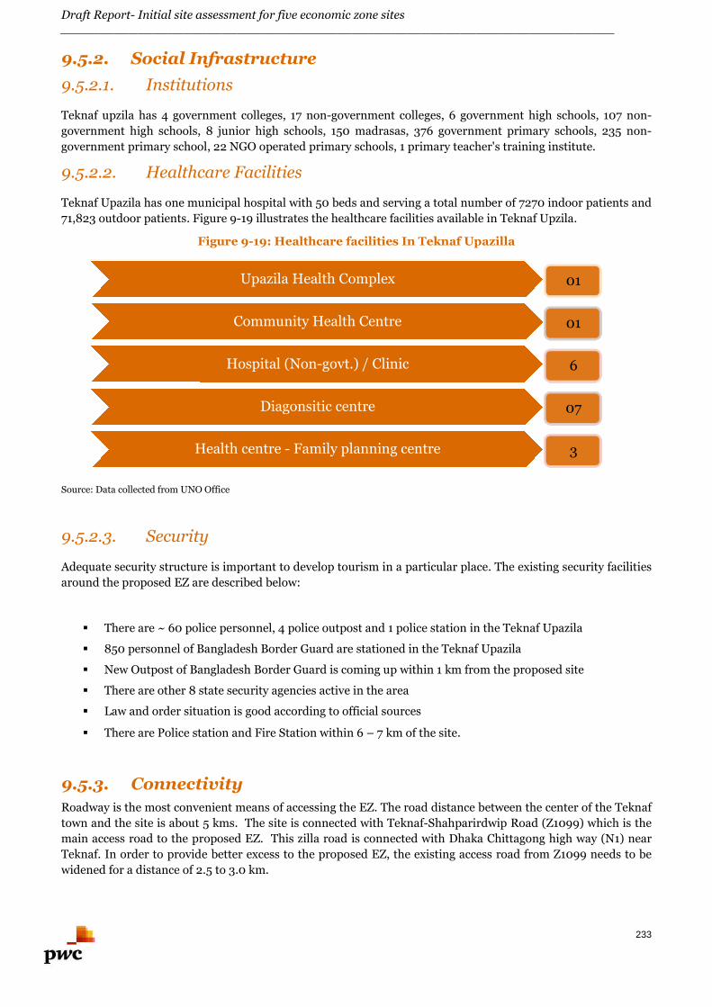
Draft Report- Initial site assessment for five economic zone sites________________________________________________________________________
233
9.5.2. Social Infrastructure
9.5.2.1. Institutions
Teknaf upzila has 4 government colleges, 17 non-government colleges, 6 government high schools, 107 non-
government high schools, 8 junior high schools, 150 madrasas, 376 government primary schools, 235 non-
government primary school, 22 NGO operated primary schools, 1 primary teacher's training institute.
9.5.2.2. Healthcare Facilities
Teknaf Upazila has one municipal hospital with 50 beds and serving a total number of 7270 indoor patients and
71,823 outdoor patients. Figure 9-19 illustrates the healthcare facilities available in Teknaf Upzila.
Figure 9-19: Healthcare facilities In Teknaf Upazilla
Source: Data collected from UNO Office
9.5.2.3. Security
Adequate security structure is important to develop tourism in a particular place. The existing security facilities
around the proposed EZ are described below:
There are ~ 60 police personnel, 4 police outpost and 1 police station in the Teknaf Upazila
850 personnel of Bangladesh Border Guard are stationed in the Teknaf Upazila
New Outpost of Bangladesh Border Guard is coming up within 1 km from the proposed site
There are other 8 state security agencies active in the area
Law and order situation is good according to official sources
There are Police station and Fire Station within 6 – 7 km of the site.
9.5.3. Connectivity
Roadway is the most convenient means of accessing the EZ. The road distance between the center of the Teknaf
town and the site is about 5 kms. The site is connected with Teknaf-Shahparirdwip Road (Z1099) which is the
main access road to the proposed EZ. This zilla road is connected with Dhaka Chittagong high way (N1) near
Teknaf. In order to provide better excess to the proposed EZ, the existing access road from Z1099 needs to be
widened for a distance of 2.5 to 3.0 km.
Upazila Health Complex 01
Community Health Centre 01
Hospital (Non-govt.) / Clinic 6
Diagonsitic centre 07
Health centre - Family planning centre 3
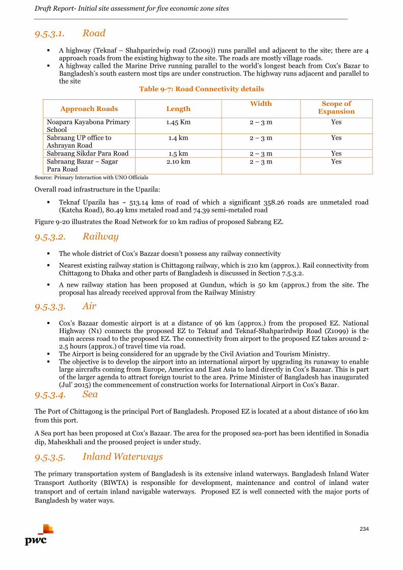
Draft Report- Initial site assessment for five economic zone sites________________________________________________________________________
234
9.5.3.1. Road
A highway (Teknaf – Shahparirdwip road (Z1009)) runs parallel and adjacent to the site; there are 4approach roads from the existing highway to the site. The roads are mostly village roads.
A highway called the Marine Drive running parallel to the world’s longest beach from Cox’s Bazar toBangladesh’s south eastern most tips are under construction. The highway runs adjacent and parallel tothe site
Table 9-7: Road Connectivity details
Approach Roads LengthWidth Scope of
Expansion
Noapara Kayabona PrimarySchool
1.45 Km 2 – 3 m Yes
Sabraang UP office toAshrayan Road
1.4 km 2 – 3 m Yes
Sabraang Sikdar Para Road 1.5 km 2 – 3 m YesSabraang Bazar – SagarPara Road
2.10 km 2 – 3 m Yes
Source: Primary Interaction with UNO Officials
Overall road infrastructure in the Upazila:
Teknaf Upazila has ~ 513.14 kms of road of which a significant 358.26 roads are unmetaled road(Katcha Road), 80.49 kms metaled road and 74.39 semi-metaled road
Figure 9-20 illustrates the Road Network for 10 km radius of proposed Sabrang EZ.
9.5.3.2. Railway
The whole district of Cox’s Bazzar doesn’t possess any railway connectivity
Nearest existing railway station is Chittagong railway, which is 210 km (approx.). Rail connectivity fromChittagong to Dhaka and other parts of Bangladesh is discussed in Section 7.5.3.2.
A new railway station has been proposed at Gundun, which is 50 km (approx.) from the site. Theproposal has already received approval from the Railway Ministry
9.5.3.3. Air
Cox’s Bazaar domestic airport is at a distance of 96 km (approx.) from the proposed EZ. NationalHighway (N1) connects the proposed EZ to Teknaf and Teknaf-Shahparirdwip Road (Z1099) is themain access road to the proposed EZ. The connectivity from airport to the proposed EZ takes around 2-2.5 hours (approx.) of travel time via road.
The Airport is being considered for an upgrade by the Civil Aviation and Tourism Ministry. The objective is to develop the airport into an international airport by upgrading its runaway to enable
large aircrafts coming from Europe, America and East Asia to land directly in Cox’s Bazaar. This is partof the larger agenda to attract foreign tourist to the area. Prime Minister of Bangladesh has inaugurated(Jul’ 2015) the commencement of construction works for International Airport in Cox’s Bazar.
9.5.3.4. Sea
The Port of Chittagong is the principal Port of Bangladesh. Proposed EZ is located at a about distance of 160 km
from this port.
A Sea port has been proposed at Cox’s Bazaar. The area for the proposed sea-port has been identified in Sonadia
dip, Maheskhali and the proosed project is under study.
9.5.3.5. Inland Waterways
The primary transportation system of Bangladesh is its extensive inland waterways. Bangladesh Inland Water
Transport Authority (BIWTA) is responsible for development, maintenance and control of inland water
transport and of certain inland navigable waterways. Proposed EZ is well connected with the major ports of
Bangladesh by water ways.
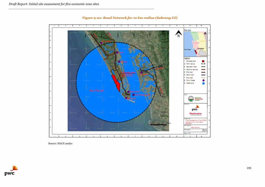
Draft Report- Initial site assessment for five economic zone sites________________________________________________________________________
235
Figure 9-20: Road Network for 10 km radius (Sabrang EZ)
Source: MACE analys
Draft Report- Initial site assessment for five economic zone sites________________________________________________________________________
236
Figure 9-21: Proposed Sabrang EZ and its vicinity
Source: Site lay-out plan collected from UNO Office and PwC Analysis
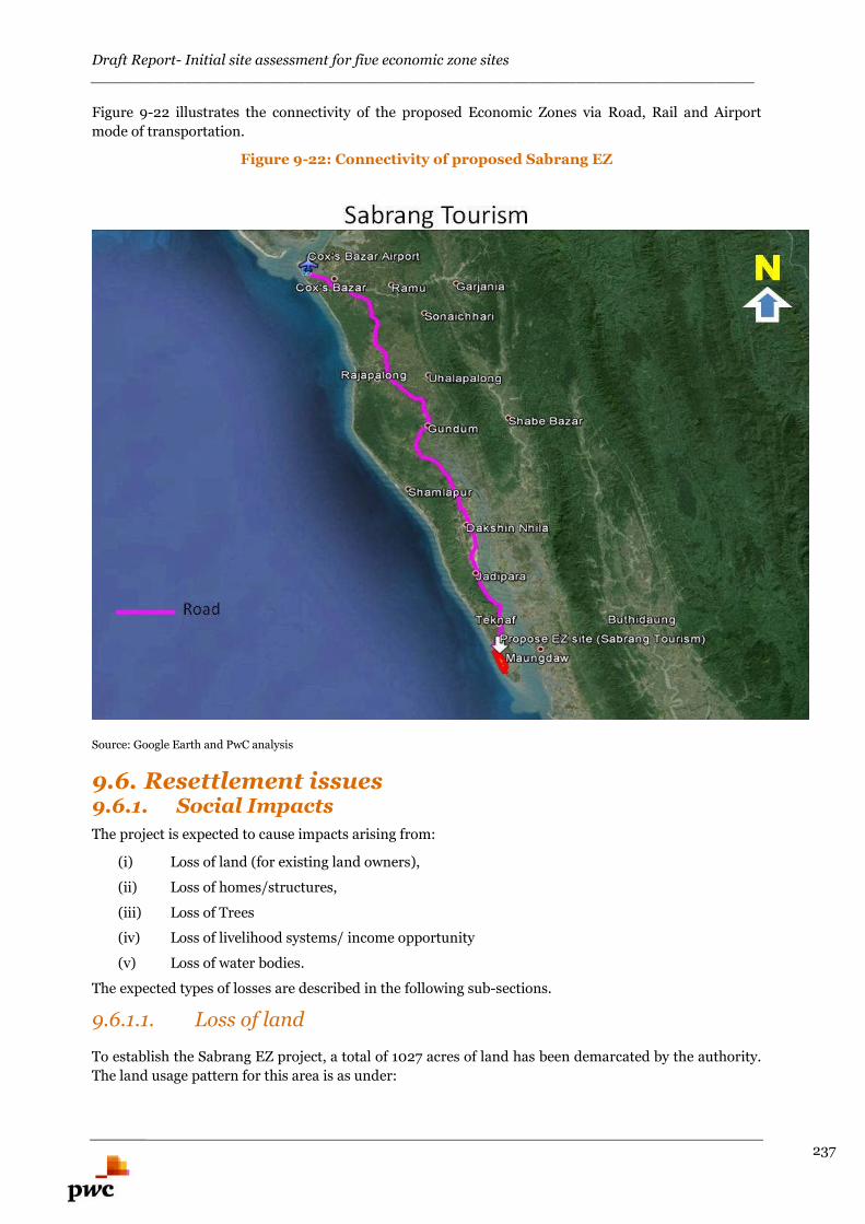
Draft Report- Initial site assessment for five economic zone sites_______________________________________________________________________
237
Figure 9-22 illustrates the connectivity of the proposed Economic Zones via Road, Rail and Airport
mode of transportation.
Figure 9-22: Connectivity of proposed Sabrang EZ
Source: Google Earth and PwC analysis
9.6. Resettlement issues9.6.1. Social Impacts
The project is expected to cause impacts arising from:
(i) Loss of land (for existing land owners),
(ii) Loss of homes/structures,
(iii) Loss of Trees
(iv) Loss of livelihood systems/ income opportunity
(v) Loss of water bodies.
The expected types of losses are described in the following sub-sections.
9.6.1.1. Loss of land
To establish the Sabrang EZ project, a total of 1027 acres of land has been demarcated by the authority.
The land usage pattern for this area is as under:
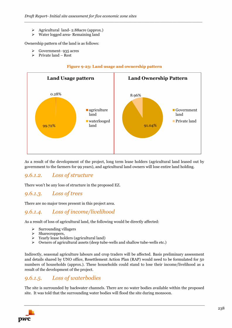
Draft Report- Initial site assessment for five economic zone sites_______________________________________________________________________
238
Agricultural land- 2.88acre (approx.) Water logged area- Remaining land
Ownership pattern of the land is as follows:
Government- 935 acres Private land – Rest
Figure 9-23: Land usage and ownership pattern
As a result of the development of the project, long term lease holders (agricultural land leased out by
government to the farmers for 99 years), and agricultural land owners will lose entire land holding.
9.6.1.2. Loss of structure
There won’t be any loss of structure in the proposed EZ.
9.6.1.3. Loss of trees
There are no major trees present in this project area.
9.6.1.4. Loss of income/livelihood
As a result of loss of agricultural land, the following would be directly affected:
Surrounding villagers Sharecroppers, Yearly lease holders (agricultural land) Owners of agricultural assets (deep tube-wells and shallow tube-wells etc.)
Indirectly, seasonal agriculture labours and crop traders will be affected. Basis preliminary assessment
and details shared by UNO office, Resettlement Action Plan (RAP) would need to be formulated for 50
numbers of households (approx.). These households could stand to lose their income/livelihood as a
result of the development of the project.
9.6.1.5. Loss of waterbodies
The site is surrounded by backwater channels. There are no water bodies available within the proposed
site. It was told that the surrounding water bodies will flood the site during monsoon.
0.28%
99.72%
Land Usage pattern
agricultureland
waterloogedland 91.04%
8.96%
Land Ownership Pattern
Governmentland
Private land
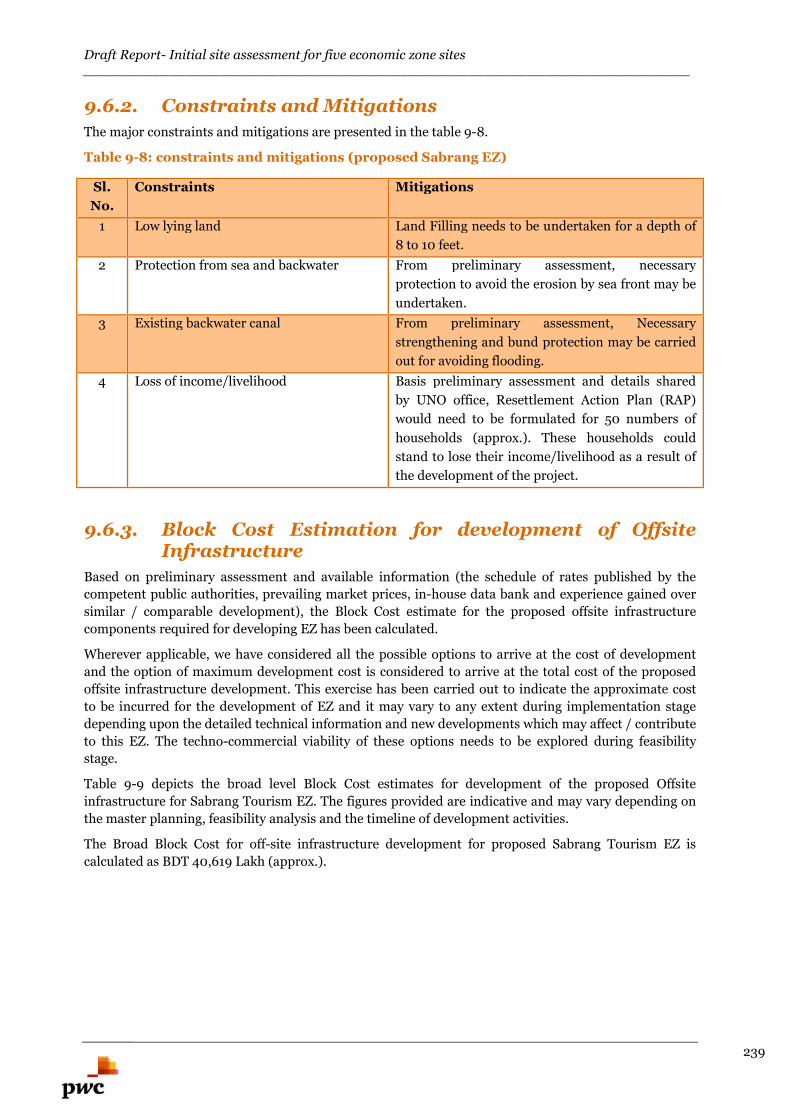
Draft Report- Initial site assessment for five economic zone sites_______________________________________________________________________
239
9.6.2. Constraints and Mitigations
The major constraints and mitigations are presented in the table 9-8.
Table 9-8: constraints and mitigations (proposed Sabrang EZ)
Sl.
No.
Constraints Mitigations
1 Low lying land Land Filling needs to be undertaken for a depth of
8 to 10 feet.
2 Protection from sea and backwater From preliminary assessment, necessary
protection to avoid the erosion by sea front may be
undertaken.
3 Existing backwater canal From preliminary assessment, Necessary
strengthening and bund protection may be carried
out for avoiding flooding.
4 Loss of income/livelihood Basis preliminary assessment and details shared
by UNO office, Resettlement Action Plan (RAP)
would need to be formulated for 50 numbers of
households (approx.). These households could
stand to lose their income/livelihood as a result of
the development of the project.
9.6.3. Block Cost Estimation for development of OffsiteInfrastructure
Based on preliminary assessment and available information (the schedule of rates published by the
competent public authorities, prevailing market prices, in-house data bank and experience gained over
similar / comparable development), the Block Cost estimate for the proposed offsite infrastructure
components required for developing EZ has been calculated.
Wherever applicable, we have considered all the possible options to arrive at the cost of development
and the option of maximum development cost is considered to arrive at the total cost of the proposed
offsite infrastructure development. This exercise has been carried out to indicate the approximate cost
to be incurred for the development of EZ and it may vary to any extent during implementation stage
depending upon the detailed technical information and new developments which may affect / contribute
to this EZ. The techno-commercial viability of these options needs to be explored during feasibility
stage.
Table 9-9 depicts the broad level Block Cost estimates for development of the proposed Offsite
infrastructure for Sabrang Tourism EZ. The figures provided are indicative and may vary depending on
the master planning, feasibility analysis and the timeline of development activities.
The Broad Block Cost for off-site infrastructure development for proposed Sabrang Tourism EZ is
calculated as BDT 40,619 Lakh (approx.).
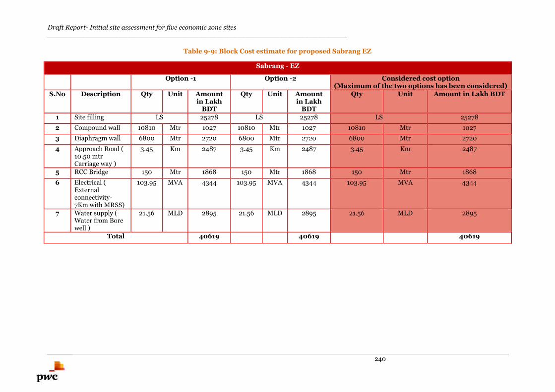
Draft Report- Initial site assessment for five economic zone sites_______________________________________________________________________
240
Table 9-9: Block Cost estimate for proposed Sabrang EZ
Sabrang - EZ
Option -1 Option -2 Considered cost option(Maximum of the two options has been considered)
S.No Description Qty Unit Amountin Lakh
BDT
Qty Unit Amountin Lakh
BDT
Qty Unit Amount in Lakh BDT
1 Site filling LS 25278 LS 25278 LS 25278
2 Compound wall 10810 Mtr 1027 10810 Mtr 1027 10810 Mtr 1027
3 Diaphragm wall 6800 Mtr 2720 6800 Mtr 2720 6800 Mtr 2720
4 Approach Road (10.50 mtrCarriage way )
3.45 Km 2487 3.45 Km 2487 3.45 Km 2487
5 RCC Bridge 150 Mtr 1868 150 Mtr 1868 150 Mtr 1868
6 Electrical (Externalconnectivity-7Km with MRSS)
103.95 MVA 4344 103.95 MVA 4344 103.95 MVA 4344
7 Water supply (Water from Borewell )
21.56 MLD 2895 21.56 MLD 2895 21.56 MLD 2895
Total 40619 40619 40619
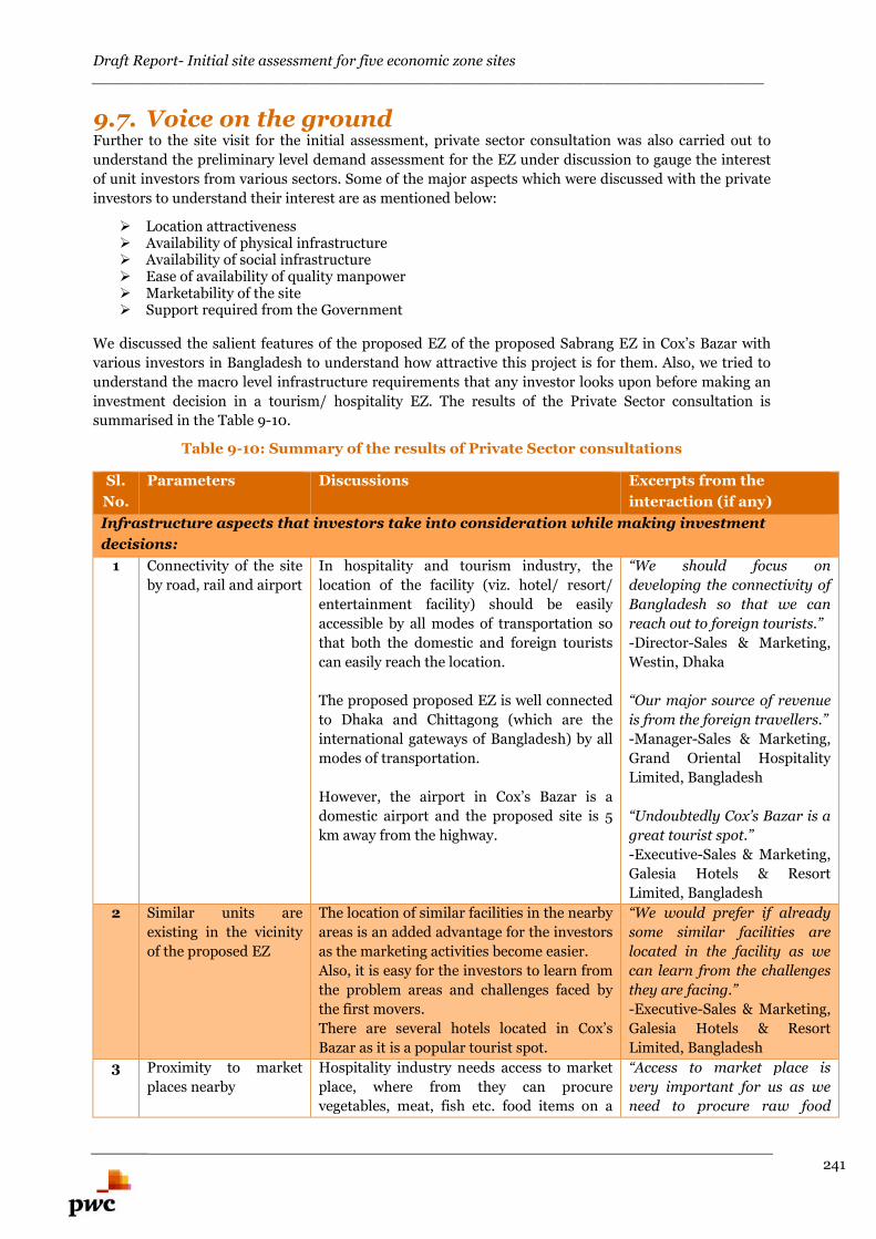
Draft Report- Initial site assessment for five economic zone sites_______________________________________________________________________
241
9.7. Voice on the groundFurther to the site visit for the initial assessment, private sector consultation was also carried out to
understand the preliminary level demand assessment for the EZ under discussion to gauge the interest
of unit investors from various sectors. Some of the major aspects which were discussed with the private
investors to understand their interest are as mentioned below:
Location attractiveness Availability of physical infrastructure Availability of social infrastructure Ease of availability of quality manpower Marketability of the site Support required from the Government
We discussed the salient features of the proposed EZ of the proposed Sabrang EZ in Cox’s Bazar with
various investors in Bangladesh to understand how attractive this project is for them. Also, we tried to
understand the macro level infrastructure requirements that any investor looks upon before making an
investment decision in a tourism/ hospitality EZ. The results of the Private Sector consultation is
summarised in the Table 9-10.
Table 9-10: Summary of the results of Private Sector consultations
Sl.
No.
Parameters Discussions Excerpts from the
interaction (if any)
Infrastructure aspects that investors take into consideration while making investment
decisions:
1 Connectivity of the site
by road, rail and airport
In hospitality and tourism industry, the
location of the facility (viz. hotel/ resort/
entertainment facility) should be easily
accessible by all modes of transportation so
that both the domestic and foreign tourists
can easily reach the location.
The proposed proposed EZ is well connected
to Dhaka and Chittagong (which are the
international gateways of Bangladesh) by all
modes of transportation.
However, the airport in Cox’s Bazar is a
domestic airport and the proposed site is 5
km away from the highway.
“We should focus on
developing the connectivity of
Bangladesh so that we can
reach out to foreign tourists.”
-Director-Sales & Marketing,
Westin, Dhaka
“Our major source of revenue
is from the foreign travellers.”
-Manager-Sales & Marketing,
Grand Oriental Hospitality
Limited, Bangladesh
“Undoubtedly Cox’s Bazar is a
great tourist spot.”
-Executive-Sales & Marketing,
Galesia Hotels & Resort
Limited, Bangladesh
2 Similar units are
existing in the vicinity
of the proposed EZ
The location of similar facilities in the nearby
areas is an added advantage for the investors
as the marketing activities become easier.
Also, it is easy for the investors to learn from
the problem areas and challenges faced by
the first movers.
There are several hotels located in Cox’s
Bazar as it is a popular tourist spot.
“We would prefer if already
some similar facilities are
located in the facility as we
can learn from the challenges
they are facing.”
-Executive-Sales & Marketing,
Galesia Hotels & Resort
Limited, Bangladesh
3 Proximity to market
places nearby
Hospitality industry needs access to market
place, where from they can procure
vegetables, meat, fish etc. food items on a
“Access to market place is
very important for us as we
need to procure raw food
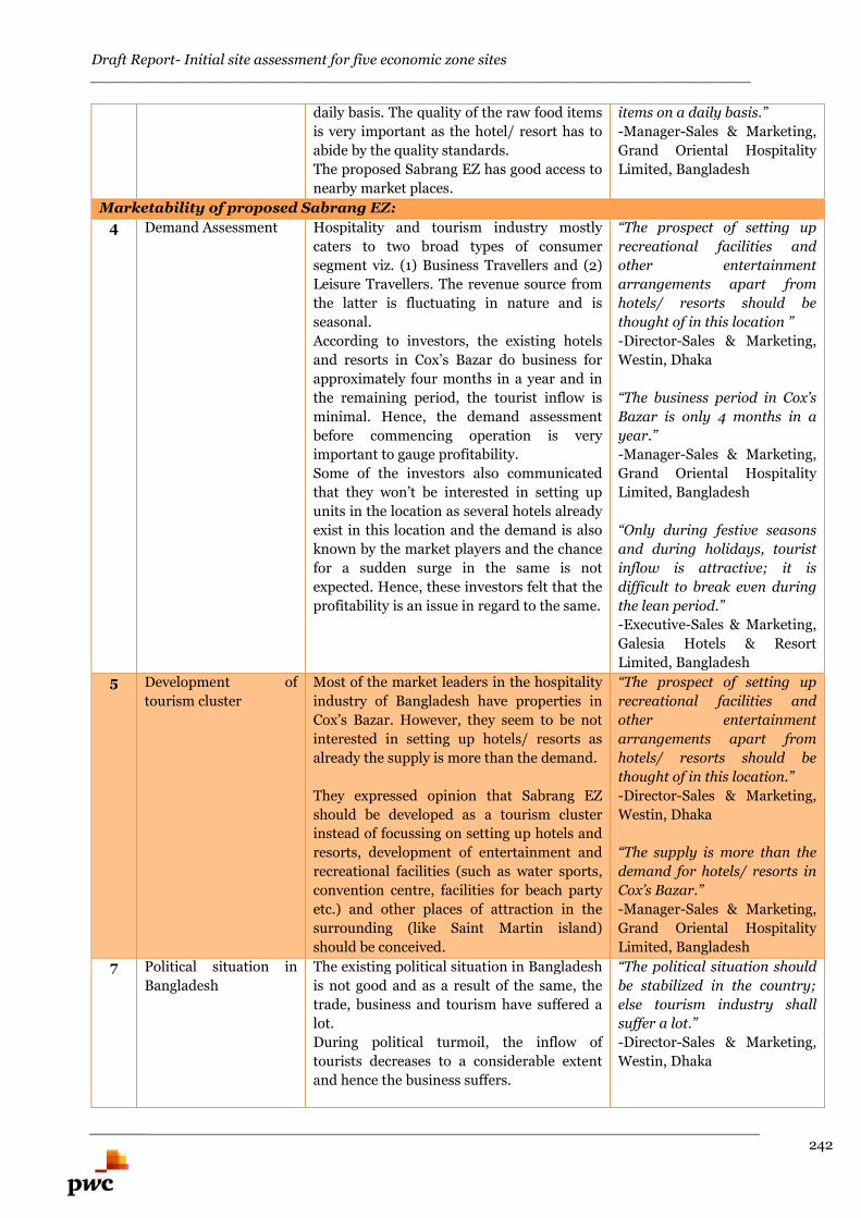
Draft Report- Initial site assessment for five economic zone sites_______________________________________________________________________
242
daily basis. The quality of the raw food items
is very important as the hotel/ resort has to
abide by the quality standards.
The proposed Sabrang EZ has good access to
nearby market places.
items on a daily basis.”
-Manager-Sales & Marketing,
Grand Oriental Hospitality
Limited, Bangladesh
Marketability of proposed Sabrang EZ:
4 Demand Assessment Hospitality and tourism industry mostly
caters to two broad types of consumer
segment viz. (1) Business Travellers and (2)
Leisure Travellers. The revenue source from
the latter is fluctuating in nature and is
seasonal.
According to investors, the existing hotels
and resorts in Cox’s Bazar do business for
approximately four months in a year and in
the remaining period, the tourist inflow is
minimal. Hence, the demand assessment
before commencing operation is very
important to gauge profitability.
Some of the investors also communicated
that they won’t be interested in setting up
units in the location as several hotels already
exist in this location and the demand is also
known by the market players and the chance
for a sudden surge in the same is not
expected. Hence, these investors felt that the
profitability is an issue in regard to the same.
“The prospect of setting up
recreational facilities and
other entertainment
arrangements apart from
hotels/ resorts should be
thought of in this location ”
-Director-Sales & Marketing,
Westin, Dhaka
“The business period in Cox’s
Bazar is only 4 months in a
year.”
-Manager-Sales & Marketing,
Grand Oriental Hospitality
Limited, Bangladesh
“Only during festive seasons
and during holidays, tourist
inflow is attractive; it is
difficult to break even during
the lean period.”
-Executive-Sales & Marketing,
Galesia Hotels & Resort
Limited, Bangladesh
5 Development of
tourism cluster
Most of the market leaders in the hospitality
industry of Bangladesh have properties in
Cox’s Bazar. However, they seem to be not
interested in setting up hotels/ resorts as
already the supply is more than the demand.
They expressed opinion that Sabrang EZ
should be developed as a tourism cluster
instead of focussing on setting up hotels and
resorts, development of entertainment and
recreational facilities (such as water sports,
convention centre, facilities for beach party
etc.) and other places of attraction in the
surrounding (like Saint Martin island)
should be conceived.
“The prospect of setting up
recreational facilities and
other entertainment
arrangements apart from
hotels/ resorts should be
thought of in this location.”
-Director-Sales & Marketing,
Westin, Dhaka
“The supply is more than the
demand for hotels/ resorts in
Cox’s Bazar.”
-Manager-Sales & Marketing,
Grand Oriental Hospitality
Limited, Bangladesh
7 Political situation in
Bangladesh
The existing political situation in Bangladesh
is not good and as a result of the same, the
trade, business and tourism have suffered a
lot.
During political turmoil, the inflow of
tourists decreases to a considerable extent
and hence the business suffers.
“The political situation should
be stabilized in the country;
else tourism industry shall
suffer a lot.”
-Director-Sales & Marketing,
Westin, Dhaka
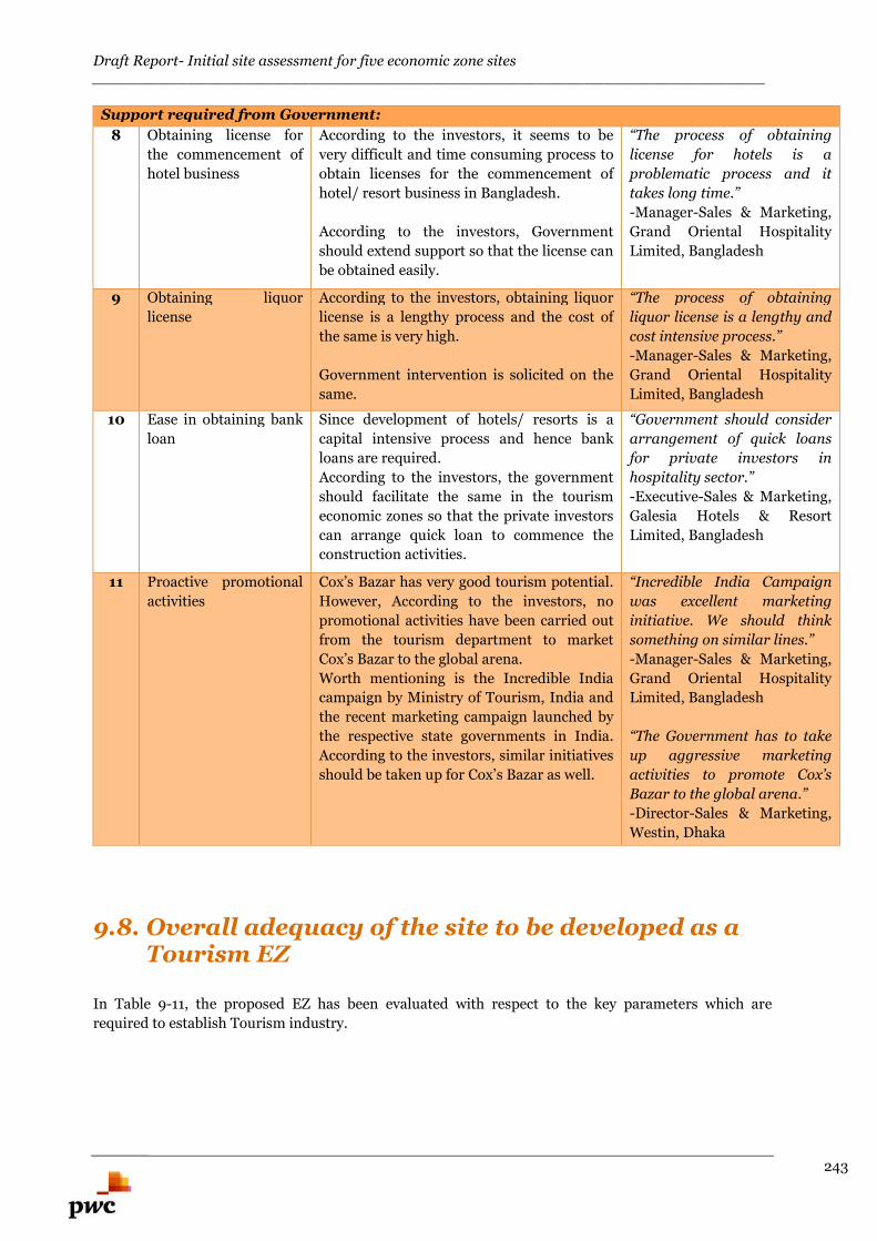
Draft Report- Initial site assessment for five economic zone sites_______________________________________________________________________
243
Support required from Government:
8 Obtaining license for
the commencement of
hotel business
According to the investors, it seems to be
very difficult and time consuming process to
obtain licenses for the commencement of
hotel/ resort business in Bangladesh.
According to the investors, Government
should extend support so that the license can
be obtained easily.
“The process of obtaining
license for hotels is a
problematic process and it
takes long time.”
-Manager-Sales & Marketing,
Grand Oriental Hospitality
Limited, Bangladesh
9 Obtaining liquor
license
According to the investors, obtaining liquor
license is a lengthy process and the cost of
the same is very high.
Government intervention is solicited on the
same.
“The process of obtaining
liquor license is a lengthy and
cost intensive process.”
-Manager-Sales & Marketing,
Grand Oriental Hospitality
Limited, Bangladesh
10 Ease in obtaining bank
loan
Since development of hotels/ resorts is a
capital intensive process and hence bank
loans are required.
According to the investors, the government
should facilitate the same in the tourism
economic zones so that the private investors
can arrange quick loan to commence the
construction activities.
“Government should consider
arrangement of quick loans
for private investors in
hospitality sector.”
-Executive-Sales & Marketing,
Galesia Hotels & Resort
Limited, Bangladesh
11 Proactive promotional
activities
Cox’s Bazar has very good tourism potential.
However, According to the investors, no
promotional activities have been carried out
from the tourism department to market
Cox’s Bazar to the global arena.
Worth mentioning is the Incredible India
campaign by Ministry of Tourism, India and
the recent marketing campaign launched by
the respective state governments in India.
According to the investors, similar initiatives
should be taken up for Cox’s Bazar as well.
“Incredible India Campaign
was excellent marketing
initiative. We should think
something on similar lines.”
-Manager-Sales & Marketing,
Grand Oriental Hospitality
Limited, Bangladesh
“The Government has to take
up aggressive marketing
activities to promote Cox’s
Bazar to the global arena.”
-Director-Sales & Marketing,
Westin, Dhaka
9.8. Overall adequacy of the site to be developed as aTourism EZ
In Table 9-11, the proposed EZ has been evaluated with respect to the key parameters which are
required to establish Tourism industry.
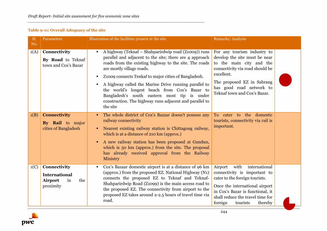
Draft Report- Initial site assessment for five economic zone sites_______________________________________________________________________
244
Table 9-11: Overall Adequacy of the site
Sl.
No.
Parameters Illustration of the facilities present at the site Remarks/ Analysis
1(A) Connectivity
By Road to Teknaf
town and Cox’s Bazar
A highway (Teknaf – Shahparirdwip road (Z1009)) runs
parallel and adjacent to the site; there are 4 approach
roads from the existing highway to the site. The roads
are mostly village roads.
Z1009 connects Tenkaf to major cities of Bangladesh.
A highway called the Marine Drive running parallel to
the world’s longest beach from Cox’s Bazar to
Bangladesh’s south eastern most tip is under
construction. The highway runs adjacent and parallel to
the site
For any tourism industry to
develop the site must be near
to the main city and the
connectivity via road should be
excellent.
The proposed EZ in Sabrang
has good road network to
Teknaf town and Cox’s Bazar.
1(B) Connectivity
By Rail to major
cities of Bangladesh
The whole district of Cox’s Bazzar doesn’t possess any
railway connectivity
Nearest existing railway station is Chittagong railway,
which is at a distance of 210 km (approx.)
A new railway station has been proposed at Gundun,
which is 50 km (approx.) from the site. The proposal
has already received approval from the Railway
Ministry
To cater to the domestic
tourists, connectivity via rail is
important.
1(C) Connectivity
International
Airport in the
proximity
Cox’s Bazaar domestic airport is at a distance of 96 km
(approx.) from the proposed EZ. National Highway (N1)
connects the proposed EZ to Teknaf and Teknaf-
Shahparirdwip Road (Z1099) is the main access road to
the proposed EZ. The connectivity from airport to the
proposed EZ takes around 2-2.5 hours of travel time via
road.
Airport with international
connectivity is important to
cater to the foreign tourists.
Once the international airport
in Cox’s Bazar is functional, it
shall reduce the travel time for
foreign tourists thereby
Draft Report- Initial site assessment for five economic zone sites_______________________________________________________________________
245
The Airport is being considered for an upgrade by the
Civil Aviation and Tourism Ministry.
The objective is to develop the airport into an
international airport by upgrading its runaway to enable
large aircrafts coming from Europe, America and East
Asia to land directly in Cox’s Bazaar. This is part of the
larger agenda to attract foreign tourist to the area.
Prime Minister of Bangladesh has inaugurated (Jul’
2015) the commencement of construction works for
International Airport in Cox’s Bazar.
making Cox’s Bazar and other
tourism destinations around
the region easily accessible by
air.
2 Approach Road Basis initial site visit, there are four approach roads possible to
connect the proposed EZ to z1009.
Basis preliminary assessment and interaction with UNO
officials, all the four approach roads are village roads and
expanding/ widening is not a problem.
The alignment for an approach
road is essential for developing
tourism EZ as it shall enable
the access for the tourists to
national highways and
expressways which in turn
would smoothen the vehicular
movement.
3 Climate Cox’s Bazar is the longest sandy beach surrounded with scenic
beauty.
Climate in Sabrang is sub-tropical in nature and minimal
rainfall is observed throughout the year. Temperature ranges
between 34.8 degree centigrade and 16.1 degree centigrade
throughout the year. As the district is a coastal region, it often
falls victim to sea storm, tidal bore, hurricane and cyclone.
Proposed EZ is located in the
coastal region with minimal
rainfall and favourable
temperature throughout the
year.
4 Availability of good
quality potable
water
Basis interaction with the local inhabitants, there is no water
supply system in the proposed EZ. The local inhabitants are
dependent on tube well water for drinking purpose. Basis
interaction with UNO officials, the water source is located in
It is very important to have
adequate and sustainable
source of potable water for the
development of tourism
Draft Report- Initial site assessment for five economic zone sites_______________________________________________________________________
246
Huyakong union- I and water is being fed through gravity from
this union up to Sabraang for a distance of 35 Km.
Based on the interactions with local inhabitants, the ground
water (Potable) is available at a depth of 120-150 feet from
natural ground level. The water requirement for the proposed
EZ can be met with the deep tube wells to be developed at
suitable location.
industry so that the tourists
don’t face any scarcity of
drinking water.
5 Availability of
uninterrupted
power supply
Teknaf substation (10 MW capacity) is located at a distance of 7
km (approx.) from the proposed EZ. Basis interaction with
UNO officials, there is no electricity supply within 2 km of the
proposed site. Basis interaction with the local inhabitants and
the UNO officials, the demand of electricity in the region is 6.4
MW. Based on preliminary assessment, the supply of electricity
is more than the demand and this excess electricity could be
used for the project development activities of the proposed EZ.
A new solar based power plant of capacity 20 MW has been
proposed at Huyakong (located at a distance of 20km from the
proposed EZ). Basis interaction with local inhabitants, the
proposed solar power plant is expected to be built over an area
of 700 Acres. At the moment the project is at site assessment
stage.
24×7 uninterrupted electricity
supply is a prerequisite for
development of tourism
industry.
For the initial phase of
development, power can be
sourced from the Teknaf
substation (located at 7 km
from the proposed EZ). In the
future, the options of
expanding the existing
capacity of the Teknaf
substation could be explored
or a new substation could be
established within the
proposed EZ.
6 Availability of
accommodation
facilities for
tourists nearby
areas
There is no accommodation facility available in the vicinity of
proposed EZ.
However there are good resorts, star hotels, and budget hotels
available in Cox’s bazaar and St martin island which are located
at around 45 km and 20 km respectively from this site.
Access to quality hotels and
resorts is necessary for
tourism EZ. Hotels in Cox’s
Bazar are located at 45 km
away from the proposed EZ.
Currently there is a dearth of
accommodation for domestic
Draft Report- Initial site assessment for five economic zone sites_______________________________________________________________________
247
and foreign tourists near to the
proposed EZ.
Once the proposed EZ is
developed, there shall be
several hotels/ resorts
functional within the EZ which
would cater to the
requirements of the tourists.
8 Medical facilities
available in the
nearby areas
Teknaf Upazila has one municipal hospital with 50 beds serving
a total number of 7270 indoor patients and 71,823 outdoor
patients.
Other medical facilities available in this area are: 1 upzilla
health complex, 1 community health centre, 6 non-govt. clinics,
and 7 diagnostic centres.
No international standard healthcare facility is available in the
entire Teknaf district.
Access to quality healthcare
facilities is an integral part to
tourism EZ.
No international standard
healthcare facility is available
in the Teknaf district. The
potential for medical tourism
can be explored in the master
planning stage.
9 Air and water
pollution at the
site (prevailing
condition)
The site is free from air and water pollution and during site visit
no significant noise was observed.
Basis interaction with local inhabitants, the incidence of water
and air pollution and water borne diseases is insignificant in
this region.
The location of any Tourism
EZ should be free from air and
water pollution. Pollution shall
lead to health hazards and
non- conducive environment
for the tourists.
From the initial site
assessment, it appears that the
site is free from all such
pollution problems.
10 Landfilling
requirement at the
The site is surrounded by seafront and backwater; the depth of
waterlogging is around 4-5 ft. during high tide period and
Preliminary assessment
syggests that Landfilling and
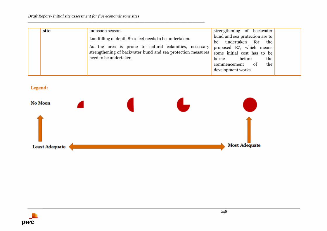
Draft Report- Initial site assessment for five economic zone sites_______________________________________________________________________
248
site monsoon season.
Landfilling of depth 8-10 feet needs to be undertaken.
As the area is prone to natural calamities, necessary
strengthening of backwater bund and sea protection measures
need to be undertaken.
strengthening of backwater
bund and sea protection are to
be undertaken for the
proposed EZ, which means
some initial cost has to be
borne before the
commencement of the
development works.

Draft Report- Initial site assessment for five economic zone sites_______________________________________________________________________
249
Dhaka IT EZ
Draft Report- Initial site assessment for five economic zone sites_______________________________________________________________________
250
10. Dhaka IT Economic Zone
10.1. About IT Economic Zone
10.1.1. Concept
Economic Zone (EZ) is a demarcated industrial complex where business and trade laws are different
than that of the rest of the country. EZs can be of two types, viz. single sector/segment and multi-
sector/segments. IT economic zones are typically single sector EZs where only IT/ ITES related
industries operate.
10.1.2. Major Infrastructure Components in IT EZ
Typically in an IT EZ, the following infrastructure requirements exist:
Connectivity Requirements
Excellent connectivity (By road, rail and air- for both domestic and international) Proximity to the major city Proximity to all major modes of transportation for employees to commute Well connected to airport
Physical Infrastructure Requirements
Availability of uninterrupted 24×7 power supply Excellent telecom connection High speed internet access Constant availability of potable and good quality drinking water The affect(s) of earthquake and natural calamities should be bare minimum
Social Infrastructure Requirements
Access to quality healthcare facilities Access to international standard education facilities Good quality residential facilities in the vicinity of the IT EZ Source of entertainment and quality lifestyle in the nearby locality
10.1.3. IT/ ITES Industry in Bangladesh
Bangladesh is shaping up as an attractive destination for IT/ ITES or ICT industry. Information
Technology has been identified as a thrust sector for the economy of Bangladesh.
Technological Development and Trendy Youth… Substantial growth in the usage of mobile phones Youth Population- proactive in adopting new technologies Agglomeration of tech savvy urban youth
Employment in IT/ ITES sector in Bangladesh 10,000+ IT professionals from Bangladesh are currently employed in
large IT/ ITES companies like Microsoft, IBM, Intel, Cisco etc. 25,000+ IT engineers are working in different software and IT service
companies Every year over 78,000 technical and engineering students graduate
from different universities and colleges in the country
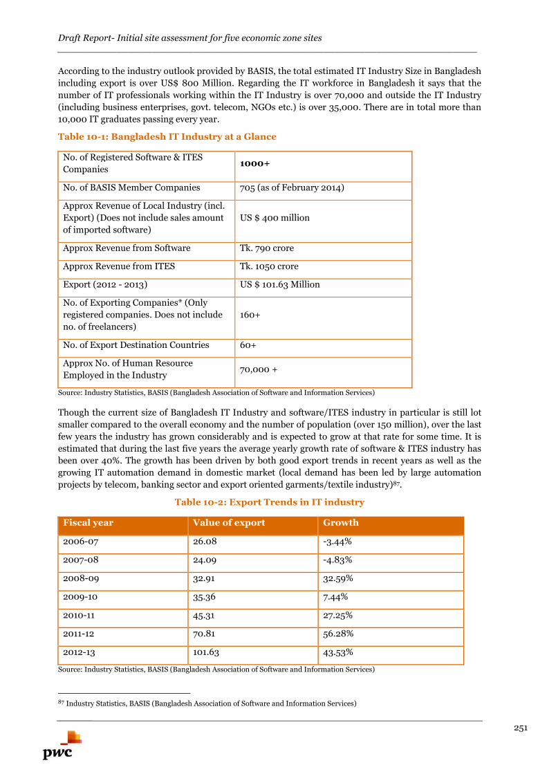
Draft Report- Initial site assessment for five economic zone sites_______________________________________________________________________
251
According to the industry outlook provided by BASIS, the total estimated IT Industry Size in Bangladesh
including export is over US$ 800 Million. Regarding the IT workforce in Bangladesh it says that the
number of IT professionals working within the IT Industry is over 70,000 and outside the IT Industry
(including business enterprises, govt. telecom, NGOs etc.) is over 35,000. There are in total more than
10,000 IT graduates passing every year.
Table 10-1: Bangladesh IT Industry at a Glance
No. of Registered Software & ITES
Companies1000+
No. of BASIS Member Companies 705 (as of February 2014)
Approx Revenue of Local Industry (incl.
Export) (Does not include sales amount
of imported software)
US $ 400 million
Approx Revenue from Software Tk. 790 crore
Approx Revenue from ITES Tk. 1050 crore
Export (2012 - 2013) US $ 101.63 Million
No. of Exporting Companies* (Only
registered companies. Does not include
no. of freelancers)
160+
No. of Export Destination Countries 60+
Approx No. of Human Resource
Employed in the Industry70,000 +
Source: Industry Statistics, BASIS (Bangladesh Association of Software and Information Services)
Though the current size of Bangladesh IT Industry and software/ITES industry in particular is still lot
smaller compared to the overall economy and the number of population (over 150 million), over the last
few years the industry has grown considerably and is expected to grow at that rate for some time. It is
estimated that during the last five years the average yearly growth rate of software & ITES industry has
been over 40%. The growth has been driven by both good export trends in recent years as well as the
growing IT automation demand in domestic market (local demand has been led by large automation
projects by telecom, banking sector and export oriented garments/textile industry)87.
Table 10-2: Export Trends in IT industry
Fiscal year Value of export Growth
2006-07 26.08 -3.44%
2007-08 24.09 -4.83%
2008-09 32.91 32.59%
2009-10 35.36 7.44%
2010-11 45.31 27.25%
2011-12 70.81 56.28%
2012-13 101.63 43.53%
Source: Industry Statistics, BASIS (Bangladesh Association of Software and Information Services)
87 Industry Statistics, BASIS (Bangladesh Association of Software and Information Services)
Draft Report- Initial site assessment for five economic zone sites_______________________________________________________________________
252
The government has taken several initiatives to fast track the growth; some of these are as outlined
below:
Establishment of IT Village/ Software Technology Park in divisional level is top priority Hi-Tech parks are being developed in different areas with a purpose to provide adequate
infrastructure support services Considering the hi-tech parks as SEZs to attract foreign and local investors Bangladesh Association of Software and Information Services (BASIS) manage the ICT
Incubator on behalf of Bangladesh Computer Council (BCC). The project offers office space forIT & ITES companies at low cost rent, uninterrupted power supply and high speed internetbandwidth
Attractive incentive schemes for setting up IT/ ITES industry in the country Proliferation of EZs throughout the country where IT/ ITES units can obtain competitive tax
incentives and other fiscal/ non-fiscal benefits
10.1.3.1. Digital Bangladesh Initiative
In such a scenario, where growth in IT industry is proliferated all across Bangladesh, Bangladesh
Government has launched Digital Bangladesh initiative (Access to Information Programme being
implemented by the Prime Minister’s Office and Making public services cheaper and responsive to the
needs of the citizens). Some of the successful e-services programmes which are under the ambit of
Digital Bangladesh initiative are:
National e-Service System Union Digital Centre District e-Service Centre Multimedia Classroom e-Health Electronic Money Transfer System Online registration of Joint Stock Companies
Lately, opportunities in the field of freelancing and outsourcing are in Bangladesh is rapidly growing,
Bangladesh is rising as an attractive destination for outsourcing and e-services freelancing. The trend of
ICT entrepreneurship has just started in the country and with time it is expected to magnify. Currently,
800 IT & non-voice ITES companies are now working and 200 are now working on a global basis for out
sourcing. Overall, Bangladesh has 275,000 freelancers with an additional 30,000 new entrepreneurs
joining every month.
In ‘The 2014 A.T. Kearney Global Services Location Index’ Bangladesh joined the index for the first
time ranked 26. Here in Bangladesh, most companies are homegrown and have developed export
clients—for example, Bangladeshi company GraphicPeople provides graphic design services for
companies across the world—but in the IT space there are notable examples of foreign captive centers
such as that of Norwegian software company Vizrt. While traditional outsourcing remains relatively
small, the country has become a huge hub for freelance work via online marketplaces such as oDesk. In
fact, Bangladesh has become the number three country for contractors on oDesk in just three years,
behind only the Philippines and India. It has quickly moved to the forefront of entrepreneurial activity
thanks to its young, educated, and rapidly growing workforce eager for opportunity88.
10.1.3.2. Some major IT/ ITES companies operating in Bangladesh
In the following table 10-3, a glimpse of major IT/ ITES players have been captured which are currently
operational in Bangladesh. The country accommodates both the IT and BPO service based industries;
majority of the companies are homegrown and have developed export clients.
88 The 2014 A.T. Kearney Global Services Location Index, <http://www.basis.org.bd/resource/A%20Wealth%20of%20Choices.pdf>
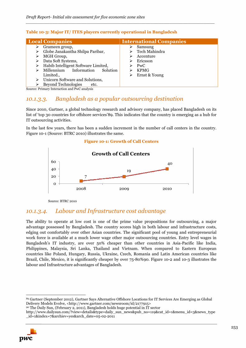
Draft Report- Initial site assessment for five economic zone sites_______________________________________________________________________
253
Table 10-3: Major IT/ ITES players currently operational in Bangladesh
Local Companies International Companies Grameen group, Globe Janakantha Shilpa Paribar, MGH Group, Data Soft Systems, Habib Intelligent Software Limited, Millennium Information Solution
Limited., Unicorn Software and Solutions, Beyond Technologies etc.
Samsung Tech Mahindra Accenture Ericsson PwC KPMG Ernst & Young
Source: Primary Interaction and PwC analysis
10.1.3.3. Bangladesh as a popular outsourcing destination
Since 2010, Gartner, a global technology research and advisory company, has placed Bangladesh on its
list of ‘top 30 countries for offshore services’89. This indicates that the country is emerging as a hub for
IT outsourcing activities.
In the last few years, there has been a sudden increment in the number of call centers in the country.
Figure 10-1 (Source: BTRC 2010) illustrates the same.
Figure 10-1: Growth of Call Centers
Source: BTRC 2010
10.1.3.4. Labour and Infrastructure cost advantage
The ability to operate at low cost is one of the prime value propositions for outsourcing, a major
advantage possessed by Bangladesh. The country scores high in both labour and infrastructure costs,
edging out comfortably over other Asian countries. The significant pool of young and entrepreneurial
work force is available at a much lower wage other major outsourcing countries. Entry level wages in
Bangladesh’s IT industry, are over 50% cheaper than other countries in Asia-Pacific like India,
Philippines, Malaysia, Sri Lanka, Thailand and Vietnam. When compared to Eastern European
countries like Poland, Hungary, Russia, Ukraine, Czech, Romania and Latin American countries like
Brazil, Chile, Mexico, it is significantly cheaper by over 75-80%90. Figure 10-2 and 10-3 illustrates the
labour and Infrastructure advantages of Bangladesh.
89 Gartner (September 2012), Gartner Says Alternative Offshore Locations for IT Services Are Emerging as GlobalDelivery Models Evolve, <http://www.gartner.com/newsroom/id/2177915>90 The Daily Sun, (February 2, 2011), Bangladesh holds huge potential in IT sectorhttp://www.dailysun.com/?view=details&type=daily_sun_news&pub_no=119&cat_id=1&menu_id=3&news_type_id=1&index=7&archiev=yes&arch_date=05-02-2011
7
19
40
0
20
40
60
2008 2009 2010
Growth of Call Centers
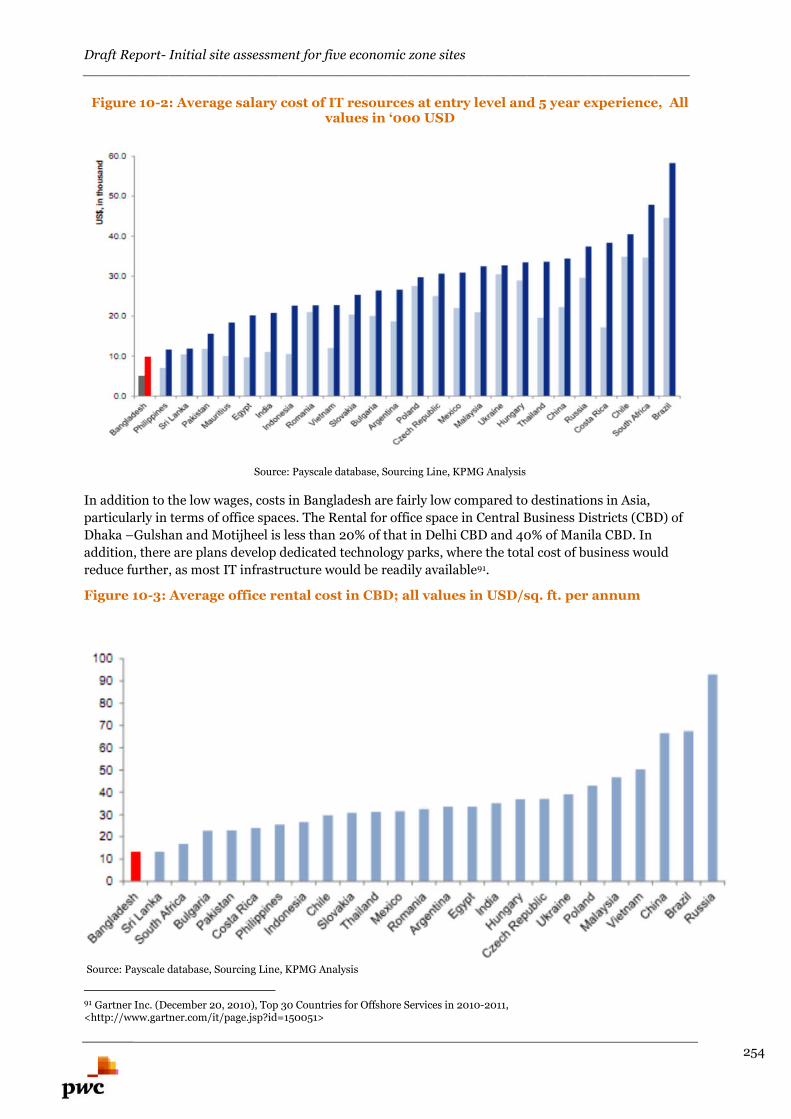
Draft Report- Initial site assessment for five economic zone sites_______________________________________________________________________
254
Figure 10-2: Average salary cost of IT resources at entry level and 5 year experience, Allvalues in ‘000 USD
Source: Payscale database, Sourcing Line, KPMG Analysis
In addition to the low wages, costs in Bangladesh are fairly low compared to destinations in Asia,
particularly in terms of office spaces. The Rental for office space in Central Business Districts (CBD) of
Dhaka –Gulshan and Motijheel is less than 20% of that in Delhi CBD and 40% of Manila CBD. In
addition, there are plans develop dedicated technology parks, where the total cost of business would
reduce further, as most IT infrastructure would be readily available91.
Figure 10-3: Average office rental cost in CBD; all values in USD/sq. ft. per annum
Source: Payscale database, Sourcing Line, KPMG Analysis
91 Gartner Inc. (December 20, 2010), Top 30 Countries for Offshore Services in 2010-2011,<http://www.gartner.com/it/page.jsp?id=150051>
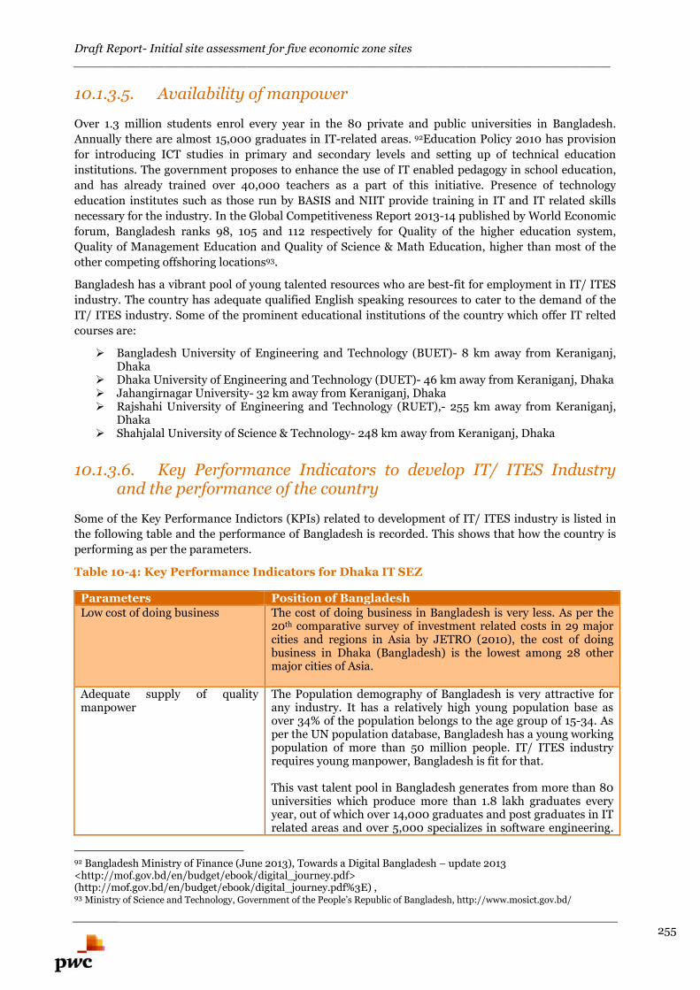
Draft Report- Initial site assessment for five economic zone sites_______________________________________________________________________
255
10.1.3.5. Availability of manpower
Over 1.3 million students enrol every year in the 80 private and public universities in Bangladesh.
Annually there are almost 15,000 graduates in IT-related areas. 92Education Policy 2010 has provision
for introducing ICT studies in primary and secondary levels and setting up of technical education
institutions. The government proposes to enhance the use of IT enabled pedagogy in school education,
and has already trained over 40,000 teachers as a part of this initiative. Presence of technology
education institutes such as those run by BASIS and NIIT provide training in IT and IT related skills
necessary for the industry. In the Global Competitiveness Report 2013-14 published by World Economic
forum, Bangladesh ranks 98, 105 and 112 respectively for Quality of the higher education system,
Quality of Management Education and Quality of Science & Math Education, higher than most of the
other competing offshoring locations93.
Bangladesh has a vibrant pool of young talented resources who are best-fit for employment in IT/ ITES
industry. The country has adequate qualified English speaking resources to cater to the demand of the
IT/ ITES industry. Some of the prominent educational institutions of the country which offer IT relted
courses are:
Bangladesh University of Engineering and Technology (BUET)- 8 km away from Keraniganj,Dhaka
Dhaka University of Engineering and Technology (DUET)- 46 km away from Keraniganj, Dhaka Jahangirnagar University- 32 km away from Keraniganj, Dhaka Rajshahi University of Engineering and Technology (RUET),- 255 km away from Keraniganj,
Dhaka Shahjalal University of Science & Technology- 248 km away from Keraniganj, Dhaka
10.1.3.6. Key Performance Indicators to develop IT/ ITES Industryand the performance of the country
Some of the Key Performance Indictors (KPIs) related to development of IT/ ITES industry is listed in
the following table and the performance of Bangladesh is recorded. This shows that how the country is
performing as per the parameters.
Table 10-4: Key Performance Indicators for Dhaka IT SEZ
Parameters Position of BangladeshLow cost of doing business The cost of doing business in Bangladesh is very less. As per the
20th comparative survey of investment related costs in 29 majorcities and regions in Asia by JETRO (2010), the cost of doingbusiness in Dhaka (Bangladesh) is the lowest among 28 othermajor cities of Asia.
Adequate supply of qualitymanpower
The Population demography of Bangladesh is very attractive forany industry. It has a relatively high young population base asover 34% of the population belongs to the age group of 15-34. Asper the UN population database, Bangladesh has a young workingpopulation of more than 50 million people. IT/ ITES industryrequires young manpower, Bangladesh is fit for that.
This vast talent pool in Bangladesh generates from more than 80universities which produce more than 1.8 lakh graduates everyyear, out of which over 14,000 graduates and post graduates in ITrelated areas and over 5,000 specializes in software engineering.
92 Bangladesh Ministry of Finance (June 2013), Towards a Digital Bangladesh – update 2013<http://mof.gov.bd/en/budget/ebook/digital_journey.pdf>(http://mof.gov.bd/en/budget/ebook/digital_journey.pdf%3E) ,93 Ministry of Science and Technology, Government of the People’s Republic of Bangladesh, http://www.mosict.gov.bd/
Draft Report- Initial site assessment for five economic zone sites_______________________________________________________________________
256
Majority of this qualified manpower is English speaking.
Physical Connectivity Bangladesh is well connected to almost all major cities of theworld by its international airports. From the Dhaka internationalairports, regular flights are available for major cities in India,Singapore, Thailand, Malaysia, Dubai etc. Also, the airport isSylhet has daily flight to London.
The internal connectivity within Bangladesh via road, rail and airis also excellent.
IT/ Telecom Connectivity The country has excellent IT infrastructure. It has reliableTelecom facility with multiple levels of redundancy. It has verygood cross border connectivity with India, Nepal and Bhutanthrough Regional Network. Bangladesh has establishedconnectivity with India through International Terrestrial Cable(ITC) points. It is also connected with the globaltelecommunication carrier through SEA-ME-WE-4.
Overall, the IT connectivity in the country is quite good and fit forsetting up IT/ ITES industry.
10.2. Location Details and Salient Features of theProposed Site
10.2.1. General Profile of Dhaka District
Geographical Location
Dhaka district is located at the median of the country.
Dhaka, the capital city stands on the bank of the river
Buriganga.
Dhaka district is surrounded by:
North- Gazipur and Tangail districts, East- Narayanganj district, South- Munshinganj and Faridpur districts West- Manikganj district
Dhaka district lies between 23º53' and 24º06' North
latitudes and between 90º01' and 90º37' East longitudes.
The district spreads over an area of about 1463.60 sq. km
of land area.
The district consists of 6 upazilas. The upazilas are Dhaka
metropolitan Dhamrai, Dohar, Keraniganj, Nawabganj
and Savar. Proposed EZ is located in Keraniganj upzilla.
Demographics
Dhaka district has overall population of 1,20,43,977 as per
Housing and Population census 2011. Upzilla wise
population details as per census are presented in Table 10-
5.
Source: Dhaka District Website
Draft Report- Initial site assessment for five economic zone sites_______________________________________________________________________
257
Table 10-5: Upzilla wise population details of Dhaka District
Name StatusPopulation census
1981 1991 2001 2011
Dhaka District 4153000 5840000 8511000 12044000
Dhaka metropolitan
Sub district
(Upazila)
2835000 4174000 6483000 8906000
Dhamrai 275000 313000 350000 413000
Dohar 149000 176000 191000 226000
Keraniganj 374000 530000 603000 794000
Nawabganj 250000 269000 297000 319000
Savar 270000 378000 587000 1386000
Climate Condition
Main rivers flowing through this district are Padma, Kaliganga, Dhaleshwari, Ichamati, Shitalakshya,
Buriganga.
Annual highest average temperature 23.4°C and lowest 12.2°C; Annual total rain fall is 1777 mm. Main
rivers are Padma, Burigangha, Dhaleswari and Turag.
10.2.2. Details of Keraniganj Upzilla and Reconfirmation ofthe Location of EZ Site
10.2.2.1. Fact Files of Keraniganj Upzilla
Keraniganj upzilla is located in the Southwestern part of Dhaka city and on the banks of Buriganga
and Dhaleswari Rivers. Keraniganj is connected to Dhaka city by two bridges viz. Buriganga
Bridge-1 and 2. It is located adjacent to Dhaka-Mawa Highway and Dhaka-Dohar Highway Keraniganj
upzilla is surrounded by the Narayanganj Sadar and part of Louhajang Upzilla on the east; Sirajdikhan
Upzilla on the south; Nababganj and Sighair Upzilla on the west. The total size of this upzilla is 166.86
sq km and it has a population of around 7.95 lakh (according to the data collected from the UNO Office).
10.2.2.2. Industrial Landscape in Keraniganj Upzilla
Keraniganj upzilla is home to numerous manufacturing industries such as Ceramic industry, beverage
industry, press and publication, garments industry, foot ware, jute mills, textile mills, printing and dying
factory, transformer industry, automobile industry, biscuit and bread factory, pharmaceutical industry,
cosmetic industry, soap factory, rice mill, flour mill, ice factory, ball pen industry, polythene industry,
saw mill, brick field, cold storage, welding, plant nursery, etc.
BSCIC (Bangladesh Small and Cottage Industries Corporation) industrial complex, keraniganj is located
adjacent to the proposed EZ which was established in the year 2007. BSCIC Industrial Complex, has
several SME units and is located at a distance of 18 km from Dhaka zero point, just adjacent to
Dhaleswari River and situated on a 25 acre government khas land parcel. Total plots in the industrial
complex are 133 and around 2,000 labours are employed in the same. Presently around 32 units are
under operation stage and around 91 industries units are under construction stage. This industrial
estate complex consists of various industries such as leather, garments, textile, plastic, and steel etc.
based industries.
Draft Report- Initial site assessment for five economic zone sites_______________________________________________________________________
258
10.2.2.3. Education in Keraniganj Upzilla
Education rate is rapidly increasing in Keraniganj area. According to the Upazila education office, about
80% enrolments are in Keraniganj Upazila. According to BBS 2001 census in Keraniganj Upazila
literacy rate for both sexes is 58.5%, for male is 60.8% and for female is 66.9%.
There are a total of 120 Govt. primary schools, 18 private primary schools, 4 junior high schools, 6 co-
education colleges, 2 girls’ colleges, and 30 high schools in Keraniganj upzilla.
Over 1.3 million students enroll every year in the 80 private and public universities in Bangladesh.
Annually there are almost 15,000 graduates in IT-related areas. Some of the major educational
institutions which offer IT related courses in Bangladesh which are located within 50 km distance from
Keraniganj are:
Bangladesh University of Engineering and Technology (BUET) Dhaka University of Engineering and Technology (DUET) Jahangirnagar University etc.
10.2.2.4. Location Details of the Proposed EZ
The proposed Economic Zone falls in the Keraniganj upzilla. The Bangladesh government has a plan to
integrate Keraniganj Upazila into Dhaka municipality in the near future, to accommodate the expansion
of the capital.
The mouza map of proposed EZ provided by UNO is shown in the figure 10-4. Mouza map
superimposed on google map is presented in figure 10-5. Reconfirmation of the site details are shown
further in the Table 10-6.
Table 10-6: Reconfirmation of the site details
Parameters DetailsSite Co-ordinates 23° 39' 47.11"N to 23° 39' 57.72"N latitude, 90°
18' 28.95"E to 90° 19' 7.74"E longitudeSite BoundariesEast Agricultural landWest BSCIC industrial estateNorth Agri land & Residential areaSouth Dhaleswari RiverTotal area of the site 105 acresMouza Details 105 acres of land parcel has been identified in
Sonakanda MouzaLand tenure details Government owned & private landGovernment Khas land 40.31AcresPrivate land 64.69 AcresExpansion Potential of Proposed EZ area Basis initial site assessment, Proposed EZ area is
surrounded by: BSCIC industrial estate - West Dhaleswari River - South Agri land & Residential area: North
Private agriculture land is located on the Eastboundary, suggesting there might be a possibilityof expansion. However, this is subjected to landsurvey and feasibility analysis.
Existing land use AgricultureLand cost (per acre) BDT 250 lakhsSource: UNO Office
Draft Report- Initial site assessment for five economic zone sites_______________________________________________________________________
259
Figure 10-4: Mouza Map
Source: UNO office
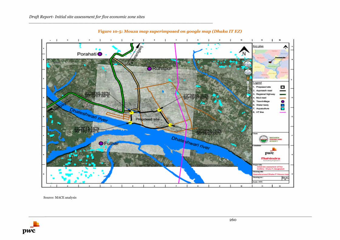
Draft Report- Initial site assessment for five economic zone sites_______________________________________________________________________
260
Figure 10-5: Mouza map superimposed on google map (Dhaka IT EZ)
Source: MACE analysis
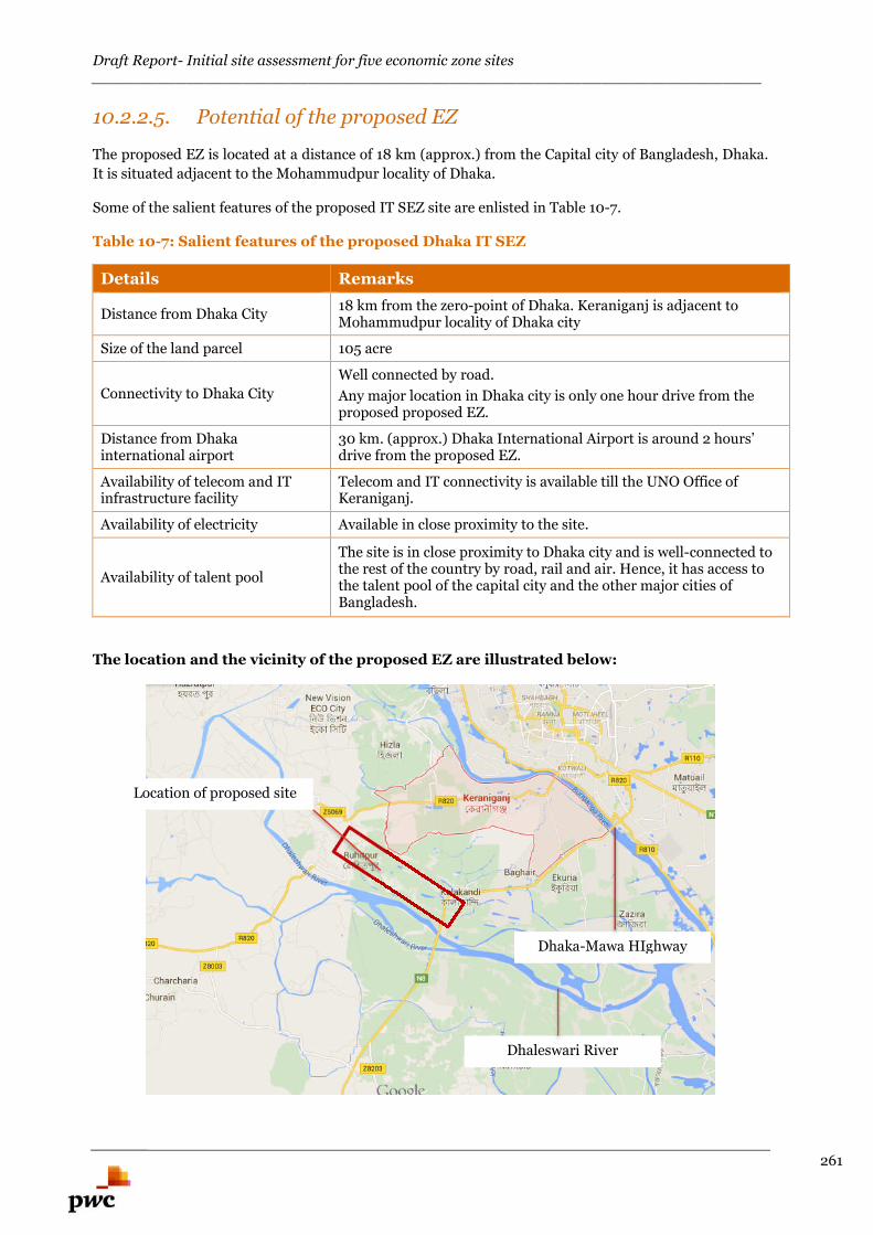
Draft Report- Initial site assessment for five economic zone sites_______________________________________________________________________
261
10.2.2.5. Potential of the proposed EZ
The proposed EZ is located at a distance of 18 km (approx.) from the Capital city of Bangladesh, Dhaka.
It is situated adjacent to the Mohammudpur locality of Dhaka.
Some of the salient features of the proposed IT SEZ site are enlisted in Table 10-7.
Table 10-7: Salient features of the proposed Dhaka IT SEZ
Details Remarks
Distance from Dhaka City18 km from the zero-point of Dhaka. Keraniganj is adjacent toMohammudpur locality of Dhaka city
Size of the land parcel 105 acre
Connectivity to Dhaka City
Well connected by road.
Any major location in Dhaka city is only one hour drive from theproposed proposed EZ.
Distance from Dhakainternational airport
30 km. (approx.) Dhaka International Airport is around 2 hours’drive from the proposed EZ.
Availability of telecom and ITinfrastructure facility
Telecom and IT connectivity is available till the UNO Office ofKeraniganj.
Availability of electricity Available in close proximity to the site.
Availability of talent pool
The site is in close proximity to Dhaka city and is well-connected tothe rest of the country by road, rail and air. Hence, it has access tothe talent pool of the capital city and the other major cities ofBangladesh.
The location and the vicinity of the proposed EZ are illustrated below:
Location of proposed site
Dhaka-Mawa HIghway
Dhaleswari River
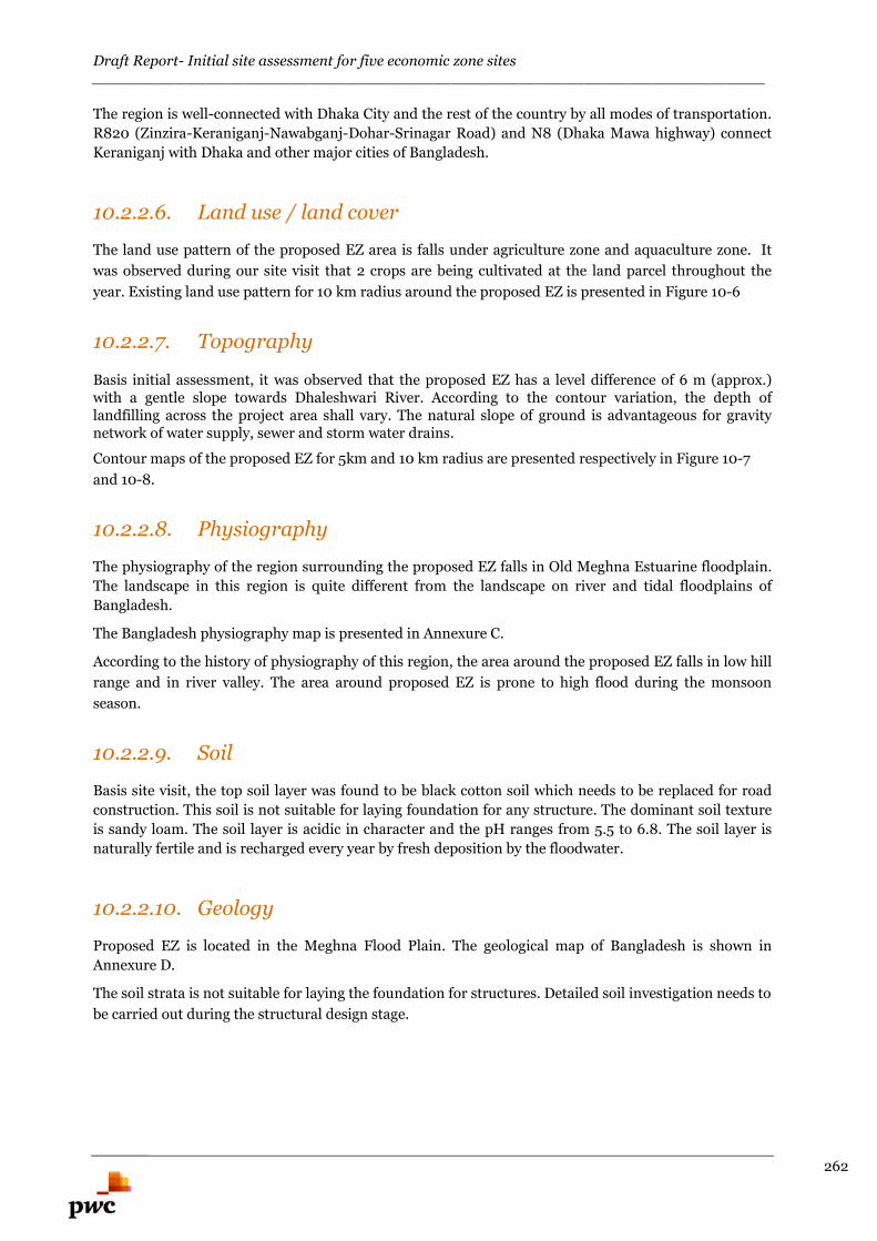
Draft Report- Initial site assessment for five economic zone sites_______________________________________________________________________
262
The region is well-connected with Dhaka City and the rest of the country by all modes of transportation.
R820 (Zinzira-Keraniganj-Nawabganj-Dohar-Srinagar Road) and N8 (Dhaka Mawa highway) connect
Keraniganj with Dhaka and other major cities of Bangladesh.
10.2.2.6. Land use / land cover
The land use pattern of the proposed EZ area is falls under agriculture zone and aquaculture zone. It
was observed during our site visit that 2 crops are being cultivated at the land parcel throughout the
year. Existing land use pattern for 10 km radius around the proposed EZ is presented in Figure 10-6
10.2.2.7. Topography
Basis initial assessment, it was observed that the proposed EZ has a level difference of 6 m (approx.)with a gentle slope towards Dhaleshwari River. According to the contour variation, the depth oflandfilling across the project area shall vary. The natural slope of ground is advantageous for gravitynetwork of water supply, sewer and storm water drains.
Contour maps of the proposed EZ for 5km and 10 km radius are presented respectively in Figure 10-7
and 10-8.
10.2.2.8. Physiography
The physiography of the region surrounding the proposed EZ falls in Old Meghna Estuarine floodplain.
The landscape in this region is quite different from the landscape on river and tidal floodplains of
Bangladesh.
The Bangladesh physiography map is presented in Annexure C.
According to the history of physiography of this region, the area around the proposed EZ falls in low hill
range and in river valley. The area around proposed EZ is prone to high flood during the monsoon
season.
10.2.2.9. Soil
Basis site visit, the top soil layer was found to be black cotton soil which needs to be replaced for road
construction. This soil is not suitable for laying foundation for any structure. The dominant soil texture
is sandy loam. The soil layer is acidic in character and the pH ranges from 5.5 to 6.8. The soil layer is
naturally fertile and is recharged every year by fresh deposition by the floodwater.
10.2.2.10. Geology
Proposed EZ is located in the Meghna Flood Plain. The geological map of Bangladesh is shown in
Annexure D.
The soil strata is not suitable for laying the foundation for structures. Detailed soil investigation needs to
be carried out during the structural design stage.
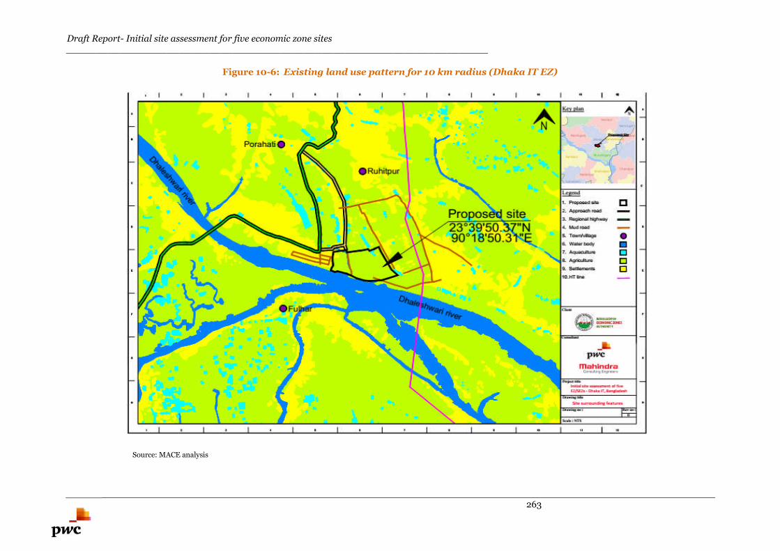
Draft Report- Initial site assessment for five economic zone sites_______________________________________________________________________
263
Figure 10-6: Existing land use pattern for 10 km radius (Dhaka IT EZ)
Source: MACE analysis
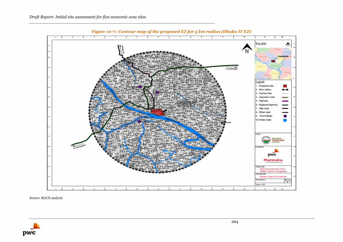
Draft Report- Initial site assessment for five economic zone sites_______________________________________________________________________
264
Figure 10-7: Contour map of the proposed EZ for 5 km radius (Dhaka IT EZ)
Source: MACE analysis
Draft Report- Initial site assessment for five economic zone sites_______________________________________________________________________
265
Figure 10-8: Contour map of the proposed EZ for 10 km radius (Dhaka IT EZ)
Source: MACE analysis
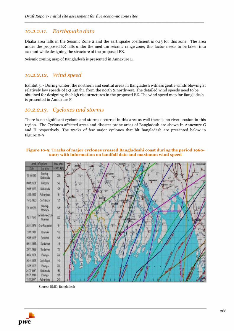
Draft Report- Initial site assessment for five economic zone sites_______________________________________________________________________
266
10.2.2.11. Earthquake data
Dhaka area falls in the Seismic Zone 2 and the earthquake coefficient is 0.15 for this zone. The area
under the proposed EZ falls under the medium seismic range zone; this factor needs to be taken into
account while designing the structure of the proposed EZ.
Seismic zoning map of Bangladesh is presented in Annexure E.
10.2.2.12. Wind speed
Exhibit 5. - During winter, the northern and central areas in Bangladesh witness gentle winds blowing atrelatively low speeds of 1-3 Km/hr. from the north & northwest. The detailed wind speeds need to beobtained for designing the high rise structures in the proposed EZ. The wind speed map for Bangladeshis presented in Annexure F.
10.2.2.13. Cyclones and storms
There is no significant cyclone and storms occurred in this area as well there is no river erosion in this
region. The Cyclones affected areas and disaster prone areas of Bangladesh are shown in Annexure G
and H respectively. The tracks of few major cyclones that hit Bangladesh are presented below in
Figure10-9
Figure 10-9: Tracks of major cyclones crossed Bangladeshi coast during the period 1960-2007 with information on landfall date and maximum wind speed
Source: BMD, Bangladesh
Draft Report- Initial site assessment for five economic zone sites_______________________________________________________________________
267
10.3. Environment Section
10.3.1. Air quality
Ambient air quality measurements are essential:
to provide a description of the existing conditions,
to provide a baseline against which changes can be measured and
to assist in the determination of potential impacts of the proposed EZ construction on air
quality conditions
During the field visit, no apparent problem with air quality was observed. This may be due to the fact
that the area around the proposed EZ is located in a rural area with very few industries in the vicinity.
The traffic flow in proximity to the proposed EZ is relatively less.
10.3.2. Floods and Water Logging
Basis the interaction with the UNO Officials and local inhabitants, it was communicated to us that the
flood level during monsoon season varies from 5 feet to 6 feet within the area of the proposed EZ.
10.3.3. Noise
During the field visit, no apparent problem of noise was observed except in the area adjacent to the rice
mill and highway.
10.3.4. Land filling
Basis the interaction with the UNO officials and local inhabitants, flood level during monsoon season
varies from 5 feet to 6 feet depth inside the proposed EZ area.
To avoid inundation during monsoon season, minimum land filling of 0.6 m above the flood level is
considered.
Based on the assumption, an average depth of 6 feet to 10 feet of land filling has been envisaged for the
proposed EZ area. This figure is indicative and detailed topography survey needs to be carried out to
calculate the exact quantity of land filling at the project area.
Draft Report- Initial site assessment for five economic zone sites_______________________________________________________________________
268
10.4. Infrastructure Linkages of the Proposed Site
10.4.1. Physical Infrastructure- Availability of UtilityConnections
10.4.1.1. Power Availability for the proposed EZ
33/11 kV Sonakanda substation (with 20 MVA capacities) is located 3 km (approx.) from the proposed
EZ. This substation has excess capacity which could be utilized for the initial phase. 150 MW Hasnebod
power station is located 30 km from proposed EZ. 100mw power plant operated by M/s. Power pac is
located just 3.5 km on the east side near Dhaka Mawa road. New 33/11 kv substation is also proposed
adjacent to the site.
Preliminary assessment suggests that possibility of drawing power from Hasnebod power station or
PowerPac power plant could be explored.
10.4.1.2. Water Availability
Basis interaction with local inhabitants
Water line is available upto BSCIC industrial complex. Local inhabitants are dependent on tube well water for drinking purpose. There are a total of
5,574 tube wells in Keraniganj Upzilla. Dhaleshwari and Buriganga are the main rivers situatedin this region.
Ground water (Arsenic Free and Potable) is available at a depth of 150-200 feet from naturalground level.
Preliminary assessment suggests that possibility of creating intake well and pumping station in
Dhaleswari River to extract the surface water of the river could e explored or deep tube wells could also
be developed within the project area to meet the demand.
10.4.1.3. Telecom and Internet Connectivity
Bangladesh's landline telecommunications system is owned by the state. The Bangladesh Telephone and
Telegraph Board (BTTB) is the organization that controls telecommunications in the country. Besides
BTTB, which operates in all urban areas, there are two private operators. Bangladesh Rural Telecom
Authority and Sheba Telecommunications provide telephone services to rural areas. Digital telephone
systems are being introduced into Bangladesh.
VSAT technology is used to connect to the Internet in Bangladesh. Around 54 Internet Service Providers
operate in the country. Satellite Internet in Bangladesh enables individuals to access the internet in
remote areas through terrestrial means.
In 2014, Bangladesh Submarine Cable Company Limited (BSCCL) had 200Gbps (88MIU-km)
bandwidth available and Bangladesh was using only 32Gbps or 16% of it.94 Thus, Bangladesh Govt. had
approved a proposal for exporting around half of the country’s internet bandwidth to the North Eastern
states of India as Bangladesh was utilizing only 16% of its total bandwidth. Bangladesh has a total of 82
MIU-km of unused bandwidth and Govt. has given approval to BSCCL for renting or leasing of internet
bandwidth. Hence, it can be concluded that the supply of internet bandwidth is far larger than the
demand throughout the region.
Utility map for the proposed EZ is illustrated in Figure 10-10 below.
94 Dhaka Tribune Article (http://www.dhakatribune.com/sci-amp-tech/2014/feb/15/govt-approves-export-half-internet-bandwidth)
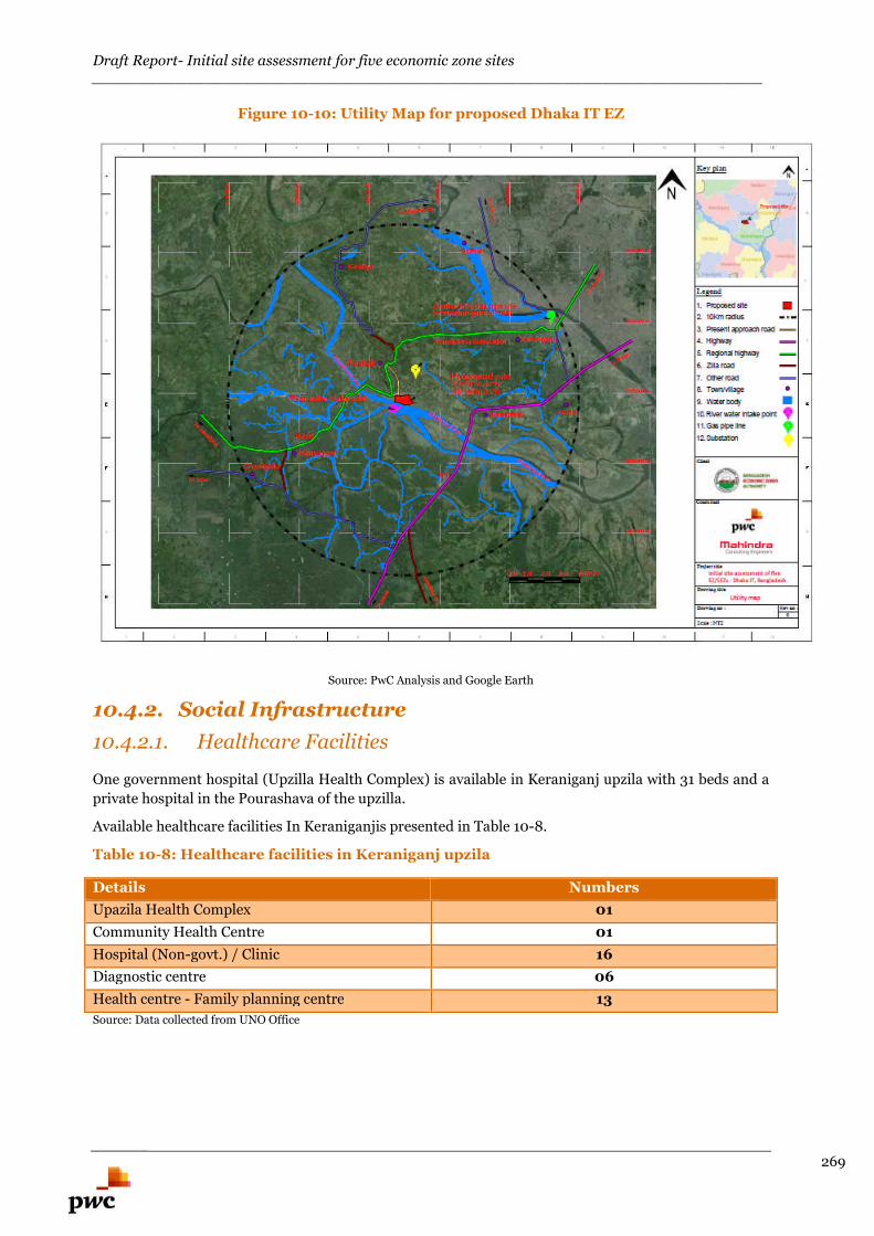
Draft Report- Initial site assessment for five economic zone sites_______________________________________________________________________
269
Figure 10-10: Utility Map for proposed Dhaka IT EZ
Source: PwC Analysis and Google Earth
10.4.2. Social Infrastructure
10.4.2.1. Healthcare Facilities
One government hospital (Upzilla Health Complex) is available in Keraniganj upzila with 31 beds and a
private hospital in the Pourashava of the upzilla.
Available healthcare facilities In Keraniganjis presented in Table 10-8.
Table 10-8: Healthcare facilities in Keraniganj upzila
Details Numbers
Upazila Health Complex 01
Community Health Centre 01
Hospital (Non-govt.) / Clinic 16
Diagnostic centre 06
Health centre - Family planning centre 13
Source: Data collected from UNO Office
Draft Report- Initial site assessment for five economic zone sites_______________________________________________________________________
270
10.4.3. Connectivity
10.4.3.1. Road
Keraniganj is located 18 km away from the zero-point of Dhaka city. The road distance between the
centre of Keraniganj upzilla and the proposed EZ is about 2 kms. Proposed EZ is located in between
Zinzira-Keraniganj-Nawabganj-Dohar-Srinagar Road (R820) and Dhaka Mawa highway (N8).
Road network for 10 km radius is presented in figure 10-11.
10.4.3.2. Approach Road
Zinzira-Keraniganj-Nawabganj-Dohar-Srinagar Road (R820) passes adjacent to the proposed EZ.
Connecting road for a length of 750 m from R820 need to be widened and strengthened.
Dhaka Mawa highway (N8) is accessible from the proposed EZ via Dhamsur-sonakanda road at a length
of 5 km. Widening of this road will attract more resettlement issues as there are several market place(s),
educational institution(s), religious places and residential areas located on both the sides of the road.
10.4.3.3. Airport
The proposed Dhaka IT EZ is located about 30 km North East of Hazrat Shahjalal International Airport
in Dhaka. Dhaka Airport is the largest airport in the country. The travelling time from the proposed site
to Dhaka Airport is 2 to 2.5 hours (approx.).
Govt. of Bangladesh intends to construct a new international airport (Bangabandhu Sheikh Mujib
International Airport) with a view to create a hub airport in close proximity to Dhaka and to meet the
demand of future growth in aviation sector. Not only the air traffic in Bangladesh has increased, but also
the cargo traffic has escalated and none of the airports in the country are currently equipped to handle
the massive flow of trade and passengers. The location of this proposed airport is not yet finalized;
however the new proposed airport shall be located in Dhaka division (within 50-70 km radius of the
proposed EZ).
10.4.3.4. Rail
Dhaka is connected with the rail network to other parts of the country. The Dhaka railway station is
located at a distance of 20km (approx.) from proposed EZ. The total railway line exists in Dhaka district
is presented in Table 10-9
Table 10-9: Length of existing railway line in Dhaka district
Upzilla Length of railway line in km
Dhaka Metropolitan 356
Dhamrai 0
Dohar 0
Keraniganj 0
Nawabganj 0
Savar 0
Total 356
Source: Bangladesh Railways
Draft Report- Initial site assessment for five economic zone sites_______________________________________________________________________
271
At present around 329 trains per day stops at Dhaka railway station for transporting passengers to
Chittagong and Kolkata. The details of train running from Dhaka are presented in Table 10-10.
Table 10-10: Details of Trains running from Dhaka district
Train Class Number of trains
Intercity 82Mail, Express & Commuter 78DEMU Commuter 32Shuttle / Local 137Total 329Source: Dhaka District website
Travel time from Dhaka to major locations of Bangladesh is summarised in the Table 10-11.
Table 10-11: Approximate travel time to major locations from Dhaka station
Location Approximate Travel Time
Chittagong 5-6 hours
Jagannathganj Ghat 5 hours 30 minutes
Dinajpur 14 hours
Sylhet 6 hours 30 minutes
Noakhali 6 hours
Mymensingh 6 hours
Brahmman Baria 3 hours
Mohanganj 10 hours
Jamalpur 4 hours
10.4.3.5. Port and harbour connectivity
Chittagong port
The Port of Chittagong is the principal Port of Bangladesh. Proposed EZ is located at a about distance of
276 km from this EZ. However, for development of IT/ ITES industry, proximity to port is not a
prerequisite. Refer section 3.4.1 for further details about Chittagong port.
10.4.3.6. Water ways
The primary transportation system of Bangladesh is its extensive inland waterways. Bangladesh Inland
Water Transport Authority (BIWTA) is responsible for development, maintenance and control of inland
water transport and of certain inland navigable waterways. Proposed EZ site is well connected with the
major ports of Bangladesh by inland water ways. However, this may not be applicable for an IT specific
economic zone, though the same becomes very critical for a manufacturing oriented economic zone.
The following figure illustrates the connectivity of the proposed Dhaka Economic Zone via Road, Rail
and Airport modes of transportation.

Draft Report- Initial site assessment for five economic zone sites_______________________________________________________________________
272
Figure 10-11: Connectivity of proposed Dhaka IT EZ via Road, Rail and Air
10.5. Resettlement issues
10.5.1. Social impacts
The project is expected to cause impacts arising from:
(i) Loss of land (for existing land owners),
(ii) Loss of homes/structures,
(iii) Loss of Trees
(iv) Loss of livelihood systems/ income opportunity
(v) Loss of water bodies
(vi) Resettlement issues pertaining to approach road construction
The expected types of losses are described in the following sub-sections.
10.5.1.1. Loss of land
To establish the proposed EZ, a total of 105 acres of land has been demarcated by the authority.
The land usage pattern of the 105 acres is as under:
Residential land- 1.05 acre (approx.)
Agricultural land- Rest
Ownership pattern of the land is as follows:
Government Land- 40.31 acres
Private Land- 64.69 acres
Source: Google earth and PwC analysis
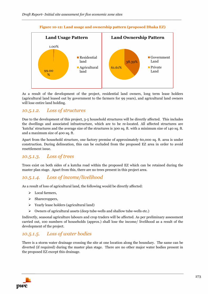
Draft Report- Initial site assessment for five economic zone sites_______________________________________________________________________
273
Figure 10-12: Land usage and ownership pattern (proposed Dhaka EZ)
As a result of the development of the project, residential land owners, long term lease holders
(agricultural land leased out by government to the farmers for 99 years), and agricultural land owners
will lose entire land holding.
10.5.1.2. Loss of structures
Due to the development of this project, 3-5 household structures will be directly affected. This includes
the dwellings and associated infrastructure, which are to be re-located. All affected structures are
‘kutcha’ structures and the average size of the structures is 300 sq. ft. with a minimum size of 140 sq. ft.
and a maximum size of 400 sq. ft.
Apart from the household structure, one factory premise of approximately 60,000 sq. ft. area is under
construction. During delineation, this can be excluded from the proposed EZ area in order to avoid
resettlement issue.
10.5.1.3. Loss of trees
Trees exist on both sides of a kutcha road within the proposed EZ which can be retained during the
master plan stage. Apart from this, there are no trees present in this project area.
10.5.1.4. Loss of income/livelihood
As a result of loss of agricultural land, the following would be directly affected:
Local farmers,
Sharecroppers,
Yearly lease holders (agricultural land)
Owners of agricultural assets (deep tube-wells and shallow tube-wells etc.)
Indirectly, seasonal agriculture labours and crop traders will be affected. As per preliminary assessment
carried out, 100 numbers of households (approx.) shall lose the income/ livelihood as a result of the
development of the project.
10.5.1.5. Loss of water bodies
There is a storm water drainage crossing the site at one location along the boundary. The same can be
diverted (if required) during the master plan stage. There are no other major water bodies present in
the proposed EZ except this drainage.
1.00%
99.00%
Land Usage Pattern
Residentialland
Agriculturalland
38.39%
61.61%
Land Ownership Pattern
GovernmentLand
PrivateLand
Draft Report- Initial site assessment for five economic zone sites_______________________________________________________________________
274
10.5.1.6. Resettlement Issues pertaining to approach road construction
Two options are available for approach road construction:
Dhaka Mawa highway (N8): It is accessible from the proposed EZ via Dhamsur-sonakanda roadat a length of 5 km. Widening of this road will attract more resettlement issues as there areseveral market place(s), educational institution(s), religious places and residential areas locatedon both the sides of the road.
Zinzira-Keraniganj-Nawabganj-Dohar-Srinagar Road (R820): It passes adjacent to theproposed EZ. Connecting road for a length of 750 m from R820 may be widened andstrengthened for the purpose of approach road development.
From preliminary assessment, construction of approach road via Dhaka-Mawa Highway (N8) shall
attract significant resettlement. The latter option of construction of approach road via Zinzira-
Keraniganj-Nawabganj-Dohar-Srinagar Road (R820) may not have similar resettlement issues.
10.5.2. Constraints and its mitigation
The constraints and its mitigations are presented in the following Table 10-12.
Table 10-12: Constraints and mitigation
Sl.No.
Constraints Mitigation measures
1 Low lying land From preliminary assessment, landfilling of depth6-10 feet needs to be undertaken
2 Existing storm water drain To be diverted along the boundary3 Residential units Basis preliminary assessment, 3-5 kutcha
structures may be relocated4 Factory building Basis preliminary assessment, the factory building
may be excluded from the proposed EZ area duringpreparation of master plan
5 Loss of Trees Trees existing along the kutcha road in the sitemay be retained during the preparation of masterplan
6 Loss of income/livelihood Basis preliminary assessment, Resettlement ActionPlan (RAP) needs to be formulated as 100 numbersof households (approx.) shall lose theincome/livelihood as a result of the developmentof the project.
7 Resttlement issues pertaining toapproach road construction
From preliminary assessment, construction ofapproach road via Dhaka-Mawa Highway (N8)shall attract significant resettlement.
The other option of construction of approach roadvia Zinzira-Keraniganj-Nawabganj-Dohar-SrinagarRoad (R820) may not have similar resettlementissues.
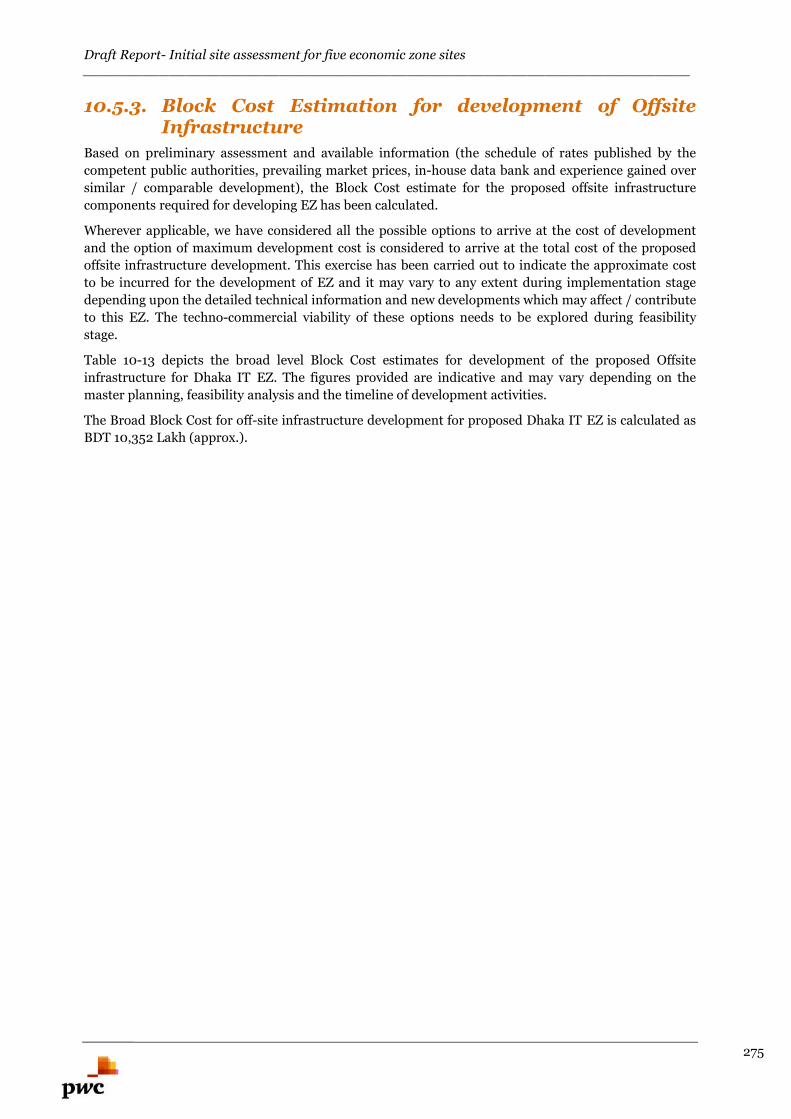
Draft Report- Initial site assessment for five economic zone sites_______________________________________________________________________
275
10.5.3. Block Cost Estimation for development of OffsiteInfrastructure
Based on preliminary assessment and available information (the schedule of rates published by the
competent public authorities, prevailing market prices, in-house data bank and experience gained over
similar / comparable development), the Block Cost estimate for the proposed offsite infrastructure
components required for developing EZ has been calculated.
Wherever applicable, we have considered all the possible options to arrive at the cost of development
and the option of maximum development cost is considered to arrive at the total cost of the proposed
offsite infrastructure development. This exercise has been carried out to indicate the approximate cost
to be incurred for the development of EZ and it may vary to any extent during implementation stage
depending upon the detailed technical information and new developments which may affect / contribute
to this EZ. The techno-commercial viability of these options needs to be explored during feasibility
stage.
Table 10-13 depicts the broad level Block Cost estimates for development of the proposed Offsite
infrastructure for Dhaka IT EZ. The figures provided are indicative and may vary depending on the
master planning, feasibility analysis and the timeline of development activities.
The Broad Block Cost for off-site infrastructure development for proposed Dhaka IT EZ is calculated as
BDT 10,352 Lakh (approx.).
Draft Report- Initial site assessment for five economic zone sites_______________________________________________________________________
276
Table 10-13: Block Cost estimate for proposed Dhaka IT EZ
Dhaka IT - EZ
Option -1 Option -2 Considered cost option
(Maximum of the two options has been considered)
S.No Description Qty Unit Amount in
Lakh BDT
Qty Unit Amount in
Lakh BDT
Qty Unit Amount in Lakh BDT
1 Site filling LS 2955 LS 2955 LS 2955
2 Compound wall 2880 Mtr 274 2880 Mtr 274 2880 Mtr 274
3 Diaphragm wall 800 Mtr 320 800 Mtr 320 800 Mtr 320
4 Approach Road (
10.50 mtr Carriage
way )
0.75 Km 541
5 Approach Road (
10.50 mtr Carriage
way ) From Dhaka
Mawa Road
5 Km 3605 5 Km 3605
6 Electrical ( External
connectivity- 3Km
with MRSS)
38.26 MVA 1528 38.26 MVA 1528 38.26 MVA 1528
7 Water supply (
Water Intake from
River )
2.20 MLD 1670 2.20 MLD 1670
8 Water supply (
Water from Bore
well Pipe line length
5Km & Bore well 2
Nos )
2.20 MLD 503
Total 7287 9185 10352
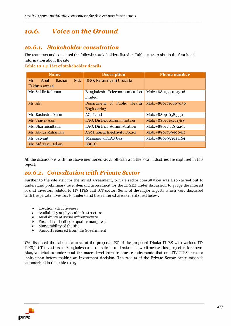
Draft Report- Initial site assessment for five economic zone sites_______________________________________________________________________
277
10.6. Voice on the Ground
10.6.1. Stakeholder consultation
The team met and consulted the following stakeholders listed in Table 10-14 to obtain the first hand
information about the site
Table 10-14: List of stakeholder details
Name Description Phone number
Mr. Abul Bashar Md.
Fakhruzzaman
UNO, Keranaiganj Upazilla
Mr. Saidir Rahman Bangladesh Telecommunication
limited
Mob:+8801550151306
Mr. Ali, Department of Public Health
Engineering
Mob:+8801716807030
Mr. Rashedul Islam AC, Land Mob:+880916583351
Mr. Tanvir Azin LAO, District Administration Mob:+8801713271768
Ms. Sharmisultana LAO, District Administration Mob:+8801733672267
Mr. Abdur Rahaman AGM, Rural Electricity Board Mob:+8801769400417
Mr. Satyajit Manager -TITAS Gas Mob:+8801939921164
Mr. Md.Tazul Islam BSCIC
All the discussions with the above mentioned Govt. officials and the local industries are captured in this
report.
10.6.2. Consultation with Private Sector
Further to the site visit for the initial assessment, private sector consultation was also carried out to
understand preliminary level demand assessment for the IT SEZ under discussion to gauge the interest
of unit investors related to IT/ ITES and ICT sector. Some of the major aspects which were discussed
with the private investors to understand their interest are as mentioned below:
Location attractiveness Availability of physical infrastructure Availability of social infrastructure Ease of availability of quality manpower Marketability of the site Support required from the Government
We discussed the salient features of the proposed EZ of the proposed Dhaka IT EZ with various IT/
ITES/ ICT investors in Bangladesh and outside to understand how attractive this project is for them.
Also, we tried to understand the macro level infrastructure requirements that one IT/ ITES investor
looks upon before making an investment decision. The results of the Private Sector consultation is
summarised in the table 10-15.
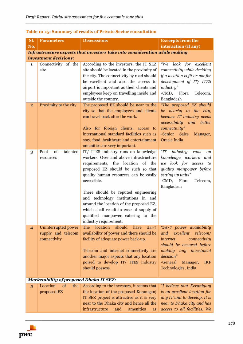
Draft Report- Initial site assessment for five economic zone sites_______________________________________________________________________
278
Table 10-15: Summary of results of Private Sector consultation
Sl.
No.
Parameters Discussions Excerpts from the
interaction (if any)
Infrastructure aspects that investors take into consideration while making
investment decisions:
1 Connectivity of the
site
According to the investors, the IT SEZ
site should be located in the proximity of
the city. The connectivity by road should
be excellent and also the access to
airport is important as their clients and
employees keep on travelling inside and
outside the country.
“We look for excellent
connectivity while deciding
if a location is fit or not for
development of IT/ ITES
industry”
-CMD, Flora Telecom,
Bangladesh
2 Proximity to the city The proposed EZ should be near to the
city so that the employees and clients
can travel back after the work.
Also for foreign clients, access to
international standard facilities such as
stay, food, healthcare and entertainment
amenities are very important.
“The proposed EZ should
be nearby to the city,
because IT industry needs
accessibility and better
connectivity”
-Senior Sales Manager,
Oracle India
3 Pool of talented
resources
IT/ ITES industry runs on knowledge
workers. Over and above infrastructure
requirements, the location of the
proposed EZ should be such so that
quality human resources can be easily
accessible.
There should be reputed engineering
and technology institutions in and
around the location of the proposed EZ,
which shall result in ease of supply of
qualified manpower catering to the
industry requirement.
“IT industry runs on
knowledge workers and
we look for access to
quality manpower before
setting up units”
-CMD, Flora Telecom,
Bangladesh
4 Uninterrupted power
supply and telecom
connectivity
The location should have 24×7
availability of power and there should be
facility of adequate power back-up.
Telecom and internet connectivity are
another major aspects that any location
poised to develop IT/ ITES industry
should possess.
“24×7 power availability
and excellent telecom/
internet connectivity
should be ensured before
making any investment
decision”
-General Manager, IKF
Technologies, India
Marketability of proposed Dhaka IT SEZ:
5 Location of the
proposed EZ
According to the investors, it seems that
the location of the proposed Keraniganj
IT SEZ project is attractive as it is very
near to the Dhaka city and hence all the
infrastructure and amenities as
“I believe that Keraniganj
is an excellent location for
any IT unit to develop. It is
near to Dhaka city and has
access to all facilities. We
Draft Report- Initial site assessment for five economic zone sites_______________________________________________________________________
279
illustrated above are easily accessible. are really interested for
this opportunity”
-CMD, Flora Telecom,
Bangladesh
6 Area of the proposed
EZ
The area of the proposed EZ is 105 acre.
The investors feel it is slightly on the
higher side for any IT SEZ project in
Bangladesh and hence it should be
segregated in two phases to facilitate
easy selling of office space to tenants.
“This project should be
rolled out in two phases to
ascertain quick possession
by tenants ”
-CMD, Flora Telecom,
Bangladesh
Support required from Government:
7 SEZ status SEZ status granted for IT/ ICT
industries is crucial as this shall allow
the investors to be eligible for various
benefits such as tax holiday, subsidy on
investment etc.
“SEZ status is very
important for any tenant
operating in IT industry as
it can save on taxes”
-Senior Sales Manager,
Oracle India
8 Additional support
required from local/
national government
According to the investors, the
government should be proactive and
supportive when the development
activities of the project commence.
The investors should face less hassle and
smooth transaction should be facilitated
on behalf of the government so that the
project takes off without any concern.
“The government should be
proactive and should
extend full cooperation to
the investors.”
-General Manager, IKF
Technologies, India
10.7. Overall Adequacy of the proposed EZ toDevelop as IT Economic Zone
In the following table the site has been evaluated with respect to the key parameters which are required
to establish IT industry.
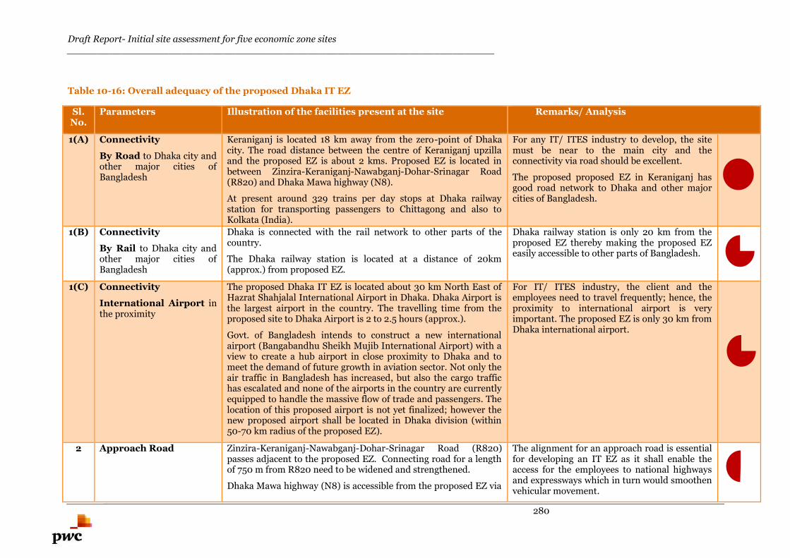
Draft Report- Initial site assessment for five economic zone sites_______________________________________________________________________
280
Table 10-16: Overall adequacy of the proposed Dhaka IT EZ
Sl.No.
Parameters Illustration of the facilities present at the site Remarks/ Analysis
1(A) Connectivity
By Road to Dhaka city andother major cities ofBangladesh
Keraniganj is located 18 km away from the zero-point of Dhakacity. The road distance between the centre of Keraniganj upzillaand the proposed EZ is about 2 kms. Proposed EZ is located inbetween Zinzira-Keraniganj-Nawabganj-Dohar-Srinagar Road(R820) and Dhaka Mawa highway (N8).
At present around 329 trains per day stops at Dhaka railwaystation for transporting passengers to Chittagong and also toKolkata (India).
For any IT/ ITES industry to develop, the sitemust be near to the main city and theconnectivity via road should be excellent.
The proposed proposed EZ in Keraniganj hasgood road network to Dhaka and other majorcities of Bangladesh.
1(B) Connectivity
By Rail to Dhaka city andother major cities ofBangladesh
Dhaka is connected with the rail network to other parts of thecountry.
The Dhaka railway station is located at a distance of 20km(approx.) from proposed EZ.
Dhaka railway station is only 20 km from theproposed EZ thereby making the proposed EZeasily accessible to other parts of Bangladesh.
1(C) Connectivity
International Airport inthe proximity
The proposed Dhaka IT EZ is located about 30 km North East ofHazrat Shahjalal International Airport in Dhaka. Dhaka Airport isthe largest airport in the country. The travelling time from theproposed site to Dhaka Airport is 2 to 2.5 hours (approx.).
Govt. of Bangladesh intends to construct a new internationalairport (Bangabandhu Sheikh Mujib International Airport) with aview to create a hub airport in close proximity to Dhaka and tomeet the demand of future growth in aviation sector. Not only theair traffic in Bangladesh has increased, but also the cargo traffichas escalated and none of the airports in the country are currentlyequipped to handle the massive flow of trade and passengers. Thelocation of this proposed airport is not yet finalized; however thenew proposed airport shall be located in Dhaka division (within50-70 km radius of the proposed EZ).
For IT/ ITES industry, the client and theemployees need to travel frequently; hence, theproximity to international airport is veryimportant. The proposed EZ is only 30 km fromDhaka international airport.
2 Approach Road Zinzira-Keraniganj-Nawabganj-Dohar-Srinagar Road (R820)passes adjacent to the proposed EZ. Connecting road for a lengthof 750 m from R820 need to be widened and strengthened.
Dhaka Mawa highway (N8) is accessible from the proposed EZ via
The alignment for an approach road is essentialfor developing an IT EZ as it shall enable theaccess for the employees to national highwaysand expressways which in turn would smoothenvehicular movement.
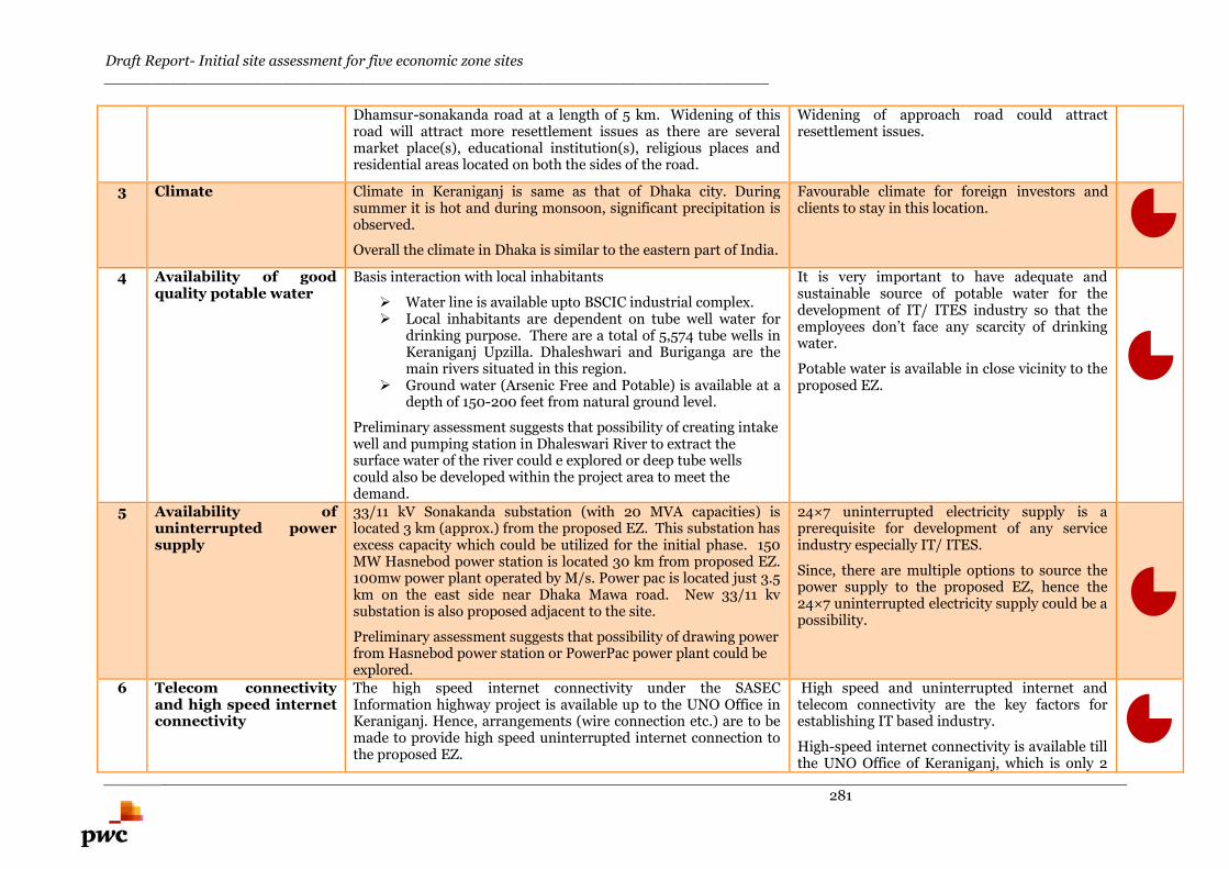
Draft Report- Initial site assessment for five economic zone sites_______________________________________________________________________
281
Dhamsur-sonakanda road at a length of 5 km. Widening of thisroad will attract more resettlement issues as there are severalmarket place(s), educational institution(s), religious places andresidential areas located on both the sides of the road.
Widening of approach road could attractresettlement issues.
3 Climate Climate in Keraniganj is same as that of Dhaka city. Duringsummer it is hot and during monsoon, significant precipitation isobserved.
Overall the climate in Dhaka is similar to the eastern part of India.
Favourable climate for foreign investors andclients to stay in this location.
4 Availability of goodquality potable water
Basis interaction with local inhabitants
Water line is available upto BSCIC industrial complex. Local inhabitants are dependent on tube well water for
drinking purpose. There are a total of 5,574 tube wells inKeraniganj Upzilla. Dhaleshwari and Buriganga are themain rivers situated in this region.
Ground water (Arsenic Free and Potable) is available at adepth of 150-200 feet from natural ground level.
Preliminary assessment suggests that possibility of creating intakewell and pumping station in Dhaleswari River to extract thesurface water of the river could e explored or deep tube wellscould also be developed within the project area to meet thedemand.
It is very important to have adequate andsustainable source of potable water for thedevelopment of IT/ ITES industry so that theemployees don’t face any scarcity of drinkingwater.
Potable water is available in close vicinity to theproposed EZ.
5 Availability ofuninterrupted powersupply
33/11 kV Sonakanda substation (with 20 MVA capacities) islocated 3 km (approx.) from the proposed EZ. This substation hasexcess capacity which could be utilized for the initial phase. 150MW Hasnebod power station is located 30 km from proposed EZ.100mw power plant operated by M/s. Power pac is located just 3.5km on the east side near Dhaka Mawa road. New 33/11 kvsubstation is also proposed adjacent to the site.
Preliminary assessment suggests that possibility of drawing powerfrom Hasnebod power station or PowerPac power plant could beexplored.
24×7 uninterrupted electricity supply is aprerequisite for development of any serviceindustry especially IT/ ITES.
Since, there are multiple options to source thepower supply to the proposed EZ, hence the24×7 uninterrupted electricity supply could be apossibility.
6 Telecom connectivityand high speed internetconnectivity
The high speed internet connectivity under the SASECInformation highway project is available up to the UNO Office inKeraniganj. Hence, arrangements (wire connection etc.) are to bemade to provide high speed uninterrupted internet connection tothe proposed EZ.
High speed and uninterrupted internet andtelecom connectivity are the key factors forestablishing IT based industry.
High-speed internet connectivity is available tillthe UNO Office of Keraniganj, which is only 2
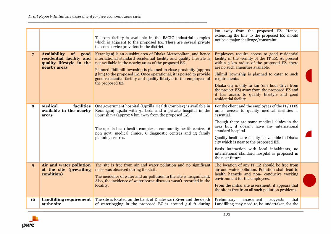
Draft Report- Initial site assessment for five economic zone sites_______________________________________________________________________
282
Telecom facility is available in the BSCIC industrial complexwhich is adjacent to the proposed EZ. There are several privatetelecom service providers in the district.
km away from the proposed EZ; Hence,extending the line to the proposed EZ shouldnot be a major challenge/constraint.
7 Availability of goodresidential facility andquality lifestyle in thenearby areas
Keraniganj is an outskirt area of Dhaka Metropolitan, and henceinternational standard residential facility and quality lifestyle isnot available in the nearby areas of the proposed EZ.
Planned Jhillmill township is planned in close proximity (approx5 km) to the proposed EZ. Once operational, it is poised to providegood residential facility and quality lifestyle to the employees ofthe proposed EZ.
Employees require access to good residentialfacility in the vicinity of the IT EZ. At presentwithin 5 km radius of the proposed EZ, thereare no such amenities available.
Jhilmil Township is planned to cater to suchrequirements.
Dhaka city is only 12 km (one hour drive fromthe project EZ) away from the proposed EZ andit has access to quality lifestyle and goodresidential facility.
8 Medical facilitiesavailable in the nearbyareas
One government hospital (Upzilla Health Complex) is available inKeraniganj upzila with 31 beds and a private hospital in thePourashava (approx 6 km away from the proposed EZ).
The upzilla has 1 health complex, 1 community health centre, 16non govt. medical clinics, 6 diagnostic centres and 13 familyplanning centres.
For the client and the employees of the IT/ ITESunits, access to quality medical facilities isessential.
Though there are some medical clinics in thearea but, it doesn’t have any internationalstandard hospital.
Quality healthcare facility is available in Dhakacity which is near to the proposed EZ.
Basis interaction with local inhabitants, nointernational standard hospital is proposed inthe near future.
9 Air and water pollutionat the site (prevailingcondition)
The site is free from air and water pollution and no significantnoise was observed during the visit.
The incidence of water and air pollution in the site is insignificant.Also, the incidence of water borne diseases wasn’t recorded in thelocality.
The location of any IT EZ should be free fromair and water pollution. Pollution shall lead tohealth hazards and non- conducive workingenvironment for the employees.
From the initial site assessment, it appears thatthe site is free from all such pollution problems.
10 Landfilling requirementat the site
The site is located on the bank of Dhaleswari River and the depthof waterlogging in the proposed EZ is around 5-6 ft during
Preliminary assessment suggests thatLandfilling may need to be undertaken for the
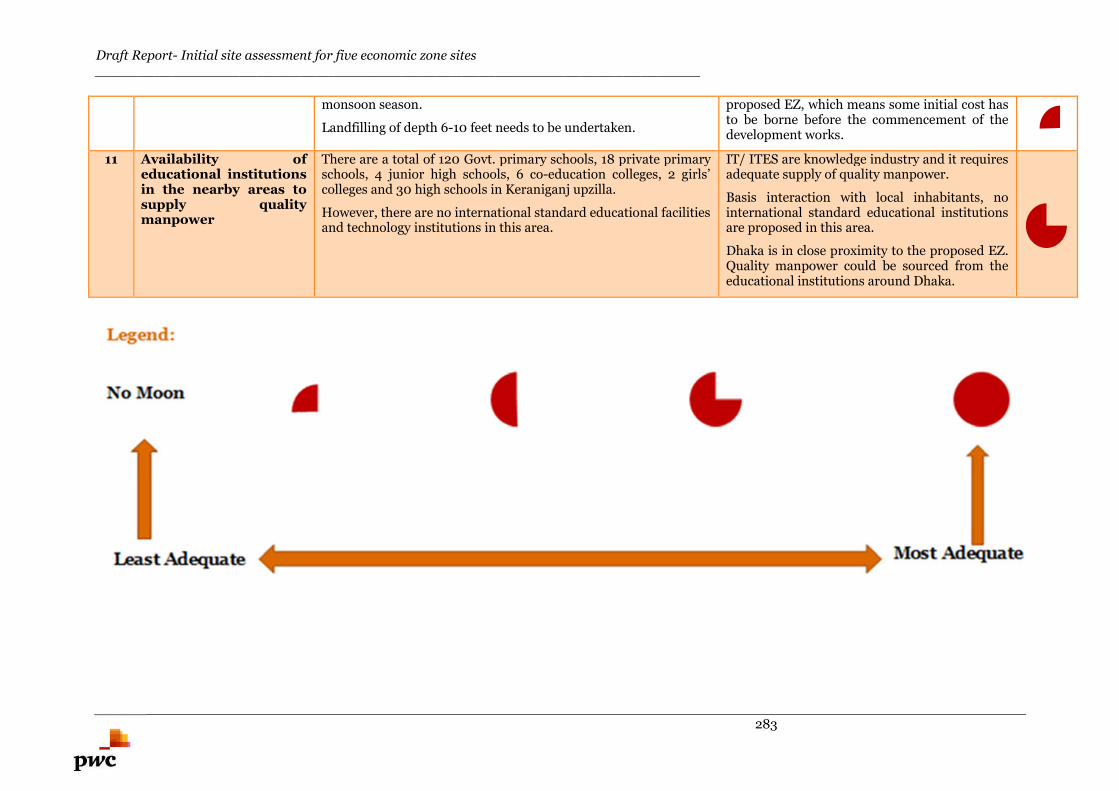
Draft Report- Initial site assessment for five economic zone sites_______________________________________________________________________
283
monsoon season.
Landfilling of depth 6-10 feet needs to be undertaken.
proposed EZ, which means some initial cost hasto be borne before the commencement of thedevelopment works.
11 Availability ofeducational institutionsin the nearby areas tosupply qualitymanpower
There are a total of 120 Govt. primary schools, 18 private primaryschools, 4 junior high schools, 6 co-education colleges, 2 girls’colleges and 30 high schools in Keraniganj upzilla.
However, there are no international standard educational facilitiesand technology institutions in this area.
IT/ ITES are knowledge industry and it requiresadequate supply of quality manpower.
Basis interaction with local inhabitants, nointernational standard educational institutionsare proposed in this area.
Dhaka is in close proximity to the proposed EZ.Quality manpower could be sourced from theeducational institutions around Dhaka.

Draft Report- Initial site assessment for five economic zone sites_______________________________________________________________________
284
Ranking of the sites
Draft Report- Initial site assessment for five economic zone sites _______________________________________________________________________
285
11.Ranking of the sites
Lastly, the report endeavours to relatively compare the sites on all the parameters discussed above. This endeavour, however, has been limited to three sites viz.
Narayanganj, Panchagarh and Anowara as the remaining sites (viz. Dhaka IT EZ and Sabraang Tourism EZ) are not exactly comparable to the multiproduct zones
across all the parameters95.
11.1. Relative scoring and their rationaleThese sites are ranked relatively to each other. This means, that if a site is better placed on a particular parameter vis-à-vis other sites, then highest marks (max
marks assigned are 5) are allocated to it. The other sites are ranked relatively to this site. These ratings are qualitative as well as quantitative (where possible) in
nature but as a principal, the assignments of ratings are based on a logical rationale. Table 11-1 summarizes the comparison of multi product EZs across different
paramters:
Table 11-1: Summary of the comparisons of multi product EZs based on different parameters used for determining relative scoring
Key Parameters
Sub-parameters Narayanganj EZ Panchagarh EZ Anowara-2 EZRelative scorings and
their rationale
(1) Connectivity RoadConnectivityto nearestmajor city
The proposed EZ is wellconnected by road to the capitalcity and other major cities ofBangladesh. It is around 32 kmaway from Dhaka City.Preliminary assessmentsuggests that some stretches ofaccess road could be renovatedfor smooth passage of heavyvehicles along: (i) Madanpur-Madanganj-Syedpur road,originating from DhakaChittagong highway and (ii)
The proposed EZ is 5 km(approx.) away from theDebiganj town. Asian Highway(AH2) is the major highwaylocated in close proximity to thepropoed EZ. Boda – Domar viaDebiganj Upazilla Road (Z5003)connects the site with Asianhighway (AH2). The length ofthe Z5003 stretch is 2 km.
The proposed EZ is locatedat a distance of 15 km(approx.) from theChittagong town.Proposed EZ is abuttingthe Chittagong - Anowara-Banshkhali highway(R170) which is the mainaccess road to theproposed EZ.
Relative scoring forNarayanganj is 4
Although the region is wellconnected to commercialand urban hubs like Dhakaand Chittagong, the site itselfhas issues with the last mileconnectivity. The existingroad faces constraints forexpansion. However, there isa possibility of alternativeroutes.
95 As an illustration, on connectivity parameter in case of Dhaka IT EZ, road and airport will have more weightage as compare to Inland waterways and railways. On the other hand, no preferencialweightage may be awarded to any mode of transportation in case of multi product EZs (Narayanganj, Panchagarh and Anowara). Similarly, Social infrastructure and availability of manpower wouldhave significantly higher weightage for Dhaka IT EZ and Sabraang Tourism EZ vis-à-vis other multiproduct EZs.
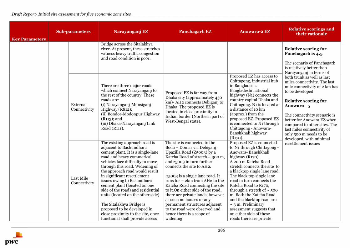
Draft Report- Initial site assessment for five economic zone sites _______________________________________________________________________
286
Key Parameters
Sub-parameters Narayanganj EZ Panchagarh EZ Anowara-2 EZRelative scorings and
their rationale
Bridge across the Sitalakhyariver. At present, these stretcheswitness heavy traffic congestionand road condition is poor.
Relative scoring forPanchagarh is 4.5
The scenario of Panchagarhis relatively better thanNarayanganj in terms ofboth trunk as well as lastmiles connectivity. The lastmile connectivity of 2 km hasto be developed
Relative scoring forAnowara - 5
The connectivity scenario isbetter for Anowara EZ whencompared to other sites. Thelast miles connectivity ofonly 500 m needs to bedeveloped, with minimalresettlement issues
ExternalConnectivity
There are three major roadswhich connect Narayanganj tothe rest of the country. Theseroads are:(i) Narayanganj-MunsiganjHighway (R812);(ii) Bondor-Modonpur Highway(R113); and(iii) Dhaka-Narayanganj LinkRoad (R111).
Proposed EZ is far way fromDhaka city (approximately 450km)- AH2 connects Debiganj toDhaka. The proposed EZ islocated in close proximity toIndian border (Northern part ofWest-Bengal state).
Proposed EZ has access toChittagong, industrial hubin Bangladesh.Bangladeshi nationalhighway (N1) connects thecountry capital Dhaka andChittagong. N1 is located ata distance of 10 km(approx.) from theproposed EZ. Proposed EZis connected to N1 throughChittagong - Anowara-Banshkhali highway(R170).
Last MileConnectivity
The existing approach road isadjacent to Bashundharacement plant. It is a single-laneroad and heavy commericalvehicles face difficulty to movethrough this road. Widening ofthe approach road would resultin significant resettlementissues owing to Basundharacement plant (located on oneside of the road) and residentialunits (located on the other side).
The Sitalakhya Bridge isproposed to be developed inclose proximity to the site, oncefunctional shall provide access
The site is connected to theBoda – Domar via DebiganjUpazilla Road (Z5003) by aKatcha Road of stretch ~ 300 m,and z5003 in turn furtherconnects the site to AH2.
z5003 is a single lane road. Itruns for ~ 2km from AH2 to theKatcha Road connecting the siteto it.On either side of the road,there are private lands, howeveras such no houses or anypermanent structures adjacentto the road were observed andhence there is a scope ofwidening
Proposed EZ is connectedto N1 through Chittagong -Anowara- Banshkhalihighway (R170).A 200 m Katcha Roadstretch connects the site toa blacktop single lane road.The black top single laneroad in turn connects theKatcha Road to R170,through a stretch of ~ 500m. Both the Katcha Roadand the blacktop road are~ 3 m. Preliminaryassessment suggests thaton either side of theseroads there are private
Draft Report- Initial site assessment for five economic zone sites _______________________________________________________________________
287
Key Parameters
Sub-parameters Narayanganj EZ Panchagarh EZ Anowara-2 EZRelative scorings and
their rationale
to the proposed EZ. Preliminary assessmentsuggests that on either side ofthe stretch of the Katcha Roadthere are no permanentstructures and there is a scopefor widening the stretch
lands, however there areno houses or anypermanent strucutres andhence there is a scope forwidening these roads for abetter approach
Future Plans
Sitalakhya Bridge is proposedacross the Sitalakhya River,which would link Dhaka withSylhet and Chittagong highwaythrough Demra andNarayanganj. Once functional, itshall connect (R113) and (R812).This bridge once functional shallprovide access to the North-west parcel of the proposed EZ.
Asian highway 2 runs throughPanchagarh connecting Dhakato Banglabandha at India bordervia Panchangarh. The stretchthrough Panchagarh is yet to bedeveloped. Once developed, itwill improve the connectivity ofPanchagarh with neighbouringcountries and enable seamlessmovement of goods fromPanchagarh to major localmarkets and markets inneighbouring countries (India,Bhutan and Nepal).
Mutilane Road tunnel isproposed under the RiverKarnaphuli. The proposedTunnel will connect theChittagong Port Citydirectly with the other sideof the Karnaphuli River &indirectly with other partsof the country throughDhaka-Chittagong-Cox’sBazar Highway. Thefeasibility study for thesame is in progress. Oncefunctional, the multilaneroad tunnel shall reducethe travel time anddistance from Chittagongto the proposed EZ.
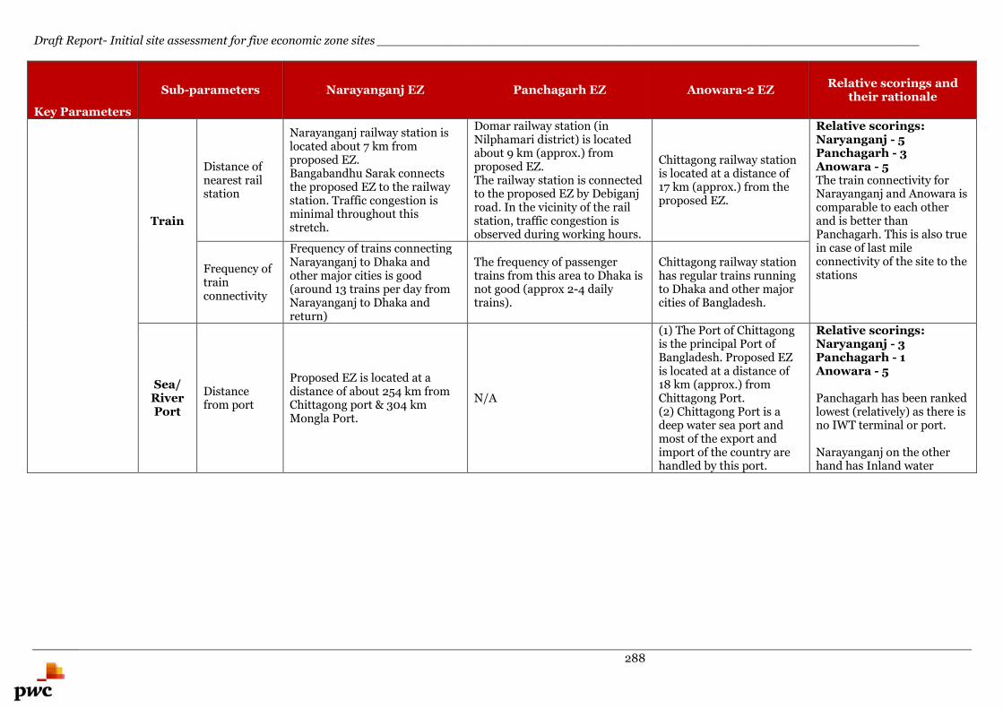
Draft Report- Initial site assessment for five economic zone sites _______________________________________________________________________
288
Key Parameters
Sub-parameters Narayanganj EZ Panchagarh EZ Anowara-2 EZRelative scorings and
their rationale
Train
Distance ofnearest railstation
Narayanganj railway station islocated about 7 km fromproposed EZ.Bangabandhu Sarak connectsthe proposed EZ to the railwaystation. Traffic congestion isminimal throughout thisstretch.
Domar railway station (inNilphamari district) is locatedabout 9 km (approx.) fromproposed EZ.The railway station is connectedto the proposed EZ by Debiganjroad. In the vicinity of the railstation, traffic congestion isobserved during working hours.
Chittagong railway stationis located at a distance of17 km (approx.) from theproposed EZ.
Relative scorings:Naryanganj - 5Panchagarh - 3Anowara - 5The train connectivity forNarayanganj and Anowara iscomparable to each otherand is better thanPanchagarh. This is also truein case of last mileconnectivity of the site to thestations
Frequency oftrainconnectivity
Frequency of trains connectingNarayanganj to Dhaka andother major cities is good(around 13 trains per day fromNarayanganj to Dhaka andreturn)
The frequency of passengertrains from this area to Dhaka isnot good (approx 2-4 dailytrains).
Chittagong railway stationhas regular trains runningto Dhaka and other majorcities of Bangladesh.
Sea/RiverPort
Distancefrom port
Proposed EZ is located at adistance of about 254 km fromChittagong port & 304 kmMongla Port.
N/A
(1) The Port of Chittagongis the principal Port ofBangladesh. Proposed EZis located at a distance of18 km (approx.) fromChittagong Port.(2) Chittagong Port is adeep water sea port andmost of the export andimport of the country arehandled by this port.
Relative scorings:Naryanganj - 3Panchagarh - 1Anowara - 5
Panchagarh has been rankedlowest (relatively) as there isno IWT terminal or port.
Narayanganj on the otherhand has Inland water
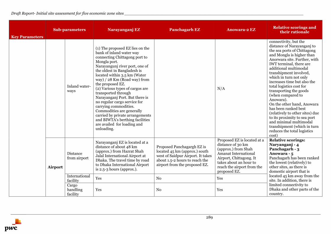
Draft Report- Initial site assessment for five economic zone sites _______________________________________________________________________
289
Key Parameters
Sub-parameters Narayanganj EZ Panchagarh EZ Anowara-2 EZRelative scorings and
their rationale
Inland water-ways
(1) The proposed EZ lies on thebank of inland water wayconnecting Chittagong port toMongla port.Narayangunj river port, one ofthe oldest in Bangladesh islocated within 3.5 km (Waterway) / 28 Km (Road way) fromthe proposed EZ.(2) Various types of cargos aretransported throughNarayanganj Port. But there isno regular cargo service forcarrying commodities.Commodities are generallycarried by private arrangementsand BIWTA's berthing facilitiesare availed for loading andunloading.
N/A
connectivity, but thedistance of Narayanganj tothe sea ports of Chittagongand Mongla is higher thanAnorwara site. Further, withIWT terminal, there areadditional multimodaltranshipment involved,which in turn not onlyincreases time but also thetotal logistics cost fortransporting the goods(when compared toAnowara).On the other hand, Anowarahas been ranked best(relatively to other sites) dueto its proximity to sea portand minimal multimodaltranshipment (which in turnreduces the total logisticscost)
Airport
Distancefrom airport
Narayanganj EZ is located at adistance of about 48 km(approx.) from Hazrat ShahJalal International Airport atDhaka. The travel time by roadto Dhaka International Airportis 2.5-3 hours (approx.).
Proposed Panchagargh EZ islocated 45 km (approx.) southwest of Saidpur Airport. It takesabout 1.5-2 hours to reach theairport from the proposed EZ.
Proposed EZ is located at adistance of 30 km(approx.) from ShahAmanat InternationalAirport, Chittagong. Ittakes about an hour toreach the airport from theproposed EZ.
Relative scorings:Naryanganj - 4Panchagarh - 3Anowara - 5Panchagarh has been rankedthe lowest (relatively) toother sites, as there isdomestic airport that islocated 45 km away from thesite. In addition, there islimited connectivity toDhaka and other parts of thecountry.
Internationalfacility
Yes No Yes
Cargohandlingfacility
Yes No Yes
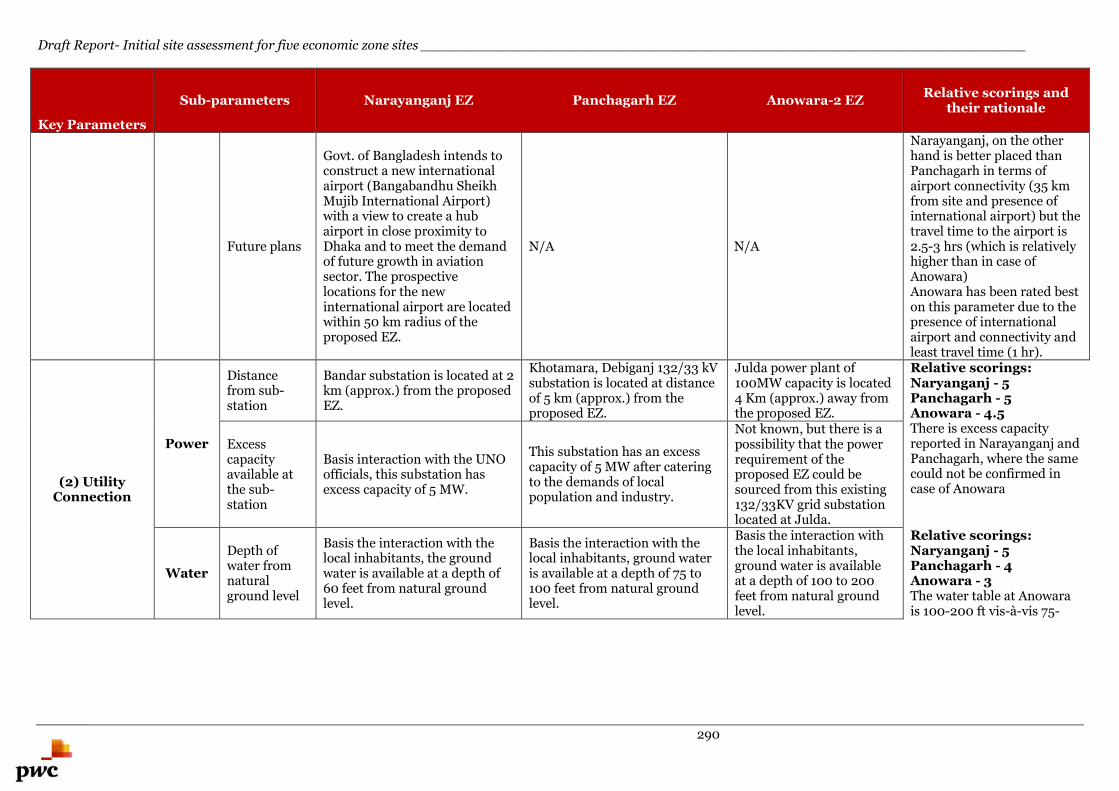
Draft Report- Initial site assessment for five economic zone sites _______________________________________________________________________
290
Key Parameters
Sub-parameters Narayanganj EZ Panchagarh EZ Anowara-2 EZRelative scorings and
their rationale
Future plans
Govt. of Bangladesh intends toconstruct a new internationalairport (Bangabandhu SheikhMujib International Airport)with a view to create a hubairport in close proximity toDhaka and to meet the demandof future growth in aviationsector. The prospectivelocations for the newinternational airport are locatedwithin 50 km radius of theproposed EZ.
N/A N/A
Narayanganj, on the otherhand is better placed thanPanchagarh in terms ofairport connectivity (35 kmfrom site and presence ofinternational airport) but thetravel time to the airport is2.5-3 hrs (which is relativelyhigher than in case ofAnowara)Anowara has been rated beston this parameter due to thepresence of internationalairport and connectivity andleast travel time (1 hr).
(2) UtilityConnection
Power
Distancefrom sub-station
Bandar substation is located at 2km (approx.) from the proposedEZ.
Khotamara, Debiganj 132/33 kVsubstation is located at distanceof 5 km (approx.) from theproposed EZ.
Julda power plant of100MW capacity is located4 Km (approx.) away fromthe proposed EZ.
Relative scorings:Naryanganj - 5Panchagarh - 5Anowara - 4.5There is excess capacityreported in Narayanganj andPanchagarh, where the samecould not be confirmed incase of Anowara
Excesscapacityavailable atthe sub-station
Basis interaction with the UNOofficials, this substation hasexcess capacity of 5 MW.
This substation has an excesscapacity of 5 MW after cateringto the demands of localpopulation and industry.
Not known, but there is apossibility that the powerrequirement of theproposed EZ could besourced from this existing132/33KV grid substationlocated at Julda.
Water
Depth ofwater fromnaturalground level
Basis the interaction with thelocal inhabitants, the groundwater is available at a depth of60 feet from natural groundlevel.
Basis the interaction with thelocal inhabitants, ground wateris available at a depth of 75 to100 feet from natural groundlevel.
Basis the interaction withthe local inhabitants,ground water is availableat a depth of 100 to 200feet from natural groundlevel.
Relative scorings:Naryanganj - 5Panchagarh - 4Anowara - 3The water table at Anowarais 100-200 ft vis-à-vis 75-
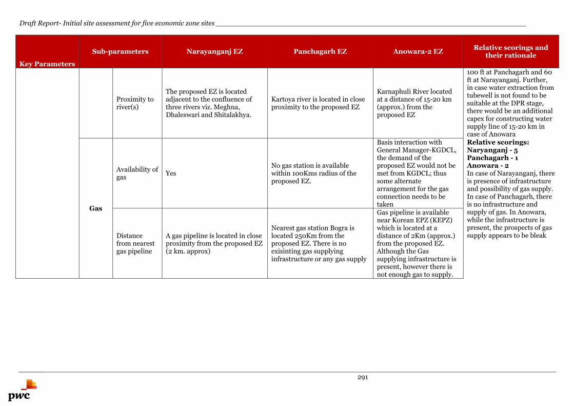
Draft Report- Initial site assessment for five economic zone sites _______________________________________________________________________
291
Key Parameters
Sub-parameters Narayanganj EZ Panchagarh EZ Anowara-2 EZRelative scorings and
their rationale
Proximity toriver(s)
The proposed EZ is locatedadjacent to the confluence ofthree rivers viz. Meghna,Dhaleswari and Shitalakhya.
Kartoya river is located in closeproximity to the proposed EZ
Karnaphuli River locatedat a distance of 15-20 km(approx.) from theproposed EZ
100 ft at Panchagarh and 60ft at Narayanganj. Further,in case water extraction fromtubewell is not found to besuitable at the DPR stage,there would be an additionalcapex for constructing watersupply line of 15-20 km incase of Anowara
Gas
Availability ofgas
YesNo gas station is availablewithin 100Kms radius of theproposed EZ.
Basis interaction withGeneral Manager-KGDCL,the demand of theproposed EZ would not bemet from KGDCL; thussome alternatearrangement for the gasconnection needs to betaken
Relative scorings:Naryanganj - 5Panchagarh - 1Anowara - 2In case of Narayanganj, thereis presence of infrastructureand possibility of gas supply.In case of Panchagarh, thereis no infrastructure andsupply of gas. In Anowara,while the infrastructure ispresent, the prospects of gassupply appears to be bleakDistance
from nearestgas pipeline
A gas pipeline is located in closeproximity from the proposed EZ(2 km. approx)
Nearest gas station Bogra islocated 250Km from theproposed EZ. There is noexisinting gas supplyinginfrastructure or any gas supply
Gas pipeline is availablenear Korean EPZ (KEPZ)which is located at adistance of 2Km (approx.)from the proposed EZ.Although the Gassupplying infrastructure ispresent, however there isnot enough gas to supply.
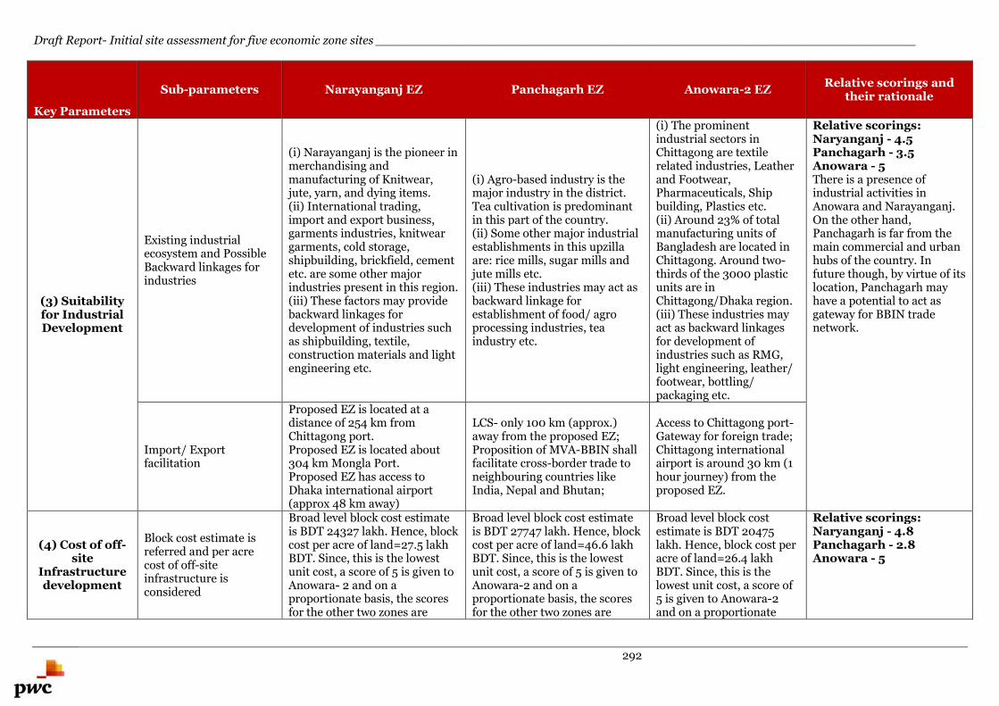
Draft Report- Initial site assessment for five economic zone sites _______________________________________________________________________
292
Key Parameters
Sub-parameters Narayanganj EZ Panchagarh EZ Anowara-2 EZRelative scorings and
their rationale
(3) Suitabilityfor IndustrialDevelopment
Existing industrialecosystem and PossibleBackward linkages forindustries
(i) Narayanganj is the pioneer inmerchandising andmanufacturing of Knitwear,jute, yarn, and dying items.(ii) International trading,import and export business,garments industries, knitweargarments, cold storage,shipbuilding, brickfield, cementetc. are some other majorindustries present in this region.(iii) These factors may providebackward linkages fordevelopment of industries suchas shipbuilding, textile,construction materials and lightengineering etc.
(i) Agro-based industry is themajor industry in the district.Tea cultivation is predominantin this part of the country.(ii) Some other major industrialestablishments in this upzillaare: rice mills, sugar mills andjute mills etc.(iii) These industries may act asbackward linkage forestablishment of food/ agroprocessing industries, teaindustry etc.
(i) The prominentindustrial sectors inChittagong are textilerelated industries, Leatherand Footwear,Pharmaceuticals, Shipbuilding, Plastics etc.(ii) Around 23% of totalmanufacturing units ofBangladesh are located inChittagong. Around two-thirds of the 3000 plasticunits are inChittagong/Dhaka region.(iii) These industries mayact as backward linkagesfor development ofindustries such as RMG,light engineering, leather/footwear, bottling/packaging etc.
Relative scorings:Naryanganj - 4.5Panchagarh - 3.5Anowara - 5There is a presence ofindustrial activities inAnowara and Narayanganj.On the other hand,Panchagarh is far from themain commercial and urbanhubs of the country. Infuture though, by virtue of itslocation, Panchagarh mayhave a potential to act asgateway for BBIN tradenetwork.
Import/ Exportfacilitation
Proposed EZ is located at adistance of 254 km fromChittagong port.Proposed EZ is located about304 km Mongla Port.Proposed EZ has access toDhaka international airport(approx 48 km away)
LCS- only 100 km (approx.)away from the proposed EZ;Proposition of MVA-BBIN shallfacilitate cross-border trade toneighbouring countries likeIndia, Nepal and Bhutan;
Access to Chittagong port-Gateway for foreign trade;Chittagong internationalairport is around 30 km (1hour journey) from theproposed EZ.
(4) Cost of off-site
Infrastructuredevelopment
Block cost estimate isreferred and per acrecost of off-siteinfrastructure isconsidered
Broad level block cost estimateis BDT 24327 lakh. Hence, blockcost per acre of land=27.5 lakhBDT. Since, this is the lowestunit cost, a score of 5 is given toAnowara- 2 and on aproportionate basis, the scoresfor the other two zones are
Broad level block cost estimateis BDT 27747 lakh. Hence, blockcost per acre of land=46.6 lakhBDT. Since, this is the lowestunit cost, a score of 5 is given toAnowara-2 and on aproportionate basis, the scoresfor the other two zones are
Broad level block costestimate is BDT 20475lakh. Hence, block cost peracre of land=26.4 lakhBDT. Since, this is thelowest unit cost, a score of5 is given to Anowara-2and on a proportionate
Relative scorings:Naryanganj - 4.8Panchagarh - 2.8Anowara - 5
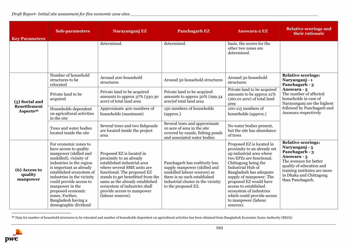
Draft Report- Initial site assessment for five economic zone sites _______________________________________________________________________
293
Key Parameters
Sub-parameters Narayanganj EZ Panchagarh EZ Anowara-2 EZRelative scorings and
their rationale
determined. determined. basis, the scores for theother two zones aredetermined.
(5) Social andResettlement
Aspects96
Number of householdstructures to berelocated
Around 200 householdstructures
Around 50 household structuresAround 50 householdstructures
Relative scorings:Naryanganj - 1Panchagarh - 3Anowara - 5The number of affectedhouseholds in case ofNarayanganj are the highestfollowed by Panchagarh andAnowara respectively
Private land to beacquired
Private land to be acquiredamounts to approx 37% (330.30acre) of total land area
Private land to be acquiredamounts to approx 50% (299.34acre)of total land area
Private land to be acquiredamounts to be approx 21%(160.01 acre) of total landarea
Households dependenton agricultural activitiesin the site
Approximate 400 numbers of
households (maximum)
150 numbers of households
(approx.)
100-115 numbers of
households (approx.)
Trees and water bodieslocated inside the site
Several trees and two fishpondsare located inside the projectarea
Several trees and approximate10 acre of area in the sitecovered by canals, fishing pondsand associated water bodies
No water bodies present,but the site has abundanceof trees
(6) Access toquality
manpower
For economic zones tohave access to qualitymanpower (skilled andunskilled), vicinity ofindustries in the regionis important as alreadyestablished ecosystem ofindustries in the vicinitycould provide access tomanpower in theproposed economiczones. Further,Bangladesh having ademographic dividend
Proposed EZ is located inproximity to an alreadyestablished industrial areawhere several SME units arefunctional. The proposed EZstands to get benefitted from thesame as the already establishedecosystem of industries shallprovide access to manpower(labour sources).
Panchagarh has realtively lesssupply manpower (skilled andunskilled labour sources) asthere is no such establishedindustrial cluster in the vicinityto the proposed EZ.
Proposed EZ is located inproximity to an already setup industrial area wheretwo EPZs are functional.Chittagong being theIndustrial Hub ofBangladesh has adequatesupply of manpower. Theproposed EZ would haveaccess to establishedecosystem of industrieswhich could provide accessto manpower (laboursources).
Relative scorings:Naryanganj - 5Panchagarh - 3Anowara - 5The avenues for betterquality of education andtraining institutes are morein Dhaka and Chittagongthan Panchagarh.
96 Data for number of household structures to be relocated and number of households dependent on agricultural activities has been obtained from Bangladesh Economic Zones Authority (BEZA)
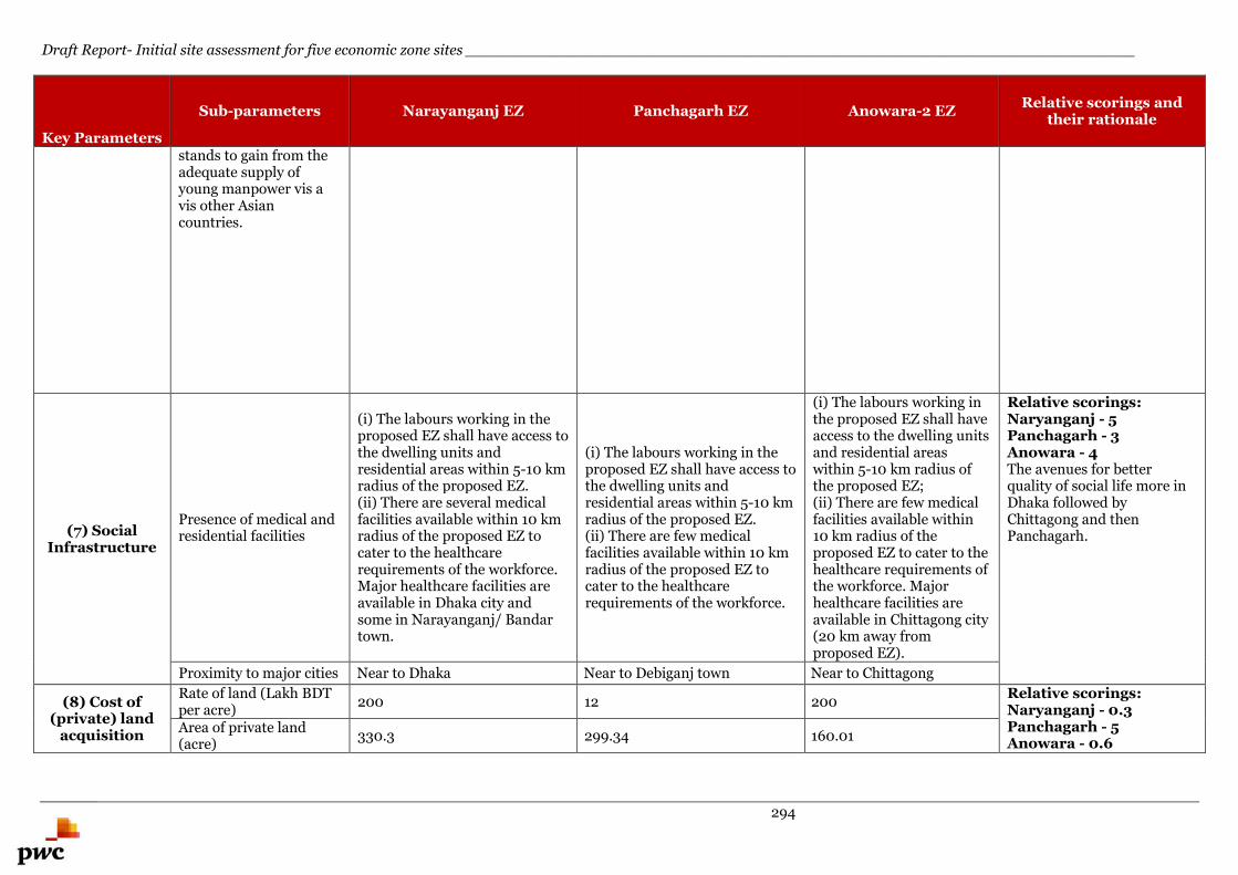
Draft Report- Initial site assessment for five economic zone sites _______________________________________________________________________
294
Key Parameters
Sub-parameters Narayanganj EZ Panchagarh EZ Anowara-2 EZRelative scorings and
their rationale
stands to gain from theadequate supply ofyoung manpower vis avis other Asiancountries.
(7) SocialInfrastructure
Presence of medical andresidential facilities
(i) The labours working in theproposed EZ shall have access tothe dwelling units andresidential areas within 5-10 kmradius of the proposed EZ.(ii) There are several medicalfacilities available within 10 kmradius of the proposed EZ tocater to the healthcarerequirements of the workforce.Major healthcare facilities areavailable in Dhaka city andsome in Narayanganj/ Bandartown.
(i) The labours working in theproposed EZ shall have access tothe dwelling units andresidential areas within 5-10 kmradius of the proposed EZ.(ii) There are few medicalfacilities available within 10 kmradius of the proposed EZ tocater to the healthcarerequirements of the workforce.
(i) The labours working inthe proposed EZ shall haveaccess to the dwelling unitsand residential areaswithin 5-10 km radius ofthe proposed EZ;(ii) There are few medicalfacilities available within10 km radius of theproposed EZ to cater to thehealthcare requirements ofthe workforce. Majorhealthcare facilities areavailable in Chittagong city(20 km away fromproposed EZ).
Relative scorings:Naryanganj - 5Panchagarh - 3Anowara - 4The avenues for betterquality of social life more inDhaka followed byChittagong and thenPanchagarh.
Proximity to major cities Near to Dhaka Near to Debiganj town Near to Chittagong
(8) Cost of(private) land
acquisition
Rate of land (Lakh BDTper acre)
200 12 200Relative scorings:Naryanganj - 0.3Panchagarh - 5Anowara - 0.6
Area of private land(acre)
330.3 299.34 160.01
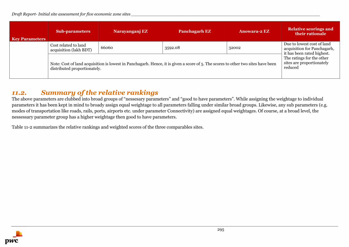
Draft Report- Initial site assessment for five economic zone sites _______________________________________________________________________
295
Key Parameters
Sub-parameters Narayanganj EZ Panchagarh EZ Anowara-2 EZRelative scorings and
their rationale
Cost related to landacquisition (lakh BDT)
66060 3592.08 32002Due to lowest cost of landacquisition for Panchagarh,it has been rated highest.The ratings for the othersites are proportionatelyreduced
Note: Cost of land acquisition is lowest in Panchagarh. Hence, it is given a score of 5. The scores to other two sites have beendistributed proportionately.
11.2. Summary of the relative rankingsThe above parameters are clubbed into broad groups of “nessesary parameters” and “good to have parameters”. While assigning the weightage to individual
parameters it has been kept in mind to broady assign equal weightage to all parameters falling under similar broad groups. Likewise, any sub parameters (e.g.
modes of transportation like roads, rails, ports, airports etc. under parameter Connectivity) are assigned equal weightages. Of course, at a broad level, the
nessessary parameter group has a higher weightage then good to have parameters.
Table 11-2 summarizes the relative rankings and weighted scores of the three comparables sites.
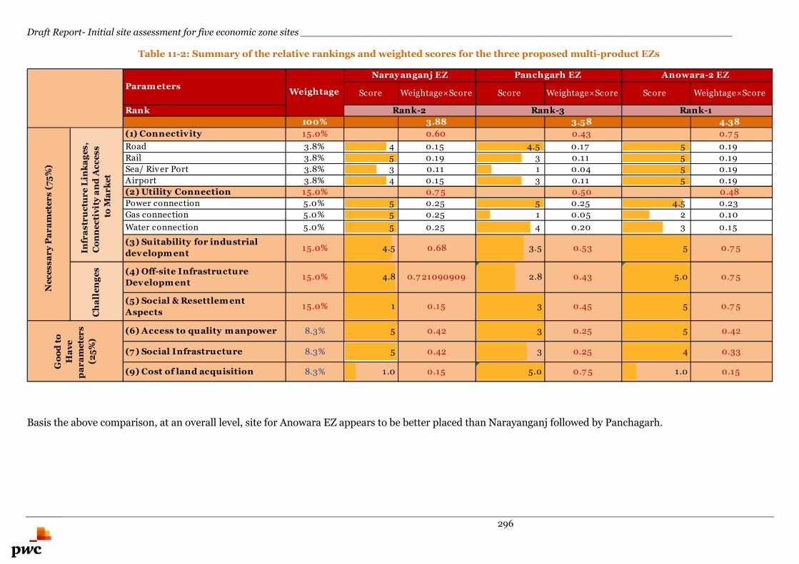
Draft Report- Initial site assessment for five economic zone sites _______________________________________________________________________
296
Table 11-2: Summary of the relative rankings and weighted scores for the three proposed multi-product EZs
Basis the above comparison, at an overall level, site for Anowara EZ appears to be better placed than Narayanganj followed by Panchagarh.
Score Weightage×Score Score Weightage×Score Score Weightage×Score
Rank
100% 3.88 3.58 4.38
(1) Connectivity 15.0% 0.60 0.43 0.7 5
Road 3.8% 4 0.15 4.5 0.17 5 0.19
Rail 3.8% 5 0.19 3 0.11 5 0.19
Sea/ River Port 3.8% 3 0.11 1 0.04 5 0.19
Airport 3.8% 4 0.15 3 0.11 5 0.19
(2) Utility Connection 15.0% 0.7 5 0.50 0.48
Power connection 5.0% 5 0.25 5 0.25 4.5 0.23
Gas connection 5.0% 5 0.25 1 0.05 2 0.10
Water connection 5.0% 5 0.25 4 0.20 3 0.15
(3) Suitability for industrial
developm ent15.0% 4.5 0.68 3.5 0.53 5 0.7 5
(4) Off-site Infrastructure
Developm ent15.0% 4.8 0.7 21090909 2.8 0.43 5.0 0.7 5
(5) Social & Resettlem ent
Aspects15.0% 1 0.15 3 0.45 5 0.7 5
(6) Access to quality m anpower 8.3% 5 0.42 3 0.25 5 0.42
(7 ) Social Infrastructure 8.3% 5 0.42 3 0.25 4 0.33
(9) Cost of land acquisition 8.3% 1.0 0.15 5.0 0.7 5 1.0 0.15
Rank-2 Rank-3 Rank-1
Weightage
Narayanganj EZ Panchgarh EZ Anowara-2 EZ
Ch
all
en
ge
s
Ne
ce
ss
ar
yP
ar
am
ete
rs
(75
%)
Go
od
to
Ha
ve
pa
ra
me
ter
s
(25
%)
Infr
as
tru
ctu
re
Lin
ka
ge
s,
Co
nn
ec
tiv
ity
an
dA
cc
es
s
toM
ar
ke
t
Param eters

Draft Report- Initial site assessment for five economic zone sites_______________________________________________________________________
297
Annexures
298
Annexure A. - Questionnaire
Name of the site: Date: Time:
Name of the Project: Initial site assessment of five EZ/EZs at Narayanganj, Panchagarh, Anowara - 2(Chittagong), Dhaka IT and Sabrang Tourism (Cox's Bazar)
Name & contact details of official met:
A.
General
1. Land availability - Is there enoughland for demand?
2. Total area of site in Acres/square meters
3. Ownership - Does land need to beassembled?
4. Title - Is the land in public orprivate ownership?
5 Adjacencies - Is land contiguous withother industrial zones?
6 Is the identified land is fully acquired
7 Whether the boundary points areearmarked at site
8 Is the entire proposed land is inpossession of owner
299
Name of the site: Date: Time:
9 Nature of land profile - Flat / Slopping /Hilly terrain/ undulating
10 Site layout with contours if availableplease collect.
11 Is it agriculture land – if so is it B.C soil
12 Ground water is available at a depth of
13 Is ground water potable
14 MSL / MFL
15 Seismic zone
16 Flood / cyclone history, if any
17 Rainfall (avg)
18 PCB guidelines
19 Development control Rules (Like DTCP)
20 FMB sketch of the land
300
Name of the site: Date: Time:
21 Land shape/configuration - square orrectangular preferred
22 Adjacent properties - on EAST
on WEST
on North
on South
23 Proximity - Is the site close to otherindustrial facilities?
24 In close proximity to existing residentialcommunities?
25 In close proximity to proposedresidential communities?
26 Buildings - Will buildings have to beremoved from the site?
27 Roads - Are there existing roads on thesite?
301
Name of the site: Date: Time:
28 Are there schools, community facilities,police stations in the region?
29 Labor -Is the site in close proximity toavailable labor?
30 Public Transportation - Is there publictransportation to the site?
31. Local Development Plan issues
32. Name of Local Body, where site is located
33. Name of nearest town if located in aremote place
34. Name of Village, Tehsil and District,where site is located
35. Nearest Federal Highway and distancefrom site
Federal Road/ State Road / Major district road /Village road – Details -7
36. Nearest Airport name anddistance from site
37. Nearest Railway station anddistance from site
38 Co-ordinates of the site N, E
39 Delineation map of identified EZ
302
Name of the site: Date: Time:
40 Whether the site is already developed –Is it Green field
B Road
41. Approach road name
42. Distance from approach road to site
43. Type of road
44. Number of lanes of Approach road
45. Does the road require strengthening - Ifyes length and width of the road
Length - NO Width -
46. Does the approach road having streetlight
C. Water Bodies
47. Name of nearest water body
48. Type of water body
49. Nature of water body (perennial orseasonal)
50. Information on water availability for
303
Name of the site: Date: Time:
consumption
D. Water Source
51 Existing water source if any and itscapacity
52 Source of proposed water supply anddistance
53 Are bore holes used in the vicinity?Ground water level and distance from site
54 Nearest external source of water –available quantity, intake point, etc.
E Drain
55. Any existing storm drain found adjacentto site – if yes – distance?
56. In case of non-availability of drainnetwork – is it necessary to providedrain network at the proposed site – ifso where and how far will be thedischarge point?
F Sewer
57. Is there network available nearby site, ifso at what distance?
58. Is there existing sewerage treatment
304
Name of the site: Date: Time:
Plant system nearby? If so efficiency ofthe same? Spare capacity available?
G Soil conditions
59. Has soil testing been done?
60. If yes, to provide the Test Report
61. Arrange to dig trial pit, if possible & notedown the observations - or details ontype of foundation carried out for nearbystructures. – Footing/Pile/ Raft etc.
H Power
62 Nearest Substation – distance & totalCapacity , available capacity
63 Supply voltage available at or near site
64 Power availability in hours per day
65 Telecommunications - Are land linesavailable in the vicinity?
66 Are there telecom issues in the region?
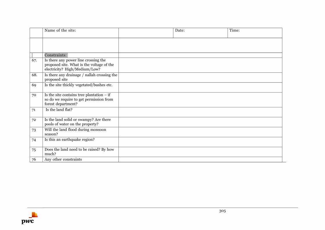
305
Name of the site: Date: Time:
I Constraints:
67. Is there any power line crossing theproposed site. What is the voltage of theelectricity? High/Medium/Low?
68. Is there any drainage / nallah crossing theproposed site
69 Is the site thickly vegetated/bushes etc.
70 Is the site contains tree plantation – ifso do we require to get permission fromforest department?
71 Is the land flat?
72 Is the land solid or swampy? Are therepools of water on the property?
73 Will the land flood during monsoonseason?
74 Is this an earthquake region?
75 Does the land need to be raised? By howmuch?
76 Any other constraints
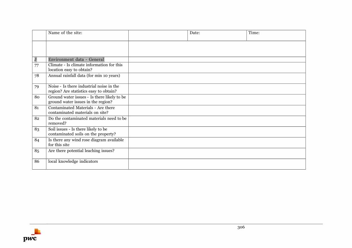
306
Name of the site: Date: Time:
J Environment data - General
77 Climate - Is climate information for thislocation easy to obtain?
78 Annual rainfall data (for min 10 years)
79 Noise - Is there industrial noise in theregion? Are statistics easy to obtain?
80 Ground water issues - Is there likely to beground water issues in the region?
81 Contaminated Materials - Are therecontaminated materials on site?
82 Do the contaminated materials need to beremoved?
83 Soil issues - Is there likely to becontaminated soils on the property?
84 Is there any wind rose diagram availablefor this site
85 Are there potential leaching issues?
86 local knowledge indicators
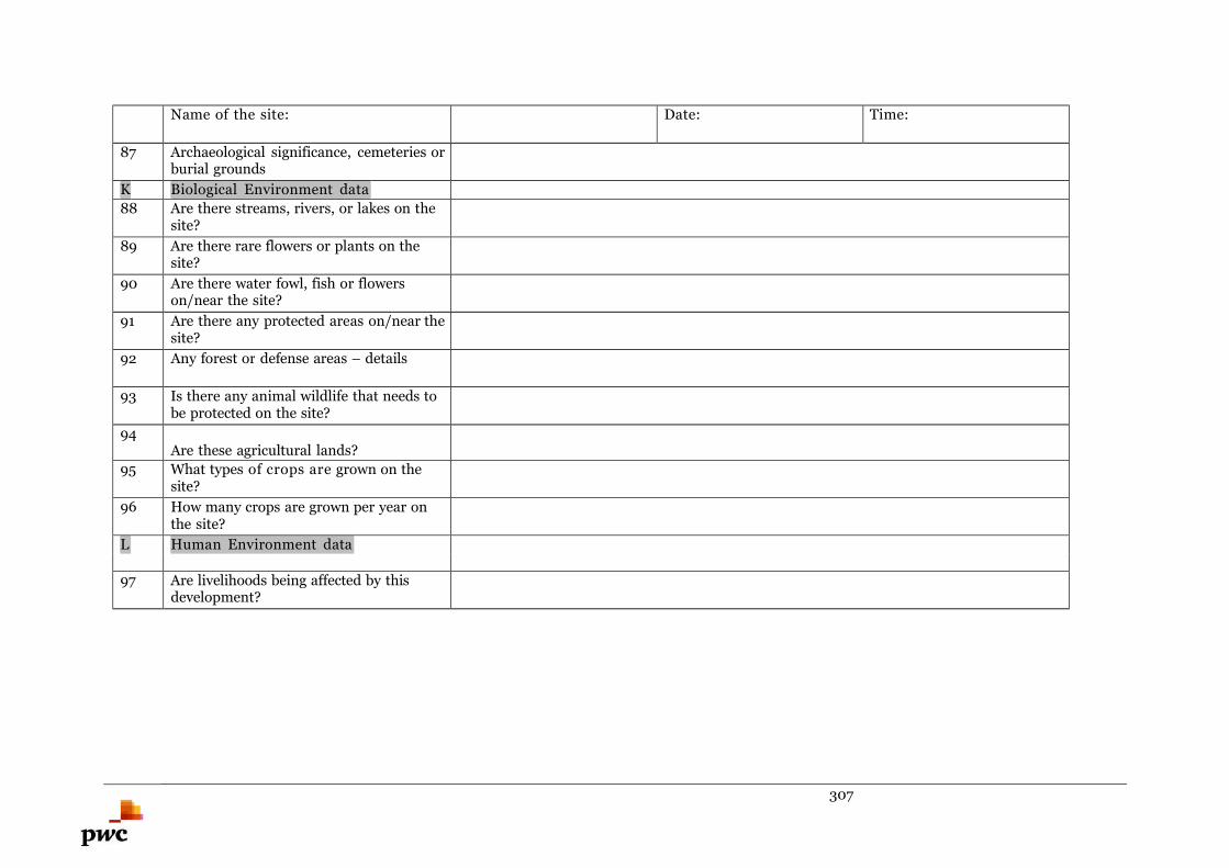
307
Name of the site: Date: Time:
87 Archaeological significance, cemeteries orburial grounds
K Biological Environment data
88 Are there streams, rivers, or lakes on thesite?
89 Are there rare flowers or plants on thesite?
90 Are there water fowl, fish or flowerson/near the site?
91 Are there any protected areas on/near thesite?
92 Any forest or defense areas – details
93 Is there any animal wildlife that needs tobe protected on the site?
94Are these agricultural lands?
95 What types of crops are grown on thesite?
96 How many crops are grown per year onthe site?
L Human Environment data
97 Are livelihoods being affected by thisdevelopment?
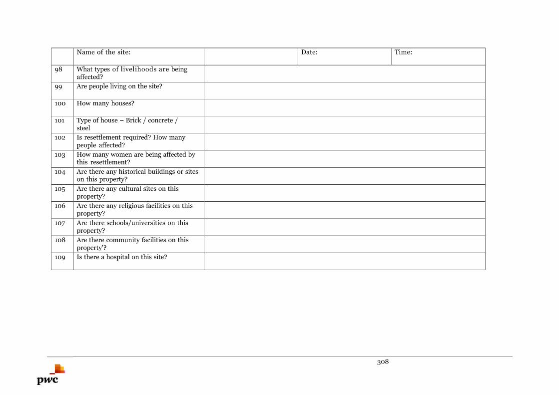
308
Name of the site: Date: Time:
98 What types of livelihoods are beingaffected?
99 Are people living on the site?
100 How many houses?
101 Type of house – Brick / concrete /steel
102 Is resettlement required? How manypeople affected?
103 How many women are being affected bythis resettlement?
104 Are there any historical buildings or siteson this property?
105 Are there any cultural sites on thisproperty?
106 Are there any religious facilities on thisproperty?
107 Are there schools/universities on thisproperty?
108 Are there community facilities on thisproperty'?
109 Is there a hospital on this site?
309
Name of the site: Date: Time:
110 Are there government offices or facilitieson this site?
111 Do any of the above facilities need to beprotected?
M Material availability (with ratesifpossible)
112. Schedule of rates for construction (As perGovernment)
N Stakeholders - communication withinterested parties
113 public bodies:
114 private:
115 pressure groups:
310
Site visit conducted by:
1.
2.
3.
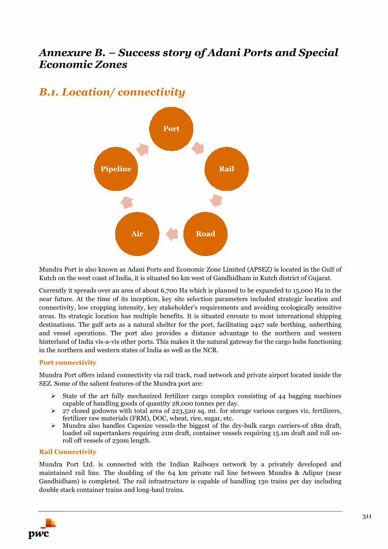
311
Annexure B. – Success story of Adani Ports and SpecialEconomic Zones
B.1. Location/ connectivity
Mundra Port is also known as Adani Ports and Economic Zone Limited (APSEZ) is located in the Gulf of
Kutch on the west coast of India, it is situated 60 km west of Gandhidham in Kutch district of Gujarat.
Currently it spreads over an area of about 6,700 Ha which is planned to be expanded to 15,000 Ha in the
near future. At the time of its inception, key site selection parameters included strategic location and
connectivity, low cropping intensity, key stakeholder's requirements and avoiding ecologically sensitive
areas. Its strategic location has multiple benefits. It is situated enroute to most international shipping
destinations. The gulf acts as a natural shelter for the port, facilitating 24x7 safe berthing, unberthing
and vessel operations. The port also provides a distance advantage to the northern and western
hinterland of India vis-a-vis other ports. This makes it the natural gateway for the cargo hubs functioning
in the northern and western states of India as well as the NCR.
Port connectivity
Mundra Port offers inland connectivity via rail track, road network and private airport located inside the
SEZ. Some of the salient features of the Mundra port are:
State of the art fully mechanized fertilizer cargo complex consisting of 44 bagging machinescapable of handling goods of quantity 28,000 tonnes per day.
27 closed godowns with total area of 223,520 sq. mt. for storage various cargoes viz. fertilizers,fertilizer raw materials (FRM), DOC, wheat, rice, sugar, etc.
Mundra also handles Capesize vessels-the biggest of the dry-bulk cargo carriers-of 18m draft,loaded oil supertankers requiring 21m draft, container vessels requiring 15.1m draft and roll on-roll off vessels of 230m length.
Rail Connectivity
Mundra Port Ltd. is connected with the Indian Railways network by a privately developed and
maintained rail line. The doubling of the 64 km private rail line between Mundra & Adipur (near
Gandhidham) is completed. The rail infrastructure is capable of handling 130 trains per day including
double stack container trains and long-haul trains.
Port
Rail
RoadAir
Pipeline
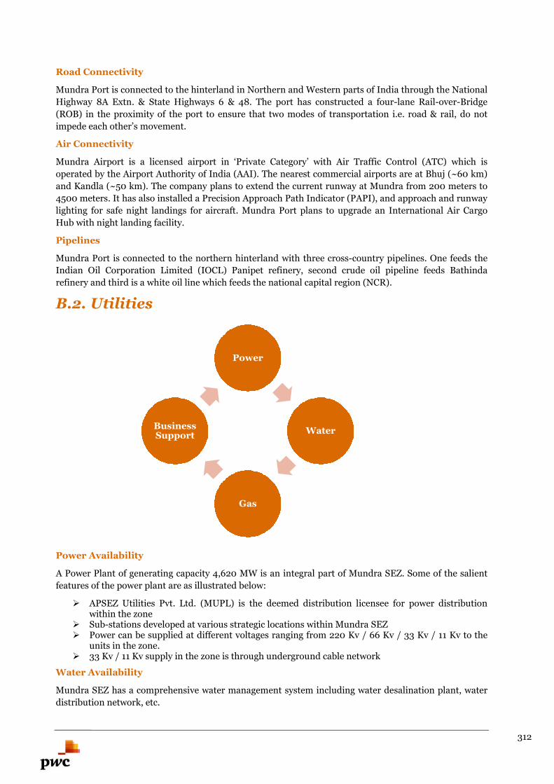
312
Road Connectivity
Mundra Port is connected to the hinterland in Northern and Western parts of India through the National
Highway 8A Extn. & State Highways 6 & 48. The port has constructed a four-lane Rail-over-Bridge
(ROB) in the proximity of the port to ensure that two modes of transportation i.e. road & rail, do not
impede each other’s movement.
Air Connectivity
Mundra Airport is a licensed airport in ‘Private Category’ with Air Traffic Control (ATC) which is
operated by the Airport Authority of India (AAI). The nearest commercial airports are at Bhuj (~60 km)
and Kandla (~50 km). The company plans to extend the current runway at Mundra from 200 meters to
4500 meters. It has also installed a Precision Approach Path Indicator (PAPI), and approach and runway
lighting for safe night landings for aircraft. Mundra Port plans to upgrade an International Air Cargo
Hub with night landing facility.
Pipelines
Mundra Port is connected to the northern hinterland with three cross-country pipelines. One feeds the
Indian Oil Corporation Limited (IOCL) Panipet refinery, second crude oil pipeline feeds Bathinda
refinery and third is a white oil line which feeds the national capital region (NCR).
B.2. Utilities
Power Availability
A Power Plant of generating capacity 4,620 MW is an integral part of Mundra SEZ. Some of the salient
features of the power plant are as illustrated below:
APSEZ Utilities Pvt. Ltd. (MUPL) is the deemed distribution licensee for power distributionwithin the zone
Sub-stations developed at various strategic locations within Mundra SEZ Power can be supplied at different voltages ranging from 220 Kv / 66 Kv / 33 Kv / 11 Kv to the
units in the zone. 33 Kv / 11 Kv supply in the zone is through underground cable network
Water Availability
Mundra SEZ has a comprehensive water management system including water desalination plant, water
distribution network, etc.
Power
Water
Gas
BusinessSupport
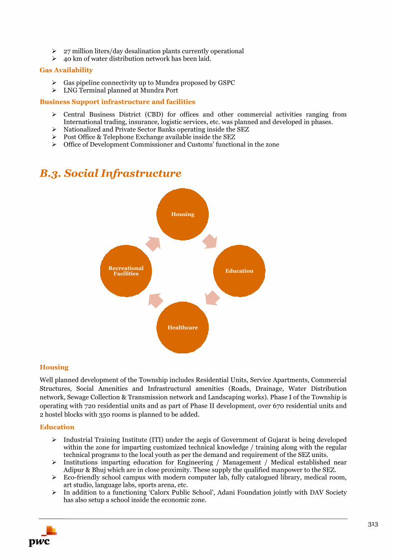
313
27 million liters/day desalination plants currently operational 40 km of water distribution network has been laid.
Gas Availability
Gas pipeline connectivity up to Mundra proposed by GSPC LNG Terminal planned at Mundra Port
Business Support infrastructure and facilities
Central Business District (CBD) for offices and other commercial activities ranging fromInternational trading, insurance, logistic services, etc. was planned and developed in phases.
Nationalized and Private Sector Banks operating inside the SEZ Post Office & Telephone Exchange available inside the SEZ Office of Development Commissioner and Customs’ functional in the zone
B.3. Social Infrastructure
Housing
Well planned development of the Township includes Residential Units, Service Apartments, Commercial
Structures, Social Amenities and Infrastructural amenities (Roads, Drainage, Water Distribution
network, Sewage Collection & Transmission network and Landscaping works). Phase I of the Township is
operating with 720 residential units and as part of Phase II development, over 670 residential units and
2 hostel blocks with 350 rooms is planned to be added.
Education
Industrial Training Institute (ITI) under the aegis of Government of Gujarat is being developedwithin the zone for imparting customized technical knowledge / training along with the regulartechnical programs to the local youth as per the demand and requirement of the SEZ units.
Institutions imparting education for Engineering / Management / Medical established nearAdipur & Bhuj which are in close proximity. These supply the qualified manpower to the SEZ.
Eco-friendly school campus with modern computer lab, fully catalogued library, medical room,art studio, language labs, sports arena, etc.
In addition to a functioning ‘Calorx Public School’, Adani Foundation jointly with DAV Societyhas also setup a school inside the economic zone.
Housing
Education
Healthcare
RecreationalFacilities
314
Healthcare
A 100 Bed Multi-specialty Hospital, built by Adani Group and managed by Sterling Hospital, is
operational inside the SEZ. Some of the features of the hospital are:
Qualified medical and paramedical staff trained to handle emergencies A fully-equipped state-of-the-art diagnostic laboratory A well-equipped radiology department, with computerized tomography machine for CT Scans A mobile Intensive Care Unit (ICU on Wheels) Operation Theatres, with advanced surgical equipment and sterile facility, to carry out a range of
surgical operations Fully-equipped physiotherapy centre
Recreation Facilities
Mundra SEZ offers the following recreational facilities:
Multiplex, sports and recreation club, community halls, libraries, resorts, restaurants, hotels Neighbourhood parks, playgrounds and a golf course Shopping centres and malls Business Hotels of different categories catering to the needs of the business traveller
B.4. Availability of Manpower
According to a study conducted by TELOS Consultancy Services Pvt. Ltd. on Mudra SEZ, the total
manpower requirement for the construction and for operation of the Mundra SEZ for 6,000 Ha
industrial area could be around 3 lakhs. Being located in Gujarat, one of the major industrial hubs of
India, Mudra SEZ has an added advantage in terms of workforce availability. The current overall skill
training capacity of Gujarat is more than 13 lakhs according to the Labor & Employment Department,
Government of Gujarat. There are total 30 universities in Gujarat. Further it has 50+ engineering and
management institutes.
B.5. Proactive Support from Government
The Development Commissioner (DC) is the nodal officer for SEZs. He is mandated to assist in the
resolution of problems faced by the SEZ developer or the units in the SEZ. DC of Mundra SEZ has
already been appointed & is available in Mundra Port SEZ (MPSEZ). A Unit Approval Committee,
consisting of the Development Commissioner, Custom authorities and representative of the State
Government, monitors MPSEZ units on an annual basis.
Besides the Government of India benefits, the Gujarat State government has also designed apolicy that offers added incentives to the SEZ industrial units. The SEZ provides excellentflexibility through:
Single Window Clearance for statutory requirements Licenses are not required for imports into MPSEZ. This applies to second hand machinery also. Waiver of routine Customs examination of imports and exports Clearance of Export consignments on self-certification 100% FDI permitted through the automatic approval route except the negative list Relaxed labour policy specifically for SEZ units (as per Gujarat State Labor policy for SEZ) Freedom to realize and repatriate export proceeds within 12 months No limit on quantum of DTA sales Foreign investments allowed for items generally reserved for the Small Scale sector Contract manufacturing permitted with units outside the SEZ or in other SEZs
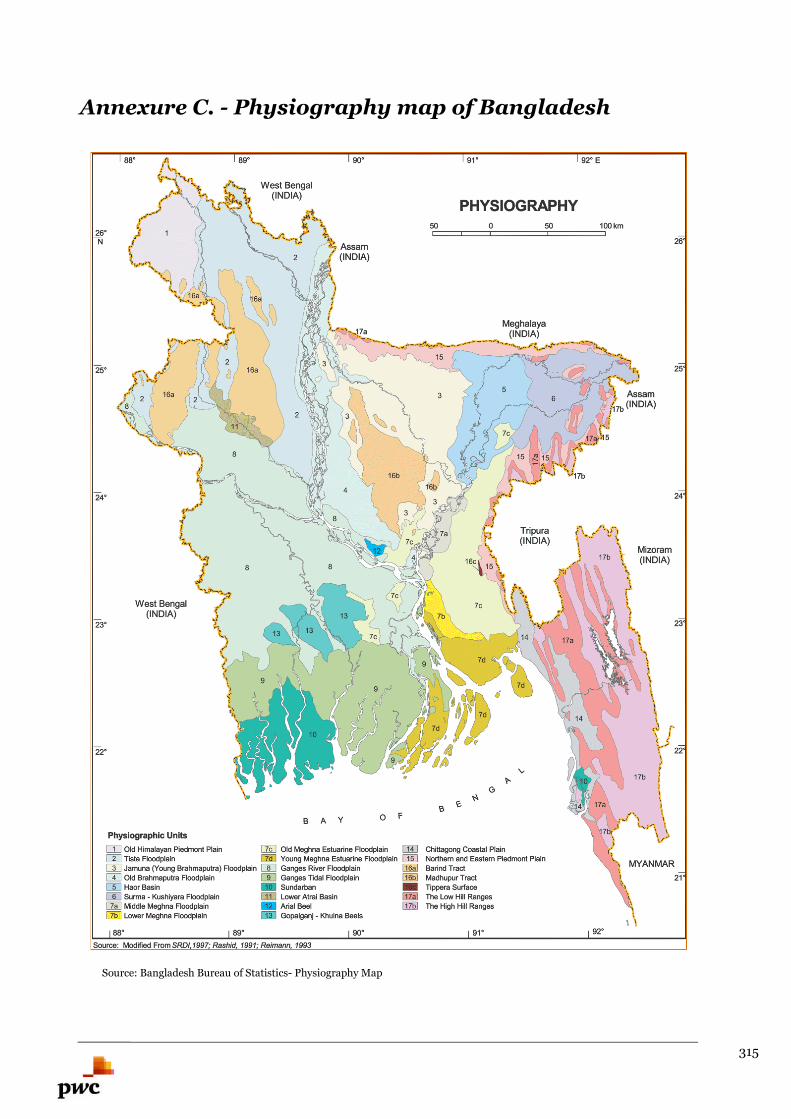
315
Annexure C. - Physiography map of Bangladesh
Ann Source: Bangladesh Bureau of Statistics- Physiography Map
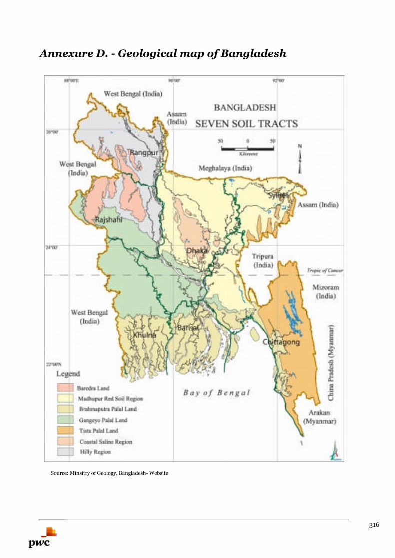
316
Annexure D. - Geological map of Bangladesh
Ann Source: Minsitry of Geology, Bangladesh- Website
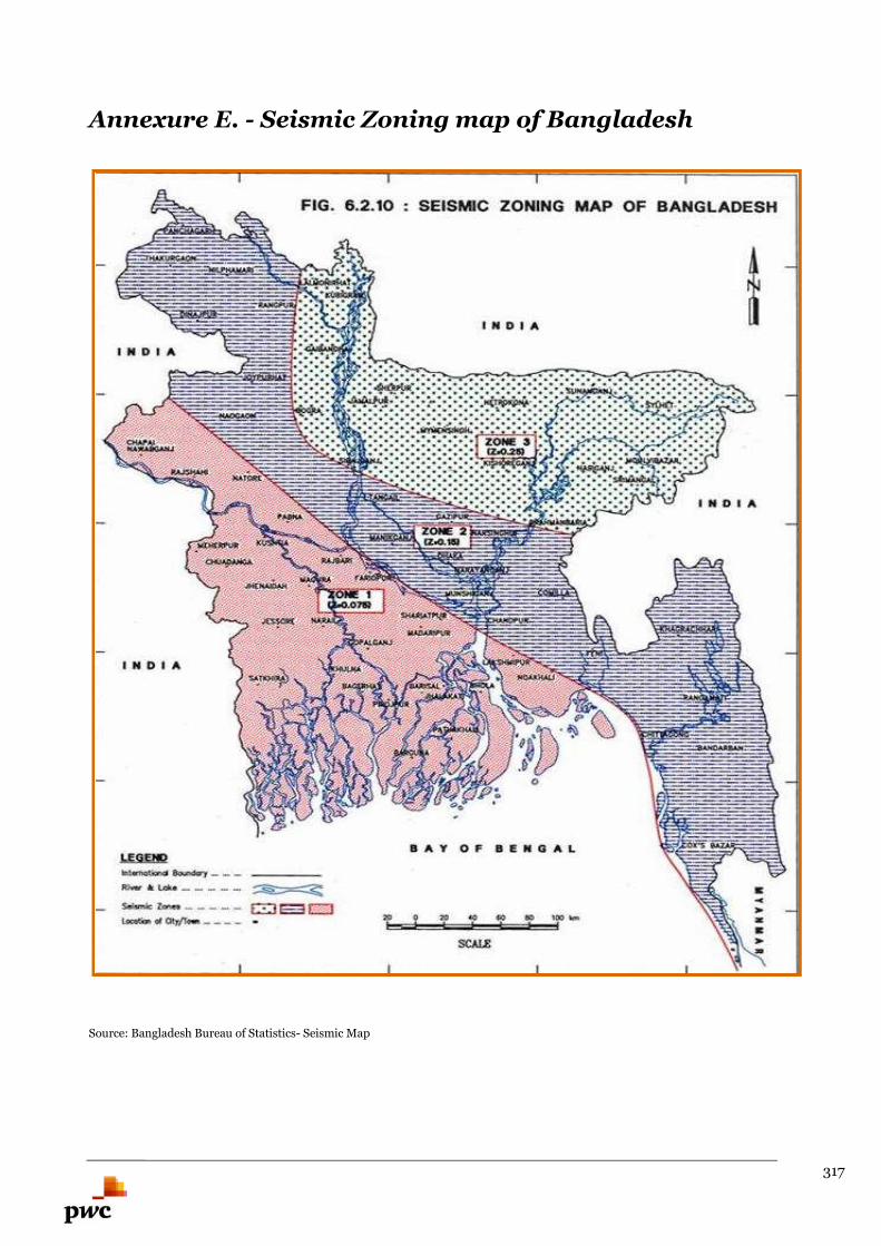
317
Annexure E. - Seismic Zoning map of Bangladesh
Source: Bangladesh Bureau of Statistics- Seismic Map
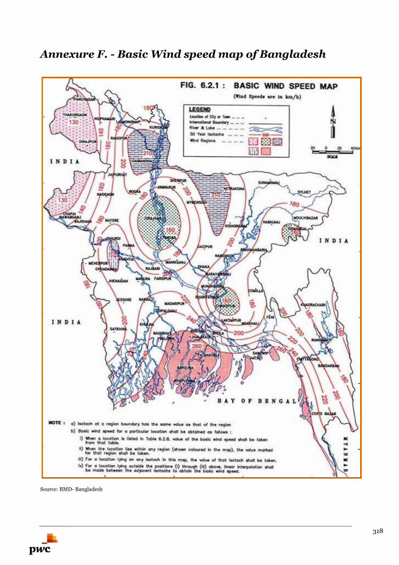
318
Annexure F. - Basic Wind speed map of Bangladesh
Source: BMD- Bangladesh
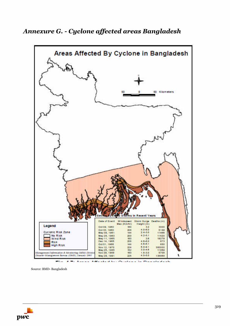
319
Annexure G. - Cyclone affected areas Bangladesh
Ann Source: BMD- Bangladesh
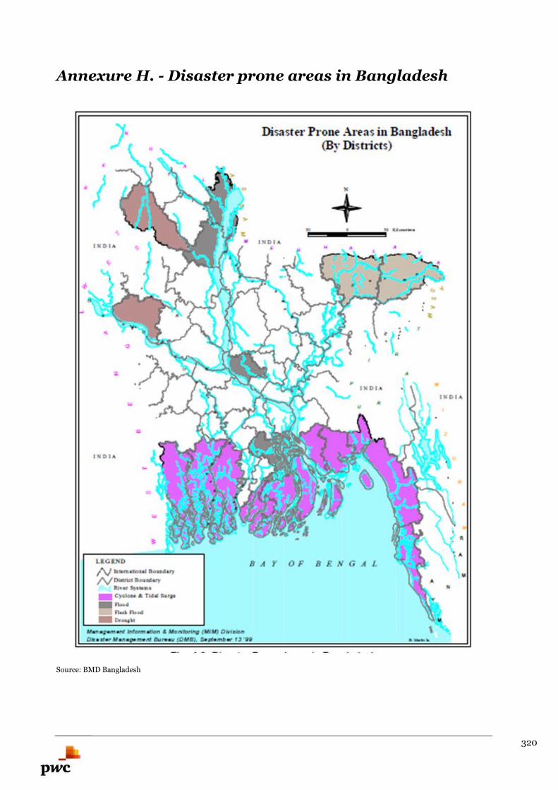
320
Annexure H. - Disaster prone areas in Bangladesh
Source: BMD Bangladesh
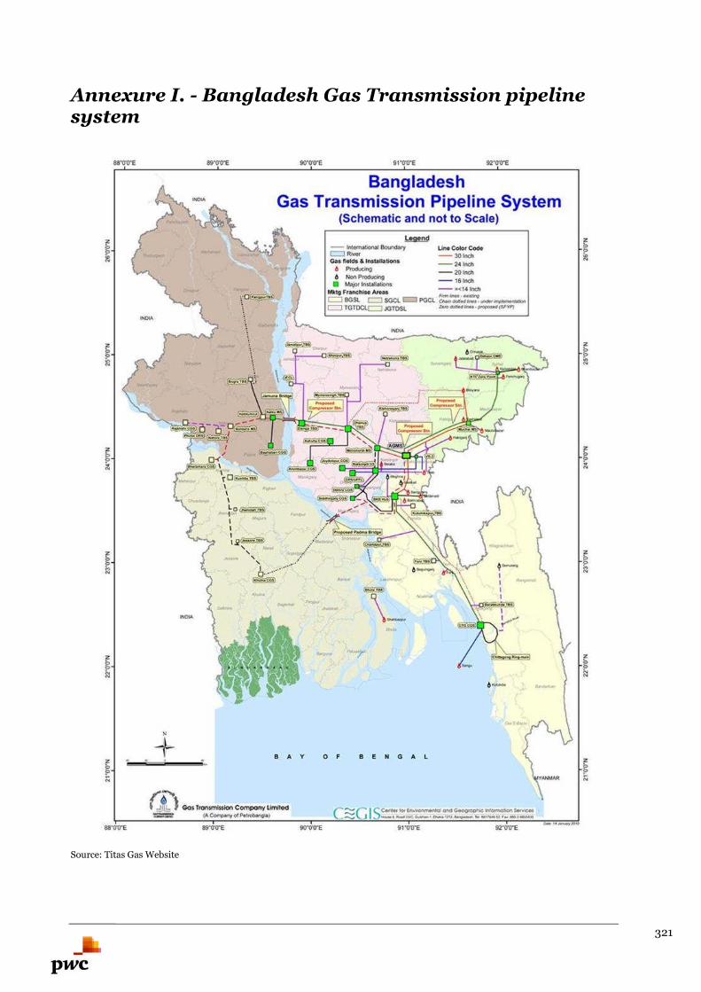
321
Annexure I. - Bangladesh Gas Transmission pipelinesystem
Source: Titas Gas Website
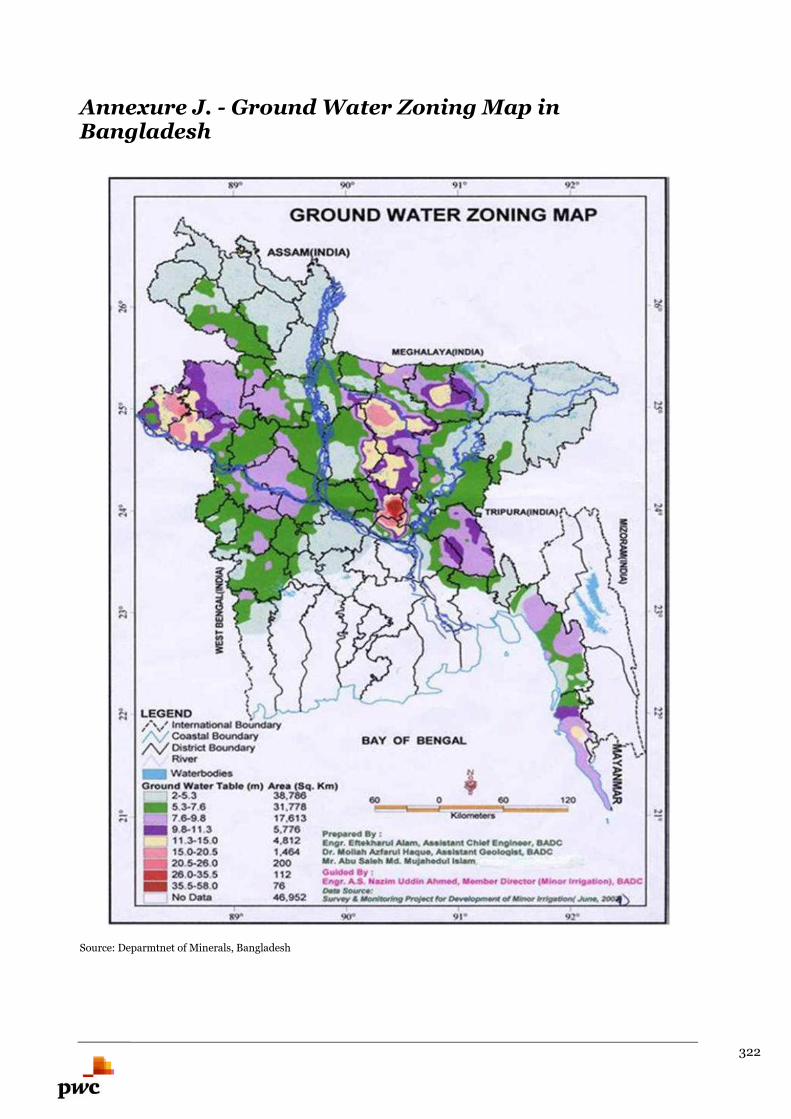
322
Annexure J. - Ground Water Zoning Map inBangladesh
Source: Deparmtnet of Minerals, Bangladesh

323
pwc.com
© 2015. PricewaterhouseCoopers Pvt Ltd. All rights reserved. In this document, “PwC” refers to
PricewaterhouseCoopers Pvt Ltd which is a member firm of PricewaterhouseCoopers International
Limited, each member firm of which is a separate legal entity.

324

325