Chief executives report - Laois County Council –
612
CHIEF EXECUTIVES REPORT The Chief Executive’s Report is prepared and submitted in accordance with the requirements of Section 12 (4) of the Planning and Development Act 2000 as amended. JUNE 22, 2021 LAOIS COUNTY COUNCIL Aras an Chontae, Portlaoise, Co. Laois
-
Upload
khangminh22 -
Category
Documents
-
view
0 -
download
0
Transcript of Chief executives report - Laois County Council –
CHIEF EXECUTIVES REPORT The Chief Executive’s Report is prepared and submitted in accordance with the requirements of Section
12 (4) of the Planning and Development Act 2000 as amended.
JUNE 22, 2021 LAOIS COUNTY COUNCIL
Aras an Chontae, Portlaoise, Co. Laois

Contents PART 1 INTRODUCTION ............................................................................................................................. 1
1.1 PURPOSE OF REPORT .................................................................................................................... 1
1.2 FORMAT OF THIS REPORT ............................................................................................................. 1
1.3 LEGISLATIVE BACKGROUND AND TIMEFRAME ............................................................................. 1
1.3.1 National Planning Framework and Regional and Spatial Economic Strategy ....................... 1
1.3.2 Legislative Context for Stage 2 Chief Executive’s Report ...................................................... 2
1.3.3 Timeframe ............................................................................................................................. 3
Stage 1 ............................................................................................................................................... 3
Stage 2 ............................................................................................................................................... 4
1.4 SUBMISSIONS AND NEXT STEPS .................................................................................................... 5
PART 2 SUBMISSIONS AND CE OPINION & RECOMMENDATION .............................................................. 7
2.1 INTRODUCTION ............................................................................................................................. 7
2.2 THE OFFICE OF THE PLANNING REGULATOR (OPR) ...................................................................... 8
2.2.1 Core Strategy and Settlement Strategy ................................................................................ 8
2.2.2 Compact Growth, Regeneration and Tiered Approach to Zoning ...................................... 22
2.2.3 Rural Housing and Regeneration ........................................................................................ 27
2.2.4 Economic Development and Employment ......................................................................... 35
Stradbally ............................................................................................................................................ 36
Rathdowney ........................................................................................................................................ 37
Borris in Ossory ................................................................................................................................... 38
2.2.5 Sustainable Transport ......................................................................................................... 39
2.2.6 Climate Action and Renewable Energy ............................................................................... 50
2.2.7 Environment, Heritage and Amenities ................................................................................ 59
2.2.8 Other Matters ..................................................................................................................... 59
2.3 EASTERN AND MIDLAND REGIONAL ASSEMBLY (EMRA) ............................................................ 60
2.4 STATUTORY STAKEHOLDERS, MEMBERS OF THE PUBLIC AND INTEREST GROUPS .................... 82
2.5 VOLUME 1 - WRITTEN STATEMENT ........................................................................................... 82
Chapter 1 Introduction .................................................................................................................... 83
Chapter 2 Core and Settlement Strategies ...................................................................................... 85
Chapter 3 Climate Action and Energy .............................................................................................. 90
Chapter 4 Housing ..................................................................................................................... 143
Chapter 5 Quality of Life and Sustainable Communities ............................................................... 151
Chapter 6 Economic Development ................................................................................................ 175
Chapter 7 Retail and Town / Village Centre Management ............................................................ 194
Chapter 8 Tourism ......................................................................................................................... 206
Chapter 9 Rural Laois ................................................................................................................. 228
Chapter 10 Infrastructure ............................................................................................................ 246
Chapter 11 Biodiversity and Natural Heritage ............................................................................. 292
Chapter 12 Cultural and Built Heritage ........................................................................................ 332
Chapter 14 Implementation and Monitoring .............................................................................. 339
2.6 VOLUME 2 SETTLEMENT PLANS ................................................................................................ 341
Key Towns ......................................................................................................................................... 341
Portlaoise ...................................................................................................................................... 341
Portlaoise Zoning Submissions ...................................................................................................... 350
Graiguecullen ................................................................................................................................ 378
Graiguecullen Zoning Submissions ............................................................................................... 381
Self Sustaining Growth Town ............................................................................................................ 384
Portarlington Zoning Submissions ................................................................................................ 384
Self Sustaining Towns ........................................................................................................................ 386
Mountmellick ................................................................................................................................ 386
Mountmellick Zoning Submissions ............................................................................................... 387
Abbeyleix ....................................................................................................................................... 396
Abbeyleix Zoning Submissions ...................................................................................................... 406
Mountrath ..................................................................................................................................... 422
Mountrath Zoning Submissions .................................................................................................... 434
Stradbally ...................................................................................................................................... 438
Stradbally Zoning Submissions ...................................................................................................... 440
Small Towns ...................................................................................................................................... 448
Rathdowney Zoning Submission ................................................................................................... 448
Durrow .......................................................................................................................................... 453
Ballylynan Zoning Submission ....................................................................................................... 458
Villages – Population > 500 ............................................................................................................... 461

Clonaslee Zoning Submission ........................................................................................................ 461
Ballyroan ....................................................................................................................................... 464
Ballyroan Zoning Submissions ....................................................................................................... 467
Borris in Ossory Zoning Submission .............................................................................................. 472
Killenard ........................................................................................................................................ 476
Killenard Zoning Submissions........................................................................................................ 480
Villages – Population < 500 ............................................................................................................... 486
Ballinakill Zoning Submission ........................................................................................................ 486
Clough ........................................................................................................................................... 493
Rural Settlements .............................................................................................................................. 495
Emo ............................................................................................................................................... 495
Emo Zoning Submission ................................................................................................................ 508
Castletown .................................................................................................................................... 509
Coolrain ......................................................................................................................................... 510
Newtown Doonane Zoning Submission ........................................................................................ 512
Timahoe ........................................................................................................................................ 515
Non Designated Settlements ............................................................................................................ 516
Ballyfin........................................................................................................................................... 516
2.7 APPENDICES AND ENVIRONMENTAL REPORTS ........................................................................ 520
Appendix 1 Record of Protected Structures................................................................................ 520
Appendix 5 Wind Energy Strategy ............................................................................................... 535
Appendix 6 Landscape Character Assessment ............................................................................ 557
Strategic Environmental Assessment................................................................................................ 559
Strategic Flood Risk Assessment ....................................................................................................... 568
Miscellaneous ................................................................................................................................... 584
PART 3 APPENDICES ............................................................................................................................. 587
APPENDIX A CORE STRATEGY TABLE AND TABLES SHOWING AN INDICATION OF HOUSEHOLDS
AND TENURE COMPOSITION OVER THE PLAN PERIOD .................................................................... 587
APPENDIX B INFRASTRUCTURE ASSESSMENT ............................................................................... 590
APPENDIX C REVISED HOUSING STRATEGY / HNDA ...................................................................... 591
APPENDIX D REVISED STRATEGIC FLOOD RISK ASSESSMENT ....................................................... 592

APPENDIX E PROPOSED AMENDMENTS TABLE, REVISED MAPS AND SETTLEMENT ZONING PLANS
593
APPENDIX F LIST OF PRESCRIBED BODIES .................................................................................... 598
APPENDIX G LIST OF SUBMISSIONS ............................................................................................... 599
APPENDIX H PUBLIC NOTICE .......................................................................................................... 603
APPENDIX I SUMMARY OF DISCUSSION FROM THE PUBLIC WEBINARS ...................................... 606
1
PART 1 INTRODUCTION
1.1 PURPOSE OF REPORT This report forms part of the statutory process for the review of the Laois County Development Plan 2017-2023 and the preparation of the new County Development Plan 2021-2027.
It sets out the procedures for preparation of the Draft County Development Plan 2021-2027 and summarises the National and Regional Context in which the Plan is being prepared.
It lists and summarises the issues raised during the Second Stage Public Consultation period and gives the Chief Executives opinion / response[s] and recommendation[s] in relation to those issues. These are arranged according to the Section Headings of the Draft Plan, however, Section 2.2 responds to the Ministers submission.
The report is submitted to the Members of Laois County Council for their consideration.
1.2 FORMAT OF THIS REPORT The report is structured as follows:
• Part 1 sets out the requirement and legislative background for the report; • Part 2 contains a summary and analysis of all written submissions received, including from the
Office of the Planning Regulator (OPR) and Eastern and Midlands Regional Assembly (EMRA); • The remaining submissions from Statutory Consultees, members of the public and interest groups
are summarised in a group format by Chapter; • Part 3 contains the appendices, and is arranged as follows:
o Appendix A includes the Core Strategy Table and Table’s providing an Indication of Households in Each Household Size Cohort and Tenure Composition over the Plan Period;
o Appendix B includes the Infrastructure Assessment; o Appendix C includes the Revised Housing Strategy and Housing Needs Demands
Assessment; o Appendix D includes the Revised Strategic Flood Risk Assessment; o Appendix E includes:
▪ An amendments summary table which identifies how the proposed zoning amendments have arisen since the Draft Plan stage; and
▪ The Revised Maps and Settlement Zoning Plans; o Appendix F lists the Prescribed Bodies who were informed of the review; o Appendix G includes a list of valid written submissions; o Appendix H includes the Public Notice; and o Appendix I is the summary of discussions from the Public Webinars.
1.3 LEGISLATIVE BACKGROUND AND TIMEFRAME
1.3.1 NATIONAL PLANNING FRAMEWORK AND REGIONAL AND SPATIAL ECONOMIC STRATEGY
Following the publication of the National Planning Framework (NPF) each of the 3 regions is required to adopt a Regional Spatial & Economic Strategy (RSES) and all County Development Plans must be consistent with the policies and objectives of the NPF and RSES relevant to their region. County Laois is within the

2
Eastern and Midlands Regional Assembly as outlined in the diagram below. The Eastern and Midland Regional Assembly adopted the RSES on May 3rd, 2019.
In accordance with Section 11 (1) (b) (iii) of the Planning and Development Act 2000, as amended, the Planning Authority is required to either review or vary the current County Development Plan within 26 weeks of the adoption of the RSES.
In this regard and given the timeframe of the existing Laois County Development Plan, which is due to be reviewed in July 2021, Laois County Council commenced a full review of the Plan.
1.3.2 LEGISLATIVE CONTEXT FOR STAGE 2 CHIEF EXECUTIVE’S REPORT
The Chief Executive’s Report is prepared and submitted in accordance with the requirements of Section 12 of the Planning and Development Act 2000 as amended. Section 12(4) of Act states inter alia that:
4. [a] Not later than 22 weeks after giving notice under subsection (1) and, if appropriate, subsection (3), the manager of a planning authority shall prepare a report on any submissions or observations received under subsection (2) or (3) and submit the report to the members of the authority for their consideration.
A report under paragraph (a) shall—
(b)(i) list the persons or bodies who made submissions or observations under this section,
(ii) provide a summary of —
(I) the recommendations, submissions and observations made by the Minister, where the notice under paragraph (a) of subsection (2) was sent before the establishment of the Office of the Planning Regulator,
(II) the recommendations, submissions and observations made by the Office of the Planning Regulator, and
(III) the submissions and observations made by any other persons,
in relation to the draft development plan in accordance with this section, ]
(iii) give the response of the chief executive to the issues raised, taking account of any directions of the members of the authority or the committee under section 11(4) , the proper planning and sustainable development of the area, the statutory obligations of any local authority in the area and any relevant policies or objectives of the Government or of any Minister of the Government and, if appropriate, any observations made by the Minister for Arts, Heritage, Gaeltacht and the Islands under subsection (3)(b)(iv).
( ba ) A report prepared and submitted in accordance with paragraph (a) shall contain a summary of the observations, submissions and recommendations made by the Office of the Planning Regulator under section 31AM to the planning authority concerned. ]

3
( bb ) In the case of each planning authority within the GDA, a report under paragraph (a) shall summarise the issues raised and the recommendations made by the DTA in its written submission prepared in accordance with section 31C and outline the recommendations of the F90 [ chief executive ] in relation to the manner in which those issues and recommendations should be addressed in the development plan. ]
( bc ) A report under paragraph (a) shall summarise the issues raised and recommendations made by the relevant [ regional assembly ] in its written submission prepared in accordance with section 27B (inserted by section 18 of the Act of 2010 ) and outline the recommendations of the [ chief executive ] in relation to the manner in which those issues and recommendations should be addressed in the development plan. ]
1.3.3 TIMEFRAME Under the Planning and Development Act 2000 as amended (hereafter referred to as the Act), development plans run for a six-year period and preparation of a new plan must commence not later than four years after the plan was adopted. The publication of a notice on 12th January 2020 stating the intention to prepare a new Draft County Development Plan for the period 2021 - 2027 marked the formal commencement of the two-year review process. Within two years of this date a new plan must be adopted by the Members of the Council. The Act sets out a number of key stages in the process.
Stage 1 The first stage involved an eight-week preliminary consultation period, from 6th January 2020 until 2nd March 2020, during which submissions were invited on issues to be included in the Draft County Development Plan. A number of meetings were held with interested bodies, the Public and the County Council members. Service Providers were also consulted on their plans and operational programmes. There were also meetings with key internal Council sections such as Road Design and Water Services on the subject of overall infrastructure provision in the county.
A Chief Executives report was then prepared and circulated to the Council members for their consideration on 26th June 2020. The Chief Executives Report listed the persons who made submissions,

4
summarised the issues raised and indicated the opinion and recommendation of the Chief Executive in relation to such issues.
A 12-week period for the preparation by the Executive of the Draft County Development Plan and its submission to Council members who had an 8-week period for its consideration at the end of which it became the formal Draft Plan. The Plan was adopted for public display at a Special Council Meeting on the 12th December 2020 subject to a number of amendments.
Stage 2 The statutory 10-week consultation process for the Draft Laois County Development Plan 2021 – 2027 began on 12th January 2021 with public notices appearing in the Irish Independent and local newspaper the Laois Nationalist, and ended on 23rd March 2021. The Draft Plan was put on public display in the Planning Department, Aras an Chontae, JFL Ave, Portlaoise, Co. Laois and was also available to view on http://consult.laois.ie.
Public consultation was facilitated through a number of media, including:
• Newspaper adverts advised of the consultation period, invited submissions and advised of the public meetings held during February and March 2021;
• Full details of the process were also advertised on the Council’s website, http://consult.laois.ie and Social Media accounts (Twitter and Facebook);
• Notice was sent to the prescribed bodies, the adjoining Planning Authorities and relevant stakeholders and infrastructure providers; and
• Notice was also issued to the Public Participation Network to disseminate to its members.
A number of Webinars, Workshops and Briefing Sessions were held to engage with members of the public and Elected Members:
• A meeting with the Eastern and Midlands Regional Authority was held on 3rd March 2021 to discuss the Draft Plan;
• Briefing sessions were held with the elected members at the December 2020 monthly meeting of Laois County Council at which the members were advised of the timescale and procedures involved in the review process;
• The Planning Department held a series of public webinars throughout the public consultation period in lieu of community meetings due to the COVID-19 restrictions. Each webinar focused on a different topic related to the Draft Plan. The following webinars were held:
➢ 18th February - Population and Where We Live ➢ 22nd February – Job Creation in the County ➢ 24th February – Enabling and Servicing Development ➢ 1st March – Cultural, Built and Natural Heritage in the County
• A briefing session was also held with a Focus Group, Heritage Forum, on 9th March 2021 to illustrate the main issues outlined in the Draft Plan, particularly with respect to Heritage and Culture;
• A briefing session was also held with a Focus Group, Portlaoise Town Team, on 12th March 2021 to illustrate the main issues outlined in the Draft Plan, particularly with respect to Portlaoise as a Key Town; and

5
• A webinar presentation was also given to Laois Chamber of Commerce on 15th March 2021 to illustrate the main issues outlined in the Draft Plan, particularly with respect to Job Creation priorities for the County.
135 members of the public, including 19 Elected Members, were engaged with during this process.
Each of the webinars and briefing sessions involved an overview of the process and timescale involved in the plan review and preparation as well as the key issues of concern to be considered. Submissions or observations regarding objectives and policies to deliver an overall strategy for the proper planning and sustainable development of the area of the development plan were invited.
1.4 SUBMISSIONS AND NEXT STEPS 154 written submissions were received within the statutory timeframe which are outlined in Appendix G. 7 submissions were received outside the consultation deadline. A summaries report has been included for reference of all comments received for each submission. This report summarises the following and includes the Chief Executive’s Opinion and Recommendation on each issue:
➢ The main issues raised by the Office of the Planning Regulator; ➢ The main issues raised by the Eastern and Midland Regional Assembly (EMRA); and ➢ The main issues raised by statutory consultees, members of the public and interest groups by
Chapter (as indicated in the Draft Plan).
Members have 12 weeks to consider this report and the submissions received, taking account of the statutory obligations of the local authority and any relevant policies of the Government. This report will be circulated to the Elected Members to facilitate consideration of the report with final discussion at a Special Council Meeting. It should be noted that in your deliberations and consideration that the following be taken into account -
( aa ) Following consideration of the draft plan and the report of the [ chief executive ] under paragraph (a) where a planning authority, after considering a submission of, or observation or recommendation from the Minister made to the authority under this section [ or from the Office of the Planning Regulator made to that planning authority under section 31AM ] or from a [ regional assembly ] made to the authority under section 27B , decides not to comply with any recommendation made in the draft plan and report, it shall so inform [ the Office of the Planning Regulator and ] the Minister or [ regional assembly ] , as the case may be, as soon as practicable by notice in writing which notice shall contain reasons for the decision.
Where, following the consideration of the draft development plan and the Chief Executive ’ s report , it appears to the members of the authority that the draft should be accepted or amended, subject to subsection (7), they may, by resolution, accept or amend the draft and make the development plan accordingly. Following the consideration of this Chief Executive’s Report by the Elected Members and accepting of the Draft Plan and making amendments to the Draft County Development Plan, a 3-week period is allotted by the Act for the preparation of the amendments to the Draft Laois County Development Plan 2021 - 2027. This may be subject to change based on the emergency legislation pertaining to COVID 19. The

6
amendments only will be put on public display for a period of four (4) weeks and made available for the Public to view and make further submissions on if required.
7
PART 2 SUBMISSIONS AND CE OPINION & RECOMMENDATION
2.1 INTRODUCTION A summary of the issues raised in the consultation process and the Chief Executive’s Opinion and Recommendations are outlined in this section as follows:
• The Office of the Planning Regulator (OPR);
• Eastern and Midlands Regional Assembly (EMRA);
• Statutory Stakeholders, Members of the Public and Interest Groups;
• Volume 1 Written Statement;
• Volume 2 Settlement Plans; o Key Towns
• Portlaoise and Graiguecullen o Self-Sustaining Growth Town
• Portarlington o Self-Sustaining Town’s
• Mountmellick, Abbeyleix, Mountrath and Stradbally o Small Towns
• Rathdowney, Durrow, Ballylynan o Villages > 500 Population
• Clonaslee, Ballyroan, Borris In Ossory, Killenard o Villages < 500 Population
• Ballinakill, Clough, o Rural Settlements
• Castletown, Coolrain, Emo, Newtown Doonane, Timahoe; o Non Designated Settlements
• Ballyfin
• Appendices; o Appendix 1: Record of Protected Structures o Appendix 5: Wind Energy Strategy o Appendix 6: Wind Energy Strategy
• Strategic Environmental Assessment;
• Strategic Flood Risk Assessment; and
• Miscellaneous.
For the purposes of reading this report please note the following:
➢ Proposed amended text and new text is coloured RED in this document. ➢ Text with STRIKETHROUGH is proposed for deletion ➢ Text in BLUE is text from the Draft Plan as is.
8
2.2 THE OFFICE OF THE PLANNING REGULATOR (OPR) This section contains the recommendations and observations raised by the Office of the Planning Regulator (OPR) and the Opinion and Recommendation of the Chief Executive of how each will be dealt within the Draft Plan.
2.2.1 CORE STRATEGY AND SETTLEMENT STRATEGY RECOMMENDATION 1 – CORE STRATEGY In accordance with Sections 10(2B) and 10(2A)(c) & (d) of the Planning and Development Act 2000, (as amended) and having regard to the Guidance Note on Core Strategies 2010, and the Section 28 Guidelines: Housing Supply Target Methodology for Development Planning, the Planning Authority is required to:
a) Review the proposed Core Strategy (including settlement strategy and associated identification of development potential and zoning exercises) and HNDA and to revise as necessary to comply with the requirements of the Section 28 Guidelines: Housing Supply Target Methodology for Development Planning and Appendix 1 of the accompanying Ministerial Circular.
b) Amend Core Strategy Table 2.15 to provide the quantity in hectares of existing and proposed residential zoned land and land zoned for a mix of residential and other uses which are permitted to accommodate residential use in the Draft Plan for each settlement. The total figures for the county should align with the housing supply targets generated in response to Recommendation 1a above.
CE Opinion and Recommendation
a) The aforementioned Guidelines came into operation after the Draft Plan was considered by Elected Members. These Guidelines will be included in Chapter 2 Core and Settlement Strategy and Appendix 3 Housing Strategy and Housing Needs and Demand Assessment. It is recommended the following text is inserted as Section 2.7.1.1 of Chapter 2 (Core and Settlement Strategy) and Appendix 3 (Housing Strategy and Housing Needs and Demand Assessment)
2.7.1.1 Housing Supply Target With respect to the:
• ESRI research work “Structural Housing Demand at County Level” published on the 14th December 2020;
• Housing Supply Target Methodology for Development Planning published by DHLGH in December 2020; and
• Ministerial Letter advising these publications as the most up to date approach towards demand projection.
this projection has been revised using the ESRI EXCEL spreadsheets and most up to date data from CSO Stat bank.
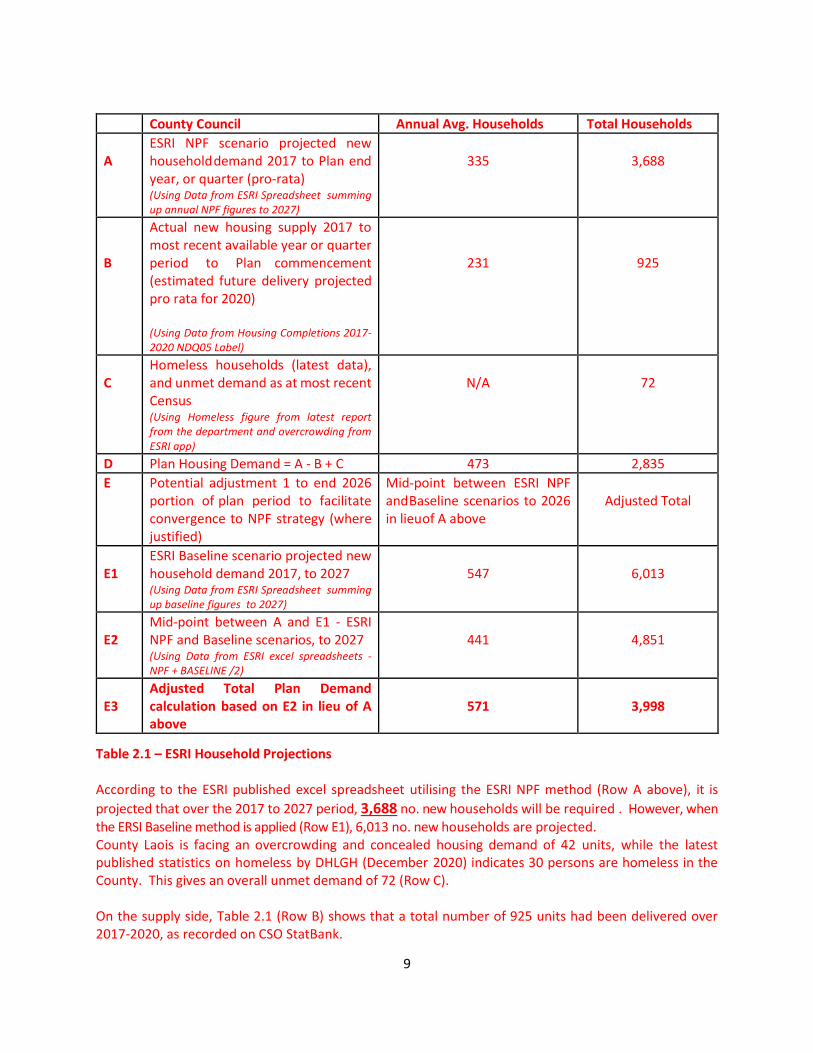
According to this method, the housing allocation over the Plan period is to be calculated by not only relying on the population projection, but also factoring in the two elements of housing supply and unmet demand in the county. Table 2.1 below reflects the data that has been collated to calculate the housing demand for the Laois County Development Plan (2021 – 2027).
9
Table 2.1 – ESRI Household Projections According to the ESRI published excel spreadsheet utilising the ESRI NPF method (Row A above), it is
projected that over the 2017 to 2027 period, 3,688 no. new households will be required . However, when the ERSI Baseline method is applied (Row E1), 6,013 no. new households are projected. County Laois is facing an overcrowding and concealed housing demand of 42 units, while the latest published statistics on homeless by DHLGH (December 2020) indicates 30 persons are homeless in the County. This gives an overall unmet demand of 72 (Row C). On the supply side, Table 2.1 (Row B) shows that a total number of 925 units had been delivered over 2017-2020, as recorded on CSO StatBank.
County Council Annual Avg. Households Total Households
A
ESRI NPF scenario projected new household demand 2017 to Plan end year, or quarter (pro-rata) (Using Data from ESRI Spreadsheet summing up annual NPF figures to 2027)
335
3,688
B
Actual new housing supply 2017 to most recent available year or quarter period to Plan commencement (estimated future delivery projected pro rata for 2020) (Using Data from Housing Completions 2017-2020 NDQ05 Label)
231
925
C
Homeless households (latest data), and unmet demand as at most recent Census (Using Homeless figure from latest report from the department and overcrowding from ESRI app)
N/A
72
D Plan Housing Demand = A - B + C 473 2,835
E Potential adjustment 1 to end 2026 portion of plan period to facilitate convergence to NPF strategy (where justified)
Mid-point between ESRI NPF and Baseline scenarios to 2026 in lieu of A above
Adjusted Total
E1
ESRI Baseline scenario projected new household demand 2017, to 2027 (Using Data from ESRI Spreadsheet summing up baseline figures to 2027)
547
6,013
E2
Mid-point between A and E1 - ESRI NPF and Baseline scenarios, to 2027 (Using Data from ESRI excel spreadsheets - NPF + BASELINE /2)
441
4,851
E3
Adjusted Total Plan Demand calculation based on E2 in lieu of A above
571
3,998

10
To identify the housing demand the figures above were applied using the formula as indicated in the “Housing Supply Target Methodology for Development Planning” published by DHLGH in December 2020:
Housing Demand 2021-2027 = (Total Projection 2017-2027 - Unit Completions 2017-2020) + Total Unmet Demand
(E3 = E2 – B + C) which equates to: 3,998 = 4,851 – 925 + 72.
Therefore, the overall housing demand over the Plan period therefore forecast to be 3,998 units, which equates to 571 housing units per annum over the Plan period. This indicates a discrepancy of 16 no. units per annum when compared with the previous method, which can be explained through factoring in the two elements of housing supply and unmet demand in the ESRI method, resulting in a more accurate housing target. Performing the same calculations to estimate housing demand up to 2031, the overall housing demand is expected to be 6,273 units. This equates to 570 housing units per annum over 2021- 2031.
County Council Annual Avg. Households Total Households
A ESRI NPF scenario projected new household demand 2017 to 2031
505 5,558
B
Actual new housing supply 2017 to most recent available year or quarter period to Plan commencement (estimated future delivery projected pro rata for 2020)
247
925
C Homeless households (latest data), and unmet demand as at most recent Census
N/A 72
D Plan Housing Demand = A - B + C 784 4,705
E Potential adjustment 1 to end 2026 portion of plan period to facilitate convergence to NPF strategy (where justified)
Mid-point between ESRI NPF and Baseline scenarios to 2026
in lieu of A above
Adjusted Total
E1 ESRI Baseline scenario projected new household demand 2017, to 2031
790 8,694
E2 Mid-point between A and E1 - ESRI NPF and Baseline scenarios, to 2031
648 7,126
E3 Adjusted Total Plan Demand calculation based on E2 in lieu of A above
570 6,273
11
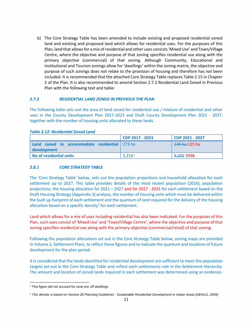
b) The Core Strategy Table has been amended to include existing and proposed residential zoned
land and existing and proposed land which allows for residential uses. For the purposes of this Plan, land that allows for a mix of residential and other uses consists ‘Mixed Use’ and Town/Village Centre, where the objective and purpose of that zoning specifies residential use along with the primary objective (commercial) of that zoning. Although Community, Educational and Institutional and Tourism zonings allow for ‘dwellings’ within the zoning matrix, the objective and purpose of such zonings does not relate to the provision of housing and therefore has not been included. It is recommended that the attached Core Strategy Table replaces Table 2.15 in Chapter 2 of the Plan. It is also recommended to amend Section 2.7.2 Residential Land Zoned in Previous Plan with the following text and table:
2.7.3 RESIDENTIAL LAND ZONED IN PREVIOUS THE PLAN
The following table sets out the area of land zoned for residential use / mixture of residential and other uses in the County Development Plan 2017-2023 and Draft County Development Plan 2021 - 2027, together with the number of housing units allocated to these lands. Table 2.12: Residential Zoned Land
CDP 2017 - 2023 CDP 2021 - 2027
Land zoned to accommodate residential development
273 ha 149 ha 125 ha
No of residential units 3,2161 5,202 3998
2.8.1 CORE STRATEGY TABLE
The ‘Core Strategy Table’ below, sets out the population projections and household allocation for each settlement up to 2027. This table provides details of the most recent population (2016), population projections, the housing allocation for 2021 – 2027 and for 2027 - 2031 for each settlement based on the Draft Housing Strategy (Appendix 3) analysis, the number of housing units which must be delivered within the built up footprint of each settlement and the quantum of land required for the delivery of the housing allocation based on a specific density2 for each settlement. Land which allows for a mix of uses including residential has also been indicated. For the purposes of this Plan, such uses consist of ‘Mixed Use’ and ‘Town/Village Centre’, where the objective and purpose of that zoning specifies residential use along with the primary objective (commercial/retail) of that zoning. Following the population allocations set out in the Core Strategy Table below, zoning maps are provided in Volume 2, Settlement Plans, to reflect these figures and to indicate the quantum and locations of future development for the plan period. It is considered that the lands identified for residential development are sufficient to meet the population targets set out in the Core Strategy Table and reflect each settlements role in the Settlement Hierarchy. The amount and location of zoned lands required in each settlement was determined using an evidence-
1 This figure did not account for rural one off dwellings
2 This density is based on Section 28 Planning Guidelines - Sustainable Residential Development in Urban Areas (DEHLG, 2009)

12
based settlement typology and asset-based approach, as detailed in Section 2.4.1 of the Plan and the considerations of Section 2.7.3 and also an Infrastructure Assessment in Appendix 8. Table 2.15 of the Core Strategy indicates the population and housing projections for County Laois and is included in Appendix A of the report. Based on the revised Core Strategy Figures, Volume 2 Settlement Plans, has now been revised to reflect this update. A list of amendments and maps to reflect this is included in Appendix A and Appendix E of this report.

13
RECOMMENDATION 2 – SETTLEMENT HIERARCHY AND DISTRIBUTION OF GROWTH Having regard to Regional Policy Objective 4.26 of the Regional Spatial and Economic Strategy (RSES) for the Eastern and Midland Region and National Policy Objective 9, the planning authority is required to rebalance the overall allocation of population growth and housing supply targets across the settlement hierarchy to achieve a more sustainable distribution of growth and which prevent s lower tier settlements growing at faster rates than the tier 1 key towns. In particular, the planning authority is required to:
a. Increase the proportion of the Core Strategy’s population/ housing allocation for Portlaoise in the Core Strategy consistent with its designation as a Key Town and capacity to act as a ‘regional driver’ consistent with section 4.6 of the RSES
b. Reduce the proportion of the Core Strategy’s population/ housing allocation to the settlements of Portarlington, Abbeyleix, Stradbally, Ballylinan and Ballyroan (in light of its wastewater treatment capacity constraints), and redistribute to the tier 1 key towns, in particular Portlaoise.
CE Opinion and Recommendation It is recommended to revise the Core Strategy figures based on the “Housing Supply Target Methodology for Development Planning” published by DHLGH in December 2020 as detailed in the response to Recommendation 1 above. As a result of applying the aforementioned methodology, the housing allocation for the County is now 3,998 units for the plan period up to 2027 and 6,273 units in the interim period of 2027 – 2031. This represents a reduction in projected housing allocation of 1,204 units for the Plan period from the Draft Plan figure of 5,202 units. The revised figure is based on Section 28 Guidelines and it is a statutory obligation of the Planning Authority to incorporate these guidelines into the Plan. On this basis, Laois County Council has developed a Core Strategy that is consistent with national and regional objectives set out in the National Planning Framework and the Regional Spatial and Economic Strategy and the recommendation of the OPR to provide a more balanced approach to growth within the settlement designation tiers. The revised Core Strategy promotes a pattern of development, at targeted higher tier settlements, relative to their scale and infrastructural capabilities and a proportionality of growth that is in line with the national perspective. The revised Core Strategy also supports the sustainable development of more rural settlements by encouraging growth and arresting decline.
a) As recommended by the OPR, the Core Strategy population for Portlaoise has been increased to 20% growth of the 2016 Census data or an allocation of 43% of the total population indicated in National Planning Framework’s Implementation Roadmap. At the same time, the population projection for Graiguecullen represents a growth rate of 15%, which will be represented in the zoning maps when the Joint Local Area Plan for Graiguecullen will be reviewed by Laois and Carlow County Councils in the coming year. This increased growth rate for Portlaoise has been achieved by rebalancing the growth rate of Portarlington, Abbeyleix, Stradbally, Ballylinan and Ballyroan as required in the above recommendation.
b) The growth rate for Portarlington is indicated at 15% or an allocation of 10% of the total housing
allocation for the County. Portarlington is the County’s only Self-Sustaining Growth Town and is very much a growth area due to its strategic location on the main Dublin to Cork train line and

14
readily available employment landbanks to facilitate growth. The growth rate of the remaining settlements has been reduced to ensure the that the lower tier settlements do not grow at a faster rate than the Tier 1 Key Towns.
The above revisions have been represented in the revised Core Strategy Table as indicated in Appendix A of this Report.
15
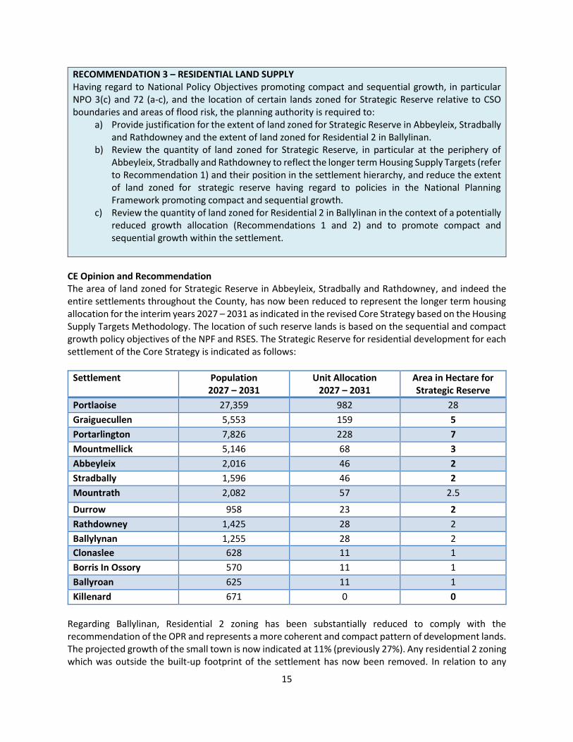
RECOMMENDATION 3 – RESIDENTIAL LAND SUPPLY Having regard to National Policy Objectives promoting compact and sequential growth, in particular NPO 3(c) and 72 (a-c), and the location of certain lands zoned for Strategic Reserve relative to CSO boundaries and areas of flood risk, the planning authority is required to:
a) Provide justification for the extent of land zoned for Strategic Reserve in Abbeyleix, Stradbally and Rathdowney and the extent of land zoned for Residential 2 in Ballylinan.
b) Review the quantity of land zoned for Strategic Reserve, in particular at the periphery of Abbeyleix, Stradbally and Rathdowney to reflect the longer term Housing Supply Targets (refer to Recommendation 1) and their position in the settlement hierarchy, and reduce the extent of land zoned for strategic reserve having regard to policies in the National Planning Framework promoting compact and sequential growth.
c) Review the quantity of land zoned for Residential 2 in Ballylinan in the context of a potentially reduced growth allocation (Recommendations 1 and 2) and to promote compact and sequential growth within the settlement.
CE Opinion and Recommendation The area of land zoned for Strategic Reserve in Abbeyleix, Stradbally and Rathdowney, and indeed the entire settlements throughout the County, has now been reduced to represent the longer term housing allocation for the interim years 2027 – 2031 as indicated in the revised Core Strategy based on the Housing Supply Targets Methodology. The location of such reserve lands is based on the sequential and compact growth policy objectives of the NPF and RSES. The Strategic Reserve for residential development for each settlement of the Core Strategy is indicated as follows:
Settlement Population 2027 – 2031
Unit Allocation 2027 – 2031
Area in Hectare for Strategic Reserve
Portlaoise 27,359 982 28
Graiguecullen 5,553 159 5
Portarlington 7,826 228 7
Mountmellick 5,146 68 3
Abbeyleix 2,016 46 2
Stradbally 1,596 46 2
Mountrath 2,082 57 2.5
Durrow 958 23 2
Rathdowney 1,425 28 2
Ballylynan 1,255 28 2
Clonaslee 628 11 1
Borris In Ossory 570 11 1
Ballyroan 625 11 1
Killenard 671 0 0
Regarding Ballylinan, Residential 2 zoning has been substantially reduced to comply with the recommendation of the OPR and represents a more coherent and compact pattern of development lands. The projected growth of the small town is now indicated at 11% (previously 27%). Any residential 2 zoning which was outside the built-up footprint of the settlement has now been removed. In relation to any

16
extant planning permission within lands that was previously zoned residential 2 lands which have been de-zoned, the Council is reminded of Section 10(8) of the Planning and Development Act, 2000, as amended - ‘There shall be no presumption in law that any land zoned in a particular development plan (including a development plan that has been varied) shall remain so zoned in any subsequent development plan’.
17
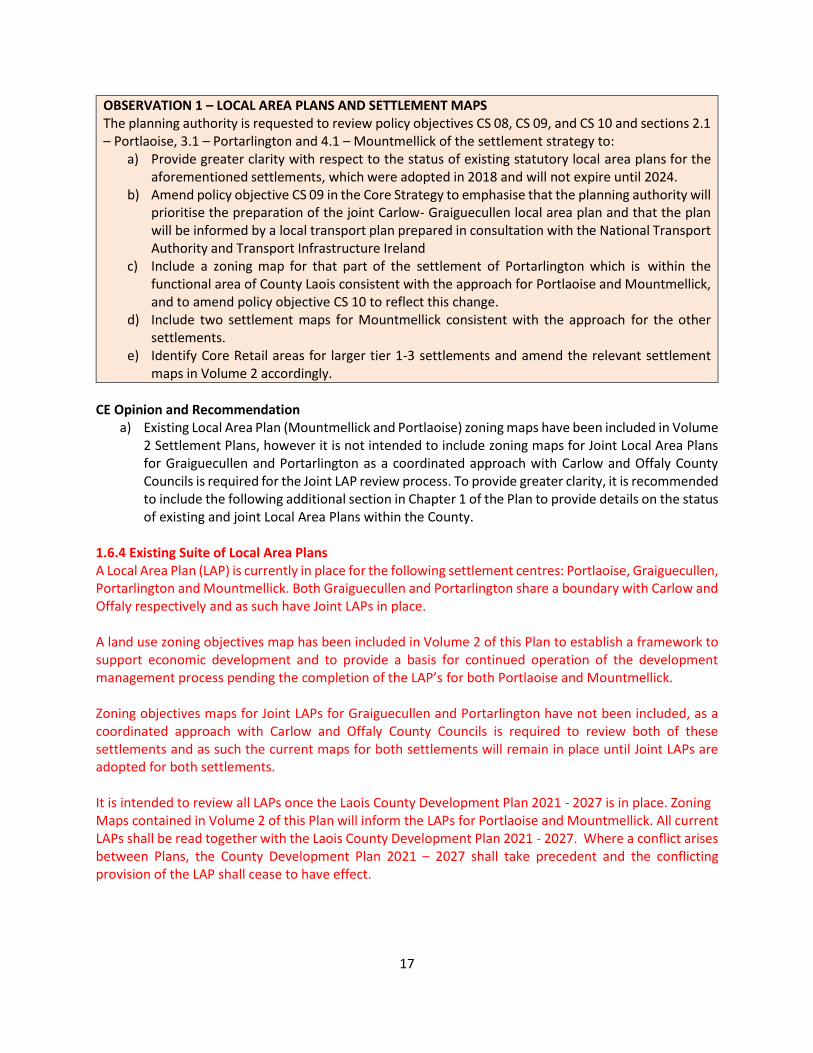
OBSERVATION 1 – LOCAL AREA PLANS AND SETTLEMENT MAPS The planning authority is requested to review policy objectives CS 08, CS 09, and CS 10 and sections 2.1 – Portlaoise, 3.1 – Portarlington and 4.1 – Mountmellick of the settlement strategy to:
a) Provide greater clarity with respect to the status of existing statutory local area plans for the aforementioned settlements, which were adopted in 2018 and will not expire until 2024.
b) Amend policy objective CS 09 in the Core Strategy to emphasise that the planning authority will prioritise the preparation of the joint Carlow- Graiguecullen local area plan and that the plan will be informed by a local transport plan prepared in consultation with the National Transport Authority and Transport Infrastructure Ireland
c) Include a zoning map for that part of the settlement of Portarlington which is within the functional area of County Laois consistent with the approach for Portlaoise and Mountmellick, and to amend policy objective CS 10 to reflect this change.
d) Include two settlement maps for Mountmellick consistent with the approach for the other settlements.
e) Identify Core Retail areas for larger tier 1-3 settlements and amend the relevant settlement maps in Volume 2 accordingly.
CE Opinion and Recommendation
a) Existing Local Area Plan (Mountmellick and Portlaoise) zoning maps have been included in Volume 2 Settlement Plans, however it is not intended to include zoning maps for Joint Local Area Plans for Graiguecullen and Portarlington as a coordinated approach with Carlow and Offaly County Councils is required for the Joint LAP review process. To provide greater clarity, it is recommended to include the following additional section in Chapter 1 of the Plan to provide details on the status of existing and joint Local Area Plans within the County.
1.6.4 Existing Suite of Local Area Plans A Local Area Plan (LAP) is currently in place for the following settlement centres: Portlaoise, Graiguecullen, Portarlington and Mountmellick. Both Graiguecullen and Portarlington share a boundary with Carlow and Offaly respectively and as such have Joint LAPs in place. A land use zoning objectives map has been included in Volume 2 of this Plan to establish a framework to support economic development and to provide a basis for continued operation of the development management process pending the completion of the LAP’s for both Portlaoise and Mountmellick. Zoning objectives maps for Joint LAPs for Graiguecullen and Portarlington have not been included, as a coordinated approach with Carlow and Offaly County Councils is required to review both of these settlements and as such the current maps for both settlements will remain in place until Joint LAPs are adopted for both settlements. It is intended to review all LAPs once the Laois County Development Plan 2021 - 2027 is in place. Zoning Maps contained in Volume 2 of this Plan will inform the LAPs for Portlaoise and Mountmellick. All current LAPs shall be read together with the Laois County Development Plan 2021 - 2027. Where a conflict arises between Plans, the County Development Plan 2021 – 2027 shall take precedent and the conflicting provision of the LAP shall cease to have effect.
18
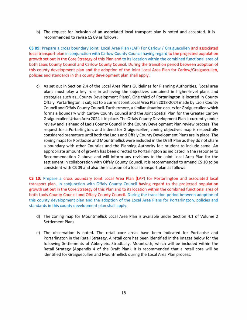
b) The request for inclusion of an associated local transport plan is noted and accepted. It is recommended to revise CS 09 as follows:
CS 09: Prepare a cross boundary Joint Local Area Plan (LAP) For Carlow / Graiguecullen and associated local transport plan in conjunction with Carlow County Council having regard to the projected population growth set out in the Core Strategy of this Plan and to its location within the combined functional area of both Laois County Council and Carlow County Council. During the transition period between adoption of this county development plan and the adoption of the Joint Local Area Plan for Carlow/Graiguecullen, policies and standards in this county development plan shall apply.
c) As set out in Section 2.4 of the Local Area Plans Guidelines for Planning Authorities, ‘Local area plans must play a key role in achieving the objectives contained in higher-level plans and strategies such as…County Development Plans’. One third of Portarlington is located in County Offaly. Portarlington is subject to a current Joint Local Area Plan 2018-2024 made by Laois County Council and Offaly County Council. Furthermore, a similar situation occurs for Graiguecullen which forms a boundary with Carlow County Council and the Joint Spatial Plan for the Greater Carlow Graiguecullen Urban Area 2024 is in place. The Offaly County Development Plan is currently under review and is ahead of Laois County Council in the County Development Plan review process. The request for a Portarlington, and indeed for Graiguecellen, zoning objectives map is respectfully considered premature until both the Laois and Offaly County Development Plans are in place. The zoning maps for Portlaoise and Mountmellick were included in the Draft Plan as they do not share a boundary with other Counties and the Planning Authority felt prudent to include same. An appropriate amount of growth has been directed to Portarlington as indicated in the response to Recommendation 2 above and will inform any revisions to the Joint Local Area Plan for the settlement in collaboration with Offaly County Council. It is recommended to amend CS 10 to be consistent with CS 09 and also the inclusion of a local transport plan as follows:
CS 10: Prepare a cross boundary Joint Local Area Plan (LAP) for Portarlington and associated local transport plan, in conjunction with Offaly County Council having regard to the projected population growth set out in the Core Strategy of this Plan and to its location within the combined functional area of both Laois County Council and Offaly County Council. During the transition period between adoption of this county development plan and the adoption of the Local Area Plans for Portarlington, policies and standards in this county development plan shall apply.
d) The zoning map for Mountmellick Local Area Plan is available under Section 4.1 of Volume 2
Settlement Plans.
e) The observation is noted. The retail core areas have been indicated for Portlaoise and Portarlington in the Retail Strategy. A retail core has been identified in the images below for the following Settlements of Abbeyleix, Stradbally, Mountrath, which will be included within the Retail Strategy (Appendix 4 of the Draft Plan). It is recommended that a retail core will be identified for Graiguecullen and Mountmellick during the Local Area Plan process.
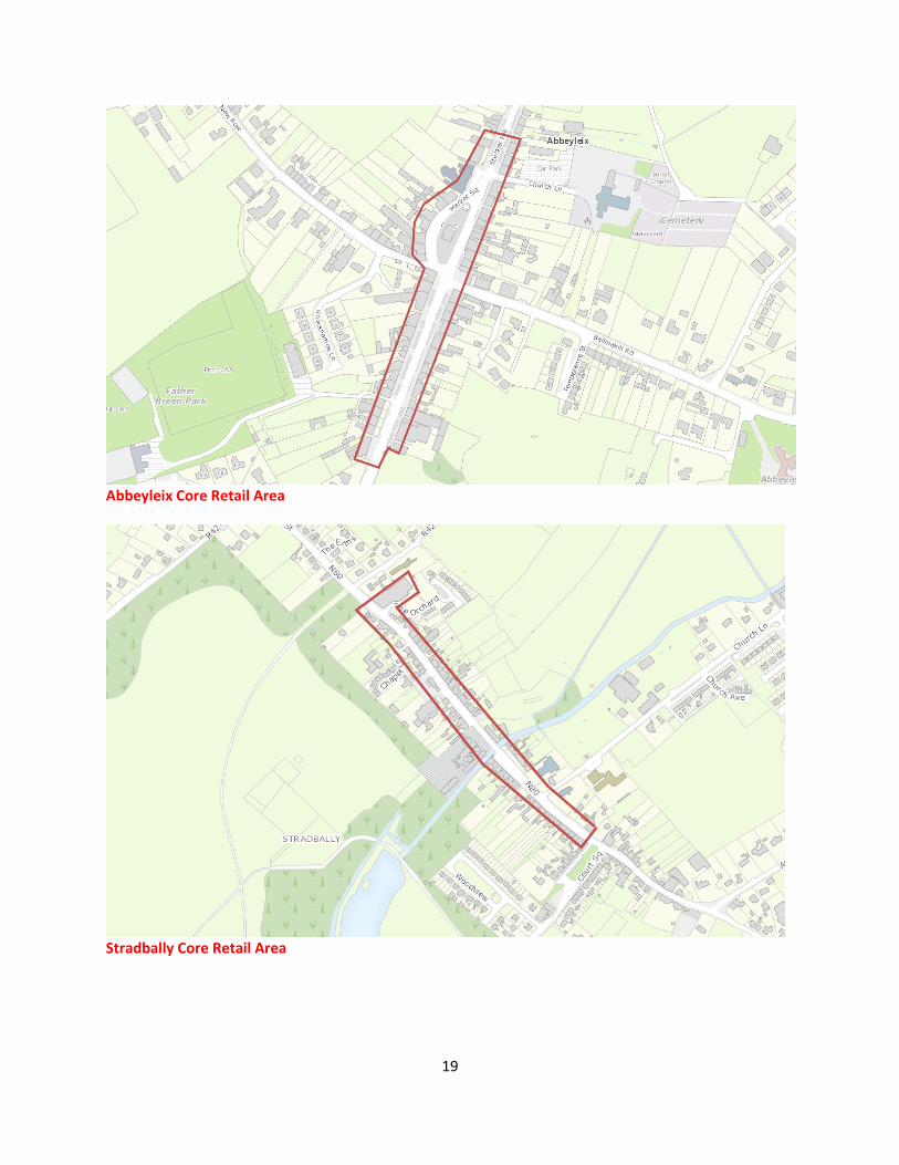
19
Abbeyleix Core Retail Area
Stradbally Core Retail Area

20
Mountrath Core Retail Area

21
RECOMMENDATION 4 – PORTLAOISE LOCAL TRANSPORT PLAN Having regard to Regional Policy Objective 8.6 from the Regional Spatial and Economic Strategy (RSES) for the Eastern and Midland Regional Assembly, the planning authority is required to amend policy objective CS 08 in the Core Strategy to state that the review of the local area plan for Portlaoise will be informed by a local transport plan prepared in consultation with the National Transport Authority and Transport Infrastructure Ireland.
CE Opinion and Recommendation Recommendation 4 is noted. Chapter 10 Infrastructure has referred to the preparation of a Local Transport Plan for Portlaoise in Policy Objective TRANS 5 which states: ‘Prepare a Local Transport Plan for Portlaoise in compliance with RPO 8.6 of the RSES and Support the strategic vision of J17 National Enterprise Park Masterplan to deliver a strategic economic zone within Portlaoise’.
In this regard, TRANS 5 will be revised as follows: Prepare a Local Transport Plan for Portlaoise in compliance with RPO 8.6 of the RSES and Support the strategic vision of J17 National Enterprise Park Masterplan to deliver a strategic economic zone within Portlaoise.
Policy CS 08, however, will be revised as follows: CS 08: Review the Local Area Plans for Portlaoise and Mountmellick. During the transition period between adoption of this county development plan and the adoption of the Local Area Plans for Portlaoise and Mountmellick, the objectives (including zoning objectives), policies and standards in this county development plan shall apply. The Local Area Plan for Portlaoise will be supported by a Local Transport Plan prepared in consultation with the National Transport Authority and Transport Infrastructure Ireland.
22
2.2.2 COMPACT GROWTH, REGENERATION AND TIERED APPROACH TO ZONING
RECOMMENDATION 5 – RESIDENTIAL DENSITY Having regard to the recommended residential densities in the Sustainable Residential Development in Urban Areas Guidelines for Planning Authorities (2012) and National Policy Objectives 6 and 35, the planning authority is required to provide greater clarity and consistency regarding the residential densities promoted in the development plan. In this regard, the planning authority is required to address the following:
a) Review the anticipated densities set out in Core Strategy Table 2.15 and Table 13.4 – Residential Density to ensure that they are consistent with each other and the Sustainable Residential Development in Urban Areas Guidelines, in particular for tiers 4 (towns) and 5 (villages).
b) Provide clarity on the expected minimum density for town/village centre and infill/brownfield sites acknowledging that these will be determined on a site specific basis.
CE Opinion and Recommendation
a) The issue in relation to providing a consistent approach to anticipated densities for future development in accordance with the Sustainable Residential Development in Urban Areas Guidelines for Planning Authorities (2012) is noted.
In April of this year, further guidance has been issued by the Department of Housing, Local Government and Heritage within Circular NRUP 02/2021 in relation to the provision of residential densities in Town and Villages and provides clarity on the applications of densities at edge of town/village locations in a rural context. A more proportionate approach to residential development with consideration of the character, scale and setting of the town/village is recommended. In this regard the Core Strategy of the Plan has also been taken this approach into consideration and applied a minimum density to appropriate edge of town/village sites.
Regarding clarity on site specific minimum density requirement, it is not intended to indicate a minimum standard for brownfield/infill as the Planning Authority will strive for a maximum density where possible. A site-specific indication has been included to ensure that an indicated minimum standard would not render the development of such site unviable.
It is recommended that Table 13.4 is revised to include a maximum density in line with the aforementioned Section 28 Guidelines.

23
Settlement Location for New Residential Development
Density – Units per Hectare
Key Town Town Centre/Infill/Brownfield 35 or Site Specific
Institutional Lands 35
Outer Suburban/Greenfield 25 – 30 (at locations adjacent to open rural countryside)
Self-Sustaining Towns/Self Sustaining Growth Towns
Town Centre/Infill/Brownfield 30 or Site Specific
Institutional Lands 30
Outer Suburban/Greenfield 15 – 25
Towns Town Centre/Infill/Brownfield 25 or Site Specific
Edge of Centre/Greenfield 15
Small Towns and Villages
Town/Village Centre/Infill/Brownfield 15 or Site Specific
Edge of Centre/Greenfield 10 – 12
Rural Settlements Infill/Brownfield/Edge of Centre The overall expansion of larger rural settlements should proceed on the basis of a number of well-integrated sites within and around the village core. Individual housing schemes will generally not be larger than about 10-12 units/ha
b) The minimum density required for town centre/infill/brownfield sites is stated in the revised Table
13.4 in line with Sustainable Residential Development in Urban Areas Guidelines for Planning Authorities (2012). It is acknowledged however that such sites can prove difficult to achieve such a minimum standard and a site-specific clause must be included to acknowledge this fact. To provide further clarity an additional policy objective will be included in Section 13.2.6.
DN 1: The appropriate residential density of a site shall be determined with reference to;
• Sustainable Residential Development in Urban Areas – Guidelines for Planning Authorities (2009) and the accompanying Urban Design Manual (2009);
• Sustainable Urban Housing: Design Standards for New Apartments 2020;
• The Urban Development and Building Heights Guidelines 2018;
• Recommended maximum densities per settlement tier as shown in Table 2.15 Core Strategy Table and Table 13.4 Residential Density of this Plan;
• the prevailing scale and pattern of development in the area.
24
OBSERVATION 2 – SPECIFIC GUIDELINES AND STANDARDS The planning authority is requested to:
a) Provide relevant information to show that the Draft Plan and Housing Strategy are consistent with the specific planning policy requirements (SPPRs) specified in the ‘Urban Development and Building Heights Guidelines for Planning Authorities’ (2018) by explicitly addressing SPPR 1, SPPR 2, SPPR 3 and SPPR 4.
b) Amend policy DM HS 2 regarding residential apartment development to make reference to the SPPRs contained in the Sustainable Urban Housing: Design Standards for New Apartments Guidelines for Planning Authorities (2018), as relevant.
c) Review the minimum separation distances between opposing windows, minimum private open space provision and minimum garden depth for houses and instead focus on assessing individual development proposals on performance based criteria dependent on location and individual site characteristics in accordance with the provisions of NPO 13.
d) Review the car parking standards in table 10.3 in consultation with the National Transportation Authority and clarify that the standards (which may be revised) are maximum.
CE Opinion and Recommendation
a) Having considered the existing commitment in the Draft Plan to employing Section 28 Guidance, it was not considered necessary to reiterate individual Guidance throughout the Plan, however, this observation is accepted that guidance be included in the Plan and CS 11 shall be revised in this regard as follows:
CS 11: Ensure that Laois County Development Plan is consistent with Section 28 Guidelines and support the development of quality residential schemes with a range of housing options having regard to the standards, principles and any specific planning policy requirements (SPPRs) set out in the Sustainable Residential Development in Urban Areas Guidelines for Planning Authorities (2009); Urban Development and Building Heights Guidelines for Planning Authorities’ (2018) and the ‘Sustainable Urban Housing: Design Standards for New Apartments, Guidelines for Planning Authorities’ (2020).
b) Having considered the existing commitment in the Draft Plan to employing Section 28 Guidance
it was not considered necessary to reiterate individual Specific Planning Policy Requirements throughout the Plan, however, this observation is accepted and it is recommended to revise DM HS 2 as follows:
DM HS 2: RESIDENTIAL APARTMENT DEVELOPMENT Applications for apartments will be assessed against the design criteria and Special Planning Policy Requirements set out in the Sustainable Urban Housing: A Design Guide for New Apartments – Guidelines for Planning Authorities (DHPLG, 2020)….
c) Having considered the existing commitment in the Draft Plan to employing Section 28 Guidance
it is considered necessary to reiterate the required separation distance between opposing first floor windows and provide a minimum garden depths in the interest of clarity and amenity of new and existing residential developments. The prescriptive rear private open space depth is noted and shall be removed from this development management standard (DM HS 6). To ensure compliance with NPO13, a further policy objective shall be included to reiterate a flexible approach to the application of development management standards with consideration of performance-based criteria where appropriate such as infill or brownfield development. It is

25
recommended to remove and add the following text to DM HS 6:
In general, a minimum distance of 22m should be achieved between opposing first floor windows at the rear of dwellings. In general, it is encouraged that a 15m rear garden is provided, with innovative design and layout a lesser requirement may be considered. The Council will only consider exceptions to the standards in exceptional circumstances where an otherwise high quality design solution is proposed, which has full regard to the characteristics and context of the site. Discretion of this standard will be dependent on-site layout characteristics and flexibility may be employed where performance-based criteria can be adequately demonstrated. (For example, where a side garden of equal or greater dimensions can be substituted for rear garden space and where a situation of overlooking is demonstrably avoided).
It is also recommended to add an additional policy objective HPO 19 to allow flexibility in the application of development management standards with the consideration of performance-based criteria as follows:
HPO 19: Apply flexibility in the application of development management standards with the consideration of performance-based criteria appropriate to general location, which will provide high-quality design outcomes, where appropriate. This more dynamic performance-based approach, applicable to town centre, infill and brownfield locations, will facilitate flexible design solutions in instances where a proposal fulfils specific planning requirements.
d) Table 10.3 of the Draft Plan refers to a maximum quantum of car parking per use. A footnote will be added to this table to indicate the aforementioned. Please note TRANS 28 in Chapter 19 also provides the following clarity in relation to a relaxation of car parking standards:
TRANS 28: Ensure that the provision of adequate parking facilities, including disabled parking, shall form part of the assessment of any application for development in accordance with the standards contained in Table 10.3: Land Use Parking Space Requirements. Where it is not possible to provide parking for the proposed development within the site, the matter will be dealt with charges will be levied for parking provided on street or by the Local Authority in accordance with an approved Development Contribution Scheme. A relaxation of car parking requirement may be considered where a development is located in town centre locations, in close proximity to public transport or for certain types of housing developments such as assisted living units.
26
RECOMMENDATION 6 – TIERED APPROACH TO ZONING The planning authority is required to clarify that the tiered approach to zoning required under the National Planning Framework (policies NPO72a, NPO72b and NPO72c refer) has been applied, which should have regard to the provisions of an Infrastructural Assessment Report, details of which must be included in the Development Plan, all in accordance with the methodology set out in Appendix 3 of the NPF.
CE Opinion and Recommendation An Infrastructure Assessment has been prepared and included as Appendix B of this Report. The report includes an assessment of all new residential zoned land in terms of water, waste water, transportation infrastructure along with compliance with NPF and RSES compact growth. Each settlement indicates whether lands are considered Tier 1 or Tier 2 for development. As a result of the Infrastructure Assessment and the Core Strategy, some text within Volume 2 Settlement Plan is required to be updated to reflect amendments.
27
2.2.3 RURAL HOUSING AND REGENERATION
RECOMMENDATION 7 – RURAL HOUSING The planning authority is required to revise the following policies relating to rural housing:
a) Revisit, in an evidence-based approach, the inclusion of the areas to the east of the county along the Kildare boundary (Vicarstown area), north of Mountmellick, and south along the Kilkenny boundary (along the national road network) within the designated ‘other rural areas’ as defined in Map 4.1 in the Draft Plan to ensure consistency with national and regional objectives to regenerate and reverse the decline of small towns and villages (NPOs 6, 16, 18a and 18b).
b) Amend Section 4.6.2.3 on Areas under Strong Urban Influence to ensure that the specific criterion for consideration is linked to demonstrable social or economic ‘need’ to live in a rural area and siting and design criteria for rural housing having regard to National Policy Objective 19 and the Sustainable Rural Housing Guidelines for Planning Authorities (2005).
c) Reconsider the provisions in transport policies TRANS 19, 21 and 23 which provide policy support for access to the national / regional road network based on land ownership of family ties having regard to the requirement to agree exceptional circumstances under Section 2.6 of the Spatial Planning and National Roads Guidelines for Planning Authorities (2012) and guidance for regional roads in Section 1.6.
CE Opinion and Recommendation
a) The request to review rural designations has been noted. In relation to the identification of two rural area typologies (areas under strong urban influence and structurally weak areas), the OPR requested that Laois County Council “revisit, in an evidence-based approach, the inclusion of the areas to the east of the county along the Kildare boundary (Vicarstown area), north of Mountmellick, and south along the Kilkenny boundary (along the national road network) within the designated ‘other rural areas’ as defined in Map 4.1 in the Draft Plan to ensure consistency with national and regional objectives to regenerate and reverse the decline of small towns and villages (NPOs 6, 16, 18a and 18b)”
b) The below Rural Designations Map (4.1) has been including in the Draft Plan which shows Areas Under Strong Urban Influence, Structurally Weak Areas and Sensitive Areas. Based on the aforementioned request, the noted areas of Vicarstown, area north of Mountmellick and south Kilkenny boundary have been analysed and assessed through an evidence based approach and revised as follows:
Further to the request, a review was undertaken, which including consultating with the recent documentation published by the OPR (Rural Settlement and Local Authority Plan-Making: Practical Advice) that suggests an evidence-based approach should be based on both data analysis and local knowledge. In particular, the development of a Rural Housing Map should take account of the following:
28
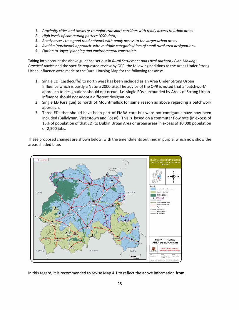
1. Proximity cities and towns or to major transport corridors with ready access to urban areas 2. High levels of commuting pattern (CSO data) 3. Ready access to a good road network with ready access to the larger urban areas 4. Avoid a ‘patchwork approach’ with multiple categories/ lots of small rural area designations. 5. Option to ‘layer’ planning and environmental constraints
Taking into account the above guidance set out in Rural Settlement and Local Authority Plan-Making: Practical Advice and the specific requested review by OPR, the following additions to the Areas Under Strong Urban Influence were made to the Rural Housing Map for the following reasons::
1. Single ED (Castlecuffe) to north west has been included as an Area Under Strong Urban Influence which is partly a Natura 2000 site. The advice of the OPR is noted that a ‘patchwork' approach to designations should not occur - i.e. single EDs surrounded by Areas of Strong Urban influence should not adopt a different designation.
2. Single ED (Graigue) to north of Mountmellick for same reason as above regarding a patchwork approach.
3. Three EDs that should have been part of EMRA core but were not contiguous have now been included (Ballylynan, Vicarstown and Fossy). This is based on a commuter flow rate (in excess of 15% of population of that ED) to Dublin Urban Area or urban areas in excess of 10,000 population or 2,500 jobs.
These proposed changes are shown below, with the amendments outlined in purple, which now show the areas shaded blue.
In this regard, it is recommended to revise Map 4.1 to reflect the above information from
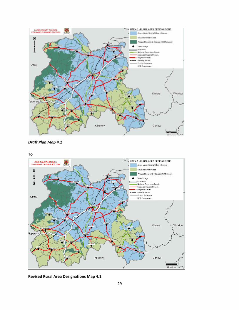
29
Draft Plan Map 4.1
To
Revised Rural Area Designations Map 4.1
30
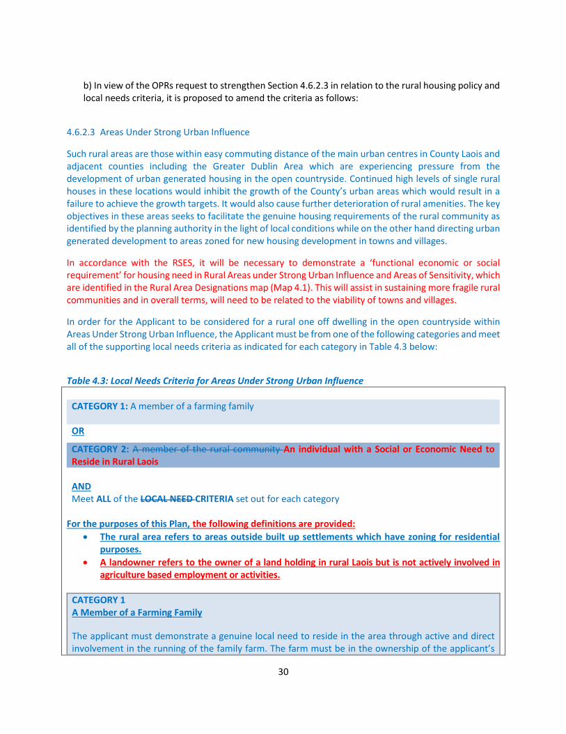
b) In view of the OPRs request to strengthen Section 4.6.2.3 in relation to the rural housing policy and local needs criteria, it is proposed to amend the criteria as follows:
4.6.2.3 Areas Under Strong Urban Influence
Such rural areas are those within easy commuting distance of the main urban centres in County Laois and adjacent counties including the Greater Dublin Area which are experiencing pressure from the development of urban generated housing in the open countryside. Continued high levels of single rural houses in these locations would inhibit the growth of the County’s urban areas which would result in a failure to achieve the growth targets. It would also cause further deterioration of rural amenities. The key objectives in these areas seeks to facilitate the genuine housing requirements of the rural community as identified by the planning authority in the light of local conditions while on the other hand directing urban generated development to areas zoned for new housing development in towns and villages.
In accordance with the RSES, it will be necessary to demonstrate a ‘functional economic or social requirement’ for housing need in Rural Areas under Strong Urban Influence and Areas of Sensitivity, which are identified in the Rural Area Designations map (Map 4.1). This will assist in sustaining more fragile rural communities and in overall terms, will need to be related to the viability of towns and villages.
In order for the Applicant to be considered for a rural one off dwelling in the open countryside within Areas Under Strong Urban Influence, the Applicant must be from one of the following categories and meet all of the supporting local needs criteria as indicated for each category in Table 4.3 below:
Table 4.3: Local Needs Criteria for Areas Under Strong Urban Influence
CATEGORY 1: A member of a farming family
OR
CATEGORY 2: A member of the rural community An individual with a Social or Economic Need to Reside in Rural Laois AND Meet ALL of the LOCAL NEED CRITERIA set out for each category
For the purposes of this Plan, the following definitions are provided:
• The rural area refers to areas outside built up settlements which have zoning for residential purposes.
• A landowner refers to the owner of a land holding in rural Laois but is not actively involved in agriculture based employment or activities.
CATEGORY 1 A Member of a Farming Family
The applicant must demonstrate a genuine local need to reside in the area through active and direct involvement in the running of the family farm. The farm must be in the ownership of the applicant’s

31
immediate family for a minimum of five years preceding the date of the application for planning permission.
REQUIRED LOCAL NEEDS CRITERIA (all criteria must be met)
• The applicant must be engaged in full time farming. Part-time farming may be considered where the applicant can demonstrate an acceptable landholding and herd number.
• The applicant must demonstrate that they have been engaged in farming at that location for a continuous period of over 5 years prior to making the application
• The application must be for the applicant’s first home in the rural area
• The family home must be in the rural area within 5km 8km of the proposed site OR the subject site must be located at a suitable location within the family landholding.
• Climate action measures have been proposed as part of the application to ensure a transition to a low carbon economy
CATEGORY 2 A Member of the Rural Community An Individual with a Social or Economic Need to Reside in Rural Laois
The applicant must demonstrate a genuine local need to reside in the rural area for economic or social purposes reasons by reason of immediate family ties or their active and direct involvement in rural employment. One All of the following local needs criteria (ie Local Needs Criteria A or B) below must be met.
REQUIRED LOCAL NEEDS CRITERIA A(all criteria must be met)
• The applicant must have grown up and spent substantial periods of their lives (12 years) living in the rural area of Laois as members of the rural community. This also includes returning emigrants seeking.
• The applicant must have a functional economic or social requirement to reside in this particular rural area such as in any of the following 2 situations:
o Social requirements will normally encompass persons who have grown up and spent substantial periods of their lives (12 years) living in the rural area of Laois as members of the rural community and wish to reside close to family members. This also includes returning emigrants. The application site must be on the family landholding and within 5km 8km of the family home. Where no land is available in the family ownership, a site within 5km 8km of the original family home may be considered. OR
o Economic requirements will normally encompass persons with a functional need to reside permanently in the rural area close to their place of work and is involved in full-time agriculture based occupation, horticulture or forestry as well as similar rural-based full-time occupations where it can be demonstrated that the nature of such an occupation is dependent, intrinsically linked and contributes to the rural community.
• The application must be for the applicant’s first home in the rural area.
• Climate action measures have been proposed as part of the application to ensure a transition to a low carbon economy
REQUIRED LOCAL NEEDS CRITERIA (B) (all criteria must be met)
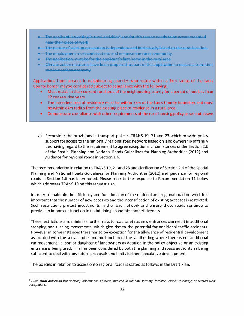
32
• The applicant is working in rural activities3 and for this reason needs to be accommodated near their place of work
• The nature of such an occupation is dependent and intrinsically linked to the rural location.
• The employment must contribute to and enhance the rural community
• The application must be for the applicant’s first home in the rural area
• Climate action measures have been proposed as part of the application to ensure a transition to a low carbon economy
Applications from persons in neighbouring counties who reside within a 3km radius of the Laois County border maybe considered subject to compliance with the following:
• Must reside in their current rural area of the neighbouring county for a period of not less than 12 consecutive years
• The intended area of residence must be within 5km of the Laois County boundary and must be within 8km radius from the existing place of residence in a rural area.
• Demonstrate compliance with other requirements of the rural housing policy as set out above
a) Reconsider the provisions in transport policies TRANS 19, 21 and 23 which provide policy support for access to the national / regional road network based on land ownership of family ties having regard to the requirement to agree exceptional circumstances under Section 2.6 of the Spatial Planning and National Roads Guidelines for Planning Authorities (2012) and guidance for regional roads in Section 1.6.
The recommendation in relation to TRANS 19, 21 and 23 and clarification of Section 2.6 of the Spatial Planning and National Roads Guidelines for Planning Authorities (2012) and guidance for regional roads in Section 1.6 has been noted. Please refer to the response to Recommendation 11 below which addresses TRANS 19 on this request also. In order to maintain the efficiency and functionality of the national and regional road network it is important that the number of new accesses and the intensification of existing accesses is restricted. Such restrictions protect investments in the road network and ensure these roads continue to provide an important function in maintaining economic competitiveness. These restrictions also minimise further risks to road safety as new entrances can result in additional stopping and turning movements, which give rise to the potential for additional traffic accidents. However in some instances there has to be exception for the allowance of residential development associated with the social and economic function of the landholding where there is not additional car movement i.e. son or daughter of landowners as detailed in the policy objective or an existing entrance is being used. This has been considered by both the planning and roads authority as being sufficient to deal with any future proposals and limits further speculative development. The policies in relation to access onto regional roads is stated as follows in the Draft Plan.
3 Such rural activities will normally encompass persons involved in full time farming, forestry, inland waterways or related rural occupations.
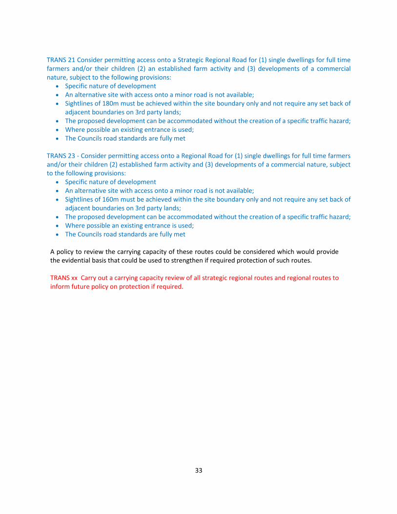
33
TRANS 21 Consider permitting access onto a Strategic Regional Road for (1) single dwellings for full time farmers and/or their children (2) an established farm activity and (3) developments of a commercial nature, subject to the following provisions:
• Specific nature of development • An alternative site with access onto a minor road is not available; • Sightlines of 180m must be achieved within the site boundary only and not require any set back of
adjacent boundaries on 3rd party lands; • The proposed development can be accommodated without the creation of a specific traffic hazard; • Where possible an existing entrance is used; • The Councils road standards are fully met
TRANS 23 - Consider permitting access onto a Regional Road for (1) single dwellings for full time farmers and/or their children (2) established farm activity and (3) developments of a commercial nature, subject to the following provisions:
• Specific nature of development • An alternative site with access onto a minor road is not available; • Sightlines of 160m must be achieved within the site boundary only and not require any set back of
adjacent boundaries on 3rd party lands; • The proposed development can be accommodated without the creation of a specific traffic hazard; • Where possible an existing entrance is used; • The Councils road standards are fully met
A policy to review the carrying capacity of these routes could be considered which would provide the evidential basis that could be used to strengthen if required protection of such routes. TRANS xx Carry out a carrying capacity review of all strategic regional routes and regional routes to inform future policy on protection if required.

34
Observation 3 – Monitoring of Rural Housing Having regard to the National Policy Objectives contained in Chapter 5 – Planning for diverse rural plans of the National Planning Framework, in particular NPOs 15, 16 and 18(a), the planning authority is requested to also include provisions for monitoring residential development permitted (separately) in rural villages and as single rural houses in open countryside over the plan period.
CE Opinion and Recommendation Section 14.8.1 Implementation and Monitoring of the Core Strategy supports the provision of standardised requirements for recording of planning and housing data to provide a consistent and robust evidence base for housing construction. Policy Objective IM 1 further supports the monitoring of development for compliance with the objectives of the Core Strategy. The recommendation of the OPR is accepted and a further policy objective will be included to monitor rural one off dwellings as a separate process. IM 2: Support the ongoing monitoring and review of the Housing Need Demand Assessment (HNDA) and monitor and maintain a record of residential development permitted in the open countryside, in accordance with forthcoming Departmental guidance for the establishment of a Housing Need Demand Assessment Coordination and Monitoring Unit and related implementation of a centralised spatial database for local authority housing.

35
2.2.4 ECONOMIC DEVELOPMENT AND EMPLOYMENT
Recommendation 8 – Employment Land Use Zonings Having regard to Spatial Planning and National Road Guidelines for Planning Authorities (2012), and the settlement hierarchy designation of Stradbally (tier 3), Rathdowney (tier 4) and Borris-in-Ossory (tier 5), and their anticipated population growth over the plan period, the planning authority is required to provide an evidence-based justification for the quantity and location of all employment generating land use zonings (or for a reduced area zoned for such uses in the absence of a robust justification).
CE Opinion and Response The recommendation is noted in relation to the employment zonings for
• Stradbally (tier 3),
• Rathdowney (tier 4) and
• Borris-in-Ossory (tier 5). and their anticipated population growth over the plan period. Each of these towns have been reviewed in the Draft Plan, considered in the context of the review to the Core Strategy and the anticipated population growth rates and housing targets. In order to ensure the towns and villages have potential for employment it is considered necessary that enterprise and employment / tourism and town centre uses remain zoned, however there is scope for reducing based on access arrangements and back land locations. Each of the towns identified have thriving businesses and play an important role in sustaining the rural areas within which they are located:
• Stradbally has a Maltings, McKeown Stone and a SuperValu with independent retailers / publicans;
• Rathdowney has a meat factory, Dunnes Stores, SuperValu and some successful independent retailers; and
• Borris in Ossory has fewer businesses, the development strategy for the western part of the County seeks to capitalise of the proximity to the motorway and regenerate the village of Borris in Ossory by providing sustainable opportunities for employment in a range of areas, hence lands have been zoned for industrial and general business.
The tables and plans overleaf identify the amount of land zoned for employment generating uses in the Draft Plan and the proposal for amendment to these lands for Stradbally, Rathdowney and Borris in Ossory.

36
STRADBALLY The table below shows the reduction in zoning for enterprise and employment lands, with the Zoning
Map showing the location of these lands.
Town Draft Plan Proposed Amended
Industrial Enterprise
and
Employment
Town
Centre
Tourism General
Business
Industrial Enterprise
and
Employment
Town
Centre
Tourism General
Business
Stradbally 2.09
Hectares
5.17
Acres
14.61
Hectares
36.07 Acres
18.62
Hectares
45.99
Acres
2.41
Hectares
5.96
Acres
3.09
Hectares
7.76
Acres
2.09
Hectares
5.17
Acres
5.52
Hectares
13.62 Acres
18.62
Hectares
45.99
Acres
2.41
Hectares
5.96
Acres
3.09
Hectares
7.67
Acres
Amendment Number Proposed amendment - Change
38 From Enterprise and Employment
To Open countryside
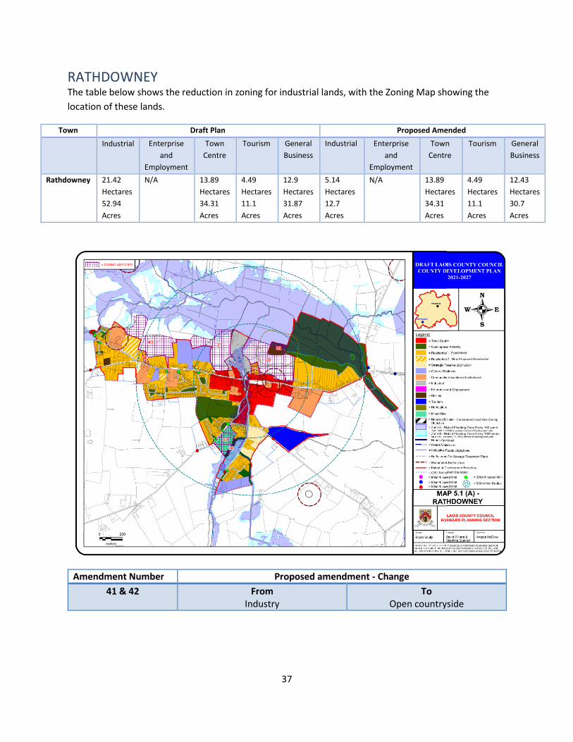
37
RATHDOWNEY The table below shows the reduction in zoning for industrial lands, with the Zoning Map showing the
location of these lands.
Town Draft Plan Proposed Amended
Industrial Enterprise
and
Employment
Town
Centre
Tourism General
Business
Industrial Enterprise
and
Employment
Town
Centre
Tourism General
Business
Rathdowney 21.42
Hectares
52.94
Acres
N/A 13.89
Hectares
34.31
Acres
4.49
Hectares
11.1
Acres
12.9
Hectares
31.87
Acres
5.14
Hectares
12.7
Acres
N/A 13.89
Hectares
34.31
Acres
4.49
Hectares
11.1
Acres
12.43
Hectares
30.7
Acres
Amendment Number Proposed amendment - Change
41 & 42 From Industry
To Open countryside
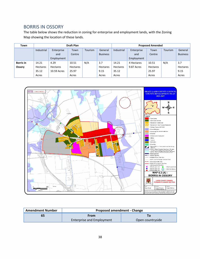
38
BORRIS IN OSSORY The table below shows the reduction in zoning for enterprise and employment lands, with the Zoning
Map showing the location of these lands.
Town Draft Plan Proposed Amended
Industrial Enterprise
and
Employment
Town
Centre
Tourism General
Business
Industrial Enterprise
and
Employment
Town
Centre
Tourism General
Business
Borris in
Ossory
14.21
Hectares
35.12
Acres
4.29
Hectares
10.59 Acres
10.51
Hectares
25.97
Acres
N/A 3.7
Hectares
9.15
Acres
14.21
Hectares
35.12
Acres
4 Hectares
9.87 Acres
10.51
Hectares
25.97
Acres
N/A 3.7
Hectares
9.15
Acres
Amendment Number Proposed amendment - Change
65 From Enterprise and Employment
To Open countryside

39
2.2.5 SUSTAINABLE TRANSPORT
Recommendation 9 – Sustainable Transport and Modal Shift In order to ensure the effective planning, implementation and monitoring of the development plan requirements under section 10(2)(n) of the Act, the planning authority is required, in consultation with the National Transport Authority (and Transport Infrastructure Ireland), as appropriate, to:
a. Include a stronger and more explicit policy objective regarding the need to achieve a modal shift.
b. Enhance section 3.4 – Integrating Climate Action into the Plan of the Draft Plan to include existing baseline figures for modal share for the overall county and modal share targets for the plan period. It is recommended that this could best be provided at individual settlement level for the larger settlements, and at aggregate level for rural towns and villages and the open countryside.
c. Provide an effective monitoring regime for the implementation of the planning authority’s sustainable transport strategy and the modal share targets in particular.
CE Opinion and Response
(a) The recommendation is noted in relation to augmenting the policy provisions in relation to modal
shift. CM ST 3 already promotes higher densities within settlement centres along public transport corridors, TRANS 11 and 13 in Chapter 10 also promote low carbon transport modes as follows
TRANS 11 Integrate land use policies and transportation in a manner which reduces reliance on car based
travel and promotes more sustainable transport choice and co-ordinates particular land uses with their
accessibility requirements.
TRANS 13 Encourage transition towards sustainable and low carbon transport modes, through the
promotion of alternative modes of transport, and ‘walkable communities’ together with promotion of
compact urban forms close to public transport corridors to encourage more sustainable patterns of
movement.
However, it is proposed to include the following Policy Objective in Chapter 3:- CM ST XX: promote more compact development forms that reduce overall demand for private transport and private transport infrastructure and support proposals that encourage modal shift towards sustainable travel modes.
40
(b) The submission is noted in relation to further integrating modal shift into the plan. Laois County Council will be commencing the preparation a Local Transport Plans (LTP) in 2021 for the Towns of Portlaoise, Graiguecullen, Portarlington and Mountmellick and will be consulting with the NTA and TII in relation to same. TRANS 14 will be amended to state:
To undertake Local Transport Plans in conjunction with the NTA, TII, and relevant stakeholders transportation studies in the following towns. The purpose of Transportation Studies is to which will identify the a transport strategy to address modal shift, traffic issues, parking and active travel deficiencies in the existing network and make recommendations on same in the following towns
• Portlaoise & Environs
• Mountrath & Environs
• Mountmellick & Environs
• Durrow & Environs
• Abbeyleix & Environs
• Stradbally & Environs
• Portarlington & Environs (Joint Study with Offaly Co Co to be explored)
• Graiguecullen & Environs (Joint Study with Carlow Co Co to be explored)
The strategic aim of the LTP is to
• examine the current lack of alternatives to the car and land use patterns which can better affect
a modal shift to public transport, walking and cycling;
• address current issues and anticipate future problems in the transport network of the town and
its strategic routes; and in doing so will present a detailed analysis of the current transport
situation and present potential interventions and recommendations for retention or not of roads
objectives, active travel options, roads based solutions including the strategic routes and
solutions to encourage provision and greater use of public transport.
The following policy objective is proposed in this context CMST XX Specify baseline figures and targets for modal share in new / varied Local Area Plans in
order to encourage a modal shift away from the private car to more sustainable forms of transport, such as public transport, cycling and walking. Set modal share targets within the county in cooperation with NTA, CARO, EMRA and other relevant stakeholders and in accordance with any relevant Guidelines that may come into effect’.
TRANS 28 in Chapter 10 refers to a relaxation in car parking standards at certain location in town centres
and public transport hubs.
In relation to baseline data available for the county, Section 3.4 will be amended to include the following
paragraphs and tables for data available for the County, Portlaoise and Portarlington.

41
The majority of County Laois commuters drive accounting for 73 % of those who commute to work and
30% of those commuting to 3rd level study. The next most popular modes of transport for workers in
walking (6%) and for 3rd level students on foot (23%) and bus (17%) were the next most popular. For
primary and secondary students, the most popular mode of travel was as passengers by car (60%),
bus(18%) and walking 15.
The following is the baseline modal share for the overall County
In relation to Portlaoise, the majority of commuters also favor driving which accounts for 67 % of those
who commute to work and 28% of those commuting to 3rd level study. The next most popular modes of
transport for workers in walking (9%) and for 3rd level students on foot (21%) and bus (21%) were the
next most popular. For primary and secondary students, the most popular mode of travel was as
passengers by car (57%), bus(22%) and walking (13%).
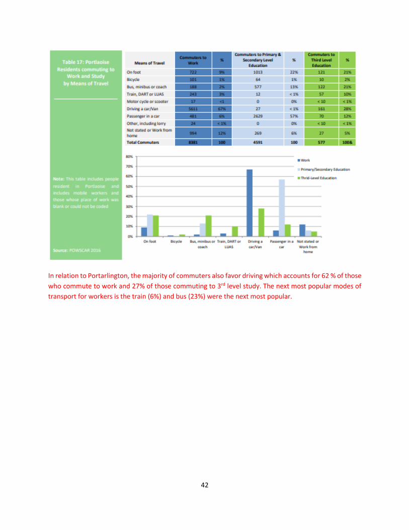
42
In relation to Portarlington, the majority of commuters also favor driving which accounts for 62 % of those
who commute to work and 27% of those commuting to 3rd level study. The next most popular modes of
transport for workers is the train (6%) and bus (23%) were the next most popular.
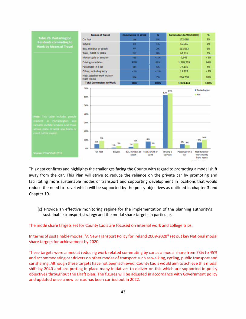
43
This data confirms and highlights the challenges facing the County with regard to promoting a modal shift
away from the car. This Plan will strive to reduce the reliance on the private car by promoting and
facilitating more sustainable modes of transport and supporting development in locations that would
reduce the need to travel which will be supported by the policy objectives as outlined in chapter 3 and
Chapter 10.
(c) Provide an effective monitoring regime for the implementation of the planning authority’s
sustainable transport strategy and the modal share targets in particular. The mode share targets set for County Laois are focused on internal work and college trips. In terms of sustainable modes, "A New Transport Policy for Ireland 2009-2020" set out key National modal share targets for achievement by 2020. These targets were aimed at reducing work-related commuting by car as a modal share from 73% to 45% and accommodating car drivers on other modes of transport such as walking, cycling, public transport and car sharing. Although these targets have not been achieved, County Laois would aim to achieve this modal shift by 2040 and are putting in place many initiatives to deliver on this which are supported in policy objectives throughout the Draft plan. The figures will be adjusted in accordance with Government policy and updated once a new census has been carried out in 2022.
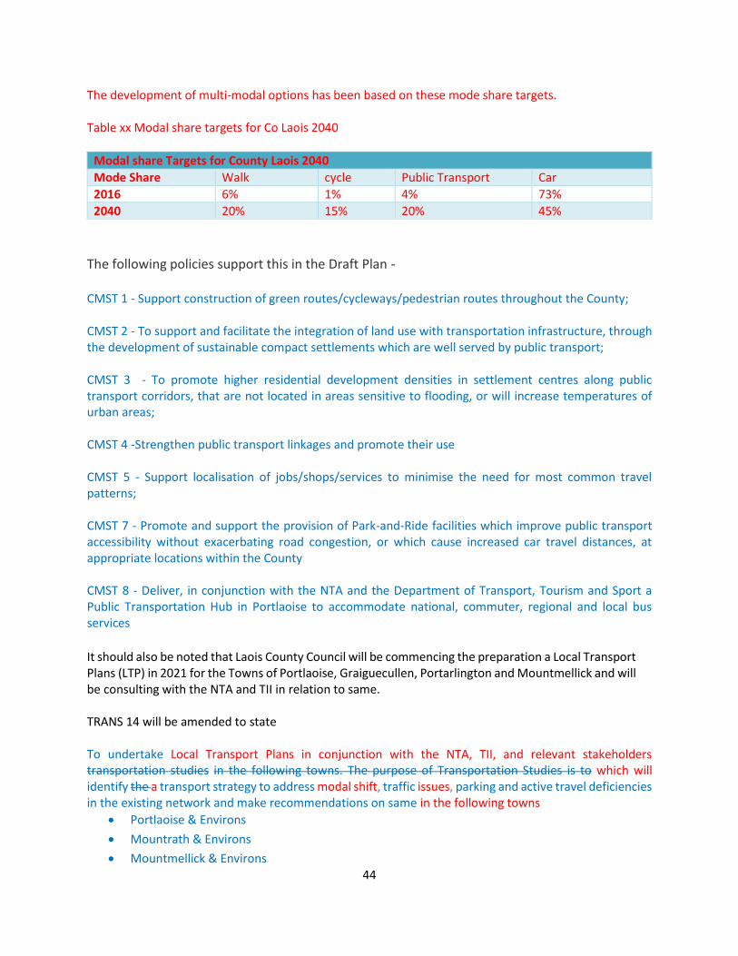
44
The development of multi-modal options has been based on these mode share targets. Table xx Modal share targets for Co Laois 2040
Modal share Targets for County Laois 2040
Mode Share Walk cycle Public Transport Car
2016 6% 1% 4% 73%
2040 20% 15% 20% 45%
The following policies support this in the Draft Plan - CMST 1 - Support construction of green routes/cycleways/pedestrian routes throughout the County; CMST 2 - To support and facilitate the integration of land use with transportation infrastructure, through the development of sustainable compact settlements which are well served by public transport; CMST 3 - To promote higher residential development densities in settlement centres along public transport corridors, that are not located in areas sensitive to flooding, or will increase temperatures of urban areas; CMST 4 -Strengthen public transport linkages and promote their use CMST 5 - Support localisation of jobs/shops/services to minimise the need for most common travel patterns; CMST 7 - Promote and support the provision of Park-and-Ride facilities which improve public transport accessibility without exacerbating road congestion, or which cause increased car travel distances, at appropriate locations within the County CMST 8 - Deliver, in conjunction with the NTA and the Department of Transport, Tourism and Sport a Public Transportation Hub in Portlaoise to accommodate national, commuter, regional and local bus services
It should also be noted that Laois County Council will be commencing the preparation a Local Transport Plans (LTP) in 2021 for the Towns of Portlaoise, Graiguecullen, Portarlington and Mountmellick and will be consulting with the NTA and TII in relation to same.
TRANS 14 will be amended to state To undertake Local Transport Plans in conjunction with the NTA, TII, and relevant stakeholders transportation studies in the following towns. The purpose of Transportation Studies is to which will identify the a transport strategy to address modal shift, traffic issues, parking and active travel deficiencies in the existing network and make recommendations on same in the following towns
• Portlaoise & Environs
• Mountrath & Environs
• Mountmellick & Environs

45
• Durrow & Environs
• Abbeyleix & Environs
• Stradbally & Environs
• Portarlington & Environs (Joint Study with Offaly Co Co to be explored)
• Graiguecullen & Environs (Joint Study with Carlow Co Co to be explored)
The strategic aim of the LTP is to
• examine the current lack of alternatives to the car and land use patterns which can better effect
a modal shift to public transport, walking and cycling;
• address current issues and anticipate future problems in the transport network of the town and
its strategic routes; and in doing so will present a detailed analysis of the current transport
situation and present potential interventions and recommendations for retention or not of roads
objectives, active travel options, roads based solutions including the strategic routes and solutions
to encourage provision and greater use of public transport.
It is intended that local transport plans will also be carried out for some of the towns as referred to in TRANS 14 over the next 2 years. Some data gathering has already commenced in the town of Abbeyleix where by levels of traffic (all modes) are being monitored on a daily basis as part of an ongoing Climate action project by the Community.
In Chapter 3 , section 3.4. the following Action Area 1 to be amended to include the following
ACTION AREA 1 – SUSTAINABLE TRANSPORT
COMMENTARY NATIONAL TARGET LOCAL COUNTY TARGET
The transport sector is one of the biggest contributor of GHG emissions in the County where the predominant mode of transport is the private car. This is evident in the number of commuters leaving the county for work purposes which equates to 12,000 per day. How we travel between places will also need to be addressed, promoting a modal shift away from car dependency for more sustainable and active transport modes.
• Reduce CO2 eq. Emissions From The Sector By 45 % To 50 % Pre NDP Projections
• Increase the no of EV to 936,000
• Build the EV charging network to support the growth of EVS at the rate required
• Delivery of a public transportation hub in the key town of Portlaoise by 2027;
• The prioritization and delivery of Public bus measures in the key towns of Portlaoise and Graiguecullen by 2027;
• The prioritisation of pedestrian linkages and creation of blueways / Greenways in the key town of Portlaoise/
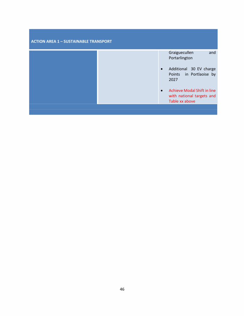
46
ACTION AREA 1 – SUSTAINABLE TRANSPORT
Graiguecullen and Portarlington
• Additional 30 EV charge Points in Portlaoise by 2027
• Achieve Modal Shift in line with national targets and Table xx above
47
Recommendation 10 – Road Infrastructure Having regard to section 10(2)(n) of the Planning and Development Act 2000 (as amended) and the need to promote more sustainable transport patterns and reduce greenhouse gas emissions from transport, the planning authority is required to review the need for and extent of road infrastructure proposed in the settlements of Abbeyleix, Mountrath, Stradbally and Durrow in consultation with the National Transport Authority and Transport Infrastructure Ireland.
CE Opinion and Response Laois County Council will be commencing the preparation a Local Transport Plans (LTP) in 2021 for the Towns of Portlaoise, Graiguecullen, Portarlington and Mountmellick and will be consulting with the NTA and TII in relation to same.
TRANS 14 will be amended to state To undertake Local Transport Plans in conjunction with the NTA, TII, and relevant stakeholders transportation studies in the following towns. The purpose of Transportation Studies is to which will identify the a transport strategy to address modal shift, traffic issues, parking and active travel deficiencies in the existing network and make recommendations on same in the following towns
• Portlaoise & Environs
• Mountrath & Environs
• Mountmellick & Environs
• Durrow & Environs
• Abbeyleix & Environs
• Stradbally & Environs
• Portarlington & Environs (Joint Study with Offaly Co Co to be explored)
• Graiguecullen & Environs (Joint Study with Carlow Co Co to be explored)
The strategic aim of the LTP is to
• examine the current lack of alternatives to the car and land use patterns which can better effect
a modal shift to public transport, walking and cycling;
• address current issues and anticipate future problems in the transport network of the town and
its strategic routes; and in doing so will present a detailed analysis of the current transport
situation and present potential interventions and recommendations for retention or not of roads
objectives, for active travel options, roads based solutions including the strategic routes and
solutions to encourage provision and greater use of public transport.
It is intended that local transport plans will also be carried out for some of the towns as referred to in TRANS 14 over the next 2 years. Some data gathering has already commenced in the town of Abbeyleix where by levels of traffic (all modes ) are being monitored on a daily basis as part of an ongoing Climate action project by the Community. It is considered prudent not to amend roads objectives until the evidential basis is there to do so as towns such as all of the towns mentioned are under pressure from HGV traffic in particular and have very limited public transport available to them.

48
Recommendation 11 – Spatial Planning and National Roads Guidelines
Having regard to the provisions of section 2.5 – Required Development Plan Policy on Access to National Roads and section 2.6 – Exceptional Circumstances of the Spatial Planning and National Roads Guidelines for Planning Authorities (2012), the planning authority is required to strengthen and expand on the policy objectives for national roads and review the zoning of land for employment purposes in proximity to national roads (Recommendation 8) to ensure that the draft development plan is consistent with the Guidelines, and in particular the principles of protecting the strategic function of national roads and the presumption against large out of town retail centres located adjacent or close to existing, new or planned national roads/motorways. In this regard the planning authority should consult with Transport Infrastructure Ireland.
CE Opinion and Response
The following policy objectives relate to section 2.5 – Required Development Plan Policy on Access to National Roads and section 2.6 – Exceptional Circumstances of the Spatial Planning and National Roads Guidelines for Planning Authorities (2012), The Draft Plan recognises the importance of safeguarding the National Road network. It is considered that this appropriately reflected in policy objective TRANS 17 and TRANS 18 and 19., however application of the following will also be applied
National Routes Policy Objectives
TRANS 17 Avoid the creation of any new direct access points from development or the generation of increased traffic from existing direct access/egress points to the national road network to which speed limits greater than 60kmph apply
TRANS 18 Facilitate a limited level of new accesses or the intensified use of existing accesses to the national road network on the approaches to or exit from urban centres that are subject to a speed limit zone between 50kmph and 60kmph otherwise known as the transition zone. Such accesses will be considered where they facilitate orderly urban development and would not result in a proliferation of such entrances, leading to a diminution in the role of these transitional zones. A Road Safety Audit, prepared in accordance with the Design Manual for Roads and Bridges (NRA, 2010), shall be submitted where appropriate
TRANS 19 Consider permitting access for replacement dwellings for persons who [or their families] own the original house and site for a minimum of 10 years [documentary evidence in this regard to be submitted] subject to the following provisions:
• The original dwelling is in-situ and is habitable;
49
• The cost of refurbishment of and/ or extension to the original dwelling is prohibitive;
• The applicant complies with the provisions of the local need factor of the rural housing policy as outlined in Chapter 4 Housing Strategy, Section 4.6 of the Plan;
• An alternative site with access onto a minor road is not available; • The proposed development can be accommodated without the creation of a
specific traffic hazard; • Where possible an existing entrance is used; • Sightlines of 215m must be achieved within the site boundary only and not
require any set back of adjacent boundaries on 3rd party lands; • The Councils road standards are fully met; • The site is of minimum size of 0.202 hectares [0.5 acres]; • A Site Suitability Assessment must be submitted
TRANS XX To develop policy that provides a framework for a less restrictive approach to non-residential development of strategic or national importance or extensions to such developments accessing onto the National Road Network in accordance with the provisions of Section 2.6 of the ‘Spatial Planning and National Roads -Guidelines for planning authorities’ (2012) with TII within 1 years of adoption of the County Development Plan.

50
2.2.6 CLIMATE ACTION AND RENEWABLE ENERGY
Recommendation 12 – National renewable energy targets
In accordance with the provisions of section 28(1C) of the Act, the planning authority is required to amend Chapter 3 in the Draft Plan in order to fully implement the Specific Planning Policy Requirement contained in the Interim Guidelines for Planning Authorities on Statutory Plans, Renewable Energy and Climate Change. This will require the planning authority to indicate how the designation of areas for renewables development under the policies and objectives of the plan will contribute to meeting national renewable energy targets including specific targets in megawatts for wind energy potential in the county. In the absence of any nationally determined targets for County Laois specifically, you are advised to demonstrate appropriate metrics in this regard, which could include Laois’s share of estimates of additional national renewable electricity target (4GW) as defined by the % of national land area represented by the county, linked back to the cumulative renewable energy production potential of the areas designated for renewables development.
CE Opinion and Response
The Development Plan will contribute towards meeting national renewable energy targets it should be noted that the Planning Authority has included a standalone chapter in the Draft Plan to address climate adaptation and mitigation. In terms of the contribution of the Plan to realising targets on renewable energy and climate change mitigation, the Plan is committed to reducing carbon footprint by integrating climate action into the planning system in support of national targets for climate policy mitigation and adaptation objectives, as well as targets for greenhouse gas emissions reductions.
The Council has demonstrated its commitment to promoting renewable energy development by granting approximately 330ha of solar farms in recent years.
It is acknowledged in the plan that the Council is open to new and innovative renewable energy sources and technological solutions to addressing climate change.
In this regard, the Council will seek to collaborate with relevant stakeholders to progress the transition to green energy. Whilst the information requested is not available at this time, enhanced policy is proposed which commits to working with key stakeholders in the carrying out of an assessment of how the implementation of the Plan will contribute to realising overall national targets on renewable energy and climate change, and in particular wind energy production and the potential wind energy resource.
Laois County Council has also designated Portlaoise as a Decarbonisation Zone and as such the following text will be added to Chapter 3 to highlight Laois County Council’s commitment to climate change and achieving any future renewable energy targets.
A study carried out by SIEMENS for Laois County Council in 2020 – Carbon Footprint Study for the Town of Portlaoise , Co Laois was designed to provide for a detailed assessment of its existing footprint and the potential to reduce its impact through identifying suitable reduction opportunities. The study looked at 3 use cases – renewables, heating and transportation.
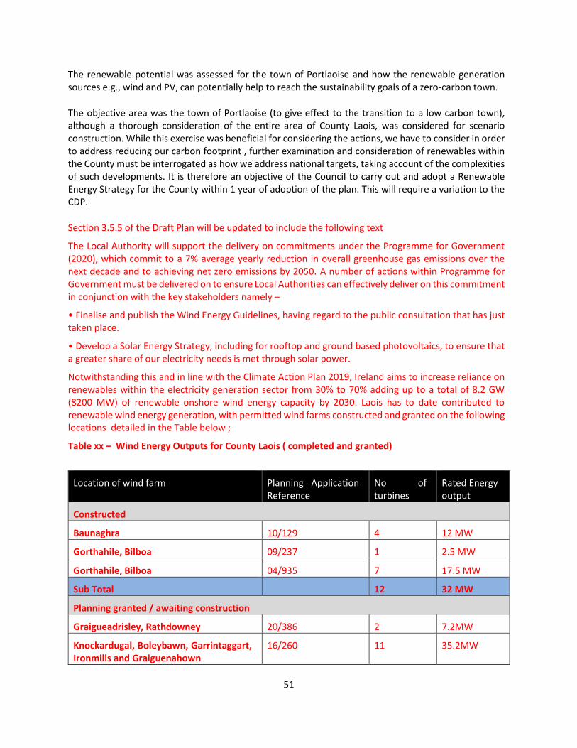
51
The renewable potential was assessed for the town of Portlaoise and how the renewable generation sources e.g., wind and PV, can potentially help to reach the sustainability goals of a zero-carbon town.
The objective area was the town of Portlaoise (to give effect to the transition to a low carbon town), although a thorough consideration of the entire area of County Laois, was considered for scenario construction. While this exercise was beneficial for considering the actions, we have to consider in order to address reducing our carbon footprint , further examination and consideration of renewables within the County must be interrogated as how we address national targets, taking account of the complexities of such developments. It is therefore an objective of the Council to carry out and adopt a Renewable Energy Strategy for the County within 1 year of adoption of the plan. This will require a variation to the CDP.
Section 3.5.5 of the Draft Plan will be updated to include the following text
The Local Authority will support the delivery on commitments under the Programme for Government (2020), which commit to a 7% average yearly reduction in overall greenhouse gas emissions over the next decade and to achieving net zero emissions by 2050. A number of actions within Programme for Government must be delivered on to ensure Local Authorities can effectively deliver on this commitment in conjunction with the key stakeholders namely –
• Finalise and publish the Wind Energy Guidelines, having regard to the public consultation that has just taken place.
• Develop a Solar Energy Strategy, including for rooftop and ground based photovoltaics, to ensure that a greater share of our electricity needs is met through solar power.
Notwithstanding this and in line with the Climate Action Plan 2019, Ireland aims to increase reliance on renewables within the electricity generation sector from 30% to 70% adding up to a total of 8.2 GW (8200 MW) of renewable onshore wind energy capacity by 2030. Laois has to date contributed to renewable wind energy generation, with permitted wind farms constructed and granted on the following locations detailed in the Table below ;
Table xx – Wind Energy Outputs for County Laois ( completed and granted)
Location of wind farm Planning Application Reference
No of turbines
Rated Energy output
Constructed
Baunaghra 10/129 4 12 MW
Gorthahile, Bilboa 09/237 1 2.5 MW
Gorthahile, Bilboa 04/935 7 17.5 MW
Sub Total 12 32 MW
Planning granted / awaiting construction
Graigueadrisley, Rathdowney 20/386 2 7.2MW
Knockardugal, Boleybawn, Garrintaggart, Ironmills and Graiguenahown
16/260 11 35.2MW

52
Location of wind farm Planning Application Reference
No of turbines
Rated Energy output
East of Ballyroan Village and South West of Timahoe
13/268 18 45MW
Sub Total 31 87.4MW Approx
Total 43 119.4 MW
• The installed wind capacity in Co Laois in 2021 is 32MW. This represents 0.7% of the total installed wind capacity in the Republic of Ireland to date based on the national installed wind capacity of 4,235 MW in 2020.
• A potential additional 87.4 MW of energy to be generated from permission already granted for additional wind farms in the south east of the county would bring the total output in Laois to 120 MW.
• If the potential from granted permissions were to be constructed , together with what has been built , it would represent a contribution from Co Laois at nearly 1.5% of the total (8,200 MW) by 2030.
Due to the absence of national guidance on how local authorities can set a target for wind energy generation within their functional area, it is not possible to set a specific target for renewable energy generation in the county during the plan period.
However, as outlined in a specific objective in Chapter 3 Climate Action and Energy, the Council commits to working with key stakeholders in the carrying out of an assessment of how the implementation of the Plan will contribute to realising overall national targets on renewable energy and climate change, and in particular wind energy production and the potential wind energy resource.
In addition to wind , Laois County Council has permitted the following solar farms in the county

53
Table xx – Solar Energy Outputs for County Laois ( completed and granted)
Location Planning Application Reference Energy output
Kilcoran, Rathdowney 18/674 47 MWp
Nigbog, Coolnabacky, Esker, Money Lower and Lughteeog, Stradbally
17/532 76 MW
Sronagh, Mountmellick 16/505 6.5MV
Rathleague, Portlaoise 16/500 4 MW
Derry More, Mountrath 16/217 4.2 MW
Total 137.7 MW
An Anaerobic Digestor planned for Portlaoise has the potential to use up to 80,000 tonnes of biodegradable waste as feedstock per year, which has a potential Green House Gas emissions saving of 270,160 tonnes of CO2 equivalent. This project has the potential to produce approximately 7,000,000m3 of biomethane and used as an alternative fuel to fossil fuels for regional energy and heat production.
The biomethane from the proposed development will be injected into the gas network and it will then form a portion of gas used in the network for residential, commercial and industrial purposes.
It is essential that all forms of renewable energy potential is considered in the context of delivery of national renewable energy targets . To this end it is proposed to amend the following objective
CM RE 1 – Prepare a Local Authority Renewable Energy Strategy (LARES) for County Laois during the lifetime of the plan within 1 year of adoption of the plan. This will be by way of a variation to the Laois County Development Plan.

54
Recommendation 13 – Wind Energy Strategy
The planning authority is required to delete development control standard 6.1 – Buffer Zones in its entirety from the council’s wind energy strategy in appendix 5 of the draft development plan as the inclusion of a requirement for such a separation distance between wind turbines and schools, dwellings, community centres and public roads would restrict the potential for wind farm development in the county (areas open for consideration), would undermine other policy objectives supporting wind farm development and be contrary to national policy and Ministerial guidance on wind farm development.
CE Opinion and Response
The most up-to-date Government guidance on this matter remain the ‘Wind Energy Developments Guidelines for Planning Authorities, 2006’. In December 2019, the DoHPLG published a draft Revised Wind Energy Development Guidelines, for which the responses will inform the final Guidelines. To date, given that the Department has not finalised its review of the current guidelines, the guidelines remain in full effect, and the Planning Authority must be consistent with the standards set out in same. The Planning Authority therefore accepts that the 1.5km development management standard be removed from Section 6.1 of Appendix 5. Set back distances Reword Section 6.1 of Appendix 5 as follows: Ensure a setback distance of 1.5 kms wind turbines from schools, dwellings, community centres and all public roads in all areas open for consideration for windfarm development in accordance with the requirements of adopted National Policy Guidelines at the time of the determination of the planning application.
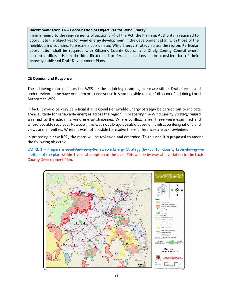
55
Recommendation 14 – Coordination of Objectives for Wind Energy Having regard to the requirements of section 9(4) of the Act, the Planning Authority is required to coordinate the objectives for wind energy development in the development plan, with those of the neighbouring counties, to ensure a coordinated Wind Energy Strategy across the region. Particular coordination shall be required with Kilkenny County Council and Offaly County Council where current conflicts arise in the identification of preferable locations in the consideration of their recently published Draft Development Plans.
CE Opinion and Response The following map indicates the WES for the adjoining counties, some are still in Draft format and under review, some have not been prepared yet so it is not possible to take full count of adjoining Local Authorities WES. In fact, it would be very beneficial if a Regional Renewable Energy Strategy be carried out to indicate areas suitable for renewable energies across the region. In preparing the Wind Energy Strategy regard was had to the adjoining wind energy strategies. Where conflicts arise, these were examined and where possible resolved. However, this was not always possible based on landscape designations and views and amenities. Where it was not possible to resolve these differences are acknowledged.
In preparing a new RES , the maps will be reviewed and amended. To this end it is proposed to amend the following objective
CM RE 1 – Prepare a Local Authority Renewable Energy Strategy (LARES) for County Laois during the lifetime of the plan within 1 year of adoption of the plan. This will be by way of a variation to the Laois County Development Plan.

56
Observation 4 – Consistency with Guidelines Given the importance attributed to climate action by Government, as evidenced by, inter alia, the recent Climate Action and Low Carbon Development Bill (October, 2020) and the Climate Action Plan 2019, the planning authority is advised that section 2.4 should also include an objective to consider a variation of the development plan within a reasonable period of time, or to include such other mechanism, as may be appropriate, to ensure the development plan will be consistent with the approach to climate action recommended in the revised Development Plan Guidelines as adopted or any other relevant guidelines.
CE Opinion and Response The submission is noted in relation to aligning the County Development Plan with any forthcoming Section 28 guidelines in particular the Development Plan Guidelines. The Revised Development Plan Guidelines are still awaited from the Department. On their endorsement by National Government, the Guidelines will be considered, and if required a variation will be carried out to ensure consistency with approaches to Climate Action. The following Policy Objective is proposed to be included to deal with same – Following the receipt and consideration of any section 28 Guidelines including the Revised Development Plan Guidelines, the Planning Authority will prepare a report detailing consistency with this guidelines and if required prepare a variation to ensure the County Development aligns with same.
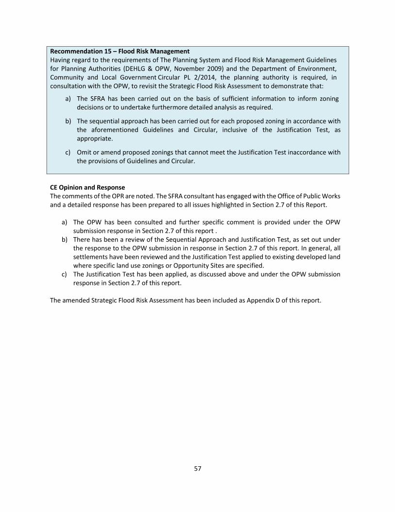
57
Recommendation 15 – Flood Risk Management Having regard to the requirements of The Planning System and Flood Risk Management Guidelines for Planning Authorities (DEHLG & OPW, November 2009) and the Department of Environment, Community and Local Government Circular PL 2/2014, the planning authority is required, in consultation with the OPW, to revisit the Strategic Flood Risk Assessment to demonstrate that:
a) The SFRA has been carried out on the basis of sufficient information to inform zoning decisions or to undertake furthermore detailed analysis as required.
b) The sequential approach has been carried out for each proposed zoning in accordance with the aforementioned Guidelines and Circular, inclusive of the Justification Test, as appropriate.
c) Omit or amend proposed zonings that cannot meet the Justification Test in accordance with the provisions of Guidelines and Circular.
CE Opinion and Response The comments of the OPR are noted. The SFRA consultant has engaged with the Office of Public Works and a detailed response has been prepared to all issues highlighted in Section 2.7 of this Report.
a) The OPW has been consulted and further specific comment is provided under the OPW submission response in Section 2.7 of this report .
b) There has been a review of the Sequential Approach and Justification Test, as set out under the response to the OPW submission in response in Section 2.7 of this report. In general, all settlements have been reviewed and the Justification Test applied to existing developed land where specific land use zonings or Opportunity Sites are specified.
c) The Justification Test has been applied, as discussed above and under the OPW submission response in Section 2.7 of this report.
The amended Strategic Flood Risk Assessment has been included as Appendix D of this report.

58
Observation 5 – Strategic Flood Risk Assessment (SFRA)
The Office advises that the following matters should be clarified to ensure consistency between the Plan and the Strategic Flood Risk Assessment:
a) The status of lands in Portlaoise referenced in the SFRA as flood plain storage within the Enterprise & Employment lands to the south west of the town, and zoned Town Centre to the west of St Peter & St Paul’s church, should be clarified. This may require an amended zoning or policy objective for the purposes of the flood risk management of the area.
b) Land in Ballybrittas shown as new residential on zoning maps is shown as existing residential on SFRA the map. The recommendation above in respect of sequential development and the justification test apply.
c) Land in Killeen shown as new residential on zoning maps does not match the flood zones on SFRA the map.
CE Opinion and Response The observation of the OPR is noted. The areas referred to have been reviewed by JBA consultants and addressed, as set out under the response to the OPW submission. The amended Strategic Flood Risk Assessment has been included as Appendix D of this report.
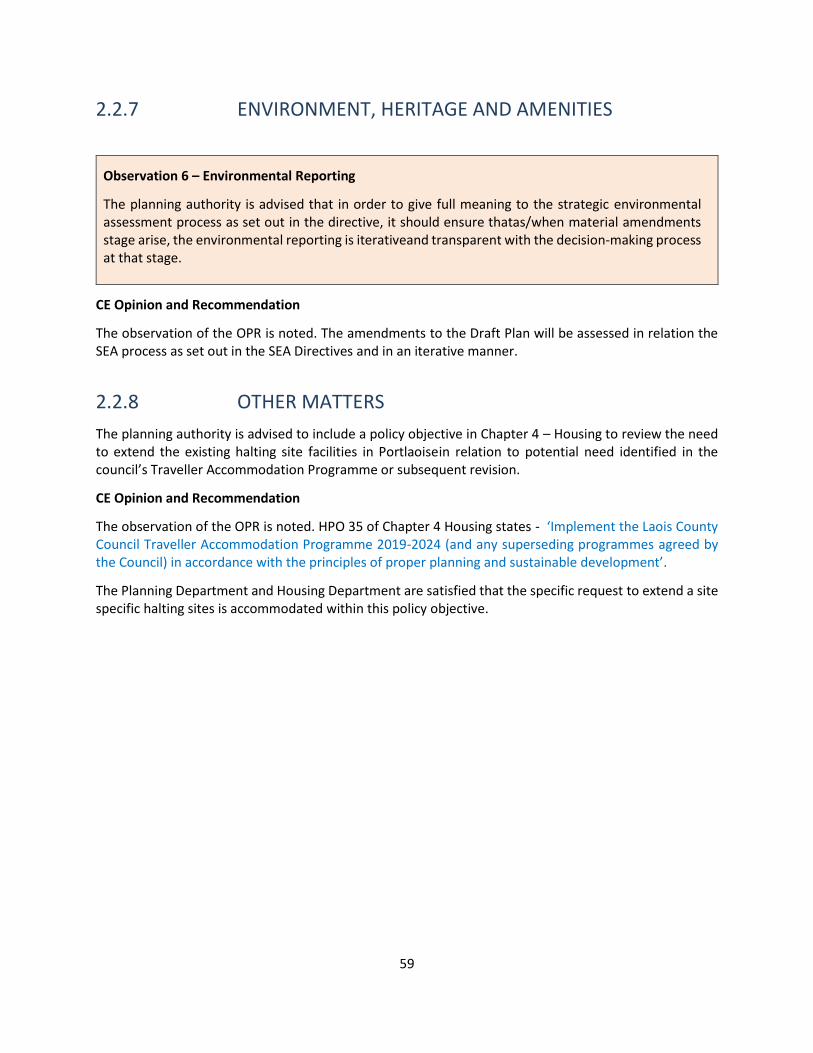
59
2.2.7 ENVIRONMENT, HERITAGE AND AMENITIES
Observation 6 – Environmental Reporting
The planning authority is advised that in order to give full meaning to the strategic environmental assessment process as set out in the directive, it should ensure that as/when material amendments stage arise, the environmental reporting is iterative and transparent with the decision-making process at that stage.
CE Opinion and Recommendation
The observation of the OPR is noted. The amendments to the Draft Plan will be assessed in relation the SEA process as set out in the SEA Directives and in an iterative manner.
2.2.8 OTHER MATTERS
The planning authority is advised to include a policy objective in Chapter 4 – Housing to review the need to extend the existing halting site facilities in Portlaoise in relation to potential need identified in the council’s Traveller Accommodation Programme or subsequent revision.
CE Opinion and Recommendation
The observation of the OPR is noted. HPO 35 of Chapter 4 Housing states - ‘Implement the Laois County Council Traveller Accommodation Programme 2019-2024 (and any superseding programmes agreed by the Council) in accordance with the principles of proper planning and sustainable development’.
The Planning Department and Housing Department are satisfied that the specific request to extend a site specific halting sites is accommodated within this policy objective.
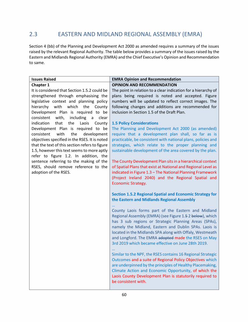
60
2.3 EASTERN AND MIDLAND REGIONAL ASSEMBLY (EMRA) Section 4 (bb) of the Planning and Development Act 2000 as amended requires a summary of the issues raised by the relevant Regional Authority. The table below provides a summary of the issues raised by the Eastern and Midlands Regional Authority (EMRA) and the Chief Executive’s Opinion and Recommendation to same.
Issues Raised EMRA Opinion and Recommendation
Chapter 1 It is considered that Section 1.5.2 could be strengthened through emphasising the legislative context and planning policy hierarchy with which the County Development Plan is required to be consistent with, including a clear indication that the Laois County Development Plan is required to be consistent with the development objectives specified in the RSES. It is noted that the text of this section refers to figure 1.5, however this text seems to more aptly refer to figure 1.2. In addition, the sentence referring to the making of the RSES, should remove reference to the adoption of the RSES.
OPINION AND RECOMMENDATION The point in relation to a clear indication for a hierarchy of plans being required is noted and accepted. Figure numbers will be updated to reflect correct images. The following changes and additions are recommended for inclusion in Section 1.5 of the Draft Plan. 1.5 Policy Considerations The Planning and Development Act 2000 (as amended) require that a development plan shall, so far as is practicable, be consistent with national plans, policies and strategies, which relate to the proper planning and sustainable development of the area covered by the plan. The County Development Plan sits in a hierarchical context of Spatial Plans that exist at National and Regional Level as indicated in Figure 1.3 – The National Planning Framework (Project Ireland 2040) and the Regional Spatial and Economic Strategy. Section 1.5.2 Regional Spatial and Economic Strategy for the Eastern and Midlands Regional Assembly … County Laois forms part of the Eastern and Midland Regional Assembly (EMRA) (see Figure 1.5 2 below), which has 3 sub regions or Strategic Planning Areas (SPAs), namely the Midland, Eastern and Dublin SPAs. Laois is located in the Midlands SPA along with Offaly, Westmeath and Longford. The EMRA adopted made the RSES on May 3rd 2019 which became effective on June 28th 2019. … Similar to the NPF, the RSES contains 16 Regional Strategic Outcomes and a suite of Regional Policy Objectives which are underpinned by the principles of Healthy Placemaking, Climate Action and Economic Opportunity, of which the Laois County Development Plan is statutorily required to be consistent with.
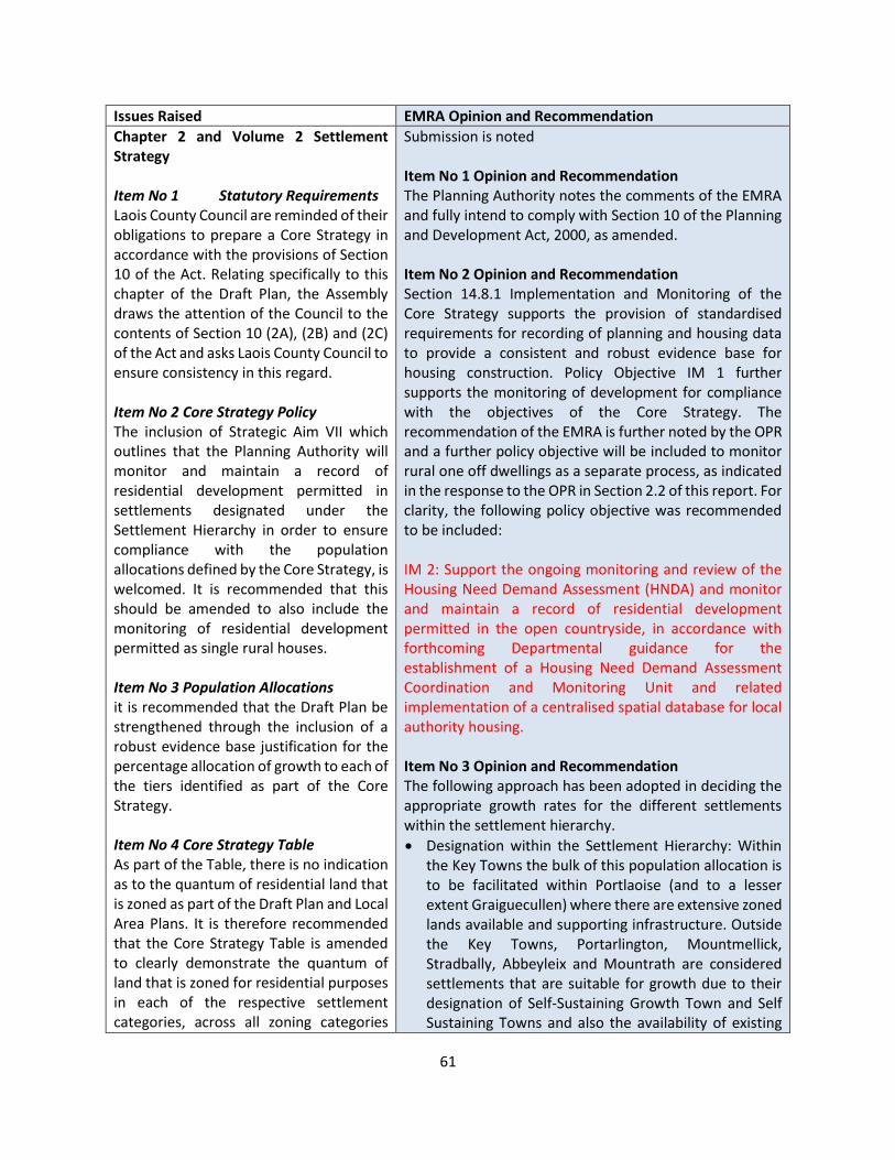
61
Issues Raised EMRA Opinion and Recommendation
Chapter 2 and Volume 2 Settlement Strategy Item No 1 Statutory Requirements Laois County Council are reminded of their obligations to prepare a Core Strategy in accordance with the provisions of Section 10 of the Act. Relating specifically to this chapter of the Draft Plan, the Assembly draws the attention of the Council to the contents of Section 10 (2A), (2B) and (2C) of the Act and asks Laois County Council to ensure consistency in this regard. Item No 2 Core Strategy Policy The inclusion of Strategic Aim VII which outlines that the Planning Authority will monitor and maintain a record of residential development permitted in settlements designated under the Settlement Hierarchy in order to ensure compliance with the population allocations defined by the Core Strategy, is welcomed. It is recommended that this should be amended to also include the monitoring of residential development permitted as single rural houses. Item No 3 Population Allocations it is recommended that the Draft Plan be strengthened through the inclusion of a robust evidence base justification for the percentage allocation of growth to each of the tiers identified as part of the Core Strategy. Item No 4 Core Strategy Table As part of the Table, there is no indication as to the quantum of residential land that is zoned as part of the Draft Plan and Local Area Plans. It is therefore recommended that the Core Strategy Table is amended to clearly demonstrate the quantum of land that is zoned for residential purposes in each of the respective settlement categories, across all zoning categories
Submission is noted Item No 1 Opinion and Recommendation The Planning Authority notes the comments of the EMRA and fully intend to comply with Section 10 of the Planning and Development Act, 2000, as amended. Item No 2 Opinion and Recommendation Section 14.8.1 Implementation and Monitoring of the Core Strategy supports the provision of standardised requirements for recording of planning and housing data to provide a consistent and robust evidence base for housing construction. Policy Objective IM 1 further supports the monitoring of development for compliance with the objectives of the Core Strategy. The recommendation of the EMRA is further noted by the OPR and a further policy objective will be included to monitor rural one off dwellings as a separate process, as indicated in the response to the OPR in Section 2.2 of this report. For clarity, the following policy objective was recommended to be included: IM 2: Support the ongoing monitoring and review of the Housing Need Demand Assessment (HNDA) and monitor and maintain a record of residential development permitted in the open countryside, in accordance with forthcoming Departmental guidance for the establishment of a Housing Need Demand Assessment Coordination and Monitoring Unit and related implementation of a centralised spatial database for local authority housing. Item No 3 Opinion and Recommendation The following approach has been adopted in deciding the appropriate growth rates for the different settlements within the settlement hierarchy.
• Designation within the Settlement Hierarchy: Within the Key Towns the bulk of this population allocation is to be facilitated within Portlaoise (and to a lesser extent Graiguecullen) where there are extensive zoned lands available and supporting infrastructure. Outside the Key Towns, Portarlington, Mountmellick, Stradbally, Abbeyleix and Mountrath are considered settlements that are suitable for growth due to their designation of Self-Sustaining Growth Town and Self Sustaining Towns and also the availability of existing
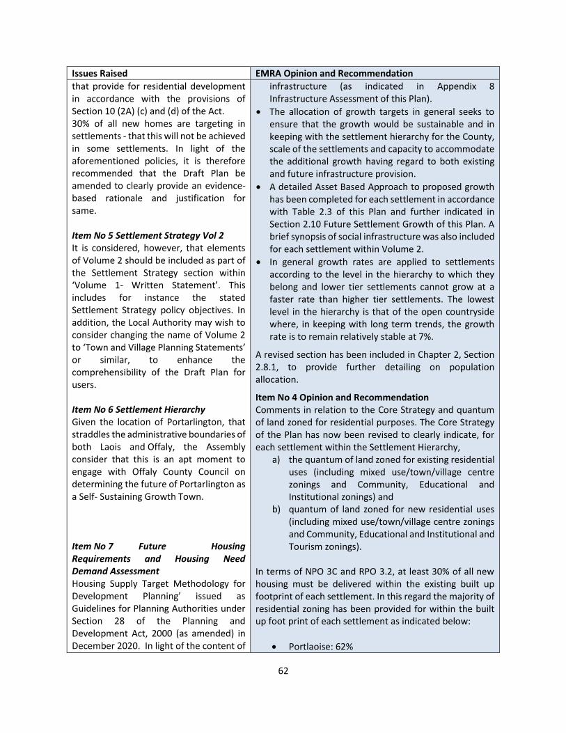
62
Issues Raised EMRA Opinion and Recommendation
that provide for residential development in accordance with the provisions of Section 10 (2A) (c) and (d) of the Act. 30% of all new homes are targeting in settlements - that this will not be achieved in some settlements. In light of the aforementioned policies, it is therefore recommended that the Draft Plan be amended to clearly provide an evidence-based rationale and justification for same. Item No 5 Settlement Strategy Vol 2 It is considered, however, that elements of Volume 2 should be included as part of the Settlement Strategy section within ‘Volume 1- Written Statement’. This includes for instance the stated Settlement Strategy policy objectives. In addition, the Local Authority may wish to consider changing the name of Volume 2 to ‘Town and Village Planning Statements’ or similar, to enhance the comprehensibility of the Draft Plan for users. Item No 6 Settlement Hierarchy Given the location of Portarlington, that straddles the administrative boundaries of both Laois and Offaly, the Assembly consider that this is an apt moment to engage with Offaly County Council on determining the future of Portarlington as a Self- Sustaining Growth Town. Item No 7 Future Housing Requirements and Housing Need Demand Assessment Housing Supply Target Methodology for Development Planning’ issued as Guidelines for Planning Authorities under Section 28 of the Planning and Development Act, 2000 (as amended) in December 2020. In light of the content of
infrastructure (as indicated in Appendix 8 Infrastructure Assessment of this Plan).
• The allocation of growth targets in general seeks to ensure that the growth would be sustainable and in keeping with the settlement hierarchy for the County, scale of the settlements and capacity to accommodate the additional growth having regard to both existing and future infrastructure provision.
• A detailed Asset Based Approach to proposed growth has been completed for each settlement in accordance with Table 2.3 of this Plan and further indicated in Section 2.10 Future Settlement Growth of this Plan. A brief synopsis of social infrastructure was also included for each settlement within Volume 2.
• In general growth rates are applied to settlements according to the level in the hierarchy to which they belong and lower tier settlements cannot grow at a faster rate than higher tier settlements. The lowest level in the hierarchy is that of the open countryside where, in keeping with long term trends, the growth rate is to remain relatively stable at 7%.
A revised section has been included in Chapter 2, Section 2.8.1, to provide further detailing on population allocation.
Item No 4 Opinion and Recommendation Comments in relation to the Core Strategy and quantum of land zoned for residential purposes. The Core Strategy of the Plan has now been revised to clearly indicate, for each settlement within the Settlement Hierarchy,
a) the quantum of land zoned for existing residential uses (including mixed use/town/village centre zonings and Community, Educational and Institutional zonings) and
b) quantum of land zoned for new residential uses (including mixed use/town/village centre zonings and Community, Educational and Institutional and Tourism zonings).
In terms of NPO 3C and RPO 3.2, at least 30% of all new housing must be delivered within the existing built up footprint of each settlement. In this regard the majority of residential zoning has been provided for within the built up foot print of each settlement as indicated below:
• Portlaoise: 62%

63
Issues Raised EMRA Opinion and Recommendation
this publication it is recommended that the Draft Plan, (including Sections 2.7, 2.8, the Core Strategy Table and Chapter 4) is updated to reflect the contents of this recent publication. Please note that officials within the Department of Housing, Local Government and Heritage have indicated that they are available to assist Local Authorities in applying these Guidelines to their respective areas.
• Graiguecullen: TBC at LAP stage
• Portarlington: TBC at LAP stage
• Abbeyleix: 70%
• Stradbally: 100%
• Mountmellick: 89%
• Mountrath: 100%
• Rathdowney: 44%
• Durrow:100%
• Ballylinan: 70%
• Clonaslee: 50%
• Borris in Ossory: 50%
• Ballyroan: 71%
• Killenard: NA no new residential land zoned.
Where lands have been zoned outside the settlement boundary in smaller villages and settlements, certain factors contributed: (1) such lands were brownfield/unfinished estates, (2) limited scale of settlement and (3) incompatible adjacent zonings.
Item No 5 Opinion and Recommendation The comment in relation to Volume 2 is noted. Historically Volume 2 has been called Settlement Plans which was an oversight in relation to the Draft Plan. In this regard, Volume 2 Settlement Strategy shall be renamed Settlement Plans as is consistent with the approach of other Local Authorities in the EMRA. With regards to the policy objectives stated in Section 1.1 of Volume 2 included in Volume 1 Written Statement, it is considered appropriate to provide clarity up front of how Volume 2 complies with the NPF and RSES. In this regard, it is respectfully recommended that such policy objectives remain in Volume 2. Item No 6 Opinion and Recommendation Laois County Council have engaged with Offaly County Council with regards to the designation of Portarlington as a Self-Sustaining Growth Town. Laois County Council maintain the position regarding designation as it fully accords with the principles of such a designation which is indicated in Table 4.2 Settlement Hierarchy of the RSES with respect to: moderate level of jobs and services and is a commuter town on the main Dublin to Cork railway line. The Core Strategy supports the continued growth in terms of population, housing and employment opportunity sites to become a more self-sustaining town. Laois County Council welcome and is committed to preparing a Joint

64
Issues Raised EMRA Opinion and Recommendation
Local Area Plan with Offaly County Council when the County Development Plan process is complete, and such is supported by policy objective CS 09 as noted in Section 2.1 of this report in relation to the OPR submission.
Item No 7 Opinion and Recommendation The Draft Plan was prepared and considered by the Elected Members of Laois County Council prior to the issuing of new Section 28 Guidelines on Housing Supply Target Methodology for Development Planning’ issued as Guidelines for Planning Authorities. This request has also been noted by the Office of the Planning Regulator. Revised housing figures have been incorporated into the Housing Strategy and Housing Needs Demand Assessment and Chapter 2 of the Draft Plan. In particular and as requested above, a revised Core Strategy Table has been included, details of which are noted in Section 2.2.1 of this report.
Chapter 3 Climate Action and Energy The terminology used at Section 3.2.3.5 should be changed to ‘RSO’ in place of ‘RPO’ To this end, it should be noted that EMRA is leading an ESPON EU research project (QGasSP) to identify a robust method for quantifying the relative GHG impacts of alternative spatial planning policies, the outputs of which are anticipated in 2021, and should inform the Draft Plan as it progresses. Circular Letter LGSM01-2021, issued on 10th February 2021, regarding Local Authority Decarbonisation Zones. The Regional Assembly form part of the established steering group, aimed at structuring and guiding the response of the local government sector in identifying Decarbonisation Zones. In line with the contents of the aforementioned Circular Letter, it is recommended that the Draft Plan provide information to enable the development of a Decarbonising Zone in County Laois, including the location and details of same. The Assembly notes that the Portlaoise Demonstrator Project is
OPINION AND RECOMMENDATION The submission is noted in relation to the terminology used at Section 3.2.3.5 should be changed to ‘RSO’ in place of ‘RPO’. The following correction will be made :- The Strategy identifies the following RSOs in relation to climate action: RPSO 6. Integrated Transport and Land Use RPSO 7. Sustainable Management of Water, Waste and other Environmental Resources RPSO 8. Build Climate Resilience RPSO 9 Support the Transition to Low Carbon and Clean Energy RPSO 10. Enhanced Green Infrastructure RPSO 11. Biodiversity and Natural Heritage Section 3.2.3.5 will be amended to include the following paragraph EMRA is leading an ESPON EU research project (QGasSP) to identify a robust method for quantifying the relative GHG impacts of alternative spatial planning policies, the outputs of which are anticipated in 2021, and should inform the future plans as they progress. The commentary regarding Decarbonisation zones is noted and the following location has been selected in
65
Issues Raised EMRA Opinion and Recommendation
specifically referenced as part of the Circular Letter. The attention of the Council is also brought to the Climate Action Fund made available under the Department of Communications, Climate Action and Environment, and, in order to be availed of, requires policy support. In this regard, the Council may wish to strengthen the ‘Local County Targets’ of each action area, as part of the finalised Plan. Wind Energy it is recommended that the Council ensure that the Plan has full regard to the provisions of the Wind Energy Development Guidelines 2006, the Interim Guidelines for Planning Authorities on Statutory Plans, Renewable Energy and Climate Change, and the Draft Revised Wind Energy Guidelines published in December 2019, which are expected to be finalised in the near future.
County Laois. Reference is made to the Decarbonisaton Zone under Section 3.4 - Action Area 2. A paragraph will be included as follows detailing this
Decarbonisation Zone
Action 165 of the Climate Action Plan 2019 sets Local Authorities the challenge of initially identifying and developing one Decarbonising Zone in each local authority in Ireland. A Decarbonising Zone (DZ) is defined as a spatial area in which a range of climate mitigation, adaptation and biodiversity measures and action owners are identified to address local low carbon energy, greenhouse gas emissions and climate needs to contribute to national climate action targets.
In this case Laois County Council has established Portlaoise the County’s decarbonisation zone and are opting to strengthen the position of this DZ. Portlaoise is already a climate action demonstration town with a very important test-bed which will allow residents and other Local Authorities to understand the scale of the challenge in decarbonising the economy and wider society, and maps out the various key stakeholders and enablers. A Carbon Footprint Report has established the baseline and shown the need for renewable energy and it is hoped Laois County Council will build upon this. It should be noted that this baseline will be required to be refined on the next remeasure.
LCC also wish to promote more remote working in Portlaoise as it poses more benefit to the community and to showcase Portlaoise and County Laois with provision of remote working hubs and support hubs around the county. It is important that Portlaoise progresses towards the 2040 Vision Statement, building upon the objectives for Portlaoise Low Carbon Town to:
• remove the dominance of cars within the Portlaoise town centre
• address the poor pedestrian experience of the area.
• To adapt to lower emission vehicles.
• Retrofit homes and businesses
The Portlaoise DZ will focus on the town of Portlaoise or more particularly the geographic area covered by the statutory Portlaoise Local Area Plan. It is however
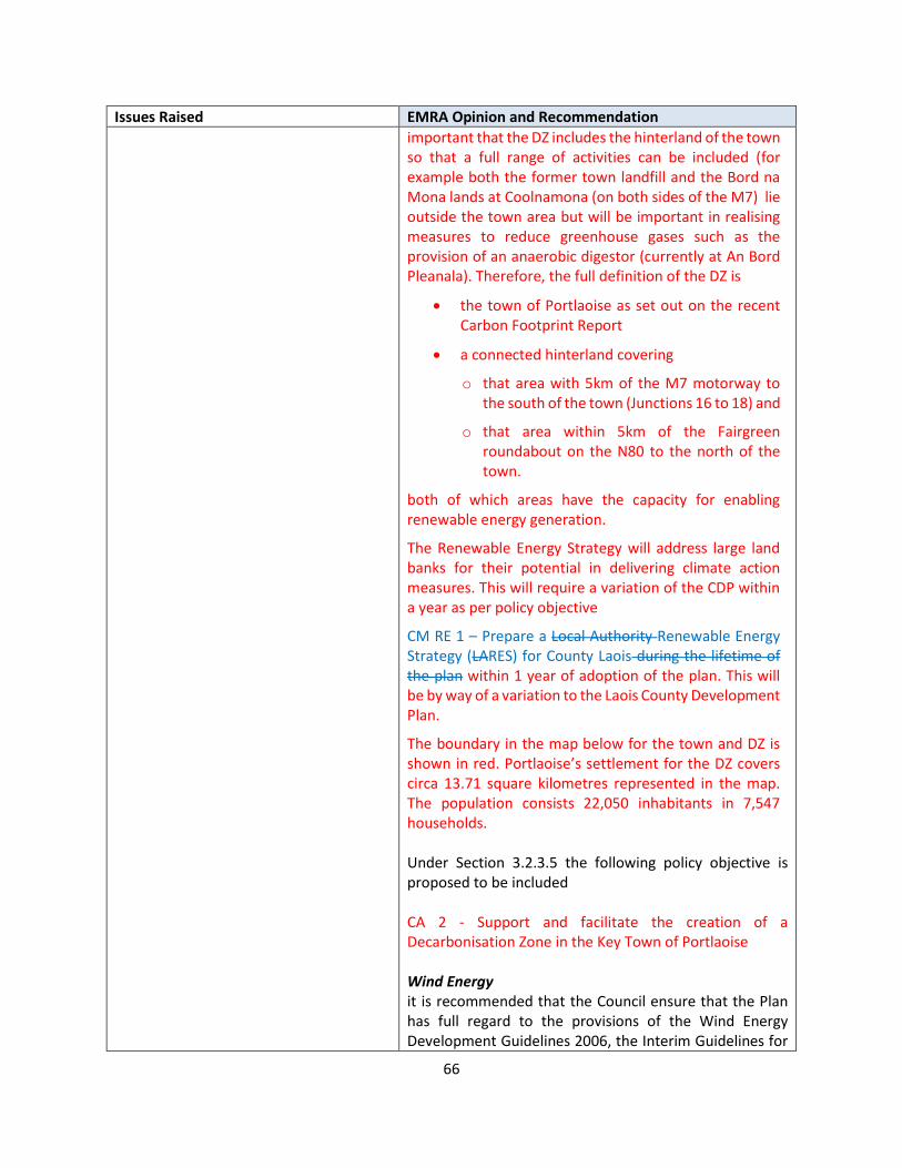
66
Issues Raised EMRA Opinion and Recommendation
important that the DZ includes the hinterland of the town so that a full range of activities can be included (for example both the former town landfill and the Bord na Mona lands at Coolnamona (on both sides of the M7) lie outside the town area but will be important in realising measures to reduce greenhouse gases such as the provision of an anaerobic digestor (currently at An Bord Pleanala). Therefore, the full definition of the DZ is
• the town of Portlaoise as set out on the recent Carbon Footprint Report
• a connected hinterland covering
o that area with 5km of the M7 motorway to the south of the town (Junctions 16 to 18) and
o that area within 5km of the Fairgreen roundabout on the N80 to the north of the town.
both of which areas have the capacity for enabling renewable energy generation.
The Renewable Energy Strategy will address large land banks for their potential in delivering climate action measures. This will require a variation of the CDP within a year as per policy objective
CM RE 1 – Prepare a Local Authority Renewable Energy Strategy (LARES) for County Laois during the lifetime of the plan within 1 year of adoption of the plan. This will be by way of a variation to the Laois County Development Plan.
The boundary in the map below for the town and DZ is shown in red. Portlaoise’s settlement for the DZ covers circa 13.71 square kilometres represented in the map. The population consists 22,050 inhabitants in 7,547 households. Under Section 3.2.3.5 the following policy objective is proposed to be included CA 2 - Support and facilitate the creation of a Decarbonisation Zone in the Key Town of Portlaoise Wind Energy it is recommended that the Council ensure that the Plan has full regard to the provisions of the Wind Energy Development Guidelines 2006, the Interim Guidelines for
67
Issues Raised EMRA Opinion and Recommendation
Planning Authorities on Statutory Plans, Renewable Energy and Climate Change, and the Draft Revised Wind Energy Guidelines published in December 2019, which are expected to be finalised in the near future. CM RE 5 states as follows Promote and facilitate wind energy development in accordance with the Guidelines for Planning Authorities on Wind Energy Development (Department of Housing, Planning and Local Government) and the Appendix 5 Wind Energy Strategy of this Plan, and subject to compliance with normal planning and environmental criteria This will be amended to state Promote and facilitate wind energy development in accordance with the Guidelines for Planning Authorities on Wind Energy Development (Department of Housing, Planning and Local Government) and the Appendix 5 Wind Energy Strategy of this Plan, the Interim Guidelines for Planning Authorities on Statutory Plans, Renewable Energy and Climate Change, and the Draft Revised Wind Energy Guidelines published in December 2019, which are expected to be finalised in the near future and subject to compliance with normal planning and environmental criteria
Chapter 4 Housing Strategy Item No 1 Future Housing Requirements ‘Housing Supply Target Methodology for Development Planning Guidelines for Planning Authorities’ - it is recommended that the Draft Plan be updated to comply with the aforementioned guidelines prior to the finalisation of the Laois County Development Plan. Item No 2 Summary of Housing Needs It is recommended to include a clearly presented summary of the entire housing need in County Laois, which includes the housing need broken down across tenures, what is required in terms of new
Item No 1 Opinion and Recommendation This point was noted and accepted in Section 2.3.2.7 of this report. Item No 2 Opinion and Recommendation A summary of housing needs indicated in the Housing Strategy and HNDA shall be included in Section 4.2 of Chapter 4 Housing Strategy as follows: 4.2 Housing Strategy Synopsis and Policy This section The Housing Strategy Firstly, it outlines a number of broad principles that inform the overall approach to the strategy and Secondly, it formalises these aspects through a number of recommended housing objectives. The preparation of this section has necessitated a review of existing housing policy contained in the current development plan and the recommendations set out below are designed to build

68
Issues Raised EMRA Opinion and Recommendation
housing supply and why this is the case, including social and affordable needs, housing types and sizes. This will present a clear and concise guide as to what is required to successfully deliver the housing requirement for the County over the plan period. Item No 3 Rural Housing It is recommended that prior to the finalisation of the Draft Plan, the Council ensure that related policy in this regard is consistent with RPOs 4.80 and 4.81, NPO 19 of the NPF and the content of Circular Letter PL 2/2017 “Sustainable Rural Housing Guidelines for Planning Authorities 2005 – Local Needs Criteria in Development Plans.” It should be noted that the NPF requires that development plans quantify the demand for single housing in the countryside with National Policy Objective 20 outlining the requirement to ‘Project the need for single housing in the countryside through the local authority’s overall Housing Need Demand Assessment (HNDA) tool and county development plan core strategy processes.’ In this regard, it is recommended that the Council include the provision of same in line with any revisions undertaken to the Draft Plan resulting from the publication of the ‘Housing Supply Target Methodology for Development Planning- Guidelines for Planning Authorities’ published in December 2020.
upon and complement that reviewed. The following is a brief synopsis of the Strategy: 4.2.1 County Laois Housing Strategy & HNDA
The indication of population projection based on a policy-intervention scenario shows that the population of Laois is expected to increase to 89,349 by 2021 and to 94,700 by 2027 with the latter including an increase of 5,351 individuals compared to Census 2016. With respect to the ESRI research work, and the Ministerial Letter advising this method as the most up to date approach towards demand projection, the overall housing demand over the Plan period is expected to be 3,998 units, which equates to 571 housing units per annum over the Plan period.
Studying the income profile of the county and calculating the mortgage capacity of the households in Laois with regard to projection of affordable housing thresholds in the County determines that an average of 30.9 percent of the additional anticipated households will not qualify for a mortgage during the Plan period.
Applying the above affordability criteria to the anticipated households per annum indicates that of the 1,235 households which are not qualified for a mortgage over the Plan period (30.9% of the overall housing demand), 816 no. households (20.4%) do not meet the affordability criteria for the private rental market. These households are therefore considered to require social housing, and this shortfall can be met by provision of an average of 117 no. social housing per annum over the Plan period.
4.2.2 Single One Off Dwellings
Considering the challenges that are faced by the rural communities, ranging from urban generated pressures in some locations, to a declining and ageing population, the structure of the economy and lack of access to quality infrastructure and new technologies, there seems to be an urge for policy intervention which has been quoted as “Cluster Planning” within the NPF and RSES. The cluster planning aims to encourage more focused settlements in the country where “Cluster Living” around towns and villages will emerge. Therefore, the estimation of single one-off dwellings over the Plan Period is based on an
69
Issues Raised EMRA Opinion and Recommendation
intervention-policy approach, where the number of rural housing is aimed to be restricted to an average of 100 no. of units for each year over the Plan Period, equating a total number of 600 no. one-off dwellings during 2021-2027.
4.2.3 Household Size Cohorts
Analysis of the historical trending of the households with a concentration on the household size cohort per household in the County over 2006-2016 indicates that a growing demand for apartments and smaller-size houses are expected. However, the bigger size houses are still having a steady market in the County which by considering the dominant characteristics of the County is not unexpected. More precisely, the bigger size households, including four-plus households, are expected to form approximately 49% of the total, while single- and two-person households form approximately 35% of the overall households. The following table provides an indication of anticipated households in each cohort over the Plan period.
Table 4.1 Indication of Households in Each Household Size Cohort over the Plan Period
(Table too large, attached as Appendix C)
The following policy objective is to be included HPOXX :- Ensure That 35% Of Any Residential Developments (10 units or more) provides for single and two person households. 4.2.4 Household Tenure
Analysis of the historical trending of the households with a concentration on the household tenure in the County over 2006-2016 indicates that rental market is expected to expand its share in the market, while the owner occupancy is expected to drastically shrink. Assuming a flat rate growth for these markets up to 2027, it is expected that owner occupancy forms approximately 44% of the market, while private rental is anticipated to take almost 45% of the market. The following table provides an indication of the expected households in each tenure type over the Plan period.
70
Issues Raised EMRA Opinion and Recommendation
Table 4.2 Indication of Tenure Composition over the Plan Period
(Table too large, attached as Appendix A of this report)
Item No 3 Opinion and Recommendation The Rural Area Designations and Local Needs criteria are indicated in Sections 4.6.1 and 4.6.2 of the Draft Plan respectively. A similar recommendation was received from the Office of the Planning Regulator and a revised local needs criteria has been indicated in Section 2.2.3 of this report. The aforementioned recommendation of EMRA is noted and accepted and a revision is recommended.
Chapter 6 Economic Development Item No 1 Chapter Structure and Content it is considered that the Council should consult with Chapter Six of the RSES, including Figure 6.3, in advance of finalising this chapter in order to strengthen the chapter structure and content. This includes reference, for instance, to the provision of policy relating to smart specialisation, clustering, placemaking, orderly growth and future proofing. Item No.2 Economic Profile It is considered that this economic profile could be further developed in order to create a strong and robust evidence base for the formulation of related economic policy Item No 3 Just Transition As part of the related ‘Climate Action and Jobs’ theme, it is recommended that the Council address the concept of Just Transition given its substantial policy and financial support, both nationally and at EU level, and that it is a significant catalyst for economic and social change in the Midlands representing a significant step forward in the transition towards a low carbon economy.
Item No 1 Opinion and Recommendation The commentary in relation to the chapter structure and content is noted. A brief summary will be included in relation to how the Laois CDP will achieve its vision for job creation within the county after section 6.4 of the Draft Plan having regard to the headings in section 6.3 of the RSES as follows The economic strategy Vision is “To Promote And Develop Laois’ Economy And Create A Viable And Favourable Economic Environment For Business And Enterprise To Thrive Both In Urban And Rural Areas Whilst Delivering Sustainable Jobs, Employment Opportunity Both Within The County And Beyond”. This will be achieved by aligning with the following principles as identified in the RSES in conjunction with developing areas such as Retail / Town centre development, Tourism and the rural economy of Laois. Smart Specialisation Laois County Council is committed to working in collaboration with local partners and regional partners to boost growth and jobs within the county and Midland region. An example of this within the county is the development of the Cube and the innovative measures being taken to support climate action supported by the REDF .

71
Issues Raised EMRA Opinion and Recommendation
Item No 4 Economic Development and Core Strategy The final plan should include an explicit policy objective that reinforces the spatial expression for the development of the County in line with the Core Strategy, ensuring that the economic development hierarchy is reflective of the settlement hierarchy presented. Item No 5 FDI/IDA Midland Economic Paper currently being prepared by the Eastern and Midland Regional Assembly, has found a shortage of appropriately sized land banks and FDI/IDA appropriate business premises throughout the Region, including in Portlaoise. In this regard, the Assembly ask that the Local Authority consider the inclusion of a complimentary policy and/or objective, to enable the delivery of same. The addition of a policy to this effect, shall ensure that the inclusion and quantum of any related lands is in accordance with the provisions of the Core Strategy and evidence based.
Clustering The Local Authority is supportive of cross industry linkage and the development of clusters across the region and will continue to work with stakeholders to identify and expand enterprise so as to benefit from mutual R&D, strengths and opportunities. Policy objectives within the Plan support such identification and collaboration and this will be further addressed in the LECP. Placemaking A number of policy objectives within the Draft Plan and Local Area Plans identify action supported by policy objectives to invest in the county, its town and villages , improve the quality of life of the citizens of the county and promote better connectivity and active travel Orderly Growth Zoned lands have been aligned to the Core Strategy which correlates with national and regional policy objectives and is further expended in each of the settlements plans for the County Item No 2 Opinion and Recommendation A detailed economic profile for the County has been prepared and included in the plan which is based on the most up to date information in the absence of current Census data which we believe to be prepared in 2022. The profile details the following:
• Labour force
• Unemployment figures
• Employment Sectors
• Commuting patterns
• Educational attainment. A concluding paragraph will be included which will provide a basis for the strategy in the plan as follows :- With employment levels or total labour force at work in Laois at 84.6%, (stats from CSO – census 2016) and the County’s enterprise base significantly after diversifying and growing since the last Census with the development of a large Glanbia Cheese Manufacturing plant at Junction 17, Portlaoise together with other employment

72
Issues Raised EMRA Opinion and Recommendation
generators such as Greenfield Global, Alpha drives and Aubren to name but a few also locating here. The resultant impact of both Brexit and the Covid Pandemic has yet to be measured in terms of job losses throughout the county, however the creation and promotion of remote working hubs has helped sustain a working population within the county. Given most of the working population in Co Laois are involved in the following areas, it professional services and commerce and trade , Manufacturing and the skills being sought by third level students recorded in the 2016 Census relate to:
1. Social sciences , business and law 2. Engineering , manufacturing and construction 3. Health and welfare
The economic strategy has been structured so as to capitalise on the skill base within the county but also to advance and support new areas should they arise. With the imminent review of the LECP process for the County, a new Census and some post Brexit / Covid Pandemic studies, more definite policy frameworks and further enhanced actions can be developed.
73
Issues Raised EMRA Opinion and Recommendation
Item No 3 Opinion and Recommendation Policy Objective RL 9 , 10 and 11 in Chapter 9 Rural Laois all relate to supporting future use of the peatlands within the midlands Plan and prepare for the future use of large industrial peatland sites when peat harvesting finishes in conjunction with NPWS, Coillte and ESB/Bord na Mona and other stakeholders Support the longer-term strategic planning for industrial peatland areas, which should include a comprehensive after-use framework plan for the industrial peatlands and associated infrastructure which addresses environmental, economic and social issues including employment and replacement enterprise reflecting the current transition from employment based around peat extraction Support the Midlands Regional Transition Team in developing a ‘Holistic Plan for Just Transition in the Midland Region’ including an inventory of project proposals and actions to support Just Transition in the Midlands and to assist the region in identifying potential investment needs for inclusion in a programme of support under the new EU Just Transition Fund Reference is also made in Chapter 8 to Natural assets and their contribution to the tourism economy of the county , an example cited being Abbeyleix Bog. Paragraph 4 of Section 8.5.5. will be amended to cross reference with Policy Objective RL 9 , 10 and 11 in Chapter 9 : Rural Laois which all relate to supporting future use of the peatlands within the midlands The Council supports the efforts of the Midland Transition team to:
• Pursue funding opportunities and actions to mitigate the impact of the Bord na Móna job losses on the individuals concerned, and the impact on the local and regional economy; and
• Position the region to develop alternative forms of employment, attract investment and maximise existing employment opportunities and resources.
74
Issues Raised EMRA Opinion and Recommendation
Chapter 3 Climate Action and Energy, Chapter 9 Rural Laois and 6 Tourism and Chapter 11 Biodiversity and Natural Heritage all cover this topic appropriately within the Draft Plan Recommendation The Council supports the efforts of the Midland Transition team to:
• Pursue funding opportunities and actions to mitigate the impact of the Bord na Móna job losses on the individuals concerned, and the impact on the local and regional economy; and
• Position the region to develop alternative forms of employment, attract investment and maximise existing employment opportunities and resources.
Chapter 6 to be cross referenced with Chapter 3 Climate Action and Energy, Chapter 9 Rural Laois and 6 Tourism and Chapter 11 Biodiversity and Natural Heritage all cover this topic appropriately within the Draft Plan and a paragraph included under Section 3.4 which states: Please also refer to Chapter 6, 9 and 11 in relation to the future use of peatlands. Item No 4 Opinion and Recommendation Section 6.12 identifies the key strategic employment initiatives for the county which have been developed and fully informed by the core strategy as it relates to where people live and to support Climate action in terms of reducing the need for travel and matching land use with transportation and energy demands. ED 1 states the following Build on the role of Portlaoise as the driver for the economic development of County Laois reflecting its designation as Key Town in the Regional Spatial and Economic Strategy A further policy objective to state the following is proposed

75
Issues Raised EMRA Opinion and Recommendation
Support the Core Strategy settlement patterns to ensure that economic priorities and job creation is reflective of this and aligns accordingly as indicated in Table 6.4. Item No 5 Opinion and Recommendation Section 6.4 Economic Strategy for County Laois provides a statement on working in collaboration with the IDA and other relevant stakeholders to promote the county on a national and international level with the key towns of Portlaoise and Graiguecullen and larger towns of Portarlington, Mountrath, Abbeyleix and Mountmellick acting as growth enablers for the County. Policy objective ED 7 specifically states ‘Work in partnership with agencies such as Enterprise Ireland, Connect Ireland and IDA Ireland to find suitable sites or premises for prospective enterprises considering locating in Laois’. The Council will endeavour to expand on the database of suitably sized land banks and business premises at suitable locations in Portlaoise in order to attract foreign direct investment. It is also recommended that a new Key Strategic Employment Initiative is included in Table 6.4 of Chapter 6: 11. Continue to promote Portlaoise as a suitable location for Foreign Direct Investment and to work in collaboration with the IDA Ireland to identify appropriately sized land banks and business premises at suitable locations in Portlaoise in order to attract foreign direct investment.
Chapter 7 Retail and Town/Village Centre Management – With regard to the objective to identify the broad requirement for additional retail floorspace development in the county over the plan period, notwithstanding the information contained as part of the Draft Plan and the Retail Strategy at Appendix Four, it is considered that further clarification is required relating to the quantum of vacant retail floorspace available and the need for the quantum of additional retail floorspace.
OPINION The retail strategy has been compiled based on 2016 CSO figures. Some localised vacancy data is available particularly for the town of Portlaoise where occupancy surveys have been carried out by the Portlaoise Town Team. The methodology used to identify the future requirements for additional retail floorspace takes account of the existing baseline floorspace figure, including actual vacancy (Geodirectory commercial vacancy), the calculated turnover per sq.m of retail floorspace, and the projected available retail spend. This is replicated
76
Issues Raised EMRA Opinion and Recommendation
across each of the three retail categories. The key steps taken include the following:
• The total cumulative floorspace requirements are calculated for each year using the turnover per sq.m and the available retail spend for each retail category;
• The baseline floorspace figure from the preceding year is subtracted from the total cumulative floorspace requirement to produce the additional annual floorspace requirement;
• The commercial vacancy rate is informed by the Geodirectory rate (adjusted to allow for a 13.2% frictional vacancy requirement) and is deducted from the additional annual floorspace requirement to define the additional floorspace development requirement, which is the final output of the exercise.
Localised vacancy surveys as part of a town centre health check for Local Area Plan preparation. It is noted also that vacancy rate for Q 42020 13.1%. RECOMMENDATION No changes to the Draft Plan
Chapter 8 Tourism Could be strengthened through recognising additional benefits of tourism for County Laois that includes environmental and cultural advantages for instances.
OPINION The submission is noted , however Chapter contains very detailed policies on the future strategy for tourism in Laois which has been guided and informed by the Laois Tourism Strategy 2018-2023. This collaborative strategy between key tourism stakeholders within County Laois including Laois County Council, Laois Local Community Development Committee, Laois partnership and the Department of Rural and Community Development, aims to grow tourism visitor numbers and the value of tourism through the enhancement of the Laois tourism product and service base supported by the structures that contribute to the strategic development of the tourism sector across the county The Draft Plan acknowledges that County Laois is well placed to capitalise on the growing demand for experiential holidays in a perceived ‘wild’ setting with outdoor activity opportunities on offer throughout the county with an emphasis on walking, cycling and angling.
77
Issues Raised EMRA Opinion and Recommendation
Participation in adventure activities is also becoming increasingly popular amongst visitors from overseas and from within the island of Ireland which includes mountain biking, kayaking and canoeing. The development of greenways and blueways is also an important sector or tourism product to the County and is an important element of creating a sustainable tourism package. This focus, in partnership with stakeholders such as Coillte, Bord Na Mona and Waterways Ireland, and local community groups, has led to the development of projects such the Slieve Bloom Mountain Bike Trail, Abbeyleix Bog Project, Barrow and Erkina Blueways. Off-road looped walking trails are located at various locations in the county, including Durrow Leafy Loop, Cullahill Loop, Dunmore Wood Loop, Ballagh Loop and Bishop’s Wood, Emo Park and Gardens. These projects can be developed in a sustainable way, in harmony with a high quality environment. The Council recognises that these routes cannot come into existence or remain in existence without the full co-operation of the owners of private property on the routes. Combined off-road cycle and walking routes and recreational trails developed along abandoned rail lines, utility corridors or other natural linear open spaces, such as river banks and canals, are often referred to as Greenways. Although Laois does not have a designated Greenway, the feasibility of a 24km route from Mountmellick – Portlaoise – Abbeyleix has been undertaken. The Council will continue to identify, support and facilitate opportunities for harnessing the potential of the scenic areas, lakes and waterways in a manner that is compatible with the natural heritage and environment of the area. (Refer to Map 8.1 for Laois’ activity based tourist attractions RECOMMENDATION No changes to the Draft Plan
Chapter 10 Infrastructure Item No .1 Local Transport Plans Local Transport Plans (LTP) will be prepared for selected settlements in the
OPINION In line with Section 2.2.1 of this report, the response to the OPR indicated an amendment is proposed to policy objectives CS 09 and CS 10 to include the delivery of a local

78
Issues Raised EMRA Opinion and Recommendation
Region. This includes the settlement of Portlaoise and in this regard policy objective TRANS 5, which reflects this policy, is welcome. The Local Authority may also consider the identification of other settlements within the County, in line with the Settlement Hierarchy, that would benefit from a similar and coordinated approach. This may include Portarlington, for instance, which straddles the administrative boundaries of both County Laois and County Offaly, and is currently subject to a regeneration strategy. WIFI In keeping with this, it should be noted that the EMRA is participating in an Interreg Europe Project, Next2Met, that seeks to increase the attractiveness of the Midlands using soft digitalisation measures. The Assembly are currently preparing a funding application to enable the roll out of pilot actions, as part of this EU Project, in consultation with Laois, Longford, Offaly and Westmeath County Councils.
transport plan in tandem with the LAP process for Portarlington and Graiguecullen. Furthermore TRANS 14 will be amended to state
To undertake Local Transport Plans in conjunction with the NTA, TII, and relevant stakeholders transportation studies in the following towns. The purpose of Transportation Studies is to which will identify the a transport strategy to address modal shift, traffic issues, parking and active travel deficiencies in the existing network and make recommendations on same in the following towns
• Portlaoise & Environs • Mountrath & Environs • Mountmellick & Environs • Durrow & Environs • Abbeyleix & Environs • Stradbally & Environs • Portarlington & Environs (Joint Study with Offaly
Co Co to be explored) • Graiguecullen & Environs (Joint Study with Carlow
Co Co to be explored) In relation to WIFI, Laois County Council has prepared a Local Digital Strategy in 2020 which contains actions , one of which is to - Ob8a - Engage with midlands Local Authorities in accessing NEXT2MET funding for regional collaborative digital project TEL 2 captures this objective as it states Support the delivery of the National Broadband Plan and implement the objectives of the Laois Local Digital Strategy 2020-2024. RECOMMENDATION TRANS 14 will be amended to state To undertake Local Transport Plans in conjunction with the NTA, TII, and relevant stakeholders transportation studies in the following towns. The purpose of Transportation Studies is to which will identify the a
79
Issues Raised EMRA Opinion and Recommendation
transport strategy to address modal shift, traffic issues, parking and active travel deficiencies in the existing network and make recommendations on same in the following towns
• Portlaoise & Environs • Mountrath & Environs • Mountmellick & Environs • Durrow & Environs • Abbeyleix & Environs • Stradbally & Environs • Portarlington & Environs (Joint Study with Offaly
Co Co to be explored) • Graiguecullen & Environs (Joint Study with Carlow
Co Co to be explored)
Chapter 11 The Assembly notes the inclusion of Section 11.2.4 of this chapter of the Draft Plan, which details the biodiversity and natural heritage context of the RSES. The inclusion of reference to RPO 3.4 as part of this paragraph is unclear and should be clarified or amended as appropriate. In finalising this section of the Draft Plan, the Council should consult with Section 7.7 of the RSES which details policy for green infrastructure and guiding principles for the preparation of Green Infrastructure Strategies. it is considered that a dedicated policy objective for ‘Just Transition’ be included. As previously indicated at Section 6 of this submission, this would recognise the substantial policy and financial support for Just Transition, both nationally and at EU level, and that it is a significant catalyst for economic and social change in the midlands representing a significant step forward in the transition towards a low carbon economy.
The submission is noted. OPINION The reference to RPO 3.4 is noted and out of context in this chapter as it relates to Environmental Assessment and Assessment of Greenhouse Gas (GHG) Emissions, this should relate to RPO 7.21 which promotes the use of the ecosystems services approach in the preparation of land use plans. The paragraph will be amended to state In line with Regional Policy Objective (RPO) 3.4 7.21 of the Eastern and Midland Regional Spatial and Economic Strategy, the Council promotes an ecosystems services approach in the preparation of this County Development Plan. BNH 11 and BNH 12 are policy objectives which seek to develop and implement Green Infrastructure Strategy for the County during the lifetime of the plan. In relation to Peatlands , the following Policy Objectives RL 9 , 10 and 11 in Chapter 9 Rural Laois all relate to supporting future use of the peatlands within the midlands Plan and prepare for the future use of large industrial peatland sites when peat harvesting finishes in

80
Issues Raised EMRA Opinion and Recommendation
conjunction with NPWS, Coillte and ESB/Bord na Mona and other stakeholders Support the longer-term strategic planning for industrial peatland areas, which should include a comprehensive after-use framework plan for the industrial peatlands and associated infrastructure which addresses environmental, economic and social issues including employment and replacement enterprise reflecting the current transition from employment based around peat extraction Support the Midlands Regional Transition Team in developing a ‘Holistic Plan for Just Transition in the Midland Region’ including an inventory of project proposals and actions to support Just Transition in the Midlands and to assist the region in identifying potential investment needs for inclusion in a programme of support under the new EU Just Transition Fund Reference is also made in Chapter 8 to Natural assets and their contribution to the tourism economy of the county , an example cited being Abbeyleix Bog. Paragraph 4 of Section 8.5.5. will be amended to cross reference with Policy Objective RL 9 , 10 and 11 in Chapter 9 : Rural Laois which all relate to supporting future use of the peatlands within the midlands The Council supports the efforts of the Midland Transition team to:
• Pursue funding opportunities and actions to mitigate the impact of the Bord na Móna job losses on the individuals concerned, and the impact on the local and regional economy; and
• Position the region to develop alternative forms of employment, attract investment and maximise existing employment opportunities and resources. Chapter 3 Climate Action and Energy, Chapter 9 Rural Laois and 6 Tourism and Chapter 11 Biodiversity and Natural Heritage all cover this topic appropriately within the Draft Plan RECOMMENDATION
81
Issues Raised EMRA Opinion and Recommendation
It is proposed to amend the chapter as follows Amend text as follows - In line with Regional Policy Objective (RPO) 3.4 7.21 of the Eastern and Midland Regional Spatial and Economic Strategy, the Council promotes an ecosystems services approach in the preparation of this County Development Plan. Include the following policy objective BNH XX Supports the efforts of the Midland Transition team to:
• Pursue funding opportunities and actions to mitigate the impact of the Bord na Móna job losses on the individuals concerned, and the impact on the local and regional economy; and
• Position the region to develop alternative forms of employment, attract investment and maximise existing employment opportunities and resources.
Chapter 13 NPO 72a of the NPF states ‘Planning authorities will be required to apply a standardised, tiered approach to differentiate between i) zoned land that is serviced and ii) zoned land that is serviceable within the life of the plan.’ This is further developed at Appendix 3 of the NPF which sets out a methodology for a tiered approach to land zoning. Notwithstanding the reference to this approach at Section 13.2 of the Draft Plan, it is unclear how this approach has been applied, including the integration of the indicated infrastructure assessment. In accordance with the aforementioned national policy objective, it is recommended that the Draft Plan be updated to clearly demonstrate compliance with same.
OPINION AND RECOMMENDATION An Infrastructure Assessment has been prepared and included as Appendix B of this Report. The report includes an assessment of all new residential zoned land in terms of water, waste water, transportation infrastructure along with compliance with NPF and RSES compact growth. Tier 1 and 2 lands for development have also been indicated.
82
2.4 STATUTORY STAKEHOLDERS, MEMBERS OF THE PUBLIC AND INTEREST GROUPS Excepting the EMRA and OPR submissions which have been addressed separately in the previous sections of this report, this section contains a summary of the other 152 no. valid written submissions received as part of the Stage 2 public consultation process, and the Opinion and Recommendations of the Chief Executive to the issues raised therein. The submissions have been summarised under each Volume of the Draft Plan.
2.5 VOLUME 1 - WRITTEN STATEMENT The submissions have been summarised for Volume 1 Written Statement by each chapter as follows:
• Chapter 1: Introduction
• Chapter 2: Core and Settlement Strategies
• Chapter 3: Climate Action and Energy
• Chapter 4: Housing Strategy
• Chapter 5: Quality of Life and Sustainable Communities
• Chapter 6: Economic Development
• Chapter 7: Retail Strategy and Town/Village Centre Management
• Chapter 8: Tourism
• Chapter 9: Rural Laois
• Chapter 10: Infrastructure
• Chapter 11: Biodiversity and Natural Heritage
• Chapter 12: Cultural and Built Heritage
• Chapter 13: Location and Pattern of Development
• Chapter 14: Implementation and Monitoring

83
CHAPTER 1 INTRODUCTION
Submission Reference and Author
Issues Raised Chapter 1 - Opinion and Recommendation
LS-C9-DCDP-96 Marc Van Der Burgh
Paragraph 1.2: The CDP should explicitly state and confirm that Ireland and the EU have signed up to numerous international conventions guaranteeing public participation, especially the Aarhus Convention ratified in June 2012. The CDP must demand that any development in Laois fully honours these conventions and that Laois County Council wholly respects and supports these conventions and public participation.
Comment Noted OPINION Laois County Council is fully committed to honouring EU and National legislation in relation to public participation. RECOMMENDATION The following additional objective will be included in Section 1.2 in relation to public participation: Support and respect the rights of the citizens of County Laois with respect to public participation in the planning process in accordance with EU and National legislation.
LS-C9-DCDP-121 Keep Ireland Open
This submission is very detailed and difficult to follow in parts, however is summarized as follows: (It is noted that the mention of a section in the Draft, without comment, indicates our support. Due to the detail of this submission we respectfully note this and will not summarise same)
• The Draft Plan should have regard to plans of adjoining counties, conform to the RSES and strive to secure financial resources to implement policies and objectives.
• The Plan should be well formatted, provide an index and be a clear layout with sub-numbering and sub lettering.
• The Submission provides comments on the CEO Report of the Issues Paper, however this stage of the process has been completed.
• The submission states the Plan: The Draft fails to comply with, have regard to or take into account: Planning &
OPINION The Draft Plan has been fully informed and aligned to the RSES for the EMRA Region. The Council will and strive to secure financial resources to implement policies and objectives and a Chief Executives report will be furnished 2 years from the date of adoption of the plan in accordance with Section 28 of the Planning & Development Act(as amended by Sec 20 of the 2010 Act) as to how the Plan has implemented or not implemented the policies and objectives of the Minister is proposed for inclusion. The Plan will be formatted appropriately on adoption Comments on the First CE Report of the Issues Paper cannot be considered at this time as that part of the process has been concluded.

84
Submission Reference and Author
Issues Raised Chapter 1 - Opinion and Recommendation
Development Acts Plans in adjoining counties(including Draft) DoECLG Guidelines Heritage Act 1995 National Heritage Plan Eastern & Midland RSES Development Plan Guidelines
The Planning Authority refute the fact that the Draft fails to comply with, have regard to or take into account: Planning & Development Acts Plans in adjoining counties(including Draft) DoECLG Guidelines Heritage Act 1995 National Heritage Plan Eastern & Midland RSES Development Plan Guidelines. The Draft Plan has been informed and fully aligns with spatial plans subject to amendments that have been indicated to us by the OPR/ EMRA and neighbouring authorities. RECOMMENDATION No changes to the Draft Plan
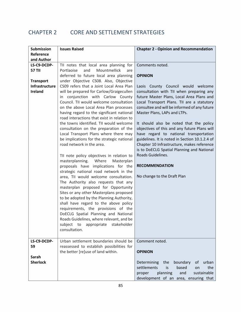
85
CHAPTER 2 CORE AND SETTLEMENT STRATEGIES
Submission Reference and Author
Issues Raised Chapter 2 - Opinion and Recommendation
LS-C9-DCDP-57 TII Transport Infrastructure Ireland
TII notes that local area planning for Portlaoise and Mountmellick are deferred to future local area planning under Objective CS08. Also, Objective CS09 refers that a Joint Local Area Plan will be prepared for Carlow/Graigecullen in conjunction with Carlow County Council. TII would welcome consultation on the above Local Area Plan processes having regard to the significant national road interactions that exist in relation to the towns identified. TII would welcome consultation on the preparation of the Local Transport Plans where there may be implications for the strategic national road network in the area.
TII note policy objectives in relation to masterplanning. Where Masterplan proposals have implications for the strategic national road network in the area, TII would welcome consultation. The Authority also requests that any masterplan proposed for Opportunity Sites or any other Masterplans proposed to be adopted by the Planning Authority, shall have regard to the above policy requirements, the provisions of the DoECLG Spatial Planning and National Roads Guidelines, where relevant, and be subject to appropriate stakeholder consultation.
Comments noted. OPINION Laois County Council would welcome consultation with TII when preparing any future Master Plans, Local Area Plans and Local Transport Plans. TII are a statutory consultee and will be informed of any future Master Plans, LAPs and LTPs. It should also be noted that the policy objectives of this and any future Plans will have regard to national transportation guidelines. It is noted in Section 10.1.2.4 of Chapter 10 Infrastructure, makes reference is to DoECLG Spatial Planning and National Roads Guidelines. RECOMMENDATION No change to the Draft Plan
LS-C9-DCDP-59 Sarah Sherlock
Urban settlement boundaries should be reassessed to establish possibilities for the better [re]use of land within.
Comment noted. OPINION Determining the boundary of urban settlements is based on the proper planning and sustainable development of an area, ensuring that

86
Submission Reference and Author
Issues Raised Chapter 2 - Opinion and Recommendation
enough land will be available to meet anticipated development requirements and is developed in a sequential and co-ordinated manner from the town/village enter out. This will avoid, for example, a situation where housing estates are built beyond the outer edges of existing built-up areas while intervening lands lie undeveloped resulting in deficiencies in terms of footpaths, lighting, drainage or adequate roads infrastructure. It is a policy objective of this Plan to ensure that land use zoning considers compact development and in particular the re-use of brownfield and infill lands. NPO requires at least 30% of new residential development occurs with the built up footprint of a settlement. This Plan also recognises the social and economic benefits of the redevelopment of brownfield lands to promote urban regeneration and will continue to support the delivery of compact growth and regeneration of under utilised sites in towns and villages throughout Laois. In this regard, approximately 62 ha of land has been identified for brownfield / infill development across the county. Furthermore, policy objective CS 05, supports development of brownfield and infill sites: CS 05: Support the regeneration of underused town centre and brownfield/infill lands along with the delivery of existing zoned and serviced lands to facilitate population growth and achieve sustainable compact growth targets of 30% of all new housing to be built within the existing urban footprint of targeted settlements in the County
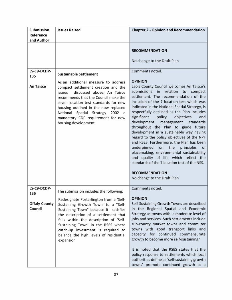
87
Submission Reference and Author
Issues Raised Chapter 2 - Opinion and Recommendation
RECOMMENDATION No change to the Draft Plan
LS-C9-DCDP-135 An Taisce
Sustainable Settlement
As an additional measure to address compact settlement creation and the issues discussed above, An Taisce recommends that the Council make the seven location test standards for new housing outlined in the now replaced National Spatial Strategy 2002 a mandatory CDP requirement for new housing development.
Comments noted. OPINION Laois County Council welcomes An Taisce’s submissions in relation to compact settlement. The recommendation of the inclusion of the 7 location test which was indicated in the National Spatial Strategy, is respectfully declined as the Plan includes significant policy objectives and development management standards throughout the Plan to guide future development in a sustainable way having regard to the policy objectives of the NPF and RSES. Furthermore, the Plan has been underpinned on the principles of placemaking, environmental sustainability and quality of life which reflect the standards of the 7 location test of the NSS. RECOMMENDATION No change to the Draft Plan
LS-C9-DCDP-136 Offaly County Council
The submission includes the following:
Redesignate Portarlington from a ‘Self-Sustaining Growth Town’ to a “Self-Sustaining Town” because it satisfies the description of a settlement that falls within the description of ‘Self-Sustaining Town’ in the RSES where catch-up investment is required to balance the high levels of residential expansion
Comments noted. OPINION Self-Sustaining Growth Towns are described in the Regional Spatial and Economic Strategy as towns with ‘a moderate level of jobs and services. Such settlements include sub-county market towns and commuter towns with good transport links and capacity for continued commensurate growth to become more self-sustaining.’ It is noted that the RSES states that the policy response to settlements which local authorities define as ‘self-sustaining growth towns’ promote continued growth at a

88
Submission Reference and Author
Issues Raised Chapter 2 - Opinion and Recommendation
more sustainable rate, whilst providing for increased employment and improved local economies, services and functions to allow towns become more self-sustaining and to create the quality of life to attract investment. Growth enablers also require catch up investment to promote consolidation and improvement in the sustainability of those areas that have experienced significant population growth but have a weak level of services and employment for residents. This designation was made on the basis of a comprehensive social and economic analysis of all settlements in the county based on Table 3.1 Asset/Potential Based Criteria Approach to Growth Strategy of the RSES for EMRA. This demonstrated the critical role that Portarlington has as an employment and services centre not only for its resident population but also for its wider rural hinterland area. Section 2.10.2 of the Plan provides a detailed analysis based of Table 3.1 of the RSES as to why Portarlington has been designated a self-sustaining growth town, in summary, it has a relatively low resident jobs ratio level, identified significant strategic employment lands (old Avon site), proximity to train station (Dublin-Cork line). It is also noted that the Office of the Planning Regulator was in agreement with the settlement hierarchy proposed in the Plan. RECOMMENDATION No change to the Draft Plan

89
Submission Reference and Author
Issues Raised Chapter 2 - Opinion and Recommendation
LS-C9-DCDP-122 Failte Ireland
Additional Suggested Test Insertions Chapter 2 – Strategic Aims Section 2.2 sets out the Strategic Aims for the County, we recommend the inclusive of an objective here, reflective of the aims of Chapter 8, to establish tourism at a strategic level within the plan. Proposed new strategic aim, to be inserted into Section 2.2: To support the development of the tourism sector as an economic driver for the County, identify and develop key destinations, visitor attractions and activities for the prioritisation of investment and to encourage the increase of tourism product development.
Submission is noted OPINION It is acknowledged that tourism is a very important element to the development of the County for both the county residents and also visitors to the county and to enhance job creation within the county. Therefore, it is recommended that a further aim in support of tourism be included RECOMMENDATION It is proposed to include the following additional aim To support the development of the tourism sector as an economic driver for the County, identify and develop key destinations, visitor attractions and activities for the prioritisation of investment and to encourage the increase of tourism product development.

90
CHAPTER 3 CLIMATE ACTION AND ENERGY
Submission Reference and Author
Issues Raised Chapter 3 - Opinion and Recommendation
LS-C9-DCDP-1 Niall Pickering
Boost tourism in the area, show that electric vehicles are not just for urban areas, encourage non fossil fuels cars to visit the Sliabh Blooms, hence reducing air pollutants in the area Make the Sliabh Blooms more accessible to electric vehicles by allowing their drivers to charge their cars while enjoying the mountains
Submission noted. OPINION The Planning Authority fully recognise the need for requirement for sufficient EV Charging Infrastructure throughout the County and in particular at tourist hubs such as the Sliabh Bloom Mountains in order to facilitate the transition to a low carbon society. EV rollout is supported in a number of chapters throughout the Plan (Chapter 3 Climate Action and Energy, Chapter 8 Tourism and Chapter 10 Infrastructure). The following policy objectives relate to EV – CMST 6, TM 12, TRANS 33, TRANS 34 and TRANS 35. RECOMMENDATION Include additional text within the following policy objectives: CM ST 6: Support the provision of electricity charging infrastructure for electrical vehicles throughout County Laois, both on street and in new developments in towns and villages and also at key tourist destination such as Sliabh Bloom Trail Heads, in accordance with car parking standards and best practice. TM 12: Increase connectivity and accessibility to public transport, and walking and cycling infrastructure and the provision of Electric Vehicle Charging Points to from key tourist destination hubs to encourage more sustainable modes of transport.

91
Submission Reference and Author
Issues Raised Chapter 3 - Opinion and Recommendation
LS-C9-DCDP-5 John Holland
Micro-generation will be key to meeting our renewable energy targets by 2030 and beyond - the plan should make mention of this given the advanced level of planning for rollout of the Micro-generation support scheme. Importance of achievement of renewable energy targets in order to mitigate the risks posed by Climate Change. Make reference to the authorities' fulsome support and encouragement of take-up of micro-generation by Laois businesses, farmers, schools, community bodies etc.
Submission noted. OPINION Chapter 3 Climate Action and Energy provides details in relation to Laois’ climate action areas and in particular Energy. Section 3.5 deals with renewable energy and makes reference to Micro Renewable Energy in Section 3.5.8. RECOMMENDATION It is recommended the following text is added to Section 3.5.8: Micro-generation is defined as micro-generation technologies, including micro-solar PV, micro-hydro, micro-wind and micro-renewable CHP with a maximum electrical output of 50kW, designed to primarily service the self-consumption needs of the property where it is installed. The Planning and Development Regulations 2001 (as amended) provide exemptions from planning permission for domestic wind turbines, solar panels and heat pumps within the curtilage of a house, subject to certain conditions. The Regulations also provide exemptions for micro renewable generators within the curtilage of industrial buildings, business premises and agricultural holdings including CHP plants, wind turbines, solar panels, heat pumps and biomass boiler units. The Council encourages the small scale generation of heat and electricity by individuals, small businesses and communities to meet their own needs and as an alternative to or to supplement grid connected power. Additional Policy Objective to support Micro Generators:

92
Submission Reference and Author
Issues Raised Chapter 3 - Opinion and Recommendation
CM RE 14: It is Council policy to facilitate micro-renewable energy installations and auto-generator installations where it is demonstrated to the satisfaction of the Council that they will not result in a significant adverse impact on residential, visual or environmental amenity.
LS-C9-DCDP-54 Geological Survey Ireland
Geothermal Energy - The Geothermal Suitability maps could also be considered in Section 3.5.6 ‘Geothermal Energy’, as part of the Renewable Energy Potential for the CDP. The Roadmap for a Policy and Regulatory Framework for Geothermal Energy was launched at the Geoscience 2020 Conference in November 2020. The Assessment of Geothermal Resources for District heating in Ireland and the Roadmap for a Policy and Regulatory framework for Geothermal Energy in Ireland documents have been developed to support the Government's commitments under the Climate Action Plan 2019 and the Programme for Government.
Submission noted. OPINION The point is noted. However, rather than a specific map, the Planning Authority is of the opinion that cross referencing to this source of data could be included with the text in Section 3.5.6. RECOMMENDATION Geothermal energy refers to heat energy stored in the ground. Solar thermal radiation is absorbed by the surface of the earth each day. This heat can be extracted by using a ground source heat pump which transfers the heat stored in the earth or in ground water to buildings in winter and the opposite in summer for cooling. The Council will encourage the provision of ground source heat pumps, also known as geothermal heat pumps. These are used for space heating and cooling, as well as water heating for both residential and commercial developments. The following link provides a source of information: https://dcenr.maps.arcgis.com/apps/webappviewer/index.html?
LS-C9-DCDP-57 TII
TII requires the submission of Glint and Glare Assessment to assess impacts on,
OPINION The matter regarding Glint and Glare is noted. However, this is already referenced
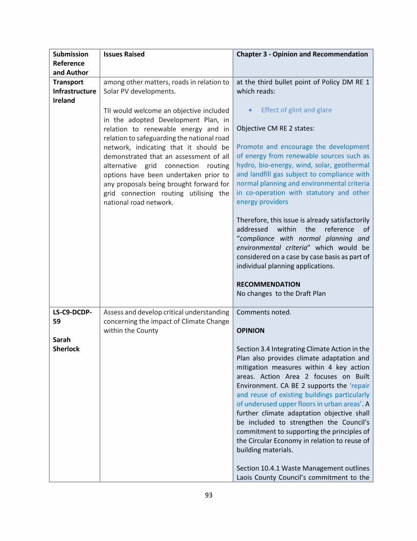
93
Submission Reference and Author
Issues Raised Chapter 3 - Opinion and Recommendation
Transport Infrastructure Ireland
among other matters, roads in relation to Solar PV developments.
TII would welcome an objective included in the adopted Development Plan, in relation to renewable energy and in relation to safeguarding the national road network, indicating that it should be demonstrated that an assessment of all alternative grid connection routing options have been undertaken prior to any proposals being brought forward for grid connection routing utilising the national road network.
at the third bullet point of Policy DM RE 1 which reads:
• Effect of glint and glare Objective CM RE 2 states: Promote and encourage the development of energy from renewable sources such as hydro, bio-energy, wind, solar, geothermal and landfill gas subject to compliance with normal planning and environmental criteria in co-operation with statutory and other energy providers Therefore, this issue is already satisfactorily addressed within the reference of “compliance with normal planning and environmental criteria” which would be considered on a case by case basis as part of individual planning applications. RECOMMENDATION No changes to the Draft Plan
LS-C9-DCDP-59 Sarah Sherlock
Assess and develop critical understanding concerning the impact of Climate Change within the County
Comments noted. OPINION Section 3.4 Integrating Climate Action in the Plan also provides climate adaptation and mitigation measures within 4 key action areas. Action Area 2 focuses on Built Environment. CA BE 2 supports the ‘repair and reuse of existing buildings particularly of underused upper floors in urban areas’. A further climate adaptation objective shall be included to strengthen the Council’s commitment to supporting the principles of the Circular Economy in relation to reuse of building materials. Section 10.4.1 Waste Management outlines Laois County Council’s commitment to the
94
Submission Reference and Author
Issues Raised Chapter 3 - Opinion and Recommendation
Waste Action Plan for the Circular Economy. Furthermore, ES 1 and ES 3 support the implementation of the Action Plan and promote the circular economy principles which relation to waste prevention and minimisation, preparation for reuse, recycling and recovery. Furthermore, under Section 3.2.3.2 Laois County Council Climate Adaptation Strategy 2019 – 2024 has informed this Plan. RECOMMENDATION
It is recommended to add the following climate adaptation measure in Action Area 2 Built Environment in Section 3.4: CA BE 11: Support the European Commission’s paper on Circular Economy Principles for Building Design and advance the reduce-reuse-recycle policy of the Circular Economy in relation to demolition of building stock.
LS-C9-DCDP-60 John Brophy
1. Map 3.1 is incorrect. Planning Application 16/260 is not a granted Wind Turbine Farm. It was REFUSED planning permission by Laois County Council This application was subsequently brought to An Bord Pleanala by the developer and subsequently brought to the High Court by concerned locals and a Judicial Review decision is awaited. 2. I propose, as part of next County Development Plan, that Laois County Council should assist concerned residents of Laois to fight these large industrial developers from destroying our county, particularly when Laois County Council refuses planning. 3. Laois is NOT SUITABLE for modern day industrial turbines. The current wind
OPINION Planning Application 16/260 was refused by Laois County Council but granted by An Bord Pleanala (ABP Reference PL11.248518). At the time of the publication of the Draft Laois County Development Plan 2021-2027, the development has planning permission. Chapter 3 and Appendix 5 (Wind Energy Strategy) include a range of Policy Objectives and Policies which a wind farm planning application will be considered within County Laois. For example, CM RE 7 states Promote the location of wind farms and wind energy infrastructure in the ‘preferred areas’ as outlined on Map 3.2 to prohibit
95
Submission Reference and Author
Issues Raised Chapter 3 - Opinion and Recommendation
guidelines and 500m setback are based on turbines 50m high, where setback was 10 times the turbine height. Industrial turbines can now be 150m and higher. Setback should therefore be 1,500m or higher. However, this is not the case in submissions in Laois recently. 4. Industrial Wind Farms such as 16/260 applied for will RUIN small local communities in Laois. As stated by Laois County Council above, they would adversely affect the residential amenities of a number of dwellings – families will be forced to move away from the areas involved. 5. Laois County Council should include terms for any permitted wind farms to protect our communities e.g. independent monitoring of flicker and noise, supports for locals forced to move home after houses devalued, control of community funds/compensation ensuring landowners/families involved in industrial windfarms are not involved in this etc
such infrastructure in areas identified as ‘ Areas not open for consideration’ and to consider, subject to appropriate assessment, the location of wind generating infrastructure in areas ‘open for consideration’ and as per the Laois Wind Energy Strategy 2021-2027. Policy DM RE 2 (Wind Energy Development) cross references to Section 6 and Section 7 of Appendix 5 Wind Energy Strategy for the full suite of Development Management Standards. CM RE 6 in relation to wind turbine setbacks has been amended to reflect national guidelines. RECOMMENDATION No change to the Draft Plan
LS-C9-DCDP-66 Natural Forces Renewable Energy
The submission makes the following comments: CDP should reflect supports available to communities in generating their own energy projects and places emphasis on community led projects and schemes like Renewable Energy Support Scheme (DECC - a community specific category for communities to take ownership of RE Generators. RESS-1 category allows communities to work with developers to develop RE projects in a partnership model where the community owns 51% of the project).
OPINION The submission is noted Chapter 3 includes a range of Climate Mitigation Objectives and Policies, however, there is no specific reference to the example referred to in the submission. RECOMMENDATION It is recommended that the following Climate Mitigation Objective is inserted CM RE 14 Promote the installation of community led renewable energy projects which has the support of the majority of the community, The development would subject to

96
Submission Reference and Author
Issues Raised Chapter 3 - Opinion and Recommendation
The main benefits of owning RE projects are:
• Community Benefit Fund,
• Availability for communities to apply for funding
• Participation and shareholding in a RE Community (REC)
compliance with normal planning and environmental criteria in co-operation with statutory and other energy providers, and would be owned in partnership between the community and developer.
LS-C9-DCDP-67 Lightsource BP
The submissions welcomes the approach taken in Chapter 3, requests Aim of chapter 3 is worded more decisively with dates and targets in line with wider national policies within the Climate Action Plan 2019 and to reflect the national target to generate 70% of electricity demand within the County, to be sourced from renewables by 2030. Lightsource bp is of the view that solar generation can contribute significantly. Lightsource bp would further draw the Council’s attention to the Programme for Government (PfG), which commits to a 7% average yearly reduction in overall greenhouse gas emissions over the next decade and to achieving net zero emissions by 2050. The PfG is not mentioned within Chapter 3 and we would argue that it is hugely important. Measures should be included within the Development Plan to outline a roadmap to how these % reductions are to be delivered, measured, and accredited within Laois during the lifetime of the plan. The submission also draws attention to the DM Standards in relation to solar farm development and strongly urge caution in terms of the first point of guidance within Policy Objective DM RE 1 below: ‘Preference for use of brownfield sites/contaminated land and non-
OPINION
The Development Plan will contribute towards meeting national renewable energy targets it should be noted that the Planning Authority has included a standalone chapter in the Draft Plan to address climate adaptation and mitigation. In terms of the contribution of the Plan to realising targets on renewable energy and climate change mitigation, the Plan is committed to reducing carbon footprint by integrating climate action into the planning system in support of national targets for climate policy mitigation and adaptation objectives, as well as targets for greenhouse gas emissions reductions.
The Council has demonstrated its commitment to promoting renewable energy development by granting approximately 330ha of solar farms in recent years.
It is acknowledged in the plan that the Council is open to new and innovative renewable energy sources and technological solutions to addressing climate change.
In this regard, the Council will seek to collaborate with relevant stakeholders to progress the transition to green energy. Whilst the information requested is not available at this time, enhanced policy is proposed which commits to working with key stakeholders in the carrying out of an assessment of how the implementation of the Plan will contribute to realising overall
97
Submission Reference and Author
Issues Raised Chapter 3 - Opinion and Recommendation
productive agricultural land versus productive agricultural lands’ Preference afforded to the use of brownfield land fails to take cognisance of the current land requirements for utility scale solar farms which will require larger sites and economies of scale. Brownfield supply in Ireland is largely in urban areas. The scale of brownfield required for a solar farm is unlikely to be found within an Irish brownfield context. This policy needs to define the term ‘brownfield’ in more detail and outline the types of brownfield that can be considered. If the Council’s definition of ‘brownfield’ really means rural brownfield such as cut away bog and landfill, then this should be stated. Furthermore Policy Objective DM RE 1, in relation to the preference for ‘non-productive agricultural land versus productive agricultural lands’. Unlike the UK, Ireland does not have comprehensive and detailed national land classification maps. It is therefore not possible to accurately map land use quality or type across the county. It is therefore difficult to argue what is an area of productive or less productive land quality. Both sheep grazing and agrivoltaic practices, land used for a solar farm is still very much productive. A recent report by the Climate Change Advisory Committee called for a 53% reduction in the national cattle herd, due to the levels of methane emissions associated with this agricultural practice. Utility scale solar farms allow the continued productive agricultural use of land, without excessive increases in the levels of methane, one of the most damaging greenhouse gases.
national targets on renewable energy and climate change, and in particular wind energy production and the potential wind energy resource.
Laois County Council has also designated Portlaoise as a Decarbonisation Zone and as such the following text will be added to Chapter 3 to highlight Laois County Council’s commitment to climate change and achieving any future renewable energy targets.
A study carried out by SIEMENS for Laois County Council in 2020 – Carbon Footprint Study for the Town of Portlaoise , Co Laois was designed to provide for a detailed assessment of its existing footprint and the potential to reduce its impact through identifying suitable reduction opportunities. The study looked at 3 use cases – renewables, heating and transportation.
The renewable potential was assessed for the town of Portlaoise and how the renewable generation sources e.g., wind and PV, can potentially help to reach the sustainability goals of a zero-carbon town.
The objective area was the town of Portlaoise (to give effect to the transition to a low carbon town), although a thorough consideration of the entire area of County Laois, was considered for scenario construction. While this exercise was beneficial for considering the actions we have to consider in order to address reducing our carbon footprint , further examination and consideration of renewables within the County must be interrogated as how we address national targets, taking account of the complexities of such developments. It is therefore an objective of the Council to carry out and adopt a Renewable Energy Strategy for the County within 1 year of adoption of the

98
Submission Reference and Author
Issues Raised Chapter 3 - Opinion and Recommendation
The submission states that Section 3.5.3 is light on detail and could be developed to consider the most pressing challenges to solar development and planning considerations across the county. This section should outline that solar farms are relatively quick to deploy, in comparison with other energy generation technologies, and well sited solar farms can help meet urgent renewable energy targets, without impacting negatively on local communities or the environment. In particular, the Development Plan should consider the innovative approach known as co-location, where solar, battery storage and wind farms symbiotically co-exist. This is a highly sustainable use of existing infrastructure, with the solar farm and a nearby wind farm sharing infrastructure. A policy objective worded as below may well assist in achieving this: ‘Favourable consideration will be given to the re-use, shared use (co-location), refurbishment, repair and repowering of existing renewable energy technology developments in order to prolong the life span of developments such as wind farms and solar farms providing that these do not result in unacceptable impacts on the environment or residential / visual amenity.’ The submission also states that this section should also consider repowering of solar farms over the lifetime of their consent, providing that any changes are non-material. This is likely to become an issue as technology progresses and panels become more powerful and efficient. The draft Development Plan should provide the policy cover to permit repowering under compliance, subject to a flexible and reasonable condition in any
plan. This will require a variation to the CDP.
Section 3.5.5 of the Draft Plan will be updated to include the following text
The Local Authority will support the delivery on commitments under the Programme for Government (2020), which commit to a 7% average yearly reduction in overall greenhouse gas emissions over the next decade and to achieving net zero emissions by 2050. A number of actions within Programme for Government must be delivered on to ensure Local Authorities can effectively deliver on this commitment in conjunction with the key stakeholders namely –
• Finalise and publish the Wind Energy Guidelines, having regard to the public consultation that has just taken place.
• Develop a Solar Energy Strategy, including for rooftop and ground based photovoltaics, to ensure that a greater share of our electricity needs is met through solar power.
Notwithstanding this and in line with the Climate Action Plan 2019, Ireland aims to increase reliance on renewables within the electricity generation sector from 30% to 70% adding up to a total of 8.2 GW (8200 MW) of renewable onshore wind energy capacity by 2030.
• With its installed wind capacity in Co Laois representing 0.7% of the total installed wind capacity in the Republic of Ireland to date (based on the national installed wind capacity of 4,235 MW from Quarter 2 of 2020; and
• A potential additional 87.4 MW of energy to be generated from permission granted for additional

99
Submission Reference and Author
Issues Raised Chapter 3 - Opinion and Recommendation
approval. Clarity on the matter should be stated as an objective within the plan, providing policy support to this commitment. The Development Plan should provide clarity to prohibit the unnecessary use of restrictive conditions that prevent an increase in MW export capacity without submitting a new planning application. Such conditions prevent repowering within the original planning approval, are unreasonable and run contrary to the ability of generators to repower simply because a suggested MW figure may have been quoted on drawings or within the text of a supporting statements.
wind farms in the south east of the county which if constructed combined with existing installed wind capacity in the county, will bring the total output in Laois to 120 MW.
• If the potential from granted permissions were to be constructed , together with what has been built , it would represent the contribution from Co Laois at nearly 1.5% of the total (8200 MW) by 2030
Policy DM RE 1 The point is noted, however this is only one of 13no. bullet points listed that will be used to assess applications for Solar Farm Development within the County. The bullet point states that there is a “preference for” such developments to be on brownfield sites / contaminated land and non-productive land. This does not preclude applications being submitted on productive agricultural lands. It will be for the applicant to put forward its case for development in a particular location, which will be considered on a case by case basis during the course of a planning application. Within County Laois, Map 3.1 shows that since 2016, planning permission has been granted for c. 121 MW of Solar Panels. Based on the description of development provided by the applicant’s, these sites have the potential to supply enough energy for approximately 36,200 homes. This demonstrates the County’s commitment to work towards the Climate Action Plan (2019).
100
Submission Reference and Author
Issues Raised Chapter 3 - Opinion and Recommendation
Section 3.5.3 The point raised is noted, however the text in Section 3.5.3 states that “There are a range of technologies available to exploit the benefits of harnessing energy of the sun, including solar panels, solar farms, solar energy storage facilities all of which contribute to a reduction in energy demand” is considered sufficient, balanced and factually correct in the context of this Development Plan. The proposed policy objective is noted and given the need to work towards the Climate Action Plan 2019 objectives, and national renewable energy targets, the emphasis is supported. However, it does require some amendments to ensure the collective impacts are considered, as well as the ned to ensure that it is considered within national, regional and development plan policy, as well as other relevant criteria at the time of the application. Repowering Solar Farms and Restrictive Conditions The point is noted, which could assist with meeting the overarching Climate Action Pan 2019. The Draft Plan provides the necessary planning framework for the development and conservation of the County. The Planning Authority is of the opinion that it is for the developer to decide the MW it is seeking planning permission for, allowing for the timescales it is seeking to operate within. On receipt a valid planning application will be considered by the Planning Authority on a case by case basis. If planning permission is granted, then appropriately worded planning conditions
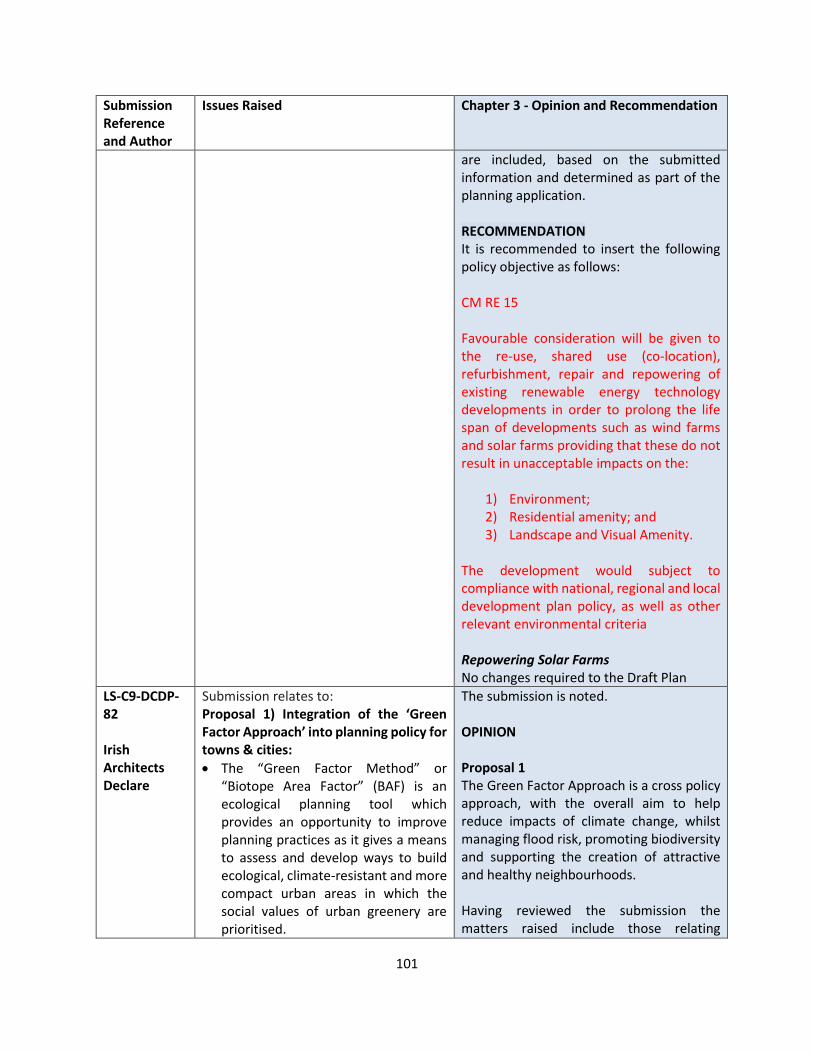
101
Submission Reference and Author
Issues Raised Chapter 3 - Opinion and Recommendation
are included, based on the submitted information and determined as part of the planning application. RECOMMENDATION It is recommended to insert the following policy objective as follows: CM RE 15 Favourable consideration will be given to the re-use, shared use (co-location), refurbishment, repair and repowering of existing renewable energy technology developments in order to prolong the life span of developments such as wind farms and solar farms providing that these do not result in unacceptable impacts on the:
1) Environment; 2) Residential amenity; and 3) Landscape and Visual Amenity.
The development would subject to compliance with national, regional and local development plan policy, as well as other relevant environmental criteria Repowering Solar Farms No changes required to the Draft Plan
LS-C9-DCDP-82 Irish Architects Declare
Submission relates to: Proposal 1) Integration of the ‘Green Factor Approach’ into planning policy for towns & cities:
• The “Green Factor Method” or “Biotope Area Factor” (BAF) is an ecological planning tool which provides an opportunity to improve planning practices as it gives a means to assess and develop ways to build ecological, climate-resistant and more compact urban areas in which the social values of urban greenery are prioritised.
The submission is noted. OPINION Proposal 1 The Green Factor Approach is a cross policy approach, with the overall aim to help reduce impacts of climate change, whilst managing flood risk, promoting biodiversity and supporting the creation of attractive and healthy neighbourhoods. Having reviewed the submission the matters raised include those relating
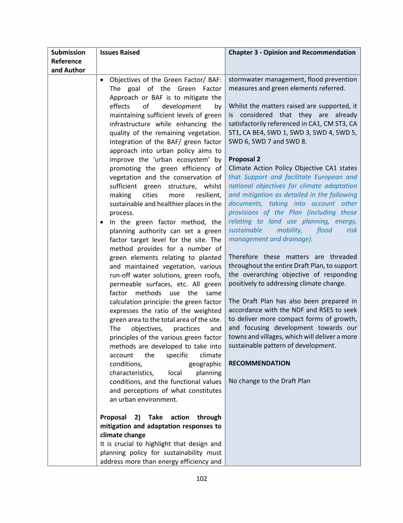
102
Submission Reference and Author
Issues Raised Chapter 3 - Opinion and Recommendation
• Objectives of the Green Factor/ BAF: The goal of the Green Factor Approach or BAF is to mitigate the effects of development by maintaining sufficient levels of green infrastructure while enhancing the quality of the remaining vegetation. Integration of the BAF/ green factor approach into urban policy aims to improve the ‘urban ecosystem’ by promoting the green efficiency of vegetation and the conservation of sufficient green structure, whilst making cities more resilient, sustainable and healthier places in the process.
• In the green factor method, the planning authority can set a green factor target level for the site. The method provides for a number of green elements relating to planted and maintained vegetation, various run-off water solutions, green roofs, permeable surfaces, etc. All green factor methods use the same calculation principle: the green factor expresses the ratio of the weighted green area to the total area of the site. The objectives, practices and principles of the various green factor methods are developed to take into account the specific climate conditions, geographic characteristics, local planning conditions, and the functional values and perceptions of what constitutes an urban environment.
Proposal 2) Take action through mitigation and adaptation responses to climate change It is crucial to highlight that design and planning policy for sustainability must address more than energy efficiency and
stormwater management, flood prevention measures and green elements referred. Whilst the matters raised are supported, it is considered that they are already satisfactorily referenced in CA1, CM ST3, CA ST1, CA BE4, SWD 1, SWD 3, SWD 4, SWD 5, SWD 6, SWD 7 and SWD 8. Proposal 2 Climate Action Policy Objective CA1 states that Support and facilitate European and national objectives for climate adaptation and mitigation as detailed in the following documents, taking into account other provisions of the Plan (including those relating to land use planning, energy, sustainable mobility, flood risk management and drainage). Therefore these matters are threaded throughout the entire Draft Plan, to support the overarching objective of responding positively to addressing climate change. The Draft Plan has also been prepared in accordance with the NDF and RSES to seek to deliver more compact forms of growth, and focusing development towards our towns and villages, which will deliver a more sustainable pattern of development. RECOMMENDATION No change to the Draft Plan

103
Submission Reference and Author
Issues Raised Chapter 3 - Opinion and Recommendation
low-embodied carbon. For the policy to properly respond to the UN Sustainable Development Goals1 , it should use the definition of sustainability as the harmonization of social, environmental and economic concerns. The policy should establish a set of standards indicating what a sustainable built environment is. A sustainable built environment is one that contributes to: • Supportive, Inclusive & Attractive
Environments (focused on social wellbeing, including affordability and preservation of cultural heritage)
• Safe & Healthy Environments (focused on physical wellbeing, including climate resilience)
• Responsible Use of Land & Water Resources (focused on efficient landuse, infrastructure and enabling circular systems)
• Enhanced & Optimised Ecosystems (focused on preserving and restoring ecosystems)
• Lifecycle Carbon Elimination (focused on reducing operational and embodied energy and supporting renewables) A sustainable built environment integrates all the standards above. These also align with UN SDG’s and the EU initiative Level(s) striving to enable a common EU approach to the assessment of environmental performance of buildings
To combat current negative trends of sprawling growth, decline of rural areas and towns, stagnation of inner city and suburban areas, social disadvantage, a degraded natural environment and poor indoor air quality, decision-makers must plan for a broad spectrum of approaches including: • Sustainable Location and Connectivity
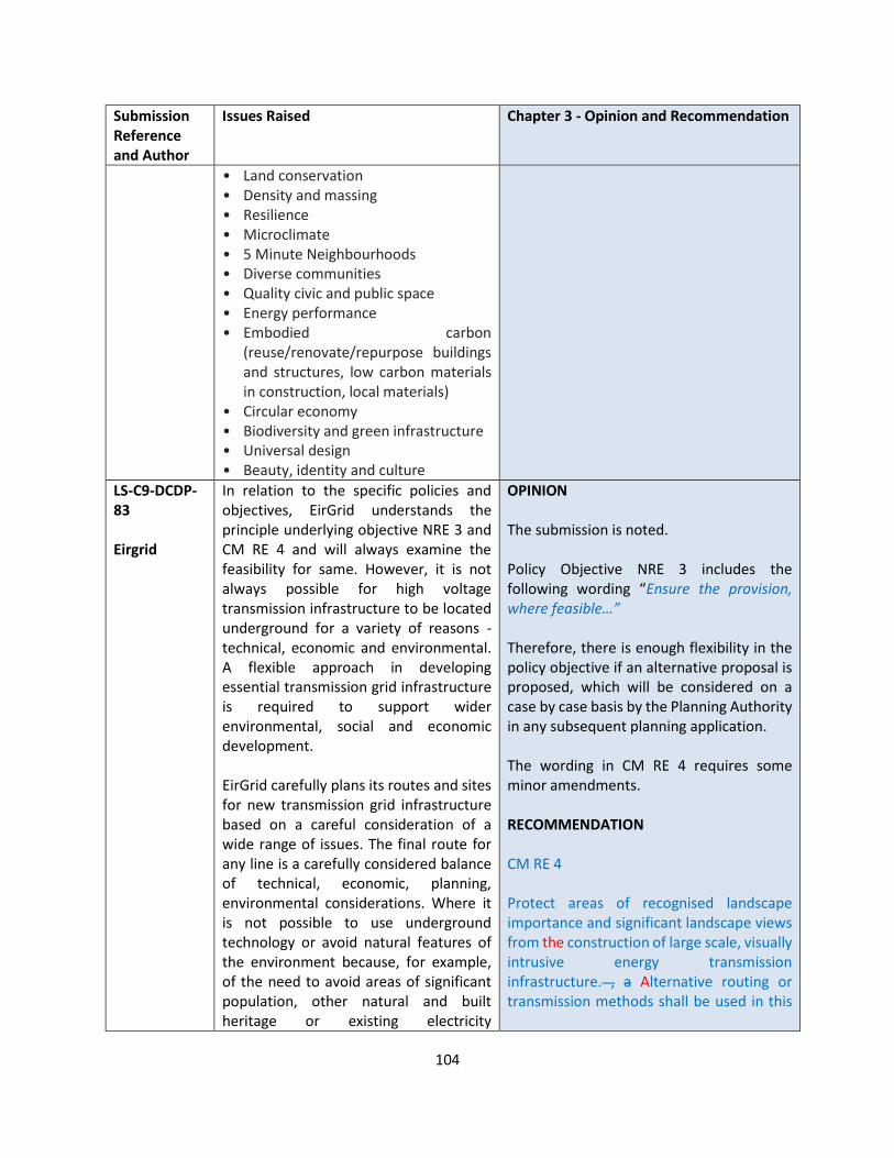
104
Submission Reference and Author
Issues Raised Chapter 3 - Opinion and Recommendation
• Land conservation • Density and massing • Resilience • Microclimate • 5 Minute Neighbourhoods • Diverse communities • Quality civic and public space • Energy performance • Embodied carbon
(reuse/renovate/repurpose buildings and structures, low carbon materials in construction, local materials)
• Circular economy • Biodiversity and green infrastructure • Universal design • Beauty, identity and culture
LS-C9-DCDP-83 Eirgrid
In relation to the specific policies and objectives, EirGrid understands the principle underlying objective NRE 3 and CM RE 4 and will always examine the feasibility for same. However, it is not always possible for high voltage transmission infrastructure to be located underground for a variety of reasons - technical, economic and environmental. A flexible approach in developing essential transmission grid infrastructure is required to support wider environmental, social and economic development. EirGrid carefully plans its routes and sites for new transmission grid infrastructure based on a careful consideration of a wide range of issues. The final route for any line is a carefully considered balance of technical, economic, planning, environmental considerations. Where it is not possible to use underground technology or avoid natural features of the environment because, for example, of the need to avoid areas of significant population, other natural and built heritage or existing electricity
OPINION The submission is noted. Policy Objective NRE 3 includes the following wording “Ensure the provision, where feasible…” Therefore, there is enough flexibility in the policy objective if an alternative proposal is proposed, which will be considered on a case by case basis by the Planning Authority in any subsequent planning application. The wording in CM RE 4 requires some minor amendments. RECOMMENDATION CM RE 4 Protect areas of recognised landscape importance and significant landscape views from the construction of large scale, visually intrusive energy transmission infrastructure. , a Alternative routing or transmission methods shall be used in this

105
Submission Reference and Author
Issues Raised Chapter 3 - Opinion and Recommendation
infrastructure EirGrid will always explain this as part of its substantive reasons for the route design. The development of the transmission grid is of critical importance to support the environment, economy and society, as well as to realise the transformation of Ireland’s energy system to meet climate change and energy obligations. Electricity infrastructure is critical to balanced regional and local economic and spatial development.
instance to maintain the landscape. Ensure that the The assessment of energy development proposals will have regard to the impacts on public rights of way and walking routes.
LS-C9-DCDP-90 Gas Networks Ireland
GNI suggests amending the following sentences relating to AD and biogas in Section 3.5.2 Bioenergy which state:
“Anaerobic digestion involves the bacterial transformation of biomass (for example animal manure) to methane gas or biogas”.
Suggest changing to:
“Anaerobic digestion involves the bacterial transformation of biomass (for example animal manure) to produce biogas which can be upgraded to biomethane”.
“Biogas can also be compressed and used as a transport fuel”.
Suggest changing to:
“Biomethane can also be compressed and used as a transport fuel”
GNI is currently recommending that all homeowners located on or close to the gas network, with oil fired central heating systems, to upgrade their homes using a “fabric-first” approach. This approach
OPINION The submission is noted, and recommended changes are reasonable to provide clarity on these matters. RECOMMENDATION Change the following extract of Section 3.5.2, and second paragraph as follows: Anaerobic digestion involves the bacterial transformation of biomass (for example animal manure) to produce biogas which can be upgraded to biomethane methane gas or biogas. The biogas can be used to fuel a stationary gas engine or gas turbine to produce electricity, or burned in a boiler to provide heat or to raise steam. Biogas Biomethane can also be compressed and used as a transport fuel.
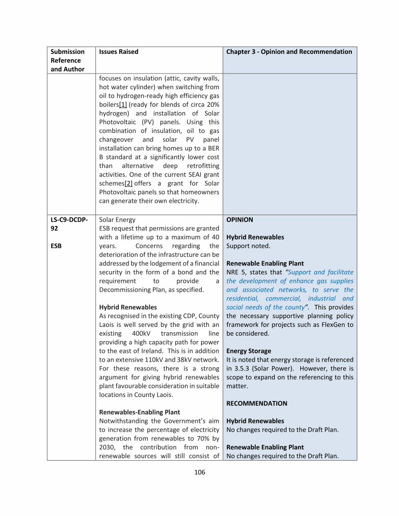
106
Submission Reference and Author
Issues Raised Chapter 3 - Opinion and Recommendation
focuses on insulation (attic, cavity walls, hot water cylinder) when switching from oil to hydrogen-ready high efficiency gas boilers[1] (ready for blends of circa 20% hydrogen) and installation of Solar Photovoltaic (PV) panels. Using this combination of insulation, oil to gas changeover and solar PV panel installation can bring homes up to a BER B standard at a significantly lower cost than alternative deep retrofitting activities. One of the current SEAI grant schemes[2] offers a grant for Solar Photovoltaic panels so that homeowners can generate their own electricity.
LS-C9-DCDP-92 ESB
Solar Energy ESB request that permissions are granted with a lifetime up to a maximum of 40 years. Concerns regarding the deterioration of the infrastructure can be addressed by the lodgement of a financial security in the form of a bond and the requirement to provide a Decommissioning Plan, as specified. Hybrid Renewables As recognised in the existing CDP, County Laois is well served by the grid with an existing 400kV transmission line providing a high capacity path for power to the east of Ireland. This is in addition to an extensive 110kV and 38kV network. For these reasons, there is a strong argument for giving hybrid renewables plant favourable consideration in suitable locations in County Laois. Renewables-Enabling Plant Notwithstanding the Government’s aim to increase the percentage of electricity generation from renewables to 70% by 2030, the contribution from non-renewable sources will still consist of
OPINION Hybrid Renewables Support noted. Renewable Enabling Plant NRE 5, states that “Support and facilitate the development of enhance gas supplies and associated networks, to serve the residential, commercial, industrial and social needs of the county”. This provides the necessary supportive planning policy framework for projects such as FlexGen to be considered. Energy Storage It is noted that energy storage is referenced in 3.5.3 (Solar Power). However, there is scope to expand on the referencing to this matter. RECOMMENDATION Hybrid Renewables No changes required to the Draft Plan. Renewable Enabling Plant No changes required to the Draft Plan.
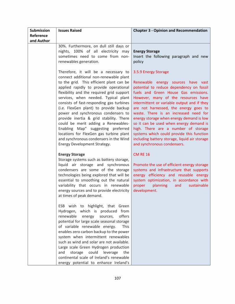
107
Submission Reference and Author
Issues Raised Chapter 3 - Opinion and Recommendation
30%. Furthermore, on dull still days or nights, 100% of all electricity may sometimes need to come from non-renewables generation. Therefore, it will be a necessary to connect additional non-renewable plant to the grid. This efficient plant can be applied rapidly to provide operational flexibility and the required grid support services, when needed. Typical plant consists of fast-responding gas turbines (i.e. FlexGen plant) to provide backup power and synchronous condensers to provide inertia & grid stability. There could be merit adding a Renewables-Enabling Map” suggesting preferred locations for FlexGen gas turbine plant and synchronous condensers in the Wind Energy Development Strategy. Energy Storage Storage systems such as battery storage, liquid air storage and synchronous condensers are some of the storage technologies being explored that will be essential to smoothing out the natural variability that occurs in renewable energy sources and to provide electricity at times of peak demand. ESB wish to highlight, that Green Hydrogen, which is produced from renewable energy sources, offers potential for large scale seasonal storage of variable renewable energy. This enables zero carbon backup to the power system when intermittent renewables such as wind and solar are not available. Large scale Green Hydrogen production and storage could leverage the continental scale of Ireland’s renewable energy potential to enhance Ireland’s
Energy Storage Insert the following paragraph and new policy 3.5.9 Energy Storage Renewable energy sources have vast potential to reduce dependency on fossil fuels and Green House Gas emissions. However, many of the resources have intermittent or variable output and if they are not harnessed, the energy goes to waste. There is an increased need for energy storage when energy demand is low so it can be used when energy demand is high. There are a number of storage systems which could provide this function including battery storage, liquid air storage and synchronous condensers. CM RE 16 Promote the use of efficient energy storage systems and infrastructure that supports energy efficiency and reusable energy system optimization, in accordance with proper planning and sustainable development.

108
Submission Reference and Author
Issues Raised Chapter 3 - Opinion and Recommendation
energy security and to make Ireland a net exporter of energy. There is scope to expand section 3.5 Renewable Energy with the inclusion of specific policies supporting these new technologies.
LS-C9-DCDP-96 Marc Van Der Burgh
Suggested additional text and changes to Policy Objectives: CM RE 14: Promote micro-generation of electricity and heating via solar PV and tubes; individual houses and farms with solar panels on their empty roofs can become carbon neutral or even small electricity producers Paragraph 3.6.1: Remove sentence “RPO 10.23 of the RSES recognises the important of supporting the timely delivery of such major investment projects to strengthen the network in the midlands region.”, as the County Development Plan should remain impartial and not include subjective references. Otherwise for completeness the following text should be added “A significant number of Laois residents currently actively objects and protests against this development”. Reword NRE 2 to: Support the Laois-Kilkenny Reinforcement Project to strengthen the network in large parts of the Midlands and provide additional capacity for potential demand growth in the wider region and strengthen the Region’s transmission network by improving security and quality of supply and ensuring there is the potential for demand growth, without increasing the risk to water pollution or safety of the people living in the vicinity.
Submission noted. OPINION CM RE 14 Policy Objective EEB 5 provides the necessary planning framework to facilitate such developments. Paragraph 3.6.1 The CDP is required to be prepared in accordance with the NPF and RSES, which have both been adopted. Reference to RPO 10.23 therefore provides the overarching regional framework to the matter referred in 3.6.1. It is noted that the text could be slightly amended. NRE 2 The matter is noted. However, rather than restricting it to the two no. points referred, for consistency with other policy objectives the wording could be amended as recommended below. RECOMMENDATION CM RE 14 No change 3.6.1 Amend last sentence as follows: RPO 10.23 of the RSES recognises the important importance of supporting the timely delivery of such major investment
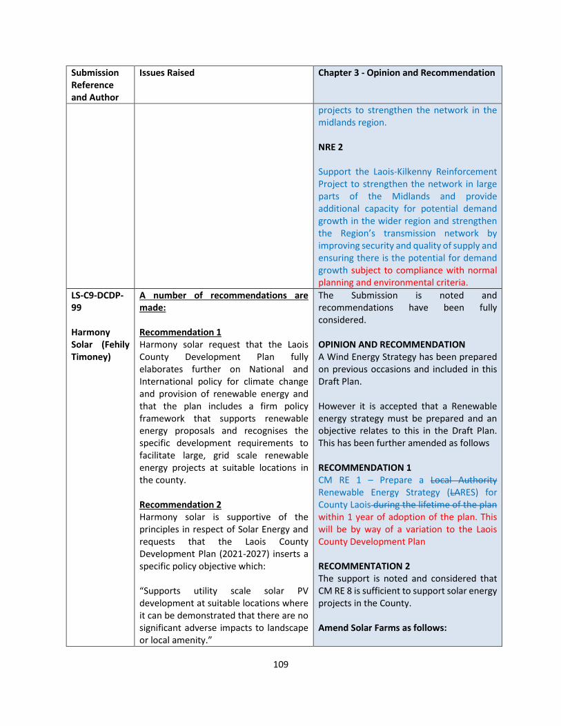
109
Submission Reference and Author
Issues Raised Chapter 3 - Opinion and Recommendation
projects to strengthen the network in the midlands region. NRE 2 Support the Laois-Kilkenny Reinforcement Project to strengthen the network in large parts of the Midlands and provide additional capacity for potential demand growth in the wider region and strengthen the Region’s transmission network by improving security and quality of supply and ensuring there is the potential for demand growth subject to compliance with normal planning and environmental criteria.
LS-C9-DCDP-99 Harmony Solar (Fehily Timoney)
A number of recommendations are made: Recommendation 1 Harmony solar request that the Laois County Development Plan fully elaborates further on National and International policy for climate change and provision of renewable energy and that the plan includes a firm policy framework that supports renewable energy proposals and recognises the specific development requirements to facilitate large, grid scale renewable energy projects at suitable locations in the county. Recommendation 2 Harmony solar is supportive of the principles in respect of Solar Energy and requests that the Laois County Development Plan (2021-2027) inserts a specific policy objective which: “Supports utility scale solar PV development at suitable locations where it can be demonstrated that there are no significant adverse impacts to landscape or local amenity.”
The Submission is noted and recommendations have been fully considered. OPINION AND RECOMMENDATION A Wind Energy Strategy has been prepared on previous occasions and included in this Draft Plan. However it is accepted that a Renewable energy strategy must be prepared and an objective relates to this in the Draft Plan. This has been further amended as follows RECOMMENDATION 1 CM RE 1 – Prepare a Local Authority Renewable Energy Strategy (LARES) for County Laois during the lifetime of the plan within 1 year of adoption of the plan. This will be by way of a variation to the Laois County Development Plan RECOMMENTATION 2 The support is noted and considered that CM RE 8 is sufficient to support solar energy projects in the County. Amend Solar Farms as follows:
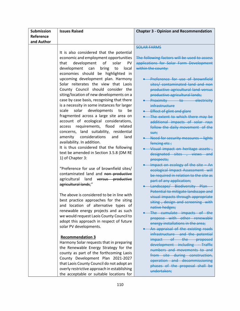
110
Submission Reference and Author
Issues Raised Chapter 3 - Opinion and Recommendation
It is also considered that the potential economic and employment opportunities that development of solar PV development can bring to local economies should be highlighted in upcoming development plan. Harmony Solar reiterates the view that Laois County Council should consider the siting/location of new developments on a case by case basis, recognising that there is a necessity in some instances for larger scale solar developments to be fragmented across a large site area on account of ecological considerations, access requirements, flood related concerns, land suitability, residential amenity considerations and land availability. In addition. It is thus considered that the following text be amended in Section 3.5.8 (DM RE 1) of Chapter 3: “Preference for use of brownfield sites/ contaminated land and non productive agricultural land versus productive agricultural lands;” The above is considered to be in line with best practice approaches for the siting and location of alternative types of renewable energy projects and as such we would request Laois County Council to adopt this approach in respect of future solar PV developments. Recommendation 3 Harmony Solar requests that in preparing the Renewable Energy Strategy for the county as part of the forthcoming Laois County Development Plan 2021-2027 that Laois County Council do not adopt an overly restrictive approach in establishing the acceptable or suitable locations for
SOLAR FARMS The following factors will be used to assess applications for Solar Farm Development within the county:
• Preference for use of brownfield sites/ contaminated land and non productive agricultural land versus productive agricultural lands;
• Proximity to electricity infrastructure
• Effect of glint and glare
• The extent to which there may be additional impacts of solar rays follow the daily movement of the sun;
• Need for security measures – lights fencing etc ;
• Visual impact on heritage assets , designated sites , views and prospects;
• Impact on ecology of the site – An ecological Impact Assessment will be required in relation to the site as part of any application;
• Landscape/ Biodiversity Plan - Potential to mitigate landscape and visual impacts through appropriate siting , design and screening with native hedges;
• The cumulate impacts of the propose with other renewable energy installations in the area;
• An appraisal of the existing roads infrastructure and the potential impact of the proposed development including - Traffic numbers and movements to and from site during construction, operation and decommissioning phases of the proposal shall be undertaken;
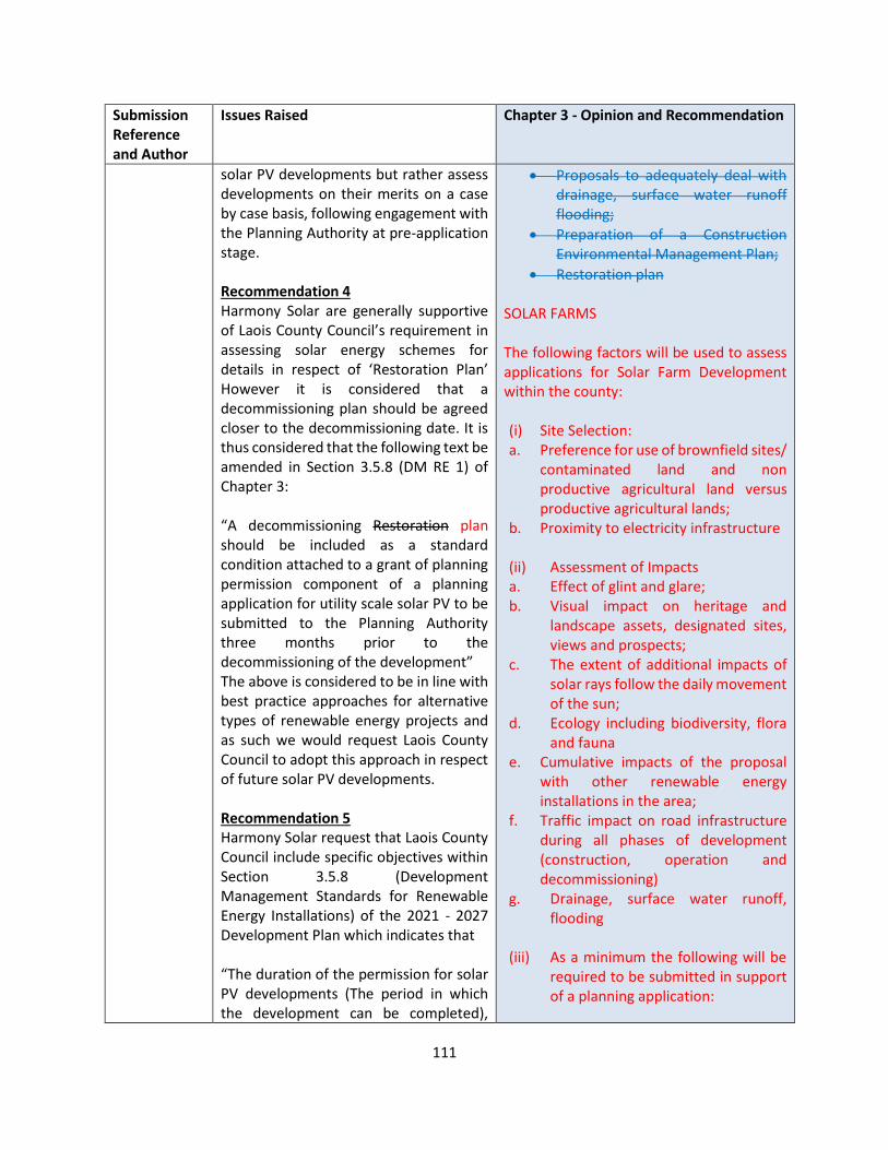
111
Submission Reference and Author
Issues Raised Chapter 3 - Opinion and Recommendation
solar PV developments but rather assess developments on their merits on a case by case basis, following engagement with the Planning Authority at pre-application stage. Recommendation 4 Harmony Solar are generally supportive of Laois County Council’s requirement in assessing solar energy schemes for details in respect of ‘Restoration Plan’ However it is considered that a decommissioning plan should be agreed closer to the decommissioning date. It is thus considered that the following text be amended in Section 3.5.8 (DM RE 1) of Chapter 3: “A decommissioning Restoration plan should be included as a standard condition attached to a grant of planning permission component of a planning application for utility scale solar PV to be submitted to the Planning Authority three months prior to the decommissioning of the development” The above is considered to be in line with best practice approaches for alternative types of renewable energy projects and as such we would request Laois County Council to adopt this approach in respect of future solar PV developments. Recommendation 5 Harmony Solar request that Laois County Council include specific objectives within Section 3.5.8 (Development Management Standards for Renewable Energy Installations) of the 2021 - 2027 Development Plan which indicates that “The duration of the permission for solar PV developments (The period in which the development can be completed),
• Proposals to adequately deal with drainage, surface water runoff flooding;
• Preparation of a Construction Environmental Management Plan;
• Restoration plan SOLAR FARMS The following factors will be used to assess applications for Solar Farm Development within the county: (i) Site Selection: a. Preference for use of brownfield sites/
contaminated land and non productive agricultural land versus productive agricultural lands;
b. Proximity to electricity infrastructure (ii) Assessment of Impacts a. Effect of glint and glare; b. Visual impact on heritage and
landscape assets, designated sites, views and prospects;
c. The extent of additional impacts of solar rays follow the daily movement of the sun;
d. Ecology including biodiversity, flora and fauna
e. Cumulative impacts of the proposal with other renewable energy installations in the area;
f. Traffic impact on road infrastructure during all phases of development (construction, operation and decommissioning)
g. Drainage, surface water runoff, flooding
(iii) As a minimum the following will be
required to be submitted in support of a planning application:
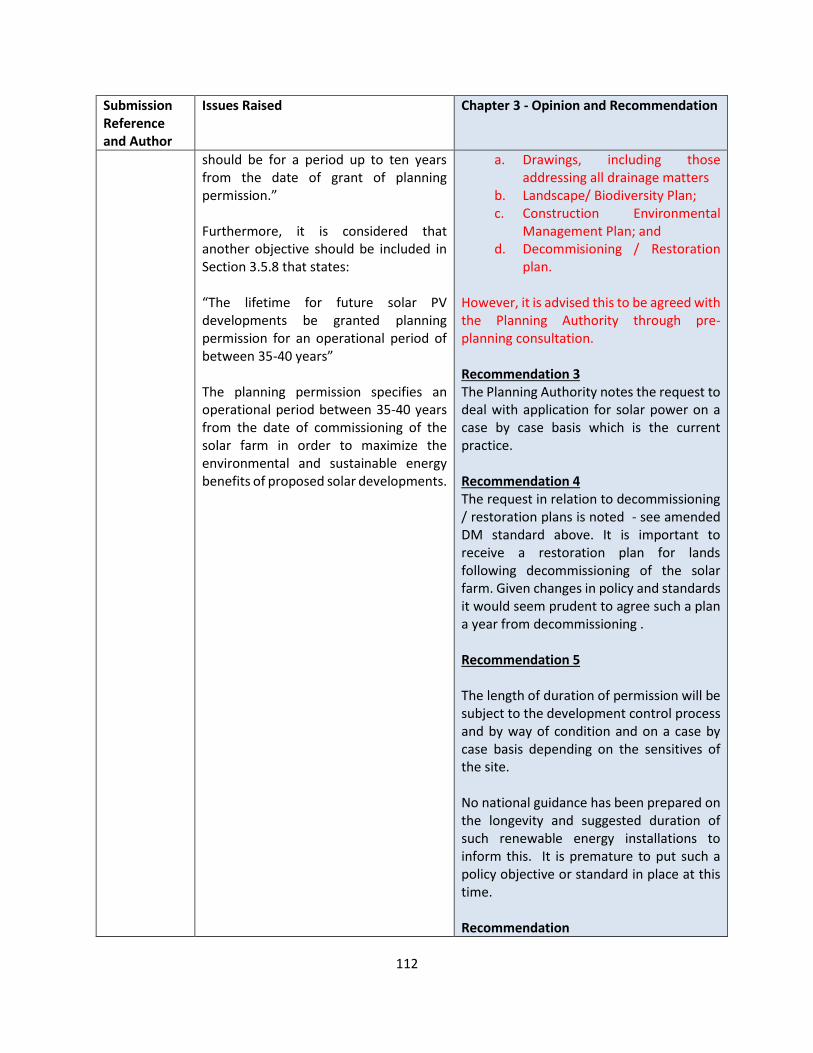
112
Submission Reference and Author
Issues Raised Chapter 3 - Opinion and Recommendation
should be for a period up to ten years from the date of grant of planning permission.” Furthermore, it is considered that another objective should be included in Section 3.5.8 that states: “The lifetime for future solar PV developments be granted planning permission for an operational period of between 35-40 years” The planning permission specifies an operational period between 35-40 years from the date of commissioning of the solar farm in order to maximize the environmental and sustainable energy benefits of proposed solar developments.
a. Drawings, including those addressing all drainage matters
b. Landscape/ Biodiversity Plan; c. Construction Environmental
Management Plan; and d. Decommisioning / Restoration
plan.
However, it is advised this to be agreed with the Planning Authority through pre-planning consultation. Recommendation 3 The Planning Authority notes the request to deal with application for solar power on a case by case basis which is the current practice. Recommendation 4 The request in relation to decommissioning / restoration plans is noted - see amended DM standard above. It is important to receive a restoration plan for lands following decommissioning of the solar farm. Given changes in policy and standards it would seem prudent to agree such a plan a year from decommissioning . Recommendation 5 The length of duration of permission will be subject to the development control process and by way of condition and on a case by case basis depending on the sensitives of the site. No national guidance has been prepared on the longevity and suggested duration of such renewable energy installations to inform this. It is premature to put such a policy objective or standard in place at this time. Recommendation
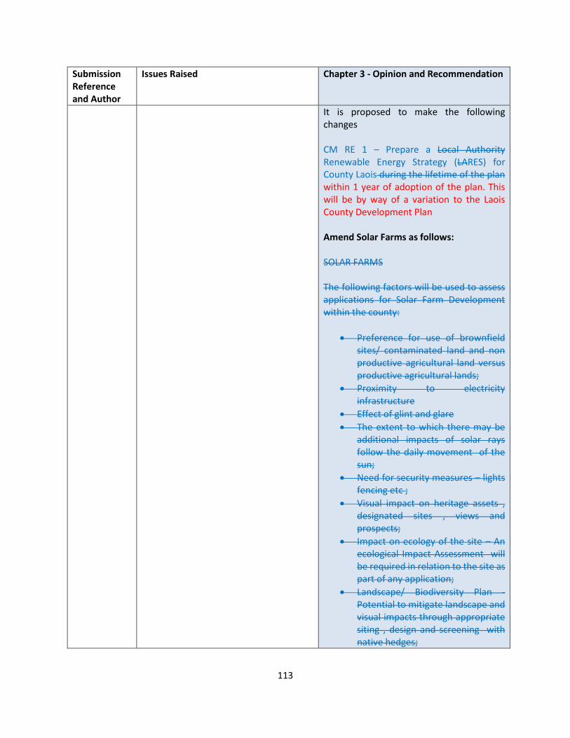
113
Submission Reference and Author
Issues Raised Chapter 3 - Opinion and Recommendation
It is proposed to make the following changes CM RE 1 – Prepare a Local Authority Renewable Energy Strategy (LARES) for County Laois during the lifetime of the plan within 1 year of adoption of the plan. This will be by way of a variation to the Laois County Development Plan Amend Solar Farms as follows: SOLAR FARMS The following factors will be used to assess applications for Solar Farm Development within the county:
• Preference for use of brownfield sites/ contaminated land and non productive agricultural land versus productive agricultural lands;
• Proximity to electricity infrastructure
• Effect of glint and glare
• The extent to which there may be additional impacts of solar rays follow the daily movement of the sun;
• Need for security measures – lights fencing etc ;
• Visual impact on heritage assets , designated sites , views and prospects;
• Impact on ecology of the site – An ecological Impact Assessment will be required in relation to the site as part of any application;
• Landscape/ Biodiversity Plan - Potential to mitigate landscape and visual impacts through appropriate siting , design and screening with native hedges;

114
Submission Reference and Author
Issues Raised Chapter 3 - Opinion and Recommendation
• The cumulate impacts of the propose with other renewable energy installations in the area;
• An appraisal of the existing roads infrastructure and the potential impact of the proposed development including - Traffic numbers and movements to and from site during construction, operation and decommissioning phases of the proposal shall be undertaken;
• Proposals to adequately deal with drainage, surface water runoff flooding;
• Preparation of a Construction Environmental Management Plan;
• Restoration plan SOLAR FARMS The following factors will be used to assess applications for Solar Farm Development within the county: (i) Site Selection: a. Preference for use of brownfield
sites/ contaminated land and non productive agricultural land versus productive agricultural lands;
b. Proximity to electricity infrastructure
(ii) Assessment of Impacts a. Effect of glint and glare; b. Visual impact on heritage and
landscape assets, designated sites, views and prospects;
c. The extent of additional impacts of solar rays follow the daily movement of the sun;
d. Ecology including biodiversity, flora and fauna

115
Submission Reference and Author
Issues Raised Chapter 3 - Opinion and Recommendation
e. Cumulative impacts of the proposal with other renewable energy installations in the area;
f. Traffic impact on road infrastructure during all phases of development (construction, operation and decommissioning)
g. Drainage, surface water runoff, flooding
(iii) As a minimum the following will be
required to be submitted in support of a planning application:
a. Drawings, including those addressing all drainage matters
b. Landscape/ Biodiversity Plan; c. Construction Environmental
Management Plan; and d. Decommisioning / Restoration
plan. However, it is advised this to be agreed with the Planning Authority through pre-planning consultation.
LS-C9-DCDP-110 Irish Green Building Council
However, there is some concern that the plan does not deliver sufficient action to manage the growth of housing and that the plan does not fully embed the principle of the need to decarbonise society through concerted action within planning policy at county level. In this regard the IGBC has included some new objectives and policy headings in the following document text and suggests also that the following could strengthen the document overall:
• While the Council is to be commended for its recognition of the importance of the application of the concept of the Circular Economy to Waste Management, in this regard the Council should consider re-wording the heading ‘Waste Management’ (10.4.1) and replacing
OPINION Submission noted. 10.4.1 There is sufficient reference within 10.4.1 to “Circular Economy”, and the heading of Waste Management is considered to be clear. There is no need for a standalone chapter Net Zero / Sustainable Construction / Carbon Assessment / DM Standards Section 3.7 and policies EEB1 to EEB 5 of the Draft Plan demonstrates how the plan seeks to promote the increase in nearly Zero Energy Buildings (nZEB).

116
Submission Reference and Author
Issues Raised Chapter 3 - Opinion and Recommendation
it with ‘Circular Economy’ so there is a shift in understanding and emphasis moving from waste to circularity or consider the inclusion of a standalone Chapter on Circularity, waste reuse as a concept from cradle to cradle, which is the linchpin of decarbonisation.
• Public bodies as local authorities must lead by example. A way to do so is to commit to Net Zero for all buildings built by or on behalf of the Local Authority. This would require moving beyond NZEB. This is particularly important as the EU moves more towards measuring carbon over energy in the next number of years.
• nZEB is not the end game, a more holistic approach to addressing climate change in the Built Environment is needed. For instance by generalising the use of Life Cycle Analysis in public procurement. Besides reducing CO2 emissions, this could support the development of a biomaterials (including timber) industry in Ireland.
• The plan should make reference to more holistic assessment methodologies on sustainable construction - such as Home Performance Index (HPI) rather than just the BER and promote sustainable construction.
• Include a strategy on Whole Life Carbon assessment of buildings. This can be supported through Green Procurement.
• The plan needs to avoid the promotion and continuance of carbon intensive lifestyles. Transport emissions will never be resolved without action at local level. In the
Avoid the promotion and continuance of carbon intensive lifestyles The Draft Plan has been prepared in accordance with the NPF and RSES, which seeks to deliver a more compact form of development. Chapter 10 and Policy Objective ES 39 demonstrates the Council’s commitment to promotion of sustainable means of travel and encourage modal change. Policy TRANS 34 states that all developments should provide facilities for the charging of battery-operated cars at a rate of up to 10% of the total car parking spaces. In addition, TRANS 35 requires new residential development should accommodate at least one car parking space equipped with an EV charging points for every ten car parking space Mobility Management TRANS 26 requires that TTA includes mobility management, which will be undertaken in accordance with the Traffic and Transport Assessment Guidelines 2014. This is sufficient reference. Retrofitting Action Area 2 (Built Environment) includes a Local County Target to carry out retrofit projects for public housing estates, with 160 units by the end of 2021. In addition EEB4 refers that guidelines and standards to assist property owners in restrict of energy retrofitting and planning considerations will be developed by the Council. However, it is agreed that AA 2 could go further, and commitment to further retro fitting beyond 2021 within the lifetime of the plan is agreed.
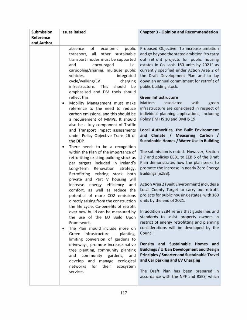
117
Submission Reference and Author
Issues Raised Chapter 3 - Opinion and Recommendation
absence of economic public transport, all other sustainable transport modes must be supported and encouraged i.e. carpooling/sharing, multiuse public vehicles, integrated cycle/walking/EV charging infrastructure. This should be emphasised and DM tools should reflect this.
• Mobility Management must make reference to the need to reduce carbon emissions, and this should be a requirement of MMPs. It should also be a key component of Traffic and Transport Impact assessments under Policy Objective Trans 26 of the DDP
• There needs to be a recognition within the Plan of the importance of retrofitting existing building stock as per targets included in Ireland’s Long-Term Renovation Strategy. Retrofitting existing stock both private and Part V housing will increase energy efficiency and comfort, as well as reduce the potential of more CO2 emissions directly arising from the construction the life cycle. Co-benefits of retrofit over new build can be measured by the use of the EU Build Upon Framework.
• The Plan should include more on Green Infrastructure – planting, limiting conversion of gardens to driveways, promote increase native tree planting, community planting and community gardens, and develop and manage ecological networks for their ecosystem services
Proposed Objective: To increase ambition and go beyond the stated ambition “to carry out retrofit projects for public housing estates in Co Laois 160 units by 2021” as currently specified under Action Area 2 of the Draft Development Plan and to lay down an annual commitment for retrofit of public building stock. Green Infrastructure Matters associated with green infrastructure are considered in respect of individual planning applications, including Policy DM HS 10 and DMHS 19. Local Authorities, the Built Environment and Climate / Measuring Carbon / Sustainable Homes / Water Use in Building The submission is noted. However, Section 3.7 and policies EEB1 to EEB 5 of the Draft Plan demonstrates how the plan seeks to promote the increase in nearly Zero Energy Buildings (nZEB). Action Area 2 (Built Environment) includes a Local County Target to carry out retrofit projects for public housing estates, with 160 units by the end of 2021. In addition EEB4 refers that guidelines and standards to assist property owners in restrict of energy retrofitting and planning considerations will be developed by the Council. Density and Sustainable Homes and Buildings / Urban Development and Design Principles / Smarter and Sustainable Travel and Car parking and EV Charging The Draft Plan has been prepared in accordance with the NPF and RSES, which

118
Submission Reference and Author
Issues Raised Chapter 3 - Opinion and Recommendation
Submission also provides a synopsis of: Local Authorities, the Built Environment and Climate Commitment to build 26,500 by 2030. Buildings are directly responsible for 40% of energy use in Ireland. The choice of building materials in construction influences the embodied carbon of the construction sector as a contribution to Ireland’s overall emissions intensity. The density and typology of housing has a direct impact on the energy efficiency of individual units and on transport emissions. The Council should begin to consider whole life carbon as a key metric as a measure for the assessment of the performance of buildings. This should be integrated into planning consent and procurement policy. Proposed Objective: It will the objective of the Council to evaluate the Whole Life Carbon emissions of buildings that are procured by the Council. Proposed Objective: It is the objective of the Council to review the metrics by which it measures the performance of all public buildings in the Council’s ownership, lease or rent. DM Standards The Council has the opportunity now to review its development management standards to convey and act upon a commitment to delivering on zero carbon. Proposed Objective: The Council will within one year of the plan include a new development control standard to account for net zero, by attaching a condition to permission within specifically zoned sites or areas within the Plan to require carbon measurement.
seeks to deliver a more compact form of development. NPF National Policy Objectives 3a, b and c, which target infill and brownfield development within the existing built footprint of urban settlements, in particular the objective to target at least 30% of all new homes in settlements other than the five Cities and their suburbs, within their existing built-up footprints. Section 2.8 of the Draft Plan states that in accordance with the principles of compact Growth, at least 30% of housing within settlements is to be within the existing built up footprint area in conjunction with sequential development of settlements. Reuse and renovate, Discourage Demolition Section 4.6.4 refers that permission for demolition will only be considered where it is demonstrated that a vernacular dwelling is not reasonably capable of being made structurally sound or otherwise improved. Policy DM RH 3 states that a report from a suitably qualified competent person shall be submitted to verify that the dwelling is habitable but that replacement of the dwelling is the most sustainable option The matter of the demolition is also referred to in ES12. The proposal for the case of demolition against the full Whole Life Carbon calculation is supported, to ensure that this is the most sustainable option. Bicycle Parking The minimum provision of bicycle parking is set out in DM TRANS 11, which is considered
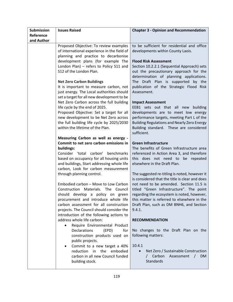
119
Submission Reference and Author
Issues Raised Chapter 3 - Opinion and Recommendation
Proposed Objective: To review examples of international experience in the field of planning and practice to decarbonise development plans (for example The London Plan) – refers to Policy S11 and S12 of the London Plan. Net Zero Carbon Buildings It is important to measure carbon, not just energy. The Local authorities should set a target for all new development to be Net Zero Carbon across the full building life cycle by the end of 2025. Proposed Objective: Set a target for all new development to be Net Zero across the full building life cycle by 2025/2030 within the lifetime of the Plan. Measuring Carbon as well as energy - Commit to net zero carbon emissions in buildings: Consider ‘total carbon’ benchmarks based on occupancy for all housing units and buildings, Start addressing whole life carbon, Look for carbon measurement through planning control. Embodied carbon – Move to Low Carbon Construction Materials. The Council should develop a policy on green procurement and introduce whole life carbon assessment for all construction projects. The Council should consider the introduction of the following actions to address whole life carbon:
• Require Environmental Product Declarations (EPD) for construction products used on public projects.
• Commit to a new target a 40% reduction in the embodied carbon in all new Council funded building stock.
to be sufficient for residential and office developments within County Laois. Flood Risk Assessment Section 10.2.2.1 (Sequential Approach) sets out the precautionary approach for the determination of planning applications. The Draft Plan is supported by the publication of the Strategic Flood Risk Assessment. Impact Assessment EEB1 sets out that all new building developments are to meet low energy performance targets, meeting Part L of the Building Regulations and Nearly Zero Energy Building standard. These are considered sufficient. Green Infrastructure The benefits of Green Infrastructure area referenced in Action Area 3, and therefore this does not need to be repeated elsewhere in the Draft Plan. The suggested re-titling is noted, however it is considered that the title is clear and does not need to be amended. Section 11.5 is titled “Green Infrastructure”. The point regarding the ecosystem is noted, however, this matter is referred to elsewhere in the Draft Plan, such as DM BNH6, and Section 9.4.1. RECOMMENDATION No changes to the Draft Plan on the following matters: 10.4.1
• Net Zero / Sustainable Construction / Carbon Assessment / DM Standards
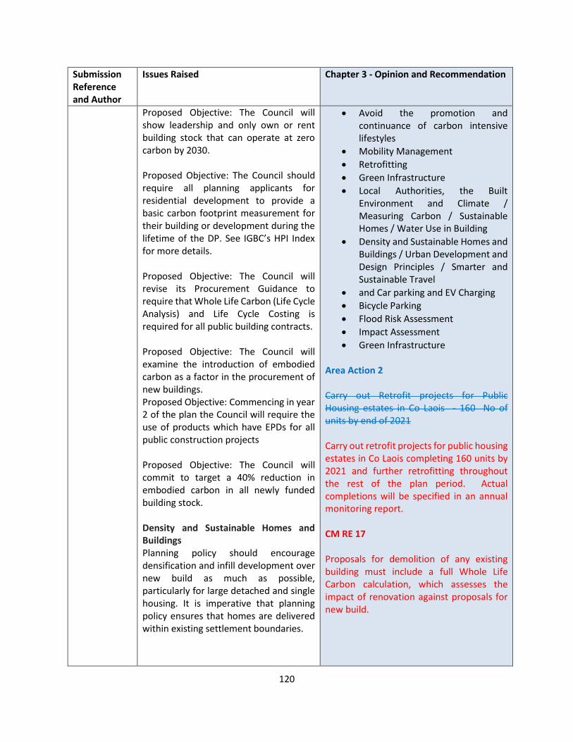
120
Submission Reference and Author
Issues Raised Chapter 3 - Opinion and Recommendation
Proposed Objective: The Council will show leadership and only own or rent building stock that can operate at zero carbon by 2030. Proposed Objective: The Council should require all planning applicants for residential development to provide a basic carbon footprint measurement for their building or development during the lifetime of the DP. See IGBC’s HPI Index for more details. Proposed Objective: The Council will revise its Procurement Guidance to require that Whole Life Carbon (Life Cycle Analysis) and Life Cycle Costing is required for all public building contracts. Proposed Objective: The Council will examine the introduction of embodied carbon as a factor in the procurement of new buildings. Proposed Objective: Commencing in year 2 of the plan the Council will require the use of products which have EPDs for all public construction projects Proposed Objective: The Council will commit to target a 40% reduction in embodied carbon in all newly funded building stock. Density and Sustainable Homes and Buildings Planning policy should encourage densification and infill development over new build as much as possible, particularly for large detached and single housing. It is imperative that planning policy ensures that homes are delivered within existing settlement boundaries.
• Avoid the promotion and continuance of carbon intensive lifestyles
• Mobility Management
• Retrofitting
• Green Infrastructure
• Local Authorities, the Built Environment and Climate / Measuring Carbon / Sustainable Homes / Water Use in Building
• Density and Sustainable Homes and Buildings / Urban Development and Design Principles / Smarter and Sustainable Travel
• and Car parking and EV Charging
• Bicycle Parking
• Flood Risk Assessment
• Impact Assessment
• Green Infrastructure Area Action 2 Carry out Retrofit projects for Public Housing estates in Co Laois - 160 No of units by end of 2021 Carry out retrofit projects for public housing estates in Co Laois completing 160 units by 2021 and further retrofitting throughout the rest of the plan period. Actual completions will be specified in an annual monitoring report. CM RE 17 Proposals for demolition of any existing building must include a full Whole Life Carbon calculation, which assesses the impact of renovation against proposals for new build.
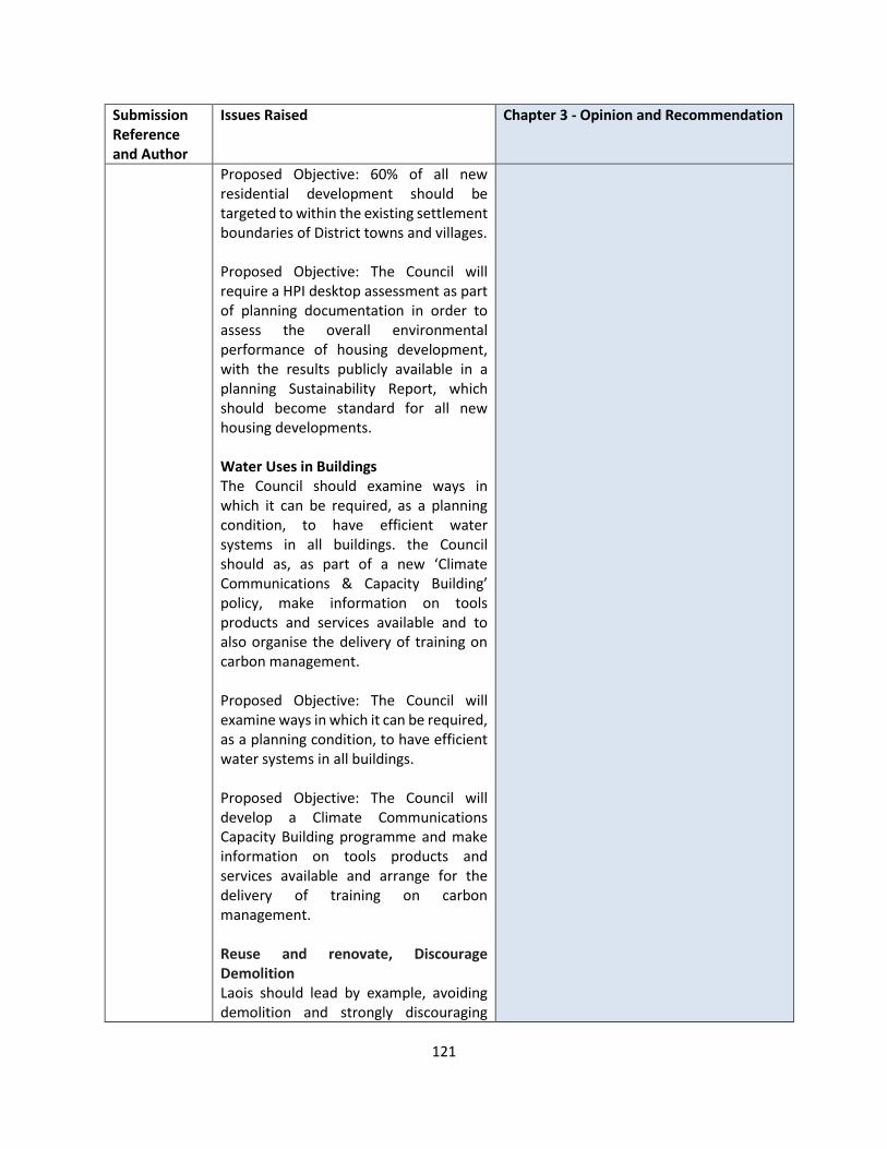
121
Submission Reference and Author
Issues Raised Chapter 3 - Opinion and Recommendation
Proposed Objective: 60% of all new residential development should be targeted to within the existing settlement boundaries of District towns and villages. Proposed Objective: The Council will require a HPI desktop assessment as part of planning documentation in order to assess the overall environmental performance of housing development, with the results publicly available in a planning Sustainability Report, which should become standard for all new housing developments. Water Uses in Buildings The Council should examine ways in which it can be required, as a planning condition, to have efficient water systems in all buildings. the Council should as, as part of a new ‘Climate Communications & Capacity Building’ policy, make information on tools products and services available and to also organise the delivery of training on carbon management. Proposed Objective: The Council will examine ways in which it can be required, as a planning condition, to have efficient water systems in all buildings. Proposed Objective: The Council will develop a Climate Communications Capacity Building programme and make information on tools products and services available and arrange for the delivery of training on carbon management. Reuse and renovate, Discourage Demolition Laois should lead by example, avoiding demolition and strongly discouraging
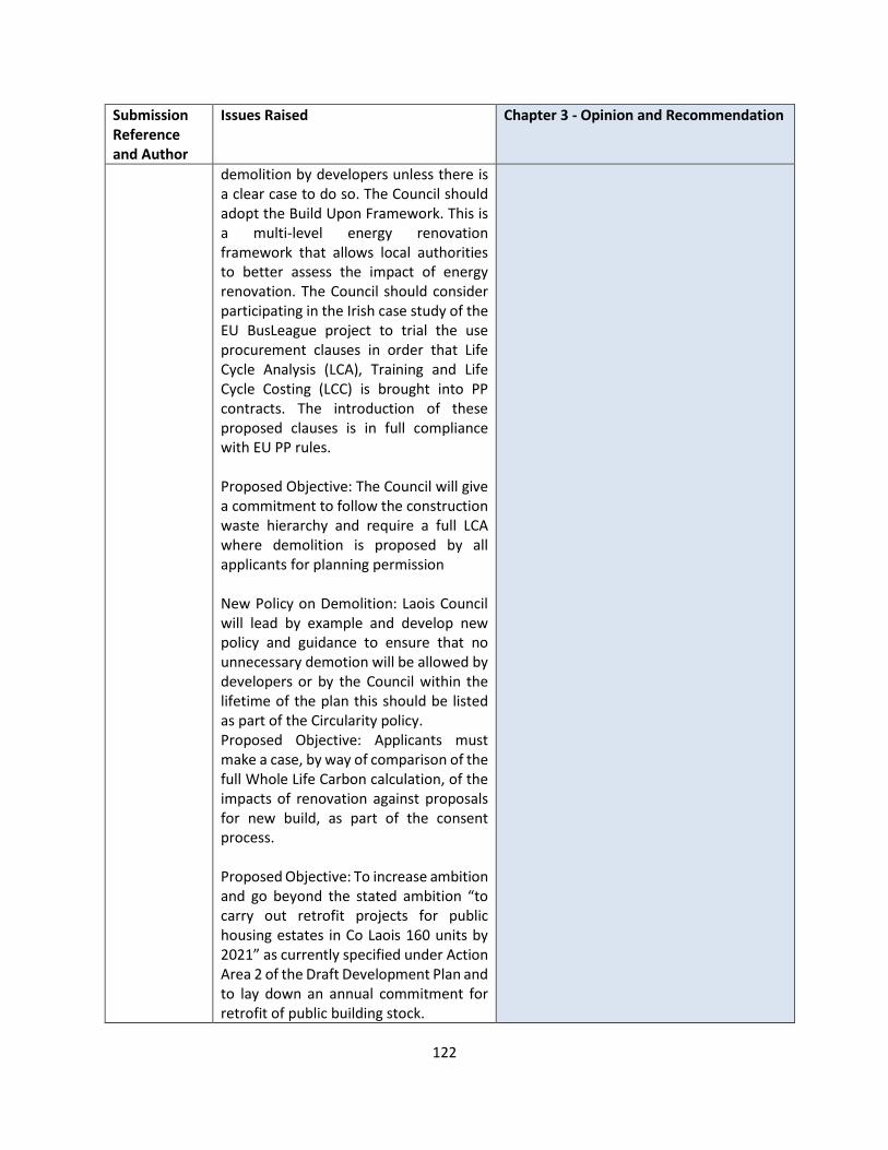
122
Submission Reference and Author
Issues Raised Chapter 3 - Opinion and Recommendation
demolition by developers unless there is a clear case to do so. The Council should adopt the Build Upon Framework. This is a multi-level energy renovation framework that allows local authorities to better assess the impact of energy renovation. The Council should consider participating in the Irish case study of the EU BusLeague project to trial the use procurement clauses in order that Life Cycle Analysis (LCA), Training and Life Cycle Costing (LCC) is brought into PP contracts. The introduction of these proposed clauses is in full compliance with EU PP rules. Proposed Objective: The Council will give a commitment to follow the construction waste hierarchy and require a full LCA where demolition is proposed by all applicants for planning permission New Policy on Demolition: Laois Council will lead by example and develop new policy and guidance to ensure that no unnecessary demotion will be allowed by developers or by the Council within the lifetime of the plan this should be listed as part of the Circularity policy. Proposed Objective: Applicants must make a case, by way of comparison of the full Whole Life Carbon calculation, of the impacts of renovation against proposals for new build, as part of the consent process. Proposed Objective: To increase ambition and go beyond the stated ambition “to carry out retrofit projects for public housing estates in Co Laois 160 units by 2021” as currently specified under Action Area 2 of the Draft Development Plan and to lay down an annual commitment for retrofit of public building stock.
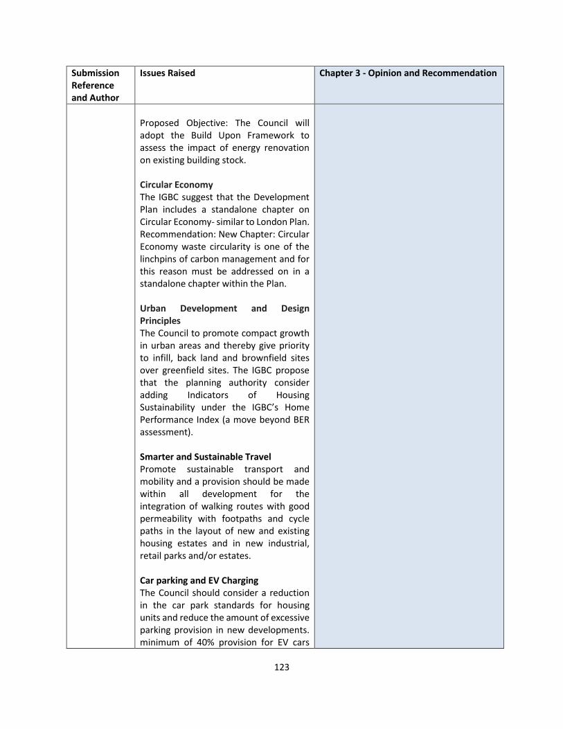
123
Submission Reference and Author
Issues Raised Chapter 3 - Opinion and Recommendation
Proposed Objective: The Council will adopt the Build Upon Framework to assess the impact of energy renovation on existing building stock. Circular Economy The IGBC suggest that the Development Plan includes a standalone chapter on Circular Economy- similar to London Plan. Recommendation: New Chapter: Circular Economy waste circularity is one of the linchpins of carbon management and for this reason must be addressed on in a standalone chapter within the Plan. Urban Development and Design Principles The Council to promote compact growth in urban areas and thereby give priority to infill, back land and brownfield sites over greenfield sites. The IGBC propose that the planning authority consider adding Indicators of Housing Sustainability under the IGBC’s Home Performance Index (a move beyond BER assessment). Smarter and Sustainable Travel Promote sustainable transport and mobility and a provision should be made within all development for the integration of walking routes with good permeability with footpaths and cycle paths in the layout of new and existing housing estates and in new industrial, retail parks and/or estates. Car parking and EV Charging The Council should consider a reduction in the car park standards for housing units and reduce the amount of excessive parking provision in new developments. minimum of 40% provision for EV cars
124
Submission Reference and Author
Issues Raised Chapter 3 - Opinion and Recommendation
with connection points should be standard within the DP not 10% of total car parking as currently specified. New developments will require both EV cycle and car charge points, as standard. Bicycle Parking Bicycle Parking standards should be revised upward for Offices, Schools and Shops with a minimum of 50% of employee numbers or 2 bike spaces for every car space for Offices, which every is the greater, as standard. Schools and shops should, as a priority, also have higher standards – increasing the standard to 50% pupil registration number and same for teacher/employee bike parking. Shower standards also be included for any new school/office development to encourage cycling and walking. Mobility Management Mobility Management is one of the key tools that can be used to reduce transport related emissions. Mobility Management Plans (MMPs) should therefore estimate the emissions expected in the new developments. Flood Risk Assessment The Council should therefore adopt a precautionary approach, alongside its sequential approach, to giving development consent in areas subject to flood risk. The Council could follow the example of Kilkenny DDP which includes the following guidance on the consent process for the location of development in flood risk areas. s. It requires that any area within or adjoining a flood zone, or flood risk area, a site specific Flood Risk Assessment appropriate to the type and scale of the development, should be

125
Submission Reference and Author
Issues Raised Chapter 3 - Opinion and Recommendation
undertaken in accordance with the Flood Risk Assessment Guidelines. Built Environment and Embodied Energy The submission states there is no reference to embodied energy in the DDP (??) and Development Management provisions the Council should review the latter guidance and lead by going beyond nZEB for new build and focussing on renovation over new build to begin to take account of the carbon already used up or embodied in existing buildings. It should also look at international examples of how to introduce measures so that the planning process can lead to the measurement and management of carbon emissions throughout the whole life cycle of buildings from sourcing of materials, through to construction. Impact Assessment The Council should include Home Performance Index (HPI) in the list of assessments that may be required and therefore provide that a HPI desktop assessment is required as part of planning documentation in order to assess the overall environmental performance of housing development. Reuse, Renovate and Rebuild not Demolish Housing At “least 30% of all new homes will be targeted in settlements within their existing built-up footprints”. This standard could be revised upward as it is already at variance with the policy of the NPF. IGBC is of the view that the limit to 40% is even too low, given Ireland’s transport emissions is linked to an overreliance on private transport. The IGBC suggests that the Council should also introduce a sustainable accessibility

126
Submission Reference and Author
Issues Raised Chapter 3 - Opinion and Recommendation
index and a minimum benchmark for all homes and buildings as a prerequisite for planning permission. The Irish Green Building Council provides such an index in the Home Performance Index-Sustainable Location criteria – Technical manual. Green Infrastructure Policy CA ST1 of the DDP should be enhanced to signify the vital role that Green Infrastructure plays in mitigating the impact of climate change (heating and cooling) and the vital ecosystem services it provides to the society (regulation of water quality, carbon sequestration, air purification, biodiversity, pollination, amenity etc…). It is also suggested that the Trees, Woodlands and Hedgerows Development Management Standards section be re-titled to “Green infrastructure” Development Management Standards (DM BNH4-5) to reflect their importance as key infrastructure for climate control, biodiversity and ecosystem services provision to members of the public and all readers of the Plan. In addition it is suggested that this section should make reference to the ecosystem approach to decision making – so that all development can consider how it can enhance or impact on the ecosystem services that the GI provides.
LS-C9-DCDP-113 RWE Renewable Ireland
Submission relates to the following:
National Policy
Laois County Council is encouraged to give careful consideration to identify adequate quantities of lands under the county development plan’s renewable
OPINION National Policy / Wind Energy The most up-to-date Government guidance on this matter remain the ‘Wind Energy Developments Guidelines for Planning Authorities, 2006’.

127
Submission Reference and Author
Issues Raised Chapter 3 - Opinion and Recommendation
area designations to meet the counties future and growing energy demand. This would require careful balancing of local, environment and the ever growing energy needs of the county and local communities, such so as, so as not to constrain areas with renewable energy potential, particularly for wind generation which would be needed by future generations. The council is encouraged, to promote the idea of integrating and diversifying local agricultural activities into “green energy farming”, through partnership with renewable energy developers and directly through and “Community Shared Ownership Schemes” bring direct income, jobs and investment benefits into the local community that could last for generations into the future.
Wind Energy In Ireland
70% of electricity generation must be by renewable by 2030. The country has be world leaders at incorporating onshore wind into the national grid and Laois County should equally repeat the benefits of this innovation to ensure its continued economic growth, to sustain local communities where traditional agricultural activities are rapidly declining leading to a loss of rural populations. That is why it is critical that the new Laois County Development Plan and Renewable Energy Strategy provides every opportunity for the development of wind energy.
Climate Change and Energy
Support CM RE 1, 3, 4, 5 and 6 and compliance with current wind energy development guidelines and future
With regards to Local Authority Renewable Targets, in December 2019, the DoHPLG published a draft Revised Wind Energy Development Guidelines, for which the responses will inform the final Guidelines. To date, given that the Department has not finalised its review of the current guidelines, the guidelines remain in full effect, and the Planning Authority must be consistent with the standards set out in same. SPPR 1 of the Draft Wind Energy Guidelines stated the following: 1) Ensure that overall national policy on renewable energy as contained in documents such as the Government’s ‘National Energy and Climate Plan 2021-2030 ’, and the ‘Climate Action Plan 2019’, is acknowledged and documented in the relevant development plan or local area plan; 2) Indicate how the implementation of the relevant development plan or local area plan over its effective period will contribute to realising overall national targets on renewable energy and climate change mitigation, and in particular wind energy production and the potential wind energy resource (in megawatts) taking into account the ‘sieve mapping approach’ identified in Table 1 below, in particular the potential contribution of the areas identified as ‘acceptable in principle’ and ‘open for consideration’; and 3) Demonstrate detailed compliance with section 3.4 of these guidelines. Therefore, once the revised Wind Energy Guidelines are published the Planning Authority will consider the contents of those documents, and if it is necessary to publish Local Renewable Energy Targets, this could be undertaken as a variation of the CDP.

128
Submission Reference and Author
Issues Raised Chapter 3 - Opinion and Recommendation
iterations. In relation to CM RE 7 - RWE has undertaking a detailed planning, environmental and technical operation constraints assessment for wind farms across the whole county area, taking account of the development plan, of environmental zonings and national environmental designations, wind speed, road access and availability of electrical transmission connections and importantly taking account of the distribution of rural one off houses and maintaining the “4 times tip height set back from dwellings” buffer from houses and maintaining significant buffers from other sensitive constraints.
However, it will be premature to publish Local Renewable Target’s prior to the publication of such a document. The Planning Authority has undertaken a Carbon Footprint Study report for Portlaoise, which is designed to provide Laois County Council with a detailed assessment of its existing Carbon footprint and the potential to reduce its impact through identifying suitable reduction opportunities. https://laois.ie/wp-content/uploads/Portlaoise-County-Council-Final-report_vsent.pdf An assessment of Portlaoise’s carbon footprint was undertaken, which established that around 4 tons of Scope 1 and 2 are emitted per captia. Around 70% are due to energy related activities, whilst transport of passengers and goods is responsible for 30%., The SEAI Energy in Ireland report 2019 showed that in 2018, >66% of electricity is still generated by fossil fuels, mainly natural gas. It is expected that going forward, the transition of the national electricity generation mix to more renewables would help reduce the carbon footprint of Portlaoise. To reduce the Carbon Footprint for Portlaoise, a detailed assessment of Renewable Potential in the region was conducted. Both wind and solar potential was assessed for multiple historical weather patterns (2012, 2015, 2017). The assessment included development of scenarios for onshore wind farms
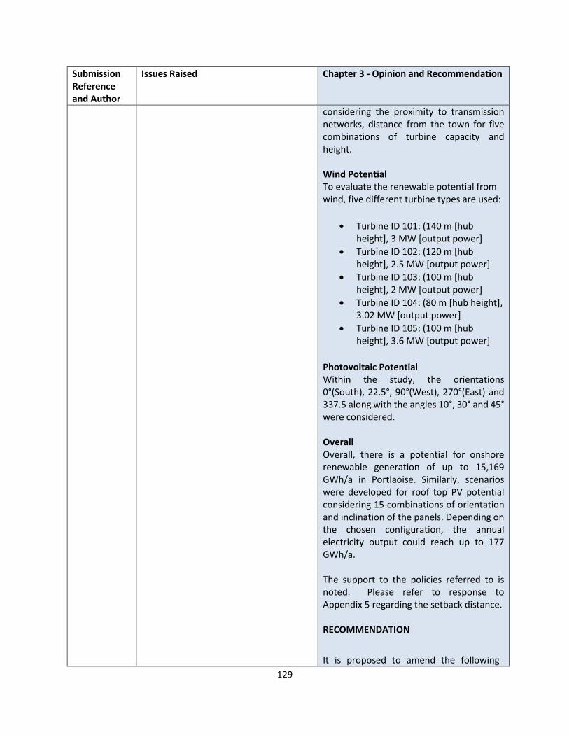
129
Submission Reference and Author
Issues Raised Chapter 3 - Opinion and Recommendation
considering the proximity to transmission networks, distance from the town for five combinations of turbine capacity and height. Wind Potential To evaluate the renewable potential from wind, five different turbine types are used:
• Turbine ID 101: (140 m [hub height], 3 MW [output power]
• Turbine ID 102: (120 m [hub height], 2.5 MW [output power]
• Turbine ID 103: (100 m [hub height], 2 MW [output power]
• Turbine ID 104: (80 m [hub height], 3.02 MW [output power]
• Turbine ID 105: (100 m [hub height], 3.6 MW [output power]
Photovoltaic Potential Within the study, the orientations 0°(South), 22.5°, 90°(West), 270°(East) and 337.5 along with the angles 10°, 30° and 45° were considered. Overall Overall, there is a potential for onshore renewable generation of up to 15,169 GWh/a in Portlaoise. Similarly, scenarios were developed for roof top PV potential considering 15 combinations of orientation and inclination of the panels. Depending on the chosen configuration, the annual electricity output could reach up to 177 GWh/a. The support to the policies referred to is noted. Please refer to response to Appendix 5 regarding the setback distance. RECOMMENDATION
It is proposed to amend the following
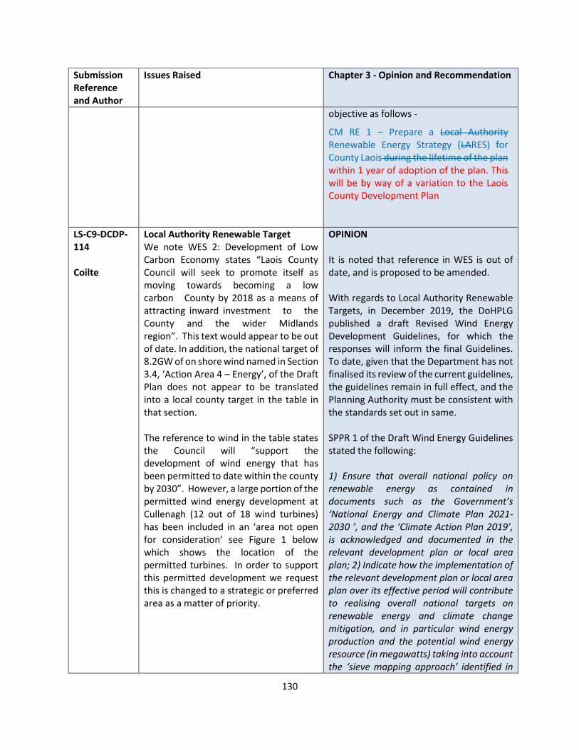
130
Submission Reference and Author
Issues Raised Chapter 3 - Opinion and Recommendation
objective as follows -
CM RE 1 – Prepare a Local Authority Renewable Energy Strategy (LARES) for County Laois during the lifetime of the plan within 1 year of adoption of the plan. This will be by way of a variation to the Laois County Development Plan
LS-C9-DCDP-114 Coilte
Local Authority Renewable Target We note WES 2: Development of Low Carbon Economy states “Laois County Council will seek to promote itself as moving towards becoming a low carbon County by 2018 as a means of attracting inward investment to the County and the wider Midlands region”. This text would appear to be out of date. In addition, the national target of 8.2GW of on shore wind named in Section 3.4, ‘Action Area 4 – Energy’, of the Draft Plan does not appear to be translated into a local county target in the table in that section. The reference to wind in the table states the Council will “support the development of wind energy that has been permitted to date within the county by 2030”. However, a large portion of the permitted wind energy development at Cullenagh (12 out of 18 wind turbines) has been included in an ‘area not open for consideration’ see Figure 1 below which shows the location of the permitted turbines. In order to support this permitted development we request this is changed to a strategic or preferred area as a matter of priority.
OPINION It is noted that reference in WES is out of date, and is proposed to be amended. With regards to Local Authority Renewable Targets, in December 2019, the DoHPLG published a draft Revised Wind Energy Development Guidelines, for which the responses will inform the final Guidelines. To date, given that the Department has not finalised its review of the current guidelines, the guidelines remain in full effect, and the Planning Authority must be consistent with the standards set out in same. SPPR 1 of the Draft Wind Energy Guidelines stated the following: 1) Ensure that overall national policy on renewable energy as contained in documents such as the Government’s ‘National Energy and Climate Plan 2021-2030 ’, and the ‘Climate Action Plan 2019’, is acknowledged and documented in the relevant development plan or local area plan; 2) Indicate how the implementation of the relevant development plan or local area plan over its effective period will contribute to realising overall national targets on renewable energy and climate change mitigation, and in particular wind energy production and the potential wind energy resource (in megawatts) taking into account the ‘sieve mapping approach’ identified in

131
Submission Reference and Author
Issues Raised Chapter 3 - Opinion and Recommendation
Table 1 below, in particular the potential contribution of the areas identified as ‘acceptable in principle’ and ‘open for consideration’; and 3) Demonstrate detailed compliance with section 3.4 of these guidelines. Therefore, once the revised Wind Energy Guidelines are published the Planning Authority will consider the contents of those documents, and if it is necessary to publish Local Renewable Energy Targets, this could be undertaken as a variation of the CDP.
It is essential that all forms of renewable energy potential is considered in the context of delivery of national renewable energy targets . To this end it is proposed to amend the following objective
CM RE 1 – Prepare a Local Authority Renewable Energy Strategy (LARES) for County Laois during the lifetime of the plan within 1 year of adoption of the plan. This will be by way of a variation to the Laois County Development Plan. With regards to the request for the site referred to change to either a strategic or preferred area we refer to Section 4 of Appendix 5 which details the methodology used by the Planning Authority to arrive at the four area classifications. The methodology has been primarily informed by a number of considerations including the amount of existing and approved capacity in the county to date, the potential of other renewable energy options including solar, available wind data and transmission network, settlement patterns and population densities of the county as well as the relevant environmental, tourism promotion and landscape

132
Submission Reference and Author
Issues Raised Chapter 3 - Opinion and Recommendation
policies in the DRAFT Laois County Development Plan 2021-2027. Section 5 of Appendix 5 includes the results of that assessment, concluding that:
• Strategic Areas - It is considered that there are no such areas in County Laois County Council
• Areas Not Open for Consideration – These are areas identified as particularly unsuitable for windfarm development. This category is used for areas which due to their scenic, ecological or tourism values are unable to accommodate development of this type
With reference to the development, this is a permitted development and the developer can implement and complete their development under the respective planning permission. RECOMMENDATION Amend WES 2 as follows: WES 2: Development of Low Carbon Economy Laois County Council will seek to promote itself as moving towards becoming a low carbon County by 2018 2027 as a means of attracting inward investment to the County and the wider Midlands region.
It is proposed to amend the following policy objective as follows -
CM RE 1 – Prepare a Local Authority Renewable Energy Strategy (LARES) for County Laois during the lifetime of the plan within 1 year of adoption of the plan. This

133
Submission Reference and Author
Issues Raised Chapter 3 - Opinion and Recommendation
will be by way of a variation to the Laois County Development Plan No other changes are considered necessary at this stage.
LS-C9-DCDP-121 Keep Ireland Open
Chapter 3 3.5 RENEWABLE ENERGY We submit that you should add GENERAL to the Title to reflect that these provisions cover all aspects of the specific types of renewable energy. We submit that you should include RENEWABLE ENERGY OBJECTIVES 1 Developments must be appropriately/suitably located 2 The development including any ancillary facilitates or buildings, considered individually or taking into account their scale and layout, their incremental/cumulative effect due to other proposals, the degree to which impacts are highly visible over a vast area, their visual impact on scenic landscape as well as local visual impacts, impacts on archaeology, should not create a hazard or nuisance, including the risk land instability and take into account the character and appearance of the surrounding area, the openness and visual amenity of the countryside, landscapes, protected areas such as NHA’s, SPA,s SAC’s and sites of historic or archaeological interest or in proximity to National Monuments. Development will only be permitted where they will not have an adverse impact/negative on the surrounding environment including natural heritage and the protection of amenities and landscapes. Where impacts are inevitable what mitigation features have been taken into account or in the case of European conservation
OPINION Title The submission is noted. The word “general” does not need to be included, as the current title is considered to be sufficient to cover all aspects of renewable energy. Renewable Energy Objectives The objectives are noted, however they are not considered to be necessary, as they repeat Climate Mitigation Objectives CM RE 4 to CM RE 13 (inclusive). The point made on the Wind Energy Objectives, which can be amended with CM RE 5 and CM RE 6. Wind Energy The issues raised in (ix) to (xiii) are already reflected within DM RE2, whilst xiv is addressed in CM RE 7. Solar Power The submission for additional DM standards are noted for DM RE 1, with some points being able to be brought within the recommended revised wording. Hydro Energy We agree a DM standard should be included for Hydro Energy, but this should not be restricted to just impacts on public rights of way.
134
Submission Reference and Author
Issues Raised Chapter 3 - Opinion and Recommendation
sites, facilities can only be accepted if they comply with Art 6 of the Habitats Directive We submit that you include Development Management Standards for Renewable Energy Installations In assessing development proposals the Council will take into account/take cognisance of public access to the countryside and the impact on the landscape, public rights of way and walking routes, protected or designated areas – NHAs, SPA’s, national monuments and mitigation features where impacts are inevitable We submit that you should include WIND ENERGY OBJECTIVES: 1 Following the review of the DECLG’s Wind Energy Development Guidelines, review the Wind Energy Development Strategy and if any amendment thereto is required incorporate it into the Plan by way of a variation. 2 Identify existing public rights of way and established walking routes and maintain and preserve them free from development We submit that you should include additional DMs: 1 (ix) Sensitivity of the landscape and adjoining landscapes (x) Scale, size and layout of the project, any cumulative effects due to other projects and the degree to which impacts are highly visible over extensive areas (xi) Visible impact on protected views and prospects and designated scenic landscapes and local visual impacts (xii) Impact on nature conservation and archaeology
Non Renewable Energy NRE 1 The final sentence is located correctly within this policy and does need to be relocated to NRE 4. Additional Policy Objectives / DM Standards The submission is noted, however the issues raised are already addressed within NRE3, NRE 4 and DM NRE1 sufficiently. RECOMMENDATION Amend Solar Farms as follows: SOLAR FARMS The following factors will be used to assess applications for Solar Farm Development within the county:
• Preference for use of brownfield sites/ contaminated land and non productive agricultural land versus productive agricultural lands;
• Proximity to electricity infrastructure
• Effect of glint and glare
• The extent to which there may be additional impacts of solar rays follow the daily movement of the sun;
• Need for security measures – lights fencing etc ;
• Visual impact on heritage assets , designated sites , views and prospects;
• Impact on ecology of the site – An ecological Impact Assessment will be required in relation to the site as part of any application;
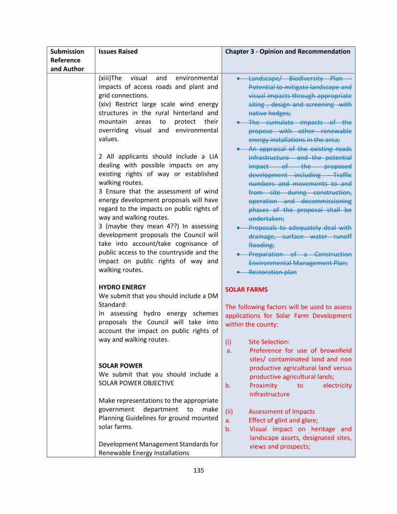
135
Submission Reference and Author
Issues Raised Chapter 3 - Opinion and Recommendation
(xiii)The visual and environmental impacts of access roads and plant and grid connections. (xiv) Restrict large scale wind energy structures in the rural hinterland and mountain areas to protect their overriding visual and environmental values. 2 All applicants should include a LIA dealing with possible impacts on any existing rights of way or established walking routes. 3 Ensure that the assessment of wind energy development proposals will have regard to the impacts on public rights of way and walking routes. 3 (maybe they mean 4??) In assessing development proposals the Council will take into account/take cognisance of public access to the countryside and the impact on public rights of way and walking routes. HYDRO ENERGY We submit that you should include a DM Standard: In assessing hydro energy schemes proposals the Council will take into account the impact on public rights of way and walking routes. SOLAR POWER We submit that you should include a SOLAR POWER OBJECTIVE Make representations to the appropriate government department to make Planning Guidelines for ground mounted solar farms. Development Management Standards for Renewable Energy Installations
• Landscape/ Biodiversity Plan - Potential to mitigate landscape and visual impacts through appropriate siting , design and screening with native hedges;
• The cumulate impacts of the propose with other renewable energy installations in the area;
• An appraisal of the existing roads infrastructure and the potential impact of the proposed development including - Traffic numbers and movements to and from site during construction, operation and decommissioning phases of the proposal shall be undertaken;
• Proposals to adequately deal with drainage, surface water runoff flooding;
• Preparation of a Construction Environmental Management Plan;
• Restoration plan SOLAR FARMS The following factors will be used to assess applications for Solar Farm Development within the county: (i) Site Selection: a. Preference for use of brownfield
sites/ contaminated land and non productive agricultural land versus productive agricultural lands;
b. Proximity to electricity infrastructure
(ii) Assessment of Impacts a. Effect of glint and glare; b. Visual impact on heritage and
landscape assets, designated sites, views and prospects;
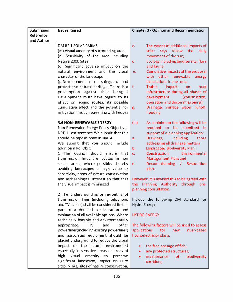
136
Submission Reference and Author
Issues Raised Chapter 3 - Opinion and Recommendation
DM RE 1 SOLAR FARMS (m) Visual amenity of surrounding area (n) Sensitivity of the area including Natura 2000 Sites (o) Significant adverse impact on the natural environment and the visual character of the landscape (p)Development must safeguard and protect the natural heritage. There is a presumption against their being l Development must have regard to its effect on scenic routes, its possible cumulative effect and the potential for mitigation through screening with hedges 3.6 NON- RENEWABLE ENERGY Non-Renewable Energy Policy Objectives NRE 1 Last sentence We submit that this should be repositioned in NRE 4. We submit that you should include additional Pol Objs: 1 The Council should ensure that transmission lines are located in non scenic areas, where possible, thereby avoiding landscapes of high value or sensitivity, areas of nature conservation and archaeological interest so that that the visual impact is minimized 2 The undergrounding or re-routing of transmission lines (including telephone and TV cables) shall be considered first as part of a detailed consideration and evaluation of all available options. Where technically feasible and environmentally appropriate, HV and other powerlines(including existing powerlines) and associated equipment should be placed underground to reduce the visual impact on the natural environment especially in sensitive areas or areas of high visual amenity to preserve significant landscape, impact on Euro sites, NHAs, sites of nature conservation,
c. The extent of additional impacts of solar rays follow the daily movement of the sun;
d. Ecology including biodiversity, flora and fauna
e. Cumulative impacts of the proposal with other renewable energy installations in the area;
f. Traffic impact on road infrastructure during all phases of development (construction, operation and decommissioning)
g. Drainage, surface water runoff, flooding
(iii) As a minimum the following will be
required to be submitted in support of a planning application:
a. Drawings, including those addressing all drainage matters
b. Landscape/ Biodiversity Plan; c. Construction Environmental
Management Plan; and d. Decommisioning / Restoration
plan. However, it is advised this to be agreed with the Planning Authority through pre-planning consultation. Include the following DM standard for Hydro Energy HYDRO ENERGY The following factors will be used to assess applications for new river-based hydroelectricity plans:
• the free passage of fish;
• any protected structures;
• maintenance of biodiversity corridors;
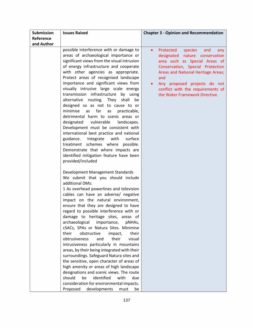
137
Submission Reference and Author
Issues Raised Chapter 3 - Opinion and Recommendation
possible interference with or damage to areas of archaeological importance or significant views from the visual intrusion of energy infrastructure and cooperate with other agencies as appropriate. Protect areas of recognised landscape importance and significant views from visually intrusive large scale energy transmission infrastructure by using alternative routing. They shall be designed so as not to cause to or minimise as far as practicable, detrimental harm to scenic areas or designated vulnerable landscapes. Development must be consistent with international best practice and national guidance. Integrate with surface treatment schemes where possible. Demonstrate that where impacts are identified mitigation feature have been provided/included Development Management Standards We submit that you should include additional DMs: 1 As overhead powerlines and television cables can have an adverse/ negative impact on the natural environment, ensure that they are designed to have regard to possible interference with or damage to heritage sites, areas of archaeological importance, pNHAs, cSACs, SPAs or Natura Sites. Minimise their obstructive impact, their obtrusiveness and their visual intrusiveness particularly in mountains areas, by their being integrated with their surroundings. Safeguard Natura sites and the sensitive, open character of areas of high amenity or areas of high landscape designations and scenic views. The route should be identified with due consideration for environmental impacts. Proposed developments must be
• Protected species and any designated nature conservation area such as Special Areas of Conservation, Special Protection Areas and National Heritage Areas; and
• Any proposed projects do not conflict with the requirements of the Water Framework Directive.
138
Submission Reference and Author
Issues Raised Chapter 3 - Opinion and Recommendation
consistent with international best practice. Where avoidance is not possible full consideration should be given to the undergrounding of the lines. 2 Landscape Impact and Visual Assessments shall be submitted where a proposed development is located in lands in high amenity and mountain areas or have the potential to impact upon county landscape designations and important designated sites. They shall be screened for potential impacts on Natura 2000 sites. 3: In assessing individual proposals the following criteria will be taken into account: Impact on the landscape, public rights of way and walking routes, mitigation factors where impacts are inevitable, protection of NHAs and SACs, areas of scenic importance and the cumulative impacts.
LS-C9-DCDP-134 Statkraft Ireland
The 70% renewable electricity target by 2030 along with the requirement for up to 8.2GW of onshore wind energy is acknowledged, however we note LCC’s limited target ‘to support the development of wind energy that has been permitted to date within the county by 2030’.
We encourage LCC to review this proposal considering the ambitious national targets Ireland has been set for 2030 and continue to facilitate wind energy development in the county and the transition to a low carbon society
It is critical that the Laois CDP 2021-2027 provides every opportunity in facilitating renewable energy development in the county. Support given to CMRE1, CM RE2, CM RE5.
OPINION The Draft Plan has been drafted in accordance with the NPF, RSES and has had regard to the Climate Action Plan 2019. No amendments are considered to be required. See response to the OPR under Section 2.2. With regards to Local Authority Renewable Targets, in December 2019, the DoHPLG published a draft Revised Wind Energy Development Guidelines, for which the responses will inform the final Guidelines. To date, given that the Department has not finalised its review of the current guidelines, the guidelines remain in full effect, and the Planning Authority must be consistent with the standards set out in same.
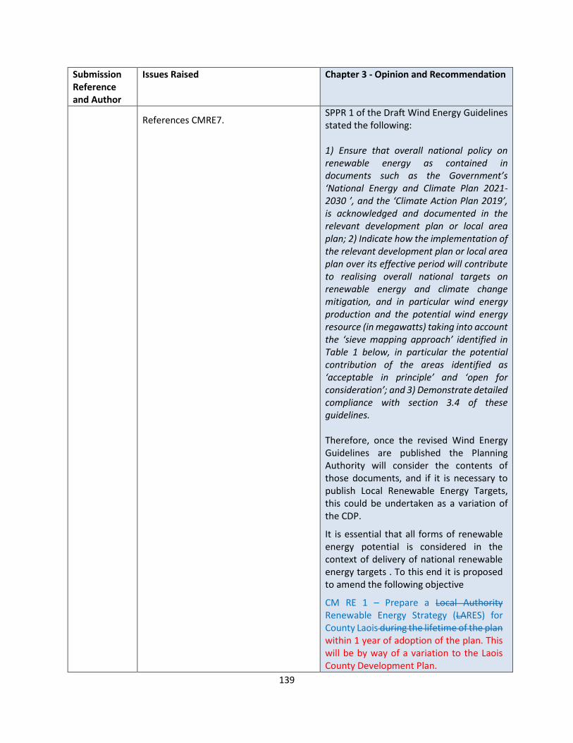
139
Submission Reference and Author
Issues Raised Chapter 3 - Opinion and Recommendation
References CMRE7. SPPR 1 of the Draft Wind Energy Guidelines stated the following: 1) Ensure that overall national policy on renewable energy as contained in documents such as the Government’s ‘National Energy and Climate Plan 2021-2030 ’, and the ‘Climate Action Plan 2019’, is acknowledged and documented in the relevant development plan or local area plan; 2) Indicate how the implementation of the relevant development plan or local area plan over its effective period will contribute to realising overall national targets on renewable energy and climate change mitigation, and in particular wind energy production and the potential wind energy resource (in megawatts) taking into account the ‘sieve mapping approach’ identified in Table 1 below, in particular the potential contribution of the areas identified as ‘acceptable in principle’ and ‘open for consideration’; and 3) Demonstrate detailed compliance with section 3.4 of these guidelines. Therefore, once the revised Wind Energy Guidelines are published the Planning Authority will consider the contents of those documents, and if it is necessary to publish Local Renewable Energy Targets, this could be undertaken as a variation of the CDP.
It is essential that all forms of renewable energy potential is considered in the context of delivery of national renewable energy targets . To this end it is proposed to amend the following objective
CM RE 1 – Prepare a Local Authority Renewable Energy Strategy (LARES) for County Laois during the lifetime of the plan within 1 year of adoption of the plan. This will be by way of a variation to the Laois County Development Plan.

140
Submission Reference and Author
Issues Raised Chapter 3 - Opinion and Recommendation
RECOMMENDATION
It is proposed to amend the following policy objective as follows -
CM RE 1 – Prepare a Local Authority Renewable Energy Strategy (LARES) for County Laois during the lifetime of the plan within 1 year of adoption of the plan. This will be by way of a variation to the Laois County Development Plan
LS-C9-DCDP-135 An Taisce
The submission includes the following:
1.1 Addressing Climate and Biodiversity Emergencies –
An Taisce strongly supports the significantly increased emphasis on climate mitigation and adaptation throughout the Draft Plan. The focus on the climate crisis in Chapter 3 and the targets provided in the Action Areas are very welcome additions.
We also recommend, in line with the social inclusion provisions of Chapter 5, that commitments be added to Chapter 3 to address the disproportionate impact of climate change on marginalised communities.
The National Mitigation Plan was struck down by the Supreme Court on 31 July 2020 for non-compliance with the Climate Action and Low Carbon Development Act 2015. However, the National Mitigation Plan is still included in the Draft Plan, for instance, in section 3.2.3.1 and in Policy Objective CA 1. We submit that the Draft CDP should be amended to reflect the Supreme Court Judgment.
While the Draft CDP has a strong focus on climate, An Taisce considers
OPINION The support is noted. The Plan has been prepared in accordance with the NPF and RSES, and includes a range of policies in Chapter’s 3 and 5. Section 3.4 includes how climate action has been incorporated into the Plan, which includes:
• Action Area 1 (Sustainable Transport) and supporting policies,
• Action Area 2 (Built Environment) and supporting policies,
• Action Area 3 (Land Use (Including Agriculture / Forestry / GI) and supporting policies
• Action Area 4 – Energy (refer to Section 3.5 for further policy objectives on renewable energy)
This is considered to be sufficient in the context of this Plan. National Mitigation Plan It is noted that the Supreme Court quashed the National Mitigation Plan (2017). Therefore, it is accepted that reference to the NMP should be removed from the Draft Plan.

141
Submission Reference and Author
Issues Raised Chapter 3 - Opinion and Recommendation
that it does not sufficiently address the concurrent biodiversity loss emergency. The new CDP should directly and thoroughly address the gravity of the biodiversity crisis in a manner commensurate to the way it in which addresses the
While there are many robust policy objectives in the Draft Plan aimed at ecological protection, we do not consider that they sufficiently consider the context or address the scale of the current biodiversity loss emergency.
RECOMMENDATION 3.2.3.1 3.2.3.1 National Mitigation Plan (NMP) 2017 And National Adaptation Framework (NAF) 2018 The NMP will lay the foundations for transitioning Ireland to a low carbon, climate resilient and environmentally sustainable economy by 2050. It is a whole of government plan, providing a central role for key Ministers responsible for the sectors covered by the Plan – Electricity Generation, the Built Environment, Transport and Agriculture, as well as drawing on the perspectives and responsibilities of a range of other Government Departments. CA 1 Support and facilitate European and national objectives for climate adaptation and mitigation as detailed in the following documents, taking into account other provisions of the Plan (including those relating to land use planning, energy, sustainable mobility, flood risk management and drainage):
• Climate Action Plan (2019 and any subsequent versions);
• National Mitigation Plan (2017 and any subsequent versions);
• National Climate Change Adaptation Framework (2018 and any subsequent versions);
• Any Regional Decarbonisation Plan prepared on foot of commitments included in the emerging Regional Spatial and Economic Strategy for the Eastern and Midland Region;
• Relevant provisions of any Sectoral Adaptation Plans prepared to

142
Submission Reference and Author
Issues Raised Chapter 3 - Opinion and Recommendation
comply the requirements of the Climate Action and Low Carbon Development Act 2015, including those seeking to contribute towards the National Transition Objective, to pursue, and achieve, the transition to a low carbon, climate resilient and environmentally sustainable economy by the end of the year 2050; and
• Laois Climate Change Adaptation Strategy 2019-2024.

143
CHAPTER 4 HOUSING
Submission Reference and Author
Issues Raised Chapter 4 - Opinion and Recommendation
LS-C9-DCDP-59 Sarah Sherlock
LCC must advance a clear plan that enables the circular economy mindset and philosophy. It is unsustainable to do otherwise. We need to better understand our existing building stock and all within to advance a reduce- reuse – recycle policy. It is shameful to see properties demolished and not integrated into modern developments.
Ensure that all Strategic Housing Development (SHD), proposals are within or adjacent to the actual town centres.
Comments noted. OPINION In relation to the demolition of properties, Section 4.6.4 Replacement Dwellings in the Countryside (RH 8, RH 11 and RH 13) and Section 12.3.3 Vernacular Buildings (policy objectives VS 1 – VS 6 and DM VS 1), Laois County Council support the regeneration and refurbishment of vernacular structures and support their retention and extension rather than demolition. Policy Objectives have been included in each specific town and village plan for their regeneration.
RECOMMENDATION
No changes to the Draft Plan
LS-C9-DCDP-79 Evelyn Duff
Under Chapter 4, DMHS6 for residential development there is a requirement for 15M rear garden depths. This requirement contradicts and exceeds the private open space area requirements of 60sq.m (for 1 and 2 bed houses) and 75 sq.m (for 3,4,5 bed houses) and the recommendations by the DOELG for increased housing densities, particularly in town centre sites. There is no allowance made for the height of building eg. a single-storey dwelling should be allowed less distance to a site boundary than 2/3 storey dwelling as there are no overlooking issues. The general accepted distances required between two-storey houses facing onto each other to the rear is 22M (11M min. private rear gardens) and this seems acceptable with allowances for reduced distances in well considered schemes.
Comments noted. OPINION In order to comply with national guidelines it is proposed to remove this limiting parameter from the development management standards in relation to rear garden depths. RECOMMENDATION It is recommended to remove the following standard from DM HS 6 and amend it as follows: In general, a minimum distance of 22m should be achieved between opposing first floor windows at the rear of dwellings. In general, it is encouraged that a 15m rear garden is provided, with innovative design and layout a lesser requirement may be considered.

144
Submission Reference and Author
Issues Raised Chapter 4 - Opinion and Recommendation
The Council will only consider exceptions to the standards in exceptional circumstances where an otherwise high quality design solution is proposed, which has full regard to the characteristics and context of the site. Discretion of this standard will be dependent on-site layout characteristics and flexibility may be employed where performance-based criteria can be adequately demonstrated. (For example, where a side garden of equal or greater dimensions can be substituted for rear garden space and where a situation of overlooking is demonstrably avoided).
LS-C9-DCDP-85 Laois Chamber
Housing - Population projections for the county are too low. They are based on out of date census projections and do not reflect the attractive place Laois is to live - especially in the post covid era. Demand for homes in satellite towns in Laois with good rail links is likely to increase and with more people living and working in the county there is a huge opportunity to revitalize Town and village centres and improve their vitality through investment in public realm and infrastructure... all indirectly helping the business and commerce of the county.
Comments noted. OPINION The population projections for the Country and each County is set out in National Planning Framework in the Implementation Roadmap – Appendix 2. The NPF is our statutory national planning policy and our County Development Plan must implement the policies contained therein, as required by Section 2 of the Planning and Development Act 2000, as amended. For Laois, the following population targets have been set by the NPF and are integrated into our Core Strategy and Housing Strategy figures:
• 2026 population target: 92,500 – 94,000
• 2031 population target: 95,500 – 97,500
As can be seen there is a minimum and maximum target – the Plan has
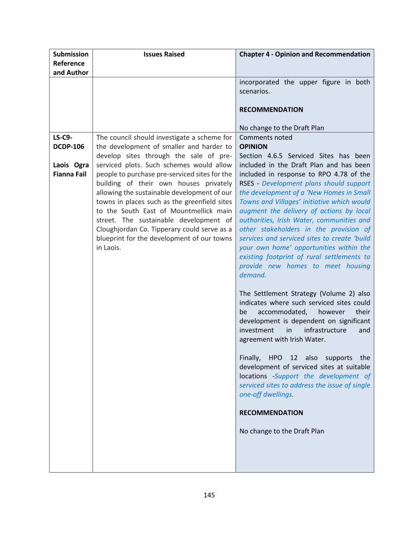
145
Submission Reference and Author
Issues Raised Chapter 4 - Opinion and Recommendation
incorporated the upper figure in both scenarios. RECOMMENDATION No change to the Draft Plan
LS-C9-DCDP-106 Laois Ogra Fianna Fail
The council should investigate a scheme for the development of smaller and harder to develop sites through the sale of pre-serviced plots. Such schemes would allow people to purchase pre-serviced sites for the building of their own houses privately allowing the sustainable development of our towns in places such as the greenfield sites to the South East of Mountmellick main street. The sustainable development of Cloughjordan Co. Tipperary could serve as a blueprint for the development of our towns in Laois.
Comments noted OPINION Section 4.6.5 Serviced Sites has been included in the Draft Plan and has been included in response to RPO 4.78 of the RSES - Development plans should support the development of a ‘New Homes in Small Towns and Villages’ initiative which would augment the delivery of actions by local authorities, Irish Water, communities and other stakeholders in the provision of services and serviced sites to create ‘build your own home’ opportunities within the existing footprint of rural settlements to provide new homes to meet housing demand. The Settlement Strategy (Volume 2) also indicates where such serviced sites could be accommodated, however their development is dependent on significant investment in infrastructure and agreement with Irish Water. Finally, HPO 12 also supports the development of serviced sites at suitable locations -Support the development of serviced sites to address the issue of single one-off dwellings. RECOMMENDATION No change to the Draft Plan

146
Submission Reference and Author
Issues Raised Chapter 4 - Opinion and Recommendation
LS-C9-DCDP-138 William Aird
Housing Developments
• Boundary fences around housing estates should be concrete
• All new estates should have clearly marked bicycle lanes
• Designated play areas should be located in prominent positions in all new estates
• Pedestrian walkways should not be permitted between new developments and existing estates
Planning Permission
• Local need should not apply on sites where public water and sewerage services are available
• The criteria for local need should be less restrictive
Comments noted. OPINION Housing Developments
• DM HS 10 provides development management standards for boundary treatment in urban areas. This standard can be strengthened to include a policy
• The Quality Housing for Sustainable Communities Guidelines, 2009, and Sustainable Residential Development in Urban Areas Guidelines, 2009, provides guidance for development management on the provision of cycle lanes. The Plan fully supports these guidelines with reference to development management standard DM HS 1.
• The aforementioned guidelines also provide guidance on development of public open space. DM HS 5 supports a prominent overlooked location for open space – ‘Public open space shall be clearly defined, easily maintained, easy to access from all parts of the development, east to use including by people with disabilities, have good lighting and natural surveillance and is to use, walk and cycle’.
• In relation to pedestrian walkways between existing and proposed estates, in the interest of permeability and compliance with Design Manual for Urban Roads and Streets a specific policy objective to discourage same would be contrary to the aforementioned Section 28 Guidelines. It is a case with some existing estates that were part of a masterplan or phased construction that areas of land were indicated to connect with future housing proposals. Every new planning application will assess such a scenario

147
Submission Reference and Author
Issues Raised Chapter 4 - Opinion and Recommendation
based on residential amenity of existing community.
Planning Permission
• It is requirement under the Section 28 Guidelines on Sustainable Rural Housing, 2005, that all planning applications for rural one off dwellings which are not associated with any zoned settlements must be assessed in relation to local needs in areas under strong urban influence. In structurally weak areas this policy does not apply.
• In relation to rural housing policy being less restrictive, this point is noted, however the CDP must incorporate the policy objectives of the National Planning Framework and Regional Spatial and Economic Strategy and the Section 28 Guidelines on Sustainable Rural Housing. Furthermore, the Office of the Planning Regulator has further instructed that the rural housing policy needs to be strengthened. Section 4.6.2.3 of this report recommends an amended rural housing policy in relation to one off dwellings.
RECOMMENDATION No change to the Plan in relation to cycleways, public open space, pedestrian connections between existing and proposed housing estates and the rural housing policy. It is recommended to strengthen the development management standard DM HS 10 in relation to boundary treatment in Chapter 4:
• Concrete screen walls along public spaces should be avoided through quality design but where it is not possible to do this

148
Submission Reference and Author
Issues Raised Chapter 4 - Opinion and Recommendation
• , they should be suitably rendered and capped. Proposals for planting along the public side of the wall shall be included on a landscaping plan. An additional inner grass verge shall be provided at the footpath to facilitate this if necessary.
• In the interest of passive surveillance, where side boundary walls adjoin the public footpath, the walls shall be a maximum of 1 metre in height as far as the rear building line of the dwelling (beyond which a 2m wall may be provided).
LS-C9-DCDP-140 Irish Farmers Association
The submission refers to a number of issues in the LCDP, under the following headings, with matters summarised as follows:
1. Rural Housing and Dwellers
a. Laois IFA oppose any increase in Development Charges for once off Rural Housing as rural dwellers cannot access the amenities and services of people living in urban areas.
b. IFA requests that people who buy or build a house in the Countryside should agree to abide by a countryside lifestyle and not impede or object to normal farming practice.
c. All farm families have the right to build a house and live in rural Laois. It is important that family members living in other parts of the country, who wish to return home to build a house on a site provided by a family member or otherwise, are permitted to do so. Rural communities in Laois have to be kept alive and this can only be achieved by the settling of the next generation in
Comments noted. OPINION Rural Dwellers a. The development charges for one off
dwellings will be determined when a review of Development Contribution Scheme takes place and is outside the remit of the CDP
b. The actions of rural dwellers in relation to making objections is outside the remit of the CDP.
c. The rural housing policy indicated in Section 4.6.2 of the Draft Plan supports members of a farming family and members of the local rural community to build their own home subject to local needs criteria.
Planning Permission and Development Charges a. The Draft Plan does not preclude a
landowner selling a site. The Planning department offers weekly pre planning consultation for prospective applicants, all of which are dealt with within 2 weeks of receipt of request.
b. Development contributions in relation to agricultural, equestrian and forestry

149
Submission Reference and Author
Issues Raised Chapter 4 - Opinion and Recommendation
the locality
2 Planning Permission and Development Charges
a. IFA requests that landowners should retain the right to sell a site should they need/want to and requests that more consultation should take place between the planning Officers and prospective applicants prior to application for planning permission.
b. Agricultural, Equestrian and all Forestry Development should continue to be exempt from Development Charges as the vast majority of these developments comply with Animal Health and Environmental regulations.
c. Agriculture is one of the key pillars for our economy moving forward, development charges for farm buildings must be kept exempt.
are exempt from development contributions (subject to limitations on size) and are determined by the Development Contribution Scheme.
c. As above. The Draft Plan fully supports agricultural activities in the County in Chapter 9 Rural Laois.
RECOMMENDATION No change to the Draft Plan
LS-C9-DCDP-145 Irish Creamery Milk Suppliers Association
The rural housing policy is alarming. Farming is an essential employer to the rural economy and fundamental to the sector is housing near farms.
The need for a farmer to be in full time farming, for 5 continuous years and within 5km of the family home are unreasonable. The majority of beef and suckler farmers are part time farmers and are an integral part of the sector and support dairy farmers.
Income from beef farming isn’t sufficient on it’s own and regularly requires additional off farm income to s support a family.
The structure of farms due to the high demand for land is becoming more fragmented than in the past. The
Comments noted. OPINION The Rural housing policy as indicated in Section 4.6.2 of the Draft Plan fully supports both members of family families and members of local rural community. Based on the requirement of the Office of the Planning Regulator to review the rural housing criteria, this section has been amended. Category 1 relates to ‘a member of a farming family’ and Category 2 relates to ‘an individual with an economic or social requirement to reside in a rural area’. A farmer can be considered under both categories. Please refer to Section 4.6.2.3 of this report for the recommended amendment.

150
Submission Reference and Author
Issues Raised Chapter 4 - Opinion and Recommendation
requirement for the new site to be within 5km is further limiting the possible sites for housing unnecessarily.
The site should be chosen from the land which is more appropriate, the land closest to the farmyard, and parlour in the case of dairy are most valuable and are prioritize for cows to reduce the stress and daily walking distance for them.
The additional criteria is unreasonable and will damage the rural economy. The farmer should be given reasonable flexibility to choose a site which doesn’t impact his business through loss of prime land.
The need for a 5 year period should be scrapped, most young farmers have been farming the land with their families for more than 5 years but may not be formally employed. This shouldn`t impact their ability to build a house on their land.
The criteria set out is consistent with the statutory requirements of the Sustainable Rural Housing Guidelines and the Policy Objectives of the National Planning Framework and Regional Spatial and Economic Strategy. In relation to the length of time a farmer must be farming the land, it is considered necessary to put a timeframe to ensure that genuine cases are supported and accommodated. It is proposed to amend the stated distance of 5km to 8km of the family home or at an appropriate site within the landholding, as indicated in the recommended revised rural housing policy in Section 4.6.2.3 of this report. In relation to part time farmers, again the policy does not preclude such an individual. This individual can be accommodated under Category 1 and 2. RECOMMENDATOIN The rural housing policy has been revised in Section 4.6.2.3 of the Draft Plan. Please refer to Section 2.2.3 of this report for the proposed amendment wording.

151
CHAPTER 5 QUALITY OF LIFE AND SUSTAINABLE COMMUNITIES
Submission Reference and Author
Issues Raised Chapter 5 - Opinion and Recommendation
LS-C9-DCDP-12 CLG Laois
Differing needs of urban and rural clubs in the planning and delivery of coaching and games programmes, as clearly the number of young players will be greater in urban clubs. The largest urban centre in the county, Portlaoise, has seen significant population growth over the past five years and our Review Committee at the time recommended the formation of a specific juvenile club in Portlaoise, which in time would become a feeder unit to other clubs in Portlaoise and environs. Our new County Development Plan for economic development and additional housing infrastructure is likely to be again concentrated in Portlaoise. Whilst we use Portlaoise GAA facilities in Rathleague and our own GAA facilities in our Centre of Excellence on Fr Browne Avenue for this purpose, neither are able to meet the now unprecedented demand of a rising population and additional land for GAA playing pitches is required to sustain the requisite coaching and games activities within this environ. Unfortunately, the economic development and the present policy of prohibiting one-off house building in rural Laois will not match the increasing population envisaged for our urban areas of the county and is likely to vary considerably from one rural area to another. Less housing construction in rural Laois and in particular refusal of planning applications for one-off housing by family members on family farms will have a major impact on GAA clubs operating in these environments
Submission noted. OPINION The Draft Plan fully recognises the needs of local rural communities. It is a policy of the Plan to encourage development of the rural communities where sufficient land for residential has been designated to support growth in these areas. The growth of each rural settlement was based on population projections and data from the Central Statistics Office and allocation accordingly. In terms of the provision of one off dwellings in the rural countryside, The criteria set out is consistent with the statutory requirements of the Sustainable Rural Housing Guidelines and the Policy Objectives of the National Planning Framework and Regional Spatial and Economic Strategy. This policy is supportive of the provision of housing for members of local rural areas subject to environmental, siting and design criteria. The policy also recognises that some rural areas (Structurally Weak Areas) face a decline in rural population and as such our policy does not require a local need to live in these areas. Apart from housing provision, there has been no changes to zonings in the Portlaoise Local Area Plan. This LAP will be reviewed in the coming year due to recent changes in legislation and the requirement to update all plans. In this regard, a submission should be made to the upcoming Draft Portlaoise LAP indicating desirable land parcels that could be developed for GAA Facilities.
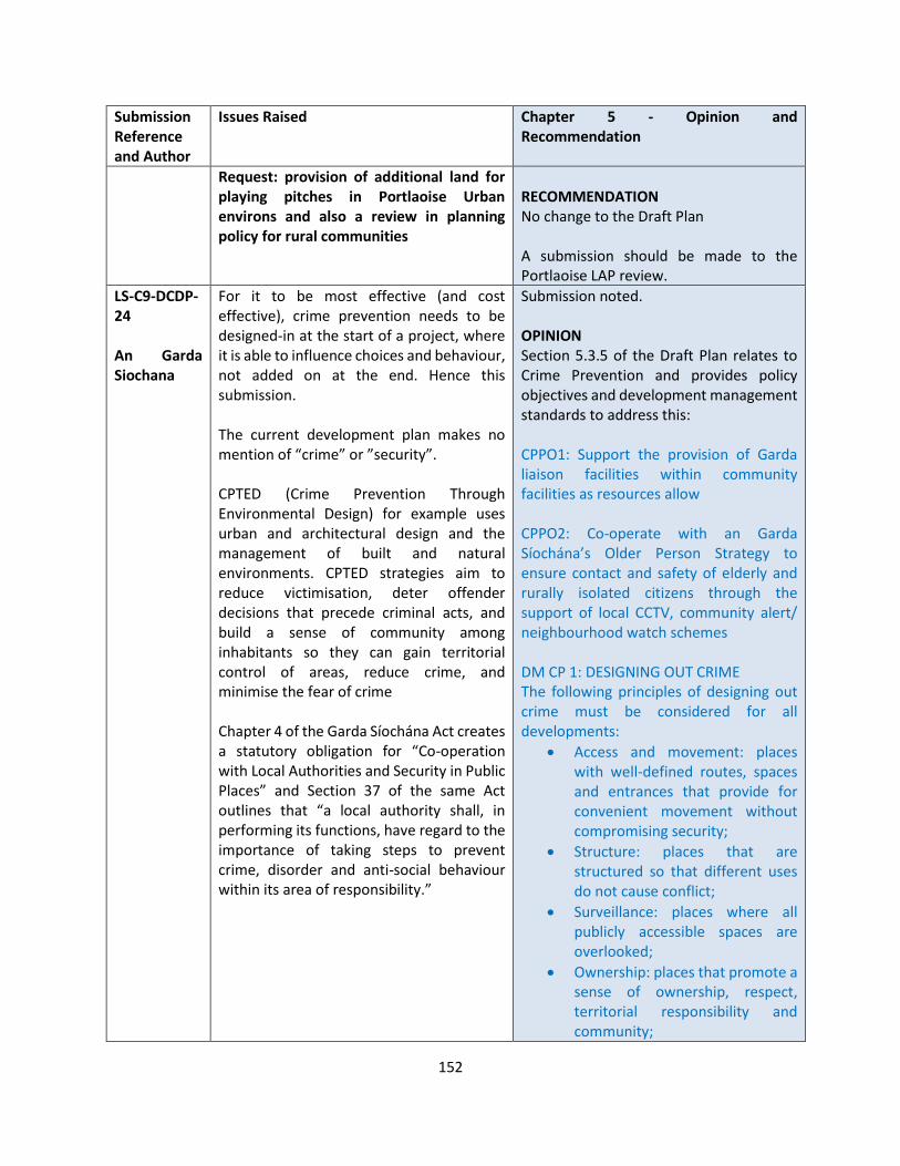
152
Submission Reference and Author
Issues Raised Chapter 5 - Opinion and Recommendation
Request: provision of additional land for playing pitches in Portlaoise Urban environs and also a review in planning policy for rural communities
RECOMMENDATION No change to the Draft Plan A submission should be made to the Portlaoise LAP review.
LS-C9-DCDP-24 An Garda Siochana
For it to be most effective (and cost effective), crime prevention needs to be designed-in at the start of a project, where it is able to influence choices and behaviour, not added on at the end. Hence this submission. The current development plan makes no mention of “crime” or ”security”. CPTED (Crime Prevention Through Environmental Design) for example uses urban and architectural design and the management of built and natural environments. CPTED strategies aim to reduce victimisation, deter offender decisions that precede criminal acts, and build a sense of community among inhabitants so they can gain territorial control of areas, reduce crime, and minimise the fear of crime Chapter 4 of the Garda Síochána Act creates a statutory obligation for “Co-operation with Local Authorities and Security in Public Places” and Section 37 of the same Act outlines that “a local authority shall, in performing its functions, have regard to the importance of taking steps to prevent crime, disorder and anti-social behaviour within its area of responsibility.”
Submission noted. OPINION Section 5.3.5 of the Draft Plan relates to Crime Prevention and provides policy objectives and development management standards to address this: CPPO1: Support the provision of Garda liaison facilities within community facilities as resources allow CPPO2: Co-operate with an Garda Síochána’s Older Person Strategy to ensure contact and safety of elderly and rurally isolated citizens through the support of local CCTV, community alert/ neighbourhood watch schemes DM CP 1: DESIGNING OUT CRIME The following principles of designing out crime must be considered for all developments:
• Access and movement: places with well-defined routes, spaces and entrances that provide for convenient movement without compromising security;
• Structure: places that are structured so that different uses do not cause conflict;
• Surveillance: places where all publicly accessible spaces are overlooked;
• Ownership: places that promote a sense of ownership, respect, territorial responsibility and community;
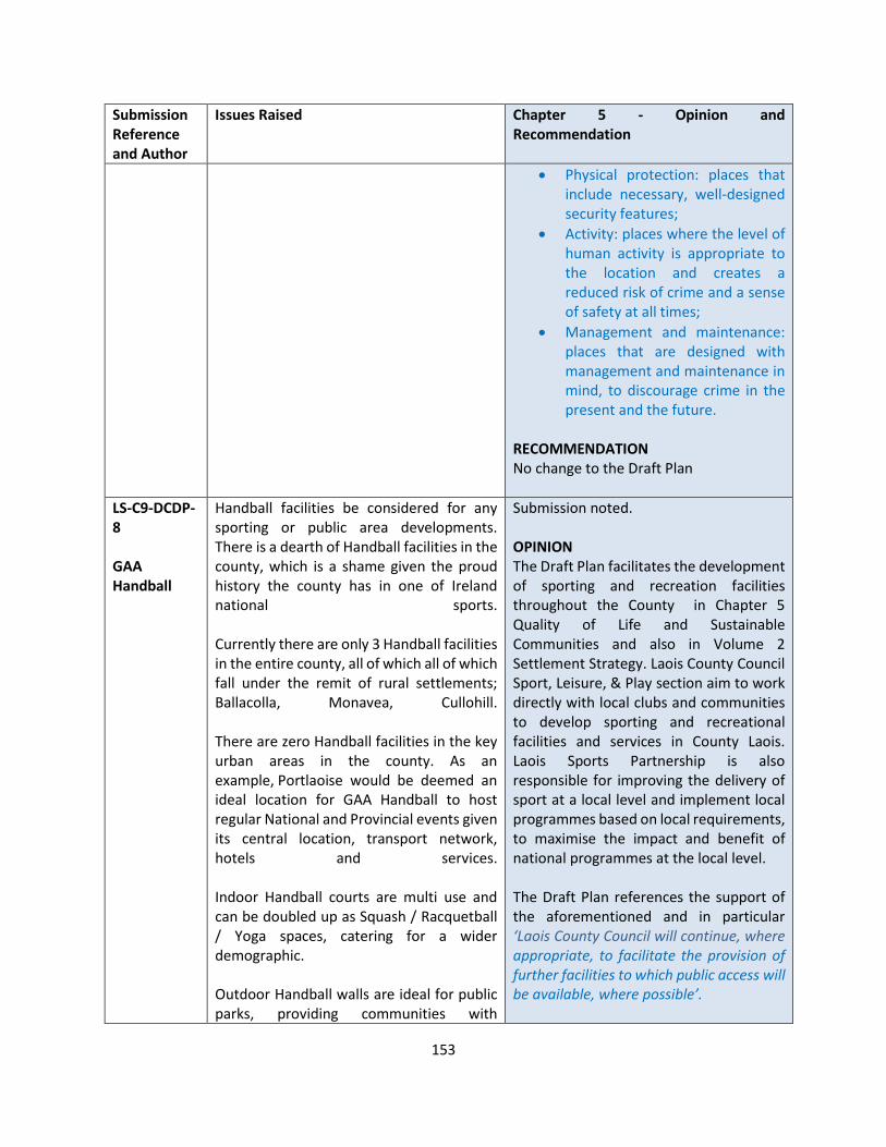
153
Submission Reference and Author
Issues Raised Chapter 5 - Opinion and Recommendation
• Physical protection: places that include necessary, well-designed security features;
• Activity: places where the level of human activity is appropriate to the location and creates a reduced risk of crime and a sense of safety at all times;
• Management and maintenance: places that are designed with management and maintenance in mind, to discourage crime in the present and the future.
RECOMMENDATION No change to the Draft Plan
LS-C9-DCDP-8 GAA Handball
Handball facilities be considered for any sporting or public area developments. There is a dearth of Handball facilities in the county, which is a shame given the proud history the county has in one of Ireland national sports. Currently there are only 3 Handball facilities in the entire county, all of which all of which fall under the remit of rural settlements; Ballacolla, Monavea, Cullohill. There are zero Handball facilities in the key urban areas in the county. As an example, Portlaoise would be deemed an ideal location for GAA Handball to host regular National and Provincial events given its central location, transport network, hotels and services. Indoor Handball courts are multi use and can be doubled up as Squash / Racquetball / Yoga spaces, catering for a wider demographic. Outdoor Handball walls are ideal for public parks, providing communities with
Submission noted. OPINION The Draft Plan facilitates the development of sporting and recreation facilities throughout the County in Chapter 5 Quality of Life and Sustainable Communities and also in Volume 2 Settlement Strategy. Laois County Council Sport, Leisure, & Play section aim to work directly with local clubs and communities to develop sporting and recreational facilities and services in County Laois. Laois Sports Partnership is also responsible for improving the delivery of sport at a local level and implement local programmes based on local requirements, to maximise the impact and benefit of national programmes at the local level. The Draft Plan references the support of the aforementioned and in particular ‘Laois County Council will continue, where appropriate, to facilitate the provision of further facilities to which public access will be available, where possible’.
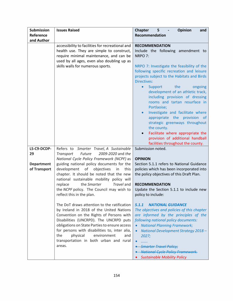
154
Submission Reference and Author
Issues Raised Chapter 5 - Opinion and Recommendation
accessibility to facilities for recreational and health use. They are simple to construct, require minimal maintenance, and can be used by all ages, even also doubling up as skills walls for numerous sports.
RECOMMENDATION Include the following amendment to NRPO 7: NRPO 7: Investigate the feasibility of the following specific recreation and leisure projects subject to the Habitats and Birds Directives:
• Support the ongoing development of an athletic track, including provision of dressing rooms and tartan resurface in Portlaoise;
• Investigate and facilitate where appropriate the provision of strategic greenways throughout the county.
• Facilitate where appropriate the provision of additional handball facilities throughout the county.
LS-C9-DCDP-29 Department of Transport
Refers to Smarter Travel, A Sustainable Transport Future 2009-2020 and the National Cycle Policy Framework (NCPF) as guiding national policy documents for the development of objectives in this chapter. It should be noted that the new national sustainable mobility policy will replace the Smarter Travel and the NCPF policy. The Council may wish to reflect this in the plan. The DoT draws attention to the ratification by Ireland in 2018 of the United Nations Convention on the Rights of Persons with Disabilities (UNCRPD). The UNCRPD puts obligations on State Parties to ensure access for persons with disabilities to, inter alia, the physical environment and transportation in both urban and rural areas.
Submission noted. OPINION Section 5.1.1 refers to National Guidance policies which has been incorporated into the policy objectives of this Draft Plan. RECOMMENDATION Update the Section 5.1.1 to include new policy to include: 5.1.1 NATIONAL GUIDANCE The objectives and policies of this chapter are informed by the principles of the following national policy documents:
• National Planning Framework;
• National Development Strategy 2018 – 2027;
• …….
• Smarter Travel Policy;
• National Cycle Policy Framework.
• Sustainable Mobility Policy

155
Submission Reference and Author
Issues Raised Chapter 5 - Opinion and Recommendation
• United Nations Convention on the Rights of Persons with Disabilities (UNCRPD)
LS-C9-DCDP-30 Mark Robertson
NRPO 7 mentions "... tartan resurface in Portlaoise". I reckon that should say "tarmac" instead
Submission noted. OPINION Tartan Track is a trademarked all-weather synthetic track surfacing made of polyurethane used for track and field competitions, manufactured by 3M. It lets athletes compete in bad weather without serious performance loss and improves their results over other surfaces. RECOMMENDATION No change to the Draft Plan
LS-C9-DCDP-43 John Scully
Laois Co Co to work with Laois Athletics, local athletics clubs, and NGB, to develop athletics facilities, including a tartan track in Laois.
Comment noted OPINION The Draft Plan fully supports the development of sporting facilities and working with local sporting and community groups in the County under the following policy objective: NRPO 1 Support local sports groups and community groups in the development, improvement and expansion of facilities for sporting and recreational needs of all sectors and ages through the reservation of suitable land and the provision of funding where available and appropriate. Furthermore there is a specific policy in relation to the feasibility of a tartan athletic track in Portlaoise as follows:
NRPO 7: Investigate the feasibility of the following specific recreation and leisure projects subject to the Habitats and Birds Directives:
• Support the ongoing development of an athletic track, including provision of
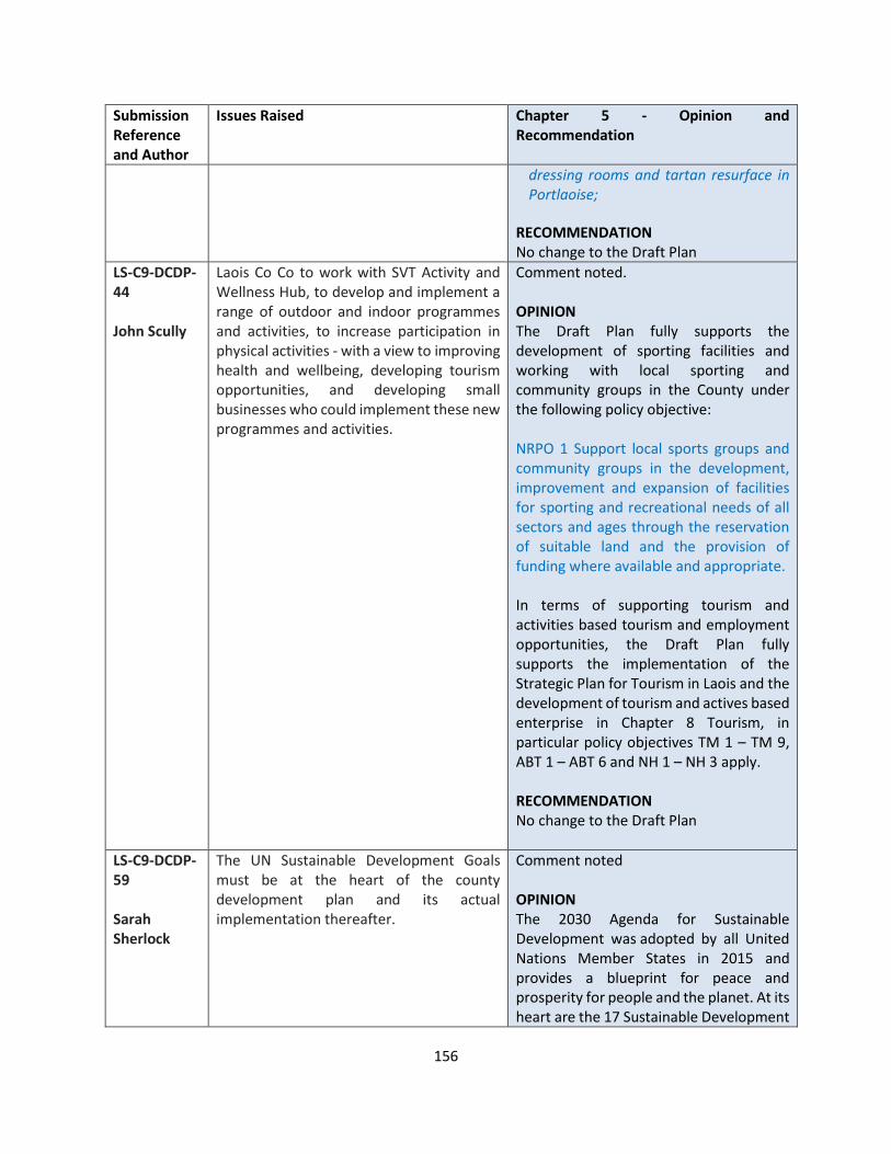
156
Submission Reference and Author
Issues Raised Chapter 5 - Opinion and Recommendation
dressing rooms and tartan resurface in Portlaoise;
RECOMMENDATION No change to the Draft Plan
LS-C9-DCDP-44 John Scully
Laois Co Co to work with SVT Activity and Wellness Hub, to develop and implement a range of outdoor and indoor programmes and activities, to increase participation in physical activities - with a view to improving health and wellbeing, developing tourism opportunities, and developing small businesses who could implement these new programmes and activities.
Comment noted. OPINION The Draft Plan fully supports the development of sporting facilities and working with local sporting and community groups in the County under the following policy objective: NRPO 1 Support local sports groups and community groups in the development, improvement and expansion of facilities for sporting and recreational needs of all sectors and ages through the reservation of suitable land and the provision of funding where available and appropriate. In terms of supporting tourism and activities based tourism and employment opportunities, the Draft Plan fully supports the implementation of the Strategic Plan for Tourism in Laois and the development of tourism and actives based enterprise in Chapter 8 Tourism, in particular policy objectives TM 1 – TM 9, ABT 1 – ABT 6 and NH 1 – NH 3 apply. RECOMMENDATION No change to the Draft Plan
LS-C9-DCDP-59 Sarah Sherlock
The UN Sustainable Development Goals must be at the heart of the county development plan and its actual implementation thereafter.
Comment noted OPINION The 2030 Agenda for Sustainable Development was adopted by all United Nations Member States in 2015 and provides a blueprint for peace and prosperity for people and the planet. At its heart are the 17 Sustainable Development

157
Submission Reference and Author
Issues Raised Chapter 5 - Opinion and Recommendation
Goals (SDGs), which are an urgent call for action by all countries. They recognise that ending poverty and other deprivations must go hand-in-hand with strategies that improve health and education, reduce inequality, and spur economic growth – all while tackling climate change and working to preserve our oceans and forests. RECOMMENDATION It is recommended to make the following changes and inclusions: 5.1.1 NATIONAL GUIDANCE The objectives and policies of this chapter are informed by the principles of the following national policy documents:
• The United Nations 2030 Agenda for Sustainable Development
• National Planning Framework;
• National Development Strategy 2018 – 2027;
• ….. Provide an additional policy objective within Section 5.2 Social Inclusion and Community Development: SCPO 14: Support and implement the 17 Sustainable Development Goals of the United Nations 2030 Agenda for Sustainable Communities
LS-C9-DCDP-85 Laois Chamber
Quality of Life' as a central focus - a great place to live!! for us it starts with this, Laois can strive to be best county in Ireland to live in, and all the benefits that can come from this - jobs, tourism, health etc. Laois should be focusing on designing our county on this basis.
Comments noted. OPINION The National Planning Framework and Regional Spatial and Economic Strategy and underpinned by the principles of sustainable communities and quality of life. In this regard the Draft Plan has responded by including in Section 1.2 of the Draft Plan a vision for the County:
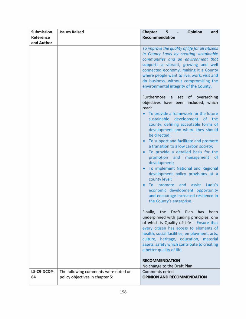
158
Submission Reference and Author
Issues Raised Chapter 5 - Opinion and Recommendation
To improve the quality of life for all citizens in County Laois by creating sustainable communities and an environment that supports a vibrant, growing and well connected economy, making it a County where people want to live, work, visit and do business, without compromising the environmental integrity of the County. Furthermore a set of overarching objectives have been included, which read:
• To provide a framework for the future sustainable development of the county, defining acceptable forms of development and where they should be directed;
• To support and facilitate and promote a transition to a low carbon society;
• To provide a detailed basis for the promotion and management of development;
• To implement National and Regional development policy provisions at a county level;
• To promote and assist Laois’s economic development opportunity and encourage increased resilience in the County’s enterprise.
Finally, the Draft Plan has been underpinned with guiding principles, one of which is Quality of Life – Ensure that every citizen has access to elements of health, social facilities, employment, arts, culture, heritage, education, material assets, safety which contribute to creating a better quality of life. RECOMMENDATION No change to the Draft Plan
LS-C9-DCDP-84
The following comments were noted on policy objectives in chapter 5:
Comments noted OPINION AND RECOMMENDATION
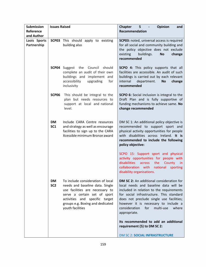
159
Submission Reference and Author
Issues Raised Chapter 5 - Opinion and Recommendation
Laois Sports Partnership
SCP03 This should apply to existing building also
SCP04 Suggest the Council should complete an audit of their own buildings and implement and accessibility upgrading for inclusivity
SCP06 This should be integral to the plan but needs resources to support at local and national level.
DM SC1
Include CARA Centre resources and strategy as well as encourage facilities to sign up to the CARA Xcessible minimum Bronze award
DM SC2
To include consideration of local needs and baseline data. Single use facilities are necessary to serve a certain set of sport activities and specific target groups e.g. Boxing and dedicated youth facilities
SCP03: noted, universal access is required for all social and community building and the policy objective does not exclude existing buildings. No change recommended SCPO 4: This policy supports that all facilities are accessible. An audit of such buildings is carried out by each relevant internal department. No change recommended SCPO 6: Social inclusion is integral to the Draft Plan and is fully supportive of funding mechanisms to achieve same. No change recommended DM SC 1: An additional policy objective is recommended to support sport and physical activity opportunities for people with disabilities across Ireland. It is recommended to include the following policy objective: SCPO 15: Support sport and physical activity opportunities for people with disabilities across the County in collaboration with national sporting disability organisations. DM SC 2: An additional consideration for local needs and baseline data will be included in relation to the requirements for social infrastructure. This standard does not preclude single use facilities; however it is necessary to include a consideration for multi-use where appropriate. Its recommended to add an additional requirement (5) to DM SC 2: DM SC 2: SOCIAL INFRASTRUCTURE
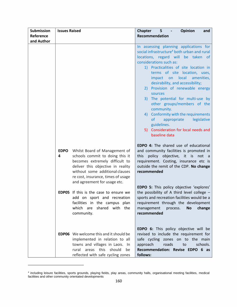
160
Submission Reference and Author
Issues Raised Chapter 5 - Opinion and Recommendation
EDPO4
Whilst Board of Management of schools commit to doing this it becomes extremely difficult to deliver this objective in reality without some additional clauses re cost, insurance, times of usage and agreement for usage etc.
EDP05 If this is the case to ensure we add on sport and recreation facilities in the campus plan which are shared with the community.
EDP06 We welcome this and it should be implemented in relation to all towns and villages in Laois. In rural areas this should be reflected with safe cycling zones
In assessing planning applications for social infrastructure4 both urban and rural locations, regard will be taken of considerations such as:
1) Practicalities of site location in terms of site location, uses, impact on local amenities, desirability, and accessibility;
2) Provision of renewable energy sources
3) The potential for multi-use by other groups/members of the community.
4) Conformity with the requirements of appropriate legislative guidelines.
5) Consideration for local needs and baseline data
EDPO 4: The shared use of educational and community facilities is promoted in this policy objective, it is not a requirement. Costing, insurance etc is outside the remit of the CDP. No change recommended EDPO 5: This policy objective ‘explores’ the possibility of A third level college – sports and recreation facilities would be a requirement through the development management process. No change recommended EDPO 6: This policy objective will be revised to include the requirement for safe cycling zones on to the main approach roads to schools. Recommendation: Revise EDPO 6 as follows:
4 including leisure facilities, sports grounds, playing fields, play areas, community halls, organisational meeting facilities, medical facilities and other community orientated developments
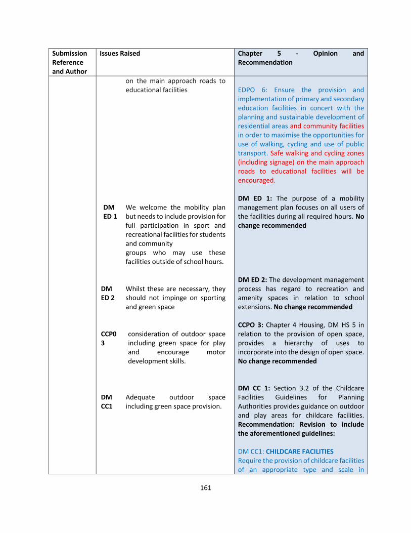
161
Submission Reference and Author
Issues Raised Chapter 5 - Opinion and Recommendation
on the main approach roads to educational facilities
DM ED 1
We welcome the mobility plan but needs to include provision for full participation in sport and recreational facilities for students and community groups who may use these facilities outside of school hours.
DM ED 2
Whilst these are necessary, they should not impinge on sporting and green space
CCP0 3
consideration of outdoor space including green space for play and encourage motor development skills.
DM CC1
Adequate outdoor space including green space provision.
EDPO 6: Ensure the provision and implementation of primary and secondary education facilities in concert with the planning and sustainable development of residential areas and community facilities in order to maximise the opportunities for use of walking, cycling and use of public transport. Safe walking and cycling zones (including signage) on the main approach roads to educational facilities will be encouraged. DM ED 1: The purpose of a mobility management plan focuses on all users of the facilities during all required hours. No change recommended DM ED 2: The development management process has regard to recreation and amenity spaces in relation to school extensions. No change recommended CCPO 3: Chapter 4 Housing, DM HS 5 in relation to the provision of open space, provides a hierarchy of uses to incorporate into the design of open space. No change recommended DM CC 1: Section 3.2 of the Childcare Facilities Guidelines for Planning Authorities provides guidance on outdoor and play areas for childcare facilities. Recommendation: Revision to include the aforementioned guidelines: DM CC1: CHILDCARE FACILITIES Require the provision of childcare facilities of an appropriate type and scale in

162
Submission Reference and Author
Issues Raised Chapter 5 - Opinion and Recommendation
HCP05
With the expansion of the hospital consideration should be given to the provision of onsite access to both indoor and outdoor recreational facilities that will encourage staff and visitors to participate in physical activity and patients.
HCP07
Addition – To proactively encourage the development of public parkland at St. Fintan’s Hospital Campus Portlaoise and to look at recreational infrastructure that is cycle ways and pathways that connect St. Fintan’s to main hospital, a hub.
CPP0 1
Encourage community facilities to have lighting and cctv
ACPO 2
Investigate the potential for the community sports facilities to be used to assist with the delivery of library and arts services
ACPO 6
Give consideration to the provision of outdoor performance spaces in public parks which could be jointly used for outdoor exercise classes and older person’s activities.
suitable locations throughout the County and comply with the Section 28 Guidelines on Childcare Facilities, 2001 (and any subsequent update). In particular, the development of childcare facilities at the following locations will normally be required…. HCPO 5: Any expansion of the hospital and associated facilities and amenity areas will be considered through development management process. However an additional policy objective will be recommended as in HCPO 7 below. No change recommended HCPO 7: noted and agreed – Recommend additional policy objective: HCPO 7: To proactively encourage the development of public parkland at St. Fintan’s Hospital Campus Portlaoise and to look at recreational infrastructure such cycle ways and pathways that connect St. Fintan’s to main hospital, a hub CPPO 1: This is dealt with in DM CP 1 in relation to designing out crime. ACPO 2: The scope of this policy objective in relation to the delivery of library services to rural communities would include community sports facilities as public/private partnerships. No change recommended. Submission is noted ACPO 6: This is outside the remit of the CDP
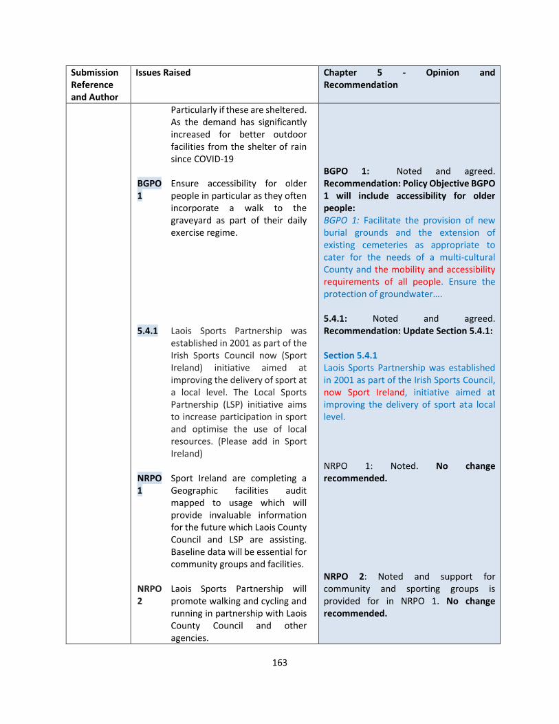
163
Submission Reference and Author
Issues Raised Chapter 5 - Opinion and Recommendation
Particularly if these are sheltered. As the demand has significantly increased for better outdoor facilities from the shelter of rain since COVID-19
BGPO 1
Ensure accessibility for older people in particular as they often incorporate a walk to the graveyard as part of their daily exercise regime.
5.4.1 Laois Sports Partnership was established in 2001 as part of the Irish Sports Council now (Sport Ireland) initiative aimed at improving the delivery of sport at a local level. The Local Sports Partnership (LSP) initiative aims to increase participation in sport and optimise the use of local resources. (Please add in Sport Ireland)
NRPO 1
Sport Ireland are completing a Geographic facilities audit mapped to usage which will provide invaluable information for the future which Laois County Council and LSP are assisting. Baseline data will be essential for community groups and facilities.
NRPO 2
Laois Sports Partnership will promote walking and cycling and running in partnership with Laois County Council and other agencies.
BGPO 1: Noted and agreed. Recommendation: Policy Objective BGPO 1 will include accessibility for older people: BGPO 1: Facilitate the provision of new burial grounds and the extension of existing cemeteries as appropriate to cater for the needs of a multi-cultural County and the mobility and accessibility requirements of all people. Ensure the protection of groundwater…. 5.4.1: Noted and agreed. Recommendation: Update Section 5.4.1: Section 5.4.1 Laois Sports Partnership was established in 2001 as part of the Irish Sports Council, now Sport Ireland, initiative aimed at improving the delivery of sport at a local level. NRPO 1: Noted. No change recommended. NRPO 2: Noted and support for community and sporting groups is provided for in NRPO 1. No change recommended.
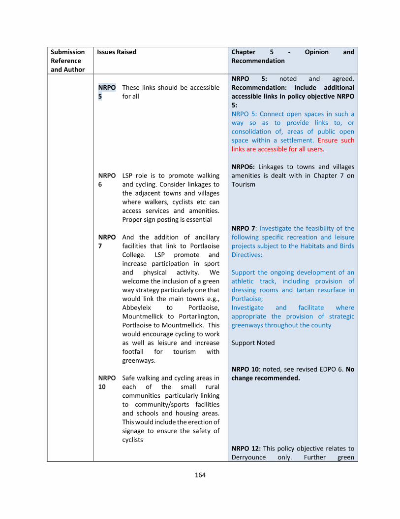
164
Submission Reference and Author
Issues Raised Chapter 5 - Opinion and Recommendation
NRPO 5
These links should be accessible for all
NRPO 6
LSP role is to promote walking and cycling. Consider linkages to the adjacent towns and villages where walkers, cyclists etc can access services and amenities. Proper sign posting is essential
NRPO 7
And the addition of ancillary facilities that link to Portlaoise College. LSP promote and increase participation in sport and physical activity. We welcome the inclusion of a green way strategy particularly one that would link the main towns e.g., Abbeyleix to Portlaoise, Mountmellick to Portarlington, Portlaoise to Mountmellick. This would encourage cycling to work as well as leisure and increase footfall for tourism with greenways.
NRPO 10
Safe walking and cycling areas in each of the small rural communities particularly linking to community/sports facilities and schools and housing areas. This would include the erection of signage to ensure the safety of cyclists
NRPO 5: noted and agreed. Recommendation: Include additional accessible links in policy objective NRPO 5: NRPO 5: Connect open spaces in such a way so as to provide links to, or consolidation of, areas of public open space within a settlement. Ensure such links are accessible for all users. NRPO6: Linkages to towns and villages amenities is dealt with in Chapter 7 on Tourism NRPO 7: Investigate the feasibility of the following specific recreation and leisure projects subject to the Habitats and Birds Directives: Support the ongoing development of an athletic track, including provision of dressing rooms and tartan resurface in Portlaoise; Investigate and facilitate where appropriate the provision of strategic greenways throughout the county Support Noted NRPO 10: noted, see revised EDPO 6. No change recommended. NRPO 12: This policy objective relates to Derryounce only. Further green
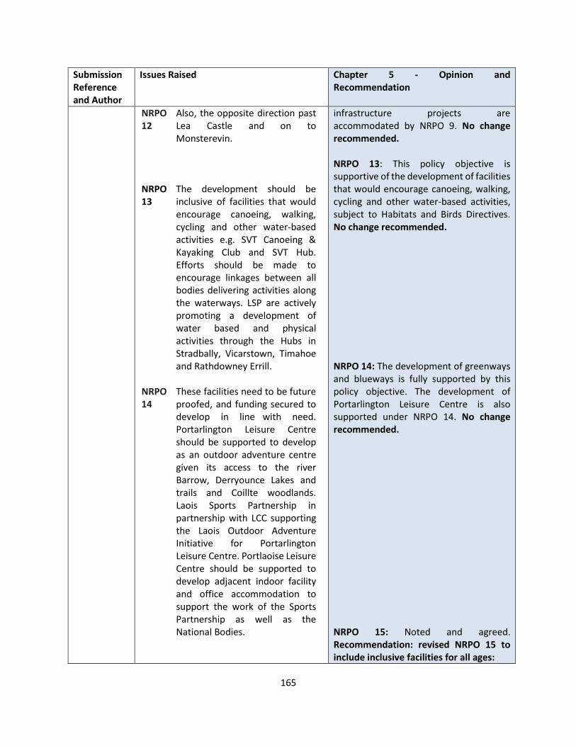
165
Submission Reference and Author
Issues Raised Chapter 5 - Opinion and Recommendation
NRPO 12
Also, the opposite direction past Lea Castle and on to Monsterevin.
NRPO 13
The development should be inclusive of facilities that would encourage canoeing, walking, cycling and other water-based activities e.g. SVT Canoeing & Kayaking Club and SVT Hub. Efforts should be made to encourage linkages between all bodies delivering activities along the waterways. LSP are actively promoting a development of water based and physical activities through the Hubs in Stradbally, Vicarstown, Timahoe and Rathdowney Errill.
NRPO 14
These facilities need to be future proofed, and funding secured to develop in line with need. Portarlington Leisure Centre should be supported to develop as an outdoor adventure centre given its access to the river Barrow, Derryounce Lakes and trails and Coillte woodlands. Laois Sports Partnership in partnership with LCC supporting the Laois Outdoor Adventure Initiative for Portarlington Leisure Centre. Portlaoise Leisure Centre should be supported to develop adjacent indoor facility and office accommodation to support the work of the Sports Partnership as well as the National Bodies.
infrastructure projects are accommodated by NRPO 9. No change recommended. NRPO 13: This policy objective is supportive of the development of facilities that would encourage canoeing, walking, cycling and other water-based activities, subject to Habitats and Birds Directives. No change recommended. NRPO 14: The development of greenways and blueways is fully supported by this policy objective. The development of Portarlington Leisure Centre is also supported under NRPO 14. No change recommended. NRPO 15: Noted and agreed. Recommendation: revised NRPO 15 to include inclusive facilities for all ages:

166
Submission Reference and Author
Issues Raised Chapter 5 - Opinion and Recommendation
NRPO 15
Support the County Council in promoting play and ensure these facilities are inclusive and encourage various kinds of physical activity of all ages. Give consideration to addressing the lack of facilities for young people aged 13-25. The role of natural play should be incorporated into all playground development.
NRPO 17
Ensure suitable work out stations and appropriate seating are included for older people such as activator poles etc. This mainly involves signage and linkage with partner agencies around facilities.
NRPO 19
Please add in Laois Sports Partnership will support Laois County Council in the development of a Sports Plan for County Laois as part of National Strategy.
DM NR 1
Certain sports are totally incompatible with existing provision and every effort should be made to prevent damage to existing walk ways and hills and areas of natural beauty by preventing their use by e.g. scramblers, motor sports and in
NRPO 15: Support the development of playgrounds and upgrade existing park infrastructure where necessary. Ensure these facilities are inclusive and encourage various kinds of physical activity of all ages. NRPO 17: Noted and agreed. Recommendation: Revise policy objective to include work out stations and appropriate seating are included for older people: NRPO 17: Improve the provision of public playgrounds to allow for recreational areas, including work out stations and appropriate seating, for the elderly and the youth in appropriate locations across the county with particular emphasis on those areas with greatest need. Noted and agreed. Recommended to include the following additional policy objective NRPO 19 required for support from Laois Sports Partnership. NRPO 19: Develop of a Sports Plan for County Laois as part of National Strategy in collaboration with relevant stakeholders. DM NR 1: concerns in relation to incompatible sports in amenity and natural areas. Recommendation: An additional requirement will be added to this development management standard. DM NR 1: Specialised Sporting Facilities (additional requirement) The development will not have an unacceptable impact on the visual or
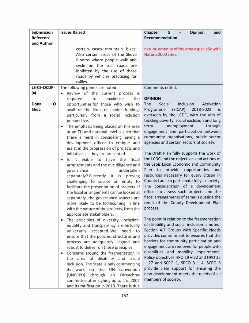
167
Submission Reference and Author
Issues Raised Chapter 5 - Opinion and Recommendation
certain cases mountain bikes. Also certain areas of the Slieve Blooms where people walk and cycle on the trail roads are inhibited by the use of these roads by vehicles practicing for rallies
natural amenity of the area especially with Natura 2000 sites.
LS-C9-DCDP-94 Donal O Shea
The following points are noted:
• Review of the current process is required to maximise the opportunities for those who wish to avail of the likes of leader funding, particularly from a social inclusion perspective.
• The emphasis being placed on this area at an EU and national level is such that there is merit in considering having a development officer to critique and assist in the progression of projects and initiatives as they are presented.
• Is it viable to have the fiscal arrangements and the due diligence and governance undertaken separately? Currently it is proving challenging to source an entity to facilitate the presentation of projects. If the fiscal arrangements can be looked at separately, the governance aspects are more likely to be forthcoming in line with the nature of the projects, from the appropriate stakeholders.
• The principles of diversity, inclusion, equality and transparency are virtually universally accepted. We need to ensure that the policies, structures and process are adequately aligned and robust to deliver on these principles.
• Concerns around the fragmentation in the area of disability and social inclusion. The State is only commencing its work on the UN convention (UNCRPD) through an Oireachtas committee after signing up to it in 2007 and its ratification in 2018. There is due
Comments noted. OPINION The Social Inclusion Activation Programme (SICAP) 2018-2022 is overseen by the LCDC, with the aim of tackling poverty, social exclusion and long term unemployment through engagement and participation between community organisations, public sector agencies and certain sectors of society. The Draft Plan fully supports the work of the LCDC and the objectives and actions of the Laois Local Economic and Community Plan to provide opportunities and resources necessary for every citizen in County Laois to participate fully in society. The consideration of a development officer to assess such projects and the fiscal arrangements of same is outside the remit of the County Development Plan process. The point in relation to the fragmentation of disability and social inclusion is noted. Section 4.7 Groups with Specific Needs provides commitment to ensures that the barriers for community participation and engagement are removed for people with disabilities and mobility impairments. Policy objectives HPO 19 – 22 and HPO 25 – 27 and SCPO 1, SPCO 3 – 4, SCPO 6 provide clear support for ensuring the new development meets the needs of all members of society.

168
Submission Reference and Author
Issues Raised Chapter 5 - Opinion and Recommendation
to be further direction issued in the next month to have the LECPs more effective, following a recent review. Equally there are plans underway to have the DRCD, the local authorities and the PPNs working with greater cohesion and alignment. As it is likely to be some time before the work of the disability matters Oireachtas committee is concluded, a more nuanced and pragmatic approach at County level is likely to assist progress here.
It is considered a further policy objective is required to ensure that the CDP can support the alignment of opportunity and source funding with the needs of a more socially inclusive Laois. RECOMMENDATION An additional policy objective is recommended: SCPO 16: Facilitate and support a more diverse and socially inclusive society that targets equality of opportunity and a better quality of life for all citizens, through improved integration of services and funding and greater accessibility in the delivery of sustainable communities and the provision of associated services.
LS-C9-DCDP-96 Marc Van Der Burgh
Paragraph 5.4: Add Cullenagh Ballyroan, Fossey Timahoe, to forest tracts
Comment noted. OPINION Noted and agreed. RECOMMENDATION Update text of 5.4 to include Cullenagh Ballyroan, Fossey Timahoe It is also recognised that the countryside of County Laois provides an important resource in outdoor recreational facilities not only for its own population but also for those visiting the County particularly in terms of provision of a range of forest tracks such as Togher Portlaoise, Oughval Stradbally, Cullenagh Ballyroan, Fossey Timahoe, Dunmore Durrow and Grantstown Lake Ballacolla and Blueways and Greenways such as Grand Canal Walk Vicarstown.
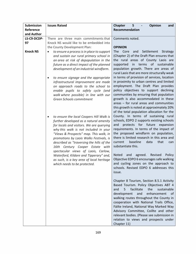
169
Submission Reference and Author
Issues Raised Chapter 5 - Opinion and Recommendation
LS-C9-DCDP-97 Knock NS
There are three main commitments that Knock NS would like to be embedded into the County Development Plan:
• to ensure a process is in place to support and sustain our rural primary school in an area at risk of depopulation in the future as a direct impact of the planned development of an industrial windfarm.
• to ensure signage and the appropriate infrastructural improvement are made on approach roads to the school to enable pupils to safely cycle (and walk where possible) in line with our Green Schools commitment
• to ensure the local Coopers Hill Walk is further developed as a natural amenity for locals and visitors. We are querying why this walk is not included in your "Views & Prospects" map. This walk, in promotions by Laois Walks Festivals, is described as "traversing the hills of the 16th Century Cooper Estate with spectacular views of Laois, Carlow, Waterford, Kildare and Tipperary" and, as such, is a key area of local heritage which needs to be protected.
Comments noted. OPINION The Core and Settlement Strategy (Chapter 2) of the Draft Plan ensures that the rural areas of County Laois are supported in terms of sustainable population growth. There are areas of rural Laois that are more structurally weak in terms of provision of services, location in proximity to urban centres and limited employment. The Draft Plan provides policy objectives to support declining communities by ensuring that population growth is also accommodated in these areas – for rural areas and communities this growth is noted at approximately 20% of the total population allocation for the County. In terms of sustaining rural schools, EDPO 2 supports existing schools and protects for future expansion requirements. In terms of the impact of the proposed windfarm on population, there is limited research in this area and current baseline data that can substantiate this. Noted and agreed. Revised Policy Objective EDPO 6 encourages safe walking and cycling zones on the approach to schools. Revised EDPO 6 addresses this issue. Chapter 8 Tourism, Section 8.5.1 Activity Based Tourism. Policy Objectives ABT 4 and 5 facilitate the sustainable development and enhancement of walking routes throughout the County in cooperation with National Trails Office, Fáilte Ireland, National Way Marked Way Advisory Committee, Coillte and other relevant bodies. (Please see submission in relation to views and prospects under Chapter 11)
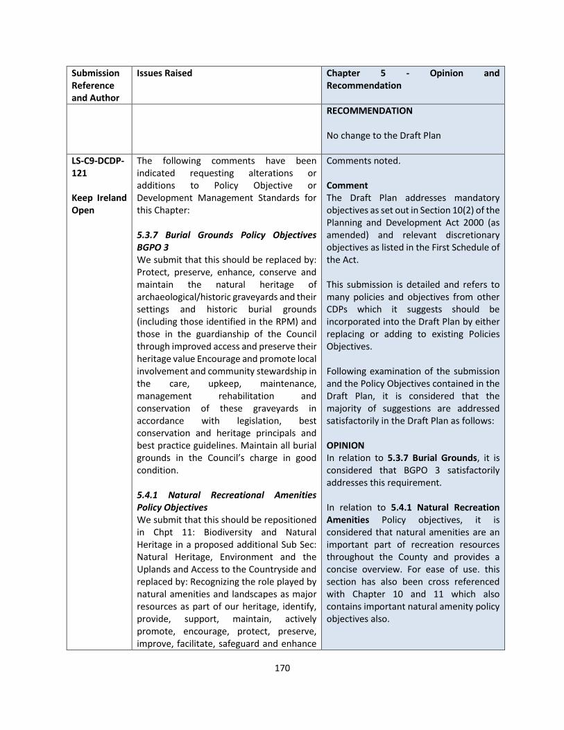
170
Submission Reference and Author
Issues Raised Chapter 5 - Opinion and Recommendation
RECOMMENDATION No change to the Draft Plan
LS-C9-DCDP-121 Keep Ireland Open
The following comments have been indicated requesting alterations or additions to Policy Objective or Development Management Standards for this Chapter: 5.3.7 Burial Grounds Policy Objectives BGPO 3 We submit that this should be replaced by: Protect, preserve, enhance, conserve and maintain the natural heritage of archaeological/historic graveyards and their settings and historic burial grounds (including those identified in the RPM) and those in the guardianship of the Council through improved access and preserve their heritage value Encourage and promote local involvement and community stewardship in the care, upkeep, maintenance, management rehabilitation and conservation of these graveyards in accordance with legislation, best conservation and heritage principals and best practice guidelines. Maintain all burial grounds in the Council’s charge in good condition. 5.4.1 Natural Recreational Amenities Policy Objectives We submit that this should be repositioned in Chpt 11: Biodiversity and Natural Heritage in a proposed additional Sub Sec: Natural Heritage, Environment and the Uplands and Access to the Countryside and replaced by: Recognizing the role played by natural amenities and landscapes as major resources as part of our heritage, identify, provide, support, maintain, actively promote, encourage, protect, preserve, improve, facilitate, safeguard and enhance
Comments noted. Comment The Draft Plan addresses mandatory objectives as set out in Section 10(2) of the Planning and Development Act 2000 (as amended) and relevant discretionary objectives as listed in the First Schedule of the Act. This submission is detailed and refers to many policies and objectives from other CDPs which it suggests should be incorporated into the Draft Plan by either replacing or adding to existing Policies Objectives. Following examination of the submission and the Policy Objectives contained in the Draft Plan, it is considered that the majority of suggestions are addressed satisfactorily in the Draft Plan as follows: OPINION In relation to 5.3.7 Burial Grounds, it is considered that BGPO 3 satisfactorily addresses this requirement. In relation to 5.4.1 Natural Recreation Amenities Policy objectives, it is considered that natural amenities are an important part of recreation resources throughout the County and provides a concise overview. For ease of use. this section has also been cross referenced with Chapter 10 and 11 which also contains important natural amenity policy objectives also.
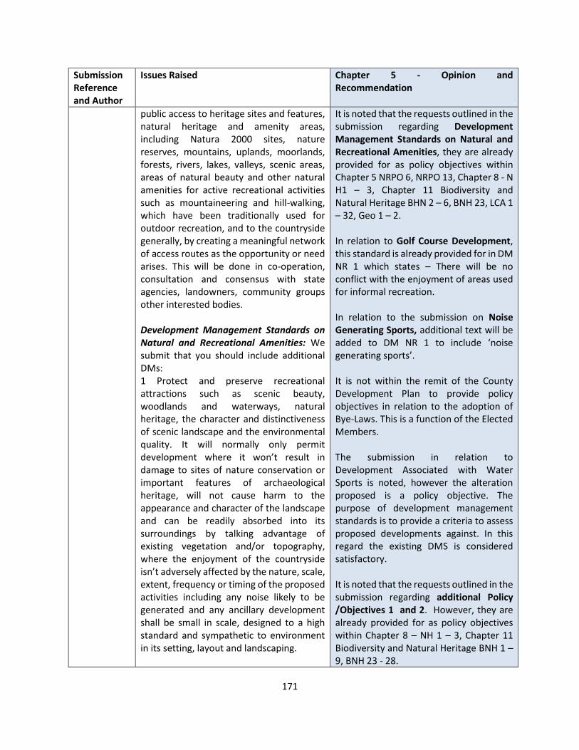
171
Submission Reference and Author
Issues Raised Chapter 5 - Opinion and Recommendation
public access to heritage sites and features, natural heritage and amenity areas, including Natura 2000 sites, nature reserves, mountains, uplands, moorlands, forests, rivers, lakes, valleys, scenic areas, areas of natural beauty and other natural amenities for active recreational activities such as mountaineering and hill-walking, which have been traditionally used for outdoor recreation, and to the countryside generally, by creating a meaningful network of access routes as the opportunity or need arises. This will be done in co-operation, consultation and consensus with state agencies, landowners, community groups other interested bodies. Development Management Standards on Natural and Recreational Amenities: We submit that you should include additional DMs: 1 Protect and preserve recreational attractions such as scenic beauty, woodlands and waterways, natural heritage, the character and distinctiveness of scenic landscape and the environmental quality. It will normally only permit development where it won’t result in damage to sites of nature conservation or important features of archaeological heritage, will not cause harm to the appearance and character of the landscape and can be readily absorbed into its surroundings by talking advantage of existing vegetation and/or topography, where the enjoyment of the countryside isn’t adversely affected by the nature, scale, extent, frequency or timing of the proposed activities including any noise likely to be generated and any ancillary development shall be small in scale, designed to a high standard and sympathetic to environment in its setting, layout and landscaping.
It is noted that the requests outlined in the submission regarding Development Management Standards on Natural and Recreational Amenities, they are already provided for as policy objectives within Chapter 5 NRPO 6, NRPO 13, Chapter 8 - N H1 – 3, Chapter 11 Biodiversity and Natural Heritage BHN 2 – 6, BNH 23, LCA 1 – 32, Geo 1 – 2. In relation to Golf Course Development, this standard is already provided for in DM NR 1 which states – There will be no conflict with the enjoyment of areas used for informal recreation. In relation to the submission on Noise Generating Sports, additional text will be added to DM NR 1 to include ‘noise generating sports’. It is not within the remit of the County Development Plan to provide policy objectives in relation to the adoption of Bye-Laws. This is a function of the Elected Members. The submission in relation to Development Associated with Water Sports is noted, however the alteration proposed is a policy objective. The purpose of development management standards is to provide a criteria to assess proposed developments against. In this regard the existing DMS is considered satisfactory. It is noted that the requests outlined in the submission regarding additional Policy /Objectives 1 and 2. However, they are already provided for as policy objectives within Chapter 8 – NH 1 – 3, Chapter 11 Biodiversity and Natural Heritage BNH 1 – 9, BNH 23 - 28.
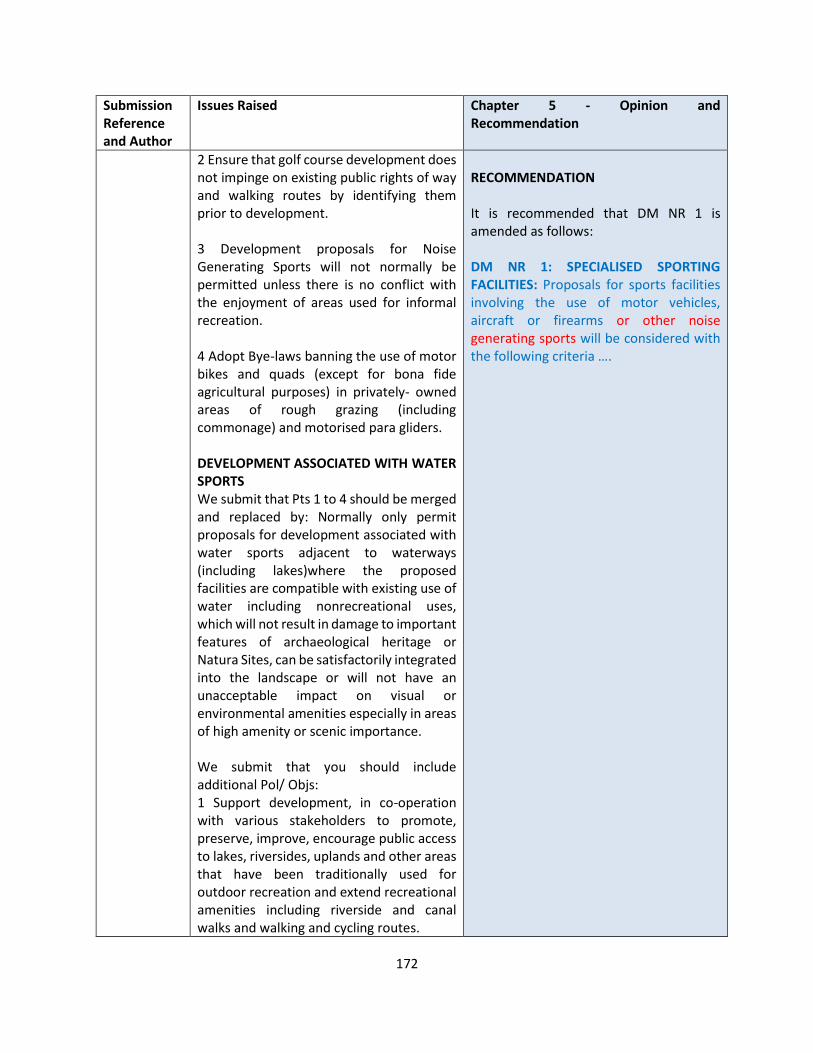
172
Submission Reference and Author
Issues Raised Chapter 5 - Opinion and Recommendation
2 Ensure that golf course development does not impinge on existing public rights of way and walking routes by identifying them prior to development. 3 Development proposals for Noise Generating Sports will not normally be permitted unless there is no conflict with the enjoyment of areas used for informal recreation. 4 Adopt Bye-laws banning the use of motor bikes and quads (except for bona fide agricultural purposes) in privately- owned areas of rough grazing (including commonage) and motorised para gliders. DEVELOPMENT ASSOCIATED WITH WATER SPORTS We submit that Pts 1 to 4 should be merged and replaced by: Normally only permit proposals for development associated with water sports adjacent to waterways (including lakes)where the proposed facilities are compatible with existing use of water including nonrecreational uses, which will not result in damage to important features of archaeological heritage or Natura Sites, can be satisfactorily integrated into the landscape or will not have an unacceptable impact on visual or environmental amenities especially in areas of high amenity or scenic importance. We submit that you should include additional Pol/ Objs: 1 Support development, in co-operation with various stakeholders to promote, preserve, improve, encourage public access to lakes, riversides, uplands and other areas that have been traditionally used for outdoor recreation and extend recreational amenities including riverside and canal walks and walking and cycling routes.
RECOMMENDATION It is recommended that DM NR 1 is amended as follows: DM NR 1: SPECIALISED SPORTING FACILITIES: Proposals for sports facilities involving the use of motor vehicles, aircraft or firearms or other noise generating sports will be considered with the following criteria ….
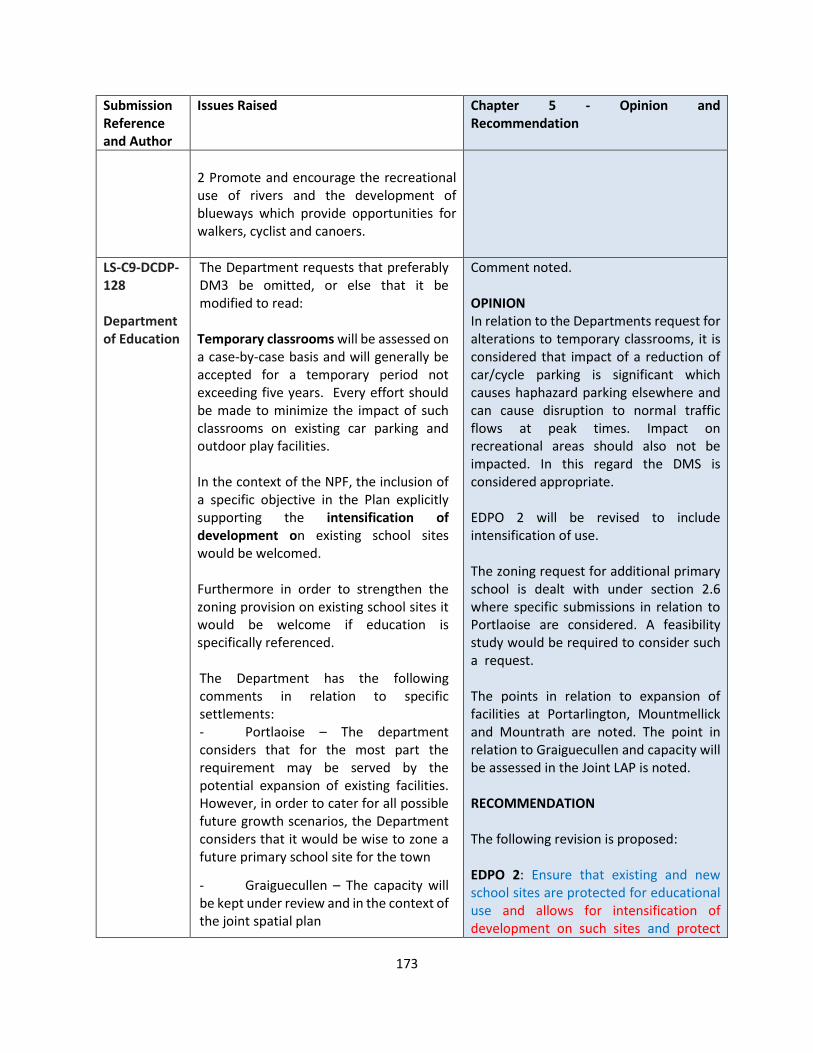
173
Submission Reference and Author
Issues Raised Chapter 5 - Opinion and Recommendation
2 Promote and encourage the recreational use of rivers and the development of blueways which provide opportunities for walkers, cyclist and canoers.
LS-C9-DCDP-128 Department of Education
The Department requests that preferably DM3 be omitted, or else that it be modified to read: Temporary classrooms will be assessed on a case-by-case basis and will generally be accepted for a temporary period not exceeding five years. Every effort should be made to minimize the impact of such classrooms on existing car parking and outdoor play facilities. In the context of the NPF, the inclusion of a specific objective in the Plan explicitly supporting the intensification of development on existing school sites would be welcomed. Furthermore in order to strengthen the zoning provision on existing school sites it would be welcome if education is specifically referenced. The Department has the following comments in relation to specific settlements: - Portlaoise – The department considers that for the most part the requirement may be served by the potential expansion of existing facilities. However, in order to cater for all possible future growth scenarios, the Department considers that it would be wise to zone a future primary school site for the town
- Graiguecullen – The capacity will be kept under review and in the context of the joint spatial plan
Comment noted. OPINION In relation to the Departments request for alterations to temporary classrooms, it is considered that impact of a reduction of car/cycle parking is significant which causes haphazard parking elsewhere and can cause disruption to normal traffic flows at peak times. Impact on recreational areas should also not be impacted. In this regard the DMS is considered appropriate. EDPO 2 will be revised to include intensification of use. The zoning request for additional primary school is dealt with under section 2.6 where specific submissions in relation to Portlaoise are considered. A feasibility study would be required to consider such a request. The points in relation to expansion of facilities at Portarlington, Mountmellick and Mountrath are noted. The point in relation to Graiguecullen and capacity will be assessed in the Joint LAP is noted. RECOMMENDATION The following revision is proposed: EDPO 2: Ensure that existing and new school sites are protected for educational use and allows for intensification of development on such sites and protect

174
Submission Reference and Author
Issues Raised Chapter 5 - Opinion and Recommendation
- Portarlington - The proposed population increase for the whole town may be served by the potential expansion of the existing school
- Mountmellick and Mountrath - There may be some requirement for school place provision at post primary level, which may be possibly served by the expansion of existing facilities
lands adjacent to existing schools are protected for future educational use to allow for expansion of these schools, if required, subject to site suitability. It is recommended that the following objective be added in Section 5: EDPO9: Undertake a feasibility study for Portlaoise for the provision of a school / education infrastructure.

175
CHAPTER 6 ECONOMIC DEVELOPMENT
Submission Reference and Author
Issues Raised Chapter 6 - Opinion and Recommendation
LS-C9-DCDP-38 Regina Dunne – Bloom HQ
The submission included a synopsis of the growth of Bloom HQ over the past number of years and the facilities it provides for the community and wider audience by facilitating:
• Community groups, start-up businesses, entrepreneurs, social care companies, and community education programmes.
• State-of-the-art meeting facilities have been used by public and private companies from Cork to Kerry, and Dublin as we are strategically located along the M8/M9/M7 motorways - 40 hot desks, 7 state-of-the-art meeting and conference spaces
• Health and fitness academy and facilities – including facilities for people with disabilities
Supports economic development in the area of:
• BloomHQ has signed an MOU with a number of key 3rd level institutions to provide access to Third Level education for the people of Laois without having to travel to other counties. In addition, collaborations with the innovative LOETB and the creation of community education programmes will create further employment potential.
• BloomHQ established the Grow Remote Laois Chapter to promote remote working and tourism to the towns of Laois, including the towns connected with the Laois Hub Collective.
• Further development of community-based CoWorking enterprise hubs, as BloomHQ has shown, a community-based hub is a holistic, sustainable,
OPINION The submission is noted in relation to Bloom HQ and what it has to offer to the community of Mountrath and Co Laois. In Table 6.4 Strategic Employment Initiatives in Chapter 6 No 7 “Continued support of remote working practices in the Laois Hub Collective (Portlaoise Enterprise Centre / Portarlington Enterprise Centre/ Bloom HQ/ Webmill / Vision 85, etc) whereby facilities are made available to workers travelling outside of the county”. The following policies also relate: ED 5 - Support entrepreneurship in County Laois and jobs-focused education and training programmes. ED 14 - Foster the cultivation of entrepreneurship among children, the provision of jobs-focused further education programmes and entrepreneur-focused training and mentoring to business owners in partnership with the Laois and Offaly Education and Training Board, LEO Laois, Laois Partnership Company, Department of Social Protection and Laois library network. ED 15 - Support and facilitate the development of remote working / co working space opportunities in a range of locations throughout the county such as Portlaoise, Portarlington, Mountmellick, Mountrath, Rathdowney and other appropriate locations subject to proper planning and development.
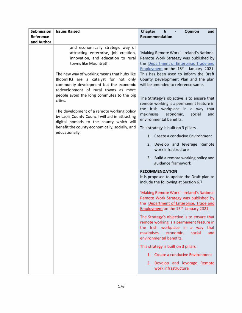
176
Submission Reference and Author
Issues Raised Chapter 6 - Opinion and Recommendation
and economically strategic way of attracting enterprise, job creation, innovation, and education to rural towns like Mountrath.
The new way of working means that hubs like BloomHQ are a catalyst for not only community development but the economic redevelopment of rural towns as more people avoid the long commutes to the big cities. The development of a remote working policy by Laois County Council will aid in attracting digital nomads to the county which will benefit the county economically, socially, and educationally.
‘Making Remote Work’ - Ireland’s National Remote Work Strategy was published by the Department of Enterprise, Trade and Employment on the 15th January 2021. This has been used to inform the Draft County Development Plan and the plan will be amended to reference same.
The Strategy’s objective is to ensure that remote working is a permanent feature in the Irish workplace in a way that maximises economic, social and environmental benefits.
This strategy is built on 3 pillars
1. Create a conducive Environment
2. Develop and leverage Remote work infrastructure
3. Build a remote working policy and guidance framework
RECOMMENDATION It is proposed to update the Draft plan to include the following at Section 6.7 ‘Making Remote Work’ - Ireland’s National Remote Work Strategy was published by the Department of Enterprise, Trade and Employment on the 15th January 2021.
The Strategy’s objective is to ensure that remote working is a permanent feature in the Irish workplace in a way that maximises economic, social and environmental benefits.
This strategy is built on 3 pillars
1. Create a conducive Environment
2. Develop and leverage Remote work infrastructure
177
Submission Reference and Author
Issues Raised Chapter 6 - Opinion and Recommendation
3. Build a remote working policy and guidance framework
It is proposed to include the following policy objective ED 17 – Establish a formalised framework of key stakeholders to collectively plan and collaborate to ensure facilities are in place to achieve the main pillars of the National Remote Working Strategy.
LS-C9-DCDP-63 Laois Hub Collective
Proposes that Laois is branded as a Digital County (collaboration with major stakeholders required). Existing network of hubs is ideal for driving high tech investment, space for start ups, mentoring, events, education, networking opportunities. Each hub has different speciality - eg kitchen for food production, pod cast development, etc There are several areas requiring attention A need for greater collaboration between all stake holders
• Hubs are currently under utilised particularly outside of Portlaoise
• Need to entice multinationals to the county and in particular the Hi Tech industries
• Internal competition within the county as opposed to a one county approach
• The hubs and their usage is not fully understood by the population
• No 3rd level Colleges Solutions Stakeholder collaboration 11,000 commuters to work remotely in such hubs (eg people working in public sector) Redevelop and repurpose unused buildings eg buildings vacated by BOI Provide turn key solutions for inward investment (work facilities, living facilities and recreation facilities)
OPINION The submission is noted in relation to Developing the County as a Digital County. Chapter 6 and Chapter 10 include the relevant policy objectives in relation to delivering same. In Chapter 6 - Table 6.4 Strategic Employment Initiatives, a number of initiatives are put forward and being developed by a number of stakeholders in order to create Enterprise and employment within the county. In particular: No 1 - Continue to promote and develop J17 National Enterprise Park in Portlaoise – a Strategic Employment Zone for the County and to support the Regional Growth Centre of Athlone And No 7 “Continued support of remote working practices in the Laois Hub Collective (Portlaoise Enterprise Centre / Portarlington Enterprise Centre/ Bloom HQ/ Webmill / Vision 85 , etc ) whereby facilities are made available to workers travelling outside of the county”.
178
Submission Reference and Author
Issues Raised Chapter 6 - Opinion and Recommendation
Utilise existing hubs to develop ecosystem for business development Brand Laois as Digital County – marketing campaign required Twin universities with each hub Provided a synopsis of LHC Remote Working Strategy: new ways of working, potential (Business, social development, tourism, health and wellbeing, green economy)
Relate to this. It should be noted that there is adequate zoning within towns and villages to support and facilitate all types of enterprise and employment and commerce generally. The following policies also relate ED 5 - Support entrepreneurship in County Laois and jobs-focused education and training programmes. ED 14 - Foster the cultivation of entrepreneurship among children, the provision of jobs-focused further education programmes and entrepreneur-focused training and mentoring to business owners in partnership with the Laois and Offaly Education and Training Board, LEO Laois, Laois Partnership Company, Department of Social Protection and Laois library network. ED 15 - Support and facilitate the development of remote working / co working space opportunities in a range of locations throughout the county such as Portlaoise, Portarlington, Mountmellick, Mountrath, Rathdowney and other appropriate locations subject to proper planning and development. A Digital Strategy was prepared for County Laois and adopted by the elected members in 2020. This has also informed the plan and the following policy relates in Section 10.6 of the Draft Plan - TEL 2 Support the delivery of the National Broadband Plan and implement the

179
Submission Reference and Author
Issues Raised Chapter 6 - Opinion and Recommendation
objectives of the Laois Local Digital Strategy 2020- 2024. Many of the Remote Working Hubs have Memorandum of Understanding (MOU) with Educational Facilities for example Portarlington is linked with Athlone IT soon to be and Portlaoise is linked with Carlow IT and Bloom HQ as referenced in an earlier submissions has also connections with education institutions. RECOMMENDATION No change to the Draft Plan
LS-C9-DCDP-67 Lightsource BP
The strategic ‘Aim’ should contain a reference to carbon reduction targets: ‘Aim: To Promote And Develop Laois’ Economy And Create A Viable And Favourable Low Carbon Economic Environment For Business And Enterprise To Thrive Both In Urban And Rural Areas Whilst Delivering Sustainable Jobs, Employment Opportunity Both Within The County And Beyond’. Chapter 6 should be stronger in relation to the strategic connections, formalised in policy between enterprise creation and renewable energy. Through the Development Plan, Laois has an opportunity to take ambitious steps to attract inward investment, both indigenous and foreign direct investment (FDI). An example from the draft Development Plan would be the 121ha Strategic Opportunity Site J17 ‘National Enterprise Park’ within Table 6.5 of Chapter 6. This site has been presented within the draft Plan as an ideal location for FDI, and that ‘development opportunities will be maximised during the Plan period’. The Development Plan therefore should contain clear, targeted, and focused policies and objectives, which demonstrate how
OPINION The submission is noted in relation to strengthening the relationship between enterprise creation and renewable energy. In response to the Low Carbon Transition for Portlaoise and generally for the County, Laois County Council has been funded under the Regional Enterprise Development Fund (REDF) to develop an Innovation and Collaboration space to create communities of practice will spearhead future Low Carbon initiatives on this island. The project pivots around a set of recently published Government plans and strategic directions namely:
• Project Ireland 2040
• Climate Action Plan to tackle Climate breakdown
• Future Jobs Ireland 2019
• Midlands Regional Enterprise Plan 2020
The CUBE at Portlaoise, a Low Carbon Centre of Excellence, will act as a focal
180
Submission Reference and Author
Issues Raised Chapter 6 - Opinion and Recommendation
renewable forms of energy are to be encouraged and in what areas of the local economy they can particularly assist. Solar developments of a utility scale provide the best opportunity to achieve both local targets set within the Development Plan and national targets on electricity generation. In addition, they facilitate reductions in carbon emissions and contribute positively to the local environment through biodiversity enhancement.
point for the development of new business and economic activity and that in turn will support and assist a transition to a low carbon economy. This is a new concept in business development not alone for the Portlaoise area but also in a national and international context and in that regard, it is a strategic change project in every respect. Companies located in the Cube and affiliated to the Cube will avail of, or provide services through the Cube. These services will be available to the wider region and nationally. The Cube will specialise in bespoke professional services and training programmes tailored to align with the requirements of disparate sectors for which there is currently minimal advice or service available The project will deliver jobs and enterprise in its own right at the CUBE and at existing outreach landing points in Portlaoise, Portarlington, Mountrath and Mountmellick. It will also have a profound transitional impact on job creation in all key Markets including Agribusiness, Renewable Energy, Forestry, Food Production, Transport, Construction, Manufacturing, Retail, Business Services, Education and Urban Design and Planning It is anticipated that approximately 260 jobs will be created both within the Cube and as a consequence of the impact of the Cube services. By creating links between existing and emerging industries and education the project can ensure Ireland has the technical knowledge and the skills necessary to excel in the changing marketplace. The Cube will provide
181
Submission Reference and Author
Issues Raised Chapter 6 - Opinion and Recommendation
services on the low carbon agenda for the region through a number of initiatives in partnership with regional enterprise and educational and training experts. The Cube will dedicate space for the incubation of Low Carbon focused start-ups and SME’s and will actively market the building, utilising the unique selling point of an exemplar Low Carbon Facility, with a focus on providing services with a Low Carbon agenda. This will be critical to attracting fledgling companies who fundamentally require key advice on Low Carbon specifics vital to their operations and future development
The Masterplan for J17 referred to in ED 2
Support the development J17 - National Enterprise Park in line with RPO 4.73 of the Regional Spatial and Economic Strategy (RSES) and the J17 National Enterprise Park Masterplan” includes objectives for climate action through the size of SUDS, energy efficiency proposals and landscaping and biodiversity. Section 3.4 of the Draft Plan indicates how Climate action has been incorporated into the Plan RECOMMENDATION It is proposed to amend the strategic ‘Aim’ should contain a reference to carbon reduction targets: ‘Aim: To Promote And Develop Laois’ Economy And Create A Viable And Favourable Low Carbon Economic Environment For Business And Enterprise To Thrive Both In Urban And Rural Areas Whilst Delivering Sustainable Jobs,
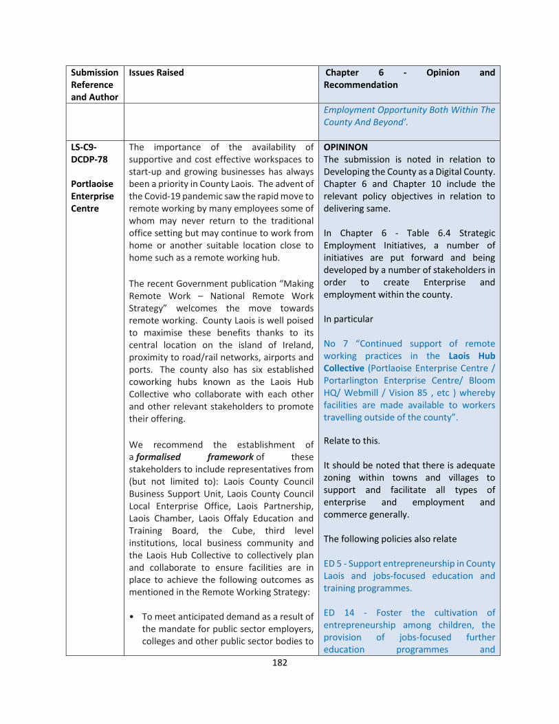
182
Submission Reference and Author
Issues Raised Chapter 6 - Opinion and Recommendation
Employment Opportunity Both Within The County And Beyond’.
LS-C9-DCDP-78 Portlaoise Enterprise Centre
The importance of the availability of supportive and cost effective workspaces to start-up and growing businesses has always been a priority in County Laois. The advent of the Covid-19 pandemic saw the rapid move to remote working by many employees some of whom may never return to the traditional office setting but may continue to work from home or another suitable location close to home such as a remote working hub.
The recent Government publication “Making Remote Work – National Remote Work Strategy” welcomes the move towards remote working. County Laois is well poised to maximise these benefits thanks to its central location on the island of Ireland, proximity to road/rail networks, airports and ports. The county also has six established coworking hubs known as the Laois Hub Collective who collaborate with each other and other relevant stakeholders to promote their offering.
We recommend the establishment of a formalised framework of these stakeholders to include representatives from (but not limited to): Laois County Council Business Support Unit, Laois County Council Local Enterprise Office, Laois Partnership, Laois Chamber, Laois Offaly Education and Training Board, the Cube, third level institutions, local business community and the Laois Hub Collective to collectively plan and collaborate to ensure facilities are in place to achieve the following outcomes as mentioned in the Remote Working Strategy: • To meet anticipated demand as a result of
the mandate for public sector employers, colleges and other public sector bodies to
OPININON The submission is noted in relation to Developing the County as a Digital County. Chapter 6 and Chapter 10 include the relevant policy objectives in relation to delivering same. In Chapter 6 - Table 6.4 Strategic Employment Initiatives, a number of initiatives are put forward and being developed by a number of stakeholders in order to create Enterprise and employment within the county. In particular No 7 “Continued support of remote working practices in the Laois Hub Collective (Portlaoise Enterprise Centre / Portarlington Enterprise Centre/ Bloom HQ/ Webmill / Vision 85 , etc ) whereby facilities are made available to workers travelling outside of the county”.
Relate to this.
It should be noted that there is adequate zoning within towns and villages to support and facilitate all types of enterprise and employment and commerce generally. The following policies also relate ED 5 - Support entrepreneurship in County Laois and jobs-focused education and training programmes. ED 14 - Foster the cultivation of entrepreneurship among children, the provision of jobs-focused further education programmes and
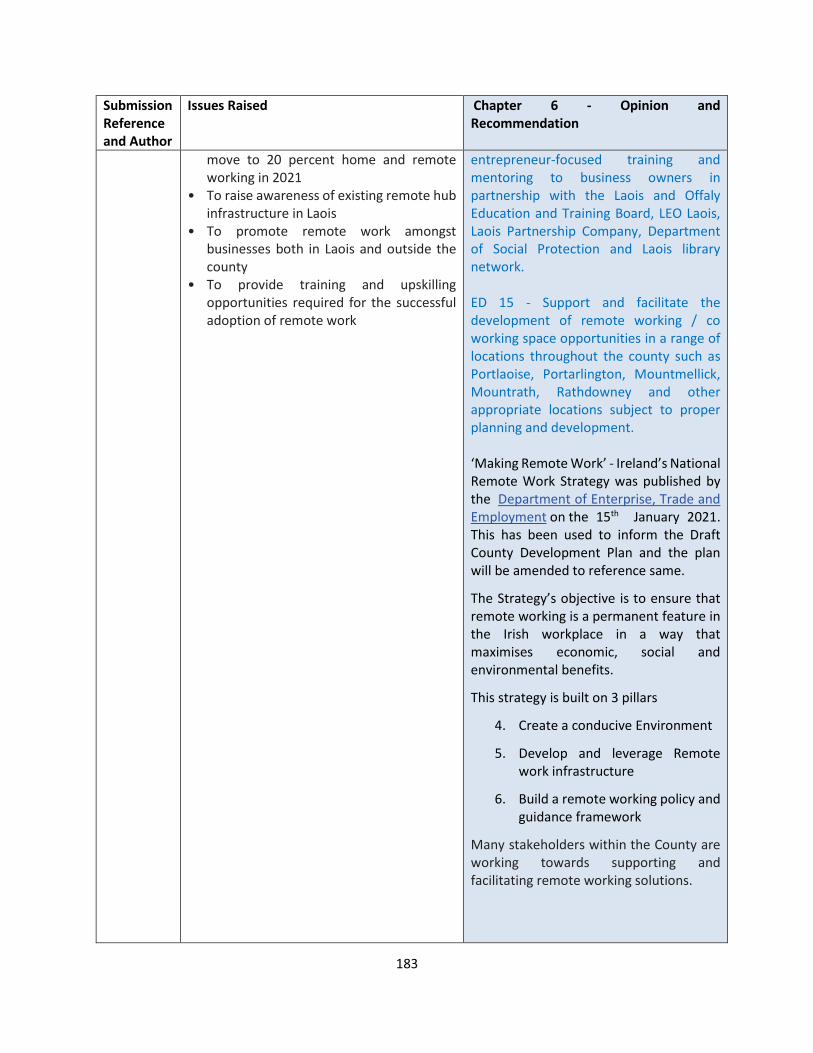
183
Submission Reference and Author
Issues Raised Chapter 6 - Opinion and Recommendation
move to 20 percent home and remote working in 2021
• To raise awareness of existing remote hub infrastructure in Laois
• To promote remote work amongst businesses both in Laois and outside the county
• To provide training and upskilling opportunities required for the successful adoption of remote work
entrepreneur-focused training and mentoring to business owners in partnership with the Laois and Offaly Education and Training Board, LEO Laois, Laois Partnership Company, Department of Social Protection and Laois library network. ED 15 - Support and facilitate the development of remote working / co working space opportunities in a range of locations throughout the county such as Portlaoise, Portarlington, Mountmellick, Mountrath, Rathdowney and other appropriate locations subject to proper planning and development. ‘Making Remote Work’ - Ireland’s National Remote Work Strategy was published by the Department of Enterprise, Trade and Employment on the 15th January 2021. This has been used to inform the Draft County Development Plan and the plan will be amended to reference same.
The Strategy’s objective is to ensure that remote working is a permanent feature in the Irish workplace in a way that maximises economic, social and environmental benefits.
This strategy is built on 3 pillars
4. Create a conducive Environment
5. Develop and leverage Remote work infrastructure
6. Build a remote working policy and guidance framework
Many stakeholders within the County are working towards supporting and facilitating remote working solutions.
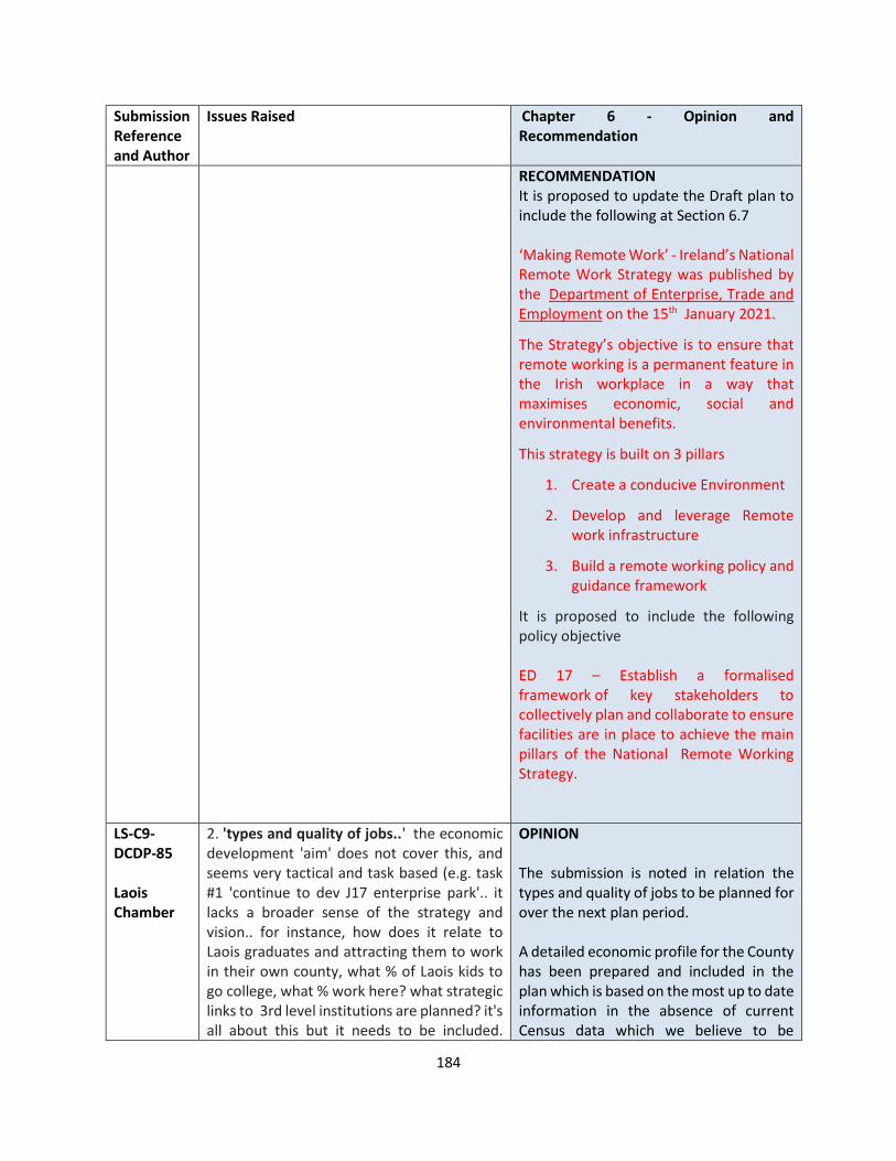
184
Submission Reference and Author
Issues Raised Chapter 6 - Opinion and Recommendation
RECOMMENDATION It is proposed to update the Draft plan to include the following at Section 6.7 ‘Making Remote Work’ - Ireland’s National Remote Work Strategy was published by the Department of Enterprise, Trade and Employment on the 15th January 2021.
The Strategy’s objective is to ensure that remote working is a permanent feature in the Irish workplace in a way that maximises economic, social and environmental benefits.
This strategy is built on 3 pillars
1. Create a conducive Environment
2. Develop and leverage Remote work infrastructure
3. Build a remote working policy and guidance framework
It is proposed to include the following policy objective ED 17 – Establish a formalised framework of key stakeholders to collectively plan and collaborate to ensure facilities are in place to achieve the main pillars of the National Remote Working Strategy.
LS-C9-DCDP-85 Laois Chamber
2. 'types and quality of jobs..' the economic development 'aim' does not cover this, and seems very tactical and task based (e.g. task #1 'continue to dev J17 enterprise park'.. it lacks a broader sense of the strategy and vision.. for instance, how does it relate to Laois graduates and attracting them to work in their own county, what % of Laois kids to go college, what % work here? what strategic links to 3rd level institutions are planned? it's all about this but it needs to be included.
OPINION The submission is noted in relation the types and quality of jobs to be planned for over the next plan period. A detailed economic profile for the County has been prepared and included in the plan which is based on the most up to date information in the absence of current Census data which we believe to be
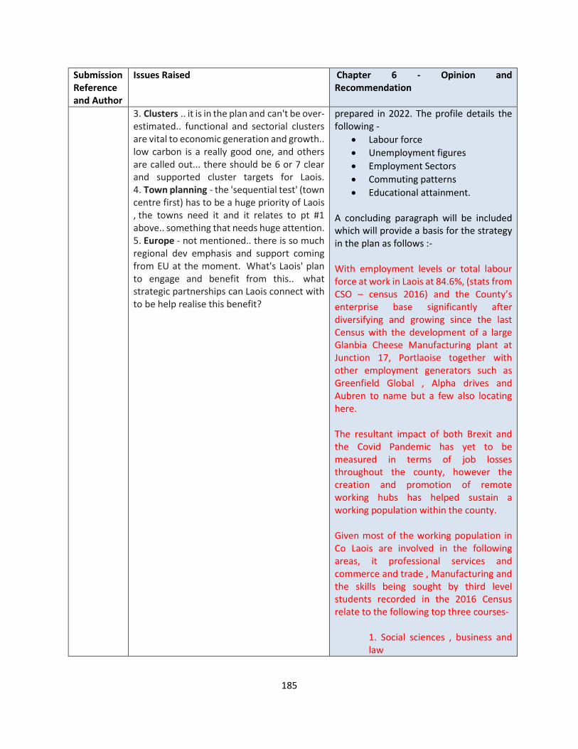
185
Submission Reference and Author
Issues Raised Chapter 6 - Opinion and Recommendation
3. Clusters .. it is in the plan and can't be over-estimated.. functional and sectorial clusters are vital to economic generation and growth.. low carbon is a really good one, and others are called out... there should be 6 or 7 clear and supported cluster targets for Laois. 4. Town planning - the 'sequential test' (town centre first) has to be a huge priority of Laois , the towns need it and it relates to pt #1 above.. something that needs huge attention. 5. Europe - not mentioned.. there is so much regional dev emphasis and support coming from EU at the moment. What's Laois' plan to engage and benefit from this.. what strategic partnerships can Laois connect with to be help realise this benefit?
prepared in 2022. The profile details the following -
• Labour force
• Unemployment figures
• Employment Sectors
• Commuting patterns
• Educational attainment. A concluding paragraph will be included which will provide a basis for the strategy in the plan as follows :- With employment levels or total labour force at work in Laois at 84.6%, (stats from CSO – census 2016) and the County’s enterprise base significantly after diversifying and growing since the last Census with the development of a large Glanbia Cheese Manufacturing plant at Junction 17, Portlaoise together with other employment generators such as Greenfield Global , Alpha drives and Aubren to name but a few also locating here. The resultant impact of both Brexit and the Covid Pandemic has yet to be measured in terms of job losses throughout the county, however the creation and promotion of remote working hubs has helped sustain a working population within the county. Given most of the working population in Co Laois are involved in the following areas, it professional services and commerce and trade , Manufacturing and the skills being sought by third level students recorded in the 2016 Census relate to the following top three courses-
1. Social sciences , business and law
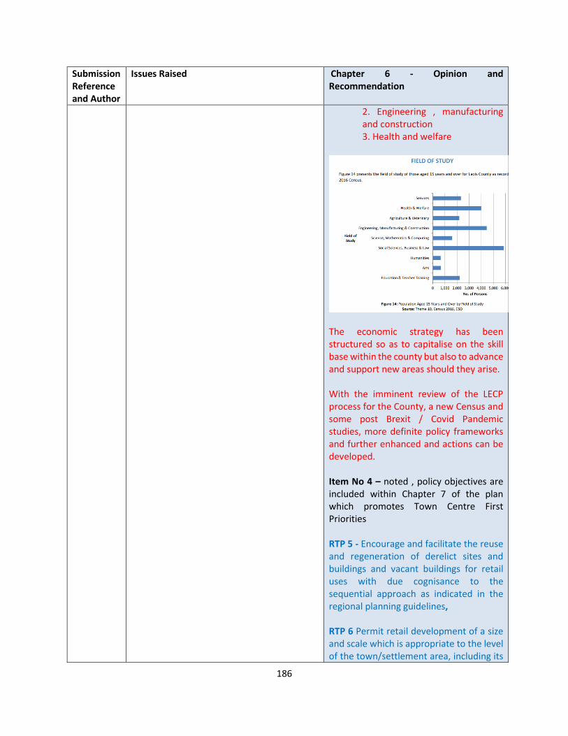
186
Submission Reference and Author
Issues Raised Chapter 6 - Opinion and Recommendation
2. Engineering , manufacturing and construction 3. Health and welfare
The economic strategy has been structured so as to capitalise on the skill base within the county but also to advance and support new areas should they arise. With the imminent review of the LECP process for the County, a new Census and some post Brexit / Covid Pandemic studies, more definite policy frameworks and further enhanced and actions can be developed. Item No 4 – noted , policy objectives are included within Chapter 7 of the plan which promotes Town Centre First Priorities RTP 5 - Encourage and facilitate the reuse and regeneration of derelict sites and buildings and vacant buildings for retail uses with due cognisance to the sequential approach as indicated in the regional planning guidelines, RTP 6 Permit retail development of a size and scale which is appropriate to the level of the town/settlement area, including its
187
Submission Reference and Author
Issues Raised Chapter 6 - Opinion and Recommendation
population, as defined within the County retail hierarchy, RTP 7 Ensure that all retail development permitted is in accordance with the Retail Planning: Guidelines for Planning Authorities (DECLG, 2012) and the Laois County Retail Strategy RTP 8 Protect the location of existing retail uses in town and village centres, the re-location of these uses to edge-of-centre or out-of-centre locations will not be accepted Item No 5 – In relation to EU supports, it is noted that there are various supports that are coming from Europe and through both the LEO and the BSU unit, these supports are administered where relevant. The Laois Local Economic and Community Plan (LECP) is a statutory Plan which was prepared to promote the economic and community development of County Laois from 2016-2021. The LECP was prepared by Laois County Council and the Laois Local Community Development Committee (Laois LCDC) in consultation with other agencies, organisations and groups. The plan was adopted by the Laois Local Community Development Committee (Laois LCDC) and Laois County Council in March 2016. The LECP provides a guide to the development of Laois up to 2021 and one of its main objectives is to ensure the effective co-ordination of publicly funded programmes such as SICAP – Social Inclusion and Community Activation Programme and LEADER Rural Development Programmes for the county.
188
Submission Reference and Author
Issues Raised Chapter 6 - Opinion and Recommendation
ED6 supports this plan and states as follows Support the implementation of LECP Economic Actions to market Laois for Inward Investment and for diversifying and strengthening a sustainable Laois economy, such as the preparation of a suite of opportunity site briefs suitable for large-scale enterprise/commercial uses and the promotion of Laois’ centrality, its transport connectivity and Portlaoise’s location along a Trans-European Core Network Corridor and its designation as a national transport node. RECOMMENDATION Include the following paragraph after 6.3.5. - With employment levels or total labour force at work in Laois at 84.6%, (stats from CSO – census 2016) and the County’s enterprise base significantly after diversifying and growing since the last Census with the development of a large Glanbia Cheese Manufacturing plant at Junction 17, Portlaoise together with other employment generators such as Greenfield Global , Alpha drives and Aubren to name but a few also locating here. The resultant impact of both Brexit and the Covid Pandemic has yet to be measured in terms of job losses throughout the county, however the creation and promotion of remote working hubs has helped sustain a working population within the county. Given most of the working population in Co Laois are involved in the following areas, it professional services and

189
Submission Reference and Author
Issues Raised Chapter 6 - Opinion and Recommendation
commerce and trade , Manufacturing and the skills being sought by third level students recorded in the 2016 Census relate to the top three courses as follows -
1. Social sciences , business and law 2. Engineering , manufacturing and construction 3. Health and welfare
The economic strategy has been structured so as to capitalise on the skill base within the county but also to advance and support new areas should they arise. With the imminent review of the LECP process for the County, a new Census and some post Brexit / Covid Pandemic studies, more definite policy frameworks and further enhanced and actions can be developed.
LS-C9-DCDP-87 An Post
The submission requests the inclusion of policy objectives which provide a supportive policy framework that can assist An Post in ensuring their ability to continue to meet the operational needs of an expanding population and a growing market is
OPINION The submission is noted in relation to An post Facilities and their requirement for enhanced postal services over the plan period.
190
Submission Reference and Author
Issues Raised Chapter 6 - Opinion and Recommendation
encouraged for the Laois County Development Plan 2021-2027 and the future Local Area Plan for Portlaoise.
The submission requests that Laois County Council include supportive polices to facilitate enhanced postal services in the County over the 6-year Development Plan period, such as
• “To support An Post in the provision of new postal facilities and the enhancement of existing facilities, including operational requirements, in the County.”
• “To facilitate the provision of postal infrastructure at suitable locations in the County.”
• “To promote the integration of appropriate post office facilities within new and existing communities that are appropriate to the size and scale of each settlement.”
It is also requested that the Local Authority recognise the specific operational requirements of An Post with regards the operation of post offices and mail sorting offices, primarily in relation to car parking, access and deliveries.
An Post facilities may require greater levels of parking spaces for staff and customers including electrical vehicle charging points, as a steady transition is made to the use of environmentally sustainable vehicles. In this regard flexibi8lity in car parking standards are required. A flexible approach to hours of operation is also requested.
We would request that during the preparation of any future public realm and movement strategies, Laois County Council consult with An Post to ensure sustainable
Policy objectives are included within the plan to support commercial services such as these in the context of their existing sites or new sites, subject to appropriate zoning and development control standards being met. ED 11 Support direct labour intensive enterprises to town centre/edge of centre locations and brownfield sites and favour brownfield sites over greenfield sites for general enterprise development in the interests of sustainability and orderly development. Chapter 7 Retail and Town and Village Centre Management includes policies relative to this service – TC 1 Support the implementation of LECP Economic Actions and LECP Community Actions related to the maintaining and enhancing the vitality and vibrancy of Laois Town and Village Centres in particular focusing on Portlaoise; TC 2 Support and facilitate the development of town centre strategies / Public Realm Strategies, where appropriate, liaising closely with residents, visitors and other relevant stakeholders TC 7 Retain and foster a mix of uses in town/village centres including residential commercial, community-based, civic, educational, recreational, tourism and religious to bolster the central role of town/village centres in the day-to-day lives of Laois people; DM TC 1 - relates to standards that shall be applied to this type of development

191
Submission Reference and Author
Issues Raised Chapter 6 - Opinion and Recommendation
solutions are considered to maintain a sufficient level of access whilst also improving the appearance and function of town centre areas for the public.
COMMERCIAL/RETAIL DEVELOPMENT
In assessing planning applications for commercial development a number of considerations will be taken into account:
1) Conformity with the land use policies in respect of commercial development;
2) The design, quality and mix of uses being proposed particularly in town centres where redevelopment and changes of use need to be orientated towards creating a vibrant and lively, quality directed commercial core;
3) The requirement that design quality protects but also enhances the architectural character of the town, particularly in relation to landmark structures and viewpoints;
4) The potential impact of traffic generation, parking provision and desirability thereof and whether or not consideration has been given to access and commuter movements;
5) Potential impact on the amenities of the surrounding areas;
6) The energy efficiency and overall sustainability of the development which includes practical considerations, such as servicing, deliveries, waste/recycling and overall management thereof;
7) Whether or not a land contamination assessment is necessary and is required as
192
Submission Reference and Author
Issues Raised Chapter 6 - Opinion and Recommendation
part of the Planning Authority requirements;
8) Whether or not an E.I.S. and/or N.I.S or AA has been deemed necessary and provided as part of the Planning Authority requirements;
9) The requirements for bring banks in line with council requirements;
Demolition within town centres will not normally be permitted unless fully justified by structural assessment and positive redevelopment proposals within the context of preceding objectives outlined above. RECOMMENDATION No change to the Draft Plan
LS-C9-DCDP-129 Wind Energy Ireland
Economic Development Opportunity
The ‘Economic Development’ section of the draft plan (Chapter 6) doesn’t sufficiently highlight the significant economic development potential and opportunities that Laois’s renewable energy resources represent.
Chapter 6 of the Draft Plan relating to Economic Development includes 17 individual policy objectives, none of which are “green economy” or “green energy” policies.
The plan should include measures and specific objectives that will harness the renewable energy and economic opportunity for Co. Laois.
Policy ED8 reflects the need for enabling infrastructure. However, future industry will be attracted to locations where “green” energy is available and, as industry moves further to high-tech and fin-tech, reliance
OPINION The submission is noted in relation to strengthening the relationship between Economic potential and opportunity and renewable energy. In response to the Low Carbon Transition for Portlaoise and generally for the County, Laois County Council has been funded under the Regional Enterprise Development Fund (REDF) to develop an Innovation and Collaboration space to create communities of practice will spearhead future Low Carbon initiatives on this island The project pivots around a set of recently published Government plans and strategic directions namely:
• Project Ireland 2040
• Climate Action Plan to tackle Climate breakdown
• Future Jobs Ireland 2019
• Midlands Regional Enterprise Plan 2020

193
Submission Reference and Author
Issues Raised Chapter 6 - Opinion and Recommendation
on proximity to road transport networks as a differentiator will diminish. The economic ambition appears to be over reliant on a carbon -based transport opportunity rather than a high-value low/zero carbon opportunity. This is not in accordance with RP09-Transition to Low Carbon and Clean Energy of the Regional and Spatial Economic Strategy.
The CUBE at Portlaoise, a Low Carbon Centre of Excellence, will act as a focal point for the development of new business and economic activity and that in turn will support and assist a transition to a low carbon economy. This is a new concept in business development not alone for the Portlaoise area but also in a national and international context and in that regard it is a strategic change project in every respect. The submission is also noted in relation to the fact that the economic ambition appears to be over reliant on a carbon -based transport opportunity rather than a high-value low/zero carbon opportunity. Reference to the carbon-based transport opportunity that exists in Laois is down to the investment to date in the Roads / Motorway development within the county. The County is also recognised as being on the mainline railway services and policy objectives included in Chapter 10 reflect support for their future development and investment which would impact greatly on the transition to a low carbon society. Investment in cycleways and walkways throughout the county are also supported. The transition to the Low carbon society and economy is well documented within the plan and Policy Objectives included in Chapter 3 – Section 3.4 – Action Area 1 – Sustainable Transport CM-ST1-8 relate. RECOMMENDATION No changes to the Draft Plan.
194
CHAPTER 7 RETAIL AND TOWN / VILLAGE CENTRE MANAGEMENT
Submission Reference and Author
Issues Raised Chapter 7 - Opinion and Recommendations
LS-C9-DCDP-2 PJ O Gorman
I feel small towns like Mountrath which are blighted by wholescale vacancy and dereliction, should be given special status in the County Development Plan 2021-2027. While Mountrath town is currently very well served with sustainable services and businesses the town centre has suffered greatly from extensive dereliction and vacancy. I feel that along with trying to attract more businesses into these small towns and villages, more emphases should be given to bringing people back into the town centres to live. To that end I suggest that the Council should commit as part of the Development Plan to direct more of their housing resources into purchasing these derelict, vacant buildings and sites (using their C.P.O powers where necessary) and bringing these premises up to a high habitable standard. I feel that with the 2021-2027 Development Plan, Laois County Council has a unique opportunity to lead the way for the rest of the country and be the first Council to seriously tackle urban Regeneration, Revitalisation while at the same time addressing the well documented national housing crisis. I would also suggest that Mountrath be named in the Development Plan as the “Pilot Town” for this regeneration project.
Submission noted. OPINION Tackling dereliction is a top priority of the Draft Plan. At a national level the government, in late 2018, launched the urban and Rural Regeneration and Development Funds. The Rural Regeneration and Development Fund (RRDF) is a commitment of €1 billion by government to be invested in rural Ireland over the period 2019 to 2027. The purpose of the fund is to support job creation in rural areas, address de-population of rural communities and support improvements in our towns and villages with a population of less than 10,000, and outlying areas. The Draft Plan supports the regeneration of County’s rural towns. RECOMMENDATION No changes to the Draft Plan
LS-C9-DCDP-35 Department of Rural and Community Development
Under 5.3.6 ARTS AND CULTURAL FACILITIES of the County Development Plan 2021-2027, we would welcome the incorporation of public library infrastructure development as an element in the Draft Development Plan 2021 – 2027 for Co. Laois.
OPINION Submission noted.
195
Submission Reference and Author
Issues Raised Chapter 7 - Opinion and Recommendations
“Our Public Libraries 2022, the national strategy for public libraries sets out the objective to consolidate the role of the library as the public face of local authorities. The strategy recognises that renewed investment in the development of library buildings, technology and other equipment is essential for libraries to deliver quality services. The public library service of Laois County Council plays an increasingly important educational, community, information and outreach role in the county. Libraries such as Portlaoise, Portarlington, Stradbally, Mountmellick, Abbeyleix, Mountrath and Durrow serve as key arts and culture outlets within the county. Works commenced in January 2020 on the construction of a new state of the art 1,800sqm public library in Portlaoise which has received funding of €3m from the Department of Rural and Community Development under the Libraries Capital Programme. Funding has also been received from the Urban Regeneration and Development Fund in respect of the development of a new Cultural Quarter in Portlaoise.”
RECOMMENDATION It is recommended to include this submission under Section 5.3.6 of the Plan “Our Public Libraries 2022, the national strategy for public libraries sets out the objective to consolidate the role of the library as the public face of local authorities. The strategy recognises that renewed investment in the development of library buildings, technology and other equipment is essential for libraries to deliver quality services. The public library service of Laois County Council plays an increasingly important educational, community, information and outreach role in the county. Libraries such as Portlaoise, Portarlington, Stradbally, Mountmellick, Abbeyleix, Mountrath and Durrow serve as key arts and culture outlets within the county. Works commenced in January 2020 on the construction of a new state of the art 1,800sqm public library in Portlaoise which has received funding of €3m from the Department of Rural and Community Development under the Libraries Capital Programme. Funding has also been received from the Urban Regeneration and Development Fund in respect of the development of a new Cultural Quarter in Portlaoise.”
LS-C9-DCDP-46 Cllr James Kelly
Requests commitment with the proposed Draft County Development Plan 2021-2027 that Laois County Council will play a leading role in the regeneration of the counties rural town centres such as Mountrath, Borris-in-Ossory, Rathdowney, Mountmellick, Stradbally etc which over the last decade have been hollowed out leaving a vast majority of business premises
Submission is noted OPINION The following policy objectives are included within Chapter 7 of the plan which promotes Town Centre First Priorities
196
Submission Reference and Author
Issues Raised Chapter 7 - Opinion and Recommendations
and living accommodation vacant. There are too many vacant and derelict properties in our town centres and we have a long waiting list for those who have applied to be housed by this council.
RTP 5 - Encourage and facilitate the reuse and regeneration of derelict sites and buildings and vacant buildings for retail uses with due cognisance to the sequential approach as indicated in the regional planning guidelines, RTP 6 Permit retail development of a size and scale which is appropriate to the level of the town/settlement area, including its population, as defined within the County retail hierarchy, RTP 7 Ensure that all retail development permitted is in accordance with the Retail Planning: Guidelines for Planning Authorities (DECLG, 2012) and the Laois County Retail Strategy RTP 8 Protect the location of existing retail uses in town and village centres, the re-location of these uses to edge-of-centre or out-of-centre locations will not be accepted Policy Objectives have been included in each specific town and village plan for their regeneration RECOMMENDATION No changes to the Draft Plan
LS-C9-DCDP-57 TII Transport Infrastructure Ireland
TII would welcome the following objective being included in the retail/town and village centre management objectives: RTP 18: There will be an explicit presumption against large out of town retail centres located adjacent or close to existing, new or planned national roads/motorways having regard to policy outlined in the Retail Planning Guidelines, 2012.
Submission is noted from TII in relation to the location of out of town shopping centres. The following policies have been detailed in relation to this matter. RTP 7 Ensure that all retail development permitted is in accordance with the Retail Planning: Guidelines for Planning Authorities (DECLG, 2012) and the Laois County Retail Strategy

197
Submission Reference and Author
Issues Raised Chapter 7 - Opinion and Recommendations
TII advises that the planning authority should include Section 2.8 of the DoECLG Spatial Planning and National Roads Guidelines which indicates the requirement for a forward planning approach to the provision of off-line motorway service areas at national road junctions and also addresses road-side service facilities on non-motorway national roads and their junctions.
RTP 8 Protect the location of existing retail uses in town and village centres, the re-location of these uses to edge-of-centre or out-of-centre locations will not be accepted RECOMMENDATION It is proposed to include the following additional policy and text. RTP 18: There will be an explicit presumption against large out of town retail centres located adjacent or close to existing, new or planned national roads/motorways having regard to policy outlined in the Retail Planning Guidelines, 2012. Include the following within Section 10.1.3.1, under motorway network: Section 2.8 of the DoECLG Spatial Planning and National Roads Guidelines which indicates the requirement for a forward planning approach to the provision of off-line motorway service areas at national road junctions and also addresses road-side service facilities on non-motorway national roads and their junctions.
LS-C9-DCDP-59 Sarah Sherlock
2. Embrace the Programme for Government: Our Shared Future (PfG)6, and make Town Centres First a priority 9. Carry Out Collaborative Town Centre Health Checks (CTCHC – the 15-step process from Phase 1, etc…) for towns in county Laois every two years and throughout the plan period. 19. LCC needs to develop and deliver a Town Centre Living Strategy for the designated key towns of Laois immediately. It needs to be inclusive and considerate of the town.
Submission is noted OPINION The Council is supportive of the ambition and principles of “Town Centre First” contained in the Programme For Government. RTP 5 - Encourage and facilitate the reuse and regeneration of derelict sites and buildings and vacant buildings for retail uses with due cognisance to the

198
Submission Reference and Author
Issues Raised Chapter 7 - Opinion and Recommendations
20. Prepare a sustainable regeneration plan for all publicly owned land so as its use and benefit is maximised for all Develop robust streetscape design guidelines and style palette for use within the county. 22. Formulate and deliver a Strategic Development Plan to set up Business Improvement Districts (BIDs) in the county 25. LCC should seek to create and accept only a high-quality public realm to enhance the urban fabric as well as the functioning of our towns and villages.
sequential approach as indicated in the retail planning guidelines, RTP 8 Protect the location of existing retail uses in town and village centres, the re-location of these uses to edge-of-centre or out-of-centre locations will not be accepted The request to – • Carry Out Collaborative Town Centre Health Checks (CTCHC – the 15-step process from Phase 1, etc…) for towns in county Laois every two years and throughout the plan period. This has been successfully carried out in many provincial towns throughout the Country e.g. Sligo, Dundalk, Tipperary, etc. The process is akin to the Town Team Structure which has been put in place in Portlaoise and Mountrath in Co Laois. We will continue to roll out this throughout the County working collaboratively with community development associations and relevant stakeholders and the public to development Strategies for regeneration. TC 3 relates “Enable the establishment of Town Teams to collaborate on and address the needs of town centre management” which can be expanded to include “Collaborative Town Centre Health Checks (and utilise CTCHC – the 15-step process from Phase 1, etc to inform future strategies)’
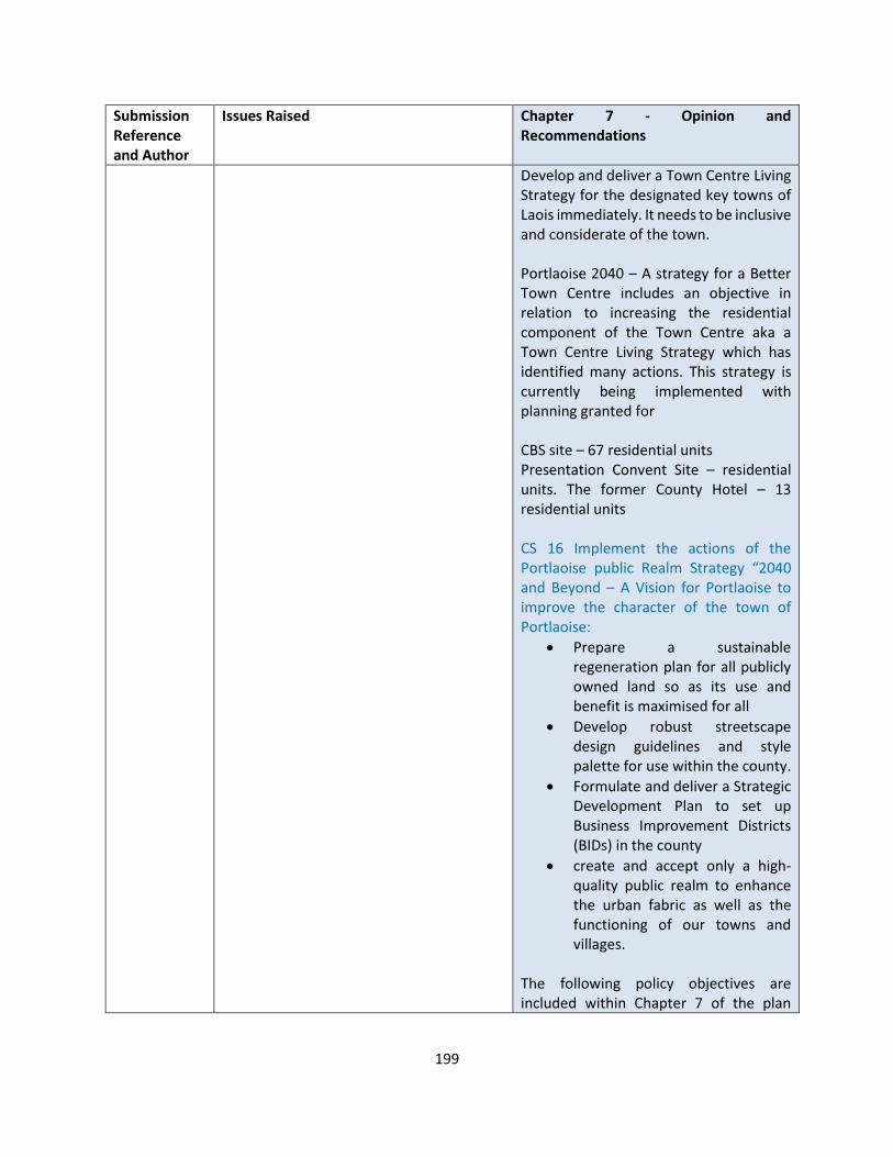
199
Submission Reference and Author
Issues Raised Chapter 7 - Opinion and Recommendations
Develop and deliver a Town Centre Living Strategy for the designated key towns of Laois immediately. It needs to be inclusive and considerate of the town. Portlaoise 2040 – A strategy for a Better Town Centre includes an objective in relation to increasing the residential component of the Town Centre aka a Town Centre Living Strategy which has identified many actions. This strategy is currently being implemented with planning granted for CBS site – 67 residential units Presentation Convent Site – residential units. The former County Hotel – 13 residential units CS 16 Implement the actions of the Portlaoise public Realm Strategy “2040 and Beyond – A Vision for Portlaoise to improve the character of the town of Portlaoise:
• Prepare a sustainable regeneration plan for all publicly owned land so as its use and benefit is maximised for all
• Develop robust streetscape design guidelines and style palette for use within the county.
• Formulate and deliver a Strategic Development Plan to set up Business Improvement Districts (BIDs) in the county
• create and accept only a high-quality public realm to enhance the urban fabric as well as the functioning of our towns and villages.
The following policy objectives are included within Chapter 7 of the plan
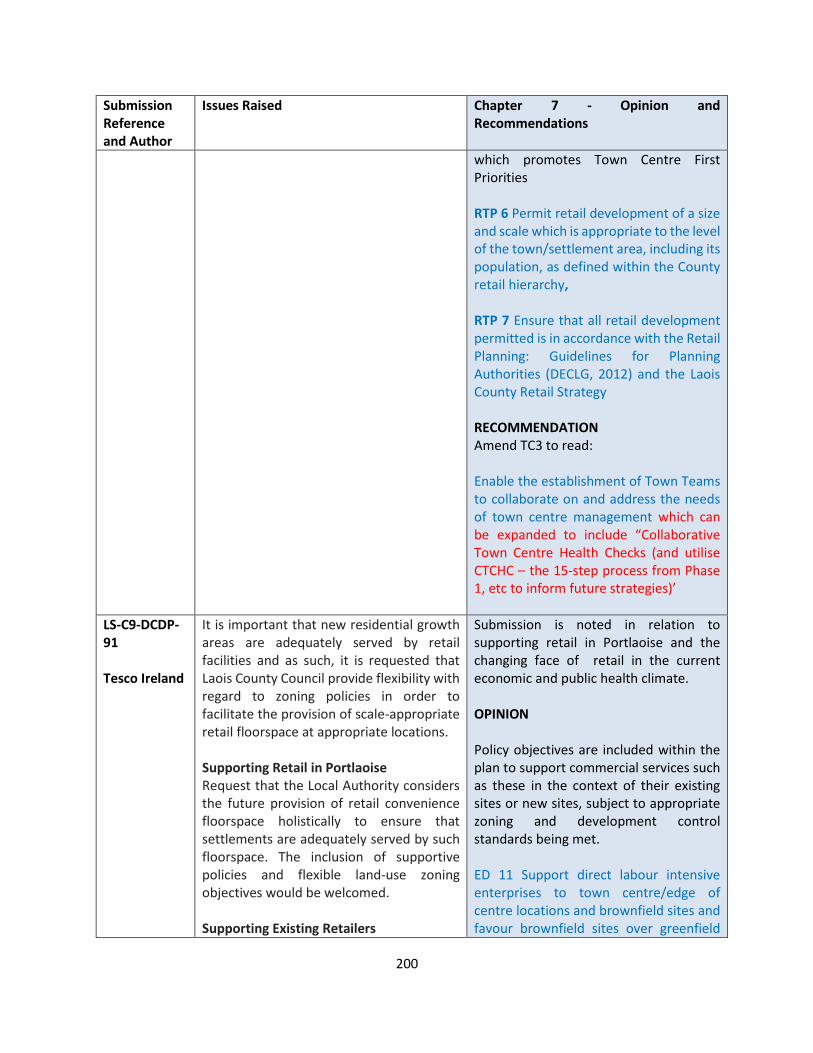
200
Submission Reference and Author
Issues Raised Chapter 7 - Opinion and Recommendations
which promotes Town Centre First Priorities RTP 6 Permit retail development of a size and scale which is appropriate to the level of the town/settlement area, including its population, as defined within the County retail hierarchy, RTP 7 Ensure that all retail development permitted is in accordance with the Retail Planning: Guidelines for Planning Authorities (DECLG, 2012) and the Laois County Retail Strategy RECOMMENDATION Amend TC3 to read: Enable the establishment of Town Teams to collaborate on and address the needs of town centre management which can be expanded to include “Collaborative Town Centre Health Checks (and utilise CTCHC – the 15-step process from Phase 1, etc to inform future strategies)’
LS-C9-DCDP-91 Tesco Ireland
It is important that new residential growth areas are adequately served by retail facilities and as such, it is requested that Laois County Council provide flexibility with regard to zoning policies in order to facilitate the provision of scale-appropriate retail floorspace at appropriate locations. Supporting Retail in Portlaoise Request that the Local Authority considers the future provision of retail convenience floorspace holistically to ensure that settlements are adequately served by such floorspace. The inclusion of supportive policies and flexible land-use zoning objectives would be welcomed. Supporting Existing Retailers
Submission is noted in relation to supporting retail in Portlaoise and the changing face of retail in the current economic and public health climate. OPINION Policy objectives are included within the plan to support commercial services such as these in the context of their existing sites or new sites, subject to appropriate zoning and development control standards being met. ED 11 Support direct labour intensive enterprises to town centre/edge of centre locations and brownfield sites and favour brownfield sites over greenfield

201
Submission Reference and Author
Issues Raised Chapter 7 - Opinion and Recommendations
Requests supporting existing retail operators should also not be overlooked as part of the finalisation of the Laois County Development Plan. This includes the safeguarding of delivery and access routes and spaces to undertake deliveries. In order to accrue all the benefits of the central distribution system, from product availability to a reduction in the number of delivery vehicles on the roads, restrictions on deliveries must be avoided. Additionally, adequate loading bay facilities and access routes should be maintained, to ensure the commercial viability of retail premises. Request that the delivery requirements of convenience foodstore operators are acknowledged and that policies providing for deliveries, including early morning deliveries should be provided. Requirements of Retailers Retailing, and convenience retailing in particular, has very specific requirements relating to the access, servicing, shape, size and morphology of sites. modern larger retail convenience layouts require unobstructed and level floorplates and where sites with these characteristics become available in or around town centre areas. It is important that the Local Authority recognise these sites are suitable for accommodating the provision of convenience retailing facilities, rather than having to rely on consolidating the existing urban fabric to try and achieve a suitable conforming site. Flexible land-use zonings should also be considered, when identifying potential sites for retail convenience developments.
sites for general enterprise development in the interests of sustainability and orderly development. Chapter 7 Retail and Town and Village Centre Management includes policies relative to this service – TC 1 Support the implementation of LECP Economic Actions and LECP Community Actions related to the maintaining and enhancing the vitality and vibrancy of Laois Town and Village Centres in particular focusing on Portlaoise; TC 2 Support and facilitate the development of town centre strategies / Public Realm Strategies, where appropriate, liaising closely with residents, visitors and other relevant stakeholders TC 7 Retain and foster a mix of uses in town/village centres including residential commercial, community-based, civic, educational, recreational, tourism and religious to bolster the central role of town/village centres in the day-to-day lives of Laois people; DM TC 1 - relates to standards that shall be applied to this type of development COMMERCIAL/RETAIL DEVELOPMENT
In assessing planning applications for commercial development a number of considerations will be taken into account:
1) Conformity with the land use policies in respect of commercial development;
2) The design, quality and mix of uses being proposed particularly in town centres
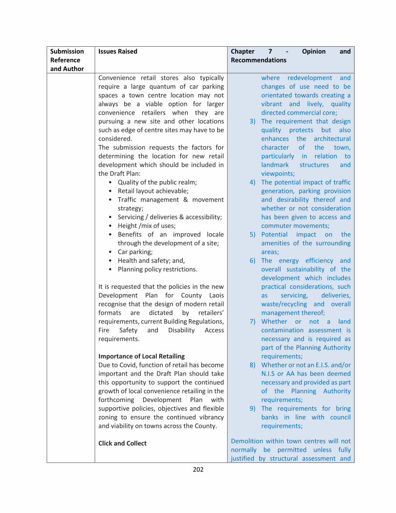
202
Submission Reference and Author
Issues Raised Chapter 7 - Opinion and Recommendations
Convenience retail stores also typically require a large quantum of car parking spaces a town centre location may not always be a viable option for larger convenience retailers when they are pursuing a new site and other locations such as edge of centre sites may have to be considered. The submission requests the factors for determining the location for new retail development which should be included in the Draft Plan:
• Quality of the public realm; • Retail layout achievable; • Traffic management & movement
strategy; • Servicing / deliveries & accessibility; • Height /mix of uses; • Benefits of an improved locale
through the development of a site; • Car parking; • Health and safety; and, • Planning policy restrictions.
It is requested that the policies in the new Development Plan for County Laois recognise that the design of modern retail formats are dictated by retailers’ requirements, current Building Regulations, Fire Safety and Disability Access requirements. Importance of Local Retailing Due to Covid, function of retail has become important and the Draft Plan should take this opportunity to support the continued growth of local convenience retailing in the forthcoming Development Plan with supportive policies, objectives and flexible zoning to ensure the continued vibrancy and viability on towns across the County. Click and Collect
where redevelopment and changes of use need to be orientated towards creating a vibrant and lively, quality directed commercial core;
3) The requirement that design quality protects but also enhances the architectural character of the town, particularly in relation to landmark structures and viewpoints;
4) The potential impact of traffic generation, parking provision and desirability thereof and whether or not consideration has been given to access and commuter movements;
5) Potential impact on the amenities of the surrounding areas;
6) The energy efficiency and overall sustainability of the development which includes practical considerations, such as servicing, deliveries, waste/recycling and overall management thereof;
7) Whether or not a land contamination assessment is necessary and is required as part of the Planning Authority requirements;
8) Whether or not an E.I.S. and/or N.I.S or AA has been deemed necessary and provided as part of the Planning Authority requirements;
9) The requirements for bring banks in line with council requirements;
Demolition within town centres will not normally be permitted unless fully justified by structural assessment and

203
Submission Reference and Author
Issues Raised Chapter 7 - Opinion and Recommendations
Important role of ‘click and collect’ facilities. Such facilities offer an extremely efficient service which allows customers to collect their shopping at a time that suits them, without the requirement to enter the store. ask the Local Authority to have regard to the recent growth of both ‘Click and Collect’ and grocery home shopping services, and provide support for same in the Development Plan
positive redevelopment proposals within the context of preceding objectives outlined above. RECOMMENDATION No change to the Draft Plan
LS-C9-DCDP-106 Laois Ogra Fianna Fail
• The Council should commit itself to the restoration of our town centres and stamping out the scourge of vacant and derelict residential property that increasingly blights our town. Repopulating our town centres with associated improvements in pedestrianisation, reduced street furniture, increased amenities and public lighting should be a cornerstone of the Council’s housing strategy.
• Our town centres have been severely neglected over the past few decades which has prioritised peripheral development of our towns in both the retail, amenity and residential space. Our town centres need to be reclaimed through a process of traffic calming, tree planting, pedestrianisation and restoration of the built environment. Cars have been prioritised over people for far too long in all Laois’ towns and villages to the detriment of the people who inhabit them or increasingly used to inhabit them.
• Civic spaces need to be restored and returned to the people. The top square in Portlaoise serves as a perfect example. In what should be the civic centre of our county town and county we find a heavily segregated space split between very fast flowing traffic along a national route and car parking facilities. The
Submission is noted OPINION The Council is supportive of the ambition and principles of “Town Centre First” contained in the Programme For Government. RTP 5 - Encourage and facilitate the reuse and regeneration of derelict sites and buildings and vacant buildings for retail uses with due cognisance to the sequential approach as indicated in the retail planning guidelines, RTP 8 Protect the location of existing retail uses in town and village centres, the re-location of these uses to edge-of-centre or out-of-centre locations will not be accepted Portlaoise 2040 – A strategy for a Better Town Centre includes an objective in relation to increasing the residential component of the Town Centre aka a Town Centre Living Strategy which has identified many actions. This strategy is currently being implemented with planning granted for
• CBS site – 67 residential units

204
Submission Reference and Author
Issues Raised Chapter 7 - Opinion and Recommendations
completion of the towns ringroad offers the perfect opportunity for the full reclamation of this important civic and social amenity through a program of pedestrianisation, rebuilding of the old town hall, tree planting and installation of appropriate street furniture.
• Presentation Convent Site – residential units
• The former County Hotel – 13 residential units
CS 16 Implement the actions of the Portlaoise public Realm Strategy “2040 and Beyond – A Vision for Portlaoise to improve the character of the town of Portlaoise RECOMMENDATION No change to the Draft Plan.
LS-C9-DCDP-121 Keep Ireland Open
We submit that you should include an additional DMS: Ensure that all new development respects and enhances the historic environment.
Submission is noted OPIINON The following policy objective ensure that future development respects and enhances its historic context / environment TC 6 – “Maintain compact and permeable town/village centres, conserve any special architectural interest of town/village centres and foster active frontages at ground floor level to ensure bustling town and village centres; DM TC 1 Relates to Commercial / retail development and the standards to be applied No 3 refers as follows COMMERCIAL/RETAIL DEVELOPMENT In assessing planning applications for commercial development a number of considerations will be taken into account:
• Conformity with the land use policies in respect of commercial development;
• The design, quality and mix of uses being proposed particularly in town

205
Submission Reference and Author
Issues Raised Chapter 7 - Opinion and Recommendations
centres where redevelopment and changes of use need to be orientated towards creating a vibrant and lively, quality directed commercial core;
• The requirement that design quality protects but also enhances the architectural character of the town, particularly in relation to landmark structures and viewpoints;
Bullet Point No 3 is sufficient in this regard RECOMMENDATION No change to the Draft Plan
LS-C9-DCDP – 135 An Taisce
Welcome the approach taken in the Draft CDP towards town centre regeneration and various commitments in the Town / Village Centre Management Policy Objectives
OPINION Submission is noted. RECOMMENDATION No change to the Draft Plan.
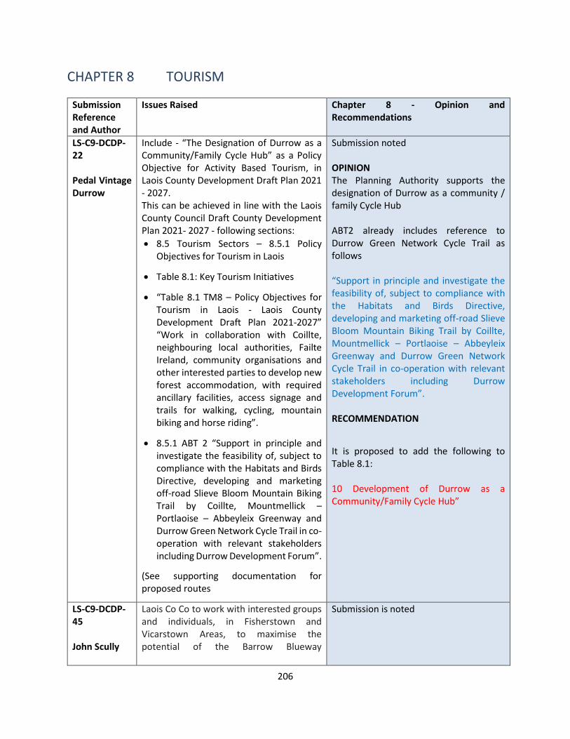
206
CHAPTER 8 TOURISM
Submission Reference and Author
Issues Raised Chapter 8 - Opinion and Recommendations
LS-C9-DCDP-22 Pedal Vintage Durrow
Include - “The Designation of Durrow as a Community/Family Cycle Hub” as a Policy Objective for Activity Based Tourism, in Laois County Development Draft Plan 2021 - 2027. This can be achieved in line with the Laois County Council Draft County Development Plan 2021- 2027 - following sections:
• 8.5 Tourism Sectors – 8.5.1 Policy Objectives for Tourism in Laois
• Table 8.1: Key Tourism Initiatives
• “Table 8.1 TM8 – Policy Objectives for Tourism in Laois - Laois County Development Draft Plan 2021-2027” “Work in collaboration with Coillte, neighbouring local authorities, Failte Ireland, community organisations and other interested parties to develop new forest accommodation, with required ancillary facilities, access signage and trails for walking, cycling, mountain biking and horse riding”.
• 8.5.1 ABT 2 “Support in principle and investigate the feasibility of, subject to compliance with the Habitats and Birds Directive, developing and marketing off-road Slieve Bloom Mountain Biking Trail by Coillte, Mountmellick – Portlaoise – Abbeyleix Greenway and Durrow Green Network Cycle Trail in co-operation with relevant stakeholders including Durrow Development Forum”.
(See supporting documentation for proposed routes
Submission noted OPINION The Planning Authority supports the designation of Durrow as a community / family Cycle Hub ABT2 already includes reference to Durrow Green Network Cycle Trail as follows “Support in principle and investigate the feasibility of, subject to compliance with the Habitats and Birds Directive, developing and marketing off-road Slieve Bloom Mountain Biking Trail by Coillte, Mountmellick – Portlaoise – Abbeyleix Greenway and Durrow Green Network Cycle Trail in co-operation with relevant stakeholders including Durrow Development Forum”. RECOMMENDATION
It is proposed to add the following to Table 8.1: 10 Development of Durrow as a Community/Family Cycle Hub”
LS-C9-DCDP-45 John Scully
Laois Co Co to work with interested groups and individuals, in Fisherstown and Vicarstown Areas, to maximise the potential of the Barrow Blueway
Submission is noted
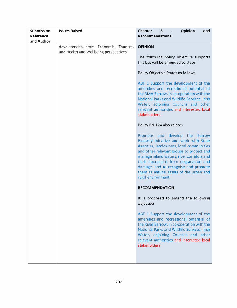
207
Submission Reference and Author
Issues Raised Chapter 8 - Opinion and Recommendations
development, from Economic, Tourism, and Health and Wellbeing perspectives.
OPINION The following policy objective supports this but will be amended to state Policy Objective States as follows ABT 1 Support the development of the amenities and recreational potential of the River Barrow, in co-operation with the National Parks and Wildlife Services, Irish Water, adjoining Councils and other relevant authorities and interested local stakeholders Policy BNH 24 also relates Promote and develop the Barrow Blueway initiative and work with State Agencies, landowners, local communities and other relevant groups to protect and manage inland waters, river corridors and their floodplains from degradation and damage, and to recognise and promote them as natural assets of the urban and rural environment RECOMMENDATION It is proposed to amend the following objective ABT 1 Support the development of the amenities and recreational potential of the River Barrow, in co-operation with the National Parks and Wildlife Services, Irish Water, adjoining Councils and other relevant authorities and interested local stakeholders

208
Submission Reference and Author
Issues Raised Chapter 8 - Opinion and Recommendations
LS-C9-DCDP-57 TII Transport Infrastructure Ireland
TII would welcome Objective IAE 2 (b) to be modified to reflect this requirement. (Suggested text annotated in red below). Have regard to TII’s Policy on the Provision of Tourist & Leisure Signage on National Roads (March 2011) in addition to Section 3.8 of the DoECLG’s Spatial Planning and National Roads Guidelines
Submission is noted OPINION The following policy objective supports this but will be amended as suggested. RECOMMENDATION It is proposed to amend the following objective IAE 2 - (A) Collaborate with Fáilte Ireland, the Transport Infrastructure Ireland (TII) and other key stakeholders in the development and implementation of a signage programme associated with Ireland’s Ancient East to include branded orientation signage and roadside signage (B) Have regard to TII’s Policy on the Provision of Tourist & Leisure Signage on National Roads (March 2011) in addition to Section 3.8 of the DoECLG’s Spatial Planning and National Roads Guidelines
LS-C9-DCDP-65 Durrow Development Forum
Cycling is not significant mode of transport in Durrow. Just two people reported cycling to work in Census 2016, and not a single pupil reported cycling to school or college. Since one of the striking features of Durrow is the large number of HGVs travelling through the narrow streets, more effort is needed to encourage local residents to cycle, and attract cycling-based tourism. DDF are encouraged the plan recognises the benefits of safe places to cycle and a safe commuting route to school and work and the value of healthy exercise. We propose the development of designated cycleways and bicycle parking areas connecting key residential estates, school, shops and amenities.
Submission is noted OPINION The Planning Authority welcomes the support for the provision of walking and cycling infrastructure and designation as a cycling south in the south east of the county. RECOMMENDATION Same as LS-C9-DCDP-22
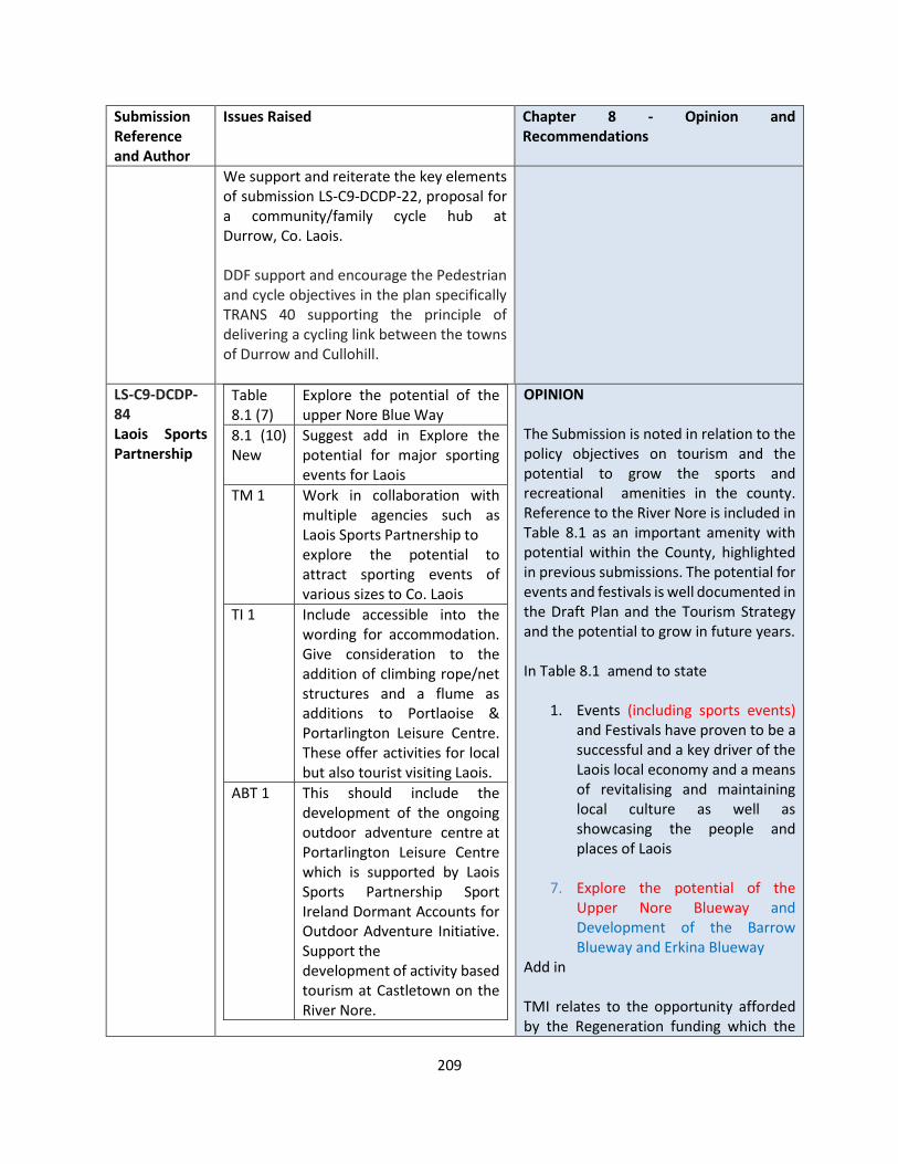
209
Submission Reference and Author
Issues Raised Chapter 8 - Opinion and Recommendations
We support and reiterate the key elements of submission LS-C9-DCDP-22, proposal for a community/family cycle hub at Durrow, Co. Laois. DDF support and encourage the Pedestrian and cycle objectives in the plan specifically TRANS 40 supporting the principle of delivering a cycling link between the towns of Durrow and Cullohill.
LS-C9-DCDP-84 Laois Sports Partnership
Table 8.1 (7)
Explore the potential of the upper Nore Blue Way
8.1 (10) New
Suggest add in Explore the potential for major sporting events for Laois
TM 1 Work in collaboration with multiple agencies such as Laois Sports Partnership to explore the potential to attract sporting events of various sizes to Co. Laois
TI 1 Include accessible into the wording for accommodation. Give consideration to the addition of climbing rope/net structures and a flume as additions to Portlaoise & Portarlington Leisure Centre. These offer activities for local but also tourist visiting Laois.
ABT 1 This should include the development of the ongoing outdoor adventure centre at Portarlington Leisure Centre which is supported by Laois Sports Partnership Sport Ireland Dormant Accounts for Outdoor Adventure Initiative. Support the development of activity based tourism at Castletown on the River Nore.
OPINION The Submission is noted in relation to the policy objectives on tourism and the potential to grow the sports and recreational amenities in the county. Reference to the River Nore is included in Table 8.1 as an important amenity with potential within the County, highlighted in previous submissions. The potential for events and festivals is well documented in the Draft Plan and the Tourism Strategy and the potential to grow in future years. In Table 8.1 amend to state
1. Events (including sports events) and Festivals have proven to be a successful and a key driver of the Laois local economy and a means of revitalising and maintaining local culture as well as showcasing the people and places of Laois
7. Explore the potential of the
Upper Nore Blueway and Development of the Barrow Blueway and Erkina Blueway
Add in TMI relates to the opportunity afforded by the Regeneration funding which the
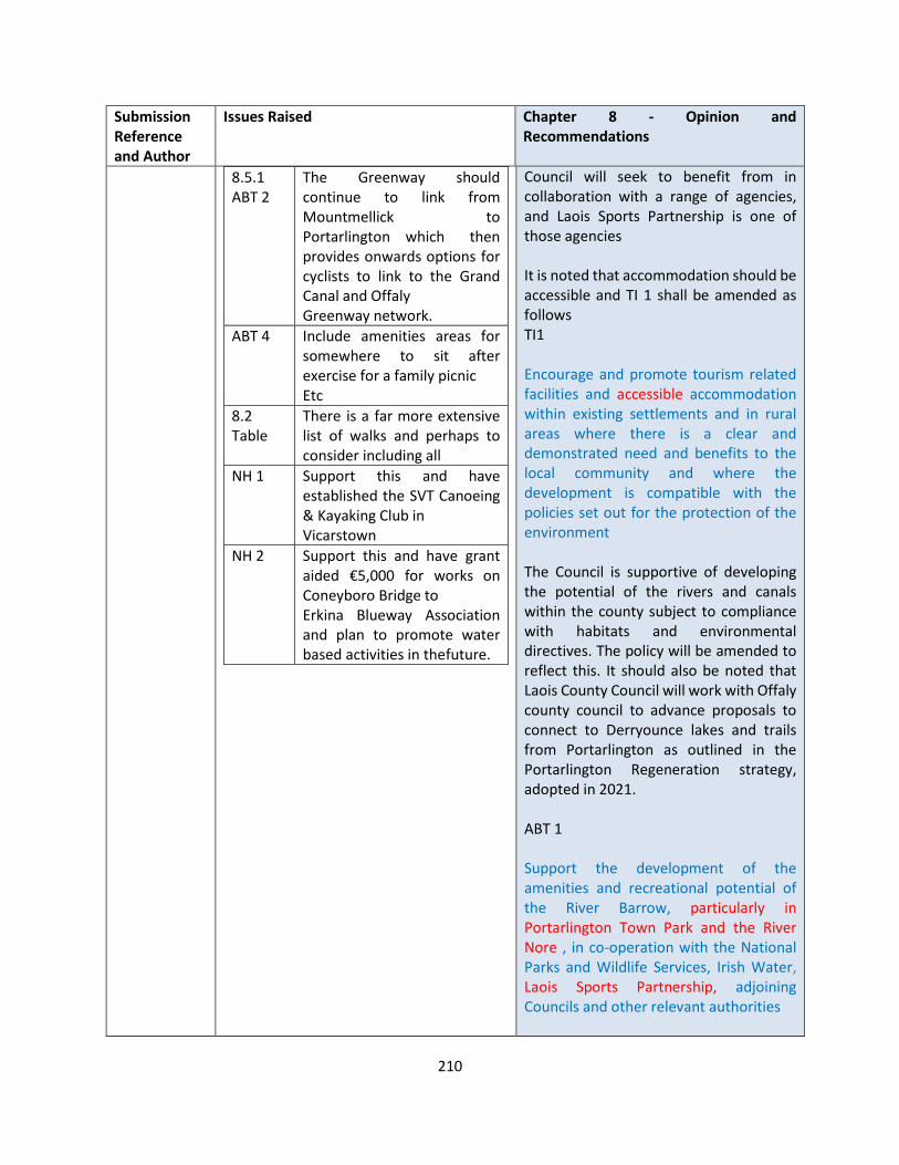
210
Submission Reference and Author
Issues Raised Chapter 8 - Opinion and Recommendations
8.5.1 ABT 2
The Greenway should continue to link from Mountmellick to Portarlington which then provides onwards options for cyclists to link to the Grand Canal and Offaly Greenway network.
ABT 4 Include amenities areas for somewhere to sit after exercise for a family picnic Etc
8.2 Table
There is a far more extensive list of walks and perhaps to consider including all
NH 1 Support this and have established the SVT Canoeing & Kayaking Club in Vicarstown
NH 2 Support this and have grant aided €5,000 for works on Coneyboro Bridge to Erkina Blueway Association and plan to promote water based activities in the future.
Council will seek to benefit from in collaboration with a range of agencies, and Laois Sports Partnership is one of those agencies It is noted that accommodation should be accessible and TI 1 shall be amended as follows TI1 Encourage and promote tourism related facilities and accessible accommodation within existing settlements and in rural areas where there is a clear and demonstrated need and benefits to the local community and where the development is compatible with the policies set out for the protection of the environment The Council is supportive of developing the potential of the rivers and canals within the county subject to compliance with habitats and environmental directives. The policy will be amended to reflect this. It should also be noted that Laois County Council will work with Offaly county council to advance proposals to connect to Derryounce lakes and trails from Portarlington as outlined in the Portarlington Regeneration strategy, adopted in 2021. ABT 1 Support the development of the amenities and recreational potential of the River Barrow, particularly in Portarlington Town Park and the River Nore , in co-operation with the National Parks and Wildlife Services, Irish Water, Laois Sports Partnership, adjoining Councils and other relevant authorities
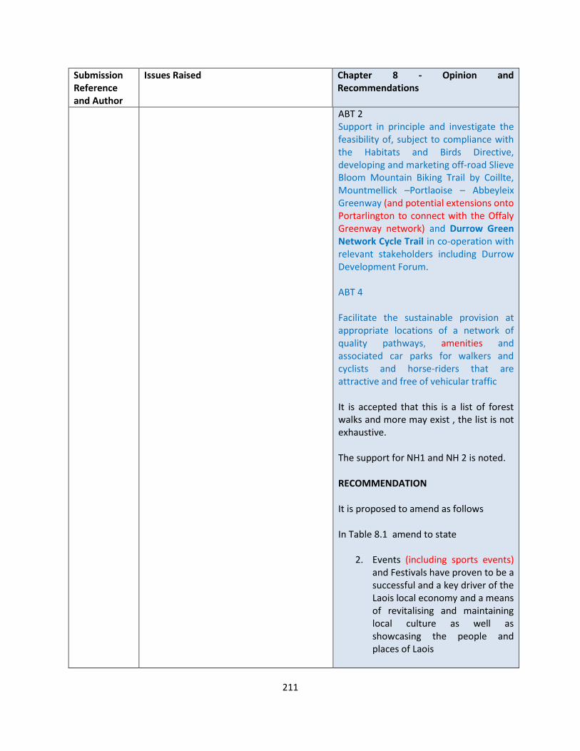
211
Submission Reference and Author
Issues Raised Chapter 8 - Opinion and Recommendations
ABT 2 Support in principle and investigate the feasibility of, subject to compliance with the Habitats and Birds Directive, developing and marketing off-road Slieve Bloom Mountain Biking Trail by Coillte, Mountmellick –Portlaoise – Abbeyleix Greenway (and potential extensions onto Portarlington to connect with the Offaly Greenway network) and Durrow Green Network Cycle Trail in co-operation with relevant stakeholders including Durrow Development Forum. ABT 4 Facilitate the sustainable provision at appropriate locations of a network of quality pathways, amenities and associated car parks for walkers and cyclists and horse-riders that are attractive and free of vehicular traffic It is accepted that this is a list of forest walks and more may exist , the list is not exhaustive. The support for NH1 and NH 2 is noted. RECOMMENDATION It is proposed to amend as follows In Table 8.1 amend to state
2. Events (including sports events) and Festivals have proven to be a successful and a key driver of the Laois local economy and a means of revitalising and maintaining local culture as well as showcasing the people and places of Laois
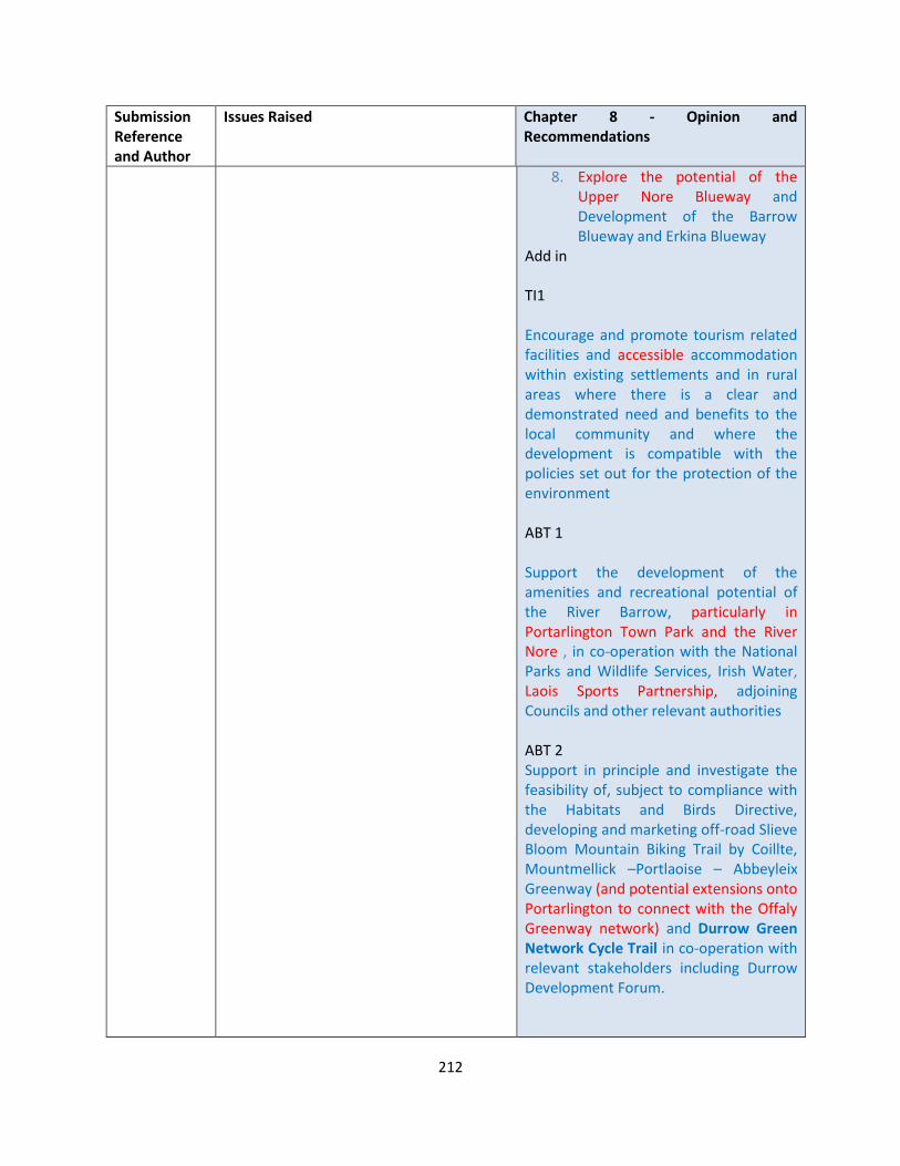
212
Submission Reference and Author
Issues Raised Chapter 8 - Opinion and Recommendations
8. Explore the potential of the Upper Nore Blueway and Development of the Barrow Blueway and Erkina Blueway
Add in TI1 Encourage and promote tourism related facilities and accessible accommodation within existing settlements and in rural areas where there is a clear and demonstrated need and benefits to the local community and where the development is compatible with the policies set out for the protection of the environment ABT 1 Support the development of the amenities and recreational potential of the River Barrow, particularly in Portarlington Town Park and the River Nore , in co-operation with the National Parks and Wildlife Services, Irish Water, Laois Sports Partnership, adjoining Councils and other relevant authorities ABT 2 Support in principle and investigate the feasibility of, subject to compliance with the Habitats and Birds Directive, developing and marketing off-road Slieve Bloom Mountain Biking Trail by Coillte, Mountmellick –Portlaoise – Abbeyleix Greenway (and potential extensions onto Portarlington to connect with the Offaly Greenway network) and Durrow Green Network Cycle Trail in co-operation with relevant stakeholders including Durrow Development Forum.

213
Submission Reference and Author
Issues Raised Chapter 8 - Opinion and Recommendations
ABT 4 Facilitate the sustainable provision at appropriate locations of a network of quality pathways, amenities and associated car parks for walkers and cyclists and horse-riders that are attractive and free of vehicular traffic
LS-C9-DCDP-101 Laois Nore Blueway
Improve egress points on Laois Nore Blueway
• The plan is to run this Blueway from Castletown to Dunmore Demesne, with egress points at Jackson’s Bridge, Kilbrickan, Poorman’s Bridge, Watercastle Bridge and Dunmore Demesne.
• At present each of these exits tend to be mucky and slippery; we would like to investigate if it would be possible to create a structure of steps to facilitate the movement of boats, and a ramp so that wheelchair access is possible. Some form of sheltered covering for people in wheelchairs would be desirable also.
• We would also like to see explored the possibilities at the various locations for parking and specifically invalid parking.
• Furthermore at each of these points, we would like to see a disinfectant station, so that invasive species are not transferred from one location to another.
• Obviously Board Signage would be required also to inform intending users of the Blueway. Furthermore, each of the bridges are old and have their own charm. This aspect and the incredible historical background needs to be incorporated also.
Submission is noted OPINION The Draft Plan contains the following policy objectives in relation to the Nore Blueway and its future development NH2 Support the development and marketing of the Erkina River Blueway in association with all relevant stakeholders and facilitate related commercial opportunities in the area, subject to compliance with the Habitats and Birds Directive
Future works will be subject to planning permission as detailed in the submission and the necessary consents under the Habitats directive, etc RECOMMENDATION No change to the Draft Plan
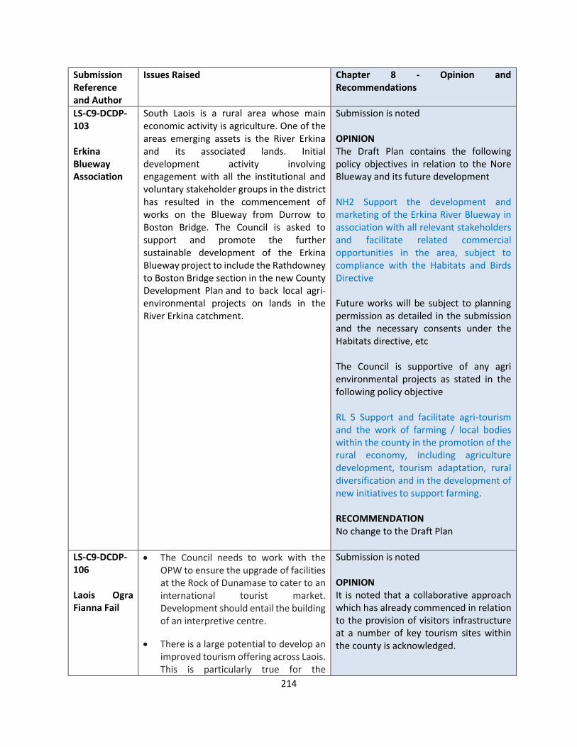
214
Submission Reference and Author
Issues Raised Chapter 8 - Opinion and Recommendations
LS-C9-DCDP-103 Erkina Blueway Association
South Laois is a rural area whose main economic activity is agriculture. One of the areas emerging assets is the River Erkina and its associated lands. Initial development activity involving engagement with all the institutional and voluntary stakeholder groups in the district has resulted in the commencement of works on the Blueway from Durrow to Boston Bridge. The Council is asked to support and promote the further sustainable development of the Erkina Blueway project to include the Rathdowney to Boston Bridge section in the new County Development Plan and to back local agri-environmental projects on lands in the River Erkina catchment.
Submission is noted OPINION The Draft Plan contains the following policy objectives in relation to the Nore Blueway and its future development NH2 Support the development and marketing of the Erkina River Blueway in association with all relevant stakeholders and facilitate related commercial opportunities in the area, subject to compliance with the Habitats and Birds Directive
Future works will be subject to planning permission as detailed in the submission and the necessary consents under the Habitats directive, etc The Council is supportive of any agri environmental projects as stated in the following policy objective RL 5 Support and facilitate agri-tourism and the work of farming / local bodies within the county in the promotion of the rural economy, including agriculture development, tourism adaptation, rural diversification and in the development of new initiatives to support farming. RECOMMENDATION No change to the Draft Plan
LS-C9-DCDP-106 Laois Ogra Fianna Fail
• The Council needs to work with the OPW to ensure the upgrade of facilities at the Rock of Dunamase to cater to an international tourist market. Development should entail the building of an interpretive centre.
• There is a large potential to develop an improved tourism offering across Laois. This is particularly true for the
Submission is noted OPINION It is noted that a collaborative approach which has already commenced in relation to the provision of visitors infrastructure at a number of key tourism sites within the county is acknowledged.

215
Submission Reference and Author
Issues Raised Chapter 8 - Opinion and Recommendations
Donaghmore Famine Workhouse and Museum. We propose the improvement and renovation of the remaining workhouse buildings on the site to facilitate the development of a greater tourism offering especially during the peak summer season. The development of a tourism hub on the site to include picnic areas & pop up shops that showcase local crafts and food produce should be considered given the strong association the site has with Agri-food and the Co-Operative movement.
• There is a huge trend towards ecotourism at a national and international level. Recent development of mountain biking facilities on the Slieve Bloom mountain range have shown the potential national market open to Laois. Laois has other natural resources at its disposal. The upper river Barrow and Nore as well as Grand canal have the potential to become national centres for national blue ways and the promotion of river rafting, kayaking and canoeing family holidays. A study should be conducted sighting international examples in the provision of riverside infrastructure including slipways and campsites.
• Laois’ central plain being relatively flat in topography is also the home to two disused pieces of infrastructure and as of yet untapped resources they being the Mountmellick to Kilkenny railway line and the Portarlington to Mountmellick spur of the Grand canal. If redeveloped into the cycle greenways they have the potential to tie Laois and the towns of Portarlington, Mountmellick, Portlaoise, Abbeyleix
Laois County Council are mindful of working with key stakeholders in this regard and agrees a change could be made to IAE 3. Future works to Donaghmore will be subject to planning permission as detailed in the submission and the necessary consents given it’s a protected structure, etc The Council is supportive of any agri environmental projects as stated in the following policy objective RL 5 Support and facilitate agri-tourism and the work of farming / local bodies within the county in the promotion of the rural economy, including agriculture development, tourism adaptation, rural diversification and in the development of new initiatives to support farming. TM10 supports the development of ecotourism within the county, which states: Promote Laois as a hub for ecotourism and the sustainable development of low impact activities including orienteering, angling, equestrian activities, bird watching, canoeing and kayaking, caving, paragliding, botany, photography, painting and yoga and meditation, in appropriate locations in order to diversify the range of tourist experiences available in the county and extend the tourism season RECOMMENDATION It is proposed to make the following change
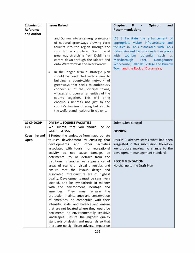
216
Submission Reference and Author
Issues Raised Chapter 8 - Opinion and Recommendations
and Durrow into an emerging network of national greenways drawing cycle tourists into the region through the soon to be completed Grand canal greenway stretching from Dublin city centre down through the Kildare and onto Waterford via the river Barrow.
• In the longer term a strategic plan should be conducted with a view to building a countywide network of greenways that seeks to ambitiously connect all of the principal towns, villages and open air amenities of the county together. This will bring enormous benefits not just to the county’s tourism offering but also to the welfare and health of its citizens.
IAE 3 Facilitate the enhancement of appropriate visitor infrastructure and facilities in Laois associated with Laois Ireland Ancient East sites and other places with tourism potential such as Maryborough Fort, Donaghmore Workhouse, Ballinakill village and Durrow Town and the Rock of Dunamaise,
LS-C9-DCDP-121 Keep Ireland Open
DM TM 1 TOURIST FACILITIES We submit that you should include additional DMs: 1 Protect the landscape from inappropriate tourism development by ensuring that developments and other activities associated with tourism or recreational activity do not cause damage, be detrimental to or detract from the traditional character or appearance of areas of scenic or visual amenities and ensure that the layout, design and associated infrastructure are of highest quality. Developments must be sensitively located, and be sympathetic in manner with the environment, heritage and amenities. They must ensure the protection, maintenance and conservation of amenities, be compatible with their intensity, scale, and balance and ensure that are not located where they would be detrimental to environmentally sensitive landscapes. Ensure the highest quality standards of design and materials so that there are no significant adverse impact on
Submission is noted OPINION DMTM 1 already states what has been suggested in this submission, therefore we propose making no change to the development management standard. RECOMMENDATION No change to the Draft Plan
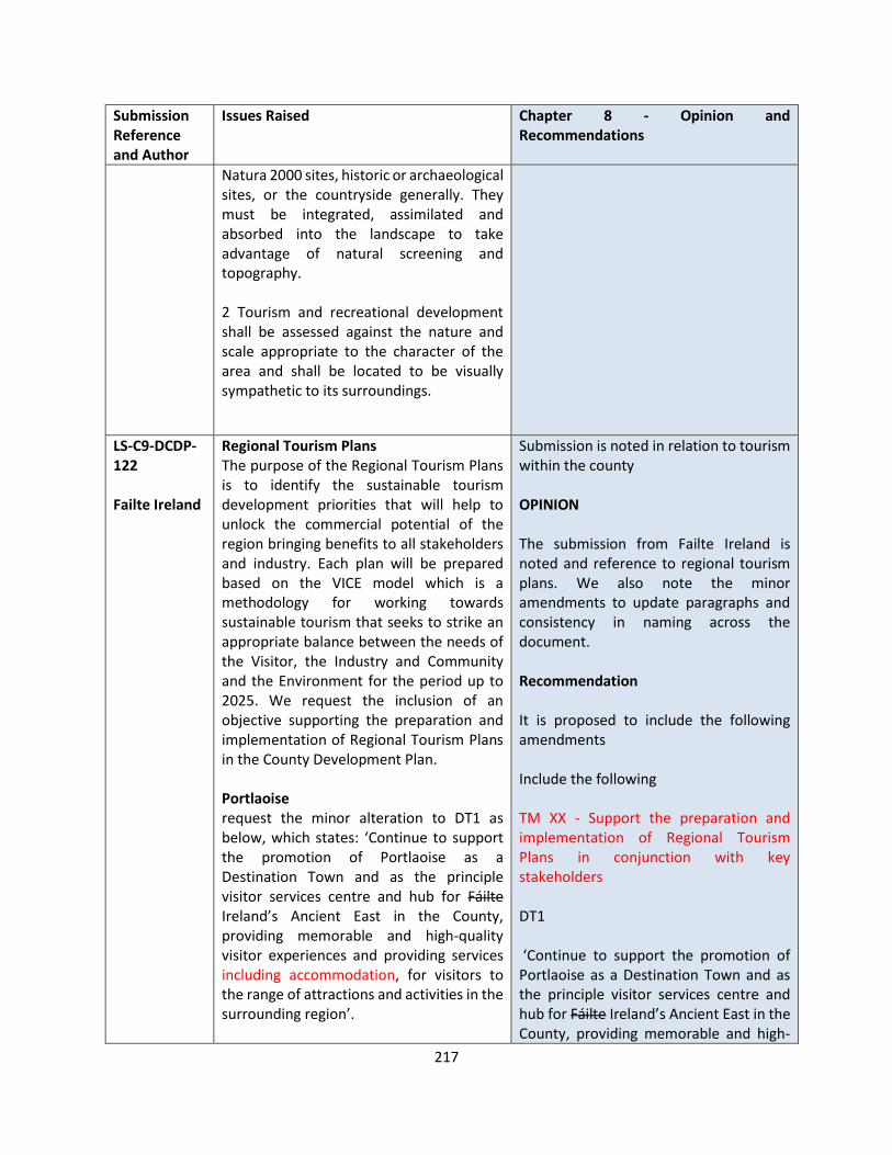
217
Submission Reference and Author
Issues Raised Chapter 8 - Opinion and Recommendations
Natura 2000 sites, historic or archaeological sites, or the countryside generally. They must be integrated, assimilated and absorbed into the landscape to take advantage of natural screening and topography. 2 Tourism and recreational development shall be assessed against the nature and scale appropriate to the character of the area and shall be located to be visually sympathetic to its surroundings.
LS-C9-DCDP-122 Failte Ireland
Regional Tourism Plans The purpose of the Regional Tourism Plans is to identify the sustainable tourism development priorities that will help to unlock the commercial potential of the region bringing benefits to all stakeholders and industry. Each plan will be prepared based on the VICE model which is a methodology for working towards sustainable tourism that seeks to strike an appropriate balance between the needs of the Visitor, the Industry and Community and the Environment for the period up to 2025. We request the inclusion of an objective supporting the preparation and implementation of Regional Tourism Plans in the County Development Plan. Portlaoise request the minor alteration to DT1 as below, which states: ‘Continue to support the promotion of Portlaoise as a Destination Town and as the principle visitor services centre and hub for Fáilte Ireland’s Ancient East in the County, providing memorable and high-quality visitor experiences and providing services including accommodation, for visitors to the range of attractions and activities in the surrounding region’.
Submission is noted in relation to tourism within the county OPINION The submission from Failte Ireland is noted and reference to regional tourism plans. We also note the minor amendments to update paragraphs and consistency in naming across the document. Recommendation It is proposed to include the following amendments Include the following TM XX - Support the preparation and implementation of Regional Tourism Plans in conjunction with key stakeholders DT1 ‘Continue to support the promotion of Portlaoise as a Destination Town and as the principle visitor services centre and hub for Fáilte Ireland’s Ancient East in the County, providing memorable and high-
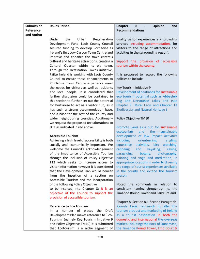
218
Submission Reference and Author
Issues Raised Chapter 8 - Opinion and Recommendations
Under the Urban Regeneration Development Fund, Laois County Council secured funding to develop Portlaoise as Ireland’s first Low Carbon Town Centre and improve and enhance the town centre’s cultural and heritage attractions, creating a Cultural Quarter within its old town. Through the Destination Towns initiative, Fáilte Ireland is working with Laois County Council to ensure these enhancements to Portlaoise Town Centre experience meet the needs for visitors as well as residents and local people. It is considered that further discussion could be contained in this section to further set out the potential for Portlaoise to act as a visitor hub, as it has such a strong accommodation base, and a base for the rest of the county and wider neighbouring counties. Additionally we request the proposed text alterations to DT1 as indicated in red above. Accessible Tourism Achieving a high level of accessibility is both socially and economically important. We welcome the Council’s acknowledgement of the importance of Accessible Tourism through the inclusion of Policy Objective T12 which seeks to increase access to visitor information however it is considered that the Development Plan would benefit from the insertion of a section on Accessible Tourism and the incorporation of the following Policy Objective to be inserted into Chapter 8: It is an objective of the Council to support the provision of accessible tourism. Reference to Eco Tourism In a number of places the Draft Development Plan makes reference to ‘Eco-Tourism’ (namely Key Tourism Initiative 9 and Policy Objective TM10) it is submitted that Ecotourism is a niche segment of
quality visitor experiences and providing services including accommodation, for visitors to the range of attractions and activities in the surrounding region’. Support the provision of accessible tourism within the county. It is proposed to reword the following policies to include Key Tourism Initiative 9 Development of peatlands for sustainable eco tourism potential such as Abbeyleix Bog and Deryounce Lakes and (see Chapter 9 Rural Laois and Chapter 11 Biodiversity and Natural Heritage ) Policy Objective TM10 Promote Laois as a hub for sustainable ecotourism and the sustainable development of low impact activities including orienteering, angling, equestrian activities, bird watching, canoeing and kayaking, caving, paragliding, botany, photography, painting and yoga and meditation, in appropriate locations in order to diversify the range of tourist experiences available in the county and extend the tourism season Noted the comments in relation to consistant naming throughout i.e. the Timahoe Round Tower and Fáilte Ireland. Chapter 8, Section 8.1-Second Paragraph County Laois has much to offer the tourism product and marketing of Ireland as a tourist destination in both the domestic and international the overseas market, including; the Rock of Dunamase, the Timahoe Round Tower, Emo Court &
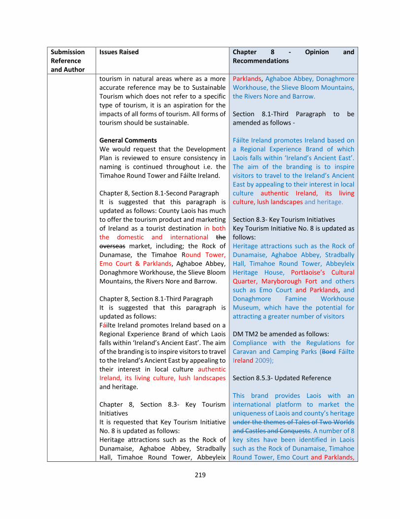
219
Submission Reference and Author
Issues Raised Chapter 8 - Opinion and Recommendations
tourism in natural areas where as a more accurate reference may be to Sustainable Tourism which does not refer to a specific type of tourism, it is an aspiration for the impacts of all forms of tourism. All forms of tourism should be sustainable. General Comments We would request that the Development Plan is reviewed to ensure consistency in naming is continued throughout i.e. the Timahoe Round Tower and Fáilte Ireland. Chapter 8, Section 8.1-Second Paragraph It is suggested that this paragraph is updated as follows: County Laois has much to offer the tourism product and marketing of Ireland as a tourist destination in both the domestic and international the overseas market, including; the Rock of Dunamase, the Timahoe Round Tower, Emo Court & Parklands, Aghaboe Abbey, Donaghmore Workhouse, the Slieve Bloom Mountains, the Rivers Nore and Barrow. Chapter 8, Section 8.1-Third Paragraph It is suggested that this paragraph is updated as follows: Fáilte Ireland promotes Ireland based on a Regional Experience Brand of which Laois falls within ‘Ireland’s Ancient East’. The aim of the branding is to inspire visitors to travel to the Ireland’s Ancient East by appealing to their interest in local culture authentic Ireland, its living culture, lush landscapes and heritage. Chapter 8, Section 8.3- Key Tourism Initiatives It is requested that Key Tourism Initiative No. 8 is updated as follows: Heritage attractions such as the Rock of Dunamaise, Aghaboe Abbey, Stradbally Hall, Timahoe Round Tower, Abbeyleix
Parklands, Aghaboe Abbey, Donaghmore Workhouse, the Slieve Bloom Mountains, the Rivers Nore and Barrow. Section 8.1-Third Paragraph to be amended as follows - Fáilte Ireland promotes Ireland based on a Regional Experience Brand of which Laois falls within ‘Ireland’s Ancient East’. The aim of the branding is to inspire visitors to travel to the Ireland’s Ancient East by appealing to their interest in local culture authentic Ireland, its living culture, lush landscapes and heritage. Section 8.3- Key Tourism Initiatives Key Tourism Initiative No. 8 is updated as follows: Heritage attractions such as the Rock of Dunamaise, Aghaboe Abbey, Stradbally Hall, Timahoe Round Tower, Abbeyleix Heritage House, Portlaoise’s Cultural Quarter, Maryborough Fort and others such as Emo Court and Parklands, and Donaghmore Famine Workhouse Museum, which have the potential for attracting a greater number of visitors DM TM2 be amended as follows: Compliance with the Regulations for Caravan and Camping Parks (Bord Fáilte Ireland 2009); Section 8.5.3- Updated Reference This brand provides Laois with an international platform to market the uniqueness of Laois and county’s heritage under the themes of Tales of Two Worlds and Castles and Conquests. A number of 8 key sites have been identified in Laois such as the Rock of Dunamaise, Timahoe Round Tower, Emo Court and Parklands,
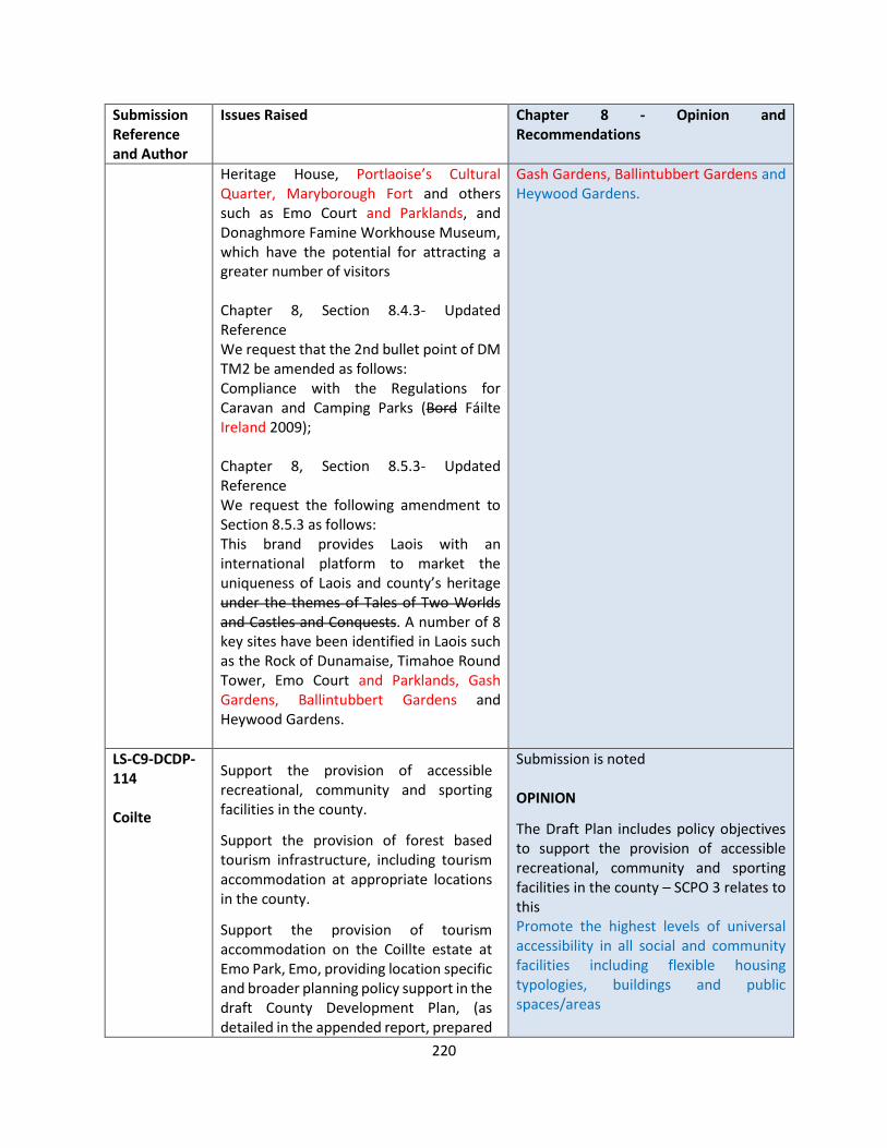
220
Submission Reference and Author
Issues Raised Chapter 8 - Opinion and Recommendations
Heritage House, Portlaoise’s Cultural Quarter, Maryborough Fort and others such as Emo Court and Parklands, and Donaghmore Famine Workhouse Museum, which have the potential for attracting a greater number of visitors Chapter 8, Section 8.4.3- Updated Reference We request that the 2nd bullet point of DM TM2 be amended as follows: Compliance with the Regulations for Caravan and Camping Parks (Bord Fáilte Ireland 2009); Chapter 8, Section 8.5.3- Updated Reference We request the following amendment to Section 8.5.3 as follows: This brand provides Laois with an international platform to market the uniqueness of Laois and county’s heritage under the themes of Tales of Two Worlds and Castles and Conquests. A number of 8 key sites have been identified in Laois such as the Rock of Dunamaise, Timahoe Round Tower, Emo Court and Parklands, Gash Gardens, Ballintubbert Gardens and Heywood Gardens.
Gash Gardens, Ballintubbert Gardens and Heywood Gardens.
LS-C9-DCDP-114 Coilte
Support the provision of accessible recreational, community and sporting facilities in the county.
Support the provision of forest based tourism infrastructure, including tourism accommodation at appropriate locations in the county.
Support the provision of tourism accommodation on the Coillte estate at Emo Park, Emo, providing location specific and broader planning policy support in the draft County Development Plan, (as detailed in the appended report, prepared
Submission is noted OPINION
The Draft Plan includes policy objectives to support the provision of accessible recreational, community and sporting facilities in the county – SCPO 3 relates to this Promote the highest levels of universal accessibility in all social and community facilities including flexible housing typologies, buildings and public spaces/areas
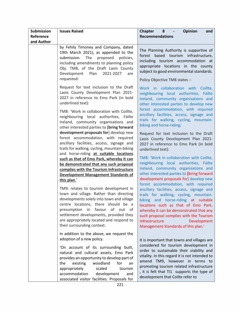
221
Submission Reference and Author
Issues Raised Chapter 8 - Opinion and Recommendations
by Fehily Timoney and Company, dated 19th March 2021), as appended to the submission. The proposed policies, including amendments to planning policy Obj. TM8, of the Draft Laois County Development Plan 2021-2027 are requested:
Request for text inclusion to the Draft Laois County Development Plan 2021-2027 in reference to Emo Park (in bold underlined text):
TM8: ‘Work in collaboration with Coillte, neighbouring local authorities, Fáilte Ireland, community organisations and other interested parties to [bring forward development proposals for] develop new forest accommodation, with required ancillary facilities, access, signage and trails for walking, cycling, mountain-biking and horse-riding at suitable locations such as that of Emo Park, whereby it can be demonstrated that any such proposal complies with the Tourism Infrastructure Development Management Standards of this plan.’
TM9: relates to tourism development in town and village. Rather than directing developments solely into town and village centre locations, there should be a presumption in favour of out of settlement developments, provided they are appropriately located and respond to their surrounding context.
In addition to the above, we request the adoption of a new policy.
‘On account of its surrounding built, natural and cultural assets, Emo Park provides an opportunity to develop part of the existing woodland for an appropriately scaled tourism accommodation development and associated visitor facilities. Proposals for
The Planning Authority is supportive of forest based tourism infrastructure, including tourism accommodation at appropriate locations in the county subject to good environmental standards.
Policy Objective TM8 states :-
Work in collaboration with Coillte, neighbouring local authorities, Fáilte Ireland, community organisations and other interested parties to develop new forest accommodation, with required ancillary facilities, access, signage and trails for walking, cycling, mountain-biking and horse-riding;
Request for text inclusion to the Draft Laois County Development Plan 2021-2027 in reference to Emo Park (in bold underlined text):
TM8: ‘Work in collaboration with Coillte, neighbouring local authorities, Fáilte Ireland, community organisations and other interested parties to [bring forward development proposals for] develop new forest accommodation, with required ancillary facilities, access, signage and trails for walking, cycling, mountain-biking and horse-riding at suitable locations such as that of Emo Park, whereby it can be demonstrated that any such proposal complies with the Tourism Infrastructure Development Management Standards of this plan.’
It is important that towns and villages are considered for tourism development in order to sustainable their viability and vitality. In this regard it is not intended to amend TM9, however in terms to promoting tourism related infrastructure , it is felt that TI1 supports the type of development that Coilte refer to
222
Submission Reference and Author
Issues Raised Chapter 8 - Opinion and Recommendations
development of this nature shall integrate so far as possible with the existing woodland setting and ensure that the setting or views to and from Emo Court House and Gardens are protected.’
‘The Local Authority will encourage the development of a wider range of tourism accommodation facilities and types that have the potential to attract a wide range of tourists to County Laois and to spend increased amounts of time within the county. Such facilities will include the development of recognised and successful tourism concepts such as resort development including the forest tourism resort model.’
Encourage and promote tourism related facilities and accommodation within existing settlements and in rural areas where there is a clear and demonstrated need and benefits to the local community and where the development is compatible with the policies set out for the protection of the environment
It is acknowledged that Emo Demesne offers the potential for additional tourism infrastructure. However this will be subject to the Planning Process whereby policies in relation to Tourism, the Built Heritage and Landscape will have to be considered as well as impacts on the environment.
The views into and out of Emo Court will require further consideration and advice from a landscape expert and in this regard, it is proposed that a Masterplan for the Emo Court Demesne be prepared in conjunction with key stakeholders and landowners.
The following Policy objective will be included after Section 8.3
TM XXX Collaborate with the relevant stakeholders and landowners to prepare a Masterplan for Emo Court Demesne which will identify opportunities as well as landscape protection areas and views into and out of Emo Court Further to this submission a detailed review of the structures on the demesne was carried out. Emo Court is one of the finest Neo-classical houses of the eighteenth century in Ireland and has been identified by the NIAH as a building of National Importance. The house forms the

223
Submission Reference and Author
Issues Raised Chapter 8 - Opinion and Recommendations
centrepiece of the landscaped park that was designed as its setting. There are a number of important buildings and structures within the historic demesne of Emo Court that merit consideration for protection in the RPS, either as a standalone entry or as part of an ensemble of linked structures, which will need to be carefully described. Inspections of the following structures at Emo Court were carried out on 9th June and 11th June 2021. The report includes separate written assessment of each structure. On foot of these inspections each of these structures were deemed to be of sufficient importance to merit inclusion on the RPS. The conclusion of this report includes recommendations for how these structures might best be included on the RPS.
• The Gamekeeper’s Cottage
• The Gardener’s Cottage
• The original walled garden (to the south-east of the house)
• Eastern walled garden (adjoining original walled garden to east)
• Eastern farmyards (including store buildings, stables and houses)
• Walled garden and meathouse (to west of Bachelor’s Wing)
• Western farmyard, including former dairy building (adjoining walled garden to west of Bachelor’s Wing)
• Entirety of enclosing boundary wall, and all gateposts and gates
• The Gate Lodge (at entrance from Emo Village)
• The Deer Lodge (to north of Emo Court)
• The South Lodge (at southern entrance to the Wellingtonia avenue, to south of Emo Court)
224
Submission Reference and Author
Issues Raised Chapter 8 - Opinion and Recommendations
RECOMMENDATION
TM8: ‘Work in collaboration with Coillte, neighbouring local authorities, Fáilte Ireland, community organisations and other interested parties to [bring forward development proposals for] develop new forest accommodation, with required ancillary facilities, access, signage and trails for walking, cycling, mountain-biking and horse-riding at suitable locations such as that of Emo Park, whereby it can be demonstrated that any such proposal complies with the Tourism Infrastructure Development Management Standards of this plan.’
The following Policy objective will be included after Section 8.3
TM XXX Collaborate with the relevant stakeholders and landowners to prepare a Masterplan for Emo Court Demesne which will identify opportunities as well as landscape protection areas and views into and out of Emo Court
Add the following buildings to the RPS RPS XX - The Gamekeeper’s Cottage RPS XX - The Gardener’s Cottage RPS XX - The original walled garden (to the south-east of the house) RPS XX - Eastern walled garden (adjoining original walled garden to east) RPS XX - Eastern farmyards (including store buildings, stables and houses) RPS XX - Walled garden and meathouse (to west of Bachelor’s Wing) RPS XX - Western farmyard, including former dairy building (adjoining walled garden to west of Bachelor’s Wing) RPS XX - Entirety of enclosing boundary wall, and all gateposts and gates
225
Submission Reference and Author
Issues Raised Chapter 8 - Opinion and Recommendations
RPS XX - The Gate Lodge (at entrance from Emo Village) RPS XX - The Deer Lodge (to north of Emo Court) RPS XX - The South Lodge (at southern entrance to the Wellingtonia avenue, to south of Emo Court)
LS-C9-DCDP-135 An Taisce
Sustainable Tourism
It is a particular objective of An Taisce that future tourism and recreational visitor promotion nationally should be as car-free as possible. An Taisce would suggest the following for inclusion in the new CDP:
1. Provision for the creation of an area-based strategy for the Slieve Blooms based on nature and night sky appreciation;
2. Identification of low traffic level local roads to promote safety enhanced cycling routes and loops to link Portlaoise with the Slieve Blooms and the county’s main cultural heritage locations including the Rock of Dunamase, Emo House and Demesne and Heywood Gardens.
3. Assessment of the feasibility of a greenway on the redundant Portlaoise to Kilkenny railway line route
Supports Policy TM12 and TM4 but recommends the inclusion of additional explicit objectives to increase car-free, long-stay trips.
The policy objectives to provide for additional tourist accommodation in appropriate locations, are noted and welcome. We also welcome the significant focus on the continued
Submission noted OPINION The Planning Authority welcomes the submission from An Taisce and are conscious of promoting the County as being accessible via alternative modes of transport other than car, particularly for tourism and amenity pursuits. The County Is strategically connected with 3 railway stations that have much to offer to the visitor coming to the county. Regeneration strategies for Portlaoise and Portarlington have identified walking and cycling connections from the Train Stations to connect with the towns infrastructure and further out to points of visitor interest such as the Derryounce Trails in Portarlington, Lea Castle and Carrick Woods. It is a policy objective within the Draft Plan to TM 12 Increase connectivity and accessibility to public transport and walking and cycling infrastructure from key tourist destination hubs to encourage more sustainable modes of transport. It is the intention of Laois County Council to work with the relevant stakeholders to further develop the potential for greenways throughout the county.
226
Submission Reference and Author
Issues Raised Chapter 8 - Opinion and Recommendations
development of greenways and blueways in the county.
ABT2 Support in principle and investigate the feasibility of, subject to compliance with the Habitats and Birds Directive, developing and marketing off-road Slieve Bloom Mountain Biking Trail by Coillte, Mountmellick –Portlaoise – Abbeyleix Greenway and Durrow Green Network Cycle Trail in co-operation with relevant stakeholders including Durrow Development Forum. RECOMMENDATION No change to the Draft Plan
LS-C9-DCDP-142 Laois Tourism
Laois Tourism Submission Slieve Blooms – The Slieve Bloom area is making excellent progress in the walking and cycling offering. It is crucial that the trailhead be developed on the Laois side in Baunreagh. Likewise Glenbarrow is a key site in the Slieve Blooms and urgently needs a car park and visitor facilities Rock of Dunamase. This is a top attraction which would benefit from a proper car park and visitor facilities Donoghmore Museum is an important heritage and tourism site. The potential for this site is significant, and it would have immense international and national appeal and we urge you to enhance support for the development of this site. Marketing and promotion – Laois Tourism has made excellent strides in recent years, continued and increased funding for the marketing and promotion of the county is crucial to the future success of the sector in the county. These projects have the potential to promote positive, healthy and active outdoor lifestyles, to attract visitors from across Ireland and beyond to Laois and by extension,. Provide a significant economic impact to the local community in the county.
Submission noted OPINION The Planning Authority notes the submission from Laois Tourism who have animated tourism within the county to a much higher level in recent years. The Draft Plan is fully supportive of the actions of the Laois Tourism Strategy 2018-2023 which was a collaboration between key tourism stakeholders within County Laois including Laois County Council, Laois Local Community Development Committee, Laois partnership and the Department of Rural and Community Development, aims to grow tourism visitor numbers and the value of tourism through the enhancement of the Laois tourism product and service base supported by the structures that contribute to the strategic development of the tourism sector across the county. TM2 states as follows - Continue to support the implementation of the Strategic Plan for Tourism in Laois 2018 – 2023, in line with national and regional policy, tourism trends and identified challenges, in collaboration with Fáilte
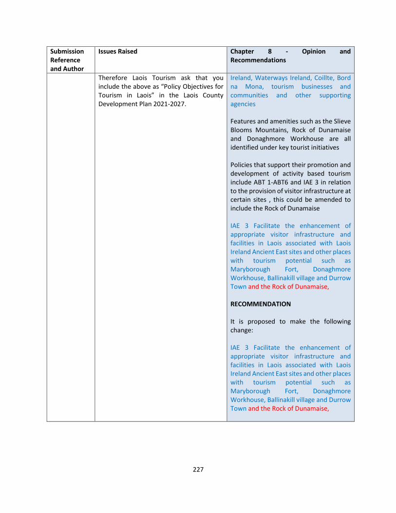
227
Submission Reference and Author
Issues Raised Chapter 8 - Opinion and Recommendations
Therefore Laois Tourism ask that you include the above as “Policy Objectives for Tourism in Laois” in the Laois County Development Plan 2021-2027.
Ireland, Waterways Ireland, Coillte, Bord na Mona, tourism businesses and communities and other supporting agencies Features and amenities such as the Slieve Blooms Mountains, Rock of Dunamaise and Donaghmore Workhouse are all identified under key tourist initiatives Policies that support their promotion and development of activity based tourism include ABT 1-ABT6 and IAE 3 in relation to the provision of visitor infrastructure at certain sites , this could be amended to include the Rock of Dunamaise IAE 3 Facilitate the enhancement of appropriate visitor infrastructure and facilities in Laois associated with Laois Ireland Ancient East sites and other places with tourism potential such as Maryborough Fort, Donaghmore Workhouse, Ballinakill village and Durrow Town and the Rock of Dunamaise, RECOMMENDATION It is proposed to make the following change: IAE 3 Facilitate the enhancement of appropriate visitor infrastructure and facilities in Laois associated with Laois Ireland Ancient East sites and other places with tourism potential such as Maryborough Fort, Donaghmore Workhouse, Ballinakill village and Durrow Town and the Rock of Dunamaise,
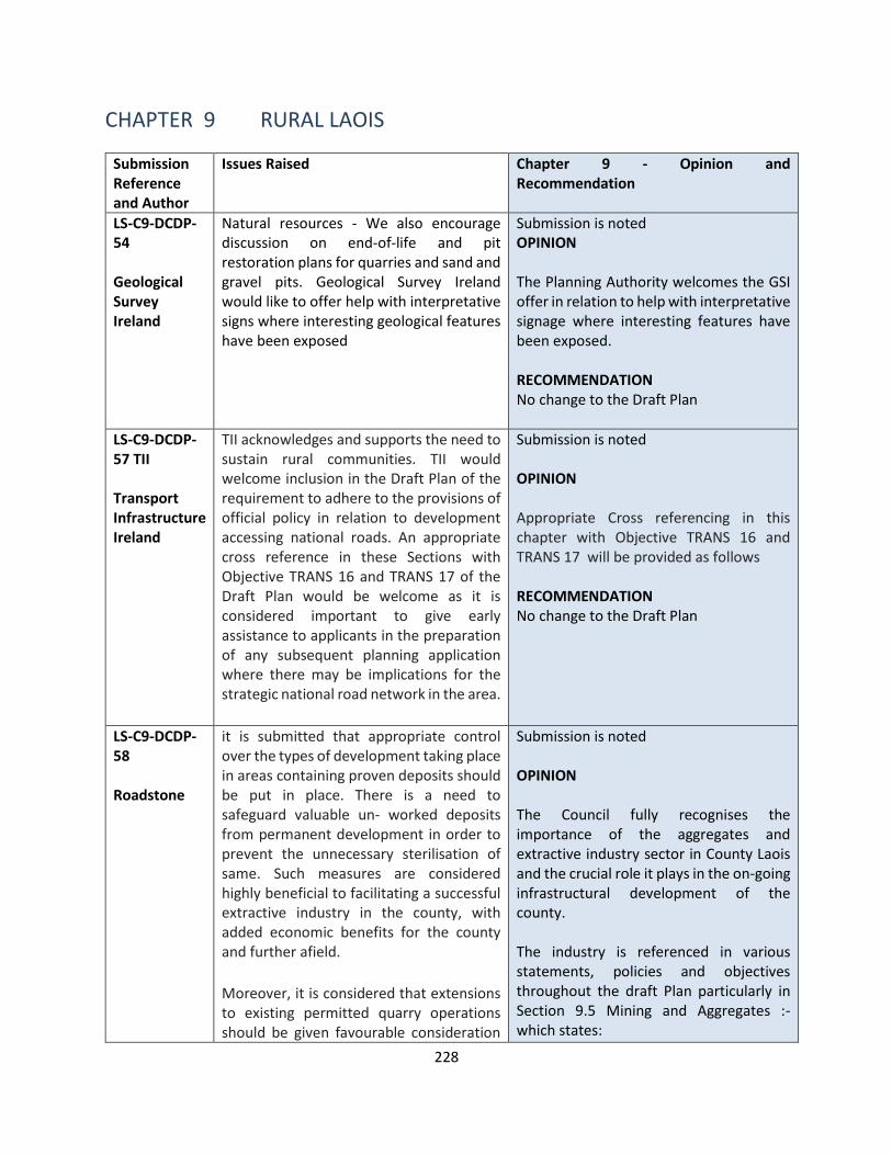
228
CHAPTER 9 RURAL LAOIS
Submission Reference and Author
Issues Raised Chapter 9 - Opinion and Recommendation
LS-C9-DCDP-54 Geological Survey Ireland
Natural resources - We also encourage discussion on end-of-life and pit restoration plans for quarries and sand and gravel pits. Geological Survey Ireland would like to offer help with interpretative signs where interesting geological features have been exposed
Submission is noted OPINION The Planning Authority welcomes the GSI offer in relation to help with interpretative signage where interesting features have been exposed. RECOMMENDATION No change to the Draft Plan
LS-C9-DCDP-57 TII Transport Infrastructure Ireland
TII acknowledges and supports the need to sustain rural communities. TII would welcome inclusion in the Draft Plan of the requirement to adhere to the provisions of official policy in relation to development accessing national roads. An appropriate cross reference in these Sections with Objective TRANS 16 and TRANS 17 of the Draft Plan would be welcome as it is considered important to give early assistance to applicants in the preparation of any subsequent planning application where there may be implications for the strategic national road network in the area.
Submission is noted OPINION Appropriate Cross referencing in this chapter with Objective TRANS 16 and TRANS 17 will be provided as follows RECOMMENDATION No change to the Draft Plan
LS-C9-DCDP-58 Roadstone
it is submitted that appropriate control over the types of development taking place in areas containing proven deposits should be put in place. There is a need to safeguard valuable un- worked deposits from permanent development in order to prevent the unnecessary sterilisation of same. Such measures are considered highly beneficial to facilitating a successful extractive industry in the county, with added economic benefits for the county and further afield.
Moreover, it is considered that extensions to existing permitted quarry operations should be given favourable consideration
Submission is noted OPINION The Council fully recognises the importance of the aggregates and extractive industry sector in County Laois and the crucial role it plays in the on-going infrastructural development of the county. The industry is referenced in various statements, policies and objectives throughout the draft Plan particularly in Section 9.5 Mining and Aggregates :- which states:

229
Submission Reference and Author
Issues Raised Chapter 9 - Opinion and Recommendation
where the Planning Authority is considering planning applications for same. This should especially be the case where there are proven aggregate resources within established operations and all the necessary quarry infrastructure, haul routes, markets, environmental monitoring measures and licensing, etc., would have already been put in place.
It should be highlighted that there is further potential to strengthen policy provisions in relation to identifying and protecting aggregate reserves in the county.
Relevant planning authorities should adopt a systematic approach for safeguarding mineral resources, which include the following principles:
• uses the best available information on the location of all mineral (aggregate) resources in the authority area. For example, this may include use of Geological Survey of Ireland (GSI) mapping as well as industry sources;
• consults with the extractive industry, local communities and other relevant interests to define Minerals Safeguarding Areas;
• sets out Minerals Safeguarding Areas on the policies map that accompanies the county or local development plans; and
• adopts clear development management policies which set out how proposals for non-minerals development in Minerals Safeguarding Areas will be handled, and what action applicants for development should take to address the risk of losing the ability to extract the resource. This may include policies that encourage the prior extraction of minerals, where practicable,
The Council recognises that the aggregate and concrete products industry contribute to the development of the national, regional and local economies by the proper use and management of natural resources for the benefit of the community and the creation of employment opportunities. These products are required as essential building materials in the social and economic development process including the provision of housing and infrastructure. Laois County Council will seek to safeguard these valuable resources for future extraction. The National Guidelines on Quarries and Ancillary Activities for Planning Authorities (DOEHLG, 2004) is the guiding document against which applications for quarries and ancillary activities will be considered.” A map of known quarrying sites in County Laois is presented as Figure 13. The following policy Objectives have been included in the Draft Plan - RL 15 To secure the long-term supply of value-added products (such as concrete products and asphalt, which are often, but not always, produced in conjunction with aggregate extraction. RL 16 -Support the necessary role of the extractive industries in the delivery of building materials for infrastructural and other development and to recognize the need to develop extractive industries for the benefit of society and the economy Include the following Policy objective :- Investigate the feasibility of mapping the full extent of aggregate resources of the
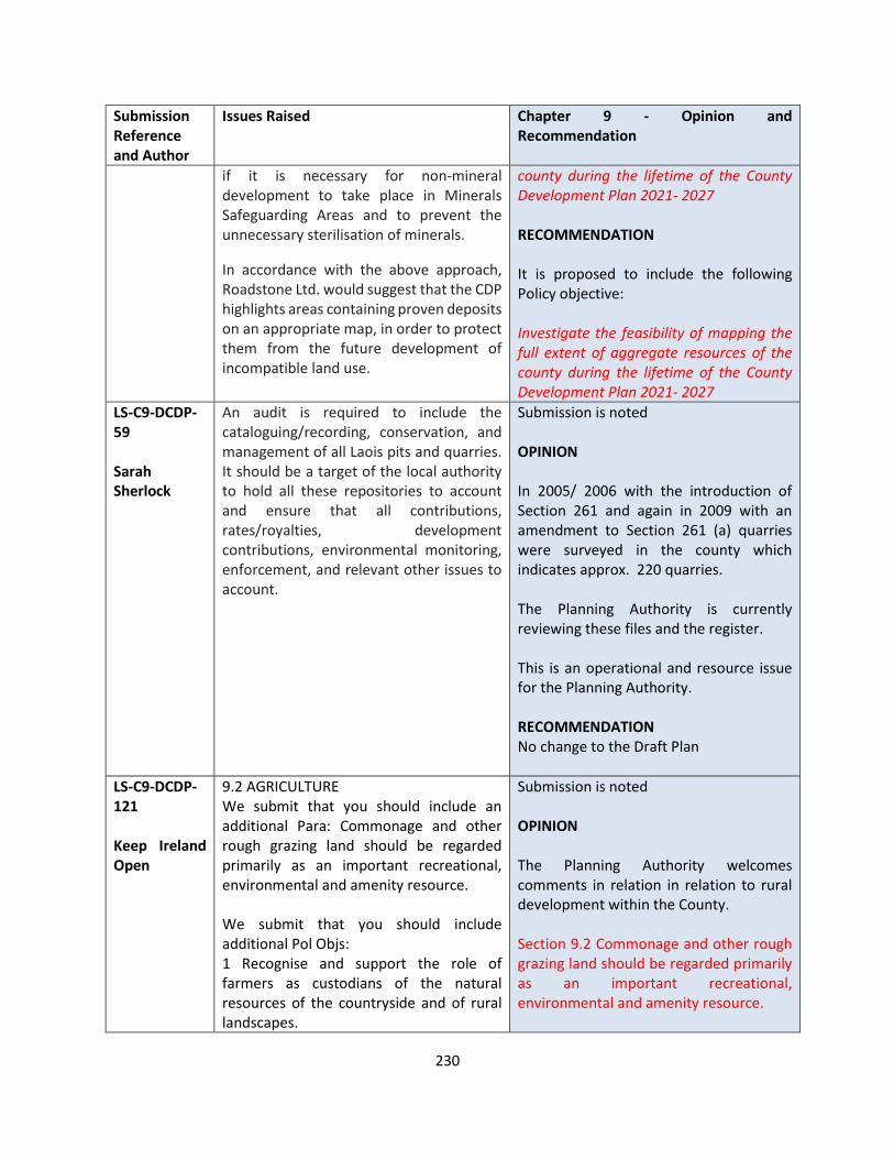
230
Submission Reference and Author
Issues Raised Chapter 9 - Opinion and Recommendation
if it is necessary for non-mineral development to take place in Minerals Safeguarding Areas and to prevent the unnecessary sterilisation of minerals.
In accordance with the above approach, Roadstone Ltd. would suggest that the CDP highlights areas containing proven deposits on an appropriate map, in order to protect them from the future development of incompatible land use.
county during the lifetime of the County Development Plan 2021- 2027 RECOMMENDATION It is proposed to include the following Policy objective: Investigate the feasibility of mapping the full extent of aggregate resources of the county during the lifetime of the County Development Plan 2021- 2027
LS-C9-DCDP-59 Sarah Sherlock
An audit is required to include the cataloguing/recording, conservation, and management of all Laois pits and quarries. It should be a target of the local authority to hold all these repositories to account and ensure that all contributions, rates/royalties, development contributions, environmental monitoring, enforcement, and relevant other issues to account.
Submission is noted OPINION In 2005/ 2006 with the introduction of Section 261 and again in 2009 with an amendment to Section 261 (a) quarries were surveyed in the county which indicates approx. 220 quarries. The Planning Authority is currently reviewing these files and the register. This is an operational and resource issue for the Planning Authority. RECOMMENDATION No change to the Draft Plan
LS-C9-DCDP-121 Keep Ireland Open
9.2 AGRICULTURE We submit that you should include an additional Para: Commonage and other rough grazing land should be regarded primarily as an important recreational, environmental and amenity resource. We submit that you should include additional Pol Objs: 1 Recognise and support the role of farmers as custodians of the natural resources of the countryside and of rural landscapes.
Submission is noted OPINION The Planning Authority welcomes comments in relation in relation to rural development within the County. Section 9.2 Commonage and other rough grazing land should be regarded primarily as an important recreational, environmental and amenity resource.

231
Submission Reference and Author
Issues Raised Chapter 9 - Opinion and Recommendation
2 Promote, at national level, the adoption of a Land Use Strategy. Agriculture Development Management Standards DM RL 1 GENERAL CONSIDERATION FOR AGRICULTURAL BUILDINGS We submit that you should include an additional DM: Protect and conserve rural amenities, archaeological and natural heritage, visual amenities, landscape and the environment generally, from adverse impacts of agricultural practices and development particularly in high amenity areas and ensure that it is appropriate in nature and scale, ensure that they do not have an undue negative impact on the visual/scenic amenity of the countryside and its appearance and character and integrate into the landscape and shall not be detrimental to archaeological and heritage features of importance. Developments and practices must be necessary for the efficient use of the farm and must ensure that they are conducted in a manner consistent with the protection of the environment and in line with national legislations and relevant guidelines. Identify mitigating measures where required 9.3 AFFORESTATION We submit that you should include Afforestation Policy Objectives: 1 Recognising the contribution that forestry makes to well-being, develop, promote, provide, protect, improve and encourage the provision of greater public access to new and existing forestry, both state and private, for recreational activities such as walking, hiking, cycling, and other non-noise generating activities and the
AFFORESTATION Adequate policies in relation to afforestation have been included in the plan 9.5 MINING AND AGGREGATES It is proposed to include a Development Management Standard for Mining and Aggregates DM RL 3 Mining and Aggregates Development Control Standard Applications for new development for aggregate extraction, processing and associated processes, shall
1) identify existing public rights of way and walking routes which may be impacted on or are adjacent to the development site. They shall be kept free from development as a Rights of Way/Walking Route
2) ensure the protection,
conservation, preservation and safeguarding of recorded monuments and areas in their vicinity, World Heritage Sites(including Tentative Sites), NHA’s, Euro Sites, Nature Reserves, scenic views and prospects archaeological sites and features, natural heritage, natural environment, features of natural beauty or interest and prescribed sites, geological sites and areas of geological/geomorphological or historic interest and areas of high scenic amenity from inappropriate development that might be detrimental to them.
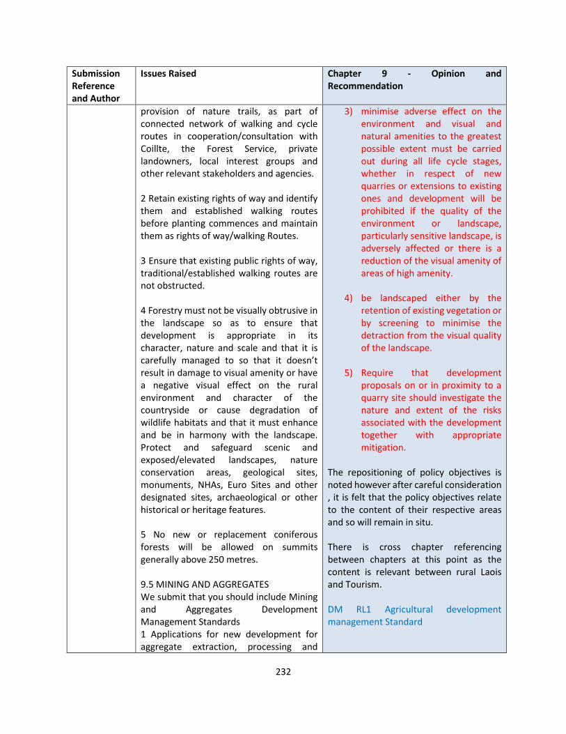
232
Submission Reference and Author
Issues Raised Chapter 9 - Opinion and Recommendation
provision of nature trails, as part of connected network of walking and cycle routes in cooperation/consultation with Coillte, the Forest Service, private landowners, local interest groups and other relevant stakeholders and agencies. 2 Retain existing rights of way and identify them and established walking routes before planting commences and maintain them as rights of way/walking Routes. 3 Ensure that existing public rights of way, traditional/established walking routes are not obstructed. 4 Forestry must not be visually obtrusive in the landscape so as to ensure that development is appropriate in its character, nature and scale and that it is carefully managed to so that it doesn’t result in damage to visual amenity or have a negative visual effect on the rural environment and character of the countryside or cause degradation of wildlife habitats and that it must enhance and be in harmony with the landscape. Protect and safeguard scenic and exposed/elevated landscapes, nature conservation areas, geological sites, monuments, NHAs, Euro Sites and other designated sites, archaeological or other historical or heritage features. 5 No new or replacement coniferous forests will be allowed on summits generally above 250 metres. 9.5 MINING AND AGGREGATES We submit that you should include Mining and Aggregates Development Management Standards 1 Applications for new development for aggregate extraction, processing and
3) minimise adverse effect on the environment and visual and natural amenities to the greatest possible extent must be carried out during all life cycle stages, whether in respect of new quarries or extensions to existing ones and development will be prohibited if the quality of the environment or landscape, particularly sensitive landscape, is adversely affected or there is a reduction of the visual amenity of areas of high amenity.
4) be landscaped either by the
retention of existing vegetation or by screening to minimise the detraction from the visual quality of the landscape.
5) Require that development
proposals on or in proximity to a quarry site should investigate the nature and extent of the risks associated with the development together with appropriate mitigation.
The repositioning of policy objectives is noted however after careful consideration , it is felt that the policy objectives relate to the content of their respective areas and so will remain in situ. There is cross chapter referencing between chapters at this point as the content is relevant between rural Laois and Tourism. DM RL1 Agricultural development management Standard
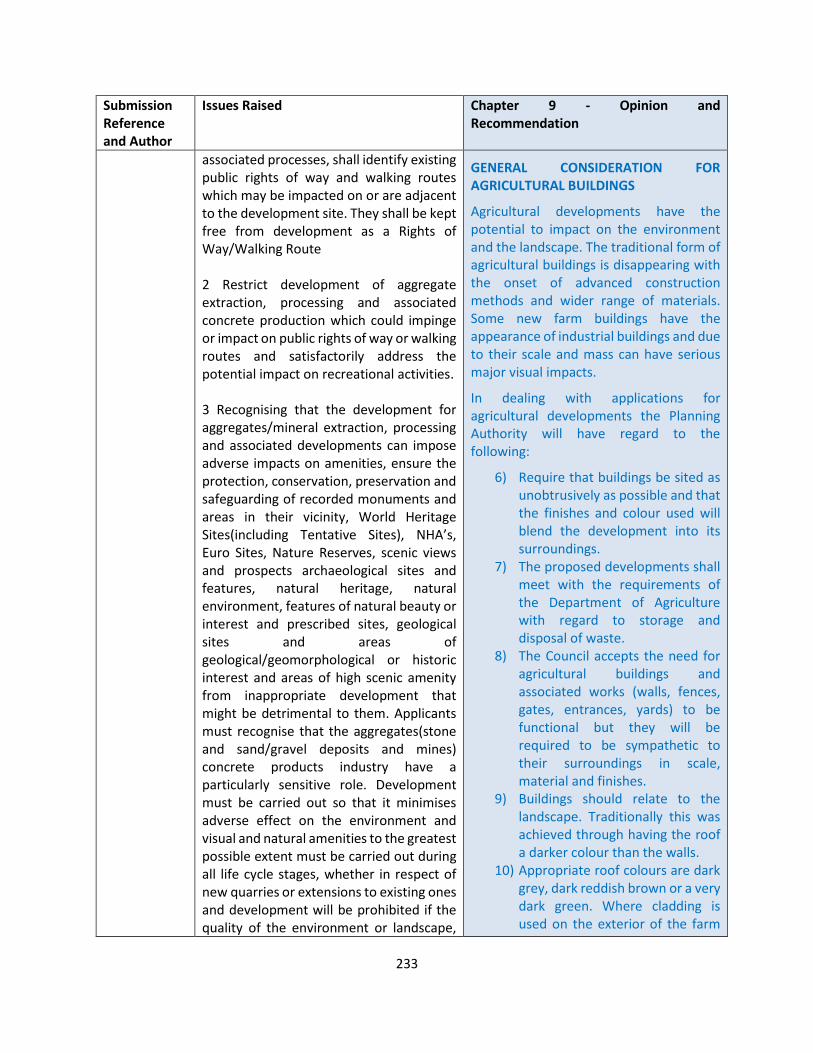
233
Submission Reference and Author
Issues Raised Chapter 9 - Opinion and Recommendation
associated processes, shall identify existing public rights of way and walking routes which may be impacted on or are adjacent to the development site. They shall be kept free from development as a Rights of Way/Walking Route 2 Restrict development of aggregate extraction, processing and associated concrete production which could impinge or impact on public rights of way or walking routes and satisfactorily address the potential impact on recreational activities. 3 Recognising that the development for aggregates/mineral extraction, processing and associated developments can impose adverse impacts on amenities, ensure the protection, conservation, preservation and safeguarding of recorded monuments and areas in their vicinity, World Heritage Sites(including Tentative Sites), NHA’s, Euro Sites, Nature Reserves, scenic views and prospects archaeological sites and features, natural heritage, natural environment, features of natural beauty or interest and prescribed sites, geological sites and areas of geological/geomorphological or historic interest and areas of high scenic amenity from inappropriate development that might be detrimental to them. Applicants must recognise that the aggregates(stone and sand/gravel deposits and mines) concrete products industry have a particularly sensitive role. Development must be carried out so that it minimises adverse effect on the environment and visual and natural amenities to the greatest possible extent must be carried out during all life cycle stages, whether in respect of new quarries or extensions to existing ones and development will be prohibited if the quality of the environment or landscape,
GENERAL CONSIDERATION FOR AGRICULTURAL BUILDINGS
Agricultural developments have the potential to impact on the environment and the landscape. The traditional form of agricultural buildings is disappearing with the onset of advanced construction methods and wider range of materials. Some new farm buildings have the appearance of industrial buildings and due to their scale and mass can have serious major visual impacts.
In dealing with applications for agricultural developments the Planning Authority will have regard to the following:
6) Require that buildings be sited as unobtrusively as possible and that the finishes and colour used will blend the development into its surroundings.
7) The proposed developments shall meet with the requirements of the Department of Agriculture with regard to storage and disposal of waste.
8) The Council accepts the need for agricultural buildings and associated works (walls, fences, gates, entrances, yards) to be functional but they will be required to be sympathetic to their surroundings in scale, material and finishes.
9) Buildings should relate to the landscape. Traditionally this was achieved through having the roof a darker colour than the walls.
10) Appropriate roof colours are dark grey, dark reddish brown or a very dark green. Where cladding is used on the exterior of the farm
234
Submission Reference and Author
Issues Raised Chapter 9 - Opinion and Recommendation
particularly sensitive landscape, is adversely affected or there is a reduction of the visual amenity of areas of high amenity. All working should be landscaped either by the retention of existing vegetation or by screening. Minimise the detraction from the visual quality of the landscape. 4 Require that development proposals on or in proximity to a quarry site should investigate the nature and extent of the risks associated with the development together with appropriate mitigation. 5 Have regard to undertaking non-energy extractive activities in accordance with Nature 2000 requirements. 6 In assessing applications the council will have regard to visual impact on sensitive landscapes. 9.6 COMMERCIAL DEVELOPMENTS IN RURAL AREAS RL 4 We submit that this should be repositioned in 9.2 Policy Objectives for Agriculture and Food Production. RL 5 We submit that this should be repositioned in Chpt 8: Tourism 8.3 Policy Objectives for Tourism. RL 6 We submit that this should be repositioned in 9.3 AFFORESTATION as an additional Pol/Obj. RL 7 As for 6 above in Afforestation Policy and merged with Objectives 1 RL 8 As for 6 above RL 9 We submit that this should be repositioned in 11.8 PEATLANDS Peatlands Policy Objective and merged with BHN 37. RL 10 As for 9 above as an additional pol Obj
buildings dark colours should be used.
11) Location and impacts on the road network and other associated uses
12) ensure it does not have an undue negative impact on the visual/scenic amenity of the countryside and identify mitigating measures where required
All agricultural buildings should be located an adequate distance from any watercourse to reduce the risk of contamination DM RL 2 COMMERCIAL DEVELOPMENT IN RURAL AREAS Include the following bullet point COMMERCIAL DEVELOPMENT IN RURAL AREAS
Development proposals in the open countryside should satisfy a high standard of siting and design, while being properly located to ensure their assimilation into their rural setting. The following considerations should be taken into account:
1. Buildings should be kept simple and should be finished with materials appropriate to a rural setting such as nap plaster, stone and slate;
2. Buildings should reflect the scale and pattern of the rural development in the vicinity;
3. Building height should be restricted to that required for the normal operation of the premises, buildings of excessive height will not be permitted;

235
Submission Reference and Author
Issues Raised Chapter 9 - Opinion and Recommendation
RL 14 Last phrase We submit that this should be repositioned in 9.5 MINING AND AGGREGATTES as an additional DMS RL 18 We submit that this should be repositioned in 9.2 Agriculture Development Management Standards as an additional Standard DM RL 2 COMMERCIAL DEVELOPMENT IN RURAL AREAS 2) We submit that you should include size We submit that you should include an additional numbers: 1 New buildings or the expansion of existing industrial business enterprises in the countryside are permitted only where the location is suitable and where the development would not be viable at an alternative location and where it would not cause a detrimental impact or erode rural character and is compatible with neighbouring land use. Any new building will be required to respect the appearance of and character of the landscape. It will not be acceptable where it is unduly prominent in the landscape, where it results in build-up of development when viewed with existing and/or approved building or where the impact of the ancillary works, including the creation of visibility splays would damage rural character or impact negatively on the environment or which fails to protect Natura Sites, conservation areas, natural heritage or the environment or fails to protect and improve or is injurious to amenities(including visual amenities). 2 Ensure that economic development that is urban in nature should be located in urban areas.
4. Buildings should be sited to make use of existing hedgerows and topography to provide natural screening, buildings in open landscapes should be avoided;
5. Access roads and driveways should respect existing site contours;
6. Car parking should be located to the rear of the building and in compliance with the car parking standards in Table 18;
7. Advertising signs should be kept to a minimum;
8. Large advertising signs at the road frontage will be resisted;
9. Hedgerows or stone walls should be used for boundary treatments;
10. Any new building will be required to respect the appearance of and character of the landscape.
11. It will not be acceptable where it is unduly prominent in the landscape, where it results in build-up of development when viewed with existing and/or approved building or where the impact of the ancillary works, including the creation of visibility splays would damage rural character or impact negatively on the environment or which fails to protect Natura Sites, conservation areas, natural heritage or the environment or fails to protect and improve or is injurious to amenities(including visual amenities).
236
Submission Reference and Author
Issues Raised Chapter 9 - Opinion and Recommendation
A justification as to why the proposed development is to be located in a rural area over a settlement where adequate zoning is in place shall be submitted
LS-C9-DCDP-114 Coilte
The submission relates to the following
Continue to support sustainable rural based enterprises such as forestry and tourism in the county and make adequate provisions and objectives to facilitate their delivery.
Have regard to the regulatory framework established under The Forestry Act 2014 and overseen by the Department of Agriculture, Food and the Marine with respect to the forestry sector (inclusion of reference, as appropriate, to the regulatory framework as detailed above, while nonetheless continuing to support the forestry industry in the county)
Ensure the zoning of sufficient lands with associated objectives for recreational, commercial, tourism and community uses.
Promote the use of sustainable timber products in the Development Plan policies and objectives.
Submission is noted OPINION The Planning Authority has included policy objectives in the Draft Plan to support the issues raised. RECOMMENDATION No change to the Draft Plan
LS-C9-DCDP-135 An Taisce
5.Rural Laois
5.1 Agriculture
Current models of intensive agriculture in Ireland are resulting in an array of adverse impacts including to water quality, air and climate, and biodiversity.
References to the EPA Water Quality Report (published in December 2020), noting that a third of rivers are failing to meet their environmental quality
Submission noted
OPINION
The Planning Authority notes the commentary in relation to impacts of agriculture on water quality, greenhouse gases The following policy objective refers as follows RL 2 Facilitate the development of agriculture while ensuring that natural

237
Submission Reference and Author
Issues Raised Chapter 9 - Opinion and Recommendation
standards. Of particular concern are the increasing pollution trends since 2015, with nitrate found to be increasing in nearly half of river sites, and phosphate increasing in a quarter of sites.
Agriculture is also a major emitter of greenhouse gases and is contributing significantly to Ireland’s ongoing failures to reach its legally binding Paris Agreement targets; GHGs from agricultural account for one third of Ireland’s total emissions.
We therefore submit that agricultural development should only be supported in the CDP policy objectives where it is demonstrably shown to not exacerbate deterioration in water quality, to comply with the Habitats Directive, to not exacerbate the current exceedance of national ammonia limits, and to not further increase GHG emissions with respect to EU and national climate change targets
We welcome Policy Objective RL 2. However, it is weak and recommend that policies providing for protection from pollution should be made as strong and enforceable as possible to begin to reverse the highly problematic trends evidenced in the EPA report.
The new CDP should also require compliance with River Basin Management Plans as well as the use of catchment sensitive farming practices. Specific action is also needed to protect the sensitive River Barrow and River Nore.
Policy objectives are required to ensure that permission for agricultural developments is only granted when the direct, indirect and cumulative impacts of a proposal to water, air, climate and biodiversity have been evaluated and
waters, wildlife habitats and conservation areas are protected from pollution CM LU 3 - Support the fulfilment of the vision of carbon neutrality in the agriculture, forest and land use sector through better sustainable agricultural, land management and resource efficiency;
The new CDP should also require compliance with River Basin Management Plans as well as the use of catchment sensitive farming practices. Specific action is also needed to protect the sensitive River Barrow and River Nore.
ES 17 - ES 21 relate
Amend
Policy objectives are required to ensure that permission for agricultural developments is only granted when the direct, indirect and cumulative impacts of a proposal to water, air, climate and biodiversity have been evaluated and mitigated if necessary. This includes impacts in the wider landholding (outside of the red line-bounded site) resulting from activities resulting from or facilitating the proposal (e.g. slurry spreading in relation to an application for a slatted cattle shed).
The following Agriculture Development Management Standard guides consideration of such development at Planning applications stage
DM RL 1 GENERAL CONSIDERATION FOR AGRICULTURAL BUILDINGS
• Agricultural developments have the potential to impact on the environment and the landscape. The traditional form of agricultural buildings is disappearing with
238
Submission Reference and Author
Issues Raised Chapter 9 - Opinion and Recommendation
mitigated if necessary. This includes impacts in the wider landholding (outside of the red line-bounded site) resulting from activities resulting from or facilitating the proposal (e.g. slurry spreading in relation to an application for slatted cattle shed).
We suggest the inclusion of specific policy objectives promoting agricultural diversification. We recommend these specifically promote the production of vegetables, grains, nuts, pulses, fruits, etc.
New European Strategies
We recommend the inclusion of the following policy objective:
“Laois County Council will implement the objectives and targets at county level of the EU ‘A Farm to Fork strategy’, published in May 2020. The Council will also implement the targets of the 14 point EU Nature Restoration Plan in the ‘EU Biodiversity Strategy for 2030 - Bringing nature back into our lives’. Agricultural development proposals must demonstrate compliance with the targets and policies of both strategies.”
Forestry
The policy objectives around forestry should better differentiate between the planting of native woodland and the planting of other species such as sitka spruce, which create what are essentially ecological dead zones. We also suggest that greater emphasis be placed on facilitating the planting of native broadleaf woodlands.
Peatlands
The commitments, particularly in Chapters 9 and 11, to restoring peatlands
the onset of advanced construction methods and wider range of materials. Some new farm buildings have the appearance of industrial buildings and due to their scale and mass can have serious major visual impacts.
• • In dealing with applications for
agricultural developments the Planning Authority will have regard to the following:
• • Require that buildings be sited as
unobtrusively as possible and that the finishes and colour used will blend the development into its surroundings.
• • The proposed developments shall meet
with the requirements of the Department of Agriculture with regard to storage and disposal of waste.
• • The Council accepts the need for
agricultural buildings and associated works (walls, fences, gates, entrances, yards) to be functional but they will be required to be sympathetic to their surroundings in scale, material and finishes.
• • Buildings should relate to the landscape.
Traditionally this was achieved through having the roof a darker colour than the walls.
• • Appropriate roof colours are dark grey,
dark reddish brown or a very dark green. Where cladding is used on the exterior of the farm buildings dark colours should be used.
• • Location and impacts on the road network
and other associated uses •

239
Submission Reference and Author
Issues Raised Chapter 9 - Opinion and Recommendation
are welcome. It is submitted, however, that any provision for development on peatlands, such energy developments or the growing of energy, must be subject to full sustainability assessments, particularly in relation to carbon and biodiversity.
We also submit that an additional policy objective should be added to state: “The extraction and use of peat for horticulture is not to be permitted”. An Taisce strongly supports the commitments in the Draft Plan to facilitating a Just Transition for the many people impacted by the cessation of commercial peat harvesting.
Mining and Aggregates
An additional policy objective be included to require strict enforcement against unauthorised development and of conditions applied to permitted quarry development.
Section 35 of the Planning and Development Act 2000 (as amended) regarding past failures to comply should be rigorously applied to proposals for continued or expanding quarrying operations.
• All agricultural buildings should be located an adequate distance from any watercourse to reduce the risk of contamination
We suggest the inclusion of specific policy objectives promoting agricultural diversification. We recommend these specifically promote the production of vegetables, grains, nuts, pulses, fruits, etc. RL 4 Continue to support and work with Laois Food producers to promote local provenance, strengthen the Laois food industry and transform Laois into one of Ireland’s top food destinations
It is proposed to include the following policy objective
RL xx “Laois County Council will implement the objectives and targets at county level of the EU ‘A Farm to Fork strategy’, published in May 2020. The Council will also implement the targets of the 14 point EU Nature Restoration Plan in the ‘EU Biodiversity Strategy for 2030 - Bringing nature back into our lives’. Agricultural development proposals must demonstrate compliance with the targets and policies of both strategies.”
Forestry
Appropriate policy objectives in relation to forestry have been included in the plan.
Peatlands
The commentary in relation to Peatlands is noted. Policies and development control standards in relation to energy developments are set out in chapter 3 and are also governed by the EIA legislation and compliance with same.
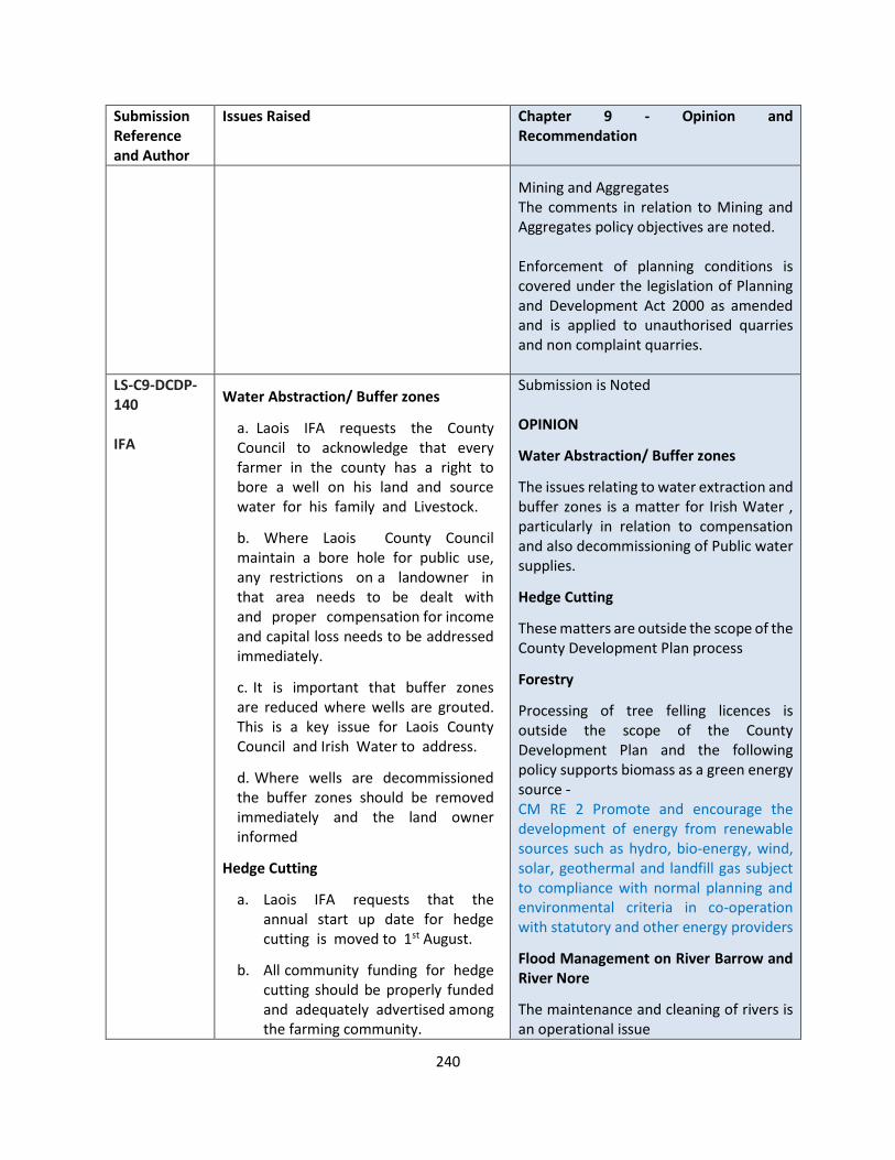
240
Submission Reference and Author
Issues Raised Chapter 9 - Opinion and Recommendation
Mining and Aggregates The comments in relation to Mining and Aggregates policy objectives are noted. Enforcement of planning conditions is covered under the legislation of Planning and Development Act 2000 as amended and is applied to unauthorised quarries and non complaint quarries.
LS-C9-DCDP-140 IFA
Water Abstraction/ Buffer zones
a. Laois IFA requests the County Council to acknowledge that every farmer in the county has a right to bore a well on his land and source water for his family and Livestock.
b. Where Laois County Council maintain a bore hole for public use, any restrictions on a landowner in that area needs to be dealt with and proper compensation for income and capital loss needs to be addressed immediately.
c. It is important that buffer zones are reduced where wells are grouted. This is a key issue for Laois County Council and Irish Water to address.
d. Where wells are decommissioned the buffer zones should be removed immediately and the land owner informed
Hedge Cutting
a. Laois IFA requests that the annual start up date for hedge cutting is moved to 1st August.
b. All community funding for hedge cutting should be properly funded and adequately advertised among the farming community.
Submission is Noted OPINION
Water Abstraction/ Buffer zones
The issues relating to water extraction and buffer zones is a matter for Irish Water , particularly in relation to compensation and also decommissioning of Public water supplies.
Hedge Cutting
These matters are outside the scope of the County Development Plan process
Forestry
Processing of tree felling licences is outside the scope of the County Development Plan and the following policy supports biomass as a green energy source - CM RE 2 Promote and encourage the development of energy from renewable sources such as hydro, bio-energy, wind, solar, geothermal and landfill gas subject to compliance with normal planning and environmental criteria in co-operation with statutory and other energy providers
Flood Management on River Barrow and River Nore
The maintenance and cleaning of rivers is an operational issue
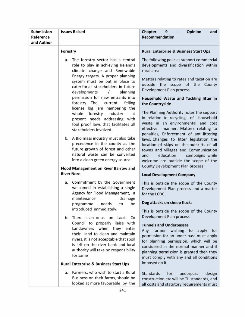
241
Submission Reference and Author
Issues Raised Chapter 9 - Opinion and Recommendation
Forestry
a. The forestry sector has a central role to play in achieving Ireland’s climate change and Renewable Energy targets. A proper planning system must be put in place to cater for all stakeholders in future developments / planning permission for new entrants into forestry. The current felling license log jam hampering the whole forestry industry at present needs addressing with fool proof laws that facilitates all stakeholders involved.
b. A Bio mass industry must also take precedence in the county as the future growth of forest and other natural waste can be converted into a clean green energy source.
Flood Management on River Barrow and River Nore
a. Commitment by the Government welcomed in establishing a single Agency for Flood Management, a maintenance drainage programme needs to be introduced immediately.
b. There is an onus on Laois Co Council to properly liaise with Landowners when they enter their land to clean and maintain rivers, it is not acceptable that spoil is left on the river bank and local authority will take no responsibility for same
Rural Enterprise & Business Start Ups
a. Farmers, who wish to start a Rural Business on their farms, should be looked at more favourable by the
Rural Enterprise & Business Start Ups
The following policies support commercial developments and diversification within rural area
Matters relating to rates and taxation are outside the scope of the County Development Plan process.
Household Waste and Tackling litter in the Countryside
The Planning Authority notes the support in relation to recycling of household waste in an environmental and cost effective manner. Matters relating to penalties, Enforcement of anti-littering laws, Changes to litter legislation, the location of skips on the outskirts of all towns and villages and Communication and education campaigns while welcome are outside the scope of the County Development Plan process.
Local Development Company
This is outside the scope of the County Development Plan process and a matter for the LCDC.
Dog attacks on sheep flocks
This is outside the scope of the County Development Plan process
Tunnels and Underpasses Any farmer wishing to apply for permission for an under pass must apply for planning permission, which will be considered in the normal manner and if planning permission is granted then they must comply with any and all conditions imposed on it. Standards for underpass design construction etc will be TII standards, and all costs and statutory requirements must
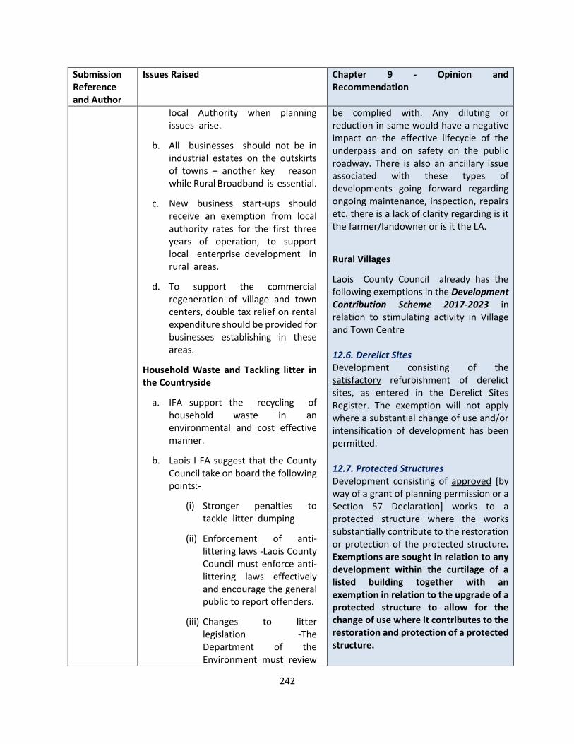
242
Submission Reference and Author
Issues Raised Chapter 9 - Opinion and Recommendation
local Authority when planning issues arise.
b. All businesses should not be in industrial estates on the outskirts of towns – another key reason while Rural Broadband is essential.
c. New business start-ups should receive an exemption from local authority rates for the first three years of operation, to support local enterprise development in rural areas.
d. To support the commercial regeneration of village and town centers, double tax relief on rental expenditure should be provided for businesses establishing in these areas.
Household Waste and Tackling litter in the Countryside
a. IFA support the recycling of household waste in an environmental and cost effective manner.
b. Laois I FA suggest that the County Council take on board the following points:-
(i) Stronger penalties to tackle litter dumping
(ii) Enforcement of anti-littering laws -Laois County Council must enforce anti-littering laws effectively and encourage the general public to report offenders.
(iii) Changes to litter legislation -The Department of the Environment must review
be complied with. Any diluting or reduction in same would have a negative impact on the effective lifecycle of the underpass and on safety on the public roadway. There is also an ancillary issue associated with these types of developments going forward regarding ongoing maintenance, inspection, repairs etc. there is a lack of clarity regarding is it the farmer/landowner or is it the LA.
Rural Villages
Laois County Council already has the following exemptions in the Development Contribution Scheme 2017-2023 in relation to stimulating activity in Village and Town Centre 12.6. Derelict Sites Development consisting of the satisfactory refurbishment of derelict sites, as entered in the Derelict Sites Register. The exemption will not apply where a substantial change of use and/or intensification of development has been permitted. 12.7. Protected Structures Development consisting of approved [by way of a grant of planning permission or a Section 57 Declaration] works to a protected structure where the works substantially contribute to the restoration or protection of the protected structure. Exemptions are sought in relation to any development within the curtilage of a listed building together with an exemption in relation to the upgrade of a protected structure to allow for the change of use where it contributes to the restoration and protection of a protected structure.

243
Submission Reference and Author
Issues Raised Chapter 9 - Opinion and Recommendation
the anti-litter legislation and remove the threat of fines and prosecution of farmers on whose lands others dump litter recklessly.
(iv) Civic amenity sites on the outskirts of towns and villages –Laois County Council should consider establishing a network of strategically located skips on the outskirts of all towns and villages
(v) Communication and education campaign - Laois County Council environmental enforcement officers should liaise directly with the public to highlight the problem of rural littering.
Local Development Company
a. Laois County Council is the lead body who manage Laois local Development Company. As of now Food based projects cannot apply and the level of red tape on drawing down funding for any rural agri-plan needs to be reviewed.
Dog attacks on sheep flocks
Dog attacks on sheep flocks continue to be a growing issue in County Laois. Farmers who encounter a dog attack on their sheep flock must be fully protected by the County Council and An Garda Síochána. Laois Co Council should launch a campaign to micro chip all dogs in the County.
However this will not apply in the case of new builds (stand alone developments or extensions to existing protected structures )within the curtilage of a protected structure. 13.1. Employment Creation A 33% reduction shall apply to new business developments by IDA, Enterprise Ireland or entrepreneurs where 5 or more new jobs are being created. Documentary evidence to the satisfaction of the Council must be submitted in this regard. 13.2 Town Centre Rejuvenation A 33% reduction shall apply in the town centre primary/town centre zoned areas of Portlaoise, Portarlington, Graiguecullen, and Mountmellick as defined in the Laois County Development Plan 2017–2023 and Local Area Plans respectively and in the village and town centre zoned areas for each town and village as defined in Volume 2 of the County Development Plan 2017-2023. A 50% reduction [none in the current scheme] shall apply in the case of provision of residential development over ground floor commercial space in the town centre primary and town centre zoned areas of Portlaoise, Portarlington, Graiguecullen and Mountmellick as defined in the Laois County Development Plan 2017–2023 and Local Area Plans respectively and in the town and village centre zoned areas for each town and village as defined in Volume 2 of the County Development Plan 2017-2023.
The issue raised in relation to the support of small business in rural Ireland is noted and will be considered in the context of the Local Economic and Community Plan for Co Laois County Council
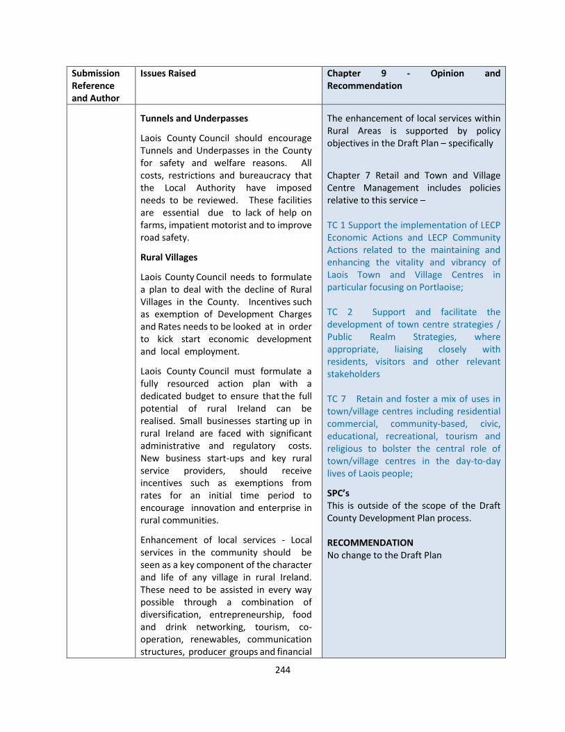
244
Submission Reference and Author
Issues Raised Chapter 9 - Opinion and Recommendation
Tunnels and Underpasses
Laois County Council should encourage Tunnels and Underpasses in the County for safety and welfare reasons. All costs, restrictions and bureaucracy that the Local Authority have imposed needs to be reviewed. These facilities are essential due to lack of help on farms, impatient motorist and to improve road safety.
Rural Villages
Laois County Council needs to formulate a plan to deal with the decline of Rural Villages in the County. Incentives such as exemption of Development Charges and Rates needs to be looked at in order to kick start economic development and local employment.
Laois County Council must formulate a fully resourced action plan with a dedicated budget to ensure that the full potential of rural Ireland can be realised. Small businesses starting up in rural Ireland are faced with significant administrative and regulatory costs. New business start-ups and key rural service providers, should receive incentives such as exemptions from rates for an initial time period to encourage innovation and enterprise in rural communities.
Enhancement of local services - Local services in the community should be seen as a key component of the character and life of any village in rural Ireland. These need to be assisted in every way possible through a combination of diversification, entrepreneurship, food and drink networking, tourism, co-operation, renewables, communication structures, producer groups and financial
The enhancement of local services within Rural Areas is supported by policy objectives in the Draft Plan – specifically
Chapter 7 Retail and Town and Village Centre Management includes policies relative to this service – TC 1 Support the implementation of LECP Economic Actions and LECP Community Actions related to the maintaining and enhancing the vitality and vibrancy of Laois Town and Village Centres in particular focusing on Portlaoise; TC 2 Support and facilitate the development of town centre strategies / Public Realm Strategies, where appropriate, liaising closely with residents, visitors and other relevant stakeholders TC 7 Retain and foster a mix of uses in town/village centres including residential commercial, community-based, civic, educational, recreational, tourism and religious to bolster the central role of town/village centres in the day-to-day lives of Laois people;
SPC’s This is outside of the scope of the Draft County Development Plan process. RECOMMENDATION No change to the Draft Plan
245
Submission Reference and Author
Issues Raised Chapter 9 - Opinion and Recommendation
instruments.
SPC’s
Changes to the Common Agriculture Policy where each member state must develop a National Strategic Plan which will be introduced across the Country on January 1st2022. These changes have the environment and climate central to its policies. We ask Laois County Council to rethink this resolution and give more credence to the working of the specific SPC administered by Laois County Council in the future

246
CHAPTER 10 INFRASTRUCTURE
Submission Reference and Author
Issues Raised Chapter 10 - Opinion and Recommendation
LS-C9-DCDP-7 John Holland
There is currently a high level of high car use in the town for short trips. Cars account for the vast majority of commuting trips while commuting on foot to education is significantly higher than commuting on foot to work. Cycling accounts for a very low number of commuting trips - primarily due to poor infrastructure. There is much opportunity and potential (given the increasing and young population and the expected continued large number of remote workers) to improve the walking and cycling infrastructure in Portarlington – thereby making the town more sustainable and accessible for this and future generations. 1. Introduce 30km/h speed limit within
the town (focussing especially on schools and main streets) – e.g. Station Road, Canal Road + R420 main road through Portarlington from Lea Road/Canal Road junction to outside town boundary on Offaly side
2. Priority pedestrian/raised zebra
crossings at Maxol roundabout (start of Upper Main St.)
3. Priority pedestrian/raised zebra
crossings on Upper Main St 4. Redesign of parking/footpaths on
Upper Main St 5. Standard Cycle lane(s) on Upper Main
Street from Maxol roundabout - to Library – along Link Road to Market
OPINION The comments are noted. However, the specific issues are of a more detailed nature, which could be more appropriately addressed through the Portarlington Joint Area Plan, with a review due to commence in late 2021, early 2022. It is a policy objective of the Draft Plan To undertake Local Transport Plans in conjunction with the NTA, TII, and relevant stakeholders transportation studies in the following towns. The purpose of Transportation Studies is to which will identify the a transport strategy to address modal shift, traffic issues, parking and active travel deficiencies in the existing network and make recommendations on same in the following towns
• Portlaoise & Environs
• Mountrath & Environs
• Mountmellick & Environs
• Durrow & Environs
• Abbeyleix & Environs
• Stradbally & Environs
• Portarlington & Environs (Joint Study with Offaly Co Co to be explored)
• Graiguecullen & Environs (Joint Study with Carlow Co Co to be explored)
The strategic aim of the LTP is to
• examine the current lack of alternatives to the car and land
247
Submission Reference and Author
Issues Raised Chapter 10 - Opinion and Recommendation
Square and up Patrick St to Colaiste Iosagain
6. continuation of dual cycle lane on Canal
Road from Scoil Phadraig (Boys school) to the Odlum's roundabout
7. Bollards on existing cycle lanes on
Station Road at Presentation Girls' school (pharmacy side + before and after bollarded sections on school side)
8. Cycle lanes on Station Road from
Odlum’s roundabout to train station 9. Standard Cycle lanes on Crowe Lane to
Ballymorris Road roundabout and down to Sandy Lane national school
10. Footpath on right hand side of Station
road from Portarlington train station to the turnoff for Corrig Wood
11. Footpaths on Portlaoise Road R419 to
Blackhall Bridge and up Canal Road to Ballymorris Road junction
12. Footpath on Corrig Lodge road from
Corrig Wood to last houses before Tirhogar Drive
13. Footpath on Lea Road R420 to the
rugby club
use patterns which can better affect a modal shift to public transport, walking and cycling;
• address current issues and anticipate future problems in the transport network of the town and its strategic routes; and in doing so will present a detailed analysis of the current transport situation and present potential interventions and recommendations for active travel options, roads based solutions including the strategic routes and solutions to encourage provision and greater use of public transport.
RECOMMENDATION The following change is proposed It is a policy objective of the Draft Plan To undertake Local Transport Plans in conjunction with the NTA, TII, and relevant stakeholders transportation studies in the following towns. The purpose of Transportation Studies is to which will identify the a transport strategy to address modal shift, traffic issues, parking and active travel deficiencies in the existing network and make recommendations on same in the following towns
• Portlaoise & Environs
• Mountrath & Environs
• Mountmellick & Environs
• Durrow & Environs
• Abbeyleix & Environs
• Stradbally & Environs
• Portarlington & Environs (Joint Study with Offaly Co Co to be explored)
248
Submission Reference and Author
Issues Raised Chapter 10 - Opinion and Recommendation
• Graiguecullen & Environs (Joint Study with Carlow Co Co to be explored)
The strategic aim of the LTP is to
• examine the current lack of alternatives to the car and land use patterns which can better affect a modal shift to public transport, walking and cycling;
• address current issues and anticipate future problems in the transport network of the town and its strategic routes; and in doing so will present a detailed analysis of the current transport situation and present potential interventions and recommendations for active travel options, roads based solutions including the strategic routes and solutions to encourage provision and greater use of public transport.
LS-C9-DCDP-20 Clare Reidy
I am making this submission in respect of the traffic situation on the Meelick Road (L6310), large volumes of traffic make walking & cycling virtually impossible. As a result of its location, just off the Junction 17 roundabout of the M7, this narrow country road has become the conduit for large volumes of traffic coming from the M7 looking to cross over to the N80. Now that the Portlaoise Southern Circular Road has been completed there is no need for any non-Residents to drive on this road. I suggest that the Laois County Development Plan include a reorganisation of traffic around this part of Portlaoise, to
OPINION The comments are noted. However, the specific issues are of a more detailed nature, which could be more appropriately addressed through the Portlaoise Local Area Plan, with a review due to commence in late 2021, early 2022. It is a policy objective of the Draft Plan To undertake Local Transport Plans in conjunction with the NTA, TII, and relevant stakeholders transportation studies in the following towns. The purpose of Transportation Studies is to which will identify the a transport

249
Submission Reference and Author
Issues Raised Chapter 10 - Opinion and Recommendation
re-route this traffic away from this completely unsuitable road and utilise the purpose built Portlaoise Southern Circular Road. Installing speed bumps, footpaths, making the road narrower and possibly introducing a one-way system could all help the issue also.
strategy to address modal shift, traffic issues, parking and active travel deficiencies in the existing network and make recommendations on same in the following towns
• Portlaoise & Environs
• Mountrath & Environs
• Mountmellick & Environs
• Durrow & Environs
• Abbeyleix & Environs
• Stradbally & Environs
• Portarlington & Environs (Joint Study with Offaly Co Co to be explored)
• Graiguecullen & Environs (Joint Study with Carlow Co Co to be explored)
The strategic aim of the LTP is to
• examine the current lack of alternatives to the car and land use patterns which can better affect a modal shift to public transport, walking and cycling;
• address current issues and anticipate future problems in the transport network of the town and its strategic routes; and in doing so will present a detailed analysis of the current transport situation and present potential interventions and recommendations for active travel options, roads based solutions including the strategic routes and solutions to encourage provision and greater use of public transport.
RECOMMENDATION No change to the Draft Plan.

250
Submission Reference and Author
Issues Raised Chapter 10 - Opinion and Recommendation
LS-C9-DCDP-29 Department of Transport
To make public transport fully accessible to people with disabilities requires a ‘whole journey approach’ which refers to all elements that constitute a journey from the starting point to destination. Local Authorities are a key stakeholder in this regard in the context of ensuring a universal design approach to the built environment and placemaking, including footpaths, roads, pedestrian crossing points, waymarking/directional information and bus stops/shelters. DoT considers that the DMURS Interim Advice Note – Covid-19 Pandemic Response which has been published on the DMURS website also be referenced as it includes guidance that designers should ensure that measures align with the principles of universal design, consider Government policy on accessibility for people with disabilities and consult people with disabilities to further appraise measures. The DoT welcomes the inclusion of the Local Link Rural Transport Programme and suggests a minor textual amendment under Section 10.1.8.2 Bus Existing text = “At a more local, rural level, the National Transport Authority funded Rural Transport Programme provides Local Link Laois Offaly” Suggested amended text = At a more local, rural level, the National Transport Authority funded Local Link Rural Transport Programme services, which are managed by Local Link Laois Offaly”
OPINION The matter is noted and accepted. regarding a minor text change at Section 10.1.8.2. RECOMMENDATION Section 10.1.8.2 – Bus Existing Amend from At a more local, rural level, the National Transport Authority funded Rural Transport Programme provides Local Link Laois Offaly” To At a more local, rural level, the National Transport Authority funded Local Link Rural Transport Programme services, which are managed by Local Link Laois Offaly”
251
Submission Reference and Author
Issues Raised Chapter 10 - Opinion and Recommendation
LS-C9-DCDP-47 Cllr James Kelly
Section 10.1.8.2- Bus. The development of a quality bus service as an alternative to private car use is an essential element of both the climate action plan and an integrated and balanced public transport service to tackle rural social exclusion. With the removal of the Bus Eireann services to our more rural areas such as Borris in Ossory, Castletown, Mountrath, Rathdowney etc and the introduction of more routes by Laois Local Link it is a matter of urgency that Laois County Council install Bus Shelters in as many locations as possible.
OPINION The submission is noted, and the matter of the provision of bus shelters is referred to in TRANS 59. RECOMMENDATION No change to the Draft Plan.
LS-C9-DCDP-57 TII Transport Infrastructure Ireland
TII would welcome the following additions noted in red: Managing Exchequer Investment and Statutory Guidance TRANS 1: Maintain improve and protect the safety, capacity and efficiency of Laois’s roads network and associated junctions in accordance with the Spatial Planning and National Roads Guidelines for Planning Authorities, DECLG, (2012) and the Trans-European Networks (TEN- T) Regulations and safeguard the strategic function of the national road network. TRANS 4: Prevent inappropriate development including intensification of use on lands adjacent to the existing national road network, which would adversely affect the safety, current and future capacity and function of national roads and having regard to possible future upgrades of the national roads and junctions.
OPINION The submission is noted. With regards to the points raised, these are as follows: TRANS 1 Broadly agreed, subject to some minor text amendments. TRANS 4 Broadly agree, however disagree with the insertion of the word “national”, as this could preclude potential instances where land may not be adjacent to existing national roads. TRANS 16 Disagree as this is specifically related to the motorway network. Exemptions
The following policy objectives relate to section 2.5 – Required Development Plan Policy on Access to National Roads and section 2.6 – Exceptional Circumstances of the
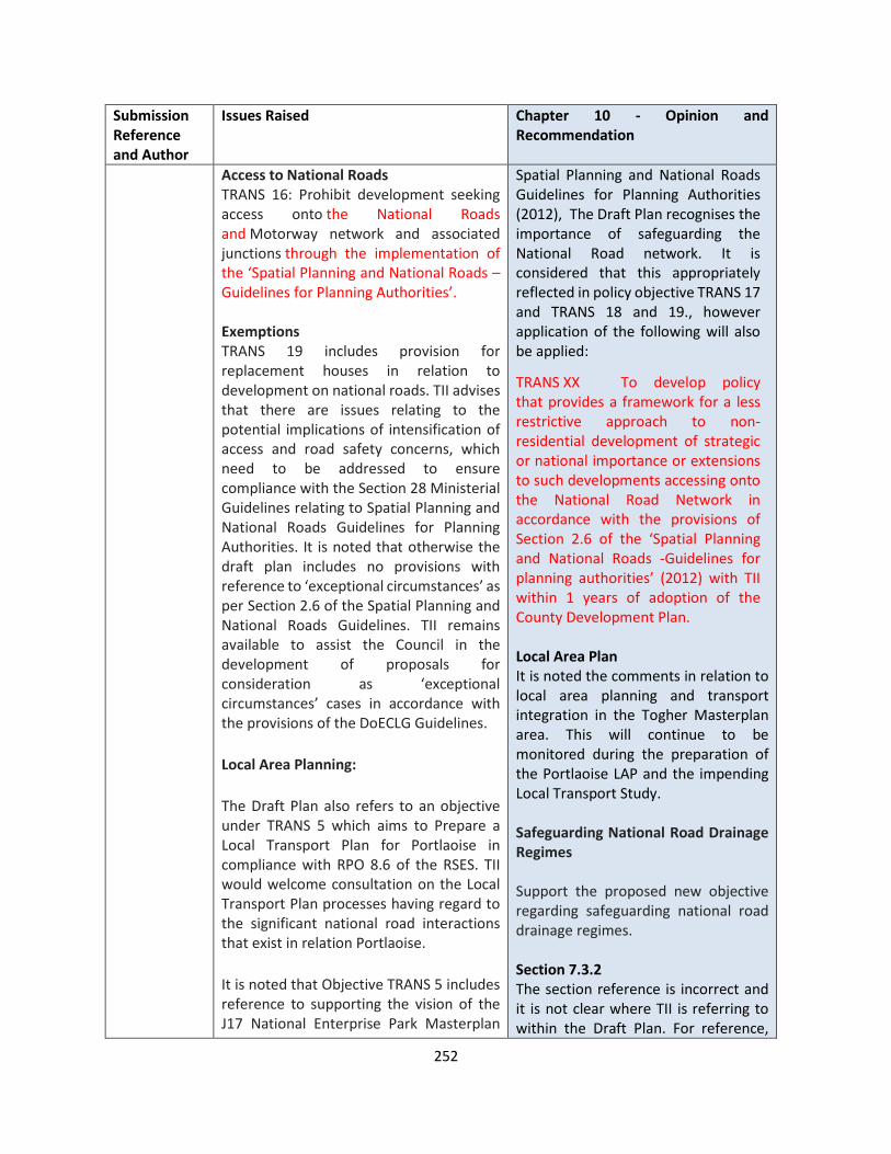
252
Submission Reference and Author
Issues Raised Chapter 10 - Opinion and Recommendation
Access to National Roads TRANS 16: Prohibit development seeking access onto the National Roads and Motorway network and associated junctions through the implementation of the ‘Spatial Planning and National Roads – Guidelines for Planning Authorities’. Exemptions TRANS 19 includes provision for replacement houses in relation to development on national roads. TII advises that there are issues relating to the potential implications of intensification of access and road safety concerns, which need to be addressed to ensure compliance with the Section 28 Ministerial Guidelines relating to Spatial Planning and National Roads Guidelines for Planning Authorities. It is noted that otherwise the draft plan includes no provisions with reference to ‘exceptional circumstances’ as per Section 2.6 of the Spatial Planning and National Roads Guidelines. TII remains available to assist the Council in the development of proposals for consideration as ‘exceptional circumstances’ cases in accordance with the provisions of the DoECLG Guidelines.
Local Area Planning:
The Draft Plan also refers to an objective under TRANS 5 which aims to Prepare a Local Transport Plan for Portlaoise in compliance with RPO 8.6 of the RSES. TII would welcome consultation on the Local Transport Plan processes having regard to the significant national road interactions that exist in relation Portlaoise.
It is noted that Objective TRANS 5 includes reference to supporting the vision of the J17 National Enterprise Park Masterplan
Spatial Planning and National Roads Guidelines for Planning Authorities (2012), The Draft Plan recognises the importance of safeguarding the National Road network. It is considered that this appropriately reflected in policy objective TRANS 17 and TRANS 18 and 19., however application of the following will also be applied:
TRANS XX To develop policy that provides a framework for a less restrictive approach to non-residential development of strategic or national importance or extensions to such developments accessing onto the National Road Network in accordance with the provisions of Section 2.6 of the ‘Spatial Planning and National Roads -Guidelines for planning authorities’ (2012) with TII within 1 years of adoption of the County Development Plan. Local Area Plan It is noted the comments in relation to local area planning and transport integration in the Togher Masterplan area. This will continue to be monitored during the preparation of the Portlaoise LAP and the impending Local Transport Study. Safeguarding National Road Drainage Regimes Support the proposed new objective regarding safeguarding national road drainage regimes. Section 7.3.2 The section reference is incorrect and it is not clear where TII is referring to within the Draft Plan. For reference,

253
Submission Reference and Author
Issues Raised Chapter 10 - Opinion and Recommendation
within the context of preparing the Portlaoise Local Transport Plan. TII considers it critical that local area planning and transport integration in the Togher Masterplan area should continue to be co-ordinated within the strategic context of the Portlaoise Local Area Plan. In that regard, comments previously made in relation to the Togher Masterplan remain the position of TII. Therefore, in TII’s opinion, it is important that access to the Midway lands and adjoining zoned lands are also fully addressed as part of the Local Area Plan Review and having regard to the Councils previous commitments in relation to this matter.
TII advises that the DoECLG Spatial Planning and National Roads Guidelines for Planning Authorities require that planning authorities exercise particular care in their assessment and management of development proposals in the Development Plan relating to the zoning of locations at or close to junctions on the national road network where such development could generate significant additional traffic. TII requests that where there are implications for the safe and efficient operation of the national road network, existing and proposed, that appropriate consultation with TII would occur.
Safeguarding National Road Drainage Regimes TII would welcome consideration being given to including a new objective associated with Section 10.1.3.2 National Roads relating to protection of national road drainage regimes. National road surface water drainage regimes are constructed with the objective of disposing of national road surface water, it is
Section 10.1.4.2 refers to the NRA (TII) Design Manual for Roads and Bridges. Therefore, it is considered the referencing in the Draft Plan is correct. Traffic and Transport Assessment The comment is noted, however, there is sufficient reference to consult with that document. There is no need to elaborate further on its contents within the Draft Plan. Road Safety Section 10.1.4.2 includes the following reference to NRA (TII) Design Manual for Roads and Bridges. This is considered to be sufficient referencing to the document. The referencing to the Road Safety Audit is noted, and this can be referenced in TRANS 27. TRANS 18 (Transition Zones) The amendments proposed are considered to be acceptable. RECOMMENDATION Safeguarding National Road Drainage Regimes a new Objective included in the Development Plan outlining that; ‘The capacity and efficiency of the national road network drainage regimes in County Laois will be safeguarded for national road drainage purposes’.

254
Submission Reference and Author
Issues Raised Chapter 10 - Opinion and Recommendation
important that capacity in the drainage regime is retained to address this function. TII would welcome a new Objective included in the Development Plan outlining that;
‘The capacity and efficiency of the national road network drainage regimes in County Laois will be safeguarded for national road drainage purposes’. TII Publications In relation Section 7.3.2, TII advises that Design Manual for Roads and Bridges (DMRB) has been superseded and all standards are now detailed as TII Publications. The Authority recommends including reference to TII Publications as the relevant technical design standard that will be applied to development impacting national roads. Traffic and Transport Assessment TII would welcome the Draft Plan being updated to reflect the requirements of Table 2.3 of the TII Traffic and Transport Assessment Guidelines that address the requirement for TTA in relation to sub-threshold development.
Road Safety
TII welcomes reference to the requirement for RSA in Section 10.1.4.2. This section also refers to the Design Manual for Roads and Bridges. Reference to the DMRB should be updated to TII Publications. TII would welcome the Draft Plan clarifying that any development proposal that results in alteration to a national road will be subject to RSA in accordance with TII Publications GE-STY-01024 Road Safety Audit.
Transition Zones Additional text for TRANS 18:
Amend the following policies TRANS 1 Maintain, improve and protect the safety, capacity and efficiency of Laois’s roads network and associated junctions in accordance with the Spatial Planning and National Roads Guidelines for Planning Authorities, DECLG, (2012) and the Trans-European Networks (TEN-T) Regulations TRANS 4 Prevent inappropriate development on lands adjacent to the existing road network, including the intensification of the use which would adversely affect the safety, current and future capacity and function of national roads and having regard to possible future upgrades of the national roads and junctions. TRANS16 Prohibit development seeking access onto the Motorway network and associated junctions through the implementation of the ‘Spatial Planning and National Roads – Guidelines for Planning Authorities’. TRANS18 Facilitate a limited level of new accesses or the intensified use of existing accesses to the national road network on the approaches to or exit from urban centres that are subject to a speed limit zone between 50kmph and 60kmph otherwise known as the transition zone. Such accesses will be considered where they facilitate orderly urban development and would not result in a proliferation of such
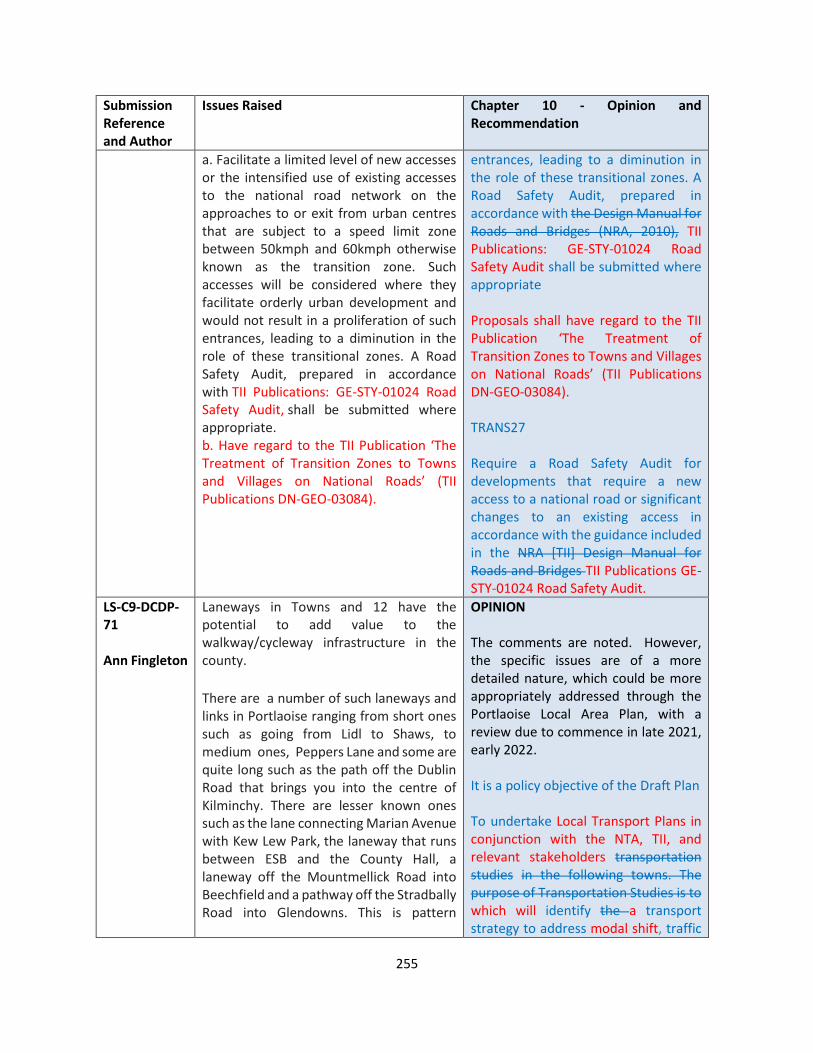
255
Submission Reference and Author
Issues Raised Chapter 10 - Opinion and Recommendation
a. Facilitate a limited level of new accesses or the intensified use of existing accesses to the national road network on the approaches to or exit from urban centres that are subject to a speed limit zone between 50kmph and 60kmph otherwise known as the transition zone. Such accesses will be considered where they facilitate orderly urban development and would not result in a proliferation of such entrances, leading to a diminution in the role of these transitional zones. A Road Safety Audit, prepared in accordance with TII Publications: GE-STY-01024 Road Safety Audit, shall be submitted where appropriate. b. Have regard to the TII Publication ‘The Treatment of Transition Zones to Towns and Villages on National Roads’ (TII Publications DN-GEO-03084).
entrances, leading to a diminution in the role of these transitional zones. A Road Safety Audit, prepared in accordance with the Design Manual for Roads and Bridges (NRA, 2010), TII Publications: GE-STY-01024 Road Safety Audit shall be submitted where appropriate Proposals shall have regard to the TII Publication ‘The Treatment of Transition Zones to Towns and Villages on National Roads’ (TII Publications DN-GEO-03084). TRANS27 Require a Road Safety Audit for developments that require a new access to a national road or significant changes to an existing access in accordance with the guidance included in the NRA [TII] Design Manual for Roads and Bridges TII Publications GE-STY-01024 Road Safety Audit.
LS-C9-DCDP-71 Ann Fingleton
Laneways in Towns and 12 have the potential to add value to the walkway/cycleway infrastructure in the county.
There are a number of such laneways and links in Portlaoise ranging from short ones such as going from Lidl to Shaws, to medium ones, Peppers Lane and some are quite long such as the path off the Dublin Road that brings you into the centre of Kilminchy. There are lesser known ones such as the lane connecting Marian Avenue with Kew Lew Park, the laneway that runs between ESB and the County Hall, a laneway off the Mountmellick Road into Beechfield and a pathway off the Stradbally Road into Glendowns. This is pattern
OPINION The comments are noted. However, the specific issues are of a more detailed nature, which could be more appropriately addressed through the Portlaoise Local Area Plan, with a review due to commence in late 2021, early 2022. It is a policy objective of the Draft Plan To undertake Local Transport Plans in conjunction with the NTA, TII, and relevant stakeholders transportation studies in the following towns. The purpose of Transportation Studies is to which will identify the a transport strategy to address modal shift, traffic
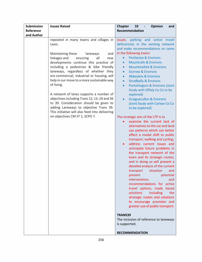
256
Submission Reference and Author
Issues Raised Chapter 10 - Opinion and Recommendation
repeated in many towns and villages in Laois.
Maintaining these laneways and linkages and ensuring all new developments continue this practice of including a pedestrian & bike friendly laneways, regardless of whether they are commercial, industrial or housing, will help in our move to a more sustainable way of living.
A network of lanes supports a number of objectives including Trans 12, 13, 24 and 36 to 39. Consideration should be given to adding Laneways to objective Trans 39. This initiative will also feed into delivering on objectives CM ST 1, SCPO 7.
issues, parking and active travel deficiencies in the existing network and make recommendations on same in the following towns
• Portlaoise & Environs
• Mountrath & Environs
• Mountmellick & Environs
• Durrow & Environs
• Abbeyleix & Environs
• Stradbally & Environs
• Portarlington & Environs (Joint Study with Offaly Co Co to be explored)
• Graiguecullen & Environs (Joint Study with Carlow Co Co to be explored)
The strategic aim of the LTP is to
• examine the current lack of alternatives to the car and land use patterns which can better affect a modal shift to public transport, walking and cycling;
• address current issues and anticipate future problems in the transport network of the town and its strategic routes; and in doing so will present a detailed analysis of the current transport situation and present potential interventions and recommendations for active travel options, roads based solutions including the strategic routes and solutions to encourage provision and greater use of public transport.
TRANS39 The inclusion of reference to laneways is supported. RECOMMENDATION
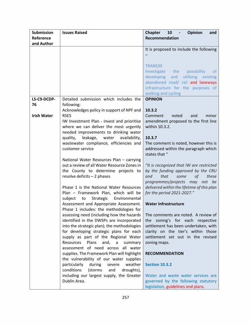
257
Submission Reference and Author
Issues Raised Chapter 10 - Opinion and Recommendation
It is proposed to include the following – TRANS39 Investigate the possibility of developing and utilising existing abandoned road/ rail and laneways infrastructure for the purposes of walking and cycling
LS-C9-DCDP-76 Irish Water
Detailed submission which includes the following: Acknowledges policy in support of NPF and RSES IW Investment Plan - invest and prioritise where we can deliver the most urgently needed improvements to drinking water quality, leakage, water availability, wastewater compliance, efficiencies and customer service National Water Resources Plan – carrying out a review of all Water Resource Zones in the County to determine projects to resolve deficits – 2 phases Phase 1 is the National Water Resources Plan – Framework Plan, which will be subject to Strategic Environmental Assessment and Appropriate Assessment. Phase 1 includes: the methodologies for assessing need (including how the hazards identified in the DWSPs are incorporated into the strategic plan); the methodologies for developing strategic plans for each supply as part of the Regional Water Resources Plans and, a summary assessment of need across all water supplies. The Framework Plan will highlight the vulnerability of our water supplies particularly during severe weather conditions (storms and droughts), including our largest supply, the Greater Dublin Area.
OPINION 10.3.2 Comment noted and minor amendment proposed to the first line within 10.3.2. 10.3.7 The comment is noted, however this is addressed within the paragraph which states that “ “It is recognized that IW are restricted by the funding approved by the CRU and that some of these programmes/projects may not be delivered within the lifetime of this plan for the period 2021-2027.” Water Infrastructure The comments are noted. A review of the zoning’s for each respective settlement has been undertaken, with clarity on the tier’s within those settlement set out in the revised zoning maps. RECOMMENDATION Section 10.3.2 Water and waste water services are governed by the following statutory legislation, guidelines and plans.
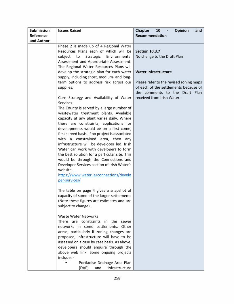
258
Submission Reference and Author
Issues Raised Chapter 10 - Opinion and Recommendation
Phase 2 is made up of 4 Regional Water Resources Plans each of which will be subject to Strategic Environmental Assessment and Appropriate Assessment. The Regional Water Resources Plans will develop the strategic plan for each water supply, including short, medium- and long-term options to address risk across our supplies. Core Strategy and Availability of Water Services The County is served by a large number of wastewater treatment plants. Available capacity at any plant varies daily. Where there are constraints, applications for developments would be on a first come, first served basis. If no project is associated with a constrained area, then any infrastructure will be developer led. Irish Water can work with developers to form the best solution for a particular site. This would be through the Connections and Developer Services section of Irish Water’s website. https://www.water.ie/connections/developer-services/ The table on page 4 gives a snapshot of capacity of some of the larger settlements (Note these figures are estimates and are subject to change). Waste Water Networks There are constraints in the sewer networks in some settlements. Other areas, particularly if zoning changes are proposed, infrastructure will have to be assessed on a case by case basis. As above, developers should enquire through the above web link. Some ongoing projects include: -
• Portlaoise Drainage Area Plan (DAP) and Infrastructure
Section 10.3.7 No change to the Draft Plan Water Infrastructure Please refer to the revised zoning maps of each of the settlements because of the comments to the Draft Plan received from Irish Water.
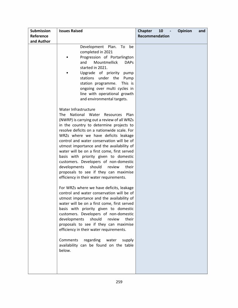
259
Submission Reference and Author
Issues Raised Chapter 10 - Opinion and Recommendation
Development Plan. To be completed in 2021
• Progression of Portarlington and Mountmellick DAPs started in 2021.
• Upgrade of priority pump stations under the Pump station programme. This is ongoing over multi cycles in line with operational growth and environmental targets.
Water Infrastructure The National Water Resources Plan (NWRP) is carrying out a review of all WRZs in the country to determine projects to resolve deficits on a nationwide scale. For WRZs where we have deficits leakage control and water conservation will be of utmost importance and the availability of water will be on a first come, first served basis with priority given to domestic customers. Developers of non-domestic developments should review their proposals to see if they can maximise efficiency in their water requirements. For WRZs where we have deficits, leakage control and water conservation will be of utmost importance and the availability of water will be on a first come, first served basis with priority given to domestic customers. Developers of non-domestic developments should review their proposals to see if they can maximise efficiency in their water requirements. Comments regarding water supply availability can be found on the table below.

260
Submission Reference and Author
Issues Raised Chapter 10 - Opinion and Recommendation
Settlement Water Supply Comments
Waste Water Treatment Availability
Portlaoise There is limited headroom at present, infrastructure upgrades would be required to facilitate growth. IW will look to progress a project to increase the ground water capacity in the coming 2 years, further upgrades may be required to accommodate full projected growth
IW can accommodate level of growth
Graiguecullen As above There is headroom but to be coordinated with Carlow
Portarlington IW can accommodate development in this area but would likely require infrastructure upgrades to accommodate the full growth projections
IW can accommodate level of growth
Mountmellick IW can accommodate level of growth
IW can accommodate level of growth
Abbeyleix IW can accommodate development in this area but would likely require
IW can accommodate level of growth
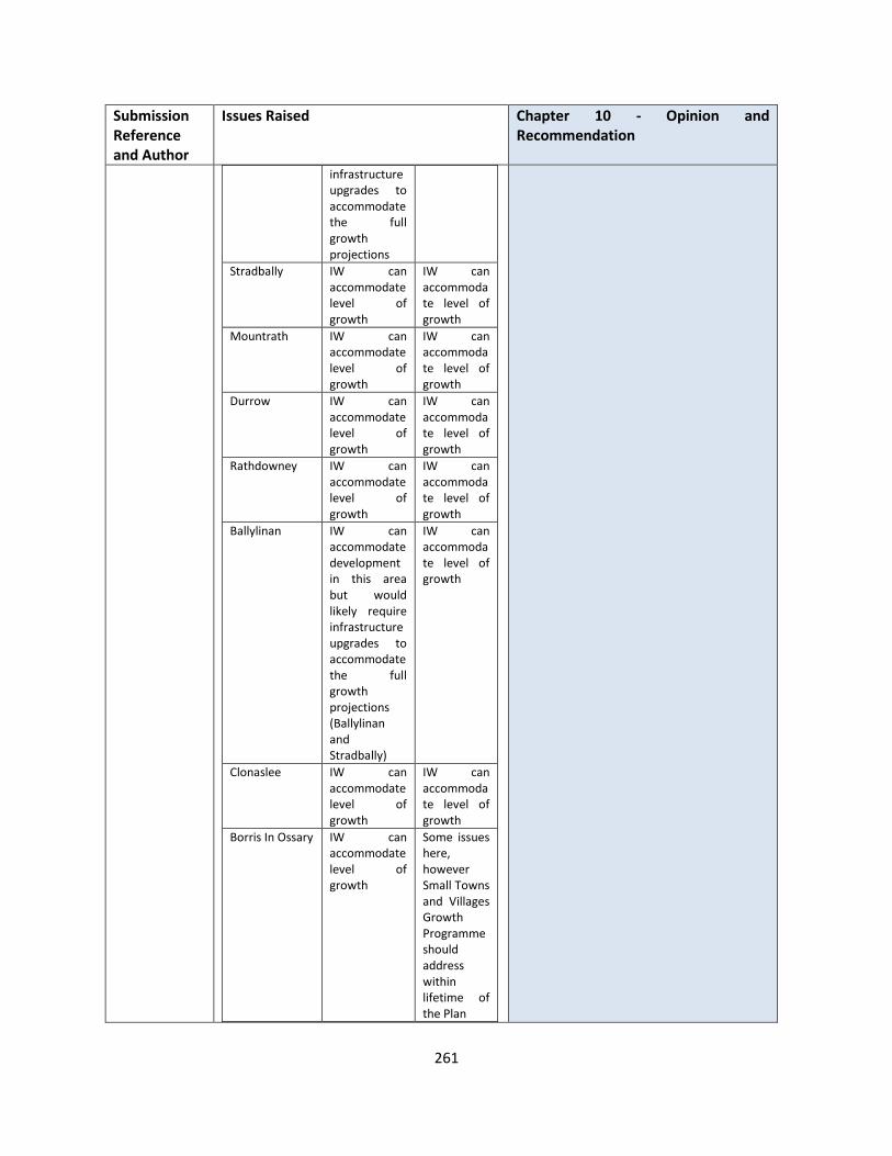
261
Submission Reference and Author
Issues Raised Chapter 10 - Opinion and Recommendation
infrastructure upgrades to accommodate the full growth projections
Stradbally IW can accommodate level of growth
IW can accommodate level of growth
Mountrath IW can accommodate level of growth
IW can accommodate level of growth
Durrow IW can accommodate level of growth
IW can accommodate level of growth
Rathdowney IW can accommodate level of growth
IW can accommodate level of growth
Ballylinan IW can accommodate development in this area but would likely require infrastructure upgrades to accommodate the full growth projections (Ballylinan and Stradbally)
IW can accommodate level of growth
Clonaslee IW can accommodate level of growth
IW can accommodate level of growth
Borris In Ossary IW can accommodate level of growth
Some issues here, however Small Towns and Villages Growth Programme should address within lifetime of the Plan

262
Submission Reference and Author
Issues Raised Chapter 10 - Opinion and Recommendation
Ballyroan IW can accommodate development in this area but would likely require infrastructure upgrades to accommodate the full growth projections
Some issues here, however Small Towns and Villages Growth Programme should address within lifetime of the Plan
Killenard NA NA
Villages <500 Arles, Coolrain, Emo and Timahoe are constrained. Ballinakill and Ballybrittas may be addressed under Small Towns and Villages Growth Programme
General Comments 10.3.2: Some of the bullet points listed do not refer to “Statutory” items but plans / projects / programmes etc. The first line could be edited to reflect this 10.3.7: Specific projects are listed in the objectives. We would like to reiterate that these are subject to the restrictions of the CIP and may be revised
LS-C9-DCDP-80 National Transport Authority
Core Strategy The NTA notes the consistency of the core strategy with the national and regional plans and the manner in which the local authority is seeking to consolidate development into the higher tiers of the settlement hierarchy and recommends that this alignment is maintained in the making of the final development plan.
The submission is noted OPINION DM ED 1 The inclusion NTA’s Workplace Travel Plans: A Guide for Implementers and the Toolkit for School Travel is accepted

263
Submission Reference and Author
Issues Raised Chapter 10 - Opinion and Recommendation
Schools Welcomes policy objectives in relation to schools and recommends a minor change in the wording of DM ED 2 which provides for the prioritisation of accessibility by non-car modes in the design of schools. Policy objective requiring Mobility Management Plans is welcomed however It is recommend that references to the NTA’s Workplace Travel Plans: A Guide for Implementers and the Toolkit for School Travel are incorporated into the final plan. Local Transport Plans Welcomes PO TRANS 5 and 14 to prepare LTP for Portlaoise and other settlements. Recommends POs further state such plans will be carried out in accordance with the joint NTA/ Transport Infrastructure Ireland (TII) Area Based Transport Assessment (ABTA) guidance document and engaging with NTA and TII. Road Schemes PO in relation to routes is noted. The NTA has some concern that there seems to be an emphasis within the Draft Development Plan on the provision of partial bypasses or relief roads for a number of settlements without an accompanying strategic rationale for their development in the manner in which they have been configured. Furthermore, in the absence of such a strategic rationale, these schemes may no longer be appropriate in the context of the requirement to promote walking, cycling and public transport in order to reduce transport emissions. As such, it is recommended that the objective related to these schemes under TRANS 25 and / or within objectives set out in Volume 2 should state that the requirements for
DM ED 2 This policy concerns extension of schools, the wording of which is acceptable as drafted.. TRANS25 The comments are noted in relation to the justification of roads objectives in a number of towns and villages. It is the intention of the Laois County Council that Local Transport Plans will be prepared which will inform their requirement or not. The following policy objective relates Safeguarding network Th Planning Authority is satisfied that the existing text within the Draft Plan provides sufficient safeguards of the strategic function of national roads. Car Parking The car parking provision is a minimum. In certain circumstances where there is a shortfall in car parking provision, the Development Contribution Scheme seeks a contribution. Cycling Objectives The improved provision of cycle facilities is a matter for the whole County, which needs to be considered as a whole, rather than prioritising towns and villages. The matter of referencing Active Travel towns and Safe Routes to Schools is addressed in DM ED 1 with specific referencing to Mobility Management.
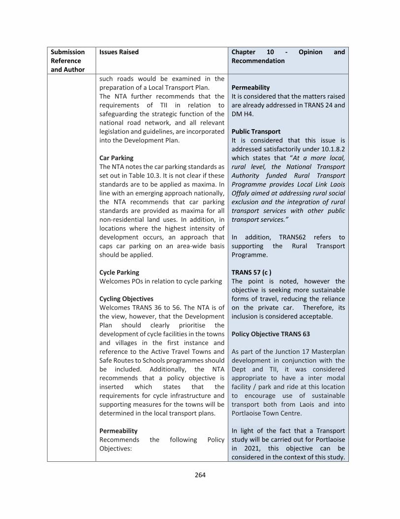
264
Submission Reference and Author
Issues Raised Chapter 10 - Opinion and Recommendation
such roads would be examined in the preparation of a Local Transport Plan. The NTA further recommends that the requirements of TII in relation to safeguarding the strategic function of the national road network, and all relevant legislation and guidelines, are incorporated into the Development Plan. Car Parking The NTA notes the car parking standards as set out in Table 10.3. It is not clear if these standards are to be applied as maxima. In line with an emerging approach nationally, the NTA recommends that car parking standards are provided as maxima for all non-residential land uses. In addition, in locations where the highest intensity of development occurs, an approach that caps car parking on an area-wide basis should be applied. Cycle Parking Welcomes POs in relation to cycle parking Cycling Objectives Welcomes TRANS 36 to 56. The NTA is of the view, however, that the Development Plan should clearly prioritise the development of cycle facilities in the towns and villages in the first instance and reference to the Active Travel Towns and Safe Routes to Schools programmes should be included. Additionally, the NTA recommends that a policy objective is inserted which states that the requirements for cycle infrastructure and supporting measures for the towns will be determined in the local transport plans. Permeability Recommends the following Policy Objectives:
Permeability It is considered that the matters raised are already addressed in TRANS 24 and DM H4. Public Transport It is considered that this issue is addressed satisfactorily under 10.1.8.2 which states that “At a more local, rural level, the National Transport Authority funded Rural Transport Programme provides Local Link Laois Offaly aimed at addressing rural social exclusion and the integration of rural transport services with other public transport services.” In addition, TRANS62 refers to supporting the Rural Transport Programme. TRANS 57 (c ) The point is noted, however the objective is seeking more sustainable forms of travel, reducing the reliance on the private car. Therefore, its inclusion is considered acceptable. Policy Objective TRANS 63 As part of the Junction 17 Masterplan development in conjunction with the Dept and TII, it was considered appropriate to have a inter modal facility / park and ride at this location to encourage use of sustainable transport both from Laois and into Portlaoise Town Centre. In light of the fact that a Transport study will be carried out for Portlaoise in 2021, this objective can be considered in the context of this study.

265
Submission Reference and Author
Issues Raised Chapter 10 - Opinion and Recommendation
• New development areas should be fully permeable for walking and cycling and the retrospective implementation of walking and cycling facilities should be undertaken where practicable in existing neighbourhoods, in order to a give competitive advantage to these modes for local trip making; and
• Where possible, new residential developments should provide for filtered permeability, i.e. provide for walking, cycling, public transport and private vehicle access while restricting or discouraging private car through trips.
Public Transport Provides details of NTA’s role within public transport facilities – PSO with Irish Rail and Bus Eireann, award contracts for bus services and licencing of commercial bus services and provision of services through Local Link Rural Transport Programme. It is recommended that the Development Plan is reviewed in relation to these matters and that the role and above objectives of the National Transport Authority in relation to public transport and, in particular, Local Link is clarified further within the text and within the table setting out the Public Transport Policy Objectives. TRANS 57 (c) In relation to the proposal to develop light rail within a part of Portlaoise, the NTA would emphasise the role of Light Rail as an urban form of mass transit, most appropriate in locations with a high density of population, employment, retail and
TRANS 63 Support the provision of a park and ride facility at Junction 17 to encourage sustainable transport measures and facilitate a strategic park and ride link to public transport facilities within Portaloise and links to other destinations including Dublin city and Dublin airport. Modal share – see response detailed in the OPR Submission under Section 2.2.3.. RECOMMENDATIONS DM ED1 Second bullet point to be amended to read: Mobility Management Plan shall be submitted to ensure safe accessible pedestrian and cyclist routes to and from the school from nearby residential and commercial areas. This shall have regard to and comply with (as appropriate) the NTA’s Workplace Travel Plans: A Guide for Implementers and the Toolkit for School Travel. TRANS 5 Prepare a Local Transport Plan for Portlaoise in compliance with RPO 8.6 of the RSES, and carried out in accordance with the Area Based Transport Assessment (ABTA) guidance document (PE-PDV-02046).
and Support the strategic vision of J17 National Enterprise Park Masterplan to deliver a strategic economic zone within Portlaoise.
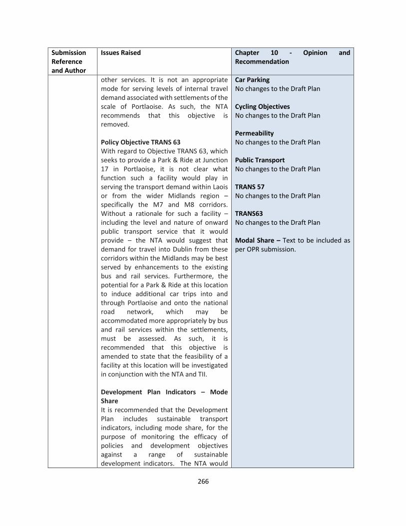
266
Submission Reference and Author
Issues Raised Chapter 10 - Opinion and Recommendation
other services. It is not an appropriate mode for serving levels of internal travel demand associated with settlements of the scale of Portlaoise. As such, the NTA recommends that this objective is removed. Policy Objective TRANS 63 With regard to Objective TRANS 63, which seeks to provide a Park & Ride at Junction 17 in Portlaoise, it is not clear what function such a facility would play in serving the transport demand within Laois or from the wider Midlands region – specifically the M7 and M8 corridors. Without a rationale for such a facility – including the level and nature of onward public transport service that it would provide – the NTA would suggest that demand for travel into Dublin from these corridors within the Midlands may be best served by enhancements to the existing bus and rail services. Furthermore, the potential for a Park & Ride at this location to induce additional car trips into and through Portlaoise and onto the national road network, which may be accommodated more appropriately by bus and rail services within the settlements, must be assessed. As such, it is recommended that this objective is amended to state that the feasibility of a facility at this location will be investigated in conjunction with the NTA and TII. Development Plan Indicators – Mode Share It is recommended that the Development Plan includes sustainable transport indicators, including mode share, for the purpose of monitoring the efficacy of policies and development objectives against a range of sustainable development indicators. The NTA would
Car Parking No changes to the Draft Plan Cycling Objectives No changes to the Draft Plan Permeability No changes to the Draft Plan Public Transport No changes to the Draft Plan TRANS 57 No changes to the Draft Plan TRANS63 No changes to the Draft Plan Modal Share – Text to be included as per OPR submission.
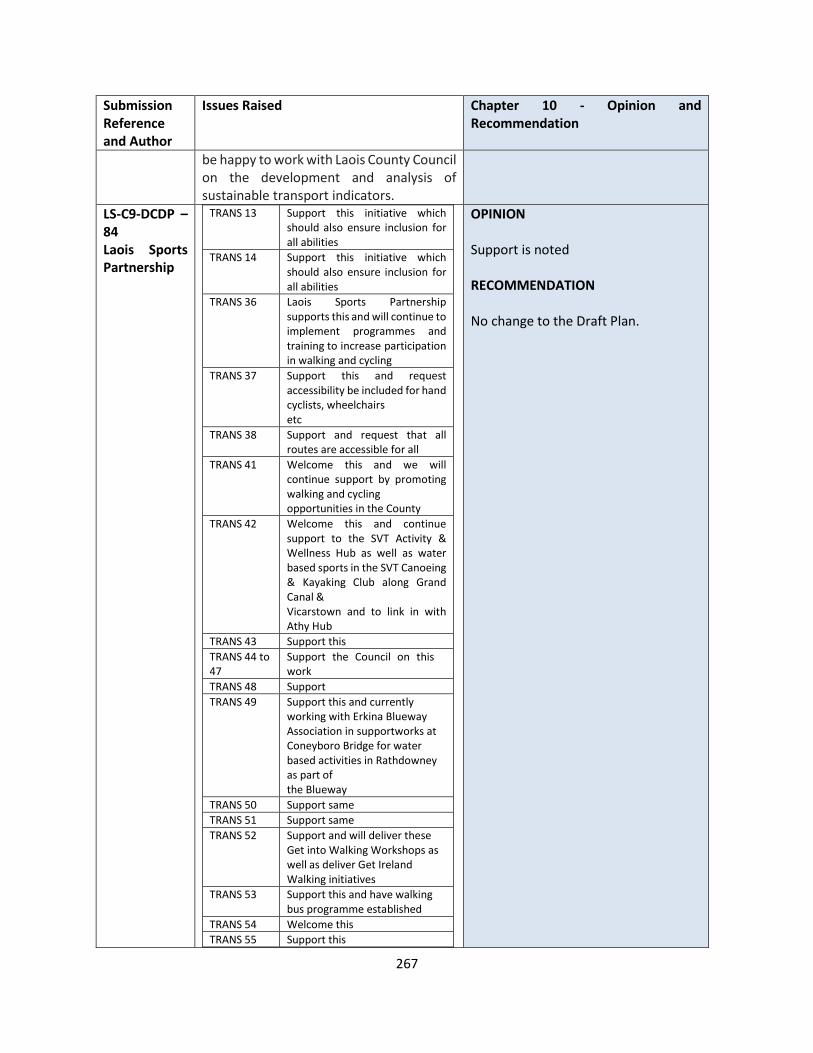
267
Submission Reference and Author
Issues Raised Chapter 10 - Opinion and Recommendation
be happy to work with Laois County Council on the development and analysis of sustainable transport indicators.
LS-C9-DCDP – 84 Laois Sports Partnership
TRANS 13 Support this initiative which should also ensure inclusion for all abilities
TRANS 14 Support this initiative which should also ensure inclusion for all abilities
TRANS 36 Laois Sports Partnership supports this and will continue to implement programmes and training to increase participation in walking and cycling
TRANS 37 Support this and request accessibility be included for hand cyclists, wheelchairs etc
TRANS 38 Support and request that all routes are accessible for all
TRANS 41 Welcome this and we will continue support by promoting walking and cycling opportunities in the County
TRANS 42 Welcome this and continue support to the SVT Activity & Wellness Hub as well as water based sports in the SVT Canoeing & Kayaking Club along Grand Canal & Vicarstown and to link in with Athy Hub
TRANS 43 Support this
TRANS 44 to 47
Support the Council on this work
TRANS 48 Support
TRANS 49 Support this and currently working with Erkina Blueway Association in support works at Coneyboro Bridge for water based activities in Rathdowney as part of the Blueway
TRANS 50 Support same
TRANS 51 Support same
TRANS 52 Support and will deliver these Get into Walking Workshops as well as deliver Get Ireland Walking initiatives
TRANS 53 Support this and have walking bus programme established
TRANS 54 Welcome this
TRANS 55 Support this
OPINION Support is noted RECOMMENDATION No change to the Draft Plan.
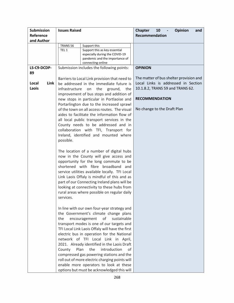
268
Submission Reference and Author
Issues Raised Chapter 10 - Opinion and Recommendation
TRANS 56 Support this
TEL 1 Support this as key essential especially during the COVID-19 pandemic and the importance of connecting online
LS-C9-DCDP-89 Local Link Laois
Submission includes the following points:
Barriers to Local Link provision that need to be addressed in the immediate future is infrastructure on the ground, the improvement of bus stops and addition of new stops in particular in Portlaoise and Portarlington due to the increased sprawl of the town on all access routes. The visual aides to facilitate the information flow of all local public transport services in the County needs to be addressed and in collaboration with TFI, Transport for Ireland, identified and mounted where possible.
The location of a number of digital hubs now in the County will give access and opportunity for the long commute to be shortened with fibre broadband and service utilities available locally. TFI Local Link Laois Offaly is mindful of this and as part of our Connecting Ireland plans will be looking at connectivity to these hubs from rural areas where possible on regular daily services.
In line with our own four-year strategy and the Government’s climate change plans the encouragement of sustainable transport modes is one of our targets and TFI Local Link Laois Offaly will have the first electric bus in operation for the National network of TFI Local Link in April, 2021. Already identified in the Laois Draft County Plan the introduction of compressed gas powering stations and the roll out of more electric charging points will enable more operators to look at these options but must be acknowledged this will
OPINION The matter of bus shelter provision and Local Links is addressed in Section 10.1.8.2, TRANS 59 and TRANS 62. RECOMMENDATION No change to the Draft Plan

269
Submission Reference and Author
Issues Raised Chapter 10 - Opinion and Recommendation
be a slow turning curve due to excessive costs of such vehicles in the current small market. Incentives and grants should be rolled out to help achieve more sustainable vehicles on the ground.
Tourism hot spots around the County would also be pinch points for future services to connect with nurturing our natural amenities and also reduce the dependency on providing large costly parking facilities that is not possible in most locations. Providing a regular service to drop and collect will see the areas benefit more greatly.
LS-C9-DCDP-90 Gas Networks Ireland
GNI would welcome the inclusion of a paragraph with information about the benefits of CNG in the transport section of Chapter 10 Infrastructure, similar to the section on electric vehicles. CNG can play an important role in the decarbonisation of HGVs and suggests the following wording:
“Compressed Natural Gas (CNG) CNG is natural gas that has been compressed to fit into a vehicle’s tank and is particularly suitable for use in commercial vehicles. The development of CNG Infrastructure will enable fuel switching from diesel to CNG for HGVs and buses. CNG is an established technology that is used in many countries around the world. CNG contains virtually no particulate matter (PM) and also has low emission levels of nitrogen oxides (NOx)[3] which is beneficial from an air quality perspective. CNG vehicles can be run on 100% renewable gas. This is a renewable and carbon neutral fuel, produced using AD technology from existing waste streams and a variety of sustainable biomass sources, including
OPINION Noted and it proposed to be included as an additional section 10.1.9. The proposed policy requires some amendments as detailed below. RECOMMENDATION Insert the following: 10.1.9 Compressed Natural Gas The Planning Authority supports the development of CNG Infrastructure which will enable fuel switching from diesel to CNG for HGVs and buses at appropriate locations . This is a renewable and carbon neutral fuel, produced using AD technology from existing waste streams and a variety of sustainable biomass sources, including grass, animal waste, crop residues and food waste.

270
Submission Reference and Author
Issues Raised Chapter 10 - Opinion and Recommendation
grass, animal waste, crop residues and food waste. Infrastructure development for CNG is already underway in Ireland, with 14 fast fill CNG stations being installed across the Core TEN-T road network via a project called the Causeway Study[4] that is supported by the European Commission through the CEF Transport Fund[5] and the Commission for Regulation of Utilities (CRU). The Council will support the use of gas in transport by a presumption in favour of applications for CNG refuelling infrastructure, provided planning and environmental criteria are satisfied.”
Compressed Natural Gas Policy Objective CNG1 - The Council will support the development of Compressed Natural Gas refuelling infrastructure on appropriate sites, provided that relevant planning and environmental criteria are satisfied.
LS-C9-DCDP-92 ESB
Telecommunications Objective TEL 5, where it includes that regard will be given to the above guidelines and any updated documents issued by the DoECLG or relevant authority. ESB wish to highlight that the DoELG Circular Letter PL07/12 has already updated the 1996 Guidelines and suggest this Circular should be referenced in Objective TEL 5. Sustainable Transport and Electric Vehicles The EU Energy Performance of Buildings Directive comes into force soon and calls for an increase to 20% for the number of parking spaces which should have provision for electric vehicle charging infrastructure. ESB request that the amended standard below is included in the final plan: For Developments with Private Car Spaces (residential and non-residential) including visitor car parking spaces e.g. office –spaces
a. At least one parking space should be equipped with one fully functional EV charging point in accordance with IEC 61851 Standard for Electric Vehicle
OPINION The submission is noted. Telecommunications The reference to Circular Letter PL07/12 is noted, and whilst there is reference to “any updated documents”, the inclusion of reference to the circular is agreed in this instance. Sustainable Transport and Electric Vehicles The comments are noted. TRANS 33, TRANS 34 and TRANS 35 provides a sufficient response, and it offers the flexibility to go over the 10% requirement of parking spaces for residential development. TRANS 34 requires that for all development that upto 10% fir charging battery operated cars, and the remainder shall be constructed capable of accommodating future charging points.
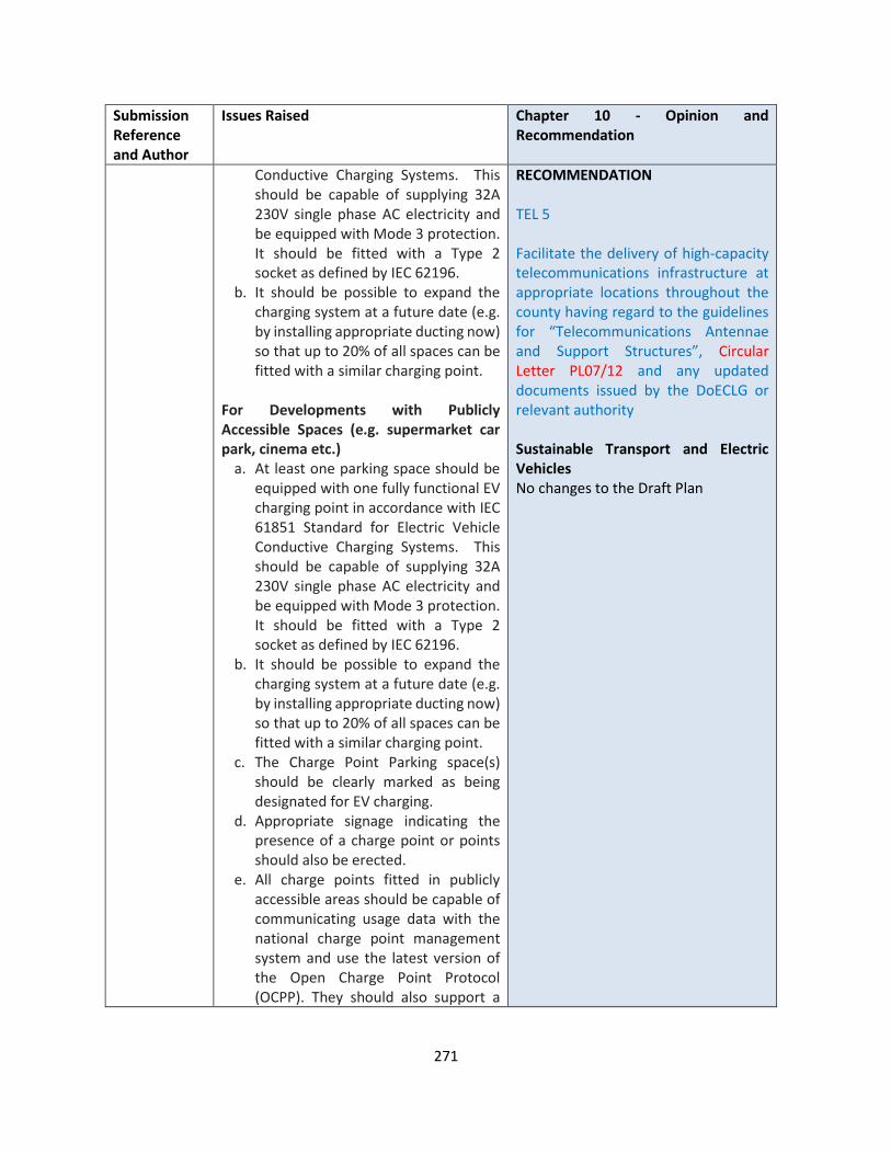
271
Submission Reference and Author
Issues Raised Chapter 10 - Opinion and Recommendation
Conductive Charging Systems. This should be capable of supplying 32A 230V single phase AC electricity and be equipped with Mode 3 protection. It should be fitted with a Type 2 socket as defined by IEC 62196.
b. It should be possible to expand the charging system at a future date (e.g. by installing appropriate ducting now) so that up to 20% of all spaces can be fitted with a similar charging point.
For Developments with Publicly Accessible Spaces (e.g. supermarket car park, cinema etc.)
a. At least one parking space should be equipped with one fully functional EV charging point in accordance with IEC 61851 Standard for Electric Vehicle Conductive Charging Systems. This should be capable of supplying 32A 230V single phase AC electricity and be equipped with Mode 3 protection. It should be fitted with a Type 2 socket as defined by IEC 62196.
b. It should be possible to expand the charging system at a future date (e.g. by installing appropriate ducting now) so that up to 20% of all spaces can be fitted with a similar charging point.
c. The Charge Point Parking space(s) should be clearly marked as being designated for EV charging.
d. Appropriate signage indicating the presence of a charge point or points should also be erected.
e. All charge points fitted in publicly accessible areas should be capable of communicating usage data with the national charge point management system and use the latest version of the Open Charge Point Protocol (OCPP). They should also support a
RECOMMENDATION TEL 5 Facilitate the delivery of high-capacity telecommunications infrastructure at appropriate locations throughout the county having regard to the guidelines for “Telecommunications Antennae and Support Structures”, Circular Letter PL07/12 and any updated documents issued by the DoECLG or relevant authority Sustainable Transport and Electric Vehicles No changes to the Draft Plan

272
Submission Reference and Author
Issues Raised Chapter 10 - Opinion and Recommendation
user identification system such as RFID.
As the use of electric vehicles continues to increase the Council may increase the number of parking spaces to be equipped with fully functional charge points in either of the above cases.
LS-C9-DCDP-93 Iarnroid Eireann/ Irish Rail
IE Priorities for the Future Expansion projects and enhancements are published Iarnród Éireann Strategy 2027 document. It is worth the Council noting that the Department of Transport (DoT) and the Department of Infrastructure (Northern Ireland) (DfI(NI)) are in the process of agreeing terms on an all-Ireland strategic rail study on faster intercity connectivity, improved regional connectivity and freight. The Draft Plan should consider and support the outcomes of that study. In looking ahead, IE believe that the following high-level measures should be a priority for the revised Development Plan;
• Priority should be given to Public Transport and Active Travel schemes, with a particular focus on high capacity modes, such as rail, which are carbon efficient.
• Continue to expand heavy rail as a high capacity high frequency mode choice with proven ability to attract private car users.
• Promote Transit Orientated Development (TOD) with mixed-use high-density development at key rail nodes and along key rail corridors.
• Develop new rail stations in line with emerging spatial planning policy, subject to business case evaluation.
OPINION The submission is noted. Public Transport Policy Objectives TRANS 57 to TRANS 63 provides the necessary Development Plan policy support within the County to facilitate these priorities. For example:
• TRANS 57 – “Support the maintenance and enhancement of rail infrastructure and associated facilities in County Laois…”
• TRANS 60 – “…..encourage the upgrading of existing railway stations”… “,the provision of new railway stations throughout the County”.
RECOMMENDATION No change to the Draft Plan

273
Submission Reference and Author
Issues Raised Chapter 10 - Opinion and Recommendation
• Support ongoing investment in rail infrastructure to ensure its continued renewal, maintenance, and improvement to a high level to ensure a high quality of rail frequency, safety, service, accessibility and connectivity across Laois County.
• Develop an integrated, user friendly, and highly connected public transport network
Provides synopsis of supporting a modal shift towards sustainable public transport and outlines key expansion projects and enhancements:
1. Inter and Outer Suburban Passenger Services
a) Intercity In terms of our services to and from Laois, IE’s plans to enhance a number of Intercity services within the period to 2027:
b) Outer Suburban
IE services to Athlone and Portlaoise are targeted to operate every 20 minutes in peak periods and half hourly off-peak as part of Strategy 2027. Both Athlone and Portlaoise service increases will benefit Portarlington station, while Portlaoise station will benefit from being the terminus of the outer suburban services to Laois. This growth in passenger services should be supported in the Development Plan
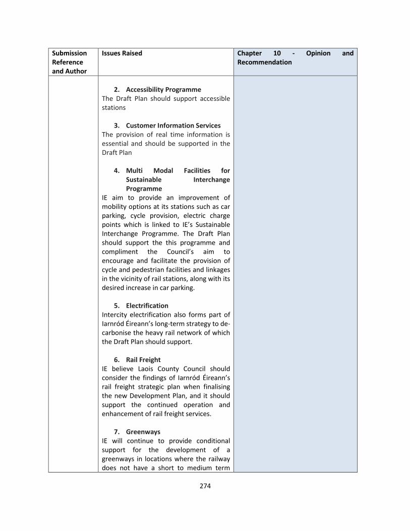
274
Submission Reference and Author
Issues Raised Chapter 10 - Opinion and Recommendation
2. Accessibility Programme
The Draft Plan should support accessible stations
3. Customer Information Services The provision of real time information is essential and should be supported in the Draft Plan
4. Multi Modal Facilities for Sustainable Interchange Programme
IE aim to provide an improvement of mobility options at its stations such as car parking, cycle provision, electric charge points which is linked to IE’s Sustainable Interchange Programme. The Draft Plan should support the this programme and compliment the Council’s aim to encourage and facilitate the provision of cycle and pedestrian facilities and linkages in the vicinity of rail stations, along with its desired increase in car parking.
5. Electrification Intercity electrification also forms part of Iarnród Éireann’s long-term strategy to de-carbonise the heavy rail network of which the Draft Plan should support.
6. Rail Freight IE believe Laois County Council should consider the findings of Iarnród Éireann’s rail freight strategic plan when finalising the new Development Plan, and it should support the continued operation and enhancement of rail freight services.
7. Greenways IE will continue to provide conditional support for the development of a greenways in locations where the railway does not have a short to medium term
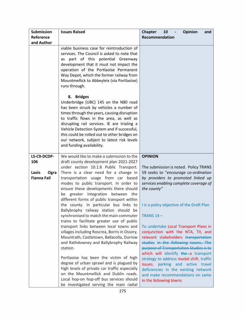
275
Submission Reference and Author
Issues Raised Chapter 10 - Opinion and Recommendation
viable business case for reintroduction of services. The Council is asked to note that as part of this potential Greenway development that it must not impact the operation of the Portlaoise Permanent Way Depot, which the former railway from Mountmellick to Abbeyleix (via Portlaoise) runs through.
8. Bridges Underbridge (UBC) 145 on the N80 road has been struck by vehicles a number of times through the years, causing disruption to traffic flows in the area, as well as disrupting rail services. IE are trialing a Vehicle Detection System and if successful, this could be rolled out to other bridges on our network, subject to latest risk levels and funding availability.
LS-C9-DCDP-106 Laois Ogra Fianna Fail
We would like to make a submission to the draft county development plan 2021-2027 under section 10.1.8 Public Transport. There is a clear need for a change in transportation usage from car based modes to public transport. In order to ensure these developments there should be greater integration between the different forms of public transport within the county. In particular bus links to Ballybrophy railway station should be synchronised to match the main commuter trains to facilitate greater use of public transport links between local towns and villages including Roscrea, Borris in Ossory, Mountrath, Castletown, Ballacolla, Durrow and Rathdowney and Ballybrophy Railway station.
Portlaoise has been the victim of high degree of urban sprawl and is plagued by high levels of private car traffic especially on the Mountmellick and Dublin roads. Local hop-on hop-off bus services should be investigated serving the main radial
OPINION The submission is noted. Policy TRANS 59 seeks to “encourage co-ordination by providers to promoted linked up services enabling complete coverage of the county” I is a policy objective of the Draft Plan TRANS 14 – To undertake Local Transport Plans in conjunction with the NTA, TII, and relevant stakeholders transportation studies in the following towns. The purpose of Transportation Studies is to which will identify the a transport strategy to address modal shift, traffic issues, parking and active travel deficiencies in the existing network and make recommendations on same in the following towns
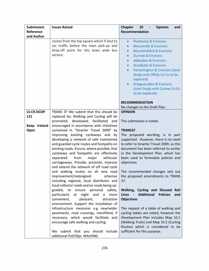
276
Submission Reference and Author
Issues Raised Chapter 10 - Opinion and Recommendation
routes from the top square which if shut to car traffic before the main pick-up and drop-off point for this town wide bus service.
• Portlaoise & Environs
• Mountrath & Environs
• Mountmellick & Environs
• Durrow & Environs
• Abbeyleix & Environs
• Stradbally & Environs
• Portarlington & Environs (Joint Study with Offaly Co Co to be explored)
• Graiguecullen & Environs (Joint Study with Carlow Co Co to be explored)
RECOMMENDATION No changes to the Draft Plan.
LS-C9-DCDP-121 Keep Ireland Open
TRANS 37 We submit that this should be replaced by: Walking and Cycling will be promoted, developed, facilitated and encouraged in accordance with initiatives contained in “Smarter Travel 2009” by improving existing cycleways and by developing a network of safe maintained and guarded cycle routes and footpaths on existing roads. Ensure, where possible, that cycleways and footpaths are effectively separated from major vehicular carriageways. Provide, promote, improve and extend the network of off road cycle and walking routes on all new road improvement/redesigned schemes including regional, local distributor and local collector roads and on roads being up-graded, to ensure personal safety, particularly at night and a more convenient, pleasant, attractive environment. Support the installation of infrastructure measures e.g new/wider pavements, road crossings, retrofitted, if necessary, which would facilitate and encourage safe walking and cycling. We submit that you should include additional Pol/Objs: WALKING
OPINION The submission is noted. TRANS37 The proposed wording, is in part supported. However, there is no need to refer to Smarter Travel 2009, as this document has been referred to earlier in the Development Plan, which has been used to formulate policies and objectives. The recommended changes sets out the proposed amendments to TRANS 37. Walking, Cycling and Disused Rail Lines - Additional Policies and Objectives The request of a table of walking and cycling tables are noted, however the Development Plan includes Map 10.1 (Walking Trails) and Map 10.2 (Cycling Routes) which is considered to be sufficient for this purpose.
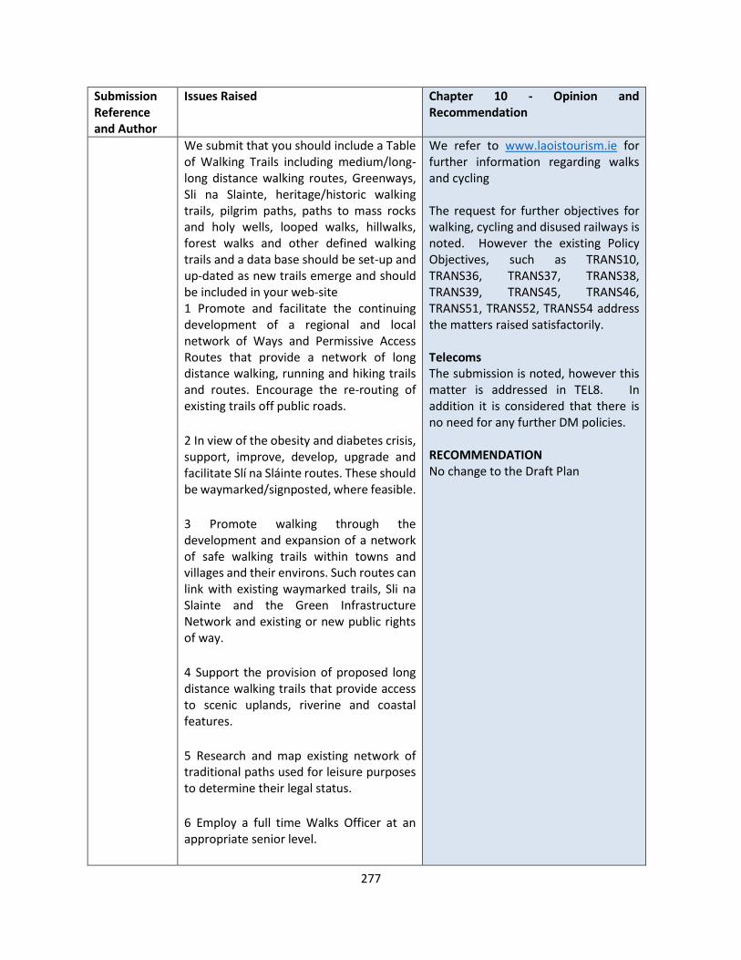
277
Submission Reference and Author
Issues Raised Chapter 10 - Opinion and Recommendation
We submit that you should include a Table of Walking Trails including medium/long-long distance walking routes, Greenways, Sli na Slainte, heritage/historic walking trails, pilgrim paths, paths to mass rocks and holy wells, looped walks, hillwalks, forest walks and other defined walking trails and a data base should be set-up and up-dated as new trails emerge and should be included in your web-site 1 Promote and facilitate the continuing development of a regional and local network of Ways and Permissive Access Routes that provide a network of long distance walking, running and hiking trails and routes. Encourage the re-routing of existing trails off public roads.
2 In view of the obesity and diabetes crisis, support, improve, develop, upgrade and facilitate Slí na Sláinte routes. These should be waymarked/signposted, where feasible.
3 Promote walking through the development and expansion of a network of safe walking trails within towns and villages and their environs. Such routes can link with existing waymarked trails, Sli na Slainte and the Green Infrastructure Network and existing or new public rights of way.
4 Support the provision of proposed long distance walking trails that provide access to scenic uplands, riverine and coastal features.
5 Research and map existing network of traditional paths used for leisure purposes to determine their legal status.
6 Employ a full time Walks Officer at an appropriate senior level.
We refer to www.laoistourism.ie for further information regarding walks and cycling The request for further objectives for walking, cycling and disused railways is noted. However the existing Policy Objectives, such as TRANS10, TRANS36, TRANS37, TRANS38, TRANS39, TRANS45, TRANS46, TRANS51, TRANS52, TRANS54 address the matters raised satisfactorily. Telecoms The submission is noted, however this matter is addressed in TEL8. In addition it is considered that there is no need for any further DM policies. RECOMMENDATION No change to the Draft Plan

278
Submission Reference and Author
Issues Raised Chapter 10 - Opinion and Recommendation
7 The Council will co-operate with relevant agencies, both public and private, including the National Trails Office, NWMWAC, Coillte, the Heritage Council, adjoining councils, community groups and local landowners, to support the development, maintenance, facilitation and enhancement of short medium and long distance hiking/walking routes, community walks, heritage trails and off-road trails particularly in the uplands. This will include consultation with adjoining councils with a view to promoting routes extending beyond the county boundary.
8 Lobby the appropriate Government Department to agree and implement a scheme to indemnify private landowners with regard to recreational users of their land.
9 Ensure the protection of and co-ordinate the continuation of strategic walking routes and trails.
CYCLING
We submit that you should include a Table of Cycle routes. To this you should add: Following the adoption of the Plan a temporary register of additional routes shall be maintained and should be included on the web site pending inclusion in the next Plan.
10 Promote, facilitate, support, improve and encourage the development, enhancement and expansion of an integrated coherent network of safe cycle routes(including long distant routes) by facilitating the construction of cycleways. Support the development of the National Cycle Network and The National Cycle Network Scoping Study(2010) and enhance

279
Submission Reference and Author
Issues Raised Chapter 10 - Opinion and Recommendation
and maintain these routes with better signposting and road surfaces separated from vehicular traffic. Encourage the development of off-road cycling. Ensure that the upgrading of roads will not impact negatively on the safety and perceived safety of cyclists. Ensure that any dedicated cycle routes which are developed away from the main public carriageway are well lit. Routes should, where possible, follow off-road tracks and quiet country roads.
11 Cycle routes should be designed using current thinking and best practice from experience in other locations, lower speed limits and priority over motorised transport to ensure road safety for pedestrians and cyclists.
12Assign an officer at appropriate senior level as a “Cycling Officer”.
13 Promote and facilitate the development of cycle routes in accordance with the National Cycle Network Scoping Study 2010.
14 Support the development, maintenance and enhancement of trails and routes in co-operation with Sports Council, NTA, NTO, NWMWAC, Heritage Council and other bodies to develop cycle touring routes including those linking with adjoining counties particularly in areas of high amenity.
15 Produce cycle maps.
16 Support community, authority or agency led projects that would deliver identified strategic cycling links.
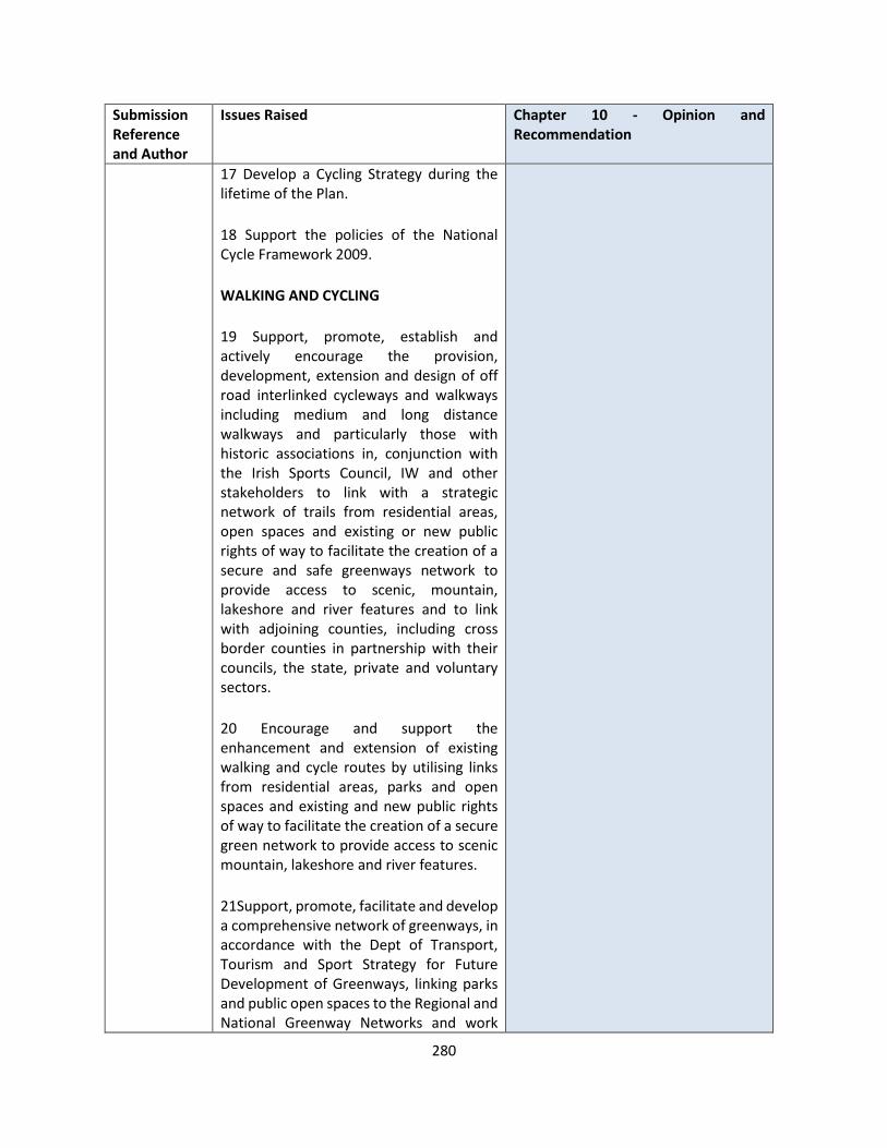
280
Submission Reference and Author
Issues Raised Chapter 10 - Opinion and Recommendation
17 Develop a Cycling Strategy during the lifetime of the Plan.
18 Support the policies of the National Cycle Framework 2009.
WALKING AND CYCLING
19 Support, promote, establish and actively encourage the provision, development, extension and design of off road interlinked cycleways and walkways including medium and long distance walkways and particularly those with historic associations in, conjunction with the Irish Sports Council, IW and other stakeholders to link with a strategic network of trails from residential areas, open spaces and existing or new public rights of way to facilitate the creation of a secure and safe greenways network to provide access to scenic, mountain, lakeshore and river features and to link with adjoining counties, including cross border counties in partnership with their councils, the state, private and voluntary sectors.
20 Encourage and support the enhancement and extension of existing walking and cycle routes by utilising links from residential areas, parks and open spaces and existing and new public rights of way to facilitate the creation of a secure green network to provide access to scenic mountain, lakeshore and river features.
21Support, promote, facilitate and develop a comprehensive network of greenways, in accordance with the Dept of Transport, Tourism and Sport Strategy for Future Development of Greenways, linking parks and public open spaces to the Regional and National Greenway Networks and work

281
Submission Reference and Author
Issues Raised Chapter 10 - Opinion and Recommendation
with the NTA, adjoining councils and all stakeholders to develop a co-ordinated approach to the selection, delivering and servicing of future greenway, in order to achieve improve external linkages, to achieve maximum impact and connectivity and to provide alternative routes for pedestrians and cyclists.
22 Engage in the CPO process when required in order to facilitate the timely delivery of the Greenways programme.
22 Signpost and waymark walking and cycle routes with appropriately designed quality signage and information boards.
23 Provide, create, promote, plan, support, maintain, enhance, encourage, extend, facilitate and support the development and improvement of walking, rambling and cycling in conjunction/cooperation the Irish Sports Council, walking and cycling groups, landowners, farmers, local groups and communities and other relevant organisations and bodies by identifying/defining more dedicated walking and cycling routes(named) to enable the creation of a high quality, coherent, pleasant, integrated and comprehensive dedicated off road countrywide joined up network of local and regional cycling/walking routes, footpaths, greenways, particularly in rural areas between settlements, that link communities to key destinations and amenities, including looped walks, local walks, community walks medium/long distance walks and established rights of way, through open spaces, strategic green corridors(including river corridors) and other off-road routes), particularly those with historic associations or other areas of interest and maximise their potential.
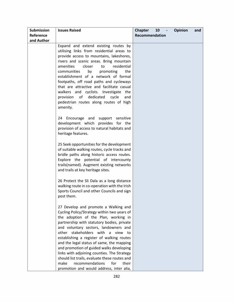
282
Submission Reference and Author
Issues Raised Chapter 10 - Opinion and Recommendation
Expand and extend existing routes by utilising links from residential areas to provide access to mountains, lakeshores, rivers and scenic areas. Bring mountain amenities closer to residential communities by promoting the establishment of a network of formal footpaths, off road paths and cycleways that are attractive and facilitate casual walkers and cyclists. Investigate the provision of dedicated cycle and pedestrian routes along routes of high amenity.
24 Encourage and support sensitive development which provides for the provision of access to natural habitats and heritage features.
25 Seek opportunities for the development of suitable walking routes, cycle tracks and bridle paths along historic access routes. Explore the potential of intercounty trails(named). Augment existing networks and trails at key heritage sites.
26 Protect the Sli Dala as a long distance walking route in co-operation with the Irish Sports Council and other Councils and sign post them.
27 Develop and promote a Walking and Cycling Policy/Strategy within two years of the adoption of the Plan, working in partnership with statutory bodies, private and voluntary sectors, landowners and other stakeholders with a view to establishing a register of walking routes and the legal status of same, the mapping and promotion of guided walks developing links with adjoining counties. The Strategy should list trails, evaluate these routes and make recommendations for their promotion and would address, inter alia,
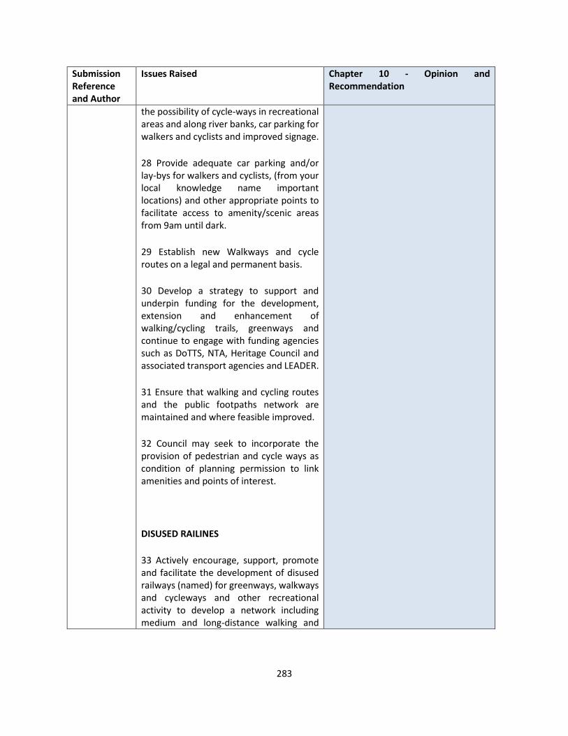
283
Submission Reference and Author
Issues Raised Chapter 10 - Opinion and Recommendation
the possibility of cycle-ways in recreational areas and along river banks, car parking for walkers and cyclists and improved signage.
28 Provide adequate car parking and/or lay-bys for walkers and cyclists, (from your local knowledge name important locations) and other appropriate points to facilitate access to amenity/scenic areas from 9am until dark.
29 Establish new Walkways and cycle routes on a legal and permanent basis.
30 Develop a strategy to support and underpin funding for the development, extension and enhancement of walking/cycling trails, greenways and continue to engage with funding agencies such as DoTTS, NTA, Heritage Council and associated transport agencies and LEADER.
31 Ensure that walking and cycling routes and the public footpaths network are maintained and where feasible improved.
32 Council may seek to incorporate the provision of pedestrian and cycle ways as condition of planning permission to link amenities and points of interest.
DISUSED RAILINES
33 Actively encourage, support, promote and facilitate the development of disused railways (named) for greenways, walkways and cycleways and other recreational activity to develop a network including medium and long-distance walking and
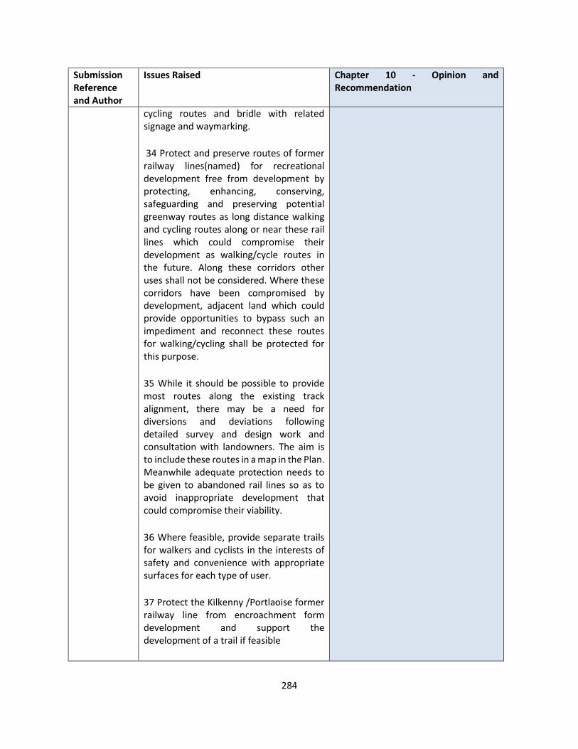
284
Submission Reference and Author
Issues Raised Chapter 10 - Opinion and Recommendation
cycling routes and bridle with related signage and waymarking.
34 Protect and preserve routes of former railway lines(named) for recreational development free from development by protecting, enhancing, conserving, safeguarding and preserving potential greenway routes as long distance walking and cycling routes along or near these rail lines which could compromise their development as walking/cycle routes in the future. Along these corridors other uses shall not be considered. Where these corridors have been compromised by development, adjacent land which could provide opportunities to bypass such an impediment and reconnect these routes for walking/cycling shall be protected for this purpose.
35 While it should be possible to provide most routes along the existing track alignment, there may be a need for diversions and deviations following detailed survey and design work and consultation with landowners. The aim is to include these routes in a map in the Plan. Meanwhile adequate protection needs to be given to abandoned rail lines so as to avoid inappropriate development that could compromise their viability.
36 Where feasible, provide separate trails for walkers and cyclists in the interests of safety and convenience with appropriate surfaces for each type of user.
37 Protect the Kilkenny /Portlaoise former railway line from encroachment form development and support the development of a trail if feasible

285
Submission Reference and Author
Issues Raised Chapter 10 - Opinion and Recommendation
10.6 Telecoms Policy Objectives
TEL 8 We submit that this should be replaced by: Require the identification of Public Rights of Way and established walking routes prior to any new telecommunication developments(including associated processes) which will be prohibited if they impinge or impact thereon or on recreational amenities or public access to the countryside or on the natural and built environment.
We submit that you should include an additional DM: The Council shall, in assessing an application, take into account the impact on established walking routes.
LS-C9-DCDP-122 Failte Ireland
It is considered that the draft Plan should reference the Slieve Bloom Masterplan as an important tourism objective. The below text is suggested to be inserted into the draft Plan in Section 10.17.1-TRANS XX: Slieve Bloom Masterplan: Fáilte Ireland are currently investing in improving the tourism product and visitor experience in the Slieve Blooms through a strategic partnership which includes Fáilte Ireland, Laois and Offaly County Councils, Coillte, and the National Parks & Wildlife Services. Investments include: • Part of the RRDF capital investment for
the National Mountain Bike Trails. • RRDF funding to develop “A Visitor
Experience Management Plan” for 2,300 hectares of the Slieve Bloom Nature Reserve by the National Parks and Wildlife Service & Fáilte Ireland.
• ORIS funding for development and implementation of signage, orientation & interpretation strategy that seeks to develop an integrated programme by
OPINION The submission is noted. The points raised are sufficiently addressed in Chapter 8 (Tourism), for example in Table 8.1, TM6, ABT2, ABT3, 8.5.5, NH3. In addition Chapter 10 includes sufficient objectives from Slieve Bloom, including TRANS 44, Trans 45, TRANS47. RECOMMENDATION No change to the Draft Plan
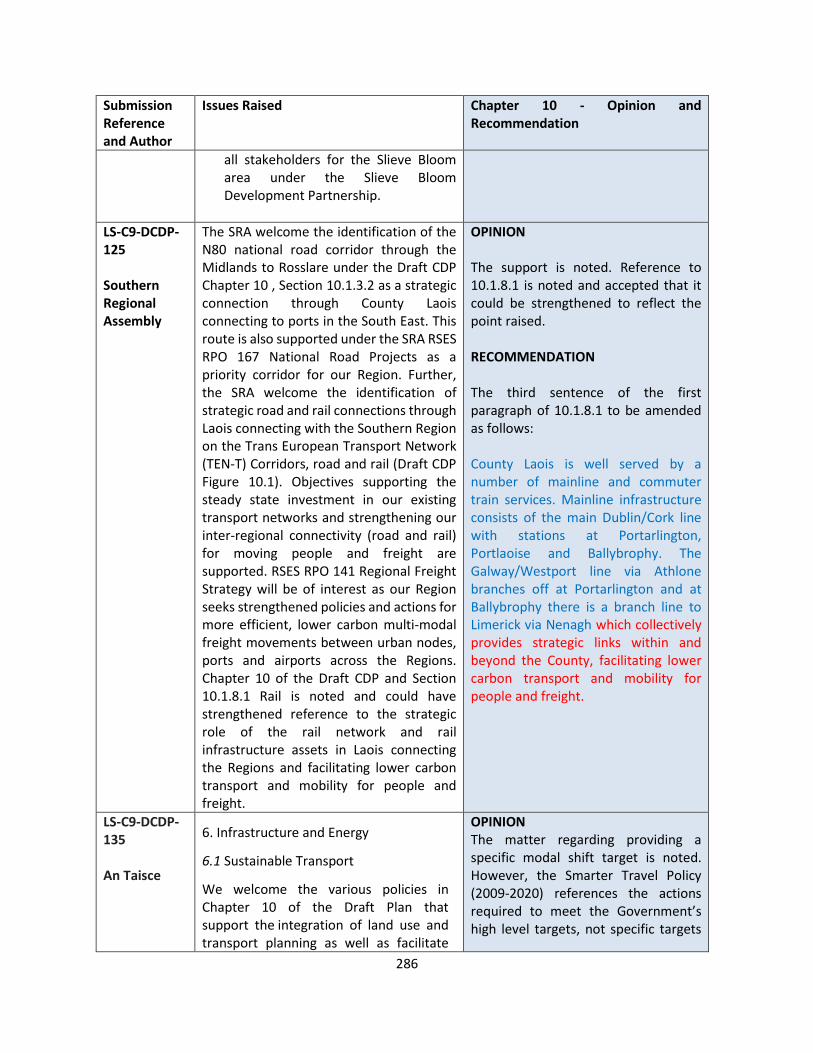
286
Submission Reference and Author
Issues Raised Chapter 10 - Opinion and Recommendation
all stakeholders for the Slieve Bloom area under the Slieve Bloom Development Partnership.
LS-C9-DCDP-125 Southern Regional Assembly
The SRA welcome the identification of the N80 national road corridor through the Midlands to Rosslare under the Draft CDP Chapter 10 , Section 10.1.3.2 as a strategic connection through County Laois connecting to ports in the South East. This route is also supported under the SRA RSES RPO 167 National Road Projects as a priority corridor for our Region. Further, the SRA welcome the identification of strategic road and rail connections through Laois connecting with the Southern Region on the Trans European Transport Network (TEN-T) Corridors, road and rail (Draft CDP Figure 10.1). Objectives supporting the steady state investment in our existing transport networks and strengthening our inter-regional connectivity (road and rail) for moving people and freight are supported. RSES RPO 141 Regional Freight Strategy will be of interest as our Region seeks strengthened policies and actions for more efficient, lower carbon multi-modal freight movements between urban nodes, ports and airports across the Regions. Chapter 10 of the Draft CDP and Section 10.1.8.1 Rail is noted and could have strengthened reference to the strategic role of the rail network and rail infrastructure assets in Laois connecting the Regions and facilitating lower carbon transport and mobility for people and freight.
OPINION The support is noted. Reference to 10.1.8.1 is noted and accepted that it could be strengthened to reflect the point raised. RECOMMENDATION The third sentence of the first paragraph of 10.1.8.1 to be amended as follows: County Laois is well served by a number of mainline and commuter train services. Mainline infrastructure consists of the main Dublin/Cork line with stations at Portarlington, Portlaoise and Ballybrophy. The Galway/Westport line via Athlone branches off at Portarlington and at Ballybrophy there is a branch line to Limerick via Nenagh which collectively provides strategic links within and beyond the County, facilitating lower carbon transport and mobility for people and freight.
LS-C9-DCDP-135 An Taisce
6. Infrastructure and Energy
6.1 Sustainable Transport
We welcome the various policies in Chapter 10 of the Draft Plan that support the integration of land use and transport planning as well as facilitate
OPINION The matter regarding providing a specific modal shift target is noted. However, the Smarter Travel Policy (2009-2020) references the actions required to meet the Government’s high level targets, not specific targets

287
Submission Reference and Author
Issues Raised Chapter 10 - Opinion and Recommendation
sustainable transport initiatives, particularly Policy Objectives such as TRANS 24.
However, we recommend that the current modal split in Laois be further analysed and that specific modal shift targets for 2027 be set in line with the Smarter Travel policy.
An Taisce recommends for inclusion is an explicit objective ensuring that sufficient public transport capacity as well as safe cycling and pedestrian infrastructure be provided prior to or in tandem with any new residential development.
Increased sustainable transport infrastructure and capacity provision needs to come before expanded residential development, particularly in larger towns and their catchment areas
6.1.1 Programme for Government
In light of the Programme for Government mandate and the aforementioned transport data, we cannot overstate the urgency with which the Council needs to address the current unsustainability of transport in the county.
We recommend that provision for the immediate review called for in the Programme for Government be included in the CDP
6.1.2 Road Investment
Policy and investment in Laois should be reprioritised away from road infrastructure (with the exception of necessary maintenance and town bypasses) and redirected to support public and active transport projects and cycling infrastructure.
at a local level. The Draft Plan has been prepared in accordance with the NPF, RSES, Climate Action Plan as well as the Smarter Travel Policy document. Collectively the Plan will deliver a more sustainable pattern of development, which includes modal shift within the County. The matter regarding public transport capacity prior to or in tandem with any new residential development is noted. However, this is not considered to be practical or realistic when planning for development. Public transport will respond to where demand exists, whilst cycling and pedestrian infrastructure are, where necessary delivered as part of an overall development. Programme for Government The Draft Plan has been prepared in accordance with the NPF and RSES, which is the appropriate framework for this plan. Road Investment TRANS10 states that Work with the National Trails Office, Coillte, the Department of Planning, Housing and Local Government, the Department of Transport, Tourism and Sport, and other relevant stakeholders, to improve on the existing level of transport infrastructure and facilities for walking and cycling. TRANS 15 states that It is a Policy Objective that where projects for new roads or other linear projects, identified in Chapter 10 and
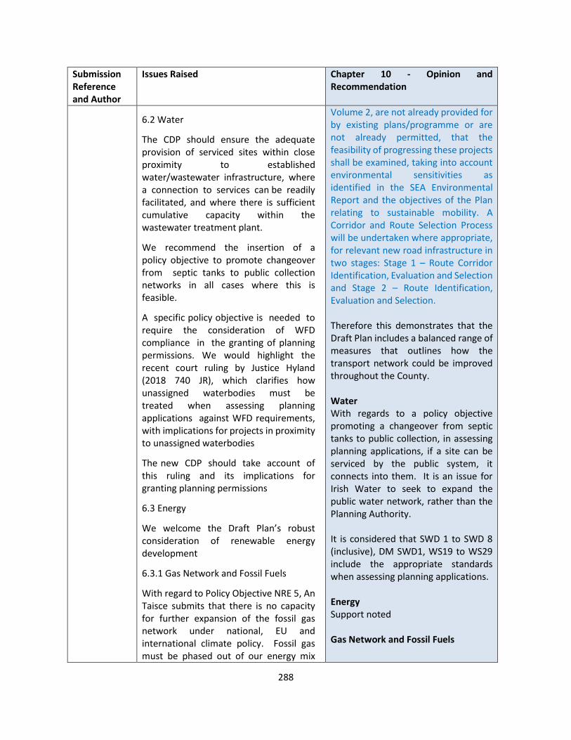
288
Submission Reference and Author
Issues Raised Chapter 10 - Opinion and Recommendation
6.2 Water
The CDP should ensure the adequate provision of serviced sites within close proximity to established water/wastewater infrastructure, where a connection to services can be readily facilitated, and where there is sufficient cumulative capacity within the wastewater treatment plant.
We recommend the insertion of a policy objective to promote changeover from septic tanks to public collection networks in all cases where this is feasible.
A specific policy objective is needed to require the consideration of WFD compliance in the granting of planning permissions. We would highlight the recent court ruling by Justice Hyland (2018 740 JR), which clarifies how unassigned waterbodies must be treated when assessing planning applications against WFD requirements, with implications for projects in proximity to unassigned waterbodies
The new CDP should take account of this ruling and its implications for granting planning permissions
6.3 Energy
We welcome the Draft Plan’s robust consideration of renewable energy development
6.3.1 Gas Network and Fossil Fuels
With regard to Policy Objective NRE 5, An Taisce submits that there is no capacity for further expansion of the fossil gas network under national, EU and international climate policy. Fossil gas must be phased out of our energy mix
Volume 2, are not already provided for by existing plans/programme or are not already permitted, that the feasibility of progressing these projects shall be examined, taking into account environmental sensitivities as identified in the SEA Environmental Report and the objectives of the Plan relating to sustainable mobility. A Corridor and Route Selection Process will be undertaken where appropriate, for relevant new road infrastructure in two stages: Stage 1 – Route Corridor Identification, Evaluation and Selection and Stage 2 – Route Identification, Evaluation and Selection. Therefore this demonstrates that the Draft Plan includes a balanced range of measures that outlines how the transport network could be improved throughout the County. Water With regards to a policy objective promoting a changeover from septic tanks to public collection, in assessing planning applications, if a site can be serviced by the public system, it connects into them. It is an issue for Irish Water to seek to expand the public water network, rather than the Planning Authority. It is considered that SWD 1 to SWD 8 (inclusive), DM SWD1, WS19 to WS29 include the appropriate standards when assessing planning applications. Energy Support noted Gas Network and Fossil Fuels
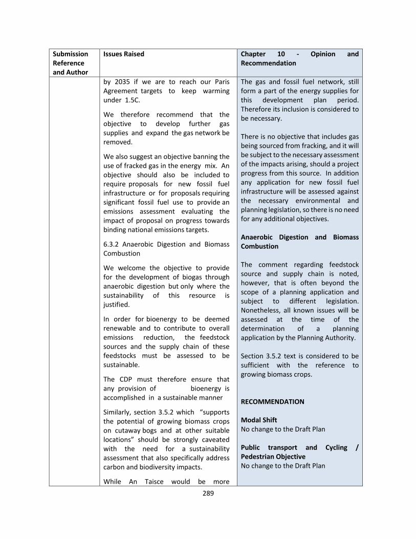
289
Submission Reference and Author
Issues Raised Chapter 10 - Opinion and Recommendation
by 2035 if we are to reach our Paris Agreement targets to keep warming under 1.5C.
We therefore recommend that the objective to develop further gas supplies and expand the gas network be removed.
We also suggest an objective banning the use of fracked gas in the energy mix. An objective should also be included to require proposals for new fossil fuel infrastructure or for proposals requiring significant fossil fuel use to provide an emissions assessment evaluating the impact of proposal on progress towards binding national emissions targets.
6.3.2 Anaerobic Digestion and Biomass Combustion
We welcome the objective to provide for the development of biogas through anaerobic digestion but only where the sustainability of this resource is justified.
In order for bioenergy to be deemed renewable and to contribute to overall emissions reduction, the feedstock sources and the supply chain of these feedstocks must be assessed to be sustainable.
The CDP must therefore ensure that any provision of bioenergy is accomplished in a sustainable manner
Similarly, section 3.5.2 which “supports the potential of growing biomass crops on cutaway bogs and at other suitable locations” should be strongly caveated with the need for a sustainability assessment that also specifically address carbon and biodiversity impacts.
While An Taisce would be more
The gas and fossil fuel network, still form a part of the energy supplies for this development plan period. Therefore its inclusion is considered to be necessary. There is no objective that includes gas being sourced from fracking, and it will be subject to the necessary assessment of the impacts arising, should a project progress from this source. In addition any application for new fossil fuel infrastructure will be assessed against the necessary environmental and planning legislation, so there is no need for any additional objectives. Anaerobic Digestion and Biomass Combustion The comment regarding feedstock source and supply chain is noted, however, that is often beyond the scope of a planning application and subject to different legislation. Nonetheless, all known issues will be assessed at the time of the determination of a planning application by the Planning Authority. Section 3.5.2 text is considered to be sufficient with the reference to growing biomass crops. RECOMMENDATION Modal Shift No change to the Draft Plan Public transport and Cycling / Pedestrian Objective No change to the Draft Plan
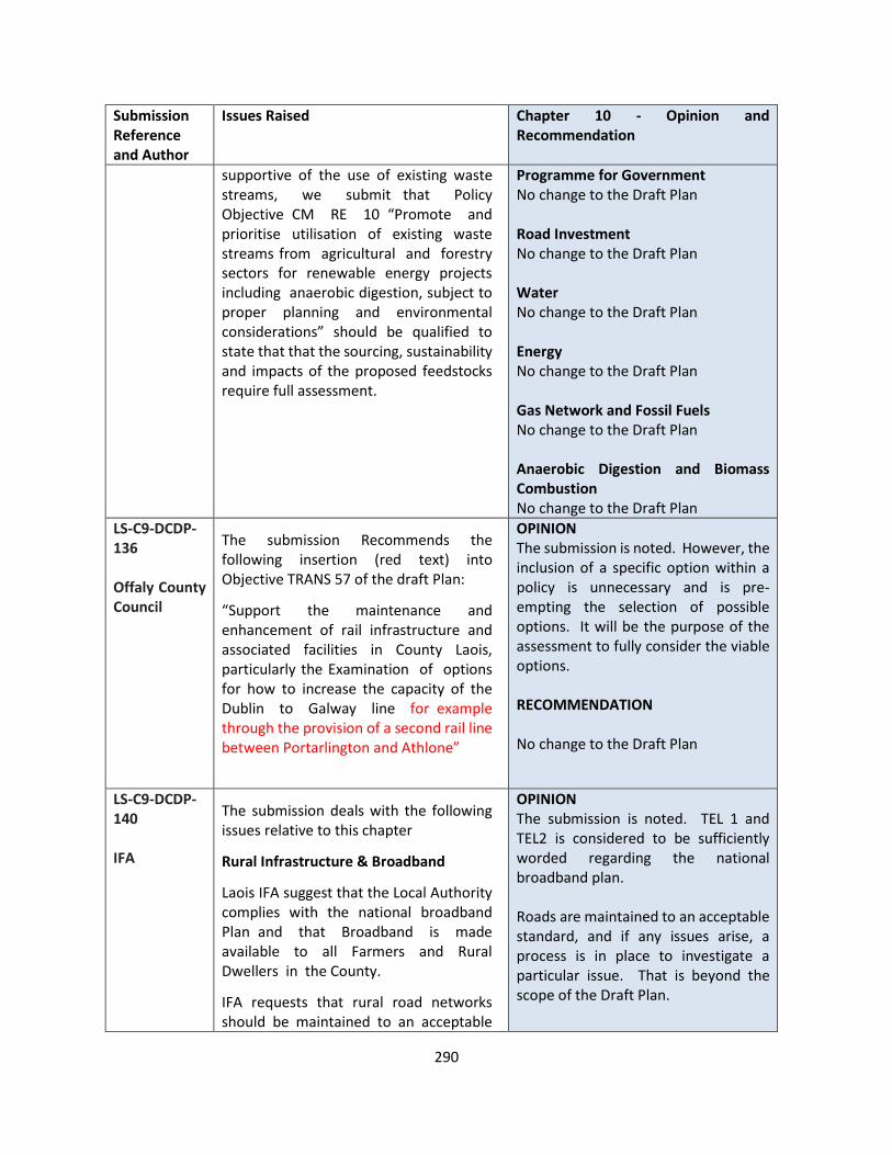
290
Submission Reference and Author
Issues Raised Chapter 10 - Opinion and Recommendation
supportive of the use of existing waste streams, we submit that Policy Objective CM RE 10 “Promote and prioritise utilisation of existing waste streams from agricultural and forestry sectors for renewable energy projects including anaerobic digestion, subject to proper planning and environmental considerations” should be qualified to state that that the sourcing, sustainability and impacts of the proposed feedstocks require full assessment.
Programme for Government No change to the Draft Plan Road Investment No change to the Draft Plan Water No change to the Draft Plan Energy No change to the Draft Plan Gas Network and Fossil Fuels No change to the Draft Plan Anaerobic Digestion and Biomass Combustion No change to the Draft Plan
LS-C9-DCDP-136 Offaly County Council
The submission Recommends the following insertion (red text) into Objective TRANS 57 of the draft Plan:
“Support the maintenance and enhancement of rail infrastructure and associated facilities in County Laois, particularly the Examination of options for how to increase the capacity of the Dublin to Galway line for example through the provision of a second rail line between Portarlington and Athlone”
OPINION The submission is noted. However, the inclusion of a specific option within a policy is unnecessary and is pre-empting the selection of possible options. It will be the purpose of the assessment to fully consider the viable options. RECOMMENDATION No change to the Draft Plan
LS-C9-DCDP-140 IFA
The submission deals with the following issues relative to this chapter
Rural Infrastructure & Broadband
Laois IFA suggest that the Local Authority complies with the national broadband Plan and that Broadband is made available to all Farmers and Rural Dwellers in the County.
IFA requests that rural road networks should be maintained to an acceptable
OPINION The submission is noted. TEL 1 and TEL2 is considered to be sufficiently worded regarding the national broadband plan. Roads are maintained to an acceptable standard, and if any issues arise, a process is in place to investigate a particular issue. That is beyond the scope of the Draft Plan.
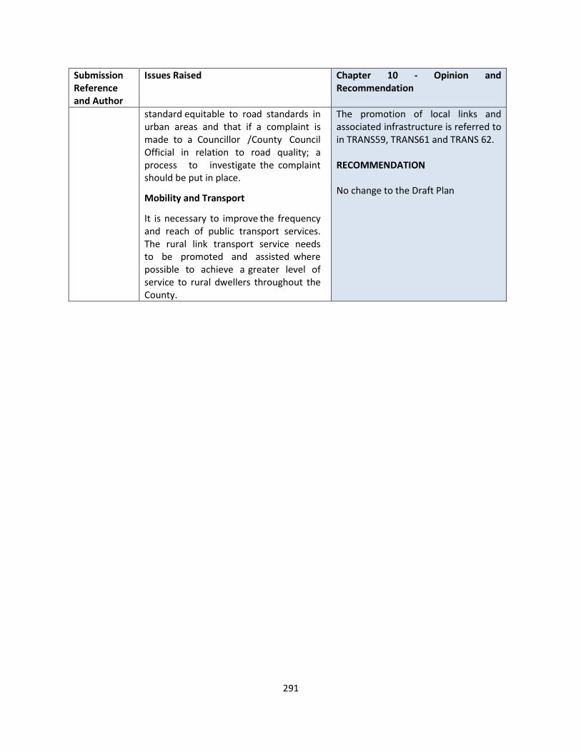
291
Submission Reference and Author
Issues Raised Chapter 10 - Opinion and Recommendation
standard equitable to road standards in urban areas and that if a complaint is made to a Councillor /County Council Official in relation to road quality; a process to investigate the complaint should be put in place.
Mobility and Transport
It is necessary to improve the frequency and reach of public transport services. The rural link transport service needs to be promoted and assisted where possible to achieve a greater level of service to rural dwellers throughout the County.
The promotion of local links and associated infrastructure is referred to in TRANS59, TRANS61 and TRANS 62. RECOMMENDATION No change to the Draft Plan

292
CHAPTER 11 BIODIVERSITY AND NATURAL HERITAGE
Submission Reference and Author
Issues Raised Chapter 11 – Opinion and Recommendation
LS-C9-DCDP-23 Birdwatch Ireland
BirdWatch Ireland would like to put forward the following suggested policy and guideline measures with regards Swifts. Policy It is an objective of the Council to require all new developments to identify, protect and enhance ecological features by making provision for local biodiversity (for example, through provision of swift boxes or bricks, bat roost boxes, green roofs, etc.) and provide links to the wider Green Infrastructure network as an essential part of the design process. It is an objective of the Council to protect existing swift roosts as identified in the County Swift Survey and ensure existing nest sites are not lost through inappropriate renovation or destruction. Development Management Guidelines In dealing with applications for new developments, the Planning Authority will have regard to the following:
• Inclusion of swift nesting opportunities in new buildings through use of swift brick or swift nest boxes
In dealing with Planning applications for renovations, redevelopment or demolition of old buildings in town and village centres the Planning Authority will have regard to the following:
• The avoidance of removal of swift nesting sites where possible, and where removal is unavoidable , the provision of new nesting sites - Planning applications of this type shall include a survey of existing numbers of swifts and swift nests and where swifts are shown to be
OPINION The submission is noted in relation to the suggested policies and guidelines measures to enhance biodiversity features particularly as they relate to the Swift Population. It is further that many public buildings around the county have incorporated such features into their structures, most recently the Convent regeneration project in Portlaoise Town Centre .
RECOMMENDATION Add additional policy objectives and development control standards in relation to the provision of features and re-number others accordingly as follows: Policy objectives It is an policy objective of the Council to require new developments to identify, protect and enhance ecological features by making provision for local biodiversity (for example, through provision of swift boxes or bricks, bat roost boxes, green roofs, etc.) and provide links to the wider Green Infrastructure network as an essential part of the design process. It is an objective of the Council to protect existing swift roosts as identified in the County Swift Survey and ensure existing nest sites are not lost through inappropriate renovation or destruction. Development Management Guidelines In dealing with applications for new developments, the Planning Authority will have regard to the following:
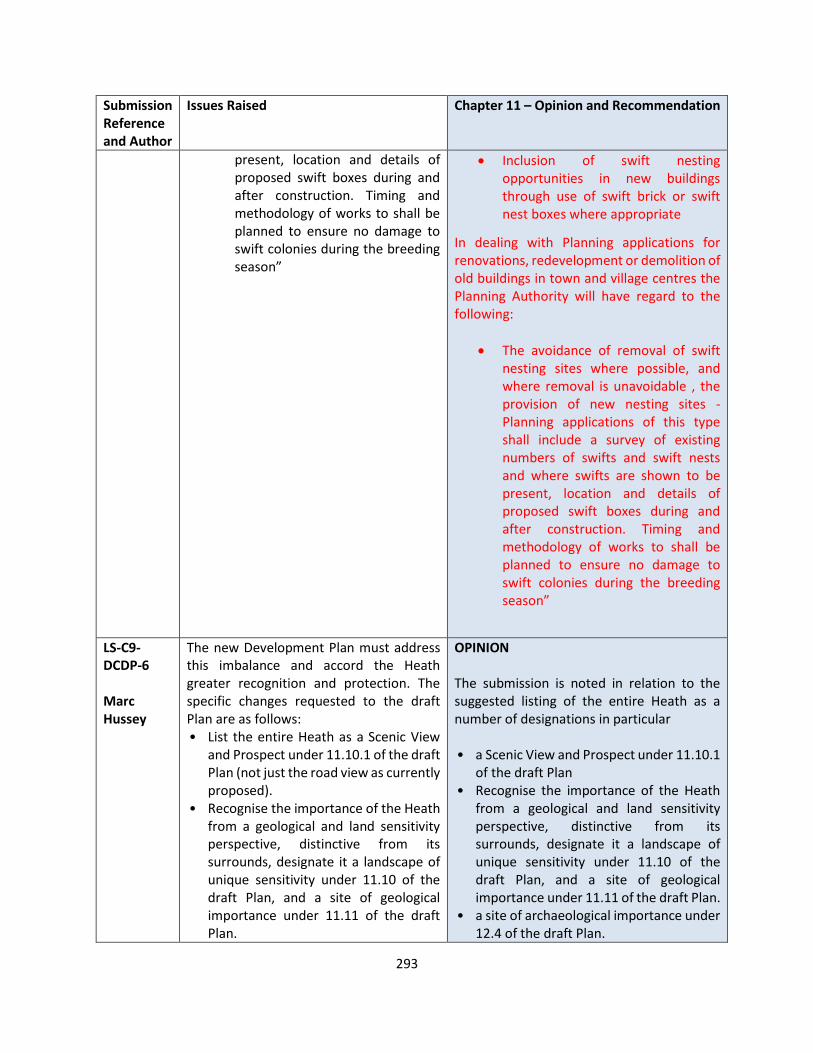
293
Submission Reference and Author
Issues Raised Chapter 11 – Opinion and Recommendation
present, location and details of proposed swift boxes during and after construction. Timing and methodology of works to shall be planned to ensure no damage to swift colonies during the breeding season”
• Inclusion of swift nesting opportunities in new buildings through use of swift brick or swift nest boxes where appropriate
In dealing with Planning applications for renovations, redevelopment or demolition of old buildings in town and village centres the Planning Authority will have regard to the following:
• The avoidance of removal of swift nesting sites where possible, and where removal is unavoidable , the provision of new nesting sites - Planning applications of this type shall include a survey of existing numbers of swifts and swift nests and where swifts are shown to be present, location and details of proposed swift boxes during and after construction. Timing and methodology of works to shall be planned to ensure no damage to swift colonies during the breeding season”
LS-C9-DCDP-6 Marc Hussey
The new Development Plan must address this imbalance and accord the Heath greater recognition and protection. The specific changes requested to the draft Plan are as follows: • List the entire Heath as a Scenic View
and Prospect under 11.10.1 of the draft Plan (not just the road view as currently proposed).
• Recognise the importance of the Heath from a geological and land sensitivity perspective, distinctive from its surrounds, designate it a landscape of unique sensitivity under 11.10 of the draft Plan, and a site of geological importance under 11.11 of the draft Plan.
OPINION The submission is noted in relation to the suggested listing of the entire Heath as a number of designations in particular • a Scenic View and Prospect under 11.10.1
of the draft Plan • Recognise the importance of the Heath
from a geological and land sensitivity perspective, distinctive from its surrounds, designate it a landscape of unique sensitivity under 11.10 of the draft Plan, and a site of geological importance under 11.11 of the draft Plan.
• a site of archaeological importance under 12.4 of the draft Plan.

294
Submission Reference and Author
Issues Raised Chapter 11 – Opinion and Recommendation
• Acknowledge the importance of the Heath as a site of archaeolo, an gical importance under 12.4 of the draft Plan.
• Fix the omission of the Heath as a pNHA3 under 11.4.3 of the draft Plan, work to finalise the Heath's NHA designation and treat the Heath as an NHA while its status is finalised.
• Assess whether the Heath can be designated a special area of conservation (SAC) given its status as one of the last heath lands to develop in Europe with a unique lake and turlough topography and a distinctive habitat.
• Commit to work more closely with the Office of Public Works as owner of the Heath and local stakeholders to conserve better the Heath.
• Requests the viewing stand on the Heath be listed
Much survey work has been done on the archaeological landscape of the heath and recording of archaeology during the course of infrastructural projects. The map below indicates the current designations in relation to the site It is proposed to include the following paragraph in the Draft Plan The Great Heath of Portlaoise The Great Heath or The Heath is a rare example of unenclosed natural grassland in Ireland interspaced with small lakes and turloughs. It has one of the most sensitive and valuable landscapes in laois. It is unique as a natural area (one of the last heathlands to develop in Europe , grazed but unfertilized for hundreds of years , a geological area (a rare example of karst and wetland ecosystem), an archaeological area, an ecological area , a historic area and a widely used amenity area. The area has many interested stakeholders and it requires a study to develop a Landscape Conservation Assessment which would provide a framework for its protection and development into the future.
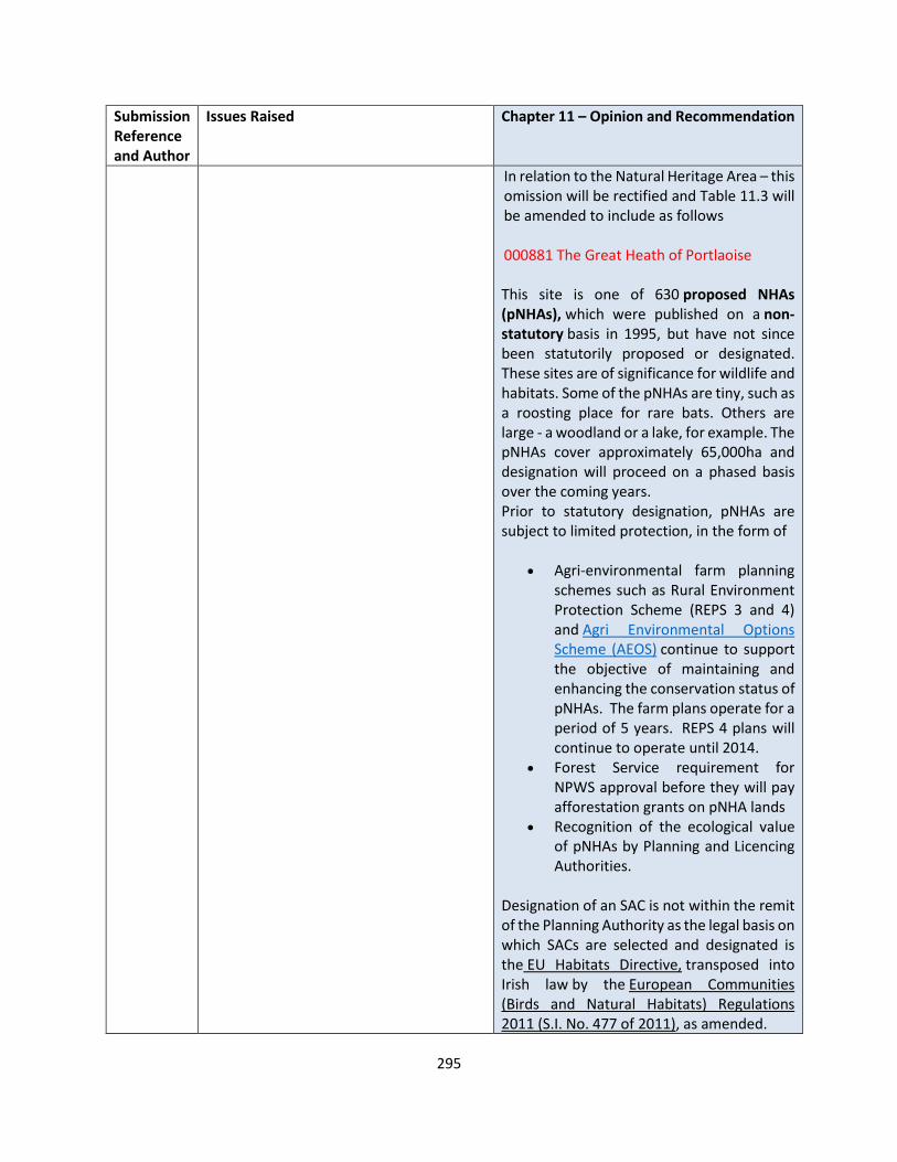
295
Submission Reference and Author
Issues Raised Chapter 11 – Opinion and Recommendation
In relation to the Natural Heritage Area – this omission will be rectified and Table 11.3 will be amended to include as follows 000881 The Great Heath of Portlaoise This site is one of 630 proposed NHAs (pNHAs), which were published on a non-statutory basis in 1995, but have not since been statutorily proposed or designated. These sites are of significance for wildlife and habitats. Some of the pNHAs are tiny, such as a roosting place for rare bats. Others are large - a woodland or a lake, for example. The pNHAs cover approximately 65,000ha and designation will proceed on a phased basis over the coming years. Prior to statutory designation, pNHAs are subject to limited protection, in the form of
• Agri-environmental farm planning schemes such as Rural Environment Protection Scheme (REPS 3 and 4) and Agri Environmental Options Scheme (AEOS) continue to support the objective of maintaining and enhancing the conservation status of pNHAs. The farm plans operate for a period of 5 years. REPS 4 plans will continue to operate until 2014.
• Forest Service requirement for NPWS approval before they will pay afforestation grants on pNHA lands
• Recognition of the ecological value of pNHAs by Planning and Licencing Authorities.
Designation of an SAC is not within the remit of the Planning Authority as the legal basis on which SACs are selected and designated is the EU Habitats Directive, transposed into Irish law by the European Communities (Birds and Natural Habitats) Regulations 2011 (S.I. No. 477 of 2011), as amended.

296
Submission Reference and Author
Issues Raised Chapter 11 – Opinion and Recommendation
It is proposed to work with Laois Heritage Office and relevant stakeholders such as the Office of Public Works (OPW) and local stakeholders to develop a Landscape Conservation Assessment in relation to the Heath and its attributes during the plan period. It is anticipated that this could be used to inform any policy objectives and designations going forward. The Viewing Stand The Viewing Stand is a ruined hexagonal-plan stone structure, which was constructed as a viewing platform for the Great Heath Racecourse in the early-eighteenth century. This unusual structure is the most visible surviving feature of the former race course, which continued in use well into the nineteenth century but now forms part of The Heath Golf Course. Architectural The viewing stand is a landmark structure, which makes a positive contribution to the landscape character of The Heath Historical The structure has associations with the establishment of a horse racing track at The Heath by local gentry in the early-eighteenth century. Cultural The structure illustrates the emergence of horse racing as a leisure pursuit among wealthy landowners in County Laois in the early-eighteenth century. Social The structure is a focal point within the local area and provides evidence of the social structure of the area in previous centuries.
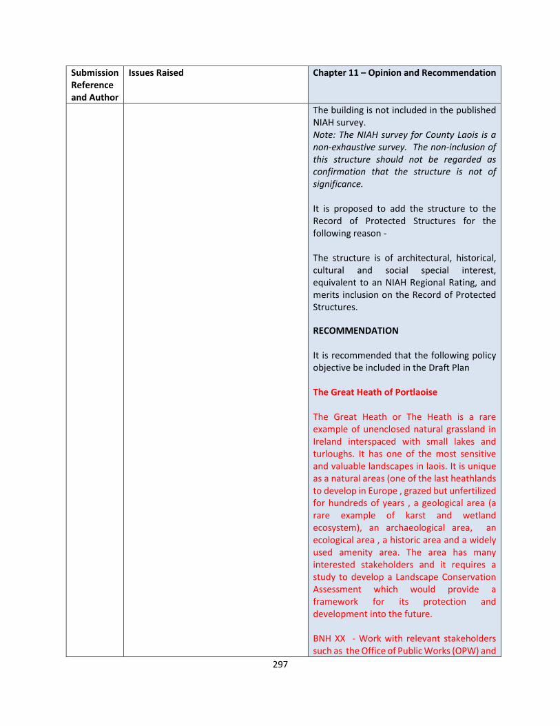
297
Submission Reference and Author
Issues Raised Chapter 11 – Opinion and Recommendation
The building is not included in the published NIAH survey. Note: The NIAH survey for County Laois is a non-exhaustive survey. The non-inclusion of this structure should not be regarded as confirmation that the structure is not of significance. It is proposed to add the structure to the Record of Protected Structures for the following reason - The structure is of architectural, historical, cultural and social special interest, equivalent to an NIAH Regional Rating, and merits inclusion on the Record of Protected Structures.
RECOMMENDATION It is recommended that the following policy objective be included in the Draft Plan The Great Heath of Portlaoise The Great Heath or The Heath is a rare example of unenclosed natural grassland in Ireland interspaced with small lakes and turloughs. It has one of the most sensitive and valuable landscapes in laois. It is unique as a natural areas (one of the last heathlands to develop in Europe , grazed but unfertilized for hundreds of years , a geological area (a rare example of karst and wetland ecosystem), an archaeological area, an ecological area , a historic area and a widely used amenity area. The area has many interested stakeholders and it requires a study to develop a Landscape Conservation Assessment which would provide a framework for its protection and development into the future. BNH XX - Work with relevant stakeholders such as the Office of Public Works (OPW) and
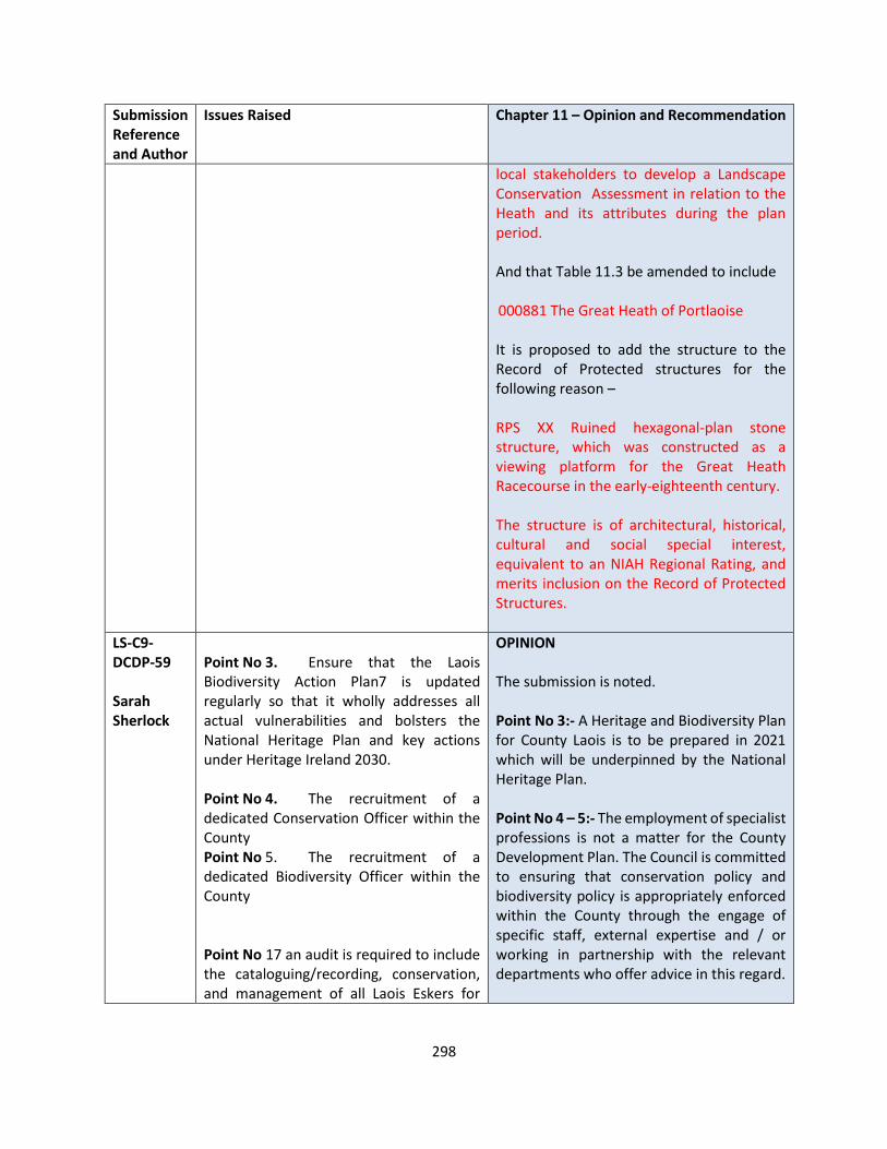
298
Submission Reference and Author
Issues Raised Chapter 11 – Opinion and Recommendation
local stakeholders to develop a Landscape Conservation Assessment in relation to the Heath and its attributes during the plan period. And that Table 11.3 be amended to include 000881 The Great Heath of Portlaoise It is proposed to add the structure to the Record of Protected structures for the following reason – RPS XX Ruined hexagonal-plan stone structure, which was constructed as a viewing platform for the Great Heath Racecourse in the early-eighteenth century. The structure is of architectural, historical, cultural and social special interest, equivalent to an NIAH Regional Rating, and merits inclusion on the Record of Protected Structures.
LS-C9-DCDP-59 Sarah Sherlock
Point No 3. Ensure that the Laois Biodiversity Action Plan7 is updated regularly so that it wholly addresses all actual vulnerabilities and bolsters the National Heritage Plan and key actions under Heritage Ireland 2030. Point No 4. The recruitment of a dedicated Conservation Officer within the County Point No 5. The recruitment of a dedicated Biodiversity Officer within the County Point No 17 an audit is required to include the cataloguing/recording, conservation, and management of all Laois Eskers for
OPINION The submission is noted. Point No 3:- A Heritage and Biodiversity Plan for County Laois is to be prepared in 2021 which will be underpinned by the National Heritage Plan. Point No 4 – 5:- The employment of specialist professions is not a matter for the County Development Plan. The Council is committed to ensuring that conservation policy and biodiversity policy is appropriately enforced within the County through the engage of specific staff, external expertise and / or working in partnership with the relevant departments who offer advice in this regard.
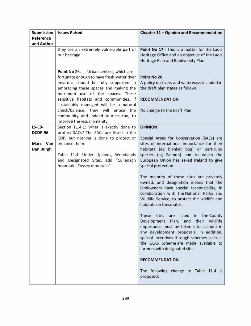
299
Submission Reference and Author
Issues Raised Chapter 11 – Opinion and Recommendation
they are an extremely vulnerable part of our heritage. Point No 26. Urban centres, which are fortunate enough to have fresh-water river environs should be fully supported in embracing these spaces and making the maximum use of the spaces. These sensitive habitats and communities, if sustainably managed will be a natural check/balance, they will entice the community and indeed tourists too, to improve the visual amenity.
Point No 17:- This is a matter for the Laois Heritage Office and an objective of the Laois Heritage Plan and Biodiversity Plan. Point No 26. A policy on rivers and waterways included in the draft plan states as follows RECOMMENDATION No change to the Draft Plan
LS-C9-DCDP-96 Marc Van Den Burgh
Section 11.4.1: What is exactly done to protect SACs? The SACs are listed in the CDP, but nothing is done to protect or enhance them. Table 11.4: Under Uplands, Woodlands and Designated Sites, add “Cullenagh mountain, Fossey mountain”
OPINION Special Areas for Conservation (SACs) are sites of international importance for their habitats (eg blanket bog) or particular species (eg Salmon) and to which the European Union has asked Ireland to give special protection. The majority of these sites are privately owned, and designation means that the landowners have special responsibility, in collaboration with the National Parks and Wildlife Service, to protect the wildlife and habitats on these sites. These sites are listed in the County Development Plan, and their wildlife importance must be taken into account in any development proposals. In addition, special incentives through schemes such as the GLAS Scheme are made available to farmers with designated sites. RECOMMENDATION The following change to Table 11.4 is proposed:

300
Submission Reference and Author
Issues Raised Chapter 11 – Opinion and Recommendation
Table 11.4: Under Uplands, Woodlands and Designated Sites, add “Cullenagh mountain, Fossey mountain”
LS-C9-DCDP-115 Nore Vision
The 2020/21 Nore Vision LEADER sponsored project across the River Nore catchment was designed to kick-start the development of both an agreed long-term strategy for the management and structures that will be necessary to support and maintain that strategy over what will be a generational timeline. The 2020/21 programme (Runs to May 2021) has been successfully implemented to date (in spite of COVID-19 constraints)
Key achievements of the 2020/21 include:
• Agreeing and Implementing the 2020 Training in Action Program.
• Mobilizing volunteers access all three counties some of whom are continuing to run initiatives beyond the initial program
• Building and rolling out a governance model based on the Nore Vision recommendations and best practice and getting the Forum group and Collaborative Working Groups working to agree priorities activities for each sector. A CLG company is currently being formed and with a formation group including Chairperson in place (Directors once company is registered)
• Ministerially referral best practice project
• Bottom-up community demanded organisation - Over 1000 friends of the Nore online in 3 months instead of the initial target of 15 months
• Web based digital Communications and living Laboratory to engage and motivate communities and individuals
OPINION The submission is noted in relation to the Nore Vision Project and all that has been achieved in 2020 / 2021. The Local Authority supports the objectives of conservation, rehabilitation and improvement of the Catchment of the River Nore in collaboration with the many stakeholders involved. Policies BNH 23 – 30 relate to the development and protection of our waterways which support the efforts of this group. RECOMMENDATION No change to the Draft Plan
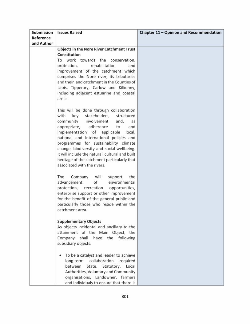
301
Submission Reference and Author
Issues Raised Chapter 11 – Opinion and Recommendation
Objects in the Nore River Catchment Trust Constitution To work towards the conservation, protection, rehabilitation and improvement of the catchment which comprises the Nore river, its tributaries and their land catchment in the Counties of Laois, Tipperary, Carlow and Kilkenny, including adjacent estuarine and coastal areas.
This will be done through collaboration with key stakeholders, structured community involvement and, as appropriate, adherence to and implementation of applicable local, national and international policies and programmes for sustainability climate change, biodiversity and social wellbeing. It will include the natural, cultural and built heritage of the catchment particularly that associated with the rivers.
The Company will support the advancement of environmental protection, recreation opportunities, enterprise support or other improvement for the benefit of the general public and particularly those who reside within the catchment area.
Supplementary Objects As objects incidental and ancillary to the attainment of the Main Object, the Company shall have the following subsidiary objects:
• To be a catalyst and leader to achieve long-term collaboration required between State, Statutory, Local Authorities, Voluntary and Community organisations, Landowner, farmers and individuals to ensure that there is

302
Submission Reference and Author
Issues Raised Chapter 11 – Opinion and Recommendation
one collaborative strategy and plan in place
• To advance the education of the public, or any association, institution, voluntary organisation, company, local authority, administrative or governmental agency or public body or representative body in: -
a) The understanding of rivers, river corridors and river catchments, including their fauna, flora, biodiversity, economic or social activity, and river catchment management.
b) The need for, and benefits of, conservation, protection, rehabilitation and improvement of aquatic environments.
LS-C9-DCDP-121 Keep Ireland Open
BNH 2 We submit that this should be replaced by: Maintain, and where necessary, restore, the conservation value of Sites. All developments, plans and projects that have the potential to have a negative/adverse impact on the integrity or coherence of a Natura Site will be subject to Habitats Directive Assessment and should be in accordance with best practice and guidance. Comply fully with Art 6(3) & (4) of the Habitats Directive( as transposed into Irish law by the EU Habitats Regulations 1997 and subsequent amendments) and S.177A of the Planning and Development Act(2000 – 2010),the Wildlife Acts 1976 and 2010(as amended) or any superseding legislation, in consultation with the NPWS, to ensure the protection, management, enhancement and improvement of the network of Euro Sites, including any additional Sites that may be proposed during the lifetime of the Plan, by assessing and screening and, where warranted, by prohibiting
OPINION Submission is noted, however the suggested policies are long and wieldy and may confuse the user of the Draft Plan. It is more preferable to have policy objectives that are to the point and more succinct. We believe that the policies proposed are considered appropriate and compliant with legislation and encompass the policies as suggested. However there is merit in some changes to policy as suggested and inclusions are proposed hereafter. In relation to Natural heritage the following policies have been proposed in the Draft which cover many of the points being made by the submission - BNH 2 states as follows and Conserve and protect habitats and species listed in the Annexes of the EU Habitats Directive (92/43/EEC) (as amended) and the Birds
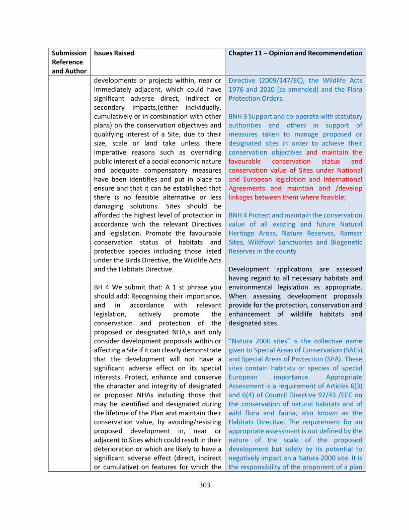
303
Submission Reference and Author
Issues Raised Chapter 11 – Opinion and Recommendation
developments or projects within, near or immediately adjacent, which could have significant adverse direct, indirect or secondary impacts,(either individually, cumulatively or in combination with other plans) on the conservation objectives and qualifying interest of a Site, due to their size, scale or land take unless there imperative reasons such as overriding public interest of a social economic nature and adequate compensatory measures have been identifies and put in place to ensure and that it can be established that there is no feasible alternative or less damaging solutions. Sites should be afforded the highest level of protection in accordance with the relevant Directives and legislation. Promote the favourable conservation status of habitats and protective species including those listed under the Birds Directive, the Wildlife Acts and the Habitats Directive. BH 4 We submit that: A 1 st phrase you should add: Recognising their importance, and in accordance with relevant legislation, actively promote the conservation and protection of the proposed or designated NHA,s and only consider development proposals within or affecting a Site if it can clearly demonstrate that the development will not have a significant adverse effect on its special interests. Protect, enhance and conserve the character and integrity of designated or proposed NHAs including those that may be identified and designated during the lifetime of the Plan and maintain their conservation value, by avoiding/resisting proposed development in, near or adjacent to Sites which could result in their deterioration or which are likely to have a significant adverse effect (direct, indirect or cumulative) on features for which the
Directive (2009/147/EC), the Wildlife Acts 1976 and 2010 (as amended) and the Flora Protection Orders. BNH 3 Support and co-operate with statutory authorities and others in support of measures taken to manage proposed or designated sites in order to achieve their conservation objectives and maintain the favourable conservation status and conservation value of Sites under National and European legislation and International Agreements and maintain and /develop linkages between them where feasible; BNH 4 Protect and maintain the conservation value of all existing and future Natural Heritage Areas, Nature Reserves, Ramsar Sites, Wildfowl Sanctuaries and Biogenetic Reserves in the county Development applications are assessed having regard to all necessary habitats and environmental legislation as appropriate. When assessing development proposals provide for the protection, conservation and enhancement of wildlife habitats and designated sites. “Natura 2000 sites” is the collective name given to Special Areas of Conservation (SACs) and Special Areas of Protection (SPA). These sites contain habitats or species of special European importance. Appropriate Assessment is a requirement of Articles 6(3) and 6(4) of Council Directive 92/43 /EEC on the conservation of natural habitats and of wild flora and fauna, also known as the Habitats Directive. The requirement for an appropriate assessment is not defined by the nature of the scale of the proposed development but solely by its potential to negatively impact on a Natura 2000 site. It is the responsibility of the proponent of a plan
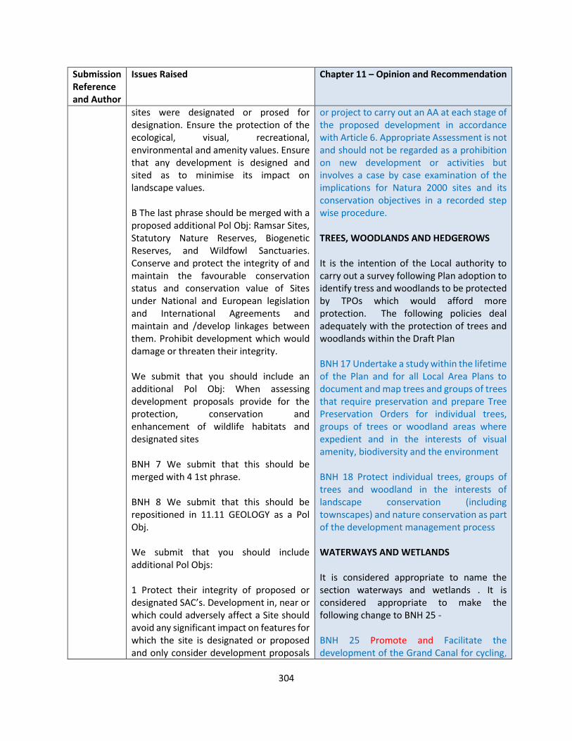
304
Submission Reference and Author
Issues Raised Chapter 11 – Opinion and Recommendation
sites were designated or prosed for designation. Ensure the protection of the ecological, visual, recreational, environmental and amenity values. Ensure that any development is designed and sited as to minimise its impact on landscape values. B The last phrase should be merged with a proposed additional Pol Obj: Ramsar Sites, Statutory Nature Reserves, Biogenetic Reserves, and Wildfowl Sanctuaries. Conserve and protect the integrity of and maintain the favourable conservation status and conservation value of Sites under National and European legislation and International Agreements and maintain and /develop linkages between them. Prohibit development which would damage or threaten their integrity. We submit that you should include an additional Pol Obj: When assessing development proposals provide for the protection, conservation and enhancement of wildlife habitats and designated sites BNH 7 We submit that this should be merged with 4 1st phrase. BNH 8 We submit that this should be repositioned in 11.11 GEOLOGY as a Pol Obj. We submit that you should include additional Pol Objs: 1 Protect their integrity of proposed or designated SAC’s. Development in, near or which could adversely affect a Site should avoid any significant impact on features for which the site is designated or proposed and only consider development proposals
or project to carry out an AA at each stage of the proposed development in accordance with Article 6. Appropriate Assessment is not and should not be regarded as a prohibition on new development or activities but involves a case by case examination of the implications for Natura 2000 sites and its conservation objectives in a recorded step wise procedure. TREES, WOODLANDS AND HEDGEROWS It is the intention of the Local authority to carry out a survey following Plan adoption to identify tress and woodlands to be protected by TPOs which would afford more protection. The following policies deal adequately with the protection of trees and woodlands within the Draft Plan BNH 17 Undertake a study within the lifetime of the Plan and for all Local Area Plans to document and map trees and groups of trees that require preservation and prepare Tree Preservation Orders for individual trees, groups of trees or woodland areas where expedient and in the interests of visual amenity, biodiversity and the environment BNH 18 Protect individual trees, groups of trees and woodland in the interests of landscape conservation (including townscapes) and nature conservation as part of the development management process WATERWAYS AND WETLANDS It is considered appropriate to name the section waterways and wetlands . It is considered appropriate to make the following change to BNH 25 - BNH 25 Promote and Facilitate the development of the Grand Canal for cycling,

305
Submission Reference and Author
Issues Raised Chapter 11 – Opinion and Recommendation
within or affect a Site if it can clearly demonstrate that the development will not have a significant adverse effect on it. Identify and afford appropriate protection to new Sites. 2 Protect those sites identified as candidate SACs as well as other sites that may be identified during the lifetime of the Plan. 3 Development in, near or which could adversely affect a SPA should avoid any significant adverse impact on the features for which the site has been designated or which could affect its integrity. Council will take appropriate steps to avoid the deterioration or disturbance of habitats or species contrary to the Habitats Directive and in particular will protect plant and animal species. 4 Restrict development within a pNHA to development that is directly related to the area’s amenity potential. 5 Maintain the conservation value of Council owned land within designated or proposed Sites and promote the conservation value of adjoining council-owned land. 6 Apply the precautionary principle in relation to proposed developments in environmentally sensitive areas to ensure that all potential adverse impacts on a designated NHA or Natura 2000 Site arising from any proposed development or land use activity are avoided, remedied or mitigated. 7 Maintain or restore the favourable conservation condition of designated or
walking and nature study in conjunction with the relevant bodies including Waterways Ireland to enhance its amenity. Investigate the possibility of developing long distance walking routes/Greenway, within the lifetime of the Plan, along the disused Mountmellick Grand Canal Line A report will be carried out on the implementation of objectives within 2 years of the plan adoption. It is not practical to set a 2 year time limit on this project , given the number of objectives within the plan and the availability of both human and financial resources. BNH28 Provide for public access to waterways where feasible and appropriate, in partnership with the National Parks and Wildlife Service (NPWS), Waterways Ireland and other relevant stakeholders, whilst maintaining them free from inappropriate development, subject to Ecological Impact Assessment and Appropriate Assessment, as appropriate It is important that waterways and wetlands be left within the heritage chapter as they are an intrinsic part of our Natural Heritage. The opportunities to develop tourism by linking waterways in urban settlements with waterways in the Border Midlands and South East Regions is acknowledged in the tourism chapter. The issue of Public access to mountain, lakeshore, riverbank and other places of natural beauty or recreational utility is dealt with under policies PRW 1-PRW7. The Grand Canal is a key element of Green Infrastructure in the County also passes through the north east of the county where it links to the wider River Barrow navigation system, the towpath of which provides an

306
Submission Reference and Author
Issues Raised Chapter 11 – Opinion and Recommendation
proposed site under the control of the Council. 8 Conserve and protect the integrity of and maintain the favourable conservation status and conservation value of Ramsar Sites, Statutory Nature Reserves, Biogenetic Reserves, and Wildfowl Sanctuaries under National and European legislation and International Agreements and maintain and develop linkages between them. Prohibit development which would damage or threaten their integrity. We submit that you should include additional DMs: 1 Assess all proposed developments in order to determine if they are likely to impact directly, indirectly or cumulatively on designated natural heritage sites in accordance with relevant legislation. 2 When assessing development proposals provide for the protection, conservation and enhancement of wildlife habitats and designated sites. Policy Objectives for Trees, Woodlands and Hedgerows BNH 17 18 We submit that this should be replaced by: Protect trees and preserve groups of trees and woodlands from inappropriate development that would impact adversely on them and affect their natural heritage amenity value. Manage, maintain, enhance, promote and facilitate, as far as practicable, the preservation and retention of the existing network of woodlands for their contribution to the environment including landscape character and landscape conservation(including townscapes) as part of the development management process.
uninterrupted corridor for pedestrians and cyclists. The Mountmellick Line of the Grand Canal, built between 1827 and 1831, runs from the Barrow Line at Monasterevin via Portarlington to Mountmellick. Canals are covered under Waterways and wetlands and do not require a specific section of their own. It is considered that policy objectives contained in 11.7 deal sufficiently with this topic. It is considered appropriate to make the following change BNH 32 Protect the county’s designated peatland areas and landscapes and to conserve and manage their ecological, archaeological, cultural, and educational heritage by promoting high environmental standards in conjunction with Bord na Mona , NPWS, IPPC, NGO’s and local communities. We submit that you should include additional Pol Objs: 1 The Council recognises the importance of raised bogland as a major natural, archaeological and amenity resource and will liaise with the relevant Government departments and NGOs to try to secure the conservation of original peatland areas. 2 Plan and prepare for the future use of large industrial cutaway bog sites when peat harvesting finishes as there is potential for the development of amenities. 3 Explore the potential for the development of and work in partnership with relevant stakeholders towards achieving a National Peatlands Park.
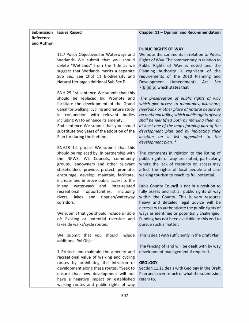
307
Submission Reference and Author
Issues Raised Chapter 11 – Opinion and Recommendation
11.7 Policy Objectives for Waterways and Wetlands We submit that you should delete “Wetlands” from the Title as we suggest that Wetlands merits a separate Sub Sec. See Chpt 11 Biodiversity and Natural Heritage additional Sub Sec D. BNH 25 1st sentence We submit that this should be replaced by: Promote and facilitate the development of the Grand Canal for walking, cycling and nature study in conjunction with relevant bodies including WI to enhance its amenity. 2nd sentence We submit that you should substitute two years of the adoption of the Plan for during the lifetime. BNH28 1st phrase We submit that this should be replaced by. In partnership with the NPWS, WI, Councils, community groups, landowners and other relevant stakeholders, provide, protect, promote, encourage, develop, maintain, facilitate, increase and improve public access to the inland waterways and inter-related recreational opportunities, including rivers, lakes and riparian/waterway corridors. We submit that you should include a Table of: Existing or potential riverside and lakeside walks/cycle routes. We submit that you should include additional Pol Objs: 1 Protect and maintain the amenity and recreational value of walking and cycling routes by prohibiting the intrusion of development along these routes. *Seek to ensure that new development will not have a negative impact on established walking routes and public rights of way
PUBLIC RIGHTS OF WAY We note the comments in relation to Public Rights of Way. The commentary in relation to Public Rights of Way is noted and the Planning Authority is cognisant of the requirements of the 2010 Planning and Development (Amendment) Act Sec 7(b)(ii)(o) which states that The preservation of public rights of way which give access to mountains, lakeshore, riverbank or other place of natural beauty or recreational utility, which public rights of way shall be identified both by marking them on at least one of the maps forming part of the development plan and by indicating their location on a list appended to the development plan. * The comments in relation to the listing of public rights of way are noted, particularly where the lack of certainty on access may affect the rights of local people and also walking tourism to reach its full potential. Laois County Council is not in a position to fully assess and list all public rights of way within the County. This is very resource heavy and detailed legal advice will be necessary to authenticate the public rights of ways as identified or potentially challenged. Funding has not been available to this end to pursue such a matter. This is dealt with sufficiently in the Draft Plan. The fencing of land will be dealt with by way development management if required. GEOLOGY Section 11.11 deals with Geology in the Draft Plan and covers much of what the submission refers to.
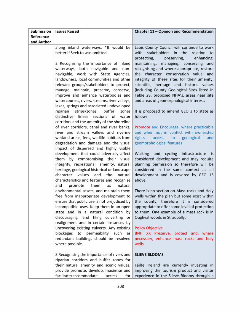
308
Submission Reference and Author
Issues Raised Chapter 11 – Opinion and Recommendation
along inland waterways. *It would be better if Seek to was omitted. 2 Recognising the importance of inland waterways, both navigable and non-navigable, work with State Agencies, landowners, local communities and other relevant groups/stakeholders to protect, manage, maintain, preserve, conserve, improve and enhance waterbodies and watercourses, rivers, streams, river valleys, lakes, springs and associated undeveloped riparian strips/zones, buffer zones distinctive linear sections of water corridors and the amenity of the shoreline of river corridors, canal and river banks, river and stream valleys and riverine wetland areas, fens, wildlife habitats from degradation and damage and the visual impact of dispersed and highly visible development that could adversely affect them by compromising their visual integrity, recreational, amenity, natural heritage, geological historical or landscape character values and the natural characteristics and features and recognise and promote them as natural environmental assets, and maintain them free from inappropriate development to ensure that public use is not prejudiced by incompatible uses. Keep them in an open state and in a natural condition by discouraging land filing culverting or realignment and in certain instances by uncovering existing culverts. Any existing blockages to permeability such as redundant buildings should be resolved where possible. 3 Recognising the importance of rivers and riparian corridors and buffer zones for their natural amenity and scenic values, provide promote, develop, maximise and facilitate/accommodate access for
Laois County Council will continue to work with stakeholders in the relation to protecting, preserving, enhancing, maintaining, managing, conserving and recognising and where appropriate, restore the character conservation value and integrity of these sites for their amenity, scientific, heritage and historic values (including County Geological Sites listed in Table 28, proposed NHA’s, areas near site and areas of geomorphological interest. It is proposed to amend GEO 3 to state as follows Promote and Encourage, where practicable and when not in conflict with ownership rights, access to geological and geomorphological features Walking and cycling infrastructure is considered development and may require planning permission so therefore will be considered in the same context as all development and is covered by GEO 15 above. There is no section on Mass rocks and Holy wells within the plan but some exist within the county, therefore it is considered appropriate to offer some level of protection to them. One example of a mass rock is in Oughval woods in Stradbally. Policy Objective BNH XX Preserve, protect and, where necessary, enhance mass rocks and holy wells SLIEVE BLOOMS Fáilte Ireland are currently investing in improving the tourism product and visitor experience in the Slieve Blooms through a

309
Submission Reference and Author
Issues Raised Chapter 11 – Opinion and Recommendation
walking, cycling tracks and other compatible recreational activities along inland waterways including rivers and canals to facilitate the creation of linear parks, in co-operation with landowners, WI, NPWS, Government Departments, community groups and other councils to develop their infrastructure, quality and amenity. 4 Identify existing accesses to lakes shores and riverbanks within the life time of the Plan. 5 Require that land adjacent to river and canal banks and lakeshores be reserved/preserved for public access as an undisturbed buffer zone between new development and river corridors and other water bodies to facilitate the creation of linear parks to accommodate walking/cycling routes and to encourage increased public access and recreational opportunities. 6 Seek to* enhance public access to inland waterways as a condition of any development granted. 7 Strengthen the network of waterways at regional level. 8 Investigate the possibility, within two years of the adoption of this Plan developing long distance walking routes along disused canals. 9 All proposed developments shall be in accordance with the Birds and Habitats Directives and other relevant EC Directives. 10 Protect and maintain the amenity and recreational value of walking and cycling routes by prohibiting the intrusion of
strategic partnership which includes Fáilte Ireland, Laois and Offaly County Councils, Coillte, and the National Parks & Wildlife Services. Investments include: • Part of the RRDF capital investment for
the National Mountain Bike Trails. • RRDF funding to develop “A Visitor
Experience Management Plan” for 2,300 hectares of the Slieve Bloom Nature Reserve by the National Parks and Wildlife Service & Fáilte Ireland.
• ORIS funding for development and implementation of signage, orientation & interpretation strategy that seeks to develop an integrated programme by all stakeholders for the Slieve Bloom area under the Slieve Bloom Development Partnership
In relation to the Slieve Blooms , it is proposed to collaborate with Offaly County Council and relevant stakeholders to develop a masterplan for their protection and sensitive development subject to the Habitats Directive and environmental standards being met. LCA 10 refers to the proposition of a SAAO in relation to the Slieve Blooms. Further landscape and ecological studies will be required to further develop this proposal. The Slieve Blooms has been designated as an area of high landscape sensitivity with policy objectives included in the Draft Plan for their protection. WETLANDS Policy Objectives In partnership with the NPWS, WI and other stakeholders facilitate public access to wetlands and support and protect the recreational and amenity potential of wetlands.
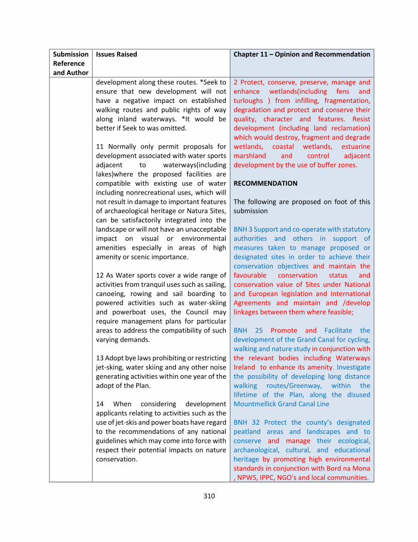
310
Submission Reference and Author
Issues Raised Chapter 11 – Opinion and Recommendation
development along these routes. *Seek to ensure that new development will not have a negative impact on established walking routes and public rights of way along inland waterways. *It would be better if Seek to was omitted. 11 Normally only permit proposals for development associated with water sports adjacent to waterways(including lakes)where the proposed facilities are compatible with existing use of water including nonrecreational uses, which will not result in damage to important features of archaeological heritage or Natura Sites, can be satisfactorily integrated into the landscape or will not have an unacceptable impact on visual or environmental amenities especially in areas of high amenity or scenic importance. 12 As Water sports cover a wide range of activities from tranquil uses such as sailing, canoeing, rowing and sail boarding to powered activities such as water-skiing and powerboat uses, the Council may require management plans for particular areas to address the compatibility of such varying demands. 13 Adopt bye laws prohibiting or restricting jet-sking, water skiing and any other noise generating activities within one year of the adopt of the Plan. 14 When considering development applicants relating to activities such as the use of jet-skis and power boats have regard to the recommendations of any national guidelines which may come into force with respect their potential impacts on nature conservation.
2 Protect, conserve, preserve, manage and enhance wetlands(including fens and turloughs ) from infilling, fragmentation, degradation and protect and conserve their quality, character and features. Resist development (including land reclamation) which would destroy, fragment and degrade wetlands, coastal wetlands, estuarine marshland and control adjacent development by the use of buffer zones. RECOMMENDATION The following are proposed on foot of this submission BNH 3 Support and co-operate with statutory authorities and others in support of measures taken to manage proposed or designated sites in order to achieve their conservation objectives and maintain the favourable conservation status and conservation value of Sites under National and European legislation and International Agreements and maintain and /develop linkages between them where feasible; BNH 25 Promote and Facilitate the development of the Grand Canal for cycling, walking and nature study in conjunction with the relevant bodies including Waterways Ireland to enhance its amenity. Investigate the possibility of developing long distance walking routes/Greenway, within the lifetime of the Plan, along the disused Mountmellick Grand Canal Line BNH 32 Protect the county’s designated peatland areas and landscapes and to conserve and manage their ecological, archaeological, cultural, and educational heritage by promoting high environmental standards in conjunction with Bord na Mona , NPWS, IPPC, NGO’s and local communities.
311
Submission Reference and Author
Issues Raised Chapter 11 – Opinion and Recommendation
15 In areas adjacent to inland waterways, lakes, canals, rivers, where planning permission is sought, the applicant must ensure that full public access to waterways is retained or conditions may be attached requiring retention of this access to facilitate creation or extension of walking/cycle routes. 16 Adopt a regional approach to the protection of watercourses in cooperation with neighbouring counties. 17 The line of development within river valleys shall be strictly controlled so as to maintain the integrity of the natural topography. The maintenance of natural river banks shall be required to be without physical or visual encroachment. 18 Potential applicants will ensure that full public access to lands along waterways which are in private ownership. 19 Protect, enhance and improve existing public rights of way and, where possible, provide additional access to inland waterways including lake shores, river banks, through the acquisition of land for public rights of way and parking and lay-by facilities, through agreement with existing landowners. 20 Reserve land adjacent to canal and river banks and other waterbodies to promote and facilitate the creation of waterside linear parks to link with existing parks and open spaces and to facilitate the provision of walking/cycling routes along canals and watercourses. 21 Promote the natural, historic and amenity value of watercourses to address
Promote and Encourage, where practicable and when not in conflict with ownership rights, access to geological and geomorphological features Policy Objective BNH XX Preserve, protect and, where necessary, enhance mass rocks and holy wells Slieve Blooms In relation to the Slieve Blooms, it is proposed to collaborate with Offaly County Council and relevant stakeholders to develop a masterplan for their protection and sensitive development subject to the Habitats Directive and environmental standards being met.

312
Submission Reference and Author
Issues Raised Chapter 11 – Opinion and Recommendation
the long term management and protection and strengthen regional links. CANALS 22 Provide public access to canal corridor, where feasible and use the potential of canal towpaths for designated walking and cycle routes, both as recreational amenities and the promotion of links with any designated walking cycling routes, existing or proposed. 23 Ensure the conservation of canal corridors and require that developments abutting the canal relate to the context of the adjacent environment and contribute to its overall amenity. 24 Ensure that development along or adjacent to the Grand Canal contributes to the creation of an open and integrated network of walking and cycling routes that integrates into the Grand Canal Way Green Route. 25 Protect, preserve, maintain, improve and enhance the national heritage, recreational and amenity value (including walking and cycling) of the Grand Canal corridor and its towpaths by ensuring that development along and adjacent to the canal protects and incorporates high value natural heritage features including watercourses, wetlands, woodlands and includes a buffer area to facilitate a fully functioning Green Infrastructure network. 26 Promote and develop the towpaths along the Grand Canal and the Barrow Line to expand recreation and continue to work closely with in co-operation with WI, NPWS and adjoining councils. 27 Develop, promote and protect the recreational potential of the River Nore.

313
Submission Reference and Author
Issues Raised Chapter 11 – Opinion and Recommendation
BNH 32 We submit that this should be replaced by: Protect designated peatland areas and landscapes to conserve and manage their character, appearance, heritage and amenity values and their ecological, archaeological, cultural and educational heritage by promoting high environmental standards in conjunction with the BnM, NPWS, Coillte, IPCC and NGOs. We submit that you should include additional Pol Objs: 1 The Council recognises the importance of raised bogland as a major natural, archaeological and amenity resource and will liaise with the relevant Government departments and NGOs to try to secure the conservation of original peatland areas. 2 Plan and prepare for the future use of large industrial cutaway bog sites when peat harvesting finishes as there is potential for the development of amenities. 3 Explore the potential for the development of and work in partnership with relevant stakeholders towards achieving a National Peatlands Park. We submit that you should include an additional DMS: Protect, conserve and manage the character, appearance, heritage and amenity values of peatland landscapes by promoting high environmental standards in conjunction with the BnM, NPWS, Coillte, IPCC and NGOs. 11.9 PUBLIC RIGHTS OF WAY We submit that this should be repositioned in Chpt 10: Infrastructure or as a separate Chpt.
314
Submission Reference and Author
Issues Raised Chapter 11 – Opinion and Recommendation
Reason: This topic has no connection with Biodiversity and Natural Heritage. 3 rd para 1 st phrase We submit that this should be replaced by: Public Rights of Way have existed over the centuries and constitute an important recreational amenity. They enable the enjoyment of high quality landscape, natural and archaeological heritage and provide links to valuable amenities such as rivers lakes, bogs, forests and places of natural beauty. 2 nd phrase We submit that this should be upgraded to a Pol Obj and merged with BNH 38. Last phrase We submit that this should be repositioned in Chpt 10 Infrastructure in 10.1.7 Pedestrian and Cyclist as proposed additional Pol Obj. We submit that you should include additional Paras: 1 A PROW or highway is a physically defined route over which the public have a right of passage even if the route is not in public ownership. It is described as “a user as of right” and confers an unrestricted right of the general public to pass and repass at all times of the day or night and at all seasons without notice to, or permission from the landowner. The most common characteristic of a PROW is that it follows a defined route which may be sub-divided amongst different branches. 2 The listing and mapping of public rights of way will preserve Public Rights of Ways for recreational purposes. 3 Section 14 of the Planning and Development Act 2000 sets out the formal process for designating rights of way in development plans. The scope of these statutory provisions is grounded on
315
Submission Reference and Author
Issues Raised Chapter 11 – Opinion and Recommendation
identification of existing routes over which PROWS are deemed to exist. The inclusion of PROW objectives for their preservation provides greater protection for such routes under development management provisions of planning legislation whilst also restricting the scope of certain exempt development. 4 The listing of public rights of way is an urgent matter as the lack of certainty on access has not only affected the rights of local people but has been the major cause of the failure of walking tourism to reach its full potential in this country. Table 11.5 Public Rights of Way We have to say that we are extremely concerned with what could be best described as a minimalist approach which might just comply with the letter of the law but surely doesn’t comply with its spirits. Apart from this, we note that all routes listed involve public roads or roads. You will be aware that under the Roads Acts public roads are public rights of way so they don’t need to be mentioned. We suggest that you should consider a rewrite of this Table. We submit that its not too late to include a small number of the many long established walking paths. We submit that you should add a Rider: This list is not an exhaustive list and the omission of a right of way from this list shall not be taken as an indication that such a right of way does not exist. Para under Table We submit that this should be deleted as it has nothing to do with public rights of way. Policy Objectives for Public Rights of Way BNH 38 We submit that this should be
316
Submission Reference and Author
Issues Raised Chapter 11 – Opinion and Recommendation
replaced by: Council recognises the importance of promoting the preservation, protection, enhancement, maintenance and improvement, for the common good, of all public rights of way particularly those giving//providing access to mountains, uplands, lakes, water corridors river banks, archaeological sites and National Monuments, geomorphological features of heritage value, and other places of natural beauty or recreational utility/activity by ensuring that development doesn’t impinge thereon indicated in Map 11.6. 39 1st phrase We submit that this should be deleted because one cannot Review existing public rights of way because there are no public rights of way listed in the Draft and that protection should be dealt with in more detail in 38. 2nd phrase We submit that this should be replaced by: In accordance with the provisions of either Sections 206 or 207 of the Planning and Development Act 2000 encourage and facilitate the creation of additional rights of way and extend existing ones for pedestrian or amenity reasons, by investigating named areas to facilitate the development of waymarked ways and looped walks, by undertaking a review/survey of green links and cycling routes and by bringing forward proposals within two years of the adoption of the Plan, either by agreement or by the use of compulsory powers, for the creation of public rights of way, particularly in areas of high amenity and recreational importance and to uplands, lakeshores, river banks, forests, heritage and scientific sites, areas of historic, archaeological and recreational importance and National Monuments, to create a meaningful network. Promote their greater use. Provide linkages from

317
Submission Reference and Author
Issues Raised Chapter 11 – Opinion and Recommendation
built up areas to the countryside and link with public rights of way in adjoining counties. 40 We submit that this should be replaced by: Development will not be permitted where a public right of way might be prejudiced, unless specific arrangements are made for suitable alternative linkages and that the developer can demonstrate that the level of amenity is maintained by: The footpath/bridleway being diverted by the minimal practical distance and the route continues to be segregated from vehicular traffic; Appropriate legal procedures have been undertaken to extinguish the existing right of way and to establish the new right of way to replace it. the diverted route is of at least equal character and convenience. We submit that you should include additional Pol Objs: 1 Identify Public Rights of Way prior to any new planting, infrastructural development of any new energy/telecommunications developments. 2 Existing Public Rights of Way and established walking routes shall be identified prior to any new forestry planting, new infrastructural, energy/telecommunications or golf course developments. 3 Identify and map, on an ongoing basis, public rights of way and incorporate them in the Plan by way of a Variation. Where appropriate links to established public rights of way in adjoining counties will be identified. 4 Designate Pilgrim Paths as public rights of way. Note We submit that as these Paths
318
Submission Reference and Author
Issues Raised Chapter 11 – Opinion and Recommendation
have been walked for many centuries their case for designation is surely irrefutable. 5 Identify mass paths and routes to holy wells, mass rocks and penal mass stations and consider designating them as public rights of way. 6 Encourage the provision, for the common good, of a network of Public Rights of Way to traditional outdoor amenities, including heritage sites and features of archaeological interest, national monuments, mountains, hills, rivers, forests, lakes, geological and geomorphic systems, water corridors, places of natural beauty and other natural amenities. 7 Prohibit development that might have a negative effect on established walking routes/public rights of way and keep them free from obstruction, particularly those at mountains, lakeshores, along inland waterways riverbanks or other places of natural beauty or recreational activity and take legal action if necessary, to prevent any attempt to close them off. 8 Look favourably on planning applications which include proposals to improve the condition and appearance of existing rights of way. 9 Where, in the interests of proper planning and development, the extinguishment of an existing right of way becomes expedient, the Council may require the provision of a suitable alternative. 10 The Council will utilise its relevant statutory powers to preserve as practicable the character of listed public rights of way for amenity purposes.
319
Submission Reference and Author
Issues Raised Chapter 11 – Opinion and Recommendation
11 Protect and promote Greenways and consider designating them as public rights of way. 12 Preserve and maintain existing public rights of way in order to link amenities We submit that you should include Policy Objectives for all important landscapes: 1 Provide and increase managed public access to interesting and attractive landscapes or to semi-natural and landscape amenity areas for recreational purposes. 2 Preserve, maintain, enhance important landscapes and protect the amenity value, visual integrity of upland areas. Discourage inappropriate development in open countryside and prohibit developments which are likely to have material adverse visual impacts, either individually or cumulatively, on the character of the uplands. Ensure that development will not materially interfere or detract from scenic uplands and that particular regard is had to potential impacts of new developments and require that proposed developments demonstrate that every effort has been made to reduce visual impacts(including excessive bulk and inappropriate siting) and that visually prominent sites have been avoided to minimise visibility from scenic routes, walking trails, public amenities, settlements and roads. Have particular regard to the potential impacts of development on sensitive upland areas and consider the difficulty of establishing and maintaining screening vegetation. 3 Preserve the status of traditionally open/unfenced landscapes including commonages and other hill land.

320
Submission Reference and Author
Issues Raised Chapter 11 – Opinion and Recommendation
4 Protect, conserve, preserve, maintain, safeguard, identify and enhance the visual integrity scenic quality, general amenity and the visual quality of areas of intrinsically important and outstanding, highly sensitive, designated, natural, unspoilt and open landscapes(named), scenic areas, areas of high amenity and the environs of archaeological or historic sites(named) from intrusive, inappropriate, injurious or unsympathetic new, or additions to, existing developments and reinforce their character and promote their distinctiveness by prohibiting development where it could unduly impinge or impact on or be detrimental to such landscapes or would be injurious to, or detract, from natural amenities or introduce incongruous landscape elements. 5 Adopt a regional approach to the protection of the landscape in cooperation with neighbouring counties. We submit that you should include an additional Sub Sec: Fencing Of Hitherto Open Land Text 1 It is a requirement of the Planning Regulations 2001 Art 9(I)(a)(x) that the fencing or enclosure of land open to or used by the public during the ten years preceding such fencing or enclosure for recreational purposes or as a means of access to any seashore, mountain or other place of natural beauty or recreational utility, requires planning permission. 2 Wire fencing constitutes visual pollution and destroys the “away from it all” feeling which makes upland areas such an attraction.

321
Submission Reference and Author
Issues Raised Chapter 11 – Opinion and Recommendation
3 There has been a large increase in the amount of new fencing in upland areas. Barbed wire has been used in most of this new fencing, which, in the absence of stiles or gates, makes access for recreational users of our countryside almost impossible. Traditional hill-sheep farming rarely required fencing, but since the introduction of AEOS, sheep-farmers must, in certain circumstances, stock-proof their land. The challenge is to ensure that such fencing will be done in a manner that will meet the requirements of AEOS without impinging on access for walkers and other recreational users. Fencing of Hitherto Open Land Policy Objective As new fencing of land open to or used by the public during the ten years preceding is not exempt development in accordance with Art 9(I)(a)(x) of the Planning and Development Regulations the following criteria will be used when considering planning applications for new fencing of hitherto open land : Fencing, particularly in upland, highly scenic or amenity areas, will not normally be permitted unless such fencing is essential to the viability of the farm. The nature of the material to be used, the height of the fence, and in the case of a wire fence the type of wire to be used will be taken into account. Stiles or gates at appropriate places will be required. Barbed-wire will not be used for the top line of wire. GEO 1 1st Phrase We submit that this should be replaced by: Recognising the importance of Geological Sites, work with stakeholders, to protect sites or features of geological or geomorphological interest or importance from inappropriate development by prohibiting development
322
Submission Reference and Author
Issues Raised Chapter 11 – Opinion and Recommendation
at, or in their vicinity, or which threaten their existence, integrity or conservation value of these sites for their amenity, scientific, heritage and historic value. Identify, protect, enhance, maintain, manage, conserve, and where appropriate, restore their character and promote their preservation (including sites that may become designated and notified ed to the Council during the lifetime of the Plan, in interest of protecting our geological heritage. GEO 2 We submit that this should be merged with 1. GEO 3 We submit that this should be replaced by: Promote, encourage, facilitate and support access and public rights of way to geological and geo-morphological features of interest in consultation with landowners(where appropriate). We submit that you should include an additional Pol Obj: 2 Co-ordinate the continuing development of strategic walking routes, trails and other countryside recreational opportunities. GEO 5 We submit that this should be replaced by: Ensure that any plan or project affecting eskers is adequately addressed with regard to their potential impact on the landscape and the environment and that applications for quarrying activity in proximity to eskers and have regard to their potential to impact on the landscape, the environment and amenity value designated status of the eskers and conserve them from inappropriate development.

323
Submission Reference and Author
Issues Raised Chapter 11 – Opinion and Recommendation
We submit that you should include additional Pol Objs: 1 Increase cycling and pedestrian access and maintain esker heritage. 2 Protect, preserve and conserve the landscape and natural heritage and geo-diversity values of esker systems from inappropriate development. We submit that you should include additional Sub Secs: A MASS ROCKS AND HOLY WELLS Policy Objective Preserve, protect and, where necessary, enhance mass rocks and holy wells B NATIONAL PARKS Text National Parks provide major recreational amenities allow access to wilderness and highly scenic areas which would otherwise might have limited access rights. Policy Objective Promote the designation of the Slieve Bloom Mountains as a National Park in collaboration/partnership with the appropriate Government Department, landowners, local communities and other stakeholders. C SPECIAL AREA AMENITY ORDER Policy Objective Actively propose the designation of the Slieve Bloom Mountains as a Special Amenity Area and seek an Order to that effect as per section 202 of the Planning and Development Act 2000(as amended) and undertake a feasibility study to report on other areas considered worthy of designation, to report within one year of the adoption of the Plan.
324
Submission Reference and Author
Issues Raised Chapter 11 – Opinion and Recommendation
D WETLANDS Policy Objectives In partnership with the NPWS, WI and other stakeholders facilitate public access to wetlands and support and protect the recreational and amenity potential of wetlands. 2 Protect, conserve, preserve, manage and enhance wetlands(including fens and turloughs ) from infilling, fragmentation, degradation and protect and conserve their quality, character and features. Resist development (including land reclamation) which would destroy, fragment and degrade wetlands, coastal wetlands, estuarine marshland and control adjacent development by the use of buffer zones. E WORLD HERITAGE SITES Policy Objective for World Heritage Sites Support and promote the candidature(named site) for inclusion in the “Tentative List”
LS-C9-DCDP-135 An Taisce
Biodiversity and Natural Heritage
We are pleased to see the suite of policies aimed at biodiversity protection and enhancement, including for Laois’s eight Special Areas of Conservation, two Special Protection Areas, and 30 Natural Heritage Areas (existing and proposed).
However, the implementation and enforcement of these policies must be upheld in the planning process at all levels.
EU Biodiversity Strategy
Recommend 14 points in the EU Biodiversity Strategy 2030 be included:
1.Legally-binding EU nature restoration targets will be proposed in 2021, subject to an environmental impact
The submission is noted in relation to Biodiversity and Natural Heritage. The EU Biodiversity Strategy has informed the shape of the policy objectives included and it is not intended to restate the 14 points of the EU biodiversity Strategy in the Draft Plan A paragraph highlighting this strategy will be included in Section 11.2 as follows The EU biodiversity Strategy 2030 The EU’s biodiversity strategy for 2030 is a comprehensive, ambitious and long-term plan to protect nature and reverse the degradation of ecosystems. The strategy aims to put Europe's biodiversity on a path to recovery by 2030, and contains specific
325
Submission Reference and Author
Issues Raised Chapter 11 – Opinion and Recommendation
assessment. By 2030, significant areas of degraded and carbon-rich ecosystems are restored; habitats and species show no deterioration in conservation trends and status; and at least 30% reach favourable conservation status or at least show a positive trend.
2.The decline in pollinators is reversed.
3.The risk and use of chemical pesticides is reduced by 50% and the use of more hazardous pesticides is reduced by 50%.
4.At least 10% of agricultural area is under high-diversity landscape features.
5.At least 25% of agricultural land is under organic farming management, and the uptake of agro-ecological practices is significantly increased.
6.Three billion new trees are planted in the EU, in full respect of ecological principles.
7.Significant progress has been made in the remediation of contaminated soil sites.
8.At least 25,000 km of free-flowing rivers are restored.
9.There is a 50% reduction in the number of Red List species threatened by invasive alien species.
10.The losses of nutrients from fertilisers are reduced by 50%, resulting in the reduction of the use of fertilisers by at least 20%.
11.Cities with at least 20,000 inhabitants have an ambitious Urban Greening Plan.
12.No chemical pesticides are used in sensitive areas such as EU urban green areas.
actions and commitments in relation to pollinators, water quality, nature restoration targets, fishing , etc.
Slieve Blooms In relation to the Slieve Blooms , it is proposed to collaborate with Offaly County Council and relevant stakeholders to develop a masterplan for their protection and sensitive development subject to the Habitats Directive and environmental standards being met. LCA 10 refers to the proposition of a SAAO in relation to the Slieve Blooms. Further landscape and ecological studies will be required to further develop this proposal. The Slieve Blooms has been designated as an area of high landscape sensitivity with policy objectives included in the Draft Plan for their protection.
The Heath Much work has been done on the archaeological landscape of the heath and recording of archaeology during the course of infrastructural projects. The map below indicates the current designations in relation to the site In relation to the Natural Heritage Area – this omission will be rectified and Table 11.3 will be amended to include as follows 000881 The Great Heath of Portlaoise This site is one of 630 proposed NHAs (pNHAs), which were published on a non-statutory basis in 1995, but have not since been statutorily proposed or designated. These sites are of significance for wildlife and habitats. Some of the pNHAs are tiny, such as a roosting place for rare bats. Others are
326
Submission Reference and Author
Issues Raised Chapter 11 – Opinion and Recommendation
13.The negative impacts on sensitive species and habitats, including on the seabed through fishing and extraction activities, are substantially reduced to achieve good environmental status.
14.The by-catch of species is eliminated or reduced to a level that allows species recovery and conservation.
6.2 The Slieve Blooms
An Taisce recommends that the new CDP provide for the initiation of a major area-based partnership with County Offaly for nature restoration across the Slieve Blooms based on the EU 14-point key commitments under the EU Biodiversity Strategy 2030
6.3 The Heath
The new CDP should recognise the special ecological and landscape significance of the Heath as an open grassland area and specifically provide for appropriate land management.
6.4 Urban Greening
Reference to Point 11 of the aforementioned EU Biodiversity Strategy that: “Cities with at least 20,000 inhabitants have an ambitious Urban Greening Plan.” With regard to greening urban and peri-urban areas, reference to Section 2.2.8 of the Biodiversity Strategy is also given
The new Development Plan should provide for the immediate development of an Urban Greening Plan for Portlaoise by the end of 2021, as well as specific timeline and targeted policies for achieving the objectives of the Urban Greening Plan during the plan period.
This could be integrated into the green
large - a woodland or a lake, for example. The pNHAs cover approximately 65,000ha and designation will proceed on a phased basis over the coming years. It is proposed to work with Laois Heritage Office and relevant stakeholders such as the Office of Public Works (OPW) and local stakeholders to develop a Landscape Character Assessment in relation to the Heath and its attributes during the plan period. It is anticipated that this could be used to inform any policy objectives and designations going forward.
The preparation and policing of Bylaws in relation to scramblers bikes is outside the scope of this Draft Plan.
RECOMMENDATION It is recommended that the following policy objective be included in the Draft Plan BNH XX - Work with relevant stakeholders such as the Office of Public Works (OPW) and local stakeholders to develop a Landscape Character Assessment in relation to the Heath and its attributes during the plan period. And that Table 11.3 be amended to include
000881 The Great Heath of Portlaoise
6.4 Urban Greening
Under Section 11.5.2 of the Draft Plan there are a number of policy objectives for the delivery of a Green Infrastructure Strategy for Co Laois.
Green Infrastructure will be further considered in the Local Area Plans for Portlaoise, Portarlington, Graiguecullen and Mountmellick.
327
Submission Reference and Author
Issues Raised Chapter 11 – Opinion and Recommendation
infrastructure section of Chapter 11
RECOMMENDATION It is recommended that the following text and policy objective be included in the Draft Plan BNH XX - Work with relevant stakeholders such as the Office of Public Works (OPW) and local stakeholders to develop a Landscape Character Assessment in relation to the Heath and its attributes during the plan period. And that Table 11.3 be amended to include
000881 The Great Heath of Portlaoise
LS-C9-DCDP-138 William Aird
Trees Trees should be protected by tree preservation orders in relation to their historical and environmental significance in the County
OPINION Trees play a crucial role in capturing pollutants and particulates from the air. Street trees can significantly improve air quality, which can in turn provide health benefits, if planned, planted and maintained carefully. Carbon storage relates to the carbon currently held in trees’ tissue (roots, stem, and branches), whereas carbon sequestration is the estimated amount of carbon removed annually by trees. Trees can help mitigate climate change by sequestering atmospheric carbon as part of the carbon cycle. Trees and woodlands make a positive contribution to the county’s landscape biodiversity and townscapes providing wildlife habitats, soften hard urban edges and provide scale and backdrops to streets and buildings. Trees, either individually or in groups also make an important contribution to the landscape of many of the country house demesnes throughout the county. In urban settings trees or groups of trees can contribute significantly to the local landscape or townscape and to the successful integration of new buildings into the landscape. The planting or retention of
328
Submission Reference and Author
Issues Raised Chapter 11 – Opinion and Recommendation
mature trees can contribute to amenity and more attractive developments as well as providing important wildlife habitats. The retention of trees should be considered at the design stage of any development. They also filter out noise, dust and pollutants and prevent flooding by retaining moisture. A number of important tree groups have been identified in Map 11.5 and will be considered for Tree Preservation Orders (TPOs) during the Plan period. Further assessment of important trees and groups of trees will also be considered during Local Area Plan reviews. The following policy relates BNH 17 Undertake a study within the lifetime of the Plan and for all Local Area Plans to document and map significant trees and groups of trees that require preservation and prepare Tree Preservation Orders for individual trees, groups of trees or woodland areas where expedient and in the interests of visual amenity, biodiversity and the environment. RECOMMENDATION It is proposed to change as follows BNH 17 Undertake a study within the lifetime of the Plan and for all Local Area Plans to document and map significant trees and groups of trees that require preservation and prepare Tree Preservation Orders for individual trees, groups of trees or woodland areas where expedient and in the interests of visual amenity, biodiversity and the environment.

329
Submission Reference and Author
Issues Raised Chapter 11 – Opinion and Recommendation
LS-C9-DCDP-147 Jackie Hyland
The submission relates to the Heath and adjoining townlands, history, archaeology and ecology.
A detailed narrative is included to show the intimate relationship between the Heath and the adjoining townlands.
It is disappointing that the only area of lowland acid grassland in the country does not merit a mention. Despite being listed as site 000881 in the PNHAs for the county, it is dropped on the list published in the Draft County Development Plan. This has the effect of removing the limited legal protection afforded the area.
A site with a few, unique lowland grass collection, and some rare fungi, its designation as a PHNA should be restored.
An attempt to address problem of scramble bikes and quads was undertaken in 2006/7 by way of bye-laws, however the issue fell down between the OPW and Laois County Council over the issue of policing the bye-laws. This should be revived.
As regards to archaeology of the Heath, it should be made mandatory that archaeological investigation be carried out in the unclosed Heath, before any works involving soil disturbance.
Perhaps finance could be obtained to fund Lidar or other such ground penetration investigation.
OPINION The submission is noted in relation to the suggested listing of the entire Heath as a number of designations in particular • a Scenic View and Prospect under 11.10.1
of the draft Plan • Recognise the importance of the Heath
from a geological and land sensitivity perspective, distinctive from its surrounds, designate it a landscape of unique sensitivity under 11.10 of the draft Plan, and a site of geological importance under 11.11 of the draft Plan.
• a site of archaeological importance under 12.4 of the draft Plan.
Much work has been done on the archaeological landscape of the heath and recording of archaeology during the course of infrastructural projects. The map below indicates the current designations in relation to the site In relation to the Natural Heritage Area – this omission will be rectified and Table 11.3 will be amended to include as follows 000881 The Great Heath of Portlaoise This site is one of 630 proposed NHAs (pNHAs), which were published on a non-statutory basis in 1995, but have not since been statutorily proposed or designated. These sites are of significance for wildlife and habitats. Some of the pNHAs are tiny, such as a roosting place for rare bats. Others are large - a woodland or a lake, for example. The pNHAs cover approximately 65,000ha and designation will proceed on a phased basis over the coming years. Prior to statutory designation, pNHAs are subject to limited protection, in the form of

330
Submission Reference and Author
Issues Raised Chapter 11 – Opinion and Recommendation
• Agri-environmental farm planning
schemes such as Rural Environment Protection Scheme (REPS 3 and 4) and Agri Environmental Options Scheme (AEOS) continue to support the objective of maintaining and enhancing the conservation status of pNHAs. The farm plans operate for a period of 5 years. REPS 4 plans will continue to operate until 2014.
• Forest Service requirement for NPWS approval before they will pay afforestation grants on pNHA lands
• Recognition of the ecological value of pNHAs by Planning and Licencing Authorities.
Designation of an SAC is not within the remit of the Planning Authority as the legal basis on which SACs are selected and designated is the EU Habitats Directive, transposed into Irish law by the European Communities (Birds and Natural Habitats) Regulations 2011 (S.I. No. 477 of 2011), as amended. It is proposed to work with Laois Heritage Office and relevant stakeholders such as the Office of Public Works (OPW) and local stakeholders to develop a Landscape Character Assessment in relation to the Heath and its attributes during the plan period. It is anticipated that this could be used to inform any policy objectives and designations going forward.
The preparation and policing of Bylaws in relation to scramblers bikes is outside the scope of this Draft Plan.
RECOMMENDATION It is recommended that the following policy objective be included in the Draft Plan
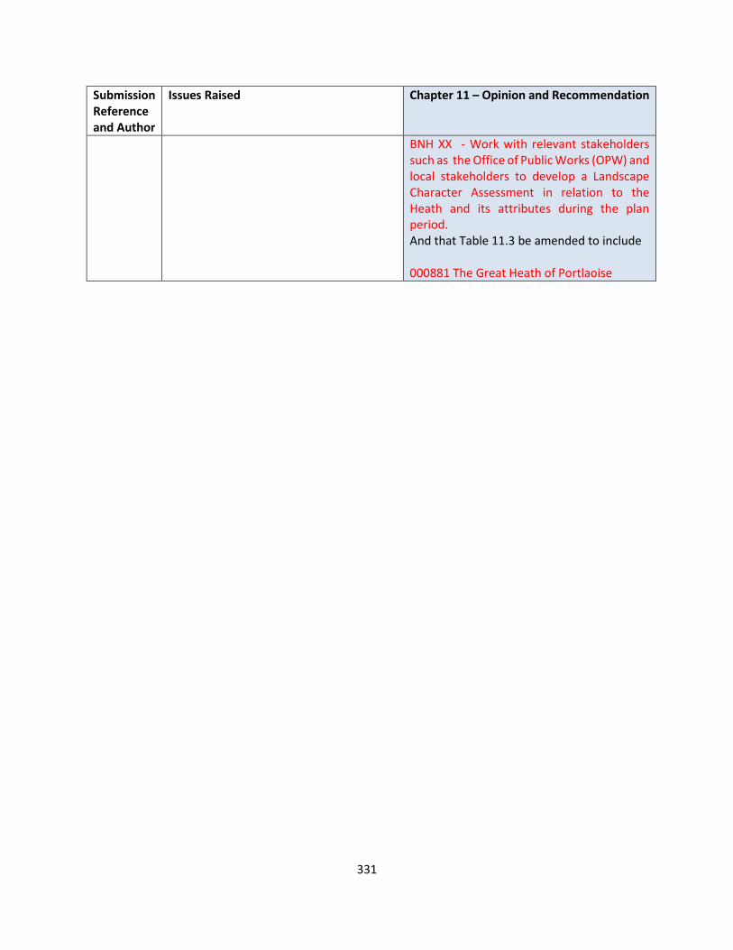
331
Submission Reference and Author
Issues Raised Chapter 11 – Opinion and Recommendation
BNH XX - Work with relevant stakeholders such as the Office of Public Works (OPW) and local stakeholders to develop a Landscape Character Assessment in relation to the Heath and its attributes during the plan period. And that Table 11.3 be amended to include 000881 The Great Heath of Portlaoise

332
CHAPTER 12 CULTURAL AND BUILT HERITAGE
Submission Reference and Author
Issues Raised Chapter 12 – Opinion and Recommendation
LS-C9-DCDP-106 Laois Ogra Fianna Fail
Our council needs to become more proactive on the issue of protecting our heritage and using the full suite of tools it has available to it in the protection of our national heritage including compulsory purchase followed by remedial action and resale. The restoration of Ballyfin house and its competing on a global stage are also an indicator of the international interest that exists in our locality when properly cultivated and supported with cooperation between the authorities and enterprise. As an addendum to the countywide list of protected structures the heritage officer should develop a strategic plan for each of the national monuments judged as being in a vulnerable state with appropriate action taken annually based on the state of deterioration.
OPINION The Council notes the submission in relation to the protection of our heritage and using the enforcement powers to safeguard it. Policy objectives within the Draft Plan include PS 1 – PS 10 RECOMMENDATION No change to the Draft Plan
LS-C9-DCDP-108 Laois Heritage Society
Laois Heritage Society would like to see the provisioning for a County Museum based in Portlaoise as part of the Plan. This would be of great benefit for the County and would help to attract tourism into the County as well as offer its people the opportunity to house and celebrate their Culture and Heritage.
OPINION It is currently an objective of the Laois County Development Plan 2017 -2023 to work with stakeholders including the OPW, The Heritage Council , the Arts Council , local communities and businesses to support the development of heritage and cultural tourism in County Laois. The continued development of the Cultural Quarter within the Town Centre of Portlaoise as envisaged in the Portlaoise 2040 - A Strategy for a Better Town Centre document places the celebration of its heritage at its core and the Council will make every effort to further enhance this through supporting events and seeking opportunities to work with stakeholders to develop and/or expand existing facilities to provide heritage related interpretation.

333
Submission Reference and Author
Issues Raised Chapter 12 – Opinion and Recommendation
It is proposed to include a policy objective that would further support this within the Draft Plan CH XXX work with stakeholders including the OPW, The Heritage Council , the Arts Council , local communities and businesses to support the development of heritage and cultural tourism in County Laois. CH XX To implement the action in relation to the development of a Cultural Quarter within the Town Centre of Portlaoise as envisaged in the “Portlaoise 2040 - A Strategy for a Better Town Centre” which places the celebration of its heritage at its core through the provision or expansion of existing facilities to provide heritage related interpretation and archive. RECOMMENDATION It is proposed to include a policy objective that would further support this within the Draft Plan CH XXX work with stakeholders including the OPW, The Heritage Council , the Arts Council , local communities and businesses to support the development of heritage and cultural tourism in County Laois. CH XX To implement the action in relation to the development of a Cultural Quarter within the Town Centre of Portlaoise as envisaged in the “Portlaoise 2040 - A Strategy for a Better Town Centre” which places the celebration of its heritage at its core through the provision or expansion of existing facilities to provide heritage related interpretation and archive.
LS-C9-DCDP-122
Proposed new policies, to be inserted in Section 12.4:
OPINION Vernacular architecture is very important in the context of our built heritage and
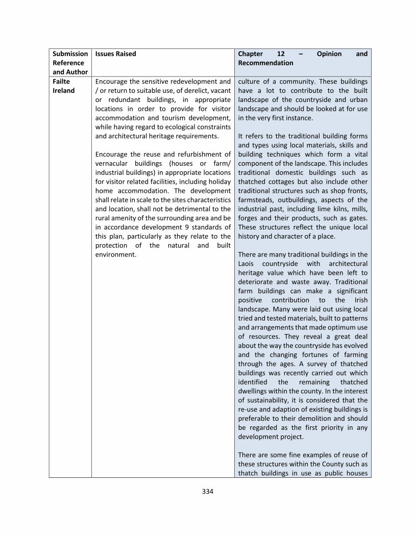
334
Submission Reference and Author
Issues Raised Chapter 12 – Opinion and Recommendation
Failte Ireland
Encourage the sensitive redevelopment and / or return to suitable use, of derelict, vacant or redundant buildings, in appropriate locations in order to provide for visitor accommodation and tourism development, while having regard to ecological constraints and architectural heritage requirements. Encourage the reuse and refurbishment of vernacular buildings (houses or farm/ industrial buildings) in appropriate locations for visitor related facilities, including holiday home accommodation. The development shall relate in scale to the sites characteristics and location, shall not be detrimental to the rural amenity of the surrounding area and be in accordance development 9 standards of this plan, particularly as they relate to the protection of the natural and built environment.
culture of a community. These buildings have a lot to contribute to the built landscape of the countryside and urban landscape and should be looked at for use in the very first instance. It refers to the traditional building forms and types using local materials, skills and building techniques which form a vital component of the landscape. This includes traditional domestic buildings such as thatched cottages but also include other traditional structures such as shop fronts, farmsteads, outbuildings, aspects of the industrial past, including lime kilns, mills, forges and their products, such as gates. These structures reflect the unique local history and character of a place. There are many traditional buildings in the Laois countryside with architectural heritage value which have been left to deteriorate and waste away. Traditional farm buildings can make a significant positive contribution to the Irish landscape. Many were laid out using local tried and tested materials, built to patterns and arrangements that made optimum use of resources. They reveal a great deal about the way the countryside has evolved and the changing fortunes of farming through the ages. A survey of thatched buildings was recently carried out which identified the remaining thatched dwellings within the county. In the interest of sustainability, it is considered that the re-use and adaption of existing buildings is preferable to their demolition and should be regarded as the first priority in any development project. There are some fine examples of reuse of these structures within the County such as thatch buildings in use as public houses
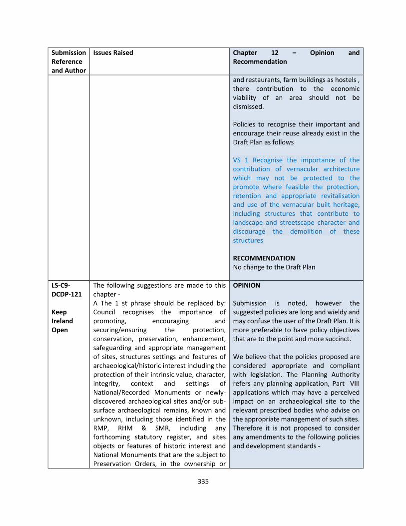
335
Submission Reference and Author
Issues Raised Chapter 12 – Opinion and Recommendation
and restaurants, farm buildings as hostels , there contribution to the economic viability of an area should not be dismissed. Policies to recognise their important and encourage their reuse already exist in the Draft Plan as follows VS 1 Recognise the importance of the contribution of vernacular architecture which may not be protected to the promote where feasible the protection, retention and appropriate revitalisation and use of the vernacular built heritage, including structures that contribute to landscape and streetscape character and discourage the demolition of these structures RECOMMENDATION No change to the Draft Plan
LS-C9-DCDP-121 Keep Ireland Open
The following suggestions are made to this chapter - A The 1 st phrase should be replaced by: Council recognises the importance of promoting, encouraging and securing/ensuring the protection, conservation, preservation, enhancement, safeguarding and appropriate management of sites, structures settings and features of archaeological/historic interest including the protection of their intrinsic value, character, integrity, context and settings of National/Recorded Monuments or newly-discovered archaeological sites and/or sub-surface archaeological remains, known and unknown, including those identified in the RMP, RHM & SMR, including any forthcoming statutory register, and sites objects or features of historic interest and National Monuments that are the subject to Preservation Orders, in the ownership or
OPINION Submission is noted, however the suggested policies are long and wieldy and may confuse the user of the Draft Plan. It is more preferable to have policy objectives that are to the point and more succinct. We believe that the policies proposed are considered appropriate and compliant with legislation. The Planning Authority refers any planning application, Part VIII applications which may have a perceived impact on an archaeological site to the relevant prescribed bodies who advise on the appropriate management of such sites. Therefore it is not proposed to consider any amendments to the following policies and development standards -
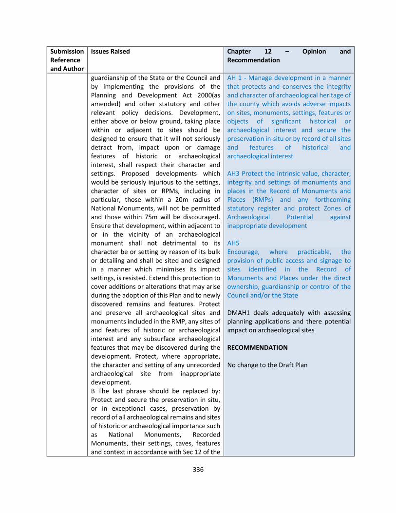
336
Submission Reference and Author
Issues Raised Chapter 12 – Opinion and Recommendation
guardianship of the State or the Council and by implementing the provisions of the Planning and Development Act 2000(as amended) and other statutory and other relevant policy decisions. Development, either above or below ground, taking place within or adjacent to sites should be designed to ensure that it will not seriously detract from, impact upon or damage features of historic or archaeological interest, shall respect their character and settings. Proposed developments which would be seriously injurious to the settings, character of sites or RPMs, including in particular, those within a 20m radius of National Monuments, will not be permitted and those within 75m will be discouraged. Ensure that development, within adjacent to or in the vicinity of an archaeological monument shall not detrimental to its character be or setting by reason of its bulk or detailing and shall be sited and designed in a manner which minimises its impact settings, is resisted. Extend this protection to cover additions or alterations that may arise during the adoption of this Plan and to newly discovered remains and features. Protect and preserve all archaeological sites and monuments included in the RMP, any sites of and features of historic or archaeological interest and any subsurface archaeological features that may be discovered during the development. Protect, where appropriate, the character and setting of any unrecorded archaeological site from inappropriate development. B The last phrase should be replaced by: Protect and secure the preservation in situ, or in exceptional cases, preservation by record of all archaeological remains and sites of historic or archaeological importance such as National Monuments, Recorded Monuments, their settings, caves, features and context in accordance with Sec 12 of the
AH 1 - Manage development in a manner that protects and conserves the integrity and character of archaeological heritage of the county which avoids adverse impacts on sites, monuments, settings, features or objects of significant historical or archaeological interest and secure the preservation in-situ or by record of all sites and features of historical and archaeological interest AH3 Protect the intrinsic value, character, integrity and settings of monuments and places in the Record of Monuments and Places (RMPs) and any forthcoming statutory register and protect Zones of Archaeological Potential against inappropriate development AH5 Encourage, where practicable, the provision of public access and signage to sites identified in the Record of Monuments and Places under the direct ownership, guardianship or control of the Council and/or the State DMAH1 deals adequately with assessing planning applications and there potential impact on archaeological sites RECOMMENDATION No change to the Draft Plan
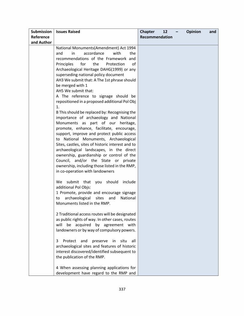
337
Submission Reference and Author
Issues Raised Chapter 12 – Opinion and Recommendation
National Monuments(Amendment) Act 1994 and in accordance with the recommendations of the Framework and Principles for the Protection of Archaeological Heritage DAHG(1999) or any superseding national policy document AH3 We submit that: A The 1st phrase should be merged with 1 AH5 We submit that: A The reference to signage should be repositioned in a proposed additional Pol Obj 1. B This should be replaced by: Recognising the importance of archaeology and National Monuments as part of our heritage, promote, enhance, facilitate, encourage, support, improve and protect public access to National Monuments, Archaeological Sites, castles, sites of historic interest and to archaeological landscapes, in the direct ownership, guardianship or control of the Council, and/or the State or private ownership, including those listed in the RMP, in co-operation with landowners We submit that you should include additional Pol Objs: 1 Promote, provide and encourage signage to archaeological sites and National Monuments listed in the RMP. 2 Traditional access routes will be designated as public rights of way. In other cases, routes will be acquired by agreement with landowners or by way of compulsory powers. 3 Protect and preserve in situ all archaeological sites and features of historic interest discovered/identified subsequent to the publication of the RMP. 4 When assessing planning applications for development have regard to the RMP and

338
Submission Reference and Author
Issues Raised Chapter 12 – Opinion and Recommendation
archaeological sites identified since the publication of the RPM.
LS-C9-DCDP-135 AN TAISCE An Taisce
The CDP should ensure the effective promotion of the Architectural Heritage provisions of Planning and Development Act 2000 (as amended) and therefore the protection of Laois’s built heritage, including Architectural Conservation Areas (ACAs) and Protected Structures.
Amend to include policies for monitoring buildings at risk and using the provision of Section 59 of the Planning Act to serve notices of endangerment to negligent property owners
OPINION Comprehensive and systematic legislative provisions for the protection of architectural heritage were introduced by the Planning and Development Act, 2000. It is a mandatory requirement for the Development Plan to include a Record of Protected Structures (RPS) and also provide a number of objectives in relation to the protection of archaeological heritage, structures and areas of special interest, the preservation of the character of the landscape, views and prospects. RECOMMENDATION Protect and conserve buildings, structures and sites contained in the Record of Protected Structures in accordance with ‘Architectural Heritage Protection Guidelines for Planning Authorities’ 2004 and ensure the effective promotion of the Architectural Heritage provisions of Planning and Development Act 2000 (as amended) and therefore the protection of Laois’s built heritage, including Architectural Conservation Areas (ACAs) and Protected Structures.
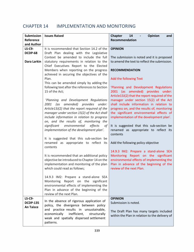
339
CHAPTER 14 IMPLEMENTATION AND MONITORING
Submission Reference and Author
Issues Raised Chapter 14 - Opinion and Recommendation
LS-C9-DCDP-68 Dara Larkin
1. It is recommended that Section 14.2 of the Draft Plan dealing with the Legislative Context be amended to include the full statutory requirements in relation to the Chief Executives Report to the Elected Members when reporting on the progress achieved in securing the objectives of the Plan. This can be amended simply by adding the following text after the references to Section 15 of the Act; ‘Planning and Development Regulations 2001 (as amended) provides under: Article13J(2) that the report required of the manager under section 15(2) of the Act shall include information in relation to progress on, and the results of, monitoring the significant environmental effects of implementation of the development plan’. It is suggested that this sub-section be renamed as appropriate to reflect its contents It is recommended that an additional policy objective be introduced to Chapter 14 on the implementation and monitoring of the plan which could read as follows; 14.9.3 IM2: Prepare a stand-alone SEA Monitoring Report on the significant environmental effects of implementing the Plan in advance of the beginning of the review of the next Plan.
OPINION The submission is noted and it is proposed to amend the text to reflect the submission. RECOMMENDATION Add the following Text ‘Planning and Development Regulations 2001 (as amended) provides under: Article13J(2) that the report required of the manager under section 15(2) of the Act shall include information in relation to progress on, and the results of, monitoring the significant environmental effects of implementation of the development plan’. It is suggested that this sub-section be renamed as appropriate to reflect its contents Add the following policy objective 14.9.3 IM2: Prepare a stand-alone SEA Monitoring Report on the significant environmental effects of implementing the Plan in advance of the beginning of the review of the next Plan.
LS-C9-DCDP-135 An Taisce
In the absence of rigorous application of policy, the divergence between policy and practice results in unsustainable, economically inefficient, structurally weak and spatially dispersed settlement patterns.
OPINION Submission is noted. The Draft Plan has many targets included within the Plan in relation to the delivery of

340
Submission Reference and Author
Issues Raised Chapter 14 - Opinion and Recommendation
Therefore, it is of paramount importance that the new CDP moves beyond objectives within the text and towards robust targets, actions and measures to achieve the tangible implementation of the plan’s objectives and policies.
The success or otherwise of the forthcoming CDP can only be judged against quantifiable and implementable criteria which are subject to ongoing monitoring. This will be fundamental in creating a sustainable and healthy society.
• Housing
• Roads Infrastructure
• Rail upgrades and improvements
• Water and wastewater
• Retail capacity Much of the plan is based on policy objectives that will support the delivery of the Core Strategy, which in part will be delivered by external stakeholders and subject to funding by external agencies, a report on implementation will be prepared within 2 years of the adoption of the plan. RECOMMENDATION No changes to the Draft Plan

341
2.6 VOLUME 2 SETTLEMENT PLANS
KEY TOWNS Portlaoise
Submission Reference and Author
Issues Raised Portlaoise – Opinion and Recommendation
LS-C9-DCDP-3 Brian Rusk
I suggest a Dog Park to be created on the recently bought lands from Tyrrells. If a couple of the acres were used for this there would be numerous benefits. With, perhaps, a circumference path, the middle area could be dedicated to either meadow or wildflowers, or both, thereby helping endangered pollinators, and with additional hedging and large shrubs, shelter for birdlife.
OPINION The lands at Tyrrells on the Stradbally Road are currently undergoing the preparation of a masterplan for the overall landbank. The land is zoned for housing, community and recreation and open space provision. The suggestion of a Dog park, circumference park and landscaping for biodiversity will be considered in the context of the masterplan RECOMMENDATION No change to the Draft Plan
LS-C9-DCDP-64 Laois Africa Society
The Laois Africa Support Group wish to submit a proposal for a community centre in the town of Portlaoise. The group recognise the need for a centre, it will carter for young and old, people from all backgrounds. Portlaoise has grown rapidly over the last number of years and the residence of the town should have a focal point where services are freely available.
OPINION The Authority welcomes the submission from the Laois Africa Support group and acknowledges the request for a community centre. Currently there is sufficient lands available for community- institutional – educational land zoned within the Draft Plan for Portlaoise. Any proposals for community centres can be examined in the context of both this land use zone and residential land use zone as per the Matrix in Section 13 of the Written Statement. Any proposals the group may have for a community centre should be brought to the attention of the planning authority for pre planning advice and guidance.
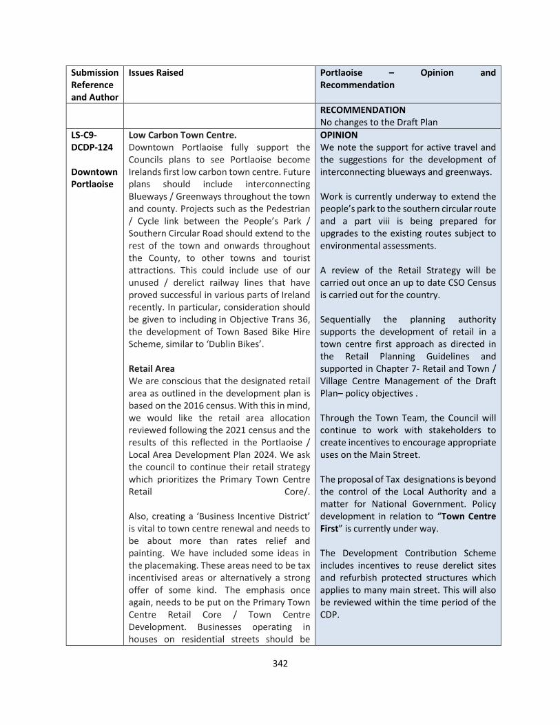
342
Submission Reference and Author
Issues Raised Portlaoise – Opinion and Recommendation
RECOMMENDATION No changes to the Draft Plan
LS-C9-DCDP-124 Downtown Portlaoise
• Low Carbon Town Centre. Downtown Portlaoise fully support the Councils plans to see Portlaoise become Irelands first low carbon town centre. Future plans should include interconnecting Blueways / Greenways throughout the town and county. Projects such as the Pedestrian / Cycle link between the People’s Park / Southern Circular Road should extend to the rest of the town and onwards throughout the County, to other towns and tourist attractions. This could include use of our unused / derelict railway lines that have proved successful in various parts of Ireland recently. In particular, consideration should be given to including in Objective Trans 36, the development of Town Based Bike Hire Scheme, similar to ‘Dublin Bikes’.
• • Retail Area
We are conscious that the designated retail area as outlined in the development plan is based on the 2016 census. With this in mind, we would like the retail area allocation reviewed following the 2021 census and the results of this reflected in the Portlaoise / Local Area Development Plan 2024. We ask the council to continue their retail strategy which prioritizes the Primary Town Centre Retail Core/. Also, creating a ‘Business Incentive District’ is vital to town centre renewal and needs to be about more than rates relief and painting. We have included some ideas in the placemaking. These areas need to be tax incentivised areas or alternatively a strong offer of some kind. The emphasis once again, needs to be put on the Primary Town Centre Retail Core / Town Centre Development. Businesses operating in houses on residential streets should be
OPINION We note the support for active travel and the suggestions for the development of interconnecting blueways and greenways. Work is currently underway to extend the people’s park to the southern circular route and a part viii is being prepared for upgrades to the existing routes subject to environmental assessments. A review of the Retail Strategy will be carried out once an up to date CSO Census is carried out for the country. Sequentially the planning authority supports the development of retail in a town centre first approach as directed in the Retail Planning Guidelines and supported in Chapter 7- Retail and Town / Village Centre Management of the Draft Plan– policy objectives . Through the Town Team, the Council will continue to work with stakeholders to create incentives to encourage appropriate uses on the Main Street. The proposal of Tax designations is beyond the control of the Local Authority and a matter for National Government. Policy development in relation to “Town Centre First” is currently under way. The Development Contribution Scheme includes incentives to reuse derelict sites and refurbish protected structures which applies to many main street. This will also be reviewed within the time period of the CDP.
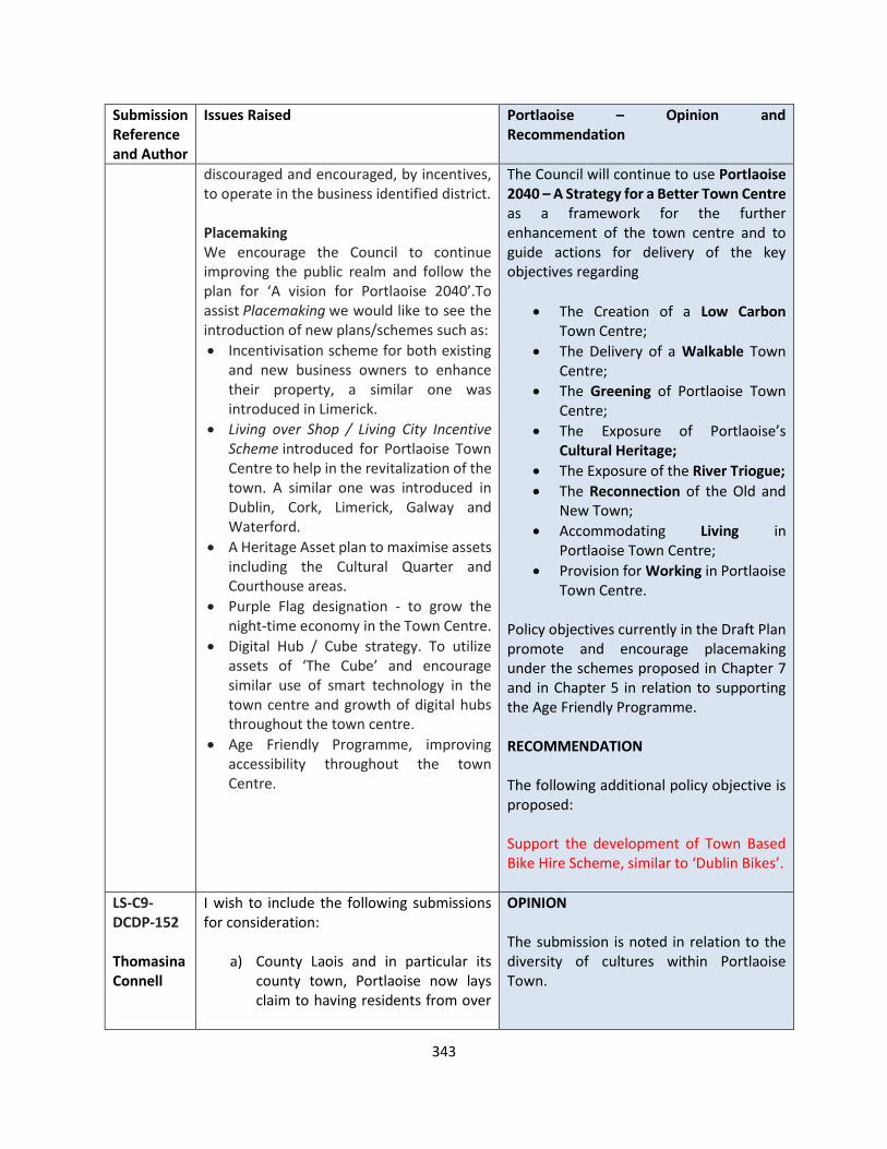
343
Submission Reference and Author
Issues Raised Portlaoise – Opinion and Recommendation
discouraged and encouraged, by incentives, to operate in the business identified district.
• • Placemaking
We encourage the Council to continue improving the public realm and follow the plan for ‘A vision for Portlaoise 2040’.To assist Placemaking we would like to see the introduction of new plans/schemes such as:
• Incentivisation scheme for both existing and new business owners to enhance their property, a similar one was introduced in Limerick.
• Living over Shop / Living City Incentive Scheme introduced for Portlaoise Town Centre to help in the revitalization of the town. A similar one was introduced in Dublin, Cork, Limerick, Galway and Waterford.
• A Heritage Asset plan to maximise assets including the Cultural Quarter and Courthouse areas.
• Purple Flag designation - to grow the night-time economy in the Town Centre.
• Digital Hub / Cube strategy. To utilize assets of ‘The Cube’ and encourage similar use of smart technology in the town centre and growth of digital hubs throughout the town centre.
• Age Friendly Programme, improving accessibility throughout the town Centre.
The Council will continue to use Portlaoise 2040 – A Strategy for a Better Town Centre as a framework for the further enhancement of the town centre and to guide actions for delivery of the key objectives regarding
• The Creation of a Low Carbon Town Centre;
• The Delivery of a Walkable Town Centre;
• The Greening of Portlaoise Town Centre;
• The Exposure of Portlaoise’s Cultural Heritage;
• The Exposure of the River Triogue;
• The Reconnection of the Old and New Town;
• Accommodating Living in Portlaoise Town Centre;
• Provision for Working in Portlaoise Town Centre.
Policy objectives currently in the Draft Plan promote and encourage placemaking under the schemes proposed in Chapter 7 and in Chapter 5 in relation to supporting the Age Friendly Programme. RECOMMENDATION The following additional policy objective is proposed: Support the development of Town Based Bike Hire Scheme, similar to ‘Dublin Bikes’.
LS-C9-DCDP-152 Thomasina Connell
I wish to include the following submissions for consideration:
a) County Laois and in particular its county town, Portlaoise now lays claim to having residents from over
OPINION The submission is noted in relation to the diversity of cultures within Portlaoise Town.

344
Submission Reference and Author
Issues Raised Portlaoise – Opinion and Recommendation
90 different countries, speaking 50 different languages.
b) Within the parameters of the County Development Plan that Laois County Council needs to set out its vision to integrate new cultures, not only in our county town but also in our smaller towns and villages which should start initially in the forum of both education and sport.
c) Networks must be created via our schools and in addition, training programmes for our new communities could be offered in our schools for both children and adults to facilitate improving language classes and workshops around shared culture. Sport should also be a conduit for such engagement and newcomers to our community should be made aware of sporting opportunities and the wide range of sporting activities we have in County Laois to ensure maximum participation.
d) It would appear that the availability of housing choices comprising apartments and larger, executive type houses are in short supply in County Laois., Consideration be given to inclusion in the development plan, lowe density housing developments comprising of larger detached homes, as an alternative to more traditional 3 bed semi detached developments.
e) The Council should create a framework for developers to offer a wider range of house types within the one development to provide more choice. If housing were available in the outskirts of our urban area, it would have a knock on effect on the number of one-off
Chapter 5 Quality of Life and Sustainable Communities deals with this issue and it will be further developed in the next Local Economic and Community Plan (LECP) which will commence review in 2021. 2030 Agenda for Sustainable Development was adopted by all United Nations Member States in 2015 and provides a blueprint for peace and prosperity for people and the planet. At its heart are the 17 Sustainable Development Goals (SDGs), which are an urgent call for action by all countries. They recognise that ending poverty and other deprivations must go hand-in-hand with strategies that improve health and education, reduce inequality, and spur economic growth – all while tackling climate change and working to preserve our oceans and forests. RECOMMENDATION It is recommended to make the following changes and inclusions: 5.1.1 NATIONAL GUIDANCE The objectives and policies of this chapter are informed by the principles of the following national policy documents:
• The United Nations 2030 Agenda for Sustainable Development
• National Planning Framework;
• National Development Strategy 2018 – 2027;
• ….. Provide an additional policy objective within Section 5.2 Social Inclusion and Community Development: SCPO 14: Support and implement the 17 Sustainable Development Goals of the United Nations 2030 Agenda for Sustainable Communities
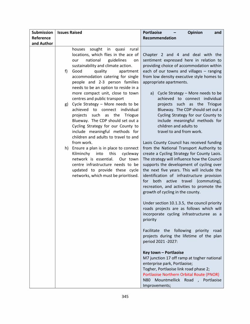
345
Submission Reference and Author
Issues Raised Portlaoise – Opinion and Recommendation
houses sought in quasi rural locations, which flies in the ace of our national guidelines on sustainability and climate action.
f) Good quality apartment accommodation catering for single people and 2-3 person families needs to be an option to reside in a more compact unit, close to town centres and public transport
g) Cycle Strategy – More needs to be achieved to connect individual projects such as the Triogue Blueway. The CDP should set out a Cycling Strategy for our County to include meaningful methods for children and adults to travel to and from work.
h) Ensure a plan is in place to connect Kilminchy into this cycleway network is essential. Our town centre infrastructure needs to be updated to provide these cycle networks, which must be prioritised.
Chapter 2 and 4 and deal with the sentiment expressed here in relation to providing choice of accommodation within each of our towns and villages – ranging from low density executive style homes to appropriate apartments.
a) Cycle Strategy – More needs to be
achieved to connect individual projects such as the Triogue Blueway. The CDP should set out a Cycling Strategy for our County to include meaningful methods for children and adults to travel to and from work.
Laois County Council has received funding from the National Transport Authority to create a Cycling Strategy for County Laois. The strategy will influence how the Council supports the development of cycling over the next five years. This will include the identification of infrastructure provision for both active travel (commuting), recreation, and activities to promote the growth of cycling in the county. Under section 10.1.3.5, the council priority roads projects are as follows which will incorporate cycling infrastructuree as a priority Facilitate the following priority road projects during the lifetime of the plan period 2021 -2027: Key town – Portlaoise M7 junction 17 off ramp at togher national enterprise park, Portlaoise; Togher, Portlaoise link road phase 2; Portlaoise Northern Orbital Route (PNOR)
• N80 Mountmellick Road , Portlaoise Improvements;
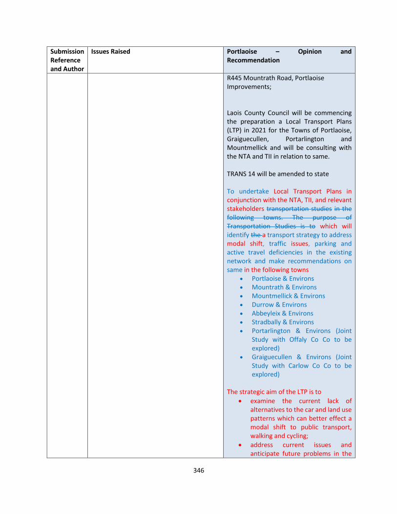
346
Submission Reference and Author
Issues Raised Portlaoise – Opinion and Recommendation
• R445 Mountrath Road, Portlaoise Improvements; Laois County Council will be commencing the preparation a Local Transport Plans (LTP) in 2021 for the Towns of Portlaoise, Graiguecullen, Portarlington and Mountmellick and will be consulting with the NTA and TII in relation to same.
TRANS 14 will be amended to state
To undertake Local Transport Plans in conjunction with the NTA, TII, and relevant stakeholders transportation studies in the following towns. The purpose of Transportation Studies is to which will identify the a transport strategy to address modal shift, traffic issues, parking and active travel deficiencies in the existing network and make recommendations on same in the following towns
• Portlaoise & Environs • Mountrath & Environs • Mountmellick & Environs • Durrow & Environs • Abbeyleix & Environs • Stradbally & Environs • Portarlington & Environs (Joint
Study with Offaly Co Co to be explored)
• Graiguecullen & Environs (Joint Study with Carlow Co Co to be explored)
The strategic aim of the LTP is to
• examine the current lack of alternatives to the car and land use patterns which can better effect a modal shift to public transport, walking and cycling;
• address current issues and anticipate future problems in the

347
Submission Reference and Author
Issues Raised Portlaoise – Opinion and Recommendation
transport network of the town and its strategic routes; and in doing so will present a detailed analysis of the current transport situation and present potential interventions and recommendations for active travel options, roads based solutions including the strategic routes and solutions to encourage provision and greater use of public transport.
The following policy objectives is proposed in this context CMST XX Specify baseline figures and targets for modal share in new / varied Local Area Plans in order to encourage a modal shift away from the private car to more sustainable forms of transport, such as public transport, cycling and walking.’ CM ST XX Set modal share targets within the county in cooperation with NTA, CARO, EMRA and other relevant stakeholders and in accordance with any relevant Guidelines that may come into effect’. RECOMMENDATION It is proposed to make the following changes Facilitate the following priority road projects during the lifetime of the plan period 2021 -2027: Key town – Portlaoise M7 junction 17 off ramp at togher national enterprise park, Portlaoise; Togher, Portlaoise link road phase 2; Portlaoise Northern Orbital Route (PNOR)
• N80 Mountmellick Road , Portlaoise Improvements;

348
Submission Reference and Author
Issues Raised Portlaoise – Opinion and Recommendation
• R445 Mountrath Road, Portlaoise Improvements; TRANS 14 will be amended to state To undertake Local Transport Plans in conjunction with the NTA, TII, and relevant stakeholders transportation studies in the following towns. The purpose of Transportation Studies is to which will identify the a transport strategy to address modal shift, traffic issues, parking and active travel deficiencies in the existing network and make recommendations on same in the following towns
• Portlaoise & Environs • Mountrath & Environs • Mountmellick & Environs • Durrow & Environs • Abbeyleix & Environs • Stradbally & Environs • Portarlington & Environs (Joint
Study with Offaly Co Co to be explored)
• Graiguecullen & Environs (Joint Study with Carlow Co Co to be explored)
The strategic aim of the LTP is to
• examine the current lack of alternatives to the car and land use patterns which can better effect a modal shift to public transport, walking and cycling;
• address current issues and anticipate future problems in the transport network of the town and its strategic routes; and in doing so will present a detailed analysis of the current transport situation and present potential interventions and recommendations for active travel options, roads based solutions including the strategic
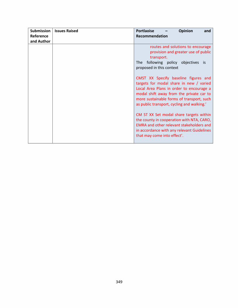
349
Submission Reference and Author
Issues Raised Portlaoise – Opinion and Recommendation
routes and solutions to encourage provision and greater use of public transport.
The following policy objectives is proposed in this context CMST XX Specify baseline figures and targets for modal share in new / varied Local Area Plans in order to encourage a modal shift away from the private car to more sustainable forms of transport, such as public transport, cycling and walking.’ CM ST XX Set modal share targets within the county in cooperation with NTA, CARO, EMRA and other relevant stakeholders and in accordance with any relevant Guidelines that may come into effect’.

350
Portlaoise Zoning Submissions
Submission Reference
Issues Raised Opinion and Recommendation Map 2.2 Reference of Proposed Change (if applicable)
LS-C9-DCDP-4 Holland Family
Lands at BORRIS LITTLE Zone lands in Borris Little, Portlaoise to Residential 2
Submission noted OPINION Further to the submission by OPR, the Planning Authority has undertaken a review of the settlement of Portlaoise, which included its residential requirements for Residential 2 and Strategic Reserve sites. The site is located east of Eskers Hills and abuts the Railway line to the south. The site is accessible off Onions Lane. The Planning Authority is opposed to this zoning proposal of 4.22 ha for residential development for the following reasons. Location The bulk of the lands referred to are outside the proposed town boundary as indicated in the draft Laois County Development Plan 2021-2027. A development here of the scale proposed would be completely at variance with the principle of the sequential approach to the location of new development. The sequential approach in effect favours town village centre, edge of centre and inner suburban locations over suburban locations for reasons of promoting sustainability, urban compactness and ease of serviceability. There is a strong presumption against the leapfrogging effect which leads to ad-hoc and disjointed development at relatively long distances [such as in this case] from the town centre.
N/A

351
Submission Reference
Issues Raised Opinion and Recommendation Map 2.2 Reference of Proposed Change (if applicable)
In terms of zoning land for ‘New Residential’, the National Strategic Outcome 1 (NSO 1) of the National Planning Framework (NPF) is to seek ‘Compact Growth’ across cities, towns and villages. In this regard, the National Planning Framework states that:
• ‘From an urban development perspective, we will need to deliver a greater proportion of residential development within existing built-up areas of our cities, towns and villages…’.
• Regional Strategic Outcome 2 (RSO 2) of the Eastern and Midland Regional Spatial and Economic Strategy (RSES) supports the NPF’s NSO1 stating that ‘Residential development should be carried out sequentially, whereby lands which are, or will be, most accessible by walking, cycling and public transport – including infill and brownfield sites – are prioritised.’
Compact growth and adherence to the Core Strategy is provided for in Chapter 2 of the Draft Plan. Housing Land Requirement Based on the overall housing land requirement for County Laois of 54.4 hectares up to target year 2027, as set out in Chapter 2 “Core Strategy”, there is no need for additional residentially zoned lands in the town. If this land were to be zoned, it would be at the expense of [and not additional to] other more suitably located lands as identified by application of the sequential approach. It is important to stress that the future population [and by extension the housing land requirement] of County Laois is governed by and shall comply with the housing
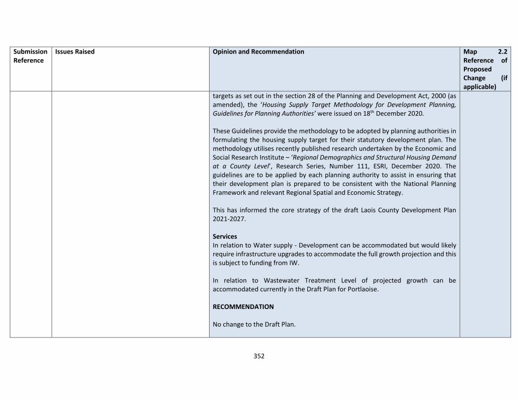
352
Submission Reference
Issues Raised Opinion and Recommendation Map 2.2 Reference of Proposed Change (if applicable)
targets as set out in the section 28 of the Planning and Development Act, 2000 (as amended), the ‘Housing Supply Target Methodology for Development Planning, Guidelines for Planning Authorities’ were issued on 18th December 2020. These Guidelines provide the methodology to be adopted by planning authorities in formulating the housing supply target for their statutory development plan. The methodology utilises recently published research undertaken by the Economic and Social Research Institute – ‘Regional Demographics and Structural Housing Demand at a County Level’, Research Series, Number 111, ESRI, December 2020. The guidelines are to be applied by each planning authority to assist in ensuring that their development plan is prepared to be consistent with the National Planning Framework and relevant Regional Spatial and Economic Strategy. This has informed the core strategy of the draft Laois County Development Plan 2021-2027. Services In relation to Water supply - Development can be accommodated but would likely require infrastructure upgrades to accommodate the full growth projection and this is subject to funding from IW. In relation to Wastewater Treatment Level of projected growth can be accommodated currently in the Draft Plan for Portlaoise. RECOMMENDATION No change to the Draft Plan.
353
Submission Reference
Issues Raised Opinion and Recommendation Map 2.2 Reference of Proposed Change (if applicable)
LS-C9-DCDP-15 John Kileen
Lands at Newpark Newpark House and Apartment blocks known as St. Michaels & St. Margaret’s is an existing apartment development in the centre of Portlaoise. The two-blocks were built in the late 70's and currently house 10 apartments, a mixture of 1&2 bedroomed apartments. My client is looking to do extensive renovations and alterations to the site to include additional apartment development on the grounds within the vicinity of these two units. Opposite our development at The Maltings site the land within the vicinity of same has been zoned Residential 2, we are seeking an expansion of this zoned area to include the entirety of our site. We make this submission on the grounds that the site is bound on two sides by road frontage and we will be seeking to develop off Harpurs Lane with the new development. Attached find location map of same.
Submission is noted OPINION This 0.5 hectare site is currently zoned for “Residential 1” development. This zone is intended primarily for established housing development but may include a range of other uses particularly those that have the potential to improve the residential amenity of residential communities such as schools, crèches, small shops, doctor’s surgeries, playing fields etc. It is an objective on land zoned for “Residential 1” to protect the established residential amenity and enhance with associated open space, community uses and where an acceptable standard of amenity can be maintained, a limited range of other uses that support the overall residential function of the area. Within this zoning category the improved quality of existing residential areas will be the Council’s priority. Given this is a redevelopment project and housing is open for consideration under this land use zone where it seeks to “To protect and enhance the amenity of developed residential communities”, it is not proposed to change the zoning on this land. RECOMMENDATION No change to the Draft Plan.
N/A
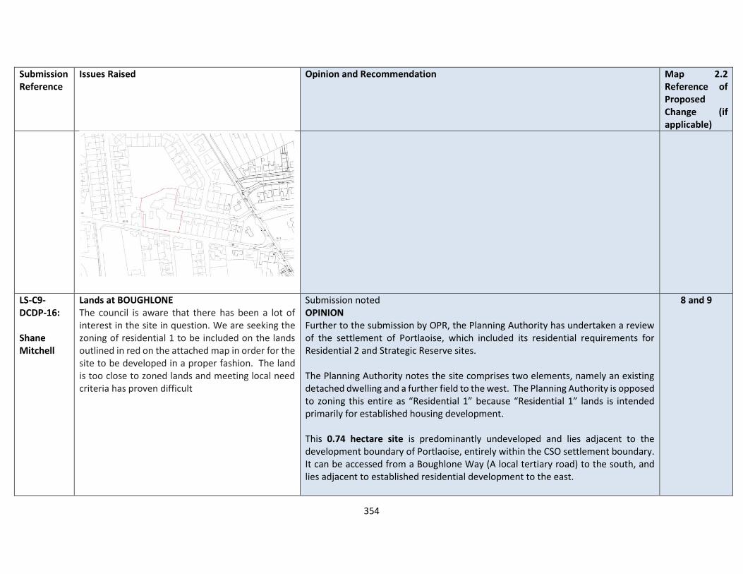
354
Submission Reference
Issues Raised Opinion and Recommendation Map 2.2 Reference of Proposed Change (if applicable)
LS-C9-DCDP-16: Shane Mitchell
Lands at BOUGHLONE The council is aware that there has been a lot of interest in the site in question. We are seeking the zoning of residential 1 to be included on the lands outlined in red on the attached map in order for the site to be developed in a proper fashion. The land is too close to zoned lands and meeting local need criteria has proven difficult
Submission noted OPINION Further to the submission by OPR, the Planning Authority has undertaken a review of the settlement of Portlaoise, which included its residential requirements for Residential 2 and Strategic Reserve sites. The Planning Authority notes the site comprises two elements, namely an existing detached dwelling and a further field to the west. The Planning Authority is opposed to zoning this entire as “Residential 1” because “Residential 1” lands is intended primarily for established housing development. This 0.74 hectare site is predominantly undeveloped and lies adjacent to the development boundary of Portlaoise, entirely within the CSO settlement boundary. It can be accessed from a Boughlone Way (A local tertiary road) to the south, and lies adjacent to established residential development to the east.
8 and 9

355
Submission Reference
Issues Raised Opinion and Recommendation Map 2.2 Reference of Proposed Change (if applicable)
Therefore, the Planning Authority supports that the part of the site which includes the existing dwelling can be zoned “Residential 1”, with the remainder of the lands to the west zoned as “Residential 2 – New Proposed Residential”. Services In relation to Water supply - Development can be accommodated but would likely require infrastructure upgrades to accommodate the full growth projection and this is subject to funding from IW. In relation to Wastewater Treatment Level of projected growth can be accommodated currently in the Draft Plan for Portlaoise.
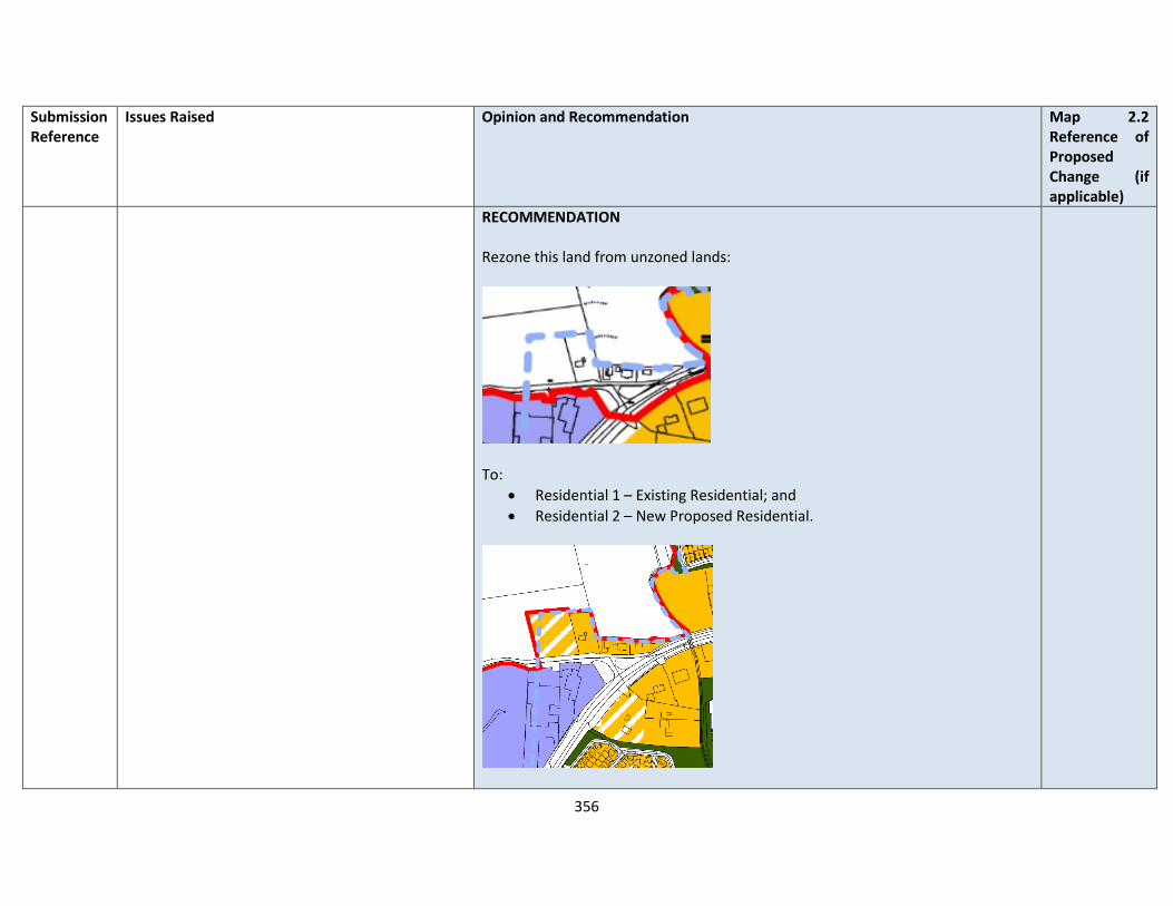
356
Submission Reference
Issues Raised Opinion and Recommendation Map 2.2 Reference of Proposed Change (if applicable)
RECOMMENDATION Rezone this land from unzoned lands:
To:
• Residential 1 – Existing Residential; and
• Residential 2 – New Proposed Residential.
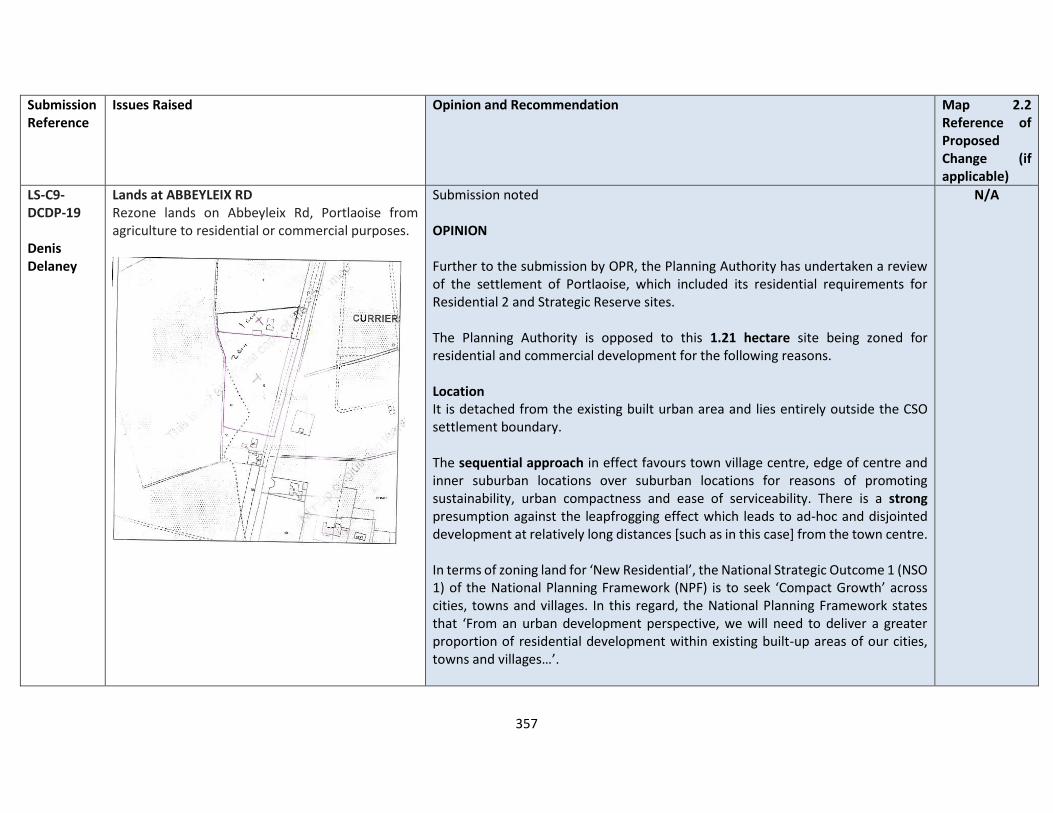
357
Submission Reference
Issues Raised Opinion and Recommendation Map 2.2 Reference of Proposed Change (if applicable)
LS-C9-DCDP-19 Denis Delaney
Lands at ABBEYLEIX RD Rezone lands on Abbeyleix Rd, Portlaoise from agriculture to residential or commercial purposes.
Submission noted OPINION Further to the submission by OPR, the Planning Authority has undertaken a review of the settlement of Portlaoise, which included its residential requirements for Residential 2 and Strategic Reserve sites. The Planning Authority is opposed to this 1.21 hectare site being zoned for residential and commercial development for the following reasons. Location It is detached from the existing built urban area and lies entirely outside the CSO settlement boundary. The sequential approach in effect favours town village centre, edge of centre and inner suburban locations over suburban locations for reasons of promoting sustainability, urban compactness and ease of serviceability. There is a strong presumption against the leapfrogging effect which leads to ad-hoc and disjointed development at relatively long distances [such as in this case] from the town centre. In terms of zoning land for ‘New Residential’, the National Strategic Outcome 1 (NSO 1) of the National Planning Framework (NPF) is to seek ‘Compact Growth’ across cities, towns and villages. In this regard, the National Planning Framework states that ‘From an urban development perspective, we will need to deliver a greater proportion of residential development within existing built-up areas of our cities, towns and villages…’.
N/A

358
Submission Reference
Issues Raised Opinion and Recommendation Map 2.2 Reference of Proposed Change (if applicable)
Regional Strategic Outcome 2 (RSO 2) of the Eastern and Midland Regional Spatial and Economic Strategy (RSES) supports the NPF’s NSO1 stating that ‘Residential development should be carried out sequentially, whereby lands which are, or will be, most accessible by walking, cycling and public transport – including infill and brownfield sites – are prioritised.’ Compact growth and adherence to the Core Strategy is provided for in Chapter 2 of the draft plan as follows Housing Land Requirement Based on the overall housing land requirement for County Laois of 125 hectares up to target year 2027, as set out in Chapter 2 “Core Strategy”, there is no need for additional residentially zoned lands in the town. If this land were to be zoned, it would be at the expense of [and not additional to] other more suitably located lands as identified by application of the sequential approach. It is important to stress that the future population [and by extension the housing land requirement] of County Laois is governed by and shall comply with the housing targets as set out in the section 28 of the Planning and Development Act, 2000 (as amended), the ‘Housing Supply Target Methodology for Development Planning, Guidelines for Planning Authorities’ were issued on 18th December 2020. These Guidelines provide the methodology to be adopted by planning authorities in formulating the housing supply target for their statutory development plan. The methodology utilises recently published research undertaken by the Economic and Social Research Institute – ‘Regional Demographics and Structural Housing Demand at a County Level’, Research Series, Number 111, ESRI, December 2020. The guidelines are to be applied by each planning authority to assist in ensuring that

359
Submission Reference
Issues Raised Opinion and Recommendation Map 2.2 Reference of Proposed Change (if applicable)
their development plan is prepared to be consistent with the National Planning Framework and relevant Regional Spatial and Economic Strategy. This has informed the core strategy of the draft Laois County Development Plan 2021-2027. Access The creation of an access onto the N77 that is subject to an 80 kph speed limit is contrary to TRANS18 of the LCDP 2021-2027. Services In relation to Water supply - Development can be accommodated but would likely require infrastructure upgrades to accommodate the full growth projection and this is subject to funding from IW. In relation to Wastewater Treatment Level of projected growth can be accommodated currently in the Draft Plan for Portlaoise. RECOMMENDATION No change to the Draft Plan
LS-C9-DCDP-21 Prime Equipment Ltd
Lands at MEELICK Zone lands at Meelick, Portlaoise to residential
Submission noted OPINION Further to the submission by OPR, the Planning Authority has undertaken a review of the settlement of Portlaoise, which included its residential requirements for Residential 2 and Strategic Reserve sites.
N/A
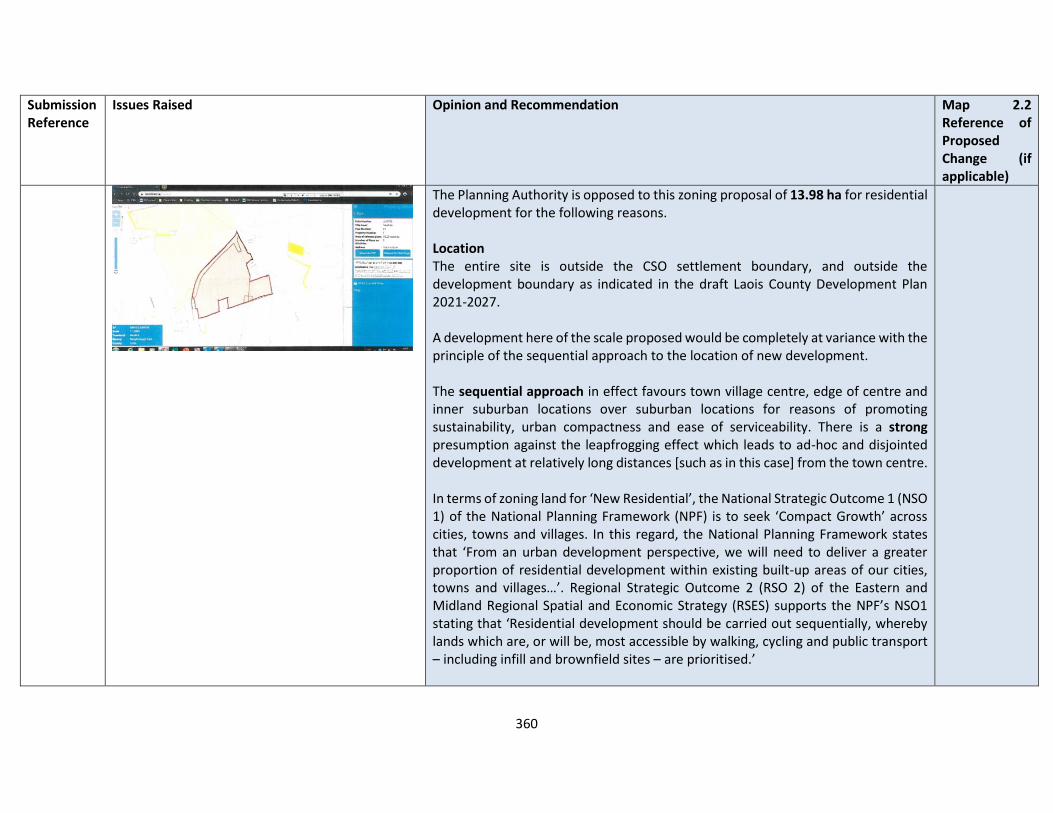
360
Submission Reference
Issues Raised Opinion and Recommendation Map 2.2 Reference of Proposed Change (if applicable)
The Planning Authority is opposed to this zoning proposal of 13.98 ha for residential development for the following reasons. Location The entire site is outside the CSO settlement boundary, and outside the development boundary as indicated in the draft Laois County Development Plan 2021-2027. A development here of the scale proposed would be completely at variance with the principle of the sequential approach to the location of new development. The sequential approach in effect favours town village centre, edge of centre and inner suburban locations over suburban locations for reasons of promoting sustainability, urban compactness and ease of serviceability. There is a strong presumption against the leapfrogging effect which leads to ad-hoc and disjointed development at relatively long distances [such as in this case] from the town centre. In terms of zoning land for ‘New Residential’, the National Strategic Outcome 1 (NSO 1) of the National Planning Framework (NPF) is to seek ‘Compact Growth’ across cities, towns and villages. In this regard, the National Planning Framework states that ‘From an urban development perspective, we will need to deliver a greater proportion of residential development within existing built-up areas of our cities, towns and villages…’. Regional Strategic Outcome 2 (RSO 2) of the Eastern and Midland Regional Spatial and Economic Strategy (RSES) supports the NPF’s NSO1 stating that ‘Residential development should be carried out sequentially, whereby lands which are, or will be, most accessible by walking, cycling and public transport – including infill and brownfield sites – are prioritised.’
361
Submission Reference
Issues Raised Opinion and Recommendation Map 2.2 Reference of Proposed Change (if applicable)
Compact growth and adherence to the Core Strategy is provided for in Chapter 2 of the draft plan as follows Housing Land Requirement Based on the overall housing land requirement for County Laois of 125 hectares up to target year 2027, as set out in Chapter 2 “Core Strategy”, there is no need for additional residentially zoned lands in the town. If this land were to be zoned, it would be at the expense of [and not additional to] other more suitably located lands as identified by application of the sequential approach. It is important to stress that the future population [and by extension the housing land requirement] of County Laois is governed by and shall comply with the housing targets as set out in the section 28 of the Planning and Development Act, 2000 (as amended), the ‘Housing Supply Target Methodology for Development Planning, Guidelines for Planning Authorities’ were issued on 18th December 2020. These Guidelines provide the methodology to be adopted by planning authorities in formulating the housing supply target for their statutory development plan. The methodology utilises recently published research undertaken by the Economic and Social Research Institute – ‘Regional Demographics and Structural Housing Demand at a County Level’, Research Series, Number 111, ESRI, December 2020. The guidelines are to be applied by each planning authority to assist in ensuring that their development plan is prepared to be consistent with the National Planning Framework and relevant Regional Spatial and Economic Strategy. This has informed the core strategy of the draft Laois County Development Plan 2021-2027.
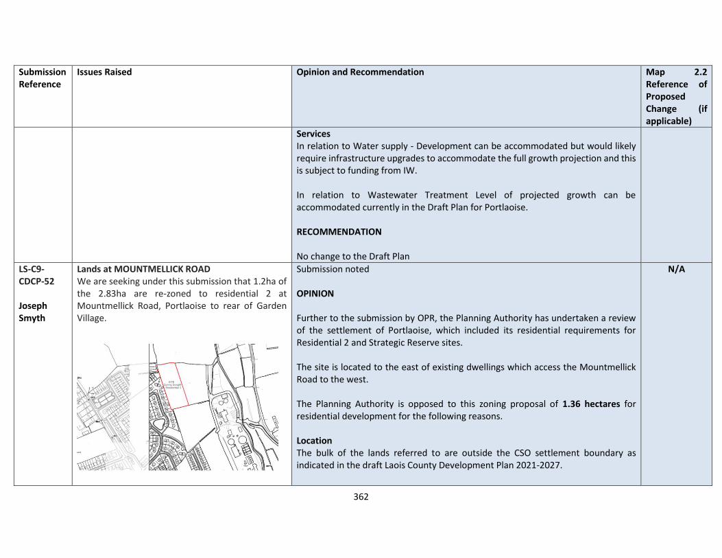
362
Submission Reference
Issues Raised Opinion and Recommendation Map 2.2 Reference of Proposed Change (if applicable)
Services In relation to Water supply - Development can be accommodated but would likely require infrastructure upgrades to accommodate the full growth projection and this is subject to funding from IW. In relation to Wastewater Treatment Level of projected growth can be accommodated currently in the Draft Plan for Portlaoise. RECOMMENDATION No change to the Draft Plan
LS-C9-CDCP-52 Joseph Smyth
Lands at MOUNTMELLICK ROAD We are seeking under this submission that 1.2ha of the 2.83ha are re-zoned to residential 2 at Mountmellick Road, Portlaoise to rear of Garden Village.
Submission noted OPINION Further to the submission by OPR, the Planning Authority has undertaken a review of the settlement of Portlaoise, which included its residential requirements for Residential 2 and Strategic Reserve sites. The site is located to the east of existing dwellings which access the Mountmellick Road to the west. The Planning Authority is opposed to this zoning proposal of 1.36 hectares for residential development for the following reasons. Location The bulk of the lands referred to are outside the CSO settlement boundary as indicated in the draft Laois County Development Plan 2021-2027.
N/A
363
Submission Reference
Issues Raised Opinion and Recommendation Map 2.2 Reference of Proposed Change (if applicable)
A development here of the scale proposed would be completely at variance with the principle of the sequential approach to the location of new development. The sequential approach in effect favours town village centre, edge of centre and inner suburban locations over suburban locations for reasons of promoting sustainability, urban compactness and ease of serviceability. There is a strong presumption against the leapfrogging effect which leads to ad-hoc and disjointed development at relatively long distances [such as in this case] from the town centre. In terms of zoning land for ‘New Residential’, the National Strategic Outcome 1 (NSO 1) of the National Planning Framework (NPF) is to seek ‘Compact Growth’ across cities, towns and villages. In this regard, the National Planning Framework states that ‘From an urban development perspective, we will need to deliver a greater proportion of residential development within existing built-up areas of our cities, towns and villages…’. Regional Strategic Outcome 2 (RSO 2) of the Eastern and Midland Regional Spatial and Economic Strategy (RSES) supports the NPF’s NSO1 stating that ‘Residential development should be carried out sequentially, whereby lands which are, or will be, most accessible by walking, cycling and public transport – including infill and brownfield sites – are prioritised.’ Compact growth and adherence to the Core Strategy is provided for in Chapter 2 of the draft plan as follows Housing Land Requirement Based on the overall housing land requirement for County Laois of 125 hectares up to target year 2027, as set out in Chapter 2 “Core Strategy”, there is no need for additional residentially zoned lands in the town. If this land were to be zoned, it would be at the expense of [and not additional to] other more suitably located lands as identified by application of the sequential approach.
364
Submission Reference
Issues Raised Opinion and Recommendation Map 2.2 Reference of Proposed Change (if applicable)
It is important to stress that the future population [and by extension the housing land requirement] of County Laois is governed by and shall comply with the housing targets as set out in the section 28 of the Planning and Development Act, 2000 (as amended), the ‘Housing Supply Target Methodology for Development Planning, Guidelines for Planning Authorities’ were issued on 18th December 2020. These Guidelines provide the methodology to be adopted by planning authorities in formulating the housing supply target for their statutory development plan. The methodology utilises recently published research undertaken by the Economic and Social Research Institute – ‘Regional Demographics and Structural Housing Demand at a County Level’, Research Series, Number 111, ESRI, December 2020. The guidelines are to be applied by each planning authority to assist in ensuring that their development plan is prepared to be consistent with the National Planning Framework and relevant Regional Spatial and Economic Strategy. This has informed the core strategy of the draft Laois County Development Plan 2021-2027. Services In relation to Water supply - Development can be accommodated but would likely require infrastructure upgrades to accommodate the full growth projection and this is subject to funding from IW. In relation to Wastewater Treatment Level of projected growth can be accommodated currently in the Draft Plan for Portlaoise.
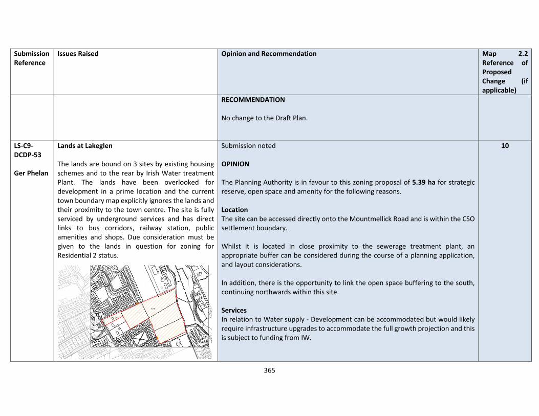
365
Submission Reference
Issues Raised Opinion and Recommendation Map 2.2 Reference of Proposed Change (if applicable)
RECOMMENDATION No change to the Draft Plan.
LS-C9-DCDP-53 Ger Phelan
Lands at Lakeglen The lands are bound on 3 sites by existing housing schemes and to the rear by Irish Water treatment Plant. The lands have been overlooked for development in a prime location and the current town boundary map explicitly ignores the lands and their proximity to the town centre. The site is fully serviced by underground services and has direct links to bus corridors, railway station, public amenities and shops. Due consideration must be given to the lands in question for zoning for Residential 2 status.
Submission noted OPINION The Planning Authority is in favour to this zoning proposal of 5.39 ha for strategic reserve, open space and amenity for the following reasons. Location The site can be accessed directly onto the Mountmellick Road and is within the CSO settlement boundary. Whilst it is located in close proximity to the sewerage treatment plant, an appropriate buffer can be considered during the course of a planning application, and layout considerations. In addition, there is the opportunity to link the open space buffering to the south, continuing northwards within this site. Services In relation to Water supply - Development can be accommodated but would likely require infrastructure upgrades to accommodate the full growth projection and this is subject to funding from IW.
10
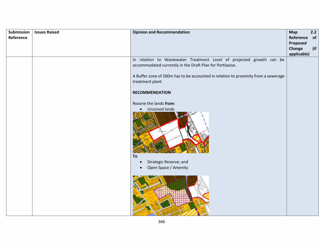
366
Submission Reference
Issues Raised Opinion and Recommendation Map 2.2 Reference of Proposed Change (if applicable)
In relation to Wastewater Treatment Level of projected growth can be accommodated currently in the Draft Plan for Portlaoise. A Buffer zone of 200m has to be accounted in relation to proximity from a sewerage treatment plant RECOMMENDATION Rezone the lands from:
• Unzoned lands
To
• Strategic Reserve; and
• Open Space / Amenity
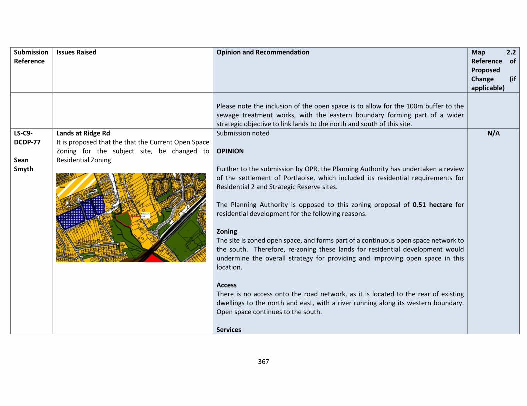
367
Submission Reference
Issues Raised Opinion and Recommendation Map 2.2 Reference of Proposed Change (if applicable)
Please note the inclusion of the open space is to allow for the 100m buffer to the sewage treatment works, with the eastern boundary forming part of a wider strategic objective to link lands to the north and south of this site.
LS-C9-DCDP-77 Sean Smyth
Lands at Ridge Rd It is proposed that the that the Current Open Space Zoning for the subject site, be changed to Residential Zoning
Submission noted OPINION Further to the submission by OPR, the Planning Authority has undertaken a review of the settlement of Portlaoise, which included its residential requirements for Residential 2 and Strategic Reserve sites. The Planning Authority is opposed to this zoning proposal of 0.51 hectare for residential development for the following reasons. Zoning The site is zoned open space, and forms part of a continuous open space network to the south. Therefore, re-zoning these lands for residential development would undermine the overall strategy for providing and improving open space in this location. Access There is no access onto the road network, as it is located to the rear of existing dwellings to the north and east, with a river running along its western boundary. Open space continues to the south. Services
N/A
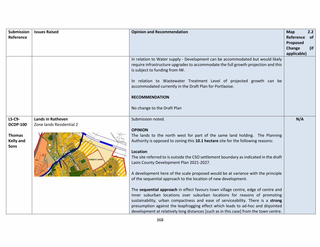
368
Submission Reference
Issues Raised Opinion and Recommendation Map 2.2 Reference of Proposed Change (if applicable)
In relation to Water supply - Development can be accommodated but would likely require infrastructure upgrades to accommodate the full growth projection and this is subject to funding from IW. In relation to Wastewater Treatment Level of projected growth can be accommodated currently in the Draft Plan for Portlaoise. RECOMMENDATION No change to the Draft Plan
LS-C9-DCDP-100 Thomas Kelly and Sons
Lands in Ratheven Zone lands Residential 2
Submission noted. OPINION The lands to the north west for part of the same land holding. The Planning Authority is opposed to zoning this 10.1 hectare site for the following reasons: Location The site referred to is outside the CSO settlement boundary as indicated in the draft Laois County Development Plan 2021-2027. A development here of the scale proposed would be at variance with the principle of the sequential approach to the location of new development. The sequential approach in effect favours town village centre, edge of centre and inner suburban locations over suburban locations for reasons of promoting sustainability, urban compactness and ease of serviceability. There is a strong presumption against the leapfrogging effect which leads to ad-hoc and disjointed development at relatively long distances [such as in this case] from the town centre.
N/A

369
Submission Reference
Issues Raised Opinion and Recommendation Map 2.2 Reference of Proposed Change (if applicable)
In terms of zoning land for ‘New Residential’, the National Strategic Outcome 1 (NSO 1) of the National Planning Framework (NPF) is to seek ‘Compact Growth’ across cities, towns and villages. In this regard, the National Planning Framework states that ‘From an urban development perspective, we will need to deliver a greater proportion of residential development within existing built-up areas of our cities, towns and villages…’. Regional Strategic Outcome 2 (RSO 2) of the Eastern and Midland Regional Spatial and Economic Strategy (RSES) supports the NPF’s NSO1 stating that ‘Residential development should be carried out sequentially, whereby lands which are, or will be, most accessible by walking, cycling and public transport – including infill and brownfield sites – are prioritised.’ Compact growth and adherence to the Core Strategy is provided for in Chapter 2 of the draft plan as follows Housing Land Requirement Based on the overall housing land requirement for County Laois of 125 hectares up to target year 2027, as set out in Chapter 2 “Core Strategy”, there is no need for additional residentially zoned lands in the town. If this land were to be zoned, it would be at the expense of [and not additional to] other more suitably located lands as identified by application of the sequential approach.
370
Submission Reference
Issues Raised Opinion and Recommendation Map 2.2 Reference of Proposed Change (if applicable)
It is important to stress that the future population [and by extension the housing land requirement] of County Laois is governed by and shall comply with the housing targets as set out in the section 28 of the Planning and Development Act, 2000 (as amended), the ‘Housing Supply Target Methodology for Development Planning, Guidelines for Planning Authorities’ were issued on 18th December 2020. These Guidelines provide the methodology to be adopted by planning authorities in formulating the housing supply target for their statutory development plan. The methodology utilises recently published research undertaken by the Economic and Social Research Institute – ‘Regional Demographics and Structural Housing Demand at a County Level’, Research Series, Number 111, ESRI, December 2020. The guidelines are to be applied by each planning authority to assist in ensuring that their development plan is prepared to be consistent with the National Planning Framework and relevant Regional Spatial and Economic Strategy. This has informed the core strategy of the draft Laois County Development Plan 2021-2027. Services In relation to Water supply - Development can be accommodated but would likely require infrastructure upgrades to accommodate the full growth projection and this is subject to funding from IW. In relation to Wastewater Treatment Level of projected growth can be accommodated currently in the Draft Plan for Portlaoise. RECOMMENDATION
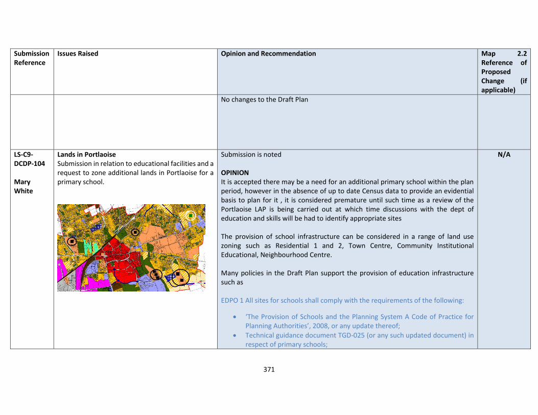
371
Submission Reference
Issues Raised Opinion and Recommendation Map 2.2 Reference of Proposed Change (if applicable)
No changes to the Draft Plan
LS-C9-DCDP-104 Mary White
Lands in Portlaoise Submission in relation to educational facilities and a request to zone additional lands in Portlaoise for a primary school.
Submission is noted OPINION It is accepted there may be a need for an additional primary school within the plan period, however in the absence of up to date Census data to provide an evidential basis to plan for it , it is considered premature until such time as a review of the Portlaoise LAP is being carried out at which time discussions with the dept of education and skills will be had to identify appropriate sites The provision of school infrastructure can be considered in a range of land use zoning such as Residential 1 and 2, Town Centre, Community Institutional Educational, Neighbourhood Centre. Many policies in the Draft Plan support the provision of education infrastructure such as EDPO 1 All sites for schools shall comply with the requirements of the following:
• ‘The Provision of Schools and the Planning System A Code of Practice for Planning Authorities’, 2008, or any update thereof;
• Technical guidance document TGD-025 (or any such updated document) in respect of primary schools;
N/A
372
Submission Reference
Issues Raised Opinion and Recommendation Map 2.2 Reference of Proposed Change (if applicable)
• Technical guidance document TGD-027 (or any such updated document) in respect of post primary schools
EDPO 6 - Ensure the provision and implementation of primary and secondary education facilities in concert with the planning and sustainable development of residential areas in order to maximise the opportunities for use of walking, cycling and use of public transport The Department of Education has identified a number of locations, which have:
• Public transport;
• Walking and cycling infrastructure; and
• Proximity to residential area and other educational facilities. However, it has not stated how large a primary school is required, as well as an analysis of school catchments, and capacity of existing schools within Portlaoise. The Planning Authority does not object to the provision of an additional primary school. However, there is a need for an evidence base to support the zoning of such lands in an appropriate location. Therefore, it is considered prudent at this stage to provide an objective for Portlaoise to:
• Undertake a feasibility study for Portlaoise for the provision of a school / education infrastructure.
This process can be undertaken as part of the Portlaoise Local Area Plan, due to commence in later 2021 / early 2022.
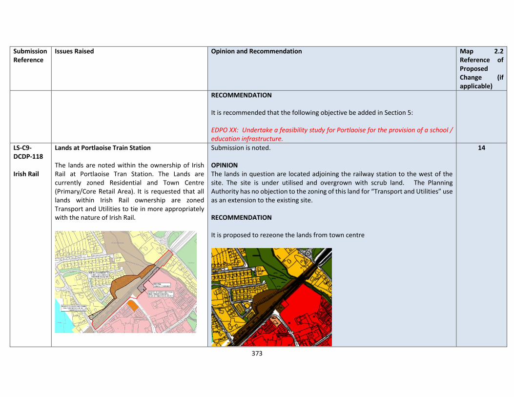
373
Submission Reference
Issues Raised Opinion and Recommendation Map 2.2 Reference of Proposed Change (if applicable)
RECOMMENDATION It is recommended that the following objective be added in Section 5: EDPO XX: Undertake a feasibility study for Portlaoise for the provision of a school / education infrastructure.
LS-C9-DCDP-118 Irish Rail
Lands at Portlaoise Train Station The lands are noted within the ownership of Irish Rail at Portlaoise Tran Station. The Lands are currently zoned Residential and Town Centre (Primary/Core Retail Area). It is requested that all lands within Irish Rail ownership are zoned Transport and Utilities to tie in more appropriately with the nature of Irish Rail.
Submission is noted. OPINION The lands in question are located adjoining the railway station to the west of the site. The site is under utilised and overgrown with scrub land. The Planning Authority has no objection to the zoning of this land for “Transport and Utilities” use as an extension to the existing site. RECOMMENDATION It is proposed to rezeone the lands from town centre
14
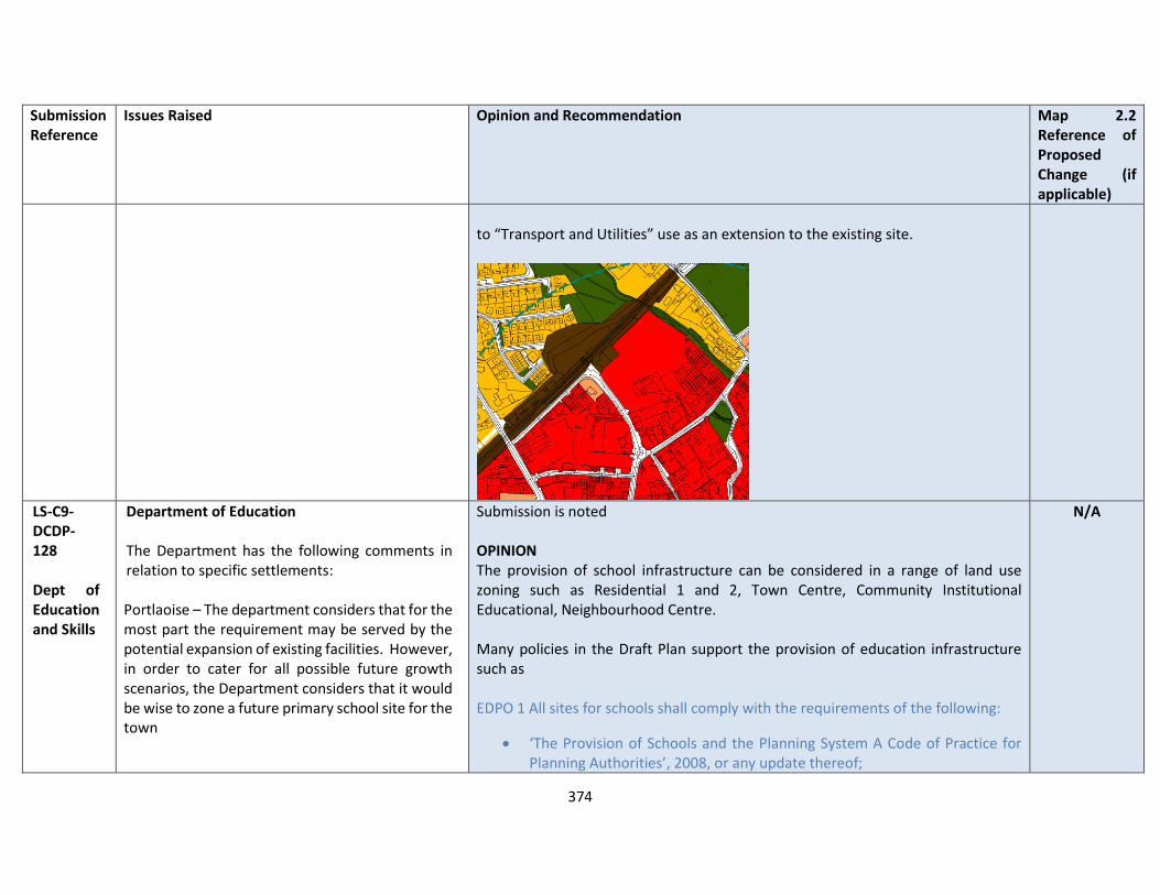
374
Submission Reference
Issues Raised Opinion and Recommendation Map 2.2 Reference of Proposed Change (if applicable)
to “Transport and Utilities” use as an extension to the existing site.
LS-C9- DCDP-128 Dept of Education and Skills
Department of Education The Department has the following comments in relation to specific settlements: Portlaoise – The department considers that for the most part the requirement may be served by the potential expansion of existing facilities. However, in order to cater for all possible future growth scenarios, the Department considers that it would be wise to zone a future primary school site for the town
Submission is noted OPINION The provision of school infrastructure can be considered in a range of land use zoning such as Residential 1 and 2, Town Centre, Community Institutional Educational, Neighbourhood Centre. Many policies in the Draft Plan support the provision of education infrastructure such as EDPO 1 All sites for schools shall comply with the requirements of the following:
• ‘The Provision of Schools and the Planning System A Code of Practice for Planning Authorities’, 2008, or any update thereof;
N/A
375
Submission Reference
Issues Raised Opinion and Recommendation Map 2.2 Reference of Proposed Change (if applicable)
• Technical guidance document TGD-025 (or any such updated document) in respect of primary schools;
• Technical guidance document TGD-027 (or any such updated document) in respect of post primary schools
EDPO 6 - Ensure the provision and implementation of primary and secondary education facilities in concert with the planning and sustainable development of residential areas in order to maximise the opportunities for use of walking, cycling and use of public transport The Department of Education has identified a number of locations, which have:
• Public transport;
• Walking and cycling infrastructure; and
• Proximity to residential area and other educational facilities. However, it has not stated how large a primary school is required, as well as an analysis of school catchments, and capacity of existing schools within Portlaoise. The Planning Authority does not object to the provision of an additional primary school. However, there is a need for an evidence base to support the zoning of such lands in an appropriate location. It would be premature to specifically identify the location and scale of a primary school. Therefore, on balance, it is considered prudent at this stage to provide an objective for Portlaoise to:
• Undertake a feasibility study for Portlaoise for the provision of a school / education infrastructure.
376
Submission Reference
Issues Raised Opinion and Recommendation Map 2.2 Reference of Proposed Change (if applicable)
This process can be undertaken as part of the Portlaoise Local Area Plan, due to commence in later 2021 / early 2022. RECOMMENDATION It is recommended that the following objective be added in Section 5:
• EDP XX: Undertake a feasibility study for Portlaoise for the provision of a school / education infrastructure.
LS-C9-DCDP-144 John Fingleton
Zoning of Lands at Greenmill Lane, Portlaoise Planning Permission was granted for 74 dwellings on this site in 2008 (Planning reference 07/1470). Preliminary site work was commenced in 2008 and abandoned because of the Economic Crash. The Zoning was changed from Residential to Neighbourhood Centre in 2012. I am not sure why the Zoning was changed. There is adequate shopping provision in the area and in fact over 60% of the units in the existing centre are vacant. I believe that this site is ideal for housing being within walking distance of the Railway Station, Town Centre shopping, a Primary School, Public Pool and Library. I bought this property in 2014 and have been approached by several Housing bodies who are
The submission is noted OPINION Further to the submission by OPR, the Planning Authority has undertaken a review of the settlement of Portlaoise, which included its residential requirements for Residential 2 and Strategic Reserve sites. The Planning Authority is supportive of the zoning of this 1.24 hectare site as a “Residential 2 – New Proposed Residential” for the following reasons:
a) It is located wholly within the CSO settlement boundary and Portlaoise settlement boundary
b) It is located in a sustainable location adjacent to the existing neighbourhood centre to the west
c) It represents an infill, brownfield site within Portlaoise for residential development
d) Access can be gained from Greenmill Lane from the south e) There are existing vacant retail units to the west f) There is active interest to develop the site for residential development
12
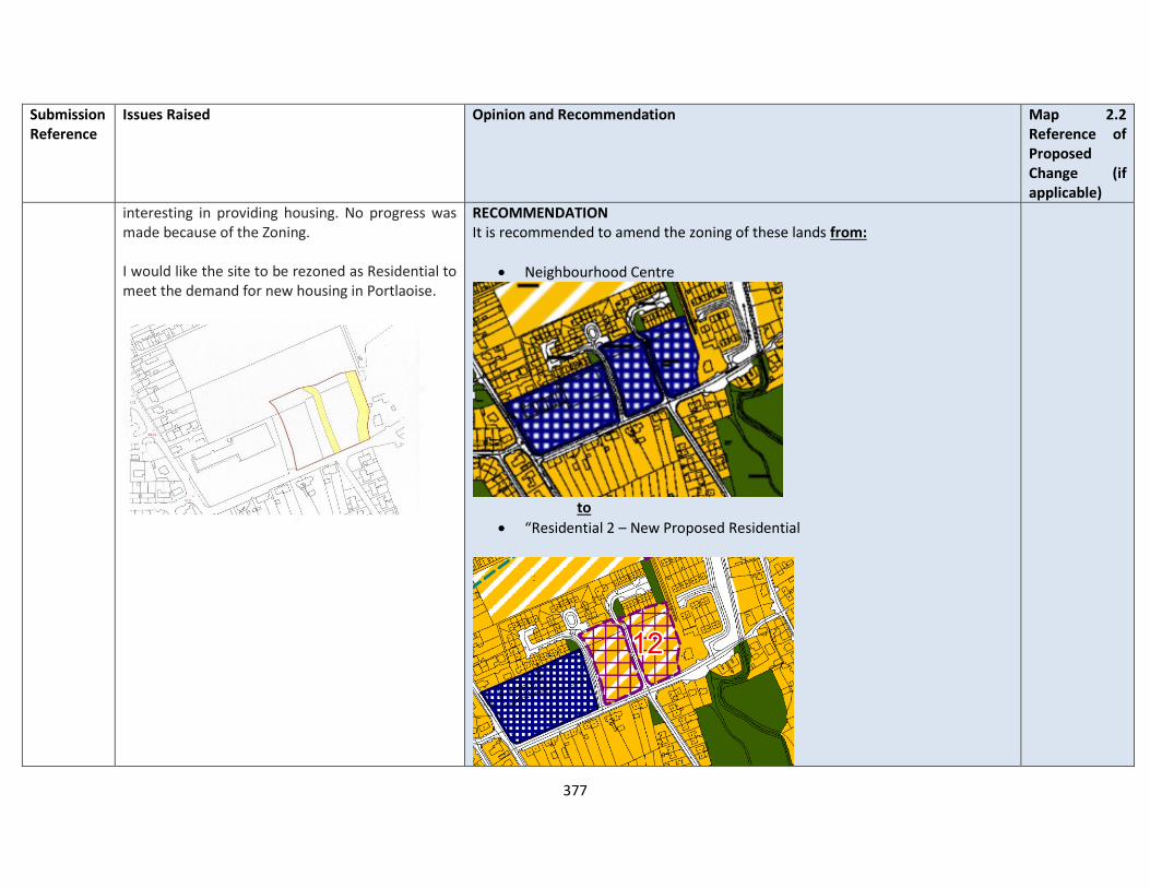
377
Submission Reference
Issues Raised Opinion and Recommendation Map 2.2 Reference of Proposed Change (if applicable)
interesting in providing housing. No progress was made because of the Zoning. I would like the site to be rezoned as Residential to meet the demand for new housing in Portlaoise.
RECOMMENDATION It is recommended to amend the zoning of these lands from:
• Neighbourhood Centre
to
• “Residential 2 – New Proposed Residential
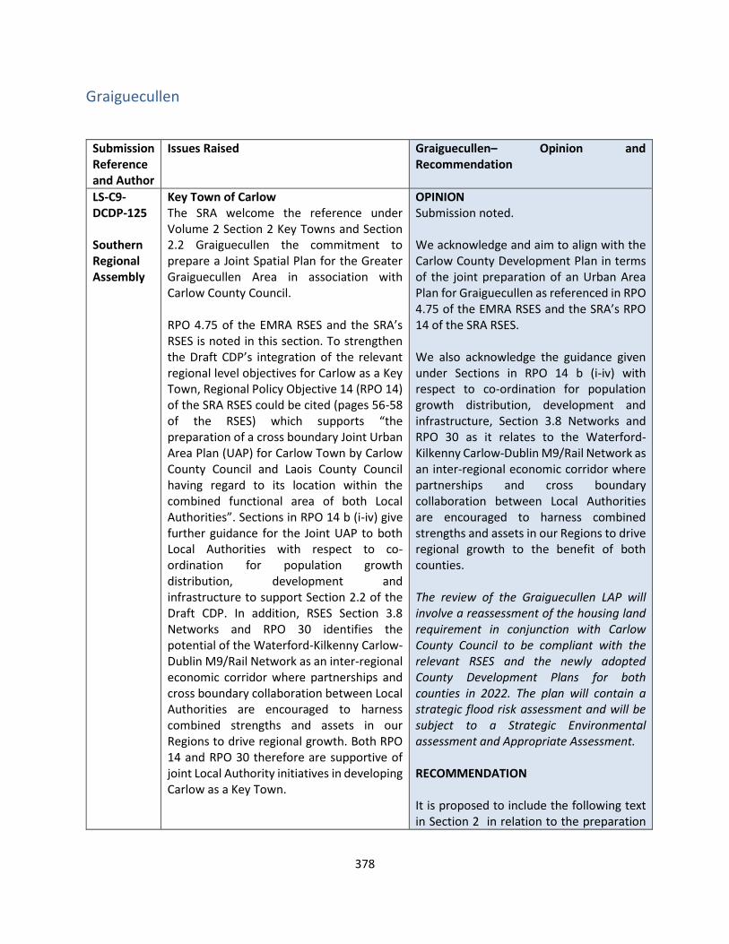
378
Graiguecullen
Submission Reference and Author
Issues Raised Graiguecullen– Opinion and Recommendation
LS-C9-DCDP-125 Southern Regional Assembly
Key Town of Carlow The SRA welcome the reference under Volume 2 Section 2 Key Towns and Section 2.2 Graiguecullen the commitment to prepare a Joint Spatial Plan for the Greater Graiguecullen Area in association with Carlow County Council. RPO 4.75 of the EMRA RSES and the SRA’s RSES is noted in this section. To strengthen the Draft CDP’s integration of the relevant regional level objectives for Carlow as a Key Town, Regional Policy Objective 14 (RPO 14) of the SRA RSES could be cited (pages 56-58 of the RSES) which supports “the preparation of a cross boundary Joint Urban Area Plan (UAP) for Carlow Town by Carlow County Council and Laois County Council having regard to its location within the combined functional area of both Local Authorities”. Sections in RPO 14 b (i-iv) give further guidance for the Joint UAP to both Local Authorities with respect to co-ordination for population growth distribution, development and infrastructure to support Section 2.2 of the Draft CDP. In addition, RSES Section 3.8 Networks and RPO 30 identifies the potential of the Waterford-Kilkenny Carlow-Dublin M9/Rail Network as an inter-regional economic corridor where partnerships and cross boundary collaboration between Local Authorities are encouraged to harness combined strengths and assets in our Regions to drive regional growth. Both RPO 14 and RPO 30 therefore are supportive of joint Local Authority initiatives in developing Carlow as a Key Town.
OPINION Submission noted. We acknowledge and aim to align with the Carlow County Development Plan in terms of the joint preparation of an Urban Area Plan for Graiguecullen as referenced in RPO 4.75 of the EMRA RSES and the SRA’s RPO 14 of the SRA RSES. We also acknowledge the guidance given under Sections in RPO 14 b (i-iv) with respect to co-ordination for population growth distribution, development and infrastructure, Section 3.8 Networks and RPO 30 as it relates to the Waterford-Kilkenny Carlow-Dublin M9/Rail Network as an inter-regional economic corridor where partnerships and cross boundary collaboration between Local Authorities are encouraged to harness combined strengths and assets in our Regions to drive regional growth to the benefit of both counties. The review of the Graiguecullen LAP will involve a reassessment of the housing land requirement in conjunction with Carlow County Council to be compliant with the relevant RSES and the newly adopted County Development Plans for both counties in 2022. The plan will contain a strategic flood risk assessment and will be subject to a Strategic Environmental assessment and Appropriate Assessment. RECOMMENDATION It is proposed to include the following text in Section 2 in relation to the preparation

379
Submission Reference and Author
Issues Raised Graiguecullen– Opinion and Recommendation
of the future Joint Plan for Graiguecullen – Carlow - Laois County Council supports the preparation of a cross-boundary Joint Urban Area Plan (LAP) for Graiguecullen /Carlow Town in conjunction with Carlow County Council having regard to its location within the combined functional area of both local authorities. i. The Joint UAP (LAP) provides a coordinated planning framework to identify and deliver strategic sites and regeneration areas for the future physical, economic and social development of Carlow to ensure it achieves targeted compact growth of a minimum of 30% and ensure a co-ordinated approach is taken to the future growth and development of the town to ensure that it has the capacity to grow sustainably and secure investment as a Key Town. The Joint UAP shall identify a boundary for the plan area and strategic housing and employment development areas and infrastructure investment requirements to promote greater co-ordination and sequential delivery of serviced lands for development. Regard shall be had to the respective housing, retail and other strategies that may be in place. The selection of sites for regeneration and expansion should be supported by a quality site selection process and subject to detailed environmental assessment. This could be achieved through a coordinated management plan in collaboration between EMRA, Laois County Council, IFI and NPWS that could address the key issues of visitor pressure, supporting infrastructure pressure and management of the spread of invasive species;

380
Submission Reference and Author
Issues Raised Graiguecullen– Opinion and Recommendation
ii. The Assembly will foster collaboration in the allocation of funds to support and enable cross boundary collaboration in the Greater Carlow and Graiguecullen Urban Area in the delivery of strategic infrastructure; iii. There shall be consistency of approach on land use terminology across strategies prepared by Carlow County Council and Laois County Council for the cross-boundary Joint Local Area Plan; iv. The distribution of population between the two local authorities should be decided by both local authorities in the joint local area plan.
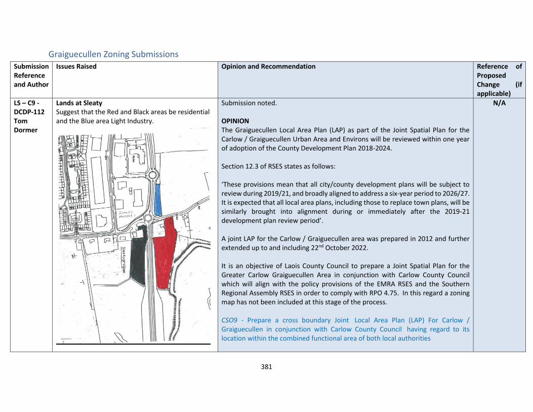
381
Graiguecullen Zoning Submissions Submission Reference and Author
Issues Raised Opinion and Recommendation Reference of Proposed Change (if applicable)
LS – C9 -DCDP-112 Tom Dormer
Lands at Sleaty Suggest that the Red and Black areas be residential and the Blue area Light Industry.
Submission noted. OPINION The Graiguecullen Local Area Plan (LAP) as part of the Joint Spatial Plan for the Carlow / Graiguecullen Urban Area and Environs will be reviewed within one year of adoption of the County Development Plan 2018-2024. Section 12.3 of RSES states as follows: ‘These provisions mean that all city/county development plans will be subject to review during 2019/21, and broadly aligned to address a six-year period to 2026/27. It is expected that all local area plans, including those to replace town plans, will be similarly brought into alignment during or immediately after the 2019-21 development plan review period’. A joint LAP for the Carlow / Graiguecullen area was prepared in 2012 and further extended up to and including 22nd October 2022. It is an objective of Laois County Council to prepare a Joint Spatial Plan for the Greater Carlow Graiguecullen Area in conjunction with Carlow County Council which will align with the policy provisions of the EMRA RSES and the Southern Regional Assembly RSES in order to comply with RPO 4.75. In this regard a zoning map has not been included at this stage of the process. CSO9 - Prepare a cross boundary Joint Local Area Plan (LAP) For Carlow / Graiguecullen in conjunction with Carlow County Council having regard to its location within the combined functional area of both local authorities
N/A
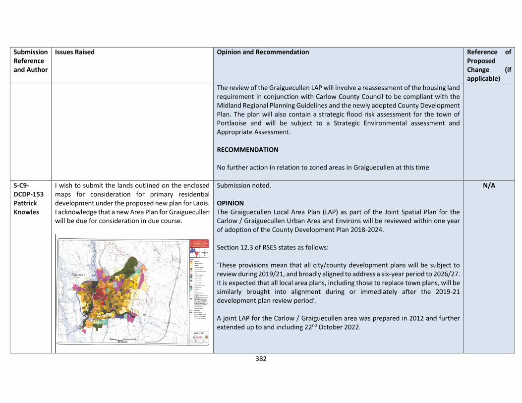
382
Submission Reference and Author
Issues Raised Opinion and Recommendation Reference of Proposed Change (if applicable)
The review of the Graiguecullen LAP will involve a reassessment of the housing land requirement in conjunction with Carlow County Council to be compliant with the Midland Regional Planning Guidelines and the newly adopted County Development Plan. The plan will also contain a strategic flood risk assessment for the town of Portlaoise and will be subject to a Strategic Environmental assessment and Appropriate Assessment. RECOMMENDATION No further action in relation to zoned areas in Graiguecullen at this time
S-C9-DCDP-153 Pattrick Knowles
I wish to submit the lands outlined on the enclosed maps for consideration for primary residential development under the proposed new plan for Laois. I acknowledge that a new Area Plan for Graiguecullen will be due for consideration in due course.
Submission noted. OPINION The Graiguecullen Local Area Plan (LAP) as part of the Joint Spatial Plan for the Carlow / Graiguecullen Urban Area and Environs will be reviewed within one year of adoption of the County Development Plan 2018-2024. Section 12.3 of RSES states as follows: ‘These provisions mean that all city/county development plans will be subject to review during 2019/21, and broadly aligned to address a six-year period to 2026/27. It is expected that all local area plans, including those to replace town plans, will be similarly brought into alignment during or immediately after the 2019-21 development plan review period’. A joint LAP for the Carlow / Graiguecullen area was prepared in 2012 and further extended up to and including 22nd October 2022.
N/A

383
Submission Reference and Author
Issues Raised Opinion and Recommendation Reference of Proposed Change (if applicable)
It is an objective of Laois County Council to prepare a Joint Spatial Plan for the Greater Carlow Graiguecullen Area in conjunction with Carlow County Council which will align with the policy provisions of the EMRA RSES and the Southern Regional Assembly RSES in order to comply with RPO 4.75. In this regard a zoning map has not been included at this stage of the process. CSO9 - Prepare a cross boundary Joint Local Area Plan (LAP) For Carlow / Graiguecullen in conjunction with Carlow County Council having regard to its location within the combined functional area of both local authorities The review of the Graiguecullen LAP will involve a reassessment of the housing land requirement in conjunction with Carlow County Council to be compliant with the Midland Regional Planning Guidelines and the newly adopted County Development Plan. The plan will also contain a strategic flood risk assessment for the town of Portlaoise and will be subject to a Strategic Environmental assessment and Appropriate Assessment. RECOMMENDATION No further action in relation to zoned areas in Graiguecullen at this time
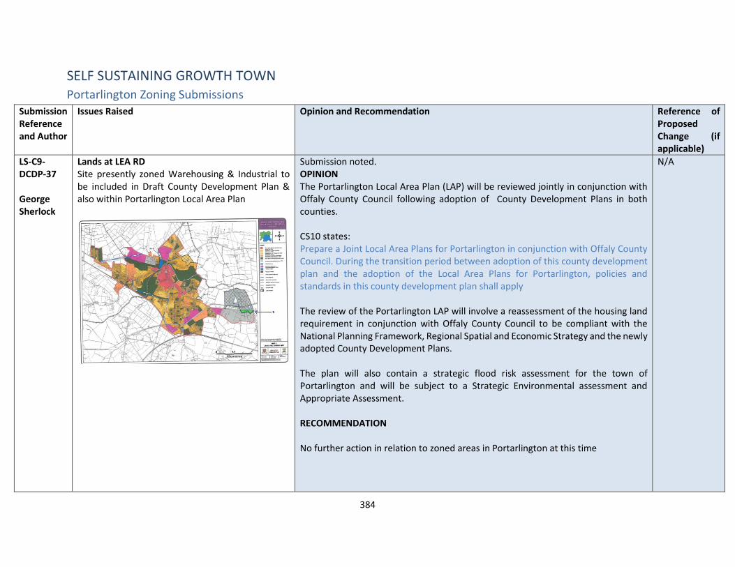
384
SELF SUSTAINING GROWTH TOWN Portarlington Zoning Submissions
Submission Reference and Author
Issues Raised Opinion and Recommendation Reference of Proposed Change (if applicable)
LS-C9-DCDP-37 George Sherlock
Lands at LEA RD Site presently zoned Warehousing & Industrial to be included in Draft County Development Plan & also within Portarlington Local Area Plan
Submission noted. OPINION The Portarlington Local Area Plan (LAP) will be reviewed jointly in conjunction with Offaly County Council following adoption of County Development Plans in both counties. CS10 states: Prepare a Joint Local Area Plans for Portarlington in conjunction with Offaly County Council. During the transition period between adoption of this county development plan and the adoption of the Local Area Plans for Portarlington, policies and standards in this county development plan shall apply The review of the Portarlington LAP will involve a reassessment of the housing land requirement in conjunction with Offaly County Council to be compliant with the National Planning Framework, Regional Spatial and Economic Strategy and the newly adopted County Development Plans. The plan will also contain a strategic flood risk assessment for the town of Portarlington and will be subject to a Strategic Environmental assessment and Appropriate Assessment. RECOMMENDATION No further action in relation to zoned areas in Portarlington at this time
N/A

385
Submission Reference and Author
Issues Raised Opinion and Recommendation Reference of Proposed Change (if applicable)
LS-C9-DCDP-146 James Sherlock
Zoning of Lands at Ballymorris, Portarlington I wish to put forward a plot of land at Ballymorris Portarlington for consideration in the new residential zoning plan for Portarlington. The plot of land is adjacent to the new housing scheme just finished at Canal Gardens, Ballymorris, Portarlington. I have attached a map and have highlighted the field in question. It is in 2 plots marked A and B.
Submission noted. OPINION The Portarlington Local Area Plan (LAP) will be reviewed jointly in conjunction with Offaly County Council following adoption of County Development Plans in both counties. CS10 states: Prepare a Joint Local Area Plans for Portarlington in conjunction with Offaly County Council. During the transition period between adoption of this county development plan and the adoption of the Local Area Plans for Portarlington, policies and standards in this county development plan shall apply The review of the Portarlington LAP will involve a reassessment of the housing land requirement in conjunction with Offaly County Council to be compliant with the National Planning Framework , Regional Spatial and Economic Strategy and the newly adopted County Development Plans. The plan will also contain a strategic flood risk assessment for the town of Portarlington and will be subject to a Strategic Environmental assessment and Appropriate Assessment. RECOMMENDATION No further action in relation to zoned areas in Portarlington at this time

386
SELF SUSTAINING TOWNS Mountmellick
Submission Reference and Author
Issues Raised Mountmellick – Opinion and Recommendations
LS-C9-DCDP-59 Sarah Sherlock
Formulate and deliver a detailed town plan for the whole of Mountmellick, which incorporates its notable historic past, as soon as possible. As it stands the town is left unnecessarily wanting in many respects. Development in and around the town without such is premature and open to fundamental avoidable issues e.g., compromising its heritage or enabling inappropriate, insensitive development.
OPINION Section 4.1. indicates within the Draft Plan that “It is an objective of the Council to make a Local Area Plan for Mountmellick. During the Transition period between adoption of this County Development Plan and the adoption of the Local Area Plan for Mountmellick, the objectives (including zoning objectives – Refer to Map 4.1), policies and standards in this County Development Plan shall apply. A zoning map has been included for the town but the policy objectives are included in the Mountmellick LAP 2018-2024 which will be reviewed post CDP adoption. RECOMMENDATION No change to the Draft Plan
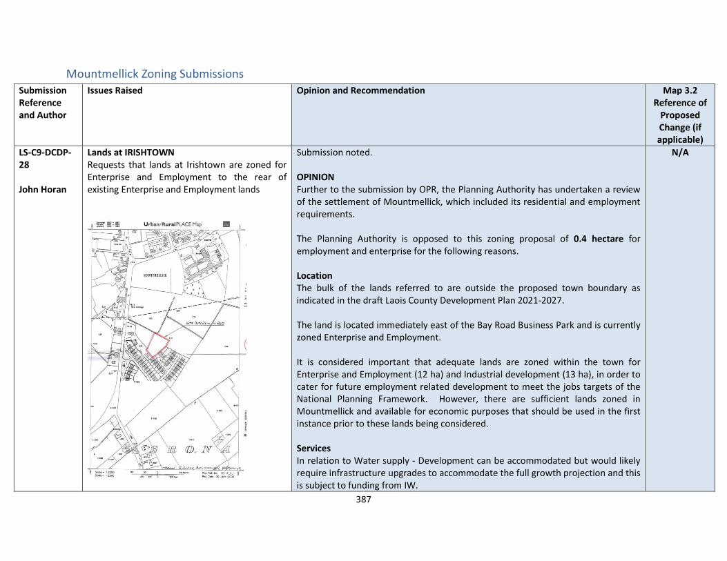
387
Mountmellick Zoning Submissions Submission Reference and Author
Issues Raised Opinion and Recommendation Map 3.2 Reference of
Proposed Change (if applicable)
LS-C9-DCDP-28 John Horan
Lands at IRISHTOWN Requests that lands at Irishtown are zoned for Enterprise and Employment to the rear of existing Enterprise and Employment lands
Submission noted. OPINION Further to the submission by OPR, the Planning Authority has undertaken a review of the settlement of Mountmellick, which included its residential and employment requirements. The Planning Authority is opposed to this zoning proposal of 0.4 hectare for employment and enterprise for the following reasons. Location The bulk of the lands referred to are outside the proposed town boundary as indicated in the draft Laois County Development Plan 2021-2027. The land is located immediately east of the Bay Road Business Park and is currently zoned Enterprise and Employment. It is considered important that adequate lands are zoned within the town for Enterprise and Employment (12 ha) and Industrial development (13 ha), in order to cater for future employment related development to meet the jobs targets of the National Planning Framework. However, there are sufficient lands zoned in Mountmellick and available for economic purposes that should be used in the first instance prior to these lands being considered. Services In relation to Water supply - Development can be accommodated but would likely require infrastructure upgrades to accommodate the full growth projection and this is subject to funding from IW.
N/A

388
Submission Reference and Author
Issues Raised Opinion and Recommendation Map 3.2 Reference of
Proposed Change (if applicable)
In relation to Wastewater Treatment Level of projected growth can be accommodated currently in the Draft Plan for Mountmellick. RECOMMENDATION No change to the Draft Plan.
LS-C9-DCDP-32 Robert Shaw
Lands at TOWNPARK I wish to make a submission to the Laois County Development Plan 2021-2027 for land at Townpark, Mountmellick to be zoned as commercial. I enclose a copy of the site map outlining the site boundary.
Submission noted. OPINION Further to the submission by OPR, the Planning Authority has undertaken a review of the settlement of Mountmellick, which included its employment requirements. This request is to change to Enterprise and Employment. The Planning Authority is opposed to this zoning proposal of 0.35 hectare for employment and enterprise for the following reasons. Location The lands referred to are detached from and outside the town boundary as indicated in the draft Laois County Development Plan 2021-2027. It is considered important that adequate lands are zoned within the town for Enterprise and Employment (12 ha) and Industrial (13 ha), in order to cater for future employment related development to meet the jobs targets of the National Planning Framework. However, there are sufficient lands zoned in Mountmellick for economic purposes that should be used in the first instance prior to these lands being considered. The site also lies within the Roads Objective buffer zone, and therefore these lands need to be safeguarded to deliver that project.
N/A

389
Submission Reference and Author
Issues Raised Opinion and Recommendation Map 3.2 Reference of
Proposed Change (if applicable)
Services In relation to Water supply - Development can be accommodated but would likely require infrastructure upgrades to accommodate the full growth projection and this is subject to funding from IW. In relation to Wastewater Treatment Level of projected growth can be accommodated currently in the Draft Plan for Mountmellick RECOMMENDATION No change to the Draft Plan.
LS-C9-DCDP-40 Mountmellick Parish
Smith’s Field I would like to ask if the current "Open Space" status that applies to Smiths Field be reviewed? Could this property be designated for community, institutional or residential use?
Submission noted. OPINION Further to the submission by OPR, the Planning Authority has undertaken a review of the settlement of Mountmellick, which included its employment and residential land requirements. A masterplan of the entire landbank should be provided to ensure that all uses can complement one another within the area and provide for the development of a sustainable community within the town centre in Mountmellick. The Planning Authority is supportive of amending 0.8 hectares of the existing open space zoning to Residential 2 – New Proposed Residential for the following reasons Location The 3.8 hectare site referred to is currently zoned as open space, adjacent to residential development to the east, which backs on it. The River Owenass forms the western boundary of the site.
18
390
Submission Reference and Author
Issues Raised Opinion and Recommendation Map 3.2 Reference of
Proposed Change (if applicable)
The land is currently under utilised in terms of its open space potential and quality, and is not actively overlooked by the adjacent communities. Therefore, the Planning Authority is of the opinion that rezoning a limited amount of this open space land (i.e. 0.8 hectares) for residential development, will also enable significant community benefits for the remainder of the open space. It will also deliver improved overlooking to these lands. The sites also lies outside the flood zones.
Services In relation to Water supply - Development can be accommodated but would likely require infrastructure upgrades to accommodate the full growth projection and this is subject to funding from IW. In relation to Wastewater Treatment Level of projected growth can be accommodated currently in the Draft Plan for Mountmellick RECOMMENDATION It is recommended to rezone part of the existing open space lands (0.8 hectares)
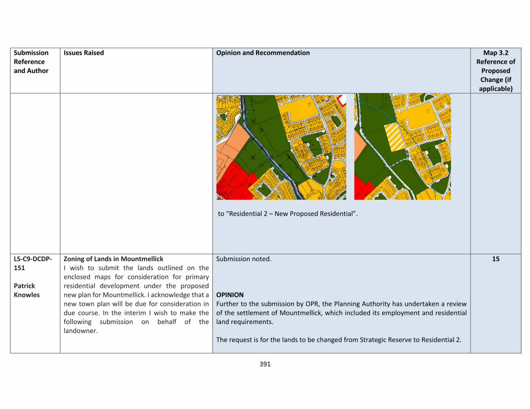
391
Submission Reference and Author
Issues Raised Opinion and Recommendation Map 3.2 Reference of
Proposed Change (if applicable)
to “Residential 2 – New Proposed Residential”.
LS-C9-DCDP-151 Patrick Knowles
Zoning of Lands in Mountmellick I wish to submit the lands outlined on the enclosed maps for consideration for primary residential development under the proposed new plan for Mountmellick. I acknowledge that a new town plan will be due for consideration in due course. In the interim I wish to make the following submission on behalf of the landowner.
Submission noted. OPINION Further to the submission by OPR, the Planning Authority has undertaken a review of the settlement of Mountmellick, which included its employment and residential land requirements. The request is for the lands to be changed from Strategic Reserve to Residential 2.
15

392
Submission Reference and Author
Issues Raised Opinion and Recommendation Map 3.2 Reference of
Proposed Change (if applicable)
The lands are currently zoned for residential 2 development, serviced with mains water and waste water via a pumping station located on the lands. The proposed Draft Plan indicates that this land shall be rezoned to Strategic Residential Reserve and remain so for the duration of the Plan. Mr. Kearns has expended substantial monies in preparation of a planning application on this land on the basis that it was zoned for such development. We were prohibited from proceeding with the application until the services were upgraded. From our discussions with water and sanitary services personnel we were advised that the capacity was improved and would accommodate our proposed development.
The Planning Authority is opposed to this zoning proposal of 2.19 hectares for residential development for the following reasons. Location The bulk of the lands referred to are outside the proposed town boundary as indicated in the Draft Laois County Development Plan 2021-2027. A development here of the scale proposed would be completely at variance with the principle of the sequential approach to the location of new development. The sequential approach in effect favours town, village centre, edge of centre and inner suburban locations over suburban locations for reasons of promoting sustainability, urban compactness and ease of serviceability. There is a strong presumption against the leapfrogging effect which leads to ad-hoc and disjointed development at relatively long distances [such as in this case] from the town centre. In terms of zoning land for ‘New Residential’, the National Strategic Outcome 1 (NSO 1) of the National Planning Framework (NPF) is to seek ‘Compact Growth’ across cities, towns and villages. In this regard, the National Planning Framework states that ‘From an urban development perspective, we will need to deliver a greater proportion of residential development within existing built-up areas of our cities, towns and villages…’. Regional Strategic Outcome 2 (RSO 2) of the Eastern and Midland Regional Spatial and Economic Strategy (RSES) supports the NPF’s NSO1 stating that ‘Residential development should be carried out sequentially, whereby lands which are, or will be, most accessible by walking, cycling and public transport – including infill and brownfield sites – are prioritised.’

393
Submission Reference and Author
Issues Raised Opinion and Recommendation Map 3.2 Reference of
Proposed Change (if applicable)
Existing Mountmellick Local Area Plan – 2018-2024
Draft Mountmellick Local Area Plan 2021-2027
Compact growth and adherence to the Core Strategy is provided for in Chapter 2 of the draft plan as follows Housing Land Requirement Based on the overall housing land requirement for County Laois of 125 hectares up to target year 2027, as set out in Chapter 2 “Core Strategy”, there is no need for additional residentially zoned lands in the town. If this land were to be zoned, it would be at the expense of [and not additional to] other more suitably located lands as identified by application of the sequential approach. It is important to stress that the future population [and by extension the housing land requirement] of County Laois is governed by and shall comply with the housing targets as set out in the section 28 of the Planning and Development Act, 2000 (as amended), the ‘Housing Supply Target Methodology for Development Planning, Guidelines for Planning Authorities’ were issued on 18th December 2020. These Guidelines provide the methodology to be adopted by planning authorities in formulating the housing supply target for their statutory development plan. The methodology utilises recently published research undertaken by the Economic and Social Research Institute – ‘Regional Demographics and Structural Housing Demand at a County Level’, Research Series, Number 111, ESRI, December 2020. The guidelines are to be applied by each planning authority to assist in ensuring that their development plan is prepared to be consistent with the National Planning Framework and relevant Regional Spatial and Economic Strategy.

394
Submission Reference and Author
Issues Raised Opinion and Recommendation Map 3.2 Reference of
Proposed Change (if applicable)
This has informed the Core Strategy of the Draft Laois County Development Plan 2021-2027 and where future growth is directed to in a sustainable manner. As a consequence of the review of the settlement, the Planning Authority is of the opinion that it has sufficient Strategic Reserve sites to meet its projected requirements from 2027-2031 are more sustainably located sites, which lie in closer proximity to the town centre and public transport. Therefore, it is considered not necessary to retain any zoning of these lands. Services In relation to water supply - Development can be accommodated but would likely require infrastructure upgrades to accommodate the full growth projection and this is subject to funding from IW. RECOMMENDATION Change the zoning from Strategic Reserve

395
Submission Reference and Author
Issues Raised Opinion and Recommendation Map 3.2 Reference of
Proposed Change (if applicable)
to open countryside

396
Abbeyleix
Submission Reference and Author
Issues Raised Abbeyleix– Opinion and Recommendation
LS-C9-DCDP-105 Abbeyleix Tody Towns
Conservation and Pollinator Recommendations (a) Support Abbeyleix to Deliver Biodiversity Action Plan Support - Abbeyleix in the delivery of the innovative biodiversity action plan which will see a comprehensive programme of green infrastructure-based recommendations. (b) Deliver biodiversity and pollinator friendly habitats on publicly owned land banks and commonages - The objective to deliver a NeighbourWood in Balladine should be removed as an action point on the Development Plan as this project has already been delivered. As an alternative to the existing objective, we request that opportunities for linkages to the innovative Balladine NeighbourWood Project should be explored. For example, we would welcome the opportunity to deliver further biodiversity and pollinator initiatives on publicly owned land banks and commonages. We would like to look at establishment of biodiverse swards on the wide road to the north and south approaches to Abbeyleix in particular. Energy and Climate Recommendations We welcome the reference to “Support Abbeyleix in becoming Ireland’s first low carbon small town” Copy of Abbeyleix Energy Master Plan attached. We now request that Abbeyleix should be provided with specific support to move to implementation the objectives of the Energy Master Plan. E.g. access to REDF funding - subsidised access to Better Energy Community Programmes. Support Abbeyleix to extend its innovative use of Internet of Things (IoT) technologies to monitor environmental traffic and other environmental variables including air quality. Provide financial support via the €50M Walking and Cycling fund to facilitate a modal
OPINION Submission noted and commentary relating to the development of Abbeyleix for a variety of purposes is also noted. The vast amount of work that the Abbeyleix community have being doing in collaboration with a number of key stakeholders in relation to Climate Action is acknowledged, particularly in relation to biodiversity and developing pollinator friendly habitats , the Balladine neighbourwood scheme. An objective (AB 16) has already been included to support the objectives of the Energy Master Plan. RECOMMENDATION It is proposed to update the Abbeyleix Town Development Plan to include the following:
• Support Abbeyleix to Deliver Biodiversity Action Plan
• Deliver biodiversity and pollinator friendly habitats on publicly owned land banks and commonages
• Support Abbeyleix to extend its innovative use of Internet of Things (IoT) technologies to monitor environmental traffic and other environmental variables including air quality.
• Support Water Conservation projects including rainwater harvesting and “rain garden” projects.
• Develop the necessary infrastructure within the town of Abbeyleix to create Sustainable
397
Submission Reference and Author
Issues Raised Abbeyleix– Opinion and Recommendation
change from the private car to more sustainable modes of transport, namely walking, cycling and public transport. Water Conservation Recommendation We note the reference to our water ram project in the development plan. Further innovative water conservation projects should be supported in Abbeyleix including rainwater harvesting and “rain garden” projects. One specific project that we are proposing in conjunction with the Laois Co Co is water harvesting project (plus potentially a wider “green plan”) in conjunction with the local fire service. Support the placement of public drinking water fountains in and around the town to promote plastic free environment. Sustainable Transport and Healthy Living
• Roll out of 15-minute neighbourhood concept in Abbeyleix - Reducing car use and encouraging active travel are central to delivering the 15-minute vision. The proposition is simple: work with us in a partnership to pilot innovative proposals that will make our roads and streets safer and more appealing for pedestrians and cyclists. We will play our part by making sure our community comes on board with the behavioural change that need to follow. (We note that the recently announced €50M Walking and Cycling fund by the Dept Of Transport would be a suitable funding vehicle to assist this proposal.)
• Pilot Advisory Pedestrian and Cycle lanes - An advisory bicycle lane, or ABL, is a roadway striping configuration which provides for two way motor vehicle and non-motorized traffic using a center lane and “advisory” or edge lanes on either side. The center lane is dedicated to,
Transport and Healthy Living opportunities to achieve a 15-minute neighbourhood
• Support Abbeyleix to further roll out an air quality monitoring programme to provide up to date data and to reinforce active travel campaigns.
Laois County Council has received funding from the National Transport Authority to create a Cycling Strategy for County Laois. The strategy will influence how the Council supports the development of cycling over the next five years. This will include the identification of infrastructure provision for both active travel (commuting), recreation, and activities to promote the growth of cycling in the county. Greenway TRANS 40 in Chapter 10 supports the development of a greenway between Abbeyleix and Portlaoise and also southwards to Attanagh/Durrow. TRANS 41 also Supports the development of and secure funding for a Greenway along a dismantled railway line on between Mountmellick, Portlaoise and Abbeyleix ABT 2 Support in principle and investigate the feasibility of, subject to compliance with the Habitats and Birds Directive, developing and marketing off-road Slieve Bloom Mountain Biking Trail by Coillte, Mountmellick –Portlaoise – Abbeyleix Greenway and Durrow Green Network Cycle Trail in co-operation with relevant stakeholders including Durrow Development Forum

398
Submission Reference and Author
Issues Raised Abbeyleix– Opinion and Recommendation
and shared by, motorists traveling in both directions. Vulnerable road users (VRUs), such as cyclists or pedestrians have right-of-way in the edge lanes but motorists can use the edge lanes, after yielding to the VRUs there, to pass other vehicles. We have undertaken a scoping exercise to identify suitable roadways for this trial. See proposed route in Tullyroe townland (https://arcg.is/1H8z9W0)
In order to facilitate a move from car to bicycles, extend the protected cycle corridor on the N77 (as is currently in place between Durrow and Abbeyleix) northwards to Portlaoise and southwards to Cullohill and beyond. See link to GIS application that set out this proposal in more detail: https://arcg.is/1H8z9W0 Greenway Support the development of a greenway between Abbeyleix and Portlaoise and also southwards to Attanagh/Durrow. This project has been the subject of a preliminary scoping exercise and needs to be revisited as a matter
Development of Other Walking and Cycle Priority Routes Develop linkages with the recently developed “Neighbourwood” scheme at Balladine, Abbeyleix – Facilitate connection opportunities to provide a pedestrian link towards Heritage House. This would revive a previous informal walking route and would also provide a viable “walk to school” option for residents of Balladine/ Gort na nOir and other residents from the Mountrath side of town. Investigate options to reduce motorised use of Coalman’s Road (which has seen a dramatic increase in pedestrian and cycle activity during Covid). Work with local residents to close the road to all but local motorised traffic IAE 1-6 support the development of the Irelands ancient East theme across the county in collaboration with the relevant key stakeholders. It is proposed to include a paragraph in Section 4.2.1 to emphasis the ACA designation as follows: Abbeyleix is designated as an Architectural Conservation Areas (ACAs) which gives the town centre special protection to conserve, maintain and sensitively use the historic buildings. The individual elements such as building heights, building lines, roof lines, materials, construction systems, designed landscapes, public spaces and architectural features combine to give Abbeyleix a harmonious, distinctive and special quality which merits protection. The heritage of the town is a key element of the visitor experience. Any proposals for

399
Submission Reference and Author
Issues Raised Abbeyleix– Opinion and Recommendation
of urgency. Feasibility Study for Abbeyleix to Kilkenny City Leisure Trail attached. Air Quality and Public Health We are putting in place mechanisms to monitor traffic patterns in Abbeyleix. We are requesting assistance from the Local Authority to put a special purpose partnership together to actively deal with this issue. Support Abbeyleix to further roll out an air quality monitoring programme to provide up to date data and to reinforce active travel campaigns. Development of Other Walking and Cycle Priority Routes Develop linkages with the recently developed “Neighbourwood” scheme at Balladine, Abbeyleix – Facilitate connection opportunities to provide a pedestrian link towards Heritage House. This would revive a previous informal walking route and would also provide a viable “walk to school” option for residents of Balladine/ Gort na nOir and other residents from the Mountrath side of town. Investigate options to reduce motorised use of Coalman’s Road (which has seen a dramatic increase in pedestrian and cycle activity during Covid). Work with local residents to close the road to all but local motorised traffic
Tourism and Economic Recommendations Support Abbeyleix to market and promoter itself as a tourism destination in Line with Irelands’ Ancient East. All initiatives should correlate with initiatives of relevant “umbrella groups” such as Laois Tourism.
new development or redevelopment within the ACA should demonstrate that the special character of Abbeyleix has been understood and reflect the existing character of the area in terms of plot size and building scale. Policy Objective AB01 supports the conservation and protection of the ACA. Lands have been zoned for housing and employment and the Draft plan has identified opportunity within the town centre to meet the national planning and regional planning objectives of achieving “compact growth” in line with the actions towards regenerating town centres and reducing the need to travel long distances. This also meets with the “15” minute neighbourhood concept which this submission advocates. The lands at the Stone arch are zoned for Enterprise and employment. Sufficient lands are zoned for residential and open space zoning within the town with a lot of potential in town centre locations. Following consideration of the Stone arch Complex it was noted that the Stone Arch Bridge was not protected and following an appraisal of the structure as follows:- The bridge is not separately recorded on the NIAH survey but is associated with Abbeyleix Station to the immediate north-west, which is recorded under NIAH ref. 12900719 Description Single-arch limestone bridge over a disused railway line (Great Southern & Western Railway – Waterford & Maryborough Branch), constructed in c.

400
Submission Reference and Author
Issues Raised Abbeyleix– Opinion and Recommendation
Built Heritage Summary of ACA and importance of heritage to the town submitted. Any proposals for new development or redevelopment within the ACA should demonstrate that the special character of Abbeyleix has been understood. Any new development, proposed for sites should be sympathetic and reflect the existing character of the area in terms of plot size and building scale. Property owners who fail to maintain and conserve their property should be served with written notice of their obligations and intentions. We therefore respectfully request a renewed emphasis and a threat of enforcement action for breaches to the ACA or Record of Protected Structures. General Planning
• Support the ongoing development of Fr Breen Park in Abbeyleix as a model for a co-located sporting facility which represents an excellent and intensive use of resources within the town centre location. This great facility now requires additional investment to allow it to serve the community into the future. All development should be in line with green infrastructure principles.
• Rezone lands within the settlement of Abbeyleix as appropriate to create opportunities for new housing and recreation infrastructure. The status of the Stone Arch site on the southern approach to the town has remained unchanged over several previous development plan rounds and now needs a more appropriate planning designation to ensure appropriate development. Abbeyleix has offered a strong welcome to new members of the community who are staying in the direct provision centre. Additional facilities should be provided to cater properly for these new members of our community
1864. The bridge comprises a rack-faced limestone wall and abutments, with an elliptical arch with rock-faced voussoirs. The bridge was constructed to carry a raised roadway over the railway line. Following the closure of the railway line, this elevated bridge was bypassed by a new roadway to the immediate south-east. The sloped approach on either side of the bridge is now overgrown with trees. Architectural The bridge is a well-crafted and intact exemplar of railway bridge design, forming part of the now disused Waterford & Maryborough Branch railway line. The bridge makes a positive contribution to the southern approach to Abbeyleix, with the realignment of the Cork Road following the closure of the railway line giving the structure greater prominence. Technical The bridge is an exemplar of engineering practice of its time. It is recommended that this structure is added to the Record of Protected Structures. Reason This mid-nineteenth century railway bridge is a structure of architectural and technical special interest, equivalent to a NIAH Regional Rating. Although closely associated with the nearby Abbeyleix Station, the bridge is a significant structure in its own right and merits separate inclusion on the RPS. AB 11 has already been included to support the ongoing development of Fr Breen Park.
401
Submission Reference and Author
Issues Raised Abbeyleix– Opinion and Recommendation
RECOMENDATION It is proposed to update the Abbeyleix Town Development Plan to include the following:
• Support Abbeyleix to Deliver Biodiversity Action Plan
• Deliver biodiversity and pollinator friendly habitats on publicly owned land banks and commonages
• Support Abbeyleix to extend its innovative use of Internet of Things (IoT) technologies to monitor environmental traffic and other environmental variables including air quality.
• Support Water Conservation projects including rainwater harvesting and “rain garden” projects.
• Develop the necessary infrastructure within the town of Abbeyleix to create Sustainable Transport and Healthy Living opportunities to achieve a 15-minute neighbourhood
• Support Abbeyleix to further roll out an air quality monitoring programme to provide up to date data and to reinforce active travel campaigns.
It is proposed to include a paragraph in Section 4.2.1 to emphasis the ACA designation as follows: Abbeyleix is designated as an Architectural Conservation Areas (ACAs) which gives the town centre special protection to conserve, maintain and sensitively use the historic buildings. The individual elements
402
Submission Reference and Author
Issues Raised Abbeyleix– Opinion and Recommendation
such as building heights, building lines, roof lines, materials, construction systems, designed landscapes, public spaces and architectural features combine to give Abbeyleix a harmonious, distinctive and special quality which merits protection. The heritage of the town is a key element of the visitor experience. Any proposals for new development or redevelopment within the ACA should demonstrate that the special character of Abbeyleix has been understood and reflect the existing character of the area in terms of plot size and building scale. It is proposed to add the following structure to the RPS RPS XX - Former Railway Bridge (stone arch on approach to Abbeyleix from south)
LS-C9-DCDP-119 Elizabeth Caas
The submission refers to objectives AB 17 and AB 22 in relation to recreation linkages.
Map 4.2 (B)- Abbeyleix is noted and of a proposed upgrade and construction of footpath on area marked with a green line which is the local road off of the R430 (Mountrath Road) connecting back to R433 (Ballacolla Road). As landowners on both sides of this road consultation has not taken place by the County Council. It is imperative that engagement take place so that if same is to proceed it can be carefully planned.
A plan to provide a walkway on riversides also marked on Map 4.2 (B) is also proposed. The details of this proposal are not expanded upon in the draft Development Plan and anything touching upon same is scant. It is noted that the proposed walkway traverses a busy road and in fact cuts through private land currently being farmed. It is also running adjacent to
OPINION The submission is noted in relation to the identification of proposed greenway / walking routes along the riverside. The Draft Plan in advocating for better pedestrian and cycling connectivity now and in the future has many objectives throughout the Draft for the creation of such infrastructure. There is no solid proposals for this currently, however it is an objective that should at a later date development occur on this site , facility would be made for this linkage. The lands are obviously within a 15 minute walk of the town centre and so sequentially could be developed at a future date.
403
Submission Reference and Author
Issues Raised Abbeyleix– Opinion and Recommendation
busy working farmyards. If a walkway were to be constructed in accordance with the map it would have a detrimental effect on my clients’ fundamental constitutional rights to earn a livelihood and their property rights, this farm having been operated by their ancestors for several generations. There could also be health and safety issues for users of the walkway and an impact on my clients’ livestock. It is submitted that there are more suitable less invasive alternatives around the town. Submission refers to Abbeyleix Bog and Lord’s walk as additional recreation walks in the town. It is requested that proper on the ground consultation needs to occur with all those that will be impacted by proposals in the Draft Plan. Better communication including individual meetings is required. No approach was made by the County Council or local community groups to discuss these proposals.
It is proposed to retain this linkage so that any future development of the lands in question consider it within their proposals. This would be discussed at a pre planning stage of any future applications. RECOMMENDATION No change to the Draft Plan
LS-C9-DCDP-123 Danial Cass
4.2(B)-ABBEYLEIX (attached) which highlight walkways on riverside (shown by blue line) the walkways west of R430 (Mountrath rd) are dissecting my families and my farm and the line of the proposed walk follows the stream but this same stream increases flow dramatically during rainfall so it seems to be more surface water drain then stream. Does the latest development of Respond housing have water attenuation and will the earmarked Site OPPORTUNITY/REGENERATION SITE at the back of main street, will this site have planning requirements for water attenuation as I feel that the capacity of this stream/drain will be at risk If not addressed at planning and design. Inability for public access to the lands for beneficial use as open space and amenity - I have no intention to use this stream/drain line (as highlighted in blue) for open space and amenity (public walkway) and am not in a position to allow my lands for public access. This walkway goes right through my sons
The submission is noted in relation to the identification of proposed greenway / walking routes along the riverside. The Draft Plan in advocating for better pedestrian and cycling connectivity now and in the future has many objectives throughout the Draft for the creation of such infrastructure. There is no solid proposals for this currently, however it is an objective that should at a later date development occur on this site , facility would be made for this linkage. The lands are obviously within a 15 minute walk of the town centre and so sequentially could be developed at a future date. It is proposed to retain this linkage so that any future development of the lands in question consider it within their proposals.

404
Submission Reference and Author
Issues Raised Abbeyleix– Opinion and Recommendation
working farm and right beside mine and would create huge health and safety issues and would jeapordise a multi generational business. I would also like to point out at this stage that lands beside Fr Breen park which was zoned residential up to 2012 and changed to open space and amenity. I have no intention to use these lands for open space and amenity and am not in a position to allow public access, therefore the zoning of this area for open space and amenity is not practical and I am not in a position to allow beneficial use of the lands for open space and amenity. I would ask at this stage that laois.co.co refer back to my sons submission on feb 2011 for (2012- 2018 CDP) which he highlighted to them that the use of public lands behind Abbeycresent and beside the Fairways and close proximity to Abbeyleix primary school would be a much better site for a hurling field beside young families and the added advantage of daytime use by primary school kids. Which leads me to the next question why is L.C.C trying to turn private zoned industrial land (job opportunities) into Open space and amenity (250ha approx. in abbeyleix at present). I notice that the back of balladine estate has an open space and amenity area beside the houses has been planted in the last couple of weeks(neighbourhood) and also the Gloreen river runs the back of Gort na nore which would be an ideal riverside walk on publicly owned land. I am also amazed at this stage that not one representative from Laois.Co.Co approached me or my family to discuss any of the proposed designs.
This would be discussed at a preplanning stage of any future applications. Storm water attenuation are considerations during the course of assessment of planning applications, Policy Objective SS 18 relate. The authors position in relation to the zoning of his land for open space and amenity and his opposition to same given the land is being farmed and any consideration in this context would be a threat to their multi-generational business is noted. Therefore the lands should be returned to open countryside to reflect the use currently being carried out on it
It is also noted the reference to the requirement for a hurling pitch within abbeyleix. However it is also noted that the Park Facility referred to in earlier submissions from the community advocates for its development given its very central location within the town. The land to the rear of Abbey Crescent is zoned for residential use which is much needed within the town of Abbeyleix. Recommendation

405
Submission Reference and Author
Issues Raised Abbeyleix– Opinion and Recommendation
The lands have been amended from Strategic Reserve to open countryside to reflect the use See map amendment
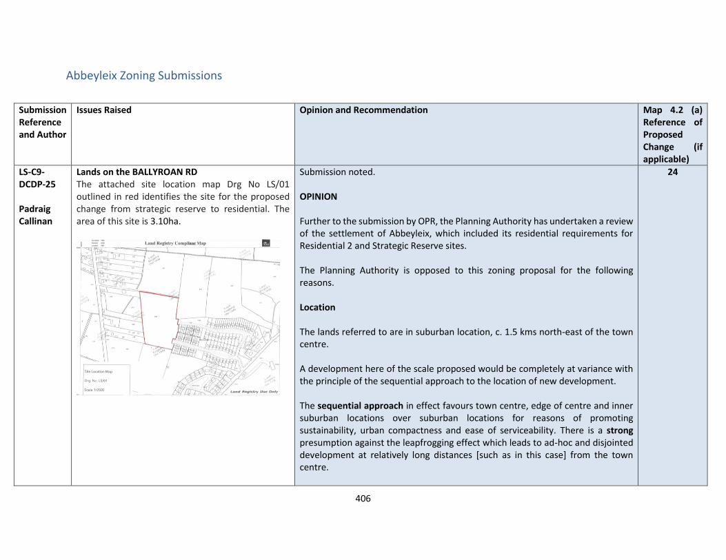
406
Abbeyleix Zoning Submissions
Submission Reference and Author
Issues Raised Opinion and Recommendation Map 4.2 (a) Reference of Proposed Change (if applicable)
LS-C9-DCDP-25 Padraig Callinan
Lands on the BALLYROAN RD The attached site location map Drg No LS/01 outlined in red identifies the site for the proposed change from strategic reserve to residential. The area of this site is 3.10ha.
Submission noted. OPINION Further to the submission by OPR, the Planning Authority has undertaken a review of the settlement of Abbeyleix, which included its residential requirements for Residential 2 and Strategic Reserve sites. The Planning Authority is opposed to this zoning proposal for the following reasons. Location The lands referred to are in suburban location, c. 1.5 kms north-east of the town centre. A development here of the scale proposed would be completely at variance with the principle of the sequential approach to the location of new development. The sequential approach in effect favours town centre, edge of centre and inner suburban locations over suburban locations for reasons of promoting sustainability, urban compactness and ease of serviceability. There is a strong presumption against the leapfrogging effect which leads to ad-hoc and disjointed development at relatively long distances [such as in this case] from the town centre.
24
407
Submission Reference and Author
Issues Raised Opinion and Recommendation Map 4.2 (a) Reference of Proposed Change (if applicable)
Housing Land Requirement Based on the overall housing land requirement for Abbeyleix of 5 hectares up to target year 2027, as set out in Chapter 2 “Development Strategy”, there is no need for additional residentially zoned lands in the town. If this land were to be zoned, it would be at the expense of [and not additional to] other more suitably located lands as identified by application of the sequential approach. It is important to stress that the future population [and by extension the housing land requirement] of Abbeyleix is governed by and shall comply with the target of 10 hectares set by the core strategy of the draft Laois County Development Plan 2021-2027. RECOMMENDATION Dezone the site as outlined below
LS-C9-DCDP-27 Ross McDonald
Development on MAIN STREET Preston House to be rezoned back to town centre from residential 1 in order to preserve the function of the town centre.
Submission Noted OPINION Preston House is located along the Main Street Abbeyleix and currently accommodates office and commercial uses. This is zoned for Town Centre uses to reflect the current occfupation in the Draft Plan. RECOMMENDATION No change to Draft Plan
N/A
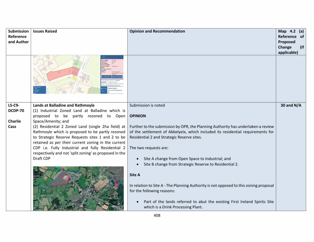
408
Submission Reference and Author
Issues Raised Opinion and Recommendation Map 4.2 (a) Reference of Proposed Change (if applicable)
LS-C9-DCDP-70 Charlie Cass
Lands at Balladine and Rathmoyle (1) Industrial Zoned Land at Balladine which is proposed to be partly rezoned to Open Space/Amenity; and (2) Residential 2 Zoned Land (single 2ha field) at Rathmoyle which is proposed to be partly rezoned to Strategic Reserve Requests sites 1 and 2 to be retained as per their current zoning in the current CDP i.e. Fully Industrial and fully Residential 2 respectively and not 'split zoning' as proposed in the Draft CDP
Submission is noted OPINION Further to the submission by OPR, the Planning Authority has undertaken a review of the settlement of Abbelyeix, which included its residential requirements for Residential 2 and Strategic Reserve sites. The two requests are:
• Site A change from Open Space to Industrial; and
• Site B change from Strategic Reserve to Residential 2. Site A In relation to Site A - The Planning Authority is not opposed to this zoning proposal for the following reasons:
• Part of the lands referred to abut the existing First Ireland Spirits Site which is a Drink Processing Plant.
30 and N/A

409
Submission Reference and Author
Issues Raised Opinion and Recommendation Map 4.2 (a) Reference of Proposed Change (if applicable)
• The site is not adjoining any residential lands except for on the western boundary of the site.
• The river abuts the site and flood zones have been indicated on this land, however following further assessment it is considered that industrial could be developed on it.
• In order to protect any future residential occupancy a buffer of landscaped / amenity area will be zoned along the boundary of the site.
Flooding The site has been assessed in the SFRA and passed the justification test as follows:
Undeveloped Industrial lands are within the Flood Zone A extent of the Ballyroan River tributary, which is defined by the indicative PFRA mapping, it was not possible to gain access to the lands to visually verify the PFRA data. The site is extensive and there is a significant proportion of Flood Zone C available.
Parts 1 & 2 of the test found that it is considered appropriate to retain the existing zoning.
Any future development of the Industrial lands should be subject to a Stage 3 Detailed FRA which should follow the general guidance provided in Section 7 of the SFRA and must specifically address the following:
• Existing flood data is indicative and does not provide flood levels. An appropriately detailed hydraulic model will be required to confirm flood levels and extents.
• The sequential approach must be applied and less vulnerable elements of the site should be located in Flood Zone B or preferably
410
Submission Reference and Author
Issues Raised Opinion and Recommendation Map 4.2 (a) Reference of Proposed Change (if applicable)
C;
• Flood Zone A must be kept as water compatible use with no land raising;
• FRA should address climate change scenarios in relation to operational levels and potential mitigation measures;
• Proposals should not impede existing flow paths or cause flood risk impacts to the surrounding areas, and;
• Emergency evacuation plan and defined access / egress routes should be developed for extreme flood events.
Any development shall also be required to be built in accordance with LCC SuDS Policy. Services The site is adequately serviced. Site B In relation to Site B, the Planning Authority is opposed to this zoning proposal for the following reasons. Location The lands referred to are in suburban location, c. 1.5 kms north-east of the town centre. A development here of the scale proposed would be completely at variance with the principle of the sequential approach to the location of new development.
411
Submission Reference and Author
Issues Raised Opinion and Recommendation Map 4.2 (a) Reference of Proposed Change (if applicable)
The sequential approach in effect favours town centre, edge of centre and inner suburban locations over suburban locations for reasons of promoting sustainability, urban compactness and ease of serviceability. There is a strong presumption against the leapfrogging effect which leads to ad-hoc and disjointed development at relatively long distances [such as in this case] from the town centre. Housing Land Requirement Based on the overall housing land requirement for Abbeyleix of 5 hectares up to target year 2027, as set out in Chapter 2 “Development Strategy”, there is no need for additional residentially zoned lands in the town. If this land were to be zoned, it would be at the expense of [and not additional to] other more suitably located lands as identified by application of the sequential approach. It is important to stress that the future population [and by extension the housing land requirement] of Abbeyleix is governed by and shall comply with the target of 10 hectares set by the core strategy of the draft Laois County Development Plan 2021-2027. RECOMMENDATION It is recommended that:
• Site A - be zoned for Industrial purposes as outlined below:

412
Submission Reference and Author
Issues Raised Opinion and Recommendation Map 4.2 (a) Reference of Proposed Change (if applicable)
• Site B - No change to the Draft Plan; leave lands as zoned “Strategic Reserve”
LS-C9-DCDP-74 Michael Cass
Lands at Balladine It is submitted that the lands shown red on Map below to be zoned “Industrial” in the 2021-2027 Laois Development Plan. It is also submitted that no public walkway be allowed to traverse the lands and any potential walkway should be consistent with the existing site boundaries. (blue dash)
Submission is noted OPINION In relation to the proposal to zone lands for industrial development - The Planning Authority is not opposed to this zoning proposal for the following reasons.
30
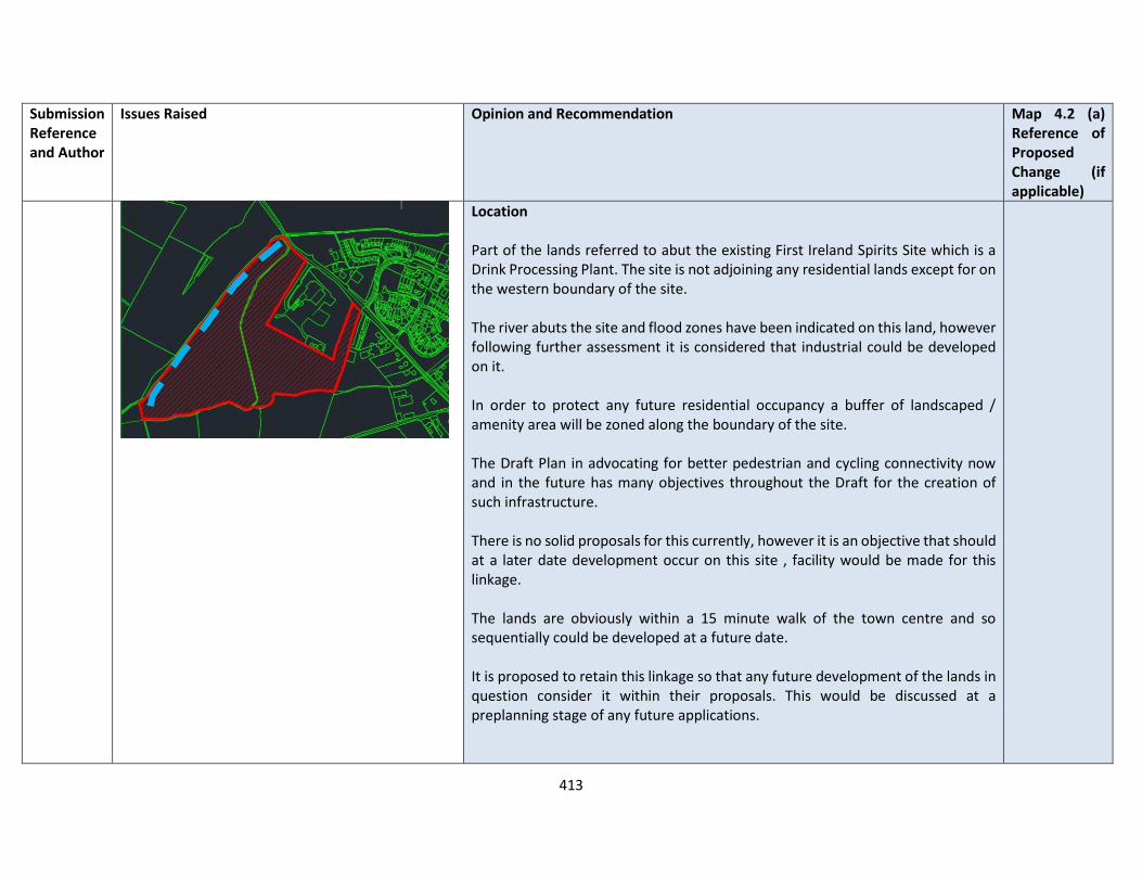
413
Submission Reference and Author
Issues Raised Opinion and Recommendation Map 4.2 (a) Reference of Proposed Change (if applicable)
Location Part of the lands referred to abut the existing First Ireland Spirits Site which is a Drink Processing Plant. The site is not adjoining any residential lands except for on the western boundary of the site. The river abuts the site and flood zones have been indicated on this land, however following further assessment it is considered that industrial could be developed on it. In order to protect any future residential occupancy a buffer of landscaped / amenity area will be zoned along the boundary of the site. The Draft Plan in advocating for better pedestrian and cycling connectivity now and in the future has many objectives throughout the Draft for the creation of such infrastructure. There is no solid proposals for this currently, however it is an objective that should at a later date development occur on this site , facility would be made for this linkage. The lands are obviously within a 15 minute walk of the town centre and so sequentially could be developed at a future date. It is proposed to retain this linkage so that any future development of the lands in question consider it within their proposals. This would be discussed at a preplanning stage of any future applications.

414
Submission Reference and Author
Issues Raised Opinion and Recommendation Map 4.2 (a) Reference of Proposed Change (if applicable)
Flooding The site has been assessed in the SFRA and passed the justification test as follows:
Undeveloped Industrial lands are within the Flood Zone A extent of the Ballyroan River tributary, which is defined by the indicative PFRA mapping, it was not possible to gain access to the lands to visually verify the PFRA data. The site is extensive and there is a significant proportion of Flood Zone C available.
Parts 1 & 2 of the test found that it is considered appropriate to retain the existing zoning.
Any future development of the Industrial lands should be subject to a Stage 3 Detailed FRA which should follow the general guidance provided in Section 7 of the SFRA and must specifically address the following:
• Existing flood data is indicative and does not provide flood levels. An appropriately detailed hydraulic model will be required to confirm flood levels and extents.
• The sequential approach must be applied and less vulnerable elements of the site should be located in Flood Zone B or preferably C;
• Flood Zone A must be kept as water compatible use with no land raising;
• FRA should address climate change scenarios in relation to operational levels and potential mitigation measures;
• Proposals should not impede existing flow paths or cause flood risk impacts to the surrounding areas, and;
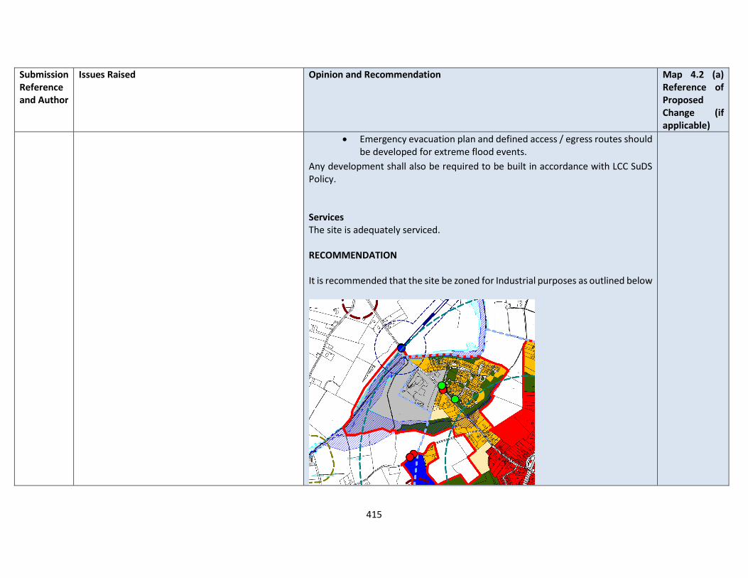
415
Submission Reference and Author
Issues Raised Opinion and Recommendation Map 4.2 (a) Reference of Proposed Change (if applicable)
• Emergency evacuation plan and defined access / egress routes should be developed for extreme flood events.
Any development shall also be required to be built in accordance with LCC SuDS Policy. Services The site is adequately serviced. RECOMMENDATION It is recommended that the site be zoned for Industrial purposes as outlined below
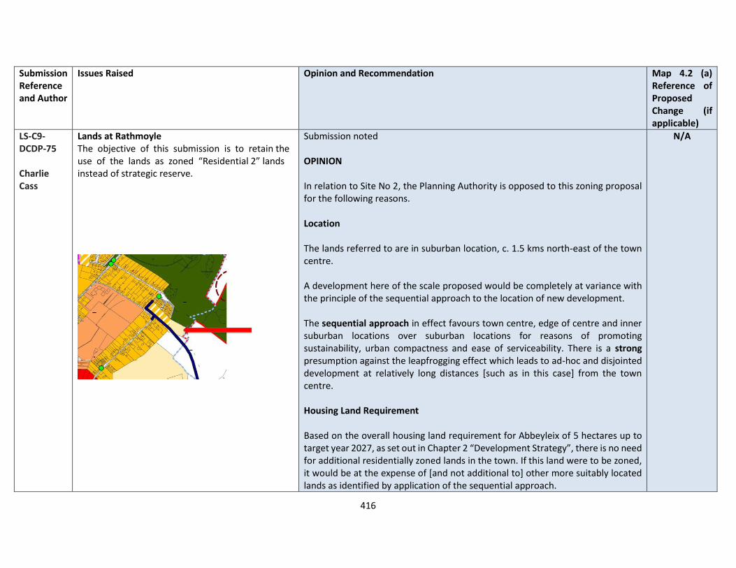
416
Submission Reference and Author
Issues Raised Opinion and Recommendation Map 4.2 (a) Reference of Proposed Change (if applicable)
LS-C9-DCDP-75 Charlie Cass
Lands at Rathmoyle The objective of this submission is to retain the use of the lands as zoned “Residential 2” lands instead of strategic reserve.
Submission noted OPINION In relation to Site No 2, the Planning Authority is opposed to this zoning proposal for the following reasons. Location The lands referred to are in suburban location, c. 1.5 kms north-east of the town centre. A development here of the scale proposed would be completely at variance with the principle of the sequential approach to the location of new development. The sequential approach in effect favours town centre, edge of centre and inner suburban locations over suburban locations for reasons of promoting sustainability, urban compactness and ease of serviceability. There is a strong presumption against the leapfrogging effect which leads to ad-hoc and disjointed development at relatively long distances [such as in this case] from the town centre. Housing Land Requirement Based on the overall housing land requirement for Abbeyleix of 5 hectares up to target year 2027, as set out in Chapter 2 “Development Strategy”, there is no need for additional residentially zoned lands in the town. If this land were to be zoned, it would be at the expense of [and not additional to] other more suitably located lands as identified by application of the sequential approach.
N/A

417
Submission Reference and Author
Issues Raised Opinion and Recommendation Map 4.2 (a) Reference of Proposed Change (if applicable)
It is important to stress that the future population [and by extension the housing land requirement] of Abbeyleix is governed by and shall comply with the target of 10 hectares set by the core strategy of the draft Laois County Development Plan 2021-2027. RECOMMENDATION It is recommended that there is No change to the Draft Plan; leave lands as zoned “Strategic Reserve”
LS-C9-DCDP-123 Daniel Cass
Lands on Mountrath Rd Zoning of open space – reduced industrial zoning on lands
Submission is noted OPINION In relation to Site A - The Planning Authority is not opposed to this zoning proposal for the following reasons. Location Part of the lands referred to abut the existing First Ireland Spirits Site which is a Drinks Processing Plant. The site is not adjoining any residential lands except for on the western boundary of the site. The river abuts the site and flood zones have been indicated on this land, however following further assessment it is considered that industrial could be developed on it.
30

418
Submission Reference and Author
Issues Raised Opinion and Recommendation Map 4.2 (a) Reference of Proposed Change (if applicable)
In order to protect any future residential occupancy a buffer of landscaped / amenity area will be zoned along the boundary of the site. The Draft Plan in advocating for better pedestrian and cycling connectivity now and in the future has many objectives throughout the Draft for the creation of such infrastructure. There is no solid proposals for this currently, however it is an objective that should at a later date development occur on this site , facility would be made for this linkage. The lands are obviously within a 15 minute walk of the town centre and so sequentially could be developed at a future date. It is proposed to retain this linkage so that any future development of the lands in question consider it within their proposals. This would be discussed at a preplanning stage of any future applications. Flooding The site has been assessed in the SFRA and passed the justification test as follows:
Undeveloped Industrial lands are within the Flood Zone A extent of the Ballyroan River tributary, which is defined by the indicative PFRA mapping, it was not possible to gain access to the lands to visually verify the PFRA data. The site is extensive and there is a significant proportion of Flood Zone C available.
Parts 1 & 2 of the test found that it is considered appropriate to retain the existing zoning.
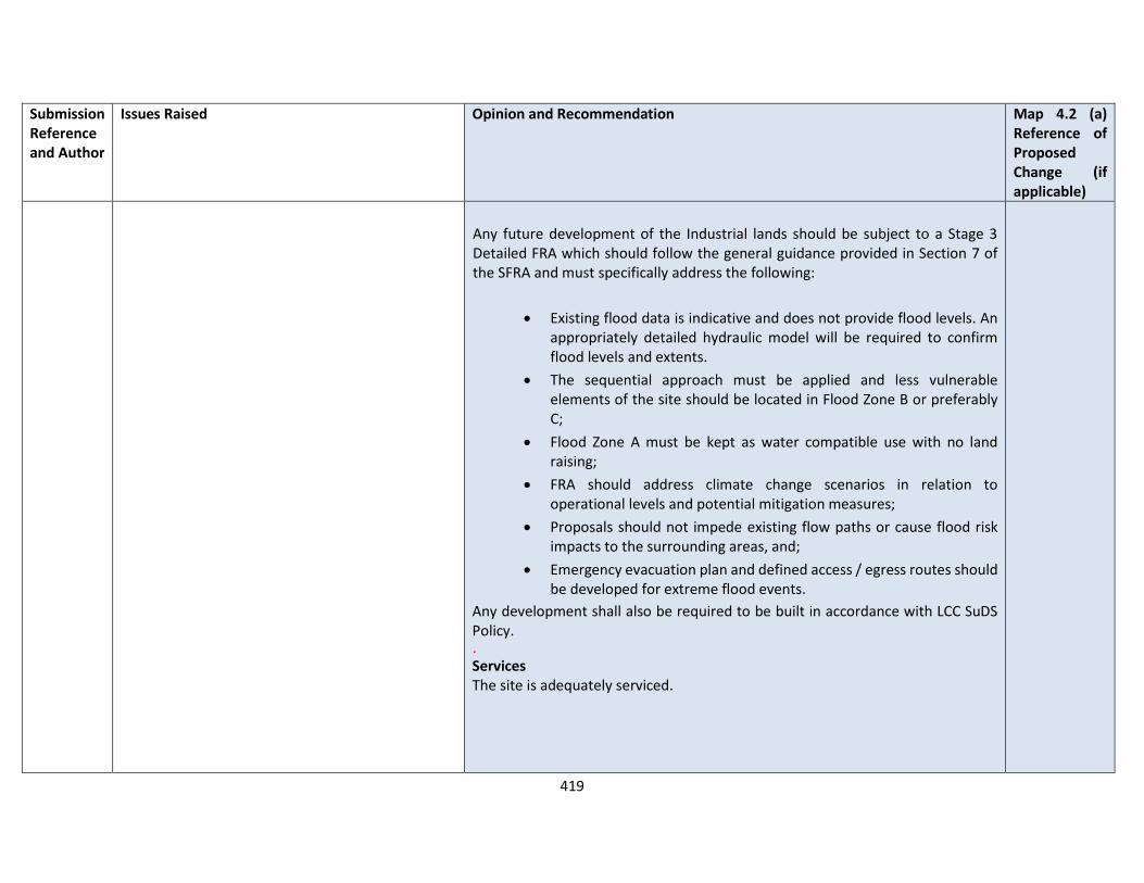
419
Submission Reference and Author
Issues Raised Opinion and Recommendation Map 4.2 (a) Reference of Proposed Change (if applicable)
Any future development of the Industrial lands should be subject to a Stage 3 Detailed FRA which should follow the general guidance provided in Section 7 of the SFRA and must specifically address the following:
• Existing flood data is indicative and does not provide flood levels. An appropriately detailed hydraulic model will be required to confirm flood levels and extents.
• The sequential approach must be applied and less vulnerable elements of the site should be located in Flood Zone B or preferably C;
• Flood Zone A must be kept as water compatible use with no land raising;
• FRA should address climate change scenarios in relation to operational levels and potential mitigation measures;
• Proposals should not impede existing flow paths or cause flood risk impacts to the surrounding areas, and;
• Emergency evacuation plan and defined access / egress routes should be developed for extreme flood events.
Any development shall also be required to be built in accordance with LCC SuDS Policy. . Services The site is adequately serviced.

420
Submission Reference and Author
Issues Raised Opinion and Recommendation Map 4.2 (a) Reference of Proposed Change (if applicable)
RECOMMENDATION It is recommended that the lands be zoned for Industrial purposes and the pedestrian walkway be retained as an objective, which would form part of future proposals to develop these lands for industrial development. RECOMMENDATION It is recommended that the site be zoned for Industrial purposes as outlined below

421
Submission Reference and Author
Issues Raised Opinion and Recommendation Map 4.2 (a) Reference of Proposed Change (if applicable)
LS-C9-DCDP-148 AOCA
Lands at Tullyroe, Abbeyleix Requests that a review of the zoning map specifically in relation to the parcel of land take have it zoned as Residential 2 – New Proposed Residential. A Hydrological review of the site and surrounding lands and the general catchment of the Ballymullen Stream, and seek the removal of the current Flood Risk Categorisation for the site and all the surrounding lands. This entire area is not identified as a flood risk on the latest NIFM maps which substantiates our re-designation request.
Submission noted OPINION Further to the submission by OPR, the Planning Authority has undertaken a review of the settlement of Abbeyleix, which included its residential requirements for Residential 2 and Strategic Reserve sites. Requests lands be zoned for Residential 2 – New Proposed Residential
• Notwithstanding that the subject land is serviced with water mains and sewer, zoning it ‘New Residential’:
• Would not support compact growth as there are other lands within the town identified as being more appropriately located closer to the town centre to deliver the Core Strategy housing allocation for the town over the lifetime of the development plan, consistent with NSO 1 and RSO 2;
• Would constitute undesirable urban sprawl; and
• Would result in population growth for the town significantly in excess of that allocated for 80 units in the Core Strategy for the county in Chapter 2 of the Draft Plan, and accordingly it is recommended that this site remain not zoned.
RECOMMENDATION No change to the Draft Plan
N/A
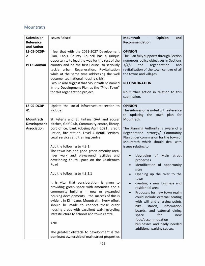
422
Mountrath
Submission Reference and Author
Issues Raised Mountrath – Opinion and Recommendation
LS-C9-DCDP-2 PJ O’Gorman
I feel that with the 2021-2027 Development Plan, Laois County Council has a unique opportunity to lead the way for the rest of the country and be the first Council to seriously tackle urban Regeneration, Revitalisation while at the same time addressing the well documented national housing crisis. I would also suggest that Mountrath be named in the Development Plan as the “Pilot Town” for this regeneration project.
OPINION The Plan fully supports through Section numerous policy objectives in Sections 3/4/7 the regeneration and revitalisation of the town centres of all the towns and villages. RECOMEDNATION No further action in relation to this submission.
LS-C9-DCDP-41 Mountrath Development Association
Update the social infrastructure section to include: St Peter’s and St Fintans GAA and soccer pitches, Golf Club, Community centre, library, port office, bank (closing April 2021), credit untion, fire station. Level 4 Retail Services. Legal services and training centre Add the following to 4.3.1: The town has and good green amenity area, river walk and playground facilities and developing Youth Space on the Castletown Road Add the following to 4.3.2.1 It is vital that consideration is given to providing green space with amenities and a community building in new or expanded housing developments – the success of this is evident in Kiln Lane, Mountrath. Every effort should be made to connect these outer housing areas with excellent walking/cycling infrastructure to schools and town centre. AND The greatest obstacle to development is the dominant ownership of main street properties
OPINION The submission is noted with reference to updating the town plan for Mountrath. The Planning Authority is aware of a Regeneration strategy/ Community Plan under commission for the town of Mountrath which should deal with issues relating to:
• Upgrading of Main street properties
• Identification of opportunity sites
• Opening up the river to the town
• creating a new business and residential area.
• Proposals for new town realm could include external seating with wifi and charging points bike stands, information boards, and external dining space for new food/accommodation businesses and badly needed additional parking spaces.
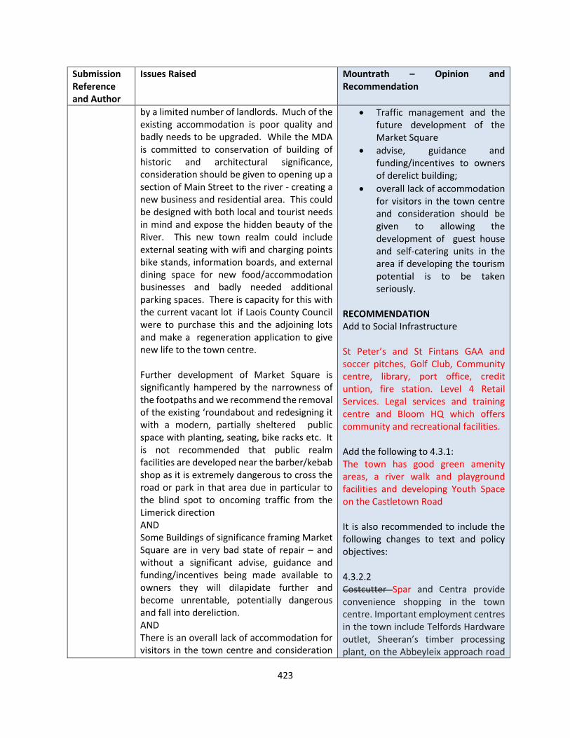
423
Submission Reference and Author
Issues Raised Mountrath – Opinion and Recommendation
by a limited number of landlords. Much of the existing accommodation is poor quality and badly needs to be upgraded. While the MDA is committed to conservation of building of historic and architectural significance, consideration should be given to opening up a section of Main Street to the river - creating a new business and residential area. This could be designed with both local and tourist needs in mind and expose the hidden beauty of the River. This new town realm could include external seating with wifi and charging points bike stands, information boards, and external dining space for new food/accommodation businesses and badly needed additional parking spaces. There is capacity for this with the current vacant lot if Laois County Council were to purchase this and the adjoining lots and make a regeneration application to give new life to the town centre. Further development of Market Square is significantly hampered by the narrowness of the footpaths and we recommend the removal of the existing ‘roundabout and redesigning it with a modern, partially sheltered public space with planting, seating, bike racks etc. It is not recommended that public realm facilities are developed near the barber/kebab shop as it is extremely dangerous to cross the road or park in that area due in particular to the blind spot to oncoming traffic from the Limerick direction AND Some Buildings of significance framing Market Square are in very bad state of repair – and without a significant advise, guidance and funding/incentives being made available to owners they will dilapidate further and become unrentable, potentially dangerous and fall into dereliction. AND There is an overall lack of accommodation for visitors in the town centre and consideration
• Traffic management and the future development of the Market Square
• advise, guidance and funding/incentives to owners of derelict building;
• overall lack of accommodation for visitors in the town centre and consideration should be given to allowing the development of guest house and self-catering units in the area if developing the tourism potential is to be taken seriously.
RECOMMENDATION Add to Social Infrastructure St Peter’s and St Fintans GAA and soccer pitches, Golf Club, Community centre, library, port office, credit untion, fire station. Level 4 Retail Services. Legal services and training centre and Bloom HQ which offers community and recreational facilities. Add the following to 4.3.1: The town has good green amenity areas, a river walk and playground facilities and developing Youth Space on the Castletown Road It is also recommended to include the following changes to text and policy objectives: 4.3.2.2 Costcutter Spar and Centra provide convenience shopping in the town centre. Important employment centres in the town include Telfords Hardware outlet, Sheeran’s timber processing plant, on the Abbeyleix approach road
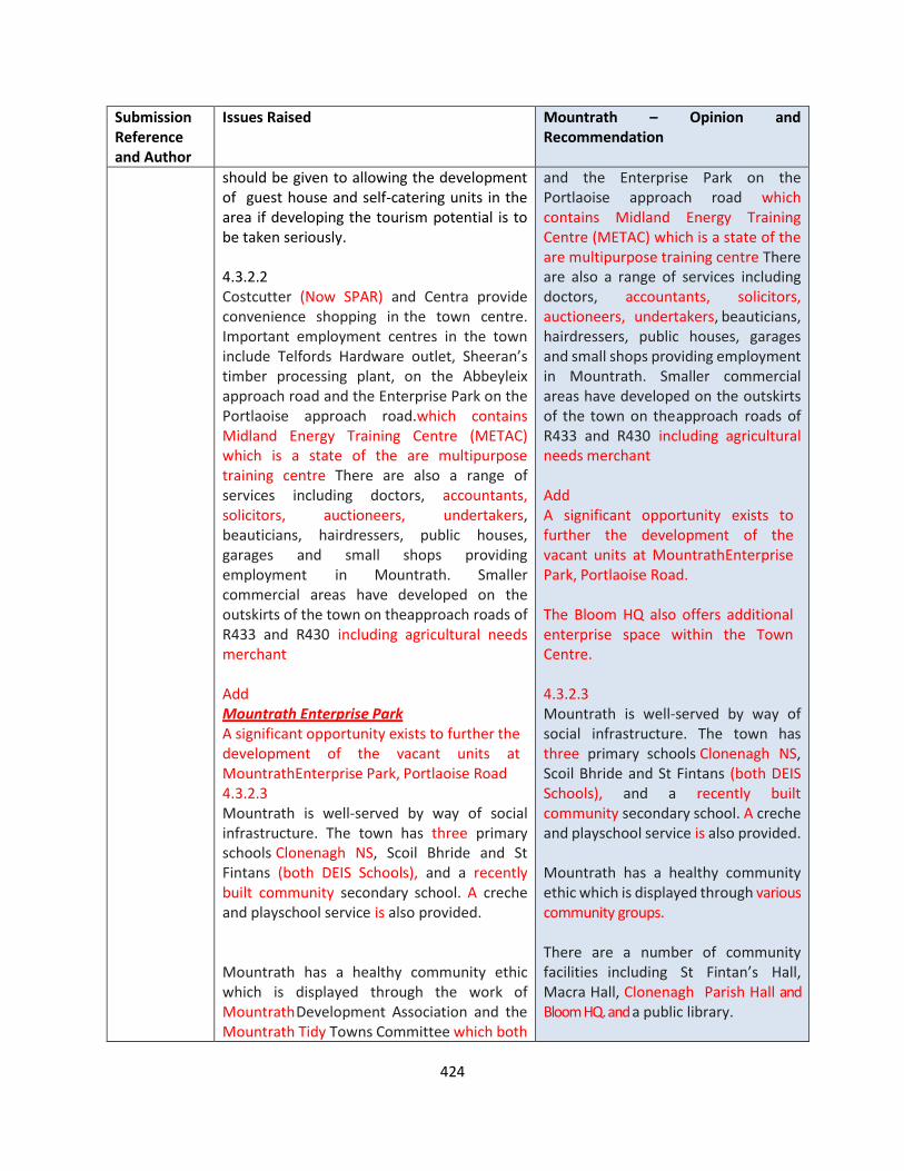
424
Submission Reference and Author
Issues Raised Mountrath – Opinion and Recommendation
should be given to allowing the development of guest house and self-catering units in the area if developing the tourism potential is to be taken seriously. 4.3.2.2 Costcutter (Now SPAR) and Centra provide convenience shopping in the town centre. Important employment centres in the town include Telfords Hardware outlet, Sheeran’s timber processing plant, on the Abbeyleix approach road and the Enterprise Park on the Portlaoise approach road.which contains Midland Energy Training Centre (METAC) which is a state of the are multipurpose training centre There are also a range of services including doctors, accountants, solicitors, auctioneers, undertakers, beauticians, hairdressers, public houses, garages and small shops providing employment in Mountrath. Smaller commercial areas have developed on the outskirts of the town on the approach roads of R433 and R430 including agricultural needs merchant Add Mountrath Enterprise Park A significant opportunity exists to further the development of the vacant units at Mountrath Enterprise Park, Portlaoise Road 4.3.2.3 Mountrath is well-served by way of social infrastructure. The town has three primary schools Clonenagh NS, Scoil Bhride and St Fintans (both DEIS Schools), and a recently built community secondary school. A creche and playschool service is also provided. Mountrath has a healthy community ethic which is displayed through the work of Mountrath Development Association and the Mountrath Tidy Towns Committee which both
and the Enterprise Park on the Portlaoise approach road which contains Midland Energy Training Centre (METAC) which is a state of the are multipurpose training centre There are also a range of services including doctors, accountants, solicitors, auctioneers, undertakers, beauticians, hairdressers, public houses, garages and small shops providing employment in Mountrath. Smaller commercial areas have developed on the outskirts of the town on the approach roads of R433 and R430 including agricultural needs merchant Add A significant opportunity exists to further the development of the vacant units at Mountrath Enterprise Park, Portlaoise Road. The Bloom HQ also offers additional enterprise space within the Town Centre. 4.3.2.3 Mountrath is well-served by way of social infrastructure. The town has three primary schools Clonenagh NS, Scoil Bhride and St Fintans (both DEIS Schools), and a recently built community secondary school. A creche and playschool service is also provided. Mountrath has a healthy community ethic which is displayed through various community groups. There are a number of community facilities including St Fintan’s Hall, Macra Hall, Clonenagh Parish Hall and Bloom HQ. and a public library.

425
Submission Reference and Author
Issues Raised Mountrath – Opinion and Recommendation
foster social inclusion through community consultation. There are a number of community facilities including St Fintan’s Hall, Macra Hall, Clonenagh Parish Hall and a designated youth centre ‘Mountrath Youth Creative Space’ on the Castletown Road which accommodates Mountrath Youth Theatre in addition to a public library. Public recreational space is found at the St Fintan’s GAA Club and St Aengus FC. Mountrath Golf Club to the south east provides a valuable amenity for its members. In terms of amenity space, Mountrath is located in the foothills of the Slieve Blooms, an area rich in ecology and wildlife and popular for walking and hiking and mountain biking. The town lies on one of the access routes from the M7 Tourists to the Slieve Blooms which offers significant tourism potential. Mountrath Amenity Park with playground and outdoor gym is located adjacent to the Mountrath River which is a Special Area of Conservation and joins with the River Nore south of the town between Castletown and Kilbricken. Several pedestrian linkages join this river walk with the Main Street including the Council’s car park this access is sealed since 2017), the Quaker graveyard and narrow laneways. The river walk was recently extended to include a Slí na Sláinte and community orchard and outdoor classroom. 4.3.2.4 A recycling bring-bank is located at the car park. – moved to Mighty Molls on Portlaoise Road in 2018 Natural and managed open spaces within Mountrath including the Mountrath River and amenity area, playing fields, groups of trees and landscaped areas, are features of Green Infrastructure which collectively, contribute
Public recreational space is found at the St Fintan’s GAA Club and St Aengus FC. Mountrath Golf Club to the south east provides a valuable amenity for its members. In terms of amenity space, Mountrath is located in the foothills of the Slieve Blooms, an area rich in ecology and wildlife and popular for walking and hiking and mountain biking. The town lies on one of the access routes from the M7 Tourists to the Slieve Blooms which offers significant tourism potential. Mountrath Amenity Park with playground and outdoor gym is located adjacent to the Mountrath River which is a Special Area of Conservation and joins with the River Nore south of the town between Castletown and Kilbricken. Several pedestrian linkages join this river walk with the Main Street including the Council’s car park this access is sealed since 2017), the Quaker graveyard and narrow laneways. The river walk was recently extended to include a Slí na Sláinte and community orchard and outdoor classroom. 4.3.2.4 A recycling bring-bank is located at the car park. – moved to Mighty Molls on Portlaoise Road in 2018 Natural and managed open spaces within Mountrath including the Mountrath River and amenity area, playing fields, groups of trees and
426
Submission Reference and Author
Issues Raised Mountrath – Opinion and Recommendation
towards enhanced urban quality and provision of amenities for residents. In line with Mountrath Tidy Towns Strategic Action Plan 2020 - 2024 and Mountrath Biodiversity Plan 2021 4.3.3 MO 1 Create a new civic space within Market Square to facilitate everyday uses such as bus stop, waiting areas and special uses such as farmers market; Retain bus stop at exising locations and develop an appropriate shelters on both sides and seating – 1 MIN walk from town centre – no space for a bus to stop in town centre MO 5 Enhance the visual amenity of approach roads into Mountrath, protecting mature trees and enhancing by way of further greening and landscaping; In line with Mountrath Tidy Towns Strategic Action Plan 2020 - 2024 and Mountrath Biodiverity Plan 2021 Please note that several trees are diseased and a new planting plan for trees should be considered using mature tress suited to urban landscapes. MO 7 ENCourage the use of upper floors within the town centre for a diversity of living and working uses where such uses would contribute to the function and vibrancy of the town centre. MO 8 Encourage the further development of retail and commercial services in the town core - the redevelopment of existing unused or derelict structures for commercial or residential purposes will be particularly
landscaped areas, are features of Green Infrastructure which collectively, contribute towards enhanced urban quality and provision of amenities for residents in line with Mountrath Tidy Towns Strategic Action Plan 2020 - 2024 and Mountrath Biodiverity Plan 2021. 4.3.3 MO 1 Create a new civic space within Market Square to facilitate everyday uses such as bus stop, waiting areas and special uses such as farmers market; MO XX Seek to locate bus stop at appropriate locations and develop appropriate shelters on both sides and seating; MO 5 Enhance the visual amenity of approach roads into Mountrath, protecting mature trees and enhancing by way of further greening and landscaping In line with Mountrath Tidy Towns Strategic Action Plan 2020 - 2024 and Mountrath Biodiverity Plan 2021 Point in relation to MO 7 is noted and shall be corrected: Encourage the use of upper floors within the town centre for a diversity of living and working uses where such uses would contribute to the function and vibrancy of the town centre. Point in relation to MO 8 is noted, no change recommended, however MO 19 is recommended to be revised as follows:
427
Submission Reference and Author
Issues Raised Mountrath – Opinion and Recommendation
encouraged; consideration should be given to opening up a section of Main Street to the river - creating a new business and residential area. This could be designed with both local and tourist needs in mind and expose the hidden beauty of the River. This new town realm could include external seating with wifi and charging points bike stands, information boards, and external dining space for new food/accommodation businesses and badly needed additional parking spaces. There is capacity for this with the current vacant lot if Laois County Council were to purchase this and the adjoining lots and make a regeneration application to give new life to the town centre MO 10 Support tourism-related uses, activities and amenities that will contribute to the Slieve Bloom Mountains tourism product; There is an overall lack of accommodation for visitors in the town centre and consideration should be given to allowing the development of guest house and self-catering units in the area if developing the tourism potential is to be taken seriously We disagree with the wording of MO14 and respectfully submit the following wording: MO14 .1 Encourage the intensive use of existing community and sporting facilities and develop additional community facilities which are flexible and capable of being managed for a number of different uses, community-based health facilities, extensions to schools and school facilities and an outdoor multi-use games area; MO14.2 Encourage the construction of a purpose built, using sustainable building principals a stand alone facility for young people and their families at the Mountrath Youth Creative Space, Re- search has
MO 19: Enhance the amenity of Mountrath and provide appropriate lighting to linkages between the riverside walk and the Main Street, creating opportunities for new businesses and residential uses. Revised MO 10: Support tourism-related uses including accommodation for visitors, activities and amenities that will contribute to the Slieve Bloom Mountains tourism product; Comment in relation to MO 14 is noted and additional policy objective is recommended as follows (renumbering of subsequent policy objectives is required): MO 15: Encourage the construction of a purpose built, using sustainable building principals a stand alone facility for young people and their families at the Mountrath Youth Creative Space, Re- search has demonstrated that Young People thrive in an independent space.
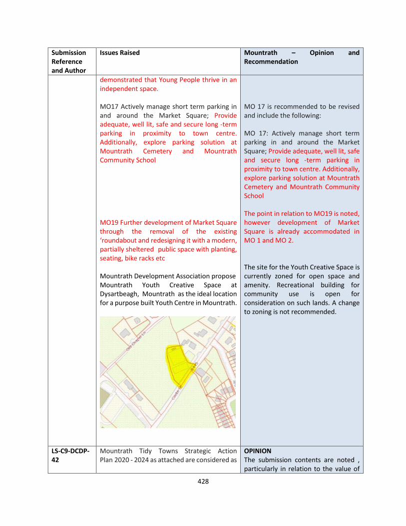
428
Submission Reference and Author
Issues Raised Mountrath – Opinion and Recommendation
demonstrated that Young People thrive in an independent space. MO17 Actively manage short term parking in and around the Market Square; Provide adequate, well lit, safe and secure long -term parking in proximity to town centre. Additionally, explore parking solution at Mountrath Cemetery and Mountrath Community School MO19 Further development of Market Square through the removal of the existing ‘roundabout and redesigning it with a modern, partially sheltered public space with planting, seating, bike racks etc Mountrath Development Association propose Mountrath Youth Creative Space at Dysartbeagh, Mountrath as the ideal location for a purpose built Youth Centre in Mountrath.
MO 17 is recommended to be revised and include the following: MO 17: Actively manage short term parking in and around the Market Square; Provide adequate, well lit, safe and secure long -term parking in proximity to town centre. Additionally, explore parking solution at Mountrath Cemetery and Mountrath Community School The point in relation to MO19 is noted, however development of Market Square is already accommodated in MO 1 and MO 2. The site for the Youth Creative Space is currently zoned for open space and amenity. Recreational building for community use is open for consideration on such lands. A change to zoning is not recommended.
LS-C9-DCDP-42
Mountrath Tidy Towns Strategic Action Plan 2020 - 2024 as attached are considered as
OPINION The submission contents are noted , particularly in relation to the value of
429
Submission Reference and Author
Issues Raised Mountrath – Opinion and Recommendation
Mountrath Tidy Towns
part of the new Co Development Plan - in particular the following
- Sustainability, Green Infrastructure, Protection & Conservation of Cultural and Architecturally sensitive buildings and features. We highly recommend the commissioning of a Landscape plan for the town from 50km speed limit on all approach roads including the town centre which would include amenity furniture and greening the greyness of the town wherever possible. The replacement of damaged, diseased and inappropriate trees should be included and Patrick St Offers a unique opportunity to be tree lined on both sides. We recommend new bus stop facilities on both sides with a living roof and solar panels to charge phones. Consideration of a dog park should also be considered and the extension of the existing river walk as it heads southwards along the Mountrath River . There is potential on either side for this. All approach roads should be planted with wild flower margins where possible to enhance biodiversity.
All new buildings or extensions to existing buildings should be constructed using sustainable principles and be a model of good practice. A new signage plan for town should be developed and all obsolete signs removed( recommendation of Tidy Towns judges).
Every effort should be made to encourage SMARTER travel in the town for locals and visitors with the introduction of cycling and walking infrastructure from the residential areas to the town centre and schools and community/sporting facilities and including along the main road to Castletown - linking Mountrath to the Nore Amenity Area in Castletown and Castletown to the secondary school in Mountrath
the river to the town of Mountrath and the request for a landscape plan for the town. The Council through its Community Section and Area offices supports the work of the Tidy Towns in terms of planting and landscaping. The Planning Authority is aware of a Regeneration strategy under commission for the town of Mountrath which should deal with issues relating to
• Upgrading of Main street properties
• Identification of opportunity sites
• Opening up the river to the town
• creating a new business and residential area.
• Proposals for new town realm could include external seating with wifi and charging points bike stands, information boards, and external dining space for new food/accommodation businesses and badly needed additional parking spaces.
• Traffic management and the future development of the Market Square
• advise, guidance and funding/incentives to owners of derelict buildings ;
• overall lack of accommodation for visitors in the town centre and consideration should be given to allowing the development of guest house and self-catering units in the area if developing the tourism
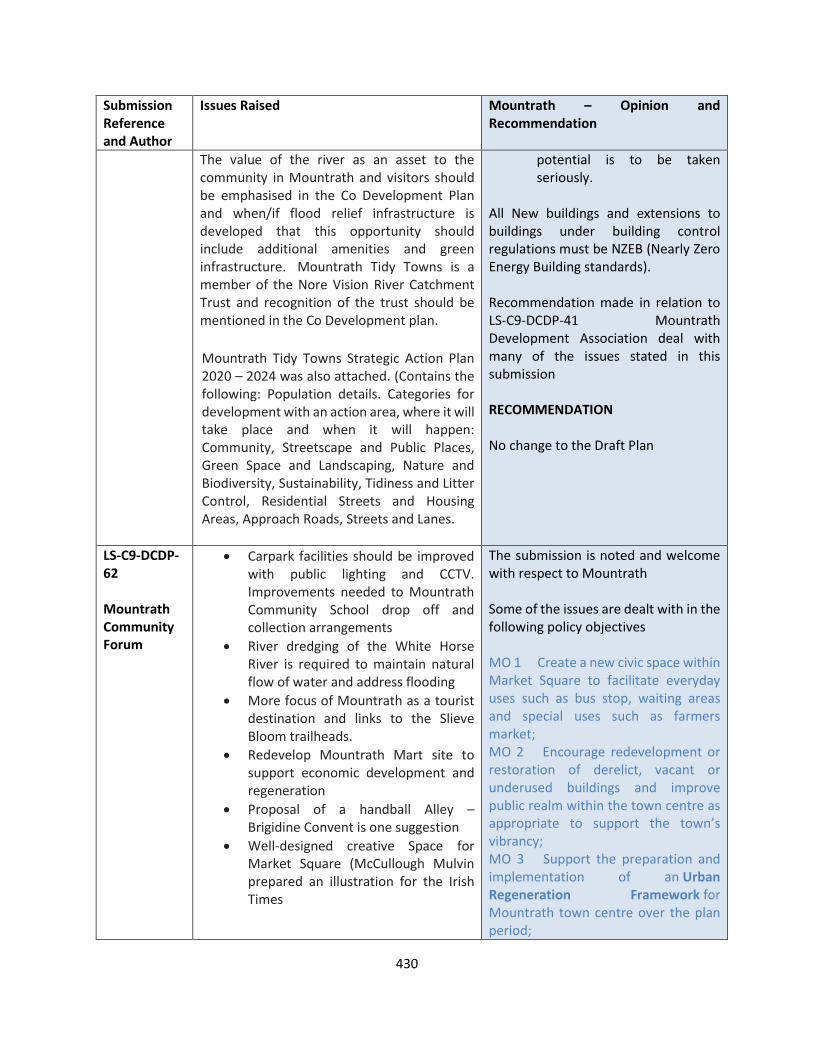
430
Submission Reference and Author
Issues Raised Mountrath – Opinion and Recommendation
The value of the river as an asset to the community in Mountrath and visitors should be emphasised in the Co Development Plan and when/if flood relief infrastructure is developed that this opportunity should include additional amenities and green infrastructure. Mountrath Tidy Towns is a member of the Nore Vision River Catchment Trust and recognition of the trust should be mentioned in the Co Development plan.
Mountrath Tidy Towns Strategic Action Plan 2020 – 2024 was also attached. (Contains the following: Population details. Categories for development with an action area, where it will take place and when it will happen: Community, Streetscape and Public Places, Green Space and Landscaping, Nature and Biodiversity, Sustainability, Tidiness and Litter Control, Residential Streets and Housing Areas, Approach Roads, Streets and Lanes.
potential is to be taken seriously.
All New buildings and extensions to buildings under building control regulations must be NZEB (Nearly Zero Energy Building standards). Recommendation made in relation to LS-C9-DCDP-41 Mountrath Development Association deal with many of the issues stated in this submission RECOMMENDATION No change to the Draft Plan
LS-C9-DCDP-62 Mountrath Community Forum
• Carpark facilities should be improved with public lighting and CCTV. Improvements needed to Mountrath Community School drop off and collection arrangements
• River dredging of the White Horse River is required to maintain natural flow of water and address flooding
• More focus of Mountrath as a tourist destination and links to the Slieve Bloom trailheads.
• Redevelop Mountrath Mart site to support economic development and regeneration
• Proposal of a handball Alley – Brigidine Convent is one suggestion
• Well-designed creative Space for Market Square (McCullough Mulvin prepared an illustration for the Irish Times
The submission is noted and welcome with respect to Mountrath Some of the issues are dealt with in the following policy objectives MO 1 Create a new civic space within Market Square to facilitate everyday uses such as bus stop, waiting areas and special uses such as farmers market; MO 2 Encourage redevelopment or restoration of derelict, vacant or underused buildings and improve public realm within the town centre as appropriate to support the town’s vibrancy; MO 3 Support the preparation and implementation of an Urban Regeneration Framework for Mountrath town centre over the plan period;
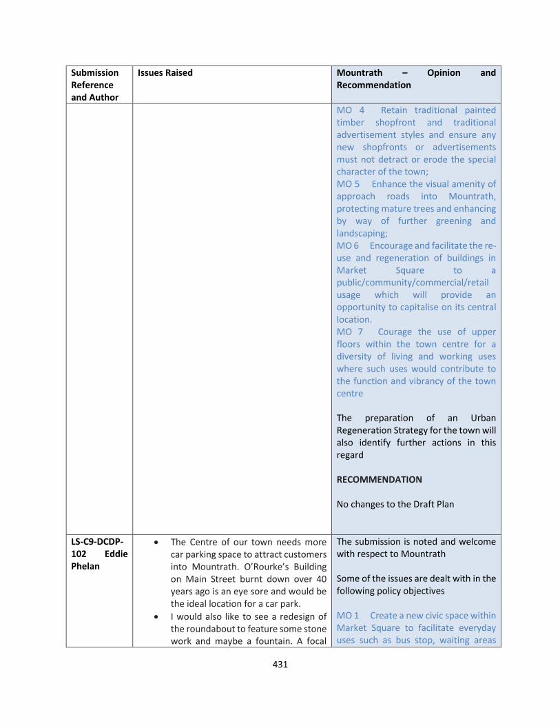
431
Submission Reference and Author
Issues Raised Mountrath – Opinion and Recommendation
MO 4 Retain traditional painted timber shopfront and traditional advertisement styles and ensure any new shopfronts or advertisements must not detract or erode the special character of the town; MO 5 Enhance the visual amenity of approach roads into Mountrath, protecting mature trees and enhancing by way of further greening and landscaping; MO 6 Encourage and facilitate the re-use and regeneration of buildings in Market Square to a public/community/commercial/retail usage which will provide an opportunity to capitalise on its central location. MO 7 Courage the use of upper floors within the town centre for a diversity of living and working uses where such uses would contribute to the function and vibrancy of the town centre The preparation of an Urban Regeneration Strategy for the town will also identify further actions in this regard RECOMMENDATION No changes to the Draft Plan
LS-C9-DCDP-102 Eddie Phelan
• The Centre of our town needs more car parking space to attract customers into Mountrath. O’Rourke’s Building on Main Street burnt down over 40 years ago is an eye sore and would be the ideal location for a car park.
• I would also like to see a redesign of the roundabout to feature some stone work and maybe a fountain. A focal
The submission is noted and welcome with respect to Mountrath Some of the issues are dealt with in the following policy objectives MO 1 Create a new civic space within Market Square to facilitate everyday uses such as bus stop, waiting areas
432
Submission Reference and Author
Issues Raised Mountrath – Opinion and Recommendation
point in the town maybe something to commemorate the court house which once stood there and was knocked.
• Funding to attract urban living back into the town would be great. A lot of the families have moved out from over their businesses, leaving living space which could be used however a lot of it needs to be updated and refurbished.
and special uses such as farmers market; MO 2 Encourage redevelopment or restoration of derelict, vacant or underused buildings and improve public realm within the town centre as appropriate to support the town’s vibrancy; MO 3 Support the preparation and implementation of an Urban Regeneration Framework for Mountrath town centre over the plan period; MO 6 Encourage and facilitate the re-use and regeneration of buildings in Market Square to a public/community/commercial/retail usage which will provide an opportunity to capitalise on its central location. MO 7 Courage the use of upper floors within the town centre for a diversity of living and working uses where such uses would contribute to the function and vibrancy of the town centre In relation to Car parking, an audit of car parking and other sustainable modes of transport will be considered during the preparation of an Urban Regeneration Strategy for the town and this will also identify further actions in this regard RECOMMENDATION No changes to the Draft Plan
LS-C9-DCDP-155
Mountrath Youth Theatre Mountrath Youth Theatre’s members support the construction of youth facilities using the very latest green technology and materials,
The submission is noted from the Mountrath Youth Theatre. MO14 states as follows

433
Submission Reference and Author
Issues Raised Mountrath – Opinion and Recommendation
Mountrath Youth Group
using renewable energy to achieve a sustainable facility. We want to see a purpose built Creative Youth Facility built on our current base on the Castletown Rd, Mountrath. MO14 - Generic community building do not suit youth work –Research shows that young people thrive in youth facilities that are dedicated to their needs. In Mountrath a space has been gifted for the development of youth facilities on the Castletown Road and we believe this space should be developed as a purpose built youth space using sustainable principles and with a strong emphasis on creativity – a service that is currently missing in rural Laois. It is many years since a new community building was developed in Mountrath and it would be visionary if this was created and designed by young people as a youth space
MO14 Encourage the intensive use of existing community and sporting facilities and develop additional community facilities which are flexible and capable of being managed for a number of different uses, in particular youth-related facilities, community-based health facilities, extensions to schools and school facilities and an outdoor multi-use games area RECOMMENDATION No changes to the Draft Plan

434
Mountrath Zoning Submissions Submission Reference and Author
Issues Raised Opinion and Recommendation Map 4.3(A) Reference of Proposed Change (if applicable)
LS-C9-DCDP-81 Sheerans Ltd
Limerick Rd The submission requests the entire area is zoned industrial to facilitate the future development and support a critical employment for Mountrath.
Submission is noted OPINION The Planning Authority is not opposed to this zoning proposal for the following reasons. Location Part of the lands referred to (at the rear of the Petrol Station) is currently in use as Sheerans who make pallets and timber products. A Planning application is currently being assessed in relation to further industrial / commercial developments on the site. The site is not adjoining any residential lands except for on the northern boundary of the site, there are some lands zoned for residential 2 purposes. In order to protect any future residential occupancy a buffer of landscaped / amenity area will be zoned along the northern boundary of the site. Flooding The site is outside the flood zones. Services The site is adequately serviced.
33

435
Submission Reference and Author
Issues Raised Opinion and Recommendation Map 4.3(A) Reference of Proposed Change (if applicable)
RECOMMENDATION It is recommended that the site be rezoned from Enterprise and Employment & General Business
To Industrial, Open Space and Amenity purposes.
LS-C9-DCDP-141
Submission relates to proposed Open Space re-zoning at Spring Gardens, Mountrath, the property
OPINION Submission is noted
34
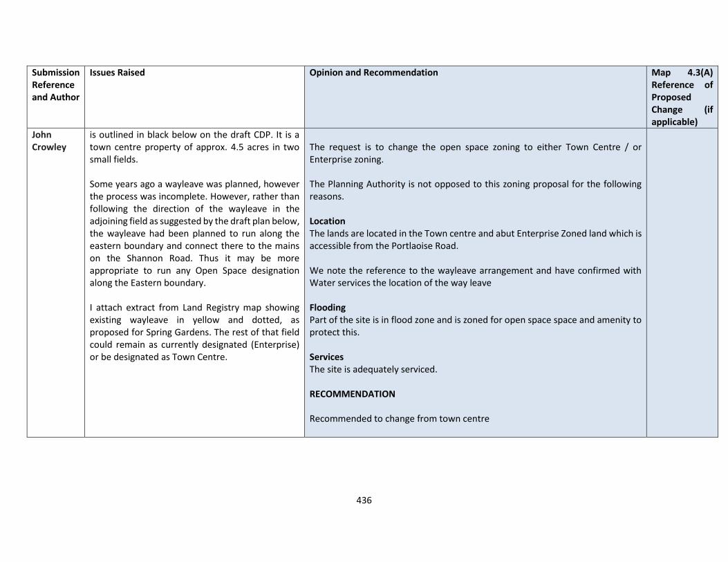
436
Submission Reference and Author
Issues Raised Opinion and Recommendation Map 4.3(A) Reference of Proposed Change (if applicable)
John Crowley
is outlined in black below on the draft CDP. It is a town centre property of approx. 4.5 acres in two small fields. Some years ago a wayleave was planned, however the process was incomplete. However, rather than following the direction of the wayleave in the adjoining field as suggested by the draft plan below, the wayleave had been planned to run along the eastern boundary and connect there to the mains on the Shannon Road. Thus it may be more appropriate to run any Open Space designation along the Eastern boundary. I attach extract from Land Registry map showing existing wayleave in yellow and dotted, as proposed for Spring Gardens. The rest of that field could remain as currently designated (Enterprise) or be designated as Town Centre.
The request is to change the open space zoning to either Town Centre / or Enterprise zoning. The Planning Authority is not opposed to this zoning proposal for the following reasons. Location The lands are located in the Town centre and abut Enterprise Zoned land which is accessible from the Portlaoise Road. We note the reference to the wayleave arrangement and have confirmed with Water services the location of the way leave Flooding Part of the site is in flood zone and is zoned for open space space and amenity to protect this. Services The site is adequately serviced. RECOMMENDATION Recommended to change from town centre
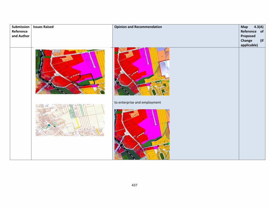
437
Submission Reference and Author
Issues Raised Opinion and Recommendation Map 4.3(A) Reference of Proposed Change (if applicable)
to enterprise and employment
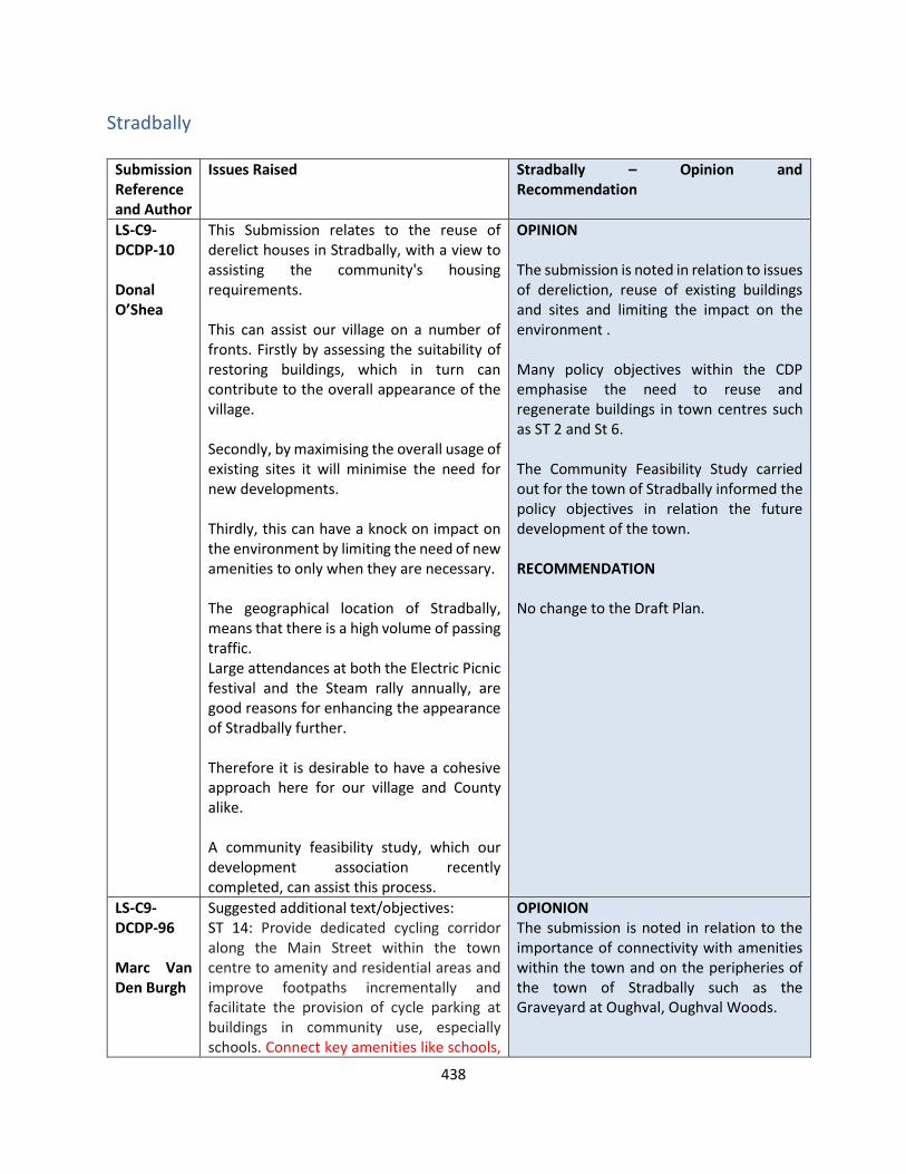
438
Stradbally
Submission Reference and Author
Issues Raised Stradbally – Opinion and Recommendation
LS-C9-DCDP-10 Donal O’Shea
This Submission relates to the reuse of derelict houses in Stradbally, with a view to assisting the community's housing requirements. This can assist our village on a number of fronts. Firstly by assessing the suitability of restoring buildings, which in turn can contribute to the overall appearance of the village. Secondly, by maximising the overall usage of existing sites it will minimise the need for new developments. Thirdly, this can have a knock on impact on the environment by limiting the need of new amenities to only when they are necessary. The geographical location of Stradbally, means that there is a high volume of passing traffic. Large attendances at both the Electric Picnic festival and the Steam rally annually, are good reasons for enhancing the appearance of Stradbally further. Therefore it is desirable to have a cohesive approach here for our village and County alike. A community feasibility study, which our development association recently completed, can assist this process.
OPINION The submission is noted in relation to issues of dereliction, reuse of existing buildings and sites and limiting the impact on the environment . Many policy objectives within the CDP emphasise the need to reuse and regenerate buildings in town centres such as ST 2 and St 6. The Community Feasibility Study carried out for the town of Stradbally informed the policy objectives in relation the future development of the town. RECOMMENDATION No change to the Draft Plan.
LS-C9-DCDP-96 Marc Van Den Burgh
Suggested additional text/objectives: ST 14: Provide dedicated cycling corridor along the Main Street within the town centre to amenity and residential areas and improve footpaths incrementally and facilitate the provision of cycle parking at buildings in community use, especially schools. Connect key amenities like schools,
OPIONION The submission is noted in relation to the importance of connectivity with amenities within the town and on the peripheries of the town of Stradbally such as the Graveyard at Oughval, Oughval Woods.
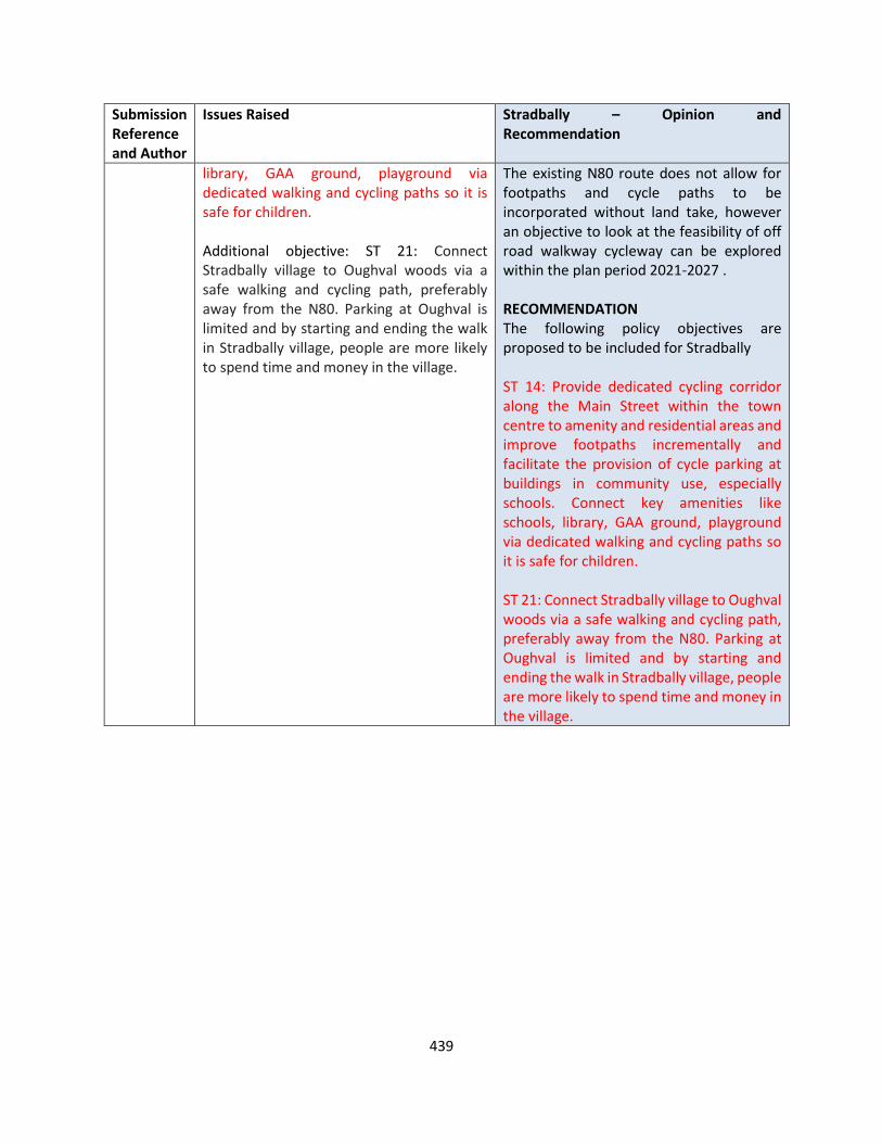
439
Submission Reference and Author
Issues Raised Stradbally – Opinion and Recommendation
library, GAA ground, playground via dedicated walking and cycling paths so it is safe for children. Additional objective: ST 21: Connect Stradbally village to Oughval woods via a safe walking and cycling path, preferably away from the N80. Parking at Oughval is limited and by starting and ending the walk in Stradbally village, people are more likely to spend time and money in the village.
The existing N80 route does not allow for footpaths and cycle paths to be incorporated without land take, however an objective to look at the feasibility of off road walkway cycleway can be explored within the plan period 2021-2027 . RECOMMENDATION The following policy objectives are proposed to be included for Stradbally ST 14: Provide dedicated cycling corridor along the Main Street within the town centre to amenity and residential areas and improve footpaths incrementally and facilitate the provision of cycle parking at buildings in community use, especially schools. Connect key amenities like schools, library, GAA ground, playground via dedicated walking and cycling paths so it is safe for children. ST 21: Connect Stradbally village to Oughval woods via a safe walking and cycling path, preferably away from the N80. Parking at Oughval is limited and by starting and ending the walk in Stradbally village, people are more likely to spend time and money in the village.

440
Stradbally Zoning Submissions Submission Reference and Author
Issues Raised Opinion and Recommendation Map 4.4(A) Reference of Proposed Change (if applicable)
LS-C9-DCDP-17 Deegan Family
Lands at KYLE-BEG AND BROCKLEY PARK Zone lands at Kyle-beg and Brockley Park for residential development
Submission noted. OPINION Further to the submission by OPR, the Planning Authority has undertaken a review of the settlement of Stradbally, which included its residential requirements for Residential 2 and Strategic Reserve sites. The Planning Authority is opposed to this zoning proposal of 7.78 ha for residential development for the following reasons. Location The bulk of the lands referred to are outside the proposed town boundary as indicated in the draft Laois County Development Plan 2021-2027. A development here of the scale proposed would be completely at variance with the principle of the sequential approach to the location of new development. The sequential approach in effect favours town, village centre, edge of centre and inner suburban locations over suburban locations for reasons of promoting sustainability, urban compactness and ease of serviceability. There is a strong presumption against the leapfrogging effect which leads to ad-hoc and disjointed development at relatively long distances [such as in this case] from the town centre. In terms of zoning land for ‘New Residential’, the National Strategic Outcome 1 (NSO 1) of the National Planning Framework (NPF) is to seek ‘Compact Growth’ across cities, towns and villages. In this regard, the National Planning Framework states that ‘From an urban development perspective, we will need to deliver a greater proportion of residential development within existing built-up areas of our cities, towns and
N/A

441
Submission Reference and Author
Issues Raised Opinion and Recommendation Map 4.4(A) Reference of Proposed Change (if applicable)
villages…’. Regional Strategic Outcome 2 (RSO 2) of the Eastern and Midland Regional Spatial and Economic Strategy (RSES) supports the NPF’s NSO1 stating that ‘Residential development should be carried out sequentially, whereby lands which are, or will be, most accessible by walking, cycling and public transport – including infill and brownfield sites – are prioritised.’ Compact growth and adherence to the Core Strategy is provided for in Chapter 2 of the draft plan as follows Housing Land Requirement Based on the overall housing land requirement for County Laois of 125 hectares up to target year 2027, as set out in Chapter 2 “Core Strategy”, there is no need for additional residentially zoned lands in the town. If this land were to be zoned, it would be at the expense of [and not additional to] other more suitably located lands as identified by application of the sequential approach. It is important to stress that the future population [and by extension the housing land requirement] of County Laois is governed by and shall comply with the housing targets as set out in the section 28 of the Planning and Development Act, 2000 (as amended), the ‘Housing Supply Target Methodology for Development Planning, Guidelines for Planning Authorities’ were issued on 18th December 2020. These Guidelines provide the methodology to be adopted by planning authorities in formulating the housing supply target for their statutory development plan. The methodology utilises recently published research undertaken by the Economic and Social Research Institute – ‘Regional Demographics and Structural Housing Demand at a County Level’, Research Series, Number 111, ESRI, December 2020. The guidelines are to be applied by each planning authority to assist in ensuring that their

442
Submission Reference and Author
Issues Raised Opinion and Recommendation Map 4.4(A) Reference of Proposed Change (if applicable)
development plan is prepared to be consistent with the National Planning Framework and relevant Regional Spatial and Economic Strategy. This has informed the core strategy of the Draft Laois County Development Plan 2021-2027 and where future growth is directed to in a sustainable manner. Services In relation to Water supply and in relation to Wastewater Treatment Level of projected growth can be accommodated currently in the Draft Plan for Stradbally. RECOMMENDATION No change to the Draft Plan.
LS-C9-DCDP-61 Booth Partnership (Jason Redmond)
Lands on Vicarstown Rd Submission requests more TC zoning within this land parcel as indicated on maps below
Draft Plan
Submission noted. OPINION The Planning Authority is opposed to this zoning proposal from Enterprise and Employment to Town Centre uses for the following reasons. Location The site is accessible from the Vicarstown Road and is a green field site with no development on it currently. The land is not considered appropriate as a town centre as there are other lands that would be considered sequentially better located to be town centre and available for town centre uses. There is no visible connection between the site and the main street.
N/A

443
Submission Reference and Author
Issues Raised Opinion and Recommendation Map 4.4(A) Reference of Proposed Change (if applicable)
Proposed
Services In relation to Water supply and Wastewater Treatment , the level of projected growth can be accommodated currently in the Draft Plan for Stradbally. RECOMMENDATION No change to the Draft Plan.
LS-C9-DCDP-131 Patrick Knowles
Stradbally Lands on Athy Road, Stradbally Rezone from General Business to Residential use. The site has been derelict for nearly 2 decades with no expression of interest to develop the site for this purpose. Our submission is in line with the policy of the Draft Plan to consolidate the settlement development within the limits of the existing built area. The site is an infill site in primarily a residential area, with “Kylebeg” to the East and “Cill Beg Manor” to the South. The site has the benefit of public services to include waste water with capacity for an additional 1924 PE in
Submission noted. OPINION Further to the submission by OPR, the Planning Authority has undertaken a review of the settlement of Stradbally, which included its residential requirements for Residential 2 and Strategic Reserve sites. The Planning Authority is opposed to rezone this 0.52 hectare site from General Business to Residential 2 – New Proposed Residential for the following reasons. Location The site is located along the Main Street Stradbally and in the village centre. The sequential approach in effect favours town village centre, edge of centre and inner
N/A
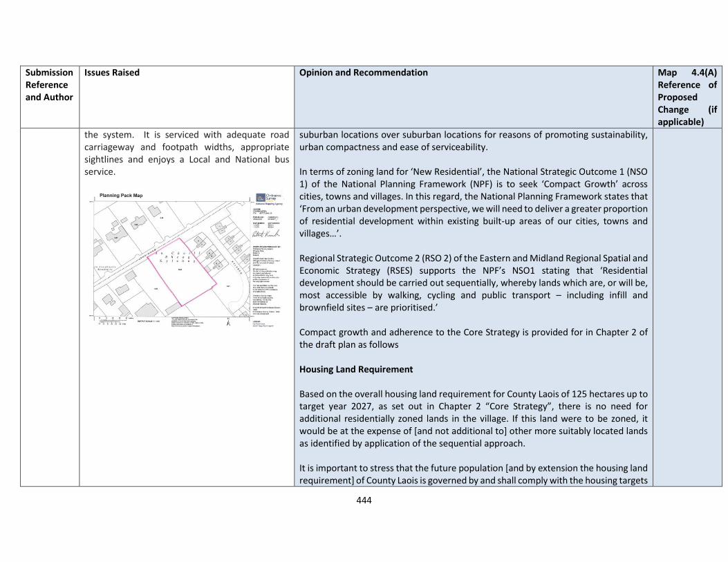
444
Submission Reference and Author
Issues Raised Opinion and Recommendation Map 4.4(A) Reference of Proposed Change (if applicable)
the system. It is serviced with adequate road carriageway and footpath widths, appropriate sightlines and enjoys a Local and National bus service.
suburban locations over suburban locations for reasons of promoting sustainability, urban compactness and ease of serviceability. In terms of zoning land for ‘New Residential’, the National Strategic Outcome 1 (NSO 1) of the National Planning Framework (NPF) is to seek ‘Compact Growth’ across cities, towns and villages. In this regard, the National Planning Framework states that ‘From an urban development perspective, we will need to deliver a greater proportion of residential development within existing built-up areas of our cities, towns and villages…’. Regional Strategic Outcome 2 (RSO 2) of the Eastern and Midland Regional Spatial and Economic Strategy (RSES) supports the NPF’s NSO1 stating that ‘Residential development should be carried out sequentially, whereby lands which are, or will be, most accessible by walking, cycling and public transport – including infill and brownfield sites – are prioritised.’ Compact growth and adherence to the Core Strategy is provided for in Chapter 2 of the draft plan as follows Housing Land Requirement Based on the overall housing land requirement for County Laois of 125 hectares up to target year 2027, as set out in Chapter 2 “Core Strategy”, there is no need for additional residentially zoned lands in the village. If this land were to be zoned, it would be at the expense of [and not additional to] other more suitably located lands as identified by application of the sequential approach. It is important to stress that the future population [and by extension the housing land requirement] of County Laois is governed by and shall comply with the housing targets
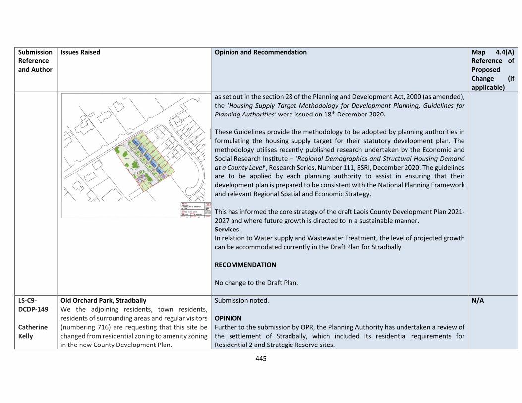
445
Submission Reference and Author
Issues Raised Opinion and Recommendation Map 4.4(A) Reference of Proposed Change (if applicable)
as set out in the section 28 of the Planning and Development Act, 2000 (as amended), the ‘Housing Supply Target Methodology for Development Planning, Guidelines for Planning Authorities’ were issued on 18th December 2020. These Guidelines provide the methodology to be adopted by planning authorities in formulating the housing supply target for their statutory development plan. The methodology utilises recently published research undertaken by the Economic and Social Research Institute – ‘Regional Demographics and Structural Housing Demand at a County Level’, Research Series, Number 111, ESRI, December 2020. The guidelines are to be applied by each planning authority to assist in ensuring that their development plan is prepared to be consistent with the National Planning Framework and relevant Regional Spatial and Economic Strategy. This has informed the core strategy of the draft Laois County Development Plan 2021-2027 and where future growth is directed to in a sustainable manner. Services In relation to Water supply and Wastewater Treatment, the level of projected growth can be accommodated currently in the Draft Plan for Stradbally RECOMMENDATION No change to the Draft Plan.
LS-C9-DCDP-149 Catherine Kelly
Old Orchard Park, Stradbally We the adjoining residents, town residents, residents of surrounding areas and regular visitors (numbering 716) are requesting that this site be changed from residential zoning to amenity zoning in the new County Development Plan.
Submission noted. OPINION Further to the submission by OPR, the Planning Authority has undertaken a review of the settlement of Stradbally, which included its residential requirements for Residential 2 and Strategic Reserve sites.
N/A
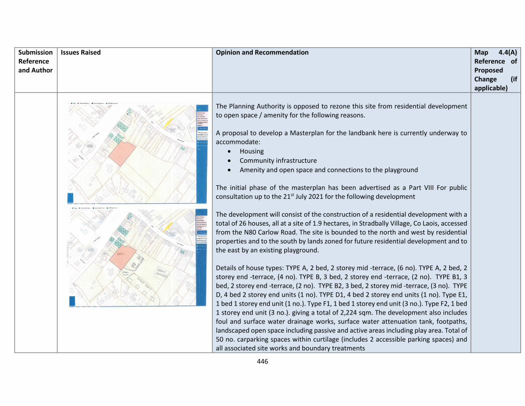
446
Submission Reference and Author
Issues Raised Opinion and Recommendation Map 4.4(A) Reference of Proposed Change (if applicable)
The Planning Authority is opposed to rezone this site from residential development to open space / amenity for the following reasons. A proposal to develop a Masterplan for the landbank here is currently underway to accommodate:
• Housing
• Community infrastructure
• Amenity and open space and connections to the playground The initial phase of the masterplan has been advertised as a Part VIII For public consultation up to the 21st July 2021 for the following development The development will consist of the construction of a residential development with a total of 26 houses, all at a site of 1.9 hectares, in Stradbally Village, Co Laois, accessed from the N80 Carlow Road. The site is bounded to the north and west by residential properties and to the south by lands zoned for future residential development and to the east by an existing playground. Details of house types: TYPE A, 2 bed, 2 storey mid -terrace, (6 no). TYPE A, 2 bed, 2 storey end -terrace, (4 no). TYPE B, 3 bed, 2 storey end -terrace, (2 no). TYPE B1, 3 bed, 2 storey end -terrace, (2 no). TYPE B2, 3 bed, 2 storey mid -terrace, (3 no). TYPE D, 4 bed 2 storey end units (1 no). TYPE D1, 4 bed 2 storey end units (1 no). Type E1, 1 bed 1 storey end unit (1 no.). Type F1, 1 bed 1 storey end unit (3 no.). Type F2, 1 bed 1 storey end unit (3 no.). giving a total of 2,224 sqm. The development also includes foul and surface water drainage works, surface water attenuation tank, footpaths, landscaped open space including passive and active areas including play area. Total of 50 no. carparking spaces within curtilage (includes 2 accessible parking spaces) and all associated site works and boundary treatments
447
Submission Reference and Author
Issues Raised Opinion and Recommendation Map 4.4(A) Reference of Proposed Change (if applicable)
The sequential approach in effect favours town, village centre, edge of centre and inner suburban locations over suburban locations for reasons of promoting sustainability, urban compactness and ease of serviceability. In terms of zoning land for ‘New Residential’, the National Strategic Outcome 1 (NSO 1) of the National Planning Framework (NPF) is to seek ‘Compact Growth’ across cities, towns and villages. In this regard, the National Planning Framework states that ‘From an urban development perspective, we will need to deliver a greater proportion of residential development within existing built-up areas of our cities, towns and villages…’. Regional Strategic Outcome 2 (RSO 2) of the Eastern and Midland Regional Spatial and Economic Strategy (RSES) supports the NPF’s NSO1 stating that ‘Residential development should be carried out sequentially, whereby lands which are, or will be, most accessible by walking, cycling and public transport – including infill and brownfield sites – are prioritised.’
Services In relation to Water supply and Wastewater Treatment, the level of projected growth can be accommodated currently in the Draft Plan for Stradbally RECOMMENDATION No change to the Draft Plan.
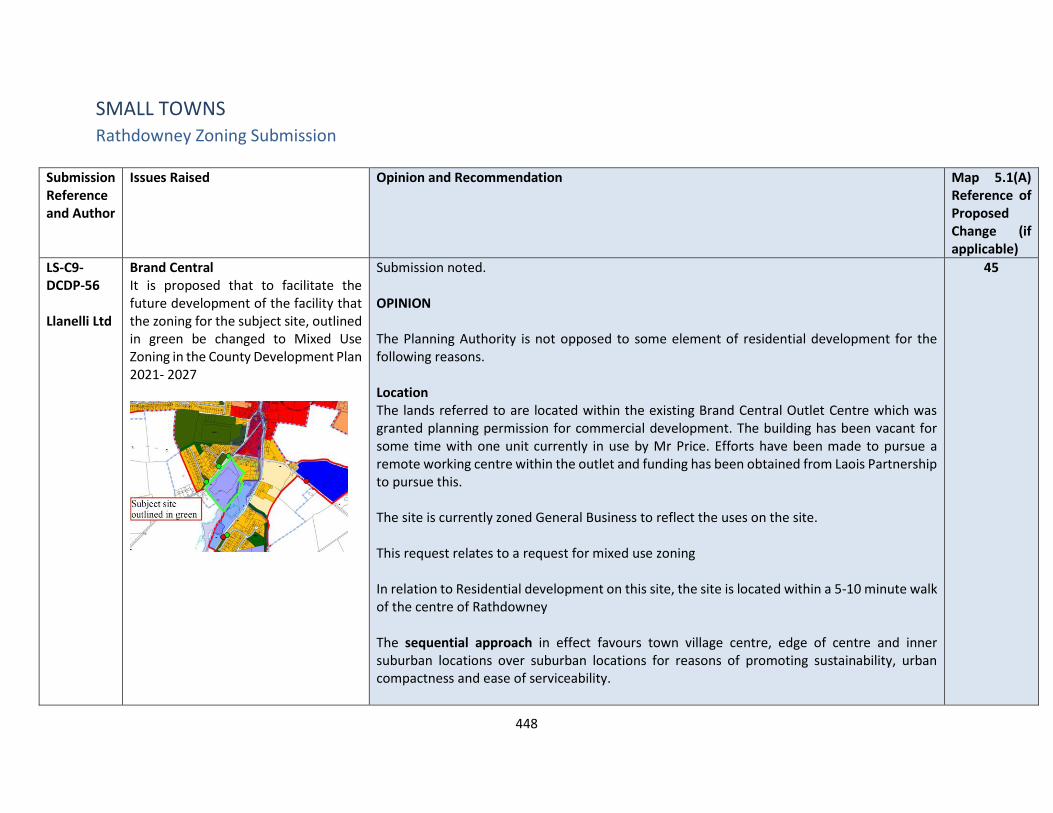
448
SMALL TOWNS Rathdowney Zoning Submission
Submission Reference and Author
Issues Raised Opinion and Recommendation Map 5.1(A) Reference of Proposed Change (if applicable)
LS-C9-DCDP-56 Llanelli Ltd
Brand Central It is proposed that to facilitate the future development of the facility that the zoning for the subject site, outlined in green be changed to Mixed Use Zoning in the County Development Plan 2021- 2027
Submission noted. OPINION The Planning Authority is not opposed to some element of residential development for the following reasons. Location The lands referred to are located within the existing Brand Central Outlet Centre which was granted planning permission for commercial development. The building has been vacant for some time with one unit currently in use by Mr Price. Efforts have been made to pursue a remote working centre within the outlet and funding has been obtained from Laois Partnership to pursue this. The site is currently zoned General Business to reflect the uses on the site. This request relates to a request for mixed use zoning In relation to Residential development on this site, the site is located within a 5-10 minute walk of the centre of Rathdowney The sequential approach in effect favours town village centre, edge of centre and inner suburban locations over suburban locations for reasons of promoting sustainability, urban compactness and ease of serviceability.
45
449
Submission Reference and Author
Issues Raised Opinion and Recommendation Map 5.1(A) Reference of Proposed Change (if applicable)
In terms of zoning land for ‘New Residential’, the National Strategic Outcome 1 (NSO 1) of the National Planning Framework (NPF) is to seek ‘Compact Growth’ across cities, towns and villages. In this regard, the National Planning Framework states that ‘From an urban development perspective, we will need to deliver a greater proportion of residential development within existing built-up areas of our cities, towns and villages…’. Regional Strategic Outcome 2 (RSO 2) of the Eastern and Midland Regional Spatial and Economic Strategy (RSES) supports the NPF’s NSO1 stating that ‘Residential development should be carried out sequentially, whereby lands which are, or will be, most accessible by walking, cycling and public transport – including infill and brownfield sites – are prioritised.’ Compact growth and adherence to the Core Strategy is provided for in Chapter 2 of the draft plan as follows Housing Land Requirement Based on the overall housing land requirement for County Laois of 125 hectares up to target year 2027, as set out in Chapter 2 “Core Strategy”, there is no need for additional residentially zoned lands in the town of Rathdowney. If this land were to be zoned, it would be at the expense of [and not additional to] other more suitably located lands as identified by application of the sequential approach. It is important to stress that the future population [and by extension the housing land requirement] of County Laois is governed by and shall comply with the housing targets as set out in the section 28 of the Planning and Development Act, 2000 (as amended), the ‘Housing Supply Target Methodology for Development Planning, Guidelines for Planning Authorities’ were issued on 18th December 2020.

450
Submission Reference and Author
Issues Raised Opinion and Recommendation Map 5.1(A) Reference of Proposed Change (if applicable)
These Guidelines provide the methodology to be adopted by planning authorities in formulating the housing supply target for their statutory development plan. The methodology utilises recently published research undertaken by the Economic and Social Research Institute – ‘Regional Demographics and Structural Housing Demand at a County Level’, Research Series, Number 111, ESRI, December 2020. The guidelines are to be applied by each planning authority to assist in ensuring that their development plan is prepared to be consistent with the National Planning Framework and relevant Regional Spatial and Economic Strategy. This has informed the core strategy of the draft Laois County Development Plan 2021-2027 and where future growth is directed to in a sustainable manner. Services In relation to Water supply - Development can be accommodated but would likely require infrastructure upgrades to accommodate the full growth projection and this is subject to funding from IW. In relation to Wastewater Treatment and water supply , Level of projected growth can be accommodated currently in the Draft Plan for Rathdowney This site is in need of regeneration within Rathdowney as it has been vacant for a very long period of time. Uses are being actively looked for it and while I don’t find it appropriate to allow for full residential on the site , I do believe that some component of residential could be considered , therefore I recommend that Mixed Use Zoning be proposed on this site. RECOMMENDATION Change from General Business Zoning
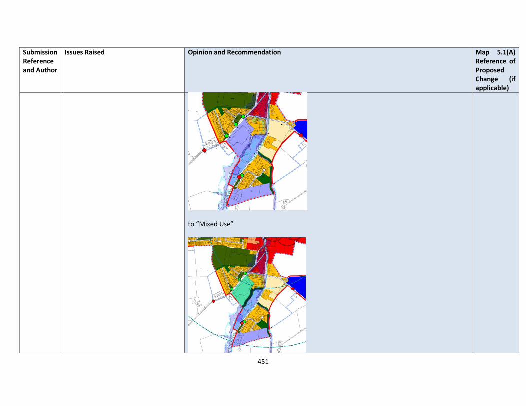
451
Submission Reference and Author
Issues Raised Opinion and Recommendation Map 5.1(A) Reference of Proposed Change (if applicable)
to “Mixed Use”
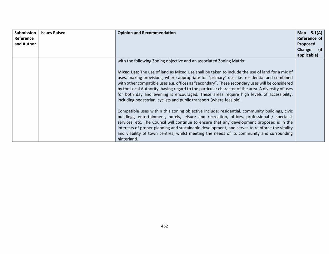
452
Submission Reference and Author
Issues Raised Opinion and Recommendation Map 5.1(A) Reference of Proposed Change (if applicable)
with the following Zoning objective and an associated Zoning Matrix: Mixed Use: The use of land as Mixed Use shall be taken to include the use of land for a mix of uses, making provisions, where appropriate for “primary” uses i.e. residential and combined with other compatible uses e.g. offices as “secondary”. These secondary uses will be considered by the Local Authority, having regard to the particular character of the area. A diversity of uses for both day and evening is encouraged. These areas require high levels of accessibility, including pedestrian, cyclists and public transport (where feasible). Compatible uses within this zoning objective include: residential, community buildings, civic buildings, entertainment, hotels, leisure and recreation, offices, professional / specialist services, etc. The Council will continue to ensure that any development proposed is in the interests of proper planning and sustainable development, and serves to reinforce the vitality and viability of town centres, whilst meeting the needs of its community and surrounding hinterland.
453
Durrow
Submission Reference and Author
Issues Raised Durrow – Opinion and Recommendation
LS-C9-DCDP-50 Durrow Development Forum
With regard to HPO 16 and HPO22, DDF request the provision of age friendly housing in Durrow village to provide for independent living for our ageing population. Durrow cannot strive to be an age friendly town without the provision of housing for the elderly, providing options to those who wish to down-size and remain living in their local area. It is noted a site on the Derry Road was previously identified for this purpose
The Planning Authority is very mindful of the national trend towards an aging population and the need for suitable accommodation to be made available for that cohort. According to the Central Statistics Office, the overall population of Ireland will have increased to 6.4 million people by 2046 and the number of elderly will have increased by 200,000 by 2046. Preliminary CSO results for the 2016 Census indicates that Ireland’s population continues to grow and County Laois continues to experience rapid population growth above the national average. The challenges facing the country in meeting the health and social care needs of a rapidly ageing population are well documented. The crisis in the Health Sector/Accident & Emergency Department and lack of step-down facilities is the focus of daily commentary in all national media forums. Of particular significance, the Country will experience a rapid increase in our older, old population:
• 65+ population cohort will expand from 860,000 (2026) – 1.4 million (2046)
• Cohort 85+ is set to escalate by 46% in 2021
• 80+ segment will account for 470 -480,000 in 2046 compared to 128,000 in 2011
• Demand for long-stay beds will increase to 45,000 by 2036
• Demand for short-stay beds is predicted to double

454
Submission Reference and Author
Issues Raised Durrow – Opinion and Recommendation
• Supply gap of between 18,000 – 24,000 beds by 2036
• Minimum efficient and compliant nursing home size is 60+ beds
Health Information and Quality Authority indicates that over 70% of private nursing homes are below this threshold and the problem is most acute outside major urban areas. The above figures are conservative if one used the HSE’s average annual growth rate of 8% 2016 projections then the potential 65+ figure would reach 1,350,000 by 2023.The onus is on the private sector to deliver this supply as the HSE/Department is committed to no new public registrations for the foreseeable future as available funding is committed to upgrading existing public facilities to HIQA standards. Housing for the elderly is referenced in various policies and objectives (HP8, HP9, HP10, HP11 and SOC 22) throughout the draft Plan particularly in Section 3 Housing Policy and Section 4 Social, Community and Recreational Strategy. RECOMMENDATION No change to the Draft Plan.
LS-C9-DCDP-72 Durrow Development Forum
Heritage Town Designation and ACA
DDF request Laois County Council nominate and support Durrow as a Heritage Town and maintain the Architectural Conservation Area as identified in DU 1 of the draft plan. The ACA boundary has been delineated to encompass the historic core of the village and the associated backlands which are part of its original layout.
OPINION Submission noted and commentary relating to the proposal to designate Durrow as a Heritage Town is noted. This is outside the scope of the CDP, however the ACA for Durrow remains in place. The submission is noted in relation to issues of dereliction, reuse of existing buildings and sites and limiting the impact on the environment.
455
Submission Reference and Author
Issues Raised Durrow – Opinion and Recommendation
Derelict Buildings
In line with DU 2, every effort should be made to reduce the vacancy rate within the town. DDF requests the redevelopment or restoration of derelict, vacant and underused buildings within Durrow town centre
Old Stone Bridge The old stone bridge is of significant architectural and historical value and a key focal point in the town. We request a commitment from Laois County Council to clean and repoint the bridge in order to maintain its character and structural integrity.
Conservation Officer Given the importance of conserving the built Heritage in our county, the appointment of a Conservation Officer within Laois County Council would be of great benefit.
The following policy objectives are included within Chapter 7 of the plan which promotes Town Centre First Priorities: RTP 5 - Encourage and facilitate the reuse and regeneration of derelict sites and buildings and vacant buildings for retail uses with due cognisance to the sequential approach as indicated in the regional planning guidelines, RTP 6 Permit retail development of a size and scale which is appropriate to the level of the town/settlement area, including its population, as defined within the County retail hierarchy, RTP 7 Ensure that all retail development permitted is in accordance with the Retail Planning: Guidelines for Planning Authorities (DECLG, 2012) and the Laois County Retail Strategy RTP 8 Protect the location of existing retail uses in town and village centres, the re-location of these uses to edge-of-centre or out-of-centre locations will not be accepted Policy Objectives have been included in each specific town and village plan for their regeneration. RECOMMENDATION No change to the Draft Plan.
LS-C9-DCDP-73 Durrow Development Forum
The submission notes key improvements for Durrow
1. Remaining work includes limestone kerbing around the Green and moving over-ground cables underground.
Submission is noted in relation key improvements further required within Durrow . Durrow Community Plan 2019 - 2023 is a community led approach to how the people of Durrow would like to see their

456
Submission Reference and Author
Issues Raised Durrow – Opinion and Recommendation
2. Implementation of electronic speed warning signs and rumble strips for traffic on each approach road to the town.
3. Placement of Solar bins around the town.
4. Any upgrade works should provide EV charging terminals for electric cars in line with CM ST 6.
5. Cork Road improvement works were previously proposed but did not commence. We request a review and consultation of the proposed works with an aim to regenerate this part of Durrow.
6. Attachments submitted: Durrow Square Design and Cork Rd Improvements Works Maps
town develop over the next number of years, highlighting priority projects such the redevelopment of the Methodist Church and Civil Defence property on Patrick St as a community facility (which is currently under development), requirement for additional play space, developing Durrow as a cycling hub and facilitating hot desking and remote working facilities within the village. The following policy objectives relate DU 3 Improve the quality of the public realm and in particular of the open spaces in the centre of Durrow including the provision of seating away from the principal carriageways to allow for the supervision of children, the improvement of street lighting and the maintenance of the town pumps; DU 4 Protect and plant groups of trees on the principal approach roads and audit signage on all approach roads; DU 5 Maintain the quality and features of the public realm on The Square and introduce consistent village branding/presentation at the village entry points and along the main streets in the form of high quality signage, tourism information, public art and consistent village type lighting standards which would strengthen Durrow’s identity; DU 6 Support and promote the implementation, where feasible, of the strategy contained in the Durrow Sustainable Community Plan; RECOMMENDATION No change to the Draft Plan.

457
Submission Reference and Author
Issues Raised Durrow – Opinion and Recommendation
LS-C9-DCDP-107 Durrow Development Forum
A community led project in Durrow has regenerated the Old Methodist Church/ICA hall from a vacant derelict building to what will be a vibrant Community hub. The hub will provide modern facilities for all of the Community groups including working zones, conference room and ICT facilities. We request assistance from Laois County Council in completing the hub to ensure it is accessible for all and has adequate car/bike parking facilities.
OPINION Submission is noted in relation to the work being done by the community with regard to the regeneration and extension of community facilities at the Methodist Church / ICA building. The Council is wholly supportive of developing the space as a remote working hub in line with the Remote Working Strategy January 2021 to be made available to the community. The Council will continue to support the Community in efforts to improve necessary infrastructure at appropriate locations subject to environmental standards and proper planning and development RECOMMENDATION No change to the Draft Plan
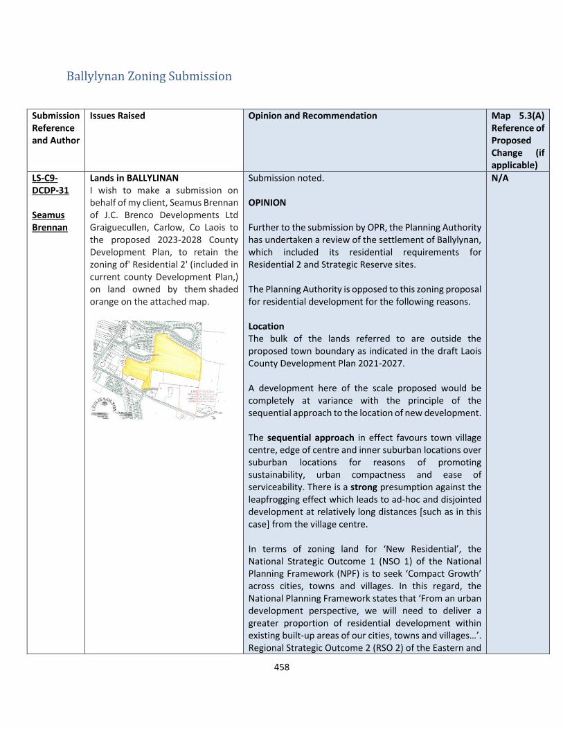
458
Ballylynan Zoning Submission
Submission Reference and Author
Issues Raised Opinion and Recommendation Map 5.3(A) Reference of Proposed Change (if applicable)
LS-C9-DCDP-31 Seamus Brennan
Lands in BALLYLINAN I wish to make a submission on behalf of my client, Seamus Brennan of J.C. Brenco Developments Ltd Graiguecullen, Carlow, Co Laois to the proposed 2023-2028 County Development Plan, to retain the zoning of' Residential 2' (included in current county Development Plan,) on land owned by them shaded orange on the attached map.
Submission noted. OPINION Further to the submission by OPR, the Planning Authority has undertaken a review of the settlement of Ballylynan, which included its residential requirements for Residential 2 and Strategic Reserve sites. The Planning Authority is opposed to this zoning proposal for residential development for the following reasons. Location The bulk of the lands referred to are outside the proposed town boundary as indicated in the draft Laois County Development Plan 2021-2027. A development here of the scale proposed would be completely at variance with the principle of the sequential approach to the location of new development. The sequential approach in effect favours town village centre, edge of centre and inner suburban locations over suburban locations for reasons of promoting sustainability, urban compactness and ease of serviceability. There is a strong presumption against the leapfrogging effect which leads to ad-hoc and disjointed development at relatively long distances [such as in this case] from the village centre. In terms of zoning land for ‘New Residential’, the National Strategic Outcome 1 (NSO 1) of the National Planning Framework (NPF) is to seek ‘Compact Growth’ across cities, towns and villages. In this regard, the National Planning Framework states that ‘From an urban development perspective, we will need to deliver a greater proportion of residential development within existing built-up areas of our cities, towns and villages…’. Regional Strategic Outcome 2 (RSO 2) of the Eastern and
N/A

459
Submission Reference and Author
Issues Raised Opinion and Recommendation Map 5.3(A) Reference of Proposed Change (if applicable)
Midland Regional Spatial and Economic Strategy (RSES) supports the NPF’s NSO1 stating that ‘Residential development should be carried out sequentially, whereby lands which are, or will be, most accessible by walking, cycling and public transport – including infill and brownfield sites – are prioritised.’ Compact growth and adherence to the Core Strategy is provided for in Chapter 2 of the draft plan as follows Housing Land Requirement Based on the overall housing land requirement for County Laois of 125 hectares up to target year 2027, as set out in Chapter 2 “Core Strategy”, there is no need for additional residentially zoned lands in the village. If this land were to be zoned, it would be at the expense of [and not additional to] other more suitably located lands as identified by application of the sequential approach. It is important to stress that the future population [and by extension the housing land requirement] of County Laois is governed by and shall comply with the housing targets as set out in the section 28 of the Planning and Development Act, 2000 (as amended), the ‘Housing Supply Target Methodology for Development Planning, Guidelines for Planning Authorities’ were issued on 18th December 2020. These Guidelines provide the methodology to be adopted by planning authorities in formulating the housing supply target for their statutory development plan. The methodology utilises recently published research undertaken by the Economic and Social Research Institute – ‘Regional Demographics and Structural Housing Demand at a County Level’, Research Series, Number 111, ESRI, December 2020. The guidelines are to be applied by each planning authority to assist in ensuring that their development plan is prepared to be consistent with the National Planning
460
Submission Reference and Author
Issues Raised Opinion and Recommendation Map 5.3(A) Reference of Proposed Change (if applicable)
Framework and relevant Regional Spatial and Economic Strategy. Which has informed the core strategy of the draft Laois County Development Plan 2021-2027. Services In relation to Water supply - Development can be accommodated but would likely require infrastructure upgrades to accommodate the full growth projection and this is subject to funding from IW. In relation to Wastewater Treatment Level of projected growth can be accommodated currently in the Draft Plan for Ballylynan RECOMMENDATION No changes to the Draft Plan. Therefore, the zonings be retained as in the Draft Plan for Residential 2 and strategic reserve.
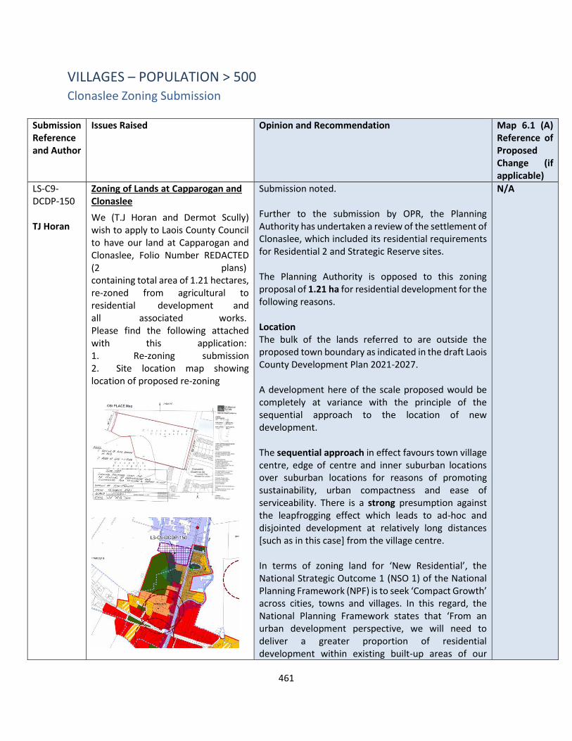
461
VILLAGES – POPULATION > 500 Clonaslee Zoning Submission
Submission Reference and Author
Issues Raised Opinion and Recommendation Map 6.1 (A) Reference of Proposed Change (if applicable)
LS-C9-DCDP-150 TJ Horan
Zoning of Lands at Capparogan and Clonaslee
We (T.J Horan and Dermot Scully) wish to apply to Laois County Council to have our land at Capparogan and Clonaslee, Folio Number REDACTED (2 plans) containing total area of 1.21 hectares, re-zoned from agricultural to residential development and all associated works. Please find the following attached with this application: 1. Re-zoning submission 2. Site location map showing location of proposed re-zoning
Submission noted. Further to the submission by OPR, the Planning Authority has undertaken a review of the settlement of Clonaslee, which included its residential requirements for Residential 2 and Strategic Reserve sites. The Planning Authority is opposed to this zoning proposal of 1.21 ha for residential development for the following reasons. Location The bulk of the lands referred to are outside the proposed town boundary as indicated in the draft Laois County Development Plan 2021-2027. A development here of the scale proposed would be completely at variance with the principle of the sequential approach to the location of new development. The sequential approach in effect favours town village centre, edge of centre and inner suburban locations over suburban locations for reasons of promoting sustainability, urban compactness and ease of serviceability. There is a strong presumption against the leapfrogging effect which leads to ad-hoc and disjointed development at relatively long distances [such as in this case] from the village centre. In terms of zoning land for ‘New Residential’, the National Strategic Outcome 1 (NSO 1) of the National Planning Framework (NPF) is to seek ‘Compact Growth’ across cities, towns and villages. In this regard, the National Planning Framework states that ‘From an urban development perspective, we will need to deliver a greater proportion of residential development within existing built-up areas of our
N/A

462
Submission Reference and Author
Issues Raised Opinion and Recommendation Map 6.1 (A) Reference of Proposed Change (if applicable)
cities, towns and villages…’. Regional Strategic Outcome 2 (RSO 2) of the Eastern and Midland Regional Spatial and Economic Strategy (RSES) supports the NPF’s NSO1 stating that ‘Residential development should be carried out sequentially, whereby lands which are, or will be, most accessible by walking, cycling and public transport – including infill and brownfield sites – are prioritised.’ Compact growth and adherence to the Core Strategy is provided for in Chapter 2 of the draft plan as follows Housing Land Requirement Based on the overall housing land requirement for County Laois of 125 hectares up to target year 2027, as set out in Chapter 2 “Core Strategy”, there is no need for additional residentially zoned lands in the village. If this land were to be zoned, it would be at the expense of [and not additional to] other more suitably located lands as identified by application of the sequential approach. It is important to stress that the future population [and by extension the housing land requirement] of County Laois is governed by and shall comply with the housing targets as set out in the section 28 of the Planning and Development Act, 2000 (as amended), the ‘Housing Supply Target Methodology for Development Planning, Guidelines for Planning Authorities’ were issued on 18th December 2020. These Guidelines provide the methodology to be adopted by planning authorities in formulating the housing supply target for their statutory development plan. The methodology utilises recently published research undertaken by the Economic and Social Research Institute – ‘Regional Demographics and Structural Housing Demand at a County Level’, Research Series, Number 111, ESRI, December 2020.
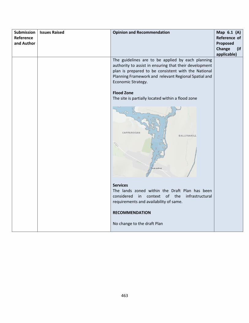
463
Submission Reference and Author
Issues Raised Opinion and Recommendation Map 6.1 (A) Reference of Proposed Change (if applicable)
The guidelines are to be applied by each planning authority to assist in ensuring that their development plan is prepared to be consistent with the National Planning Framework and relevant Regional Spatial and Economic Strategy. Flood Zone The site is partially located within a flood zone
Services The lands zoned within the Draft Plan has been considered in context of the infrastructural requirements and availability of same. RECOMMENDATION No change to the draft Plan

464
Ballyroan
Submission Reference and Author
Issues Raised Ballyroan – Opinion and Recommendation
LS-C9-DCDP-55 Sheelagh Kearns
1. That Ballyroan Village has been well served with regard to its housing needs in the last 15 years with the development of 3 housing estates in outlying areas and 20 further housing units (Laois County Council) currently under construction at Gleann na Glaise and Planning Permissions granted yet to be fulfilled. It is now time to look inward and deal with the needs of the village core i.e. its Main Street.
2. That the current neglected and derelict condition of houses including “Protected” buildings on the Main Street be recognised by the Local Authority and that it use its powers to address this issue urgently given the negative affect it creates in a community. It is essential that so called “Protected” buildings and structures are protected and not allowed fall into dereliction. It might be worth considering that a complete Town by Town review and assessment of listed properties be undertaken by the Heritage/Planning sections in conjunction with any other relevant Body to establish the current condition of all such properties and to deal accordingly with those neglected by way of enforcement of obligations on owners for the maintenance of their protected properties.
3. 4. That retention of the existing streetscape be
a requirement in any future Permission/s granted for development and regeneration of Ballyroan Village Centre.
5. That the retention of existing residential buildings where possible be encouraged in preference to new development in the Village Main Street. There is a great desire for regeneration of the Main Street and the
The submission is noted in relation to issues of dereliction, reuse of existing buildings and protected structures on the Main Street in Ballyroan and the potential for their redevelopment. Many policy objectives within the CDP emphasise the need to reuse and regenerate buildings in town centres and look at the Main Street first as a principle for redevelopment. The following policy objectives are included within Chapter 7 of the plan which promotes Town Centre First Priorities RTP 5 Encourage and facilitate the reuse and regeneration of derelict sites and buildings and vacant buildings for retail uses with due cognisance to the sequential approach as indicated in the regional planning guidelines, RTP 6 Permit retail development of a size and scale which is appropriate to the level of the town/settlement area, including its population, as defined within the County retail hierarchy, RTP 7 Ensure that all retail development permitted is in accordance with the Retail Planning: Guidelines for Planning Authorities (DECLG, 2012) and the Laois County Retail Strategy RTP 8 Protect the location of existing retail uses in town and village centres, the re-location of these uses to edge-of-centre or out-of-centre locations will not be accepted
465
Submission Reference and Author
Issues Raised Ballyroan – Opinion and Recommendation
revival of existing traditional buildings and the reintroduction of more families to create a “living” Main Street which in essence is what we recognise as “Ballyroan” the Main Street being the core of any village or Town which, shamefully, in Ballyroan is deteriorating every year despite the best efforts of some residents.
6. That the potential for the development, within the village centre, of much needed amenity areas to include a children’s playground, heritage site, park or other such projects be recognised and site/s identified and developed in order to create a sense of balanced development in a Village that has in recent years seen only the prioritisation of residential development over anything else.
7. That any proposed development residential or otherwise in the vicinity of important historical sites such as the Moat/Motte be limited in its extent and within reason due to the proximity of these sites with full archaeological investigations carried out.
8. That consideration be given to zoning for commercial use other areas of the Village in addition to the Main Street given the little amount of commercial services available to residents viz. shops (currently 1) in a Village that has seen a sizeable increase in population in recent years.
9. That additional “Opportunity Sites” be identified in the Village particularly in the vicinity of the River Gloreen, an almost forgotten feature of the Village, which passes the Moat at the lower end of the village shown as an open space/amenity area together with a small number of other currently undeveloped sites in the Village.
10. That more emphasis be put on the “greening” of Village centres with a plan specific to a village and grants available to
Policy Objectives have been included in each specific town and village plan for their regeneration RECOMMENDATION No change to the Draft Plan
466
Submission Reference and Author
Issues Raised Ballyroan – Opinion and Recommendation
assist groups for appropriate planting of native trees and shrubbery.
11. That Environmental, Heritage and Architectural officers get involved with villages and representative groups on the ground and visit these villages to promote projects and consult and advise in this regard.
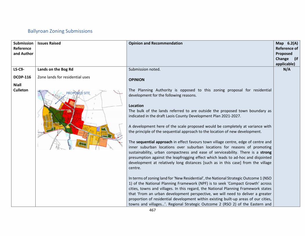
467
Ballyroan Zoning Submissions
Submission Reference and Author
Issues Raised Opinion and Recommendation Map 6.2(A) Reference of Proposed Change (if applicable)
LS-C9-
DCDP-116
Niall Culleton
Lands on the Bog Rd
Zone lands for residential uses
Submission noted. OPINION The Planning Authority is opposed to this zoning proposal for residential development for the following reasons. Location The bulk of the lands referred to are outside the proposed town boundary as indicated in the draft Laois County Development Plan 2021-2027. A development here of the scale proposed would be completely at variance with the principle of the sequential approach to the location of new development. The sequential approach in effect favours town village centre, edge of centre and inner suburban locations over suburban locations for reasons of promoting sustainability, urban compactness and ease of serviceability. There is a strong presumption against the leapfrogging effect which leads to ad-hoc and disjointed development at relatively long distances [such as in this case] from the village centre. In terms of zoning land for ‘New Residential’, the National Strategic Outcome 1 (NSO 1) of the National Planning Framework (NPF) is to seek ‘Compact Growth’ across cities, towns and villages. In this regard, the National Planning Framework states that ‘From an urban development perspective, we will need to deliver a greater proportion of residential development within existing built-up areas of our cities, towns and villages…’. Regional Strategic Outcome 2 (RSO 2) of the Eastern and
N/A
468
Submission Reference and Author
Issues Raised Opinion and Recommendation Map 6.2(A) Reference of Proposed Change (if applicable)
Midland Regional Spatial and Economic Strategy (RSES) supports the NPF’s NSO1 stating that ‘Residential development should be carried out sequentially, whereby lands which are, or will be, most accessible by walking, cycling and public transport – including infill and brownfield sites – are prioritised.’ Housing Land Requirement Based on the overall housing land requirement for County Laois of 125 hectares up to target year 2027, as set out in Chapter 2 “Core Strategy”, there is no need for additional residentially zoned lands in the village. If this land were to be zoned, it would be at the expense of [and not additional to] other more suitably located lands as identified by application of the sequential approach. It is important to stress that the future population [and by extension the housing land requirement] of County Laois is governed by and shall comply with the housing targets as set out in the section 28 of the Planning and Development Act, 2000 (as amended), the ‘Housing Supply Target Methodology for Development Planning, Guidelines for Planning Authorities’ were issued on 18th December 2020. These Guidelines provide the methodology to be adopted by planning authorities in formulating the housing supply target for their statutory development plan. The methodology utilises recently published research undertaken by the Economic and Social Research Institute – ‘Regional Demographics and Structural Housing Demand at a County Level’, Research Series, Number 111, ESRI, December 2020. The guidelines are to be applied by each planning authority to assist in ensuring that their development plan is prepared to be consistent with the National Planning Framework and relevant Regional Spatial and Economic Strategy. Services
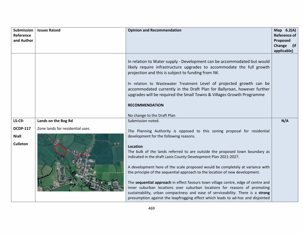
469
Submission Reference and Author
Issues Raised Opinion and Recommendation Map 6.2(A) Reference of Proposed Change (if applicable)
In relation to Water supply - Development can be accommodated but would likely require infrastructure upgrades to accommodate the full growth projection and this is subject to funding from IW.
In relation to Wastewater Treatment Level of projected growth can be accommodated currently in the Draft Plan for Ballyroan, however further upgrades will be required the Small Towns & Villages Growth Programme RECOMMENDATION No change to the Draft Plan
LS-C9-
DCDP-117
Niall
Culleton
Lands on the Bog Rd
Zone lands for residential uses
Submission noted. The Planning Authority is opposed to this zoning proposal for residential development for the following reasons. Location The bulk of the lands referred to are outside the proposed town boundary as indicated in the draft Laois County Development Plan 2021-2027. A development here of the scale proposed would be completely at variance with the principle of the sequential approach to the location of new development. The sequential approach in effect favours town village centre, edge of centre and inner suburban locations over suburban locations for reasons of promoting sustainability, urban compactness and ease of serviceability. There is a strong presumption against the leapfrogging effect which leads to ad-hoc and disjointed
N/A

470
Submission Reference and Author
Issues Raised Opinion and Recommendation Map 6.2(A) Reference of Proposed Change (if applicable)
development at relatively long distances [such as in this case] from the village centre. In terms of zoning land for ‘New Residential’, the National Strategic Outcome 1 (NSO 1) of the National Planning Framework (NPF) is to seek ‘Compact Growth’ across cities, towns and villages. In this regard, the National Planning Framework states that ‘From an urban development perspective, we will need to deliver a greater proportion of residential development within existing built-up areas of our cities, towns and villages…’. Regional Strategic Outcome 2 (RSO 2) of the Eastern and Midland Regional Spatial and Economic Strategy (RSES) supports the NPF’s NSO1 stating that ‘Residential development should be carried out sequentially, whereby lands which are, or will be, most accessible by walking, cycling and public transport – including infill and brownfield sites – are prioritised.’ Housing Land Requirement Based on the overall housing land requirement for County Laois of 125 hectares up to target year 2027, as set out in Chapter 2 “Core Strategy”, there is no need for additional residentially zoned lands in the village. If this land were to be zoned, it would be at the expense of [and not additional to] other more suitably located lands as identified by application of the sequential approach. It is important to stress that the future population [and by extension the housing land requirement] of County Laois is governed by and shall comply with the housing targets as set out in the section 28 Guidelines of the Planning and Development Act, 2000 (as amended), the ‘Housing Supply Target Methodology for Development Planning, Guidelines for Planning Authorities’ were issued on 18th December 2020.

471
Submission Reference and Author
Issues Raised Opinion and Recommendation Map 6.2(A) Reference of Proposed Change (if applicable)
These Guidelines provide the methodology to be adopted by planning authorities in formulating the housing supply target for their statutory development plan. The methodology utilises recently published research undertaken by the Economic and Social Research Institute – ‘Regional Demographics and Structural Housing Demand at a County Level’, Research Series, Number 111, ESRI, December 2020. The guidelines are to be applied by each planning authority to assist in ensuring that their development plan is prepared to be consistent with the National Planning Framework and relevant Regional Spatial and Economic Strategy. Services In relation to Water supply - Development can be accommodated but would likely require infrastructure upgrades to accommodate the full growth projection and this is subject to funding from IW. In relation to Wastewater Treatment Level of projected growth can be accommodated currently in the Draft Plan for Ballyroan, however, further upgrades will be required the Small Towns & Villages Growth Programme RECOMMENDATION No change to the Draft Plan

472
Borris in Ossory Zoning Submission
Submission Reference and Author
Issues Raised Opinion and Recommendation Map 6.3(A) Reference of Proposed Change (if applicable)
LS-C9-DCDP-130 Celine Cole
Our client’s land holding was zoned Residential 2 in the Laois County Development Plan 2011-2017 and is currently zoned Strategic Reserve 2018-2024 in the Laois County Development Plan 2017-2023. Our client wants to zone his landholding from Strategic Reserve 2018-2024 to either:
1. Residential 2 2. Community, Education and
Institutional
We have also outlined a residential pathway in green that leads from our client’s landholding to the Main Street of the town. Our client wants to apply for Planning Permission for a Nursing Home and Retirement Village which leads from our client’s land holding to the Main Street of the town.
Submission noted. OPINION The Planning Authority is opposed to this zoning proposal for residential development for the following reasons. Location The bulk of the lands referred to are outside the proposed town boundary as indicated in the draft Laois County Development Plan 2021-2027. A development here of the scale proposed would be completely at variance with the principle of the sequential approach to the location of new development. The sequential approach in effect favours town village centre, edge of centre and inner suburban locations over suburban locations for reasons of promoting sustainability, urban compactness and ease of serviceability. In terms of zoning land for ‘New Residential’, the National Strategic Outcome 1 (NSO 1) of the National Planning Framework (NPF) is to seek ‘Compact Growth’ across cities, towns and villages. In this regard, the National Planning Framework states that ‘From an urban development perspective, we will need to deliver a greater proportion of residential development within existing built-up areas of our cities, towns and villages…’. Regional Strategic Outcome 2 (RSO 2) of the Eastern and Midland Regional Spatial and Economic Strategy (RSES) supports the NPF’s NSO1 stating that ‘Residential development should be carried out sequentially, whereby lands which are, or will be, most accessible by walking, cycling and public transport – including infill and brownfield sites – are prioritised.’ Housing Land Requirement Based on the overall housing land requirement for County Laois of 125 hectares up to target year 2027, as
N/A

473
Submission Reference and Author
Issues Raised Opinion and Recommendation Map 6.3(A) Reference of Proposed Change (if applicable)
set out in Chapter 2 “Core Strategy”, there is no need for additional residentially zoned lands in the village. If this land were to be zoned, it would be at the expense of [and not additional to] other more suitably located lands as identified by application of the sequential approach. It is important to stress that the future population [and by extension the housing land requirement] of County Laois is governed by and shall comply with the housing targets as set out in the section 28 of the Planning and Development Act, 2000 (as amended), the ‘Housing Supply Target Methodology for Development Planning, Guidelines for Planning Authorities’ were issued on 18th December 2020. These Guidelines provide the methodology to be adopted by planning authorities in formulating the housing supply target for their statutory development plan. The methodology utilises recently published research undertaken by the Economic and Social Research Institute – ‘Regional Demographics and Structural Housing Demand at a County Level’, Research Series, Number 111, ESRI, December 2020. The guidelines are to be applied by each planning authority to assist in ensuring that their development plan is prepared to be consistent with the National Planning Framework and relevant Regional Spatial and Economic Strategy. In relation to the request to be considered for CEI, the Planning Authority is very mindful of the national trend towards an aging population and the need for suitable accommodation to be made available for that cohort. According to the Central Statistics Office, the overall population of Ireland will have increased to 6.4 million people by 2046 and the number of elderly will have increased by 200,000 by 2046. Preliminary CSO results for the 2016 Census indicates that Ireland’s population continues to grow and County Laois continues to experience rapid population growth above the national average. The challenges facing the country in meeting
474
Submission Reference and Author
Issues Raised Opinion and Recommendation Map 6.3(A) Reference of Proposed Change (if applicable)
the health and social care needs of a rapidly ageing population are well documented. The crisis in the Health Sector/Accident & Emergency Department and lack of step-down facilities is the focus of daily commentary in all national media forums. Of particular significance, the Country will experience a rapid increase in our older, old population:
• 65+ population cohort will expand from 860,000 (2026) – 1.4 million (2046)
• Cohort 85+ is set to escalate by 46% in 2021
• 80+ segment will account for 470 -480,000 in 2046 compared to 128,000 in 2011
• Demand for long-stay beds will increase to 45,000 by 2036
• Demand for short-stay beds is predicted to double
• Supply gap of between 18,000 – 24,000 beds by 2036
• Minimum efficient and compliant nursing home size is 60+ beds
Health Information and Quality Authority indicates that over 70% of private nursing homes are below this threshold and the problem is most acute outside major urban areas. The above figures are conservative if one used the HSE’s average annual growth rate of 8% 2016 projections then the potential 65+ figure would reach 1,350,000 by 2023.The onus is on the private sector to deliver this supply as the HSE/Department is committed to no new public registrations for the foreseeable future as available funding is committed to upgrading existing public facilities to HIQA standards. Housing for the elderly is referenced in Section 4.7 of the Draft Plan and various policy objectives (HPO 22, HPO 23, HPO 24 HPO 25 , HPO 26 all support this Any purpose built retirement scheme should be of scale relative to the size and function of the town, consistent with the NPF and National Statement – Housing Options for Our Ageing Population. It is considered that such as

475
Submission Reference and Author
Issues Raised Opinion and Recommendation Map 6.3(A) Reference of Proposed Change (if applicable)
scheme, similar in scale to the smaller case studies referred to the National Statement – Housing Options for Our Ageing Population, could be accommodated on undeveloped / brownfield infill sites close to the town centre of Borris In Ossory. Services The lands zoned within the Draft plan has been considered in context of the infrastructural requirements and availability of same. RECOMMENDATION No change to the draft Plan
476
Killenard
Submission Reference and Author
Issues Raised Killenard – Opinion and Recommendation
LS-C9-DCDP-48 Killenard Tidy Towns
What does only organic residential development mean? The village has: 1. Planning for 32 units within the Heritage golf complex 2. Expired planning for 40 units expanding current Heritage development 3. Planning for a 116 bed Care Centre, 40 assisted living units and an additional 65 sheltered homes 4. Expired planning for nursing home across from Carriglea on Killenard hill It's not clear how the strategy links to what's being approved for planning. As an example the current population of the village is ~671. If the retirement complex goes ahead and is fully occupied then the village population will increase by ~250 individuals >66 years of age. ~30% population of the village will be over 66 years in just the new development. If the second nursing home not expired was reapproved then the demography would change further. Is this the norm for a rural village plan within the Laois development strategy? How does this align with sustaining the local school and clubs?
OPINION The Planning Authority is very mindful of the national trend towards an aging population and the need for suitable accommodation to be made available for that cohort. According to the Central Statistics Office, the overall population of Ireland will have increased to 6.4 million people by 2046 and the number of elderly will have increased by 200,000 by 2046. Preliminary CSO results for the 2016 Census indicates that Ireland’s population continues to grow and County Laois continues to experience rapid population growth above the national average. The challenges facing the country in meeting the health and social care needs of a rapidly ageing population are well documented. The crisis in the Health Sector/Accident & Emergency Department and lack of step-down facilities is the focus of daily commentary in all national media forums. Of particular significance, the Country will experience a rapid increase in our older, old population:
• 65+ population cohort will expand from 860,000 (2026) – 1.4 million (2046)
• Cohort 85+ is set to escalate by 46% in 2021
• 80+ segment will account for 470 -480,000 in 2046 compared to 128,000 in 2011
• Demand for long-stay beds will increase to 45,000 by 2036
• Demand for short-stay beds is predicted to double
• Supply gap of between 18,000 – 24,000 beds by 2036

477
Submission Reference and Author
Issues Raised Killenard – Opinion and Recommendation
• Minimum efficient and compliant nursing home size is 60+ beds
There are policy objectives within the Settlement plans that supports the development of community, educational and village enhancement. RECOMMENDATION No change to the Draft Plan
LS-C9-DCDP-49 Killenard -Tidy Towns
The population of Killenard village has increased significantly over the last few years and we are lucky to have a lovely village. Traffic has increased with the golf club, hotel and increase in population. O'Dempsey's is a core element of the community and linking it more directly to the village is greatly desireable. At the moment the road from Mount Henry to O'Dempsey's is unsafe for children to cycle and walk and we believe adding a footpath & cycle path from the village to the GAA club is a key need of the community. This should happen before further development happens in the village.
OPINION Submission noted. It is understandable why a footpath/cycleway is desired between Killenard and O’Dempseys. This section of road is within an 80kph speed limit zone. For this speed limit, DMURS recommends the provision of a segregated cycle track (rather than a cycle lane or a shared road use). The National Cycle Manual would require a minimum width of 1.5m for single-file cycling. The overall width required, including the width of a footpath, would be approx. 3m which is not available within the existing carriageway. This would require land purchase (likely CPO), removal of mature trees, relocation of poles/overhead lines and traversing existing driveways/privately maintained verges/hardshoulders along the route. This would not be achievable within the normal resource allocations for the area office. Public consultation would be required and agreements with all affected landowners would need to be in place along with obtaining the significant funding required.
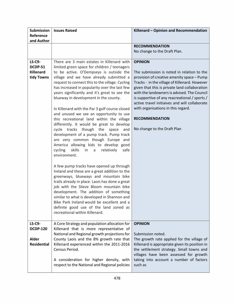
478
Submission Reference and Author
Issues Raised Killenard – Opinion and Recommendation
RECOMMENDATION No change to the Draft Plan.
LS-C9-DCDP-51 Killenard tidy Towns
There are 3 main estates in Killenard with limited green space for children / teenagers to be active. O'Dempseys is outside the village and we have already submitted a request to connect this to the village. Cycling has increased in popularity over the last few years significantly and it's great to see the blueway in development in the county.
In Killenard with the Par 3 golf course closed and unused we see an opportunity to use this recreational land within the village differently. It would be great to develop cycle tracks though the space and development of a pump track. Pump track are very common though Europe and America allowing kids to develop good cycling skills in a relatively safe environment.
A few pump tracks have opened up through Ireland and these are a great addition to the greenways, blueways and mountain bike trails already in place. Laois has done a great job with the Slieve Bloom mountain bike development. The addition of something similar to what is developed in Shannon and Bike Park Ireland would be excellent and a definite good use of the land zoned as recreational within Killenard.
OPINION The submission is noted in relation to the provision of creative amenity space – Pump Tracks - in the village of Killenard. However given that this is private land collaboration with the landowners is advised. The Council is supportive of any reacreational / sports / active travel initiaives and will collaborate with organisations in this regard. RECOMMENDATION No change to the Draft Plan
LS-C9-DCDP-120 Alder Residential
A Core Strategy and population allocation for Killenard that is more representative of National and Regional growth projections for County Laois and the 8% growth rate that Killenard experienced within the 2011-2016 Census Period. A consideration for higher density, with respect to the National and Regional policies
OPINION Submission noted. The growth rate applied for the village of Killenard is appropriate given its position in the settlement strategy. Small towns and villages have been assessed for growth taking into account a number of factors such as
479
Submission Reference and Author
Issues Raised Killenard – Opinion and Recommendation
and objectives for Compact Growth and the density requirements outlined above.
• Position in the settlement hierarchy
• Availability of public infrastructure to service future development
• Available of sustainable modes of transport to sustain higher growth rates
• Availability of social infrastructure to cater for future demand.
It is noted that availability of water services are an issue within the Killenard area for future development. RECOMMENDATION No change to the Draft Plan
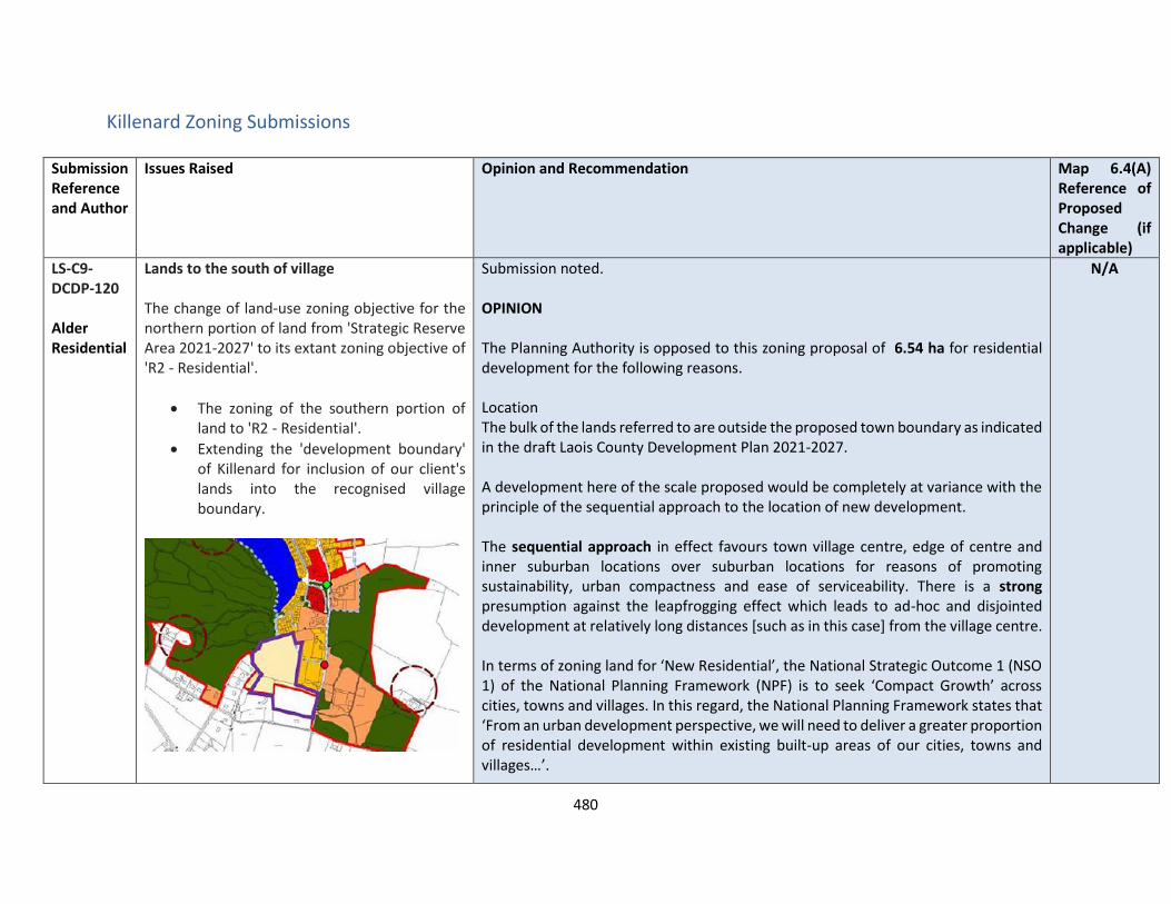
480
Killenard Zoning Submissions
Submission Reference and Author
Issues Raised Opinion and Recommendation Map 6.4(A) Reference of Proposed Change (if applicable)
LS-C9-DCDP-120 Alder Residential
Lands to the south of village The change of land-use zoning objective for the northern portion of land from 'Strategic Reserve Area 2021-2027' to its extant zoning objective of 'R2 - Residential'.
• The zoning of the southern portion of land to 'R2 - Residential'.
• Extending the 'development boundary' of Killenard for inclusion of our client's lands into the recognised village boundary.
Submission noted. OPINION The Planning Authority is opposed to this zoning proposal of 6.54 ha for residential development for the following reasons. Location The bulk of the lands referred to are outside the proposed town boundary as indicated in the draft Laois County Development Plan 2021-2027. A development here of the scale proposed would be completely at variance with the principle of the sequential approach to the location of new development. The sequential approach in effect favours town village centre, edge of centre and inner suburban locations over suburban locations for reasons of promoting sustainability, urban compactness and ease of serviceability. There is a strong presumption against the leapfrogging effect which leads to ad-hoc and disjointed development at relatively long distances [such as in this case] from the village centre. In terms of zoning land for ‘New Residential’, the National Strategic Outcome 1 (NSO 1) of the National Planning Framework (NPF) is to seek ‘Compact Growth’ across cities, towns and villages. In this regard, the National Planning Framework states that ‘From an urban development perspective, we will need to deliver a greater proportion of residential development within existing built-up areas of our cities, towns and villages…’.
N/A
481
Submission Reference and Author
Issues Raised Opinion and Recommendation Map 6.4(A) Reference of Proposed Change (if applicable)
Regional Strategic Outcome 2 (RSO 2) of the Eastern and Midland Regional Spatial and Economic Strategy (RSES) supports the NPF’s NSO1 stating that ‘Residential development should be carried out sequentially, whereby lands which are, or will be, most accessible by walking, cycling and public transport – including infill and brownfield sites – are prioritised.’ Housing Land Requirement Based on the overall housing land requirement for County Laois of 125 hectares up to target year 2027, as set out in Chapter 2 “Core Strategy”, there is no need for additional residentially zoned lands in the village. If this land were to be zoned, it would be at the expense of [and not additional to] other more suitably located lands as identified by application of the sequential approach. It is important to stress that the future population [and by extension the housing land requirement] of County Laois is governed by and shall comply with the housing targets as set out in the section 28 of the Planning and Development Act, 2000 (as amended), the ‘Housing Supply Target Methodology for Development Planning, Guidelines for Planning Authorities’ were issued on 18th December 2020. These Guidelines provide the methodology to be adopted by planning authorities in formulating the housing supply target for their statutory development plan. The methodology utilises recently published research undertaken by the Economic and Social Research Institute – ‘Regional Demographics and Structural Housing Demand at a County Level’, Research Series, Number 111, ESRI, December 2020. The guidelines are to be applied by each planning authority to assist in ensuring that their development plan is prepared to be consistent with the National Planning Framework and relevant Regional Spatial and Economic Strategy.

482
Submission Reference and Author
Issues Raised Opinion and Recommendation Map 6.4(A) Reference of Proposed Change (if applicable)
This has informed the core strategy of the draft Laois County Development Plan 2021-2027 and where future growth is directed to in a sustainable manner. Services In relation to Water supply - Development can be accommodated but would likely require infrastructure upgrades to accommodate the full growth projection and this is subject to funding from IW. In relation to Wastewater Treatment Level of projected growth can be accommodated currently in the Draft Plan for Killenard It is however noted that water services are an issue within the Killenard area. It is therefore premature at this point in time to zone additional lands for “Residential 2”. Until such time as these issues are resolved by IW, the lands shall remain unzoned and can be reviewed during a further county development plan review. RECOMMENDATION No change to the Draft Plan.
LS-C9-DCDP-127 Evelyn Duff
Site at Killenard, Co.Laois Submission noted. OPINION The Planning Authority is opposed to this zoning proposal of 6.54 ha for residential development for the following reasons. Location
N/A
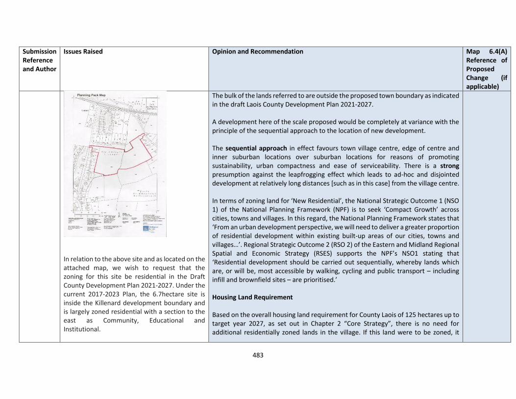
483
Submission Reference and Author
Issues Raised Opinion and Recommendation Map 6.4(A) Reference of Proposed Change (if applicable)
In relation to the above site and as located on the attached map, we wish to request that the zoning for this site be residential in the Draft County Development Plan 2021-2027. Under the current 2017-2023 Plan, the 6.7hectare site is inside the Killenard development boundary and is largely zoned residential with a section to the east as Community, Educational and Institutional.
The bulk of the lands referred to are outside the proposed town boundary as indicated in the draft Laois County Development Plan 2021-2027. A development here of the scale proposed would be completely at variance with the principle of the sequential approach to the location of new development. The sequential approach in effect favours town village centre, edge of centre and inner suburban locations over suburban locations for reasons of promoting sustainability, urban compactness and ease of serviceability. There is a strong presumption against the leapfrogging effect which leads to ad-hoc and disjointed development at relatively long distances [such as in this case] from the village centre. In terms of zoning land for ‘New Residential’, the National Strategic Outcome 1 (NSO 1) of the National Planning Framework (NPF) is to seek ‘Compact Growth’ across cities, towns and villages. In this regard, the National Planning Framework states that ‘From an urban development perspective, we will need to deliver a greater proportion of residential development within existing built-up areas of our cities, towns and villages…’. Regional Strategic Outcome 2 (RSO 2) of the Eastern and Midland Regional Spatial and Economic Strategy (RSES) supports the NPF’s NSO1 stating that ‘Residential development should be carried out sequentially, whereby lands which are, or will be, most accessible by walking, cycling and public transport – including infill and brownfield sites – are prioritised.’ Housing Land Requirement Based on the overall housing land requirement for County Laois of 125 hectares up to target year 2027, as set out in Chapter 2 “Core Strategy”, there is no need for additional residentially zoned lands in the village. If this land were to be zoned, it

484
Submission Reference and Author
Issues Raised Opinion and Recommendation Map 6.4(A) Reference of Proposed Change (if applicable)
In the Draft County Development Plan the above site is proposed as ‘Strategic Reserve’ and is outside of the CSO settlement boundary. We request that the entire site be zoned as residential in the next Development Plan. Planning Permission was granted in 2007 on the site for a residential development and for a Retirement Home complex on the Community, Educational and Institutional portion of the site. Since then, a large Retirement Complex has been granted permission in Killenard which negates the need for the Community, Educational and Institutional zoning on the site. Residential houses are in strong demand and in short supply with the proposed development at an advanced design stage. Under the current Plan, on behalf of Matt Colgan, we have developed a high quality, residential housing scheme for the overall site. A pre-planning meeting was held in December 2019 with the intention of lodging a planning application. The application has been delayed by the requirement for obtaining a service wayleave through adjacent land for foul and surface water connection. The required wayleave has recently been agreed
would be at the expense of [and not additional to] other more suitably located lands as identified by application of the sequential approach. It is important to stress that the future population [and by extension the housing land requirement] of County Laois is governed by and shall comply with the housing targets as set out in the section 28 of the Planning and Development Act, 2000 (as amended), the ‘Housing Supply Target Methodology for Development Planning, Guidelines for Planning Authorities’ were issued on 18th December 2020. These Guidelines provide the methodology to be adopted by planning authorities in formulating the housing supply target for their statutory development plan. The methodology utilises recently published research undertaken by the Economic and Social Research Institute – ‘Regional Demographics and Structural Housing Demand at a County Level’, Research Series, Number 111, ESRI, December 2020. The guidelines are to be applied by each planning authority to assist in ensuring that their development plan is prepared to be consistent with the National Planning Framework and relevant Regional Spatial and Economic Strategy. This has informed the core strategy of the draft Laois County Development Plan 2021-2027 and where future growth is directed to in a sustainable manner. Services In relation to Water supply - Development can be accommodated but would likely require infrastructure upgrades to accommodate the full growth projection and this is subject to funding from IW. In relation to Wastewater Treatment Level of projected growth can be accommodated currently in the Draft Plan for Killenard.
485
Submission Reference and Author
Issues Raised Opinion and Recommendation Map 6.4(A) Reference of Proposed Change (if applicable)
with the adjacent landowners and we are now ready to lodge the planning application. I understand that the planning application will be assessed under the current Development Plan, but if there are delays during the process, we would request that the zoning remain as residential under the next plan to facilitate the application. On behalf of our Client we have brought the proposal to planning application stage and have had consultations with the planning, housing, roads and sanitary sections of Laois County Council. We have also obtained a Certificate of Feasibility for the site from Irish Water, as attached.
It is however noted that water services are an issue within the Killenard area. It is therefore premature at this point in time to zone additional lands for “Residential 2”. Until such time as these issues are resolved by IW, the lands shall remain unzoned and can be reviewed during a further county development plan review. RECOMMENDATION No change to the Draft Plan.

486
VILLAGES – POPULATION < 500 Ballinakill Zoning Submission
Submission Reference and Author
Issues Raised Ballinakill – Opinion and Recommendation Map 7.2(A) Reference of Proposed Change (if applicable)
LS-C9-DCDP-132 Twin Trees Heywood Arts and Cultural Committee
The submission includes a detailed study of the Masslough Area within the old Heywood Estate, Ballinakill, the purpose of the study is to establish the history and significance of the area and to set out recommendations for the future protection of this important asset.
The report also refers that Howly Hayes Architects are in the process of completing a Conservation Management Plan for Heywood for the Office of Public Works.
Future Strategies for Protection
The LCDP 2017-2023 list Heywood Gardens as one of the outstanding and very exceptional structures within County Laois. The demesne contains thirteen no. protected structures.
The planted woodland around Mass Lough is also zoned as open space / amenity, though the area within the
OPINION The submission is noted in relation to the study carried out by Howly Hayes on the Heywood Demesne – the Masslough and Ballinakill. We note the request for the designation of this area as a “Landscape Conservation Area” as outlined on the map attached to this submission. The process of designating a LCA is set out in the Planning and Development Legislation under Section 204 and is detailed in relation to publication of designate area and attributes, consultation and notification to the Minister and interested parties. This is beyond the scope of the Draft Plan at this point and will be considered in collaboration with stakeholders on adoption of the Draft Plan. A policy Objective shall be included in Chapter 11.10 and also within the Ballinakill Village Plan as follows Work in collaboration with key stakeholders to further investigate and designate the Masslough Area within the old Heywood Estate, Ballinakill as a Landscape Conservation Area We also note the request for the carrying out of a Tree Protection Order in relation to some trees in the village of Ballinkill. Policy objective BNH 17 in the Draft plan seeks to carry out TPO’s within the lifetime of the plan. It should be noted that Tree
67

487
Submission Reference and Author
Issues Raised Ballinakill – Opinion and Recommendation Map 7.2(A) Reference of Proposed Change (if applicable)
boundary does not include the full extent of the lands which were part of the planted eighteen century landscape.
The village centre of Ballinakill has been designated as an Architectural Conservation Area, and includes two churches, however it does not include the historic demesne of Heywood. A portion of the demesne does not sit within the development boundary of the village of Ballinakill.
Mass Lough and the planted woodland
What is lacking in the current development plan is the appraisal and descriptive protection strategy for planted woodlands and water courses including Mass Lough. This should be addressed and rectified in the forthcoming development plan 2-21-2027.
What is also lacking is a definitive area of protective curtilage around the historic structures in the historic landscape, which should also take account of the historic views throughout the landscape.
Preservation Orders (TPOs) may be made under Section 205 of the Planning & Development Act 2000. A TPO can be made if it appears to the planning authority to be desirable and appropriate in the interest of amenity or the environment. A TPO can apply to a tree, trees, group of trees or woodland. BNH 18 policy objective also relates to the protection of woodland / groups of trees in the interests of landscape conservation. A policy Objective shall be included in Chapter 11.10 and also within the Ballinakill Village Plan as follows Work in collaboration with key stakeholders to further investigate and designate the Masslough Area within the old Heywood Estate, Ballinakill as a Landscape Conservation Area
The submission also requested that the woodlands associated with Heywood be zoned for amenity space, given the historic context as expressed in the study , it is considered appropriate to zone the lands for recreation and amenity to support the future development of Ballinakill as a tourism hub.
Views and prospects have also been provided worth protecting which have been checked and it is considered to be appropriate to add them to Map 11.8

488
Submission Reference and Author
Issues Raised Ballinakill – Opinion and Recommendation Map 7.2(A) Reference of Proposed Change (if applicable)
The planted woodland should be afforded a special degree of protection, to ensure no inappropriate development on the private lands which surround it and to establish the ecological significance of this area of land.
Coilte is working on a long term project within their sites designated for biodiversity value, including Heywood. However, at present this area is zoned for open space / amenity which would allow for a certain degree of development or change, including playground or community use building. The woodland and lake should have a greater degree of protection than this to ensure that this historically and ecologically sensitive landscape is kept intact and not subject to any further unnecessary deforestation.
The designation of this area as a “Landscape Conservation Area” should be implemented and no further housing development should be allowed within the central area and within the estate, shown as
Heywood Demesne Boundary Wall
In relation to the Heywood Demense Wall , following consideration by a conservation architect and an appraisal as follows has been carried out
Description
Stone rubble boundary walls to Heywood Demesne, to the immediate north of Ballinakill Village. Although much of the walls have been lost, significant sections survive adjoining the (north) Abbeyleix Gate (photos 1 and 2) and on the approach to Ballinakill from the north (photo 3).
489
Submission Reference and Author
Issues Raised Ballinakill – Opinion and Recommendation Map 7.2(A) Reference of Proposed Change (if applicable)
horticulture / agricultural use on the map (Figure 45 of the submission).
The council should establish policy with regard to landscape conservation area.
A number of recommended policy points is included as follows:
LCA1 Consider favorably development proposals within a LCA that would either preserve or enhance the woodland and lake, without unnecessary removal of woodland or visual impact on the woodland or lake
LCA2 Support owners of land within LCAs through providing advice and guidance in relation to development proposals
LCA3 Ensure that surrounding development will not adversely affect the site, setting or views to and from the historic woodland and lake
LCA4 Require that any proposals for new development within the boundaries of the old demesne include an appraisal of the landscape, designed views and vistas and an assessment of significant trees or groups of trees, as
Architectural
The surviving sections of the demesne wall are well-crafted exemplars of their type, constructed of local stone rubble. The walls contribute to the setting of the Abbeyleix Gate to Heywood (RPS ref. 502) and to the approach to the village of Ballinakill from the north.
Social
The stone rubble walls delineated the historic boundary between the estate lands of Heywood and the nearby village of Ballinakill. The walls illustrate historic stone rubble wall building techniques and the use of local stone as a construction material.
NIAH
The demesne walls are not separately recorded in the NIAH survey, which describes a number of built heritage features within Heywood, including the Abbeyleix Gate (NIAH ref. 12803001), which is flanked by a section of the demesne wall
It is Recommended that the demesne walls of Heywood are added to the Record of Protected Structures.
The following written description should apply:
‘stone rubble demesne walls of Heywood, including the flanking walls to the north entrance gate and the roadside wall to the west of the Heywood Village housing estate on the northern approach to Ballinakill’.

490
Submission Reference and Author
Issues Raised Ballinakill – Opinion and Recommendation Map 7.2(A) Reference of Proposed Change (if applicable)
appropriate
LCA5 Encourage owners to maintain existing historic pathways and routes through the LCA and maintain the existing historic routes and connections to Ballinakill Village the wider Heywood estate
LCA6 Encourage owners to maintain and protect the existing woodland, implement woodland management planning, and provide support where possible to encourage the maintenance of woodland
LCA7 Encourage limited seasonal water activities on Mass Lough, with due regard to impact on the water course and lakeside settings.
The extent of the LCA is shown in figure 45 and includes portions of the historic woodland which are now in private ownership. These areas should be included in the LCA to ensure that they are adequately protected for the future.
A Tree Protection Order should also be put in place for the two ancient oak
Reason :- The stone rubble walls are a significant surviving feature at Heywood. These walls are not adequately protected by the existing protections that apply to Heywood and merit a separate entry on the Record of Protected Structures. RECOMMENDATION It is proposed to include the following objective: Work in collaboration with key stakeholders to further investigate and designate the Masslough Area within the old Heywood Estate, Ballinakill as a Landscape Conservation Area

491
Submission Reference and Author
Issues Raised Ballinakill – Opinion and Recommendation Map 7.2(A) Reference of Proposed Change (if applicable)
trees show in Figures 17 and 18 and further TPOs should be considered for other woodland trees and groupings. An arborist should be appointed to survey and establish the extent of the TPO required for the Heywood estate and planted woodland.
Figure 45 includes the proposed:
• Architectural Conservation Area
• Proposed Horticulture Zone
• Proposed Landscape Conservation Area
Map 7.2(a) is proposed to be amended to protect the landscape in Heywood Demesne from:
To
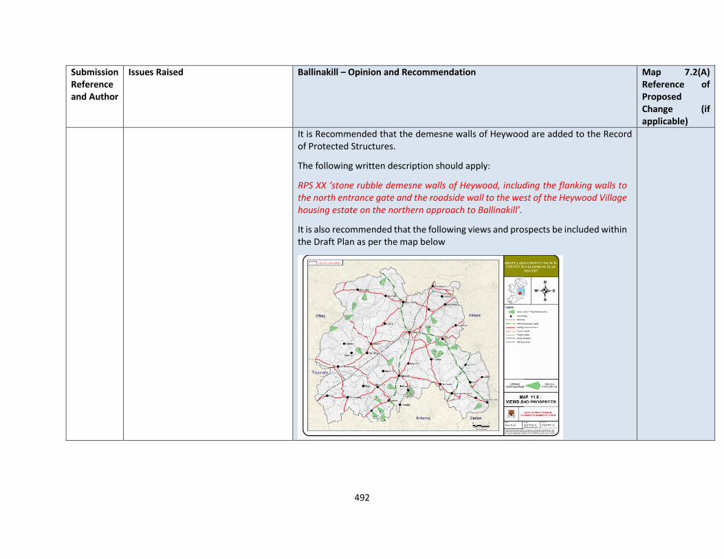
492
Submission Reference and Author
Issues Raised Ballinakill – Opinion and Recommendation Map 7.2(A) Reference of Proposed Change (if applicable)
It is Recommended that the demesne walls of Heywood are added to the Record of Protected Structures.
The following written description should apply:
RPS XX ‘stone rubble demesne walls of Heywood, including the flanking walls to the north entrance gate and the roadside wall to the west of the Heywood Village housing estate on the northern approach to Ballinakill’.
It is also recommended that the following views and prospects be included within the Draft Plan as per the map below

493
Clough
Submission Reference and Author
Issues Raised Clough– Opinion and Recommendation
LS-C9-DCDP-26 John N Colclough
The original Clough Church built, in 1770, still stands in the churchyard next to the pub, and is used as the present community centre. If a new community centre is planned it is very important that the existing building, an 18th century chapel, is retained, with its churchyard monument by the Victorian architect Pugin
OPINION This single-storey two-bay parish hall is a surviving component of an earlier T-plan R.C. church, which is shown on the first edition Ordnance Survey Map of 1837-41 and is understood to date from the late-eighteenth century (c.1770). The surviving structure, comprising the east section of the former church, has a pitched roof of natural slate with square-headed window openings, fitted with modern double-glazed replacement windows. The external facades are finished in a cement dash render, with a limestone memorial plaque on the north façade. There are later extensions to the south. The building stands in a walled graveyard and makes a strong contribution to the character of Clough Village. The late-nineteenth century St. Canice’s R.C. Church, a short distance to the south-west, replaced this earlier church and is a protected structure (RPS. 494). Architectural This surviving wing of the late-eighteenth century church, together with its walled graveyard, makes a positive contribution to the character of Clough Village. Historical The building is of historic interest as a surviving component of a larger pre-emancipation R.C. church on the site. Social The building displays vernacular construction techniques that is typical of barn churches of the
494
Submission Reference and Author
Issues Raised Clough– Opinion and Recommendation
pre-emancipation era and was a place of public worship for the local R.C. population following the repeal of the penal laws towards the end of the eighteenth century. RECOMMENDATION It is recommended that this building, together with its graveyard wall, is added to the Record of Protected Structures. The following written description should apply: RPS - ‘Former R.C. chapel (now used as parish hall), with stone rubble enclosing wall to graveyard’
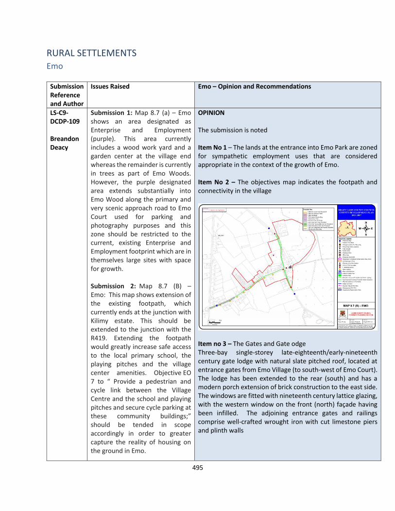
495
RURAL SETTLEMENTS Emo
Submission Reference and Author
Issues Raised Emo – Opinion and Recommendations
LS-C9-DCDP-109 Breandon Deacy
Submission 1: Map 8.7 (a) – Emo shows an area designated as Enterprise and Employment (purple). This area currently includes a wood work yard and a garden center at the village end whereas the remainder is currently in trees as part of Emo Woods. However, the purple designated area extends substantially into Emo Wood along the primary and very scenic approach road to Emo Court used for parking and photography purposes and this zone should be restricted to the current, existing Enterprise and Employment footprint which are in themselves large sites with space for growth. Submission 2: Map 8.7 (B) – Emo: This map shows extension of the existing footpath, which currently ends at the junction with Kilimy estate. This should be extended to the junction with the R419. Extending the footpath would greatly increase safe access to the local primary school, the playing pitches and the village center amenities. Objective EO 7 to “ Provide a pedestrian and cycle link between the Village Centre and the school and playing pitches and secure cycle parking at these community buildings;” should be tended in scope accordingly in order to greater capture the reality of housing on the ground in Emo.
OPINION The submission is noted Item No 1 – The lands at the entrance into Emo Park are zoned for sympathetic employment uses that are considered appropriate in the context of the growth of Emo. Item No 2 – The objectives map indicates the footpath and connectivity in the village
Item no 3 – The Gates and Gate odge Three-bay single-storey late-eighteenth/early-nineteenth century gate lodge with natural slate pitched roof, located at entrance gates from Emo Village (to south-west of Emo Court). The lodge has been extended to the rear (south) and has a modern porch extension of brick construction to the east side. The windows are fitted with nineteenth century lattice glazing, with the western window on the front (north) façade having been infilled. The adjoining entrance gates and railings comprise well-crafted wrought iron with cut limestone piers and plinth walls

496
Submission Reference and Author
Issues Raised Emo – Opinion and Recommendations
Submission 3: The gates and associated stone pillars, erected as an entrance gate to Emo Court, located in the Village Centre are a key feature on the primary approach road to Emo Court and are of visual and historical significance. These gates should be listed as a Protected Structure to secure their preservation. Register of Protected Structures in Laois number 561 Knightstown House Gateway provides a precedent. Submission 4: While the provision of wastewater treatment infrastructure would be welcome, this would entail additional WWTP discharges. There are no suitable receiving waters for such a discharge, not to mention any storm water overflows, and therefore, unless this issue can be satisfactorily resolved, it is difficult to see how expanded wastewater treatment (from the current system serving some houses in Kilimy) can be considered. Therefore, either any expansion to existing waste water treatment plant or provision of a new waste water treatment infrastructure must first consider this capacity issue and be guided by it. Submission 5: A detailed assessment of the risk of flooding needs to be carried out before any development is carried out. Next to the heading of ‘flooding on the table (coloured blue, under the title ‘8.7 Emo’) it is stated ‘Not
Architectural The gate lodge and associated entrance gates are modest but well-crafted exemplars of their type and contribute to the setting of Emo Court, as well as to the streetscape of Emo Village. Artistic The wrought iron railings and entrance gates and the cut limestone piers display high quality craftsmanship The gate lodge and entrance gates of Emo Court in Emo Village are not included in the published NIAH survey. Note: The NIAH survey for County Laois is a non-exhaustive survey. The non-inclusion of this structure should not be regarded as confirmation that the structure is not of significance It is recommended that the gate lodge, together with the associated entrance gates, railings and piers at the entrance to Emo Court from Emo Village, are added to the Record of Protected Structures as a separate RPS entry Reason: - This gate lodge, together with the associated entrance gates, railings and piers, are of architectural and artistic special interest, equivalent to a NIAH Regional Rating. Although closely associated with Emo Court, the entrance gates and its adjoining gate lodge are of significance in their own right and merit separate inclusion on the RPS. Item No 4 – commentary in relation to lack of Wastewater treatment and lack of receiving waters is acknowledged. Any future development of Emo will be considered on its own merits and best practice standards for Waste water treatment under EPA Codes of practice. Item No 5 – The Planning Authority is not aware of any flood risk in Emo village given there is no watercourses , however there may be localised surface water flooding. Surface water drainage is one of the items for assessment during the course of consideration of applications for development. The Roads Section carried out drainage improvement works last year on the L3154-0 Emo/Killimy road (road between
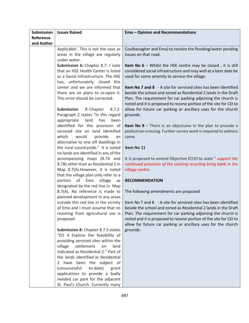
497
Submission Reference and Author
Issues Raised Emo – Opinion and Recommendations
Applicable’. This is not the case as areas in the village are regularly under water. Submission 6: Chapter 8.7: I note that an HSE Health Center is listed as a Social Infrastructure. The HSE has, unfortunately, closed this center and we are informed that there are no plans to re-open it. This error should be corrected. Submission 7: Chapter 8.7.2: Paragraph 2 states “In this regard appropriate land has been identified for the provision of serviced site on land identified which would provide an alternative to one off dwellings in the rural countryside.” It is noted no lands are identified in any of the accompanying maps (8.7A and 8.7B) other than as Residential 2 in Map 8.7(A).However, it is noted that the village plan only refer to a portion of Emo village as designated by the red line in Map 8.7(A). No reference is made to planned development in any areas outside this red line in the vicinity of Emo and I must assume that no rezoning from agricultural use is proposed. Submission 8: Chapter 8.7.3 states “EO 4 Explore the feasibility of providing serviced sites within the village settlement on land indicated as Residential 2.” Part of the lands identified as Residential 2 have been the subject of (unsuccessful to-date) grant applications to provide a badly needed car park for the adjacent St. Paul’s Church. Currently many
Coolbanagher and Emo) to resolve the flooding/water ponding issues on that road. Item No 6 – Whilst the HSE centre may be closed , it is still considered social infrastructure and may well at a later date be used for some amenity to service the village. Item No 7 and 8 - A site for serviced sites has been identified beside the school and zoned as Residential 2 lands in the Draft Plan. The requirement for car parking adjoining the church is noted and it is proposed to rezone portion of the site for CEI to allow for future car parking or ancillary uses for the church grounds. Item No 9 – There is an objectuive in the plan to provide a pedestrian crossing. Further survey work is required to address same. Item No 11 It is proposed to amend Objective EO10 to state “ support the continued provision of the existing recycling bring bank in the village centre. RECOMMENDATION The following amendments are proposed Item No 7 and 8 - A site for serviced sites has been identified beside the school and zoned as Residential 2 lands in the Draft Plan. The requirement for car parking adjoining the church is noted and it is proposed to rezone portion of the site for CEI to allow for future car parking or ancillary uses for the church grounds.
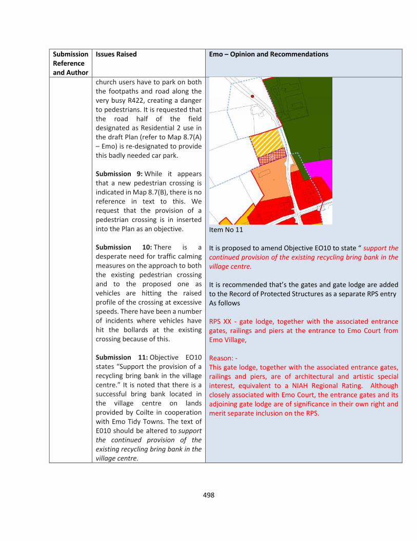
498
Submission Reference and Author
Issues Raised Emo – Opinion and Recommendations
church users have to park on both the footpaths and road along the very busy R422, creating a danger to pedestrians. It is requested that the road half of the field designated as Residential 2 use in the draft Plan (refer to Map 8.7(A) – Emo) is re-designated to provide this badly needed car park. Submission 9: While it appears that a new pedestrian crossing is indicated in Map 8.7(B), there is no reference in text to this. We request that the provision of a pedestrian crossing is in inserted into the Plan as an objective. Submission 10: There is a desperate need for traffic calming measures on the approach to both the existing pedestrian crossing and to the proposed one as vehicles are hitting the raised profile of the crossing at excessive speeds. There have been a number of incidents where vehicles have hit the bollards at the existing crossing because of this. Submission 11: Objective EO10 states “Support the provision of a recycling bring bank in the village centre.” It is noted that there is a successful bring bank located in the village centre on lands provided by Coilte in cooperation with Emo Tidy Towns. The text of E010 should be altered to support the continued provision of the existing recycling bring bank in the village centre.
Item No 11 It is proposed to amend Objective EO10 to state “ support the continued provision of the existing recycling bring bank in the village centre. It is recommended that’s the gates and gate lodge are added to the Record of Protected Structures as a separate RPS entry As follows RPS XX - gate lodge, together with the associated entrance gates, railings and piers at the entrance to Emo Court from Emo Village, Reason: - This gate lodge, together with the associated entrance gates, railings and piers, are of architectural and artistic special interest, equivalent to a NIAH Regional Rating. Although closely associated with Emo Court, the entrance gates and its adjoining gate lodge are of significance in their own right and merit separate inclusion on the RPS.
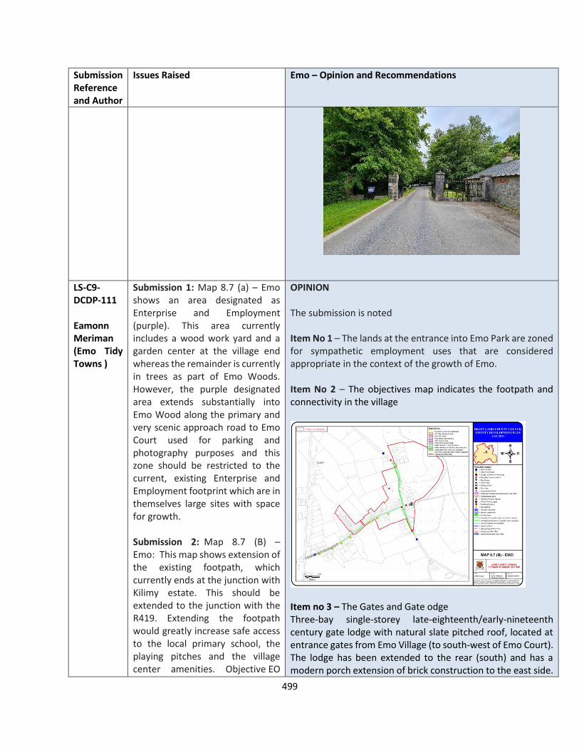
499
Submission Reference and Author
Issues Raised Emo – Opinion and Recommendations
LS-C9-DCDP-111 Eamonn Meriman (Emo Tidy Towns )
Submission 1: Map 8.7 (a) – Emo shows an area designated as Enterprise and Employment (purple). This area currently includes a wood work yard and a garden center at the village end whereas the remainder is currently in trees as part of Emo Woods. However, the purple designated area extends substantially into Emo Wood along the primary and very scenic approach road to Emo Court used for parking and photography purposes and this zone should be restricted to the current, existing Enterprise and Employment footprint which are in themselves large sites with space for growth. Submission 2: Map 8.7 (B) – Emo: This map shows extension of the existing footpath, which currently ends at the junction with Kilimy estate. This should be extended to the junction with the R419. Extending the footpath would greatly increase safe access to the local primary school, the playing pitches and the village center amenities. Objective EO
OPINION The submission is noted Item No 1 – The lands at the entrance into Emo Park are zoned for sympathetic employment uses that are considered appropriate in the context of the growth of Emo. Item No 2 – The objectives map indicates the footpath and connectivity in the village
Item no 3 – The Gates and Gate odge Three-bay single-storey late-eighteenth/early-nineteenth century gate lodge with natural slate pitched roof, located at entrance gates from Emo Village (to south-west of Emo Court). The lodge has been extended to the rear (south) and has a modern porch extension of brick construction to the east side.

500
Submission Reference and Author
Issues Raised Emo – Opinion and Recommendations
7 to “ Provide a pedestrian and cycle link between the Village Centre and the school and playing pitches and secure cycle parking at these community buildings;” should be tended in scope accordingly in order to greater capture the reality of housing on the ground in Emo. Submission 3: The gates and associated stone pillars, erected as an entrance gate to Emo Court, located in the Village Centre are a key feature on the primary approach road to Emo Court and are of visual and historical significance. These gates should be listed as a Protected Structure to secure their preservation. Register of Protected Structures in Laois number 561 Knightstown House Gateway provides a precedent. Submission 4: While the provision of wastewater treatment infrastructure would be welcome, this would entail additional WWTP discharges. There are no suitable receiving waters for such a discharge, not to mention any storm water overflows, and therefore, unless this issue can be satisfactorily resolved, it is difficult to see how expanded wastewater treatment (from the current system serving some houses in Kilimy) can be considered. Therefore, either any expansion to existing waste water treatment plant or provision of a new waste water treatment infrastructure must first consider
The windows are fitted with nineteenth century lattice glazing, with the western window on the front (north) façade having been infilled. The adjoining entrance gates and railings comprise well-crafted wrought iron with cut limestone piers and plinth walls Architectural The gate lodge and associated entrance gates are modest but well-crafted exemplars of their type and contribute to the setting of Emo Court, as well as to the streetscape of Emo Village. Artistic The wrought iron railings and entrance gates and the cut limestone piers display high quality craftsmanship The gate lodge and entrance gates of Emo Court in Emo Village are not included in the published NIAH survey. Note: The NIAH survey for County Laois is a non-exhaustive survey. The non-inclusion of this structure should not be regarded as confirmation that the structure is not of significance It is recommended that the gate lodge, together with the associated entrance gates, railings and piers at the entrance to Emo Court from Emo Village, are added to the Record of Protected Structures as a separate RPS entry Reason: - This gate lodge, together with the associated entrance gates, railings and piers, are of architectural and artistic special interest, equivalent to a NIAH Regional Rating. Although closely associated with Emo Court, the entrance gates and its adjoining gate lodge are of significance in their own right and merit separate inclusion on the RPS. Item No 4 – commentary in relation to lack of Wastewater treatment and lack of receiving waters is acknowledged. Any future development of Emo will be considered on its own merits and best practice standards for Waste water treatment under EPA Codes of practice.
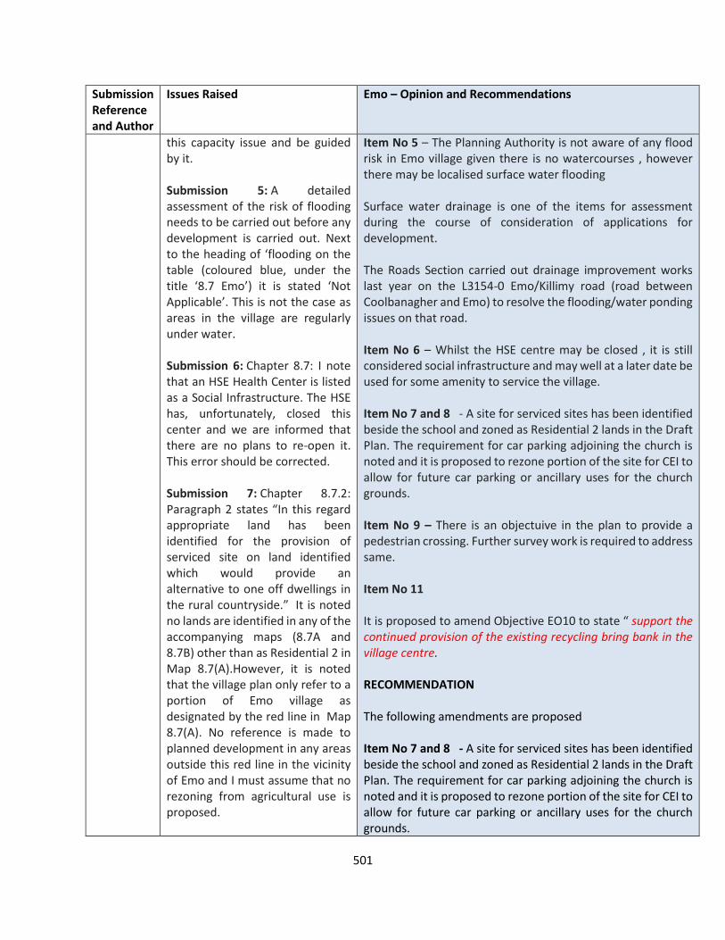
501
Submission Reference and Author
Issues Raised Emo – Opinion and Recommendations
this capacity issue and be guided by it. Submission 5: A detailed assessment of the risk of flooding needs to be carried out before any development is carried out. Next to the heading of ‘flooding on the table (coloured blue, under the title ‘8.7 Emo’) it is stated ‘Not Applicable’. This is not the case as areas in the village are regularly under water. Submission 6: Chapter 8.7: I note that an HSE Health Center is listed as a Social Infrastructure. The HSE has, unfortunately, closed this center and we are informed that there are no plans to re-open it. This error should be corrected. Submission 7: Chapter 8.7.2: Paragraph 2 states “In this regard appropriate land has been identified for the provision of serviced site on land identified which would provide an alternative to one off dwellings in the rural countryside.” It is noted no lands are identified in any of the accompanying maps (8.7A and 8.7B) other than as Residential 2 in Map 8.7(A).However, it is noted that the village plan only refer to a portion of Emo village as designated by the red line in Map 8.7(A). No reference is made to planned development in any areas outside this red line in the vicinity of Emo and I must assume that no rezoning from agricultural use is proposed.
Item No 5 – The Planning Authority is not aware of any flood risk in Emo village given there is no watercourses , however there may be localised surface water flooding Surface water drainage is one of the items for assessment during the course of consideration of applications for development. The Roads Section carried out drainage improvement works last year on the L3154-0 Emo/Killimy road (road between Coolbanagher and Emo) to resolve the flooding/water ponding issues on that road. Item No 6 – Whilst the HSE centre may be closed , it is still considered social infrastructure and may well at a later date be used for some amenity to service the village. Item No 7 and 8 - A site for serviced sites has been identified beside the school and zoned as Residential 2 lands in the Draft Plan. The requirement for car parking adjoining the church is noted and it is proposed to rezone portion of the site for CEI to allow for future car parking or ancillary uses for the church grounds. Item No 9 – There is an objectuive in the plan to provide a pedestrian crossing. Further survey work is required to address same. Item No 11 It is proposed to amend Objective EO10 to state “ support the continued provision of the existing recycling bring bank in the village centre. RECOMMENDATION The following amendments are proposed Item No 7 and 8 - A site for serviced sites has been identified beside the school and zoned as Residential 2 lands in the Draft Plan. The requirement for car parking adjoining the church is noted and it is proposed to rezone portion of the site for CEI to allow for future car parking or ancillary uses for the church grounds.
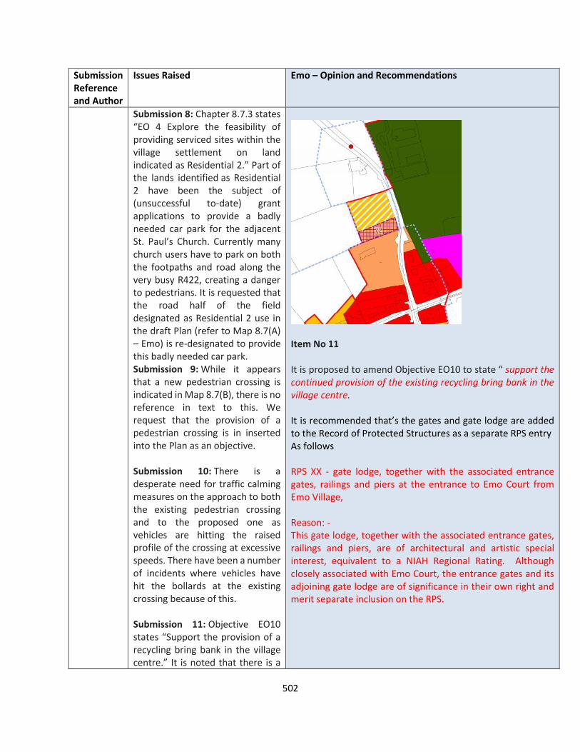
502
Submission Reference and Author
Issues Raised Emo – Opinion and Recommendations
Submission 8: Chapter 8.7.3 states “EO 4 Explore the feasibility of providing serviced sites within the village settlement on land indicated as Residential 2.” Part of the lands identified as Residential 2 have been the subject of (unsuccessful to-date) grant applications to provide a badly needed car park for the adjacent St. Paul’s Church. Currently many church users have to park on both the footpaths and road along the very busy R422, creating a danger to pedestrians. It is requested that the road half of the field designated as Residential 2 use in the draft Plan (refer to Map 8.7(A) – Emo) is re-designated to provide this badly needed car park. Submission 9: While it appears that a new pedestrian crossing is indicated in Map 8.7(B), there is no reference in text to this. We request that the provision of a pedestrian crossing is in inserted into the Plan as an objective. Submission 10: There is a desperate need for traffic calming measures on the approach to both the existing pedestrian crossing and to the proposed one as vehicles are hitting the raised profile of the crossing at excessive speeds. There have been a number of incidents where vehicles have hit the bollards at the existing crossing because of this. Submission 11: Objective EO10 states “Support the provision of a recycling bring bank in the village centre.” It is noted that there is a
Item No 11 It is proposed to amend Objective EO10 to state “ support the continued provision of the existing recycling bring bank in the village centre. It is recommended that’s the gates and gate lodge are added to the Record of Protected Structures as a separate RPS entry As follows RPS XX - gate lodge, together with the associated entrance gates, railings and piers at the entrance to Emo Court from Emo Village, Reason: - This gate lodge, together with the associated entrance gates, railings and piers, are of architectural and artistic special interest, equivalent to a NIAH Regional Rating. Although closely associated with Emo Court, the entrance gates and its adjoining gate lodge are of significance in their own right and merit separate inclusion on the RPS.

503
Submission Reference and Author
Issues Raised Emo – Opinion and Recommendations
successful bring bank located in the village centre on lands provided by Coilte in cooperation with Emo Tidy Towns. The text of E010 should be altered to support the continued provision of the existing recycling bring bank in the village centre.
LS-C9-DCDP-137 Eamonn Merriman
11no. matters are raised, which are summarised as follows: Submission 1: Map 8.7 (a) – Emo shows an area designated as Enterprise and Employment (purple). This area currently includes a wood work yard and a garden center at the village end whereas the remainder is currently in trees as part of Emo Woods. However, the purple designated area extends substantially into Emo Wood along the primary and very scenic approach road to Emo Court. Therefore this zone should be restricted to the current, existing Enterprise and Employment footprint which are in themselves large sites with space for growth. There are other, more suitable areas for additional Enterprise and Employment zoning if required. Submission 2: Map 8.7 (B) – Emo: This map shows extension of the existing footpath, which currently ends at the junction with Kilimy estate. This should be extended to the junction with the R419. Extending the footpath would greatly increase safe access to the local primary school, the playing
OPINION The submission is noted Item No 1 – The lands at the entrance into Emo Park are zoned for sympathetic employment uses that are considered appropriate in the context of the growth of Emo. Item No 2 – The map below indicates the footpath and connectivity in the village.
Item no 3 – The Gates and Gate odge Three-bay single-storey late-eighteenth/early-nineteenth century gate lodge with natural slate pitched roof, located at entrance gates from Emo Village (to south-west of Emo Court). The lodge has been extended to the rear (south) and has a modern porch extension of brick construction to the east side. The windows are fitted with nineteenth century lattice glazing, with the western window on the front (north) façade having

504
Submission Reference and Author
Issues Raised Emo – Opinion and Recommendations
pitches and the village center amenities. Objective EO 7 to “ Provide a pedestrian and cycle link between the Village Centre and the school and playing pitches and secure cycle parking at these community buildings;” should be tended in scope accordingly in order to greater capture the reality of housing on the ground in Emo. Submission 3: The gates and associated stone pillars, erected as an entrance gate to Emo Court, should be listed as a Protected Structure to secure their preservation and wold support Objectives EO2 and E)6. Register of Protected Structures in Laois number 561 Knightstown House Gateway provides a precedent. Submission 4: The provision of wastewater treatment infrastructure would be welcome, this would entail additional WWTP discharges. Therefore, either any expansion to existing waste water treatment plant or provision of a new waste water treatment infrastructure must first consider this capacity issue and be guided by it. Submission 5: A detailed assessment of the risk of flooding needs to be carried out before any development is carried out. Next to the heading of ‘flooding on the table (coloured blue, under the title ‘8.7 Emo’) it is stated ‘Not Applicable’. This is not the case as areas in the village are regularly under water. Submission 6: Chapter 8.7 - The HSE Health Center is listed as a
been infilled. The adjoining entrance gates and railings comprise well-crafted wrought iron with cut limestone piers and plinth walls Architectural The gate lodge and associated entrance gates are modest but well-crafted exemplars of their type and contribute to the setting of Emo Court, as well as to the streetscape of Emo Village. Artistic The wrought iron railings and entrance gates and the cut limestone piers display high quality craftsmanship The gate lodge and entrance gates of Emo Court in Emo Village are not included in the published NIAH survey. Note: The NIAH survey for County Laois is a non-exhaustive survey. The non-inclusion of this structure should not be regarded as confirmation that the structure is not of significance It is recommended that the gate lodge, together with the associated entrance gates, railings and piers at the entrance to Emo Court from Emo Village, are added to the Record of Protected Structures as a separate RPS entry Reason: - This gate lodge, together with the associated entrance gates, railings and piers, are of architectural and artistic special interest, equivalent to a NIAH Regional Rating. Although closely associated with Emo Court, the entrance gates and its adjoining gate lodge are of significance in their own right and merit separate inclusion on the RPS. Item No 4 – commentary in relation to lack of Wastewater treatment and lack of receiving waters is acknowledged. Any future development of Emo will be considered on its own merits and best practice standards for Waste water treatment under EPA Codes of practice. Item No 5 – The Planning Authority is not aware of any flood risk in Emo village given there is no watercourses , however there may be localised surface water flooding. Surface water

505
Submission Reference and Author
Issues Raised Emo – Opinion and Recommendations
Social Infrastructure. The HSE has, unfortunately, closed this center. Therefore, it is in-correct to list it as Social Infrastructure in the Development Plan and this error should be corrected. Submission 7: Chapter 8.7.2: Reference to paragraph 2 and notes that no reference is made to planned development in any areas outside this red line in the vicinity of Emo and I must assume that no rezoning from agricultural use is proposed. Submission 8: Chapter 8.7.3 states “EO 4 Explore the feasibility of providing serviced sites within the village settlement on land indicated as Residential 2.” Part of the lands identified as Residential 2 have been the subject of (unsuccessful to-date) grant applications to provide a badly needed car park. It is requested that the road half of the field designated as Residential 2 use in the draft Plan (refer to Map 8.7(A) – Emo) is re-designated to provide a car park or the opportunity to address the significant risks caused by parking on the road/footpaths along the R422 will be lost forever. If houses are built on this area, the opportunity to redress this dangerous church-associated parking will be lost forever. Submission 9: While it appears that a new pedestrian crossing is indicated in Map 8.7(B), there is no reference in text to this. We request that the provision of a pedestrian crossing is in inserted into the Plan as an objective.
drainage is one of the items for assessment during the course of consideration of applications for development. Item No 6 – Whilst the HSE centre may be closed , it is still considered social infrastructure and may well at a later date be used for some amenity to service the village. Item No 7 and 8 - A site for serviced sites has been identified beside the school and zoned as Residential 2 lands in the Draft Plan. The requirement for car parking adjoining the church is noted and it is proposed to rezone portion of the site for CEI to allow for future car parking or ancillary uses for the church grounds.
Item No 9 – There is an objectuive in the plan to provide a pedestrian crossing. Further survey work is required to address same. Item No 11 - It is proposed to amend Objective EO10 to state “ support the continued provision of the existing recycling bring bank in the village centre. RECOMMENDATION The following amendments are proposed Item No 7 and 8 - A site for serviced sites has been identified beside the school and zoned as Residential 2 lands in the Draft Plan. The requirement for car parking adjoining the church is noted and it is proposed to rezone portion of the site for CEI to allow for future car parking or ancillary uses for the church grounds.

506
Submission Reference and Author
Issues Raised Emo – Opinion and Recommendations
Submission 10: Therefore, there is an urgent need for traffic calming at both sides of the village for this road. This objective is additional to Submission 9. Submission 11: Objective EO10 states “Support the provision of a recycling bring bank in the village centre.” The text of E010 should be altered to support the continued provision of the existing recycling bring bank in the village centre.
Item No 11 It is proposed to amend Objective EO10 to state “ support the continued provision of the existing recycling bring bank in the village centre. It is recommended that’s the gates and gate lodge are added to the Record of Protected Structures as a separate RPS entry As follows RPS XX - gate lodge, together with the associated entrance gates, railings and piers at the entrance to Emo Court from Emo Village, Reason: - This gate lodge, together with the associated entrance gates, railings and piers, are of architectural and artistic special interest, equivalent to a NIAH Regional Rating. Although closely associated with Emo Court, the entrance gates and its adjoining gate lodge are of significance in their own right and merit separate inclusion on the RPS.
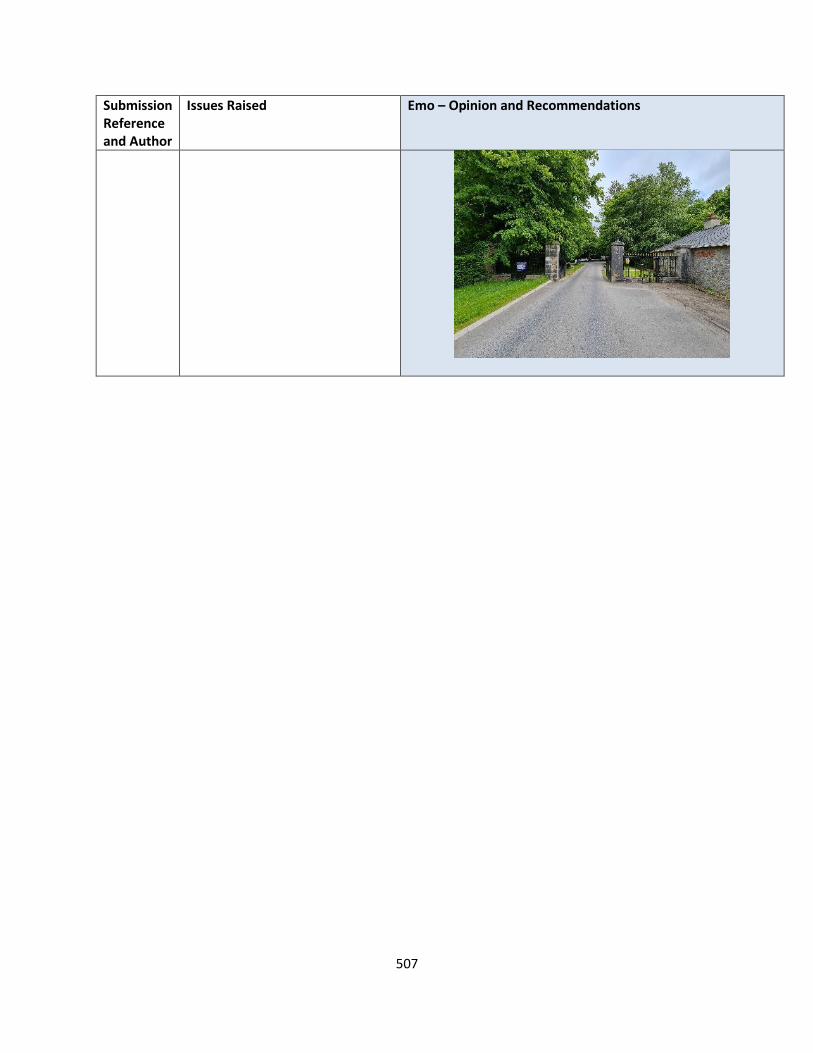
507
Submission Reference and Author
Issues Raised Emo – Opinion and Recommendations
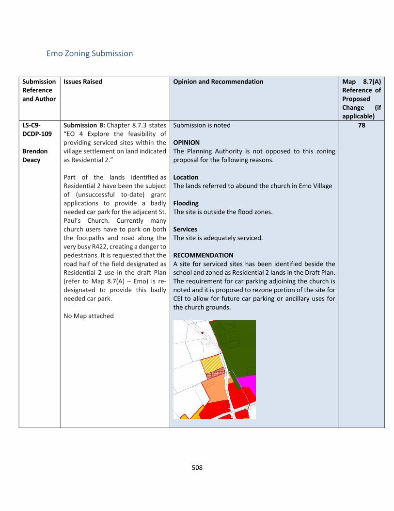
508
Emo Zoning Submission
Submission Reference and Author
Issues Raised Opinion and Recommendation Map 8.7(A) Reference of Proposed Change (if applicable)
LS-C9-DCDP-109 Brendon Deacy
Submission 8: Chapter 8.7.3 states “EO 4 Explore the feasibility of providing serviced sites within the village settlement on land indicated as Residential 2.” Part of the lands identified as Residential 2 have been the subject of (unsuccessful to-date) grant applications to provide a badly needed car park for the adjacent St. Paul’s Church. Currently many church users have to park on both the footpaths and road along the very busy R422, creating a danger to pedestrians. It is requested that the road half of the field designated as Residential 2 use in the draft Plan (refer to Map 8.7(A) – Emo) is re-designated to provide this badly needed car park. No Map attached
Submission is noted OPINION The Planning Authority is not opposed to this zoning proposal for the following reasons. Location The lands referred to abound the church in Emo Village Flooding The site is outside the flood zones. Services The site is adequately serviced. RECOMMENDATION A site for serviced sites has been identified beside the school and zoned as Residential 2 lands in the Draft Plan. The requirement for car parking adjoining the church is noted and it is proposed to rezone portion of the site for CEI to allow for future car parking or ancillary uses for the church grounds.
78
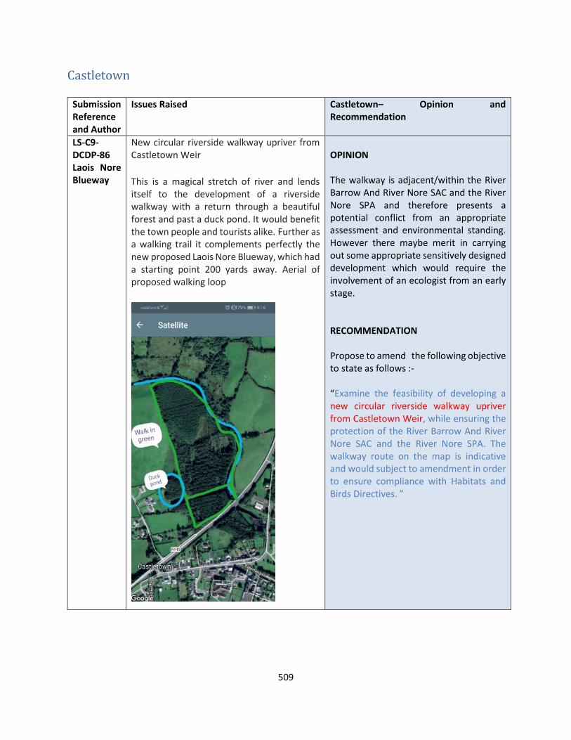
509
Castletown
Submission Reference and Author
Issues Raised Castletown– Opinion and Recommendation
LS-C9-DCDP-86 Laois Nore Blueway
New circular riverside walkway upriver from Castletown Weir
This is a magical stretch of river and lends itself to the development of a riverside walkway with a return through a beautiful forest and past a duck pond. It would benefit the town people and tourists alike. Further as a walking trail it complements perfectly the new proposed Laois Nore Blueway, which had a starting point 200 yards away. Aerial of proposed walking loop
OPINION The walkway is adjacent/within the River Barrow And River Nore SAC and the River Nore SPA and therefore presents a potential conflict from an appropriate assessment and environmental standing. However there maybe merit in carrying out some appropriate sensitively designed development which would require the involvement of an ecologist from an early stage. RECOMMENDATION Propose to amend the following objective to state as follows :- “Examine the feasibility of developing a new circular riverside walkway upriver from Castletown Weir, while ensuring the protection of the River Barrow And River Nore SAC and the River Nore SPA. The walkway route on the map is indicative and would subject to amendment in order to ensure compliance with Habitats and Birds Directives. ”
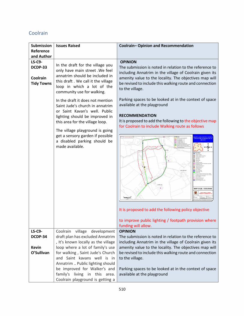
510
Coolrain
Submission Reference and Author
Issues Raised Coolrain– Opinion and Recommendation
LS-C9-DCDP-33 Coolrain Tidy Towns
In the draft for the village you only have main street .We feel annatrim should be included in this draft . We call it the village loop in which a lot of the community use for walking.
In the draft it does not mention Saint Jude's church in annatrim or Saint Kavan's well. Public lighting should be improved in this area for the village loop.
The village playground is going get a sensory garden if possible a disabled parking should be made available.
OPINION The submission is noted in relation to the reference to including Annatrim in the village of Coolrain given its amenity value to the locality. The objectives map will be revised to include this walking route and connection to the village. Parking spaces to be looked at in the context of space available at the playground RECOMMENDATION It is proposed to add the following to the objective map for Coolrain to include Walking route as follows
It is proposed to add the following policy objective to improve public lighting / footpath provision where funding will allow.
LS-C9-DCDP-34 Kevin O’Sullivan
Coolrain village development draft plan has excluded Annatrim , It's known locally as the village loop where a lot of family's use for walking , Saint Jude's Church and Saint kavans well is in Annatrim .. Public lighting should be improved for Walker's and family's living in this area. Coolrain playground is getting a
OPINION The submission is noted in relation to the reference to including Annatrim in the village of Coolrain given its amenity value to the locality. The objectives map will be revised to include this walking route and connection to the village. Parking spaces to be looked at in the context of space available at the playground

511
sensory garden a disabled parking spot should be made available there.
RECOMMENDATION It is proposed to add the following to the objective map for Coolrain to include Walking route as follows
It is proposed to add the following policy objective to improve public lighting / footpath provision where funding will allow.
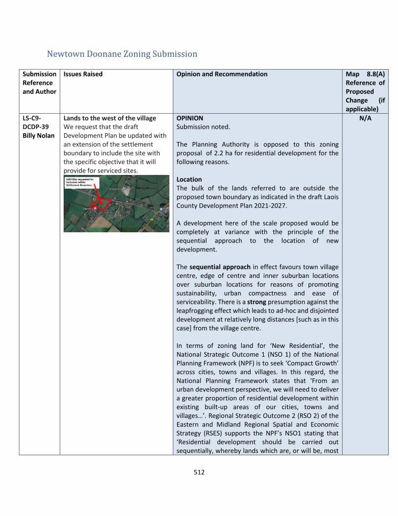
512
Newtown Doonane Zoning Submission
Submission Reference and Author
Issues Raised Opinion and Recommendation Map 8.8(A) Reference of Proposed Change (if applicable)
LS-C9-DCDP-39 Billy Nolan
Lands to the west of the village We request that the draft Development Plan be updated with an extension of the settlement boundary to include the site with the specific objective that it will provide for serviced sites.
OPINION Submission noted. The Planning Authority is opposed to this zoning proposal of 2.2 ha for residential development for the following reasons. Location The bulk of the lands referred to are outside the proposed town boundary as indicated in the draft Laois County Development Plan 2021-2027. A development here of the scale proposed would be completely at variance with the principle of the sequential approach to the location of new development. The sequential approach in effect favours town village centre, edge of centre and inner suburban locations over suburban locations for reasons of promoting sustainability, urban compactness and ease of serviceability. There is a strong presumption against the leapfrogging effect which leads to ad-hoc and disjointed development at relatively long distances [such as in this case] from the village centre. In terms of zoning land for ‘New Residential’, the National Strategic Outcome 1 (NSO 1) of the National Planning Framework (NPF) is to seek ‘Compact Growth’ across cities, towns and villages. In this regard, the National Planning Framework states that ‘From an urban development perspective, we will need to deliver a greater proportion of residential development within existing built-up areas of our cities, towns and villages…’. Regional Strategic Outcome 2 (RSO 2) of the Eastern and Midland Regional Spatial and Economic Strategy (RSES) supports the NPF’s NSO1 stating that ‘Residential development should be carried out sequentially, whereby lands which are, or will be, most
N/A

513
Submission Reference and Author
Issues Raised Opinion and Recommendation Map 8.8(A) Reference of Proposed Change (if applicable)
accessible by walking, cycling and public transport – including infill and brownfield sites – are prioritised.’ Compact growth and adherence to the Core Strategy is provided for in Chapter 2 of the draft plan as follows Housing Land Requirement Based on the overall housing land requirement for County Laois of 54.4 hectares up to target year 2027, as set out in Chapter 2 “Core Strategy”, there is no need for additional residentially zoned lands in the village. If this land were to be zoned, it would be at the expense of [and not additional to] other more suitably located lands as identified by application of the sequential approach. It is important to stress that the future population [and by extension the housing land requirement] of County Laois is governed by and shall comply with the housing targets as set out in the Which has informed the core strategy of the draft Laois County Development Plan 2021-2027. Services The site is devoid of adequate service infrastructure including foul drainage facilities. RECOMMENDATION No change to the Draft Plan
LS-C9-DCDP-143 Acorn Planning
Lands to the west of the village Requests that the draft Development Plan be updated with an extension of the settlement boundary to include the site with the specific objective that it will provide for serviced sites.
Same response as Sub LS-C9-DCDP-39 RECOMMENDATION No change to the Draft Plan
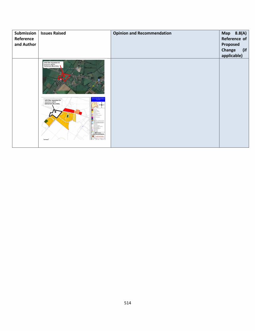
514
Submission Reference and Author
Issues Raised Opinion and Recommendation Map 8.8(A) Reference of Proposed Change (if applicable)
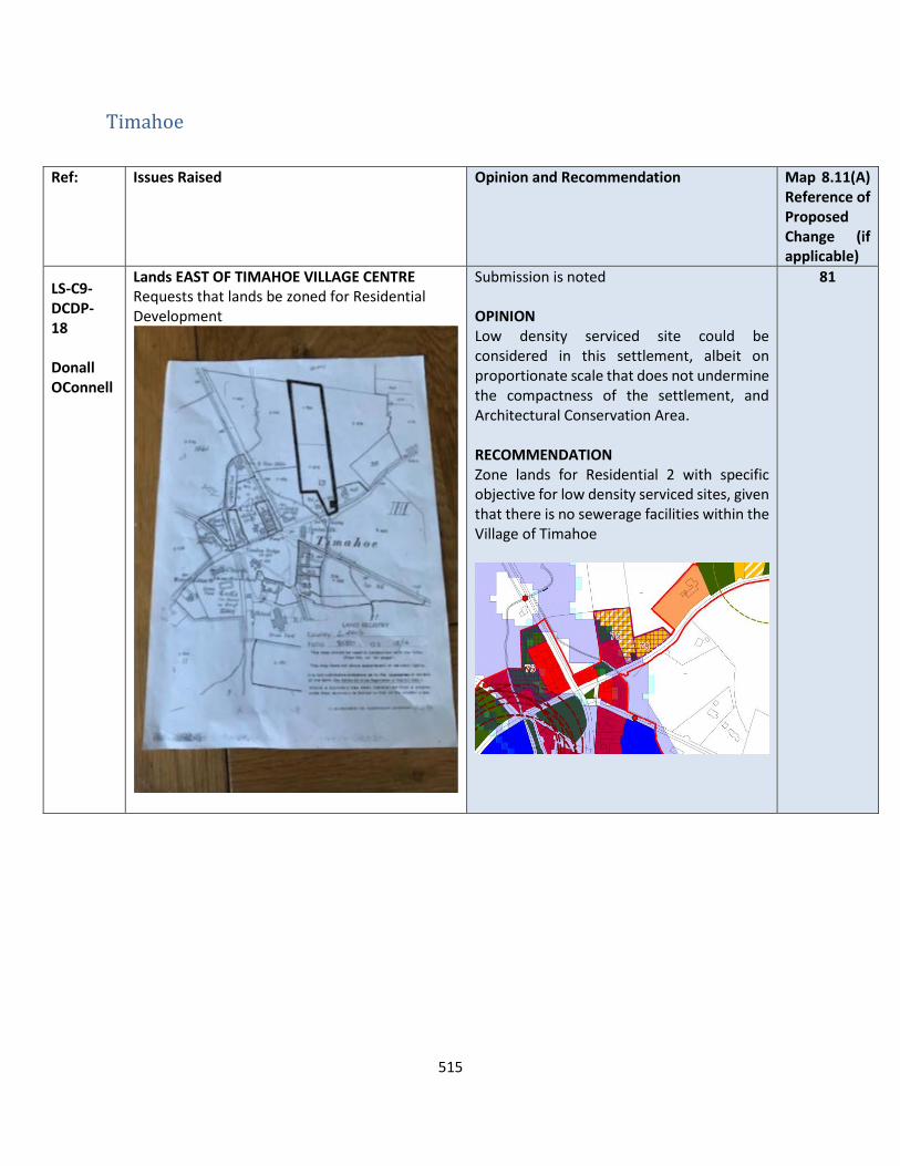
515
Timahoe
Ref: Issues Raised Opinion and Recommendation Map 8.11(A) Reference of Proposed Change (if applicable)
LS-C9-DCDP-18 Donall OConnell
Lands EAST OF TIMAHOE VILLAGE CENTRE Requests that lands be zoned for Residential Development
Submission is noted OPINION Low density serviced site could be considered in this settlement, albeit on proportionate scale that does not undermine the compactness of the settlement, and Architectural Conservation Area. RECOMMENDATION Zone lands for Residential 2 with specific objective for low density serviced sites, given that there is no sewerage facilities within the Village of Timahoe
81

516
NON DESIGNATED SETTLEMENTS Ballyfin
Submission Reference and Author
Issues Raised Ballyfin– Opinion and Recommendation
LS-C9-DCDP-126
Community Facilities: Ballyfin CDA calls on the Council to improve community facilities in the area. While the people of Ballyfin greatly appreciate the existing facilities, they are not suited to everyone’s needs.
• Children’s Playground: Young children [and their parents] are not catered for in Ballyfin. A playground would facilitate ‘active play’ for younger children and for those not inclined to group games.
• Outdoor Gym: Teenagers not involved in organised sports and adults of all ages would benefit greatly from the provision of an outdoor gym in Ballyfin. Such a facility would also be a great boom for those involved with Cumann Gael Peil na mBan Ballie Fionn, Ballyfin GAA and Ballyfin Athletic Club.
• AstroTurf Pitches: Those involved in the Ballyfin GAA have two pitches to accommodate them on Ballyfin GAA’s grounds. These pitches are often unplayable and ae frequently unsuitable for training. The provision of AstroTurf pitches will make such training ‘weather-proof’.
• Community Pitches: Ballyfin GAA has two pitches at its disposal but they are not sufficient to cope with demand from their Senior, Junior and Juvenile players. Cumann Gael Peil na mBan Ballie Fionn does not have its own grounds and is dependent on Ballyfin GAA and other clubs for training grounds and match pitches. The provision of community pitches adjacent to Ballyfin GAA’s grounds would greatly facilitate women’s football and other field sports in Ballyfin.
OPINION The submission is noted in relation existing facilities that are in the rural settlement of Ballyfin. Laois County Council are supportive of the development of community amenities and sports infrastructure for all cohorts of society and will work with community groups in this regard to seek funding and address any deficiencies. The Council through the Area Office and Road Design section will review issues pertaining to footpaths, road signage and road reconstruction. In relation to Broadband, The Broadband officer is aware of issues regarding broadband connectivity in this area and general policies in relation to the roll out of Broadband are contained in Section 10.6.2 of the Draft Plan – Policy Objectives TEL 1- 10 relate. Laois County Council will continue to work with community Groups and AN Garda Siochana in the roll out of CCTV which has been successfully done in parts of south Laois. RECOMMENDATION No change to the Draft Plan
517
Submission Reference and Author
Issues Raised Ballyfin– Opinion and Recommendation
• Walk|Jog|Running Track: In 2014, Ballyfin CDA in association with Ballyfin GAA, developed a walking track around the perimeter of the GAA’s grounds. This walking track has been a great success with people of all ages as it allows families and individuals to exercise safely and free of road traffic. The walking track now needs to be renewed and up graded. Lighting is required to allow the track to be used on winter evenings when walking on winding rural roads with neither footpaths nor lighting would be ill advised.
Roads Infrastructure:
• Footpaths: Ballyfin is a dispersed rural community and its people do not expect the council to provided footpaths on all the roads in the area. We do however require a footpath from the Community Hall to the graveyard and on to the junction with the L2112, Ballyfin to Portlaoise Road.
• Road Number Signs: Some of the roads in the Ballyfin area have signs displaying the road’s number … L1234 for example … but many do not. Road number signs should be placed at each end of all local roads and at main junction along the road to aid the emergency services, visitors and deliveries.
• Road Reconstruction: A number of sections of road in Ballyfin need to be reconstructed … not just re surfaced but totally reconstructed. Some of these roads were originally dirt roads which eventually were tarred over but with little substructure. Others, for whatever reason, have deteriorated greatly despite repeated patching and resurfacing and now urgently require reconstruction. One particular example on the main road from Ballyfin to Portlaoise [L2112] runs

518
Submission Reference and Author
Issues Raised Ballyfin– Opinion and Recommendation
from Sand’s [53.050029 | -7.404165] to Walsh’s [53.049345 | -7.398130] is a network of potholes. Reconstructing this section of road would allow the Council to deal with the large drain/stream running alongside the road and which floods frequently and dramatically.
Fibre Broadband:
• Ballyfin is a very dispersed rural community covering a very large area which runs into Portlaoise, and almost into both Mountrath and Mountmellick. Some areas closer to these towns have adequate broadband but most of Ballyfin is ill served. Recently, Eir randomly rolled out fibre broadband to some areas of Ballyfin while others continue to be neglected. For example, fibre now runs down the L21121 from the entrance to Ballyfin Demesne towards Ballyfin national School but stops before it reaches the GAA pitch, the church or the school. Ballyfin National School, businesses in the area and al homes need broadband as a matter of urgency. Laois County Council needs to facilitate and promote the roll-out of fibre broadband in the Ballyfin area as a matter of urgency
CCTV: • Although COVID-19 has seen a significant
reduction in the rate thefts and burglaries in the Ballyfin area, they have been a considerable problem in recent years. Ballyfin CDA calls on Laois County Council to support the deployment of CCTV in the area as a standalone operation or preferable as part of a county wide initiative. Council support, in association with the Gardaí and relevant local groups, should be in the area of installation, maintenance and data protection.

519
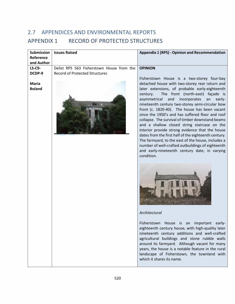
520
2.7 APPENDICES AND ENVIRONMENTAL REPORTS
APPENDIX 1 RECORD OF PROTECTED STRUCTURES
Submission Reference and Author
Issues Raised Appendix 1 (RPS) - Opinion and Recommendation
LS-C9-DCDP-9 Maria Boland
Delist RPS 563 Fisherstown House from the Record of Protected Structures
OPINION Fisherstown House is a two-storey four-bay detached house with two-storey rear return and later extensions, of probable early-eighteenth century. The front (north-east) façade is asymmetrical and incorporates an early-nineteenth century two-storey semi-circular bow front (c. 1820-40). The house has been vacant since the 1950’s and has suffered floor and roof collapse. The survival of timber downstand beams and a shallow closed string staircase on the interior provide strong evidence that the house dates from the first half of the eighteenth century. The farmyard, to the east of the house, includes a number of well-crafted outbuildings of eighteenth and early-nineteenth century date, in varying condition.
Architectural Fisherstown House is an important early-eighteenth century house, with high-quality later nineteenth century additions and well-crafted agricultural buildings and stone rubble walls around its farmyard. Although vacant for many years, the house is a notable feature in the rural landscape of Fisherstown, the townland with which it shares its name.
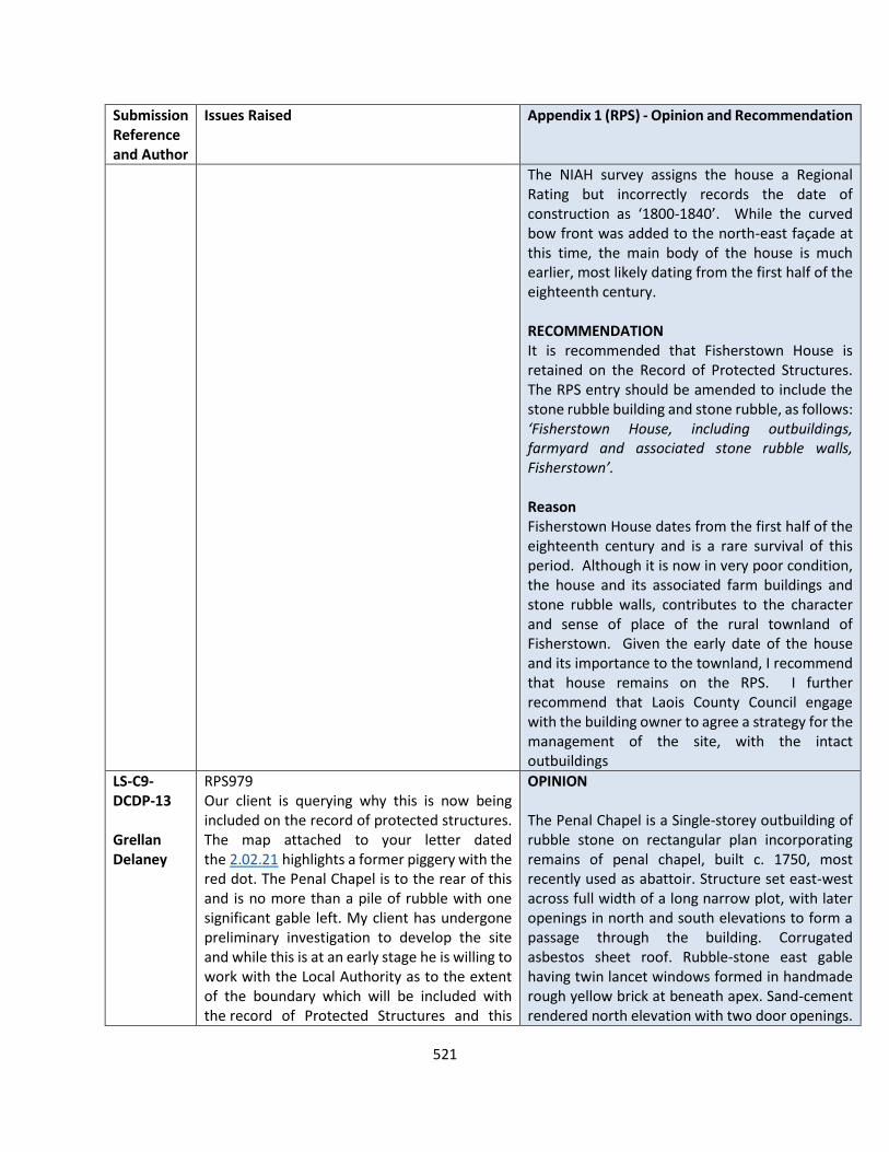
521
Submission Reference and Author
Issues Raised Appendix 1 (RPS) - Opinion and Recommendation
The NIAH survey assigns the house a Regional Rating but incorrectly records the date of construction as ‘1800-1840’. While the curved bow front was added to the north-east façade at this time, the main body of the house is much earlier, most likely dating from the first half of the eighteenth century. RECOMMENDATION It is recommended that Fisherstown House is retained on the Record of Protected Structures. The RPS entry should be amended to include the stone rubble building and stone rubble, as follows: ‘Fisherstown House, including outbuildings, farmyard and associated stone rubble walls, Fisherstown’. Reason Fisherstown House dates from the first half of the eighteenth century and is a rare survival of this period. Although it is now in very poor condition, the house and its associated farm buildings and stone rubble walls, contributes to the character and sense of place of the rural townland of Fisherstown. Given the early date of the house and its importance to the townland, I recommend that house remains on the RPS. I further recommend that Laois County Council engage with the building owner to agree a strategy for the management of the site, with the intact outbuildings
LS-C9-DCDP-13 Grellan Delaney
RPS979 Our client is querying why this is now being included on the record of protected structures. The map attached to your letter dated the 2.02.21 highlights a former piggery with the red dot. The Penal Chapel is to the rear of this and is no more than a pile of rubble with one significant gable left. My client has undergone preliminary investigation to develop the site and while this is at an early stage he is willing to work with the Local Authority as to the extent of the boundary which will be included with the record of Protected Structures and this
OPINION The Penal Chapel is a Single-storey outbuilding of rubble stone on rectangular plan incorporating remains of penal chapel, built c. 1750, most recently used as abattoir. Structure set east-west across full width of a long narrow plot, with later openings in north and south elevations to form a passage through the building. Corrugated asbestos sheet roof. Rubble-stone east gable having twin lancet windows formed in handmade rough yellow brick at beneath apex. Sand-cement rendered north elevation with two door openings.
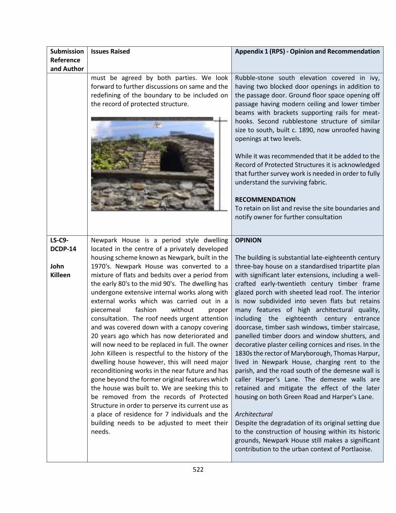
522
Submission Reference and Author
Issues Raised Appendix 1 (RPS) - Opinion and Recommendation
must be agreed by both parties. We look forward to further discussions on same and the redefining of the boundary to be included on the record of protected structure.
Rubble-stone south elevation covered in ivy, having two blocked door openings in addition to the passage door. Ground floor space opening off passage having modern ceiling and lower timber beams with brackets supporting rails for meat-hooks. Second rubblestone structure of similar size to south, built c. 1890, now unroofed having openings at two levels. While it was recommended that it be added to the Record of Protected Structures it is acknowledged that further survey work is needed in order to fully understand the surviving fabric. RECOMMENDATION To retain on list and revise the site boundaries and notify owner for further consultation
LS-C9-DCDP-14 John Killeen
Newpark House is a period style dwelling located in the centre of a privately developed housing scheme known as Newpark, built in the 1970's. Newpark House was converted to a mixture of flats and bedsits over a period from the early 80's to the mid 90's. The dwelling has undergone extensive internal works along with external works which was carried out in a piecemeal fashion without proper consultation. The roof needs urgent attention and was covered down with a canopy covering 20 years ago which has now deteriorated and will now need to be replaced in full. The owner John Killeen is respectful to the history of the dwelling house however, this will need major reconditioning works in the near future and has gone beyond the former original features which the house was built to. We are seeking this to be removed from the records of Protected Structure in order to perserve its current use as a place of residence for 7 individuals and the building needs to be adjusted to meet their needs.
OPINION The building is substantial late-eighteenth century three-bay house on a standardised tripartite plan with significant later extensions, including a well-crafted early-twentieth century timber frame glazed porch with sheeted lead roof. The interior is now subdivided into seven flats but retains many features of high architectural quality, including the eighteenth century entrance doorcase, timber sash windows, timber staircase, panelled timber doors and window shutters, and decorative plaster ceiling cornices and rises. In the 1830s the rector of Maryborough, Thomas Harpur, lived in Newpark House, charging rent to the parish, and the road south of the demesne wall is caller Harper's Lane. The demesne walls are retained and mitigate the effect of the later housing on both Green Road and Harper's Lane. Architectural Despite the degradation of its original setting due to the construction of housing within its historic grounds, Newpark House still makes a significant contribution to the urban context of Portlaoise.
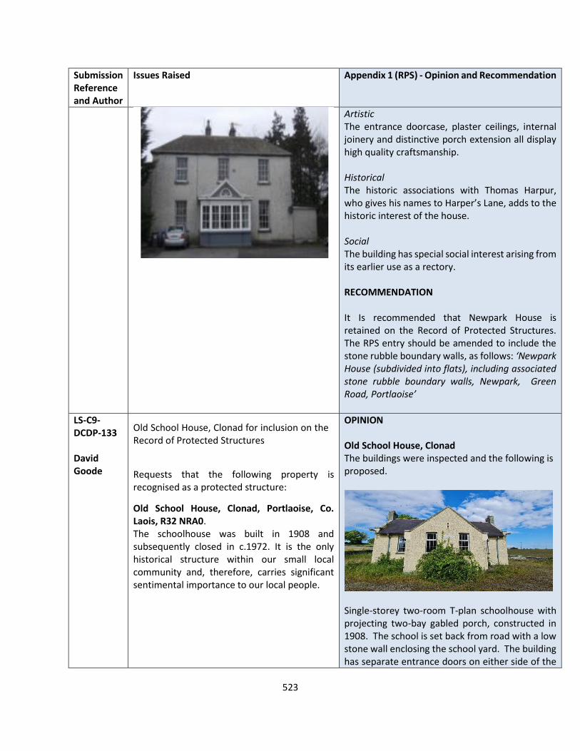
523
Submission Reference and Author
Issues Raised Appendix 1 (RPS) - Opinion and Recommendation
Artistic The entrance doorcase, plaster ceilings, internal joinery and distinctive porch extension all display high quality craftsmanship. Historical The historic associations with Thomas Harpur, who gives his names to Harper’s Lane, adds to the historic interest of the house. Social The building has special social interest arising from its earlier use as a rectory. RECOMMENDATION It Is recommended that Newpark House is retained on the Record of Protected Structures. The RPS entry should be amended to include the stone rubble boundary walls, as follows: ‘Newpark House (subdivided into flats), including associated stone rubble boundary walls, Newpark, Green Road, Portlaoise’
LS-C9-DCDP-133 David Goode
Old School House, Clonad for inclusion on the Record of Protected Structures
Requests that the following property is recognised as a protected structure:
• Old School House, Clonad, Portlaoise, Co. Laois, R32 NRA0. The schoolhouse was built in 1908 and subsequently closed in c.1972. It is the only historical structure within our small local community and, therefore, carries significant sentimental importance to our local people.
OPINION Old School House, Clonad The buildings were inspected and the following is proposed.
Single-storey two-room T-plan schoolhouse with projecting two-bay gabled porch, constructed in 1908. The school is set back from road with a low stone wall enclosing the school yard. The building has separate entrance doors on either side of the

524
Submission Reference and Author
Issues Raised Appendix 1 (RPS) - Opinion and Recommendation
projecting porch, square-headed window openings with replacement aluminium frame casement windows, and engraved limestone date plaque. The schoolhouse forms a cluster in the landscape with the adjoining (and contemporaneous) schoolteacher’s house to the immediate south. Architectural This well-crafted building is an exemplar of an early-twentieth century two-room T-plan rural schoolhouse and makes a positive contribution to the character of its rural townland. Social The building was a focal point in the surrounding townland and provides an insight into the provision of education within this rural community at the beginning of the twentieth century. The structure is of architectural and social special interest, equivalent to an NIAH Regional Rating, and merits inclusion on the Record of Protected Structures. Former schoolteacher’s house, Clonad Further to the above inspection the Planning Authority undertook an inspection of the Former schoolteach’s house which is located next to the above structure.
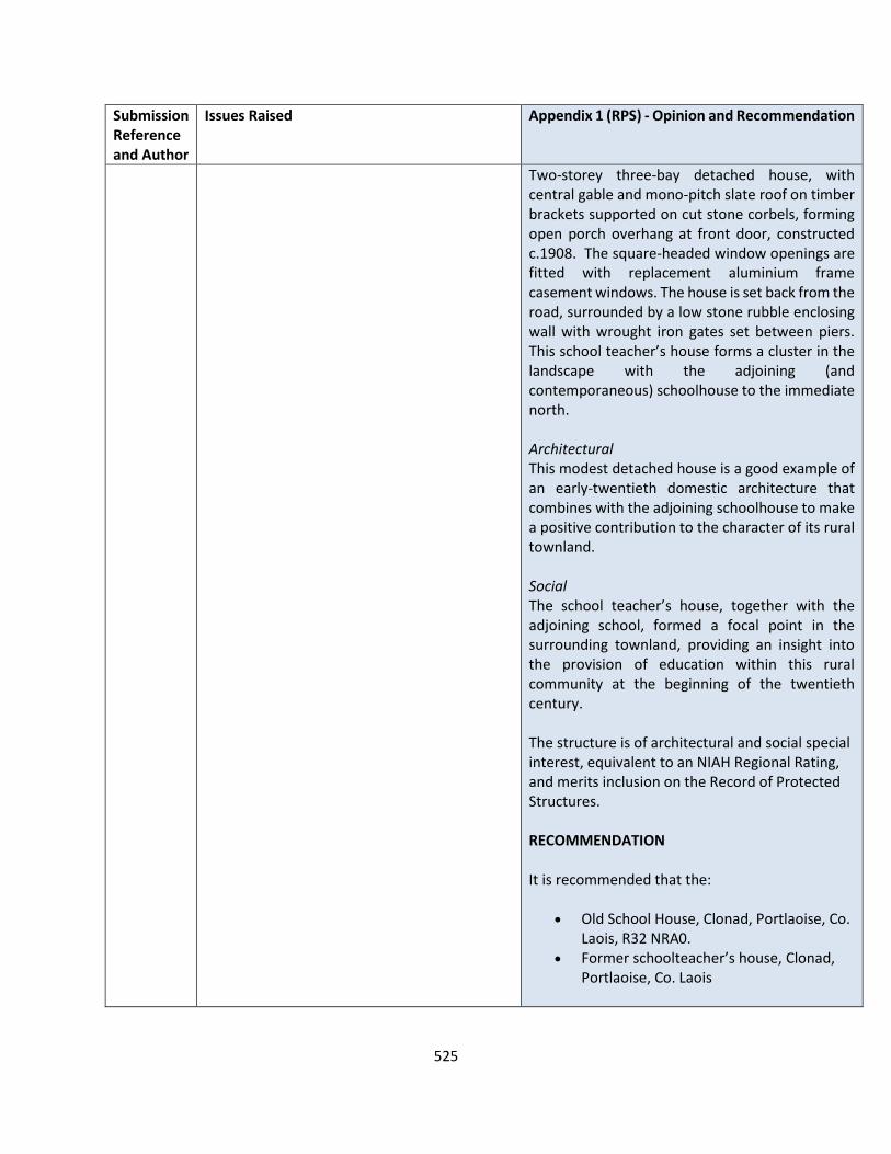
525
Submission Reference and Author
Issues Raised Appendix 1 (RPS) - Opinion and Recommendation
Two-storey three-bay detached house, with central gable and mono-pitch slate roof on timber brackets supported on cut stone corbels, forming open porch overhang at front door, constructed c.1908. The square-headed window openings are fitted with replacement aluminium frame casement windows. The house is set back from the road, surrounded by a low stone rubble enclosing wall with wrought iron gates set between piers. This school teacher’s house forms a cluster in the landscape with the adjoining (and contemporaneous) schoolhouse to the immediate north. Architectural This modest detached house is a good example of an early-twentieth domestic architecture that combines with the adjoining schoolhouse to make a positive contribution to the character of its rural townland. Social The school teacher’s house, together with the adjoining school, formed a focal point in the surrounding townland, providing an insight into the provision of education within this rural community at the beginning of the twentieth century. The structure is of architectural and social special interest, equivalent to an NIAH Regional Rating, and merits inclusion on the Record of Protected Structures. RECOMMENDATION It is recommended that the:
• Old School House, Clonad, Portlaoise, Co. Laois, R32 NRA0.
• Former schoolteacher’s house, Clonad, Portlaoise, Co. Laois
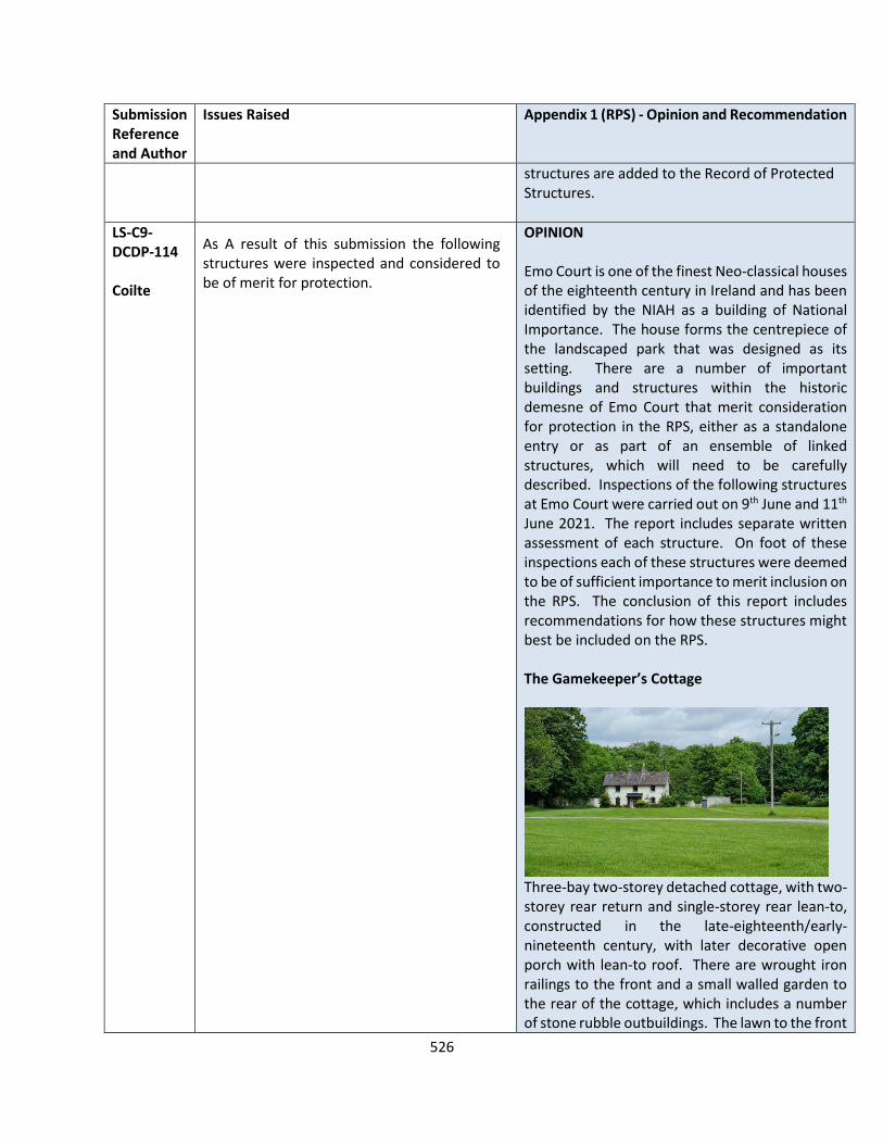
526
Submission Reference and Author
Issues Raised Appendix 1 (RPS) - Opinion and Recommendation
structures are added to the Record of Protected Structures.
LS-C9-DCDP-114 Coilte
As A result of this submission the following structures were inspected and considered to be of merit for protection.
OPINION Emo Court is one of the finest Neo-classical houses of the eighteenth century in Ireland and has been identified by the NIAH as a building of National Importance. The house forms the centrepiece of the landscaped park that was designed as its setting. There are a number of important buildings and structures within the historic demesne of Emo Court that merit consideration for protection in the RPS, either as a standalone entry or as part of an ensemble of linked structures, which will need to be carefully described. Inspections of the following structures at Emo Court were carried out on 9th June and 11th June 2021. The report includes separate written assessment of each structure. On foot of these inspections each of these structures were deemed to be of sufficient importance to merit inclusion on the RPS. The conclusion of this report includes recommendations for how these structures might best be included on the RPS. The Gamekeeper’s Cottage
Three-bay two-storey detached cottage, with two-storey rear return and single-storey rear lean-to, constructed in the late-eighteenth/early-nineteenth century, with later decorative open porch with lean-to roof. There are wrought iron railings to the front and a small walled garden to the rear of the cottage, which includes a number of stone rubble outbuildings. The lawn to the front
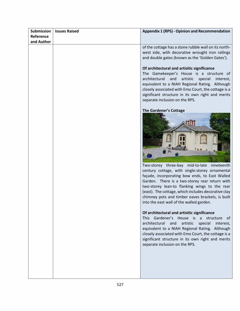
527
Submission Reference and Author
Issues Raised Appendix 1 (RPS) - Opinion and Recommendation
of the cottage has a stone rubble wall on its north-west side, with decorative wrought iron railings and double gates (known as the ‘Golden Gates’). Of architectural and artisitic significance The Gamekeeper’s House is a structure of architectural and artistic special interest, equivalent to a NIAH Regional Rating. Although closely associated with Emo Court, the cottage is a significant structure in its own right and merits separate inclusion on the RPS. The Gardener’s Cottage
Two-storey three-bay mid-to-late nineteenth century cottage, with single-storey ornamental façade, incorporating bow ends, to East Walled Garden. There is a two-storey rear return with two-storey lean-to flanking wings to the rear (east). The cottage, which includes decorative clay chimney pots and timber eaves brackets, is built into the east wall of the walled garden. Of architectural and artisitic significance This Gardener’s House is a structure of architectural and artistic special interest, equivalent to a NIAH Regional Rating. Although closely associated with Emo Court, the cottage is a significant structure in its own right and merits separate inclusion on the RPS.
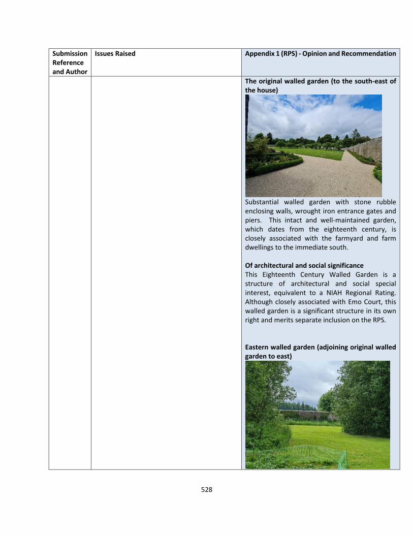
528
Submission Reference and Author
Issues Raised Appendix 1 (RPS) - Opinion and Recommendation
The original walled garden (to the south-east of the house)
Substantial walled garden with stone rubble enclosing walls, wrought iron entrance gates and piers. This intact and well-maintained garden, which dates from the eighteenth century, is closely associated with the farmyard and farm dwellings to the immediate south. Of architectural and social significance This Eighteenth Century Walled Garden is a structure of architectural and social special interest, equivalent to a NIAH Regional Rating. Although closely associated with Emo Court, this walled garden is a significant structure in its own right and merits separate inclusion on the RPS. Eastern walled garden (adjoining original walled garden to east)

529
Submission Reference and Author
Issues Raised Appendix 1 (RPS) - Opinion and Recommendation
Substantial walled garden, with stone rubble enclosing walls, wrought iron entrance gates and piers, constructed in the mid-nineteenth century as an extension to the original eighteenth century walled garden at Emo Court. The Gardener’s House, which is built into the east enclosing wall, is an important associated feature of this intact and well-maintained garden. Of architectural and social significance This East Walled Garden is a structure of architectural and social special interest, equivalent to a NIAH Regional Rating. Although closely associated with Emo Court, this walled garden is a significant structure in its own right and merits separate inclusion on the RPS. Eastern farmyards (including store buildings, stables and houses)
Complex of two farmyards and associated farm buildings to the immediate south of the Eighteenth-Century Walled Garden. The eastern yard has connecting gates to the walled garden at its north-east corner and incorporates a two-storey stone rubble outbuilding with hipped slate roof on its east wall. There is a carriage yard to its west, with a two-storey L-Plan carriage house and stable building along its east and north sides, incorporating four open arches on its south façade. The west continuation of this building includes two two-storey farm dwellings, with separate front gardens, the western-most of which incorporates a single-storey two-bay side annexe, with hipped roof.
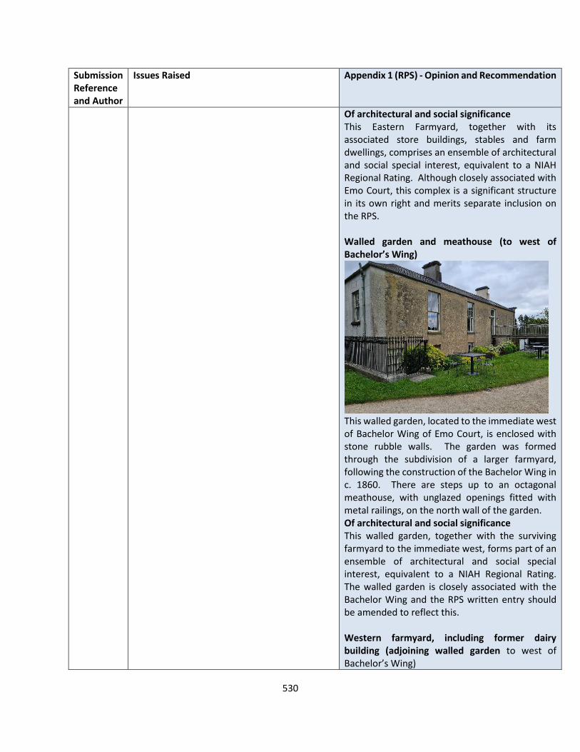
530
Submission Reference and Author
Issues Raised Appendix 1 (RPS) - Opinion and Recommendation
Of architectural and social significance This Eastern Farmyard, together with its associated store buildings, stables and farm dwellings, comprises an ensemble of architectural and social special interest, equivalent to a NIAH Regional Rating. Although closely associated with Emo Court, this complex is a significant structure in its own right and merits separate inclusion on the RPS. Walled garden and meathouse (to west of Bachelor’s Wing)
This walled garden, located to the immediate west of Bachelor Wing of Emo Court, is enclosed with stone rubble walls. The garden was formed through the subdivision of a larger farmyard, following the construction of the Bachelor Wing in c. 1860. There are steps up to an octagonal meathouse, with unglazed openings fitted with metal railings, on the north wall of the garden. Of architectural and social significance This walled garden, together with the surviving farmyard to the immediate west, forms part of an ensemble of architectural and social special interest, equivalent to a NIAH Regional Rating. The walled garden is closely associated with the Bachelor Wing and the RPS written entry should be amended to reflect this. Western farmyard, including former dairy building (adjoining walled garden to west of Bachelor’s Wing)
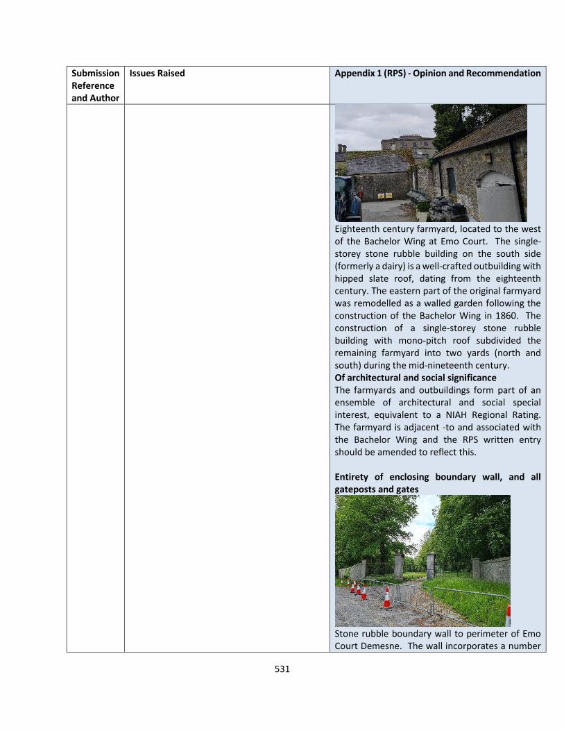
531
Submission Reference and Author
Issues Raised Appendix 1 (RPS) - Opinion and Recommendation
Eighteenth century farmyard, located to the west of the Bachelor Wing at Emo Court. The single-storey stone rubble building on the south side (formerly a dairy) is a well-crafted outbuilding with hipped slate roof, dating from the eighteenth century. The eastern part of the original farmyard was remodelled as a walled garden following the construction of the Bachelor Wing in 1860. The construction of a single-storey stone rubble building with mono-pitch roof subdivided the remaining farmyard into two yards (north and south) during the mid-nineteenth century. Of architectural and social significance The farmyards and outbuildings form part of an ensemble of architectural and social special interest, equivalent to a NIAH Regional Rating. The farmyard is adjacent -to and associated with the Bachelor Wing and the RPS written entry should be amended to reflect this. Entirety of enclosing boundary wall, and all gateposts and gates
Stone rubble boundary wall to perimeter of Emo Court Demesne. The wall incorporates a number

532
Submission Reference and Author
Issues Raised Appendix 1 (RPS) - Opinion and Recommendation
of entrances, some of which have cut stone piers and wrought iron railings. Of architectural and social significance This boundary walls of Emo Court, together with the associated entrances, gates and piers, are of architectural and social special interest, equivalent to a NIAH Regional Rating. Although closely associated with Emo Court, the demesne walls and entrances are a significant structure in their own right and merit separate inclusion on the RPS. The Deer Lodge (to north of Emo Court)
Single-storey three-bay late-nineteenth century lodge dwelling, with gabled central porch projection. The lodge is constructed of brick external walls with a steeply sloped roof of natural slate (fish scale pattern) and overhanging eaves with decorative fascia. The square-headed windows are fitted with margined timber sashes, with triangular-plan projecting windows supported on timber brackets to the east and west gables. This lodge is very similar to the South Lodge at Emo. There is a later return extension to the rear (south). Of architectural and artisitic significance Deer Lodge is a building of architectural and artistic special interest, equivalent to a NIAH Regional Rating. Although closely associated with Emo Court, this building is of significance in its own right and merits separate inclusion on the RPS.
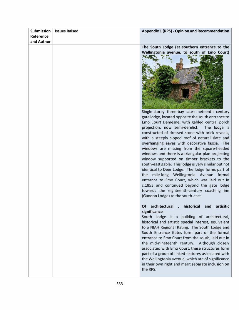
533
Submission Reference and Author
Issues Raised Appendix 1 (RPS) - Opinion and Recommendation
The South Lodge (at southern entrance to the Wellingtonia avenue, to south of Emo Court)
Single-storey three-bay late-nineteenth century gate lodge, located opposite the south entrance to Emo Court Demesne, with gabled central porch projection, now semi-derelict. The lodge is constructed of dressed stone with brick reveals, with a steeply sloped roof of natural slate and overhanging eaves with decorative fascia. The windows are missing from the square-headed windows and there is a triangular-plan projecting window supported on timber brackets to the south-east gable. This lodge is very similar but not identical to Deer Lodge. The lodge forms part of the mile-long Wellingtonia Avenue formal entrance to Emo Court, which was laid out in c.1853 and continued beyond the gate lodge towards the eighteenth-century coaching inn (Gandon Lodge) to the south-east. Of architectural , historical and artisitic significance South Lodge is a building of architectural, historical and artistic special interest, equivalent to a NIAH Regional Rating. The South Lodge and South Entrance Gates form part of the formal entrance to Emo Court from the south, laid out in the mid-nineteenth century. Although closely associated with Emo Court, these structures form part of a group of linked features associated with the Wellingtonia avenue, which are of significance in their own right and merit separate inclusion on the RPS.
534
Submission Reference and Author
Issues Raised Appendix 1 (RPS) - Opinion and Recommendation
RECOMMENDATION
Add the following buildings to the RPS:
RPS XX - The Gamekeeper’s Cottage RPS XX - The Gardener’s Cottage RPS XX - The original walled garden (to the south-east of the house) RPS XX - Eastern walled garden (adjoining original walled garden to east) RPS XX - Eastern farmyards (including store buildings, stables and houses) RPS XX - Walled garden and meathouse (to west of Bachelor’s Wing) RPS XX - Western farmyard, including former dairy building (adjoining walled garden to west of Bachelor’s Wing) RPS XX - Entirety of enclosing boundary wall, and all gateposts and gates RPS XX - The Gate Lodge (at entrance from Emo Village) RPS XX - The Deer Lodge (to north of Emo Court) RPS XX - The South Lodge (at southern entrance to the Wellingtonia avenue, to south of Emo Court)
535
APPENDIX 5 WIND ENERGY STRATEGY
Submission Reference and Author
Issues Raised Appendix 5 (WES) - Opinion and Recommendation
LS-C9-DCDP-92 ESB
Setback Distances ESB request that the development management standard as set out in 6.1 of the WES is removed as its inclusion would restrict the potential for wind farm development in the county. The setbacks of the size proposed will have the effect of seriously diminishing the land area potentially available for wind energy projects with consequent implications for the non-attainment of binding national obligations in relation reducing emissions. The 2006 Guidelines on Wind Energy Development did not set out limits on the height of turbines but rather highlighted that the scale of the surrounding landscape should dictate height. In June 2017 a “preferred draft approach” was jointly announced between the Dept. of Housing, Planning, Community & Local Government (DHPCLG) and the Department of Communications, Climate Action and Environment (DCCAE). The recently published Draft Revised Wind Energy Development Guidelines (2019) confirm the “preferred draft approach” for visual amenity comprises a setback distance of 4 times the tip height between a wind turbine and the nearest point of the curtilage of any residential property, subject to a mandatory minimum setback of 500 metres. Setback requirements would also be subject to compliance with noise limits. Map 1.6.5 – Wind Energy, should be reviewed and adjusted if necessary to reflect the “preferred draft approach”.
OPINION Set back distances The most up-to-date Government guidance on this matter remain the ‘Wind Energy Developments Guidelines for Planning Authorities, 2006’. In December 2019, the DoHPLG published a draft Revised Wind Energy Development Guidelines, for which the responses will inform the final Guidelines. To date, given that the Department has not finalised its review of the current guidelines, the guidelines remain in full effect, and the Planning Authority must be consistent with the standards set out in same. The Planning Authority therefore accepts that the 1.5km development management standard be removed from Section 6.1 of Appendix 5. Having regard to the imminent publication of national guidelines, it would be premature to publish a Renewable Energy Strategy at this stage incorporating policies for wind from a draft strategy, prior to its formal publication. Therefore, it is considered that the Draft Plan can incorporate reference to the adopted National Policy Guidelines at the time of the determination of the planning application. This is considered the most reasonable and balanced approach to managing future wind energy development proposals in the county whilst also complying with Government policy on the matter.
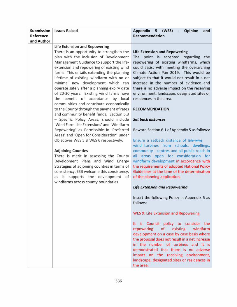
536
Submission Reference and Author
Issues Raised Appendix 5 (WES) - Opinion and Recommendation
Life Extension and Repowering There is an opportunity to strengthen the plan with the inclusion of Development Management Guidance to support the life-extension and repowering of existing wind farms. This entails extending the planning lifetime of existing windfarm with no or minimal new development which can operate safely after a planning expiry date of 20-30 years. Existing wind farms have the benefit of acceptance by local communities and contribute economically to the County through the payment of rates and community benefit funds. Section 5.3 – Specific Policy Areas, should include ‘Wind Farm Life Extensions’ and ‘Windfarm Repowering’ as Permissible in ‘Preferred Areas’ and ‘Open for Consideration’ under Objectives WES 5 & WES 6 respectively. Adjoining Counties There is merit in assessing the County Development Plans and Wind Energy Strategies of adjoining counties in terms of consistency. ESB welcome this consistency, as it supports the development of windfarms across county boundaries.
Life Extension and Repowering The point is accepted regarding the repowering of existing windfarms, which could assist with meeting the overarching Climate Action Pan 2019. This would be subject to that it would not result in a net increase in the number of evidence and there is no adverse impact on the receiving environment, landscape, designated sites or residences in the area. RECOMMENDATION Set back distances Reword Section 6.1 of Appendix 5 as follows: Ensure a setback distance of 1.5 kms wind turbines from schools, dwellings, community centres and all public roads in all areas open for consideration for windfarm development in accordance with the requirements of adopted National Policy Guidelines at the time of the determination of the planning application. Life Extension and Repowering Insert the following Policy in Appendix 5 as follows: WES 9: Life Extension and Repowering It is Council policy to consider the repowering of existing windfarm development on a case by case basis where the proposal does not result in a net increase in the number of turbines and it is demonstrated that there is no adverse impact on the receiving environment, landscape, designated sites or residences in the area.

537
Submission Reference and Author
Issues Raised Appendix 5 (WES) - Opinion and Recommendation
LS-C9-DCDP-113 RWE Renewable Ireland
Submission relates to the following:
Climate Change and Energy
Support CM RE 1, 3, 4, 5 and 6 and compliance with current wind energy development guidelines and future iterations. In relation to CM RE 7 - RWE has undertaking a detailed planning, environmental and technical operation constraints assessment for wind farms across the whole county area, taking account of the development plan, of environmental zonings and national environmental designations, wind speed, road access and availability of electrical transmission connections and importantly taking account of the distribution of rural one off houses and maintaining the “4 times tip height set back from dwellings” buffer from houses and maintaining significant buffers from other sensitive constraints.
This RWE Wind Energy Constraints Map has been overlain over the Draft Laois County Development Plan 2021 – 2027’s Wind Energy map 3.1, please see the overlain map attached as an Annexure for your consideration.
It should be noted that the constraints assessment took account of all the zoned designated areas, and did not seek to exclude existing or granted wind farm sites. It used a rotor diameter of 130m was used, which RWE feel is a conservative representation of turbine specifications going forward. A commercially viable wind farm would need to be 20 MW at a minimum. A four turbine wind farm of 5MW turbines was considered. A typical wind turbine requires a land take of 0.4 ha, however there is a considerable area
OPINION Climate Change and Energy The most up-to-date Government guidance on this matter remain the ‘Wind Energy Developments Guidelines for Planning Authorities, 2006’. In December 2019, the DoHPLG published a draft Revised Wind Energy Development Guidelines, for which the responses will inform the final Guidelines. To date, given that the Department has not finalised its review of the current guidelines, the guidelines remain in full effect, and the Planning Authority must be consistent with the standards set out in same. The support to the policies referred to is noted. The Planning Authority accepts that the 1.5km development management standard be removed from Section 6.1 of Appendix 5. Policy Ambition Having regard to the imminent publication of national guidelines, it would be premature to publish a Renewable Energy Strategy at this stage incorporating policies for wind from a draft strategy, including specific reference to local targets, prior to its formal publication. Therefore, it is considered that the Draft Plan can incorporate reference to the adopted National Policy Guidelines at the time of the determination of the planning application. This is considered the most reasonable and balanced approach to managing future wind energy development proposals in the county

538
Submission Reference and Author
Issues Raised Appendix 5 (WES) - Opinion and Recommendation
needed between turbines to optimise the wind take. A conservative measure of 4 rotor diameters was used in this example. This means that an area of 21 ha is needed around a turbine, with 85 ha for a 20 MW wind farm. It is with considerable alarm that we can report that our finding indicates, out of that the assessment has revealed that only 1,185 ha is suitable for future Wind Farm Development. This assessment reveals the actual potential areas “as found on the ground” for wind energy development based on a detailed constraints study informed by the company’s environmental, technical and operation knowledge gained from decades of experience in development wind farms. When further considering a typically sized wind farm, taking a representative area of 85 ha which is physically required to facilitate for a wind farm of 20 MW, the 1,185 ha available can potentially provide for a maximum of 14 wind farms of 20MW, or 280 MW.
It is submitted that we do not consider the extended buffer zones outlined in 6.1 of Appendix 5 of the WES, “Ensure a setback distance of 1.5 kms of wind turbines from schools, dwellings, community centres and all public roads in all areas open for consideration for windfarm development.” to be reasonable or balanced, given the considerable policy constraints already in place through the wind guidelines 2006 and which are further considerable constrained by the above illustrated operational and real world tested constraints. It is submitted that is critical that this policy reconsidered, in the interest of future energy and renewable energy needs of Laois county
whilst also complying with Government policy on the matter. RECOMMENDATION Set back distances Reword Section 6.1 of Appendix 5 as follows: Ensure a setback distance of 1.5 kms wind turbines from schools, dwellings, community centres and all public roads in all areas open for consideration for windfarm development in accordance with the requirements of adopted National Policy Guidelines at the time of the determination of the planning application. Policy Ambition No change to the Draft Plan

539
Submission Reference and Author
Issues Raised Appendix 5 (WES) - Opinion and Recommendation
Policy Ambition
RWE strongly suggests that the CDP and WES for Laois must classify a sufficient quantum of land as being suitable for wind energy, to ensure national renewable energy targets can be achieved, and demonstrate how the quantum of land classified as suitable is sufficient for this purpose. A clear policy ambition in the CDP and WES for County Laois is critical to guide the strategy and the identification of a sufficient quantum of potentially suitable land.
LS-C9-DCDP-114 Coillte
WES Section 2: Context, Capacity, Value: We welcome the recognition of the Climate Action Plan (CAP) 2019 in the WES and required emission reductions. To achieve the 70% target, the CAP earmarks a target of 3.5GW off-shore wind and a doubling of existing on-shore wind from circa 4GW (today) to 8.2GW by 2030. We suggest Section 2 of the WES and Section 3.2 of the Draft Plan also note that the 2020 Programme for Government further commits to an average 7% per annum reduction in overall greenhouse gas emissions from 2021 to 2030 (a 51% reduction over the decade) and to move to net zero emissions by 2050. The 2050 target will be set into law by the Climate Action and Low Carbon (Amendment) Bill 2020 the draft text of which was published on 7th Oct. 2020 and will likely be adopted in 2021. WES Section 2.14 - Economic Value In relation to Section 2.14 of the WES, it should be noted that the renewable energy sector is a key sector for economic growth, throughout the lifetime of the next County Development Plan. We suggest each local authority engage
OPINION WES Section 2: Context, Capacity, Value: The submission is noted. Section 2.5 ( Climate Action Plan 2019 to Tackle Climate Breakdown) states that The Climate Action Plan 2019 is committed to achieving a net zero carbon energy system for Irish society and a resilient and sustainable country. This Plan sets out over 180 actions, together with hundreds of sub-actions, that need to be taken at a time when the warning signs are growing, and the time for taking action is rapidly reducing. This Plan identifies how Ireland will achieve its 2030 targets for carbon emissions, and puts us on a trajectory to achieve net zero carbon emissions by 2050. Therefore we consider that this is sufficient reference to the targets outlined in the Climate Action Plan. The Planning Authority agrees that a regional renewable energy strategy should be looked at for the region in conjunction with CARO, EMRA and neighbouring authorities, such as Offaly, Carlow, Kilkenny
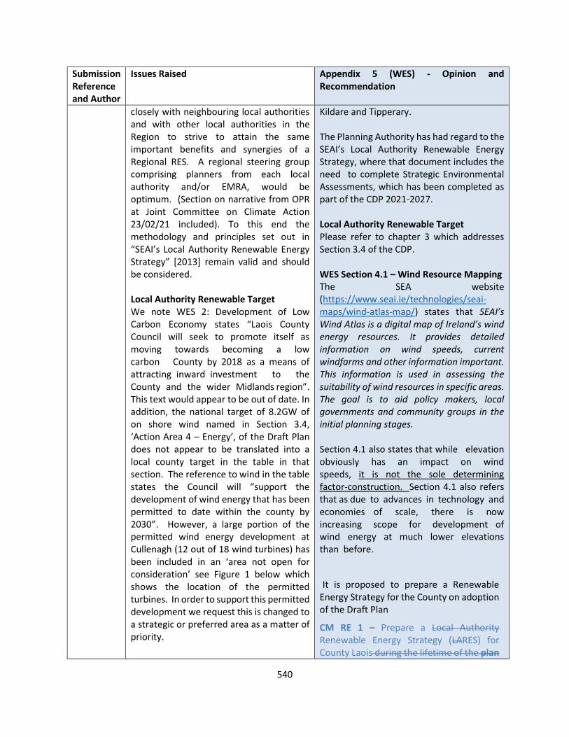
540
Submission Reference and Author
Issues Raised Appendix 5 (WES) - Opinion and Recommendation
closely with neighbouring local authorities and with other local authorities in the Region to strive to attain the same important benefits and synergies of a Regional RES. A regional steering group comprising planners from each local authority and/or EMRA, would be optimum. (Section on narrative from OPR at Joint Committee on Climate Action 23/02/21 included). To this end the methodology and principles set out in “SEAI’s Local Authority Renewable Energy Strategy” [2013] remain valid and should be considered. Local Authority Renewable Target We note WES 2: Development of Low Carbon Economy states “Laois County Council will seek to promote itself as moving towards becoming a low carbon County by 2018 as a means of attracting inward investment to the County and the wider Midlands region”. This text would appear to be out of date. In addition, the national target of 8.2GW of on shore wind named in Section 3.4, ‘Action Area 4 – Energy’, of the Draft Plan does not appear to be translated into a local county target in the table in that section. The reference to wind in the table states the Council will “support the development of wind energy that has been permitted to date within the county by 2030”. However, a large portion of the permitted wind energy development at Cullenagh (12 out of 18 wind turbines) has been included in an ‘area not open for consideration’ see Figure 1 below which shows the location of the permitted turbines. In order to support this permitted development we request this is changed to a strategic or preferred area as a matter of priority.
Kildare and Tipperary. The Planning Authority has had regard to the SEAI’s Local Authority Renewable Energy Strategy, where that document includes the need to complete Strategic Environmental Assessments, which has been completed as part of the CDP 2021-2027. Local Authority Renewable Target Please refer to chapter 3 which addresses Section 3.4 of the CDP. WES Section 4.1 – Wind Resource Mapping The SEA website (https://www.seai.ie/technologies/seai-maps/wind-atlas-map/) states that SEAI’s Wind Atlas is a digital map of Ireland’s wind energy resources. It provides detailed information on wind speeds, current windfarms and other information important. This information is used in assessing the suitability of wind resources in specific areas. The goal is to aid policy makers, local governments and community groups in the initial planning stages. Section 4.1 also states that while elevation obviously has an impact on wind speeds, it is not the sole determining factor-construction. Section 4.1 also refers that as due to advances in technology and economies of scale, there is now increasing scope for development of wind energy at much lower elevations than before.
It is proposed to prepare a Renewable Energy Strategy for the County on adoption of the Draft Plan
CM RE 1 – Prepare a Local Authority Renewable Energy Strategy (LARES) for County Laois during the lifetime of the plan

541
Submission Reference and Author
Issues Raised Appendix 5 (WES) - Opinion and Recommendation
We have also undertaken a preliminary review of lands designated as ‘preferred’ and ‘open to consideration’ in the Draft WES. Based on a modern wind turbine with a tip height of 187m, and a setback of four times tip height from existing residential properties5 (ie. 750m), the developable area of the ‘preferred lands’ is 107ha only and the developable area of the ‘open to consideration’ lands is 1,228ha only. We recognise the four times tip height setback in the Draft 2019 WEDGs may be subject to change but have used this as a base calculation as Coillte has been an advocate of a 750m setback from residential properties long before the Draft WEGs 2019. If a minimum 500m setback is applied the ‘preferred area’ becomes 292ha only and the ‘open to consideration’ area becomes 2,527ha only. Depending on whether a 500m or 750m setback is used there is between 0.8 and 1.6% of the county only designated for wind energy development. We also note CM RE 1 which states the Council will prepare a Local Authority Renewable Energy Strategy (LARES) for County Laois during the lifetime of the Plan. We suggest this should be done as part of the Draft Plan and that the Draft WES should be incorporated into this and revisited as per the suggestions above. WES Section 4.1 – Wind Resource Mapping Wind speed should not be considered a constraint in determining lands suitable for wind energy development in the Draft WES. Furthermore, it should be noted that the SEAI Wind Atlas of Ireland 2013 updates the 2003 data set referred to in the WES and is derived from a computer model. It would not be as accurate as on-
within 1 year of adoption of the plan. This will be by way of a variation to the Laois County Development Plan In preparing the Renewable energy strategy, the planning authority will have regard to but not limited to -
• Wind resource mapping
• Transmission grid network CMRE 1 Having regard to the imminent publication of national guidelines, it would be premature to publish a Renewable Energy Strategy at this stage incorporating policies for wind from a draft strategy, prior to its formal publication. Therefore, it is considered that the Draft Plan can incorporate reference to the adopted National Policy Guidelines at the time of the determination of the planning application. This is considered the most reasonable and balanced approach to managing future wind energy development proposals in the county whilst also complying with Government policy on the matter. Section 6.1 Set back distances The most up-to-date Government guidance on this matter remain the ‘Wind Energy Developments Guidelines for Planning Authorities, 2006’. In December 2019, the DoHPLG published a draft Revised Wind Energy Development Guidelines, for which the responses will inform the final Guidelines. To date, given
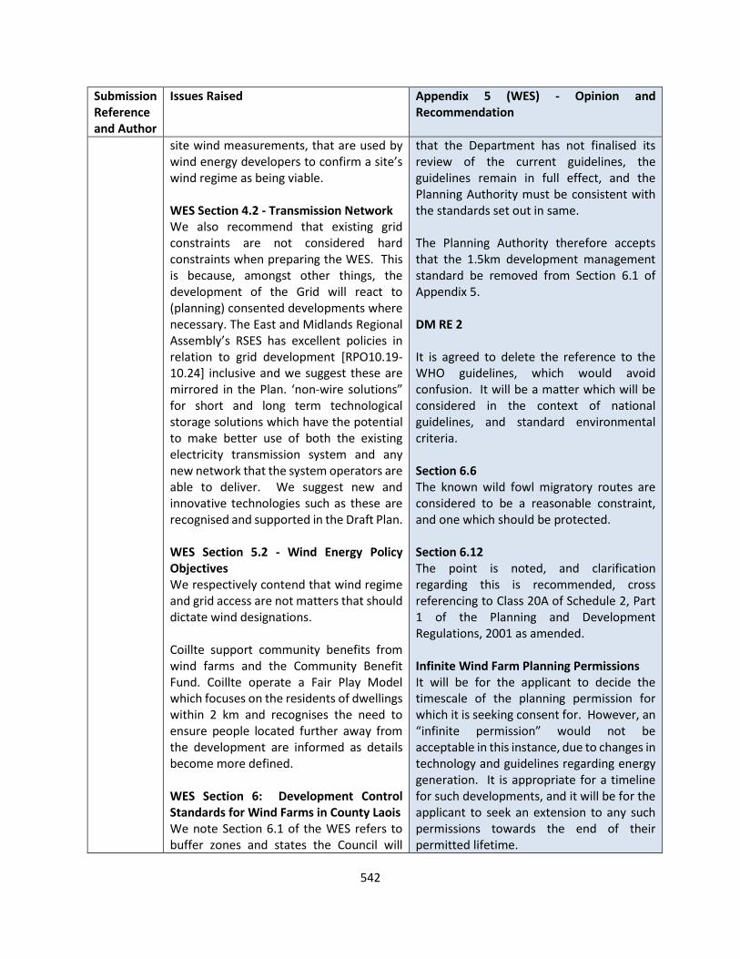
542
Submission Reference and Author
Issues Raised Appendix 5 (WES) - Opinion and Recommendation
site wind measurements, that are used by wind energy developers to confirm a site’s wind regime as being viable. WES Section 4.2 - Transmission Network We also recommend that existing grid constraints are not considered hard constraints when preparing the WES. This is because, amongst other things, the development of the Grid will react to (planning) consented developments where necessary. The East and Midlands Regional Assembly’s RSES has excellent policies in relation to grid development [RPO10.19-10.24] inclusive and we suggest these are mirrored in the Plan. ‘non-wire solutions” for short and long term technological storage solutions which have the potential to make better use of both the existing electricity transmission system and any new network that the system operators are able to deliver. We suggest new and innovative technologies such as these are recognised and supported in the Draft Plan. WES Section 5.2 - Wind Energy Policy Objectives We respectively contend that wind regime and grid access are not matters that should dictate wind designations. Coillte support community benefits from wind farms and the Community Benefit Fund. Coillte operate a Fair Play Model which focuses on the residents of dwellings within 2 km and recognises the need to ensure people located further away from the development are informed as details become more defined. WES Section 6: Development Control Standards for Wind Farms in County Laois We note Section 6.1 of the WES refers to buffer zones and states the Council will
that the Department has not finalised its review of the current guidelines, the guidelines remain in full effect, and the Planning Authority must be consistent with the standards set out in same. The Planning Authority therefore accepts that the 1.5km development management standard be removed from Section 6.1 of Appendix 5. DM RE 2 It is agreed to delete the reference to the WHO guidelines, which would avoid confusion. It will be a matter which will be considered in the context of national guidelines, and standard environmental criteria. Section 6.6 The known wild fowl migratory routes are considered to be a reasonable constraint, and one which should be protected. Section 6.12 The point is noted, and clarification regarding this is recommended, cross referencing to Class 20A of Schedule 2, Part 1 of the Planning and Development Regulations, 2001 as amended. Infinite Wind Farm Planning Permissions It will be for the applicant to decide the timescale of the planning permission for which it is seeking consent for. However, an “infinite permission” would not be acceptable in this instance, due to changes in technology and guidelines regarding energy generation. It is appropriate for a timeline for such developments, and it will be for the applicant to seek an extension to any such permissions towards the end of their permitted lifetime.

543
Submission Reference and Author
Issues Raised Appendix 5 (WES) - Opinion and Recommendation
“ensure a setback distance of 1.5kms of wind turbines from schools, dwellings, community centres and public roads in all areas open for consideration for windfarm development.” We request this section is removed as a priority prior to adoption as it conflicts with national guidelines. We strongly recommend the Draft Plan only cross refers to the WEDGs, or any update thereof, for development guidance. The text in Section 6.1 would also appear to conflict with climate mitigation objectives CMRE5 and CMRE6 of the Draft Plan. It is also noted that DM RE 2 of the Draft Plan states the Council will have regard to the wind energy guidelines for planning authorities and will also take into account, “impact on human health in relation to noise disturbance (including consistency with the WHO 2018 Environmental Noise Guidelines for the European Region”. We recommend the above reference to WHO is removed from the Draft Plan to ensure it doesn’t conflict with the national guidelines. In relation to Section 6.6, Bird Migratory Routes which states “Wind Turbines will not be permitted within the known flight path of migratory wild fowl,” we understand the Council’s concerns in relation to impacts on migrating birds. However, we suggest this is determined at a project specific level where the impact can be determined with the benefit of site specific, and species specific, surveys, rather than as a development control standard in the Draft WES. Section 6.12 of the Draft WES states “All wind monitoring masts require planning permission. These are typically for a 40m or 50m mast required to monitor on-site wind
Sustainable Timber Products The Draft Plan refers to the use of materials which complement the character of an area, as well as innovative architectural responses to some development. Refer to DM HS 14, DM HS 17, DM HS 18 as an example. RECOMMENDATION It is proposed to make the following amendment
CM RE 1 – Prepare a Local Authority Renewable Energy Strategy (LARES) for County Laois during the lifetime of the plan within 1 year of adoption of the plan. This will be by way of a variation to the Laois County Development Plan Section 6.1 – Set back distance Reword Section 6.1 of Appendix 5 as follows: Ensure a setback distance of 1.5 kms wind turbines from schools, dwellings, community centres and all public roads in all areas open for consideration for windfarm development in accordance with the requirements of adopted National Wind Policy Guidelines at the time of the determination of the planning application. DM RE 2 Amend bullet point as follows: Impact on human health in relation to noise disturbance (including consistency with the WHO 2018 Environmental Noise Guidelines for the European Region , showdown flicker and air quality; Section 6.12

544
Submission Reference and Author
Issues Raised Appendix 5 (WES) - Opinion and Recommendation
speeds over 1-2 years”. We suggest this text is removed as it has the potential to conflict with Class 20A of Schedule 2, Part 1 of the Planning and Development Regulations, 2001 as amended. This permits a planning exemption for the erection of a mast for mapping meteorological conditions, adhering to conditions and limitations set out in column 2. Infinite Lifespan of Wind Farm Planning Permissions Life of a wind farm is normally restricted by a condition of the planning permission. Removing such conditions would enable wind farms to continue producing clean energy at a very low cost to the consumer, for as long as possible and continue to contribute via rates to local authorities. Coillte and WEI recognise the importance of having decommissioning provisions in place for a wind farm when it does reach the end of its life. It is common for a wind farm planning permission to contain conditions that ensure that prior to construction the developer must submit a comprehensive decommissioning plan (which must be approved by the local authority) and a decommissioning bond to cover the cost of the proposed decommissioning works, which could be triggered once the project has stopped exporting electricity to the grid. Sustainable Timber Products Coillte requests that the Council promote the use of sustainable timber products in the Draft Plan Conclusion on WES
• Maintain the policies and objectives in the Draft Plan that recognise, promote and facilitate
All Wind monitoring masts may require planning permission, which will be subject to Class 20A of Schedule 2, Part 1 of the Planning and Development Regulations, 2001 as amended.
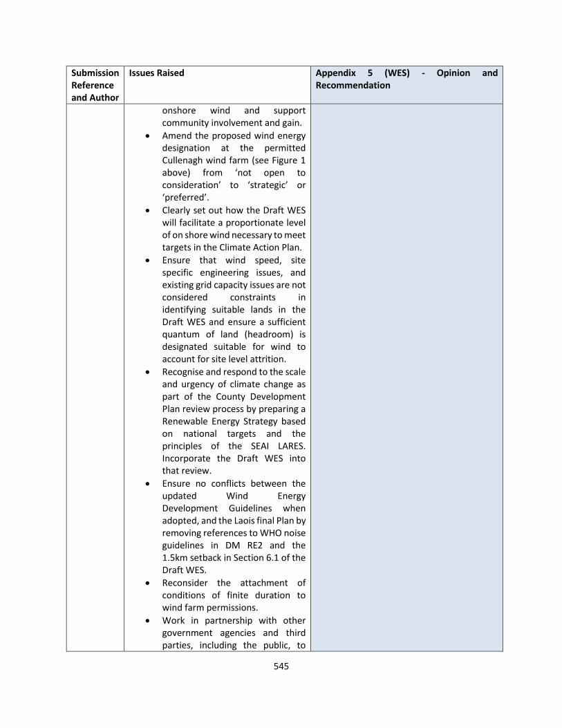
545
Submission Reference and Author
Issues Raised Appendix 5 (WES) - Opinion and Recommendation
onshore wind and support community involvement and gain.
• Amend the proposed wind energy designation at the permitted Cullenagh wind farm (see Figure 1 above) from ‘not open to consideration’ to ‘strategic’ or ‘preferred’.
• Clearly set out how the Draft WES will facilitate a proportionate level of on shore wind necessary to meet targets in the Climate Action Plan.
• Ensure that wind speed, site specific engineering issues, and existing grid capacity issues are not considered constraints in identifying suitable lands in the Draft WES and ensure a sufficient quantum of land (headroom) is designated suitable for wind to account for site level attrition.
• Recognise and respond to the scale and urgency of climate change as part of the County Development Plan review process by preparing a Renewable Energy Strategy based on national targets and the principles of the SEAI LARES. Incorporate the Draft WES into that review.
• Ensure no conflicts between the updated Wind Energy Development Guidelines when adopted, and the Laois final Plan by removing references to WHO noise guidelines in DM RE2 and the 1.5km setback in Section 6.1 of the Draft WES.
• Reconsider the attachment of conditions of finite duration to wind farm permissions.
• Work in partnership with other government agencies and third parties, including the public, to
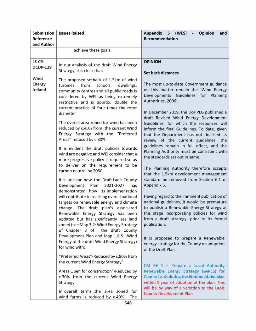
546
Submission Reference and Author
Issues Raised Appendix 5 (WES) - Opinion and Recommendation
achieve these goals.
LS-C9-DCDP-129 Wind Energy Ireland
In our analysis of the draft Wind Energy Strategy, it is clear that:
• The proposed setback of 1.5km of wind turbines from schools, dwellings, community centres and all public roads is considered by WEI as being extremely restrictive and is approx. double the current practice of four times the rotor diameter
• The overall area zoned for wind has been reduced by c.40% from the current Wind Energy Strategy with the “Preferred Areas” reduced by c.80%.
It is evident the draft policies towards wind are negative and WEI consider that a more progressive policy is required so as to deliver on the requirement to be carbon neutral by 2050.
It is unclear how the Draft Laois County Development Plan 2021-2027 has demonstrated how its implementation will contribute to realising overall national targets on renewable energy and climate change. The draft plan’s associated Renewable Energy Strategy has been updated but has significantly less land zoned (see Map 3.2: Wind Energy Strategy of Chapter 3 of the draft County Development Plan and Map 1.6.5 –Wind Energy of the draft Wind Energy Strategy) for wind with:
• “Preferred Areas”-Reduced by c.80% from the current Wind Energy Strategy“
• Areas Open for construction”-Reduced by c.30% from the current Wind Energy Strategy
In overall terms ,the area zoned for wind farms is reduced by c.40%. The
OPINION Set back distances The most up-to-date Government guidance on this matter remain the ‘Wind Energy Developments Guidelines for Planning Authorities, 2006’. In December 2019, the DoHPLG published a draft Revised Wind Energy Development Guidelines, for which the responses will inform the final Guidelines. To date, given that the Department has not finalised its review of the current guidelines, the guidelines remain in full effect, and the Planning Authority must be consistent with the standards set out in same. The Planning Authority therefore accepts that the 1.5km development management standard be removed from Section 6.1 of Appendix 5. Having regard to the imminent publication of national guidelines, it would be premature to publish a Renewable Energy Strategy at this stage incorporating policies for wind from a draft strategy, prior to its formal publication.
It is proposed to prepare a Renewable energy strategy for the County on adoption of the Draft Plan
CM RE 1 – Prepare a Local Authority Renewable Energy Strategy (LARES) for County Laois during the lifetime of the plan within 1 year of adoption of the plan. This will be by way of a variation to the Laois County Development Plan
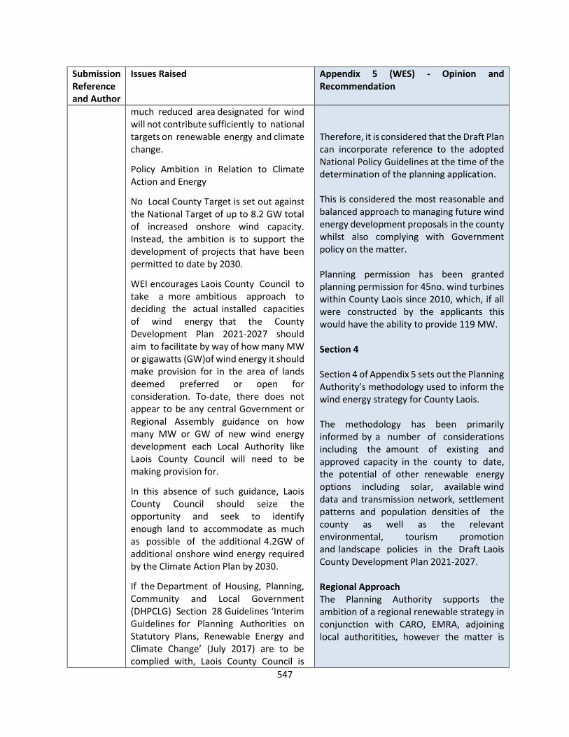
547
Submission Reference and Author
Issues Raised Appendix 5 (WES) - Opinion and Recommendation
much reduced area designated for wind will not contribute sufficiently to national targets on renewable energy and climate change.
Policy Ambition in Relation to Climate Action and Energy
No Local County Target is set out against the National Target of up to 8.2 GW total of increased onshore wind capacity. Instead, the ambition is to support the development of projects that have been permitted to date by 2030.
WEI encourages Laois County Council to take a more ambitious approach to deciding the actual installed capacities of wind energy that the County Development Plan 2021-2027 should aim to facilitate by way of how many MW or gigawatts (GW)of wind energy it should make provision for in the area of lands deemed preferred or open for consideration. To-date, there does not appear to be any central Government or Regional Assembly guidance on how many MW or GW of new wind energy development each Local Authority like Laois County Council will need to be making provision for.
In this absence of such guidance, Laois County Council should seize the opportunity and seek to identify enough land to accommodate as much as possible of the additional 4.2GW of additional onshore wind energy required by the Climate Action Plan by 2030.
If the Department of Housing, Planning, Community and Local Government (DHPCLG) Section 28 Guidelines ‘Interim Guidelines for Planning Authorities on Statutory Plans, Renewable Energy and Climate Change’ (July 2017) are to be complied with, Laois County Council is
Therefore, it is considered that the Draft Plan can incorporate reference to the adopted National Policy Guidelines at the time of the determination of the planning application. This is considered the most reasonable and balanced approach to managing future wind energy development proposals in the county whilst also complying with Government policy on the matter. Planning permission has been granted planning permission for 45no. wind turbines within County Laois since 2010, which, if all were constructed by the applicants this would have the ability to provide 119 MW. Section 4 Section 4 of Appendix 5 sets out the Planning Authority’s methodology used to inform the wind energy strategy for County Laois. The methodology has been primarily informed by a number of considerations including the amount of existing and approved capacity in the county to date, the potential of other renewable energy options including solar, available wind data and transmission network, settlement patterns and population densities of the county as well as the relevant environmental, tourism promotion and landscape policies in the Draft Laois County Development Plan 2021-2027. Regional Approach The Planning Authority supports the ambition of a regional renewable strategy in conjunction with CARO, EMRA, adjoining local authoritities, however the matter is
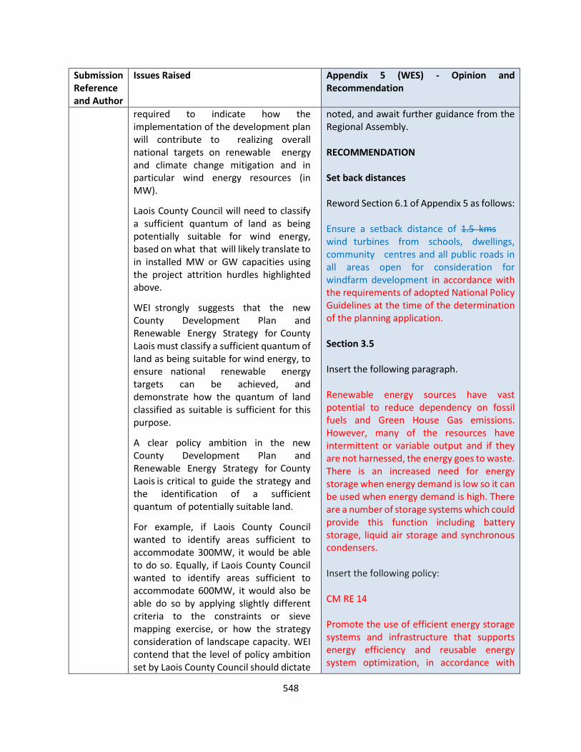
548
Submission Reference and Author
Issues Raised Appendix 5 (WES) - Opinion and Recommendation
required to indicate how the implementation of the development plan will contribute to realizing overall national targets on renewable energy and climate change mitigation and in particular wind energy resources (in MW).
Laois County Council will need to classify a sufficient quantum of land as being potentially suitable for wind energy, based on what that will likely translate to in installed MW or GW capacities using the project attrition hurdles highlighted above.
WEI strongly suggests that the new County Development Plan and Renewable Energy Strategy for County Laois must classify a sufficient quantum of land as being suitable for wind energy, to ensure national renewable energy targets can be achieved, and demonstrate how the quantum of land classified as suitable is sufficient for this purpose.
A clear policy ambition in the new County Development Plan and Renewable Energy Strategy for County Laois is critical to guide the strategy and the identification of a sufficient quantum of potentially suitable land.
For example, if Laois County Council wanted to identify areas sufficient to accommodate 300MW, it would be able to do so. Equally, if Laois County Council wanted to identify areas sufficient to accommodate 600MW, it would also be able do so by applying slightly different criteria to the constraints or sieve mapping exercise, or how the strategy consideration of landscape capacity. WEI contend that the level of policy ambition set by Laois County Council should dictate
noted, and await further guidance from the Regional Assembly. RECOMMENDATION Set back distances Reword Section 6.1 of Appendix 5 as follows: Ensure a setback distance of 1.5 kms wind turbines from schools, dwellings, community centres and all public roads in all areas open for consideration for windfarm development in accordance with the requirements of adopted National Policy Guidelines at the time of the determination of the planning application. Section 3.5 Insert the following paragraph. Renewable energy sources have vast potential to reduce dependency on fossil fuels and Green House Gas emissions. However, many of the resources have intermittent or variable output and if they are not harnessed, the energy goes to waste. There is an increased need for energy storage when energy demand is low so it can be used when energy demand is high. There are a number of storage systems which could provide this function including battery storage, liquid air storage and synchronous condensers. Insert the following policy: CM RE 14 Promote the use of efficient energy storage systems and infrastructure that supports energy efficiency and reusable energy system optimization, in accordance with
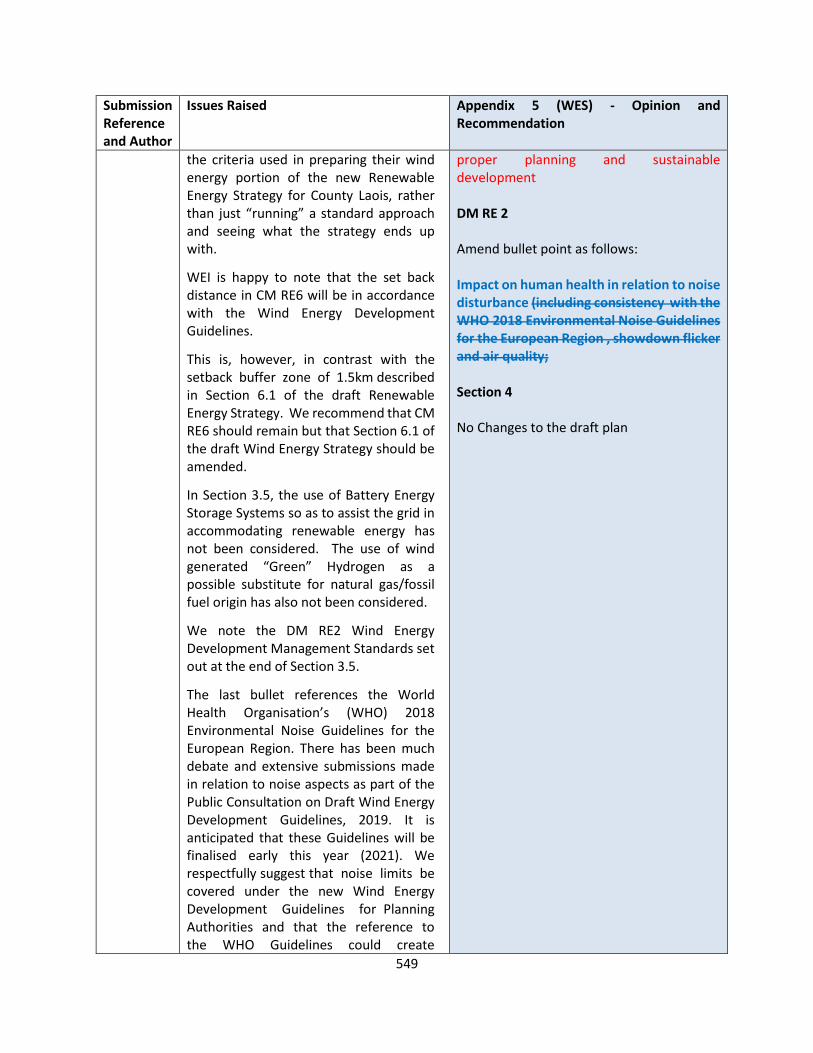
549
Submission Reference and Author
Issues Raised Appendix 5 (WES) - Opinion and Recommendation
the criteria used in preparing their wind energy portion of the new Renewable Energy Strategy for County Laois, rather than just “running” a standard approach and seeing what the strategy ends up with.
WEI is happy to note that the set back distance in CM RE6 will be in accordance with the Wind Energy Development Guidelines.
This is, however, in contrast with the setback buffer zone of 1.5km described in Section 6.1 of the draft Renewable Energy Strategy. We recommend that CM RE6 should remain but that Section 6.1 of the draft Wind Energy Strategy should be amended.
In Section 3.5, the use of Battery Energy Storage Systems so as to assist the grid in accommodating renewable energy has not been considered. The use of wind generated “Green” Hydrogen as a possible substitute for natural gas/fossil fuel origin has also not been considered.
We note the DM RE2 Wind Energy Development Management Standards set out at the end of Section 3.5.
The last bullet references the World Health Organisation’s (WHO) 2018 Environmental Noise Guidelines for the European Region. There has been much debate and extensive submissions made in relation to noise aspects as part of the Public Consultation on Draft Wind Energy Development Guidelines, 2019. It is anticipated that these Guidelines will be finalised early this year (2021). We respectfully suggest that noise limits be covered under the new Wind Energy Development Guidelines for Planning Authorities and that the reference to the WHO Guidelines could create
proper planning and sustainable development DM RE 2 Amend bullet point as follows: Impact on human health in relation to noise disturbance (including consistency with the WHO 2018 Environmental Noise Guidelines for the European Region , showdown flicker and air quality; Section 4 No Changes to the draft plan

550
Submission Reference and Author
Issues Raised Appendix 5 (WES) - Opinion and Recommendation
ambiguity and should be deleted.
5 Renewable Energy Strategy
While many aspect of the Laois Renewable Energy Strategy remain fit-for-purpose, other aspects are now outdated given the pace of change in various Government renewable energy policies in recent years, and how securing planning permission is now the critical first stage of any renewable energy project.
We note the methodology set out in Section 4 of the draft Wind Energy Strategy. WEI urges Laois County Council not to consider the following potential constraints or facilitators in the process of identifying areas as being potentially suitable for wind energy developments:
1. Grid Capacity
2. Wind Speed
3. Nature Conservation Areas
The restrictive approach used has resulted in an overall reduction in zoning with
• Preferred Areas’ reducing by c.80%
• ‘Areas Open for Consideration’ reducing by c.30%
• Overall designated areas for wind energy reducing by c.40%.
The setback of 1.5km set out in Section 6.1 is unduly restrictive, is almost double the current practice of four-times rotor diameter and it is recommended that any setback would follow the Department’s new Wind Energy Development Guidelines when published.
6. Regional Approach

551
Submission Reference and Author
Issues Raised Appendix 5 (WES) - Opinion and Recommendation
A regional approach to the spatial planning for wind energy was suggested by WEI as far back as March 2018 and is still considered vital if the transition to a low carbon economy in the coming years is to be successful. WEI maintains it is essential to plan for this transition and will continue to advocate for the preparation of Regional Renewable Energy Strategies to be accelerated and prioritised by the three Regional Assemblies.
LS-C9-DCDP-134 Statkraft
Appendix 5 – Wind Energy Strategy
Map 3.2 and its inclusion in Appendix 5 Wind Energy Strategy (WES) as Map 1.6.5 Wind Energy, is the same map as used in the Laois CDP 2017-2023.
Statkraft believe LCC should review the Draft WES and specifically Map 1.6.5 and for the reasons outlined above, avoid constraining any areas which may have renewable energy potential and allow every opportunity to identify potentially suitable lands.
Map 1.6.5 divides County Laois into three classifications (Preferred, Open to Consideration and Not Open for Consideration) based on the suitability of the county to wind energy. Section 5 of the WES cites Strategic Areas as a further classification type deemed eminently suitable for wind energy, however 0% of Laois is classified as Strategic in Map 1.6.2.
The majority of the county, specifically 74% has not be classified in relation to wind energy. When this is considered along with the 17.6% of areas deemed Not Open for Consideration to wind energy, 92% of the county has either not been classified or deemed Not Open for
OPINION The most up-to-date Government guidance on this matter remain the ‘Wind Energy Developments Guidelines for Planning Authorities, 2006’. In December 2019, the DoHPLG published a draft Revised Wind Energy Development Guidelines, for which the responses will inform the final Guidelines. To date, given that the Department has not finalised its review of the current guidelines, the guidelines remain in full effect, and the Planning Authority must be consistent with the standards set out in same. The Planning Authority therefore accepts that the 1.5km development management standard be removed from Section 6.1 of Appendix 5. Section 4 of Appendix 5 sets out the Planning Authority’s methodology used to inform the wind energy strategy for County Laois. The methodology has been primarily informed by a number of considerations including the amount of existing and approved capacity in the county to date, the potential of other renewable energy options including solar, available wind
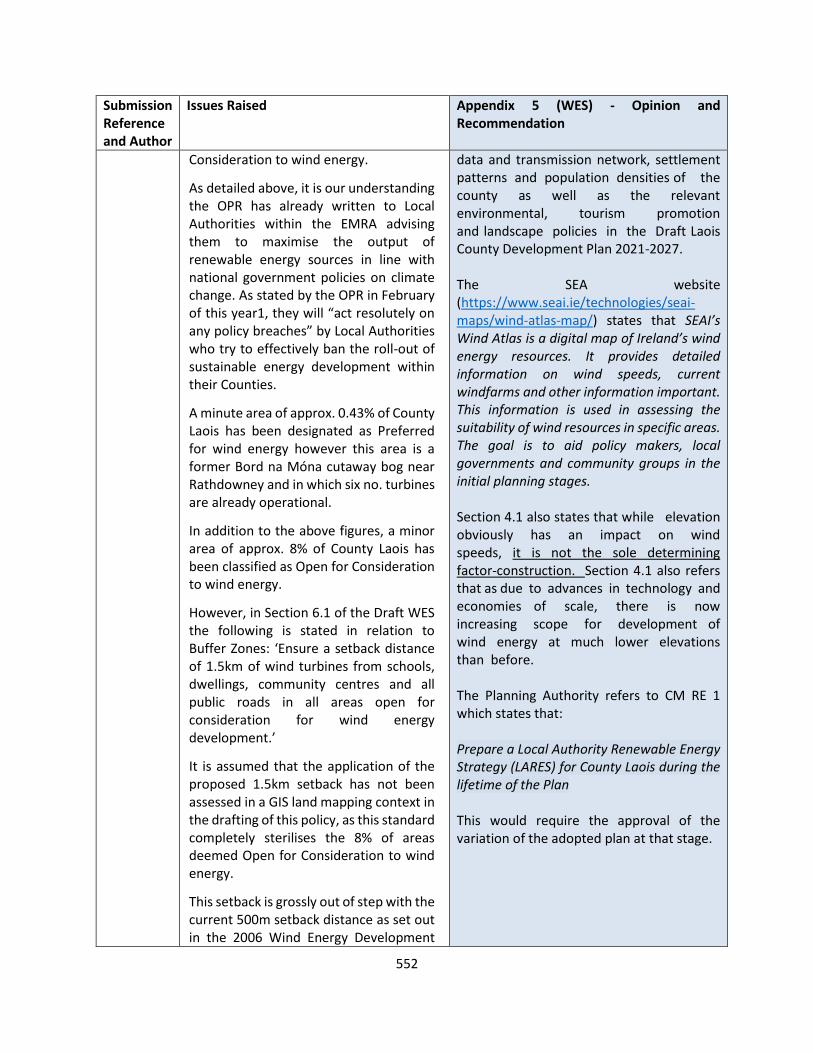
552
Submission Reference and Author
Issues Raised Appendix 5 (WES) - Opinion and Recommendation
Consideration to wind energy.
As detailed above, it is our understanding the OPR has already written to Local Authorities within the EMRA advising them to maximise the output of renewable energy sources in line with national government policies on climate change. As stated by the OPR in February of this year1, they will “act resolutely on any policy breaches” by Local Authorities who try to effectively ban the roll-out of sustainable energy development within their Counties.
A minute area of approx. 0.43% of County Laois has been designated as Preferred for wind energy however this area is a former Bord na Móna cutaway bog near Rathdowney and in which six no. turbines are already operational.
In addition to the above figures, a minor area of approx. 8% of County Laois has been classified as Open for Consideration to wind energy.
However, in Section 6.1 of the Draft WES the following is stated in relation to Buffer Zones: ‘Ensure a setback distance of 1.5km of wind turbines from schools, dwellings, community centres and all public roads in all areas open for consideration for wind energy development.’
It is assumed that the application of the proposed 1.5km setback has not been assessed in a GIS land mapping context in the drafting of this policy, as this standard completely sterilises the 8% of areas deemed Open for Consideration to wind energy.
This setback is grossly out of step with the current 500m setback distance as set out in the 2006 Wind Energy Development
data and transmission network, settlement patterns and population densities of the county as well as the relevant environmental, tourism promotion and landscape policies in the Draft Laois County Development Plan 2021-2027. The SEA website (https://www.seai.ie/technologies/seai-maps/wind-atlas-map/) states that SEAI’s Wind Atlas is a digital map of Ireland’s wind energy resources. It provides detailed information on wind speeds, current windfarms and other information important. This information is used in assessing the suitability of wind resources in specific areas. The goal is to aid policy makers, local governments and community groups in the initial planning stages. Section 4.1 also states that while elevation obviously has an impact on wind speeds, it is not the sole determining factor-construction. Section 4.1 also refers that as due to advances in technology and economies of scale, there is now increasing scope for development of wind energy at much lower elevations than before. The Planning Authority refers to CM RE 1 which states that: Prepare a Local Authority Renewable Energy Strategy (LARES) for County Laois during the lifetime of the Plan This would require the approval of the variation of the adopted plan at that stage.

553
Submission Reference and Author
Issues Raised Appendix 5 (WES) - Opinion and Recommendation
Guidelines and any setbacks muted through the ongoing Review of the Wind Energy Development Guidelines.
Furthermore, the Draft WES ignores the requirement as set out within Section 3.1 of the DoEHLG Wind Energy Guidelines for a reasonable balance to be achieved between Government Policy and Local Proper Planning considerations.
Statkraft request LCC to review the wind energy classifications for the county and in response to the request by the OPR, maximise the output of renewable energy sources in line with national government policies on climate change and allow areas potentially suitable for wind energy to be identified and subsequently assessed at a project specific level, justified where suitable through the EIA process.
Given that turbine technologies have advanced significantly in the past decade, we recommend to LCC that the SEAI Wind Atlas as referred to in Section 4.1 of the Draft WES or any similar general wind resource data not be used as a constraint when developing and zoning areas for renewable energy development
RECOMMENDATION Set back distances Reword Section 6.1 of Appendix 5 as follows: Ensure a setback distance of 1.5 kms wind turbines from schools, dwellings, community centres and all public roads in all areas open for consideration for windfarm development in accordance with the requirements of adopted National Policy Guidelines at the time of the determination of the planning application.
It is proposed to prepare a Renewable energy strategy for the County on adoption of the Draft Plan
CM RE 1 – Prepare a Local Authority Renewable Energy Strategy (LARES) for County Laois during the lifetime of the plan within 1 year of adoption of the plan. This will be by way of a variation to the Laois County Development Plan
LS-C9-DCDP-136 Offaly County Council
Despite stating that the Wind Energy Strategies for the adjoining counties to Laois were examined as part of the methodology used in selecting appropriate areas for wind energy development (in Section 4.11 of the Draft Laois County Wind Energy Strategy), it is noted that Map 1.6.5 ‘Wind Energy’ designates an area ‘Open for Consideration’ for wind farm development south of the Offaly- Laois border on the Laois side which will impact
OPINION Section 4 of Appendix 5 sets out the Planning Authority’s methodology used to inform the wind energy strategy for County Laois. The methodology has been primarily informed by a number of considerations including the amount of existing and approved capacity in the county to date, the potential of other renewable energy options including solar, available wind data and transmission network, settlement

554
Submission Reference and Author
Issues Raised Appendix 5 (WES) - Opinion and Recommendation
upon a ‘Protected View’ (Ref. No V1 in the current Offaly County Development Plan) .
Based on the significance of these viewpoints, Offaly County Council respectively request again that the area between these viewpoints towards the Slieve Bloom Mountains in Co. Laois is classified as an area where wind energy development will generally be discouraged. In order to ensure a consistent approach across county boundaries, Offaly County Council requests that Laois County Council considers the Wind Strategy of Offaly County Council Development Plan 2014-2020 and the Draft Offaly County Development Plan 2021-2027, in the preparation of the Wind Strategy for the Laois County Development Plan
patterns and population densities of the county as well as the relevant environmental, tourism promotion and landscape policies in the Draft Laois County Development Plan 2021-2027. The Planning Authority refers to CM RE 1 which states that: Prepare a Local Authority Renewable Energy Strategy (LARES) for County Laois during the lifetime of the Plan This would require the approval of a variation of the adopted plan at that stage. RECOMMENDATION No change to the Draft Plan
LS-C9-DCDP-139 Ecopower
In summary the Wind Energy Strategy draft policies;
• For a setback of 1.5km of wind turbines from schools, dwellings, community centres and all public roads is extremely restrictive and is approx. double guidelines of four times the rotor diameter
• To reduce the overall area zoned for wind by c.40% from the current Wind Energy Strategy and reduce the “Preferred Areas” by c.80% are negative and a more progressive policy is required so as to deliver on the National target to be carbon neutral by 2050.
Reference is given to the three actions within The Department of Housing, Planning, Community and Local Government (DHPCLG) Section 28 Guidelines ‘Interim Guidelines for Planning
OPINION The most up-to-date Government guidance on this matter remain the ‘Wind Energy Developments Guidelines for Planning Authorities, 2006’. In December 2019, the DoHPLG published a draft Revised Wind Energy Development Guidelines, for which the responses will inform the final Guidelines. To date, given that the Department has not finalised its review of the current guidelines, the guidelines remain in full effect, and the Planning Authority must be consistent with the standards set out in same. The Planning Authority therefore accepts that the 1.5km development management standard be removed from Section 6.1 of Appendix 5.

555
Submission Reference and Author
Issues Raised Appendix 5 (WES) - Opinion and Recommendation
Authorities on Statutory Plans, Renewable Energy and Climate Change’ (July 2017) To generate 70% of the county’s electricity from renewable energy by 2030, the Government’s Climate Action Plan requires the installation of 4,000MW of new wind energy developments over the next decade. County Laois has an important role to play in delivering its share and this is why it is critical that the new Wind Energy Strategy provides every opportunity to get as many of the projects currently in development through the planning and approvals system to enable us collectively to contribute to hitting our 2030 targets and to achieve carbon neutrality by 2050. It is unclear how the Draft Laois County Development Plan 2021-2027 has demonstrated how its implementation will contribute to realising overall national targets on renewable energy and climate change. In overall terms, the area zoned for wind farms is reduced by c.40%. The much reduced area designated for wind will not contribute sufficiently to national targets on renewable energy and climate change. References are given to the economic benefits of Wind Energy. Ecopower acknowledges that Laois County Council is only responsible for its own functional area but the almost complete lack of designations on the County boundaries may also inhibit development of wind energy in designated areas on the County boundary in neighbouring counties. This will hinder those counties ability to
Section 4 of Appendix 5 sets out the Planning Authority’s methodology used to inform the wind energy strategy for County Laois. The methodology has been primarily informed by a number of considerations including the amount of existing and approved capacity in the county to date, the potential of other renewable energy options including solar, available wind data and transmission network, settlement patterns and population densities of the county as well as the relevant environmental, tourism promotion and landscape policies in the Draft Laois County Development Plan 2021-2027. The SEA website (https://www.seai.ie/technologies/seai-maps/wind-atlas-map/) states that SEAI’s Wind Atlas is a digital map of Ireland’s wind energy resources. It provides detailed information on wind speeds, current windfarms and other information important. This information is used in assessing the suitability of wind resources in specific areas. The goal is to aid policy makers, local governments and community groups in the initial planning stages. Section 4.1 also states that while elevation obviously has an impact on wind speeds, it is not the sole determining factor-construction. Section 4.1 also refers that as due to advances in technology and economies of scale, there is now increasing scope for development of wind energy at much lower elevations than before. The Planning Authority refers to CM RE 1 which states that: Prepare a Local Authority Renewable Energy
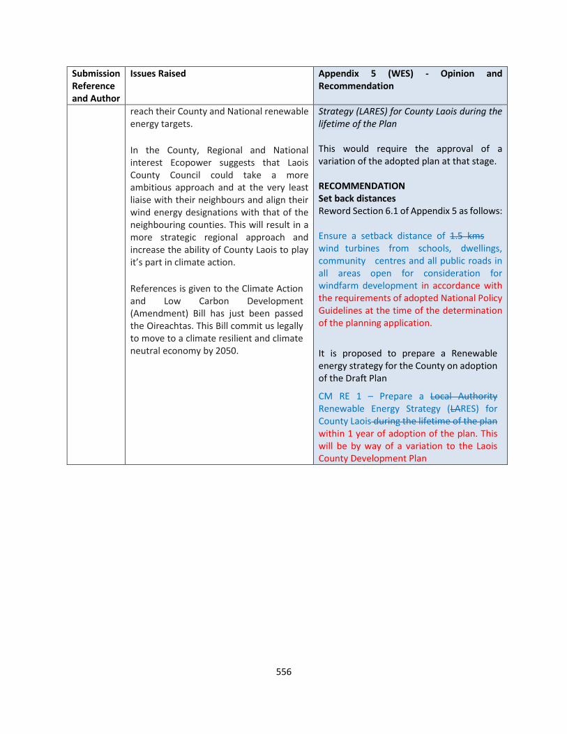
556
Submission Reference and Author
Issues Raised Appendix 5 (WES) - Opinion and Recommendation
reach their County and National renewable energy targets.
In the County, Regional and National interest Ecopower suggests that Laois County Council could take a more ambitious approach and at the very least liaise with their neighbours and align their wind energy designations with that of the neighbouring counties. This will result in a more strategic regional approach and increase the ability of County Laois to play it’s part in climate action.
References is given to the Climate Action and Low Carbon Development (Amendment) Bill has just been passed the Oireachtas. This Bill commit us legally to move to a climate resilient and climate neutral economy by 2050.
Strategy (LARES) for County Laois during the lifetime of the Plan This would require the approval of a variation of the adopted plan at that stage. RECOMMENDATION Set back distances Reword Section 6.1 of Appendix 5 as follows: Ensure a setback distance of 1.5 kms wind turbines from schools, dwellings, community centres and all public roads in all areas open for consideration for windfarm development in accordance with the requirements of adopted National Policy Guidelines at the time of the determination of the planning application.
It is proposed to prepare a Renewable energy strategy for the County on adoption of the Draft Plan
CM RE 1 – Prepare a Local Authority Renewable Energy Strategy (LARES) for County Laois during the lifetime of the plan within 1 year of adoption of the plan. This will be by way of a variation to the Laois County Development Plan

557
APPENDIX 6 LANDSCAPE CHARACTER ASSESSMENT
Submission Reference and Author
Issues Raised Appendix 6 – Opinion and Recommendation
LS-C9-DCDP-134 Stadcraft Ireland
The LCA for Laois remains unchanged from the previous plan with 7 no. Landscape Character Types (LCT) identified, three of which are considered for wind energy development namely LCT 1: Hills and Upland Areas, LCT 4: Peatland Areas and LCT 6: Rolling Hills Areas. For the reasons outlined above i.e. minor areas zoned Open for Consideration, an existing operational wind development in the only area zoned as Preferred in the county and the 1.5km setback standard above, none of these LCT’s remain available to be assessed for the potential of wind energy.
However as set out above we have serious concerns with the Draft Laois CDP and WES 2021-2027 which contrast with proper strategic planning and if implemented will sterilise all potential further wind energy development in the County of Laois.
Statkraft urge LCC to carry out a full assessment of the County for Wind Energy Potential as a matter of urgency in line with recent policy changes and allow every opportunity to identify lands as potentially suitable for wind energy development which may not previously have been considered.
OPINION Section 4 of Appendix 5 sets out the Planning Authority’s methodology used to inform the wind energy strategy for County Laois. The methodology has been primarily informed by a number of considerations including the amount of existing and approved capacity in the county to date, the potential of other renewable energy options including solar, available wind data and transmission network, settlement patterns and population densities of the county as well as the relevant environmental, tourism promotion and landscape policies in the Draft Laois County Development Plan 2021-2027. The Planning Authority refers to CM RE 1 which states that: Prepare a Local Authority Renewable Energy Strategy (LARES) for County Laois during the lifetime of the Plan This would require the approval of a variation of the adopted plan at that stage.
It is proposed to prepare a Renewable energy strategy for the County on adoption of the Draft Plan
CM RE 1 – Prepare a Local Authority Renewable Energy Strategy (LARES) for County Laois during the lifetime of the plan within 1 year of adoption of the plan. This will be by way of a variation to the Laois County Development Plan
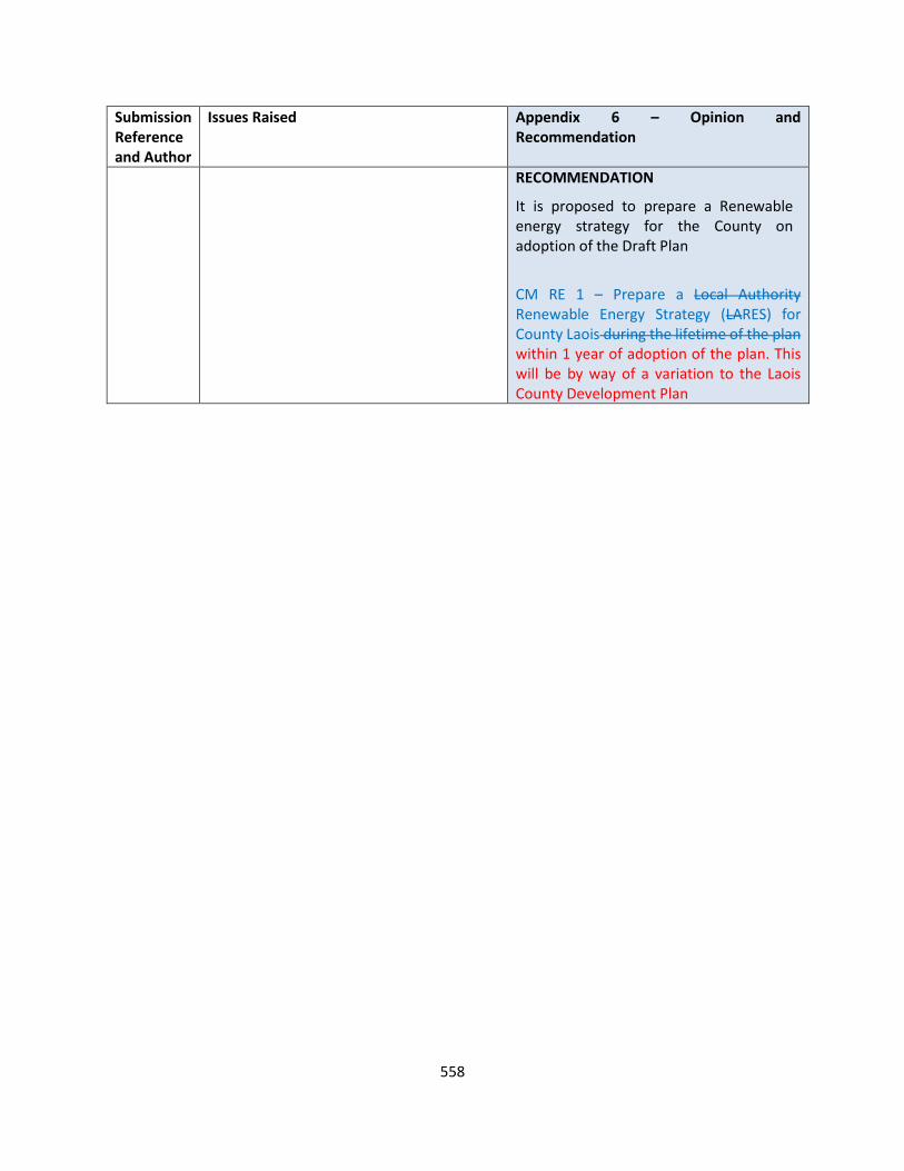
558
Submission Reference and Author
Issues Raised Appendix 6 – Opinion and Recommendation
RECOMMENDATION
It is proposed to prepare a Renewable energy strategy for the County on adoption of the Draft Plan
CM RE 1 – Prepare a Local Authority Renewable Energy Strategy (LARES) for County Laois during the lifetime of the plan within 1 year of adoption of the plan. This will be by way of a variation to the Laois County Development Plan
559
STRATEGIC ENVIRONMENTAL ASSESSMENT
Submission Reference and Author
Issues Raised (SEA) - Opinion and Recommendation
LS-C9-DCDP-11 EPA
Laois County Council should also ensure that the Plan aligns with key relevant higher-level plans and programmes and is consistent with the relevant objectives and policy commitments of the National Planning Framework and the Eastern and Midlands Regional Spatial and Economic Strategy. Content of the Environmental Report The SEA Regulations set out the information to be contained in an Environmental Report. Assessment of Alternatives You should describe the alternatives considered and how the selection and assessment of these has led to the selection of the preferred alternative. You should assess the alternatives against the ‘Strategic Environmental Objectives’ identified in the SEA ER.
OPINION The EPA’s ‘SEA of Local Authority Land Use Plans – EPA Recommendations and Resources’ document has been and will be taken into account in undertaking the SEA and preparing the Plan. The Plan aligns with key relevant higher-level plans and programmes and is consistent with the relevant objectives and policy commitments of the National Planning Framework and the Eastern and Midlands Regional Spatial and Economic Strategy. RECOMMENDATION No change necessary. OPINION Table 3.1 of the SEA Environmental Report, “Checklist of Information included in this Environmental Report”, identifies the sections that address the information requirements for environmental reports set out in the Regulations. RECOMMENDATION No change necessary. OPINION Alternatives considered and how the selection and assessment of these has led to the selection of the preferred alternative is provided in Sections 6 “Descriptions of Alternatives” and 7 “Evaluation of Alternatives” of the SEA Environmental Report. Alternatives are assessed against SEOs throughout Section 7. RECOMMENDATION No change necessary.

560
Submission Reference and Author
Issues Raised (SEA) - Opinion and Recommendation
Assessment of Environmental Effects You should assess and document the full range of likely significant environmental effects of implementing the Plan, including the potential for cumulative effects in combination with other relevant Plans/ Programmes and Projects. Mitigation Measures Where you have identified the potential for likely significant effects, you should provide appropriate mitigation measures to avoid or minimise these. You should ensure that the Plan includes clear commitments to implement the mitigation measures. Monitoring The Monitoring Programme should be flexible to take account of specific environmental issues and unforeseen adverse impacts should they arise. It should consider and deal with the possibility of cumulative effects. Monitoring of both positive and negative effects should be considered. The monitoring programme should set out the various data sources, monitoring frequencies and responsibilities. If the monitoring identifies adverse impacts during the implementation of the Plan Laois County Council should ensure that suitable and effective remedial action is taken.
OPINION The full range of likely significant environmental effects of implementing the Plan, and the alternatives, including the potential for cumulative effects in combination, is provided throughout Section 7 “Evaluation of Alternatives” and 8 “Evaluation of Plan Provisions” of the SEA Environmental Report. RECOMMENDATION No change necessary. OPINION Table 9.1 “Integration of Environmental Considerations into the Plan” links key mitigation measure(s) to the likely significant effects of implementing the Plan, if unmitigated. The measures are clear Plan commitments. RECOMMENDATION No change necessary. OPINION The required information on monitoring measures is provided in Section 10 of the SEA Environmental Report - this will inform the final Programme to be included in the SEA Statement. The cited guidance has been and will be taken into account in undertaking the SEA and preparing the Plan. RECOMMENDATION No change necessary.
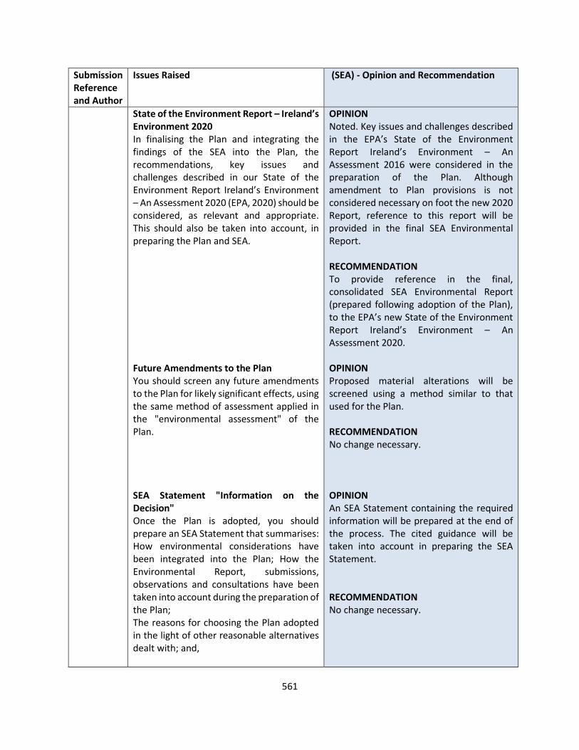
561
Submission Reference and Author
Issues Raised (SEA) - Opinion and Recommendation
State of the Environment Report – Ireland’s Environment 2020 In finalising the Plan and integrating the findings of the SEA into the Plan, the recommendations, key issues and challenges described in our State of the Environment Report Ireland’s Environment – An Assessment 2020 (EPA, 2020) should be considered, as relevant and appropriate. This should also be taken into account, in preparing the Plan and SEA. Future Amendments to the Plan You should screen any future amendments to the Plan for likely significant effects, using the same method of assessment applied in the "environmental assessment" of the Plan. SEA Statement "Information on the Decision" Once the Plan is adopted, you should prepare an SEA Statement that summarises: How environmental considerations have been integrated into the Plan; How the Environmental Report, submissions, observations and consultations have been taken into account during the preparation of the Plan; The reasons for choosing the Plan adopted in the light of other reasonable alternatives dealt with; and,
OPINION Noted. Key issues and challenges described in the EPA’s State of the Environment Report Ireland’s Environment – An Assessment 2016 were considered in the preparation of the Plan. Although amendment to Plan provisions is not considered necessary on foot the new 2020 Report, reference to this report will be provided in the final SEA Environmental Report. RECOMMENDATION To provide reference in the final, consolidated SEA Environmental Report (prepared following adoption of the Plan), to the EPA’s new State of the Environment Report Ireland’s Environment – An Assessment 2020. OPINION Proposed material alterations will be screened using a method similar to that used for the Plan. RECOMMENDATION No change necessary. OPINION An SEA Statement containing the required information will be prepared at the end of the process. The cited guidance will be taken into account in preparing the SEA Statement. RECOMMENDATION No change necessary.
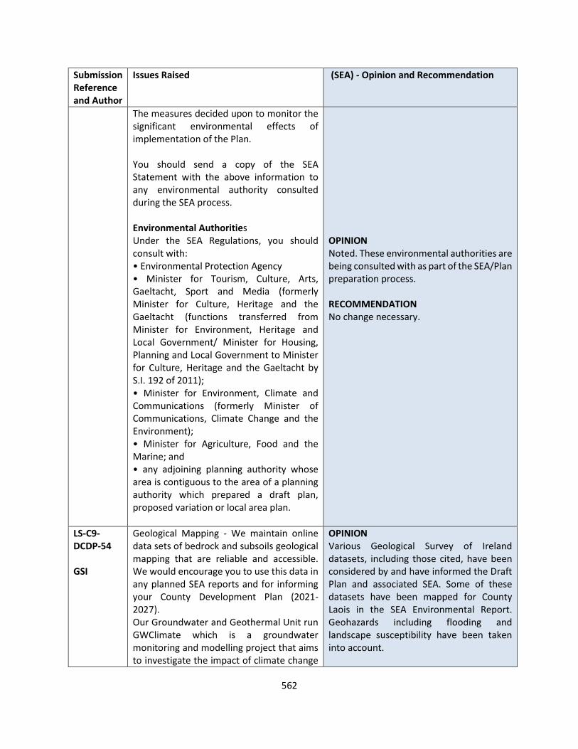
562
Submission Reference and Author
Issues Raised (SEA) - Opinion and Recommendation
The measures decided upon to monitor the significant environmental effects of implementation of the Plan. You should send a copy of the SEA Statement with the above information to any environmental authority consulted during the SEA process. Environmental Authorities Under the SEA Regulations, you should consult with: • Environmental Protection Agency • Minister for Tourism, Culture, Arts, Gaeltacht, Sport and Media (formerly Minister for Culture, Heritage and the Gaeltacht (functions transferred from Minister for Environment, Heritage and Local Government/ Minister for Housing, Planning and Local Government to Minister for Culture, Heritage and the Gaeltacht by S.I. 192 of 2011); • Minister for Environment, Climate and Communications (formerly Minister of Communications, Climate Change and the Environment); • Minister for Agriculture, Food and the Marine; and • any adjoining planning authority whose area is contiguous to the area of a planning authority which prepared a draft plan, proposed variation or local area plan.
OPINION Noted. These environmental authorities are being consulted with as part of the SEA/Plan preparation process. RECOMMENDATION No change necessary.
LS-C9-DCDP-54 GSI
Geological Mapping - We maintain online data sets of bedrock and subsoils geological mapping that are reliable and accessible. We would encourage you to use this data in any planned SEA reports and for informing your County Development Plan (2021-2027). Our Groundwater and Geothermal Unit run GWClimate which is a groundwater monitoring and modelling project that aims to investigate the impact of climate change
OPINION Various Geological Survey of Ireland datasets, including those cited, have been considered by and have informed the Draft Plan and associated SEA. Some of these datasets have been mapped for County Laois in the SEA Environmental Report. Geohazards including flooding and landscape susceptibility have been taken into account.
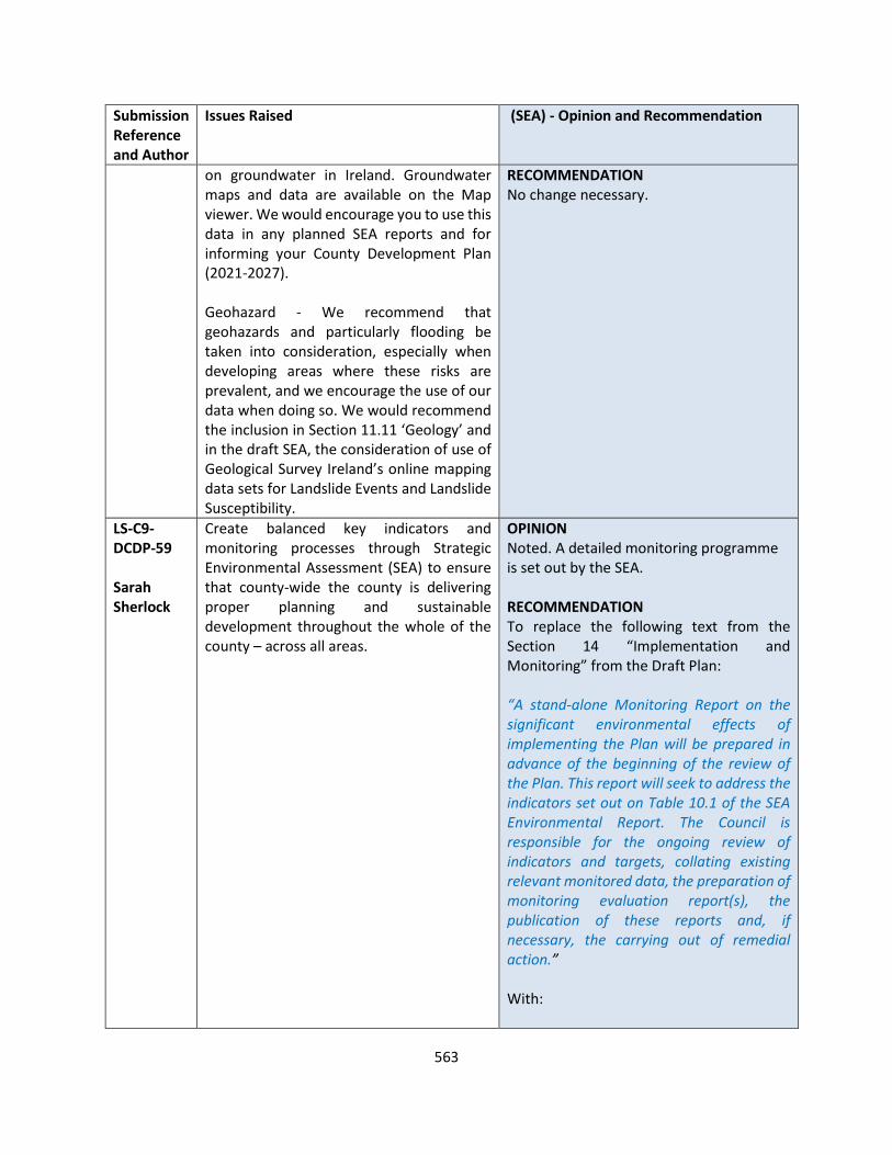
563
Submission Reference and Author
Issues Raised (SEA) - Opinion and Recommendation
on groundwater in Ireland. Groundwater maps and data are available on the Map viewer. We would encourage you to use this data in any planned SEA reports and for informing your County Development Plan (2021-2027). Geohazard - We recommend that geohazards and particularly flooding be taken into consideration, especially when developing areas where these risks are prevalent, and we encourage the use of our data when doing so. We would recommend the inclusion in Section 11.11 ‘Geology’ and in the draft SEA, the consideration of use of Geological Survey Ireland’s online mapping data sets for Landslide Events and Landslide Susceptibility.
RECOMMENDATION No change necessary.
LS-C9-DCDP-59 Sarah Sherlock
Create balanced key indicators and monitoring processes through Strategic Environmental Assessment (SEA) to ensure that county-wide the county is delivering proper planning and sustainable development throughout the whole of the county – across all areas.
OPINION Noted. A detailed monitoring programme is set out by the SEA. RECOMMENDATION To replace the following text from the Section 14 “Implementation and Monitoring” from the Draft Plan: “A stand-alone Monitoring Report on the significant environmental effects of implementing the Plan will be prepared in advance of the beginning of the review of the Plan. This report will seek to address the indicators set out on Table 10.1 of the SEA Environmental Report. The Council is responsible for the ongoing review of indicators and targets, collating existing relevant monitored data, the preparation of monitoring evaluation report(s), the publication of these reports and, if necessary, the carrying out of remedial action.” With:
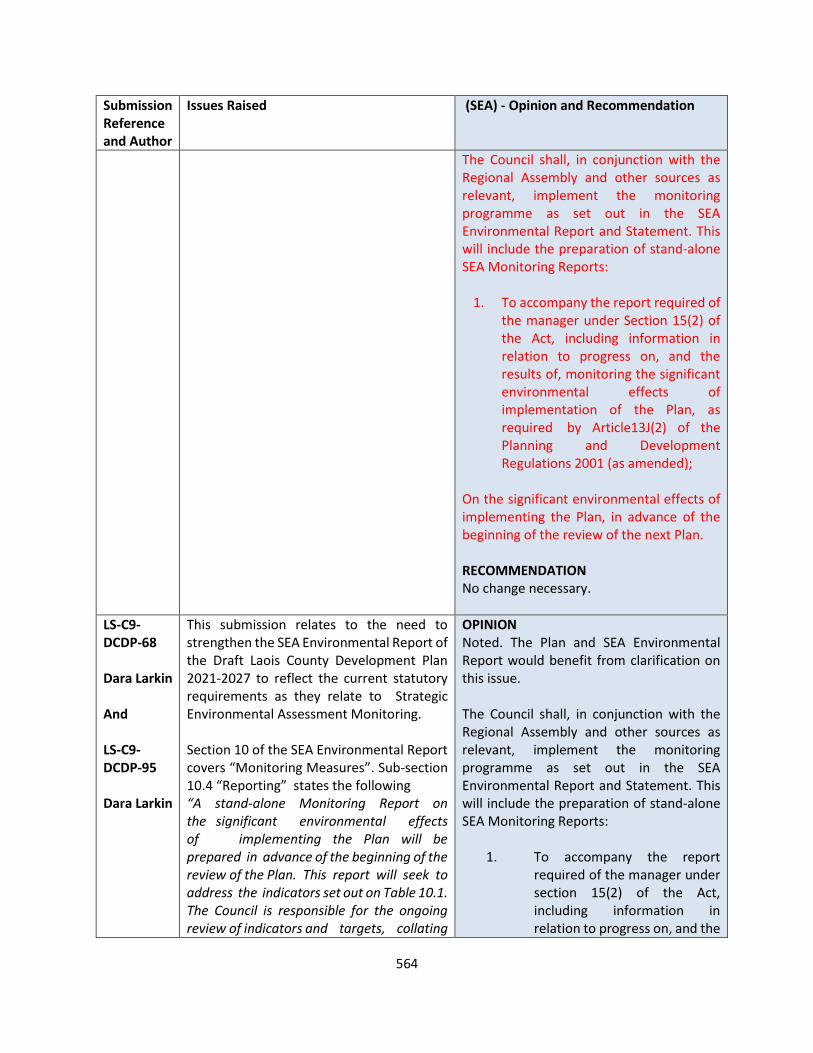
564
Submission Reference and Author
Issues Raised (SEA) - Opinion and Recommendation
The Council shall, in conjunction with the Regional Assembly and other sources as relevant, implement the monitoring programme as set out in the SEA Environmental Report and Statement. This will include the preparation of stand-alone SEA Monitoring Reports:
1. To accompany the report required of the manager under Section 15(2) of the Act, including information in relation to progress on, and the results of, monitoring the significant environmental effects of implementation of the Plan, as required by Article13J(2) of the Planning and Development Regulations 2001 (as amended);
On the significant environmental effects of implementing the Plan, in advance of the beginning of the review of the next Plan. RECOMMENDATION No change necessary.
LS-C9-DCDP-68 Dara Larkin And LS-C9-DCDP-95 Dara Larkin
This submission relates to the need to strengthen the SEA Environmental Report of the Draft Laois County Development Plan 2021-2027 to reflect the current statutory requirements as they relate to Strategic Environmental Assessment Monitoring. Section 10 of the SEA Environmental Report covers “Monitoring Measures”. Sub-section 10.4 “Reporting” states the following “A stand-alone Monitoring Report on the significant environmental effects of implementing the Plan will be prepared in advance of the beginning of the review of the Plan. This report will seek to address the indicators set out on Table 10.1. The Council is responsible for the ongoing review of indicators and targets, collating
OPINION Noted. The Plan and SEA Environmental Report would benefit from clarification on this issue. The Council shall, in conjunction with the Regional Assembly and other sources as relevant, implement the monitoring programme as set out in the SEA Environmental Report and Statement. This will include the preparation of stand-alone SEA Monitoring Reports:
1. To accompany the report required of the manager under section 15(2) of the Act, including information in relation to progress on, and the
565
Submission Reference and Author
Issues Raised (SEA) - Opinion and Recommendation
existing relevant monitored data, the preparation of monitoring evaluation report(s), the publication of these reports and, if necessary, the carrying out of remedial action”. This paragraph reflects the requirements of the European SEA Directive 2004 and Article13J(1) of the Planning and Development Regulations 2001 (as amended). However, it is an incomplete picture of the legislative context as it omits reference to an additional statutory requirement i.e. Article13J(2) of Regulations. This regulation require the Chief Executive to report to the members of the authority (when presenting the 2 Year Progress achieved in securing the objectives of the County Development Plan) to specifically include information on monitoring the environmental impacts of the implementation of the Plan. Article13J(2) states that The report required of the manager under section 15(2) of the Act shall include information in relation to progress on, and the results of, monitoring the significant environmental effects of implementation of the development plan. The inclusion of the environmental effects of the implementation of the Draft Development Plan 2021-2027 in the 2 Year Progress Report would also increase the likelihood of the County Council producing the SEA Monitoring Report for the Plan as required by Article 10 of the European Strategic Environmental Assessment Directive 2001/42/EC. I attach an Appendix with the legislative requirements to provide ease of access for persons reading the submission.
results of, monitoring the significant environmental effects of implementation of the development plan;
2. On the significant environmental effects of implementing the Plan, in advance of the beginning of the review of the next Plan.
RECOMMENDATION To replace the following text from the Section 10 “Monitoring Measures” from the SEA Environmental Report: “A stand-alone Monitoring Report on the significant environmental effects of implementing the Plan will be prepared in advance of the beginning of the review of the Plan. This report will seek to address the indicators set out on Table 10.1. The Council is responsible for the ongoing review of indicators and targets, collating existing relevant monitored data, the preparation of monitoring evaluation report(s), the publication of these reports and, if necessary, the carrying out of remedial action.” With: The Council shall, in conjunction with the Regional Assembly and other sources as relevant, implement the monitoring programme as set out on Table 10.1. This will include the preparation of stand-alone SEA Monitoring Reports:
1. To accompany the report required of the manager under Section 15(2) of the Act, including information in relation to progress on, and the results of, monitoring the significant environmental effects of
566
Submission Reference and Author
Issues Raised (SEA) - Opinion and Recommendation
Suggested change to the SEA Environmental Report for the Draft Laois County Development Plan 2021-2027 to reflect statutory requirement: It is recommended that Section 10.4 of the Environmental Report be amended to reflect the full statutory requirements in relation to the monitoring of the County Development Plan. This can be amended simply by inserting the following text before the existing paragraph; The first Monitoring Report on the significant environmental effects of implementing the Plan will be part of the Chief Executive report under section 15(2) of the Planning and Development Act, 2000 (that is, when reporting to the Elected Members of the authority on the progress achieved in securing the objectives of the Development Plan within two years from the adoption of the Plan); this report will include information in relation to progress on, and the results of, monitoring the significant environmental effects of implementation of the development plan as required by Article13J(2) of the Planning and Development Regulations 2001 (as amended).
implementation of the Plan, as required by Article13J(2) of the Planning and Development Regulations 2001 (as amended);
2. On the significant environmental effects of implementing the Plan, in advance of the beginning of the review of the next Plan.
To replace the following text from the Section 14 “Implementation and Monitoring” from the Draft Plan: “A stand-alone Monitoring Report on the significant environmental effects of implementing the Plan will be prepared in advance of the beginning of the review of the Plan. This report will seek to address the indicators set out on Table 10.1 of the SEA Environmental Report. The Council is responsible for the ongoing review of indicators and targets, collating existing relevant monitored data, the preparation of monitoring evaluation report(s), the publication of these reports and, if necessary, the carrying out of remedial action.” With: The Council shall, in conjunction with the Regional Assembly and other sources as relevant, implement the monitoring programme as set out in the SEA Environmental Report and Statement. This will include the preparation of stand-alone SEA Monitoring Reports:
1. To accompany the report required of the manager under Section 15(2) of the Act, including information in relation to progress on, and the results of, monitoring the significant environmental effects of

567
Submission Reference and Author
Issues Raised (SEA) - Opinion and Recommendation
implementation of the Plan, as required by Article13J(2) of the Planning and Development Regulations 2001 (as amended);
2. On the significant environmental effects of implementing the Plan, in advance of the beginning of the review of the next Plan.
LS-C9-DCDP-135 An Taisce
Strategic Environmental Assessment
The Council has a legal obligation to ensure that the SEA process is robust, effective, and identifies all likely significant effects on the environment under the range of considerations set out in the Annexes to the SEA Directive. To ensure integration of environmental considerations into the plan, a general policy or land use zoning should not be maintained where likely significant effects on the environment are identified.
An Taisce would highlight Article 10, which sets out the provisions for the monitoring of a programme subject to SEA and the obligation for remedial action where unforeseen adverse effects arise.
OPINION Noted. A detailed monitoring programme is set out by the SEA. RECOMMENDATION To replace the text from the Section 14 “Implementation and Monitoring” as indicated in LS-C9-DCDP-59 above.

568
STRATEGIC FLOOD RISK ASSESSMENT
JBA Consulting was commissioned to conduct a Strategic Flood Risk Assessment of the proposed Laois County Development Plan 2021-2027.
Public Consultation submissions have been received by the OPR, EMRA, OPW and one other party. The table below provides a respobse to the submissions and sets out the options for response/update of the SFRA.
Submission Reference and Author
OPR Comment Response
LS-C9-DCDP-154
OPR
In terms of defining Flood Zone areas A and B, it would appear that in a number of settlements, including Arles, Ballacolla, Ballybrittas, Ballylynan, Clough, Emo, Newtown-Doonane and Vicarstown, the flood zone data used is from Office of Public Work’s (OPW) Preliminary Flood Risk Assessment (PFRA) and PFRA Fluvial, without any confirmation that that this has been validated through further investigations.
Site visits would not typically be conducted to verify pluvial mapping as it has no bearing on the Flood Zones. The approach to management of surface water is detailed further in the SFRA and Written Statement.
A number of flood event reports submitted to the OPW by Laois County Council not yet shown on www.floodinfo.ie, have not been referenced in SFRA including lands at Ballacolla, Durrow, Mountrath, Portlaoise, and Rathdowney.
The SFRA has been updated to reflect flood events.
The Office specifically draws your attention to proposed zoning which could include highly vulnerable uses in Flood Zone A and/or B for Ballyroan, Camross, Clonaslee, Durrow, Killeen, Killeshin, Mountmellick, Mountrath, Portlaoise, Rathdowney, Rosenallis, Stradbally, The Swan, and Timahoe. Zoning for less vulnerable uses for Flood Zone A is also proposed for Borris-in-Ossory, Durrow, Portlaoise, Rathdowney, Stradbally, and The Swan.
Further comment is provided under the OPW submission, but a review of the Justification Test and land use zonings has been undertaken and is updated in the SFRA.
569
Submission Reference and Author
OPR Comment Response
The SFRA also states that the lands in Flood Zones A and B within the large Enterprise & Employment lands to the south west of Portlaoise have been proposed for flood plain storage, and the lands zoned as Town Centre to the west of St Peter & St Paul’s church, have been described in the SFRA as providing important flood plain storage. If these lands from part of the flood risk management for the area, their zoning should either be amended to reflect this, or a policy objective be attached to the zoning to provide clarity and certainty.
LCC confirmed that the lands will be zoned accordingly. The justification test has been applied in this case. This relates to an important town centre site which has been identified as an opportunity site for regeneration.
Recommendation No.15 states: Having regard to the requirements of The Planning System and Flood Risk Management Guidelines for Planning Authorities (DEHLG & OPW, November 2009) and the Department of Environment, Community and Local Government Circular PL 2/2014, the planning authority is required, in consultation with the OPW, to revisit the Strategic Flood Risk Assessment to demonstrate that:
A. The SFRA has been carried out on the basis of sufficient information to inform zoning decisions or to undertake further more detailed analysis as required.
The OPW has been consulted and further specific comment is provided under the OPW submission response in the next section.
B. The sequential approach has been carried out for each proposed zoning in accordance with the aforementioned Guidelines and Circular, inclusive of the Justification Test, as appropriate.
A review of the Sequential Approach and Justification Test, as set out under the response to the OPW submission in the following section and the SFRA has been updated as appropriate.
C. Omit or amend proposed zonings that cannot meet the Justification Test in accordance with the provisions of Guidelines and Circular.
The Justification Test has been applied, as discussed above and under the OPW submission response.
Observation No.5 states: The Office advises that the following matters should be clarified to ensure consistency between the Plan and the Strategic Flood Risk Assessment:
A. The status of lands in Portlaoise referenced in the SFRA as flood plain
See response to the OPW submission.
570
Submission Reference and Author
OPR Comment Response
storage within the Enterprise & Employment lands to the south west of the town, and zoned Town Centre to the west of St Peter & St Paul’s church, should be clarified. This may require an amended zoning or policy objective for the purposes of the flood risk management of the area.
B. Land in Ballybrittas shown as new residential on zoning maps is shown as existing residential on SFRA the map. The recommendation above in respect of sequential development and the justification test apply.
SFRA has been updated to reflect this
C. Land in Killeen shown as new residential on zoning maps does not match the flood zones on SFRA the map.
SFRA has been updated to reflect this , see response to the OPW
571
Submission Reference and Author
EMRA Comment Response
LS-C9-DCDP-36
EMRA
It is noted that SFRA recommendations, including those related to flood risk management provisions, have been integrated into the Draft Plan. Notwithstanding this, the Assembly notes that the SFRA indicates that flood risk assessments will be required for specific land use zonings in a number of settlements across the County. Accordingly, it is recommended that the findings of the SFRA are reconsidered and that impacted zonings are reassessed for their suitability for development purposes in accordance with the aforementioned Flood Risk Management Guidelines and associated circular.
As indicated for the OPR and OPW responses, a review of the zonings with respect to the application of the Justification Test has been carried , see amended SFRA.

572
Submission Reference and Author
OPW Comment Response
LS-C9-DCDP-98
OPW
It is noted that there has been no commentary in the SFRA, and no zoning maps in Volume II Settlement Strategy, for either Portarlington or Graiguecullen. As per policy objectives CS09 and CS10, Local Area Plans will be prepared for these settlements.
It is a policy objective to prepare Joint local Area plans for Portralington with OCC and Graiguecullen Carlow WITH Carlow County Council.
Justification Test Refer to individual settlement responses. In general all settlements have been reviewed and the Justification Test applied to existing developed land where specific land use zonings or Opportunity Sites are specified.
Preliminary Flood Risk Assessment In a number of settlements, the information provided states that the flood zone data comes solely from PFRA Pluvial, without any commentary stating that this was validated through a site visit.
This can be updated within the SFRA to clarify. We would not typically review the PFRA pluvial data on site. The approach to management of surface water is detailed further in the SFRA and Written Statement.
Sustainable Drainage Systems (SuDS) and Green Infrastructure The Guidelines recommend that the SFRA identifies where integrated and area based provision of SuDS and green infrastructure are appropriate in order to avoid reliance on individual site by site solutions.
There are 30 settlements reviewed under the County Development Plan and specific guidance on key development sites is beyond the scope of assessment. General policy on Surface Water Management ensures the implementation of SuDS and this issue could be specifically investigated in a higher level of detail under the LAP Town Development Plans. The settlement plans where appropriate and possible have been amended to provided zoned areas for open space and green infrastrcutre,
Ballacolla report has been submitted to the OPW by Laois County Council of a pluvial flood event from 22/11/2017 where the R424 road flooded after a period of heavy rainfall is not included on www.floodinfo.ie or referenced in the SFRA.
SFRA has been updated to reflect this.
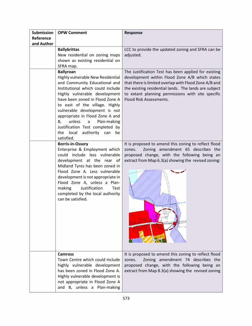
573
Submission Reference and Author
OPW Comment Response
Ballybrittas New residential on zoning maps shown as existing residential on SFRA map.
LCC to provide the updated zoning and SFRA can be adjusted.
Ballyroan Highly vulnerable New Residential and Community Educational and Institutional which could include Highly vulnerable development have been zoned in Flood Zone A to east of the village. Highly vulnerable development is not appropriate in Flood Zone A and B, unless a Plan-making Justification Test completed by the local authority can be satisfied.
The Justification Test has been applied for existing development within Flood Zone A/B which states that there is limited overlap with Flood Zone A/B and the existing residential lands. The lands are subject to extant planning permissions with site specific Flood Risk Assessments.
Borris-in-Ossory Enterprise & Employment which could include less vulnerable development at the rear of Midland Tyres has been zoned in Flood Zone A. Less vulnerable development is not appropriate in Flood Zone A, unless a Plan-making Justification Test completed by the local authority can be satisfied.
It is proposed to amend this zoning to reflect flood zones. Zoning amendment 65 describes the proposed change, with the following being an extract from Map 6.3(a) showing the revised zoning:
Camross Town Centre which could include highly vulnerable development has been zoned in Flood Zone A. Highly vulnerable development is not appropriate in Flood Zone A and B, unless a Plan-making
It is proposed to amend this zoning to reflect flood zones. Zoning amendment 74 describes the proposed change, with the following being an extract from Map 8.3(a) showing the revised zoning

574
Submission Reference and Author
OPW Comment Response
Justification Test completed by the local authority can be satisfied.
The Justification Test has been applied and is set out in the SFRA.
Clonaslee Highly vulnerable Existing Residential, and Town Centre and Community-Educational & Institutional which could include highly vulnerable development, have been zoned in Flood Zones A and B. Highly vulnerable development is not appropriate in Flood Zone A and B, unless a Plan-making Justification Test completed by the local authority can be satisfied.
It is proposed to amend this zoning to reflect flood zones. Zoning amendment 61 describes the proposed change, with the following being an extract from Map 6.1(a) showing the revised zoning
Justification Test has been applied to the existing development in the SFRA.
Durrow A report has been submitted to the OPW by Laois County Council of a prolonged flood event in the winter of 2015-2016, and from
SFRA has been updated to reflect historic flood events It is proposed to amend this zoning to reflect flood zones. Zoning amendment 48 and 49 describes the

575
Submission Reference and Author
OPW Comment Response
November 2017 not yet shown on www.floodinfo.ie has not been referenced in the SFRA. It is noted that GIS mapping for this flood event is available on the Geological Survey of Ireland website. Town Centre which could include highly vulnerable development, and Horticulture which could include less vulnerable development (e.g. Garden Centre) have been zoned in Flood Zones A & B. Highly vulnerable development is not appropriate in Flood Zone A and B and less vulnerable development is not appropriate in Flood Zone A, unless a Plan-making Justification Test completed by the local authority can be satisfied.
proposed change, with the following being an extract from Map 5.2(a) showing the revised zoning
The Justification Test has been applied to existing development.
Killeen Highly vulnerable New Residential, and Existing Residential, and General Business and Town Centre which could include highly vulnerable development have been zoned in Flood Zones A & B. It is noted in the SFRA that further development is restricted to extensions/renovations/rebuilds, however in the zoning/land use map a significant area has been zoned as new residential. Highly vulnerable development is not appropriate in Flood Zone A and B, unless a Plan-making Justification Test completed by the local authority can be satisfied.
It is proposed to amend this zoning to reflect flood zones. Zoning amendment 68 and 69 describes the proposed change, with the following being an extract from Map 7.5(a) showing the revised zoning
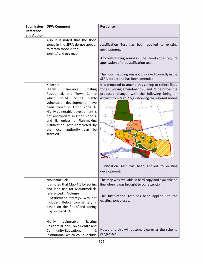
576
Submission Reference and Author
OPW Comment Response
Also it is noted that the flood zones in the SFRA do not appear to match those in the zoning/land use map.
Justification Test has been applied to existing
development.
Any outstanding zonings in the Flood Zones require application of the Justification test.
The flood mapping was not displayed correctly in the SFRA report and has been amended.
Killeshin Highly vulnerable Existing Residential, and Town Centre which could include highly vulnerable development have been zoned in Flood Zone A. Highly vulnerable development is not appropriate in Flood Zone A and B, unless a Plan-making Justification Test completed by the local authority can be satisfied.
It is proposed to amend this zoning to reflect flood zones. Zoning amendment 70 and 71 describes the proposed change, with the following being an extract from Map 7.6(a) showing the revised zoning
Justification Test has been applied to existing
development.
Mountmellick It is noted that Map 4.1 for zoning and land use for Mountmellick, referenced in Volume II Settlement Strategy, was not included. Below commentary is based on the flood/land zoning map in the SFRA.
Highly vulnerable Existing Residential, and Town Centre and Community-Educational & Institutional which could include
The map was available in hard copy and available on line when it was brought to our attention.
The Justification Test has been applied to the existing zoned uses.
Noted and this will become clearer as the scheme progresses.
577
Submission Reference and Author
OPW Comment Response
highly vulnerable development, appear from the SFRA map to have been zoned in Flood Zones A & B. Highly vulnerable development is not appropriate in Flood Zone A and B, unless a Plan-making Justification Test completed by the local authority can be satisfied.
It is noted in the SFRA that zoning decisions on undeveloped land adjacent to watercourses or within flood zones A & B are pending development of the FRS. As has been noted in Section 5.5 of the SFRA, Flood Relief Schemes are designed to mitigate the risk of flooding to existing communities and properties. When determining flood zones the presence of flood protection structures should be ignored, as flood defences can only reduce the risk of flooding and cannot eliminate it. Areas protected by a flood relief scheme still carry a residual risk of flooding from overtopping or breach of defences. The likelihood and extent of this residual risk needs to be considered in determining the appropriateness of particular land uses and development.
The SFRA notes that lands to the West of Pattisons Estate and Twomey Gardens require further confirmation of area required for the Flood Relief Scheme before final confirmation of zoning. The SFRA shows these lands as being currently zoned New Residential. Pending confirmation of the area
It is anticipated the FRS will provide residual risk assessment.
Lands to the West of Pattisons Estate and Twomey Gardens have extant planning permission and the SFRA has been updated to reflect this

578
Submission Reference and Author
OPW Comment Response
required for the scheme, the OPW recommends a precautionary approach to this zoning, and suggest that a suitable condition be attached to ensure future development does not impede the progression of the flood relief scheme.
Mountrath Reports has been submitted to the OPW by Laois County Council of flood events from December 2015, November 2017, and from 9th and 23rd of February 2020 are not yet recorded on www.floodinfo.ie, and have not been referenced in the SFRA. Highly vulnerable Existing Residential, and General Business, Industrial, Town Centre and Community-Educational & Institutional, which could include Highly vulnerable development have been zoned in Flood Zone A. Highly vulnerable development is not appropriate in Flood Zone A and B, unless a Plan-making Justification Test completed by the local authority can be satisfied.
SFRA updated accordingly. Zoning maps amended as to include to allow as much of the riparian zone as possible. Town Centre/Regeneration lands require application of the Justification Test.
Portlaoise A report has been submitted to the OPW by Laois County Council of a flood event from November 2017 not yet shown on www.floodinfo.ie, and not referenced in SFRA.
Highly vulnerable New Residential, and Existing Residential, and General Business, Town Centre and Community-Educational &
SFRA updated accordingly.
The Justification Test will be applied for the existing zoned uses.

579
Submission Reference and Author
OPW Comment Response
Institutional which could include Highly vulnerable development have been zoned in Flood Zones A and B, and Industrial and Enterprise & Employment which could include less vulnerable development, have been zoned in Flood Zone A. Highly vulnerable development is not appropriate in Flood Zone A and B and less vulnerable development is not appropriate in Flood Zone A, unless a Plan-making Justification Test completed by the local authority can be satisfied. It is mentioned in the SFRA that the lands in Flood Zones A and B in the large Enterprise & Employment lands to the south west of the settlement have been proposed for flood plain storage, and the lands zoned as Town Centre to the west of St Peter & St Paul’s church, have been described in the SFRA has described as providing important flood plain storage. The OPW suggests that if these lands are to be used for flood plain storage, their zoning either be amended to reflect this, or a policy objective be attached to the zoning, as discussed above in the Policy Objectives section. Further to the above, it is mentioned in the conclusion that “any vacant/undeveloped Town Centre sites to the west of St Peter's & St Paul's church that are intended for development should have the Plan Making Justification Test applied.” As discussed under
LCC agreed to amend the large Enterprise & Employment lands zoning in line with the masterplan for flood storage.
The justification Test and relevant policy has been applied to the Town Centre area to the west of St Peter & St Paul’s church.
Flood Zone A/B overlaps with Town Centre lands from the Triogue River. Elsewhere in the Town
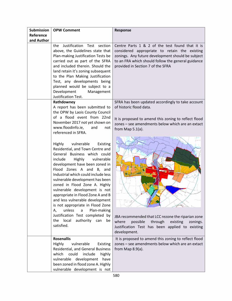
580
Submission Reference and Author
OPW Comment Response
the Justification Test section above, the Guidelines state that Plan-making Justification Tests be carried out as part of the SFRA and included therein. Should the land retain it’s zoning subsequent to the Plan Making Justification Test, any developments being planned would be subject to a Development Management Justification Test.
Centre Parts 1 & 2 of the test found that it is considered appropriate to retain the existing zonings. Any future development should be subject to an FRA which should follow the general guidance provided in Section 7 of the SFRA
Rathdowney A report has been submitted to the OPW by Laois County Council of a flood event from 22nd November 2017 not yet shown on www.floodinfo.ie, and not referenced in SFRA.
Highly vulnerable Existing Residential, and Town Centre and General Business which could include Highly vulnerable development have been zoned in Flood Zones A and B, and Industrial which could include less vulnerable development has been zoned in Flood Zone A. Highly vulnerable development is not appropriate in Flood Zone A and B and less vulnerable development is not appropriate in Flood Zone A, unless a Plan-making Justification Test completed by the local authority can be satisfied.
SFRA has been updated accordingly to take account of historic flood data.
It is proposed to amend this zoning to reflect flood zones – see amendments below which are an extact from Map 5.1(a).
JBA recommended that LCC rezone the riparian zone where possible through existing zonings. Justification Test has been applied to existing development.
Rosenallis Highly vulnerable Existing Residential, and General Business which could include highly vulnerable development have been zoned in flood zone A. Highly vulnerable development is not
It is proposed to amend this zoning to reflect flood zones – see amendments below which are an extact from Map 8.9(a).
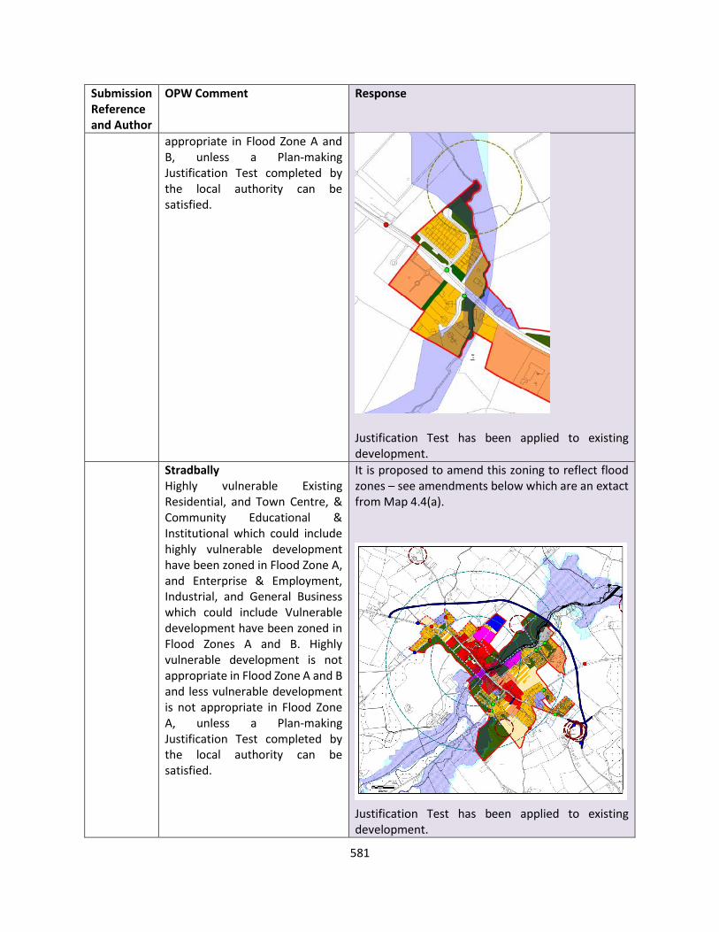
581
Submission Reference and Author
OPW Comment Response
appropriate in Flood Zone A and B, unless a Plan-making Justification Test completed by the local authority can be satisfied.
Justification Test has been applied to existing development.
Stradbally Highly vulnerable Existing Residential, and Town Centre, & Community Educational & Institutional which could include highly vulnerable development have been zoned in Flood Zone A, and Enterprise & Employment, Industrial, and General Business which could include Vulnerable development have been zoned in Flood Zones A and B. Highly vulnerable development is not appropriate in Flood Zone A and B and less vulnerable development is not appropriate in Flood Zone A, unless a Plan-making Justification Test completed by the local authority can be satisfied.
It is proposed to amend this zoning to reflect flood zones – see amendments below which are an extact from Map 4.4(a).
Justification Test has been applied to existing development.

582
Submission Reference and Author
OPW Comment Response
The Swan Highly vulnerable Existing Residential, and Town Centre which could include highly vulnerable development, and Industrial which could include less vulnerable development have been zoned in Flood Zone A. Highly vulnerable and less vulnerable development is not appropriate in Flood Zone A and B, unless a Plan-making Justification Test completed by the local authority can be satisfied.
Justification Test has been applied to existing development.
Any future development should be subject to an FRA which should follow the general guidance provided in Section 7 of the SFRA
Timahoe Town Centre, Community-Educational & Institutional and Tourism which could include highly vulnerable development have been zoned in Flood Zones A & B. Highly vulnerable development is not appropriate in Flood Zone A and B, unless a Plan making Justification Test completed by the local authority can be satisfied.
It is proposed to amend this zoning to reflect flood zones – see amendments below which are an extact from Map 8.11(a).
Justification Test has been applied to existing development.
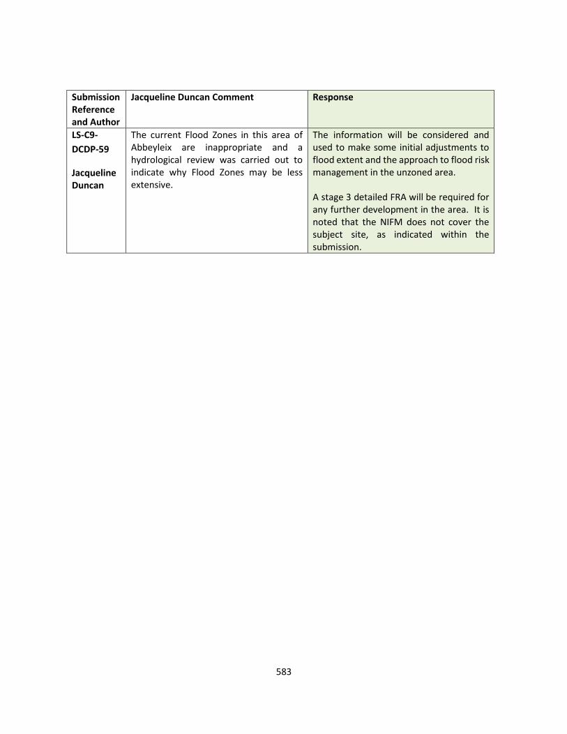
583
Submission Reference and Author
Jacqueline Duncan Comment Response
LS-C9-
DCDP-59
Jacqueline Duncan
The current Flood Zones in this area of Abbeyleix are inappropriate and a hydrological review was carried out to indicate why Flood Zones may be less extensive.
The information will be considered and used to make some initial adjustments to flood extent and the approach to flood risk management in the unzoned area. A stage 3 detailed FRA will be required for any further development in the area. It is noted that the NIFM does not cover the subject site, as indicated within the submission.
584
MISCELLANEOUS
Submission Reference and Author
Issues Raised Other – Opinion and Recommendations
LS-C9-DCDP-59 Sarah Sherlock
Laois County Council should seek to ensure that all data, which is geospatial in nature is managed (from initial procurement right through to maintaining the data sets) to satisfy the planning code. All geospatial data should be maintained and preserved so its original metadata and attributes are not compromised. The data must be sorted and stored so it may be queried and [re]used forevermore. CC should progress a single source of geospatial truth for the whole of the county. All public authority information needs to be further supplemented and enhanced to provide the appropriate level of detail. The Planning and Development Regulations, 2001, specify: Site or layout plans shall be drawn to a scale of not less than 1:500 (which shall be indicated thereon), the site boundary shall be clearly delineated in red, and buildings, roads, boundaries, septic tanks and percolation areas, bored wells, significant tree stands and other features on, adjoining or in the vicinity of the land or structure to which the application relates shall be shown, land which adjoins, abuts or is adjacent to the land to be developed and which is under the control of the applicant or the person who owns the land which is the subject of the application shall be outlined in blue and wayleaves shall be shown in yellow; and Other plans, elevations and sections shall be drawn to a scale of not less than 1:200 (which shall be indicated thereon), or such other scale as may be agreed with the planning authority prior to the submission of the application in any particular case.
The submission is noted OPINION The IT section GIS officer ensures all relevant data relating to the planning code is maintained and updated accordingly. The Planning Authority note the reference to the level of data that must be submitted with a planning application and this is part of the validation procedure with regard to the development management process. The requirements are clearly stated in the Planning and Development Regulations, 2001 as amended. Any further supplement changes to this is a matter for the Department in relation to laws governing this area. The Planning Authority is committed to engagement in the plan making process and delivered 4 webinars during the course of consultation. The Planning Authority is mindful of engagement through the PPN to ensure as many communities as possible are connected with – over 500 organisations on the PPN currently. This was the first action taken in the consultation process to ensure people knew about the plan and the information was disseminated widely throughout the county. The delivery of the objectives of the plan will be monitored during the timeframe of the Plan i.e. 6 years. Within 2 years of adoption of the Plan , the Chief Executive shall give a report to Council on the implementation of the Plan and highlight any changes that should be taken into

585
Submission Reference and Author
Issues Raised Other – Opinion and Recommendations
It is important that our public planning system is advanced to incorporate this detail and that we the public are enabled to make full use of it thereafter. Create meaningful engagement with communities and groups from around the county to better understand and deliver key requirements throughout the county for the duration of the plan. This needs to be further understood and underpinned with complete transparency and accountability. The CPD if and when adapted must be capable of being delivered to and understood by all within the county. It is known by LCC that many worrying education stats have emerged within the County. Therefore, LCC must ensure that it goes above and beyond to delivers its contents to all within the county. Further LCC must put in place a series of checks and balances to ensure that the county development plan is successfully monitored and that the public may at any time have and obtain clear metrics as to its success [or not]. Ireland and the EU have signed up to numerous international conventions, which guarantee public participation. The Aarhus Convention (ratified in June 2012) is particularly pertinent in this regard. The CDP must demand that LCC wholly respects the spirit of these agreements, fully honours them and that it never can or will jeopardise any of them nor the public’s right to participate and be kept fully up to date on matters that are of interest to them. Public participation in decision-making and access to justice in environmental matters is not a philosophical dream, it must always be implemented. Having regard to this fact, I am most concerned that this is not merely a box-ticking exercise and that this
account with regards to national , regional and local policy. Implementation of the plan is clearly subject to funding, resources being in place to allow for delivery, and public participation in the development management process. All comments in relation to the Draft Plan have been duly considered in the context of International, National , regional and local policy in relation to the many areas of the Draft Plan. RECOMMENDATION No change to Draft Plan

586
Submission Reference and Author
Issues Raised Other – Opinion and Recommendations
submission, together with all others be fully considered. In the interests of transparency, it would be essential that where important points within this and other voluntary submissions are not taken on board, that full and proper explanation as to why they are not implemented are provided to the individuals.
587
PART 3 APPENDICES
APPENDIX A CORE STRATEGY TABLE AND TABLES SHOWING AN INDICATION OF HOUSEHOLDS AND TENURE COMPOSITION OVER THE PLAN PERIOD
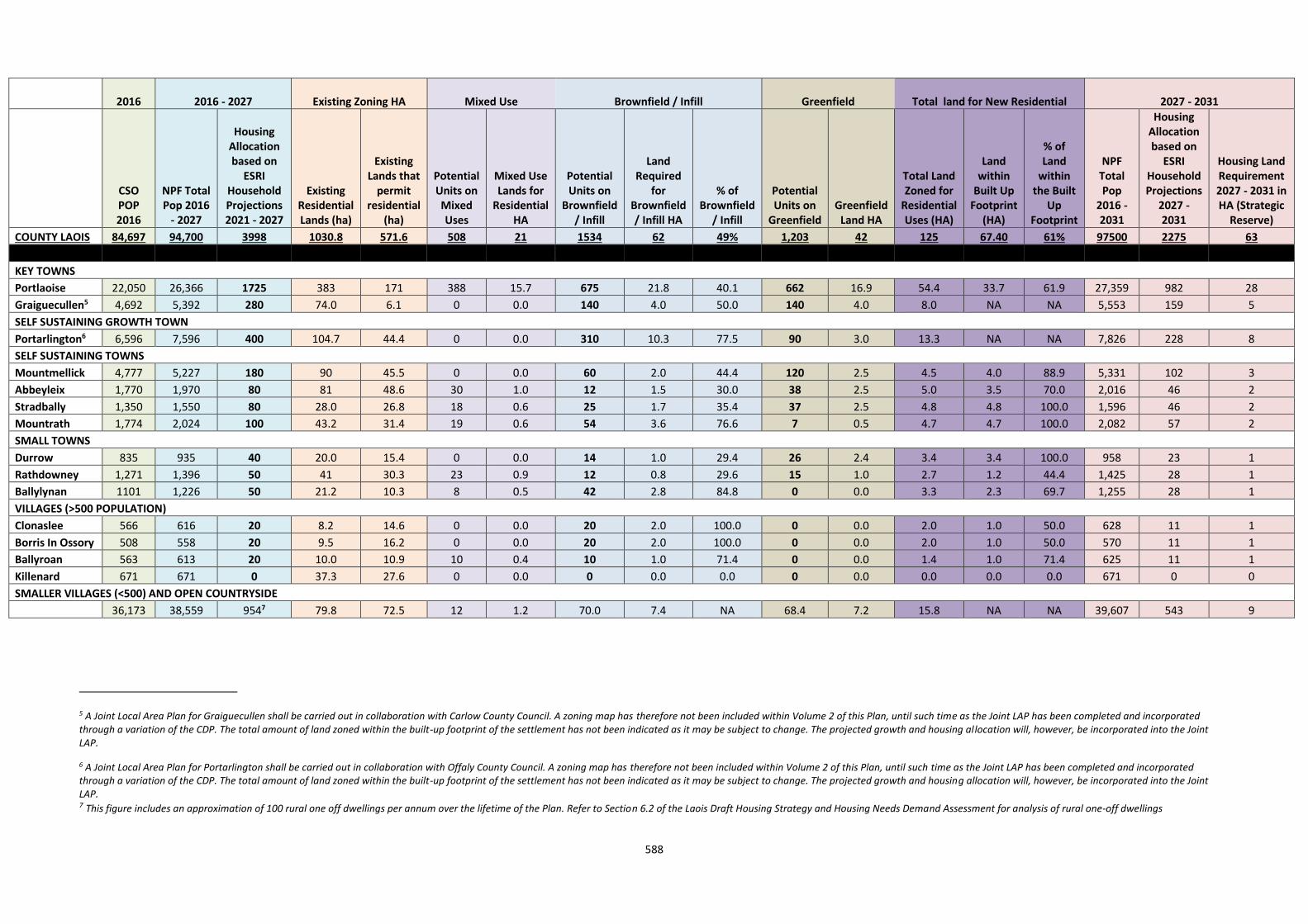
588
2016 2016 - 2027 Existing Zoning HA Mixed Use Brownfield / Infill Greenfield Total land for New Residential 2027 - 2031
CSO POP 2016
NPF Total Pop 2016
- 2027
Housing Allocation based on
ESRI Household Projections 2021 - 2027
Existing Residential Lands (ha)
Existing Lands that
permit residential
(ha)
Potential Units on Mixed Uses
Mixed Use Lands for
Residential HA
Potential Units on
Brownfield / Infill
Land Required
for Brownfield / Infill HA
% of Brownfield
/ Infill
Potential Units on
Greenfield Greenfield
Land HA
Total Land Zoned for
Residential Uses (HA)
Land within
Built Up Footprint
(HA)
% of Land
within the Built
Up Footprint
NPF Total Pop
2016 - 2031
Housing Allocation based on
ESRI Household Projections
2027 - 2031
Housing Land Requirement 2027 - 2031 in HA (Strategic
Reserve)
COUNTY LAOIS 84,697 94,700 3998 1030.8 571.6 508 21 1534 62 49% 1,203 42 125 67.40 61% 97500 2275 63
KEY TOWNS
Portlaoise 22,050 26,366 1725 383 171 388 15.7 675 21.8 40.1 662 16.9 54.4 33.7 61.9 27,359 982 28
Graiguecullen5 4,692 5,392 280 74.0 6.1 0 0.0 140 4.0 50.0 140 4.0 8.0 NA NA 5,553 159 5
SELF SUSTAINING GROWTH TOWN
Portarlington6 6,596 7,596 400 104.7 44.4 0 0.0 310 10.3 77.5 90 3.0 13.3 NA NA 7,826 228 8
SELF SUSTAINING TOWNS
Mountmellick 4,777 5,227 180 90 45.5 0 0.0 60 2.0 44.4 120 2.5 4.5 4.0 88.9 5,331 102 3
Abbeyleix 1,770 1,970 80 81 48.6 30 1.0 12 1.5 30.0 38 2.5 5.0 3.5 70.0 2,016 46 2
Stradbally 1,350 1,550 80 28.0 26.8 18 0.6 25 1.7 35.4 37 2.5 4.8 4.8 100.0 1,596 46 2
Mountrath 1,774 2,024 100 43.2 31.4 19 0.6 54 3.6 76.6 7 0.5 4.7 4.7 100.0 2,082 57 2
SMALL TOWNS
Durrow 835 935 40 20.0 15.4 0 0.0 14 1.0 29.4 26 2.4 3.4 3.4 100.0 958 23 1
Rathdowney 1,271 1,396 50 41 30.3 23 0.9 12 0.8 29.6 15 1.0 2.7 1.2 44.4 1,425 28 1
Ballylynan 1101 1,226 50 21.2 10.3 8 0.5 42 2.8 84.8 0 0.0 3.3 2.3 69.7 1,255 28 1
VILLAGES (>500 POPULATION)
Clonaslee 566 616 20 8.2 14.6 0 0.0 20 2.0 100.0 0 0.0 2.0 1.0 50.0 628 11 1
Borris In Ossory 508 558 20 9.5 16.2 0 0.0 20 2.0 100.0 0 0.0 2.0 1.0 50.0 570 11 1
Ballyroan 563 613 20 10.0 10.9 10 0.4 10 1.0 71.4 0 0.0 1.4 1.0 71.4 625 11 1
Killenard 671 671 0 37.3 27.6 0 0.0 0 0.0 0.0 0 0.0 0.0 0.0 0.0 671 0 0
SMALLER VILLAGES (<500) AND OPEN COUNTRYSIDE
36,173 38,559 9547 79.8 72.5 12 1.2 70.0 7.4 NA 68.4 7.2 15.8 NA NA 39,607 543 9
5 A Joint Local Area Plan for Graiguecullen shall be carried out in collaboration with Carlow County Council. A zoning map has therefore not been included within Volume 2 of this Plan, until such time as the Joint LAP has been completed and incorporated through a variation of the CDP. The total amount of land zoned within the built-up footprint of the settlement has not been indicated as it may be subject to change. The projected growth and housing allocation will, however, be incorporated into the Joint LAP.
6 A Joint Local Area Plan for Portarlington shall be carried out in collaboration with Offaly County Council. A zoning map has therefore not been included within Volume 2 of this Plan, until such time as the Joint LAP has been completed and incorporated through a variation of the CDP. The total amount of land zoned within the built-up footprint of the settlement has not been indicated as it may be subject to change. The projected growth and housing allocation will, however, be incorporated into the Joint LAP. 7 This figure includes an approximation of 100 rural one off dwellings per annum over the lifetime of the Plan. Refer to Section 6.2 of the Laois Draft Housing Strategy and Housing Needs Demand Assessment for analysis of rural one-off dwellings
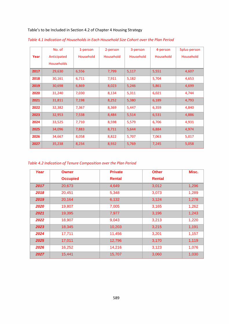
589
Table’s to be Included in Section 4.2 of Chapter 4 Housing Strategy
Table 4.1 Indication of Households in Each Household Size Cohort over the Plan Period
Year
No. of
Anticipated
Households
1-person
Household
2-person
Household
3-person
Household
4-person
Household
5plus-person
Household
2017 29,630 6,556 7,799 5,117 5,551 4,607
2018 30,161 6,711 7,911 5,182 5,704 4,653
2019 30,698 6,869 8,023 5,246 5,861 4,699
2020 31,240 7,030 8,134 5,311 6,021 4,744
2021 31,811 7,198 8,252 5,380 6,189 4,793
2022 32,382 7,367 8,369 5,447 6,359 4,840
2023 32,953 7,538 8,484 5,514 6,531 4,886
2024 33,525 7,710 8,598 5,579 6,706 4,931
2025 34,096 7,883 8,711 5,644 6,884 4,974
2026 34,667 8,058 8,822 5,707 7,063 5,017
2027 35,238 8,234 8,932 5,769 7,245 5,058
Table 4.2 Indication of Tenure Composition over the Plan Period
Year Owner
Occupied
Private
Rental
Other
Rental
Misc.
2017 20,673 4,649 3,012 1,296
2018 20,451 5,348 3,073 1,289
2019 20,164 6,132 3,124 1,278
2020 19,807 7,005 3,165 1,262
2021 19,395 7,977 3,196 1,243
2022 18,907 9,043 3,213 1,220
2023 18,345 10,203 3,215 1,191
2024 17,711 11,456 3,201 1,157
2025 17,011 12,796 3,170 1,119
2026 16,252 14,216 3,123 1,076
2027 15,441 15,707 3,060 1,030

590
APPENDIX B INFRASTRUCTURE ASSESSMENT
(Please refer to separate standalone report)

591
APPENDIX C REVISED HOUSING STRATEGY / HNDA
(Please refer to separate standalone report)

592
APPENDIX D REVISED STRATEGIC FLOOD RISK ASSESSMENT
(Please refer to separate standalone report)
593
APPENDIX E PROPOSED AMENDMENTS TABLE, REVISED MAPS AND SETTLEMENT ZONING PLANS
(The proposed amendments table includes the submission reference and author and the proposed zoning
amendment. In some cases more detailed information is now available since the Draft Plan was
prepared, such as updated base mapping and where developments have been completed. In these
instances the table notes a N/A under the submission reference and author column).
(Please refer to separate maps and zoning plans which includes:
1) The proposed amendments for each map and settlement; and
2) The revised maps and zoning plans for each relevant settlement.
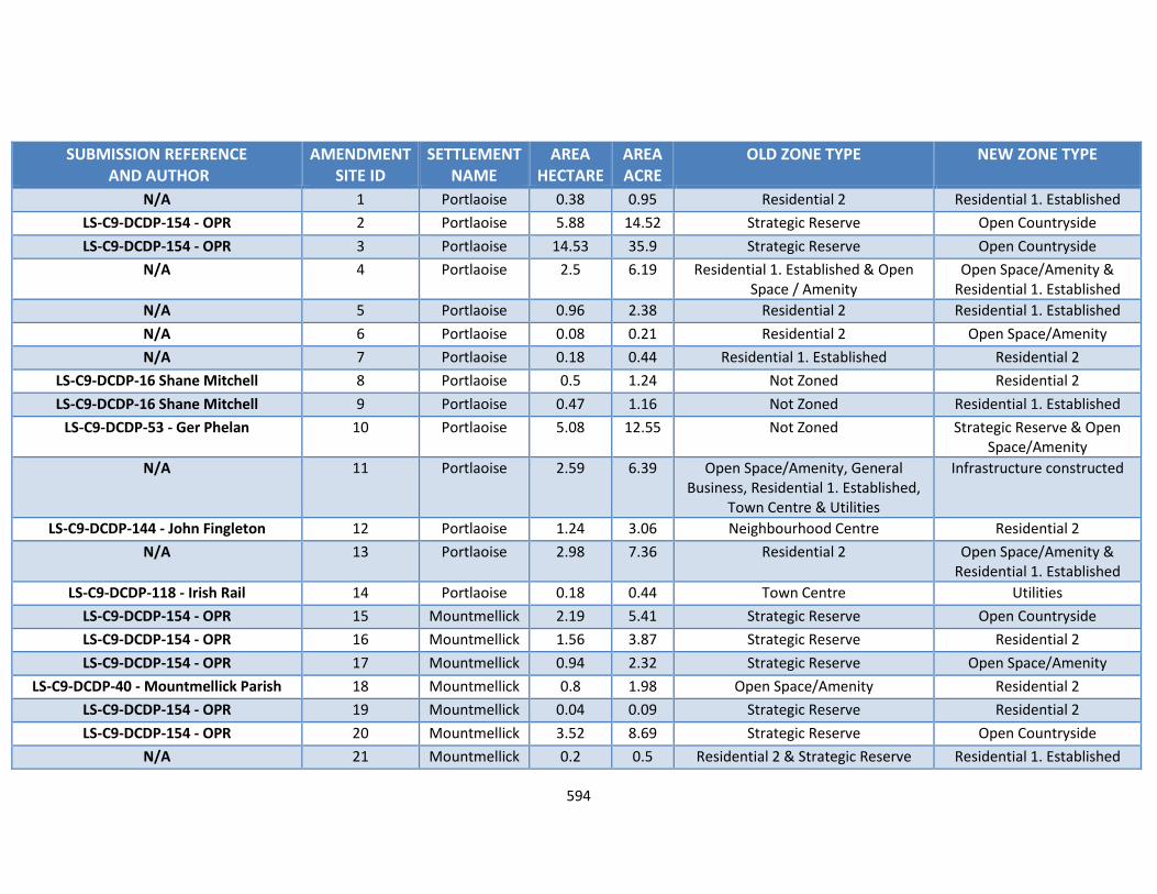
594
SUBMISSION REFERENCE AND AUTHOR
AMENDMENT SITE ID
SETTLEMENT NAME
AREA HECTARE
AREA ACRE
OLD ZONE TYPE NEW ZONE TYPE
N/A 1 Portlaoise 0.38 0.95 Residential 2 Residential 1. Established
LS-C9-DCDP-154 - OPR 2 Portlaoise 5.88 14.52 Strategic Reserve Open Countryside
LS-C9-DCDP-154 - OPR 3 Portlaoise 14.53 35.9 Strategic Reserve Open Countryside
N/A 4 Portlaoise 2.5 6.19 Residential 1. Established & Open Space / Amenity
Open Space/Amenity & Residential 1. Established
N/A 5 Portlaoise 0.96 2.38 Residential 2 Residential 1. Established
N/A 6 Portlaoise 0.08 0.21 Residential 2 Open Space/Amenity
N/A 7 Portlaoise 0.18 0.44 Residential 1. Established Residential 2
LS-C9-DCDP-16 Shane Mitchell 8 Portlaoise 0.5 1.24 Not Zoned Residential 2
LS-C9-DCDP-16 Shane Mitchell 9 Portlaoise 0.47 1.16 Not Zoned Residential 1. Established
LS-C9-DCDP-53 - Ger Phelan 10 Portlaoise 5.08 12.55 Not Zoned Strategic Reserve & Open Space/Amenity
N/A 11 Portlaoise 2.59 6.39 Open Space/Amenity, General Business, Residential 1. Established,
Town Centre & Utilities
Infrastructure constructed
LS-C9-DCDP-144 - John Fingleton 12 Portlaoise 1.24 3.06 Neighbourhood Centre Residential 2
N/A 13 Portlaoise 2.98 7.36 Residential 2 Open Space/Amenity & Residential 1. Established
LS-C9-DCDP-118 - Irish Rail 14 Portlaoise 0.18 0.44 Town Centre Utilities
LS-C9-DCDP-154 - OPR 15 Mountmellick 2.19 5.41 Strategic Reserve Open Countryside
LS-C9-DCDP-154 - OPR 16 Mountmellick 1.56 3.87 Strategic Reserve Residential 2
LS-C9-DCDP-154 - OPR 17 Mountmellick 0.94 2.32 Strategic Reserve Open Space/Amenity
LS-C9-DCDP-40 - Mountmellick Parish 18 Mountmellick 0.8 1.98 Open Space/Amenity Residential 2
LS-C9-DCDP-154 - OPR 19 Mountmellick 0.04 0.09 Strategic Reserve Residential 2
LS-C9-DCDP-154 - OPR 20 Mountmellick 3.52 8.69 Strategic Reserve Open Countryside
N/A 21 Mountmellick 0.2 0.5 Residential 2 & Strategic Reserve Residential 1. Established
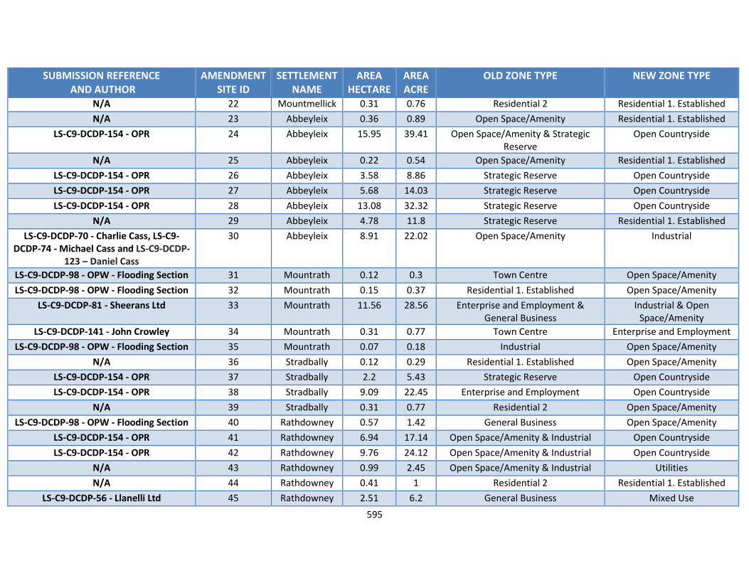
595
SUBMISSION REFERENCE AND AUTHOR
AMENDMENT SITE ID
SETTLEMENT NAME
AREA HECTARE
AREA ACRE
OLD ZONE TYPE NEW ZONE TYPE
N/A 22 Mountmellick 0.31 0.76 Residential 2 Residential 1. Established
N/A 23 Abbeyleix 0.36 0.89 Open Space/Amenity Residential 1. Established
LS-C9-DCDP-154 - OPR 24 Abbeyleix 15.95 39.41 Open Space/Amenity & Strategic Reserve
Open Countryside
N/A 25 Abbeyleix 0.22 0.54 Open Space/Amenity Residential 1. Established
LS-C9-DCDP-154 - OPR 26 Abbeyleix 3.58 8.86 Strategic Reserve Open Countryside
LS-C9-DCDP-154 - OPR 27 Abbeyleix 5.68 14.03 Strategic Reserve Open Countryside
LS-C9-DCDP-154 - OPR 28 Abbeyleix 13.08 32.32 Strategic Reserve Open Countryside
N/A 29 Abbeyleix 4.78 11.8 Strategic Reserve Residential 1. Established
LS-C9-DCDP-70 - Charlie Cass, LS-C9-DCDP-74 - Michael Cass and LS-C9-DCDP-
123 – Daniel Cass
30 Abbeyleix 8.91 22.02 Open Space/Amenity Industrial
LS-C9-DCDP-98 - OPW - Flooding Section 31 Mountrath 0.12 0.3 Town Centre Open Space/Amenity
LS-C9-DCDP-98 - OPW - Flooding Section 32 Mountrath 0.15 0.37 Residential 1. Established Open Space/Amenity
LS-C9-DCDP-81 - Sheerans Ltd 33 Mountrath 11.56 28.56 Enterprise and Employment & General Business
Industrial & Open Space/Amenity
LS-C9-DCDP-141 - John Crowley 34 Mountrath 0.31 0.77 Town Centre Enterprise and Employment
LS-C9-DCDP-98 - OPW - Flooding Section 35 Mountrath 0.07 0.18 Industrial Open Space/Amenity
N/A 36 Stradbally 0.12 0.29 Residential 1. Established Open Space/Amenity
LS-C9-DCDP-154 - OPR 37 Stradbally 2.2 5.43 Strategic Reserve Open Countryside
LS-C9-DCDP-154 - OPR 38 Stradbally 9.09 22.45 Enterprise and Employment Open Countryside
N/A 39 Stradbally 0.31 0.77 Residential 2 Open Space/Amenity
LS-C9-DCDP-98 - OPW - Flooding Section 40 Rathdowney 0.57 1.42 General Business Open Space/Amenity
LS-C9-DCDP-154 - OPR 41 Rathdowney 6.94 17.14 Open Space/Amenity & Industrial Open Countryside
LS-C9-DCDP-154 - OPR 42 Rathdowney 9.76 24.12 Open Space/Amenity & Industrial Open Countryside
N/A 43 Rathdowney 0.99 2.45 Open Space/Amenity & Industrial Utilities
N/A 44 Rathdowney 0.41 1 Residential 2 Residential 1. Established
LS-C9-DCDP-56 - Llanelli Ltd 45 Rathdowney 2.51 6.2 General Business Mixed Use

596
SUBMISSION REFERENCE AND AUTHOR
AMENDMENT SITE ID
SETTLEMENT NAME
AREA HECTARE
AREA ACRE
OLD ZONE TYPE NEW ZONE TYPE
N/A 46 Rathdowney 0.68 1.69 Industrial Residential 1. Established
LS-C9-DCDP-154 - OPR 47 Rathdowney 7.54 18.63 Strategic Reserve Open Countryside
LS-C9-DCDP-98 - OPW - Flooding Section 48 Durrow 0.19 0.47 Village Centre Open Space/Amenity
LS-C9-DCDP-98 - OPW - Flooding Section 49 Durrow 0.31 0.76 Horticulture Open Space/Amenity
LS-C9-DCDP-154 - OPR 50 Durrow 1.17 2.88 Enterprise and Employment Residential 2
N/A 51 Durrow 1.11 2.74 Residential 2 Open Space/Amenity & Residential 1. Established
LS-C9-DCDP-154 - OPR 52 Ballylynan 3.58 8.84 Strategic Reserve Open Countryside
LS-C9-DCDP-154 - OPR 53 Ballylynan 0.88 2.19 Open Space/Amenity Open Countryside
LS-C9-DCDP-154 - OPR 54 Ballylynan 0.24 0.58 Residential 1. Established Open Countryside
LS-C9-DCDP-154 - OPR 55 Ballylynan 2.24 5.53 Residential 2 Open Countryside
LS-C9-DCDP-154 - OPR 56 Ballylynan 2.32 5.72 Residential 2 Strategic Reserve
LS-C9-DCDP-154 - OPR 57 Ballylynan 1.15 2.85 Residential 2 Strategic Reserve
LS-C9-DCDP-154 - OPR 58 Clonaslee 0.62 1.52 Residential 2 Open Countryside
LS-C9-DCDP-154 - OPR 59 Clonaslee 0.49 1.2 Residential 2 Open Countryside
N/A 60 Clonaslee 0.17 0.43 Open Space/Amenity Residential 1. Established
LS-C9-DCDP-98 - OPW - Flooding Section 61 Clonaslee 2.96 7.3 Community-Educational-Institutional Open Space/Amenity
LS-C9-DCDP-98 - OPW - Flooding Section 62 Ballyroan 0.27 0.66 Residential 1. Established Open Space/Amenity
LS-C9-DCDP-98 - OPW - Flooding Section 63 Ballyroan 0.11 0.27 Residential 2 Open Space/Amenity
N/A 64 Ballyroan 0.65 1.61 Open Space/Amenity & Residential 2 Residential 1. Established
LS-C9-DCDP-154 - OPR 65 Borris In Ossory
0.29 0.72 Enterprise and Employment Open Countryside
N/A 66 Ballybrittas 0.05 0.13 Open Space/Amenity Residential 1. Established
LS-C9-DCDP-132 - Twin Trees Heywood Arts and Cultural Committee
67 Ballinakill 28.79 71.13 N/A Open Space/Amenity
LS-C9-DCDP-98 - OPW - Flooding Section 68 Killeen 0.21 0.51 Residential 2 Open Space/Amenity
LS-C9-DCDP-98 - OPW - Flooding Section 69 Killeen 0.13 0.32 Residential 2 Open Space/Amenity
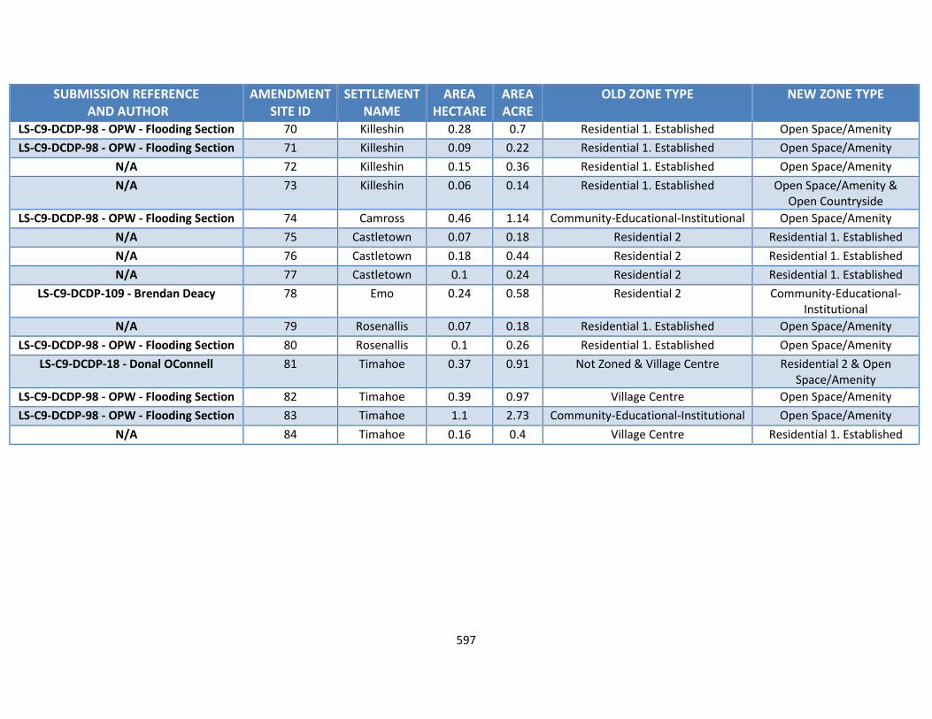
597
SUBMISSION REFERENCE AND AUTHOR
AMENDMENT SITE ID
SETTLEMENT NAME
AREA HECTARE
AREA ACRE
OLD ZONE TYPE NEW ZONE TYPE
LS-C9-DCDP-98 - OPW - Flooding Section 70 Killeshin 0.28 0.7 Residential 1. Established Open Space/Amenity
LS-C9-DCDP-98 - OPW - Flooding Section 71 Killeshin 0.09 0.22 Residential 1. Established Open Space/Amenity
N/A 72 Killeshin 0.15 0.36 Residential 1. Established Open Space/Amenity
N/A 73 Killeshin 0.06 0.14 Residential 1. Established Open Space/Amenity & Open Countryside
LS-C9-DCDP-98 - OPW - Flooding Section 74 Camross 0.46 1.14 Community-Educational-Institutional Open Space/Amenity
N/A 75 Castletown 0.07 0.18 Residential 2 Residential 1. Established
N/A 76 Castletown 0.18 0.44 Residential 2 Residential 1. Established
N/A 77 Castletown 0.1 0.24 Residential 2 Residential 1. Established
LS-C9-DCDP-109 - Brendan Deacy 78 Emo 0.24 0.58 Residential 2 Community-Educational-Institutional
N/A 79 Rosenallis 0.07 0.18 Residential 1. Established Open Space/Amenity
LS-C9-DCDP-98 - OPW - Flooding Section 80 Rosenallis 0.1 0.26 Residential 1. Established Open Space/Amenity
LS-C9-DCDP-18 - Donal OConnell 81 Timahoe 0.37 0.91 Not Zoned & Village Centre Residential 2 & Open Space/Amenity
LS-C9-DCDP-98 - OPW - Flooding Section 82 Timahoe 0.39 0.97 Village Centre Open Space/Amenity
LS-C9-DCDP-98 - OPW - Flooding Section 83 Timahoe 1.1 2.73 Community-Educational-Institutional Open Space/Amenity
N/A 84 Timahoe 0.16 0.4 Village Centre Residential 1. Established
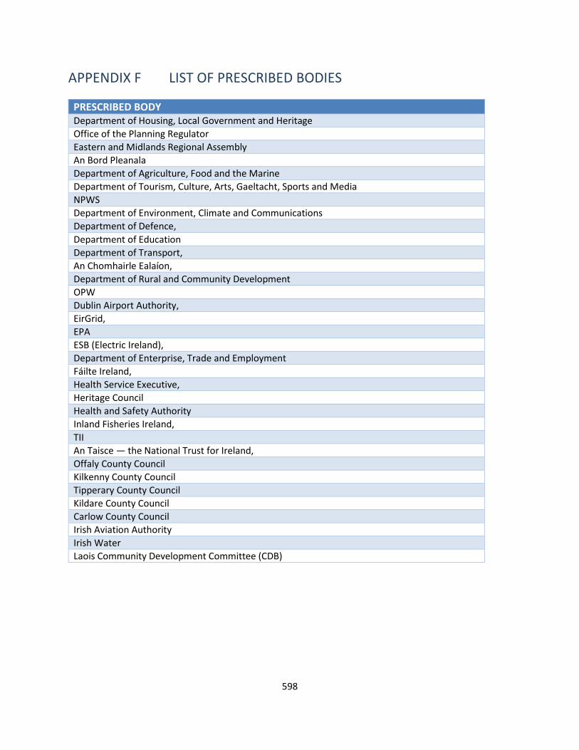
598
APPENDIX F LIST OF PRESCRIBED BODIES
PRESCRIBED BODY Department of Housing, Local Government and Heritage
Office of the Planning Regulator
Eastern and Midlands Regional Assembly
An Bord Pleanala
Department of Agriculture, Food and the Marine
Department of Tourism, Culture, Arts, Gaeltacht, Sports and Media
NPWS
Department of Environment, Climate and Communications
Department of Defence,
Department of Education
Department of Transport,
An Chomhairle Ealaíon,
Department of Rural and Community Development
OPW
Dublin Airport Authority,
EirGrid,
EPA
ESB (Electric Ireland),
Department of Enterprise, Trade and Employment
Fáilte Ireland,
Health Service Executive,
Heritage Council
Health and Safety Authority
Inland Fisheries Ireland,
TII
An Taisce — the National Trust for Ireland,
Offaly County Council
Kilkenny County Council
Tipperary County Council
Kildare County Council
Carlow County Council
Irish Aviation Authority
Irish Water
Laois Community Development Committee (CDB)
599
APPENDIX G LIST OF SUBMISSIONS
SUBMISSION REFERENCE AUTHOR LS-C9-DCDP-1 Niall Pickering
LS-C9-DCDP-2 PJ O Gorman
LS-C9-DCDP-3 Brian Rusk
LS-C9-DCDP-4 Holland Family
LS-C9-DCDP-5 John Holland
LS-C9-DCDP-6 Marc Hussey
LS-C9-DCDP-7 John Holland
LS-C9-DCDP-8 GAA Handball
LS-C9-DCDP-9 Maria Boland
LS-C9-DCDP-10 Donal O’Shea
LS-C9-DCDP-11 EPA
LS-C9-DCDP-12 CLG Laoise
LS-C9-DCDP-13 Grellan Delaney
LS-C9-DCDP-14 John Killeen
LS-C9-DCDP-15 John Killeen
LS-C9-DCDP-16 Shane Mitchell
LS-C9-DCDP-17 Deegan Family
LS-C9-DCDP-18 Donal O Connell
LS-C9-DCDP-19 Denis Delaney
LS-C9-DCDP-20 Clare Reidy
LS-C9-DCDP-21 Prime Equipment Ltd
LS-C9-DCDP-22 Pedal Vintage Durrow
LS-C9-DCDP-23 BirdWatch Ireland (Ricky Whelan)
LS-C9-DCDP-24 An Garda Siochana
LS-C9-DCDP-25 Padraig Callanan
LS-C9-DCDP-26 John N Colclough
LS-C9-DCDP-27 Ross McDonald
LS-C9-DCDP-28 John Horan
LS-C9-DCDP-29 Department of Transport
LS-C9-DCDP-30 Mark Robertson
LS-C9-DCDP-31 Seamus Brennan
LS-C9-DCDP-32 Robert Shaw
LS-C9-DCDP-33 Coolrain Tidy Towns
LS-C9-DCDP-34 Kevin O’Sullivan
LS-C9-DCDP-35 Department of Rural and Community Development
LS-C9-DCDP-36 Eastern and Midlands Regional Assembly
LS-C9-DCDP-37 George Sherlock
LS-C9-DCDP-38 Regina Dunne – Bloom HQ
LS-C9-DCDP-39 Billy Nolan
LS-C9-DCDP-40 Mountmellick Parish
LS-C9-DCDP-41 Mountrath Development Association
LS-C9-DCDP-42 Mountrath Tidy Towns
600
SUBMISSION REFERENCE AUTHOR LS-C9-DCDP-43 John Scully
LS-C9-DCDP-44 John Scully
LS-C9-DCDP-45 John Scully
LS-C9-DCDP-46 Cllr James Kelly
LS-C9-DCDP-47 Cllr James Kelly
LS-C9-DCDP-48 Killenard Tidy Towns
LS-C9-DCDP-49 Killenard Tidy Towns
LS-C9-DCDP-50 Durrow Development Forum
LS-C9-DCDP-51 Killenard Tidy Towns
LS-C9-DCDP-52 Joseph Smyth
LS-C9-DCDP-53 Ger Phelan
LS-C9-DCDP-54 Geological Survey Ireland
LS-C9-DCDP-55 Sheelagh Kearns
LS-C9-DCDP-56 Llanelli Ltd
LS-C9-DCDP-57 Transport Infrastructure Ireland
LS-C9-DCDP-58 Roadstone
LS-C9-DCDP-59 Sarah Sherlock
LS-C9-DCDP-60 John Brophy
LS-C9-DCDP-61 Booth Partnership (Jason Redmond)
LS-C9-DCDP-62 Mountrath Community Forum
LS-C9-DCDP-63 Laois Hub Collective
LS-C9-DCDP-64 Laois Africa Society
LS-C9-DCDP-65 Durrow Development Forum
LS-C9-DCDP-66 Natural Forces Renewable Energy
LS-C9-DCDP-67 Lightsource BP
LS-C9-DCDP-68 Dara Larkin
LS-C9-DCDP-69 Withdrawn
LS-C9-DCDP-70 Charlie Cass
LS-C9-DCDP-71 Ann Fingleton
LS-C9-DCDP-72 Durrow Development Forum
LS-C9-DCDP-73 Durrow Development Forum
LS-C9-DCDP-74 Michael Cass
LS-C9-DCDP-75 Charlie Cass
LS-C9-DCDP-76 Irish Water
LS-C9-DCDP-77 Sean Smyth
LS-C9-DCDP-78 Portlaoise Enterprise Centre
LS-C9-DCDP-79 Evelyn Duff
LS-C9-DCDP-80 National Transport Authority
LS-C9-DCDP-81 Sheeran Ltd
LS-C9-DCDP-82 Irish Architects Declare
LS-C9-DCDP-83 Eirgrid
LS-C9-DCDP-84 Laois Sports Partnership
LS-C9-DCDP-85 Laois Chamber
LS-C9-DCDP-86 Laois Nore Blueway
601
SUBMISSION REFERENCE AUTHOR LS-C9-DCDP-87 An Post
LS-C9-DCDP-88 Bord Na Mona
LS-C9-DCDP-89 Local Link Laois
LS-C9-DCDP-90 Gas networks Ireland
LS-C9-DCDP-91 Tesco Ireland
LS-C9-DCDP-92 ESB
LS-C9-DCDP-93 Iarnrod Eireann/Irish Rail
LS-C9-DCDP-94 Donal O Shea
LS-C9-DCDP-95 Dara Larkin
LS-C9-DCDP-96 Marc Van Der Burgh
LS-C9-DCDP-97 Knock NS
LS-C9-DCDP-98 OPW – Flooding Section
LS-C9-DCDP-99 Harmony Solar (Fehily Timoney)
LS-C9-DCDP-100 Thomas Kelly and Sons (Avison Young)
LS-C9-DCDP-101 Laois Nore Blueway
LS-C9-DCDP-102 Eddie Phelan
LS-C9-DCDP-103 Erkina Blueway Association
LS-C9-DCDP-104 Mary White
LS-C9-DCDP-105 Abbeyleix Tidy Towns
LS-C9-DCDP-106 Laois Ogra Fianna Fail
LS-C9-DCDP-107 Durrow Development Forum
LS-C9-DCDP-108 Laois Heritage Society
LS-C9-DCDP-109 Brendon Deacy
LS-C9-DCDP-110 Irish Green Building Council
LS-C9-DCDP-111 Eamonn Merriman (Emo Tidy Towns)
LS-C9-DCDP-112 Tom Dormer
LS-C9-DCDP-113 RWE Renewable Ireland
LS-C9-DCDP-114 Coillte
LS-C9-DCDP-115 Nore Vision
LS-C9-DCDP-116 Niall Culleton
LS-C9-DCDP-117 Niall Culleton
LS-C9-DCDP-118 Irish Rail (Clifton Scannell Emerson)
LS-C9-DCDP-119 Elizabeth Cass
LS-C9-DCDP-120 Alder Residential (MKO on behalf of)
LS-C9-DCDP-121 Keep Ireland Open
LS-C9-DCDP-122 Failte Ireland
LS-C9-DCDP-123 Daniel Cass
LS-C9-DCDP-124 Downtown Portlaoise
LS-C9-DCDP-125 Southern Regional Assembly
LS-C9-DCDP-126 Ballyfin Community Development Association
LS-C9-DCDP-127 Evelyn Duff
LS-C9-DCDP-128 Department of Education
LS-C9-DCDP-129 Wind Energy Ireland
LS-C9-DCDP-130 Celine Cole
602
SUBMISSION REFERENCE AUTHOR LS-C9-DCDP-131 Patrick Knowles
LS-C9-DCDP-132 Twin Trees Heywood Arts and Culture Committee
LS-C9-DCDP-133 David Goode
LS-C9-DCDP-134 Statkraft Ireland
LS-C9-DCDP-135 An Taisce
LS-C9-DCDP-136 Offaly County Council
LS-C9-DCDP-137 Eamonn Merriman
LS-C9-DCDP-138 William Aird
LS-C9-DCDP-139 Ecopower
LS-C9-DCDP-140 Irish Farmers Association
LS-C9-DCDP-141 John Crowley
LS-C9-DCDP-142 Laois Tourism
LS-C9-DCDP-143 Acorn Planning
LS-C9-DCDP-144 John Fingleton
LS-C9-DCDP-145 Irish Creamery Milk Suppliers Association
LS-C9-DCDP-146 James Sherlock
LS-C9-DCDP-147 Jackie Hyland
LS-C9-DCDP-148 AOCA
LS-C9-DCDP-149 Catherine Kelly
LS-C9-DCDP-150 TJ Horan
LS-C9-DCDP-151 Patrick Knowles
LS-C9-DCDP-152 Thomasina Connell
LS-C9-DCDP-153 Patrick Knowles
LS-C9-DCDP-154 OPR
LS-C9-DCDP-155 Mountrath Youth Group
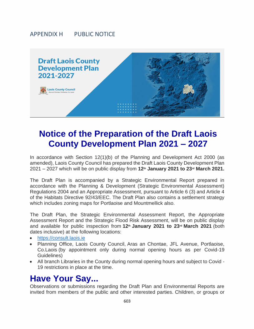
603
APPENDIX H PUBLIC NOTICE
Notice of the Preparation of the Draft Laois County Development Plan 2021 – 2027
In accordance with Section 12(1)(b) of the Planning and Development Act 2000 (as amended), Laois County Council has prepared the Draft Laois County Development Plan 2021 – 2027 which will be on public display from 12th January 2021 to 23rd March 2021. The Draft Plan is accompanied by a Strategic Environmental Report prepared in accordance with the Planning & Development (Strategic Environmental Assessment) Regulations 2004 and an Appropriate Assessment, pursuant to Article 6 (3) and Article 4 of the Habitats Directive 92/43/EEC. The Draft Plan also contains a settlement strategy which includes zoning maps for Portlaoise and Mountmellick also. The Draft Plan, the Strategic Environmental Assessment Report, the Appropriate Assessment Report and the Strategic Flood Risk Assessment, will be on public display and available for public inspection from 12th January 2021 to 23rd March 2021 (both dates inclusive) at the following locations:
• https://consult.laois.ie
• Planning Office, Laois County Council, Aras an Chontae, JFL Avenue, Portlaoise, Co.Laois (by appointment only during normal opening hours as per Covid-19 Guidelines)
• All branch Libraries in the County during normal opening hours and subject to Covid -19 restrictions in place at the time.
Have Your Say... Observations or submissions regarding the Draft Plan and Environmental Reports are invited from members of the public and other interested parties. Children, or groups or

604
associations representing the interests of children, are invited also to make submissions or observations. You can make an observation or submission via the following options only;
• Online here by registering on https://consult.laois.ie/ where you can then make a submission on the draft chapters, appendix, environmental reports and maps.
• Via email to [email protected]; or
• In writing marked “Draft Laois County Development Plan 2021 - 2027 “to the Senior Planner, Planning Department, Laois County Council, Aras an Chontae, JFL Avenue, Portlaoise, Co Laois.
Observations or submissions must include the full name and address of the person(s) making the submission and where relevant, the body or organisation represented. Only written submissions or observations to the Draft Plan and accompanying documents made to the planning authority within the stated period will be taken into consideration. Please make your submission or observation by one medium only i.e. in hard copy or online. All submissions and observations must be received before 5pm 23rd March 2021. Late submissions will not be accepted. Please note that all submissions will be made available for public viewing on the Council’s consultation website during the plan-making period. Laois County Council will treat all personal data you may give as confidential. Laois County Council will retain your data for no longer than is necessary for the purpose of this County Development Plan and in accordance with the relevant Data Protection legislation.
Public Consultation Webinars
The Planning Department will be holding number of public webinars throughout the public consultation period in lieu of community meetings due to the COVID-19 restrictions. Each webinar will focus on a different topic related to the Draft Plan as detailed below. Please visit http://consult.laois.ie for more details and registration. Registration will close by 4pm on the day of each event. By joining each webinar, you consent to your name and email being visible to all other attendees. If you do not consent, please do not join the meeting.
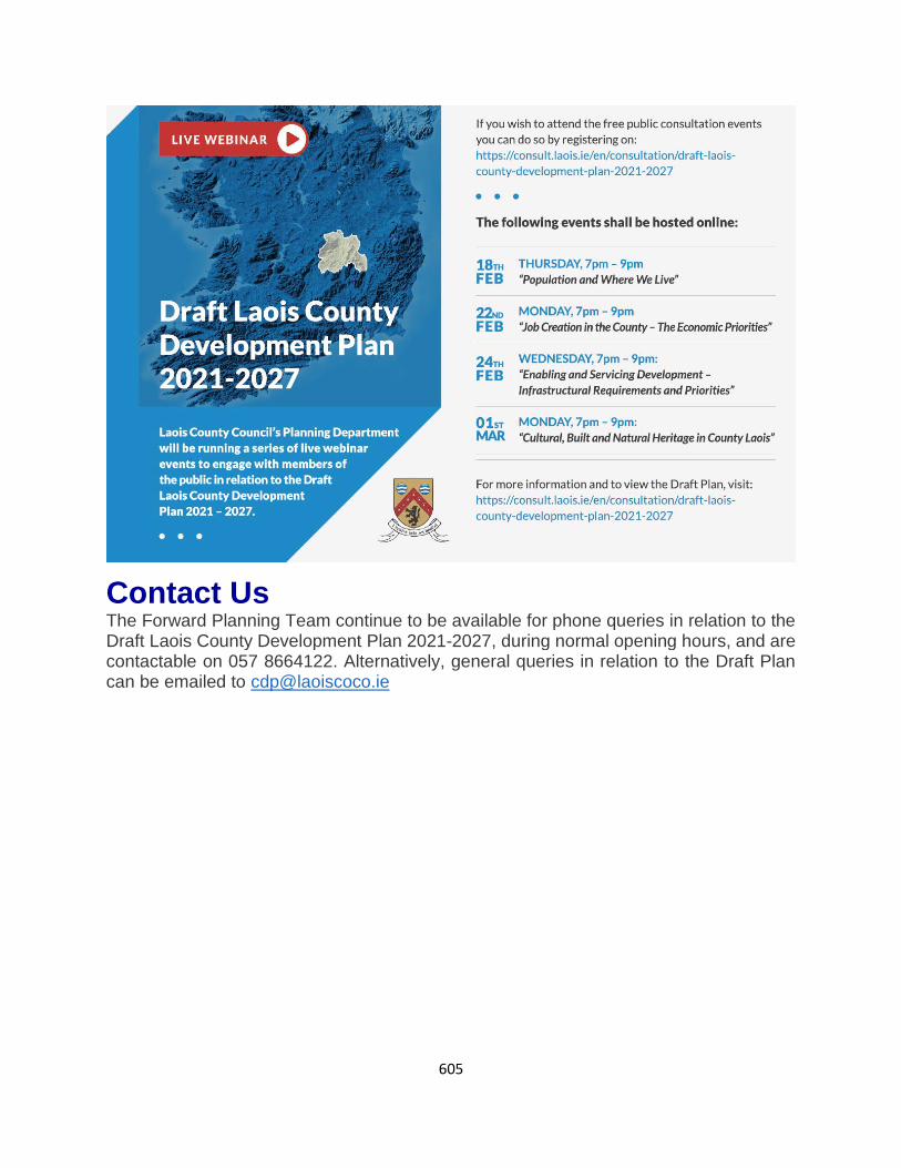
605
Contact Us The Forward Planning Team continue to be available for phone queries in relation to the Draft Laois County Development Plan 2021-2027, during normal opening hours, and are contactable on 057 8664122. Alternatively, general queries in relation to the Draft Plan can be emailed to [email protected]

606
APPENDIX I SUMMARY OF DISCUSSION FROM THE PUBLIC WEBINARS
Public Webinars Summary of Issues that Arose at Public Webinars
People and Where We Live 18th February 2021
• Provision of schools infrastructure in Portlaoise – possible need for a new school and its location should be in the Kilminchy area – close to the Secondary schools
• Walking and cycling and active travel should be considered in future planning
• Regeneration of town centre sites and derelict sites needs to be addressed
• How to tackle population decline
• How do we support local communities
• Social housing and sources of funding
• Facilitating compact development and supporting town centre living
• Role of the rural one off dwelling
Job Creation in the County – The economic Priorities 22nd February 2021
• Remote working hubs and how they can contribute to climate action and create employment
• Building for everyone - Social inclusion
• Lack of a vehicle to facilitate social enterprise projects
• Discussion on the functioning of the CUBE
• There is a gap in Portlaoise for training and education in green practices – collaboration with Carlow IT should be facilitated
• How can we stimulate town centres – town team, placemaking is essential, tidy towns committees, applications for funding (shopfronts etc)
• Enterprise in rural areas are essential – business support for diversification is required. It is also important that facilitating enterprise in rural areas does not negatively impact on urban areas – jobs and people together
• Focus must be placed on zoning for job creation such as J17
• Discussion on the opportunities at Brand Central Rathdowney
Enabling and servicing development – Infrastructural Requirements and Priorities
• Town and village centre first is key to addressing vacancy and how can we address this with resources
• Vacancy is a huge issue – reuse what we have and preparing regeneration strategies are essential

607
Public Webinars Summary of Issues that Arose at Public Webinars
24th February 2021 • Rural transport is essential for rural areas. Sustainable transport and a modal shift away from private car use
• Working from home will become the norm and it is essential to facilitate same
• Supporting climate change initiatives to reduce carbon footprint – Portlaoise decarbonisation zone.
• There is a need for an additional primary school in Portlaoise
• Micro generation in homes
• Retrofitting of homes especially traditional buildings
• Windfarms are an issue and how to facilitate community gain
• Solar farms on bogs – BNM have several renewable energy projects – no guidelines in place
• Role of Laois County Council in the roll out of broadband projects
Cultural , Built and Natural Heritage in County Laois 1st March 2021
• Need for a county museum in Portlaoise
• Protection of native hedges should be highlighted in the Plan
• Reuse of historic buildings in town centre should be central to addressing vacancy and town centre renewal
• Linking ACA designations to climate change – town centre first
• Showcasing Laois’ natural assets is essential for tourism and economic development