Chapter 22 Response to Comments from Local Agencies
149
Chapter 22 Response to Comments from Local Agencies Submission 700 (Acton Town Council, March 11, 2020) Bakersfield - Palmdale - RECORD #700 DETAIL Status : Action Pending Record Date : 3/13/2020 Response Requested : Yes Affiliation Type : Local Agency Submission Date : 3/11/2020 Interest As : Local Agency Submission Method : Project Email First Name : Acton Last Name : Town Council Professional Title : Business/Organization : Address : P.O. Box 810 Apt./Suite No. : City : Acton State : CA Zip Code : 93510 Telephone : Email : [email protected] Cell Phone : Email Subscription : Add to Mailing List : Stakeholder Comments/Issues : Dear Chairman Mendonca and California High Speed Rail Authority Staff; Attached please find the questions that the Acton Town Council was directed to submit in writing to the California High Speed Rail Authority regarding the Environmental Impact Report (EIR) that was recently released for the Bakersfield-Palmdale HSR Segment. 700-254 In addition, the Acton Town Council respectfully requests that the Authority please send us one paper copy of the Draft EIR/EIS; the address is: The Acton Town Council P.O. Box 810 Acton, CA 93510. If you have any questions or require clarification, please contact the ATC at [email protected]. Sincerely, Jacqueline Ayer Correspondence Secretary EIR/EIS Comment : Yes Attachments : ATC letter requesting clarification of statements in the Bakersfield-Palmdale segment.pdf (208 kb) California High-Speed Rail Authority May 2021 Bakersfield to Palmdale Project Section Final EIR/EIS Page | 22-1
-
Upload
khangminh22 -
Category
Documents
-
view
6 -
download
0
Transcript of Chapter 22 Response to Comments from Local Agencies

Chapter 22 Response to Comments from Local Agencies
Submission 700 (Acton Town Council, March 11, 2020)
Bakersfield - Palmdale - RECORD #700 DETAIL Status : Action Pending Record Date : 3/13/2020 Response Requested : Yes Affiliation Type : Local Agency Submission Date : 3/11/2020 Interest As : Local Agency Submission Method : Project Email First Name : Acton Last Name : Town Council Professional Title : Business/Organization : Address : P.O. Box 810 Apt./Suite No. : City : Acton State : CA Zip Code : 93510 Telephone : Email : [email protected] Cell Phone : Email Subscription : Add to Mailing List : Stakeholder Comments/Issues :
Dear Chairman Mendonca and California High Speed Rail Authority Staff;
Attached please find the questions that the Acton Town Council was directed to submit in writing to the California High Speed Rail Authority regarding the Environmental Impact Report (EIR) that was recently released for the Bakersfield-Palmdale HSR Segment.
700-254 In addition, the Acton Town Council respectfully requests that the Authority please send us one paper copy of the Draft EIR/EIS; the address is:
The Acton Town Council P.O. Box 810 Acton, CA 93510.
If you have any questions or require clarification, please contact the ATC at [email protected].
Sincerely, Jacqueline Ayer Correspondence Secretary EIR/EIS Comment : Yes Attachments : ATC letter requesting clarification of statements in the Bakersfield-Palmdale
segment.pdf (208 kb)
California High-Speed Rail Authority May 2021
Bakersfield to Palmdale Project Section Final EIR/EIS Page | 22-1
Chapter 22 Response to Comments from Local Agencies
Submission 700 (Acton Town Council, March 11, 2020) - Continued
Honorable Lenny Mendonca, Chairperson California High Speed Rail Authority 770 L Street, Suite 620 MS-1 Sacramento, CA 95814 [email protected] Electronic transmission of seven (7) pages.
March 11, 2020
Subject: Questions Regarding the Environmental Analyses Conducted for the Bakersfield-Palmdale Segment of the High Speed Rail Project
Reference: Draft Environmental Impact Report/Environmental Impact Statement (EIR/EIS) Released February 28, 2020
Dear Chairperson Mendonca;
Several members of the Acton Town Council (ATC) attended the recent "Open House" convened by the California High Speed Rail Authority (CHSRA) to address the referenced draft environmental documents that were recently released for the Bakersfield to Palmdale Segment of the High Speed Rail (HSR) project. During the meeting, ATC members asked questions that CHSRA representatives were unable to answer, so the ATC was directed to submit the questions in writing and staff would provide the answers as quickly as possible. In response, a list of questions has been compiled and is submitted herewith as an attachment. The ATC would greatly appreciate it if you would provide responses at your earliest possible convenience. Kindly direct responses to the attached questions to the ATC email address at [email protected]
700-255
If you have any questions or require clarification regarding any of the inquiries attached hereto, please contact us at [email protected].
700-255 Sincerely /S/ Jacqueline Ayer Jacqueline Ayer Correspondence Secretary
ATTACHMENT The Acton Town Council respectfully requests the following information pursuant to the Draft Environmental Impact Report ("EIR") for the Bakersfield-Palmdale segment:
700-255 Section 3.2 regarding Transportation:
Page 3.3-14 states "The Bakersfield to Palmdale Project Section is an undertaking of the Authority in its capacity as a state agency and representative of a federal agency. It is not subject to local government jurisdictional issues of land use." Please cite the statute, law, and/or ordinance which affirms that, because CHSRA is a state agency, it is not subject to local land use requirements.
Page 3.3-14 states "... any inconsistency with a local plan is not considered an environmental impact." Please cite the statute, law, and/or ordinance affirming that HSR project inconsistencies with general plans, specific plans, and regional plans are not considered to be environmental impacts.
Section 3.3 regarding Air Quality and Global Climate Change:
Page 3.3-14 states " Because the HSR project is an undertaking of the Authority in its capacity as state agency and representative of a federal agency, the project is neither subject to the jurisdiction of local governments nor is it required to be consistent with local plans". Please cite the statute, law, and/or ordinance which affirms that, because CHSRA is a state agency, the HSR project is not required to be consistent with local plans addressing air quality and global climate change.
Section 3.4 regarding Noise:
Page 3.4-7 states "Counties and cities in California prepare general plans with noise policies and ordinances (outlined above in the discussion of state regulations). These noise elements often incorporate specific allowable noise levels to achieve a quality environment. Where airports exist, the general plans often include a section on airport land use compatibility with respect to noise so that new, noise-sensitive uses are not located near and do not encroach on areas surrounding airports. General plans usually do not address ground-borne vibration. The HSR project is not subject to local general plan policies and ordinances related to noise limits on construction or to locally based criteria for determining the significance of a noise increase from a project." Please cite the statute, law, and/or ordinance which affirms that 1) the HSR Project is not subject to local ordinances and local plan policies related to noise limits on construction; and 2) the HSR Project is not subject to locally based criteria for determining the significance of a noise increase from a project.
May 2021 California High-Speed Rail Authority
Page | 22-2 Bakersfield to Palmdale Project Section Final EIR/EIS
700-255
Chapter 22 Response to Comments from Local Agencies
Submission 700 (Acton Town Council, March 11, 2020) - Continued
Page 3.4-9 states " The Authority is a state agency and therefore is not required to comply with local land use and zoning regulations." Please cite the statute, law, and/or ordinance which affirms that, because CHSRA is a state agency, the HSR project is not required to be comply with local regulations.
700-255
Page 3.4-16 states " Local ordinances and standards will always have precedence over the “reasonable guidelines” established by FRA. Please explain the statutory basis upon which CHSRA claims HSR projects need not comply with local noise ordinances when FRA explicitly affirms that local noise ordinances and standards "always have precedence".
Section 3.5 regarding Electromagnetic Interference/Electromagnetic Fields:
Page 3.5-7 states "The HSR project is an undertaking of the Authority in its capacity as a state agency and representative of a federal agency. Therefore, the project is neither subject to the jurisdiction of local governments nor is it required to be consistent with local plans". Please cite the statute, law, and/or ordinance which affirms that, because CHSRA is a state agency, the HSR project is not required to be consistent with local plans addressing electromagnetic interference and electromagnetic fields.
Section 3.6 regarding Public Utilities:
Page 3.6-5 states "Because the HSR system is an undertaking of the Authority in its capacity as state and federal lead agency, it is not required to be consistent with local plans". Please cite the statute, law, and/or ordinance which affirms that, because CHSRA is a state lead agency, the HSR project is not required to be consistent with local plans addressing public utilities.
Page 3.6-6 states "Because the HSR system is a state and federal government project, it is not subject to local government jurisdictional issues of land use". Please cite the statute, law, and/or ordinance which affirms that, because the HSR project is a state project, it is not subject to local land use requirements.
Section 3.7 regarding Biological and Aquatic Resources:
Page 3.7-9 states "Because the HSR project is an undertaking of the Authority in its capacity as a state and federal agency, under NEPA Assignment, (pursuant to 23 U.S.C 327 and a memorandum of understanding dated July 23, 2019, and executed by the FRA and the State of California), the project is not required to be consistent with local plans." Please cite the statute, law, and/or ordinance which affirms that, because CHSRA is a state lead agency, CHSRA projects are not required to be consistent with local plans addressing biological and aquatic resources.
Page 3.7-10 states "Because the HSR project is a state and federal government project, it is not subject to local government jurisdictional issues of land use." Please cite the statute, law, and/or ordinance which affirms that, because the HSR project is a state project, it is not subject to local land use requirements.
Page 3.7-33 states "The project would result in a significant impact on biological resources if it would have a substantial adverse effect, either directly or through habitat modifications, on any species identified as a candidate, sensitive, or special-status species in local or regional plans, policies, or regulations, or by the CDFW or USFWS". If CHSRA it is not required to be consistent with local plans (as claimed on page 3.7-9), then please explain why CHSRA deems that a significant adverse effect on any candidate, sensitive, or special-status species identified in a local plan constitutes a "significant impact"?
Section 3.8 regarding Hydrology and Water Resources:
Page 3.8-9 states "Because the Bakersfield to Palmdale Project Section is an undertaking of the Authority, in their respective capacities as state and federal agencies, the project section is not required to be consistent with local plans." Please cite the statute, law, and/or ordinance which affirms that, because CHSRA is a state agency, the HSR project is not required to be consistent with local plans addressing hydrology or water resources.
Page 3.8-9, page 3-13-7, and page 3.17-12 assert that, because the HSR is a state and federal government project, it "is not subject to local government jurisdictional issues of land use" because "a city or county is not 'an agency with jurisdiction over the project' as described in Appendix G of the CEQA Guidelines." Please state explicitly where this language occurs in Appendix G of the 2020 CEQA Statute & Guidelines that were in affect when the Bakersfield-Palmdale Draft EIR was released.
Page 3.8-62 identifies mitigation measure HYD-IAMF#2: Flood Protection which states "By designing the project to remain operational during flood events and to minimize increases in water surface elevation of no greater than 1 foot in compliance with state and local agencies". Is it correct to say that this mitigation measure affirms that CHSRA must comply with flood protection plans adopted by local agencies? If not, why not?
Section 3.9 regarding Geology, Soils, Seismicity, Paleontological Resources:
Page 3.9-5 states "Because the HSR project is an undertaking of the Authority in its capacity as state agency and representative of a federal agency, it is not required to be consistent with local plans." Please cite the statute, law, and/or ordinance which affirms that, because CHSRA is a state agency, the HSR project is not required to be consistent with local plans addressing geology, soils, seismicity, and paleontological resources.
California High-Speed Rail Authority May 2021
Bakersfield to Palmdale Project Section Final EIR/EIS Page | 22-3

700-255
Chapter 22 Response to Comments from Local Agencies
Submission 700 (Acton Town Council, March 11, 2020) - Continued
Section 3.10 regarding Hazardous Materials and Waste: 700-255
Page 3.10-6 states "The HSR project is an undertaking of the Authority in its capacity as a state agency and representative of a federal agency. Therefore, the HSR project is not subject to regional or local plans or policies." Please cite the statute, law, and/or ordinance which affirms that, because the HSR project is a state project, it is not subject to regional or local plans or policies addressing hazardous materials and waste.
Page 3.10-6 states CEQA requires that "an EIR discuss the inconsistencies between the proposed project and applicable general plans, specific plans, and regional plans (CEQA Guidelines, § 15125(d)), but any inconsistency with such plans is not considered an environmental impact". Please cite the statute, law, and/or ordinance affirming that HSR project inconsistencies with general plans, specific plans, and regional plans are not considered to be environmental impacts.
Section 3.11 regarding Safety and Security:
Page 3.11-10 states "The HSR project is an undertaking of the Authority in its capacity as a state agency and as a representative of a federal agency. Therefore, the project is neither subject to the jurisdiction of local governments nor is it required to be consistent with local plans." Please cite the statute, law, and/or ordinance which affirms that, because the HSR project is a state project, it is not required to be consistent with regional or local plans addressing safety and security.
Page 3.11-27 states " As discussed below, state and local agencies have developed a variety of policies, plans and programs to address safety and security, including emergency response plans, evacuation plans, and plans to address bicycle safety, among others. Because these policies, plans, and programs have been developed specifically to minimize safety and security risks, a conflict would generally indicate the potential for a significant impact related to safety and security. Therefore, whether the project would conflict with adopted safety policies, plans, or programs regarding public transit, bicycle, or pedestrian facilities, or an adopted emergency response plan or emergency evacuation, this is an appropriate threshold to determine whether the project would result in a significant impact related to safety and security." Why does CHSRA consider conflicts with local plans and policies addressing Safety and Security to be a significant impact, but conflicts with local plans addressing all other issues such as transportation, hazardous materials, and hazardous waste is not a significant impact?
Section 3.12 regarding Socioeconomics and Communities:
Page 3.12-6 states "State agencies, such as the Authority, are not subject to the local plans, regulations, and requirements". Please cite the statute, law, and/or ordinance which affirms that, because CHSRA is a state agency, the HSR project is not subject to local plans, regulations, and requirements.
Page 3.12-6 states "the Authority may choose to consider factors set in the U.S. Environmental Protection Agency guidelines when assessing the mitigation measures developed to minimize effects on existing or planned schools adjacent to the HSR project" Please cite the federal statute, law, or regulation which affirms that federally funded projects like the HSR are not required to comply with U.S. EPA guidelines, and that CHSRA's implementation of U.S. EPA guidelines are purely optional.
Page 3.12-11 states "Because the HSR project is an undertaking of the Authority in its capacity of state and federal lead agency, the Authority is neither subject to the jurisdiction of local governments nor required to be consistent with local plans". Please cite the statute, law, and/or ordinance which affirms that, because CHSRA is a state agency, the HSR project is not required to be consistent with local plans addressing socioeconomics and communities.
Page 3.12-11 states "The CEQA Guidelines also require that an EIR discuss the inconsistencies between the proposed project and applicable general plans, specific plans, and regional plans (CEQA Guidelines, Section 15125(d)). It should be noted that any inconsistency with such plans is not considered an environmental impact." Please cite the statute, law, and/or ordinance affirming that HSR project inconsistencies with general plans, specific plans, and regional plans are not considered to be environmental impacts.
Page 3.12-131 states "In the context of CEQA, impacts from the permanent displacement and relocation of community facilities are considered significant if displacements would result in substantial adverse physical impacts associated with the provision of new or physically altered governmental facilities; the need for new or physically altered government facilities, the construction of which could cause significant environmental impacts, in order to maintain acceptable service ratios, response times; or other performance objectives for any of the public services". Please cite the CEQA statute or guideline or case law provision which affirms this statement regarding what constitutes significant impacts in the context of CEQA. What is the legal basis for this statement?
Section 3.13 regarding Station Planning, Land Use, and Development:
Page 3.13-3 states "Because the California HSR Project is a state project, there is no commitment on the part of the state to be 100 percent in compliance with local regulations". Please cite the statute, law, and/or ordinance affirming that the HSR project does not have to comply with local regulations.
Page 3.13-4 states "Because the HSR project is an undertaking of the Authority, in its capacity as state and federal lead agency, the Authority is neither subject to the jurisdiction of local governments nor required to be consistent with local plans". Please cite the statute, law, and/or ordinance which affirms that, because CHSRA is a state agency, the HSR project is not required to be consistent with local plans addressing land use and development.
May 2021 California High-Speed Rail Authority
Page | 22-4 Bakersfield to Palmdale Project Section Final EIR/EIS
700-255
Chapter 22 Response to Comments from Local Agencies
Submission 700 (Acton Town Council, March 11, 2020) - Continued
Page 3.13-4 states "It should be noted that any inconsistency with such plans is not considered an environmental impact under CEQA". Please cite the statute, law, and/or ordinance affirming that HSR project inconsistencies with local plans are not considered environmental impacts under CEQA.
Section 3.16 regarding Aesthetics and Visual Quality:
Page 3.16-3 states "The HSR project is an undertaking of the Authority in its capacity as a state agency and representative of a federal agency. Therefore, the project is neither subject to the jurisdiction of local governments nor is it required to be consistent with local plans." Please cite the statute, law, and/or ordinance which affirms that, because CHSRA is a state agency, the HSR project is not required to be consistent with local plans addressing aesthetics or visual resources.
Section 3.17 regarding Cultural Resources:
Page 3.17-12 states "Because the HSR project is a project of the Authority in its capacity as a state agency and representative of a federal agency, the project is neither subject to the jurisdiction of local governments nor is it required to be consistent with local plans." Please cite the statute, law, and/or ordinance which affirms that, because CHSRA is a state agency, the HSR project is not required to be consistent with local plans addressing aesthetics or visual resources.
Page 3.17-12 states "Although the EIR/EIS describes the HSR project’s inconsistency with local plans in order to provide a context for the project, any inconsistency with a local plan is not considered an environmental impact." Please cite the statute, law, and/or ordinance affirming that HSR project inconsistencies with general plans, specific plans, and regional plans are not considered to be environmental impacts.
Section 3.18 regarding Regional Growth: Page 3.18-6 states "The HSR project is an undertaking of the Authority in its capacity as a state agency and representative of a federal agency. Therefore, the HSR project is not subject to regional or local plans or policies." Please cite the statute, law, and/or ordinance which affirms that the HSR Project is not subject to local plans or policies related to regional growth.
Page 3.18-6 states "Any inconsistency with such plans is not considered an environmental impact." Please cite the statute, law, and/or ordinance affirming that HSR project inconsistencies with general plans, specific plans, and regional plans are not considered to be environmental impacts.
California High-Speed Rail Authority May 2021
Bakersfield to Palmdale Project Section Final EIR/EIS Page | 22-5

Response to Submission 700 (Acton Town Council, March 11, 2020)
700-254
Chapter 22 Response to Comments from Local Agencies
Refer to Standard Response BP-Response-GENERAL-02: Public Outreach on the Draft EIR/EIS.
700-255
The commenter requests a citation of the statute, law, and/or ordinance that affirms that, because the Authority is a state agency, it is not subject to local land use requirements.
The project is being undertaken by a state agency (the Authority). The project must conform to the policies and objectives of the statutes and regulations under which the Authority and Federal Railroad Administration (FRA) operate. Since an agency of the State of California is the project proponent, the project is not subject to local government general plan policies or zoning regulations. The state’s immunity from local regulations is an extension of the concept of sovereign immunity. The Authority, as the proponent of a “sovereign activity of the State,” is not subject to local land use regulations (see, e.g., Town of Atherton v. Superior Court (1958) 159 Cal.App.2d 417, 428, citing to Hall v. Taft (1956) 47 Cal.2d 177, 183; Lawler v. City of Redding (1992) 7 Cal.App.4th 778, 784.) Unless the Legislature expressly waives this immunity in a statute, which it has not done here, the general rule is that a local agency cannot regulate State activities (See Del Norte Disposal, Inc. v. Department of Corrections (1994) 26 Cal.App.4th 1009, 1013). Moreover, although the California Environmental Quality Act (CEQA) requires that EIRs discuss inconsistencies with applicable plans, even then, an inconsistency by itself is not considered an environmental impact.
Nevertheless, the Authority recognizes that the project can be most successful if designed in a manner that is as sensitive as possible to the local environment through which it must travel, while still meeting the unique design constraints of HSR service. Through meetings with local agency staff and direct discussions with individual local government officials and staff, the Authority has endeavored to develop a project design that minimizes local impacts and is made as consistent with local plans as possible. Consistent with CEQA and National Environmental Policy Act (NEPA) requirements, the project’s consistency with local general plans and zoning regulations is discussed in the EIR/EIS in Section 3.13, Station Planning, Land Use, and Development, and further in Appendix 2-H, Detailed Plan Consistency Analysis. Where the project is inconsistent with a local land use plan, Appendix 2-H also contains a discussion of the extent to which the Authority would reconcile the project with the plan as required by 40 C.F.R. 1506.2(d).
In addition to the multiple comments about EIR/EIS text stating that the high-speed rail
May 2021 California High-Speed Rail Authority
Page | 22-6 Bakersfield to Palmdale Project Section Final EIR/EIS

700-255
Chapter 22 Response to Comments from Local Agencies
Response to Submission 700 (Acton Town Council, March 11, 2020) - Continued
(HSR) project is not subject to local land use regulations, the comment raises several numerous additional issues related to whether the HSR project must conform to local requirements:
As to the reference to local construction noise standards, the text in Section 3.4.4.4 of this Final EIR/EIS referenced by the commenter (“Local ordinances and standards will always have precedence over the “reasonable guidelines” established by FRA.”) was erroneously included in the Draft EIR/EIS. The referenced text has been removed and the section now correctly indicates that the FRA criteria are the governing standards related to noise. As stated in Section 3.4.3 of the Draft EIR/EIS and this Final EIR/EIS, the Authority, as a state agency, is not required to comply with local land use and zoning regulations; however, it has endeavored to design and construct the HSR project so that it is consistent with land use and zoning regulations.
As to the basis for considering impacts on certain classes of species identified in local plans as a significant impact, this threshold is based on CEQA Guidelines, Appendix G. As discussed in Section 3.7.4.7 of this Final EIR/EIS, the specific Appendix G threshold states that a project would result in a significant impact if it would, “have a substantial adverse effect, either directly or through habitat modifications, on any species identified as a candidate, sensitive, or special-status species in local or regional plans, policies, or regulations, or by the CDFW or USFWS.” The applicable Appendix G threshold is not inclusive of all relevant plans and requires evaluation of impacts on species and/or their habitats.
As to the statement in the comment that pages 3.8-9, 3.13-7 and 3.17-12 of the EIR/EIS say that a city or county is not an agency with jurisdiction over the project as described in Appendix G, the commenter is correct that the EIR/EIS references said text in Section 3.8 and 3.17 of the EIR/EIS. However, the referenced text was not included in Section 3.13 of the Draft EIR/EIS. Appendix G does not include the text “an agency with jurisdiction over the project.” Therefore, revisions have been made to Sections 3.8.3 and 3.17.3 of this Final EIR/EIS clarifying the role of cities and counties.
As detailed in HYD-IAMF#2 in Section 3.8.4.2 of the Final EIR/EIS, design of the floodplain crossings would be designed so that the increase in water surface elevation
700-255
does not exceed the requirements established by the Federal Emergency Management Agency, state, and local agencies. As detailed under Impact HWR #5 in Section 3.8.6.3 of the Final EIR/EIS, the Federal Emergency Management Agency and the local agencies require that an encroachment into a floodplain not increase the water surface elevation of the base flood by more than 1 foot. In the event that a project increases floodplain elevations by more than 1 foot, Federal Emergency Management Agency requires the project to obtain a Conditional Letter of Map Revision and a Letter of Map Revision to revise the flood insurance rate maps to reflect the new floodplain elevations and boundaries. The Conditional Letter of Map Revision and Letter of Map Revision would be processed through the Central Valley Flood Protection Board and the Federal Emergency Management Agency during final design.
As to the commenter’s question about the thresholds listed for Section 3.11, Section 3.11.3.4 Determining Significance under CEQA lists thresholds that are directly related to safety and security policies, plans and programs, that have been developed by state and local agencies. As such, safety and security impacts would be considered significant if the project would conflict with policies, plans, and programs, related to safety and security topics prepared by state and local agencies. Under Section 3.11, all of the impacts were found to be less than significant with the impact avoidance and minimization features (IAMFs) or mitigation measures implemented, or resulted in a no impact conclusion. As such, since safety and security policies, plans and programs are directly related to the CEQA thresholds for Safety and Security, it can be concluded that implementation of the Bakersfield to Palmdale Project Section would not conflict with such Safety and Security policies, plans and programs developed by state and local agencies. No revisions to Section 3.11 have been made to the Final EIR/EIS based on this comment.
As to the commenter’s question about the project’s compliance with the United States Environmental Protection Agency School Siting Guidelines, the HSR project involves the construction and operation of a high-speed rail between Bakersfield and Palmdale and does not involve the siting and construction of a school. Furthermore, and as stated on Page 2 of the School Siting Guidelines document, “these voluntary guidelines are intended to assist local school districts…and community members in evaluating environmental factors to make the best possible school siting decisions.” While the
California High-Speed Rail Authority May 2021
Bakersfield to Palmdale Project Section Final EIR/EIS Page | 22-7
700-255
Chapter 22 Response to Comments from Local Agencies
Response to Submission 700 (Acton Town Council, March 11, 2020) - Continued
Authority considered factors set in the United States Environmental Protection Agency guidelines when assessing the mitigation measures developed to minimize effects on existing or planned schools adjacent to the HSR project, compliance with the school siting guidelines is not mandatory.
May 2021 California High-Speed Rail Authority
Page | 22-8 Bakersfield to Palmdale Project Section Final EIR/EIS
Submission 741 (Jay Schlosser, April 22, 2020)
Bakersfield - Palmdale - RECORD #741 DETAIL_______________________________________________________ |Status : Action PendingRecord Date : 4/22/2020Response Requested :Affiliation Type : Local AgencySubmission Date : 4/22/2020Interest As : Local AgencySubmission Method : Project EmailFirst Name : JayLast Name : SchlosserProfessional Title :Business/Organization :Address :Apt./Suite No. :City :State :Zip Code : 93561Telephone : 661-822-2200 ext 115Email : [email protected] Phone :Email Subscription :Add to Mailing List :Stakeholder Comments/Issues :
To Whom It May Concern,
Attached please find comments/questions from the City of Tehachapi relating to the above noted environmental document. A hard copy will be placed in the mail today.
Please confirm receipt of this email.
ThanksJohn (Jay) H. Schlosser, P.E.Development Services DirectorCity of TehachapiOffice: 661-822-2200 ext 115
[City Logo for Email]<http://www.tehachapicityhall.com/> [cid:[email protected]]<https://twitter.com/cityoftehachapi> [cid:[email protected]] <https://www.instagram.com/cityoftehachapi/> [cid:[email protected]]<https://www.youtube.com/channel/UCh0HOSFazMT27ynDXhkUQ0A> [facebook-email] <http://www.facebook.com/cityoftehachapi>
EIR/EIS Comment : YesAttachments : EIS-EIR Response 041320.pdf (847 kb)
Build Up. Play Up. W ork Up. Explore Up Live Up.
April 22, 2020
ATTN: Bakersfield to Palmdale EIR/EIS California High Speed Rail Authority 770 L Street, Suite 620 MS-1, Sacramento, CA 95814
RE: Comments on the DRAFT EIR/EIS for the Bakersfield to Palmdale Project Section
To Whom It May Concern,
The City of Tehachapi has completed our review of the California High Speed Rail Bakersfield to Palmdale Environmental Impact Statement/Environmental Impact Report (EIS/EIR). This letter serves to provide our initial comments in accordance with the provided public review period of February 28, 2020 through April 28, 2020.
Our comments are divided into two primary categories; general comments and section-specific comments.
General Comments:
741-60 1. While the City o f Tehachapi does not outright oppose this project, we do not believe the mitigation suggested for the Tehachapi area goes far enough to reasonably relieve the impacts to our community resulting from this project. Therefore, as currently constituted, the City of Tehachapi opposes this project. That said, we believe the additional analysis and mitigation discussed below could reduce our concerns sufficient to remove our opposition.
741-61
741-62
2. This document is so sizable that it is unreasonable to expect meaningful analysis in the provided 60-day public review period. Furthermore, the second half of the review period coincides with the national COVID-19 pandemic. The corresponding changes in staff availability and work efficiency has made review of the EIS/EIR very difficult. Therefore, we are providing these comments as our initial review only. We request that a greater effort at project transparency be undertaken. It would be preferable in our opinion that the project be divided into sub-regional areas with condensed analysis per sub-region. In this case, a report focused on the Tehachapi Valley would be advantageous and logical.
741-63 3. One of the express purposes of CEQA (21003.b) is that EIR documentation be useful for policy makers and the public-at-large. Unfortunately, it is our opinion that this document fails to meet this threshold. While we acknowledge that the document is created and organized in a fashion similar to a more common EIS/EIR, It is so massive that it is inconceivable that anyone other than a professional in this line of work could digest and understand this document in a manner sufficient to form a well-reasoned opinion, Again, a sub-regional report would help mitigate this concern.
741-64 4. Furthermore, you will note in some of our "Section Specific" comments that the report endeavors to use benefits from sub-regions outside of Tehachapi to ignore, dismiss, or diminish
115 South Robinson Street | Tehachapi, California 93561-1722
(661) 822-2200 I Fox: (661) 822-8559
www.tehachopicityhall.com

741-64
741-65
impacts in the Tehachapi area. This would again be better handled in a sub-regional report. Moreover, we note that the report often sets thresholds based on the larger regional setting of the project (Bakersfield to Palmdale) that might be reasonable outside of Tehachapi but not in the unique setting represented by this community. Additional notes are provided below.
5. Our primary concerns (as explored below in detail) relate to the project's influence on quality of life issues in the Tehachapi Valley. Tehachapi as a community (including the City and surrounding unincorporated areas) is a 'bedroom' and retirement community, Nearly 65% of the eligible workforce commutes out and back each day. A majority of the residents live here to avoid the higher density living provided in a more urban environment. Generally, the community is very quiet after dark with limited night time activities. Furthermore, the valley affords thousands of residential locations with sweeping views o f Tehachapi. These components result in a quiet, peaceful, beautiful place to reside. It is so quiet and peaceful that the current freight rail traffic can often be heard miles away due to the surrounding mountains and wind patterns. The existing rail line and State Highway 58 are meaningful visual landmarks viewable by thousands of area residents. As such, the addition o f the HSR can reasonably be expected to impact a great number of Tehachapi area residents in ways dissimilar to Bakersfield, Rosamond, Lancaster, or Palmdale. In short, we believe this report fails to adequately address the ways HSR impacts this unique community.
Section-Specific Comments:
6. Section 3.2 Transportation
741-66 a. Referring to Figure 3.2-3, dosing Good rick Drive is not acceptable. Your figure indicates, erroneously, tha t Goodrick Drive east of the HSR connects to Tehachapi Boulevard. This roadway is currently a dead-end, non-thru street whose only connection to the City roadway network is at Dennison Road. The east end of the road terminates at the Union Pacific rail lines running north of, and parallel to, Tehachapi Boulevard.
741-67 b. Referring to the same Figure. We are not confident that the depiction of Burnett Road and Challenger Drive is accurate such that "no-impact" can be ascertained.
7. Section 3.4 Noise and Vibration741-68 a. We believe the Noise & Vibration analysis through the Tehachapi Valley has a far too
limited Area of Potential Effect. This comment flows from Item #S noted above. The entire Tehachapi Valley is largely sub-urban and rural in nature. Tehachapi is a valley and so the noise characteristics for this location differ greatly from Bakersfield, Lancaster, and Palmdale. Referring to Figure 3.4-1, much of the Tehachapi Valley lives on the lower left-hand side of this chart on a daily basis, particularly at night. The existing freight rail traffic through the community can often be heard literally miles away in the evening. This anecdotally argues that each freight train through the City produces a noise event that jumps from the "No Impact" zone in Figure 3.4-1 to the "Impact" areas of this chart. HSR is going to do the same. Unlike the freight rail traffic through this community (that has existed since the 1800's), HSR is proposing an elevated train through a majority o f the valley. Given the quiet, rural nature of this
741-68 community, and the geography that aids sound travel and echo, the selected APE is erroneously small.
741-69 b. This position is further supported following a review of Appendix A, specifically Figure 3.4-A-1 (sheet 7), the one and only "long-term" measurement in Tehachapi shows 40-50 dBA in a location moderately close to Highway 58. According to Figure 3.4-1, a jump to S3 dBA puts you into a "Moderate Impact" condition and a jump to between 55-60 dBA is a "Severe Impact". On this basis, it stands to reason that huge portions of the Tehachapi Valley will experience "Moderate" and/or "Severe" impacts every time a train rolls through town, a number quoted as high as 22S times per day.
741-70 c. Also referring to Figure 3.4-A-l (sheet 7), why were all of the existing measurement locations along only the north side of the proposed alignment? This is particularly improper since 95% of the community lies south o f the alignment, This arrangement would suggest that existing sound measurements were either taken improperly and/or they were taken with a different original alignment in mind. Regardless, the one-sided nature of these measurement locations calls into question the validity of the analysis.
741-71 d. Furthermore, it appears from our review of the Appendix A figures that several key sensitive receptors were improperly excluded from the analysis. For instance, the City's now 3 year-old critical care hospital is located within about 1,000 feet of the proposed H5R alignment.
741-72 e. Back in the main document, Table 3.4-6 indicates a "Range in Speed" of 20-125 mph.This value is surprisingly low and would likely have a very strong influence on noise generation. Why is the track being designed for speeds up to 220 mph if 20-125 mph is the appropriate value?
741-73 f. Table 3.4-6 also notes that the noise model assumed the track is "At-grade". This is not the case in Tehachapi where much of the track is above-grade. How is this accounted for in the analysis?
741-74 g. How is the noise associated with the tunnel entrance/exit accounted for in this analysis? It seems logical that a train exiting the tunnel within the Tehachapi Valley might create a higher than average noise event This is particularly important since the community's one and only hospital is located very close to this location.
741-75 h. Following Note #5 above, sound barriers are of great interest to the City as we discussed with HSR staff on numerous occasions. Page 3.4-57 of the EIS/EIR lists "cost- effective [ness]" as a component influencing whether sound barriers are justified. I understand this position comes from your own "Noise Mitigation Guidelines". The City does not agree with this declaration. In essence, this factor allows that a given environmental impact is "significant and unavoidable" not because it is actually unavoidable but because the fix is too expensive. This is a decision not being made consistently throughout the project, The "La Paz" center is a finite center impacted by the original alignment o f HSR. The Authority has already opted to spend significant funds considering alternate alignments to minimize noise, vibration, and aesthetic impacts for this location. Meanwhile, there are numerous locations along this alignment where this EIS/EIR suggests that we should not mitigate noise and vibration to sensitive receptors because it will simply cost too much. If price is no object when

741-75 considering the La Paz center, why is it allowed to justify significant and unavoidable impacts elsewhere?
741-76 i. Referring to Table 3.4-30, a southbound barrier was considered between Arabian Drive and Tehachapi Boulevard to protect a residential subdivision known as "Ashe Village" within the City. Considering item f above, we are concerned that the number of severely impacted residents could be off by some margin, Considering the calculated cost efficiency of placing a barrier in this location, it appears that even a small error in the HSR analysis could mean the difference between a 'yes' and a 'no' when it comes to the installation of a barrier. As this subdivision is considered low-income and therefore particularly vulnerable in situations of this nature we believe erring on the side of caution easily justifies the installation of a barrier,
741-77 j. Lastly, case-by-case mitigation is discussed in the analysis suggesting that the Authority would consider property or noise easement acquisitions at a future date, The City supports acquisition in cases where mitigation is appropriate but otherwise not provided. Furthermore, we strongly oppose the acquisition of noise easements, particularly in the case of residential properties. Those easements might protect the HSR in the long run but they invite a powerful blighting influence or those residential units. Far better for the properties to be acquired, rezoned as appropriate, and converted to a more compatible land use.
8. Section 3.12 Socioeconomics and Communities741-78 a. This section of the report is supposed to consider the impacts to the community or
communities influenced by the proposed HSR. Generally speaking, it appears to focus on touting the benefits of the project on a regional basis while belittling the actual community-level impacts, Generally speaking, this project is entirely impact to the Tehachapi Valley and yet the report devotes extensive analysis to showing the expected benefits to the communities in close proximity to a station. To illustrate this point, it is important to note that under Section 3.12.5.7, Tehachapi stakeholders are the only ones noting the fact that this project bifurcates the Valley to the great detriment of this community. There were also numerous suggestions that the project ought to be routed elsewhere which is a clear statement about the perceived benefit/cost of this project for the community and City o f Tehachapi.
741-79 b. Subsection 3.12.6.5 (page 3.12-102) concludes that the HSR would not "disrupt the existing social fabric of the communities in the Tehachapi Mountains subsection." This conclusion is drawn following a brief, direct-impacts analysis o f the number of displaced residences (7) and businesses (11). This analysis completely white-washes the magnitude of the impact by considering directly impacted properties only. The Noise analysis alone admits that hundreds of residences within the City are impacted as a result of HSR- For a community with only 3,305 households (per Table 3.12-5), the properties impacted by this project easily represent a double-digit percentage of our community, This project unquestionably disrupts the "existing social fabric" of Tehachapi.
741-80 c. Tehachapi's unique geography and topography require greater consideration in this analysis. Bakersfield, Rosamond, Lancaster, and Palmdale are all relatively flat, grid-
741-80 based cities. This means that while the HSR might change traffic patterns, most land on either side of the rail alignment remains unaffected (unless directly affected) in terms of the likelihood of the project effectively bifurcating a community. Conversely, Tehachapi is a mountainous community and several significant areas of land within the City's Limits and Sphere will be effectively cut off by HSR. This is because these areas will become trapped between the HSR and adjacent mountains that make development from the opposing direction impractical. So much so that the Authority aided the City in considering the effects of the project on one of these areas known as Capital Hills (8004- acres north of Highway 58 bounded by Mill Street and Dennison Road) by funding the development of an area Specific Plan. This argues that greater physical mitigation from HSR to link these areas of land should be folded into the proposed project. In essence, failing to mitigate this issue will result in the foreclosure of the future of a significant portion of Tehachapi.
741-81 d. "CEQA Conclusion" Page 3.12-106 declares that the HSR "would not introduce new features that would divide" Tehachapi, among other communities listed. This statement is plainly inaccurate. Any one of the EIS/EIR exhibits depicting the project in relationship to the Tehachapi City Limits or Sphere of Influence displays this inaccuracy, A substantial portion of the City lines north of the proposed H5R alignment and will be physically and visually separated from the remainder of the community if the project is constructed. Anecdotally, our society has universally seen rail lines as dividing lines. Terms like "east of the tracks" or "the other side of the tracks" are ubiquitous in our culture. Similarly, the City of Tehachapi refers to the portion of the City that lies north of the Union Pacific freight lines as "North Tehachapi" or more specifically "North o f the Tracks". Unlike HSR, the community of Tehachapi was original founded as a result of the railroad and so the community was purpose built around the railroad and it is an integral part of our City. HSR, by contrast, will divide our existing City. The impacts are severe and significant. Far more physical mitigation is needed. We believe a viaduct from NW of the intersection of Challenger & Dennison to east of Steuber Road is appropriate to combat the divisive nature of this project. Furthermore, HSR should dedicate and pre-grade a public roadway around the western edge of the tunnel entrance/exit area (allowing for utility installation in this layout). These improvements would dramatically reduce the barriers to development north of the proposed alignment.
741-82 e. The economic impacts analysis is too limited in scope. The estimate of tax revenue impact appears to be limited to the directly affected properties only. Rail lines have a long understood indirect impact on property values. The visual aesthetics and noise generation have a blighting effect, In the case of Tehachapi, this is particularly true. The analysis does not consider the wide ranging effects on property value for properties indirectly impacted. Furthermore, as it relates to the affected residential properties, no consideration of the cost o f blighting is included in the analysis. Devalued properties will not only reduce base property tax revenues but they also represent an increased expense to the City. Specifically as it relates to policing and code enforcement. Please refer to Note 7.j above. The appropriate remedy for this concern is additional property acquisition, demolition of non-compatible structures, rezoning, and sale.
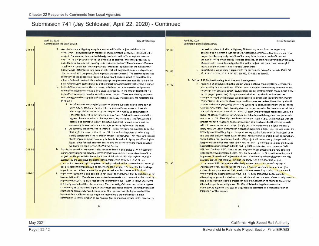
741-83 f. As noted above, a blighting analysis is warranted for this project and should be undertaken. It should focus on residential and commercial properties affected by this project. For instance, two residential neighborhoods within Tehachapi are severely impacted by this project as identified by the Noise analysis. Will these properties be abandoned or degrade into housing units that attract crime? There is also a 100-room hotel located on Steuber near Highway 58. While already subject to the noise of the highway, will HSR produce new noise events that will degrade the value and quality of this business? Will this project lead to property abandonment? The analysis appears to acknowledge this concern on Page 3.12-176 under Conclusions but no quantification effort is included. Instead, the analysis attempts to place the best possible light on the project by focusing on the benefits of the project for communities that receive a station.
g. As the HSR analysis notes, there is reason to believe that a train station will produce some offsetting monetary value for a given community. In the case of Tehachapi, no such offsetting value is possible with the current project. Therefore, the City proposes and requests consideration from the HSR on this issue. Two requests for mitigation are as follows:
741-84 i. An infrastructure marvel of this nature will undoubtedly include some sort of State-funded memorial facility. Likely a Visitors Center oriented towards educating children and tourists. We request that facility be constructed in Tehachapi adjacent to the tunnel entrance/exit. This location represents the highest physical location on the alignment, the tunnel entrance/exit will be a notable and attractive facility, Tehachapi has great railroad history, and our community boasts one of the most tourist-heavy highways in the State.
741-85 ii. As currently conceived, the Bakersfield - Palmdale stretch is expected to be the final leg in the construction of the HSR. Is also has the potential to be a key linking component if the Brightline project is constructed. We therefore request that the 'golden spike' ceremony be held in Tehachapi. Again, we offer a highly logical place for such an event and holding the ceremony here would dovetail well with the construction o f a Visitors Center.
741-86 h. Population growth or reduction is also not considered in this analysis. As a 'bedroom' community that offers a slower, quieter lifestyle to residents, the construction of this project has the potential to harm the future o f Tehachapi. Visually unpleasant, noisy additions to the area have the potential to decrease the perceived value of this community. No meaningful long-term value is provided to this community as a result of this project so the impact could be severe and long-lasting. The potential for this large impact rises and falls on a more thorough evaluation of both Noise and Aesthetics.
741-87 i. Population reduction is also possible (if not likely) due to the fact that Tehachapi is so far from a station site, Many historic examples demonstrate that communities bypassed by improved transportation facilities decline in dramatic ways. Route 66 in the 5outhwest is a strong example o f this phenomenon. More recently, Caltrans constructed a bypass on Highway 58 to route this highway away from downtown Mojave. The impacts to our neighboring community have been severe. The construction of a high speed rail line from northern California to Las Vegas will likely have a profound impact on our community. A sizable portion of our revenue (not to mention private sector revenue) is
741-87 derived from tourist traffic or Highway 58 travelling to and from Las Vegas into destinations in California (San Francisco, Yosemite, Sacramento, Monterey, etc.). This project has the very real possibility of harming Tehachapi as a result of its stated purpose of taking long distance travelers off roads. In short, taking vehicles off Highway S8 specifically, is an intended goal of this entire project that could have meaningful impacts on the economic health o f this community.
741-88 j. In conclusion, we strongly disagree with the conclusions drawn for Impacts SO #1, SO #2, SO #10, 50#13, SO #14, SO #17, 50 #20, SO #22, and SO #23.
9. Section 3.13 Station Planning, Land Use, and Development741-89 a. Page 3.13-26 concludes that this project would not have the potential to permanently
alter existing land use patterns. While I understand that the Authority does not intend to change land uses as a direct result o f their project (that's a simple choice being made by the project proponent), the question of whether they should author land use changes or whether the project can be expected to create land use changes is another issue entirely. As we note above, in several locations, we believe the Authority should acquire residential properties considered sensitive to noise, rezone them and sell them to private interests in order to mitigation the project impacts. Furthermore, as rail lines are typically near commercial and industrial users (and away from residential uses), it is logical to assume that local jurisdictions like Tehachapi will change land use patterns in response to HSR. The CEQA Conclusion located on Page 3,13-27 acknowledges that the project will have visual and audible impacts on neighborhoods but that these impacts will not create permanent change. Simply put, that assessment is illogical by nearly every measure urban planners use when forming communities. First, the land under the HSR alignment itself is going to change as we expect the State to force the project onto the land they acquire regardless of any local zoning that may prohibit such construction. Second, it is a near guarantee that the HSR project will permanently change land use long term as communities react to the new rail line. To illustrate this point, the Revised Capital Hills Specific Plan (funded in part by HSR) contains two land use maps; "with HSR" and "without HSR". The land uses depicted in this document are very different between the two considered cases. This is a case where the City's actions will attempt to prevent "inconsistent" adjacent land uses. Consistency or inconsistency aside, this example proves that there will be land use impacts as a result of this project.
741-90 b. In the case of HSR, this analysis effectively asserts that no land use of any type is inconsistent when located next to the HSR, However, your own Noise analysis (for instance) dearly determines that certain land uses (recording studio, La Paz National Monument) are incompatible with the HSR. As such, this analysis appears to be attempting to ignore the obvious incompatible land use concerns. One can only assume this is being done so that the project can avoid the obligation of having to acquire the affected properties as mitigation. The City o f Tehachapi again requests that incompatible adjacent land uses be acquired and converted to a compatible use as mitigation for this project

10. Section 3.16 Aesthetics and Visual Quality741-91 a. The Tehachapi Valley area is arguably the most visually sensitive area studied in this
EIS/EIR. Thousands of people live in this area for the express benefit of it being a rural mountain community that boasts countless sweeping views. In fact, there are thousands of properties in this valley that have a view of the proposed project area. Unfortunately, this analysis devoted a miserly one page of commentary to this subject. Adding insult to injury, the analysis states (on Page 3.16-22) that the "Affected Population" is limited to "residents and staff and students at schools within 0.5 mile[s]" and "SR 58 motorists". As with other sections of this EIS/EIR, the selection of the Area of Potential Effect is inappropriately small as it relates to the Tehachapi Valley.
741-92 b. Please provide a clear and concise definition of a "sensitive viewer".
741-93 c. A disagreeable opening statement on Page 3.16-1 indicates that there are no significant environmental impacts associated with aesthetics and visual quality since there are "no sensitive viewers" in the "Tehachapi Mountains", Perhaps this is a reference to the section of the alignment NW of Keene where few residences are located but has the effect o f implying that no one in the Tehachapi community is impacted by this project. Please clarify your intent with this statement.
741-94 d. Please explain how the KVP's were selected for the Tehachapi Valley.
741-95e. Figure 3.16-7 displays the key viewpoints evaluated as part of this project, These
locations are limited to adjacent locations at grades at or near the elevation of the proposed project. These locations would be reasonable, in our opinion, if the land around the project location were effectively "flat' as only locations near the project would have the potential to be impacted visually. However, the Tehachapi Valley has development at elevations ranging from 3,900' to over 5,500' all within a few miles of the project location. This analysis completely avoids considering any locations in town or near to town at elevations above the proposed project. Many properties on the northern, southern and eastern edges of the City will have views of this project. More significant, numerous properties south and west of the City are elevated such that they have sweeping views of the community. While Tehachapi is not protected by the equivalent of the California Coastal Commission, the community does boast hundreds of visually stunning views akin to the natural beauty of the California coast. As such, the project will have a significant impact to the visual character o f this community.
741-96 f. Given this impact, the City again suggests that mitigation in the form of a viaduct running from NW of the intersection of Challenger & Dennison to east of Steuber Road is appropriate to combat this impact A viaduct would reduce the artificial nature of the proposed embankment and aid in allowing viewers to be less distracted by this project as it would allow viewers to look through and past the HSR.
741-97 g. Furthermore, as requested in the comments above, additional sound walls should be considered along the southern edge of that track alignment to screen the moving train from view. This static view would also aid in reducing distractions from these views resulting from the Industrial' aesthetic of these facilities.
Summary of Requested Mitigation:
741-98 1. Due to the magnitude of the document presented, the City requested that the Authority produce a sub-region analysis focusing or the impacts o f the HSR on the community of Tehachapi. This will aid in policy-maker and public understanding as well as helping to avoid cases where benefits specific to areas outside of Tehachapi are not used to justify unmitigated impacts to Tehachapi,
741-99 2. As presented in Section 3.2, the closing of Good rick Drive cannot occur without mitigation. Closing this road would create landlocked parcels and would be a sizable 'taking' that is not considered in the EIS/EIR,
741-100 3. The City requests that the specific noise characteristics of the proposed tunnel entrance/exit be evaluated and mitigated in this analysis.
741-101 4. The City requests that Sound Wall NB No. 8 be constructed. We further request that both walls NB No. 7 and NB No. 8 be lengthen, beautified, and protected against graffiti (perhaps by green wall planting) in order to combat noise and aesthetics impacts from this project,
741-1025. The City requests that "Severe" and "Moderately" noise impacted residential properties
adjacent to the rail alignment be acquired by HSR and re-zoned to compatible uses.
741-103 6. To reduce the impact to the Tehachapi community, the City requests that the HSR be converted from embankment construction to viaduct construction from northwest of the intersection of Challenger Drive / Dennison Road to east of 5teuber Road.
741-104 7. To aid in connecting the bifurcated portions of Tehachapi resulting from the HSR alignment, an additional roadway should be dedicated and rough graded around the northwest side of proposed tunnel entrance/exit to provide for access to the portion of the City lying north of the rail alignment.
741-105 8. The City requests that the Authority prepare a full blighting analysis for the community of Tehachapi. This analysis should consider the indirect blighting impacts of the rail alignment on the community and propose mitigation.
741-106 9. The City suggests the following mitigation measures to offset the economic impacts of HSR on Tehachapi:
a. Designate the City of Tehachapi for the location o f a State-funded and run Visitors Center honoring the construction of the HSR.
b. Arrange construction such that the City o f Tehachapi becomes the site for the final completion of the HSR ("golden-spike ceremony").
Thank you for your consideration of these concerns. The City of Tehachapi has participated in numerous meetings with the High Speed Rail Authority to date. We have consistently expressed the concerns noted above and we have been awaiting this analysis for some time. While we do not inherently oppose the project, we do not believe this analysis fairly considers the impacts to the community and request greater consideration of these concerns. To put it plainly, this project is essentially ail impact to the community of Tehachapi with little to no discernable value added. That is often the nature of large state-level endeavors. That said, both NEPA and CEQA expect that meaningful mitigation will be undertaken to preserve both the natural and built environment.
The City Council o f the City of Tehachapi was consulted in the generation of this response. Unless meaningful additional mitigation is provided, the City will oppose the project's construction.

Please contact me at (661) 822-2200 ext. 115 or by email at jschlossergitehachapicityhall.com should you have any questions or desire any clarification. Thank you for your consideration of these issues.
Sincerely,
John (Jay) H. Schlosser, P.E. Development Services Director
Cc: FileGreg Garrett / COT Tom Schroeter / COT Tehachapi City Council

Chapter 22 Response to Comments from Local Agencies
Response to Submission 741 (Jay Schlosser, April 22, 2020)
741-60
The commenter expresses opposition to the B-P Build Alternatives as currently presented because they do not believe mitigation proposed for the project fully relieves the impacts on Tehachapi. The commenter states that the analysis and mitigation suggested in the rest of their comment could remove their opposition. Refer to Responses to Comments 741-61 through 741-106, contained in this chapter, for responses regarding the commenter’s suggestions for additional analysis and mitigation.
741-61
The Bakersfield to Palmdale Project Section Draft EIR/EIS was originally made available for a 45-day public review beginning on February 28, 2020, and ending on April 13, 2020. However, due to the uncertainty caused by the COVID-19 outbreak, the Authority extended the public review period 15 days to end on April 28, 2020. The public hearing was also shifted to a virtual format and rescheduled for April 23, 2020. This extension provided members of the public and key stakeholders additional time to review the Draft EIR/EIS and to submit comments. This is consistent with CEQA and NEPA requirements (CEQA Guidelines Section 15105, 40 Code of Federal Regulations (C.F.R.) 1506.6(c), and FRA's Procedures for Considering Environmental Impacts 13(c)(9) (1999)).
741-62
The commenter states that the EIR/EIS is large and requests subregional reports. A subregional report, as requested by the commenter, would not be consistent with the tiered approach the Authority has selected for the HSR environmental review and would improperly segment the environmental review. In accordance with this tiered approach, the Authority is preparing Tier 2 (project-level) EIR/EISs for individual sections of the statewide HSR system. The Tier 2 project sections are shown on Figure 1-2 of this Final EIR/EIS. Each Tier 2 EIR/EIS evaluates a section of the HSR system, which serves a useful transportation purpose on its own and could function independently even if the adjacent sections were not completed. Each Tier 2 EIR/EIS evaluates proposed alignments and stations in site-specific detail to provide a complete assessment of the direct, indirect, and cumulative impacts of the proposed action; considers public and agency participation in the screening process; and is developed in consultation with resource and regulatory agencies, including the United States Environmental Protection Agency and U.S. Army Corps of Engineers.
California High-Speed Rail Authority May 2021
Bakersfield to Palmdale Project Section Final EIR/EIS Page | 22-15

741-63
Chapter 22 Response to Comments from Local Agencies
Response to Submission 741 (Jay Schlosser, April 22, 2020) - Continued
The purpose of an EIR is to identify the significant effects of a proposed project, to identify alternatives, and to indicate how significant effects can be mitigated. As the commenter notes, EIRs are intended to be prepared and written in a manner that is meaningful and useful to the public and decisionmakers. While the Bakersfield to Palmdale Project Section Draft EIR/EIS is an extensive document, as the commenter notes, the organization of that document describes the proposed alternatives (Chapter 2) by use of subsections, including one for the Tehachapi area and provides environmental analysis by subsection (Chapter 3). The NEPA impact summary and CEQA conclusions describe impacts for each alternative across the multiple subsections. Wherever possible, the analysis is also organized from the northern extent of the project to the southern extent. The Draft EIR/EIS is, therefore, organized to allow for a reader to understand impacts at a more localized, subsection level, while also considering the impacts of each alternative as a whole. The Draft EIR/EIS is organized, to the greatest extent possible, in a way that meets the commenter’s request, while remaining consistent with the Authority’s tiered approach. Refer to Response to Comment 741-62, contained in this chapter, regarding the definition of the Bakersfield to Palmdale Project Section.
741-64
The commenter states that the Draft EIR/EIS uses benefits from sub-regions outside of Tehachapi to diminish impacts in the Tehachapi area and sets thresholds based on the regional setting that do not apply to the unique setting of Tehachapi. The commenter suggests a sub-regional report would have improved the analysis.
The Draft EIR/EIS bases its thresholds on CEQA Guidelines Appendix G. The impacts analysis in Chapter 3 applies these thresholds and explains, based on a discussion of both regional and localized effects, whether an impact exceeds the threshold and is therefore significant. For example, the air quality impacts analysis applies quantitative thresholds that compare construction emissions for the alternatives as a whole against air district quantitative thresholds for the air basin, and also applies quantitative thresholds that consider localized health effects from construction emissions. The approach to the analysis varies by resource area, but the Authority does not agree that the analysis of the project as a whole insufficiently identifies impacts in Tehachapi or the level of significance of those impacts.
Refer to Responses to Comments 741-65 and 741-68, contained in this chapter. No changes to the document have been made in response to this comment.
May 2021 California High-Speed Rail Authority
Page | 22-16 Bakersfield to Palmdale Project Section Final EIR/EIS

741-65
Chapter 22 Response to Comments from Local Agencies
Response to Submission 741 (Jay Schlosser, April 22, 2020) - Continued
The commenter expresses concern related to the project’s influence on the quality of life in the Tehachapi Valley. This comment also provides details characterizing the city as a “bedroom” and retirement community and the residents’ preference to live in a low-density, quiet neighborhood. This comment also states that the addition of the HSR system can reasonably be expected to affect Tehachapi-area residents in ways dissimilar to other affected cities. The commenter states the Draft EIR/EIS fails to adequately address the ways HSR affects this unique community.
The commenter’s main concerns seem to be centered on noise and visual effects on the self-described quiet and beautiful Tehachapi community. The commenter does note that part of the existing environment is the noise and physical presence of both the freight rail and highway that pass through Tehachapi.
At the request of the City of Tehachapi, the HSR profile through the Tehachapi Valley would be lowered (see Appendix 3.1-B for discussion of the design modifications). The noise and vibration modeling has been revised to include the changes to the vertical profile of the track centerline. The noise modeling indicated that noise levels would change from -0.4 to 0.1 A-weighted decibels (dBA) as a result of the track modifications. These minor noise level changes would not result in any impact determination changes as well as mitigation measures recommended.
The Tehachapi Valley is unique in its mountainous setting and this Final EIR/EIS acknowledges this setting and analyzes impacts accordingly. The results of the analysis in Section 3.4.6.3 of this Final EIR/EIS show that the project-related traffic noise increase would be less than 3 A-weighted decibels (dBA) (an increase considered barely perceptible to the human ear in an outdoor environment and one unlikely to result in an impact) for both daily and peak-hour conditions. As discussed in Section 3.4.6.3 of this Final EIR/EIS, operational noise impacts of the HSR project at some locations could remain significant even after implementation of mitigation. This is not unique to Tehachapi, as can be seen in Tables 3.4-29, 3.4-30, and 3.4-31. Since the completion of the Draft EIR/EIS, the reasonable allowance per benefitted receptor has been revised to $95,000 resulting in Sound Barrier No. 7 being cost effective. Sound Barrier No. 8 was previously found to be effective from a noise perspective and reasonable (cost-effective). Per N&V-MM#3, sound insulation and noise easements would also be
741-65
implemented in Tehachapi to minimize these severe impacts.
As described in Section 3.12, Socioeconomics and Communities, of this Final EIR/EIS, the analysis of the project’s impacts on the cohesion of existing communities takes into consideration the unique characteristics of each community. As discussed in Section 3.12 of this Final EIR/EIS, the community of Tehachapi has grown historically on either side of the existing heavy rail and highway corridor. However, the Preferred Alternative alignment deviates from the existing highway and railroad corridors when it passes through Tehachapi. For a detailed analysis of impacts on communities and neighborhoods, including those in the Tehachapi Valley, refer to Section 6.4.1, Disruption or Division of Existing Communities, of the Community Impact Assessment (Authority 2018a).
The commenter also expresses the importance of the existing rail line and SR 58 as meaningful visual landmarks viewable by area residents. At the request of the City of Tehachapi, the HSR profile through the Tehachapi Valley would be lowered. The aesthetic and visual quality impacts of this design change has been assessed in the Final EIR/EIS and the impact at key viewpoint (KVP) 17 would remain less than significant under CEQA.
As described in Section 3.16, Aesthetics and Visual Quality, of this Final EIR/EIS, the degree of visual impact generated by a project depends on that project’s visual compatibility with its surrounding environment (independent of viewer groups) and on viewers’ sensitivity to visual changes. In other words, people’s perceptions of the visual environment strongly influence the degree of impacts. As described in Section 3.16.6.3, the analysis of impacts on KVPs in the Tehachapi area considered existing visual quality and viewer sensitivity, and determined that the project would be visually compatible with the existing Union Pacific Railroad (UPRR) rail corridor. The project would therefore not add a new visual element to the landscape, and would not result in any significant and unavoidable impacts under CEQA at any KVPs from State Route (SR) 58.
This Final EIR/EIS acknowledges Tehachapi’s unique setting. The EIR/EIS analyzes impacts relative to this existing, unique environment and sufficiently discloses the impacts of introducing the HSR project into this setting as described above.
California High-Speed Rail Authority May 2021
Bakersfield to Palmdale Project Section Final EIR/EIS Page | 22-17
Chapter 22 Response to Comments from Local Agencies
Response to Submission 741 (Jay Schlosser, April 22, 2020) - Continued
741-65
741-66
Goodrick Drive is not proposed to be closed. The HSR alignment will span over the existing Goodrick Drive on a viaduct, which will maintain the existing access patterns that exist today. Figure 3.2-3 in this Final EIR/EIS has been corrected to show that Goodrick Drive ends at the UPRR rail line and does not connect with Tehachapi Boulevard. This correction has also been made in Figures B-1 and B-2 of the Transportation Technical Report Supplement (Authority 2019b). References to the closure of Goodrick Drive have also been removed from Impacts SO #2 and SO #21 in Section 3.12.
741-67
Figure 3.2-3 in the Final EIR/EIS has been revised to show a revised roadway design in the area of Burnett Road and Challenger Drive. This revised roadway design is described in Appendix 3.1-B and also shown on Sheet 35 of 127 of Appendix 3.1-C of this Final EIR/EIS. This new design proposes a grade separation on Burnett Road just east of Challenger Drive. The project would not add traffic to these roadways after the construction period is ended. As also shown on Figure 3.2-3, Burnett Road and Dennison Road are proposed as a temporary haul route for construction trucks. The Transportation Technical Report Supplement (Authority 2019b) analyzes the effect of haul trucks on Burnett Road and concludes that this roadway would operate at level of service A (i.e., no traffic congestion) in the AM and PM hours with the addition of haul trucks.
741-68
The methodology used to determine the area of potential effect, or resource study area as discussed in Table 3.4-4 of Section 3.4.4.2, is based on Table 4-1 of the FRA’s High-Speed Ground Transportation Noise and Vibration Impact Assessment Manual (FRA 2012). While Table 3.4-4 suggests that a new corridor in a quiet or suburban area should assess impacts within a distance of 1,300 feet from the track centerline, the technical analysis for the Bakersfield to Palmdale Project Section, consistent with prior sections completed, provides a more conservative analysis, utilizing a distance of 2,500 feet from the track centerline on each side. Additionally, consistent with the FRA criteria, the existing conditions include noise measurements that capture existing freight train activities, which cause temporary increases in noise levels. Lastly, the criteria to assess impacts do not look at individual pass-bys or short-term increases in noise levels, but rather daily noise levels for residential uses and peak-hour noise levels for other sensitive uses.
741-69
Consistent with the FRA’s High-Speed Ground Transportation Noise and Vibration Impact Assessment Manual (FRA 2012), the noise impacts at sensitive uses determined in Section 3.4, Noise and Vibration, of this Final EIR/EIS are based on daily noise levels for residential uses and peak-hour noise levels for nonresidential sensitive uses. The noise levels generated by a single pass-by are not utilized to assess potential noise impacts. Lastly, the analysis correctly assumes a total of 196 train pass-bys per day, 174 of which would occur during daytime hours and 22 during nighttime hours, as well as 15 trains passing through during the peak-hour condition. As presented in Table 3.4-39, for the Preferred Alternative alignment between stations, the project would result in moderate impacts on 3,654 receptors prior to mitigation and severe impacts to 1,815 receptors. Of the 174 receptors representing sensitive uses in Tehachapi, 93 are identified as severe and 69 are considered moderate.
May 2021 California High-Speed Rail Authority
Page | 22-18 Bakersfield to Palmdale Project Section Final EIR/EIS

Chapter 22 Response to Comments from Local Agencies
Response to Submission 741 (Jay Schlosser, April 22, 2020) - Continued
741-70
The noise measurement locations were chosen based on proximity to sensitive uses and ability to be taken within public right-of-way while also remaining within the noise resource study area of 2,500 feet of the proposed track centerline. While the commenter is correct in noting that the majority of the residences within the city of Tehachapi are southwest of the proposed track centerline, the nearest locations, west of Dennison Road and south of Tehachapi Boulevard, are at least 3,200 feet from the proposed track centerline, well outside the noise resource study area. The sites for noise measurement were chosen, first based on being in the noise resource study area limits of within 2,500 feet of the proposed track centerline. Noise measurement locations within 2,500 feet were then chosen based on proximity to noise sensitive land uses and the ability to take the measurement within the public right-of-way. Furthermore, the noise monitoring locations are valid due to the consistency with the FRA’s High-Speed Ground Transportation Noise and Vibration Impact Assessment Manual (FRA 2012), which suggests that a variety of measurements at different locations be gathered as representative noise levels.
741-71
The completed analysis within Section 3.4, Noise and Vibration, of this Final EIR/EIS used a conservative resource study area of 2,500 feet for assessing impacts compared to the 1,300-foot study area recommended in Table 4-1 of the FRA’s High-Speed Ground Transportation Noise and Vibration Impact Assessment Manual (FRA 2012). The Adventist Health Tehachapi Valley Hospital is located approximately 2,700 feet from the proposed track centerline and is therefore outside of the resource study area. While the hospital is a sensitive use, consistent with the FRA Assessment Manual, uses located outside of the screening distances would be considered not to be affected.
741-72
Based on a review of Table 3.4-6 in Section 3.4, Noise and Vibration, of the Draft EIR/EIS, it was determined that the maximum train speed was incorrectly identified and has been corrected as 220 miles per hour. The modeled train speed of 220 miles per hour was correctly identified in the text under "Train Operation Noise and Vibration Methodology," second bullet. Table 3.4-6 has been corrected in this Final EIR/EIS.
741-73
Based on a review of Table 3.4-6 in Section 3.4, Noise and Vibration, of the Draft EIR/EIS, it was determined that two cross-sections, aerial and underground, were previously omitted. They are now correctly identified. The proper track types were utilized in the impact analysis; therefore, this is a text edit. All three track types will be present in the Tehachapi vicinity.
741-74
While the commenter specifically raised concern about impacts on Adventist Health Tehachapi Valley Hospital, which is located outside the resource study area, Section 3.4.6.3, Bakersfield to Palmdale Project Section Build Alternatives, of this Final EIR/EIS addresses tunnel portal noise. While trains entering and exiting a tunnel have the potential to create an audible shockwave due to increased pressure, the tunnel and tunnel portal design features described in Section 2.3.4.5, will attenuate any additional noise associated with the train entering or exiting a tunnel. Noise attenuation hoods on tunnel portals are widely used in HSR systems worldwide and have a track record of successfully minimizing tunnel portal noise (Derkowski 2014, Ishikawa 2010, and Duann 2006).
California High-Speed Rail Authority May 2021
Bakersfield to Palmdale Project Section Final EIR/EIS Page | 22-19

741-75
Chapter 22 Response to Comments from Local Agencies
Response to Submission 741 (Jay Schlosser, April 22, 2020) - Continued
As stated by the commenter, the assessment of potential sound barriers was completed consistent with the Authority’s Noise Mitigation Guidelines (Appendix 3.4-B). These guidelines establish specific criteria for a barrier to be considered for construction, one of which is the cost of the barrier relative to the number of benefited receptors. This methodology is also consistent with the California Department of Transportation’s (Caltrans) methodology for determining which barriers are reasonable to construct relative to cost. For locations where a sound barrier is not built, additional methods of mitigation, as described in detail in Mitigation Measure N&V-MM#3, will be implemented to reduce severe impacts. The additional measures, such as building sound insulation, can effectively reduce noise on the interior of structures; however, they will not reduce exterior noise levels. It should be noted that both barriers considered, Sound Barriers No. 7 and No. 8, in the City of Tehachapi are recommended for construction as they were found to be effective from a noise reduction perspective (5 dBA or more) and cost-effective.
Lastly, the commenter suggests that receivers are being treated unequally and states specifically that the Nuestra Señora Reina de La Paz/César E. Chávez National Monument (La Paz) is receiving a sound barrier as a project design feature. As part of the Section 106 process, the Authority was required to take into consideration possible effects on historic properties from this project and to prepare a Finding of Effect report (Authority 2020a). The Authority worked with consulting parties as part of the Section 106 process to develop conditions, including development of a sound barrier, to avoid an adverse effect on La Paz as a historic property in compliance with Section 106 of the National Historic Preservation Act.
741-76
Tables 3.4-30 through 3.4-33 in Section 3.4.7, Mitigation Measures, of this Final EIR/EIS summarize the sound barrier analysis results. A barrier along the southbound track between Barnett Road and Goodrick Drive, identified as Sound barrier (SB) No. 8, was assessed to shield receptors within the Ashe Village community to the southwest. The barrier was found to be both acoustically and cost effective at heights of 12 and 14 feet; therefore, the sound barrier is recommended for construction. Since the completion of the Draft EIR/EIS, the reasonable allowance per benefitted receptor has been revised to $95,000 resulting in Sound Barrier No. 7 being cost effective. SB No. 7, located along the northbound track between Arabian Drive and Tehachapi Boulevard, was assessed to shield receptors within the Arabian Estates community to the northwest. The barrier was found to be both acoustically and cost effective at a height of 14 feet; therefore, the sound barrier is recommended for construction.
741-77
The comments and suggestions related to mitigation considerations are acknowledged. For properties that are not able to be mitigated through the sound barrier or building insulation processes, noise easements will be considered as referenced in Mitigation Measure N&V-MM#3 of this Final EIR/EIS. The Authority will negotiate on a case-by-case basis with property owners whose land would be considered for a noise easement or a full property acquisition. The purchase of noise easements are generally dependent on the specific circumstances in each case and must be measurable. Property owners who believe they have suffered a loss of property value because of the project may file a claim with the State of California's Government Claims Board. More information about that claims process may be obtained online at: www.vcgcb.ca.gov/claims.
May 2021 California High-Speed Rail Authority
Page | 22-20 Bakersfield to Palmdale Project Section Final EIR/EIS

741-78
Chapter 22 Response to Comments from Local Agencies
Response to Submission 741 (Jay Schlosser, April 22, 2020) - Continued
Refer to Standard Response BP-Response-GENERAL-01: Alternatives.
The commenter states that the analysis in Section 3.12, Socioeconomics and Communities focuses on the benefits of the project on a regional basis instead of the project’s community-level impacts. As detailed in Section 3.12.6.5 of this Final EIR/EIS, impacts are discussed at a community level as well as a regional level. Where warranted, specific discussion regarding specific impacts in the city of Tehachapi is provided, for example under Impact SO #2, Impact SO #4, Impact SO #5, Impact SO #10, and Impact SO #13.
This comment also notes that under Section 3.12.5.7, Tehachapi stakeholders suggest the HSR project would bifurcate the valley and that the project should be rerouted elsewhere. As described in Section 3.12, Socioeconomics and Communities, Impact SO#2, the community of Tehachapi has grown historically on either side of the existing rail and highway corridor. However, the Preferred Alternative alignment deviates from the existing highway and railroad corridors when it passes through Tehachapi. This deviation links two sections of tunnels through the Tehachapi Mountains. Here, the alignment would pass along the edge of Tehachapi in the northeast, where land uses are primarily industrial, agricultural, and non-neighborhood-serving. The alignment would pass over all major roads as it travels through Tehachapi, including SR 58, E Tehachapi Boulevard, E Steuber Road, Highline Road, and Tehachapi Willow Springs Road. These overpasses would maintain existing community connectivity. In addition to these elevated sections, the project would facilitate pedestrian and bicycle circulation. Therefore, the project would not physically divide the community of Tehachapi, and the impact was determined to be less than significant for the project under CEQA.
It should be noted that in response to comments received from the City of Tehachapi, the Authority has refined the design, including lowering the profile through the Tehachapi Valley (see Appendix 3.1-B for discussion of the design modifications).
741-79
The commenter expresses disagreement with the statement made in Section 3.12.6.5 of this Final EIR/EIS that the project would not “disrupt the existing social fabric of the communities in the Tehachapi Mountains subsection” because the analysis is based primarily on the number of displaced residences and businesses. The commenter argues that the analysis minimizes the magnitude of the impact by considering directly affected properties only. This comment also notes that the noise analysis shows that hundreds of residents within the city would be affected as a result of the project. The text the commenter quotes is from Impact SO#2, Permanent Disruption to Community Cohesion or Division of Existing Communities from Project Construction, which explains that because an adequate supply of replacement properties is available in the replacement area, displaced residents and businesses would be able to remain a part of the social fabric in the City of Tehachapi.
Section 3.12 of this Final EIR/EIS addresses 25 separate potential impacts resulting from construction and operation of the HSR project; the analysis of impacts on communities is not limited to residential and/or business displacements. Impacts on circulation, community facilities, schools, taxes, employment, and other factors are all considered. As described under this impact, impacts related to community cohesion and the division of existing communities are also assessed based on other factors, such as physically dividing or isolating communities, changes to community character, and disruptions to circulation.
As discussed in Section 3.4, Noise and Vibration, noise impacts from construction would be less than significant under CEQA with implementation of N&V-MM#1, which would require the contractor to monitor noise during construction to verify compliance with the noise limits shown in Table 3.4-7 of this Final EIR/EIS.
The results of the analysis in Section 3.4.6.3 of this Final EIR/EIS show that during operation, project-related traffic noise increase would be less than 3 dBA (an increase considered barely perceptible to the human ear in an outdoor environment and one unlikely to result in an impact) for both daily and peak-hour conditions. The HSR project operational noise impacts would remain significant even after implementation of mitigation. This is not unique to Tehachapi, as can be seen in Tables 3.4-29, 3.4-30, and 3.4-31. There would be 31 severe noise impacts remaining in Tehachapi, as shown in
California High-Speed Rail Authority May 2021
Bakersfield to Palmdale Project Section Final EIR/EIS Page | 22-21

741-79
Chapter 22 Response to Comments from Local Agencies
Response to Submission 741 (Jay Schlosser, April 22, 2020) - Continued
Table 3.4-30. In Tehachapi, both sound barriers were found to be reasonable and are recommended for construction (see Table 3.4-30). Per N&V-MM#3, sound insulation and noise easements would also be implemented in Tehachapi to minimize these severe impacts.
It should be noted that at the request of the City of Tehachapi, the HSR profile through the Tehachapi Valley would be lowered (see Appendix 3.1-B for discussion of the design modifications). The noise and vibration modeling has been revised to include the changes to the vertical profile of the track centerline. The noise modeling indicated that noise levels would change from -0.4 to 0.1 dBA as a result of the track modifications. These minor noise level changes would not result in any impact determination changes as well as mitigation measures recommended. With the reduced vertical profile, the HSR viaduct would be less visually prominent than previously proposed in certain areas of Tehachapi. This design change has been assessed in the Final EIR/EIS and the impact at KVP 17 would remain less than significant under CEQA.
The permanent disruption to community cohesion or division of existing communities from project operation is discussed under Impact SO#17 of Section 3.12, Socioeconomics and Communities. It includes a discussion of noise impacts on community cohesion and the division of existing communities from project operations. Although implementation of AVQ-IAMF#1 (Aesthetic Options) and AVQ-IAMF#2 (Aesthetic Review Process) would minimize the potential for operation of the B-P Build Alternatives to permanently affect community character in Tehachapi, some of the effects related to aesthetics and visual quality and noise would remain. However, new sidewalks and bikeways would reconnect communities that were previously divided by railroad tracks. As such, all B-P Build Alternatives would result in less than significant impacts related to the physical division of an established community, and in particular the Tehachapi community, during operation under CEQA. However, as discussed in Sections 3.4.8, 3.12.8 and 3.16.8 of this Final EIR/EIS, impacts may remain under NEPA due to remaining noise, socioeconomic and community, and aesthetic effects, respectively.
741-80
The commenter states that Tehachapi’s unique geography and topography require greater consideration in this analysis. This comment also states that Tehachapi is a mountainous community and several significant areas of land within the city’s limits and sphere of influence would be effectively cut off by the project because these areas would become trapped between the HSR tracks and adjacent mountains, which would make development from the opposing direction impractical. This comment also notes that the Authority aided the City in considering the effects of the project on one of these areas known as Capital Hills by funding development of an area specific plan, suggesting that greater physical mitigation from the Authority to link these areas of land should be included in the project.
It should be noted that at the request of the City of Tehachapi, the HSR profile through the Tehachapi Valley would be lowered (see Appendix 3.1-B for discussion of the design modifications). The noise and vibration modeling has been revised to include the changes to the vertical profile of the track centerline. The noise modeling indicated that noise levels would change from -0.4 to 0.1 A-weighted decibels (dBA) as a result of the track modifications. These minor noise level changes would not result in any impact determination changes as well as mitigation measures recommended.
As described in Section 3.13, Station Planning, Land Use, and Development, although part of the project would be in a tunnel, the non-tunnel portions of the HSR alignment would create a physical barrier to future development in those parts of the city’s planning area to the northeast of the HSR alignment by forcing the City or a developer to build expensive new roads around the project to serve that development. However, because the affected portions of the city’s planning area are low- to moderate-priority growth areas proposed for low-density development, the potential disruption to future development in this area would be limited. Aside from the potential disruption to circulation, the project is not anticipated to result in potential disruptions to planned low-density development in the affected planning area. Due to its status as a low- to moderate-priority growth area, the affected planning area represents a long-term growth area for the city that is not likely to be developed prior to construction of the project through Tehachapi. Therefore, it is reasonable to assume that any future development in that area would be sited in a manner that would reduce potential land use conflicts with the project.
May 2021 California High-Speed Rail Authority
Page | 22-22 Bakersfield to Palmdale Project Section Final EIR/EIS
741-80
Chapter 22 Response to Comments from Local Agencies
Response to Submission 741 (Jay Schlosser, April 22, 2020) - Continued
Additionally, as described in Section 3.12, Socioeconomics and Communities, the HSR project would result in less-than-significant impacts under CEQA related to the permanent disruption to community cohesion or the division of existing communities from project construction and operations. The impacts would be less than significant because the HSR project would provide adequate roadway overcrossings and undercrossings to facilitate pedestrian, bicycle and vehicular circulation during construction. The HSR project would also replace existing at-grade crossings with new grade-separated crossings to enhance mobility in affected communities by eliminating traffic delays. Because the HSR project would result in less-than-significant impacts related to the division of existing communities during construction and operations, mitigation is not required.
741-81
The commenter disagrees with the statement made on page 3.12-106 of the Draft EIR/EIS that the project “would not introduce new features that would divide” Tehachapi, among other listed communities. The commenter suggests the statement is inaccurate because a substantial portion of the city lies north of the project alignment and would be physically and visually separated from the remainder of the community. This comment also states that far more physical mitigation is needed, that the commenter believes a viaduct from the northwest intersection of Challenger Drive and Dennison Road to east of Steuber Road is appropriate, and that the Authority should also dedicate and pre-grade a public roadway around the western edge of the entrance/exit area (allowing for utility installation in this layout).
The comment refers to the CEQA conclusion under Impact SO#2, Permanent Disruption to Community Cohesion or Division of Existing Communities from Project Construction. As described under this impact discussion, the project deviates from the existing highway and rail corridors where it passes through Tehachapi. While some roads in the Tehachapi Mountains Subsection would be realigned or grade-separated from the HSR tracks to maintain north-south and east-west connections in the community, others would be permanently closed on either side of the HSR tracks. The majority of the road closures would be dirt roads with continued community access via nearby grade-separated crossings. In addition, the new sections of Steuber Road and Highline Road that would pass beneath the alignment would be built to accommodate the future construction of new Class II bikeways on those roads, enhancing connectivity and different mobility modes, and improving community cohesion in the Tehachapi Mountains Subsection. Therefore, the analysis concludes that the project would provide adequate roadway overcrossings and undercrossings to facilitate pedestrian, bicycle, and vehicular circulation and would therefore, result in less-than-significant impacts under CEQA.
Moreover, several modifications to the design of the HSR project were made in response to the City of Tehachapi’s requests. These include the addition of an access road around the tunnel portal just northeast of the Adventist Health Tehachapi Valley facility and the addition of a viaduct to allow connectivity from Challenger Drive/Dennison Road to the east side of the HSR alignment where construction of a development is planned. These design modifications have been incorporated into this
California High-Speed Rail Authority May 2021
Bakersfield to Palmdale Project Section Final EIR/EIS Page | 22-23

741-81
Chapter 22 Response to Comments from Local Agencies
Response to Submission 741 (Jay Schlosser, April 22, 2020) - Continued
Final EIR/EIS and are discussed further in Appendix 3.1-B of this Final EIR/EIS.
741-82
The commenter states that the economic impact analysis is too limited in scope and that the analysis does not consider the wide-ranging effects on property values for indirectly affected properties and the effects of devalued properties on the city. Additionally, the commenter states that the visual effects and noise generation would have a blighting effect. The commenter states that the appropriate remedy for this concern is additional property acquisition, demolition of noncompatible structures, rezoning, and sale.
For a detailed analysis of impacts on property values, refer to the Bakersfield to Palmdale Project Section Community Impact Assessment (Authority 2018), Section 6.8.3.1, Long-term Impact to Property Values, which summarizes the potential property value impacts of the project. Because studies regarding impacts of HSR lines are limited, the analysis included a literature review of studies related to light-rail, commuter rail, and HSR stations. The reviewed studies show that the potential exists for the values of residential and commercial properties in station areas to appreciate as a result of HSR projects, due largely to improved accessibility (both for residents to regional jobs and for employers to a larger labor pool). However, the studies show it is also possible that some properties could experience a decrease in value given the potential for nuisance impacts resulting from HSR trains passing in close proximity. This potential for a decrease in property value may be particularly true for residences and businesses in locations considerably removed from train stations but exposed to some nuisance impacts of the project. These residences and businesses would enjoy relatively few benefits (mainly those deriving from improved accessibility) to offset the nuisance impacts. This balance between the amount of project benefit enjoyed compared to the nuisance factor endured would be unique for each property and would be only one of the many factors influencing the ultimate market value of any particular property. Buyers may be less likely to purchase a property due to these nuisance impacts. Private Property and High-Speed Rail: Your Questions Answered (Authority 2019) offers guidance for property owners of parcels that will not require acquisition but for which the property owner believes their property value has been affected. In those cases, property owners who believe they have suffered a loss may file a claim with the State of California Government Claims Board.
For visual blighting impacts, Section 3.16, Aesthetics and Visual Quality, of this Final EIR/EIS, provides AVQ-MM#6: Plant Landscape Treatments along the HSR Project
May 2021 California High-Speed Rail Authority
Page | 22-24 Bakersfield to Palmdale Project Section Final EIR/EIS
741-82
Chapter 22 Response to Comments from Local Agencies
Response to Submission 741 (Jay Schlosser, April 22, 2020) - Continued
Overheads, Embankment, and Retained-Fill Elements. Where the elevated guideway or overpass would be adjacent to residential areas, the Authority would plant low-maintenance trees and other vegetation along the edges of the right-of-way to reduce the visual contrast. After construction is complete, the Authority would also plant vegetation on lands acquired for the project (AVQ-MM#5: Replant Unused Portions of Land Acquired for the HSR). This type of mitigation measure is commonly used for large infrastructure projects to minimize impacts resulting from the introduction of new structures. The planting of vegetation would reduce impacts on visual quality in the foreground of views from residences and would therefore reduce the potential for blight. It should be noted that at the request of the City of Tehachapi, the HSR profile through the Tehachapi Valley would be lowered in certain areas (see Appendix 3.1-B for discussion of the design modifications). With the reduced vertical profile, the HSR viaduct may not be as visually prominent in certain areas, but this design change has been assessed in the Final EIR/EIS and the impact at KVP 17 would remain less than significant under CEQA.
The communities located along the proposed HSR alignment are largely adjacent to freight railroad tracks. Trains passing through the existing at-grade crossings are required to blow their horns as a warning to oncoming traffic and pedestrians, which is often very disruptive to the nearby residents. However, unlike freight trains, the requirement for grade-separated HSR track means no horn noise would be generated by the HSR trains. The HSR project itself would generate noise, and without mitigation, noise effects for many sensitive receivers between Bakersfield and Palmdale, including Tehachapi, would be adverse under NEPA and the impact would be significant under CEQA, as discussed in Section 3.4.6.3 of this Final EIR/EIS. HSR project operational noise impacts would remain significant even after implementation of mitigation. There would be 31 severe noise impacts remaining in Tehachapi, as shown in Table 3.4-30. In Tehachapi, one noise barrier was found to be unreasonable to apply to many of the severe noise impacts, due to very high cost and minimal efficacy (see Table 3.4-30). Per N&V-MM#3, sound insulation and noise easements would also be implemented in Tehachapi to minimize these severe impacts.
It should be noted that at the request of the City of Tehachapi, the HSR profile through the Tehachapi Valley would be lowered (see Appendix 3.1-B for discussion of the design
741-82
modifications). The noise and vibration modeling has been revised to include the changes to the vertical profile of the track centerline. The noise modeling indicated that noise levels would change from -0.4 to 0.1 dBA as a result of the track modifications. These minor noise level changes would not result in any impact determination changes as well as mitigation measures recommended.
In conclusion, this Final EIR/EIS addresses potential noise and aesthetic nuisance impacts that may result in potential changes in property value and identifies mitigation measures to reduce these impacts as required under CEQA and NEPA.
California High-Speed Rail Authority May 2021
Bakersfield to Palmdale Project Section Final EIR/EIS Page | 22-25

741-83
Chapter 22 Response to Comments from Local Agencies
Response to Submission 741 (Jay Schlosser, April 22, 2020) - Continued
The commenter suggests that a “blighting analysis” is warranted for this project and should be undertaken. This comment notes that the suggested analysis should focus on residential and commercial properties affected by this project.
Table 3.12-28 of this Final EIR/EIS shows that 4 residential units in the City of Tehachapi would be displaced under the Preferred Alternative; however, Table 3.12-29 shows that the City of Tehachapi has a surplus of available residential units. Given the available housing stock in Tehachapi along the alignment, considerable residential migration out of Tehachapi is not expected. Additionally, Table 3.12-37 of this Final EIR/EIS shows that 5 businesses in the City of Tehachapi would be displaced under the Preferred Alternative; however, Table 3.12-38 shows that there is a surplus of available retail and food service, professional service, and industrial business spaces in Tehachapi that could be used by the displaced businesses in Tehachapi. As with the residential displacements, the surplus of available business properties in Tehachapi, considerable business migration out of Tehachapi is not expected.
The Draft EIR/EIS and this Final EIR/EIS includes analysis under Impact SO #14, Potential for Permanent Physical Deterioration from Construction, and Impact SO #23, Potential for Permanent Physical Deterioration from Operation. Impact SO #14 evaluates the potential of HSR construction to result in displacement and relocation of local residents and businesses and economic effects associated with construction. The EIR/EIS concluded that construction of the project could disrupt existing communities by temporarily disrupting community circulation patterns and resulting in temporary decreases in local tax revenues, but that construction of the project would result in a less than significant impact related to physical deterioration.
As discussed in Response to Comment 741-82, given the potential for nuisance impacts (such as noise and visual impacts) resulting from nearby passing HSR trains, some properties could experience a decrease in value as a result of proximity to HSR alignments, particularly those in locations considerably removed from train stations, due to exposure to nuisance impacts without the benefits of connectivity of a nearby station. Property value impacts of the project are detailed in the Community Impact Assessment (Authority 2018a). Section 6.8.3.1, Long-term Impact to Property Values, in that technical report summarizes the potential property value impacts of the project.
741-83
Additionally, noise impacts are detailed in the EIR/EIS in Section 3.4, Noise and Vibration, and visual impacts are detailed in Section 3.16, Aesthetics and Visual Quality, and appropriate mitigation is applied as required under CEQA and identified as required under NEPA.
The commenter notes that two residential neighborhoods within Tehachapi would be severely affected by noise impacts resulting from the HSR project. These two neighborhoods are: 1) the neighborhood bounded by Dennison Road and Lois Street to the west and east and by Goodrick Drive and Alan Avenue to the south and north; and 2) the residences along Arabian Drive and Appaloosa Court and along Burnett Road between Arabian Drive and Appaloosa Court. The first neighborhood is already bounded by the UPRR line to the immediate south, the Tehachapi Municipal Airport to the immediate west, and SR 58 to the immediate north. The second neighborhood is located immediately adjacent to and north of SR 58. The homes in the two neighborhoods indicated by the commenter are already bounded by transportation and industrial uses, and the HSR project would introduce a transportation use not unlike the existing environment of these neighborhoods.
The noise impacts analysis completed as part of this Final EIR/EIS determined that without mitigation, 50 total receptors within the two communities in question would be severely affected. With the implementation of Mitigation Measure N&V-MM#3, all 50 receptors would experience impacts that are no longer severe, and would be reduced to a less-than-significant level under CEQA. Therefore, noise would not be expected to contribute to changes in property values within the community. Visual and noise impacts are discussed in further detail in the Aesthetics and Visual Quality Technical Report (Authority 2019a) and the Noise and Vibration Technical Report (Authority 2020b).
As such, this Final EIR/EIS and its supporting technical reports provide sufficient analysis of nuisance impacts on adjacent properties and property value impacts.
May 2021 California High-Speed Rail Authority
Page | 22-26 Bakersfield to Palmdale Project Section Final EIR/EIS

Chapter 22 Response to Comments from Local Agencies
Response to Submission 741 (Jay Schlosser, April 22, 2020) - Continued
741-84
The commenter requests the establishment of a state-funded memorial facility in the city of Tehachapi be constructed adjacent to the tunnel entrance/exit to offset what the commenter describes as economic effects. This type of facility is not required to mitigate an environmental impact of the B-P Build Alternatives. The Authority will consider the request outside the environmental review process as it works with the City of Tehachapi moving forward.
741-85
The commenter states that the Bakersfield to Palmdale Project Section is expected to be the final leg in the construction of HSR and a key link if the Brightline project is constructed. Therefore, the commenter requests that a “golden spike” ceremony (presumably commemorating the completion of an HSR connection between the northern and southern parts of the state) be held in Tehachapi. The timing and location of such a ceremony will depend on the project’s construction schedule. The Authority appreciates the City of Tehachapi’s willingness to serve as the focal point for such a unique moment in California history and will take this request under consideration outside the environmental review process. Such a ceremony is not necessary to mitigate for an adverse environmental impact.
741-86
The commenter states that population growth or reduction is not considered in this analysis. For a detailed assessment of the project’s ability to directly or indirectly induce population or employment growth in the two-county region, refer to Section 3.18, Regional Growth, of this Final EIR/EIS. Additionally, refer to Section 3.12, Socioeconomics and Communities, Impacts SO#4 and SO#5, for a discussion of the permanent displacement and relocation of local residents and local businesses as a result of project construction.
This comment also states that visual and noise impacts have the potential to decrease the perceived value of the community. See Section 3.16, Aesthetics and Visual Quality, of this Final EIR/EIS for more information on the impacts and mitigation measures proposed to address visual impacts, including AVQ-MM#6, Plant Landscape Treatments along the HSR Project Overheads, Embankment, and Retained-Fill Elements. Where the elevated guideway or overpass would be adjacent to residential areas, the Authority would plant low-maintenance trees and other vegetation along the edges of the right-of-way to reduce the visual contrast. After construction is complete, the Authority would also plant vegetation on lands acquired for the project (AVQ-MM#5, Replant Unused Portions of Land Acquired for the HSR). This type of mitigation measure is commonly used for large infrastructure projects to minimize impacts resulting from the introduction of new structures.
Regarding noise impacts, the communities located along the proposed HSR alignment are largely adjacent to existing freight railroad tracks. Trains passing through the existing at-grade crossings are required to blow their horns as a warning to traffic and pedestrians, which is often very disruptive to the nearby residents. Unlike freight trains, the requirement for grade-separated HSR track means no horn noise would be generated by the HSR trains. The HSR train operation would generate noise, and without mitigation, noise effects for many sensitive receivers between Bakersfield and Palmdale would be adverse under NEPA and the impact would be significant under CEQA, as discussed in Section 3.4.6.3 of this Final EIR/EIS. However, these effects would be decreased to a less than significant level under CEQA at most locations with implementation of the proposed mitigation measures, such as N&V-MM#3, which outlines the installation of sound barriers, sounds insulation, and noise easements, presented in Section 3.4.7 of this Final EIR/EIS. Figure 3.4-A-10 (Technical Appendix
California High-Speed Rail Authority May 2021
Bakersfield to Palmdale Project Section Final EIR/EIS Page | 22-27
741-86
Chapter 22 Response to Comments from Local Agencies
Response to Submission 741 (Jay Schlosser, April 22, 2020) - Continued
3.4-A) of this Final EIR/EIS shows the locations where criteria were met for the construction of sound barriers for the project. Per N&V-MM#3, severely affected noise receivers that would not be mitigated with a sound barrier would receive other forms of mitigation, such as installing building insulation or payment of property noise easements.
The Authority acknowledges that given the potential for nuisance impacts (such as noise and visual impacts) resulting from nearby passing HSR trains, some properties could experience a decrease in value, especially those in locations considerably removed from train stations but exposed to nuisance impacts of the project. For more information on property value impacts of the HSR project, please see the Community Impact Assessment (Authority 2018a). Owners who believe they have suffered a loss of property value as a result of the project may file a claim with the State of California’s Government Claims Program. More information on filing a claim may be obtained online at the following link: https://www.dgs.ca.gov/ORIM/Services/Page-Content/Office-of-Risk-and-Insurance-Management-Services-List-Folder/File-a-Government-Claim#@ViewBag.JumpTo.
This comment also states that no meaningful long-term value is provided to Tehachapi as a result of the project. As discussed in the 2020 Business Plan (Authority 2020c [page 4]), the HSR system would provide environmental, economic, and community benefits statewide and within specific regions. Improvements in mobility and travel time, reductions in vehicle miles traveled and commensurate drops in emissions of greenhouse gases and criteria air pollutants, and increased job creation both during construction and throughout operations are all benefits that would accrue with implementation of the project, including for those communities along the alignment but not immediately adjacent to an HSR station.
The purpose of the project includes providing the public with electric-powered HSR service that provides predictable and consistent travel times between major urban centers consistent with Proposition 1A, and connectivity to airports, mass transit, and the highway network connecting San Joaquin Valley to Antelope Valley, as well as connecting the northern and southern portions of the statewide HSR system. Connectivity with transit options, including Amtrak intercity passenger rail service and connecting bus service, as well as regional bus service provided by Greyhound Bus,
741-86
would result in improved connectivity of transit from the HSR system, even for those communities along the alignment not immediately adjacent to an HSR station.
This Final EIR/EIS concludes that the project would divert automobile trips to HSR trips, reducing local and regional vehicle miles traveled. As discussed in Section 3.2, Transportation, of this Final EIR/EIS, in both Kern and Los Angeles Counties, a reduction in vehicle miles traveled is expected to occur with implementation of the project. Compared to future background conditions, an overall reduction of approximately 1.772 billion to 2.436 billion daily vehicle miles traveled is projected for the two counties.
Tables 3.3-38 through 3.3-41 of this Final EIR/EIS provide the estimated changes in regional emissions associated with the reduction in vehicle miles traveled, based on base year 2015 and operational year 2040 under both medium and high ridership scenarios. The project would result in a net regional decrease in emissions of criteria pollutants. These decreases would be beneficial to the San Joaquin Valley Air Basin and would help the basin meet the attainment goals for ozone and particulates 10 microns in diameter and 2.5 microns in diameter.
Additionally, to help ensure that jobs benefit the economically distressed areas in the region, the Authority has adopted a Community Benefits Policy, which helps to remove the barriers of finding qualified workers, including small businesses, disadvantaged business enterprises, disabled veteran business enterprises, women-owned businesses, and microbusinesses that want to participate in building the California HSR System. The Community Benefits Policy requires that design-build construction contracts adhere to the National Targeted Hiring Initiative, which states a minimum of 30 percent of all project work hours shall be performed by National Targeted Workers and a minimum of 10 percent of National Targeted Workers hours shall be performed by Disadvantaged Workers. This, along with other hiring policies, will ensure that employment and business opportunities created by the project are accessible to the local communities. At the time of preparation of this response, project construction has successfully met the National Targeted Hiring Initiative Plan goals. Per Table 3.12-12 in this Final EIR/EIS, over 20 percent of Tehachapi’s workforce is employed in construction and manufacturing, which means Tehachapi’s workers could benefit from employment
May 2021 California High-Speed Rail Authority
Page | 22-28 Bakersfield to Palmdale Project Section Final EIR/EIS

741-86
Chapter 22 Response to Comments from Local Agencies
Response to Submission 741 (Jay Schlosser, April 22, 2020) - Continued
opportunities resulting from construction and operation of the HSR project.
As such, the HSR project would provide value to communities, even for those communities along the alignment but not immediately adjacent to an HSR station, such as Tehachapi.
741-87
The commenter states that population reduction is possible due to the fact that Tehachapi is so far from a station site and that the intended goal of the project –to take long distance travelers off roads –would harm the economic health of the community. Refer to Section 3.12, Socioeconomics and Communities, Impact SO#14. As detailed in this section, considerable residential migration out of a community is not expected.
This comment also states that a sizable portion of the City’s revenue is derived from tourist traffic on SR 58 traveling between Las Vegas and various destinations in California. The commenter expresses concern that taking vehicles off SR 58 could have “meaningful impacts on the economic health of the community.” Overall, the HSR Project would provide benefits to the regional transportation system by reducing vehicle trips on the freeways through the diversion of intercity trips from road trips to HSR. This reduction in future vehicle trips would improve the levels of service of the regional roadway system and reduce vehicle miles traveled compared with existing conditions and with the future No Project Alternative as described in Section 3.2, Transportation.
Although it is expected that the project would divert automobile trips traveling along SR 58 to the HSR system, it is important to note that substantial growth in automobile traffic is still expected to occur along SR 58 in the future. Tables 5-3 and 5-4 of the Transportation Technical Report (Authority 2019b) indicate that SR 58 between North Mill Street and East Tehachapi Boulevard carried 913 vehicles per hour in the AM peak hour and 1,100 vehicles per hour in the PM peak hour in 2016. Tables 6-17 and 6-18 of the same report indicate that this roadway segment is expected to carry 1,140 vehicles per hour in the AM peak hour and 1,371 vehicles per hour in the PM peak hour in 2040 with the project. Therefore, while traffic growth would be expected to be somewhat less with the project, growth in traffic of approximately 24 percent is still expected with the project between 2016 and 2040.
Although the HSR project is expected to divert automobile trips to the HSR system, given the projected 24 percent growth in traffic on SR 58 documented in the Transportation Technical Report, it is anticipated that revenue from tourist traffic could grow consistent with the projected growth in traffic.
California High-Speed Rail Authority May 2021
Bakersfield to Palmdale Project Section Final EIR/EIS Page | 22-29
741-88
Chapter 22 Response to Comments from Local Agencies
Response to Submission 741 (Jay Schlosser, April 22, 2020) - Continued
The commenter disagrees with the conclusions drawn for Impacts SO#1, SO#2, SO#10, SO#13, SO#14, SO#17, SO#20, SO#22, and SO#23. The comment is a concluding sentence to the group of comments about Section 3.12. Refer to Responses to Comments 741-78 to 741-87, contained in this chapter. As explained in Section 3.12, economic and social changes of a project are not considered significant effects on the environment under CEQA. The EIR/EIS therefore does not identify all of these impacts as significant under CEQA where they involve economic and social versus physical environmental effects.
741-89
The commenter disagrees with the conclusion on page 3.13-26 of the Draft EIR/EIS, which states that the project would not have the potential to permanently alter existing land uses. The commenter also repeats the suggestion that the Authority should acquire residential properties and sell them to private interests as mitigation. For a response to the commenter’s suggestion about noise easements and acquisition, refer to Response to Comment 741-77, contained in this chapter.
The commenter states that the CEQA conclusion on page 3.13-27, which states that the project will have visual and audible impacts on neighborhoods but that these impacts would not create permanent change, is illogical because land under the alignment itself is going to change as land is acquired, and because communities would react by changing land uses. This comment cites the Capital Hills Specific Plan’s two land use maps with and without the HSR project as evidence of this. The CEQA conclusion on page 3.12-27 is discussed under Impact LU #2, Potential for Construction to Permanently Alter Existing Land Use Patterns, which addressed impacts of construction on existing land uses.
Impact LU #3, Permanent Conversion of Existing and Planned Land Uses to Transportation Use, addresses the permanent conversion of planned land uses to transportation uses, which seems to be the concern the commenter is referencing. As described in this section, although compliance with Public Utilities Code Section 185040 would minimize the potential for construction of the project to permanently convert existing and planned land uses outside the permanent footprint, compliance with Public Utilities Code Section 185040 would not minimize any of the impacts associated with the conversion of land within the permanent footprint, which represents the vast majority of the land that would be subject to permanent conversion. Therefore, the project could change existing land use patterns on adjacent land and could permanently convert land to uses that would not be consistent with applicable local land use plans.
While the Authority may declare some of the land outside the permanent footprint as excess and sell or exchange it, thereby allowing it to revert to its previous existing use or be developed with planned nontransportation uses, many of the effects related to the permanent conversion of existing and planned land uses would remain because some of the land acquired by the Authority outside the permanent footprint may never be sold or
May 2021 California High-Speed Rail Authority
Page | 22-30 Bakersfield to Palmdale Project Section Final EIR/EIS

741-89
Chapter 22 Response to Comments from Local Agencies
Response to Submission 741 (Jay Schlosser, April 22, 2020) - Continued
exchanged and redeveloped. In addition, the sale and subsequent development/redevelopment of excess properties would not minimize any of the effects associated with the conversion of land within the permanent footprint. Rerouting the alignment of the project would still result in the permanent conversion of existing and planned land uses. However, as described above, compliance with Public Utilities Code Section 185040 would minimize the potential for construction of the B-P Build Alternatives to permanently convert existing and planned land uses outside of the permanent footprint. The direct physical conversion of land use required to construct the B-P Build Alternatives would not result in any indirect land use conversion during construction. Therefore, the permanent conversion of existing and planned land uses during construction would not cause a substantial change in land use patterns inconsistent with adjacent land uses and the impact under CEQA would be less than significant.
In conclusion, although the project would result in the permanent conversion of land uses within the permanent footprint as the commenter noted, this would not result in significant impacts under CEQA. Therefore, no mitigation is required and the Authority would not be required to acquire private property and sell it.
741-90
The commenter states that the analysis in this EIR/EIS asserts that no land use of any type is inconsistent when located next to HSR and ignores land use incompatibilities.
As described under Impact LU#5 in Section 3.13, Station Planning, Land Use, and Development, project operations would result in permanent increases in noise levels after mitigation and would affect adjacent residential and noise-sensitive commercial uses, as well as nearby parks and schools. However, these increased noise levels would not result in permanent land use conflicts between those uses and the HSR system because the increased noise is not likely to be severe enough to force land use changes. Although the project could also result in vibration, wind, and electromagnetic interference, as discussed in this section, these changes would not result in potential permanent conflicts that would change land use patterns.
As described in Section 3.13.4.4, Method for Determining Significance under CEQA, the Authority is using the following thresholds to determine significant impacts on land use and development that would occur as a result of the project. - Cause a substantial change in land use patterns inconsistent with adjacent land uses - Induce substantial population growth in an area beyond planned levels, either directly or indirectly
Agricultural, vacant, and railroad/utilities land uses represent most of the existing land uses estimated to be converted permanently by the Preferred Alternative. Other land uses include commercial, public, industrial, institutional, natural resources, recreational, and residential land uses.
Although the Preferred Alternative could result in increased noise, vibration, wind, and electromagnetic interference, these changes would not be so severe as to result in potential permanent land use conflicts that would lead to substantial changes land use patterns or induced population growth beyond planned levels. Therefore, operation of the Preferred Alternative would result in less than significant impacts related to changes in land use patterns under CEQA. Therefore, mitigation is not required and the Authority does not plan to acquire and convert adjacent land.
California High-Speed Rail Authority May 2021
Bakersfield to Palmdale Project Section Final EIR/EIS Page | 22-31

741-91
Chapter 22 Response to Comments from Local Agencies
Response to Submission 741 (Jay Schlosser, April 22, 2020) - Continued
The commenter explains that residents of the Tehachapi Valley area are visually sensitive and experience sweeping mountain views. The commenter states that there is only one page of analysis for the Tehachapi Valley in Section 3.16, Aesthetics and Visual Quality, of the Draft EIR/EIS, which is insufficient. The commenter also disagrees that the “Affected Population” discussion is limited to residents, staff, and students within 0.5 mile of the project and SR 58 motorists. The commenter states that the Area of Potential Effect is inappropriately small in the Tehachapi Valley.
At the request of the City of Tehachapi, the HSR profile through the Tehachapi Valley would be lowered (see Appendix 3.1-B for discussion of the design modifications). The aesthetic and visual quality impacts of this design change has been assessed in the Final EIR/EIS and the impact at KVP 17 would remain less than significant under CEQA.
As defined in Section 3.16.4.1, Definition of Resource Study Area, in Section 3.16, Aesthetics and Visual Quality, the resource study area for aesthetics and visual quality (the same as the “area of visual effect,” as defined in the Federal Highway Administration’s 2015 Visual Impact Assessment of Highway Projects) is the project footprint plus 0.5 mile for rural environments. However, the analysis notes that potential large-scale cuts and fills in mountainous terrain (e.g., in the Tehachapi Mountains) would extend the visibility of project features up to 3 miles. Therefore, while the resource study area in the Tehachapi Valley, a rural area, is the area within 0.5 mile from the project footprint the analysis considers changes in views up to 3 miles from large-scale cuts and fills.
The “Affected Population” includes those whose views in the resource study area the project would affect. As described above, the resource study area for the Tehachapi Valley Landscape Unit is the footprint plus 0.5 mile. However, to acknowledge viewers within 3 miles of the project footprint, residents with views of the project environment have been added to Table 3.16-5, Key Visual Components and Affected Populations in the Tehachapi Valley Landscape Unit, in Section 3.16 of this Final EIR/EIS.
Section 3.16.5.4 (pages 3.16-22 through 3.16-23) describes the affected environment (key visual resources and affected populations) of the Tehachapi Valley Landscape Unit,
741-91
and the impact analysis for key viewpoints (KVP) in the Tehachapi Valley was included on pages 3.16-78 through 3.16-85 of the Draft EIR/EIS.
741-92
The commenter asks for a clear definition of “sensitive viewer.”
As discussed in Section 3.16.4.6, the analysis in Section 3.16, Aesthetics and Visual Quality, of the Draft EIR/EIS is based on FHWA’s 2015 Visual Impact Assessment of Highway Projects and the Authority's 2014 Environmental Methodology Guidelines, Version 5. The FHWA methods do not define a “sensitive viewer.” Rather, the methods provide a framework for inventorying viewer groups and determining that group's sensitivity to the potential impact, based on a viewer's sensitivity to changes in the visual character of visual resources and whether that group would be sensitive or insensitive to impacts. Viewer sensitivity to the impact is discussed in Section 3.16.4.6 of the Draft EIR/EIS and is “defined by the ability of viewers to see and care about a project's impacts” and based on “viewer sensitivity to changes in the visual character of visual resources” (FHWA 2015). The impact assessment in Section 3.16.6, Environmental Consequences, lists viewer groups associated with each key viewpoint and rates their sensitivity. The analysis takes into account viewer exposure and viewer awareness to determine a level of viewer sensitivity. No revisions have been made to this Final EIR/EIS in response to this comment.
May 2021 California High-Speed Rail Authority
Page | 22-32 Bakersfield to Palmdale Project Section Final EIR/EIS

741-93
Chapter 22 Response to Comments from Local Agencies
Response to Submission 741 (Jay Schlosser, April 22, 2020) - Continued
The commenter expresses concern about a statement on page 3.16-1 implying there are no sensitive viewers in the Tehachapi Mountains. The statement the commenter is referring to states: “In other instances where the HSR features would be compatible with the existing environment or where no sensitive viewers are located, such as most locations in the Tehachapi Mountains, impacts would be less than significant under CEQA.”
The text on page 3.16-1 of the Draft EIR/EIS is an overview of impacts and explains that in places where no sensitive viewers are located visual impacts would be less than significant under CEQA, such as most locations in the Tehachapi Mountains. This does not conclude that no sensitive viewers exist in the Tehachapi Mountains, but recognizes that there are many unpopulated areas in the mountains. As stated earlier in the paragraph referenced by the commenter on page 3.16-1, “Impacts occur mostly where project components would be near historic resources or residential areas with high-sensitivity viewers..such as...Tehachapi..." No revisions have been made to this Final EIR/EIS in response to this comment.
741-94
The commenter asks how the KVPs were selected for the Tehachapi Valley.
As defined in Section 3.16.4.6, Bakersfield to Palmdale Project Section Build Alternatives Analysis Methodology, of the Draft EIR/EIS, KVPs represent specific locations in a landscape unit from which a proposed project would be visible to viewers, are the basis for the subsequent assessment of visual impacts, and are selected to provide an image of critical baseline conditions. KVPs in the Bakersfield to Palmdale Project Section were selected through a rigorous process. Per the California High-Speed Rail Environmental Methodology Guidelines, Version 5 (April 2017), the Regional Consultant consulted with the Rail Delivery Partner and obtained Authority and FRA concurrence on the number and location of KVPs before beginning the visual impact analysis.
Consultation among the Regional Consultant team, the Rail Delivery Partner, the Authority, and FRA took place in 2015. The KVPs were identified based on: (1) field observations made during a site visit conducted by Rincon Consultants, Inc. on March 27, 2015; (2) coordination with the engineering team, including a walk-through of the KVPs using a 3D computer model; and (3) consultation with the Rail Delivery Partner, the Authority, and FRA. The KVPs were selected to either represent: (1) typical views from common types of viewing areas, such as certain highways or residential areas with exposure to the project; or (2) specific high-sensitivity areas such as parks, formal scenic viewpoints (such as pullouts along a highway or as identified in local planning documents), and/or historic districts that may be visually affected by the proposed project.
There are four KVPs in the Tehachapi Valley: KVP 14 (view from Mill Street overpass over SR 58 looking north-northeast), KVP 15 (view from SR 58 looking southeast), KVP 16 (view from Arabian Drive looking south-southwest), and KVP 17 (view from Dennison Road looking east-northeast). KVP 14 is representative of the views that would be experienced by motorists traveling through on SR 58 and Mills Street, as well as the local community motorists associated with increased traffic anticipated from the build out of future planned development. KVP 15 is representative of the views that would be experienced by motorists traveling eastbound on SR 58 looking at the Tehachapi Valley and approaching the wind farms. KVP 16 is representative of the views from the
California High-Speed Rail Authority May 2021
Bakersfield to Palmdale Project Section Final EIR/EIS Page | 22-33

741-94
Chapter 22 Response to Comments from Local Agencies
Response to Submission 741 (Jay Schlosser, April 22, 2020) - Continued
adjacent residences. KVP 17 is representative of views of the valley floor in this area that would be experienced from Tehachapi High School, from nearby residences, and by motorists traveling along Dennison Road. No revisions have been made to this Final EIR/EIS in response to this comment.
741-95
The commenter suggests that the aesthetics and visual quality analysis in Section 3.16 does not consider locations in the city of Tehachapi at a variety of elevations and that the project will have a significant impact on the visual character of the community.
As described in the Response to Comment 741-94, the KVPs were selected to either represent: (1) typical views from common types of viewing areas, such as certain highways or residential areas with exposure to the project; or (2) specific high-sensitivity areas such as parks, scenic viewpoints, and/or historic districts that may be visually affected by the proposed project. Views from higher elevations further from the alignment were not chosen as viewer exposure from these areas would be lower than points closer to the alignment. Nonetheless, Section 3.16.5.3 recognizes that mountain views provide a scenic backdrop for the city of Tehachapi and that viewers in the city have a preference to preserve scenic views. Because cut and fill associated with construction in the Tehachapi Mountains could disrupt the natural views of the mountains, several mitigation measures have been required to reduce such impacts. As described in Section 3.16.7, Mitigation Measure AVQ-MM#5 requires replanting of unused portions of land and Mitigation Measure AVQ-MM#8 requires retaining walls to avoid the need for cut slopes. These measures would maintain the natural harmony of the slopes such that visual quality would remain high after implementation of the project for all locations with views of the Tehachapi Mountains, not just at the locations of the KVPs, which serve as the basis for the analysis. This is somewhat illustrated by Figure 3.16-32, which shows that the revegetated cut slopes and future HSR alignment near the base of the mountains would not be visible such that the scenic views of the mountains would be interrupted. Further, the analysis does conclude that significant impacts will occur for residents in the vicinity of Arabian Drive in proximity to the proposed HSR alignment. For these residents, the change in visual character would be significant and unavoidable under CEQA even with mitigation. Lastly, as discussed in Response to Comment 741-96, changes to the design of the alignment east of the city have been included in the Final EIR/EIS, including a lowered profile, which would further reduce changes in visual quality for the closest sensitive viewer groups.
May 2021 California High-Speed Rail Authority
Page | 22-34 Bakersfield to Palmdale Project Section Final EIR/EIS

Chapter 22 Response to Comments from Local Agencies
Response to Submission 741 (Jay Schlosser, April 22, 2020) - Continued
741-96
The commenter requests changes to the design of the alignment from northwest of the intersection of Challenger Drive and Dennison Road to east of Steuber Road.
Although the impact analysis determined that the project would result in a neutral change to visual quality and would not substantially degrade the visual character or quality of public views of the site and its surroundings, changes to the design of the alignment in this area have been included in this Final EIR/EIS. In response to this comment, the profile has been lowered in this area. The aesthetic and visual quality impacts of this design change has been assessed in the Final EIR/EIS and the impact at KVP 17 would remain less than significant under CEQA. The Authority considered the commenter's request. At the request of the City of Tehachapi, a viaduct north of the Dennison Road/Challenger Drive intersection has been added. However, it was determined that the viaduct should not be extended toward Steuber Road as this is undesirable from an engineering and cost perspective.
741-97
Following from the previous comment, the commenter requests that sound walls be considered on a viaduct near Steuber Road to screen the moving train from view and reduce the “industrial” aesthetic.
In the area referenced by the commenter, near where the alignment crosses Steuber Road, the nearest sensitive viewers are the residences along Dennison Road and the students and staff at Tehachapi High School. KVP 17 (View from Dennison Road Looking East-Northeast) represents a view of the area referenced by the commenter. The upper image in Figure 3.16-35 shows the existing view from KVP 17, and the lower image shows a visual simulation of Alternative 1 from KVP 17. The B-P Build Alternatives would be situated approximately 1 mile away from these viewers; therefore, viewer exposure would be low. At a distance of 1 mile, the guideway and passing trains would be minimally visible and would appear to blend into the valley floor, as illustrated by Figure 3.16-35. Therefore, overall, sound walls would not be needed to “screen the train from view.” Lastly, as discussed in Response to Comment 741-96, changes to the design of the alignment east of the city have been included in the Final EIR/EIS, including a lowered profile, which would further reduce changes in visual quality for viewer groups represented by KVP 17.
741-98
The commenter states that the EIR/EIS is large and requests subregional reports. Refer to Response to Comment 741-62, contained in this chapter, for a response to this comment.
741-99
Refer to Response to Comment 741-66, contained in this chapter.
741-100
Refer to Response to Comment 741-74, contained in this chapter.
741-101
The comment that the city has requested Sound barrier (SB) No. 8 has been noted. The commenter also requested certain design details of SB Nos. 7 and 8. Based on the current analysis in Section 3.4.7, Mitigation Measures, of this Final EIR/EIS, SB No. 7 and SB No. 8 would both be constructed, as they were found to be acoustically effective and reasonable or cost-effective. As it relates to both sound barriers, the final length of the sound barrier throughout the entire corridor will be determined during final design. The minimum barrier lengths that would provide the necessary noise reduction to reduce noise impacts to less than severe have been presented in Section 3.4.7 of this Final EIR/EIS, but those could be expanded during final design. The aesthetic treatments on the proposed barriers would also be determined during final design as required by AVQ-IAMF #1 and #2 presented in Table S-5 in the Summary of this Final EIR/EIS. Treatments such as graffiti prevention will not affect the noise reduction of the barrier; thus, they are not discussed at this time.
California High-Speed Rail Authority May 2021
Bakersfield to Palmdale Project Section Final EIR/EIS Page | 22-35

Chapter 22 Response to Comments from Local Agencies
Response to Submission 741 (Jay Schlosser, April 22, 2020) - Continued
741-102
The commenter suggests that all severely and moderately affected residences be acquired and re-zoned to compatible uses. This proposed mitigation is not required under either CEQA or NEPA. The EIR/EIS identifies severe impacts as a level of noise impact that qualifies for mitigation, consistent with the Authority’s Noise Mitigation Guidelines (Appendix 3.4-B). Section 3.4.7 describes mitigation to address severe noise impacts, and explains which sound barriers are considered feasible pursuant to the Authority's Noise and Vibration Mitigation Guidelines. In many instances, sound barriers will effectively reduce the noise impact to below a level of significance. If severe noise impacts would remain with the installation of the sound barriers prescribed in N&V-MM #3, the Authority will consider whether sound insulation would reduce noise impacts in interior spaces to an acceptable level on a case-by-case basis. If noise impacts would remain severe after the installation of sound insulation, then a noise easement would be considered. The Authority will negotiate on a case-by-case basis with property owners whose land would be considered for a noise easement or a full property acquisition. As such, the Authority has provided analysis and has disclosed significant effects that could potentially occur due to mitigation measure implementation (specifically N&V-MM #3) per CEQA requirements. Mitigation in the form of acquisition of all residential properties that will have moderate and severe impacts therefore does not have a nexus to the impact itself.
741-103
The commenter repeats the request to convert the embankment construction to viaduct construction from the northwest side of the proposed tunnel entrance/exit from northwest of the intersection of Challenger Drive/Dennison Road to east of Steuber Road as mitigation to reduce impacts on the Tehachapi community. Refer to Response to Comment 741-81, contained in this chapter.
741-104
The commenter repeats the request that an additional roadway be dedicated and rough-graded around the northwest side of the proposed tunnel entrance/exit to provide access to the portion of the city north of the proposed HSR alignment as mitigation to help keep bifurcated portions of Tehachapi connected. Refer to Response to Comment 741-81, contained in this chapter.
741-105
The commenter repeats the request that a “blighting analysis” be prepared to evaluate the project’s impacts on the community of Tehachapi. Refer to Response to Comment 741-83, contained in this chapter.
741-106
The commenter repeats the requests that a state-funded and operated visitors’ center honoring the construction of the HSR project be built in Tehachapi and that a “golden-spike ceremony” be held in Tehachapi to help offset the economic impacts of the project on Tehachapi. Refer to Responses to Comments 741-84 and 741-85, contained in this chapter.
May 2021 California High-Speed Rail Authority
Page | 22-36 Bakersfield to Palmdale Project Section Final EIR/EIS

Chapter 22 Response to Comments from Local Agencies
Submission 775 (Justin Livesay, Antelope Valley-East Kern Water Agency, April 28, 2020)
Bakersfield - Palmdale - RECORD #775 DETAIL Status : Action Pending Record Date : 4/28/2020 Affiliation Type : Local Agency Submission Date : 4/28/2020 Interest As : Local Agency Submission Method : Website First Name : Justin Last Name : Livesay Professional Title : Engineering Manager Business/Organization : Antelope Valley-East Kern Water Agency Address : Apt./Suite No. : City : Palmdale State : CA Zip Code : 93551 Telephone : 6619433201 Email : [email protected] Cell Phone : Email Subscription : Add to Mailing List : No EIR/EIS Comment : Yes
Stakeholder Comments/Issues :
Thank you for the opportunity to provide comments on the Draft EIR/EIS for the Bakersfield to Palmdale section of the California High Speed Rail. The Antelope Valley-East Kern Water Agency is a public water supplier and State Water Contractor serving the Antelope Valley in both Los Angeles and Kern counties. Proposed alignments 1, 2, 3, and 5 will impact our existing water supply infrastructure.
We have reviewed the Alignment Plans and have the following comments:
775-174 Our pipelines exist in drawing numbers TT-D1068, TT-D1069, TT-D1091, and TT-D1092 for Alternatives 1, 2, and 3, and in drawing numbers TT-D1068, TT-D1069, TT-D1215, and TT-D1216 for Alternative 5.
775-175 We reviewed the Utility Plans and have the following comments:
Drawing numbers UT-C4120, UT-C4121, and UT-C4122, used for Alternatives 1, 2, 3, and 5, have identified our facilities and Agency. Please continue to keep us informed of any action in this area.
775-176 Regarding Alternatives 1, 2, and 3 – our facilities and Agency have been identified in drawings UT-C4240, UT-C4241, UT-C4156, and UT-C4155, but NOT correctly identified in UT-C4235, UT-C4236, and UT-C4237. Please ensure that you contact us to gather the required information before proceeding with these Alternatives.
775-177 Further, regarding Alternatives 1, 2, and 3 – drawings UT-C4155 and UT-C4156 propose to relocate our pipeline to the east side of Sierra Highway. Please note that we have an existing customer connection on the west side of Sierra Highway approximately ½ mile north of Avenue N that will need to be maintained.
California High-Speed Rail Authority May 2021
Bakersfield to Palmdale Project Section Final EIR/EIS Page | 22-37
775-178 Regarding Alternative 5 – our facilities and Agency have been identified in drawings UT-C4569, UT-C4570, UT-C4519, and UT-C4518, but NOT correctly identified in UT-C4564, UT-C4565, and UT-C4566. Please ensure that you contact us to gather the required information before proceeding with Alternative 5.
775-179 Further, regarding Alternative 5 – the comments regarding relocation of our pipeline from the west to east side of Sierra Highway presented previously still apply. Our customer connection on the west side of Sierra Highway, approximately ½ mile north of Avenue N will need to be maintained.
This concludes our comments regarding the project as presented.
Thank you for the opportunity to provide these comments and we look forward to continued discussions regarding the project as you make progress in our service area to ensure the infrastructure we have in place to provide a safe, reliable supply of water to the residents of the Antelope Valley is protected and maintained.
Chapter 22 Response to Comments from Local Agencies
Response to Submission 775 (Justin Livesay, Antelope Valley-East Kern Water Agency, April 28,2020)
775-174
The commenter indicates that the Antelope Valley-East Kern Water Agency has pipeline facilities along the B-P Build Alternatives, and indicates the Alignment Plan drawings in Volume 3 where the facilities are. No change has been made to the document in response to this comment.
775-175
The commenter notes the drawings in the Volume 3 Utility Plans identify Antelope Valley-East Kern Water Agency facilities and requests that they be informed of any further action in those areas. No changes have been made to the EIR/EIS in response to this comment. The commenter was added to the project mailing list, and the Authority will continue to coordinate with Antelope Valley-East Kern Water Agency.
775-176
The Authority has coordinated with the Antelope Valley-East Kern Water Agency to receive the correct information. The agency confirmed their facilities are shown correctly but mislabeled in some locations. The labels have been corrected in Volume 3 of this Final EIR/EIS. The corrections do not change the analysis in Section 3.6.
775-177
The commenter notes that the B-P Build Alternatives would have impacts on Antelope Valley-East Kern Water Agency facilities that would require relocation. The commenter states that existing customer connections would need to be maintained. The customer referenced in the comment will require a full parcel acquisition per the Relocation Impact Report dated February 2018 (Authority 2018b); therefore, the connection will no longer be needed.
The project would avoid, protect, or relocate potentially affected existing utility infrastructure. Pursuant to utility agreements negotiated between the Authority and the utility owners, the Authority would work with utility owners during final engineering design and construction of the B-P Build Alternatives to relocate utilities or protect them in place. As discussed under Impact PU&E#6, the Authority would work with irrigation districts and landowners to protect pipelines, ditches, reservoirs, and related irrigation systems, including pump stations. As described in PUE-IAMF#2, where relocating irrigation infrastructure is necessary, the Authority would ensure that, where feasible, the new system would be operational prior to disconnecting the original system to help alleviate the potential for service interruptions. Canals may be bridged or placed in pipelines beneath the HSR right-of-way.
775-178
The Authority has coordinated with the Antelope Valley-East Kern Water Agency to receive the correct Alternative 5 information. The agency confirmed their facilities are shown correctly but mislabeled in some locations. The labels have been corrected in Volume 3 of this Final EIR/EIS. The corrections do not change the analysis in Section 3.6.
May 2021 California High-Speed Rail Authority
Page | 22-38 Bakersfield to Palmdale Project Section Final EIR/EIS

775-179
Chapter 22 Response to Comments from Local Agencies
Response to Submission 775 (Justin Livesay, Antelope Valley-East Kern Water Agency, April 28,2020) - Continued
The commenter notes that the B-P Build Alternatives would affect an Antelope Valley-East Kern Water Agency pipeline, which would require relocation. The commenter states that existing customer connections would need to be maintained.
The project would avoid, protect, or relocate potentially affected existing utility infrastructure. Pursuant to utility agreements negotiated between the Authority and the utility owners, the Authority would work with utility owners during final engineering design and construction of the B-P Build Alternatives to relocate utilities or protect them in place. As discussed under Impact PU&E#6, the Authority would work with irrigation districts and landowners to protect pipelines, ditches, reservoirs, and related irrigation systems, including pump stations. As described in PUE-IAMF#2, where relocating irrigation infrastructure is necessary, the Authority would ensure that, where feasible, the new system would be operational prior to disconnecting the original system to help alleviate the potential for service interruptions. Canals may be bridged or placed in pipelines beneath the HSR right-of-way.
The customer referenced in the comment will require a full parcel acquisition; therefore, the connection will no longer be needed.
The Authority uses master agreements with utility companies that set out the working relationship and terms on how to relocate existing affected utilities. The utility agreements/task orders executed with utility companies specify the terms and precise standards to relocate or protect in place existing affected facilities or utilities, and provide the obligations on the parties for engineering design, construction, costs, invoicing procedures, and coordination. These agreements also set forth the mutual expectations of the parties to the agreement as to the consultation and review role of utility company over the course of design development.
The Authority uses industry standard practices for addressing utility company facilities and utilities. The Authority generally ensures that overall utility company facilities and utilities function in a materially equivalent manner as prior to the relocations or impact. The Authority also generally ensures that the design of the relocations or repair/ replacement of facilities and utilities meets the utility company’s (as applicable) published (or, if not published, established) design standards in place at a certain point
775-179
in time (usually the time of agreement execution or the time of final design), and subject to the Authority’s evaluation of whether the relocations or replacements have effectuated a betterment or some level of cost sharing.
California High-Speed Rail Authority May 2021
Bakersfield to Palmdale Project Section Final EIR/EIS Page | 22-39

Chapter 22 Response to Comments from Local Agencies
Submission 762 (Jeevan Muhar, Arvin-Edison Water Storage District, April 27, 2020)
Bakersfield - Palmdale - RECORD #762 DETAIL Status : Action Pending Record Date : 4/27/2020 Response Requested : Affiliation Type : Local Agency Submission Date : 4/27/2020 Interest As : Local Agency Submission Method : Project Email First Name : Jeevan Last Name : Muhar Professional Title : Engineer-Manager Business/Organization : Arvin-Edison Water Storage District Address : P.O. Box 175 Apt./Suite No. : City : Arvin State : CA Zip Code : 93203 Telephone : (661)854-5573 Email : [email protected] Cell Phone : Email Subscription : Bakersfield to Palmdale Add to Mailing List : Yes EIR/EIS Comment : Yes
Attachments : AEWSD.Comments.to.Draft.EIR.EIS.Bakersfield.Palmdale.04.20.pdf (93 kb)
Stakeholder Comments/Issues :
See attached. A hard copy will follow via USPS
If you have any questions, please contact Engineer Mark Dawson.
Thank you.
Sherry Jauch, Executive Secretary Arvin-Edison Water Storage District Mailing: P.O. Box 175 20401 E. Bear Mountain Blvd. Arvin, CA 93203-0175 Phone: (661)854-5573 Fax: (661) 854-5213
ARVIN-EDISON WATER STORAGE DISTRICT `
April 27, 2020 Via Electronic Mail: [email protected]
California High-Speed Rail Authority Bakersfield to Palmdale Draft EIR/EIS 770 L Street, Suite 620 MS-1 Sacramento, CA 95814
762-746
DIRECTORS Edwin A. Camp President Jeffrey G. Giumarra Vice President John C. Moore Secretary/Treasurer Derek J. Yurosek Ronald R. Lehr Dennis B. Johnston Charles Fanucchi Catalino M. Martinez Kevin E. Pascoe
STAFF Jeevan S. Muhar Engineer-Manager David A. Nixon Deputy General Manager Steven C. Collup Director of Water Resources Christopher P. Krauter General Superintendent
Re: Comments to Bakersfield to Palmdale Draft EIR/EIS To Whom It May Concern:
Thank you for the opportunity to review the subject DEIR dated February 2020. We offer the following comments for your consideration:
Arvin-Edison Water Storage District (AEWSD or District) encompasses 130,000 acres southeast of Bakersfield in Kern County and includes the entire boundary of the City of Arvin, which is a low-income severely disadvantaged community. Organized under California law in 1942, AEWSD subsequently contracted with the Bureau of Reclamation for supplemental surface water supplies and Western Area Power Administration for power services, both of which are associated with the federal Central Valley Project. AEWSD provides, among other things, water service to agricultural lands and also recharges the groundwater aquifer for beneficial uses.
The District has multiple facilities in the vicinity of the California High-Speed Rail Authority’s (CHSR) alignment alternatives between Bakersfield and Palmdale. These facilities include irrigation pipelines, stand tanks, reservoirs, and pumping plants. Also impacted are District landowner crops, water wells, and recharge facilities. The District’s service areas affected include, but are not limited to, the Arvin, Caliente, and Edison Units. District infrastructure mapping has been previously submitted to the CHSR for planning purposes.
762-747 The proposed CHSR alignment will have significant impacts to these District facilities and landowner facilities, which may require relocation. If this were to occur, we anticipate significant planning, review, engineering, land acquisition, construction, administrative, legal and other costs would be incurred by the District and its consultants as well as landowners. The District expects full compensation for these costs from CHSR. We understand reimbursement for this work would be included in a “Utilities Agreement” between AEWSD and CHSR, which agreement has been executed in the past but is currently terminated. Any District facilities impacted by CHSR improvements would need to be replaced in-kind per District requirements outside of the irrigation season (October 1– March 31) and land severed from District services would need to be reconnected for irrigation service including temporary connections, if necessary. The peak irrigation season is typically from April 1 through September 30; however, the alignment in question could impact large citrus area which have significant water needs in the winter related to frost protection. It shall also be noted that the proposed alignment crosses a portion of the District that has little to no groundwater extraction facilities and therefore District water service is the sole source of water supply.
762-748
Lastly, be advised the District has several large stockpiles of fill material available for use in the project, if needed (State Route 223/58, Edison/Muller Road, and Valpredo Road/State Route 99). There would be no charge for the material, but the District would require the contractor to carry the proper insurance, provide material removal and transport, including dust control and associated permits.
Sincerely,
Jeevan Muhar Engineer-Manager cc: David Nixon, Deputy GM
Mark Dawson, Engineer MD:sj\AEWSD\High.Speed.Rail\AEWSD.Comments.to.Draft.EIR.EIS.Bakersfield.Palmdale.04.20.dotx
20401 East Bear Mountain Boulevard ٠ P.O. Box 175 ٠ Arvin, CA 93203-0175 T elephone (661) 854-5573 ٠ Fax (661) 854-5213 ٠ E-mail: [email protected] ٠ www.aewsd.org
May 2021 California High-Speed Rail Authority
Page | 22-40 Bakersfield to Palmdale Project Section Final EIR/EIS

Chapter 22 Response to Comments from Local Agencies
Response to Submission 762 (Jeevan Muhar, Arvin-Edison Water Storage District, April 27, 2020)
762-746
The commenter states that the Arvin-Edison Water Storage District has several facilities along the B-P Build Alternative alignments and that infrastructure mapping has been provided to the Authority. The commenter notes that the District includes the entire boundary of the City of Arvin, which is a low-income community. The Authority has received the infrastructure mapping and used this resource in its analysis in the Draft EIR/EIS. Though some of the District's facilities would be affected by implementation of the HSR project, impacts on the city of Arvin would not be disproportionate; see Chapter 5 of this Final EIR/EIS for the detailed environmental justice analysis. No change has been made to the document in response to this comment.
762-747
The commenter notes that the B-P Build Alternatives would have impacts on Arvin-Edison Water Storage District facilities and landowner facilities, which may require relocation. The commenter states that the Arvin-Edison Water Storage District expects full compensation for any costs during the planning and implementation of relocations, and also notes potential impacts on citrus growing areas in the region and water supplies.
As discussed under Impact PU&E #6, the Authority would work with irrigation districts and landowners to protect pipelines, ditches, reservoirs, and related irrigation systems including pump stations. As described in PUE-IAMF#2, where relocating irrigation infrastructure is necessary, the Authority would ensure that, where feasible, the new system would be operational prior to disconnecting the original system to help alleviate the potential for service interruptions. Canals may be bridged or placed in pipelines beneath the HSR right-of-way.
The B-P Build Alternatives would avoid, protect, or relocate potentially affected existing utility infrastructure. Pursuant to utility agreements negotiated between the Authority and the utility owners, the Authority would work with utility owners during final engineering design and construction of the B-P Build Alternatives to relocate utilities or protect them in place. As the commenter notes, reimbursement for relocations and related work would be included in the utilities agreement between the District and the Authority.
SOCIO-IAMF#3 Relocation Mitigation Plan would also minimize economic impacts on landowners and tenants resulting from acquisitions and/or relocations.
California High-Speed Rail Authority May 2021
Bakersfield to Palmdale Project Section Final EIR/EIS Page | 22-41

762-748
Chapter 22 Response to Comments from Local Agencies
Response to Submission 762 (Jeevan Muhar, Arvin-Edison Water Storage District, April 27, 2020) -Continued
The commenter states that the Arvin-Edison Water Storage District has stockpiles of fill material available for use during construction of the Bakersfield to Palmdale Project Section. The Authority appreciates this identification of available fill material. As described in Chapter 2 of the Draft EIR/EIS, the B-P Build Alternatives would achieve a balance of earthwork by using excavated material as embankment. Stockpiled materials would be stored within the project footprint. The Authority may consider use of existing stockpiles of fill in the future, accompanied by any necessary environmental evaluation. No changes to the EIR/EIS have been made in response to this comment.
May 2021 California High-Speed Rail Authority
Page | 22-42 Bakersfield to Palmdale Project Section Final EIR/EIS

Submission 759 (Trolis Niebla, City of Lancaster/Development Services Dept., April 23, 2020)
Bakersfield - Palmdale - RECORD #759 DETAIL Status : Action PendingRecord Date : 4/23/2020Response Requested :Affiliation Type : Local AgencySubmission Date : 4/23/2020Interest As : Local AgencySubmission Method : Project EmailFirst Name : TrolisLast Name : NieblaProfessional Title : Senior Manager/City EngineerBusiness/Organization : City of Lancaster/Development Services Dept.Address :Apt./Suite No. :City :State : CAZip Code : 0000Telephone : (661) 945-6860Email : [email protected] Phone :Email Subscription :Add to Mailing List :Stakeholder Comments/Issues :
Please find the attached comment letter. Please send me a confirmation of receipt of our comment letter. Thank you.
Trolis Niebla, MS, PE Senior Manager/City Engineer Development Services Department City of Lancaster, Californiawww.cityoflancasterca.org<http://www.cityoflancasterca.org/>Phone: (661) 945-6860Email: [email protected]
EIR/EIS Comment : YesAttachments : COL CHSR Comment Letter 4.16.20.pdf (339 kb)
R. Rex Parris Mayor Marvin E. Crist Vice Mayor
Ken Mann Council Member Raj Malhi Council Member
Darrell Dorris Council Member
Jason Caudle City Manager
April 16, 2020
California High-Speed Rail AuthorityAttn: Draft EIR/EIS for the Bakersfield to Palmdale Project Section 770 L Street, Suite 620 MS-1 Sacramento, CA 95814
SUBJECT: California High Speed Rail EIR Comments
Dear California High-Speed Rail Authority:
The City of Lancaster (City) has reviewed all relevant Environmental. Impact Report (EIR) Documents. City staff would like to thank the High-Speed Rail Authority (HSRA) for the opportunity to provide written feedback on the EIR. Development of the EIR has been on-going for the past several years and throughout this process, HSRA staff have regularly had check-in meetings with City staff and routinely addressed the public within the Antelope Valley. The City would like to thank the HSRA for collaborating with the City and the residents of the Antelope Valley during this process. Overall, the City would like to see this project move forward; however, before doing so, the City would like the comments below addressed. The following is a list of the City’s comments:
General
759-284 1 . The City has reviewed the project alternatives presented in the EIR. Based on this review, the City concurs with HSRA’s selection of Alternative 2 as the preferred alternative. The City does not support Alternative 5. Alternative 5 would dramatically increase the project’s impacts within the City of Lancaster. These include 115 additional residential units, 19 additional businesses and 3 additional community facilities (which includes Lancaster’s Sheriff Station, and the University of Antelope Valley Campus). The City cannot accept Alternative 5 because of the significant increase in project impacts.
759-285 2. The EIR presents two locations for the proposed MOWF and the proposed LMF. The locations are denoted as Lancaster North B and Avenue M LMF Zone. The City supports locating the MOWF at the Lancaster North B location and the LMF at the Avenue M LMF Zone. This approach provides a balance of facilities throughout the Antelope Valley and does concentrate the future HSRA employees in one location. This will help balance the use of surrounding support businesses and land uses. The City requests the EIR be updated to reflect this comment.
759-286 3. All proposed uses at the Avenue M LMF Zone shall be coordinated with Plant 42. These future uses shall meet any height, noise, distance, and/or any other requirements that may be imposed on the HSRA by Plant 42 due to the sensitive nature of Plant 42’s business operations.
759-287 4. Some of the information in the document is out of date. For example, Table 2-6 on page 2-67 lists planned residential developments based on information obtained in 2013 and 2016. These developments are between .3 and 1.1 miles away from the project site. However, it doesn't list residential developments that have been approved and which are located substantially closer (e.g., SWC of Sierra Hwy and I and the NEC of I and Division). The EIR shall be updated to
include all approved uses. HSRA staff shall coordinate with the City’s Development Services staff to obtain all the necessary updates that shall be included.
759-288 5. The tables and text are not consistent in the information presented. For example, the text on page 3.2-51 references the 37 schools identified in table 3.2-13. However, that table only lists 22 schools. All text shall be updated to correct these issues.
Transportation
759-289 1. Based on conversations with HSRA staff, it is the City’s understanding that all future Brightline Virgin trains either heading north from Victorville or coming from the north heading toward Victorville will bypass the proposed HSRA station in Palmdale. The City understands the importance to the Antelope Valley of creating a location to access these future north bound trains. As such, the City requests that a proposed Brightline Virgin Station be included in the EIR and all impacts studied. The station shall be located at Avenue D. This location will provide excellent SR 14 and SR 138 access which will allow the location to became a hub for future train users.
In addition to the HSRA station at Avenue D, the City requests that the HSRA study the relocation of the existing Metrolink Station at Sierra Highway and Lancaster Boulevard to the Avenue D location. The co-location of a Metrolink and HSRA Station will create a transportation hub with excellent access to both SR 14 and SR 138. This will provide great train access to the entire north western Antelope Valley where tremendous growth is modeled in the next 25 years. This future station location also provides close proximity to the proposed Lancaster North B MOWF Site which will allow for shared office amenities for HSRA authority staff, Metrolink Staff, and Brightline Virgin Staff.
The proposed Avenue D location shall also be studied for the inclusion of a future Antelope Valley Transit Authority (AVTA) Bus Transfer Station. This will provide a transfer location for users to move easily and rapidly back and forth between bus and train. This transfer station shall include the necessary charging amenities required by AVTA to proper service this location.
759-290 2 . The City does not support the closing of Lancaster Boulevard to thru traffic at Sierra Highway as proposed in the current EIR. City staff have on numerous occasions discussed this with HSRA staff and to date they have failed to mitigate the City’s concern on this issue. The City requires that Lancaster Boulevard remain open to thru traffic. In 2010, the City completed a road diet project on Lancaster Boulevard between 10th Street West and Sierra Highway. This project significantly improved the environment of the area which has spurred significant economic development in this area. “The Blvd”, as Lancaster residents affectionately refer to this area as, is heavily reliant on vehicular, pedestrian, and bicycle access. If the eastern access point was severed by the future HSRA, this would have significant economic and level of service impacts to this entire area. As such, the City demands the HSRA study a future below grading crossing of Lancaster Boulevard with the future HSR tracks. In most cases, below grade crossings have a smaller footprint than above grade crossing and should therefore provide a less impactful crossing solution at this location.
All proposed designs for the future Lancaster Boulevard connection shall be coordinated with the City’s Development Services staff. City staff shall accept the proposed concept prior to the HSRA moving the EIR forward.
759-291 3. The City does not support a future above grade crossing at Milling Street. Milling Street west of Sierra Highway is not designed to handle the Average Daily Traffic that would be placed there if this connection were made. Milling Street west of Sierra Highway is a residential street designed for low traffic volumes. Milling Street shall remain a residential street to preserve the quality of life the existing and future residents of this neighborhood currently have.
Acquisition of Right of Way759-292
1 . City staff identified several locations where the right of way acquisitions needed by the HSRA will create issues that need to be mitigated. Below is a list of comments by location:
a. Avenue H Impacts:i. City Maintenance Yard Impacts: The HSRA shall re-establish all displaced
parking along the frontage of the City Maintenance Yard, this also includes any impacted solar canopies. In addition, the recycling center shall be relocated. All work shall be done at the cost of the HSRA.
ii. All temporary impacts to the BYD parking lot shall be offset with temporary parking to accommodate the employee parking demand of BYD. All parking and shuttle services shall be subject to the approval of the City’s Traffic Engineer and paid for by HSRA.
b. Avenue I Impacts:i. HSRA is proposing a temporary easement over the entire site along the southside
of Avenue I west of Sierra Hwy. This is the location of a proposed City affordable housing project and it will likely be constructed prior to the installation of the HSRA. HSRA shall coordinate with the City to minimize impacts to this site. HSRA shall pay for the cost of any redesign needed for this site. The City is rapidly advancing this project towards construction so this coordination shall occur ASAP.
ii. North of Avenue I on the eastside of Beech Avenue - The right of way acquisitions being proposed appear to render several properties unproductive. Specifically, APN’s 3135-027-017 and 3135-005-026 are not acquired and appear to have no reasonable access points; meaning they appear unproductive. These parcels along with any other parcel similar to this in the City shall be included in the right of way acquisitions by the HSRA. Similarly, there are properties south of Avenue I along the westside of Trevor Avenue rendered unproductive. These shall be addressed.
c. Avenue K/Avenue L Impacts:i. HSRA shall work with the City to complete/amend the Specific Plan for the area
to the west of Sierra Highway. These parcels are being included in the development of a larger Specific Plan. All costs to update the City’s Specific Plan shall be paid for by the HSRA.
d. From approximately Avenue L-8 south to Avenue O-4, there is a pocket of parcels that are not being taken by the HSRA. It would appear that this is the same location of the proposed Avenue M LMF Zone. These parcels shall be shown as the Avenue M LMF Zone on the Footprint Map book pages.

759-292e. Any and all properties that become rendered unproductive by the future right of way
acquisitions shall be shown as being acquired by the HSRA. The Footprint Mapbook shall be amended accordingly and submitted to the City for review and acceptance prior to moving the EIR process forward.
Air Quality
759-293 1 . There is no discussion under Local Agencies of the City of Lancaster, its general plan or its policies (pgs. 3.3-13 to 3.3-16). Only the cities of Bakersfield, Tehachapi and Palmdale were included. The EIR shall be amended to include a discussion for the City of Lancaster.
759-294 2. Table 3.3-17 has several receptors misclassified. St. Vincent is not a hospital and Penny Lane Centers should not be classified as a health care facility. AV Pulmonary Care should not be listed in the table. It is a medical equipment supplier, not a health care facility. The EIR shall be amended.
759-2953. There does not appear to be a discussion regarding fugitive dust and its impacts on sensitive
receptors, only a calculation of the amount of PM 10 and PM2.5 that would be generated. There also is no discussion regarding valley fever. Given that the Antelope Valley has the highest incidents of asthma and other respiratory conditions in LA County, this really needs to be addressed. The EIR shall be amended to include these discussions along with appropriate mitigation measures.
Noise
759-2961 . Construction and operation of the IISR would not be able to meet the noise standards identified in
the general plan or the noise ordinance as construction is also proposed to occur at night. The HSRA shall propose and present a study demonstrating that all construction and operation noise is mitigated to meet the standards in the City’s general plan and noise ordinance.
759-297 2. The EIR used 80 dBA as the daytime threshold and 70 dBA as the nighttime threshold. These thresholds are substantially above the noise levels allowed in the City's general plan for any land use type. For construction and depending upon the type of work being performed, the 80-dBA contour would occur between 50 and 316 feet from the project boundary. For nighttime operations, the 70-dBA contour would occur between 158 and 998 feet from the project boundary. The EIR shall be updated to meet City of Lancaster standards.
759-298 3. All impacts to pile driving shall be mitigated. Provide updated mitigation measures and studies demonstrating this.
759-299 4. Operationally, the HSR would have moderate and severe noise impacts on a lot of sensitive receptors without mitigation between Bakersfield and Palmdale. It doesn't break it out for just within Lancaster. The EIR shall break out all impacts within the City of Lancaster and demonstrate acceptable mitigation of the noise. The HSRA shall obtain the City’s concurrence of the mitigation measure prior to proceeding with the EIR process.
759-300 5. 7 schools within Lancaster would have a severe or moderate noise impacts from operations. Impacts to other sensitive receptors were not individually listed. The HSRA shall mitigate.
759-301 6. The only mitigation identified to address the noise impacts appears to be sound walls, which will not reduce the impacts to less than significant levels. These sound walls were described as needing to be at least 800 feet long and approximately 14 feet high but would be designed on a case by case basis. Provide adequate data demonstrating noise is mitigated to less than significant. In addition, all proposed sound walls shall be reviewed by the City prior to the acceptance. The review will include but not be limited to height, location, and aesthetics.
Hydrology759-302
1. The HSRA shall evaluate and construct all required City of Lancaster Masterplan of Drainage Facilities required within the proposed Footprint of the HSR necessary to mitigate all future stormwater impacts. Please refer to the Masterplan proposed facilities on the attached Proposed Facilities Map attached to this letter. The HSRA shall amend the attached map as necessary to account for the realignment of Sierra Highway. The City requires the HSRA to address this comment prior to moving the EIR forward and provide a discussion in Section 3.8 on this analysis. In addition, the mitigation measures presented in Section 3.8 shall be amended to include any of the required Masterplan of Drainage Facilities.
Masterplan of Trails and Bikeways759-303
1. Section 3.15 of the EIR references the City’s adopted Masterplan of Trails and Bikeways but fails to adequately analyze the impacts to the existing and proposed trails identified in the masterplan. The EIR shall be amended to include an analysis of the impacts of the project on these trails and mitigation measures shall be presented.
All comments presented by the City shall be addressed to the satisfaction of the City prior to the HSRA moving the EIR forward. Should you have any comments or questions as it pertains to this letter, please feel free to contact Trolis Niebla at either (661) 945-6860 or [email protected]. The City looks forward to working with HSRA to address all of our comments.
Sincprely*
Jason Caudle City Manager
-City of Lancaster
TN/jcw
cc: Jeff Hogan, Development Services DirectorTrolis Niebla, City Engineer Larissa De La Cruz, Planning Manager Jocelyn Swain, Principal Planner Matt Simons, Senior Traffic Engineer

Chapter 22 Response to Comments from Local Agencies
Response to Submission 759 (Trolis Niebla, City of Lancaster/Development Services Dept., April23, 2020)
759-284
The commenter’s support of Alternative 2 and their opposition to Alternative 5 are acknowledged.
759-285
The Authority acknowledges the City of Lancaster’s support for the Lancaster North B and Avenue M Light Maintenance Facility Zone and refers the commenter to the revised discussion of the preferred maintenance facility in the Preface, Section 2.4.2.2, and Appendix 3.1-B of this Final EIR/EIS. Following the public comment period on the Draft EIR/EIS, the Authority staff evaluated these two locations with regard to the Authority’s criteria for maintenance sites and determined that the Preferred Alternative should include a MOWF at Avenue M in the Cities of Lancaster and Palmdale. The reasons for the Avenue M site being chosen as the preferred MOWF location include: (1) the Authority’s requirement for maintenance facilities to have freight rail access for delivery of materials, (2) the southerly location of the MOWF at Avenue M rather than Lancaster North would improve connectivity to the Palmdale Station and HSR project sections to the south of Palmdale, and (3) the Avenue M footprint area is of sufficient size to accommodate an LMF in the future. The Authority staff is reserving its recommendation on the preferred LMF site until the design and environmental processes are advanced for the Los Angeles to Anaheim Project Section.
759-286
The commenter states that all proposed uses at the Avenue M Light Maintenance Facility Zone will require coordination with Plant 42. It should be noted that following publication of the Draft EIR/EIS, the Authority staff evaluated the two maintenance facility locations (the Lancaster North site and the Avenue M site). With regard to the Authority’s criteria for maintenance sites, Authority staff determined that the Preferred Alternative should include a MOWF at Avenue M in the Cities of Lancaster and Palmdale. The reasons for the Avenue M site being chosen as the preferred MOWF location include: (1) the Authority’s requirement for maintenance facilities to have freight rail access for delivery of materials, (2) the southerly location of the MOWF at Avenue M rather than Lancaster North would improve connectivity to the Palmdale Station and HSR project sections to the south of Palmdale, and (3) the Avenue M footprint area is of sufficient size to accommodate an LMF in the future. The Authority staff is reserving its recommendation on the preferred LMF site until the design and environmental processes are advanced for the Los Angeles to Anaheim Project Section. While the footprint at the Avenue M maintenance facility site has expanded, the impact analysis presented in Section 3.11 of the Draft EIR/EIS has not changed.
The Bakersfield to Palmdale Project Section is located within the Airport Influence Area of Palmdale Airport/United States Air Force (USAF) Plant 42; however, the alignment is not within the Runway Protection Zone of the airport (Los Angeles County Airport Land Use Commission 2004). The Runway Protection Zone is the most critical safety area under the approach path and should be kept free of all obstructions. Figure 3.11-3, U.S. Air Force Plant 42 Flight Zones, of this Final EIR/EIS depicts the Bakersfield to Palmdale Project Section footprint in relation to Plant 42 Flight Zones (Palmdale Regional Airport).
As discussed under Impact S&S #13 and on Figure 3.11-3, the Bakersfield to Palmdale Project Section is located in Accident Potential Zone I, Accident Potential Zone II, Perimeter A-5,000 foot buffer of air operations, and Perimeter B –10,000-foot buffer of air operations at USAF Plant 42 (Palmdale Regional Airport). The Bakersfield to Palmdale Project Section is not within the Clear Zone of USAF Plant 42 (Palmdale Regional Airport). The Air Installation Compatible Use Zone for USAF Plant 42 provides land use compatibility designations for land uses within the Clear Zone and Accident Potential Zones. For all zones, with the exception of the Clear Zone, the Air Installation
May 2021 California High-Speed Rail Authority
Page | 22-46 Bakersfield to Palmdale Project Section Final EIR/EIS

759-286
Chapter 22 Response to Comments from Local Agencies
Response to Submission 759 (Trolis Niebla, City of Lancaster/Development Services Dept., April23, 2020) - Continued
Compatible Use Zone indicates that transportation and rail facility land uses are an acceptable use. The Authority will continue to coordinate with USAF Plant 42 to ensure that the project allows for the continued safe operation of USAF Plant 42.
759-287
The commenter states that the list of planned residential developments included in Chapter 2 is out of date and does not include new residential projects. The commenter requests that the Authority coordinate with the City's Development Services staff to obtain updates.
The table referenced (Table 2-6 in Chapter 2, Alternatives, of this Final EIR/EIS) is a list of “some of the notable, larger planned residential projects in the region” and is not meant to be an exhaustive list. Appendix 3.19-A, Cumulative Project List, provides a full list of cumulative projects analyzed in the Final EIR/EIS. The cumulative analysis considers all reasonably foreseeable projects within the resource study areas. A definition for reasonably foreseeable projects was included in Section 3.19.3.2, Identify Cumulative Projects and Regional Projections. It states that a project would be considered reasonably foreseeable if:
•The project is a foreseeable future phase of an existing project. •Applications for project entitlements or construction are pending with a government agency (these projects may have been identified during interviews with regional and local planning agencies or may have been analyzed in a recent environmental document).
•The project is included in regional transportation plans; regional transportation improvement programs; local long-range transportation plans; local land use, general, and specific plans; or an agency’s budget or capital improvement program.
The list of cumulative projects is established at the time the baseline environmental conditions or affected environments are set. As discussed in Section 3.1.3.5, Affected Environment, of this Final EIR/EIS, the affected environment discussions describe the existing conditions provided in the most recent, publicly available data or data collected from 2014 to 2016. The cumulative project list includes all reasonably foreseeable projects as of 2016 and was compiled using publicly available data and plans and information provided by the Counties of Kern and Los Angeles and the Cities of Bakersfield, Tehachapi, Lancaster, and Palmdale in 2016. In addition, the Authority contacted these jurisdictions in 2018 to obtain updated projects. Updated lists were provided by the Cities of Tehachapi and Palmdale and Los Angeles County and incorporated into the list and cumulative impact analysis.
California High-Speed Rail Authority May 2021
Bakersfield to Palmdale Project Section Final EIR/EIS Page | 22-47

Chapter 22 Response to Comments from Local Agencies
Response to Submission 759 (Trolis Niebla, City of Lancaster/Development Services Dept., April23, 2020) - Continued
759-287
The project identified by the commenter on the southwest corner of Sierra Highway in Lancaster was included as project L-15 in the cumulative project list and was part of the cumulative impact analysis in the Draft EIR/EIS. The other project referenced by the commenter located at the northeast corner of Avenue I and Division Street in Lancaster was not part of the cumulative projects list in Appendix 3.19-A of the Draft EIR/EIS because it was not reasonably foreseeable at the time the cumulative project list was compiled or updated. However, the cumulative impact analysis anticipated that projects would be proposed between the preparation of the Draft EIR/EIS, publication of the EIR/EIS, and the construction of the project. Section 3.19.3.3, Identify Cumulative Projects and Regional Projections, states that the general plans of the cities and counties were included to account for the growth in the areas that was not proposed when the analysis was completed.
The Authority will continue to coordinate with the private and public sectors during the environmental review process and subsequent phases of the project (right-of-way acquisition, regulatory permitting, final design, etc.).
No revisions have been made to the Final EIR/EIS in response to this comment.
759-288
The reference to 37 schools was a typographical error. Table 3.2-13 correctly lists the schools within the Transportation resource study area with bus routes that could be affected by project construction. The text under Impact TR#1 in Section 3.2.6.3 in Section 3.2 Transportation of the Final EIR/EIS was revised to state that construction of the B-P Build Alternatives could affect school bus routes to 22 schools.
759-289
The High Desert Corridor project between Victorville and Palmdale was approved by LA Metro in 2016. The High Desert Corridor project includes a rail connection to the HSR alignment north of the Palmdale Station. The design of this rail connection includes a fully directional “wye” configuration, which would allow trains from Victorville to go either south to the Palmdale Station or north to Bakersfield. The design of the Bakersfield to Palmdale Project Section accommodates this “wye” configuration so that a future train operator such as Xpress West trains could elect to operate trains between Victorville and Palmdale (potentially continuing on to Burbank and Los Angeles), while also having the option to operate trains between Victorville and Bakersfield (potentially continuing on to San Francisco or Sacramento). Proposition 1A limits the number of stations on the HSR system, so a station between Victorville and Bakersfield is not currently planned. However, the design of the Bakersfield to Palmdale Project Section does not preclude the future addition of a station in the vicinity of Avenue D if this were to be proposed as a future project. A station near Avenue D would not be required to construct or operate the proposed HSR project; therefore, the Authority is not required to evaluate this potential future station in this EIR/EIS.
The commenter requests that the potential environmental impacts of a proposed Xpress West Station located at Avenue D in Lancaster be evaluated in the EIR/EIS. This request has been considered by the Authority; however, a future Xpress West Station would not be required to construct or operate the proposed HSR project. Therefore, the Authority is not required to evaluate an Xpress West Station in this EIR/EIS. Furthermore, the proposed Palmdale Station site would be a transportation hub that would include potential connections to future Xpress West Trains.
The commenter also requests that the Authority study the relocation of the existing Metrolink Station at Sierra Highway and Lancaster Boulevard to the Avenue D location. The Lancaster Metrolink Station would not be displaced but would be reconfigured in its current location to accommodate the HSR project. The relocation of the Lancaster Metrolink Station is not required to construct or operate the HSR project. Therefore, the Authority is not required to evaluate the relocation of the Lancaster Metrolink Station to Avenue D in this EIR/EIS.
This comment states that the proposed Avenue D location should also be studied for the
May 2021 California High-Speed Rail Authority
Page | 22-48 Bakersfield to Palmdale Project Section Final EIR/EIS

Chapter 22 Response to Comments from Local Agencies
Response to Submission 759 (Trolis Niebla, City of Lancaster/Development Services Dept., April23, 2020) - Continued
759-289
inclusion of a future Antelope Valley Transit Authority Bus Transfer Station. The establishment of a future Antelope Valley Transit Authority Bus Transfer Station near Avenue D is not required to construct or operate the proposed HSR project. Therefore, the Authority is not required to evaluate the establishment of an Antelope Valley Transit Authority Bus Transfer Station in this EIR/EIS.
The Authority will work closely with Metrolink to determine how to best incorporate Metrolink operations into the design of the HSR project. The existing Palmdale Transportation Center, which serves Amtrak, Metrolink, and the local bus network, would be replaced by the Palmdale Station under the HSR project, which would provide enhanced amenities, security, and employment opportunities for the surrounding communities. The proposed Palmdale Station would also maximize ridership, be designed to be compatible with local land use planning, as applicable, and provide multimodal transportation options, including potential connection with Xpress West in Palmdale. The existing Metrolink platform would be replaced by a 700-foot Metrolink platform, which would be built east of the HSR platform, running north-south along the Metrolink railway. Two transit centers, one on either side of the HSR alignment, would house bus terminals for buses and shuttles. Therefore, the proposed Palmdale Station site would be a transportation hub that would include potential connections to future Xpress West Trains, existing and future Metrolink service, and buses.
759-290
The Authority has considered the request from the City of Lancaster and developed a design modification showing a grade separation at Lancaster Boulevard as requested. This requested change has been addressed in this Final EIR/EIS in the updated in Section 2.4.2.3, Chapter 3, Volume 3 Engineering Plans, and Appendix 3.1-B in this Final EIR/EIS. The design modification would not result in new or more significant impacts than those identified in the Draft EIR/EIS.
759-291
The future above-grade crossing at Milling Street has been removed from the project as requested by the City. This change has been made to the project description in Section 2.4.2.3 and in the discussion of local roadways in Section 3.2 of this Final EIR/EIS. For further discussion of this design modification, refer to Appendix 3.1-B of this Final EIR/EIS.
California High-Speed Rail Authority May 2021
Bakersfield to Palmdale Project Section Final EIR/EIS Page | 22-49
759-292
Chapter 22 Response to Comments from Local Agencies
Response to Submission 759 (Trolis Niebla, City of Lancaster/Development Services Dept., April23, 2020) - Continued
The Authority has considered the request from the City of Lancaster and has coordinated design options with the City. a. Ave H Impacts - City Maintenance Yard parking and associated solar canopies and recycling center will be maintained/relocated as requested including temporary and shuttle service impacts. This change is discussed in Section 2.4.2.3 of this Final EIR/EIS. b. Ave I Impacts - The Ave I grade separation will be redesigned to avoid the future Low Income Housing Development south of Ave I. The two Assessor Parcel Numbers listed on the eastside of Beech Ave will maintain their existing access to Beech Ave and/or Sierra Hwy. Property access and right of way acquisitions will be reanalyzed accordingly with the development of the redesigned grade separation. This change is discussed in Section 2.4.2.3 of this Final EIR/EIS. c. Ave K/Ave L Impacts - HSR will coordinate with City on impacts to Specific Plan. d. Ave M LMF parcel acquisition documented in the Draft EIR/EIS is shown correctly. Access to remaining parcels will be provided from relocated Sierra Hwy. Following the public comment period on the Draft EIR/EIS, the Authority staff evaluated the two maintenance facility locations considered in the Draft EIR/EIS (the Lancaster North site and the Avenue M site). With regard to the Authority’s criteria for maintenance sites, staff determined that the Preferred Alternative should include a MOWF at Avenue M in the Cities of Lancaster and Palmdale. The reasons for the Avenue M site being chosen as the preferred MOWF location include: (1) the Authority’s requirement for maintenance facilities to have freight rail access for delivery of materials, (2) the southerly location of the MOWF at Avenue M rather than Lancaster North would improve connectivity to the Palmdale Station and HSR project sections to the south of Palmdale, and (3) the Avenue M footprint area is of sufficient size to accommodate an LMF in the future. The Authority staff is reserving its recommendation on the preferred LMF site until the design and environmental processes are advanced for the Los Angeles to Anaheim Project Section. e. The Authority will acquire parcels for the HSR right-of-way in accordance with federal and state law, including the Uniform Relocation Assistance and Real Property Acquisition Act. The Authority has legal authority to acquire parcels in excess of those needed for its right-of-way in certain circumstances as outlined in the High-Speed Rail Act, including non-economic remnant parcels. The Authority will consider this on a case-by-case basis during the right-of-way acquisition process.
759-293
This comment requests that a discussion of the City of Lancaster and its General Plan policies be added to Table 3.3-2. The EIR/EIS has been revised to include the City of Lancaster and its General Plan policies.
759-294
This comment states that Table 3.3-17 of the Draft EIR/EIS should be revised to remove St. Vincent, Penny Lane Centers, and AV Pulmonary Care as health care facilities. St. Vincent De Paul Emergency Food Assistance provides community services and meals to vulnerable populations and Penny Lane Centers provides therapeutic residential services, foster family home placements, adoption services, transitional and affordable housing, family preservation, wraparound, and mental health services for children, youth, and families. As such, these uses have been revised to be identified as youth, cultural, and educational facilities. AV Pulmonary Care provides medical supplies and equipment; as such, this use has been removed from Table 3.3-17 in this Final EIR/EIS.
May 2021 California High-Speed Rail Authority
Page | 22-50 Bakersfield to Palmdale Project Section Final EIR/EIS
759-295
Chapter 22 Response to Comments from Local Agencies
Response to Submission 759 (Trolis Niebla, City of Lancaster/Development Services Dept., April23, 2020) - Continued
This comment suggests that the Draft EIR/EIS does not include a discussion of fugitive dust and its impacts on sensitive receptors or a discussion of Valley fever. A description of the pollutants analyzed is provided in Section 3.3.4.3, which includes a discussion on particulate matter which includes fugitive dust. Section 3.11, Safety and Security, has an extensive discussion of Valley fever and implementation avoidance and minimization features that will be applied to reduce project impacts. Implementation of AQ-IAMF#1: Fugitive Dust Emissions will require the project contractor to prepare a fugitive dust control plan for each distinct construction segment. The plan would be designed to substantially minimize fugitive dust emissions. Tables 3.3-19 through 3.3-30 include total particulate matter smaller than or equal to 10 microns in diameter and 2.5 microns in diameter estimated annual average emissions for each air quality district and each alternative consistent with the CEQA significance thresholds for each air district and General Conformity de minimis levels applicable to each air district. In addition, Impact AQ #5 of this Final EIR/EIS evaluates potential health risk impacts on sensitive receptors during guideway/alignment construction. Impact AQ #5 of this Final EIR/EIS states that air dispersion modeling and health risk assessments indicate that concentration levels and health risks would be below the applicable thresholds of 10 in 1 million for cancer risk. The air districts’ project-level thresholds are based in part on Section 180(e) of the Clean Air Act. The project-level thresholds are intended to provide a means of consistency in significance determination within the environmental review process. Notwithstanding, simply exceeding project-level thresholds does not constitute a particular health impact on a nearby individual. The reason for this is that the project-level thresholds are in tons/year emitted into the air, whereas health effects are determined based on the concentration of a pollutant in the air at a particular location (e.g., parts per million by volume of air or micrograms per cubic meter of air). CAAQS and NAAQS were developed to protect the most susceptible population groups from adverse health effects and were established in terms of parts per million or micrograms per cubic meter for the applicable emissions. The increase in emissions associated with the proposed project would be a small fraction of each air basin’s emissions. Therefore, the emissions associated with implementation of the project would not be expected to exceed the most stringent applicable NAAQS or CAAQS for nitrogen oxides and particulate matter smaller than or equal to 10 microns in diameter and 2.5 microns in diameter . It should be noted that the ambient air quality standards are developed and represent levels at which the most susceptible persons (children and the elderly) are
759-295
protected. In other words, the ambient air quality standards are purposefully set low to protect children, the elderly, and those with existing respiratory problems. Therefore, implementation of the project is not expected to result in any basin-wide increase in health effects.
California High-Speed Rail Authority May 2021
Bakersfield to Palmdale Project Section Final EIR/EIS Page | 22-51
759-296
Chapter 22 Response to Comments from Local Agencies
Response to Submission 759 (Trolis Niebla, City of Lancaster/Development Services Dept., April23, 2020) - Continued
The commenter states that the project’s residential relocations would reduce funding for school districts that primarily serve lower-middle-class families. This comment also states that while Section 3.12 addresses and acknowledges certain aspects stating it will increase employment in the area, it does not address what will happen after construction of the HSR project is finished.
The discussion under Impact SO#10, Permanent Changes in School District Funding from Construction, provides a detailed analysis on impacts to school district funding. Permanent impacts refer to long-term impacts after the project is built. As described, the project would not result in substantial changes in school district funding. Implementation of SOCIO-IAMF#2 (Compliance with Uniform Relocation Assistance and Real Property Acquisition Policies Act) and SOCIO-IAMF#3 (Relocation Mitigation Plan) would minimize the potential for residents to relocate outside their existing school districts due to construction, thereby minimizing losses to school district funding.
Additionally, as described in the Draft Relocation Impact Report (Authority 2018) an examination of suitable replacement housing alternatives finds that a sufficient number of comparable replacement residences are available in all areas with displacements under all B-P Build Alternatives. This analysis also confirms the available housing would meet the needs of households desiring to find relocation housing with their same school district.
Additionally, the discussion under Impact SO#20, Permanent Changes in School District Funding from Operation, Compliance with Section 185040 of the California Public Utilities Code would minimize the potential for construction of the B-P Build Alternatives to result in permanent changes in school district funding by selling land not needed for the right-of-way and thereby returning some land to the property tax rolls and making that land available for development.
759-297
Consistent with Response to Comment 759-296, the 80 dBA daytime and 70 dBA nighttime thresholds are applicable and appropriate. While not required to conform with local plans and policies, the Authority has endeavored to develop a project design that minimizes local impacts and is made as consistent with local plans as possible.
759-298
At this time the methods of construction have not been finalized. Mitigation Measure N&V-MM#1 requires the contractor to prepare a noise-monitoring program for Authority approval, which will include specific nighttime and daytime noise control mitigation measures, as necessary. Additionally, Mitigation Measure N&V-MM#1 provides an extensive but not all-inclusive list of noise reduction measures during construction. One specific measure is to mitigate noise related to pile driving by the use of an auger to install the piles instead of a pile driver, which would reduce noise levels substantially. If pile driving is necessary, limits to the time of day that the activity can occur would be established. With the implementation of Mitigation Measure N&V-MM#1, noise impacts related to construction would be less than significant.
759-299
Consistent with the methodology employed for the other HSR project sections, a detailed list of affected individual receptors is not provided, with the exception of schools. Sheet 12 of Figures 3.4-A-2 through 3.4-A-5 in Appendix 3.4-A of this Final EIR/EIS show land use category 2 noise-sensitive receivers under Alternatives 1, 2, 3, and 5, and Figures 3.4-A-6 through 3.4-A-9 show land use categories 1 and 3 noise-sensitive receivers under Alternatives 1, 2, 3, and 5, which are moderately (identified by a yellow dot) and severely (identified by a red dot) affected prior to mitigation, respectively. It is expected that with the implementation of sound barriers and other aspects of N&V-MM#3, severely affected receptors would have noise impacts reduced to less than severe. Comments requesting concurrence by the city regarding mitigation are acknowledged.
May 2021 California High-Speed Rail Authority
Page | 22-52 Bakersfield to Palmdale Project Section Final EIR/EIS

Chapter 22 Response to Comments from Local Agencies
Response to Submission 759 (Trolis Niebla, City of Lancaster/Development Services Dept., April23, 2020) - Continued
759-300
Figures 3.4-A-6 through 3.4-A-9 show land use categories 1 and 3 noise-sensitive receivers under Alternatives 1, 2, 3, and 5, which are moderately (identified by a yellow dot) and severely (identified by a red dot) affected prior to mitigation, respectively. Schools are classified as land use category 3. Consistent with Table 3.4-24, 11 schools in Lancaster would experience moderate impacts while one school would experience a severe impact, all prior to mitigation. Of the 12 total schools, eight would benefit from the reduction provided by the implementation of proposed sound barriers. The four remaining schools (Lancaster University Center, Gorman Learning Center, Assurance Learning Center, and Charter College) would be moderately affected and would be considered for additional mitigation under N&V-MM#3.
759-301
Contrary to the commenter's suggestion, sound barriers are one of a number of types of mitigation the Authority has included for HSR operational noise impacts. N&V-MM#3 describes implementation of the Authority’s Noise and Vibration Mitigation Guidelines (Appendix 3.4-B), which include sound barriers as an effective method to mitigate outdoor noise. The Guidelines also include building sound insulation in those instances where a sound barrier is not proposed, or which will not reduce the noise level below a severe level. Building sound insulation does not reduce outdoor noise levels, but is effective at reducing indoor noise levels. As a last resort, the Guidelines include Noise Easements. The EIR/EIS also describes additional noise-reducing mitigation in the form of vehicle noise specifications in the train procurement process, and special trackwork to eliminate rail gaps that can increase noise. N&V-MM#6 commits the Authority to additional noise and vibration analysis during final design.
During final project design the length and height of the sound barriers would be further identified. Comments requesting concurrence by the City of Lancaster on the design of the sound barriers are acknowledged. The Guidelines include community acceptability as one criterion for determining reasonableness of a sound barrier. As described in the Guidelines (Appendix 3.4-B), the Authority will work with affected communities on the height and use of barriers.
759-302
The Authority has reviewed the Lancaster Drainage Master Plan and incorporated future Lancaster Drainage Master Plan infrastructure within the limits of the proposed HSR project footprint, where feasible. These updates have been coordinated with the City of Lancaster and reflected in Volume 3 of this Final EIR/EIS. The IAMFs and mitigation measures identified in Section 3.8 of this Final EIR/EIS would reduce potential hydrology and water quality impacts to a less than significant level. No revisions have been made to Section 3.8 of this Final EIR/EIS in response to this comment.
759-303
The commenter states that Section 3.15, Parks, Recreation, and Open Space, of the Draft EIR/EIS does not adequately analyze the project’s impacts on the existing and proposed trails identified in the City of Lancaster’s adopted Masterplan of Trails and Bikeways. Figure 3.15-3, Impacts at Resources within Lancaster and Palmdale, identifies affected Class I bikeways and trails within the City of Lancaster. The planned Class I bike path on Avenue H, shown on Sheet 1 of Figure 3.15-3, would not be affected by the project, and the proposed grade separation of the existing railroad crossing will make bicycle travel safer. The other Class I bike path in this area is the north-south bike path that is parallel to Sierra Highway, which was not shown on Figure 3.15-3 in the Draft EIR/EIS. This bike path would not be affected under Alternatives 1, 2, and 3 because project construction would occur to the east of the bike path. Under Alternative 5, the bike path would be relocated as part of the relocation of Sierra Highway. These clarifications have been added to Section 3.15 in this Final EIR/EIS.
California High-Speed Rail Authority May 2021
Bakersfield to Palmdale Project Section Final EIR/EIS Page | 22-53

Submission 779 (Mike Behen, City of Palmdale, April 28, 2020)
Bakersfield - Palmdale - RECORD #779 DETAIL Status : Action PendingRecord Date : 4/30/2020Affiliation Type : Local AgencySubmission Date : 4/28/2020Interest As : Local AgencySubmission Method : Project EmailFirst Name : MikeLast Name : BehenProfessional Title : Deputy City ManagerBusiness/Organization : City of PalmdaleAddress : 38300 Sierra HighwayApt./Suite No. :City : PalmdaleState : CAZip Code : 93550Telephone : (661) 267-5337Email : [email protected] Phone :Email Subscription :Add to Mailing List :EIR/EIS Comment : Yes
Attachments : Palmdale__ BAK_to_PALM_EIR_comments_4282020.pdf (344 kb)
Stakeholder Comments/Issues :
From: Mike BehenSent: Tuesday, April 28, 2020 6:02 PMTo: Gomez, Diana@HSR <[email protected]>; Lichty, Ben@HSR ([email protected]) <[email protected]>Cc: Simon, Rick(PB)HSR <[email protected]>Subject: City of Palmdale - Bakersfield to Palmdale EIR comments
Hi Diana, please see our comments attached. Sincerely and respectfully, Mike Behen.
STEVEN D. HOF BAUER Mayor
RICHARD J. LOA Mayor Pro Tern
LAURA BETTENCOURT Council m em ber
AUSTIN BISHOP Council member
JUAN CARRILLOCouncil member
3 8 3 0 0 Sierra Highway
Palmdale, CA 9 3 5 5 0-4798
Tel: 661 /2 6 7 -5 2 0 0
Fax: 661 /26 7 -5 2 3 3
TDD: 661 /267-5167
Auxiliary aids provided for
comm unication accessibility
upon 71 hours notice and request.
April 28, 2020
California High-Speed Rail AuthorityAttn: Draft EIR/EIS for the Bakersfield to Palmdale Project Section 770 L Street, Suite 620 MS-1 Sacramento, CA 95814
RE: DRAFT EIR / EIS COMMENTS FOR THE BAKERSFIELD TO PALMDALE PROJECT SECTION
Dear Draft EIR / EIS Team:
Thank you for allowing the City of Palmdale to review and comment on the Draft Environmental Impact Report / Environmental Impact Statement for the California High-Speed Rail Bakersfield to Palmdale Section. Staff comments on the document are attached hereto.
Please contact Senior Planner Megan Taggart at [email protected] / (661) 267-5213 or myself [email protected] / (661) 267-5337 if you have any questions regarding the information provided.
Sincerely,
Michael “Mike” Behen Deputy City Manager
ATTACHMENT 1
ec: Michael “Mike” Behen, Deputy City Manager Chuck Heffernan, Director of Public Works Ruben Hovanesian, Senior Civil Engineer Bill Padilla, City EngineerDrew Pletcher, Deputy Director of Economic and Community
DevelopmentCarlene Saxton, Deputy Director of Economic and Community
Development
w w w . c i t y o f p a l m d a l e . o r g

ATTACHMENT 1 CHSR Draft EIR / EIS (Bakersfield to Palmdale) ATTACHMENT 1 April 28, 2020
PAGE OR EXHIBIT
DOCUMENT/COMMENT
PROPOSED DRAFT EIR / EIS GENERAL COMMENTS779-430 General Please note that the Avenue M LMF site is partially located within
the City of Palmdale. Please ensure that this is specified throughout the document.
779-431 General Palmdale requests that Palmdale Boulevard be evaluated as an underpass as part of this EIR. This intersection was thoroughly evaluated through a joint effort by the City and LA Metro and an underpass was determined to be the most efficient design. The City has been on record for an extended period of time regarding this request.
779-432 General Palmdale requests that Technology Drive be designed to connect under Sierra Highway and be evaluated as part of this EIR. The City has been on record for an extended period of time regarding this request.
779-433 General Palmdale requests that the Authority re-evaluate better, less impactful design options for all remaining grade separations located within the City - and evaluate these options as part of this EIR. The City has been on record for an extended period of time regarding this request.
779-434 General Palmdale requests that the Authority provide funding as a form of mitigation to update the City’s General Plan/General Plan EIR and Master Plan of Drainage due to various project-related chanqes/impacts associated with the high speed rail project.
779-435 General Palmdale requires that all proposed right-of-way acquisitions do not leave remnant, non-conforminq and non-usable parcels.
779-436 General Palmdale requests additional details on noise impacts and noise mitigation.
779-437 General Palmdale requests additional details on visual impacts and visual impact mitigation.
779-438 General Palmdale requests that the Authority reflect station design planning that is consistent with the Palmdale Transit Area Specific Plan (PTASP). The plans currently presented by the Authority are grossly inconsistent with the City’s current plans.
779-439
PAGE OR EXHIBIT
DOCUMENT/COMMENT
General Palmdale requests that the Authority coordinate with VTUSA (Virgin Trains USA), Metrolink, Metro, AVTA (Antelope Valley Transit Authority), Greyhound, Amtrak, etc. regarding the design and future development of an integrated, multi-modal high speed rail station.
779-440 General Palmdale requests that the Authority coordinate with Union Pacific Railroad (UPRR) to collocate with the intent of reducing right of way and existing/future land use impacts.
779-441 General Palmdale requests that the Authority coordinate with VTUSA regarding connecting the XpressWest high speed rail system with the CHSRA system. The rail designs associated with the “Wye” connection from XpressWest to the CHSRA, are geometrically inconsistent.
779-442 General Palmdale requests additional evaluation regarding soil stabilization as it relates to avoidance of airborne illnesses, such as Valley Fever. Additional details on proposed mitigation is requested.
779-443 General Palmdale requests that streets, intersections, bicycle lanes, trails, etc., are designed in compliance with the PTASP and either the current or future City General Plan (whichever is applicable at the time of construction).
779-444 General This project encroaches on the existing Palmdale Transportation Center (PTC) and the EIR/EIS does not include any discussions regarding how or where this multi-modal transportation center will be relocated and/or integrated into the future multi-modal high speed rail station.SECTION 1 - PROJECT PURPOSE, NEED AND OBJECTIVES
779-445 Page 1-3 To ensure clarity and consistency, please spell out the first use of the acronym FRA.
779-446 Page 1-3 Please remove the letter ‘a’ from the sentence ‘After completing the Statewide Program EIR / EIS, the Authority and FRA prepared a second Program EIR/EIS to identify a corridor and station locations for the HSR connection between the Pass....’
779-447 Page 1-27 This page indicates that periodic snowfall in the Antelope Valley presents hazards for motorists. Although snow does fall periodically in the Antelope Valley, snowfall is more common in Tehachapi and the document should be revised to reflect this.

779-448
PAGE OR EXHIBIT
DOCUMENT/COMMENT
Page 1-32 Section 1.2.4.5 - Joshua Tree Woodland: This subsection indicates that trees are not protected and may be removed. This is incorrect. Palmdale Municipal Code Section 14.04 requires preparation and approval of a Native Desert Preservation Plan prior to removal or relocation of any Joshua trees.
779-449 Page 1-38 Section 1.4.1 - High Desert Corridor: Please revise the font color of the sentences The High Desert Corridor project would serve as an HSR feeder service between Palmdale and Victorville. Toward this goal, studies have been conducted to identify...’SECTION 3 - STATION PLANNING, LAND USE AND DEVELOPMENT
779-450 Page3.13-9
Please replace the word ‘must’ with ‘shall’ in the sentence, The Authority must comply with the Uniform Relocation Assistance and Real Property Acquisition Policies Act, as amended...’
779-451 Page3.13-10
Please replace the word ‘would’ with ‘shall’ in the sentence, ‘Before any acquisitions occur, the Authority would develop a relocation mitigation plan...’
779-452 Page3.13-10
Please replace the word ‘would’ with ‘shall’ in the sentence, ‘...the relocation mitigation plan would be written in a style that also enables it to be used as a public...’
779-453 Page3.13-11
Please replace the word ‘would’ with ‘shall’ in the sentence, The relocation mitigation plan would include the following components:’
779-454 Page3.13-11
Please replace the word ‘would’ with ‘shall’ in the sentence, The Authority would establish and administer a farmland consolidation program to sell remnant parcels...’
779-455 Page3.13-16
Please revise the word ‘north’ to ‘south’ within the sentence, ‘...Palmdale Transportation Center would be expanded to the north to accommodate the HSR system.’
779-456 Page3.13-16
The statement, ‘Planned land uses near the Palmdale Station site include commercial and industrial uses and a specific plan,’ is inaccurate since there are also residential and recreational uses planned in the vicinity. Please revise.
779-457 Page3.13-22
Indicates that the conversion of 528 acres of land to transportation of use is required, but Page 3.13-23 indicates 529 acres and Page 3.13-28 indicates 528 acres. Please clarify.
779-458
PAGE OR EXHIBIT
DOCUMENT / COMMENT
Page3.13-23
Impact LU #5 indicates ‘Operation of the Palmdale Station is not anticipated to result in increased noise levels experienced by any adjacent land uses,’ but the previous sections indicate the opposite. In addition, this impact indicates that the operation would not result in permanent conflicts because it ‘would be designed to complement the surrounding land uses.’ Please describe how.APPENDIX 2-E IMPACT AVOIDANCE AND MINIMIZATION FEATURES
779-459 Page X-4 Replace the word ‘would’ with ‘shall’ throughout.Page X-5 Replace the word ‘will’ with ‘shall’ throughout.Page X-6 Replace the word ‘will’ with ‘shall’ throughout.
779-460 Page X-8 Please discuss and provide additional detail regarding the required Native Desert Vegetation Plan.SUMMARY
779-461 Page S-29 Please remove the word ‘at’ within the sentence, ‘Additionally, some of the direct impact area would occur at at-grate and cut locations that have already been heavily modified...’
779-462 Page S-30 While Joshua Trees are not a State or Federally protected species, the City of Palmdale requires preparation and approval of a Native Desert Vegetation Plan to relocate trees, as required by the Palmdale Municipal Code. Please include discussion of this requirement and process.

Chapter 22 Response to Comments from Local Agencies
Response to Submission 779 (Mike Behen, City of Palmdale, April 28, 2020)
779-430
The commenter notes that the Avenue M light maintenance facility is partially within the city of Palmdale. This factual correction has been made to Chapter 2 of this Final EIR/EIS. It should be noted that following the public comment period on the Draft EIR/EIS, the Authority staff evaluated the two maintenance facility locations with regard to the Authority’s criteria for maintenance sites and determined that the Preferred Alternative should include a MOWF at Avenue M in the Cities of Lancaster and Palmdale. The reasons for the Avenue M site being chosen as the preferred MOWF location include: (1) the Authority’s requirement for maintenance facilities to have freight rail access for delivery of materials, (2) the southerly location of the MOWF at Avenue M rather than Lancaster North would improve connectivity to the Palmdale Station and HSR project sections to the south of Palmdale, and (3) the Avenue M footprint area is of sufficient size to accommodate an LMF in the future. The Authority staff is reserving its recommendation on the preferred LMF site until the design and environmental processes are advanced for the Los Angeles to Anaheim Project Section.
779-431
The Authority acknowledges the City of Palmdale's request for an underpass at Palmdale Boulevard. In response to comments on the Draft EIR/EIS from the City of Palmdale, the Authority consulted with the City of Palmdale and modified the local grade separation at Palmdale Boulevard to be an undercrossing, rather than an overcrossing as was identified in the Draft EIR/EIS. The reconfiguration of the grade separation entails adjusting the profile of Palmdale Boulevard, Sierra Highway, and the UPRR and Metrolink track corridor, which in turn requires modifications to the project footprint. For reprofiled portions of Sierra Highway to conform with existing ground levels, the project footprint was expanded to accommodate a portion of E Avenue Q-7, north of Palmdale Boulevard, and a portion of Sierra Highway south of Avenue Q-10 E. In addition, the reconfiguration of the Palmdale Boulevard grade separation would also result in reduction of permanent footprint east of Sierra Highway. The original project footprint included surface parking lots between Sierra Highway and 10th Street. The reconfigured project design no longer includes parking east of Sierra Highway, resulting in reduction of the project footprint at this location, but results in the need to relocate 171 parking stalls and 6 Americans with Disabilities Act-compliant parking stalls that were originally planned along East Palmdale Boulevard, between Sierra Highway and 10th Place East. These parking stalls would be replaced by adding spaces to multiple surface lots along 5th Street E, west of HSR, Metrolink, and UPRR tracks.
779-432
The Authority understands the City’s desire to have Technology Drive cross the rail corridor. The design in this area is complicated by the allowance of the future connectors for the proposed High Desert Corridor project. These connectors must pass over the HSR and UPRR alignments, which would preclude Technology Drive also going over the HSR and UPRR alignments. An undercrossing would be the only feasible configuration for Technology Drive, but this would conflict with the undercrossing already planned for Sierra Highway in this area. An intersection of Technology Drive and Sierra Highway that would be underneath the rail corridor would be very complicated from a structural perspective. The Authority is open to further discussions with the City to see if a feasible solution can be identified but for this Final EIR/EIS, the design change is not incorporated. If a solution is identified, the Authority will conduct the necessary environmental analysis to determine whether there are any additional impacts beyond those considered in this Final EIR/FEIS.
California High-Speed Rail Authority May 2021
Bakersfield to Palmdale Project Section Final EIR/EIS Page | 22-57

779-433
Chapter 22 Response to Comments from Local Agencies
Response to Submission 779 (Mike Behen, City of Palmdale, April 28, 2020) - Continued
The commenter requested that the Authority reevaluate less impactful design options for all remaining grade separations within the city of Palmdale and evaluate these options as part of the EIR.
There are six grade separations within the city of Palmdale to which this comment would apply. These are discussed individually going from north to south.
•Avenue M –This street is on the boundary between Lancaster and Palmdale. The current HSR design shows an overcrossing that would span the rail corridor and the proposed maintenance facility. It is understood that the City of Palmdale wished to develop an airport terminal south of Avenue M and east of the rail corridor. The Authority is willing to work with the City of Palmdale to refine the design of Avenue M in this area once plans for the airport terminal are more fully developed.
•Rancho Vista Boulevard –An overcrossing (Rancho Vista over the rail corridor) at this location has been designed and environmentally cleared by the City of Palmdale. The design shown by the Authority is consistent with the design proposed by the City.
•Avenue Q –The Authority has agreed to an undercrossing (Avenue Q under the rail corridor) which is the City’s stated preference at this location.
•Palmdale Boulevard – The Authority will coordinate with the City of Palmdale regarding the final design of this grade separation to refine the footprint and potentially reduce impacts. Refer to Response to Comment 779-431, contained in this chapter, for additional information about Palmdale Boulevard.
•Avenue R –The Authority will coordinate with the City of Palmdale regarding the final design of this grade separation to refine the footprint and potentially reduce impacts.
•Avenue S - The Authority will coordinate with the City of Palmdale regarding the final design of this grade separation to refine the footprint and potentially reduce impacts.
779-434
The commenter requests that the Authority provide funding for updating the City of Palmdale’s General Plan, General Plan EIR, and Master Plan of Drainage “as a form of mitigation” due to “various project-related changes/impacts” resulting from implementation of the HSR project. Funding to update these various plans is not required to mitigate an environmental impact of the Bakersfield to Palmdale Project Section. The Authority anticipates entering into a cooperative agreement with local jurisdictions, including the City of Palmdale, and will address requests for planning funds in that context. No changes have been made to the Final EIR/EIS in response to these comments.
May 2021 California High-Speed Rail Authority
Page | 22-58 Bakersfield to Palmdale Project Section Final EIR/EIS
779-435
Chapter 22 Response to Comments from Local Agencies
Response to Submission 779 (Mike Behen, City of Palmdale, April 28, 2020) - Continued
The commenter requests that right-of-way acquisitions not leave parcel remnants (for non-farmed land).
The negative impacts the commenter describes would be avoided or minimized for the Preferred Alternative through SOCIO-IAMF # 2, which describes the requirement for the Authority to acquire real property for the HSR project in compliance with the Uniform Relocation Assistance and Real Property Acquisition Policies Act of 1970, as amended (Uniform Act). The Uniform Act establishes minimum standards for treatment and compensation of individuals whose real property is acquired for a federally funded project. For all acquisition of real property, the Uniform Act includes the following:
* Appraisal of the property before negotiations begin;
*An invitation to the property owner to be present for the appraisal;
*A written offer of just compensation and a summary of what is being acquired;
*Payment for property before taking possession of it;
*An offer to acquire non-economic remnants; and
*Reimbursement for expenses resulting from the transfer of title.
The Authority will negotiate on a case-by-case basis with property owners whose land would be acquired for the HSR system, including for non-economic remnants.
In addition, the High-Speed Rail Act provides that the Authority can sell or exchange excess properties.to the prior owner, an adjoining owner, or municipalities, as specified in the statute (Public Utilities Code, Sections 185040, 185041).
Compliance with the Uniform Act and the High-Speed Rail Act provisions on excess property accomplish the commenter's suggestion.
779-436
The level of information presented in this Final EIR/EIS and in the supporting Bakersfield to Palmdale Project Section: Noise and Vibration Technical Report (Authority 2020) is consistent with the FRA’s High-Speed Ground Transportation Noise and Vibration Impact Assessment Manual (FRA 2012), HSR methodology, and previously completed environmental documents for the HSR system. The level of mitigation analysis completed in this Final EIR/EIS is appropriate for the current level of design and stage of project progress.
Refer to Section 3.4, Tables 3.4-29 to 3.4-34, which provide the noise analysis of sound barrier mitigation. In addition, please refer to Appendix 3.4-B, which includes the Authority's Noise and Vibration Mitigation Guidelines.
779-437
The commenter requests additional details about visual impacts and mitigation in the City of Palmdale.
Impacts related to aesthetics and visual quality are analyzed in Section 3.16, Aesthetics and Visual Quality, of the Draft EIR/EIS. The City of Palmdale is in the Lancaster-Palmdale Landscape Unit –Southern Subsection. KVPs 26 through 30 represent views of the proposed project from various viewer groups throughout Palmdale. As described on pages 3.16-103–110 and 3.16-137–138 of the Draft EIR/EIS, all impacts associated with the change in visual quality from implementation of the Bakersfield to Palmdale Project Section in the city of Palmdale were found to be less than significant without mitigation under CEQA. The commenter does not explain what additional detail is needed therefore no additional detail other than what is described in Section 3.16 of the Final EIR/EIS has been provided. No revisions have been made to this Final EIR/EIS in response to this comment.
California High-Speed Rail Authority May 2021
Bakersfield to Palmdale Project Section Final EIR/EIS Page | 22-59

779-438
Chapter 22 Response to Comments from Local Agencies
Response to Submission 779 (Mike Behen, City of Palmdale, April 28, 2020) - Continued
The commenter requests that the Authority implement station design planning consistent with the Palmdale Transit Area Specific Plan.
In partnership with the Authority, the City of Palmdale is undertaking station area planning around the proposed Palmdale HSR Station to create a new Transit Area Specific Plan. The station area plan will complement the planning and design of the HSR systems and transportation planning efforts by the City and regional agencies. To that end, in December 2020, the City of Palmdale approved the City of Palmdale Transit Area Specific Plan (PTASP). The Initial Study prepared for the PTASP notes that the City “proposes a framework and development strategy for a pedestrian-oriented mixed-use district surrounding the City of Palmdale’s Transportation Center (PTC) and the future high-speed rail (HSR) station.”
The information presented in the EIR/EIS about the Palmdale HSR Station is consistent with Palmdale’s current plans as presented in the PTASP and in the ongoing coordination between the Authority and the City. Figures 1 through 3 of the PTASP Initial Study (City of Palmdale 2020) depict the City’s PTASP Boundary and identify the location of the proposed HSR station platforms. The location of the station platform depicted in the PTASP is consistent with the Bakersfield to Palmdale Project Section EIR/EIS (see Figure 2-52). While the PTASP Initial Study does not include detail about the Palmdale HSR Station footprint, the HSR Station footprint depicted in Figure 2-52 of the Draft EIR/EIS is wholly included in the PTSAP Initial Study PTASP Boundary. Per the PTASP, “the future HSR system would run parallel to the UPRR/Metrolink tracks, with a station planned along the tracks south of Avenue Q.” Section 3.13 of this Final EIR/EIS similarly describes the station location: “the Palmdale Station would be along the proposed HSR alignment parallel to Sierra Highway, and the existing Palmdale Transportation Center would be expanded to the north to accommodate the HSR system. It would be bounded by E Avenue Q to the north and Palmdale Boulevard to the south.”
Coordination between the Authority and the City of Palmdale is ongoing, as demonstrated by the release of the PTASP, and will continue as design progresses for the Palmdale Station and for the HSR alignment as it passes through the city.
779-438
May 2021 California High-Speed Rail Authority
Page | 22-60 Bakersfield to Palmdale Project Section Final EIR/EIS

779-439
Chapter 22 Response to Comments from Local Agencies
Response to Submission 779 (Mike Behen, City of Palmdale, April 28, 2020) - Continued
The commenter requests that the Authority coordinate with Xpress West (also formerly known as Virgin Trains), Metrolink, Metro, Antelope Valley Transit Authority, Greyhound, Amtrak, and other local transportation providers regarding the design and future development of an inteqrated, multi-modal HSR station in Palmdale.
Coordination with other rail operators such as Xpress West, Metrolink, Metro, and Amtrak has been continuous as design develops. To this end, coordination meetings with these stakeholders occurred on June 18, 2020, and July 28, 2020. Coordination with the City of Palmdale regarding a multimodal station and transit-oriented station area development has also been ongoing. See Chapter 9 of this Final EIR/EIS for details on meetings held by the Authority with agencies and stakeholders.
During final design, the Authority will continue to coordinate with all existing and future transportation agencies that are or will be providing services at the existing Palmdale Transportation Center and the proposed Palmdale Station. The objective will be to ensure patrons can easily navigate and make connections between the several transportation agencies providing services at or near the Palmdale Station. Per Section 3.13 of this Final EIR/EIS, the following features of the project would provide guidance and documentation for this coordination:
LU-IAMF#1: HSR Station Area Development General Principles and Guidelines Prior to Operation and Maintenance, the Authority shall prepare a memorandum for each station describing how the Authority’s station area development principles and guidelines are applied to achieve the anticipated benefits of station area development. Refer to HSR Station Area Development General Principles and Guidelines, February 3, 2011.
LU-IAMF#2: Station Area and Local Agency Coordination Prior to Operation and Maintenance. The Authority shall prepare a memorandum for each station describing the local agency coordination and station area planning conducted to prepare the station area for HSR operations. Refer to HSR Station Area Development: General Principles and Guidelines, February 3, 2011.
779-440
The commenter asks that the Authority coordinate with UPRR to collocate the alignment in Palmdale to reduce right-of-way and land use impacts.
Prior to initiating the preparation of the project-level EIR/EIS for the Bakersfield to Palmdale Project Section, the Authority investigated potential alignments along the UPRR corridor (Authority 2010a; Authority 2016). However, the AV3B alignment was determined not to be feasible or practicable (as described below) and therefore was not carried forward for detailed analysis in the Bakersfield to Palmdale Project Section EIR/EIS. The key reason for the withdrawal of this alignment was that it did not comply with UPRR Memorandum of Understanding requirements (Authority 2016).
Access to railroad property by state and local governments can be achieved either by negotiated agreement or condemnation (eminent domain). In practice, very few condemnation actions have been taken, and even fewer have succeeded. Virtually all access to railroad property (whether through easement or in fee) has been obtained through negotiated agreements. This is largely due to the fact that under the Interstate Commerce Act and successor laws, and based on more than 100 years of case law, railroads have established a very high level of property protection. In condemnation proceedings, a clear and compelling public purpose-one that does not adversely affect the public mission of the railroads-must be demonstrated in order to prevail. Freight railroads are chiefly concerned with two issues relating to proposed construction within or near their right-of-way: (1) public safety and their potential liability for damages, whether or not the result of their actions (liability risk); and (2) maintenance of their access to existing and potential new customers (commercial risk). Other concerns frequently expressed include the continuation of railroad operations during construction, and the protection of their facilities from additional wear and tear caused by construction activity or permanent changes in soil conditions, drainage, etc.
In the case of the HSR project, UPRR has expressed its concerns in writing on several occasions regarding both liability risk and commercial risk. It believes that construction of project facilities within its right-of-way would expose it to a significant and unmanageable increase in financial risk due to the creation of new hazards. It also maintains that the project would result in both displacement of existing customers, and a "walling off" of miles of its right-of-way to potential future customers. Based on these
California High-Speed Rail Authority May 2021
Bakersfield to Palmdale Project Section Final EIR/EIS Page | 22-61
Chapter 22 Response to Comments from Local Agencies
Response to Submission 779 (Mike Behen, City of Palmdale, April 28, 2020) - Continued
779-440
concerns, active opposition by the UPRR would result in (1) adverse impact on project schedule (delay); and (2) adverse impact on project cost. The Final EIR/EIS has not been changed as a result of this comment.
779-441
The commenter requests the Authority coordinate with Xpress West regarding connecting the Xpress West HSR system with the California HSR System and contends the designs associated with the “Wye” connection are inconsistent. As discussed in Section 2.4.1.5 of this Final EIR/EIS, the High Desert Corridor (a separate project sponsored by Caltrans and Metrolink) would provide HSR service between Victorville and the California HSR System at Palmdale. The Palmdale Transportation Center would allow riders to transfer from an HSR train, or other modes of transit including Antelope Valley Transit Authority local and commuter bus service, Metrolink commuter rail service, Greyhound bus service, and Amtrak train service, to a High Desert Corridor train at the Palmdale Station and make the trip to Victorville, which serves as a connection point for Xpress West train service to Las Vegas. FRA is the lead agency for construction, operation, and maintenance of Xpress West train between Victorville and Las Vegas, including stations and maintenance facilities at both ends of the rail alignment (Caltrans 2014, page S-20). As shown in the Volume 3 design plans in this Final EIR/EIS, allowances for the connections between HSR and the High Desert Corridor have been provided and as the project proceeds into final design, the Authority will continue to coordinate with Xpress West and other public and private entities to finalize the geometric design and ensure project designs support the plans for Palmdale to serve an intermodal station. The design as shown in the Volume 3 design plans is consistent with the latest designs for the High Desert Corridor that the Authority received in March 2020. The Authority will continue to work with the High Desert Corridor team and the City of Palmdale to ensure that the final configuration is compatible with both projects.
779-442
This comment requests additional evaluation regarding soil stabilization as it relates to airborne illnesses, such as Valley fever. As discussed in Section 3.11, Safety and Security, S&S-IAMF#2 would require the preparation of a Safety and Security Management Plan, including the preparation of a Valley fever action plan, which will address the preventative measures to avoid Valley fever exposure, including soil stabilization. According to the San Joaquin Valley Air Pollution Control District, soil stabilization measures must achieve at least 50 percent particulate matter 10 microns in diameter control efficiency when applied to an unpaved surface.
Section 3.11.4.3, under the subheading titled Valley Fever, discusses the setting of Valley fever in the region that is traversed by the Bakersfield to Palmdale Project Section. Impact S&S #5 –Temporary Exposure to Valley Fever provides a discussion of potential impacts on construction crews and nearby residents due to potential exposure to Valley fever during project construction. The discussion indicates that the Authority would implement AQ-IAMF #1 (dust control) and S&S-IAMF #2, which would reduce exposure to Valley fever during construction activities. Based on the implementation of these IAMFs, it was determined, under CEQA, that no additional mitigation measures would be warranted. The City of Palmdale has requested additional evaluation regarding soil stabilization; however, the City has not provided detail as to what additional evaluation is warranted compared to what is presented in Section 3.11 of the EIR/EIS. This section evaluates soil stability measures pertaining to Valley fever. No revisions to this Final EIR/EIS are required in response to this comment.
779-443
The commenter requests that streets, intersections, bicycle lanes, trails, etc., be designed in compliance with the current applicable City planning documents. The Authority will enter into third party agreements with local agencies and utility providers to ensure that the design will be consistent with current design standards and will not preclude the planned future facilities to the extent feasible.
May 2021 California High-Speed Rail Authority
Page | 22-62 Bakersfield to Palmdale Project Section Final EIR/EIS

779-444
Chapter 22 Response to Comments from Local Agencies
Response to Submission 779 (Mike Behen, City of Palmdale, April 28, 2020) - Continued
The commenter states that the Draft EIR/EIS does not include any discussion regarding how or where the Palmdale Transportation Center will be relocated and/or integrated into the future HSR station.
Please refer to the Draft EIR/EIS Chapter 2, Alternatives, Section 2.4.2.2, Palmdale Station, Palmdale Station Alternative on page 2-81 for information regarding how and where the Palmdale Transportation Center will be relocated. The text from Chapter 2 states, “The Palmdale Station would be located along the proposed HSR alignment parallel to the existing rail corridor (Figure 2-52). The existing Palmdale Transportation Center would be expanded to the south to accommodate the HSR system and would be bounded by Technology Drive to the north and Palmdale Boulevard to the south. The Palmdale Station would consist of train platforms, pedestrian walkways/connectors, a transit plaza pick-up/drop-off facility for private automobiles, and surface parking areas. These station facilities would be located on approximately 50 acres. Train platforms would be built along either side of the proposed HSR alignment, beginning approximately 200 feet south of E Avenue Q. The southbound platform would be west of the southbound tracks, and the northbound platform would be east of the northbound tracks. Each platform would be approximately 1,410 feet long. In addition, the existing Metrolink platform would be replaced by a 700-foot Metrolink platform, which would be built east of the HSR platform, running north-south along the Metrolink railway. Pedestrian access to the station would be provided through a transit plaza and pedestrian overheads spanning the rail alignments. These overheads would connect the train station/ platforms to surrounding parking areas, which would provide 3,300 potential parking spaces in multiple lots by 2040. The closest parking spots would be located at station entrances, while the farthest parking spots would be within 0.5 mile of a station entrance. Two transit centers, one on either side of the HSR alignment, would house bus terminals for buses and shuttles.”
779-445
The commenter notes that the acronym FRA was not spelled out upon first use. Per the Authority’s direction as provided in the HSR Style Guide, this reference is retained as stated. However, the first occurrence of “Federal Railroad Administration” in the chapter (Section 1.1.2) has been updated to include the acronym for clarity and consistency.
779-446
The commenter requests removal of the letter “a” The letter “a” was removed from this sentence in the Final EIR/EIS per the comment.
779-447
The commenter notes that snowfall is more common in Tehachapi than in the Antelope Valley. Text has been added to Section 1.2.4.2 of this Final EIR/EIS to indicate that snowfall is a common occurrence in Tehachapi.
779-448
The commenter notes that Palmdale Municipal Code Section 14.04 requires preparation and approval of a Native Desert Preservation Plan prior to removal or relocation of any Joshua trees. Section 1.2.4.5 of this Final EIR/EIS has been updated to refer to the discussion in Section 3.7, Biological and Aquatic Resources and the Consistency Analysis appendix, Appendix 2-H in this Final EIR/EIS.
779-449
The commenter requested changing the font color of the sentence that starts, “The High Desert Corridor project would serve…” in Section 1.4.1 of the Draft EIR/DEIS. The font color was revised to be consistent throughout the document in the Final EIR/EIS.
California High-Speed Rail Authority May 2021
Bakersfield to Palmdale Project Section Final EIR/EIS Page | 22-63
Chapter 22 Response to Comments from Local Agencies
Response to Submission 779 (Mike Behen, City of Palmdale, April 28, 2020) - Continued
779-450
The commenter is requesting a revision to impact avoidance and minimization feature (IAMF) SOCIO-IAMF#2: Compliance with Uniform Relocation Assistance and Real Property Acquisition Policies Act.
The Authority has committed to implementing programmatic IAMFs, consistent with the Statewide Program EIR/EIS (Authority and FRA 2005), the Bay Area to Central Valley Program EIR/EIS (Authority and FRA 2008), and the Partially Revised Final Program EIR (Authority and FRA 2012). The Authority will implement these features during project design and construction, as relevant to the HSR project section, to avoid or reduce impacts. These features are considered part of the project and the EIR/EIS explains how they work and their effectiveness. In this case, the use of "must" in the text of the IAMF does not imply that there is uncertainty about whether the IAMF is included in the alternative. It simply reflects the fact that the alternative is not yet approved. Therefore, no changes to the text of SOCIO-IAMF#2 in the Final EIR/EIS have been made in response to this comment.
779-451
The commenter is requesting a revision to SOCIO-IAMF#3, Relocation Mitigation Plan.
The Authority has committed to implementing programmatic IAMFs consistent with the Statewide Program EIR/EIS (Authority and FRA 2005), the Bay Area to Central Valley Program EIR/EIS (Authority and FRA 2008), and the Partially Revised Final Program EIR (Authority and FRA 2012). The Authority will implement these features during project design and construction, as relevant to the HSR project section, to avoid or reduce impacts. These features are considered part of the project and the EIR/EIS explains how they will work and their effectiveness. In this case, the use of "would" in the text of the IAMF does not imply that there is uncertainty about whether the IAMF is included in the alternative. It simply reflects the fact that the alternative is not yet approved. Therefore, no changes to the text of SOCIO-IAMF#3 in the Final EIR/EIS have been made in response to this comment.
779-452
The commenter is requesting a revision to SOCIO-IAMF#3, Relocation Mitigation Plan.
The Authority has committed to implementing programmatic IAMFs consistent with the Statewide Program EIR/EIS (Authority and FRA 2005), the Bay Area to Central Valley Program EIR/EIS (Authority and FRA 2008), and the Partially Revised Final Program EIR (Authority and FRA 2012). The Authority will implement these features during project design and construction, as relevant to the HSR project section, to avoid or reduce impacts. These features are considered part of the project and the EIR/EIS describes how they work and their effectiveness. Impact analysis. In this case, the use of "would" in the text of the IAMF does not imply that there is uncertainty about whether the IAMF is included in the alternative. It simply reflects the fact that the alternative is not yet approved. Therefore, no changes to the text of SOCIO-IAMF#3 in the Final EIR/EIS have been made in response to this comment.
779-453
The commenter is requesting a revision to SOCIO-IAMF#3: Relocation Mitigation Plan.
The Authority has committed to implementing programmatic IAMFs consistent with the Statewide Program EIR/EIS (Authority and FRA 2005), the Bay Area to Central Valley Program EIR/EIS (Authority and FRA 2008), and the Partially Revised Final Program EIR (Authority and FRA 2012). The Authority will implement these features during project design and construction, as relevant to the HSR project section, to avoid or reduce impacts. These features are considered part of the project and the EIR/EIS explains how they will work and their effectiveness. In this case, the use of "would" in the text of the IAMF does not imply that there is uncertainty about whether the IAMF is included in the alternative. It simply reflects the fact that the alternative is not yet approved. Therefore, no changes to the text of SOCIO-IAMF#3 in the Final EIR/EIS have been made in response to this comment.
May 2021 California High-Speed Rail Authority
Page | 22-64 Bakersfield to Palmdale Project Section Final EIR/EIS

Chapter 22 Response to Comments from Local Agencies
Response to Submission 779 (Mike Behen, City of Palmdale, April 28, 2020) - Continued
779-454
The commenter is requesting a revision to AG-IAMF#3, Farmland Consolidation Program.
The Authority has committed to implementing programmatic IAMFs consistent with the Statewide Program EIR/EIS (Authority and FRA 2005), the Bay Area to Central Valley Program EIR/EIS (Authority and FRA 2008), and the Partially Revised Final Program EIR (Authority and FRA 2012). The Authority will implement these features during project design and construction, as relevant to the HSR project section, to avoid or reduce impacts. These features are considered part of the project and the EIR/EIS explains how they will work and describes their effectiveness. In this case, the use of "would" in the text of the IAMF does not imply that there is uncertainty about whether the IAMF is included in the alternative. It simply reflects the fact that the alternative is not yet approved. Therefore, no changes to the text of AG-IAMF#3 in the Final EIR/EIS have been made in response to this comment.
779-455
The commenter suggests revisions to the text in Section 3.13, Station Planning, Land Use, and Development.
Per the commenter’s suggested revision, the following sentence on page 3.13-16 was revised in this Final EIR/EIS: “The Palmdale Station would be along the proposed HSR alignment parallel to existing rail corridor, and the existing Palmdale Transportation Center would be expanded to the south to accommodate the HSR system.”
779-456
The commenter suggests revisions to the text in Section 3.13, Station Planning, Land Use, and Development.
Per the commenter’s suggested revision, the following sentence on page 3.13-16 was revised in this Final EIR/EIS: “Planned land uses near the Palmdale Station site include commercial and industrial uses and mixed uses, which includes residential and recreational uses.”
779-457
The commenter requests clarification regarding acres of converted lands in Section 3.13, Station Planning, Land Use, and Development.
Per this comment, 528 acres refers to the permanent conversion of existing land uses to transportation use (Table 3.13-5), and 529 acres refers to the permanent conversion of planned land uses (Table 3.13-6). This distinction has been made clear in Section 3.13.6.4 of this Final EIR/EIS.
California High-Speed Rail Authority May 2021
Bakersfield to Palmdale Project Section Final EIR/EIS Page | 22-65
779-458
Chapter 22 Response to Comments from Local Agencies
Response to Submission 779 (Mike Behen, City of Palmdale, April 28, 2020) - Continued
The commenter pointed out that Section 3.13, Station Planning, Land Use, and Development, Impact LU#5, which states that the operation of the Palmdale Station is not anticipated to result in increased noise levels experienced by any adjacent land uses, is inconsistent with the findings of other sections.
Section 3.4.6.3, Bakersfield to Palmdale Project Section Build Alternatives, Noise and Vibration, Impact N&V #7: Noise from High-Speed Rail Stationary Facilities (page 3.4-49), correctly states, “Based on the FTA noise impact screening procedure, noise impacts are not anticipated from operations at the Palmdale Station. However, to provide room for the HSR parking lots at the Palmdale Station, Fifth Street would be relocated to the west, closer to the residential neighborhood to the west of Fifth Street, between Avenue Q and Palmdale Boulevard.
Additionally, a row of buildings, which currently provide some shielding from the noise on Fifth Street for the residences behind them, would be removed to accommodate the relocated road. Finally, with the project in place, the traffic volume on Fifth Street is projected to grow, which would also increase the noise levels experienced by the residences to the west of the Palmdale Station. These changes together would result in a substantial increase in noise for the residential neighborhood to the west of the Palmdale Station. The results indicate that noise impacts are projected at the following residential locations adjacent to the proposed Palmdale Station: •E Avenue P-8 to E Avenue R—Severe noise impacts are projected in this area at 173 residences on the west side of the tracks.
These impacts would be due to the proximity of the receivers to the relocated roadway, the increased traffic on the roadway due to the station, and the removal of the row of residential buildings between the residences and the existing roadway. However, the implementation of Mitigation Measure N&V-MM#7 includes sound barriers to reduce long-term operational noise impacts.”
With the mitigation, operational noise impacts from HSR stationary facilities, including the Palmdale Station, were determined to be less than significant under CEQA.
Section 3.13, Station Planning, Land Use, and Development, Impact LU #5: Potential for
779-458
Operations to Permanently Conflict with Existing Land Uses (page 3.13-23), states, “Operation of the Palmdale Station is not anticipated to result in increased noise levels experienced by any adjacent land uses,” which is consistent with the findings in Section 3.4, Noise and Vibration.
Section 3.12, Socioeconomics and Communities, Impact SO #17, Permanent Disruption to Community Cohesion or Division of Existing Communities from Project Operation (page 3.12-94), also discusses operation impacts related to the Palmdale Station. The text, however, is inconsistent with the conclusion in Impact N&V #7 and Impact LU #5. Impact SO #17 states, “Implementation of the IAMFs described above would minimize the potential for operation of the Palmdale Station site to permanently affect community character; however, some of the effects related to aesthetics and visual quality and noise would remain.” This text was revised in this Final EIR/EIS for consistency with Section 3.4 and Section 3.13 to state “Implementation of the IAMFs described above would minimize the potential for operation of the Palmdale Station site to permanently affect community character; however, some of the effects related to aesthetics and visual quality would remain” to reflect no long-term operational noise impacts from the Palmdale Station.
The commenter also asks how operations of the HSR system would not result in permanent conflicts with adjacent land uses. In partnership with the Authority, the City of Palmdale approved the Palmdale Transit Area Specific Plan. The station area plan will complement the planning and design of the HSR systems and transportation planning efforts by the City and regional agencies. To that end, in December 2020, the City of Palmdale approved the PTASP. The Initial Study prepared for the PTSAP “proposes a framework and development strategy for a pedestrian-oriented mixed-use district surrounding the City of Palmdale’s Transportation Center (PTC) and the future high-speed rail (HSR) station.” Construction of the Palmdale Station site would lead to long-term land use changes in the station area. These land use changes would be compatible by maximizing station area development and ensuring that it would be complementary to the HSR project while also being consistent with the scale and needs of each community as defined in adopted local government plans and development regulations.
May 2021 California High-Speed Rail Authority
Page | 22-66 Bakersfield to Palmdale Project Section Final EIR/EIS

Chapter 22 Response to Comments from Local Agencies
Response to Submission 779 (Mike Behen, City of Palmdale, April 28, 2020) - Continued
779-458
With adoption of the December 2020 PTASP, the PTASP replaced the Palmdale Transit Village Specific Plan. The land use harmonization that could result from construction of the Palmdale Station site would further the transit-oriented development goals of the currently adopted Specific Plan and the forthcoming transit-oriented development goals of the PTASP. A consistency analysis with the currently adopted Palmdale Transit Village Specific Plan has been added to Appendix 2-H and Section 3.13.3. Additionally, Section 3.16, Aesthetics and Visual Quality, Impact AVQ #2: Permanent Impacts Related to Designated Scenic Highway Corridors, New Sources of Substantial Light or Glare, and Indirect Aesthetic Changes, provides detail regarding the design of the Palmdale Stations. Page 3.16-43 states, “The area surrounding the Palmdale Station is already largely developed with residential, industrial, and other uses. The HSR station would be expected to have beneficial indirect effects on visual quality by increasing the potential for new development and redevelopment in nearby areas, similar to what would occur for the Bakersfield F Street Station. This would likely influence development patterns near the station and could result in new project and urban design improvements that would upgrade the visual character and quality of these areas over time. In addition, any future development would be subject to review by the local jurisdiction and would be expected to comply with local regulations and policies regarding aesthetics and visual quality.”
Therefore, the HSR system would not conflict with adjacent land uses, but would advance local specific plan development goals, comply with local development regulations and policies, and could ultimately result in a positive change to the type and design of adjacent land uses.
779-459
The commenter requests that “would” and “will” be replaced with “shall” throughout the text of the IAMFs in Appendix 2-E. The IAMFs are features of the project, not mitigation. The use of “would” and “will” rather than “shall” is appropriate. No change has been made to the document in response to this comment.
779-460
Commenter requests discussion of Native Desert Vegetation Plan in the IAMFs. The commenter states previously in the comment letter that Palmdale Municipal Code Section 14.04 requires preparation and approval of a Native Desert Preservation Plan prior to removal or relocation of any Joshua trees. Such a plan, were it necessary for the B-P Build Alternatives, would not be discussed in the IAMFs. Section 3.7.2 of this Final EIR/EIS describes state and regional policies supporting the California HSR System. Because the HSR project is an undertaking of the Authority in its capacity as a state and federal agency, under NEPA Assignment (pursuant to 23 U.S.C. 327 and a Memorandum of Understanding dated July 23, 2019 and executed by FRA and the State of California), the project is not required to be consistent with local plans. See Section 3.7.3 of this Final EIR/EIS for more information. Additionally, several IAMFs address the protection of special-status plant communities, such as BIO-IAMF#1 through BIO-IAMF#3 and BIO-IAMF#5 through BIO-IAMF#11. Mitigation has also been included to reduce construction impacts on special-status plant communities to a less than significant level by avoidance, protection, or restoration methods. These measures include: BIO-MM#1, which would require surveys to identify special-status plant species that were not identified in areas where permission to enter was not granted prior to construction, potentially allowing for some level of avoidance of special-status plant species. They also include BIO-MM#47, BIO-MM#50, and BIO-MM#53, which would provide for on- and off-site habitat restoration and preservation of special-status plant communities.
These measures would work together with design features to minimize or avoid impacts on special-status plant communities. Additional measures, such as BIO-MM#54 and BIO-MM#61, would further mitigate and minimize impacts on special-status plant communities by removing nonnative plant species that would compete for the same habitat and would provide ongoing monitoring and reporting of the Weed Control Plan. Therefore, impacts would be avoided or mitigated through mitigation measures that would require the Authority to provide restoration, enhancement, and/or preservation methods for identified impacts on special-status plant communities. During construction of the Preferred Alternative, impacts on special-status plant communities would be reduced and considered less than significant under CEQA after implementation of BIO-MM#1, BIO-MM#6, BIO-MM#47, BIO-MM#50, BIO-MM#53, BIO-MM#54, BIO-MM#58, BIO-MM#61, and BIO-MM#75.
California High-Speed Rail Authority May 2021
Bakersfield to Palmdale Project Section Final EIR/EIS Page | 22-67
779-460
Chapter 22 Response to Comments from Local Agencies
Response to Submission 779 (Mike Behen, City of Palmdale, April 28, 2020) - Continued
The potential disturbance of vegetation during maintenance activities could have a substantial adverse effect on local occurrences of special-status plant species in previously undisturbed areas. Therefore, Mitigation Measure BIO-MM#60 has been identified in Section 3.7.7 to reduce impacts during operation. BIO-MM#60 would require the Project Biologist to ensure that appropriate measures have been instituted to restrict project vehicle traffic within the maintenance footprint to established roads, maintenance areas, and other permissible areas. The Project Biologist would also direct that access routes be flagged and marked and that measures be adopted to prevent off-road vehicle traffic, allowing for avoidance of special-status plant species during operations and maintenance activities. In areas where special-status plant species have been identified as potentially present, BIO-MM#60 would work together with design features to mitigate impacts on special-status plant species by utilizing established maintenance roads and avoiding those species identified during the pre-construction surveys. No substantial adverse effect would occur after the implementation of mitigation, either directly or through habitat modifications, on any special-status plant species.
Therefore, after the implementation of BIO-MM#60, operations impacts on special-status plant species would be reduced because impacts on populations associated with the alignment would have been mitigated to some extent. BIO-MM#54 would further reduce impacts during operations and maintenance by controlling competition from introduced nonnative species.
No change has been made to the document in response to this comment.
779-461
The commenter asks to remove the word “at” from the sentence, “Additionally, some of the direct impact area would occur at at-grade and cut locations that have already been heavily modified by human activity, such as railroad rights-of-way and industrial, commercial, and residential areas. Security fencing and retaining walls in these disturbed locations would not be likely to affect any important areas for wildlife movement.” This sentence is on page S-29 of the Summary of the Draft EIR/EIS and is consistent with the Summary of Results on page 3.7-1 of Section 3.7, Biological and Aquatic Resources, of the Draft EIR/EIS. This sentence is grammatically correct, referring to direct impacts at both “at-grade” and “cut” locations. No revisions have been made to this Final EIR/EIS in response to this comment.
779-462
The commenter states previously in his comment letter that Palmdale Municipal Code Section 14.04 requires preparation and approval of a Native Desert Preservation Plan prior to removal or relocation of any Joshua trees. Section 3.7.2 of this Final EIR/EIS describes state and regional policies supporting the California HSR System. Because the HSR project is an undertaking of the Authority in its capacity as a state and federal agency, under NEPA Assignment (pursuant to 23 U.S.C. 327 and a Memorandum of Understanding dated July 23, 2019 and executed by the FRA and the State of California), the project is not required to be consistent with local plans. See Section 3.7.3 of this Final EIR/EIS for more information. No change has been made to the document in response to this comment.
May 2021 California High-Speed Rail Authority
Page | 22-68 Bakersfield to Palmdale Project Section Final EIR/EIS

Chapter 22 Response to Comments from Local Agencies
Submission 711 (Jay Schlosser, City of Tehachapi Development Services, April 7, 2020)
Bakersfield - Palmdale - RECORD #711 DETAIL Status : Action Pending Record Date : 4/7/2020
Affiliation Type : Local Agency Submission Date : 4/7/2020 Interest As : Local Agency Submission Method : Program Info Line First Name : Jay Last Name : Schlosser Professional Title : Director Business/Organization : City of Tehachapi Development Services Address : 117 S Robinson Street Apt./Suite No. : City : Tehachapi State : CA Zip Code : 93561 Telephone : 661-822-2200 Ext. 115 Email : [email protected] Cell Phone : Email Subscription : Add to Mailing List : Yes EIR/EIS Comment : Yes
Attachments : Jay_Schlosser_Transcription.pdf (43 kb)
711-282 Hi, uh, this is Jay Schlosser with the City of Tehachapi, Development Services Director, my phone number is 661-822-2200 extension 115 calling this time to request copies of a few of the technical reports, specifically the Aesthetics and Visual Quality Technical Report, the Community Impact Assessment and the Noise and Vibration Technical Report so if you could uh, please contact me, uh, let me know how to get it, or if you have a FTP site and want to send me the link my email address is the letter J Schlosser spelled S-C-H-L-O-S-S-E-R at Tehachapi City Hall dot com T-E-H-A-C-H-A-P-I C-I-T-Y H-A-L-L dot com thank you very much, bye.
California High-Speed Rail Authority May 2021
Bakersfield to Palmdale Project Section Final EIR/EIS Page | 22-69

Chapter 22 Response to Comments from Local Agencies
Response to Submission 711 (Jay Schlosser, City of Tehachapi Development Services, April 7,2020)
711-282
The commenter requested copies of several technical reports.
The Authority provided access to the technical reports upon request. Technical reports were mailed on a USB flash drive on April 8, 2020 to the address provided. Electronic media containing these documents were made available, free of charge, to anyone who requested them in writing or via the project hotline.
May 2021 California High-Speed Rail Authority
Page | 22-70 Bakersfield to Palmdale Project Section Final EIR/EIS

Chapter 22 Response to Comments from Local Agencies
Submission 788 (Richard Marshalian, County of Los Angeles, Department of Regional Planning,April 28, 2020)
Bakersfield - Palmdale - RECORD #788 DETAIL Status : Action Pending Record Date : 4/30/2020 Affiliation Type : Local Agency Submission Date : 4/28/2020 Interest As : Local Agency Submission Method : Project Email First Name : Richard Last Name : Marshalian Professional Title : Business/Organization : County of Los Angeles, Department of Regional Planning Address : 320 West Temple Street Apt./Suite No. : City : Los Angeles State : CA Zip Code : 90012 Telephone : 213.974.6476 Email : [email protected] Cell Phone : Email Subscription : Add to Mailing List : EIR/EIS Comment : Yes
Attachments : HSR Bakersfield to Palmdale DEIR - Los Angeles County DRPComments.pdf (243 kb)
Stakeholder Comments/Issues :
Hello and greetings from Southern California!
Attached to this email is a comment letter from the Department of Regional Planning on the DEIR/EIS for the Bakersfield to Palmdale Segment of the California High Speed Rail Project.
If you have any questions, please let me know.
Sincerely, Richard
Richard Marshalian | County of Los Angeles, Department of Regional Planning Email: [email protected]<mailto:[email protected]> Office: 213.974.6476
In response to the evolving coronavirus emergency, Los Angeles County facilities are closed to the public at this time. For the most current information about available services, public meeting schedules, and planning projects, please visit planning.lacounty.gov<http://www.planning.lacounty.gov/>
. ..
..
.
April 28, 2020
Attn: Draft EIR/EIS for the Bakersfield to Palmdale Project Section California High-Speed Rail Authority 770 L Street, Suite 620 MS-1 Sacramento, CA 95814
LOS ANGELES COUNTY DEPARTMENT OF REGIONAL PLANNING COMMENT ON DRAFT EIR/EIS FOR BAKERSFIELD TO PALMDALE SEGMENT
Thank you for the opportunity to comment on the Draft Environmental Impact Report / Environmental Impact Statement “Draft EIR/EIS” for the Bakersfield to Palmdale Segment of the California High Speed Rail Project. This is an exciting project that will hopefully connect different regions of our state. Enclosed are the Department’s comments for your review and consideration.
Sincerely,
Amy Bodek Director of Regional Planning
Bianca Siegl Deputy Director Advance Planning Division
BS:MSH:RDM
California High-Speed Rail Authority May 2021
Bakersfield to Palmdale Project Section Final EIR/EIS Page | 22-71
Chapter 22 Response to Comments from Local Agencies
Submission 788 (Richard Marshalian, County of Los Angeles, Department of Regional Planning,April 28, 2020) - Continued
Comments on the Draft Environmental Impact Report / Environmental ImpactStatement for the Bakersfield to Palmdale Segment April 28, 2020 Page 2
788-764General Comments & Concerns
788-761 Eminent Domain and Local Impacts The process of carving parcels for the right-of-way will leave us with a number of undersized parcels that will cause land use development impacts for decades to come. These undersized parcels will cause blight as they will be used for dumping and squatting. The County has been dealing with a similar issue from the 1970s when the state water authority carved up parcels during the construction of the California Aqueduct through the Antelope Valley. We suggest that the High Speed Rail Authority work with the County during the imminent domain process to identify these undersized parcels and mitigate the problem by joining undersized parcels with neighboring parcels or leaving them permanently under the control and management of the rail authority. Expanding the Farmland Consolidation Program impact avoidance and minimization feature to include property that is not actively being used for farming would help mitigate the negative impacts that are likely.
788-762
Airport Influence Areas or Airport ImpactsThere is some local interest in increasing operations at Palmdale airport for commercial flight operations and to support the aerospace industry. There is also value in bringing potential passengers from the train station to the airport there, so safety measures should be taken in into consideration. Please ensure that the alignment, development, and ongoing operations do not pose any interference with height clearances and electronic equipment of aircrafts taking off/landing at the airport. If possible, reroute tracks or adjust alignment to stay out of runway protection zones, such as those for Palmdale Airport near Sierra Highway.
788-763 Socioeconomic Impacts and Community CohesionThe proposed alignments seem to be contrary to County of Los Angeles Goals and Policies as adopted within the Antelope Valley Area Plan. The various alignments included in the DEIR/EIS cut across the mapped Central Economic Opportunity Area of the Antelope Area. As a result, this bisects an area of the Antelope Valley that was identified for future residential and employment growth. In addition, this would split existing unincorporated communities as well as make travel more difficult along these local roads. This impact is not adequately analyzed in the document.
788-764 Alignment or Design1. In figure 2-52 “Palmdale Station Alternatives” (Located on Page 2-82 of Vol. 1,
Ch. 2 (Alternatives)), Palmdale Boulevard is depicted as crossing both the tracks and Sierra Highway via a bridge where it is currently an at grade crossing of both the railroad tracks and Sierra Highway. The visual presented in Figure 3.16-46 (Ch. 3.16 (Aesthetics)), p. 110, seems to be disruptive to the walkable street
Comments on the Draft Environmental Impact Report / Environmental ImpactStatement for the Bakersfield to Palmdale Segment April 28, 2020 Page 3
connectivity of the community. Have there been discussions with the City of Palmdale about the design of the crossing?
788-765 2. It is preferable that all rail lines though this area (from Avenue H through to Avenue S in Palmdale) should be grade separated in a way that maintains the connectivity of the developed areas as much as possible.
788-766 3. For LOS-Related Transportation Mitigation Measures as illustrated in Appendix 3.2-B: Traffic Mitigation Locations (p. 5), please include sidewalks of at least 10’ width on either side of the improved street as well as a barrier-protected bicycle track or protected bicycle lanes with lanes at least 5’ wide in either direction along the improved street for Avenue Q between 10th Street East and 20th Street East, and for 10th Street East between Avenue R and Avenue S. Also, if widening of 10th Street East between Avenue R and Avenue S occurs, the standard rail crossing there should be grade-separated.
Document Specific Concerns788-767Section 3.4 Noise and Vibration Page 3.4-45, third paragraph: This analysis glosses over the permanent nature of the noise impact on habitats adjacent to the proposed project by postulating that train trips are "intermittent". It is inappropriate to suggest that animals will simply move away from the noise of a passing train and then return to resume their normal activities if that noise is repeated several times a day. Repeated loud noises, even if they are individually brief, can be very destabilizing.1 Repeated "startle" events like this can cause animals to abandon nests or roosts; may result in the permanent abandonment of otherwise suitable habitat; or may result in the creation of ecological sinks whereby costly energetic investments are made in breeding attempts, only to be abandoned later, with a reduction in breeding success and overall fitness for local populations. The analysis should account for how much natural habitat area is within the 100 dBA contour and assume a potential abandonment of that habitat by noise-averse species within that area. This analysis should also be made in the Biological and Aquatic Resources section.
788-768 Section 3.7 Biological and Aquatic Resources:Page 3.7-11, Table 3.7-1 Regional and Local Policy Consistency Analysis: There does not seem to be a discussion of how this analysis was accomplished, only the assertion in this table that everything is consistent with local policies. Is this analysis available elsewhere in the DEIR? If so, please provide a reference. If not, please provide specifics on the analysis, so that consistency can be substantiated.
788-769 Page 3.7-26, Wildlife Movement Corridors: The South Coast Missing Linkages project was valuable for identifying least-cost corridors for connecting particular units of
1 Effects of Aircraft Noise and Sonic Booms on Domestic Animals and Wildlife (https://www.fs.fed.us/eng/techdev/IM/sound_measure/Manci_et_al_1988.pdf)
May 2021 California High-Speed Rail Authority
Page | 22-72 Bakersfield to Palmdale Project Section Final EIR/EIS

Chapter 22 Response to Comments from Local Agencies
Submission 788 (Richard Marshalian, County of Los Angeles, Department of Regional Planning,April 28, 2020) - Continued
788-769 conserved open space, such as National Forest units and military bases, but these aren't the only natural areas within the project region and do not encompass all of the biological diversity that is at risk in the region. The DEIR should include an analysis of habitat connectivity that is more relevant to the entire affected area, including rare plants and Joshua woodlands which are not well represented in the SCML project. The analysis should include spatial models of connectivity within the Antelope Valley portion of the project.
788-770
Comments on the Draft Environmental Impact Report / Environmental ImpactStatement for the Bakersfield to Palmdale Segment April 28, 2020 Page 4
Page 3.7-76, Impact BIO #5: Construction Impacts on Wildlife Movement/Temporary: The sentence in the second paragraph, "However, these indirect impacts are unlikely to last if wildlife reestablishes movement patterns and habitat use once all temporary construction activities have been completed and all equipment has been removed" is conjectural and not backed up by any analysis or evidence to suggest that it might be an actual result of the project. Is there any reason to suspect that patterns of use will become re-established subsequent to completion of construction? This assumption would rely heavily on factors such as the success of restoration efforts in temporary impact zones, operational noise, introduction of exotic plants and animals along the alignment, and other factors. Please explain the rationale and provide specifics.
788-771 Page 3.7-76, Impact BIO #5: Construction Impacts on Wildlife Movement/Permanent: The sentence "Building structures could also hinder movement depending on their location and size; however, these facilities are generally located within previously developed areas, and wildlife would probably avoid such structures by moving around them" minimizes the real potential for impacts to movement in developed areas. It may be the case--and often is the case--that bottlenecks to movement within developed areas are crucially important since they are the last possible option for movement within otherwise unusable habitat areas. They aren't unimportant simply because they happen to be located in a developed environment, and should not be assumed so. Discussion is needed to describe the function that highly constrained bottlenecks to movement within the project impact area may provide, and whether the proposed project may further constrain such tenuous opportunities.
788-772 Section 3.12 Socioeconomics and Communities: The DEIR references data for Los Angeles County generally, and includes no data or analysis for the unincorporated communities, such as Antelope Acres, that surround and are primarily impacted by this segment. The largely rural north area of Los Angeles County that is impacted by this segment has a different socioeconomic and community character than the average of the County. The analysis might be understating the impacts to an area of unincorporated Los Angeles County that has higher rates of poverty, housing uncertainty, and access to employment or resources. Please provide more analysis or update the data to more accurately reflect the target area. This comment would likely apply to any unincorporated area of Kern County as well.
788-773
Comments on the Draft Environmental Impact Report / Environmental ImpactStatement for the Bakersfield to Palmdale Segment April 28, 2020 Page 5
Section 3.19 Cumulative Impacts:Page 3.19-41, third paragraph: Please provide verification that crossing structures built for the proposed project will be complementary to existing infrastructure and pathways for wildlife movement, and that existing tenuous connections won't be further constrained.
Request for Clarifications
788-774 1. Regarding the displacement of Sierra Highway, the Lancaster Sheriff’s Station, Iglesia de Cristo, and the University of Antelope Valley in Alternative 5 (p. 100) and the displacement of Grace Resource Center in Alternative 1 (p. 97) as described in Vol. 1, Ch. 2 (Alternatives), and as depicted in Figure 3.11-2 of Ch. 3.11 (Safety and Security), p. 63, why would these displacements be necessary when there appears to be significant space available to the east of the existing railroad track alignment, through the industrial properties along Yucca Avenue? Does this result from the need for a 102’ separation between standard railroad tracks and HSR tracks to prevent collision with derailed freight cars, as described in Ch. 3.11 (Security and Safety), p. 58?
788-775 2. Pages 80-81 of the Footprint Mapbook does not show the City of Lancaster industrial development north of Avenue H and west of Sierra Highway, including the BYD bus manufacturing plant. The proposed alignment impact area looks like it will include these industrial buildings. Will they have to be relocated?
788-776 3. How is this project planned to connect with the proposed High Desert Corridor HSR alignment, and will direct transfers between lines be possible at the Palmdale Transportation Center? Please see Vol. 1, Ch. 2 (Alternatives), p. 72
788-777 4. Has there been analysis on the impact of a potential dam failure at Lake Palmdale – which sits on top of the San Andreas Fault – and how that would affect trains on the HSR alignments?
California High-Speed Rail Authority May 2021
Bakersfield to Palmdale Project Section Final EIR/EIS Page | 22-73

Chapter 22 Response to Comments from Local Agencies
Response to Submission 788 (Richard Marshalian, County of Los Angeles, Department of RegionalPlanning, April 28, 2020)
788-761 788-761
The commenter suggests that the Farmland Consolidation Program avoidance and minimization feature AG-IAMF#3 be expanded to include property that is not actively being used for farming, which would help mitigate the negative impacts that are likely.
The negative impacts the commenter describes would be avoided or minimized for the B-P Build Alternatives through SOCIO-IAMF # 2, which describes the requirement for the Authority to acquire real property for the HSR project in compliance with the Uniform Relocation Assistance and Real Property Acquisition Policies Act of 1970, as amended (Uniform Act). The Uniform Act establishes minimum standards for treatment and compensation of individuals whose real property is acquired for a federally funded project. For all acquisition of real property, the Uniform Act includes the following:
* Appraisal of the property before negotiations begin;
*An invitation to the property owner to be present for the appraisal;
*A written offer of just compensation and a summary of what is being acquired;
*Payment for property before taking possession of it;
*An offer to acquire non-economic remnants; and
*Reimbursement for expenses resulting from the transfer of title.
The Authority will negotiate on a case-by-case basis with property owners whose land would be acquired for the HSR system, including for non-economic remnants.
In addition, the High-Speed Rail Act provides that the Authority can sell or exchange excess properties.to the prior owner, an adjoining owner, or municipalities, as specified in the statute. (Public Utilities Code, Sections 185040, 185041.)
Compliance with the Uniform Act and the High-Speed Rail Act provisions on excess property would accomplish the commenter's suggestion.
May 2021 California High-Speed Rail Authority
Page | 22-74 Bakersfield to Palmdale Project Section Final EIR/EIS
788-762
Chapter 22 Response to Comments from Local Agencies
Response to Submission 788 (Richard Marshalian, County of Los Angeles, Department of RegionalPlanning, April 28, 2020) - Continued
The commenter indicates that there is some local interest in increasing commercial flight operations at Palmdale Regional Airport. The commenter requests that the Authority ensure the Bakersfield to Palmdale Project Section’s design does not pose any interference with height clearances and electronic equipment of aircraft operations at the airport. The commenter also requests, if possible, re-routing tracks or adjusting the Bakersfield to Palmdale Project Section alignment out of runway protection zones, such as those for Palmdale Regional Airport near Sierra Highway.
In general, the Authority recognizes the value of commercial airports as part of a multi-modal transportation system and their potential connectivity with the HSR system. In fact, two objectives of the HSR system include to provide an interface with commercial airports, mass transit, and the highway network and to relieve capacity constraints of the existing transportation system. It should be noted that there is some local interest in increasing operations at Palmdale Airport for commercial flight operations and to support the aerospace industry. There is also value in bringing potential passengers from the HSR station to the Palmdale Airport in the future.
More specifically, Impact S&S #13, Accident Risks to Airports, Private Airstrips, and Heliports, in Section 3.11, Safety and Security, of this Final EIR/EIS describes the potential impacts that the project may have on airport operations, including those at Palmdale Regional Airport, which is currently located on USAF Plant 42. As of 2019, the City of Palmdale began actively exploring options to increase commercial air passenger service at Palmdale Regional Airport; however, no official plans have been released to the public. The Bakersfield to Palmdale Project Section is located within the Airport Influence Area of Palmdale Airport/USAF Plant 42; however, the alignment is not within the Runway Protection Zone of the airport (Los Angeles County Airport Land Use Commission 2004). The Runway Protection Zone is the most critical safety area under the approach path and should be kept free of all obstructions. Figure 3.11-3, USAF Plant 42 Flight Zones, of this Final EIR/EIS depicts the Bakersfield to Palmdale Project Section footprint in relation to USAF Plant 42 Flight Zones (Palmdale Regional Airport).
As discussed under Impact S&S #13 and shown on Figure 3.11-3, the Bakersfield to Palmdale Project Section is located in Accident Potential Zone I, Accident Potential Zone II, Perimeter A-5,000 foot buffer of air operations, and Perimeter B –10,000-foot
788-762
buffer of air operations at USAF Plant 42 (Palmdale Regional Airport). The Bakersfield to Palmdale Project Section is not within the Clear Zone of USAF Plant 42 (Palmdale Regional Airport). The Air Installation Compatible Use Zone for USAF Plant 42 provides land use compatibility designations for land uses within the Clear Zone and Accident Potential Zones. For all zones, with the exception of the Clear Zone, the Air Installation Compatible Use Zone indicates that transportation and rail facility land uses are an acceptable use. The land within Accident Potential Zone I and Accident Potential Zone II is governed by the City of Palmdale. The land where the project crosses these Accident Potential Zones are zoned as General Industrial, Planned Industrial, and Airport Industrial by the City of Palmdale. The structure height restrictions for the General Industrial/Planned Industrial zone designations is 45 feet; whereas, the structure height restriction for the Airport Industrial Zone is 75 feet. Track Sheet Profiles TT-D1092 and TT-D1093 in Volume 3 of this Final EIR/EIS indicate that the project track is 30 feet below grade to roughly at grade in the area of USAF Plant 42. This would result in the highest HSR infrastructure being about 25 feet above grade level; however, near Avenue N, the alignment would be deeper below grade and the tops of the HSR infrastructure in this area would be below existing ground level. A 100-foot-tall radio tower would be located just south of E Avenue M/Columbia Way at section 21134+76 of the HSR track; however, this structure would not be located within Accident Potential Zone I or Zone II of USAF Plant 42 operations. As such, the height of this structure would not affect operations at USAF Plant 42. The Authority has coordinated with USAF Plant 42 in the design of the HSR track in this location to ensure the operational activities of USAF Plant 42 would not be affected.
Impact EMI/EMF #11 in Section 3.5, Electromagnetic Interference [EMI] and Electromagnetic Fields {EMF], of this Final EIR/EIS discusses EMI/EMF generation concerns that could affect operations at USAF Plant 42. This facility uses a number of radiofrequency emitters associated with this facility and the airport, including radars, very-high-frequency Omni-Directional Radio Range and Nondirectional Beacon Navaids, National Radar Cross-Section Test Facilities, and aircraft communications. The analysis included in this Final EIR/EIS did not identify any EMI/EMF impacts on USAF Plant 42.
California High-Speed Rail Authority May 2021
Bakersfield to Palmdale Project Section Final EIR/EIS Page | 22-75

788-763
Chapter 22 Response to Comments from Local Agencies
Response to Submission 788 (Richard Marshalian, County of Los Angeles, Department of RegionalPlanning, April 28, 2020) - Continued
The commenter suggests the project appears to conflict with goals and policies adopted as part of the Antelope Valley Area Plan. A section clarifying the policy consistency analysis performed regarding the HSR project’s consistency with the Antelope Valley Area Plan has been added to Table 2-H-12 of Appendix 2-H and Table 3.12-1, Local and Regional Plan Policy Consistency Analysis Summary, in Section 3.12, Socioeconomics and Communities. As shown in the analysis, the HSR project would be consistent with the Antelope Valley Area Plan. The analysis added to these tables supports the analysis already present in Section 3.12.6.5 and does not change the conclusion in Impact SO#2, which concludes that the HSR project would not introduce new features that would divide the Antelope Valley. Further, the HSR project would also provide adequate roadway overcrossings and undercrossing to facilitate pedestrian, bicycle, and vehicular circulation. Therefore, these impacts are adequately addressed in this Final EIR/EIS.
788-764
The commenter notes that Figure 2-52 of this Final EIR/EIS depicts Palmdale Boulevard crossing both the existing UPRR tracks, HSR tracks, and Sierra Highway on a bridge, and further notes that this crossing is currently at-grade. The commenter states that Figure 3.16-46 seems to show that this crossing via bridge would disrupt the walkable street connectivity of the community and asks whether there have been discussions with the City of Palmdale regarding design of the bridge crossing.
Coordination between the Authority and the City of Palmdale regarding this crossing is ongoing. In response to comments on the Draft EIR/EIS from the City of Palmdale, the Authority consulted with the City of Palmdale and modified the local grade separation at Palmdale Boulevard to be an undercrossing, rather than an overcrossing as was identified in the Draft EIR/EIS. The reconfiguration of the grade separation entails adjusting the profile of Palmdale Boulevard, Sierra Highway, and the UPRR and Metrolink track corridor, which in turn requires modifications to the project footprint. For reprofiled portions of Sierra Highway to conform with existing ground levels, the project footprint was expanded to accommodate a portion of E Avenue Q-7, north of Palmdale Boulevard, and a portion of Sierra Highway south of Avenue Q-10 E. In addition, the reconfiguration of the Palmdale Boulevard grade separation would also result in reduction of permanent footprint east of Sierra Highway. The original project footprint included surface parking lots between Sierra Highway and 10th Street. The reconfigured project design no longer includes parking east of Sierra Highway, resulting in reduction of the project footprint at this location, but results in the need to relocate 171 parking stalls and 6 Americans with Disabilities Act-compliant parking stalls that were originally planned along East Palmdale Boulevard, between Sierra Highway and 10th Place East. These parking stalls would be replaced by adding spaces to multiple surface lots along 5th Street E, west of HSR, Metrolink, and UPRR tracks.
As shown on Figure 3.16-46, a pedestrian walkway is provided along the bridge. An American with Disabilities Act compliant ramp would lead up to the bridge deck, where compliant pedestrian and bicycle facilities would be provided. The proposed bicycle facilities are shown on Figure 2-52. As described for Impact TR#4 in Section 3.2 of this Final EIR/EIS, the proposed Palmdale Boulevard overpass would close the current pedestrian crossing between Fifth Street and Sierra Highway. The Palmdale Boulevard overpass would provide sidewalks, curb ramps, and crosswalks along Palmdale
May 2021 California High-Speed Rail Authority
Page | 22-76 Bakersfield to Palmdale Project Section Final EIR/EIS

788-764
Chapter 22 Response to Comments from Local Agencies
Response to Submission 788 (Richard Marshalian, County of Los Angeles, Department of RegionalPlanning, April 28, 2020) - Continued
Boulevard and at the intersections of Palmdale Boulevard at Fourth/Fifth Street and 10th Street.
788-765
This commenter requests all rail lines though this area (from Avenue H to Avenue S in Palmdale) to be grade-separated in a way that maintains the connectivity of the developed areas as much as possible. The location and number of grade separations analyzed in the Draft EIR/EIS were determined based on stakeholder, agency, and community input. The design options for the grade separations within the City of Palmdale are based on a preliminary 15 percent design. As described in Chapter 2, Alternatives, of the Draft EIR/EIS, the HSR tracks would be fully grade-separated between Bakersfield and Palmdale, including the portion of the alignment that passes through the city of Palmdale. Additionally, as described for Impact SO#17 in Section 3.12.6.4, all three affected road crossings in the Palmdale Station area (Avenue P/Rancho Vista Boulevard, Sierra Highway, and Palmdale Boulevard) are currently at-grade with the existing UPRR tracks. Each of these at-grade crossings would be replaced with new grade-separated crossings. During the final design phase, the Authority will coordinate with the City of Palmdale regarding the final design of the grade separations within Palmdale in order to refine the footprint and maintain the connectivity of the developed area as much as possible. Mitigation Measure SO-MM#2, Implement Measures to Reduce Impacts Associated with the Division of Communities, would be implemented prior to construction during the final design phase, as well as during construction. SO-MM#2 states that “…prior to construction (in mixed use communities) the Authority will minimize impacts associated with the Preferred Alternative in the existing communities through a program of outreach to homeowners, residents, land owners, business owners, community organizations and local officials in affected neighborhoods. These meetings will provide the community an opportunity to identify design and use options that could strengthen community cohesion and be compatible with the existing community character. The Authority will present information at the workshops giving the community options for the future use of the area beneath or above the rail guideway, and provide an opportunity for individuals to provide feedback and propose solutions. The Authority will consider comments and feedback in planning for the sites. The Authority will be responsible for implementing the measures to reduce impacts through project design and through the long-term management of the measures. This will involve documenting the desired design concepts, incorporating them into the final design, and facilitating ongoing maintenance.”
California High-Speed Rail Authority May 2021
Bakersfield to Palmdale Project Section Final EIR/EIS Page | 22-77

788-766
Chapter 22 Response to Comments from Local Agencies
Response to Submission 788 (Richard Marshalian, County of Los Angeles, Department of RegionalPlanning, April 28, 2020) - Continued
When implementing roadway improvements to mitigate the impacts of the project, the Authority uses the local jurisdictions’ design standards. The referenced sections of Avenue Q and 10th Street East are both classified as Major Arterials in the City of Palmdale’s General Plan. The City’s standards for this type of road includes 8-foot sidewalks and bicycle lanes. This is the standard that the Authority will use when implementing the mitigation measure to widen Avenue Q and 10th Street from 4 to 6 lanes.
788-767
The commenter states that Section 3.4, Noise and Vibration, glosses over the permanent nature of the noise impact on habitats. The commenter states that it is inappropriate to suggest that animals will simply move away from the noise of a passing train and then return to resume their normal activities if that noise is repeated several times a day. The commenter states that the noise analysis should account for how much natural habitat area is within the 100 dBA contour and assume a potential abandonment of that habitat by noise-averse species within that area. The commenter also states that this analysis should also be made in Section 3.7, Biological and Aquatic Resources.
The FRA High Speed Ground Transportation Noise and Vibration Impact Assessment Manual (FRA 2005) and the updated 2012 Manual consider an Sound Exposure Level of 100 dBA the most appropriate threshold for disturbance effects on wildlife and livestock of all types. The level is based on a summary of the research and studies referenced in the FRA Guidance Manual in Appendix A (FRA 2012). Given a reference Sound Exposure Level of 102 dBA at 50 feet for a 220-mile-per-hour high-speed train on ballast and tie track, an animal would need to be within 100 feet of an at-grade guideway to experience an SEL of 100 dBA. Impact BIO #8 in this EIR/EIS provides a qualitative analysis of operational impacts on special-status wildlife species. Potential effects include relocation, running, shifts in foraging patterns or territories, shifts in foraging patterns or territories, shifts in dispersal movements, increased predation, decreased reproductive success, reduced population viability, physiological effects such as changes in hormones or blood composition, and startle.
According to research and studies into noise on animals referenced in the FRA Guidance Manual in Appendix A, there is no conclusive evidence of noise and vibration decreasing production in livestock or affecting breeding habits.
A suite of mitigation measures providing compensatory mitigation for protected species would be implemented, including BIO-MM#42 through BIO-MM#45, BIO-MM#47, BIO-MM#50, BIO-MM#53, BIO-MM#67, and BIO-MM#70, which would reduce impacts to wildlife due to operational noise and vibration to less than significant.
May 2021 California High-Speed Rail Authority
Page | 22-78 Bakersfield to Palmdale Project Section Final EIR/EIS
788-768
Chapter 22 Response to Comments from Local Agencies
Response to Submission 788 (Richard Marshalian, County of Los Angeles, Department of RegionalPlanning, April 28, 2020) - Continued
The commenter requests additional detail on the policy consistency analysis contained in Section 3.7, Biological and Aquatic Resources, Table 3.7-1, Regional and Local Policy Consistency Analysis. Please refer to Appendix 2-H, Detailed Plan Consistency Analysis, Table 2-H-5, Regional and Local Policy Analysis, Biological Resources and Wetlands, starting on page 2-H-46, for a detailed discussion regarding the project’s consistency with local policies. This analysis was summarized in Table 3.7-1, Regional and Local Policy Consistency Analysis.
788-769
The commenter is suggesting that the Draft EIR/EIS should include an analysis of habitat connectivity that is more relevant to the entire affected area, including rare plants and Joshua tree woodlands. In addition, the comment suggests these species are not well represented in the South Coast Missing Linkages project. The comment suggests the analysis should include spatial models of connectivity within the Antelope Valley portion of the project.
The Wildlife Corridor Assessment (WCA; Appendix I to the Biological and Aquatic Resources Technical Report [BARTR; Authority 2018c]) analyzes nine focal species including seven species from the South Coast Missing Linkages project (mountain lion, mule deer, American badger, San Joaquin kit fox, western gray squirrel, and blunt-nosed leopard lizard) and three focal species from the Desert Renewable Energy Conservation Plan (desert tortoise, desert kit fox, and American badger). American badger spans both the Tehachapi Mountains and foothills and the Antelope Valley. The desert tortoise, desert kit fox, and American badger use Joshua tree woodland and other desert habitats. Together, these nine focal species represent a variety of animal sizes and ranges with various habitat needs that are represented throughout the entire affected area. Core and patch habitat as well as movement cost was modeled in the LPA for each of the nine focal species and described in the WCA. Chapter 2, Section 2.3.5, of this Final EIR/EIS discusses the various grade separation features, including wildlife crossings that have been designed for the project. As shown in Table 2-25 of this Final EIR/EIS, the project would include 9 tunnels of varying length located throughout the project. Additional detail about the 53 viaduct openings and the 9 tunnel openings between the fenced surface rail segments is provided in Table 2-1 of the WCA. The 9 tunnels are located primarily through the mountainous Tehachapi region and range in length from 0.30 mile (2,997 feet) to 2.36 miles (9,504 feet), with a median tunnel length of 0.99 mile (5,250 feet). The 53 elevated viaduct sections range from 0.04 mile (189 feet) to 2.94 miles (12,500 feet), with the median viaduct span being 0.09 mile (367 feet). Wildlife can freely pass over the underground tunnel sections and cross under the elevated viaduct sections. The additional wildlife crossings are designed to provide additional opportunities across at-grade surface segments.
These crossings in the project design are expected to maintain genetic connectivity for numerous plant and animal species. Impact BIO #5 and Impact BIO #11 of this Final
California High-Speed Rail Authority May 2021
Bakersfield to Palmdale Project Section Final EIR/EIS Page | 22-79

788-769
Chapter 22 Response to Comments from Local Agencies
Response to Submission 788 (Richard Marshalian, County of Los Angeles, Department of RegionalPlanning, April 28, 2020) - Continued
EIR/EIS discuss the construction and operations impacts on wildlife movement, respectively. As discussed under Impact BIO #5, the project impact on wildlife crossings and habitat linkages under CEQA would be potentially significant during construction. However, with implementation of BIO-IAMF#5, BIO-IAMF#8, BIO-MM#37, BIO-MM#42, BIO-MM#56, BIOMM#64, BIO-MM#77, and BIO-MM#78, impacts on wildlife crossings and habitat linkages would be reduced to a less than significant level through avoidance, protection, or restoration methods. As discussed under Impact BIO #11, the project impact on wildlife crossings and habitat linkages under CEQA would be potentially significant because potential disturbance of wildlife crossings and habitat linkages during maintenance activities could have a substantial adverse effect on areas that did not previously have this type of disturbance. However, with implementation of BIO-MM#76, BIO-MM#78, and BIO-MM#64, impacts on wildlife crossings and habitat linkages would be reduced to a less-than-significant level through protection of habitat linkages.
Limitations of the South Coast Missing Linkages project are noted and additional sources were used to fill gaps. The WCA includes analysis of the Antelope Valley portion of the project and analysis of desert kit fox (Section 6.3.2.8 of the WCA), desert tortoise (Section 6.3.2.9 of the WCA), and American badger (Section 6.3.2.3 of the WCA) to represent species in the desert ecosystem. Rare plant species and plant communities were analyzed in the BARTR (Authority 2018c). Those determined to have potentially significant impacts were summarized and evaluated in Section 3.7.6 per the methods defined in Sections 3.7.4.6 and 3.7.4.7.
Section 3.7 of this Final EIR/EIS summarizes the findings of the detailed analyses for the project as provided in the BARTR and the WCA (Authority 2018c). As discussed in BIO-MM#1, pre-construction botanical surveys for special-status species and special-status plant communities (including Joshua tree woodland) will be conducted. BIO-MM#2 calls for the preparation and implementation of a plan for salvage and relocation of special-status plant species; this includes rare plants, Joshua trees and oak woodland.
788-770
The commenter expresses concern that wildlife reestablishing movement patterns following project construction is conjecture and not backed up by any analysis or evidence to suggest that it might be an actual result of the project. The commenter is also concerned that re-establishment of wildlife movement patterns relies heavily on factors such as the success of restoration efforts in temporary impact zones, operational noise, introduction of exotic plants and animals, and other factors.
Chapter 2, Section 2.3.5, of this Final EIR/EIS discusses the various grade separation features, including wildlife crossings that have been designed for the project. As shown in Table 2-25 of this Final EIR/EIS, the project would include 9 tunnels and 53 elevated viaducts of varying length located throughout the project. Additional detail about the 53 viaduct openings and the 9 tunnel openings between the fenced surface rail segments is provided in Table 2-1 of the WCA, which is Appendix I to the BARTR (Authority 2018c). The 9 tunnels are located primarily through the mountainous Tehachapi region and range in length from 0.30 mile (2,997 feet) to 2.36 miles (9,504 feet), with a median tunnel length of 0.99 mile (5,250 feet). The 53 elevated viaduct sections range from 0.04 mile (189 feet) to 2.94 miles (12,500 feet), with the median viaduct span being 0.09 mile (367 feet). Wildlife can freely pass over the underground tunnel sections and cross under the elevated viaduct sections. The additional wildlife crossings are designed to provide additional opportunities across at-grade surface segments. Wildlife crossings designed to be consistent with the FHWA's Wildlife Crossing Structure Handbook Design and Evaluation in North America (Federal Highway Administration 2011 [see also Clevenger and Huijser 2009 and Meese et al. 2009]) have been proven effective by wildlife across transportation projects. Therefore, it is not conjecture that wildlife would continue to cross the alignment at the undisturbed habitat at the 9 tunnels, 53 elevated viaducts, and 39 wildlife crossings in the proposed HSR project. These crossings in the project design are expected to maintain genetic connectivity for numerous plant and animal species, including listed species. The focal species analyzed are representative of the range of species found at this geography, including a variety of habitat requirements and a range of mobility.
May 2021 California High-Speed Rail Authority
Page | 22-80 Bakersfield to Palmdale Project Section Final EIR/EIS

788-771
Chapter 22 Response to Comments from Local Agencies
Response to Submission 788 (Richard Marshalian, County of Los Angeles, Department of RegionalPlanning, April 28, 2020) - Continued
The commenter suggests discussion is needed to describe the function that highly constrained bottlenecks to movement within the project impact area may provide, and whether the proposed project may further constrain such tenuous opportunities.
Chapter 2, Section 2.3.5, of this Final EIR/EIS discusses the various grade separation features, including wildlife crossings, that have been designed for the project. As shown in Table 2-25 of this Final EIR/EIS, the project would include 9 tunnels of varying length located throughout the project. Additional detail about the 53 viaduct openings and the 9 tunnel openings between the fenced surface rail segments is provided in Table 2-1 of the WCA (Authority 2018c). The 9 tunnels are located primarily through the mountainous Tehachapi region and range in length from 0.30 mile (2,997 feet) to 2.36 miles (9,504 feet), with a median tunnel length of 0.99 mile (5,250 feet). The 53 elevated viaduct sections range from 0.04 mile (189 feet) to 2.94 miles (12,500 feet), with the median viaduct span being 0.09 mile (367 feet). Wildlife can freely pass over the underground tunnel sections and cross under the elevated viaduct sections. The additional wildlife crossings are designed to provide additional opportunities, beyond those that will remain untouched, across at-grade surface segments. These crossings in the project design are expected to maintain genetic connectivity, and not cause bottleneck situations, for numerous plant and animal species, including listed species.
788-772
The commenter requests additional description and analysis on communities in unincorporated Los Angeles County (such as Antelope Acres) and unincorporated Kern County to more accurately assess the impacts on these communities.
Before initiating preparation of Section 3.12, Socioeconomics and Communities, of the Draft EIR/EIS, the Authority reviewed the project alignments to determine which communities would be included and analyzed in the resource study area (generally 0.5-mile from the centerlines of the B-P Build Alternatives). Antelope Acres is more than 4 miles from the project alignments, is not a census designated place, and was therefore not included in the project resource study area analyzed in the Draft EIR/EIS. Additionally, there were no unincorporated communities in Los Angeles County identified that would be affected because the project alignments pass through largely uninhabited desert wash in unincorporated Los Angeles County. Please refer to Section 3.12, Socioeconomics and Communities, Tables 3.12-26 through 3.12-35 and Tables 3.12-37 through 3.12-42, for information regarding impacts on unincorporated communities in Kern and Los Angeles counties.
788-773
The commenter requests verification that crossing structures built for the proposed project would be complementary to the existing infrastructure and pathways for wildlife movement. The crossing structures have been designed to complement the existing crossings. Refer to the discussion of wildlife crossings in Section 3.7.6 of this Final EIR/EIS, as well as the BARTR (Authority 2018c) and the WCA (Appendix I to the BARTR).
California High-Speed Rail Authority May 2021
Bakersfield to Palmdale Project Section Final EIR/EIS Page | 22-81

788-774
Chapter 22 Response to Comments from Local Agencies
Response to Submission 788 (Richard Marshalian, County of Los Angeles, Department of RegionalPlanning, April 28, 2020) - Continued
The commenter requests clarification regarding why the displacement of Sierra Highway, the Lancaster Sheriff’s Station, Iglesia de Cristo, and the University of Antelope Valley is required under Build Alternative 5, and the displacement of Grace Resource Center would be required under Build Alternative 1 when significant space is available to the east of the existing railroad track alignment through the industrial properties along Yucca Avenue. The commenter asks if this is a result of the need for a 102-foot separation between standard railroad tracks and HSR tracks to prevent collision with derailed freight cars.
The displacement of Sierra Highway, the Lancaster Sheriff’s Station, Iglesia de Cristo, the University of Antelope Valley, and the Grace Resource Center is not because of the need for a 102-foot separation between the railroad tracks and HSR tracks to prevent collision with derailed freight trains. Instead, Build Alternative 5 near the Lancaster Sheriff’s Station was shifted further to the west to avoid modifying or relocating the existing Metrolink tracks. The Grace Resource Center would be displaced under all B-P Build Alternatives because the facility’s location between Sierra Highway and the existing railroad tracks makes it unavoidable under all B-P Build Alternatives. Refer to Chapter 2, Section 2.4.2.4, under the Land Use and Community Modifications subheading, in this Final EIR/EIS for additional information.
788-775
The commenter states that the industrial development north of Avenue H and west of Sierra Highway is not shown on the aerial background used for the Bakersfield to Palmdale Project Section Footprint Mapbook (Appendix 3.1-C of this Final EIR/EIS).
Sheet 77 of 127 of Appendix 3.1-C of this Final EIR/EIS shows the preliminary project design and Parcel 3118-013-023, which is where the BYD bus manufacturing plant is located. Per page 81, the BYD bus manufacturing plant would not result in permanent property acquisition or displacement of existing land uses. The locations of temporary and permanent impacts analyzed in the Draft EIR/EIS are based on a preliminary 15 percent design and conservative estimates of permanent property acquisitions and displacements. During the final design phase, the Authority will coordinate with the City of Lancaster regarding temporary and permanent impacts in the city, including the industrial development north of Avenue H and west of Sierra Highway. For additional information, refer to the Draft Relocation Impact Report (Authority 2018b).
788-776
The commenter questions how the project will connect with the proposed High Desert Corridor HSR alignment. As discussed in Section 2.4.1.5 of this Final EIR/EIS, the High Desert Corridor (a separate project sponsored by Caltrans and Metrolink) would provide HSR service between Victorville and the California HSR System at Palmdale. The Palmdale Transportation Center would allow riders to transfer from an HSR train or other modes of transit, including Antelope Valley Transit Authority local and commuter bus service, Metrolink commuter rail service, Greyhound bus service, and Amtrak train service, to a High Desert Corridor train at the Palmdale Station and make the trip to Victorville, which serves as a connection point for Xpress West train service to Las Vegas. FRA is the lead agency for construction, operation, and maintenance of Xpress West train between Victorville and Las Vegas, including stations and maintenance facilities at both ends of the rail alignment (Caltrans 2014, page S-20).
May 2021 California High-Speed Rail Authority
Page | 22-82 Bakersfield to Palmdale Project Section Final EIR/EIS
788-777
Chapter 22 Response to Comments from Local Agencies
Response to Submission 788 (Richard Marshalian, County of Los Angeles, Department of RegionalPlanning, April 28, 2020) - Continued
The commenter questions if there has been analysis of a potential dam failure at Lake Palmdale, which sits on top of the San Andreas Fault, and how that would affect the Bakersfield to Palmdale Project Section.
Section 3.9, Geology, Soils, Seismicity, and Paleontological Resources, of this Final EIR/EIS discusses impacts on the alignment from potential dam failures and water inundation. Figure 3.9-15 of this Final EIR/EIS shows Lake Palmdale; however, this figure does not depict the dam inundation area of Lake Palmdale (Harold Reservoir Dam). Impact GSS #13 of this Final EIR/EIS discusses potential impacts on the alignment from potential Lake Isabella Dam and Blackburn Dam failures and inundation by waters. The California Department of Water Resources Division of Safety of Dams California Dam Breach Inundation Maps website (https://fmds.water.ca.gov/maps/damim/) was reviewed, and it was determined that the alignment is not in the Lake Palmdale dam inundation area. As such, if an earthquake were to happen and the dam at Lake Palmdale were to fail, the Bakersfield to Palmdale Project Section would not be inundated by the lake’s flood waters.
Section 3.9 has been updated to reflect the above information and analysis pertaining to potential impacts on the Bakersfield to Palmdale Project Section from a dam failure at Lake Palmdale. Impact GSS #13 has been revised to include a discussion pertaining to the dam inundation area of Lake Palmdale and how the Bakersfield to Palmdale Project Section is not located in the inundation areas. The revised analysis concludes that impacts on the Bakersfield to Palmdale Project Section would be less than significant if a dam break at Lake Palmdale were to occur. Figure 3.9-15 has been revised to show the flood inundation area of Lake Palmdale compared to the location of the Bakersfield to Palmdale Project Section. The revisions/additions to Section 3.9 do not change the analysis or conclusions pertaining to dam inundation impacts on the Bakersfield to Palmdale Project Section.
California High-Speed Rail Authority May 2021
Bakersfield to Palmdale Project Section Final EIR/EIS Page | 22-83

Submission 765 (John Schuler, Greater Bakersfield Separation of, April 28, 2020)
Bakersfield - Palmdale - RECORD #765 DETAIL Status : Action PendingRecord Date : 4/28/2020Response Requested :Affiliation Type : Local AgencySubmission Date : 4/28/2020Interest As : Local AgencySubmission Method : Project EmailFirst Name : JohnLast Name : SchulerProfessional Title : District EngineerBusiness/Organization : Greater Bakersfield Separation ofAddress : 1800 30th StreetApt./Suite No. : Suite 260City : BakersfieldState : CAZip Code : 93301Telephone : (661) 327-1969Email : [email protected] Phone :Email Subscription : Bakersfield to PalmdaleAdd to Mailing List : YesEIR/EIS Comment : Yes
Attachments : Grade District comment letter.pdf (414 kb)
Stakeholder Comments/Issues :
Attached is a comment letter from the Greater Bakersfield Separation of Grade District to the draft EIR/EIS for the Bakersfield to Palmdale section of the high speed rail.
John Schuler District Engineer
1800 30th Street, Suite 260 Bakersfield, CA 93301 Ph (661) 327-1969 Fax (661) 327-1993 [email protected]
g re a te r B a k e r s f ie ld S ep aration o f g ra d e (District 1800 S treet, S u ite 260
B ak er s f ie ld, CA 93301
April 28, 2020
Ms. Diana GomezCentral Valley Regional DirectorCalifornia High-Speed Rail Authority
Ref: Comments to HSR Bakersfield to Palmdale draft EIR/EIS - Specifically at Morning Drive (State Route 184)
Dear Ms. Gomez,
765-800 The Greater Bakersfield Separation of Grade District (the District) and the County of Kern are in the planning and project development process for a railroad grade separation of Morning Drive (SR 184) at the Union Pacific Railroad (UPRR). The proposed HSR alignment runs immediately adjacent to and south of the Morning Drive (SR 184)/UPRR crossing.
The District and the County have been in coordination with HSR staff over the past few years regarding optimal design configurations for both the railroad grade separation and the HSR facility as it crosses Morning Drive (SR 184).
The HSR plans in the DEIR show Morning Drive (SR 184) in an underpass configuration with UPRR and HSR, and a bridge structure for Edison Highway at current grade level with "jug handle" connections from Morning Drive (SR 184) to Edison Highway.
In 2019, HSR staff prepared an alternative design for the HSR/Morning Drive (SR 184) crossing, which maintained Morning Drive in the underpass configurations, but changed Edison Highway to a depressed roadway west of Morning Drive (SR 184), eliminating the bridge structure, and terminating the easterly leg of the intersection. This would require Edison Highway traffic east of Morning Drive (SR 184) to use a new route with a jog on Morning Drive (SR 184) and Brundage Lane.
This alternative would provide a more efficient and cost effective design configuration for both HSR and Morning Drive traffic. However, the County has significant concerns regarding the disconnect of Edison Highway.
HSR staff has indicated that the design level for the alternative was conceptual. It appears there may be additional design variations, which utilize a smaller two-lane configuration for Edison Highway east of Morning Drive (SR 184), which might allow for Edison Highway continuity.
Therefore, the District and the County request HSR to develop the alternative design further and investigate variations, which would allow continuity of Edison Highway east of Morning Drive (SR 184).
Very truly yours,
John D. Schuler District Engineer

Chapter 22 Response to Comments from Local Agencies
Response to Submission 765 (John Schuler, Greater Bakersfield Separation of, April 28, 2020)
765-800
The commenter notes that the Greater Bakersfield Separation of Grade District and the County of Kern are in the planning and project development process for a railroad grade separation of Morning Drive (SR 184) at the UPRR. The SR 184 Morning Drive grade separation is included as part of the Bakersfield to Palmdale project description in Chapter 2 of this Final EIR/EIS. Based on this and comments from the Kern Council of Governments, the design of the grade separation shown in the Draft EIR/EIS at Morning Dr has been modified to be consistent with the County of Kern and City of Bakersfield’s grade separation design. The revised SR 184 Morning Drive grade separation will be environmentally cleared upon approval of the Final EIR/EIS for CEQA, and approval of a Record of Decision for NEPA. The requested design modifications have been analyzed and are included in revisions to Chapter 2, Chapter 3, and Volume 3 of this Final EIR/EIS. The design modification would not result in new or more significant impacts than those identified in the Draft EIR/EIS. For further discussion of this design modification, refer to Appendix 3.1-B of this Final EIR/EIS.
California High-Speed Rail Authority May 2021
Bakersfield to Palmdale Project Section Final EIR/EIS Page | 22-85

H
Chapter 22 Response to Comments from Local Agencies
Submission 770 (Robert Ball, Kern Council of Governments, April 28, 2020)
Bakersfield - Palmdale - RECORD #770 DETAIL Status : Action Pending Record Date : 4/28/2020 Response Requested : Affiliation Type : Local Agency Submission Date : 4/28/2020 Interest As : Local Agency Submission Method : Website First Name : Robert Last Name : Ball Professional Title : Deputy Director and Planning Director Business/Organization : Kern Council of Governments Address : 1401 19th Street Apt./Suite No. : Suite 300 City : Bakersfield State : CA Zip Code : 93301 Telephone : 661-635-2902 Email : [email protected] Cell Phone : Email Subscription : Add to Mailing List : No EIR/EIS Comment : Yes
Attachments : KernCOGComments-Bakersfield-PalmdaleHSRDEIR4-28-20.pdf (353 kb)
Stakeholder Comments/Issues :
Uploaded comment letter on 4/28/20.
April 28, 2020
Brian Kelly, CEO Attn: Draft EIR/EIS for the Bakersfield to Palmdale Project Section California High-Speed Rail Authority 770 L Street, Suite 620 MS-1 Sacramento, CA 95814 Re: Kern COG Comments on the Draft EIR/EIS for the Bakersfield to Palmdale Project Section – Due April 28, 2020 Dear CEO Kelly: Thank you for the opportunity for Kern Council of Governments (Kern COG) to provide official comments regarding the Draft EIR/EIS for the Bakersfield to Palmdale Section. As you may be aware Kern COG and its staff have been coordinating with this project for over twenty-five years and will continue to do so to ensure the best possible outcomes for the project and our region. It is important to note that more than 80% of the Bakersfield to Palmdale Project Section lies within our region, as such we have extensive comments attached. Please contact Robert Ball of our office at 661-635-2902, [email protected] if you have any questions. Sincerely,
Robert R. Ball, Deputy Director & Planning Director Enclosure: Draft EIR/EIS for the Bakersfield to Palmdale Project Section – Kern COG Comments – April 2020
Kern Council of Governments 1401 19th Street, Suite 300 Bakersfield CA 93301 661-635-2900 Facsimile 661-324-8215 TTY 661-832-7433 www.kerncog.org
May 2021 California High-Speed Rail Authority
Page | 22-86 Bakersfield to Palmdale Project Section Final EIR/EIS

Chapter 22 Response to Comments from Local Agencies
Submission 770 (Robert Ball, Kern Council of Governments, April 28, 2020) - Continued
Draft EIR/EIS for the Bakersfield to Palmdale HSR Project Section Kern COG Comments – April 2020 https://www.hsr.ca.gov/about/business_plans/2020/ On behalf of Kern Council of Governments, we request you please consider the following comments to the Draft EIR/EIS for the Bakersfield to Palmdale High Speed Rail Project Section.
770-378 1) Move Location of the Bakersfield F St. Station Platform as depicted in B-P DEIR, Vol 3,
Book 4, CH 1, Sec O - Map TT-D1049 and other related maps int the B-P DEIR file:///C:/Users/ballr/Desktop/BP_Draft_EIRS_Vol_3_Book4_CH_1_Section_O_Coordination_Set_Locally_Generated_Alternative_LGA_General_Plans.pdf . Move to be consistent with the location identified in the adopted Bakersfield Station Area Vision Plan and Environmental Document. At the July 2017 Locally Generated Alternative (LGA) Technical Working Group (TWG) Meeting the consultant informed the local government stakeholders that they could not move the platform because the curve geometry to the Southeast of the station would not allow it and still be able to maintain the design speed. If this is the case, then the design speed should be slowed down through Bakersfield and/or the alignment modified toto allow the platform to be placed where extensive public input and local elected have approved, and where transit and pedestrian access is maximized based on the adopted Station Area Plan. Figure 1 shows the DEIR station design pedestrian access points conflict with the station access points in the Bakersfield HSR Station Area Plan. The Station Area is large, and the DEIR places the platform to the NW of F Street while the Station Area Plan places it to the SE of F Street. The difference places the platform more than ¼ mile away from the epicenter of infill and pedestrian/transit activity around Garces Circle at Chester Ave, and the same distance further away from historic downtown.
Figure 1 - Move Platform in DEIR to align with Bakersfield Station Area Plan (SAP) https://bakersfieldcity.us/gov/depts/community_development/planning/planning_services/hsr_station_area_plan/default.htm
770-379 Placing the platform at the location shown in the DEIR will significantly impact the viability and success of infill re-development envisioned in the Bakersfield SAP. Note one of the reasons that the Bakersfield station was requested to be moved from the Truxtun alignment to the F Street location was because the station at Truxtun Ave had to be moved more than ¼-mile to the East of the Amtrak station, straddling Union Ave. The platform had to be moved because even at a reduce 160-mile design speed the alignment curve requirements could not fit the station next to the existing Amtrak station.
The platform site in the adopted SAP is adjacent Garces Circle, placing the high-rise infill buildings around Garces circle within the ¼-mile of the platform. The 6 major spoke arterials and grid-street pattern emanating from the Circle, combined with the existing land use/zoning, make this location ideal for the high intensity development to be induced by proximity to the station, easing pedestrian and transit access to the station platform. It also places the platform and ticketing adjacent, Chester Ave, an existing 15 minute headway high-quality rapid bus express transit corridor for the metropolitan transit system and a planned future BRT/light rail corridor.
770-380
Existing Medical District
Historic Buildings Museum
Mixed Use MF Housing
Mixed Use MF
Housing
Mixed Use MF
Housing
Existing SF Residential
F St
.
Q St
.
30th St.
Historic DOWNTOWN
½ mile
Garces Circle
35-story central tower
mixed use hotel
Ches
ter A
vHi
gh Q
ualit
y Tra
nsit
Corri
dor
Bakersfield HSR SAP
34th St.
Existing Medical District
Existing Tech Industry Campus
By contrast, the DEIR platform site is adjacent a large single-family neighborhood and a seasonal use little league baseball complex. In addition, adjacent the North side of the platform along the alignment, the wider section of 2-4 rail merging and storage tracks are positioned directly over a portion the Kern River Parkway open space conservation district, and beneath high-tension powerlines (see map TT-D1037). The proximity to the high- tension powerlines create both a visual impact from the station platform as well as unnecessary exposure to EMF radiation. Note also that the storage tracks to both the North and South could be curved to match the mainline alignment, to allow the platform area to slide further to the Southeast, closer to Garces Circle.
770-381 Repositioning the platform may require a minor adjustment to the alignment both NW and SE of the station and would place the storage track and merging tracks South of the Carrier Canal and Kern River Parkway. The DEIR has failed to analyze the clearly superior SAP platform location and associated adjustments to the alignment. The design consultants have shown a reticence to allow the alignment to encroach on SR 204 right of way or other street RoWs. By moving the viaduct over this existing, major transportation corridor, the platform can be moved closer to Garces circle without impacting UPRR right of way.
770-382 The DEIR must be revised to include this alternative alignment and platform location as promised by HSR staff to make the DEIR on this alignment consistent with the adopted Station Area Plan and environmental document, as promised by CHSRA staff and consultants at the Locally Generated Alternative Technical Working Group back in 2017. For the ultimate system to be a success and to maximize future ridership, the positioning of the platform should out-weigh the requirements of the track alignment. It is essential to the ultimate success of the system that the DEIR reflect the extensive public input of the adopted Station Area Plan and environmental document, even if it means adjusting the alignment or reducing the design speed of the alignment through Bakersfield. We are sure the CHSRA Board would agree.
Med/Tech Campus
25-story office tower 770-383 2) DEIR is vague on where it’s analysis begins and the LGA environmental document begins.
Throughout the document the intersection of 34th Street and L is referenced as the North limit the DEIR, but that intersection is more than 1000’ off the main alignment. The LGA environmental document does not use the same location as its Southern limit. It appears that the proposed alignment should be at Chester Ave and the main alignment, similar to how the other end is described as Oswell St.
Three 10-story mixed use offices overlooking circle
3
California High-Speed Rail Authority May 2021
Bakersfield to Palmdale Project Section Final EIR/EIS Page | 22-87

Chapter 22 Response to Comments from Local Agencies
Submission 770 (Robert Ball, Kern Council of Governments, April 28, 2020) - Continued
770-384 3) The Transportation Impact Section of the DEIR fails to adequately address vehicle and non- motorized access to the Bakersfield Station. The DEIR section does, but fails not incorporate or consider the adopted HSR Station Area Plan and environmental document adopted more the 2 years ago. This needs to be corrected in the Final EIR.
770-385 4) Section 3.2.7.1, the Transportation study should be revised to consider the following transportation related mitigation measures:
a. Add a new peak period carpool lane to SR 204 from SR 99 to Chester Ave. The facility
should be in addition to the existing two lanes of general flow traffic each direction, and denoted by a thick dashed line to allow ingress and egress at any point along the lane. A similar facility along SR 99 connecting to the Airport should also be added. The F St. interchange shall have special diamond lane ramps to promote carpooling along this corridor.
b. Evaluate a raindrop interchange at F Street and SR 204. The facility would look something like Figure 2 with an underpass instead of an overpass. The raindrops would be more custom designed more like ¾ roundabouts with two lanes of traffic each direction. At the center of the underpass a special carpool-only on and off-ramp could provide TDM access.
Figure 2 – Raindrop, Dogbone or Dumbell Interchange
c. Extend F Street North to 34th Street underneath the Station Platform and create an underpass below the UPRR. This would also help with pedestrian access to the historic buildings museum to the North of the platform, a potential tourist destination. The DEIR shows an overpass feeding into a parking garage. This would mitigate related emissions from slower traffic created by the HSR Station.
770-386 5) The Bakersfield Station Area Plan includes extensive acreage for siting the HSR Communications/Control Center and other system wide facilities. Located at the very center of the overall HSR system, this location is ideal for siting system wide facilities. The DEIR should discuss and environmentally clear this location for this activity.
770-387 6) SR 184 Morning Dr. Separation of Grade – The County of Kern and the Metropolitan Bakersfield Separation of Grade District are designing a separation of grade overpass for SR 184 at the UPRR mainline adjacent the HSR alignment. The Authority’s grade separation needs to environmentally clear both the HSR alignment and the proposed facilityat this location.
770-388 7) Relocation of Golden Empire Transit District Office (F St. & SR204), the Golden Empire Gleaners Food Bank (Chester Ave & UPRR), the new Kern County Low Barrier Homeless Shelter (M St. & UPRR), and the Kern County Homeless Center (Sumner St. & Truxtun Ave) – These facilities need to be made whole and a new locations identified for them.
770-389 8) Mitigate the flood plains up stream of the communities of Lamont and Rosamond at Caliente Creek & between Rosamond Blvd and Avenue A where HSR crosses these flood plains. Sections of the RoW that cross flood plains provide an opportunity to create flooding facilities that could mitigate the impact of periodic flooding on these downstream communities.
770-390 9) Need for visitor center at Broom Rd – The High-Speed Rail project will generate curiosity seekers and tourists trying to glimpse the train passing by every 15 minutes. This could result in onlookers stopping illegally on the SR58 freeway to view the train passing by. To mitigate this HSR hazard, a safe location is need for visitors to view and learn about the system similar to the state water project visitor center at Pyramid Lake on I-5. A facility at Broom Rd. and SR58 could also be positioned to overlook the historic Tehachapi Loop. The DEIR needs to include such a visitor center as mitigation to the traffic impact the train will create on SR58. The alignment closest to the Broom Rd. interchange is the best one for this purpose.
770-391
4
10) Address a phasing plan for construction this and early use of the B-P segment – The B-P
segment is one of the longest environmental segments on the system and more than twice as long as any existing construction contract. Construction of this segment will need to be split into at least two phases. The first phase should be from Bakersfield to the Maintenance of Way (MOW) facility at Tehachapi Blvd. The second phase would be from Tehachapi Blvd. to Palmdale. The site MOW facility in Tehachapi should be designed to serve as an interim station with bus passenger loading facility. This would allow for interim use of the constructed segment between Bakersfield and Tehachapi while the rest of the rest of the segment to Palmdale is under construction. The potential for sub phasing should be discussed in the DEIR.
5
May 2021 California High-Speed Rail Authority
Page | 22-88 Bakersfield to Palmdale Project Section Final EIR/EIS
Chapter 22 Response to Comments from Local Agencies
Response to Submission 770 (Robert Ball, Kern Council of Governments, April 28, 2020)
770-378
Refer to Standard Response BP-Response-GENERAL-03: Applicability of F-B LGA IAMFs/MMs"stub" on the Bakersfield to Palmdale Project Section.
The commenter suggests moving the location of the Bakersfield F Street Station platform, as depicted in the Draft EIR/EIS, to be consistent with the location identified in the adopted Bakersfield Station Area Vision Plan and Environmental Document (City of Bakersfield 2018a and 2018b). The commenter also suggests reducing the design speed if the platforms cannot be moved due to the curve geometry in the vicinity of the station.
The Bakersfield F Station Street platform proposed by the Authority as part of its high-speed rail project is located in the same general area as the platform depicted in the Bakersfield Station Area Vision Plan, though the platform proposed by the Authority is half as long as that proposed in the vision plan. Figure 40 of the Making Downtown Bakersfield Station Area Vision Plan shows two options for “Entrance Pavilion Location Possibilities.” Though the exact location of the platform is difficult to discern, this figure appears to depict the station platform in the same location as shown in the Bakersfield to Palmdale Project Section Draft EIR/EIS, Vol 3, Book 4, CH 1, Sec O - Map TT-D1049 and other related maps in the Bakersfield to Palmdale Project Section Draft EIR/EIS. The platform in the Vision Plan is shown starting just southeast of the Carrier Canal and ending close to Chester Street. In Map TT-D1049, the platform begins approximately 100 feet northwest of where it is shown in the Vision Plan, and ends approximately 400 feet northwest of F Street. The Vision Plan shows a platform that is approximately 2,800 feet long, twice as long as the 1,400 feet required. As shown in Figure 2-51 of this Final EIR/EIS, the area of the Bakersfield Station between the end of the platform and Garces Circle would incorporate a transit center, parking structures, a bicycle/pedestrian path, and station roadways.
The location of the Authority-approved F Street Station platform, as analyzed in the Fresno to Bakersfield Section Supplemental EIR/EIS was determined through the alternatives development process for the Fresno to Bakersfield Section. For a complete discussion of the alternatives considered during development of the Fresno to Bakersfield Section, refer to Chapter 2, Alternatives, Sections 2.4.2 and 2.4.3 of the Fresno to Bakersfield Section Final EIR/EIS (Authority and FRA 2014). Additionally,
770-378
Section 2.2 of the Fresno to Bakersfield Section Final EIR/EIS provides information on HSR system performance criteria, infrastructure, and systems, including stations and station platforms.
The Authority's proposed location for the F Street Station is based on a level of analysis not completed for the Bakersfield Vision Plan Draft EIR. The location for the Bakersfield Station identified in the Bakersfield Vision Plan Draft EIR was based on a conceptual design of the F Street Station. The Bakersfield Vision Plan did not include the detailed engineering effort undertaken by the Authority in the Fresno to Bakersfield Section Supplemental EIR/EIS to set the platform and track design to meet the state legislated HSR system requirements. Section 2.2 of the Fresno to Bakersfield Section Final EIR/EIS provides information on HSR system performance criteria, infrastructure, and systems, including stations and station platforms.
The commenter correctly states that the platform location cannot be moved closer to Garces Circle and Chester Avenue because the curve geometry to the southeast of the station would not allow the designed train speed. As defined in Technical Memorandum 2.1.3, Turnouts and Station Tracks (Authority 2009) and Technical Memorandum 2.2.4, Station Platform Geometric Design (Authority 2010b), the required length of the station platform is 1,400 feet long and a minimum of 117 feet wide. The station tracks that service the platforms connect to the mainline tracks at a minimum of 2,450 feet from the center of the platform. In addition, there are high-speed crossovers each side of the station track turnouts. These turnouts and crossovers must be located on tangent (straight) track and cannot be within 1,300 feet of a horizontal curve.
However, the Authority does not have the flexibility to reduce design speeds to change the curve geometry. The state-legislated HSR system requirement is to provide for a nonstop service travel time between San Francisco and Los Angeles of 2 hours and 40 minutes, as well as a 2-hour and 20-minute trip between Los Angeles Union Station and Sacramento. The location of the approved F Street Station, as analyzed in the Fresno to Bakersfield Section Supplemental EIR/EIS meets the state-legislated HSR system design requirements.
Moreover, the Authority cannot move the station location depicted in this Final EIR/EIS.
California High-Speed Rail Authority May 2021
Bakersfield to Palmdale Project Section Final EIR/EIS Page | 22-89
Chapter 22 Response to Comments from Local Agencies
Response to Submission 770 (Robert Ball, Kern Council of Governments, April 28, 2020) -Continued
770-378
The analysis of the F Street Station is incorporated in this Final EIR/EIS by reference and its impacts are analyzed in the Fresno to Bakersfield Section Supplemental EIR/EIS (Authority 2018d and 2019c) and have already been approved by the Authority Board. As such, the discussion of the F Street Station included in this Final EIR/EIS relies on the information available at the time of the preparation of the Fresno to Bakersfield Section Supplemental EIR/EIS. The F Street Station location is not a part of the Bakersfield to Palmdale Project Section.
770-379
This comment states that placing the platform at the location shown in the Draft EIR/EIS would significantly affect the viability and success of infill redevelopment envisioned in the Bakersfield Station Area Plan (City of Bakersfield 2018). This comment also states that the platform site in the adopted Station Area Plan is adjacent to Garces Circle, which is an ideal location for high-intensity transit-oriented development.
Refer to Response to Comment 770-378, contained in this chapter.
As discussed in Section 3.13, Station Planning, Land Use, of the Fresno to Bakersfield Section Supplemental EIR/EIS (Authority and FRA 2017), transit-oriented development associated with the F Street Station would be consistent with the Kern Council of Governments and City of Bakersfield’s plans and policies encouraging downtown revitalization. As described under Section 3.13.4.2, Impact LU#4 of the Fresno to Bakersfield Section Supplemental EIR/EIS, the City’s HSR Station Area Vision Plan (City of Bakersfield 2018) and subsequent environmental review, while partially funded by the Authority, are not a part of this analysis.
Therefore, transit-oriented development consistent with the City of Bakersfield’s plans would still occur under the approved F Street Station.
770-380
The commenter asserts that the Bakersfield F Street Station platform’s proximity to high-tension power lines creates a visual impact from the station platform and unnecessary exposure to electromagnetic field radiation. The commenter also suggests curving the storage tracks to match the mainline alignment to allow the platform area to shift slightly to the southeast. The commenter suggests moving the location of the Bakersfield F Street Station platform, as depicted in the Draft EIR/EIS, to be consistent with the location identified in the adopted Bakersfield Station Area Vision Plan and environmental document (City of Bakersfield 2018a and 2018b). The commenter also suggests reducing the design speed if the platforms cannot be moved due to the curve geometry in the vicinity of the station.
The analysis of the F Street Station is incorporated in this Final EIR/EIS by reference and its impacts are analyzed in the Fresno to Bakersfield Section Supplemental EIR and EIS (Authority 2018d and 2019c). On October 16, 2018, the Authority Board certified the Fresno to Bakersfield Section Final Supplemental EIR and approved the portion of the Fresno to Bakersfield Locally Generated Alternative (F-B LGA) from just north of Poplar Avenue in Kern County up to and including the F Street Station (specifically, to the intersection of 34th Street and L Street in Bakersfield) (Authority 2018e). Therefore, although the F Street Station is included by reference in this analysis, changes to F Street Station are not part of this project.
May 2021 California High-Speed Rail Authority
Page | 22-90 Bakersfield to Palmdale Project Section Final EIR/EIS

Chapter 22 Response to Comments from Local Agencies
Response to Submission 770 (Robert Ball, Kern Council of Governments, April 28, 2020) -Continued
770-381
The commenter states that the Draft EIR/EIS failed to analyze an alternative alignment and platform location. Refer to Response to Comment 770-378, contained in this chapter.
As discussed in Response to Comment 770-378, the Station Area Plan presents a conceptual plan that will be used by the City to guide future development in the vicinity of the F Street Station (City of Bakersfield 2018a). As stated in the Station Area Plan (page 60), “While this Vision Plan does not ‘design’ the HSR station itself, it frames the conversation based on input from the public, City staff, California HSR Authority, and transportation experts.” The platform location identified in the Fresno to Bakersfield Section Supplemental EIR/EIS has been subject to preliminary engineering and is consistent with the Authority’s design criteria (Technical Memorandum 2.1.3, Turnouts and Station Tracks [Authority 2009] and Technical Memorandum 2.2.4, Station Platform Geometric Design [Authority 2010b]).
770-382
This comment states that the Final EIR/EIS needs to be revised to include the alternative alignment and platform location suggested to make the alignment consistent with the adopted Station Area Plan. Refer to Responses to Comments 770-378 and 770-381, contained in this chapter.
770-383
The Fresno to Bakersfield Section Supplemental EIR/EIS evaluated the F-B LGA from Poplar Avenue north of Shafter to Oswell Street south of Bakersfield. As discussed in Resolution #HSRA 18-17, the intersection of 34th Street and L Street was selected as the southeastern terminus for the F-B LGA as approved by the Authority Board because it was the most eastern point of the F-B LGA, including roadway and intersection improvements that are required to service the F Street Station. Refer to Figure 3 of the CEQA Findings of Fact and Statement of Overriding Considerations adopted by the Authority Board in accordance with Resolution #HSRA 18-17 (Authority 2018e). The impacts analysis for the portion of the alignment from the F Street Station to Oswell Street, including applicable mitigation measures, has been incorporated by reference into this EIR/EIS from the Fresno to Bakersfield Section Final Supplemental EIR (Authority 2018a) and Fresno to Bakersfield Section Locally Generated Alternative Final Supplemental EIS (Authority 2019).The analysis for the Bakersfield to Palmdale Project Section contained in this Final EIR/EIS begins at Oswell Street and extends to the Palmdale Station.
California High-Speed Rail Authority May 2021
Bakersfield to Palmdale Project Section Final EIR/EIS Page | 22-91

770-384
Chapter 22 Response to Comments from Local Agencies
Response to Submission 770 (Robert Ball, Kern Council of Governments, April 28, 2020) -Continued
The commenter states that the Transportation Impact Section of the Draft EIR/EIS fails to adequately address vehicle and nonmotorized access to the Bakersfield Station and fails to incorporate the Station Area Plan and environmental document. Refer to Response to Comment 770-378, contained in this chapter, for discussion of prior approval of the Bakersfield Station location and impact analysis.
The vehicular and nonmotorized access to the F Street Station were discussed in Section 2.4.4 of the Fresno to Bakersfield Section Draft Supplemental EIR/EIS. As described, access to the station would occur from the F Street underpass, the 34th Street overpass, and a right-in/right-out driveway from Chester Avenue. The vehicle circulation from F Street would be organized to maximize separation of flows of private vehicle and public transit circulation to reduce delays of public transit caused by traffic congestion. The existing transit center to the east of F Street provides a convenient connection to Chester Avenue, where the City of Bakersfield plans to construct a future bus rapid transit line. The transit center would also be connected to the primary building of the F Street Station with a dedicated bike/pedestrian walkway that is grade-separated at F Street. This dedicated bike/pedestrian walkway, proposed as part of the F-B LGA, would run the length of the F Street Station site, and would provide bike and pedestrian access between Chester Avenue, the main station building entrance, and the Kern River trail system.
As described under Section 3.13.4.2, Impact LU#4 of the Fresno to Bakersfield Section Supplemental EIR/EIS, the City’s HSR Station Area Vision Plan and environmental review, while partially funded by the Authority, are not a part of this analysis. The City of Bakersfield is the CEQA lead agency for the Making Downtown Bakersfield Vision Plan (May 2018; Vision Plan), which describes a phased effort to link the F Street Station and the Amtrak Station through the development of transit, bicycle, and pedestrian improvements to enable passengers to transfer from the HSR train to local commuter transit. The City's Vision Plan is a separate project and not a part of this analysis.
770-385
The commenter is requesting modifications to the roadway network that would serve the Bakersfield F Street Station. The roadway network that would be used to access the F Street Station was developed in coordination with Caltrans, as discussed in the Fresno to Bakersfield Section Supplemental EIR/EIS (Authority and FRA 2017). While the SR 204/F Street interchange suggested by the commenter has not been engineered for the specific interchange, in order to accommodate acceptable turning radii, it appears that the suggested interchange design would result in more impacts on adjacent properties than the SR 204/F Street interchange evaluated in the Fresno to Bakersfield Section Supplemental EIR/EIS. The entirety of the F-B LGA, including the interchange design evaluated in the Fresno to Bakersfield Section Supplemental EIR/EIS, would be subject to mitigation that would reduce the transportation-related impacts associated with the F-B LGA to a less than significant level.
On October 16, 2018, the Authority Board certified the Fresno to Bakersfield Section Final Supplemental EIR and approved the portion of the F-B LGA from just north of Poplar Avenue in Kern County up to and including the F Street Station (specifically, to the intersection of 34th Street and L Street in Bakersfield) (Authority 2018e). On October 31, 2019, the Authority issued a combined Final Environmental Impact Statement and Record of Decision for the same project under NEPA (Authority 2019c).
The roadway modifications required to serve the F Street Station were approved as part of the F-B LGA. As design plans are finalized, the Authority may consider modifications to the approved F Street Station and would complete any additional analysis required under CEQA and NEPA, if necessary.
770-386
This comment states that the Bakersfield Station Area Plan includes extensive acreage for siting the HSR Communications/Control Center and other systemwide facilities. This comment also states that the EIR/EIS should discuss and environmentally clear both the HSR alignment and the proposed facility at this location. The location of the Bakersfield F Street Station and the HSR alignment up to L Street has already been environmentally cleared and approved. Refer to Response to Comment 770-378, contained in this chapter.
May 2021 California High-Speed Rail Authority
Page | 22-92 Bakersfield to Palmdale Project Section Final EIR/EIS

Chapter 22 Response to Comments from Local Agencies
Response to Submission 770 (Robert Ball, Kern Council of Governments, April 28, 2020) -Continued
770-387
The SR 184 Morning Drive grade separation is included as part of the Bakersfield to Palmdale project description in Chapter 2 of this Final EIR/EIS. Based on this comment, the design of the grade separation shown in the Draft EIR/EIS at Morning Dr has been modified to incorporate Kern Council of Government’s input and to be consistent with the County of Kern and City of Bakersfield’s grade separation design. For further discussion of this design modification, refer to Appendix 3.1-B of this Final EIR/EIS.
770-388
Refer to Standard Response BP-Response-GENERAL-04: General Information on the Right-of-Way and Relocation Processes for Residential and Business Displacements.
This comment expresses concerns regarding the ability to find new locations for the Golden Empire Transit District office, the Golden Empire Gleaners Food Bank, the new Kern County Low Barrier Homeless Shelter, and the Kern County Homeless Center and to provide just compensation to ensure these facilities are “made whole” during the relocation process.
As described in Section 3.12, Socioeconomics and Communities, Mitigation Measure F-B LGA SO-MM#3 would be implemented, which would minimize impacts resulting from the disruption to key community facilities. The Authority will consult with the appropriate parties before land acquisition to assess potential opportunities to reconfigure buildings, parking, and other property improvements to avoid displacement. If displacement of these community facilities is required, the Authority will work closely with the agencies to relocate the affected community services to ensure that relocation allows the agencies to continue to provide the same level of services within the same community or neighborhood, and to minimize the period of disruption of these facility activities and services. With implementation of F-B LGA Mitigation Measure SO-MM#3, impacts related to permanent displacement and relocation of community facilities resulting from construction and operation of the portion of the F-B LGA alignment from the intersection of 34th Street and L Street to Oswell Street would be less than significant under CEQA.
770-389
The proposed HSR alignment will cross Caliente Creek northeast of SR 58 approximately 14 miles southeast of Bakersfield in unincorporated Kern County. The proposed HSR alignment crossing at Caliente Creek would be approximately 4,400 feet in length and would consist of a bridge with fill embankments. As discussed under Impact HWR #5 in Section 3.8.6.3 of this Final EIR/EIS, this crossing would result in a 1-foot increase in water surface elevation during a 100-year flood event due to fill placed within the 100-year floodplain of Caliente Creek; however, no existing structures would be affected by the change in water surface elevation, and the flow would still be contained within the channel. Additionally, the greater-than-1-foot-rise in water surface elevation would occur only within 500 feet on the upstream side of the HSR alignment. Because the increase in water surface area would be localized to within 500 feet of the HSR alignment, no impact on downstream communities related to flooding would occur. At a distance greater than 500 feet upstream, the water surface elevation would not change substantially. As required by Mitigation Measure WQ-MM#4, a Conditional Letter of Map Revision and Letter of Map Revision would be processed through FEMA to revise the FIRM to reflect the new flood elevations and boundaries. As concluded in the Final EIR/EIS, the HSR project would not substantially alter the existing drainage pattern of the site or area in a manner that would impede or redirect flood flows. Impacts pursuant to the CEQA would be less than significant with implementation of Mitigation Measure WQ-MM#4. The Authority is not required to provide mitigation beyond that required to reduce project impacts or to provide flooding facilities to mitigate existing flooding of Caliente Creek that may occur in the communities of Lamont and Rosamond.
California High-Speed Rail Authority May 2021
Bakersfield to Palmdale Project Section Final EIR/EIS Page | 22-93

Chapter 22 Response to Comments from Local Agencies
Response to Submission 770 (Robert Ball, Kern Council of Governments, April 28, 2020) -Continued
770-390
The commenter requests a Visitor Center/Facility at Broom Road to mitigate the traffic impact that the commenter suggests could result from motorists stopping along SR 58 to watch the train.
There is no substantiation for the commenter’s claim about this potential traffic impact, and it should be noted that this type of movement may not be allowable under California law (California Vehicle Code 21718(a)). No changes to the EIR/EIS have been made in response to this comment. A visitor’s center is not required to mitigate any impacts due to implementation of the Preferred Alternative.
770-391
The commenter suggests implementing a phased approach to construction of the alignment, including an interim station at the proposed MOWF. Section 2.8 of this Final EIR/EIS provides details about the construction plan and the phased implementation strategy for the Bakersfield to Palmdale Project Section. The commenter does not suggest that phased construction would feasibly mitigate any environmental impacts. No changes to the EIR/EIS have been made in response to this comment.
May 2021 California High-Speed Rail Authority
Page | 22-94 Bakersfield to Palmdale Project Section Final EIR/EIS

Chapter 22 Response to Comments from Local Agencies
Submission 710 (Lorelei Oviatt, Kern County Planning and Natural Resources, April 7, 2020)
Bakersfield - Palmdale - RECORD #710 DETAIL Status : Action Pending Record Date : 4/7/2020 Response Requested : Yes Contact Category : Bakersfield - Palmdale Affiliation Type : Local Agency Submission Date : 4/7/2020 Interest As : Local Agency Submission Method : Project Email First Name : Lorelei Last Name : Oviatt Professional Title : Director Business/Organization : Kern County Planning and Natural Resources Address : 2700 M Street County : Apt./Suite No. : Ste 100 City : Bakersfield State : CA Zip Code : 93301 Telephone : 661-862-8866 Email : [email protected] Fax : Cell Phone : Email Subscription : Comment Type : Issue (concern, suggestion, complaint) Add to Mailing List : Yes Stakeholder Comments/Issues :
Good morning, Please find attached the Kern County comments on the Bakersfield to Palmdale Draft EIR/EIS. Thank you for the opportunity to participate.
Lorelei H Oviatt, AICP Director Kern County Planning and Natural Resources 2700 M Street Ste 100 Bakersfield, CA 93301 661-862-8866 SalesForce SubscriptionRequest/Response : EIR/EIS Comment : Yes Environmental Comment : Attorney or Law Firm? : No Submission in language otherthan English : Preliminary PreferredAlternative : Parsed Submission Text : Electronic Copy Request : No
Attachments : CA High Speed Rail Kern Comment - Bakersfield to Palmdale EIR.pdf (149kb)
California High-Speed Rail Authority May 2021
Bakersfield to Palmdale Project Section Final EIR/EIS Page | 22-95

Chapter 22 Response to Comments from Local Agencies
Submission 710 (Lorelei Oviatt, Kern County Planning and Natural Resources, April 7, 2020) -Continued
Lorelei H. Oviatt, AICP, Director 2700 “M ” Street, Suite 100 Bakersfield, CA 93301-2323 Phone: (6 61) 862-8600 Fax: (661) 862-8601 TTY Relay 1-800-735-2929 Email: [email protected] Web Address: http://kernplanning.com/
PLANNING AND NATURAL RESOURCES DEPARTMENT
Planning
Community Development
Administrative Operations
April 7, 2020 RE: File
Draft EIR/EIS for the Bakersfield to Palmdale Project Section California High – Speed Rail Authority 770 L Street, Suite 620 MS-1 Sacramento, CA 95814
RE: Kern County Comments Draft EIR/EIS for the Bakersfield to Palmdale Project Section Released February 2020
HSR
Dear California High Speed Rail Authority,
Kern County appreciates the opportunity to participate in the review of environmental impacts on alignments in Kern County for the High Speed Rail. This environmental document provided analysis of impacts on the Bakersfield to Palmdale Project Section which begins at the Bakersfield proposed Station and ends at the Palmdale Station. Staff notes that out of an alignment of 82.47 miles, the line traverses approximately 60 miles of unincorporated Kern County land.
Staff has reviewed the complete document, for those portions available online, and provides the following comments.
710-270 1. All five Alternatives (1-5) would impact the same 15 residential homes in the eastern kern area of Willow Springs Specific Plan /Rosamond Specific Plan in proximity to 90th Street West (Tehachapi Willow Springs Road) between Rosamond Blvd and Avenue A. Staff was unable to find any alternative proposed that would avoid these impacts to existing residences. While Kern County appreciates the avoidance of impacts from the alignment on the City of Tehachapi, the renewable energy wind and solar projects, the Cal Portland Concrete operation and the Keene area National Monument, it appears no consideration was given to local rural resident’s displacement.
710-271 Further, the statement found in numerous places in the document that “As described in the RIR (Authority 2018b), an adequate supply of replacement properties is available in the replacement area in which to relocate these displaced residents “is not accurate. The entire Antelope Valley basin, which includes the Rosamond and Willow Springs area is an adjudicated water basin. Replacement rural estate lots with permitted water wells such as these 15 homes currently occupy are now very limited in the area. The document appears to consider a replacement home in
710-271
Page 2 of 2
unincorporated Los Angeles County, Palmdale or Lancaster an acceptable replacement for a currently occupied home in Kern County. Staff also notes the significant difference in impact fees and land use requirements in LA County, Palmdale and Lancaster making it highly unlikely equivalent replacement housing can be bought for the appraised value compensation of these homes and property.
710-272 2. Although the majority of the line is in Kern County, the ma jority of the economic benefits
will be in Los Angeles County and Palmdale. Impact SO# 15 outlines that the primary economic benefit is for construction of the Palmdale Station and clearly states that the temporary sales tax gain benefit to Kern County is only $166,560 annually for the four-year project, while the benefit to Los Angeles County is $2,343,550 annually over 4 years. Staff did attempt to review the Economic Study referenced in the document but it is unavailable online.
710-273 3. The local hire provision referenced in the document appears to apply to the entire Antelope Valley and entire Antelope Valley and Central Valley rather than a targeted approach that would benefit those areas most impacted by construction. Staff requests that mitigation for construction impacts specifically require that the hiring of workers for the construction and operation of the Bakersfield Station and the 60 miles of line in Kern County be from workers who reside in Kern County. The document’s statements that workers on the 4-year project will not be relocating “but commuting from other areas and living in temp housing outside the county “is not reflective of Kern County’s experience with renewable energy projects. Our extensive commercial scale solar projects have attracted workers who relocated to our communities for work that lasts 2 years with multiple projects that extend past the 4-year time frame. There is no evidence that this will not also occur with the High-Speed Rail. Given the current economic unemployment in Kern County, all efforts need to be made to ensure the Kern County residents and communities benefit from employment, not neighboring communities that do not bear the burdens of construction and loss of property.
710-274 Thank you for the opportunity to comment. Please continue to provide all required notices and the Response to Comment directly to the department at Kern County Planning and Natural Resources 2700 M Street Ste 100, Bakersfield, California 93301.
Sincerely,
Lorelei H Oviatt Lorelei H. Oviatt, AICP, Director Planning and Natural Resources Department
cc: CAO Clerk of the Board of Supervisors Kern County Public Works
May 2021 California High-Speed Rail Authority
Page | 22-96 Bakersfield to Palmdale Project Section Final EIR/EIS

Chapter 22 Response to Comments from Local Agencies
Response to Submission 710 (Lorelei Oviatt, Kern County Planning and Natural Resources, April 7,2020)
710-270
Refer to Standard Response BP-Response-GENERAL-01: Alternatives, BP-Response-GENERAL-04: General Information on the Right-of-Way and Relocation Processes for Residential and Business Displacements.
This comment states that all B-P Build Alternatives evaluated in the EIR/EIS would affect the same 15 residences in the eastern Kern County area of the Willow Springs Specific Plan/Rosamond Specific Plan in proximity to 90th Street W (Tehachapi Willow Springs Road) between Rosamond Boulevard and Avenue A. This comment states that an alternative was not identified that would avoid these impacts on existing residents. This comment also states that it appears no consideration was given to rural residential displacement.
The Authority considered alternatives prior to the Draft EIR/EIS that proposed avoidance of the 15 residences. As described in Chapter 2, Alternatives, the potential displacement of residences was a key environmental factor considered in the 2010 Preliminary Alternatives Analysis Report (Authority 2010a) and the 2016 Supplemental Alternatives Analysis Report (Authority 2016).
Three alternatives considered for the Tehachapi subsection in the Supplemental Alternatives Analysis (Authority 2016), Alternatives T3-1, New T3, and T3-2, would have avoided impacts to the residential parcels described by the commenter. However, due to the longitudinal encroachment into the 2014 defined fault corridor by Alternatives T3-1, New T3, and T3-2, it was determined that the Authority’s design guideline for keeping HSR structures out of fault zones was not being met. These alternatives were, therefore, withdrawn.
In response to concerns raised in public meetings in the Rosamond area during the alternatives development process, the Authority evaluated alternatives to minimize disruption to neighborhoods and communities, right-of-way acquisitions, the division of an established community, and conflicts with community resources. The objectives in Rosamond were to minimize potential visual, noise, air quality, and land use impacts on Rosamond neighborhoods, businesses, and environmental justice communities. Therefore, options to shift the centerline of alternatives to the east or to the west to achieve these objectives were evaluated. The resulting refinements identified alignment
710-270
locations that minimized potential impacts within Rosamond to the greatest extent possible while still meeting the project objectives for the Bakersfield to Palmdale Project Section. This evaluation process resulted in an alignment that minimized the number of parcels affected and avoided the Willow Springs Raceway (a historic resource). Other refinements resulted in a reduction in fill heights to a minimum height while still enabling the alignment to cross over rather than bisect existing roadways. However, these avoidance and minimization efforts during the alternatives evaluation and the subsequent refinements meant that the 15 residences would still be affected.
The 2016 Supplemental Alternatives Analysis concluded that Alternatives 1, 2, 3, and 5 would generally have lower potential impacts on right-of-way and displacements than other alternatives considered.
Additionally, the Authority will acquire right-of-way for the HSR project in accordance with the Uniform Act (42 U.S.C. 4601 et seq.). See Appendix 3.12-B, Relocation Assistance Benefits, of this Final EIR/EIS and BP-Response-GENERAL-04: General Information on the Right-of-Way and Relocation Processes for Residential and Business Displacements.
Additionally, as described in Section 3.12, Socioeconomics and Communities, Impact SO#4, Implementation of SOCIO-IAMF#2 (Compliance with Uniform Relocation Assistance and Real Property Acquisition Policies Act) and SOCIO-IAMF#3 (Relocation Mitigation Plan) would minimize the potential for construction to relocate residents outside their existing communities. Because there are sufficient residential replacement properties in the replacement area to accommodate displaced residents, the project would not require the construction of replacement housing elsewhere. The project would result in less than significant impacts related to the displacement of substantial numbers of existing housing units and residents under CEQA.
California High-Speed Rail Authority May 2021
Bakersfield to Palmdale Project Section Final EIR/EIS Page | 22-97

710-271
Chapter 22 Response to Comments from Local Agencies
Response to Submission 710 (Lorelei Oviatt, Kern County Planning and Natural Resources, April 7,2020) - Continued
The commenter states that the assertion in the Draft EIR/EIS that “as described in the RIR (Authority 2018b), an adequate supply of replacement properties is available in the replacement area in which to relocate these displaced residents” is not accurate. The commenter notes that the Draft EIR/EIS seems to consider “a replacement home in unincorporated Los Angeles County, Palmdale or Lancaster an acceptable replacement for a currently occupied home in Kern County.” As discussed in Section 3.12 under Impact SO #4: Permanent Displacement and Relocation of Local Residents from Construction, the availability of replacement properties is considered for each town and unincorporated county area, not for the region as a whole. Table 3.12-28 shows the residential displacements under the Preferred Alternative, a total of 30 in Kern County. Table 3.12-29 shows the gap analysis of residential properties that are available for relocation in each city, community, and county. As shown in Table 3.12-29, the existing supply of vacant residential units in each of the cities, communities, and counties where residential displacements would occur would be greater than necessary to house the relocated residents. Additionally, as described in Section 3.12, Socioeconomics and Communities, Impact SO#4, Implementation of SOCIO-IAMF#2 (Compliance with Uniform Relocation Assistance and Real Property Acquisition Policies Act) and SOCIO-IAMF#3 (Relocation Mitigation Plan) would minimize the potential for construction to relocate residents outside their existing communities.
The commenter also states that the entire Antelope Valley basin, which includes the Rosamond and Willow Springs area, is an adjudicated water basin and that replacement rural estate lots with permitted water wells in the Antelope Valley basin that are similar to the lots that these 15 homes currently occupy are now very limited in the area. This comment also notes the significant difference in impact fees and land use requirements in Los Angeles County, Palmdale, and Lancaster, making it highly unlikely that equivalent replacement housing can be bought for the appraised value compensation of these homes and property. Refer to BP-Response-GENERAL-04: General Information on the Right-of-Way and Relocation Processes for Residential and Business Displacements. The Authority will negotiate on a case-by-case basis with property owners whose land would be acquired by the Authority for the HSR system. Amenities such as permitted water wells on properties to be acquired are considered in both the appraisal process as well as the identification of potential replacement properties. The displaced property owner makes the final decision on the replacement property.
710-271
May 2021 California High-Speed Rail Authority
Page | 22-98 Bakersfield to Palmdale Project Section Final EIR/EIS

710-272
Chapter 22 Response to Comments from Local Agencies
Response to Submission 710 (Lorelei Oviatt, Kern County Planning and Natural Resources, April 7,2020) - Continued
Refer to Standard Response BP-Response-GENERAL-02: Public Outreach on the Draft EIR/EIS.
This comment states that although the majority of the line is in Kern County, the majority of the economic benefits will be in Los Angeles County and Palmdale and notes that the temporary sales tax gain benefit to Kern County is only $166,560 annually, while the benefit to Los Angeles County is $2,343,550 annually.
The commenter correctly identifies the estimated temporary sales tax gains to Kern County and Los Angeles County as described in Section 3.12.6.5, Impact SO#15. To evaluate the contribution of the project to local sales tax revenues during the construction period, the total local sales tax revenues generated from local purchases (such as wood, concrete, steel, and electrical equipment) were calculated under each of the alternatives, the maintenance facilities, and the Palmdale Station. The proportion of the local purchases that are likely to be purchased within each of the two counties in the economic impacts resource study area is assumed to be proportional to the size of the county. Based on the 2010 population estimates, the split in population between Kern and Los Angeles counties is 7.9 and 92.1 percent, respectively. Therefore, approximately 92 percent of the local purchases that are made within the region are assumed to be made in Los Angeles County.
Additionally, as described in Section 3.12.6.3, Impact SO#15, an increase in sales tax revenues is expected for the City of Bakersfield and Kern County as a result of the F-B LGA's construction. However, the F-B LGA Supplemental EIR/EIS (Authority and FRA 2017) does not specifically analyze the sales tax revenue gains from the portion of the F-B LGA alignment that extends eastward to Oswell Street, so the portion of sales tax revenue in the City of Bakersfield and Kern County resulting from the alignment studied in this Final EIR/EIS is not differentiated from the revenue generated by the rest of the F-B LGA alignment. As described in Section 3.12.4, Impact SO#15, construction of the Palmdale Station site could generate approximately $2,510,110 in regional sales tax annually during the 4-year station construction period, the majority of which would be generated in Los Angeles County.
However, it should be noted that sales tax revenue during construction would actually be
710-272
based on the location of construction expenditures, and could differ from the estimated construction sales tax revenue in this Final EIR/EIS.
This comment also states that the “Economic Study” referenced in the EIR/EIS is not available online. The methods used and the analysis underpinning the economic discussions in Section 3.12 of this Final EIR/EIS are presented in the Community Impact Assessment technical report (Authority 2018a), which is included as part of the Administrative Record for the Draft EIR/EIS and is available from the Authority upon request.
California High-Speed Rail Authority May 2021
Bakersfield to Palmdale Project Section Final EIR/EIS Page | 22-99

710-273
Chapter 22 Response to Comments from Local Agencies
Response to Submission 710 (Lorelei Oviatt, Kern County Planning and Natural Resources, April 7,2020) - Continued
This comment states that the local hire provision referenced in the document appears to apply to the entire Antelope Valley and Central Valley rather than a targeted approach that would benefit those areas most affected by construction. The Authority does not have a local hire provision. The commenter requests that mitigation for construction impacts specifically require that the workers hired for construction and operation of the Bakersfield Station and the 60 miles of track alignment in Kern County reside in Kern County. This commenter states that past experience on large scale projects is not consistent with the conclusion in the EIR/EIS that workers on the project will not be relocating “but commuting from other areas and living in temp housing outside the county.” It is unclear where this quote was sourced, but this is not a statement that was made in the Draft or Final EIR/EIS.
While the Authority does not have a local hiring program, the Authority has taken the commenter's request into consideration. To help ensure that jobs benefit the economically distressed areas in the region, the Authority has adopted a Community Benefits Policy, which helps to remove the barriers of finding qualified workers, including small businesses, disadvantaged business enterprises, disabled veteran business enterprises, women-owned businesses, and microbusinesses that want to participate in building the California HSR System. The Community Benefits Policy requires that design-build construction contracts adhere to the National Targeted Hiring Initiative, which states a minimum of 30 percent of all project work hours shall be performed by National Targeted Workers and a minimum of 10 percent of National Targeted Workers hours shall be performed by Disadvantaged Workers. This, along with other hiring policies, will make sure that employment and business opportunities created by the project are inclusive. At the time of preparation of this response, project construction has successfully met the National Targeted Hiring Initiative Plan goals.
Additionally, as discussed in Section 3.18.5.1 of this Final EIR/EIS, the Authority has been working with local organizations to increase training and improve opportunities for local workers who would like to do construction work, through programs like the Central Valley Infrastructure Employment Project. Contract requirements that a substantial share of the construction expenditures go to small businesses would also increase opportunities for local workers. The emphasis on providing job training to local workers and the requirements to use small business should provide employment opportunities
710-273
for local construction workers.
710-274
The commenter states the Kern County Planning and Natural Resources Department would like to continue to receive notices and responses to comments at its offices at 2700 M Street, Suite 100, Bakersfield, California 93301. As required under CEQA and NEPA, the comments received and the Authority’s responses are included in this Final EIR/EIS. Further, as required under CEQA, the Authority will provide written responses to agency commenters at least 10 days prior to making a decision on the proposed project.
May 2021 California High-Speed Rail Authority
Page | 22-100 Bakersfield to Palmdale Project Section Final EIR/EIS

Chapter 22 Response to Comments from Local Agencies
Submission 742 (Alexa Kolosky, Kern County Public Works, April 22, 2020)
Bakersfield - Palmdale - RECORD #742 DETAIL Status : Action Pending Record Date : 4/22/2020 Response Requested : Affiliation Type : Local Agency Submission Date : 4/22/2020 Interest As : Local Agency Submission Method : Project Email First Name : Alexa Last Name : Kolosky Professional Title : Planner III Business/Organization : Kern County Public Works Address : 2700 M Street Apt./Suite No. : Suite 400 City : Bakersfield State : CA Zip Code : 93301 Telephone : 661-862-5002 Email : [email protected] Cell Phone : Email Subscription : Add to Mailing List : Yes Stakeholder Comments/Issues :
Good morning,
742-55 I would like to request an electronic copy of the draft EIR/EIS for the HSR Bakersfield to Palmdale Section project.
Thank you,
Alexa Kolosky, Planner III Kern County Public Works 2700 M Street, Suite 400 Bakersfield, CA 93301 [email protected] 661-862-5002 EIR/EIS Comment : Yes
California High-Speed Rail Authority May 2021
Bakersfield to Palmdale Project Section Final EIR/EIS Page | 22-101
Response to Submission 742 (Alexa Kolosky, Kern County Public Works, April 22, 2020)
742-55
Chapter 22 Response to Comments from Local Agencies
Refer to Standard Response BP-Response-GENERAL-02: Public Outreach on the Draft EIR/EIS.
At the request of the commenter, a USB flash drive containing Volumes 1 through 3 of the Draft EIR/EIS was mailed on April 24, 2020 to the address provided.
May 2021 California High-Speed Rail Authority
Page | 22-102 Bakersfield to Palmdale Project Section Final EIR/EIS
Chapter 22 Response to Comments from Local Agencies
Submission 691 (Scott Cole, Kern High School District, March 2, 2020)
Bakersfield - Palmdale - RECORD #691 DETAIL Status : Action Pending Record Date : 3/9/2020 Response Requested : Affiliation Type : Business and/or Organization Submission Date : 3/2/2020 Interest As : Business and/or Organization Submission Method : Project Email First Name : Scott Last Name : Cole Professional Title : Deputy Superintendent, Business Business/Organization : Kern High School District Address : Apt./Suite No. : City : State : CA Zip Code : 0000 Telephone : (661)827-3128 Email : [email protected] Cell Phone : Email Subscription : Add to Mailing List : Stakeholder Comments/Issues :
Good afternoon,
We are in receipt of your letter (dated February 27,2020) notifying our district that the HSR preferred Alternative 2 will pass within ¼ of a mile from one of our schools: Foothill High School. Your letter goes on to state that the district can arrange a meeting to consult with the Authority representatives regarding the potential impact of the high speed rail project on our school by reaching out to this email address.
691-243 Please allow this email (and the phone message left earlier today) to serve as the Kern High School District's request for a meeting to discuss the potential impact of this project on Foothill High School. I can be reached at (661)827-3128 or [email protected]<mailto:[email protected]>
Thank you,
Scott
Scott Cole, Ed. D. Deputy Superintendent, Business Kern High School District (661)827-3128
California High-Speed Rail Authority May 2021
Bakersfield to Palmdale Project Section Final EIR/EIS Page | 22-103

Response to Submission 691 (Scott Cole, Kern High School District, March 2, 2020)
691-243
Chapter 22 Response to Comments from Local Agencies
The commenter requested a meeting to discuss the potential impacts the HSR would have on Foothill High School. The project team held a meeting with the stakeholder in April 2020.
May 2021 California High-Speed Rail Authority
Page | 22-104 Bakersfield to Palmdale Project Section Final EIR/EIS

Submission 805 (Jenny Hannah Brown, Kern High School District, April 28, 2020)
Bakersfield - Palmdale - RECORD #805 DETAIL____________________Status : Action PendingRecord Date : 5/6/2020Affiliation Type : Business and/or OrganizationSubmission Date : 4/28/2020Interest As : Business and/or OrganizationSubmission Method : LetterFirst Name : JennyLast Name : Hannah BrownProfessional Title : Facilities DirectorBusiness/Organization : Kern High School DistrictAddress : 5801 Sundale AvenueApt./Suite No. :City : BakersfieldState : CAZip Code : 93309-2924Telephone : 661-827-3100Email :Cell Phone :Email Subscription :Add to Mailing List : YesEIR/EIS Comment : Yes
Attachments : KernHighSD_Envelope.pdf (182 kb)KernHighSD_Letter.pdf (161 kb)
KERN HIGH SCHOOL DISTRICTBOARD OF TRUSTEES
J . Bryan Batey, PresidentJoey O’Connell, Vice President Jeff Flores, ClerkCynthia Brakeman, Clerk Pro Tem Janice Graves, Member
BRYON J. SCHAEFER, Ed.D., SUPERINTENDENT
5801 SUNDALE AVENUE • BAKERSFIELD • CALIFORNIA • 93309-2924 • (661)827-3100 • FAX:(661) 396-2961
April 28, 2020Bakersfield to Palmdale Draft EIR/EIS California High Speed Rail Authority 770 L Street, Suite 620, MS-1 Sacramento, CA 95814
To Whom it May Concern;
The following will address the Kern High School District (District) response to the Draft EIR/EIS for the proposed Bakersfield to Palmdale High-Speed-Rail Project Section on behalf of Foothill High School (School):
The School is located within 1500 feet of the proposed High Speed Rail alignment in Bakersfield California. High Speed Rail (HSR) authorities met with the District staff per telephone conference on April 16, 2020 -The District requested responses to the following from HSR authorities at that meeting:
805-784 • Specific engineered drawings showing location and distance from property line of HighSchool to proposed rail track
805-785 • Elevations o f rail at most adjacent section o f track to the School805-786 ■ Speed o f rail at most adjacent section of track to the School805-787 • Number o f daily trains during school regular hours o f 7:30 am to 3:30 pm805-788 • Noise studies and mitigation measures specific to the area adjacent to the school805-789 • Construction and ongoing interruption of School traffic for students, parents, and staff805-790 • Safety studies and derailment information on potential risk and mitigation measures
In addition the District also requests the following responses:805-791 ■ Air Pressure studies for potential impacts to sports competition on School Fields805-792 ■ Potential hazardous materials released by the train and any air quality issues
The District feels obligated to review any changes affecting the existing School Campus with the California Department of Education (CDE) to verify compliance with all regulations, Statutes and requirements for a safe school site. CDE is the regulatory agency charged with the authority to approve school sites and plans.
805-793 The District wants to be satisfied that the School can operate without impacts from noise, safety issues, and other potential impacts o f the proposed HSR project.The District requests these items and HSR responses to these items to be included in the final EIR document in addition to being provided to the District.
Sincerely,
Jenny Ha n n a h Brown Facilities Director
The Kern High School District (KHSD) Is committed to ensuring equal, fair, and meaningful access to employment and education services, KHSD prohibits discrimination, harassment (Including sexual harassment), Intimidation, or bullying in any employment practice, education program, or educational activity on the basis and/or association with a person or group with one or more of these actual or perceived characteristics of age, ancestry, color, ethnic group Identification, gender, gender Identity or expression, genetic information, Immigration status, marital status, medical Information, national origin, physical or mental disability, parental status, political affiliation, pregnancy and related conditions, race, religion, retaliation, sex. sexual orientation, Military Veterans status, homelessness, foster status, or any other basis prohibited by California state and federal nondiscrimination laws consistent with Education Code 200 and 220, Government Code 11135, and Title IX.
If you believe you have been subjected lo discrimination, harassment (Including sexual harassment), Intimidation, or bullying you should contact your school site principal and/or the District's Chief Equity Compliance and Title IX Officer. Dr. Dean McGee, 6801 Suedale Avenue, (661) 827-3140, [email protected]. A copy of KHSD's Uniform Complaint policy and Nondiscrimination policy are available at www.kernhlgh.org and upon request,
Response to Submission 805 (Jenny Hannah Brown, Kern High School District, April 28, 2020)
805-784
The commenter requests specific engineered drawings showing the location and distance from the property line of Foothill High School to the proposed rail track. Please refer to Sheet 6 of 127 of Appendix 3.1-C, Bakersfield to Palmdale Project Section Footprint Mapbook of this Final EIR/EIS to see the location of Foothill High School in relation to the proposed project alignment.
805-785
The commenter requested information on the elevations of the rail structure adjacent to Foothill High School. The requested information was provided to the commenter at a previous meeting. Refer to Sheet 6 of 127 of Appendix 3.1-C of this Final EIR/EIS to see the location of Foothill High School in relation to the proposed project alignment. Also refer to Drawing Nos. ST-J1011 and ST-J1012 of the Track and Roadway Structures in Volume 3 of this Final EIR/EIS.
805-786
The commenter asked about the speed of HSR trains at the rail section adjacent to Foothill High School. The speed of HSR trains near the school will be up to 220 miles per hour.
805-787
The commenter asks how many trains would run daily during regular school hours of 7:30 a.m. to 3:30 p.m. Using the timetable for full Phase 1 operation that was developed for the 2016 Business Plan (timetables were not provided in subsequent Business Plans), the total number of trains scheduled to operate between Bakersfield and Palmdale between 7.30 a.m. and 3.30 p.m. per day is approximately 80. Of these 40 are southbound and 40 are northbound. Around 10 trains per hour or one train every 6 minutes would pass by the school.
Chapter 22 Response to Comments from Local Agencies
805-788
The identification of questions asked during the conference call on April 16, 2020, has been noted. As demonstrated in Table 3.4-25 of this Final EIR/EIS, noise generated by the daily operations of the HSR system would result in a No Impact classification at Foothill High School in Bakersfield, California. No further mitigation is required.
805-789
Foothill High School is approximately 320 feet from the nearest temporary impact limit and approximately 370 feet from the nearest permanent impact limit. Because Morning Drive/Weedpatch Highway provides access to the school and would be affected by project construction, Foothill High School could experience temporary traffic impacts during project construction. The traffic impacts of the project during construction have been analyzed in detail in the Transportation Technical Report Supplement (Authority 2019b). During construction, the main route of access for construction trucks hauling dirt will be on the project’s right-of-way. The impact of construction traffic will be limited to minor additions to traffic related to construction employees or trucks that would use SR 184/Morning Drive for access to the construction site. Therefore, traffic impacts on Foothill High School would be minimal during construction of the project. As described in TR-IAMF#2 in this Final EIR/EIS, the Authority will prepare a Construction Transportation Plan. Detailed construction access plans would be developed as part of the Construction Transportation Plan before the start of construction; these plans would include provisions for maintaining Safe Routes to Schools. The school district would have the opportunity to review these plans and provide input before construction on the HSR alignment begins so that the school district can adequately plan for temporary traffic impacts when school is in session. Morning Drive/Weedpatch Highway would be grade-separated from the HSR alignment, UPRR, and Edison Highway. Therefore, access to the school would be improved in the long term.
California High-Speed Rail Authority May 2021
Bakersfield to Palmdale Project Section Final EIR/EIS Page | 22-107

805-790
Chapter 22 Response to Comments from Local Agencies
Response to Submission 805 (Jenny Hannah Brown, Kern High School District, April 28, 2020) -Continued
The commenter notes that District staff met with the Authority by telephone on April 16, 2020 and notes that Foothill High School is located within 1,500 feet of the Bakersfield to Palmdale Project Section alignment. During the April 16, 2020, call, the commenter inquired about the Authority's safety studies, the potential risk of train derailment, proposed mitigation measures, and requested that these issues be addressed in the Final EIR/EIS.
Section 3.11, Safety and Security, of this Final EIR/EIS analyzes potential construction and operations impacts on schools with implementation of the Bakersfield to Palmdale Project Section. Figure 3.11-1 (Sheet 1 of 8) of this Final EIR/EIS depicts Foothill High School within a 0.5-mile study area buffer surrounding the Bakersfield to Palmdale Project Section alignment. As shown in Table 3.11-13, there are a number of educational facilities (defined as colleges, high schools, middle schools, elementary schools, preschools, or nursery schools) within 0.25 mile of the project footprint. Since publication of the Draft EIR/EIS, the distances in the table have been checked and updated to reflect changes in the project footprint resulting from the various design refinements described in the Preface, Chapter 2, and Appendix 3.1-B of this EIR/EIS. The distance measurements in Table 3.11-13 are measured from the B-P Build Alternative footprint to the closest parcel boundary of the parcel occupied by the school. In the case of Foothill High School, the B-P Build Alternative footprint comes within 0.08 mile (422.4 feet) of the parcel occupied by the school. Safety concerns regarding train accidents affecting schools are typically measured from the centerline of the railroad track to the school. In this case, the closest parcel boundary of Foothill High School is approximately 1,150 feet from the B-P Build Alternatives track easement. However, the closest assumed occupied building for Foothill High School is approximately 1,810 feet from the B-P Build Alternatives track easement. As such, a safety study is not warranted because the occupied portion of Foothill High School is not within 1,500 feet of the HSR track. Furthermore, to reduce derailment risks, the HSR has been designed with containment features along the tracks to ensure that trainsets do not leave the alignment in the event of an accident. Finally, safety studies pertaining to train effects on schools are typically prepared for freight trains that carry hazardous materials and wastes, which the HSR does not as it is a passenger train.
Impact S&S #6, under the subheading Train Derailment, describes that a basic design
805-790
feature of the HSR system is to contain trainsets within their operational corridors. Strategies to ensure containment include operational and maintenance plan elements that would ensure the use of high-quality tracks and regularly scheduled vehicle maintenance to reduce the risk of derailment. Physical elements, such as containment parapets, check rails, and guardrails, would be implemented in specific areas with a high risk of impact from derailment. These areas include elevated guideways and approaches to conventional rail and roadway crossings. The Bakersfield to Palmdale Project Section alignment south of Foothill High School would be on an elevated track above Edison Highway. Since the Bakersfield to Palmdale Project Section would be on an elevated guideway in this area, the Authority would implement the safety features previously described. Based on the distance between the B-P Build Alternative track easement and Foothill High School (1,150 feet from the parcel occupied by Foothill High School or 1,810 feet from the closest occupied building of Foothill High School) and the safety measures that would be implemented by the Authority, it is unlikely a derailed HSR trainset would affect or enter the school parcel.
Impact S&S #16 of this Final EIR/EIS also provides an analysis of potential impacts on schools within 1,500 feet of the Bakersfield to Palmdale Project Section alignment. C.C.R. Title 5, Section 14010d, requires a safety study for development of school sites within 1,500 feet of a railroad track easement. The school sites identified in Section 3.11 currently exist; as such, the analysis presented in the section takes into account whether the B-P Build Alternatives centerline (track) is within 1,500 feet of the nearest occupied existing building on the school property. Because the HSR system would carry passengers and be electric-powered, there would be no safety hazard associated with the transport of cargo or fuel. The hazard associated with derailment of a high-speed train is the physical mass and speed of the train colliding with a structure or people, which could only occur adjacent to the right-of-way. A basic design feature of an HSR system is containment of trainsets within the right-of-way. Since HSR systems began operating in 1964 (on a worldwide basis), there has only been one case where a train within a dedicated HSR right-of-way left the operational corridor in China (Arredy 2011). A formal government (China) investigation identified the cause of the accident as a systemwide lack of emphasis on safety, both in terms of equipment development and operating personnel training, by the management of China’s HSR system. Where industry standards for design, maintenance, and operation have been employed, this
May 2021 California High-Speed Rail Authority
Page | 22-108 Bakersfield to Palmdale Project Section Final EIR/EIS
805-790
Chapter 22 Response to Comments from Local Agencies
Response to Submission 805 (Jenny Hannah Brown, Kern High School District, April 28, 2020) -Continued
type of accident has not occurred over the 5 decades of HSR operation.
Based on this analysis as presented in Section 3.11 of this Final EIR/EIS, it was determined that a safety study for Foothill High School was not warranted because the occupied portion of the school is located 1,810 feet north of the HSR track easement. Additionally, no further analysis is warranted regarding potential intrusion of a derailed trainset onto Foothill High School’s property because safeguards would be implemented in the design of the California HSR System to prevent train derailments.
805-791
Air pressure is not evaluated for purposes of CEQA because impacts on sports competitions are not within the purview of CEQA or NEPA. However, as described under Impact AQ #5 and Impact AQ #6 in this Final EIR/EIS, an evaluation of the potential localized air quality impacts on schools and other sensitive receptors during construction was performed. Additionally, Impact AQ #15 evaluates potential localized air quality impacts on sensitive receptors, including schools, during project operations. This analysis used atmospheric modeling to determine the pollutant concentrations resulting from construction of the project at nearby sensitive receptors. This Final EIR/EIS determined that construction and operations of the project would avoid localized air quality impacts on sensitive receptors, including schools, during construction and operations.
In addition, as described under Impact AG #13, during operation, the high-speed trains would induce airflow (i.e., generate wind) along the sides and at the end of the train (known as wake). Studies summarized by the FRA in 1999 found that the strength of the airflow depends on the distance from the train, the train’s geometry (i.e., the shape of the nose and end of the train), and the train’s operating speed. For example, a study regarding induced wind impacts that was completed by a technical working group with the Authority found that wind generated by the train has a velocity of approximately 10 percent of the train’s velocity at a distance of 3 meters (approximately 10 feet) from the train (Neppert and Sanderson 1977; Sterling and Baker, 2010, personal communication). Induced air flow from a passing train traveling at 220 miles per hour is estimated at approximately 38.9 miles per hour at the track where the train passes through and decreases incrementally to approximately 2.4 miles per hour at 30 feet from the train’s body, which is the maximum distance for wind speed calculations (Neppert and Sanderson 1977; Sterling and Baker, 2010, personal communication).
California High-Speed Rail Authority May 2021
Bakersfield to Palmdale Project Section Final EIR/EIS Page | 22-109
805-792
Chapter 22 Response to Comments from Local Agencies
Response to Submission 805 (Jenny Hannah Brown, Kern High School District, April 28, 2020) -Continued
The commenter requested information about the potential hazardous materials that may be released by the train and any air quality issues. As discussed under Impact HMW#7, Intermittent Effects of Hazardous Materials and Waste Activities, in the Proximity of Schools, in Section 3.10, Hazardous Materials and Wastes, of the Final EIR/EIS, the trains would operate on electric power. As a result, no hazardous materials would be required to operate the passenger rail service.
As discussed in Impact AQ#11 of the Draft EIR/EIS, the HSR project would use electric-multiple-unit trains, with power distributed through the overhead contact system. Combustion of fossil fuels and associated emissions from HSR project operations would not occur. However, trains traveling at high velocities, such as those associated with the proposed HSR system, create sideways turbulence and rear wake, which would resuspend particulates from the ground surface around the track, resulting in fugitive dust emissions. However, the Draft EIR/EIS found that fugitive dust emissions from HSR travel are not expected to result in substantial enough amounts of dust to cause health concerns and would be limited to the immediate vicinity of the train.
In addition, as discussed in Impact AQ#15 of the Draft EIR/EIS, mobile-source air toxics pollutant emissions would be reduced compared to existing conditions. Additionally, permitting requirements of the San Joaquin Valley Air Pollution Control District, Eastern Kern Air Pollution Control District, and Antelope Valley Air Pollution Control District would ensure that diesel particulate matter emissions from emergency generators at the stations would not result in substantial emissions. Therefore, the B-P Build Alternatives (including the César E. Chávez National Monument Design Option, the Refined César E. Chávez National Monument Design Option, and the portion of the F-B LGA alignment from the intersection of 34th Street and L Street to Oswell Street) would not expose sensitive receptors, including schools, to substantial pollutant concentrations. No changes have been made to this Final EIR/EIS in response on this comment.
805-793
Refer to Response to Comment 805-788, contained in this chapter.
The commenter, on behalf of the Kern High School District, wants to be satisfied that Foothill High School can operate without impacts from noise, safety issues, and other potential impacts resulting from development of the Bakersfield to Palmdale Project Section.
As discussed in Response to Comment 805-790, contained in this chapter, the Authority would not need to prepare a safety study for Foothill High School due to the distance between the school and the HSR alignment and the low probability of accidental derailment. Safety design features would be incorporated on the elevated track of the Bakersfield to Palmdale Project Section to ensure that the trainset would not leave the elevated track system if a derailment were to occur. Refer to Response to Comment 805-790, contained in this chapter, for more detail on this issue.
Consistent with the applicable criteria within the FRA High-Speed Rail Noise and Vibration Manual (2012) and the Federal Transit Administration Noise and Vibration Manual (2018), potential impacts related to short-term construction noise and long-term operational noise were assessed. The existing occupied portion of Foothill High School is approximately 1,810 feet from the proposed HSR Bakersfield to Palmdale Project Section track easement. The greatest noise impact expected during construction will be from pile-driving operations associated with elevated structures. The daytime threshold would potentially be exceeded within 603 feet of construction activities. Because the occupied portion of the existing high school is approximately 1,810 feet from the proposed HSR alignment, it is not expected to be affected during construction activities. Similarly, for long-term operations, due to the distance from the proposed track centerline, the impact assessment resulted in a No Impact determination for Foothill High School and any other nearby schools (refer to Impact S&S #16 in this Final EIR/EIS). Assuming a worst-case condition in which pile driving would occur, vibration annoyance impacts would occur within 232 feet of construction activities and damage would occur within 55 feet of construction activities. Since the high school is located 422.4 feet from the project footprint, impacts related to vibration are not expected to occur.
May 2021 California High-Speed Rail Authority
Page | 22-110 Bakersfield to Palmdale Project Section Final EIR/EIS

805-793
Chapter 22 Response to Comments from Local Agencies
Response to Submission 805 (Jenny Hannah Brown, Kern High School District, April 28, 2020) -Continued
California High-Speed Rail Authority May 2021
Bakersfield to Palmdale Project Section Final EIR/EIS Page | 22-111

Chapter 22 Response to Comments from Local Agencies
Submission 697 (Iris Ramirez, Lancaster School District, March 6, 2020)
Bakersfield - Palmdale - RECORD #697 DETAIL Status : Action Pending Record Date : 3/11/2020 Affiliation Type : Local Agency Submission Date : 3/6/2020 Interest As : Local Agency Submission Method : Program Info Line First Name : Iris Last Name : Ramirez Professional Title : Business/Organization : Lancaster School District Address : 44711 N Cedar Ave Apt./Suite No. : City : Lancaster State : CA Zip Code : 93534 Telephone : (661) 940-4638 Email : Cell Phone : Email Subscription : Add to Mailing List : Yes EIR/EIS Comment : Yes
Attachments : Ramirez_Transcription.pdf (38 kb)
Stakeholder Comments/Issues :
Request for pdf or electronic copy of Draft EIR/EIS
697-537 Hi, my name is Iris Ramirez and I’m calling from the Lancaster School District in regards to your project section Draft EIR-EIS, uhm, we would like to get something sent to us, PDF, or an electronic copy, thank you.
May 2021 California High-Speed Rail Authority
Page | 22-112 Bakersfield to Palmdale Project Section Final EIR/EIS

Chapter 22 Response to Comments from Local Agencies
Response to Submission 697 (Iris Ramirez, Lancaster School District, March 6, 2020)
697-537
Refer to Standard Response BP-Response-GENERAL-02: Public Outreach on the Draft EIR/EIS.
The commenter requested an electronic copy of the Draft EIR/EIS. A USB flash drive was mailed on March 20, 2020 to the address provided.
California High-Speed Rail Authority May 2021
Bakersfield to Palmdale Project Section Final EIR/EIS Page | 22-113

Chapter 22 Response to Comments from Local Agencies
Submission 696 (Mateusz (Matt) Suska, Los Angeles County Public Works, March 10, 2020)
Bakersfield - Palmdale - RECORD #696 DETAIL Status : Action Pending Record Date : 3/10/2020 Response Requested : Affiliation Type : Local Agency Submission Date : 3/10/2020 Interest As : Local Agency Submission Method : Project Email First Name : Mateusz Last Name : (Matt) Suska Professional Title : Bikeway Coordinator Business/Organization : Los Angeles County Public Works Address : Apt./Suite No. : City : State : CA Zip Code : 0000 Telephone : (626) 458-3960 Email : [email protected] Cell Phone : Email Subscription : Add to Mailing List : Stakeholder Comments/Issues :
Good afternoon,
696-251 To aid our department in reviewing the proposed alignment, could you please share with us the GIS layer files for the high speed rail line?
GIS of CA HSR available online is from 2014 and does not reflect the current alignment.
Thank you!
Mateusz Suska Bikeway Coordinator Los Angeles County Public Works Office: (626) 458-3960
EIR/EIS Comment : Yes
May 2021 California High-Speed Rail Authority
Page | 22-114 Bakersfield to Palmdale Project Section Final EIR/EIS

Chapter 22 Response to Comments from Local Agencies
Response to Submission 696 (Mateusz (Matt) Suska, Los Angeles County Public Works, March 10,2020)
696-251
The commenter requested the current Geographic Information System (GIS) files for the Bakersfield to Palmdale Project Section. The commenter notes that the shapefiles available online are from 2014. The requested shapefiles are included as part of the Administrative Record for the Draft EIR/EIS and have been provided to Los Angeles County Public Works.
California High-Speed Rail Authority May 2021
Bakersfield to Palmdale Project Section Final EIR/EIS Page | 22-115

Chapter 22 Response to Comments from Local Agencies
Submission 787 (Toan Duong, Los Angeles County Public Works, April 28, 2020)
Bakersfield - Palmdale - RECORD #787 DETAIL Status : Action Pending Record Date : 4/30/2020 Affiliation Type : Local Agency Submission Date : 4/28/2020 Interest As : Local Agency Submission Method : Project Email First Name : Toan Last Name : Duong Professional Title : Civil Engineer Business/Organization : Los Angeles County Public Works Address : PO Box 1460 Apt./Suite No. : City : Alhambra State : CA Zip Code : 91802 Telephone : (626) 458-4921 Email : [email protected] Cell Phone : Email Subscription : Add to Mailing List : EIR/EIS Comment : Yes
Attachments : DPW_Not Cleared_2020-4-28_RPPL2020001298.pdf (110 kb)
Stakeholder Comments/Issues :
Hello,
Attached is a comment letter from the Los Angeles County Department of Public Works on the DEIR/EIS, for the Bakersfield to Palmdale Segment of the California High Speed Rail Project, for your consideration.
787-757 We request the opportunity to review future environmental documents when they are available. Please email notices to Mr. Jose Suarez at [email protected]<mailto:[email protected]> or contact by phone at (626) 458-4915.
If you have any questions, please let me know.
Sincerely,
Toan Duong Civil Engineer Los Angeles County Public Works Office: (626) 458-4921
COUNTY OF LOS ANGELES
DEPARTMENT OF PUBLIC WORKS “To Enrich Lives Through Effective and Caring Service”
900 SOUTH FREMONT AVENUE ALHAMBRA, CALIFORNIA 91803-1331
Telephone: (626) 458-5100 http://dpw.lacounty.gov
MARK PESTRELLA, Director
ADDRESS ALL CORRESPONDENCE TO: P.O. BOX 1460
ALHAMBRA, CALIFORNIA 91802-1460
April 28, 2020 IN REPLY PLEASE
REFER TO FILE: LD-4
Bakersfield To Palmdale Draft EIR/EIS Comments 770 L Street, Suite 620 MS-1 Sacramento, CA 95814
ENVIRONMENTAL PLAN (RPPL2020001298) CALIFORNIA HIGH-SPEED RAIL AUTHORITY BAKERSFIELD TO PALMADALE PROJECT SECTION DRAFT ENVIRONMENTAL IMPACT REPORT
Thank you for the opportunity to review the proposed project's Draft Environmental Impact Report (DEIR). The project proposes the construction and operation of a grade-separated, dedicated double-track, electric-powered, passenger, steel-wheel-on-steel-rail, high-speed railroad between Bakersfield and Palmdale including a station in Bakersfield and a station in Palmdale.
For specific revisions, additions, or deletions of wording directly from the project document the specific section, subsection, and/or item along with the page number is first referenced then the excerpt from the document is copied within quotations using the following nomenclature:
Deletions are represented by a strikethrough. Additions are represented by italics along with an underline. Revisions are represented by a combination of the above.
787-758 1. S.8.1 Bakersfield to Palmdale Project Section Alternatives Benefits and Impacts, Transportation Section, pages S-28 and S-38:
There are five County of Los Angeles-maintained roads that will be crossed by the proposed project:
• West Avenue B • 30th Street West • West Avenue E • West Avenue F • West Avenue G
If any of the above five road crossings and other nearby private roads are designated for a hard closure, the California High-Speed Rail Authority shall submit a traffic routing plan memorandum to Los Angeles County Public Works for review
May 2021 California High-Speed Rail Authority
Page | 22-116 Bakersfield to Palmdale Project Section Final EIR/EIS
Chapter 22 Response to Comments from Local Agencies
Submission 787 (Toan Duong, Los Angeles County Public Works, April 28, 2020) - Continued
Bakersfield To Palmdale Draft EIR/EIS Comments April 28, 2020 Page 2
and approval. The memorandum shall address traffic flow and distance travelled for residents in the area to navigate around any implemented hard road closures in this area.
787-758
787-759 2. Summary Section, Table S-5 Impact and Minimization Features, page S-48:
The following revision should be made to TR-IAMF#1:
"Requires the Contractor to provide a photographic survey documenting the condition of the public roadways along truck routes providing access to the construction sites and implement post project remedial pavement preservation work that is needed to restore the affected roadways to their pre-project Pavement Management index conditions."
For questions regarding comment Nos. 1 and 2, please contact John Burton of Public Works, Transportation Planning Programs Division, at (626) 458-3934 or [email protected].
787-760 3. Impact TR #5, Table 3.2-20 Annual Vehicle Miles Traveled, page 3.2-63
Please use and list the Los Angeles County Vehicle Miles Traveled values not SCAG values. The table should include the Vehicle Miles Traveled impact with the percent increase or decrease.
For questions regarding comment No. 3, please contact Kent Tsujii of Public Works, Traffic Safety Management Division, at (626) 300-4776 or [email protected].
If you have any questions or require additional information, please contact Jose Suarez of Public Works, Land Development Division, at (626) 458-4921 or [email protected].
Very truly yours,
MARRK K PESTPESTRREELLLLA A Dirececttoorr ooff P Pubublliicc W Woorrkks s
ARTHUR VANDER VIS, PE Acting Assistant Deputy Director Land Development Division
JDC:la Https://lacounty-my.sharepoint.com/personal/jocruz_dpw_lacounty_gov/Documents/On Going/RPPL2020001298/DPW_Not Cleared_2020-4-23_RPPL2020001298.docx
California High-Speed Rail Authority May 2021
Bakersfield to Palmdale Project Section Final EIR/EIS Page | 22-117
Very truly yours,
MARK PESTRELLADirector of Public Works
ARTHUR VANDER VIS, PEActing Assistant Deputy DirectorLand Development Division
JDC:laHttps://lacount
RK PESTRELLAector of Public Works

Chapter 22 Response to Comments from Local Agencies
Response to Submission 787 (Toan Duong, Los Angeles County Public Works, April 28, 2020)
787-757
The commenter requests that notices be emailed to Jose Suarez. HSR Outreach has noted this and added this to the database as requested.
787-758
The Authority utilizes memoranda of understanding and cooperative agreements to establish its working relationships with local government entities along the HSR alignment in each project section as it moves forward with project implementation. The task orders executed with local government agencies specify the terms and precise standards to relocate or protect in place existing impacted facilities or utilities, and provide the obligations on the parties for engineering design, construction, costs, invoicing procedures, and coordination. These agreements also set forth the mutual expectations of the parties to the agreement as to the consultation and review role of the local government entity over the course of design development.
The Preferred Alternative does not propose to close W Avenue B, 30th Street W, W Avenue E, 30th Street, W Avenue F, or W Avenue G, although some of the nearby roadways would require permanent closures as detailed in Appendix 2-A of this Final EIR/EIS. The HSR alignment would pass over W Avenue B, W Avenue E, and W Avenue F on a viaduct. W Avenue G would be grade-separated from the HSR alignment via an overpass. Los Angeles County’s request for a traffic routing plan memorandum is acknowledged and the Authority agrees to provide a traffic routing plan memorandum as requested.
787-759
The commenter suggests modifications to Impact and Minimization Feature TR-IAMF#1. The Authority will identify haul routes, photo document the existing conditions of roadways, and restore roadways back to pre-construction conditions. The Authority has incorporated the language suggested in the comment into TR-IAMF#1 in Section 3.2.4.2 of this Final EIR/EIS. It should be noted that TR-IAMF#1 has been modified specific to the Bakersfield to Palmdale Project Section and does not modify the programmatic IAMF listed in Appendix 2-E of this Final EIR/EIS.
787-760
The California Statewide Travel Demand Model was used to provide the values in Table 3.2-20 of the Final EIR/EIS. During subsequent discussions between Jeff Pletyak of Los Angeles County and the Authority’s transportation consultant, VRPA Technologies in July 2020, the County and the Authority have agreed that model is the appropriate model for use in this analysis and that no changes are needed to the table. The source of the table, the California Statewide Travel Demand Model, was noted.
May 2021 California High-Speed Rail Authority
Page | 22-118 Bakersfield to Palmdale Project Section Final EIR/EIS

Chapter 22 Response to Comments from Local Agencies
Submission 702 (Adriana Raza, LOS ANGELES COUNTY SANITATION DISTRICTS, March 17, 2020)
Bakersfield - Palmdale - RECORD #702 DETAIL Status : Action Pending Record Date : 3/17/2020 Response Requested : Yes Affiliation Type : Local Agency Submission Date : 3/17/2020 Interest As : Local Agency Submission Method : Project Email First Name : Adriana Last Name : Raza Professional Title : Customer Service Specialist | Facilities Planning Department Business/Organization : LOS ANGELES COUNTY SANITATION DISTRICTS Address : 1955 Workman Mill Road Apt./Suite No. : City : Whittier State : CA Zip Code : 90601 Telephone : 562-908-4288 ext. 2717 Email : [email protected] Cell Phone : Email Subscription : Add to Mailing List : Stakeholder Comments/Issues :
702-256 Please forward a complete electronic copy of the Bakersfield to Palmdale Project Section Draft Environmental Impact Report/Environmental Impact Statement (EIR/EIS) for the California High-Speed Rail (HSR) Project.
Thank you, Adriana Raza Customer Service Specialist | Facilities Planning Department 562-908-4288 ext. 2717 | [email protected]<mailto:[email protected]> [/Users/paulmccarty/Library/Containers/com.microsoft.Outlook/Data/Library/Caches/Signatures/signature_1024 133388] LOS ANGELES COUNTY SANITATION DISTRICTS [signature_1110506149] <https://www.facebook.com/SanitationDistrictsLACounty> [signature_1128252600] <https://twitter.com/SanDistricts> Converting Waste Into Resources | www.LACSD.org<http://www.lacsd.org/>
EIR/EIS Comment : Yes
California High-Speed Rail Authority May 2021
Bakersfield to Palmdale Project Section Final EIR/EIS Page | 22-119
Chapter 22 Response to Comments from Local Agencies
Response to Submission 702 (Adriana Raza, LOS ANGELES COUNTY SANITATION DISTRICTS, March 17,2020)
702-256
Refer to Standard Response BP-Response-GENERAL-02: Public Outreach on the Draft EIR/EIS.
The commenter requested a copy of the Bakersfield to Palmdale Project Section Draft EIR/EIS.
Per the request of the commenter, a USB flash drive containing Volumes 1 through 3 of the Draft EIR/EIS was mailed on April 8, 2020 to the address provided.
May 2021 California High-Speed Rail Authority
Page | 22-120 Bakersfield to Palmdale Project Section Final EIR/EIS

Chapter 22 Response to Comments from Local Agencies
Submission 721 (Adriana Raza, LOS ANGELES COUNTY SANITATION DISTRICTS, April 13, 2020)
Bakersfield - Palmdale - RECORD #721 DETAIL Status : Action Pending Record Date : 4/17/2020 Response Requested : Affiliation Type : Local Agency Submission Date : 4/13/2020 Interest As : Local Agency Submission Method : Project Email First Name : Adriana Last Name : Raza Professional Title : Customer Service Specialist, Facilities Planning Department Business/Organization : LOS ANGELES COUNTY SANITATION DISTRICTS Address : PO Box 4998 Apt./Suite No. : City : Whittier State : CA Zip Code : 90607 Telephone : 562-908-4288 ext. 2717 Email : [email protected] Cell Phone : Email Subscription : Add to Mailing List : Stakeholder Comments/Issues :
Mr. McLoughlin,
Attached please find a pdf copy of the subject letter. Because of the stay at home order, an original hard copy will not be mailed to your attention. After the order has been lifted, please contact me at the information below if you will require a hard copy for your records.
Adriana Raza Customer Service Specialist | Facilities Planning Department 562-908-4288 ext. 2717 | [email protected]<mailto:[email protected]> [/Users/paulmccarty/Library/Containers/com.microsoft.Outlook/Data/Library/Caches/Signatures/signature_1024 133388] LOS ANGELES COUNTY SANITATION DISTRICTS [signature_1110506149] <https://www.facebook.com/SanitationDistrictsLACounty> [signature_1128252600] <https://twitter.com/SanDistricts> Converting Waste Into Resources | www.LACSD.org<http://www.lacsd.org/>
EIR/EIS Comment : Yes Attachments : California_High_Speed_Rail_Project.pdf (294 kb)
DocuSign Envelope ID: 06D82201-E0A0-4633& -BB3E-&672189() 35285D
ph&fax
ph&fax
April 13, 2020
Ref. DOC 5649617
Mr. Mark A McLoughlin Director of Environmental Services California High-Speed Rail Authority 770 L Street, Suite 600 Sacramento, CA 95814
Dear Mr. McLoughlin:
Draft EIR/EIS Response to Bakersfield to Palmdale Project Section
The Los Angeles County Sanitation Districts (Districts) received a Draft Environmental Impact Report/Environmental Impact Statement (EIR/EIS) for the subject project on March 2, 2020. The proposed project is located within the jurisdictional boundaries of Districts Nos. 14 and 20. We offer the following comment:
721-637 • The proposed project may impact existing and/or proposed Districts’ facilities (e.g. trunk sewers, recycled waterlines, etc.) over which it will be constructed. Districts’ facilities are located directly under and/or cross directly beneath the proposed project alignment. The Districts cannot issue a detailed response to or permit construction of, the proposed project until project plans and specification that incorporate Districts’ facilities are submitted for our review. To obtain copies of as-built drawings of the Districts’ facilities within the project limits, please contact the Districts’ Engineering Counter at [email protected] or (562) 908-4288, extension 1205. When project plans that incorporate our facilities have been prepared, please submit copies of the same to the Engineering Counter for our review and comment.
If you have any questions, please contact the undersigned at (562) 908-4288, extension 2717 or [email protected].
Very truly yours,
Adriana Raza Customer Service Specialist Facilities Planning Department
AR:ar
cc: A. Howard R. Paracuelles Engineering Counter
DOC 5696751.D1420
California High-Speed Rail Authority May 2021
Bakersfield to Palmdale Project Section Final EIR/EIS Page | 22-121

Chapter 22 Response to Comments from Local Agencies
Response to Submission 721 (Adriana Raza, LOS ANGELES COUNTY SANITATION DISTRICTS, April 13,2020)
721-637
The commenter indicates that the HSR project may affect existing and/or proposed facilities owned by the Los Angeles County Sanitation District (LACSD). The commenter requests that any project plans incorporating any LACSD facilities, once prepared, be sent to the LACSD Engineering Counter for LACSD review and comment.
Upon receiving the required environmental approvals and securing needed funding and right-of-way, the Authority would begin implementing its construction plan. During the survey and pre-construction portions of the construction plan, existing utilities would be identified, at which point the Authority would coordinate with LACSD and any other utility operators for acquisition and permitting as appropriate. As discussed in Section 3.6, Impact PU&E # 6, the Authority would negotiate utility agreements with utility owners. Pursuant to utility agreements, the Authority would work with utility owners during final engineering design and construction to relocate utilities where necessary, or protect them in place. In addition, through PUE-IAMF#4 the Authority will require the contractor to document coordination with utility service providers to minimize or avoid interruptions in service.
Table 3.6-11, Table 3.6-12, and Table 3.6-13 of this Final EIR/EIS show the number of high-risk and major utilities, other significant utility facilities, and low-risk utilities, respectively, that the B-P Build Alternatives could affect. LACSD facilities are included in the number counts referenced in Table 3.6-11, Table 3.6-12, and Table 3.6-13 of this Final EIR/EIS. Alternative 2, the Preferred Alternative, would conflict with 187 high-risk and major utilities, including sewer force mains, and 175 low-risk utilities, including sewer pipelines.
Impact PU&E #6 in Section 3.6 of this EIR/EIS discusses potential conflicts with existing utilities. As discussed, where the B-P Build Alternatives would be on an elevated guideway, it is likely that disturbance to these utilities would be avoided during final engineering design for the specific placement of columns. However, at-grade guideways could result in the relocation of utilities and the construction of new transmission lines. Where existing underground utilities (e.g., gas, fuel, petroleum, water pipelines, pump stations, water wells, and communication facilities) conflict with the Build Alternatives, these affected utilities would be placed in a protective casing or relocated so that future maintenance of the line could be accomplished outside the Build Alternatives’ rights-of-
721-637
way. Construction of pump stations may also be necessary to provide adequate water pressure for emergency situations and would be connected to existing water pipelines.
May 2021 California High-Speed Rail Authority
Page | 22-122 Bakersfield to Palmdale Project Section Final EIR/EIS
Chapter 22 Response to Comments from Local Agencies
Submission 725 (Charles Holloway, Los Angeles Department of Water and Power, April 14, 2020)
Bakersfield - Palmdale - RECORD #725 DETAIL Status : Action Pending Record Date : 4/17/2020 Response Requested : Yes Affiliation Type : State Agency Submission Date : 4/14/2020 Interest As : State Agency Submission Method : Project Email First Name : Charles Last Name : Holloway Professional Title : Manager of Environmental Planning and Assessment Business/Organization : Los Angeles Department of Water and Power Address : 111 N. Hope Street Apt./Suite No. : City : Los Angeles State : CA Zip Code : 90012 Telephone : Email : [email protected] Cell Phone : Email Subscription : Add to Mailing List : Stakeholder Comments/Issues :
Hello,
Please see the attached comment letter from LADWP on the Bakersfield to Palmdale section of the California High Speed Rail Project.
LADWP appreciates the opportunity to comment on this project.
Thank you,
Kathryn Laudeman
-------------------------Confidentiality Notice--------------------------This electronic message transmission contains information from the Los Angeles Department of Water and Power, which may be confidential. If you are not the intended recipient, be aware that any disclosure, copying, distribution or use of the content of this information is prohibited. If you have received this communication in error, please notify us immediately by e-mail and delete the original message and any attachment without reading or saving in any manner. EIR/EIS Comment : Yes Attachments : LADWP's Palmdale to Baskersfield CHSRA Comment Letter.pdf (741 kb)
Access Road Design Criteria & Details.pdf (161 kb)CONDUCTOR SURVEY INSTRUCTIONS 0113.pdf (153 kb)STANDARD CONSTRUCTION CONDITIONS_CALIFORNIA.pdf (97 kb)TT-D1059_HSR13-44.pdf (2 mb)
California High-Speed Rail Authority May 2021
Bakersfield to Palmdale Project Section Final EIR/EIS Page | 22-123
Submission 725 (Charles Holloway, Los Angeles Department of Water and Power, April 14, 2020) -Continued
April 14, 2020
Bakersfield to Palmdale Draft EIR/EIS Comment California High-Speed Rail Authority 770 L Street, Suite 620 MS-1 Sacramento, CA 95814 Dear Sir or Madam: Subject: Comment Letter Regarding the Draft Environmental Impact
Report/Environmental Impact Statement for the Bakersfield to Palmdale Section of the California High-Speed Rail
725-839
Chapter 22 Response to Comments from Local Agencies
The Los Angeles Department of Water and Power (LADWP) appreciates the opportunity to provide comment on the Draft Environmental Impact Report/Environmental Impact Statement (EIR/EIS) for the Bakersfield to Palmdale Section of the California High-Speed Rail. The mission of LADWP is to provide clean, reliable water and power to the City of Los Angeles. In reviewing the proposed project, the LADWP has determined that the project may have impacts to water and power infrastructure and respectfully submits the comments below.
POWER SYSTEM COMMENTS:
725-839 1. California High-Speed Rail Authority (CHSRA) shall pertain to its employees, agents, consultants, contractors, officers, patrons, or invitees of CHSRA’s affiliated entities.
2. LADWP will require a License Agreement between LADWP and CHSRA for the proposed improvements within LADWP fee-owned property. The Standard Terms and Conditions of the Real Estate Group’s License Agreement form shall apply.
3. LADWP notes that the latest Risk Management liability and insurance clauses shall apply.
4. LADWP Power System has reviewed the proposed “Bakersfield to Palmdale Project Map with Grade Elevations” by the CHRSA and identified that several alignment features proposed by the environmental study will impact LADWP’s Transmission Line Right of Way (TLRW). Please provide plans illustrating the LADWP’s TLRW boundaries within the Bakersfield to Palmdale Project Section.
Sir or Madam Page 2 April 14, 2020
Illustrate the proposed alignment feature crossing LADWP’s TLRW. Include towers and setbacks from the proposed alignments. Label towers according to how they are labeled on site and illustrate the overhead electrical conductors. Also, provide grading plans, storm drain plans, utility plans, and conductor surveys, including any pertinent plans illustrating the impacts to LADWP’s TLRW.
725-840 Conditions:
1. LADWP requests that CHRSA acknowledge that the LADWP’s Transmission Line Rights of Way are integral components of the transmission line system, which provides electric power to the City of Los Angeles and other local communities. Their use is under the jurisdiction of the Federal North American Electric Reliability Corporation (NERC). Safety and protection of critical facilities are the primary factors used to evaluate secondary land use proposals. The rights of way serve as platforms for access, construction, maintenance, facility expansion and emergency operations. Therefore, the proposed use may from time to time be subject to temporary disruption caused by such operations.
2. LADWP’s Overhead Transmission Engineering Group will need to review and approve Conductor Clearances. The LADWP will require a copy of the conductor survey illustrating the cross sections showing our existing conductors and proposed improvements. See enclosed LADWP Conductor Survey Instructions. The Overhead Transmission Engineering Group will use the data to calculate and confirm conductor clearances meet the State of California, Public Utilities Commission, General Order No. 95 clearances.
3. LADWP requests that all construction activities adhere to conditions 1-9, 11A, 12 to 23B, 25, 28, 30A, and 31B to 32 of the LADWP’s Standard Conditions for Construction. See enclosed.
4. LADWP requests that CHRSA provide the location and elevations (heights) of all above and below ground structures, including the cross sections of existing and proposed improvements within and adjacent to the LADWP’s TLRW. Cut and fill slopes inside the LADWP’s TRLW steeper than 2 horizontal to 1 ertical require retaining structures or geotechnical report approval.
Note: Grading activity resulting in a vertical clearance between the ground and the transmission line conductor elevation less than thirty-five (35) feet or as noted in the State of California, PUC, General Order 95 within the LADWP’s transmission line right of way is unacceptable. Ground cover for all below ground utilities shall not be less than four (4) feet unless otherwise stated.
v
May 2021 California High-Speed Rail Authority
Page | 22-124 Bakersfield to Palmdale Project Section Final EIR/EIS

5. LADWP requests that when grading activity affects the transmission line access roads, CHSRA shall replace the affected access roads according to the requirements specified in LADWP’s Access Road Design Criteria and grant LADWP access road easements of 50-foot widths to adequately operate and maintain impacted LADWP transmission lines. See enclosed.
6. LADWP requests that a detailed design of the cathodic protection system be submitted for approval. Cathodic protection system, if any, shall have a design that does not cause corrosion to the LADWP facilities.
7. LADWP requests that all aboveground metal structures including, but not limited to, pipes, drainage devices, fences, and bridge structures located within or adjoining the right of way be properly grounded and insulated from any fencing or other conductive materials located outside of the right of way. For safety of personnel and equipment, all equipment and structures shall be grounded in accordance with State of California Code of Regulations, Title 8, Section 2941, and National Electric Code, Article 250.
8. LADWP notes that the right of way contains high-voltage electrical conductors; therefore, CHSRA shall utilize only such equipment, material, and construction techniques that are permitted under applicable safety ordinances and statutes, including the following: State of California Code of Regulations, Title 8, Industrial Relations, Chapter 4, Division of Industrial Safety, Subchapter 5, Electrical Safety Orders; California Public Utilities Commission, General Order No. 95, Rules for Overhead Electric Line Construction.
9. LADWP requests that no grading be conducted within the LADWP’s TLRW without prior written approval of the LADWP.
10. LADWP requests that no structures be constructed within the LADWP’s TLRW without prior written approval of the LADWP.
11 LADWP prohibits drainage structures or the discharging of drainage onto the TLRW. Concentrated runoff can cause erosion especially to the tower footings.
12. LADWP requests that CHSRA compact all fill slopes within the LADWP’s TLRW. The compaction shall comply with applicable Building Code requirements.
13 LADWP requests that an area at least 50 feet around the edge of each tower ooting must remain open and unobstructed for necessary maintenance,
including periodic washing of insulators by high pressure water spray.
725-840
Chapter 22 Response to Comments from Local Agencies
Submission 725 (Charles Holloway, Los Angeles Department of Water and Power, April 14, 2020) -Continued
Sir or Madam Sir or Madam Page 3 Page 4 April 14, 2020 April 14, 2020
725-840 14. LADWP prohibits grading is allowed below the top of tower footing within the LADWP’s TLRW, in the immediate vicinity of the towers.
15. LADWP may require additional conditions following review of detailed site plans, grading/drainage plans, etc.
16.LADWP notes that CHRSA shall be responsible for the maintenance of the various project areas and shall keep the areas in a neat and clean condition within LADWP’s TLRW, including all the risks and liabilities associated with the proposed project. LADWP will not be liable for any damage to the proposed project during LADWP’s operation and maintenance of impacted transmission lines.
17.LADWP requires a permanent, unobstructed 20-foot minimum wide roadway (patrol road), accessible at all times by LADWP maintenance personnel to be provided and maintained by CHSRA. A wider roadway width may be required on curved segments. The roadway must remain open and unobstructed, excluded from any watering and kept as dry as possible at all times.
18. LADWP requests that CHSRA have at least one qualified electrical worker on site to observe said work and ensure all OSHA required safety protocols are followed. As used herein “qualified electrical workers” shall mean “a qualified person who by reason of a minimum of two years of training and experience with high-voltage circuits and equipment and who has demonstrated by performance familiarity with the work to be performed and the hazards involved”.
19. LADWP prohibits equipment taller than 14 feet, when fully extended, be used under LADWP’s TLRW. This height restriction includes the operation of any apparatus attached to the equipment. It is CHSRA’s responsibility to comply with all applicable standards and safety regulations while working near or under high voltage overhead transmission lines. The use of equipment over 14 feet tall will require CHSRA to perform and provide a Conductor Survey of the LADWP transmission lines. The Conductor Survey data will then be reviewed by LADWP.
.
20. LADWP requests that if excavations are required, utility agencies within the proposed excavation sites shall be notified of impending work. CHSRA shall be responsible for coordinating relocation of utilities, if any, within the project boundaries. Before commencing any excavations, Underground Service Alert (a.k.a. DigAlert) shall be notified.
.f
California High-Speed Rail Authority May 2021
Bakersfield to Palmdale Project Section Final EIR/EIS Page | 22-125

21 LADWP requests that if given project approval, CHSRA shall notify the LADWP’s Transmission Construction and Maintenance Business Group, at (818) 771-5014 or (818) 771-5076 no earlier than 14 days prior to the start of any grading, paving, or construction work within the LADWP TLRW.
22. LADWP notes that this reply shall in no way be construed as an approval of any project.
725-841
Chapter 22 Response to Comments from Local Agencies
Submission 725 (Charles Holloway, Los Angeles Department of Water and Power, April 14, 2020) -Continued
725-840
Sir or Madam Sir or Madam Page 5 Page 6 April 14, 2020 April 14, 2020
.
WATER SYSTEM COMMENTS
1. LADWP notes that this permission herein given is personal to CHSRA and is not assignable, and any attempt to do so shall be void and shall confer no right of any third party.
2. LADWP notes that the First Los Angeles Aqueduct and Second Los Angeles Aqueduct are essential facilities, furnishing up to 30 and 20 percent, respectively, of the water supply to the City of Los Angeles, with a replacement water cost, if available, of over $650,000 per day and $449,000 per day, respectively, in 2018 US dollars.
3. LADWP notes that the Aqueducts supply up to 50 percent of the water supply to the City of Los Angeles, with a replacement water cost, if available, of over $1,099,000 each day.
4. LADWP requests that CHSRA, its successors, assigns, contractors, subcontractors, subsidiaries, etc., must use existing bridge crossings. The concrete covers of the FLAA and SLAA were not designed to carry extra loads exerted by vehicles or equipment crossing over them.
5. LADWP requires that CHSRA upgrade existing bridge crossings if its vehicles or equipment exceed the carrying capacity of the existing bridge as rated in AASHTO HL93 loading and conform with current State of California Amendments.
6. LADWP requires the construction of bridge crossings capable of carrying the maximum anticipated equipment and vehicle loads in areas where there are no alternative crossing locations.
7. LADWP requests that CHSRA maintain a minimum clear perpendicular distance of 100’ from the centerline of the FLAA and SLAA.
8. LADWP requests that no additional loading be exerted by any structures placed adjacent to the FLAA and SLAA. CHSRA shall provide calculations that show all loading being directed away from the FLAA and SLAA.
725-842 9. LADWP requests that CHSRA ensure that there are no vibrations transmitted from any structures placed adjacent to the FLAA and SLAA.
725-843 10. LADWP prohibits exploratory work without LADWP's written approval of plans.
11. LADWP requires that CHSRA obtain and pay for all permits and licenses required for performance of the work and shall comply with all the laws, ordinances, rules, orders, or regulations including, but not limited to, those of any agencies, LADWP’s, districts, or commissions of the State, County, or City having jurisdiction thereover.
12. LADWP operations require continuous and uninterrupted access to LADWP property around the Aqueducts. LADWP may require removal of any obstruction without prior notice, to permit its access for maintenance and operation of the Aqueduct.
13. LADWP requests that the Aqueduct Southern District Construction and Maintenance Superintendent and Aqueduct Southern District Engineering be notified at least seven calendar days prior to the start of work. The Superintendent can be contacted during working hours, Monday through Thursday, at (661) 824-7900. Aqueduct Southern District Engineering can be contacted during working hours, Monday through Friday, at (213) 367-1036 or at (213) 367-1102. In case of an emergency during construction, please contact the Construction and Maintenance Supervisor at 661-824-7900 or Aqueduct Southern District Operations at 213-272-8246.
14. LADWP requests that an LADWP inspector shall be present during construction operations that require ground disturbances. A deposit for estimated costs of LADWP inspection services shall be provided to LADWP prior to the start of construction. Estimated costs will be determined by LADWP following review of project plans and the construction schedule. Upon completion of the construction by CHSRA per, deposited funds in excess of actual inspection costs will be returned or inspection costs greater than the deposited amount shall be billable to the developer. CHSRA shall contact Mr. Keen at least seven calendar days prior to grading and or construction operations to arrange for the presence of an inspector.
15. LADWP requests that CHSRA provide an insurance policy naming LADWP as beneficiary, with coverages as specified by LADWP’s Risk Manager, to protect LADWP from losses due to damage to the FLAA and SLAA or loss of water from the Aqueduct due to the developer's negligence. The term of the
May 2021 California High-Speed Rail Authority
Page | 22-126 Bakersfield to Palmdale Project Section Final EIR/EIS

policy shall include the construction period, term of the license agreement, and shall extend for one year after final acceptance of the work by LADWP.
725-843
16. LADWP maintains a system of access and patrol roads by prescriptive rights, and on rights-of-way for its daily use in maintenance and operation of its Aqueduct system. It is necessary that these roads be maintained and available for use during construction activities and for future accessibility.
17. LADWP prohibits the storage of materials or equipment on the Aqueduct right-of-way.
18. LADWP prohibits vehicular crossings of the Aqueduct right-of-way, except at the locations stipulated by LADWP.
19.LADWP prohibits the storage of material or equipment on the easement. All trash, debris, waste, and excess earth shall be removed from the property upon completion of the project.
20. LADWP prohibits the fueling of vehicles and equipment within 25 feet from the centerline of the Aqueducts.
21. LADWP prohibits fires and burning of materials on LADWP’s right-of-way.
22. LADWP will not be responsible for any expenses associated with the removal or maintenance of the proposed project, to permit access for maintenance or emergency repairs of the Aqueduct, or for any expenses associated with the relocation of the project due to any future repair, replacement, or improvements of the Aqueduct.
23.LADWP notes that failure of CHSRA to satisfactorily comply with any of these requirements and conditions shall be sufficient grounds for revocation of the license agreement. If LADWP determines at any time during construction that CHSRA’s actions are hazardous or detrimental to LADWP facilities, LADWP shall have the right to immediately order termination of said construction.
24. LADWP notes that additional conditions may be required following review of detailed site plans, grading/drainage plans, etc.
25.LADWP notes that this permission may be revoked by LADWP at any time by the giving of a 30-day written notice.
26. CHSRA hereby undertakes and agrees to release, hold harmless, defend, and indemnify the City of Los Angeles and its said LADWP and all officers and employees of each from and against any and all claims, loss, demands,
expense, damage, or liability whatsoever for injuries to or death of persons or damage to property in any manner arising out of the exercise or enjoyment by CHSRA of any right or permission herein given or by reason of any failure on the part of CHSRA to keep or perform any of the terms or conditions hereof.
Chapter 22 Response to Comments from Local Agencies
Submission 725 (Charles Holloway, Los Angeles Department of Water and Power, April 14, 2020) -Continued
Sir or Madam Sir or Madam Page 7 Page 8 April 14, 2020 April 14, 2020
725-843
For any questions regarding the above comments, please contact Kathryn Laudeman of my staff at (213)367-6376 or at [email protected].
Sincerely,
Charles C. Holloway Manager of Environmental Planning and Assessment
KL:aeh Enclosures c: Ms. Kathryn Laudeman
California High-Speed Rail Authority May 2021
Bakersfield to Palmdale Project Section Final EIR/EIS Page | 22-127

Chapter 22 Response to Comments from Local Agencies
Submission 725 (Charles Holloway, Los Angeles Department of Water and Power, April 14, 2020) -Continued
ACCESS ROAD DESIGN CRITERIA
1. When grading activity affects the Transmission Line access roads, the developer shall replace the affected access roads using the following access road design criteria. Typical Road Sections are illustrated in Attachment.
2. The access road right-of-way width shall be 50 feet minimum.
3. The access road drivable width shall be 20 feet minimum, and increased on curves by a distance equal to 400 divided by the radius of curve. Additional width on either side of the road shall be provided for berms and ditches, as detailed in the attached Typical Road Sections.
4. The minimum centerline radius of curves shall be 50 feet.
5. The vertical alignment grades shall be limited to 10 percent or paved at a maximum of 15 percent.
6. Roads entirely located on fills or with cross sections showing more than 30 percent fill along the drivable width of the road require paving.
7. Intersections or driveways shall have a minimum sight distance of 300 feet in either direction along the public street.
8. The developer shall provide a commercial driveway at locations where the replaced access roads terminate at, or cross public roads.
9. The developer shall provide lockable gates on LADWP property or easement at locations where access roads terminate or cross public roads.
May 2021 California High-Speed Rail Authority
Page | 22-128 Bakersfield to Palmdale Project Section Final EIR/EIS

Chapter 22 Response to Comments from Local Agencies
Submission 725 (Charles Holloway, Los Angeles Department of Water and Power, April 14, 2020) -Continued
CONDUCTOR SURVEY DEPARTMENT OF WATER AND POWER
OVERHEAD TRANSMISSION ENGINEERING
Please perform a survey of each Department transmission line affected by the project. For each span (the section of wire between two (2) towers) provide the following information:
1. The tower numbers of the Department transmission lines related to the span. The tower number is located near ground level on at least one (1) leg of each tower.
2. Survey the top-of-concrete of each footing of each tower related to this survey. For example, a survey involving one (1) span would involve two (2) towers, each with four (4) footings, for a total of eight (8) top-of-concrete shots.
3. Survey at least eight (8) points along the span – the two (2) points where the insulator attaches to the tower, the two (2) points where the wire attaches to the insulator, and four (4) additional points along the wire (preferred spacing of 200 – 300 feet). See attached Conductor Attachments Points for additional information. Include additional points where special features of the proposed improvements cross the transmission line (such as high points, street lights, signs, etc.). For each point provide the following information:
a. The northing and easting coordinates and elevations of conductor and ground points
b. The elevation of the wire c. The existing ground coordinates and elevation d. The proposed ground elevation e. Date and Time f. Temperature g. Sunlight (sunny, partly cloudy, or cloudy) h. Approximate wind speed
Important: All eight (8) wire shots on each individual span shall be completed within one (1) hour after the first wire shot is made. Failure to comply with this requirement will render data useless.
* See attached Data Sheet for sample of submittal document.
Updated:01/17/2013
California High-Speed Rail Authority May 2021
Bakersfield to Palmdale Project Section Final EIR/EIS Page | 22-129

Chapter 22 Response to Comments from Local Agencies
Submission 725 (Charles Holloway, Los Angeles Department of Water and Power, April 14, 2020) -Continued
May 2021 California High-Speed Rail Authority
Page | 22-130 Bakersfield to Palmdale Project Section Final EIR/EIS

Chapter 22 Response to Comments from Local Agencies
Water and Power, April 14, 2020) -Submission 725 (Charles Holloway, Los Angeles Department of Continued
LOS AN
GELES D
EPARTM
ENT O
F WATER
AND
POW
ERTR
ANSM
ISSION
LINE C
ON
DU
CTO
R C
LEARAN
CE SU
RVEY
DATA SH
EET
SUR
VEYED BY:
TRAN
SMISSIO
N LIN
E R/W
:
PAGE:
BENC
HM
ARK:
DESC
RIPTIO
N(TW
R#, FO
OTIN
G, C
ON
D ATTAC
HM
ENT PO
INT,
CO
ND
UC
TOR
, GR
OU
ND
, ETC.)
SPAN N
UM
BER N
OR
THIN
G
EASTING
ELEVATIO
N
PRO
POSED
IMPR
OV.
ELEV.
SUR
VEYD
ATE TIM
E T
California High-Speed Rail Authority
Bakersfield to Palmdale Project Section Final EIR/EIS
May 2021
Page | 22-131

Chapter 22 Response to Comments from Local Agencies
Response to Submission 725 (Charles Holloway, Los Angeles Department of Water and Power, April14, 2020)
725-839
The project design plans were provided in Volume 3 of the Draft EIR/EIS. Additional design information requests will be coordinated between the Authority and the Los Angeles Department of Water and Power (LADWP) during the development of the final design. The Authority understands the need to execute a License Agreement with LADWP for work within LADWP right-of-way. While the Authority does not have an existing agreement with LADWP, when the Bakersfield to Palmdale Project Section is advanced toward construction after we achieve ROD, the Authority will negotiate the specific terms of this License Agreement with LADWP.
725-840
1. The Authority acknowledges the significance of LADWP’s transmission line system.2. Conductor surveys will be performed in accordance with LADWP requirements in
future design phases.3. Construction activities will be coordinated with LADWP in the future and will adhere to
the LADWP requirements mentioned.4. During final design, the Authority will provide the requested cross sections at locations
where the project crosses LADWP Transmission Line Right of Way (TLRW).5. The Authority will replace affected access roads and provide the requested easement
when existing LADWP access roads are impacted by the project.6. The Authority will submit cathodic protection systems as needed per LADWP
requirements in future design phases.7. The Authority will ground all above ground metal structures in accordance with state
code.8. Construction will be done in accordance with applicable safety ordinances.9. Grading work within LADWP TLRW will be coordinated with LADWP prior to
construction.10. Construction work within LADWP TLRW will be coordinated with LADWP prior to
construction.11. Drainage design will be finalized in accordance with LADWP requirements12. Fill slopes will be compacted in accordance with applicable design guidelines13. Will maintain the requested 50’ unobstructed area around each LADWP tower.14. Will not propose grading below top of tower footing in immediate vicinity of towers.15. Noted.16. Noted.17. This will be negotiated with LADWP during final design.18. Construction work within LADWP TLRW will be coordinated with LADWP prior to
construction.19. Conductor surveys will be performed in accordance with LADWP requirements in
future design phases.20. Construction work within LADWP TLRW will be coordinated with LADWP prior to
construction.21. Construction work within LADWP TLRW will be coordinated with LADWP prior to
construction.22. Noted.
May 2021 California High-Speed Rail Authority
Page | 22-132 Bakersfield to Palmdale Project Section Final EIR/EIS

Chapter 22 Response to Comments from Local Agencies
Response to Submission 725 (Charles Holloway, Los Angeles Department of Water and Power, April14, 2020) - Continued
725-841
The construction details and continued operation of the aqueduct cited by the commenter will be coordinated with the LADWP during the development of the final design.
The Authority acknowledges that the LADWP requires bridge crossing upgrades if HSR equipment/vehicles will exceed carrying capacity of the crossings. If necessary, the Authority will add a structural slab over any access crossing the aqueducts. Design details will be coordinated with the LADWP and finalized during the development of the final design.
The construction details cited by the commenter will be coordinated with the LADWP during the development of the final design
As currently designed, column locations are within 100 feet of the aqueducts. Column locations and loading calculations will be coordinated with the LADWP and finalized during the development of the final design.
725-842
The proposed HSR track will bridge over the Los Angeles Aqueduct. While it is not possible to design the structure such that vibration from train operations will be completely eliminated, the Authority will implement N&V IAMF #1 to ensure that construction vibration would be minimized to the aqueduct. The project design would be completed such that no operational vibration impacts would occur by either spanning over the aqueduct or implementing other design features to avoid/minimize vibration.
The Authority will coordinate with the LADWP prior to any future exploratory work in the vicinity. This information has been added under Impact N&V #5 in Section 3.4 of this Final EIR/EIS.
725-843
The construction details cited by the commenter will be coordinated with LADWP during the development of the final design.
California High-Speed Rail Authority May 2021
Bakersfield to Palmdale Project Section Final EIR/EIS Page | 22-133

Submission 755 (Nadia Parker, Los Angeles Department of Water and Power, April 14, 2020)
Bakersfield - Palmdale - RECORD #755 DETAIL Status : Action PendingRecord Date : 4/23/2020Response Requested : NoAffiliation Type : Local AgencySubmission Date : 4/14/2020Interest As : Local AgencySubmission Method : LetterFirst Name : NadiaLast Name : ParkerProfessional Title : Manager of Environmental Planning and AssessmentBusiness/Organization : Los Angeles Department of Water and PowerAddress : PO Box 511111, Room 1050Apt./Suite No. :City : Los AngelesState : CAZip Code : 90051-5700Telephone :Email :Cell Phone :Email Subscription :Add to Mailing List : YesEIR/EIS Comment : Yes
Attachments : 97390_4.21.2020_Los_Angeles_Department_of_Water_and_Power_Bakersfield_to_Palmdale_Draft_EIR_EIS_Public_Comment2.pdf (1 mb)
Eric Garcetti, Mayor
Board of Commissioners Mel Levine, President
Cynthia McClain-Hill, Vice President Jill Banks Barad
Nicole Neeman Brady Susana Reyes
Susan A. Rodriguez, Secretary
Martin L. Adams, General Manager and Chief Engineer
April 14, 2020
Bakersfield to Palmdale Draft EIR/EIS Comment California High-Speed Rail Authority 770 L Street, Suite 620 MS-1 Sacramento, CA 95814
Dear Sir or Madam:
Subject: Comment Letter Regarding the Draft Environmental ImpactReport/Environmental Impact Statement for the Bakersfield to Palmdale Section of the California High-Speed Rail
The Los Angeles Department of Water and Power (LADWP) appreciates the opportunity to provide comment on the Draft Environmental Impact Report/Environmental Impact Statement (EIR/EIS) for the Bakersfield to Palmdale Section of the California HighSpeed Rail. The mission of LADWP is to provide clean, reliable water and power to the City of Los Angeles. In reviewing the proposed project, the LADWP has determined that the project may have impacts to water and power infrastructure and respectfully submits the comments below.
POWER SYSTEM COMMENTS:
755-908
1. California High-Speed Rail Authority (CHSRA) shall pertain to its employees, agents, consultants, contractors, officers, patrons, or invitees of CHSRA'saffiliated entities.
2. LADWP will require a License Agreement between LADWP and CHSRA for the proposed improvements within LADWP fee-owned property. The Standard Terms and Conditions of the Real Estate Group’s License Agreement form shall apply.
3. LADWP notes that the latest Risk Management liability and insurance clauses shall apply.
4. LADWP Power System has reviewed the proposed “Bakersfield to Palmdale Project Map with Grade Elevations” by the CHRSA and identified that several alignment features proposed by the environmental study will impact LADWP’s Transmission Line Right of Way (TLRW). Please provide plans illustrating the LADWP’s TLRW boundaries within the Bakersfield to Palmdale Project Section.
111 N. Hope Street. Los Angeles. California 90012-2607 Mailing Address PO Box 51111. Los Angeles. CA 90051-5700 Telephone (213) 367-4211 ladwp.com

755-908 Illustrate the proposed alignment feature crossing LADWP’s TLRW. Include towers and setbacks from the proposed alignments. Label towers according to how they are labeled on site and illustrate the overhead electrical conductors. Also, provide grading plans, storm drain plans, utility plans, and conductor surveys, including any pertinent plans illustrating the impacts to LADWP's TLRW.
755-909 Conditions:
1. LADWP requests that CHRSA acknowledge that the LADWP's Transmission Line Rights of Way are integral components of the transmission line system, which provides electric power to the City of Los Angeles and other local communities. Their use is under the jurisdiction of the Federal North American Electric Reliability Corporation (NERC). Safety and protection of critical facilities are the primary factors used to evaluate secondary land use proposals. The rights o f way serve as platforms for access, construction, maintenance, facility expansion and emergency operations. Therefore, the proposed use may from time to time be subject to temporary disruption caused by such operations.
2. LADWP's Overhead Transmission Engineering Group will need to review and approve Conductor Clearances. The LADWP will require a copy of the conductor survey illustrating the cross sections showing our existing conductors and proposed improvements. See enclosed LADWP Conductor Survey Instructions. The Overhead Transmission Engineering Group will use the data to calculate and confirm conductor clearances meet the State of California, Public Utilities Commission, General Order No. 95 clearances.
3. LADWP requests that all construction activities adhere to conditions 1-9, 11A, 12 to 23B, 25, 28, 30A, and 31B to 32 of the LADWP's Standard Conditions for Construction. See enclosed.
4. LADWP requests that CHRSA provide the location and elevations (heights) of all above and below ground structures, including the cross sections of existing and proposed improvements within and adjacent to the LADWP’s TLRW. Cut and fill slopes inside the LADWP’s TRLW steeper than 2 horizontal to 1 vertical require retaining structures or geotechnical report approval.
Note: Grading activity resulting in a vertical clearance between the ground and the transmission line conductor elevation less than thirty-five (35) feet or as noted in the State of California, PUC, General Order 95 within the LADWP’s transmission line right of way is unacceptable. Ground cover for all below ground utilities shall not be less than four (4) feet unless otherwise stated.
5. LADWP requests that when grading activity affects the transmission line access roads, CHSRA shall replace the affected access roads according to the requirements specified in LADWP’s Access Road Design Criteria and grant LADWP access road easements of 50-foot widths to adequately operate and maintain impacted LADWP transmission lines. See enclosed.
6. LADWP requests that a detailed design of the cathodic protection system be submitted for approval. Cathodic protection system, if any, shall have a design that does not cause corrosion to the LADWP facilities,
7. LADWP requests that all aboveground metal structures including, but not limited to, pipes, drainage devices, fences, and bridge structures located within or adjoining the right of way be properly grounded and insulated from anyfencing or other conductive materials located outside of the right of way. Fo r safety of personnel and equipment, all equipment and structures shall be grounded in accordance with State of California Code of Regulations, Title 8, Section 2941, and National Electric Code, Article 250.
8. LADWP notes that the right of way contains high-voltage electrical conductors; therefore, CHSRA shall utilize only such equipment, material, and construction techniques that are permitted under applicable safety ordinances and statutes, including the following: State of California Code of Regulations, Title 8, Industrial Relations, Chapter 4, Division of Industrial Safety, Subchapter 5, Electrical Safety Orders; California Public Utilities Commission, General Order No. 95, Rules for Overhead Electric Line Construction.
9. LADWP requests that no grading be conducted within the LADWP’s TLRW without prior written approval of the LADWP.
10. LADWP requests that no structures be constructed within the LADWP’s TLRW without prior written approval of the LADWP,
11. LADWP prohibits drainage structures or the discharging of drainage onto the TLRW. Concentrated runoff can cause erosion especially to the tower footings.
12. LADWP requests that CHSRA compact all fill slopes within the LADWP’s TLRW. The compaction shall comply with applicable Building Code requirements.
13. LADWP requests that an area at least 50 feet around the edge of each tower footing must remain open and unobstructed for necessary maintenance, including periodic washing of insulators by high pressure water spray.

14. LADWP prohibits grading is allowed below the top of tower footing within the LADWP’s TLRW, in the immediate vicinity of the towers.
15. LADWP may require additional conditions following review of detailed site plans, grading/drainage plans, etc.
16. LADWP notes that CHRSA shall be responsible for the maintenance of the various project areas and shall keep the areas in a neat and clean condition within LADWP’s TLRW, including all the risks and liabilities associated with the proposed project, LADWP will not be liable for any damage to the proposed project during LADWP’s operation and maintenance of impacted transmission lines.
17. LADWP requires a permanent, unobstructed 20 foot minimum wide roadway___(patrol road), accessible at all times by LADWP maintenance personnel to be provided and maintained by CHSRA. A wider roadway width may be requiredon curved segments. The roadway must remain open and unobstructed, excluded from any watering and kept as dry as possible at all times.
18. LADWP requests that CHSRA have at least one qualified electrical worker on site to observe said work and ensure all OSHA required safety protocols are followed. As used herein “qualified electrical workers” shall mean “a qualified person who by reason of a minimum of two years of training and experience with high-voltage circuits and equipment and who has demonstrated by performance familiarity with the work to be performed and the hazards involved”.
19. TADWP prohibits equipment taller than 14 feet, when fu lly extended, be used under LADWP’s TLRW. This height restriction includes the operation of any apparatus attached to the equipment. It is CHSRA’s responsibility to comply with all applicable standards and safety regulations while working near or under high voltage overhead transmission lines. The use of equipment over 14 feet tall will require CHSRA to perform and provide a Conductor Survey of the LADWP transmission lines. The Conductor Survey data will then be reviewed by LADWP.
20. LADWP requests that if excavations are required, utility agencies within the proposed excavation sites shall be notified of impending work. CHSRA shall be responsible for coordinating relocation of utilities, if any, within the project boundaries. Before commencing any excavations, Underground Service Alert (a.k.a. DigAlert) shall be notified.
21. LADWP requests that if given project approval, CHSRA shall notify the LADWP’s Transmission Construction and Maintenance Business Group, at (818) 771-5014 or (818) 771-5076 no earlier than 14 days prior to the start of any grading, paving, or construction work within the LADWP TLRW.
22. LADWP notes that this reply shall in no way be construed as an approval of any project.
WATER SYSTEM COMMENTS755-910
1. LADWP notes that this permission herein given is personal to CHSRA and is not assignable, and any attempt to do so shall be void and shall confer no right of any third party.
2. LADWP notes that the First Los Angeles Aqueduct and Second Los Angeles Aqueduct are essential facilities, furnishing up to 30 and 20 percent, respectively, of the water supply to the City of Los Angeles, with a replacement water cost, if available, of over $650,000 per day and $449,000 per day, respectively, in 2018 US dollars.
3. LADWP notes that the Aqueducts supply up to 50 percent of the water supply to the City of Los Angeles, with a replacement water cost, if available, of over $1,099,000 each day.
4. LADWP requests that CHSRA, its successors, assigns, contractors, subcontractors, subsidiaries, etc., must use existing bridge crossings. The concrete covers of the FLAA and SLAA were not designed to carry extraloads exerted by vehicles or equipment crossing over them.
5. LADWP requires that CHSRA upgrade existing bridge crossings if its vehicles or equipment exceed the carrying capacity of the existing bridge as rated in AASHTO HL93 loading and conform with current State of California Amendments.
6. LADWP requires the construction of bridge crossings capable of carrying the maximum anticipated equipment and vehicle loads in areas where there are no alternative crossing locations.
7. LADWP requests that CHSRA maintain a minimum clear perpendicular distance of 100’ from the centerline of the FLAA and SLAA.
8. LADWP requests that no additional loading be exerted by any structures placed adjacent to the FLAA and SLAA. CHSRA shall provide calculations that show all loading being directed away from the FLAA and SLAA.

755-911 9. LADWP requests that CHSRA ensure that there are no vibrations transmitted from any structures placed adjacent to the FLAA and SLAA.
755-912 10. LADWP prohibits exploratory work without LADWP’s written approval of plans.
11. LADWP requires that CHSRA obtain and pay for all permits and licenses required for performance of the work and shall comply with all the laws, ordinances, rules, orders, or regulations including, but not limited to, those of any agencies, LADWP's, districts, or commissions of the State, County, or City having jurisdiction thereover.
12. LADWP operations require continuous and uninterrupted access to LADWP property around the Aqueducts. LADWP may require removal of any_
obstruction without prior notice, to permit its access for maintenance and operation of the Aqueduct.
13. LADWP requests that the Aqueduct Southern District Construction and Maintenance Superintendent and Aqueduct Southern District Engineering be notified at least seven calendar days prior to the start of work. The Superintendent can be contacted during working hours, Monday through Thursday, at (661) 824-7900. Aqueduct Southern District Engineering can be contacted during working hours, Monday through Friday, at (213) 367-1036 or at (213) 367-1102. In case o f an emergency during construction, please contact the Construction and Maintenance Supervisor at 661-824-7900 o r Aqueduct Southern D istrict Operations at 213-272-8246.
14. LADWP requests that an LADWP inspector shall be present during construction operations that require ground disturbances. A deposit for estimated costs of LADWP inspection services shall be provided to LADWP prior to the start of construction. Estimated costs will be determined by LADWP following review of project plans and the construction schedule. Upon completion of the construction by CHSRA per, deposited funds in excess of actual inspection costs will be returned or inspection costs greater than the deposited amount shall be billable to the developer. CHSRA shall contactMr. Keen at least seven calendar days prior to grading and or construction operations to arrange for the presence of an inspector.
15. LADWP requests that CHSRA provide an insurance policy naming LADWP as beneficiary, with coverages as specified by LADWP’s Risk Manager, to protect LADWP from losses due to damage to the FLAA and SLAA or loss of water from the Aqueduct due to the developer's negligence. The term of the
policy shall include the construction period, term of the license agreement, and shall extend for one year after final acceptance of the work by LADWP.
16. LADWP maintains a system of access and patrol roads by prescriptive rights, and on rights-of-way for its daily use in maintenance and operation of its Aqueduct system. It is necessary that these roads be maintained and available for use during construction activities and for future accessibility.
17. LADWP prohibits the storage of materials or equipment on the Aqueduct right-of-way.
18. LADWP prohibits vehicular crossings of the Aqueduct right-of-way, except at the locations stipulated by LADWP.
19. LADWP prohibits the storage of material or equipment on the easement. All trash, debris, waste, and excess earth shall be removed from the property upon completion of the project.
20. LADWP prohibits the fueling of vehicles and equipment within 25 feet from the centerline of the Aqueducts.
21. LADWP prohibits fires and burning of materials on LADWP’s right-of-way.
22. LADWP will not be responsible for any expenses associated with the removal or maintenance of the proposed project, to permit access for maintenance or emergency repairs of the Aqueduct, or for any expenses associated with the relocation of the project due to any future repair, replacement, or improvements of the Aqueduct.
23. LADWP notes that failure of CHSRA to satisfactorily comply with any of these requirements and conditions shall be sufficient grounds for revocation of the license agreement. If LADWP determines at any time during construction that CHSRA’s actions are hazardous or detrimental to LADWP facilities, LADWP shall have the right to immediately order termination of said construction.
24. LADWP notes that additional conditions may be required following review of detailed site plans, grading/drainage plans, etc.
25. LADWP notes that this permission may be revoked by LADWP at any time by the giving of a 30-day written notice.
26. CHSRA hereby undertakes and agrees to release, hold harmless, defend, and indemnify the City of Los Angeles and its said LADWP and all officers and employees of each from and against any and all claims, loss, demands,

expense, damage, or liability whatsoever for injuries to or death of persons or damage to property in any manner arising out of the exercise or enjoyment by CHSRA of any right or permission herein given or by reason of any failure on the part of CHSRA to keep or perform any of the terms or conditions hereof.
For any questions regarding the above comments, please contact Kathryn Laudeman of my staff at (213)367-6376 or at [email protected].
Sincerely,
Charles C. HollowayManager of Environmental Planning and Assessment
KL:aehEnclosuresc: Ms. Kathryn Laudeman
STANDARD CONDITIONS FOR CONSTRUCTION
1. Energized transmission lines can produce electrical effects including, but not limited to, induced voltages and currents in persons and objects. Licensee hereby acknowledges a duty to conduct activities in such manner that will not expose persons to injury or property to damage from such effects.
2. The Los Angeles Department of Water and Power (LADWP) personnel shall have access to the right of way at all times.
3. Unauthorized parking of vehicles or equipment shall not be allowed on the right of way at any time.
4. Unauthorized storage of equipment or material shall not be allowed on the right of way at any time.
5. Fueling of vehicles or equipment shall not be allowed on the right of way at any time.
6. Patrol roads and/or the ground surfaces of the right of way shall be restored by theLicensee to original conditions, or better.
7. All trash, debris, waste, and excess earth shall be removed from the right of way upon completion of the project, or the LADWP may do so at the sole risk and expense of the Licensee.
8. All cut and fill slopes within the right of way shall contain adequate berms, benches, and interceptor terraces. Revegetation measures shall also be provided for dust and erosion control protection of the right of way.
9. All paving, driveways, bridges, crossings, and substructures located within the right of way shall be designed to withstand the American Association of State Highway and Transportation Officials’ vehicular loading H20-44 or HL-93. The design shall also comply with applicable design standards.
10. The location of underground pipelines and conduits shall be marked at alt points wherethey cross the boundaries of the right of way and at all-locations where they change
pavement.
11 A. General Grounding Condition
All aboveground metal structures including, but not limited to, pipes, drainage devices, fences, and bridge structures located within or adjoining the right of way shall be properly grounded, and shall be insulated from any fencing or other conductive materials located outside of the right of way. For safety of personnel and equipment, all equipment and structures shall be grounded in accordance with State of California Code of Regulations, Title 8, Section 2941, and National Electric Code, Article 250.

11B . Grounding Condition for Cellular Facilities on Towers
All aboveground metal structures including, but not limited to, pipes, drainage devices, fences, and bridge structures located within or adjoining the right of way shall be properly grounded, and-shall-be-insulated from any fencing-or other conductive materials located outside-of the-right-of-way. For-safety-of personnel and-equipment, all equipment and structures shall be grounded in accordance with American National Standards Institute of-Electrical-and Electronics Engineers Standard 487--latest edition,IEEE Guide-for Safety-in-AC-Substation-Grounding.
12. Licensee shall neither hold the LADWP liable for nor seek indemnity from the LADWP for any damage to the Licensee's project due to future construction or reconstruction by the LADWP within the right of way.
13. Fires and burning of materials is not allowed on the right of way.
14. Licensee shall control dust by dust-abatement procedures approved by the LADWP, such as the application of a dust palliative or water.
15. The right of way contains high-voltage electrical conductors; therefore, the Licensee__ shall utilize only such equipment, material, and construction techniques that are _______
permitted under applicable safety ordinances and statutes, including the following:State of California Code of Regulations, Title 8, Industrial Relations, Chapter 4, Division of Industrial Safety, Subchapter 5, Electrical Safety Orders; and California Public Utilities Commission, General Order No. 95, Rules for Overhead Electric Line Construction.
16. Licensee is hereby notified that grounding wires may be buried in the right of way; therefore, the Licensee shall notify the LADWP's Transmission Construction and Maintenance Business Group at (818) 771-5014, or (818) 771-5076, at least 48 hours prior to the start of any construction activities in the right of way.
17A. Vehicle Parking
An area within 50 feet around the base of each tower must remain open and unobstructed for maintenance and emergencies, including periodic washing of insulators by high-pressure water spray. Clearances of 100 feet may be required under circumstances where access is limited.
17B. Trucking Operations and Storage Operations
An area within 50 feet around the base of each tower must remain open and unobstructed for maintenance and emergencies, including periodic washing of insulators by high-pressure water spray. Clearances of 100 feet may be required under circumstances where access is limited.
17C. Permanent Structures
An area within 100 feet on all sides of each tower shall remain open and unobstructed for maintenance and emergencies, including periodic washing of insulators by high- pressure water spray.
18. Detailed plans for any grading, paving, and construction work within the right of way shall be submitted for approval to the Real Estate Services, 221 N. Figueroa St., Suite 1600, Los Angeles, California 90012, no later than 45 days prior to the start of any grading, paving, or construction work. Notwithstanding any other notices given by Licensee required herein, Licensee shall notify the LADWP's Transmission Construction and Maintenance Business Group at (818) 771-5014, or (818) 771-5076, no earlier than 14 days and no later than two days prior to the start of any grading, paving, or construction work.
19. "As Constructed" drawings showing all plans and profiles of the Licensee's project shall be furnished to the Real Estate Services, 221 N. Figueroa St., Suite 1600, Los Angeles, California 90012, within five days after completion of Licensee's project.
20. In the event that construction within the right of way is determined upon inspection by the LADWP to be unsafe or hazardous to the LADWP facilities, the LADWP may assign a line patrol mechanic at the Licensee's expense.
21. If the LADWP determines at any time during construction that the Licensee's efforts are hazardous or detrimental to the LADWP facilities, the LADWP shall have the right to immediately terminate said construction.
22A. All concentrated surface water which is draining away from the permitted activity shall be directed to an approved storm drain system where accessible, or otherwise restored to sheet flow before being released within or from the right of way.
22B. Drainage from the paved portions of the right of way shall not enter the unpaved area under the towers. Drainage diversions such as curbs shall be used on three sides of each tower. The open side of each tower shall be the lowest elevation side to allow storm water which falls under the tower to drain. The area under the towers shall be manually graded to sheet flow out from under the towers.
22C. Ponding or flooding conditions within the right of way shall not be allowed, especially around the transmission towers. All drainage shall flow off of the right of way.
22D. Licensee shall comply with all Los Angeles County Municipal Storm Water Permit and Standard Urban Storm Water Mitigation Plan requirements.
23A. Fills, including backfills, shall be in horizontal, uniform layers not to exceed six inches in thickness before compaction, then compacted to 90 percent relative compaction in accordance with the American Society for Testing and Materials D1557.
23B. The top two inches to six inches of the concrete footings of the towers shall remain exposed and not covered over by any fill from grading operations.
22C . Licensee shall provide the LADWP with one copy each-of-the-compaction report and a Certificate of Compacted Fill, for clean f ill compaction within the LADWP's right of-way in
geotechnical engineer licensed in the State of California.
24. A surety bond in-the amount to be determined-by-the LADWP shall-be supplied by theLicensee to assure-restoration of the LADWP's- right of way and facilities, and
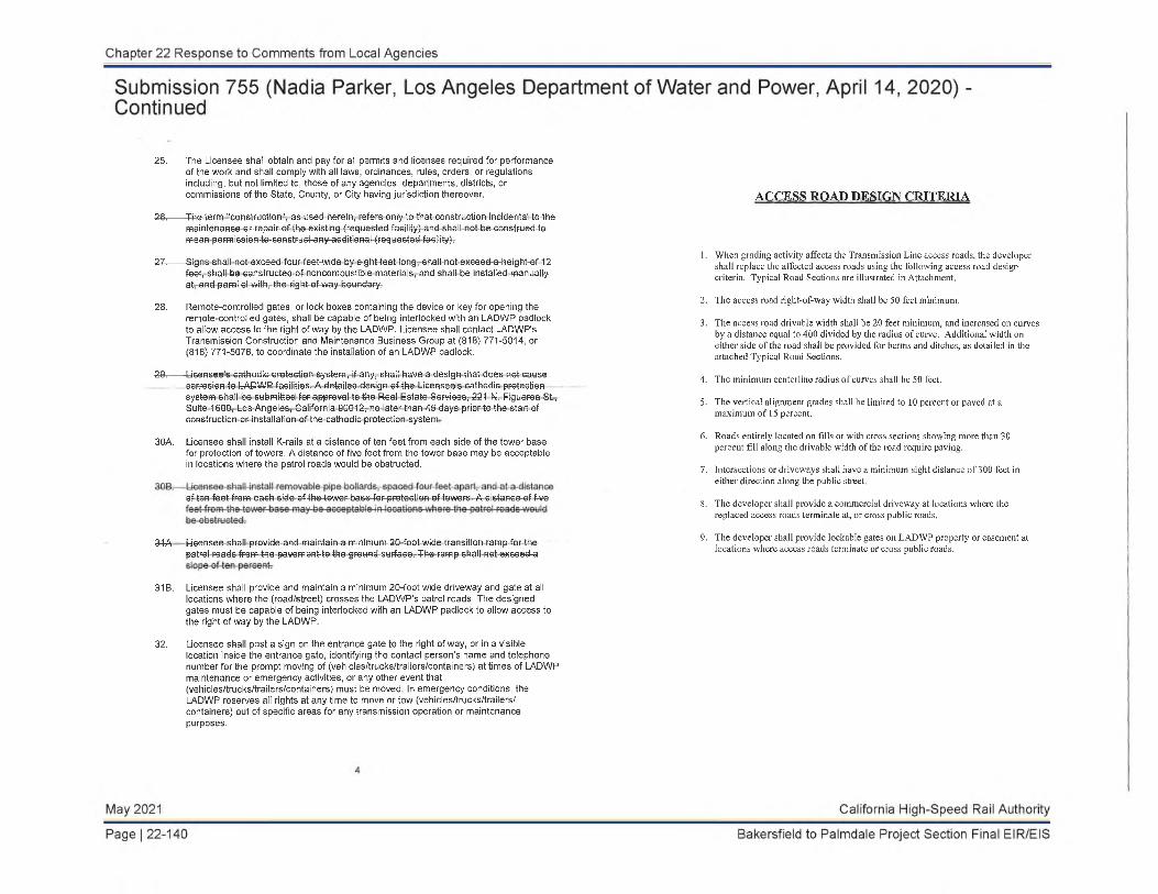
25. The Licensee shall obtain and pay for all permits and licenses required for performance of the work and shall comply with all laws, ordinances, rules, orders, or regulations including, but not limited to, those of any agencies, departments, districts, or commissions of the State, County, or City having jurisdiction thereover.
26. The term "construction", as used-herein, refers only to that construction incidental to themaintenance or-repair of the-existing (requested-facility) and shall not be-construed-to mean permission-to-construct-any-additional (requested facility).
27. Signs shall not exceed four feet-wide by eight feet long, shall not exceed-a-height-of 12feet, shall be constructed of noncombustible materials, and-shall be-installed manually at, and parallel with, the right of-way boundary.
28. Remote-controlled gates, or lock boxes containing the device or key for opening the remote-controlled gates, shall be capable of being interlocked with an LADWP padlock to allow access to the right of way by the LADWP. Licensee shall contact LADWP's Transmission Construction and Maintenance Business Group at (818) 771-5014, or (818) 771-5076, to coordinate the installation of an LADWP padlock.
28. Licensee's cathodic protection system, if any, shall have a design that does net causecorrosion to LADWP facilities. A detailed design of the Licensee's cathodic protection system shall be submitted for approval to the Real Estate Services, 221 N. Figueroa St., Suite 1600, Los Angeles, California 90012, no later than 45 days prior to the start of construction or installation of the cathodic protection system.
30A. Licensee shall install K-rails at a distance of ten feet from each side of the tower base for protection of towers. A distance of five feet from the tower base may be acceptable in locations where the patrol roads would be obstructed.
of ten feet from each side of-the-tower base-for- protection of towers. A distance-of five
34A Licensee shall provide and maintain a-minimum-20-foot-wide transition ramp for-the patrol roads from the pavement-to the ground surface. The ramp shall not exceed-a
31B. Licensee shall provide and maintain a minimum 20-foot wide driveway and gate at all locations where the (road/street) crosses the LADWP's patrol roads. The designed gates must be capable of being interlocked with an LADWP padlock to allow access to the right of way by the LADWP.
32. Licensee shall post a sign on the entrance gate to the right of way, or in a visiblelocation inside the entrance gate, identifying the contact person's name and telephone number for the prompt moving of (vehicles/trucks/trailers/containers) at times of LADWP maintenance or emergency activities, or any other event that (vehicles/trucks/trailers/containers) must be moved. In emergency conditions, the LADWP reserves all rights at any time to move or tow (vehicles/trucks/trailers/ containers) out of specific areas for any transmission operation or maintenance purposes.
ACCESS ROAD DESIGN CRITERIA
1. When grading activity affects the Transmission Line access roads, the developer shall replace the affected access roads using the following access road design criteria. Typical Road Sections are illustrated in Attachment.
2. The access road right-of-way width shall be 50 feet minimum.
3. The access road drivable width shall be 20 feet minimum, and increased on curves by a distance equal to 400 divided by the radius of curve. Additional width on either side of the road shall be provided for berms and ditches, as detailed in the attached Typical Road Sections.
4. The minimum centerline radius of curves shall be 50 feet.
5. The vertical alignment grades shall be limited to 10 percent or paved at a maximum of 15 percent.
6. Roads entirely located on fills or with cross sections showing more than 30 percent fill along the drivable width of the road require paving.
7. Intersections or driveways shall have a minimum sight distance of 300 feet in either direction along the public street.
8. The developer shall provide a commercial driveway at locations where thereplaced access roads terminate at, or cross public roads.
9. The developer shall provide lockable gates on LADWP property or easement at locations where access roads terminate or cross public roads.

NOTES:1. CUT SLOPE SHALL NOT EXCEED THE FOLLOWING:
A. 2 HORIZONTAL TO 1 VERTICAL IN LOOSE OR UNSTABLE MATERIAL.B. 1 HORIZONTAL TO 1 VERTICAL IN COMPACTED MATERIAL.C. 1/2 HORIZONTAL TO 1 VERTICAL IN SOLID ROCK.
2. ALL FILL SLOPES SHALL BE 2 HORIZONTAL TO 1 VERTICAL OR FLATTER.
3. WHERE SOLID ROCK IS ENCOUNTERED THE 4" CROWN AND. OR SIDE DITCHES MAY BE ELIMINATED WHERE DIRECTED BY THE ENGINEER.
CONDUCTOR SURVEY DEPARTMENT OF WATER AND POWER
OVERHEAD TRANSMISSION ENGINEERING
Please perform a survey of each Department transmission line affected by the project.For each span (the section of wire between two (2) towers) provide the following information:
1. The tower numbers of the Department transmission lines related to the span. The tower number is located near ground level on at least one (1) leg of each tower.
2. Survey the top-of-concrete of each footing of each tower related to this survey. For example, a survey involving one (1) span would involve two (2) towers, each with four (4) footings, for a total of eight (8) top-of-concrete shots.
3. Survey at least eight (8) points along the span - the two (2) points where the insulator attaches to the tower, the two (2) points where the wire attaches to the insulator, and four (4) additional points along the wire (preferred spacing of 200 - 300 feet). See attached Conductor Attachments Points for additional information. Include additional points where special features of the proposed improvements cross the transmission line (such as high points, street lights, signs, etc.). For each point provide the following information:
a. The northing and easting coordinates and elevations o f conductor and ground points
b. The elevation of the wirec. The existing ground coordinates and elevationd. The proposed ground elevatione. Date and Timef. Temperatureg. Sunlight (sunny, partly cloudy, or cloudy)h. Approximate wind speed
Important: All eight (8) wire shots on each individual span shall be completed within one (1) hour after the first wire shot is made. Failure to comply with this requirement will render data useless.
* See attached Data Sheet for sample of submittal document.
Updated:01/17/2013
Chapter 22 Response to Comments from Local Agencies
Submission 755 (Nadia Parker, Los Angeles Department of Water and Power, April 14, 2020) -Continued
May 2021 California High-Speed Rail Authority
Page | 22-142 Bakersfield to Palmdale Project Section Final EIR/EIS

LOS ANGELES DEPARTMENT OF WATER AND POWER TRANSMISSION LINE CONDUCTOR CLEARANCE SURVEY DATA SHEET
SURVEYED BY:
PAGE:
TRANSMISSION LINE R/W: BENCHMARK:
DESCRIPTION(TWR#, FOOTING, COND ATTACHMENT POINT,
CONDUCTOR, GROUND, ETC.)SPAN NUMBER NORTHING EASTING ELEVATION
PROPOSEDIMPROV.ELEV.
SURVEYDATE TIME TEMP. SKY COND. WIND
SPEED
Chapter 22 Response to Comments from Local Agencies
Submission 755 (Nadia Parker, Los Angeles Department of Water and Power, April 14, 2020) -Continued
May 2021 California High-Speed Rail Authority
Page | 22-144 Bakersfield to Palmdale Project Section Final EIR/EIS

Chapter 22 Response to Comments from Local Agencies
Response to Submission 755 (Nadia Parker, Los Angeles Department of Water and Power, April 14,2020)
755-908
Refer to Response to Comment 725-839, contained in this chapter.
755-909
Refer to Response to Comment 725-840, contained in this chapter.
755-910
Refer to Response to Comment 725-841, contained in this chapter.
755-911
Refer to Response to Comment 725-842, contained in this chapter.
755-912
Refer to Response to Comment 725-843, contained in this chapter.
California High-Speed Rail Authority May 2021
Bakersfield to Palmdale Project Section Final EIR/EIS Page | 22-145

Chapter 22 Response to Comments from Local Agencies
Submission 758 (Arthur Sohikian, North Los Angeles County Transportation Coalition JPA, April23, 2020)
Bakersfield - Palmdale - RECORD #758 DETAIL Status : Action Pending Record Date : 4/23/2020 Response Requested : Affiliation Type : Local Agency Submission Date : 4/23/2020 Interest As : Local Agency Submission Method : Website First Name : Arthur Last Name : Sohikian Professional Title : Executive Director Business/Organization : North Los Angeles County Transportation Coalition JPA Address : Apt./Suite No. : City : Lancaster State : CA Zip Code : 93534 Telephone : 2136294287 Email : [email protected] Cell Phone : Email Subscription : Bakersfield to Palmdale
, Los Angeles to Anaheim, Burbank to Los Angeles, Palmdale to Burbank, Board of Directors, Press Releases, Southern California
Add to Mailing List : Yes Stakeholder Comments/Issues :
Hi Attached remarks submitted on behalf of the North Los Angeles County Transportation Coalition JPA. Arthur Sohikian Executive Director EIR/EIS Comment : Yes Attachments : NCTCHSRBakersfieldtoPalmdalePublicHearingCommentsApril232020.pdf
(133 kb)
Remarks by NCTC JPA Executive Director Arthur Sohikian to the California High-Speed Rail Authority Draft Project Environmental Impact Report/Environmental Impact Statement Bakersfield to Palmdale Section Virtual Public Hearing, April 23, 2020, 3-8pm.
Dear Mr. Kelly and CHSRA Staff:
758-181 On behalf of the North Los Angeles County Transportation Coalition JPA (NCTC), I speak in support of the Bakersfield to Palmdale Section of the California High-Speed Rail Project.
The NCTC JPA, representing Los Angeles County 5th District North LA County region, City of Palmdale, City of Lancaster, and the City of Santa Clarita, voted their unanimous support for this section at their July 22, 2019 Board of Governors meeting and we appreciate the working relationship with CHSRA Staff.
758-182 The NCTC supports Alternative 2 with CCNM (Cesar Chavez National Monument) Design Options as depicted n the Draft Project Environmental Impact Report/Environmental Impact Statement (DEIR/DEIS). i
With the release of the DEIR/DEIS Bakersfield to Palmdale Section on February 28, 2020, the Cities of Lancaster and Palmdale and the Los Angeles County Public Works & Regional Planning Departments have additional detailed comments and/or mitigation requests.
758-183
The NCTC JPA strongly urges the CHSRA Staff carefully consider Lancaster, Palmdale and LA County Public Works & Regional Planning comments and mitigation requests as you prepare the Final Bakersfield to Palmdale Section EIR/EIS.
In closing, CalSTA announced this week the Transit and Intercity Rail Capital Program, TIRCP, $107 million Grant Award to the Metro/Metrolink Antelope Valley Line Capital and Service Improvements project (AVL). The NCTC JPA Board has allocated over $116 million, roughly 53% of the total $220.85 million AVL Improvement project costs. As a funding partner, the NCTC has been working with Metro, Metrolink and CalSTA on the projects including the Lancaster Terminal Improvements at the Lancaster Metrolink station.
The NCTC strongly urges CHSRA Staff collaborate with Metro and Metrolink on the Lancaster Metrolink Station Terminal Improvements to avoid duplicative efforts and potential expensive delays.
We look forward to working with you and your staff throughout the environmental clearance process to make high-speed rail a reality for North Los Angeles County. You can contact me at [email protected] or at (213) 379-1551.
Thank You, Arthur V. Sohikian Executive Director North County Transportation Coalition JPA CC: NCTC JPA Board of Governors
CHSRA Board of Directors Metro Regional Rail and Countywide Planning Metrolink Strategic Planning
North County Transportation Coalition JPA 44933 N. Fern Avenue,
www.northcountytransportationcoalition.org c/o City of Lancaster, Lancaster CA 93534
May 2021 California High-Speed Rail Authority
Page | 22-146 Bakersfield to Palmdale Project Section Final EIR/EIS

Chapter 22 Response to Comments from Local Agencies
Response to Submission 758 (Arthur Sohikian, North Los Angeles County Transportation CoalitionJPA, April 23, 2020)
758-181
The commenter’s support of the Bakersfield to Palmdale Project Section of the HSR project, and specifically the Preferred Alternative, is acknowledged.
758-182
The commenter’s support of Alternative 2 is acknowledged.
758-183
The commenter encourages the Authority to consider comments and mitigation requests from Lancaster, Palmdale, and Los Angeles County. The commenter also encourages the Authority to collaborate with the Los Angeles County Metropolitan Transportation Authority (Metro) and Metrolink on the Lancaster Metrolink Station Terminal Improvements to avoid duplication of effort and delays.
The Authority has reviewed, considered and responded in this Final EIR/EIS to all comments received on the Draft EIR/EIS. Please see the responses to the individual comments submitted by Lancaster, Palmdale, and Los Angeles County to see how the Authority has considered their comments and recommended mitigation. The Authority has worked closely with these and other government agencies, businesses, and individuals during the planning and design of the B-P Project Section Build Alternatives. Chapter 9, Public and Agency Involvement, of this Final EIR/EIS documents local public agency involvement activities from April 2009 to the release of this Final EIR/EIS (refer to Table 9-1). The Authority will continue to closely coordinate with the public and private sectors during the remainder of the environmental review process and subsequent phases of the project (final design, right-of-way acquisition, regulatory permitting, etc.). These coordination efforts will include coordination with all parties involved in the implementation of the Lancaster Metrolink Station Terminal Improvements to avoid duplication of efforts, unnecessary expenditures, and schedule delays for both projects.
California High-Speed Rail Authority May 2021
Bakersfield to Palmdale Project Section Final EIR/EIS Page | 22-147

Chapter 22 Response to Comments from Local Agencies
Submission 695 (Adriana Raza, SANITATION DISTRICTS OF LOS ANGELES COUNTY, March 9, 2020)
Bakersfield - Palmdale - RECORD #695 DETAIL Status : Action Pending Record Date : 3/9/2020 Response Requested : Affiliation Type : Local Agency Submission Date : 3/9/2020 Interest As : Local Agency Submission Method : Project Email First Name : Adriana Last Name : Raza Professional Title : Customer Service Specialist | Facilities Planning Department Business/Organization : SANITATION DISTRICTS OF LOS ANGELES COUNTY Address : Apt./Suite No. : City : State : CA Zip Code : 0000 Telephone : Email : [email protected] Cell Phone : Email Subscription : Add to Mailing List : Stakeholder Comments/Issues :
Good morning,
695-250 I'm in the process of reviewing the subject DEIR but, I was wondering where you can find a figure that presents all the proposed alignments. Please advise.
Adriana Raza Customer Service Specialist | Facilities Planning Department 562-908-4288 ext. 2717 | [email protected]<mailto:[email protected]> [/Users/paulmccarty/Library/Containers/com.microsoft.Outlook/Data/Library/Caches/Signatures/signature_1024 133388] SANITATION DISTRICTS OF LOS ANGELES COUNTY [signature_1110506149] <https://www.facebook.com/SanitationDistrictsLACounty> [signature_1128252600] <https://twitter.com/SanDistricts> Converting Waste Into Resources | www.LACSD.org<http://www.lacsd.org/>
EIR/EIS Comment : Yes
May 2021 California High-Speed Rail Authority
Page | 22-148 Bakersfield to Palmdale Project Section Final EIR/EIS

Chapter 22 Response to Comments from Local Agencies
Response to Submission 695 (Adriana Raza, SANITATION DISTRICTS OF LOS ANGELES COUNTY, March 9,2020)
695-250
Figure 2-1 of this Bakersfield to Palmdale Project Section Final EIR/EIS provides a high-level perspective of the B-P Build Alternatives. Figures 2-55 through 2-62 of this Final EIR/EIS provide graphical depictions of the differences between the B-P Build Alternatives, and Section 2.4.2.4 of this Final EIR/EIS provides a written comparison the B-P Build Alternatives.
California High-Speed Rail Authority May 2021
Bakersfield to Palmdale Project Section Final EIR/EIS Page | 22-149